

Hail Map for Dayton, TN
The Dayton, TN area has had 3 reports of on-the-ground hail by trained spotters, and has been under severe weather warnings 37 times during the past 12 months. Doppler radar has detected hail at or near Dayton, TN on 57 occasions, including 6 occasions during the past year.
| Name: | Dayton, TN |
| Where Located: | 34.9 miles NNE of Chattanooga, TN |
| Map: | Google Map for Dayton, TN |
| Population: | 7191 |
| Housing Units: | 2907 |
| More Info: | Search Google for Dayton, TN |
2
The Top Recent Hail Date for Dayton, TN is Tuesday, July 30, 2024 (10th out of 57)

Hail and Wind Damage Spotted near Dayton, TN
| Date / Time | Report Details |
|---|---|
| 6/7/2025 4:14 PM CDT |
 The storms which prompted the warning have weakened below severe limits, and no longer pose an immediate threat to life or property. therefore, the warning will be allowed to expire. however, gusty winds are still possible with these thunderstorms. a severe thunderstorm watch remains in effect until 900 pm edt/800 pm cdt/ for east tennessee. The storms which prompted the warning have weakened below severe limits, and no longer pose an immediate threat to life or property. therefore, the warning will be allowed to expire. however, gusty winds are still possible with these thunderstorms. a severe thunderstorm watch remains in effect until 900 pm edt/800 pm cdt/ for east tennessee.
|
| 6/7/2025 4:02 PM CDT |
 At 502 pm edt/402 pm cdt/, severe thunderstorms were located along a line extending from near pikeville to 9 miles west of dayton, moving northeast at 50 mph (radar indicated). Hazards include 60 mph wind gusts. Expect damage to roofs, siding, and trees. Locations impacted include, dayton, pikeville, soddy-daisy, graysville, flat top mountain, mount crest, big spring, sale creek, palio, and brayton. At 502 pm edt/402 pm cdt/, severe thunderstorms were located along a line extending from near pikeville to 9 miles west of dayton, moving northeast at 50 mph (radar indicated). Hazards include 60 mph wind gusts. Expect damage to roofs, siding, and trees. Locations impacted include, dayton, pikeville, soddy-daisy, graysville, flat top mountain, mount crest, big spring, sale creek, palio, and brayton.
|
| 6/7/2025 4:02 PM CDT |
 the severe thunderstorm warning has been cancelled and is no longer in effect the severe thunderstorm warning has been cancelled and is no longer in effect
|
| 6/7/2025 3:47 PM CDT |
 At 446 pm edt/346 pm cdt/, severe thunderstorms were located along a line extending from 13 miles northeast of gruetli-laager to dunlap, moving northeast at 50 mph (radar indicated). Hazards include 60 mph wind gusts. Expect damage to roofs, siding, and trees. Locations impacted include, dayton, dunlap, pikeville, soddy-daisy, graysville, flat top mountain, mount crest, big spring, sale creek, and palio. At 446 pm edt/346 pm cdt/, severe thunderstorms were located along a line extending from 13 miles northeast of gruetli-laager to dunlap, moving northeast at 50 mph (radar indicated). Hazards include 60 mph wind gusts. Expect damage to roofs, siding, and trees. Locations impacted include, dayton, dunlap, pikeville, soddy-daisy, graysville, flat top mountain, mount crest, big spring, sale creek, and palio.
|
| 6/7/2025 3:33 PM CDT |
 Svrmrx the national weather service in morristown has issued a * severe thunderstorm warning for, southwestern rhea county in east tennessee, southwestern meigs county in east tennessee, sequatchie county in east tennessee, bledsoe county in east tennessee, northeastern hamilton county in east tennessee, * until 515 pm edt/415 pm cdt/. * at 433 pm edt/333 pm cdt/, severe thunderstorms were located along a line extending from 6 miles north of gruetli-laager to 7 miles north of whitwell, moving east at 55 mph (radar indicated). Hazards include 60 mph wind gusts. expect damage to roofs, siding, and trees Svrmrx the national weather service in morristown has issued a * severe thunderstorm warning for, southwestern rhea county in east tennessee, southwestern meigs county in east tennessee, sequatchie county in east tennessee, bledsoe county in east tennessee, northeastern hamilton county in east tennessee, * until 515 pm edt/415 pm cdt/. * at 433 pm edt/333 pm cdt/, severe thunderstorms were located along a line extending from 6 miles north of gruetli-laager to 7 miles north of whitwell, moving east at 55 mph (radar indicated). Hazards include 60 mph wind gusts. expect damage to roofs, siding, and trees
|
| 6/6/2025 6:21 PM EDT |
 the severe thunderstorm warning has been cancelled and is no longer in effect the severe thunderstorm warning has been cancelled and is no longer in effect
|
| 6/6/2025 6:21 PM EDT |
 At 620 pm edt/520 pm cdt/, a severe thunderstorm was located 7 miles south of pikeville, moving northeast at 20 mph (radar indicated). Hazards include 60 mph wind gusts. Expect damage to roofs, siding, and trees. Locations impacted include, dayton, pikeville, graysville, sale creek, brayton, big spring, and flat top mountain. At 620 pm edt/520 pm cdt/, a severe thunderstorm was located 7 miles south of pikeville, moving northeast at 20 mph (radar indicated). Hazards include 60 mph wind gusts. Expect damage to roofs, siding, and trees. Locations impacted include, dayton, pikeville, graysville, sale creek, brayton, big spring, and flat top mountain.
|
| 6/6/2025 4:58 PM CDT |
 Svrmrx the national weather service in morristown has issued a * severe thunderstorm warning for, southwestern rhea county in east tennessee, southwestern meigs county in east tennessee, northeastern sequatchie county in east tennessee, central bledsoe county in east tennessee, northeastern hamilton county in east tennessee, * until 645 pm edt/545 pm cdt/. * at 557 pm edt/457 pm cdt/, a severe thunderstorm was located 8 miles northeast of dunlap, moving northeast at 20 mph (radar indicated). Hazards include 60 mph wind gusts. expect damage to roofs, siding, and trees Svrmrx the national weather service in morristown has issued a * severe thunderstorm warning for, southwestern rhea county in east tennessee, southwestern meigs county in east tennessee, northeastern sequatchie county in east tennessee, central bledsoe county in east tennessee, northeastern hamilton county in east tennessee, * until 645 pm edt/545 pm cdt/. * at 557 pm edt/457 pm cdt/, a severe thunderstorm was located 8 miles northeast of dunlap, moving northeast at 20 mph (radar indicated). Hazards include 60 mph wind gusts. expect damage to roofs, siding, and trees
|
| 5/20/2025 9:19 PM EDT |
 At 918 pm edt, a severe thunderstorm capable of producing a tornado was located near dayton, moving northeast at 40 mph (radar indicated rotation). Hazards include tornado. Flying debris will be dangerous to those caught without shelter. mobile homes will be damaged or destroyed. damage to roofs, windows, and vehicles will occur. tree damage is likely. this dangerous storm will be near, decatur around 925 pm edt. other locations impacted by this tornadic thunderstorm include evensville, peakland, clear water, murray store, old washington, ten mile, and niota. This includes interstate 75 in tennessee between mile markers 53 and 57. At 918 pm edt, a severe thunderstorm capable of producing a tornado was located near dayton, moving northeast at 40 mph (radar indicated rotation). Hazards include tornado. Flying debris will be dangerous to those caught without shelter. mobile homes will be damaged or destroyed. damage to roofs, windows, and vehicles will occur. tree damage is likely. this dangerous storm will be near, decatur around 925 pm edt. other locations impacted by this tornadic thunderstorm include evensville, peakland, clear water, murray store, old washington, ten mile, and niota. This includes interstate 75 in tennessee between mile markers 53 and 57.
|
| 5/20/2025 9:09 PM EDT |
 Tormrx the national weather service in morristown has issued a * tornado warning for, southern rhea county in east tennessee, meigs county in east tennessee, northwestern mcminn county in east tennessee, * until 1000 pm edt. * at 909 pm edt, a severe thunderstorm capable of producing a tornado was located over dayton, moving northeast at 40 mph (radar indicated rotation). Hazards include tornado. Flying debris will be dangerous to those caught without shelter. mobile homes will be damaged or destroyed. damage to roofs, windows, and vehicles will occur. tree damage is likely. this dangerous storm will be near, dayton around 915 pm edt. decatur around 925 pm edt. other locations impacted by this tornadic thunderstorm include evensville, peakland, clear water, murray store, old washington, ten mile, graysville, niota, and sale creek. This includes interstate 75 in tennessee between mile markers 53 and 57. Tormrx the national weather service in morristown has issued a * tornado warning for, southern rhea county in east tennessee, meigs county in east tennessee, northwestern mcminn county in east tennessee, * until 1000 pm edt. * at 909 pm edt, a severe thunderstorm capable of producing a tornado was located over dayton, moving northeast at 40 mph (radar indicated rotation). Hazards include tornado. Flying debris will be dangerous to those caught without shelter. mobile homes will be damaged or destroyed. damage to roofs, windows, and vehicles will occur. tree damage is likely. this dangerous storm will be near, dayton around 915 pm edt. decatur around 925 pm edt. other locations impacted by this tornadic thunderstorm include evensville, peakland, clear water, murray store, old washington, ten mile, graysville, niota, and sale creek. This includes interstate 75 in tennessee between mile markers 53 and 57.
|
| 5/20/2025 9:00 PM EDT |
 At 900 pm edt/800 pm cdt/, a severe thunderstorm was located 8 miles west of dayton, moving northeast at 30 mph (radar indicated). Hazards include 60 mph wind gusts and half dollar size hail. Hail damage to vehicles is expected. expect wind damage to roofs, siding, and trees. Locations impacted include, brayton, sale creek, graysville, big spring, and dayton. At 900 pm edt/800 pm cdt/, a severe thunderstorm was located 8 miles west of dayton, moving northeast at 30 mph (radar indicated). Hazards include 60 mph wind gusts and half dollar size hail. Hail damage to vehicles is expected. expect wind damage to roofs, siding, and trees. Locations impacted include, brayton, sale creek, graysville, big spring, and dayton.
|
| 5/20/2025 9:00 PM EDT |
 the severe thunderstorm warning has been cancelled and is no longer in effect the severe thunderstorm warning has been cancelled and is no longer in effect
|
| 5/20/2025 7:41 PM CDT | At 841 pm edt/741 pm cdt/, a severe thunderstorm was located near dunlap, moving northeast at 30 mph (radar indicated). Hazards include 60 mph wind gusts and half dollar size hail. Hail damage to vehicles is expected. expect wind damage to roofs, siding, and trees. Locations impacted include, flat top mountain, graysville, big spring, dayton, sale creek, dunlap, palio, brayton, birchwood, and mowbray mountain. |
| 5/20/2025 7:25 PM CDT |
 Svrmrx the national weather service in morristown has issued a * severe thunderstorm warning for, southwestern rhea county in east tennessee, southwestern meigs county in east tennessee, sequatchie county in east tennessee, western bledsoe county in east tennessee, northeastern hamilton county in east tennessee, * until 915 pm edt/815 pm cdt/. * at 825 pm edt/725 pm cdt/, a severe thunderstorm was located near dunlap, moving northeast at 30 mph (radar indicated). Hazards include 60 mph wind gusts and half dollar size hail. Hail damage to vehicles is expected. Expect wind damage to roofs, siding, and trees. Svrmrx the national weather service in morristown has issued a * severe thunderstorm warning for, southwestern rhea county in east tennessee, southwestern meigs county in east tennessee, sequatchie county in east tennessee, western bledsoe county in east tennessee, northeastern hamilton county in east tennessee, * until 915 pm edt/815 pm cdt/. * at 825 pm edt/725 pm cdt/, a severe thunderstorm was located near dunlap, moving northeast at 30 mph (radar indicated). Hazards include 60 mph wind gusts and half dollar size hail. Hail damage to vehicles is expected. Expect wind damage to roofs, siding, and trees.
|
| 5/20/2025 7:02 PM EDT | At 701 pm edt, a severe thunderstorm was located 7 miles south of dayton, moving east at 25 mph (law enforcement. at 655pm edt 911 call center report trees down in northern hamilton county). Hazards include 60 mph wind gusts and quarter size hail. Hail damage to vehicles is expected. expect wind damage to roofs, siding, and trees. Locations impacted include, birchwood, big spring, graysville, dayton, and sale creek. |
| 5/20/2025 6:42 PM EDT |
 Svrmrx the national weather service in morristown has issued a * severe thunderstorm warning for, southwestern rhea county in east tennessee, north central bradley county in east tennessee, southwestern meigs county in east tennessee, northeastern hamilton county in east tennessee, * until 730 pm edt. * at 642 pm edt, a severe thunderstorm was located 8 miles north of soddy-daisy, or 11 miles southwest of dayton, moving east at 25 mph (radar indicated). Hazards include 60 mph wind gusts and penny size hail. expect damage to roofs, siding, and trees Svrmrx the national weather service in morristown has issued a * severe thunderstorm warning for, southwestern rhea county in east tennessee, north central bradley county in east tennessee, southwestern meigs county in east tennessee, northeastern hamilton county in east tennessee, * until 730 pm edt. * at 642 pm edt, a severe thunderstorm was located 8 miles north of soddy-daisy, or 11 miles southwest of dayton, moving east at 25 mph (radar indicated). Hazards include 60 mph wind gusts and penny size hail. expect damage to roofs, siding, and trees
|
| 5/12/2025 6:24 PM EDT |
 At 623 pm edt, a severe thunderstorm was located near decatur, moving northeast at 15 mph (trained weather spotters). Hazards include 60 mph wind gusts and quarter size hail. Hail damage to vehicles is expected. expect wind damage to roofs, siding, and trees. Locations impacted include, decatur, evensville, spring city, peakland, stinging fork falls state park, murray store, old washington, piney falls state park, ten mile, and grandview. At 623 pm edt, a severe thunderstorm was located near decatur, moving northeast at 15 mph (trained weather spotters). Hazards include 60 mph wind gusts and quarter size hail. Hail damage to vehicles is expected. expect wind damage to roofs, siding, and trees. Locations impacted include, decatur, evensville, spring city, peakland, stinging fork falls state park, murray store, old washington, piney falls state park, ten mile, and grandview.
|
| 5/12/2025 6:24 PM EDT |
 the severe thunderstorm warning has been cancelled and is no longer in effect the severe thunderstorm warning has been cancelled and is no longer in effect
|
| 5/12/2025 6:08 PM EDT |
 Svrmrx the national weather service in morristown has issued a * severe thunderstorm warning for, rhea county in east tennessee, north central bradley county in east tennessee, meigs county in east tennessee, northwestern mcminn county in east tennessee, * until 715 pm edt. * at 608 pm edt, a severe thunderstorm was located near dayton, moving northeast at 15 mph (trained weather spotters). Hazards include 60 mph wind gusts and half dollar size hail. Hail damage to vehicles is expected. Expect wind damage to roofs, siding, and trees. Svrmrx the national weather service in morristown has issued a * severe thunderstorm warning for, rhea county in east tennessee, north central bradley county in east tennessee, meigs county in east tennessee, northwestern mcminn county in east tennessee, * until 715 pm edt. * at 608 pm edt, a severe thunderstorm was located near dayton, moving northeast at 15 mph (trained weather spotters). Hazards include 60 mph wind gusts and half dollar size hail. Hail damage to vehicles is expected. Expect wind damage to roofs, siding, and trees.
|
| 5/12/2025 6:03 PM EDT |
 At 602 pm edt, a severe thunderstorm was located 7 miles southeast of dayton, moving north at 15 mph (emergency dispatch has reported wind damage with this storm). Hazards include 60 mph wind gusts and half dollar size hail. Hail damage to vehicles is expected. expect wind damage to roofs, siding, and trees. Locations impacted include, evensville, old washington, birchwood, big spring, dayton, sale creek, and graysville. At 602 pm edt, a severe thunderstorm was located 7 miles southeast of dayton, moving north at 15 mph (emergency dispatch has reported wind damage with this storm). Hazards include 60 mph wind gusts and half dollar size hail. Hail damage to vehicles is expected. expect wind damage to roofs, siding, and trees. Locations impacted include, evensville, old washington, birchwood, big spring, dayton, sale creek, and graysville.
|
| 5/12/2025 5:47 PM EDT |
 At 547 pm edt, a severe thunderstorm was located 10 miles south of dayton, moving northeast at 25 mph (emergency dispatch has reported multiple locations of wind damage with this storm). Hazards include 60 mph wind gusts and quarter size hail. Hail damage to vehicles is expected. expect wind damage to roofs, siding, and trees. Locations impacted include, evensville, sale creek, old washington, birchwood, graysville, big spring, dayton, and soddy-daisy. At 547 pm edt, a severe thunderstorm was located 10 miles south of dayton, moving northeast at 25 mph (emergency dispatch has reported multiple locations of wind damage with this storm). Hazards include 60 mph wind gusts and quarter size hail. Hail damage to vehicles is expected. expect wind damage to roofs, siding, and trees. Locations impacted include, evensville, sale creek, old washington, birchwood, graysville, big spring, dayton, and soddy-daisy.
|
| 5/12/2025 5:36 PM EDT |
 Svrmrx the national weather service in morristown has issued a * severe thunderstorm warning for, southwestern rhea county in east tennessee, southwestern meigs county in east tennessee, northeastern hamilton county in east tennessee, * until 615 pm edt. * at 536 pm edt, a severe thunderstorm was located 7 miles east of soddy-daisy, or 12 miles northwest of cleveland, moving northeast at 15 mph (emergency management). Hazards include 60 mph wind gusts and half dollar size hail. Hail damage to vehicles is expected. Expect wind damage to roofs, siding, and trees. Svrmrx the national weather service in morristown has issued a * severe thunderstorm warning for, southwestern rhea county in east tennessee, southwestern meigs county in east tennessee, northeastern hamilton county in east tennessee, * until 615 pm edt. * at 536 pm edt, a severe thunderstorm was located 7 miles east of soddy-daisy, or 12 miles northwest of cleveland, moving northeast at 15 mph (emergency management). Hazards include 60 mph wind gusts and half dollar size hail. Hail damage to vehicles is expected. Expect wind damage to roofs, siding, and trees.
|
| 5/2/2025 4:58 PM EDT | The storm which prompted the warning has moved out of the area. therefore, the warning will be allowed to expire. a severe thunderstorm watch remains in effect until 900 pm edt for east tennessee. |
| 5/2/2025 4:42 PM EDT |
 At 441 pm edt, a severe thunderstorm was located 8 miles east of soddy-daisy, or 12 miles northwest of cleveland, moving northeast at 30 mph (radar indicated). Hazards include 60 mph wind gusts and quarter size hail. Hail damage to vehicles is expected. expect wind damage to roofs, siding, and trees. locations impacted include, hillsview, hopewell, lakesite, graysville, big spring, dayton, sale creek, birchwood, shady grove, and soddy-daisy. This includes interstate 75 in tennessee between mile markers 20 and 21. At 441 pm edt, a severe thunderstorm was located 8 miles east of soddy-daisy, or 12 miles northwest of cleveland, moving northeast at 30 mph (radar indicated). Hazards include 60 mph wind gusts and quarter size hail. Hail damage to vehicles is expected. expect wind damage to roofs, siding, and trees. locations impacted include, hillsview, hopewell, lakesite, graysville, big spring, dayton, sale creek, birchwood, shady grove, and soddy-daisy. This includes interstate 75 in tennessee between mile markers 20 and 21.
|
| 5/2/2025 4:14 PM EDT |
 Svrmrx the national weather service in morristown has issued a * severe thunderstorm warning for, southwestern rhea county in east tennessee, northwestern bradley county in east tennessee, southwestern meigs county in east tennessee, west central mcminn county in east tennessee, hamilton county in east tennessee, * until 500 pm edt. * at 413 pm edt, a severe thunderstorm was located over harrison, or near chattanooga, moving northeast at 30 mph (radar indicated). Hazards include 60 mph wind gusts and quarter size hail. Hail damage to vehicles is expected. Expect wind damage to roofs, siding, and trees. Svrmrx the national weather service in morristown has issued a * severe thunderstorm warning for, southwestern rhea county in east tennessee, northwestern bradley county in east tennessee, southwestern meigs county in east tennessee, west central mcminn county in east tennessee, hamilton county in east tennessee, * until 500 pm edt. * at 413 pm edt, a severe thunderstorm was located over harrison, or near chattanooga, moving northeast at 30 mph (radar indicated). Hazards include 60 mph wind gusts and quarter size hail. Hail damage to vehicles is expected. Expect wind damage to roofs, siding, and trees.
|
| 5/2/2025 4:05 PM EDT | Several trees dow in rhea county TN, 5.5 miles SE of Dayton, TN |
| 5/2/2025 3:50 PM EDT | Svrmrx the national weather service in morristown has issued a * severe thunderstorm warning for, rhea county in east tennessee, northeastern bledsoe county in east tennessee, * until 430 pm edt/330 pm cdt/. * at 350 pm edt/250 pm cdt/, a severe thunderstorm was located near dayton, moving northeast at 30 mph (radar indicated). Hazards include 60 mph wind gusts and quarter size hail. Hail damage to vehicles is expected. Expect wind damage to roofs, siding, and trees. |
| 4/10/2025 8:40 PM EDT |
 The storm which prompted the warning has weakened below severe limits, and no longer poses an immediate threat to life or property. therefore, the warning will be allowed to expire. a severe thunderstorm watch remains in effect until midnight edt/1100 pm cdt/ for east tennessee. The storm which prompted the warning has weakened below severe limits, and no longer poses an immediate threat to life or property. therefore, the warning will be allowed to expire. a severe thunderstorm watch remains in effect until midnight edt/1100 pm cdt/ for east tennessee.
|
| 4/10/2025 8:22 PM EDT |
 At 822 pm edt/722 pm cdt/, a severe thunderstorm was located near pikeville, moving east at 35 mph (radar indicated). Hazards include quarter size hail. Damage to vehicles is expected. Locations impacted include, evensville, sale creek, old washington, brayton, birchwood, graysville, pikeville, dayton, and mount crest. At 822 pm edt/722 pm cdt/, a severe thunderstorm was located near pikeville, moving east at 35 mph (radar indicated). Hazards include quarter size hail. Damage to vehicles is expected. Locations impacted include, evensville, sale creek, old washington, brayton, birchwood, graysville, pikeville, dayton, and mount crest.
|
| 4/10/2025 6:48 PM CDT |
 Svrmrx the national weather service in morristown has issued a * severe thunderstorm warning for, southwestern rhea county in east tennessee, southwestern meigs county in east tennessee, central bledsoe county in east tennessee, northeastern hamilton county in east tennessee, * until 845 pm edt/745 pm cdt/. * at 748 pm edt/648 pm cdt/, a severe thunderstorm was located near spencer, moving east at 35 mph (radar indicated). Hazards include half dollar size hail. damage to vehicles is expected Svrmrx the national weather service in morristown has issued a * severe thunderstorm warning for, southwestern rhea county in east tennessee, southwestern meigs county in east tennessee, central bledsoe county in east tennessee, northeastern hamilton county in east tennessee, * until 845 pm edt/745 pm cdt/. * at 748 pm edt/648 pm cdt/, a severe thunderstorm was located near spencer, moving east at 35 mph (radar indicated). Hazards include half dollar size hail. damage to vehicles is expected
|
| 4/10/2025 5:40 PM EDT | Ping Pong Ball sized hail reported 3.6 miles NNE of Dayton, TN, time adjusted for radar... 1.5 inch hail measured just south of dayton... tn. |
| 4/10/2025 5:40 PM EDT | Golf Ball sized hail reported 3 miles NNE of Dayton, TN, hail just under two inches wide fell just south of dayton tn. report relayed via social media. |
| 3/15/2025 9:23 PM EDT |
 The storm which prompted the warning has weakened below severe limits, and has exited the warned area. therefore, the warning will be allowed to expire. however, gusty winds and heavy rain are still possible with this thunderstorm. a tornado watch remains in effect until 100 am edt/midnight cdt/ for east tennessee. The storm which prompted the warning has weakened below severe limits, and has exited the warned area. therefore, the warning will be allowed to expire. however, gusty winds and heavy rain are still possible with this thunderstorm. a tornado watch remains in effect until 100 am edt/midnight cdt/ for east tennessee.
|
| 3/15/2025 8:52 PM EDT |
 Svrmrx the national weather service in morristown has issued a * severe thunderstorm warning for, southwestern rhea county in east tennessee, southeastern sequatchie county in east tennessee, south central bledsoe county in east tennessee, northeastern hamilton county in east tennessee, * until 930 pm edt/830 pm cdt/. * at 851 pm edt/751 pm cdt/, a severe thunderstorm was located near soddy-daisy, or 9 miles southeast of dunlap, moving north at 60 mph (radar indicated). Hazards include 60 mph wind gusts. expect damage to roofs, siding, and trees Svrmrx the national weather service in morristown has issued a * severe thunderstorm warning for, southwestern rhea county in east tennessee, southeastern sequatchie county in east tennessee, south central bledsoe county in east tennessee, northeastern hamilton county in east tennessee, * until 930 pm edt/830 pm cdt/. * at 851 pm edt/751 pm cdt/, a severe thunderstorm was located near soddy-daisy, or 9 miles southeast of dunlap, moving north at 60 mph (radar indicated). Hazards include 60 mph wind gusts. expect damage to roofs, siding, and trees
|
| 3/15/2025 7:34 PM EDT |
 At 734 pm edt, a severe thunderstorm was located 7 miles south of rockwood, moving northeast at 60 mph (radar indicated). Hazards include 60 mph wind gusts and penny size hail. Expect damage to roofs, siding, and trees. Locations impacted include, decatur, evensville, spring city, peakland, murray store, old washington, piney falls state park, grandview, graysville, and ten mile. At 734 pm edt, a severe thunderstorm was located 7 miles south of rockwood, moving northeast at 60 mph (radar indicated). Hazards include 60 mph wind gusts and penny size hail. Expect damage to roofs, siding, and trees. Locations impacted include, decatur, evensville, spring city, peakland, murray store, old washington, piney falls state park, grandview, graysville, and ten mile.
|
| 3/15/2025 7:34 PM EDT |
 the severe thunderstorm warning has been cancelled and is no longer in effect the severe thunderstorm warning has been cancelled and is no longer in effect
|
| 3/15/2025 6:57 PM EDT |
 Svrmrx the national weather service in morristown has issued a * severe thunderstorm warning for, rhea county in east tennessee, meigs county in east tennessee, northwestern mcminn county in east tennessee, northeastern hamilton county in east tennessee, * until 745 pm edt. * at 656 pm edt, a severe thunderstorm was located 7 miles northeast of soddy-daisy, or 12 miles south of dayton, moving northeast at 60 mph (radar indicated). Hazards include 60 mph wind gusts and penny size hail. expect damage to roofs, siding, and trees Svrmrx the national weather service in morristown has issued a * severe thunderstorm warning for, rhea county in east tennessee, meigs county in east tennessee, northwestern mcminn county in east tennessee, northeastern hamilton county in east tennessee, * until 745 pm edt. * at 656 pm edt, a severe thunderstorm was located 7 miles northeast of soddy-daisy, or 12 miles south of dayton, moving northeast at 60 mph (radar indicated). Hazards include 60 mph wind gusts and penny size hail. expect damage to roofs, siding, and trees
|
| 7/30/2024 4:53 PM CDT |
 The storms which prompted the warning have moved out of the area. therefore, the warning will be allowed to expire. however, heavy rain is still possible with these thunderstorms. a severe thunderstorm watch remains in effect until 900 pm edt/800 pm cdt/ for east tennessee. The storms which prompted the warning have moved out of the area. therefore, the warning will be allowed to expire. however, heavy rain is still possible with these thunderstorms. a severe thunderstorm watch remains in effect until 900 pm edt/800 pm cdt/ for east tennessee.
|
| 7/30/2024 5:30 PM EDT | Several trees dow in rhea county TN, 0.2 miles WNW of Dayton, TN |
| 7/30/2024 4:17 PM CDT |
 Svrmrx the national weather service in morristown has issued a * severe thunderstorm warning for, southwestern rhea county in east tennessee, northern bradley county in east tennessee, southwestern meigs county in east tennessee, sequatchie county in east tennessee, bledsoe county in east tennessee, southwestern mcminn county in east tennessee, northeastern hamilton county in east tennessee, * until 600 pm edt/500 pm cdt/. * at 516 pm edt/416 pm cdt/, severe thunderstorms were located along a line extending from 10 miles northwest of spring city to near pikeville to near mcminnville, moving southeast at 40 mph (radar indicated). Hazards include 60 mph wind gusts and penny size hail. expect damage to roofs, siding, and trees Svrmrx the national weather service in morristown has issued a * severe thunderstorm warning for, southwestern rhea county in east tennessee, northern bradley county in east tennessee, southwestern meigs county in east tennessee, sequatchie county in east tennessee, bledsoe county in east tennessee, southwestern mcminn county in east tennessee, northeastern hamilton county in east tennessee, * until 600 pm edt/500 pm cdt/. * at 516 pm edt/416 pm cdt/, severe thunderstorms were located along a line extending from 10 miles northwest of spring city to near pikeville to near mcminnville, moving southeast at 40 mph (radar indicated). Hazards include 60 mph wind gusts and penny size hail. expect damage to roofs, siding, and trees
|
| 7/21/2024 6:53 PM EDT |
 Svrmrx the national weather service in morristown has issued a * severe thunderstorm warning for, south central rhea county in east tennessee, southwestern meigs county in east tennessee, northeastern hamilton county in east tennessee, * until 745 pm edt. * at 653 pm edt, a severe thunderstorm was located 8 miles northeast of soddy-daisy, or 10 miles southwest of dayton, moving east at 15 mph (radar indicated). Hazards include 60 mph wind gusts and penny size hail. expect damage to roofs, siding, and trees Svrmrx the national weather service in morristown has issued a * severe thunderstorm warning for, south central rhea county in east tennessee, southwestern meigs county in east tennessee, northeastern hamilton county in east tennessee, * until 745 pm edt. * at 653 pm edt, a severe thunderstorm was located 8 miles northeast of soddy-daisy, or 10 miles southwest of dayton, moving east at 15 mph (radar indicated). Hazards include 60 mph wind gusts and penny size hail. expect damage to roofs, siding, and trees
|
| 7/17/2024 5:30 PM EDT | Several large trees were blown over near frazier par in rhea county TN, 3.1 miles WNW of Dayton, TN |
| 5/9/2024 4:41 AM CDT |
 At 541 am edt/441 am cdt/, severe thunderstorms were located along a line extending from near pikeville to near dunlap to near whitwell, moving east at 45 mph (radar indicated). Hazards include 60 mph wind gusts and half dollar size hail. Hail damage to vehicles is expected. expect wind damage to roofs, siding, and trees. Locations impacted include, dayton, dunlap, pikeville, soddy-daisy, graysville, flat top mountain, palio, mowbray mountain, stinging fork falls state park, and brayton. At 541 am edt/441 am cdt/, severe thunderstorms were located along a line extending from near pikeville to near dunlap to near whitwell, moving east at 45 mph (radar indicated). Hazards include 60 mph wind gusts and half dollar size hail. Hail damage to vehicles is expected. expect wind damage to roofs, siding, and trees. Locations impacted include, dayton, dunlap, pikeville, soddy-daisy, graysville, flat top mountain, palio, mowbray mountain, stinging fork falls state park, and brayton.
|
| 5/9/2024 5:31 AM EDT |
 Svrmrx the national weather service in morristown has issued a * severe thunderstorm warning for, rhea county in east tennessee, northern bradley county in east tennessee, meigs county in east tennessee, mcminn county in east tennessee, northeastern hamilton county in east tennessee, * until 630 am edt. * at 530 am edt, severe thunderstorms were located along a line extending from 7 miles north of pikeville to 15 miles southeast of spencer to near dunlap, moving east at 45 mph (radar indicated). Hazards include 60 mph wind gusts and quarter size hail. Hail damage to vehicles is expected. Expect wind damage to roofs, siding, and trees. Svrmrx the national weather service in morristown has issued a * severe thunderstorm warning for, rhea county in east tennessee, northern bradley county in east tennessee, meigs county in east tennessee, mcminn county in east tennessee, northeastern hamilton county in east tennessee, * until 630 am edt. * at 530 am edt, severe thunderstorms were located along a line extending from 7 miles north of pikeville to 15 miles southeast of spencer to near dunlap, moving east at 45 mph (radar indicated). Hazards include 60 mph wind gusts and quarter size hail. Hail damage to vehicles is expected. Expect wind damage to roofs, siding, and trees.
|
| 5/9/2024 4:06 AM CDT |
 Svrmrx the national weather service in morristown has issued a * severe thunderstorm warning for, western rhea county in east tennessee, sequatchie county in east tennessee, bledsoe county in east tennessee, north central hamilton county in east tennessee, * until 600 am edt/500 am cdt/. * at 505 am edt/405 am cdt/, severe thunderstorms were located along a line extending from 8 miles west of spencer to 10 miles northwest of gruetli-laager to 7 miles northwest of monteagle, moving east at 45 mph (radar indicated). Hazards include 60 mph wind gusts and half dollar size hail. Hail damage to vehicles is expected. Expect wind damage to roofs, siding, and trees. Svrmrx the national weather service in morristown has issued a * severe thunderstorm warning for, western rhea county in east tennessee, sequatchie county in east tennessee, bledsoe county in east tennessee, north central hamilton county in east tennessee, * until 600 am edt/500 am cdt/. * at 505 am edt/405 am cdt/, severe thunderstorms were located along a line extending from 8 miles west of spencer to 10 miles northwest of gruetli-laager to 7 miles northwest of monteagle, moving east at 45 mph (radar indicated). Hazards include 60 mph wind gusts and half dollar size hail. Hail damage to vehicles is expected. Expect wind damage to roofs, siding, and trees.
|
| 5/8/2024 9:42 PM CDT |
 At 1042 pm edt/942 pm cdt/, a severe thunderstorm was located near soddy-daisy, or 12 miles east of dunlap, moving east at 40 mph (radar indicated). Hazards include 70 mph wind gusts and ping pong ball size hail. People and animals outdoors will be injured. expect hail damage to roofs, siding, windows, and vehicles. expect considerable tree damage. wind damage is also likely to mobile homes, roofs, and outbuildings. Locations impacted include, chattanooga, dunlap, soddy-daisy, walden, lakesite, fairmount, harrison, graysville, cartwright, and flat top mountain. At 1042 pm edt/942 pm cdt/, a severe thunderstorm was located near soddy-daisy, or 12 miles east of dunlap, moving east at 40 mph (radar indicated). Hazards include 70 mph wind gusts and ping pong ball size hail. People and animals outdoors will be injured. expect hail damage to roofs, siding, windows, and vehicles. expect considerable tree damage. wind damage is also likely to mobile homes, roofs, and outbuildings. Locations impacted include, chattanooga, dunlap, soddy-daisy, walden, lakesite, fairmount, harrison, graysville, cartwright, and flat top mountain.
|
| 5/8/2024 10:41 PM EDT |
 At 1041 pm edt/941 pm cdt/, a severe thunderstorm was located near etowah, or near athens, moving east at 45 mph (radar indicated). Hazards include 70 mph wind gusts and ping pong ball size hail. People and animals outdoors will be injured. expect hail damage to roofs, siding, windows, and vehicles. expect considerable tree damage. wind damage is also likely to mobile homes, roofs, and outbuildings. locations impacted include, cleveland, athens, dayton, decatur, benton, soddy-daisy, etowah, charleston, englewood, and graysville. This includes interstate 75 in tennessee between mile markers 26 and 52. At 1041 pm edt/941 pm cdt/, a severe thunderstorm was located near etowah, or near athens, moving east at 45 mph (radar indicated). Hazards include 70 mph wind gusts and ping pong ball size hail. People and animals outdoors will be injured. expect hail damage to roofs, siding, windows, and vehicles. expect considerable tree damage. wind damage is also likely to mobile homes, roofs, and outbuildings. locations impacted include, cleveland, athens, dayton, decatur, benton, soddy-daisy, etowah, charleston, englewood, and graysville. This includes interstate 75 in tennessee between mile markers 26 and 52.
|
| 5/8/2024 8:57 PM CDT |
 Svrmrx the national weather service in morristown has issued a * severe thunderstorm warning for, southwestern rhea county in east tennessee, sequatchie county in east tennessee, southwestern bledsoe county in east tennessee, northeastern marion county in east tennessee, central hamilton county in east tennessee, * until 1100 pm edt/1000 pm cdt/. * at 956 pm edt/856 pm cdt/, a severe thunderstorm was located near gruetli-laager, or 19 miles west of dunlap, moving east at 40 mph (radar indicated). Hazards include 70 mph wind gusts and ping pong ball size hail. People and animals outdoors will be injured. expect hail damage to roofs, siding, windows, and vehicles. expect considerable tree damage. Wind damage is also likely to mobile homes, roofs, and outbuildings. Svrmrx the national weather service in morristown has issued a * severe thunderstorm warning for, southwestern rhea county in east tennessee, sequatchie county in east tennessee, southwestern bledsoe county in east tennessee, northeastern marion county in east tennessee, central hamilton county in east tennessee, * until 1100 pm edt/1000 pm cdt/. * at 956 pm edt/856 pm cdt/, a severe thunderstorm was located near gruetli-laager, or 19 miles west of dunlap, moving east at 40 mph (radar indicated). Hazards include 70 mph wind gusts and ping pong ball size hail. People and animals outdoors will be injured. expect hail damage to roofs, siding, windows, and vehicles. expect considerable tree damage. Wind damage is also likely to mobile homes, roofs, and outbuildings.
|
| 5/8/2024 9:54 PM EDT |
 Svrmrx the national weather service in morristown has issued a * severe thunderstorm warning for, southern rhea county in east tennessee, northern bradley county in east tennessee, meigs county in east tennessee, east central sequatchie county in east tennessee, southwestern bledsoe county in east tennessee, northwestern polk county in east tennessee, mcminn county in east tennessee, northeastern hamilton county in east tennessee, * until 1100 pm edt/1000 pm cdt/. * at 953 pm edt/853 pm cdt/, a severe thunderstorm was located 10 miles west of dayton, moving east at 40 mph (radar indicated). Hazards include 70 mph wind gusts and ping pong ball size hail. People and animals outdoors will be injured. expect hail damage to roofs, siding, windows, and vehicles. expect considerable tree damage. Wind damage is also likely to mobile homes, roofs, and outbuildings. Svrmrx the national weather service in morristown has issued a * severe thunderstorm warning for, southern rhea county in east tennessee, northern bradley county in east tennessee, meigs county in east tennessee, east central sequatchie county in east tennessee, southwestern bledsoe county in east tennessee, northwestern polk county in east tennessee, mcminn county in east tennessee, northeastern hamilton county in east tennessee, * until 1100 pm edt/1000 pm cdt/. * at 953 pm edt/853 pm cdt/, a severe thunderstorm was located 10 miles west of dayton, moving east at 40 mph (radar indicated). Hazards include 70 mph wind gusts and ping pong ball size hail. People and animals outdoors will be injured. expect hail damage to roofs, siding, windows, and vehicles. expect considerable tree damage. Wind damage is also likely to mobile homes, roofs, and outbuildings.
|
| 5/8/2024 8:42 PM CDT |
 At 941 pm edt/841 pm cdt/, a severe thunderstorm was located 8 miles north of soddy-daisy, or 9 miles east of dunlap, moving southeast at 30 mph (radar indicated). Hazards include ping pong ball size hail and 60 mph wind gusts. People and animals outdoors will be injured. expect hail damage to roofs, siding, windows, and vehicles. expect wind damage to roofs, siding, and trees. Locations impacted include, dayton, dunlap, pikeville, soddy-daisy, graysville, flat top mountain, evensville, sale creek, palio, and old washington. At 941 pm edt/841 pm cdt/, a severe thunderstorm was located 8 miles north of soddy-daisy, or 9 miles east of dunlap, moving southeast at 30 mph (radar indicated). Hazards include ping pong ball size hail and 60 mph wind gusts. People and animals outdoors will be injured. expect hail damage to roofs, siding, windows, and vehicles. expect wind damage to roofs, siding, and trees. Locations impacted include, dayton, dunlap, pikeville, soddy-daisy, graysville, flat top mountain, evensville, sale creek, palio, and old washington.
|
| 5/8/2024 7:53 PM CDT |
 Svrmrx the national weather service in morristown has issued a * severe thunderstorm warning for, rhea county in east tennessee, southwestern meigs county in east tennessee, northern sequatchie county in east tennessee, bledsoe county in east tennessee, northeastern hamilton county in east tennessee, * until 1000 pm edt/900 pm cdt/. * at 852 pm edt/752 pm cdt/, a severe thunderstorm was located near mcminnville, moving southeast at 40 mph (radar indicated). Hazards include two inch hail and 70 mph wind gusts. People and animals outdoors will be injured. expect hail damage to roofs, siding, windows, and vehicles. expect considerable tree damage. Wind damage is also likely to mobile homes, roofs, and outbuildings. Svrmrx the national weather service in morristown has issued a * severe thunderstorm warning for, rhea county in east tennessee, southwestern meigs county in east tennessee, northern sequatchie county in east tennessee, bledsoe county in east tennessee, northeastern hamilton county in east tennessee, * until 1000 pm edt/900 pm cdt/. * at 852 pm edt/752 pm cdt/, a severe thunderstorm was located near mcminnville, moving southeast at 40 mph (radar indicated). Hazards include two inch hail and 70 mph wind gusts. People and animals outdoors will be injured. expect hail damage to roofs, siding, windows, and vehicles. expect considerable tree damage. Wind damage is also likely to mobile homes, roofs, and outbuildings.
|
| 9/27/2023 3:48 PM CDT |
 At 448 pm edt/348 pm cdt/, a severe thunderstorm was located near pikeville, moving southeast at 20 mph (radar indicated). Hazards include 60 mph wind gusts and penny size hail. Expect damage to roofs, siding, and trees. locations impacted include, dayton, pikeville, graysville, evensville, sale creek, old washington, brayton, and mount crest. hail threat, radar indicated max hail size, 0. 75 in wind threat, radar indicated max wind gust, 60 mph. At 448 pm edt/348 pm cdt/, a severe thunderstorm was located near pikeville, moving southeast at 20 mph (radar indicated). Hazards include 60 mph wind gusts and penny size hail. Expect damage to roofs, siding, and trees. locations impacted include, dayton, pikeville, graysville, evensville, sale creek, old washington, brayton, and mount crest. hail threat, radar indicated max hail size, 0. 75 in wind threat, radar indicated max wind gust, 60 mph.
|
| 9/27/2023 3:27 PM CDT |
 At 427 pm edt/327 pm cdt/, a severe thunderstorm was located near pikeville, moving southeast at 20 mph (radar indicated). Hazards include 60 mph wind gusts and nickel size hail. expect damage to roofs, siding, and trees At 427 pm edt/327 pm cdt/, a severe thunderstorm was located near pikeville, moving southeast at 20 mph (radar indicated). Hazards include 60 mph wind gusts and nickel size hail. expect damage to roofs, siding, and trees
|
| 8/14/2023 8:18 PM EDT |
 At 818 pm edt, a severe thunderstorm was located 8 miles southwest of dayton, moving east at 35 mph (radar indicated). Hazards include 60 mph wind gusts and quarter size hail. Hail damage to vehicles is expected. Expect wind damage to roofs, siding, and trees. At 818 pm edt, a severe thunderstorm was located 8 miles southwest of dayton, moving east at 35 mph (radar indicated). Hazards include 60 mph wind gusts and quarter size hail. Hail damage to vehicles is expected. Expect wind damage to roofs, siding, and trees.
|
| 8/12/2023 3:24 PM EDT |
 At 323 pm edt/223 pm cdt/, severe thunderstorms were located along a line extending from 8 miles southwest of fairview to 10 miles east of soddy-daisy to near jasper, moving east at 30 mph (law enforcement). Hazards include 70 mph wind gusts. Expect considerable tree damage. damage is likely to mobile homes, roofs, and outbuildings. locations impacted include, chattanooga, cleveland, athens, dayton, sweetwater, loudon, jasper, decatur, soddy-daisy, and signal mountain. this includes interstate 75 in tennessee between mile markers 28 and 71. thunderstorm damage threat, considerable hail threat, radar indicated max hail size, <. 75 in wind threat, radar indicated max wind gust, 70 mph. At 323 pm edt/223 pm cdt/, severe thunderstorms were located along a line extending from 8 miles southwest of fairview to 10 miles east of soddy-daisy to near jasper, moving east at 30 mph (law enforcement). Hazards include 70 mph wind gusts. Expect considerable tree damage. damage is likely to mobile homes, roofs, and outbuildings. locations impacted include, chattanooga, cleveland, athens, dayton, sweetwater, loudon, jasper, decatur, soddy-daisy, and signal mountain. this includes interstate 75 in tennessee between mile markers 28 and 71. thunderstorm damage threat, considerable hail threat, radar indicated max hail size, <. 75 in wind threat, radar indicated max wind gust, 70 mph.
|
| 8/12/2023 2:08 PM CDT |
 At 307 pm edt/207 pm cdt/, severe thunderstorms were located along a line extending from near spring city to near soddy-daisy to south pittsburg, moving east at 30 mph (law enforcement). Hazards include 60 mph wind gusts. expect damage to roofs, siding, and trees At 307 pm edt/207 pm cdt/, severe thunderstorms were located along a line extending from near spring city to near soddy-daisy to south pittsburg, moving east at 30 mph (law enforcement). Hazards include 60 mph wind gusts. expect damage to roofs, siding, and trees
|
| 8/12/2023 2:44 PM EDT |
 The severe thunderstorm warning for southwestern rhea, southwestern meigs, central bledsoe and northeastern hamilton counties will expire at 245 pm edt/145 pm cdt/, the storm which prompted the warning has moved out of the area. therefore, the warning will be allowed to expire. a severe thunderstorm watch remains in effect until 700 pm edt/600 pm cdt/ for east tennessee. remember, a severe thunderstorm warning still remains in effect until 215 cdt / 315 edt. The severe thunderstorm warning for southwestern rhea, southwestern meigs, central bledsoe and northeastern hamilton counties will expire at 245 pm edt/145 pm cdt/, the storm which prompted the warning has moved out of the area. therefore, the warning will be allowed to expire. a severe thunderstorm watch remains in effect until 700 pm edt/600 pm cdt/ for east tennessee. remember, a severe thunderstorm warning still remains in effect until 215 cdt / 315 edt.
|
| 8/12/2023 2:36 PM EDT | Trees and power lines dow in rhea county TN, 3.5 miles ENE of Dayton, TN |
| 8/12/2023 1:26 PM CDT |
 At 226 pm edt/126 pm cdt/, severe thunderstorms were located along a line extending from near spencer to 7 miles north of gruetli- laager to 6 miles north of monteagle, moving east at 50 mph (radar indicated). Hazards include 70 mph wind gusts. Expect considerable tree damage. Damage is likely to mobile homes, roofs, and outbuildings. At 226 pm edt/126 pm cdt/, severe thunderstorms were located along a line extending from near spencer to 7 miles north of gruetli- laager to 6 miles north of monteagle, moving east at 50 mph (radar indicated). Hazards include 70 mph wind gusts. Expect considerable tree damage. Damage is likely to mobile homes, roofs, and outbuildings.
|
| 8/12/2023 2:22 PM EDT |
 At 222 pm edt/122 pm cdt/, a severe thunderstorm was located near dayton, moving east at 35 mph (law enforcement). Hazards include 60 mph wind gusts. Expect damage to roofs, siding, and trees. locations impacted include, dayton, graysville, evensville, sale creek, old washington, brayton, and birchwood. hail threat, radar indicated max hail size, <. 75 in wind threat, radar indicated max wind gust, 60 mph. At 222 pm edt/122 pm cdt/, a severe thunderstorm was located near dayton, moving east at 35 mph (law enforcement). Hazards include 60 mph wind gusts. Expect damage to roofs, siding, and trees. locations impacted include, dayton, graysville, evensville, sale creek, old washington, brayton, and birchwood. hail threat, radar indicated max hail size, <. 75 in wind threat, radar indicated max wind gust, 60 mph.
|
| 8/12/2023 2:06 PM EDT |
 At 206 pm edt/106 pm cdt/, a severe thunderstorm was located near dunlap, moving east at 25 mph (radar indicated). Hazards include 60 mph wind gusts and quarter size hail. Hail damage to vehicles is expected. Expect wind damage to roofs, siding, and trees. At 206 pm edt/106 pm cdt/, a severe thunderstorm was located near dunlap, moving east at 25 mph (radar indicated). Hazards include 60 mph wind gusts and quarter size hail. Hail damage to vehicles is expected. Expect wind damage to roofs, siding, and trees.
|
| 8/7/2023 1:45 PM EDT | Large tree dow in rhea county TN, 0.7 miles SSW of Dayton, TN |
| 8/7/2023 12:08 PM CDT |
 At 107 pm edt/1207 pm cdt/, severe thunderstorms were located along a line extending from 14 miles north of pikeville to 12 miles south of spencer to 8 miles northwest of tracy city, moving east at 65 mph (radar indicated). Hazards include 70 mph wind gusts and quarter size hail. Hail damage to vehicles is expected. expect considerable tree damage. Wind damage is also likely to mobile homes, roofs, and outbuildings. At 107 pm edt/1207 pm cdt/, severe thunderstorms were located along a line extending from 14 miles north of pikeville to 12 miles south of spencer to 8 miles northwest of tracy city, moving east at 65 mph (radar indicated). Hazards include 70 mph wind gusts and quarter size hail. Hail damage to vehicles is expected. expect considerable tree damage. Wind damage is also likely to mobile homes, roofs, and outbuildings.
|
| 7/20/2023 2:03 PM EDT |
 At 202 pm edt, a severe thunderstorm was located over dayton, moving southeast at 20 mph (radar indicated). Hazards include 60 mph wind gusts and quarter size hail. Hail damage to vehicles is expected. expect wind damage to roofs, siding, and trees. locations impacted include, dayton, graysville, old washington, evensville, sale creek and birchwood. hail threat, radar indicated max hail size, 1. 00 in wind threat, radar indicated max wind gust, 60 mph. At 202 pm edt, a severe thunderstorm was located over dayton, moving southeast at 20 mph (radar indicated). Hazards include 60 mph wind gusts and quarter size hail. Hail damage to vehicles is expected. expect wind damage to roofs, siding, and trees. locations impacted include, dayton, graysville, old washington, evensville, sale creek and birchwood. hail threat, radar indicated max hail size, 1. 00 in wind threat, radar indicated max wind gust, 60 mph.
|
| 7/20/2023 1:45 PM EDT |
 At 145 pm edt/1245 pm cdt/, a severe thunderstorm was located near pikeville, moving southeast at 20 mph (radar indicated). Hazards include 60 mph wind gusts and quarter size hail. Hail damage to vehicles is expected. Expect wind damage to roofs, siding, and trees. At 145 pm edt/1245 pm cdt/, a severe thunderstorm was located near pikeville, moving southeast at 20 mph (radar indicated). Hazards include 60 mph wind gusts and quarter size hail. Hail damage to vehicles is expected. Expect wind damage to roofs, siding, and trees.
|
| 6/25/2023 2:48 PM CDT |
 At 348 pm edt/248 pm cdt/, a severe thunderstorm was located 8 miles north of gruetli-laager, or 14 miles northwest of dunlap, moving east at 35 mph (radar indicated). Hazards include 60 mph wind gusts and quarter size hail. Hail damage to vehicles is expected. Expect wind damage to roofs, siding, and trees. At 348 pm edt/248 pm cdt/, a severe thunderstorm was located 8 miles north of gruetli-laager, or 14 miles northwest of dunlap, moving east at 35 mph (radar indicated). Hazards include 60 mph wind gusts and quarter size hail. Hail damage to vehicles is expected. Expect wind damage to roofs, siding, and trees.
|
| 6/25/2023 2:55 PM EDT |
 The severe thunderstorm warning for rhea, meigs, northeastern bledsoe, mcminn, west central monroe and southwestern roane counties will expire at 300 pm edt/200 pm cdt/, the storms which prompted the warning have moved out of the warned area. therefore, the warning will be allowed to expire. a severe thunderstorm watch remains in effect until 700 pm edt/600 pm cdt/ for east tennessee. remember, a severe thunderstorm warning still remains in effect until 345 pm edt. The severe thunderstorm warning for rhea, meigs, northeastern bledsoe, mcminn, west central monroe and southwestern roane counties will expire at 300 pm edt/200 pm cdt/, the storms which prompted the warning have moved out of the warned area. therefore, the warning will be allowed to expire. a severe thunderstorm watch remains in effect until 700 pm edt/600 pm cdt/ for east tennessee. remember, a severe thunderstorm warning still remains in effect until 345 pm edt.
|
| 6/25/2023 2:54 PM EDT |
 At 254 pm edt/154 pm cdt/, severe thunderstorms were located along a line extending from 6 miles northeast of charleston to 10 miles southeast of dayton to 12 miles west of pikeville, moving south at 25 mph (radar indicated). Hazards include 60 mph wind gusts and quarter size hail. Hail damage to vehicles is expected. Expect wind damage to roofs, siding, and trees. At 254 pm edt/154 pm cdt/, severe thunderstorms were located along a line extending from 6 miles northeast of charleston to 10 miles southeast of dayton to 12 miles west of pikeville, moving south at 25 mph (radar indicated). Hazards include 60 mph wind gusts and quarter size hail. Hail damage to vehicles is expected. Expect wind damage to roofs, siding, and trees.
|
| 6/25/2023 2:42 PM EDT |
 At 242 pm edt/142 pm cdt/, severe thunderstorms were located along a line extending from 7 miles west of sweetwater to near decatur to near pikeville, moving southeast at 25 mph (radar indicated). Hazards include 70 mph wind gusts and quarter size hail. Hail damage to vehicles is expected. expect considerable tree damage. wind damage is also likely to mobile homes, roofs, and outbuildings. locations impacted include, athens, dayton, pikeville, decatur, etowah, spring city, englewood, graysville, niota and riceville. this includes interstate 75 in tennessee between mile markers 41 and 60. thunderstorm damage threat, considerable hail threat, radar indicated max hail size, 1. 00 in wind threat, radar indicated max wind gust, 70 mph. At 242 pm edt/142 pm cdt/, severe thunderstorms were located along a line extending from 7 miles west of sweetwater to near decatur to near pikeville, moving southeast at 25 mph (radar indicated). Hazards include 70 mph wind gusts and quarter size hail. Hail damage to vehicles is expected. expect considerable tree damage. wind damage is also likely to mobile homes, roofs, and outbuildings. locations impacted include, athens, dayton, pikeville, decatur, etowah, spring city, englewood, graysville, niota and riceville. this includes interstate 75 in tennessee between mile markers 41 and 60. thunderstorm damage threat, considerable hail threat, radar indicated max hail size, 1. 00 in wind threat, radar indicated max wind gust, 70 mph.
|
| 6/25/2023 1:40 PM CDT |
 At 240 pm edt/140 pm cdt/, a severe thunderstorm was located near spencer, moving southeast at 20 mph (radar indicated). Hazards include golf ball size hail and 60 mph wind gusts. People and animals outdoors will be injured. expect hail damage to roofs, siding, windows, and vehicles. Expect wind damage to roofs, siding, and trees. At 240 pm edt/140 pm cdt/, a severe thunderstorm was located near spencer, moving southeast at 20 mph (radar indicated). Hazards include golf ball size hail and 60 mph wind gusts. People and animals outdoors will be injured. expect hail damage to roofs, siding, windows, and vehicles. Expect wind damage to roofs, siding, and trees.
|
| 6/25/2023 2:22 PM EDT |
 The severe thunderstorm warning for southern morgan, rhea, southwestern loudon, northeastern meigs, northeastern bledsoe, northwestern mcminn, northwestern monroe and southwestern roane counties will expire at 230 pm edt/130 pm cdt/, a severe thunderstorm watch remains in effect until 700 pm edt/600 pm cdt/ for east tennessee. remember, a severe thunderstorm warning still remains in effect until 300 pm edt. The severe thunderstorm warning for southern morgan, rhea, southwestern loudon, northeastern meigs, northeastern bledsoe, northwestern mcminn, northwestern monroe and southwestern roane counties will expire at 230 pm edt/130 pm cdt/, a severe thunderstorm watch remains in effect until 700 pm edt/600 pm cdt/ for east tennessee. remember, a severe thunderstorm warning still remains in effect until 300 pm edt.
|
| 6/25/2023 2:20 PM EDT |
 At 220 pm edt/120 pm cdt/, severe thunderstorms were located along a line extending from near fairview to near spring city to 9 miles northwest of pikeville, moving southeast at 25 mph (radar indicated). Hazards include golf ball size hail and 70 mph wind gusts. People and animals outdoors will be injured. expect hail damage to roofs, siding, windows, and vehicles. expect considerable tree damage. Wind damage is also likely to mobile homes, roofs, and outbuildings. At 220 pm edt/120 pm cdt/, severe thunderstorms were located along a line extending from near fairview to near spring city to 9 miles northwest of pikeville, moving southeast at 25 mph (radar indicated). Hazards include golf ball size hail and 70 mph wind gusts. People and animals outdoors will be injured. expect hail damage to roofs, siding, windows, and vehicles. expect considerable tree damage. Wind damage is also likely to mobile homes, roofs, and outbuildings.
|
| 6/25/2023 2:06 PM EDT |
 At 206 pm edt/106 pm cdt/, severe thunderstorms were located along a line extending from near midtown to near spring city to 9 miles north of pikeville, moving southeast at 25 mph (radar indicated). Hazards include 60 mph wind gusts and quarter size hail. Hail damage to vehicles is expected. expect wind damage to roofs, siding, and trees. locations impacted include, dayton, sweetwater, rockwood, decatur, fairview, spring city, paint rock, peakland, stinging fork falls state park and eagle furnace. this includes the following highways, interstate 40 in tennessee between mile markers 341 and 344. interstate 75 in tennessee between mile markers 57 and 67. hail threat, radar indicated max hail size, 1. 00 in wind threat, radar indicated max wind gust, 60 mph. At 206 pm edt/106 pm cdt/, severe thunderstorms were located along a line extending from near midtown to near spring city to 9 miles north of pikeville, moving southeast at 25 mph (radar indicated). Hazards include 60 mph wind gusts and quarter size hail. Hail damage to vehicles is expected. expect wind damage to roofs, siding, and trees. locations impacted include, dayton, sweetwater, rockwood, decatur, fairview, spring city, paint rock, peakland, stinging fork falls state park and eagle furnace. this includes the following highways, interstate 40 in tennessee between mile markers 341 and 344. interstate 75 in tennessee between mile markers 57 and 67. hail threat, radar indicated max hail size, 1. 00 in wind threat, radar indicated max wind gust, 60 mph.
|
| 6/25/2023 1:47 PM EDT |
 At 147 pm edt/1247 pm cdt/, severe thunderstorms were located along a line extending from near rockwood to near spring city to 11 miles northeast of spencer, moving southeast at 35 mph (radar indicated). Hazards include 60 mph wind gusts and penny size hail. expect damage to roofs, siding, and trees At 147 pm edt/1247 pm cdt/, severe thunderstorms were located along a line extending from near rockwood to near spring city to 11 miles northeast of spencer, moving southeast at 35 mph (radar indicated). Hazards include 60 mph wind gusts and penny size hail. expect damage to roofs, siding, and trees
|
| 6/11/2023 9:50 PM EDT | County dispatch reported multiple trees and power lines down in the county... especially in the southern end of the county. time estimated from rada in rhea county TN, 6.1 miles SE of Dayton, TN |
| 3/25/2023 3:00 AM EDT |
 At 258 am edt, a severe thunderstorm was located over decatur, moving east at 45 mph (radar indicated). Hazards include 60 mph wind gusts. Expect damage to roofs, siding, and trees. locations impacted include, oak ridge, athens, dayton, kingston, sweetwater, rockwood, decatur, fairview, midtown and harriman. this includes the following highways, interstate 40 in tennessee between mile markers 342 and 358. Interstate 75 in tennessee between mile markers 43 and 65. At 258 am edt, a severe thunderstorm was located over decatur, moving east at 45 mph (radar indicated). Hazards include 60 mph wind gusts. Expect damage to roofs, siding, and trees. locations impacted include, oak ridge, athens, dayton, kingston, sweetwater, rockwood, decatur, fairview, midtown and harriman. this includes the following highways, interstate 40 in tennessee between mile markers 342 and 358. Interstate 75 in tennessee between mile markers 43 and 65.
|
| 3/25/2023 2:35 AM EDT |
 At 235 am edt/135 am cdt/, a severe thunderstorm was located 8 miles north of dayton, moving east at 45 mph (radar indicated). Hazards include 60 mph wind gusts. expect damage to roofs, siding, and trees At 235 am edt/135 am cdt/, a severe thunderstorm was located 8 miles north of dayton, moving east at 45 mph (radar indicated). Hazards include 60 mph wind gusts. expect damage to roofs, siding, and trees
|
| 3/25/2023 1:28 AM CDT |
 At 228 am edt/128 am cdt/, a severe thunderstorm was located 8 miles northeast of pikeville, moving northeast at 45 mph (radar indicated). Hazards include 60 mph wind gusts. Expect damage to roofs, siding, and trees. Locations impacted include, dayton, dunlap, pikeville, brayton, palio and melvine. At 228 am edt/128 am cdt/, a severe thunderstorm was located 8 miles northeast of pikeville, moving northeast at 45 mph (radar indicated). Hazards include 60 mph wind gusts. Expect damage to roofs, siding, and trees. Locations impacted include, dayton, dunlap, pikeville, brayton, palio and melvine.
|
| 3/25/2023 1:01 AM CDT |
 At 200 am edt/100 am cdt/, a severe thunderstorm was located 11 miles northeast of gruetli-laager, or 12 miles northwest of dunlap, moving northeast at 45 mph (radar indicated). Hazards include 60 mph wind gusts. expect damage to roofs, siding, and trees At 200 am edt/100 am cdt/, a severe thunderstorm was located 11 miles northeast of gruetli-laager, or 12 miles northwest of dunlap, moving northeast at 45 mph (radar indicated). Hazards include 60 mph wind gusts. expect damage to roofs, siding, and trees
|
| 3/3/2023 2:07 PM EST |
 At 207 pm est/107 pm cst/, a severe thunderstorm was located 8 miles northeast of soddy-daisy, or 9 miles southwest of dayton, moving northeast at 40 mph (radar indicated). Hazards include 70 mph wind gusts. Expect considerable tree damage. Damage is likely to mobile homes, roofs, and outbuildings. At 207 pm est/107 pm cst/, a severe thunderstorm was located 8 miles northeast of soddy-daisy, or 9 miles southwest of dayton, moving northeast at 40 mph (radar indicated). Hazards include 70 mph wind gusts. Expect considerable tree damage. Damage is likely to mobile homes, roofs, and outbuildings.
|
| 1/3/2023 2:39 PM EST |
 At 238 pm est, severe thunderstorms were located along a line extending from 6 miles south of fairview to 8 miles north of charleston to 6 miles northwest of cleveland, moving east at 40 mph (radar indicated). Hazards include 60 mph wind gusts. expect damage to roofs, siding, and trees At 238 pm est, severe thunderstorms were located along a line extending from 6 miles south of fairview to 8 miles north of charleston to 6 miles northwest of cleveland, moving east at 40 mph (radar indicated). Hazards include 60 mph wind gusts. expect damage to roofs, siding, and trees
|
| 8/9/2022 4:16 PM EDT |
 At 414 pm edt, severe thunderstorms were located along a line extending from near rockwood to near spring city to 8 miles northeast of soddy-daisy, and are nearly stationary (radar indicated. at 410 pm, rhea county law enforcement reported several trees down across the area). Hazards include 60 mph wind gusts. Expect damage to roofs, siding, and trees. locations impacted include, dayton, kingston, rockwood, decatur, fairview, spring city, midtown, harriman, graysville and peakland. this includes interstate 40 in tennessee between mile markers 341 and 343, and between mile markers 354 and 355, and near mile marker 357. hail threat, radar indicated max hail size, <. 75 in wind threat, radar indicated max wind gust, 60 mph. At 414 pm edt, severe thunderstorms were located along a line extending from near rockwood to near spring city to 8 miles northeast of soddy-daisy, and are nearly stationary (radar indicated. at 410 pm, rhea county law enforcement reported several trees down across the area). Hazards include 60 mph wind gusts. Expect damage to roofs, siding, and trees. locations impacted include, dayton, kingston, rockwood, decatur, fairview, spring city, midtown, harriman, graysville and peakland. this includes interstate 40 in tennessee between mile markers 341 and 343, and between mile markers 354 and 355, and near mile marker 357. hail threat, radar indicated max hail size, <. 75 in wind threat, radar indicated max wind gust, 60 mph.
|
| 8/9/2022 3:57 PM EDT |
 At 357 pm edt, severe thunderstorms were located along a line extending from rockwood to 6 miles south of spring city to 8 miles northeast of soddy-daisy, and are nearly stationary (radar indicated). Hazards include 60 mph wind gusts. expect damage to roofs, siding, and trees At 357 pm edt, severe thunderstorms were located along a line extending from rockwood to 6 miles south of spring city to 8 miles northeast of soddy-daisy, and are nearly stationary (radar indicated). Hazards include 60 mph wind gusts. expect damage to roofs, siding, and trees
|
| 7/28/2022 9:04 PM EDT |
 At 903 pm edt, severe thunderstorms were located along a line extending from near decatur to near walden, moving east at 20 mph (radar indicated). Hazards include 60 mph wind gusts. expect damage to roofs, siding, and trees At 903 pm edt, severe thunderstorms were located along a line extending from near decatur to near walden, moving east at 20 mph (radar indicated). Hazards include 60 mph wind gusts. expect damage to roofs, siding, and trees
|
| 6/17/2022 2:27 PM EDT |
 At 227 pm edt, a severe thunderstorm was located over decatur, moving southeast at 35 mph (radar indicated). Hazards include 60 mph wind gusts and half dollar size hail. Hail damage to vehicles is expected. expect wind damage to roofs, siding, and trees. locations impacted include, athens, sweetwater, madisonville, decatur, etowah, spring city, englewood, niota, riceville and peakland. this includes interstate 75 in tennessee between mile markers 41 and 64. hail threat, radar indicated max hail size, 1. 25 in wind threat, radar indicated max wind gust, 60 mph. At 227 pm edt, a severe thunderstorm was located over decatur, moving southeast at 35 mph (radar indicated). Hazards include 60 mph wind gusts and half dollar size hail. Hail damage to vehicles is expected. expect wind damage to roofs, siding, and trees. locations impacted include, athens, sweetwater, madisonville, decatur, etowah, spring city, englewood, niota, riceville and peakland. this includes interstate 75 in tennessee between mile markers 41 and 64. hail threat, radar indicated max hail size, 1. 25 in wind threat, radar indicated max wind gust, 60 mph.
|
| 6/17/2022 2:20 PM EDT | Multiple trees and power lines down county wide. time estimated from rada in rhea county TN, 6 miles SW of Dayton, TN |
| 6/17/2022 2:17 PM EDT |
 At 217 pm edt, a severe thunderstorm was located near decatur, moving southeast at 35 mph (radar indicated). Hazards include 60 mph wind gusts and half dollar size hail. Hail damage to vehicles is expected. Expect wind damage to roofs, siding, and trees. At 217 pm edt, a severe thunderstorm was located near decatur, moving southeast at 35 mph (radar indicated). Hazards include 60 mph wind gusts and half dollar size hail. Hail damage to vehicles is expected. Expect wind damage to roofs, siding, and trees.
|
| 5/6/2022 3:10 PM EDT | Trees dow in rhea county TN, 5.6 miles SSW of Dayton, TN |
| 5/6/2022 3:06 PM EDT |
 At 306 pm edt, a severe thunderstorm was located near dayton, moving northeast at 40 mph (radar indicated). Hazards include 60 mph wind gusts and quarter size hail. Hail damage to vehicles is expected. Expect wind damage to roofs, siding, and trees. At 306 pm edt, a severe thunderstorm was located near dayton, moving northeast at 40 mph (radar indicated). Hazards include 60 mph wind gusts and quarter size hail. Hail damage to vehicles is expected. Expect wind damage to roofs, siding, and trees.
|
| 4/13/2022 9:33 PM CDT |
 At 1033 pm edt/933 pm cdt/, severe thunderstorms were located along a line extending from 11 miles north of pikeville to 6 miles north of stevenson, moving east at 55 mph (radar indicated). Hazards include 60 mph wind gusts. Expect damage to roofs, siding, and trees. locations impacted include, chattanooga, dayton, dunlap, jasper, pikeville, soddy-daisy, signal mountain, south pittsburg, spring city and walden. hail threat, radar indicated max hail size, <. 75 in wind threat, radar indicated max wind gust, 60 mph. At 1033 pm edt/933 pm cdt/, severe thunderstorms were located along a line extending from 11 miles north of pikeville to 6 miles north of stevenson, moving east at 55 mph (radar indicated). Hazards include 60 mph wind gusts. Expect damage to roofs, siding, and trees. locations impacted include, chattanooga, dayton, dunlap, jasper, pikeville, soddy-daisy, signal mountain, south pittsburg, spring city and walden. hail threat, radar indicated max hail size, <. 75 in wind threat, radar indicated max wind gust, 60 mph.
|
| 4/13/2022 9:06 PM CDT |
 At 1005 pm edt/905 pm cdt/, severe thunderstorms were located along a line extending from 11 miles northwest of spencer to 8 miles south of huntland, moving east at 45 mph (radar indicated). Hazards include 60 mph wind gusts. expect damage to roofs, siding, and trees At 1005 pm edt/905 pm cdt/, severe thunderstorms were located along a line extending from 11 miles northwest of spencer to 8 miles south of huntland, moving east at 45 mph (radar indicated). Hazards include 60 mph wind gusts. expect damage to roofs, siding, and trees
|
| 3/31/2022 1:26 AM CDT |
 At 225 am edt/125 am cdt/, a severe thunderstorm was located over pikeville, moving northeast at 50 mph (radar indicated). Hazards include 80 mph wind gusts. Flying debris will be dangerous to those caught without shelter. mobile homes will be heavily damaged. expect considerable damage to roofs, windows, and vehicles. Extensive tree damage and power outages are likely. At 225 am edt/125 am cdt/, a severe thunderstorm was located over pikeville, moving northeast at 50 mph (radar indicated). Hazards include 80 mph wind gusts. Flying debris will be dangerous to those caught without shelter. mobile homes will be heavily damaged. expect considerable damage to roofs, windows, and vehicles. Extensive tree damage and power outages are likely.
|
| 12/6/2021 10:02 AM EST |
 At 1001 am est, severe thunderstorms were located along a line extending from near spring city to 9 miles northwest of decatur to near dayton to 12 miles north of soddy-daisy to 7 miles east of dunlap, moving east at 50 mph (radar indicated). Hazards include 60 mph wind gusts. expect damage to roofs, siding, and trees At 1001 am est, severe thunderstorms were located along a line extending from near spring city to 9 miles northwest of decatur to near dayton to 12 miles north of soddy-daisy to 7 miles east of dunlap, moving east at 50 mph (radar indicated). Hazards include 60 mph wind gusts. expect damage to roofs, siding, and trees
|
| 12/6/2021 8:57 AM CST |
 At 956 am est/856 am cst/, severe thunderstorms were located along a line extending from 7 miles northwest of spring city to 9 miles north of dayton to 11 miles south of pikeville, moving east at 60 mph (radar indicated). Hazards include 60 mph wind gusts. Expect damage to roofs, siding, and trees. Locations impacted include, dayton, dunlap, pikeville, soddy-daisy, graysville, flat top mountain, stinging fork falls state park, evensville, sale creek and palio. At 956 am est/856 am cst/, severe thunderstorms were located along a line extending from 7 miles northwest of spring city to 9 miles north of dayton to 11 miles south of pikeville, moving east at 60 mph (radar indicated). Hazards include 60 mph wind gusts. Expect damage to roofs, siding, and trees. Locations impacted include, dayton, dunlap, pikeville, soddy-daisy, graysville, flat top mountain, stinging fork falls state park, evensville, sale creek and palio.
|
| 12/6/2021 8:19 AM CST |
 At 918 am est/818 am cst/, severe thunderstorms were located along a line extending from mcminnville to 10 miles north of gruetli-laager to 9 miles north of monteagle, moving east at 60 mph (radar indicated). Hazards include 60 mph wind gusts. expect damage to roofs, siding, and trees At 918 am est/818 am cst/, severe thunderstorms were located along a line extending from mcminnville to 10 miles north of gruetli-laager to 9 miles north of monteagle, moving east at 60 mph (radar indicated). Hazards include 60 mph wind gusts. expect damage to roofs, siding, and trees
|
| 8/31/2021 4:50 PM EDT | Reports of trees and powerlines down across rhea count in rhea county TN, 7.8 miles SSW of Dayton, TN |
| 5/4/2021 9:48 AM EDT |
 At 947 am edt/847 am cdt/, a severe thunderstorm was located over pikeville, moving east at 40 mph (radar indicated). Hazards include 60 mph wind gusts and nickel size hail. expect damage to roofs, siding, and trees At 947 am edt/847 am cdt/, a severe thunderstorm was located over pikeville, moving east at 40 mph (radar indicated). Hazards include 60 mph wind gusts and nickel size hail. expect damage to roofs, siding, and trees
|
| 8/10/2020 6:52 PM EDT |
 At 651 pm edt/551 pm cdt/, severe thunderstorms were located along a line extending from 11 miles west of spring city to 7 miles southwest of pikeville to dunlap to near gruetli-laager, moving southeast at 25 mph (radar indicated). Hazards include 60 mph wind gusts. Expect damage to roofs, siding, and trees. Locations impacted include, dayton, dunlap, pikeville, soddy-daisy, spring city, fairmount, graysville, cartwright, flat top mountain and north chickamauga creek gorge. At 651 pm edt/551 pm cdt/, severe thunderstorms were located along a line extending from 11 miles west of spring city to 7 miles southwest of pikeville to dunlap to near gruetli-laager, moving southeast at 25 mph (radar indicated). Hazards include 60 mph wind gusts. Expect damage to roofs, siding, and trees. Locations impacted include, dayton, dunlap, pikeville, soddy-daisy, spring city, fairmount, graysville, cartwright, flat top mountain and north chickamauga creek gorge.
|
| 8/10/2020 6:38 PM EDT |
 At 637 pm edt/537 pm cdt/, severe thunderstorms were located along a line extending from 11 miles southwest of crossville to 8 miles southwest of pikeville to 7 miles northwest of dunlap to near gruetli-laager, moving southeast at 25 mph (radar indicated). Hazards include 60 mph wind gusts. expect damage to roofs, siding, and trees At 637 pm edt/537 pm cdt/, severe thunderstorms were located along a line extending from 11 miles southwest of crossville to 8 miles southwest of pikeville to 7 miles northwest of dunlap to near gruetli-laager, moving southeast at 25 mph (radar indicated). Hazards include 60 mph wind gusts. expect damage to roofs, siding, and trees
|
| 7/24/2020 8:30 PM EDT | Several trees down across the are in rhea county TN, 7.7 miles SW of Dayton, TN |
| 7/24/2020 8:08 PM EDT |
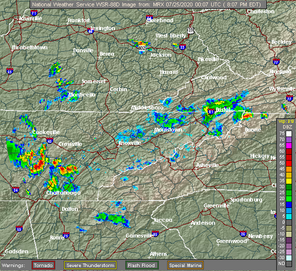 At 807 pm edt, a severe thunderstorm was located near decatur, moving northeast at 10 mph (radar indicated). Hazards include 60 mph wind gusts. expect damage to roofs, siding, and trees At 807 pm edt, a severe thunderstorm was located near decatur, moving northeast at 10 mph (radar indicated). Hazards include 60 mph wind gusts. expect damage to roofs, siding, and trees
|
| 7/5/2020 5:51 PM EDT |
 At 551 pm edt/451 pm cdt/, a severe thunderstorm was located 7 miles southwest of decatur, moving northwest at 15 mph (radar indicated). Hazards include 60 mph wind gusts and nickel size hail. expect damage to roofs, siding, and trees At 551 pm edt/451 pm cdt/, a severe thunderstorm was located 7 miles southwest of decatur, moving northwest at 15 mph (radar indicated). Hazards include 60 mph wind gusts and nickel size hail. expect damage to roofs, siding, and trees
|
| 6/22/2020 9:06 PM EDT |
 At 906 pm edt/806 pm cdt/, severe thunderstorms were located along a line extending from 9 miles south of crossville to 7 miles northeast of dayton to 7 miles north of cleveland, moving northeast at 25 mph (radar indicated). Hazards include 60 mph wind gusts. Expect damage to roofs, siding, and trees. locations impacted include, athens, dayton, decatur, spring city, englewood, niota, riceville, hillsview, peakland and clear water. This includes interstate 75 in tennessee between mile markers 39 and 57. At 906 pm edt/806 pm cdt/, severe thunderstorms were located along a line extending from 9 miles south of crossville to 7 miles northeast of dayton to 7 miles north of cleveland, moving northeast at 25 mph (radar indicated). Hazards include 60 mph wind gusts. Expect damage to roofs, siding, and trees. locations impacted include, athens, dayton, decatur, spring city, englewood, niota, riceville, hillsview, peakland and clear water. This includes interstate 75 in tennessee between mile markers 39 and 57.
|
| 6/22/2020 8:57 PM EDT |
 At 837 pm edt/737 pm cdt/, severe thunderstorms were located along a line extending from 8 miles north of pikeville to near dayton to 7 miles northwest of south cleveland, moving northeast at 25 mph (radar indicated). Hazards include 60 mph wind gusts and penny size hail. expect damage to roofs, siding, and trees At 837 pm edt/737 pm cdt/, severe thunderstorms were located along a line extending from 8 miles north of pikeville to near dayton to 7 miles northwest of south cleveland, moving northeast at 25 mph (radar indicated). Hazards include 60 mph wind gusts and penny size hail. expect damage to roofs, siding, and trees
|
| 6/22/2020 8:38 PM EDT |
 At 837 pm edt/737 pm cdt/, severe thunderstorms were located along a line extending from 8 miles north of pikeville to near dayton to 7 miles northwest of south cleveland, moving northeast at 25 mph (radar indicated). Hazards include 60 mph wind gusts and penny size hail. expect damage to roofs, siding, and trees At 837 pm edt/737 pm cdt/, severe thunderstorms were located along a line extending from 8 miles north of pikeville to near dayton to 7 miles northwest of south cleveland, moving northeast at 25 mph (radar indicated). Hazards include 60 mph wind gusts and penny size hail. expect damage to roofs, siding, and trees
|
| 6/14/2020 2:30 PM EDT |
 At 230 pm edt, a severe thunderstorm was located near dayton, moving northwest at 15 mph (radar indicated). Hazards include 60 mph wind gusts and quarter size hail. Hail damage to vehicles is expected. expect wind damage to roofs, siding, and trees. locations impacted include, athens, dayton, decatur, graysville, evensville, hillsview, old washington, big spring, riceville and sale creek. This includes interstate 75 in tennessee between mile markers 35 and 36, and between mile markers 39 and 49. At 230 pm edt, a severe thunderstorm was located near dayton, moving northwest at 15 mph (radar indicated). Hazards include 60 mph wind gusts and quarter size hail. Hail damage to vehicles is expected. expect wind damage to roofs, siding, and trees. locations impacted include, athens, dayton, decatur, graysville, evensville, hillsview, old washington, big spring, riceville and sale creek. This includes interstate 75 in tennessee between mile markers 35 and 36, and between mile markers 39 and 49.
|
| 6/14/2020 1:45 PM EDT |
 At 145 pm edt, a severe thunderstorm was located near dayton, moving southeast at 15 mph (radar indicated). Hazards include 60 mph wind gusts and quarter size hail. Hail damage to vehicles is expected. Expect wind damage to roofs, siding, and trees. At 145 pm edt, a severe thunderstorm was located near dayton, moving southeast at 15 mph (radar indicated). Hazards include 60 mph wind gusts and quarter size hail. Hail damage to vehicles is expected. Expect wind damage to roofs, siding, and trees.
|
| 5/3/2020 7:42 PM EDT |
 The severe thunderstorm warning for rhea, meigs and hamilton counties will expire at 745 pm edt, the storms which prompted the warning have moved out of the warned area. therefore, the warning will be allowed to expire. a severe thunderstorm watch remains in effect until 900 pm edt for east tennessee. a severe thunderstorm watch also remains in effect until 1100 pm edt for east tennessee. The severe thunderstorm warning for rhea, meigs and hamilton counties will expire at 745 pm edt, the storms which prompted the warning have moved out of the warned area. therefore, the warning will be allowed to expire. a severe thunderstorm watch remains in effect until 900 pm edt for east tennessee. a severe thunderstorm watch also remains in effect until 1100 pm edt for east tennessee.
|
| 5/3/2020 7:26 PM EDT |
 At 726 pm edt, severe thunderstorms were located along a line extending from 10 miles north of spring city to 10 miles east of soddy-daisy to chattanooga valley, moving east at 70 mph (radar indicated). Hazards include 60 mph wind gusts. Expect damage to roofs, siding, and trees. locations impacted include, chattanooga, dayton, decatur, soddy-daisy, signal mountain, spring city, walden, lakesite, ridgeside and fairmount. This includes interstate 75 in tennessee between mile markers 1 and 15. At 726 pm edt, severe thunderstorms were located along a line extending from 10 miles north of spring city to 10 miles east of soddy-daisy to chattanooga valley, moving east at 70 mph (radar indicated). Hazards include 60 mph wind gusts. Expect damage to roofs, siding, and trees. locations impacted include, chattanooga, dayton, decatur, soddy-daisy, signal mountain, spring city, walden, lakesite, ridgeside and fairmount. This includes interstate 75 in tennessee between mile markers 1 and 15.
|
| 5/3/2020 7:25 PM EDT | Trees and powerlines down on dayton mountain hw in rhea county TN, 4.3 miles SE of Dayton, TN |
| 5/3/2020 7:02 PM EDT |
 At 702 pm edt, severe thunderstorms were located along a line extending from 9 miles southeast of sparta to near dunlap to near bridgeport, moving east at 70 mph (radar indicated). Hazards include 60 mph wind gusts. expect damage to roofs, siding, and trees At 702 pm edt, severe thunderstorms were located along a line extending from 9 miles southeast of sparta to near dunlap to near bridgeport, moving east at 70 mph (radar indicated). Hazards include 60 mph wind gusts. expect damage to roofs, siding, and trees
|
| 4/9/2020 1:26 AM EDT |
 The severe thunderstorm warning for central rhea, southwestern loudon, northeastern meigs, northern mcminn, northwestern monroe and southwestern roane counties will expire at 130 am edt, the storms which prompted the warning have weakened below severe limits, and no longer pose an immediate threat to life or property. therefore, the warning will be allowed to expire. however gusty winds are still possible with these thunderstorms. a severe thunderstorm watch remains in effect until 600 am edt for east tennessee. The severe thunderstorm warning for central rhea, southwestern loudon, northeastern meigs, northern mcminn, northwestern monroe and southwestern roane counties will expire at 130 am edt, the storms which prompted the warning have weakened below severe limits, and no longer pose an immediate threat to life or property. therefore, the warning will be allowed to expire. however gusty winds are still possible with these thunderstorms. a severe thunderstorm watch remains in effect until 600 am edt for east tennessee.
|
| 4/9/2020 1:19 AM EDT |
 At 118 am edt, severe thunderstorms were located along a line extending from 7 miles southwest of rockwood to near spring city to near dayton, moving east at 45 mph (radar indicated). Hazards include 60 mph wind gusts and penny size hail. Expect damage to roofs, siding, and trees. locations impacted include, athens, dayton, sweetwater, decatur, spring city, niota, philadelphia, peakland, clear water and murray store. This includes interstate 75 in tennessee between mile markers 45 and 70. At 118 am edt, severe thunderstorms were located along a line extending from 7 miles southwest of rockwood to near spring city to near dayton, moving east at 45 mph (radar indicated). Hazards include 60 mph wind gusts and penny size hail. Expect damage to roofs, siding, and trees. locations impacted include, athens, dayton, sweetwater, decatur, spring city, niota, philadelphia, peakland, clear water and murray store. This includes interstate 75 in tennessee between mile markers 45 and 70.
|
| 4/9/2020 1:06 AM EDT |
 At 106 am edt/1206 am cdt/, severe thunderstorms were located along a line extending from 13 miles southwest of rockwood to near spring city to near pikeville, moving east at 60 mph (radar indicated). Hazards include 60 mph wind gusts and penny size hail. expect damage to roofs, siding, and trees At 106 am edt/1206 am cdt/, severe thunderstorms were located along a line extending from 13 miles southwest of rockwood to near spring city to near pikeville, moving east at 60 mph (radar indicated). Hazards include 60 mph wind gusts and penny size hail. expect damage to roofs, siding, and trees
|
| 3/29/2020 4:59 AM EDT |
 At 458 am edt/358 am cdt/, a severe thunderstorm was located over spring city, or 13 miles northwest of decatur, moving northeast at 75 mph (radar indicated). Hazards include 60 mph wind gusts and penny size hail. Expect damage to roofs, siding, and trees. Locations impacted include, dayton, pikeville, spring city, evensville, stinging fork falls state park, brayton, grandview, piney falls state park and melvine. At 458 am edt/358 am cdt/, a severe thunderstorm was located over spring city, or 13 miles northwest of decatur, moving northeast at 75 mph (radar indicated). Hazards include 60 mph wind gusts and penny size hail. Expect damage to roofs, siding, and trees. Locations impacted include, dayton, pikeville, spring city, evensville, stinging fork falls state park, brayton, grandview, piney falls state park and melvine.
|
| 3/29/2020 3:48 AM CDT |
 At 447 am edt/347 am cdt/, a severe thunderstorm was located near pikeville, moving northeast at 75 mph (radar indicated). Hazards include 60 mph wind gusts and penny size hail. Expect damage to roofs, siding, and trees. Locations impacted include, dayton, dunlap, pikeville, spring city, palmer, stinging fork falls state park, piney falls state park, mount crest, evensville and palio. At 447 am edt/347 am cdt/, a severe thunderstorm was located near pikeville, moving northeast at 75 mph (radar indicated). Hazards include 60 mph wind gusts and penny size hail. Expect damage to roofs, siding, and trees. Locations impacted include, dayton, dunlap, pikeville, spring city, palmer, stinging fork falls state park, piney falls state park, mount crest, evensville and palio.
|
| 3/29/2020 3:31 AM CDT |
 At 430 am edt/330 am cdt/, a severe thunderstorm was located 7 miles northwest of dunlap, moving northeast at 70 mph (radar indicated). Hazards include 60 mph wind gusts and penny size hail. expect damage to roofs, siding, and trees At 430 am edt/330 am cdt/, a severe thunderstorm was located 7 miles northwest of dunlap, moving northeast at 70 mph (radar indicated). Hazards include 60 mph wind gusts and penny size hail. expect damage to roofs, siding, and trees
|
| 2/12/2020 8:56 PM EST |
 At 855 pm est/755 pm cst/, severe thunderstorms were located along a line extending from 7 miles northwest of spring city to 7 miles north of soddy-daisy to near trenton, moving east at 40 mph (radar indicated). Hazards include 60 mph wind gusts. expect damage to roofs, siding, and trees At 855 pm est/755 pm cst/, severe thunderstorms were located along a line extending from 7 miles northwest of spring city to 7 miles north of soddy-daisy to near trenton, moving east at 40 mph (radar indicated). Hazards include 60 mph wind gusts. expect damage to roofs, siding, and trees
|
| 2/12/2020 7:12 PM CST |
 At 811 pm est/711 pm cst/, severe thunderstorms were located along a line extending from sparta to 11 miles southeast of mcminnville to monteagle, moving east at 50 mph (radar indicated). Hazards include 60 mph wind gusts. expect damage to roofs, siding, and trees At 811 pm est/711 pm cst/, severe thunderstorms were located along a line extending from sparta to 11 miles southeast of mcminnville to monteagle, moving east at 50 mph (radar indicated). Hazards include 60 mph wind gusts. expect damage to roofs, siding, and trees
|
| 1/11/2020 4:25 PM EST |
 At 425 pm est, severe thunderstorms were located along a line extending from near spring city to 8 miles east of benton, moving east at 60 mph (radar indicated). Hazards include 70 mph wind gusts. Expect considerable tree damage. damage is likely to mobile homes, roofs, and outbuildings. Locations impacted include, cleveland, dayton, benton, charleston, east cleveland, wildwood lake, south cleveland, calhoun, waterville and conasauga. At 425 pm est, severe thunderstorms were located along a line extending from near spring city to 8 miles east of benton, moving east at 60 mph (radar indicated). Hazards include 70 mph wind gusts. Expect considerable tree damage. damage is likely to mobile homes, roofs, and outbuildings. Locations impacted include, cleveland, dayton, benton, charleston, east cleveland, wildwood lake, south cleveland, calhoun, waterville and conasauga.
|
| 1/11/2020 4:08 PM EST |
 At 408 pm est/308 pm cst/, severe thunderstorms were located along a line extending from 6 miles east of pikeville to near east cleveland, moving northeast at 65 mph (radar indicated). Hazards include 70 mph wind gusts. Expect considerable tree damage. damage is likely to mobile homes, roofs, and outbuildings. Locations impacted include, cleveland, dayton, pikeville, benton, charleston, south cleveland, east cleveland, wildwood lake, collegedale and graysville. At 408 pm est/308 pm cst/, severe thunderstorms were located along a line extending from 6 miles east of pikeville to near east cleveland, moving northeast at 65 mph (radar indicated). Hazards include 70 mph wind gusts. Expect considerable tree damage. damage is likely to mobile homes, roofs, and outbuildings. Locations impacted include, cleveland, dayton, pikeville, benton, charleston, south cleveland, east cleveland, wildwood lake, collegedale and graysville.
|
| 1/11/2020 3:49 PM EST |
 At 348 pm est/248 pm cst/, severe thunderstorms were located along a line extending from near tracy city to near trenton, moving east at 60 mph (radar indicated). Hazards include 70 mph wind gusts. Expect considerable tree damage. Damage is likely to mobile homes, roofs, and outbuildings. At 348 pm est/248 pm cst/, severe thunderstorms were located along a line extending from near tracy city to near trenton, moving east at 60 mph (radar indicated). Hazards include 70 mph wind gusts. Expect considerable tree damage. Damage is likely to mobile homes, roofs, and outbuildings.
|
| 6/21/2019 11:25 PM EDT |
 At 1124 pm edt, severe thunderstorms were located along a line extending from decatur to 8 miles northeast of soddy-daisy to near trenton, moving east at 40 mph (radar indicated). Hazards include 60 mph wind gusts and quarter size hail. Hail damage to vehicles is expected. Expect wind damage to roofs, siding, and trees. At 1124 pm edt, severe thunderstorms were located along a line extending from decatur to 8 miles northeast of soddy-daisy to near trenton, moving east at 40 mph (radar indicated). Hazards include 60 mph wind gusts and quarter size hail. Hail damage to vehicles is expected. Expect wind damage to roofs, siding, and trees.
|
| 6/21/2019 11:18 PM EDT |
 At 1118 pm edt/1018 pm cdt/, severe thunderstorms were located along a line extending from near sweetwater to 10 miles north of athens to near decatur to dayton to near soddy-daisy, moving east at 40 mph (radar indicated). Hazards include 60 mph wind gusts and nickel size hail. Expect damage to roofs, siding, and trees. Locations impacted include, dayton, dunlap, pikeville, decatur, spring city, graysville, peakland, stinging fork falls state park, piney falls state park, ten mile, big spring, sale creek, evensville, palio, brayton, old washington, birchwood, grandview, melvine and flat top mountain. At 1118 pm edt/1018 pm cdt/, severe thunderstorms were located along a line extending from near sweetwater to 10 miles north of athens to near decatur to dayton to near soddy-daisy, moving east at 40 mph (radar indicated). Hazards include 60 mph wind gusts and nickel size hail. Expect damage to roofs, siding, and trees. Locations impacted include, dayton, dunlap, pikeville, decatur, spring city, graysville, peakland, stinging fork falls state park, piney falls state park, ten mile, big spring, sale creek, evensville, palio, brayton, old washington, birchwood, grandview, melvine and flat top mountain.
|
| 6/21/2019 11:13 PM EDT | Downed power lines and downed trees in the area of evensville t in rhea county TN, 6 miles SW of Dayton, TN |
| 6/21/2019 10:54 PM EDT |
 At 1053 pm edt/953 pm cdt/, severe thunderstorms were located along a line extending from 10 miles southwest of rockwood to near spring city to near pikeville to 13 miles west of dayton to dunlap, moving east at 55 mph (radar indicated). Hazards include 70 mph wind gusts and nickel size hail. Expect considerable tree damage. damage is likely to mobile homes, roofs, and outbuildings. Locations impacted include, dayton, dunlap, pikeville, decatur, spring city, graysville, peakland, stinging fork falls state park, piney falls state park, ten mile, mount crest, big spring, sale creek, evensville, palio, fall creek falls state park, brayton, old washington, birchwood and grandview. At 1053 pm edt/953 pm cdt/, severe thunderstorms were located along a line extending from 10 miles southwest of rockwood to near spring city to near pikeville to 13 miles west of dayton to dunlap, moving east at 55 mph (radar indicated). Hazards include 70 mph wind gusts and nickel size hail. Expect considerable tree damage. damage is likely to mobile homes, roofs, and outbuildings. Locations impacted include, dayton, dunlap, pikeville, decatur, spring city, graysville, peakland, stinging fork falls state park, piney falls state park, ten mile, mount crest, big spring, sale creek, evensville, palio, fall creek falls state park, brayton, old washington, birchwood and grandview.
|
| 6/21/2019 10:29 PM EDT |
 The national weather service in morristown has issued a * severe thunderstorm warning for. rhea county in east tennessee. northern sequatchie county in east tennessee. bledsoe county in east tennessee. Meigs county in east tennessee. The national weather service in morristown has issued a * severe thunderstorm warning for. rhea county in east tennessee. northern sequatchie county in east tennessee. bledsoe county in east tennessee. Meigs county in east tennessee.
|
| 6/20/2019 6:51 AM EDT | Severe trees down across the plateau area in rhea county TN, 5.5 miles S of Dayton, TN |
| 6/20/2019 6:39 AM EDT |
 At 639 am edt, severe thunderstorms were located along a line extending from 9 miles northwest of spring city to near dayton to 11 miles northwest of charleston to near cohutta, moving northeast at 50 mph (law enforcement). Hazards include 60 mph wind gusts. Expect damage to roofs, siding, and trees. Locations impacted include, cleveland, dayton, decatur, charleston, south cleveland, east cleveland, wildwood lake, graysville, calhoun, waterville, stinging fork falls state park, hopewell, red clay state park, flint springs, big spring, gap springs, tasso, mcdonald, evensville and old washington. At 639 am edt, severe thunderstorms were located along a line extending from 9 miles northwest of spring city to near dayton to 11 miles northwest of charleston to near cohutta, moving northeast at 50 mph (law enforcement). Hazards include 60 mph wind gusts. Expect damage to roofs, siding, and trees. Locations impacted include, cleveland, dayton, decatur, charleston, south cleveland, east cleveland, wildwood lake, graysville, calhoun, waterville, stinging fork falls state park, hopewell, red clay state park, flint springs, big spring, gap springs, tasso, mcdonald, evensville and old washington.
|
| 6/20/2019 6:31 AM EDT |
 At 629 am edt, severe thunderstorms were located along a line extending from 8 miles south of crossville to near wildwood lake, moving east at 50 mph (radar indicated). Hazards include 60 mph wind gusts. expect damage to roofs, siding, and trees At 629 am edt, severe thunderstorms were located along a line extending from 8 miles south of crossville to near wildwood lake, moving east at 50 mph (radar indicated). Hazards include 60 mph wind gusts. expect damage to roofs, siding, and trees
|
| 6/20/2019 6:13 AM EDT |
 At 612 am edt/512 am cdt/, severe thunderstorms were located along a line extending from near pikeville to near dunlap to near walden to near ringgold, moving northeast at 45 mph (law enforcement). Hazards include 70 mph wind gusts. Expect considerable tree damage. damage is likely to mobile homes, roofs, and outbuildings. Locations impacted include, chattanooga, cleveland, dayton, dunlap, pikeville, decatur, soddy-daisy, signal mountain, rossville, walden, lakesite, charleston, ridgeside, harrison, east cleveland, south cleveland, fairmount, wildwood lake, red bank and collegedale. At 612 am edt/512 am cdt/, severe thunderstorms were located along a line extending from near pikeville to near dunlap to near walden to near ringgold, moving northeast at 45 mph (law enforcement). Hazards include 70 mph wind gusts. Expect considerable tree damage. damage is likely to mobile homes, roofs, and outbuildings. Locations impacted include, chattanooga, cleveland, dayton, dunlap, pikeville, decatur, soddy-daisy, signal mountain, rossville, walden, lakesite, charleston, ridgeside, harrison, east cleveland, south cleveland, fairmount, wildwood lake, red bank and collegedale.
|
| 6/20/2019 4:57 AM CDT |
 At 555 am edt/455 am cdt/, severe thunderstorms were located along a line extending from 10 miles west of pikeville to 6 miles north of whitwell to near signal mountain to near la fayette, moving northeast at 50 mph (law enforcement). Hazards include 70 mph wind gusts. Expect considerable tree damage. Damage is likely to mobile homes, roofs, and outbuildings. At 555 am edt/455 am cdt/, severe thunderstorms were located along a line extending from 10 miles west of pikeville to 6 miles north of whitwell to near signal mountain to near la fayette, moving northeast at 50 mph (law enforcement). Hazards include 70 mph wind gusts. Expect considerable tree damage. Damage is likely to mobile homes, roofs, and outbuildings.
|
| 4/14/2019 8:54 AM EDT |
 At 853 am edt, severe thunderstorms were located along a line extending from near fairfield glade to 7 miles northeast of soddy-daisy, moving northeast at 50 mph (radar indicated). Hazards include 60 mph wind gusts. expect damage to roofs, siding, and trees At 853 am edt, severe thunderstorms were located along a line extending from near fairfield glade to 7 miles northeast of soddy-daisy, moving northeast at 50 mph (radar indicated). Hazards include 60 mph wind gusts. expect damage to roofs, siding, and trees
|
| 3/9/2019 11:50 PM EDT |
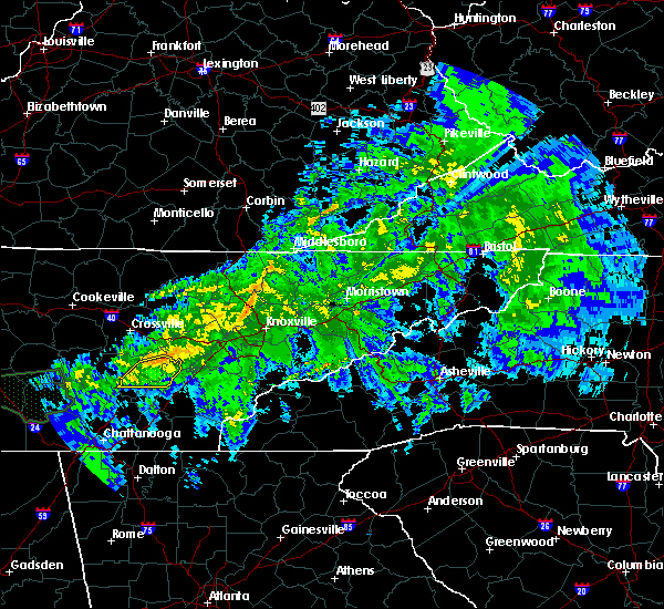 The severe thunderstorm warning for rhea and northeastern meigs counties will expire at 1100 pm est, the storm which prompted the warning has weakened below severe limits, and no longer poses an immediate threat to life or property. therefore, the warning will be allowed to expire. however gusty winds are still possible with this thunderstorm. The severe thunderstorm warning for rhea and northeastern meigs counties will expire at 1100 pm est, the storm which prompted the warning has weakened below severe limits, and no longer poses an immediate threat to life or property. therefore, the warning will be allowed to expire. however gusty winds are still possible with this thunderstorm.
|
| 3/9/2019 11:16 PM EDT |
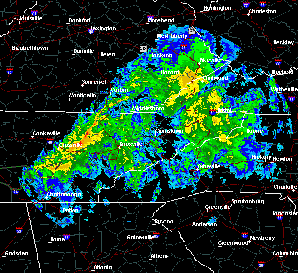 At 1016 pm est, a severe thunderstorm was located near pikeville, moving east at 60 mph (radar indicated). Hazards include 60 mph wind gusts and penny size hail. expect damage to roofs, siding, and trees At 1016 pm est, a severe thunderstorm was located near pikeville, moving east at 60 mph (radar indicated). Hazards include 60 mph wind gusts and penny size hail. expect damage to roofs, siding, and trees
|
| 11/6/2018 3:33 AM EST |
 At 333 am est, a severe thunderstorm was located near decatur, moving east at 50 mph (radar indicated). Hazards include 60 mph wind gusts. Expect damage to roofs, siding, and trees. locations impacted include, athens, dayton, decatur, spring city, graysville, evensville, peakland, clear water, old washington, grandview, piney falls state park and sale creek. a tornado watch remains in effect until 700 am est for east tennessee. A tornado watch also remains in effect until 900 am est for east tennessee. At 333 am est, a severe thunderstorm was located near decatur, moving east at 50 mph (radar indicated). Hazards include 60 mph wind gusts. Expect damage to roofs, siding, and trees. locations impacted include, athens, dayton, decatur, spring city, graysville, evensville, peakland, clear water, old washington, grandview, piney falls state park and sale creek. a tornado watch remains in effect until 700 am est for east tennessee. A tornado watch also remains in effect until 900 am est for east tennessee.
|
| 11/6/2018 3:12 AM EST |
 At 312 am est, a severe thunderstorm was located 8 miles west of dayton, moving east at 60 mph (radar indicated). Hazards include 60 mph wind gusts. expect damage to roofs, siding, and trees At 312 am est, a severe thunderstorm was located 8 miles west of dayton, moving east at 60 mph (radar indicated). Hazards include 60 mph wind gusts. expect damage to roofs, siding, and trees
|
| 8/16/2018 5:54 PM EDT |
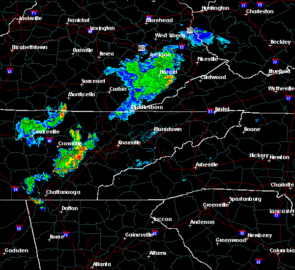 The severe thunderstorm warning for rhea and northeastern meigs counties will expire at 600 pm edt, the storm which prompted the warning has weakened below severe limits, and no longer poses an immediate threat to life or property. therefore, the warning will be allowed to expire. however gusty winds are still possible with this thunderstorm. The severe thunderstorm warning for rhea and northeastern meigs counties will expire at 600 pm edt, the storm which prompted the warning has weakened below severe limits, and no longer poses an immediate threat to life or property. therefore, the warning will be allowed to expire. however gusty winds are still possible with this thunderstorm.
|
| 8/16/2018 5:35 PM EDT |
 At 534 pm edt, a severe thunderstorm was located over spring city, or 10 miles north of decatur, moving east at 15 mph (radar indicated). Hazards include 60 mph wind gusts and quarter size hail. Hail damage to vehicles is expected. expect wind damage to roofs, siding, and trees. Locations impacted include, dayton, spring city, evensville, peakland, stinging fork falls state park, grandview and piney falls state park. At 534 pm edt, a severe thunderstorm was located over spring city, or 10 miles north of decatur, moving east at 15 mph (radar indicated). Hazards include 60 mph wind gusts and quarter size hail. Hail damage to vehicles is expected. expect wind damage to roofs, siding, and trees. Locations impacted include, dayton, spring city, evensville, peakland, stinging fork falls state park, grandview and piney falls state park.
|
| 8/16/2018 5:19 PM EDT |
 At 518 pm edt, a severe thunderstorm was located near spring city, or 10 miles northwest of decatur, moving east at 15 mph (radar indicated). Hazards include 60 mph wind gusts. expect damage to roofs, siding, and trees At 518 pm edt, a severe thunderstorm was located near spring city, or 10 miles northwest of decatur, moving east at 15 mph (radar indicated). Hazards include 60 mph wind gusts. expect damage to roofs, siding, and trees
|
| 7/21/2018 7:25 AM EDT |
 The severe thunderstorm warning for southwestern rhea, southwestern meigs and northeastern hamilton counties will expire at 730 am edt, the storm which prompted the warning has moved out of the area. therefore, the warning will be allowed to expire. The severe thunderstorm warning for southwestern rhea, southwestern meigs and northeastern hamilton counties will expire at 730 am edt, the storm which prompted the warning has moved out of the area. therefore, the warning will be allowed to expire.
|
| 7/21/2018 7:11 AM EDT |
 At 711 am edt, a severe thunderstorm was located 9 miles south of dayton, moving southeast at 55 mph (radar indicated). Hazards include 60 mph wind gusts and penny size hail. Expect damage to roofs, siding, and trees. Locations impacted include, dayton, soddy-daisy, graysville, sale creek, birchwood and flat top mountain. At 711 am edt, a severe thunderstorm was located 9 miles south of dayton, moving southeast at 55 mph (radar indicated). Hazards include 60 mph wind gusts and penny size hail. Expect damage to roofs, siding, and trees. Locations impacted include, dayton, soddy-daisy, graysville, sale creek, birchwood and flat top mountain.
|
| 7/21/2018 7:05 AM EDT |
 At 704 am edt/604 am cdt/, a severe thunderstorm was located 9 miles southwest of dayton, moving southeast at 55 mph (radar indicated). Hazards include 60 mph wind gusts and penny size hail. expect damage to roofs, siding, and trees At 704 am edt/604 am cdt/, a severe thunderstorm was located 9 miles southwest of dayton, moving southeast at 55 mph (radar indicated). Hazards include 60 mph wind gusts and penny size hail. expect damage to roofs, siding, and trees
|
| 7/21/2018 3:55 AM EDT | Several trees down across the southern part of rhea count in rhea county TN, 0.2 miles WNW of Dayton, TN |
| 7/21/2018 3:45 AM EDT |
 At 329 am edt/229 am cdt/, a severe thunderstorm was located 9 miles south of pikeville, moving southeast at 40 mph (radar indicated). Hazards include 60 mph wind gusts. expect damage to roofs, siding, and trees At 329 am edt/229 am cdt/, a severe thunderstorm was located 9 miles south of pikeville, moving southeast at 40 mph (radar indicated). Hazards include 60 mph wind gusts. expect damage to roofs, siding, and trees
|
| 7/21/2018 3:30 AM EDT |
 At 329 am edt/229 am cdt/, a severe thunderstorm was located 9 miles south of pikeville, moving southeast at 40 mph (radar indicated). Hazards include 60 mph wind gusts. expect damage to roofs, siding, and trees At 329 am edt/229 am cdt/, a severe thunderstorm was located 9 miles south of pikeville, moving southeast at 40 mph (radar indicated). Hazards include 60 mph wind gusts. expect damage to roofs, siding, and trees
|
| 7/21/2018 3:22 AM EDT |
 At 322 am edt/222 am cdt/, a severe thunderstorm was located 7 miles north of pikeville, moving southeast at 45 mph (radar indicated). Hazards include 60 mph wind gusts. Expect damage to roofs, siding, and trees. Locations impacted include, dayton, pikeville, spring city, evensville, stinging fork falls state park, old washington, grandview, piney falls state park, melvine, mount crest and fall creek falls state park. At 322 am edt/222 am cdt/, a severe thunderstorm was located 7 miles north of pikeville, moving southeast at 45 mph (radar indicated). Hazards include 60 mph wind gusts. Expect damage to roofs, siding, and trees. Locations impacted include, dayton, pikeville, spring city, evensville, stinging fork falls state park, old washington, grandview, piney falls state park, melvine, mount crest and fall creek falls state park.
|
| 7/21/2018 3:06 AM EDT |
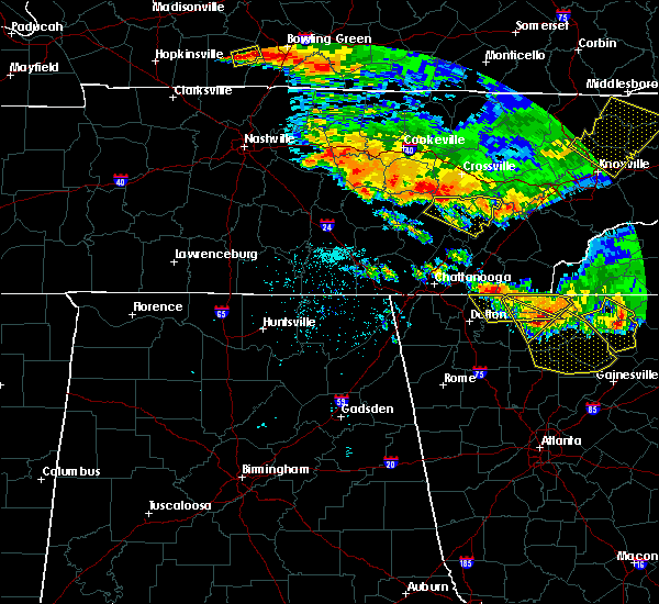 At 306 am edt/206 am cdt/, a severe thunderstorm was located 11 miles east of spencer, moving east at 40 mph (radar indicated). Hazards include 60 mph wind gusts. expect damage to roofs, siding, and trees At 306 am edt/206 am cdt/, a severe thunderstorm was located 11 miles east of spencer, moving east at 40 mph (radar indicated). Hazards include 60 mph wind gusts. expect damage to roofs, siding, and trees
|
| 7/21/2018 1:38 AM EDT |
 At 138 am edt, a severe thunderstorm was located near dayton, moving southeast at 25 mph (radar indicated). Hazards include 60 mph wind gusts. Expect damage to roofs, siding, and trees. locations impacted include, dayton, graysville, old washington and evensville. A tornado watch remains in effect until 400 am edt for east tennessee. At 138 am edt, a severe thunderstorm was located near dayton, moving southeast at 25 mph (radar indicated). Hazards include 60 mph wind gusts. Expect damage to roofs, siding, and trees. locations impacted include, dayton, graysville, old washington and evensville. A tornado watch remains in effect until 400 am edt for east tennessee.
|
| 7/21/2018 1:21 AM EDT |
 At 120 am edt/1220 am cdt/, a severe thunderstorm was located over pikeville, moving southeast at 20 mph (radar indicated). Hazards include 60 mph wind gusts and quarter size hail. Hail damage to vehicles is expected. Expect wind damage to roofs, siding, and trees. At 120 am edt/1220 am cdt/, a severe thunderstorm was located over pikeville, moving southeast at 20 mph (radar indicated). Hazards include 60 mph wind gusts and quarter size hail. Hail damage to vehicles is expected. Expect wind damage to roofs, siding, and trees.
|
| 7/21/2018 1:16 AM EDT |
 At 115 am edt/1215 am cdt/, a severe thunderstorm was located near dayton, moving southeast at 25 mph (radar indicated). Hazards include 60 mph wind gusts and quarter size hail. Hail damage to vehicles is expected. expect wind damage to roofs, siding, and trees. locations impacted include, dayton, graysville, birchwood, big spring and sale creek. A tornado watch remains in effect until 400 am edt/300 am cdt/ for east tennessee. At 115 am edt/1215 am cdt/, a severe thunderstorm was located near dayton, moving southeast at 25 mph (radar indicated). Hazards include 60 mph wind gusts and quarter size hail. Hail damage to vehicles is expected. expect wind damage to roofs, siding, and trees. locations impacted include, dayton, graysville, birchwood, big spring and sale creek. A tornado watch remains in effect until 400 am edt/300 am cdt/ for east tennessee.
|
| 7/21/2018 1:10 AM EDT | Multiple trees dow in rhea county TN, 0.2 miles WNW of Dayton, TN |
| 7/21/2018 12:55 AM EDT |
 At 1255 am edt/1155 pm cdt/, a severe thunderstorm was located near dayton, moving southeast at 25 mph (radar indicated). Hazards include 60 mph wind gusts and quarter size hail. Hail damage to vehicles is expected. Expect wind damage to roofs, siding, and trees. At 1255 am edt/1155 pm cdt/, a severe thunderstorm was located near dayton, moving southeast at 25 mph (radar indicated). Hazards include 60 mph wind gusts and quarter size hail. Hail damage to vehicles is expected. Expect wind damage to roofs, siding, and trees.
|
| 7/20/2018 11:35 PM CDT |
 At 1235 am edt/1135 pm cdt/, a severe thunderstorm was located 9 miles south of pikeville, moving southeast at 25 mph (radar indicated). Hazards include 60 mph wind gusts and quarter size hail. Hail damage to vehicles is expected. expect wind damage to roofs, siding, and trees. locations impacted include, dayton, dunlap, pikeville, graysville, palio, fall creek falls state park, brayton, old cumberland, sale creek and flat top mountain. A tornado watch remains in effect until 400 am edt/300 am cdt/ for east tennessee. At 1235 am edt/1135 pm cdt/, a severe thunderstorm was located 9 miles south of pikeville, moving southeast at 25 mph (radar indicated). Hazards include 60 mph wind gusts and quarter size hail. Hail damage to vehicles is expected. expect wind damage to roofs, siding, and trees. locations impacted include, dayton, dunlap, pikeville, graysville, palio, fall creek falls state park, brayton, old cumberland, sale creek and flat top mountain. A tornado watch remains in effect until 400 am edt/300 am cdt/ for east tennessee.
|
| 7/21/2018 12:12 AM EDT |
 At 1212 am edt, a severe thunderstorm was located 8 miles west of athens, moving southeast at 25 mph (radar indicated). Hazards include 60 mph wind gusts and quarter size hail. Hail damage to vehicles is expected. expect wind damage to roofs, siding, and trees. locations impacted include, athens, decatur, charleston, calhoun, riceville, evensville, peakland, hillsview, clear water, old washington and big spring. A tornado watch remains in effect until 400 am edt for east tennessee. At 1212 am edt, a severe thunderstorm was located 8 miles west of athens, moving southeast at 25 mph (radar indicated). Hazards include 60 mph wind gusts and quarter size hail. Hail damage to vehicles is expected. expect wind damage to roofs, siding, and trees. locations impacted include, athens, decatur, charleston, calhoun, riceville, evensville, peakland, hillsview, clear water, old washington and big spring. A tornado watch remains in effect until 400 am edt for east tennessee.
|
| 7/20/2018 11:11 PM CDT |
 At 1211 am edt/1111 pm cdt/, a severe thunderstorm was located 7 miles west of pikeville, moving southeast at 25 mph (radar indicated). Hazards include 60 mph wind gusts and quarter size hail. Hail damage to vehicles is expected. Expect wind damage to roofs, siding, and trees. At 1211 am edt/1111 pm cdt/, a severe thunderstorm was located 7 miles west of pikeville, moving southeast at 25 mph (radar indicated). Hazards include 60 mph wind gusts and quarter size hail. Hail damage to vehicles is expected. Expect wind damage to roofs, siding, and trees.
|
| 7/20/2018 11:42 PM EDT |
 At 1142 pm edt, a severe thunderstorm was located near decatur, moving southeast at 25 mph (radar indicated). Hazards include 70 mph wind gusts and quarter size hail. Hail damage to vehicles is expected. expect considerable tree damage. Wind damage is also likely to mobile homes, roofs, and outbuildings. At 1142 pm edt, a severe thunderstorm was located near decatur, moving southeast at 25 mph (radar indicated). Hazards include 70 mph wind gusts and quarter size hail. Hail damage to vehicles is expected. expect considerable tree damage. Wind damage is also likely to mobile homes, roofs, and outbuildings.
|
| 7/20/2018 10:18 PM CDT |
 At 1118 pm edt/1018 pm cdt/, a severe thunderstorm was located 8 miles north of pikeville, moving southeast at 30 mph (radar indicated). Hazards include 60 mph wind gusts and quarter size hail. Hail damage to vehicles is expected. Expect wind damage to roofs, siding, and trees. At 1118 pm edt/1018 pm cdt/, a severe thunderstorm was located 8 miles north of pikeville, moving southeast at 30 mph (radar indicated). Hazards include 60 mph wind gusts and quarter size hail. Hail damage to vehicles is expected. Expect wind damage to roofs, siding, and trees.
|
| 6/30/2018 6:59 PM CDT |
 A severe thunderstorm warning remains in effect until 830 pm edt/730 pm cdt/ for southwestern rhea. northern sequatchie. bledsoe and north central hamilton counties. at 758 pm edt/658 pm cdt/, a severe thunderstorm was located 10 miles southwest of dayton, moving northwest at 20 mph. hazard. 60 mph wind gusts and nickel size hail. A severe thunderstorm warning remains in effect until 830 pm edt/730 pm cdt/ for southwestern rhea. northern sequatchie. bledsoe and north central hamilton counties. at 758 pm edt/658 pm cdt/, a severe thunderstorm was located 10 miles southwest of dayton, moving northwest at 20 mph. hazard. 60 mph wind gusts and nickel size hail.
|
| 6/30/2018 6:22 PM CDT |
 At 722 pm edt/622 pm cdt/, a severe thunderstorm was located 9 miles east of soddy-daisy, or 12 miles south of dayton, moving northwest at 20 mph (radar indicated). Hazards include 60 mph wind gusts and nickel size hail. expect damage to roofs, siding, and trees At 722 pm edt/622 pm cdt/, a severe thunderstorm was located 9 miles east of soddy-daisy, or 12 miles south of dayton, moving northwest at 20 mph (radar indicated). Hazards include 60 mph wind gusts and nickel size hail. expect damage to roofs, siding, and trees
|
| 6/28/2018 9:42 AM EDT |
 At 941 am edt/841 am cdt/, a severe thunderstorm was located near pikeville, moving southeast at 20 mph (radar indicated). Hazards include 60 mph wind gusts and penny size hail. expect damage to roofs, siding, and trees At 941 am edt/841 am cdt/, a severe thunderstorm was located near pikeville, moving southeast at 20 mph (radar indicated). Hazards include 60 mph wind gusts and penny size hail. expect damage to roofs, siding, and trees
|
| 6/28/2018 6:36 AM EDT |
 At 636 am edt, a severe thunderstorm was located near decatur, moving southeast at 20 mph (radar indicated). Hazards include 60 mph wind gusts and quarter size hail. Hail damage to vehicles is expected. expect wind damage to roofs, siding, and trees. Locations impacted include, dayton, decatur, spring city, old washington, evensville and peakland. At 636 am edt, a severe thunderstorm was located near decatur, moving southeast at 20 mph (radar indicated). Hazards include 60 mph wind gusts and quarter size hail. Hail damage to vehicles is expected. expect wind damage to roofs, siding, and trees. Locations impacted include, dayton, decatur, spring city, old washington, evensville and peakland.
|
| 6/28/2018 6:17 AM EDT |
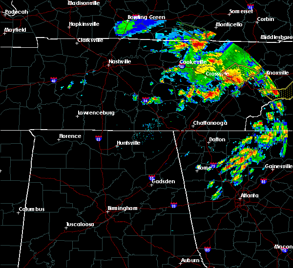 At 617 am edt, a severe thunderstorm was located near spring city, or 9 miles north of dayton, moving southeast at 30 mph (radar indicated). Hazards include 60 mph wind gusts and quarter size hail. Hail damage to vehicles is expected. Expect wind damage to roofs, siding, and trees. At 617 am edt, a severe thunderstorm was located near spring city, or 9 miles north of dayton, moving southeast at 30 mph (radar indicated). Hazards include 60 mph wind gusts and quarter size hail. Hail damage to vehicles is expected. Expect wind damage to roofs, siding, and trees.
|
| 6/26/2018 6:53 PM EDT |
 At 653 pm edt/553 pm cdt/, severe thunderstorms were located along a line extending from fontana village to 6 miles northwest of dunlap, moving southeast at 25 mph (radar indicated). Hazards include 60 mph wind gusts and quarter size hail. Hail damage to vehicles is expected. expect wind damage to roofs, siding, and trees. Locations impacted include, chattanooga, cleveland, athens, dayton, sweetwater, dunlap, madisonville, andrews, pikeville, decatur, benton, soddy-daisy, signal mountain, etowah, walden, lakesite, charleston, fairmount, englewood and graysville. At 653 pm edt/553 pm cdt/, severe thunderstorms were located along a line extending from fontana village to 6 miles northwest of dunlap, moving southeast at 25 mph (radar indicated). Hazards include 60 mph wind gusts and quarter size hail. Hail damage to vehicles is expected. expect wind damage to roofs, siding, and trees. Locations impacted include, chattanooga, cleveland, athens, dayton, sweetwater, dunlap, madisonville, andrews, pikeville, decatur, benton, soddy-daisy, signal mountain, etowah, walden, lakesite, charleston, fairmount, englewood and graysville.
|
| 6/26/2018 6:25 PM EDT |
 At 624 pm edt/524 pm cdt/, severe thunderstorms were located along a line extending from near smoky mountains-twentymile creek to 8 miles north of dunlap, moving southeast at 30 mph (radar indicated). Hazards include 60 mph wind gusts and quarter size hail. Hail damage to vehicles is expected. Expect wind damage to roofs, siding, and trees. At 624 pm edt/524 pm cdt/, severe thunderstorms were located along a line extending from near smoky mountains-twentymile creek to 8 miles north of dunlap, moving southeast at 30 mph (radar indicated). Hazards include 60 mph wind gusts and quarter size hail. Hail damage to vehicles is expected. Expect wind damage to roofs, siding, and trees.
|
| 6/26/2018 6:04 PM EDT |
 At 604 pm edt/504 pm cdt/, severe thunderstorms were located along a line extending from near eagleton village to 6 miles west of pikeville, moving southeast at 35 mph (radar indicated). Hazards include 60 mph wind gusts and quarter size hail. Hail damage to vehicles is expected. expect wind damage to roofs, siding, and trees. Locations impacted include, maryville, athens, lenoir city, alcoa, dayton, sweetwater, loudon, madisonville, pikeville, decatur, fairview, louisville, spring city, eagleton village, englewood, graysville, vonore, greenback, friendsville and niota. At 604 pm edt/504 pm cdt/, severe thunderstorms were located along a line extending from near eagleton village to 6 miles west of pikeville, moving southeast at 35 mph (radar indicated). Hazards include 60 mph wind gusts and quarter size hail. Hail damage to vehicles is expected. expect wind damage to roofs, siding, and trees. Locations impacted include, maryville, athens, lenoir city, alcoa, dayton, sweetwater, loudon, madisonville, pikeville, decatur, fairview, louisville, spring city, eagleton village, englewood, graysville, vonore, greenback, friendsville and niota.
|
| 6/26/2018 5:34 PM EDT |
 At 534 pm edt/434 pm cdt/, severe thunderstorms were located along a line extending from near louisville to near spencer, moving southeast at 40 mph (radar indicated). Hazards include 60 mph wind gusts and quarter size hail. Hail damage to vehicles is expected. Expect wind damage to roofs, siding, and trees. At 534 pm edt/434 pm cdt/, severe thunderstorms were located along a line extending from near louisville to near spencer, moving southeast at 40 mph (radar indicated). Hazards include 60 mph wind gusts and quarter size hail. Hail damage to vehicles is expected. Expect wind damage to roofs, siding, and trees.
|
| 6/25/2018 2:28 PM EDT |
 At 227 pm edt, severe thunderstorms were located along a line extending from near kingston to near sweetwater to near athens, moving east at 35 mph (radar indicated). Hazards include 60 mph wind gusts and penny size hail. Expect damage to roofs, siding, and trees. Locations impacted include, athens, lenoir city, dayton, kingston, sweetwater, loudon, madisonville, decatur, farragut, etowah, englewood, graysville, vonore, greenback, friendsville, tellico plains, niota, philadelphia, mcgee carson peninsula and hillsview. At 227 pm edt, severe thunderstorms were located along a line extending from near kingston to near sweetwater to near athens, moving east at 35 mph (radar indicated). Hazards include 60 mph wind gusts and penny size hail. Expect damage to roofs, siding, and trees. Locations impacted include, athens, lenoir city, dayton, kingston, sweetwater, loudon, madisonville, decatur, farragut, etowah, englewood, graysville, vonore, greenback, friendsville, tellico plains, niota, philadelphia, mcgee carson peninsula and hillsview.
|
| 6/25/2018 2:10 PM EDT | Numerous trees and power lines were reported down... and there was a partial collapse of a building near the intersection of old washington highway and shipley lane two in rhea county TN, 1.5 miles WSW of Dayton, TN |
| 6/25/2018 1:55 PM EDT |
 At 155 pm edt, severe thunderstorms were located along a line extending from 6 miles west of rockwood to near decatur to near dayton, moving east at 35 mph (radar indicated). Hazards include 60 mph wind gusts and penny size hail. expect damage to roofs, siding, and trees At 155 pm edt, severe thunderstorms were located along a line extending from 6 miles west of rockwood to near decatur to near dayton, moving east at 35 mph (radar indicated). Hazards include 60 mph wind gusts and penny size hail. expect damage to roofs, siding, and trees
|
| 6/24/2018 1:44 PM EDT |
 At 144 pm edt, a severe thunderstorm was located 7 miles south of dayton, moving east at 25 mph (radar indicated). Hazards include 60 mph wind gusts and quarter size hail. Hail damage to vehicles is expected. Expect wind damage to roofs, siding, and trees. At 144 pm edt, a severe thunderstorm was located 7 miles south of dayton, moving east at 25 mph (radar indicated). Hazards include 60 mph wind gusts and quarter size hail. Hail damage to vehicles is expected. Expect wind damage to roofs, siding, and trees.
|
| 6/23/2018 2:52 PM EDT |
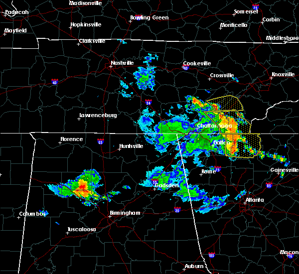 At 252 pm edt, severe thunderstorms were located along a line extending from near dayton to 7 miles southwest of decatur to 9 miles northwest of charleston, moving east at 35 mph (radar indicated). Hazards include 60 mph wind gusts. expect damage to roofs, siding, and trees At 252 pm edt, severe thunderstorms were located along a line extending from near dayton to 7 miles southwest of decatur to 9 miles northwest of charleston, moving east at 35 mph (radar indicated). Hazards include 60 mph wind gusts. expect damage to roofs, siding, and trees
|
| 5/20/2018 3:42 PM EDT |
 At 341 pm edt/241 pm cdt/, a severe thunderstorm was located near dayton, moving southeast at 5 mph (radar indicated). Hazards include 60 mph wind gusts and quarter size hail. Hail damage to vehicles is expected. expect wind damage to roofs, siding, and trees. Locations impacted include, dayton, soddy-daisy, graysville, brayton and sale creek. At 341 pm edt/241 pm cdt/, a severe thunderstorm was located near dayton, moving southeast at 5 mph (radar indicated). Hazards include 60 mph wind gusts and quarter size hail. Hail damage to vehicles is expected. expect wind damage to roofs, siding, and trees. Locations impacted include, dayton, soddy-daisy, graysville, brayton and sale creek.
|
| 5/20/2018 3:28 PM EDT |
 At 327 pm edt/227 pm cdt/, a severe thunderstorm was located near dayton, moving southeast at 10 mph (radar indicated). Hazards include 60 mph wind gusts and quarter size hail. Hail damage to vehicles is expected. Expect wind damage to roofs, siding, and trees. At 327 pm edt/227 pm cdt/, a severe thunderstorm was located near dayton, moving southeast at 10 mph (radar indicated). Hazards include 60 mph wind gusts and quarter size hail. Hail damage to vehicles is expected. Expect wind damage to roofs, siding, and trees.
|
| 4/4/2018 1:15 AM EDT |
 At 115 am edt, severe thunderstorms were located along a line extending from near spring city to near lookout mountain, moving east at 50 mph (radar indicated). Hazards include 60 mph wind gusts and quarter size hail. Hail damage to vehicles is expected. Expect wind damage to roofs, siding, and trees. At 115 am edt, severe thunderstorms were located along a line extending from near spring city to near lookout mountain, moving east at 50 mph (radar indicated). Hazards include 60 mph wind gusts and quarter size hail. Hail damage to vehicles is expected. Expect wind damage to roofs, siding, and trees.
|
| 4/4/2018 12:03 AM CDT |
 At 103 am edt/1203 am cdt/, severe thunderstorms were located along a line extending from near midtown to near kimball, moving east at 60 mph (radar indicated). Hazards include 60 mph wind gusts and quarter size hail. Hail damage to vehicles is expected. expect wind damage to roofs, siding, and trees. Locations impacted include, chattanooga, dayton, dunlap, jasper, pikeville, decatur, soddy-daisy, signal mountain, south pittsburg, spring city, walden, lakesite, whitwell, kimball, monteagle, ridgeside, harrison, fairmount, red bank and collegedale. At 103 am edt/1203 am cdt/, severe thunderstorms were located along a line extending from near midtown to near kimball, moving east at 60 mph (radar indicated). Hazards include 60 mph wind gusts and quarter size hail. Hail damage to vehicles is expected. expect wind damage to roofs, siding, and trees. Locations impacted include, chattanooga, dayton, dunlap, jasper, pikeville, decatur, soddy-daisy, signal mountain, south pittsburg, spring city, walden, lakesite, whitwell, kimball, monteagle, ridgeside, harrison, fairmount, red bank and collegedale.
|
| 4/3/2018 11:38 PM CDT |
 At 1237 am edt/1137 pm cdt/, severe thunderstorms were located along a line extending from near rockwood to near gruetli-laager, moving east at 60 mph (radar indicated). Hazards include 60 mph wind gusts and quarter size hail. Hail damage to vehicles is expected. expect wind damage to roofs, siding, and trees. Locations impacted include, chattanooga, dayton, dunlap, jasper, pikeville, decatur, soddy-daisy, signal mountain, south pittsburg, spring city, walden, lakesite, whitwell, kimball, monteagle, ridgeside, harrison, fairmount, red bank and collegedale. At 1237 am edt/1137 pm cdt/, severe thunderstorms were located along a line extending from near rockwood to near gruetli-laager, moving east at 60 mph (radar indicated). Hazards include 60 mph wind gusts and quarter size hail. Hail damage to vehicles is expected. expect wind damage to roofs, siding, and trees. Locations impacted include, chattanooga, dayton, dunlap, jasper, pikeville, decatur, soddy-daisy, signal mountain, south pittsburg, spring city, walden, lakesite, whitwell, kimball, monteagle, ridgeside, harrison, fairmount, red bank and collegedale.
|
| 4/3/2018 11:08 PM CDT |
 The national weather service in morristown has issued a * severe thunderstorm warning for. rhea county in east tennessee. meigs county in east tennessee. sequatchie county in east tennessee. Bledsoe county in east tennessee. The national weather service in morristown has issued a * severe thunderstorm warning for. rhea county in east tennessee. meigs county in east tennessee. sequatchie county in east tennessee. Bledsoe county in east tennessee.
|
| 3/17/2018 5:56 PM CDT |
 At 656 pm edt/556 pm cdt/, a severe thunderstorm was located over dunlap, moving east at 40 mph (radar indicated). Hazards include ping pong ball size hail and 60 mph wind gusts. People and animals outdoors will be injured. expect hail damage to roofs, siding, windows, and vehicles. expect wind damage to roofs, siding, and trees. Locations impacted include, dayton, dunlap, soddy-daisy, graysville, sale creek, flat top mountain, palio, brayton, birchwood, shady grove, cagle and mowbray mountain. At 656 pm edt/556 pm cdt/, a severe thunderstorm was located over dunlap, moving east at 40 mph (radar indicated). Hazards include ping pong ball size hail and 60 mph wind gusts. People and animals outdoors will be injured. expect hail damage to roofs, siding, windows, and vehicles. expect wind damage to roofs, siding, and trees. Locations impacted include, dayton, dunlap, soddy-daisy, graysville, sale creek, flat top mountain, palio, brayton, birchwood, shady grove, cagle and mowbray mountain.
|
| 3/17/2018 5:39 PM CDT |
 At 638 pm edt/538 pm cdt/, a severe thunderstorm was located 9 miles northeast of gruetli-laager, or 13 miles northwest of dunlap, moving east at 40 mph (radar indicated). Hazards include 60 mph wind gusts and half dollar size hail. Hail damage to vehicles is expected. Expect wind damage to roofs, siding, and trees. At 638 pm edt/538 pm cdt/, a severe thunderstorm was located 9 miles northeast of gruetli-laager, or 13 miles northwest of dunlap, moving east at 40 mph (radar indicated). Hazards include 60 mph wind gusts and half dollar size hail. Hail damage to vehicles is expected. Expect wind damage to roofs, siding, and trees.
|
| 3/17/2018 6:38 PM EDT |
 At 637 pm edt, a severe thunderstorm was located over dayton, moving east at 40 mph (radar indicated). Hazards include 60 mph wind gusts and quarter size hail. Hail damage to vehicles is expected. Expect wind damage to roofs, siding, and trees. At 637 pm edt, a severe thunderstorm was located over dayton, moving east at 40 mph (radar indicated). Hazards include 60 mph wind gusts and quarter size hail. Hail damage to vehicles is expected. Expect wind damage to roofs, siding, and trees.
|
| 3/17/2018 6:24 PM EDT |
 At 624 pm edt/524 pm cdt/, a severe thunderstorm was located near pikeville, moving east at 40 mph (radar indicated). Hazards include 60 mph wind gusts and quarter size hail. Hail damage to vehicles is expected. expect wind damage to roofs, siding, and trees. Locations impacted include, dayton, pikeville, decatur, spring city, graysville, evensville, peakland, old washington, brayton, mount crest and big spring. At 624 pm edt/524 pm cdt/, a severe thunderstorm was located near pikeville, moving east at 40 mph (radar indicated). Hazards include 60 mph wind gusts and quarter size hail. Hail damage to vehicles is expected. expect wind damage to roofs, siding, and trees. Locations impacted include, dayton, pikeville, decatur, spring city, graysville, evensville, peakland, old washington, brayton, mount crest and big spring.
|
| 3/17/2018 5:04 PM CDT |
 At 603 pm edt/503 pm cdt/, a severe thunderstorm was located 9 miles south of spencer, moving east at 40 mph (radar indicated). Hazards include 60 mph wind gusts and quarter size hail. Hail damage to vehicles is expected. Expect wind damage to roofs, siding, and trees. At 603 pm edt/503 pm cdt/, a severe thunderstorm was located 9 miles south of spencer, moving east at 40 mph (radar indicated). Hazards include 60 mph wind gusts and quarter size hail. Hail damage to vehicles is expected. Expect wind damage to roofs, siding, and trees.
|
| 7/5/2017 5:08 PM EDT |
 At 507 pm edt/407 pm cdt/, a severe thunderstorm was located near pikeville, moving northeast at 35 mph (radar indicated). Hazards include 60 mph wind gusts and penny size hail. expect damage to roofs, siding, and trees At 507 pm edt/407 pm cdt/, a severe thunderstorm was located near pikeville, moving northeast at 35 mph (radar indicated). Hazards include 60 mph wind gusts and penny size hail. expect damage to roofs, siding, and trees
|
| 7/1/2017 7:33 PM EDT |
 At 732 pm edt, a severe thunderstorm was located near dayton, moving southeast at 40 mph (radar indicated). Hazards include 60 mph wind gusts and quarter size hail. Hail damage to vehicles is expected. expect wind damage to roofs, siding, and trees. Locations impacted include, dayton, spring city, graysville, evensville, stinging fork falls state park, old washington and piney falls state park. At 732 pm edt, a severe thunderstorm was located near dayton, moving southeast at 40 mph (radar indicated). Hazards include 60 mph wind gusts and quarter size hail. Hail damage to vehicles is expected. expect wind damage to roofs, siding, and trees. Locations impacted include, dayton, spring city, graysville, evensville, stinging fork falls state park, old washington and piney falls state park.
|
| 7/1/2017 7:25 PM EDT |
 At 725 pm edt/625 pm cdt/, a severe thunderstorm was located 8 miles north of dayton, moving southeast at 35 mph (radar indicated). Hazards include 60 mph wind gusts and quarter size hail. Hail damage to vehicles is expected. expect wind damage to roofs, siding, and trees. Locations impacted include, dayton, pikeville, decatur, spring city, graysville, evensville, stinging fork falls state park, old washington, melvine and piney falls state park. At 725 pm edt/625 pm cdt/, a severe thunderstorm was located 8 miles north of dayton, moving southeast at 35 mph (radar indicated). Hazards include 60 mph wind gusts and quarter size hail. Hail damage to vehicles is expected. expect wind damage to roofs, siding, and trees. Locations impacted include, dayton, pikeville, decatur, spring city, graysville, evensville, stinging fork falls state park, old washington, melvine and piney falls state park.
|
| 7/1/2017 7:12 PM EDT |
 At 712 pm edt/612 pm cdt/, a severe thunderstorm was located near pikeville, moving southeast at 40 mph (radar indicated). Hazards include 60 mph wind gusts and quarter size hail. Hail damage to vehicles is expected. Expect wind damage to roofs, siding, and trees. At 712 pm edt/612 pm cdt/, a severe thunderstorm was located near pikeville, moving southeast at 40 mph (radar indicated). Hazards include 60 mph wind gusts and quarter size hail. Hail damage to vehicles is expected. Expect wind damage to roofs, siding, and trees.
|
| 5/27/2017 10:14 PM EDT |
 At 1013 pm edt/913 pm cdt/, severe thunderstorms were located along a line extending from near oak ridge to fairview to 9 miles east of spring city to 7 miles northeast of dayton to 7 miles northeast of dunlap to 8 miles west of gruetli-laager, moving southeast at 65 mph (radar indicated). Hazards include 70 mph wind gusts and quarter size hail. Hail damage to vehicles is expected. expect considerable tree damage. wind damage is also likely to mobile homes, roofs, and outbuildings. locations impacted include, oak ridge, dayton, kingston, rockwood, dunlap, pikeville, fairview, spring city, midtown, harriman, graysville, cartwright, mount crest, dearmond, piney falls s. p. Old washington, brayton, melvine, paint rock and bradbury. At 1013 pm edt/913 pm cdt/, severe thunderstorms were located along a line extending from near oak ridge to fairview to 9 miles east of spring city to 7 miles northeast of dayton to 7 miles northeast of dunlap to 8 miles west of gruetli-laager, moving southeast at 65 mph (radar indicated). Hazards include 70 mph wind gusts and quarter size hail. Hail damage to vehicles is expected. expect considerable tree damage. wind damage is also likely to mobile homes, roofs, and outbuildings. locations impacted include, oak ridge, dayton, kingston, rockwood, dunlap, pikeville, fairview, spring city, midtown, harriman, graysville, cartwright, mount crest, dearmond, piney falls s. p. Old washington, brayton, melvine, paint rock and bradbury.
|
| 5/27/2017 8:37 PM CDT |
 At 937 pm edt/837 pm cdt/, severe thunderstorms were located along a line extending from huntsville to 12 miles southwest of jamestown to near monterey to 11 miles east of sparta to near spencer to 8 miles west of mcminnville, moving southeast at 60 mph (radar indicated). Hazards include 70 mph wind gusts and quarter size hail. Hail damage to vehicles is expected. expect considerable tree damage. wind damage is also likely to mobile homes, roofs, and outbuildings. Locations impacted include, oak ridge, dayton, kingston, rockwood, dunlap, oneida, pikeville, wartburg, fairview, spring city, huntsville, midtown, helenwood, harriman, graysville, winfield, sunbright, oakdale, rugby and high point. At 937 pm edt/837 pm cdt/, severe thunderstorms were located along a line extending from huntsville to 12 miles southwest of jamestown to near monterey to 11 miles east of sparta to near spencer to 8 miles west of mcminnville, moving southeast at 60 mph (radar indicated). Hazards include 70 mph wind gusts and quarter size hail. Hail damage to vehicles is expected. expect considerable tree damage. wind damage is also likely to mobile homes, roofs, and outbuildings. Locations impacted include, oak ridge, dayton, kingston, rockwood, dunlap, oneida, pikeville, wartburg, fairview, spring city, huntsville, midtown, helenwood, harriman, graysville, winfield, sunbright, oakdale, rugby and high point.
|
| 5/27/2017 8:25 PM CDT |
 At 925 pm edt/825 pm cdt/, severe thunderstorms were located along a line extending from 7 miles south of great meadows campsites to livingston to near algood to 6 miles south of cookeville to 9 miles southeast of smithville to near woodbury, moving southeast at 55 mph (radar indicated). Hazards include 60 mph wind gusts and quarter size hail. Hail damage to vehicles is expected. Expect wind damage to roofs, siding, and trees. At 925 pm edt/825 pm cdt/, severe thunderstorms were located along a line extending from 7 miles south of great meadows campsites to livingston to near algood to 6 miles south of cookeville to 9 miles southeast of smithville to near woodbury, moving southeast at 55 mph (radar indicated). Hazards include 60 mph wind gusts and quarter size hail. Hail damage to vehicles is expected. Expect wind damage to roofs, siding, and trees.
|
| 5/20/2017 9:15 PM EDT | Several trees down and power lines down south of dayton in rhea county TN, 0.2 miles WNW of Dayton, TN |
| 4/30/2017 6:07 PM CDT |
 The severe thunderstorm warning for rhea, southeastern sequatchie, bledsoe, west central meigs and northeastern hamilton counties will expire at 715 pm edt/615 pm cdt/, the storms which prompted the warning have weakened. therefore, the warning will be allowed to expire 715 pm edt. a tornado watch remains in effect until 800 pm edt/700 pm cdt/ for eastern tennessee. The severe thunderstorm warning for rhea, southeastern sequatchie, bledsoe, west central meigs and northeastern hamilton counties will expire at 715 pm edt/615 pm cdt/, the storms which prompted the warning have weakened. therefore, the warning will be allowed to expire 715 pm edt. a tornado watch remains in effect until 800 pm edt/700 pm cdt/ for eastern tennessee.
|
| 4/30/2017 5:30 PM CDT |
 At 630 pm edt/530 pm cdt/, severe thunderstorms were located along a line extending from near pikeville to near dayton to soddy-daisy, moving northeast at 45 mph (radar indicated). Hazards include 60 mph wind gusts and penny size hail. Expect damage to roofs, siding, and trees. locations impacted include, chattanooga, dayton, pikeville, soddy-daisy, spring city, walden, lakesite, fairmount, red bank, graysville, flat top mountain, north chickamauga creek gorge, mount crest, piney falls s. p. old washington, brayton, middle valley, birchwood, falling water and melvine. A tornado watch remains in effect until 800 pm edt/700 pm cdt/ for eastern tennessee. At 630 pm edt/530 pm cdt/, severe thunderstorms were located along a line extending from near pikeville to near dayton to soddy-daisy, moving northeast at 45 mph (radar indicated). Hazards include 60 mph wind gusts and penny size hail. Expect damage to roofs, siding, and trees. locations impacted include, chattanooga, dayton, pikeville, soddy-daisy, spring city, walden, lakesite, fairmount, red bank, graysville, flat top mountain, north chickamauga creek gorge, mount crest, piney falls s. p. old washington, brayton, middle valley, birchwood, falling water and melvine. A tornado watch remains in effect until 800 pm edt/700 pm cdt/ for eastern tennessee.
|
| 4/30/2017 5:14 PM CDT |
 At 614 pm edt/514 pm cdt/, severe thunderstorms were located along a line extending from 7 miles southwest of pikeville to 6 miles north of soddy-daisy to walden, moving northeast at 45 mph (radar indicated). Hazards include 60 mph wind gusts and penny size hail. expect damage to roofs, siding, and trees At 614 pm edt/514 pm cdt/, severe thunderstorms were located along a line extending from 7 miles southwest of pikeville to 6 miles north of soddy-daisy to walden, moving northeast at 45 mph (radar indicated). Hazards include 60 mph wind gusts and penny size hail. expect damage to roofs, siding, and trees
|
| 4/30/2017 5:00 PM CDT |
 At 600 pm edt/500 pm cdt/, severe thunderstorms were located along a line extending from 6 miles northeast of dunlap to near soddy-daisy to walden, moving northeast at 55 mph (radar indicated). Hazards include 60 mph wind gusts and penny size hail. Expect damage to roofs, siding, and trees. locations impacted include, chattanooga, dayton, dunlap, pikeville, soddy-daisy, signal mountain, walden, fairmount, graysville, powells crossroads, cartwright, flat top mountain, north chickamauga creek gorge, sale creek, lone oak, palio, mowbray mountain, brayton, falling water and middle valley. A tornado watch remains in effect until 800 pm edt/700 pm cdt/ for eastern tennessee. At 600 pm edt/500 pm cdt/, severe thunderstorms were located along a line extending from 6 miles northeast of dunlap to near soddy-daisy to walden, moving northeast at 55 mph (radar indicated). Hazards include 60 mph wind gusts and penny size hail. Expect damage to roofs, siding, and trees. locations impacted include, chattanooga, dayton, dunlap, pikeville, soddy-daisy, signal mountain, walden, fairmount, graysville, powells crossroads, cartwright, flat top mountain, north chickamauga creek gorge, sale creek, lone oak, palio, mowbray mountain, brayton, falling water and middle valley. A tornado watch remains in effect until 800 pm edt/700 pm cdt/ for eastern tennessee.
|
| 4/30/2017 4:52 PM CDT |
 At 551 pm edt/451 pm cdt/, severe thunderstorms were located along a line extending from near dunlap to fairmount to near signal mountain, moving northeast at 55 mph (radar indicated). Hazards include 60 mph wind gusts and penny size hail. expect damage to roofs, siding, and trees At 551 pm edt/451 pm cdt/, severe thunderstorms were located along a line extending from near dunlap to fairmount to near signal mountain, moving northeast at 55 mph (radar indicated). Hazards include 60 mph wind gusts and penny size hail. expect damage to roofs, siding, and trees
|
| 4/29/2017 6:34 PM CDT |
 At 734 pm edt/634 pm cdt/, a severe thunderstorm was located near dunlap, moving north at 30 mph (radar indicated). Hazards include ping pong ball size hail and 60 mph wind gusts. People and animals outdoors will be injured. expect hail damage to roofs, siding, windows, and vehicles. expect wind damage to roofs, siding, and trees. Locations impacted include, chattanooga, dayton, dunlap, pikeville, soddy-daisy, signal mountain, walden, lakesite, whitwell, fairmount, harrison, red bank, graysville, powells crossroads, cartwright, flat top mountain, north chickamauga creek gorge, mount crest, brayton and middle valley. At 734 pm edt/634 pm cdt/, a severe thunderstorm was located near dunlap, moving north at 30 mph (radar indicated). Hazards include ping pong ball size hail and 60 mph wind gusts. People and animals outdoors will be injured. expect hail damage to roofs, siding, windows, and vehicles. expect wind damage to roofs, siding, and trees. Locations impacted include, chattanooga, dayton, dunlap, pikeville, soddy-daisy, signal mountain, walden, lakesite, whitwell, fairmount, harrison, red bank, graysville, powells crossroads, cartwright, flat top mountain, north chickamauga creek gorge, mount crest, brayton and middle valley.
|
| 4/29/2017 6:29 PM CDT |
 At 728 pm edt/628 pm cdt/, a severe thunderstorm was located near dunlap, moving north at 30 mph (radar indicated). Hazards include 60 mph wind gusts and quarter size hail. Hail damage to vehicles is expected. Expect wind damage to roofs, siding, and trees. At 728 pm edt/628 pm cdt/, a severe thunderstorm was located near dunlap, moving north at 30 mph (radar indicated). Hazards include 60 mph wind gusts and quarter size hail. Hail damage to vehicles is expected. Expect wind damage to roofs, siding, and trees.
|
| 4/22/2017 6:26 PM EDT |
 At 626 pm edt, a severe thunderstorm was located near dayton, moving east at 50 mph (radar indicated). Hazards include 60 mph wind gusts and quarter size hail. Hail damage to vehicles is expected. expect wind damage to roofs, siding, and trees. Locations impacted include, dayton, decatur, graysville, evensville, sale creek, peakland, old washington, birchwood, big spring and flat top mountain. At 626 pm edt, a severe thunderstorm was located near dayton, moving east at 50 mph (radar indicated). Hazards include 60 mph wind gusts and quarter size hail. Hail damage to vehicles is expected. expect wind damage to roofs, siding, and trees. Locations impacted include, dayton, decatur, graysville, evensville, sale creek, peakland, old washington, birchwood, big spring and flat top mountain.
|
| 4/22/2017 6:18 PM EDT | Several trees down across southern end of rhea count in rhea county TN, 0.2 miles WNW of Dayton, TN |
| 4/22/2017 6:07 PM EDT |
 At 606 pm edt/506 pm cdt/, a severe thunderstorm was located near dunlap, moving east at 45 mph (radar indicated). Hazards include 60 mph wind gusts and quarter size hail. Hail damage to vehicles is expected. Expect wind damage to roofs, siding, and trees. At 606 pm edt/506 pm cdt/, a severe thunderstorm was located near dunlap, moving east at 45 mph (radar indicated). Hazards include 60 mph wind gusts and quarter size hail. Hail damage to vehicles is expected. Expect wind damage to roofs, siding, and trees.
|
| 3/21/2017 6:50 PM EDT |
 At 650 pm edt, severe thunderstorms were located along a line extending from near spencer to 6 miles west of pikeville to 9 miles northeast of dunlap to 7 miles northwest of jasper to near south pittsburg, moving east at 45 mph (radar indicated). Hazards include 60 mph wind gusts and quarter size hail. Hail damage to vehicles is expected. Expect wind damage to roofs, siding, and trees. At 650 pm edt, severe thunderstorms were located along a line extending from near spencer to 6 miles west of pikeville to 9 miles northeast of dunlap to 7 miles northwest of jasper to near south pittsburg, moving east at 45 mph (radar indicated). Hazards include 60 mph wind gusts and quarter size hail. Hail damage to vehicles is expected. Expect wind damage to roofs, siding, and trees.
|
| 3/1/2017 1:48 PM CST |
 At 247 pm est/147 pm cst/, a severe thunderstorm was located near decatur, moving east at 55 mph (radar indicated). Hazards include 60 mph wind gusts and quarter size hail. Hail damage to vehicles is expected. expect wind damage to roofs, siding, and trees. locations impacted include, dayton, dunlap, decatur, soddy-daisy, graysville, cartwright, flat top mountain, griffith creek, big spring, evensville, sale creek, old washington, brayton, birchwood, mowbray mountain and north chickamauga creek gorge. A tornado watch remains in effect until 700 pm est/600 pm cst/ for eastern tennessee. At 247 pm est/147 pm cst/, a severe thunderstorm was located near decatur, moving east at 55 mph (radar indicated). Hazards include 60 mph wind gusts and quarter size hail. Hail damage to vehicles is expected. expect wind damage to roofs, siding, and trees. locations impacted include, dayton, dunlap, decatur, soddy-daisy, graysville, cartwright, flat top mountain, griffith creek, big spring, evensville, sale creek, old washington, brayton, birchwood, mowbray mountain and north chickamauga creek gorge. A tornado watch remains in effect until 700 pm est/600 pm cst/ for eastern tennessee.
|
| 3/1/2017 2:40 PM EST | Several trees reported down in southern portions of rhea count in rhea county TN, 0.2 miles WNW of Dayton, TN |
| 3/1/2017 1:28 PM CST |
 At 227 pm est/127 pm cst/, a severe thunderstorm was located near dayton, moving east at 50 mph (radar indicated). Hazards include 60 mph wind gusts and quarter size hail. Hail damage to vehicles is expected. expect wind damage to roofs, siding, and trees. locations impacted include, dayton, dunlap, pikeville, decatur, soddy-daisy, spring city, graysville, cartwright, flat top mountain, mount crest, big spring, old washington, brayton, birchwood, melvine, griffith creek, evensville, sale creek, stinging fork falls s. p. and fall creek falls state park. A tornado watch remains in effect until 700 pm est/600 pm cst/ for eastern tennessee. At 227 pm est/127 pm cst/, a severe thunderstorm was located near dayton, moving east at 50 mph (radar indicated). Hazards include 60 mph wind gusts and quarter size hail. Hail damage to vehicles is expected. expect wind damage to roofs, siding, and trees. locations impacted include, dayton, dunlap, pikeville, decatur, soddy-daisy, spring city, graysville, cartwright, flat top mountain, mount crest, big spring, old washington, brayton, birchwood, melvine, griffith creek, evensville, sale creek, stinging fork falls s. p. and fall creek falls state park. A tornado watch remains in effect until 700 pm est/600 pm cst/ for eastern tennessee.
|
| 3/1/2017 12:58 PM CST |
 At 158 pm est/1258 pm cst/, a severe thunderstorm was located near gruetli-laager, or 11 miles west of dunlap, moving east at 45 mph (radar indicated). Hazards include golf ball size hail and 60 mph wind gusts. People and animals outdoors will be injured. expect hail damage to roofs, siding, windows, and vehicles. Expect wind damage to roofs, siding, and trees. At 158 pm est/1258 pm cst/, a severe thunderstorm was located near gruetli-laager, or 11 miles west of dunlap, moving east at 45 mph (radar indicated). Hazards include golf ball size hail and 60 mph wind gusts. People and animals outdoors will be injured. expect hail damage to roofs, siding, windows, and vehicles. Expect wind damage to roofs, siding, and trees.
|
| 11/30/2016 6:47 AM EST |
 At 646 am est, a severe thunderstorm was located 7 miles southwest of athens, moving northeast at 70 mph (radar indicated). Hazards include 60 mph wind gusts and penny size hail. Expect damage to roofs. siding. and trees. locations impacted include, athens, dayton, decatur, etowah, englewood, calhoun, riceville, peakland, dentville, big spring, old washington, hillsview and clear water. A tornado watch remains in effect until 1100 am est for eastern tennessee. At 646 am est, a severe thunderstorm was located 7 miles southwest of athens, moving northeast at 70 mph (radar indicated). Hazards include 60 mph wind gusts and penny size hail. Expect damage to roofs. siding. and trees. locations impacted include, athens, dayton, decatur, etowah, englewood, calhoun, riceville, peakland, dentville, big spring, old washington, hillsview and clear water. A tornado watch remains in effect until 1100 am est for eastern tennessee.
|
| 11/30/2016 6:25 AM EST |
 At 624 am est, a severe thunderstorm was located near lakesite, or 12 miles west of cleveland, moving northeast at 65 mph (radar indicated). Hazards include 60 mph wind gusts and penny size hail. Expect damage to roofs. siding. And trees. At 624 am est, a severe thunderstorm was located near lakesite, or 12 miles west of cleveland, moving northeast at 65 mph (radar indicated). Hazards include 60 mph wind gusts and penny size hail. Expect damage to roofs. siding. And trees.
|
| 11/30/2016 4:42 AM EST |
 At 441 am est, severe thunderstorms were located along a line extending from near decatur to near charleston to near harrison, moving east at 50 mph (radar indicated). Hazards include 70 mph wind gusts and nickel size hail. Expect considerable tree damage. Damage is likely to mobile homes, roofs, and outbuildings. At 441 am est, severe thunderstorms were located along a line extending from near decatur to near charleston to near harrison, moving east at 50 mph (radar indicated). Hazards include 70 mph wind gusts and nickel size hail. Expect considerable tree damage. Damage is likely to mobile homes, roofs, and outbuildings.
|
| 11/30/2016 4:34 AM EST |
 At 433 am est, severe thunderstorms were located along a line extending from kingston to 6 miles southeast of decatur to 6 miles south of harrison, moving east at 45 mph (radar indicated). Hazards include 70 mph wind gusts and nickel size hail. Expect considerable tree damage. damage is likely to mobile homes, roofs, and outbuildings. locations impacted include, chattanooga, cleveland, athens, dayton, sweetwater, loudon, decatur, soddy-daisy, fairview, lakesite, charleston, ridgeside, harrison, south cleveland, east cleveland, wildwood lake, red bank, collegedale, graysville and niota. A tornado watch remains in effect until 1100 am est for eastern tennessee. At 433 am est, severe thunderstorms were located along a line extending from kingston to 6 miles southeast of decatur to 6 miles south of harrison, moving east at 45 mph (radar indicated). Hazards include 70 mph wind gusts and nickel size hail. Expect considerable tree damage. damage is likely to mobile homes, roofs, and outbuildings. locations impacted include, chattanooga, cleveland, athens, dayton, sweetwater, loudon, decatur, soddy-daisy, fairview, lakesite, charleston, ridgeside, harrison, south cleveland, east cleveland, wildwood lake, red bank, collegedale, graysville and niota. A tornado watch remains in effect until 1100 am est for eastern tennessee.
|
| 11/30/2016 4:12 AM EST |
 At 412 am est/312 am cst/, severe thunderstorms were located along a line extending from 6 miles southwest of rockwood to 6 miles south of dayton to lookout mountain, moving east at 50 mph (radar indicated). Hazards include 60 mph wind gusts. Expect damage to roofs. siding. And trees. At 412 am est/312 am cst/, severe thunderstorms were located along a line extending from 6 miles southwest of rockwood to 6 miles south of dayton to lookout mountain, moving east at 50 mph (radar indicated). Hazards include 60 mph wind gusts. Expect damage to roofs. siding. And trees.
|
| 11/30/2016 4:04 AM EST |
 At 404 am est/304 am cst/, severe thunderstorms were located along a line extending from 7 miles west of spring city to soddy-daisy to near trenton, moving east at 40 mph (radar indicated). Hazards include 60 mph wind gusts. Expect damage to roofs. siding. and trees. locations impacted include, chattanooga, dayton, soddy-daisy, signal mountain, walden, lakesite, ridgeside, harrison, fairmount, red bank, collegedale, graysville, ooltewah, stinging fork falls s. p,. birchwood, haletown (guild), evensville, east brainerd, shady grove and old washington. A tornado watch remains in effect until 1100 am est/1000 am cst/ for eastern tennessee. At 404 am est/304 am cst/, severe thunderstorms were located along a line extending from 7 miles west of spring city to soddy-daisy to near trenton, moving east at 40 mph (radar indicated). Hazards include 60 mph wind gusts. Expect damage to roofs. siding. and trees. locations impacted include, chattanooga, dayton, soddy-daisy, signal mountain, walden, lakesite, ridgeside, harrison, fairmount, red bank, collegedale, graysville, ooltewah, stinging fork falls s. p,. birchwood, haletown (guild), evensville, east brainerd, shady grove and old washington. A tornado watch remains in effect until 1100 am est/1000 am cst/ for eastern tennessee.
|
| 11/30/2016 2:41 AM CST |
 At 340 am est/240 am cst/, severe thunderstorms were located along a line extending from 9 miles west of pikeville to near fairmount to near bridgeport, moving east at 55 mph (radar indicated). Hazards include 60 mph wind gusts. Expect damage to roofs. siding. And trees. At 340 am est/240 am cst/, severe thunderstorms were located along a line extending from 9 miles west of pikeville to near fairmount to near bridgeport, moving east at 55 mph (radar indicated). Hazards include 60 mph wind gusts. Expect damage to roofs. siding. And trees.
|
| 11/30/2016 12:23 AM EST |
 At 1222 am est/1122 pm cst/, a severe thunderstorm capable of producing a tornado was located 10 miles east of dunlap, moving northeast at 45 mph (radar indicated rotation). Hazards include tornado. Flying debris will be dangerous to those caught without shelter. mobile homes will be damaged or destroyed. damage to roofs, windows, and vehicles will occur. tree damage is likely. this dangerous storm will be near, dayton around 1245 am est. spring city around 100 am est. other locations impacted by this tornadic thunderstorm include graysville, stinging fork falls s. p,. Evensville and old washington. At 1222 am est/1122 pm cst/, a severe thunderstorm capable of producing a tornado was located 10 miles east of dunlap, moving northeast at 45 mph (radar indicated rotation). Hazards include tornado. Flying debris will be dangerous to those caught without shelter. mobile homes will be damaged or destroyed. damage to roofs, windows, and vehicles will occur. tree damage is likely. this dangerous storm will be near, dayton around 1245 am est. spring city around 100 am est. other locations impacted by this tornadic thunderstorm include graysville, stinging fork falls s. p,. Evensville and old washington.
|
| 8/27/2016 5:52 PM EDT |
 At 552 pm edt, a severe thunderstorm was located near decatur, moving west at 15 mph (radar indicated). Hazards include 60 mph wind gusts and penny size hail. Expect damage to roofs. siding. and trees. Locations impacted include, dayton, decatur, graysville, evensville and old washington. At 552 pm edt, a severe thunderstorm was located near decatur, moving west at 15 mph (radar indicated). Hazards include 60 mph wind gusts and penny size hail. Expect damage to roofs. siding. and trees. Locations impacted include, dayton, decatur, graysville, evensville and old washington.
|
| 8/27/2016 5:40 PM EDT |
 At 539 pm edt, a severe thunderstorm was located over decatur, moving west at 20 mph (radar indicated). Hazards include 60 mph wind gusts and penny size hail. Expect damage to roofs. siding. and trees. Locations impacted include, dayton, decatur, graysville, evensville, old washington and peakland. At 539 pm edt, a severe thunderstorm was located over decatur, moving west at 20 mph (radar indicated). Hazards include 60 mph wind gusts and penny size hail. Expect damage to roofs. siding. and trees. Locations impacted include, dayton, decatur, graysville, evensville, old washington and peakland.
|
| 8/27/2016 5:27 PM EDT |
 At 527 pm edt, a severe thunderstorm was located over decatur, moving west at 20 mph (radar indicated). Hazards include 60 mph wind gusts and penny size hail. Expect damage to roofs. siding. And trees. At 527 pm edt, a severe thunderstorm was located over decatur, moving west at 20 mph (radar indicated). Hazards include 60 mph wind gusts and penny size hail. Expect damage to roofs. siding. And trees.
|
| 8/18/2016 9:19 AM EDT |
 At 919 am edt, severe thunderstorms were located along a line extending from near spring city to near dayton to 8 miles north of soddy-daisy, moving east at 25 mph (radar indicated). Hazards include 60 mph wind gusts. Expect damage to roofs. siding. and trees. locations impacted include, athens, dayton, kingston, rockwood, decatur, fairview, spring city, midtown, graysville, niota, riceville, peakland, big spring, stinging fork falls s. p,. Birchwood, evensville, clear water, eagle furnace, old washington and paint rock. At 919 am edt, severe thunderstorms were located along a line extending from near spring city to near dayton to 8 miles north of soddy-daisy, moving east at 25 mph (radar indicated). Hazards include 60 mph wind gusts. Expect damage to roofs. siding. and trees. locations impacted include, athens, dayton, kingston, rockwood, decatur, fairview, spring city, midtown, graysville, niota, riceville, peakland, big spring, stinging fork falls s. p,. Birchwood, evensville, clear water, eagle furnace, old washington and paint rock.
|
| 8/18/2016 9:00 AM EDT |
 At 900 am edt/800 am cdt/, severe thunderstorms were located along a line extending from near spring city to near dayton to 7 miles north of soddy-daisy, moving east at 30 mph (radar indicated). Hazards include 60 mph wind gusts. Expect damage to roofs. siding. And trees. At 900 am edt/800 am cdt/, severe thunderstorms were located along a line extending from near spring city to near dayton to 7 miles north of soddy-daisy, moving east at 30 mph (radar indicated). Hazards include 60 mph wind gusts. Expect damage to roofs. siding. And trees.
|
| 7/16/2016 11:22 AM CDT |
 At 1222 pm edt/1122 am cdt/, a severe thunderstorm was located 9 miles east of pikeville, moving northeast at 25 mph (radar indicated). Hazards include 60 mph wind gusts and quarter size hail. Hail damage to vehicles is expected. expect wind damage to roofs, siding, and trees. locations impacted include, spring city, stinging fork falls s. p,. grandview, piney falls s. p,. Melvine and evensville. At 1222 pm edt/1122 am cdt/, a severe thunderstorm was located 9 miles east of pikeville, moving northeast at 25 mph (radar indicated). Hazards include 60 mph wind gusts and quarter size hail. Hail damage to vehicles is expected. expect wind damage to roofs, siding, and trees. locations impacted include, spring city, stinging fork falls s. p,. grandview, piney falls s. p,. Melvine and evensville.
|
| 7/16/2016 11:13 AM CDT |
 At 1212 pm edt/1112 am cdt/, a severe thunderstorm was located 7 miles east of pikeville, moving northeast at 25 mph (radar indicated). Hazards include 60 mph wind gusts and half dollar size hail. Hail damage to vehicles is expected. Expect wind damage to roofs, siding, and trees. At 1212 pm edt/1112 am cdt/, a severe thunderstorm was located 7 miles east of pikeville, moving northeast at 25 mph (radar indicated). Hazards include 60 mph wind gusts and half dollar size hail. Hail damage to vehicles is expected. Expect wind damage to roofs, siding, and trees.
|
| 7/14/2016 5:06 PM EDT |
 At 505 pm edt, severe thunderstorms were located along a line extending from 8 miles southwest of fairview to ridgeside, moving east at 30 mph (radar indicated). Hazards include 60 mph wind gusts and quarter size hail. Hail damage to vehicles is expected. expect wind damage to roofs, siding, and trees. locations impacted include, dayton, decatur, spring city, graysville, peakland, big spring, ten mile, old washington, grandview and piney falls s. P At 505 pm edt, severe thunderstorms were located along a line extending from 8 miles southwest of fairview to ridgeside, moving east at 30 mph (radar indicated). Hazards include 60 mph wind gusts and quarter size hail. Hail damage to vehicles is expected. expect wind damage to roofs, siding, and trees. locations impacted include, dayton, decatur, spring city, graysville, peakland, big spring, ten mile, old washington, grandview and piney falls s. P
|
| 7/14/2016 4:49 PM EDT |
 At 448 pm edt/348 pm cdt/, severe thunderstorms were located along a line extending from near spring city to near lookout mountain, moving east at 25 mph (radar indicated). Hazards include 60 mph wind gusts and quarter size hail. Hail damage to vehicles is expected. expect wind damage to roofs, siding, and trees. Locations impacted include, chattanooga, dayton, jasper, decatur, soddy-daisy, signal mountain, spring city, walden, lakesite, whitwell, ridgeside, harrison, fairmount, red bank, collegedale, graysville, powells crossroads, martin springs, peakland and big spring. At 448 pm edt/348 pm cdt/, severe thunderstorms were located along a line extending from near spring city to near lookout mountain, moving east at 25 mph (radar indicated). Hazards include 60 mph wind gusts and quarter size hail. Hail damage to vehicles is expected. expect wind damage to roofs, siding, and trees. Locations impacted include, chattanooga, dayton, jasper, decatur, soddy-daisy, signal mountain, spring city, walden, lakesite, whitwell, ridgeside, harrison, fairmount, red bank, collegedale, graysville, powells crossroads, martin springs, peakland and big spring.
|
| 7/14/2016 3:28 PM CDT |
 At 428 pm edt/328 pm cdt/, severe thunderstorms were located along a line extending from 6 miles west of spring city to 6 miles southeast of jasper, moving east at 25 mph (radar indicated). Hazards include 60 mph wind gusts and quarter size hail. Hail damage to vehicles is expected. Expect wind damage to roofs, siding, and trees. At 428 pm edt/328 pm cdt/, severe thunderstorms were located along a line extending from 6 miles west of spring city to 6 miles southeast of jasper, moving east at 25 mph (radar indicated). Hazards include 60 mph wind gusts and quarter size hail. Hail damage to vehicles is expected. Expect wind damage to roofs, siding, and trees.
|
| 7/7/2016 6:38 PM EDT |
 At 637 pm edt, severe thunderstorms were located along a line extending from near lenoir city to near sweetwater to near decatur, moving southeast at 40 mph (radar indicated). Hazards include 60 mph wind gusts and penny size hail. Expect damage to roofs. siding. and trees. Locations impacted include, oak ridge, athens, lenoir city, dayton, kingston, sweetwater, loudon, madisonville, decatur, fairview, etowah, englewood, graysville, vonore, greenback, niota, philadelphia, calhoun, riceville and peakland. At 637 pm edt, severe thunderstorms were located along a line extending from near lenoir city to near sweetwater to near decatur, moving southeast at 40 mph (radar indicated). Hazards include 60 mph wind gusts and penny size hail. Expect damage to roofs. siding. and trees. Locations impacted include, oak ridge, athens, lenoir city, dayton, kingston, sweetwater, loudon, madisonville, decatur, fairview, etowah, englewood, graysville, vonore, greenback, niota, philadelphia, calhoun, riceville and peakland.
|
| 7/7/2016 6:28 PM EDT |
 At 627 pm edt/527 pm cdt/, severe thunderstorms were located along a line extending from near fairview to 7 miles northeast of decatur to near dayton, moving southeast at 40 mph (radar indicated). Hazards include 60 mph wind gusts and penny size hail. Expect damage to roofs. siding. and trees. Locations impacted include, oak ridge, athens, lenoir city, dayton, kingston, sweetwater, rockwood, loudon, madisonville, pikeville, decatur, fairview, etowah, spring city, midtown, harriman, englewood, graysville, vonore and greenback. At 627 pm edt/527 pm cdt/, severe thunderstorms were located along a line extending from near fairview to 7 miles northeast of decatur to near dayton, moving southeast at 40 mph (radar indicated). Hazards include 60 mph wind gusts and penny size hail. Expect damage to roofs. siding. and trees. Locations impacted include, oak ridge, athens, lenoir city, dayton, kingston, sweetwater, rockwood, loudon, madisonville, pikeville, decatur, fairview, etowah, spring city, midtown, harriman, englewood, graysville, vonore and greenback.
|
| 7/7/2016 6:09 PM EDT |
 At 609 pm edt/509 pm cdt/, severe thunderstorms were located along a line extending from 7 miles east of fairfield glade to 10 miles northwest of spring city to near spencer, moving southeast at 30 mph (radar indicated). Hazards include 60 mph wind gusts and penny size hail. Expect damage to roofs. siding. And trees. At 609 pm edt/509 pm cdt/, severe thunderstorms were located along a line extending from 7 miles east of fairfield glade to 10 miles northwest of spring city to near spencer, moving southeast at 30 mph (radar indicated). Hazards include 60 mph wind gusts and penny size hail. Expect damage to roofs. siding. And trees.
|
| 7/7/2016 5:03 PM CDT |
 At 603 pm edt/503 pm cdt/, a severe thunderstorm was located 7 miles northeast of pikeville, moving southeast at 40 mph (radar indicated). Hazards include 60 mph wind gusts and nickel size hail. Expect damage to roofs. siding. and trees. locations impacted include, dayton, pikeville, spring city, stinging fork falls s. p,. mount crest, piney falls s. p,. Melvine, evensville and grandview. At 603 pm edt/503 pm cdt/, a severe thunderstorm was located 7 miles northeast of pikeville, moving southeast at 40 mph (radar indicated). Hazards include 60 mph wind gusts and nickel size hail. Expect damage to roofs. siding. and trees. locations impacted include, dayton, pikeville, spring city, stinging fork falls s. p,. mount crest, piney falls s. p,. Melvine, evensville and grandview.
|
| 7/7/2016 4:50 PM CDT |
 At 549 pm edt/449 pm cdt/, a severe thunderstorm was located 10 miles north of pikeville, moving southeast at 25 mph (radar indicated). Hazards include 60 mph wind gusts and nickel size hail. Expect damage to roofs. siding. And trees. At 549 pm edt/449 pm cdt/, a severe thunderstorm was located 10 miles north of pikeville, moving southeast at 25 mph (radar indicated). Hazards include 60 mph wind gusts and nickel size hail. Expect damage to roofs. siding. And trees.
|
| 2/3/2016 4:15 AM EST | Several trees down across the southern half of rhea count in rhea county TN, 0.2 miles WNW of Dayton, TN |
| 2/3/2016 4:09 AM EST |
 At 408 am est, a severe thunderstorm was located near spring city, or 8 miles northwest of decatur, moving northeast at 60 mph (law enforcement). Hazards include 60 mph wind gusts and penny size hail. Expect damage to roofs. siding and trees. Locations impacted include, athens, dayton, decatur, spring city, graysville, niota, peakland, big spring, old washington, grandview, evensville, clear water, murray store and ten mile. At 408 am est, a severe thunderstorm was located near spring city, or 8 miles northwest of decatur, moving northeast at 60 mph (law enforcement). Hazards include 60 mph wind gusts and penny size hail. Expect damage to roofs. siding and trees. Locations impacted include, athens, dayton, decatur, spring city, graysville, niota, peakland, big spring, old washington, grandview, evensville, clear water, murray store and ten mile.
|
| 2/3/2016 3:45 AM EST |
 At 343 am est /243 am cst/, a severe thunderstorm was located 8 miles north of soddy-daisy, or 9 miles east of dunlap, moving northeast at 60 mph (law enforcement). Hazards include 60 mph wind gusts and penny size hail. Expect damage to roofs. Siding and trees. At 343 am est /243 am cst/, a severe thunderstorm was located 8 miles north of soddy-daisy, or 9 miles east of dunlap, moving northeast at 60 mph (law enforcement). Hazards include 60 mph wind gusts and penny size hail. Expect damage to roofs. Siding and trees.
|
| 7/14/2015 4:43 PM CDT |
 At 542 pm edt /442 pm cdt/, severe thunderstorms were located along a line extending from near dayton to 12 miles northwest of dunlap, moving south at 30 mph (radar indicated). Hazards include 60 mph wind gusts and quarter size hail. Hail damage to vehicles is expected. expect wind damage to roofs, siding and trees. Locations impacted include, chattanooga, cleveland, dayton, dunlap, jasper, soddy-daisy, signal mountain, south pittsburg, walden, lakesite, whitwell, kimball, monteagle, ridgeside, harrison, fairmount, south cleveland, red bank, collegedale and graysville. At 542 pm edt /442 pm cdt/, severe thunderstorms were located along a line extending from near dayton to 12 miles northwest of dunlap, moving south at 30 mph (radar indicated). Hazards include 60 mph wind gusts and quarter size hail. Hail damage to vehicles is expected. expect wind damage to roofs, siding and trees. Locations impacted include, chattanooga, cleveland, dayton, dunlap, jasper, soddy-daisy, signal mountain, south pittsburg, walden, lakesite, whitwell, kimball, monteagle, ridgeside, harrison, fairmount, south cleveland, red bank, collegedale and graysville.
|
| 7/14/2015 5:40 PM EDT |
 At 539 pm edt, severe thunderstorms were located along a line extending from 13 miles north of ducktown to 6 miles southeast of dayton, moving south at 30 mph (radar indicated). Hazards include 60 mph wind gusts and quarter size hail. Hail damage to vehicles is expected. expect wind damage to roofs, siding and trees. Locations impacted include, cleveland, athens, dayton, benton, ducktown, etowah, charleston, east cleveland, wildwood lake, south cleveland, englewood, calhoun, culberson, big spring, dentville, hillsview, conasauga, flint springs, hot house and bullet creek. At 539 pm edt, severe thunderstorms were located along a line extending from 13 miles north of ducktown to 6 miles southeast of dayton, moving south at 30 mph (radar indicated). Hazards include 60 mph wind gusts and quarter size hail. Hail damage to vehicles is expected. expect wind damage to roofs, siding and trees. Locations impacted include, cleveland, athens, dayton, benton, ducktown, etowah, charleston, east cleveland, wildwood lake, south cleveland, englewood, calhoun, culberson, big spring, dentville, hillsview, conasauga, flint springs, hot house and bullet creek.
|
| 7/14/2015 4:27 PM CDT |
 At 526 pm edt /426 pm cdt/, severe thunderstorms were located along a line extending from 6 miles southwest of decatur to 23 miles north of monteagle, moving south at 20 mph (radar indicated). Hazards include 60 mph wind gusts and half dollar size hail. Hail damage to vehicles is expected. Expect wind damage to roofs, siding and trees. At 526 pm edt /426 pm cdt/, severe thunderstorms were located along a line extending from 6 miles southwest of decatur to 23 miles north of monteagle, moving south at 20 mph (radar indicated). Hazards include 60 mph wind gusts and half dollar size hail. Hail damage to vehicles is expected. Expect wind damage to roofs, siding and trees.
|
| 7/14/2015 5:23 PM EDT |
 At 522 pm edt, severe thunderstorms were located along a line extending from 10 miles east of etowah to 6 miles east of dayton, moving south at 25 mph (radar indicated). Hazards include 60 mph wind gusts and half dollar size hail. Hail damage to vehicles is expected. Expect wind damage to roofs, siding and trees. At 522 pm edt, severe thunderstorms were located along a line extending from 10 miles east of etowah to 6 miles east of dayton, moving south at 25 mph (radar indicated). Hazards include 60 mph wind gusts and half dollar size hail. Hail damage to vehicles is expected. Expect wind damage to roofs, siding and trees.
|
| 7/14/2015 5:12 PM EDT |
 At 511 pm edt /411 pm cdt/, severe thunderstorms were located along a line extending from 6 miles northeast of athens to 6 miles northwest of pikeville, moving south at 25 mph (radar indicated). Hazards include 60 mph wind gusts and quarter size hail. Hail damage to vehicles is expected. expect wind damage to roofs, siding and trees. Locations impacted include, athens, dayton, sweetwater, pikeville, decatur, etowah, spring city, englewood, graysville, niota, calhoun, big spring, dentville, hillsview, old washington, murray store, melvine, ten mile, brayton and palio. At 511 pm edt /411 pm cdt/, severe thunderstorms were located along a line extending from 6 miles northeast of athens to 6 miles northwest of pikeville, moving south at 25 mph (radar indicated). Hazards include 60 mph wind gusts and quarter size hail. Hail damage to vehicles is expected. expect wind damage to roofs, siding and trees. Locations impacted include, athens, dayton, sweetwater, pikeville, decatur, etowah, spring city, englewood, graysville, niota, calhoun, big spring, dentville, hillsview, old washington, murray store, melvine, ten mile, brayton and palio.
|
| 7/14/2015 4:53 PM EDT |
 At 452 pm edt /352 pm cdt/, severe thunderstorms were located along a line extending from 7 miles west of sweetwater to 9 miles north of pikeville, moving south at 30 mph (radar indicated). Hazards include 60 mph wind gusts and quarter size hail. Hail damage to vehicles is expected. expect wind damage to roofs, siding and trees. Locations impacted include, athens, dayton, sweetwater, pikeville, decatur, etowah, spring city, englewood, graysville, niota, calhoun, big spring, dentville, hillsview, old washington, grandview, murray store, melvine, ten mile and brayton. At 452 pm edt /352 pm cdt/, severe thunderstorms were located along a line extending from 7 miles west of sweetwater to 9 miles north of pikeville, moving south at 30 mph (radar indicated). Hazards include 60 mph wind gusts and quarter size hail. Hail damage to vehicles is expected. expect wind damage to roofs, siding and trees. Locations impacted include, athens, dayton, sweetwater, pikeville, decatur, etowah, spring city, englewood, graysville, niota, calhoun, big spring, dentville, hillsview, old washington, grandview, murray store, melvine, ten mile and brayton.
|
| 7/14/2015 4:29 PM EDT |
 At 428 pm edt /328 pm cdt/, severe thunderstorms were located along a line extending from 9 miles northwest of sweetwater to 15 miles northwest of pikeville, moving south at 30 mph (radar indicated). Hazards include 60 mph wind gusts and quarter size hail. Hail damage to vehicles is expected. Expect wind damage to roofs, siding and trees. At 428 pm edt /328 pm cdt/, severe thunderstorms were located along a line extending from 9 miles northwest of sweetwater to 15 miles northwest of pikeville, moving south at 30 mph (radar indicated). Hazards include 60 mph wind gusts and quarter size hail. Hail damage to vehicles is expected. Expect wind damage to roofs, siding and trees.
|
| 6/30/2015 2:25 PM EDT |
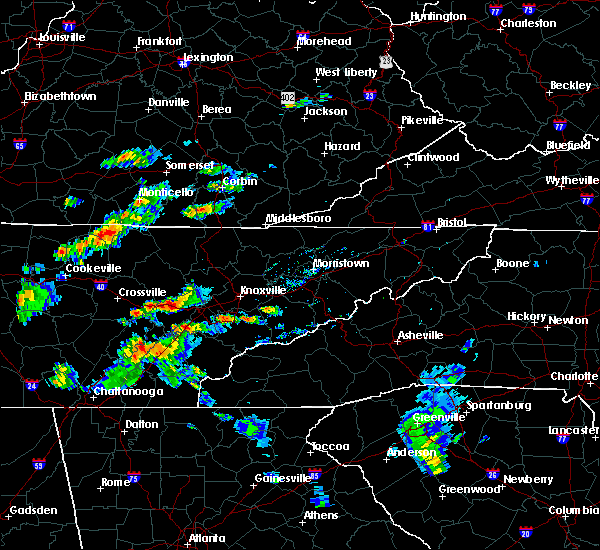 The severe thunderstorm warning for central rhea, northern mcminn and meigs counties will expire at 230 pm edt, the storm which prompted the warning has weakened below severe limits, and no longer pose an immediate threat to life or property. therefore the warning will be allowed to expire. however small. The severe thunderstorm warning for central rhea, northern mcminn and meigs counties will expire at 230 pm edt, the storm which prompted the warning has weakened below severe limits, and no longer pose an immediate threat to life or property. therefore the warning will be allowed to expire. however small.
|
| 6/30/2015 1:54 PM EDT |
 At 152 pm edt, a severe thunderstorm was located near decatur, moving northeast at 20 mph (radar indicated). Hazards include 60 mph wind gusts and quarter size hail. Hail damage to vehicles is expected. expect wind damage to roofs, siding and trees. Locations impacted include, athens, dayton, decatur, spring city, niota, peakland, big spring, ten mile, old washington, murray store, evensville and clear water. At 152 pm edt, a severe thunderstorm was located near decatur, moving northeast at 20 mph (radar indicated). Hazards include 60 mph wind gusts and quarter size hail. Hail damage to vehicles is expected. expect wind damage to roofs, siding and trees. Locations impacted include, athens, dayton, decatur, spring city, niota, peakland, big spring, ten mile, old washington, murray store, evensville and clear water.
|
| 6/30/2015 1:36 PM EDT |
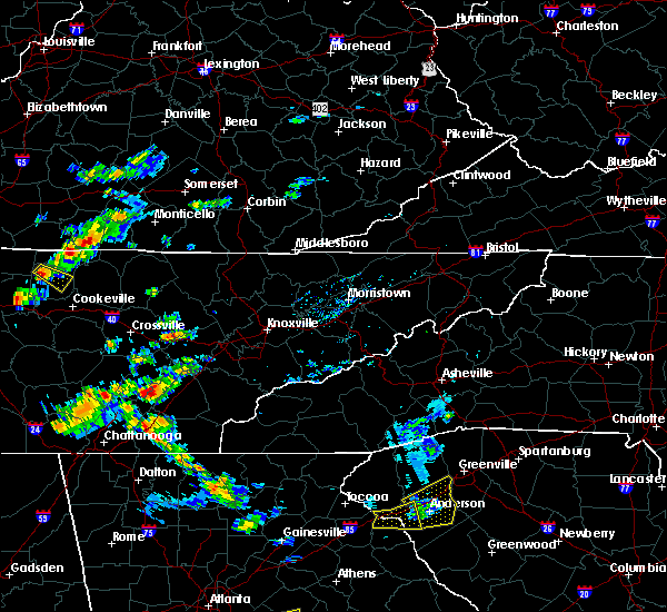 At 136 pm edt, a severe thunderstorm was located over decatur, moving northeast at 20 mph (radar indicated). Hazards include 60 mph wind gusts and quarter size hail. Hail damage to vehicles is expected. Expect wind damage to roofs, siding and trees. At 136 pm edt, a severe thunderstorm was located over decatur, moving northeast at 20 mph (radar indicated). Hazards include 60 mph wind gusts and quarter size hail. Hail damage to vehicles is expected. Expect wind damage to roofs, siding and trees.
|
| 6/24/2015 4:54 PM EDT |
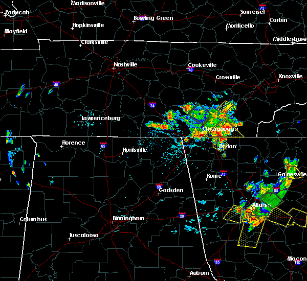 At 454 pm edt, a severe thunderstorm was located near decatur, moving northeast at 5 mph (radar indicated). Hazards include 60 mph wind gusts and quarter size hail. Hail damage to vehicles is expected. Expect wind damage to roofs, siding and trees. At 454 pm edt, a severe thunderstorm was located near decatur, moving northeast at 5 mph (radar indicated). Hazards include 60 mph wind gusts and quarter size hail. Hail damage to vehicles is expected. Expect wind damage to roofs, siding and trees.
|
| 6/24/2015 3:29 PM CDT |
 At 429 pm edt /329 pm cdt/, severe thunderstorms were located along a line extending from near benton to near ridgeside to 7 miles northwest of lookout mountain to near jasper, moving southeast at 15 mph (radar indicated). Hazards include 60 mph wind gusts and quarter size hail. Hail damage to vehicles is expected. expect wind damage to roofs, siding and trees. Locations impacted include, chattanooga, cleveland, dayton, dunlap, jasper, benton, soddy-daisy, signal mountain, south pittsburg, walden, lakesite, whitwell, kimball, charleston, ridgeside, harrison, south cleveland, east cleveland, fairmount and wildwood lake. At 429 pm edt /329 pm cdt/, severe thunderstorms were located along a line extending from near benton to near ridgeside to 7 miles northwest of lookout mountain to near jasper, moving southeast at 15 mph (radar indicated). Hazards include 60 mph wind gusts and quarter size hail. Hail damage to vehicles is expected. expect wind damage to roofs, siding and trees. Locations impacted include, chattanooga, cleveland, dayton, dunlap, jasper, benton, soddy-daisy, signal mountain, south pittsburg, walden, lakesite, whitwell, kimball, charleston, ridgeside, harrison, south cleveland, east cleveland, fairmount and wildwood lake.
|
| 6/24/2015 4:28 PM EDT |
 At 428 pm edt, a severe thunderstorm was located near decatur, moving northeast at 5 mph (radar indicated). Hazards include 60 mph wind gusts and quarter size hail. Hail damage to vehicles is expected. Expect wind damage to roofs, siding and trees. At 428 pm edt, a severe thunderstorm was located near decatur, moving northeast at 5 mph (radar indicated). Hazards include 60 mph wind gusts and quarter size hail. Hail damage to vehicles is expected. Expect wind damage to roofs, siding and trees.
|
| 6/24/2015 3:06 PM CDT |
 At 406 pm edt /306 pm cdt/, severe thunderstorms were located along a line extending from near etowah to near chattanooga to near whitwell to near monteagle, moving south at 20 mph (radar indicated). Hazards include 60 mph wind gusts and quarter size hail. Hail damage to vehicles is expected. expect wind damage to roofs, siding and trees. Locations impacted include, chattanooga, cleveland, dayton, dunlap, jasper, benton, soddy-daisy, signal mountain, south pittsburg, walden, lakesite, whitwell, kimball, monteagle, charleston, ridgeside, harrison, south cleveland, east cleveland and fairmount. At 406 pm edt /306 pm cdt/, severe thunderstorms were located along a line extending from near etowah to near chattanooga to near whitwell to near monteagle, moving south at 20 mph (radar indicated). Hazards include 60 mph wind gusts and quarter size hail. Hail damage to vehicles is expected. expect wind damage to roofs, siding and trees. Locations impacted include, chattanooga, cleveland, dayton, dunlap, jasper, benton, soddy-daisy, signal mountain, south pittsburg, walden, lakesite, whitwell, kimball, monteagle, charleston, ridgeside, harrison, south cleveland, east cleveland and fairmount.
|
| 6/24/2015 2:54 PM CDT |
 At 354 pm edt /254 pm cdt/, severe thunderstorms were located along a line extending from 6 miles southwest of etowah to near monteagle, moving southeast at 10 mph (radar indicated). Hazards include 60 mph wind gusts and quarter size hail. Hail damage to vehicles is expected. expect wind damage to roofs, siding and trees. Locations impacted include, chattanooga, cleveland, dayton, dunlap, jasper, benton, soddy-daisy, signal mountain, south pittsburg, walden, lakesite, whitwell, kimball, monteagle, charleston, ridgeside, harrison, south cleveland, east cleveland and fairmount. At 354 pm edt /254 pm cdt/, severe thunderstorms were located along a line extending from 6 miles southwest of etowah to near monteagle, moving southeast at 10 mph (radar indicated). Hazards include 60 mph wind gusts and quarter size hail. Hail damage to vehicles is expected. expect wind damage to roofs, siding and trees. Locations impacted include, chattanooga, cleveland, dayton, dunlap, jasper, benton, soddy-daisy, signal mountain, south pittsburg, walden, lakesite, whitwell, kimball, monteagle, charleston, ridgeside, harrison, south cleveland, east cleveland and fairmount.
|
| 6/24/2015 2:39 PM CDT |
 At 338 pm edt /238 pm cdt/, severe thunderstorms were located along a line extending from 6 miles west of etowah to monteagle, moving southeast at 10 mph (radar indicated). Hazards include 60 mph wind gusts and quarter size hail. Hail damage to vehicles is expected. Expect wind damage to roofs, siding and trees. At 338 pm edt /238 pm cdt/, severe thunderstorms were located along a line extending from 6 miles west of etowah to monteagle, moving southeast at 10 mph (radar indicated). Hazards include 60 mph wind gusts and quarter size hail. Hail damage to vehicles is expected. Expect wind damage to roofs, siding and trees.
|
| 6/8/2015 8:02 PM EDT | At 801 pm edt /701 pm cdt/, severe thunderstorms were located along a line extending from 8 miles west of rockwood to near spring city to near dayton to 6 miles northeast of dunlap, moving east at 50 mph (radar indicated). Hazards include 60 mph wind gusts and penny size hail. Expect damage to roofs. siding and trees. locations impacted include, athens, dayton, sweetwater, pikeville, decatur, etowah, spring city, charleston, graysville, niota, calhoun, riceville, peakland, big spring, stinging fork falls s. p,. evensville, clear water, fall creek falls s. p,. Dentville and old washington. |
| 6/8/2015 7:28 PM EDT | At 727 pm edt /627 pm cdt/, severe thunderstorms were located along a line extending from 9 miles east of sparta to 7 miles southeast of spencer to 12 miles west of pikeville to 11 miles south of mcminnville, moving east southeast at 45 mph (radar indicated). Hazards include 65 mph wind gusts and penny size hail. Expect damage to roofs. Siding and trees. |
| 4/3/2015 8:30 PM EDT | A severe thunderstorm warning remains in effect until 900 pm edt/800 pm cdt/ for bledsoe. meigs. roane. eastern hamilton and rhea counties. at 829 pm edt /729 pm cdt/. severe thunderstorms were located along a line extending from near rockwood to 11 miles southwest of pikeville. Moving southeast at 40 mph. |
| 4/3/2015 8:12 PM EDT | The national weather service in morristown has issued a * severe thunderstorm warning for. bledsoe county in eastern tennessee. meigs county in eastern tennessee. roane county in eastern tennessee. Eastern hamilton county in eastern tennessee. |
| 10/8/2014 4:30 AM EDT | Several trees reported down near the city of dayto in rhea county TN, 0.2 miles WNW of Dayton, TN |
| 8/20/2014 5:20 PM EDT | Trees dow in rhea county TN, 0.2 miles WNW of Dayton, TN |
| 8/20/2014 5:10 PM EDT | Numerous trees dow in rhea county TN, 0.2 miles WNW of Dayton, TN |
| 6/18/2014 5:00 PM EDT | A few trees dow in rhea county TN, 0.2 miles WNW of Dayton, TN |
| 6/18/2014 4:39 PM EDT | Tree down on lake view circl in rhea county TN, 0.2 miles WNW of Dayton, TN |
| 6/18/2014 4:12 PM EDT | One tree down on old graysville r in rhea county TN, 3 miles NE of Dayton, TN |
| 7/10/2013 6:58 PM EDT | One tree down on black oak ridge roa in rhea county TN, 3.8 miles NNE of Dayton, TN |
| 5/19/2013 11:45 AM EDT | Several trees down throughout the county...reported by dispatc in rhea county TN, 5.6 miles SSW of Dayton, TN |
| 7/31/2012 7:45 PM EDT | Dispatch reported two trees down...one off of ray road and the other off blythe ferry roa in rhea county TN, 2 miles NW of Dayton, TN |
| 7/1/2012 11:15 PM EDT | Mutiple trees and powerlines dow in rhea county TN, 0.2 miles WNW of Dayton, TN |
| 5/29/2012 8:40 PM EDT | Dispatch reported a tree down on bluff view drive and another down on ogden roa in rhea county TN, 3.3 miles WSW of Dayton, TN |
| 1/1/0001 12:00 AM | Trees down near dayton in rhea county TN, 0.2 miles WNW of Dayton, TN |
| 1/1/0001 12:00 AM | Multiple trees down around 845pm near highway 27 in rhea county TN, 0.2 miles WNW of Dayton, TN |
| 1/1/0001 12:00 AM | Quarter sized hail reported 0.2 miles WNW of Dayton, TN |
| 1/1/0001 12:00 AM | Several trees dow in rhea county TN, 0.2 miles WNW of Dayton, TN |
| 1/1/0001 12:00 AM | Several trees down across the southern half of the county...especially around dayton and evensville. reported by dispatc in rhea county TN, 0.2 miles WNW of Dayton, TN |
| 1/1/0001 12:00 AM | Multiple trees down in dayton...reported by dispatch in rhea county TN, 0.2 miles WNW of Dayton, TN |
| 1/1/0001 12:00 AM | Two trees dow in rhea county TN, 0.2 miles WNW of Dayton, TN |
| 1/1/0001 12:00 AM | Several trees dow in rhea county TN, 0.2 miles WNW of Dayton, TN |
| 1/1/0001 12:00 AM | Two trees down and numerous power outages in dayton. reorted by dispatc in rhea county TN, 0.2 miles WNW of Dayton, TN |
Hail Maps for Dayton, TN


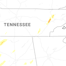


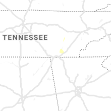


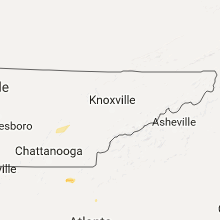
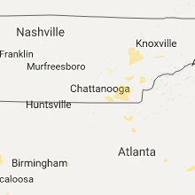


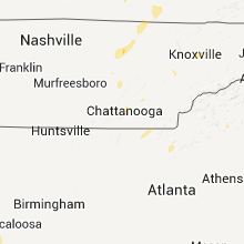


Connect with Interactive Hail Maps