

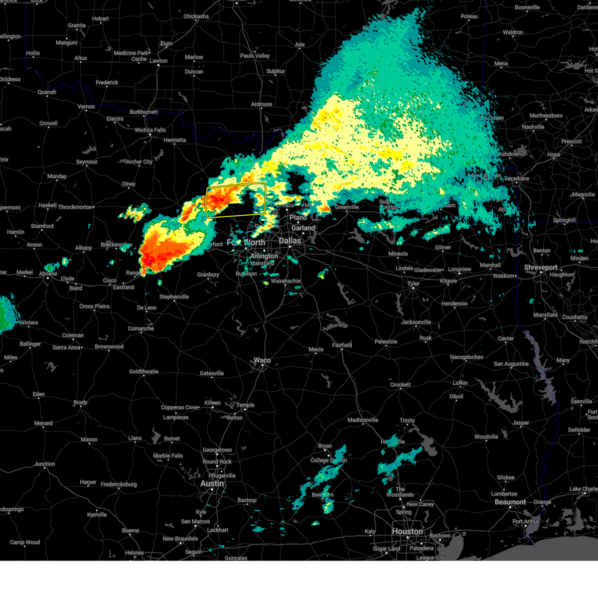
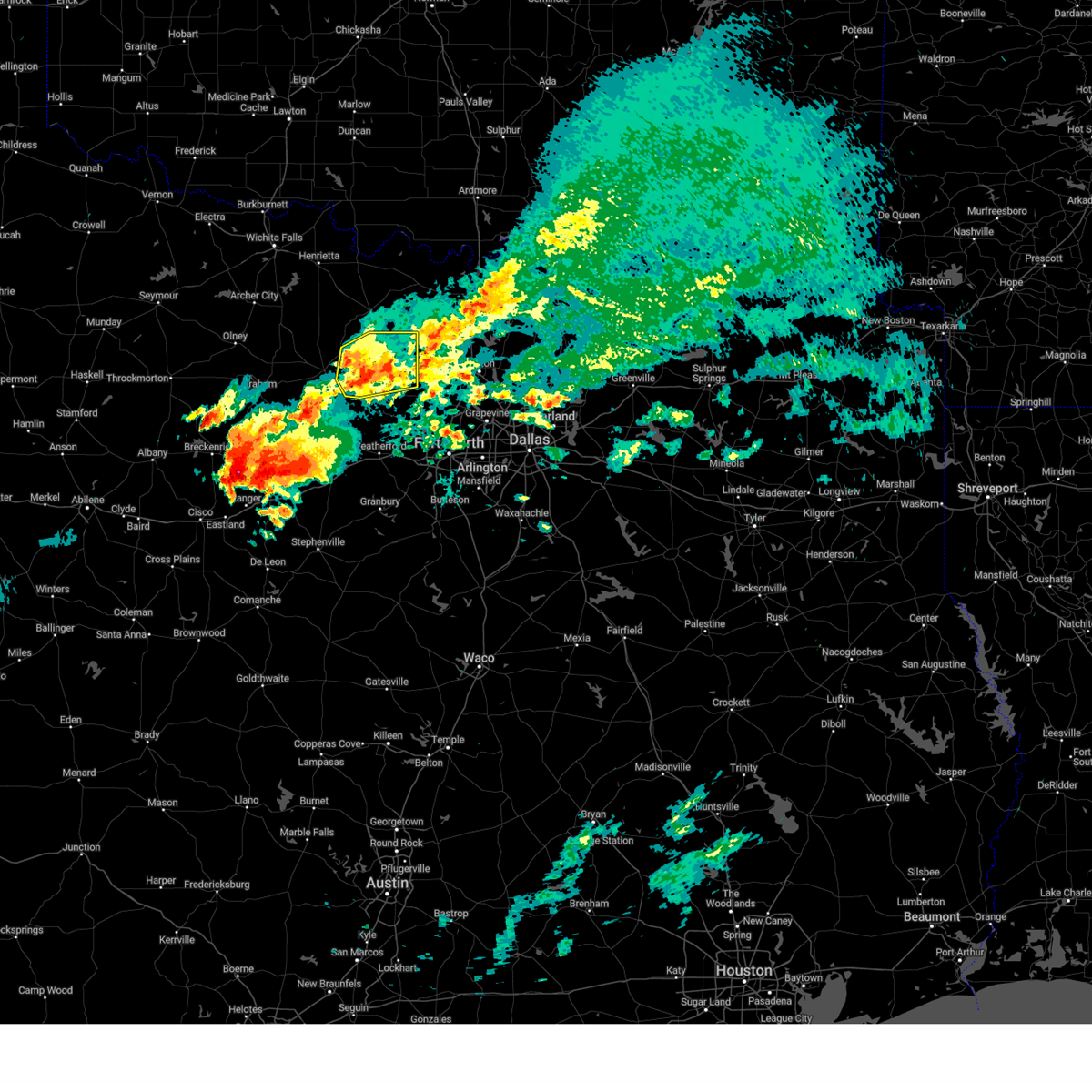
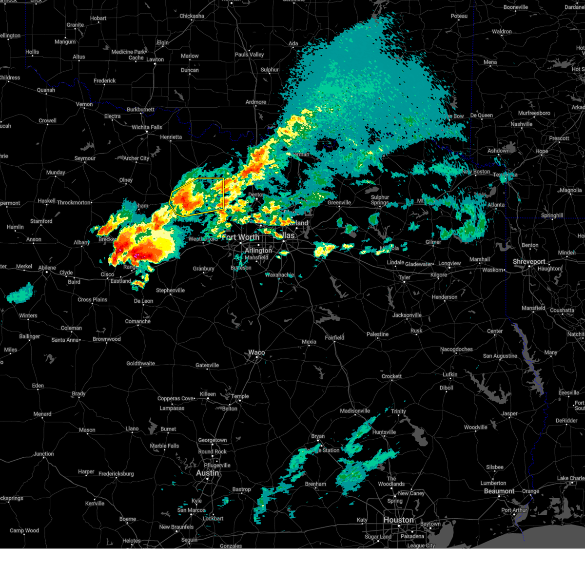
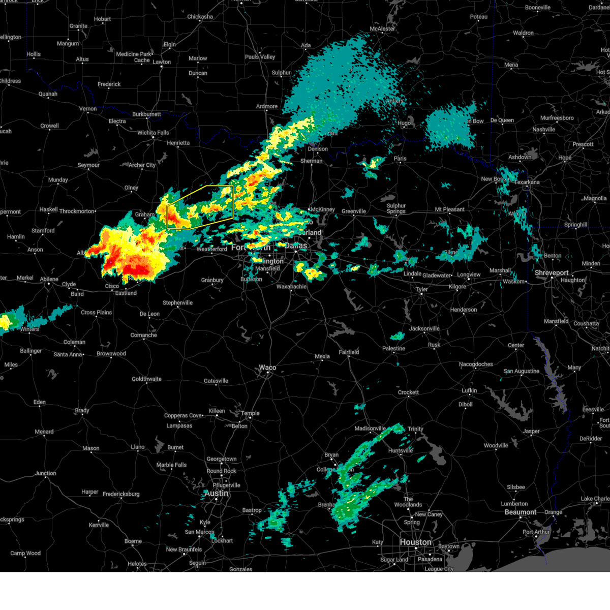
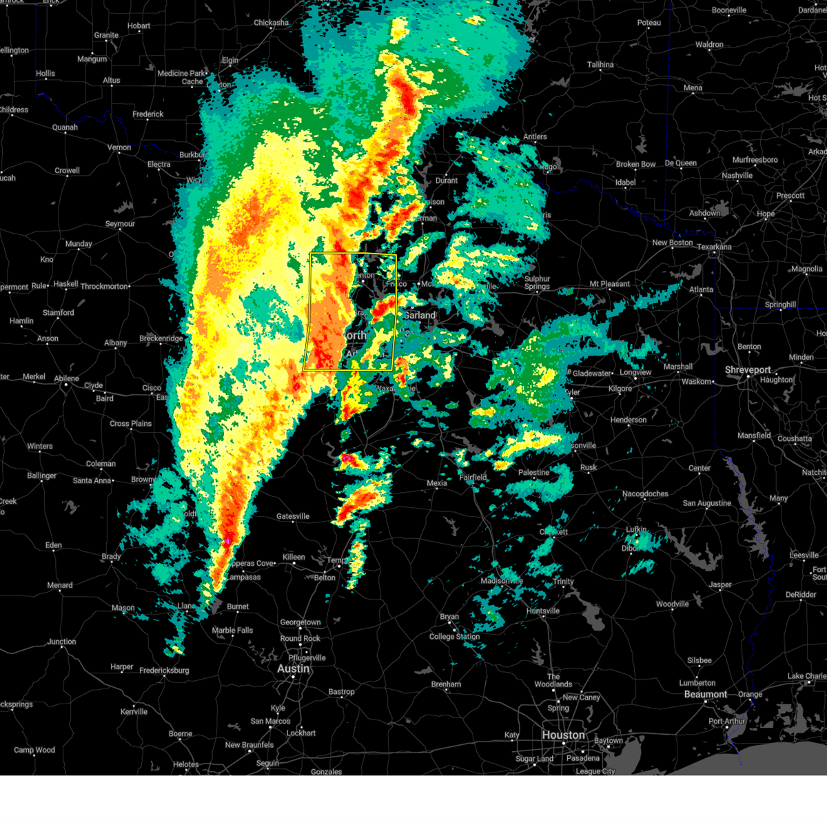
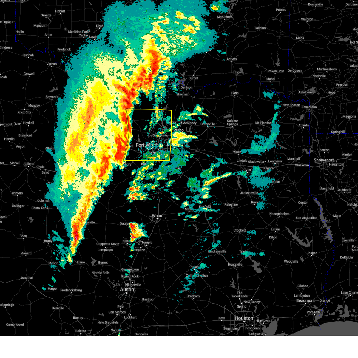
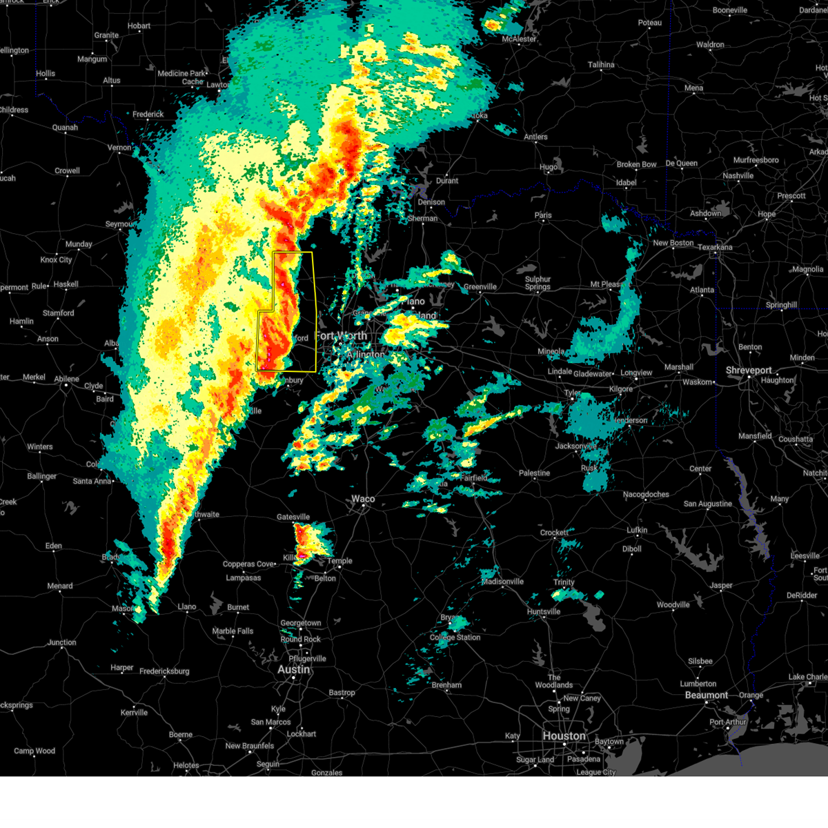
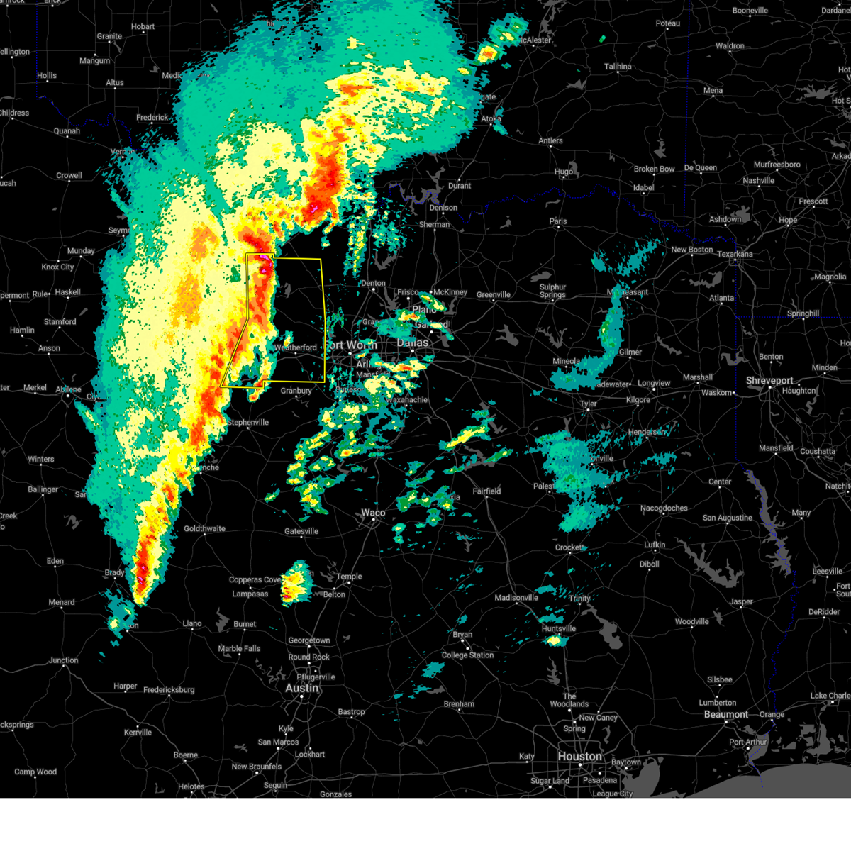
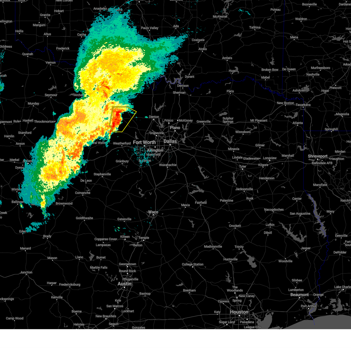
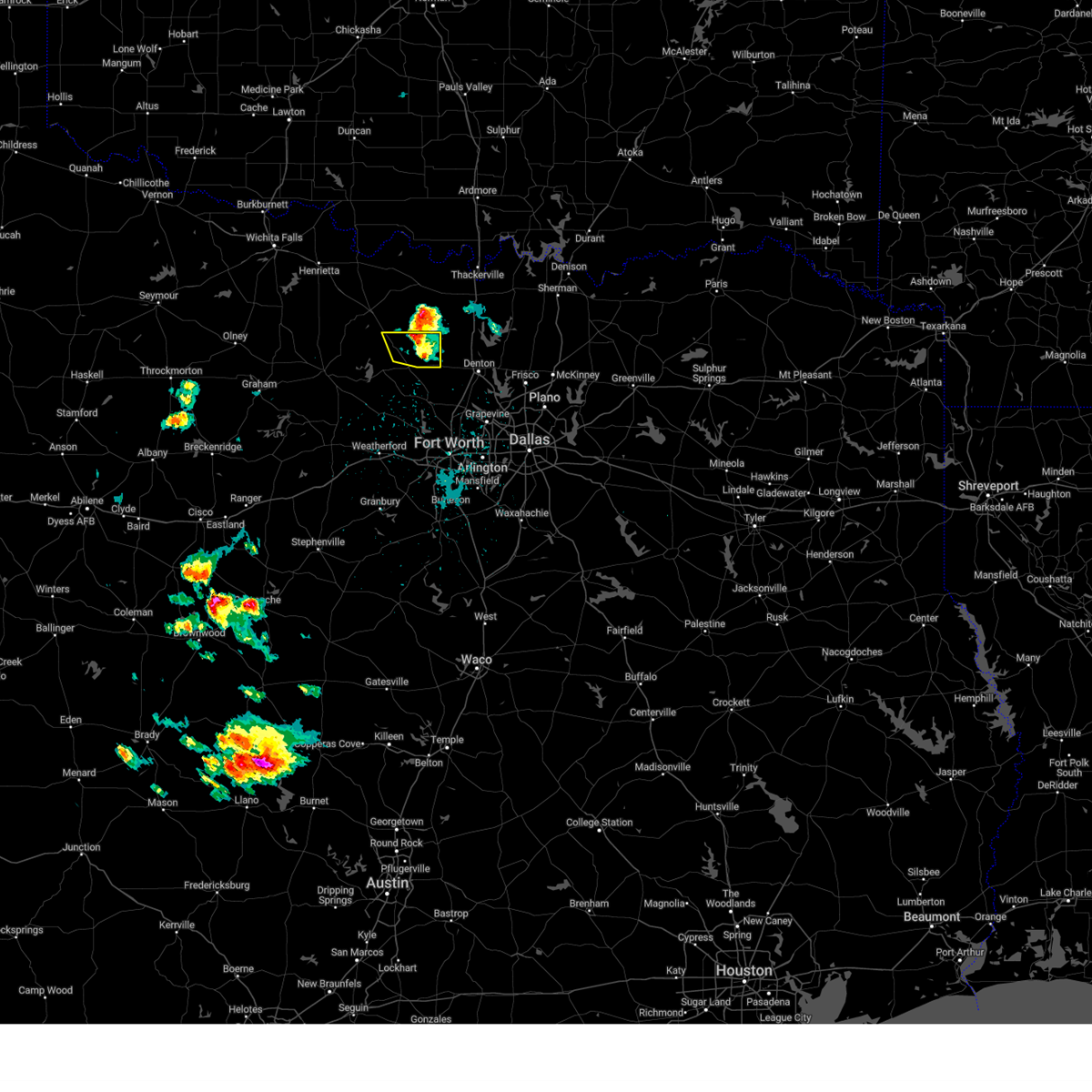
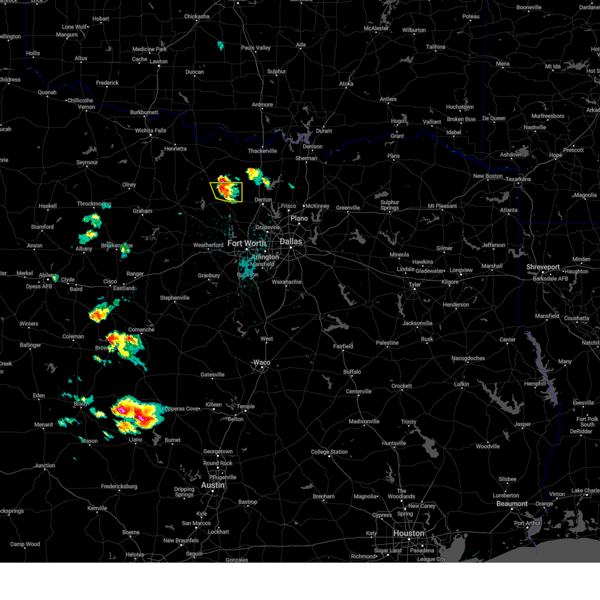
Hail Map for Decatur, TX
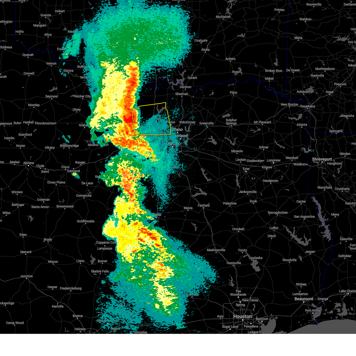
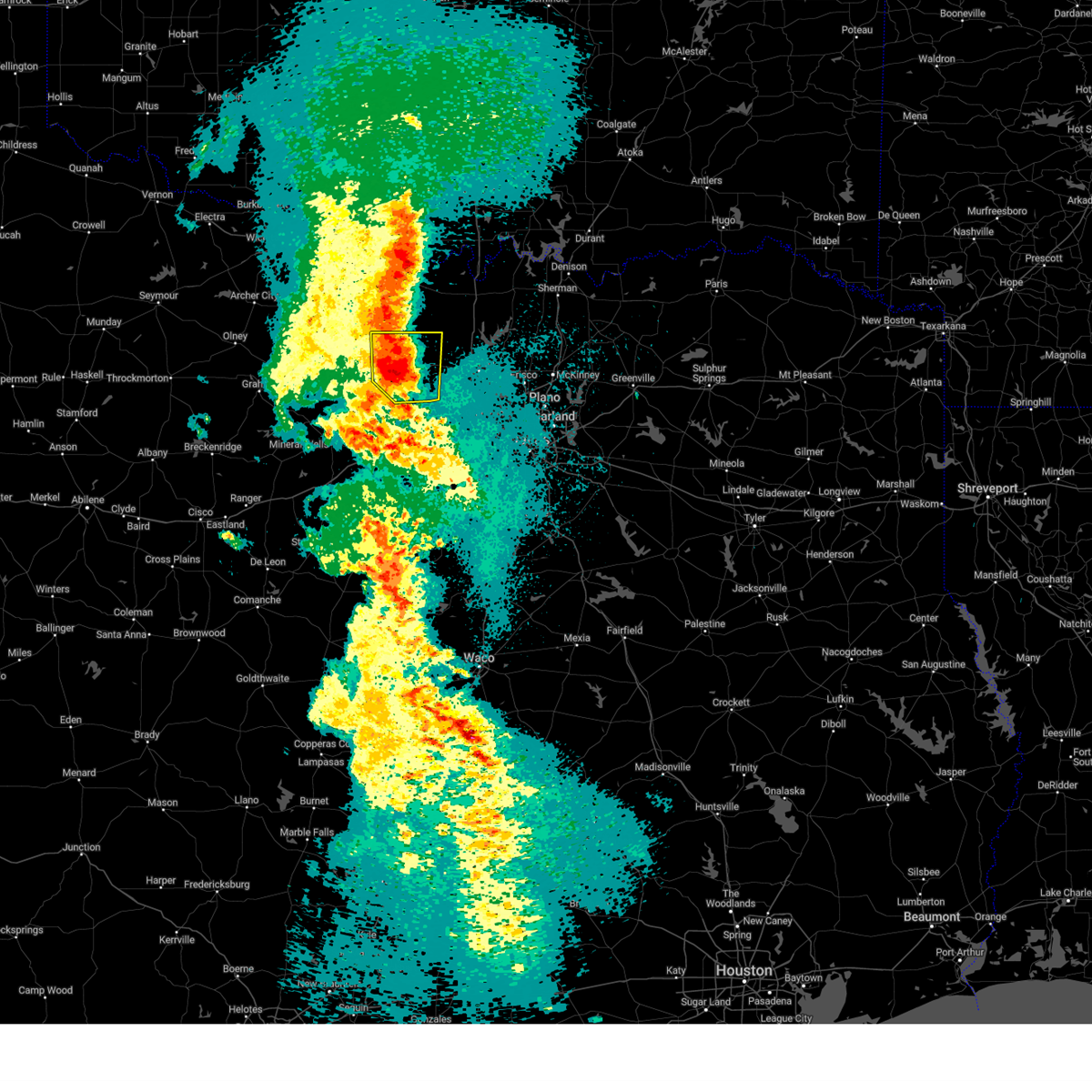
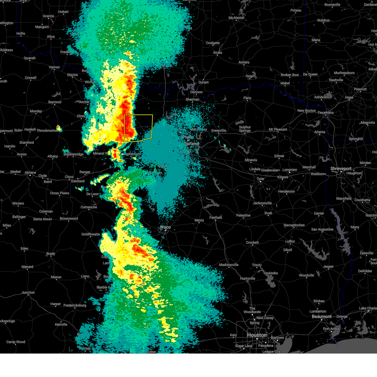
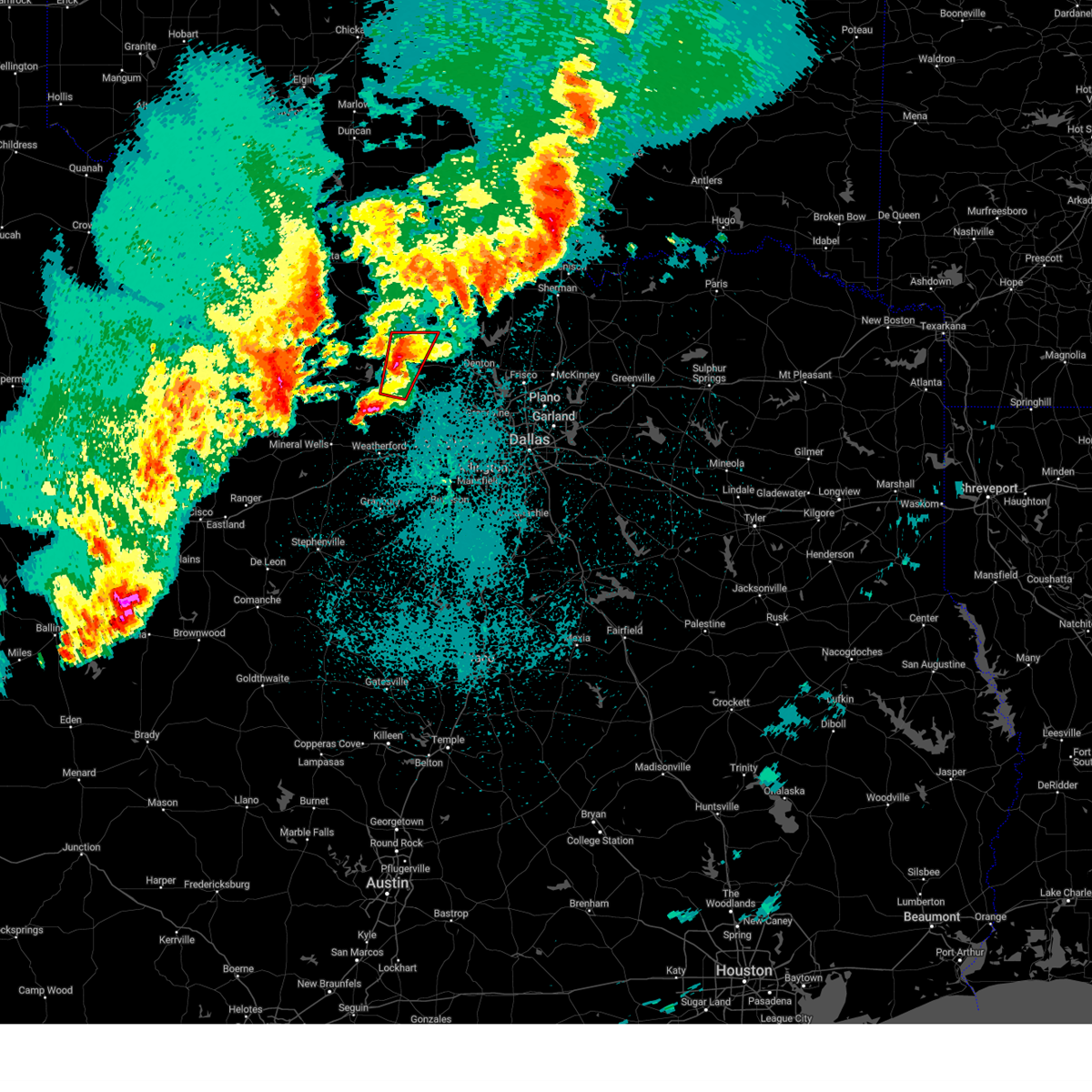
The Decatur, TX area has had 39 reports of on-the-ground hail by trained spotters, and has been under severe weather warnings 39 times during the past 12 months. Doppler radar has detected hail at or near Decatur, TX on 108 occasions, including 7 occasions during the past year.
| Name: | Decatur, TX |
| Where Located: | 55.4 miles WNW of Dallas, TX |
| Map: | Google Map for Decatur, TX |
| Population: | 6042 |
| Housing Units: | 2441 |
| More Info: | Search Google for Decatur, TX |
1
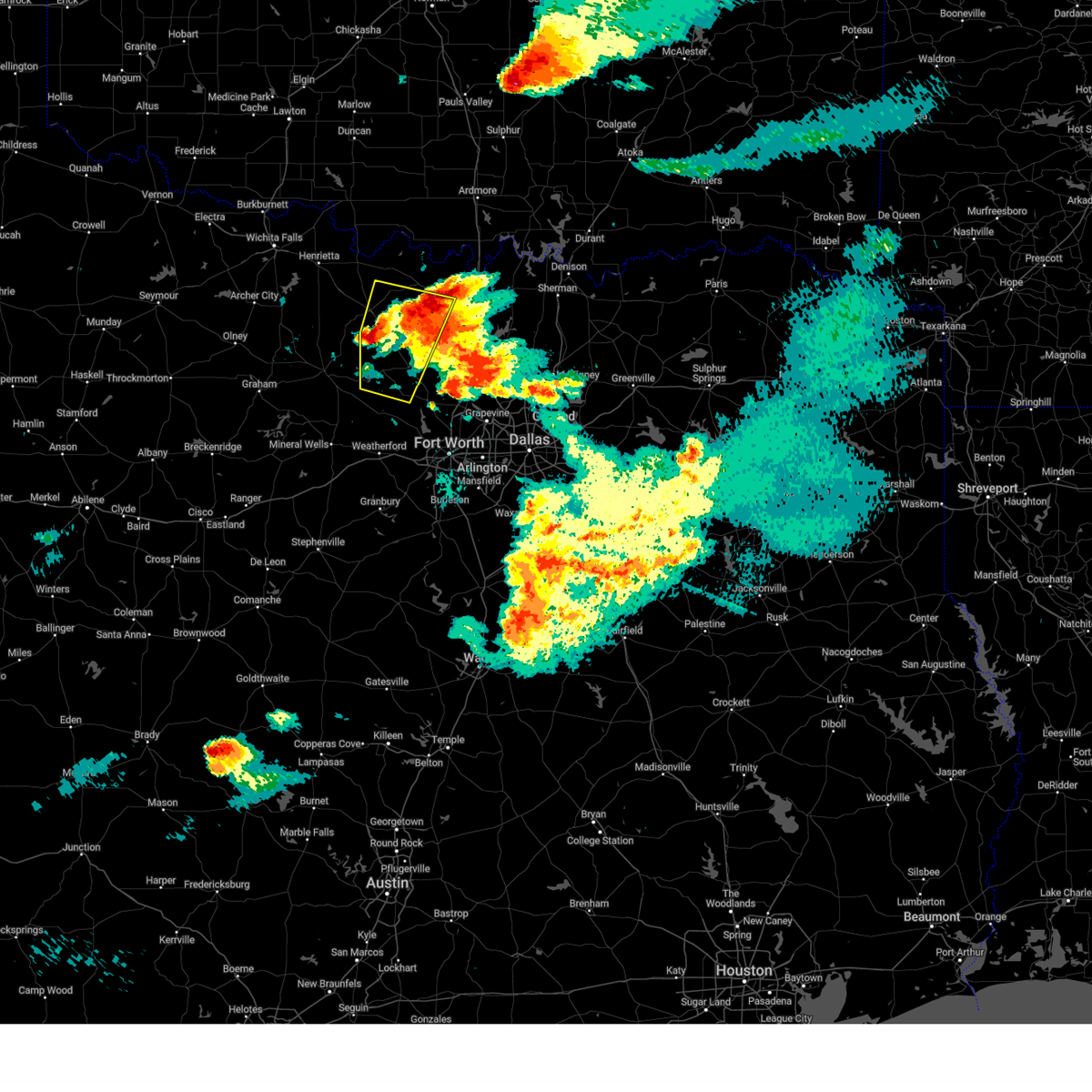
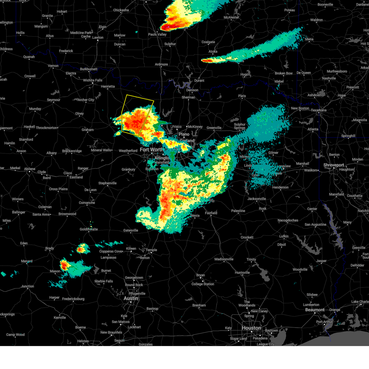
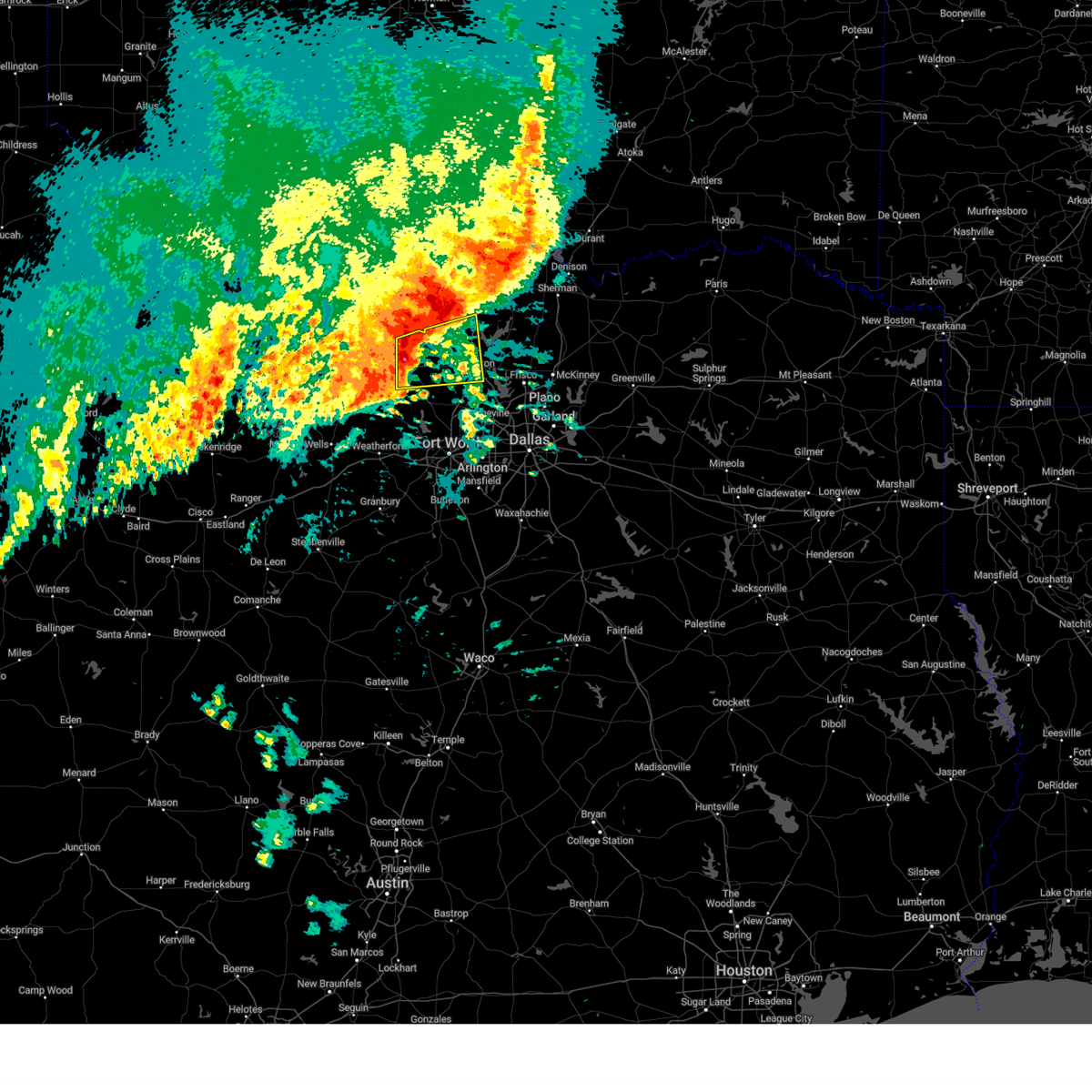
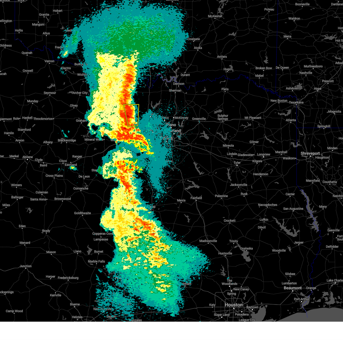
The Top Recent Hail Date for Decatur, TX is Sunday, May 18, 2025 (20th out of 108)
Hail and Wind Damage Spotted near Decatur, TX
| Date / Time | Report Details |
|---|---|
| 6/8/2025 9:41 PM CDT |
 At 940 pm cdt, severe thunderstorms were located along a line extending from near ray roberts park johnson branch to near chico, moving southeast at 35 mph (radar indicated). Hazards include 70 mph wind gusts and quarter size hail. Hail damage to vehicles is expected. expect considerable tree damage. wind damage is also likely to mobile homes, roofs, and outbuildings. these severe storms will be near, sanger, bridgeport, ray roberts park isle du bois, decatur, and ray roberts park johnson branch around 945 pm cdt. denton and pilot point around 950 pm cdt. paradise, aubrey, and krum around 955 pm cdt. krugerville, new fairview, and cross roads around 1000 pm cdt. hackberry, and little elm around 1015 pm cdt. the colony around 1020 pm cdt. Other locations impacted by these severe thunderstorms include rosston, valley view, park springs, crafton, providence village, stony, ponder, lake ray roberts, bolivar, and lincoln park. At 940 pm cdt, severe thunderstorms were located along a line extending from near ray roberts park johnson branch to near chico, moving southeast at 35 mph (radar indicated). Hazards include 70 mph wind gusts and quarter size hail. Hail damage to vehicles is expected. expect considerable tree damage. wind damage is also likely to mobile homes, roofs, and outbuildings. these severe storms will be near, sanger, bridgeport, ray roberts park isle du bois, decatur, and ray roberts park johnson branch around 945 pm cdt. denton and pilot point around 950 pm cdt. paradise, aubrey, and krum around 955 pm cdt. krugerville, new fairview, and cross roads around 1000 pm cdt. hackberry, and little elm around 1015 pm cdt. the colony around 1020 pm cdt. Other locations impacted by these severe thunderstorms include rosston, valley view, park springs, crafton, providence village, stony, ponder, lake ray roberts, bolivar, and lincoln park.
|
| 6/8/2025 9:04 PM CDT | Svrfwd the national weather service in fort worth has issued a * severe thunderstorm warning for, southern montague county in north central texas, wise county in north central texas, denton county in north central texas, cooke county in north central texas, * until 1000 pm cdt. * at 904 pm cdt, severe thunderstorms were located along a line extending from near lindsay to bowie, moving southeast at 45 mph (radar indicated). Hazards include 70 mph wind gusts and quarter size hail. Hail damage to vehicles is expected. expect considerable tree damage. wind damage is also likely to mobile homes, roofs, and outbuildings. severe thunderstorms will be near, lindsay, sunset, and gainesville around 910 pm cdt. lake kiowa around 915 pm cdt. alvord around 920 pm cdt. sanger and ray roberts park johnson branch around 925 pm cdt. ray roberts park isle du bois and pilot point around 930 pm cdt. denton and decatur around 935 pm cdt. aubrey and krum around 940 pm cdt. krugerville, new fairview, celina, and cross roads around 945 pm cdt. other locations impacted by these severe thunderstorms include rosston, valley view, park springs, crafton, providence village, stony, ponder, lake ray roberts, bolivar, and lincoln park. this includes the following highways, interstate 35 between mile markers 468 and 503. interstate 35w between mile markers 79 and 85. Interstate 35e between mile markers 458 and 466. |
| 6/3/2025 8:13 PM CDT | At 813 pm cdt, severe thunderstorms were located near alvord and fort richardson state park, both moving southeast at 20 mph (radar indicated). Hazards include ping pong ball size hail and 65 mph wind gusts. People and animals outdoors will be injured. expect hail damage to roofs, siding, windows, and vehicles. expect wind damage to roofs, siding, and trees. these severe storms will be near, jacksboro, bridgeport, chico, lake bridgeport, and fort richardson state park around 820 pm cdt. decatur around 830 pm cdt. Other locations impacted by these severe thunderstorms include jermyn, lost creek reservoir, vineyard, wizard wells, cundiff, greenwood, park springs, lake bridgeport, crafton, and runaway bay. |
| 6/3/2025 7:49 PM CDT |
 Svrfwd the national weather service in fort worth has issued a * severe thunderstorm warning for, northern wise county in north central texas, central jack county in north central texas, * until 845 pm cdt. * at 749 pm cdt, severe thunderstorms were located along a line extending from near lake amon g carter to 8 miles north of bryson, moving southeast at 20 mph (radar indicated). Hazards include golf ball size hail and 65 mph wind gusts. People and animals outdoors will be injured. expect hail damage to roofs, siding, windows, and vehicles. expect wind damage to roofs, siding, and trees. severe thunderstorms will be near, jacksboro around 800 pm cdt. lake bridgeport around 805 pm cdt. alvord, chico, and fort richardson state park around 810 pm cdt. bridgeport around 825 pm cdt. Other locations impacted by these severe thunderstorms include jermyn, lost creek reservoir, vineyard, wizard wells, cundiff, greenwood, park springs, lake bridgeport, crafton, and runaway bay. Svrfwd the national weather service in fort worth has issued a * severe thunderstorm warning for, northern wise county in north central texas, central jack county in north central texas, * until 845 pm cdt. * at 749 pm cdt, severe thunderstorms were located along a line extending from near lake amon g carter to 8 miles north of bryson, moving southeast at 20 mph (radar indicated). Hazards include golf ball size hail and 65 mph wind gusts. People and animals outdoors will be injured. expect hail damage to roofs, siding, windows, and vehicles. expect wind damage to roofs, siding, and trees. severe thunderstorms will be near, jacksboro around 800 pm cdt. lake bridgeport around 805 pm cdt. alvord, chico, and fort richardson state park around 810 pm cdt. bridgeport around 825 pm cdt. Other locations impacted by these severe thunderstorms include jermyn, lost creek reservoir, vineyard, wizard wells, cundiff, greenwood, park springs, lake bridgeport, crafton, and runaway bay.
|
| 5/18/2025 8:39 PM CDT | The storm which prompted the warning has weakened below severe limits. therefore the warning will be allowed to expire. however small hail, gusty winds and heavy rain are still possible with this thunderstorm. a tornado watch remains in effect until 1000 pm cdt for north central texas. |
| 5/18/2025 8:15 PM CDT |
 At 815 pm cdt, a severe thunderstorm was located 7 miles northwest of krum, or 9 miles west of sanger, moving east at 35 mph (radar indicated). Hazards include ping pong ball size hail and 60 mph wind gusts. People and animals outdoors will be injured. expect hail damage to roofs, siding, windows, and vehicles. expect wind damage to roofs, siding, and trees. this severe storm will be near, sanger around 820 pm cdt. Other locations impacted by this severe thunderstorm include stony, ponder, greenwood, bolivar, slidell, dish, cottondale, and lake ray roberts. At 815 pm cdt, a severe thunderstorm was located 7 miles northwest of krum, or 9 miles west of sanger, moving east at 35 mph (radar indicated). Hazards include ping pong ball size hail and 60 mph wind gusts. People and animals outdoors will be injured. expect hail damage to roofs, siding, windows, and vehicles. expect wind damage to roofs, siding, and trees. this severe storm will be near, sanger around 820 pm cdt. Other locations impacted by this severe thunderstorm include stony, ponder, greenwood, bolivar, slidell, dish, cottondale, and lake ray roberts.
|
| 5/18/2025 7:58 PM CDT | At 756 pm cdt, a severe thunderstorm was located near decatur, moving east at 35 mph (radar indicated). Hazards include 60 mph wind gusts and quarter size hail. Hail damage to vehicles is expected. expect wind damage to roofs, siding, and trees. this severe storm will be near, sanger around 815 pm cdt. Other locations impacted by this severe thunderstorm include stony, ponder, greenwood, bolivar, slidell, dish, cottondale, and lake ray roberts. |
| 5/18/2025 7:50 PM CDT | Half Dollar sized hail reported 1.3 miles S of Decatur, TX, report from mping: half dollar (1.25 in.). |
| 5/18/2025 7:45 PM CDT |
 Svrfwd the national weather service in fort worth has issued a * severe thunderstorm warning for, central wise county in north central texas, northwestern denton county in north central texas, * until 845 pm cdt. * at 744 pm cdt, a severe thunderstorm was located near bridgeport, moving east at 35 mph (radar indicated). Hazards include 60 mph wind gusts and half dollar size hail. Hail damage to vehicles is expected. expect wind damage to roofs, siding, and trees. this severe thunderstorm will be near, decatur around 750 pm cdt. krum around 825 pm cdt. denton and sanger around 830 pm cdt. Other locations impacted by this severe thunderstorm include stony, ponder, greenwood, bolivar, slidell, dish, cottondale, and lake ray roberts. Svrfwd the national weather service in fort worth has issued a * severe thunderstorm warning for, central wise county in north central texas, northwestern denton county in north central texas, * until 845 pm cdt. * at 744 pm cdt, a severe thunderstorm was located near bridgeport, moving east at 35 mph (radar indicated). Hazards include 60 mph wind gusts and half dollar size hail. Hail damage to vehicles is expected. expect wind damage to roofs, siding, and trees. this severe thunderstorm will be near, decatur around 750 pm cdt. krum around 825 pm cdt. denton and sanger around 830 pm cdt. Other locations impacted by this severe thunderstorm include stony, ponder, greenwood, bolivar, slidell, dish, cottondale, and lake ray roberts.
|
| 5/18/2025 7:27 PM CDT |
 At 724 pm cdt, a severe thunderstorm was located over lake bridgeport, or 7 miles west of bridgeport, moving northeast at 35 mph (radar indicated). Hazards include 60 mph wind gusts and quarter size hail. Hail damage to vehicles is expected. expect wind damage to roofs, siding, and trees. this severe storm will be near, bridgeport and lake bridgeport around 730 pm cdt. chico around 735 pm cdt. decatur around 750 pm cdt. Other locations impacted by this severe thunderstorm include joplin, balsora, vineyard, wizard wells, cundiff, park springs, runaway bay, lake bridgeport, and crafton. At 724 pm cdt, a severe thunderstorm was located over lake bridgeport, or 7 miles west of bridgeport, moving northeast at 35 mph (radar indicated). Hazards include 60 mph wind gusts and quarter size hail. Hail damage to vehicles is expected. expect wind damage to roofs, siding, and trees. this severe storm will be near, bridgeport and lake bridgeport around 730 pm cdt. chico around 735 pm cdt. decatur around 750 pm cdt. Other locations impacted by this severe thunderstorm include joplin, balsora, vineyard, wizard wells, cundiff, park springs, runaway bay, lake bridgeport, and crafton.
|
| 5/18/2025 7:12 PM CDT |
 At 712 pm cdt, a severe thunderstorm was located 7 miles east of jacksboro, moving northeast at 45 mph (radar indicated). Hazards include ping pong ball size hail and 60 mph wind gusts. People and animals outdoors will be injured. expect hail damage to roofs, siding, windows, and vehicles. expect wind damage to roofs, siding, and trees. this severe storm will be near, lake bridgeport around 715 pm cdt. chico around 725 pm cdt. bridgeport around 730 pm cdt. alvord around 735 pm cdt. Other locations impacted by this severe thunderstorm include joplin, balsora, boonsville, lost creek reservoir, vineyard, wizard wells, cundiff, park springs, runaway bay, and lake bridgeport. At 712 pm cdt, a severe thunderstorm was located 7 miles east of jacksboro, moving northeast at 45 mph (radar indicated). Hazards include ping pong ball size hail and 60 mph wind gusts. People and animals outdoors will be injured. expect hail damage to roofs, siding, windows, and vehicles. expect wind damage to roofs, siding, and trees. this severe storm will be near, lake bridgeport around 715 pm cdt. chico around 725 pm cdt. bridgeport around 730 pm cdt. alvord around 735 pm cdt. Other locations impacted by this severe thunderstorm include joplin, balsora, boonsville, lost creek reservoir, vineyard, wizard wells, cundiff, park springs, runaway bay, and lake bridgeport.
|
| 5/18/2025 6:59 PM CDT |
 Svrfwd the national weather service in fort worth has issued a * severe thunderstorm warning for, western wise county in north central texas, southern jack county in north central texas, * until 745 pm cdt. * at 659 pm cdt, a severe thunderstorm was located near fort richardson state park, or near jacksboro, moving northeast at 45 mph (radar indicated). Hazards include ping pong ball size hail and 60 mph wind gusts. People and animals outdoors will be injured. expect hail damage to roofs, siding, windows, and vehicles. expect wind damage to roofs, siding, and trees. this severe thunderstorm will be near, jacksboro and fort richardson state park around 705 pm cdt. lake bridgeport around 710 pm cdt. chico around 725 pm cdt. alvord around 735 pm cdt. Other locations impacted by this severe thunderstorm include lost creek reservoir, cundiff, park springs, lake bridgeport, crafton, gibtown, joplin, balsora, perrin, and bartons chapel. Svrfwd the national weather service in fort worth has issued a * severe thunderstorm warning for, western wise county in north central texas, southern jack county in north central texas, * until 745 pm cdt. * at 659 pm cdt, a severe thunderstorm was located near fort richardson state park, or near jacksboro, moving northeast at 45 mph (radar indicated). Hazards include ping pong ball size hail and 60 mph wind gusts. People and animals outdoors will be injured. expect hail damage to roofs, siding, windows, and vehicles. expect wind damage to roofs, siding, and trees. this severe thunderstorm will be near, jacksboro and fort richardson state park around 705 pm cdt. lake bridgeport around 710 pm cdt. chico around 725 pm cdt. alvord around 735 pm cdt. Other locations impacted by this severe thunderstorm include lost creek reservoir, cundiff, park springs, lake bridgeport, crafton, gibtown, joplin, balsora, perrin, and bartons chapel.
|
| 5/17/2025 6:27 PM CDT |
 the severe thunderstorm warning has been cancelled and is no longer in effect the severe thunderstorm warning has been cancelled and is no longer in effect
|
| 5/17/2025 6:03 PM CDT |
 Svrfwd the national weather service in fort worth has issued a * severe thunderstorm warning for, southern montague county in north central texas, wise county in north central texas, southwestern cooke county in north central texas, * until 700 pm cdt. * at 602 pm cdt, a severe thunderstorm was located over lake bridgeport, moving northeast at 35 mph (emergency management. at 558 pm cdt....baseball size hail and downed trees were reported near bridgeport and runaway bay with this storm). Hazards include golf ball size hail and 60 mph wind gusts. People and animals outdoors will be injured. expect hail damage to roofs, siding, windows, and vehicles. Expect wind damage to roofs, siding, and trees. Svrfwd the national weather service in fort worth has issued a * severe thunderstorm warning for, southern montague county in north central texas, wise county in north central texas, southwestern cooke county in north central texas, * until 700 pm cdt. * at 602 pm cdt, a severe thunderstorm was located over lake bridgeport, moving northeast at 35 mph (emergency management. at 558 pm cdt....baseball size hail and downed trees were reported near bridgeport and runaway bay with this storm). Hazards include golf ball size hail and 60 mph wind gusts. People and animals outdoors will be injured. expect hail damage to roofs, siding, windows, and vehicles. Expect wind damage to roofs, siding, and trees.
|
| 4/30/2025 8:39 AM CDT |
 Svrfwd the national weather service in fort worth has issued a * severe thunderstorm warning for, northeastern wise county in north central texas, northwestern denton county in north central texas, southwestern cooke county in north central texas, * until 930 am cdt. * at 839 am cdt, a severe thunderstorm was located near decatur, moving east at 40 mph (radar indicated). Hazards include 60 mph wind gusts and nickel size hail. expect damage to roofs, siding, and trees Svrfwd the national weather service in fort worth has issued a * severe thunderstorm warning for, northeastern wise county in north central texas, northwestern denton county in north central texas, southwestern cooke county in north central texas, * until 930 am cdt. * at 839 am cdt, a severe thunderstorm was located near decatur, moving east at 40 mph (radar indicated). Hazards include 60 mph wind gusts and nickel size hail. expect damage to roofs, siding, and trees
|
| 4/23/2025 4:29 AM CDT |
 At 429 am cdt, severe thunderstorms were located along a line extending from near alvord to briar, moving east at 25 mph (radar indicated). Hazards include 60 mph wind gusts and quarter size hail. Hail damage to vehicles is expected. expect wind damage to roofs, siding, and trees. these severe storms will be near, aurora, boyd, new fairview, decatur, and rhome around 435 am cdt. Other locations impacted by these severe thunderstorms include greenwood and slidell. At 429 am cdt, severe thunderstorms were located along a line extending from near alvord to briar, moving east at 25 mph (radar indicated). Hazards include 60 mph wind gusts and quarter size hail. Hail damage to vehicles is expected. expect wind damage to roofs, siding, and trees. these severe storms will be near, aurora, boyd, new fairview, decatur, and rhome around 435 am cdt. Other locations impacted by these severe thunderstorms include greenwood and slidell.
|
| 4/23/2025 4:27 AM CDT |
 Svrfwd the national weather service in fort worth has issued a * severe thunderstorm warning for, eastern wise county in north central texas, denton county in north central texas, southern cooke county in north central texas, * until 530 am cdt. * at 427 am cdt, severe thunderstorms were located along a line extending from near alvord to aurora, moving east at 30 mph (radar indicated). Hazards include 60 mph wind gusts and quarter size hail. Hail damage to vehicles is expected. expect wind damage to roofs, siding, and trees. severe thunderstorms will be near, aurora, pecan acres, new fairview, decatur, and rhome around 430 am cdt. fort worth around 440 am cdt. justin and northlake around 445 am cdt. denton, flower mound, and argyle around 450 am cdt. bartonville, roanoke, corral city, and krum around 455 am cdt. sanger around 500 am cdt. double oak and copper canyon around 505 am cdt. corinth, highland village, hickory creek, and shady shores around 510 am cdt. other locations impacted by these severe thunderstorms include greenwood, road runner, valley view, oak point, lois, providence village, westlake, stony, ponder, and lake ray roberts. this includes the following highways, interstate 35 between mile markers 468 and 487. interstate 35w between mile markers 68 and 85. Interstate 35e between mile markers 446 and 466. Svrfwd the national weather service in fort worth has issued a * severe thunderstorm warning for, eastern wise county in north central texas, denton county in north central texas, southern cooke county in north central texas, * until 530 am cdt. * at 427 am cdt, severe thunderstorms were located along a line extending from near alvord to aurora, moving east at 30 mph (radar indicated). Hazards include 60 mph wind gusts and quarter size hail. Hail damage to vehicles is expected. expect wind damage to roofs, siding, and trees. severe thunderstorms will be near, aurora, pecan acres, new fairview, decatur, and rhome around 430 am cdt. fort worth around 440 am cdt. justin and northlake around 445 am cdt. denton, flower mound, and argyle around 450 am cdt. bartonville, roanoke, corral city, and krum around 455 am cdt. sanger around 500 am cdt. double oak and copper canyon around 505 am cdt. corinth, highland village, hickory creek, and shady shores around 510 am cdt. other locations impacted by these severe thunderstorms include greenwood, road runner, valley view, oak point, lois, providence village, westlake, stony, ponder, and lake ray roberts. this includes the following highways, interstate 35 between mile markers 468 and 487. interstate 35w between mile markers 68 and 85. Interstate 35e between mile markers 446 and 466.
|
| 4/23/2025 4:18 AM CDT |
 At 417 am cdt, a severe thunderstorm was located over decatur, moving northeast at 30 mph (radar indicated). Hazards include 60 mph wind gusts and quarter size hail. Hail damage to vehicles is expected. expect wind damage to roofs, siding, and trees. this severe storm will be near, decatur around 425 am cdt. Other locations impacted by this severe thunderstorm include park springs, lake bridgeport, greenwood, slidell, cottondale, and keeter. At 417 am cdt, a severe thunderstorm was located over decatur, moving northeast at 30 mph (radar indicated). Hazards include 60 mph wind gusts and quarter size hail. Hail damage to vehicles is expected. expect wind damage to roofs, siding, and trees. this severe storm will be near, decatur around 425 am cdt. Other locations impacted by this severe thunderstorm include park springs, lake bridgeport, greenwood, slidell, cottondale, and keeter.
|
| 4/23/2025 3:55 AM CDT |
 Svrfwd the national weather service in fort worth has issued a * severe thunderstorm warning for, wise county in north central texas, * until 445 am cdt. * at 355 am cdt, a severe thunderstorm was located near bridgeport, moving northeast at 30 mph (radar indicated). Hazards include 60 mph wind gusts and quarter size hail. Hail damage to vehicles is expected. expect wind damage to roofs, siding, and trees. this severe thunderstorm will be near, paradise and bridgeport around 400 am cdt. decatur around 410 am cdt. Other locations impacted by this severe thunderstorm include balsora, boonsville, greenwood, slidell, cottondale, park springs, keeter, runaway bay, lake bridgeport, and crafton. Svrfwd the national weather service in fort worth has issued a * severe thunderstorm warning for, wise county in north central texas, * until 445 am cdt. * at 355 am cdt, a severe thunderstorm was located near bridgeport, moving northeast at 30 mph (radar indicated). Hazards include 60 mph wind gusts and quarter size hail. Hail damage to vehicles is expected. expect wind damage to roofs, siding, and trees. this severe thunderstorm will be near, paradise and bridgeport around 400 am cdt. decatur around 410 am cdt. Other locations impacted by this severe thunderstorm include balsora, boonsville, greenwood, slidell, cottondale, park springs, keeter, runaway bay, lake bridgeport, and crafton.
|
| 4/19/2025 11:44 PM CDT | The storm which prompted the warning has weakened below severe limits. therefore the warning will be allowed to expire. however gusty winds are still possible with this thunderstorm. a tornado watch remains in effect until midnight cdt for north central texas. a tornado watch also remains in effect until 700 am cdt for north central texas. |
| 4/19/2025 11:18 PM CDT |
 the tornado warning has been cancelled and is no longer in effect the tornado warning has been cancelled and is no longer in effect
|
| 4/19/2025 11:02 PM CDT |
 Torfwd the national weather service in fort worth has issued a * tornado warning for, central wise county in north central texas, * until 1130 pm cdt. * at 1102 pm cdt, a severe thunderstorm capable of producing a tornado was located over paradise, or near bridgeport, moving north at 35 mph (radar indicated rotation). Hazards include tornado. Flying debris will be dangerous to those caught without shelter. mobile homes will be damaged or destroyed. damage to roofs, windows, and vehicles will occur. tree damage is likely. this dangerous storm will be near, paradise, bridgeport, and decatur around 1105 pm cdt. Other locations impacted by this tornadic thunderstorm include greenwood and cottondale. Torfwd the national weather service in fort worth has issued a * tornado warning for, central wise county in north central texas, * until 1130 pm cdt. * at 1102 pm cdt, a severe thunderstorm capable of producing a tornado was located over paradise, or near bridgeport, moving north at 35 mph (radar indicated rotation). Hazards include tornado. Flying debris will be dangerous to those caught without shelter. mobile homes will be damaged or destroyed. damage to roofs, windows, and vehicles will occur. tree damage is likely. this dangerous storm will be near, paradise, bridgeport, and decatur around 1105 pm cdt. Other locations impacted by this tornadic thunderstorm include greenwood and cottondale.
|
| 4/19/2025 10:55 PM CDT |
 Svrfwd the national weather service in fort worth has issued a * severe thunderstorm warning for, southeastern montague county in north central texas, wise county in north central texas, southwestern cooke county in north central texas, * until 1145 pm cdt. * at 1054 pm cdt, a severe thunderstorm was located near paradise, or 7 miles south of bridgeport, moving north at 55 mph (radar indicated). Hazards include 65 mph wind gusts and quarter size hail. Hail damage to vehicles is expected. expect wind damage to roofs, siding, and trees. this severe thunderstorm will be near, paradise and bridgeport around 1100 pm cdt. alvord around 1110 pm cdt. Other locations impacted by this severe thunderstorm include prairie point, greenwood, rosston, cottondale, fruitland, park springs, keeter, lake bridgeport, montague, and forestburg. Svrfwd the national weather service in fort worth has issued a * severe thunderstorm warning for, southeastern montague county in north central texas, wise county in north central texas, southwestern cooke county in north central texas, * until 1145 pm cdt. * at 1054 pm cdt, a severe thunderstorm was located near paradise, or 7 miles south of bridgeport, moving north at 55 mph (radar indicated). Hazards include 65 mph wind gusts and quarter size hail. Hail damage to vehicles is expected. expect wind damage to roofs, siding, and trees. this severe thunderstorm will be near, paradise and bridgeport around 1100 pm cdt. alvord around 1110 pm cdt. Other locations impacted by this severe thunderstorm include prairie point, greenwood, rosston, cottondale, fruitland, park springs, keeter, lake bridgeport, montague, and forestburg.
|
| 3/29/2025 10:47 PM CDT |
 the severe thunderstorm warning has been cancelled and is no longer in effect the severe thunderstorm warning has been cancelled and is no longer in effect
|
| 3/29/2025 10:25 PM CDT |
 Svrfwd the national weather service in fort worth has issued a * severe thunderstorm warning for, northeastern wise county in north central texas, northwestern denton county in north central texas, southeastern cooke county in north central texas, * until 1130 pm cdt. * at 1025 pm cdt, a severe thunderstorm was located near decatur, moving northeast at 45 mph (radar indicated). Hazards include 60 mph wind gusts and half dollar size hail. Hail damage to vehicles is expected. expect wind damage to roofs, siding, and trees. this severe thunderstorm will be near, krum around 1040 pm cdt. sanger around 1045 pm cdt. ray roberts park isle du bois and ray roberts park johnson branch around 1055 pm cdt. other locations impacted by this severe thunderstorm include stony, lake ray roberts, greenwood, bolivar, era, slidell, road runner, valley view, woodbine, and lois. This includes interstate 35 between mile markers 473 and 495. Svrfwd the national weather service in fort worth has issued a * severe thunderstorm warning for, northeastern wise county in north central texas, northwestern denton county in north central texas, southeastern cooke county in north central texas, * until 1130 pm cdt. * at 1025 pm cdt, a severe thunderstorm was located near decatur, moving northeast at 45 mph (radar indicated). Hazards include 60 mph wind gusts and half dollar size hail. Hail damage to vehicles is expected. expect wind damage to roofs, siding, and trees. this severe thunderstorm will be near, krum around 1040 pm cdt. sanger around 1045 pm cdt. ray roberts park isle du bois and ray roberts park johnson branch around 1055 pm cdt. other locations impacted by this severe thunderstorm include stony, lake ray roberts, greenwood, bolivar, era, slidell, road runner, valley view, woodbine, and lois. This includes interstate 35 between mile markers 473 and 495.
|
| 3/4/2025 5:09 AM CST |
 At 508 am cst, severe thunderstorms were located along a line extending from near sanger to trophy club to near crowley, moving east at 50 mph. this storm is currently producing widespread wind gusts of 70 to 75 mph! (radar indicated). Hazards include 75 mph wind gusts and quarter size hail. Hail damage to vehicles is expected. expect considerable tree damage. wind damage is also likely to mobile homes, roofs, and outbuildings. these severe storms will be near, denton, double oak, copper canyon, flower mound, bartonville, pantego, irving, euless, corinth, and rendon around 515 am cst. krugerville, hebron, dallas, carrollton, lake lewisville, pilot point, little elm, and the colony around 520 am cst. cedar hill state park, cedar hill, plano, hackberry, frisco, prosper, farmers branch, and celina around 525 am cst. duncanville, cockrell hill, addison, desoto, and dallas love field around 530 am cst. Other locations impacted by these severe thunderstorms include joe pool lake, mountain creek lake, providence village, stony, ponder, lewisville lake, bolivar, lincoln park, dish, and grapevine lake. At 508 am cst, severe thunderstorms were located along a line extending from near sanger to trophy club to near crowley, moving east at 50 mph. this storm is currently producing widespread wind gusts of 70 to 75 mph! (radar indicated). Hazards include 75 mph wind gusts and quarter size hail. Hail damage to vehicles is expected. expect considerable tree damage. wind damage is also likely to mobile homes, roofs, and outbuildings. these severe storms will be near, denton, double oak, copper canyon, flower mound, bartonville, pantego, irving, euless, corinth, and rendon around 515 am cst. krugerville, hebron, dallas, carrollton, lake lewisville, pilot point, little elm, and the colony around 520 am cst. cedar hill state park, cedar hill, plano, hackberry, frisco, prosper, farmers branch, and celina around 525 am cst. duncanville, cockrell hill, addison, desoto, and dallas love field around 530 am cst. Other locations impacted by these severe thunderstorms include joe pool lake, mountain creek lake, providence village, stony, ponder, lewisville lake, bolivar, lincoln park, dish, and grapevine lake.
|
| 3/4/2025 4:42 AM CST |
 Svrfwd the national weather service in fort worth has issued a * severe thunderstorm warning for, wise county in north central texas, denton county in north central texas, eastern parker county in north central texas, tarrant county in north central texas, western dallas county in north central texas, * until 545 am cst. * at 440 am cst, severe thunderstorms were located along a line extending from alvord to springtown to near western lake, moving east at 50 mph. this storm is currently producing 70 mph winds and wind damage near decatur in wise county! (radar indicated). Hazards include 70 mph wind gusts and quarter size hail. Expect considerable tree damage. wind damage is also likely to mobile homes, roofs, and outbuildings. severe thunderstorms will be near, lake weatherford, aurora, alvord, boyd, pecan acres, eagle mountain, annetta, aledo, new fairview, and fort worth around 445 am cst. haslet and rhome around 450 am cst. white settlement, lake worth, sansom park, benbrook, saginaw, and westworth village around 455 am cst. justin, blue mound, and river oaks around 500 am cst. denton, edgecliff village, flower mound, edgecliff, roanoke, keller, haltom city, northlake, crowley, and watauga around 505 am cst. bartonville, sanger, north richland hills, richland hills, corral city, krum, forest hill, trophy club, argyle, and everman around 510 am cst. double oak, copper canyon, euless, rendon, kennedale, colleyville, bedford, arlington, grapevine, and hurst around 515 am cst. pantego, corinth, highland village, lewisville, hickory creek, mansfield, shady shores, and dfw intl airport around 520 am cst. other locations impacted by these severe thunderstorms include cottondale, joe pool lake, mountain creek lake, providence village, stony, ponder, lewisville lake, bolivar, lincoln park, and dish. this includes the following highways, interstate 35 between mile markers 468 and 481. interstate 35w between mile markers 38 and 85. interstate 35e between mile markers 432 and 466. interstate 20 between mile markers 410 and 463. Interstate 30 between mile markers 1 and 42. Svrfwd the national weather service in fort worth has issued a * severe thunderstorm warning for, wise county in north central texas, denton county in north central texas, eastern parker county in north central texas, tarrant county in north central texas, western dallas county in north central texas, * until 545 am cst. * at 440 am cst, severe thunderstorms were located along a line extending from alvord to springtown to near western lake, moving east at 50 mph. this storm is currently producing 70 mph winds and wind damage near decatur in wise county! (radar indicated). Hazards include 70 mph wind gusts and quarter size hail. Expect considerable tree damage. wind damage is also likely to mobile homes, roofs, and outbuildings. severe thunderstorms will be near, lake weatherford, aurora, alvord, boyd, pecan acres, eagle mountain, annetta, aledo, new fairview, and fort worth around 445 am cst. haslet and rhome around 450 am cst. white settlement, lake worth, sansom park, benbrook, saginaw, and westworth village around 455 am cst. justin, blue mound, and river oaks around 500 am cst. denton, edgecliff village, flower mound, edgecliff, roanoke, keller, haltom city, northlake, crowley, and watauga around 505 am cst. bartonville, sanger, north richland hills, richland hills, corral city, krum, forest hill, trophy club, argyle, and everman around 510 am cst. double oak, copper canyon, euless, rendon, kennedale, colleyville, bedford, arlington, grapevine, and hurst around 515 am cst. pantego, corinth, highland village, lewisville, hickory creek, mansfield, shady shores, and dfw intl airport around 520 am cst. other locations impacted by these severe thunderstorms include cottondale, joe pool lake, mountain creek lake, providence village, stony, ponder, lewisville lake, bolivar, lincoln park, and dish. this includes the following highways, interstate 35 between mile markers 468 and 481. interstate 35w between mile markers 38 and 85. interstate 35e between mile markers 432 and 466. interstate 20 between mile markers 410 and 463. Interstate 30 between mile markers 1 and 42.
|
| 3/4/2025 4:36 AM CST |
 At 435 am cst, severe thunderstorms were located along a line extending from near sunset to poolville to brock, moving east at 55 mph. a 66 mph wind gust was measured near poolville at 433 am cst (trained weather spotters). Hazards include 65 mph wind gusts and penny size hail. Expect damage to roofs, siding, and trees. these severe storms will be near, lake weatherford, alvord, paradise, bridgeport, briar, decatur, weatherford, reno, springtown, and hudson oaks around 440 am cst. boyd, annetta, aledo, willow park, and azle around 445 am cst. Other locations impacted by these severe thunderstorms include adell, dennis, cottondale, park springs, crafton, agnes, boonsville, bennett, garner, and tin top. At 435 am cst, severe thunderstorms were located along a line extending from near sunset to poolville to brock, moving east at 55 mph. a 66 mph wind gust was measured near poolville at 433 am cst (trained weather spotters). Hazards include 65 mph wind gusts and penny size hail. Expect damage to roofs, siding, and trees. these severe storms will be near, lake weatherford, alvord, paradise, bridgeport, briar, decatur, weatherford, reno, springtown, and hudson oaks around 440 am cst. boyd, annetta, aledo, willow park, and azle around 445 am cst. Other locations impacted by these severe thunderstorms include adell, dennis, cottondale, park springs, crafton, agnes, boonsville, bennett, garner, and tin top.
|
| 3/4/2025 4:36 AM CST |
 the severe thunderstorm warning has been cancelled and is no longer in effect the severe thunderstorm warning has been cancelled and is no longer in effect
|
| 3/4/2025 4:22 AM CST |
 At 422 am cst, severe thunderstorms were located along a line extending from near newport to poolville to lipan, moving east at 55 mph (radar indicated). Hazards include 60 mph wind gusts and penny size hail. Expect damage to roofs, siding, and trees. these severe storms will be near, cool, poolville, bridgeport, brock, and lake bridgeport around 425 am cst. sunset, chico, and weatherford around 430 am cst. alvord, paradise, springtown, and western lake around 435 am cst. lake weatherford, boyd, annetta, willow park, briar, decatur, reno, and hudson oaks around 440 am cst. aledo and azle around 445 am cst. Other locations impacted by these severe thunderstorms include adell, lost creek reservoir, santo, cundiff, dennis, cottondale, park springs, crafton, gibtown, and joplin. At 422 am cst, severe thunderstorms were located along a line extending from near newport to poolville to lipan, moving east at 55 mph (radar indicated). Hazards include 60 mph wind gusts and penny size hail. Expect damage to roofs, siding, and trees. these severe storms will be near, cool, poolville, bridgeport, brock, and lake bridgeport around 425 am cst. sunset, chico, and weatherford around 430 am cst. alvord, paradise, springtown, and western lake around 435 am cst. lake weatherford, boyd, annetta, willow park, briar, decatur, reno, and hudson oaks around 440 am cst. aledo and azle around 445 am cst. Other locations impacted by these severe thunderstorms include adell, lost creek reservoir, santo, cundiff, dennis, cottondale, park springs, crafton, gibtown, and joplin.
|
| 3/4/2025 4:03 AM CST |
 At 402 am cst, severe thunderstorms were located along a line extending from near jacksboro to graford to gordon, moving east at 60 mph (radar indicated). Hazards include 60 mph wind gusts and penny size hail. Expect damage to roofs, siding, and trees. these severe storms will be near, jacksboro, mineral wells, and fort richardson state park around 410 am cst. cool and lake mineral wells around 415 am cst. poolville, brock, and lake bridgeport around 420 am cst. bridgeport, chico, and weatherford around 425 am cst. paradise, springtown, and western lake around 430 am cst. lake weatherford, alvord, annetta, willow park, briar, decatur, reno, and hudson oaks around 435 am cst. Boyd, aledo, and azle around 440 am cst. At 402 am cst, severe thunderstorms were located along a line extending from near jacksboro to graford to gordon, moving east at 60 mph (radar indicated). Hazards include 60 mph wind gusts and penny size hail. Expect damage to roofs, siding, and trees. these severe storms will be near, jacksboro, mineral wells, and fort richardson state park around 410 am cst. cool and lake mineral wells around 415 am cst. poolville, brock, and lake bridgeport around 420 am cst. bridgeport, chico, and weatherford around 425 am cst. paradise, springtown, and western lake around 430 am cst. lake weatherford, alvord, annetta, willow park, briar, decatur, reno, and hudson oaks around 435 am cst. Boyd, aledo, and azle around 440 am cst.
|
| 3/4/2025 4:03 AM CST |
 the severe thunderstorm warning has been cancelled and is no longer in effect the severe thunderstorm warning has been cancelled and is no longer in effect
|
| 3/4/2025 3:52 AM CST |
 Svrfwd the national weather service in fort worth has issued a * severe thunderstorm warning for, eastern young county in north central texas, wise county in north central texas, jack county in north central texas, parker county in north central texas, palo pinto county in north central texas, * until 500 am cst. * at 352 am cst, severe thunderstorms were located along a line extending from from loving to graford to strawn, moving east at 55 mph (radar indicated). Hazards include 60 mph wind gusts and penny size hail. Expect damage to roofs, siding, and trees. severe thunderstorms will be near, lake palo pinto, jacksboro, graford, gordon, and palo pinto around 400 am cst. mineral wells and fort richardson state park around 405 am cst. cool and lake mineral wells around 410 am cst. poolville, brock, and lake bridgeport around 420 am cst. bridgeport and weatherford around 425 am cst. chico, springtown, and western lake around 430 am cst. lake weatherford, alvord, paradise, sunset, and hudson oaks around 435 am cst. boyd, annetta, aledo, willow park, briar, decatur, azle, and reno around 440 am cst. other locations impacted by these severe thunderstorms include santo, cundiff, park springs, crafton, gibtown, joplin, bartons chapel, bennett, vineyard, and wizard wells. this includes the following highways, interstate 20 between mile markers 370 and 422. Interstate 30 near mile marker 1. Svrfwd the national weather service in fort worth has issued a * severe thunderstorm warning for, eastern young county in north central texas, wise county in north central texas, jack county in north central texas, parker county in north central texas, palo pinto county in north central texas, * until 500 am cst. * at 352 am cst, severe thunderstorms were located along a line extending from from loving to graford to strawn, moving east at 55 mph (radar indicated). Hazards include 60 mph wind gusts and penny size hail. Expect damage to roofs, siding, and trees. severe thunderstorms will be near, lake palo pinto, jacksboro, graford, gordon, and palo pinto around 400 am cst. mineral wells and fort richardson state park around 405 am cst. cool and lake mineral wells around 410 am cst. poolville, brock, and lake bridgeport around 420 am cst. bridgeport and weatherford around 425 am cst. chico, springtown, and western lake around 430 am cst. lake weatherford, alvord, paradise, sunset, and hudson oaks around 435 am cst. boyd, annetta, aledo, willow park, briar, decatur, azle, and reno around 440 am cst. other locations impacted by these severe thunderstorms include santo, cundiff, park springs, crafton, gibtown, joplin, bartons chapel, bennett, vineyard, and wizard wells. this includes the following highways, interstate 20 between mile markers 370 and 422. Interstate 30 near mile marker 1.
|
| 11/8/2024 2:08 PM CST |
 At 207 pm cst, a severe thunderstorm was located 7 miles north of jacksboro, moving northeast at 30 mph (radar indicated). Hazards include 65 mph wind gusts. Expect damage to roofs, siding, and trees. this severe storm will be near, newport around 230 pm cst. Other locations impacted by this severe thunderstorm include lost creek reservoir, cundiff, fruitland, park springs, lake bridgeport, crafton, ringgold, joplin, balsora, and bartons chapel. At 207 pm cst, a severe thunderstorm was located 7 miles north of jacksboro, moving northeast at 30 mph (radar indicated). Hazards include 65 mph wind gusts. Expect damage to roofs, siding, and trees. this severe storm will be near, newport around 230 pm cst. Other locations impacted by this severe thunderstorm include lost creek reservoir, cundiff, fruitland, park springs, lake bridgeport, crafton, ringgold, joplin, balsora, and bartons chapel.
|
| 11/8/2024 1:48 PM CST |
 Svrfwd the national weather service in fort worth has issued a * severe thunderstorm warning for, western montague county in north central texas, northwestern wise county in north central texas, jack county in north central texas, * until 230 pm cst. * at 148 pm cst, a severe thunderstorm was located 8 miles northeast of bryson, or 8 miles west of jacksboro, moving northeast at 55 mph (radar indicated). Hazards include 65 mph wind gusts. Expect damage to roofs, siding, and trees. this severe thunderstorm will be near, lake amon g carter around 215 pm cst. bowie and sunset around 220 pm cst. Other locations impacted by this severe thunderstorm include jermyn, lost creek reservoir, cundiff, fruitland, park springs, lake bridgeport, crafton, ringgold, joplin, and balsora. Svrfwd the national weather service in fort worth has issued a * severe thunderstorm warning for, western montague county in north central texas, northwestern wise county in north central texas, jack county in north central texas, * until 230 pm cst. * at 148 pm cst, a severe thunderstorm was located 8 miles northeast of bryson, or 8 miles west of jacksboro, moving northeast at 55 mph (radar indicated). Hazards include 65 mph wind gusts. Expect damage to roofs, siding, and trees. this severe thunderstorm will be near, lake amon g carter around 215 pm cst. bowie and sunset around 220 pm cst. Other locations impacted by this severe thunderstorm include jermyn, lost creek reservoir, cundiff, fruitland, park springs, lake bridgeport, crafton, ringgold, joplin, and balsora.
|
| 11/8/2024 2:38 AM CST |
 The storm which prompted the warning has weakened below severe limits. therefore the warning will be allowed to expire. however small hail and gusty winds are still possible with this thunderstorm. The storm which prompted the warning has weakened below severe limits. therefore the warning will be allowed to expire. however small hail and gusty winds are still possible with this thunderstorm.
|
| 11/8/2024 2:05 AM CST |
 the severe thunderstorm warning has been cancelled and is no longer in effect the severe thunderstorm warning has been cancelled and is no longer in effect
|
| 11/8/2024 2:05 AM CST |
 At 204 am cst, a severe thunderstorm was located 7 miles southwest of lake bridgeport, or 10 miles southwest of bridgeport, moving northeast at 25 mph (radar indicated). Hazards include 60 mph wind gusts and half dollar size hail. Hail damage to vehicles is expected. expect wind damage to roofs, siding, and trees. this severe storm will be near, bridgeport and lake bridgeport around 210 am cst. chico around 225 am cst. alvord around 245 am cst. Other locations impacted by this severe thunderstorm include gibtown, joplin, balsora, boonsville, wizard wells, vineyard, cundiff, park springs, runaway bay, and lake bridgeport. At 204 am cst, a severe thunderstorm was located 7 miles southwest of lake bridgeport, or 10 miles southwest of bridgeport, moving northeast at 25 mph (radar indicated). Hazards include 60 mph wind gusts and half dollar size hail. Hail damage to vehicles is expected. expect wind damage to roofs, siding, and trees. this severe storm will be near, bridgeport and lake bridgeport around 210 am cst. chico around 225 am cst. alvord around 245 am cst. Other locations impacted by this severe thunderstorm include gibtown, joplin, balsora, boonsville, wizard wells, vineyard, cundiff, park springs, runaway bay, and lake bridgeport.
|
| 11/8/2024 1:44 AM CST |
 Svrfwd the national weather service in fort worth has issued a * severe thunderstorm warning for, northwestern wise county in north central texas, eastern jack county in north central texas, north central parker county in north central texas, * until 245 am cst. * at 143 am cst, a severe thunderstorm was located 8 miles northwest of poolville, or 15 miles southeast of jacksboro, moving northeast at 30 mph (radar indicated). Hazards include 60 mph wind gusts and half dollar size hail. Hail damage to vehicles is expected. expect wind damage to roofs, siding, and trees. this severe thunderstorm will be near, lake bridgeport around 150 am cst. bridgeport around 200 am cst. chico around 210 am cst. alvord around 230 am cst. Other locations impacted by this severe thunderstorm include cundiff, cottondale, park springs, lake bridgeport, crafton, gibtown, joplin, balsora, agnes, and boonsville. Svrfwd the national weather service in fort worth has issued a * severe thunderstorm warning for, northwestern wise county in north central texas, eastern jack county in north central texas, north central parker county in north central texas, * until 245 am cst. * at 143 am cst, a severe thunderstorm was located 8 miles northwest of poolville, or 15 miles southeast of jacksboro, moving northeast at 30 mph (radar indicated). Hazards include 60 mph wind gusts and half dollar size hail. Hail damage to vehicles is expected. expect wind damage to roofs, siding, and trees. this severe thunderstorm will be near, lake bridgeport around 150 am cst. bridgeport around 200 am cst. chico around 210 am cst. alvord around 230 am cst. Other locations impacted by this severe thunderstorm include cundiff, cottondale, park springs, lake bridgeport, crafton, gibtown, joplin, balsora, agnes, and boonsville.
|
| 11/4/2024 11:47 AM CST |
 Svrfwd the national weather service in fort worth has issued a * severe thunderstorm warning for, south central montague county in north central texas, wise county in north central texas, southeastern jack county in north central texas, * until 1230 pm cst. * at 1147 am cst, a severe thunderstorm was located 7 miles southwest of lake bridgeport, or 11 miles east of jacksboro, moving northeast at 40 mph (radar indicated). Hazards include 60 mph wind gusts and quarter size hail. Hail damage to vehicles is expected. expect wind damage to roofs, siding, and trees. this severe thunderstorm will be near, lake bridgeport around 1150 am cst. bridgeport around 1155 am cst. chico around 1200 pm cst. alvord around 1215 pm cst. Other locations impacted by this severe thunderstorm include cundiff, greenwood, fruitland, park springs, lake bridgeport, crafton, joplin, balsora, boonsville, and wizard wells. Svrfwd the national weather service in fort worth has issued a * severe thunderstorm warning for, south central montague county in north central texas, wise county in north central texas, southeastern jack county in north central texas, * until 1230 pm cst. * at 1147 am cst, a severe thunderstorm was located 7 miles southwest of lake bridgeport, or 11 miles east of jacksboro, moving northeast at 40 mph (radar indicated). Hazards include 60 mph wind gusts and quarter size hail. Hail damage to vehicles is expected. expect wind damage to roofs, siding, and trees. this severe thunderstorm will be near, lake bridgeport around 1150 am cst. bridgeport around 1155 am cst. chico around 1200 pm cst. alvord around 1215 pm cst. Other locations impacted by this severe thunderstorm include cundiff, greenwood, fruitland, park springs, lake bridgeport, crafton, joplin, balsora, boonsville, and wizard wells.
|
| 6/2/2024 5:04 PM CDT |
 At 503 pm cdt, the leading edge of a cluster of severe thunderstorms was located along a line extending from near decatur to near springtown, moving east at 50 mph (radar indicated). Hazards include 60 mph wind gusts and nickel size hail. Expect damage to roofs, siding, and trees. These severe storms will be near, briar, pecan acres, reno, rhome, new fairview, aurora, and boyd around 510 pm cdt. At 503 pm cdt, the leading edge of a cluster of severe thunderstorms was located along a line extending from near decatur to near springtown, moving east at 50 mph (radar indicated). Hazards include 60 mph wind gusts and nickel size hail. Expect damage to roofs, siding, and trees. These severe storms will be near, briar, pecan acres, reno, rhome, new fairview, aurora, and boyd around 510 pm cdt.
|
| 6/2/2024 4:55 PM CDT | Quarter sized hail reported 1.2 miles ESE of Decatur, TX, report from mping: quarter (1.00 in.). |
| 6/2/2024 4:36 PM CDT |
 Svrfwd the national weather service in fort worth has issued a * severe thunderstorm warning for, wise county in north central texas, northern parker county in north central texas, * until 530 pm cdt. * at 434 pm cdt, the leading edge of a cluster of severe thunderstorms was located along a line from western wise county into southeastern jack county, moving east at 45 mph (radar indicated). Hazards include 65 mph wind gusts and nickel size hail. Expect damage to roofs, siding, and trees. severe thunderstorms will be near, bridgeport, chico, and lake bridgeport around 440 pm cdt. paradise around 445 pm cdt. alvord and poolville around 450 pm cdt. Decatur and boyd around 455 pm cdt. Svrfwd the national weather service in fort worth has issued a * severe thunderstorm warning for, wise county in north central texas, northern parker county in north central texas, * until 530 pm cdt. * at 434 pm cdt, the leading edge of a cluster of severe thunderstorms was located along a line from western wise county into southeastern jack county, moving east at 45 mph (radar indicated). Hazards include 65 mph wind gusts and nickel size hail. Expect damage to roofs, siding, and trees. severe thunderstorms will be near, bridgeport, chico, and lake bridgeport around 440 pm cdt. paradise around 445 pm cdt. alvord and poolville around 450 pm cdt. Decatur and boyd around 455 pm cdt.
|
| 5/28/2024 5:11 AM CDT |
 At 510 am cdt, a severe thunderstorm was located near bridgeport, moving southeast at 30 mph (radar indicated). Hazards include golf ball size hail and 65 mph wind gusts. People and animals outdoors will be injured. expect hail damage to roofs, siding, windows, and vehicles. expect wind damage to roofs, siding, and trees. this severe storm will be near, decatur and paradise around 515 am cdt. boyd around 525 am cdt. briar and aurora around 530 am cdt. pecan acres around 535 am cdt. reno and rhome around 540 am cdt. Other locations impacted by this severe thunderstorm include rosston, cottondale, providence village, ponder, stony, lake ray roberts, agnes, boonsville, bolivar, and lincoln park. At 510 am cdt, a severe thunderstorm was located near bridgeport, moving southeast at 30 mph (radar indicated). Hazards include golf ball size hail and 65 mph wind gusts. People and animals outdoors will be injured. expect hail damage to roofs, siding, windows, and vehicles. expect wind damage to roofs, siding, and trees. this severe storm will be near, decatur and paradise around 515 am cdt. boyd around 525 am cdt. briar and aurora around 530 am cdt. pecan acres around 535 am cdt. reno and rhome around 540 am cdt. Other locations impacted by this severe thunderstorm include rosston, cottondale, providence village, ponder, stony, lake ray roberts, agnes, boonsville, bolivar, and lincoln park.
|
| 5/28/2024 5:09 AM CDT | Half Dollar sized hail reported 1.3 miles S of Decatur, TX, report from mping: half dollar (1.25 in.). |
| 5/28/2024 5:00 AM CDT |
 Svrfwd the national weather service in fort worth has issued a * severe thunderstorm warning for, wise county in north central texas, denton county in north central texas, northeastern parker county in north central texas, southwestern cooke county in north central texas, * until 600 am cdt. * at 459 am cdt, a severe thunderstorm was located 8 miles east of alvord, or 9 miles north of decatur, moving southeast at 25 mph (radar indicated). Hazards include 65 mph wind gusts and quarter size hail. Hail damage to vehicles is expected. expect wind damage to roofs, siding, and trees. this severe thunderstorm will be near, northlake around 535 am cdt. denton and justin around 540 am cdt. flower mound, argyle, and corral city around 545 am cdt. other locations impacted by this severe thunderstorm include rosston, cottondale, providence village, ponder, stony, lake ray roberts, agnes, boonsville, bolivar, and lincoln park. this includes the following highways, interstate 35 between mile markers 468 and 484. interstate 35w between mile markers 75 and 85. Interstate 35e between mile markers 460 and 466. Svrfwd the national weather service in fort worth has issued a * severe thunderstorm warning for, wise county in north central texas, denton county in north central texas, northeastern parker county in north central texas, southwestern cooke county in north central texas, * until 600 am cdt. * at 459 am cdt, a severe thunderstorm was located 8 miles east of alvord, or 9 miles north of decatur, moving southeast at 25 mph (radar indicated). Hazards include 65 mph wind gusts and quarter size hail. Hail damage to vehicles is expected. expect wind damage to roofs, siding, and trees. this severe thunderstorm will be near, northlake around 535 am cdt. denton and justin around 540 am cdt. flower mound, argyle, and corral city around 545 am cdt. other locations impacted by this severe thunderstorm include rosston, cottondale, providence village, ponder, stony, lake ray roberts, agnes, boonsville, bolivar, and lincoln park. this includes the following highways, interstate 35 between mile markers 468 and 484. interstate 35w between mile markers 75 and 85. Interstate 35e between mile markers 460 and 466.
|
| 5/24/2024 5:19 PM CDT |
 Svrfwd the national weather service in fort worth has issued a * severe thunderstorm warning for, southeastern wise county in north central texas, denton county in north central texas, * until 630 pm cdt. * at 518 pm cdt, a severe thunderstorm was located near new fairview, or 10 miles northeast of briar, moving east at 15 mph. another severe thunderstorm is located just west of denton, moving east at 15 mph (radar indicated). Hazards include ping pong ball size hail. People and animals outdoors will be injured. expect damage to roofs, siding, windows, and vehicles. this severe thunderstorm will be near, justin and northlake around 525 pm cdt. denton around 530 pm cdt. flower mound, argyle, and corral city around 540 pm cdt. bartonville around 555 pm cdt. corinth and copper canyon around 605 pm cdt. shady shores around 615 pm cdt. hickory creek around 620 pm cdt. Other locations impacted by this severe thunderstorm include oak point, keeter, providence village, ponder, stony, lewisville lake, bolivar, lincoln park, dish, and marshall creek. Svrfwd the national weather service in fort worth has issued a * severe thunderstorm warning for, southeastern wise county in north central texas, denton county in north central texas, * until 630 pm cdt. * at 518 pm cdt, a severe thunderstorm was located near new fairview, or 10 miles northeast of briar, moving east at 15 mph. another severe thunderstorm is located just west of denton, moving east at 15 mph (radar indicated). Hazards include ping pong ball size hail. People and animals outdoors will be injured. expect damage to roofs, siding, windows, and vehicles. this severe thunderstorm will be near, justin and northlake around 525 pm cdt. denton around 530 pm cdt. flower mound, argyle, and corral city around 540 pm cdt. bartonville around 555 pm cdt. corinth and copper canyon around 605 pm cdt. shady shores around 615 pm cdt. hickory creek around 620 pm cdt. Other locations impacted by this severe thunderstorm include oak point, keeter, providence village, ponder, stony, lewisville lake, bolivar, lincoln park, dish, and marshall creek.
|
| 5/9/2024 1:19 PM CDT |
 the severe thunderstorm warning has been cancelled and is no longer in effect the severe thunderstorm warning has been cancelled and is no longer in effect
|
| 5/9/2024 1:19 PM CDT |
 At 118 pm cdt, a severe thunderstorm was located over alvord, or 10 miles north of bridgeport, moving east at 35 mph (public). Hazards include two inch hail and 60 mph wind gusts. People and animals outdoors will be injured. expect hail damage to roofs, siding, windows, and vehicles. expect wind damage to roofs, siding, and trees. This severe thunderstorm will remain over mainly rural areas of southeastern montague and northern wise counties, including the following locations, park springs. At 118 pm cdt, a severe thunderstorm was located over alvord, or 10 miles north of bridgeport, moving east at 35 mph (public). Hazards include two inch hail and 60 mph wind gusts. People and animals outdoors will be injured. expect hail damage to roofs, siding, windows, and vehicles. expect wind damage to roofs, siding, and trees. This severe thunderstorm will remain over mainly rural areas of southeastern montague and northern wise counties, including the following locations, park springs.
|
| 5/9/2024 12:55 PM CDT |
 At 1254 pm cdt, a severe thunderstorm was located 9 miles northwest of lake bridgeport, or 12 miles northeast of jacksboro, moving east at 35 mph. this is a destructive storm for chico and alvord (radar indicated). Hazards include baseball size hail and 60 mph wind gusts. People and animals outdoors will be severely injured. expect shattered windows, extensive damage to roofs, siding, and vehicles. this severe storm will be near, lake bridgeport around 100 pm cdt. chico around 105 pm cdt. alvord around 115 pm cdt. Other locations impacted by this severe thunderstorm include wizard wells, cundiff, park springs, lake bridgeport, crafton, forestburg, and runaway bay. At 1254 pm cdt, a severe thunderstorm was located 9 miles northwest of lake bridgeport, or 12 miles northeast of jacksboro, moving east at 35 mph. this is a destructive storm for chico and alvord (radar indicated). Hazards include baseball size hail and 60 mph wind gusts. People and animals outdoors will be severely injured. expect shattered windows, extensive damage to roofs, siding, and vehicles. this severe storm will be near, lake bridgeport around 100 pm cdt. chico around 105 pm cdt. alvord around 115 pm cdt. Other locations impacted by this severe thunderstorm include wizard wells, cundiff, park springs, lake bridgeport, crafton, forestburg, and runaway bay.
|
| 5/9/2024 12:38 PM CDT |
 Svrfwd the national weather service in fort worth has issued a * severe thunderstorm warning for, southern montague county in north central texas, northern wise county in north central texas, northeastern jack county in north central texas, * until 145 pm cdt. * at 1236 pm cdt, a severe thunderstorm was located near jacksboro, moving east at 35 mph (radar indicated). Hazards include tennis ball size hail. People and animals outdoors will be injured. expect damage to roofs, siding, windows, and vehicles. this severe thunderstorm will be near, lake bridgeport around 1255 pm cdt. chico around 100 pm cdt. alvord around 110 pm cdt. Other locations impacted by this severe thunderstorm include lost creek reservoir, wizard wells, vineyard, cundiff, mallard, fruitland, park springs, runaway bay, lake bridgeport, and postoak. Svrfwd the national weather service in fort worth has issued a * severe thunderstorm warning for, southern montague county in north central texas, northern wise county in north central texas, northeastern jack county in north central texas, * until 145 pm cdt. * at 1236 pm cdt, a severe thunderstorm was located near jacksboro, moving east at 35 mph (radar indicated). Hazards include tennis ball size hail. People and animals outdoors will be injured. expect damage to roofs, siding, windows, and vehicles. this severe thunderstorm will be near, lake bridgeport around 1255 pm cdt. chico around 100 pm cdt. alvord around 110 pm cdt. Other locations impacted by this severe thunderstorm include lost creek reservoir, wizard wells, vineyard, cundiff, mallard, fruitland, park springs, runaway bay, lake bridgeport, and postoak.
|
| 4/9/2024 1:01 AM CDT |
 the severe thunderstorm warning has been cancelled and is no longer in effect the severe thunderstorm warning has been cancelled and is no longer in effect
|
| 4/9/2024 12:45 AM CDT |
 Svrfwd the national weather service in fort worth has issued a * severe thunderstorm warning for, southeastern montague county in north central texas, eastern wise county in north central texas, western denton county in north central texas, southwestern cooke county in north central texas, * until 130 am cdt. * at 1245 am cdt, severe thunderstorms were located along a line extending from near st. jo to 10 miles east of alvord to near boyd, moving east at 30 mph (radar indicated). Hazards include 60 mph wind gusts and quarter size hail. Hail damage to vehicles is expected. Expect wind damage to roofs, siding, and trees. Svrfwd the national weather service in fort worth has issued a * severe thunderstorm warning for, southeastern montague county in north central texas, eastern wise county in north central texas, western denton county in north central texas, southwestern cooke county in north central texas, * until 130 am cdt. * at 1245 am cdt, severe thunderstorms were located along a line extending from near st. jo to 10 miles east of alvord to near boyd, moving east at 30 mph (radar indicated). Hazards include 60 mph wind gusts and quarter size hail. Hail damage to vehicles is expected. Expect wind damage to roofs, siding, and trees.
|
| 4/9/2024 12:33 AM CDT |
 At 1232 am cdt, severe thunderstorms were located along a line extending from near st. jo to near alvord to bridgeport, moving east at 25 mph (radar indicated). Hazards include 60 mph wind gusts and quarter size hail. Hail damage to vehicles is expected. expect wind damage to roofs, siding, and trees. locations impacted include, decatur, bridgeport, bowie, alvord, st. Jo, chico, paradise, sunset, lake amon g carter, runaway bay, lake bridgeport, montague, fruitland, park springs, crafton, forestburg, stoneburg, and mallard. At 1232 am cdt, severe thunderstorms were located along a line extending from near st. jo to near alvord to bridgeport, moving east at 25 mph (radar indicated). Hazards include 60 mph wind gusts and quarter size hail. Hail damage to vehicles is expected. expect wind damage to roofs, siding, and trees. locations impacted include, decatur, bridgeport, bowie, alvord, st. Jo, chico, paradise, sunset, lake amon g carter, runaway bay, lake bridgeport, montague, fruitland, park springs, crafton, forestburg, stoneburg, and mallard.
|
| 4/9/2024 12:33 AM CDT |
 the severe thunderstorm warning has been cancelled and is no longer in effect the severe thunderstorm warning has been cancelled and is no longer in effect
|
| 4/9/2024 12:16 AM CDT |
 At 1216 am cdt, severe thunderstorms were located along a line extending from 6 miles southeast of nocona to near sunset to near lake bridgeport, moving east at 25 mph (radar indicated). Hazards include 60 mph wind gusts and quarter size hail. Hail damage to vehicles is expected. expect wind damage to roofs, siding, and trees. locations impacted include, decatur, bridgeport, bowie, alvord, st. Jo, chico, paradise, sunset, lake amon g carter, runaway bay, lake bridgeport, montague, cundiff, fruitland, park springs, crafton, forestburg, stoneburg, wizard wells, and vineyard. At 1216 am cdt, severe thunderstorms were located along a line extending from 6 miles southeast of nocona to near sunset to near lake bridgeport, moving east at 25 mph (radar indicated). Hazards include 60 mph wind gusts and quarter size hail. Hail damage to vehicles is expected. expect wind damage to roofs, siding, and trees. locations impacted include, decatur, bridgeport, bowie, alvord, st. Jo, chico, paradise, sunset, lake amon g carter, runaway bay, lake bridgeport, montague, cundiff, fruitland, park springs, crafton, forestburg, stoneburg, wizard wells, and vineyard.
|
| 4/8/2024 11:45 PM CDT |
 At 1144 pm cdt, a severe thunderstorm was located 7 miles north of justin, or 12 miles west of denton, moving northeast at 65 mph (radar indicated). Hazards include ping pong ball size hail and 60 mph wind gusts. People and animals outdoors will be injured. expect hail damage to roofs, siding, windows, and vehicles. expect wind damage to roofs, siding, and trees. Locations impacted include, decatur, krum, rhome, new fairview, aurora, boyd, ponder, stony, greenwood, and slidell. At 1144 pm cdt, a severe thunderstorm was located 7 miles north of justin, or 12 miles west of denton, moving northeast at 65 mph (radar indicated). Hazards include ping pong ball size hail and 60 mph wind gusts. People and animals outdoors will be injured. expect hail damage to roofs, siding, windows, and vehicles. expect wind damage to roofs, siding, and trees. Locations impacted include, decatur, krum, rhome, new fairview, aurora, boyd, ponder, stony, greenwood, and slidell.
|
| 4/8/2024 11:43 PM CDT |
 Svrfwd the national weather service in fort worth has issued a * severe thunderstorm warning for, southern montague county in north central texas, western wise county in north central texas, eastern jack county in north central texas, * until 1245 am cdt. * at 1142 pm cdt, severe thunderstorms were located along a line extending from 6 miles east of bellevue to 7 miles southeast of newport to near fort richardson state park, moving east at 25 mph (radar indicated). Hazards include ping pong ball size hail and 60 mph wind gusts. People and animals outdoors will be injured. expect hail damage to roofs, siding, windows, and vehicles. Expect wind damage to roofs, siding, and trees. Svrfwd the national weather service in fort worth has issued a * severe thunderstorm warning for, southern montague county in north central texas, western wise county in north central texas, eastern jack county in north central texas, * until 1245 am cdt. * at 1142 pm cdt, severe thunderstorms were located along a line extending from 6 miles east of bellevue to 7 miles southeast of newport to near fort richardson state park, moving east at 25 mph (radar indicated). Hazards include ping pong ball size hail and 60 mph wind gusts. People and animals outdoors will be injured. expect hail damage to roofs, siding, windows, and vehicles. Expect wind damage to roofs, siding, and trees.
|
| 4/8/2024 11:28 PM CDT |
 the severe thunderstorm warning has been cancelled and is no longer in effect the severe thunderstorm warning has been cancelled and is no longer in effect
|
| 4/8/2024 11:28 PM CDT |
 At 1128 pm cdt, a severe thunderstorm was located near new fairview, or 7 miles southeast of decatur, moving northeast at 45 mph (radar indicated). Hazards include ping pong ball size hail and 60 mph wind gusts. People and animals outdoors will be injured. expect hail damage to roofs, siding, windows, and vehicles. expect wind damage to roofs, siding, and trees. Locations impacted include, decatur, briar, pecan acres, krum, rhome, new fairview, aurora, boyd, paradise, ponder, newark, greenwood, cottondale, keeter, stony, and slidell. At 1128 pm cdt, a severe thunderstorm was located near new fairview, or 7 miles southeast of decatur, moving northeast at 45 mph (radar indicated). Hazards include ping pong ball size hail and 60 mph wind gusts. People and animals outdoors will be injured. expect hail damage to roofs, siding, windows, and vehicles. expect wind damage to roofs, siding, and trees. Locations impacted include, decatur, briar, pecan acres, krum, rhome, new fairview, aurora, boyd, paradise, ponder, newark, greenwood, cottondale, keeter, stony, and slidell.
|
| 4/8/2024 11:12 PM CDT |
 Svrfwd the national weather service in fort worth has issued a * severe thunderstorm warning for, eastern wise county in north central texas, northwestern denton county in north central texas, northeastern parker county in north central texas, * until midnight cdt. * at 1112 pm cdt, a severe thunderstorm was located near briar, moving northeast at 45 mph (radar indicated). Hazards include ping pong ball size hail and 60 mph wind gusts. People and animals outdoors will be injured. expect hail damage to roofs, siding, windows, and vehicles. Expect wind damage to roofs, siding, and trees. Svrfwd the national weather service in fort worth has issued a * severe thunderstorm warning for, eastern wise county in north central texas, northwestern denton county in north central texas, northeastern parker county in north central texas, * until midnight cdt. * at 1112 pm cdt, a severe thunderstorm was located near briar, moving northeast at 45 mph (radar indicated). Hazards include ping pong ball size hail and 60 mph wind gusts. People and animals outdoors will be injured. expect hail damage to roofs, siding, windows, and vehicles. Expect wind damage to roofs, siding, and trees.
|
| 5/11/2023 8:10 PM CDT |
 At 809 pm cdt, a severe thunderstorm capable of producing a tornado was located over chico, moving east at 15 mph (radar indicated rotation. trained spotters have reported funnel clouds). Hazards include tornado and quarter size hail. Flying debris will be dangerous to those caught without shelter. mobile homes will be damaged or destroyed. damage to roofs, windows, and vehicles will occur. tree damage is likely. this dangerous storm will be near, chico around 815 pm cdt. alvord around 840 pm cdt. Other locations impacted by this tornadic thunderstorm include park springs and crafton. At 809 pm cdt, a severe thunderstorm capable of producing a tornado was located over chico, moving east at 15 mph (radar indicated rotation. trained spotters have reported funnel clouds). Hazards include tornado and quarter size hail. Flying debris will be dangerous to those caught without shelter. mobile homes will be damaged or destroyed. damage to roofs, windows, and vehicles will occur. tree damage is likely. this dangerous storm will be near, chico around 815 pm cdt. alvord around 840 pm cdt. Other locations impacted by this tornadic thunderstorm include park springs and crafton.
|
| 5/5/2023 5:11 PM CDT |
 The severe thunderstorm warning for northeastern wise county will expire at 515 pm cdt, the storm which prompted the warning has weakened below severe limits. therefore the warning will be allowed to expire. however gusty winds are still possible with this thunderstorm. a severe thunderstorm watch remains in effect until 1000 pm cdt for north central texas. The severe thunderstorm warning for northeastern wise county will expire at 515 pm cdt, the storm which prompted the warning has weakened below severe limits. therefore the warning will be allowed to expire. however gusty winds are still possible with this thunderstorm. a severe thunderstorm watch remains in effect until 1000 pm cdt for north central texas.
|
| 5/5/2023 4:55 PM CDT |
 At 455 pm cdt, a severe thunderstorm was located near alvord, or 11 miles north of decatur, moving northeast at 20 mph (radar indicated). Hazards include 60 mph wind gusts and quarter size hail. Hail damage to vehicles is expected. expect wind damage to roofs, siding, and trees. locations impacted include, decatur, alvord, greenwood and slidell. hail threat, observed max hail size, 1. 00 in wind threat, radar indicated max wind gust, 60 mph. At 455 pm cdt, a severe thunderstorm was located near alvord, or 11 miles north of decatur, moving northeast at 20 mph (radar indicated). Hazards include 60 mph wind gusts and quarter size hail. Hail damage to vehicles is expected. expect wind damage to roofs, siding, and trees. locations impacted include, decatur, alvord, greenwood and slidell. hail threat, observed max hail size, 1. 00 in wind threat, radar indicated max wind gust, 60 mph.
|
| 5/5/2023 4:38 PM CDT |
 At 437 pm cdt, a severe thunderstorm was located over alvord, or 9 miles north of bridgeport, moving northeast at 20 mph (radar indicated). Hazards include 65 mph wind gusts and quarter size hail. Hail damage to vehicles is expected. expect wind damage to roofs, siding, and trees. locations impacted include, decatur, bridgeport, alvord, chico, paradise, lake bridgeport, greenwood, slidell and park springs. hail threat, observed max hail size, 1. 00 in wind threat, radar indicated max wind gust, 65 mph. At 437 pm cdt, a severe thunderstorm was located over alvord, or 9 miles north of bridgeport, moving northeast at 20 mph (radar indicated). Hazards include 65 mph wind gusts and quarter size hail. Hail damage to vehicles is expected. expect wind damage to roofs, siding, and trees. locations impacted include, decatur, bridgeport, alvord, chico, paradise, lake bridgeport, greenwood, slidell and park springs. hail threat, observed max hail size, 1. 00 in wind threat, radar indicated max wind gust, 65 mph.
|
| 5/5/2023 4:30 PM CDT | 4 inch tree limbs down along fm 145 in wise county TX, 3.9 miles E of Decatur, TX |
| 5/5/2023 4:09 PM CDT |
 At 409 pm cdt, a severe thunderstorm was located over bridgeport, moving northeast at 25 mph (radar indicated). Hazards include 65 mph wind gusts and quarter size hail. Hail damage to vehicles is expected. Expect wind damage to roofs, siding, and trees. At 409 pm cdt, a severe thunderstorm was located over bridgeport, moving northeast at 25 mph (radar indicated). Hazards include 65 mph wind gusts and quarter size hail. Hail damage to vehicles is expected. Expect wind damage to roofs, siding, and trees.
|
| 4/2/2023 5:59 PM CDT |
 At 559 pm cdt, a severe thunderstorm was located 10 miles northwest of poolville, or 13 miles southeast of jacksboro, moving east at 40 mph (radar indicated). Hazards include 60 mph wind gusts and quarter size hail. Hail damage to vehicles is expected. Expect wind damage to roofs, siding, and trees. At 559 pm cdt, a severe thunderstorm was located 10 miles northwest of poolville, or 13 miles southeast of jacksboro, moving east at 40 mph (radar indicated). Hazards include 60 mph wind gusts and quarter size hail. Hail damage to vehicles is expected. Expect wind damage to roofs, siding, and trees.
|
| 4/2/2023 3:41 PM CDT |
 At 341 pm cdt, a severe thunderstorm was located near decatur, moving northeast at 50 mph (radar indicated). Hazards include ping pong ball size hail and 60 mph wind gusts. People and animals outdoors will be injured. expect hail damage to roofs, siding, windows, and vehicles. Expect wind damage to roofs, siding, and trees. At 341 pm cdt, a severe thunderstorm was located near decatur, moving northeast at 50 mph (radar indicated). Hazards include ping pong ball size hail and 60 mph wind gusts. People and animals outdoors will be injured. expect hail damage to roofs, siding, windows, and vehicles. Expect wind damage to roofs, siding, and trees.
|
| 4/2/2023 3:33 PM CDT |
 At 332 pm cdt, a severe thunderstorm was located near sunset, or 12 miles southeast of bowie, moving northeast at 45 mph (radar indicated). Hazards include golf ball size hail and 60 mph wind gusts. People and animals outdoors will be injured. expect hail damage to roofs, siding, windows, and vehicles. expect wind damage to roofs, siding, and trees. locations impacted include, decatur, bridgeport, bowie, jacksboro, alvord, chico, sunset, lake amon g carter, newport, runaway bay, lake bridgeport, montague, cundiff, lost creek reservoir, fruitland, park springs, crafton and mallard. thunderstorm damage threat, considerable hail threat, radar indicated max hail size, 1. 75 in wind threat, radar indicated max wind gust, 60 mph. At 332 pm cdt, a severe thunderstorm was located near sunset, or 12 miles southeast of bowie, moving northeast at 45 mph (radar indicated). Hazards include golf ball size hail and 60 mph wind gusts. People and animals outdoors will be injured. expect hail damage to roofs, siding, windows, and vehicles. expect wind damage to roofs, siding, and trees. locations impacted include, decatur, bridgeport, bowie, jacksboro, alvord, chico, sunset, lake amon g carter, newport, runaway bay, lake bridgeport, montague, cundiff, lost creek reservoir, fruitland, park springs, crafton and mallard. thunderstorm damage threat, considerable hail threat, radar indicated max hail size, 1. 75 in wind threat, radar indicated max wind gust, 60 mph.
|
| 4/2/2023 3:21 PM CDT |
 At 320 pm cdt, a severe thunderstorm was located over sunset, or 10 miles south of bowie, moving northeast at 45 mph (radar indicated). Hazards include golf ball size hail and 60 mph wind gusts. People and animals outdoors will be injured. expect hail damage to roofs, siding, windows, and vehicles. expect wind damage to roofs, siding, and trees. locations impacted include, decatur, bridgeport, bowie, jacksboro, alvord, chico, fort richardson state park, sunset, lake amon g carter, newport, runaway bay, lake bridgeport, montague, cundiff, lost creek reservoir, fruitland, park springs, crafton, balsora and wizard wells. thunderstorm damage threat, considerable hail threat, radar indicated max hail size, 1. 75 in wind threat, radar indicated max wind gust, 60 mph. At 320 pm cdt, a severe thunderstorm was located over sunset, or 10 miles south of bowie, moving northeast at 45 mph (radar indicated). Hazards include golf ball size hail and 60 mph wind gusts. People and animals outdoors will be injured. expect hail damage to roofs, siding, windows, and vehicles. expect wind damage to roofs, siding, and trees. locations impacted include, decatur, bridgeport, bowie, jacksboro, alvord, chico, fort richardson state park, sunset, lake amon g carter, newport, runaway bay, lake bridgeport, montague, cundiff, lost creek reservoir, fruitland, park springs, crafton, balsora and wizard wells. thunderstorm damage threat, considerable hail threat, radar indicated max hail size, 1. 75 in wind threat, radar indicated max wind gust, 60 mph.
|
| 4/2/2023 3:10 PM CDT |
 At 310 pm cdt, a severe thunderstorm was located 8 miles south of lake amon g carter, or 14 miles south of bowie, moving northeast at 45 mph (radar indicated). Hazards include golf ball size hail and 60 mph wind gusts. People and animals outdoors will be injured. expect hail damage to roofs, siding, windows, and vehicles. expect wind damage to roofs, siding, and trees. locations impacted include, decatur, bridgeport, bowie, jacksboro, alvord, chico, bryson, fort richardson state park, sunset, lake amon g carter, newport, runaway bay, lake bridgeport, montague, cundiff, lost creek reservoir, park springs, crafton, joplin and wizard wells. thunderstorm damage threat, considerable hail threat, radar indicated max hail size, 1. 75 in wind threat, radar indicated max wind gust, 60 mph. At 310 pm cdt, a severe thunderstorm was located 8 miles south of lake amon g carter, or 14 miles south of bowie, moving northeast at 45 mph (radar indicated). Hazards include golf ball size hail and 60 mph wind gusts. People and animals outdoors will be injured. expect hail damage to roofs, siding, windows, and vehicles. expect wind damage to roofs, siding, and trees. locations impacted include, decatur, bridgeport, bowie, jacksboro, alvord, chico, bryson, fort richardson state park, sunset, lake amon g carter, newport, runaway bay, lake bridgeport, montague, cundiff, lost creek reservoir, park springs, crafton, joplin and wizard wells. thunderstorm damage threat, considerable hail threat, radar indicated max hail size, 1. 75 in wind threat, radar indicated max wind gust, 60 mph.
|
| 4/2/2023 2:56 PM CDT |
 At 256 pm cdt, a severe thunderstorm was located near jacksboro, moving northeast at 40 mph (radar indicated). Hazards include 60 mph wind gusts and quarter size hail. Hail damage to vehicles is expected. Expect wind damage to roofs, siding, and trees. At 256 pm cdt, a severe thunderstorm was located near jacksboro, moving northeast at 40 mph (radar indicated). Hazards include 60 mph wind gusts and quarter size hail. Hail damage to vehicles is expected. Expect wind damage to roofs, siding, and trees.
|
| 3/24/2023 5:27 AM CDT | Spotter measured a 71 mph wind gust via personal weather station in decatu in wise county TX, 1.4 miles SSE of Decatur, TX |
| 3/24/2023 5:23 AM CDT |
 At 522 am cdt, a severe thunderstorm was located near new fairview, or near decatur, moving northeast at 65 mph (radar indicated). Hazards include 65 mph wind gusts. expect damage to roofs, siding, and trees At 522 am cdt, a severe thunderstorm was located near new fairview, or near decatur, moving northeast at 65 mph (radar indicated). Hazards include 65 mph wind gusts. expect damage to roofs, siding, and trees
|
| 3/24/2023 5:16 AM CDT |
 At 515 am cdt, a severe thunderstorm was located over paradise, or near bridgeport, moving northeast at 55 mph (radar indicated). Hazards include 65 mph wind gusts. Expect damage to roofs, siding, and trees. Locations impacted include, decatur, bridgeport, briar, pecan acres, rhome, new fairview, aurora, boyd, paradise, runaway bay, newark, lake bridgeport, cottondale, keeter, balsora, boonsville and slidell. At 515 am cdt, a severe thunderstorm was located over paradise, or near bridgeport, moving northeast at 55 mph (radar indicated). Hazards include 65 mph wind gusts. Expect damage to roofs, siding, and trees. Locations impacted include, decatur, bridgeport, briar, pecan acres, rhome, new fairview, aurora, boyd, paradise, runaway bay, newark, lake bridgeport, cottondale, keeter, balsora, boonsville and slidell.
|
| 3/24/2023 4:49 AM CDT |
 At 448 am cdt, a severe thunderstorm was located 9 miles east of graford, or 10 miles north of mineral wells, moving northeast at 50 mph (radar indicated). Hazards include 65 mph wind gusts. expect damage to roofs, siding, and trees At 448 am cdt, a severe thunderstorm was located 9 miles east of graford, or 10 miles north of mineral wells, moving northeast at 50 mph (radar indicated). Hazards include 65 mph wind gusts. expect damage to roofs, siding, and trees
|
| 3/2/2023 5:27 PM CST |
 At 527 pm cst, a line of severe thunderstorms was located from alvord to boyd, moving east at 40 mph (radar indicated). Hazards include 60 mph wind gusts and nickel size hail. expect damage to roofs, siding, and trees At 527 pm cst, a line of severe thunderstorms was located from alvord to boyd, moving east at 40 mph (radar indicated). Hazards include 60 mph wind gusts and nickel size hail. expect damage to roofs, siding, and trees
|
| 3/2/2023 2:42 PM CST | Half Dollar sized hail reported 1.3 miles S of Decatur, TX, half dollar size hail was reported in decatur. |
| 3/2/2023 2:42 PM CST |
 At 242 pm cst, a severe thunderstorm was located near decatur, moving northeast at 45 mph (radar indicated). Hazards include ping pong ball size hail and 60 mph wind gusts. People and animals outdoors will be injured. expect hail damage to roofs, siding, windows, and vehicles. expect wind damage to roofs, siding, and trees. locations impacted include, decatur, bridgeport, alvord, paradise and greenwood. hail threat, radar indicated max hail size, 1. 50 in wind threat, radar indicated max wind gust, 60 mph. At 242 pm cst, a severe thunderstorm was located near decatur, moving northeast at 45 mph (radar indicated). Hazards include ping pong ball size hail and 60 mph wind gusts. People and animals outdoors will be injured. expect hail damage to roofs, siding, windows, and vehicles. expect wind damage to roofs, siding, and trees. locations impacted include, decatur, bridgeport, alvord, paradise and greenwood. hail threat, radar indicated max hail size, 1. 50 in wind threat, radar indicated max wind gust, 60 mph.
|
| 3/2/2023 2:32 PM CST |
 At 232 pm cst, a severe thunderstorm was located over decatur, moving northeast at 45 mph (radar indicated). Hazards include ping pong ball size hail and 60 mph wind gusts. People and animals outdoors will be injured. expect hail damage to roofs, siding, windows, and vehicles. expect wind damage to roofs, siding, and trees. locations impacted include, decatur, bridgeport, alvord, boyd, chico, paradise, runaway bay, lake bridgeport, balsora, greenwood and cottondale. hail threat, radar indicated max hail size, 1. 50 in wind threat, radar indicated max wind gust, 60 mph. At 232 pm cst, a severe thunderstorm was located over decatur, moving northeast at 45 mph (radar indicated). Hazards include ping pong ball size hail and 60 mph wind gusts. People and animals outdoors will be injured. expect hail damage to roofs, siding, windows, and vehicles. expect wind damage to roofs, siding, and trees. locations impacted include, decatur, bridgeport, alvord, boyd, chico, paradise, runaway bay, lake bridgeport, balsora, greenwood and cottondale. hail threat, radar indicated max hail size, 1. 50 in wind threat, radar indicated max wind gust, 60 mph.
|
| 3/2/2023 2:14 PM CST |
 At 214 pm cst, a severe thunderstorm was located 7 miles southwest of paradise, or 8 miles south of bridgeport, moving northeast at 45 mph (radar indicated). Hazards include ping pong ball size hail and 60 mph wind gusts. People and animals outdoors will be injured. expect hail damage to roofs, siding, windows, and vehicles. expect wind damage to roofs, siding, and trees. locations impacted include, decatur, bridgeport, briar, alvord, boyd, chico, paradise, runaway bay, lake bridgeport, greenwood, cottondale, park springs, keeter, balsora and boonsville. hail threat, radar indicated max hail size, 1. 50 in wind threat, radar indicated max wind gust, 60 mph. At 214 pm cst, a severe thunderstorm was located 7 miles southwest of paradise, or 8 miles south of bridgeport, moving northeast at 45 mph (radar indicated). Hazards include ping pong ball size hail and 60 mph wind gusts. People and animals outdoors will be injured. expect hail damage to roofs, siding, windows, and vehicles. expect wind damage to roofs, siding, and trees. locations impacted include, decatur, bridgeport, briar, alvord, boyd, chico, paradise, runaway bay, lake bridgeport, greenwood, cottondale, park springs, keeter, balsora and boonsville. hail threat, radar indicated max hail size, 1. 50 in wind threat, radar indicated max wind gust, 60 mph.
|
| 3/2/2023 2:05 PM CST |
 At 205 pm cst, a severe thunderstorm was located near poolville, or 13 miles southwest of bridgeport, moving northeast at 45 mph (radar indicated). Hazards include ping pong ball size hail and 60 mph wind gusts. People and animals outdoors will be injured. expect hail damage to roofs, siding, windows, and vehicles. Expect wind damage to roofs, siding, and trees. At 205 pm cst, a severe thunderstorm was located near poolville, or 13 miles southwest of bridgeport, moving northeast at 45 mph (radar indicated). Hazards include ping pong ball size hail and 60 mph wind gusts. People and animals outdoors will be injured. expect hail damage to roofs, siding, windows, and vehicles. Expect wind damage to roofs, siding, and trees.
|
| 12/13/2022 7:10 AM CST | Report of overturned semi on 287 in decatu in wise county TX, 0.2 miles NW of Decatur, TX |
| 12/13/2022 7:09 AM CST |
 At 709 am cst, a confirmed tornado was located near decatur, moving northeast at 35 mph (radar confirmed tornado). Hazards include damaging tornado. Flying debris will be dangerous to those caught without shelter. mobile homes will be damaged or destroyed. damage to roofs, windows, and vehicles will occur. tree damage is likely. this tornado will be near, krum around 745 am cst. Other locations impacted by this tornadic thunderstorm include ponder, stony, bolivar and slidell. At 709 am cst, a confirmed tornado was located near decatur, moving northeast at 35 mph (radar confirmed tornado). Hazards include damaging tornado. Flying debris will be dangerous to those caught without shelter. mobile homes will be damaged or destroyed. damage to roofs, windows, and vehicles will occur. tree damage is likely. this tornado will be near, krum around 745 am cst. Other locations impacted by this tornadic thunderstorm include ponder, stony, bolivar and slidell.
|
| 12/13/2022 6:57 AM CST |
 At 657 am cst, a severe thunderstorm capable of producing a tornado was located over paradise, or 7 miles southeast of bridgeport, moving northeast at 30 mph (radar indicated rotation). Hazards include tornado. Flying debris will be dangerous to those caught without shelter. mobile homes will be damaged or destroyed. damage to roofs, windows, and vehicles will occur. tree damage is likely. this dangerous storm will be near, decatur around 715 am cst. krum around 745 am cst. Other locations impacted by this tornadic thunderstorm include ponder, stony, bolivar, slidell and cottondale. At 657 am cst, a severe thunderstorm capable of producing a tornado was located over paradise, or 7 miles southeast of bridgeport, moving northeast at 30 mph (radar indicated rotation). Hazards include tornado. Flying debris will be dangerous to those caught without shelter. mobile homes will be damaged or destroyed. damage to roofs, windows, and vehicles will occur. tree damage is likely. this dangerous storm will be near, decatur around 715 am cst. krum around 745 am cst. Other locations impacted by this tornadic thunderstorm include ponder, stony, bolivar, slidell and cottondale.
|
| 10/24/2022 10:01 AM CDT | Spotter network report of 60 mph winds in decatu in wise county TX, 1.5 miles SSW of Decatur, TX |
| 10/24/2022 9:56 AM CDT |
 At 956 am cdt, severe thunderstorms were located along a line extending from 7 miles east of decatur to near springtown to near western lake, moving east at 45 mph (radar indicated). Hazards include 60 mph wind gusts. Expect damage to roofs, siding, and trees. locations impacted include, fort worth, denton, weatherford, benbrook, saginaw, white settlement, azle, river oaks, decatur, sansom park, lake worth, eagle mountain, briar, pecan acres, krum, willow park, justin, reno, aledo and springtown. hail threat, radar indicated max hail size, <. 75 in wind threat, radar indicated max wind gust, 60 mph. At 956 am cdt, severe thunderstorms were located along a line extending from 7 miles east of decatur to near springtown to near western lake, moving east at 45 mph (radar indicated). Hazards include 60 mph wind gusts. Expect damage to roofs, siding, and trees. locations impacted include, fort worth, denton, weatherford, benbrook, saginaw, white settlement, azle, river oaks, decatur, sansom park, lake worth, eagle mountain, briar, pecan acres, krum, willow park, justin, reno, aledo and springtown. hail threat, radar indicated max hail size, <. 75 in wind threat, radar indicated max wind gust, 60 mph.
|
| 10/24/2022 9:41 AM CDT |
 At 940 am cdt, severe thunderstorms were located along a line extending from near paradise to near poolville to near western lake, moving east at 50 mph (radar indicated). Hazards include 60 mph wind gusts. expect damage to roofs, siding, and trees At 940 am cdt, severe thunderstorms were located along a line extending from near paradise to near poolville to near western lake, moving east at 50 mph (radar indicated). Hazards include 60 mph wind gusts. expect damage to roofs, siding, and trees
|
| 4/4/2022 8:08 PM CDT |
 At 807 pm cdt, severe thunderstorms were located along a line extending from near sanger to boyd, moving east at 35 mph (radar indicated). Hazards include 60 mph wind gusts and quarter size hail. Hail damage to vehicles is expected. expect wind damage to roofs, siding, and trees. Locations impacted include, frisco, denton, lewisville, flower mound, grapevine, the colony, southlake, corinth, highland village, trophy club, lake dallas, sanger, decatur, northwestern lake lewisville, briar, little elm, roanoke, pecan acres, krum and pilot point. At 807 pm cdt, severe thunderstorms were located along a line extending from near sanger to boyd, moving east at 35 mph (radar indicated). Hazards include 60 mph wind gusts and quarter size hail. Hail damage to vehicles is expected. expect wind damage to roofs, siding, and trees. Locations impacted include, frisco, denton, lewisville, flower mound, grapevine, the colony, southlake, corinth, highland village, trophy club, lake dallas, sanger, decatur, northwestern lake lewisville, briar, little elm, roanoke, pecan acres, krum and pilot point.
|
| 4/4/2022 7:52 PM CDT |
 At 752 pm cdt, severe thunderstorms were located along a line extending from 11 miles west of sanger to near springtown, moving east at 30 mph (radar indicated). Hazards include 60 mph wind gusts and quarter size hail. Hail damage to vehicles is expected. Expect wind damage to roofs, siding, and trees. At 752 pm cdt, severe thunderstorms were located along a line extending from 11 miles west of sanger to near springtown, moving east at 30 mph (radar indicated). Hazards include 60 mph wind gusts and quarter size hail. Hail damage to vehicles is expected. Expect wind damage to roofs, siding, and trees.
|
| 4/4/2022 7:34 PM CDT |
 At 733 pm cdt, a severe thunderstorm was located near decatur, moving east at 30 mph (radar indicated). Hazards include 60 mph wind gusts. Expect damage to roofs, siding, and trees. locations impacted include, decatur, bridgeport, briar, pecan acres, alvord, new fairview, aurora, boyd, chico, paradise, cottondale, boonsville, rhome, runaway bay, newark and lake bridgeport. hail threat, radar indicated max hail size, <. 75 in wind threat, radar indicated max wind gust, 60 mph. At 733 pm cdt, a severe thunderstorm was located near decatur, moving east at 30 mph (radar indicated). Hazards include 60 mph wind gusts. Expect damage to roofs, siding, and trees. locations impacted include, decatur, bridgeport, briar, pecan acres, alvord, new fairview, aurora, boyd, chico, paradise, cottondale, boonsville, rhome, runaway bay, newark and lake bridgeport. hail threat, radar indicated max hail size, <. 75 in wind threat, radar indicated max wind gust, 60 mph.
|
| 4/4/2022 7:00 PM CDT |
 At 700 pm cdt, a severe thunderstorm was located near chico, or 9 miles northwest of bridgeport, moving east at 35 mph (radar indicated). Hazards include 60 mph wind gusts. expect damage to roofs, siding, and trees At 700 pm cdt, a severe thunderstorm was located near chico, or 9 miles northwest of bridgeport, moving east at 35 mph (radar indicated). Hazards include 60 mph wind gusts. expect damage to roofs, siding, and trees
|
| 3/21/2022 5:25 PM CDT |
 At 525 pm cdt, a severe thunderstorm was located 8 miles north of new fairview, or 10 miles east of decatur, moving east at 50 mph (radar indicated). Hazards include 60 mph wind gusts and quarter size hail. Hail damage to vehicles is expected. Expect wind damage to roofs, siding, and trees. At 525 pm cdt, a severe thunderstorm was located 8 miles north of new fairview, or 10 miles east of decatur, moving east at 50 mph (radar indicated). Hazards include 60 mph wind gusts and quarter size hail. Hail damage to vehicles is expected. Expect wind damage to roofs, siding, and trees.
|
| 3/21/2022 5:06 PM CDT |
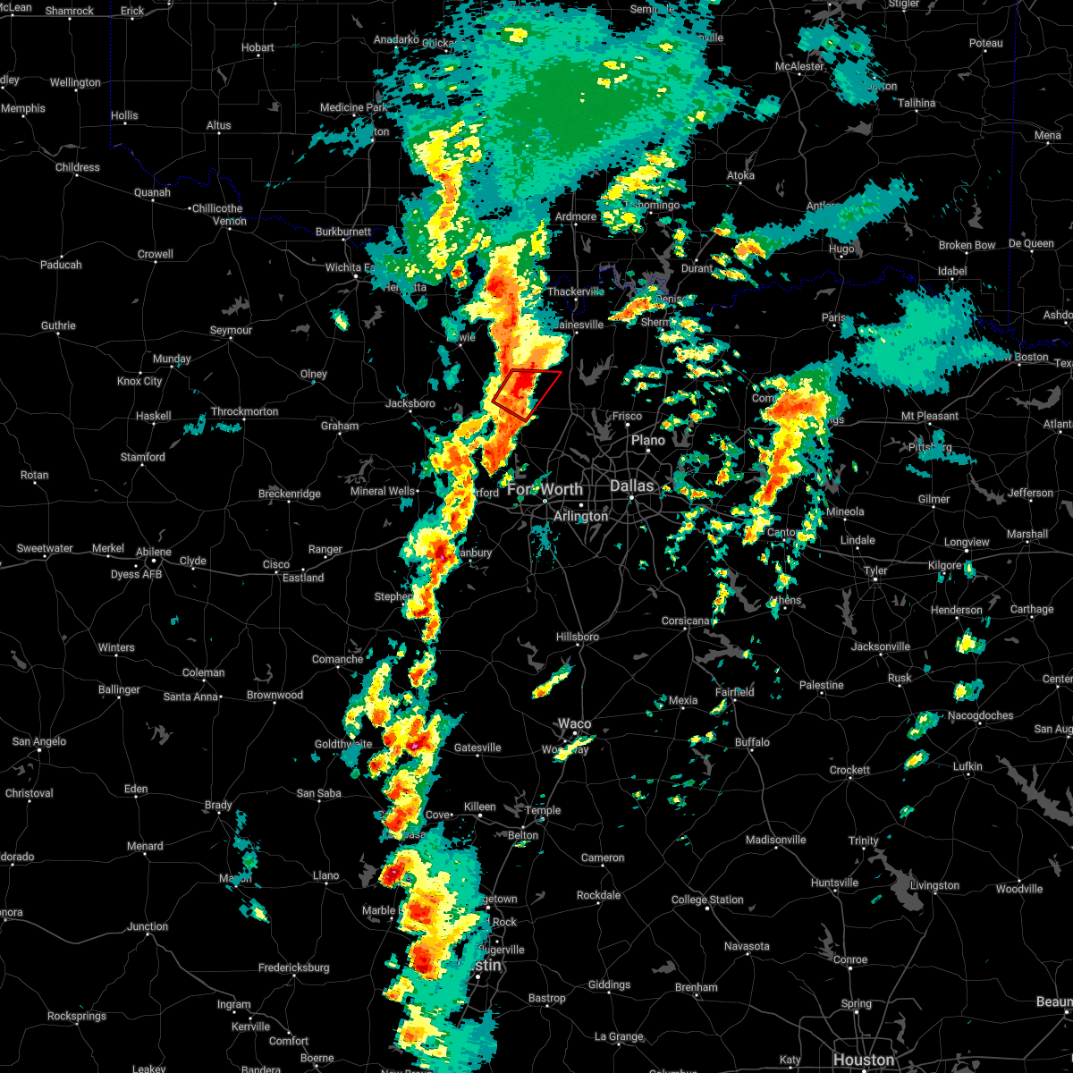 At 506 pm cdt, a severe thunderstorm capable of producing a tornado was located 10 miles northeast of decatur, moving northeast at 50 mph (radar indicated rotation). Hazards include tornado. Flying debris will be dangerous to those caught without shelter. mobile homes will be damaged or destroyed. damage to roofs, windows, and vehicles will occur. tree damage is likely. This tornadic thunderstorm will remain over mainly rural areas of northeastern wise and northwestern denton counties. At 506 pm cdt, a severe thunderstorm capable of producing a tornado was located 10 miles northeast of decatur, moving northeast at 50 mph (radar indicated rotation). Hazards include tornado. Flying debris will be dangerous to those caught without shelter. mobile homes will be damaged or destroyed. damage to roofs, windows, and vehicles will occur. tree damage is likely. This tornadic thunderstorm will remain over mainly rural areas of northeastern wise and northwestern denton counties.
|
| 3/21/2022 4:41 PM CDT |
 At 441 pm cdt, a severe thunderstorm capable of producing a tornado was located near paradise, or 9 miles southeast of bridgeport, moving northeast at 40 mph (radar indicated rotation). Hazards include tornado. Flying debris will be dangerous to those caught without shelter. mobile homes will be damaged or destroyed. damage to roofs, windows, and vehicles will occur. tree damage is likely. This dangerous storm will be near, decatur around 500 pm cdt. At 441 pm cdt, a severe thunderstorm capable of producing a tornado was located near paradise, or 9 miles southeast of bridgeport, moving northeast at 40 mph (radar indicated rotation). Hazards include tornado. Flying debris will be dangerous to those caught without shelter. mobile homes will be damaged or destroyed. damage to roofs, windows, and vehicles will occur. tree damage is likely. This dangerous storm will be near, decatur around 500 pm cdt.
|
| 2/21/2022 11:00 PM CST |
 At 1059 pm cst, a severe thunderstorm was located 10 miles northeast of decatur, moving east at 50 mph (radar indicated). Hazards include quarter size hail. damage to vehicles is possible At 1059 pm cst, a severe thunderstorm was located 10 miles northeast of decatur, moving east at 50 mph (radar indicated). Hazards include quarter size hail. damage to vehicles is possible
|
| 2/21/2022 10:40 PM CST |
 At 1039 pm cst, a severe thunderstorm was located over chico, or near bridgeport, moving northeast at 50 mph (radar indicated). Hazards include 60 mph wind gusts and quarter size hail. Hail damage to vehicles is expected. expect wind damage to roofs, siding, and trees. locations impacted include, alvord and chico. hail threat, radar indicated max hail size, 1. 00 in wind threat, radar indicated max wind gust, 60 mph. At 1039 pm cst, a severe thunderstorm was located over chico, or near bridgeport, moving northeast at 50 mph (radar indicated). Hazards include 60 mph wind gusts and quarter size hail. Hail damage to vehicles is expected. expect wind damage to roofs, siding, and trees. locations impacted include, alvord and chico. hail threat, radar indicated max hail size, 1. 00 in wind threat, radar indicated max wind gust, 60 mph.
|
| 2/21/2022 10:25 PM CST |
 At 1025 pm cst, a severe thunderstorm was located near chico, or 10 miles northwest of bridgeport, moving northeast at 60 mph (radar indicated). Hazards include 60 mph wind gusts and quarter size hail. Hail damage to vehicles is expected. Expect wind damage to roofs, siding, and trees. At 1025 pm cst, a severe thunderstorm was located near chico, or 10 miles northwest of bridgeport, moving northeast at 60 mph (radar indicated). Hazards include 60 mph wind gusts and quarter size hail. Hail damage to vehicles is expected. Expect wind damage to roofs, siding, and trees.
|
| 2/21/2022 8:21 PM CST | Quarter sized hail reported 10.5 miles WSW of Decatur, TX, report from mping: quarter (1.00 in.). |
| 2/21/2022 8:17 PM CST | Numerous houses in heritage creek north subdivision lost windows on west side from large hai in wise county TX, 6.7 miles WNW of Decatur, TX |
| 2/21/2022 7:56 PM CST |
 At 755 pm cst, a severe thunderstorm was located near cottondale, or 7 miles south of bridgeport, moving east at 50 mph (radar indicated). Hazards include ping pong ball size hail and 60 mph wind gusts. People and animals outdoors will be injured. expect hail damage to roofs, siding, windows, and vehicles. expect wind damage to roofs, siding, and trees. locations impacted include, decatur, bridgeport, briar, pecan acres, new fairview, aurora, boyd, paradise, cottondale, boonsville, rhome, runaway bay, newark and lake bridgeport. hail threat, radar indicated max hail size, 1. 50 in wind threat, radar indicated max wind gust, 60 mph. At 755 pm cst, a severe thunderstorm was located near cottondale, or 7 miles south of bridgeport, moving east at 50 mph (radar indicated). Hazards include ping pong ball size hail and 60 mph wind gusts. People and animals outdoors will be injured. expect hail damage to roofs, siding, windows, and vehicles. expect wind damage to roofs, siding, and trees. locations impacted include, decatur, bridgeport, briar, pecan acres, new fairview, aurora, boyd, paradise, cottondale, boonsville, rhome, runaway bay, newark and lake bridgeport. hail threat, radar indicated max hail size, 1. 50 in wind threat, radar indicated max wind gust, 60 mph.
|
| 2/21/2022 7:45 PM CST |
 At 744 pm cst, a severe thunderstorm was located near boonsville, or 14 miles southwest of bridgeport, moving east at 50 mph (radar indicated). Hazards include 60 mph wind gusts and half dollar size hail. Hail damage to vehicles is expected. expect wind damage to roofs, siding, and trees. locations impacted include, decatur, bridgeport, briar, pecan acres, springtown, new fairview, aurora, boyd, paradise, poolville, cottondale, boonsville, rhome, runaway bay, newark and lake bridgeport. hail threat, radar indicated max hail size, 1. 25 in wind threat, radar indicated max wind gust, 60 mph. At 744 pm cst, a severe thunderstorm was located near boonsville, or 14 miles southwest of bridgeport, moving east at 50 mph (radar indicated). Hazards include 60 mph wind gusts and half dollar size hail. Hail damage to vehicles is expected. expect wind damage to roofs, siding, and trees. locations impacted include, decatur, bridgeport, briar, pecan acres, springtown, new fairview, aurora, boyd, paradise, poolville, cottondale, boonsville, rhome, runaway bay, newark and lake bridgeport. hail threat, radar indicated max hail size, 1. 25 in wind threat, radar indicated max wind gust, 60 mph.
|
| 2/21/2022 7:35 PM CST |
 At 734 pm cst, a severe thunderstorm was located 11 miles northeast of graford, or 14 miles south of jacksboro, moving east at 50 mph (radar indicated). Hazards include 60 mph wind gusts and quarter size hail. Hail damage to vehicles is expected. Expect wind damage to roofs, siding, and trees. At 734 pm cst, a severe thunderstorm was located 11 miles northeast of graford, or 14 miles south of jacksboro, moving east at 50 mph (radar indicated). Hazards include 60 mph wind gusts and quarter size hail. Hail damage to vehicles is expected. Expect wind damage to roofs, siding, and trees.
|
| 11/10/2021 8:56 PM CST |
 At 856 pm cst, severe thunderstorms were located along a line extending from near anna to near boonsville, moving southeast at 30 mph (radar indicated). Hazards include 65 mph wind gusts and penny size hail. expect damage to roofs, siding, and trees At 856 pm cst, severe thunderstorms were located along a line extending from near anna to near boonsville, moving southeast at 30 mph (radar indicated). Hazards include 65 mph wind gusts and penny size hail. expect damage to roofs, siding, and trees
|
| 11/10/2021 8:23 PM CST |
 At 821 pm cst, severe thunderstorms were located along a line extending from near krum to near jacksboro, moving southeast at 40 mph (radar indicated). Hazards include 60 mph wind gusts and quarter size hail. Hail damage to vehicles is expected. Expect wind damage to roofs, siding, and trees. At 821 pm cst, severe thunderstorms were located along a line extending from near krum to near jacksboro, moving southeast at 40 mph (radar indicated). Hazards include 60 mph wind gusts and quarter size hail. Hail damage to vehicles is expected. Expect wind damage to roofs, siding, and trees.
|
| 11/10/2021 7:56 PM CST |
 At 755 pm cst, severe thunderstorms were located along a line extending from near thackerville to near chico, moving east at 50 mph (radar indicated). Hazards include 60 mph wind gusts and quarter size hail. Hail damage to vehicles is expected. Expect wind damage to roofs, siding, and trees. At 755 pm cst, severe thunderstorms were located along a line extending from near thackerville to near chico, moving east at 50 mph (radar indicated). Hazards include 60 mph wind gusts and quarter size hail. Hail damage to vehicles is expected. Expect wind damage to roofs, siding, and trees.
|
| 10/27/2021 2:30 AM CDT |
 At 229 am cdt, severe thunderstorms were located along a line extending from 7 miles northeast of decatur to near aledo, moving east at 40 mph (radar indicated). Hazards include 60 mph wind gusts. expect damage to roofs, siding, and trees At 229 am cdt, severe thunderstorms were located along a line extending from 7 miles northeast of decatur to near aledo, moving east at 40 mph (radar indicated). Hazards include 60 mph wind gusts. expect damage to roofs, siding, and trees
|
| 10/27/2021 2:13 AM CDT |
 At 212 am cdt, severe thunderstorms were located along a line extending from near chico to 7 miles north of oak trail shores, moving east at 45 mph (radar indicated). Hazards include 65 mph wind gusts. Expect damage to roofs, siding, and trees. locations impacted include, weatherford, azle, decatur, bridgeport, briar, pecan acres, willow park, reno, aledo, springtown, hudson oaks, alvord, annetta, new fairview, aurora, boyd, chico, paradise, poolville and cottondale. hail threat, radar indicated max hail size, <. 75 in wind threat, radar indicated max wind gust, 65 mph. At 212 am cdt, severe thunderstorms were located along a line extending from near chico to 7 miles north of oak trail shores, moving east at 45 mph (radar indicated). Hazards include 65 mph wind gusts. Expect damage to roofs, siding, and trees. locations impacted include, weatherford, azle, decatur, bridgeport, briar, pecan acres, willow park, reno, aledo, springtown, hudson oaks, alvord, annetta, new fairview, aurora, boyd, chico, paradise, poolville and cottondale. hail threat, radar indicated max hail size, <. 75 in wind threat, radar indicated max wind gust, 65 mph.
|
| 10/27/2021 2:00 AM CDT |
 At 159 am cdt, severe thunderstorms were located along a line extending from 9 miles west of chico to 10 miles northeast of lipan, moving east at 55 mph (radar indicated). Hazards include 65 mph wind gusts. Expect damage to roofs, siding, and trees. locations impacted include, weatherford, mineral wells, azle, decatur, bridgeport, briar, pecan acres, willow park, reno, aledo, springtown, hudson oaks, alvord, annetta, new fairview, aurora, boyd, chico, paradise and cool. hail threat, radar indicated max hail size, <. 75 in wind threat, observed max wind gust, 65 mph. At 159 am cdt, severe thunderstorms were located along a line extending from 9 miles west of chico to 10 miles northeast of lipan, moving east at 55 mph (radar indicated). Hazards include 65 mph wind gusts. Expect damage to roofs, siding, and trees. locations impacted include, weatherford, mineral wells, azle, decatur, bridgeport, briar, pecan acres, willow park, reno, aledo, springtown, hudson oaks, alvord, annetta, new fairview, aurora, boyd, chico, paradise and cool. hail threat, radar indicated max hail size, <. 75 in wind threat, observed max wind gust, 65 mph.
|
| 10/27/2021 1:44 AM CDT |
 At 143 am cdt, severe thunderstorms were located along a line extending from near jacksboro to 7 miles northwest of lipan, moving east at 55 mph (radar indicated). Hazards include 60 mph wind gusts. expect damage to roofs, siding, and trees At 143 am cdt, severe thunderstorms were located along a line extending from near jacksboro to 7 miles northwest of lipan, moving east at 55 mph (radar indicated). Hazards include 60 mph wind gusts. expect damage to roofs, siding, and trees
|
| 10/10/2021 8:50 PM CDT |
 At 850 pm cdt, severe thunderstorms were located along a line extending from 8 miles south of burneyville to aurora to oak trail shores, moving east at 50 mph (radar indicated). Hazards include 60 mph wind gusts and quarter size hail. Hail damage to vehicles is expected. Expect wind damage to roofs, siding, and trees. At 850 pm cdt, severe thunderstorms were located along a line extending from 8 miles south of burneyville to aurora to oak trail shores, moving east at 50 mph (radar indicated). Hazards include 60 mph wind gusts and quarter size hail. Hail damage to vehicles is expected. Expect wind damage to roofs, siding, and trees.
|
| 10/10/2021 8:08 PM CDT |
 At 808 pm cdt, a severe thunderstorm was located 11 miles west of boonsville, or 13 miles southeast of jacksboro, moving east at 55 mph (radar indicated). Hazards include 70 mph wind gusts and quarter size hail. Hail damage to vehicles is expected. expect considerable tree damage. Wind damage is also likely to mobile homes, roofs, and outbuildings. At 808 pm cdt, a severe thunderstorm was located 11 miles west of boonsville, or 13 miles southeast of jacksboro, moving east at 55 mph (radar indicated). Hazards include 70 mph wind gusts and quarter size hail. Hail damage to vehicles is expected. expect considerable tree damage. Wind damage is also likely to mobile homes, roofs, and outbuildings.
|
| 10/10/2021 7:54 PM CDT |
 At 753 pm cdt, severe thunderstorms were located along a line extending from near newport to near graford to near gorman, moving east at 50 mph (radar indicated). Hazards include 60 mph wind gusts and quarter size hail. Hail damage to vehicles is expected. Expect wind damage to roofs, siding, and trees. At 753 pm cdt, severe thunderstorms were located along a line extending from near newport to near graford to near gorman, moving east at 50 mph (radar indicated). Hazards include 60 mph wind gusts and quarter size hail. Hail damage to vehicles is expected. Expect wind damage to roofs, siding, and trees.
|
| 7/27/2021 5:30 PM CDT |
 At 528 pm cdt, a cluster of severe thunderstorms were located across central wise county moving southwest at 5 mph. 60 mph winds and tree damage were reported in bridgeport with these storms (public). Hazards include 60 mph wind gusts. Expect damage to roofs, siding, and trees. Locations impacted include, decatur, bridgeport, alvord, new fairview, boyd, chico, paradise, cottondale and lake bridgeport. At 528 pm cdt, a cluster of severe thunderstorms were located across central wise county moving southwest at 5 mph. 60 mph winds and tree damage were reported in bridgeport with these storms (public). Hazards include 60 mph wind gusts. Expect damage to roofs, siding, and trees. Locations impacted include, decatur, bridgeport, alvord, new fairview, boyd, chico, paradise, cottondale and lake bridgeport.
|
| 7/27/2021 5:02 PM CDT |
 At 501 pm cdt, a severe thunderstorm was located over decatur, moving southwest at 5 mph (radar indicated). Hazards include 60 mph wind gusts. expect damage to roofs, siding, and trees At 501 pm cdt, a severe thunderstorm was located over decatur, moving southwest at 5 mph (radar indicated). Hazards include 60 mph wind gusts. expect damage to roofs, siding, and trees
|
| 7/27/2021 4:55 PM CDT | 76 mph wind gust reported by the decatur municipal airport awo in wise county TX, 2.1 miles SSW of Decatur, TX |
| 5/28/2021 2:24 AM CDT |
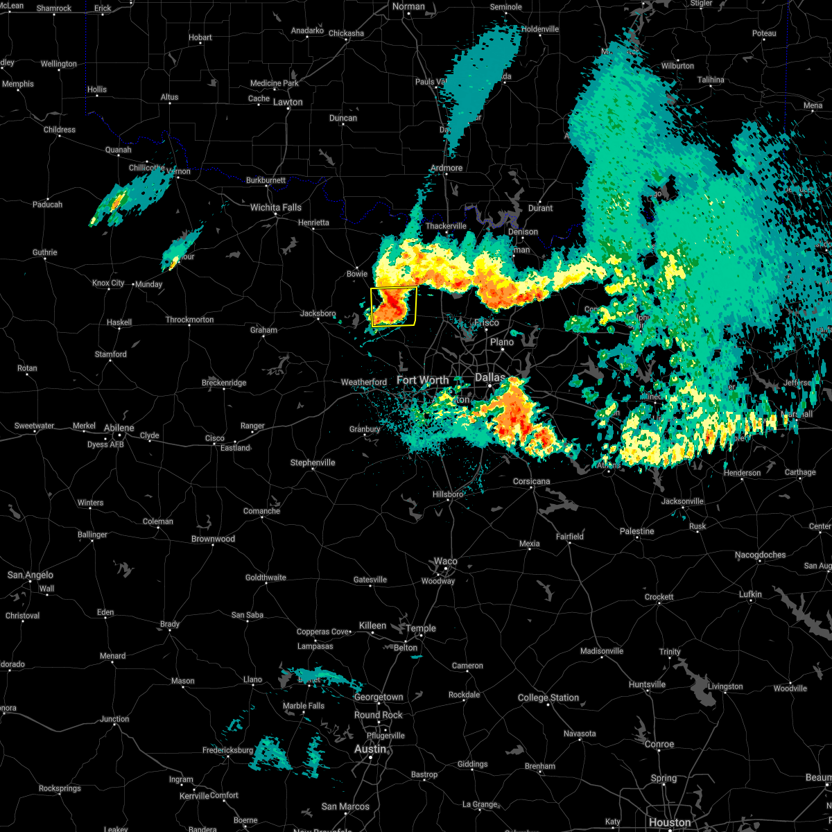 At 223 am cdt, a severe thunderstorm was located 10 miles northeast of decatur, moving east at 45 mph (radar indicated). Hazards include 65 mph wind gusts and quarter size hail. Hail damage to vehicles is expected. expect wind damage to roofs, siding, and trees. Locations impacted include, decatur and alvord. At 223 am cdt, a severe thunderstorm was located 10 miles northeast of decatur, moving east at 45 mph (radar indicated). Hazards include 65 mph wind gusts and quarter size hail. Hail damage to vehicles is expected. expect wind damage to roofs, siding, and trees. Locations impacted include, decatur and alvord.
|
| 5/28/2021 2:06 AM CDT |
 At 206 am cdt, a severe thunderstorm was located near alvord, or 7 miles northeast of bridgeport, moving east at 40 mph (radar indicated). Hazards include 60 mph wind gusts and quarter size hail. Hail damage to vehicles is expected. Expect wind damage to roofs, siding, and trees. At 206 am cdt, a severe thunderstorm was located near alvord, or 7 miles northeast of bridgeport, moving east at 40 mph (radar indicated). Hazards include 60 mph wind gusts and quarter size hail. Hail damage to vehicles is expected. Expect wind damage to roofs, siding, and trees.
|
| 5/17/2021 2:19 AM CDT |
 At 218 am cdt, a severe thunderstorm was located over chico, or near bridgeport, moving east at 25 mph (radar indicated). Hazards include 60 mph wind gusts and quarter size hail. Hail damage to vehicles is expected. expect wind damage to roofs, siding, and trees. Locations impacted include, decatur, bridgeport, alvord, chico, paradise, runaway bay and lake bridgeport. At 218 am cdt, a severe thunderstorm was located over chico, or near bridgeport, moving east at 25 mph (radar indicated). Hazards include 60 mph wind gusts and quarter size hail. Hail damage to vehicles is expected. expect wind damage to roofs, siding, and trees. Locations impacted include, decatur, bridgeport, alvord, chico, paradise, runaway bay and lake bridgeport.
|
| 5/17/2021 2:09 AM CDT |
 At 209 am cdt, a severe thunderstorm was located near bridgeport, moving east at 25 mph (radar indicated). Hazards include 60 mph wind gusts and quarter size hail. Hail damage to vehicles is expected. Expect wind damage to roofs, siding, and trees. At 209 am cdt, a severe thunderstorm was located near bridgeport, moving east at 25 mph (radar indicated). Hazards include 60 mph wind gusts and quarter size hail. Hail damage to vehicles is expected. Expect wind damage to roofs, siding, and trees.
|
| 5/10/2021 6:14 PM CDT |
 At 613 pm cdt, a severe thunderstorm was located over new fairview, moving northeast at 40 mph (radar indicated). Hazards include half dollar size hail. Damage to vehicles is possible. this severe storm will be near, justin and northlake around 625 pm cdt. This storm produced quarter-size hail near boyd. At 613 pm cdt, a severe thunderstorm was located over new fairview, moving northeast at 40 mph (radar indicated). Hazards include half dollar size hail. Damage to vehicles is possible. this severe storm will be near, justin and northlake around 625 pm cdt. This storm produced quarter-size hail near boyd.
|
| 5/10/2021 6:03 PM CDT |
 At 602 pm cdt, a severe thunderstorm was located over boyd, or near briar, moving northeast at 30 mph (radar indicated). Hazards include half dollar size hail. Damage to vehicles is possible. this severe thunderstorm will be near, new fairview around 625 pm cdt. Justin around 630 pm cdt. At 602 pm cdt, a severe thunderstorm was located over boyd, or near briar, moving northeast at 30 mph (radar indicated). Hazards include half dollar size hail. Damage to vehicles is possible. this severe thunderstorm will be near, new fairview around 625 pm cdt. Justin around 630 pm cdt.
|
| 5/3/2021 6:56 PM CDT |
 At 656 pm cdt, a severe thunderstorm was located over briar, moving north at 35 mph. golf ball size hail was reported with this storm over azle (radar indicated). Hazards include golf ball size hail and 60 mph wind gusts. People and animals outdoors will be injured. expect hail damage to roofs, siding, windows, and vehicles. Expect wind damage to roofs, siding, and trees. At 656 pm cdt, a severe thunderstorm was located over briar, moving north at 35 mph. golf ball size hail was reported with this storm over azle (radar indicated). Hazards include golf ball size hail and 60 mph wind gusts. People and animals outdoors will be injured. expect hail damage to roofs, siding, windows, and vehicles. Expect wind damage to roofs, siding, and trees.
|
| 5/3/2021 5:46 PM CDT |
 At 545 pm cdt, a cluster of severe thunderstorms were located along a line extending from meunster to slidell to briar, with each storm moving northeast at 30 mph (radar indicated). Hazards include 60 mph wind gusts and half dollar size hail. Hail damage to vehicles is expected. Expect wind damage to roofs, siding, and trees. At 545 pm cdt, a cluster of severe thunderstorms were located along a line extending from meunster to slidell to briar, with each storm moving northeast at 30 mph (radar indicated). Hazards include 60 mph wind gusts and half dollar size hail. Hail damage to vehicles is expected. Expect wind damage to roofs, siding, and trees.
|
| 5/3/2021 5:34 PM CDT | Quarter sized hail reported 13.2 miles S of Decatur, TX |
| 5/3/2021 5:05 PM CDT |
 At 505 pm cdt, a severe thunderstorm was located near paradise, or near decatur, moving northeast at 30 mph (radar indicated). Hazards include golf ball size hail and 60 mph wind gusts. People and animals outdoors will be injured. expect hail damage to roofs, siding, windows, and vehicles. Expect wind damage to roofs, siding, and trees. At 505 pm cdt, a severe thunderstorm was located near paradise, or near decatur, moving northeast at 30 mph (radar indicated). Hazards include golf ball size hail and 60 mph wind gusts. People and animals outdoors will be injured. expect hail damage to roofs, siding, windows, and vehicles. Expect wind damage to roofs, siding, and trees.
|
| 3/17/2021 4:19 AM CDT |
 At 418 am cdt, severe thunderstorms were located along a line extending from decatur to near annetta, moving east at 45 mph (radar indicated). Hazards include 60 mph wind gusts and nickel size hail. Expect damage to roofs, siding, and trees. Locations impacted include, fort worth, arlington, irving, grand prairie, denton, lewisville, flower mound, mansfield, euless, bedford, grapevine, haltom city, keller, coppell, hurst, burleson, southlake, weatherford, watauga and colleyville. At 418 am cdt, severe thunderstorms were located along a line extending from decatur to near annetta, moving east at 45 mph (radar indicated). Hazards include 60 mph wind gusts and nickel size hail. Expect damage to roofs, siding, and trees. Locations impacted include, fort worth, arlington, irving, grand prairie, denton, lewisville, flower mound, mansfield, euless, bedford, grapevine, haltom city, keller, coppell, hurst, burleson, southlake, weatherford, watauga and colleyville.
|
| 3/17/2021 3:40 AM CDT |
 The national weather service in fort worth has issued a * severe thunderstorm warning for. wise county in north central texas. denton county in north central texas. parker county in north central texas. Tarrant county in north central texas. The national weather service in fort worth has issued a * severe thunderstorm warning for. wise county in north central texas. denton county in north central texas. parker county in north central texas. Tarrant county in north central texas.
|
| 11/24/2020 7:29 PM CST |
 At 729 pm cst, a severe thunderstorm was located near decatur, moving east at 40 mph (radar indicated). Hazards include 60 mph wind gusts. expect damage to roofs, siding, and trees At 729 pm cst, a severe thunderstorm was located near decatur, moving east at 40 mph (radar indicated). Hazards include 60 mph wind gusts. expect damage to roofs, siding, and trees
|
| 5/22/2020 11:49 PM CDT |
 At 1148 pm cdt, a severe thunderstorm was located 8 miles northeast of decatur, moving east at 45 mph (radar indicated). Hazards include 60 mph wind gusts and quarter size hail. Hail damage to vehicles is expected. Expect wind damage to roofs, siding, and trees. At 1148 pm cdt, a severe thunderstorm was located 8 miles northeast of decatur, moving east at 45 mph (radar indicated). Hazards include 60 mph wind gusts and quarter size hail. Hail damage to vehicles is expected. Expect wind damage to roofs, siding, and trees.
|
| 5/22/2020 11:26 PM CDT |
 At 1126 pm cdt, a severe thunderstorm was located near alvord, or near decatur, moving southeast at 35 mph (radar indicated). Hazards include 65 mph wind gusts and quarter size hail. Hail damage to vehicles is expected. Expect wind damage to roofs, siding, and trees. At 1126 pm cdt, a severe thunderstorm was located near alvord, or near decatur, moving southeast at 35 mph (radar indicated). Hazards include 65 mph wind gusts and quarter size hail. Hail damage to vehicles is expected. Expect wind damage to roofs, siding, and trees.
|
| 5/22/2020 10:31 PM CDT |
 At 1031 pm cdt, a severe thunderstorm was located 8 miles northeast of decatur, moving southeast at 30 mph (radar indicated). Hazards include 65 mph wind gusts and half dollar size hail. Hail damage to vehicles is expected. expect wind damage to roofs, siding, and trees. Locations impacted include, denton, flower mound, sanger, decatur, bridgeport, bowie, briar, roanoke, pecan acres, krum, pilot point, argyle, justin, aubrey, northlake, muenster, haslet, alvord, new fairview and aurora. At 1031 pm cdt, a severe thunderstorm was located 8 miles northeast of decatur, moving southeast at 30 mph (radar indicated). Hazards include 65 mph wind gusts and half dollar size hail. Hail damage to vehicles is expected. expect wind damage to roofs, siding, and trees. Locations impacted include, denton, flower mound, sanger, decatur, bridgeport, bowie, briar, roanoke, pecan acres, krum, pilot point, argyle, justin, aubrey, northlake, muenster, haslet, alvord, new fairview and aurora.
|
| 5/22/2020 10:09 PM CDT |
 At 1009 pm cdt, a severe thunderstorm was located near alvord, or 13 miles north of decatur, moving southeast at 30 mph (radar indicated). Hazards include golf ball size hail and 65 mph wind gusts. People and animals outdoors will be injured. expect hail damage to roofs, siding, windows, and vehicles. Expect wind damage to roofs, siding, and trees. At 1009 pm cdt, a severe thunderstorm was located near alvord, or 13 miles north of decatur, moving southeast at 30 mph (radar indicated). Hazards include golf ball size hail and 65 mph wind gusts. People and animals outdoors will be injured. expect hail damage to roofs, siding, windows, and vehicles. Expect wind damage to roofs, siding, and trees.
|
| 5/7/2020 10:05 PM CDT |
 At 1004 pm cdt, a severe thunderstorm was located 7 miles northwest of weatherford, moving southeast at 40 mph (radar indicated). Hazards include two inch hail and 60 mph wind gusts. People and animals outdoors will be injured. expect hail damage to roofs, siding, windows, and vehicles. expect wind damage to roofs, siding, and trees. Locations impacted include, weatherford, azle, briar, willow park, reno, aledo, springtown, hudson oaks, annetta, boyd, cottondale, annetta south, annetta north and sanctuary. At 1004 pm cdt, a severe thunderstorm was located 7 miles northwest of weatherford, moving southeast at 40 mph (radar indicated). Hazards include two inch hail and 60 mph wind gusts. People and animals outdoors will be injured. expect hail damage to roofs, siding, windows, and vehicles. expect wind damage to roofs, siding, and trees. Locations impacted include, weatherford, azle, briar, willow park, reno, aledo, springtown, hudson oaks, annetta, boyd, cottondale, annetta south, annetta north and sanctuary.
|
| 5/7/2020 9:51 PM CDT |
 At 950 pm cdt, a severe thunderstorm was located near poolville, or 10 miles northeast of mineral wells, moving southeast at 45 mph (radar indicated). Hazards include two inch hail and 60 mph wind gusts. People and animals outdoors will be injured. expect hail damage to roofs, siding, windows, and vehicles. expect wind damage to roofs, siding, and trees. Locations impacted include, weatherford, mineral wells, azle, decatur, bridgeport, briar, willow park, reno, aledo, springtown, hudson oaks, annetta, boyd, paradise, cool, poolville, cottondale, boonsville, mineral wells state park and runaway bay. At 950 pm cdt, a severe thunderstorm was located near poolville, or 10 miles northeast of mineral wells, moving southeast at 45 mph (radar indicated). Hazards include two inch hail and 60 mph wind gusts. People and animals outdoors will be injured. expect hail damage to roofs, siding, windows, and vehicles. expect wind damage to roofs, siding, and trees. Locations impacted include, weatherford, mineral wells, azle, decatur, bridgeport, briar, willow park, reno, aledo, springtown, hudson oaks, annetta, boyd, paradise, cool, poolville, cottondale, boonsville, mineral wells state park and runaway bay.
|
| 5/7/2020 9:28 PM CDT |
 At 927 pm cdt, a severe thunderstorm was located 7 miles south of jacksboro, moving southeast at 45 mph (radar indicated). Hazards include two inch hail and 60 mph wind gusts. People and animals outdoors will be injured. expect hail damage to roofs, siding, windows, and vehicles. Expect wind damage to roofs, siding, and trees. At 927 pm cdt, a severe thunderstorm was located 7 miles south of jacksboro, moving southeast at 45 mph (radar indicated). Hazards include two inch hail and 60 mph wind gusts. People and animals outdoors will be injured. expect hail damage to roofs, siding, windows, and vehicles. Expect wind damage to roofs, siding, and trees.
|
| 5/4/2020 10:38 PM CDT |
 At 1036 pm cdt, severe thunderstorms were located along a line extending from sanger to 9 miles west of krum to decatur, moving southeast at 25 mph (radar indicated. storm spotters have reported quarter size hail and 60 to 70 mph winds near i-35 in northern denton county). Hazards include ping pong ball size hail and 65 mph wind gusts. People and animals outdoors will be injured. expect hail damage to roofs, siding, windows, and vehicles. expect wind damage to roofs, siding, and trees. Locations impacted include, denton, sanger, decatur, krum, pilot point, aubrey, northlake, krugerville, cross roads, new fairview, ray roberts park isle du bois, ponder and lincoln park. At 1036 pm cdt, severe thunderstorms were located along a line extending from sanger to 9 miles west of krum to decatur, moving southeast at 25 mph (radar indicated. storm spotters have reported quarter size hail and 60 to 70 mph winds near i-35 in northern denton county). Hazards include ping pong ball size hail and 65 mph wind gusts. People and animals outdoors will be injured. expect hail damage to roofs, siding, windows, and vehicles. expect wind damage to roofs, siding, and trees. Locations impacted include, denton, sanger, decatur, krum, pilot point, aubrey, northlake, krugerville, cross roads, new fairview, ray roberts park isle du bois, ponder and lincoln park.
|
| 5/4/2020 10:05 PM CDT |
 At 1004 pm cdt, a severe thunderstorm was located 8 miles southeast of forestburg, or 15 miles northeast of decatur, moving southeast at 25 mph (radar indicated). Hazards include golf ball size hail and 60 mph wind gusts. People and animals outdoors will be injured. expect hail damage to roofs, siding, windows, and vehicles. Expect wind damage to roofs, siding, and trees. At 1004 pm cdt, a severe thunderstorm was located 8 miles southeast of forestburg, or 15 miles northeast of decatur, moving southeast at 25 mph (radar indicated). Hazards include golf ball size hail and 60 mph wind gusts. People and animals outdoors will be injured. expect hail damage to roofs, siding, windows, and vehicles. Expect wind damage to roofs, siding, and trees.
|
| 4/28/2020 11:00 PM CDT | Ping Pong Ball sized hail reported 2.8 miles SSE of Decatur, TX, report from mping: ping pong ball (1.50 in.). |
| 4/28/2020 10:59 PM CDT |
 At 1059 pm cdt, a severe thunderstorm was located over decatur, moving southeast at 45 mph (public). Hazards include quarter size hail. damage to vehicles is possible At 1059 pm cdt, a severe thunderstorm was located over decatur, moving southeast at 45 mph (public). Hazards include quarter size hail. damage to vehicles is possible
|
| 4/28/2020 10:34 PM CDT |
 At 1032 pm cdt, a severe thunderstorm was located near cottondale, or 10 miles south of bridgeport, moving southeast at 25 mph (radar indicated). Hazards include 60 mph wind gusts and quarter size hail. Hail damage to vehicles is expected. expect wind damage to roofs, siding, and trees. this severe storm will be near, briar around 1100 pm cdt. Other storms within the warned area may produce hail to the size of nickels and wind gusts in excess of 40 mph. At 1032 pm cdt, a severe thunderstorm was located near cottondale, or 10 miles south of bridgeport, moving southeast at 25 mph (radar indicated). Hazards include 60 mph wind gusts and quarter size hail. Hail damage to vehicles is expected. expect wind damage to roofs, siding, and trees. this severe storm will be near, briar around 1100 pm cdt. Other storms within the warned area may produce hail to the size of nickels and wind gusts in excess of 40 mph.
|
| 4/28/2020 9:59 PM CDT |
 At 958 pm cdt, a severe thunderstorm was located near bellevue, or 7 miles west of bowie, moving south at 35 mph. at 952 pm cdt, ping pong ball size hail was reported with this storm in bellevue (trained weather spotters). Hazards include golf ball size hail and 60 mph wind gusts. People and animals outdoors will be injured. expect hail damage to roofs, siding, windows, and vehicles. Expect wind damage to roofs, siding, and trees. At 958 pm cdt, a severe thunderstorm was located near bellevue, or 7 miles west of bowie, moving south at 35 mph. at 952 pm cdt, ping pong ball size hail was reported with this storm in bellevue (trained weather spotters). Hazards include golf ball size hail and 60 mph wind gusts. People and animals outdoors will be injured. expect hail damage to roofs, siding, windows, and vehicles. Expect wind damage to roofs, siding, and trees.
|
| 4/28/2020 3:11 AM CDT |
 At 310 am cdt, a severe thunderstorm was located over lake bridgeport, moving southeast at 20 mph (radar indicated). Hazards include half dollar size hail. Damage to vehicles is possible. Locations impacted include, decatur, bridgeport, chico, paradise, boonsville, cottondale, runaway bay and lake bridgeport. At 310 am cdt, a severe thunderstorm was located over lake bridgeport, moving southeast at 20 mph (radar indicated). Hazards include half dollar size hail. Damage to vehicles is possible. Locations impacted include, decatur, bridgeport, chico, paradise, boonsville, cottondale, runaway bay and lake bridgeport.
|
| 4/28/2020 2:57 AM CDT |
 At 245 am cdt, a severe thunderstorm was located 10 miles northeast of jacksboro, and another severe thunderstorm was over runaway bay. both storms are moving southeast at 15 mph (radar indicated). Hazards include quarter size hail. damage to vehicles is possible At 245 am cdt, a severe thunderstorm was located 10 miles northeast of jacksboro, and another severe thunderstorm was over runaway bay. both storms are moving southeast at 15 mph (radar indicated). Hazards include quarter size hail. damage to vehicles is possible
|
| 4/28/2020 2:47 AM CDT |
 At 245 am cdt, a severe thunderstorm was located 10 miles northeast of jacksboro, and another severe thunderstorm was over runaway bay. both storms are moving southeast at 15 mph (radar indicated). Hazards include quarter size hail. damage to vehicles is possible At 245 am cdt, a severe thunderstorm was located 10 miles northeast of jacksboro, and another severe thunderstorm was over runaway bay. both storms are moving southeast at 15 mph (radar indicated). Hazards include quarter size hail. damage to vehicles is possible
|
| 3/18/2020 11:43 PM CDT |
 The severe thunderstorm warning for southeastern wise and northeastern parker counties will expire at 1145 pm cdt, the storms which prompted the warning have weakened below severe limits. therefore the warning will be allowed to expire. gusty winds and heavy rain are still possible with these thunderstorms. The severe thunderstorm warning for southeastern wise and northeastern parker counties will expire at 1145 pm cdt, the storms which prompted the warning have weakened below severe limits. therefore the warning will be allowed to expire. gusty winds and heavy rain are still possible with these thunderstorms.
|
| 3/18/2020 11:31 PM CDT |
 At 1130 pm cdt, severe thunderstorms were located along a line extending from 10 miles east of decatur to near new fairview to near azle, moving east at 35 mph (radar indicated). Hazards include 60 mph wind gusts. Expect damage to roofs, siding, and trees. locations impacted include, azle, decatur, briar, pecan acres, reno, springtown, new fairview, aurora, boyd, rhome, newark and sanctuary. A tornado watch remains in effect until midnight cdt for north central texas. At 1130 pm cdt, severe thunderstorms were located along a line extending from 10 miles east of decatur to near new fairview to near azle, moving east at 35 mph (radar indicated). Hazards include 60 mph wind gusts. Expect damage to roofs, siding, and trees. locations impacted include, azle, decatur, briar, pecan acres, reno, springtown, new fairview, aurora, boyd, rhome, newark and sanctuary. A tornado watch remains in effect until midnight cdt for north central texas.
|
| 3/18/2020 11:13 PM CDT |
 At 1113 pm cdt, severe thunderstorms were located along a line extending from near new fairview to near weatherford, moving east at 40 mph (radar indicated). Hazards include 60 mph wind gusts. Expect damage to roofs, siding, and trees. locations impacted include, azle, decatur, briar, pecan acres, reno, springtown, new fairview, aurora, boyd, paradise, cottondale, rhome, newark and sanctuary. A tornado watch remains in effect until midnight cdt for north central texas. At 1113 pm cdt, severe thunderstorms were located along a line extending from near new fairview to near weatherford, moving east at 40 mph (radar indicated). Hazards include 60 mph wind gusts. Expect damage to roofs, siding, and trees. locations impacted include, azle, decatur, briar, pecan acres, reno, springtown, new fairview, aurora, boyd, paradise, cottondale, rhome, newark and sanctuary. A tornado watch remains in effect until midnight cdt for north central texas.
|
| 3/18/2020 10:59 PM CDT |
 At 1059 pm cdt, severe thunderstorms were located along a line extending from near boyd to 10 miles west of weatherford, moving east at 30 mph. these storms produced a 56 mph wind gust at mineral wells airport over the last several minutes (radar indicated). Hazards include 60 mph wind gusts and penny size hail. Expect damage to roofs, siding, and trees. locations impacted include, weatherford, mineral wells, azle, decatur, bridgeport, briar, pecan acres, willow park, reno, springtown, hudson oaks, new fairview, aurora, boyd, paradise, cool, poolville, cottondale, boonsville and mineral wells state park. A tornado watch remains in effect until midnight cdt for north central texas. At 1059 pm cdt, severe thunderstorms were located along a line extending from near boyd to 10 miles west of weatherford, moving east at 30 mph. these storms produced a 56 mph wind gust at mineral wells airport over the last several minutes (radar indicated). Hazards include 60 mph wind gusts and penny size hail. Expect damage to roofs, siding, and trees. locations impacted include, weatherford, mineral wells, azle, decatur, bridgeport, briar, pecan acres, willow park, reno, springtown, hudson oaks, new fairview, aurora, boyd, paradise, cool, poolville, cottondale, boonsville and mineral wells state park. A tornado watch remains in effect until midnight cdt for north central texas.
|
| 3/18/2020 10:40 PM CDT |
 At 1040 pm cdt, severe thunderstorms were located along a line extending from near boonsville to 9 miles southwest of mineral wells, moving east at 40 mph (radar indicated). Hazards include 60 mph wind gusts and quarter size hail. Hail damage to vehicles is expected. Expect wind damage to roofs, siding, and trees. At 1040 pm cdt, severe thunderstorms were located along a line extending from near boonsville to 9 miles southwest of mineral wells, moving east at 40 mph (radar indicated). Hazards include 60 mph wind gusts and quarter size hail. Hail damage to vehicles is expected. Expect wind damage to roofs, siding, and trees.
|
| 3/18/2020 9:25 PM CDT |
 At 925 pm cdt, a confirmed tornado was located near chico, or 7 miles northwest of bridgeport, moving east at 30 mph (emergency management confirmed tornado). Hazards include damaging tornado and golf ball size hail. Flying debris will be dangerous to those caught without shelter. mobile homes will be damaged or destroyed. damage to roofs, windows, and vehicles will occur. Tree damage is likely. At 925 pm cdt, a confirmed tornado was located near chico, or 7 miles northwest of bridgeport, moving east at 30 mph (emergency management confirmed tornado). Hazards include damaging tornado and golf ball size hail. Flying debris will be dangerous to those caught without shelter. mobile homes will be damaged or destroyed. damage to roofs, windows, and vehicles will occur. Tree damage is likely.
|
| 1/10/2020 4:28 PM CST |
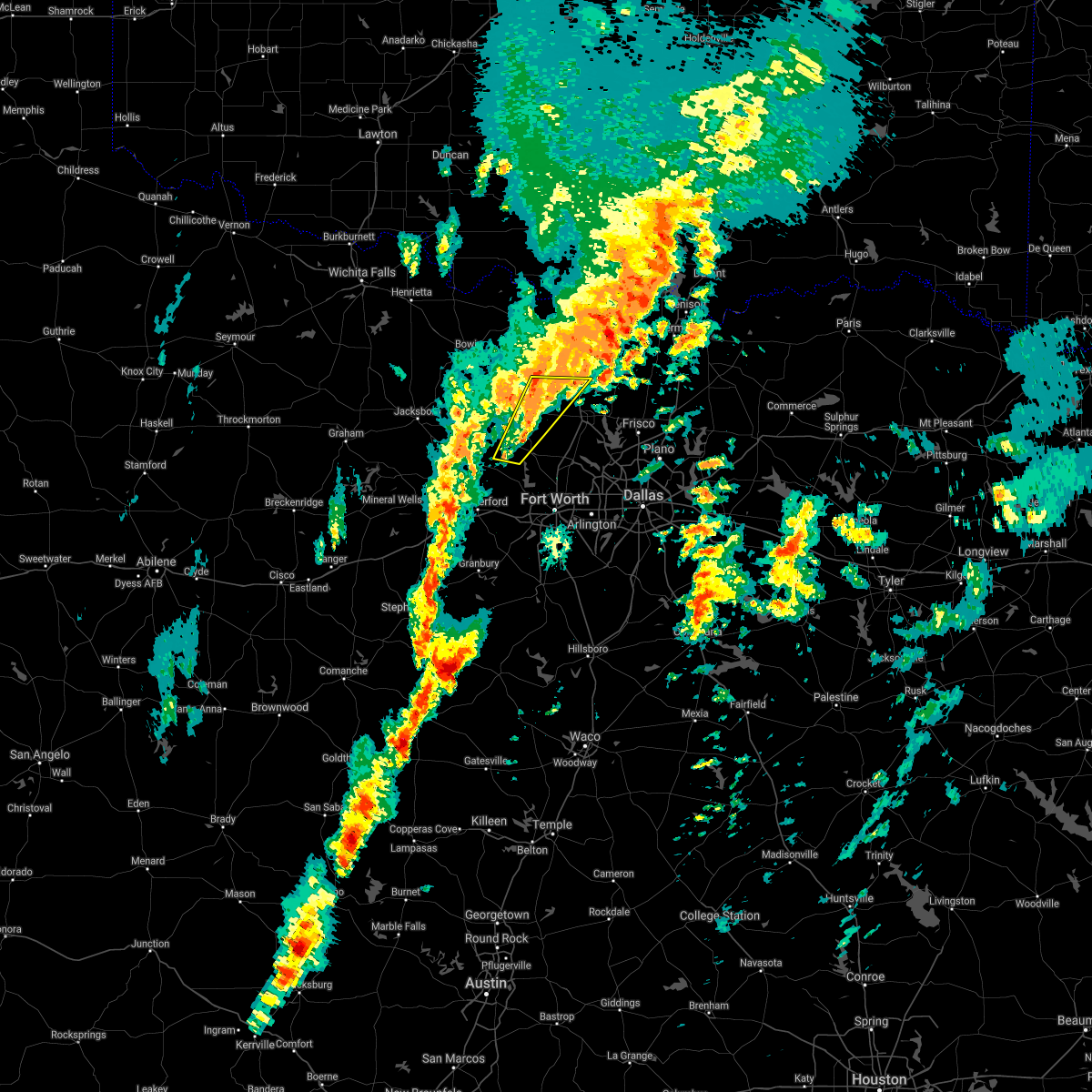 The severe thunderstorm warning for eastern wise and northwestern denton counties will expire at 430 pm cst, the storms that prompted the warning have weakened below severe limits. therefore, the warning will be allowed to expire on time. however, heavy rain is still possible with this storms in the area. additional storms may also impact the area. a tornado watch remains in effect until 9 pm. The severe thunderstorm warning for eastern wise and northwestern denton counties will expire at 430 pm cst, the storms that prompted the warning have weakened below severe limits. therefore, the warning will be allowed to expire on time. however, heavy rain is still possible with this storms in the area. additional storms may also impact the area. a tornado watch remains in effect until 9 pm.
|
| 1/10/2020 4:19 PM CST |
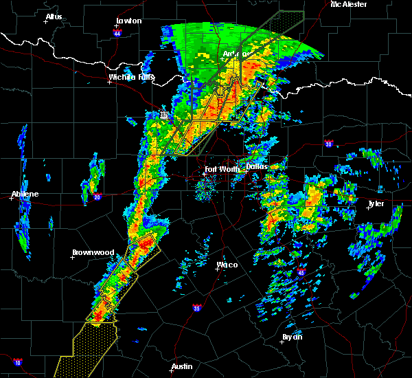 At 417 pm cst, a severe thunderstorm was located near decatur, moving northeast at 30 mph (radar indicated). Hazards include 60 mph wind gusts and quarter size hail. Hail damage to vehicles is expected. expect wind damage to roofs, siding, and trees. although the storms have weakened since the warning was issued, severe weather is still possible with the storms. A tornado watch remains in effect until 9 pm. At 417 pm cst, a severe thunderstorm was located near decatur, moving northeast at 30 mph (radar indicated). Hazards include 60 mph wind gusts and quarter size hail. Hail damage to vehicles is expected. expect wind damage to roofs, siding, and trees. although the storms have weakened since the warning was issued, severe weather is still possible with the storms. A tornado watch remains in effect until 9 pm.
|
| 1/10/2020 3:55 PM CST |
 At 354 pm cst, severe thunderstorms were located along a line extending from 8 miles west of sanger to near briar, moving northeast at 20 mph (radar indicated). Hazards include 60 mph wind gusts and quarter size hail. Hail damage to vehicles is expected. expect wind damage to roofs, siding, and trees. locations impacted include, sanger, decatur, briar, pecan acres, new fairview, aurora, boyd and rhome. A tornado watch remains in effect until 900 pm cst for north central texas. At 354 pm cst, severe thunderstorms were located along a line extending from 8 miles west of sanger to near briar, moving northeast at 20 mph (radar indicated). Hazards include 60 mph wind gusts and quarter size hail. Hail damage to vehicles is expected. expect wind damage to roofs, siding, and trees. locations impacted include, sanger, decatur, briar, pecan acres, new fairview, aurora, boyd and rhome. A tornado watch remains in effect until 900 pm cst for north central texas.
|
| 1/10/2020 3:26 PM CST |
 At 325 pm cst, a severe thunderstorm was located near springtown, or near briar, moving northeast at 50 mph (radar indicated). Hazards include 60 mph wind gusts and quarter size hail. Hail damage to vehicles is expected. Expect wind damage to roofs, siding, and trees. At 325 pm cst, a severe thunderstorm was located near springtown, or near briar, moving northeast at 50 mph (radar indicated). Hazards include 60 mph wind gusts and quarter size hail. Hail damage to vehicles is expected. Expect wind damage to roofs, siding, and trees.
|
| 1/10/2020 3:20 PM CST |
 At 318 pm cst, another severe thunderstorm capable of producing a tornado was located near paradise, or 7 miles south of decatur, moving northeast at 25 mph. the first severe thunderstorm that prompted this tornado warning has weakened and moved out of wise county (radar indicated rotation). Hazards include tornado and quarter size hail. Flying debris will be dangerous to those caught without shelter. mobile homes will be damaged or destroyed. damage to roofs, windows, and vehicles will occur. tree damage is likely. Locations impacted include, decatur, briar, new fairview, aurora, boyd, paradise and cottondale. At 318 pm cst, another severe thunderstorm capable of producing a tornado was located near paradise, or 7 miles south of decatur, moving northeast at 25 mph. the first severe thunderstorm that prompted this tornado warning has weakened and moved out of wise county (radar indicated rotation). Hazards include tornado and quarter size hail. Flying debris will be dangerous to those caught without shelter. mobile homes will be damaged or destroyed. damage to roofs, windows, and vehicles will occur. tree damage is likely. Locations impacted include, decatur, briar, new fairview, aurora, boyd, paradise and cottondale.
|
| 1/10/2020 3:07 PM CST |
 At 306 pm cst, a severe thunderstorm capable of producing a tornado was located 3 miles east of decatur, moving northeast at 45 mph (radar indicated rotation). Hazards include tornado and quarter size hail. Flying debris will be dangerous to those caught without shelter. mobile homes will be damaged or destroyed. damage to roofs, windows, and vehicles will occur. tree damage is likely. this tornadic thunderstorm will remain over mainly rural areas of northeastern wise county. The communities of greenwood and slidell are in the path of this storm. At 306 pm cst, a severe thunderstorm capable of producing a tornado was located 3 miles east of decatur, moving northeast at 45 mph (radar indicated rotation). Hazards include tornado and quarter size hail. Flying debris will be dangerous to those caught without shelter. mobile homes will be damaged or destroyed. damage to roofs, windows, and vehicles will occur. tree damage is likely. this tornadic thunderstorm will remain over mainly rural areas of northeastern wise county. The communities of greenwood and slidell are in the path of this storm.
|
| 1/10/2020 2:45 PM CST |
 At 245 pm cst, a severe thunderstorm capable of producing a tornado was located near boyd, or 8 miles northwest of briar, moving northeast at 50 mph (radar indicated rotation). Hazards include tornado and quarter size hail. Flying debris will be dangerous to those caught without shelter. mobile homes will be damaged or destroyed. damage to roofs, windows, and vehicles will occur. tree damage is likely. This dangerous storm will be near, decatur around 300 pm cst. At 245 pm cst, a severe thunderstorm capable of producing a tornado was located near boyd, or 8 miles northwest of briar, moving northeast at 50 mph (radar indicated rotation). Hazards include tornado and quarter size hail. Flying debris will be dangerous to those caught without shelter. mobile homes will be damaged or destroyed. damage to roofs, windows, and vehicles will occur. tree damage is likely. This dangerous storm will be near, decatur around 300 pm cst.
|
| 1/10/2020 2:36 PM CST |
 At 236 pm cst, a severe thunderstorm was located over springtown, or 7 miles west of briar, moving northeast at 50 mph (radar indicated). Hazards include 60 mph wind gusts and quarter size hail. Hail damage to vehicles is expected. Expect wind damage to roofs, siding, and trees. At 236 pm cst, a severe thunderstorm was located over springtown, or 7 miles west of briar, moving northeast at 50 mph (radar indicated). Hazards include 60 mph wind gusts and quarter size hail. Hail damage to vehicles is expected. Expect wind damage to roofs, siding, and trees.
|
| 10/20/2019 7:50 PM CDT |
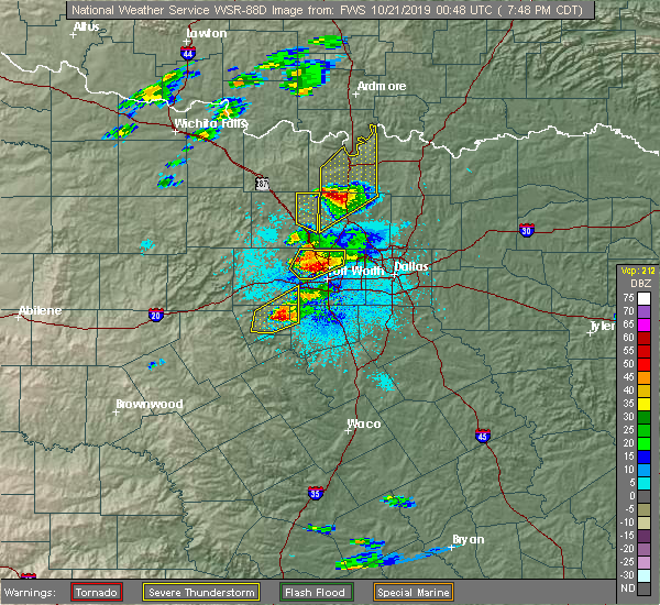 The severe thunderstorm warning for northeastern wise county will expire at 800 pm cdt, the storm which prompted the warning has moved out of the area. therefore the warning will be allowed to expire. a tornado watch remains in effect until 200 am cdt for north central texas. The severe thunderstorm warning for northeastern wise county will expire at 800 pm cdt, the storm which prompted the warning has moved out of the area. therefore the warning will be allowed to expire. a tornado watch remains in effect until 200 am cdt for north central texas.
|
| 10/20/2019 7:46 PM CDT | Golf Ball sized hail reported 15.1 miles SW of Decatur, TX, golf ball size hail reported in slidell |
| 10/20/2019 7:39 PM CDT |
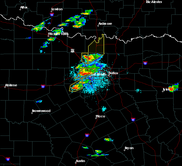 At 739 pm cdt, a severe thunderstorm was located 10 miles northeast of decatur, moving northeast at 55 mph (radar indicated). Hazards include golf ball size hail and 60 mph wind gusts. People and animals outdoors will be injured. expect hail damage to roofs, siding, windows, and vehicles. expect wind damage to roofs, siding, and trees. this severe thunderstorm will remain over mainly rural areas of northeastern wise county. A tornado watch remains in effect until 200 am cdt for north central texas. At 739 pm cdt, a severe thunderstorm was located 10 miles northeast of decatur, moving northeast at 55 mph (radar indicated). Hazards include golf ball size hail and 60 mph wind gusts. People and animals outdoors will be injured. expect hail damage to roofs, siding, windows, and vehicles. expect wind damage to roofs, siding, and trees. this severe thunderstorm will remain over mainly rural areas of northeastern wise county. A tornado watch remains in effect until 200 am cdt for north central texas.
|
| 10/20/2019 7:30 PM CDT | Golf Ball sized hail reported 6 miles NE of Decatur, TX, golf ball size hail reported in paradise |
| 10/20/2019 7:26 PM CDT |
 At 726 pm cdt, a severe thunderstorm was located near decatur, moving northeast at 55 mph (radar indicated). Hazards include golf ball size hail and 60 mph wind gusts. People and animals outdoors will be injured. expect hail damage to roofs, siding, windows, and vehicles. expect wind damage to roofs, siding, and trees. locations impacted include, decatur, briar, new fairview, aurora, boyd, paradise, cottondale and rhome. A tornado watch remains in effect until 200 am cdt for north central texas. At 726 pm cdt, a severe thunderstorm was located near decatur, moving northeast at 55 mph (radar indicated). Hazards include golf ball size hail and 60 mph wind gusts. People and animals outdoors will be injured. expect hail damage to roofs, siding, windows, and vehicles. expect wind damage to roofs, siding, and trees. locations impacted include, decatur, briar, new fairview, aurora, boyd, paradise, cottondale and rhome. A tornado watch remains in effect until 200 am cdt for north central texas.
|
| 10/20/2019 7:12 PM CDT |
 At 711 pm cdt, a severe thunderstorm was located near springtown, or 7 miles west of briar, moving northeast at 55 mph. this storm produced golf ball size hail in poolville (radar indicated). Hazards include golf ball size hail and 60 mph wind gusts. People and animals outdoors will be injured. expect hail damage to roofs, siding, windows, and vehicles. expect wind damage to roofs, siding, and trees. locations impacted include, decatur, bridgeport, briar, pecan acres, new fairview, aurora, boyd, paradise, cottondale, rhome and newark. A tornado watch remains in effect until 200 am cdt for north central texas. At 711 pm cdt, a severe thunderstorm was located near springtown, or 7 miles west of briar, moving northeast at 55 mph. this storm produced golf ball size hail in poolville (radar indicated). Hazards include golf ball size hail and 60 mph wind gusts. People and animals outdoors will be injured. expect hail damage to roofs, siding, windows, and vehicles. expect wind damage to roofs, siding, and trees. locations impacted include, decatur, bridgeport, briar, pecan acres, new fairview, aurora, boyd, paradise, cottondale, rhome and newark. A tornado watch remains in effect until 200 am cdt for north central texas.
|
| 10/20/2019 7:06 PM CDT |
 At 706 pm cdt, a severe thunderstorm was located over springtown, or 10 miles west of briar, moving northeast at 55 mph (radar indicated). Hazards include 60 mph wind gusts and half dollar size hail. Hail damage to vehicles is expected. Expect wind damage to roofs, siding, and trees. At 706 pm cdt, a severe thunderstorm was located over springtown, or 10 miles west of briar, moving northeast at 55 mph (radar indicated). Hazards include 60 mph wind gusts and half dollar size hail. Hail damage to vehicles is expected. Expect wind damage to roofs, siding, and trees.
|
| 10/6/2019 4:29 PM CDT |
 At 429 pm cdt, a severe thunderstorm was located near boyd, or 7 miles south of decatur, moving southeast at 15 mph (radar indicated). Hazards include 60 mph wind gusts and quarter size hail. Hail damage to vehicles is expected. Expect wind damage to roofs, siding, and trees. At 429 pm cdt, a severe thunderstorm was located near boyd, or 7 miles south of decatur, moving southeast at 15 mph (radar indicated). Hazards include 60 mph wind gusts and quarter size hail. Hail damage to vehicles is expected. Expect wind damage to roofs, siding, and trees.
|
| 5/1/2019 9:09 PM CDT |
 At 909 pm cdt, a severe thunderstorm was located over paradise, or near bridgeport, moving east at 40 mph (radar indicated). Hazards include 60 mph wind gusts. Expect damage to roofs, siding, and trees. Locations impacted include, decatur, bridgeport, alvord, new fairview, aurora, boyd, chico, paradise, cottondale, boonsville, rhome, runaway bay and lake bridgeport. At 909 pm cdt, a severe thunderstorm was located over paradise, or near bridgeport, moving east at 40 mph (radar indicated). Hazards include 60 mph wind gusts. Expect damage to roofs, siding, and trees. Locations impacted include, decatur, bridgeport, alvord, new fairview, aurora, boyd, chico, paradise, cottondale, boonsville, rhome, runaway bay and lake bridgeport.
|
| 5/1/2019 8:26 PM CDT |
 At 825 pm cdt, a severe thunderstorm was located near jacksboro, moving east at 45 mph (radar indicated). Hazards include 60 mph wind gusts and quarter size hail. Hail damage to vehicles is expected. Expect wind damage to roofs, siding, and trees. At 825 pm cdt, a severe thunderstorm was located near jacksboro, moving east at 45 mph (radar indicated). Hazards include 60 mph wind gusts and quarter size hail. Hail damage to vehicles is expected. Expect wind damage to roofs, siding, and trees.
|
| 4/17/2019 10:42 PM CDT |
 At 1042 pm cdt, a severe thunderstorm was located near bridgeport, moving northeast at 35 mph (radar indicated). Hazards include golf ball size hail and 60 mph wind gusts. People and animals outdoors will be injured. expect hail damage to roofs, siding, windows, and vehicles. expect wind damage to roofs, siding, and trees. Locations impacted include, decatur, bridgeport, alvord, new fairview, aurora, boyd, chico, paradise, cottondale, boonsville, rhome, runaway bay and lake bridgeport. At 1042 pm cdt, a severe thunderstorm was located near bridgeport, moving northeast at 35 mph (radar indicated). Hazards include golf ball size hail and 60 mph wind gusts. People and animals outdoors will be injured. expect hail damage to roofs, siding, windows, and vehicles. expect wind damage to roofs, siding, and trees. Locations impacted include, decatur, bridgeport, alvord, new fairview, aurora, boyd, chico, paradise, cottondale, boonsville, rhome, runaway bay and lake bridgeport.
|
| 4/17/2019 10:33 PM CDT |
 At 1033 pm cdt, a severe thunderstorm was located near boonsville, or 9 miles southwest of bridgeport, moving northeast at 35 mph (radar indicated). Hazards include 60 mph wind gusts and quarter size hail. Hail damage to vehicles is expected. Expect wind damage to roofs, siding, and trees. At 1033 pm cdt, a severe thunderstorm was located near boonsville, or 9 miles southwest of bridgeport, moving northeast at 35 mph (radar indicated). Hazards include 60 mph wind gusts and quarter size hail. Hail damage to vehicles is expected. Expect wind damage to roofs, siding, and trees.
|
| 4/17/2019 8:57 PM CDT |
 At 856 pm cdt, a severe thunderstorm was located 10 miles northeast of decatur, moving east at 25 mph (radar indicated). Hazards include 60 mph wind gusts and quarter size hail. Hail damage to vehicles is expected. Expect wind damage to roofs, siding, and trees. At 856 pm cdt, a severe thunderstorm was located 10 miles northeast of decatur, moving east at 25 mph (radar indicated). Hazards include 60 mph wind gusts and quarter size hail. Hail damage to vehicles is expected. Expect wind damage to roofs, siding, and trees.
|
| 4/17/2019 8:31 PM CDT |
 At 830 pm cdt, a severe thunderstorm was located near alvord, or 7 miles northwest of decatur, moving east at 30 mph (radar indicated. storm spotters reported quarter size hail near chico). Hazards include ping pong ball size hail and 60 mph wind gusts. People and animals outdoors will be injured. expect hail damage to roofs, siding, windows, and vehicles. Expect wind damage to roofs, siding, and trees. At 830 pm cdt, a severe thunderstorm was located near alvord, or 7 miles northwest of decatur, moving east at 30 mph (radar indicated. storm spotters reported quarter size hail near chico). Hazards include ping pong ball size hail and 60 mph wind gusts. People and animals outdoors will be injured. expect hail damage to roofs, siding, windows, and vehicles. Expect wind damage to roofs, siding, and trees.
|
| 4/13/2019 10:12 AM CDT |
 At 1011 am cdt, a severe thunderstorm was located 7 miles east of decatur, moving north at 35 mph. in addition, another thunderstorm is developing near lake worth and may become severe (radar indicated). Hazards include quarter size hail. Damage to vehicles is possible. Locations impacted include, fort worth, saginaw, azle, decatur, eagle mountain, briar, pecan acres, pelican bay, haslet, new fairview, aurora, boyd, lindsay, forestburg, rhome, ponder and newark. At 1011 am cdt, a severe thunderstorm was located 7 miles east of decatur, moving north at 35 mph. in addition, another thunderstorm is developing near lake worth and may become severe (radar indicated). Hazards include quarter size hail. Damage to vehicles is possible. Locations impacted include, fort worth, saginaw, azle, decatur, eagle mountain, briar, pecan acres, pelican bay, haslet, new fairview, aurora, boyd, lindsay, forestburg, rhome, ponder and newark.
|
| 4/13/2019 10:10 AM CDT |
 At 1009 am cdt, a severe thunderstorm was located near boyd, or 8 miles northwest of briar, moving north at 50 mph. in addition, another thunderstorm is developing near lake worth and may become severe (radar indicated). Hazards include quarter size hail. Damage to vehicles is possible. Locations impacted include, weatherford, azle, decatur, bridgeport, briar, willow park, reno, aledo, springtown, hudson oaks, alvord, annetta, boyd, chico, paradise, cottondale, runaway bay, annetta north, lake bridgeport and sanctuary. At 1009 am cdt, a severe thunderstorm was located near boyd, or 8 miles northwest of briar, moving north at 50 mph. in addition, another thunderstorm is developing near lake worth and may become severe (radar indicated). Hazards include quarter size hail. Damage to vehicles is possible. Locations impacted include, weatherford, azle, decatur, bridgeport, briar, willow park, reno, aledo, springtown, hudson oaks, alvord, annetta, boyd, chico, paradise, cottondale, runaway bay, annetta north, lake bridgeport and sanctuary.
|
| 4/13/2019 9:40 AM CDT |
 At 940 am cdt, a severe thunderstorm was located over willow park, or 8 miles west of white settlement, moving north at 45 mph (radar indicated). Hazards include half dollar size hail. damage to vehicles is possible At 940 am cdt, a severe thunderstorm was located over willow park, or 8 miles west of white settlement, moving north at 45 mph (radar indicated). Hazards include half dollar size hail. damage to vehicles is possible
|
| 4/13/2019 9:37 AM CDT |
 At 937 am cdt, a severe thunderstorm was located over pecan acres, or near eagle mountain, moving north at 40 mph (radar indicated). Hazards include ping pong ball size hail. People and animals outdoors will be injured. Expect damage to roofs, siding, windows, and vehicles. At 937 am cdt, a severe thunderstorm was located over pecan acres, or near eagle mountain, moving north at 40 mph (radar indicated). Hazards include ping pong ball size hail. People and animals outdoors will be injured. Expect damage to roofs, siding, windows, and vehicles.
|
| 3/13/2019 4:15 AM CDT |
 At 414 am cdt, severe thunderstorms were located 9 miles east of decatur, moving northeast at 50 mph (radar indicated). Hazards include 60 mph wind gusts. Expect damage to roofs, siding, and trees. Locations impacted include, decatur, bridgeport, briar, pecan acres, new fairview, aurora, boyd, paradise, boonsville, cottondale, rhome and newark. At 414 am cdt, severe thunderstorms were located 9 miles east of decatur, moving northeast at 50 mph (radar indicated). Hazards include 60 mph wind gusts. Expect damage to roofs, siding, and trees. Locations impacted include, decatur, bridgeport, briar, pecan acres, new fairview, aurora, boyd, paradise, boonsville, cottondale, rhome and newark.
|
| 3/13/2019 3:29 AM CDT |
 At 328 am cdt, severe thunderstorms were located along a line extending from newport to boonsville, moving northeast at 50 mph (radar indicated). Hazards include 60 mph wind gusts. expect damage to roofs, siding, and trees At 328 am cdt, severe thunderstorms were located along a line extending from newport to boonsville, moving northeast at 50 mph (radar indicated). Hazards include 60 mph wind gusts. expect damage to roofs, siding, and trees
|
| 11/30/2018 8:04 PM CST |
 At 803 pm cst, severe thunderstorms were located along a line extending from 11 miles southeast of forestburg to near springtown, moving east at 40 mph (radar indicated). Hazards include 60 mph wind gusts and quarter size hail. Hail damage to vehicles is expected. Expect wind damage to roofs, siding, and trees. At 803 pm cst, severe thunderstorms were located along a line extending from 11 miles southeast of forestburg to near springtown, moving east at 40 mph (radar indicated). Hazards include 60 mph wind gusts and quarter size hail. Hail damage to vehicles is expected. Expect wind damage to roofs, siding, and trees.
|
| 11/30/2018 7:48 PM CST |
 At 747 pm cst, severe thunderstorms were located along a line extending from bridgeport to near cool, moving east at 35 mph (radar indicated). Hazards include 60 mph wind gusts and quarter size hail. Hail damage to vehicles is expected. expect wind damage to roofs, siding, and trees. locations impacted include, weatherford, mineral wells, azle, decatur, bridgeport, briar, pecan acres, willow park, reno, aledo, springtown, hudson oaks, annetta, new fairview, aurora, boyd, paradise, cool, poolville and cottondale. A tornado watch remains in effect until midnight cst for north central texas. At 747 pm cst, severe thunderstorms were located along a line extending from bridgeport to near cool, moving east at 35 mph (radar indicated). Hazards include 60 mph wind gusts and quarter size hail. Hail damage to vehicles is expected. expect wind damage to roofs, siding, and trees. locations impacted include, weatherford, mineral wells, azle, decatur, bridgeport, briar, pecan acres, willow park, reno, aledo, springtown, hudson oaks, annetta, new fairview, aurora, boyd, paradise, cool, poolville and cottondale. A tornado watch remains in effect until midnight cst for north central texas.
|
| 11/30/2018 7:21 PM CST |
 At 721 pm cst, a line of severe thunderstorms was located 8 miles northwest of mineral wells state park, or 8 miles north of mineral wells, moving east at 45 mph (radar indicated). Hazards include 60 mph wind gusts and quarter size hail. Hail damage to vehicles is expected. Expect wind damage to roofs, siding, and trees. At 721 pm cst, a line of severe thunderstorms was located 8 miles northwest of mineral wells state park, or 8 miles north of mineral wells, moving east at 45 mph (radar indicated). Hazards include 60 mph wind gusts and quarter size hail. Hail damage to vehicles is expected. Expect wind damage to roofs, siding, and trees.
|
| 8/9/2018 8:10 PM CDT |
 At 809 pm cdt, a severe thunderstorm was located 7 miles east of decatur, and drift south at 5 mph. another marginally severe storm was located near boyd (radar indicated). Hazards include 60 mph wind gusts and nickel size hail. expect damage to roofs, siding, and trees At 809 pm cdt, a severe thunderstorm was located 7 miles east of decatur, and drift south at 5 mph. another marginally severe storm was located near boyd (radar indicated). Hazards include 60 mph wind gusts and nickel size hail. expect damage to roofs, siding, and trees
|
| 5/3/2018 9:03 AM CDT |
 At 903 am cdt, a severe thunderstorm was located over chico, or near bridgeport, moving northeast at 65 mph (source...law enforcement reported damage to road signs on the south side of the city of jacksboro). Hazards include 65 mph wind gusts and quarter size hail. Hail damage to vehicles is expected. expect wind damage to roofs, siding, and trees. Locations impacted include, decatur, bridgeport, briar, alvord, aurora, boyd, chico, paradise, cottondale, forestburg, sunset, boonsville, runaway bay and lake bridgeport. At 903 am cdt, a severe thunderstorm was located over chico, or near bridgeport, moving northeast at 65 mph (source...law enforcement reported damage to road signs on the south side of the city of jacksboro). Hazards include 65 mph wind gusts and quarter size hail. Hail damage to vehicles is expected. expect wind damage to roofs, siding, and trees. Locations impacted include, decatur, bridgeport, briar, alvord, aurora, boyd, chico, paradise, cottondale, forestburg, sunset, boonsville, runaway bay and lake bridgeport.
|
| 5/3/2018 8:58 AM CDT |
 At 857 am cdt, a severe thunderstorm was located near runaway bay or 7 miles northwest of bridgeport, moving northeast at 60 mph (radar indicated). Hazards include 65 mph wind gusts and quarter size hail. Hail damage to vehicles is expected. expect wind damage to roofs, siding, and trees. Locations impacted include, decatur, bridgeport, briar, alvord, aurora, boyd, chico, paradise, cottondale, forestburg, sunset, boonsville, runaway bay and lake bridgeport. At 857 am cdt, a severe thunderstorm was located near runaway bay or 7 miles northwest of bridgeport, moving northeast at 60 mph (radar indicated). Hazards include 65 mph wind gusts and quarter size hail. Hail damage to vehicles is expected. expect wind damage to roofs, siding, and trees. Locations impacted include, decatur, bridgeport, briar, alvord, aurora, boyd, chico, paradise, cottondale, forestburg, sunset, boonsville, runaway bay and lake bridgeport.
|
| 5/3/2018 8:56 AM CDT |
 At 856 am cdt, a severe thunderstorm was located near chico, or near bridgeport, moving northeast at 65 mph (radar indicated). Hazards include 65 mph wind gusts and quarter size hail. Hail damage to vehicles is expected. Expect wind damage to roofs, siding, and trees. At 856 am cdt, a severe thunderstorm was located near chico, or near bridgeport, moving northeast at 65 mph (radar indicated). Hazards include 65 mph wind gusts and quarter size hail. Hail damage to vehicles is expected. Expect wind damage to roofs, siding, and trees.
|
| 8/6/2017 4:05 PM CDT |
 At 405 pm cdt, a severe thunderstorm was located near chico, or 10 miles north of bridgeport, moving east at 20 mph (radar indicated). Hazards include golf ball size hail and 65 mph wind gusts. People and animals outdoors will be injured. expect hail damage to roofs, siding, windows, and vehicles. expect wind damage to roofs, siding, and trees. Locations impacted include, decatur, bridgeport, alvord and chico. At 405 pm cdt, a severe thunderstorm was located near chico, or 10 miles north of bridgeport, moving east at 20 mph (radar indicated). Hazards include golf ball size hail and 65 mph wind gusts. People and animals outdoors will be injured. expect hail damage to roofs, siding, windows, and vehicles. expect wind damage to roofs, siding, and trees. Locations impacted include, decatur, bridgeport, alvord and chico.
|
| 8/6/2017 3:43 PM CDT |
 At 343 pm cdt, a severe thunderstorm was located 8 miles northwest of chico, or 13 miles northwest of bridgeport, moving east at 20 mph (radar indicated). Hazards include 65 mph wind gusts and half dollar size hail. Hail damage to vehicles is expected. Expect wind damage to roofs, siding, and trees. At 343 pm cdt, a severe thunderstorm was located 8 miles northwest of chico, or 13 miles northwest of bridgeport, moving east at 20 mph (radar indicated). Hazards include 65 mph wind gusts and half dollar size hail. Hail damage to vehicles is expected. Expect wind damage to roofs, siding, and trees.
|
| 6/19/2017 6:18 AM CDT |
 At 617 am cdt, a severe thunderstorm was located near decatur, moving south at 25 mph (radar indicated). Hazards include 60 mph wind gusts and quarter size hail. Hail damage to vehicles is expected. Expect wind damage to roofs, siding, and trees. At 617 am cdt, a severe thunderstorm was located near decatur, moving south at 25 mph (radar indicated). Hazards include 60 mph wind gusts and quarter size hail. Hail damage to vehicles is expected. Expect wind damage to roofs, siding, and trees.
|
| 5/28/2017 3:10 AM CDT |
 At 310 am cdt, a severe thunderstorm was located 9 miles northeast of decatur, moving east at 35 mph (radar indicated). Hazards include quarter size hail. Damage to vehicles is possible. Locations impacted include, decatur, bridgeport, alvord, chico, paradise, forestburg and lake bridgeport. At 310 am cdt, a severe thunderstorm was located 9 miles northeast of decatur, moving east at 35 mph (radar indicated). Hazards include quarter size hail. Damage to vehicles is possible. Locations impacted include, decatur, bridgeport, alvord, chico, paradise, forestburg and lake bridgeport.
|
| 5/28/2017 2:41 AM CDT |
 At 241 am cdt, a severe thunderstorm was located over alvord, or 8 miles north of bridgeport, moving southeast at 35 mph (radar indicated). Hazards include quarter size hail. damage to vehicles is possible At 241 am cdt, a severe thunderstorm was located over alvord, or 8 miles north of bridgeport, moving southeast at 35 mph (radar indicated). Hazards include quarter size hail. damage to vehicles is possible
|
| 5/23/2017 12:23 AM CDT | Wind gusts to 60 mph in slidell in wise county TX, 15.1 miles SW of Decatur, TX |
| 5/22/2017 11:40 PM CDT |
 At 1140 pm cdt, a severe thunderstorm was located 8 miles northwest of forestburg, or 9 miles east of bowie, moving southeast at 35 mph (radar indicated). Hazards include 60 mph wind gusts and quarter size hail. Hail damage to vehicles is expected. Expect wind damage to roofs, siding, and trees. At 1140 pm cdt, a severe thunderstorm was located 8 miles northwest of forestburg, or 9 miles east of bowie, moving southeast at 35 mph (radar indicated). Hazards include 60 mph wind gusts and quarter size hail. Hail damage to vehicles is expected. Expect wind damage to roofs, siding, and trees.
|
| 4/21/2017 9:27 PM CDT |
 At 926 pm cdt, a severe thunderstorm was located 8 miles northeast of decatur, moving east at 40 mph (radar indicated). Hazards include half dollar size hail. Damage to vehicles is possible. locations impacted include, rural northeastern wise county. A tornado watch remains in effect until 100 am cdt for north central texas. At 926 pm cdt, a severe thunderstorm was located 8 miles northeast of decatur, moving east at 40 mph (radar indicated). Hazards include half dollar size hail. Damage to vehicles is possible. locations impacted include, rural northeastern wise county. A tornado watch remains in effect until 100 am cdt for north central texas.
|
| 4/21/2017 9:07 PM CDT |
 At 906 pm cdt, a severe thunderstorm was located near alvord, or 13 miles southeast of bowie, moving southeast at 35 mph (radar indicated). Hazards include quarter size hail. damage to vehicles is possible At 906 pm cdt, a severe thunderstorm was located near alvord, or 13 miles southeast of bowie, moving southeast at 35 mph (radar indicated). Hazards include quarter size hail. damage to vehicles is possible
|
| 3/29/2017 2:20 AM CDT |
 At 220 am cdt, severe thunderstorms were located along a line extending from near decatur to benbrook, moving east at 25 mph (radar indicated). Hazards include 70 mph wind gusts and penny size hail. Expect considerable tree damage. damage is likely to mobile homes, roofs, and outbuildings. Locations impacted include, fort worth, arlington, grand prairie, denton, flower mound, mansfield, euless, bedford, grapevine, haltom city, keller, hurst, burleson, southlake, watauga, colleyville, benbrook, saginaw, white settlement and crowley. At 220 am cdt, severe thunderstorms were located along a line extending from near decatur to benbrook, moving east at 25 mph (radar indicated). Hazards include 70 mph wind gusts and penny size hail. Expect considerable tree damage. damage is likely to mobile homes, roofs, and outbuildings. Locations impacted include, fort worth, arlington, grand prairie, denton, flower mound, mansfield, euless, bedford, grapevine, haltom city, keller, hurst, burleson, southlake, watauga, colleyville, benbrook, saginaw, white settlement and crowley.
|
| 3/29/2017 2:09 AM CDT |
 At 209 am cdt, severe thunderstorms were located along a line extending from near decatur to near benbrook, moving east at 25 mph (radar indicated). Hazards include 60 mph wind gusts and penny size hail. Expect damage to roofs, siding, and trees. these severe storms will be near, white settlement around 220 am cdt. westworth village and westworth around 225 am cdt. crowley, forest hill, river oaks, everman, sansom park, edgecliff village and edgecliff around 230 am cdt. Other locations impacted by these severe thunderstorms include westlake, ponder, newark, marshall creek, rhome and westover hills. At 209 am cdt, severe thunderstorms were located along a line extending from near decatur to near benbrook, moving east at 25 mph (radar indicated). Hazards include 60 mph wind gusts and penny size hail. Expect damage to roofs, siding, and trees. these severe storms will be near, white settlement around 220 am cdt. westworth village and westworth around 225 am cdt. crowley, forest hill, river oaks, everman, sansom park, edgecliff village and edgecliff around 230 am cdt. Other locations impacted by these severe thunderstorms include westlake, ponder, newark, marshall creek, rhome and westover hills.
|
| 3/29/2017 1:56 AM CDT |
 At 156 am cdt, severe thunderstorms were located along a line extending from near decatur to near aledo, moving east at 25 mph (radar indicated). Hazards include 60 mph wind gusts and penny size hail. Expect damage to roofs, siding, and trees. these severe storms will be near, decatur around 210 am cdt. benbrook and white settlement around 220 am cdt. westworth village and westworth around 225 am cdt. crowley, forest hill, river oaks, everman, sansom park, edgecliff village, new fairview and edgecliff around 230 am cdt. Other locations impacted by these severe thunderstorms include westlake, ponder, rhome, westover hills, newark, sanctuary and marshall creek. At 156 am cdt, severe thunderstorms were located along a line extending from near decatur to near aledo, moving east at 25 mph (radar indicated). Hazards include 60 mph wind gusts and penny size hail. Expect damage to roofs, siding, and trees. these severe storms will be near, decatur around 210 am cdt. benbrook and white settlement around 220 am cdt. westworth village and westworth around 225 am cdt. crowley, forest hill, river oaks, everman, sansom park, edgecliff village, new fairview and edgecliff around 230 am cdt. Other locations impacted by these severe thunderstorms include westlake, ponder, rhome, westover hills, newark, sanctuary and marshall creek.
|
| 3/29/2017 1:49 AM CDT |
 At 149 am cdt, severe thunderstorms were located along a line extending from near paradise to near annetta, moving east at 25 mph (radar indicated). Hazards include 60 mph wind gusts and penny size hail. Expect damage to roofs, siding, and trees. severe thunderstorms will be near, decatur around 205 am cdt. benbrook and white settlement around 220 am cdt. river oaks, sansom park, westworth village, new fairview and westworth around 225 am cdt. crowley, forest hill, kennedale, everman, edgecliff village and edgecliff around 230 am cdt. other locations impacted by these severe thunderstorms include westlake, ponder, rhome, westover hills, newark, sanctuary and marshall creek. this includes the following interstates, interstate 35w between mile markers 38 and 81. interstate 20 between mile markers 419 and 453. Interstate 30 between mile markers 1 and 31. At 149 am cdt, severe thunderstorms were located along a line extending from near paradise to near annetta, moving east at 25 mph (radar indicated). Hazards include 60 mph wind gusts and penny size hail. Expect damage to roofs, siding, and trees. severe thunderstorms will be near, decatur around 205 am cdt. benbrook and white settlement around 220 am cdt. river oaks, sansom park, westworth village, new fairview and westworth around 225 am cdt. crowley, forest hill, kennedale, everman, edgecliff village and edgecliff around 230 am cdt. other locations impacted by these severe thunderstorms include westlake, ponder, rhome, westover hills, newark, sanctuary and marshall creek. this includes the following interstates, interstate 35w between mile markers 38 and 81. interstate 20 between mile markers 419 and 453. Interstate 30 between mile markers 1 and 31.
|
| 3/26/2017 6:59 PM CDT |
 At 658 pm cdt, a severe thunderstorm was located near krum, or 10 miles west of denton, moving east at 35 mph (radar indicated). Hazards include golf ball size hail and 65 mph wind gusts. People and animals outdoors will be injured. expect hail damage to roofs, siding, windows, and vehicles. expect wind damage to roofs, siding, and trees. this severe storm will be near, krum around 705 pm cdt. argyle around 710 pm cdt. corinth around 720 pm cdt. denton around 730 pm cdt. other locations impacted by this severe thunderstorm include ponder and rhome. A tornado watch remains in effect until 1100 pm cdt for north central texas. At 658 pm cdt, a severe thunderstorm was located near krum, or 10 miles west of denton, moving east at 35 mph (radar indicated). Hazards include golf ball size hail and 65 mph wind gusts. People and animals outdoors will be injured. expect hail damage to roofs, siding, windows, and vehicles. expect wind damage to roofs, siding, and trees. this severe storm will be near, krum around 705 pm cdt. argyle around 710 pm cdt. corinth around 720 pm cdt. denton around 730 pm cdt. other locations impacted by this severe thunderstorm include ponder and rhome. A tornado watch remains in effect until 1100 pm cdt for north central texas.
|
| 3/26/2017 6:26 PM CDT |
 At 625 pm cdt, a severe thunderstorm was located near decatur, moving east at 30 mph. this storm has had a history of producing large hail (radar indicated). Hazards include golf ball size hail and 65 mph wind gusts. People and animals outdoors will be injured. expect hail damage to roofs, siding, windows, and vehicles. expect wind damage to roofs, siding, and trees. this severe thunderstorm will be near, krum around 700 pm cdt. denton around 725 pm cdt. other locations impacted by this severe thunderstorm include ponder and rhome. A tornado watch remains in effect until 1100 pm cdt for north central texas. At 625 pm cdt, a severe thunderstorm was located near decatur, moving east at 30 mph. this storm has had a history of producing large hail (radar indicated). Hazards include golf ball size hail and 65 mph wind gusts. People and animals outdoors will be injured. expect hail damage to roofs, siding, windows, and vehicles. expect wind damage to roofs, siding, and trees. this severe thunderstorm will be near, krum around 700 pm cdt. denton around 725 pm cdt. other locations impacted by this severe thunderstorm include ponder and rhome. A tornado watch remains in effect until 1100 pm cdt for north central texas.
|
| 3/26/2017 6:21 PM CDT |
 At 621 pm cdt, a severe thunderstorm was located near decatur, moving east at 30 mph (radar indicated). Hazards include golf ball size hail and 65 mph wind gusts. People and animals outdoors will be injured. expect hail damage to roofs, siding, windows, and vehicles. expect wind damage to roofs, siding, and trees. this severe storm will be near, herman around 640 pm cdt. A tornado watch remains in effect until 1100 pm cdt for north central texas. At 621 pm cdt, a severe thunderstorm was located near decatur, moving east at 30 mph (radar indicated). Hazards include golf ball size hail and 65 mph wind gusts. People and animals outdoors will be injured. expect hail damage to roofs, siding, windows, and vehicles. expect wind damage to roofs, siding, and trees. this severe storm will be near, herman around 640 pm cdt. A tornado watch remains in effect until 1100 pm cdt for north central texas.
|
| 3/26/2017 6:10 PM CDT | Quarter sized hail reported 6 miles NE of Decatur, TX |
| 3/26/2017 6:08 PM CDT |
 At 608 pm cdt, a severe thunderstorm was located over paradise, or near bridgeport, moving northeast at 30 mph (radar indicated). Hazards include golf ball size hail and 60 mph wind gusts. People and animals outdoors will be injured. expect hail damage to roofs, siding, windows, and vehicles. expect wind damage to roofs, siding, and trees. locations impacted include, decatur, bridgeport, new fairview, aurora, boyd, paradise and cottondale. A tornado watch remains in effect until 1100 pm cdt for north central texas. At 608 pm cdt, a severe thunderstorm was located over paradise, or near bridgeport, moving northeast at 30 mph (radar indicated). Hazards include golf ball size hail and 60 mph wind gusts. People and animals outdoors will be injured. expect hail damage to roofs, siding, windows, and vehicles. expect wind damage to roofs, siding, and trees. locations impacted include, decatur, bridgeport, new fairview, aurora, boyd, paradise and cottondale. A tornado watch remains in effect until 1100 pm cdt for north central texas.
|
| 3/26/2017 5:57 PM CDT |
 At 557 pm cdt, a severe thunderstorm was located near boonsville, or 7 miles south of bridgeport, moving east at 35 mph (radar indicated). Hazards include ping pong ball size hail and 60 mph wind gusts. People and animals outdoors will be injured. expect hail damage to roofs, siding, windows, and vehicles. expect wind damage to roofs, siding, and trees. locations impacted include, decatur, bridgeport, briar, pecan acres, new fairview, aurora, boyd, paradise, cottondale, boonsville, runaway bay, newark and lake bridgeport. A tornado watch remains in effect until 1100 pm cdt for north central texas. At 557 pm cdt, a severe thunderstorm was located near boonsville, or 7 miles south of bridgeport, moving east at 35 mph (radar indicated). Hazards include ping pong ball size hail and 60 mph wind gusts. People and animals outdoors will be injured. expect hail damage to roofs, siding, windows, and vehicles. expect wind damage to roofs, siding, and trees. locations impacted include, decatur, bridgeport, briar, pecan acres, new fairview, aurora, boyd, paradise, cottondale, boonsville, runaway bay, newark and lake bridgeport. A tornado watch remains in effect until 1100 pm cdt for north central texas.
|
| 3/26/2017 5:38 PM CDT | Ping Pong Ball sized hail reported 1.6 miles NNE of Decatur, TX |
| 3/26/2017 5:38 PM CDT |
 At 537 pm cdt, a severe thunderstorm was located near boonsville, or 15 miles southwest of bridgeport, moving east at 35 mph (radar indicated). Hazards include 60 mph wind gusts and half dollar size hail. Hail damage to vehicles is expected. expect wind damage to roofs, siding, and trees. this severe thunderstorm will be near, boonsville around 545 pm cdt. bridgeport and cottondale around 605 pm cdt. paradise around 610 pm cdt. decatur around 625 pm cdt. new fairview around 635 pm cdt. other locations impacted by this severe thunderstorm include runaway bay, lake bridgeport and newark. A tornado watch remains in effect until 1100 pm cdt for north central texas. At 537 pm cdt, a severe thunderstorm was located near boonsville, or 15 miles southwest of bridgeport, moving east at 35 mph (radar indicated). Hazards include 60 mph wind gusts and half dollar size hail. Hail damage to vehicles is expected. expect wind damage to roofs, siding, and trees. this severe thunderstorm will be near, boonsville around 545 pm cdt. bridgeport and cottondale around 605 pm cdt. paradise around 610 pm cdt. decatur around 625 pm cdt. new fairview around 635 pm cdt. other locations impacted by this severe thunderstorm include runaway bay, lake bridgeport and newark. A tornado watch remains in effect until 1100 pm cdt for north central texas.
|
| 7/15/2016 8:32 AM CDT |
 At 829 am cdt, a severe thunderstorm was located over corral city, or near trophy club, moving east at 40 mph (radar indicated). Hazards include 65 mph wind gusts and quarter size hail. Hail damage to vehicles is expected. expect wind damage to roofs, siding, and trees. Locations impacted include, denton, flower mound, trophy club, decatur, briar, roanoke, pecan acres, argyle, justin, double oak, northlake, haslet, bartonville, copper canyon, new fairview, aurora, boyd, paradise, corral city and cottondale. At 829 am cdt, a severe thunderstorm was located over corral city, or near trophy club, moving east at 40 mph (radar indicated). Hazards include 65 mph wind gusts and quarter size hail. Hail damage to vehicles is expected. expect wind damage to roofs, siding, and trees. Locations impacted include, denton, flower mound, trophy club, decatur, briar, roanoke, pecan acres, argyle, justin, double oak, northlake, haslet, bartonville, copper canyon, new fairview, aurora, boyd, paradise, corral city and cottondale.
|
| 7/15/2016 8:21 AM CDT |
 At 819 am cdt, a severe thunderstorm was located near pecan acres, or near briar, moving southeast at 15 mph (radar indicated). Hazards include 65 mph wind gusts and quarter size hail. Hail damage to vehicles is expected. expect wind damage to roofs, siding, and trees. Locations impacted include, fort worth, denton, flower mound, azle, trophy club, decatur, briar, eagle mountain, roanoke, pecan acres, argyle, justin, reno, double oak, northlake, pelican bay, haslet, bartonville, copper canyon and new fairview. At 819 am cdt, a severe thunderstorm was located near pecan acres, or near briar, moving southeast at 15 mph (radar indicated). Hazards include 65 mph wind gusts and quarter size hail. Hail damage to vehicles is expected. expect wind damage to roofs, siding, and trees. Locations impacted include, fort worth, denton, flower mound, azle, trophy club, decatur, briar, eagle mountain, roanoke, pecan acres, argyle, justin, reno, double oak, northlake, pelican bay, haslet, bartonville, copper canyon and new fairview.
|
| 7/15/2016 8:10 AM CDT | Multiple large tree branches down at s murvill and s garland in sw decatur. 1 6" thick partially covering roadwa in wise county TX, 1 miles E of Decatur, TX |
| 7/15/2016 8:10 AM CDT | Estimated 60 mph winds and some urban flooding on mulberry street in decatu in wise county TX, 1.6 miles SE of Decatur, TX |
| 7/15/2016 8:05 AM CDT |
 The national weather service in fort worth has issued a * severe thunderstorm warning for. northeastern parker county in north central texas. southeastern wise county in north central texas. southwestern denton county in north central texas. Northwestern tarrant county in north central texas. The national weather service in fort worth has issued a * severe thunderstorm warning for. northeastern parker county in north central texas. southeastern wise county in north central texas. southwestern denton county in north central texas. Northwestern tarrant county in north central texas.
|
| 7/15/2016 8:05 AM CDT |
 At 804 am cdt, a severe thunderstorm was located over boyd, or near briar, moving southeast at 35 mph (radar indicated). Hazards include 65 mph wind gusts and quarter size hail. Hail damage to vehicles is expected. Expect wind damage to roofs, siding, and trees. At 804 am cdt, a severe thunderstorm was located over boyd, or near briar, moving southeast at 35 mph (radar indicated). Hazards include 65 mph wind gusts and quarter size hail. Hail damage to vehicles is expected. Expect wind damage to roofs, siding, and trees.
|
| 7/15/2016 8:00 AM CDT |
 At 759 am cdt, a severe thunderstorm was located over paradise, or near decatur, moving southeast at 25 mph (radar indicated). Hazards include 65 mph wind gusts and quarter size hail. Hail damage to vehicles is expected. expect wind damage to roofs, siding, and trees. Locations impacted include, decatur, bridgeport, briar, pecan acres, alvord, aurora, boyd, chico, paradise, boonsville, cottondale, runaway bay, newark and lake bridgeport. At 759 am cdt, a severe thunderstorm was located over paradise, or near decatur, moving southeast at 25 mph (radar indicated). Hazards include 65 mph wind gusts and quarter size hail. Hail damage to vehicles is expected. expect wind damage to roofs, siding, and trees. Locations impacted include, decatur, bridgeport, briar, pecan acres, alvord, aurora, boyd, chico, paradise, boonsville, cottondale, runaway bay, newark and lake bridgeport.
|
| 7/15/2016 7:22 AM CDT |
 At 722 am cdt, a severe thunderstorm was located 7 miles northwest of chico, or 12 miles south of bowie, moving southeast at 25 mph (radar indicated). Hazards include 60 mph wind gusts and quarter size hail. Hail damage to vehicles is expected. expect wind damage to roofs, siding, and trees. this severe thunderstorm will be near, chico around 740 am cdt. bridgeport around 755 am cdt. paradise around 810 am cdt. cottondale and boonsville around 815 am cdt. Other locations impacted by this severe thunderstorm include lake bridgeport, runaway bay and newark. At 722 am cdt, a severe thunderstorm was located 7 miles northwest of chico, or 12 miles south of bowie, moving southeast at 25 mph (radar indicated). Hazards include 60 mph wind gusts and quarter size hail. Hail damage to vehicles is expected. expect wind damage to roofs, siding, and trees. this severe thunderstorm will be near, chico around 740 am cdt. bridgeport around 755 am cdt. paradise around 810 am cdt. cottondale and boonsville around 815 am cdt. Other locations impacted by this severe thunderstorm include lake bridgeport, runaway bay and newark.
|
| 7/9/2016 5:16 PM CDT |
 At 515 pm cdt, a severe thunderstorm was located near sunset, or near bowie, moving south at 35 mph (radar indicated). Hazards include 60 mph wind gusts. Expect damage to roofs. siding. and trees. this severe thunderstorm will be near, sunset around 520 pm cdt. chico around 540 pm cdt. bridgeport around 545 pm cdt. Other locations impacted by this severe thunderstorm include lake bridgeport and runaway bay. At 515 pm cdt, a severe thunderstorm was located near sunset, or near bowie, moving south at 35 mph (radar indicated). Hazards include 60 mph wind gusts. Expect damage to roofs. siding. and trees. this severe thunderstorm will be near, sunset around 520 pm cdt. chico around 540 pm cdt. bridgeport around 545 pm cdt. Other locations impacted by this severe thunderstorm include lake bridgeport and runaway bay.
|
| 5/29/2016 3:41 AM CDT |
 The severe thunderstorm warning for wise county will expire at 345 am cdt, the storm which prompted the warning has weakened below severe limits. therefore the warning will be allowed to expire. however small hail and heavy rain are still possible with this thunderstorm. The severe thunderstorm warning for wise county will expire at 345 am cdt, the storm which prompted the warning has weakened below severe limits. therefore the warning will be allowed to expire. however small hail and heavy rain are still possible with this thunderstorm.
|
| 5/29/2016 3:23 AM CDT |
 At 320 am cdt, a severe thunderstorm was located over paradise, or near bridgeport, moving east at 20 mph (radar indicated). Hazards include 60 mph wind gusts and quarter size hail. Hail damage to vehicles is expected. expect wind damage to roofs, siding, and trees. this severe storm will be near, decatur around 340 am cdt. Other locations impacted by this severe thunderstorm include lake bridgeport and runaway bay. At 320 am cdt, a severe thunderstorm was located over paradise, or near bridgeport, moving east at 20 mph (radar indicated). Hazards include 60 mph wind gusts and quarter size hail. Hail damage to vehicles is expected. expect wind damage to roofs, siding, and trees. this severe storm will be near, decatur around 340 am cdt. Other locations impacted by this severe thunderstorm include lake bridgeport and runaway bay.
|
| 5/29/2016 3:03 AM CDT |
 At 259 am cdt, a severe thunderstorm was located near bridgeport, moving east at 20 mph (public indicated. at 245 am...estimated wind gusts to near 70 mph was reported west of runaway bay). Hazards include 60 mph wind gusts and quarter size hail. Hail damage to vehicles is expected. expect wind damage to roofs, siding, and trees. this severe storm will be near, bridgeport around 310 am cdt. paradise around 320 am cdt. decatur around 340 am cdt. Other locations impacted by this severe thunderstorm include lake bridgeport and runaway bay. At 259 am cdt, a severe thunderstorm was located near bridgeport, moving east at 20 mph (public indicated. at 245 am...estimated wind gusts to near 70 mph was reported west of runaway bay). Hazards include 60 mph wind gusts and quarter size hail. Hail damage to vehicles is expected. expect wind damage to roofs, siding, and trees. this severe storm will be near, bridgeport around 310 am cdt. paradise around 320 am cdt. decatur around 340 am cdt. Other locations impacted by this severe thunderstorm include lake bridgeport and runaway bay.
|
| 5/29/2016 2:41 AM CDT |
 At 241 am cdt, a severe thunderstorm was located 9 miles northwest of boonsville, or 10 miles west of bridgeport, moving east at 20 mph (radar indicated). Hazards include 60 mph wind gusts and quarter size hail. Hail damage to vehicles is expected. expect wind damage to roofs, siding, and trees. this severe thunderstorm will be near, chico around 305 am cdt. bridgeport around 310 am cdt. paradise around 320 am cdt. decatur around 340 am cdt. Other locations impacted by this severe thunderstorm include lake bridgeport and runaway bay. At 241 am cdt, a severe thunderstorm was located 9 miles northwest of boonsville, or 10 miles west of bridgeport, moving east at 20 mph (radar indicated). Hazards include 60 mph wind gusts and quarter size hail. Hail damage to vehicles is expected. expect wind damage to roofs, siding, and trees. this severe thunderstorm will be near, chico around 305 am cdt. bridgeport around 310 am cdt. paradise around 320 am cdt. decatur around 340 am cdt. Other locations impacted by this severe thunderstorm include lake bridgeport and runaway bay.
|
| 5/8/2016 8:05 PM CDT |
 The severe thunderstorm warning for northeastern parker and wise counties will expire at 815 pm cdt, the storm which prompted the warning has weakened below severe limits. therefore the warning will be allowed to expire. a severe thunderstorm watch remains in effect until 900 pm cdt for north central texas. The severe thunderstorm warning for northeastern parker and wise counties will expire at 815 pm cdt, the storm which prompted the warning has weakened below severe limits. therefore the warning will be allowed to expire. a severe thunderstorm watch remains in effect until 900 pm cdt for north central texas.
|
| 5/8/2016 7:49 PM CDT |
 At 748 pm cdt, a severe thunderstorm was located near bridgeport, moving northeast at 45 mph (radar indicated). Hazards include 60 mph wind gusts. Expect damage to roofs. siding. and trees. this severe storm will be near, decatur around 805 pm cdt. Other locations impacted by this severe thunderstorm include rhome, sanctuary, lake bridgeport, runaway bay and newark. At 748 pm cdt, a severe thunderstorm was located near bridgeport, moving northeast at 45 mph (radar indicated). Hazards include 60 mph wind gusts. Expect damage to roofs. siding. and trees. this severe storm will be near, decatur around 805 pm cdt. Other locations impacted by this severe thunderstorm include rhome, sanctuary, lake bridgeport, runaway bay and newark.
|
| 5/8/2016 7:12 PM CDT |
 At 711 pm cdt, a severe thunderstorm was located near graford, or 13 miles northwest of mineral wells, moving northeast at 45 mph (radar indicated). Hazards include 60 mph wind gusts. Expect damage to roofs. siding. and trees. this severe thunderstorm will be near, poolville around 735 pm cdt. boonsville around 740 pm cdt. bridgeport and cottondale around 750 pm cdt. paradise around 755 pm cdt. decatur around 805 pm cdt. Other locations impacted by this severe thunderstorm include rhome, millsap, sanctuary, lake bridgeport, runaway bay and newark. At 711 pm cdt, a severe thunderstorm was located near graford, or 13 miles northwest of mineral wells, moving northeast at 45 mph (radar indicated). Hazards include 60 mph wind gusts. Expect damage to roofs. siding. and trees. this severe thunderstorm will be near, poolville around 735 pm cdt. boonsville around 740 pm cdt. bridgeport and cottondale around 750 pm cdt. paradise around 755 pm cdt. decatur around 805 pm cdt. Other locations impacted by this severe thunderstorm include rhome, millsap, sanctuary, lake bridgeport, runaway bay and newark.
|
| 4/29/2016 3:13 PM CDT |
 At 312 pm cdt, a severe thunderstorm was located near decatur, moving northeast at 20 mph (radar indicated). Hazards include 60 mph wind gusts and quarter size hail. Hail damage to vehicles is expected. expect wind damage to roofs, siding, and trees. this severe thunderstorm will be near, krum around 355 pm cdt. sanger around 415 pm cdt. other locations impacted by this severe thunderstorm include ponder. this includes the following interstates, interstate 35 between mile markers 468 and 481. A tornado watch remains in effect until 1000 pm cdt for north central texas. At 312 pm cdt, a severe thunderstorm was located near decatur, moving northeast at 20 mph (radar indicated). Hazards include 60 mph wind gusts and quarter size hail. Hail damage to vehicles is expected. expect wind damage to roofs, siding, and trees. this severe thunderstorm will be near, krum around 355 pm cdt. sanger around 415 pm cdt. other locations impacted by this severe thunderstorm include ponder. this includes the following interstates, interstate 35 between mile markers 468 and 481. A tornado watch remains in effect until 1000 pm cdt for north central texas.
|
| 4/29/2016 2:52 PM CDT |
 At 252 pm cdt, a severe thunderstorm was located over decatur, moving northeast at 25 mph (radar indicated). Hazards include 60 mph wind gusts and quarter size hail. Hail damage to vehicles is expected. expect wind damage to roofs, siding, and trees. this severe storm will be near, decatur around 300 pm cdt. A tornado watch remains in effect until 1000 pm cdt for north central texas. At 252 pm cdt, a severe thunderstorm was located over decatur, moving northeast at 25 mph (radar indicated). Hazards include 60 mph wind gusts and quarter size hail. Hail damage to vehicles is expected. expect wind damage to roofs, siding, and trees. this severe storm will be near, decatur around 300 pm cdt. A tornado watch remains in effect until 1000 pm cdt for north central texas.
|
| 4/29/2016 2:32 PM CDT |
 At 232 pm cdt, a severe thunderstorm was located over cottondale, or 8 miles south of bridgeport, moving northeast at 25 mph. another severe storm was located near boyd, also moving northeast at 25 mph (radar indicated). Hazards include 60 mph wind gusts and quarter size hail. Hail damage to vehicles is expected. expect wind damage to roofs, siding, and trees. this severe thunderstorm will be near, boyd and paradise around 245 pm cdt. decatur around 310 pm cdt. A tornado watch remains in effect until 1000 pm cdt for north central texas. At 232 pm cdt, a severe thunderstorm was located over cottondale, or 8 miles south of bridgeport, moving northeast at 25 mph. another severe storm was located near boyd, also moving northeast at 25 mph (radar indicated). Hazards include 60 mph wind gusts and quarter size hail. Hail damage to vehicles is expected. expect wind damage to roofs, siding, and trees. this severe thunderstorm will be near, boyd and paradise around 245 pm cdt. decatur around 310 pm cdt. A tornado watch remains in effect until 1000 pm cdt for north central texas.
|
| 4/26/2016 9:01 PM CDT |
 At 900 pm cdt, severe thunderstorms were located along a line extending from 7 miles east of alvord to springtown to 9 miles north of oak trail shores, moving east at 40 mph (radar indicated). Hazards include 60 mph wind gusts and nickel size hail. Expect damage to roofs. siding. and trees. locations impacted include, weatherford, azle, decatur, bridgeport, briar, pecan acres, willow park, reno, aledo, springtown, hudson oaks, alvord, annetta, new fairview, aurora, boyd, chico, paradise, cool and boonsville. A tornado watch remains in effect until midnight cdt for north central texas. At 900 pm cdt, severe thunderstorms were located along a line extending from 7 miles east of alvord to springtown to 9 miles north of oak trail shores, moving east at 40 mph (radar indicated). Hazards include 60 mph wind gusts and nickel size hail. Expect damage to roofs. siding. and trees. locations impacted include, weatherford, azle, decatur, bridgeport, briar, pecan acres, willow park, reno, aledo, springtown, hudson oaks, alvord, annetta, new fairview, aurora, boyd, chico, paradise, cool and boonsville. A tornado watch remains in effect until midnight cdt for north central texas.
|
| 4/26/2016 8:31 PM CDT |
 At 831 pm cdt, severe thunderstorms were located along a line extending from bowie to runaway bay to gordon, moving east at 40 mph (radar indicated). Hazards include 60 mph wind gusts and penny size hail. Expect damage to roofs. siding. And trees. At 831 pm cdt, severe thunderstorms were located along a line extending from bowie to runaway bay to gordon, moving east at 40 mph (radar indicated). Hazards include 60 mph wind gusts and penny size hail. Expect damage to roofs. siding. And trees.
|
| 4/11/2016 5:02 PM CDT |
 At 500 pm cdt, a severe thunderstorm was located 7 miles west of krum, or 11 miles southwest of sanger, moving east at 45 mph (radar indicated. at 456 pm 62 mph winds and wind driven golfball size hail were reported south of slidell). Hazards include tennis ball size hail and 70 mph wind gusts. People and animals outdoors will be injured. expect hail damage to roofs, siding, windows, and vehicles. expect considerable tree damage. wind damage is also likely to mobile homes, roofs, and outbuildings. this severe storm will be near, krum around 510 pm cdt. denton around 520 pm cdt. Other locations impacted by this severe thunderstorm include ponder. At 500 pm cdt, a severe thunderstorm was located 7 miles west of krum, or 11 miles southwest of sanger, moving east at 45 mph (radar indicated. at 456 pm 62 mph winds and wind driven golfball size hail were reported south of slidell). Hazards include tennis ball size hail and 70 mph wind gusts. People and animals outdoors will be injured. expect hail damage to roofs, siding, windows, and vehicles. expect considerable tree damage. wind damage is also likely to mobile homes, roofs, and outbuildings. this severe storm will be near, krum around 510 pm cdt. denton around 520 pm cdt. Other locations impacted by this severe thunderstorm include ponder.
|
| 4/11/2016 4:53 PM CDT | Golf Ball sized hail reported 13.1 miles SW of Decatur, TX, golfball size hail reported 3 miles west of slidell |
| 4/11/2016 4:43 PM CDT |
 At 443 pm cdt, a severe thunderstorm was located near alvord, or 10 miles north of decatur, moving east at 35 mph (radar indicated). Hazards include tennis ball size hail and 60 mph wind gusts. People and animals outdoors will be injured. expect hail damage to roofs, siding, windows, and vehicles. expect wind damage to roofs, siding, and trees. this severe thunderstorm will be near, krum around 515 pm cdt. sanger around 520 pm cdt. denton, ray roberts park isle du bois and ray roberts park johnson branch around 535 pm cdt. other locations impacted by this severe thunderstorm include ponder and valley view. this includes the following interstates, interstate 35 between mile markers 468 and 488. interstate 35w between mile markers 80 and 85. Interstate 35e between mile markers 461 and 466. At 443 pm cdt, a severe thunderstorm was located near alvord, or 10 miles north of decatur, moving east at 35 mph (radar indicated). Hazards include tennis ball size hail and 60 mph wind gusts. People and animals outdoors will be injured. expect hail damage to roofs, siding, windows, and vehicles. expect wind damage to roofs, siding, and trees. this severe thunderstorm will be near, krum around 515 pm cdt. sanger around 520 pm cdt. denton, ray roberts park isle du bois and ray roberts park johnson branch around 535 pm cdt. other locations impacted by this severe thunderstorm include ponder and valley view. this includes the following interstates, interstate 35 between mile markers 468 and 488. interstate 35w between mile markers 80 and 85. Interstate 35e between mile markers 461 and 466.
|
| 4/11/2016 4:25 PM CDT |
 At 424 pm cdt, a severe thunderstorm capable of producing a tornado was located between sunset and alvord, or 11 miles southeast of bowie, moving east at 20 mph (radar indicated rotation). Hazards include tornado and baseball size hail. Flying debris will be dangerous to those caught without shelter. mobile homes will be damaged or destroyed. damage to roofs, windows, and vehicles will occur. tree damage is likely. This dangerous storm will be near, 3 miles north of alvord around 435 pm cdt. At 424 pm cdt, a severe thunderstorm capable of producing a tornado was located between sunset and alvord, or 11 miles southeast of bowie, moving east at 20 mph (radar indicated rotation). Hazards include tornado and baseball size hail. Flying debris will be dangerous to those caught without shelter. mobile homes will be damaged or destroyed. damage to roofs, windows, and vehicles will occur. tree damage is likely. This dangerous storm will be near, 3 miles north of alvord around 435 pm cdt.
|
| 4/11/2016 4:18 PM CDT |
 At 417 pm cdt, a severe thunderstorm capable of producing a tornado was located over sunset, or 9 miles south of bowie, moving east at 40 mph (radar indicated rotation). Hazards include tornado and tennis ball size hail. Flying debris will be dangerous to those caught without shelter. mobile homes will be damaged or destroyed. damage to roofs, windows, and vehicles will occur. tree damage is likely. this dangerous storm will be near, alvord around 430 pm cdt. Decatur around 440 pm cdt. At 417 pm cdt, a severe thunderstorm capable of producing a tornado was located over sunset, or 9 miles south of bowie, moving east at 40 mph (radar indicated rotation). Hazards include tornado and tennis ball size hail. Flying debris will be dangerous to those caught without shelter. mobile homes will be damaged or destroyed. damage to roofs, windows, and vehicles will occur. tree damage is likely. this dangerous storm will be near, alvord around 430 pm cdt. Decatur around 440 pm cdt.
|
| 3/30/2016 4:11 PM CDT | The severe thunderstorm warning for southern wise county will expire at 415 pm cdt. the storm which prompted the warning has weakened below severe limits. however small hail is still possible with these storms. A severe thunderstorm watch remains in effect until 900 pm cdt for north central texas. |
| 3/30/2016 3:50 PM CDT |
 At 349 pm cdt, a severe thunderstorm was located over paradise, or near decatur, moving northeast at 25 mph (radar indicated). Hazards include 60 mph wind gusts and quarter size hail. Hail damage to vehicles is expected. expect wind damage to roofs, siding, and trees. This severe storm will be near, decatur around 410 pm cdt. At 349 pm cdt, a severe thunderstorm was located over paradise, or near decatur, moving northeast at 25 mph (radar indicated). Hazards include 60 mph wind gusts and quarter size hail. Hail damage to vehicles is expected. expect wind damage to roofs, siding, and trees. This severe storm will be near, decatur around 410 pm cdt.
|
| 3/30/2016 3:36 PM CDT |
 At 334 pm cdt, a severe thunderstorm was located over cottondale, or 8 miles south of bridgeport, moving northeast at 10 mph (radar indicated and spotter reports). Hazards include 60 mph wind gusts and half dollar size hail. Hail damage to vehicles is expected. expect wind damage to roofs, siding, and trees. this severe storm will be near, paradise around 355 pm cdt. aurora and boyd around 415 pm cdt. Other locations impacted by this severe thunderstorm include rhome and newark. At 334 pm cdt, a severe thunderstorm was located over cottondale, or 8 miles south of bridgeport, moving northeast at 10 mph (radar indicated and spotter reports). Hazards include 60 mph wind gusts and half dollar size hail. Hail damage to vehicles is expected. expect wind damage to roofs, siding, and trees. this severe storm will be near, paradise around 355 pm cdt. aurora and boyd around 415 pm cdt. Other locations impacted by this severe thunderstorm include rhome and newark.
|
| 3/30/2016 3:17 PM CDT | Quarter sized hail reported 6 miles NE of Decatur, TX, nickel to quarter size hail |
| 3/30/2016 3:15 PM CDT |
 At 314 pm cdt, a severe thunderstorm was located near cottondale, or 10 miles south of bridgeport, moving northeast at 20 mph (radar indicated). Hazards include 60 mph wind gusts and half dollar size hail. Hail damage to vehicles is expected. expect wind damage to roofs, siding, and trees. this severe thunderstorm will be near, cottondale around 330 pm cdt. paradise around 340 pm cdt. boyd around 345 pm cdt. aurora around 350 pm cdt. decatur around 405 pm cdt. new fairview around 415 pm cdt. Other locations impacted by this severe thunderstorm include rhome and newark. At 314 pm cdt, a severe thunderstorm was located near cottondale, or 10 miles south of bridgeport, moving northeast at 20 mph (radar indicated). Hazards include 60 mph wind gusts and half dollar size hail. Hail damage to vehicles is expected. expect wind damage to roofs, siding, and trees. this severe thunderstorm will be near, cottondale around 330 pm cdt. paradise around 340 pm cdt. boyd around 345 pm cdt. aurora around 350 pm cdt. decatur around 405 pm cdt. new fairview around 415 pm cdt. Other locations impacted by this severe thunderstorm include rhome and newark.
|
| 3/23/2016 8:15 PM CDT |
 At 815 pm cdt, a severe thunderstorm was located near sanger, moving northeast at 50 mph (radar indicated). Hazards include 60 mph wind gusts and half dollar size hail. Hail damage to vehicles is expected. expect wind damage to roofs, siding, and trees. Locations impacted include, decatur. At 815 pm cdt, a severe thunderstorm was located near sanger, moving northeast at 50 mph (radar indicated). Hazards include 60 mph wind gusts and half dollar size hail. Hail damage to vehicles is expected. expect wind damage to roofs, siding, and trees. Locations impacted include, decatur.
|
| 3/23/2016 8:12 PM CDT |
 At 812 pm cdt, a severe thunderstorm was located over boyd, or near briar, moving northeast at 55 mph (radar indicated). Hazards include ping pong ball size hail and 65 mph wind gusts. People and animals outdoors will be injured. expect hail damage to roofs, siding, windows, and vehicles. expect wind damage to roofs, siding, and trees. Locations impacted include, briar, pecan acres, reno, springtown, new fairview, aurora, boyd, paradise, boonsville, cottondale, rhome and newark. At 812 pm cdt, a severe thunderstorm was located over boyd, or near briar, moving northeast at 55 mph (radar indicated). Hazards include ping pong ball size hail and 65 mph wind gusts. People and animals outdoors will be injured. expect hail damage to roofs, siding, windows, and vehicles. expect wind damage to roofs, siding, and trees. Locations impacted include, briar, pecan acres, reno, springtown, new fairview, aurora, boyd, paradise, boonsville, cottondale, rhome and newark.
|
| 3/23/2016 8:06 PM CDT |
 At 805 pm cdt, a severe thunderstorm was located near decatur, moving northeast at 50 mph (radar indicated). Hazards include 60 mph wind gusts and half dollar size hail. Hail damage to vehicles is expected. expect wind damage to roofs, siding, and trees. Locations impacted include, decatur. At 805 pm cdt, a severe thunderstorm was located near decatur, moving northeast at 50 mph (radar indicated). Hazards include 60 mph wind gusts and half dollar size hail. Hail damage to vehicles is expected. expect wind damage to roofs, siding, and trees. Locations impacted include, decatur.
|
| 3/23/2016 8:04 PM CDT |
 At 803 pm cdt, a severe thunderstorm was located near cottondale, or 8 miles west of briar, moving northeast at 55 mph (radar indicated). Hazards include 60 mph wind gusts and half dollar size hail. Hail damage to vehicles is expected. Expect wind damage to roofs, siding, and trees. At 803 pm cdt, a severe thunderstorm was located near cottondale, or 8 miles west of briar, moving northeast at 55 mph (radar indicated). Hazards include 60 mph wind gusts and half dollar size hail. Hail damage to vehicles is expected. Expect wind damage to roofs, siding, and trees.
|
| 3/23/2016 7:52 PM CDT |
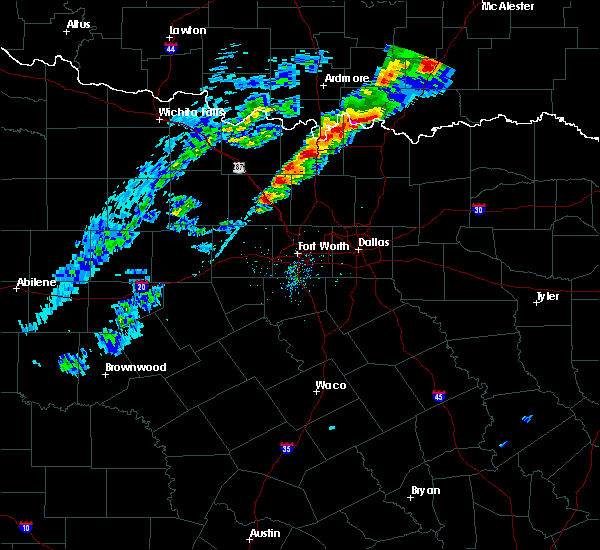 At 751 pm cdt, a severe thunderstorm was located over decatur, moving northeast at 25 mph (radar indicated). Hazards include 60 mph wind gusts and quarter size hail. Hail damage to vehicles is expected. Expect wind damage to roofs, siding, and trees. At 751 pm cdt, a severe thunderstorm was located over decatur, moving northeast at 25 mph (radar indicated). Hazards include 60 mph wind gusts and quarter size hail. Hail damage to vehicles is expected. Expect wind damage to roofs, siding, and trees.
|
| 3/17/2016 8:53 AM CDT |
 The severe thunderstorm warning for wise county will expire at 900 am cdt, the storm which prompted the warning has weakened below severe limits, and no longer pose an immediate threat to life or property. therefore the warning will be allowed to expire. The severe thunderstorm warning for wise county will expire at 900 am cdt, the storm which prompted the warning has weakened below severe limits, and no longer pose an immediate threat to life or property. therefore the warning will be allowed to expire.
|
| 3/17/2016 8:45 AM CDT | Golf Ball sized hail reported 15.1 miles SW of Decatur, TX, golfball size hail in slidell |
| 3/17/2016 7:57 AM CDT |
 At 757 am cdt, a severe thunderstorm was located near boonsville, or 7 miles south of bridgeport, moving northeast at 25 mph (radar indicated). Hazards include quarter size hail. damage to vehicles is expected At 757 am cdt, a severe thunderstorm was located near boonsville, or 7 miles south of bridgeport, moving northeast at 25 mph (radar indicated). Hazards include quarter size hail. damage to vehicles is expected
|
| 3/17/2016 5:26 AM CDT |
 At 525 am cdt, a severe thunderstorm was located 7 miles north of mineral wells, moving east at 30 mph (radar indicated). Hazards include quarter size hail. damage to vehicles is expected At 525 am cdt, a severe thunderstorm was located 7 miles north of mineral wells, moving east at 30 mph (radar indicated). Hazards include quarter size hail. damage to vehicles is expected
|
| 3/8/2016 7:25 AM CST |
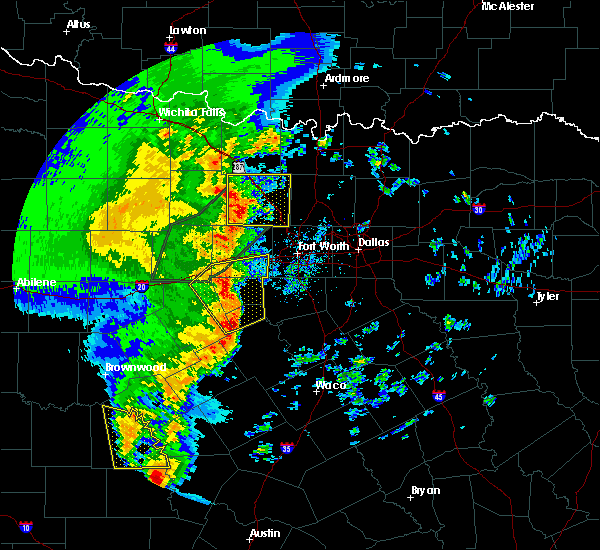 At 725 am cst, a severe thunderstorm was located over bridgeport, moving northeast at 45 mph (radar indicated). Hazards include 60 mph wind gusts. Expect damage to roofs. siding. And trees. At 725 am cst, a severe thunderstorm was located over bridgeport, moving northeast at 45 mph (radar indicated). Hazards include 60 mph wind gusts. Expect damage to roofs. siding. And trees.
|
| 3/7/2016 6:45 PM CST |
 At 644 pm cst, a severe thunderstorm was located over cottondale, or 9 miles northwest of briar, moving northeast at 35 mph (radar indicated). Hazards include 60 mph wind gusts and quarter size hail. Hail damage to vehicles is expected. Expect wind damage to roofs, siding, and trees. At 644 pm cst, a severe thunderstorm was located over cottondale, or 9 miles northwest of briar, moving northeast at 35 mph (radar indicated). Hazards include 60 mph wind gusts and quarter size hail. Hail damage to vehicles is expected. Expect wind damage to roofs, siding, and trees.
|
| 11/5/2015 5:12 PM CST |
 At 511 pm cst, a severe thunderstorm was located near decatur, moving east at 50 mph. this is a very dangerous storm (radar indicated). Hazards include baseball size hail and 60 mph wind gusts. People and animals outdoors will be severely injured. Expect shattered windows, extensive damage to roofs, siding and vehicles. At 511 pm cst, a severe thunderstorm was located near decatur, moving east at 50 mph. this is a very dangerous storm (radar indicated). Hazards include baseball size hail and 60 mph wind gusts. People and animals outdoors will be severely injured. Expect shattered windows, extensive damage to roofs, siding and vehicles.
|
| 11/5/2015 5:10 PM CST | Baseball sized hail reported 0.7 miles SE of Decatur, TX, damage to police vehicles |
| 11/5/2015 5:10 PM CST | Golf Ball sized hail reported 0.7 miles SE of Decatur, TX, estimated golf ball size hail report via sm in decatur. |
| 11/5/2015 5:04 PM CST | Quarter sized hail reported 0.7 miles SE of Decatur, TX, quarter size hail in decatur. report relayed via ham radio operator. |
| 11/5/2015 5:02 PM CST |
 A severe thunderstorm warning remains in effect until 530 pm cst for wise county. at 501 pm cst. a severe thunderstorm was located near decatur. moving northeast at 50 mph. hazard. 70 mph wind gusts and quarter size hail. source. Radar indicated. A severe thunderstorm warning remains in effect until 530 pm cst for wise county. at 501 pm cst. a severe thunderstorm was located near decatur. moving northeast at 50 mph. hazard. 70 mph wind gusts and quarter size hail. source. Radar indicated.
|
| 11/5/2015 4:44 PM CST |
 At 443 pm cst, a severe thunderstorm was located over boonsville, or 9 miles southwest of bridgeport, moving northeast at 50 mph (radar indicated). Hazards include 60 mph wind gusts and quarter size hail. Hail damage to vehicles is expected. Expect wind damage to roofs, siding and trees. At 443 pm cst, a severe thunderstorm was located over boonsville, or 9 miles southwest of bridgeport, moving northeast at 50 mph (radar indicated). Hazards include 60 mph wind gusts and quarter size hail. Hail damage to vehicles is expected. Expect wind damage to roofs, siding and trees.
|
| 11/5/2015 4:33 PM CST |
 At 433 pm cst, a severe thunderstorm capable of producing a tornado was located 7 miles northeast of decatur, moving northeast at 45 mph (radar indicated rotation). Hazards include tornado and quarter size hail. Flying debris will be dangerous to those caught without shelter. mobile homes will be damaged or destroyed. damage to roofs, windows and vehicles will occur. tree damage is likely. this dangerous storm will be near, sanger around 500 pm cst. other locations impacted by this tornadic thunderstorm include valley view. this includes the following interstates, interstate 35 between mile markers 473 and 495. Interstate 30 between mile markers 473 and 495. At 433 pm cst, a severe thunderstorm capable of producing a tornado was located 7 miles northeast of decatur, moving northeast at 45 mph (radar indicated rotation). Hazards include tornado and quarter size hail. Flying debris will be dangerous to those caught without shelter. mobile homes will be damaged or destroyed. damage to roofs, windows and vehicles will occur. tree damage is likely. this dangerous storm will be near, sanger around 500 pm cst. other locations impacted by this tornadic thunderstorm include valley view. this includes the following interstates, interstate 35 between mile markers 473 and 495. Interstate 30 between mile markers 473 and 495.
|
| 11/5/2015 2:05 PM CST |
 At 205 pm cst, a severe thunderstorm was located over boonsville, or 10 miles southwest of bridgeport, moving northeast at 50 mph (radar indicated). Hazards include 60 mph wind gusts and quarter size hail. Hail damage to vehicles is expected. expect wind damage to roofs, siding and trees. locations impacted include, decatur, bridgeport, briar, new fairview, aurora, boyd, paradise, boonsville, cottondale, rhome, runaway bay and lake bridgeport. A tornado watch remains in effect until 800 pm cst for north central texas. At 205 pm cst, a severe thunderstorm was located over boonsville, or 10 miles southwest of bridgeport, moving northeast at 50 mph (radar indicated). Hazards include 60 mph wind gusts and quarter size hail. Hail damage to vehicles is expected. expect wind damage to roofs, siding and trees. locations impacted include, decatur, bridgeport, briar, new fairview, aurora, boyd, paradise, boonsville, cottondale, rhome, runaway bay and lake bridgeport. A tornado watch remains in effect until 800 pm cst for north central texas.
|
| 11/5/2015 1:55 PM CST |
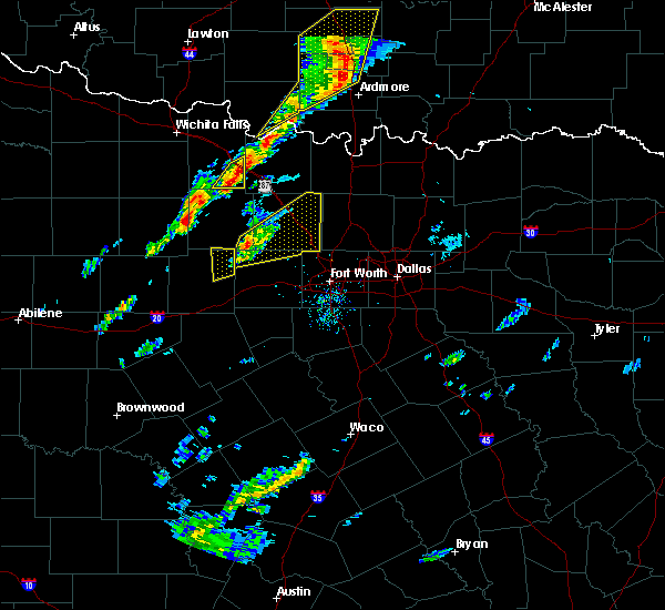 At 155 pm cst, a severe thunderstorm was located 7 miles west of poolville, or 14 miles northeast of mineral wells, moving northeast at 50 mph (radar indicated). Hazards include 60 mph wind gusts and quarter size hail. Hail damage to vehicles is expected. Expect wind damage to roofs, siding and trees. At 155 pm cst, a severe thunderstorm was located 7 miles west of poolville, or 14 miles northeast of mineral wells, moving northeast at 50 mph (radar indicated). Hazards include 60 mph wind gusts and quarter size hail. Hail damage to vehicles is expected. Expect wind damage to roofs, siding and trees.
|
| 6/26/2015 5:45 PM CDT | At 545 pm cdt, a severe thunderstorm was located over alvord, or 11 miles northwest of decatur, moving east at 10 mph (radar indicated). Hazards include 60 mph wind gusts and quarter size hail. Hail damage to vehicles is expected. Expect wind damage to roofs, siding and trees. |
| 5/28/2015 8:12 PM CDT | The severe thunderstorm warning for parker, wise, northeastern palo pinto and eastern jack counties will expire at 815 pm cdt, the storms which prompted the warning have weakened below severe limits, and no longer pose an immediate threat to life or property. therefore the warning will be allowed to expire. however small. |
| 5/28/2015 7:56 PM CDT | At 756 pm cdt, severe thunderstorms were located along a line extending from near sunset to near cottondale to 6 miles south of cool, moving east at 15 mph (radar indicated). Hazards include 60 mph wind gusts and quarter size hail. Hail damage to vehicles is expected. expect wind damage to roofs, siding and trees. locations impacted include, weatherford, mineral wells, azle, decatur, bridgeport, jacksboro, briar, pecan acres, willow park, reno, aledo, springtown, hudson oaks, alvord, annetta, new fairview, aurora, boyd, chico and graford. this includes the following interstates, interstate 20 between mile markers 397 and 422. Interstate 30 near mile marker 1. |
| 5/28/2015 7:21 PM CDT | At 720 pm cdt, severe thunderstorms were located along a line extending from near newport to 7 miles northwest of boonsville to 12 miles southwest of graford, moving east at 45 mph (radar indicated). Hazards include 70 mph wind gusts and quarter size hail. Hail damage to vehicles is expected. expect considerable tree damage. Wind damage is also likely to mobile homes, roofs and outbuildings. |
| 5/25/2015 2:13 PM CDT | The severe thunderstorm warning for eastern wise and eastern montague counties will expire at 215 pm cdt, the storms which prompted the warning have moved out of the area and weakened. therefore the warning will be allowed to expire. however gusty winds are still possible with these thunderstorms. a tornado watch remains in effect until 600 pm cdt for north central texas. |
| 5/25/2015 2:05 PM CDT | At 204 pm cdt, severe thunderstorms were located along a line extending from near forestburg to 7 miles northeast of decatur to near new fairview, moving east at 50 mph (radar indicated). Hazards include 70 mph wind gusts and penny size hail. Expect considerable tree damage. damage is likely to mobile homes, roofs and outbuildings. locations impacted include, decatur, nocona, briar, pecan acres, new fairview, aurora, boyd, st. jo, paradise, forestburg, cottondale, rhome and newark. A tornado watch remains in effect until 600 pm cdt for north central texas. |
| 5/25/2015 1:47 PM CDT | At 147 pm cdt, severe thunderstorms were located along a line extending from near forestburg to 7 miles northeast of decatur to near boyd, moving east at 45 mph (radar indicated). Hazards include 70 mph wind gusts and penny size hail. Expect considerable tree damage. damage is likely to mobile homes, roofs and outbuildings. locations impacted include, decatur, bridgeport, bowie, nocona, briar, pecan acres, alvord, new fairview, aurora, boyd, st. jo, chico, paradise, stoneburg, forestburg, sunset, boonsville, cottondale, rhome and runaway bay. A tornado watch remains in effect until 600 pm cdt for north central texas. |
| 5/25/2015 1:31 PM CDT | At 131 pm cdt, severe thunderstorms were located along a line extending from near bowie to near alvord to near cottondale, moving east at 50 mph (radar indicated). Hazards include 70 mph wind gusts and penny size hail. Expect considerable tree damage. damage is likely to mobile homes, roofs and outbuildings. locations impacted include, decatur, bridgeport, bowie, nocona, briar, pecan acres, alvord, new fairview, aurora, boyd, st. jo, chico, paradise, stoneburg, forestburg, sunset, boonsville, cottondale, rhome and runaway bay. A tornado watch remains in effect until 600 pm cdt for north central texas. |
| 5/25/2015 1:11 PM CDT | At 110 pm cdt, severe thunderstorms were located along a line extending from near newport to 9 miles west of chico to near poolville, moving east at 50 mph (radar indicated). Hazards include 60 mph wind gusts and penny size hail. Expect damage to roofs. Siding and trees. |
| 5/19/2015 11:36 PM CDT | At 1135 pm cdt, a severe thunderstorm was located near chico, or near bridgeport, moving east at 45 mph (radar indicated). Hazards include 70 mph wind gusts and half dollar size hail. Hail damage to vehicles is expected. expect considerable tree damage. wind damage is also likely to mobile homes, roofs and outbuildings. locations impacted include, decatur, bridgeport, alvord, new fairview, chico, paradise, runaway bay and lake bridgeport. A tornado watch remains in effect until midnight cdt for north central texas. |
| 5/19/2015 11:21 PM CDT | At 1119 pm cdt, a severe thunderstorm was located over chico, or near bridgeport, moving east at 30 mph (radar indicated). Hazards include tennis ball size hail and 60 mph wind gusts. People and animals outdoors will be injured. expect hail damage to roofs, siding, windows and vehicles. expect wind damage to roofs, siding and trees. locations impacted include, decatur, bridgeport, alvord, new fairview, chico, paradise, runaway bay and lake bridgeport. A tornado watch remains in effect until midnight cdt for north central texas. |
| 5/19/2015 11:03 PM CDT | At 1102 pm cdt, a severe thunderstorm was located near chico, or 8 miles northwest of bridgeport, moving east at 25 mph (radar indicated). Hazards include two inch hail and 60 mph wind gusts. People and animals outdoors will be injured. expect hail damage to roofs, siding, windows and vehicles. expect wind damage to roofs, siding and trees. locations impacted include, decatur, bridgeport, alvord, new fairview, aurora, boyd, chico, paradise, runaway bay and lake bridgeport. A tornado watch remains in effect until midnight cdt for north central texas. |
| 5/19/2015 11:03 PM CDT | At 1102 pm cdt, a severe thunderstorm was located near chico, or 8 miles northwest of bridgeport, moving east at 25 mph (radar indicated). Hazards include two inch hail and 60 mph wind gusts. People and animals outdoors will be injured. expect hail damage to roofs, siding, windows and vehicles. expect wind damage to roofs, siding and trees. locations impacted include, decatur, bridgeport, alvord, new fairview, aurora, boyd, chico, paradise, runaway bay and lake bridgeport. A tornado watch remains in effect until midnight cdt for north central texas. |
| 5/19/2015 10:43 PM CDT | At 1042 pm cdt, a severe thunderstorm was located 10 miles west of chico, or 11 miles east of jacksboro, moving east at 45 mph (radar indicated). Hazards include two inch hail and 60 mph wind gusts. People and animals outdoors will be injured. expect hail damage to roofs, siding, windows and vehicles. Expect wind damage to roofs, siding and trees. |
| 5/19/2015 10:40 PM CDT | At 1039 pm cdt, a severe thunderstorm capable of producing a tornado was located about 2 miles east of decatur, moving east at 10 mph (radar indicated rotation). Hazards include tornado and hail up to two inches in diameter. Flying debris will be dangerous to those caught without shelter. mobile homes will be damaged or destroyed. damage to roofs, windows and vehicles will occur. tree damage is likely. This dangerous storm will be near, new fairview around 1115 pm cdt. |
| 5/19/2015 10:34 PM CDT | At 1032 pm cdt, a severe thunderstorm was located near bridgeport, moving east at 40 mph, and a tornado warning remains in effect for central portions of wise county. this is a very dangerous storm (radar indicated). Hazards include 80 mph wind gusts and two inch hail. Flying debris will be dangerous to those caught without shelter. mobile homes will be heavily damaged. expect considerable damage to roofs, windows and vehicles. extensive tree damage and power outages are likely. locations impacted include, decatur, bridgeport, jacksboro, briar, pecan acres, alvord, new fairview, aurora, boyd, chico, paradise, boonsville, cottondale, rhome, runaway bay, newark and lake bridgeport. A tornado watch remains in effect until midnight cdt for north central texas. |
| 5/19/2015 10:08 PM CDT | At 1007 pm cdt, a severe thunderstorm capable of producing a tornado was located over paradise moving east at 30 mph (radar indicated rotation). Hazards include tornado and hail up to two inches in diameter. Flying debris will be dangerous to those caught without shelter. mobile homes will be damaged or destroyed. damage to roofs, windows and vehicles will occur. tree damage is likely. this dangerous storm will be near, boyd around 1020 pm cdt. aurora around 1025 pm cdt. new fairview around 1040 pm cdt. Other locations impacted by this tornadic thunderstorm include rhome. |
| 5/19/2015 9:51 PM CDT | At 949 pm cdt, a severe thunderstorm was located near bridgeport, moving east at 40 mph, a tornado warning remains in effect for western portions of wise county as well. this is a very dangerous storm (radar indicated). Hazards include 80 mph wind gusts and two inch hail. Flying debris will be dangerous to those caught without shelter. mobile homes will be heavily damaged. expect considerable damage to roofs, windows and vehicles. extensive tree damage and power outages are likely. locations impacted include, decatur, bridgeport, jacksboro, briar, pecan acres, alvord, new fairview, aurora, boyd, chico, paradise, boonsville, cottondale, rhome, runaway bay, newark and lake bridgeport. A tornado watch remains in effect until midnight cdt for north central texas. |
| 5/19/2015 9:43 PM CDT | At 941 pm cdt, a severe thunderstorm was located near boonsville, or 10 miles southwest of bridgeport, moving east at 40 mph. also tornado warning remains in effect for southwestern portions of wise county including runaway bay until 10:15 pm (radar indicated). Hazards include two inch hail and 60 mph wind gusts. People and animals outdoors will be injured. expect hail damage to roofs, siding, windows and vehicles. Expect wind damage to roofs, siding and trees. |
| 5/19/2015 9:06 PM CDT | At 906 pm cdt, a severe thunderstorm was located near boonsville, or 12 miles southwest of bridgeport, moving east at 40 mph (radar indicated). Hazards include ping pong ball size hail and 60 mph wind gusts. People and animals outdoors will be injured. expect hail damage to roofs, siding, windows and vehicles. Expect wind damage to roofs, siding and trees. |
| 5/17/2015 12:30 AM CDT | At 1229 am cdt, severe thunderstorms were located along a line extending from near decatur to justin to white settlement, moving east at 60 mph (radar indicated). Hazards include 60 mph wind gusts. Expect damage to roofs. siding and trees. locations impacted include, fort worth, denton, lewisville, flower mound, euless, bedford, grapevine, haltom city, keller, coppell, hurst, the colony, southlake, watauga, colleyville, benbrook, corinth, saginaw, white settlement and highland village. 75in. |
| 5/17/2015 12:07 AM CDT | At 1205 am cdt, severe thunderstorms were located along a line extending from near poolville to near springtown to willow park, moving east at 60 mph (radar indicated). Hazards include 70 mph wind gusts. Expect considerable tree damage. Damage is likely to mobile homes, roofs and outbuildings. |
| 5/10/2015 2:12 PM CDT | At 211 pm cdt, a severe thunderstorm was located near corral city, or 7 miles southwest of denton, moving northeast at 35 mph (radar indicated). Hazards include 60 mph wind gusts and quarter size hail. Hail damage to vehicles is expected. expect wind damage to roofs, siding and trees. locations impacted include, fort worth, denton, flower mound, keller, corinth, saginaw, trophy club, sanger, decatur, bridgeport, briar, eagle mountain, roanoke, pecan acres, krum, pilot point, argyle, justin, shady shores and aubrey. this includes the following interstates, interstate 35 between mile markers 468 and 481. interstate 35w between mile markers 60 and 85. interstate 35e between mile markers 460 and 466. interstate 820 between mile markers 13 and 15. a tornado watch remains in effect until 900 pm cdt for north central texas. 1. 00in. |
| 5/10/2015 1:42 PM CDT | At 141 pm cdt, a severe thunderstorm was located over pelican bay, or over briar, moving northeast at 55 mph. another severe thunderstorm was also located west of haslet near pelican acres, .along moving northeast (radar indicated). Hazards include 60 mph wind gusts and quarter size hail. Hail damage to vehicles is expected. Expect wind damage to roofs, siding and trees. |
| 5/10/2015 12:07 PM CDT | At 1206 pm cdt, a severe thunderstorm was located near decatur, moving northeast at 35 mph (radar indicated). Hazards include quarter size hail. damage to vehicles is expected |
| 5/7/2015 8:54 PM CDT | At 854 pm cdt, severe thunderstorms were located along a line extending from near decatur to near boyd to 6 miles north of weatherford, moving east at 50 mph (radar indicated). Hazards include 70 mph wind gusts and quarter size hail. Hail damage to vehicles is expected. expect considerable tree damage. Wind damage is also likely to mobile homes, roofs and outbuildings. |
| 5/7/2015 8:07 PM CDT | At 806 pm cdt, severe thunderstorms were located along a line extending from near jacksboro to near graford to 10 miles northwest of gordon, moving east at 45 mph (radar indicated). Hazards include 70 mph wind gusts and quarter size hail. Hail damage to vehicles is expected. expect considerable tree damage. Wind damage is also likely to mobile homes, roofs and outbuildings. |
| 5/7/2015 7:41 PM CDT | At 741 pm cdt, a severe thunderstorm was located over alvord, or 10 miles north of bridgeport, moving east at 20 mph (radar indicated). Hazards include ping pong ball size hail and 60 mph wind gusts. People and animals outdoors will be injured. expect hail damage to roofs, siding, windows and vehicles. expect wind damage to roofs, siding and trees. locations impacted include, decatur, bridgeport, alvord and chico. 1. 50in. |
| 5/7/2015 7:16 PM CDT | At 716 pm cdt, a severe thunderstorm was located near chico, or 11 miles northwest of bridgeport, moving east at 20 mph (radar indicated). Hazards include ping pong ball size hail and 60 mph wind gusts. People and animals outdoors will be injured. expect hail damage to roofs, siding, windows and vehicles. Expect wind damage to roofs, siding and trees. |
| 5/7/2015 6:45 PM CDT | At 645 pm cdt, a confirmed tornado was located near new fairview, or 7 miles southeast of decatur, moving northeast at 20 mph (public confirmed tornado). Hazards include damaging tornado. Flying debris will be dangerous to those caught without shelter. mobile homes will be damaged or destroyed. damage to roofs, windows and vehicles will occur. tree damage is likely. this tornadic thunderstorm will remain over mainly rural areas of eastern wise and northwestern denton counties, including the following locations, rhome and ponder. this includes interstate 35 between mile markers 473 and 481. Observed. |
| 5/7/2015 6:36 PM CDT | At 636 pm cdt, a severe thunderstorm was located over new fairview, or 8 miles southeast of decatur, moving northeast at 30 mph (radar indicated). Hazards include tennis ball size hail and 60 mph wind gusts. People and animals outdoors will be injured. expect hail damage to roofs, siding, windows and vehicles. expect wind damage to roofs, siding and trees. locations impacted include, denton, sanger, decatur, krum, pilot point, justin, northlake, new fairview, aurora, boyd, ray roberts park isle du bois, ray roberts park johnson branch, rhome and ponder. this includes the following interstates, interstate 35 between mile markers 468 and 482. interstate 35w between mile markers 83 and 85. interstate 35e near mile marker 466. 2. 50in. |
| 5/7/2015 6:25 PM CDT | At 624 pm cdt, a severe thunderstorm was located over aurora, or 7 miles northeast of briar, moving northeast at 35 mph (radar indicated). Hazards include ping pong ball size hail and 60 mph wind gusts. People and animals outdoors will be injured. expect hail damage to roofs, siding, windows and vehicles. Expect wind damage to roofs, siding and trees. |
| 5/7/2015 6:11 PM CDT | At 610 pm cdt, a severe thunderstorm capable of producing a tornado was located over boyd, or near briar, moving northeast at 30 mph (radar indicated rotation). Hazards include tornado and quarter size hail. Flying debris will be dangerous to those caught without shelter. mobile homes will be damaged or destroyed. damage to roofs, windows and vehicles will occur. tree damage is likely. this dangerous storm will be near, decatur and new fairview around 630 pm cdt. Radar indicated. |
| 5/7/2015 5:13 PM CDT | At 512 pm cdt, a severe thunderstorm was located near springtown, or 11 miles north of weatherford, moving north at 40 mph (radar indicated). Hazards include ping pong ball size hail and 60 mph wind gusts. People and animals outdoors will be injured. expect hail damage to roofs, siding, windows and vehicles. Expect wind damage to roofs, siding and trees. |
| 3/19/2015 7:28 PM CDT | The national weather service in fort worth has issued a * severe thunderstorm warning for. northern wise county in north central texas. southeastern montague county in north central texas. until 815 pm cdt * at 727 pm cdt. Doppler radar indicated a severe thunderstorm. |
| 12/14/2014 4:35 PM CST | Barn damage on private road 4411 4 miles east of decatur in wise county TX, 3.6 miles W of Decatur, TX |
| 10/2/2014 1:58 PM CDT | Quarter sized hail reported 6 miles NE of Decatur, TX, paradise |
| 4/27/2014 8:04 AM CDT | Quarter sized hail reported 3.2 miles SW of Decatur, TX |
| 4/27/2014 7:56 AM CDT | Quarter sized hail reported 2.7 miles NE of Decatur, TX |
| 4/3/2014 2:56 PM CDT | Quarter sized hail reported 7.1 miles N of Decatur, TX, quarter size hail at highway 287 and cr 4421 |
| 4/3/2014 2:22 PM CDT | Quarter sized hail reported 15.1 miles SW of Decatur, TX, quarter size hail in slidell |
| 4/3/2014 1:59 PM CDT | Quarter sized hail reported 0.7 miles SE of Decatur, TX, quarter size hail in central decatur |
| 4/3/2014 1:56 PM CDT | Half Dollar sized hail reported 1.6 miles NNE of Decatur, TX |
| 5/21/2013 1:14 PM CDT | Klud in wise county TX, 1.3 miles S of Decatur, TX |
| 3/9/2013 4:54 PM CST | Baseball sized hail reported 0.7 miles SE of Decatur, TX, measured between 2.75 and 3.00 inch hail at 287 rest stop north of decatur. |
| 3/9/2013 4:52 PM CST | Hen Egg sized hail reported 4.6 miles SSE of Decatur, TX, two inch diameter hail measured at a 287 rest stop north of decatur. |
| 3/9/2013 4:49 PM CST | Golf Ball sized hail reported 4.6 miles SSE of Decatur, TX, golfball sized hail reported 287 rest stop north of decatur. |
| 3/9/2013 4:34 PM CST | Quarter sized hail reported 5.3 miles ENE of Decatur, TX, at the allsups in bridgeport |
| 3/9/2013 3:54 PM CST | Baseball sized hail reported 0.7 miles SE of Decatur, TX, measured between 2.75 and 3.00 inch hail at 287 rest stop north of decatur. |
| 3/9/2013 3:52 PM CST | Hen Egg sized hail reported 4.6 miles SSE of Decatur, TX, two inch diameter hail measured at a 287 rest stop north of decatur. |
| 3/9/2013 3:49 PM CST | Golf Ball sized hail reported 4.6 miles SSE of Decatur, TX, golfball sized hail reported 287 rest stop north of decatur. |
| 3/9/2013 3:34 PM CST | Quarter sized hail reported 5.3 miles ENE of Decatur, TX, at the allsups in bridgeport |
| 1/29/2013 1:57 PM CST | Quarter sized hail reported 0.7 miles SE of Decatur, TX, quarter size hail in decatur |
| 8/12/2012 6:01 PM CDT | Spotter measured 66 mph wind gust out of the northwes in wise county TX, 6 miles WSW of Decatur, TX |
| 1/1/0001 12:00 AM | Half Dollar sized hail reported 14.3 miles SW of Decatur, TX |
| 1/1/0001 12:00 AM | Quarter sized hail reported 15.1 miles SW of Decatur, TX |
| 12/14/2011 4:50 PM CST | Quarter sized hail reported 2 miles NW of Decatur, TX, hail approximately the size of quarters was reported near fm 2264 and highwa |
| 1/1/0001 12:00 AM | *** 1 inj *** roof collapse to the sunset inn. 1 person was transported to a hospital after sustaining an injur in wise county TX, 0.7 miles SE of Decatur, TX |
| 1/1/0001 12:00 AM | Klud in wise county TX, 0.7 miles SE of Decatur, TX |
| 1/1/0001 12:00 AM | Reported roof/structural damage in wise county TX, 0.7 miles SE of Decatur, TX |
| 1/1/0001 12:00 AM | Trees were uprooted and snapped in decatur. power lines were also down and shingles were blown off roof in wise county TX, 0.7 miles SE of Decatur, TX |
| 1/1/0001 12:00 AM | Estimated 60 mph wind gust with very heavy rainfall in decatu in wise county TX, 0.7 miles SE of Decatur, TX |
| 1/1/0001 12:00 AM | Restaurant sign damage along 287 in decatur; time estimated by radar in wise county TX, 0.7 miles SE of Decatur, TX |
| 1/1/0001 12:00 AM | Quarter sized hail reported 6 miles NE of Decatur, TX |
| 1/1/0001 12:00 AM | Quarter sized hail reported 0.7 miles SE of Decatur, TX, northwest side of decatur |
| 1/1/0001 12:00 AM | Quarter sized hail reported 2.7 miles S of Decatur, TX, quarter size hail 2 north of decatur |
Hail Maps for Decatur, TX
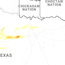
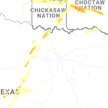
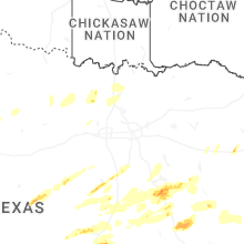
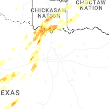
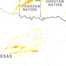
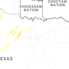


Connect with Interactive Hail Maps