

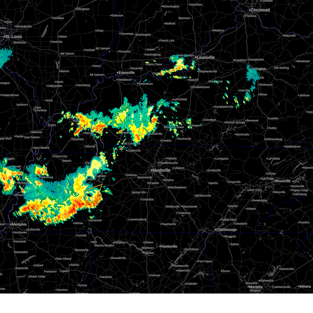
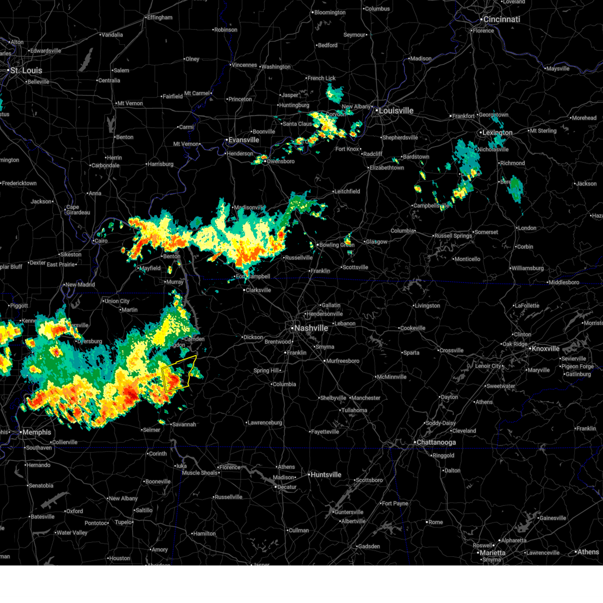
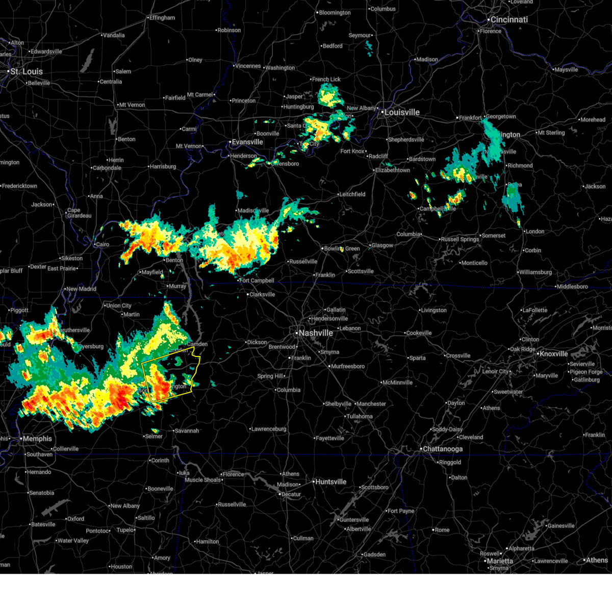
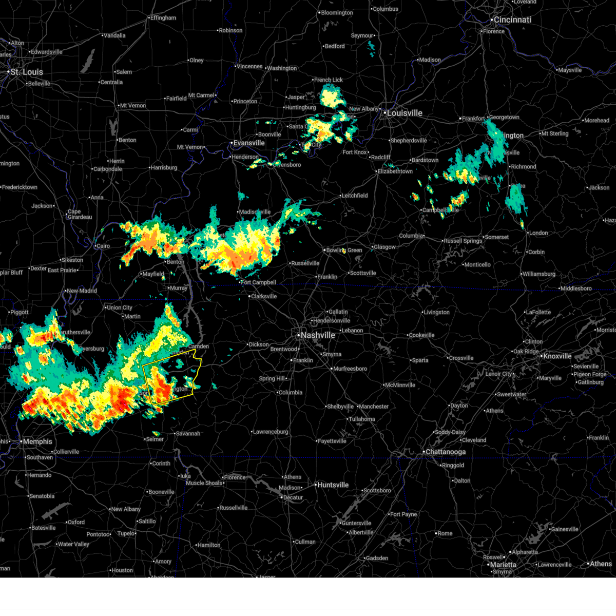
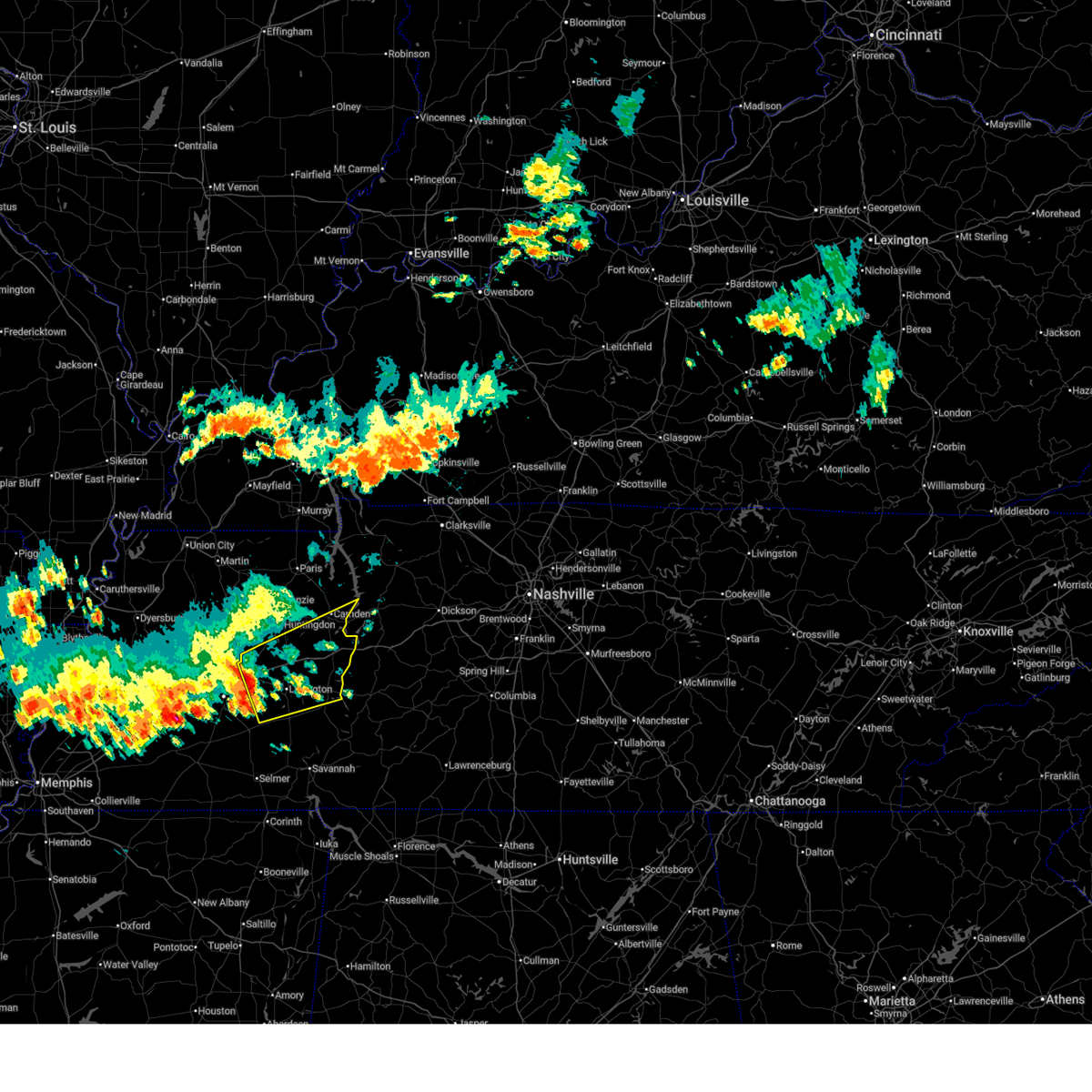
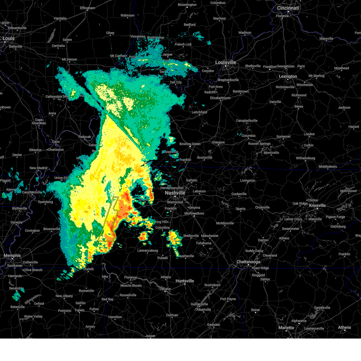
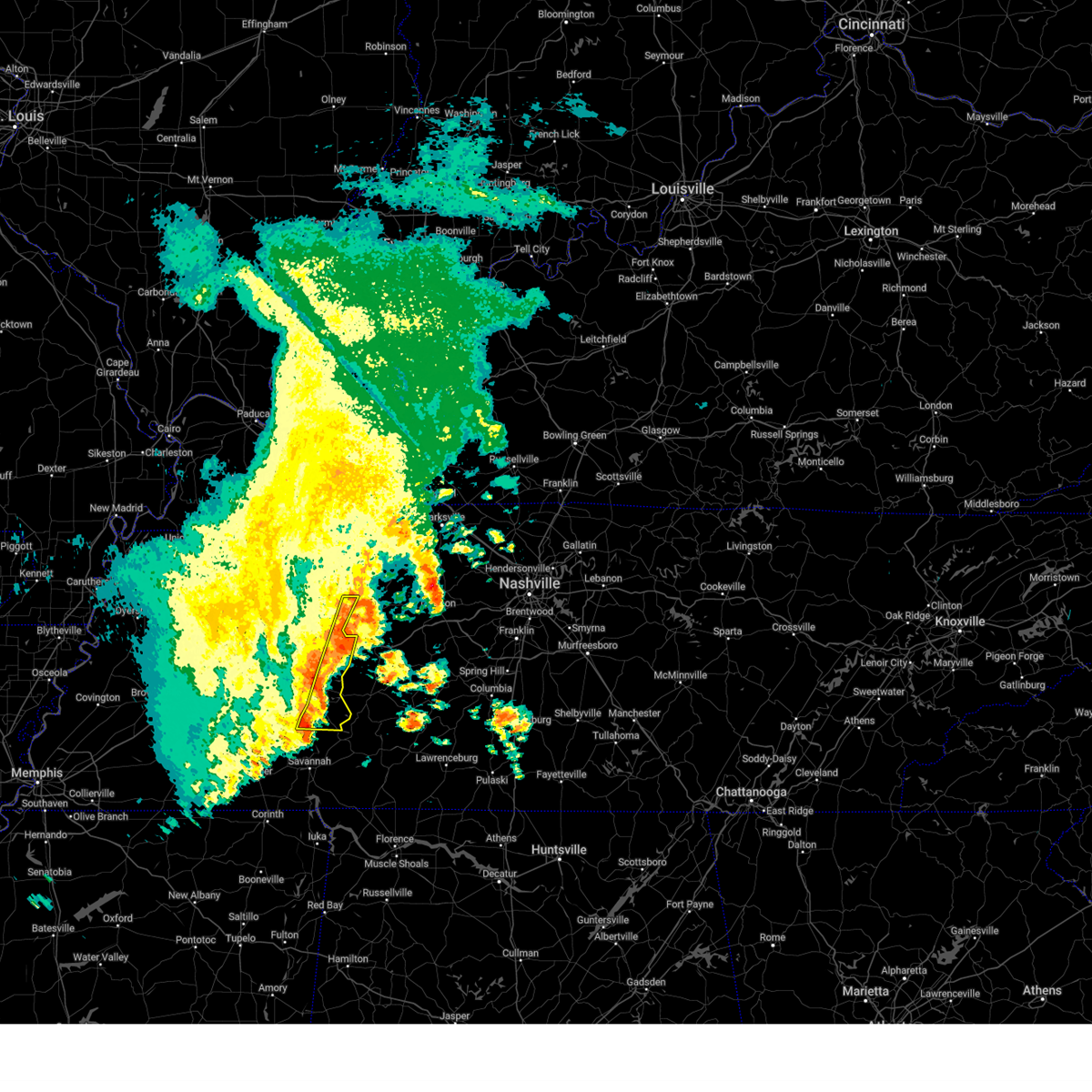
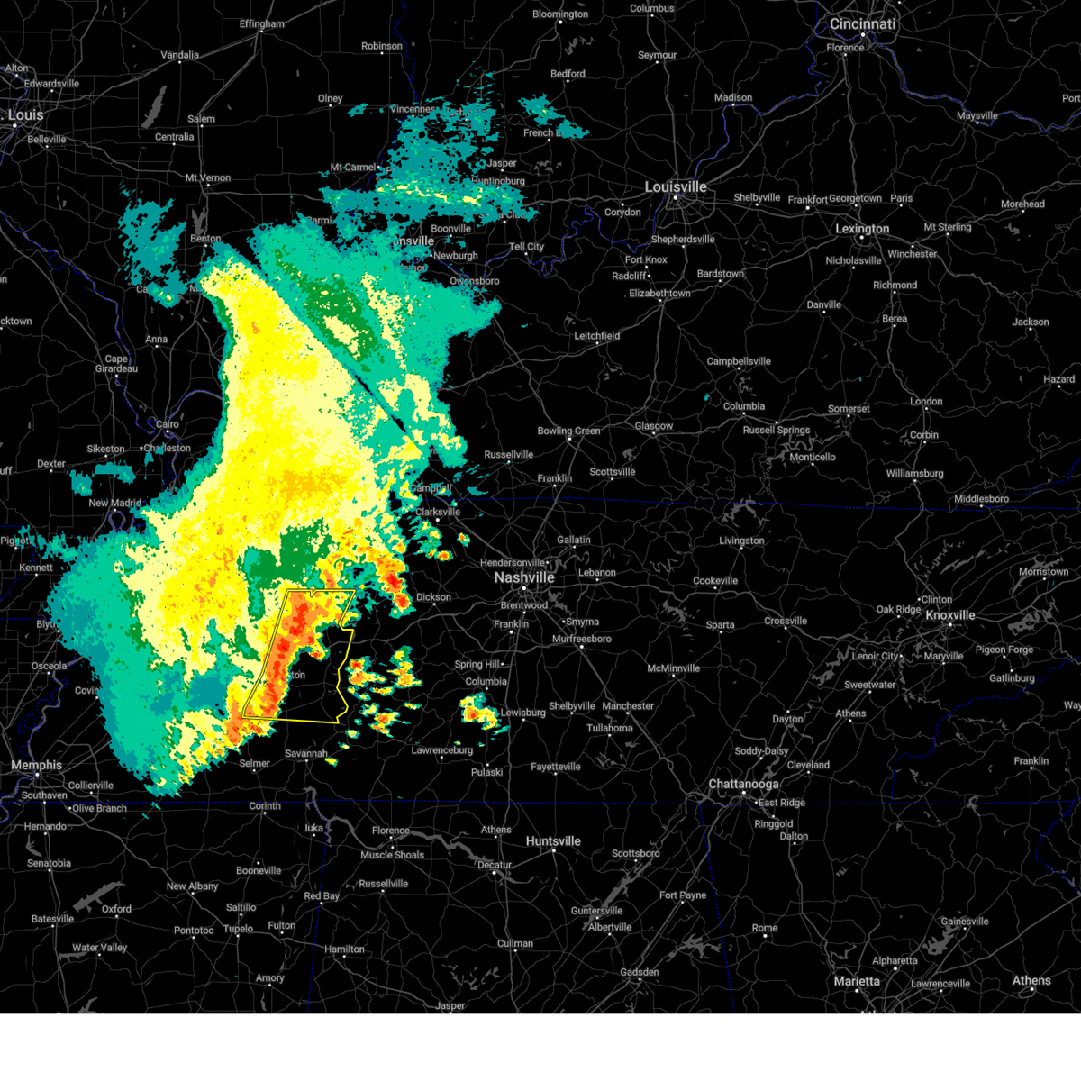
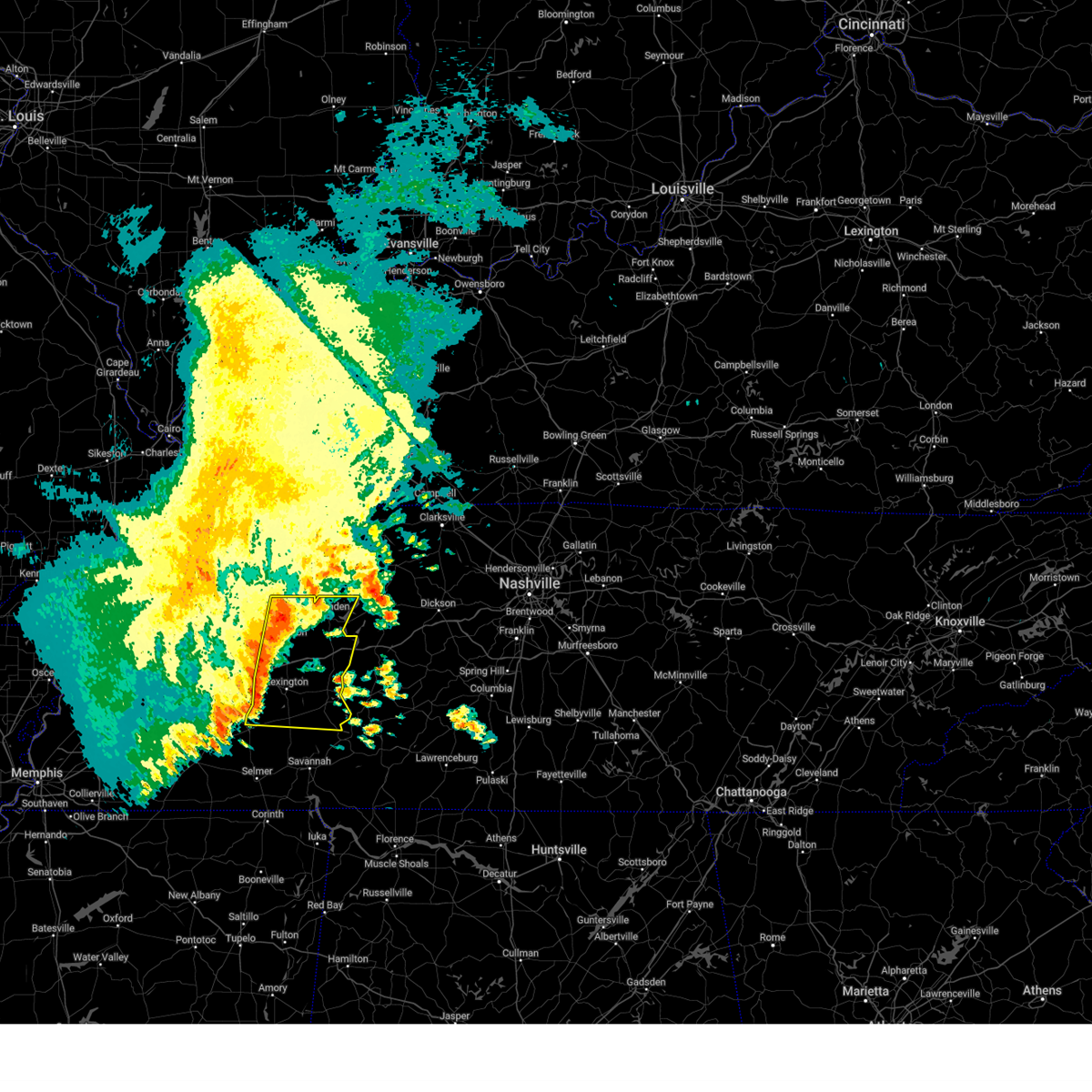
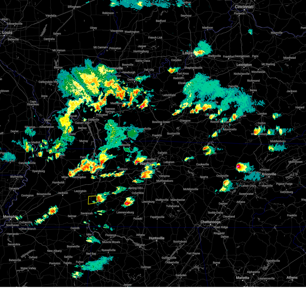
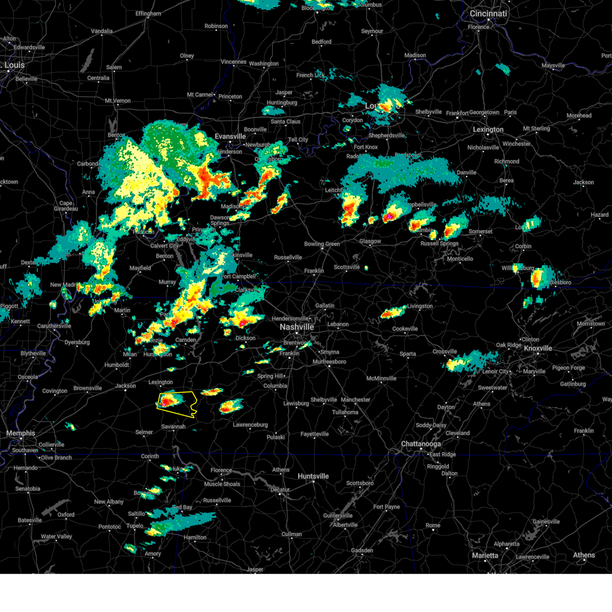
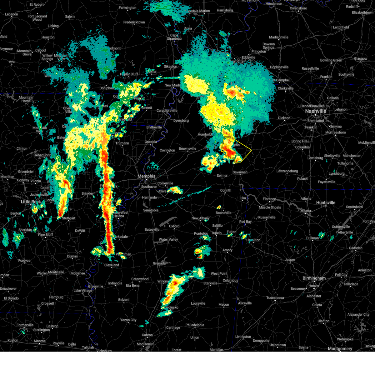
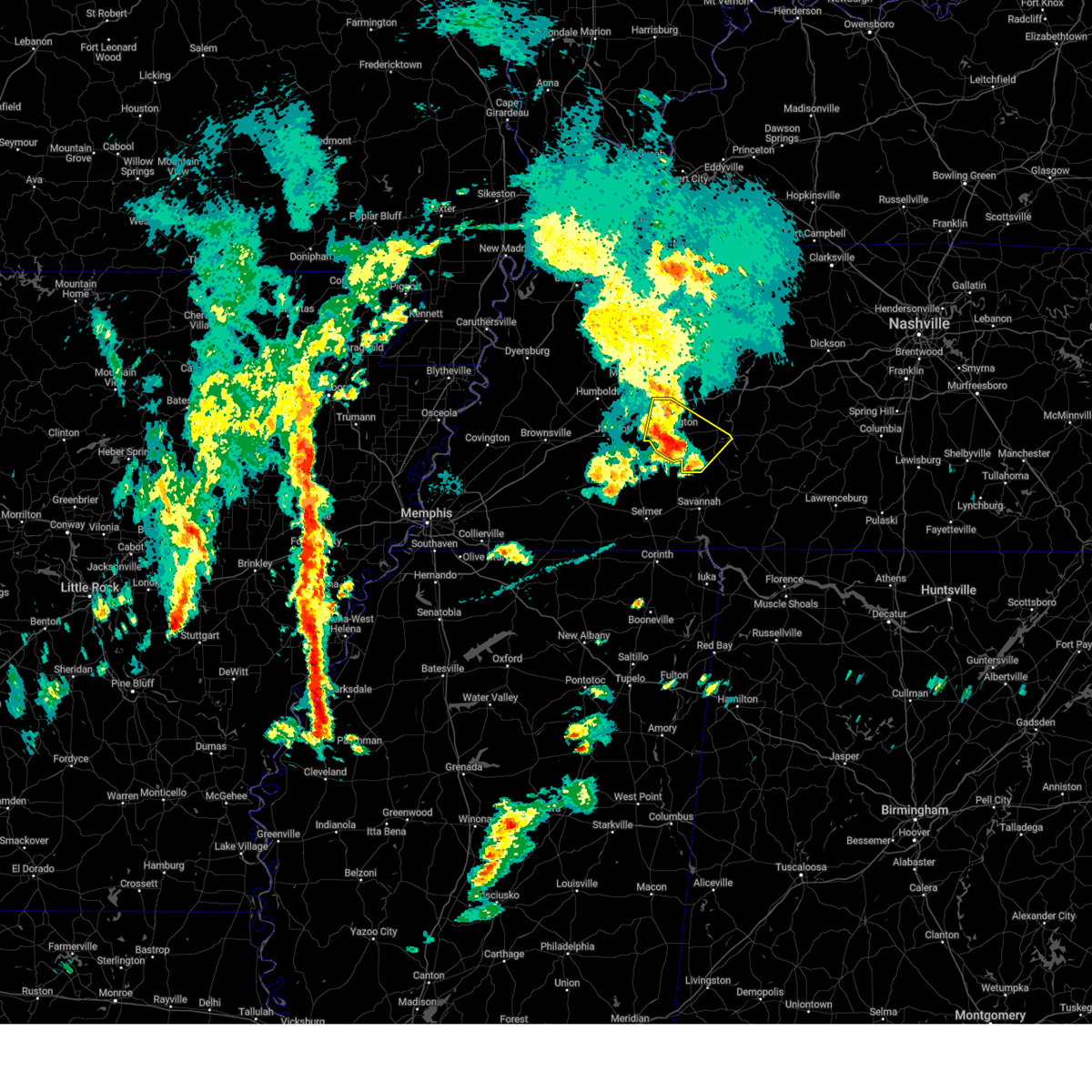
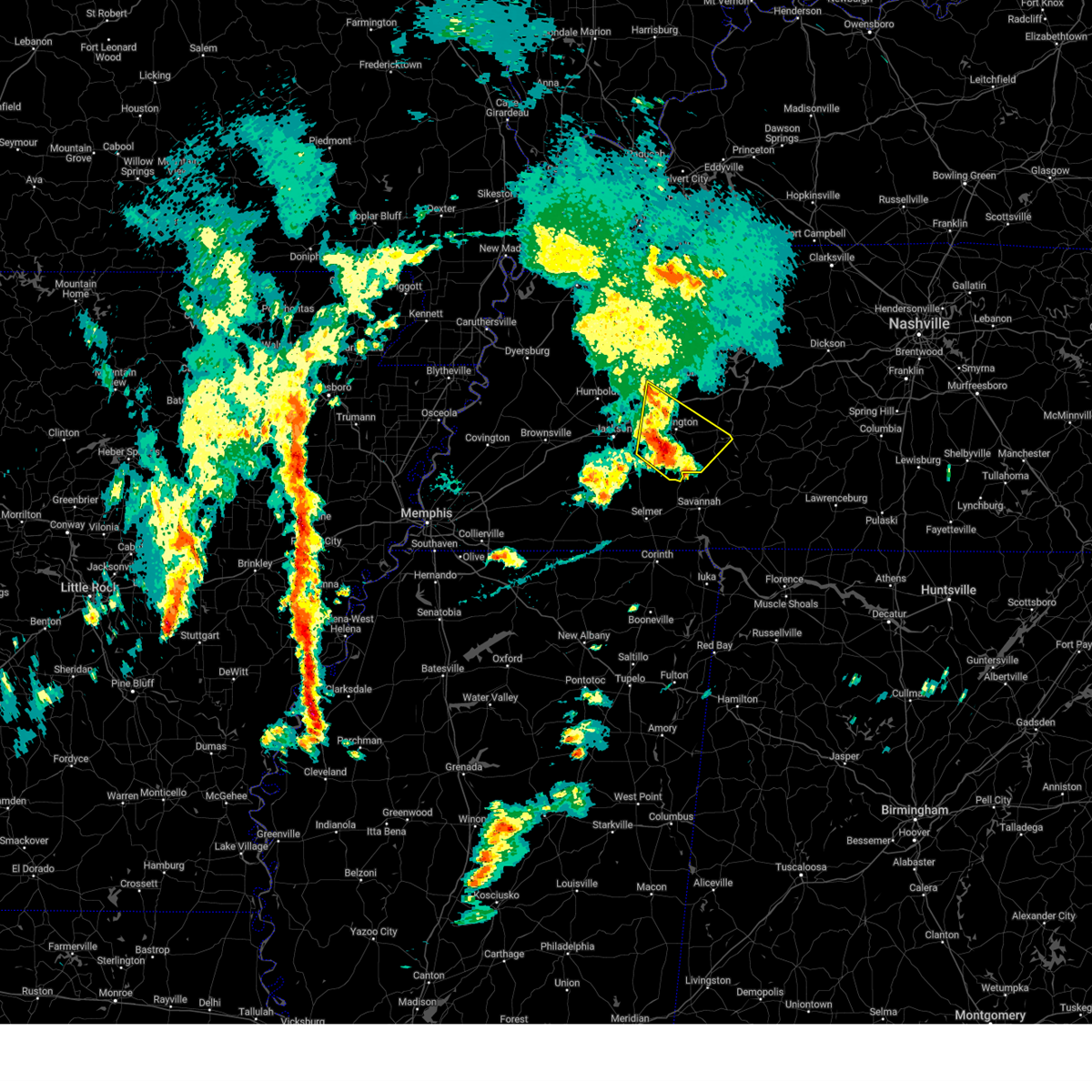
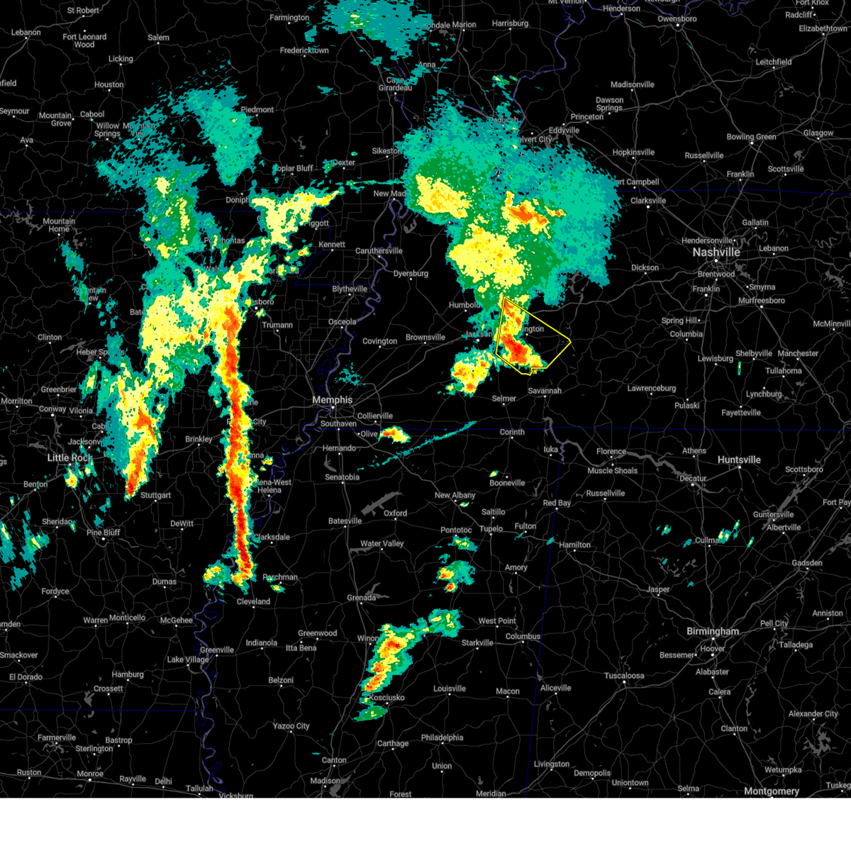
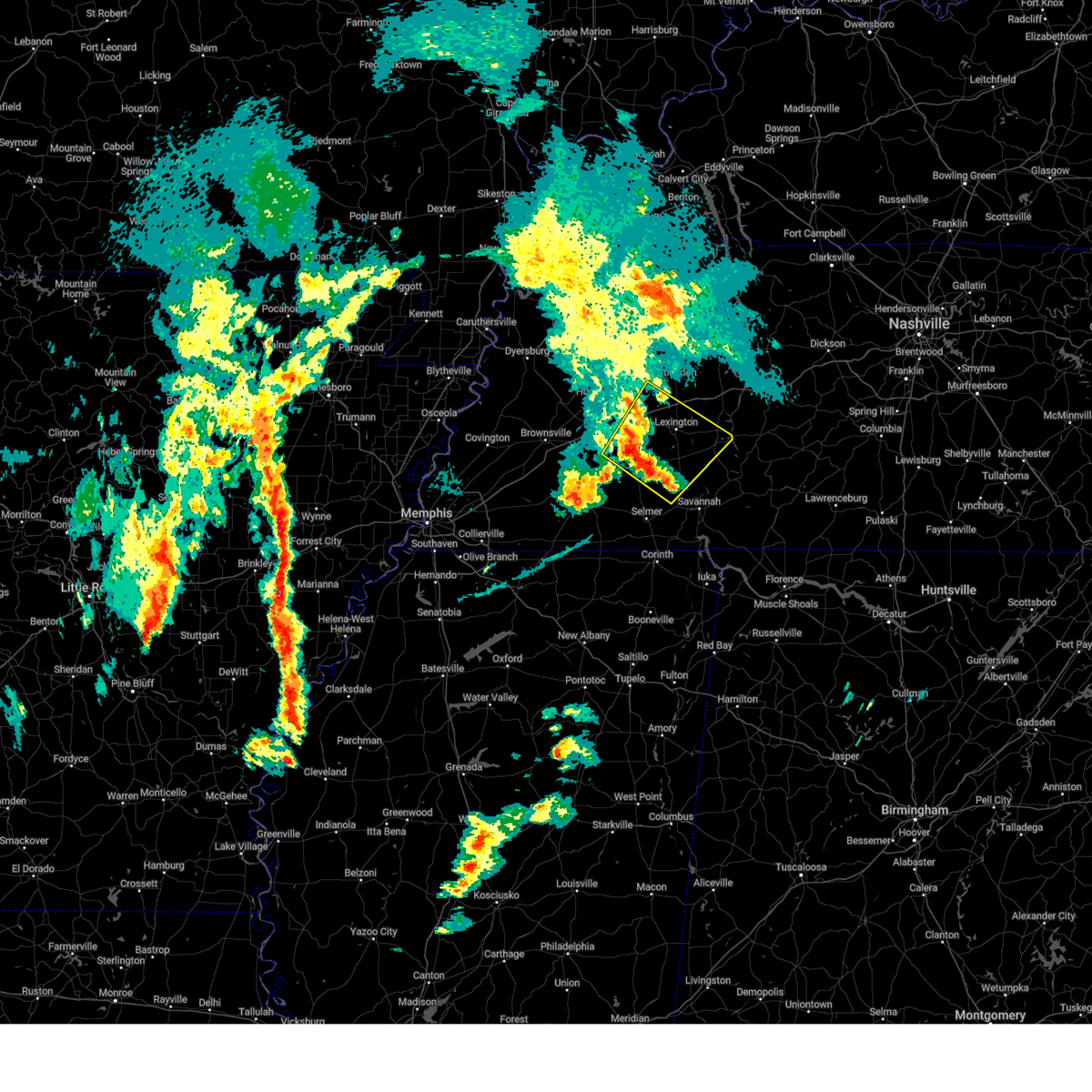
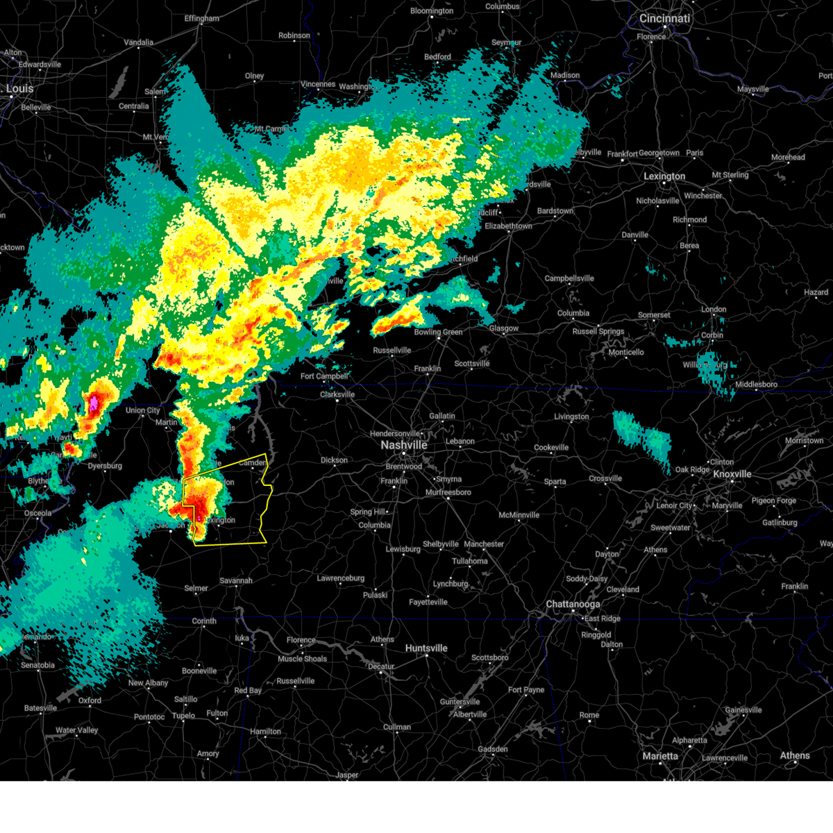
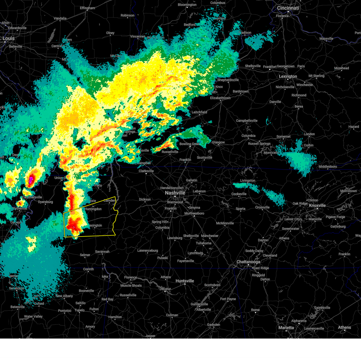
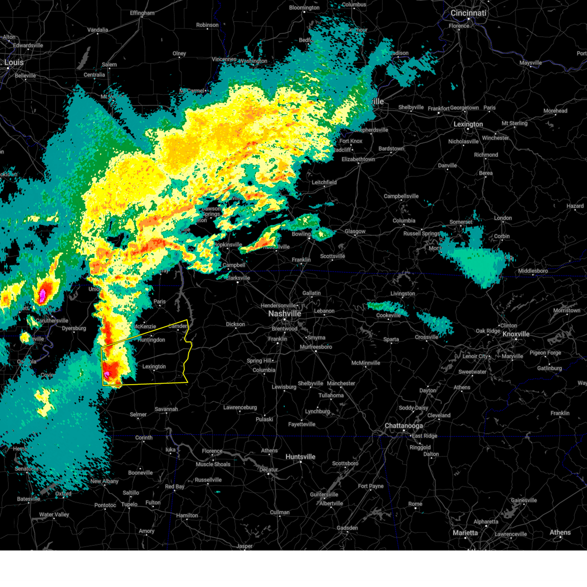
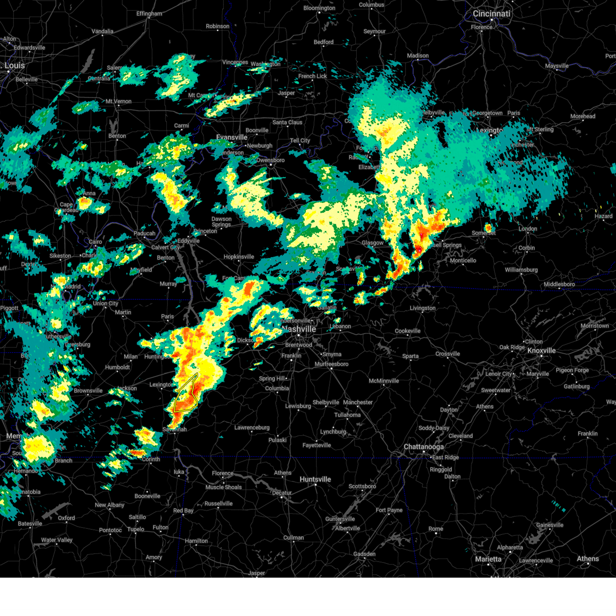
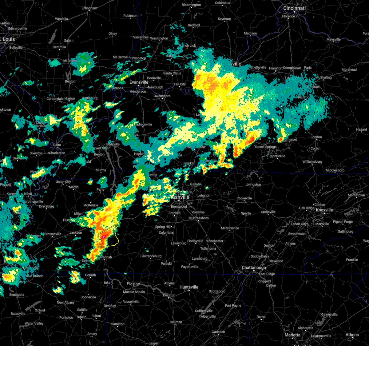
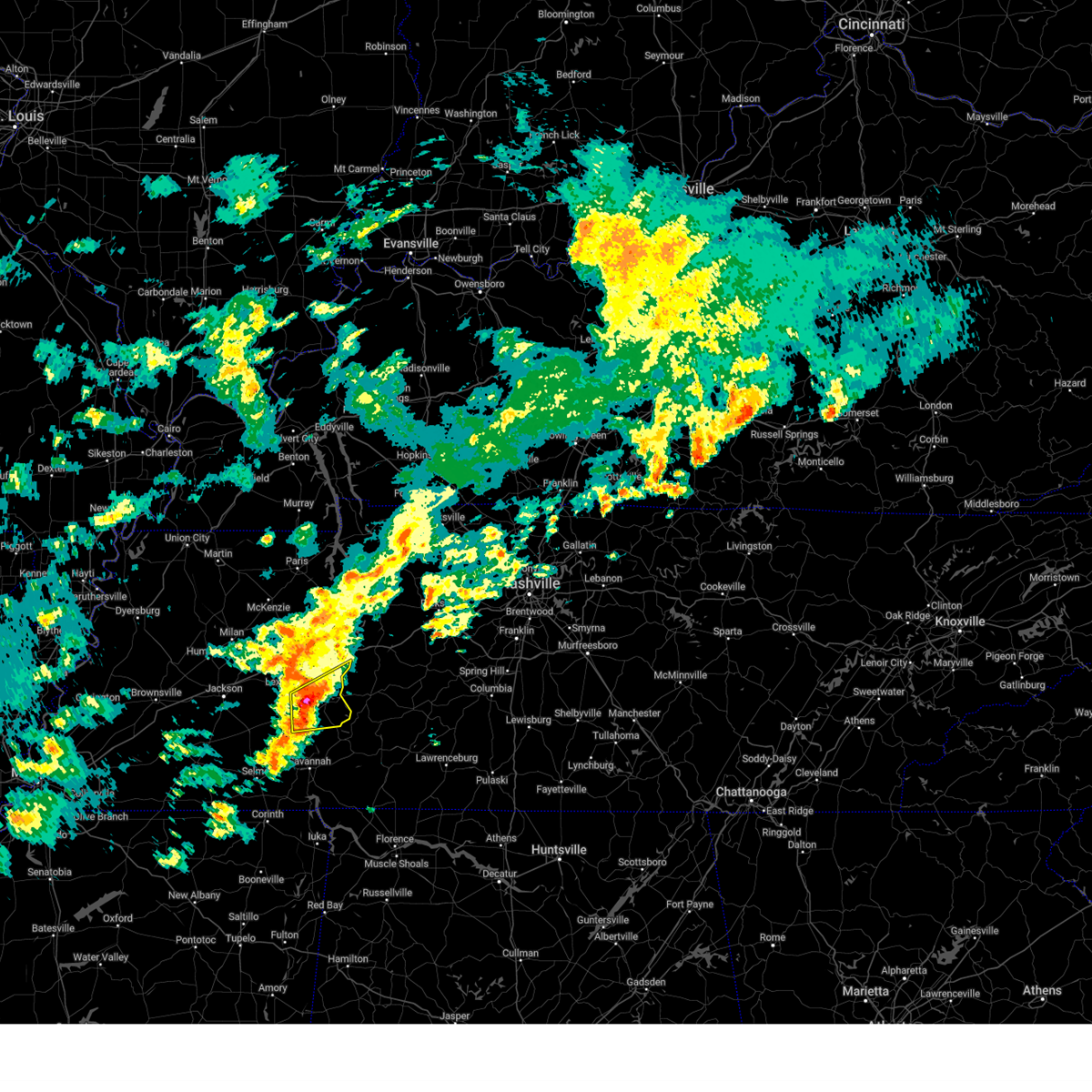
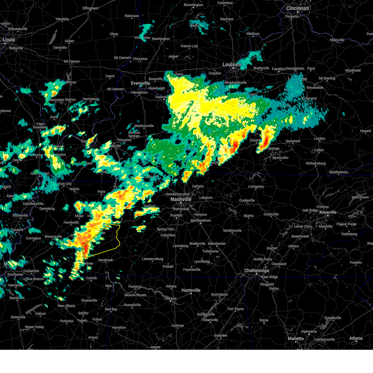
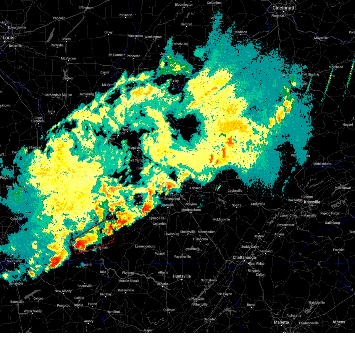
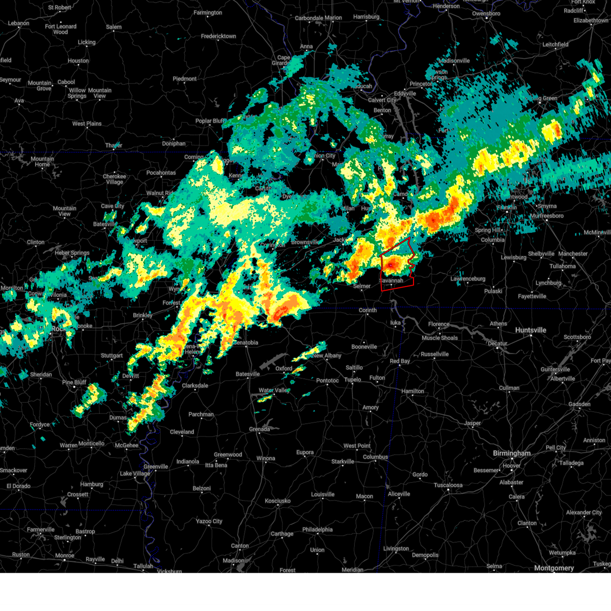
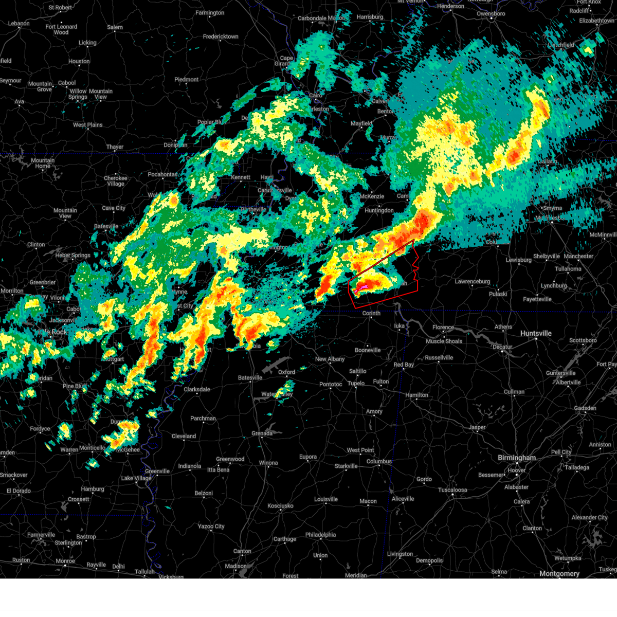
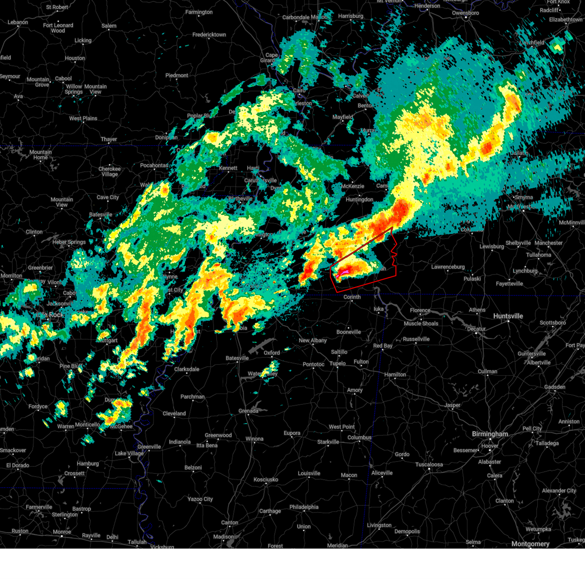
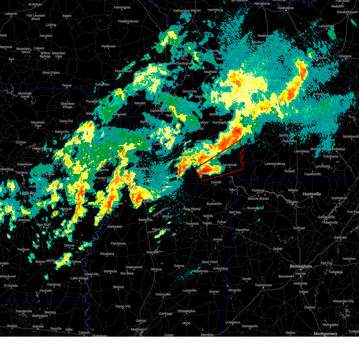
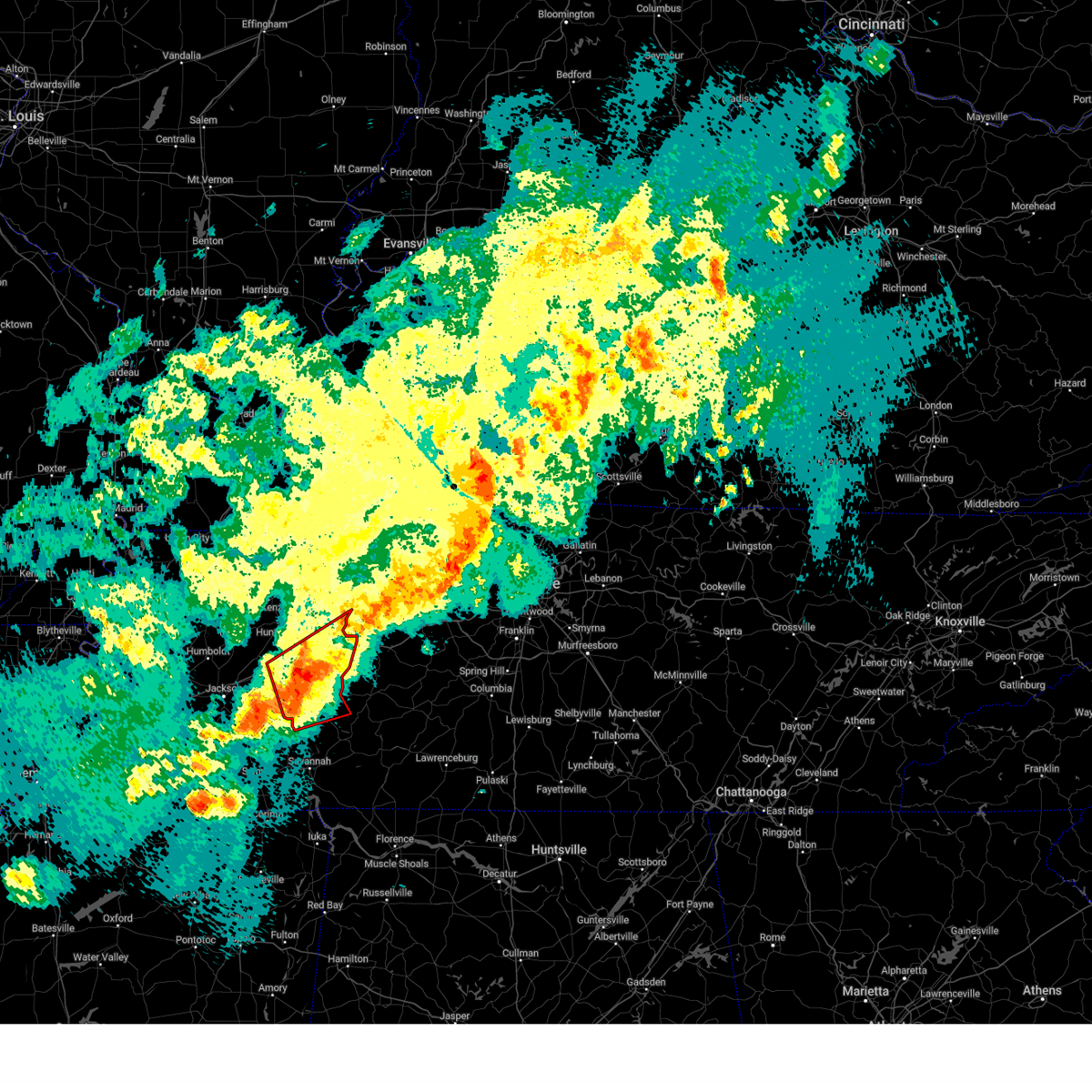
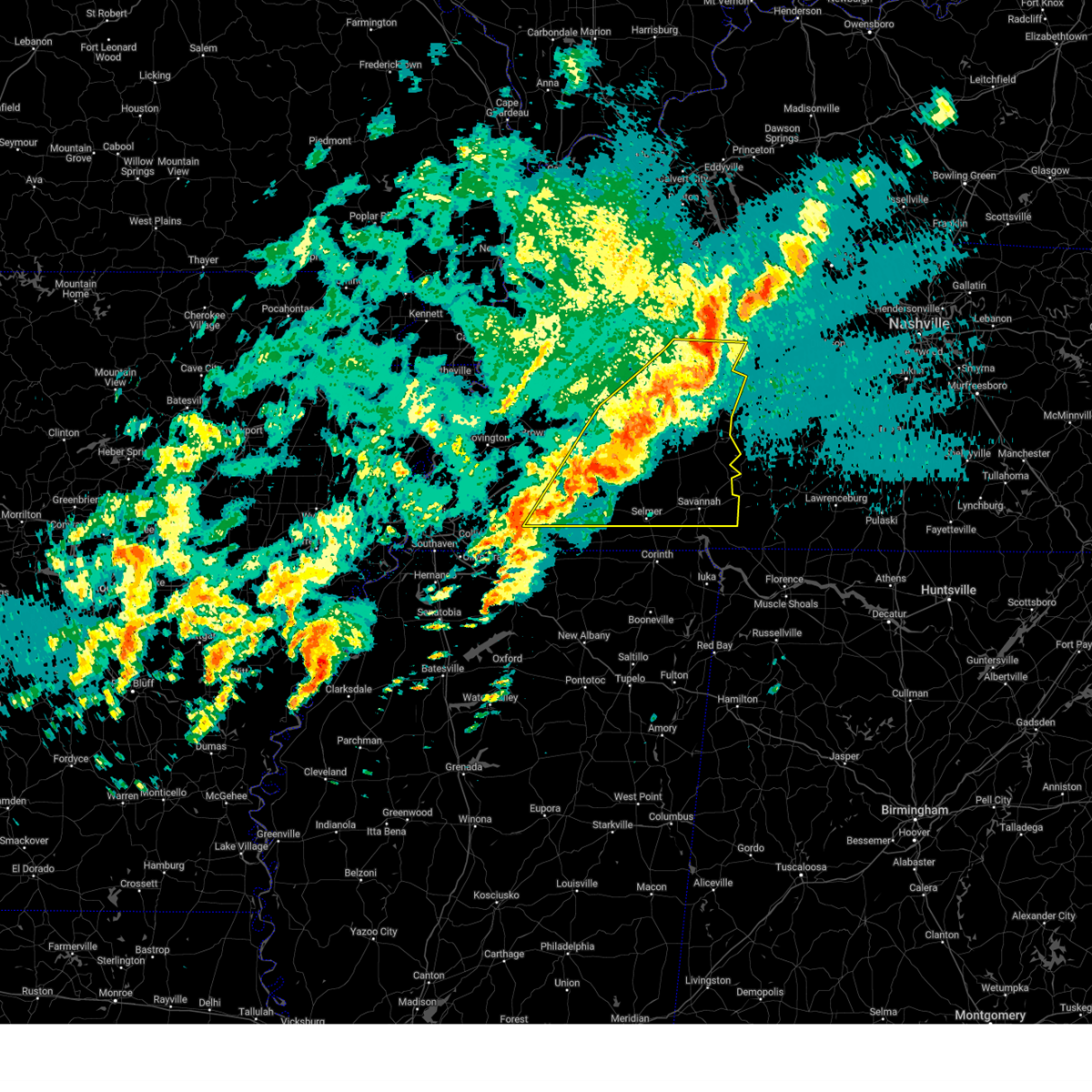
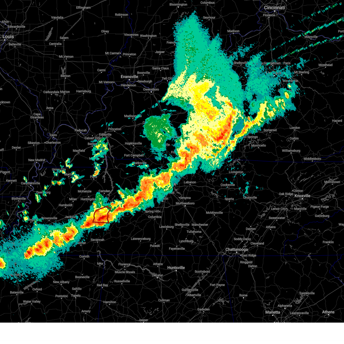
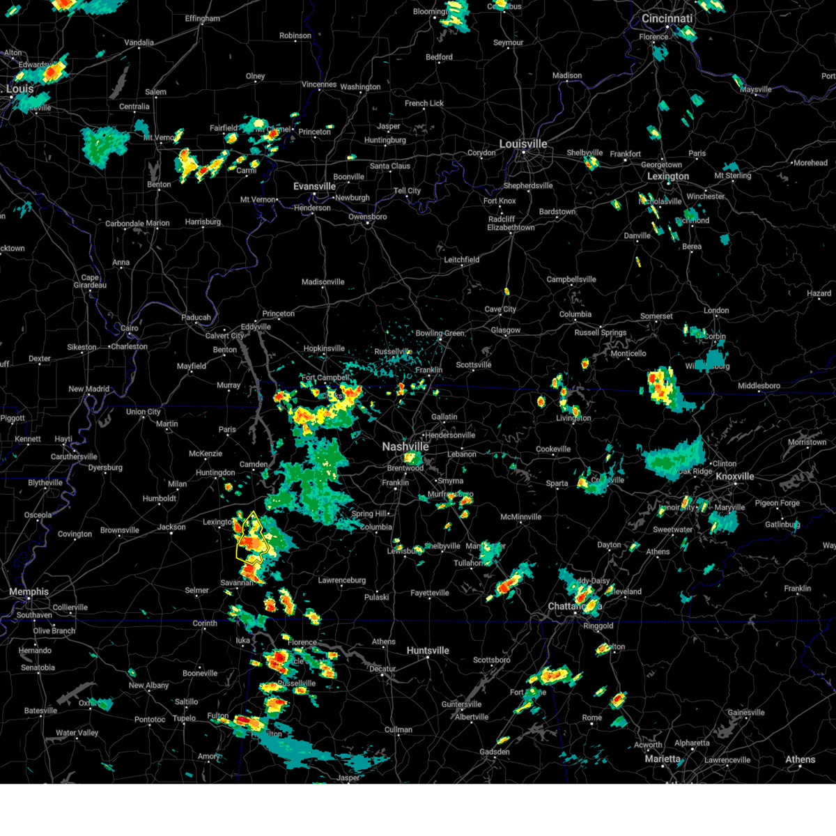
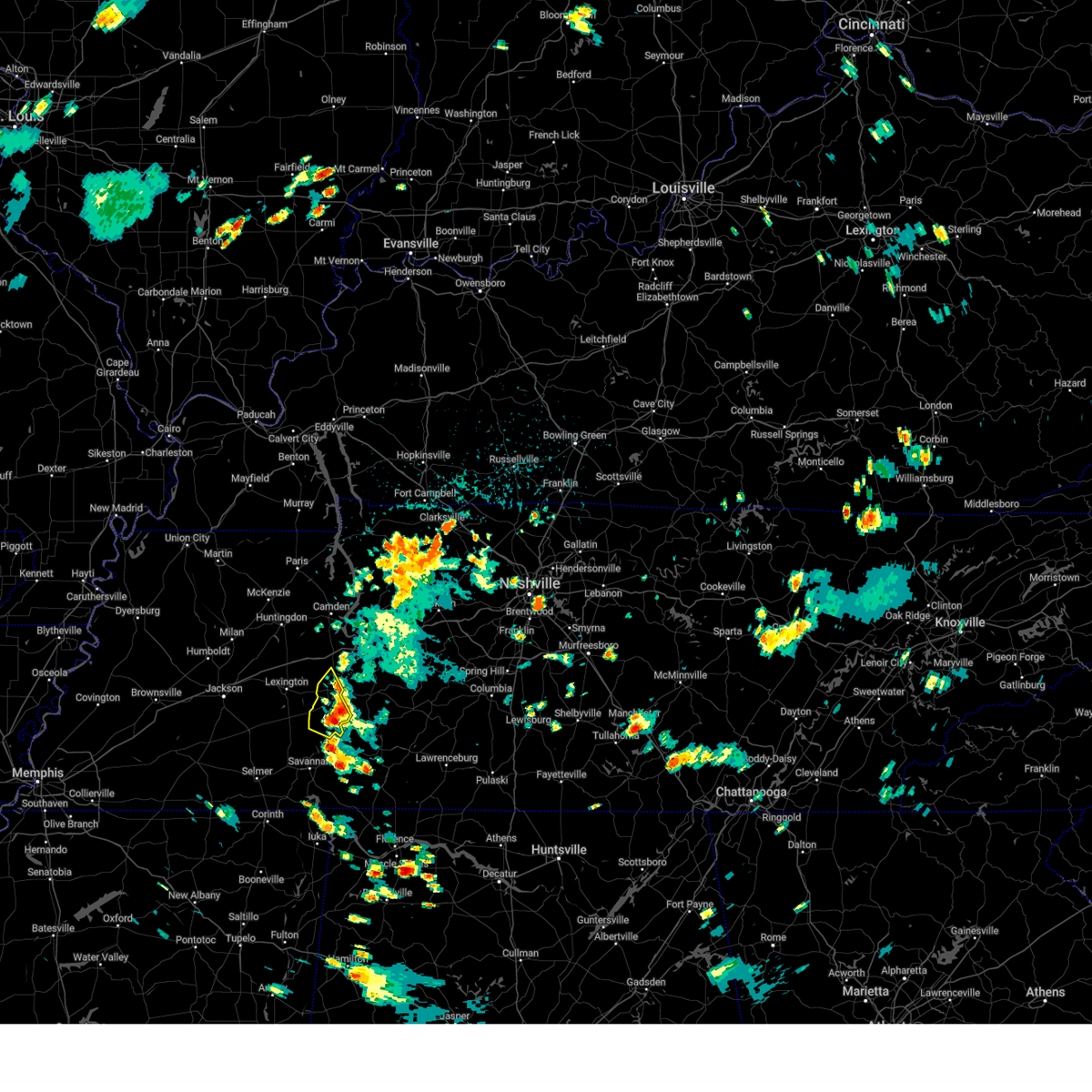
Hail Map for Decaturville, TN
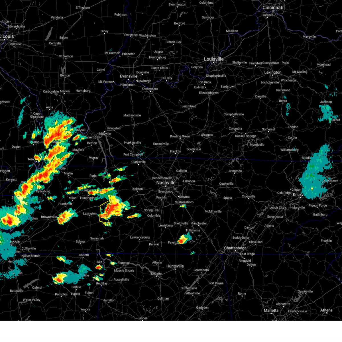
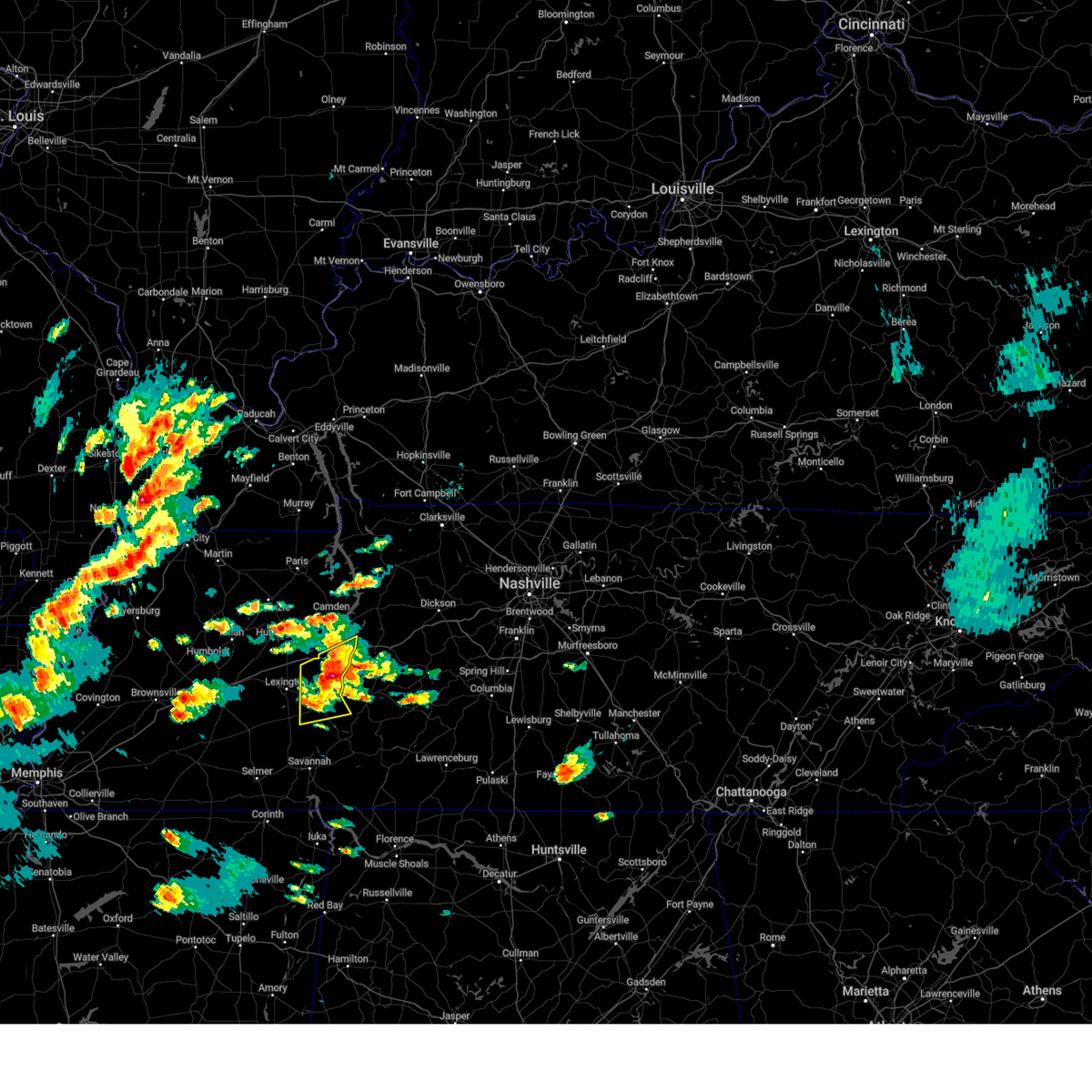
The Decaturville, TN area has had 5 reports of on-the-ground hail by trained spotters, and has been under severe weather warnings 83 times during the past 12 months. Doppler radar has detected hail at or near Decaturville, TN on 74 occasions, including 8 occasions during the past year.
| Name: | Decaturville, TN |
| Where Located: | 44.1 miles SSE of Mc Kenzie, TN |
| Map: | Google Map for Decaturville, TN |
| Population: | 867 |
| Housing Units: | 390 |
| More Info: | Search Google for Decaturville, TN |
2
The Top Recent Hail Date for Decaturville, TN is Thursday, April 3, 2025 (10th out of 74)

Hail and Wind Damage Spotted near Decaturville, TN
| Date / Time | Report Details |
|---|---|
| 6/19/2025 2:10 AM CDT |
 the severe thunderstorm warning has been cancelled and is no longer in effect the severe thunderstorm warning has been cancelled and is no longer in effect
|
| 6/19/2025 1:57 AM CDT |
 At 156 am cdt, a severe thunderstorm was located 7 miles northeast of natchez trace state park, moving east at 45 mph (radar indicated). Hazards include 60 mph wind gusts and quarter size hail. Hail damage to vehicles is expected. expect wind damage to roofs, siding, and trees. Locations impacted include, natchez trace state park, natchez trace state forest, parsons, decaturville, darden, perryville, busseltown, jeannette, wilkinstown, i-40 near the tennessee river, mount tabor, garrett, sugar tree, beacon, hickory forks, cozette, bible hill, and chesterfield. At 156 am cdt, a severe thunderstorm was located 7 miles northeast of natchez trace state park, moving east at 45 mph (radar indicated). Hazards include 60 mph wind gusts and quarter size hail. Hail damage to vehicles is expected. expect wind damage to roofs, siding, and trees. Locations impacted include, natchez trace state park, natchez trace state forest, parsons, decaturville, darden, perryville, busseltown, jeannette, wilkinstown, i-40 near the tennessee river, mount tabor, garrett, sugar tree, beacon, hickory forks, cozette, bible hill, and chesterfield.
|
| 6/19/2025 1:57 AM CDT |
 the severe thunderstorm warning has been cancelled and is no longer in effect the severe thunderstorm warning has been cancelled and is no longer in effect
|
| 6/19/2025 1:43 AM CDT |
 At 143 am cdt, a severe thunderstorm was located over wildersville, or near natchez trace state park, moving east at 45 mph (radar indicated). Hazards include 60 mph wind gusts and quarter size hail. Hail damage to vehicles is expected. expect wind damage to roofs, siding, and trees. Locations impacted include, lexington, camden, natchez trace state park, natchez trace state forest, parsons, decaturville, parkers crossroads, darden, bargerton, wildersville, clarksburg, howley, hickory flat, dollar, cedar grove, busseltown, jeannette, rock hill, union cross, and juno. At 143 am cdt, a severe thunderstorm was located over wildersville, or near natchez trace state park, moving east at 45 mph (radar indicated). Hazards include 60 mph wind gusts and quarter size hail. Hail damage to vehicles is expected. expect wind damage to roofs, siding, and trees. Locations impacted include, lexington, camden, natchez trace state park, natchez trace state forest, parsons, decaturville, parkers crossroads, darden, bargerton, wildersville, clarksburg, howley, hickory flat, dollar, cedar grove, busseltown, jeannette, rock hill, union cross, and juno.
|
| 6/19/2025 1:43 AM CDT |
 the severe thunderstorm warning has been cancelled and is no longer in effect the severe thunderstorm warning has been cancelled and is no longer in effect
|
| 6/19/2025 1:24 AM CDT |
 Svrmeg the national weather service in memphis has issued a * severe thunderstorm warning for, henderson county in west tennessee, southern benton county in west tennessee, southern carroll county in west tennessee, northeastern madison county in west tennessee, north central chester county in west tennessee, northern decatur county in west tennessee, * until 230 am cdt. * at 124 am cdt, a severe thunderstorm was located over blue goose, or 10 miles west of lexington, moving east at 45 mph (radar indicated). Hazards include 60 mph wind gusts and quarter size hail. Hail damage to vehicles is expected. Expect wind damage to roofs, siding, and trees. Svrmeg the national weather service in memphis has issued a * severe thunderstorm warning for, henderson county in west tennessee, southern benton county in west tennessee, southern carroll county in west tennessee, northeastern madison county in west tennessee, north central chester county in west tennessee, northern decatur county in west tennessee, * until 230 am cdt. * at 124 am cdt, a severe thunderstorm was located over blue goose, or 10 miles west of lexington, moving east at 45 mph (radar indicated). Hazards include 60 mph wind gusts and quarter size hail. Hail damage to vehicles is expected. Expect wind damage to roofs, siding, and trees.
|
| 5/25/2025 2:08 PM CDT |
 The storm which prompted the warning has moved out of the area. therefore, the warning will be allowed to expire. The storm which prompted the warning has moved out of the area. therefore, the warning will be allowed to expire.
|
| 5/25/2025 1:58 PM CDT |
 the severe thunderstorm warning has been cancelled and is no longer in effect the severe thunderstorm warning has been cancelled and is no longer in effect
|
| 5/25/2025 1:58 PM CDT |
 At 157 pm cdt, a severe thunderstorm was located 10 miles northeast of parsons, or 12 miles northwest of linden, moving east at 45 mph (radar indicated). Hazards include 60 mph wind gusts and penny size hail. Expect damage to roofs, siding, and trees. Locations impacted include, nathan bedford forrest state park, busseltown, jeannette, haney, mount tabor, sugar tree, parsons, red walnut, decaturville, scotts hill, cozette, camden, lick skillet, sardis, perryville, gumdale, montgomery, wilkinstown, darden, and bath springs. At 157 pm cdt, a severe thunderstorm was located 10 miles northeast of parsons, or 12 miles northwest of linden, moving east at 45 mph (radar indicated). Hazards include 60 mph wind gusts and penny size hail. Expect damage to roofs, siding, and trees. Locations impacted include, nathan bedford forrest state park, busseltown, jeannette, haney, mount tabor, sugar tree, parsons, red walnut, decaturville, scotts hill, cozette, camden, lick skillet, sardis, perryville, gumdale, montgomery, wilkinstown, darden, and bath springs.
|
| 5/25/2025 1:45 PM CDT |
 At 145 pm cdt, a severe thunderstorm was located 7 miles east of natchez trace state park, moving east at 45 mph (radar indicated). Hazards include 60 mph wind gusts and penny size hail. Expect damage to roofs, siding, and trees. Locations impacted include, nathan bedford forrest state park, dollar, busseltown, jeannette, reagan, haney, lexington, rock hill, holladay, roby, mount tabor, sugar tree, parsons, red walnut, timberlake, decaturville, hinson springs, scotts hill, cozette, and camden. At 145 pm cdt, a severe thunderstorm was located 7 miles east of natchez trace state park, moving east at 45 mph (radar indicated). Hazards include 60 mph wind gusts and penny size hail. Expect damage to roofs, siding, and trees. Locations impacted include, nathan bedford forrest state park, dollar, busseltown, jeannette, reagan, haney, lexington, rock hill, holladay, roby, mount tabor, sugar tree, parsons, red walnut, timberlake, decaturville, hinson springs, scotts hill, cozette, and camden.
|
| 5/25/2025 1:36 PM CDT |
 At 136 pm cdt, a severe thunderstorm was located over natchez trace state park, moving east at 45 mph (radar indicated). Hazards include 60 mph wind gusts and penny size hail. Expect damage to roofs, siding, and trees. Locations impacted include, dollar, reagan, lexington, rock hill, bruceton, holladay, middle fork, decaturville, palmer shelter, hinson springs, buena vista, hollow rock, camden, lick skillet, clarksburg, perryville, montgomery, huron, warrens bluff, and vale. At 136 pm cdt, a severe thunderstorm was located over natchez trace state park, moving east at 45 mph (radar indicated). Hazards include 60 mph wind gusts and penny size hail. Expect damage to roofs, siding, and trees. Locations impacted include, dollar, reagan, lexington, rock hill, bruceton, holladay, middle fork, decaturville, palmer shelter, hinson springs, buena vista, hollow rock, camden, lick skillet, clarksburg, perryville, montgomery, huron, warrens bluff, and vale.
|
| 5/25/2025 1:24 PM CDT |
 Svrmeg the national weather service in memphis has issued a * severe thunderstorm warning for, henderson county in west tennessee, benton county in west tennessee, carroll county in west tennessee, northeastern chester county in west tennessee, decatur county in west tennessee, * until 215 pm cdt. * at 124 pm cdt, a severe thunderstorm was located over parkers crossroads, or near lexington, moving east at 45 mph (radar indicated). Hazards include 60 mph wind gusts and penny size hail. expect damage to roofs, siding, and trees Svrmeg the national weather service in memphis has issued a * severe thunderstorm warning for, henderson county in west tennessee, benton county in west tennessee, carroll county in west tennessee, northeastern chester county in west tennessee, decatur county in west tennessee, * until 215 pm cdt. * at 124 pm cdt, a severe thunderstorm was located over parkers crossroads, or near lexington, moving east at 45 mph (radar indicated). Hazards include 60 mph wind gusts and penny size hail. expect damage to roofs, siding, and trees
|
| 5/20/2025 3:15 PM CDT | the severe thunderstorm warning has been cancelled and is no longer in effect |
| 5/20/2025 3:05 PM CDT |
 the severe thunderstorm warning has been cancelled and is no longer in effect the severe thunderstorm warning has been cancelled and is no longer in effect
|
| 5/20/2025 3:05 PM CDT |
 At 305 pm cdt, a severe thunderstorm was located 12 miles northeast of parsons, or 12 miles northwest of linden, moving east at 50 mph (radar indicated). Hazards include ping pong ball size hail and 60 mph wind gusts. People and animals outdoors will be injured. expect hail damage to roofs, siding, windows, and vehicles. expect wind damage to roofs, siding, and trees. Locations impacted include, perryville, busseltown, jeannette, wilkinstown, i-40 near the tennessee river, mount tabor, sugar tree, parsons, garrett, beacon, hickory forks, largo, decaturville, cozette, bible hill, and mount lebanon. At 305 pm cdt, a severe thunderstorm was located 12 miles northeast of parsons, or 12 miles northwest of linden, moving east at 50 mph (radar indicated). Hazards include ping pong ball size hail and 60 mph wind gusts. People and animals outdoors will be injured. expect hail damage to roofs, siding, windows, and vehicles. expect wind damage to roofs, siding, and trees. Locations impacted include, perryville, busseltown, jeannette, wilkinstown, i-40 near the tennessee river, mount tabor, sugar tree, parsons, garrett, beacon, hickory forks, largo, decaturville, cozette, bible hill, and mount lebanon.
|
| 5/20/2025 2:54 PM CDT |
 At 254 pm cdt, a severe thunderstorm was located near parsons, or 8 miles east of natchez trace state forest, moving east at 35 mph (radar indicated). Hazards include ping pong ball size hail and 60 mph wind gusts. People and animals outdoors will be injured. expect hail damage to roofs, siding, windows, and vehicles. expect wind damage to roofs, siding, and trees. Locations impacted include, busseltown, jeannette, haney, mount tabor, sugar tree, parsons, decaturville, scotts hill, cozette, lick skillet, perryville, gumdale, wilkinstown, i-40 near the tennessee river, darden, natchez trace state park, garrett, beacon, hickory forks, and largo. At 254 pm cdt, a severe thunderstorm was located near parsons, or 8 miles east of natchez trace state forest, moving east at 35 mph (radar indicated). Hazards include ping pong ball size hail and 60 mph wind gusts. People and animals outdoors will be injured. expect hail damage to roofs, siding, windows, and vehicles. expect wind damage to roofs, siding, and trees. Locations impacted include, busseltown, jeannette, haney, mount tabor, sugar tree, parsons, decaturville, scotts hill, cozette, lick skillet, perryville, gumdale, wilkinstown, i-40 near the tennessee river, darden, natchez trace state park, garrett, beacon, hickory forks, and largo.
|
| 5/20/2025 2:40 PM CDT | Svrmeg the national weather service in memphis has issued a * severe thunderstorm warning for, eastern henderson county in west tennessee, southeastern benton county in west tennessee, decatur county in west tennessee, * until 330 pm cdt. * at 240 pm cdt, a severe thunderstorm was located over natchez trace state forest, moving east at 50 mph (radar indicated). Hazards include 60 mph wind gusts and quarter size hail. Hail damage to vehicles is expected. Expect wind damage to roofs, siding, and trees. |
| 5/8/2025 3:19 PM CDT |
 the severe thunderstorm warning has been cancelled and is no longer in effect the severe thunderstorm warning has been cancelled and is no longer in effect
|
| 5/8/2025 3:01 PM CDT | At 301 pm cdt, a severe thunderstorm was located 7 miles south of decaturville, or 18 miles southwest of linden, moving east at 30 mph (radar indicated). Hazards include 60 mph wind gusts and quarter size hail. Hail damage to vehicles is expected. expect wind damage to roofs, siding, and trees. Locations impacted include, lick skillet, gumdale, montgomery, red walnut, largo, decaturville, dunbar, haney, and mount lebanon. |
| 5/8/2025 3:01 PM CDT | the severe thunderstorm warning has been cancelled and is no longer in effect |
| 5/8/2025 2:37 PM CDT |
 Svrmeg the national weather service in memphis has issued a * severe thunderstorm warning for, southeastern henderson county in west tennessee, northeastern hardin county in west tennessee, eastern chester county in west tennessee, southern decatur county in west tennessee, * until 330 pm cdt. * at 237 pm cdt, a severe thunderstorm was located over reagan, or 12 miles south of lexington, moving east at 30 mph (radar indicated). Hazards include 60 mph wind gusts and quarter size hail. Hail damage to vehicles is expected. Expect wind damage to roofs, siding, and trees. Svrmeg the national weather service in memphis has issued a * severe thunderstorm warning for, southeastern henderson county in west tennessee, northeastern hardin county in west tennessee, eastern chester county in west tennessee, southern decatur county in west tennessee, * until 330 pm cdt. * at 237 pm cdt, a severe thunderstorm was located over reagan, or 12 miles south of lexington, moving east at 30 mph (radar indicated). Hazards include 60 mph wind gusts and quarter size hail. Hail damage to vehicles is expected. Expect wind damage to roofs, siding, and trees.
|
| 5/2/2025 11:03 AM CDT |
 the severe thunderstorm warning has been cancelled and is no longer in effect the severe thunderstorm warning has been cancelled and is no longer in effect
|
| 5/2/2025 11:03 AM CDT |
 At 1102 am cdt, a severe thunderstorm was located over lexington, moving northeast at 40 mph (radar indicated). Hazards include 60 mph wind gusts and quarter size hail. Hail damage to vehicles is expected. expect wind damage to roofs, siding, and trees. Locations impacted include, cedar grove, reagan, lexington, rock hill, union cross, juno, mount tabor, middle fork, parsons, timberlake, decaturville, hinson springs, scotts hill, parker's cross roads, lick skillet, sardis, parkers crossroads, perryville, mount gilead, and huron. At 1102 am cdt, a severe thunderstorm was located over lexington, moving northeast at 40 mph (radar indicated). Hazards include 60 mph wind gusts and quarter size hail. Hail damage to vehicles is expected. expect wind damage to roofs, siding, and trees. Locations impacted include, cedar grove, reagan, lexington, rock hill, union cross, juno, mount tabor, middle fork, parsons, timberlake, decaturville, hinson springs, scotts hill, parker's cross roads, lick skillet, sardis, parkers crossroads, perryville, mount gilead, and huron.
|
| 5/2/2025 10:51 AM CDT |
 At 1051 am cdt, a severe thunderstorm was located near mifflin, or 8 miles southwest of lexington, moving northeast at 40 mph (radar indicated). Hazards include 60 mph wind gusts and quarter size hail. Hail damage to vehicles is expected. expect wind damage to roofs, siding, and trees. Locations impacted include, hickory flat, cedar grove, beech bluff, reagan, lexington, rock hill, union cross, juno, roby, mount tabor, cabo, middle fork, blue goose, parsons, timberlake, decaturville, enville, hinson springs, scotts hill, and parker's cross roads. At 1051 am cdt, a severe thunderstorm was located near mifflin, or 8 miles southwest of lexington, moving northeast at 40 mph (radar indicated). Hazards include 60 mph wind gusts and quarter size hail. Hail damage to vehicles is expected. expect wind damage to roofs, siding, and trees. Locations impacted include, hickory flat, cedar grove, beech bluff, reagan, lexington, rock hill, union cross, juno, roby, mount tabor, cabo, middle fork, blue goose, parsons, timberlake, decaturville, enville, hinson springs, scotts hill, and parker's cross roads.
|
| 5/2/2025 10:51 AM CDT |
 the severe thunderstorm warning has been cancelled and is no longer in effect the severe thunderstorm warning has been cancelled and is no longer in effect
|
| 5/2/2025 10:43 AM CDT |
 At 1043 am cdt, a severe thunderstorm was located over mifflin, or near henderson, moving northeast at 40 mph (radar indicated). Hazards include 60 mph wind gusts and quarter size hail. Hail damage to vehicles is expected. expect wind damage to roofs, siding, and trees. Locations impacted include, hickory flat, pinson, reagan, madison hall, lexington, rock hill, middle fork, blue goose, decaturville, hinson springs, pinson mounds state archaeological park, lick skillet, milledgeville, perryville, huron, warrens bluff, mifflin, sand ridge, five points, and bargerton. At 1043 am cdt, a severe thunderstorm was located over mifflin, or near henderson, moving northeast at 40 mph (radar indicated). Hazards include 60 mph wind gusts and quarter size hail. Hail damage to vehicles is expected. expect wind damage to roofs, siding, and trees. Locations impacted include, hickory flat, pinson, reagan, madison hall, lexington, rock hill, middle fork, blue goose, decaturville, hinson springs, pinson mounds state archaeological park, lick skillet, milledgeville, perryville, huron, warrens bluff, mifflin, sand ridge, five points, and bargerton.
|
| 5/2/2025 10:37 AM CDT |
 Svrmeg the national weather service in memphis has issued a * severe thunderstorm warning for, henderson county in west tennessee, northeastern mcnairy county in west tennessee, southwestern carroll county in west tennessee, northwestern hardin county in west tennessee, eastern madison county in west tennessee, chester county in west tennessee, southern decatur county in west tennessee, * until 1130 am cdt. * at 1037 am cdt, a severe thunderstorm was located over henderson, moving northeast at 40 mph (radar indicated). Hazards include 60 mph wind gusts and quarter size hail. Hail damage to vehicles is expected. Expect wind damage to roofs, siding, and trees. Svrmeg the national weather service in memphis has issued a * severe thunderstorm warning for, henderson county in west tennessee, northeastern mcnairy county in west tennessee, southwestern carroll county in west tennessee, northwestern hardin county in west tennessee, eastern madison county in west tennessee, chester county in west tennessee, southern decatur county in west tennessee, * until 1130 am cdt. * at 1037 am cdt, a severe thunderstorm was located over henderson, moving northeast at 40 mph (radar indicated). Hazards include 60 mph wind gusts and quarter size hail. Hail damage to vehicles is expected. Expect wind damage to roofs, siding, and trees.
|
| 4/3/2025 9:05 PM CDT |
 At 904 pm cdt, a severe thunderstorm was located over parkers crossroads, or 8 miles north of lexington, moving east at 60 mph (radar indicated). Hazards include two inch hail and 70 mph wind gusts. People and animals outdoors will be injured. expect hail damage to roofs, siding, windows, and vehicles. expect considerable tree damage. wind damage is also likely to mobile homes, roofs, and outbuildings. Locations impacted include, hickory flat, dollar, atwood, lexington, rock hill, bruceton, holladay, leach, middle fork, blue goose, decaturville, tate, palmer shelter, hinson springs, buena vista, hollow rock, camden, clarksburg, perryville, and huron. At 904 pm cdt, a severe thunderstorm was located over parkers crossroads, or 8 miles north of lexington, moving east at 60 mph (radar indicated). Hazards include two inch hail and 70 mph wind gusts. People and animals outdoors will be injured. expect hail damage to roofs, siding, windows, and vehicles. expect considerable tree damage. wind damage is also likely to mobile homes, roofs, and outbuildings. Locations impacted include, hickory flat, dollar, atwood, lexington, rock hill, bruceton, holladay, leach, middle fork, blue goose, decaturville, tate, palmer shelter, hinson springs, buena vista, hollow rock, camden, clarksburg, perryville, and huron.
|
| 4/3/2025 9:05 PM CDT |
 the severe thunderstorm warning has been cancelled and is no longer in effect the severe thunderstorm warning has been cancelled and is no longer in effect
|
| 4/3/2025 8:59 PM CDT |
 At 859 pm cdt, a severe thunderstorm was located near parkers crossroads, or 9 miles northwest of natchez trace state park, moving northeast at 75 mph (radar indicated). Hazards include two inch hail and 70 mph wind gusts. People and animals outdoors will be injured. expect hail damage to roofs, siding, windows, and vehicles. expect considerable tree damage. wind damage is also likely to mobile homes, roofs, and outbuildings. Locations impacted include, hickory flat, dollar, atwood, jackson, ledbetter, madison hall, lexington, rock hill, bruceton, holladay, medina, leach, middle fork, blue goose, decaturville, tate, palmer shelter, hinson springs, buena vista, and hollow rock. At 859 pm cdt, a severe thunderstorm was located near parkers crossroads, or 9 miles northwest of natchez trace state park, moving northeast at 75 mph (radar indicated). Hazards include two inch hail and 70 mph wind gusts. People and animals outdoors will be injured. expect hail damage to roofs, siding, windows, and vehicles. expect considerable tree damage. wind damage is also likely to mobile homes, roofs, and outbuildings. Locations impacted include, hickory flat, dollar, atwood, jackson, ledbetter, madison hall, lexington, rock hill, bruceton, holladay, medina, leach, middle fork, blue goose, decaturville, tate, palmer shelter, hinson springs, buena vista, and hollow rock.
|
| 4/3/2025 8:55 PM CDT |
 At 855 pm cdt, a severe thunderstorm was located near parkers crossroads, or 12 miles north of lexington, moving northeast at 75 mph (radar indicated). Hazards include 70 mph wind gusts and ping pong ball size hail. People and animals outdoors will be injured. expect hail damage to roofs, siding, windows, and vehicles. expect considerable tree damage. wind damage is also likely to mobile homes, roofs, and outbuildings. Locations impacted include, hickory flat, dollar, atwood, jackson, westover, ledbetter, madison hall, lexington, rock hill, fairview, bruceton, holladay, medina, leach, middle fork, blue goose, decaturville, tate, palmer shelter, and hinson springs. At 855 pm cdt, a severe thunderstorm was located near parkers crossroads, or 12 miles north of lexington, moving northeast at 75 mph (radar indicated). Hazards include 70 mph wind gusts and ping pong ball size hail. People and animals outdoors will be injured. expect hail damage to roofs, siding, windows, and vehicles. expect considerable tree damage. wind damage is also likely to mobile homes, roofs, and outbuildings. Locations impacted include, hickory flat, dollar, atwood, jackson, westover, ledbetter, madison hall, lexington, rock hill, fairview, bruceton, holladay, medina, leach, middle fork, blue goose, decaturville, tate, palmer shelter, and hinson springs.
|
| 4/3/2025 8:55 PM CDT |
 the severe thunderstorm warning has been cancelled and is no longer in effect the severe thunderstorm warning has been cancelled and is no longer in effect
|
| 4/3/2025 8:44 PM CDT |
 At 844 pm cdt, a severe thunderstorm was located 7 miles east of fairview, or 9 miles northeast of jackson, moving northeast at 75 mph (radar indicated). Hazards include two inch hail and 70 mph wind gusts. People and animals outdoors will be injured. expect hail damage to roofs, siding, windows, and vehicles. expect considerable tree damage. wind damage is also likely to mobile homes, roofs, and outbuildings. Locations impacted include, neely, atwood, huntersville, westover, madison hall, rock hill, bruceton, leach, hinson springs, buena vista, hollow rock, camden, clarksburg, perryville, fruitland, warrens bluff, natchez trace state park, mclemoresville, scott hill, and milan. At 844 pm cdt, a severe thunderstorm was located 7 miles east of fairview, or 9 miles northeast of jackson, moving northeast at 75 mph (radar indicated). Hazards include two inch hail and 70 mph wind gusts. People and animals outdoors will be injured. expect hail damage to roofs, siding, windows, and vehicles. expect considerable tree damage. wind damage is also likely to mobile homes, roofs, and outbuildings. Locations impacted include, neely, atwood, huntersville, westover, madison hall, rock hill, bruceton, leach, hinson springs, buena vista, hollow rock, camden, clarksburg, perryville, fruitland, warrens bluff, natchez trace state park, mclemoresville, scott hill, and milan.
|
| 4/3/2025 8:41 PM CDT |
 At 841 pm cdt, a severe thunderstorm was located near fairview, or near jackson, moving northeast at 75 mph (radar indicated). Hazards include two inch hail and 60 mph wind gusts. People and animals outdoors will be injured. expect hail damage to roofs, siding, windows, and vehicles. expect wind damage to roofs, siding, and trees. Locations impacted include, neely, atwood, huntersville, westover, madison hall, rock hill, bruceton, leach, hinson springs, buena vista, hollow rock, camden, clarksburg, perryville, fruitland, warrens bluff, natchez trace state park, mclemoresville, scott hill, and milan. At 841 pm cdt, a severe thunderstorm was located near fairview, or near jackson, moving northeast at 75 mph (radar indicated). Hazards include two inch hail and 60 mph wind gusts. People and animals outdoors will be injured. expect hail damage to roofs, siding, windows, and vehicles. expect wind damage to roofs, siding, and trees. Locations impacted include, neely, atwood, huntersville, westover, madison hall, rock hill, bruceton, leach, hinson springs, buena vista, hollow rock, camden, clarksburg, perryville, fruitland, warrens bluff, natchez trace state park, mclemoresville, scott hill, and milan.
|
| 4/3/2025 8:39 PM CDT |
 Svrmeg the national weather service in memphis has issued a * severe thunderstorm warning for, southeastern crockett county in west tennessee, henderson county in west tennessee, southeastern gibson county in west tennessee, benton county in west tennessee, carroll county in west tennessee, madison county in west tennessee, north central chester county in west tennessee, decatur county in west tennessee, * until 930 pm cdt. * at 838 pm cdt, a severe thunderstorm was located near fairview, or near jackson, moving northeast at 60 mph (radar indicated). Hazards include ping pong ball size hail and 60 mph wind gusts. People and animals outdoors will be injured. expect hail damage to roofs, siding, windows, and vehicles. Expect wind damage to roofs, siding, and trees. Svrmeg the national weather service in memphis has issued a * severe thunderstorm warning for, southeastern crockett county in west tennessee, henderson county in west tennessee, southeastern gibson county in west tennessee, benton county in west tennessee, carroll county in west tennessee, madison county in west tennessee, north central chester county in west tennessee, decatur county in west tennessee, * until 930 pm cdt. * at 838 pm cdt, a severe thunderstorm was located near fairview, or near jackson, moving northeast at 60 mph (radar indicated). Hazards include ping pong ball size hail and 60 mph wind gusts. People and animals outdoors will be injured. expect hail damage to roofs, siding, windows, and vehicles. Expect wind damage to roofs, siding, and trees.
|
| 4/3/2025 2:24 PM CDT | The storm which prompted the warning has moved out of the area. therefore, the warning will be allowed to expire. however, small hail and gusty winds are still possible with this thunderstorm. a tornado watch remains in effect until 1000 pm cdt for west tennessee. |
| 4/3/2025 2:08 PM CDT |
 the severe thunderstorm warning has been cancelled and is no longer in effect the severe thunderstorm warning has been cancelled and is no longer in effect
|
| 4/3/2025 2:08 PM CDT |
 At 207 pm cdt, a severe thunderstorm was located near decaturville, or 8 miles west of linden, moving east at 60 mph (radar indicated). Hazards include 60 mph wind gusts and quarter size hail. Hail damage to vehicles is expected. expect wind damage to roofs, siding, and trees. Locations impacted include, lick skillet, perryville, gumdale, montgomery, busseltown, wilkinstown, haney, mount tabor, parsons, garrett, red walnut, beacon, largo, decaturville, dunbar, mount lebanon, and scotts hill. At 207 pm cdt, a severe thunderstorm was located near decaturville, or 8 miles west of linden, moving east at 60 mph (radar indicated). Hazards include 60 mph wind gusts and quarter size hail. Hail damage to vehicles is expected. expect wind damage to roofs, siding, and trees. Locations impacted include, lick skillet, perryville, gumdale, montgomery, busseltown, wilkinstown, haney, mount tabor, parsons, garrett, red walnut, beacon, largo, decaturville, dunbar, mount lebanon, and scotts hill.
|
| 4/3/2025 1:51 PM CDT |
 the severe thunderstorm warning has been cancelled and is no longer in effect the severe thunderstorm warning has been cancelled and is no longer in effect
|
| 4/3/2025 1:51 PM CDT |
 At 150 pm cdt, a severe thunderstorm was located near darden, or 12 miles southeast of lexington, moving northeast at 65 mph (radar indicated). Hazards include 60 mph wind gusts and quarter size hail. Hail damage to vehicles is expected. expect wind damage to roofs, siding, and trees. Locations impacted include, busseltown, reagan, haney, rock hill, mount tabor, parsons, red walnut, decaturville, scotts hill, cozette, lick skillet, sardis, perryville, gumdale, montgomery, warrens bluff, wilkinstown, darden, garrett, and beacon. At 150 pm cdt, a severe thunderstorm was located near darden, or 12 miles southeast of lexington, moving northeast at 65 mph (radar indicated). Hazards include 60 mph wind gusts and quarter size hail. Hail damage to vehicles is expected. expect wind damage to roofs, siding, and trees. Locations impacted include, busseltown, reagan, haney, rock hill, mount tabor, parsons, red walnut, decaturville, scotts hill, cozette, lick skillet, sardis, perryville, gumdale, montgomery, warrens bluff, wilkinstown, darden, garrett, and beacon.
|
| 4/3/2025 1:39 PM CDT | At 138 pm cdt, a severe thunderstorm was located near reagan, or 9 miles south of lexington, moving northeast at 55 mph (radar indicated). Hazards include 60 mph wind gusts and penny size hail. Expect damage to roofs, siding, and trees. Locations impacted include, busseltown, jeannette, reagan, haney, lexington, rock hill, hinkle, roby, pleasant grove, mount tabor, cabo, middle fork, parsons, red walnut, decaturville, enville, hinson springs, scotts hill, cozette, and thurman. |
| 4/3/2025 1:24 PM CDT |
 Svrmeg the national weather service in memphis has issued a * severe thunderstorm warning for, southeastern henderson county in west tennessee, northeastern mcnairy county in west tennessee, northwestern hardin county in west tennessee, chester county in west tennessee, decatur county in west tennessee, * until 230 pm cdt. * at 123 pm cdt, a severe thunderstorm was located over henderson, moving northeast at 55 mph (radar indicated). Hazards include 60 mph wind gusts and penny size hail. expect damage to roofs, siding, and trees Svrmeg the national weather service in memphis has issued a * severe thunderstorm warning for, southeastern henderson county in west tennessee, northeastern mcnairy county in west tennessee, northwestern hardin county in west tennessee, chester county in west tennessee, decatur county in west tennessee, * until 230 pm cdt. * at 123 pm cdt, a severe thunderstorm was located over henderson, moving northeast at 55 mph (radar indicated). Hazards include 60 mph wind gusts and penny size hail. expect damage to roofs, siding, and trees
|
| 4/3/2025 3:04 AM CDT | At 303 am cdt, a severe thunderstorm capable of producing a tornado was located near decaturville, or 15 miles southwest of linden, moving northeast at 50 mph (radar indicated rotation). Hazards include tornado and quarter size hail. Flying debris will be dangerous to those caught without shelter. mobile homes will be damaged or destroyed. damage to roofs, windows, and vehicles will occur. tree damage is likely. Locations impacted include, busseltown, haney, pleasant grove, mount tabor, parsons, red walnut, decaturville, cozette, thurman, lick skillet, perryville, gumdale, montgomery, wilkinstown, darden, bath springs, garrett, beacon, hickory forks, and largo. |
| 4/3/2025 2:54 AM CDT | the tornado warning has been cancelled and is no longer in effect |
| 4/3/2025 2:54 AM CDT | At 253 am cdt, a large and extremely dangerous tornado was located near sardis, or 14 miles north of savannah, moving east at 45 mph. this is a particularly dangerous situation. take cover now! (radar indicated rotation). Hazards include damaging tornado. You are in a life-threatening situation. flying debris may be deadly to those caught without shelter. mobile homes will be destroyed. considerable damage to homes, businesses, and vehicles is likely and complete destruction is possible. Locations impacted include, saltillo, busseltown, reagan, haney, rock hill, hinkle, pleasant grove, mount tabor, parsons, red walnut, decaturville, scotts hill, cozette, thurman, lick skillet, sardis, perryville, gumdale, montgomery, and warrens bluff. |
| 4/3/2025 2:47 AM CDT | At 247 am cdt, a large and extremely dangerous tornado was located over sardis, or 14 miles north of savannah, moving northeast at 50 mph. this is a particularly dangerous situation. take cover now! (radar indicated rotation). Hazards include damaging tornado. You are in a life-threatening situation. flying debris may be deadly to those caught without shelter. mobile homes will be destroyed. considerable damage to homes, businesses, and vehicles is likely and complete destruction is possible. Locations impacted include, saltillo, busseltown, right, adamsville, reagan, haney, rock hill, hinkle, roby, pleasant grove, mount tabor, cabo, middle fork, parsons, red walnut, decaturville, enville, scotts hill, cozette, and cerro gordo. |
| 4/3/2025 2:43 AM CDT | At 243 am cdt, a large and extremely dangerous tornado was located near sardis, or 13 miles north of savannah, moving northeast at 50 mph. this is a particularly dangerous situation. take cover now! (radar indicated rotation). Hazards include damaging tornado. You are in a life-threatening situation. flying debris may be deadly to those caught without shelter. mobile homes will be destroyed. considerable damage to homes, businesses, and vehicles is likely and complete destruction is possible. Locations impacted include, saltillo, busseltown, right, adamsville, reagan, haney, rock hill, hinkle, roby, pleasant grove, mount tabor, cabo, middle fork, parsons, red walnut, decaturville, enville, scotts hill, cozette, and cerro gordo. |
| 4/3/2025 2:33 AM CDT | the tornado warning has been cancelled and is no longer in effect |
| 4/3/2025 2:33 AM CDT | At 233 am cdt, a large and extremely dangerous tornado was located 7 miles northwest of morris chapel, or 11 miles southeast of henderson, moving northeast at 50 mph. this is a particularly dangerous situation. take cover now! (radar indicated rotation). Hazards include damaging tornado. You are in a life-threatening situation. flying debris may be deadly to those caught without shelter. mobile homes will be destroyed. considerable damage to homes, businesses, and vehicles is likely and complete destruction is possible. Locations impacted include, adamsville, reagan, rock hill, pleasant grove, middle fork, decaturville, cerro gordo, thurman, lick skillet, milledgeville, perryville, montgomery, warrens bluff, bath springs, beacon, morris chapel, hickory forks, swift, dunbar, and taylors crossing. |
| 4/3/2025 2:22 AM CDT |
 At 222 am cdt, a large and extremely dangerous tornado was located near masseyville, or 8 miles north of selmer, moving northeast at 50 mph. this is a particularly dangerous situation. take cover now! (radar indicated rotation). Hazards include damaging tornado. You are in a life-threatening situation. flying debris may be deadly to those caught without shelter. mobile homes will be destroyed. considerable damage to homes, businesses, and vehicles is likely and complete destruction is possible. Locations impacted include, pine top, masseyville, adamsville, reagan, rock hill, silerton, hickory corners, pleasant grove, middle fork, decaturville, cerro gordo, thurman, lick skillet, milledgeville, perryville, montgomery, woodville, warrens bluff, bath springs, and montezuma. At 222 am cdt, a large and extremely dangerous tornado was located near masseyville, or 8 miles north of selmer, moving northeast at 50 mph. this is a particularly dangerous situation. take cover now! (radar indicated rotation). Hazards include damaging tornado. You are in a life-threatening situation. flying debris may be deadly to those caught without shelter. mobile homes will be destroyed. considerable damage to homes, businesses, and vehicles is likely and complete destruction is possible. Locations impacted include, pine top, masseyville, adamsville, reagan, rock hill, silerton, hickory corners, pleasant grove, middle fork, decaturville, cerro gordo, thurman, lick skillet, milledgeville, perryville, montgomery, woodville, warrens bluff, bath springs, and montezuma.
|
| 4/3/2025 2:19 AM CDT |
 Tormeg the national weather service in memphis has issued a * tornado warning for, southern henderson county in west tennessee, northeastern hardeman county in west tennessee, northern mcnairy county in west tennessee, northern hardin county in west tennessee, chester county in west tennessee, decatur county in west tennessee, * until 315 am cdt. * at 219 am cdt, a severe thunderstorm capable of producing a tornado was located near masseyville, or 8 miles northwest of selmer, moving northeast at 50 mph (radar indicated rotation). Hazards include tornado and tennis ball size hail. Flying debris will be dangerous to those caught without shelter. mobile homes will be damaged or destroyed. damage to roofs, windows, and vehicles will occur. Tree damage is likely. Tormeg the national weather service in memphis has issued a * tornado warning for, southern henderson county in west tennessee, northeastern hardeman county in west tennessee, northern mcnairy county in west tennessee, northern hardin county in west tennessee, chester county in west tennessee, decatur county in west tennessee, * until 315 am cdt. * at 219 am cdt, a severe thunderstorm capable of producing a tornado was located near masseyville, or 8 miles northwest of selmer, moving northeast at 50 mph (radar indicated rotation). Hazards include tornado and tennis ball size hail. Flying debris will be dangerous to those caught without shelter. mobile homes will be damaged or destroyed. damage to roofs, windows, and vehicles will occur. Tree damage is likely.
|
| 4/3/2025 1:44 AM CDT | the severe thunderstorm warning has been cancelled and is no longer in effect |
| 4/3/2025 1:44 AM CDT | At 144 am cdt, a severe thunderstorm was located over parsons, or 11 miles southeast of natchez trace state forest, moving northeast at 60 mph (radar indicated). Hazards include 60 mph wind gusts and quarter size hail. Hail damage to vehicles is expected. expect wind damage to roofs, siding, and trees. Locations impacted include, saltillo, busseltown, jeannette, right, reagan, haney, rock hill, hinkle, pleasant grove, mount tabor, sugar tree, parsons, red walnut, decaturville, scotts hill, cozette, thurman, lick skillet, sardis, and perryville. |
| 4/3/2025 1:39 AM CDT | At 138 am cdt, a severe thunderstorm was located near darden, or 10 miles southeast of natchez trace state forest, moving northeast at 60 mph (radar indicated). Hazards include 60 mph wind gusts and quarter size hail. Hail damage to vehicles is expected. expect wind damage to roofs, siding, and trees. Locations impacted include, reagan, lexington, rock hill, pleasant grove, decaturville, hinson springs, thurman, lick skillet, milledgeville, perryville, montgomery, warrens bluff, natchez trace state park, bath springs, beacon, morris chapel, hickory forks, swift, natchez trace state forest, and dunbar. |
| 4/3/2025 1:39 AM CDT | the severe thunderstorm warning has been cancelled and is no longer in effect |
| 4/3/2025 1:26 AM CDT | At 126 am cdt, a severe thunderstorm was located over reagan, or 10 miles south of lexington, moving northeast at 60 mph (radar indicated). Hazards include 60 mph wind gusts and quarter size hail. Hail damage to vehicles is expected. expect wind damage to roofs, siding, and trees. Locations impacted include, adamsville, reagan, lexington, rock hill, pleasant grove, middle fork, decaturville, hinson springs, thurman, lick skillet, milledgeville, perryville, montgomery, huron, warrens bluff, mifflin, natchez trace state park, bath springs, five points, and beacon. |
| 4/3/2025 1:21 AM CDT | Svrmeg the national weather service in memphis has issued a * severe thunderstorm warning for, henderson county in west tennessee, southeastern benton county in west tennessee, northeastern mcnairy county in west tennessee, northern hardin county in west tennessee, east central madison county in west tennessee, central chester county in west tennessee, decatur county in west tennessee, * until 200 am cdt. * at 121 am cdt, a severe thunderstorm was located near jacks creek, or 10 miles east of henderson, moving northeast at 60 mph (radar indicated). Hazards include 60 mph wind gusts and quarter size hail. Hail damage to vehicles is expected. Expect wind damage to roofs, siding, and trees. |
| 4/3/2025 1:12 AM CDT |
 At 112 am cdt, a confirmed large and extremely dangerous tornado was located 7 miles southeast of sardis, or 10 miles north of savannah, moving northeast at 50 mph. this is a particularly dangerous situation. take cover now! (weather spotters confirmed tornado). Hazards include damaging tornado. You are in a life-threatening situation. flying debris may be deadly to those caught without shelter. mobile homes will be destroyed. considerable damage to homes, businesses, and vehicles is likely and complete destruction is possible. Locations impacted include, saltillo, right, crump, phillips, haney, hinkle, pleasant grove, mount tabor, red walnut, decaturville, walkertown, scotts hill, olivehill, cerro gordo, thurman, lick skillet, savannah, olive hill, sardis, and perryville. At 112 am cdt, a confirmed large and extremely dangerous tornado was located 7 miles southeast of sardis, or 10 miles north of savannah, moving northeast at 50 mph. this is a particularly dangerous situation. take cover now! (weather spotters confirmed tornado). Hazards include damaging tornado. You are in a life-threatening situation. flying debris may be deadly to those caught without shelter. mobile homes will be destroyed. considerable damage to homes, businesses, and vehicles is likely and complete destruction is possible. Locations impacted include, saltillo, right, crump, phillips, haney, hinkle, pleasant grove, mount tabor, red walnut, decaturville, walkertown, scotts hill, olivehill, cerro gordo, thurman, lick skillet, savannah, olive hill, sardis, and perryville.
|
| 4/3/2025 1:12 AM CDT |
 the tornado warning has been cancelled and is no longer in effect the tornado warning has been cancelled and is no longer in effect
|
| 4/3/2025 1:00 AM CDT | At 100 am cdt, a confirmed large and extremely dangerous tornado was located over morris chapel, or 8 miles northwest of savannah, moving northeast at 50 mph. this is a particularly dangerous situation. take cover now! (weather spotters confirmed tornado). Hazards include damaging tornado. You are in a life-threatening situation. flying debris may be deadly to those caught without shelter. mobile homes will be destroyed. considerable damage to homes, businesses, and vehicles is likely and complete destruction is possible. Locations impacted include, adamsville, crump, pleasant grove, hurley, decaturville, walkertown, cerro gordo, thurman, lick skillet, mount vinson, savannah, milledgeville, perryville, montgomery, gilchrist, bath springs, morris chapel, swift, dunbar, and taylors crossing. |
| 4/3/2025 12:51 AM CDT | At 1250 am cdt, a confirmed large and extremely dangerous tornado was located near adamsville, or 7 miles northeast of selmer, moving northeast at 50 mph. this is a particularly dangerous situation. take cover now! (weather spotters confirmed tornado). Hazards include damaging tornado. You are in a life-threatening situation. flying debris may be deadly to those caught without shelter. mobile homes will be destroyed. considerable damage to homes, businesses, and vehicles is likely and complete destruction is possible. Locations impacted include, selmer, adamsville, crump, pleasant grove, hurley, decaturville, walkertown, cerro gordo, thurman, lick skillet, mount vinson, new lawton, martin camp, savannah, milledgeville, perryville, montgomery, gilchrist, bath springs, and morris chapel. |
| 4/3/2025 12:37 AM CDT |
 the tornado warning has been cancelled and is no longer in effect the tornado warning has been cancelled and is no longer in effect
|
| 4/3/2025 12:37 AM CDT |
 At 1237 am cdt, a confirmed large and extremely dangerous tornado was located near selmer, moving northeast at 50 mph. this is a particularly dangerous situation. take cover now! (weather spotters confirmed tornado). Hazards include damaging tornado. You are in a life-threatening situation. flying debris may be deadly to those caught without shelter. mobile homes will be destroyed. considerable damage to homes, businesses, and vehicles is likely and complete destruction is possible. Locations impacted include, selmer, eastview, masseyville, adamsville, crump, pleasant grove, hurley, decaturville, ramer, walkertown, cerro gordo, thurman, lick skillet, mount vinson, new lawton, martin camp, savannah, milledgeville, perryville, and montgomery. At 1237 am cdt, a confirmed large and extremely dangerous tornado was located near selmer, moving northeast at 50 mph. this is a particularly dangerous situation. take cover now! (weather spotters confirmed tornado). Hazards include damaging tornado. You are in a life-threatening situation. flying debris may be deadly to those caught without shelter. mobile homes will be destroyed. considerable damage to homes, businesses, and vehicles is likely and complete destruction is possible. Locations impacted include, selmer, eastview, masseyville, adamsville, crump, pleasant grove, hurley, decaturville, ramer, walkertown, cerro gordo, thurman, lick skillet, mount vinson, new lawton, martin camp, savannah, milledgeville, perryville, and montgomery.
|
| 4/3/2025 12:31 AM CDT |
 Tormeg the national weather service in memphis has issued a * tornado warning for, southeastern henderson county in west tennessee, east central hardeman county in west tennessee, mcnairy county in west tennessee, hardin county in west tennessee, southeastern chester county in west tennessee, southern decatur county in west tennessee, * until 130 am cdt. * at 1231 am cdt, a confirmed tornado was located near big hill pond state park, moving northeast at 50 mph (weather spotters confirmed tornado). Hazards include damaging tornado and hail up to two inches in diameter. Flying debris will be dangerous to those caught without shelter. mobile homes will be damaged or destroyed. damage to roofs, windows, and vehicles will occur. Tree damage is likely. Tormeg the national weather service in memphis has issued a * tornado warning for, southeastern henderson county in west tennessee, east central hardeman county in west tennessee, mcnairy county in west tennessee, hardin county in west tennessee, southeastern chester county in west tennessee, southern decatur county in west tennessee, * until 130 am cdt. * at 1231 am cdt, a confirmed tornado was located near big hill pond state park, moving northeast at 50 mph (weather spotters confirmed tornado). Hazards include damaging tornado and hail up to two inches in diameter. Flying debris will be dangerous to those caught without shelter. mobile homes will be damaged or destroyed. damage to roofs, windows, and vehicles will occur. Tree damage is likely.
|
| 4/3/2025 12:17 AM CDT |
 At 1217 am cdt, a severe thunderstorm capable of producing a tornado was located near natchez trace state forest, moving northeast at 45 mph (radar indicated rotation). Hazards include tornado and quarter size hail. Flying debris will be dangerous to those caught without shelter. mobile homes will be damaged or destroyed. damage to roofs, windows, and vehicles will occur. tree damage is likely. Locations impacted include, dollar, busseltown, jeannette, reagan, haney, lexington, rock hill, union cross, holladay, mount tabor, sugar tree, parsons, timberlake, decaturville, hinson springs, scotts hill, cozette, westport, parker's cross roads, and lick skillet. At 1217 am cdt, a severe thunderstorm capable of producing a tornado was located near natchez trace state forest, moving northeast at 45 mph (radar indicated rotation). Hazards include tornado and quarter size hail. Flying debris will be dangerous to those caught without shelter. mobile homes will be damaged or destroyed. damage to roofs, windows, and vehicles will occur. tree damage is likely. Locations impacted include, dollar, busseltown, jeannette, reagan, haney, lexington, rock hill, union cross, holladay, mount tabor, sugar tree, parsons, timberlake, decaturville, hinson springs, scotts hill, cozette, westport, parker's cross roads, and lick skillet.
|
| 4/3/2025 12:17 AM CDT |
 the tornado warning has been cancelled and is no longer in effect the tornado warning has been cancelled and is no longer in effect
|
| 4/3/2025 12:10 AM CDT | Svrmeg the national weather service in memphis has issued a * severe thunderstorm warning for, henderson county in west tennessee, benton county in west tennessee, northern mcnairy county in west tennessee, southeastern carroll county in west tennessee, northwestern hardin county in west tennessee, southeastern madison county in west tennessee, chester county in west tennessee, decatur county in west tennessee, * until 100 am cdt. * at 1210 am cdt, a severe thunderstorm was located near henderson, moving northeast at 55 mph (radar indicated). Hazards include 60 mph wind gusts and quarter size hail. Hail damage to vehicles is expected. Expect wind damage to roofs, siding, and trees. |
| 4/2/2025 11:50 PM CDT | Tormeg the national weather service in memphis has issued a * tornado warning for, henderson county in west tennessee, southern benton county in west tennessee, southeastern carroll county in west tennessee, east central madison county in west tennessee, northeastern chester county in west tennessee, decatur county in west tennessee, * until 1230 am cdt. * at 1150 pm cdt, a severe thunderstorm capable of producing a tornado was located over mifflin, or 9 miles northeast of henderson, moving northeast at 45 mph (radar indicated rotation). Hazards include tornado and quarter size hail. Flying debris will be dangerous to those caught without shelter. mobile homes will be damaged or destroyed. damage to roofs, windows, and vehicles will occur. Tree damage is likely. |
| 4/2/2025 11:21 PM CDT |
 At 1120 pm cdt, a severe thunderstorm was located 7 miles south of bruceton, or 12 miles north of natchez trace state park, moving east at 65 mph (radar indicated). Hazards include 70 mph wind gusts and quarter size hail. Hail damage to vehicles is expected. expect considerable tree damage. wind damage is also likely to mobile homes, roofs, and outbuildings. Locations impacted include, neely, selmer, huntersville, masseyville, reagan, crump, westover, madison hall, uptonville, rock hill, silerton, bruceton, leach, walkertown, hinson springs, cerro gordo, buena vista, pinson mounds state archaeological park, hollow rock, and thurman. At 1120 pm cdt, a severe thunderstorm was located 7 miles south of bruceton, or 12 miles north of natchez trace state park, moving east at 65 mph (radar indicated). Hazards include 70 mph wind gusts and quarter size hail. Hail damage to vehicles is expected. expect considerable tree damage. wind damage is also likely to mobile homes, roofs, and outbuildings. Locations impacted include, neely, selmer, huntersville, masseyville, reagan, crump, westover, madison hall, uptonville, rock hill, silerton, bruceton, leach, walkertown, hinson springs, cerro gordo, buena vista, pinson mounds state archaeological park, hollow rock, and thurman.
|
| 4/2/2025 11:06 PM CDT | Svrmeg the national weather service in memphis has issued a * severe thunderstorm warning for, henderson county in west tennessee, southeastern gibson county in west tennessee, northeastern fayette county in west tennessee, hardeman county in west tennessee, benton county in west tennessee, mcnairy county in west tennessee, carroll county in west tennessee, hardin county in west tennessee, southeastern haywood county in west tennessee, madison county in west tennessee, chester county in west tennessee, decatur county in west tennessee, * until 1145 pm cdt. * at 1105 pm cdt, a severe thunderstorm was located 7 miles northwest of parkers crossroads, or 11 miles southwest of huntingdon, moving east at 65 mph. this is a destructive storm for humbolt, jackson, and henderson (radar indicated). Hazards include 80 mph wind gusts and quarter size hail. Flying debris will be dangerous to those caught without shelter. mobile homes will be heavily damaged. expect considerable damage to roofs, windows, and vehicles. Extensive tree damage and power outages are likely. |
| 3/30/2025 11:01 PM CDT |
 The storm which prompted the warning has weakened below severe limits, and no longer appears capable of producing a tornado. therefore, the warning has been allowed to expire. a tornado watch remains in effect until 300 am cdt for west tennessee. The storm which prompted the warning has weakened below severe limits, and no longer appears capable of producing a tornado. therefore, the warning has been allowed to expire. a tornado watch remains in effect until 300 am cdt for west tennessee.
|
| 3/30/2025 10:51 PM CDT | At 1051 pm cdt, a severe thunderstorm capable of producing a tornado was located over darden, or 9 miles south of natchez trace state forest, moving east at 35 mph (radar indicated rotation). Hazards include tornado and quarter size hail. Flying debris will be dangerous to those caught without shelter. mobile homes will be damaged or destroyed. damage to roofs, windows, and vehicles will occur. tree damage is likely. this dangerous storm will be near, parsons and decaturville around 1055 pm cdt. Other locations impacted by this tornadic thunderstorm include perryville, busseltown, jeannette, wilkinstown, mount tabor, sugar tree, garrett, beacon, hickory forks, and cozette. |
| 3/30/2025 10:37 PM CDT | At 1037 pm cdt, a severe thunderstorm capable of producing a tornado was located near lexington, moving east at 35 mph (radar indicated rotation). Hazards include tornado and quarter size hail. Flying debris will be dangerous to those caught without shelter. mobile homes will be damaged or destroyed. damage to roofs, windows, and vehicles will occur. tree damage is likely. this dangerous storm will be near, darden, natchez trace state forest, parsons, and natchez trace state park around 1040 pm cdt. decaturville around 1050 pm cdt. Other locations impacted by this tornadic thunderstorm include perryville, busseltown, jeannette, warrens bluff, wilkinstown, rock hill, palestine, sand ridge, mount tabor, and sugar tree. |
| 3/30/2025 10:23 PM CDT |
 the tornado warning has been cancelled and is no longer in effect the tornado warning has been cancelled and is no longer in effect
|
| 3/30/2025 10:23 PM CDT |
 At 1023 pm cdt, a severe thunderstorm capable of producing a tornado was located near lexington, moving east at 35 mph (radar indicated rotation). Hazards include tornado and quarter size hail. Flying debris will be dangerous to those caught without shelter. mobile homes will be damaged or destroyed. damage to roofs, windows, and vehicles will occur. tree damage is likely. this dangerous storm will be near, lexington and parkers crossroads around 1030 pm cdt. darden, natchez trace state forest, and natchez trace state park around 1035 pm cdt. parsons around 1040 pm cdt. decaturville around 1050 pm cdt. Other locations impacted by this tornadic thunderstorm include perryville, busseltown, cedar grove, jeannette, huron, warrens bluff, wilkinstown, russell crossroads, rock hill, and palestine. At 1023 pm cdt, a severe thunderstorm capable of producing a tornado was located near lexington, moving east at 35 mph (radar indicated rotation). Hazards include tornado and quarter size hail. Flying debris will be dangerous to those caught without shelter. mobile homes will be damaged or destroyed. damage to roofs, windows, and vehicles will occur. tree damage is likely. this dangerous storm will be near, lexington and parkers crossroads around 1030 pm cdt. darden, natchez trace state forest, and natchez trace state park around 1035 pm cdt. parsons around 1040 pm cdt. decaturville around 1050 pm cdt. Other locations impacted by this tornadic thunderstorm include perryville, busseltown, cedar grove, jeannette, huron, warrens bluff, wilkinstown, russell crossroads, rock hill, and palestine.
|
| 3/30/2025 10:10 PM CDT |
 Tormeg the national weather service in memphis has issued a * tornado warning for, henderson county in west tennessee, northeastern madison county in west tennessee, northern decatur county in west tennessee, * until 1100 pm cdt. * at 1009 pm cdt, a severe thunderstorm capable of producing a tornado was located near blue goose, or 10 miles east of jackson, moving east at 35 mph (radar indicated rotation). Hazards include tornado and quarter size hail. Flying debris will be dangerous to those caught without shelter. mobile homes will be damaged or destroyed. damage to roofs, windows, and vehicles will occur. tree damage is likely. this dangerous storm will be near, blue goose, bargerton, and lexington around 1015 pm cdt. parkers crossroads around 1025 pm cdt. darden and natchez trace state forest around 1035 pm cdt. natchez trace state park around 1040 pm cdt. parsons around 1045 pm cdt. decaturville around 1050 pm cdt. Other locations impacted by this tornadic thunderstorm include busseltown, cedar grove, jeannette, beech bluff, rock hill, juno, mount tabor, sugar tree, timberlake, and hinson springs. Tormeg the national weather service in memphis has issued a * tornado warning for, henderson county in west tennessee, northeastern madison county in west tennessee, northern decatur county in west tennessee, * until 1100 pm cdt. * at 1009 pm cdt, a severe thunderstorm capable of producing a tornado was located near blue goose, or 10 miles east of jackson, moving east at 35 mph (radar indicated rotation). Hazards include tornado and quarter size hail. Flying debris will be dangerous to those caught without shelter. mobile homes will be damaged or destroyed. damage to roofs, windows, and vehicles will occur. tree damage is likely. this dangerous storm will be near, blue goose, bargerton, and lexington around 1015 pm cdt. parkers crossroads around 1025 pm cdt. darden and natchez trace state forest around 1035 pm cdt. natchez trace state park around 1040 pm cdt. parsons around 1045 pm cdt. decaturville around 1050 pm cdt. Other locations impacted by this tornadic thunderstorm include busseltown, cedar grove, jeannette, beech bluff, rock hill, juno, mount tabor, sugar tree, timberlake, and hinson springs.
|
| 8/30/2024 3:36 PM CDT |
 The storm which prompted the warning has weakened below severe limits, and no longer poses an immediate threat to life or property. therefore, the warning will be allowed to expire. The storm which prompted the warning has weakened below severe limits, and no longer poses an immediate threat to life or property. therefore, the warning will be allowed to expire.
|
| 8/30/2024 3:30 PM CDT |
 At 330 pm cdt, a severe thunderstorm was located near decaturville, or 16 miles southeast of natchez trace state forest, moving northwest at 10 mph (radar indicated). Hazards include quarter size hail. Damage to vehicles is expected. Locations impacted include, parsons, decaturville, montgomery, scotts hill, thurman, lick skillet, perryville, gumdale, busseltown, wilkinstown, haney, bath springs, pleasant grove, mount tabor, garrett, red walnut, beacon, hickory forks, largo, and dunbar. At 330 pm cdt, a severe thunderstorm was located near decaturville, or 16 miles southeast of natchez trace state forest, moving northwest at 10 mph (radar indicated). Hazards include quarter size hail. Damage to vehicles is expected. Locations impacted include, parsons, decaturville, montgomery, scotts hill, thurman, lick skillet, perryville, gumdale, busseltown, wilkinstown, haney, bath springs, pleasant grove, mount tabor, garrett, red walnut, beacon, hickory forks, largo, and dunbar.
|
| 8/30/2024 3:14 PM CDT | Numerous trees down and a few across the roadway near the intersection of three way road and bobs landing roa in decatur county TN, 6.4 miles N of Decaturville, TN |
| 8/30/2024 3:06 PM CDT |
 Svrmeg the national weather service in memphis has issued a * severe thunderstorm warning for, decatur county in west tennessee, * until 345 pm cdt. * at 306 pm cdt, a severe thunderstorm was located near decaturville, or 15 miles southwest of linden, moving northwest at 10 mph (radar indicated). Hazards include quarter size hail. damage to vehicles is expected Svrmeg the national weather service in memphis has issued a * severe thunderstorm warning for, decatur county in west tennessee, * until 345 pm cdt. * at 306 pm cdt, a severe thunderstorm was located near decaturville, or 15 miles southwest of linden, moving northwest at 10 mph (radar indicated). Hazards include quarter size hail. damage to vehicles is expected
|
| 7/9/2024 12:58 AM CDT |
 the severe thunderstorm warning has been cancelled and is no longer in effect the severe thunderstorm warning has been cancelled and is no longer in effect
|
| 7/9/2024 12:48 AM CDT |
 the severe thunderstorm warning has been cancelled and is no longer in effect the severe thunderstorm warning has been cancelled and is no longer in effect
|
| 7/9/2024 12:48 AM CDT |
 At 1248 am cdt, a severe thunderstorm was located near reagan, or 12 miles southeast of lexington, moving north at 25 mph (radar indicated). Hazards include 60 mph wind gusts. Expect damage to roofs, siding, and trees. Locations impacted include, lexington, natchez trace state park, natchez trace state forest, parsons, decaturville, sardis, reagan, parkers crossroads, darden, wildersville, montgomery, scotts hill, busseltown, jeannette, haney, rock hill, pleasant grove, mount tabor, red walnut, and timberlake. At 1248 am cdt, a severe thunderstorm was located near reagan, or 12 miles southeast of lexington, moving north at 25 mph (radar indicated). Hazards include 60 mph wind gusts. Expect damage to roofs, siding, and trees. Locations impacted include, lexington, natchez trace state park, natchez trace state forest, parsons, decaturville, sardis, reagan, parkers crossroads, darden, wildersville, montgomery, scotts hill, busseltown, jeannette, haney, rock hill, pleasant grove, mount tabor, red walnut, and timberlake.
|
| 7/9/2024 12:39 AM CDT |
 Svrmeg the national weather service in memphis has issued a * severe thunderstorm warning for, eastern henderson county in west tennessee, northwestern hardin county in west tennessee, decatur county in west tennessee, * until 130 am cdt. * at 1239 am cdt, a severe thunderstorm was located over sardis, or 15 miles southeast of lexington, moving north at 25 mph (radar indicated). Hazards include 60 mph wind gusts. expect damage to roofs, siding, and trees Svrmeg the national weather service in memphis has issued a * severe thunderstorm warning for, eastern henderson county in west tennessee, northwestern hardin county in west tennessee, decatur county in west tennessee, * until 130 am cdt. * at 1239 am cdt, a severe thunderstorm was located over sardis, or 15 miles southeast of lexington, moving north at 25 mph (radar indicated). Hazards include 60 mph wind gusts. expect damage to roofs, siding, and trees
|
| 5/27/2024 1:52 AM CDT |
 At 152 am cdt, a severe thunderstorm was located 7 miles west of linden, moving east at 60 mph (radar indicated). Hazards include 70 mph wind gusts and nickel size hail. Expect considerable tree damage. damage is likely to mobile homes, roofs, and outbuildings. Locations impacted include, lexington, natchez trace state park, natchez trace state forest, parsons, decaturville, sardis, reagan, darden, montgomery, scotts hill, busseltown, jeannette, haney, rock hill, mount tabor, sugar tree, red walnut, timberlake, cozette, and lick skillet. At 152 am cdt, a severe thunderstorm was located 7 miles west of linden, moving east at 60 mph (radar indicated). Hazards include 70 mph wind gusts and nickel size hail. Expect considerable tree damage. damage is likely to mobile homes, roofs, and outbuildings. Locations impacted include, lexington, natchez trace state park, natchez trace state forest, parsons, decaturville, sardis, reagan, darden, montgomery, scotts hill, busseltown, jeannette, haney, rock hill, mount tabor, sugar tree, red walnut, timberlake, cozette, and lick skillet.
|
| 5/27/2024 1:52 AM CDT |
 the severe thunderstorm warning has been cancelled and is no longer in effect the severe thunderstorm warning has been cancelled and is no longer in effect
|
| 5/27/2024 1:38 AM CDT |
 Svrmeg the national weather service in memphis has issued a * severe thunderstorm warning for, henderson county in west tennessee, northeastern chester county in west tennessee, decatur county in west tennessee, * until 230 am cdt. * at 138 am cdt, a severe thunderstorm was located over darden, or 7 miles southeast of natchez trace state forest, moving east at 60 mph (radar indicated). Hazards include 70 mph wind gusts and nickel size hail. Expect considerable tree damage. Damage is likely to mobile homes, roofs, and outbuildings. Svrmeg the national weather service in memphis has issued a * severe thunderstorm warning for, henderson county in west tennessee, northeastern chester county in west tennessee, decatur county in west tennessee, * until 230 am cdt. * at 138 am cdt, a severe thunderstorm was located over darden, or 7 miles southeast of natchez trace state forest, moving east at 60 mph (radar indicated). Hazards include 70 mph wind gusts and nickel size hail. Expect considerable tree damage. Damage is likely to mobile homes, roofs, and outbuildings.
|
| 5/27/2024 1:31 AM CDT |
 At 131 am cdt, a severe thunderstorm was located 12 miles south of new johnsonville, or 14 miles south of camden, moving east at 60 mph (radar indicated). Hazards include 70 mph wind gusts and nickel size hail. Expect considerable tree damage. damage is likely to mobile homes, roofs, and outbuildings. Locations impacted include, lexington, huntingdon, camden, natchez trace state park, natchez trace state forest, parsons, new johnsonville, bruceton, decaturville, sardis, reagan, blue goose, vale, mifflin, bargerton, wildersville, parkers crossroads, darden, montgomery, and scotts hill. At 131 am cdt, a severe thunderstorm was located 12 miles south of new johnsonville, or 14 miles south of camden, moving east at 60 mph (radar indicated). Hazards include 70 mph wind gusts and nickel size hail. Expect considerable tree damage. damage is likely to mobile homes, roofs, and outbuildings. Locations impacted include, lexington, huntingdon, camden, natchez trace state park, natchez trace state forest, parsons, new johnsonville, bruceton, decaturville, sardis, reagan, blue goose, vale, mifflin, bargerton, wildersville, parkers crossroads, darden, montgomery, and scotts hill.
|
| 5/27/2024 1:22 AM CDT |
 the severe thunderstorm warning has been cancelled and is no longer in effect the severe thunderstorm warning has been cancelled and is no longer in effect
|
| 5/27/2024 1:22 AM CDT |
 At 121 am cdt, a severe thunderstorm was located 7 miles northeast of natchez trace state park, moving east at 60 mph (radar indicated). Hazards include 70 mph wind gusts and nickel size hail. Expect considerable tree damage. damage is likely to mobile homes, roofs, and outbuildings. Locations impacted include, jackson, lexington, huntingdon, camden, natchez trace state park, natchez trace state forest, parsons, new johnsonville, bruceton, decaturville, sardis, reagan, blue goose, vale, mifflin, bargerton, wildersville, parkers crossroads, darden, and montgomery. At 121 am cdt, a severe thunderstorm was located 7 miles northeast of natchez trace state park, moving east at 60 mph (radar indicated). Hazards include 70 mph wind gusts and nickel size hail. Expect considerable tree damage. damage is likely to mobile homes, roofs, and outbuildings. Locations impacted include, jackson, lexington, huntingdon, camden, natchez trace state park, natchez trace state forest, parsons, new johnsonville, bruceton, decaturville, sardis, reagan, blue goose, vale, mifflin, bargerton, wildersville, parkers crossroads, darden, and montgomery.
|
| 5/27/2024 1:13 AM CDT |
 At 113 am cdt, a severe thunderstorm was located near wildersville, or near natchez trace state park, moving east at 60 mph (radar indicated). Hazards include 70 mph wind gusts and nickel size hail. Expect considerable tree damage. damage is likely to mobile homes, roofs, and outbuildings. Locations impacted include, jackson, humboldt, milan, lexington, huntingdon, camden, natchez trace state park, natchez trace state forest, fairview, parsons, new johnsonville, three way, bruceton, atwood, decaturville, sardis, reagan, bargerton, blue goose, and vale. At 113 am cdt, a severe thunderstorm was located near wildersville, or near natchez trace state park, moving east at 60 mph (radar indicated). Hazards include 70 mph wind gusts and nickel size hail. Expect considerable tree damage. damage is likely to mobile homes, roofs, and outbuildings. Locations impacted include, jackson, humboldt, milan, lexington, huntingdon, camden, natchez trace state park, natchez trace state forest, fairview, parsons, new johnsonville, three way, bruceton, atwood, decaturville, sardis, reagan, bargerton, blue goose, and vale.
|
| 5/27/2024 1:13 AM CDT |
 the severe thunderstorm warning has been cancelled and is no longer in effect the severe thunderstorm warning has been cancelled and is no longer in effect
|
| 5/27/2024 12:53 AM CDT |
 Svrmeg the national weather service in memphis has issued a * severe thunderstorm warning for, southeastern crockett county in west tennessee, henderson county in west tennessee, southeastern gibson county in west tennessee, benton county in west tennessee, carroll county in west tennessee, east central haywood county in west tennessee, madison county in west tennessee, northeastern chester county in west tennessee, decatur county in west tennessee, * until 145 am cdt. * at 1253 am cdt, a severe thunderstorm was located 8 miles south of milan, moving east at 60 mph (radar indicated). Hazards include 70 mph wind gusts and nickel size hail. Expect considerable tree damage. Damage is likely to mobile homes, roofs, and outbuildings. Svrmeg the national weather service in memphis has issued a * severe thunderstorm warning for, southeastern crockett county in west tennessee, henderson county in west tennessee, southeastern gibson county in west tennessee, benton county in west tennessee, carroll county in west tennessee, east central haywood county in west tennessee, madison county in west tennessee, northeastern chester county in west tennessee, decatur county in west tennessee, * until 145 am cdt. * at 1253 am cdt, a severe thunderstorm was located 8 miles south of milan, moving east at 60 mph (radar indicated). Hazards include 70 mph wind gusts and nickel size hail. Expect considerable tree damage. Damage is likely to mobile homes, roofs, and outbuildings.
|
| 5/22/2024 3:56 PM CDT |
 the severe thunderstorm warning has been cancelled and is no longer in effect the severe thunderstorm warning has been cancelled and is no longer in effect
|
| 5/22/2024 3:34 PM CDT |
 At 332 pm cdt, severe thunderstorms were located along a line extending from near parkers crossroads to near lexington to 7 miles south of silerton, moving east at 55 mph (trained weather spotters. at 330 pm cdt, several downed trees were reported near the intersection of highways 70 and 412 east of jackson). Hazards include 60 mph wind gusts and quarter size hail. Hail damage to vehicles is expected. expect wind damage to roofs, siding, and trees. Locations impacted include, jackson, lexington, savannah, henderson, bolivar, selmer, camden, natchez trace state park, chickasaw state park, natchez trace state forest, chickasaw state forest, parsons, adamsville, decaturville, sardis, silerton, masseyville, reagan, bargerton, and jacks creek. At 332 pm cdt, severe thunderstorms were located along a line extending from near parkers crossroads to near lexington to 7 miles south of silerton, moving east at 55 mph (trained weather spotters. at 330 pm cdt, several downed trees were reported near the intersection of highways 70 and 412 east of jackson). Hazards include 60 mph wind gusts and quarter size hail. Hail damage to vehicles is expected. expect wind damage to roofs, siding, and trees. Locations impacted include, jackson, lexington, savannah, henderson, bolivar, selmer, camden, natchez trace state park, chickasaw state park, natchez trace state forest, chickasaw state forest, parsons, adamsville, decaturville, sardis, silerton, masseyville, reagan, bargerton, and jacks creek.
|
| 5/22/2024 3:23 PM CDT |
 Svrmeg the national weather service in memphis has issued a * severe thunderstorm warning for, henderson county in west tennessee, northern hardeman county in west tennessee, southern benton county in west tennessee, northern mcnairy county in west tennessee, southern carroll county in west tennessee, northwestern hardin county in west tennessee, eastern madison county in west tennessee, chester county in west tennessee, decatur county in west tennessee, * until 415 pm cdt. * at 323 pm cdt, severe thunderstorms were located along a line extending from 6 miles north of bargerton to near mifflin to near bolivar, moving east at 55 mph (radar indicated). Hazards include 60 mph wind gusts and quarter size hail. Hail damage to vehicles is expected. Expect wind damage to roofs, siding, and trees. Svrmeg the national weather service in memphis has issued a * severe thunderstorm warning for, henderson county in west tennessee, northern hardeman county in west tennessee, southern benton county in west tennessee, northern mcnairy county in west tennessee, southern carroll county in west tennessee, northwestern hardin county in west tennessee, eastern madison county in west tennessee, chester county in west tennessee, decatur county in west tennessee, * until 415 pm cdt. * at 323 pm cdt, severe thunderstorms were located along a line extending from 6 miles north of bargerton to near mifflin to near bolivar, moving east at 55 mph (radar indicated). Hazards include 60 mph wind gusts and quarter size hail. Hail damage to vehicles is expected. Expect wind damage to roofs, siding, and trees.
|
| 5/9/2024 2:08 AM CDT |
 The storm which prompted the warning has weakened below severe limits, and has exited the warned area. therefore, the warning will be allowed to expire. a tornado watch remains in effect until 300 am cdt for west tennessee. The storm which prompted the warning has weakened below severe limits, and has exited the warned area. therefore, the warning will be allowed to expire. a tornado watch remains in effect until 300 am cdt for west tennessee.
|
| 5/9/2024 1:59 AM CDT |
 At 157 am cdt, a severe thunderstorm was located near darden, or near natchez trace state forest, moving east at 30 mph (radar indicated). Hazards include 60 mph wind gusts and quarter size hail. Hail damage to vehicles is expected. expect wind damage to roofs, siding, and trees. Locations impacted include, camden, parsons, new johnsonville, decaturville, darden, perryville, busseltown, jeannette, wilkinstown, i-40 near the tennessee river, mount tabor, sugar tree, garrett, beacon, hickory forks, cozette, bible hill, mount lebanon, chesterfield, and nathan bedford forrest state park. At 157 am cdt, a severe thunderstorm was located near darden, or near natchez trace state forest, moving east at 30 mph (radar indicated). Hazards include 60 mph wind gusts and quarter size hail. Hail damage to vehicles is expected. expect wind damage to roofs, siding, and trees. Locations impacted include, camden, parsons, new johnsonville, decaturville, darden, perryville, busseltown, jeannette, wilkinstown, i-40 near the tennessee river, mount tabor, sugar tree, garrett, beacon, hickory forks, cozette, bible hill, mount lebanon, chesterfield, and nathan bedford forrest state park.
|
| 5/9/2024 1:59 AM CDT |
 the severe thunderstorm warning has been cancelled and is no longer in effect the severe thunderstorm warning has been cancelled and is no longer in effect
|
| 5/9/2024 1:50 AM CDT |
 At 149 am cdt, a severe thunderstorm was located over natchez trace state forest, moving east at 30 mph (radar indicated). Hazards include 60 mph wind gusts and quarter size hail. Hail damage to vehicles is expected. expect wind damage to roofs, siding, and trees. Locations impacted include, lexington, camden, natchez trace state park, natchez trace state forest, parsons, new johnsonville, decaturville, darden, wildersville, parkers crossroads, busseltown, jeannette, rock hill, holladay, mount tabor, sugar tree, timberlake, hinson springs, cozette, and perryville. At 149 am cdt, a severe thunderstorm was located over natchez trace state forest, moving east at 30 mph (radar indicated). Hazards include 60 mph wind gusts and quarter size hail. Hail damage to vehicles is expected. expect wind damage to roofs, siding, and trees. Locations impacted include, lexington, camden, natchez trace state park, natchez trace state forest, parsons, new johnsonville, decaturville, darden, wildersville, parkers crossroads, busseltown, jeannette, rock hill, holladay, mount tabor, sugar tree, timberlake, hinson springs, cozette, and perryville.
|
| 5/9/2024 1:50 AM CDT |
 the severe thunderstorm warning has been cancelled and is no longer in effect the severe thunderstorm warning has been cancelled and is no longer in effect
|
| 5/9/2024 1:26 AM CDT |
 Svrmeg the national weather service in memphis has issued a * severe thunderstorm warning for, henderson county in west tennessee, southern benton county in west tennessee, southeastern carroll county in west tennessee, northeastern madison county in west tennessee, northern decatur county in west tennessee, * until 215 am cdt. * at 126 am cdt, a severe thunderstorm was located over bargerton, or 8 miles northwest of lexington, moving east at 30 mph (radar indicated). Hazards include 60 mph wind gusts and quarter size hail. Hail damage to vehicles is expected. Expect wind damage to roofs, siding, and trees. Svrmeg the national weather service in memphis has issued a * severe thunderstorm warning for, henderson county in west tennessee, southern benton county in west tennessee, southeastern carroll county in west tennessee, northeastern madison county in west tennessee, northern decatur county in west tennessee, * until 215 am cdt. * at 126 am cdt, a severe thunderstorm was located over bargerton, or 8 miles northwest of lexington, moving east at 30 mph (radar indicated). Hazards include 60 mph wind gusts and quarter size hail. Hail damage to vehicles is expected. Expect wind damage to roofs, siding, and trees.
|
| 5/8/2024 3:52 PM CDT |
 The storm which prompted the warning has moved out of the area. therefore, the warning will be allowed to expire. however, hail is still possible with this thunderstorm until 400 pm. a tornado watch remains in effect until 900 pm cdt for west tennessee. The storm which prompted the warning has moved out of the area. therefore, the warning will be allowed to expire. however, hail is still possible with this thunderstorm until 400 pm. a tornado watch remains in effect until 900 pm cdt for west tennessee.
|
| 5/8/2024 3:42 PM CDT |
 At 342 pm cdt, a severe thunderstorm was located over parsons, or 10 miles southeast of natchez trace state forest, moving northeast at 35 mph (trained weather spotters). Hazards include half dollar size hail. Damage to vehicles is expected. Locations impacted include, parsons, decaturville, darden, perryville, gumdale, busseltown, wilkinstown, haney, mount tabor, garrett, beacon, hickory forks, largo, bible hill, and mount lebanon. At 342 pm cdt, a severe thunderstorm was located over parsons, or 10 miles southeast of natchez trace state forest, moving northeast at 35 mph (trained weather spotters). Hazards include half dollar size hail. Damage to vehicles is expected. Locations impacted include, parsons, decaturville, darden, perryville, gumdale, busseltown, wilkinstown, haney, mount tabor, garrett, beacon, hickory forks, largo, bible hill, and mount lebanon.
|
| 5/8/2024 3:38 PM CDT |
 At 338 pm cdt, a severe thunderstorm was located over parsons, or 9 miles southeast of natchez trace state forest, moving northeast at 35 mph (trained weather spotters). Hazards include quarter size hail. Damage to vehicles is expected. Locations impacted include, parsons, decaturville, darden, scotts hill, lick skillet, perryville, gumdale, busseltown, jeannette, warrens bluff, wilkinstown, haney, rock hill, mount tabor, garrett, beacon, hickory forks, largo, cozette, and bible hill. At 338 pm cdt, a severe thunderstorm was located over parsons, or 9 miles southeast of natchez trace state forest, moving northeast at 35 mph (trained weather spotters). Hazards include quarter size hail. Damage to vehicles is expected. Locations impacted include, parsons, decaturville, darden, scotts hill, lick skillet, perryville, gumdale, busseltown, jeannette, warrens bluff, wilkinstown, haney, rock hill, mount tabor, garrett, beacon, hickory forks, largo, cozette, and bible hill.
|
| 5/8/2024 3:20 PM CDT |
 At 320 pm cdt, a severe thunderstorm was located near darden, or 7 miles southeast of lexington, moving northeast at 30 mph (radar indicated). Hazards include quarter size hail. Damage to vehicles is expected. Locations impacted include, lexington, parsons, decaturville, sardis, reagan, darden, scotts hill, busseltown, jeannette, haney, rock hill, mount tabor, cozette, lick skillet, perryville, gumdale, warrens bluff, wilkinstown, palestine, and garrett. At 320 pm cdt, a severe thunderstorm was located near darden, or 7 miles southeast of lexington, moving northeast at 30 mph (radar indicated). Hazards include quarter size hail. Damage to vehicles is expected. Locations impacted include, lexington, parsons, decaturville, sardis, reagan, darden, scotts hill, busseltown, jeannette, haney, rock hill, mount tabor, cozette, lick skillet, perryville, gumdale, warrens bluff, wilkinstown, palestine, and garrett.
|
| 5/8/2024 3:20 PM CDT |
 the severe thunderstorm warning has been cancelled and is no longer in effect the severe thunderstorm warning has been cancelled and is no longer in effect
|
| 5/8/2024 3:07 PM CDT |
 Svrmeg the national weather service in memphis has issued a * severe thunderstorm warning for, southern henderson county in west tennessee, east central chester county in west tennessee, decatur county in west tennessee, * until 400 pm cdt. * at 307 pm cdt, a severe thunderstorm was located near reagan, or 8 miles south of lexington, moving northeast at 35 mph (radar indicated). Hazards include quarter size hail. damage to vehicles is expected Svrmeg the national weather service in memphis has issued a * severe thunderstorm warning for, southern henderson county in west tennessee, east central chester county in west tennessee, decatur county in west tennessee, * until 400 pm cdt. * at 307 pm cdt, a severe thunderstorm was located near reagan, or 8 miles south of lexington, moving northeast at 35 mph (radar indicated). Hazards include quarter size hail. damage to vehicles is expected
|
| 4/2/2024 10:09 AM CDT |
 The storm which prompted the warning has moved out of the area. therefore, the warning will be allowed to expire. a tornado watch remains in effect until 300 pm cdt for west tennessee. The storm which prompted the warning has moved out of the area. therefore, the warning will be allowed to expire. a tornado watch remains in effect until 300 pm cdt for west tennessee.
|
| 4/2/2024 10:06 AM CDT | Quarter sized hail reported 4.3 miles WSW of Decaturville, TN |
| 4/2/2024 10:04 AM CDT |
 At 1004 am cdt, a severe thunderstorm was located near darden, or 9 miles southeast of lexington, moving east at 40 mph (radar indicated). Hazards include 60 mph wind gusts and nickel size hail. Expect damage to roofs, siding, and trees. Locations impacted include, lexington, parsons, decaturville, darden, montgomery, scotts hill, busseltown, haney, rock hill, pleasant grove, mount tabor, red walnut, cozette, thurman, lick skillet, perryville, gumdale, warrens bluff, wilkinstown, and bath springs. At 1004 am cdt, a severe thunderstorm was located near darden, or 9 miles southeast of lexington, moving east at 40 mph (radar indicated). Hazards include 60 mph wind gusts and nickel size hail. Expect damage to roofs, siding, and trees. Locations impacted include, lexington, parsons, decaturville, darden, montgomery, scotts hill, busseltown, haney, rock hill, pleasant grove, mount tabor, red walnut, cozette, thurman, lick skillet, perryville, gumdale, warrens bluff, wilkinstown, and bath springs.
|
| 4/2/2024 10:04 AM CDT |
 the severe thunderstorm warning has been cancelled and is no longer in effect the severe thunderstorm warning has been cancelled and is no longer in effect
|
| 4/2/2024 9:57 AM CDT |
 the severe thunderstorm warning has been cancelled and is no longer in effect the severe thunderstorm warning has been cancelled and is no longer in effect
|
| 4/2/2024 9:57 AM CDT |
 At 957 am cdt, a severe thunderstorm was located over reagan, or 8 miles south of lexington, moving east at 40 mph (radar indicated). Hazards include 60 mph wind gusts and quarter size hail. Hail damage to vehicles is expected. expect wind damage to roofs, siding, and trees. Locations impacted include, lexington, parsons, decaturville, sardis, reagan, darden, montgomery, scotts hill, saltillo, milledgeville, busseltown, haney, rock hill, hinkle, roby, pleasant grove, mount tabor, red walnut, hinson springs, and cozette. At 957 am cdt, a severe thunderstorm was located over reagan, or 8 miles south of lexington, moving east at 40 mph (radar indicated). Hazards include 60 mph wind gusts and quarter size hail. Hail damage to vehicles is expected. expect wind damage to roofs, siding, and trees. Locations impacted include, lexington, parsons, decaturville, sardis, reagan, darden, montgomery, scotts hill, saltillo, milledgeville, busseltown, haney, rock hill, hinkle, roby, pleasant grove, mount tabor, red walnut, hinson springs, and cozette.
|
| 4/2/2024 9:37 AM CDT |
 Svrmeg the national weather service in memphis has issued a * severe thunderstorm warning for, central henderson county in west tennessee, northeastern mcnairy county in west tennessee, northwestern hardin county in west tennessee, southeastern madison county in west tennessee, chester county in west tennessee, decatur county in west tennessee, * until 1015 am cdt. * at 936 am cdt, a severe thunderstorm was located near mifflin, or near henderson, moving east at 40 mph (radar indicated). Hazards include 60 mph wind gusts and quarter size hail. Hail damage to vehicles is expected. Expect wind damage to roofs, siding, and trees. Svrmeg the national weather service in memphis has issued a * severe thunderstorm warning for, central henderson county in west tennessee, northeastern mcnairy county in west tennessee, northwestern hardin county in west tennessee, southeastern madison county in west tennessee, chester county in west tennessee, decatur county in west tennessee, * until 1015 am cdt. * at 936 am cdt, a severe thunderstorm was located near mifflin, or near henderson, moving east at 40 mph (radar indicated). Hazards include 60 mph wind gusts and quarter size hail. Hail damage to vehicles is expected. Expect wind damage to roofs, siding, and trees.
|
| 8/10/2023 12:58 AM CDT |
 The severe thunderstorm warning for southeastern henderson, north central hardin and decatur counties will expire at 100 am cdt, the storm which prompted the warning has moved out of the area. therefore, the warning will be allowed to expire. a tornado watch remains in effect until 400 am cdt for west tennessee. The severe thunderstorm warning for southeastern henderson, north central hardin and decatur counties will expire at 100 am cdt, the storm which prompted the warning has moved out of the area. therefore, the warning will be allowed to expire. a tornado watch remains in effect until 400 am cdt for west tennessee.
|
| 8/10/2023 12:46 AM CDT |
 At 1246 am cdt, a severe thunderstorm was located over decaturville, or 13 miles west of linden, moving east at 60 mph (radar indicated). Hazards include 60 mph wind gusts. Expect damage to roofs, siding, and trees. Locations impacted include, parsons, decaturville, sardis, reagan, darden, montgomery, scotts hill, haney, rock hill, hinkle, pleasant grove, mount tabor, red walnut, thurman, lick skillet, perryville, gumdale, warrens bluff, wilkinstown and bath springs. At 1246 am cdt, a severe thunderstorm was located over decaturville, or 13 miles west of linden, moving east at 60 mph (radar indicated). Hazards include 60 mph wind gusts. Expect damage to roofs, siding, and trees. Locations impacted include, parsons, decaturville, sardis, reagan, darden, montgomery, scotts hill, haney, rock hill, hinkle, pleasant grove, mount tabor, red walnut, thurman, lick skillet, perryville, gumdale, warrens bluff, wilkinstown and bath springs.
|
| 8/10/2023 12:33 AM CDT |
 At 1233 am cdt, a severe thunderstorm was located near reagan, or 8 miles southeast of lexington, moving east at 45 mph (radar indicated). Hazards include 70 mph wind gusts. Expect considerable tree damage. damage is likely to mobile homes, roofs, and outbuildings. Locations impacted include, lexington, parsons, decaturville, sardis, reagan, darden, montgomery, scotts hill, enville, haney, hinkle, roby, pleasant grove, mount tabor, cabo, middle fork, red walnut, thurman, lick skillet and perryville. At 1233 am cdt, a severe thunderstorm was located near reagan, or 8 miles southeast of lexington, moving east at 45 mph (radar indicated). Hazards include 70 mph wind gusts. Expect considerable tree damage. damage is likely to mobile homes, roofs, and outbuildings. Locations impacted include, lexington, parsons, decaturville, sardis, reagan, darden, montgomery, scotts hill, enville, haney, hinkle, roby, pleasant grove, mount tabor, cabo, middle fork, red walnut, thurman, lick skillet and perryville.
|
| 8/10/2023 12:26 AM CDT |
 At 1226 am cdt, a severe thunderstorm was located over reagan, or 9 miles south of lexington, moving east at 55 mph (radar indicated). Hazards include 60 mph wind gusts. expect damage to roofs, siding, and trees At 1226 am cdt, a severe thunderstorm was located over reagan, or 9 miles south of lexington, moving east at 55 mph (radar indicated). Hazards include 60 mph wind gusts. expect damage to roofs, siding, and trees
|
| 8/7/2023 10:07 AM CDT |
 At 1007 am cdt, severe thunderstorms were located along a line extending from near decaturville to 8 miles northeast of savannah to near shiloh, moving east at 50 mph (radar indicated). Hazards include 60 mph wind gusts. Expect damage to roofs, siding, and trees. locations impacted include, savannah, parsons, adamsville, decaturville, olive hill, shiloh, darden, montgomery, scotts hill, saltillo, stantonville, pebble hill, busseltown, hamburg, phillips, haney, pleasant grove, mount tabor, hurley and red walnut. hail threat, radar indicated max hail size, <. 75 in wind threat, radar indicated max wind gust, 60 mph. At 1007 am cdt, severe thunderstorms were located along a line extending from near decaturville to 8 miles northeast of savannah to near shiloh, moving east at 50 mph (radar indicated). Hazards include 60 mph wind gusts. Expect damage to roofs, siding, and trees. locations impacted include, savannah, parsons, adamsville, decaturville, olive hill, shiloh, darden, montgomery, scotts hill, saltillo, stantonville, pebble hill, busseltown, hamburg, phillips, haney, pleasant grove, mount tabor, hurley and red walnut. hail threat, radar indicated max hail size, <. 75 in wind threat, radar indicated max wind gust, 60 mph.
|
| 8/7/2023 9:49 AM CDT |
 At 948 am cdt, severe thunderstorms were located along a line extending from reagan to near morris chapel to selmer, moving east at 50 mph (radar indicated). Hazards include 60 mph wind gusts. Expect damage to roofs, siding, and trees. locations impacted include, lexington, savannah, selmer, parsons, adamsville, decaturville, sardis, reagan, morris chapel, shiloh, olive hill, darden, jacks creek, montgomery, robertson, crump, scotts hill, bethel springs, eastview and hornsby. hail threat, radar indicated max hail size, <. 75 in wind threat, radar indicated max wind gust, 60 mph. At 948 am cdt, severe thunderstorms were located along a line extending from reagan to near morris chapel to selmer, moving east at 50 mph (radar indicated). Hazards include 60 mph wind gusts. Expect damage to roofs, siding, and trees. locations impacted include, lexington, savannah, selmer, parsons, adamsville, decaturville, sardis, reagan, morris chapel, shiloh, olive hill, darden, jacks creek, montgomery, robertson, crump, scotts hill, bethel springs, eastview and hornsby. hail threat, radar indicated max hail size, <. 75 in wind threat, radar indicated max wind gust, 60 mph.
|
| 8/7/2023 9:29 AM CDT |
 At 929 am cdt, severe thunderstorms were located along a line extending from near mifflin to near masseyville to 7 miles north of pocahontas, moving east at 50 mph (radar indicated). Hazards include 60 mph wind gusts and nickel size hail. expect damage to roofs, siding, and trees At 929 am cdt, severe thunderstorms were located along a line extending from near mifflin to near masseyville to 7 miles north of pocahontas, moving east at 50 mph (radar indicated). Hazards include 60 mph wind gusts and nickel size hail. expect damage to roofs, siding, and trees
|
| 7/21/2023 3:21 PM CDT |
 At 320 pm cdt, severe thunderstorms were located along a line extending from near mifflin to near shiloh to near corinth, moving east at 50 mph (public). Hazards include 60 mph wind gusts. Expect damage to roofs, siding, and trees. locations impacted include, lexington, savannah, henderson, selmer, pickwick landing state park, parsons, adamsville, decaturville, sardis, pickwick dam, masseyville, reagan, jacks creek, mifflin, morris chapel, shiloh, walnut grove, olive hill, darden and montgomery. hail threat, radar indicated max hail size, <. 75 in wind threat, radar indicated max wind gust, 60 mph. At 320 pm cdt, severe thunderstorms were located along a line extending from near mifflin to near shiloh to near corinth, moving east at 50 mph (public). Hazards include 60 mph wind gusts. Expect damage to roofs, siding, and trees. locations impacted include, lexington, savannah, henderson, selmer, pickwick landing state park, parsons, adamsville, decaturville, sardis, pickwick dam, masseyville, reagan, jacks creek, mifflin, morris chapel, shiloh, walnut grove, olive hill, darden and montgomery. hail threat, radar indicated max hail size, <. 75 in wind threat, radar indicated max wind gust, 60 mph.
|
| 7/21/2023 3:10 PM CDT |
 At 309 pm cdt, severe thunderstorms were located along a line extending from near bemis to near selmer to near theo, moving east at 50 mph (public). Hazards include 60 mph wind gusts. Expect damage to roofs, siding, and trees. locations impacted include, jackson, corinth, lexington, savannah, henderson, selmer, pickwick landing state park, j p coleman state park, chickasaw state park, chickasaw state forest, big hill pond state park, parsons, adamsville, decaturville, sardis, silerton, pickwick dam, masseyville, reagan and theo. hail threat, radar indicated max hail size, <. 75 in wind threat, radar indicated max wind gust, 60 mph. At 309 pm cdt, severe thunderstorms were located along a line extending from near bemis to near selmer to near theo, moving east at 50 mph (public). Hazards include 60 mph wind gusts. Expect damage to roofs, siding, and trees. locations impacted include, jackson, corinth, lexington, savannah, henderson, selmer, pickwick landing state park, j p coleman state park, chickasaw state park, chickasaw state forest, big hill pond state park, parsons, adamsville, decaturville, sardis, silerton, pickwick dam, masseyville, reagan and theo. hail threat, radar indicated max hail size, <. 75 in wind threat, radar indicated max wind gust, 60 mph.
|
| 7/21/2023 2:54 PM CDT |
 At 253 pm cdt, severe thunderstorms were located along a line extending from 7 miles north of mercer to 8 miles south of masseyville to 7 miles southwest of pocahontas, moving east at 50 mph (public). Hazards include 60 mph wind gusts and penny size hail. expect damage to roofs, siding, and trees At 253 pm cdt, severe thunderstorms were located along a line extending from 7 miles north of mercer to 8 miles south of masseyville to 7 miles southwest of pocahontas, moving east at 50 mph (public). Hazards include 60 mph wind gusts and penny size hail. expect damage to roofs, siding, and trees
|
| 7/18/2023 4:19 PM CDT |
 At 419 pm cdt, a severe thunderstorm was located near decaturville, or 17 miles southeast of lexington, moving southeast at 50 mph (radar indicated). Hazards include 60 mph wind gusts and penny size hail. expect damage to roofs, siding, and trees At 419 pm cdt, a severe thunderstorm was located near decaturville, or 17 miles southeast of lexington, moving southeast at 50 mph (radar indicated). Hazards include 60 mph wind gusts and penny size hail. expect damage to roofs, siding, and trees
|
| 7/18/2023 3:45 PM CDT |
 At 345 pm cdt, severe thunderstorms were located along a line extending from 6 miles southwest of linden to near mifflin, moving southeast at 35 mph (radar indicated). Hazards include 60 mph wind gusts. Expect damage to roofs, siding, and trees. locations impacted include, lexington, natchez trace state park, natchez trace state forest, parsons, decaturville, sardis, reagan, blue goose, bargerton, wildersville, parkers crossroads, darden, montgomery, scotts hill, saltillo, milledgeville, enville, rock hill, pleasant grove and middle fork. hail threat, radar indicated max hail size, <. 75 in wind threat, radar indicated max wind gust, 60 mph. At 345 pm cdt, severe thunderstorms were located along a line extending from 6 miles southwest of linden to near mifflin, moving southeast at 35 mph (radar indicated). Hazards include 60 mph wind gusts. Expect damage to roofs, siding, and trees. locations impacted include, lexington, natchez trace state park, natchez trace state forest, parsons, decaturville, sardis, reagan, blue goose, bargerton, wildersville, parkers crossroads, darden, montgomery, scotts hill, saltillo, milledgeville, enville, rock hill, pleasant grove and middle fork. hail threat, radar indicated max hail size, <. 75 in wind threat, radar indicated max wind gust, 60 mph.
|
| 7/18/2023 3:27 PM CDT |
 At 327 pm cdt, severe thunderstorms were located along a line extending from 10 miles northwest of linden to near mifflin, moving southeast at 45 mph (radar indicated). Hazards include 60 mph wind gusts and penny size hail. expect damage to roofs, siding, and trees At 327 pm cdt, severe thunderstorms were located along a line extending from 10 miles northwest of linden to near mifflin, moving southeast at 45 mph (radar indicated). Hazards include 60 mph wind gusts and penny size hail. expect damage to roofs, siding, and trees
|
| 7/18/2023 3:12 PM CDT |
 At 311 pm cdt, severe thunderstorms were located along a line extending from near new johnsonville to 7 miles northeast of natchez trace state park to bargerton, moving southeast at 55 mph (radar indicated). Hazards include 70 mph wind gusts. Expect considerable tree damage. damage is likely to mobile homes, roofs, and outbuildings. locations impacted include, milan, lexington, henderson, mckenzie, huntingdon, camden, natchez trace state park, natchez trace state forest, parsons, new johnsonville, bruceton, atwood, decaturville, reagan, blue goose, vale, mifflin, bargerton, wildersville and jacks creek. thunderstorm damage threat, considerable hail threat, radar indicated max hail size, <. 75 in wind threat, radar indicated max wind gust, 70 mph. At 311 pm cdt, severe thunderstorms were located along a line extending from near new johnsonville to 7 miles northeast of natchez trace state park to bargerton, moving southeast at 55 mph (radar indicated). Hazards include 70 mph wind gusts. Expect considerable tree damage. damage is likely to mobile homes, roofs, and outbuildings. locations impacted include, milan, lexington, henderson, mckenzie, huntingdon, camden, natchez trace state park, natchez trace state forest, parsons, new johnsonville, bruceton, atwood, decaturville, reagan, blue goose, vale, mifflin, bargerton, wildersville and jacks creek. thunderstorm damage threat, considerable hail threat, radar indicated max hail size, <. 75 in wind threat, radar indicated max wind gust, 70 mph.
|
| 7/18/2023 3:02 PM CDT |
 At 301 pm cdt, severe thunderstorms were located along a line extending from 6 miles west of waverly to near parkers crossroads to near fairview, moving southeast at 50 mph (trained weather spotters. at 300 pm cdt, trained spotters reported numerous trees down across carroll county). Hazards include 70 mph wind gusts. Expect considerable tree damage. damage is likely to mobile homes, roofs, and outbuildings. locations impacted include, jackson, humboldt, milan, lexington, henderson, mckenzie, trenton, huntingdon, camden, natchez trace state park, chickasaw state park, natchez trace state forest, fairview, alamo, bells, parsons, new johnsonville, three way, bruceton and bradford. thunderstorm damage threat, considerable hail threat, radar indicated max hail size, <. 75 in wind threat, observed max wind gust, 70 mph. At 301 pm cdt, severe thunderstorms were located along a line extending from 6 miles west of waverly to near parkers crossroads to near fairview, moving southeast at 50 mph (trained weather spotters. at 300 pm cdt, trained spotters reported numerous trees down across carroll county). Hazards include 70 mph wind gusts. Expect considerable tree damage. damage is likely to mobile homes, roofs, and outbuildings. locations impacted include, jackson, humboldt, milan, lexington, henderson, mckenzie, trenton, huntingdon, camden, natchez trace state park, chickasaw state park, natchez trace state forest, fairview, alamo, bells, parsons, new johnsonville, three way, bruceton and bradford. thunderstorm damage threat, considerable hail threat, radar indicated max hail size, <. 75 in wind threat, observed max wind gust, 70 mph.
|
| 7/18/2023 2:52 PM CDT |
 At 252 pm cdt, severe thunderstorms were located along a line extending from near camden to 9 miles southwest of huntingdon to near adair, moving southeast at 50 mph (trained weather spotters). Hazards include 60 mph wind gusts and penny size hail. expect damage to roofs, siding, and trees At 252 pm cdt, severe thunderstorms were located along a line extending from near camden to 9 miles southwest of huntingdon to near adair, moving southeast at 50 mph (trained weather spotters). Hazards include 60 mph wind gusts and penny size hail. expect damage to roofs, siding, and trees
|
| 7/1/2023 12:20 PM CDT |
 The severe thunderstorm warning for eastern henderson, southeastern benton, northern hardin and decatur counties will expire at 1230 pm cdt, the storm which prompted the warning has moved out of the area. therefore, the warning will be allowed to expire. a severe thunderstorm watch remains in effect until 900 pm cdt for west tennessee. The severe thunderstorm warning for eastern henderson, southeastern benton, northern hardin and decatur counties will expire at 1230 pm cdt, the storm which prompted the warning has moved out of the area. therefore, the warning will be allowed to expire. a severe thunderstorm watch remains in effect until 900 pm cdt for west tennessee.
|
| 7/1/2023 12:18 PM CDT |
 At 1218 pm cdt, a severe thunderstorm was located 7 miles south of decaturville, or 17 miles southeast of lexington, moving east at 20 mph (radar indicated). Hazards include 60 mph wind gusts and quarter size hail. Hail damage to vehicles is expected. expect wind damage to roofs, siding, and trees. locations impacted include, savannah, natchez trace state park, natchez trace state forest, parsons, adamsville, decaturville, sardis, morris chapel, olive hill, darden, reagan, montgomery, crump, scotts hill, saltillo, milledgeville, rock hill, pleasant grove, walkertown and cerro gordo. hail threat, radar indicated max hail size, 1. 00 in wind threat, radar indicated max wind gust, 60 mph. At 1218 pm cdt, a severe thunderstorm was located 7 miles south of decaturville, or 17 miles southeast of lexington, moving east at 20 mph (radar indicated). Hazards include 60 mph wind gusts and quarter size hail. Hail damage to vehicles is expected. expect wind damage to roofs, siding, and trees. locations impacted include, savannah, natchez trace state park, natchez trace state forest, parsons, adamsville, decaturville, sardis, morris chapel, olive hill, darden, reagan, montgomery, crump, scotts hill, saltillo, milledgeville, rock hill, pleasant grove, walkertown and cerro gordo. hail threat, radar indicated max hail size, 1. 00 in wind threat, radar indicated max wind gust, 60 mph.
|
| 7/1/2023 11:56 AM CDT |
 At 1156 am cdt, a severe thunderstorm was located over sardis, or 13 miles south of lexington, moving east at 20 mph (radar indicated). Hazards include 60 mph wind gusts and quarter size hail. Hail damage to vehicles is expected. Expect wind damage to roofs, siding, and trees. At 1156 am cdt, a severe thunderstorm was located over sardis, or 13 miles south of lexington, moving east at 20 mph (radar indicated). Hazards include 60 mph wind gusts and quarter size hail. Hail damage to vehicles is expected. Expect wind damage to roofs, siding, and trees.
|
| 7/1/2023 11:37 AM CDT |
 At 1137 am cdt, severe thunderstorms were located along a line extending from near mifflin to near jacks creek to 8 miles north of selmer, moving east at 25 mph (radar indicated). Hazards include 60 mph wind gusts and quarter size hail. Hail damage to vehicles is expected. Expect wind damage to roofs, siding, and trees. At 1137 am cdt, severe thunderstorms were located along a line extending from near mifflin to near jacks creek to 8 miles north of selmer, moving east at 25 mph (radar indicated). Hazards include 60 mph wind gusts and quarter size hail. Hail damage to vehicles is expected. Expect wind damage to roofs, siding, and trees.
|
| 6/25/2023 8:04 PM CDT |
 At 804 pm cdt, a severe thunderstorm was located near henderson, moving east at 40 mph (radar indicated). Hazards include 60 mph wind gusts and quarter size hail. Hail damage to vehicles is expected. Expect wind damage to roofs, siding, and trees. At 804 pm cdt, a severe thunderstorm was located near henderson, moving east at 40 mph (radar indicated). Hazards include 60 mph wind gusts and quarter size hail. Hail damage to vehicles is expected. Expect wind damage to roofs, siding, and trees.
|
| 3/24/2023 9:41 PM CDT |
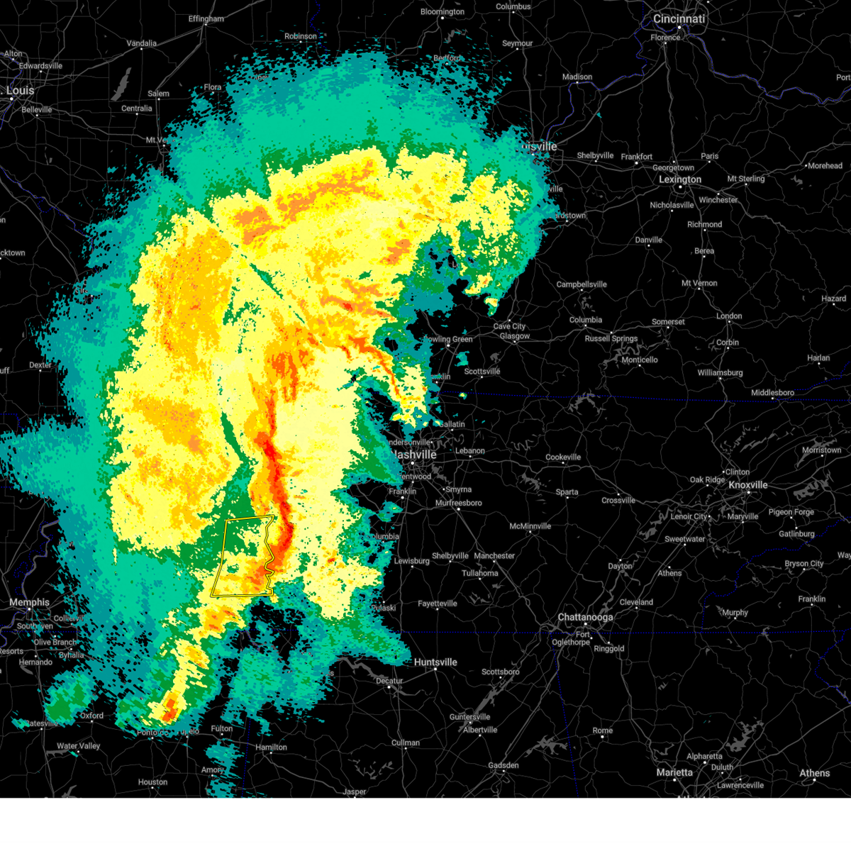 The severe thunderstorm warning for eastern henderson, northeastern mcnairy, northern hardin, east central chester and decatur counties will expire at 945 pm cdt, the storms which prompted the warning have moved out of the area. therefore, the warning will be allowed to expire. a tornado watch remains in effect until midnight cdt for west tennessee. The severe thunderstorm warning for eastern henderson, northeastern mcnairy, northern hardin, east central chester and decatur counties will expire at 945 pm cdt, the storms which prompted the warning have moved out of the area. therefore, the warning will be allowed to expire. a tornado watch remains in effect until midnight cdt for west tennessee.
|
| 3/24/2023 9:27 PM CDT |
 At 927 pm cdt, severe thunderstorms were located along a line extending from near natchez trace state park to decaturville to 6 miles southeast of sardis, moving east at 55 mph (radar indicated). Hazards include 60 mph wind gusts. Expect damage to roofs, siding, and trees. locations impacted include, lexington, natchez trace state park, natchez trace state forest, parsons, adamsville, decaturville, sardis, reagan, morris chapel, olive hill, darden, montgomery, scotts hill, saltillo, milledgeville, enville, rock hill, pleasant grove, cerro gordo and thurman. hail threat, radar indicated max hail size, <. 75 in wind threat, radar indicated max wind gust, 60 mph. At 927 pm cdt, severe thunderstorms were located along a line extending from near natchez trace state park to decaturville to 6 miles southeast of sardis, moving east at 55 mph (radar indicated). Hazards include 60 mph wind gusts. Expect damage to roofs, siding, and trees. locations impacted include, lexington, natchez trace state park, natchez trace state forest, parsons, adamsville, decaturville, sardis, reagan, morris chapel, olive hill, darden, montgomery, scotts hill, saltillo, milledgeville, enville, rock hill, pleasant grove, cerro gordo and thurman. hail threat, radar indicated max hail size, <. 75 in wind threat, radar indicated max wind gust, 60 mph.
|
| 3/24/2023 8:57 PM CDT |
 At 857 pm cdt, severe thunderstorms were located along a line extending from near blue goose to near mifflin to near masseyville, moving east at 55 mph (radar indicated). Hazards include 70 mph wind gusts. Expect considerable tree damage. Damage is likely to mobile homes, roofs, and outbuildings. At 857 pm cdt, severe thunderstorms were located along a line extending from near blue goose to near mifflin to near masseyville, moving east at 55 mph (radar indicated). Hazards include 70 mph wind gusts. Expect considerable tree damage. Damage is likely to mobile homes, roofs, and outbuildings.
|
| 5/21/2022 10:20 PM CDT |
 The severe thunderstorm warning for southeastern henderson and decatur counties will expire at 1030 pm cdt, the storm which prompted the warning has weakened below severe limits, and no longer poses an immediate threat to life or property. therefore, the warning will be allowed to expire. however small hail, gusty winds and heavy rain are still possible with this thunderstorm. a severe thunderstorm watch remains in effect until midnight cdt for west tennessee. The severe thunderstorm warning for southeastern henderson and decatur counties will expire at 1030 pm cdt, the storm which prompted the warning has weakened below severe limits, and no longer poses an immediate threat to life or property. therefore, the warning will be allowed to expire. however small hail, gusty winds and heavy rain are still possible with this thunderstorm. a severe thunderstorm watch remains in effect until midnight cdt for west tennessee.
|
| 5/21/2022 9:50 PM CDT |
 At 950 pm cdt, a severe thunderstorm was located near sardis, or 17 miles southeast of lexington, moving northeast at 30 mph (radar indicated). Hazards include 60 mph wind gusts and quarter size hail. Hail damage to vehicles is expected. expect wind damage to roofs, siding, and trees. locations impacted include, parsons, decaturville, montgomery, scotts hill, thurman, lick skillet, perryville, gumdale, busseltown, wilkinstown, haney, bath springs, pleasant grove, mount tabor, garrett, red walnut, largo, dunbar, taylors crossing and mount lebanon. hail threat, radar indicated max hail size, 1. 00 in wind threat, radar indicated max wind gust, 60 mph. At 950 pm cdt, a severe thunderstorm was located near sardis, or 17 miles southeast of lexington, moving northeast at 30 mph (radar indicated). Hazards include 60 mph wind gusts and quarter size hail. Hail damage to vehicles is expected. expect wind damage to roofs, siding, and trees. locations impacted include, parsons, decaturville, montgomery, scotts hill, thurman, lick skillet, perryville, gumdale, busseltown, wilkinstown, haney, bath springs, pleasant grove, mount tabor, garrett, red walnut, largo, dunbar, taylors crossing and mount lebanon. hail threat, radar indicated max hail size, 1. 00 in wind threat, radar indicated max wind gust, 60 mph.
|
| 5/21/2022 9:38 PM CDT |
 At 938 pm cdt, a severe thunderstorm was located over sardis, or 15 miles north of savannah, moving northeast at 40 mph (radar indicated). Hazards include 60 mph wind gusts and quarter size hail. Hail damage to vehicles is expected. Expect wind damage to roofs, siding, and trees. At 938 pm cdt, a severe thunderstorm was located over sardis, or 15 miles north of savannah, moving northeast at 40 mph (radar indicated). Hazards include 60 mph wind gusts and quarter size hail. Hail damage to vehicles is expected. Expect wind damage to roofs, siding, and trees.
|
| 5/2/2022 5:36 PM CDT |
 The severe thunderstorm warning for southeastern henderson, northeastern hardin and decatur counties will expire at 545 pm cdt, the storm which prompted the warning has weakened below severe limits, and no longer poses an immediate threat to life or property. therefore, the warning will be allowed to expire. however small hail is still possible with this thunderstorm. The severe thunderstorm warning for southeastern henderson, northeastern hardin and decatur counties will expire at 545 pm cdt, the storm which prompted the warning has weakened below severe limits, and no longer poses an immediate threat to life or property. therefore, the warning will be allowed to expire. however small hail is still possible with this thunderstorm.
|
| 5/2/2022 5:18 PM CDT |
 At 518 pm cdt, a severe thunderstorm was located near sardis, or 15 miles north of savannah, moving north at 35 mph (radar indicated). Hazards include 60 mph wind gusts and quarter size hail. Hail damage to vehicles is expected. expect wind damage to roofs, siding, and trees. locations impacted include, parsons, decaturville, sardis, darden, montgomery, scotts hill, saltillo, haney, hinkle, pleasant grove, mount tabor, red walnut, cerro gordo, thurman, lick skillet, perryville, gumdale, wilkinstown, bath springs and five forks. hail threat, radar indicated max hail size, 1. 00 in wind threat, radar indicated max wind gust, 60 mph. At 518 pm cdt, a severe thunderstorm was located near sardis, or 15 miles north of savannah, moving north at 35 mph (radar indicated). Hazards include 60 mph wind gusts and quarter size hail. Hail damage to vehicles is expected. expect wind damage to roofs, siding, and trees. locations impacted include, parsons, decaturville, sardis, darden, montgomery, scotts hill, saltillo, haney, hinkle, pleasant grove, mount tabor, red walnut, cerro gordo, thurman, lick skillet, perryville, gumdale, wilkinstown, bath springs and five forks. hail threat, radar indicated max hail size, 1. 00 in wind threat, radar indicated max wind gust, 60 mph.
|
| 5/2/2022 5:02 PM CDT |
 At 501 pm cdt, a severe thunderstorm was located near savannah, moving north at 35 mph (radar indicated). Hazards include 60 mph wind gusts and quarter size hail. Hail damage to vehicles is expected. Expect wind damage to roofs, siding, and trees. At 501 pm cdt, a severe thunderstorm was located near savannah, moving north at 35 mph (radar indicated). Hazards include 60 mph wind gusts and quarter size hail. Hail damage to vehicles is expected. Expect wind damage to roofs, siding, and trees.
|
| 4/13/2022 6:48 PM CDT |
 At 648 pm cdt, severe thunderstorms were located along a line extending from 11 miles northeast of parsons to 8 miles south of decaturville to near corinth, moving east at 45 mph (radar indicated). Hazards include 70 mph wind gusts. Expect considerable tree damage. damage is likely to mobile homes, roofs, and outbuildings. locations impacted include, savannah, pickwick landing state park, parsons, adamsville, decaturville, sardis, pickwick dam, morris chapel, shiloh, walnut grove, olive hill, darden, montgomery, crump, scotts hill, michie, guys, saltillo, stantonville and milledgeville. thunderstorm damage threat, considerable hail threat, radar indicated max hail size, <. 75 in wind threat, radar indicated max wind gust, 70 mph. At 648 pm cdt, severe thunderstorms were located along a line extending from 11 miles northeast of parsons to 8 miles south of decaturville to near corinth, moving east at 45 mph (radar indicated). Hazards include 70 mph wind gusts. Expect considerable tree damage. damage is likely to mobile homes, roofs, and outbuildings. locations impacted include, savannah, pickwick landing state park, parsons, adamsville, decaturville, sardis, pickwick dam, morris chapel, shiloh, walnut grove, olive hill, darden, montgomery, crump, scotts hill, michie, guys, saltillo, stantonville and milledgeville. thunderstorm damage threat, considerable hail threat, radar indicated max hail size, <. 75 in wind threat, radar indicated max wind gust, 70 mph.
|
| 4/13/2022 6:43 PM CDT | Tree on a house... no injuries reporte in decatur county TN, 0.1 miles WNW of Decaturville, TN |
| 4/13/2022 6:35 PM CDT |
 At 634 pm cdt, severe thunderstorms were located along a line extending from near natchez trace state park to sardis to near big hill pond state park, moving east at 45 mph (radar indicated). Hazards include 70 mph wind gusts. Expect considerable tree damage. damage is likely to mobile homes, roofs, and outbuildings. locations impacted include, lexington, savannah, henderson, selmer, pickwick landing state park, natchez trace state park, natchez trace state forest, big hill pond state park, parsons, adamsville, decaturville, sardis, pickwick dam, masseyville, reagan, bargerton, pocahontas, jacks creek, mifflin and wildersville. thunderstorm damage threat, considerable hail threat, radar indicated max hail size, <. 75 in wind threat, radar indicated max wind gust, 70 mph. At 634 pm cdt, severe thunderstorms were located along a line extending from near natchez trace state park to sardis to near big hill pond state park, moving east at 45 mph (radar indicated). Hazards include 70 mph wind gusts. Expect considerable tree damage. damage is likely to mobile homes, roofs, and outbuildings. locations impacted include, lexington, savannah, henderson, selmer, pickwick landing state park, natchez trace state park, natchez trace state forest, big hill pond state park, parsons, adamsville, decaturville, sardis, pickwick dam, masseyville, reagan, bargerton, pocahontas, jacks creek, mifflin and wildersville. thunderstorm damage threat, considerable hail threat, radar indicated max hail size, <. 75 in wind threat, radar indicated max wind gust, 70 mph.
|
| 4/13/2022 5:56 PM CDT |
 At 556 pm cdt, severe thunderstorms were located along a line extending from 8 miles southeast of milan to near chickasaw state park to near lagrange, moving east at 45 mph (radar indicated). Hazards include 60 mph wind gusts. expect damage to roofs, siding, and trees At 556 pm cdt, severe thunderstorms were located along a line extending from 8 miles southeast of milan to near chickasaw state park to near lagrange, moving east at 45 mph (radar indicated). Hazards include 60 mph wind gusts. expect damage to roofs, siding, and trees
|
| 1/1/2022 12:15 PM CST |
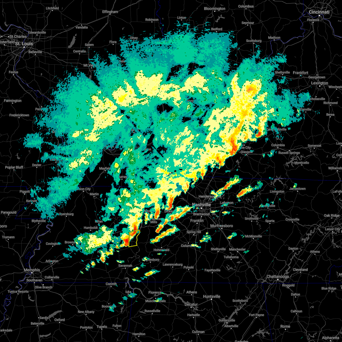 At 1215 pm cst, a severe thunderstorm was located near parsons, or 13 miles west of linden, moving east at 60 mph (radar indicated). Hazards include 60 mph wind gusts. Expect damage to roofs, siding, and trees. Locations impacted include, parsons, decaturville, mount tabor, perryville, busseltown, garrett, jeannette, hickory forks, wilkinstown, cozette and bible hill. At 1215 pm cst, a severe thunderstorm was located near parsons, or 13 miles west of linden, moving east at 60 mph (radar indicated). Hazards include 60 mph wind gusts. Expect damage to roofs, siding, and trees. Locations impacted include, parsons, decaturville, mount tabor, perryville, busseltown, garrett, jeannette, hickory forks, wilkinstown, cozette and bible hill.
|
| 1/1/2022 11:59 AM CST |
 At 1159 am cst, a severe thunderstorm was located near reagan, or near lexington, moving east at 60 mph (radar indicated). Hazards include 60 mph wind gusts. Expect damage to roofs, siding, and trees. Locations impacted include, lexington, natchez trace state forest, parsons, decaturville, reagan, darden, scotts hill, busseltown, jeannette, rock hill, mount tabor, middle fork, timberlake, hinson springs, cozette, perryville, gumdale, warrens bluff, wilkinstown and palestine. At 1159 am cst, a severe thunderstorm was located near reagan, or near lexington, moving east at 60 mph (radar indicated). Hazards include 60 mph wind gusts. Expect damage to roofs, siding, and trees. Locations impacted include, lexington, natchez trace state forest, parsons, decaturville, reagan, darden, scotts hill, busseltown, jeannette, rock hill, mount tabor, middle fork, timberlake, hinson springs, cozette, perryville, gumdale, warrens bluff, wilkinstown and palestine.
|
| 1/1/2022 11:45 AM CST |
 At 1144 am cst, a severe thunderstorm was located near mifflin, or near henderson, moving east at 60 mph (radar indicated). Hazards include 70 mph wind gusts and nickel size hail. Expect considerable tree damage. Damage is likely to mobile homes, roofs, and outbuildings. At 1144 am cst, a severe thunderstorm was located near mifflin, or near henderson, moving east at 60 mph (radar indicated). Hazards include 70 mph wind gusts and nickel size hail. Expect considerable tree damage. Damage is likely to mobile homes, roofs, and outbuildings.
|
| 12/5/2021 5:17 PM CST |
 At 516 pm cst, a severe thunderstorm producing a tornado was located near reagan, or near lexington, moving northeast at 25 mph (radar indicated rotation). Hazards include tornado and quarter size hail. Flying debris will be dangerous to those caught without shelter. mobile homes will be damaged or destroyed. damage to roofs, windows, and vehicles will occur. tree damage is likely. this dangerous storm will be near, lexington around 525 pm cst. darden around 545 pm cst. parsons and decaturville around 600 pm cst. Other locations impacted by this tornadic thunderstorm include warrens bluff, wilkinstown, rock hill, palestine, mount tabor, garrett, beacon, hickory forks, largo and shady hill. At 516 pm cst, a severe thunderstorm producing a tornado was located near reagan, or near lexington, moving northeast at 25 mph (radar indicated rotation). Hazards include tornado and quarter size hail. Flying debris will be dangerous to those caught without shelter. mobile homes will be damaged or destroyed. damage to roofs, windows, and vehicles will occur. tree damage is likely. this dangerous storm will be near, lexington around 525 pm cst. darden around 545 pm cst. parsons and decaturville around 600 pm cst. Other locations impacted by this tornadic thunderstorm include warrens bluff, wilkinstown, rock hill, palestine, mount tabor, garrett, beacon, hickory forks, largo and shady hill.
|
| 12/5/2021 5:00 PM CST |
 At 500 pm cst, a severe thunderstorm producing a tornado was located near mifflin, or 9 miles southwest of lexington, moving northeast at 30 mph (radar indicated rotation). Hazards include tornado and quarter size hail. Flying debris will be dangerous to those caught without shelter. mobile homes will be damaged or destroyed. damage to roofs, windows, and vehicles will occur. tree damage is likely. this dangerous storm will be near, reagan around 515 pm cst. lexington around 525 pm cst. natchez trace state forest, parsons, decaturville and darden around 545 pm cst. Other locations impacted by this tornadic thunderstorm include huron, warrens bluff, wilkinstown, rock hill, palestine, roby, mount tabor, middle fork, garrett and beacon. At 500 pm cst, a severe thunderstorm producing a tornado was located near mifflin, or 9 miles southwest of lexington, moving northeast at 30 mph (radar indicated rotation). Hazards include tornado and quarter size hail. Flying debris will be dangerous to those caught without shelter. mobile homes will be damaged or destroyed. damage to roofs, windows, and vehicles will occur. tree damage is likely. this dangerous storm will be near, reagan around 515 pm cst. lexington around 525 pm cst. natchez trace state forest, parsons, decaturville and darden around 545 pm cst. Other locations impacted by this tornadic thunderstorm include huron, warrens bluff, wilkinstown, rock hill, palestine, roby, mount tabor, middle fork, garrett and beacon.
|
| 12/5/2021 4:24 PM CST |
 At 423 pm cst, a severe thunderstorm was located over chickasaw state park, moving northeast at 45 mph (radar indicated). Hazards include 60 mph wind gusts and quarter size hail. Hail damage to vehicles is expected. Expect wind damage to roofs, siding, and trees. At 423 pm cst, a severe thunderstorm was located over chickasaw state park, moving northeast at 45 mph (radar indicated). Hazards include 60 mph wind gusts and quarter size hail. Hail damage to vehicles is expected. Expect wind damage to roofs, siding, and trees.
|
| 10/15/2021 7:54 PM CDT |
 At 754 pm cdt, a severe thunderstorm was located near parsons, or 12 miles east of natchez trace state forest, moving east at 35 mph (radar indicated). Hazards include 60 mph wind gusts. Expect damage to roofs, siding, and trees. locations impacted include, parsons, decaturville, scotts hill, perryville, gumdale, busseltown, jeannette, wilkinstown, mount tabor, sugar tree, garrett, beacon, hickory forks, largo, cozette, bible hill and mount lebanon. hail threat, radar indicated max hail size, <. 75 in wind threat, radar indicated max wind gust, 60 mph. At 754 pm cdt, a severe thunderstorm was located near parsons, or 12 miles east of natchez trace state forest, moving east at 35 mph (radar indicated). Hazards include 60 mph wind gusts. Expect damage to roofs, siding, and trees. locations impacted include, parsons, decaturville, scotts hill, perryville, gumdale, busseltown, jeannette, wilkinstown, mount tabor, sugar tree, garrett, beacon, hickory forks, largo, cozette, bible hill and mount lebanon. hail threat, radar indicated max hail size, <. 75 in wind threat, radar indicated max wind gust, 60 mph.
|
| 10/15/2021 7:38 PM CDT |
 At 738 pm cdt, a severe thunderstorm was located near natchez trace state forest, moving east at 35 mph (radar indicated). Hazards include 60 mph wind gusts. Expect damage to roofs, siding, and trees. locations impacted include, natchez trace state forest, parsons, decaturville, reagan, darden, scotts hill, busseltown, jeannette, rock hill, holladay, mount tabor, sugar tree, cozette, perryville, gumdale, warrens bluff, wilkinstown, garrett, beacon and hickory forks. hail threat, radar indicated max hail size, <. 75 in wind threat, radar indicated max wind gust, 60 mph. At 738 pm cdt, a severe thunderstorm was located near natchez trace state forest, moving east at 35 mph (radar indicated). Hazards include 60 mph wind gusts. Expect damage to roofs, siding, and trees. locations impacted include, natchez trace state forest, parsons, decaturville, reagan, darden, scotts hill, busseltown, jeannette, rock hill, holladay, mount tabor, sugar tree, cozette, perryville, gumdale, warrens bluff, wilkinstown, garrett, beacon and hickory forks. hail threat, radar indicated max hail size, <. 75 in wind threat, radar indicated max wind gust, 60 mph.
|
| 10/15/2021 7:14 PM CDT |
 At 713 pm cdt, a severe thunderstorm was located over bargerton, or near lexington, moving east at 35 mph (radar indicated). Hazards include 60 mph wind gusts. expect damage to roofs, siding, and trees At 713 pm cdt, a severe thunderstorm was located over bargerton, or near lexington, moving east at 35 mph (radar indicated). Hazards include 60 mph wind gusts. expect damage to roofs, siding, and trees
|
| 7/31/2021 11:36 PM CDT |
 The severe thunderstorm warning for northeastern henderson and central decatur counties will expire at 1145 pm cdt, the storm which prompted the warning has moved out of the area. therefore, the warning will be allowed to expire. however gusty winds are still possible with this thunderstorm. The severe thunderstorm warning for northeastern henderson and central decatur counties will expire at 1145 pm cdt, the storm which prompted the warning has moved out of the area. therefore, the warning will be allowed to expire. however gusty winds are still possible with this thunderstorm.
|
| 7/31/2021 11:29 PM CDT |
 At 1129 pm cdt, a severe thunderstorm was located near parsons, or 10 miles west of linden, moving east at 40 mph (radar indicated). Hazards include 60 mph wind gusts. expect damage to roofs, siding, and trees At 1129 pm cdt, a severe thunderstorm was located near parsons, or 10 miles west of linden, moving east at 40 mph (radar indicated). Hazards include 60 mph wind gusts. expect damage to roofs, siding, and trees
|
| 7/31/2021 11:14 PM CDT |
 At 1114 pm cdt, doppler radar indicated a severe squall line producing both tornadoes and extensive straight line wind damage was located over wildersville, or near natchez trace state forest, moving east at 40 mph (radar indicated rotation). Hazards include tornado. Flying debris will be dangerous to those caught without shelter. mobile homes will be damaged or destroyed. damage to roofs, windows, and vehicles will occur. tree damage is likely. Locations impacted include, lexington, natchez trace state park, natchez trace state forest, parsons, decaturville, parkers crossroads, darden, bargerton, wildersville, busseltown, jeannette, union cross, mount tabor, timberlake, cozette, parker`s cross roads, perryville, mount gilead, wilkinstown and garrett. At 1114 pm cdt, doppler radar indicated a severe squall line producing both tornadoes and extensive straight line wind damage was located over wildersville, or near natchez trace state forest, moving east at 40 mph (radar indicated rotation). Hazards include tornado. Flying debris will be dangerous to those caught without shelter. mobile homes will be damaged or destroyed. damage to roofs, windows, and vehicles will occur. tree damage is likely. Locations impacted include, lexington, natchez trace state park, natchez trace state forest, parsons, decaturville, parkers crossroads, darden, bargerton, wildersville, busseltown, jeannette, union cross, mount tabor, timberlake, cozette, parker`s cross roads, perryville, mount gilead, wilkinstown and garrett.
|
| 7/31/2021 11:12 PM CDT |
 At 1112 pm cdt, a severe thunderstorm was located over decaturville, or 12 miles southeast of natchez trace state forest, moving east at 50 mph (radar indicated). Hazards include 70 mph wind gusts. Expect considerable tree damage. Damage is likely to mobile homes, roofs, and outbuildings. At 1112 pm cdt, a severe thunderstorm was located over decaturville, or 12 miles southeast of natchez trace state forest, moving east at 50 mph (radar indicated). Hazards include 70 mph wind gusts. Expect considerable tree damage. Damage is likely to mobile homes, roofs, and outbuildings.
|
| 7/31/2021 11:02 PM CDT |
 At 1101 pm cdt, doppler radar indicated a severe squall line producing both tornadoes and extensive straight line wind damage was located near bargerton, or 11 miles northwest of lexington, moving southeast at 35 mph (radar indicated rotation). Hazards include tornado. Flying debris will be dangerous to those caught without shelter. mobile homes will be damaged or destroyed. damage to roofs, windows, and vehicles will occur. tree damage is likely. Locations impacted include, lexington, natchez trace state park, natchez trace state forest, parsons, decaturville, parkers crossroads, darden, bargerton, wildersville, clarksburg, howley, hickory flat, busseltown, jeannette, union cross, mount tabor, sugar tree, timberlake, cozette and westport. At 1101 pm cdt, doppler radar indicated a severe squall line producing both tornadoes and extensive straight line wind damage was located near bargerton, or 11 miles northwest of lexington, moving southeast at 35 mph (radar indicated rotation). Hazards include tornado. Flying debris will be dangerous to those caught without shelter. mobile homes will be damaged or destroyed. damage to roofs, windows, and vehicles will occur. tree damage is likely. Locations impacted include, lexington, natchez trace state park, natchez trace state forest, parsons, decaturville, parkers crossroads, darden, bargerton, wildersville, clarksburg, howley, hickory flat, busseltown, jeannette, union cross, mount tabor, sugar tree, timberlake, cozette and westport.
|
| 7/31/2021 10:59 PM CDT |
 At 1059 pm cdt, a severe thunderstorm was located over natchez trace state forest, moving east at 55 mph (radar indicated). Hazards include 70 mph wind gusts. Expect considerable tree damage. damage is likely to mobile homes, roofs, and outbuildings. Locations impacted include, lexington, huntingdon, camden, natchez trace state park, natchez trace state forest, parsons, new johnsonville, bruceton, atwood, decaturville, blue goose, bargerton, wildersville, parkers crossroads, darden, carroll, trezevant, hollow rock, clarksburg and mclemoresville. At 1059 pm cdt, a severe thunderstorm was located over natchez trace state forest, moving east at 55 mph (radar indicated). Hazards include 70 mph wind gusts. Expect considerable tree damage. damage is likely to mobile homes, roofs, and outbuildings. Locations impacted include, lexington, huntingdon, camden, natchez trace state park, natchez trace state forest, parsons, new johnsonville, bruceton, atwood, decaturville, blue goose, bargerton, wildersville, parkers crossroads, darden, carroll, trezevant, hollow rock, clarksburg and mclemoresville.
|
| 7/31/2021 10:48 PM CDT |
 At 1048 pm cdt, doppler radar indicated severe thunderstorms producing both tornadoes and extensive straight line wind damage were located 9 miles southeast of atwood, or 10 miles east of milan, moving southeast at 40 mph (radar indicated rotation). Hazards include tornado. Flying debris will be dangerous to those caught without shelter. mobile homes will be damaged or destroyed. damage to roofs, windows, and vehicles will occur. Tree damage is likely. At 1048 pm cdt, doppler radar indicated severe thunderstorms producing both tornadoes and extensive straight line wind damage were located 9 miles southeast of atwood, or 10 miles east of milan, moving southeast at 40 mph (radar indicated rotation). Hazards include tornado. Flying debris will be dangerous to those caught without shelter. mobile homes will be damaged or destroyed. damage to roofs, windows, and vehicles will occur. Tree damage is likely.
|
| 7/31/2021 10:37 PM CDT |
 At 1037 pm cdt, a severe thunderstorm was located 7 miles southeast of milan, moving east at 55 mph (radar indicated). Hazards include 70 mph wind gusts. Expect considerable tree damage. damage is likely to mobile homes, roofs, and outbuildings. Locations impacted include, jackson, humboldt, milan, lexington, trenton, huntingdon, camden, natchez trace state park, natchez trace state forest, fairview, parsons, new johnsonville, three way, bruceton, atwood, decaturville, blue goose, bargerton, wildersville and parkers crossroads. At 1037 pm cdt, a severe thunderstorm was located 7 miles southeast of milan, moving east at 55 mph (radar indicated). Hazards include 70 mph wind gusts. Expect considerable tree damage. damage is likely to mobile homes, roofs, and outbuildings. Locations impacted include, jackson, humboldt, milan, lexington, trenton, huntingdon, camden, natchez trace state park, natchez trace state forest, fairview, parsons, new johnsonville, three way, bruceton, atwood, decaturville, blue goose, bargerton, wildersville and parkers crossroads.
|
| 7/31/2021 10:31 PM CDT |
 At 1031 pm cdt, a severe thunderstorm was located near milan, moving east at 55 mph (radar indicated). Hazards include 60 mph wind gusts. expect damage to roofs, siding, and trees At 1031 pm cdt, a severe thunderstorm was located near milan, moving east at 55 mph (radar indicated). Hazards include 60 mph wind gusts. expect damage to roofs, siding, and trees
|
| 5/28/2021 12:11 AM CDT |
 The severe thunderstorm warning for southeastern henderson, northern hardin and southern decatur counties will expire at 1215 am cdt, the storm which prompted the warning has moved out of the area. therefore, the warning will be allowed to expire. however gusty winds are still possible with this thunderstorm. The severe thunderstorm warning for southeastern henderson, northern hardin and southern decatur counties will expire at 1215 am cdt, the storm which prompted the warning has moved out of the area. therefore, the warning will be allowed to expire. however gusty winds are still possible with this thunderstorm.
|
| 5/27/2021 11:39 PM CDT |
 At 1139 pm cdt, a severe thunderstorm was located 8 miles north of savannah, moving east at 35 mph (radar indicated). Hazards include 60 mph wind gusts. Expect damage to roofs, siding, and trees. Locations impacted include, savannah, adamsville, decaturville, sardis, reagan, olive hill, morris chapel, montgomery, crump, scotts hill, saltillo, milledgeville, right, phillips, haney, hinkle, pleasant grove, red walnut, olivehill and cerro gordo. At 1139 pm cdt, a severe thunderstorm was located 8 miles north of savannah, moving east at 35 mph (radar indicated). Hazards include 60 mph wind gusts. Expect damage to roofs, siding, and trees. Locations impacted include, savannah, adamsville, decaturville, sardis, reagan, olive hill, morris chapel, montgomery, crump, scotts hill, saltillo, milledgeville, right, phillips, haney, hinkle, pleasant grove, red walnut, olivehill and cerro gordo.
|
| 5/27/2021 11:21 PM CDT |
 At 1121 pm cdt, a severe thunderstorm was located over morris chapel, or 10 miles northwest of savannah, moving east at 35 mph (radar indicated). Hazards include 60 mph wind gusts. expect damage to roofs, siding, and trees At 1121 pm cdt, a severe thunderstorm was located over morris chapel, or 10 miles northwest of savannah, moving east at 35 mph (radar indicated). Hazards include 60 mph wind gusts. expect damage to roofs, siding, and trees
|
| 3/27/2021 11:54 PM CDT |
 At 1154 pm cdt, severe thunderstorms were located along a line extending from near bargerton to near hinkle, moving east at 50 mph (radar indicated). Hazards include 60 mph wind gusts. expect damage to roofs, siding, and trees At 1154 pm cdt, severe thunderstorms were located along a line extending from near bargerton to near hinkle, moving east at 50 mph (radar indicated). Hazards include 60 mph wind gusts. expect damage to roofs, siding, and trees
|
| 3/27/2021 11:00 PM CDT |
 At 1100 pm cdt, doppler radar indicated a severe thunderstorm producing a tornado was located over jacks creek, or near henderson, moving northeast at 50 mph (radar indicated rotation). Hazards include tornado. Flying debris will be dangerous to those caught without shelter. mobile homes will be damaged or destroyed. damage to roofs, windows, and vehicles will occur. tree damage is likely. Locations impacted include, lexington, henderson, natchez trace state forest, parsons, decaturville, sardis, reagan, jacks creek, darden, mifflin, scotts hill, enville, rock hill, roby, mount tabor, cabo, middle fork, hinson springs, lick skillet and perryville. At 1100 pm cdt, doppler radar indicated a severe thunderstorm producing a tornado was located over jacks creek, or near henderson, moving northeast at 50 mph (radar indicated rotation). Hazards include tornado. Flying debris will be dangerous to those caught without shelter. mobile homes will be damaged or destroyed. damage to roofs, windows, and vehicles will occur. tree damage is likely. Locations impacted include, lexington, henderson, natchez trace state forest, parsons, decaturville, sardis, reagan, jacks creek, darden, mifflin, scotts hill, enville, rock hill, roby, mount tabor, cabo, middle fork, hinson springs, lick skillet and perryville.
|
| 3/27/2021 10:47 PM CDT |
 At 1047 pm cdt, doppler radar indicated a severe thunderstorm producing a tornado was located near henderson, moving northeast at 50 mph (radar indicated rotation). Hazards include tornado. Flying debris will be dangerous to those caught without shelter. mobile homes will be damaged or destroyed. damage to roofs, windows, and vehicles will occur. tree damage is likely. Locations impacted include, lexington, henderson, natchez trace state forest, chickasaw state park, parsons, decaturville, sardis, silerton, reagan, jacks creek, darden, mifflin, scotts hill, finger, enville, medon, pinson, rock hill, hickory corners and roby. At 1047 pm cdt, doppler radar indicated a severe thunderstorm producing a tornado was located near henderson, moving northeast at 50 mph (radar indicated rotation). Hazards include tornado. Flying debris will be dangerous to those caught without shelter. mobile homes will be damaged or destroyed. damage to roofs, windows, and vehicles will occur. tree damage is likely. Locations impacted include, lexington, henderson, natchez trace state forest, chickasaw state park, parsons, decaturville, sardis, silerton, reagan, jacks creek, darden, mifflin, scotts hill, finger, enville, medon, pinson, rock hill, hickory corners and roby.
|
| 3/27/2021 10:42 PM CDT |
 At 1042 pm cdt, doppler radar indicated a severe thunderstorm producing a tornado was located over chickasaw state park, moving northeast at 50 mph (radar indicated rotation). Hazards include tornado. Flying debris will be dangerous to those caught without shelter. mobile homes will be damaged or destroyed. damage to roofs, windows, and vehicles will occur. Tree damage is likely. At 1042 pm cdt, doppler radar indicated a severe thunderstorm producing a tornado was located over chickasaw state park, moving northeast at 50 mph (radar indicated rotation). Hazards include tornado. Flying debris will be dangerous to those caught without shelter. mobile homes will be damaged or destroyed. damage to roofs, windows, and vehicles will occur. Tree damage is likely.
|
| 3/27/2021 8:48 PM CDT |
 At 847 pm cdt, doppler radar indicated a severe thunderstorm producing a tornado was located near parsons, or 13 miles west of linden, moving northeast at 40 mph (radar indicated rotation). Hazards include tornado and quarter size hail. Flying debris will be dangerous to those caught without shelter. mobile homes will be damaged or destroyed. damage to roofs, windows, and vehicles will occur. tree damage is likely. Locations impacted include, parsons, decaturville, scotts hill, perryville, busseltown, wilkinstown, mount tabor, garrett, beacon, hickory forks, largo, cozette, bible hill and mount lebanon. At 847 pm cdt, doppler radar indicated a severe thunderstorm producing a tornado was located near parsons, or 13 miles west of linden, moving northeast at 40 mph (radar indicated rotation). Hazards include tornado and quarter size hail. Flying debris will be dangerous to those caught without shelter. mobile homes will be damaged or destroyed. damage to roofs, windows, and vehicles will occur. tree damage is likely. Locations impacted include, parsons, decaturville, scotts hill, perryville, busseltown, wilkinstown, mount tabor, garrett, beacon, hickory forks, largo, cozette, bible hill and mount lebanon.
|
| 3/27/2021 8:37 PM CDT |
 At 837 pm cdt, doppler radar indicated a severe thunderstorm producing a tornado was located near darden, or 11 miles south of natchez trace state forest, moving northeast at 35 mph (radar indicated rotation). Hazards include tornado and quarter size hail. Flying debris will be dangerous to those caught without shelter. mobile homes will be damaged or destroyed. damage to roofs, windows, and vehicles will occur. Tree damage is likely. At 837 pm cdt, doppler radar indicated a severe thunderstorm producing a tornado was located near darden, or 11 miles south of natchez trace state forest, moving northeast at 35 mph (radar indicated rotation). Hazards include tornado and quarter size hail. Flying debris will be dangerous to those caught without shelter. mobile homes will be damaged or destroyed. damage to roofs, windows, and vehicles will occur. Tree damage is likely.
|
| 3/27/2021 8:09 PM CDT |
 At 809 pm cdt, a severe thunderstorm was located over henderson, moving northeast at 45 mph (radar indicated). Hazards include ping pong ball size hail and 60 mph wind gusts. People and animals outdoors will be injured. expect hail damage to roofs, siding, windows, and vehicles. expect wind damage to roofs, siding, and trees. Locations impacted include, lexington, henderson, natchez trace state park, natchez trace state forest, parsons, decaturville, reagan, jacks creek, parkers crossroads, darden, mifflin, bargerton, wildersville, scotts hill, busseltown, jeannette, rock hill, union cross, juno and roby. At 809 pm cdt, a severe thunderstorm was located over henderson, moving northeast at 45 mph (radar indicated). Hazards include ping pong ball size hail and 60 mph wind gusts. People and animals outdoors will be injured. expect hail damage to roofs, siding, windows, and vehicles. expect wind damage to roofs, siding, and trees. Locations impacted include, lexington, henderson, natchez trace state park, natchez trace state forest, parsons, decaturville, reagan, jacks creek, parkers crossroads, darden, mifflin, bargerton, wildersville, scotts hill, busseltown, jeannette, rock hill, union cross, juno and roby.
|
| 3/27/2021 8:04 PM CDT |
 At 803 pm cdt, a severe thunderstorm was located over henderson, moving northeast at 50 mph (radar indicated). Hazards include 60 mph wind gusts and quarter size hail. Hail damage to vehicles is expected. Expect wind damage to roofs, siding, and trees. At 803 pm cdt, a severe thunderstorm was located over henderson, moving northeast at 50 mph (radar indicated). Hazards include 60 mph wind gusts and quarter size hail. Hail damage to vehicles is expected. Expect wind damage to roofs, siding, and trees.
|
| 3/27/2021 5:24 PM CDT |
 The tornado warning for southeastern henderson and central decatur counties will expire at 530 pm cdt, the storm which prompted the warning has moved out of the area. therefore, the warning will be allowed to expire. a tornado watch remains in effect until 900 pm cdt for western tennessee. to report severe weather, contact your nearest law enforcement agency. they will relay your report to the national weather service memphis. The tornado warning for southeastern henderson and central decatur counties will expire at 530 pm cdt, the storm which prompted the warning has moved out of the area. therefore, the warning will be allowed to expire. a tornado watch remains in effect until 900 pm cdt for western tennessee. to report severe weather, contact your nearest law enforcement agency. they will relay your report to the national weather service memphis.
|
| 3/27/2021 5:08 PM CDT |
 At 508 pm cdt, doppler radar indicated a severe thunderstorm producing a tornado was located near darden, or 9 miles southeast of natchez trace state forest, moving northeast at 45 mph (radar indicated rotation). Hazards include tornado and ping pong ball size hail. Flying debris will be dangerous to those caught without shelter. mobile homes will be damaged or destroyed. damage to roofs, windows, and vehicles will occur. Tree damage is likely. At 508 pm cdt, doppler radar indicated a severe thunderstorm producing a tornado was located near darden, or 9 miles southeast of natchez trace state forest, moving northeast at 45 mph (radar indicated rotation). Hazards include tornado and ping pong ball size hail. Flying debris will be dangerous to those caught without shelter. mobile homes will be damaged or destroyed. damage to roofs, windows, and vehicles will occur. Tree damage is likely.
|
| 3/27/2021 4:57 PM CDT |
 At 455 pm cdt, a confirmed large and extremely dangerous tornado was located near reagan, or 7 miles southeast of lexington, moving east at 40 mph. this is a particularly dangerous situation. take cover now! (radar confirmed tornado. at 451 pm, trees and powerlines were reported knocked down near the intersection of highway 22 and middlefork road). Hazards include damaging tornado. You are in a life-threatening situation. flying debris may be deadly to those caught without shelter. mobile homes will be destroyed. considerable damage to homes, businesses, and vehicles is likely and complete destruction is possible. Locations impacted include, lexington, parsons, decaturville, reagan, darden, scotts hill, busseltown, jeannette, haney, rock hill, mount tabor, hinson springs, cozette, lick skillet, perryville, gumdale, warrens bluff, wilkinstown, palestine and garrett. At 455 pm cdt, a confirmed large and extremely dangerous tornado was located near reagan, or 7 miles southeast of lexington, moving east at 40 mph. this is a particularly dangerous situation. take cover now! (radar confirmed tornado. at 451 pm, trees and powerlines were reported knocked down near the intersection of highway 22 and middlefork road). Hazards include damaging tornado. You are in a life-threatening situation. flying debris may be deadly to those caught without shelter. mobile homes will be destroyed. considerable damage to homes, businesses, and vehicles is likely and complete destruction is possible. Locations impacted include, lexington, parsons, decaturville, reagan, darden, scotts hill, busseltown, jeannette, haney, rock hill, mount tabor, hinson springs, cozette, lick skillet, perryville, gumdale, warrens bluff, wilkinstown, palestine and garrett.
|
| 3/27/2021 4:52 PM CDT |
 At 450 pm cdt, a large and extremely dangerous tornado was located near reagan, or near lexington, moving east at 40 mph. this is a particularly dangerous situation. take cover now! (radar indicated rotation). Hazards include damaging tornado. You are in a life-threatening situation. flying debris may be deadly to those caught without shelter. mobile homes will be destroyed. considerable damage to homes, businesses, and vehicles is likely and complete destruction is possible. Locations impacted include, lexington, parsons, decaturville, reagan, darden, scotts hill, busseltown, jeannette, haney, rock hill, mount tabor, middle fork, hinson springs, cozette, lick skillet, perryville, gumdale, huron, warrens bluff and wilkinstown. At 450 pm cdt, a large and extremely dangerous tornado was located near reagan, or near lexington, moving east at 40 mph. this is a particularly dangerous situation. take cover now! (radar indicated rotation). Hazards include damaging tornado. You are in a life-threatening situation. flying debris may be deadly to those caught without shelter. mobile homes will be destroyed. considerable damage to homes, businesses, and vehicles is likely and complete destruction is possible. Locations impacted include, lexington, parsons, decaturville, reagan, darden, scotts hill, busseltown, jeannette, haney, rock hill, mount tabor, middle fork, hinson springs, cozette, lick skillet, perryville, gumdale, huron, warrens bluff and wilkinstown.
|
| 3/27/2021 4:43 PM CDT |
 At 443 pm cdt, a large and extremely dangerous tornado was located near reagan, or 7 miles southwest of lexington, moving east at 35 mph. this is a particularly dangerous situation. take cover now! (radar indicated rotation). Hazards include damaging tornado. You are in a life-threatening situation. flying debris may be deadly to those caught without shelter. mobile homes will be destroyed. considerable damage to homes, businesses, and vehicles is likely and complete destruction is possible. Locations impacted include, lexington, parsons, decaturville, reagan, jacks creek, darden, mifflin, scotts hill, busseltown, jeannette, haney, rock hill, roby, mount tabor, middle fork, hinson springs, cozette, lick skillet, perryville and gumdale. At 443 pm cdt, a large and extremely dangerous tornado was located near reagan, or 7 miles southwest of lexington, moving east at 35 mph. this is a particularly dangerous situation. take cover now! (radar indicated rotation). Hazards include damaging tornado. You are in a life-threatening situation. flying debris may be deadly to those caught without shelter. mobile homes will be destroyed. considerable damage to homes, businesses, and vehicles is likely and complete destruction is possible. Locations impacted include, lexington, parsons, decaturville, reagan, jacks creek, darden, mifflin, scotts hill, busseltown, jeannette, haney, rock hill, roby, mount tabor, middle fork, hinson springs, cozette, lick skillet, perryville and gumdale.
|
| 3/27/2021 4:35 PM CDT |
 At 434 pm cdt, doppler radar indicated a severe thunderstorm producing a tornado was located near mifflin, or 9 miles northeast of henderson, moving east at 45 mph (radar indicated rotation). Hazards include tornado and quarter size hail. Flying debris will be dangerous to those caught without shelter. mobile homes will be damaged or destroyed. damage to roofs, windows, and vehicles will occur. Tree damage is likely. At 434 pm cdt, doppler radar indicated a severe thunderstorm producing a tornado was located near mifflin, or 9 miles northeast of henderson, moving east at 45 mph (radar indicated rotation). Hazards include tornado and quarter size hail. Flying debris will be dangerous to those caught without shelter. mobile homes will be damaged or destroyed. damage to roofs, windows, and vehicles will occur. Tree damage is likely.
|
| 3/17/2021 1:58 PM CDT |
 At 158 pm cdt, a severe thunderstorm was located near bemis, or 7 miles south of jackson, moving east at 55 mph (radar indicated). Hazards include 60 mph wind gusts. expect damage to roofs, siding, and trees At 158 pm cdt, a severe thunderstorm was located near bemis, or 7 miles south of jackson, moving east at 55 mph (radar indicated). Hazards include 60 mph wind gusts. expect damage to roofs, siding, and trees
|
| 7/12/2020 9:13 AM CDT |
 At 854 am cdt, a severe thunderstorm was located near lexington, moving southeast at 50 mph (radar indicated). Hazards include 60 mph wind gusts and quarter size hail. Hail damage to vehicles is expected. expect wind damage to roofs, siding, and trees. Locations impacted include, lexington, natchez trace state park, natchez trace state forest, parsons, decaturville, sardis, reagan, blue goose, mifflin, bargerton, wildersville, jacks creek, parkers crossroads, darden, montgomery, scotts hill, milledgeville, enville, rock hill and pleasant grove. At 854 am cdt, a severe thunderstorm was located near lexington, moving southeast at 50 mph (radar indicated). Hazards include 60 mph wind gusts and quarter size hail. Hail damage to vehicles is expected. expect wind damage to roofs, siding, and trees. Locations impacted include, lexington, natchez trace state park, natchez trace state forest, parsons, decaturville, sardis, reagan, blue goose, mifflin, bargerton, wildersville, jacks creek, parkers crossroads, darden, montgomery, scotts hill, milledgeville, enville, rock hill and pleasant grove.
|
| 7/12/2020 8:55 AM CDT |
 At 854 am cdt, a severe thunderstorm was located near lexington, moving southeast at 50 mph (radar indicated). Hazards include 60 mph wind gusts and quarter size hail. Hail damage to vehicles is expected. expect wind damage to roofs, siding, and trees. Locations impacted include, lexington, natchez trace state park, natchez trace state forest, parsons, decaturville, sardis, reagan, blue goose, mifflin, bargerton, wildersville, jacks creek, parkers crossroads, darden, montgomery, scotts hill, milledgeville, enville, rock hill and pleasant grove. At 854 am cdt, a severe thunderstorm was located near lexington, moving southeast at 50 mph (radar indicated). Hazards include 60 mph wind gusts and quarter size hail. Hail damage to vehicles is expected. expect wind damage to roofs, siding, and trees. Locations impacted include, lexington, natchez trace state park, natchez trace state forest, parsons, decaturville, sardis, reagan, blue goose, mifflin, bargerton, wildersville, jacks creek, parkers crossroads, darden, montgomery, scotts hill, milledgeville, enville, rock hill and pleasant grove.
|
| 7/12/2020 8:41 AM CDT |
 The national weather service in memphis has issued a * severe thunderstorm warning for. henderson county in western tennessee. southwestern carroll county in western tennessee. northeastern madison county in western tennessee. Northeastern chester county in western tennessee. The national weather service in memphis has issued a * severe thunderstorm warning for. henderson county in western tennessee. southwestern carroll county in western tennessee. northeastern madison county in western tennessee. Northeastern chester county in western tennessee.
|
| 5/4/2020 7:48 PM CDT | Golf Ball sized hail reported 0.1 miles WNW of Decaturville, TN, golf ball sized hail |
| 5/4/2020 7:38 PM CDT | Tea Cup sized hail reported 0.1 miles WNW of Decaturville, TN, very large hail tea cup size in decaturville. |
| 5/4/2020 7:11 PM CDT |
 At 709 pm cdt, a severe thunderstorm was located over lexington, moving southeast at 70 mph (radar indicated). Hazards include 60 mph wind gusts and half dollar size hail. Hail damage to vehicles is expected. Expect wind damage to roofs, siding, and trees. At 709 pm cdt, a severe thunderstorm was located over lexington, moving southeast at 70 mph (radar indicated). Hazards include 60 mph wind gusts and half dollar size hail. Hail damage to vehicles is expected. Expect wind damage to roofs, siding, and trees.
|
| 5/4/2020 6:53 PM CDT |
 The severe thunderstorm warning for northeastern henderson and southern decatur counties will expire at 700 pm cdt, the storm which prompted the warning has weakened below severe limits, and has exited the warned area. therefore, the warning will be allowed to expire. a severe thunderstorm watch remains in effect until 1000 pm cdt for western tennessee. The severe thunderstorm warning for northeastern henderson and southern decatur counties will expire at 700 pm cdt, the storm which prompted the warning has weakened below severe limits, and has exited the warned area. therefore, the warning will be allowed to expire. a severe thunderstorm watch remains in effect until 1000 pm cdt for western tennessee.
|
| 5/4/2020 6:43 PM CDT |
 At 643 pm cdt, a severe thunderstorm was located near decaturville, or 10 miles southwest of linden, moving southeast at 60 mph (radar indicated). Hazards include 60 mph wind gusts and quarter size hail. Hail damage to vehicles is expected. expect wind damage to roofs, siding, and trees. Locations impacted include, natchez trace state forest, parsons, decaturville, darden, montgomery, scotts hill, lick skillet, perryville, gumdale, wilkinstown, haney, bath springs, mount tabor, garrett, red walnut, beacon, hickory forks, largo, dunbar and taylors crossing. At 643 pm cdt, a severe thunderstorm was located near decaturville, or 10 miles southwest of linden, moving southeast at 60 mph (radar indicated). Hazards include 60 mph wind gusts and quarter size hail. Hail damage to vehicles is expected. expect wind damage to roofs, siding, and trees. Locations impacted include, natchez trace state forest, parsons, decaturville, darden, montgomery, scotts hill, lick skillet, perryville, gumdale, wilkinstown, haney, bath springs, mount tabor, garrett, red walnut, beacon, hickory forks, largo, dunbar and taylors crossing.
|
| 5/4/2020 6:26 PM CDT |
 The national weather service in memphis has issued a * severe thunderstorm warning for. central henderson county in western tennessee. southern decatur county in western tennessee. until 700 pm cdt. At 626 pm cdt, a severe thunderstorm was located over lexington,. The national weather service in memphis has issued a * severe thunderstorm warning for. central henderson county in western tennessee. southern decatur county in western tennessee. until 700 pm cdt. At 626 pm cdt, a severe thunderstorm was located over lexington,.
|
| 5/3/2020 7:05 PM CDT |
 The severe thunderstorm warning for southeastern henderson and southern decatur counties will expire at 715 pm cdt, the storm which prompted the warning has weakened below severe limits, and no longer poses an immediate threat to life or property. therefore, the warning will be allowed to expire. however heavy rain is still possible with this thunderstorm. The severe thunderstorm warning for southeastern henderson and southern decatur counties will expire at 715 pm cdt, the storm which prompted the warning has weakened below severe limits, and no longer poses an immediate threat to life or property. therefore, the warning will be allowed to expire. however heavy rain is still possible with this thunderstorm.
|
| 5/3/2020 6:55 PM CDT |
 At 655 pm cdt, a severe thunderstorm was located near reagan, or 9 miles southeast of lexington, moving east at 60 mph (radar indicated). Hazards include 60 mph wind gusts and penny size hail. Expect damage to roofs, siding, and trees. Locations impacted include, lexington, parsons, decaturville, sardis, reagan, darden, montgomery, scotts hill, haney, rock hill, pleasant grove, mount tabor, red walnut, thurman, lick skillet, perryville, warrens bluff, wilkinstown, garrett and beacon. At 655 pm cdt, a severe thunderstorm was located near reagan, or 9 miles southeast of lexington, moving east at 60 mph (radar indicated). Hazards include 60 mph wind gusts and penny size hail. Expect damage to roofs, siding, and trees. Locations impacted include, lexington, parsons, decaturville, sardis, reagan, darden, montgomery, scotts hill, haney, rock hill, pleasant grove, mount tabor, red walnut, thurman, lick skillet, perryville, warrens bluff, wilkinstown, garrett and beacon.
|
| 5/3/2020 6:46 PM CDT |
 At 646 pm cdt, a severe thunderstorm was located near lexington, moving east at 50 mph (radar indicated). Hazards include 60 mph wind gusts and nickel size hail. Expect damage to roofs, siding, and trees. Locations impacted include, lexington, parsons, decaturville, sardis, reagan, blue goose, darden, bargerton, montgomery, scotts hill, cedar grove, haney, rock hill, juno, pleasant grove, mount tabor, middle fork, red walnut, timberlake and hinson springs. At 646 pm cdt, a severe thunderstorm was located near lexington, moving east at 50 mph (radar indicated). Hazards include 60 mph wind gusts and nickel size hail. Expect damage to roofs, siding, and trees. Locations impacted include, lexington, parsons, decaturville, sardis, reagan, blue goose, darden, bargerton, montgomery, scotts hill, cedar grove, haney, rock hill, juno, pleasant grove, mount tabor, middle fork, red walnut, timberlake and hinson springs.
|
| 5/3/2020 6:34 PM CDT |
 At 634 pm cdt, a severe thunderstorm was located near blue goose, or 10 miles east of jackson, moving east at 50 mph (radar indicated). Hazards include quarter size hail. damage to vehicles is expected At 634 pm cdt, a severe thunderstorm was located near blue goose, or 10 miles east of jackson, moving east at 50 mph (radar indicated). Hazards include quarter size hail. damage to vehicles is expected
|
| 5/3/2020 3:54 PM CDT |
 At 354 pm cdt, severe thunderstorms were located along a line extending from 6 miles north of linden to near decaturville to near masseyville, moving east at 60 mph (radar indicated). Hazards include 70 mph wind gusts and quarter size hail. Hail damage to vehicles is expected. expect considerable tree damage. wind damage is also likely to mobile homes, roofs, and outbuildings. Locations impacted include, lexington, savannah, henderson, selmer, parsons, adamsville, decaturville, sardis, masseyville, reagan, morris chapel, jacks creek, olive hill, darden, montgomery, robertson, mcnairy, crump, scotts hill and bethel springs. At 354 pm cdt, severe thunderstorms were located along a line extending from 6 miles north of linden to near decaturville to near masseyville, moving east at 60 mph (radar indicated). Hazards include 70 mph wind gusts and quarter size hail. Hail damage to vehicles is expected. expect considerable tree damage. wind damage is also likely to mobile homes, roofs, and outbuildings. Locations impacted include, lexington, savannah, henderson, selmer, parsons, adamsville, decaturville, sardis, masseyville, reagan, morris chapel, jacks creek, olive hill, darden, montgomery, robertson, mcnairy, crump, scotts hill and bethel springs.
|
| 5/3/2020 3:46 PM CDT |
 At 346 pm cdt, doppler radar indicated a severe thunderstorm producing a tornado was located near decaturville, or 13 miles southeast of lexington, moving southeast at 75 mph (radar indicated rotation). Hazards include tornado. Flying debris will be dangerous to those caught without shelter. mobile homes will be damaged or destroyed. damage to roofs, windows, and vehicles will occur. tree damage is likely. Locations impacted include, parsons, decaturville, darden, mount tabor, garrett, beacon, largo, wilkinstown and mount lebanon. At 346 pm cdt, doppler radar indicated a severe thunderstorm producing a tornado was located near decaturville, or 13 miles southeast of lexington, moving southeast at 75 mph (radar indicated rotation). Hazards include tornado. Flying debris will be dangerous to those caught without shelter. mobile homes will be damaged or destroyed. damage to roofs, windows, and vehicles will occur. tree damage is likely. Locations impacted include, parsons, decaturville, darden, mount tabor, garrett, beacon, largo, wilkinstown and mount lebanon.
|
| 5/3/2020 3:37 PM CDT |
 At 337 pm cdt, doppler radar indicated a severe thunderstorm producing a tornado was located near lexington, moving southeast at 75 mph (radar indicated rotation). Hazards include tornado. Flying debris will be dangerous to those caught without shelter. mobile homes will be damaged or destroyed. damage to roofs, windows, and vehicles will occur. tree damage is likely. Locations impacted include, lexington, parsons, decaturville, darden, perryville, busseltown, warrens bluff, wilkinstown, rock hill, mount tabor, garrett, beacon, timberlake, hickory forks, largo, hinson springs, mount lebanon and chesterfield. At 337 pm cdt, doppler radar indicated a severe thunderstorm producing a tornado was located near lexington, moving southeast at 75 mph (radar indicated rotation). Hazards include tornado. Flying debris will be dangerous to those caught without shelter. mobile homes will be damaged or destroyed. damage to roofs, windows, and vehicles will occur. tree damage is likely. Locations impacted include, lexington, parsons, decaturville, darden, perryville, busseltown, warrens bluff, wilkinstown, rock hill, mount tabor, garrett, beacon, timberlake, hickory forks, largo, hinson springs, mount lebanon and chesterfield.
|
| 5/3/2020 3:35 PM CDT |
 At 335 pm cdt, severe thunderstorms were located along a line extending from near new johnsonville to near lexington to near whiteville, moving east at 60 mph (radar indicated). Hazards include 70 mph wind gusts and quarter size hail. Hail damage to vehicles is expected. expect considerable tree damage. Wind damage is also likely to mobile homes, roofs, and outbuildings. At 335 pm cdt, severe thunderstorms were located along a line extending from near new johnsonville to near lexington to near whiteville, moving east at 60 mph (radar indicated). Hazards include 70 mph wind gusts and quarter size hail. Hail damage to vehicles is expected. expect considerable tree damage. Wind damage is also likely to mobile homes, roofs, and outbuildings.
|
| 5/3/2020 3:31 PM CDT |
 At 331 pm cdt, doppler radar indicated a severe thunderstorm producing a tornado was located over bargerton, or 7 miles northwest of lexington, moving east at 50 mph (radar indicated rotation). Hazards include tornado. Flying debris will be dangerous to those caught without shelter. mobile homes will be damaged or destroyed. damage to roofs, windows, and vehicles will occur. Tree damage is likely. At 331 pm cdt, doppler radar indicated a severe thunderstorm producing a tornado was located over bargerton, or 7 miles northwest of lexington, moving east at 50 mph (radar indicated rotation). Hazards include tornado. Flying debris will be dangerous to those caught without shelter. mobile homes will be damaged or destroyed. damage to roofs, windows, and vehicles will occur. Tree damage is likely.
|
| 4/12/2020 11:54 PM CDT |
 At 1154 pm cdt, severe thunderstorms were located along a line extending from near wildersville to 6 miles east of sardis to 7 miles north of walnut grove, moving northeast at 65 mph (trained weather spotters. at 1150 pm cdt, a large tree was downed on highway 22 near hamburg road). Hazards include 60 mph wind gusts. Expect damage to roofs, siding, and trees. Locations impacted include, lexington, savannah, pickwick landing state park, natchez trace state forest, parsons, adamsville, decaturville, sardis, pickwick dam, reagan, morris chapel, shiloh, walnut grove, olive hill, darden, montgomery, crump, scotts hill, michie and saltillo. At 1154 pm cdt, severe thunderstorms were located along a line extending from near wildersville to 6 miles east of sardis to 7 miles north of walnut grove, moving northeast at 65 mph (trained weather spotters. at 1150 pm cdt, a large tree was downed on highway 22 near hamburg road). Hazards include 60 mph wind gusts. Expect damage to roofs, siding, and trees. Locations impacted include, lexington, savannah, pickwick landing state park, natchez trace state forest, parsons, adamsville, decaturville, sardis, pickwick dam, reagan, morris chapel, shiloh, walnut grove, olive hill, darden, montgomery, crump, scotts hill, michie and saltillo.
|
| 4/12/2020 11:46 PM CDT |
 At 1146 pm cdt, severe thunderstorms were located along a line extending from near lexington to near sardis to near pickwick landing state park, moving northeast at 65 mph (radar indicated). Hazards include 60 mph wind gusts. Expect damage to roofs, siding, and trees. Locations impacted include, lexington, savannah, pickwick landing state park, natchez trace state forest, parsons, adamsville, decaturville, sardis, pickwick dam, reagan, morris chapel, shiloh, walnut grove, olive hill, darden, montgomery, crump, scotts hill, michie and saltillo. At 1146 pm cdt, severe thunderstorms were located along a line extending from near lexington to near sardis to near pickwick landing state park, moving northeast at 65 mph (radar indicated). Hazards include 60 mph wind gusts. Expect damage to roofs, siding, and trees. Locations impacted include, lexington, savannah, pickwick landing state park, natchez trace state forest, parsons, adamsville, decaturville, sardis, pickwick dam, reagan, morris chapel, shiloh, walnut grove, olive hill, darden, montgomery, crump, scotts hill, michie and saltillo.
|
| 4/12/2020 11:32 PM CDT |
 At 1131 pm cdt, severe thunderstorms were located along a line extending from near mifflin to 7 miles northwest of adamsville to 6 miles east of corinth, moving northeast at 70 mph (radar indicated). Hazards include 60 mph wind gusts. Expect damage to roofs, siding, and trees. Locations impacted include, corinth, lexington, savannah, henderson, selmer, pickwick landing state park, natchez trace state forest, parsons, adamsville, decaturville, sardis, pickwick dam, masseyville, reagan, jacks creek, mifflin, morris chapel, shiloh, walnut grove and olive hill. At 1131 pm cdt, severe thunderstorms were located along a line extending from near mifflin to 7 miles northwest of adamsville to 6 miles east of corinth, moving northeast at 70 mph (radar indicated). Hazards include 60 mph wind gusts. Expect damage to roofs, siding, and trees. Locations impacted include, corinth, lexington, savannah, henderson, selmer, pickwick landing state park, natchez trace state forest, parsons, adamsville, decaturville, sardis, pickwick dam, masseyville, reagan, jacks creek, mifflin, morris chapel, shiloh, walnut grove and olive hill.
|
| 4/12/2020 11:09 PM CDT |
 At 1109 pm cdt, severe thunderstorms were located along a line extending from near bolivar to pocahontas to near jumpertown, moving northeast at 65 mph (radar indicated). Hazards include 60 mph wind gusts. expect damage to roofs, siding, and trees At 1109 pm cdt, severe thunderstorms were located along a line extending from near bolivar to pocahontas to near jumpertown, moving northeast at 65 mph (radar indicated). Hazards include 60 mph wind gusts. expect damage to roofs, siding, and trees
|
| 4/8/2020 3:53 PM CDT |
 The severe thunderstorm warning for southeastern henderson and southern decatur counties will expire at 400 pm cdt, the storm which prompted the warning has weakened below severe limits, and has exited the warned area. therefore, the warning will be allowed to expire. The severe thunderstorm warning for southeastern henderson and southern decatur counties will expire at 400 pm cdt, the storm which prompted the warning has weakened below severe limits, and has exited the warned area. therefore, the warning will be allowed to expire.
|
| 4/8/2020 3:34 PM CDT |
 At 334 pm cdt, a severe thunderstorm was located near decaturville, or 17 miles southwest of linden, moving east at 15 mph (radar indicated). Hazards include 60 mph wind gusts and quarter size hail. Hail damage to vehicles is expected. expect wind damage to roofs, siding, and trees. Locations impacted include, parsons, decaturville, reagan, montgomery, scotts hill, lick skillet, perryville, gumdale, wilkinstown, haney, mount tabor, garrett, red walnut, beacon, largo, taylors crossing, shady hill, mount lebanon and dunbar. At 334 pm cdt, a severe thunderstorm was located near decaturville, or 17 miles southwest of linden, moving east at 15 mph (radar indicated). Hazards include 60 mph wind gusts and quarter size hail. Hail damage to vehicles is expected. expect wind damage to roofs, siding, and trees. Locations impacted include, parsons, decaturville, reagan, montgomery, scotts hill, lick skillet, perryville, gumdale, wilkinstown, haney, mount tabor, garrett, red walnut, beacon, largo, taylors crossing, shady hill, mount lebanon and dunbar.
|
| 4/8/2020 3:13 PM CDT |
 At 313 pm cdt, a severe thunderstorm was located over reagan, or 7 miles southeast of lexington, moving east at 10 mph (radar indicated). Hazards include 60 mph wind gusts and quarter size hail. Hail damage to vehicles is expected. Expect wind damage to roofs, siding, and trees. At 313 pm cdt, a severe thunderstorm was located over reagan, or 7 miles southeast of lexington, moving east at 10 mph (radar indicated). Hazards include 60 mph wind gusts and quarter size hail. Hail damage to vehicles is expected. Expect wind damage to roofs, siding, and trees.
|
| 3/28/2020 10:25 PM CDT |
 The severe thunderstorm warning for eastern henderson, benton, eastern carroll, central henry and northern decatur counties will expire at 1030 pm cdt, the storms which prompted the warning have moved out of the area. therefore, the warning will be allowed to expire. a tornado watch remains in effect until 200 am cdt for western tennessee. The severe thunderstorm warning for eastern henderson, benton, eastern carroll, central henry and northern decatur counties will expire at 1030 pm cdt, the storms which prompted the warning have moved out of the area. therefore, the warning will be allowed to expire. a tornado watch remains in effect until 200 am cdt for western tennessee.
|
| 3/28/2020 9:52 PM CDT |
 At 952 pm cdt, severe thunderstorms were located along a line extending from near springville to near darden, moving northeast at 55 mph (radar indicated). Hazards include 60 mph wind gusts. Expect damage to roofs, siding, and trees. Locations impacted include, paris, lexington, camden, natchez trace state park, natchez trace state forest, paris landing state park, parsons, new johnsonville, bruceton, decaturville, vale, wildersville, springville, parkers crossroads, darden, hollow rock, big sandy, clarksburg, dollar and old springville. At 952 pm cdt, severe thunderstorms were located along a line extending from near springville to near darden, moving northeast at 55 mph (radar indicated). Hazards include 60 mph wind gusts. Expect damage to roofs, siding, and trees. Locations impacted include, paris, lexington, camden, natchez trace state park, natchez trace state forest, paris landing state park, parsons, new johnsonville, bruceton, decaturville, vale, wildersville, springville, parkers crossroads, darden, hollow rock, big sandy, clarksburg, dollar and old springville.
|
| 3/28/2020 9:51 PM CDT |
 At 951 pm cdt, a severe thunderstorm was located near morris chapel, or 9 miles northwest of savannah, moving northeast at 60 mph (radar indicated). Hazards include 60 mph wind gusts. Expect damage to roofs, siding, and trees. Locations impacted include, savannah, adamsville, decaturville, sardis, reagan, olive hill, morris chapel, montgomery, crump, scotts hill, saltillo, stantonville, milledgeville, enville, right, phillips, haney, old lawton, hinkle and roby. At 951 pm cdt, a severe thunderstorm was located near morris chapel, or 9 miles northwest of savannah, moving northeast at 60 mph (radar indicated). Hazards include 60 mph wind gusts. Expect damage to roofs, siding, and trees. Locations impacted include, savannah, adamsville, decaturville, sardis, reagan, olive hill, morris chapel, montgomery, crump, scotts hill, saltillo, stantonville, milledgeville, enville, right, phillips, haney, old lawton, hinkle and roby.
|
| 3/28/2020 9:37 PM CDT |
 At 937 pm cdt, severe thunderstorms were located along a line extending from near routon to near jacks creek, moving east at 55 mph (radar indicated). Hazards include 60 mph wind gusts. expect damage to roofs, siding, and trees At 937 pm cdt, severe thunderstorms were located along a line extending from near routon to near jacks creek, moving east at 55 mph (radar indicated). Hazards include 60 mph wind gusts. expect damage to roofs, siding, and trees
|
| 3/28/2020 9:36 PM CDT |
 At 935 pm cdt, a severe thunderstorm was located near selmer, moving northeast at 60 mph (radar indicated). Hazards include 60 mph wind gusts. expect damage to roofs, siding, and trees At 935 pm cdt, a severe thunderstorm was located near selmer, moving northeast at 60 mph (radar indicated). Hazards include 60 mph wind gusts. expect damage to roofs, siding, and trees
|
| 1/11/2020 7:00 AM CST |
 At 700 am cst, a severe thunderstorm was located over decaturville, or 12 miles southeast of natchez trace state forest, moving northeast at 65 mph (radar indicated). Hazards include 70 mph wind gusts. Expect considerable tree damage. damage is likely to mobile homes, roofs, and outbuildings. Locations impacted include, lexington, savannah, camden, natchez trace state park, natchez trace state forest, parsons, adamsville, decaturville, sardis, reagan, morris chapel, olive hill, darden, parkers crossroads, montgomery, crump, scotts hill, saltillo, stantonville and milledgeville. At 700 am cst, a severe thunderstorm was located over decaturville, or 12 miles southeast of natchez trace state forest, moving northeast at 65 mph (radar indicated). Hazards include 70 mph wind gusts. Expect considerable tree damage. damage is likely to mobile homes, roofs, and outbuildings. Locations impacted include, lexington, savannah, camden, natchez trace state park, natchez trace state forest, parsons, adamsville, decaturville, sardis, reagan, morris chapel, olive hill, darden, parkers crossroads, montgomery, crump, scotts hill, saltillo, stantonville and milledgeville.
|
| 1/11/2020 6:41 AM CST |
 At 641 am cst, a severe thunderstorm was located near morris chapel, or 13 miles northwest of savannah, moving northeast at 80 mph (radar indicated). Hazards include 60 mph wind gusts. expect damage to roofs, siding, and trees At 641 am cst, a severe thunderstorm was located near morris chapel, or 13 miles northwest of savannah, moving northeast at 80 mph (radar indicated). Hazards include 60 mph wind gusts. expect damage to roofs, siding, and trees
|
| 10/26/2019 1:54 PM CDT | Several trees down and power poles damaged in decautarvill in decatur county TN, 0.1 miles WNW of Decaturville, TN |
| 10/26/2019 1:42 PM CDT |
 At 141 pm cdt, a severe thunderstorm was located near camden, moving north at 65 mph (radar indicated). Hazards include 70 mph wind gusts. Expect considerable tree damage. Damage is likely to mobile homes, roofs, and outbuildings. At 141 pm cdt, a severe thunderstorm was located near camden, moving north at 65 mph (radar indicated). Hazards include 70 mph wind gusts. Expect considerable tree damage. Damage is likely to mobile homes, roofs, and outbuildings.
|
| 10/26/2019 12:55 PM CDT |
 At 1255 pm cdt, a severe thunderstorm was located near jacks creek, or near henderson, moving north at 60 mph (radar indicated). Hazards include 70 mph wind gusts. Expect considerable tree damage. Damage is likely to mobile homes, roofs, and outbuildings. At 1255 pm cdt, a severe thunderstorm was located near jacks creek, or near henderson, moving north at 60 mph (radar indicated). Hazards include 70 mph wind gusts. Expect considerable tree damage. Damage is likely to mobile homes, roofs, and outbuildings.
|
| 10/26/2019 12:28 PM CDT |
 At 1227 pm cdt, a severe thunderstorm was located near selmer, moving north at 50 mph (radar indicated). Hazards include 70 mph wind gusts. Expect considerable tree damage. Damage is likely to mobile homes, roofs, and outbuildings. At 1227 pm cdt, a severe thunderstorm was located near selmer, moving north at 50 mph (radar indicated). Hazards include 70 mph wind gusts. Expect considerable tree damage. Damage is likely to mobile homes, roofs, and outbuildings.
|
| 10/6/2019 11:33 PM CDT |
 At 1132 pm cdt, a severe thunderstorm was located 8 miles north of olive hill, or 14 miles northeast of savannah, moving east at 40 mph (radar indicated). Hazards include 60 mph wind gusts. Expect damage to roofs, siding, and trees. Locations impacted include, savannah, parsons, adamsville, decaturville, sardis, reagan, olive hill, morris chapel, montgomery, crump, scotts hill, saltillo, milledgeville, busseltown, right, phillips, haney, hinkle, pleasant grove and mount tabor. At 1132 pm cdt, a severe thunderstorm was located 8 miles north of olive hill, or 14 miles northeast of savannah, moving east at 40 mph (radar indicated). Hazards include 60 mph wind gusts. Expect damage to roofs, siding, and trees. Locations impacted include, savannah, parsons, adamsville, decaturville, sardis, reagan, olive hill, morris chapel, montgomery, crump, scotts hill, saltillo, milledgeville, busseltown, right, phillips, haney, hinkle, pleasant grove and mount tabor.
|
| 10/6/2019 11:17 PM CDT |
 At 1116 pm cdt, a severe thunderstorm was located near morris chapel, or 8 miles north of savannah, moving east at 40 mph (radar indicated). Hazards include 60 mph wind gusts. Expect damage to roofs, siding, and trees. Locations impacted include, savannah, henderson, selmer, parsons, adamsville, decaturville, sardis, reagan, morris chapel, jacks creek, olive hill, montgomery, crump, scotts hill, bethel springs, eastview, saltillo, finger, stantonville and milledgeville. At 1116 pm cdt, a severe thunderstorm was located near morris chapel, or 8 miles north of savannah, moving east at 40 mph (radar indicated). Hazards include 60 mph wind gusts. Expect damage to roofs, siding, and trees. Locations impacted include, savannah, henderson, selmer, parsons, adamsville, decaturville, sardis, reagan, morris chapel, jacks creek, olive hill, montgomery, crump, scotts hill, bethel springs, eastview, saltillo, finger, stantonville and milledgeville.
|
| 10/6/2019 11:00 PM CDT |
 At 1100 pm cdt, doppler radar indicated a severe thunderstorm producing a tornado was located near jacks creek, or 10 miles southeast of henderson, moving east at 40 mph (radar indicated rotation). Hazards include tornado. Flying debris will be dangerous to those caught without shelter. mobile homes will be damaged or destroyed. damage to roofs, windows, and vehicles will occur. Tree damage is likely. At 1100 pm cdt, doppler radar indicated a severe thunderstorm producing a tornado was located near jacks creek, or 10 miles southeast of henderson, moving east at 40 mph (radar indicated rotation). Hazards include tornado. Flying debris will be dangerous to those caught without shelter. mobile homes will be damaged or destroyed. damage to roofs, windows, and vehicles will occur. Tree damage is likely.
|
| 10/6/2019 10:59 PM CDT |
 At 1059 pm cdt, a severe thunderstorm was located over morris chapel, or 11 miles northwest of savannah, moving east at 40 mph (radar indicated). Hazards include 60 mph wind gusts. expect damage to roofs, siding, and trees At 1059 pm cdt, a severe thunderstorm was located over morris chapel, or 11 miles northwest of savannah, moving east at 40 mph (radar indicated). Hazards include 60 mph wind gusts. expect damage to roofs, siding, and trees
|
| 6/21/2019 7:50 PM CDT |
 At 750 pm cdt, severe thunderstorms were located along a line extending from 9 miles west of centerville to near sardis, moving southeast at 45 mph (radar indicated). Hazards include 60 mph wind gusts. Expect damage to roofs, siding, and trees. Locations impacted include, parsons, adamsville, decaturville, sardis, reagan, darden, morris chapel, montgomery, crump, scotts hill, saltillo, milledgeville, enville, busseltown, jeannette, right, haney, hinkle, roby and pleasant grove. At 750 pm cdt, severe thunderstorms were located along a line extending from 9 miles west of centerville to near sardis, moving southeast at 45 mph (radar indicated). Hazards include 60 mph wind gusts. Expect damage to roofs, siding, and trees. Locations impacted include, parsons, adamsville, decaturville, sardis, reagan, darden, morris chapel, montgomery, crump, scotts hill, saltillo, milledgeville, enville, busseltown, jeannette, right, haney, hinkle, roby and pleasant grove.
|
| 6/21/2019 7:43 PM CDT |
 At 743 pm cdt, severe thunderstorms were located along a line extending from 12 miles west of centerville to near reagan, moving southeast at 45 mph (radar indicated). Hazards include 60 mph wind gusts. Expect damage to roofs, siding, and trees. Locations impacted include, lexington, natchez trace state park, natchez trace state forest, parsons, adamsville, decaturville, sardis, reagan, morris chapel, darden, montgomery, crump, scotts hill, saltillo, milledgeville, enville, rock hill, holladay, pleasant grove and middle fork. At 743 pm cdt, severe thunderstorms were located along a line extending from 12 miles west of centerville to near reagan, moving southeast at 45 mph (radar indicated). Hazards include 60 mph wind gusts. Expect damage to roofs, siding, and trees. Locations impacted include, lexington, natchez trace state park, natchez trace state forest, parsons, adamsville, decaturville, sardis, reagan, morris chapel, darden, montgomery, crump, scotts hill, saltillo, milledgeville, enville, rock hill, holladay, pleasant grove and middle fork.
|
| 6/21/2019 7:30 PM CDT |
 At 730 pm cdt, severe thunderstorms were located along a line extending from 6 miles south of hurricane mills to near lexington, moving southeast at 45 mph (radar indicated). Hazards include 60 mph wind gusts. expect damage to roofs, siding, and trees At 730 pm cdt, severe thunderstorms were located along a line extending from 6 miles south of hurricane mills to near lexington, moving southeast at 45 mph (radar indicated). Hazards include 60 mph wind gusts. expect damage to roofs, siding, and trees
|
| 6/20/2019 1:50 AM CDT |
 At 149 am cdt, a severe thunderstorm was located near darden, or near lexington, moving east at 35 mph (radar indicated). Hazards include 60 mph wind gusts. Expect damage to roofs, siding, and trees. Locations impacted include, lexington, parsons, decaturville, sardis, reagan, darden, montgomery, scotts hill, saltillo, milledgeville, enville, busseltown, haney, rock hill, hinkle, roby, pleasant grove, mount tabor, red walnut and timberlake. At 149 am cdt, a severe thunderstorm was located near darden, or near lexington, moving east at 35 mph (radar indicated). Hazards include 60 mph wind gusts. Expect damage to roofs, siding, and trees. Locations impacted include, lexington, parsons, decaturville, sardis, reagan, darden, montgomery, scotts hill, saltillo, milledgeville, enville, busseltown, haney, rock hill, hinkle, roby, pleasant grove, mount tabor, red walnut and timberlake.
|
| 6/20/2019 1:27 AM CDT |
 At 127 am cdt, a severe thunderstorm was located over mifflin, or 9 miles northeast of henderson, moving east at 35 mph (radar indicated). Hazards include 60 mph wind gusts. expect damage to roofs, siding, and trees At 127 am cdt, a severe thunderstorm was located over mifflin, or 9 miles northeast of henderson, moving east at 35 mph (radar indicated). Hazards include 60 mph wind gusts. expect damage to roofs, siding, and trees
|
| 2/23/2019 6:29 PM CST |
 At 628 pm cst, a severe thunderstorm was located over lexington, moving northeast at 55 mph (radar indicated). Hazards include 60 mph wind gusts. Expect damage to roofs, siding, and trees. locations impacted include, lexington, natchez trace state park, natchez trace state forest, parsons, decaturville, reagan, parkers crossroads, darden, wildersville, scotts hill, clarksburg, dollar, busseltown, jeannette, rock hill, union cross, holladay, mount tabor, sugar tree and timberlake. A tornado watch remains in effect until 800 pm cst for western tennessee. At 628 pm cst, a severe thunderstorm was located over lexington, moving northeast at 55 mph (radar indicated). Hazards include 60 mph wind gusts. Expect damage to roofs, siding, and trees. locations impacted include, lexington, natchez trace state park, natchez trace state forest, parsons, decaturville, reagan, parkers crossroads, darden, wildersville, scotts hill, clarksburg, dollar, busseltown, jeannette, rock hill, union cross, holladay, mount tabor, sugar tree and timberlake. A tornado watch remains in effect until 800 pm cst for western tennessee.
|
| 2/23/2019 6:16 PM CST |
 At 616 pm cst, a severe thunderstorm was located over mifflin, or 7 miles northeast of henderson, moving northeast at 55 mph (radar indicated). Hazards include 60 mph wind gusts. expect damage to roofs, siding, and trees At 616 pm cst, a severe thunderstorm was located over mifflin, or 7 miles northeast of henderson, moving northeast at 55 mph (radar indicated). Hazards include 60 mph wind gusts. expect damage to roofs, siding, and trees
|
| 6/28/2018 10:50 PM CDT |
 At 1050 pm cdt, severe thunderstorms were located along a line extending from near belle eagle to 9 miles south of decaturville, moving south at 40 mph (trained weather spotters). Hazards include 60 mph wind gusts. Expect damage to roofs, siding, and trees. Locations impacted include, jackson, humboldt, lexington, natchez trace state park, natchez trace state forest, fairview, alamo, bells, parsons, three way, decaturville, sardis, reagan, blue goose, bargerton, wildersville, chestnut bluff, bemis, parkers crossroads and adair. At 1050 pm cdt, severe thunderstorms were located along a line extending from near belle eagle to 9 miles south of decaturville, moving south at 40 mph (trained weather spotters). Hazards include 60 mph wind gusts. Expect damage to roofs, siding, and trees. Locations impacted include, jackson, humboldt, lexington, natchez trace state park, natchez trace state forest, fairview, alamo, bells, parsons, three way, decaturville, sardis, reagan, blue goose, bargerton, wildersville, chestnut bluff, bemis, parkers crossroads and adair.
|
| 6/28/2018 10:49 PM CDT |
 At 1048 pm cdt, severe thunderstorms were located along a line extending from near holly grove to 7 miles north of olive hill, moving south at 45 mph (trained weather spotters). Hazards include 60 mph wind gusts. Expect damage to roofs, siding, and trees. Locations impacted include, jackson, humboldt, lexington, savannah, henderson, bolivar, selmer, pickwick landing state park, natchez trace state park, chickasaw state park, natchez trace state forest, chickasaw state forest, fairview, whiteville, alamo, bells, parsons, adamsville, three way and decaturville. At 1048 pm cdt, severe thunderstorms were located along a line extending from near holly grove to 7 miles north of olive hill, moving south at 45 mph (trained weather spotters). Hazards include 60 mph wind gusts. Expect damage to roofs, siding, and trees. Locations impacted include, jackson, humboldt, lexington, savannah, henderson, bolivar, selmer, pickwick landing state park, natchez trace state park, chickasaw state park, natchez trace state forest, chickasaw state forest, fairview, whiteville, alamo, bells, parsons, adamsville, three way and decaturville.
|
| 6/28/2018 10:27 PM CDT |
 At 1027 pm cdt, severe thunderstorms were located along a line extending from near alamo to decaturville, moving south at 50 mph (public). Hazards include 60 mph wind gusts. expect damage to roofs, siding, and trees At 1027 pm cdt, severe thunderstorms were located along a line extending from near alamo to decaturville, moving south at 50 mph (public). Hazards include 60 mph wind gusts. expect damage to roofs, siding, and trees
|
| 6/28/2018 10:17 PM CDT |
 At 1015 pm cdt, severe thunderstorms were located along a line extending from 11 miles northeast of chestnut bluff to 7 miles northeast of parsons, moving south at 40 mph (public). Hazards include 60 mph wind gusts. Expect damage to roofs, siding, and trees. Locations impacted include, jackson, humboldt, milan, lexington, mckenzie, trenton, huntingdon, camden, natchez trace state park, natchez trace state forest, fairview, alamo, bells, parsons, dyer, new johnsonville, three way, bruceton, kenton and rutherford. At 1015 pm cdt, severe thunderstorms were located along a line extending from 11 miles northeast of chestnut bluff to 7 miles northeast of parsons, moving south at 40 mph (public). Hazards include 60 mph wind gusts. Expect damage to roofs, siding, and trees. Locations impacted include, jackson, humboldt, milan, lexington, mckenzie, trenton, huntingdon, camden, natchez trace state park, natchez trace state forest, fairview, alamo, bells, parsons, dyer, new johnsonville, three way, bruceton, kenton and rutherford.
|
| 6/28/2018 9:55 PM CDT |
 At 954 pm cdt, severe thunderstorms were located along a line extending from 6 miles southwest of kenton to 6 miles south of new johnsonville, moving south at 40 mph (public). Hazards include 60 mph wind gusts. expect damage to roofs, siding, and trees At 954 pm cdt, severe thunderstorms were located along a line extending from 6 miles southwest of kenton to 6 miles south of new johnsonville, moving south at 40 mph (public). Hazards include 60 mph wind gusts. expect damage to roofs, siding, and trees
|
| 6/21/2018 6:28 PM CDT |
 At 628 pm cdt, a severe thunderstorm was located near natchez trace state forest, moving east at 45 mph (radar indicated). Hazards include 60 mph wind gusts. expect damage to roofs, siding, and trees At 628 pm cdt, a severe thunderstorm was located near natchez trace state forest, moving east at 45 mph (radar indicated). Hazards include 60 mph wind gusts. expect damage to roofs, siding, and trees
|
| 6/3/2018 3:35 AM CDT |
 At 335 am cdt, a severe thunderstorm was located near linden, moving southeast at 45 mph (radar indicated). Hazards include 60 mph wind gusts and quarter size hail. Hail damage to vehicles is expected. expect wind damage to roofs, siding, and trees. Locations impacted include, natchez trace state park, natchez trace state forest, parsons, decaturville, darden, scotts hill, perryville, busseltown, jeannette, wilkinstown, mount tabor, sugar tree, garrett, beacon, hickory forks, largo, cozette, bible hill, mount lebanon and chesterfield. At 335 am cdt, a severe thunderstorm was located near linden, moving southeast at 45 mph (radar indicated). Hazards include 60 mph wind gusts and quarter size hail. Hail damage to vehicles is expected. expect wind damage to roofs, siding, and trees. Locations impacted include, natchez trace state park, natchez trace state forest, parsons, decaturville, darden, scotts hill, perryville, busseltown, jeannette, wilkinstown, mount tabor, sugar tree, garrett, beacon, hickory forks, largo, cozette, bible hill, mount lebanon and chesterfield.
|
| 6/3/2018 3:19 AM CDT |
 At 319 am cdt, a severe thunderstorm was located 9 miles north of parsons, or 9 miles east of natchez trace state park, moving southeast at 45 mph (radar indicated). Hazards include 60 mph wind gusts and quarter size hail. Hail damage to vehicles is expected. Expect wind damage to roofs, siding, and trees. At 319 am cdt, a severe thunderstorm was located 9 miles north of parsons, or 9 miles east of natchez trace state park, moving southeast at 45 mph (radar indicated). Hazards include 60 mph wind gusts and quarter size hail. Hail damage to vehicles is expected. Expect wind damage to roofs, siding, and trees.
|
| 6/1/2018 1:38 AM CDT |
 At 138 am cdt, a severe thunderstorm was located near atwood, or 9 miles west of huntingdon, moving east at 70 mph (radar indicated). Hazards include 60 mph wind gusts and quarter size hail. Hail damage to vehicles is expected. Expect wind damage to roofs, siding, and trees. At 138 am cdt, a severe thunderstorm was located near atwood, or 9 miles west of huntingdon, moving east at 70 mph (radar indicated). Hazards include 60 mph wind gusts and quarter size hail. Hail damage to vehicles is expected. Expect wind damage to roofs, siding, and trees.
|
| 4/14/2018 6:14 AM CDT |
 At 613 am cdt, a severe thunderstorm was located near decaturville, or 16 miles southeast of lexington, moving northeast at 45 mph (radar indicated). Hazards include 60 mph wind gusts. Expect damage to roofs, siding, and trees. locations impacted include, savannah, parsons, adamsville, decaturville, sardis, olive hill, morris chapel, montgomery, crump, scotts hill, saltillo, busseltown, right, phillips, haney, hinkle, pleasant grove, mount tabor, red walnut and walkertown. A tornado watch remains in effect until 800 am cdt for southwestern tennessee. At 613 am cdt, a severe thunderstorm was located near decaturville, or 16 miles southeast of lexington, moving northeast at 45 mph (radar indicated). Hazards include 60 mph wind gusts. Expect damage to roofs, siding, and trees. locations impacted include, savannah, parsons, adamsville, decaturville, sardis, olive hill, morris chapel, montgomery, crump, scotts hill, saltillo, busseltown, right, phillips, haney, hinkle, pleasant grove, mount tabor, red walnut and walkertown. A tornado watch remains in effect until 800 am cdt for southwestern tennessee.
|
| 4/14/2018 5:30 AM CDT |
 At 530 am cdt, a severe thunderstorm was located over masseyville, or 8 miles southeast of chickasaw state forest, moving northeast at 50 mph (radar indicated). Hazards include 60 mph wind gusts. expect damage to roofs, siding, and trees At 530 am cdt, a severe thunderstorm was located over masseyville, or 8 miles southeast of chickasaw state forest, moving northeast at 50 mph (radar indicated). Hazards include 60 mph wind gusts. expect damage to roofs, siding, and trees
|
| 4/3/2018 8:50 PM CDT |
 The severe thunderstorm warning for henderson, southern benton, southeastern carroll and decatur counties will expire at 900 pm cdt, the storm which prompted the warning has weakened below severe limits, and no longer pose an immediate threat to life or property. therefore, the warning will be allowed to expire. however heavy rain is still possible with this thunderstorm. a severe thunderstorm watch remains in effect until 100 am cdt for southwestern, northwestern and middle tennessee. The severe thunderstorm warning for henderson, southern benton, southeastern carroll and decatur counties will expire at 900 pm cdt, the storm which prompted the warning has weakened below severe limits, and no longer pose an immediate threat to life or property. therefore, the warning will be allowed to expire. however heavy rain is still possible with this thunderstorm. a severe thunderstorm watch remains in effect until 100 am cdt for southwestern, northwestern and middle tennessee.
|
| 4/3/2018 8:37 PM CDT |
 At 837 pm cdt, a severe thunderstorm was located over bargerton, or near lexington, moving east at 60 mph (radar indicated). Hazards include 60 mph wind gusts and quarter size hail. Hail damage to vehicles is expected. Expect wind damage to roofs, siding, and trees. At 837 pm cdt, a severe thunderstorm was located over bargerton, or near lexington, moving east at 60 mph (radar indicated). Hazards include 60 mph wind gusts and quarter size hail. Hail damage to vehicles is expected. Expect wind damage to roofs, siding, and trees.
|
| 3/24/2018 9:00 PM CDT |
 At 900 pm cdt, a severe thunderstorm was located over natchez trace state park, moving southeast at 25 mph (radar indicated). Hazards include 60 mph wind gusts. Expect damage to roofs, siding, and trees. Locations impacted include, lexington, natchez trace state park, natchez trace state forest, parsons, decaturville, parkers crossroads, darden, wildersville, scotts hill, busseltown, jeannette, rock hill, union cross, mount tabor, timberlake, cozette, parker`s cross roads, lick skillet, perryville and warrens bluff. At 900 pm cdt, a severe thunderstorm was located over natchez trace state park, moving southeast at 25 mph (radar indicated). Hazards include 60 mph wind gusts. Expect damage to roofs, siding, and trees. Locations impacted include, lexington, natchez trace state park, natchez trace state forest, parsons, decaturville, parkers crossroads, darden, wildersville, scotts hill, busseltown, jeannette, rock hill, union cross, mount tabor, timberlake, cozette, parker`s cross roads, lick skillet, perryville and warrens bluff.
|
| 3/24/2018 8:45 PM CDT |
 At 845 pm cdt, a severe thunderstorm was located near wildersville, or 8 miles northwest of natchez trace state park, moving southeast at 25 mph (radar indicated). Hazards include 60 mph wind gusts. expect damage to roofs, siding, and trees At 845 pm cdt, a severe thunderstorm was located near wildersville, or 8 miles northwest of natchez trace state park, moving southeast at 25 mph (radar indicated). Hazards include 60 mph wind gusts. expect damage to roofs, siding, and trees
|
| 8/31/2017 4:00 PM CDT |
 At 400 pm cdt, a severe thunderstorm capable of producing a tornado was located over decaturville, or 14 miles west of linden, moving northwest at 35 mph (radar indicated rotation). Hazards include tornado. Flying debris will be dangerous to those caught without shelter. mobile homes will be damaged or destroyed. damage to roofs, windows, and vehicles will occur. tree damage is likely. this dangerous storm will be near, parsons around 415 pm cdt. Other locations impacted by this tornadic thunderstorm include mount tabor, garrett, hickory forks, largo, wilkinstown, bible hill, mount lebanon and beacon. At 400 pm cdt, a severe thunderstorm capable of producing a tornado was located over decaturville, or 14 miles west of linden, moving northwest at 35 mph (radar indicated rotation). Hazards include tornado. Flying debris will be dangerous to those caught without shelter. mobile homes will be damaged or destroyed. damage to roofs, windows, and vehicles will occur. tree damage is likely. this dangerous storm will be near, parsons around 415 pm cdt. Other locations impacted by this tornadic thunderstorm include mount tabor, garrett, hickory forks, largo, wilkinstown, bible hill, mount lebanon and beacon.
|
| 8/31/2017 3:48 PM CDT |
 At 348 pm cdt, a severe thunderstorm capable of producing a tornado was located 8 miles southeast of decaturville, or 13 miles southwest of linden, moving northwest at 20 mph (radar indicated rotation). Hazards include tornado. Flying debris will be dangerous to those caught without shelter. mobile homes will be damaged or destroyed. damage to roofs, windows, and vehicles will occur. tree damage is likely. this dangerous storm will be near, parsons and decaturville around 415 pm cdt. Other locations impacted by this tornadic thunderstorm include mount tabor, perryville, gumdale, garrett, hickory forks, largo, wilkinstown, bible hill, mount lebanon and beacon. At 348 pm cdt, a severe thunderstorm capable of producing a tornado was located 8 miles southeast of decaturville, or 13 miles southwest of linden, moving northwest at 20 mph (radar indicated rotation). Hazards include tornado. Flying debris will be dangerous to those caught without shelter. mobile homes will be damaged or destroyed. damage to roofs, windows, and vehicles will occur. tree damage is likely. this dangerous storm will be near, parsons and decaturville around 415 pm cdt. Other locations impacted by this tornadic thunderstorm include mount tabor, perryville, gumdale, garrett, hickory forks, largo, wilkinstown, bible hill, mount lebanon and beacon.
|
| 8/31/2017 3:23 PM CDT |
 At 323 pm cdt, a severe thunderstorm capable of producing a tornado was located 9 miles northeast of olive hill, or 12 miles northwest of waynesboro, moving northwest at 40 mph (radar indicated rotation). Hazards include tornado. Flying debris will be dangerous to those caught without shelter. mobile homes will be damaged or destroyed. damage to roofs, windows, and vehicles will occur. tree damage is likely. this dangerous storm will be near, decaturville around 345 pm cdt. parsons around 355 pm cdt. Other locations impacted by this tornadic thunderstorm include perryville, gumdale, busseltown, jeannette, wilkinstown, haney, bath springs, mount tabor, garrett and beacon. At 323 pm cdt, a severe thunderstorm capable of producing a tornado was located 9 miles northeast of olive hill, or 12 miles northwest of waynesboro, moving northwest at 40 mph (radar indicated rotation). Hazards include tornado. Flying debris will be dangerous to those caught without shelter. mobile homes will be damaged or destroyed. damage to roofs, windows, and vehicles will occur. tree damage is likely. this dangerous storm will be near, decaturville around 345 pm cdt. parsons around 355 pm cdt. Other locations impacted by this tornadic thunderstorm include perryville, gumdale, busseltown, jeannette, wilkinstown, haney, bath springs, mount tabor, garrett and beacon.
|
| 5/27/2017 11:48 PM CDT |
 At 1148 pm cdt, a severe thunderstorm was located near reagan, or 13 miles east of henderson, moving east at 65 mph (radar indicated). Hazards include 70 mph wind gusts and quarter size hail. Hail damage to vehicles is expected. expect considerable tree damage. wind damage is also likely to mobile homes, roofs, and outbuildings. locations impacted include, lexington, savannah, henderson, bolivar, selmer, pickwick landing state park, natchez trace state park, chickasaw state park, natchez trace state forest, chickasaw state forest, big hill pond state park, parsons, adamsville, decaturville, sardis, silerton, pickwick dam, masseyville, reagan and bargerton. A tornado watch remains in effect until 500 am cdt for western tennessee. At 1148 pm cdt, a severe thunderstorm was located near reagan, or 13 miles east of henderson, moving east at 65 mph (radar indicated). Hazards include 70 mph wind gusts and quarter size hail. Hail damage to vehicles is expected. expect considerable tree damage. wind damage is also likely to mobile homes, roofs, and outbuildings. locations impacted include, lexington, savannah, henderson, bolivar, selmer, pickwick landing state park, natchez trace state park, chickasaw state park, natchez trace state forest, chickasaw state forest, big hill pond state park, parsons, adamsville, decaturville, sardis, silerton, pickwick dam, masseyville, reagan and bargerton. A tornado watch remains in effect until 500 am cdt for western tennessee.
|
| 5/27/2017 11:23 PM CDT |
 At 1123 pm cdt, a severe thunderstorm was located over bemis, or near jackson, moving east at 65 mph (radar indicated). Hazards include quarter size hail. damage to vehicles is expected At 1123 pm cdt, a severe thunderstorm was located over bemis, or near jackson, moving east at 65 mph (radar indicated). Hazards include quarter size hail. damage to vehicles is expected
|
| 5/27/2017 10:49 PM CDT |
 At 1049 pm cdt, a severe thunderstorm was located near bemis, or near jackson, moving east at 45 mph (radar indicated). Hazards include 60 mph wind gusts and quarter size hail. Hail damage to vehicles is expected. Expect wind damage to roofs, siding, and trees. At 1049 pm cdt, a severe thunderstorm was located near bemis, or near jackson, moving east at 45 mph (radar indicated). Hazards include 60 mph wind gusts and quarter size hail. Hail damage to vehicles is expected. Expect wind damage to roofs, siding, and trees.
|
| 5/27/2017 8:35 PM CDT |
 The severe thunderstorm warning for northeastern henderson and decatur counties will expire at 845 pm cdt, the storms which prompted the warning have weakened below severe limits, and no longer pose an immediate threat to life or property. therefore, the warning will be allowed to expire. a severe thunderstorm watch remains in effect until midnight cdt for western tennessee. The severe thunderstorm warning for northeastern henderson and decatur counties will expire at 845 pm cdt, the storms which prompted the warning have weakened below severe limits, and no longer pose an immediate threat to life or property. therefore, the warning will be allowed to expire. a severe thunderstorm watch remains in effect until midnight cdt for western tennessee.
|
| 5/27/2017 7:53 PM CDT |
 At 753 pm cdt, severe thunderstorms were located along a line extending from 7 miles southwest of dickson to 11 miles south of new johnsonville to 9 miles southeast of atwood, moving southeast at 40 mph (radar indicated). Hazards include 70 mph wind gusts. Expect considerable tree damage. Damage is likely to mobile homes, roofs, and outbuildings. At 753 pm cdt, severe thunderstorms were located along a line extending from 7 miles southwest of dickson to 11 miles south of new johnsonville to 9 miles southeast of atwood, moving southeast at 40 mph (radar indicated). Hazards include 70 mph wind gusts. Expect considerable tree damage. Damage is likely to mobile homes, roofs, and outbuildings.
|
| 3/27/2017 6:26 PM CDT |
 The severe thunderstorm warning for central decatur county will expire at 630 pm cdt, the storm which prompted the warning has moved out of the area. therefore the warning will be allowed to expire. a severe thunderstorm watch remains in effect until 800 pm cdt for western tennessee. The severe thunderstorm warning for central decatur county will expire at 630 pm cdt, the storm which prompted the warning has moved out of the area. therefore the warning will be allowed to expire. a severe thunderstorm watch remains in effect until 800 pm cdt for western tennessee.
|
| 3/27/2017 5:57 PM CDT |
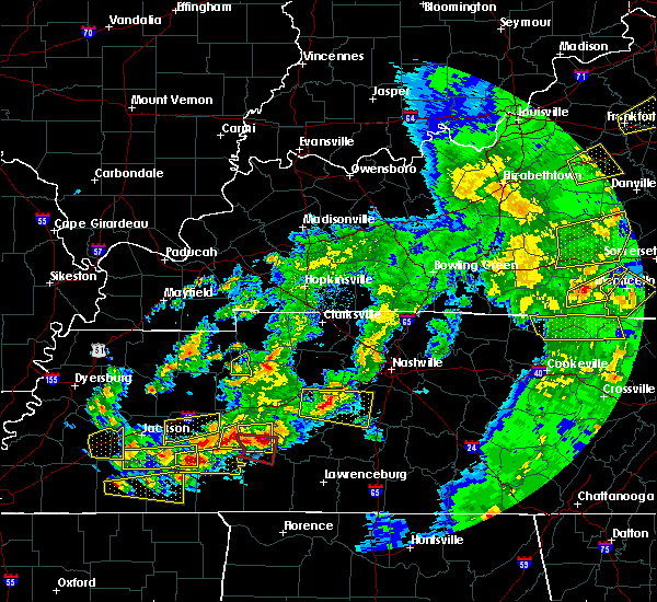 At 556 pm cdt, a severe thunderstorm was located over decaturville, or 13 miles southeast of natchez trace state forest, moving east at 30 mph (radar indicated). Hazards include 60 mph wind gusts and half dollar size hail. Hail damage to vehicles is expected. expect wind damage to roofs, siding, and trees. Locations impacted include, parsons, decaturville, mount tabor, perryville, busseltown, largo, wilkinstown, mount lebanon, garrett and bible hill. At 556 pm cdt, a severe thunderstorm was located over decaturville, or 13 miles southeast of natchez trace state forest, moving east at 30 mph (radar indicated). Hazards include 60 mph wind gusts and half dollar size hail. Hail damage to vehicles is expected. expect wind damage to roofs, siding, and trees. Locations impacted include, parsons, decaturville, mount tabor, perryville, busseltown, largo, wilkinstown, mount lebanon, garrett and bible hill.
|
| 3/27/2017 5:46 PM CDT |
 At 546 pm cdt, a severe thunderstorm was located over darden, or 8 miles southeast of natchez trace state forest, moving east at 30 mph (radar indicated). Hazards include 60 mph wind gusts and half dollar size hail. Hail damage to vehicles is expected. Expect wind damage to roofs, siding, and trees. At 546 pm cdt, a severe thunderstorm was located over darden, or 8 miles southeast of natchez trace state forest, moving east at 30 mph (radar indicated). Hazards include 60 mph wind gusts and half dollar size hail. Hail damage to vehicles is expected. Expect wind damage to roofs, siding, and trees.
|
| 3/27/2017 5:30 PM CDT | Trees and power lines down. structural damage. possible tornado in decatur county TN, 2.1 miles N of Decaturville, TN |
| 3/27/2017 5:30 PM CDT |
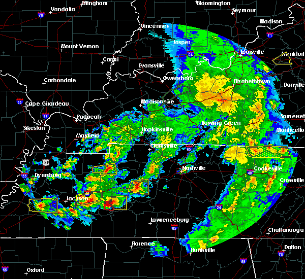 At 530 pm cdt, a severe thunderstorm producing a tornado was located near decaturville, or 12 miles west of linden, moving east at 30 mph (radar indicated rotation). Hazards include tornado and ping pong ball size hail. Flying debris will be dangerous to those caught without shelter. mobile homes will be damaged or destroyed. damage to roofs, windows, and vehicles will occur. tree damage is likely. This tornadic thunderstorm will remain over mainly rural areas of east central decatur county, including the following locations: largo, mount tabor, perryville, gumdale and mount lebanon. At 530 pm cdt, a severe thunderstorm producing a tornado was located near decaturville, or 12 miles west of linden, moving east at 30 mph (radar indicated rotation). Hazards include tornado and ping pong ball size hail. Flying debris will be dangerous to those caught without shelter. mobile homes will be damaged or destroyed. damage to roofs, windows, and vehicles will occur. tree damage is likely. This tornadic thunderstorm will remain over mainly rural areas of east central decatur county, including the following locations: largo, mount tabor, perryville, gumdale and mount lebanon.
|
| 3/27/2017 5:28 PM CDT | Hen Egg sized hail reported 0.1 miles WNW of Decaturville, TN |
| 3/27/2017 5:25 PM CDT | Trees and power lines down. structural damage. possible tornado in decatur county TN, 2.1 miles N of Decaturville, TN |
| 3/27/2017 5:22 PM CDT |
 At 522 pm cdt, a severe thunderstorm producing a tornado was located over decaturville, or 13 miles southeast of natchez trace state forest, moving east at 30 mph (radar indicated rotation). Hazards include tornado and tennis ball size hail. Flying debris will be dangerous to those caught without shelter. mobile homes will be damaged or destroyed. damage to roofs, windows, and vehicles will occur. tree damage is likely. This tornadic thunderstorm will remain over mainly rural areas of central decatur county, including the following locations: mount tabor, perryville, busseltown, garrett, beacon, largo, wilkinstown and mount lebanon. At 522 pm cdt, a severe thunderstorm producing a tornado was located over decaturville, or 13 miles southeast of natchez trace state forest, moving east at 30 mph (radar indicated rotation). Hazards include tornado and tennis ball size hail. Flying debris will be dangerous to those caught without shelter. mobile homes will be damaged or destroyed. damage to roofs, windows, and vehicles will occur. tree damage is likely. This tornadic thunderstorm will remain over mainly rural areas of central decatur county, including the following locations: mount tabor, perryville, busseltown, garrett, beacon, largo, wilkinstown and mount lebanon.
|
| 3/27/2017 5:04 PM CDT |
 At 504 pm cdt, a severe thunderstorm producing a tornado was located near darden, or 7 miles southeast of lexington, moving east at 25 mph (radar indicated rotation). Hazards include tornado and tennis ball size hail. Flying debris will be dangerous to those caught without shelter. mobile homes will be damaged or destroyed. damage to roofs, windows, and vehicles will occur. tree damage is likely. this dangerous storm will be near, darden around 510 pm cdt. parsons around 525 pm cdt. decaturville around 530 pm cdt. Other locations impacted by this tornadic thunderstorm include perryville, busseltown, warrens bluff, wilkinstown, rock hill, mount tabor, garrett, beacon, hickory forks and largo. At 504 pm cdt, a severe thunderstorm producing a tornado was located near darden, or 7 miles southeast of lexington, moving east at 25 mph (radar indicated rotation). Hazards include tornado and tennis ball size hail. Flying debris will be dangerous to those caught without shelter. mobile homes will be damaged or destroyed. damage to roofs, windows, and vehicles will occur. tree damage is likely. this dangerous storm will be near, darden around 510 pm cdt. parsons around 525 pm cdt. decaturville around 530 pm cdt. Other locations impacted by this tornadic thunderstorm include perryville, busseltown, warrens bluff, wilkinstown, rock hill, mount tabor, garrett, beacon, hickory forks and largo.
|
| 3/27/2017 4:50 PM CDT |
 At 449 pm cdt, a severe thunderstorm producing a tornado was located near lexington, moving east at 30 mph (radar indicated rotation). Hazards include tornado and tennis ball size hail. Flying debris will be dangerous to those caught without shelter. mobile homes will be damaged or destroyed. damage to roofs, windows, and vehicles will occur. tree damage is likely. this dangerous storm will be near, darden around 510 pm cdt. parsons and decaturville around 525 pm cdt. Other locations impacted by this tornadic thunderstorm include perryville, busseltown, warrens bluff, wilkinstown, rock hill, palestine, mount tabor, garrett, beacon and hickory forks. At 449 pm cdt, a severe thunderstorm producing a tornado was located near lexington, moving east at 30 mph (radar indicated rotation). Hazards include tornado and tennis ball size hail. Flying debris will be dangerous to those caught without shelter. mobile homes will be damaged or destroyed. damage to roofs, windows, and vehicles will occur. tree damage is likely. this dangerous storm will be near, darden around 510 pm cdt. parsons and decaturville around 525 pm cdt. Other locations impacted by this tornadic thunderstorm include perryville, busseltown, warrens bluff, wilkinstown, rock hill, palestine, mount tabor, garrett, beacon and hickory forks.
|
| 3/9/2017 10:40 PM CST |
 The tornado warning for central decatur county will expire at 1045 pm cst, the storm which prompted the warning has moved out of the area. therefore the warning will be allowed to expire. a severe thunderstorm watch remains in effect until midnight cst for western tennessee. The tornado warning for central decatur county will expire at 1045 pm cst, the storm which prompted the warning has moved out of the area. therefore the warning will be allowed to expire. a severe thunderstorm watch remains in effect until midnight cst for western tennessee.
|
| 3/9/2017 10:19 PM CST |
 At 1019 pm cst, a severe thunderstorm producing a tornado was located over darden, or 8 miles south of natchez trace state forest, moving east at 70 mph (radar indicated rotation). Hazards include tornado and quarter size hail. Flying debris will be dangerous to those caught without shelter. mobile homes will be damaged or destroyed. damage to roofs, windows, and vehicles will occur. tree damage is likely. This tornadic thunderstorm will remain over mainly rural areas of central decatur county, including the following locations: mount tabor, perryville, gumdale, busseltown, garrett, beacon, hickory forks, largo, wilkinstown and bible hill. At 1019 pm cst, a severe thunderstorm producing a tornado was located over darden, or 8 miles south of natchez trace state forest, moving east at 70 mph (radar indicated rotation). Hazards include tornado and quarter size hail. Flying debris will be dangerous to those caught without shelter. mobile homes will be damaged or destroyed. damage to roofs, windows, and vehicles will occur. tree damage is likely. This tornadic thunderstorm will remain over mainly rural areas of central decatur county, including the following locations: mount tabor, perryville, gumdale, busseltown, garrett, beacon, hickory forks, largo, wilkinstown and bible hill.
|
| 3/9/2017 10:00 PM CST |
 At 959 pm cst, severe thunderstorms were located along a line extending from near bruceton to near natchez trace state park to near blue goose, moving southeast at 70 mph. brief tornadoes may occur within this fast moving line of storms (radar indicated). Hazards include 70 mph wind gusts and quarter size hail. Hail damage to vehicles is expected. expect considerable tree damage. Wind damage is also likely to mobile homes, roofs, and outbuildings. At 959 pm cst, severe thunderstorms were located along a line extending from near bruceton to near natchez trace state park to near blue goose, moving southeast at 70 mph. brief tornadoes may occur within this fast moving line of storms (radar indicated). Hazards include 70 mph wind gusts and quarter size hail. Hail damage to vehicles is expected. expect considerable tree damage. Wind damage is also likely to mobile homes, roofs, and outbuildings.
|
| 2/7/2017 10:17 AM CST |
 At 1017 am cst, a severe thunderstorm was located near jacks creek, or 11 miles east of henderson, moving east at 55 mph (radar indicated). Hazards include 60 mph wind gusts. Expect damage to roofs, siding, and trees. Locations impacted include, adamsville, sardis, reagan, jacks creek, morris chapel, montgomery, scotts hill, saltillo, milledgeville, enville, right, haney, hinkle, roby, pleasant grove, cabo, red walnut, cerro gordo, thurman and lick skillet. At 1017 am cst, a severe thunderstorm was located near jacks creek, or 11 miles east of henderson, moving east at 55 mph (radar indicated). Hazards include 60 mph wind gusts. Expect damage to roofs, siding, and trees. Locations impacted include, adamsville, sardis, reagan, jacks creek, morris chapel, montgomery, scotts hill, saltillo, milledgeville, enville, right, haney, hinkle, roby, pleasant grove, cabo, red walnut, cerro gordo, thurman and lick skillet.
|
| 6/15/2016 4:35 PM CDT |
 The severe thunderstorm warning for decatur, northeastern hardin and southeastern benton counties will expire at 445 pm cdt, the severe thunderstorm which prompted the warning has moved out of the warned area. therefore the warning will be allowed to expire. a severe thunderstorm watch remains in effect until 900 pm cdt for western tennessee. The severe thunderstorm warning for decatur, northeastern hardin and southeastern benton counties will expire at 445 pm cdt, the severe thunderstorm which prompted the warning has moved out of the warned area. therefore the warning will be allowed to expire. a severe thunderstorm watch remains in effect until 900 pm cdt for western tennessee.
|
| 6/15/2016 4:15 PM CDT |
 At 414 pm cdt, a severe thunderstorm was located 8 miles southeast of decaturville, or 14 miles southwest of linden, moving northeast at 20 mph (radar indicated). Hazards include 60 mph wind gusts and quarter size hail. Hail damage to vehicles is expected. Expect wind damage to roofs, siding, and trees. At 414 pm cdt, a severe thunderstorm was located 8 miles southeast of decaturville, or 14 miles southwest of linden, moving northeast at 20 mph (radar indicated). Hazards include 60 mph wind gusts and quarter size hail. Hail damage to vehicles is expected. Expect wind damage to roofs, siding, and trees.
|
| 3/31/2016 4:12 PM CDT | The severe thunderstorm warning for east central chester, henderson, northern hardin, northeastern mcnairy and decatur counties will expire at 415 pm cdt, the storm which prompted the warning has moved out of the area. therefore the warning will be allowed to expire. a tornado watch remains in effect until 1000 pm cdt for western tennessee. |
| 3/31/2016 3:47 PM CDT |
 At 346 pm cdt, a severe thunderstorm producing a tornado was located near decaturville, or 16 miles southeast of natchez trace state forest, moving east at 45 mph (weather spotters reported a funnel cloud). Hazards include tornado and golf ball size hail. Flying debris will be dangerous to those caught without shelter. mobile homes will be damaged or destroyed. damage to roofs, windows, and vehicles will occur. tree damage is likely. This tornadic thunderstorm will remain over mainly rural areas of southern decatur county, including the following locations, mount tabor, bath springs, mount lebanon, montgomery, garrett, haney, lick skillet, thurman, dunbar and pleasant grove. At 346 pm cdt, a severe thunderstorm producing a tornado was located near decaturville, or 16 miles southeast of natchez trace state forest, moving east at 45 mph (weather spotters reported a funnel cloud). Hazards include tornado and golf ball size hail. Flying debris will be dangerous to those caught without shelter. mobile homes will be damaged or destroyed. damage to roofs, windows, and vehicles will occur. tree damage is likely. This tornadic thunderstorm will remain over mainly rural areas of southern decatur county, including the following locations, mount tabor, bath springs, mount lebanon, montgomery, garrett, haney, lick skillet, thurman, dunbar and pleasant grove.
|
| 3/31/2016 3:39 PM CDT |
 At 338 pm cdt, a severe thunderstorm producing a tornado was located near reagan, or 11 miles southeast of lexington, moving east at 45 mph (weather spotters reported funnel cloud). Hazards include tornado and golf ball size hail. Flying debris will be dangerous to those caught without shelter. mobile homes will be damaged or destroyed. damage to roofs, windows, and vehicles will occur. tree damage is likely. this dangerous storm will be near, decaturville around 350 pm cdt. Other locations impacted by this tornadic thunderstorm include mount tabor, hinkle, bath springs, mount lebanon, montgomery, garrett, haney, lick skillet, scotts hill and thurman. At 338 pm cdt, a severe thunderstorm producing a tornado was located near reagan, or 11 miles southeast of lexington, moving east at 45 mph (weather spotters reported funnel cloud). Hazards include tornado and golf ball size hail. Flying debris will be dangerous to those caught without shelter. mobile homes will be damaged or destroyed. damage to roofs, windows, and vehicles will occur. tree damage is likely. this dangerous storm will be near, decaturville around 350 pm cdt. Other locations impacted by this tornadic thunderstorm include mount tabor, hinkle, bath springs, mount lebanon, montgomery, garrett, haney, lick skillet, scotts hill and thurman.
|
| 3/31/2016 3:38 PM CDT |
 At 338 pm cdt, a severe thunderstorm producing a tornado was located near reagan, or 11 miles southeast of lexington, moving east at 45 mph (weather spotters reported funnel cloud). Hazards include tornado and golf ball size hail. Flying debris will be dangerous to those caught without shelter. mobile homes will be damaged or destroyed. damage to roofs, windows, and vehicles will occur. tree damage is likely. this dangerous storm will be near, decaturville around 350 pm cdt. Other locations impacted by this tornadic thunderstorm include mount tabor, hinkle, bath springs, mount lebanon, montgomery, garrett, haney, lick skillet, scotts hill and thurman. At 338 pm cdt, a severe thunderstorm producing a tornado was located near reagan, or 11 miles southeast of lexington, moving east at 45 mph (weather spotters reported funnel cloud). Hazards include tornado and golf ball size hail. Flying debris will be dangerous to those caught without shelter. mobile homes will be damaged or destroyed. damage to roofs, windows, and vehicles will occur. tree damage is likely. this dangerous storm will be near, decaturville around 350 pm cdt. Other locations impacted by this tornadic thunderstorm include mount tabor, hinkle, bath springs, mount lebanon, montgomery, garrett, haney, lick skillet, scotts hill and thurman.
|
| 3/31/2016 3:25 PM CDT |
 At 325 pm cdt, a severe thunderstorm was located over reagan, or 9 miles south of lexington, moving east at 45 mph (radar indicated). Hazards include 60 mph wind gusts and quarter size hail. Hail damage to vehicles is expected. Expect wind damage to roofs, siding, and trees. At 325 pm cdt, a severe thunderstorm was located over reagan, or 9 miles south of lexington, moving east at 45 mph (radar indicated). Hazards include 60 mph wind gusts and quarter size hail. Hail damage to vehicles is expected. Expect wind damage to roofs, siding, and trees.
|
| 12/25/2015 4:30 AM CST |
 At 430 am cst, a severe thunderstorm was located 10 miles south of decaturville, or 17 miles northeast of savannah, moving northeast at 55 mph (radar indicated). Hazards include 60 mph wind gusts and penny size hail. Expect damage to roofs. siding and trees. Locations impacted include, savannah, parsons, decaturville, sardis, olive hill, montgomery, crump, scotts hill, saltillo, bath springs, olivehill, bucktown, hamburg, busseltown, lick skillet, pittsburg landing, phillips, thurman, beacon and walkertown. At 430 am cst, a severe thunderstorm was located 10 miles south of decaturville, or 17 miles northeast of savannah, moving northeast at 55 mph (radar indicated). Hazards include 60 mph wind gusts and penny size hail. Expect damage to roofs. siding and trees. Locations impacted include, savannah, parsons, decaturville, sardis, olive hill, montgomery, crump, scotts hill, saltillo, bath springs, olivehill, bucktown, hamburg, busseltown, lick skillet, pittsburg landing, phillips, thurman, beacon and walkertown.
|
| 12/25/2015 4:23 AM CST |
 At 423 am cst, a severe thunderstorm was located 7 miles southeast of sardis, or 12 miles north of savannah, moving northeast at 55 mph (radar indicated). Hazards include 60 mph wind gusts and penny size hail. Expect damage to roofs. siding and trees. Locations impacted include, savannah, parsons, adamsville, decaturville, sardis, shiloh, olive hill, morris chapel, reagan, montgomery, crump, scotts hill, michie, saltillo, stantonville, milledgeville, enville, bath springs, olivehill and old lawton. At 423 am cst, a severe thunderstorm was located 7 miles southeast of sardis, or 12 miles north of savannah, moving northeast at 55 mph (radar indicated). Hazards include 60 mph wind gusts and penny size hail. Expect damage to roofs. siding and trees. Locations impacted include, savannah, parsons, adamsville, decaturville, sardis, shiloh, olive hill, morris chapel, reagan, montgomery, crump, scotts hill, michie, saltillo, stantonville, milledgeville, enville, bath springs, olivehill and old lawton.
|
| 12/25/2015 4:09 AM CST |
 At 408 am cst, a severe thunderstorm was located near morris chapel, or 10 miles northwest of savannah, moving northeast at 55 mph (radar indicated). Hazards include 60 mph wind gusts and penny size hail. Expect damage to roofs. Siding and trees. At 408 am cst, a severe thunderstorm was located near morris chapel, or 10 miles northwest of savannah, moving northeast at 55 mph (radar indicated). Hazards include 60 mph wind gusts and penny size hail. Expect damage to roofs. Siding and trees.
|
| 12/23/2015 5:53 PM CST | At 553 pm cst, a severe thunderstorm was located 11 miles north of olive hill, or 16 miles southwest of linden, moving northeast at 70 mph (radar indicated). Hazards include 60 mph wind gusts and quarter size hail. Hail damage to vehicles is expected. expect wind damage to roofs, siding and trees. locations impacted include, decaturville, sardis, montgomery, scotts hill, saltillo, hinkle, bath springs, mount lebanon, lick skillet, haney, thurman, five forks, dunbar, cerro gordo, pleasant grove, red walnut, largo, swift, perryville and gumdale. A tornado watch remains in effect until 800 pm cst for western tennessee. |
| 12/23/2015 5:31 PM CST | At 531 pm cst, a severe thunderstorm was located near adamsville, or 10 miles northeast of selmer, moving northeast at 70 mph (radar indicated). Hazards include 60 mph wind gusts and quarter size hail. Hail damage to vehicles is expected. Expect wind damage to roofs, siding and trees. |
| 7/14/2015 3:35 PM CDT |
 At 335 pm cdt, a severe thunderstorm was located over natchez trace state park, moving southeast at 20 mph (radar indicated). Hazards include 60 mph wind gusts and quarter size hail. Hail damage to vehicles is expected. Expect wind damage to roofs, siding and trees. At 335 pm cdt, a severe thunderstorm was located over natchez trace state park, moving southeast at 20 mph (radar indicated). Hazards include 60 mph wind gusts and quarter size hail. Hail damage to vehicles is expected. Expect wind damage to roofs, siding and trees.
|
| 6/8/2015 4:43 PM CDT | At 442 pm cdt, a severe thunderstorm was located 7 miles southeast of decaturville, or 12 miles southwest of linden, moving east at 10 mph (radar indicated). Hazards include 60 mph wind gusts and quarter size hail. Hail damage to vehicles is expected. expect wind damage to roofs, siding and trees. Locations impacted include, parsons, adamsville, decaturville, sardis, reagan, jacks creek, montgomery, scotts hill, saltillo, milledgeville, enville, bath springs, busseltown, lick skillet, middle fork, thurman, beacon, five forks, red walnut and largo. |
| 6/8/2015 4:11 PM CDT | At 411 pm cdt, a severe thunderstorm was located near decaturville, or 17 miles southwest of linden, moving east at 10 mph (radar indicated). Hazards include 60 mph wind gusts and quarter size hail. Hail damage to vehicles is expected. Expect wind damage to roofs, siding and trees. |
| 5/31/2015 1:20 PM CDT | At 119 pm cdt, a severe thunderstorm was located over parsons, or 10 miles southeast of natchez trace state forest, moving northeast at 15 mph (trained weather spotters reported quarter size hail in parsons). Hazards include 60 mph wind gusts and quarter size hail. Hail damage to vehicles is expected. expect wind damage to roofs, siding and trees. Locations impacted include, parsons, decaturville, mount tabor, perryville and busseltown. |
| 5/31/2015 1:07 PM CDT | At 106 pm cdt, a severe thunderstorm was located over parsons, or 10 miles southeast of natchez trace state forest, moving northeast at 15 mph (radar indicated). Hazards include 60 mph wind gusts and quarter size hail. Hail damage to vehicles is expected. expect wind damage to roofs, siding and trees. Locations impacted include, parsons, decaturville, wilkinstown, mount tabor, mount lebanon, largo, perryville, garrett and busseltown. |
| 5/31/2015 12:54 PM CDT | At 1254 pm cdt, a severe thunderstorm was located over darden, or 9 miles southeast of natchez trace state forest, moving northeast at 15 mph (radar indicated). Hazards include 60 mph wind gusts and penny size hail. Expect damage to roofs. Siding and trees. |
| 4/15/2015 11:27 PM CDT | A severe thunderstorm warning remains in effect until 1145 pm cdt for central decatur county. at 1126 pm cdt. a severe thunderstorm was located over decaturville. or 12 miles southeast of natchez trace state forest. moving northeast at 20 mph. hazard. 60 mph wind gusts and quarter size hail. |
| 4/15/2015 10:55 PM CDT | The national weather service in memphis has issued a * severe thunderstorm warning for. southeastern henderson county in southwestern tennessee. central decatur county in middle tennessee. until 1145 pm cdt * at 1055 pm cdt. a severe thunderstorm was located over reagan. Or. |
| 4/15/2015 10:29 PM CDT | The national weather service in memphis has issued a * severe thunderstorm warning for. northeastern chester county in southwestern tennessee. southeastern henderson county in southwestern tennessee. central decatur county in middle tennessee. Until 1115 pm cdt. |
| 4/4/2014 4:41 AM CDT | A tree was reported down on hwy 412 near beasley road. the tree was completely blocking the roadwa in perry county TN, 7.7 miles WSW of Decaturville, TN |
| 2/20/2014 7:05 PM CST | Roof blown off structure and a home damaged in decaturville. several trees down als in decatur county TN, 0.1 miles WNW of Decaturville, TN |
| 1/1/0001 12:00 AM | Power lines and trees down along and near highway 10 in decatur county TN, 3 miles NE of Decaturville, TN |
| 1/1/0001 12:00 AM | Quarter sized hail reported 7 miles NE of Decaturville, TN |
| 1/1/0001 12:00 AM | Several large tree limbs and branches down in decatur county TN, 0.1 miles WNW of Decaturville, TN |
Hail Maps for Decaturville, TN


Connect with Interactive Hail Maps