

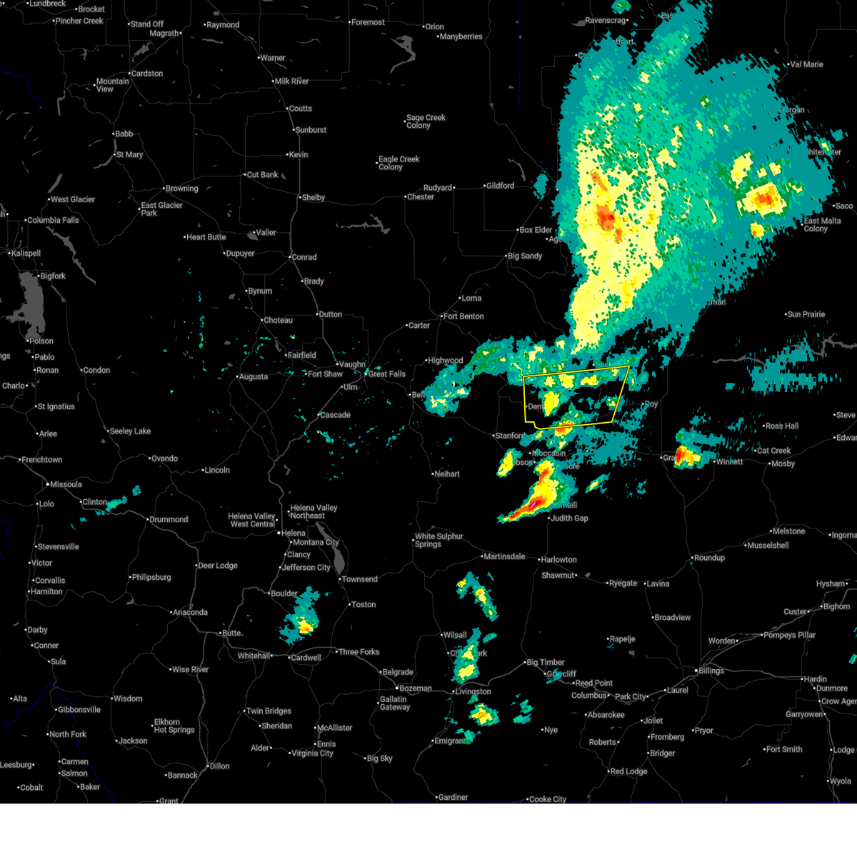
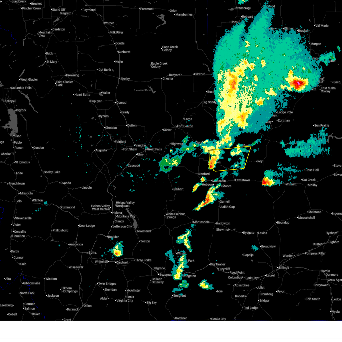
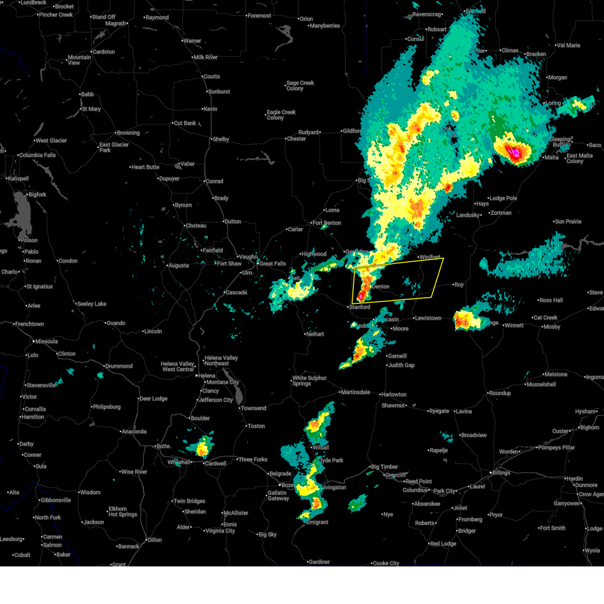
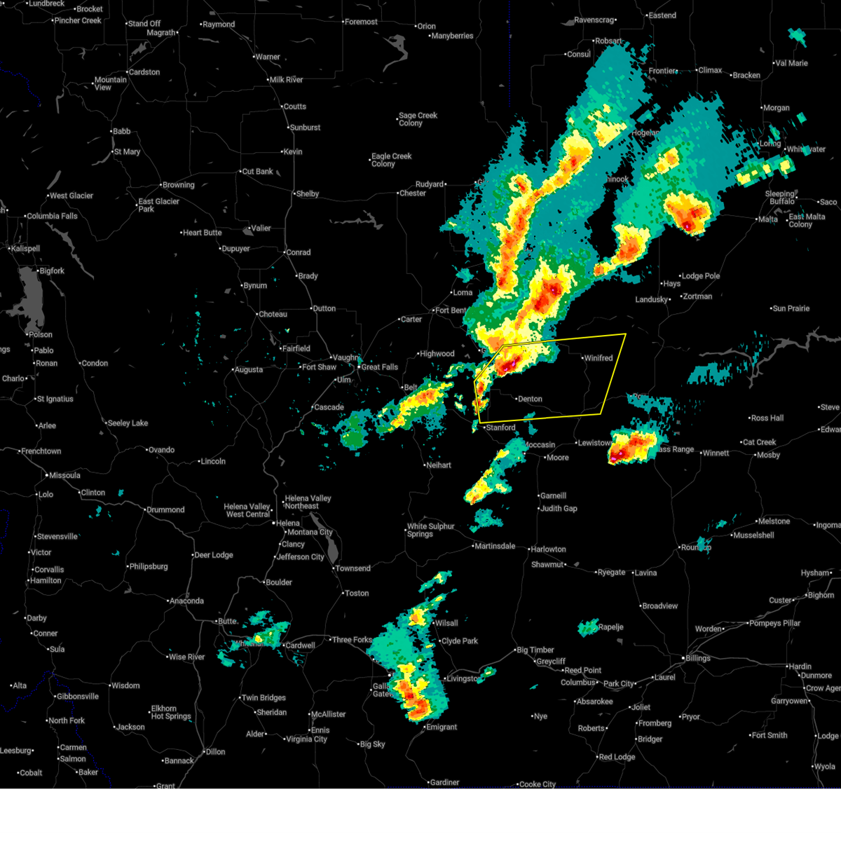
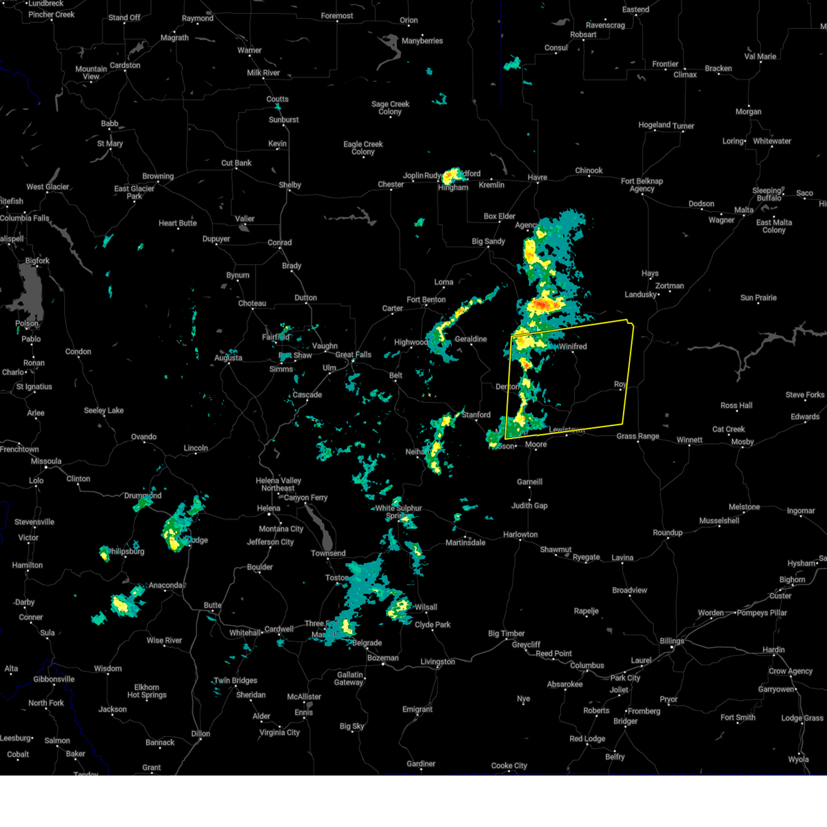
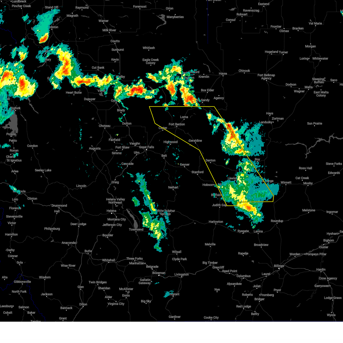
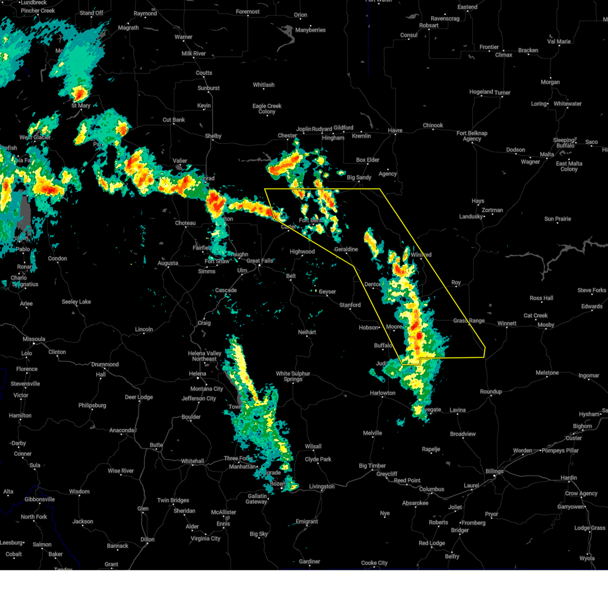
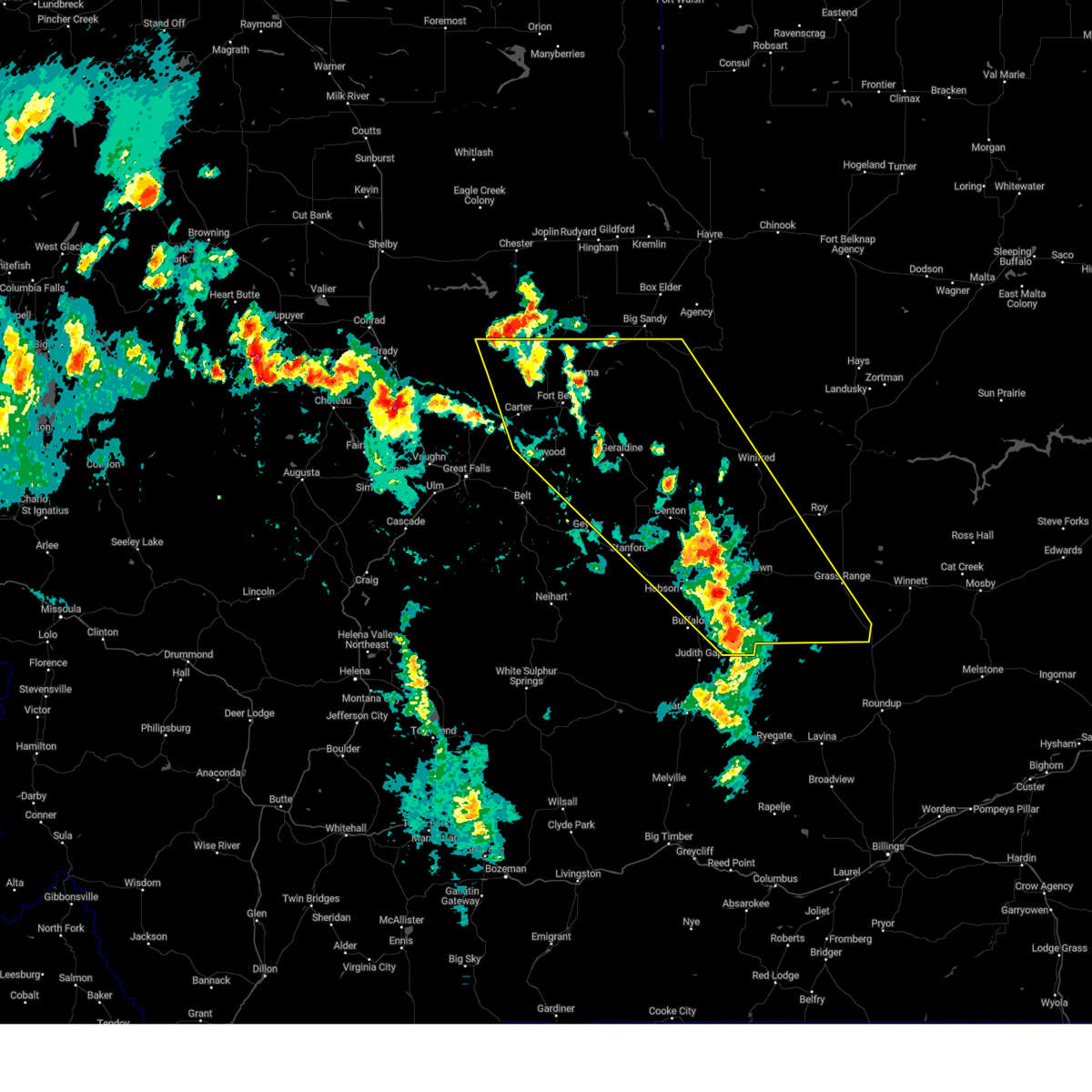
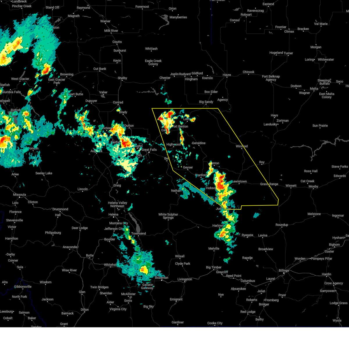
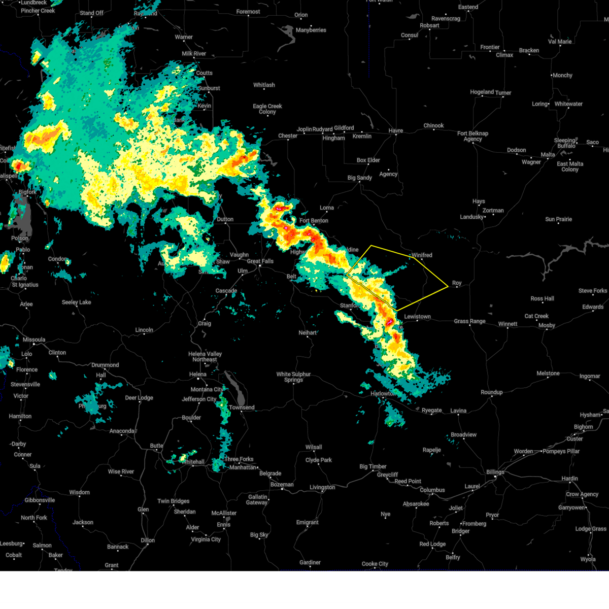
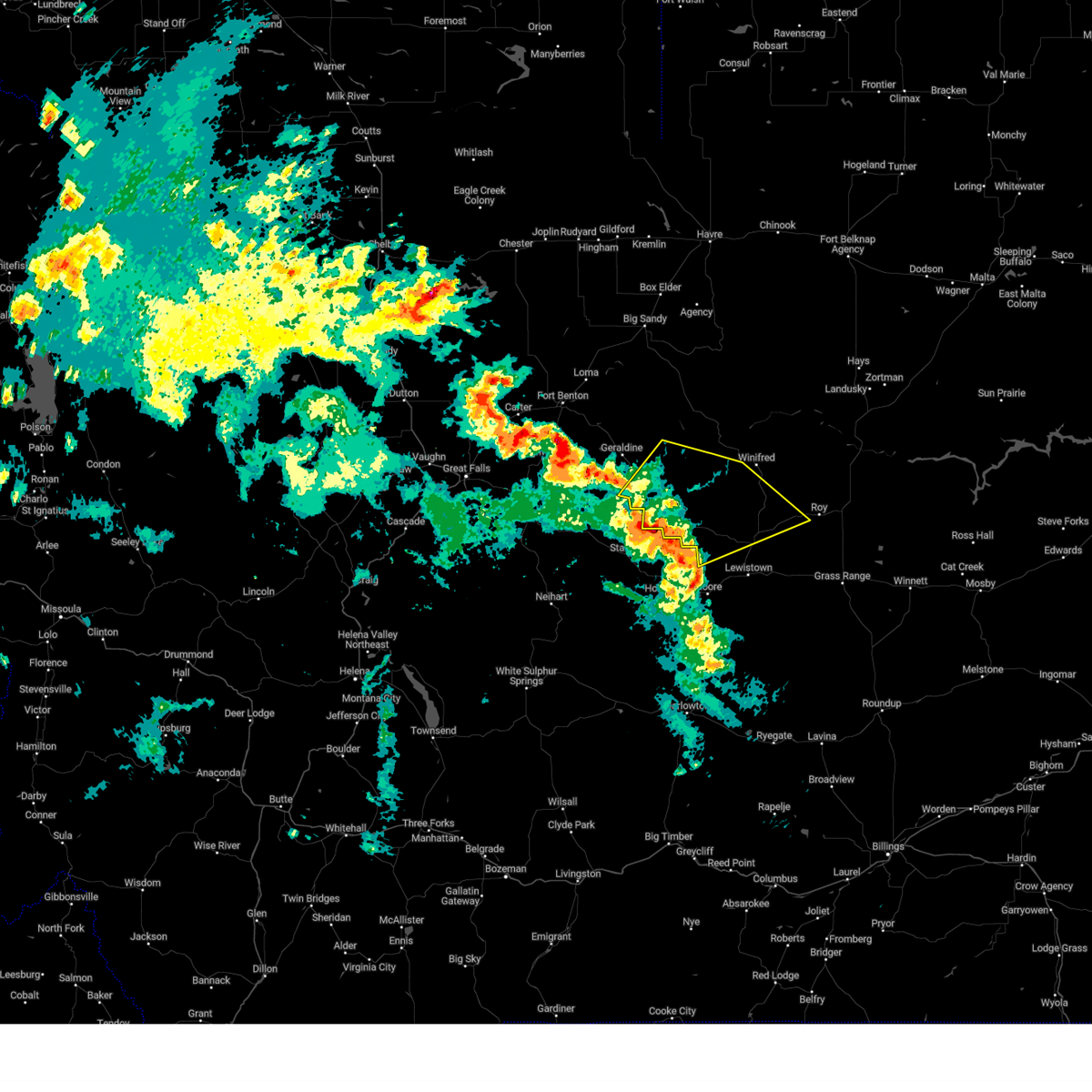
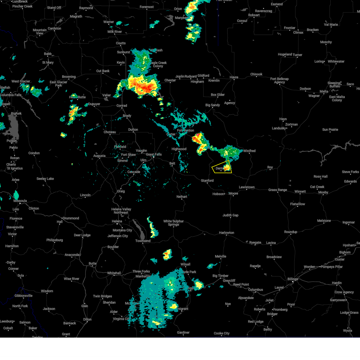
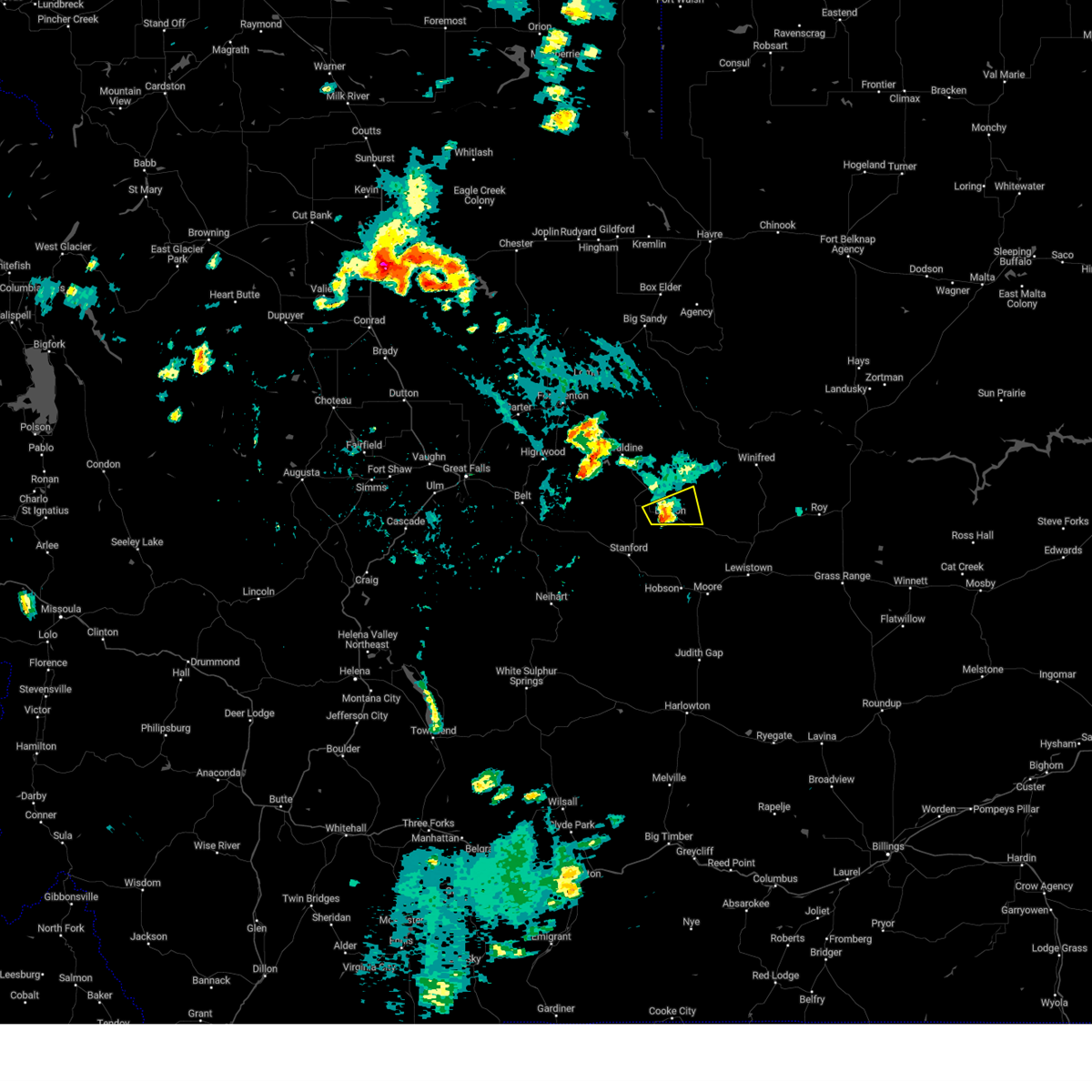
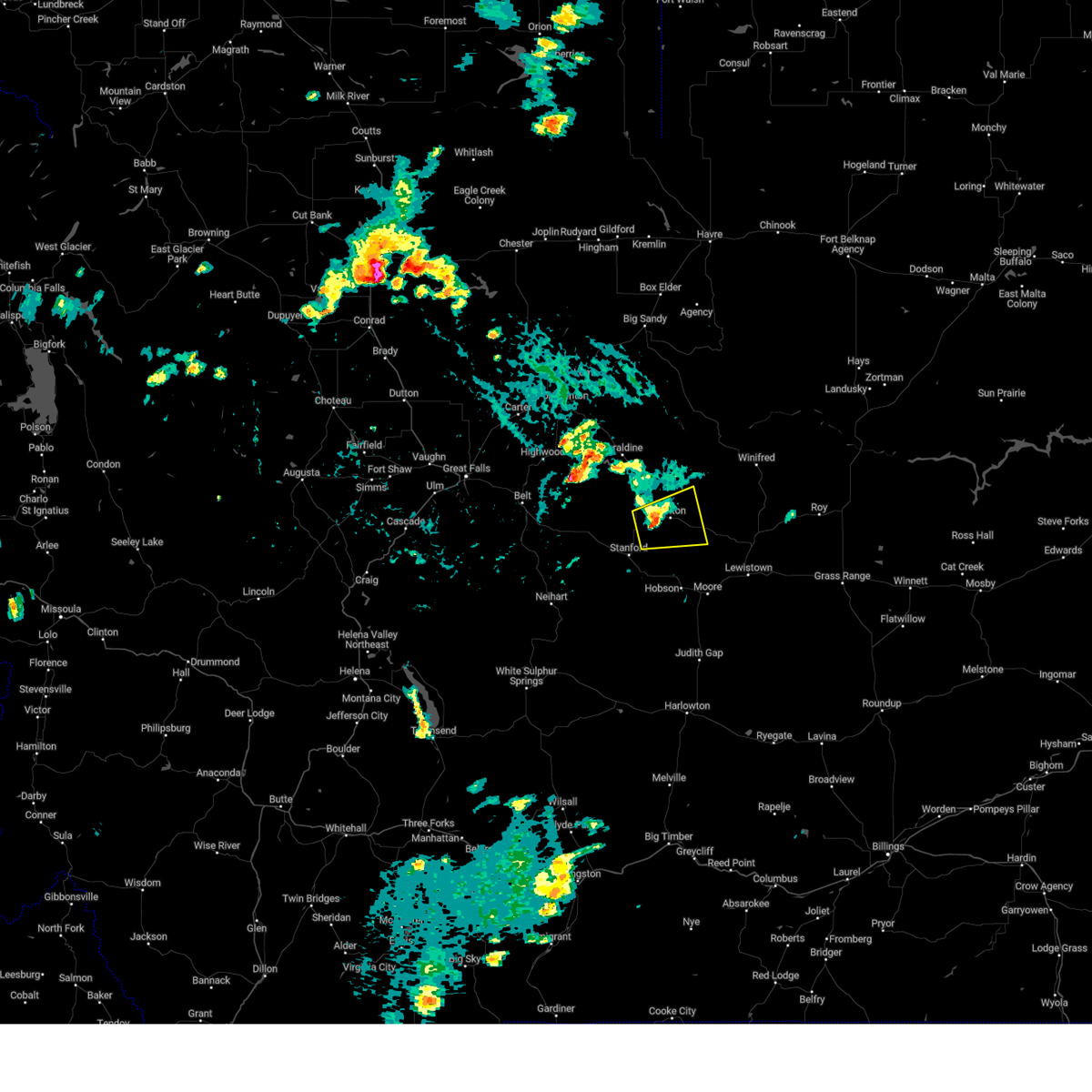
Hail Map for Denton, MT
The Denton, MT area has had 13 reports of on-the-ground hail by trained spotters, and has been under severe weather warnings 17 times during the past 12 months. Doppler radar has detected hail at or near Denton, MT on 27 occasions, including 5 occasions during the past year.
| Name: | Denton, MT |
| Where Located: | 65 miles ESE of Great Falls, MT |
| Map: | Google Map for Denton, MT |
| Population: | 255 |
| Housing Units: | 156 |
| More Info: | Search Google for Denton, MT |
1
The Top Recent Hail Date for Denton, MT is Monday, August 12, 2024 (6th out of 27)

Hail and Wind Damage Spotted near Denton, MT
| Date / Time | Report Details |
|---|---|
| 7/5/2025 6:15 PM MDT | Mesonet station mtden denton (mt dot in fergus county MT, 4.8 miles WNW of Denton, MT |
| 6/15/2025 6:09 PM MDT |
 the severe thunderstorm warning has been cancelled and is no longer in effect the severe thunderstorm warning has been cancelled and is no longer in effect
|
| 6/15/2025 5:59 PM MDT |
 At 559 pm mdt, severe thunderstorms were located along a line extending from 23 miles southwest of winifred to 7 miles south of denton, moving east at 30 mph (radar indicated). Hazards include 60 mph wind gusts and quarter size hail. Hail damage to vehicles is expected. expect wind damage to roofs, siding, and trees. Locations impacted include, denton, danvers, suffolk, hilger, and christina. At 559 pm mdt, severe thunderstorms were located along a line extending from 23 miles southwest of winifred to 7 miles south of denton, moving east at 30 mph (radar indicated). Hazards include 60 mph wind gusts and quarter size hail. Hail damage to vehicles is expected. expect wind damage to roofs, siding, and trees. Locations impacted include, denton, danvers, suffolk, hilger, and christina.
|
| 6/15/2025 5:59 PM MDT |
 the severe thunderstorm warning has been cancelled and is no longer in effect the severe thunderstorm warning has been cancelled and is no longer in effect
|
| 6/15/2025 5:44 PM MDT |
 At 544 pm mdt, severe thunderstorms were located along a line extending from 6 miles north of denton to 7 miles northeast of stanford, moving east at 35 mph (radar indicated). Hazards include 60 mph wind gusts and quarter size hail. Hail damage to vehicles is expected. expect wind damage to roofs, siding, and trees. Locations impacted include, denton, danvers, coffee creek, suffolk, hilger, and christina. At 544 pm mdt, severe thunderstorms were located along a line extending from 6 miles north of denton to 7 miles northeast of stanford, moving east at 35 mph (radar indicated). Hazards include 60 mph wind gusts and quarter size hail. Hail damage to vehicles is expected. expect wind damage to roofs, siding, and trees. Locations impacted include, denton, danvers, coffee creek, suffolk, hilger, and christina.
|
| 6/15/2025 5:29 PM MDT |
 Svrtfx the national weather service in great falls has issued a * severe thunderstorm warning for, northeastern judith basin county in central montana, northwestern fergus county in central montana, southeastern chouteau county in north central montana, * until 630 pm mdt. * at 529 pm mdt, severe thunderstorms were located along a line extending from 13 miles north of denton to 10 miles north of stanford, moving east at 30 mph (radar indicated). Hazards include 60 mph wind gusts and quarter size hail. Hail damage to vehicles is expected. Expect wind damage to roofs, siding, and trees. Svrtfx the national weather service in great falls has issued a * severe thunderstorm warning for, northeastern judith basin county in central montana, northwestern fergus county in central montana, southeastern chouteau county in north central montana, * until 630 pm mdt. * at 529 pm mdt, severe thunderstorms were located along a line extending from 13 miles north of denton to 10 miles north of stanford, moving east at 30 mph (radar indicated). Hazards include 60 mph wind gusts and quarter size hail. Hail damage to vehicles is expected. Expect wind damage to roofs, siding, and trees.
|
| 5/10/2025 5:21 PM MDT |
 Svrtfx the national weather service in great falls has issued a * severe thunderstorm warning for, northeastern judith basin county in central montana, central fergus county in central montana, south central blaine county in north central montana, southeastern chouteau county in north central montana, * until 615 pm mdt. * at 520 pm mdt, severe thunderstorms were located along a line extending from 18 miles north of denton to 6 miles north of hobson, moving northeast at 40 mph (radar indicated). Hazards include 60 mph wind gusts. expect damage to roofs, siding, and trees Svrtfx the national weather service in great falls has issued a * severe thunderstorm warning for, northeastern judith basin county in central montana, central fergus county in central montana, south central blaine county in north central montana, southeastern chouteau county in north central montana, * until 615 pm mdt. * at 520 pm mdt, severe thunderstorms were located along a line extending from 18 miles north of denton to 6 miles north of hobson, moving northeast at 40 mph (radar indicated). Hazards include 60 mph wind gusts. expect damage to roofs, siding, and trees
|
| 5/10/2025 5:15 PM MDT | Mt dot sensor east of denton (mtden) gusted to 58 mp in fergus county MT, 4.8 miles WNW of Denton, MT |
| 8/23/2024 6:22 PM MDT |
 The storms which prompted the warning have moved out of the area. therefore, the warning will be allowed to expire. a severe thunderstorm watch remains in effect until 900 pm mdt for central and north central montana. The storms which prompted the warning have moved out of the area. therefore, the warning will be allowed to expire. a severe thunderstorm watch remains in effect until 900 pm mdt for central and north central montana.
|
| 8/23/2024 6:02 PM MDT |
 the severe thunderstorm warning has been cancelled and is no longer in effect the severe thunderstorm warning has been cancelled and is no longer in effect
|
| 8/23/2024 6:02 PM MDT |
 At 601 pm mdt, severe thunderstorms were located along a line extending from near fort benton to near denton to 25 miles south of lewistown, moving east at 30 mph (radar indicated). Hazards include 70 mph wind gusts. Expect considerable tree damage. damage is likely to mobile homes, roofs, and outbuildings. Locations impacted include, lewistown, fort benton, geraldine, denton, winifred, moore, grass range, forestgrove, glengarry, danvers, loma, suffolk, square butte, giltedge, judith landing, hilger, heath, christina, iliad, and virgelle. At 601 pm mdt, severe thunderstorms were located along a line extending from near fort benton to near denton to 25 miles south of lewistown, moving east at 30 mph (radar indicated). Hazards include 70 mph wind gusts. Expect considerable tree damage. damage is likely to mobile homes, roofs, and outbuildings. Locations impacted include, lewistown, fort benton, geraldine, denton, winifred, moore, grass range, forestgrove, glengarry, danvers, loma, suffolk, square butte, giltedge, judith landing, hilger, heath, christina, iliad, and virgelle.
|
| 8/23/2024 5:43 PM MDT |
 At 542 pm mdt, severe thunderstorms were located along a line extending from 7 miles northwest of fort benton to 7 miles west of denton to 20 miles southeast of moore, moving east at 30 mph (radar indicated). Hazards include 70 mph wind gusts. Expect considerable tree damage. damage is likely to mobile homes, roofs, and outbuildings. Locations impacted include, lewistown, fort benton, stanford, geraldine, denton, hobson, winifred, moore, grass range, highwood, carter, floweree, windham, forestgrove, shonkin, danvers, loma, hilger, iliad, and virgelle. At 542 pm mdt, severe thunderstorms were located along a line extending from 7 miles northwest of fort benton to 7 miles west of denton to 20 miles southeast of moore, moving east at 30 mph (radar indicated). Hazards include 70 mph wind gusts. Expect considerable tree damage. damage is likely to mobile homes, roofs, and outbuildings. Locations impacted include, lewistown, fort benton, stanford, geraldine, denton, hobson, winifred, moore, grass range, highwood, carter, floweree, windham, forestgrove, shonkin, danvers, loma, hilger, iliad, and virgelle.
|
| 8/23/2024 5:30 PM MDT | Corrects previous non-tstm wnd gst report from 5 ese denton. mesonet station mtden denton (mt dot in fergus county MT, 4.8 miles WNW of Denton, MT |
| 8/23/2024 5:23 PM MDT |
 Svrtfx the national weather service in great falls has issued a * severe thunderstorm warning for, judith basin county in central montana, fergus county in central montana, southwestern blaine county in north central montana, chouteau county in north central montana, northeastern cascade county in central montana, * until 630 pm mdt. * at 523 pm mdt, severe thunderstorms were located along a line extending from 15 miles southeast of the knees to 8 miles east of geyser to 16 miles south of moore, moving east at 30 mph (radar indicated). Hazards include 70 mph wind gusts. Expect considerable tree damage. Damage is likely to mobile homes, roofs, and outbuildings. Svrtfx the national weather service in great falls has issued a * severe thunderstorm warning for, judith basin county in central montana, fergus county in central montana, southwestern blaine county in north central montana, chouteau county in north central montana, northeastern cascade county in central montana, * until 630 pm mdt. * at 523 pm mdt, severe thunderstorms were located along a line extending from 15 miles southeast of the knees to 8 miles east of geyser to 16 miles south of moore, moving east at 30 mph (radar indicated). Hazards include 70 mph wind gusts. Expect considerable tree damage. Damage is likely to mobile homes, roofs, and outbuildings.
|
| 8/19/2024 8:00 PM MDT | Mesonet station mtden denton (mt dot in fergus county MT, 4.8 miles WNW of Denton, MT |
| 8/19/2024 8:00 PM MDT |
 At 800 pm mdt, severe thunderstorms were located along a line extending from 11 miles south of geraldine to near denton to 15 miles northwest of lewistown, moving northeast at 35 mph (radar indicated). Hazards include 60 mph wind gusts. Expect damage to roofs, siding, and trees. Locations impacted include, denton, danvers, coffee creek, suffolk, hilger, and christina. At 800 pm mdt, severe thunderstorms were located along a line extending from 11 miles south of geraldine to near denton to 15 miles northwest of lewistown, moving northeast at 35 mph (radar indicated). Hazards include 60 mph wind gusts. Expect damage to roofs, siding, and trees. Locations impacted include, denton, danvers, coffee creek, suffolk, hilger, and christina.
|
| 8/19/2024 7:49 PM MDT |
 Svrtfx the national weather service in great falls has issued a * severe thunderstorm warning for, northwestern fergus county in central montana, southeastern chouteau county in north central montana, * until 830 pm mdt. * at 748 pm mdt, severe thunderstorms were located along a line extending from 12 miles northeast of geyser to denton to 13 miles northeast of hobson, moving northeast at 35 mph (radar indicated). Hazards include 60 mph wind gusts and quarter size hail. Hail damage to vehicles is expected. Expect wind damage to roofs, siding, and trees. Svrtfx the national weather service in great falls has issued a * severe thunderstorm warning for, northwestern fergus county in central montana, southeastern chouteau county in north central montana, * until 830 pm mdt. * at 748 pm mdt, severe thunderstorms were located along a line extending from 12 miles northeast of geyser to denton to 13 miles northeast of hobson, moving northeast at 35 mph (radar indicated). Hazards include 60 mph wind gusts and quarter size hail. Hail damage to vehicles is expected. Expect wind damage to roofs, siding, and trees.
|
| 8/12/2024 4:15 PM MDT |
 The storm which prompted the warning has weakened below severe limits, and no longer poses an immediate threat to life or property. therefore, the warning has been allowed to expire. however, small hail, gusty winds and heavy rain are still possible with this thunderstorm. The storm which prompted the warning has weakened below severe limits, and no longer poses an immediate threat to life or property. therefore, the warning has been allowed to expire. however, small hail, gusty winds and heavy rain are still possible with this thunderstorm.
|
| 8/12/2024 4:01 PM MDT |
 At 359 pm mdt, a severe thunderstorm was located over denton, or 14 miles northeast of stanford, moving east at 15 mph (radar indicated). Hazards include 60 mph wind gusts and quarter size hail. Hail damage to vehicles is expected. expect wind damage to roofs, siding, and trees. Locations impacted include, denton and coffee creek. At 359 pm mdt, a severe thunderstorm was located over denton, or 14 miles northeast of stanford, moving east at 15 mph (radar indicated). Hazards include 60 mph wind gusts and quarter size hail. Hail damage to vehicles is expected. expect wind damage to roofs, siding, and trees. Locations impacted include, denton and coffee creek.
|
| 8/12/2024 4:01 PM MDT |
 the severe thunderstorm warning has been cancelled and is no longer in effect the severe thunderstorm warning has been cancelled and is no longer in effect
|
| 8/12/2024 3:48 PM MDT |
 Svrtfx the national weather service in great falls has issued a * severe thunderstorm warning for, northeastern judith basin county in central montana, west central fergus county in central montana, * until 415 pm mdt. * at 348 pm mdt, a severe thunderstorm was located near denton, or 11 miles northeast of stanford, moving east at 20 mph (radar indicated). Hazards include 60 mph wind gusts and quarter size hail. Hail damage to vehicles is expected. Expect wind damage to roofs, siding, and trees. Svrtfx the national weather service in great falls has issued a * severe thunderstorm warning for, northeastern judith basin county in central montana, west central fergus county in central montana, * until 415 pm mdt. * at 348 pm mdt, a severe thunderstorm was located near denton, or 11 miles northeast of stanford, moving east at 20 mph (radar indicated). Hazards include 60 mph wind gusts and quarter size hail. Hail damage to vehicles is expected. Expect wind damage to roofs, siding, and trees.
|
| 8/18/2023 5:25 PM MDT |
 The severe thunderstorm warning for northeastern judith basin and western fergus counties will expire at 530 pm mdt, the storms which prompted the warning have weakened below severe limits, and no longer pose an immediate threat to life or property. therefore, the warning will be allowed to expire. however gusty winds are still possible with these thunderstorms. The severe thunderstorm warning for northeastern judith basin and western fergus counties will expire at 530 pm mdt, the storms which prompted the warning have weakened below severe limits, and no longer pose an immediate threat to life or property. therefore, the warning will be allowed to expire. however gusty winds are still possible with these thunderstorms.
|
| 8/18/2023 5:09 PM MDT |
 At 509 pm mdt, severe thunderstorms were located along a line extending from 9 miles southeast of geraldine to near denton to near moore, moving northeast at 35 mph (radar indicated). Hazards include 60 mph wind gusts. Expect damage to roofs, siding, and trees. locations impacted include, lewistown, stanford, denton, hobson, moore, windham, moccasin, ackley lake state park, glengarry, danvers, coffee creek, hilger, heath, buffalo and benchland. hail threat, radar indicated max hail size, <. 75 in wind threat, radar indicated max wind gust, 60 mph. At 509 pm mdt, severe thunderstorms were located along a line extending from 9 miles southeast of geraldine to near denton to near moore, moving northeast at 35 mph (radar indicated). Hazards include 60 mph wind gusts. Expect damage to roofs, siding, and trees. locations impacted include, lewistown, stanford, denton, hobson, moore, windham, moccasin, ackley lake state park, glengarry, danvers, coffee creek, hilger, heath, buffalo and benchland. hail threat, radar indicated max hail size, <. 75 in wind threat, radar indicated max wind gust, 60 mph.
|
| 8/18/2023 4:47 PM MDT |
 At 447 pm mdt, severe thunderstorms were located along a line extending from 10 miles north of geyser to near stanford to 12 miles south of hobson, moving northeast at 45 mph (radar indicated). Hazards include 60 mph wind gusts. expect damage to roofs, siding, and trees At 447 pm mdt, severe thunderstorms were located along a line extending from 10 miles north of geyser to near stanford to 12 miles south of hobson, moving northeast at 45 mph (radar indicated). Hazards include 60 mph wind gusts. expect damage to roofs, siding, and trees
|
| 7/15/2022 1:56 PM MDT |
 The severe thunderstorm warning for eastern judith basin, southwestern fergus and south central chouteau counties will expire at 200 pm mdt, the storms which prompted the warning have weakened below severe limits, and no longer pose an immediate threat to life or property. therefore, the warning will be allowed to expire. however gusty winds are still possible with these thunderstorms. a severe thunderstorm watch remains in effect until 700 pm mdt for central and north central montana. The severe thunderstorm warning for eastern judith basin, southwestern fergus and south central chouteau counties will expire at 200 pm mdt, the storms which prompted the warning have weakened below severe limits, and no longer pose an immediate threat to life or property. therefore, the warning will be allowed to expire. however gusty winds are still possible with these thunderstorms. a severe thunderstorm watch remains in effect until 700 pm mdt for central and north central montana.
|
| 7/15/2022 1:46 PM MDT |
 At 146 pm mdt, severe thunderstorms were located along a line extending from 7 miles west of denton to 10 miles south of hobson, moving east at 30 mph (radar indicated). Hazards include 60 mph wind gusts. Expect damage to roofs, siding, and trees. locations impacted include, lewistown, stanford, denton, hobson, moore, windham, moccasin, ackley lake state park, glengarry, utica, garneill, danvers, coffee creek, buffalo and benchland. hail threat, radar indicated max hail size, <. 75 in wind threat, radar indicated max wind gust, 60 mph. At 146 pm mdt, severe thunderstorms were located along a line extending from 7 miles west of denton to 10 miles south of hobson, moving east at 30 mph (radar indicated). Hazards include 60 mph wind gusts. Expect damage to roofs, siding, and trees. locations impacted include, lewistown, stanford, denton, hobson, moore, windham, moccasin, ackley lake state park, glengarry, utica, garneill, danvers, coffee creek, buffalo and benchland. hail threat, radar indicated max hail size, <. 75 in wind threat, radar indicated max wind gust, 60 mph.
|
| 7/15/2022 1:14 PM MDT |
 At 114 pm mdt, severe thunderstorms were located along a line extending from 6 miles southeast of geyser to 16 miles northwest of harlowton, moving northeast at 40 mph (radar indicated). Hazards include 60 mph wind gusts. Expect damage to roofs, siding, and trees. locations impacted include, lewistown, stanford, denton, hobson, moore, windham, moccasin, ackley lake state park, sapphire village, glengarry, utica, garneill, danvers, coffee creek, buffalo and benchland. hail threat, radar indicated max hail size, <. 75 in wind threat, radar indicated max wind gust, 60 mph. At 114 pm mdt, severe thunderstorms were located along a line extending from 6 miles southeast of geyser to 16 miles northwest of harlowton, moving northeast at 40 mph (radar indicated). Hazards include 60 mph wind gusts. Expect damage to roofs, siding, and trees. locations impacted include, lewistown, stanford, denton, hobson, moore, windham, moccasin, ackley lake state park, sapphire village, glengarry, utica, garneill, danvers, coffee creek, buffalo and benchland. hail threat, radar indicated max hail size, <. 75 in wind threat, radar indicated max wind gust, 60 mph.
|
| 7/15/2022 12:54 PM MDT |
 At 1253 pm mdt, severe thunderstorms were located along a line extending from 12 miles southwest of geyser to 25 miles east of white sulphur springs, moving east at 25 mph (radar indicated). Hazards include 60 mph wind gusts. expect damage to roofs, siding, and trees At 1253 pm mdt, severe thunderstorms were located along a line extending from 12 miles southwest of geyser to 25 miles east of white sulphur springs, moving east at 25 mph (radar indicated). Hazards include 60 mph wind gusts. expect damage to roofs, siding, and trees
|
| 7/15/2022 3:38 AM MDT | Mesonet station mtden denton (mt dot). no lightning observed at time of gus in fergus county MT, 4.8 miles WNW of Denton, MT |
| 7/9/2022 7:06 PM MDT |
 At 706 pm mdt, severe thunderstorms were located along a line extending from 21 miles south of st. pierre to stanford, moving east at 45 mph (radar indicated). Hazards include 70 mph wind gusts. Expect considerable tree damage. Damage is likely to mobile homes, roofs, and outbuildings. At 706 pm mdt, severe thunderstorms were located along a line extending from 21 miles south of st. pierre to stanford, moving east at 45 mph (radar indicated). Hazards include 70 mph wind gusts. Expect considerable tree damage. Damage is likely to mobile homes, roofs, and outbuildings.
|
| 7/9/2022 6:31 PM MDT |
 At 631 pm mdt, a severe thunderstorm was located 7 miles west of denton, or 15 miles north of stanford, moving northeast at 40 mph (radar indicated). Hazards include 60 mph wind gusts and half dollar size hail. Hail damage to vehicles is expected. Expect wind damage to roofs, siding, and trees. At 631 pm mdt, a severe thunderstorm was located 7 miles west of denton, or 15 miles north of stanford, moving northeast at 40 mph (radar indicated). Hazards include 60 mph wind gusts and half dollar size hail. Hail damage to vehicles is expected. Expect wind damage to roofs, siding, and trees.
|
| 7/8/2022 7:40 PM MDT |
 The severe thunderstorm warning for northeastern judith basin and west central fergus counties will expire at 745 pm mdt, the severe thunderstorm which prompted the warning has weakened. therefore, the warning will be allowed to expire. however small hail, gusty winds and heavy rain are still possible with this thunderstorm. a severe thunderstorm watch remains in effect until 1000 pm mdt for central montana. The severe thunderstorm warning for northeastern judith basin and west central fergus counties will expire at 745 pm mdt, the severe thunderstorm which prompted the warning has weakened. therefore, the warning will be allowed to expire. however small hail, gusty winds and heavy rain are still possible with this thunderstorm. a severe thunderstorm watch remains in effect until 1000 pm mdt for central montana.
|
| 7/8/2022 7:05 PM MDT |
 At 705 pm mdt, a severe thunderstorm was located near denton, or 16 miles northeast of stanford, moving east at 30 mph (radar indicated). Hazards include 60 mph wind gusts and quarter size hail. Hail damage to vehicles is expected. Expect wind damage to roofs, siding, and trees. At 705 pm mdt, a severe thunderstorm was located near denton, or 16 miles northeast of stanford, moving east at 30 mph (radar indicated). Hazards include 60 mph wind gusts and quarter size hail. Hail damage to vehicles is expected. Expect wind damage to roofs, siding, and trees.
|
| 7/7/2022 9:13 PM MDT |
 The severe thunderstorm warning for northwestern judith basin and western fergus counties will expire at 915 pm mdt, the storms which prompted the warning have weakened below severe limits, and no longer pose an immediate threat to life or property. therefore, the warning will be allowed to expire. a severe thunderstorm watch remains in effect until midnight mdt for central montana. remember, a severe thunderstorm warning still remains in effect for parts of northern judith basin county until 10 pm mdt!. The severe thunderstorm warning for northwestern judith basin and western fergus counties will expire at 915 pm mdt, the storms which prompted the warning have weakened below severe limits, and no longer pose an immediate threat to life or property. therefore, the warning will be allowed to expire. a severe thunderstorm watch remains in effect until midnight mdt for central montana. remember, a severe thunderstorm warning still remains in effect for parts of northern judith basin county until 10 pm mdt!.
|
| 7/7/2022 8:24 PM MDT |
 At 823 pm mdt, severe thunderstorms were located along a line extending from 17 miles southeast of belt to 8 miles south of geyser to near stanford, moving northeast at 20 mph (radar indicated). Hazards include quarter size hail. damage to vehicles is expected At 823 pm mdt, severe thunderstorms were located along a line extending from 17 miles southeast of belt to 8 miles south of geyser to near stanford, moving northeast at 20 mph (radar indicated). Hazards include quarter size hail. damage to vehicles is expected
|
| 7/6/2022 1:51 PM MDT |
 The severe thunderstorm warning for northeastern judith basin and west central fergus counties will expire at 200 pm mdt, the storm which prompted the warning has weakened below severe limits, and no longer poses an immediate threat to life or property. therefore, the warning will be allowed to expire. The severe thunderstorm warning for northeastern judith basin and west central fergus counties will expire at 200 pm mdt, the storm which prompted the warning has weakened below severe limits, and no longer poses an immediate threat to life or property. therefore, the warning will be allowed to expire.
|
| 7/6/2022 1:43 PM MDT |
 At 142 pm mdt, a severe thunderstorm was located 10 miles east of stanford, moving east at 25 mph (trained weather spotters. hail up to quarter size has been reported with this storm). Hazards include quarter size hail. Damage to vehicles is expected. locations impacted include, stanford, denton, coffee creek, windham and benchland. hail threat, observed max hail size, 1. 00 in wind threat, radar indicated max wind gust, <50 mph. At 142 pm mdt, a severe thunderstorm was located 10 miles east of stanford, moving east at 25 mph (trained weather spotters. hail up to quarter size has been reported with this storm). Hazards include quarter size hail. Damage to vehicles is expected. locations impacted include, stanford, denton, coffee creek, windham and benchland. hail threat, observed max hail size, 1. 00 in wind threat, radar indicated max wind gust, <50 mph.
|
| 7/6/2022 1:32 PM MDT |
 At 132 pm mdt, a severe thunderstorm was located over stanford, moving northeast at 15 mph (trained weather spotters). Hazards include quarter size hail. Damage to vehicles is expected. Locations impacted include, stanford, denton, coffee creek, windham and benchland. At 132 pm mdt, a severe thunderstorm was located over stanford, moving northeast at 15 mph (trained weather spotters). Hazards include quarter size hail. Damage to vehicles is expected. Locations impacted include, stanford, denton, coffee creek, windham and benchland.
|
| 7/6/2022 1:18 PM MDT |
 At 118 pm mdt, a severe thunderstorm was located over stanford, moving northeast at 15 mph (trained weather spotters). Hazards include 60 mph wind gusts and quarter size hail. Hail damage to vehicles is expected. expect wind damage to roofs, siding, and trees. Locations impacted include, stanford, denton, coffee creek, windham and benchland. At 118 pm mdt, a severe thunderstorm was located over stanford, moving northeast at 15 mph (trained weather spotters). Hazards include 60 mph wind gusts and quarter size hail. Hail damage to vehicles is expected. expect wind damage to roofs, siding, and trees. Locations impacted include, stanford, denton, coffee creek, windham and benchland.
|
| 7/6/2022 1:14 PM MDT |
 At 114 pm mdt, a severe thunderstorm was located near stanford, moving northeast at 15 mph (radar indicated). Hazards include 60 mph wind gusts and quarter size hail. Hail damage to vehicles is expected. Expect wind damage to roofs, siding, and trees. At 114 pm mdt, a severe thunderstorm was located near stanford, moving northeast at 15 mph (radar indicated). Hazards include 60 mph wind gusts and quarter size hail. Hail damage to vehicles is expected. Expect wind damage to roofs, siding, and trees.
|
| 12/23/2021 7:30 PM MST |
 At 728 pm mst, severe thunderstorms were located along a line extending from 24 miles north of winifred to 9 miles south of stanford, moving east at 55 mph (radar indicated). Hazards include 60 mph wind gusts. expect damage to roofs, siding, and trees At 728 pm mst, severe thunderstorms were located along a line extending from 24 miles north of winifred to 9 miles south of stanford, moving east at 55 mph (radar indicated). Hazards include 60 mph wind gusts. expect damage to roofs, siding, and trees
|
| 12/23/2021 6:50 PM MST |
 At 648 pm mst, severe thunderstorms were located along a line extending from near big sandy to 9 miles southwest of fort benton to 9 miles south of belt, moving east at 60 mph (radar indicated). Hazards include 60 mph wind gusts. expect damage to roofs, siding, and trees At 648 pm mst, severe thunderstorms were located along a line extending from near big sandy to 9 miles southwest of fort benton to 9 miles south of belt, moving east at 60 mph (radar indicated). Hazards include 60 mph wind gusts. expect damage to roofs, siding, and trees
|
| 6/9/2021 7:45 PM MDT | Quarter sized hail reported 8.3 miles ESE of Denton, MT |
| 7/23/2020 5:49 PM MDT | Awos station k1dm... delt in fergus county MT, 6.9 miles WSW of Denton, MT |
| 7/7/2020 3:08 PM MDT |
 At 307 pm mdt, a line severe thunderstorms were located over western fergus county, moving east northeast at 50 mph (radar indicated). Hazards include 60 mph wind gusts and quarter size hail. Hail damage to vehicles is expected. expect wind damage to roofs, siding, and trees. Locations impacted include, lewistown, denton, winifred, moore, glengarry, garneill, danvers, suffolk, giltedge, heath, hilger, christina and buffalo. At 307 pm mdt, a line severe thunderstorms were located over western fergus county, moving east northeast at 50 mph (radar indicated). Hazards include 60 mph wind gusts and quarter size hail. Hail damage to vehicles is expected. expect wind damage to roofs, siding, and trees. Locations impacted include, lewistown, denton, winifred, moore, glengarry, garneill, danvers, suffolk, giltedge, heath, hilger, christina and buffalo.
|
| 7/7/2020 2:55 PM MDT | Ping Pong Ball sized hail reported 2.8 miles NW of Denton, MT, few ping pong ball size hail stones. |
| 7/7/2020 2:43 PM MDT |
 At 241 pm mdt, a line of severe thunderstorms were located along a line from loma to harlowton, moving east northeast at 50 mph (radar indicated). Hazards include 60 mph wind gusts and quarter size hail. Hail damage to vehicles is expected. Expect wind damage to roofs, siding, and trees. At 241 pm mdt, a line of severe thunderstorms were located along a line from loma to harlowton, moving east northeast at 50 mph (radar indicated). Hazards include 60 mph wind gusts and quarter size hail. Hail damage to vehicles is expected. Expect wind damage to roofs, siding, and trees.
|
| 5/19/2020 12:26 AM MDT |
 The severe thunderstorm warning for northwestern fergus and southeastern chouteau counties will expire at 1230 am mdt, the storms which prompted the warning have weakened below severe limits, and no longer pose an immediate threat to life or property. therefore, the warning will be allowed to expire. however gusty winds near 50 mph are still possible with these thunderstorms. The severe thunderstorm warning for northwestern fergus and southeastern chouteau counties will expire at 1230 am mdt, the storms which prompted the warning have weakened below severe limits, and no longer pose an immediate threat to life or property. therefore, the warning will be allowed to expire. however gusty winds near 50 mph are still possible with these thunderstorms.
|
| 5/19/2020 12:10 AM MDT |
 At 1208 am mdt, severe thunderstorms were located along a line extending from 8 miles northwest of denton to 14 miles northeast of hobson, moving east at 40 mph (60 mph wind gust reported around geyser). Hazards include 60 mph wind gusts and quarter size hail. Hail damage to vehicles is expected. expect wind damage to roofs, siding, and trees. Locations impacted include, geraldine, denton, danvers, hilger and square butte. At 1208 am mdt, severe thunderstorms were located along a line extending from 8 miles northwest of denton to 14 miles northeast of hobson, moving east at 40 mph (60 mph wind gust reported around geyser). Hazards include 60 mph wind gusts and quarter size hail. Hail damage to vehicles is expected. expect wind damage to roofs, siding, and trees. Locations impacted include, geraldine, denton, danvers, hilger and square butte.
|
| 5/18/2020 11:44 PM MDT |
 At 1144 pm mdt, severe thunderstorms were located along a line extending from 8 miles east of geyser to 7 miles northwest of hobson, moving northeast at 40 mph (60 mph winds reported in geyser at 1135 pm). Hazards include 60 mph wind gusts and quarter size hail. Hail damage to vehicles is expected. Expect wind damage to roofs, siding, and trees. At 1144 pm mdt, severe thunderstorms were located along a line extending from 8 miles east of geyser to 7 miles northwest of hobson, moving northeast at 40 mph (60 mph winds reported in geyser at 1135 pm). Hazards include 60 mph wind gusts and quarter size hail. Hail damage to vehicles is expected. Expect wind damage to roofs, siding, and trees.
|
| 5/18/2020 7:00 PM MDT | Quarter sized hail reported 10.6 miles NW of Denton, MT, estimated quarter size hail. time is estimated. |
| 6/27/2019 5:35 PM MDT |
 At 535 pm mdt, severe thunderstorms were located along a line extending from 13 miles northeast of fort benton to 8 miles south of denton, moving northeast at 35 mph (radar indicated). Hazards include 70 mph wind gusts and quarter size hail. Hail damage to vehicles is expected. expect considerable tree damage. wind damage is also likely to mobile homes, roofs, and outbuildings. Locations impacted include, lewistown, big sandy, denton, hobson, moore, moccasin, glengarry, danvers, coffee creek, square butte, iliad, virgelle and loma. At 535 pm mdt, severe thunderstorms were located along a line extending from 13 miles northeast of fort benton to 8 miles south of denton, moving northeast at 35 mph (radar indicated). Hazards include 70 mph wind gusts and quarter size hail. Hail damage to vehicles is expected. expect considerable tree damage. wind damage is also likely to mobile homes, roofs, and outbuildings. Locations impacted include, lewistown, big sandy, denton, hobson, moore, moccasin, glengarry, danvers, coffee creek, square butte, iliad, virgelle and loma.
|
| 6/27/2019 5:33 PM MDT | Storm damage reported in fergus county MT, 4.8 miles WNW of Denton, MT |
| 6/27/2019 5:16 PM MDT |
 At 516 pm mdt, severe thunderstorms were located along a line extending from near fort benton to 9 miles southeast of stanford, moving northeast at 35 mph (radar indicated). Hazards include 70 mph wind gusts and quarter size hail. Hail damage to vehicles is expected. expect considerable tree damage. wind damage is also likely to mobile homes, roofs, and outbuildings. Locations impacted include, lewistown, big sandy, geraldine, denton, hobson, moore, windham, moccasin, ackley lake state park, glengarry, danvers, loma, coffee creek, square butte, iliad, virgelle and benchland. At 516 pm mdt, severe thunderstorms were located along a line extending from near fort benton to 9 miles southeast of stanford, moving northeast at 35 mph (radar indicated). Hazards include 70 mph wind gusts and quarter size hail. Hail damage to vehicles is expected. expect considerable tree damage. wind damage is also likely to mobile homes, roofs, and outbuildings. Locations impacted include, lewistown, big sandy, geraldine, denton, hobson, moore, windham, moccasin, ackley lake state park, glengarry, danvers, loma, coffee creek, square butte, iliad, virgelle and benchland.
|
| 6/27/2019 5:10 PM MDT |
 At 510 pm mdt, severe thunderstorms were located along a line extending from near fort benton to 9 miles southeast of stanford, moving northeast at 35 mph (radar indicated). Hazards include 70 mph wind gusts and quarter size hail. Hail damage to vehicles is expected. expect considerable tree damage. Wind damage is also likely to mobile homes, roofs, and outbuildings. At 510 pm mdt, severe thunderstorms were located along a line extending from near fort benton to 9 miles southeast of stanford, moving northeast at 35 mph (radar indicated). Hazards include 70 mph wind gusts and quarter size hail. Hail damage to vehicles is expected. expect considerable tree damage. Wind damage is also likely to mobile homes, roofs, and outbuildings.
|
| 6/14/2019 3:45 PM MDT |
 At 344 pm mdt, a severe thunderstorm was located near highwood, or 22 miles south of fort benton, moving southeast at 35 mph (radar indicated). Hazards include 60 mph wind gusts and quarter size hail. Hail damage to vehicles is expected. Expect wind damage to roofs, siding, and trees. At 344 pm mdt, a severe thunderstorm was located near highwood, or 22 miles south of fort benton, moving southeast at 35 mph (radar indicated). Hazards include 60 mph wind gusts and quarter size hail. Hail damage to vehicles is expected. Expect wind damage to roofs, siding, and trees.
|
| 6/14/2019 2:59 PM MDT |
 At 258 pm mdt, a severe thunderstorm was located 11 miles northwest of denton, or 22 miles north of stanford, moving southeast at 30 mph (radar indicated). Hazards include 60 mph wind gusts and quarter size hail. Hail damage to vehicles is expected. Expect wind damage to roofs, siding, and trees. At 258 pm mdt, a severe thunderstorm was located 11 miles northwest of denton, or 22 miles north of stanford, moving southeast at 30 mph (radar indicated). Hazards include 60 mph wind gusts and quarter size hail. Hail damage to vehicles is expected. Expect wind damage to roofs, siding, and trees.
|
| 7/10/2018 2:36 PM MDT |
 At 235 pm mdt, a severe thunderstorm was located 9 miles south of geraldine, or 22 miles north of stanford, moving northeast at 40 mph (radar indicated). Hazards include ping pong ball size hail and 60 mph wind gusts. People and animals outdoors will be injured. expect hail damage to roofs, siding, windows, and vehicles. expect wind damage to roofs, siding, and trees. Locations impacted include, geraldine, denton, geyser, coffee creek and square butte. At 235 pm mdt, a severe thunderstorm was located 9 miles south of geraldine, or 22 miles north of stanford, moving northeast at 40 mph (radar indicated). Hazards include ping pong ball size hail and 60 mph wind gusts. People and animals outdoors will be injured. expect hail damage to roofs, siding, windows, and vehicles. expect wind damage to roofs, siding, and trees. Locations impacted include, geraldine, denton, geyser, coffee creek and square butte.
|
| 7/10/2018 2:12 PM MDT |
 At 212 pm mdt, a severe thunderstorm was located near geyser, or 19 miles northwest of stanford, moving northeast at 40 mph (radar indicated). Hazards include 60 mph wind gusts and quarter size hail. Hail damage to vehicles is expected. Expect wind damage to roofs, siding, and trees. At 212 pm mdt, a severe thunderstorm was located near geyser, or 19 miles northwest of stanford, moving northeast at 40 mph (radar indicated). Hazards include 60 mph wind gusts and quarter size hail. Hail damage to vehicles is expected. Expect wind damage to roofs, siding, and trees.
|
| 6/9/2018 7:56 PM MDT |
 The severe thunderstorm warning for northeastern judith basin and west central fergus counties will expire at 800 pm mdt, the storm which prompted the warning has weakened below severe limits, and no longer poses an immediate threat to life or property. therefore, the warning will be allowed to expire. a severe thunderstorm watch remains in effect until 900 pm mdt for central montana. The severe thunderstorm warning for northeastern judith basin and west central fergus counties will expire at 800 pm mdt, the storm which prompted the warning has weakened below severe limits, and no longer poses an immediate threat to life or property. therefore, the warning will be allowed to expire. a severe thunderstorm watch remains in effect until 900 pm mdt for central montana.
|
| 6/9/2018 7:42 PM MDT |
 At 741 pm mdt, a severe thunderstorm was located near denton, or 19 miles northeast of stanford, moving northeast at 20 mph (trained weather spotters). Hazards include ping pong ball size hail and 60 mph wind gusts. People and animals outdoors will be injured. expect hail damage to roofs, siding, windows, and vehicles. expect wind damage to roofs, siding, and trees. Locations impacted include, denton and danvers. At 741 pm mdt, a severe thunderstorm was located near denton, or 19 miles northeast of stanford, moving northeast at 20 mph (trained weather spotters). Hazards include ping pong ball size hail and 60 mph wind gusts. People and animals outdoors will be injured. expect hail damage to roofs, siding, windows, and vehicles. expect wind damage to roofs, siding, and trees. Locations impacted include, denton and danvers.
|
| 6/9/2018 7:30 PM MDT |
 At 730 pm mdt, a severe thunderstorm was located 10 miles south of denton, or 11 miles east of stanford, moving northeast at 15 mph (radar indicated). Hazards include 60 mph wind gusts and quarter size hail. Hail damage to vehicles is expected. Expect wind damage to roofs, siding, and trees. At 730 pm mdt, a severe thunderstorm was located 10 miles south of denton, or 11 miles east of stanford, moving northeast at 15 mph (radar indicated). Hazards include 60 mph wind gusts and quarter size hail. Hail damage to vehicles is expected. Expect wind damage to roofs, siding, and trees.
|
| 6/9/2018 7:02 PM MDT |
 At 702 pm mdt, severe thunderstorms were located along a line extending from 9 miles south of fort benton to 8 miles northwest of hobson, moving north at 40 mph (radar indicated). Hazards include 60 mph wind gusts and penny size hail. Expect damage to roofs, siding, and trees. Locations impacted include, stanford, geraldine, denton, shonkin, coffee creek, windham, square butte, utica and benchland. At 702 pm mdt, severe thunderstorms were located along a line extending from 9 miles south of fort benton to 8 miles northwest of hobson, moving north at 40 mph (radar indicated). Hazards include 60 mph wind gusts and penny size hail. Expect damage to roofs, siding, and trees. Locations impacted include, stanford, geraldine, denton, shonkin, coffee creek, windham, square butte, utica and benchland.
|
| 6/9/2018 6:35 PM MDT |
 At 634 pm mdt, severe thunderstorms were located along a line extending from 8 miles south of highwood to 18 miles southwest of hobson, moving north at 40 mph (radar indicated). Hazards include 70 mph wind gusts. Expect considerable tree damage. Damage is likely to mobile homes, roofs, and outbuildings. At 634 pm mdt, severe thunderstorms were located along a line extending from 8 miles south of highwood to 18 miles southwest of hobson, moving north at 40 mph (radar indicated). Hazards include 70 mph wind gusts. Expect considerable tree damage. Damage is likely to mobile homes, roofs, and outbuildings.
|
| 6/6/2018 7:28 PM MDT |
 The severe thunderstorm warning for north central judith basin and western fergus counties will expire at 730 pm mdt, the storm which prompted the warning has weakened below severe limits, and no longer poses an immediate threat to life or property. therefore, the warning will be allowed to expire. however small hail, gusty winds and heavy rain are still possible with this thunderstorm. to report severe weather, contact your nearest law enforcement agency. they will relay your report to the national weather service great falls. The severe thunderstorm warning for north central judith basin and western fergus counties will expire at 730 pm mdt, the storm which prompted the warning has weakened below severe limits, and no longer poses an immediate threat to life or property. therefore, the warning will be allowed to expire. however small hail, gusty winds and heavy rain are still possible with this thunderstorm. to report severe weather, contact your nearest law enforcement agency. they will relay your report to the national weather service great falls.
|
| 6/6/2018 7:25 PM MDT | Ping Pong Ball sized hail reported 8.3 miles ESE of Denton, MT, spotter relayed through nws employee with a photo. |
| 6/6/2018 7:20 PM MDT | Half Dollar sized hail reported 6.3 miles ESE of Denton, MT |
| 6/6/2018 7:15 PM MDT | Quarter sized hail reported 7 miles ESE of Denton, MT, water also running in streets. |
| 6/6/2018 7:07 PM MDT |
 At 706 pm mdt, a severe thunderstorm was located 9 miles west of denton, or 12 miles north of stanford, moving northeast at 10 mph (radar indicated). Hazards include two inch hail and 60 mph wind gusts. People and animals outdoors will be injured. expect hail damage to roofs, siding, windows, and vehicles. expect wind damage to roofs, siding, and trees. Locations impacted include, denton and coffee creek. At 706 pm mdt, a severe thunderstorm was located 9 miles west of denton, or 12 miles north of stanford, moving northeast at 10 mph (radar indicated). Hazards include two inch hail and 60 mph wind gusts. People and animals outdoors will be injured. expect hail damage to roofs, siding, windows, and vehicles. expect wind damage to roofs, siding, and trees. Locations impacted include, denton and coffee creek.
|
| 6/6/2018 6:56 PM MDT |
 At 655 pm mdt, a severe thunderstorm was located 10 miles west of denton, or 10 miles north of stanford, moving northeast at 10 mph (radar indicated). Hazards include 60 mph wind gusts and half dollar size hail. Hail damage to vehicles is expected. Expect wind damage to roofs, siding, and trees. At 655 pm mdt, a severe thunderstorm was located 10 miles west of denton, or 10 miles north of stanford, moving northeast at 10 mph (radar indicated). Hazards include 60 mph wind gusts and half dollar size hail. Hail damage to vehicles is expected. Expect wind damage to roofs, siding, and trees.
|
| 6/4/2018 8:21 PM MDT |
 At 821 pm mdt, a severe thunderstorm was located near denton, or 10 miles northeast of stanford, moving east at 55 mph (radar indicated). Hazards include 60 mph wind gusts and quarter size hail. Hail damage to vehicles is expected. expect wind damage to roofs, siding, and trees. Locations impacted include, denton and coffee creek. At 821 pm mdt, a severe thunderstorm was located near denton, or 10 miles northeast of stanford, moving east at 55 mph (radar indicated). Hazards include 60 mph wind gusts and quarter size hail. Hail damage to vehicles is expected. expect wind damage to roofs, siding, and trees. Locations impacted include, denton and coffee creek.
|
| 6/4/2018 8:10 PM MDT |
 At 809 pm mdt, a severe thunderstorm was located 7 miles north of stanford, moving east at 55 mph (radar indicated). Hazards include 60 mph wind gusts and quarter size hail. Hail damage to vehicles is expected. expect wind damage to roofs, siding, and trees. Locations impacted include, stanford, denton and coffee creek. At 809 pm mdt, a severe thunderstorm was located 7 miles north of stanford, moving east at 55 mph (radar indicated). Hazards include 60 mph wind gusts and quarter size hail. Hail damage to vehicles is expected. expect wind damage to roofs, siding, and trees. Locations impacted include, stanford, denton and coffee creek.
|
| 6/4/2018 7:56 PM MDT |
 At 756 pm mdt, a severe thunderstorm was located near geyser, or 14 miles west of stanford, moving east at 55 mph (radar indicated). Hazards include 60 mph wind gusts and quarter size hail. Hail damage to vehicles is expected. Expect wind damage to roofs, siding, and trees. At 756 pm mdt, a severe thunderstorm was located near geyser, or 14 miles west of stanford, moving east at 55 mph (radar indicated). Hazards include 60 mph wind gusts and quarter size hail. Hail damage to vehicles is expected. Expect wind damage to roofs, siding, and trees.
|
| 6/4/2018 6:33 PM MDT | Quarter sized hail reported 7.2 miles ESE of Denton, MT, public reported up to one inch hail. mostly dimes to nickels but a few quarters near coffee creek. |
| 6/4/2018 5:12 PM MDT |
 The severe thunderstorm warning for northeastern judith basin and west central fergus counties will expire at 515 pm mdt, the storm which prompted the warning has weakened below severe limits, and no longer poses an immediate threat to life or property. therefore, the warning will be allowed to expire. however small hail and gusty winds are still possible with this thunderstorm. The severe thunderstorm warning for northeastern judith basin and west central fergus counties will expire at 515 pm mdt, the storm which prompted the warning has weakened below severe limits, and no longer poses an immediate threat to life or property. therefore, the warning will be allowed to expire. however small hail and gusty winds are still possible with this thunderstorm.
|
| 6/4/2018 4:57 PM MDT |
 At 456 pm mdt, a severe thunderstorm was located 10 miles north of stanford, moving east at 45 mph (radar indicated). Hazards include ping pong ball size hail and 60 mph wind gusts. People and animals outdoors will be injured. expect hail damage to roofs, siding, windows, and vehicles. expect wind damage to roofs, siding, and trees. Locations impacted include, denton and coffee creek. At 456 pm mdt, a severe thunderstorm was located 10 miles north of stanford, moving east at 45 mph (radar indicated). Hazards include ping pong ball size hail and 60 mph wind gusts. People and animals outdoors will be injured. expect hail damage to roofs, siding, windows, and vehicles. expect wind damage to roofs, siding, and trees. Locations impacted include, denton and coffee creek.
|
| 6/4/2018 4:42 PM MDT |
 At 442 pm mdt, a severe thunderstorm was located near geyser, or 12 miles northwest of stanford, moving east at 45 mph (spotter reported quarter-size hail in geyser). Hazards include 60 mph wind gusts and quarter size hail. Hail damage to vehicles is expected. Expect wind damage to roofs, siding, and trees. At 442 pm mdt, a severe thunderstorm was located near geyser, or 12 miles northwest of stanford, moving east at 45 mph (spotter reported quarter-size hail in geyser). Hazards include 60 mph wind gusts and quarter size hail. Hail damage to vehicles is expected. Expect wind damage to roofs, siding, and trees.
|
| 6/12/2017 9:57 PM MDT |
 The severe thunderstorm warning for fergus county will expire at 1000 pm mdt, the storms which prompted the warning have weakened below severe limits, and no longer pose an immediate threat to life or property. therefore the warning will be allowed to expire. however gusty winds and heavy rain are still possible with these thunderstorms. The severe thunderstorm warning for fergus county will expire at 1000 pm mdt, the storms which prompted the warning have weakened below severe limits, and no longer pose an immediate threat to life or property. therefore the warning will be allowed to expire. however gusty winds and heavy rain are still possible with these thunderstorms.
|
| 6/12/2017 9:13 PM MDT |
 At 912 pm mdt, severe thunderstorms were located along a line extending from 12 miles east of denton to near grass range, moving north at 35 mph (wind gusts up to 60 mph were reported at lewistown airport and near grass range as these stormed moved through). Hazards include 60 mph wind gusts and penny size hail. expect damage to roofs, siding, and trees At 912 pm mdt, severe thunderstorms were located along a line extending from 12 miles east of denton to near grass range, moving north at 35 mph (wind gusts up to 60 mph were reported at lewistown airport and near grass range as these stormed moved through). Hazards include 60 mph wind gusts and penny size hail. expect damage to roofs, siding, and trees
|
| 10/1/2016 5:18 PM MDT | 63 mph thunderstorm wind gust a few miles northeast of dento in fergus county MT, 6.9 miles WSW of Denton, MT |
| 10/1/2016 5:18 PM MDT | Thunderstorm wind gust 71 mph. no damage reporte in fergus county MT, 4.8 miles WNW of Denton, MT |
| 10/1/2016 5:13 PM MDT | Thunderstorm wind gust 71 mph. no damage reporte in fergus county MT, 4.8 miles WNW of Denton, MT |
| 8/7/2016 6:28 PM MDT |
 At 626 pm mdt, severe thunderstorms were located along a line extending from 11 miles west of denton to 7 miles east of stanford, moving northeast at 30 mph (radar indicated). Hazards include 60 mph wind gusts and quarter size hail. Hail damage to vehicles is expected. expect wind damage to roofs, siding, and trees. this storm produced quarter size hail just south of windham. Locations impacted include, denton, coffee creek and benchland. At 626 pm mdt, severe thunderstorms were located along a line extending from 11 miles west of denton to 7 miles east of stanford, moving northeast at 30 mph (radar indicated). Hazards include 60 mph wind gusts and quarter size hail. Hail damage to vehicles is expected. expect wind damage to roofs, siding, and trees. this storm produced quarter size hail just south of windham. Locations impacted include, denton, coffee creek and benchland.
|
| 8/7/2016 5:46 PM MDT |
 At 546 pm mdt, severe thunderstorms were located along a line extending from 8 miles south of geyser to 14 miles southwest of stanford, moving northeast at 25 mph (radar indicated). Hazards include 60 mph wind gusts and quarter size hail. Hail damage to vehicles is expected. Expect wind damage to roofs, siding, and trees. At 546 pm mdt, severe thunderstorms were located along a line extending from 8 miles south of geyser to 14 miles southwest of stanford, moving northeast at 25 mph (radar indicated). Hazards include 60 mph wind gusts and quarter size hail. Hail damage to vehicles is expected. Expect wind damage to roofs, siding, and trees.
|
| 7/18/2016 8:30 PM MDT | 66 mph wind gust at the dot sensor just east of dento in fergus county MT, 4.8 miles WNW of Denton, MT |
| 7/18/2016 8:24 PM MDT | Quarter sized hail reported 6.9 miles WSW of Denton, MT, hail of at least quarter size estimated...possibly larger. time estimated based on radar. |
| 7/18/2016 8:18 PM MDT |
 At 817 pm mdt, a severe thunderstorm was located near denton, or 17 miles northeast of stanford, moving northeast at 30 mph. this storm has a history of producing large hail in northern judith basin county. this is a very dangerous storm (trained weather spotters). Hazards include 80 mph wind gusts and two inch hail. Flying debris will be dangerous to those caught without shelter. mobile homes will be heavily damaged. expect considerable damage to roofs, windows, and vehicles. extensive tree damage and power outages are likely. Locations impacted include, denton and coffee creek. At 817 pm mdt, a severe thunderstorm was located near denton, or 17 miles northeast of stanford, moving northeast at 30 mph. this storm has a history of producing large hail in northern judith basin county. this is a very dangerous storm (trained weather spotters). Hazards include 80 mph wind gusts and two inch hail. Flying debris will be dangerous to those caught without shelter. mobile homes will be heavily damaged. expect considerable damage to roofs, windows, and vehicles. extensive tree damage and power outages are likely. Locations impacted include, denton and coffee creek.
|
| 7/18/2016 8:06 PM MDT | Ping Pong Ball sized hail reported 6.3 miles ESE of Denton, MT |
| 7/18/2016 7:58 PM MDT |
 At 757 pm mdt, a severe thunderstorm was located 8 miles northeast of stanford, moving east at 30 mph. at 750 pm, trained spotters reported ping pong size hail near stanford. hail up to golf ball size will be possible. this is a very dangerous storm (trained weather spotters). Hazards include 80 mph wind gusts and golf ball size hail. Flying debris will be dangerous to those caught without shelter. mobile homes will be heavily damaged. expect considerable damage to roofs, windows, and vehicles. extensive tree damage and power outages are likely. Locations impacted include, denton, danvers and coffee creek. At 757 pm mdt, a severe thunderstorm was located 8 miles northeast of stanford, moving east at 30 mph. at 750 pm, trained spotters reported ping pong size hail near stanford. hail up to golf ball size will be possible. this is a very dangerous storm (trained weather spotters). Hazards include 80 mph wind gusts and golf ball size hail. Flying debris will be dangerous to those caught without shelter. mobile homes will be heavily damaged. expect considerable damage to roofs, windows, and vehicles. extensive tree damage and power outages are likely. Locations impacted include, denton, danvers and coffee creek.
|
| 7/18/2016 7:46 PM MDT |
 At 746 pm mdt, a severe thunderstorm was located near stanford, moving east at 30 mph. this is a very dangerous storm (radar indicated). Hazards include 80 mph wind gusts and golf ball size hail. Flying debris will be dangerous to those caught without shelter. mobile homes will be heavily damaged. expect considerable damage to roofs, windows, and vehicles. Extensive tree damage and power outages are likely. At 746 pm mdt, a severe thunderstorm was located near stanford, moving east at 30 mph. this is a very dangerous storm (radar indicated). Hazards include 80 mph wind gusts and golf ball size hail. Flying debris will be dangerous to those caught without shelter. mobile homes will be heavily damaged. expect considerable damage to roofs, windows, and vehicles. Extensive tree damage and power outages are likely.
|
| 6/21/2016 2:56 PM MDT | Wind gust from thunderstorm outflo in fergus county MT, 6.9 miles WSW of Denton, MT |
| 6/10/2016 9:15 PM MDT |
 At 914 pm mdt, a severe thunderstorm was located 7 miles northwest of denton, or 20 miles northeast of stanford, moving northeast at 50 mph (radar indicated). Hazards include 60 mph wind gusts and quarter size hail. Hail damage to vehicles is expected. Expect wind damage to roofs, siding, and trees. At 914 pm mdt, a severe thunderstorm was located 7 miles northwest of denton, or 20 miles northeast of stanford, moving northeast at 50 mph (radar indicated). Hazards include 60 mph wind gusts and quarter size hail. Hail damage to vehicles is expected. Expect wind damage to roofs, siding, and trees.
|
| 6/10/2016 8:28 PM MDT |
 At 828 pm mdt, a severe thunderstorm was located near denton, or 20 miles northeast of stanford, moving northeast at 40 mph (radar indicated). Hazards include 60 mph wind gusts and quarter size hail. Hail damage to vehicles is expected. Expect wind damage to roofs, siding, and trees. At 828 pm mdt, a severe thunderstorm was located near denton, or 20 miles northeast of stanford, moving northeast at 40 mph (radar indicated). Hazards include 60 mph wind gusts and quarter size hail. Hail damage to vehicles is expected. Expect wind damage to roofs, siding, and trees.
|
| 6/10/2016 7:18 PM MDT | 60 mph wind gust at the dot sensor just east of dento in fergus county MT, 4.8 miles WNW of Denton, MT |
| 6/10/2016 7:16 PM MDT |
 At 716 pm mdt, a severe thunderstorm was located 10 miles northeast of denton, or 27 miles northwest of lewistown, moving east at 55 mph (radar indicated). Hazards include 60 mph wind gusts and quarter size hail. Hail damage to vehicles is expected. Expect wind damage to roofs, siding, and trees. At 716 pm mdt, a severe thunderstorm was located 10 miles northeast of denton, or 27 miles northwest of lewistown, moving east at 55 mph (radar indicated). Hazards include 60 mph wind gusts and quarter size hail. Hail damage to vehicles is expected. Expect wind damage to roofs, siding, and trees.
|
| 6/10/2016 6:11 PM MDT | Two power poles dow in fergus county MT, 4.2 miles WSW of Denton, MT |
| 6/10/2016 5:45 PM MDT |
 At 545 pm mdt, a severe thunderstorm was located 7 miles north of denton, or 23 miles northeast of stanford, moving northeast at 55 mph (radar indicated). Hazards include 60 mph wind gusts and quarter size hail. Hail damage to vehicles is expected. expect wind damage to roofs, siding, and trees. Locations impacted include, denton, square butte, danvers and coffee creek. At 545 pm mdt, a severe thunderstorm was located 7 miles north of denton, or 23 miles northeast of stanford, moving northeast at 55 mph (radar indicated). Hazards include 60 mph wind gusts and quarter size hail. Hail damage to vehicles is expected. expect wind damage to roofs, siding, and trees. Locations impacted include, denton, square butte, danvers and coffee creek.
|
| 6/10/2016 5:42 PM MDT | Half Dollar sized hail reported 10.3 miles SE of Denton, MT, estimated hail up to half dollar size. |
| 6/10/2016 5:14 PM MDT |
 At 512 pm mdt, a severe thunderstorm was located near stanford, moving northeast at 40 mph. there was an additional severe thunderstorm northeast of geyser. these storms have a history of producing quarter size hail in cascade county (trained weather spotters). Hazards include 60 mph wind gusts and quarter size hail. Hail damage to vehicles is expected. Expect wind damage to roofs, siding, and trees. At 512 pm mdt, a severe thunderstorm was located near stanford, moving northeast at 40 mph. there was an additional severe thunderstorm northeast of geyser. these storms have a history of producing quarter size hail in cascade county (trained weather spotters). Hazards include 60 mph wind gusts and quarter size hail. Hail damage to vehicles is expected. Expect wind damage to roofs, siding, and trees.
|
| 6/9/2016 4:12 PM MDT |
 At 411 pm mdt, a severe thunderstorm was located near geyser, or 13 miles west of stanford, moving northeast at 50 mph (radar indicated). Hazards include golf ball size hail and 60 mph wind gusts. People and animals outdoors will be injured. expect hail damage to roofs, siding, windows, and vehicles. Expect wind damage to roofs, siding, and trees. At 411 pm mdt, a severe thunderstorm was located near geyser, or 13 miles west of stanford, moving northeast at 50 mph (radar indicated). Hazards include golf ball size hail and 60 mph wind gusts. People and animals outdoors will be injured. expect hail damage to roofs, siding, windows, and vehicles. Expect wind damage to roofs, siding, and trees.
|
| 6/9/2016 2:54 PM MDT |
 The severe thunderstorm warning for southeastern chouteau, north central judith basin and northwestern fergus counties will expire at 300 pm mdt, the storm which prompted the warning has moved out of the area. therefore the warning will be allowed to expire. however small hail and gusty winds are still possible with this thunderstorm. a severe thunderstorm watch remains in effect until 1000 pm mdt for north central montana. remember, a severe thunderstorm warning still remains in effect for northwestern fergus county until 345 pm. The severe thunderstorm warning for southeastern chouteau, north central judith basin and northwestern fergus counties will expire at 300 pm mdt, the storm which prompted the warning has moved out of the area. therefore the warning will be allowed to expire. however small hail and gusty winds are still possible with this thunderstorm. a severe thunderstorm watch remains in effect until 1000 pm mdt for north central montana. remember, a severe thunderstorm warning still remains in effect for northwestern fergus county until 345 pm.
|
| 6/9/2016 2:45 PM MDT |
 At 243 pm mdt, a severe thunderstorm was located 13 miles northeast of denton, or 30 miles northeast of stanford, moving northeast at 30 mph (radar indicated. at 230pm half-dollar size hail was reported at coffee creek). Hazards include 60 mph wind gusts and half dollar size hail. Hail damage to vehicles is expected. expect wind damage to roofs, siding, and trees. Locations impacted include, denton and coffee creek. At 243 pm mdt, a severe thunderstorm was located 13 miles northeast of denton, or 30 miles northeast of stanford, moving northeast at 30 mph (radar indicated. at 230pm half-dollar size hail was reported at coffee creek). Hazards include 60 mph wind gusts and half dollar size hail. Hail damage to vehicles is expected. expect wind damage to roofs, siding, and trees. Locations impacted include, denton and coffee creek.
|
| 6/9/2016 2:18 PM MDT |
 At 218 pm mdt, a severe thunderstorm was located near denton, or 19 miles northeast of stanford, moving northeast at 30 mph (radar indicated). Hazards include ping pong ball size hail and 60 mph wind gusts. People and animals outdoors will be injured. expect hail damage to roofs, siding, windows, and vehicles. Expect wind damage to roofs, siding, and trees. At 218 pm mdt, a severe thunderstorm was located near denton, or 19 miles northeast of stanford, moving northeast at 30 mph (radar indicated). Hazards include ping pong ball size hail and 60 mph wind gusts. People and animals outdoors will be injured. expect hail damage to roofs, siding, windows, and vehicles. Expect wind damage to roofs, siding, and trees.
|
| 8/14/2015 12:46 PM MDT | 47.38 in fergus county MT, 7.3 miles SW of Denton, MT |
| 5/28/2014 7:08 PM MDT | Quarter sized hail reported 10.3 miles SE of Denton, MT, very little rain and light wind accompanied. |
| 9/8/2013 3:23 PM MDT | Quarter sized hail reported 6.5 miles ESE of Denton, MT, quarter sized hail in coffee creek. leaves stripped off trees. |
| 6/19/2013 7:00 PM MDT | Estimated 60 mph wind gust with heavy rain. no hai in fergus county MT, 10.3 miles SE of Denton, MT |
| 6/5/2012 6:18 PM MDT | Golf Ball sized hail reported 0.1 miles NE of Denton, MT, estimated golf ball size hail with funnel cloud observed |
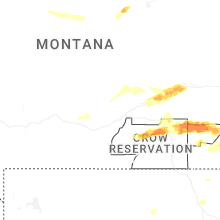
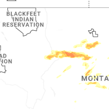
Hail Maps for Denton, MT


Connect with Interactive Hail Maps