

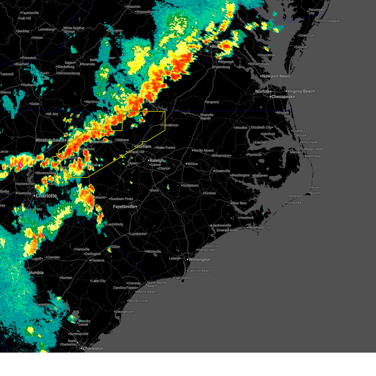
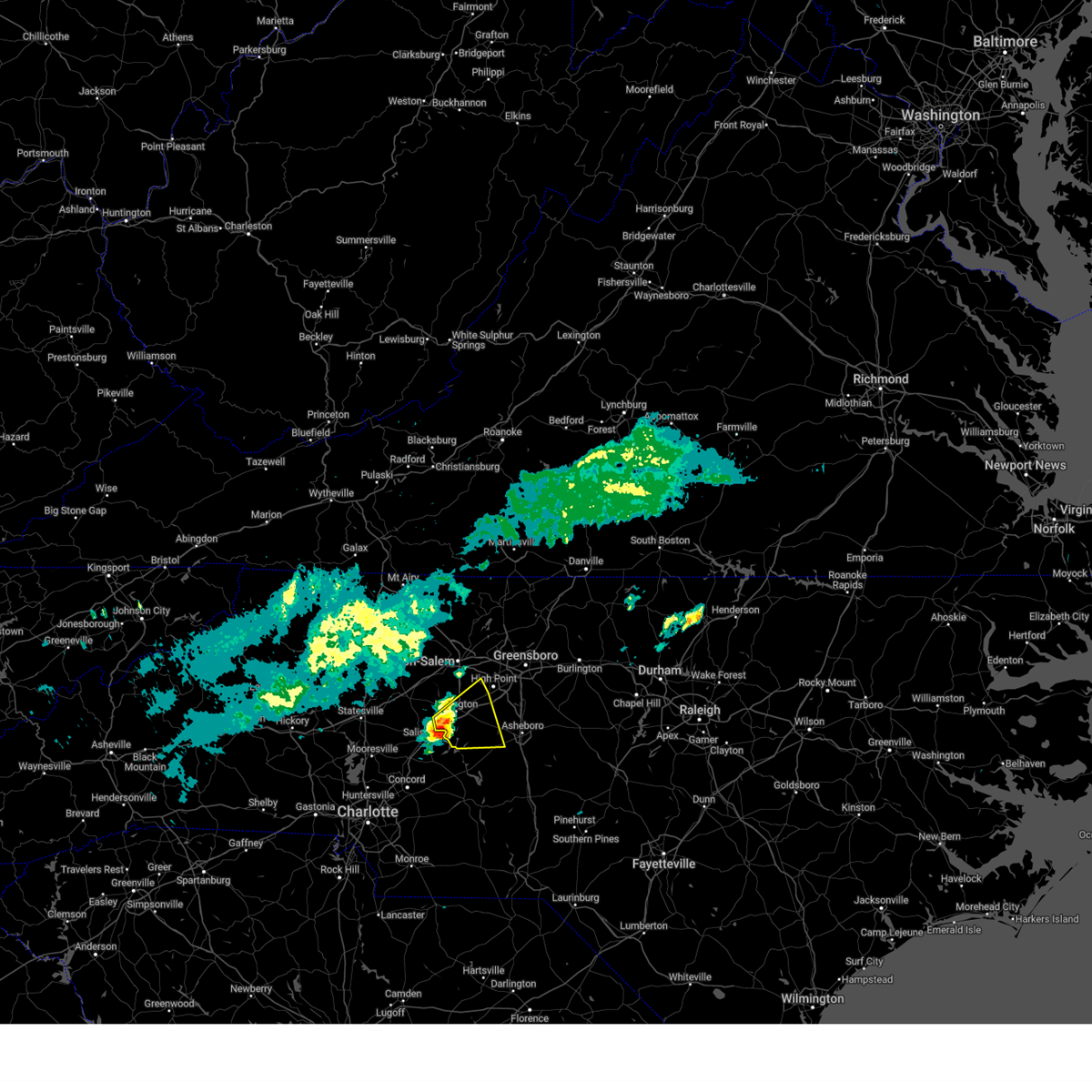
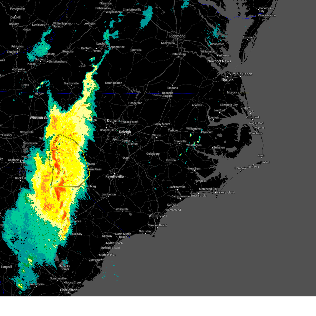
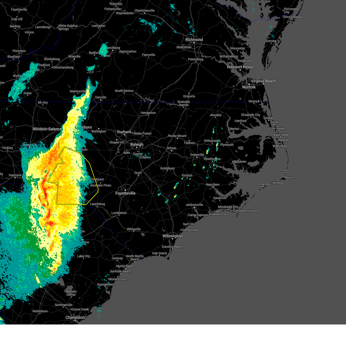
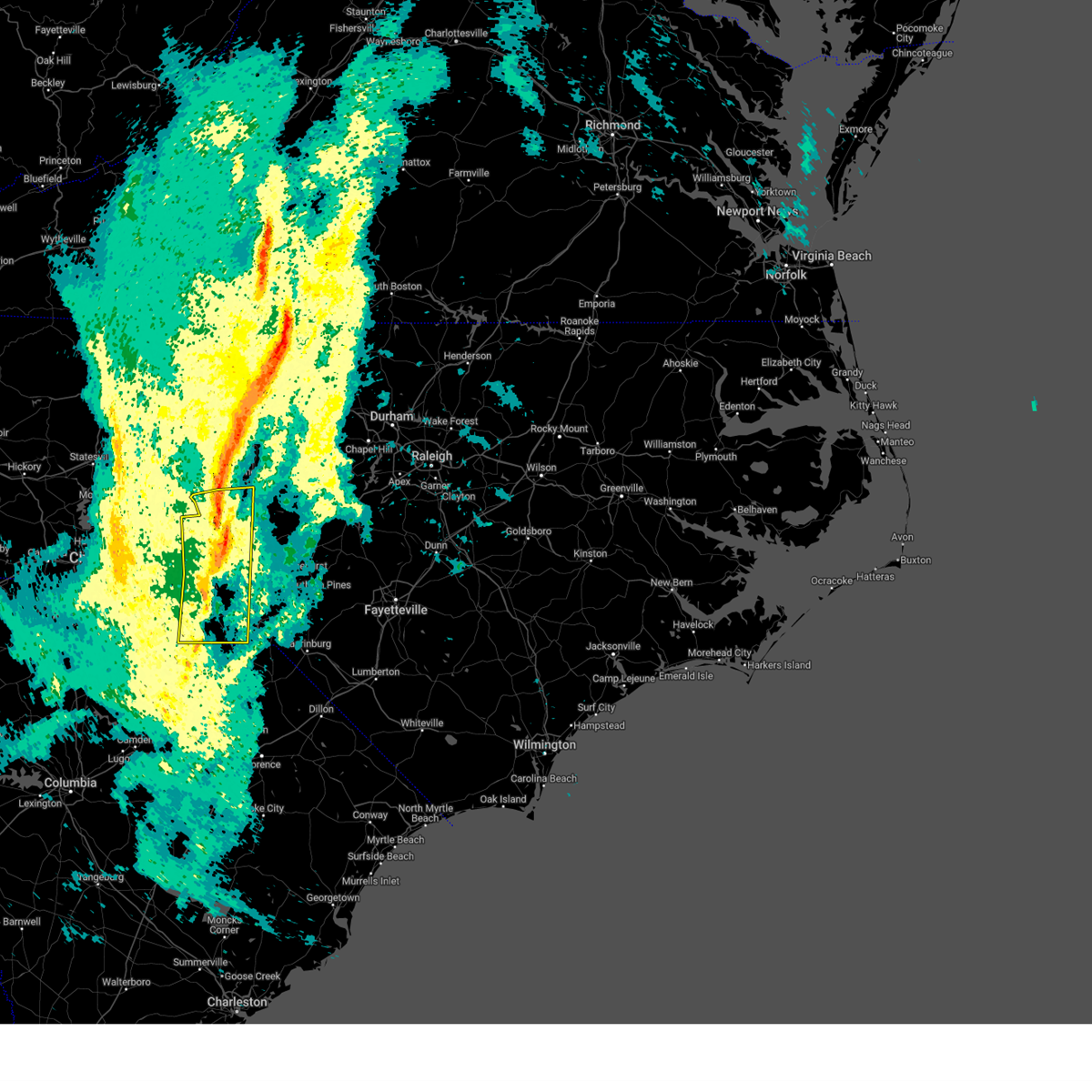
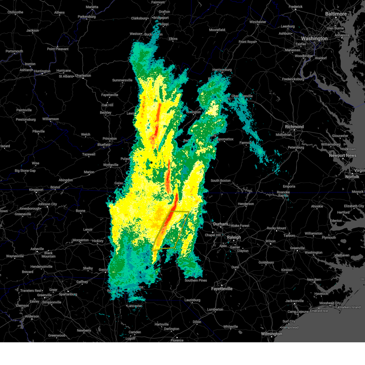
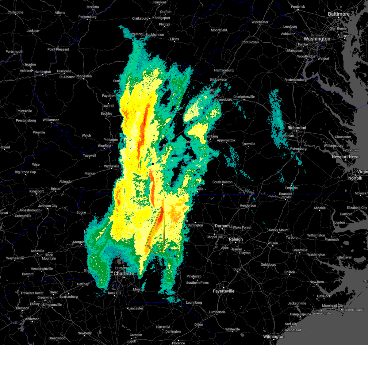
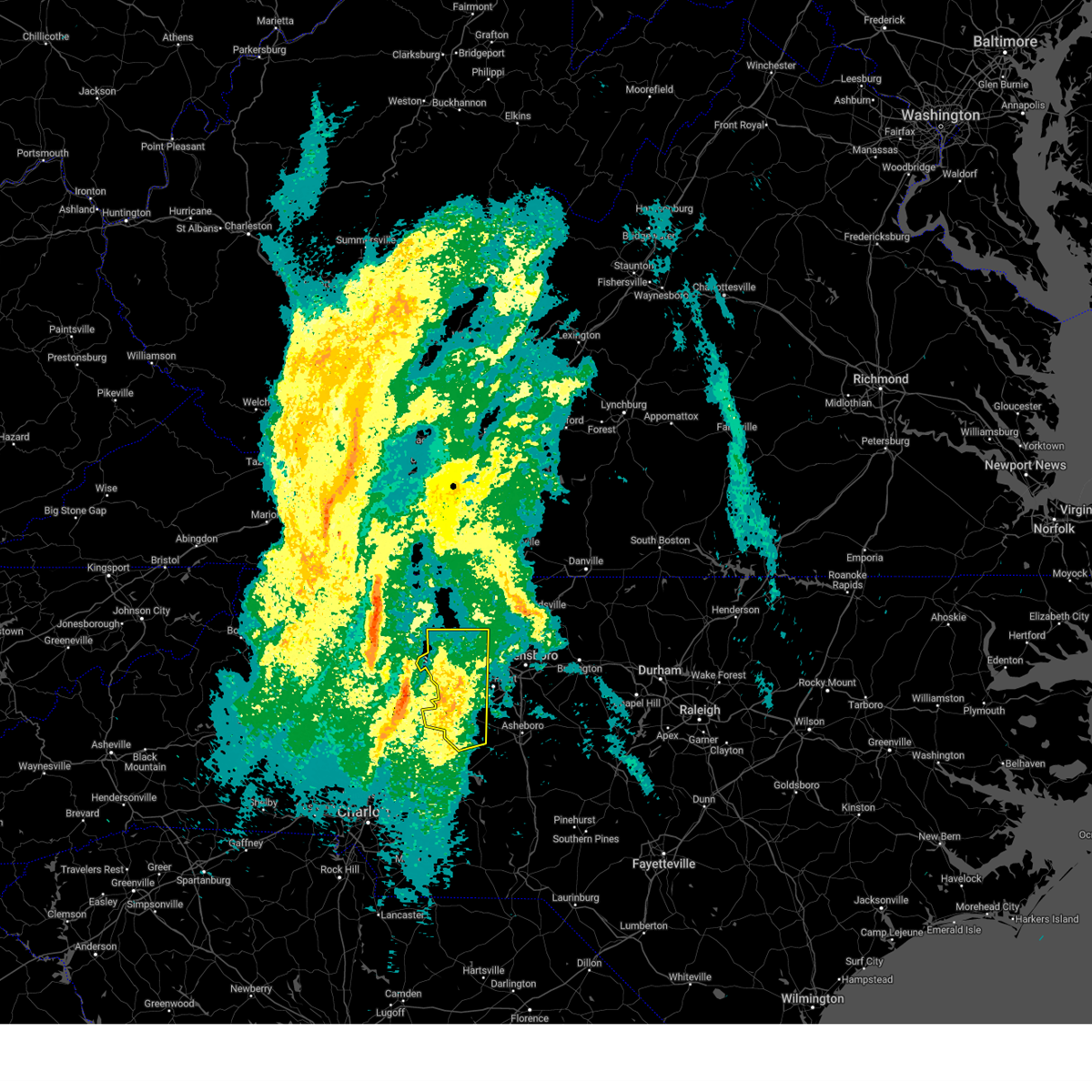
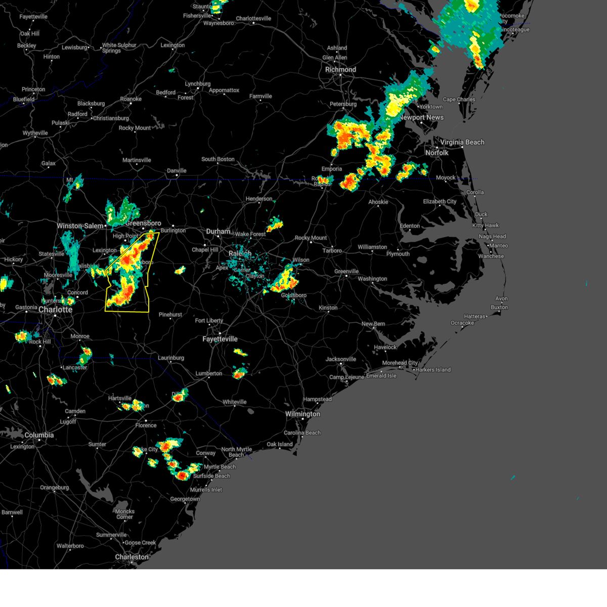
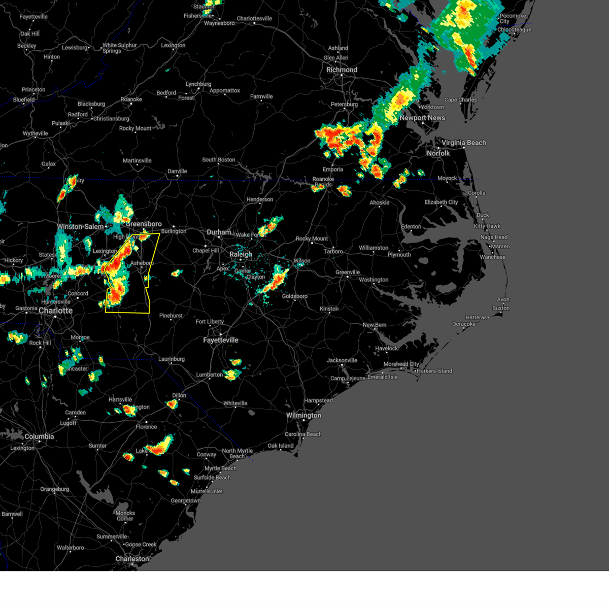
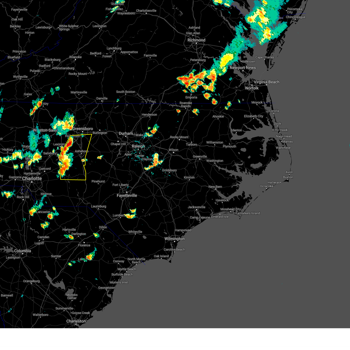
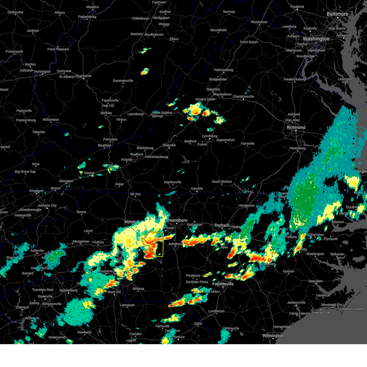
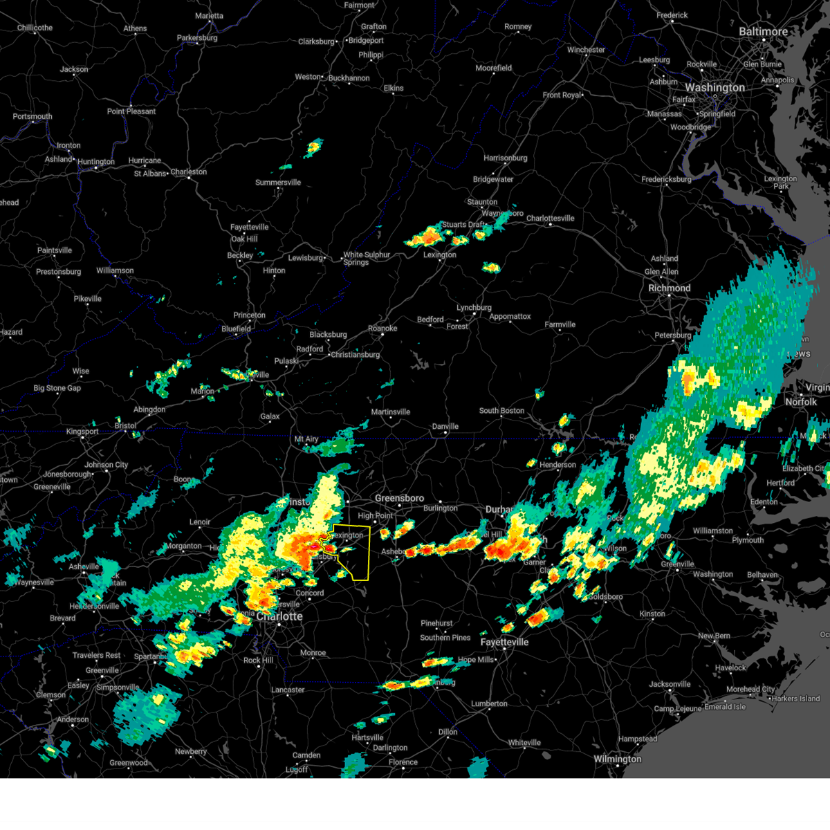
Hail Map for Denton, NC
The Denton, NC area has had 5 reports of on-the-ground hail by trained spotters, and has been under severe weather warnings 42 times during the past 12 months. Doppler radar has detected hail at or near Denton, NC on 39 occasions, including 4 occasions during the past year.
| Name: | Denton, NC |
| Where Located: | 50.3 miles NE of Charlotte, NC |
| Map: | Google Map for Denton, NC |
| Population: | 1636 |
| Housing Units: | 766 |
| More Info: | Search Google for Denton, NC |
1
The Top Recent Hail Date for Denton, NC is Tuesday, September 24, 2024 (10th out of 39)

Hail and Wind Damage Spotted near Denton, NC
| Date / Time | Report Details |
|---|---|
| 7/9/2025 6:58 PM EDT |
 Svrrah the national weather service in raleigh has issued a * severe thunderstorm warning for, alamance county in central north carolina, southeastern forsyth county in central north carolina, person county in central north carolina, vance county in central north carolina, orange county in central north carolina, davidson county in central north carolina, granville county in central north carolina, randolph county in central north carolina, guilford county in central north carolina, durham county in central north carolina, northwestern chatham county in central north carolina, * until 800 pm edt. * at 658 pm edt, severe thunderstorms were located along a line extending from near virgilina to near linwood, moving southeast at 15 mph (radar indicated). Hazards include 60 mph wind gusts and penny size hail. expect damage to roofs, siding, and trees Svrrah the national weather service in raleigh has issued a * severe thunderstorm warning for, alamance county in central north carolina, southeastern forsyth county in central north carolina, person county in central north carolina, vance county in central north carolina, orange county in central north carolina, davidson county in central north carolina, granville county in central north carolina, randolph county in central north carolina, guilford county in central north carolina, durham county in central north carolina, northwestern chatham county in central north carolina, * until 800 pm edt. * at 658 pm edt, severe thunderstorms were located along a line extending from near virgilina to near linwood, moving southeast at 15 mph (radar indicated). Hazards include 60 mph wind gusts and penny size hail. expect damage to roofs, siding, and trees
|
| 7/9/2025 6:53 PM EDT |
 The storm which prompted the warning has weakened below severe limits, and no longer poses an immediate threat to life or property. therefore, the warning will be allowed to expire. however, gusty winds are still possible with this thunderstorm. The storm which prompted the warning has weakened below severe limits, and no longer poses an immediate threat to life or property. therefore, the warning will be allowed to expire. however, gusty winds are still possible with this thunderstorm.
|
| 7/9/2025 6:08 PM EDT | Tree on house and car off jackson hill rd... dento in davidson county NC, 4.5 miles NNE of Denton, NC |
| 7/9/2025 6:07 PM EDT | Svrrah the national weather service in raleigh has issued a * severe thunderstorm warning for, southeastern davidson county in central north carolina, southwestern randolph county in central north carolina, * until 700 pm edt. * at 607 pm edt, a severe thunderstorm was located near badin lake, moving northeast at 15 mph (radar indicated). Hazards include 60 mph wind gusts and penny size hail. expect damage to roofs, siding, and trees |
| 7/9/2025 5:56 PM EDT | Tree down on tuckertown r in davidson county NC, 9.9 miles NNE of Denton, NC |
| 6/28/2025 3:05 PM EDT |
 Svrrah the national weather service in raleigh has issued a * severe thunderstorm warning for, southeastern davidson county in central north carolina, * until 345 pm edt. * at 304 pm edt, a severe thunderstorm was located over high rock lake, or 11 miles south of lexington, moving northeast at 10 mph (radar indicated). Hazards include 60 mph wind gusts. expect damage to roofs, siding, and trees Svrrah the national weather service in raleigh has issued a * severe thunderstorm warning for, southeastern davidson county in central north carolina, * until 345 pm edt. * at 304 pm edt, a severe thunderstorm was located over high rock lake, or 11 miles south of lexington, moving northeast at 10 mph (radar indicated). Hazards include 60 mph wind gusts. expect damage to roofs, siding, and trees
|
| 5/17/2025 7:33 AM EDT |
 the severe thunderstorm warning has been cancelled and is no longer in effect the severe thunderstorm warning has been cancelled and is no longer in effect
|
| 5/17/2025 7:33 AM EDT |
 At 733 am edt, a severe thunderstorm was located near badin lake, moving east at 55 mph (radar indicated). Hazards include 60 mph wind gusts and quarter size hail. Hail damage to vehicles is expected. expect wind damage to roofs, siding, and trees. Locations impacted include, north carolina zoo, badin lake, seagrove, robbins, star, eldorado, steeds, fish tales marina, whip-o-will campground, and newsom. At 733 am edt, a severe thunderstorm was located near badin lake, moving east at 55 mph (radar indicated). Hazards include 60 mph wind gusts and quarter size hail. Hail damage to vehicles is expected. expect wind damage to roofs, siding, and trees. Locations impacted include, north carolina zoo, badin lake, seagrove, robbins, star, eldorado, steeds, fish tales marina, whip-o-will campground, and newsom.
|
| 5/17/2025 7:20 AM EDT |
 Svrrah the national weather service in raleigh has issued a * severe thunderstorm warning for, northwestern moore county in central north carolina, southeastern davidson county in central north carolina, northern montgomery county in central north carolina, southern randolph county in central north carolina, northeastern stanly county in central north carolina, * until 815 am edt. * at 720 am edt, a severe thunderstorm was located near rockwell, or 10 miles northwest of albemarle, moving east at 55 mph (radar indicated). Hazards include 60 mph wind gusts and quarter size hail. Hail damage to vehicles is expected. Expect wind damage to roofs, siding, and trees. Svrrah the national weather service in raleigh has issued a * severe thunderstorm warning for, northwestern moore county in central north carolina, southeastern davidson county in central north carolina, northern montgomery county in central north carolina, southern randolph county in central north carolina, northeastern stanly county in central north carolina, * until 815 am edt. * at 720 am edt, a severe thunderstorm was located near rockwell, or 10 miles northwest of albemarle, moving east at 55 mph (radar indicated). Hazards include 60 mph wind gusts and quarter size hail. Hail damage to vehicles is expected. Expect wind damage to roofs, siding, and trees.
|
| 5/8/2025 8:27 PM EDT | At 827 pm edt, severe thunderstorms were located along a line extending from 8 miles northeast of randleman to 6 miles south of albemarle, moving east at 40 mph (radar indicated). Hazards include 60 mph wind gusts and quarter size hail. Hail damage to vehicles is expected. expect wind damage to roofs, siding, and trees. Locations impacted include, asheboro, albemarle, randleman, troy, siler city, badin lake, north carolina zoo, biscoe, ansonville, and goldston. |
| 5/8/2025 8:14 PM EDT |
 Svrrah the national weather service in raleigh has issued a * severe thunderstorm warning for, northwestern moore county in central north carolina, southeastern davidson county in central north carolina, northern anson county in central north carolina, montgomery county in central north carolina, northwestern richmond county in central north carolina, randolph county in central north carolina, stanly county in central north carolina, southwestern chatham county in central north carolina, * until 900 pm edt. * at 814 pm edt, severe thunderstorms were located along a line extending from 6 miles north of randleman to near plyler, moving southeast at 40 mph (radar indicated). Hazards include 60 mph wind gusts and quarter size hail. Hail damage to vehicles is expected. Expect wind damage to roofs, siding, and trees. Svrrah the national weather service in raleigh has issued a * severe thunderstorm warning for, northwestern moore county in central north carolina, southeastern davidson county in central north carolina, northern anson county in central north carolina, montgomery county in central north carolina, northwestern richmond county in central north carolina, randolph county in central north carolina, stanly county in central north carolina, southwestern chatham county in central north carolina, * until 900 pm edt. * at 814 pm edt, severe thunderstorms were located along a line extending from 6 miles north of randleman to near plyler, moving southeast at 40 mph (radar indicated). Hazards include 60 mph wind gusts and quarter size hail. Hail damage to vehicles is expected. Expect wind damage to roofs, siding, and trees.
|
| 5/8/2025 7:58 PM EDT | At 757 pm edt, severe thunderstorms were located along a line extending from near thomasville to near mt pleasant, moving east at 35 mph (radar indicated). Hazards include 60 mph wind gusts and quarter size hail. Hail damage to vehicles is expected. expect wind damage to roofs, siding, and trees. Locations impacted include, high point, asheboro, lexington, albemarle, randleman, troy, badin lake, north carolina zoo, thomasville, and seagrove. |
| 5/8/2025 7:47 PM EDT | At 745 pm edt, severe thunderstorms were located along a line extending from near lexington to 6 miles east of kannapolis, moving east at 30 mph (radar indicated). Hazards include 60 mph wind gusts and half dollar size hail. Hail damage to vehicles is expected. expect wind damage to roofs, siding, and trees. Locations impacted include, high point, asheboro, lexington, albemarle, randleman, troy, badin lake, north carolina zoo, thomasville, and seagrove. |
| 5/8/2025 7:47 PM EDT | the severe thunderstorm warning has been cancelled and is no longer in effect |
| 5/8/2025 7:31 PM EDT | At 731 pm edt, severe thunderstorms were located along a line extending from 6 miles northwest of lexington to near china grove, moving east at 15 mph (radar indicated). Hazards include 60 mph wind gusts and half dollar size hail. Hail damage to vehicles is expected. expect wind damage to roofs, siding, and trees. Locations impacted include, high point, asheboro, lexington, albemarle, randleman, troy, badin lake, north carolina zoo, thomasville, and clemmons. |
| 5/8/2025 7:14 PM EDT |
 Svrrah the national weather service in raleigh has issued a * severe thunderstorm warning for, south central forsyth county in central north carolina, davidson county in central north carolina, western montgomery county in central north carolina, randolph county in central north carolina, stanly county in central north carolina, southwestern guilford county in central north carolina, * until 815 pm edt. * at 713 pm edt, severe thunderstorms were located along a line extending from near bermuda run to kannapolis, moving southeast at 35 mph (radar indicated). Hazards include 60 mph wind gusts and quarter size hail. Hail damage to vehicles is expected. Expect wind damage to roofs, siding, and trees. Svrrah the national weather service in raleigh has issued a * severe thunderstorm warning for, south central forsyth county in central north carolina, davidson county in central north carolina, western montgomery county in central north carolina, randolph county in central north carolina, stanly county in central north carolina, southwestern guilford county in central north carolina, * until 815 pm edt. * at 713 pm edt, severe thunderstorms were located along a line extending from near bermuda run to kannapolis, moving southeast at 35 mph (radar indicated). Hazards include 60 mph wind gusts and quarter size hail. Hail damage to vehicles is expected. Expect wind damage to roofs, siding, and trees.
|
| 4/22/2025 2:56 PM EDT |
 At 256 pm edt, a severe thunderstorm was located 7 miles southeast of lexington, moving east at 20 mph (radar indicated). Hazards include 60 mph wind gusts and quarter size hail. Hail damage to vehicles is expected. expect wind damage to roofs, siding, and trees. Locations impacted include, thomasville, gordontown, lexington, welcome, and high point. At 256 pm edt, a severe thunderstorm was located 7 miles southeast of lexington, moving east at 20 mph (radar indicated). Hazards include 60 mph wind gusts and quarter size hail. Hail damage to vehicles is expected. expect wind damage to roofs, siding, and trees. Locations impacted include, thomasville, gordontown, lexington, welcome, and high point.
|
| 4/22/2025 2:44 PM EDT |
 At 244 pm edt, a severe thunderstorm was located near linwood, or near lexington, moving east at 20 mph (radar indicated). Hazards include 60 mph wind gusts and quarter size hail. Hail damage to vehicles is expected. expect wind damage to roofs, siding, and trees. Locations impacted include, gordontown, thomasville, high rock boat dock marina, denton, nc wildlife access boat launch, high rock lake marina & campground, lexington, high rock lake, welcome, and high point. At 244 pm edt, a severe thunderstorm was located near linwood, or near lexington, moving east at 20 mph (radar indicated). Hazards include 60 mph wind gusts and quarter size hail. Hail damage to vehicles is expected. expect wind damage to roofs, siding, and trees. Locations impacted include, gordontown, thomasville, high rock boat dock marina, denton, nc wildlife access boat launch, high rock lake marina & campground, lexington, high rock lake, welcome, and high point.
|
| 4/22/2025 2:29 PM EDT |
 Svrrah the national weather service in raleigh has issued a * severe thunderstorm warning for, davidson county in central north carolina, northwestern randolph county in central north carolina, * until 315 pm edt. * at 229 pm edt, a severe thunderstorm was located over linwood, or near lexington, moving east at 20 mph (radar indicated). Hazards include 60 mph wind gusts and quarter size hail. Hail damage to vehicles is expected. Expect wind damage to roofs, siding, and trees. Svrrah the national weather service in raleigh has issued a * severe thunderstorm warning for, davidson county in central north carolina, northwestern randolph county in central north carolina, * until 315 pm edt. * at 229 pm edt, a severe thunderstorm was located over linwood, or near lexington, moving east at 20 mph (radar indicated). Hazards include 60 mph wind gusts and quarter size hail. Hail damage to vehicles is expected. Expect wind damage to roofs, siding, and trees.
|
| 3/16/2025 9:47 AM EDT |
 At 947 am edt, severe thunderstorms were located along a line extending from 7 miles east of high rock lake to 6 miles north of ansonville to 10 miles southeast of wadesboro, moving northeast at 50 mph (radar indicated). Hazards include 60 mph wind gusts and quarter size hail. Hail damage to vehicles is expected. expect wind damage to roofs, siding, and trees. Locations impacted include, blewett falls lake, steeds, badin, fish tales marina, denton, new london, white store, covington, pekin, and biscoe. At 947 am edt, severe thunderstorms were located along a line extending from 7 miles east of high rock lake to 6 miles north of ansonville to 10 miles southeast of wadesboro, moving northeast at 50 mph (radar indicated). Hazards include 60 mph wind gusts and quarter size hail. Hail damage to vehicles is expected. expect wind damage to roofs, siding, and trees. Locations impacted include, blewett falls lake, steeds, badin, fish tales marina, denton, new london, white store, covington, pekin, and biscoe.
|
| 3/16/2025 9:15 AM EDT |
 Svrrah the national weather service in raleigh has issued a * severe thunderstorm warning for, western moore county in central north carolina, north central scotland county in central north carolina, southeastern davidson county in central north carolina, anson county in central north carolina, montgomery county in central north carolina, richmond county in central north carolina, southwestern randolph county in central north carolina, stanly county in central north carolina, * until 1000 am edt. * at 914 am edt, severe thunderstorms were located along a line extending from near fairview in union county to near pageland to 6 miles east of mt pisgah, moving northeast at 60 mph. upper level roation can be seen on radar moving over trinity, in union county nc (radar indicated). Hazards include 60 mph wind gusts and quarter size hail. Hail damage to vehicles is expected. Expect wind damage to roofs, siding, and trees. Svrrah the national weather service in raleigh has issued a * severe thunderstorm warning for, western moore county in central north carolina, north central scotland county in central north carolina, southeastern davidson county in central north carolina, anson county in central north carolina, montgomery county in central north carolina, richmond county in central north carolina, southwestern randolph county in central north carolina, stanly county in central north carolina, * until 1000 am edt. * at 914 am edt, severe thunderstorms were located along a line extending from near fairview in union county to near pageland to 6 miles east of mt pisgah, moving northeast at 60 mph. upper level roation can be seen on radar moving over trinity, in union county nc (radar indicated). Hazards include 60 mph wind gusts and quarter size hail. Hail damage to vehicles is expected. Expect wind damage to roofs, siding, and trees.
|
| 3/5/2025 9:24 AM EST |
 The storms which prompted the warning have weakened below severe limits, and no longer pose an immediate threat to life or property. therefore, the warning will be allowed to expire. however, gusty winds are still possible with these thunderstorms, especially across northern stanly and southern randolph counties. a tornado watch remains in effect until 100 pm est for central north carolina. The storms which prompted the warning have weakened below severe limits, and no longer pose an immediate threat to life or property. therefore, the warning will be allowed to expire. however, gusty winds are still possible with these thunderstorms, especially across northern stanly and southern randolph counties. a tornado watch remains in effect until 100 pm est for central north carolina.
|
| 3/5/2025 9:12 AM EST |
 At 911 am est, severe thunderstorms were located along a line extending from bethany to near greensboro to 9 miles east of high rock lake, moving northeast at 35 mph (radar indicated). Hazards include 60 mph wind gusts and penny size hail. Expect damage to roofs, siding, and trees. Locations impacted include, greensboro, haw river state park, high point, trinity, gordontown, randleman regional reservior marina, climax, lake townsend marina, lake townsend, and asheboro. At 911 am est, severe thunderstorms were located along a line extending from bethany to near greensboro to 9 miles east of high rock lake, moving northeast at 35 mph (radar indicated). Hazards include 60 mph wind gusts and penny size hail. Expect damage to roofs, siding, and trees. Locations impacted include, greensboro, haw river state park, high point, trinity, gordontown, randleman regional reservior marina, climax, lake townsend marina, lake townsend, and asheboro.
|
| 3/5/2025 9:12 AM EST |
 the severe thunderstorm warning has been cancelled and is no longer in effect the severe thunderstorm warning has been cancelled and is no longer in effect
|
| 3/5/2025 9:05 AM EST |
 At 905 am est, severe thunderstorms were located along a line extending from 8 miles southeast of high rock lake to near sturdivants, moving northeast at 50 mph (radar indicated). Hazards include 60 mph wind gusts. Expect damage to roofs, siding, and trees. Locations impacted include, albemarle, blewett falls lake, eldorado, badin, fish tales marina, denton, new london, white store, covington and pekin. At 905 am est, severe thunderstorms were located along a line extending from 8 miles southeast of high rock lake to near sturdivants, moving northeast at 50 mph (radar indicated). Hazards include 60 mph wind gusts. Expect damage to roofs, siding, and trees. Locations impacted include, albemarle, blewett falls lake, eldorado, badin, fish tales marina, denton, new london, white store, covington and pekin.
|
| 3/5/2025 9:00 AM EST |
 At 900 am est, severe thunderstorms were located along a line extending from near ellisboro to near kernersville to near high rock lake, moving northeast at 35 mph (radar indicated). Hazards include 60 mph wind gusts and penny size hail. Expect damage to roofs, siding, and trees. Locations impacted include, greensboro, high point, trinity, gordontown, randleman regional reservior marina, stokesdale, lexington, kernersville, high rock lake, and climax. At 900 am est, severe thunderstorms were located along a line extending from near ellisboro to near kernersville to near high rock lake, moving northeast at 35 mph (radar indicated). Hazards include 60 mph wind gusts and penny size hail. Expect damage to roofs, siding, and trees. Locations impacted include, greensboro, high point, trinity, gordontown, randleman regional reservior marina, stokesdale, lexington, kernersville, high rock lake, and climax.
|
| 3/5/2025 8:53 AM EST |
 The storms which prompted the warning have moved out of the area. therefore, this warning will be allowed to expire. however, a new severe thunderstorm warning remains in effect until 945 am est for eastern forsyth and davidson counties. a tornado watch remains in effect until 100 pm est for central north carolina. The storms which prompted the warning have moved out of the area. therefore, this warning will be allowed to expire. however, a new severe thunderstorm warning remains in effect until 945 am est for eastern forsyth and davidson counties. a tornado watch remains in effect until 100 pm est for central north carolina.
|
| 3/5/2025 8:43 AM EST |
 At 843 am est, severe thunderstorms were located along a line extending from 6 miles northwest of kernersville to lexington, moving northeast at 35 mph (radar indicated). Hazards include 60 mph wind gusts. Expect damage to roofs, siding, and trees. Locations impacted include, gordontown, lexington, kernersville, high rock lake, belews creek, linwood, arcadia, thomasville, high rock boat dock marina, and welcome. At 843 am est, severe thunderstorms were located along a line extending from 6 miles northwest of kernersville to lexington, moving northeast at 35 mph (radar indicated). Hazards include 60 mph wind gusts. Expect damage to roofs, siding, and trees. Locations impacted include, gordontown, lexington, kernersville, high rock lake, belews creek, linwood, arcadia, thomasville, high rock boat dock marina, and welcome.
|
| 3/5/2025 8:40 AM EST |
 Svrrah the national weather service in raleigh has issued a * severe thunderstorm warning for, southeastern forsyth county in central north carolina, eastern davidson county in central north carolina, northwestern randolph county in central north carolina, guilford county in central north carolina, * until 945 am est. * at 840 am est, severe thunderstorms were located along a line extending from near pine hall to near kernersville to near spencer, moving northeast at 45 mph (radar indicated). Hazards include 60 mph wind gusts. expect damage to roofs, siding, and trees Svrrah the national weather service in raleigh has issued a * severe thunderstorm warning for, southeastern forsyth county in central north carolina, eastern davidson county in central north carolina, northwestern randolph county in central north carolina, guilford county in central north carolina, * until 945 am est. * at 840 am est, severe thunderstorms were located along a line extending from near pine hall to near kernersville to near spencer, moving northeast at 45 mph (radar indicated). Hazards include 60 mph wind gusts. expect damage to roofs, siding, and trees
|
| 3/5/2025 8:39 AM EST |
 Svrrah the national weather service in raleigh has issued a * severe thunderstorm warning for, southeastern davidson county in central north carolina, anson county in central north carolina, montgomery county in central north carolina, western richmond county in central north carolina, southwestern randolph county in central north carolina, stanly county in central north carolina, * until 930 am est. * at 838 am est, severe thunderstorms were located along a line extending from near rockwell to 8 miles south of monroe, moving northeast at 70 mph (radar indicated). Hazards include 60 mph wind gusts. expect damage to roofs, siding, and trees Svrrah the national weather service in raleigh has issued a * severe thunderstorm warning for, southeastern davidson county in central north carolina, anson county in central north carolina, montgomery county in central north carolina, western richmond county in central north carolina, southwestern randolph county in central north carolina, stanly county in central north carolina, * until 930 am est. * at 838 am est, severe thunderstorms were located along a line extending from near rockwell to 8 miles south of monroe, moving northeast at 70 mph (radar indicated). Hazards include 60 mph wind gusts. expect damage to roofs, siding, and trees
|
| 3/5/2025 8:31 AM EST |
 At 831 am est, severe thunderstorms were located along a line extending from near winston-salem to near linwood, moving northeast at 35 mph (radar indicated). Hazards include 60 mph wind gusts. Expect damage to roofs, siding, and trees. Locations impacted include, pfafftown, gordontown, lexington, kernersville, high rock lake, belews creek, linwood, arcadia, stanleyville, and winston-salem. At 831 am est, severe thunderstorms were located along a line extending from near winston-salem to near linwood, moving northeast at 35 mph (radar indicated). Hazards include 60 mph wind gusts. Expect damage to roofs, siding, and trees. Locations impacted include, pfafftown, gordontown, lexington, kernersville, high rock lake, belews creek, linwood, arcadia, stanleyville, and winston-salem.
|
| 3/5/2025 7:56 AM EST |
 Svrrah the national weather service in raleigh has issued a * severe thunderstorm warning for, forsyth county in central north carolina, davidson county in central north carolina, * until 900 am est. * at 756 am est, severe thunderstorms were located along a line extending from near mocksville to near enochville, moving east at 35 mph (radar indicated). Hazards include 60 mph wind gusts. expect damage to roofs, siding, and trees Svrrah the national weather service in raleigh has issued a * severe thunderstorm warning for, forsyth county in central north carolina, davidson county in central north carolina, * until 900 am est. * at 756 am est, severe thunderstorms were located along a line extending from near mocksville to near enochville, moving east at 35 mph (radar indicated). Hazards include 60 mph wind gusts. expect damage to roofs, siding, and trees
|
| 2/16/2025 7:30 AM EST |
 Svrrah the national weather service in raleigh has issued a * severe thunderstorm warning for, western alamance county in central north carolina, forsyth county in central north carolina, northwestern moore county in central north carolina, davidson county in central north carolina, northwestern montgomery county in central north carolina, randolph county in central north carolina, northern stanly county in central north carolina, guilford county in central north carolina, * until 815 am est. * at 729 am est, severe thunderstorms were located along a line extending from winston-salem to near lexington to near high rock lake, moving northeast at 80 mph (radar indicated). Hazards include 60 mph wind gusts. expect damage to roofs, siding, and trees Svrrah the national weather service in raleigh has issued a * severe thunderstorm warning for, western alamance county in central north carolina, forsyth county in central north carolina, northwestern moore county in central north carolina, davidson county in central north carolina, northwestern montgomery county in central north carolina, randolph county in central north carolina, northern stanly county in central north carolina, guilford county in central north carolina, * until 815 am est. * at 729 am est, severe thunderstorms were located along a line extending from winston-salem to near lexington to near high rock lake, moving northeast at 80 mph (radar indicated). Hazards include 60 mph wind gusts. expect damage to roofs, siding, and trees
|
| 12/29/2024 10:43 AM EST |
 At 1043 am est, severe thunderstorms were located along a line extending from near kernersville to 6 miles west of randleman to near biscoe to near hamlet, moving east at 45 mph (radar indicated). Hazards include 60 mph wind gusts. Expect damage to roofs, siding, and trees. Locations impacted include, greensboro, winston-salem, high point, asheboro, laurinburg, rockingham, randleman, troy, north carolina zoo, and badin lake. At 1043 am est, severe thunderstorms were located along a line extending from near kernersville to 6 miles west of randleman to near biscoe to near hamlet, moving east at 45 mph (radar indicated). Hazards include 60 mph wind gusts. Expect damage to roofs, siding, and trees. Locations impacted include, greensboro, winston-salem, high point, asheboro, laurinburg, rockingham, randleman, troy, north carolina zoo, and badin lake.
|
| 12/29/2024 10:43 AM EST |
 the severe thunderstorm warning has been cancelled and is no longer in effect the severe thunderstorm warning has been cancelled and is no longer in effect
|
| 12/29/2024 10:21 AM EST |
 Svrrah the national weather service in raleigh has issued a * severe thunderstorm warning for, forsyth county in central north carolina, western moore county in central north carolina, scotland county in central north carolina, davidson county in central north carolina, eastern anson county in central north carolina, montgomery county in central north carolina, richmond county in central north carolina, randolph county in central north carolina, eastern stanly county in central north carolina, western guilford county in central north carolina, * until 1100 am est. * at 1021 am est, severe thunderstorms were located along a line extending from bermuda run to near high rock lake to 6 miles north of ansonville to 8 miles north of chesterfield, moving northeast at 40 mph (radar indicated). Hazards include 60 mph wind gusts. expect damage to roofs, siding, and trees Svrrah the national weather service in raleigh has issued a * severe thunderstorm warning for, forsyth county in central north carolina, western moore county in central north carolina, scotland county in central north carolina, davidson county in central north carolina, eastern anson county in central north carolina, montgomery county in central north carolina, richmond county in central north carolina, randolph county in central north carolina, eastern stanly county in central north carolina, western guilford county in central north carolina, * until 1100 am est. * at 1021 am est, severe thunderstorms were located along a line extending from bermuda run to near high rock lake to 6 miles north of ansonville to 8 miles north of chesterfield, moving northeast at 40 mph (radar indicated). Hazards include 60 mph wind gusts. expect damage to roofs, siding, and trees
|
| 9/24/2024 6:13 PM EDT |
 the severe thunderstorm warning has been cancelled and is no longer in effect the severe thunderstorm warning has been cancelled and is no longer in effect
|
| 9/24/2024 6:13 PM EDT |
 At 613 pm edt, a severe thunderstorm was located 10 miles northeast of badin lake, moving east at 20 mph (radar indicated). Hazards include 60 mph wind gusts and penny size hail. Expect damage to roofs, siding, and trees. Locations impacted include, badin lake, denton, pinehaven marina, martha, and fish tales marina. At 613 pm edt, a severe thunderstorm was located 10 miles northeast of badin lake, moving east at 20 mph (radar indicated). Hazards include 60 mph wind gusts and penny size hail. Expect damage to roofs, siding, and trees. Locations impacted include, badin lake, denton, pinehaven marina, martha, and fish tales marina.
|
| 9/24/2024 6:08 PM EDT | Trees down at nc highway 49 s and salem church r in randolph county NC, 5.3 miles WNW of Denton, NC |
| 9/24/2024 5:39 PM EDT |
 Svrrah the national weather service in raleigh has issued a * severe thunderstorm warning for, southeastern davidson county in central north carolina, northwestern montgomery county in central north carolina, southwestern randolph county in central north carolina, northeastern stanly county in central north carolina, * until 630 pm edt. * at 539 pm edt, a severe thunderstorm was located near high rock lake, or 10 miles northwest of badin lake, moving east at 20 mph (radar indicated). Hazards include 60 mph wind gusts and quarter size hail. Hail damage to vehicles is expected. Expect wind damage to roofs, siding, and trees. Svrrah the national weather service in raleigh has issued a * severe thunderstorm warning for, southeastern davidson county in central north carolina, northwestern montgomery county in central north carolina, southwestern randolph county in central north carolina, northeastern stanly county in central north carolina, * until 630 pm edt. * at 539 pm edt, a severe thunderstorm was located near high rock lake, or 10 miles northwest of badin lake, moving east at 20 mph (radar indicated). Hazards include 60 mph wind gusts and quarter size hail. Hail damage to vehicles is expected. Expect wind damage to roofs, siding, and trees.
|
| 8/18/2024 7:34 PM EDT |
 At 733 pm edt, severe thunderstorms were located along a line extending from 7 miles north of randleman to 7 miles west of asheboro to near troy, moving east at 25 mph (radar indicated). Hazards include 60 mph wind gusts and quarter size hail. Hail damage to vehicles is expected. expect wind damage to roofs, siding, and trees. Locations impacted include, high point, asheboro, albemarle, randleman, troy, badin lake, north carolina zoo, biscoe, seagrove, and pleasant garden. At 733 pm edt, severe thunderstorms were located along a line extending from 7 miles north of randleman to 7 miles west of asheboro to near troy, moving east at 25 mph (radar indicated). Hazards include 60 mph wind gusts and quarter size hail. Hail damage to vehicles is expected. expect wind damage to roofs, siding, and trees. Locations impacted include, high point, asheboro, albemarle, randleman, troy, badin lake, north carolina zoo, biscoe, seagrove, and pleasant garden.
|
| 8/18/2024 7:22 PM EDT |
 At 721 pm edt, severe thunderstorms were located along a line extending from near high point to 13 miles west of asheboro to 8 miles west of troy, moving east at 15 mph (radar indicated). Hazards include 60 mph wind gusts and quarter size hail. Hail damage to vehicles is expected. expect wind damage to roofs, siding, and trees. Locations impacted include, greensboro, high point, asheboro, albemarle, randleman, troy, badin lake, north carolina zoo, thomasville, and biscoe. At 721 pm edt, severe thunderstorms were located along a line extending from near high point to 13 miles west of asheboro to 8 miles west of troy, moving east at 15 mph (radar indicated). Hazards include 60 mph wind gusts and quarter size hail. Hail damage to vehicles is expected. expect wind damage to roofs, siding, and trees. Locations impacted include, greensboro, high point, asheboro, albemarle, randleman, troy, badin lake, north carolina zoo, thomasville, and biscoe.
|
| 8/18/2024 7:03 PM EDT |
 Svrrah the national weather service in raleigh has issued a * severe thunderstorm warning for, southeastern davidson county in central north carolina, montgomery county in central north carolina, randolph county in central north carolina, northeastern stanly county in central north carolina, southern guilford county in central north carolina, * until 800 pm edt. * at 703 pm edt, severe thunderstorms were located along a line extending from high point to 11 miles southeast of lexington to near albemarle, moving east at 15 mph (radar indicated). Hazards include 60 mph wind gusts and quarter size hail. Hail damage to vehicles is expected. Expect wind damage to roofs, siding, and trees. Svrrah the national weather service in raleigh has issued a * severe thunderstorm warning for, southeastern davidson county in central north carolina, montgomery county in central north carolina, randolph county in central north carolina, northeastern stanly county in central north carolina, southern guilford county in central north carolina, * until 800 pm edt. * at 703 pm edt, severe thunderstorms were located along a line extending from high point to 11 miles southeast of lexington to near albemarle, moving east at 15 mph (radar indicated). Hazards include 60 mph wind gusts and quarter size hail. Hail damage to vehicles is expected. Expect wind damage to roofs, siding, and trees.
|
| 7/18/2024 5:22 PM EDT |
 The storm which prompted the warning has weakened below severe limits, and no longer poses an immediate threat to life or property. therefore, the warning will be allowed to expire. a severe thunderstorm watch remains in effect until 900 pm edt for central north carolina. The storm which prompted the warning has weakened below severe limits, and no longer poses an immediate threat to life or property. therefore, the warning will be allowed to expire. a severe thunderstorm watch remains in effect until 900 pm edt for central north carolina.
|
| 7/18/2024 4:42 PM EDT |
 Svrrah the national weather service in raleigh has issued a * severe thunderstorm warning for, davidson county in central north carolina, * until 530 pm edt. * at 442 pm edt, a severe thunderstorm was located near cooleemee, or near salisbury, moving east at 25 mph (radar indicated). Hazards include 60 mph wind gusts. expect damage to roofs, siding, and trees Svrrah the national weather service in raleigh has issued a * severe thunderstorm warning for, davidson county in central north carolina, * until 530 pm edt. * at 442 pm edt, a severe thunderstorm was located near cooleemee, or near salisbury, moving east at 25 mph (radar indicated). Hazards include 60 mph wind gusts. expect damage to roofs, siding, and trees
|
| 5/26/2024 9:53 PM EDT |
 At 952 pm edt, severe thunderstorms were located along a line extending from near ellisboro to 7 miles east of high point to 12 miles west of asheboro, moving northeast at 40 mph (radar indicated). Hazards include 60 mph wind gusts. Expect damage to roofs, siding, and trees. Locations impacted include, greensboro, high point, lexington, thomasville, archdale, summerfield, trinity, stokesdale, pleasant garden, and jamestown. At 952 pm edt, severe thunderstorms were located along a line extending from near ellisboro to 7 miles east of high point to 12 miles west of asheboro, moving northeast at 40 mph (radar indicated). Hazards include 60 mph wind gusts. Expect damage to roofs, siding, and trees. Locations impacted include, greensboro, high point, lexington, thomasville, archdale, summerfield, trinity, stokesdale, pleasant garden, and jamestown.
|
| 5/26/2024 9:53 PM EDT |
 the severe thunderstorm warning has been cancelled and is no longer in effect the severe thunderstorm warning has been cancelled and is no longer in effect
|
| 5/26/2024 9:40 PM EDT | A tree was blown down near the intersection of brantley gordon rd and sandstone t in randolph county NC, 4.9 miles W of Denton, NC |
| 5/26/2024 9:39 PM EDT |
 At 939 pm edt, severe thunderstorms were located along a line extending from 6 miles southeast of walnut cove to near high point to 8 miles east of high rock lake, moving east at 50 mph (radar indicated). Hazards include 60 mph wind gusts. Expect damage to roofs, siding, and trees. Locations impacted include, greensboro, winston-salem, high point, lexington, thomasville, kernersville, archdale, summerfield, trinity, and stokesdale. At 939 pm edt, severe thunderstorms were located along a line extending from 6 miles southeast of walnut cove to near high point to 8 miles east of high rock lake, moving east at 50 mph (radar indicated). Hazards include 60 mph wind gusts. Expect damage to roofs, siding, and trees. Locations impacted include, greensboro, winston-salem, high point, lexington, thomasville, kernersville, archdale, summerfield, trinity, and stokesdale.
|
| 5/26/2024 9:33 PM EDT | A tree was blown down onto flat swamp rd near summerville church rd. time estimate in davidson county NC, 3.6 miles E of Denton, NC |
| 5/26/2024 9:23 PM EDT |
 Svrrah the national weather service in raleigh has issued a * severe thunderstorm warning for, forsyth county in central north carolina, davidson county in central north carolina, northwestern randolph county in central north carolina, guilford county in central north carolina, * until 1000 pm edt. * at 922 pm edt, severe thunderstorms were located along a line extending from near winston-salem to 6 miles west of thomasville to near high rock lake, moving east at 40 mph (radar indicated). Hazards include 60 mph wind gusts. expect damage to roofs, siding, and trees Svrrah the national weather service in raleigh has issued a * severe thunderstorm warning for, forsyth county in central north carolina, davidson county in central north carolina, northwestern randolph county in central north carolina, guilford county in central north carolina, * until 1000 pm edt. * at 922 pm edt, severe thunderstorms were located along a line extending from near winston-salem to 6 miles west of thomasville to near high rock lake, moving east at 40 mph (radar indicated). Hazards include 60 mph wind gusts. expect damage to roofs, siding, and trees
|
| 5/6/2024 11:38 PM EDT |
 the severe thunderstorm warning has been cancelled and is no longer in effect the severe thunderstorm warning has been cancelled and is no longer in effect
|
| 5/6/2024 11:26 PM EDT |
 At 1126 pm edt, severe thunderstorms were located along a line extending from near thomasville to 12 miles west of asheboro to 11 miles east of high rock lake, moving east at 40 mph (radar indicated). Hazards include 60 mph wind gusts and penny size hail. Expect damage to roofs, siding, and trees. Locations impacted include, high point, asheboro, lexington, randleman, badin lake, thomasville, archdale, trinity, denton, and richfield. At 1126 pm edt, severe thunderstorms were located along a line extending from near thomasville to 12 miles west of asheboro to 11 miles east of high rock lake, moving east at 40 mph (radar indicated). Hazards include 60 mph wind gusts and penny size hail. Expect damage to roofs, siding, and trees. Locations impacted include, high point, asheboro, lexington, randleman, badin lake, thomasville, archdale, trinity, denton, and richfield.
|
| 5/6/2024 11:10 PM EDT |
 Svrrah the national weather service in raleigh has issued a * severe thunderstorm warning for, davidson county in central north carolina, northwestern montgomery county in central north carolina, western randolph county in central north carolina, northeastern stanly county in central north carolina, southwestern guilford county in central north carolina, * until midnight edt. * at 1110 pm edt, severe thunderstorms were located along a line extending from near thomasville to 7 miles southeast of lexington to near high rock lake, moving east at 30 mph (radar indicated). Hazards include 60 mph wind gusts and quarter size hail. Hail damage to vehicles is expected. Expect wind damage to roofs, siding, and trees. Svrrah the national weather service in raleigh has issued a * severe thunderstorm warning for, davidson county in central north carolina, northwestern montgomery county in central north carolina, western randolph county in central north carolina, northeastern stanly county in central north carolina, southwestern guilford county in central north carolina, * until midnight edt. * at 1110 pm edt, severe thunderstorms were located along a line extending from near thomasville to 7 miles southeast of lexington to near high rock lake, moving east at 30 mph (radar indicated). Hazards include 60 mph wind gusts and quarter size hail. Hail damage to vehicles is expected. Expect wind damage to roofs, siding, and trees.
|
| 5/6/2024 10:52 PM EDT |
 At 1051 pm edt, severe thunderstorms were located along a line extending from 6 miles south of bermuda run to 8 miles north of spencer to near cooleemee, moving east at 15 mph (radar indicated). Hazards include 60 mph wind gusts and quarter size hail. Hail damage to vehicles is expected. expect wind damage to roofs, siding, and trees. Locations impacted include, high point, lexington, thomasville, linwood, trinity, denton, gordontown, high rock lake, high rock boat dock marina, and welcome. At 1051 pm edt, severe thunderstorms were located along a line extending from 6 miles south of bermuda run to 8 miles north of spencer to near cooleemee, moving east at 15 mph (radar indicated). Hazards include 60 mph wind gusts and quarter size hail. Hail damage to vehicles is expected. expect wind damage to roofs, siding, and trees. Locations impacted include, high point, lexington, thomasville, linwood, trinity, denton, gordontown, high rock lake, high rock boat dock marina, and welcome.
|
| 5/6/2024 10:43 PM EDT |
 At 1042 pm edt, severe thunderstorms were located along a line extending from 6 miles southeast of mocksville to near cooleemee to near cleveland, moving east at 20 mph (radar indicated). Hazards include 60 mph wind gusts and quarter size hail. Hail damage to vehicles is expected. expect wind damage to roofs, siding, and trees. Locations impacted include, high point, lexington, thomasville, linwood, trinity, denton, gordontown, high rock lake, high rock boat dock marina, and welcome. At 1042 pm edt, severe thunderstorms were located along a line extending from 6 miles southeast of mocksville to near cooleemee to near cleveland, moving east at 20 mph (radar indicated). Hazards include 60 mph wind gusts and quarter size hail. Hail damage to vehicles is expected. expect wind damage to roofs, siding, and trees. Locations impacted include, high point, lexington, thomasville, linwood, trinity, denton, gordontown, high rock lake, high rock boat dock marina, and welcome.
|
| 5/6/2024 10:31 PM EDT |
 Svrrah the national weather service in raleigh has issued a * severe thunderstorm warning for, davidson county in central north carolina, northwestern randolph county in central north carolina, * until 1115 pm edt. * at 1031 pm edt, severe thunderstorms were located along a line extending from near cooleemee to near cleveland to near troutman, moving east at 40 mph (radar indicated). Hazards include 60 mph wind gusts and quarter size hail. Hail damage to vehicles is expected. Expect wind damage to roofs, siding, and trees. Svrrah the national weather service in raleigh has issued a * severe thunderstorm warning for, davidson county in central north carolina, northwestern randolph county in central north carolina, * until 1115 pm edt. * at 1031 pm edt, severe thunderstorms were located along a line extending from near cooleemee to near cleveland to near troutman, moving east at 40 mph (radar indicated). Hazards include 60 mph wind gusts and quarter size hail. Hail damage to vehicles is expected. Expect wind damage to roofs, siding, and trees.
|
| 4/11/2024 8:48 PM EDT | Tree down across double lanes of traffic on jackson creek rd... in dento in randolph county NC, 6.9 miles WSW of Denton, NC |
| 4/11/2024 8:43 PM EDT |
 At 842 pm edt, a severe thunderstorm was located near badin lake, moving northeast at 45 mph (radar indicated). Hazards include 60 mph wind gusts. Expect damage to roofs, siding, and trees. Locations impacted include, lexington, badin lake, linwood, badin, denton, eldorado, gordontown, fish tales marina, high rock lake, and whip-o-will campground. At 842 pm edt, a severe thunderstorm was located near badin lake, moving northeast at 45 mph (radar indicated). Hazards include 60 mph wind gusts. Expect damage to roofs, siding, and trees. Locations impacted include, lexington, badin lake, linwood, badin, denton, eldorado, gordontown, fish tales marina, high rock lake, and whip-o-will campground.
|
| 4/11/2024 8:28 PM EDT |
 At 827 pm edt, a severe thunderstorm was located 7 miles northeast of midland, or 12 miles southwest of albemarle, moving northeast at 40 mph (radar indicated). Hazards include 60 mph wind gusts. Expect damage to roofs, siding, and trees. Locations impacted include, lexington, albemarle, badin lake, linwood, plyler, badin, denton, richfield, new london, and eldorado. At 827 pm edt, a severe thunderstorm was located 7 miles northeast of midland, or 12 miles southwest of albemarle, moving northeast at 40 mph (radar indicated). Hazards include 60 mph wind gusts. Expect damage to roofs, siding, and trees. Locations impacted include, lexington, albemarle, badin lake, linwood, plyler, badin, denton, richfield, new london, and eldorado.
|
| 4/11/2024 8:15 PM EDT |
 Svrrah the national weather service in raleigh has issued a * severe thunderstorm warning for, southeastern davidson county in central north carolina, northwestern montgomery county in central north carolina, southwestern randolph county in central north carolina, central stanly county in central north carolina, * until 900 pm edt. * at 815 pm edt, a severe thunderstorm was located over midland, or 14 miles north of monroe, moving northeast at 40 mph (radar indicated). Hazards include 60 mph wind gusts. expect damage to roofs, siding, and trees Svrrah the national weather service in raleigh has issued a * severe thunderstorm warning for, southeastern davidson county in central north carolina, northwestern montgomery county in central north carolina, southwestern randolph county in central north carolina, central stanly county in central north carolina, * until 900 pm edt. * at 815 pm edt, a severe thunderstorm was located over midland, or 14 miles north of monroe, moving northeast at 40 mph (radar indicated). Hazards include 60 mph wind gusts. expect damage to roofs, siding, and trees
|
| 1/9/2024 3:22 PM EST |
 At 322 pm est, severe thunderstorms were located along a line extending from 7 miles east of rockwell to near sturdivants, moving northeast at 70 mph (radar indicated). Hazards include 60 mph wind gusts. expect damage to roofs, siding, and trees At 322 pm est, severe thunderstorms were located along a line extending from 7 miles east of rockwell to near sturdivants, moving northeast at 70 mph (radar indicated). Hazards include 60 mph wind gusts. expect damage to roofs, siding, and trees
|
| 1/9/2024 2:14 PM EST |
 At 214 pm est, severe thunderstorms were located along a line extending from near kernersville to thomasville to 7 miles southeast of lexington, moving northeast at 45 mph (radar indicated). Hazards include 60 mph wind gusts. expect damage to roofs, siding, and trees At 214 pm est, severe thunderstorms were located along a line extending from near kernersville to thomasville to 7 miles southeast of lexington, moving northeast at 45 mph (radar indicated). Hazards include 60 mph wind gusts. expect damage to roofs, siding, and trees
|
| 1/9/2024 2:07 PM EST |
 At 207 pm est, severe thunderstorms were located along a line extending from near pine hall to near kernersville to 7 miles southeast of high rock lake, moving northeast at 55 mph (radar indicated). Hazards include 60 mph wind gusts. Expect damage to roofs, siding, and trees. Locations impacted include, lexington, badin lake, thomasville, denton, richfield, new london, gordontown, fish tales marina, high rock lake, and whip-o-will campground. At 207 pm est, severe thunderstorms were located along a line extending from near pine hall to near kernersville to 7 miles southeast of high rock lake, moving northeast at 55 mph (radar indicated). Hazards include 60 mph wind gusts. Expect damage to roofs, siding, and trees. Locations impacted include, lexington, badin lake, thomasville, denton, richfield, new london, gordontown, fish tales marina, high rock lake, and whip-o-will campground.
|
| 1/9/2024 1:39 PM EST |
 At 139 pm est, severe thunderstorms were located along a line extending from near enon to near bermuda run to near harrisburg, moving northeast at 55 mph (radar indicated). Hazards include 60 mph wind gusts. expect damage to roofs, siding, and trees At 139 pm est, severe thunderstorms were located along a line extending from near enon to near bermuda run to near harrisburg, moving northeast at 55 mph (radar indicated). Hazards include 60 mph wind gusts. expect damage to roofs, siding, and trees
|
| 8/28/2023 11:46 PM EDT |
 At 1146 pm edt, a severe thunderstorm was located 7 miles north of badin lake, moving southeast at 15 mph (radar indicated). Hazards include 60 mph wind gusts. Expect damage to roofs, siding, and trees. locations impacted include, denton and newsom. hail threat, radar indicated max hail size, <. 75 in wind threat, radar indicated max wind gust, 60 mph. At 1146 pm edt, a severe thunderstorm was located 7 miles north of badin lake, moving southeast at 15 mph (radar indicated). Hazards include 60 mph wind gusts. Expect damage to roofs, siding, and trees. locations impacted include, denton and newsom. hail threat, radar indicated max hail size, <. 75 in wind threat, radar indicated max wind gust, 60 mph.
|
| 8/28/2023 11:40 PM EDT |
 At 1140 pm edt, a severe thunderstorm was located 7 miles north of badin lake, moving southeast at 20 mph (radar indicated). Hazards include 60 mph wind gusts. Expect damage to roofs, siding, and trees. locations impacted include, denton, newsom, high rock and high rock lake. hail threat, radar indicated max hail size, <. 75 in wind threat, radar indicated max wind gust, 60 mph. At 1140 pm edt, a severe thunderstorm was located 7 miles north of badin lake, moving southeast at 20 mph (radar indicated). Hazards include 60 mph wind gusts. Expect damage to roofs, siding, and trees. locations impacted include, denton, newsom, high rock and high rock lake. hail threat, radar indicated max hail size, <. 75 in wind threat, radar indicated max wind gust, 60 mph.
|
| 8/28/2023 11:33 PM EDT |
 At 1133 pm edt, a severe thunderstorm was located 8 miles north of badin lake, moving southeast at 20 mph (radar indicated). Hazards include 60 mph wind gusts. Expect damage to roofs, siding, and trees. locations impacted include, denton, newsom, high rock and high rock lake. hail threat, radar indicated max hail size, <. 75 in wind threat, radar indicated max wind gust, 60 mph. At 1133 pm edt, a severe thunderstorm was located 8 miles north of badin lake, moving southeast at 20 mph (radar indicated). Hazards include 60 mph wind gusts. Expect damage to roofs, siding, and trees. locations impacted include, denton, newsom, high rock and high rock lake. hail threat, radar indicated max hail size, <. 75 in wind threat, radar indicated max wind gust, 60 mph.
|
| 8/28/2023 11:15 PM EDT |
 At 1115 pm edt, a severe thunderstorm was located near high rock lake, or 10 miles south of lexington, moving east at 15 mph (radar indicated). Hazards include 60 mph wind gusts. expect damage to roofs, siding, and trees At 1115 pm edt, a severe thunderstorm was located near high rock lake, or 10 miles south of lexington, moving east at 15 mph (radar indicated). Hazards include 60 mph wind gusts. expect damage to roofs, siding, and trees
|
| 8/26/2023 9:57 PM EDT |
 The severe thunderstorm warning for davidson and northwestern randolph counties will expire at 1000 pm edt, the storm which prompted the warning has weakened below severe limits, and no longer poses an immediate threat to life or property. therefore, the warning will be allowed to expire. however heavy rain is still possible with this thunderstorm. The severe thunderstorm warning for davidson and northwestern randolph counties will expire at 1000 pm edt, the storm which prompted the warning has weakened below severe limits, and no longer poses an immediate threat to life or property. therefore, the warning will be allowed to expire. however heavy rain is still possible with this thunderstorm.
|
| 8/26/2023 9:12 PM EDT |
 At 912 pm edt, a severe thunderstorm was located over lexington, moving east at 20 mph (radar indicated). Hazards include 60 mph wind gusts. expect damage to roofs, siding, and trees At 912 pm edt, a severe thunderstorm was located over lexington, moving east at 20 mph (radar indicated). Hazards include 60 mph wind gusts. expect damage to roofs, siding, and trees
|
| 8/24/2023 8:10 PM EDT |
 The severe thunderstorm warning for davidson county will expire at 815 pm edt, the storms which prompted the warning have weakened below severe limits, and have exited the warned area. therefore, the warning will be allowed to expire. however heavy rain is still possible with these thunderstorms. The severe thunderstorm warning for davidson county will expire at 815 pm edt, the storms which prompted the warning have weakened below severe limits, and have exited the warned area. therefore, the warning will be allowed to expire. however heavy rain is still possible with these thunderstorms.
|
| 8/24/2023 7:37 PM EDT |
 At 737 pm edt, severe thunderstorms were located along a line extending from near thomasville to near lexington to near rockwell, moving east at 20 mph (radar indicated). Hazards include 60 mph wind gusts and nickel size hail. Expect damage to roofs, siding, and trees. locations impacted include, lexington, thomasville, denton, newsom, gordontown, high rock boat dock marina, nc wildlife access boat launch, high rock lake marina & campground, high rock and high rock lake. hail threat, radar indicated max hail size, 0. 88 in wind threat, radar indicated max wind gust, 60 mph. At 737 pm edt, severe thunderstorms were located along a line extending from near thomasville to near lexington to near rockwell, moving east at 20 mph (radar indicated). Hazards include 60 mph wind gusts and nickel size hail. Expect damage to roofs, siding, and trees. locations impacted include, lexington, thomasville, denton, newsom, gordontown, high rock boat dock marina, nc wildlife access boat launch, high rock lake marina & campground, high rock and high rock lake. hail threat, radar indicated max hail size, 0. 88 in wind threat, radar indicated max wind gust, 60 mph.
|
| 8/24/2023 7:13 PM EDT |
 At 713 pm edt, severe thunderstorms were located along a line extending from near winston-salem to near lexington to granite quarry, moving southeast at 15 mph (radar indicated). Hazards include 60 mph wind gusts and nickel size hail. expect damage to roofs, siding, and trees At 713 pm edt, severe thunderstorms were located along a line extending from near winston-salem to near lexington to granite quarry, moving southeast at 15 mph (radar indicated). Hazards include 60 mph wind gusts and nickel size hail. expect damage to roofs, siding, and trees
|
| 8/15/2023 3:58 PM EDT |
 At 358 pm edt, a severe thunderstorm was located 12 miles east of high rock lake, or 14 miles southeast of lexington, moving east at 30 mph (radar indicated). Hazards include 60 mph wind gusts and quarter size hail. Hail damage to vehicles is expected. expect wind damage to roofs, siding, and trees. locations impacted include, denton, ulah and martha. hail threat, radar indicated max hail size, 1. 00 in wind threat, radar indicated max wind gust, 60 mph. At 358 pm edt, a severe thunderstorm was located 12 miles east of high rock lake, or 14 miles southeast of lexington, moving east at 30 mph (radar indicated). Hazards include 60 mph wind gusts and quarter size hail. Hail damage to vehicles is expected. expect wind damage to roofs, siding, and trees. locations impacted include, denton, ulah and martha. hail threat, radar indicated max hail size, 1. 00 in wind threat, radar indicated max wind gust, 60 mph.
|
| 8/15/2023 3:55 PM EDT | Multiple trees down north of dento in davidson county NC, 3.3 miles SE of Denton, NC |
| 8/15/2023 3:46 PM EDT |
 At 346 pm edt, a severe thunderstorm was located near high rock lake, or 11 miles south of lexington, moving east at 30 mph (radar indicated). Hazards include 60 mph wind gusts and quarter size hail. Hail damage to vehicles is expected. expect wind damage to roofs, siding, and trees. locations impacted include, denton, high rock boat dock marina, high rock, ulah, martha and high rock lake. hail threat, radar indicated max hail size, 1. 00 in wind threat, radar indicated max wind gust, 60 mph. At 346 pm edt, a severe thunderstorm was located near high rock lake, or 11 miles south of lexington, moving east at 30 mph (radar indicated). Hazards include 60 mph wind gusts and quarter size hail. Hail damage to vehicles is expected. expect wind damage to roofs, siding, and trees. locations impacted include, denton, high rock boat dock marina, high rock, ulah, martha and high rock lake. hail threat, radar indicated max hail size, 1. 00 in wind threat, radar indicated max wind gust, 60 mph.
|
| 8/15/2023 3:37 PM EDT |
 At 337 pm edt, a severe thunderstorm was located over high rock lake, or 11 miles east of salisbury, moving east at 30 mph (radar indicated). Hazards include 60 mph wind gusts and quarter size hail. Hail damage to vehicles is expected. Expect wind damage to roofs, siding, and trees. At 337 pm edt, a severe thunderstorm was located over high rock lake, or 11 miles east of salisbury, moving east at 30 mph (radar indicated). Hazards include 60 mph wind gusts and quarter size hail. Hail damage to vehicles is expected. Expect wind damage to roofs, siding, and trees.
|
| 8/7/2023 6:01 PM EDT |
 At 600 pm edt, severe thunderstorms were located along a line extending from near bethany to 9 miles southeast of albemarle, moving east at 60 mph (radar indicated). Hazards include 70 mph wind gusts. Expect considerable tree damage. damage is likely to mobile homes, roofs, and outbuildings. Locations impacted include, greensboro, winston-salem, high point, asheboro, lexington, albemarle, randleman, troy, badin lake and north carolina zoo. At 600 pm edt, severe thunderstorms were located along a line extending from near bethany to 9 miles southeast of albemarle, moving east at 60 mph (radar indicated). Hazards include 70 mph wind gusts. Expect considerable tree damage. damage is likely to mobile homes, roofs, and outbuildings. Locations impacted include, greensboro, winston-salem, high point, asheboro, lexington, albemarle, randleman, troy, badin lake and north carolina zoo.
|
| 8/7/2023 5:48 PM EDT |
 At 547 pm edt, severe thunderstorms were located along a line extending from near ellisboro to near plyler, moving east at 50 mph (radar indicated). Hazards include 60 mph wind gusts. Expect damage to roofs, siding, and trees. Locations impacted include, greensboro, winston-salem, high point, asheboro, lexington, albemarle, randleman, troy, badin lake and north carolina zoo. At 547 pm edt, severe thunderstorms were located along a line extending from near ellisboro to near plyler, moving east at 50 mph (radar indicated). Hazards include 60 mph wind gusts. Expect damage to roofs, siding, and trees. Locations impacted include, greensboro, winston-salem, high point, asheboro, lexington, albemarle, randleman, troy, badin lake and north carolina zoo.
|
| 8/7/2023 5:27 PM EDT |
 At 526 pm edt, severe thunderstorms were located along a line extending from germanton to near downtown concord, moving east at 50 mph (radar indicated). Hazards include 60 mph wind gusts. expect damage to roofs, siding, and trees At 526 pm edt, severe thunderstorms were located along a line extending from germanton to near downtown concord, moving east at 50 mph (radar indicated). Hazards include 60 mph wind gusts. expect damage to roofs, siding, and trees
|
| 8/6/2023 4:44 PM EDT |
 At 443 pm edt, severe thunderstorms were located along a line extending from 8 miles northwest of thomasville to 8 miles northwest of ansonville, moving east at 30 mph (radar indicated). Hazards include 60 mph wind gusts. Expect damage to roofs, siding, and trees. locations impacted include, greensboro, winston-salem, high point, asheboro, lexington, albemarle, randleman, troy, badin lake and north carolina zoo. hail threat, radar indicated max hail size, <. 75 in wind threat, radar indicated max wind gust, 60 mph. At 443 pm edt, severe thunderstorms were located along a line extending from 8 miles northwest of thomasville to 8 miles northwest of ansonville, moving east at 30 mph (radar indicated). Hazards include 60 mph wind gusts. Expect damage to roofs, siding, and trees. locations impacted include, greensboro, winston-salem, high point, asheboro, lexington, albemarle, randleman, troy, badin lake and north carolina zoo. hail threat, radar indicated max hail size, <. 75 in wind threat, radar indicated max wind gust, 60 mph.
|
| 8/6/2023 4:19 PM EDT |
 At 418 pm edt, severe thunderstorms were located along a line extending from near clemmons to near midland, moving southeast at 30 mph (radar indicated). Hazards include 60 mph wind gusts. expect damage to roofs, siding, and trees At 418 pm edt, severe thunderstorms were located along a line extending from near clemmons to near midland, moving southeast at 30 mph (radar indicated). Hazards include 60 mph wind gusts. expect damage to roofs, siding, and trees
|
| 7/9/2023 12:31 PM EDT |
 At 1229 pm edt, a cluster of severe thunderstorms were located along a line extending from person county to randolph county moving east at 40 mph (radar indicated). Hazards include 60 mph wind gusts and quarter size hail heavy rainf and minor flooding. Hail damage to vehicles is expected. Expect wind damage to roofs, siding, and trees. At 1229 pm edt, a cluster of severe thunderstorms were located along a line extending from person county to randolph county moving east at 40 mph (radar indicated). Hazards include 60 mph wind gusts and quarter size hail heavy rainf and minor flooding. Hail damage to vehicles is expected. Expect wind damage to roofs, siding, and trees.
|
| 7/9/2023 11:47 AM EDT |
 At 1147 am edt, severe thunderstorms were located along a line extending from near monroeton to near mcleansville to 8 miles east of high point to 8 miles south of thomasville to near spencer, moving east at 40 mph (radar indicated). Hazards include 60 mph wind gusts and quarter size hail. Hail damage to vehicles is expected. Expect wind damage to roofs, siding, and trees. At 1147 am edt, severe thunderstorms were located along a line extending from near monroeton to near mcleansville to 8 miles east of high point to 8 miles south of thomasville to near spencer, moving east at 40 mph (radar indicated). Hazards include 60 mph wind gusts and quarter size hail. Hail damage to vehicles is expected. Expect wind damage to roofs, siding, and trees.
|
| 6/26/2023 9:23 PM EDT |
 The severe thunderstorm warning for southern davidson county will expire at 930 pm edt, the storm which prompted the warning has moved out of the area. therefore, the warning will be allowed to expire. a severe thunderstorm watch remains in effect until 1100 pm edt for central north carolina. The severe thunderstorm warning for southern davidson county will expire at 930 pm edt, the storm which prompted the warning has moved out of the area. therefore, the warning will be allowed to expire. a severe thunderstorm watch remains in effect until 1100 pm edt for central north carolina.
|
| 6/26/2023 9:00 PM EDT |
 At 900 pm edt, a severe thunderstorm was located over high rock lake, or 8 miles south of lexington, moving east at 20 mph (radar indicated). Hazards include 60 mph wind gusts and quarter size hail. Hail damage to vehicles is expected. expect wind damage to roofs, siding, and trees. locations impacted include, lexington, linwood, denton, newsom, gordontown, high rock boat dock marina, nc wildlife access boat launch, high rock lake marina & campground, high rock lake and high rock. hail threat, radar indicated max hail size, 1. 00 in wind threat, radar indicated max wind gust, 60 mph. At 900 pm edt, a severe thunderstorm was located over high rock lake, or 8 miles south of lexington, moving east at 20 mph (radar indicated). Hazards include 60 mph wind gusts and quarter size hail. Hail damage to vehicles is expected. expect wind damage to roofs, siding, and trees. locations impacted include, lexington, linwood, denton, newsom, gordontown, high rock boat dock marina, nc wildlife access boat launch, high rock lake marina & campground, high rock lake and high rock. hail threat, radar indicated max hail size, 1. 00 in wind threat, radar indicated max wind gust, 60 mph.
|
| 6/26/2023 8:30 PM EDT |
 At 829 pm edt, a severe thunderstorm was located over salisbury, moving east at 20 mph (radar indicated. 1 inch hail was reported just west of salisbury at 815 pm). Hazards include 60 mph wind gusts and quarter size hail. Hail damage to vehicles is expected. Expect wind damage to roofs, siding, and trees. At 829 pm edt, a severe thunderstorm was located over salisbury, moving east at 20 mph (radar indicated. 1 inch hail was reported just west of salisbury at 815 pm). Hazards include 60 mph wind gusts and quarter size hail. Hail damage to vehicles is expected. Expect wind damage to roofs, siding, and trees.
|
| 6/26/2023 7:27 PM EDT |
 At 725 pm edt, a severe thunderstorm was located near lexington, moving southeast at 20 mph (public. at 710 pm, 2.5 in hail was reported in downtown lexington). Hazards include tennis ball size hail and 60 mph wind gusts. People and animals outdoors will be injured. expect hail damage to roofs, siding, windows, and vehicles. Expect wind damage to roofs, siding, and trees. At 725 pm edt, a severe thunderstorm was located near lexington, moving southeast at 20 mph (public. at 710 pm, 2.5 in hail was reported in downtown lexington). Hazards include tennis ball size hail and 60 mph wind gusts. People and animals outdoors will be injured. expect hail damage to roofs, siding, windows, and vehicles. Expect wind damage to roofs, siding, and trees.
|
| 6/26/2023 7:11 PM EDT |
 At 710 pm edt, a severe thunderstorm was located over lexington, moving southeast at 25 mph (radar indicated. at 7:05 pm half dollar size hail was reported in lexington from this storm). Hazards include two inch hail and 60 mph wind gusts. People and animals outdoors will be injured. expect hail damage to roofs, siding, windows, and vehicles. expect wind damage to roofs, siding, and trees. locations impacted include, lexington, thomasville, linwood, denton, gordontown, high rock boat dock marina, welcome, nc wildlife access boat launch, high rock lake marina & campground and high rock. thunderstorm damage threat, considerable hail threat, radar indicated max hail size, 2. 00 in wind threat, radar indicated max wind gust, 60 mph. At 710 pm edt, a severe thunderstorm was located over lexington, moving southeast at 25 mph (radar indicated. at 7:05 pm half dollar size hail was reported in lexington from this storm). Hazards include two inch hail and 60 mph wind gusts. People and animals outdoors will be injured. expect hail damage to roofs, siding, windows, and vehicles. expect wind damage to roofs, siding, and trees. locations impacted include, lexington, thomasville, linwood, denton, gordontown, high rock boat dock marina, welcome, nc wildlife access boat launch, high rock lake marina & campground and high rock. thunderstorm damage threat, considerable hail threat, radar indicated max hail size, 2. 00 in wind threat, radar indicated max wind gust, 60 mph.
|
| 6/26/2023 6:51 PM EDT |
 At 650 pm edt, a severe thunderstorm was located along i-85 near lexington, moving southeast at 30 mph (radar indicated. golf ball size hail was reported at fork church in eastern davie county associated with this storm). Hazards include two inch hail and 60 mph wind gusts. People and animals outdoors will be injured. expect hail damage to roofs, siding, windows, and vehicles. expect wind damage to roofs, siding, and trees. locations impacted include, lexington, thomasville, linwood, denton, arcadia, gordontown, high rock boat dock marina, welcome, nc wildlife access boat launch and high rock lake marina & campground. thunderstorm damage threat, considerable hail threat, observed max hail size, 2. 00 in wind threat, radar indicated max wind gust, 60 mph. At 650 pm edt, a severe thunderstorm was located along i-85 near lexington, moving southeast at 30 mph (radar indicated. golf ball size hail was reported at fork church in eastern davie county associated with this storm). Hazards include two inch hail and 60 mph wind gusts. People and animals outdoors will be injured. expect hail damage to roofs, siding, windows, and vehicles. expect wind damage to roofs, siding, and trees. locations impacted include, lexington, thomasville, linwood, denton, arcadia, gordontown, high rock boat dock marina, welcome, nc wildlife access boat launch and high rock lake marina & campground. thunderstorm damage threat, considerable hail threat, observed max hail size, 2. 00 in wind threat, radar indicated max wind gust, 60 mph.
|
| 6/26/2023 6:28 PM EDT |
 At 627 pm edt, a severe thunderstorm was located over mocksville, moving southeast at 25 mph (radar indicated. this storm has a history of damaging wind gusts and large hail). Hazards include two inch hail and 60 mph wind gusts. People and animals outdoors will be injured. expect hail damage to roofs, siding, windows, and vehicles. Expect wind damage to roofs, siding, and trees. At 627 pm edt, a severe thunderstorm was located over mocksville, moving southeast at 25 mph (radar indicated. this storm has a history of damaging wind gusts and large hail). Hazards include two inch hail and 60 mph wind gusts. People and animals outdoors will be injured. expect hail damage to roofs, siding, windows, and vehicles. Expect wind damage to roofs, siding, and trees.
|
| 6/19/2023 1:32 PM EDT | Tree down on jim elliott r in davidson county NC, 4.4 miles NNW of Denton, NC |
| 6/19/2023 1:24 PM EDT | Corrects previous tstm wnd dmg report from 3 e newsom. tree down at nc highway 49 and west slate mine r in davidson county NC, 6.9 miles N of Denton, NC |
| 6/19/2023 1:22 PM EDT |
 At 122 pm edt, a severe thunderstorm was located near albemarle, moving northeast at 20 mph (radar indicated). Hazards include 60 mph wind gusts. expect damage to roofs, siding, and trees At 122 pm edt, a severe thunderstorm was located near albemarle, moving northeast at 20 mph (radar indicated). Hazards include 60 mph wind gusts. expect damage to roofs, siding, and trees
|
| 6/19/2023 1:11 PM EDT | Tree down at nc highway 49 and pioneer trai in davidson county NC, 9.6 miles NNE of Denton, NC |
| 4/22/2023 8:49 AM EDT |
 At 849 am edt, severe thunderstorms were located along a line extending from 7 miles northwest of high point to near thomasville to 10 miles east of high rock lake, moving northeast at 60 mph (radar indicated). Hazards include 60 mph wind gusts and quarter size hail. Hail damage to vehicles is expected. Expect wind damage to roofs, siding, and trees. At 849 am edt, severe thunderstorms were located along a line extending from 7 miles northwest of high point to near thomasville to 10 miles east of high rock lake, moving northeast at 60 mph (radar indicated). Hazards include 60 mph wind gusts and quarter size hail. Hail damage to vehicles is expected. Expect wind damage to roofs, siding, and trees.
|
| 1/12/2023 7:30 PM EST |
 At 729 pm est, severe thunderstorms were located along a line extending from near randleman to 10 miles north of marshville, moving northeast at 65 mph (radar indicated). Hazards include 60 mph wind gusts and penny size hail. Expect damage to roofs, siding, and trees. locations impacted include, asheboro, albemarle, troy, badin lake, north carolina zoo, ansonville, seagrove, plyler, midland and polkton. hail threat, radar indicated max hail size, 0. 75 in wind threat, radar indicated max wind gust, 60 mph. At 729 pm est, severe thunderstorms were located along a line extending from near randleman to 10 miles north of marshville, moving northeast at 65 mph (radar indicated). Hazards include 60 mph wind gusts and penny size hail. Expect damage to roofs, siding, and trees. locations impacted include, asheboro, albemarle, troy, badin lake, north carolina zoo, ansonville, seagrove, plyler, midland and polkton. hail threat, radar indicated max hail size, 0. 75 in wind threat, radar indicated max wind gust, 60 mph.
|
| 1/12/2023 7:21 PM EST | 1 tree down at nc-8 and dry creek lan in davidson county NC, 4.5 miles NE of Denton, NC |
| 1/12/2023 7:18 PM EST |
 At 717 pm est, severe thunderstorms were located along a line extending from 7 miles southwest of bethany to high point to near high rock lake, moving east at 55 mph (radar indicated). Hazards include 60 mph wind gusts. Expect damage to roofs, siding, and trees. locations impacted include, greensboro, high point, randleman, thomasville, kernersville, mcleansville, archdale, summerfield, trinity and gibsonville. hail threat, radar indicated max hail size, <. 75 in wind threat, radar indicated max wind gust, 60 mph. At 717 pm est, severe thunderstorms were located along a line extending from 7 miles southwest of bethany to high point to near high rock lake, moving east at 55 mph (radar indicated). Hazards include 60 mph wind gusts. Expect damage to roofs, siding, and trees. locations impacted include, greensboro, high point, randleman, thomasville, kernersville, mcleansville, archdale, summerfield, trinity and gibsonville. hail threat, radar indicated max hail size, <. 75 in wind threat, radar indicated max wind gust, 60 mph.
|
| 1/12/2023 7:10 PM EST |
 At 710 pm est, severe thunderstorms were located along a line extending from 6 miles southeast of lexington to wesley chapel, moving east at 65 mph (radar indicated). Hazards include 60 mph wind gusts and penny size hail. expect damage to roofs, siding, and trees At 710 pm est, severe thunderstorms were located along a line extending from 6 miles southeast of lexington to wesley chapel, moving east at 65 mph (radar indicated). Hazards include 60 mph wind gusts and penny size hail. expect damage to roofs, siding, and trees
|
| 1/12/2023 7:04 PM EST |
 At 704 pm est, severe thunderstorms were located along a line extending from near germanton to 8 miles northwest of thomasville to near high rock lake, moving northeast at 70 mph (radar indicated). Hazards include 60 mph wind gusts. Expect damage to roofs, siding, and trees. locations impacted include, greensboro, winston-salem, high point, lexington, randleman, thomasville, kernersville, linwood, mcleansville and archdale. hail threat, radar indicated max hail size, <. 75 in wind threat, radar indicated max wind gust, 60 mph. At 704 pm est, severe thunderstorms were located along a line extending from near germanton to 8 miles northwest of thomasville to near high rock lake, moving northeast at 70 mph (radar indicated). Hazards include 60 mph wind gusts. Expect damage to roofs, siding, and trees. locations impacted include, greensboro, winston-salem, high point, lexington, randleman, thomasville, kernersville, linwood, mcleansville and archdale. hail threat, radar indicated max hail size, <. 75 in wind threat, radar indicated max wind gust, 60 mph.
|
| 1/12/2023 6:49 PM EST |
 At 648 pm est, severe thunderstorms were located along a line extending from enon to 8 miles east of mocksville to china grove, moving northeast at 70 mph (radar indicated). Hazards include 60 mph wind gusts. expect damage to roofs, siding, and trees At 648 pm est, severe thunderstorms were located along a line extending from enon to 8 miles east of mocksville to china grove, moving northeast at 70 mph (radar indicated). Hazards include 60 mph wind gusts. expect damage to roofs, siding, and trees
|
| 8/10/2022 5:39 PM EDT |
 The severe thunderstorm warning for southeastern davidson, northwestern montgomery and southwestern randolph counties will expire at 545 pm edt, the storm which prompted the warning has weakened below severe limits, and no longer poses an immediate threat to life or property. therefore, the warning will be allowed to expire. however gusty winds are still possible with this thunderstorm. The severe thunderstorm warning for southeastern davidson, northwestern montgomery and southwestern randolph counties will expire at 545 pm edt, the storm which prompted the warning has weakened below severe limits, and no longer poses an immediate threat to life or property. therefore, the warning will be allowed to expire. however gusty winds are still possible with this thunderstorm.
|
| 8/10/2022 5:19 PM EDT |
 At 519 pm edt, a severe thunderstorm was located 7 miles north of badin lake, moving northeast at 15 mph (radar indicated). Hazards include 60 mph wind gusts. Expect damage to roofs, siding, and trees. locations impacted include, badin lake, badin, denton, eldorado, fish tales marina, whip-o-will campground, newsom, pinehaven marina, ulah and high rock boat dock marina. hail threat, radar indicated max hail size, <. 75 in wind threat, radar indicated max wind gust, 60 mph. At 519 pm edt, a severe thunderstorm was located 7 miles north of badin lake, moving northeast at 15 mph (radar indicated). Hazards include 60 mph wind gusts. Expect damage to roofs, siding, and trees. locations impacted include, badin lake, badin, denton, eldorado, fish tales marina, whip-o-will campground, newsom, pinehaven marina, ulah and high rock boat dock marina. hail threat, radar indicated max hail size, <. 75 in wind threat, radar indicated max wind gust, 60 mph.
|
| 8/10/2022 5:06 PM EDT |
 At 506 pm edt, a severe thunderstorm was located near badin lake, moving northeast at 15 mph (radar indicated). Hazards include 60 mph wind gusts. expect damage to roofs, siding, and trees At 506 pm edt, a severe thunderstorm was located near badin lake, moving northeast at 15 mph (radar indicated). Hazards include 60 mph wind gusts. expect damage to roofs, siding, and trees
|
| 7/21/2022 1:00 PM EDT | Trees down on nc 109 at toms creek church rd and mountain view d in davidson county NC, 0.4 miles W of Denton, NC |
| 7/6/2022 6:26 PM EDT |
 At 624 pm edt, a severe thunderstorm was between denton and high rock lake, moving east at 15 mph (radar indicated). Hazards include 60 mph wind gusts. Expect damage to roofs, siding, and trees. locations impacted include, denton, newsom, gordontown, high rock boat dock marina, nc wildlife access boat launch, high rock lake marina & campground, martha, high rock lake and high rock. hail threat, radar indicated max hail size, <. 75 in wind threat, radar indicated max wind gust, 60 mph. At 624 pm edt, a severe thunderstorm was between denton and high rock lake, moving east at 15 mph (radar indicated). Hazards include 60 mph wind gusts. Expect damage to roofs, siding, and trees. locations impacted include, denton, newsom, gordontown, high rock boat dock marina, nc wildlife access boat launch, high rock lake marina & campground, martha, high rock lake and high rock. hail threat, radar indicated max hail size, <. 75 in wind threat, radar indicated max wind gust, 60 mph.
|
| 7/6/2022 6:09 PM EDT |
 At 608 pm edt, a severe thunderstorm was located near high rock lake, or 12 miles north of badin lake, moving northeast at 20 mph (radar indicated). Hazards include 70 mph wind gusts and penny size hail. Expect considerable tree damage. damage is likely to mobile homes, roofs, and outbuildings. locations impacted include, denton, newsom, gordontown, high rock boat dock marina, nc wildlife access boat launch, high rock lake marina & campground, martha, high rock lake and high rock. thunderstorm damage threat, considerable hail threat, radar indicated max hail size, 0. 75 in wind threat, radar indicated max wind gust, 70 mph. At 608 pm edt, a severe thunderstorm was located near high rock lake, or 12 miles north of badin lake, moving northeast at 20 mph (radar indicated). Hazards include 70 mph wind gusts and penny size hail. Expect considerable tree damage. damage is likely to mobile homes, roofs, and outbuildings. locations impacted include, denton, newsom, gordontown, high rock boat dock marina, nc wildlife access boat launch, high rock lake marina & campground, martha, high rock lake and high rock. thunderstorm damage threat, considerable hail threat, radar indicated max hail size, 0. 75 in wind threat, radar indicated max wind gust, 70 mph.
|
| 7/6/2022 5:58 PM EDT |
 At 558 pm edt, a severe thunderstorm was located near high rock lake, or 12 miles northwest of badin lake, moving northeast at 20 mph (radar indicated). Hazards include 60 mph wind gusts. expect damage to roofs, siding, and trees At 558 pm edt, a severe thunderstorm was located near high rock lake, or 12 miles northwest of badin lake, moving northeast at 20 mph (radar indicated). Hazards include 60 mph wind gusts. expect damage to roofs, siding, and trees
|
| 7/5/2022 7:28 PM EDT |
 At 727 pm edt, severe thunderstorms were located along a line extending from 9 miles west of asheboro to 9 miles east of high rock lake, moving southeast at 35 mph (radar indicated). Hazards include 60 mph wind gusts. Expect damage to roofs, siding, and trees. locations impacted include, asheboro, lexington, randleman, north carolina zoo, linwood, ramseur, denton, franklinville, staley and gordontown. hail threat, radar indicated max hail size, <. 75 in wind threat, radar indicated max wind gust, 60 mph. At 727 pm edt, severe thunderstorms were located along a line extending from 9 miles west of asheboro to 9 miles east of high rock lake, moving southeast at 35 mph (radar indicated). Hazards include 60 mph wind gusts. Expect damage to roofs, siding, and trees. locations impacted include, asheboro, lexington, randleman, north carolina zoo, linwood, ramseur, denton, franklinville, staley and gordontown. hail threat, radar indicated max hail size, <. 75 in wind threat, radar indicated max wind gust, 60 mph.
|
| 7/5/2022 7:14 PM EDT |
 At 713 pm edt, severe thunderstorms were located along a line extending from near thomasville to linwood, moving southeast at 25 mph (radar indicated). Hazards include 60 mph wind gusts. expect damage to roofs, siding, and trees At 713 pm edt, severe thunderstorms were located along a line extending from near thomasville to linwood, moving southeast at 25 mph (radar indicated). Hazards include 60 mph wind gusts. expect damage to roofs, siding, and trees
|
| 6/17/2022 6:04 PM EDT |
 At 603 pm edt, severe thunderstorms were located along a line extending from 8 miles east of roxboro to 13 miles northeast of siler city to near rockwell, moving southeast at 30 mph (emergency management). Hazards include 70 mph wind gusts and quarter size hail. Hail damage to vehicles is expected. expect considerable tree damage. wind damage is also likely to mobile homes, roofs, and outbuildings. locations impacted include, durham, chapel hill, burlington, asheboro, albemarle, graham, oxford, roxboro, hillsborough and creedmoor. thunderstorm damage threat, considerable hail threat, radar indicated max hail size, 1. 00 in wind threat, radar indicated max wind gust, 70 mph. At 603 pm edt, severe thunderstorms were located along a line extending from 8 miles east of roxboro to 13 miles northeast of siler city to near rockwell, moving southeast at 30 mph (emergency management). Hazards include 70 mph wind gusts and quarter size hail. Hail damage to vehicles is expected. expect considerable tree damage. wind damage is also likely to mobile homes, roofs, and outbuildings. locations impacted include, durham, chapel hill, burlington, asheboro, albemarle, graham, oxford, roxboro, hillsborough and creedmoor. thunderstorm damage threat, considerable hail threat, radar indicated max hail size, 1. 00 in wind threat, radar indicated max wind gust, 70 mph.
|
| 6/17/2022 5:45 PM EDT |
 At 543 pm edt, severe thunderstorms were located along a line extending from near roxboro to 8 miles southwest of graham to near granite quarry, moving southeast at 30 mph (emergency management reported. at 5:40 pm, several trees were reported down near exit 157 of i-40 and i-85 in mebane). Hazards include 70 mph wind gusts and quarter size hail. Hail damage to vehicles is expected. expect considerable tree damage. wind damage is also likely to mobile homes, roofs, and outbuildings. locations impacted include, durham, high point, chapel hill, burlington, asheboro, lexington, albemarle, graham, oxford and roxboro. thunderstorm damage threat, considerable hail threat, radar indicated max hail size, 1. 00 in wind threat, radar indicated max wind gust, 70 mph. At 543 pm edt, severe thunderstorms were located along a line extending from near roxboro to 8 miles southwest of graham to near granite quarry, moving southeast at 30 mph (emergency management reported. at 5:40 pm, several trees were reported down near exit 157 of i-40 and i-85 in mebane). Hazards include 70 mph wind gusts and quarter size hail. Hail damage to vehicles is expected. expect considerable tree damage. wind damage is also likely to mobile homes, roofs, and outbuildings. locations impacted include, durham, high point, chapel hill, burlington, asheboro, lexington, albemarle, graham, oxford and roxboro. thunderstorm damage threat, considerable hail threat, radar indicated max hail size, 1. 00 in wind threat, radar indicated max wind gust, 70 mph.
|
| 6/17/2022 5:34 PM EDT |
 At 534 pm edt, severe thunderstorms were located along a line extending from near roxboro to 8 miles south of elon to near salisbury, moving southeast at 30 mph (radar indicated). Hazards include 70 mph wind gusts and quarter size hail. Hail damage to vehicles is expected. expect considerable tree damage. Wind damage is also likely to mobile homes, roofs, and outbuildings. At 534 pm edt, severe thunderstorms were located along a line extending from near roxboro to 8 miles south of elon to near salisbury, moving southeast at 30 mph (radar indicated). Hazards include 70 mph wind gusts and quarter size hail. Hail damage to vehicles is expected. expect considerable tree damage. Wind damage is also likely to mobile homes, roofs, and outbuildings.
|
| 5/27/2022 6:42 AM EDT |
 At 641 am edt, severe thunderstorms were located along a line extending from 7 miles southeast of high rock lake to near plyler to 10 miles south of albemarle, moving northeast at 45 mph (radar indicated). Hazards include 60 mph wind gusts. expect damage to roofs, siding, and trees At 641 am edt, severe thunderstorms were located along a line extending from 7 miles southeast of high rock lake to near plyler to 10 miles south of albemarle, moving northeast at 45 mph (radar indicated). Hazards include 60 mph wind gusts. expect damage to roofs, siding, and trees
|
| 5/23/2022 2:53 PM EDT | Two trees blown down along with large limbs near the intersection of jackson creek rd and parker mill rd near marth in randolph county NC, 7.7 miles WSW of Denton, NC |
| 5/23/2022 2:52 PM EDT |
 At 251 pm edt, severe thunderstorms were located along a line extending from 11 miles south of thomasville to near asheboro to 6 miles east of biscoe, moving northeast at 45 mph (radar indicated). Hazards include 70 mph wind gusts. Expect considerable tree damage. damage is likely to mobile homes, roofs, and outbuildings. Locations impacted include, high point, asheboro, randleman, siler city, north carolina zoo, biscoe, goldston, seagrove, archdale and trinity. At 251 pm edt, severe thunderstorms were located along a line extending from 11 miles south of thomasville to near asheboro to 6 miles east of biscoe, moving northeast at 45 mph (radar indicated). Hazards include 70 mph wind gusts. Expect considerable tree damage. damage is likely to mobile homes, roofs, and outbuildings. Locations impacted include, high point, asheboro, randleman, siler city, north carolina zoo, biscoe, goldston, seagrove, archdale and trinity.
|
| 5/23/2022 2:50 PM EDT | Trees uprooted or snapped; roof blown off. time estimated by rada in randolph county NC, 8.2 miles WSW of Denton, NC |
| 5/23/2022 2:34 PM EDT |
 At 234 pm edt, a severe thunderstorm capable of producing a tornado was located 8 miles north of badin lake, moving northeast at 30 mph (radar indicated rotation). Hazards include tornado. Flying debris will be dangerous to those caught without shelter. mobile homes will be damaged or destroyed. damage to roofs, windows, and vehicles will occur. tree damage is likely. This tornadic thunderstorm will remain over mainly rural areas of southeastern davidson county, including the following locations, high rock, denton and high rock lake. At 234 pm edt, a severe thunderstorm capable of producing a tornado was located 8 miles north of badin lake, moving northeast at 30 mph (radar indicated rotation). Hazards include tornado. Flying debris will be dangerous to those caught without shelter. mobile homes will be damaged or destroyed. damage to roofs, windows, and vehicles will occur. tree damage is likely. This tornadic thunderstorm will remain over mainly rural areas of southeastern davidson county, including the following locations, high rock, denton and high rock lake.
|
| 5/23/2022 2:26 PM EDT |
 At 226 pm edt, severe thunderstorms were located along a line extending from 11 miles southeast of high rock lake to 7 miles east of badin lake to 10 miles south of troy, moving northeast at 40 mph (radar indicated). Hazards include 60 mph wind gusts. expect damage to roofs, siding, and trees At 226 pm edt, severe thunderstorms were located along a line extending from 11 miles southeast of high rock lake to 7 miles east of badin lake to 10 miles south of troy, moving northeast at 40 mph (radar indicated). Hazards include 60 mph wind gusts. expect damage to roofs, siding, and trees
|
| 5/23/2022 2:09 PM EDT |
 At 209 pm edt, a severe thunderstorm capable of producing a tornado was located near plyler, or near albemarle, moving northeast at 45 mph (radar indicated rotation). Hazards include tornado. Flying debris will be dangerous to those caught without shelter. mobile homes will be damaged or destroyed. damage to roofs, windows, and vehicles will occur. tree damage is likely. this dangerous storm will be near, badin lake around 220 pm edt. Other locations impacted by this tornadic thunderstorm include newsom, pinehaven marina, eldorado, badin and fish tales marina. At 209 pm edt, a severe thunderstorm capable of producing a tornado was located near plyler, or near albemarle, moving northeast at 45 mph (radar indicated rotation). Hazards include tornado. Flying debris will be dangerous to those caught without shelter. mobile homes will be damaged or destroyed. damage to roofs, windows, and vehicles will occur. tree damage is likely. this dangerous storm will be near, badin lake around 220 pm edt. Other locations impacted by this tornadic thunderstorm include newsom, pinehaven marina, eldorado, badin and fish tales marina.
|
| 5/23/2022 1:59 PM EDT |
 At 159 pm edt, a severe thunderstorm capable of producing a tornado was located near plyler, or 7 miles west of albemarle, moving northeast at 45 mph (radar indicated rotation). Hazards include tornado. Flying debris will be dangerous to those caught without shelter. mobile homes will be damaged or destroyed. damage to roofs, windows, and vehicles will occur. tree damage is likely. this dangerous storm will be near, albemarle around 210 pm edt. badin lake around 220 pm edt. Other locations impacted by this tornadic thunderstorm include eldorado, badin, fish tales marina, finger and richfield. At 159 pm edt, a severe thunderstorm capable of producing a tornado was located near plyler, or 7 miles west of albemarle, moving northeast at 45 mph (radar indicated rotation). Hazards include tornado. Flying debris will be dangerous to those caught without shelter. mobile homes will be damaged or destroyed. damage to roofs, windows, and vehicles will occur. tree damage is likely. this dangerous storm will be near, albemarle around 210 pm edt. badin lake around 220 pm edt. Other locations impacted by this tornadic thunderstorm include eldorado, badin, fish tales marina, finger and richfield.
|
| 5/19/2022 11:20 PM EDT |
 The severe thunderstorm warning for east central davidson county will expire at 1130 pm edt, the storm which prompted the warning has weakened below severe limits, and has exited the warned area. therefore, the warning will be allowed to expire. The severe thunderstorm warning for east central davidson county will expire at 1130 pm edt, the storm which prompted the warning has weakened below severe limits, and has exited the warned area. therefore, the warning will be allowed to expire.
|
| 5/19/2022 11:02 PM EDT |
 At 1102 pm edt, a severe thunderstorm was located near lexington, moving east at 30 mph (radar indicated). Hazards include 60 mph wind gusts and penny size hail. Expect damage to roofs, siding, and trees. locations impacted include, lexington, linwood, gordontown and high rock lake. hail threat, radar indicated max hail size, 0. 75 in wind threat, radar indicated max wind gust, 60 mph. At 1102 pm edt, a severe thunderstorm was located near lexington, moving east at 30 mph (radar indicated). Hazards include 60 mph wind gusts and penny size hail. Expect damage to roofs, siding, and trees. locations impacted include, lexington, linwood, gordontown and high rock lake. hail threat, radar indicated max hail size, 0. 75 in wind threat, radar indicated max wind gust, 60 mph.
|
| 5/19/2022 10:57 PM EDT |
 At 1056 pm edt, a severe thunderstorm was located over linwood, or near lexington, moving east at 15 mph (radar indicated). Hazards include 60 mph wind gusts and penny size hail. Expect damage to roofs, siding, and trees. locations impacted include, lexington, linwood, denton, gordontown, high rock, high rock lake and welcome. hail threat, radar indicated max hail size, 0. 75 in wind threat, radar indicated max wind gust, 60 mph. At 1056 pm edt, a severe thunderstorm was located over linwood, or near lexington, moving east at 15 mph (radar indicated). Hazards include 60 mph wind gusts and penny size hail. Expect damage to roofs, siding, and trees. locations impacted include, lexington, linwood, denton, gordontown, high rock, high rock lake and welcome. hail threat, radar indicated max hail size, 0. 75 in wind threat, radar indicated max wind gust, 60 mph.
|
| 5/19/2022 10:38 PM EDT |
 At 1037 pm edt, a severe thunderstorm was located near spencer, or 7 miles northeast of salisbury, moving east at 30 mph (radar indicated). Hazards include 60 mph wind gusts and quarter size hail. Hail damage to vehicles is expected. Expect wind damage to roofs, siding, and trees. At 1037 pm edt, a severe thunderstorm was located near spencer, or 7 miles northeast of salisbury, moving east at 30 mph (radar indicated). Hazards include 60 mph wind gusts and quarter size hail. Hail damage to vehicles is expected. Expect wind damage to roofs, siding, and trees.
|
| 5/6/2022 9:38 PM EDT |
 At 938 pm edt, a severe thunderstorm was located over randleman, moving east at 40 mph (radar indicated). Hazards include 60 mph wind gusts. Expect damage to roofs, siding, and trees. locations impacted include, high point, asheboro, randleman, north carolina zoo, seagrove, archdale, trinity, pleasant garden, liberty and ramseur. hail threat, radar indicated max hail size, <. 75 in wind threat, radar indicated max wind gust, 60 mph. At 938 pm edt, a severe thunderstorm was located over randleman, moving east at 40 mph (radar indicated). Hazards include 60 mph wind gusts. Expect damage to roofs, siding, and trees. locations impacted include, high point, asheboro, randleman, north carolina zoo, seagrove, archdale, trinity, pleasant garden, liberty and ramseur. hail threat, radar indicated max hail size, <. 75 in wind threat, radar indicated max wind gust, 60 mph.
|
| 5/6/2022 9:25 PM EDT |
 At 924 pm edt, a severe thunderstorm was located 10 miles west of asheboro, moving east at 40 mph (radar indicated). Hazards include 60 mph wind gusts. expect damage to roofs, siding, and trees At 924 pm edt, a severe thunderstorm was located 10 miles west of asheboro, moving east at 40 mph (radar indicated). Hazards include 60 mph wind gusts. expect damage to roofs, siding, and trees
|
| 5/6/2022 7:31 PM EDT |
 At 731 pm edt, a severe thunderstorm was located 13 miles southwest of asheboro, moving northeast at 45 mph (radar indicated). Hazards include 60 mph wind gusts and quarter size hail. Hail damage to vehicles is expected. expect wind damage to roofs, siding, and trees. Locations impacted include, asheboro, randleman, denton, randleman regional reservior marina and martha. At 731 pm edt, a severe thunderstorm was located 13 miles southwest of asheboro, moving northeast at 45 mph (radar indicated). Hazards include 60 mph wind gusts and quarter size hail. Hail damage to vehicles is expected. expect wind damage to roofs, siding, and trees. Locations impacted include, asheboro, randleman, denton, randleman regional reservior marina and martha.
|
| 5/6/2022 7:24 PM EDT |
 At 724 pm edt, a severe thunderstorm was located 10 miles north of badin lake, moving northeast at 65 mph (radar indicated). Hazards include 60 mph wind gusts and quarter size hail. Hail damage to vehicles is expected. expect wind damage to roofs, siding, and trees. Locations impacted include, asheboro, randleman, denton, newsom, gordontown, high rock boat dock marina, randleman regional reservior marina, nc wildlife access boat launch, martha and high rock. At 724 pm edt, a severe thunderstorm was located 10 miles north of badin lake, moving northeast at 65 mph (radar indicated). Hazards include 60 mph wind gusts and quarter size hail. Hail damage to vehicles is expected. expect wind damage to roofs, siding, and trees. Locations impacted include, asheboro, randleman, denton, newsom, gordontown, high rock boat dock marina, randleman regional reservior marina, nc wildlife access boat launch, martha and high rock.
|
| 5/6/2022 7:21 PM EDT |
 At 721 pm edt, a severe thunderstorm was located 9 miles east of high rock lake, or 10 miles north of badin lake, moving northeast at 40 mph (radar indicated). Hazards include 60 mph wind gusts and quarter size hail. Hail damage to vehicles is expected. Expect wind damage to roofs, siding, and trees. At 721 pm edt, a severe thunderstorm was located 9 miles east of high rock lake, or 10 miles north of badin lake, moving northeast at 40 mph (radar indicated). Hazards include 60 mph wind gusts and quarter size hail. Hail damage to vehicles is expected. Expect wind damage to roofs, siding, and trees.
|
| 5/1/2022 3:26 PM EDT |
 At 325 pm edt, severe thunderstorms were located along a line extending from near greensboro to 9 miles northeast of randleman to near asheboro, moving east at 30 mph (radar indicated). Hazards include 60 mph wind gusts and quarter size hail. Hail damage to vehicles is expected. expect wind damage to roofs, siding, and trees. locations impacted include, greensboro, high point, asheboro, lexington, randleman, north carolina zoo, thomasville, kernersville, linwood and mcleansville. hail threat, radar indicated max hail size, 1. 00 in wind threat, radar indicated max wind gust, 60 mph. At 325 pm edt, severe thunderstorms were located along a line extending from near greensboro to 9 miles northeast of randleman to near asheboro, moving east at 30 mph (radar indicated). Hazards include 60 mph wind gusts and quarter size hail. Hail damage to vehicles is expected. expect wind damage to roofs, siding, and trees. locations impacted include, greensboro, high point, asheboro, lexington, randleman, north carolina zoo, thomasville, kernersville, linwood and mcleansville. hail threat, radar indicated max hail size, 1. 00 in wind threat, radar indicated max wind gust, 60 mph.
|
| 5/1/2022 3:13 PM EDT |
 At 313 pm edt, severe thunderstorms were located along a line extending from greensboro to near randleman to near asheboro, moving east at 30 mph (radar indicated). Hazards include 60 mph wind gusts and quarter size hail. Hail damage to vehicles is expected. expect wind damage to roofs, siding, and trees. locations impacted include, greensboro, high point, asheboro, lexington, randleman, north carolina zoo, thomasville, kernersville, linwood and mcleansville. hail threat, radar indicated max hail size, 1. 00 in wind threat, radar indicated max wind gust, 60 mph. At 313 pm edt, severe thunderstorms were located along a line extending from greensboro to near randleman to near asheboro, moving east at 30 mph (radar indicated). Hazards include 60 mph wind gusts and quarter size hail. Hail damage to vehicles is expected. expect wind damage to roofs, siding, and trees. locations impacted include, greensboro, high point, asheboro, lexington, randleman, north carolina zoo, thomasville, kernersville, linwood and mcleansville. hail threat, radar indicated max hail size, 1. 00 in wind threat, radar indicated max wind gust, 60 mph.
|
| 5/1/2022 3:05 PM EDT |
 At 304 pm edt, severe thunderstorms were located along a line extending from near high point to 7 miles west of randleman to 9 miles west of asheboro, moving east at 35 mph (radar indicated). Hazards include 60 mph wind gusts and quarter size hail. Hail damage to vehicles is expected. expect wind damage to roofs, siding, and trees. locations impacted include, greensboro, high point, asheboro, lexington, randleman, north carolina zoo, thomasville, kernersville, linwood and mcleansville. hail threat, radar indicated max hail size, 1. 00 in wind threat, radar indicated max wind gust, 60 mph. At 304 pm edt, severe thunderstorms were located along a line extending from near high point to 7 miles west of randleman to 9 miles west of asheboro, moving east at 35 mph (radar indicated). Hazards include 60 mph wind gusts and quarter size hail. Hail damage to vehicles is expected. expect wind damage to roofs, siding, and trees. locations impacted include, greensboro, high point, asheboro, lexington, randleman, north carolina zoo, thomasville, kernersville, linwood and mcleansville. hail threat, radar indicated max hail size, 1. 00 in wind threat, radar indicated max wind gust, 60 mph.
|
| 5/1/2022 2:54 PM EDT |
 At 254 pm edt, severe thunderstorms were located along a line extending from near high point to 6 miles southeast of thomasville to 13 miles north of badin lake, moving northeast at 30 mph (radar indicated). Hazards include 60 mph wind gusts and quarter size hail. Hail damage to vehicles is expected. Expect wind damage to roofs, siding, and trees. At 254 pm edt, severe thunderstorms were located along a line extending from near high point to 6 miles southeast of thomasville to 13 miles north of badin lake, moving northeast at 30 mph (radar indicated). Hazards include 60 mph wind gusts and quarter size hail. Hail damage to vehicles is expected. Expect wind damage to roofs, siding, and trees.
|
| 4/26/2022 2:00 PM EDT | Tree down on brantley gordon road in denton. time estimated by rada in randolph county NC, 2.6 miles W of Denton, NC |
| 4/26/2022 1:55 PM EDT |
 At 154 pm edt, severe thunderstorms were located along a line extending from 6 miles south of thomasville to near badin lake to near ansonville, moving northeast at 35 mph (radar indicated). Hazards include 60 mph wind gusts and quarter size hail. Hail damage to vehicles is expected. expect wind damage to roofs, siding, and trees. these severe storms will be near, thomasville around 200 pm edt. randleman around 215 pm edt. seagrove around 230 pm edt. north carolina zoo around 230 pm edt. other locations impacted by these severe thunderstorms include blewett falls lake, trinity, steeds, eldorado and badin. hail threat, radar indicated max hail size, 1. 00 in wind threat, radar indicated max wind gust, 60 mph. At 154 pm edt, severe thunderstorms were located along a line extending from 6 miles south of thomasville to near badin lake to near ansonville, moving northeast at 35 mph (radar indicated). Hazards include 60 mph wind gusts and quarter size hail. Hail damage to vehicles is expected. expect wind damage to roofs, siding, and trees. these severe storms will be near, thomasville around 200 pm edt. randleman around 215 pm edt. seagrove around 230 pm edt. north carolina zoo around 230 pm edt. other locations impacted by these severe thunderstorms include blewett falls lake, trinity, steeds, eldorado and badin. hail threat, radar indicated max hail size, 1. 00 in wind threat, radar indicated max wind gust, 60 mph.
|
| 4/26/2022 1:37 PM EDT |
 At 136 pm edt, severe thunderstorms were located along a line extending from 6 miles southeast of lexington to plyler to near marshville, moving east at 30 mph (radar indicated). Hazards include 60 mph wind gusts and quarter size hail. Hail damage to vehicles is expected. expect wind damage to roofs, siding, and trees. severe thunderstorms will be near, albemarle around 150 pm edt. thomasville around 155 pm edt. wadesboro, badin lake and ansonville around 200 pm edt. asheboro and troy around 220 pm edt. randleman around 225 pm edt. seagrove around 230 pm edt. other locations impacted by these severe thunderstorms include blewett falls lake, trinity, steeds, eldorado and badin. hail threat, radar indicated max hail size, 1. 00 in wind threat, radar indicated max wind gust, 60 mph. At 136 pm edt, severe thunderstorms were located along a line extending from 6 miles southeast of lexington to plyler to near marshville, moving east at 30 mph (radar indicated). Hazards include 60 mph wind gusts and quarter size hail. Hail damage to vehicles is expected. expect wind damage to roofs, siding, and trees. severe thunderstorms will be near, albemarle around 150 pm edt. thomasville around 155 pm edt. wadesboro, badin lake and ansonville around 200 pm edt. asheboro and troy around 220 pm edt. randleman around 225 pm edt. seagrove around 230 pm edt. other locations impacted by these severe thunderstorms include blewett falls lake, trinity, steeds, eldorado and badin. hail threat, radar indicated max hail size, 1. 00 in wind threat, radar indicated max wind gust, 60 mph.
|
| 12/11/2021 5:54 PM EST |
 At 554 pm est, a severe thunderstorm was located 11 miles south of thomasville, or 12 miles southeast of lexington, moving northeast at 60 mph (radar indicated). Hazards include 60 mph wind gusts. expect damage to roofs, siding, and trees At 554 pm est, a severe thunderstorm was located 11 miles south of thomasville, or 12 miles southeast of lexington, moving northeast at 60 mph (radar indicated). Hazards include 60 mph wind gusts. expect damage to roofs, siding, and trees
|
| 8/14/2021 1:37 AM EDT |
 The severe thunderstorm warning for southern davidson, northwestern montgomery and northern stanly counties will expire at 145 am edt, the storms which prompted the warning have weakened below severe limits, and no longer pose an immediate threat to life or property. therefore, the warning will be allowed to expire. however gusty winds and heavy rain are still possible with these thunderstorms. to report severe weather, contact your nearest law enforcement agency. they will relay your report to the national weather service raleigh. The severe thunderstorm warning for southern davidson, northwestern montgomery and northern stanly counties will expire at 145 am edt, the storms which prompted the warning have weakened below severe limits, and no longer pose an immediate threat to life or property. therefore, the warning will be allowed to expire. however gusty winds and heavy rain are still possible with these thunderstorms. to report severe weather, contact your nearest law enforcement agency. they will relay your report to the national weather service raleigh.
|
| 8/14/2021 12:54 AM EDT |
 At 1254 am edt, severe thunderstorms were located along a line extending from near linwood to 7 miles east of high rock lake to near mt pleasant, moving east at 15 mph (radar indicated). Hazards include 60 mph wind gusts and quarter size hail. Hail damage to vehicles is expected. expect wind damage to roofs, siding, and trees. locations impacted include, lexington, albemarle, badin lake, thomasville, linwood, plyler, badin, denton, richfield and new london. hail threat, radar indicated max hail size, 1. 00 in wind threat, radar indicated max wind gust, 60 mph. At 1254 am edt, severe thunderstorms were located along a line extending from near linwood to 7 miles east of high rock lake to near mt pleasant, moving east at 15 mph (radar indicated). Hazards include 60 mph wind gusts and quarter size hail. Hail damage to vehicles is expected. expect wind damage to roofs, siding, and trees. locations impacted include, lexington, albemarle, badin lake, thomasville, linwood, plyler, badin, denton, richfield and new london. hail threat, radar indicated max hail size, 1. 00 in wind threat, radar indicated max wind gust, 60 mph.
|
| 8/14/2021 12:37 AM EDT |
 At 1236 am edt, severe thunderstorms were located along a line extending from near spencer to high rock lake to near mt pleasant, moving northeast at 10 mph (radar indicated). Hazards include 60 mph wind gusts and quarter size hail. Hail damage to vehicles is expected. Expect wind damage to roofs, siding, and trees. At 1236 am edt, severe thunderstorms were located along a line extending from near spencer to high rock lake to near mt pleasant, moving northeast at 10 mph (radar indicated). Hazards include 60 mph wind gusts and quarter size hail. Hail damage to vehicles is expected. Expect wind damage to roofs, siding, and trees.
|
| 5/29/2021 4:48 PM EDT | Quarter sized hail reported 2.6 miles NW of Denton, NC, several reports of quarter size or larger hail near the town of denton. |
| 5/29/2021 4:45 PM EDT |
 At 444 pm edt, a severe thunderstorm was located 11 miles north of badin lake, moving east at 20 mph (radar indicated). Hazards include 60 mph wind gusts and quarter size hail. Hail damage to vehicles is expected. Expect wind damage to roofs, siding, and trees. At 444 pm edt, a severe thunderstorm was located 11 miles north of badin lake, moving east at 20 mph (radar indicated). Hazards include 60 mph wind gusts and quarter size hail. Hail damage to vehicles is expected. Expect wind damage to roofs, siding, and trees.
|
| 5/29/2021 4:00 PM EDT |
 At 359 pm edt, a severe thunderstorm was located over spencer, or near salisbury, moving east at 35 mph (radar indicated). Hazards include 60 mph wind gusts and quarter size hail. Hail damage to vehicles is expected. Expect wind damage to roofs, siding, and trees. At 359 pm edt, a severe thunderstorm was located over spencer, or near salisbury, moving east at 35 mph (radar indicated). Hazards include 60 mph wind gusts and quarter size hail. Hail damage to vehicles is expected. Expect wind damage to roofs, siding, and trees.
|
| 3/27/2021 4:26 PM EDT |
 At 426 pm edt, severe thunderstorms were located along a line extending from near high point to 8 miles west of asheboro to 9 miles north of badin lake, moving east at 40 mph (radar indicated). Hazards include 60 mph wind gusts. expect damage to roofs, siding, and trees At 426 pm edt, severe thunderstorms were located along a line extending from near high point to 8 miles west of asheboro to 9 miles north of badin lake, moving east at 40 mph (radar indicated). Hazards include 60 mph wind gusts. expect damage to roofs, siding, and trees
|
| 3/25/2021 7:10 PM EDT |
 At 710 pm edt, severe thunderstorms were located along a line extending from near badin lake to 6 miles west of troy to near wadesboro, moving east at 35 mph (radar indicated). Hazards include 60 mph wind gusts. Expect damage to roofs, siding, and trees. Locations impacted include, asheboro, rockingham, wadesboro, randleman, troy, badin lake, north carolina zoo, hamlet, biscoe and seagrove. At 710 pm edt, severe thunderstorms were located along a line extending from near badin lake to 6 miles west of troy to near wadesboro, moving east at 35 mph (radar indicated). Hazards include 60 mph wind gusts. Expect damage to roofs, siding, and trees. Locations impacted include, asheboro, rockingham, wadesboro, randleman, troy, badin lake, north carolina zoo, hamlet, biscoe and seagrove.
|
| 3/25/2021 6:54 PM EDT |
 At 654 pm edt, severe thunderstorms were located along a line extending from 7 miles north of plyler to near albemarle to near sturdivants, moving east at 35 mph (radar indicated). Hazards include 60 mph wind gusts. expect damage to roofs, siding, and trees At 654 pm edt, severe thunderstorms were located along a line extending from 7 miles north of plyler to near albemarle to near sturdivants, moving east at 35 mph (radar indicated). Hazards include 60 mph wind gusts. expect damage to roofs, siding, and trees
|
| 3/18/2021 5:25 PM EDT | Trees down along jackson creek r in randolph county NC, 8.2 miles WSW of Denton, NC |
| 3/18/2021 5:13 PM EDT |
 At 513 pm edt, severe thunderstorms were located along a line extending from near randleman to 11 miles east of high rock lake, moving northeast at 55 mph (radar indicated). Hazards include 60 mph wind gusts and quarter size hail. Hail damage to vehicles is expected. Expect wind damage to roofs, siding, and trees. At 513 pm edt, severe thunderstorms were located along a line extending from near randleman to 11 miles east of high rock lake, moving northeast at 55 mph (radar indicated). Hazards include 60 mph wind gusts and quarter size hail. Hail damage to vehicles is expected. Expect wind damage to roofs, siding, and trees.
|
| 9/29/2020 4:40 PM EDT | One tree down at intersection of jackson creek rd and tip top r in randolph county NC, 5.1 miles SW of Denton, NC |
| 7/10/2020 8:57 PM EDT |
 At 836 pm edt, severe thunderstorms were located along a line extending from 7 miles south of winston-salem to near salisbury, moving east at 35 mph (radar indicated). Hazards include 60 mph wind gusts. Expect damage to roofs, siding, and trees. Locations impacted include, greensboro, winston-salem, high point, lexington, thomasville, clemmons, linwood, archdale, trinity and jamestown. At 836 pm edt, severe thunderstorms were located along a line extending from 7 miles south of winston-salem to near salisbury, moving east at 35 mph (radar indicated). Hazards include 60 mph wind gusts. Expect damage to roofs, siding, and trees. Locations impacted include, greensboro, winston-salem, high point, lexington, thomasville, clemmons, linwood, archdale, trinity and jamestown.
|
| 7/10/2020 8:36 PM EDT |
 At 836 pm edt, severe thunderstorms were located along a line extending from 7 miles south of winston-salem to near salisbury, moving east at 35 mph (radar indicated). Hazards include 60 mph wind gusts. Expect damage to roofs, siding, and trees. Locations impacted include, greensboro, winston-salem, high point, lexington, thomasville, clemmons, linwood, archdale, trinity and jamestown. At 836 pm edt, severe thunderstorms were located along a line extending from 7 miles south of winston-salem to near salisbury, moving east at 35 mph (radar indicated). Hazards include 60 mph wind gusts. Expect damage to roofs, siding, and trees. Locations impacted include, greensboro, winston-salem, high point, lexington, thomasville, clemmons, linwood, archdale, trinity and jamestown.
|
| 7/10/2020 8:18 PM EDT |
 The national weather service in raleigh has issued a * severe thunderstorm warning for. southeastern forsyth county in central north carolina. davidson county in central north carolina. northwestern randolph county in central north carolina. Southwestern guilford county in central north carolina. The national weather service in raleigh has issued a * severe thunderstorm warning for. southeastern forsyth county in central north carolina. davidson county in central north carolina. northwestern randolph county in central north carolina. Southwestern guilford county in central north carolina.
|
| 7/10/2020 8:06 PM EDT |
 The severe thunderstorm warning for southeastern davidson and west central randolph counties will expire at 815 pm edt, the storm which prompted the warning has weakened below severe limits, and no longer poses an immediate threat to life or property. therefore, the warning will be allowed to expire. however gusty winds and heavy rain are still possible with this thunderstorm. The severe thunderstorm warning for southeastern davidson and west central randolph counties will expire at 815 pm edt, the storm which prompted the warning has weakened below severe limits, and no longer poses an immediate threat to life or property. therefore, the warning will be allowed to expire. however gusty winds and heavy rain are still possible with this thunderstorm.
|
| 7/10/2020 7:59 PM EDT |
 At 739 pm edt, a severe thunderstorm was located 9 miles east of high rock lake, or 10 miles southeast of lexington, moving east at 15 mph (radar indicated). Hazards include 60 mph wind gusts and nickel size hail. Expect damage to roofs, siding, and trees. Locations impacted include, denton, newsom, gordontown, high rock boat dock marina, high rock lake marina & campground, high rock, martha and high rock lake. At 739 pm edt, a severe thunderstorm was located 9 miles east of high rock lake, or 10 miles southeast of lexington, moving east at 15 mph (radar indicated). Hazards include 60 mph wind gusts and nickel size hail. Expect damage to roofs, siding, and trees. Locations impacted include, denton, newsom, gordontown, high rock boat dock marina, high rock lake marina & campground, high rock, martha and high rock lake.
|
| 7/10/2020 7:39 PM EDT |
 At 739 pm edt, a severe thunderstorm was located 9 miles east of high rock lake, or 10 miles southeast of lexington, moving east at 15 mph (radar indicated). Hazards include 60 mph wind gusts and nickel size hail. Expect damage to roofs, siding, and trees. Locations impacted include, denton, newsom, gordontown, high rock boat dock marina, high rock lake marina & campground, high rock, martha and high rock lake. At 739 pm edt, a severe thunderstorm was located 9 miles east of high rock lake, or 10 miles southeast of lexington, moving east at 15 mph (radar indicated). Hazards include 60 mph wind gusts and nickel size hail. Expect damage to roofs, siding, and trees. Locations impacted include, denton, newsom, gordontown, high rock boat dock marina, high rock lake marina & campground, high rock, martha and high rock lake.
|
| 7/10/2020 7:24 PM EDT |
 At 723 pm edt, a severe thunderstorm was located near high rock lake, or 8 miles south of lexington, moving east at 15 mph (radar indicated). Hazards include 60 mph wind gusts and nickel size hail. expect damage to roofs, siding, and trees At 723 pm edt, a severe thunderstorm was located near high rock lake, or 8 miles south of lexington, moving east at 15 mph (radar indicated). Hazards include 60 mph wind gusts and nickel size hail. expect damage to roofs, siding, and trees
|
| 5/21/2020 1:54 PM EDT |
 At 153 pm edt, doppler radar indicated severe thunderstorms capable of producing damaging winds in excess of 60 mph. these storms were located along a line extending from 10 miles southeast of high rock lake to near badin lake to 10 miles northwest of ansonville to near sturdivants, moving northeast at 10 mph. locations impacted include, albemarle, wadesboro, troy, badin lake, biscoe, ansonville, seagrove, plyler, polkton and norwood. At 153 pm edt, doppler radar indicated severe thunderstorms capable of producing damaging winds in excess of 60 mph. these storms were located along a line extending from 10 miles southeast of high rock lake to near badin lake to 10 miles northwest of ansonville to near sturdivants, moving northeast at 10 mph. locations impacted include, albemarle, wadesboro, troy, badin lake, biscoe, ansonville, seagrove, plyler, polkton and norwood.
|
| 5/21/2020 1:15 PM EDT |
 At 114 pm edt, severe thunderstorms were located along a line extending from 6 miles west of badin lake to near albemarle to 8 miles west of ansonville to near sturdivants, moving northeast at 25 mph (radar indicated). Hazards include 60 mph wind gusts. damage to roofs, siding, and trees At 114 pm edt, severe thunderstorms were located along a line extending from 6 miles west of badin lake to near albemarle to 8 miles west of ansonville to near sturdivants, moving northeast at 25 mph (radar indicated). Hazards include 60 mph wind gusts. damage to roofs, siding, and trees
|
| 4/25/2020 11:18 PM EDT |
 At 1118 pm edt, severe thunderstorms were located along a line extending from near randleman to near north carolina zoo to 9 miles south of plyler, moving northeast at 55 mph (radar indicated). Hazards include 60 mph wind gusts and half dollar size hail. Hail damage to vehicles is expected. expect wind damage to roofs, siding, and trees. Locations impacted include, asheboro, albemarle, randleman, troy, badin lake, north carolina zoo, biscoe, ansonville, seagrove and plyler. At 1118 pm edt, severe thunderstorms were located along a line extending from near randleman to near north carolina zoo to 9 miles south of plyler, moving northeast at 55 mph (radar indicated). Hazards include 60 mph wind gusts and half dollar size hail. Hail damage to vehicles is expected. expect wind damage to roofs, siding, and trees. Locations impacted include, asheboro, albemarle, randleman, troy, badin lake, north carolina zoo, biscoe, ansonville, seagrove and plyler.
|
| 4/25/2020 10:57 PM EDT |
 At 1056 pm edt, severe thunderstorms were located along a line extending from 9 miles southeast of lexington to near badin lake to 6 miles southeast of midland, moving east at 30 mph (radar indicated). Hazards include 60 mph wind gusts and quarter size hail. Hail damage to vehicles is expected. Expect wind damage to roofs, siding, and trees. At 1056 pm edt, severe thunderstorms were located along a line extending from 9 miles southeast of lexington to near badin lake to 6 miles southeast of midland, moving east at 30 mph (radar indicated). Hazards include 60 mph wind gusts and quarter size hail. Hail damage to vehicles is expected. Expect wind damage to roofs, siding, and trees.
|
| 4/25/2020 10:57 PM EDT |
 The national weather service in raleigh has issued a * severe thunderstorm warning for. northwestern moore county in central north carolina. southeastern davidson county in central north carolina. northern anson county in central north carolina. Montgomery county in central north carolina. The national weather service in raleigh has issued a * severe thunderstorm warning for. northwestern moore county in central north carolina. southeastern davidson county in central north carolina. northern anson county in central north carolina. Montgomery county in central north carolina.
|
| 4/25/2020 10:52 PM EDT |
 At 1051 pm edt, a severe thunderstorm was located 7 miles southeast of high rock lake, or 10 miles northwest of badin lake, moving northeast at 40 mph (radar indicated). Hazards include 60 mph wind gusts and quarter size hail. Hail damage to vehicles is expected. expect wind damage to roofs, siding, and trees. Locations impacted include, albemarle, badin lake, norwood, badin, denton, pinehaven marina, morrow mountain state park, fish tales marina, whip-o-will campground and lake tillery. At 1051 pm edt, a severe thunderstorm was located 7 miles southeast of high rock lake, or 10 miles northwest of badin lake, moving northeast at 40 mph (radar indicated). Hazards include 60 mph wind gusts and quarter size hail. Hail damage to vehicles is expected. expect wind damage to roofs, siding, and trees. Locations impacted include, albemarle, badin lake, norwood, badin, denton, pinehaven marina, morrow mountain state park, fish tales marina, whip-o-will campground and lake tillery.
|
| 4/25/2020 10:29 PM EDT |
 At 1028 pm edt, a severe thunderstorm was located near rockwell, or 12 miles east of kannapolis, moving northeast at 60 mph (radar indicated). Hazards include 60 mph wind gusts and quarter size hail. Hail damage to vehicles is expected. Expect wind damage to roofs, siding, and trees. At 1028 pm edt, a severe thunderstorm was located near rockwell, or 12 miles east of kannapolis, moving northeast at 60 mph (radar indicated). Hazards include 60 mph wind gusts and quarter size hail. Hail damage to vehicles is expected. Expect wind damage to roofs, siding, and trees.
|
| 4/13/2020 5:59 AM EDT |
 At 559 am edt, severe thunderstorms were located along a line extending from 7 miles southwest of camp springs to near randleman to 8 miles west of seagrove, moving east at 45 mph (radar indicated). Hazards include 60 mph wind gusts. Expect damage to roofs, siding, and trees. Locations impacted include, greensboro, high point, burlington, asheboro, graham, randleman, siler city, north carolina zoo, thomasville and mebane. At 559 am edt, severe thunderstorms were located along a line extending from 7 miles southwest of camp springs to near randleman to 8 miles west of seagrove, moving east at 45 mph (radar indicated). Hazards include 60 mph wind gusts. Expect damage to roofs, siding, and trees. Locations impacted include, greensboro, high point, burlington, asheboro, graham, randleman, siler city, north carolina zoo, thomasville and mebane.
|
| 4/13/2020 5:28 AM EDT |
 At 527 am edt, severe thunderstorms were located along a line extending from 7 miles southwest of bethany to 11 miles east of high rock lake, moving northeast at 55 mph (radar indicated). Hazards include 60 mph wind gusts. expect damage to roofs, siding, and trees At 527 am edt, severe thunderstorms were located along a line extending from 7 miles southwest of bethany to 11 miles east of high rock lake, moving northeast at 55 mph (radar indicated). Hazards include 60 mph wind gusts. expect damage to roofs, siding, and trees
|
| 4/13/2020 4:40 AM EDT |
 At 439 am edt, severe thunderstorms were located along a line extending from near germanton to near mooresville, moving northeast at 60 mph (radar indicated). Hazards include 60 mph wind gusts. expect damage to roofs, siding, and trees At 439 am edt, severe thunderstorms were located along a line extending from near germanton to near mooresville, moving northeast at 60 mph (radar indicated). Hazards include 60 mph wind gusts. expect damage to roofs, siding, and trees
|
| 2/6/2020 12:35 PM EST |
 At 1234 pm est, severe thunderstorms were located along a line extending from near high rock lake to near hemby bridge to near indian land, moving east at 65 mph (radar indicated). Hazards include 60 mph wind gusts. expect damage to roofs, siding, and trees At 1234 pm est, severe thunderstorms were located along a line extending from near high rock lake to near hemby bridge to near indian land, moving east at 65 mph (radar indicated). Hazards include 60 mph wind gusts. expect damage to roofs, siding, and trees
|
| 2/6/2020 12:20 PM EST |
 At 1219 pm est, severe thunderstorms were located along a line extending from 6 miles south of mcleansville to 10 miles southwest of asheboro to 8 miles northwest of badin lake, moving northeast at 60 mph (radar indicated). Hazards include 60 mph wind gusts. Expect damage to roofs, siding, and trees. Locations impacted include, asheboro, albemarle, troy, north carolina zoo, badin lake, seagrove, plyler, badin, ramseur and denton. At 1219 pm est, severe thunderstorms were located along a line extending from 6 miles south of mcleansville to 10 miles southwest of asheboro to 8 miles northwest of badin lake, moving northeast at 60 mph (radar indicated). Hazards include 60 mph wind gusts. Expect damage to roofs, siding, and trees. Locations impacted include, asheboro, albemarle, troy, north carolina zoo, badin lake, seagrove, plyler, badin, ramseur and denton.
|
| 2/6/2020 12:16 PM EST | Thunderstorm winds downed a tree along hwy 49 near the farmer fire department in denton... n in randolph county NC, 6.6 miles W of Denton, NC |
| 2/6/2020 11:49 AM EST |
 At 1148 am est, severe thunderstorms were located along a line extending from 6 miles east of linwood to east charlotte, moving east at 35 mph (radar indicated). Hazards include 60 mph wind gusts. expect damage to roofs, siding, and trees At 1148 am est, severe thunderstorms were located along a line extending from 6 miles east of linwood to east charlotte, moving east at 35 mph (radar indicated). Hazards include 60 mph wind gusts. expect damage to roofs, siding, and trees
|
| 2/6/2020 10:57 AM EST |
 At 1056 am est, a severe thunderstorm was located over cooleemee, or 7 miles south of mocksville, moving east at 65 mph (radar indicated). Hazards include 60 mph wind gusts. expect damage to roofs, siding, and trees At 1056 am est, a severe thunderstorm was located over cooleemee, or 7 miles south of mocksville, moving east at 65 mph (radar indicated). Hazards include 60 mph wind gusts. expect damage to roofs, siding, and trees
|
| 1/11/2020 11:05 PM EST |
 At 1105 pm est, severe thunderstorms were located along a line extending from harrisons crossroads to near randleman to troy, moving northeast at 60 mph (radar indicated). Hazards include 60 mph wind gusts. Expect damage to roofs, siding, and trees. Locations impacted include, greensboro, winston-salem, high point, asheboro, lexington, randleman, north carolina zoo, thomasville, kernersville and seagrove. At 1105 pm est, severe thunderstorms were located along a line extending from harrisons crossroads to near randleman to troy, moving northeast at 60 mph (radar indicated). Hazards include 60 mph wind gusts. Expect damage to roofs, siding, and trees. Locations impacted include, greensboro, winston-salem, high point, asheboro, lexington, randleman, north carolina zoo, thomasville, kernersville and seagrove.
|
| 1/11/2020 10:41 PM EST |
 At 1041 pm est, severe thunderstorms were located along a line extending from eden to monroeton to near rockwell, moving northeast at 60 mph (radar indicated). Hazards include 60 mph wind gusts. expect damage to roofs, siding, and trees At 1041 pm est, severe thunderstorms were located along a line extending from eden to monroeton to near rockwell, moving northeast at 60 mph (radar indicated). Hazards include 60 mph wind gusts. expect damage to roofs, siding, and trees
|
| 1/11/2020 10:37 PM EST |
 At 1037 pm est, severe thunderstorms were located along a line extending from near stoneville to near mt pleasant, moving east at 45 mph (radar indicated). Hazards include 60 mph wind gusts. Expect damage to roofs, siding, and trees. Locations impacted include, greensboro, winston-salem, high point, asheboro, lexington, albemarle, randleman, badin lake, thomasville and kernersville. At 1037 pm est, severe thunderstorms were located along a line extending from near stoneville to near mt pleasant, moving east at 45 mph (radar indicated). Hazards include 60 mph wind gusts. Expect damage to roofs, siding, and trees. Locations impacted include, greensboro, winston-salem, high point, asheboro, lexington, albemarle, randleman, badin lake, thomasville and kernersville.
|
| 1/11/2020 10:00 PM EST |
 At 959 pm est, severe thunderstorms were located along a line extending from king to near charlotte, moving northeast at 45 mph (radar indicated). Hazards include 60 mph wind gusts. expect fallen trees and damage to roofs and siding At 959 pm est, severe thunderstorms were located along a line extending from king to near charlotte, moving northeast at 45 mph (radar indicated). Hazards include 60 mph wind gusts. expect fallen trees and damage to roofs and siding
|
| 10/31/2019 6:32 PM EDT |
 At 630 pm edt, severe thunderstorms were located along a line extending from near thomasville to 7 miles north of badin lake to plyler, moving northeast at 50 mph (radar indicated). Hazards include 60 mph wind gusts. Expect damage to roofs, siding, and trees. locations impacted include, asheboro, albemarle, badin lake, plyler, locust, badin, denton, stanfield, richfield and new london. A tornado watch remains in effect until 1100 pm edt for central north carolina. At 630 pm edt, severe thunderstorms were located along a line extending from near thomasville to 7 miles north of badin lake to plyler, moving northeast at 50 mph (radar indicated). Hazards include 60 mph wind gusts. Expect damage to roofs, siding, and trees. locations impacted include, asheboro, albemarle, badin lake, plyler, locust, badin, denton, stanfield, richfield and new london. A tornado watch remains in effect until 1100 pm edt for central north carolina.
|
| 10/31/2019 6:19 PM EDT |
 At 618 pm edt, severe thunderstorms were located along a line extending from 8 miles southeast of lexington to 6 miles west of badin lake, moving northeast at 50 mph (radar indicated). Hazards include 60 mph wind gusts. Expect damage to roofs, siding, and trees. locations impacted include, asheboro, albemarle, badin lake, plyler, locust, badin, denton, stanfield, richfield and new london. A tornado watch remains in effect until 1100 pm edt for central north carolina. At 618 pm edt, severe thunderstorms were located along a line extending from 8 miles southeast of lexington to 6 miles west of badin lake, moving northeast at 50 mph (radar indicated). Hazards include 60 mph wind gusts. Expect damage to roofs, siding, and trees. locations impacted include, asheboro, albemarle, badin lake, plyler, locust, badin, denton, stanfield, richfield and new london. A tornado watch remains in effect until 1100 pm edt for central north carolina.
|
| 10/31/2019 5:54 PM EDT |
 At 553 pm edt, severe thunderstorms were located along a line extending from near faith to near midland, moving northeast at 50 mph (radar indicated). Hazards include 60 mph wind gusts. expect damage to roofs, siding, and trees At 553 pm edt, severe thunderstorms were located along a line extending from near faith to near midland, moving northeast at 50 mph (radar indicated). Hazards include 60 mph wind gusts. expect damage to roofs, siding, and trees
|
| 8/22/2019 5:20 PM EDT |
 At 519 pm edt, severe thunderstorms were located along a line extending from near jericho to 7 miles south of mcleansville to near randleman to near lexington, moving east at 20 mph. while the overall intensity of the line of storms has weakened, wind gusts capable of sporadic tree damage are still likely (radar indicated). Hazards include 60 mph wind gusts. Expect damage to roofs, siding, and trees. Locations impacted include, high point, burlington, asheboro, graham, randleman, thomasville, mebane, elon, archdale and trinity. At 519 pm edt, severe thunderstorms were located along a line extending from near jericho to 7 miles south of mcleansville to near randleman to near lexington, moving east at 20 mph. while the overall intensity of the line of storms has weakened, wind gusts capable of sporadic tree damage are still likely (radar indicated). Hazards include 60 mph wind gusts. Expect damage to roofs, siding, and trees. Locations impacted include, high point, burlington, asheboro, graham, randleman, thomasville, mebane, elon, archdale and trinity.
|
| 8/22/2019 4:50 PM EDT |
 A severe thunderstorm warning remains in effect until 600 pm edt for alamance. northern davidson. northern randolph and southeastern guilford counties. At 450 pm edt, severe thunderstorms were located along a line extending from near monroeton to near greensboro to near thomasville to near lexington, moving east at 20 mph. A severe thunderstorm warning remains in effect until 600 pm edt for alamance. northern davidson. northern randolph and southeastern guilford counties. At 450 pm edt, severe thunderstorms were located along a line extending from near monroeton to near greensboro to near thomasville to near lexington, moving east at 20 mph.
|
| 8/22/2019 4:39 PM EDT |
 The national weather service in raleigh has issued a * severe thunderstorm warning for. alamance county in central north carolina. northern davidson county in central north carolina. northern randolph county in central north carolina. Southeastern guilford county in central north carolina. The national weather service in raleigh has issued a * severe thunderstorm warning for. alamance county in central north carolina. northern davidson county in central north carolina. northern randolph county in central north carolina. Southeastern guilford county in central north carolina.
|
| 8/19/2019 5:21 PM EDT |
 A severe thunderstorm warning remains in effect until 530 pm edt for davidson. randolph and northwestern chatham counties. at 520 pm edt, severe thunderstorms were located along a line extending from 6 miles northwest of siler city to near high rock lake, moving west at 20 mph. hazard. 60 mph wind gusts and quarter size hail. A severe thunderstorm warning remains in effect until 530 pm edt for davidson. randolph and northwestern chatham counties. at 520 pm edt, severe thunderstorms were located along a line extending from 6 miles northwest of siler city to near high rock lake, moving west at 20 mph. hazard. 60 mph wind gusts and quarter size hail.
|
| 8/19/2019 5:05 PM EDT |
 At 504 pm edt, severe thunderstorms were located along a line extending from near siler city to 8 miles southeast of high rock lake, moving north at 5 mph (radar indicated). Hazards include 60 mph wind gusts and quarter size hail. Hail damage to vehicles is expected. expect wind damage to roofs, siding, and trees. Locations impacted include, high point, asheboro, lexington, albemarle, randleman, siler city, badin lake, north carolina zoo, thomasville and goldston. At 504 pm edt, severe thunderstorms were located along a line extending from near siler city to 8 miles southeast of high rock lake, moving north at 5 mph (radar indicated). Hazards include 60 mph wind gusts and quarter size hail. Hail damage to vehicles is expected. expect wind damage to roofs, siding, and trees. Locations impacted include, high point, asheboro, lexington, albemarle, randleman, siler city, badin lake, north carolina zoo, thomasville and goldston.
|
| 8/19/2019 4:43 PM EDT |
 The national weather service in raleigh has issued a * severe thunderstorm warning for. southern alamance county in central north carolina. northwestern moore county in central north carolina. davidson county in central north carolina. Northern montgomery county in central north carolina. The national weather service in raleigh has issued a * severe thunderstorm warning for. southern alamance county in central north carolina. northwestern moore county in central north carolina. davidson county in central north carolina. Northern montgomery county in central north carolina.
|
| 8/19/2019 4:13 PM EDT |
 The severe thunderstorm warning for southeastern davidson and southwestern randolph counties will expire at 415 pm edt, the storm which prompted the warning has weakened below severe limits, and no longer poses an immediate threat to life or property. therefore the warning will be allowed to expire. however gusty winds and heavy rain are still possible with this thunderstorm. to report severe weather, contact your nearest law enforcement agency. they will relay your report to the national weather service raleigh. The severe thunderstorm warning for southeastern davidson and southwestern randolph counties will expire at 415 pm edt, the storm which prompted the warning has weakened below severe limits, and no longer poses an immediate threat to life or property. therefore the warning will be allowed to expire. however gusty winds and heavy rain are still possible with this thunderstorm. to report severe weather, contact your nearest law enforcement agency. they will relay your report to the national weather service raleigh.
|
| 8/19/2019 3:58 PM EDT |
 A severe thunderstorm warning remains in effect until 415 pm edt for southeastern davidson and southwestern randolph counties. at 357 pm edt, a severe thunderstorm was located 12 miles west of asheboro, moving southeast at 5 mph. hazard. 60 mph wind gusts and quarter size hail. source. Radar indicated. A severe thunderstorm warning remains in effect until 415 pm edt for southeastern davidson and southwestern randolph counties. at 357 pm edt, a severe thunderstorm was located 12 miles west of asheboro, moving southeast at 5 mph. hazard. 60 mph wind gusts and quarter size hail. source. Radar indicated.
|
| 8/19/2019 3:37 PM EDT |
 The national weather service in raleigh has issued a * severe thunderstorm warning for. southeastern davidson county in central north carolina. southwestern randolph county in central north carolina. Until 415 pm edt * at 337 pm edt, a severe thunderstorm was located 13 miles west of. The national weather service in raleigh has issued a * severe thunderstorm warning for. southeastern davidson county in central north carolina. southwestern randolph county in central north carolina. Until 415 pm edt * at 337 pm edt, a severe thunderstorm was located 13 miles west of.
|
| 8/13/2019 5:26 PM EDT |
 At 525 pm edt, a severe thunderstorm was located 11 miles northeast of badin lake, moving southeast at 30 mph (radar indicated). Hazards include 60 mph wind gusts and nickel size hail. expect damage to roofs, siding, and trees At 525 pm edt, a severe thunderstorm was located 11 miles northeast of badin lake, moving southeast at 30 mph (radar indicated). Hazards include 60 mph wind gusts and nickel size hail. expect damage to roofs, siding, and trees
|
| 8/13/2019 5:08 PM EDT |
 At 508 pm edt, severe thunderstorms were located along a line extending from 8 miles south of elon to near high rock lake, moving southeast at 35 mph (law enforcement). Hazards include 60 mph wind gusts. Expect damage to roofs, siding, and trees. Locations impacted include, asheboro, randleman, north carolina zoo, seagrove, high rock lake, gibsonville, liberty, ramseur, denton and franklinville. At 508 pm edt, severe thunderstorms were located along a line extending from 8 miles south of elon to near high rock lake, moving southeast at 35 mph (law enforcement). Hazards include 60 mph wind gusts. Expect damage to roofs, siding, and trees. Locations impacted include, asheboro, randleman, north carolina zoo, seagrove, high rock lake, gibsonville, liberty, ramseur, denton and franklinville.
|
| 8/13/2019 4:55 PM EDT |
 At 454 pm edt, severe thunderstorms were located along a line extending from near mcleansville to near linwood, moving southeast at 35 mph (law enforcement). Hazards include 60 mph wind gusts and penny size hail. Expect damage to roofs, siding, and trees. Locations impacted include, greensboro, high point, asheboro, lexington, randleman, north carolina zoo, thomasville, seagrove, linwood and mcleansville. At 454 pm edt, severe thunderstorms were located along a line extending from near mcleansville to near linwood, moving southeast at 35 mph (law enforcement). Hazards include 60 mph wind gusts and penny size hail. Expect damage to roofs, siding, and trees. Locations impacted include, greensboro, high point, asheboro, lexington, randleman, north carolina zoo, thomasville, seagrove, linwood and mcleansville.
|
| 8/13/2019 4:35 PM EDT |
 At 433 pm edt, severe thunderstorms were located along a line extending from near greensboro to near lexington, moving southeast at 35 mph (law enforcement). Hazards include 60 mph wind gusts and penny size hail. expect minor damage to roofs, siding, and trees At 433 pm edt, severe thunderstorms were located along a line extending from near greensboro to near lexington, moving southeast at 35 mph (law enforcement). Hazards include 60 mph wind gusts and penny size hail. expect minor damage to roofs, siding, and trees
|
| 8/7/2019 8:29 PM EDT |
 At 829 pm edt, a severe thunderstorm was located 9 miles east of high rock lake, or 9 miles southeast of lexington, moving east at 25 mph (radar indicated). Hazards include 60 mph wind gusts and quarter size hail. Hail damage to vehicles is expected. Expect wind damage to roofs, siding, and trees. At 829 pm edt, a severe thunderstorm was located 9 miles east of high rock lake, or 9 miles southeast of lexington, moving east at 25 mph (radar indicated). Hazards include 60 mph wind gusts and quarter size hail. Hail damage to vehicles is expected. Expect wind damage to roofs, siding, and trees.
|
| 8/7/2019 8:18 PM EDT |
 At 818 pm edt, a severe thunderstorm was located near linwood, or near lexington, moving east at 20 mph (radar indicated). Hazards include 60 mph wind gusts and quarter size hail. Hail damage to vehicles is expected. Expect wind damage to roofs, siding, and trees. At 818 pm edt, a severe thunderstorm was located near linwood, or near lexington, moving east at 20 mph (radar indicated). Hazards include 60 mph wind gusts and quarter size hail. Hail damage to vehicles is expected. Expect wind damage to roofs, siding, and trees.
|
| 7/23/2019 1:04 PM EDT | Tree down at s main st extension and mt vista health park r in davidson county NC, 1.6 miles NNE of Denton, NC |
| 7/18/2019 3:51 PM EDT |
 At 350 pm edt, a severe thunderstorm was located 9 miles south of thomasville, or 11 miles east of lexington, moving east at 20 mph. trained spotter heard via police scanner of trees down on old highway 64 between lexington and silver valley (trained weather spotters). Hazards include 60 mph wind gusts. Expect damage to roofs, siding, and trees. Locations impacted include, high point, thomasville, denton, gordontown and martha. At 350 pm edt, a severe thunderstorm was located 9 miles south of thomasville, or 11 miles east of lexington, moving east at 20 mph. trained spotter heard via police scanner of trees down on old highway 64 between lexington and silver valley (trained weather spotters). Hazards include 60 mph wind gusts. Expect damage to roofs, siding, and trees. Locations impacted include, high point, thomasville, denton, gordontown and martha.
|
| 7/18/2019 3:35 PM EDT |
 At 335 pm edt, a severe thunderstorm was located near lexington, moving east at 15 mph (radar indicated). Hazards include 60 mph wind gusts. expect damage to roofs, siding, and trees At 335 pm edt, a severe thunderstorm was located near lexington, moving east at 15 mph (radar indicated). Hazards include 60 mph wind gusts. expect damage to roofs, siding, and trees
|
| 7/7/2019 6:53 PM EDT |
 At 653 pm edt, a severe thunderstorm was located near lexington, moving south at 10 mph (radar indicated). Hazards include 60 mph wind gusts and penny size hail. Expect damage to roofs, siding, and trees. Locations impacted include, lexington, thomasville, linwood, high rock lake, gordontown, high rock lake marina & campground and welcome. At 653 pm edt, a severe thunderstorm was located near lexington, moving south at 10 mph (radar indicated). Hazards include 60 mph wind gusts and penny size hail. Expect damage to roofs, siding, and trees. Locations impacted include, lexington, thomasville, linwood, high rock lake, gordontown, high rock lake marina & campground and welcome.
|
| 7/7/2019 6:30 PM EDT |
 At 629 pm edt, a severe thunderstorm was located near lexington, moving south at 10 mph (radar indicated). Hazards include 60 mph wind gusts and penny size hail. expect damage to roofs, siding, and trees At 629 pm edt, a severe thunderstorm was located near lexington, moving south at 10 mph (radar indicated). Hazards include 60 mph wind gusts and penny size hail. expect damage to roofs, siding, and trees
|
| 6/20/2019 5:20 PM EDT |
 At 520 pm edt, a severe thunderstorm was located near badin lake, moving east at 45 mph (radar indicated). Hazards include 60 mph wind gusts. Expect damage to roofs, siding, and trees. Locations impacted include, asheboro, albemarle, troy, badin lake, north carolina zoo, seagrove, plyler, fairview in union county, locust and badin. At 520 pm edt, a severe thunderstorm was located near badin lake, moving east at 45 mph (radar indicated). Hazards include 60 mph wind gusts. Expect damage to roofs, siding, and trees. Locations impacted include, asheboro, albemarle, troy, badin lake, north carolina zoo, seagrove, plyler, fairview in union county, locust and badin.
|
| 6/20/2019 5:16 PM EDT | Thunderstorm winds downed at least two additional trees along new hope road in southern randolph count in randolph county NC, 7.8 miles NW of Denton, NC |
| 6/20/2019 5:10 PM EDT | Thunderstorm winds downed several trees along 109 south near the intersection of jim elliott roa in davidson county NC, 4.2 miles N of Denton, NC |
| 6/20/2019 5:01 PM EDT |
 At 500 pm edt, a severe thunderstorm was located near rockwell, or 11 miles northwest of albemarle, moving east at 45 mph (radar indicated). Hazards include 60 mph wind gusts and penny size hail. expect damage to roofs, siding, and trees At 500 pm edt, a severe thunderstorm was located near rockwell, or 11 miles northwest of albemarle, moving east at 45 mph (radar indicated). Hazards include 60 mph wind gusts and penny size hail. expect damage to roofs, siding, and trees
|
| 6/20/2019 4:33 PM EDT | Tree blocking new hope rd. near intersection with nc-49 south. time estimated based on rada in randolph county NC, 5.3 miles WNW of Denton, NC |
| 6/20/2019 4:30 PM EDT |
 The national weather service in raleigh has issued a * severe thunderstorm warning for. southeastern davidson county in central north carolina. randolph county in central north carolina. Until 500 pm edt * at 430 pm edt, a severe thunderstorm was located 11 miles north of. The national weather service in raleigh has issued a * severe thunderstorm warning for. southeastern davidson county in central north carolina. randolph county in central north carolina. Until 500 pm edt * at 430 pm edt, a severe thunderstorm was located 11 miles north of.
|
| 6/20/2019 2:47 PM EDT |
 At 247 pm edt, severe thunderstorms were located along a line extending from near high point to near thomasville to near high rock lake, moving east at 35 mph (radar indicated). Hazards include 60 mph wind gusts and quarter size hail. Hail damage to vehicles is expected. expect wind damage to roofs, siding, and trees. Locations impacted include, high point, asheboro, lexington, randleman, north carolina zoo, thomasville, seagrove, linwood, archdale and trinity. At 247 pm edt, severe thunderstorms were located along a line extending from near high point to near thomasville to near high rock lake, moving east at 35 mph (radar indicated). Hazards include 60 mph wind gusts and quarter size hail. Hail damage to vehicles is expected. expect wind damage to roofs, siding, and trees. Locations impacted include, high point, asheboro, lexington, randleman, north carolina zoo, thomasville, seagrove, linwood, archdale and trinity.
|
| 6/20/2019 2:19 PM EDT |
 At 219 pm edt, severe thunderstorms with a history of producing intermittent tree damage were located along a line extending from near thomasville through lexington to salisbury, moving east at 40 mph (radar indicated). Hazards include 60 mph wind gusts and quarter size hail. Hail damage to vehicles is expected. Expect wind damage to roofs, siding, and trees. At 219 pm edt, severe thunderstorms with a history of producing intermittent tree damage were located along a line extending from near thomasville through lexington to salisbury, moving east at 40 mph (radar indicated). Hazards include 60 mph wind gusts and quarter size hail. Hail damage to vehicles is expected. Expect wind damage to roofs, siding, and trees.
|
| 5/11/2019 3:42 PM EDT |
 At 342 pm edt, a severe thunderstorm was located 11 miles west of asheboro, moving east at 35 mph (radar indicated). Hazards include 60 mph wind gusts. expect damage to roofs, siding, and trees At 342 pm edt, a severe thunderstorm was located 11 miles west of asheboro, moving east at 35 mph (radar indicated). Hazards include 60 mph wind gusts. expect damage to roofs, siding, and trees
|
| 4/19/2019 3:58 PM EDT |
 At 357 pm edt, a line of severe thunderstorms were located from badin lake to lexington, moving northeast at 55 mph (radar indicated). Hazards include 60 mph wind gusts. expect damage to roofs, siding, and trees At 357 pm edt, a line of severe thunderstorms were located from badin lake to lexington, moving northeast at 55 mph (radar indicated). Hazards include 60 mph wind gusts. expect damage to roofs, siding, and trees
|
| 4/19/2019 2:36 PM EDT |
 At 236 pm edt, severe thunderstorms were located along a line extending from near king to near high rock lake, moving north at 60 mph (radar indicated). Hazards include 60 mph wind gusts and penny size hail. Expect damage to roofs, siding, and trees. locations impacted include, greensboro, winston-salem, high point, lexington, thomasville, kernersville, clemmons, bermuda run, linwood and huntsville. A tornado watch remains in effect until 500 pm edt for central north carolina. At 236 pm edt, severe thunderstorms were located along a line extending from near king to near high rock lake, moving north at 60 mph (radar indicated). Hazards include 60 mph wind gusts and penny size hail. Expect damage to roofs, siding, and trees. locations impacted include, greensboro, winston-salem, high point, lexington, thomasville, kernersville, clemmons, bermuda run, linwood and huntsville. A tornado watch remains in effect until 500 pm edt for central north carolina.
|
| 4/19/2019 2:26 PM EDT |
 At 225 pm edt, severe thunderstorms were located along a line extending from near enon to 8 miles east of rockwell, moving north at 60 mph (radar indicated). Hazards include 60 mph wind gusts and penny size hail. expect damage to roofs, siding, and trees At 225 pm edt, severe thunderstorms were located along a line extending from near enon to 8 miles east of rockwell, moving north at 60 mph (radar indicated). Hazards include 60 mph wind gusts and penny size hail. expect damage to roofs, siding, and trees
|
| 9/27/2018 9:41 PM EDT |
 At 939 pm edt, severe thunderstorms were located along a line extending from near china grove to fairview in union county to near heath springs, moving northeast at 60 mph (radar indicated). Hazards include 60 mph wind gusts. expect damage to roofs, siding, and trees At 939 pm edt, severe thunderstorms were located along a line extending from near china grove to fairview in union county to near heath springs, moving northeast at 60 mph (radar indicated). Hazards include 60 mph wind gusts. expect damage to roofs, siding, and trees
|
| 9/27/2018 4:53 PM EDT |
 At 452 pm edt, a severe thunderstorm was located near plyler, or 9 miles northwest of albemarle, moving northeast at 45 mph (radar indicated). Hazards include 60 mph wind gusts and penny size hail. expect damage to roofs, siding, and trees At 452 pm edt, a severe thunderstorm was located near plyler, or 9 miles northwest of albemarle, moving northeast at 45 mph (radar indicated). Hazards include 60 mph wind gusts and penny size hail. expect damage to roofs, siding, and trees
|
| 8/21/2018 5:25 PM EDT |
 At 525 pm edt, a severe thunderstorm was located 7 miles southeast of bermuda run, or 9 miles northwest of lexington, moving east at 20 mph (radar indicated). Hazards include 60 mph wind gusts and penny size hail. Expect damage to roofs, siding, and trees. Locations impacted include, high point, lexington, thomasville, linwood, high rock lake, arcadia, gordontown and welcome. At 525 pm edt, a severe thunderstorm was located 7 miles southeast of bermuda run, or 9 miles northwest of lexington, moving east at 20 mph (radar indicated). Hazards include 60 mph wind gusts and penny size hail. Expect damage to roofs, siding, and trees. Locations impacted include, high point, lexington, thomasville, linwood, high rock lake, arcadia, gordontown and welcome.
|
| 8/21/2018 5:00 PM EDT |
 At 459 pm edt, a severe thunderstorm was located over mocksville, moving east at 20 mph. this storm is expected to push into western forsyth and western davidson counties over the next thirty minutes (radar indicated). Hazards include 60 mph wind gusts and penny size hail. expect damage to roofs, siding, and trees At 459 pm edt, a severe thunderstorm was located over mocksville, moving east at 20 mph. this storm is expected to push into western forsyth and western davidson counties over the next thirty minutes (radar indicated). Hazards include 60 mph wind gusts and penny size hail. expect damage to roofs, siding, and trees
|
| 8/8/2018 7:19 PM EDT |
 At 718 pm edt, severe thunderstorms were located along a line extending from thomasville to 6 miles east of high rock lake to near ansonville, moving east at 30 mph (radar indicated). Hazards include 60 mph wind gusts. Expect damage to roofs, siding, and trees. Locations impacted include, greensboro, high point, asheboro, albemarle, randleman, troy, badin lake, north carolina zoo, thomasville and biscoe. At 718 pm edt, severe thunderstorms were located along a line extending from thomasville to 6 miles east of high rock lake to near ansonville, moving east at 30 mph (radar indicated). Hazards include 60 mph wind gusts. Expect damage to roofs, siding, and trees. Locations impacted include, greensboro, high point, asheboro, albemarle, randleman, troy, badin lake, north carolina zoo, thomasville and biscoe.
|
| 8/8/2018 7:14 PM EDT | Tree down at alleghany church rd and nc highway in davidson county NC, 6.7 miles NNE of Denton, NC |
| 8/8/2018 7:09 PM EDT | Tree down at bringle ferry rd and nc highway in davidson county NC, 4.3 miles ENE of Denton, NC |
| 8/8/2018 6:40 PM EDT | Tree down on nc highway 8 and lookabill r in davidson county NC, 5.4 miles NNE of Denton, NC |
| 8/8/2018 6:39 PM EDT |
 At 639 pm edt, severe thunderstorms were located along a line extending from clemmons to salisbury to near midland, moving east at 30 mph (radar indicated). Hazards include 60 mph wind gusts. expect damage to roofs, siding, and trees At 639 pm edt, severe thunderstorms were located along a line extending from clemmons to salisbury to near midland, moving east at 30 mph (radar indicated). Hazards include 60 mph wind gusts. expect damage to roofs, siding, and trees
|
| 8/3/2018 5:21 PM EDT |
 At 520 pm edt, a severe thunderstorm was located 9 miles south of thomasville, or 10 miles southeast of lexington, moving east at 20 mph (radar indicated). Hazards include 60 mph wind gusts. Expect downed trees. Locations impacted include, high point, thomasville, archdale, trinity, denton, newsom, gordontown, high rock boat dock marina, nc wildlife access boat launch and martha. At 520 pm edt, a severe thunderstorm was located 9 miles south of thomasville, or 10 miles southeast of lexington, moving east at 20 mph (radar indicated). Hazards include 60 mph wind gusts. Expect downed trees. Locations impacted include, high point, thomasville, archdale, trinity, denton, newsom, gordontown, high rock boat dock marina, nc wildlife access boat launch and martha.
|
| 8/3/2018 4:47 PM EDT |
 At 446 pm edt, a severe thunderstorm was located near linwood, or 7 miles south of lexington, moving east at 15 mph (radar indicated). Hazards include 60 mph wind gusts. expect downed trees At 446 pm edt, a severe thunderstorm was located near linwood, or 7 miles south of lexington, moving east at 15 mph (radar indicated). Hazards include 60 mph wind gusts. expect downed trees
|
| 7/22/2018 8:35 PM EDT |
 At 835 pm edt, severe thunderstorms were located along a line extending from 6 miles southwest of kernersville to near high rock lake, moving north at 25 mph (radar indicated). Hazards include 60 mph wind gusts. Expect damage to roofs, siding, and trees. Locations impacted include, winston-salem, lexington, thomasville, kernersville, denton, gordontown, newsom, arcadia, high rock boat dock marina and welcome. At 835 pm edt, severe thunderstorms were located along a line extending from 6 miles southwest of kernersville to near high rock lake, moving north at 25 mph (radar indicated). Hazards include 60 mph wind gusts. Expect damage to roofs, siding, and trees. Locations impacted include, winston-salem, lexington, thomasville, kernersville, denton, gordontown, newsom, arcadia, high rock boat dock marina and welcome.
|
| 7/22/2018 7:59 PM EDT |
 At 758 pm edt, severe thunderstorms were located along a line extending from 6 miles northwest of linwood to near rockwell, moving north at 30 mph (radar indicated). Hazards include 60 mph wind gusts. expect damage to roofs, siding, and trees At 758 pm edt, severe thunderstorms were located along a line extending from 6 miles northwest of linwood to near rockwell, moving north at 30 mph (radar indicated). Hazards include 60 mph wind gusts. expect damage to roofs, siding, and trees
|
| 6/25/2018 7:34 PM EDT | One tree fell on a house in dento in davidson county NC, 0.7 miles NNE of Denton, NC |
| 6/25/2018 7:22 PM EDT |
 At 720 pm edt, a line of severe thunderstorms extended from high rock lake to lexington to 10 miles southeast of winston-salem, moving southeast at 40 mph (radar indicated). Hazards include 60 mph wind gusts. Expect damage to trees and crops. Locations impacted include, lexington, thomasville, kernersville, linwood, denton, gordontown and newsom. At 720 pm edt, a line of severe thunderstorms extended from high rock lake to lexington to 10 miles southeast of winston-salem, moving southeast at 40 mph (radar indicated). Hazards include 60 mph wind gusts. Expect damage to trees and crops. Locations impacted include, lexington, thomasville, kernersville, linwood, denton, gordontown and newsom.
|
| 6/25/2018 6:58 PM EDT |
 At 655 pm edt, a line of severe thunderstorms were located along the yadkin river, moving southeast 40 mph (radar indicated). Hazards include 60 mph wind gusts. Expect damage to crops and trees. Locations impacted include, winston-salem, lexington, thomasville, kernersville, clemmons, bermuda run, huntsville, linwood, lewisville and walkertown. At 655 pm edt, a line of severe thunderstorms were located along the yadkin river, moving southeast 40 mph (radar indicated). Hazards include 60 mph wind gusts. Expect damage to crops and trees. Locations impacted include, winston-salem, lexington, thomasville, kernersville, clemmons, bermuda run, huntsville, linwood, lewisville and walkertown.
|
| 6/25/2018 6:27 PM EDT |
 At 623 pm edt, a line of severe thunderstorms was approaching the triad from the west. the line will be moving into forsyth and davidson counties between 630 and 645 pm (radar indicated). Hazards include 60 mph wind gusts and half dollar size hail. expect wind damage to crops and trees At 623 pm edt, a line of severe thunderstorms was approaching the triad from the west. the line will be moving into forsyth and davidson counties between 630 and 645 pm (radar indicated). Hazards include 60 mph wind gusts and half dollar size hail. expect wind damage to crops and trees
|
| 4/15/2018 4:35 PM EDT |
 At 434 pm edt, a severe thunderstorm was located 10 miles southeast of lexington, moving north at 55 mph (radar indicated). Hazards include 70 mph wind gusts and quarter size hail. Hail damage to vehicles is possible. expect considerable tree damage. Wind damage is also likely, especially to mobile homes, roofs, and outbuildings. At 434 pm edt, a severe thunderstorm was located 10 miles southeast of lexington, moving north at 55 mph (radar indicated). Hazards include 70 mph wind gusts and quarter size hail. Hail damage to vehicles is possible. expect considerable tree damage. Wind damage is also likely, especially to mobile homes, roofs, and outbuildings.
|
| 4/15/2018 4:31 PM EDT | One tree was reported down blocking the road near the intersection of lanier hill rd and new hope r in randolph county NC, 7.8 miles NW of Denton, NC |
| 4/15/2018 4:31 PM EDT |
 At 430 pm edt, severe thunderstorms were located along a line extending from 10 miles south of thomasville to 12 miles southwest of asheboro, moving northeast at 55 mph (radar indicated). Hazards include 60 mph wind gusts and quarter size hail. Hail damage to vehicles is expected. expect wind damage to roofs, siding, and trees. locations impacted include, asheboro, lexington, troy, badin lake, linwood, badin, denton, mount gilead, eldorado and gordontown. A tornado watch remains in effect until 1100 pm edt for central north carolina. At 430 pm edt, severe thunderstorms were located along a line extending from 10 miles south of thomasville to 12 miles southwest of asheboro, moving northeast at 55 mph (radar indicated). Hazards include 60 mph wind gusts and quarter size hail. Hail damage to vehicles is expected. expect wind damage to roofs, siding, and trees. locations impacted include, asheboro, lexington, troy, badin lake, linwood, badin, denton, mount gilead, eldorado and gordontown. A tornado watch remains in effect until 1100 pm edt for central north carolina.
|
| 4/15/2018 4:11 PM EDT |
 At 410 pm edt, severe thunderstorms were located along a line extending from plyler to 7 miles south of albemarle, moving northeast at 55 mph (radar indicated). Hazards include 60 mph wind gusts and quarter size hail. Hail damage to vehicles is expected. Expect wind damage to roofs, siding, and trees. At 410 pm edt, severe thunderstorms were located along a line extending from plyler to 7 miles south of albemarle, moving northeast at 55 mph (radar indicated). Hazards include 60 mph wind gusts and quarter size hail. Hail damage to vehicles is expected. Expect wind damage to roofs, siding, and trees.
|
| 9/1/2017 2:16 PM EDT |
 At 216 pm edt, a severe thunderstorm capable of producing a tornado was located over plyler, or near albemarle, moving northeast at 10 mph (radar indicated rotation). Hazards include tornado. Flying debris will be dangerous to those caught without shelter. mobile homes will be damaged or destroyed. damage to roofs, windows, and vehicles will occur. Tree damage is likely. At 216 pm edt, a severe thunderstorm capable of producing a tornado was located over plyler, or near albemarle, moving northeast at 10 mph (radar indicated rotation). Hazards include tornado. Flying debris will be dangerous to those caught without shelter. mobile homes will be damaged or destroyed. damage to roofs, windows, and vehicles will occur. Tree damage is likely.
|
| 7/28/2017 5:47 PM EDT |
 At 546 pm edt, a severe thunderstorm was located over rockwell, or 9 miles southeast of salisbury, moving east at 30 mph (radar indicated). Hazards include 60 mph wind gusts. expect minor damage to roofs, siding, and trees At 546 pm edt, a severe thunderstorm was located over rockwell, or 9 miles southeast of salisbury, moving east at 30 mph (radar indicated). Hazards include 60 mph wind gusts. expect minor damage to roofs, siding, and trees
|
| 7/8/2017 6:08 PM EDT |
 At 607 pm edt, a severe thunderstorm was located 9 miles southeast of high rock lake, or 10 miles north of badin lake, moving east at 25 mph (radar indicated). Hazards include 60 mph wind gusts and nickel size hail. Expect damage to roofs, siding, and trees. Locations impacted include, asheboro, denton, newsom, gordontown, ulah, high rock boat dock marina, nc wildlife access boat launch, high rock lake marina & campground, martha and high rock lake. At 607 pm edt, a severe thunderstorm was located 9 miles southeast of high rock lake, or 10 miles north of badin lake, moving east at 25 mph (radar indicated). Hazards include 60 mph wind gusts and nickel size hail. Expect damage to roofs, siding, and trees. Locations impacted include, asheboro, denton, newsom, gordontown, ulah, high rock boat dock marina, nc wildlife access boat launch, high rock lake marina & campground, martha and high rock lake.
|
| 7/8/2017 5:35 PM EDT |
 At 534 pm edt, a severe thunderstorm was located 9 miles east of high rock lake, or 10 miles southeast of lexington, moving east at 20 mph (radar indicated). Hazards include 60 mph wind gusts and nickel size hail. expect damage to roofs, siding, and trees At 534 pm edt, a severe thunderstorm was located 9 miles east of high rock lake, or 10 miles southeast of lexington, moving east at 20 mph (radar indicated). Hazards include 60 mph wind gusts and nickel size hail. expect damage to roofs, siding, and trees
|
| 7/1/2017 4:40 PM EDT |
 The severe thunderstorm warning for southeastern davidson and southwestern randolph counties will expire at 445 pm edt, the storms which prompted the warning have weakened below severe limits, and no longer pose an immediate threat to life or property. therefore the warning will be allowed to expire. however, gusty winds up to 40 mph will remain possible with these thunderstorms across southern davidson and southern randolph counties, from near newsom to new hope to ulah, through around 450 pm. to report severe weather, contact your nearest law enforcement agency. they will relay your report to the national weather service raleigh. The severe thunderstorm warning for southeastern davidson and southwestern randolph counties will expire at 445 pm edt, the storms which prompted the warning have weakened below severe limits, and no longer pose an immediate threat to life or property. therefore the warning will be allowed to expire. however, gusty winds up to 40 mph will remain possible with these thunderstorms across southern davidson and southern randolph counties, from near newsom to new hope to ulah, through around 450 pm. to report severe weather, contact your nearest law enforcement agency. they will relay your report to the national weather service raleigh.
|
| 7/1/2017 4:34 PM EDT |
 At 434 pm edt, severe thunderstorms were located along a line extending from 6 miles southwest of asheboro to 9 miles north of badin lake to near rockwell, moving east at 30 mph (radar indicated). Hazards include 60 mph wind gusts. Expect damage to roofs, siding, and trees. Locations impacted include, asheboro, denton, newsom, ulah, martha, high rock and high rock lake. At 434 pm edt, severe thunderstorms were located along a line extending from 6 miles southwest of asheboro to 9 miles north of badin lake to near rockwell, moving east at 30 mph (radar indicated). Hazards include 60 mph wind gusts. Expect damage to roofs, siding, and trees. Locations impacted include, asheboro, denton, newsom, ulah, martha, high rock and high rock lake.
|
| 7/1/2017 4:25 PM EDT |
 At 425 pm edt, a severe thunderstorm was located near north carolina zoo, moving southeast at 35 mph (radar indicated). Hazards include 60 mph wind gusts. Expect damage to roofs, siding, and trees. Locations impacted include, asheboro, denton, newsom, ulah, martha, high rock and high rock lake. At 425 pm edt, a severe thunderstorm was located near north carolina zoo, moving southeast at 35 mph (radar indicated). Hazards include 60 mph wind gusts. Expect damage to roofs, siding, and trees. Locations impacted include, asheboro, denton, newsom, ulah, martha, high rock and high rock lake.
|
| 7/1/2017 4:20 PM EDT |
 At 420 pm edt, a severe thunderstorm was located near asheboro, moving east at 30 mph (radar indicated). Hazards include 60 mph wind gusts. Expect damage to roofs, siding, and trees. Locations impacted include, asheboro, denton, newsom, gordontown, ulah, high rock boat dock marina, nc wildlife access boat launch, high rock lake marina & campground, martha and high rock lake. At 420 pm edt, a severe thunderstorm was located near asheboro, moving east at 30 mph (radar indicated). Hazards include 60 mph wind gusts. Expect damage to roofs, siding, and trees. Locations impacted include, asheboro, denton, newsom, gordontown, ulah, high rock boat dock marina, nc wildlife access boat launch, high rock lake marina & campground, martha and high rock lake.
|
| 7/1/2017 4:09 PM EDT |
 At 408 pm edt, a severe thunderstorm was located 10 miles south of thomasville, or 11 miles west of asheboro, moving east at 20 mph (radar indicated). Hazards include 60 mph wind gusts. Expect damage to roofs, siding, and trees. Locations impacted include, asheboro, randleman, denton, gordontown, randleman regional reservior marina, high rock lake, newsom, ulah, high rock boat dock marina and nc wildlife access boat launch. At 408 pm edt, a severe thunderstorm was located 10 miles south of thomasville, or 11 miles west of asheboro, moving east at 20 mph (radar indicated). Hazards include 60 mph wind gusts. Expect damage to roofs, siding, and trees. Locations impacted include, asheboro, randleman, denton, gordontown, randleman regional reservior marina, high rock lake, newsom, ulah, high rock boat dock marina and nc wildlife access boat launch.
|
| 7/1/2017 3:49 PM EDT |
 At 349 pm edt, a severe thunderstorm was located near linwood, or near lexington, moving southeast at 15 mph (radar indicated). Hazards include 60 mph wind gusts. expect damage to roofs, siding, and trees At 349 pm edt, a severe thunderstorm was located near linwood, or near lexington, moving southeast at 15 mph (radar indicated). Hazards include 60 mph wind gusts. expect damage to roofs, siding, and trees
|
| 6/24/2017 1:46 AM EDT |
 At 146 am edt, severe thunderstorms were located along a line extending from near mcleansville to near asheboro to 9 miles south of plyler, moving northeast at 60 mph (radar indicated). Hazards include 60 mph wind gusts. expect damage to roofs, siding, and trees At 146 am edt, severe thunderstorms were located along a line extending from near mcleansville to near asheboro to 9 miles south of plyler, moving northeast at 60 mph (radar indicated). Hazards include 60 mph wind gusts. expect damage to roofs, siding, and trees
|
| 5/28/2017 3:13 AM EDT |
 At 311 am edt, severe thunderstorms were located along a line extending from near thomasville to 8 miles east of lexington to near high rock lake, moving east at 45 mph (radar indicated). Hazards include 60 mph wind gusts. Expect damage to roofs, siding, and trees. Locations impacted include, high point, asheboro, lexington, randleman, thomasville, linwood, archdale. At 311 am edt, severe thunderstorms were located along a line extending from near thomasville to 8 miles east of lexington to near high rock lake, moving east at 45 mph (radar indicated). Hazards include 60 mph wind gusts. Expect damage to roofs, siding, and trees. Locations impacted include, high point, asheboro, lexington, randleman, thomasville, linwood, archdale.
|
| 5/28/2017 3:05 AM EDT |
 At 304 am edt, severe thunderstorms were located along a line extending from 7 miles northwest of thomasville to near lexington to near rockwell, moving east at 45 mph (radar indicated). Hazards include 60 mph wind gusts. Expect damage to roofs, siding, and trees. Locations impacted include, high point, asheboro, lexington, albemarle, randleman, badin lake, north carolina zoo, and thomasville. At 304 am edt, severe thunderstorms were located along a line extending from 7 miles northwest of thomasville to near lexington to near rockwell, moving east at 45 mph (radar indicated). Hazards include 60 mph wind gusts. Expect damage to roofs, siding, and trees. Locations impacted include, high point, asheboro, lexington, albemarle, randleman, badin lake, north carolina zoo, and thomasville.
|
| 5/28/2017 2:38 AM EDT |
 At 237 am edt, severe thunderstorms were located along a line extending from near mocksville to near harrisburg, moving east at 45 mph (radar indicated). Hazards include 60 mph wind gusts. expect damage to roofs, siding, and trees At 237 am edt, severe thunderstorms were located along a line extending from near mocksville to near harrisburg, moving east at 45 mph (radar indicated). Hazards include 60 mph wind gusts. expect damage to roofs, siding, and trees
|
| 5/5/2017 2:48 AM EDT |
 At 248 am edt, a severe thunderstorm capable of producing a tornado was located 11 miles west of asheboro, moving north at 45 mph (radar indicated rotation). Hazards include tornado. Flying debris will be dangerous to those caught without shelter. mobile homes will be damaged or destroyed. damage to roofs, windows, and vehicles will occur. tree damage is likely. Locations impacted include, gordontown. At 248 am edt, a severe thunderstorm capable of producing a tornado was located 11 miles west of asheboro, moving north at 45 mph (radar indicated rotation). Hazards include tornado. Flying debris will be dangerous to those caught without shelter. mobile homes will be damaged or destroyed. damage to roofs, windows, and vehicles will occur. tree damage is likely. Locations impacted include, gordontown.
|
| 5/5/2017 2:45 AM EDT | Tree down blocking one lane at nc49/109 in davidson county NC, 5.6 miles N of Denton, NC |
| 5/5/2017 2:42 AM EDT |
 At 242 am edt, severe thunderstorms were located along a line extending from 8 miles east of high rock lake to 6 miles northeast of badin lake, moving northeast at 50 mph (radar indicated). Hazards include 60 mph wind gusts. expect damage to roofs, siding, and trees At 242 am edt, severe thunderstorms were located along a line extending from 8 miles east of high rock lake to 6 miles northeast of badin lake, moving northeast at 50 mph (radar indicated). Hazards include 60 mph wind gusts. expect damage to roofs, siding, and trees
|
| 5/5/2017 2:33 AM EDT |
 At 232 am edt, a severe thunderstorm capable of producing a tornado was located 7 miles northeast of badin lake, moving north at 45 mph (radar indicated rotation). Hazards include tornado. Flying debris will be dangerous to those caught without shelter. mobile homes will be damaged or destroyed. damage to roofs, windows, and vehicles will occur. tree damage is likely. Locations impacted include, denton, gordontown and martha. At 232 am edt, a severe thunderstorm capable of producing a tornado was located 7 miles northeast of badin lake, moving north at 45 mph (radar indicated rotation). Hazards include tornado. Flying debris will be dangerous to those caught without shelter. mobile homes will be damaged or destroyed. damage to roofs, windows, and vehicles will occur. tree damage is likely. Locations impacted include, denton, gordontown and martha.
|
| 5/5/2017 2:21 AM EDT |
 At 221 am edt, a severe thunderstorm capable of producing a tornado was located over badin lake, moving north at 45 mph (radar indicated rotation). Hazards include tornado. Flying debris will be dangerous to those caught without shelter. mobile homes will be damaged or destroyed. damage to roofs, windows, and vehicles will occur. Tree damage is likely. At 221 am edt, a severe thunderstorm capable of producing a tornado was located over badin lake, moving north at 45 mph (radar indicated rotation). Hazards include tornado. Flying debris will be dangerous to those caught without shelter. mobile homes will be damaged or destroyed. damage to roofs, windows, and vehicles will occur. Tree damage is likely.
|
| 5/1/2017 6:19 PM EDT |
 At 619 pm edt, a severe thunderstorm was located 11 miles north of badin lake, moving east at 50 mph (radar indicated). Hazards include 60 mph wind gusts. expect damage to roofs, siding, and trees At 619 pm edt, a severe thunderstorm was located 11 miles north of badin lake, moving east at 50 mph (radar indicated). Hazards include 60 mph wind gusts. expect damage to roofs, siding, and trees
|
| 4/6/2017 5:20 AM EDT |
 At 518 am edt, a severe thunderstorm was located 7 miles northeast of badin lake, moving northeast at 65 mph (radar indicated. dime size hail was reported in albemarle at 514 am edt). Hazards include quarter size hail. Damage to vehicles is possible. Locations impacted include, asheboro, albemarle, troy, north carolina zoo, badin lake, seagrove, badin, denton, richfield and new london. At 518 am edt, a severe thunderstorm was located 7 miles northeast of badin lake, moving northeast at 65 mph (radar indicated. dime size hail was reported in albemarle at 514 am edt). Hazards include quarter size hail. Damage to vehicles is possible. Locations impacted include, asheboro, albemarle, troy, north carolina zoo, badin lake, seagrove, badin, denton, richfield and new london.
|
| 4/6/2017 5:13 AM EDT |
 At 513 am edt, a severe thunderstorm was located near badin lake, moving northeast at 70 mph (radar indicated). Hazards include quarter to half dollar size hail. Damage to vehicles is expected. Locations impacted include, asheboro, albemarle, troy, north carolina zoo, badin lake, seagrove, plyler, norwood, badin and denton. At 513 am edt, a severe thunderstorm was located near badin lake, moving northeast at 70 mph (radar indicated). Hazards include quarter to half dollar size hail. Damage to vehicles is expected. Locations impacted include, asheboro, albemarle, troy, north carolina zoo, badin lake, seagrove, plyler, norwood, badin and denton.
|
| 4/6/2017 4:57 AM EDT |
 At 457 am edt, a severe thunderstorm was located 8 miles east of unionville, or 13 miles northeast of monroe, moving northeast at 65 mph (radar indicated). Hazards include quarter size hail. damage to vehicles is possible At 457 am edt, a severe thunderstorm was located 8 miles east of unionville, or 13 miles northeast of monroe, moving northeast at 65 mph (radar indicated). Hazards include quarter size hail. damage to vehicles is possible
|
| 3/1/2017 7:26 PM EST |
 At 726 pm est, a severe thunderstorm was located near badin lake, moving east at 55 mph (radar indicated). Hazards include 60 mph wind gusts and quarter size hail. Hail damage to vehicles is expected. expect wind damage to roofs, siding, and trees. Locations impacted include, asheboro, badin lake, north carolina zoo, seagrove, badin, denton, star, new london, steeds and eldorado. At 726 pm est, a severe thunderstorm was located near badin lake, moving east at 55 mph (radar indicated). Hazards include 60 mph wind gusts and quarter size hail. Hail damage to vehicles is expected. expect wind damage to roofs, siding, and trees. Locations impacted include, asheboro, badin lake, north carolina zoo, seagrove, badin, denton, star, new london, steeds and eldorado.
|
| 3/1/2017 7:11 PM EST |
 At 711 pm est, a severe thunderstorm was located near rockwell, or 11 miles northwest of albemarle, moving east at 55 mph (radar indicated). Hazards include 60 mph wind gusts and quarter size hail. Hail damage to vehicles is expected. Expect wind damage to roofs, siding, and trees. At 711 pm est, a severe thunderstorm was located near rockwell, or 11 miles northwest of albemarle, moving east at 55 mph (radar indicated). Hazards include 60 mph wind gusts and quarter size hail. Hail damage to vehicles is expected. Expect wind damage to roofs, siding, and trees.
|
| 11/30/2016 7:22 PM EST |
 At 722 pm est, severe thunderstorms were located along a line extending from monroeton to near greensboro to 6 miles east of high rock lake, moving northeast at 40 mph (radar indicated). Hazards include 60 mph wind gusts. Expect damage to roofs. siding. and trees. Locations impacted include, greensboro, winston-salem, high point, asheboro, lexington, randleman, north carolina zoo, thomasville, kernersville and clemmons. At 722 pm est, severe thunderstorms were located along a line extending from monroeton to near greensboro to 6 miles east of high rock lake, moving northeast at 40 mph (radar indicated). Hazards include 60 mph wind gusts. Expect damage to roofs. siding. and trees. Locations impacted include, greensboro, winston-salem, high point, asheboro, lexington, randleman, north carolina zoo, thomasville, kernersville and clemmons.
|
| 11/30/2016 6:57 PM EST |
 At 656 pm est, severe thunderstorms were located along a line extending from near walnut cove to 8 miles northwest of thomasville to enochville, moving northeast at 35 mph (radar indicated). Hazards include 60 mph wind gusts. Expect damage to roofs. siding. And trees. At 656 pm est, severe thunderstorms were located along a line extending from near walnut cove to 8 miles northwest of thomasville to enochville, moving northeast at 35 mph (radar indicated). Hazards include 60 mph wind gusts. Expect damage to roofs. siding. And trees.
|
| 9/28/2016 7:34 PM EDT |
 At 734 pm edt, a severe thunderstorm was located near badin lake, moving northeast at 30 mph (radar indicated). Hazards include 60 mph wind gusts and quarter size hail. Hail damage to vehicles is expected. Expect wind damage to roofs, siding, and trees. At 734 pm edt, a severe thunderstorm was located near badin lake, moving northeast at 30 mph (radar indicated). Hazards include 60 mph wind gusts and quarter size hail. Hail damage to vehicles is expected. Expect wind damage to roofs, siding, and trees.
|
| 8/27/2016 6:15 PM EDT |
 At 614 pm edt, a severe thunderstorm was located 6 miles west of randleman, moving southwest at 20 mph (radar indicated). Hazards include 60 mph wind gusts. Expect damage to trees. Locations impacted include, high point, lexington, randleman, thomasville, archdale, and trinity. At 614 pm edt, a severe thunderstorm was located 6 miles west of randleman, moving southwest at 20 mph (radar indicated). Hazards include 60 mph wind gusts. Expect damage to trees. Locations impacted include, high point, lexington, randleman, thomasville, archdale, and trinity.
|
| 8/27/2016 5:58 PM EDT |
 At 556 pm edt, a severe thunderstorm extende from near high point to near randleman, moving southwest at 20 mph (radar indicated). Hazards include 60 mph wind gusts. expect damage to trees At 556 pm edt, a severe thunderstorm extende from near high point to near randleman, moving southwest at 20 mph (radar indicated). Hazards include 60 mph wind gusts. expect damage to trees
|
| 7/31/2016 9:09 PM EDT |
 The severe thunderstorm warning for randolph and eastern davidson counties will expire at 915 pm edt, the storm which prompted the warning has weakened below severe limits, and no longer poses an immediate threat to life or property. therefore the warning will be allowed to expire. however gusty winds and heavy rain are still possible with this thunderstorm. The severe thunderstorm warning for randolph and eastern davidson counties will expire at 915 pm edt, the storm which prompted the warning has weakened below severe limits, and no longer poses an immediate threat to life or property. therefore the warning will be allowed to expire. however gusty winds and heavy rain are still possible with this thunderstorm.
|
| 7/31/2016 8:26 PM EDT |
 At 825 pm edt, a severe thunderstorm was located 7 miles south of thomasville, or 11 miles east of lexington, moving south at 5 mph (radar indicated). Hazards include 60 mph wind gusts. Expect damage to roofs. siding. And trees. At 825 pm edt, a severe thunderstorm was located 7 miles south of thomasville, or 11 miles east of lexington, moving south at 5 mph (radar indicated). Hazards include 60 mph wind gusts. Expect damage to roofs. siding. And trees.
|
| 7/11/2016 7:23 PM EDT |
 The severe thunderstorm warning for southwestern randolph and southern davidson counties will expire at 730 pm edt, the storm which prompted the warning has weakened below severe limits, and no longer poses an immediate threat to life or property. therefore the warning will be allowed to expire. however gusty winds and heavy rain are still possible with this thunderstorm. The severe thunderstorm warning for southwestern randolph and southern davidson counties will expire at 730 pm edt, the storm which prompted the warning has weakened below severe limits, and no longer poses an immediate threat to life or property. therefore the warning will be allowed to expire. however gusty winds and heavy rain are still possible with this thunderstorm.
|
| 7/11/2016 7:21 PM EDT | Tree down on hwy 8 near south main street in dento in davidson county NC, 4.2 miles NE of Denton, NC |
| 7/11/2016 7:03 PM EDT |
 At 703 pm edt, a severe thunderstorm was located near badin lake, moving east at 25 mph (radar indicated). Hazards include 60 mph wind gusts and quarter size hail. Hail damage to vehicles is expected. expect wind damage to roofs, siding, and trees. Locations impacted include, asheboro, north carolina zoo, seagrove, denton, newsom, high rock, high rock boat dock marina, nc wildlife access boat launch, high rock lake marina & campground and ulah. At 703 pm edt, a severe thunderstorm was located near badin lake, moving east at 25 mph (radar indicated). Hazards include 60 mph wind gusts and quarter size hail. Hail damage to vehicles is expected. expect wind damage to roofs, siding, and trees. Locations impacted include, asheboro, north carolina zoo, seagrove, denton, newsom, high rock, high rock boat dock marina, nc wildlife access boat launch, high rock lake marina & campground and ulah.
|
| 7/11/2016 6:47 PM EDT |
 At 646 pm edt, a severe thunderstorm was located near badin lake, moving east at 25 mph (radar indicated). Hazards include 60 mph wind gusts and quarter size hail. Hail damage to vehicles is expected. expect wind damage to roofs, siding, and trees. Locations impacted include, asheboro, albemarle, troy, badin lake, north carolina zoo, biscoe, seagrove, plyler, badin and denton. At 646 pm edt, a severe thunderstorm was located near badin lake, moving east at 25 mph (radar indicated). Hazards include 60 mph wind gusts and quarter size hail. Hail damage to vehicles is expected. expect wind damage to roofs, siding, and trees. Locations impacted include, asheboro, albemarle, troy, badin lake, north carolina zoo, biscoe, seagrove, plyler, badin and denton.
|
| 7/11/2016 6:31 PM EDT |
 At 631 pm edt, a severe thunderstorm was located near plyler, or 7 miles northwest of albemarle, moving east at 25 mph (radar indicated). Hazards include 60 mph wind gusts and quarter size hail. Hail damage to vehicles is expected. Expect wind damage to roofs, siding, and trees. At 631 pm edt, a severe thunderstorm was located near plyler, or 7 miles northwest of albemarle, moving east at 25 mph (radar indicated). Hazards include 60 mph wind gusts and quarter size hail. Hail damage to vehicles is expected. Expect wind damage to roofs, siding, and trees.
|
| 7/8/2016 9:00 PM EDT | Randolph county em reports at least 12-15 reports of downed trees across the count in randolph county NC, 7.3 miles W of Denton, NC |
| 7/8/2016 8:39 PM EDT |
 At 838 pm edt, severe thunderstorms were located along a line extending from near randleman to 6 miles southeast of high rock lake, moving southeast at 55 mph (radar indicated). Hazards include 60 mph wind gusts and quarter size hail. Hail damage to vehicles is expected. Expect wind damage to roofs, siding, and trees. At 838 pm edt, severe thunderstorms were located along a line extending from near randleman to 6 miles southeast of high rock lake, moving southeast at 55 mph (radar indicated). Hazards include 60 mph wind gusts and quarter size hail. Hail damage to vehicles is expected. Expect wind damage to roofs, siding, and trees.
|
| 7/8/2016 7:43 PM EDT |
 At 743 pm edt, severe thunderstorms were located along a line extending from clemmons to near greensboro, moving southeast at 25 mph (radar indicated). Hazards include 60 mph wind gusts and quarter size hail. Hail damage to vehicles is expected. Expect wind damage to roofs, siding, and trees. At 743 pm edt, severe thunderstorms were located along a line extending from clemmons to near greensboro, moving southeast at 25 mph (radar indicated). Hazards include 60 mph wind gusts and quarter size hail. Hail damage to vehicles is expected. Expect wind damage to roofs, siding, and trees.
|
| 7/5/2016 5:06 PM EDT |
 At 505 pm edt, severe thunderstorms were located along a line extending from 6 miles southwest of kernersville to 10 miles west of asheboro to near badin lake, moving east at 40 mph (radar indicated). Hazards include 60 mph wind gusts. Expect damage to roofs. siding. and trees. locations impacted include, winston-salem, albemarle, badin lake, thomasville, kernersville, walkertown, badin, denton, new london and fish tales marina. A severe thunderstorm watch remains in effect until 1000 pm edt for central north carolina. At 505 pm edt, severe thunderstorms were located along a line extending from 6 miles southwest of kernersville to 10 miles west of asheboro to near badin lake, moving east at 40 mph (radar indicated). Hazards include 60 mph wind gusts. Expect damage to roofs. siding. and trees. locations impacted include, winston-salem, albemarle, badin lake, thomasville, kernersville, walkertown, badin, denton, new london and fish tales marina. A severe thunderstorm watch remains in effect until 1000 pm edt for central north carolina.
|
| 7/5/2016 4:56 PM EDT |
 At 455 pm edt, severe thunderstorms were located along a line extending from near winston-salem to 10 miles east of high rock lake to near plyler, moving east at 40 mph (radar indicated). Hazards include 60 mph wind gusts. Expect damage to roofs. siding. and trees. locations impacted include, winston-salem, lexington, albemarle, badin lake, thomasville, kernersville, plyler, walkertown, badin and denton. A severe thunderstorm watch remains in effect until 1000 pm edt for central north carolina. At 455 pm edt, severe thunderstorms were located along a line extending from near winston-salem to 10 miles east of high rock lake to near plyler, moving east at 40 mph (radar indicated). Hazards include 60 mph wind gusts. Expect damage to roofs. siding. and trees. locations impacted include, winston-salem, lexington, albemarle, badin lake, thomasville, kernersville, plyler, walkertown, badin and denton. A severe thunderstorm watch remains in effect until 1000 pm edt for central north carolina.
|
| 7/5/2016 4:49 PM EDT | Tree down. time estimated by rada in davidson county NC, 2.1 miles S of Denton, NC |
| 7/5/2016 4:48 PM EDT | Tree down along highway 109. time estimated by rada in davidson county NC, 0.7 miles NNE of Denton, NC |
| 7/5/2016 4:41 PM EDT |
 At 440 pm edt, severe thunderstorms were located along a line extending from clemmons to near high rock lake to near mt pleasant, moving east at 45 mph (radar indicated). Hazards include 60 mph wind gusts. Expect damage to roofs. siding. and trees. Locations impacted include, winston-salem, lexington, albemarle, badin lake, thomasville, kernersville, clemmons, bermuda run, linwood and plyler. At 440 pm edt, severe thunderstorms were located along a line extending from clemmons to near high rock lake to near mt pleasant, moving east at 45 mph (radar indicated). Hazards include 60 mph wind gusts. Expect damage to roofs. siding. and trees. Locations impacted include, winston-salem, lexington, albemarle, badin lake, thomasville, kernersville, clemmons, bermuda run, linwood and plyler.
|
| 7/5/2016 4:25 PM EDT |
 At 425 pm edt, severe thunderstorms were located along a line extending from near huntsville to salisbury to near downtown concord, moving east at 40 mph (radar indicated). Hazards include 60 mph wind gusts. Expect damage to roofs. siding. And trees. At 425 pm edt, severe thunderstorms were located along a line extending from near huntsville to salisbury to near downtown concord, moving east at 40 mph (radar indicated). Hazards include 60 mph wind gusts. Expect damage to roofs. siding. And trees.
|
| 5/12/2016 5:49 PM EDT |
 At 547 pm edt, a severe thunderstorm was located 11 miles west of asheboro, moving northeast at 15 mph (radar indicated along with a history of producing quarter size hail in southern davidson county). Hazards include 60 mph wind gusts and nickel size hail. Expect damage to roofs. siding. and trees. Locations impacted include, high point, asheboro, randleman, thomasville, trinity, denton, randleman regional reservior marina and martha. At 547 pm edt, a severe thunderstorm was located 11 miles west of asheboro, moving northeast at 15 mph (radar indicated along with a history of producing quarter size hail in southern davidson county). Hazards include 60 mph wind gusts and nickel size hail. Expect damage to roofs. siding. and trees. Locations impacted include, high point, asheboro, randleman, thomasville, trinity, denton, randleman regional reservior marina and martha.
|
| 5/12/2016 5:34 PM EDT |
 At 530 pm edt, a severe thunderstorm was located 12 miles north of badin lake, moving north at 10 mph. a new severe thunderstorm warning has been issued for this storm, in effect until 615 pm for randolph and davidson counties (radar indicated and history of producing quarter size hail in southern davidson county). Hazards include 60 mph wind gusts and quarter size hail. Hail damage to vehicles is expected. expect wind damage to roofs, siding, and trees. Locations impacted include, denton and martha. At 530 pm edt, a severe thunderstorm was located 12 miles north of badin lake, moving north at 10 mph. a new severe thunderstorm warning has been issued for this storm, in effect until 615 pm for randolph and davidson counties (radar indicated and history of producing quarter size hail in southern davidson county). Hazards include 60 mph wind gusts and quarter size hail. Hail damage to vehicles is expected. expect wind damage to roofs, siding, and trees. Locations impacted include, denton and martha.
|
| 5/12/2016 5:27 PM EDT |
 At 526 pm edt, a severe thunderstorm was located 12 miles north of badin lake, moving northeast at 15 mph (radar indicated and history of producing quarter size hail in southern davidson county). Hazards include 60 mph wind gusts and quarter size hail. Hail damage to vehicles is expected. Expect wind damage to roofs, siding, and trees. At 526 pm edt, a severe thunderstorm was located 12 miles north of badin lake, moving northeast at 15 mph (radar indicated and history of producing quarter size hail in southern davidson county). Hazards include 60 mph wind gusts and quarter size hail. Hail damage to vehicles is expected. Expect wind damage to roofs, siding, and trees.
|
| 5/12/2016 5:19 PM EDT | Golf Ball sized hail reported 4 miles NNW of Denton, NC, up to golf ball size hail reported on social media. time estimated by radar. |
| 5/12/2016 5:16 PM EDT |
 At 515 pm edt, a severe thunderstorm was located 8 miles north of badin lake, moving north at 5 mph. quarter size hail was reported with this storm at the intersection of highway 49 and highway 109 in davidson county at 510 pm (radar indicated). Hazards include 60 mph wind gusts and quarter size hail. Hail damage to vehicles is expected. expect wind damage to roofs, siding, and trees. Locations impacted include, badin lake, denton, newsom, pinehaven marina, fish tales marina, eldorado, whip-o-will campground, martha, high rock and high rock lake. At 515 pm edt, a severe thunderstorm was located 8 miles north of badin lake, moving north at 5 mph. quarter size hail was reported with this storm at the intersection of highway 49 and highway 109 in davidson county at 510 pm (radar indicated). Hazards include 60 mph wind gusts and quarter size hail. Hail damage to vehicles is expected. expect wind damage to roofs, siding, and trees. Locations impacted include, badin lake, denton, newsom, pinehaven marina, fish tales marina, eldorado, whip-o-will campground, martha, high rock and high rock lake.
|
| 5/12/2016 5:10 PM EDT | Quarter sized hail reported 5.6 miles N of Denton, NC, hail up to quarter size. |
| 5/12/2016 5:09 PM EDT |
 At 508 pm edt, a newly developed severe thunderstorm was located 7 miles north of badin lake, moving north at 5 mph (radar indicated). Hazards include 60 mph wind gusts and nickel size hail. Expect damage to roofs. siding. and trees. Locations impacted include, badin lake, denton, newsom, pinehaven marina, fish tales marina, eldorado, whip-o-will campground, martha, high rock and high rock lake. At 508 pm edt, a newly developed severe thunderstorm was located 7 miles north of badin lake, moving north at 5 mph (radar indicated). Hazards include 60 mph wind gusts and nickel size hail. Expect damage to roofs. siding. and trees. Locations impacted include, badin lake, denton, newsom, pinehaven marina, fish tales marina, eldorado, whip-o-will campground, martha, high rock and high rock lake.
|
| 5/12/2016 5:00 PM EDT |
 At 500 pm edt, a severe thunderstorm was located over badin lake, moving northeast at 5 to 10 mph (radar indicated). Hazards include 60 mph wind gusts and nickel size hail. Expect damage to roofs. siding. And trees. At 500 pm edt, a severe thunderstorm was located over badin lake, moving northeast at 5 to 10 mph (radar indicated). Hazards include 60 mph wind gusts and nickel size hail. Expect damage to roofs. siding. And trees.
|
| 5/3/2016 8:20 PM EDT | Trees... power lines and a telephone pole down on highway 109 near handy road in davidson county NC, 1.4 miles S of Denton, NC |
| 5/3/2016 8:15 PM EDT | Golf Ball sized hail reported 3.4 miles N of Denton, NC, quarter to golf ball size hail near denton |
| 5/3/2016 8:07 PM EDT |
 At 806 pm edt, a severe thunderstorm was located over high rock lake, or 10 miles northwest of badin lake, moving east at 50 mph (radar indicated). Hazards include ping pong ball size hail. People and animals outdoors will be injured. expect damage to roofs, siding, windows, and vehicles. Locations impacted include, badin lake, plyler, badin, denton, star, richfield, new london, fish tales marina and martha. At 806 pm edt, a severe thunderstorm was located over high rock lake, or 10 miles northwest of badin lake, moving east at 50 mph (radar indicated). Hazards include ping pong ball size hail. People and animals outdoors will be injured. expect damage to roofs, siding, windows, and vehicles. Locations impacted include, badin lake, plyler, badin, denton, star, richfield, new london, fish tales marina and martha.
|
| 5/3/2016 7:39 PM EDT |
 At 738 pm edt, a severe thunderstorm was located 10 miles west of high rock lake, moving east east at 60 mph (radar indicated). Hazards include half dollar size hail. damage to vehicles is expected At 738 pm edt, a severe thunderstorm was located 10 miles west of high rock lake, moving east east at 60 mph (radar indicated). Hazards include half dollar size hail. damage to vehicles is expected
|
| 5/2/2016 4:16 PM EDT |
 At 415 pm edt, a severe thunderstorm was located 8 miles southeast of thomasville, or 10 miles west of randleman, moving northeast at 45 mph (radar indicated). Hazards include 60 mph wind gusts and quarter size hail. Hail damage to vehicles is expected. expect wind damage to roofs, siding, and trees. Locations impacted include, high point, asheboro, lexington, randleman, thomasville, linwood, archdale, trinity, denton and franklinville. At 415 pm edt, a severe thunderstorm was located 8 miles southeast of thomasville, or 10 miles west of randleman, moving northeast at 45 mph (radar indicated). Hazards include 60 mph wind gusts and quarter size hail. Hail damage to vehicles is expected. expect wind damage to roofs, siding, and trees. Locations impacted include, high point, asheboro, lexington, randleman, thomasville, linwood, archdale, trinity, denton and franklinville.
|
| 5/2/2016 4:04 PM EDT |
 At 404 pm edt, a severe thunderstorm was located 9 miles southeast of lexington, moving northeast at 25 mph (radar indicated). Hazards include 60 mph wind gusts and quarter size hail. Hail damage to vehicles is expected. Expect wind damage to roofs, siding, and trees. At 404 pm edt, a severe thunderstorm was located 9 miles southeast of lexington, moving northeast at 25 mph (radar indicated). Hazards include 60 mph wind gusts and quarter size hail. Hail damage to vehicles is expected. Expect wind damage to roofs, siding, and trees.
|
| 2/24/2016 1:59 PM EST |
 At 159 pm est, doppler radar indicated a line of severe thunderstorms capable of producing destructive winds in excess of 65 mph. these storms were located along a line extending from near bethany to 6 miles northeast of badin lake, and moving northeast at 40 mph. At 159 pm est, doppler radar indicated a line of severe thunderstorms capable of producing destructive winds in excess of 65 mph. these storms were located along a line extending from near bethany to 6 miles northeast of badin lake, and moving northeast at 40 mph.
|
| 2/24/2016 1:50 PM EST |
 At 149 pm est, emergency management reported a line of severe thunderstorms producing damaging winds in excess of 58 mph. these storms were located along a line extending from near belews lake to near high rock lake, moving east at 15 mph. locations impacted include, greensboro, winston-salem, high point, asheboro, lexington, randleman, north carolina zoo, thomasville, kernersville and seagrove. a tornado watch remains in effect until 700 pm est for central north carolina. At 149 pm est, emergency management reported a line of severe thunderstorms producing damaging winds in excess of 58 mph. these storms were located along a line extending from near belews lake to near high rock lake, moving east at 15 mph. locations impacted include, greensboro, winston-salem, high point, asheboro, lexington, randleman, north carolina zoo, thomasville, kernersville and seagrove. a tornado watch remains in effect until 700 pm est for central north carolina.
|
| 2/24/2016 1:29 PM EST |
 At 128 pm est, doppler radar continued to indicate a line of severe thunderstorms capable of producing damaging winds in excess of 58 mph. these storms were located along a line extending from near pine hall to near rockwell, moving east at 40 mph. locations impacted include, greensboro, winston-salem, high point, asheboro, lexington, randleman, north carolina zoo, thomasville, kernersville and clemmons. a tornado watch remains in effect until 700 pm est for central north carolina. At 128 pm est, doppler radar continued to indicate a line of severe thunderstorms capable of producing damaging winds in excess of 58 mph. these storms were located along a line extending from near pine hall to near rockwell, moving east at 40 mph. locations impacted include, greensboro, winston-salem, high point, asheboro, lexington, randleman, north carolina zoo, thomasville, kernersville and clemmons. a tornado watch remains in effect until 700 pm est for central north carolina.
|
| 2/24/2016 1:04 PM EST |
 At 103 pm est, doppler radar indicated a line of severe thunderstorms capable of producing damaging winds in excess of 58 mph. these storms were located along a line extending from near king to near kannapolis, and moving east at 50 mph. At 103 pm est, doppler radar indicated a line of severe thunderstorms capable of producing damaging winds in excess of 58 mph. these storms were located along a line extending from near king to near kannapolis, and moving east at 50 mph.
|
| 2/3/2016 1:15 PM EST |
 At 114 pm est, doppler radar indicated a severe thunderstorm capable of producing damaging winds in excess of 58 mph. this storm was located 7 miles north of badin lake, and moving northeast at 45 mph. At 114 pm est, doppler radar indicated a severe thunderstorm capable of producing damaging winds in excess of 58 mph. this storm was located 7 miles north of badin lake, and moving northeast at 45 mph.
|
| 7/13/2015 9:26 PM EDT |
 At 925 pm edt, doppler radar continued to indicate a severe thunderstorm capable of producing damaging winds in excess of 58 mph. this storm was located near high rock lake, or 9 miles south of lexington, moving east at 40 mph. locations impacted include, high point, asheboro, lexington, randleman, north carolina zoo, thomasville, linwood, archdale, trinity and liberty. At 925 pm edt, doppler radar continued to indicate a severe thunderstorm capable of producing damaging winds in excess of 58 mph. this storm was located near high rock lake, or 9 miles south of lexington, moving east at 40 mph. locations impacted include, high point, asheboro, lexington, randleman, north carolina zoo, thomasville, linwood, archdale, trinity and liberty.
|
| 7/13/2015 8:46 PM EDT |
 At 843 pm edt, doppler radar indicated a line of severe thunderstorm capable of producing damaging winds to near 65 mph. this line extended from belews lake to clemmons to 10 miles west of high rock, moving east at 35 mph. At 843 pm edt, doppler radar indicated a line of severe thunderstorm capable of producing damaging winds to near 65 mph. this line extended from belews lake to clemmons to 10 miles west of high rock, moving east at 35 mph.
|
| 6/26/2015 4:28 PM EDT | Local law enforcement reported numerous trees and power lines down just north of dento in davidson county NC, 1 miles SE of Denton, NC |
| 6/26/2015 4:28 PM EDT | At 428 pm edt, doppler radar continued to indicate a severe thunderstorm capable of producing quarter size hail and damaging winds in excess of 58 mph. this storm was located 8 miles west of asheboro, moving east at 20 mph. locations impacted include, asheboro, randleman, north carolina zoo, seagrove, denton, gordontown, martha, ulah and high rock lake. |
| 6/26/2015 4:06 PM EDT | At 404 pm edt, doppler radar indicated a severe thunderstorm capable of producing quarter size hail and damaging winds in excess of 58 mph. this storm was located 11 miles southeast of lexington, or 3 miles northwest of denton, moving east at 20 mph. |
| 6/20/2015 5:50 PM EDT | Tree dow in davidson county NC, 4.8 miles S of Denton, NC |
| 6/19/2015 5:54 PM EDT |
 At 553 pm edt, doppler radar continued to indicate a line of severe thunderstorms capable of producing damaging winds in excess of 58 mph. these storms were located along a line extending from 6 miles south of kernersville to 9 miles north of badin lake, moving northeast at 20 mph. locations impacted include, winston-salem, thomasville, kernersville, denton, gordontown and sedge garden. At 553 pm edt, doppler radar continued to indicate a line of severe thunderstorms capable of producing damaging winds in excess of 58 mph. these storms were located along a line extending from 6 miles south of kernersville to 9 miles north of badin lake, moving northeast at 20 mph. locations impacted include, winston-salem, thomasville, kernersville, denton, gordontown and sedge garden.
|
| 6/19/2015 5:31 PM EDT |
 At 531 pm edt, doppler radar continued to indicate a line of severe thunderstorms capable of producing quarter size hail and damaging winds in excess of 58 mph. these storms were located along a line extending from clemmons to 6 miles northwest of badin lake, moving northeast at 20 mph. locations impacted include, winston-salem, lexington, thomasville, kernersville, clemmons, linwood, lewisville, midway, walkertown and denton. At 531 pm edt, doppler radar continued to indicate a line of severe thunderstorms capable of producing quarter size hail and damaging winds in excess of 58 mph. these storms were located along a line extending from clemmons to 6 miles northwest of badin lake, moving northeast at 20 mph. locations impacted include, winston-salem, lexington, thomasville, kernersville, clemmons, linwood, lewisville, midway, walkertown and denton.
|
| 6/19/2015 5:16 PM EDT |
 At 516 pm edt, doppler radar indicated a line of severe thunderstorms capable of producing damaging winds in excess of 58 mph. these storms were located along a line extending from near bermuda run to 7 miles southeast of rockwell, and moving northeast at 20 mph. At 516 pm edt, doppler radar indicated a line of severe thunderstorms capable of producing damaging winds in excess of 58 mph. these storms were located along a line extending from near bermuda run to 7 miles southeast of rockwell, and moving northeast at 20 mph.
|
| 6/19/2015 4:43 PM EDT |
 At 442 pm edt, doppler radar indicated a severe thunderstorm capable of producing quarter size hail and damaging winds in excess of 58 mph. this storm was located 13 miles east of high rock lake, or 13 miles southeast of lexington, and moving east at 20 mph. At 442 pm edt, doppler radar indicated a severe thunderstorm capable of producing quarter size hail and damaging winds in excess of 58 mph. this storm was located 13 miles east of high rock lake, or 13 miles southeast of lexington, and moving east at 20 mph.
|
| 6/19/2015 3:37 PM EDT | Quarter sized hail reported 6 miles W of Denton, NC, quarter size hail reported at nc hwy 49 and brantley gordon rd... time estimated by radar |
| 4/20/2015 6:15 PM EDT | At 615 pm edt, doppler radar indicated a line of severe thunderstorms capable of producing damaging winds in excess of 58 mph. these storms were located along a line extending from 6 miles north of badin lake to near albemarle to 8 miles southeast of plyler, moving northeast at 40 mph. locations impacted include, asheboro, albemarle, troy, badin lake, north carolina zoo, biscoe, seagrove, plyler, liberty and norwood. |
| 4/20/2015 5:58 PM EDT | At 557 pm edt, doppler radar indicated a line of severe thunderstorms capable of producing quarter size hail and damaging winds in excess of 58 mph. these storms were located along a line extending from near rockwell to 6 miles southeast of mt pleasant to near midland, and moving northeast at 50 mph. |
| 9/16/2014 8:20 PM EDT | One tree down on lanier hill r in randolph county NC, 7.8 miles NW of Denton, NC |
| 9/16/2014 8:20 PM EDT | Tree down on 8600 block of new hope rd in dento in randolph county NC, 9.9 miles NNW of Denton, NC |
| 4/25/2014 4:39 PM EDT | Tree down in denton near the intersection of s. main st and w noell ave in davidson county NC, 0.7 miles NNE of Denton, NC |
| 7/28/2013 10:30 PM EDT | Tree blown down onto a house...trapping resident inside. no injurie in randolph county NC, 8.1 miles NNW of Denton, NC |
| 7/28/2013 10:10 PM EDT | Tree down on checkmark road near charles mountain roa in randolph county NC, 8.5 miles NW of Denton, NC |
| 7/27/2013 2:22 PM EDT | A few trees blown down in and around the town of denton with fire department on scen in davidson county NC, 0.2 miles E of Denton, NC |
| 6/10/2013 4:13 PM EDT | Tree down near hollow church road and linwood road in davidson county NC, 4.6 miles ESE of Denton, NC |
| 6/10/2013 4:04 PM EDT | Trees down on flat swamp road... time estimated by radar in davidson county NC, 2.4 miles E of Denton, NC |
| 6/10/2013 3:45 PM EDT | Trees down in the denton area near mount vista health care in davidson county NC, 1.4 miles NNW of Denton, NC |
| 1/1/0001 12:00 AM | Tree down at south main street in denton in davidson county NC, 0.7 miles NNE of Denton, NC |
| 1/1/0001 12:00 AM | Tree down at hwy 64 at davidson randolph county line in davidson county NC, 8.7 miles SSW of Denton, NC |
| 1/1/0001 12:00 AM | Trees and power lines down in davidson county NC, 0.2 miles E of Denton, NC |
Hail Maps for Denton, NC
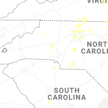
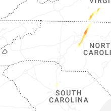


Connect with Interactive Hail Maps