

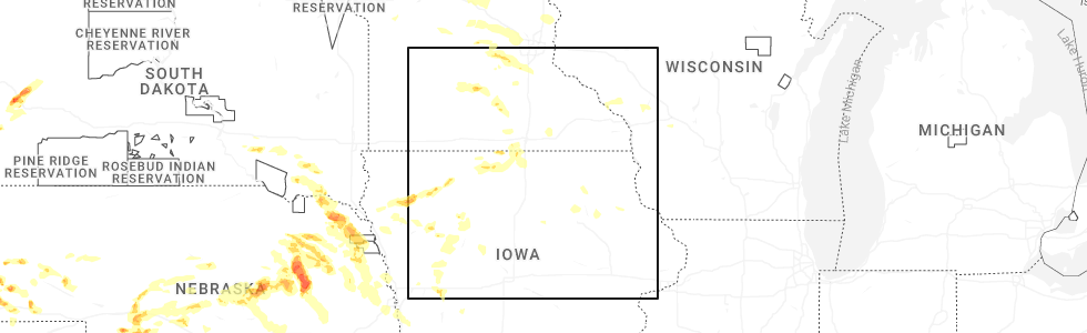
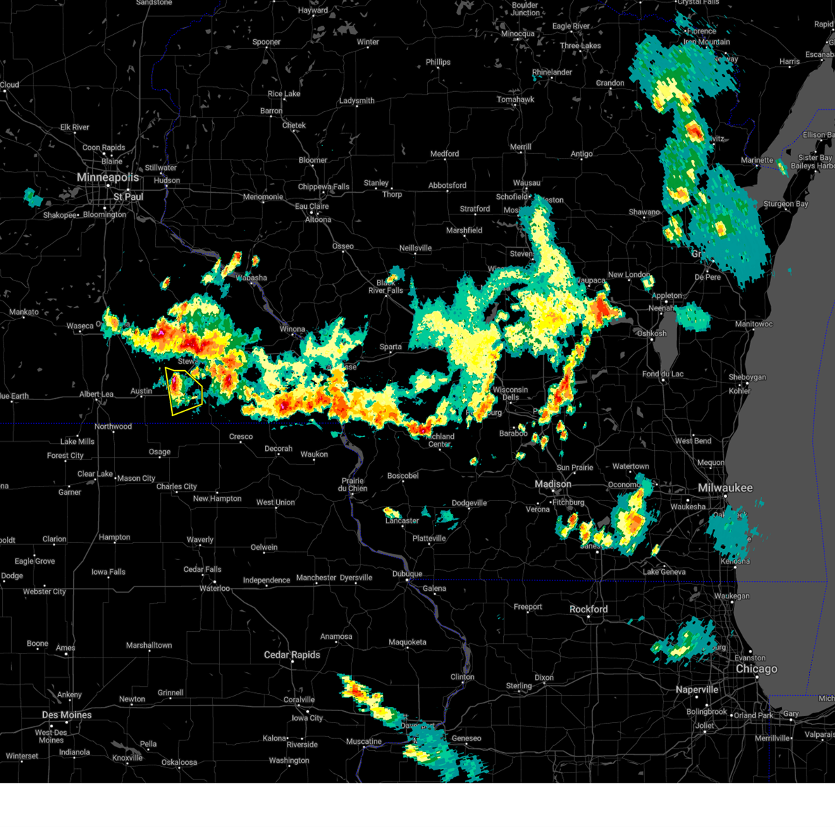
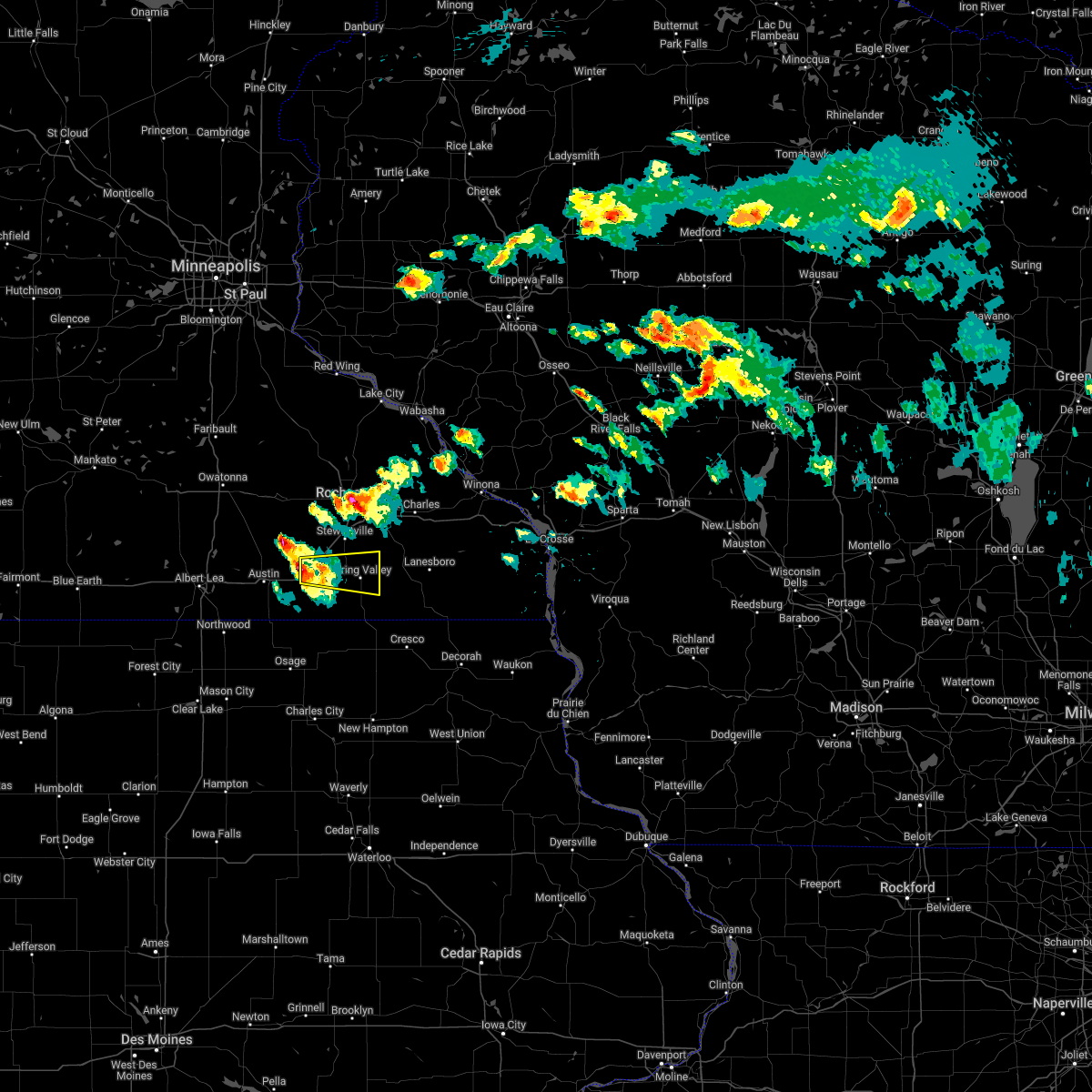
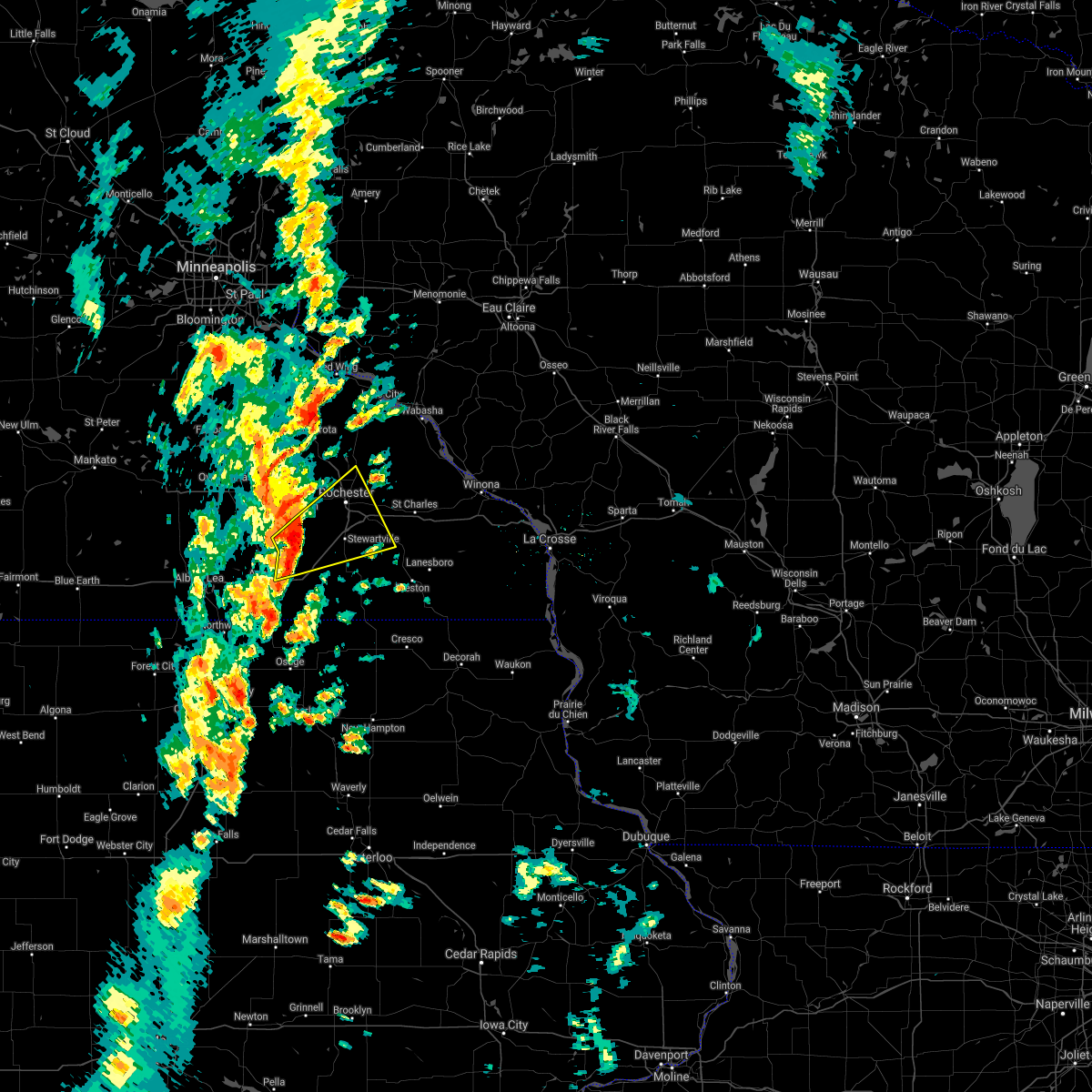
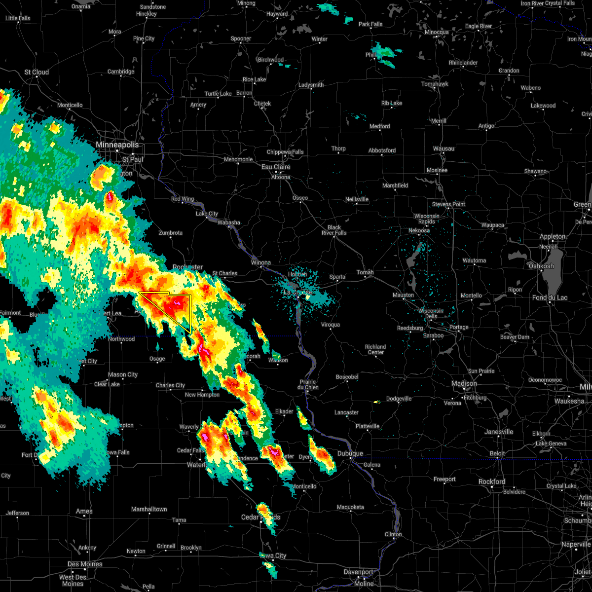
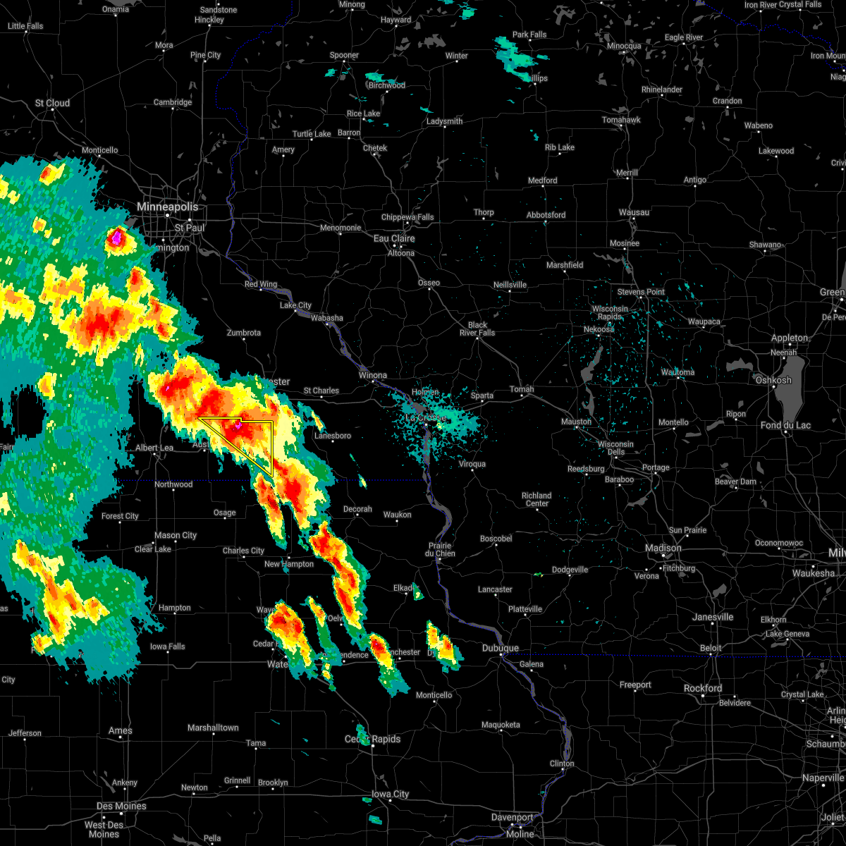
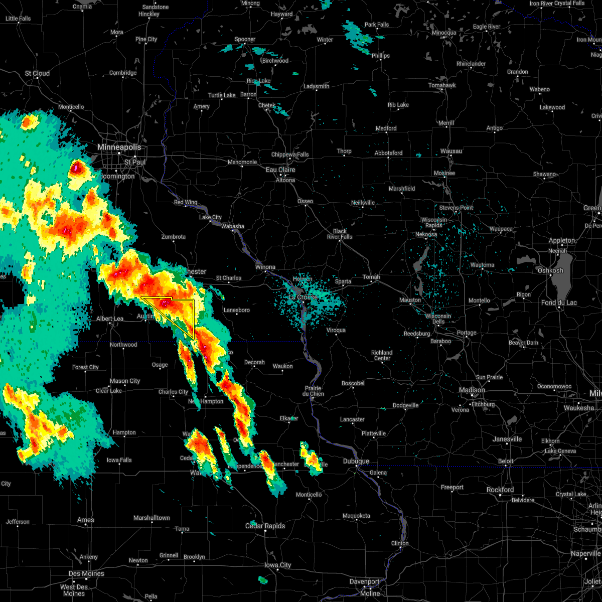
Hail Map for Dexter, MN
The Dexter, MN area has had 0 reports of on-the-ground hail by trained spotters, and has been under severe weather warnings 7 times during the past 12 months. Doppler radar has detected hail at or near Dexter, MN on 48 occasions, including 2 occasions during the past year.
| Name: | Dexter, MN |
| Where Located: | 46.8 miles NNE of Mason City, IA |
| Map: | Google Map for Dexter, MN |
| Population: | 341 |
| Housing Units: | 151 |
| More Info: | Search Google for Dexter, MN |
0
The Top Recent Hail Date for Dexter, MN is Monday, June 16, 2025 (48th out of 48)
Hail and Wind Damage Spotted near Dexter, MN
| Date / Time | Report Details |
|---|---|
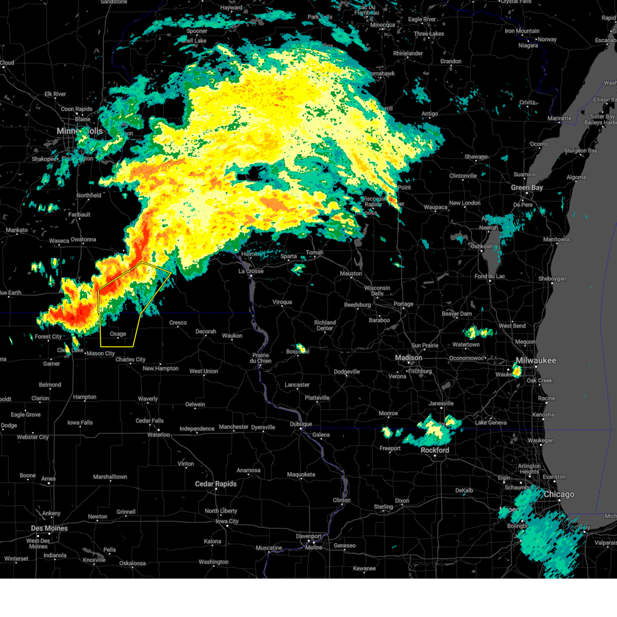
| 6/26/2025 2:48 PM CDT |
 Svrarx the national weather service in la crosse has issued a * severe thunderstorm warning for, eastern mitchell county in north central iowa, howard county in northeastern iowa, eastern mower county in southeastern minnesota, western fillmore county in southeastern minnesota, * until 330 pm cdt. * at 248 pm cdt, severe thunderstorms were located along a line extending from 6 miles north of adams to near osage, moving northeast at 50 mph (radar indicated). Hazards include 60 mph wind gusts. Expect damage to roofs, siding, and trees. severe thunderstorms will be near, grand meadow, le roy, and riceville around 255 pm cdt. spring valley around 300 pm cdt. wykoff around 310 pm cdt. chatfield and lime springs around 315 pm cdt. fountain around 320 pm cdt. other locations impacted by these severe thunderstorms include vernon springs county park, forestville state park, vernon springs, brownville, county roads t 54 and a 31, fillmore, and orchard. This includes interstate 90 in minnesota between mile markers 186 and 204. Svrarx the national weather service in la crosse has issued a * severe thunderstorm warning for, eastern mitchell county in north central iowa, howard county in northeastern iowa, eastern mower county in southeastern minnesota, western fillmore county in southeastern minnesota, * until 330 pm cdt. * at 248 pm cdt, severe thunderstorms were located along a line extending from 6 miles north of adams to near osage, moving northeast at 50 mph (radar indicated). Hazards include 60 mph wind gusts. Expect damage to roofs, siding, and trees. severe thunderstorms will be near, grand meadow, le roy, and riceville around 255 pm cdt. spring valley around 300 pm cdt. wykoff around 310 pm cdt. chatfield and lime springs around 315 pm cdt. fountain around 320 pm cdt. other locations impacted by these severe thunderstorms include vernon springs county park, forestville state park, vernon springs, brownville, county roads t 54 and a 31, fillmore, and orchard. This includes interstate 90 in minnesota between mile markers 186 and 204.
|
| 6/23/2025 2:00 PM CDT | Mesonet station mn010 i-90 - dexter - mp 19 in mower county MN, 1.4 miles WSW of Dexter, MN |
| 6/23/2025 1:58 PM CDT | Healthy pine trees snapped at the trunk at the dexter cemetery. time estimated on rada in mower county MN, 0.8 miles SSE of Dexter, MN |
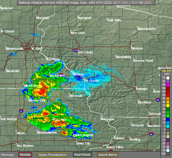
| 8/5/2024 8:27 PM CDT |
 the tornado warning has been cancelled and is no longer in effect the tornado warning has been cancelled and is no longer in effect
|
| 8/5/2024 8:17 PM CDT |
 Torarx the national weather service in la crosse has issued a * tornado warning for, northeastern mower county in southeastern minnesota, * until 845 pm cdt. * at 817 pm cdt, a severe thunderstorm capable of producing a tornado was located near brownsdale, or 7 miles east of austin, moving east at 40 mph (radar indicated rotation). Hazards include tornado. Flying debris will be dangerous to those caught without shelter. mobile homes will be damaged or destroyed. damage to roofs, windows, and vehicles will occur. tree damage is likely. this dangerous storm will be near, grand meadow around 830 pm cdt. other locations impacted by this tornadic thunderstorm include highways 63 and 16, hamilton, dexter, interstate 90 and county 1, elkton, racine, and renova. This includes interstate 90 in minnesota between mile markers 182 and 204. Torarx the national weather service in la crosse has issued a * tornado warning for, northeastern mower county in southeastern minnesota, * until 845 pm cdt. * at 817 pm cdt, a severe thunderstorm capable of producing a tornado was located near brownsdale, or 7 miles east of austin, moving east at 40 mph (radar indicated rotation). Hazards include tornado. Flying debris will be dangerous to those caught without shelter. mobile homes will be damaged or destroyed. damage to roofs, windows, and vehicles will occur. tree damage is likely. this dangerous storm will be near, grand meadow around 830 pm cdt. other locations impacted by this tornadic thunderstorm include highways 63 and 16, hamilton, dexter, interstate 90 and county 1, elkton, racine, and renova. This includes interstate 90 in minnesota between mile markers 182 and 204.
|
| 8/5/2024 8:11 PM CDT |
 Svrarx the national weather service in la crosse has issued a * severe thunderstorm warning for, mitchell county in north central iowa, southwestern olmsted county in southeastern minnesota, mower county in southeastern minnesota, northwestern fillmore county in southeastern minnesota, * until 900 pm cdt. * at 810 pm cdt, severe thunderstorms were located along a line extending from near rochester to near manly, moving southeast at 35 mph (radar indicated). Hazards include 60 mph wind gusts. Expect damage to roofs, siding, and trees. severe thunderstorms will be near, rochester, stewartville, lyle, and rose creek around 815 pm cdt. grand meadow, st. ansgar, and adams around 820 pm cdt. stacyville around 825 pm cdt. osage and spring valley around 830 pm cdt. chatfield and le roy around 835 pm cdt. other locations impacted by these severe thunderstorms include toeterville, rock creek, otranto, brownville, and rochester airport. People attending the mower county fairgrounds should seek safe shelter immediately! this includes interstate 90 in minnesota between mile markers 175 and 212. Svrarx the national weather service in la crosse has issued a * severe thunderstorm warning for, mitchell county in north central iowa, southwestern olmsted county in southeastern minnesota, mower county in southeastern minnesota, northwestern fillmore county in southeastern minnesota, * until 900 pm cdt. * at 810 pm cdt, severe thunderstorms were located along a line extending from near rochester to near manly, moving southeast at 35 mph (radar indicated). Hazards include 60 mph wind gusts. Expect damage to roofs, siding, and trees. severe thunderstorms will be near, rochester, stewartville, lyle, and rose creek around 815 pm cdt. grand meadow, st. ansgar, and adams around 820 pm cdt. stacyville around 825 pm cdt. osage and spring valley around 830 pm cdt. chatfield and le roy around 835 pm cdt. other locations impacted by these severe thunderstorms include toeterville, rock creek, otranto, brownville, and rochester airport. People attending the mower county fairgrounds should seek safe shelter immediately! this includes interstate 90 in minnesota between mile markers 175 and 212.
|
| 8/5/2024 7:58 PM CDT |
 At 758 pm cdt, severe thunderstorms were located along a line extending from near byron to 7 miles southeast of hayfield to near northwood, moving east at 45 mph (automated weather observations). Hazards include 60 mph wind gusts and penny size hail. Expect damage to roofs, siding, and trees. these severe storms will be near, rochester, lyle, and rose creek around 805 pm cdt. stewartville, grand meadow, and adams around 810 pm cdt. other locations impacted by these severe thunderstorms include county roads 3 and 108, county roads 6 and 15, rock dell, brookside campground, mayville, rochester airport, and graves landing field. People attending the mower county fairgrounds should seek safe shelter immediately! this includes interstate 90 in minnesota between mile markers 175 and 212. At 758 pm cdt, severe thunderstorms were located along a line extending from near byron to 7 miles southeast of hayfield to near northwood, moving east at 45 mph (automated weather observations). Hazards include 60 mph wind gusts and penny size hail. Expect damage to roofs, siding, and trees. these severe storms will be near, rochester, lyle, and rose creek around 805 pm cdt. stewartville, grand meadow, and adams around 810 pm cdt. other locations impacted by these severe thunderstorms include county roads 3 and 108, county roads 6 and 15, rock dell, brookside campground, mayville, rochester airport, and graves landing field. People attending the mower county fairgrounds should seek safe shelter immediately! this includes interstate 90 in minnesota between mile markers 175 and 212.
|
| 8/5/2024 7:49 PM CDT | At 747 pm cdt, severe thunderstorms were located along a line extending from near dodge center to near hayfield to near glenville, moving southeast at 30 mph (radar indicated). Hazards include 60 mph wind gusts and penny size hail. Expect damage to roofs, siding, and trees. these severe storms will be near, austin and brownsdale around 755 pm cdt. rose creek around 805 pm cdt. rochester and lyle around 810 pm cdt. stewartville and grand meadow around 815 pm cdt. adams around 820 pm cdt. other locations impacted by these severe thunderstorms include rock dell, brookside campground, and mayville. People attending the mower county fairgrounds should seek safe shelter immediately! this includes interstate 90 in minnesota between mile markers 175 and 212. |
| 8/5/2024 7:31 PM CDT |
 Svrarx the national weather service in la crosse has issued a * severe thunderstorm warning for, southwestern olmsted county in southeastern minnesota, mower county in southeastern minnesota, southern dodge county in southeastern minnesota, * until 815 pm cdt. * at 729 pm cdt, severe thunderstorms were located along a line extending from near claremont to near blooming prairie to near twin lakes, moving southeast at 45 mph (radar indicated). Hazards include 60 mph wind gusts and penny size hail. Expect damage to roofs, siding, and trees. severe thunderstorms will be near, austin, dodge center, and hayfield around 735 pm cdt. brownsdale around 740 pm cdt. rochester, stewartville, grand meadow, lyle, and rose creek around 755 pm cdt. adams around 800 pm cdt. other locations impacted by these severe thunderstorms include rock dell, brookside campground, and mayville. People attending the mower county fairgrounds should seek safe shelter immediately! this includes interstate 90 in minnesota between mile markers 175 and 212. Svrarx the national weather service in la crosse has issued a * severe thunderstorm warning for, southwestern olmsted county in southeastern minnesota, mower county in southeastern minnesota, southern dodge county in southeastern minnesota, * until 815 pm cdt. * at 729 pm cdt, severe thunderstorms were located along a line extending from near claremont to near blooming prairie to near twin lakes, moving southeast at 45 mph (radar indicated). Hazards include 60 mph wind gusts and penny size hail. Expect damage to roofs, siding, and trees. severe thunderstorms will be near, austin, dodge center, and hayfield around 735 pm cdt. brownsdale around 740 pm cdt. rochester, stewartville, grand meadow, lyle, and rose creek around 755 pm cdt. adams around 800 pm cdt. other locations impacted by these severe thunderstorms include rock dell, brookside campground, and mayville. People attending the mower county fairgrounds should seek safe shelter immediately! this includes interstate 90 in minnesota between mile markers 175 and 212.
|
| 7/13/2024 7:22 PM CDT |
 At 721 pm cdt, severe thunderstorms were located along a line extending from near fountain to near spring valley to 6 miles east of brownsdale, moving southeast at 35 mph (radar indicated). Hazards include 70 mph wind gusts and nickel size hail. Expect considerable tree damage. damage is likely to mobile homes, roofs, and outbuildings. these severe storms will be near, preston, spring valley, grand meadow, and fountain around 725 pm cdt. lanesboro around 730 pm cdt. harmony and le roy around 740 pm cdt. canton around 750 pm cdt. other locations impacted by these severe thunderstorms include forestville state park, choice, county roads 6 and 33, york, isinours, hutton, and fillmore. This includes interstate 90 in minnesota between mile markers 191 and 202, and between mile markers 227 and 232. At 721 pm cdt, severe thunderstorms were located along a line extending from near fountain to near spring valley to 6 miles east of brownsdale, moving southeast at 35 mph (radar indicated). Hazards include 70 mph wind gusts and nickel size hail. Expect considerable tree damage. damage is likely to mobile homes, roofs, and outbuildings. these severe storms will be near, preston, spring valley, grand meadow, and fountain around 725 pm cdt. lanesboro around 730 pm cdt. harmony and le roy around 740 pm cdt. canton around 750 pm cdt. other locations impacted by these severe thunderstorms include forestville state park, choice, county roads 6 and 33, york, isinours, hutton, and fillmore. This includes interstate 90 in minnesota between mile markers 191 and 202, and between mile markers 227 and 232.
|
| 7/13/2024 7:22 PM CDT |
 the severe thunderstorm warning has been cancelled and is no longer in effect the severe thunderstorm warning has been cancelled and is no longer in effect
|
| 7/13/2024 7:06 PM CDT |
 Svrarx the national weather service in la crosse has issued a * severe thunderstorm warning for, southwestern winona county in southeastern minnesota, southeastern olmsted county in southeastern minnesota, eastern mower county in southeastern minnesota, south central dodge county in southeastern minnesota, fillmore county in southeastern minnesota, * until 745 pm cdt. * at 706 pm cdt, severe thunderstorms were located along a line extending from near chatfield to near spring valley to near hayfield, moving southeast at 45 mph (trained weather spotters). Hazards include 70 mph wind gusts and penny size hail. Expect considerable tree damage. damage is likely to mobile homes, roofs, and outbuildings. severe thunderstorms will be near, chatfield, spring valley, and wykoff around 710 pm cdt. grand meadow and fountain around 715 pm cdt. preston and lanesboro around 720 pm cdt. harmony around 735 pm cdt. other locations impacted by these severe thunderstorms include forestville state park, choice, isinours, hutton, fillmore, waltham, and rushford village. This includes interstate 90 in minnesota between mile markers 190 and 202, and between mile markers 227 and 232. Svrarx the national weather service in la crosse has issued a * severe thunderstorm warning for, southwestern winona county in southeastern minnesota, southeastern olmsted county in southeastern minnesota, eastern mower county in southeastern minnesota, south central dodge county in southeastern minnesota, fillmore county in southeastern minnesota, * until 745 pm cdt. * at 706 pm cdt, severe thunderstorms were located along a line extending from near chatfield to near spring valley to near hayfield, moving southeast at 45 mph (trained weather spotters). Hazards include 70 mph wind gusts and penny size hail. Expect considerable tree damage. damage is likely to mobile homes, roofs, and outbuildings. severe thunderstorms will be near, chatfield, spring valley, and wykoff around 710 pm cdt. grand meadow and fountain around 715 pm cdt. preston and lanesboro around 720 pm cdt. harmony around 735 pm cdt. other locations impacted by these severe thunderstorms include forestville state park, choice, isinours, hutton, fillmore, waltham, and rushford village. This includes interstate 90 in minnesota between mile markers 190 and 202, and between mile markers 227 and 232.
|
| 5/21/2024 5:54 PM CDT |
 The storms which prompted the warning have moved out of the area. therefore, the warning will be allowed to expire. however, gusty winds are still possible with these thunderstorms. a tornado watch remains in effect until 900 pm cdt for north central and northeastern iowa, and southeastern minnesota. The storms which prompted the warning have moved out of the area. therefore, the warning will be allowed to expire. however, gusty winds are still possible with these thunderstorms. a tornado watch remains in effect until 900 pm cdt for north central and northeastern iowa, and southeastern minnesota.
|
| 5/21/2024 5:18 PM CDT |
 At 518 pm cdt, severe thunderstorms were located along a line extending from near brownsdale to near osage to near greene, moving northeast at 70 mph (radar indicated). Hazards include 70 mph wind gusts and penny size hail. Expect considerable tree damage. damage is likely to mobile homes, roofs, and outbuildings. these severe storms will be near, charles city, adams, riceville, and floyd around 525 pm cdt. grand meadow and le roy around 530 pm cdt. other locations impacted by these severe thunderstorms include toeterville, county roads b 60 and t 18, rock creek, idlewilde state park, otranto, brownville, and county roads t 54 and a 31. This includes interstate 90 in minnesota between mile markers 175 and 204. At 518 pm cdt, severe thunderstorms were located along a line extending from near brownsdale to near osage to near greene, moving northeast at 70 mph (radar indicated). Hazards include 70 mph wind gusts and penny size hail. Expect considerable tree damage. damage is likely to mobile homes, roofs, and outbuildings. these severe storms will be near, charles city, adams, riceville, and floyd around 525 pm cdt. grand meadow and le roy around 530 pm cdt. other locations impacted by these severe thunderstorms include toeterville, county roads b 60 and t 18, rock creek, idlewilde state park, otranto, brownville, and county roads t 54 and a 31. This includes interstate 90 in minnesota between mile markers 175 and 204.
|
| 5/21/2024 5:03 PM CDT |
 Svrarx the national weather service in la crosse has issued a * severe thunderstorm warning for, mitchell county in north central iowa, floyd county in north central iowa, mower county in southeastern minnesota, * until 600 pm cdt. * at 503 pm cdt, severe thunderstorms were located along a line extending from near hollandale to near marble rock to near aplington, moving east at 45 mph (radar indicated). Hazards include 70 mph wind gusts and penny size hail. Expect considerable tree damage. damage is likely to mobile homes, roofs, and outbuildings. severe thunderstorms will be near, austin, st. ansgar, rockford, lyle, rudd, and marble rock around 510 pm cdt. osage, brownsdale, rose creek, and floyd around 515 pm cdt. charles city and stacyville around 520 pm cdt. adams around 525 pm cdt. grand meadow and riceville around 535 pm cdt. le roy around 540 pm cdt. other locations impacted by these severe thunderstorms include toeterville, county roads b 60 and t 18, rock creek, idlewilde state park, otranto, brownville, and county roads t 54 and a 31. This includes interstate 90 in minnesota between mile markers 175 and 204. Svrarx the national weather service in la crosse has issued a * severe thunderstorm warning for, mitchell county in north central iowa, floyd county in north central iowa, mower county in southeastern minnesota, * until 600 pm cdt. * at 503 pm cdt, severe thunderstorms were located along a line extending from near hollandale to near marble rock to near aplington, moving east at 45 mph (radar indicated). Hazards include 70 mph wind gusts and penny size hail. Expect considerable tree damage. damage is likely to mobile homes, roofs, and outbuildings. severe thunderstorms will be near, austin, st. ansgar, rockford, lyle, rudd, and marble rock around 510 pm cdt. osage, brownsdale, rose creek, and floyd around 515 pm cdt. charles city and stacyville around 520 pm cdt. adams around 525 pm cdt. grand meadow and riceville around 535 pm cdt. le roy around 540 pm cdt. other locations impacted by these severe thunderstorms include toeterville, county roads b 60 and t 18, rock creek, idlewilde state park, otranto, brownville, and county roads t 54 and a 31. This includes interstate 90 in minnesota between mile markers 175 and 204.
|
| 4/30/2024 8:13 PM CDT |
 At 812 pm cdt, severe thunderstorms were located along a line extending from near dodge center to 8 miles west of stewartville to near adams, moving northeast at 50 mph (radar indicated). Hazards include 60 mph wind gusts. Expect damage to roofs, siding, and trees. these severe storms will be near, dodge center, mantorville, kasson, byron, and grand meadow around 815 pm cdt. rochester and stewartville around 820 pm cdt. other locations impacted by these severe thunderstorms include salem corners, rock dell, and highway 56 and county 6. This includes interstate 90 in minnesota between mile markers 188 and 213. At 812 pm cdt, severe thunderstorms were located along a line extending from near dodge center to 8 miles west of stewartville to near adams, moving northeast at 50 mph (radar indicated). Hazards include 60 mph wind gusts. Expect damage to roofs, siding, and trees. these severe storms will be near, dodge center, mantorville, kasson, byron, and grand meadow around 815 pm cdt. rochester and stewartville around 820 pm cdt. other locations impacted by these severe thunderstorms include salem corners, rock dell, and highway 56 and county 6. This includes interstate 90 in minnesota between mile markers 188 and 213.
|
| 4/30/2024 8:05 PM CDT |
 At 805 pm cdt, severe thunderstorms were located along a line extending from near claremont to 7 miles northeast of brownsdale to near adams, moving northeast at 55 mph (radar indicated). Hazards include 60 mph wind gusts. Expect damage to roofs, siding, and trees. these severe storms will be near, dodge center, mantorville, kasson, grand meadow, and adams around 810 pm cdt. rochester, stewartville, and byron around 815 pm cdt. other locations impacted by these severe thunderstorms include salem corners, rock dell, and brookside campground. This includes interstate 90 in minnesota between mile markers 180 and 213. At 805 pm cdt, severe thunderstorms were located along a line extending from near claremont to 7 miles northeast of brownsdale to near adams, moving northeast at 55 mph (radar indicated). Hazards include 60 mph wind gusts. Expect damage to roofs, siding, and trees. these severe storms will be near, dodge center, mantorville, kasson, grand meadow, and adams around 810 pm cdt. rochester, stewartville, and byron around 815 pm cdt. other locations impacted by these severe thunderstorms include salem corners, rock dell, and brookside campground. This includes interstate 90 in minnesota between mile markers 180 and 213.
|
| 4/30/2024 7:52 PM CDT |
 Svrarx the national weather service in la crosse has issued a * severe thunderstorm warning for, western olmsted county in southeastern minnesota, mower county in southeastern minnesota, dodge county in southeastern minnesota, * until 830 pm cdt. * at 751 pm cdt, severe thunderstorms were located along a line extending from 6 miles northwest of blooming prairie to near brownsdale to lyle, moving northeast at 50 mph (radar indicated). Hazards include 60 mph wind gusts and penny size hail. Expect damage to roofs, siding, and trees. severe thunderstorms will be near, austin, blooming prairie, hayfield, brownsdale, lyle, and rose creek around 755 pm cdt. adams around 800 pm cdt. dodge center around 805 pm cdt. mantorville and kasson around 810 pm cdt. rochester, byron, and grand meadow around 815 pm cdt. stewartville around 820 pm cdt. other locations impacted by these severe thunderstorms include salem corners, rock dell, and brookside campground. This includes interstate 90 in minnesota between mile markers 175 and 213. Svrarx the national weather service in la crosse has issued a * severe thunderstorm warning for, western olmsted county in southeastern minnesota, mower county in southeastern minnesota, dodge county in southeastern minnesota, * until 830 pm cdt. * at 751 pm cdt, severe thunderstorms were located along a line extending from 6 miles northwest of blooming prairie to near brownsdale to lyle, moving northeast at 50 mph (radar indicated). Hazards include 60 mph wind gusts and penny size hail. Expect damage to roofs, siding, and trees. severe thunderstorms will be near, austin, blooming prairie, hayfield, brownsdale, lyle, and rose creek around 755 pm cdt. adams around 800 pm cdt. dodge center around 805 pm cdt. mantorville and kasson around 810 pm cdt. rochester, byron, and grand meadow around 815 pm cdt. stewartville around 820 pm cdt. other locations impacted by these severe thunderstorms include salem corners, rock dell, and brookside campground. This includes interstate 90 in minnesota between mile markers 175 and 213.
|
| 7/22/2023 7:02 PM CDT |
 At 702 pm cdt, a severe thunderstorm was located over grand meadow, or 18 miles east of austin, moving southeast at 20 mph (radar indicated). Hazards include quarter size hail. Damage to vehicles is expected. this severe storm will be near, grand meadow around 705 pm cdt. other locations impacted by this severe thunderstorm include dexter, county roads 4 and 8, interstate 90 and county 1, elkton, county roads 1 and 7 and highways 63 and 16. this includes interstate 90 in minnesota between mile markers 191 and 202. hail threat, radar indicated max hail size, 1. 00 in wind threat, radar indicated max wind gust, <50 mph. At 702 pm cdt, a severe thunderstorm was located over grand meadow, or 18 miles east of austin, moving southeast at 20 mph (radar indicated). Hazards include quarter size hail. Damage to vehicles is expected. this severe storm will be near, grand meadow around 705 pm cdt. other locations impacted by this severe thunderstorm include dexter, county roads 4 and 8, interstate 90 and county 1, elkton, county roads 1 and 7 and highways 63 and 16. this includes interstate 90 in minnesota between mile markers 191 and 202. hail threat, radar indicated max hail size, 1. 00 in wind threat, radar indicated max wind gust, <50 mph.
|
| 7/22/2023 6:53 PM CDT |
 At 653 pm cdt, a severe thunderstorm was located near grand meadow, or 15 miles east of austin, moving southeast at 20 mph (radar indicated). Hazards include quarter size hail. Damage to vehicles is expected. this severe storm will be near, grand meadow around 705 pm cdt. other locations impacted by this severe thunderstorm include dexter, county roads 4 and 8, interstate 90 and county 1, elkton, county roads 1 and 7 and highways 63 and 16. this includes interstate 90 in minnesota between mile markers 191 and 202. hail threat, radar indicated max hail size, 1. 00 in wind threat, radar indicated max wind gust, <50 mph. At 653 pm cdt, a severe thunderstorm was located near grand meadow, or 15 miles east of austin, moving southeast at 20 mph (radar indicated). Hazards include quarter size hail. Damage to vehicles is expected. this severe storm will be near, grand meadow around 705 pm cdt. other locations impacted by this severe thunderstorm include dexter, county roads 4 and 8, interstate 90 and county 1, elkton, county roads 1 and 7 and highways 63 and 16. this includes interstate 90 in minnesota between mile markers 191 and 202. hail threat, radar indicated max hail size, 1. 00 in wind threat, radar indicated max wind gust, <50 mph.
|
| 7/22/2023 6:37 PM CDT |
 At 636 pm cdt, a severe thunderstorm was located near brownsdale, or 13 miles northeast of austin, moving southeast at 20 mph (radar indicated). Hazards include quarter size hail. Damage to vehicles is expected. this severe storm will be near, grand meadow around 705 pm cdt. other locations impacted by this severe thunderstorm include county roads 1 and 15, sargeant, taopi, county roads 1 and 7, highways 63 and 16, dexter and county roads 4 and 8. this includes interstate 90 in minnesota between mile markers 187 and 202. hail threat, radar indicated max hail size, 1. 00 in wind threat, radar indicated max wind gust, <50 mph. At 636 pm cdt, a severe thunderstorm was located near brownsdale, or 13 miles northeast of austin, moving southeast at 20 mph (radar indicated). Hazards include quarter size hail. Damage to vehicles is expected. this severe storm will be near, grand meadow around 705 pm cdt. other locations impacted by this severe thunderstorm include county roads 1 and 15, sargeant, taopi, county roads 1 and 7, highways 63 and 16, dexter and county roads 4 and 8. this includes interstate 90 in minnesota between mile markers 187 and 202. hail threat, radar indicated max hail size, 1. 00 in wind threat, radar indicated max wind gust, <50 mph.
|
| 7/22/2023 6:30 PM CDT |
 At 629 pm cdt, a severe thunderstorm was located near hayfield, or 13 miles northeast of austin, moving southeast at 20 mph (radar indicated). Hazards include quarter size hail. Damage to vehicles is expected. this severe storm will be near, grand meadow around 710 pm cdt. other locations impacted by this severe thunderstorm include county roads 1 and 15, sargeant, taopi, county roads 1 and 7, highways 63 and 16, dexter and county roads 4 and 8. this includes interstate 90 in minnesota between mile markers 187 and 202. hail threat, radar indicated max hail size, 1. 00 in wind threat, radar indicated max wind gust, <50 mph. At 629 pm cdt, a severe thunderstorm was located near hayfield, or 13 miles northeast of austin, moving southeast at 20 mph (radar indicated). Hazards include quarter size hail. Damage to vehicles is expected. this severe storm will be near, grand meadow around 710 pm cdt. other locations impacted by this severe thunderstorm include county roads 1 and 15, sargeant, taopi, county roads 1 and 7, highways 63 and 16, dexter and county roads 4 and 8. this includes interstate 90 in minnesota between mile markers 187 and 202. hail threat, radar indicated max hail size, 1. 00 in wind threat, radar indicated max wind gust, <50 mph.
|
| 7/22/2023 6:25 PM CDT |
 At 625 pm cdt, a severe thunderstorm was located near hayfield, or 13 miles south of dodge center, moving southeast at 20 mph (radar indicated). Hazards include quarter size hail. Damage to vehicles is expected. this severe thunderstorm will be near, brownsdale around 635 pm cdt. grand meadow around 705 pm cdt. other locations impacted by this severe thunderstorm include oslo, county roads 1 and 15, sargeant, taopi, county roads 1 and 7, highways 63 and 16 and dexter. this includes interstate 90 in minnesota between mile markers 187 and 202. hail threat, radar indicated max hail size, 1. 00 in wind threat, radar indicated max wind gust, <50 mph. At 625 pm cdt, a severe thunderstorm was located near hayfield, or 13 miles south of dodge center, moving southeast at 20 mph (radar indicated). Hazards include quarter size hail. Damage to vehicles is expected. this severe thunderstorm will be near, brownsdale around 635 pm cdt. grand meadow around 705 pm cdt. other locations impacted by this severe thunderstorm include oslo, county roads 1 and 15, sargeant, taopi, county roads 1 and 7, highways 63 and 16 and dexter. this includes interstate 90 in minnesota between mile markers 187 and 202. hail threat, radar indicated max hail size, 1. 00 in wind threat, radar indicated max wind gust, <50 mph.
|
| 7/23/2022 2:17 PM CDT |
 At 217 pm cdt, severe thunderstorms were located along a line extending from 6 miles northeast of grand meadow to 6 miles west of le roy, moving east at 25 mph (radar indicated). Hazards include 60 mph wind gusts and quarter size hail. Hail damage to vehicles is expected. expect wind damage to roofs, siding, and trees. these severe thunderstorms will remain over mainly rural areas of eastern mower county, including the following locations, lake louise state park, taopi, highways 63 and 16, hamilton, and interstate 90 and county 1. this includes interstate 90 in minnesota between mile markers 194 and 204. hail threat, radar indicated max hail size, 1. 00 in wind threat, radar indicated max wind gust, 60 mph. At 217 pm cdt, severe thunderstorms were located along a line extending from 6 miles northeast of grand meadow to 6 miles west of le roy, moving east at 25 mph (radar indicated). Hazards include 60 mph wind gusts and quarter size hail. Hail damage to vehicles is expected. expect wind damage to roofs, siding, and trees. these severe thunderstorms will remain over mainly rural areas of eastern mower county, including the following locations, lake louise state park, taopi, highways 63 and 16, hamilton, and interstate 90 and county 1. this includes interstate 90 in minnesota between mile markers 194 and 204. hail threat, radar indicated max hail size, 1. 00 in wind threat, radar indicated max wind gust, 60 mph.
|
| 7/23/2022 1:43 PM CDT |
 At 142 pm cdt, severe thunderstorms were located along a line extending from near brownsdale to near lyle, moving east at 30 mph (radar indicated). Hazards include 60 mph wind gusts and quarter size hail. Hail damage to vehicles is expected. expect wind damage to roofs, siding, and trees. these severe storms will be near, adams around 210 pm cdt. grand meadow around 215 pm cdt. le roy around 230 pm cdt. other locations impacted by these severe thunderstorms include sargeant, county roads 1 and 7, county roads 56 and 5, mapleview, lansing, brookside campground and mayville. This includes interstate 90 in minnesota between mile markers 175 and 204. At 142 pm cdt, severe thunderstorms were located along a line extending from near brownsdale to near lyle, moving east at 30 mph (radar indicated). Hazards include 60 mph wind gusts and quarter size hail. Hail damage to vehicles is expected. expect wind damage to roofs, siding, and trees. these severe storms will be near, adams around 210 pm cdt. grand meadow around 215 pm cdt. le roy around 230 pm cdt. other locations impacted by these severe thunderstorms include sargeant, county roads 1 and 7, county roads 56 and 5, mapleview, lansing, brookside campground and mayville. This includes interstate 90 in minnesota between mile markers 175 and 204.
|
| 7/23/2022 1:22 PM CDT |
 At 122 pm cdt, severe thunderstorms were located along a line extending from near blooming prairie to near glenville, moving east at 30 mph (radar indicated). Hazards include 60 mph wind gusts and quarter size hail. Hail damage to vehicles is expected. expect wind damage to roofs, siding, and trees. severe thunderstorms will be near, austin around 135 pm cdt. brownsdale around 145 pm cdt. lyle around 150 pm cdt. adams around 210 pm cdt. grand meadow around 215 pm cdt. le roy around 230 pm cdt. other locations impacted by these severe thunderstorms include sargeant, county roads 1 and 7, county roads 56 and 5, mapleview, lansing, brookside campground and mayville. this includes interstate 90 in minnesota between mile markers 175 and 204. hail threat, radar indicated max hail size, 1. 00 in wind threat, radar indicated max wind gust, 60 mph. At 122 pm cdt, severe thunderstorms were located along a line extending from near blooming prairie to near glenville, moving east at 30 mph (radar indicated). Hazards include 60 mph wind gusts and quarter size hail. Hail damage to vehicles is expected. expect wind damage to roofs, siding, and trees. severe thunderstorms will be near, austin around 135 pm cdt. brownsdale around 145 pm cdt. lyle around 150 pm cdt. adams around 210 pm cdt. grand meadow around 215 pm cdt. le roy around 230 pm cdt. other locations impacted by these severe thunderstorms include sargeant, county roads 1 and 7, county roads 56 and 5, mapleview, lansing, brookside campground and mayville. this includes interstate 90 in minnesota between mile markers 175 and 204. hail threat, radar indicated max hail size, 1. 00 in wind threat, radar indicated max wind gust, 60 mph.
|
| 6/28/2022 5:49 PM CDT |
 At 549 pm cdt, a severe thunderstorm was located near grand meadow, or 15 miles east of austin, moving east at 25 mph (radar indicated). Hazards include 60 mph wind gusts and quarter size hail. Hail damage to vehicles is expected. expect wind damage to roofs, siding, and trees. this severe thunderstorm will be near, grand meadow around 600 pm cdt. spring valley around 620 pm cdt. other locations impacted by this severe thunderstorm include dexter, elkton, washington, racine, and hamilton. this includes interstate 90 in minnesota between mile markers 190 and 199. hail threat, radar indicated max hail size, 1. 00 in wind threat, radar indicated max wind gust, 60 mph. At 549 pm cdt, a severe thunderstorm was located near grand meadow, or 15 miles east of austin, moving east at 25 mph (radar indicated). Hazards include 60 mph wind gusts and quarter size hail. Hail damage to vehicles is expected. expect wind damage to roofs, siding, and trees. this severe thunderstorm will be near, grand meadow around 600 pm cdt. spring valley around 620 pm cdt. other locations impacted by this severe thunderstorm include dexter, elkton, washington, racine, and hamilton. this includes interstate 90 in minnesota between mile markers 190 and 199. hail threat, radar indicated max hail size, 1. 00 in wind threat, radar indicated max wind gust, 60 mph.
|
| 4/23/2022 8:08 PM CDT |
 At 808 pm cdt, severe thunderstorms were located along a line extending from 9 miles southeast of hayfield to 7 miles east of brownsdale to near adams, moving northeast at 50 mph (radar indicated). Hazards include 60 mph wind gusts. Expect damage to roofs, siding, and trees. this includes interstate 90 in minnesota between mile markers 187 and 204. hail threat, radar indicated max hail size, <. 75 in wind threat, radar indicated max wind gust, 60 mph. At 808 pm cdt, severe thunderstorms were located along a line extending from 9 miles southeast of hayfield to 7 miles east of brownsdale to near adams, moving northeast at 50 mph (radar indicated). Hazards include 60 mph wind gusts. Expect damage to roofs, siding, and trees. this includes interstate 90 in minnesota between mile markers 187 and 204. hail threat, radar indicated max hail size, <. 75 in wind threat, radar indicated max wind gust, 60 mph.
|
| 4/23/2022 8:05 PM CDT |
 At 804 pm cdt, severe thunderstorms were located along a line extending from near hayfield to 6 miles southeast of brownsdale to near stacyville, moving northeast at 50 mph (radar indicated). Hazards include 60 mph wind gusts. Expect damage to roofs, siding, and trees. locations impacted include, grand meadow. this includes interstate 90 in minnesota between mile markers 184 and 204. hail threat, radar indicated max hail size, <. 75 in wind threat, radar indicated max wind gust, 60 mph. At 804 pm cdt, severe thunderstorms were located along a line extending from near hayfield to 6 miles southeast of brownsdale to near stacyville, moving northeast at 50 mph (radar indicated). Hazards include 60 mph wind gusts. Expect damage to roofs, siding, and trees. locations impacted include, grand meadow. this includes interstate 90 in minnesota between mile markers 184 and 204. hail threat, radar indicated max hail size, <. 75 in wind threat, radar indicated max wind gust, 60 mph.
|
| 4/23/2022 7:57 PM CDT |
 At 756 pm cdt, severe thunderstorms were located along a line extending from 6 miles southeast of blooming prairie to near rose creek to st. ansgar, moving northeast at 50 mph (radar indicated). Hazards include 60 mph wind gusts. Expect damage to roofs, siding, and trees. these severe storms will be near, brownsdale and rose creek around 800 pm cdt. other locations in the path of these severe thunderstorms include grand meadow, adams and le roy. this includes interstate 90 in minnesota between mile markers 175 and 204. hail threat, radar indicated max hail size, <. 75 in wind threat, radar indicated max wind gust, 60 mph. At 756 pm cdt, severe thunderstorms were located along a line extending from 6 miles southeast of blooming prairie to near rose creek to st. ansgar, moving northeast at 50 mph (radar indicated). Hazards include 60 mph wind gusts. Expect damage to roofs, siding, and trees. these severe storms will be near, brownsdale and rose creek around 800 pm cdt. other locations in the path of these severe thunderstorms include grand meadow, adams and le roy. this includes interstate 90 in minnesota between mile markers 175 and 204. hail threat, radar indicated max hail size, <. 75 in wind threat, radar indicated max wind gust, 60 mph.
|
| 4/23/2022 7:51 PM CDT |
 At 750 pm cdt, severe thunderstorms were located along a line extending from near blooming prairie to near rose creek to 6 miles north of nora springs, moving northeast at 55 mph (radar indicated). Hazards include 60 mph wind gusts. Expect damage to roofs, siding, and trees. these severe storms will be near, adams, brownsdale and rose creek around 755 pm cdt. this includes interstate 90 in minnesota between mile markers 175 and 204. hail threat, radar indicated max hail size, <. 75 in wind threat, radar indicated max wind gust, 60 mph. At 750 pm cdt, severe thunderstorms were located along a line extending from near blooming prairie to near rose creek to 6 miles north of nora springs, moving northeast at 55 mph (radar indicated). Hazards include 60 mph wind gusts. Expect damage to roofs, siding, and trees. these severe storms will be near, adams, brownsdale and rose creek around 755 pm cdt. this includes interstate 90 in minnesota between mile markers 175 and 204. hail threat, radar indicated max hail size, <. 75 in wind threat, radar indicated max wind gust, 60 mph.
|
| 4/23/2022 7:42 PM CDT |
 At 741 pm cdt, severe thunderstorms were located along a line extending from near hollandale to near london to near rockford, moving northeast at 50 mph (radar indicated). Hazards include 60 mph wind gusts. Expect damage to roofs, siding, and trees. these severe storms will be near, lyle around 745 pm cdt. austin around 750 pm cdt. rose creek around 755 pm cdt. other locations in the path of these severe thunderstorms include adams, brownsdale, floyd, osage, grand meadow, riceville and le roy. this includes interstate 90 in minnesota between mile markers 175 and 204. hail threat, radar indicated max hail size, <. 75 in wind threat, radar indicated max wind gust, 60 mph. At 741 pm cdt, severe thunderstorms were located along a line extending from near hollandale to near london to near rockford, moving northeast at 50 mph (radar indicated). Hazards include 60 mph wind gusts. Expect damage to roofs, siding, and trees. these severe storms will be near, lyle around 745 pm cdt. austin around 750 pm cdt. rose creek around 755 pm cdt. other locations in the path of these severe thunderstorms include adams, brownsdale, floyd, osage, grand meadow, riceville and le roy. this includes interstate 90 in minnesota between mile markers 175 and 204. hail threat, radar indicated max hail size, <. 75 in wind threat, radar indicated max wind gust, 60 mph.
|
| 4/23/2022 7:37 PM CDT |
 At 735 pm cdt, severe thunderstorms were located along a line extending from near hayward to near london to near rockwell, moving northeast at 50 mph (radar indicated). Hazards include 60 mph wind gusts. Expect damage to roofs, siding, and trees. these severe storms will be near, lyle around 745 pm cdt. austin and rudd around 750 pm cdt. adams, rose creek and floyd around 755 pm cdt. osage and brownsdale around 800 pm cdt. this includes interstate 90 in minnesota between mile markers 175 and 204. hail threat, radar indicated max hail size, <. 75 in wind threat, radar indicated max wind gust, 60 mph. At 735 pm cdt, severe thunderstorms were located along a line extending from near hayward to near london to near rockwell, moving northeast at 50 mph (radar indicated). Hazards include 60 mph wind gusts. Expect damage to roofs, siding, and trees. these severe storms will be near, lyle around 745 pm cdt. austin and rudd around 750 pm cdt. adams, rose creek and floyd around 755 pm cdt. osage and brownsdale around 800 pm cdt. this includes interstate 90 in minnesota between mile markers 175 and 204. hail threat, radar indicated max hail size, <. 75 in wind threat, radar indicated max wind gust, 60 mph.
|
| 4/23/2022 7:29 PM CDT |
 At 728 pm cdt, severe thunderstorms were located along a line extending from near twin lakes to northwood to rockwell, moving northeast at 50 mph (radar indicated. at 712 pm, mason city airport gusted to 56 mph). Hazards include 60 mph wind gusts. Expect damage to roofs, siding, and trees. these severe storms will be near, nora springs, rockford and lyle around 745 pm cdt. rudd around 750 pm cdt. austin and rose creek around 755 pm cdt. adams, brownsdale and floyd around 800 pm cdt. osage around 805 pm cdt. this includes interstate 90 in minnesota between mile markers 175 and 204. hail threat, radar indicated max hail size, <. 75 in wind threat, radar indicated max wind gust, 60 mph. At 728 pm cdt, severe thunderstorms were located along a line extending from near twin lakes to northwood to rockwell, moving northeast at 50 mph (radar indicated. at 712 pm, mason city airport gusted to 56 mph). Hazards include 60 mph wind gusts. Expect damage to roofs, siding, and trees. these severe storms will be near, nora springs, rockford and lyle around 745 pm cdt. rudd around 750 pm cdt. austin and rose creek around 755 pm cdt. adams, brownsdale and floyd around 800 pm cdt. osage around 805 pm cdt. this includes interstate 90 in minnesota between mile markers 175 and 204. hail threat, radar indicated max hail size, <. 75 in wind threat, radar indicated max wind gust, 60 mph.
|
| 4/23/2022 7:19 PM CDT |
 At 718 pm cdt, severe thunderstorms were located along a line extending from emmons to 6 miles southwest of northwood to near sheffield, moving northeast at 50 mph (radar indicated). Hazards include 60 mph wind gusts. Expect damage to roofs, siding, and trees. severe thunderstorms will be near, lyle around 740 pm cdt. nora springs and rockford around 745 pm cdt. austin, rose creek and rudd around 750 pm cdt. osage around 800 pm cdt. other locations impacted by these severe thunderstorms include toeterville, county roads b 60 and t 18, rock creek, idlewilde state park, otranto, brownville and county roads t 54 and a 31. hail threat, radar indicated max hail size, <. 75 in wind threat, radar indicated max wind gust, 60 mph. At 718 pm cdt, severe thunderstorms were located along a line extending from emmons to 6 miles southwest of northwood to near sheffield, moving northeast at 50 mph (radar indicated). Hazards include 60 mph wind gusts. Expect damage to roofs, siding, and trees. severe thunderstorms will be near, lyle around 740 pm cdt. nora springs and rockford around 745 pm cdt. austin, rose creek and rudd around 750 pm cdt. osage around 800 pm cdt. other locations impacted by these severe thunderstorms include toeterville, county roads b 60 and t 18, rock creek, idlewilde state park, otranto, brownville and county roads t 54 and a 31. hail threat, radar indicated max hail size, <. 75 in wind threat, radar indicated max wind gust, 60 mph.
|
| 4/12/2022 10:59 PM CDT |
 At 1059 pm cdt, severe thunderstorms were located along a line extending from 6 miles southeast of stewartville to marble rock, moving east at 60 mph (radar indicated). Hazards include 60 mph wind gusts and quarter size hail. Hail damage to vehicles is expected. expect wind damage to roofs, siding, and trees. these severe storms will be near, wykoff around 1105 pm cdt. chatfield and fountain around 1110 pm cdt. nashua around 1115 pm cdt. ionia around 1120 pm cdt. other locations impacted by these severe thunderstorms include forestville state park, county roads b 60 and t 18, idlewilde state park, bradford, chickasaw, brownville and county roads t 54 and a 31. this includes interstate 90 in minnesota between mile markers 190 and 206. hail threat, radar indicated max hail size, 1. 00 in wind threat, radar indicated max wind gust, 60 mph. At 1059 pm cdt, severe thunderstorms were located along a line extending from 6 miles southeast of stewartville to marble rock, moving east at 60 mph (radar indicated). Hazards include 60 mph wind gusts and quarter size hail. Hail damage to vehicles is expected. expect wind damage to roofs, siding, and trees. these severe storms will be near, wykoff around 1105 pm cdt. chatfield and fountain around 1110 pm cdt. nashua around 1115 pm cdt. ionia around 1120 pm cdt. other locations impacted by these severe thunderstorms include forestville state park, county roads b 60 and t 18, idlewilde state park, bradford, chickasaw, brownville and county roads t 54 and a 31. this includes interstate 90 in minnesota between mile markers 190 and 206. hail threat, radar indicated max hail size, 1. 00 in wind threat, radar indicated max wind gust, 60 mph.
|
| 4/12/2022 10:30 PM CDT |
 At 1030 pm cdt, severe thunderstorms were located along a line extending from near ellendale to near rockwell, moving east at 45 mph (radar indicated). Hazards include 60 mph wind gusts and quarter size hail. Hail damage to vehicles is expected. expect wind damage to roofs, siding, and trees. severe thunderstorms will be near, rockford around 1045 pm cdt. marble rock around 1050 pm cdt. nashua around 1115 pm cdt. stewartville and ionia around 1120 pm cdt. new hampton around 1130 pm cdt. other locations impacted by these severe thunderstorms include forestville state park, toeterville, bradford, chickasaw, county roads t 54 and a 31, fillmore and mayville. this includes interstate 90 in minnesota between mile markers 175 and 206. hail threat, radar indicated max hail size, 1. 00 in wind threat, radar indicated max wind gust, 60 mph. At 1030 pm cdt, severe thunderstorms were located along a line extending from near ellendale to near rockwell, moving east at 45 mph (radar indicated). Hazards include 60 mph wind gusts and quarter size hail. Hail damage to vehicles is expected. expect wind damage to roofs, siding, and trees. severe thunderstorms will be near, rockford around 1045 pm cdt. marble rock around 1050 pm cdt. nashua around 1115 pm cdt. stewartville and ionia around 1120 pm cdt. new hampton around 1130 pm cdt. other locations impacted by these severe thunderstorms include forestville state park, toeterville, bradford, chickasaw, county roads t 54 and a 31, fillmore and mayville. this includes interstate 90 in minnesota between mile markers 175 and 206. hail threat, radar indicated max hail size, 1. 00 in wind threat, radar indicated max wind gust, 60 mph.
|
| 12/15/2021 7:35 PM CST | Mesonet station mn010 1 ene dexte in mower county MN, 1.4 miles WSW of Dexter, MN |
| 12/15/2021 7:31 PM CST |
 At 730 pm cst, severe thunderstorms were located along a line extending from 6 miles northeast of brownsdale to near lime springs to near fredericksburg, moving northeast at 75 mph (radar indicated). Hazards include 70 mph wind gusts. Expect considerable tree damage. damage is likely to mobile homes, roofs, and outbuildings. locations impacted include, austin, cresco, new hampton, spring valley, grand meadow, fredericksburg, le roy, adams, riceville, brownsdale, elma, lime springs, wykoff, lawler, and rose creek. This includes interstate 90 in minnesota between mile markers 182 and 204. At 730 pm cst, severe thunderstorms were located along a line extending from 6 miles northeast of brownsdale to near lime springs to near fredericksburg, moving northeast at 75 mph (radar indicated). Hazards include 70 mph wind gusts. Expect considerable tree damage. damage is likely to mobile homes, roofs, and outbuildings. locations impacted include, austin, cresco, new hampton, spring valley, grand meadow, fredericksburg, le roy, adams, riceville, brownsdale, elma, lime springs, wykoff, lawler, and rose creek. This includes interstate 90 in minnesota between mile markers 182 and 204.
|
| 12/15/2021 7:05 PM CST |
 At 704 pm cst, severe thunderstorms were located along a line extending from near northwood to 6 miles northeast of charles city to near dike, moving northeast at 75 mph (radar indicated). Hazards include 70 mph wind gusts. Expect considerable tree damage. damage is likely to mobile homes, roofs, and outbuildings. locations impacted include, riceville, lyle, elma, austin, rose creek, brownsdale, lime springs, fredericksburg and lawler. This includes interstate 90 in minnesota between mile markers 175 and 204. At 704 pm cst, severe thunderstorms were located along a line extending from near northwood to 6 miles northeast of charles city to near dike, moving northeast at 75 mph (radar indicated). Hazards include 70 mph wind gusts. Expect considerable tree damage. damage is likely to mobile homes, roofs, and outbuildings. locations impacted include, riceville, lyle, elma, austin, rose creek, brownsdale, lime springs, fredericksburg and lawler. This includes interstate 90 in minnesota between mile markers 175 and 204.
|
| 12/15/2021 6:52 PM CST |
 At 652 pm cst, severe thunderstorms were located along a line extending from 8 miles southeast of rice lake to near marble rock to 6 miles northwest of grundy center, moving northeast at 75 mph (radar indicated). Hazards include 70 mph wind gusts. Expect considerable tree damage. damage is likely to mobile homes, roofs, and outbuildings. these severe storms will be near, marble rock around 655 pm cst. charles city and floyd around 700 pm cst. riceville, lyle and elma around 715 pm cst. austin and rose creek around 720 pm cst. Brownsdale and lime springs around 725 pm cst. At 652 pm cst, severe thunderstorms were located along a line extending from 8 miles southeast of rice lake to near marble rock to 6 miles northwest of grundy center, moving northeast at 75 mph (radar indicated). Hazards include 70 mph wind gusts. Expect considerable tree damage. damage is likely to mobile homes, roofs, and outbuildings. these severe storms will be near, marble rock around 655 pm cst. charles city and floyd around 700 pm cst. riceville, lyle and elma around 715 pm cst. austin and rose creek around 720 pm cst. Brownsdale and lime springs around 725 pm cst.
|
| 9/20/2021 3:58 PM CDT |
 At 357 pm cdt, a severe thunderstorm was located near hayfield, or 13 miles southeast of dodge center, moving northeast at 45 mph (radar indicated). Hazards include 60 mph wind gusts and penny size hail. Expect damage to roofs, siding, and trees. this severe storm will be near, stewartville around 410 pm cdt. rochester around 420 pm cdt. other locations impacted by this severe thunderstorm include salem corners, rock dell, rochester airport, waltham and renova. This includes interstate 90 in minnesota near mile marker 182, and between mile markers 194 and 222. At 357 pm cdt, a severe thunderstorm was located near hayfield, or 13 miles southeast of dodge center, moving northeast at 45 mph (radar indicated). Hazards include 60 mph wind gusts and penny size hail. Expect damage to roofs, siding, and trees. this severe storm will be near, stewartville around 410 pm cdt. rochester around 420 pm cdt. other locations impacted by this severe thunderstorm include salem corners, rock dell, rochester airport, waltham and renova. This includes interstate 90 in minnesota near mile marker 182, and between mile markers 194 and 222.
|
| 9/20/2021 3:47 PM CDT |
 At 346 pm cdt, a severe thunderstorm was located over brownsdale, or 8 miles northeast of austin, moving northeast at 45 mph (radar indicated). Hazards include 60 mph wind gusts and penny size hail. Expect damage to roofs, siding, and trees. this severe thunderstorm will be near, hayfield around 355 pm cdt. stewartville around 415 pm cdt. rochester around 420 pm cdt. This includes interstate 90 in minnesota between mile markers 180 and 182, and between mile markers 194 and 222. At 346 pm cdt, a severe thunderstorm was located over brownsdale, or 8 miles northeast of austin, moving northeast at 45 mph (radar indicated). Hazards include 60 mph wind gusts and penny size hail. Expect damage to roofs, siding, and trees. this severe thunderstorm will be near, hayfield around 355 pm cdt. stewartville around 415 pm cdt. rochester around 420 pm cdt. This includes interstate 90 in minnesota between mile markers 180 and 182, and between mile markers 194 and 222.
|
| 9/6/2020 12:38 AM CDT |
 At 1238 am cdt, a severe thunderstorm was located near grand meadow, or 18 miles south of rochester, moving east at 25 mph (radar indicated). Hazards include quarter size hail. Damage to vehicles is possible. This severe thunderstorm will remain over mainly rural areas of northeastern mower county, including the following locations, sargeant, county roads 1 and 7, county roads 4 and 8, waltham, renova, county roads 1 and 15 and highways 63 and 16. At 1238 am cdt, a severe thunderstorm was located near grand meadow, or 18 miles south of rochester, moving east at 25 mph (radar indicated). Hazards include quarter size hail. Damage to vehicles is possible. This severe thunderstorm will remain over mainly rural areas of northeastern mower county, including the following locations, sargeant, county roads 1 and 7, county roads 4 and 8, waltham, renova, county roads 1 and 15 and highways 63 and 16.
|
| 9/6/2020 12:22 AM CDT |
 At 1221 am cdt, a severe thunderstorm was located 8 miles northwest of grand meadow, or 16 miles northeast of austin, moving east at 30 mph (radar indicated). Hazards include ping pong ball size hail. People and animals outdoors will be injured. expect damage to roofs, siding, windows, and vehicles. this severe storm will be near, grand meadow around 1240 am cdt. Other locations impacted by this severe thunderstorm include sargeant, county roads 1 and 7, county roads 4 and 8, waltham, renova, county roads 1 and 15 and highways 63 and 16. At 1221 am cdt, a severe thunderstorm was located 8 miles northwest of grand meadow, or 16 miles northeast of austin, moving east at 30 mph (radar indicated). Hazards include ping pong ball size hail. People and animals outdoors will be injured. expect damage to roofs, siding, windows, and vehicles. this severe storm will be near, grand meadow around 1240 am cdt. Other locations impacted by this severe thunderstorm include sargeant, county roads 1 and 7, county roads 4 and 8, waltham, renova, county roads 1 and 15 and highways 63 and 16.
|
| 9/6/2020 12:16 AM CDT |
 At 1215 am cdt, a severe thunderstorm was located 8 miles northwest of grand meadow, or 16 miles northeast of austin, moving east at 30 mph (radar indicated). Hazards include ping pong ball size hail. People and animals outdoors will be injured. expect damage to roofs, siding, windows, and vehicles. this severe thunderstorm will be near, grand meadow around 1230 am cdt. Other locations impacted by this severe thunderstorm include sargeant, county roads 1 and 7, county roads 4 and 8, waltham, renova, county roads 1 and 15 and highways 63 and 16. At 1215 am cdt, a severe thunderstorm was located 8 miles northwest of grand meadow, or 16 miles northeast of austin, moving east at 30 mph (radar indicated). Hazards include ping pong ball size hail. People and animals outdoors will be injured. expect damage to roofs, siding, windows, and vehicles. this severe thunderstorm will be near, grand meadow around 1230 am cdt. Other locations impacted by this severe thunderstorm include sargeant, county roads 1 and 7, county roads 4 and 8, waltham, renova, county roads 1 and 15 and highways 63 and 16.
|
| 7/11/2020 5:19 PM CDT |
 At 517 pm cdt, severe thunderstorms were located along a line extending from near grand meadow to near le roy to 6 miles southwest of riceville, moving southeast at 50 mph. trained spotters have reported 50 mph winds with this line of storms. the latest wind report just came from stacyville (trained weather spotters). Hazards include 60 mph wind gusts. Expect damage to roofs, siding, and trees. these severe storms will be near, spring valley around 525 pm cdt. elma and lime springs around 530 pm cdt. cresco around 540 pm cdt. New hampton, lawler and jerico around 545 pm cdt. At 517 pm cdt, severe thunderstorms were located along a line extending from near grand meadow to near le roy to 6 miles southwest of riceville, moving southeast at 50 mph. trained spotters have reported 50 mph winds with this line of storms. the latest wind report just came from stacyville (trained weather spotters). Hazards include 60 mph wind gusts. Expect damage to roofs, siding, and trees. these severe storms will be near, spring valley around 525 pm cdt. elma and lime springs around 530 pm cdt. cresco around 540 pm cdt. New hampton, lawler and jerico around 545 pm cdt.
|
| 7/11/2020 5:11 PM CDT |
 At 509 pm cdt, severe thunderstorms were located along a line extending from near grand meadow to near le roy to near stacyville, moving east at 45 mph. spotters are reporting wind gusts of near 50 mph (radar indicated). Hazards include 60 mph wind gusts. Expect damage to roofs, siding, and trees. severe thunderstorms will be near, le roy around 515 pm cdt. riceville around 520 pm cdt. spring valley around 525 pm cdt. elma, lime springs and wykoff around 530 pm cdt. cresco around 540 pm cdt. jerico around 545 pm cdt. Protivin around 555 pm cdt. At 509 pm cdt, severe thunderstorms were located along a line extending from near grand meadow to near le roy to near stacyville, moving east at 45 mph. spotters are reporting wind gusts of near 50 mph (radar indicated). Hazards include 60 mph wind gusts. Expect damage to roofs, siding, and trees. severe thunderstorms will be near, le roy around 515 pm cdt. riceville around 520 pm cdt. spring valley around 525 pm cdt. elma, lime springs and wykoff around 530 pm cdt. cresco around 540 pm cdt. jerico around 545 pm cdt. Protivin around 555 pm cdt.
|
| 7/11/2020 5:11 PM CDT |
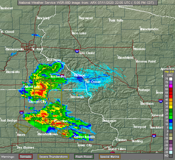 At 509 pm cdt, severe thunderstorms were located along a line extending from near grand meadow to near le roy to near stacyville, moving east at 45 mph. spotters are reporting wind gusts of near 50 mph (radar indicated). Hazards include 60 mph wind gusts. Expect damage to roofs, siding, and trees. severe thunderstorms will be near, le roy around 515 pm cdt. riceville around 520 pm cdt. spring valley around 525 pm cdt. elma, lime springs and wykoff around 530 pm cdt. cresco around 540 pm cdt. jerico around 545 pm cdt. Protivin around 555 pm cdt. At 509 pm cdt, severe thunderstorms were located along a line extending from near grand meadow to near le roy to near stacyville, moving east at 45 mph. spotters are reporting wind gusts of near 50 mph (radar indicated). Hazards include 60 mph wind gusts. Expect damage to roofs, siding, and trees. severe thunderstorms will be near, le roy around 515 pm cdt. riceville around 520 pm cdt. spring valley around 525 pm cdt. elma, lime springs and wykoff around 530 pm cdt. cresco around 540 pm cdt. jerico around 545 pm cdt. Protivin around 555 pm cdt.
|
| 7/11/2020 5:04 PM CDT |
 At 504 pm cdt, severe thunderstorms were located along a line extending from 6 miles east of brownsdale to 6 miles east of adams to near stacyville, moving east at 45 mph (radar indicated). Hazards include 60 mph wind gusts. Expect damage to roofs, siding, and trees. these severe storms will be near, le roy around 510 pm cdt. Other locations impacted by these severe thunderstorms include brookside campground, mayville, county roads 4 and 8, waltham, renova, i 90 exit 179 and i 90 exit 183. At 504 pm cdt, severe thunderstorms were located along a line extending from 6 miles east of brownsdale to 6 miles east of adams to near stacyville, moving east at 45 mph (radar indicated). Hazards include 60 mph wind gusts. Expect damage to roofs, siding, and trees. these severe storms will be near, le roy around 510 pm cdt. Other locations impacted by these severe thunderstorms include brookside campground, mayville, county roads 4 and 8, waltham, renova, i 90 exit 179 and i 90 exit 183.
|
| 7/11/2020 4:59 PM CDT |
 At 449 pm cdt, severe thunderstorms were located along a line extending from near blooming prairie to near brownsdale to near london, moving southeast at 45 mph. as this line moved through austin, it caused several branches to fall on some powerlines which brought them down too (radar indicated). Hazards include 60 mph wind gusts. Expect damage to roofs, siding, and trees. these severe storms will be near, lyle and rose creek around 455 pm cdt. adams around 505 pm cdt. grand meadow and le roy around 515 pm cdt. Other locations impacted by these severe thunderstorms include brookside campground, mayville, county roads 4 and 8, waltham, renova, i 90 exit 179 and i 90 exit 183. At 449 pm cdt, severe thunderstorms were located along a line extending from near blooming prairie to near brownsdale to near london, moving southeast at 45 mph. as this line moved through austin, it caused several branches to fall on some powerlines which brought them down too (radar indicated). Hazards include 60 mph wind gusts. Expect damage to roofs, siding, and trees. these severe storms will be near, lyle and rose creek around 455 pm cdt. adams around 505 pm cdt. grand meadow and le roy around 515 pm cdt. Other locations impacted by these severe thunderstorms include brookside campground, mayville, county roads 4 and 8, waltham, renova, i 90 exit 179 and i 90 exit 183.
|
| 7/11/2020 4:51 PM CDT |
 At 449 pm cdt, severe thunderstorms were located along a line extending from near blooming prairie to near brownsdale to near london, moving southeast at 45 mph. as this line moved through austin, it caused several branches to fall on some powerlines which brought them down too (radar indicated). Hazards include 60 mph wind gusts. Expect damage to roofs, siding, and trees. these severe storms will be near, lyle and rose creek around 455 pm cdt. adams around 505 pm cdt. grand meadow and le roy around 515 pm cdt. Other locations impacted by these severe thunderstorms include brookside campground, mayville, county roads 4 and 8, waltham, renova, i 90 exit 179 and i 90 exit 183. At 449 pm cdt, severe thunderstorms were located along a line extending from near blooming prairie to near brownsdale to near london, moving southeast at 45 mph. as this line moved through austin, it caused several branches to fall on some powerlines which brought them down too (radar indicated). Hazards include 60 mph wind gusts. Expect damage to roofs, siding, and trees. these severe storms will be near, lyle and rose creek around 455 pm cdt. adams around 505 pm cdt. grand meadow and le roy around 515 pm cdt. Other locations impacted by these severe thunderstorms include brookside campground, mayville, county roads 4 and 8, waltham, renova, i 90 exit 179 and i 90 exit 183.
|
| 7/11/2020 4:39 PM CDT |
 At 438 pm cdt, severe thunderstorms were located along a line extending from blooming prairie to near austin to near london, moving east at 45 mph (radar indicated). Hazards include 60 mph wind gusts. Expect damage to roofs, siding, and trees. these severe storms will be near, brownsdale around 445 pm cdt. hayfield, lyle and rose creek around 450 pm cdt. adams around 500 pm cdt. grand meadow around 505 pm cdt. Stewartville and le roy around 515 pm cdt. At 438 pm cdt, severe thunderstorms were located along a line extending from blooming prairie to near austin to near london, moving east at 45 mph (radar indicated). Hazards include 60 mph wind gusts. Expect damage to roofs, siding, and trees. these severe storms will be near, brownsdale around 445 pm cdt. hayfield, lyle and rose creek around 450 pm cdt. adams around 500 pm cdt. grand meadow around 505 pm cdt. Stewartville and le roy around 515 pm cdt.
|
| 7/11/2020 4:31 PM CDT |
 At 430 pm cdt, severe thunderstorms were located along a line extending from 7 miles northeast of ellendale to near hollandale to glenville, moving southeast at 45 mph (radar indicated). Hazards include 60 mph wind gusts. Expect damage to roofs, siding, and trees. these severe storms will be near, austin around 440 pm cdt. hayfield and lyle around 450 pm cdt. rose creek around 455 pm cdt. Adams and brownsdale around 500 pm cdt. At 430 pm cdt, severe thunderstorms were located along a line extending from 7 miles northeast of ellendale to near hollandale to glenville, moving southeast at 45 mph (radar indicated). Hazards include 60 mph wind gusts. Expect damage to roofs, siding, and trees. these severe storms will be near, austin around 440 pm cdt. hayfield and lyle around 450 pm cdt. rose creek around 455 pm cdt. Adams and brownsdale around 500 pm cdt.
|
| 7/11/2020 4:19 PM CDT |
 At 418 pm cdt, severe thunderstorms were located along a line extending from 7 miles southwest of owatonna to near geneva to near albert lea, moving east at 45 mph (radar indicated). Hazards include 60 mph wind gusts. Expect damage to roofs, siding, and trees. severe thunderstorms will be near, austin around 440 pm cdt. brownsdale around 445 pm cdt. hayfield and lyle around 450 pm cdt. rose creek around 455 pm cdt. adams around 500 pm cdt. grand meadow around 505 pm cdt. Stewartville and le roy around 515 pm cdt. At 418 pm cdt, severe thunderstorms were located along a line extending from 7 miles southwest of owatonna to near geneva to near albert lea, moving east at 45 mph (radar indicated). Hazards include 60 mph wind gusts. Expect damage to roofs, siding, and trees. severe thunderstorms will be near, austin around 440 pm cdt. brownsdale around 445 pm cdt. hayfield and lyle around 450 pm cdt. rose creek around 455 pm cdt. adams around 500 pm cdt. grand meadow around 505 pm cdt. Stewartville and le roy around 515 pm cdt.
|
| 6/28/2020 5:57 PM CDT |
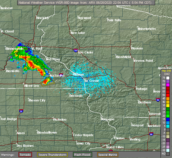 At 556 pm cdt, a severe thunderstorm was located over grand meadow, or 19 miles east of austin, moving northeast at 25 mph (trained weather spotters). Hazards include 60 mph wind gusts and quarter size hail. Hail damage to vehicles is expected. expect wind damage to roofs, siding, and trees. this severe storm will be near, spring valley around 615 pm cdt. Other locations impacted by this severe thunderstorm include i 90 exit 209, highways 63 and 16, hamilton, i 90 exit 193, high forest, i 90 exit 205 and dexter. At 556 pm cdt, a severe thunderstorm was located over grand meadow, or 19 miles east of austin, moving northeast at 25 mph (trained weather spotters). Hazards include 60 mph wind gusts and quarter size hail. Hail damage to vehicles is expected. expect wind damage to roofs, siding, and trees. this severe storm will be near, spring valley around 615 pm cdt. Other locations impacted by this severe thunderstorm include i 90 exit 209, highways 63 and 16, hamilton, i 90 exit 193, high forest, i 90 exit 205 and dexter.
|
| 6/28/2020 5:43 PM CDT |
 At 542 pm cdt, a severe thunderstorm was located near grand meadow, or 13 miles east of austin, moving northeast at 25 mph (radar indicated). Hazards include ping pong ball size hail and 60 mph wind gusts. People and animals outdoors will be injured. expect hail damage to roofs, siding, windows, and vehicles. expect wind damage to roofs, siding, and trees. this severe thunderstorm will be near, grand meadow around 600 pm cdt. spring valley around 615 pm cdt. Other locations impacted by this severe thunderstorm include i 90 exit 209, highways 63 and 16, hamilton, i 90 exit 193, high forest, i 90 exit 205 and dexter. At 542 pm cdt, a severe thunderstorm was located near grand meadow, or 13 miles east of austin, moving northeast at 25 mph (radar indicated). Hazards include ping pong ball size hail and 60 mph wind gusts. People and animals outdoors will be injured. expect hail damage to roofs, siding, windows, and vehicles. expect wind damage to roofs, siding, and trees. this severe thunderstorm will be near, grand meadow around 600 pm cdt. spring valley around 615 pm cdt. Other locations impacted by this severe thunderstorm include i 90 exit 209, highways 63 and 16, hamilton, i 90 exit 193, high forest, i 90 exit 205 and dexter.
|
| 6/28/2020 5:26 PM CDT |
 At 525 pm cdt, a severe thunderstorm was located near rose creek, or 10 miles southeast of austin, moving northeast at 15 mph (radar indicated). Hazards include 60 mph wind gusts and quarter size hail. Hail damage to vehicles is expected. expect wind damage to roofs, siding, and trees. this severe storm will be near, adams around 540 pm cdt. Other locations impacted by this severe thunderstorm include taopi, county roads 56 and 5, i 90 exit 193, dexter, i 90 exit 187, elkton and i 90 exit 189. At 525 pm cdt, a severe thunderstorm was located near rose creek, or 10 miles southeast of austin, moving northeast at 15 mph (radar indicated). Hazards include 60 mph wind gusts and quarter size hail. Hail damage to vehicles is expected. expect wind damage to roofs, siding, and trees. this severe storm will be near, adams around 540 pm cdt. Other locations impacted by this severe thunderstorm include taopi, county roads 56 and 5, i 90 exit 193, dexter, i 90 exit 187, elkton and i 90 exit 189.
|
| 6/28/2020 5:14 PM CDT |
 At 513 pm cdt, a severe thunderstorm was located near rose creek, or 10 miles southeast of austin, moving east at 40 mph (radar indicated). Hazards include ping pong ball size hail and 60 mph wind gusts. People and animals outdoors will be injured. expect hail damage to roofs, siding, windows, and vehicles. expect wind damage to roofs, siding, and trees. this severe storm will be near, adams around 525 pm cdt. Other locations impacted by this severe thunderstorm include taopi, county roads 56 and 5, i 90 exit 193, johnsburg, dexter, i 90 exit 187 and elkton. At 513 pm cdt, a severe thunderstorm was located near rose creek, or 10 miles southeast of austin, moving east at 40 mph (radar indicated). Hazards include ping pong ball size hail and 60 mph wind gusts. People and animals outdoors will be injured. expect hail damage to roofs, siding, windows, and vehicles. expect wind damage to roofs, siding, and trees. this severe storm will be near, adams around 525 pm cdt. Other locations impacted by this severe thunderstorm include taopi, county roads 56 and 5, i 90 exit 193, johnsburg, dexter, i 90 exit 187 and elkton.
|
| 6/28/2020 4:49 PM CDT |
 At 448 pm cdt, a severe thunderstorm was located near london, or 8 miles east of northwood, moving northeast at 30 mph (radar indicated). Hazards include ping pong ball size hail and 60 mph wind gusts. People and animals outdoors will be injured. expect hail damage to roofs, siding, windows, and vehicles. expect wind damage to roofs, siding, and trees. this severe thunderstorm will be near, lyle around 500 pm cdt. rose creek around 520 pm cdt. adams around 525 pm cdt. Other locations impacted by this severe thunderstorm include meyer, toeterville, county roads 56 and 5, otranto, otranto park, i 90 exit 187 and elkton. At 448 pm cdt, a severe thunderstorm was located near london, or 8 miles east of northwood, moving northeast at 30 mph (radar indicated). Hazards include ping pong ball size hail and 60 mph wind gusts. People and animals outdoors will be injured. expect hail damage to roofs, siding, windows, and vehicles. expect wind damage to roofs, siding, and trees. this severe thunderstorm will be near, lyle around 500 pm cdt. rose creek around 520 pm cdt. adams around 525 pm cdt. Other locations impacted by this severe thunderstorm include meyer, toeterville, county roads 56 and 5, otranto, otranto park, i 90 exit 187 and elkton.
|
| 6/21/2020 7:11 PM CDT |
 At 711 pm cdt, a severe thunderstorm was located 7 miles east of brownsdale, or 13 miles northeast of austin, moving east at 30 mph (radar indicated). Hazards include 60 mph wind gusts and penny size hail. Expect damage to roofs, siding, and trees. this severe storm will be near, grand meadow around 725 pm cdt. stewartville around 735 pm cdt. Other locations impacted by this severe thunderstorm include oslo, sargeant, county roads 1 and 7, i 90 exit 209, county roads 3 and 108, i 90 exit 205 and rock dell. At 711 pm cdt, a severe thunderstorm was located 7 miles east of brownsdale, or 13 miles northeast of austin, moving east at 30 mph (radar indicated). Hazards include 60 mph wind gusts and penny size hail. Expect damage to roofs, siding, and trees. this severe storm will be near, grand meadow around 725 pm cdt. stewartville around 735 pm cdt. Other locations impacted by this severe thunderstorm include oslo, sargeant, county roads 1 and 7, i 90 exit 209, county roads 3 and 108, i 90 exit 205 and rock dell.
|
| 6/21/2020 6:58 PM CDT |
 At 658 pm cdt, a severe thunderstorm was located over brownsdale, or 8 miles northeast of austin, moving east at 35 mph (radar indicated). Hazards include 60 mph wind gusts and penny size hail. Expect damage to roofs, siding, and trees. this severe storm will be near, grand meadow around 720 pm cdt. stewartville around 730 pm cdt. Other locations impacted by this severe thunderstorm include county roads 3 and 108, rock dell, mayville, rochester airport, waltham, renova and i 90 exit 179. At 658 pm cdt, a severe thunderstorm was located over brownsdale, or 8 miles northeast of austin, moving east at 35 mph (radar indicated). Hazards include 60 mph wind gusts and penny size hail. Expect damage to roofs, siding, and trees. this severe storm will be near, grand meadow around 720 pm cdt. stewartville around 730 pm cdt. Other locations impacted by this severe thunderstorm include county roads 3 and 108, rock dell, mayville, rochester airport, waltham, renova and i 90 exit 179.
|
| 6/21/2020 6:47 PM CDT |
 At 646 pm cdt, a severe thunderstorm was located near austin, moving east at 35 mph (radar indicated). Hazards include 60 mph wind gusts and penny size hail. Expect damage to roofs, siding, and trees. this severe thunderstorm will be near, brownsdale around 655 pm cdt. grand meadow around 720 pm cdt. stewartville around 730 pm cdt. Other locations impacted by this severe thunderstorm include county roads 3 and 108, rock dell, brookside campground, mayville, rochester airport, waltham and renova. At 646 pm cdt, a severe thunderstorm was located near austin, moving east at 35 mph (radar indicated). Hazards include 60 mph wind gusts and penny size hail. Expect damage to roofs, siding, and trees. this severe thunderstorm will be near, brownsdale around 655 pm cdt. grand meadow around 720 pm cdt. stewartville around 730 pm cdt. Other locations impacted by this severe thunderstorm include county roads 3 and 108, rock dell, brookside campground, mayville, rochester airport, waltham and renova.
|
| 6/2/2020 8:00 PM CDT |
 The severe thunderstorm warning for southwestern olmsted, northern mower, and southern dodge counties will expire at 800 pm cdt, the storm which prompted the warning has moved out of the area. therefore, the warning will be allowed to expire. however gusty winds are still possible. a severe thunderstorm warning still remains in effect for southern mower county until 815 pm. in addition, a severe thunderstorm watch remains in effect until midnight cdt for southeastern minnesota. The severe thunderstorm warning for southwestern olmsted, northern mower, and southern dodge counties will expire at 800 pm cdt, the storm which prompted the warning has moved out of the area. therefore, the warning will be allowed to expire. however gusty winds are still possible. a severe thunderstorm warning still remains in effect for southern mower county until 815 pm. in addition, a severe thunderstorm watch remains in effect until midnight cdt for southeastern minnesota.
|
| 6/2/2020 7:30 PM CDT |
 At 730 pm cdt, a severe thunderstorm was located near grand meadow, or 14 miles east of austin, moving east at 30 mph (trained weather spotters). Hazards include 70 mph wind gusts and ping pong ball size hail. People and animals outdoors will be injured. expect hail damage to roofs, siding, windows, and vehicles. expect considerable tree damage. wind damage is also likely to mobile homes, roofs, and outbuildings. this severe storm will be near, grand meadow around 745 pm cdt. Other locations impacted by this severe thunderstorm include county roads 3 and 108, county roads 6 and 15, rock dell, brookside campground, mayville, rochester airport and graves landing field. At 730 pm cdt, a severe thunderstorm was located near grand meadow, or 14 miles east of austin, moving east at 30 mph (trained weather spotters). Hazards include 70 mph wind gusts and ping pong ball size hail. People and animals outdoors will be injured. expect hail damage to roofs, siding, windows, and vehicles. expect considerable tree damage. wind damage is also likely to mobile homes, roofs, and outbuildings. this severe storm will be near, grand meadow around 745 pm cdt. Other locations impacted by this severe thunderstorm include county roads 3 and 108, county roads 6 and 15, rock dell, brookside campground, mayville, rochester airport and graves landing field.
|
| 6/2/2020 7:03 PM CDT |
 At 702 pm cdt, a severe thunderstorm was located over austin, moving east at 35 mph (trained weather spotters. this storm has a history of producing very large hail and damaging winds). Hazards include tennis ball size hail and 70 mph wind gusts. People and animals outdoors will be injured. expect hail damage to roofs, siding, windows, and vehicles. expect considerable tree damage. wind damage is also likely to mobile homes, roofs, and outbuildings. this severe storm will be near, brownsdale around 710 pm cdt. rose creek around 715 pm cdt. grand meadow around 730 pm cdt. Other locations impacted by this severe thunderstorm include county roads 3 and 108, county roads 6 and 15, salem corners, rock dell, brookside campground, county roads 5 and 6 and mayville. At 702 pm cdt, a severe thunderstorm was located over austin, moving east at 35 mph (trained weather spotters. this storm has a history of producing very large hail and damaging winds). Hazards include tennis ball size hail and 70 mph wind gusts. People and animals outdoors will be injured. expect hail damage to roofs, siding, windows, and vehicles. expect considerable tree damage. wind damage is also likely to mobile homes, roofs, and outbuildings. this severe storm will be near, brownsdale around 710 pm cdt. rose creek around 715 pm cdt. grand meadow around 730 pm cdt. Other locations impacted by this severe thunderstorm include county roads 3 and 108, county roads 6 and 15, salem corners, rock dell, brookside campground, county roads 5 and 6 and mayville.
|
| 6/2/2020 6:31 PM CDT |
 At 630 pm cdt, a severe thunderstorm was located near blooming prairie, or 14 miles south of owatonna, moving east at 35 mph (trained weather spotters). Hazards include tennis ball size hail and 70 mph wind gusts. this storm has a history of producing large hail and damaging winds. People and animals outdoors will be injured. expect hail damage to roofs, siding, windows, and vehicles. expect considerable tree damage. wind damage is also likely to mobile homes, roofs, and outbuildings. this severe thunderstorm will be near, blooming prairie around 640 pm cdt. hayfield around 655 pm cdt. rochester and stewartville around 725 pm cdt. Other locations impacted by this severe thunderstorm include county roads 3 and 108, county roads 6 and 15, salem corners, rock dell, brookside campground, county roads 5 and 6 and mayville. At 630 pm cdt, a severe thunderstorm was located near blooming prairie, or 14 miles south of owatonna, moving east at 35 mph (trained weather spotters). Hazards include tennis ball size hail and 70 mph wind gusts. this storm has a history of producing large hail and damaging winds. People and animals outdoors will be injured. expect hail damage to roofs, siding, windows, and vehicles. expect considerable tree damage. wind damage is also likely to mobile homes, roofs, and outbuildings. this severe thunderstorm will be near, blooming prairie around 640 pm cdt. hayfield around 655 pm cdt. rochester and stewartville around 725 pm cdt. Other locations impacted by this severe thunderstorm include county roads 3 and 108, county roads 6 and 15, salem corners, rock dell, brookside campground, county roads 5 and 6 and mayville.
|
| 9/24/2019 8:25 PM CDT |
 The severe thunderstorm warning for south central olmsted, northeastern mower and western fillmore counties will expire at 830 pm cdt, the storm which prompted the warning is moving out of the warned area into eastern olmstead county. a severe thunderstorm warning remains in effect for eastern olmstead county until 9 pm. a tornado watch remains in effect until midnight cdt for southeastern minnesota. The severe thunderstorm warning for south central olmsted, northeastern mower and western fillmore counties will expire at 830 pm cdt, the storm which prompted the warning is moving out of the warned area into eastern olmstead county. a severe thunderstorm warning remains in effect for eastern olmstead county until 9 pm. a tornado watch remains in effect until midnight cdt for southeastern minnesota.
|
| 9/24/2019 8:15 PM CDT |
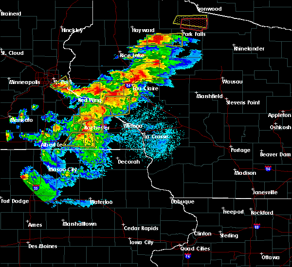 At 815 pm cdt, a severe thunderstorm was located near grand meadow, or 16 miles south of rochester, moving east at 55 mph (radar indicated). Hazards include 60 mph wind gusts. Expect damage to roofs, siding, and trees. this severe storm will be near, spring valley around 820 pm cdt. wykoff around 830 pm cdt. Other locations impacted by this severe thunderstorm include etna, cherry grove, ostrander, fillmore, i 90 exit 205, elkton and washington. At 815 pm cdt, a severe thunderstorm was located near grand meadow, or 16 miles south of rochester, moving east at 55 mph (radar indicated). Hazards include 60 mph wind gusts. Expect damage to roofs, siding, and trees. this severe storm will be near, spring valley around 820 pm cdt. wykoff around 830 pm cdt. Other locations impacted by this severe thunderstorm include etna, cherry grove, ostrander, fillmore, i 90 exit 205, elkton and washington.
|
| 9/24/2019 8:07 PM CDT | Mesonet station mn010 1 ene dexte in mower county MN, 1.4 miles WSW of Dexter, MN |
| 9/24/2019 8:07 PM CDT |
 At 807 pm cdt, a severe thunderstorm was located near grand meadow, or 14 miles east of austin, moving east at 55 mph (radar indicated). Hazards include 70 mph wind gusts. Expect considerable tree damage. damage is likely to mobile homes, roofs, and outbuildings. this severe storm will be near, spring valley around 825 pm cdt. wykoff around 830 pm cdt. Other locations impacted by this severe thunderstorm include etna, county roads 1 and 7, cherry grove, ostrander, fillmore, i 90 exit 205 and county roads 4 and 8. At 807 pm cdt, a severe thunderstorm was located near grand meadow, or 14 miles east of austin, moving east at 55 mph (radar indicated). Hazards include 70 mph wind gusts. Expect considerable tree damage. damage is likely to mobile homes, roofs, and outbuildings. this severe storm will be near, spring valley around 825 pm cdt. wykoff around 830 pm cdt. Other locations impacted by this severe thunderstorm include etna, county roads 1 and 7, cherry grove, ostrander, fillmore, i 90 exit 205 and county roads 4 and 8.
|
| 9/24/2019 8:04 PM CDT |
 At 803 pm cdt, a severe thunderstorm was located near brownsdale, or 10 miles east of austin, moving east at 55 mph (radar indicated). Hazards include 70 mph wind gusts. Expect considerable tree damage. damage is likely to mobile homes, roofs, and outbuildings. at 757 pm the austin municipal airport reported a wind gust of 60 mph. the storm has since strengthened. this severe storm will be near, grand meadow around 815 pm cdt. spring valley around 825 pm cdt. wykoff around 830 pm cdt. Other locations impacted by this severe thunderstorm include fillmore, county roads 4 and 8, washington, renova, i 90 exit 183, county roads 2 and 38 and i 90 exit 180. At 803 pm cdt, a severe thunderstorm was located near brownsdale, or 10 miles east of austin, moving east at 55 mph (radar indicated). Hazards include 70 mph wind gusts. Expect considerable tree damage. damage is likely to mobile homes, roofs, and outbuildings. at 757 pm the austin municipal airport reported a wind gust of 60 mph. the storm has since strengthened. this severe storm will be near, grand meadow around 815 pm cdt. spring valley around 825 pm cdt. wykoff around 830 pm cdt. Other locations impacted by this severe thunderstorm include fillmore, county roads 4 and 8, washington, renova, i 90 exit 183, county roads 2 and 38 and i 90 exit 180.
|
| 9/24/2019 7:55 PM CDT |
 At 754 pm cdt, a severe thunderstorm was located near brownsdale, or 10 miles northeast of austin, moving east at 50 mph (trained weather spotters). Hazards include 60 mph wind gusts. Expect damage to roofs, siding, and trees. at 750 pm trained spotters reported winds in excess of 55 mph near brownsdale. this severe storm will be near, grand meadow around 805 pm cdt. stewartville and spring valley around 815 pm cdt. wykoff around 825 pm cdt. Other locations impacted by this severe thunderstorm include fillmore, brookside campground, mayville, county roads 4 and 8, washington, waltham and renova. At 754 pm cdt, a severe thunderstorm was located near brownsdale, or 10 miles northeast of austin, moving east at 50 mph (trained weather spotters). Hazards include 60 mph wind gusts. Expect damage to roofs, siding, and trees. at 750 pm trained spotters reported winds in excess of 55 mph near brownsdale. this severe storm will be near, grand meadow around 805 pm cdt. stewartville and spring valley around 815 pm cdt. wykoff around 825 pm cdt. Other locations impacted by this severe thunderstorm include fillmore, brookside campground, mayville, county roads 4 and 8, washington, waltham and renova.
|
| 9/24/2019 7:48 PM CDT |
 At 748 pm cdt, a severe thunderstorm was located over brownsdale, or near austin, moving east at 50 mph (radar indicated). Hazards include 60 mph wind gusts. Expect damage to roofs, siding, and trees. this severe thunderstorm will be near, grand meadow around 810 pm cdt. stewartville and spring valley around 815 pm cdt. wykoff around 825 pm cdt. Other locations impacted by this severe thunderstorm include fillmore, brookside campground, mayville, county roads 4 and 8, washington, waltham and renova. At 748 pm cdt, a severe thunderstorm was located over brownsdale, or near austin, moving east at 50 mph (radar indicated). Hazards include 60 mph wind gusts. Expect damage to roofs, siding, and trees. this severe thunderstorm will be near, grand meadow around 810 pm cdt. stewartville and spring valley around 815 pm cdt. wykoff around 825 pm cdt. Other locations impacted by this severe thunderstorm include fillmore, brookside campground, mayville, county roads 4 and 8, washington, waltham and renova.
|
| 8/18/2019 1:52 AM CDT |
 At 111 am cdt, severe thunderstorms were located along a line extending from morristown to geneva to near twin lakes, moving east at 50 mph (radar indicated). Hazards include 60 mph wind gusts. Expect damage to roofs, siding, and trees. severe thunderstorms will be near, austin around 130 am cdt. brownsdale around 135 am cdt. hayfield and lyle around 140 am cdt. west concord around 145 am cdt. rose creek around 150 am cdt. adams around 155 am cdt. Other locations impacted by these severe thunderstorms include county roads 20 and 5, eden, highway 57 and 570th street, county roads 6 and 15, brookside campground, county roads 5 and 6 and mayville. At 111 am cdt, severe thunderstorms were located along a line extending from morristown to geneva to near twin lakes, moving east at 50 mph (radar indicated). Hazards include 60 mph wind gusts. Expect damage to roofs, siding, and trees. severe thunderstorms will be near, austin around 130 am cdt. brownsdale around 135 am cdt. hayfield and lyle around 140 am cdt. west concord around 145 am cdt. rose creek around 150 am cdt. adams around 155 am cdt. Other locations impacted by these severe thunderstorms include county roads 20 and 5, eden, highway 57 and 570th street, county roads 6 and 15, brookside campground, county roads 5 and 6 and mayville.
|
| 8/18/2019 1:36 AM CDT |
 At 111 am cdt, severe thunderstorms were located along a line extending from morristown to geneva to near twin lakes, moving east at 50 mph (radar indicated). Hazards include 60 mph wind gusts. Expect damage to roofs, siding, and trees. severe thunderstorms will be near, austin around 130 am cdt. brownsdale around 135 am cdt. hayfield and lyle around 140 am cdt. west concord around 145 am cdt. rose creek around 150 am cdt. adams around 155 am cdt. Other locations impacted by these severe thunderstorms include county roads 20 and 5, eden, highway 57 and 570th street, county roads 6 and 15, brookside campground, county roads 5 and 6 and mayville. At 111 am cdt, severe thunderstorms were located along a line extending from morristown to geneva to near twin lakes, moving east at 50 mph (radar indicated). Hazards include 60 mph wind gusts. Expect damage to roofs, siding, and trees. severe thunderstorms will be near, austin around 130 am cdt. brownsdale around 135 am cdt. hayfield and lyle around 140 am cdt. west concord around 145 am cdt. rose creek around 150 am cdt. adams around 155 am cdt. Other locations impacted by these severe thunderstorms include county roads 20 and 5, eden, highway 57 and 570th street, county roads 6 and 15, brookside campground, county roads 5 and 6 and mayville.
|
| 8/18/2019 1:24 AM CDT |
 At 124 am cdt, severe thunderstorms were located along a line extending from near medford to near hollandale to near glenville, moving east at 50 mph (radar indicated). Hazards include 60 mph wind gusts. Expect damage to roofs, siding, and trees. these severe storms will be near, austin around 135 am cdt. hayfield and brownsdale around 140 am cdt. west concord and lyle around 145 am cdt. rose creek around 150 am cdt. adams around 200 am cdt. Other locations impacted by these severe thunderstorms include county roads 20 and 5, eden, highway 57 and 570th street, county roads 6 and 15, brookside campground, county roads 5 and 6 and mayville. At 124 am cdt, severe thunderstorms were located along a line extending from near medford to near hollandale to near glenville, moving east at 50 mph (radar indicated). Hazards include 60 mph wind gusts. Expect damage to roofs, siding, and trees. these severe storms will be near, austin around 135 am cdt. hayfield and brownsdale around 140 am cdt. west concord and lyle around 145 am cdt. rose creek around 150 am cdt. adams around 200 am cdt. Other locations impacted by these severe thunderstorms include county roads 20 and 5, eden, highway 57 and 570th street, county roads 6 and 15, brookside campground, county roads 5 and 6 and mayville.
|
| 8/18/2019 1:12 AM CDT |
 The national weather service in la crosse has issued a * severe thunderstorm warning for. mower county in southeastern minnesota. dodge county in southeastern minnesota. until 200 am cdt. At 111 am cdt, severe thunderstorms were located along a line. The national weather service in la crosse has issued a * severe thunderstorm warning for. mower county in southeastern minnesota. dodge county in southeastern minnesota. until 200 am cdt. At 111 am cdt, severe thunderstorms were located along a line.
|
| 8/13/2019 5:24 PM CDT |
 At 523 pm cdt, a severe thunderstorm was located near brownsdale, or near austin, moving southeast at 45 mph (law enforcement reported 1 inch hail at 505 pm 6 miles northwest of lansing in far northwest mower county). Hazards include quarter size hail. Damage to vehicles is expected. this severe storm will be near, adams around 535 pm cdt. le roy around 545 pm cdt. Other locations impacted by this severe thunderstorm include mayville, county roads 4 and 8, waltham, renova, i 90 exit 179, i 90 exit 183 and county roads 1 and 15. At 523 pm cdt, a severe thunderstorm was located near brownsdale, or near austin, moving southeast at 45 mph (law enforcement reported 1 inch hail at 505 pm 6 miles northwest of lansing in far northwest mower county). Hazards include quarter size hail. Damage to vehicles is expected. this severe storm will be near, adams around 535 pm cdt. le roy around 545 pm cdt. Other locations impacted by this severe thunderstorm include mayville, county roads 4 and 8, waltham, renova, i 90 exit 179, i 90 exit 183 and county roads 1 and 15.
|
| 8/13/2019 5:11 PM CDT |
 At 508 pm cdt, a severe thunderstorm was located over brownsdale, or 9 miles northeast of austin, moving southeast at 55 mph (law enforcement reported quarter size hail at 505 pm 6 miles northwest of lansing in far northwest mower county). Hazards include quarter size hail. Damage to vehicles is expected. this severe storm will be near, grand meadow and adams around 520 pm cdt. le roy around 530 pm cdt. Other locations impacted by this severe thunderstorm include brookside campground, mayville, county roads 4 and 8, waltham, renova, i 90 exit 179 and i 90 exit 183. At 508 pm cdt, a severe thunderstorm was located over brownsdale, or 9 miles northeast of austin, moving southeast at 55 mph (law enforcement reported quarter size hail at 505 pm 6 miles northwest of lansing in far northwest mower county). Hazards include quarter size hail. Damage to vehicles is expected. this severe storm will be near, grand meadow and adams around 520 pm cdt. le roy around 530 pm cdt. Other locations impacted by this severe thunderstorm include brookside campground, mayville, county roads 4 and 8, waltham, renova, i 90 exit 179 and i 90 exit 183.
|
| 8/13/2019 4:51 PM CDT |
 At 449 pm cdt, a severe thunderstorm was located near brownsdale, or 9 miles north of austin, moving southeast at 40 mph (law enforcement reported nickel size hail near waseca around 4 pm and a brief tornado touchdown near ellensdale around 430 pm). Hazards include quarter size hail. Damage to vehicles is expected. this severe thunderstorm will be near, brownsdale around 455 pm cdt. grand meadow and adams around 515 pm cdt. le roy around 530 pm cdt. Other locations impacted by this severe thunderstorm include brookside campground, mayville, county roads 4 and 8, waltham, renova, i 90 exit 179 and i 90 exit 183. At 449 pm cdt, a severe thunderstorm was located near brownsdale, or 9 miles north of austin, moving southeast at 40 mph (law enforcement reported nickel size hail near waseca around 4 pm and a brief tornado touchdown near ellensdale around 430 pm). Hazards include quarter size hail. Damage to vehicles is expected. this severe thunderstorm will be near, brownsdale around 455 pm cdt. grand meadow and adams around 515 pm cdt. le roy around 530 pm cdt. Other locations impacted by this severe thunderstorm include brookside campground, mayville, county roads 4 and 8, waltham, renova, i 90 exit 179 and i 90 exit 183.
|
| 8/5/2019 5:51 PM CDT |
 At 551 pm cdt, a severe thunderstorm was located over grand meadow, or 19 miles south of rochester, moving east at 40 mph (radar indicated). Hazards include 60 mph wind gusts. Expect damage to roofs, siding, and trees. This severe thunderstorm will remain over mainly rural areas of northeastern mower county, including the following locations, sargeant, county roads 1 and 7, highways 63 and 16, hamilton, i 90 exit 193, dexter and interstate 90 and county 1. At 551 pm cdt, a severe thunderstorm was located over grand meadow, or 19 miles south of rochester, moving east at 40 mph (radar indicated). Hazards include 60 mph wind gusts. Expect damage to roofs, siding, and trees. This severe thunderstorm will remain over mainly rural areas of northeastern mower county, including the following locations, sargeant, county roads 1 and 7, highways 63 and 16, hamilton, i 90 exit 193, dexter and interstate 90 and county 1.
|
| 8/5/2019 5:40 PM CDT |
 At 539 pm cdt, a severe thunderstorm was located near brownsdale, or 13 miles northeast of austin, moving east at 35 mph (radar indicated). Hazards include 60 mph wind gusts. Expect damage to roofs, siding, and trees. this severe storm will be near, grand meadow around 555 pm cdt. Other locations impacted by this severe thunderstorm include sargeant, county roads 1 and 7, i 90 exit 189, waltham, renova, county roads 1 and 15 and highways 63 and 16. At 539 pm cdt, a severe thunderstorm was located near brownsdale, or 13 miles northeast of austin, moving east at 35 mph (radar indicated). Hazards include 60 mph wind gusts. Expect damage to roofs, siding, and trees. this severe storm will be near, grand meadow around 555 pm cdt. Other locations impacted by this severe thunderstorm include sargeant, county roads 1 and 7, i 90 exit 189, waltham, renova, county roads 1 and 15 and highways 63 and 16.
|
| 8/5/2019 5:35 PM CDT |
 At 534 pm cdt, a severe thunderstorm was located near brownsdale, or 9 miles northeast of austin, moving east at 35 mph (radar indicated). Hazards include 60 mph wind gusts. Expect damage to roofs, siding, and trees. this severe thunderstorm will be near, grand meadow around 555 pm cdt. Other locations impacted by this severe thunderstorm include sargeant, county roads 1 and 7, i 90 exit 189, waltham, renova, county roads 1 and 15 and highways 63 and 16. At 534 pm cdt, a severe thunderstorm was located near brownsdale, or 9 miles northeast of austin, moving east at 35 mph (radar indicated). Hazards include 60 mph wind gusts. Expect damage to roofs, siding, and trees. this severe thunderstorm will be near, grand meadow around 555 pm cdt. Other locations impacted by this severe thunderstorm include sargeant, county roads 1 and 7, i 90 exit 189, waltham, renova, county roads 1 and 15 and highways 63 and 16.
|
| 7/20/2019 11:47 AM CDT |
 At 1146 am cdt, severe thunderstorms were located along a line extending from near plainview to le roy, moving east at 50 mph (a 64 mph wind gust was reported at the rochester airport at 1134 am). Hazards include 70 mph wind gusts and penny size hail. Expect considerable tree damage. damage is likely to mobile homes, roofs, and outbuildings. These severe thunderstorms will remain over mainly rural areas of olmsted, mower, eastern dodge and western fillmore counties, including the following locations, i 90 exit 218, highway 57 and 570th street, county roads 6 and 15, hidden meadows r v park, rock dell, mayville and rochester airport. At 1146 am cdt, severe thunderstorms were located along a line extending from near plainview to le roy, moving east at 50 mph (a 64 mph wind gust was reported at the rochester airport at 1134 am). Hazards include 70 mph wind gusts and penny size hail. Expect considerable tree damage. damage is likely to mobile homes, roofs, and outbuildings. These severe thunderstorms will remain over mainly rural areas of olmsted, mower, eastern dodge and western fillmore counties, including the following locations, i 90 exit 218, highway 57 and 570th street, county roads 6 and 15, hidden meadows r v park, rock dell, mayville and rochester airport.
|
| 7/20/2019 11:24 AM CDT |
 At 1122 am cdt, severe thunderstorms were located along a line extending from mazeppa to near lyle, moving east at 75 mph (trained weather spotters. a 58 mph wind gust was reported 2 miles west of dodge center). Hazards include 70 mph wind gusts and penny size hail. Expect considerable tree damage. damage is likely to mobile homes, roofs, and outbuildings. these severe storms will be near, oronoco around 1125 am cdt. le roy and rochester around 1135 am cdt. other locations impacted by these severe thunderstorms include i 90 exit 218, eden, highway 57 and 570th street, county roads 6 and 15, hidden meadows r v park, rock dell and brookside campground. those attending the dodge county fair and summer fest in le roy are in the path of these storms and should prepare for imminent dangerous weather conditions. Seek shelter now!. At 1122 am cdt, severe thunderstorms were located along a line extending from mazeppa to near lyle, moving east at 75 mph (trained weather spotters. a 58 mph wind gust was reported 2 miles west of dodge center). Hazards include 70 mph wind gusts and penny size hail. Expect considerable tree damage. damage is likely to mobile homes, roofs, and outbuildings. these severe storms will be near, oronoco around 1125 am cdt. le roy and rochester around 1135 am cdt. other locations impacted by these severe thunderstorms include i 90 exit 218, eden, highway 57 and 570th street, county roads 6 and 15, hidden meadows r v park, rock dell and brookside campground. those attending the dodge county fair and summer fest in le roy are in the path of these storms and should prepare for imminent dangerous weather conditions. Seek shelter now!.
|
| 7/20/2019 11:10 AM CDT |
 At 1107 am cdt, severe thunderstorms were located along a line extending from near kenyon to near northwood, moving east at 70 mph (trained weather spotters). Hazards include 70 mph wind gusts and penny size hail. Expect considerable tree damage. damage is likely to mobile homes, roofs, and outbuildings. these severe storms will be near, oronoco, adams and rose creek around 1125 am cdt. le roy around 1135 am cdt. other locations impacted by these severe thunderstorms include i 90 exit 218, eden, highway 57 and 570th street, county roads 6 and 15, hidden meadows r v park, rock dell and brookside campground. those attending the dodge county fair and summer fest in leroy are in the path of these storms and should prepare for imminent dangerous weather conditions. Seek shelter now!. At 1107 am cdt, severe thunderstorms were located along a line extending from near kenyon to near northwood, moving east at 70 mph (trained weather spotters). Hazards include 70 mph wind gusts and penny size hail. Expect considerable tree damage. damage is likely to mobile homes, roofs, and outbuildings. these severe storms will be near, oronoco, adams and rose creek around 1125 am cdt. le roy around 1135 am cdt. other locations impacted by these severe thunderstorms include i 90 exit 218, eden, highway 57 and 570th street, county roads 6 and 15, hidden meadows r v park, rock dell and brookside campground. those attending the dodge county fair and summer fest in leroy are in the path of these storms and should prepare for imminent dangerous weather conditions. Seek shelter now!.
|
| 7/20/2019 10:56 AM CDT |
 At 1053 am cdt, severe thunderstorms were located along a line extending from near faribault to emmons, moving east at 70 mph (radar indicated. this storm has a hisotory of producing 60 to 65 mph wind gusts). Hazards include 60 mph wind gusts and penny size hail. Expect damage to roofs, siding, and trees. severe thunderstorms will be near, lyle around 1115 am cdt. rose creek around 1120 am cdt. oronoco and adams around 1125 am cdt. le roy around 1135 am cdt. other locations impacted by these severe thunderstorms include i 90 exit 218, eden, highway 57 and 570th street, county roads 6 and 15, hidden meadows r v park, rock dell and brookside campground. those attending the dodge county fair are in the path of these storms and should prepare for damaging winds. Seek shelter now!. At 1053 am cdt, severe thunderstorms were located along a line extending from near faribault to emmons, moving east at 70 mph (radar indicated. this storm has a hisotory of producing 60 to 65 mph wind gusts). Hazards include 60 mph wind gusts and penny size hail. Expect damage to roofs, siding, and trees. severe thunderstorms will be near, lyle around 1115 am cdt. rose creek around 1120 am cdt. oronoco and adams around 1125 am cdt. le roy around 1135 am cdt. other locations impacted by these severe thunderstorms include i 90 exit 218, eden, highway 57 and 570th street, county roads 6 and 15, hidden meadows r v park, rock dell and brookside campground. those attending the dodge county fair are in the path of these storms and should prepare for damaging winds. Seek shelter now!.
|
| 6/30/2019 3:12 PM CDT |
 At 311 pm cdt, a severe thunderstorm was located near spring valley, or 18 miles west of preston, moving southeast at 50 mph (radar indicated). Hazards include 60 mph wind gusts. Expect damage to roofs, siding, and trees. This severe thunderstorm will remain over mainly rural areas of northeastern mower and southwestern fillmore counties, including the following locations, forestville state park, etna, york, cherry grove, ostrander, greenleafton and county roads 4 and 8. At 311 pm cdt, a severe thunderstorm was located near spring valley, or 18 miles west of preston, moving southeast at 50 mph (radar indicated). Hazards include 60 mph wind gusts. Expect damage to roofs, siding, and trees. This severe thunderstorm will remain over mainly rural areas of northeastern mower and southwestern fillmore counties, including the following locations, forestville state park, etna, york, cherry grove, ostrander, greenleafton and county roads 4 and 8.
|
| 6/30/2019 2:59 PM CDT |
 At 259 pm cdt, a severe thunderstorm was located near grand meadow, or 18 miles east of austin, moving southeast at 50 mph (radar indicated). Hazards include 60 mph wind gusts. Expect damage to roofs, siding, and trees. this severe storm will be near, spring valley around 310 pm cdt. Other locations impacted by this severe thunderstorm include forestville state park, oslo, etna, sargeant, york, county roads 1 and 7 and cherry grove. At 259 pm cdt, a severe thunderstorm was located near grand meadow, or 18 miles east of austin, moving southeast at 50 mph (radar indicated). Hazards include 60 mph wind gusts. Expect damage to roofs, siding, and trees. this severe storm will be near, spring valley around 310 pm cdt. Other locations impacted by this severe thunderstorm include forestville state park, oslo, etna, sargeant, york, county roads 1 and 7 and cherry grove.
|
| 6/30/2019 2:52 PM CDT |
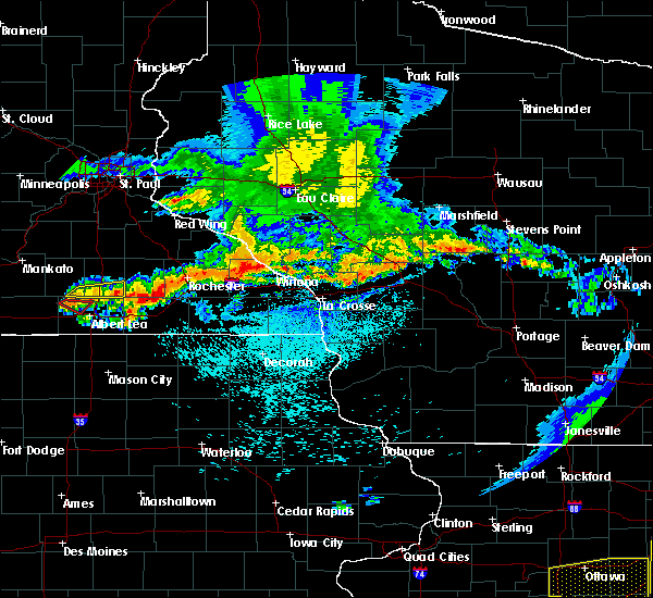 At 252 pm cdt, a severe thunderstorm was located 8 miles southeast of hayfield, or 16 miles northeast of austin, moving southeast at 50 mph (radar indicated). Hazards include 60 mph wind gusts. Expect damage to roofs, siding, and trees. this severe thunderstorm will be near, grand meadow around 305 pm cdt. spring valley around 315 pm cdt. Other locations impacted by this severe thunderstorm include forestville state park, oslo, etna, sargeant, york, county roads 1 and 7 and cherry grove. At 252 pm cdt, a severe thunderstorm was located 8 miles southeast of hayfield, or 16 miles northeast of austin, moving southeast at 50 mph (radar indicated). Hazards include 60 mph wind gusts. Expect damage to roofs, siding, and trees. this severe thunderstorm will be near, grand meadow around 305 pm cdt. spring valley around 315 pm cdt. Other locations impacted by this severe thunderstorm include forestville state park, oslo, etna, sargeant, york, county roads 1 and 7 and cherry grove.
|
| 6/4/2019 9:23 PM CDT |
 At 923 pm cdt, a severe thunderstorm was located over grand meadow, or 21 miles west of preston, moving east at 45 mph (radar indicated). Hazards include quarter size hail. Damage to vehicles is expected. Locations impacted include, grand meadow, racine, dexter, elkton, highways 63 and 16, hamilton, i 90 exit 193, county roads 4 and 3, county roads 4 and 8 and interstate 90 and county 1. At 923 pm cdt, a severe thunderstorm was located over grand meadow, or 21 miles west of preston, moving east at 45 mph (radar indicated). Hazards include quarter size hail. Damage to vehicles is expected. Locations impacted include, grand meadow, racine, dexter, elkton, highways 63 and 16, hamilton, i 90 exit 193, county roads 4 and 3, county roads 4 and 8 and interstate 90 and county 1.
|
| 6/4/2019 9:18 PM CDT |
 At 918 pm cdt, a severe thunderstorm was located over grand meadow, or 18 miles east of austin, moving east at 45 mph (radar indicated). Hazards include quarter size hail. Damage to vehicles is expected. This severe thunderstorm will remain over mainly rural areas of northeastern mower county, including the following locations, highways 63 and 16, hamilton, i 90 exit 193, county roads 4 and 3, dexter, county roads 4 and 8 and interstate 90 and county 1. At 918 pm cdt, a severe thunderstorm was located over grand meadow, or 18 miles east of austin, moving east at 45 mph (radar indicated). Hazards include quarter size hail. Damage to vehicles is expected. This severe thunderstorm will remain over mainly rural areas of northeastern mower county, including the following locations, highways 63 and 16, hamilton, i 90 exit 193, county roads 4 and 3, dexter, county roads 4 and 8 and interstate 90 and county 1.
|
| 6/4/2019 6:39 PM CDT |
 The severe thunderstorm warning for southwestern olmsted, mower and northwestern fillmore counties will expire at 645 pm cdt, the storms which prompted the warning have weakened below severe limits, and no longer pose an immediate threat to life or property. therefore, the warning will be allowed to expire. however gusty winds are still possible with these thunderstorms. severe thunderstorm warnings still remain in effect for much of eastern fillmore county and eastern olmsted county. a severe thunderstorm watch remains in effect until 1100 pm cdt for southeastern minnesota. The severe thunderstorm warning for southwestern olmsted, mower and northwestern fillmore counties will expire at 645 pm cdt, the storms which prompted the warning have weakened below severe limits, and no longer pose an immediate threat to life or property. therefore, the warning will be allowed to expire. however gusty winds are still possible with these thunderstorms. severe thunderstorm warnings still remain in effect for much of eastern fillmore county and eastern olmsted county. a severe thunderstorm watch remains in effect until 1100 pm cdt for southeastern minnesota.
|
| 6/4/2019 5:51 PM CDT |
 At 550 pm cdt, severe thunderstorms were located along a line extending from near rochester to 6 miles north of austin, moving southeast at 40 mph (radar indicated). Hazards include ping pong ball size hail and 60 mph wind gusts. People and animals outdoors will be injured. expect hail damage to roofs, siding, windows, and vehicles. expect wind damage to roofs, siding, and trees. severe thunderstorms will be near, rochester around 555 pm cdt. rose creek around 610 pm cdt. grand meadow and adams around 620 pm cdt. le roy around 635 pm cdt. Other locations impacted by these severe thunderstorms include i 90 exit 218, fillmore, brookside campground, mayville, county roads 4 and 8, washington and waltham. At 550 pm cdt, severe thunderstorms were located along a line extending from near rochester to 6 miles north of austin, moving southeast at 40 mph (radar indicated). Hazards include ping pong ball size hail and 60 mph wind gusts. People and animals outdoors will be injured. expect hail damage to roofs, siding, windows, and vehicles. expect wind damage to roofs, siding, and trees. severe thunderstorms will be near, rochester around 555 pm cdt. rose creek around 610 pm cdt. grand meadow and adams around 620 pm cdt. le roy around 635 pm cdt. Other locations impacted by these severe thunderstorms include i 90 exit 218, fillmore, brookside campground, mayville, county roads 4 and 8, washington and waltham.
|
| 9/20/2018 7:08 PM CDT |
 At 653 pm cdt, severe thunderstorms were located along a line extending from 6 miles northeast of kenyon to near northwood, moving east at 65 mph (trained weather spotters. spotters and airport wind equipment have recorded 60 to 70 mph winds with this line of storms. brief tornadoes have also been confirmed). Hazards include 70 mph wind gusts. Expect considerable tree damage. damage is likely to mobile homes, roofs, and outbuildings. these severe storms will be near, rose creek around 715 pm cdt. adams around 720 pm cdt. le roy and grand meadow around 730 pm cdt. western rochester around 720 pm. other locations impacted by these severe thunderstorms include high forest, lansing, wasioja, douglas and rock dell. A tornado watch remains in effect until midnight cdt for north central and northeastern iowa, and southeastern minnesota. At 653 pm cdt, severe thunderstorms were located along a line extending from 6 miles northeast of kenyon to near northwood, moving east at 65 mph (trained weather spotters. spotters and airport wind equipment have recorded 60 to 70 mph winds with this line of storms. brief tornadoes have also been confirmed). Hazards include 70 mph wind gusts. Expect considerable tree damage. damage is likely to mobile homes, roofs, and outbuildings. these severe storms will be near, rose creek around 715 pm cdt. adams around 720 pm cdt. le roy and grand meadow around 730 pm cdt. western rochester around 720 pm. other locations impacted by these severe thunderstorms include high forest, lansing, wasioja, douglas and rock dell. A tornado watch remains in effect until midnight cdt for north central and northeastern iowa, and southeastern minnesota.
|
| 9/20/2018 6:55 PM CDT |
 At 653 pm cdt, severe thunderstorms were located along a line extending from 6 miles northeast of kenyon to near northwood, moving east at 65 mph (trained weather spotters. spotters and airport wind equipment have recorded 60 to 70 mph winds with this line of storms. brief tornadoes have also been confirmed). Hazards include 70 mph wind gusts. Expect considerable tree damage. damage is likely to mobile homes, roofs, and outbuildings. these severe storms will be near, rose creek around 715 pm cdt. adams around 720 pm cdt. le roy and grand meadow around 730 pm cdt. western rochester around 720 pm. other locations impacted by these severe thunderstorms include high forest, lansing, wasioja, douglas and rock dell. A tornado watch remains in effect until midnight cdt for north central and northeastern iowa, and southeastern minnesota. At 653 pm cdt, severe thunderstorms were located along a line extending from 6 miles northeast of kenyon to near northwood, moving east at 65 mph (trained weather spotters. spotters and airport wind equipment have recorded 60 to 70 mph winds with this line of storms. brief tornadoes have also been confirmed). Hazards include 70 mph wind gusts. Expect considerable tree damage. damage is likely to mobile homes, roofs, and outbuildings. these severe storms will be near, rose creek around 715 pm cdt. adams around 720 pm cdt. le roy and grand meadow around 730 pm cdt. western rochester around 720 pm. other locations impacted by these severe thunderstorms include high forest, lansing, wasioja, douglas and rock dell. A tornado watch remains in effect until midnight cdt for north central and northeastern iowa, and southeastern minnesota.
|
| 9/20/2018 6:38 PM CDT |
 At 636 pm cdt, severe thunderstorms were located along a line extending from near faribault to lake mills, moving east at 65 mph (trained spotters. the storms have a history of producing 60 to 70 mph winds and brief damaging tornadoes). Hazards include 70 mph wind gusts. Expect considerable tree damage. damage is likely to mobile homes, roofs, and outbuildings. severe thunderstorms will be near, lyle around 705 pm cdt. rose creek around 710 pm cdt. adams around 715 pm cdt. le roy and grand meadow around 725 pm cdt. western side of the city of rochester around 720 pm. other locations impacted by these severe thunderstorms include high forest, lansing, wasioja, douglas and rock dell. A tornado watch remains in effect until midnight cdt for north central and northeastern iowa, and southeastern minnesota. At 636 pm cdt, severe thunderstorms were located along a line extending from near faribault to lake mills, moving east at 65 mph (trained spotters. the storms have a history of producing 60 to 70 mph winds and brief damaging tornadoes). Hazards include 70 mph wind gusts. Expect considerable tree damage. damage is likely to mobile homes, roofs, and outbuildings. severe thunderstorms will be near, lyle around 705 pm cdt. rose creek around 710 pm cdt. adams around 715 pm cdt. le roy and grand meadow around 725 pm cdt. western side of the city of rochester around 720 pm. other locations impacted by these severe thunderstorms include high forest, lansing, wasioja, douglas and rock dell. A tornado watch remains in effect until midnight cdt for north central and northeastern iowa, and southeastern minnesota.
|
| 8/27/2018 6:10 PM CDT |
 The severe thunderstorm warning for western olmsted, mower and eastern dodge counties will expire at 615 pm cdt, the storms which prompted the warning have moved out of the area. therefore the warning will be allowed to expire. however gusty winds and heavy rain are still possible with these thunderstorms. a severe thunderstorm watch remains in effect until 1000 pm cdt for southeastern minnesota. remember, a severe thunderstorm warning still remains in effect for eastern olmsted and southeast mower counties until 645 pm!. The severe thunderstorm warning for western olmsted, mower and eastern dodge counties will expire at 615 pm cdt, the storms which prompted the warning have moved out of the area. therefore the warning will be allowed to expire. however gusty winds and heavy rain are still possible with these thunderstorms. a severe thunderstorm watch remains in effect until 1000 pm cdt for southeastern minnesota. remember, a severe thunderstorm warning still remains in effect for eastern olmsted and southeast mower counties until 645 pm!.
|
| 8/27/2018 5:52 PM CDT |
 At 551 pm cdt, severe thunderstorms were located along a line extending from near mazeppa to near stewartville to lyle, moving east at 35 mph. these storms have produced winds of 45 to 55 mph (radar indicated). Hazards include 60 mph wind gusts. Expect damage to roofs, siding, and trees. these severe storms will be near, oronoco and byron around 555 pm cdt. rochester and stewartville around 600 pm cdt. Other locations impacted by these severe thunderstorms include high forest, lansing, douglas, rock dell and mayville. At 551 pm cdt, severe thunderstorms were located along a line extending from near mazeppa to near stewartville to lyle, moving east at 35 mph. these storms have produced winds of 45 to 55 mph (radar indicated). Hazards include 60 mph wind gusts. Expect damage to roofs, siding, and trees. these severe storms will be near, oronoco and byron around 555 pm cdt. rochester and stewartville around 600 pm cdt. Other locations impacted by these severe thunderstorms include high forest, lansing, douglas, rock dell and mayville.
|
| 8/27/2018 5:31 PM CDT |
 At 530 pm cdt, severe thunderstorms were located along a line extending from 6 miles south of wanamingo to hayfield to near northwood, moving east at 45 mph (radar indicated). Hazards include 60 mph wind gusts. Expect damage to roofs, siding, and trees. these severe storms will be near, mantorville, dodge center, hayfield and west concord around 535 pm cdt. kasson around 540 pm cdt. oronoco and byron around 545 pm cdt. stewartville around 550 pm cdt. rochester and rose creek around 555 pm cdt. Other locations impacted by these severe thunderstorms include high forest, lansing, wasioja, douglas and rock dell. At 530 pm cdt, severe thunderstorms were located along a line extending from 6 miles south of wanamingo to hayfield to near northwood, moving east at 45 mph (radar indicated). Hazards include 60 mph wind gusts. Expect damage to roofs, siding, and trees. these severe storms will be near, mantorville, dodge center, hayfield and west concord around 535 pm cdt. kasson around 540 pm cdt. oronoco and byron around 545 pm cdt. stewartville around 550 pm cdt. rochester and rose creek around 555 pm cdt. Other locations impacted by these severe thunderstorms include high forest, lansing, wasioja, douglas and rock dell.
|
| 8/27/2018 5:09 PM CDT |
 At 509 pm cdt, severe thunderstorms were located along a line extending from near medford to near hollandale to 6 miles northeast of rice lake, moving east at 35 mph (radar indicated). Hazards include 60 mph wind gusts and penny size hail. Expect damage to roofs, siding, and trees. Locations impacted include, rochester, austin, dodge center, mantorville, kasson, stewartville, byron, hayfield, oronoco, west concord, brownsdale, lyle, claremont, rose creek, high forest, lansing, wasioja, douglas, rock dell and concord. At 509 pm cdt, severe thunderstorms were located along a line extending from near medford to near hollandale to 6 miles northeast of rice lake, moving east at 35 mph (radar indicated). Hazards include 60 mph wind gusts and penny size hail. Expect damage to roofs, siding, and trees. Locations impacted include, rochester, austin, dodge center, mantorville, kasson, stewartville, byron, hayfield, oronoco, west concord, brownsdale, lyle, claremont, rose creek, high forest, lansing, wasioja, douglas, rock dell and concord.
|
| 8/27/2018 4:57 PM CDT |
 At 456 pm cdt, severe thunderstorms were located along a line extending from near medford to clarks grove to rice lake, moving east at 35 mph (radar indicated). Hazards include 60 mph wind gusts and penny size hail. expect damage to roofs, siding, and trees At 456 pm cdt, severe thunderstorms were located along a line extending from near medford to clarks grove to rice lake, moving east at 35 mph (radar indicated). Hazards include 60 mph wind gusts and penny size hail. expect damage to roofs, siding, and trees
|
| 7/4/2018 2:43 PM CDT |
 At 242 pm cdt, severe thunderstorms were located along a line extending from near stewartville to near lyle, moving east at 30 mph (radar indicated). Hazards include 60 mph wind gusts. Expect damage to roofs, siding, and trees. these severe storms will be near, grand meadow around 250 pm cdt. le roy around 315 pm cdt. Other locations impacted by these severe thunderstorms include lansing, racine, mayville, dexter and mapleview. At 242 pm cdt, severe thunderstorms were located along a line extending from near stewartville to near lyle, moving east at 30 mph (radar indicated). Hazards include 60 mph wind gusts. Expect damage to roofs, siding, and trees. these severe storms will be near, grand meadow around 250 pm cdt. le roy around 315 pm cdt. Other locations impacted by these severe thunderstorms include lansing, racine, mayville, dexter and mapleview.
|
| 7/4/2018 2:31 PM CDT |
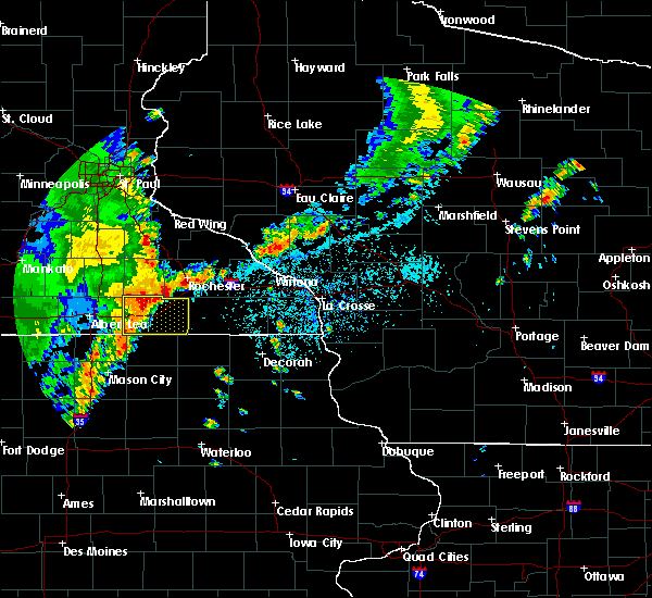 At 231 pm cdt, severe thunderstorms were located along a line extending from 8 miles southeast of hayfield to lyle, moving east at 30 mph (radar indicated). Hazards include 60 mph wind gusts. Expect damage to roofs, siding, and trees. these severe storms will be near, grand meadow around 245 pm cdt. adams around 255 pm cdt. le roy around 315 pm cdt. Other locations impacted by these severe thunderstorms include lansing, racine, mayville, dexter and mapleview. At 231 pm cdt, severe thunderstorms were located along a line extending from 8 miles southeast of hayfield to lyle, moving east at 30 mph (radar indicated). Hazards include 60 mph wind gusts. Expect damage to roofs, siding, and trees. these severe storms will be near, grand meadow around 245 pm cdt. adams around 255 pm cdt. le roy around 315 pm cdt. Other locations impacted by these severe thunderstorms include lansing, racine, mayville, dexter and mapleview.
|
| 7/4/2018 2:22 PM CDT |
 At 222 pm cdt, severe thunderstorms were located along a line extending from near hayfield to lyle, moving east at 40 mph (radar indicated). Hazards include 60 mph wind gusts. Expect damage to roofs, siding, and trees. these severe storms will be near, rose creek around 235 pm cdt. adams and grand meadow around 240 pm cdt. le roy around 255 pm cdt. Other locations impacted by these severe thunderstorms include lansing, racine, mayville, dexter and mapleview. At 222 pm cdt, severe thunderstorms were located along a line extending from near hayfield to lyle, moving east at 40 mph (radar indicated). Hazards include 60 mph wind gusts. Expect damage to roofs, siding, and trees. these severe storms will be near, rose creek around 235 pm cdt. adams and grand meadow around 240 pm cdt. le roy around 255 pm cdt. Other locations impacted by these severe thunderstorms include lansing, racine, mayville, dexter and mapleview.
|
| 7/4/2018 2:18 PM CDT |
 At 218 pm cdt, severe thunderstorms were located along a line extending from near hayfield to near lyle, moving east at 40 mph (radar indicated). Hazards include 60 mph wind gusts. Expect damage to roofs, siding, and trees. these severe storms will be near, rose creek around 235 pm cdt. adams and grand meadow around 240 pm cdt. le roy around 255 pm cdt. Other locations impacted by these severe thunderstorms include lansing, racine, mayville, dexter and mapleview. At 218 pm cdt, severe thunderstorms were located along a line extending from near hayfield to near lyle, moving east at 40 mph (radar indicated). Hazards include 60 mph wind gusts. Expect damage to roofs, siding, and trees. these severe storms will be near, rose creek around 235 pm cdt. adams and grand meadow around 240 pm cdt. le roy around 255 pm cdt. Other locations impacted by these severe thunderstorms include lansing, racine, mayville, dexter and mapleview.
|
| 7/4/2018 2:13 PM CDT |
 At 213 pm cdt, severe thunderstorms were located along a line extending from near blooming prairie to near northwood, moving east at 25 mph (radar indicated). Hazards include 60 mph wind gusts. Expect damage to roofs, siding, and trees. severe thunderstorms will be near, austin around 220 pm cdt. brownsdale around 230 pm cdt. lyle around 240 pm cdt. rose creek around 255 pm cdt. adams and grand meadow around 310 pm cdt. le roy around 315 pm cdt. Other locations impacted by these severe thunderstorms include lansing, racine, mayville, dexter and mapleview. At 213 pm cdt, severe thunderstorms were located along a line extending from near blooming prairie to near northwood, moving east at 25 mph (radar indicated). Hazards include 60 mph wind gusts. Expect damage to roofs, siding, and trees. severe thunderstorms will be near, austin around 220 pm cdt. brownsdale around 230 pm cdt. lyle around 240 pm cdt. rose creek around 255 pm cdt. adams and grand meadow around 310 pm cdt. le roy around 315 pm cdt. Other locations impacted by these severe thunderstorms include lansing, racine, mayville, dexter and mapleview.
|
| 6/30/2018 6:55 PM CDT |
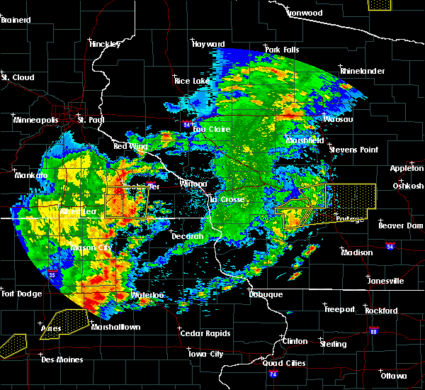 At 654 pm cdt, severe thunderstorms were located along a line extending from 8 miles northwest of chatfield to wykoff to near lime springs, moving east at 55 mph (radar indicated). Hazards include 70 mph wind gusts. Expect considerable tree damage. damage is likely to mobile homes, roofs, and outbuildings. these severe storms will be near, fountain and chatfield around 700 pm cdt. Other locations impacted by these severe thunderstorms include fillmore, high forest, pleasant grove, washington and rock dell. At 654 pm cdt, severe thunderstorms were located along a line extending from 8 miles northwest of chatfield to wykoff to near lime springs, moving east at 55 mph (radar indicated). Hazards include 70 mph wind gusts. Expect considerable tree damage. damage is likely to mobile homes, roofs, and outbuildings. these severe storms will be near, fountain and chatfield around 700 pm cdt. Other locations impacted by these severe thunderstorms include fillmore, high forest, pleasant grove, washington and rock dell.
|
| 6/30/2018 6:46 PM CDT |
 At 645 pm cdt, severe thunderstorms were located along a line extending from near stewartville to near spring valley to le roy, moving east at 50 mph (radar indicated). Hazards include 70 mph wind gusts. Expect considerable tree damage. damage is likely to mobile homes, roofs, and outbuildings. these severe storms will be near, spring valley around 650 pm cdt. wykoff around 655 pm cdt. fountain and chatfield around 705 pm cdt. Other locations impacted by these severe thunderstorms include fillmore, high forest, pleasant grove, washington and rock dell. At 645 pm cdt, severe thunderstorms were located along a line extending from near stewartville to near spring valley to le roy, moving east at 50 mph (radar indicated). Hazards include 70 mph wind gusts. Expect considerable tree damage. damage is likely to mobile homes, roofs, and outbuildings. these severe storms will be near, spring valley around 650 pm cdt. wykoff around 655 pm cdt. fountain and chatfield around 705 pm cdt. Other locations impacted by these severe thunderstorms include fillmore, high forest, pleasant grove, washington and rock dell.
|
| 6/30/2018 6:35 PM CDT |
 At 634 pm cdt, severe thunderstorms were located along a line extending from near hayfield to 6 miles west of grand meadow to near stacyville, moving east at 45 mph (emergency management. numerous reports of trees down have been received across western mower county). Hazards include 60 mph wind gusts. Expect damage to roofs, siding, and trees. severe thunderstorms will be near, grand meadow around 645 pm cdt. rochester and le roy around 650 pm cdt. spring valley and stewartville around 655 pm cdt. wykoff around 705 pm cdt. chatfield and fountain around 715 pm cdt. other locations impacted by these severe thunderstorms include fillmore, high forest, lansing, pleasant grove and washington. In addition to damaging winds, torrential rainfall will likely cause some flooding as these storms cross the area, particularly in urban areas. At 634 pm cdt, severe thunderstorms were located along a line extending from near hayfield to 6 miles west of grand meadow to near stacyville, moving east at 45 mph (emergency management. numerous reports of trees down have been received across western mower county). Hazards include 60 mph wind gusts. Expect damage to roofs, siding, and trees. severe thunderstorms will be near, grand meadow around 645 pm cdt. rochester and le roy around 650 pm cdt. spring valley and stewartville around 655 pm cdt. wykoff around 705 pm cdt. chatfield and fountain around 715 pm cdt. other locations impacted by these severe thunderstorms include fillmore, high forest, lansing, pleasant grove and washington. In addition to damaging winds, torrential rainfall will likely cause some flooding as these storms cross the area, particularly in urban areas.
|
| 7/19/2017 5:01 PM CDT |
 At 459 pm cdt, severe thunderstorms were located along a line extending from 6 miles southwest of elgin to near stacyville, moving southeast at 40 mph (trained weather spotters report many pockets of wind damage and power outages. many reports of 50 to 70 mph wind have been received). Hazards include 70 mph wind gusts. Expect considerable tree damage. damage is likely to mobile homes, roofs, and outbuildings. these severe storms will be near, le roy around 515 pm cdt. other locations impacted by these severe thunderstorms include high forest, lansing, wasioja, douglas and rock dell. People attending the dodge county free fair should seek safe shelter immediately!. At 459 pm cdt, severe thunderstorms were located along a line extending from 6 miles southwest of elgin to near stacyville, moving southeast at 40 mph (trained weather spotters report many pockets of wind damage and power outages. many reports of 50 to 70 mph wind have been received). Hazards include 70 mph wind gusts. Expect considerable tree damage. damage is likely to mobile homes, roofs, and outbuildings. these severe storms will be near, le roy around 515 pm cdt. other locations impacted by these severe thunderstorms include high forest, lansing, wasioja, douglas and rock dell. People attending the dodge county free fair should seek safe shelter immediately!.
|
| 7/19/2017 4:34 PM CDT |
 At 433 pm cdt, severe thunderstorms were located along a line extending from near west concord to near brownsdale to near northwood, moving east at 50 mph (trained weather spotters have reported 60 to 65 mph winds with this line of storms). Hazards include 70 mph wind gusts. Expect considerable tree damage. damage is likely to mobile homes, roofs, and outbuildings. these severe storms will be near, mantorville, dodge center, brownsdale and kasson around 440 pm cdt. pine island around 445 pm cdt. byron around 450 pm cdt. oronoco and lyle around 455 pm cdt. rochester, grand meadow and stewartville around 500 pm cdt. other locations impacted by these severe thunderstorms include high forest, lansing, wasioja, douglas and rock dell. People attending the dodge county free fair should seek safe shelter immediately!. At 433 pm cdt, severe thunderstorms were located along a line extending from near west concord to near brownsdale to near northwood, moving east at 50 mph (trained weather spotters have reported 60 to 65 mph winds with this line of storms). Hazards include 70 mph wind gusts. Expect considerable tree damage. damage is likely to mobile homes, roofs, and outbuildings. these severe storms will be near, mantorville, dodge center, brownsdale and kasson around 440 pm cdt. pine island around 445 pm cdt. byron around 450 pm cdt. oronoco and lyle around 455 pm cdt. rochester, grand meadow and stewartville around 500 pm cdt. other locations impacted by these severe thunderstorms include high forest, lansing, wasioja, douglas and rock dell. People attending the dodge county free fair should seek safe shelter immediately!.
|
| 7/19/2017 4:32 PM CDT |
 At 430 pm cdt, severe thunderstorms were located along a line extending from west concord to near blooming prairie to near northwood, moving east at 50 mph (trained weather spotters reported 60-65 mph winds west of dodge county). Hazards include 70 mph wind gusts. Expect considerable tree damage. damage is likely to mobile homes, roofs, and outbuildings. these severe storms will be near, dodge center, austin, west concord and ramsey around 435 pm cdt. mantorville, brownsdale and kasson around 440 pm cdt. byron and pine island around 445 pm cdt. oronoco around 450 pm cdt. rochester, grand meadow and lyle around 455 pm cdt. le roy around 515 pm cdt. other locations impacted by these severe thunderstorms include high forest, lansing, wasioja, douglas and rock dell. People attending the dodge county free fair should seek safe shelter immediately!. At 430 pm cdt, severe thunderstorms were located along a line extending from west concord to near blooming prairie to near northwood, moving east at 50 mph (trained weather spotters reported 60-65 mph winds west of dodge county). Hazards include 70 mph wind gusts. Expect considerable tree damage. damage is likely to mobile homes, roofs, and outbuildings. these severe storms will be near, dodge center, austin, west concord and ramsey around 435 pm cdt. mantorville, brownsdale and kasson around 440 pm cdt. byron and pine island around 445 pm cdt. oronoco around 450 pm cdt. rochester, grand meadow and lyle around 455 pm cdt. le roy around 515 pm cdt. other locations impacted by these severe thunderstorms include high forest, lansing, wasioja, douglas and rock dell. People attending the dodge county free fair should seek safe shelter immediately!.
|
| 7/19/2017 4:15 PM CDT |
 At 412 pm cdt, severe thunderstorms were located along a line extending from near medford to near geneva to near mansfield, moving east at 60 mph (trained weather spotters. wind gusts of 60 to 65 mph and downed trees have been reported near interstate 35 with these storms). Hazards include 70 mph wind gusts. Expect considerable tree damage. damage is likely to mobile homes, roofs, and outbuildings. severe thunderstorms will be near, claremont around 425 pm cdt. austin, dodge center around 430 pm cdt. mantorville and hayfield around 435 pm cdt. byron and pine island around 440 pm cdt. oronoco around 445 pm cdt. rochester around 450 pm cdt. People attending the dodge county free fair should seek safe shelter immediately!. At 412 pm cdt, severe thunderstorms were located along a line extending from near medford to near geneva to near mansfield, moving east at 60 mph (trained weather spotters. wind gusts of 60 to 65 mph and downed trees have been reported near interstate 35 with these storms). Hazards include 70 mph wind gusts. Expect considerable tree damage. damage is likely to mobile homes, roofs, and outbuildings. severe thunderstorms will be near, claremont around 425 pm cdt. austin, dodge center around 430 pm cdt. mantorville and hayfield around 435 pm cdt. byron and pine island around 440 pm cdt. oronoco around 445 pm cdt. rochester around 450 pm cdt. People attending the dodge county free fair should seek safe shelter immediately!.
|
| 5/17/2017 7:10 PM CDT |
 The severe thunderstorm warning for mower and western fillmore counties will expire at 715 pm cdt, the storms which prompted the warning have moved out of the area. therefore the warning will be allowed to expire. a tornado watch remains in effect until 1100 pm cdt for northeastern iowa, and southeastern minnesota. The severe thunderstorm warning for mower and western fillmore counties will expire at 715 pm cdt, the storms which prompted the warning have moved out of the area. therefore the warning will be allowed to expire. a tornado watch remains in effect until 1100 pm cdt for northeastern iowa, and southeastern minnesota.
|
| 5/17/2017 6:59 PM CDT |
 At 658 pm cdt, severe thunderstorms were located along a line extending from near austin to preston, moving north at 50 mph (radar indicated. spotters in spring valley reported 50 mph). Hazards include 70 mph wind gusts and quarter size hail. Hail damage to vehicles is expected. expect considerable tree damage. wind damage is also likely to mobile homes, roofs, and outbuildings. these severe storms will be near, brownsdale around 705 pm cdt. chatfield around 715 pm cdt. other locations impacted by these severe thunderstorms include fillmore, lansing, washington, racine and mayville. A tornado watch remains in effect until 1100 pm cdt for northeastern iowa, and southeastern minnesota. At 658 pm cdt, severe thunderstorms were located along a line extending from near austin to preston, moving north at 50 mph (radar indicated. spotters in spring valley reported 50 mph). Hazards include 70 mph wind gusts and quarter size hail. Hail damage to vehicles is expected. expect considerable tree damage. wind damage is also likely to mobile homes, roofs, and outbuildings. these severe storms will be near, brownsdale around 705 pm cdt. chatfield around 715 pm cdt. other locations impacted by these severe thunderstorms include fillmore, lansing, washington, racine and mayville. A tornado watch remains in effect until 1100 pm cdt for northeastern iowa, and southeastern minnesota.
|
| 5/17/2017 6:48 PM CDT |
 At 647 pm cdt, severe thunderstorms were located along a line extending from near london to near harmony, moving north at 50 mph (radar indicated. this cluster of storms has a history of producing damaging winds). Hazards include 70 mph wind gusts and quarter size hail. Hail damage to vehicles is expected. expect considerable tree damage. wind damage is also likely to mobile homes, roofs, and outbuildings. these severe storms will be near, rose creek around 650 pm cdt. preston, austin, fountain and ramsey around 700 pm cdt. brownsdale around 705 pm cdt. chatfield around 710 pm cdt. other locations impacted by these severe thunderstorms include fillmore, lansing, washington, racine and mayville. A tornado watch remains in effect until 1100 pm cdt for northeastern iowa, and southeastern minnesota. At 647 pm cdt, severe thunderstorms were located along a line extending from near london to near harmony, moving north at 50 mph (radar indicated. this cluster of storms has a history of producing damaging winds). Hazards include 70 mph wind gusts and quarter size hail. Hail damage to vehicles is expected. expect considerable tree damage. wind damage is also likely to mobile homes, roofs, and outbuildings. these severe storms will be near, rose creek around 650 pm cdt. preston, austin, fountain and ramsey around 700 pm cdt. brownsdale around 705 pm cdt. chatfield around 710 pm cdt. other locations impacted by these severe thunderstorms include fillmore, lansing, washington, racine and mayville. A tornado watch remains in effect until 1100 pm cdt for northeastern iowa, and southeastern minnesota.
|
| 5/17/2017 6:35 PM CDT |
 At 635 pm cdt, severe thunderstorms were located along a line extending from near st. ansgar to near cresco, moving north at 50 mph (radar indicated. these storms have a history of producing damaging winds). Hazards include 60 mph wind gusts and quarter size hail. Hail damage to vehicles is expected. expect wind damage to roofs, siding, and trees. severe thunderstorms will be near, lyle around 645 pm cdt. rose creek around 650 pm cdt. preston around 655 pm cdt. austin, ramsey, fountain and brownsdale around 700 pm cdt. chatfield around 710 pm cdt. other locations impacted by these severe thunderstorms include fillmore, lansing, washington, racine and mayville. A tornado watch remains in effect until 1100 pm cdt for northeastern iowa, and southeastern minnesota. At 635 pm cdt, severe thunderstorms were located along a line extending from near st. ansgar to near cresco, moving north at 50 mph (radar indicated. these storms have a history of producing damaging winds). Hazards include 60 mph wind gusts and quarter size hail. Hail damage to vehicles is expected. expect wind damage to roofs, siding, and trees. severe thunderstorms will be near, lyle around 645 pm cdt. rose creek around 650 pm cdt. preston around 655 pm cdt. austin, ramsey, fountain and brownsdale around 700 pm cdt. chatfield around 710 pm cdt. other locations impacted by these severe thunderstorms include fillmore, lansing, washington, racine and mayville. A tornado watch remains in effect until 1100 pm cdt for northeastern iowa, and southeastern minnesota.
|
| 5/8/2017 10:07 PM CDT |
 At 1006 pm cdt, a severe thunderstorm was located near grand meadow, or 16 miles east of austin, moving southeast at 25 mph (radar indicated). Hazards include quarter size hail. Damage to vehicles is expected. this severe thunderstorm will be near, grand meadow around 1010 pm cdt. le roy and spring valley around 1030 pm cdt. Other locations impacted by this severe thunderstorm include dexter, ostrander, elkton, taopi and county roads 4 and 8. At 1006 pm cdt, a severe thunderstorm was located near grand meadow, or 16 miles east of austin, moving southeast at 25 mph (radar indicated). Hazards include quarter size hail. Damage to vehicles is expected. this severe thunderstorm will be near, grand meadow around 1010 pm cdt. le roy and spring valley around 1030 pm cdt. Other locations impacted by this severe thunderstorm include dexter, ostrander, elkton, taopi and county roads 4 and 8.
|
| 4/9/2017 10:26 PM CDT |
 At 1026 pm cdt, a severe thunderstorm was located near le roy, or 17 miles west of preston, moving northeast at 45 mph (radar indicated). Hazards include ping pong ball size hail. People and animals outdoors will be injured. expect damage to roofs, siding, windows, and vehicles. this severe storm will be near, spring valley around 1030 pm cdt. wykoff around 1040 pm cdt. preston, fountain and chatfield around 1050 pm cdt. lanesboro around 1055 pm cdt. rushford around 1100 pm cdt. Other locations impacted by this severe thunderstorm include fillmore, rushford village, washington, racine and cherry grove. At 1026 pm cdt, a severe thunderstorm was located near le roy, or 17 miles west of preston, moving northeast at 45 mph (radar indicated). Hazards include ping pong ball size hail. People and animals outdoors will be injured. expect damage to roofs, siding, windows, and vehicles. this severe storm will be near, spring valley around 1030 pm cdt. wykoff around 1040 pm cdt. preston, fountain and chatfield around 1050 pm cdt. lanesboro around 1055 pm cdt. rushford around 1100 pm cdt. Other locations impacted by this severe thunderstorm include fillmore, rushford village, washington, racine and cherry grove.
|
| 4/9/2017 10:15 PM CDT |
 At 1015 pm cdt, a severe thunderstorm was located near le roy, or 22 miles west of preston, moving northeast at 55 mph (radar indicated). Hazards include ping pong ball size hail. People and animals outdoors will be injured. expect damage to roofs, siding, windows, and vehicles. this severe thunderstorm will be near, spring valley around 1025 pm cdt. wykoff around 1030 pm cdt. preston, fountain and chatfield around 1040 pm cdt. lanesboro around 1045 pm cdt. rushford around 1100 pm cdt. Other locations impacted by this severe thunderstorm include fillmore, rushford village, washington, racine and cherry grove. At 1015 pm cdt, a severe thunderstorm was located near le roy, or 22 miles west of preston, moving northeast at 55 mph (radar indicated). Hazards include ping pong ball size hail. People and animals outdoors will be injured. expect damage to roofs, siding, windows, and vehicles. this severe thunderstorm will be near, spring valley around 1025 pm cdt. wykoff around 1030 pm cdt. preston, fountain and chatfield around 1040 pm cdt. lanesboro around 1045 pm cdt. rushford around 1100 pm cdt. Other locations impacted by this severe thunderstorm include fillmore, rushford village, washington, racine and cherry grove.
|
| 4/9/2017 8:54 PM CDT |
 The severe thunderstorm warning for central mower county will expire at 900 pm cdt, the storm which prompted the warning has moved out of the area. therefore the warning will be allowed to expire. The severe thunderstorm warning for central mower county will expire at 900 pm cdt, the storm which prompted the warning has moved out of the area. therefore the warning will be allowed to expire.
|
| 4/9/2017 8:35 PM CDT |
 At 834 pm cdt, a severe thunderstorm was located 8 miles southeast of hayfield, or 16 miles northeast of austin, moving northeast at 40 mph (trained weather spotters reported quarter size hail in austin at 812 pm). Hazards include 60 mph wind gusts and quarter size hail. Hail damage to vehicles is expected. expect wind damage to roofs, siding, and trees. This severe thunderstorm will remain over mainly rural areas of central mower county, including the following locations: lansing, mayville, dexter, mapleview and waltham. At 834 pm cdt, a severe thunderstorm was located 8 miles southeast of hayfield, or 16 miles northeast of austin, moving northeast at 40 mph (trained weather spotters reported quarter size hail in austin at 812 pm). Hazards include 60 mph wind gusts and quarter size hail. Hail damage to vehicles is expected. expect wind damage to roofs, siding, and trees. This severe thunderstorm will remain over mainly rural areas of central mower county, including the following locations: lansing, mayville, dexter, mapleview and waltham.
|
| 4/9/2017 8:24 PM CDT |
 At 823 pm cdt, a severe thunderstorm was located over brownsdale, or 8 miles northeast of austin, moving northeast at 45 mph (trained weather spotters reported quarter size hail in austin). Hazards include 60 mph wind gusts and quarter size hail. Hail damage to vehicles is expected. expect wind damage to roofs, siding, and trees. this severe storm will be near, grand meadow around 835 pm cdt. Other locations impacted by this severe thunderstorm include lansing, mayville, dexter, mapleview and waltham. At 823 pm cdt, a severe thunderstorm was located over brownsdale, or 8 miles northeast of austin, moving northeast at 45 mph (trained weather spotters reported quarter size hail in austin). Hazards include 60 mph wind gusts and quarter size hail. Hail damage to vehicles is expected. expect wind damage to roofs, siding, and trees. this severe storm will be near, grand meadow around 835 pm cdt. Other locations impacted by this severe thunderstorm include lansing, mayville, dexter, mapleview and waltham.
|
| 4/9/2017 8:13 PM CDT |
 At 813 pm cdt, a severe thunderstorm was located over austin, moving northeast at 45 mph (radar indicated). Hazards include quarter size hail. Damage to vehicles is expected. this severe thunderstorm will be near, brownsdale around 825 pm cdt. grand meadow around 835 pm cdt. Other locations impacted by this severe thunderstorm include lansing, mayville, dexter, mapleview and waltham. At 813 pm cdt, a severe thunderstorm was located over austin, moving northeast at 45 mph (radar indicated). Hazards include quarter size hail. Damage to vehicles is expected. this severe thunderstorm will be near, brownsdale around 825 pm cdt. grand meadow around 835 pm cdt. Other locations impacted by this severe thunderstorm include lansing, mayville, dexter, mapleview and waltham.
|
| 3/6/2017 6:57 PM CST |
 At 657 pm cst, severe thunderstorms were located along a line extending from 8 miles northwest of grand meadow to near adams, moving northeast at 65 mph (radar indicated). Hazards include 60 mph wind gusts. Expect damage to roofs, siding, and trees. severe thunderstorms will be near, le roy around 705 pm cst. grand meadow around 715 pm cst. other locations impacted by these severe thunderstorms include racine, dexter, elkton, sargeant and taopi. A tornado watch remains in effect until 1000 pm cst for southeastern minnesota. At 657 pm cst, severe thunderstorms were located along a line extending from 8 miles northwest of grand meadow to near adams, moving northeast at 65 mph (radar indicated). Hazards include 60 mph wind gusts. Expect damage to roofs, siding, and trees. severe thunderstorms will be near, le roy around 705 pm cst. grand meadow around 715 pm cst. other locations impacted by these severe thunderstorms include racine, dexter, elkton, sargeant and taopi. A tornado watch remains in effect until 1000 pm cst for southeastern minnesota.
|
| 8/18/2016 5:26 PM CDT |
 At 523 pm cdt, severe thunderstorms were located along a line extending from near hayfield to near grand meadow to adams, moving east at 35 mph (law enforcement reported 60 mph winds in hayfield at 523 pm). Hazards include 60 mph wind gusts. Expect damage to roofs. siding. and trees. persons in the eastern portion of dodge county and southern mower county will be affected through 530 pm. the warning will then be allowed to expire at 530 pm as storms are shifting east. Storms will continue through 6 pm before moving out. At 523 pm cdt, severe thunderstorms were located along a line extending from near hayfield to near grand meadow to adams, moving east at 35 mph (law enforcement reported 60 mph winds in hayfield at 523 pm). Hazards include 60 mph wind gusts. Expect damage to roofs. siding. and trees. persons in the eastern portion of dodge county and southern mower county will be affected through 530 pm. the warning will then be allowed to expire at 530 pm as storms are shifting east. Storms will continue through 6 pm before moving out.
|
| 8/18/2016 5:13 PM CDT |
 At 511 pm cdt, strong to severe thunderstorms were continuingtoaffect most of mower and dodge county, moving east at 35 mph (law enforcement reports some tree debris and wind gusts in the 50 mph range at hayfield at 510 pm). Hazards include 60 mph wind gusts and nickel size hail. Expect damage to roofs. siding. and trees. Storms will continune in the mower and dodge county area for another 30 minutes. At 511 pm cdt, strong to severe thunderstorms were continuingtoaffect most of mower and dodge county, moving east at 35 mph (law enforcement reports some tree debris and wind gusts in the 50 mph range at hayfield at 510 pm). Hazards include 60 mph wind gusts and nickel size hail. Expect damage to roofs. siding. and trees. Storms will continune in the mower and dodge county area for another 30 minutes.
|
| 8/18/2016 5:02 PM CDT |
 At 500 pm cdt, severe thunderstorms were located along a line extending from near dodge center to near brownsdale to near rose creek, moving east at 50 mph (law enforcement reports power line damage and some brances down in austin and the northwest portion of mower county). Hazards include 60 mph wind gusts and nickel size hail. Expect damage to roofs. siding. and trees. these severe storms will be near, adams around 510 pm cdt. Other locations impacted by these severe thunderstorms include lansing, wasioja, concord, mayville and dexter. At 500 pm cdt, severe thunderstorms were located along a line extending from near dodge center to near brownsdale to near rose creek, moving east at 50 mph (law enforcement reports power line damage and some brances down in austin and the northwest portion of mower county). Hazards include 60 mph wind gusts and nickel size hail. Expect damage to roofs. siding. and trees. these severe storms will be near, adams around 510 pm cdt. Other locations impacted by these severe thunderstorms include lansing, wasioja, concord, mayville and dexter.
|
| 8/18/2016 4:42 PM CDT |
 At 439 pm cdt, severe thunderstorms were located along a line extending from near claremont to near hayward, moving east at 45 mph (public. this storm has a history of winds to 60 mph and wind damage). Hazards include 60 mph wind gusts and nickel size hail. Expect damage to roofs. siding. and trees. these severe storms will be near, claremont around 445 pm cdt. west concord around 450 pm cdt. dodge center and hayfield around 455 pm cdt. austin, mantorville, kasson and ramsey around 500 pm cdt. brownsdale and lyle around 505 pm cdt. rose creek around 510 pm cdt. adams around 520 pm cdt. Radar indicates that the strongest winds could be in far southern dodge and northern mower county. At 439 pm cdt, severe thunderstorms were located along a line extending from near claremont to near hayward, moving east at 45 mph (public. this storm has a history of winds to 60 mph and wind damage). Hazards include 60 mph wind gusts and nickel size hail. Expect damage to roofs. siding. and trees. these severe storms will be near, claremont around 445 pm cdt. west concord around 450 pm cdt. dodge center and hayfield around 455 pm cdt. austin, mantorville, kasson and ramsey around 500 pm cdt. brownsdale and lyle around 505 pm cdt. rose creek around 510 pm cdt. adams around 520 pm cdt. Radar indicates that the strongest winds could be in far southern dodge and northern mower county.
|
| 8/18/2016 4:29 PM CDT |
 At 425 pm cdt, severe thunderstorms were located along a line extending from owatonna to near albert lea, moving east at 35 mph (law enforcement. these storms have produced 50 to 60 mph winds near waseca and also wind damage). Hazards include 60 mph wind gusts and nickel size hail. Expect damage to roofs. siding. and trees. severe thunderstorms will be near, claremont around 445 pm cdt. west concord around 450 pm cdt. dodge center around 455 pm cdt. mantorville, ramsey and hayfield around 500 pm cdt. austin and lyle and brownsdale around 510 pm cdt. Adams around 525 pm cdt. At 425 pm cdt, severe thunderstorms were located along a line extending from owatonna to near albert lea, moving east at 35 mph (law enforcement. these storms have produced 50 to 60 mph winds near waseca and also wind damage). Hazards include 60 mph wind gusts and nickel size hail. Expect damage to roofs. siding. and trees. severe thunderstorms will be near, claremont around 445 pm cdt. west concord around 450 pm cdt. dodge center around 455 pm cdt. mantorville, ramsey and hayfield around 500 pm cdt. austin and lyle and brownsdale around 510 pm cdt. Adams around 525 pm cdt.
|
| 7/17/2016 1:02 AM CDT |
 At 101 am cdt, severe thunderstorms were located along a line extending from near le roy to near st. ansgar, moving east at 35 mph (radar indicated). Hazards include 60 mph wind gusts. Expect damage to roofs. siding. and trees. these severe storms will be near, le roy around 105 am cdt. adams around 115 am cdt. Other locations impacted by these severe thunderstorms include racine, dexter, elkton, mcintire and carpenter. At 101 am cdt, severe thunderstorms were located along a line extending from near le roy to near st. ansgar, moving east at 35 mph (radar indicated). Hazards include 60 mph wind gusts. Expect damage to roofs. siding. and trees. these severe storms will be near, le roy around 105 am cdt. adams around 115 am cdt. Other locations impacted by these severe thunderstorms include racine, dexter, elkton, mcintire and carpenter.
|
| 7/17/2016 12:38 AM CDT |
 At 1237 am cdt, severe thunderstorms were located along a line extending from 8 miles east of brownsdale to near lyle, moving east at 45 mph (radar indicated). Hazards include 60 mph wind gusts and quarter size hail. Hail damage to vehicles is expected. expect wind damage to roofs, siding, and trees. these severe storms will be near, grand meadow and adams around 1250 am cdt. le roy around 100 am cdt. riceville around 105 am cdt. Other locations impacted by these severe thunderstorms include lansing, racine, mayville, dexter and mapleview. At 1237 am cdt, severe thunderstorms were located along a line extending from 8 miles east of brownsdale to near lyle, moving east at 45 mph (radar indicated). Hazards include 60 mph wind gusts and quarter size hail. Hail damage to vehicles is expected. expect wind damage to roofs, siding, and trees. these severe storms will be near, grand meadow and adams around 1250 am cdt. le roy around 100 am cdt. riceville around 105 am cdt. Other locations impacted by these severe thunderstorms include lansing, racine, mayville, dexter and mapleview.
|
| 7/17/2016 12:16 AM CDT |
 At 1216 am cdt, severe thunderstorms were located along a line extending from near blooming prairie to near glenville, moving east at 45 mph (radar indicated). Hazards include 60 mph wind gusts and quarter size hail. Hail damage to vehicles is expected. expect wind damage to roofs, siding, and trees. severe thunderstorms will be near, austin and ramsey around 1220 am cdt. brownsdale around 1225 am cdt. lyle around 1230 am cdt. st. ansgar and rose creek around 1235 am cdt. grand meadow, stacyville and adams around 1245 am cdt. le roy around 1255 am cdt. riceville around 100 am cdt. Other locations impacted by these severe thunderstorms include lansing, racine, mayville, dexter and mapleview. At 1216 am cdt, severe thunderstorms were located along a line extending from near blooming prairie to near glenville, moving east at 45 mph (radar indicated). Hazards include 60 mph wind gusts and quarter size hail. Hail damage to vehicles is expected. expect wind damage to roofs, siding, and trees. severe thunderstorms will be near, austin and ramsey around 1220 am cdt. brownsdale around 1225 am cdt. lyle around 1230 am cdt. st. ansgar and rose creek around 1235 am cdt. grand meadow, stacyville and adams around 1245 am cdt. le roy around 1255 am cdt. riceville around 100 am cdt. Other locations impacted by these severe thunderstorms include lansing, racine, mayville, dexter and mapleview.
|
| 7/7/2016 3:21 AM CDT |
 At 320 am cdt, severe thunderstorms were located along a line extending from brownsdale to near le roy to near elma, moving northeast at 50 mph (radar indicated). Hazards include 60 mph wind gusts and penny size hail. Expect damage to roofs. siding. and trees. these severe storms will be near, grand meadow around 330 am cdt. Other locations impacted by these severe thunderstorms include lansing, mayville, dexter, waltham and elkton. At 320 am cdt, severe thunderstorms were located along a line extending from brownsdale to near le roy to near elma, moving northeast at 50 mph (radar indicated). Hazards include 60 mph wind gusts and penny size hail. Expect damage to roofs. siding. and trees. these severe storms will be near, grand meadow around 330 am cdt. Other locations impacted by these severe thunderstorms include lansing, mayville, dexter, waltham and elkton.
|
| 7/7/2016 3:15 AM CDT |
 At 314 am cdt, severe thunderstorms were located along a line extending from ramsey to near stacyville to 8 miles northeast of floyd, moving northeast at 50 mph (radar indicated). Hazards include 60 mph wind gusts and penny size hail. Expect damage to roofs. siding. and trees. these severe storms will be near, riceville around 325 am cdt. grand meadow around 330 am cdt. Other locations impacted by these severe thunderstorms include lansing, mayville, dexter, mapleview and waltham. At 314 am cdt, severe thunderstorms were located along a line extending from ramsey to near stacyville to 8 miles northeast of floyd, moving northeast at 50 mph (radar indicated). Hazards include 60 mph wind gusts and penny size hail. Expect damage to roofs. siding. and trees. these severe storms will be near, riceville around 325 am cdt. grand meadow around 330 am cdt. Other locations impacted by these severe thunderstorms include lansing, mayville, dexter, mapleview and waltham.
|
| 7/7/2016 3:03 AM CDT |
 At 302 am cdt, severe thunderstorms were located along a line extending from near hayward to near st. ansgar to near floyd, moving northeast at 45 mph (radar indicated). Hazards include 60 mph wind gusts and penny size hail. Expect damage to roofs. siding. and trees. these severe storms will be near, stacyville around 310 am cdt. brownsdale, adams and rose creek around 320 am cdt. riceville around 325 am cdt. grand meadow around 330 am cdt. Other locations impacted by these severe thunderstorms include lansing, mayville, dexter, mapleview and waltham. At 302 am cdt, severe thunderstorms were located along a line extending from near hayward to near st. ansgar to near floyd, moving northeast at 45 mph (radar indicated). Hazards include 60 mph wind gusts and penny size hail. Expect damage to roofs. siding. and trees. these severe storms will be near, stacyville around 310 am cdt. brownsdale, adams and rose creek around 320 am cdt. riceville around 325 am cdt. grand meadow around 330 am cdt. Other locations impacted by these severe thunderstorms include lansing, mayville, dexter, mapleview and waltham.
|
| 7/7/2016 2:50 AM CDT |
 At 250 am cdt, severe thunderstorms were located along a line extending from glenville to 7 miles southeast of northwood to nora springs, moving east at 45 mph (radar indicated). Hazards include 60 mph wind gusts. Expect damage to roofs. siding. and trees. severe thunderstorms will be near, st. ansgar around 300 am cdt. osage around 305 am cdt. ramsey and lyle around 310 am cdt. austin and stacyville around 315 am cdt. rose creek and brownsdale around 320 am cdt. adams and riceville around 325 am cdt. grand meadow around 330 am cdt. Other locations impacted by these severe thunderstorms include lansing, mayville, dexter, mapleview and waltham. At 250 am cdt, severe thunderstorms were located along a line extending from glenville to 7 miles southeast of northwood to nora springs, moving east at 45 mph (radar indicated). Hazards include 60 mph wind gusts. Expect damage to roofs. siding. and trees. severe thunderstorms will be near, st. ansgar around 300 am cdt. osage around 305 am cdt. ramsey and lyle around 310 am cdt. austin and stacyville around 315 am cdt. rose creek and brownsdale around 320 am cdt. adams and riceville around 325 am cdt. grand meadow around 330 am cdt. Other locations impacted by these severe thunderstorms include lansing, mayville, dexter, mapleview and waltham.
|
| 6/22/2015 7:05 AM CDT |
 At 705 am cdt, severe thunderstorms were located along a line extending from near mantorville to 6 miles north of grand meadow to adams, moving southeast at 55 mph (radar indicated). Hazards include 60 mph wind gusts. Expect damage to roofs. siding and trees. these severe storms will be near, grand meadow and stewartville around 710 am cdt. spring valley, rochester and le roy around 715 am cdt. wykoff around 720 am cdt. eyota and fountain around 725 am cdt. preston and dover around 730 am cdt. chatfield around 735 am cdt. Other locations impacted by these severe thunderstorms include ramsey, fillmore, marion, high forest and lansing. At 705 am cdt, severe thunderstorms were located along a line extending from near mantorville to 6 miles north of grand meadow to adams, moving southeast at 55 mph (radar indicated). Hazards include 60 mph wind gusts. Expect damage to roofs. siding and trees. these severe storms will be near, grand meadow and stewartville around 710 am cdt. spring valley, rochester and le roy around 715 am cdt. wykoff around 720 am cdt. eyota and fountain around 725 am cdt. preston and dover around 730 am cdt. chatfield around 735 am cdt. Other locations impacted by these severe thunderstorms include ramsey, fillmore, marion, high forest and lansing.
|
| 6/22/2015 6:42 AM CDT |
 At 640 am cdt, severe thunderstorms were located along a line extending from 7 miles southwest of faribault to 10 miles west of blooming prairie to albert lea, moving east at 50 mph (radar indicated). Hazards include 60 mph wind gusts. Expect damage to roofs. siding and trees. severe thunderstorms will be near, blooming prairie around 650 am cdt. claremont around 700 am cdt. dodge center, austin and west concord around 705 am cdt. brownsdale around 710 am cdt. mantorville, kasson and hayfield around 715 am cdt. byron and pine island around 720 am cdt. rochester and grand meadow around 725 am cdt. oronoco around 730 am cdt. this warning replaces the previous severe thunderstorm warning for parts of mower and dodge counties. Strong winds can be expected behind these storms as well so be alert for that. At 640 am cdt, severe thunderstorms were located along a line extending from 7 miles southwest of faribault to 10 miles west of blooming prairie to albert lea, moving east at 50 mph (radar indicated). Hazards include 60 mph wind gusts. Expect damage to roofs. siding and trees. severe thunderstorms will be near, blooming prairie around 650 am cdt. claremont around 700 am cdt. dodge center, austin and west concord around 705 am cdt. brownsdale around 710 am cdt. mantorville, kasson and hayfield around 715 am cdt. byron and pine island around 720 am cdt. rochester and grand meadow around 725 am cdt. oronoco around 730 am cdt. this warning replaces the previous severe thunderstorm warning for parts of mower and dodge counties. Strong winds can be expected behind these storms as well so be alert for that.
|
| 6/22/2015 6:29 AM CDT |
 At 628 am cdt, severe thunderstorms were located along a line extending from near dodge center to near spring valley, moving northeast at 20 mph. but another line of storms with strong wind gusts was approaching behind this and will sweep into the area before 715 am (radar indicated). Hazards include 60 mph wind gusts. Expect damage to roofs. siding and trees. these severe storms will be near, kasson around 645 am cdt. Other locations impacted by these severe thunderstorms include ramsey, lansing, racine, mayville and dexter. At 628 am cdt, severe thunderstorms were located along a line extending from near dodge center to near spring valley, moving northeast at 20 mph. but another line of storms with strong wind gusts was approaching behind this and will sweep into the area before 715 am (radar indicated). Hazards include 60 mph wind gusts. Expect damage to roofs. siding and trees. these severe storms will be near, kasson around 645 am cdt. Other locations impacted by these severe thunderstorms include ramsey, lansing, racine, mayville and dexter.
|
| 6/22/2015 6:12 AM CDT |
 At 610 am cdt, a severe thunderstorm was located near adams, or 13 miles east of austin, moving northeast at 30 mph. other strong to severe storms were crossing interstate 35 with more storms coming towards the area from the west (radar indicated). Hazards include 60 mph wind gusts and nickel size hail. Expect damage to trees or power lines. this severe storm will be near, hayfield around 615 am cdt. grand meadow around 625 am cdt. Other locations impacted by this severe thunderstorm include ramsey, lansing, racine, mayville and dexter. At 610 am cdt, a severe thunderstorm was located near adams, or 13 miles east of austin, moving northeast at 30 mph. other strong to severe storms were crossing interstate 35 with more storms coming towards the area from the west (radar indicated). Hazards include 60 mph wind gusts and nickel size hail. Expect damage to trees or power lines. this severe storm will be near, hayfield around 615 am cdt. grand meadow around 625 am cdt. Other locations impacted by this severe thunderstorm include ramsey, lansing, racine, mayville and dexter.
|
| 6/22/2015 5:49 AM CDT |
 At 546 am cdt, a severe thunderstorm was located near rose creek, or near austin, moving east at 25 mph. other severe thunderstorms were crossing interstate 35 and will approach hayfield (radar indicated). Hazards include 60 mph wind gusts and half dollar size hail. Hail damage to vehicles is expected. expect wind damage to roofs, siding and trees. these severe thunderstorms will be near, rose creek and brownsdale around 600 am cdt. adams and hayfield around 610 am cdt. le roy around 630 am cdt. grand meadow around 635 am cdt. other locations impacted by this severe thunderstorm include ramsey, lansing, racine, mayville and dexter. Other thunderstorms will approach from the west in the next hour or so with stronger wind gusts potentially. At 546 am cdt, a severe thunderstorm was located near rose creek, or near austin, moving east at 25 mph. other severe thunderstorms were crossing interstate 35 and will approach hayfield (radar indicated). Hazards include 60 mph wind gusts and half dollar size hail. Hail damage to vehicles is expected. expect wind damage to roofs, siding and trees. these severe thunderstorms will be near, rose creek and brownsdale around 600 am cdt. adams and hayfield around 610 am cdt. le roy around 630 am cdt. grand meadow around 635 am cdt. other locations impacted by this severe thunderstorm include ramsey, lansing, racine, mayville and dexter. Other thunderstorms will approach from the west in the next hour or so with stronger wind gusts potentially.
|
| 5/3/2015 7:57 PM CDT | The severe thunderstorm warning for northern mitchell and mower counties will expire at 800 pm cdt, the storm which prompted the warning has weakened below severe limits, and no longer pose an immediate threat to life or property. therefore the warning will be allowed to expire. |
| 5/3/2015 7:57 PM CDT | The severe thunderstorm warning for northern mitchell and mower counties will expire at 800 pm cdt, the storm which prompted the warning has weakened below severe limits, and no longer pose an immediate threat to life or property. therefore the warning will be allowed to expire. |
| 5/3/2015 7:47 PM CDT | At 747 pm cdt, a severe thunderstorm was located near adams, or 13 miles southwest of spring valley, moving east at 30 mph (radar indicated). Hazards include quarter size hail. Damage to vehicles is expected. this severe storm will be near, grand meadow around 755 pm cdt. le roy around 800 pm cdt. other locations impacted by this severe thunderstorm include ramsey, dexter, mapleview, elkton and mcintire. 1. 00in. |
| 5/3/2015 7:47 PM CDT | At 747 pm cdt, a severe thunderstorm was located near adams, or 13 miles southwest of spring valley, moving east at 30 mph (radar indicated). Hazards include quarter size hail. Damage to vehicles is expected. this severe storm will be near, grand meadow around 755 pm cdt. le roy around 800 pm cdt. other locations impacted by this severe thunderstorm include ramsey, dexter, mapleview, elkton and mcintire. 1. 00in. |
| 5/3/2015 7:37 PM CDT | The severe thunderstorm warning for northwestern mower and southern dodge counties will expire at 745 pm cdt, the storm which prompted the warning has moved out of the area. therefore the warning will be allowed to expire. |
| 5/3/2015 7:35 PM CDT | At 735 pm cdt, a severe thunderstorm was located near adams, or 15 miles east of austin, moving east at 45 mph (radar indicated). Hazards include quarter size hail. Damage to vehicles is expected. this severe storm will be near, grand meadow and le roy around 745 pm cdt. other locations impacted by this severe thunderstorm include ramsey, dexter, mapleview, elkton and mcintire. 1. 00in. |
| 5/3/2015 7:35 PM CDT | At 735 pm cdt, a severe thunderstorm was located near adams, or 15 miles east of austin, moving east at 45 mph (radar indicated). Hazards include quarter size hail. Damage to vehicles is expected. this severe storm will be near, grand meadow and le roy around 745 pm cdt. other locations impacted by this severe thunderstorm include ramsey, dexter, mapleview, elkton and mcintire. 1. 00in. |
| 5/3/2015 7:27 PM CDT | At 726 pm cdt, a severe thunderstorm was located near austin, moving east at 35 mph (radar indicated). Hazards include quarter size hail. Damage to vehicles is expected. this severe storm will be near, rose creek and brownsdale around 740 pm cdt. adams around 750 pm cdt. grand meadow and le roy around 800 pm cdt. other locations impacted by this severe thunderstorm include ramsey, dexter, mapleview, elkton and mcintire. 1. 00in. |
| 5/3/2015 7:27 PM CDT | At 726 pm cdt, a severe thunderstorm was located near austin, moving east at 35 mph (radar indicated). Hazards include quarter size hail. Damage to vehicles is expected. this severe storm will be near, rose creek and brownsdale around 740 pm cdt. adams around 750 pm cdt. grand meadow and le roy around 800 pm cdt. other locations impacted by this severe thunderstorm include ramsey, dexter, mapleview, elkton and mcintire. 1. 00in. |
| 5/3/2015 7:18 PM CDT | At 718 pm cdt, a severe thunderstorm was located 8 miles northwest of lyle, or 9 miles southwest of austin, moving east at 45 mph (radar indicated). Hazards include quarter size hail. Damage to vehicles is expected. this severe thunderstorm will be near, austin around 725 pm cdt. lyle around 730 pm cdt. rose creek around 735 pm cdt. stacyville around 740 pm cdt. adams around 745 pm cdt. le roy and grand meadow around 755 pm cdt. other locations impacted by this severe thunderstorm include ramsey, dexter, mapleview, elkton and mcintire. 1. 00in. |
| 5/3/2015 7:18 PM CDT | At 718 pm cdt, a severe thunderstorm was located 8 miles northwest of lyle, or 9 miles southwest of austin, moving east at 45 mph (radar indicated). Hazards include quarter size hail. Damage to vehicles is expected. this severe thunderstorm will be near, austin around 725 pm cdt. lyle around 730 pm cdt. rose creek around 735 pm cdt. stacyville around 740 pm cdt. adams around 745 pm cdt. le roy and grand meadow around 755 pm cdt. other locations impacted by this severe thunderstorm include ramsey, dexter, mapleview, elkton and mcintire. 1. 00in. |
| 5/3/2015 7:10 PM CDT | At 709 pm cdt, a severe thunderstorm was located 7 miles west of stewartville, or 13 miles south of byron, and is nearly stationary (trained weather spotters). Hazards include ping pong ball size hail was reported by spotters in hayfield at 655 pm cdt. People and animals outdoors will be injured. expect damage to roofs, siding, windows and vehicles. locations impacted include, hayfield, brownsdale, blooming prairie, lansing, mayville, dexter, oslo, waltham, sargeant, county roads 1 and 15, highway 30 and county 3, renova, interstate 90 and county 1 and brookside campground. 1. 50in. |
| 5/3/2015 7:04 PM CDT | At 703 pm cdt, a severe thunderstorm was located 7 miles southeast of hayfield, or 13 miles south of byron, and is nearly stationary (trained weather spotters). Hazards include ping pong ball size hail was reported by spotters in hayfield at 655 pm cdt. People and animals outdoors will be injured. expect damage to roofs, siding, windows and vehicles. locations impacted include, hayfield, brownsdale, blooming prairie, lansing, mayville, dexter, oslo, waltham, sargeant, county roads 1 and 15, highway 30 and county 3, renova, interstate 90 and county 1 and brookside campground. 1. 50in. |
| 5/3/2015 6:55 PM CDT | At 655 pm cdt, a severe thunderstorm was located near hayfield, or 12 miles northeast of austin, moving east at 40 mph (radar indicated). Hazards include half dollar size hail. Damage to vehicles is expected. this severe thunderstorm will remain over mainly rural areas of northwestern mower and southern dodge counties, including the following locations, lansing, mayville, dexter, oslo and waltham. 1. 25in. |
| 5/3/2015 6:51 PM CDT | At 651 pm cdt, a severe thunderstorm was located near hayfield, or 11 miles north of austin, moving east at 40 mph (radar indicated). Hazards include half dollar size hail. Damage to vehicles is expected. this severe storm will be near, hayfield around 655 pm cdt. other locations impacted by this severe thunderstorm include lansing, mayville, dexter, oslo and waltham. 1. 25in. |
| 5/3/2015 6:41 PM CDT | At 640 pm cdt, a severe thunderstorm was located near blooming prairie, or 12 miles northwest of austin, moving east at 25 mph (radar indicated). Hazards include half dollar size hail. Damage to vehicles is expected. this severe thunderstorm will be near, blooming prairie around 650 pm cdt. brownsdale and hayfield around 710 pm cdt. other locations impacted by this severe thunderstorm include lansing, mayville, dexter, oslo and waltham. 1. 25in. |
| 4/7/2015 2:53 PM CDT | A severe thunderstorm warning remains in effect until 315 pm cdt for northern mower county. at 251 pm cdt. a severe thunderstorm was located near brownsdale. or 11 miles northeast of austin. moving northeast at 45 mph. hazard. quarter size hail. source. Radar indicated. |
| 4/7/2015 2:45 PM CDT | The national weather service in la crosse has issued a * severe thunderstorm warning for. northern mower county in southeastern minnesota. until 315 pm cdt * at 244 pm cdt. a severe thunderstorm was located over brownsdale. or 7 miles east of austin. Moving northeast at 45. |
| 6/16/2014 7:30 PM CDT | Storm damage reported in mower county MN, 1.2 miles W of Dexter, MN |
Hail Maps for Dexter, MN


Connect with Interactive Hail Maps