

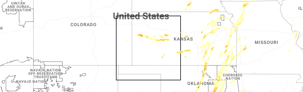
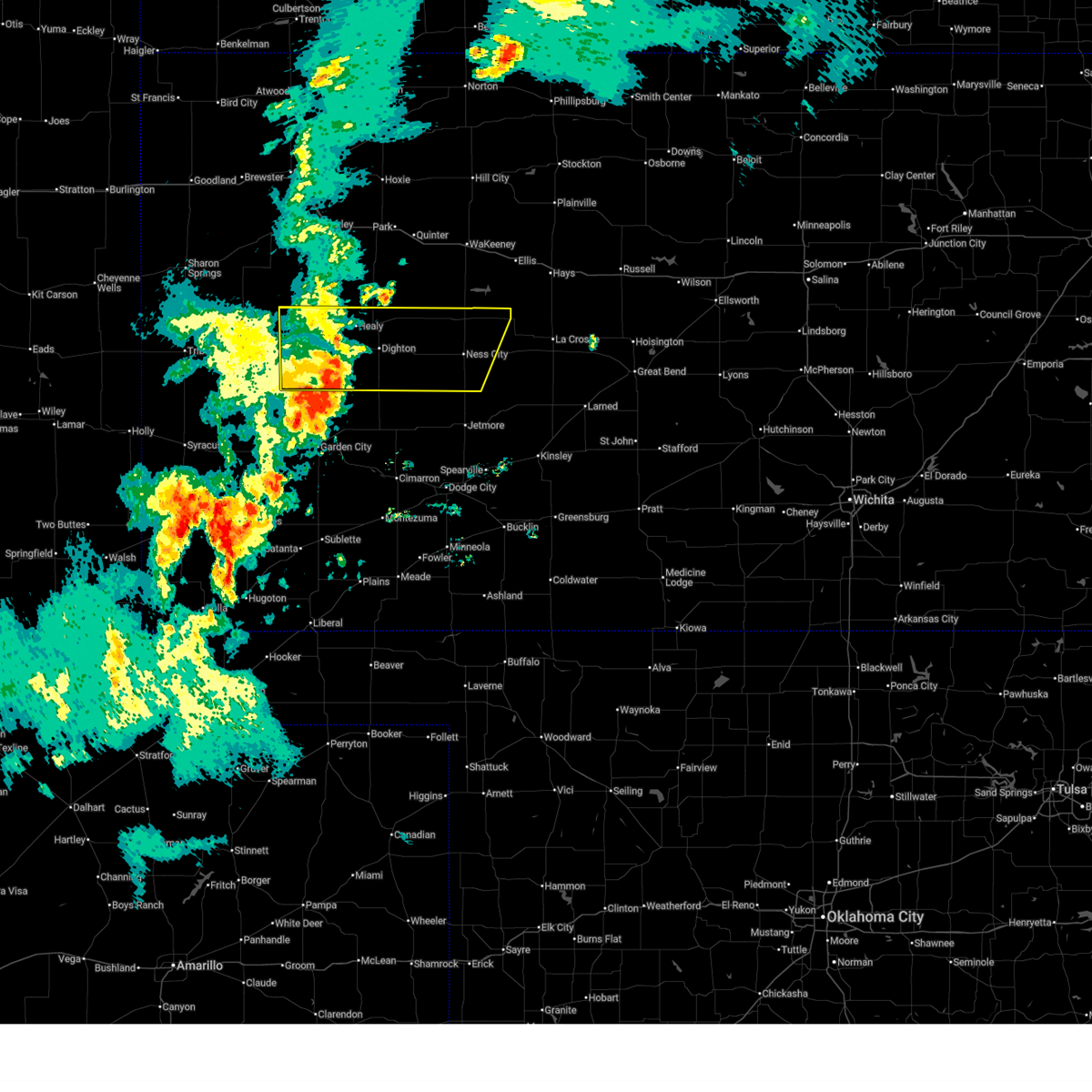
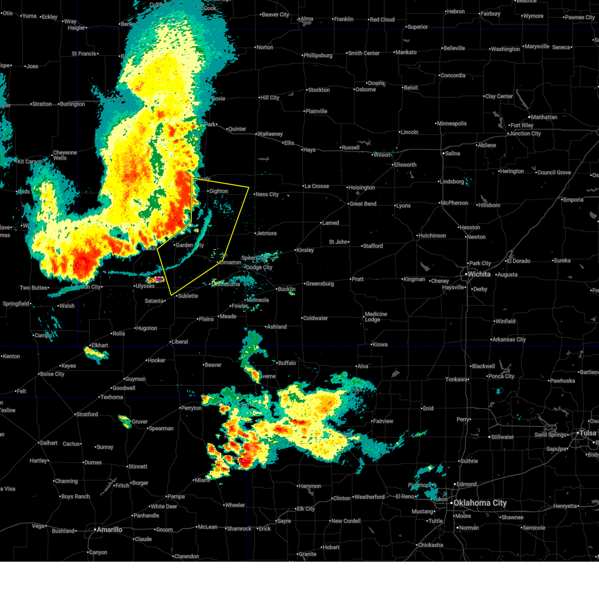
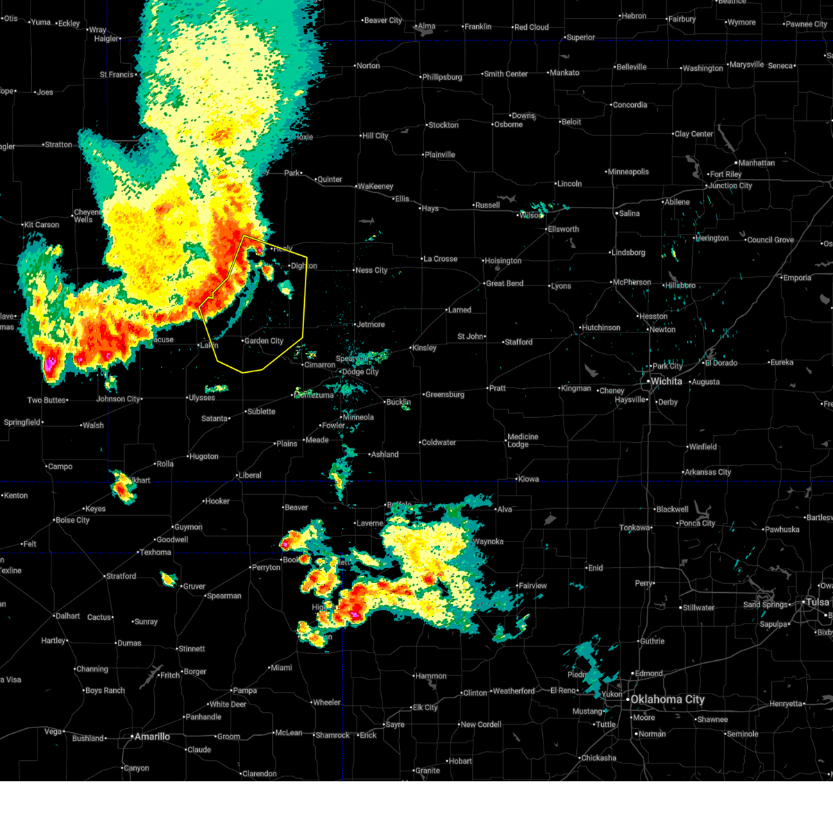
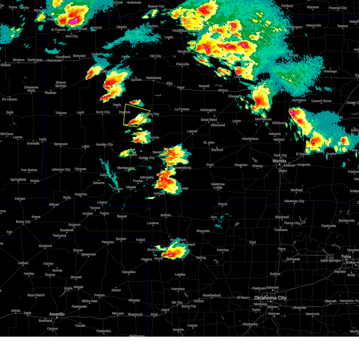
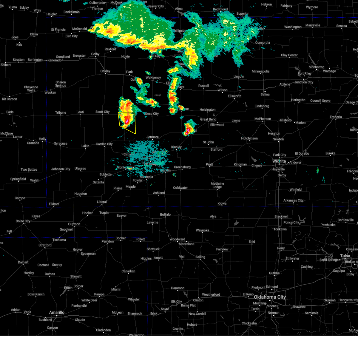
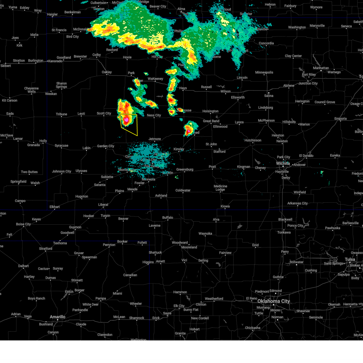
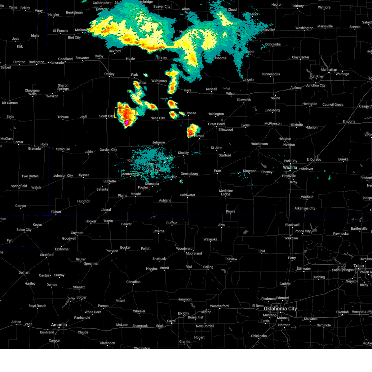
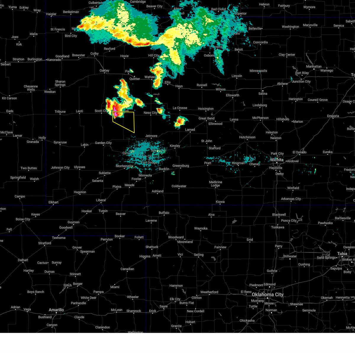
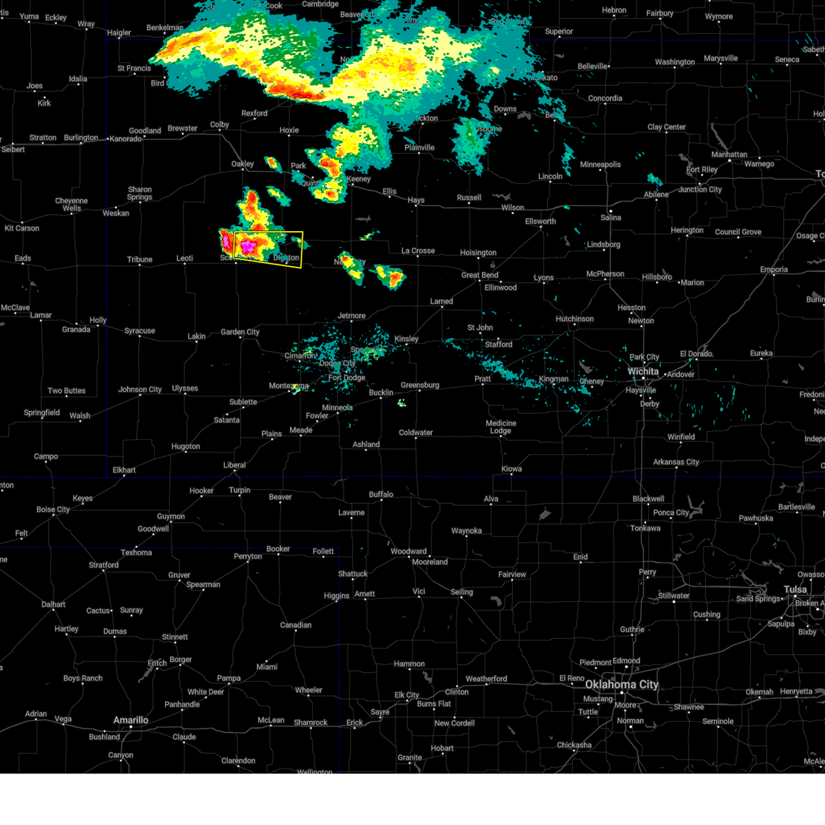
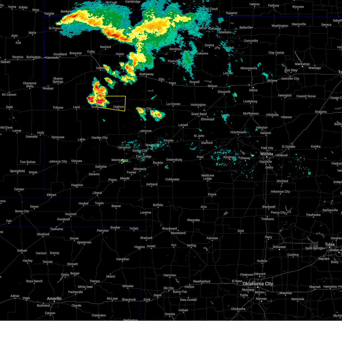
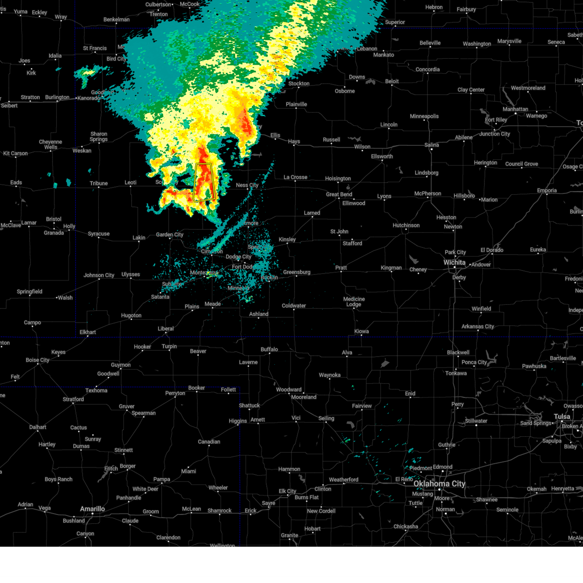
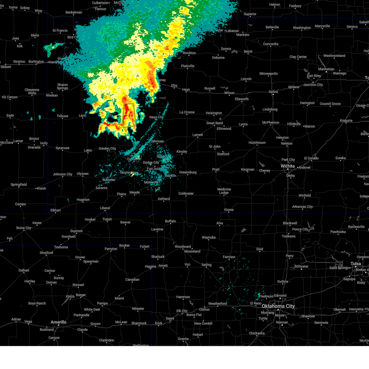
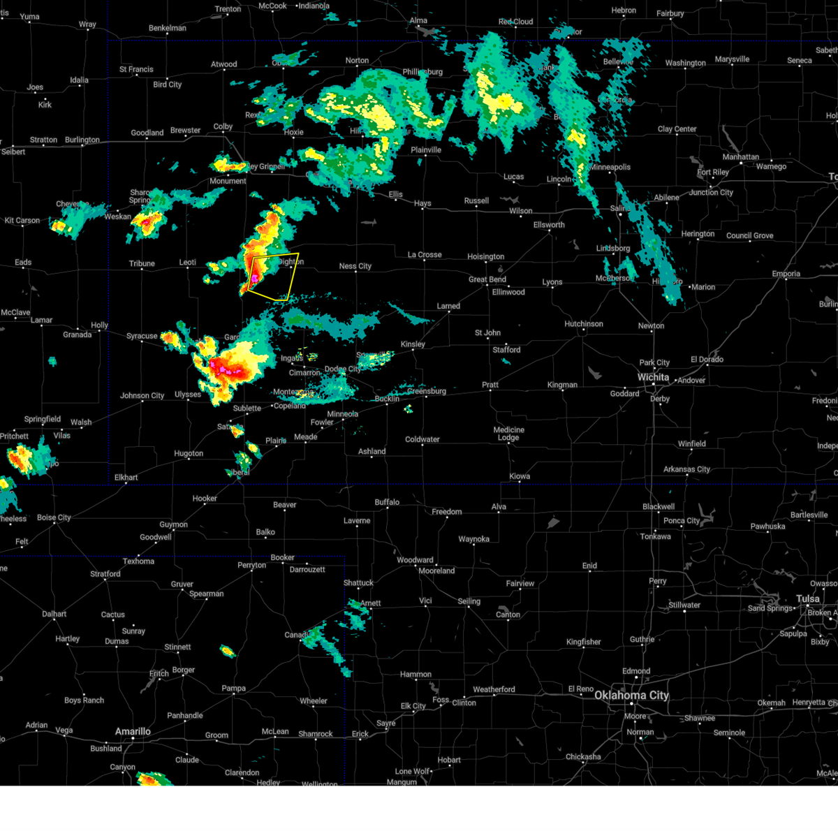
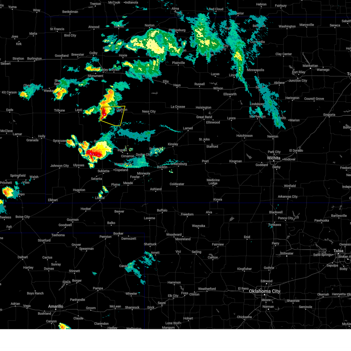
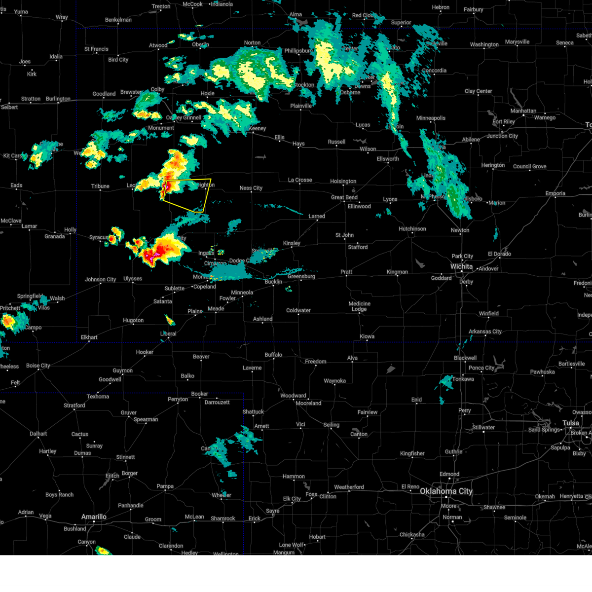
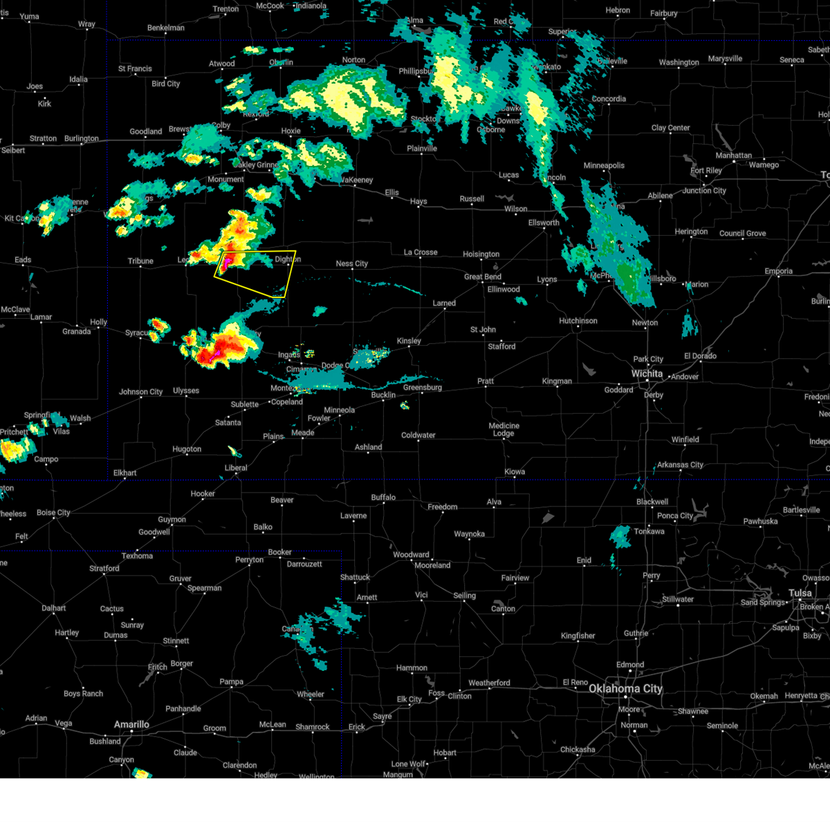
Hail Map for Dighton, KS
The Dighton, KS area has had 42 reports of on-the-ground hail by trained spotters, and has been under severe weather warnings 25 times during the past 12 months. Doppler radar has detected hail at or near Dighton, KS on 93 occasions, including 8 occasions during the past year.
| Name: | Dighton, KS |
| Where Located: | 41.7 miles NNE of Garden City, KS |
| Map: | Google Map for Dighton, KS |
| Population: | 1038 |
| Housing Units: | 615 |
| More Info: | Search Google for Dighton, KS |
1
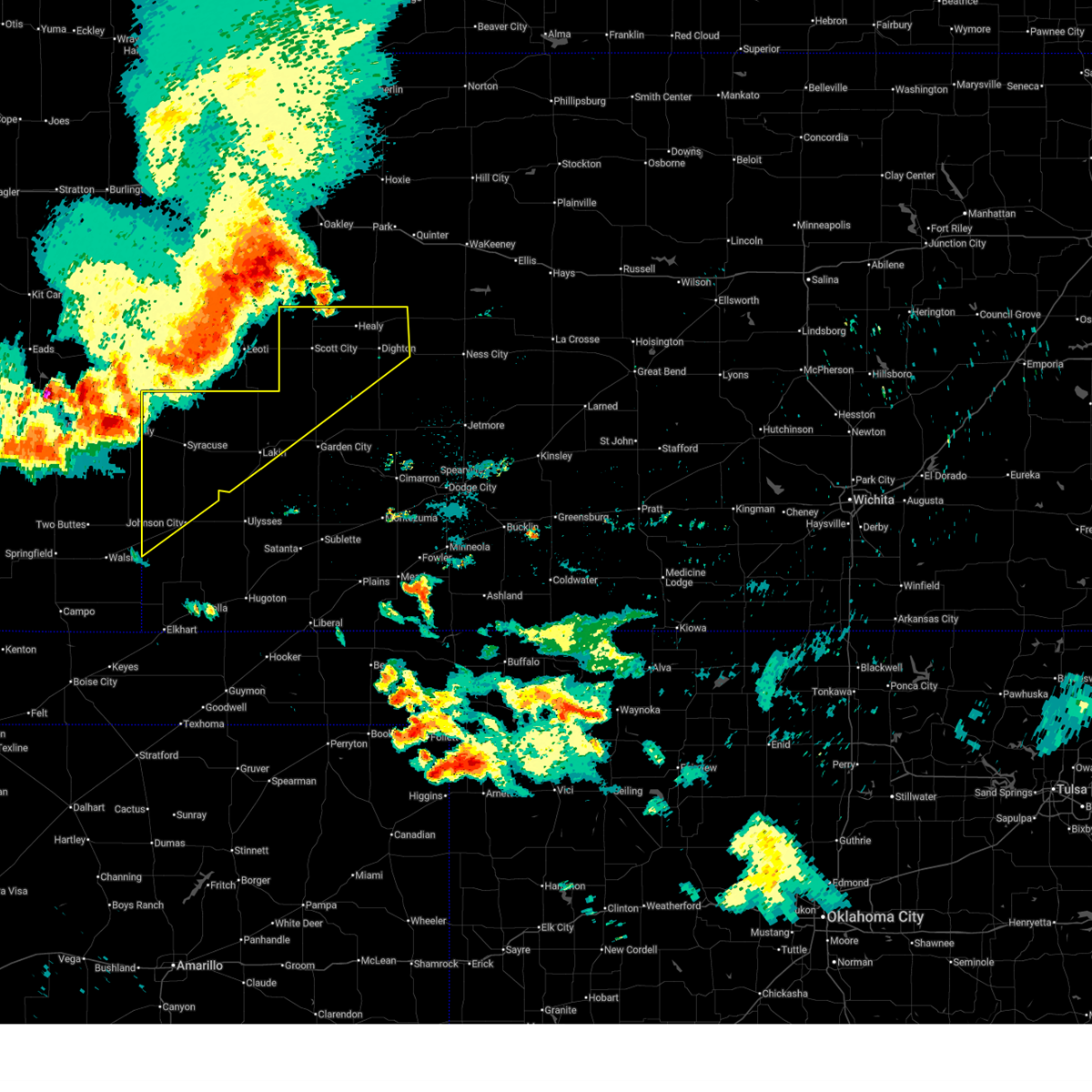
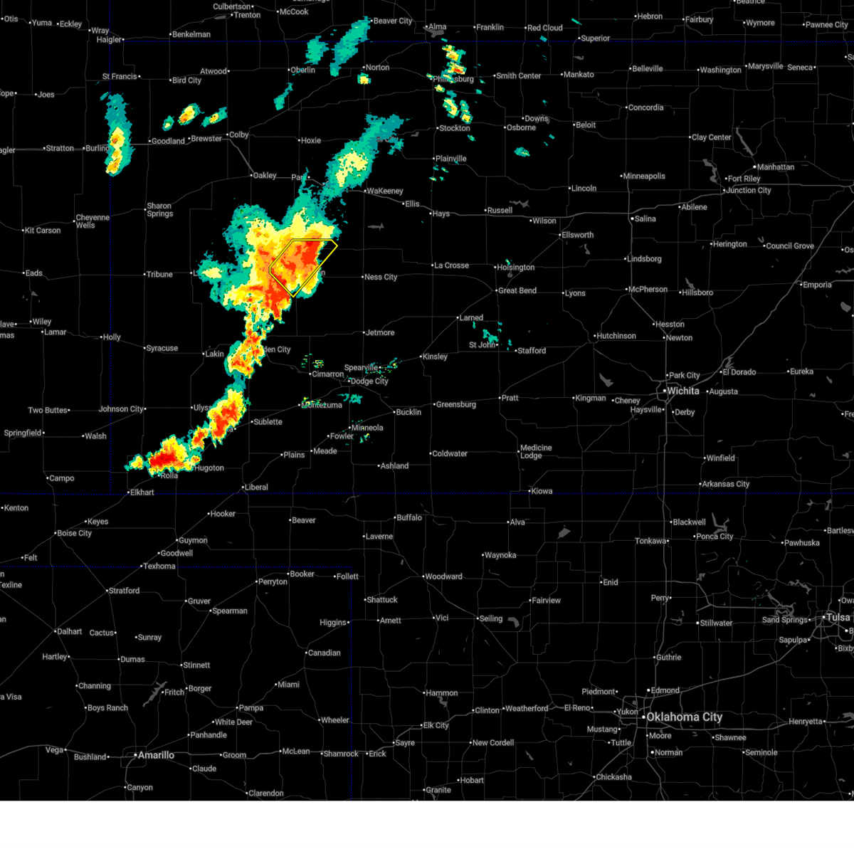
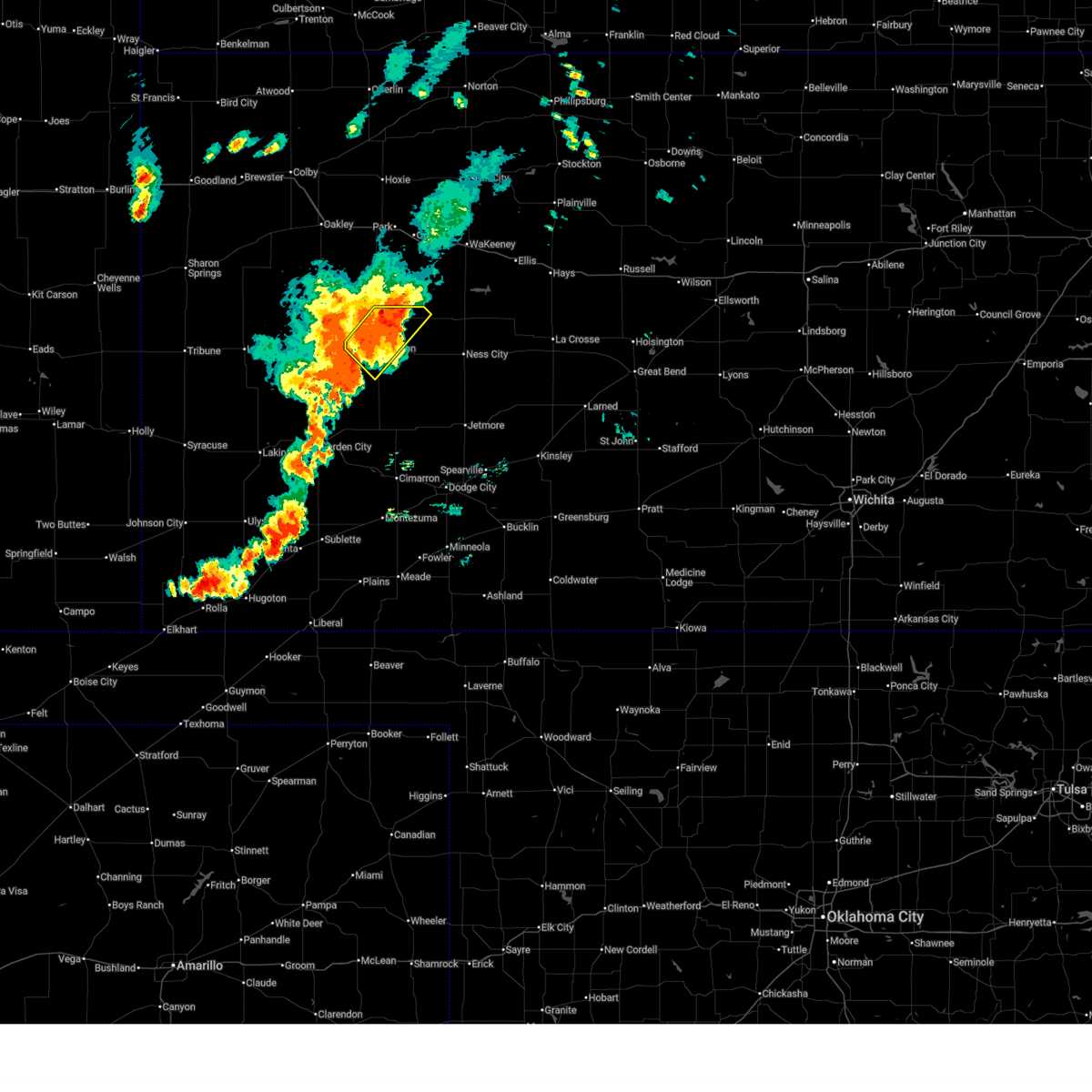
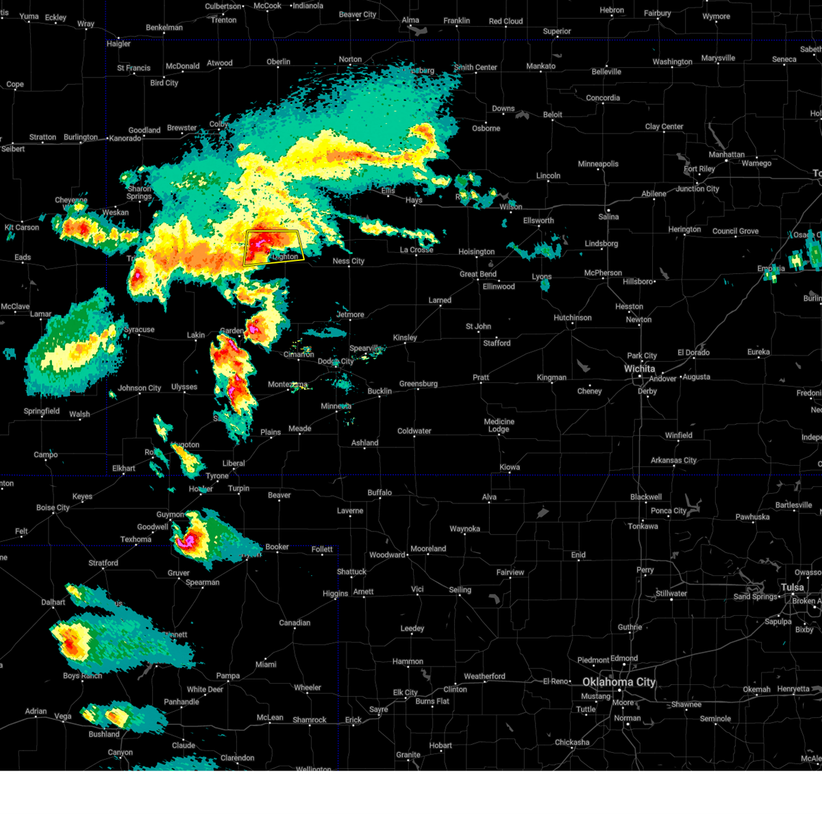
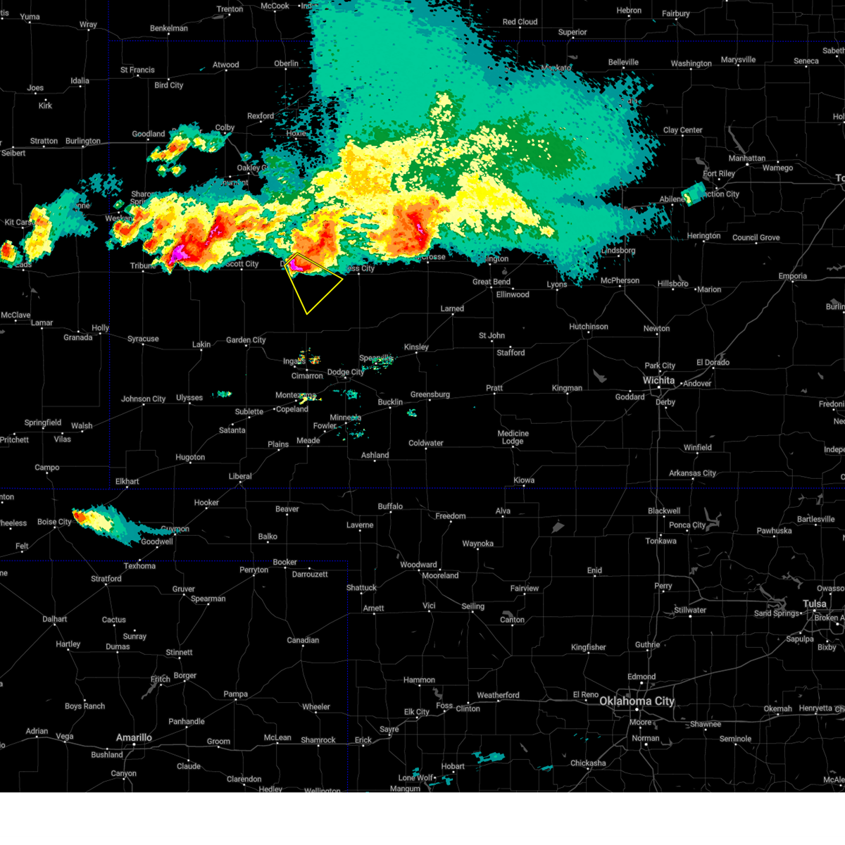
The Top Recent Hail Date for Dighton, KS is Monday, May 19, 2025 (8th out of 93)
Hail and Wind Damage Spotted near Dighton, KS
| Date / Time | Report Details |
|---|---|
| 7/10/2025 8:27 PM CDT |
 Svrddc the national weather service in dodge city has issued a * severe thunderstorm warning for, scott county in west central kansas, ness county in west central kansas, lane county in west central kansas, * until 915 pm cdt. * at 826 pm cdt, severe thunderstorms were located along a line extending from near healy to near friend, moving east at 80 mph (radar indicated). Hazards include 60 mph wind gusts. Expect damage to roofs, siding, and trees. severe thunderstorms will be near, healy, shields, grigston, and amy around 830 pm cdt. dighton and pendennis around 835 pm cdt. utica and alamota around 840 pm cdt. beeler around 845 pm cdt. Other locations in the path of these severe thunderstorms include ransom, arnold, ness city, brownell and bazine. Svrddc the national weather service in dodge city has issued a * severe thunderstorm warning for, scott county in west central kansas, ness county in west central kansas, lane county in west central kansas, * until 915 pm cdt. * at 826 pm cdt, severe thunderstorms were located along a line extending from near healy to near friend, moving east at 80 mph (radar indicated). Hazards include 60 mph wind gusts. Expect damage to roofs, siding, and trees. severe thunderstorms will be near, healy, shields, grigston, and amy around 830 pm cdt. dighton and pendennis around 835 pm cdt. utica and alamota around 840 pm cdt. beeler around 845 pm cdt. Other locations in the path of these severe thunderstorms include ransom, arnold, ness city, brownell and bazine.
|
| 7/7/2025 1:06 AM CDT |
 Svrddc the national weather service in dodge city has issued a * severe thunderstorm warning for, finney county in southwestern kansas, southwestern ness county in west central kansas, northwestern hodgeman county in southwestern kansas, lane county in west central kansas, northern gray county in southwestern kansas, northeastern haskell county in southwestern kansas, * until 145 am cdt. * at 106 am cdt, severe thunderstorms were located along a line extending from near alamota to 7 miles north of charleston to 8 miles southwest of plymell, moving southeast at 50 mph (radar indicated). Hazards include 70 mph wind gusts. Expect considerable tree damage. damage is likely to mobile homes, roofs, and outbuildings. severe thunderstorms will be near, charleston around 110 am cdt. ingalls and kalvesta around 115 am cdt. Cimarron around 120 am cdt. Svrddc the national weather service in dodge city has issued a * severe thunderstorm warning for, finney county in southwestern kansas, southwestern ness county in west central kansas, northwestern hodgeman county in southwestern kansas, lane county in west central kansas, northern gray county in southwestern kansas, northeastern haskell county in southwestern kansas, * until 145 am cdt. * at 106 am cdt, severe thunderstorms were located along a line extending from near alamota to 7 miles north of charleston to 8 miles southwest of plymell, moving southeast at 50 mph (radar indicated). Hazards include 70 mph wind gusts. Expect considerable tree damage. damage is likely to mobile homes, roofs, and outbuildings. severe thunderstorms will be near, charleston around 110 am cdt. ingalls and kalvesta around 115 am cdt. Cimarron around 120 am cdt.
|
| 7/7/2025 12:38 AM CDT |
 Svrddc the national weather service in dodge city has issued a * severe thunderstorm warning for, northeastern kearny county in southwestern kansas, finney county in southwestern kansas, scott county in west central kansas, lane county in west central kansas, northwestern gray county in southwestern kansas, * until 145 am cdt. * at 1238 am cdt, severe thunderstorms were located along a line extending from 7 miles northwest of shields to near friend to near deerfield, moving southeast at 35 mph (radar indicated). Hazards include 70 mph wind gusts and penny size hail. Expect considerable tree damage. damage is likely to mobile homes, roofs, and outbuildings. severe thunderstorms will be near, garden city, holcomb, and amy around 1245 am cdt. dighton around 1250 am cdt. Other locations in the path of these severe thunderstorms include plymell, pierceville and charleston. Svrddc the national weather service in dodge city has issued a * severe thunderstorm warning for, northeastern kearny county in southwestern kansas, finney county in southwestern kansas, scott county in west central kansas, lane county in west central kansas, northwestern gray county in southwestern kansas, * until 145 am cdt. * at 1238 am cdt, severe thunderstorms were located along a line extending from 7 miles northwest of shields to near friend to near deerfield, moving southeast at 35 mph (radar indicated). Hazards include 70 mph wind gusts and penny size hail. Expect considerable tree damage. damage is likely to mobile homes, roofs, and outbuildings. severe thunderstorms will be near, garden city, holcomb, and amy around 1245 am cdt. dighton around 1250 am cdt. Other locations in the path of these severe thunderstorms include plymell, pierceville and charleston.
|
| 7/6/2025 11:51 PM CDT |
 Svrddc the national weather service in dodge city has issued a * severe thunderstorm warning for, hamilton county in southwestern kansas, kearny county in southwestern kansas, northwestern finney county in southwestern kansas, scott county in west central kansas, lane county in west central kansas, northwestern stanton county in southwestern kansas, * until 1245 am cdt/1145 pm mdt/. * at 1150 pm cdt/1050 pm mdt/, severe thunderstorms were located along a line extending from 8 miles south of monument to 10 miles northeast of hartman, moving southeast at 55 mph (radar indicated). Hazards include 60 mph wind gusts. expect damage to roofs, siding, and trees Svrddc the national weather service in dodge city has issued a * severe thunderstorm warning for, hamilton county in southwestern kansas, kearny county in southwestern kansas, northwestern finney county in southwestern kansas, scott county in west central kansas, lane county in west central kansas, northwestern stanton county in southwestern kansas, * until 1245 am cdt/1145 pm mdt/. * at 1150 pm cdt/1050 pm mdt/, severe thunderstorms were located along a line extending from 8 miles south of monument to 10 miles northeast of hartman, moving southeast at 55 mph (radar indicated). Hazards include 60 mph wind gusts. expect damage to roofs, siding, and trees
|
| 7/4/2025 9:39 PM CDT |
 The severe thunderstorm which prompted the warning has weakened below severe limits. therefore, the warning will be allowed to expire at 945 pm. heavy rain, lightning and wind gusts up to 50 mph remain likely. The severe thunderstorm which prompted the warning has weakened below severe limits. therefore, the warning will be allowed to expire at 945 pm. heavy rain, lightning and wind gusts up to 50 mph remain likely.
|
| 7/4/2025 9:31 PM CDT |
 At 931 pm cdt, a severe thunderstorm was located near pendennis, moving east at 20 mph (radar indicated). Hazards include 60 mph wind gusts and quarter size hail. Hail damage to vehicles is expected. expect wind damage to roofs, siding, and trees. Locations impacted include, pendennis and utica. At 931 pm cdt, a severe thunderstorm was located near pendennis, moving east at 20 mph (radar indicated). Hazards include 60 mph wind gusts and quarter size hail. Hail damage to vehicles is expected. expect wind damage to roofs, siding, and trees. Locations impacted include, pendennis and utica.
|
| 7/4/2025 9:05 PM CDT |
 Svrddc the national weather service in dodge city has issued a * severe thunderstorm warning for, northwestern ness county in west central kansas, central lane county in west central kansas, * until 945 pm cdt. * at 905 pm cdt, severe thunderstorms were located along a line extending from 9 miles north of pendennis to near grigston, moving southeast at 20 mph (radar indicated). Hazards include 60 mph wind gusts and quarter size hail. Hail damage to vehicles is expected. expect wind damage to roofs, siding, and trees. severe thunderstorms will be near, shields and amy around 910 pm cdt. pendennis around 915 pm cdt. Dighton around 920 pm cdt. Svrddc the national weather service in dodge city has issued a * severe thunderstorm warning for, northwestern ness county in west central kansas, central lane county in west central kansas, * until 945 pm cdt. * at 905 pm cdt, severe thunderstorms were located along a line extending from 9 miles north of pendennis to near grigston, moving southeast at 20 mph (radar indicated). Hazards include 60 mph wind gusts and quarter size hail. Hail damage to vehicles is expected. expect wind damage to roofs, siding, and trees. severe thunderstorms will be near, shields and amy around 910 pm cdt. pendennis around 915 pm cdt. Dighton around 920 pm cdt.
|
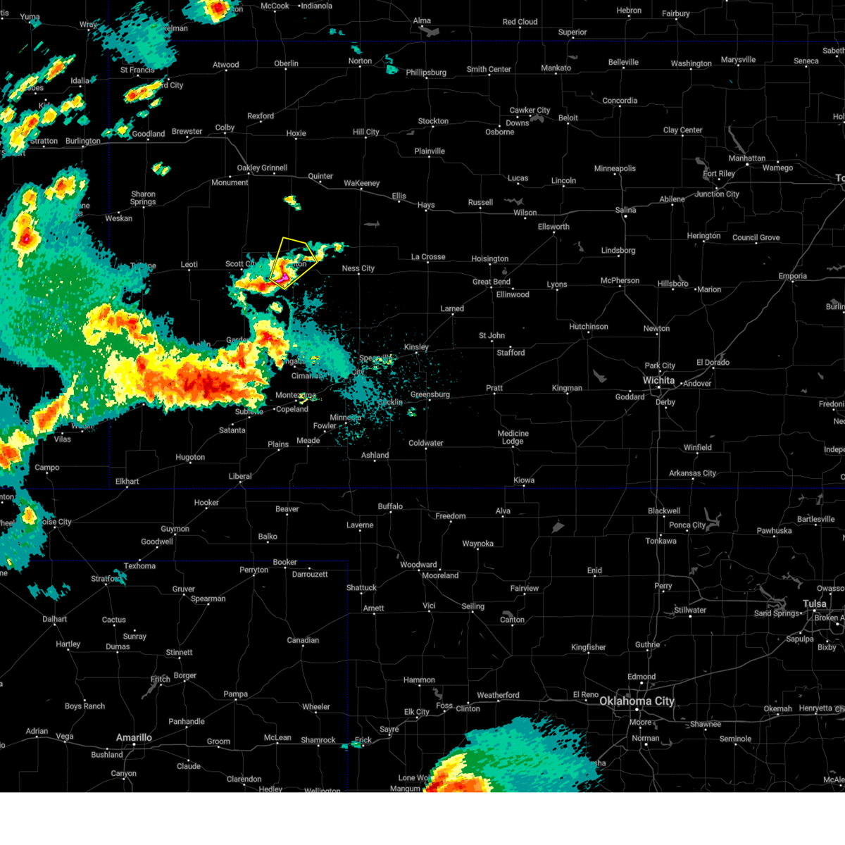
| 5/19/2025 7:00 PM CDT |
 Svrddc the national weather service in dodge city has issued a * severe thunderstorm warning for, northeastern finney county in southwestern kansas, western ness county in west central kansas, northwestern hodgeman county in southwestern kansas, southwestern trego county in west central kansas, lane county in west central kansas, * until 745 pm cdt. * at 700 pm cdt, severe thunderstorms were located along a line extending from near shields to 9 miles southwest of alamota, moving east at 15 mph (radar indicated). Hazards include 60 mph wind gusts and quarter size hail. Hail damage to vehicles is expected. expect wind damage to roofs, siding, and trees. Severe thunderstorms will be near, alamota and pendennis around 705 pm cdt. Svrddc the national weather service in dodge city has issued a * severe thunderstorm warning for, northeastern finney county in southwestern kansas, western ness county in west central kansas, northwestern hodgeman county in southwestern kansas, southwestern trego county in west central kansas, lane county in west central kansas, * until 745 pm cdt. * at 700 pm cdt, severe thunderstorms were located along a line extending from near shields to 9 miles southwest of alamota, moving east at 15 mph (radar indicated). Hazards include 60 mph wind gusts and quarter size hail. Hail damage to vehicles is expected. expect wind damage to roofs, siding, and trees. Severe thunderstorms will be near, alamota and pendennis around 705 pm cdt.
|
| 5/19/2025 6:45 PM CDT | Report was from kksdight22 observation statio in lane county KS, 3.6 miles NNW of Dighton, KS |
| 5/19/2025 6:35 PM CDT | At 635 pm cdt, a severe thunderstorm was located near amy, moving east at 20 mph (radar indicated). Hazards include 60 mph wind gusts and half dollar size hail. Hail damage to vehicles is expected. expect wind damage to roofs, siding, and trees. Locations impacted include, dighton. |
| 5/19/2025 6:08 PM CDT | Svrddc the national weather service in dodge city has issued a * severe thunderstorm warning for, east central scott county in west central kansas, southwestern lane county in west central kansas, * until 700 pm cdt. * at 608 pm cdt, a severe thunderstorm was located near grigston, moving east at 20 mph (radar indicated). Hazards include half dollar size hail. Damage to vehicles is expected. this severe thunderstorm will be near, amy around 620 pm cdt. Other locations in the path of this severe thunderstorm include dighton. |
| 5/18/2025 6:20 PM CDT |
 At 619 pm cdt, a severe thunderstorm was located near beeler, moving northeast at 50 mph (radar indicated). Hazards include golf ball size hail. People and animals outdoors will be injured. expect damage to roofs, siding, windows, and vehicles. Locations impacted include, beeler. At 619 pm cdt, a severe thunderstorm was located near beeler, moving northeast at 50 mph (radar indicated). Hazards include golf ball size hail. People and animals outdoors will be injured. expect damage to roofs, siding, windows, and vehicles. Locations impacted include, beeler.
|
| 5/18/2025 6:20 PM CDT |
 the severe thunderstorm warning has been cancelled and is no longer in effect the severe thunderstorm warning has been cancelled and is no longer in effect
|
| 5/18/2025 6:00 PM CDT | Svrddc the national weather service in dodge city has issued a * severe thunderstorm warning for, northeastern finney county in southwestern kansas, southwestern ness county in west central kansas, northwestern hodgeman county in southwestern kansas, eastern lane county in west central kansas, * until 645 pm cdt. * at 600 pm cdt, a severe thunderstorm was located 11 miles northwest of kalvesta, moving northeast at 50 mph (radar indicated). Hazards include golf ball size hail. People and animals outdoors will be injured. expect damage to roofs, siding, windows, and vehicles. This severe thunderstorm will be near, alamota and beeler around 620 pm cdt. |
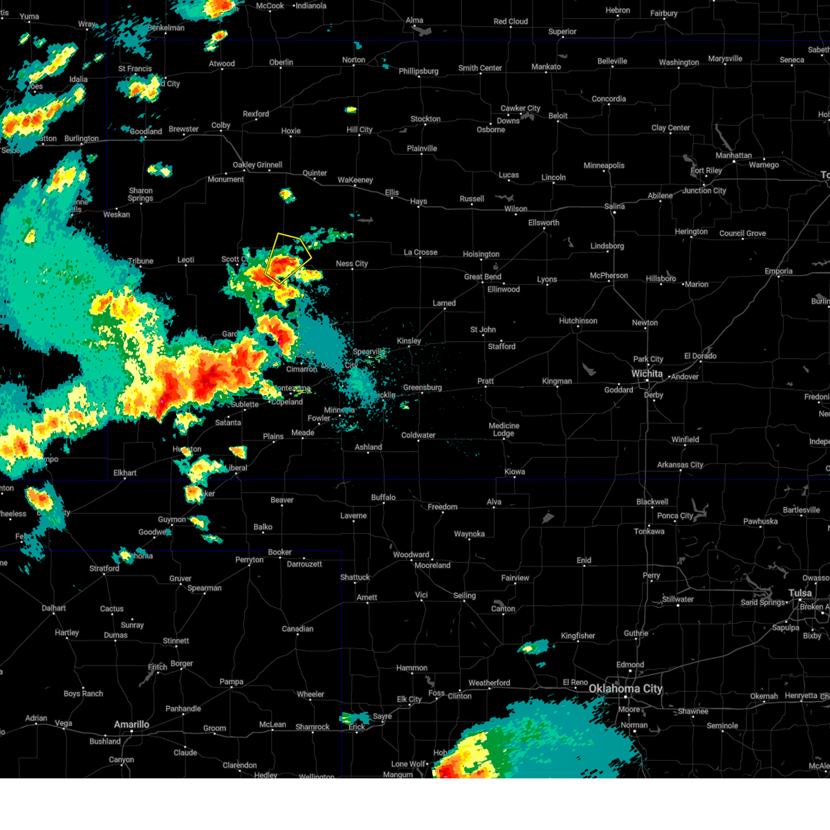
| 4/23/2025 8:39 PM CDT | At 839 pm cdt, a severe thunderstorm was located near amy, moving east at 45 mph (radar indicated). Hazards include 60 mph wind gusts and quarter size hail. Hail damage to vehicles is expected. expect wind damage to roofs, siding, and trees. Locations impacted include, grigston, dighton, amy, and alamota. |
| 4/23/2025 8:21 PM CDT | Svrddc the national weather service in dodge city has issued a * severe thunderstorm warning for, northern finney county in southwestern kansas, southeastern scott county in west central kansas, southwestern ness county in west central kansas, lane county in west central kansas, * until 900 pm cdt. * at 821 pm cdt, a severe thunderstorm was located near shallow water, moving east at 45 mph (radar indicated). Hazards include 60 mph wind gusts and quarter size hail. Hail damage to vehicles is expected. Expect wind damage to roofs, siding, and trees. |
| 4/23/2025 6:56 PM CDT |
 Svrddc the national weather service in dodge city has issued a * severe thunderstorm warning for, northeastern scott county in west central kansas, northern lane county in west central kansas, * until 745 pm cdt. * at 656 pm cdt, a severe thunderstorm was located near healy, moving northeast at 25 mph (radar indicated). Hazards include golf ball size hail and 60 mph wind gusts. People and animals outdoors will be injured. expect hail damage to roofs, siding, windows, and vehicles. expect wind damage to roofs, siding, and trees. this severe thunderstorm will be near, healy around 700 pm cdt. Other locations in the path of this severe thunderstorm include shields. Svrddc the national weather service in dodge city has issued a * severe thunderstorm warning for, northeastern scott county in west central kansas, northern lane county in west central kansas, * until 745 pm cdt. * at 656 pm cdt, a severe thunderstorm was located near healy, moving northeast at 25 mph (radar indicated). Hazards include golf ball size hail and 60 mph wind gusts. People and animals outdoors will be injured. expect hail damage to roofs, siding, windows, and vehicles. expect wind damage to roofs, siding, and trees. this severe thunderstorm will be near, healy around 700 pm cdt. Other locations in the path of this severe thunderstorm include shields.
|
| 4/23/2025 5:05 PM CDT | Hen Egg sized hail reported 8.4 miles SSW of Dighton, KS, hail up to 2 inches in diameter covering the ground. |
| 4/23/2025 5:04 PM CDT | Golf Ball sized hail reported 9.7 miles S of Dighton, KS, just slightly over golf ball. |
| 4/23/2025 4:52 PM CDT | Half Dollar sized hail reported 7.5 miles S of Dighton, KS |
| 4/23/2025 4:48 PM CDT |
 Svrddc the national weather service in dodge city has issued a * severe thunderstorm warning for, northwestern ness county in west central kansas, southwestern trego county in west central kansas, northeastern lane county in west central kansas, * until 530 pm cdt. * at 447 pm cdt, a severe thunderstorm was located near shields, moving northeast at 25 mph (radar indicated). Hazards include quarter size hail. Damage to vehicles is expected. this severe thunderstorm will be near, shields around 455 pm cdt. Pendennis around 505 pm cdt. Svrddc the national weather service in dodge city has issued a * severe thunderstorm warning for, northwestern ness county in west central kansas, southwestern trego county in west central kansas, northeastern lane county in west central kansas, * until 530 pm cdt. * at 447 pm cdt, a severe thunderstorm was located near shields, moving northeast at 25 mph (radar indicated). Hazards include quarter size hail. Damage to vehicles is expected. this severe thunderstorm will be near, shields around 455 pm cdt. Pendennis around 505 pm cdt.
|
| 8/16/2024 10:40 AM CDT |
 The storm which prompted the warning has moved out of the area. therefore, the warning will be allowed to expire. The storm which prompted the warning has moved out of the area. therefore, the warning will be allowed to expire.
|
| 8/16/2024 10:20 AM CDT |
 At 1019 am cdt, a severe thunderstorm was located 8 miles southwest of alamota, moving southeast at 30 mph (public report of golf ball sized hail 7 miles southwest of dighton at 1010 am). Hazards include golf ball size hail and 70 mph wind gusts. People and animals outdoors will be injured. expect hail damage to roofs, siding, windows, and vehicles. expect considerable tree damage. wind damage is also likely to mobile homes, roofs, and outbuildings. Locations impacted include, dighton and alamota. At 1019 am cdt, a severe thunderstorm was located 8 miles southwest of alamota, moving southeast at 30 mph (public report of golf ball sized hail 7 miles southwest of dighton at 1010 am). Hazards include golf ball size hail and 70 mph wind gusts. People and animals outdoors will be injured. expect hail damage to roofs, siding, windows, and vehicles. expect considerable tree damage. wind damage is also likely to mobile homes, roofs, and outbuildings. Locations impacted include, dighton and alamota.
|
| 8/16/2024 10:10 AM CDT | Golf Ball sized hail reported 6.7 miles ENE of Dighton, KS |
| 8/16/2024 10:10 AM CDT |
 At 1009 am cdt, a severe thunderstorm was located near dighton, moving southeast at 35 mph (radar indicated). Hazards include golf ball size hail and 70 mph wind gusts. People and animals outdoors will be injured. expect hail damage to roofs, siding, windows, and vehicles. expect considerable tree damage. wind damage is also likely to mobile homes, roofs, and outbuildings. Locations impacted include, dighton and alamota. At 1009 am cdt, a severe thunderstorm was located near dighton, moving southeast at 35 mph (radar indicated). Hazards include golf ball size hail and 70 mph wind gusts. People and animals outdoors will be injured. expect hail damage to roofs, siding, windows, and vehicles. expect considerable tree damage. wind damage is also likely to mobile homes, roofs, and outbuildings. Locations impacted include, dighton and alamota.
|
| 8/16/2024 10:07 AM CDT |
 The storm which prompted the warning has weakened below severe limits, and no longer poses an immediate threat to life or property. therefore, the warning will be allowed to expire. however, small hail and gusty winds are still possible with this thunderstorm. The storm which prompted the warning has weakened below severe limits, and no longer poses an immediate threat to life or property. therefore, the warning will be allowed to expire. however, small hail and gusty winds are still possible with this thunderstorm.
|
| 8/16/2024 9:53 AM CDT |
 Svrddc the national weather service in dodge city has issued a * severe thunderstorm warning for, northeastern finney county in southwestern kansas, southern lane county in west central kansas, * until 1045 am cdt. * at 953 am cdt, a severe thunderstorm was located very near amy, moving southeast at 35 mph (radar indicated). Hazards include golf ball size hail and 60 mph wind gusts. People and animals outdoors will be injured. expect hail damage to roofs, siding, windows, and vehicles. expect wind damage to roofs, siding, and trees. This severe thunderstorm will remain over mainly rural areas of northeastern finney and southern lane counties. Svrddc the national weather service in dodge city has issued a * severe thunderstorm warning for, northeastern finney county in southwestern kansas, southern lane county in west central kansas, * until 1045 am cdt. * at 953 am cdt, a severe thunderstorm was located very near amy, moving southeast at 35 mph (radar indicated). Hazards include golf ball size hail and 60 mph wind gusts. People and animals outdoors will be injured. expect hail damage to roofs, siding, windows, and vehicles. expect wind damage to roofs, siding, and trees. This severe thunderstorm will remain over mainly rural areas of northeastern finney and southern lane counties.
|
| 8/16/2024 9:51 AM CDT |
 At 950 am cdt, a severe thunderstorm was located very near manning, moving southeast at 30 mph (law enforcement reported golf ball hail at the us 83 and k4 junction at 929 am). Hazards include golf ball size hail and 60 mph wind gusts. People and animals outdoors will be injured. expect hail damage to roofs, siding, windows, and vehicles. expect wind damage to roofs, siding, and trees. This severe thunderstorm will remain over mainly rural areas of east central scott and northern lane counties. At 950 am cdt, a severe thunderstorm was located very near manning, moving southeast at 30 mph (law enforcement reported golf ball hail at the us 83 and k4 junction at 929 am). Hazards include golf ball size hail and 60 mph wind gusts. People and animals outdoors will be injured. expect hail damage to roofs, siding, windows, and vehicles. expect wind damage to roofs, siding, and trees. This severe thunderstorm will remain over mainly rural areas of east central scott and northern lane counties.
|
| 8/16/2024 9:33 AM CDT |
 At 933 am cdt, a severe thunderstorm was located near manning, moving east at 30 mph (radar indicated). Hazards include ping pong ball size hail. People and animals outdoors will be injured. expect damage to roofs, siding, windows, and vehicles. this severe storm will be near, manning around 940 am cdt. healy around 945 am cdt. Other locations in the path of this severe thunderstorm include shields. At 933 am cdt, a severe thunderstorm was located near manning, moving east at 30 mph (radar indicated). Hazards include ping pong ball size hail. People and animals outdoors will be injured. expect damage to roofs, siding, windows, and vehicles. this severe storm will be near, manning around 940 am cdt. healy around 945 am cdt. Other locations in the path of this severe thunderstorm include shields.
|
| 8/16/2024 9:25 AM CDT |
 Svrddc the national weather service in dodge city has issued a * severe thunderstorm warning for, northeastern scott county in west central kansas, northern lane county in west central kansas, * until 1015 am cdt. * at 925 am cdt, a severe thunderstorm was located near scott state lake, moving east at 35 mph (radar indicated). Hazards include quarter size hail. Damage to vehicles is expected. this severe thunderstorm will be near, healy and manning around 935 am cdt. Other locations in the path of this severe thunderstorm include shields. Svrddc the national weather service in dodge city has issued a * severe thunderstorm warning for, northeastern scott county in west central kansas, northern lane county in west central kansas, * until 1015 am cdt. * at 925 am cdt, a severe thunderstorm was located near scott state lake, moving east at 35 mph (radar indicated). Hazards include quarter size hail. Damage to vehicles is expected. this severe thunderstorm will be near, healy and manning around 935 am cdt. Other locations in the path of this severe thunderstorm include shields.
|
| 7/6/2024 6:30 PM CDT |
 Svrddc the national weather service in dodge city has issued a * severe thunderstorm warning for, southern scott county in west central kansas, ness county in west central kansas, lane county in west central kansas, * until 700 pm cdt. * at 630 pm cdt, severe thunderstorms were located along a line extending from near bazine to near grigston, moving southeast at 40 mph (radar indicated). Hazards include 60 mph wind gusts and nickel size hail. Expect damage to roofs, siding, and trees. Severe thunderstorms will be near, ness city, bazine, alamota, and beeler around 635 pm cdt. Svrddc the national weather service in dodge city has issued a * severe thunderstorm warning for, southern scott county in west central kansas, ness county in west central kansas, lane county in west central kansas, * until 700 pm cdt. * at 630 pm cdt, severe thunderstorms were located along a line extending from near bazine to near grigston, moving southeast at 40 mph (radar indicated). Hazards include 60 mph wind gusts and nickel size hail. Expect damage to roofs, siding, and trees. Severe thunderstorms will be near, ness city, bazine, alamota, and beeler around 635 pm cdt.
|
| 7/6/2024 5:34 PM CDT |
 Svrddc the national weather service in dodge city has issued a * severe thunderstorm warning for, eastern scott county in west central kansas, ness county in west central kansas, southern trego county in west central kansas, lane county in west central kansas, * until 630 pm cdt. * at 533 pm cdt, severe thunderstorms were located along a line extending from near scott state lake to 6 miles north of beeler, moving southeast at 40 mph. these are destructive storms (radar indicated). Hazards include 80 mph wind gusts and golf ball size hail. Flying debris will be dangerous to those caught without shelter. mobile homes will be heavily damaged. expect considerable damage to roofs, windows, and vehicles. extensive tree damage and power outages are likely. severe thunderstorms will be near, dighton, alamota, manning, and beeler around 540 pm cdt. Grigston and amy around 545 pm cdt. Svrddc the national weather service in dodge city has issued a * severe thunderstorm warning for, eastern scott county in west central kansas, ness county in west central kansas, southern trego county in west central kansas, lane county in west central kansas, * until 630 pm cdt. * at 533 pm cdt, severe thunderstorms were located along a line extending from near scott state lake to 6 miles north of beeler, moving southeast at 40 mph. these are destructive storms (radar indicated). Hazards include 80 mph wind gusts and golf ball size hail. Flying debris will be dangerous to those caught without shelter. mobile homes will be heavily damaged. expect considerable damage to roofs, windows, and vehicles. extensive tree damage and power outages are likely. severe thunderstorms will be near, dighton, alamota, manning, and beeler around 540 pm cdt. Grigston and amy around 545 pm cdt.
|
| 7/6/2024 5:30 PM CDT |
 At 530 pm cdt, severe thunderstorms were located along a line extending from near pendennis to near manning, moving southeast at 35 mph. these are destructive storms (radar indicated). Hazards include 80 mph wind gusts and two inch hail. Flying debris will be dangerous to those caught without shelter. mobile homes will be heavily damaged. expect considerable damage to roofs, windows, and vehicles. extensive tree damage and power outages are likely. Locations impacted include, dighton, pendennis, healy, scott state lake, and shields. At 530 pm cdt, severe thunderstorms were located along a line extending from near pendennis to near manning, moving southeast at 35 mph. these are destructive storms (radar indicated). Hazards include 80 mph wind gusts and two inch hail. Flying debris will be dangerous to those caught without shelter. mobile homes will be heavily damaged. expect considerable damage to roofs, windows, and vehicles. extensive tree damage and power outages are likely. Locations impacted include, dighton, pendennis, healy, scott state lake, and shields.
|
| 7/6/2024 4:44 PM CDT |
 Svrddc the national weather service in dodge city has issued a * severe thunderstorm warning for, northeastern scott county in west central kansas, northern lane county in west central kansas, * until 545 pm cdt. * at 443 pm cdt, a severe thunderstorm was located 8 miles northeast of scott state lake, moving east at 30 mph. this is a destructive storm for scott state lake healy (radar indicated). Hazards include 80 mph wind gusts and two inch hail. Flying debris will be dangerous to those caught without shelter. mobile homes will be heavily damaged. expect considerable damage to roofs, windows, and vehicles. Extensive tree damage and power outages are likely. Svrddc the national weather service in dodge city has issued a * severe thunderstorm warning for, northeastern scott county in west central kansas, northern lane county in west central kansas, * until 545 pm cdt. * at 443 pm cdt, a severe thunderstorm was located 8 miles northeast of scott state lake, moving east at 30 mph. this is a destructive storm for scott state lake healy (radar indicated). Hazards include 80 mph wind gusts and two inch hail. Flying debris will be dangerous to those caught without shelter. mobile homes will be heavily damaged. expect considerable damage to roofs, windows, and vehicles. Extensive tree damage and power outages are likely.
|
| 6/29/2024 1:34 AM CDT |
 the severe thunderstorm warning has been cancelled and is no longer in effect the severe thunderstorm warning has been cancelled and is no longer in effect
|
| 6/29/2024 1:27 AM CDT |
 At 127 am cdt, a severe thunderstorm was located 7 miles southeast of pendennis, moving east at 30 mph (radar indicated). Hazards include 60 mph wind gusts and quarter size hail. Hail damage to vehicles is expected. expect wind damage to roofs, siding, and trees. Locations impacted include, dighton, utica, alamota, beeler, pendennis, shields, and arnold. At 127 am cdt, a severe thunderstorm was located 7 miles southeast of pendennis, moving east at 30 mph (radar indicated). Hazards include 60 mph wind gusts and quarter size hail. Hail damage to vehicles is expected. expect wind damage to roofs, siding, and trees. Locations impacted include, dighton, utica, alamota, beeler, pendennis, shields, and arnold.
|
| 6/29/2024 1:20 AM CDT |
 At 120 am cdt, a severe thunderstorm was located near pendennis, moving east at 30 mph (radar indicated). Hazards include golf ball size hail and 60 mph wind gusts. People and animals outdoors will be injured. expect hail damage to roofs, siding, windows, and vehicles. expect wind damage to roofs, siding, and trees. This severe thunderstorm will remain over mainly rural areas of western ness and northeastern lane counties. At 120 am cdt, a severe thunderstorm was located near pendennis, moving east at 30 mph (radar indicated). Hazards include golf ball size hail and 60 mph wind gusts. People and animals outdoors will be injured. expect hail damage to roofs, siding, windows, and vehicles. expect wind damage to roofs, siding, and trees. This severe thunderstorm will remain over mainly rural areas of western ness and northeastern lane counties.
|
| 6/29/2024 1:10 AM CDT |
 Svrddc the national weather service in dodge city has issued a * severe thunderstorm warning for, western ness county in west central kansas, northern lane county in west central kansas, * until 200 am cdt. * at 110 am cdt, a severe thunderstorm was located near pendennis, moving east at 35 mph (radar indicated). Hazards include two inch hail and 70 mph wind gusts. People and animals outdoors will be injured. expect hail damage to roofs, siding, windows, and vehicles. expect considerable tree damage. wind damage is also likely to mobile homes, roofs, and outbuildings. This severe thunderstorm will be near, arnold around 130 am cdt. Svrddc the national weather service in dodge city has issued a * severe thunderstorm warning for, western ness county in west central kansas, northern lane county in west central kansas, * until 200 am cdt. * at 110 am cdt, a severe thunderstorm was located near pendennis, moving east at 35 mph (radar indicated). Hazards include two inch hail and 70 mph wind gusts. People and animals outdoors will be injured. expect hail damage to roofs, siding, windows, and vehicles. expect considerable tree damage. wind damage is also likely to mobile homes, roofs, and outbuildings. This severe thunderstorm will be near, arnold around 130 am cdt.
|
| 6/29/2024 1:03 AM CDT |
 the severe thunderstorm warning has been cancelled and is no longer in effect the severe thunderstorm warning has been cancelled and is no longer in effect
|
| 6/29/2024 1:03 AM CDT |
 At 102 am cdt, a severe thunderstorm was located very near shields, moving east at 30 mph (radar indicated). Hazards include two inch hail and 60 mph wind gusts. People and animals outdoors will be injured. expect hail damage to roofs, siding, windows, and vehicles. expect wind damage to roofs, siding, and trees. Locations impacted include, dighton, alamota, healy, beeler, pendennis, amy, and shields. At 102 am cdt, a severe thunderstorm was located very near shields, moving east at 30 mph (radar indicated). Hazards include two inch hail and 60 mph wind gusts. People and animals outdoors will be injured. expect hail damage to roofs, siding, windows, and vehicles. expect wind damage to roofs, siding, and trees. Locations impacted include, dighton, alamota, healy, beeler, pendennis, amy, and shields.
|
| 6/29/2024 12:46 AM CDT |
 At 1246 am cdt, a severe thunderstorm was located very near healy, moving east at 25 mph (radar indicated). Hazards include tennis ball size hail and 70 mph wind gusts. People and animals outdoors will be injured. expect hail damage to roofs, siding, windows, and vehicles. expect considerable tree damage. wind damage is also likely to mobile homes, roofs, and outbuildings. Locations impacted include, shields. At 1246 am cdt, a severe thunderstorm was located very near healy, moving east at 25 mph (radar indicated). Hazards include tennis ball size hail and 70 mph wind gusts. People and animals outdoors will be injured. expect hail damage to roofs, siding, windows, and vehicles. expect considerable tree damage. wind damage is also likely to mobile homes, roofs, and outbuildings. Locations impacted include, shields.
|
| 6/29/2024 12:29 AM CDT |
 Svrddc the national weather service in dodge city has issued a * severe thunderstorm warning for, northeastern scott county in west central kansas, northwestern ness county in west central kansas, lane county in west central kansas, * until 115 am cdt. * at 1229 am cdt, a severe thunderstorm was located near healy, moving east at 30 mph (radar indicated). Hazards include two inch hail and 70 mph wind gusts. People and animals outdoors will be injured. expect hail damage to roofs, siding, windows, and vehicles. expect considerable tree damage. wind damage is also likely to mobile homes, roofs, and outbuildings. this severe thunderstorm will be near, healy around 1235 am cdt. Other locations in the path of this severe thunderstorm include shields and pendennis. Svrddc the national weather service in dodge city has issued a * severe thunderstorm warning for, northeastern scott county in west central kansas, northwestern ness county in west central kansas, lane county in west central kansas, * until 115 am cdt. * at 1229 am cdt, a severe thunderstorm was located near healy, moving east at 30 mph (radar indicated). Hazards include two inch hail and 70 mph wind gusts. People and animals outdoors will be injured. expect hail damage to roofs, siding, windows, and vehicles. expect considerable tree damage. wind damage is also likely to mobile homes, roofs, and outbuildings. this severe thunderstorm will be near, healy around 1235 am cdt. Other locations in the path of this severe thunderstorm include shields and pendennis.
|
| 6/14/2024 7:54 PM CDT |
 At 754 pm cdt, a severe thunderstorm was located near scott city, moving east at 30 mph (radar indicated). Hazards include 70 mph wind gusts and ping pong ball size hail. People and animals outdoors will be injured. expect hail damage to roofs, siding, windows, and vehicles. expect considerable tree damage. wind damage is also likely to mobile homes, roofs, and outbuildings. this severe storm will be near, grigston around 800 pm cdt. Other locations in the path of this severe thunderstorm include amy and dighton. At 754 pm cdt, a severe thunderstorm was located near scott city, moving east at 30 mph (radar indicated). Hazards include 70 mph wind gusts and ping pong ball size hail. People and animals outdoors will be injured. expect hail damage to roofs, siding, windows, and vehicles. expect considerable tree damage. wind damage is also likely to mobile homes, roofs, and outbuildings. this severe storm will be near, grigston around 800 pm cdt. Other locations in the path of this severe thunderstorm include amy and dighton.
|
| 6/14/2024 7:43 PM CDT |
 Svrddc the national weather service in dodge city has issued a * severe thunderstorm warning for, scott county in west central kansas, western lane county in west central kansas, * until 830 pm cdt. * at 742 pm cdt, a severe thunderstorm was located near scott city, moving east at 35 mph (radar indicated). Hazards include 60 mph wind gusts and quarter size hail. Hail damage to vehicles is expected. expect wind damage to roofs, siding, and trees. this severe thunderstorm will be near, scott city around 750 pm cdt. grigston around 755 pm cdt. Other locations in the path of this severe thunderstorm include amy. Svrddc the national weather service in dodge city has issued a * severe thunderstorm warning for, scott county in west central kansas, western lane county in west central kansas, * until 830 pm cdt. * at 742 pm cdt, a severe thunderstorm was located near scott city, moving east at 35 mph (radar indicated). Hazards include 60 mph wind gusts and quarter size hail. Hail damage to vehicles is expected. expect wind damage to roofs, siding, and trees. this severe thunderstorm will be near, scott city around 750 pm cdt. grigston around 755 pm cdt. Other locations in the path of this severe thunderstorm include amy.
|
| 6/8/2024 10:40 PM CDT | Corrects previous tstm wnd gst report from 5 sw alamot in lane county KS, 5.8 miles NW of Dighton, KS |
| 6/8/2024 10:35 PM CDT |
 Svrddc the national weather service in dodge city has issued a * severe thunderstorm warning for, western ness county in west central kansas, lane county in west central kansas, * until 1130 pm cdt. * at 1034 pm cdt, severe thunderstorms were located along a line extending from near alamota to 14 miles north of kalvesta, moving east at 35 mph (radar indicated). Hazards include 70 mph wind gusts and penny size hail. Expect considerable tree damage. damage is likely to mobile homes, roofs, and outbuildings. severe thunderstorms will be near, beeler around 1040 pm cdt. Other locations in the path of these severe thunderstorms include ness city. Svrddc the national weather service in dodge city has issued a * severe thunderstorm warning for, western ness county in west central kansas, lane county in west central kansas, * until 1130 pm cdt. * at 1034 pm cdt, severe thunderstorms were located along a line extending from near alamota to 14 miles north of kalvesta, moving east at 35 mph (radar indicated). Hazards include 70 mph wind gusts and penny size hail. Expect considerable tree damage. damage is likely to mobile homes, roofs, and outbuildings. severe thunderstorms will be near, beeler around 1040 pm cdt. Other locations in the path of these severe thunderstorms include ness city.
|
| 6/8/2024 10:07 PM CDT |
 Svrddc the national weather service in dodge city has issued a * severe thunderstorm warning for, northern finney county in southwestern kansas, southern scott county in west central kansas, lane county in west central kansas, * until 1045 pm cdt. * at 1007 pm cdt, severe thunderstorms were located along a line extending from near amy to 6 miles southeast of grigston to near friend, moving southeast at 20 mph (radar indicated). Hazards include 70 mph wind gusts and quarter size hail. Hail damage to vehicles is expected. expect considerable tree damage. wind damage is also likely to mobile homes, roofs, and outbuildings. severe thunderstorms will be near, friend and amy around 1010 pm cdt. Dighton around 1015 pm cdt. Svrddc the national weather service in dodge city has issued a * severe thunderstorm warning for, northern finney county in southwestern kansas, southern scott county in west central kansas, lane county in west central kansas, * until 1045 pm cdt. * at 1007 pm cdt, severe thunderstorms were located along a line extending from near amy to 6 miles southeast of grigston to near friend, moving southeast at 20 mph (radar indicated). Hazards include 70 mph wind gusts and quarter size hail. Hail damage to vehicles is expected. expect considerable tree damage. wind damage is also likely to mobile homes, roofs, and outbuildings. severe thunderstorms will be near, friend and amy around 1010 pm cdt. Dighton around 1015 pm cdt.
|
| 6/4/2024 10:57 AM CDT | Half Dollar sized hail reported 15.2 miles SW of Dighton, KS |
| 6/1/2024 7:40 PM CDT |
 At 739 pm cdt, a severe thunderstorm was located near pendennis, moving east at 35 mph (radar indicated). Hazards include golf ball size hail and 70 mph wind gusts. People and animals outdoors will be injured. expect hail damage to roofs, siding, windows, and vehicles. expect considerable tree damage. wind damage is also likely to mobile homes, roofs, and outbuildings. Locations impacted include, pendennis and utica. At 739 pm cdt, a severe thunderstorm was located near pendennis, moving east at 35 mph (radar indicated). Hazards include golf ball size hail and 70 mph wind gusts. People and animals outdoors will be injured. expect hail damage to roofs, siding, windows, and vehicles. expect considerable tree damage. wind damage is also likely to mobile homes, roofs, and outbuildings. Locations impacted include, pendennis and utica.
|
| 6/1/2024 7:30 PM CDT | Quarter sized hail reported 9.6 miles S of Dighton, KS, reported by fire department. |
| 6/1/2024 7:21 PM CDT |
 Svrddc the national weather service in dodge city has issued a * severe thunderstorm warning for, northwestern ness county in west central kansas, lane county in west central kansas, * until 800 pm cdt. * at 720 pm cdt, a severe thunderstorm was located near healy, moving east at 35 mph (radar indicated). Hazards include ping pong ball size hail and 60 mph wind gusts. People and animals outdoors will be injured. expect hail damage to roofs, siding, windows, and vehicles. expect wind damage to roofs, siding, and trees. this severe thunderstorm will be near, shields around 725 pm cdt. pendennis around 740 pm cdt. other locations in the path of this severe thunderstorm include utica. This warning replaces the previous warning which was in effect for southwestern lane county. Svrddc the national weather service in dodge city has issued a * severe thunderstorm warning for, northwestern ness county in west central kansas, lane county in west central kansas, * until 800 pm cdt. * at 720 pm cdt, a severe thunderstorm was located near healy, moving east at 35 mph (radar indicated). Hazards include ping pong ball size hail and 60 mph wind gusts. People and animals outdoors will be injured. expect hail damage to roofs, siding, windows, and vehicles. expect wind damage to roofs, siding, and trees. this severe thunderstorm will be near, shields around 725 pm cdt. pendennis around 740 pm cdt. other locations in the path of this severe thunderstorm include utica. This warning replaces the previous warning which was in effect for southwestern lane county.
|
| 5/28/2024 1:40 PM CDT | Quarter sized hail reported 10.3 miles S of Dighton, KS |
| 5/28/2024 1:29 PM CDT |
 Svrddc the national weather service in dodge city has issued a * severe thunderstorm warning for, northwestern ness county in west central kansas, northeastern lane county in west central kansas, * until 200 pm cdt. * at 129 pm cdt, a severe thunderstorm was located 7 miles northeast of pendennis, moving southeast at 30 mph (radar indicated). Hazards include quarter size hail. Damage to vehicles is expected. This severe thunderstorm will be near, utica around 140 pm cdt. Svrddc the national weather service in dodge city has issued a * severe thunderstorm warning for, northwestern ness county in west central kansas, northeastern lane county in west central kansas, * until 200 pm cdt. * at 129 pm cdt, a severe thunderstorm was located 7 miles northeast of pendennis, moving southeast at 30 mph (radar indicated). Hazards include quarter size hail. Damage to vehicles is expected. This severe thunderstorm will be near, utica around 140 pm cdt.
|
| 5/19/2024 2:36 AM CDT |
 The storm which prompted the warning has weakened below severe limits, and no longer poses an immediate threat to life or property. therefore, the warning will be allowed to expire. however, small hail, gusty winds and heavy rain are still possible with this thunderstorm. The storm which prompted the warning has weakened below severe limits, and no longer poses an immediate threat to life or property. therefore, the warning will be allowed to expire. however, small hail, gusty winds and heavy rain are still possible with this thunderstorm.
|
| 5/19/2024 2:31 AM CDT |
 At 231 am cdt, a severe thunderstorm was located very near dighton, moving east at 30 mph (radar indicated). Hazards include 60 mph wind gusts and quarter size hail. Hail damage to vehicles is expected. expect wind damage to roofs, siding, and trees. Locations impacted include, dighton and shields. At 231 am cdt, a severe thunderstorm was located very near dighton, moving east at 30 mph (radar indicated). Hazards include 60 mph wind gusts and quarter size hail. Hail damage to vehicles is expected. expect wind damage to roofs, siding, and trees. Locations impacted include, dighton and shields.
|
| 5/19/2024 2:17 AM CDT |
 At 217 am cdt, a severe thunderstorm was located near amy, moving northeast at 35 mph (radar indicated). Hazards include 60 mph wind gusts and quarter size hail. Hail damage to vehicles is expected. expect wind damage to roofs, siding, and trees. Locations impacted include, dighton, healy, amy, and shields. At 217 am cdt, a severe thunderstorm was located near amy, moving northeast at 35 mph (radar indicated). Hazards include 60 mph wind gusts and quarter size hail. Hail damage to vehicles is expected. expect wind damage to roofs, siding, and trees. Locations impacted include, dighton, healy, amy, and shields.
|
| 5/19/2024 2:17 AM CDT |
 the severe thunderstorm warning has been cancelled and is no longer in effect the severe thunderstorm warning has been cancelled and is no longer in effect
|
| 5/19/2024 2:12 AM CDT |
 At 211 am cdt, a severe thunderstorm was located very near amy, moving east at 40 mph (radar indicated). Hazards include 60 mph wind gusts and quarter size hail. Hail damage to vehicles is expected. expect wind damage to roofs, siding, and trees. Locations impacted include, dighton, healy, amy, and shields. At 211 am cdt, a severe thunderstorm was located very near amy, moving east at 40 mph (radar indicated). Hazards include 60 mph wind gusts and quarter size hail. Hail damage to vehicles is expected. expect wind damage to roofs, siding, and trees. Locations impacted include, dighton, healy, amy, and shields.
|
| 5/19/2024 2:03 AM CDT |
 At 202 am cdt, a severe thunderstorm was located near grigston, moving northeast at 35 mph (radar indicated). Hazards include 60 mph wind gusts and quarter size hail. Hail damage to vehicles is expected. expect wind damage to roofs, siding, and trees. Locations impacted include, dighton, grigston, healy, scott state lake, manning, amy, and shields. At 202 am cdt, a severe thunderstorm was located near grigston, moving northeast at 35 mph (radar indicated). Hazards include 60 mph wind gusts and quarter size hail. Hail damage to vehicles is expected. expect wind damage to roofs, siding, and trees. Locations impacted include, dighton, grigston, healy, scott state lake, manning, amy, and shields.
|
| 5/19/2024 1:46 AM CDT |
 Svrddc the national weather service in dodge city has issued a * severe thunderstorm warning for, scott county in west central kansas, lane county in west central kansas, * until 245 am cdt. * at 145 am cdt, a severe thunderstorm was located very near shallow water, moving northeast at 35 mph (radar indicated). Hazards include 60 mph wind gusts and quarter size hail. Hail damage to vehicles is expected. Expect wind damage to roofs, siding, and trees. Svrddc the national weather service in dodge city has issued a * severe thunderstorm warning for, scott county in west central kansas, lane county in west central kansas, * until 245 am cdt. * at 145 am cdt, a severe thunderstorm was located very near shallow water, moving northeast at 35 mph (radar indicated). Hazards include 60 mph wind gusts and quarter size hail. Hail damage to vehicles is expected. Expect wind damage to roofs, siding, and trees.
|
| 5/1/2024 8:15 PM CDT | Grapefruit sized hail reported 17.9 miles S of Dighton, KS |
| 5/1/2024 8:10 PM CDT | Softball sized hail reported 17.3 miles S of Dighton, KS, broadcast media provided pictures of hailstones 3.75 to 4.50 inches in diameter. |
| 9/10/2023 5:43 PM CDT |
 At 542 pm cdt, a severe thunderstorm was located near grigston, moving east at 30 mph (radar indicated). Hazards include 60 mph wind gusts and quarter size hail. Hail damage to vehicles is expected. expect wind damage to roofs, siding, and trees. locations impacted include, dighton, manning, grigston and amy. hail threat, radar indicated max hail size, 1. 00 in wind threat, radar indicated max wind gust, 60 mph. At 542 pm cdt, a severe thunderstorm was located near grigston, moving east at 30 mph (radar indicated). Hazards include 60 mph wind gusts and quarter size hail. Hail damage to vehicles is expected. expect wind damage to roofs, siding, and trees. locations impacted include, dighton, manning, grigston and amy. hail threat, radar indicated max hail size, 1. 00 in wind threat, radar indicated max wind gust, 60 mph.
|
| 9/10/2023 5:34 PM CDT |
 At 534 pm cdt, a severe thunderstorm was located near scott city, moving east at 25 mph (radar indicated). Hazards include 60 mph wind gusts and quarter size hail. Hail damage to vehicles is expected. expect wind damage to roofs, siding, and trees. locations impacted include, scott city, dighton, shallow water, manning, grigston and amy. hail threat, radar indicated max hail size, 1. 00 in wind threat, radar indicated max wind gust, 60 mph. At 534 pm cdt, a severe thunderstorm was located near scott city, moving east at 25 mph (radar indicated). Hazards include 60 mph wind gusts and quarter size hail. Hail damage to vehicles is expected. expect wind damage to roofs, siding, and trees. locations impacted include, scott city, dighton, shallow water, manning, grigston and amy. hail threat, radar indicated max hail size, 1. 00 in wind threat, radar indicated max wind gust, 60 mph.
|
| 9/10/2023 5:25 PM CDT |
 At 525 pm cdt, a severe thunderstorm was located very near scott city, moving east at 30 mph (radar indicated). Hazards include 60 mph wind gusts and quarter size hail. Hail damage to vehicles is expected. expect wind damage to roofs, siding, and trees. locations impacted include, scott city, dighton, shallow water, manning, grigston and amy. hail threat, radar indicated max hail size, 1. 00 in wind threat, radar indicated max wind gust, 60 mph. At 525 pm cdt, a severe thunderstorm was located very near scott city, moving east at 30 mph (radar indicated). Hazards include 60 mph wind gusts and quarter size hail. Hail damage to vehicles is expected. expect wind damage to roofs, siding, and trees. locations impacted include, scott city, dighton, shallow water, manning, grigston and amy. hail threat, radar indicated max hail size, 1. 00 in wind threat, radar indicated max wind gust, 60 mph.
|
| 9/10/2023 5:15 PM CDT |
 At 514 pm cdt, a severe thunderstorm was located near modoc, moving east at 25 mph (radar indicated). Hazards include 60 mph wind gusts and quarter size hail. Hail damage to vehicles is expected. Expect wind damage to roofs, siding, and trees. At 514 pm cdt, a severe thunderstorm was located near modoc, moving east at 25 mph (radar indicated). Hazards include 60 mph wind gusts and quarter size hail. Hail damage to vehicles is expected. Expect wind damage to roofs, siding, and trees.
|
| 8/12/2023 9:08 PM CDT |
 At 907 pm cdt, a severe thunderstorm was located 7 miles south of alamota, moving northeast at 30 mph (radar indicated). Hazards include 60 mph wind gusts. Expect damage to roofs, siding, and trees. locations impacted include, alamota, beeler and utica. hail threat, radar indicated max hail size, <. 75 in wind threat, radar indicated max wind gust, 60 mph. At 907 pm cdt, a severe thunderstorm was located 7 miles south of alamota, moving northeast at 30 mph (radar indicated). Hazards include 60 mph wind gusts. Expect damage to roofs, siding, and trees. locations impacted include, alamota, beeler and utica. hail threat, radar indicated max hail size, <. 75 in wind threat, radar indicated max wind gust, 60 mph.
|
| 8/12/2023 8:42 PM CDT |
 At 841 pm cdt, a severe thunderstorm was located near kalvesta, moving northeast at 30 mph (radar indicated). Hazards include 60 mph wind gusts and penny size hail. Expect damage to roofs, siding, and trees. this severe thunderstorm will be near, kalvesta around 845 pm cdt. hail threat, radar indicated max hail size, 0. 75 in wind threat, radar indicated max wind gust, 60 mph. At 841 pm cdt, a severe thunderstorm was located near kalvesta, moving northeast at 30 mph (radar indicated). Hazards include 60 mph wind gusts and penny size hail. Expect damage to roofs, siding, and trees. this severe thunderstorm will be near, kalvesta around 845 pm cdt. hail threat, radar indicated max hail size, 0. 75 in wind threat, radar indicated max wind gust, 60 mph.
|
| 8/7/2023 9:00 PM CDT |
 At 900 pm cdt, a severe thunderstorm was located near dighton, moving southeast at 30 mph (radar indicated). Hazards include ping pong ball size hail and 60 mph wind gusts. People and animals outdoors will be injured. expect hail damage to roofs, siding, windows, and vehicles. expect wind damage to roofs, siding, and trees. this severe thunderstorm will be near, alamota around 915 pm cdt. other locations in the path of this severe thunderstorm include beeler. hail threat, radar indicated max hail size, 1. 50 in wind threat, radar indicated max wind gust, 60 mph. At 900 pm cdt, a severe thunderstorm was located near dighton, moving southeast at 30 mph (radar indicated). Hazards include ping pong ball size hail and 60 mph wind gusts. People and animals outdoors will be injured. expect hail damage to roofs, siding, windows, and vehicles. expect wind damage to roofs, siding, and trees. this severe thunderstorm will be near, alamota around 915 pm cdt. other locations in the path of this severe thunderstorm include beeler. hail threat, radar indicated max hail size, 1. 50 in wind threat, radar indicated max wind gust, 60 mph.
|
| 8/7/2023 8:55 PM CDT | Half Dollar sized hail reported 0.6 miles SSW of Dighton, KS |
| 8/7/2023 8:55 PM CDT | Golf Ball sized hail reported 0.3 miles ENE of Dighton, KS |
| 8/7/2023 8:36 PM CDT |
 At 835 pm cdt, a severe thunderstorm was located near healy, moving southeast at 30 mph (radar indicated). Hazards include golf ball size hail and 60 mph wind gusts. People and animals outdoors will be injured. expect hail damage to roofs, siding, windows, and vehicles. expect wind damage to roofs, siding, and trees. locations impacted include, dighton, alamota, healy, beeler, pendennis, amy and shields. thunderstorm damage threat, considerable hail threat, radar indicated max hail size, 1. 75 in wind threat, radar indicated max wind gust, 60 mph. At 835 pm cdt, a severe thunderstorm was located near healy, moving southeast at 30 mph (radar indicated). Hazards include golf ball size hail and 60 mph wind gusts. People and animals outdoors will be injured. expect hail damage to roofs, siding, windows, and vehicles. expect wind damage to roofs, siding, and trees. locations impacted include, dighton, alamota, healy, beeler, pendennis, amy and shields. thunderstorm damage threat, considerable hail threat, radar indicated max hail size, 1. 75 in wind threat, radar indicated max wind gust, 60 mph.
|
| 8/7/2023 8:01 PM CDT |
 At 801 pm cdt, a severe thunderstorm was located 13 miles southwest of gove, moving southeast at 30 mph (radar indicated). Hazards include golf ball size hail and 60 mph wind gusts. People and animals outdoors will be injured. expect hail damage to roofs, siding, windows, and vehicles. Expect wind damage to roofs, siding, and trees. At 801 pm cdt, a severe thunderstorm was located 13 miles southwest of gove, moving southeast at 30 mph (radar indicated). Hazards include golf ball size hail and 60 mph wind gusts. People and animals outdoors will be injured. expect hail damage to roofs, siding, windows, and vehicles. Expect wind damage to roofs, siding, and trees.
|
| 7/22/2023 8:18 PM CDT |
 At 818 pm cdt, a severe thunderstorm was located 10 miles north of pendennis, moving south at 40 mph (radar indicated). Hazards include ping pong ball size hail and 60 mph wind gusts. People and animals outdoors will be injured. expect hail damage to roofs, siding, windows, and vehicles. expect wind damage to roofs, siding, and trees. this severe thunderstorm will be near, pendennis around 835 pm cdt. other locations in the path of this severe thunderstorm include shields, dighton, alamota and beeler. hail threat, radar indicated max hail size, 1. 50 in wind threat, radar indicated max wind gust, 60 mph. At 818 pm cdt, a severe thunderstorm was located 10 miles north of pendennis, moving south at 40 mph (radar indicated). Hazards include ping pong ball size hail and 60 mph wind gusts. People and animals outdoors will be injured. expect hail damage to roofs, siding, windows, and vehicles. expect wind damage to roofs, siding, and trees. this severe thunderstorm will be near, pendennis around 835 pm cdt. other locations in the path of this severe thunderstorm include shields, dighton, alamota and beeler. hail threat, radar indicated max hail size, 1. 50 in wind threat, radar indicated max wind gust, 60 mph.
|
| 7/8/2023 9:28 PM CDT |
 The severe thunderstorm warning for northeastern finney, southeastern scott, southwestern ness and southern lane counties will expire at 930 pm cdt, the storm which prompted the warning has weakened below severe limits, and no longer poses an immediate threat to life or property. therefore, the warning will be allowed to expire. however heavy rain is still possible with this thunderstorm. a severe thunderstorm watch remains in effect until midnight cdt for west central kansas. The severe thunderstorm warning for northeastern finney, southeastern scott, southwestern ness and southern lane counties will expire at 930 pm cdt, the storm which prompted the warning has weakened below severe limits, and no longer poses an immediate threat to life or property. therefore, the warning will be allowed to expire. however heavy rain is still possible with this thunderstorm. a severe thunderstorm watch remains in effect until midnight cdt for west central kansas.
|
| 7/8/2023 9:20 PM CDT |
 At 920 pm cdt, a severe thunderstorm was located 8 miles north of kalvesta, moving southeast at 40 mph (radar indicated). Hazards include 60 mph wind gusts and quarter size hail. Hail damage to vehicles is expected. expect wind damage to roofs, siding, and trees. locations impacted include, dighton, alamota and beeler. hail threat, radar indicated max hail size, 1. 00 in wind threat, observed max wind gust, 60 mph. At 920 pm cdt, a severe thunderstorm was located 8 miles north of kalvesta, moving southeast at 40 mph (radar indicated). Hazards include 60 mph wind gusts and quarter size hail. Hail damage to vehicles is expected. expect wind damage to roofs, siding, and trees. locations impacted include, dighton, alamota and beeler. hail threat, radar indicated max hail size, 1. 00 in wind threat, observed max wind gust, 60 mph.
|
| 7/8/2023 8:57 PM CDT |
 At 855 pm cdt, a severe thunderstorm was located 7 miles southeast of amy, moving southeast at 40 mph (radar indicated). Hazards include 60 mph wind gusts and quarter size hail. Hail damage to vehicles is expected. expect wind damage to roofs, siding, and trees. wind gusts of 60 mph have been measured around scott city with this storm. this severe thunderstorm will remain over mainly rural areas of northeastern finney, southeastern scott, western ness and lane counties. hail threat, radar indicated max hail size, 1. 00 in wind threat, observed max wind gust, 60 mph. At 855 pm cdt, a severe thunderstorm was located 7 miles southeast of amy, moving southeast at 40 mph (radar indicated). Hazards include 60 mph wind gusts and quarter size hail. Hail damage to vehicles is expected. expect wind damage to roofs, siding, and trees. wind gusts of 60 mph have been measured around scott city with this storm. this severe thunderstorm will remain over mainly rural areas of northeastern finney, southeastern scott, western ness and lane counties. hail threat, radar indicated max hail size, 1. 00 in wind threat, observed max wind gust, 60 mph.
|
| 7/8/2023 8:44 PM CDT |
 At 844 pm cdt, a severe thunderstorm was located near amy, moving southeast at 40 mph (radar indicated). Hazards include 60 mph wind gusts and quarter size hail. Hail damage to vehicles is expected. expect wind damage to roofs, siding, and trees. this severe thunderstorm will be near, dighton around 850 pm cdt. hail threat, radar indicated max hail size, 1. 00 in wind threat, radar indicated max wind gust, 60 mph. At 844 pm cdt, a severe thunderstorm was located near amy, moving southeast at 40 mph (radar indicated). Hazards include 60 mph wind gusts and quarter size hail. Hail damage to vehicles is expected. expect wind damage to roofs, siding, and trees. this severe thunderstorm will be near, dighton around 850 pm cdt. hail threat, radar indicated max hail size, 1. 00 in wind threat, radar indicated max wind gust, 60 mph.
|
| 6/15/2023 3:45 PM CDT |
 At 345 pm cdt, a severe thunderstorm was located near dighton, moving north at 15 mph (radar indicated). Hazards include 60 mph wind gusts and quarter size hail. Hail damage to vehicles is expected. expect wind damage to roofs, siding, and trees. locations impacted include, shields. hail threat, radar indicated max hail size, 1. 00 in wind threat, radar indicated max wind gust, 60 mph. At 345 pm cdt, a severe thunderstorm was located near dighton, moving north at 15 mph (radar indicated). Hazards include 60 mph wind gusts and quarter size hail. Hail damage to vehicles is expected. expect wind damage to roofs, siding, and trees. locations impacted include, shields. hail threat, radar indicated max hail size, 1. 00 in wind threat, radar indicated max wind gust, 60 mph.
|
| 6/15/2023 3:25 PM CDT |
 At 325 pm cdt, a severe thunderstorm was located 5 miles southwest of dighton, moving northeast at 15 mph (radar indicated). Hazards include ping pong ball size hail and 60 mph wind gusts. People and animals outdoors will be injured. expect hail damage to roofs, siding, windows, and vehicles. expect wind damage to roofs, siding, and trees. this severe thunderstorm will be near, dighton around 340 pm cdt. other locations in the path of this severe thunderstorm include shields. hail threat, radar indicated max hail size, 1. 50 in wind threat, radar indicated max wind gust, 60 mph. At 325 pm cdt, a severe thunderstorm was located 5 miles southwest of dighton, moving northeast at 15 mph (radar indicated). Hazards include ping pong ball size hail and 60 mph wind gusts. People and animals outdoors will be injured. expect hail damage to roofs, siding, windows, and vehicles. expect wind damage to roofs, siding, and trees. this severe thunderstorm will be near, dighton around 340 pm cdt. other locations in the path of this severe thunderstorm include shields. hail threat, radar indicated max hail size, 1. 50 in wind threat, radar indicated max wind gust, 60 mph.
|
| 6/10/2023 11:42 PM CDT |
 The severe thunderstorm warning for eastern hamilton, kearny, northern finney, scott, northwestern ness and lane counties will expire at 1145 pm cdt/1045 pm mdt/, the storms which prompted the warning have weakened below severe limits, and no longer pose an immediate threat to life or property. therefore, the warning will be allowed to expire. The severe thunderstorm warning for eastern hamilton, kearny, northern finney, scott, northwestern ness and lane counties will expire at 1145 pm cdt/1045 pm mdt/, the storms which prompted the warning have weakened below severe limits, and no longer pose an immediate threat to life or property. therefore, the warning will be allowed to expire.
|
| 6/10/2023 11:16 PM CDT |
 At 1116 pm cdt/1016 pm mdt/, severe thunderstorms were located along a line extending from 11 miles south of gove to near grigston to 16 miles northeast of syracuse, moving southeast at 50 mph (radar indicated). Hazards include 60 mph wind gusts. Expect damage to roofs, siding, and trees. locations impacted include, amy, grigston, manning, pendennis, shields, utica, kendall, lakin and beeler. hail threat, radar indicated max hail size, <. 75 in wind threat, radar indicated max wind gust, 60 mph. At 1116 pm cdt/1016 pm mdt/, severe thunderstorms were located along a line extending from 11 miles south of gove to near grigston to 16 miles northeast of syracuse, moving southeast at 50 mph (radar indicated). Hazards include 60 mph wind gusts. Expect damage to roofs, siding, and trees. locations impacted include, amy, grigston, manning, pendennis, shields, utica, kendall, lakin and beeler. hail threat, radar indicated max hail size, <. 75 in wind threat, radar indicated max wind gust, 60 mph.
|
| 6/10/2023 10:53 PM CDT |
 At 1053 pm cdt/953 pm mdt/, severe thunderstorms were located along a line extending from 8 miles south of grinnell to near scott state lake to near horace, moving southeast at 50 mph (radar indicated). Hazards include 60 mph wind gusts. Expect damage to roofs, siding, and trees. severe thunderstorms will be near, scott state lake around 1100 pm cdt. manning around 1110 pm cdt. other locations in the path of these severe thunderstorms include grigston, amy, pendennis, shields, utica, kendall, lakin and beeler. hail threat, radar indicated max hail size, <. 75 in wind threat, radar indicated max wind gust, 60 mph. At 1053 pm cdt/953 pm mdt/, severe thunderstorms were located along a line extending from 8 miles south of grinnell to near scott state lake to near horace, moving southeast at 50 mph (radar indicated). Hazards include 60 mph wind gusts. Expect damage to roofs, siding, and trees. severe thunderstorms will be near, scott state lake around 1100 pm cdt. manning around 1110 pm cdt. other locations in the path of these severe thunderstorms include grigston, amy, pendennis, shields, utica, kendall, lakin and beeler. hail threat, radar indicated max hail size, <. 75 in wind threat, radar indicated max wind gust, 60 mph.
|
| 5/30/2023 8:32 PM CDT |
 At 832 pm cdt, severe thunderstorms were located along a line extending from near pendennis to 9 miles south of amy to near holcomb, moving southeast at 40 mph (radar indicated). Hazards include 70 mph wind gusts and quarter size hail. Hail damage to vehicles is expected. expect considerable tree damage. wind damage is also likely to mobile homes, roofs, and outbuildings. these severe storms will be near, holcomb around 840 pm cdt. garden city around 845 pm cdt. other locations in the path of these severe thunderstorms include alamota, plymell and beeler. thunderstorm damage threat, considerable hail threat, radar indicated max hail size, 1. 00 in wind threat, radar indicated max wind gust, 70 mph. At 832 pm cdt, severe thunderstorms were located along a line extending from near pendennis to 9 miles south of amy to near holcomb, moving southeast at 40 mph (radar indicated). Hazards include 70 mph wind gusts and quarter size hail. Hail damage to vehicles is expected. expect considerable tree damage. wind damage is also likely to mobile homes, roofs, and outbuildings. these severe storms will be near, holcomb around 840 pm cdt. garden city around 845 pm cdt. other locations in the path of these severe thunderstorms include alamota, plymell and beeler. thunderstorm damage threat, considerable hail threat, radar indicated max hail size, 1. 00 in wind threat, radar indicated max wind gust, 70 mph.
|
| 5/30/2023 8:25 PM CDT |
 At 825 pm cdt, severe thunderstorms were located along a line extending from near pendennis to near manning to near holcomb, moving southeast at 30 mph (radar indicated). Hazards include 70 mph wind gusts and quarter size hail. Hail damage to vehicles is expected. expect considerable tree damage. wind damage is also likely to mobile homes, roofs, and outbuildings. severe thunderstorms will be near, holcomb around 840 pm cdt. garden city around 845 pm cdt. other locations in the path of these severe thunderstorms include amy, alamota, beeler and plymell. thunderstorm damage threat, considerable hail threat, radar indicated max hail size, 1. 00 in wind threat, radar indicated max wind gust, 70 mph. At 825 pm cdt, severe thunderstorms were located along a line extending from near pendennis to near manning to near holcomb, moving southeast at 30 mph (radar indicated). Hazards include 70 mph wind gusts and quarter size hail. Hail damage to vehicles is expected. expect considerable tree damage. wind damage is also likely to mobile homes, roofs, and outbuildings. severe thunderstorms will be near, holcomb around 840 pm cdt. garden city around 845 pm cdt. other locations in the path of these severe thunderstorms include amy, alamota, beeler and plymell. thunderstorm damage threat, considerable hail threat, radar indicated max hail size, 1. 00 in wind threat, radar indicated max wind gust, 70 mph.
|
| 2/26/2023 5:29 PM CST |
 At 529 pm cst, severe thunderstorms were located along a line extending from near dighton to 13 miles southwest of alamota to 14 miles northwest of kalvesta, moving northeast at 50 mph (radar indicated). Hazards include 70 mph wind gusts and ping pong ball size hail. People and animals outdoors will be injured. expect hail damage to roofs, siding, windows, and vehicles. expect considerable tree damage. wind damage is also likely to mobile homes, roofs, and outbuildings. Locations impacted include, shields, pendennis, alamota, utica and beeler. At 529 pm cst, severe thunderstorms were located along a line extending from near dighton to 13 miles southwest of alamota to 14 miles northwest of kalvesta, moving northeast at 50 mph (radar indicated). Hazards include 70 mph wind gusts and ping pong ball size hail. People and animals outdoors will be injured. expect hail damage to roofs, siding, windows, and vehicles. expect considerable tree damage. wind damage is also likely to mobile homes, roofs, and outbuildings. Locations impacted include, shields, pendennis, alamota, utica and beeler.
|
| 2/26/2023 5:09 PM CST |
 At 508 pm cst, severe thunderstorms were located along a line extending from 7 miles southwest of amy to 14 miles northeast of garden city to 6 miles northwest of pierceville, moving northeast at 50 mph (radar indicated). Hazards include 70 mph wind gusts and ping pong ball size hail. People and animals outdoors will be injured. expect hail damage to roofs, siding, windows, and vehicles. expect considerable tree damage. wind damage is also likely to mobile homes, roofs, and outbuildings. these severe storms will be near, amy around 515 pm cst. dighton around 525 pm cst. Other locations in the path of these severe thunderstorms include shields, pendennis, utica, alamota and beeler. At 508 pm cst, severe thunderstorms were located along a line extending from 7 miles southwest of amy to 14 miles northeast of garden city to 6 miles northwest of pierceville, moving northeast at 50 mph (radar indicated). Hazards include 70 mph wind gusts and ping pong ball size hail. People and animals outdoors will be injured. expect hail damage to roofs, siding, windows, and vehicles. expect considerable tree damage. wind damage is also likely to mobile homes, roofs, and outbuildings. these severe storms will be near, amy around 515 pm cst. dighton around 525 pm cst. Other locations in the path of these severe thunderstorms include shields, pendennis, utica, alamota and beeler.
|
| 2/26/2023 5:05 PM CST |
 At 505 pm cst, severe thunderstorms were located along a line extending from 9 miles south of grigston to 11 miles northeast of garden city to near pierceville, moving northeast at 50 mph (radar indicated). Hazards include 70 mph wind gusts and ping pong ball size hail. People and animals outdoors will be injured. expect hail damage to roofs, siding, windows, and vehicles. expect considerable tree damage. wind damage is also likely to mobile homes, roofs, and outbuildings. severe thunderstorms will be near, amy around 520 pm cst. dighton around 525 pm cst. other locations in the path of these severe thunderstorms include shields, pendennis, utica, alamota and beeler. thunderstorm damage threat, considerable hail threat, radar indicated max hail size, 1. 50 in wind threat, radar indicated max wind gust, 70 mph. At 505 pm cst, severe thunderstorms were located along a line extending from 9 miles south of grigston to 11 miles northeast of garden city to near pierceville, moving northeast at 50 mph (radar indicated). Hazards include 70 mph wind gusts and ping pong ball size hail. People and animals outdoors will be injured. expect hail damage to roofs, siding, windows, and vehicles. expect considerable tree damage. wind damage is also likely to mobile homes, roofs, and outbuildings. severe thunderstorms will be near, amy around 520 pm cst. dighton around 525 pm cst. other locations in the path of these severe thunderstorms include shields, pendennis, utica, alamota and beeler. thunderstorm damage threat, considerable hail threat, radar indicated max hail size, 1. 50 in wind threat, radar indicated max wind gust, 70 mph.
|
| 9/2/2022 7:48 PM CDT |
 At 747 pm cdt, the leading edge of severe thunderstorms were located along a line extending from alamota to 9 miles south of grigston to 8 miles south of modoc, moving south at 45 mph (radar indicated). Hazards include 60 mph wind gusts and penny size hail. Expect damage to roofs, siding, and trees. these severe thunderstorms will remain over mainly rural areas of northern finney, scott and lane counties. hail threat, radar indicated max hail size, 0. 75 in wind threat, radar indicated max wind gust, 60 mph. At 747 pm cdt, the leading edge of severe thunderstorms were located along a line extending from alamota to 9 miles south of grigston to 8 miles south of modoc, moving south at 45 mph (radar indicated). Hazards include 60 mph wind gusts and penny size hail. Expect damage to roofs, siding, and trees. these severe thunderstorms will remain over mainly rural areas of northern finney, scott and lane counties. hail threat, radar indicated max hail size, 0. 75 in wind threat, radar indicated max wind gust, 60 mph.
|
| 9/2/2022 7:23 PM CDT |
 At 722 pm cdt, the wind shift gust front ahead of severe thunderstorms was located along a line extending from near shields to near modoc, moving south at 50 mph (radar indicated). Hazards include 60 mph wind gusts and penny size hail. Expect damage to roofs, siding, and trees. severe thunderstorms will be near, shields around 725 pm cdt. scott city and dighton around 730 pm cdt. shallow water around 740 pm cdt. other locations in the path of these severe thunderstorms include friend. hail threat, radar indicated max hail size, 0. 75 in wind threat, radar indicated max wind gust, 60 mph. At 722 pm cdt, the wind shift gust front ahead of severe thunderstorms was located along a line extending from near shields to near modoc, moving south at 50 mph (radar indicated). Hazards include 60 mph wind gusts and penny size hail. Expect damage to roofs, siding, and trees. severe thunderstorms will be near, shields around 725 pm cdt. scott city and dighton around 730 pm cdt. shallow water around 740 pm cdt. other locations in the path of these severe thunderstorms include friend. hail threat, radar indicated max hail size, 0. 75 in wind threat, radar indicated max wind gust, 60 mph.
|
| 6/12/2022 9:03 PM CDT |
 At 903 pm cdt, severe thunderstorms were located along a line extending from 7 miles east of scott state lake to 12 miles south of alamota, moving northeast at 25 mph (radar indicated). Hazards include 60 mph wind gusts and quarter size hail. Hail damage to vehicles is expected. expect wind damage to roofs, siding, and trees. locations impacted include, dighton, utica, alamota, grigston, healy, scott state lake, manning, beeler, pendennis, amy and shields. hail threat, radar indicated max hail size, 1. 00 in wind threat, radar indicated max wind gust, 60 mph. At 903 pm cdt, severe thunderstorms were located along a line extending from 7 miles east of scott state lake to 12 miles south of alamota, moving northeast at 25 mph (radar indicated). Hazards include 60 mph wind gusts and quarter size hail. Hail damage to vehicles is expected. expect wind damage to roofs, siding, and trees. locations impacted include, dighton, utica, alamota, grigston, healy, scott state lake, manning, beeler, pendennis, amy and shields. hail threat, radar indicated max hail size, 1. 00 in wind threat, radar indicated max wind gust, 60 mph.
|
| 6/12/2022 8:49 PM CDT |
 At 849 pm cdt, severe thunderstorms were located along a line extending from near scott state lake to 15 miles northwest of kalvesta, moving northeast at 25 mph (radar indicated). Hazards include 70 mph wind gusts and half dollar size hail. Hail damage to vehicles is expected. expect considerable tree damage. Wind damage is also likely to mobile homes, roofs, and outbuildings. At 849 pm cdt, severe thunderstorms were located along a line extending from near scott state lake to 15 miles northwest of kalvesta, moving northeast at 25 mph (radar indicated). Hazards include 70 mph wind gusts and half dollar size hail. Hail damage to vehicles is expected. expect considerable tree damage. Wind damage is also likely to mobile homes, roofs, and outbuildings.
|
| 5/12/2022 5:26 PM CDT |
 At 526 pm cdt, a severe thunderstorm was located near shields, moving east at 35 mph (radar indicated). Hazards include 60 mph wind gusts and quarter size hail. Hail damage to vehicles is expected. expect wind damage to roofs, siding, and trees. this severe thunderstorm will be near, pendennis around 530 pm cdt. utica around 545 pm cdt. other locations in the path of this severe thunderstorm include arnold and ransom. hail threat, radar indicated max hail size, 1. 00 in wind threat, radar indicated max wind gust, 60 mph. At 526 pm cdt, a severe thunderstorm was located near shields, moving east at 35 mph (radar indicated). Hazards include 60 mph wind gusts and quarter size hail. Hail damage to vehicles is expected. expect wind damage to roofs, siding, and trees. this severe thunderstorm will be near, pendennis around 530 pm cdt. utica around 545 pm cdt. other locations in the path of this severe thunderstorm include arnold and ransom. hail threat, radar indicated max hail size, 1. 00 in wind threat, radar indicated max wind gust, 60 mph.
|
| 4/23/2022 1:58 AM CDT |
 At 157 am cdt, severe thunderstorms were located along a line extending from near quinter to 15 miles east of friend, moving east at 40 mph (radar indicated). Hazards include 60 mph wind gusts. Expect damage to roofs, siding, and trees. severe thunderstorms will be near, collyer around 210 am cdt. voda around 215 am cdt. other locations in the path of these severe thunderstorms include wakeeney and ness city. hail threat, radar indicated max hail size, <. 75 in wind threat, radar indicated max wind gust, 60 mph. At 157 am cdt, severe thunderstorms were located along a line extending from near quinter to 15 miles east of friend, moving east at 40 mph (radar indicated). Hazards include 60 mph wind gusts. Expect damage to roofs, siding, and trees. severe thunderstorms will be near, collyer around 210 am cdt. voda around 215 am cdt. other locations in the path of these severe thunderstorms include wakeeney and ness city. hail threat, radar indicated max hail size, <. 75 in wind threat, radar indicated max wind gust, 60 mph.
|
| 4/23/2022 1:31 AM CDT |
 At 131 am cdt, severe thunderstorms were located along a line extending from 11 miles northeast of hoxie to 14 miles west of friend, moving northeast at 55 mph (radar indicated). Hazards include 60 mph wind gusts. Expect damage to roofs, siding, and trees. locations impacted include, scott city, dighton, grigston, healy, friend, scott state lake, modoc, shallow water, manning, amy and shields. hail threat, radar indicated max hail size, <. 75 in wind threat, radar indicated max wind gust, 60 mph. At 131 am cdt, severe thunderstorms were located along a line extending from 11 miles northeast of hoxie to 14 miles west of friend, moving northeast at 55 mph (radar indicated). Hazards include 60 mph wind gusts. Expect damage to roofs, siding, and trees. locations impacted include, scott city, dighton, grigston, healy, friend, scott state lake, modoc, shallow water, manning, amy and shields. hail threat, radar indicated max hail size, <. 75 in wind threat, radar indicated max wind gust, 60 mph.
|
| 4/23/2022 12:59 AM CDT |
 At 1258 am cdt/1158 pm mdt/, severe thunderstorms were located along a line extending from 6 miles south of menlo to 7 miles northwest of kendall, moving northeast at 55 mph (radar indicated). Hazards include 60 mph wind gusts and quarter size hail. Hail damage to vehicles is expected. Expect wind damage to roofs, siding, and trees. At 1258 am cdt/1158 pm mdt/, severe thunderstorms were located along a line extending from 6 miles south of menlo to 7 miles northwest of kendall, moving northeast at 55 mph (radar indicated). Hazards include 60 mph wind gusts and quarter size hail. Hail damage to vehicles is expected. Expect wind damage to roofs, siding, and trees.
|
| 4/22/2022 9:50 PM CDT | Hen Egg sized hail reported 6.3 miles SE of Dighton, KS |
| 4/22/2022 9:41 PM CDT |
 At 941 pm cdt, a severe thunderstorm was located near amy, moving north at 30 mph (public reported half dollar sized hail 2 miles south of amy at 940 pm cdt ). Hazards include 60 mph wind gusts and half dollar size hail. Hail damage to vehicles is expected. expect wind damage to roofs, siding, and trees. locations impacted include, dighton, healy, amy and shields. hail threat, radar indicated max hail size, 1. 25 in wind threat, radar indicated max wind gust, 60 mph. At 941 pm cdt, a severe thunderstorm was located near amy, moving north at 30 mph (public reported half dollar sized hail 2 miles south of amy at 940 pm cdt ). Hazards include 60 mph wind gusts and half dollar size hail. Hail damage to vehicles is expected. expect wind damage to roofs, siding, and trees. locations impacted include, dighton, healy, amy and shields. hail threat, radar indicated max hail size, 1. 25 in wind threat, radar indicated max wind gust, 60 mph.
|
| 4/22/2022 9:26 PM CDT |
 At 926 pm cdt, a severe thunderstorm was located 11 miles south of grigston, moving northeast at 20 mph (radar indicated). Hazards include 60 mph wind gusts and half dollar size hail. Hail damage to vehicles is expected. expect wind damage to roofs, siding, and trees. locations impacted include, dighton, grigston, manning, healy, amy and shields. hail threat, radar indicated max hail size, 1. 25 in wind threat, radar indicated max wind gust, 60 mph. At 926 pm cdt, a severe thunderstorm was located 11 miles south of grigston, moving northeast at 20 mph (radar indicated). Hazards include 60 mph wind gusts and half dollar size hail. Hail damage to vehicles is expected. expect wind damage to roofs, siding, and trees. locations impacted include, dighton, grigston, manning, healy, amy and shields. hail threat, radar indicated max hail size, 1. 25 in wind threat, radar indicated max wind gust, 60 mph.
|
| 4/22/2022 9:25 PM CDT |
 At 925 pm cdt, a severe thunderstorm was located near grigston, moving north at 35 mph (radar indicated). Hazards include 60 mph wind gusts and half dollar size hail. Hail damage to vehicles is expected. expect wind damage to roofs, siding, and trees. locations impacted include, dighton, grigston, manning, healy, amy and shields. hail threat, radar indicated max hail size, 1. 25 in wind threat, radar indicated max wind gust, 60 mph. At 925 pm cdt, a severe thunderstorm was located near grigston, moving north at 35 mph (radar indicated). Hazards include 60 mph wind gusts and half dollar size hail. Hail damage to vehicles is expected. expect wind damage to roofs, siding, and trees. locations impacted include, dighton, grigston, manning, healy, amy and shields. hail threat, radar indicated max hail size, 1. 25 in wind threat, radar indicated max wind gust, 60 mph.
|
| 4/22/2022 9:14 PM CDT |
 At 914 pm cdt, a severe thunderstorm was located 8 miles east of shallow water, moving north at 35 mph (radar indicated). Hazards include two inch hail and 60 mph wind gusts. People and animals outdoors will be injured. expect hail damage to roofs, siding, windows, and vehicles. expect wind damage to roofs, siding, and trees. locations impacted include, dighton, grigston, manning, healy, amy and shields. thunderstorm damage threat, considerable hail threat, radar indicated max hail size, 2. 00 in wind threat, radar indicated max wind gust, 60 mph. At 914 pm cdt, a severe thunderstorm was located 8 miles east of shallow water, moving north at 35 mph (radar indicated). Hazards include two inch hail and 60 mph wind gusts. People and animals outdoors will be injured. expect hail damage to roofs, siding, windows, and vehicles. expect wind damage to roofs, siding, and trees. locations impacted include, dighton, grigston, manning, healy, amy and shields. thunderstorm damage threat, considerable hail threat, radar indicated max hail size, 2. 00 in wind threat, radar indicated max wind gust, 60 mph.
|
| 4/22/2022 9:13 PM CDT |
 At 913 pm cdt, a severe thunderstorm was located 11 miles east of friend, moving northeast at 40 mph (radar indicated). Hazards include two inch hail and 60 mph wind gusts. People and animals outdoors will be injured. expect hail damage to roofs, siding, windows, and vehicles. expect wind damage to roofs, siding, and trees. locations impacted include, dighton, grigston, manning, healy, amy and shields. thunderstorm damage threat, considerable hail threat, radar indicated max hail size, 2. 00 in wind threat, radar indicated max wind gust, 60 mph. At 913 pm cdt, a severe thunderstorm was located 11 miles east of friend, moving northeast at 40 mph (radar indicated). Hazards include two inch hail and 60 mph wind gusts. People and animals outdoors will be injured. expect hail damage to roofs, siding, windows, and vehicles. expect wind damage to roofs, siding, and trees. locations impacted include, dighton, grigston, manning, healy, amy and shields. thunderstorm damage threat, considerable hail threat, radar indicated max hail size, 2. 00 in wind threat, radar indicated max wind gust, 60 mph.
|
| 4/22/2022 9:06 PM CDT |
 At 905 pm cdt, a severe thunderstorm was located near friend, moving north at 30 mph (radar indicated). Hazards include two inch hail and 60 mph wind gusts. People and animals outdoors will be injured. expect hail damage to roofs, siding, windows, and vehicles. expect wind damage to roofs, siding, and trees. locations impacted include, dighton, grigston, manning, healy, amy and shields. thunderstorm damage threat, considerable hail threat, radar indicated max hail size, 2. 00 in wind threat, radar indicated max wind gust, 60 mph. At 905 pm cdt, a severe thunderstorm was located near friend, moving north at 30 mph (radar indicated). Hazards include two inch hail and 60 mph wind gusts. People and animals outdoors will be injured. expect hail damage to roofs, siding, windows, and vehicles. expect wind damage to roofs, siding, and trees. locations impacted include, dighton, grigston, manning, healy, amy and shields. thunderstorm damage threat, considerable hail threat, radar indicated max hail size, 2. 00 in wind threat, radar indicated max wind gust, 60 mph.
|
| 4/22/2022 9:04 PM CDT |
 At 903 pm cdt, a severe thunderstorm was located near friend, moving north at 30 mph (trained weather spotters reported 2 1/2 inch hail 8 miles north of garden city at 847 pm cdt). Hazards include two inch hail and 60 mph wind gusts. People and animals outdoors will be injured. expect hail damage to roofs, siding, windows, and vehicles. Expect wind damage to roofs, siding, and trees. At 903 pm cdt, a severe thunderstorm was located near friend, moving north at 30 mph (trained weather spotters reported 2 1/2 inch hail 8 miles north of garden city at 847 pm cdt). Hazards include two inch hail and 60 mph wind gusts. People and animals outdoors will be injured. expect hail damage to roofs, siding, windows, and vehicles. Expect wind damage to roofs, siding, and trees.
|
| 4/22/2022 8:52 PM CDT |
 At 852 pm cdt, a severe thunderstorm was located 9 miles north of garden city, moving north at 30 mph (radar indicated). Hazards include golf ball size hail and 60 mph wind gusts. People and animals outdoors will be injured. expect hail damage to roofs, siding, windows, and vehicles. Expect wind damage to roofs, siding, and trees. At 852 pm cdt, a severe thunderstorm was located 9 miles north of garden city, moving north at 30 mph (radar indicated). Hazards include golf ball size hail and 60 mph wind gusts. People and animals outdoors will be injured. expect hail damage to roofs, siding, windows, and vehicles. Expect wind damage to roofs, siding, and trees.
|
| 10/12/2021 10:02 PM CDT |
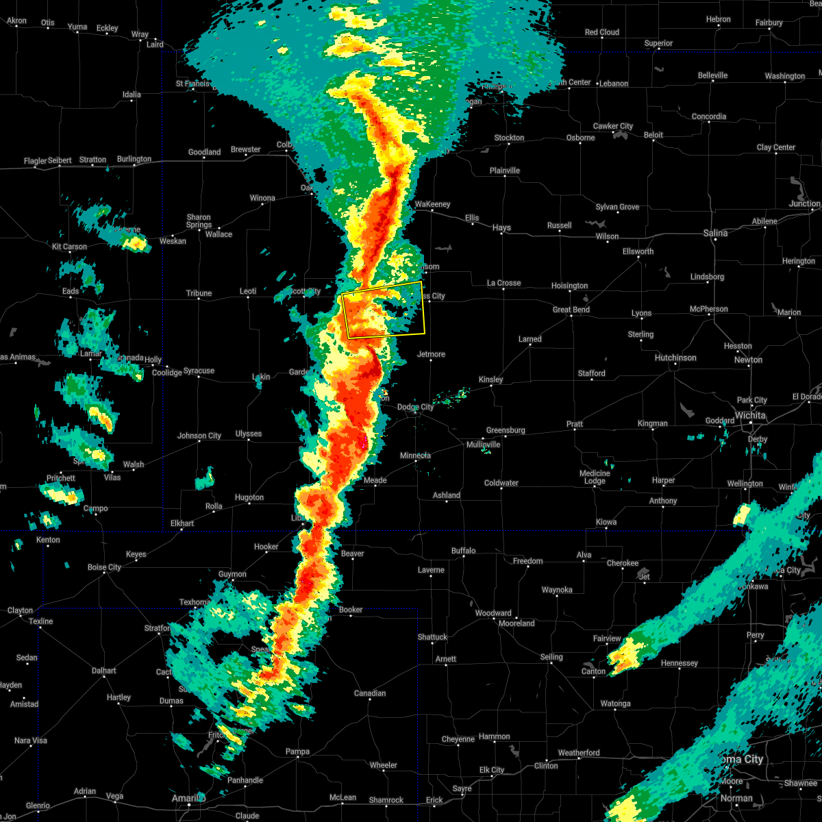 At 1002 pm cdt, a severe thunderstorm was located 12 miles south of alamota, moving northeast at 55 mph (radar indicated). Hazards include 70 mph wind gusts and nickel size hail. Expect considerable tree damage. damage is likely to mobile homes, roofs, and outbuildings. this severe thunderstorm will be near, alamota around 1015 pm cdt. Beeler around 1020 pm cdt. At 1002 pm cdt, a severe thunderstorm was located 12 miles south of alamota, moving northeast at 55 mph (radar indicated). Hazards include 70 mph wind gusts and nickel size hail. Expect considerable tree damage. damage is likely to mobile homes, roofs, and outbuildings. this severe thunderstorm will be near, alamota around 1015 pm cdt. Beeler around 1020 pm cdt.
|
| 10/12/2021 9:51 PM CDT |
 The severe thunderstorm warning for northeastern finney, eastern scott and lane counties will expire at 1000 pm cdt, the storms which prompted the warning have weakened below severe limits, and no longer pose an immediate threat to life or property. therefore, the warning will be allowed to expire. however gusty winds are still possible with these thunderstorms. a tornado watch remains in effect until 1100 pm cdt for southwestern and west central kansas. The severe thunderstorm warning for northeastern finney, eastern scott and lane counties will expire at 1000 pm cdt, the storms which prompted the warning have weakened below severe limits, and no longer pose an immediate threat to life or property. therefore, the warning will be allowed to expire. however gusty winds are still possible with these thunderstorms. a tornado watch remains in effect until 1100 pm cdt for southwestern and west central kansas.
|
| 10/12/2021 9:33 PM CDT |
 At 933 pm cdt, severe thunderstorms were located along a line extending from 7 miles east of gove to 12 miles south of dighton, moving northeast at 55 mph (radar indicated). Hazards include 60 mph wind gusts and penny size hail. Expect damage to roofs, siding, and trees. Locations impacted include, dighton, grigston, healy, manning, pendennis, amy and shields. At 933 pm cdt, severe thunderstorms were located along a line extending from 7 miles east of gove to 12 miles south of dighton, moving northeast at 55 mph (radar indicated). Hazards include 60 mph wind gusts and penny size hail. Expect damage to roofs, siding, and trees. Locations impacted include, dighton, grigston, healy, manning, pendennis, amy and shields.
|
| 10/12/2021 9:15 PM CDT |
 At 914 pm cdt, severe thunderstorms were located along a line extending from 12 miles north of healy to 9 miles southeast of friend, moving northeast at 55 mph (radar indicated). Hazards include 60 mph wind gusts and penny size hail. Expect damage to roofs, siding, and trees. These severe thunderstorms will remain over mainly rural areas of northern finney, scott and lane counties. At 914 pm cdt, severe thunderstorms were located along a line extending from 12 miles north of healy to 9 miles southeast of friend, moving northeast at 55 mph (radar indicated). Hazards include 60 mph wind gusts and penny size hail. Expect damage to roofs, siding, and trees. These severe thunderstorms will remain over mainly rural areas of northern finney, scott and lane counties.
|
| 7/10/2021 12:05 AM CDT |
 The severe thunderstorm warning for northeastern kearny, northwestern finney, southern scott and southwestern lane counties will expire at 1215 am cdt, the storms which prompted the warning have weakened below severe limits, and no longer pose an immediate threat to life or property. therefore, the warning will be allowed to expire. however gusty winds are still possible with these thunderstorms. a severe thunderstorm watch remains in effect until 200 am cdt for southwestern and west central kansas. The severe thunderstorm warning for northeastern kearny, northwestern finney, southern scott and southwestern lane counties will expire at 1215 am cdt, the storms which prompted the warning have weakened below severe limits, and no longer pose an immediate threat to life or property. therefore, the warning will be allowed to expire. however gusty winds are still possible with these thunderstorms. a severe thunderstorm watch remains in effect until 200 am cdt for southwestern and west central kansas.
|
| 7/9/2021 11:43 PM CDT |
 At 1143 pm cdt, severe thunderstorms were located along a line extending from near alamota to 7 miles east of friend to 13 miles north of deerfield, moving southeast at 25 mph (radar indicated). Hazards include 60 mph wind gusts. Expect damage to roofs, siding, and trees. These severe thunderstorms will remain over mainly rural areas of northeastern kearny, northwestern finney, southern scott and southwestern lane counties. At 1143 pm cdt, severe thunderstorms were located along a line extending from near alamota to 7 miles east of friend to 13 miles north of deerfield, moving southeast at 25 mph (radar indicated). Hazards include 60 mph wind gusts. Expect damage to roofs, siding, and trees. These severe thunderstorms will remain over mainly rural areas of northeastern kearny, northwestern finney, southern scott and southwestern lane counties.
|
| 7/9/2021 11:18 PM CDT |
 At 1118 pm cdt, severe thunderstorms were located along a line extending from near healy to near scott city to 13 miles south of leoti, moving southeast at 35 mph (radar indicated). Hazards include 60 mph wind gusts. Expect damage to roofs, siding, and trees. severe thunderstorms will be near, healy, shallow water and manning around 1130 pm cdt. Other locations in the path of these severe thunderstorms include amy, friend and dighton. At 1118 pm cdt, severe thunderstorms were located along a line extending from near healy to near scott city to 13 miles south of leoti, moving southeast at 35 mph (radar indicated). Hazards include 60 mph wind gusts. Expect damage to roofs, siding, and trees. severe thunderstorms will be near, healy, shallow water and manning around 1130 pm cdt. Other locations in the path of these severe thunderstorms include amy, friend and dighton.
|
| 6/23/2021 10:20 PM CDT |
 At 1020 pm cdt, a severe thunderstorm was located near dighton, moving northeast at 20 mph (radar indicated). Hazards include quarter size hail. Damage to vehicles is expected. Locations impacted include, alamota. At 1020 pm cdt, a severe thunderstorm was located near dighton, moving northeast at 20 mph (radar indicated). Hazards include quarter size hail. Damage to vehicles is expected. Locations impacted include, alamota.
|
| 6/23/2021 10:09 PM CDT |
 At 1009 pm cdt, a severe thunderstorm was located near dighton, moving northeast at 20 mph (radar indicated). Hazards include quarter size hail. Damage to vehicles is expected. this severe storm will be near, dighton around 1015 pm cdt. Other locations in the path of this severe thunderstorm include shields, alamota and pendennis. At 1009 pm cdt, a severe thunderstorm was located near dighton, moving northeast at 20 mph (radar indicated). Hazards include quarter size hail. Damage to vehicles is expected. this severe storm will be near, dighton around 1015 pm cdt. Other locations in the path of this severe thunderstorm include shields, alamota and pendennis.
|
| 6/23/2021 10:00 PM CDT |
 At 1000 pm cdt, a severe thunderstorm was located very near amy, moving northeast at 20 mph (radar indicated). Hazards include quarter size hail. Damage to vehicles is expected. this severe thunderstorm will be near, dighton around 1020 pm cdt. Other locations in the path of this severe thunderstorm include shields and pendennis. At 1000 pm cdt, a severe thunderstorm was located very near amy, moving northeast at 20 mph (radar indicated). Hazards include quarter size hail. Damage to vehicles is expected. this severe thunderstorm will be near, dighton around 1020 pm cdt. Other locations in the path of this severe thunderstorm include shields and pendennis.
|
| 5/14/2021 10:27 PM CDT |
 The severe thunderstorm warning for northeastern finney, western ness, southeastern scott, northwestern hodgeman and lane counties will expire at 1030 pm cdt, the storms which prompted the warning have moved out of the warned area. therefore, the warning will be allowed to expire. however heavy rain is still possible with these thunderstorms. a severe thunderstorm watch remains in effect until 1100 pm cdt for southwestern and west central kansas. remember, a severe thunderstorm warning still remains in effect for lane, ness, finney, and hodgeman coutnies. The severe thunderstorm warning for northeastern finney, western ness, southeastern scott, northwestern hodgeman and lane counties will expire at 1030 pm cdt, the storms which prompted the warning have moved out of the warned area. therefore, the warning will be allowed to expire. however heavy rain is still possible with these thunderstorms. a severe thunderstorm watch remains in effect until 1100 pm cdt for southwestern and west central kansas. remember, a severe thunderstorm warning still remains in effect for lane, ness, finney, and hodgeman coutnies.
|
| 5/14/2021 10:20 PM CDT | Quarter sized hail reported 0.3 miles ENE of Dighton, KS |
| 5/14/2021 10:07 PM CDT |
 At 1006 pm cdt, severe thunderstorms were located along a line extending from near ness city to 13 miles northeast of kalvesta to 9 miles northeast of garden city, moving southeast at 35 mph (radar indicated). Hazards include 70 mph wind gusts and quarter size hail. Hail damage to vehicles is expected. expect considerable tree damage. wind damage is also likely to mobile homes, roofs, and outbuildings. Locations impacted include, dighton, utica, alamota, grigston, beeler, amy and arnold. At 1006 pm cdt, severe thunderstorms were located along a line extending from near ness city to 13 miles northeast of kalvesta to 9 miles northeast of garden city, moving southeast at 35 mph (radar indicated). Hazards include 70 mph wind gusts and quarter size hail. Hail damage to vehicles is expected. expect considerable tree damage. wind damage is also likely to mobile homes, roofs, and outbuildings. Locations impacted include, dighton, utica, alamota, grigston, beeler, amy and arnold.
|
| 5/14/2021 9:58 PM CDT |
 At 958 pm cdt, severe thunderstorms were located along a line extending from 7 miles south of arnold to 13 miles south of beeler to 9 miles north of garden city, moving southeast at 35 mph (radar indicated). Hazards include 70 mph wind gusts and quarter size hail. Hail damage to vehicles is expected. expect considerable tree damage. wind damage is also likely to mobile homes, roofs, and outbuildings. These severe thunderstorms will remain over mainly rural areas of northeastern finney, western ness, southern scott, northwestern hodgeman and lane counties. At 958 pm cdt, severe thunderstorms were located along a line extending from 7 miles south of arnold to 13 miles south of beeler to 9 miles north of garden city, moving southeast at 35 mph (radar indicated). Hazards include 70 mph wind gusts and quarter size hail. Hail damage to vehicles is expected. expect considerable tree damage. wind damage is also likely to mobile homes, roofs, and outbuildings. These severe thunderstorms will remain over mainly rural areas of northeastern finney, western ness, southern scott, northwestern hodgeman and lane counties.
|
| 5/14/2021 9:43 PM CDT |
 The national weather service in dodge city has issued a * severe thunderstorm warning for. northern finney county in southwestern kansas. western ness county in west central kansas. scott county in west central kansas. Northwestern hodgeman county in southwestern kansas. The national weather service in dodge city has issued a * severe thunderstorm warning for. northern finney county in southwestern kansas. western ness county in west central kansas. scott county in west central kansas. Northwestern hodgeman county in southwestern kansas.
|
| 5/2/2021 9:23 PM CDT |
 The severe thunderstorm warning for northeastern finney and lane counties will expire at 930 pm cdt, the storms which prompted the warning have weakened below severe limits, and no longer pose an immediate threat to life or property. therefore, the warning will be allowed to expire. however gusty winds are still possible with these thunderstorms. a significant weather advisory is in effect for eastern lane and northeast finney counties. a severe thunderstorm watch remains in effect until midnight cdt for southwestern and west central kansas. The severe thunderstorm warning for northeastern finney and lane counties will expire at 930 pm cdt, the storms which prompted the warning have weakened below severe limits, and no longer pose an immediate threat to life or property. therefore, the warning will be allowed to expire. however gusty winds are still possible with these thunderstorms. a significant weather advisory is in effect for eastern lane and northeast finney counties. a severe thunderstorm watch remains in effect until midnight cdt for southwestern and west central kansas.
|
| 5/2/2021 9:14 PM CDT |
 At 913 pm cdt, severe thunderstorms were located along a line extending from near dighton to 13 miles northwest of kalvesta, moving east at 25 mph (radar indicated). Hazards include 60 mph wind gusts and penny size hail. Expect damage to roofs, siding, and trees. Locations impacted include, dighton, alamota, healy, kalvesta, pendennis, amy and shields. At 913 pm cdt, severe thunderstorms were located along a line extending from near dighton to 13 miles northwest of kalvesta, moving east at 25 mph (radar indicated). Hazards include 60 mph wind gusts and penny size hail. Expect damage to roofs, siding, and trees. Locations impacted include, dighton, alamota, healy, kalvesta, pendennis, amy and shields.
|
| 5/2/2021 8:39 PM CDT |
 At 839 pm cdt, severe thunderstorms were located along a line extending from near amy to 15 miles east of friend, moving east at 25 mph (radar indicated). Hazards include 60 mph wind gusts and nickel size hail. expect damage to roofs, siding, and trees At 839 pm cdt, severe thunderstorms were located along a line extending from near amy to 15 miles east of friend, moving east at 25 mph (radar indicated). Hazards include 60 mph wind gusts and nickel size hail. expect damage to roofs, siding, and trees
|
| 3/13/2021 1:51 PM CST |
 The severe thunderstorm warning for northwestern lane county will expire at 200 pm cst, the storm which prompted the warning has moved out of the area. therefore, the warning will be allowed to expire. however small hail, gusty winds and heavy rain are still possible with this thunderstorm. The severe thunderstorm warning for northwestern lane county will expire at 200 pm cst, the storm which prompted the warning has moved out of the area. therefore, the warning will be allowed to expire. however small hail, gusty winds and heavy rain are still possible with this thunderstorm.
|
| 3/13/2021 1:26 PM CST |
 At 126 pm cst, a severe thunderstorm was located very near grigston, moving northeast at 55 mph (radar indicated). Hazards include 60 mph wind gusts and quarter size hail. Hail damage to vehicles is expected. expect wind damage to roofs, siding, and trees. Locations impacted include, scott city, dighton, grigston, healy, scott state lake, manning, pendennis, amy and shields. At 126 pm cst, a severe thunderstorm was located very near grigston, moving northeast at 55 mph (radar indicated). Hazards include 60 mph wind gusts and quarter size hail. Hail damage to vehicles is expected. expect wind damage to roofs, siding, and trees. Locations impacted include, scott city, dighton, grigston, healy, scott state lake, manning, pendennis, amy and shields.
|
| 3/13/2021 1:08 PM CST |
 At 108 pm cst, a severe thunderstorm was located near friend, moving northeast at 55 mph (radar indicated). Hazards include 60 mph wind gusts and quarter size hail. Hail damage to vehicles is expected. Expect wind damage to roofs, siding, and trees. At 108 pm cst, a severe thunderstorm was located near friend, moving northeast at 55 mph (radar indicated). Hazards include 60 mph wind gusts and quarter size hail. Hail damage to vehicles is expected. Expect wind damage to roofs, siding, and trees.
|
| 8/1/2020 4:46 PM CDT |
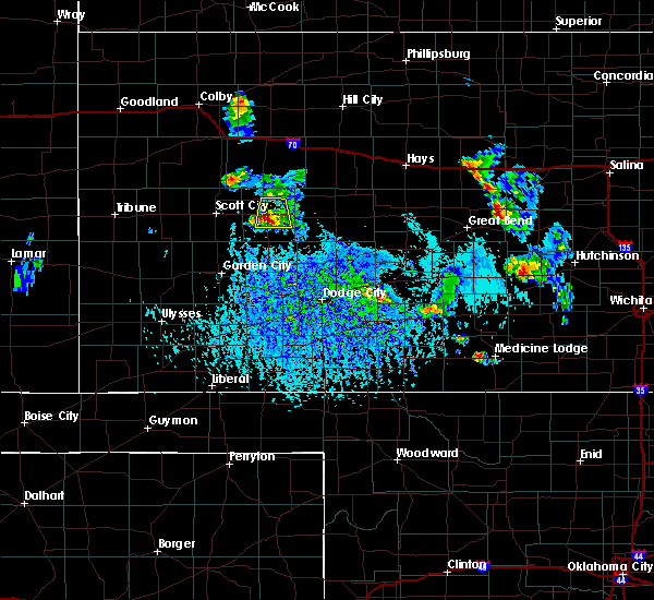 At 445 pm cdt, a severe thunderstorm was located near dighton, moving south at 25 mph (radar indicated). Hazards include quarter size hail. damage to vehicles is expected At 445 pm cdt, a severe thunderstorm was located near dighton, moving south at 25 mph (radar indicated). Hazards include quarter size hail. damage to vehicles is expected
|
| 8/1/2020 4:40 PM CDT | *** 1 inj *** a building was heavily damaged 1.5 miles west of dighton. powerpoles were also down at this location. a vehicle had its windows blown out at this location in lane county KS, 1.4 miles E of Dighton, KS |
| 8/1/2020 4:35 PM CDT | Power poles were blown down along highway 23 near county road 16 in lane county KS, 1.3 miles SSE of Dighton, KS |
| 8/1/2020 4:23 PM CDT |
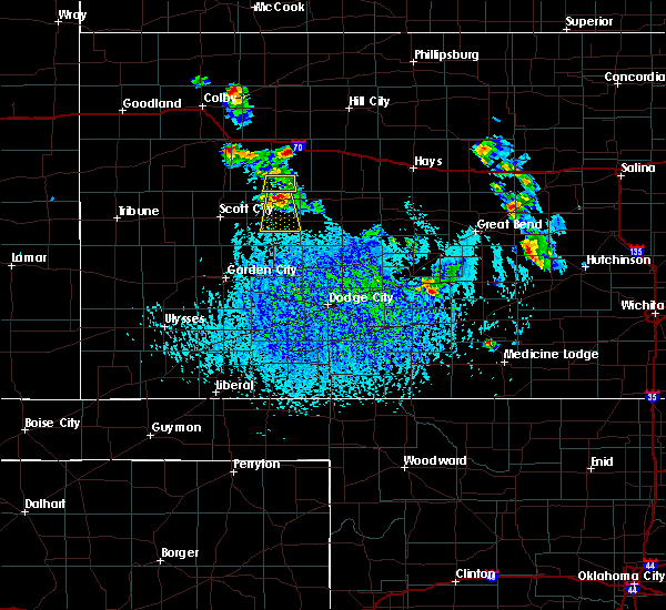 At 423 pm cdt, a severe thunderstorm was located 6 miles north of dighton, moving south at 30 mph (radar indicated). Hazards include half dollar size hail. Damage to vehicles is expected. Locations impacted include, dighton and alamota. At 423 pm cdt, a severe thunderstorm was located 6 miles north of dighton, moving south at 30 mph (radar indicated). Hazards include half dollar size hail. Damage to vehicles is expected. Locations impacted include, dighton and alamota.
|
| 8/1/2020 3:59 PM CDT |
 At 359 pm cdt, a severe thunderstorm was located 7 miles north of shields, moving south at 30 mph (radar indicated). Hazards include half dollar size hail. damage to vehicles is expected At 359 pm cdt, a severe thunderstorm was located 7 miles north of shields, moving south at 30 mph (radar indicated). Hazards include half dollar size hail. damage to vehicles is expected
|
| 7/30/2020 12:41 AM CDT |
 The national weather service in dodge city has issued a * severe thunderstorm warning for. northeastern finney county in southwestern kansas. ness county in west central kansas. hodgeman county in southwestern kansas. Northwestern pawnee county in south central kansas. The national weather service in dodge city has issued a * severe thunderstorm warning for. northeastern finney county in southwestern kansas. ness county in west central kansas. hodgeman county in southwestern kansas. Northwestern pawnee county in south central kansas.
|
| 7/12/2020 10:11 PM CDT |
 At 1011 pm cdt, severe thunderstorms were located along a line extending from 12 miles southwest of alamota to 6 miles east of kendall, moving southwest at 30 mph (radar indicated). Hazards include 60 mph wind gusts and nickel size hail. Expect damage to roofs, siding, and trees. Locations impacted include, garden city, lakin, holcomb, dighton, deerfield, friend, kalvesta, shallow water and amy. At 1011 pm cdt, severe thunderstorms were located along a line extending from 12 miles southwest of alamota to 6 miles east of kendall, moving southwest at 30 mph (radar indicated). Hazards include 60 mph wind gusts and nickel size hail. Expect damage to roofs, siding, and trees. Locations impacted include, garden city, lakin, holcomb, dighton, deerfield, friend, kalvesta, shallow water and amy.
|
| 7/12/2020 9:54 PM CDT |
 At 954 pm cdt, severe thunderstorms were located along a line extending from near dighton to 11 miles northeast of kendall, moving southeast at 40 mph (radar indicated). Hazards include 60 mph wind gusts and nickel size hail. expect damage to roofs, siding, and trees At 954 pm cdt, severe thunderstorms were located along a line extending from near dighton to 11 miles northeast of kendall, moving southeast at 40 mph (radar indicated). Hazards include 60 mph wind gusts and nickel size hail. expect damage to roofs, siding, and trees
|
| 6/27/2020 1:25 AM CDT |
 The severe thunderstorm warning for northeastern finney, western ness, eastern scott, northwestern hodgeman, southwestern trego and lane counties will expire at 130 am cdt, the storms which prompted the warning have weakened below severe limits, and no longer pose an immediate threat to life or property. therefore, the warning will be allowed to expire. however gusty winds are still possible with these thunderstorms. a severe thunderstorm watch remains in effect until 400 am cdt for southwestern and west central kansas. The severe thunderstorm warning for northeastern finney, western ness, eastern scott, northwestern hodgeman, southwestern trego and lane counties will expire at 130 am cdt, the storms which prompted the warning have weakened below severe limits, and no longer pose an immediate threat to life or property. therefore, the warning will be allowed to expire. however gusty winds are still possible with these thunderstorms. a severe thunderstorm watch remains in effect until 400 am cdt for southwestern and west central kansas.
|
| 6/27/2020 1:20 AM CDT | Report was from social medi in lane county KS, 0.3 miles ENE of Dighton, KS |
| 6/27/2020 1:05 AM CDT |
 At 104 am cdt, severe thunderstorms were located along a line extending from near shields to near beeler to near kalvesta, moving east at 60 mph (radar indicated. at 1249 am cdt, a 63 mph thunderstorm wind gust was recorded by a weather station 2 miles southwest of shields). Hazards include 70 mph wind gusts. Expect considerable tree damage. damage is likely to mobile homes, roofs, and outbuildings. Locations impacted include, ness city, dighton, jetmore, utica, alamota, grigston, manning, beeler, pendennis, amy, arnold, healy and shields. At 104 am cdt, severe thunderstorms were located along a line extending from near shields to near beeler to near kalvesta, moving east at 60 mph (radar indicated. at 1249 am cdt, a 63 mph thunderstorm wind gust was recorded by a weather station 2 miles southwest of shields). Hazards include 70 mph wind gusts. Expect considerable tree damage. damage is likely to mobile homes, roofs, and outbuildings. Locations impacted include, ness city, dighton, jetmore, utica, alamota, grigston, manning, beeler, pendennis, amy, arnold, healy and shields.
|
| 6/27/2020 12:49 AM CDT | Report was from the kansas mesonet station lnuk in lane county KS, 8.2 miles S of Dighton, KS |
| 6/27/2020 12:41 AM CDT |
 At 1241 am cdt, severe thunderstorms were located along a line extending from near manning to 7 miles south of amy to 16 miles northeast of garden city, moving east at 55 mph (radar indicated). Hazards include 60 mph wind gusts and nickel size hail. expect damage to roofs, siding, and trees At 1241 am cdt, severe thunderstorms were located along a line extending from near manning to 7 miles south of amy to 16 miles northeast of garden city, moving east at 55 mph (radar indicated). Hazards include 60 mph wind gusts and nickel size hail. expect damage to roofs, siding, and trees
|
| 6/21/2020 4:31 PM CDT |
 At 431 pm cdt, severe thunderstorms were located along a line extending from 12 miles south of ness city to 6 miles north of charleston, moving southeast at 45 mph (radar indicated). Hazards include tennis ball size hail and 70 mph wind gusts. People and animals outdoors will be injured. expect hail damage to roofs, siding, windows, and vehicles. expect considerable tree damage. wind damage is also likely to mobile homes, roofs, and outbuildings. Locations impacted include, garden city, scott city, holcomb, ness city, dighton, jetmore, ransom, hanston, utica, alamota, grigston, shallow water, manning, beeler, pendennis, amy, arnold, healy, friend and kalvesta. At 431 pm cdt, severe thunderstorms were located along a line extending from 12 miles south of ness city to 6 miles north of charleston, moving southeast at 45 mph (radar indicated). Hazards include tennis ball size hail and 70 mph wind gusts. People and animals outdoors will be injured. expect hail damage to roofs, siding, windows, and vehicles. expect considerable tree damage. wind damage is also likely to mobile homes, roofs, and outbuildings. Locations impacted include, garden city, scott city, holcomb, ness city, dighton, jetmore, ransom, hanston, utica, alamota, grigston, shallow water, manning, beeler, pendennis, amy, arnold, healy, friend and kalvesta.
|
| 6/21/2020 4:14 PM CDT |
 At 414 pm cdt, severe thunderstorms were located along a line extending from 7 miles west of ness city to 16 miles east of friend, moving southeast at 40 mph (radar indicated). Hazards include tennis ball size hail and 70 mph wind gusts. People and animals outdoors will be injured. expect hail damage to roofs, siding, windows, and vehicles. expect considerable tree damage. Wind damage is also likely to mobile homes, roofs, and outbuildings. At 414 pm cdt, severe thunderstorms were located along a line extending from 7 miles west of ness city to 16 miles east of friend, moving southeast at 40 mph (radar indicated). Hazards include tennis ball size hail and 70 mph wind gusts. People and animals outdoors will be injured. expect hail damage to roofs, siding, windows, and vehicles. expect considerable tree damage. Wind damage is also likely to mobile homes, roofs, and outbuildings.
|
| 6/21/2020 3:59 PM CDT | Quarter sized hail reported 1.3 miles SSE of Dighton, KS |
| 6/21/2020 3:58 PM CDT |
 At 356 pm cdt, severe thunderstorms were located along a line extending from near arnold to near shallow water, moving east at 30 mph (radar indicated. at 335 pm...a wind gust of 64 mph was reported at the scott city airport). Hazards include two inch hail and 60 mph wind gusts. People and animals outdoors will be injured. expect hail damage to roofs, siding, windows, and vehicles. expect wind damage to roofs, siding, and trees. Locations impacted include, scott city, wakeeney, dighton, ransom, utica, collyer, alamota, grigston, scott state lake, modoc, shallow water, manning, pendennis, amy, arnold, healy, shields, voda and trego center. At 356 pm cdt, severe thunderstorms were located along a line extending from near arnold to near shallow water, moving east at 30 mph (radar indicated. at 335 pm...a wind gust of 64 mph was reported at the scott city airport). Hazards include two inch hail and 60 mph wind gusts. People and animals outdoors will be injured. expect hail damage to roofs, siding, windows, and vehicles. expect wind damage to roofs, siding, and trees. Locations impacted include, scott city, wakeeney, dighton, ransom, utica, collyer, alamota, grigston, scott state lake, modoc, shallow water, manning, pendennis, amy, arnold, healy, shields, voda and trego center.
|
| 6/21/2020 3:41 PM CDT |
 At 341 pm cdt, severe thunderstorms were located along a line extending from near utica to 6 miles west of shallow water, moving east at 30 mph (radar indicated). Hazards include two inch hail and 60 mph wind gusts. People and animals outdoors will be injured. expect hail damage to roofs, siding, windows, and vehicles. expect wind damage to roofs, siding, and trees. Locations impacted include, scott city, wakeeney, dighton, ransom, utica, collyer, alamota, grigston, scott state lake, modoc, shallow water, manning, pendennis, amy, arnold, healy, shields, voda and trego center. At 341 pm cdt, severe thunderstorms were located along a line extending from near utica to 6 miles west of shallow water, moving east at 30 mph (radar indicated). Hazards include two inch hail and 60 mph wind gusts. People and animals outdoors will be injured. expect hail damage to roofs, siding, windows, and vehicles. expect wind damage to roofs, siding, and trees. Locations impacted include, scott city, wakeeney, dighton, ransom, utica, collyer, alamota, grigston, scott state lake, modoc, shallow water, manning, pendennis, amy, arnold, healy, shields, voda and trego center.
|
| 6/21/2020 3:14 PM CDT |
 At 314 pm cdt, severe thunderstorms were located along a line extending from 9 miles north of pendennis to near modoc, moving east at 35 mph (radar indicated). Hazards include two inch hail and 60 mph wind gusts. People and animals outdoors will be injured. expect hail damage to roofs, siding, windows, and vehicles. Expect wind damage to roofs, siding, and trees. At 314 pm cdt, severe thunderstorms were located along a line extending from 9 miles north of pendennis to near modoc, moving east at 35 mph (radar indicated). Hazards include two inch hail and 60 mph wind gusts. People and animals outdoors will be injured. expect hail damage to roofs, siding, windows, and vehicles. Expect wind damage to roofs, siding, and trees.
|
| 8/17/2019 1:05 AM CDT |
 At 1241 am cdt, severe thunderstorms were located along a line extending from near healy to near dighton to 12 miles west of kalvesta, moving east at 25 mph (radar indicated). Hazards include 60 mph wind gusts and nickel size hail. Expect damage to roofs, siding, and trees. Locations impacted include, dighton, alamota, pendennis, healy, amy and shields. At 1241 am cdt, severe thunderstorms were located along a line extending from near healy to near dighton to 12 miles west of kalvesta, moving east at 25 mph (radar indicated). Hazards include 60 mph wind gusts and nickel size hail. Expect damage to roofs, siding, and trees. Locations impacted include, dighton, alamota, pendennis, healy, amy and shields.
|
| 8/17/2019 12:41 AM CDT |
 At 1241 am cdt, severe thunderstorms were located along a line extending from near healy to near dighton to 12 miles west of kalvesta, moving east at 25 mph (radar indicated). Hazards include 60 mph wind gusts and nickel size hail. Expect damage to roofs, siding, and trees. Locations impacted include, dighton, alamota, pendennis, healy, amy and shields. At 1241 am cdt, severe thunderstorms were located along a line extending from near healy to near dighton to 12 miles west of kalvesta, moving east at 25 mph (radar indicated). Hazards include 60 mph wind gusts and nickel size hail. Expect damage to roofs, siding, and trees. Locations impacted include, dighton, alamota, pendennis, healy, amy and shields.
|
| 8/17/2019 12:22 AM CDT |
 At 1221 am cdt, severe thunderstorms were located along a line extending from 7 miles north of healy to 13 miles northeast of garden city, moving northeast at 25 mph (radar indicated). Hazards include 70 mph wind gusts and quarter size hail. Hail damage to vehicles is expected. expect considerable tree damage. Wind damage is also likely to mobile homes, roofs, and outbuildings. At 1221 am cdt, severe thunderstorms were located along a line extending from 7 miles north of healy to 13 miles northeast of garden city, moving northeast at 25 mph (radar indicated). Hazards include 70 mph wind gusts and quarter size hail. Hail damage to vehicles is expected. expect considerable tree damage. Wind damage is also likely to mobile homes, roofs, and outbuildings.
|
| 8/16/2019 3:55 AM CDT |
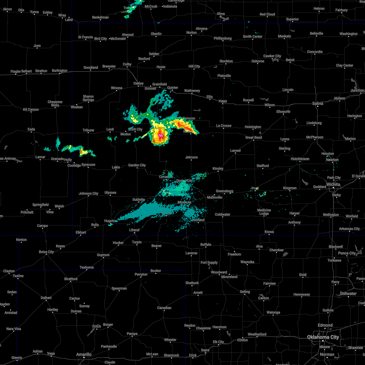 The severe thunderstorm warning for southwestern lane county will expire at 400 am cdt. the severe thunderstorm which prompted the warning is weakening below severe limits. Therefore, the warning will be allowed to expire at 4 am cdt. The severe thunderstorm warning for southwestern lane county will expire at 400 am cdt. the severe thunderstorm which prompted the warning is weakening below severe limits. Therefore, the warning will be allowed to expire at 4 am cdt.
|
| 8/16/2019 3:48 AM CDT |
 At 348 am cdt, a severe thunderstorm was located near dighton, moving east at 25 mph (radar indicated). Hazards include 60 mph wind gusts and quarter size hail. Hail damage to vehicles is expected. expect wind damage to roofs, siding, and trees. Locations impacted include, dighton. At 348 am cdt, a severe thunderstorm was located near dighton, moving east at 25 mph (radar indicated). Hazards include 60 mph wind gusts and quarter size hail. Hail damage to vehicles is expected. expect wind damage to roofs, siding, and trees. Locations impacted include, dighton.
|
| 8/16/2019 3:34 AM CDT |
 At 334 am cdt, a severe thunderstorm was located near amy, moving east at 25 mph (radar indicated). Hazards include 60 mph wind gusts and quarter size hail. Hail damage to vehicles is expected. expect wind damage to roofs, siding, and trees. Locations impacted include, dighton and amy. At 334 am cdt, a severe thunderstorm was located near amy, moving east at 25 mph (radar indicated). Hazards include 60 mph wind gusts and quarter size hail. Hail damage to vehicles is expected. expect wind damage to roofs, siding, and trees. Locations impacted include, dighton and amy.
|
| 8/16/2019 3:26 AM CDT |
 At 326 am cdt, a severe thunderstorm was located near grigston, moving east at 25 mph (radar indicated). Hazards include 60 mph wind gusts and quarter size hail. Hail damage to vehicles is expected. Expect wind damage to roofs, siding, and trees. At 326 am cdt, a severe thunderstorm was located near grigston, moving east at 25 mph (radar indicated). Hazards include 60 mph wind gusts and quarter size hail. Hail damage to vehicles is expected. Expect wind damage to roofs, siding, and trees.
|
| 8/13/2019 7:31 PM CDT |
 At 731 pm cdt, severe thunderstorms were located along a line extending from 12 miles north of jetmore to 7 miles west of kalvesta to 10 miles southwest of friend, moving south at 50 mph. these are very dangerous storms (radar indicated). Hazards include 80 mph wind gusts and golf ball size hail. Flying debris will be dangerous to those caught without shelter. mobile homes will be heavily damaged. expect considerable damage to roofs, windows, and vehicles. extensive tree damage and power outages are likely. Locations impacted include, garden city, scott city, holcomb, dighton, jetmore, pierceville, ingalls, alamota, charleston, grigston, shallow water, beeler, amy, friend, kalvesta and modoc. At 731 pm cdt, severe thunderstorms were located along a line extending from 12 miles north of jetmore to 7 miles west of kalvesta to 10 miles southwest of friend, moving south at 50 mph. these are very dangerous storms (radar indicated). Hazards include 80 mph wind gusts and golf ball size hail. Flying debris will be dangerous to those caught without shelter. mobile homes will be heavily damaged. expect considerable damage to roofs, windows, and vehicles. extensive tree damage and power outages are likely. Locations impacted include, garden city, scott city, holcomb, dighton, jetmore, pierceville, ingalls, alamota, charleston, grigston, shallow water, beeler, amy, friend, kalvesta and modoc.
|
| 8/13/2019 7:15 PM CDT | Storm damage reported in lane county KS, 9.1 miles N of Dighton, KS |
| 8/13/2019 7:04 PM CDT |
 The national weather service in dodge city has issued a * severe thunderstorm warning for. finney county in southwestern kansas. western ness county in west central kansas. southern scott county in west central kansas. Western hodgeman county in southwestern kansas. The national weather service in dodge city has issued a * severe thunderstorm warning for. finney county in southwestern kansas. western ness county in west central kansas. southern scott county in west central kansas. Western hodgeman county in southwestern kansas.
|
| 8/13/2019 6:52 PM CDT |
 At 651 pm cdt, severe thunderstorms were located along a line extending from near utica to 6 miles west of modoc, moving south at 40 mph. these are very dangerous storms (radar indicated). Hazards include 80 mph wind gusts and half dollar size hail. Flying debris will be dangerous to those caught without shelter. mobile homes will be heavily damaged. expect considerable damage to roofs, windows, and vehicles. extensive tree damage and power outages are likely. Locations impacted include, scott city, dighton, alamota, grigston, healy, scott state lake, modoc, shallow water, manning, pendennis, amy and shields. At 651 pm cdt, severe thunderstorms were located along a line extending from near utica to 6 miles west of modoc, moving south at 40 mph. these are very dangerous storms (radar indicated). Hazards include 80 mph wind gusts and half dollar size hail. Flying debris will be dangerous to those caught without shelter. mobile homes will be heavily damaged. expect considerable damage to roofs, windows, and vehicles. extensive tree damage and power outages are likely. Locations impacted include, scott city, dighton, alamota, grigston, healy, scott state lake, modoc, shallow water, manning, pendennis, amy and shields.
|
| 8/13/2019 6:24 PM CDT |
 At 623 pm cdt, severe thunderstorms were located along a line extending from near collyer to 15 miles north of leoti, moving south at 40 mph. these are very dangerous storms (radar indicated). Hazards include 80 mph wind gusts and half dollar size hail. Flying debris will be dangerous to those caught without shelter. mobile homes will be heavily damaged. expect considerable damage to roofs, windows, and vehicles. Extensive tree damage and power outages are likely. At 623 pm cdt, severe thunderstorms were located along a line extending from near collyer to 15 miles north of leoti, moving south at 40 mph. these are very dangerous storms (radar indicated). Hazards include 80 mph wind gusts and half dollar size hail. Flying debris will be dangerous to those caught without shelter. mobile homes will be heavily damaged. expect considerable damage to roofs, windows, and vehicles. Extensive tree damage and power outages are likely.
|
| 7/5/2019 5:27 PM CDT |
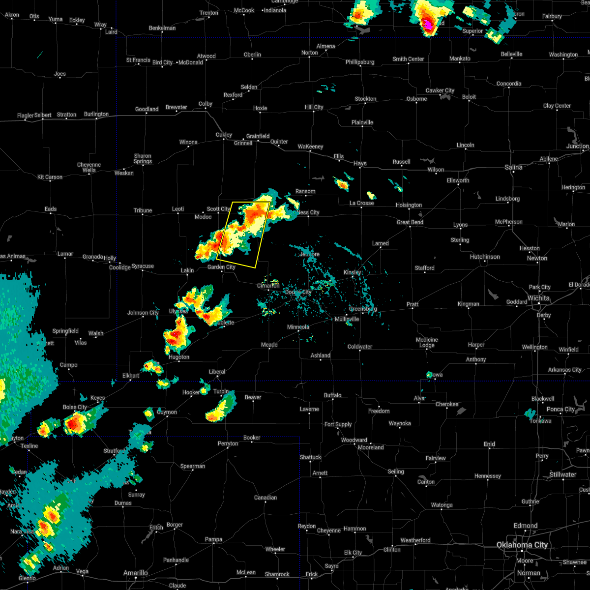 The severe thunderstorm warning for northwestern finney. southeastern scott and southern lane counties will expire at 530 pm cdt. the storm which prompted the warning has weakened below severe limits, and no longer poses an immediate threat to life or property. therefore, the warning will be allowed to expire. However small hail. The severe thunderstorm warning for northwestern finney. southeastern scott and southern lane counties will expire at 530 pm cdt. the storm which prompted the warning has weakened below severe limits, and no longer poses an immediate threat to life or property. therefore, the warning will be allowed to expire. However small hail.
|
| 7/5/2019 5:27 PM CDT |
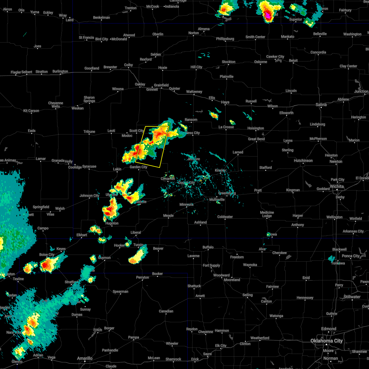 The severe thunderstorm warning for northwestern finney. southeastern scott and southern lane counties will expire at 530 pm cdt. the storm which prompted the warning has weakened below severe limits, and no longer poses an immediate threat to life or property. therefore, the warning will be allowed to expire. However small hail. The severe thunderstorm warning for northwestern finney. southeastern scott and southern lane counties will expire at 530 pm cdt. the storm which prompted the warning has weakened below severe limits, and no longer poses an immediate threat to life or property. therefore, the warning will be allowed to expire. However small hail.
|
| 7/5/2019 5:27 PM CDT |
 The severe thunderstorm warning for northwestern finney, southeastern scott and southern lane counties will expire at 530 pm cdt, the storm which prompted the warning has weakened below severe limits, and no longer poses an immediate threat to life or property. therefore, the warning will be allowed to expire. however small hail and gusty winds are still possible with this thunderstorm. a severe thunderstorm watch remains in effect until 1000 pm cdt for southwestern and west central kansas. The severe thunderstorm warning for northwestern finney, southeastern scott and southern lane counties will expire at 530 pm cdt, the storm which prompted the warning has weakened below severe limits, and no longer poses an immediate threat to life or property. therefore, the warning will be allowed to expire. however small hail and gusty winds are still possible with this thunderstorm. a severe thunderstorm watch remains in effect until 1000 pm cdt for southwestern and west central kansas.
|
| 7/5/2019 5:01 PM CDT |
 At 501 pm cdt, a severe thunderstorm was located 10 miles southeast of friend, and is nearly stationary (radar indicated). Hazards include 60 mph wind gusts and half dollar size hail. Hail damage to vehicles is expected. expect wind damage to roofs, siding, and trees. Locations impacted include, dighton, grigston, manning and amy. At 501 pm cdt, a severe thunderstorm was located 10 miles southeast of friend, and is nearly stationary (radar indicated). Hazards include 60 mph wind gusts and half dollar size hail. Hail damage to vehicles is expected. expect wind damage to roofs, siding, and trees. Locations impacted include, dighton, grigston, manning and amy.
|
| 7/5/2019 4:38 PM CDT |
 At 437 pm cdt, a severe thunderstorm was located 10 miles southeast of friend, and is nearly stationary. another storm was intensifying near amy (radar indicated). Hazards include 60 mph wind gusts and half dollar size hail. Hail damage to vehicles is expected. Expect wind damage to roofs, siding, and trees. At 437 pm cdt, a severe thunderstorm was located 10 miles southeast of friend, and is nearly stationary. another storm was intensifying near amy (radar indicated). Hazards include 60 mph wind gusts and half dollar size hail. Hail damage to vehicles is expected. Expect wind damage to roofs, siding, and trees.
|
| 6/14/2019 7:44 PM CDT |
 At 744 pm cdt, severe thunderstorms were located along a line extending from near scott state lake to near shallow water to 12 miles west of friend, moving east at 35 mph (radar indicated). Hazards include 70 mph wind gusts and penny size hail. Expect considerable tree damage. Damage is likely to mobile homes, roofs, and outbuildings. At 744 pm cdt, severe thunderstorms were located along a line extending from near scott state lake to near shallow water to 12 miles west of friend, moving east at 35 mph (radar indicated). Hazards include 70 mph wind gusts and penny size hail. Expect considerable tree damage. Damage is likely to mobile homes, roofs, and outbuildings.
|
| 6/9/2019 12:52 AM CDT |
 The severe thunderstorm warning for northern lane county will expire at 100 am cdt, the storm which prompted the warning has moved out of the area. therefore, the warning will be allowed to expire. a severe thunderstorm watch remains in effect until 300 am cdt for west central kansas. The severe thunderstorm warning for northern lane county will expire at 100 am cdt, the storm which prompted the warning has moved out of the area. therefore, the warning will be allowed to expire. a severe thunderstorm watch remains in effect until 300 am cdt for west central kansas.
|
| 6/9/2019 12:26 AM CDT |
 At 1226 am cdt, a severe thunderstorm was located near pendennis, moving east at 50 mph (radar indicated). Hazards include 60 mph wind gusts and quarter size hail. Hail damage to vehicles is expected. expect wind damage to roofs, siding, and trees. Locations impacted include, dighton, pendennis, shields and amy. At 1226 am cdt, a severe thunderstorm was located near pendennis, moving east at 50 mph (radar indicated). Hazards include 60 mph wind gusts and quarter size hail. Hail damage to vehicles is expected. expect wind damage to roofs, siding, and trees. Locations impacted include, dighton, pendennis, shields and amy.
|
| 6/9/2019 12:07 AM CDT |
 At 1206 am cdt, a severe thunderstorm was located near manning, moving east at 30 mph (radar indicated). Hazards include 70 mph wind gusts and half dollar size hail. Hail damage to vehicles is expected. expect considerable tree damage. Wind damage is also likely to mobile homes, roofs, and outbuildings. At 1206 am cdt, a severe thunderstorm was located near manning, moving east at 30 mph (radar indicated). Hazards include 70 mph wind gusts and half dollar size hail. Hail damage to vehicles is expected. expect considerable tree damage. Wind damage is also likely to mobile homes, roofs, and outbuildings.
|
| 6/8/2019 11:59 PM CDT |
 At 1159 pm cdt, a severe thunderstorm was located near manning, moving east at 40 mph (radar indicated). Hazards include 70 mph wind gusts and half dollar size hail. Hail damage to vehicles is expected. expect considerable tree damage. wind damage is also likely to mobile homes, roofs, and outbuildings. Locations impacted include, scott city, dighton, grigston, healy, scott state lake, modoc, manning, pendennis, amy and shields. At 1159 pm cdt, a severe thunderstorm was located near manning, moving east at 40 mph (radar indicated). Hazards include 70 mph wind gusts and half dollar size hail. Hail damage to vehicles is expected. expect considerable tree damage. wind damage is also likely to mobile homes, roofs, and outbuildings. Locations impacted include, scott city, dighton, grigston, healy, scott state lake, modoc, manning, pendennis, amy and shields.
|
| 6/8/2019 11:43 PM CDT |
 At 1142 pm cdt, severe thunderstorms were located along a line extending from 9 miles northwest of healy to near modoc, moving southeast at 55 mph. these are very dangerous storms (radar indicated). Hazards include 80 mph wind gusts and ping pong ball size hail. Flying debris will be dangerous to those caught without shelter. mobile homes will be heavily damaged. expect considerable damage to roofs, windows, and vehicles. extensive tree damage and power outages are likely. Locations impacted include, scott city, dighton, grigston, healy, friend, scott state lake, modoc, shallow water, manning, pendennis, amy and shields. At 1142 pm cdt, severe thunderstorms were located along a line extending from 9 miles northwest of healy to near modoc, moving southeast at 55 mph. these are very dangerous storms (radar indicated). Hazards include 80 mph wind gusts and ping pong ball size hail. Flying debris will be dangerous to those caught without shelter. mobile homes will be heavily damaged. expect considerable damage to roofs, windows, and vehicles. extensive tree damage and power outages are likely. Locations impacted include, scott city, dighton, grigston, healy, friend, scott state lake, modoc, shallow water, manning, pendennis, amy and shields.
|
| 6/8/2019 11:29 PM CDT |
 The national weather service in dodge city has issued a * severe thunderstorm warning for. northwestern finney county in southwestern kansas. scott county in west central kansas. lane county in west central kansas. Until 1215 am cdt. The national weather service in dodge city has issued a * severe thunderstorm warning for. northwestern finney county in southwestern kansas. scott county in west central kansas. lane county in west central kansas. Until 1215 am cdt.
|
| 5/26/2019 11:24 PM CDT |
 The severe thunderstorm warning for northwestern ford, northeastern finney, western ness, hodgeman and lane counties will expire at 1130 pm cdt, the storms which prompted the warning have moved out of the warned area. therefore, the warning will be allowed to expire. however gusty winds are still possible with these thunderstorms. a severe thunderstorm watch remains in effect until midnight cdt for west central kansas. a severe thunderstorm watch also remains in effect until 200 am cdt for southwestern kansas. remember, a severe thunderstorm warning still remains in effect for eastern ness, northeast hodgeman, and northeast lane counties until 1215 am. The severe thunderstorm warning for northwestern ford, northeastern finney, western ness, hodgeman and lane counties will expire at 1130 pm cdt, the storms which prompted the warning have moved out of the warned area. therefore, the warning will be allowed to expire. however gusty winds are still possible with these thunderstorms. a severe thunderstorm watch remains in effect until midnight cdt for west central kansas. a severe thunderstorm watch also remains in effect until 200 am cdt for southwestern kansas. remember, a severe thunderstorm warning still remains in effect for eastern ness, northeast hodgeman, and northeast lane counties until 1215 am.
|
| 5/26/2019 11:13 PM CDT |
 At 1113 pm cdt, severe thunderstorms were located along a line extending from near pendennis to 13 miles southeast of beeler to 7 miles north of wright, moving northeast at 40 mph (radar indicated). Hazards include 70 mph wind gusts and nickel size hail. Expect considerable tree damage. damage is likely to mobile homes, roofs, and outbuildings. Locations impacted include, dighton, jetmore, utica, alamota, healy, beeler, pendennis, amy and shields. At 1113 pm cdt, severe thunderstorms were located along a line extending from near pendennis to 13 miles southeast of beeler to 7 miles north of wright, moving northeast at 40 mph (radar indicated). Hazards include 70 mph wind gusts and nickel size hail. Expect considerable tree damage. damage is likely to mobile homes, roofs, and outbuildings. Locations impacted include, dighton, jetmore, utica, alamota, healy, beeler, pendennis, amy and shields.
|
| 5/26/2019 10:43 PM CDT |
 At 1042 pm cdt, severe thunderstorms were located along a line extending from near manning to 12 miles northwest of kalvesta to near cimarron, moving east at 50 mph (radar indicated). Hazards include 70 mph wind gusts and nickel size hail. the garden city airport reported a 65 mph wind gust at 1037 pm. Expect considerable tree damage. Damage is likely to mobile homes, roofs, and outbuildings. At 1042 pm cdt, severe thunderstorms were located along a line extending from near manning to 12 miles northwest of kalvesta to near cimarron, moving east at 50 mph (radar indicated). Hazards include 70 mph wind gusts and nickel size hail. the garden city airport reported a 65 mph wind gust at 1037 pm. Expect considerable tree damage. Damage is likely to mobile homes, roofs, and outbuildings.
|
| 5/26/2019 4:00 PM CDT |
 The national weather service in dodge city has issued a * severe thunderstorm warning for. northeastern finney county in southwestern kansas. western ness county in west central kansas. lane county in west central kansas. Until 445 pm cdt. The national weather service in dodge city has issued a * severe thunderstorm warning for. northeastern finney county in southwestern kansas. western ness county in west central kansas. lane county in west central kansas. Until 445 pm cdt.
|
| 5/23/2019 3:02 PM CDT |
 At 302 pm cdt, a severe thunderstorm was located 9 miles south of alamota, moving north at 55 mph (radar indicated). Hazards include 60 mph wind gusts and quarter size hail. Hail damage to vehicles is expected. expect wind damage to roofs, siding, and trees. Locations impacted include, dighton, ransom, utica, alamota, beeler, pendennis, shields and arnold. At 302 pm cdt, a severe thunderstorm was located 9 miles south of alamota, moving north at 55 mph (radar indicated). Hazards include 60 mph wind gusts and quarter size hail. Hail damage to vehicles is expected. expect wind damage to roofs, siding, and trees. Locations impacted include, dighton, ransom, utica, alamota, beeler, pendennis, shields and arnold.
|
| 5/23/2019 2:45 PM CDT |
 At 245 pm cdt, a severe thunderstorm was located 8 miles west of kalvesta, moving north at 60 mph (radar indicated). Hazards include 60 mph wind gusts and quarter size hail. Hail damage to vehicles is expected. Expect wind damage to roofs, siding, and trees. At 245 pm cdt, a severe thunderstorm was located 8 miles west of kalvesta, moving north at 60 mph (radar indicated). Hazards include 60 mph wind gusts and quarter size hail. Hail damage to vehicles is expected. Expect wind damage to roofs, siding, and trees.
|
| 5/23/2019 1:42 PM CDT |
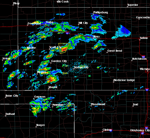 At 141 pm cdt, a severe thunderstorm was located near dighton, moving north at 35 mph (radar indicated). Hazards include two inch hail and 60 mph wind gusts. People and animals outdoors will be injured. expect hail damage to roofs, siding, windows, and vehicles. expect wind damage to roofs, siding, and trees. Locations impacted include, pendennis and shields. At 141 pm cdt, a severe thunderstorm was located near dighton, moving north at 35 mph (radar indicated). Hazards include two inch hail and 60 mph wind gusts. People and animals outdoors will be injured. expect hail damage to roofs, siding, windows, and vehicles. expect wind damage to roofs, siding, and trees. Locations impacted include, pendennis and shields.
|
| 5/23/2019 1:29 PM CDT |
 At 129 pm cdt, a severe thunderstorm was located 8 miles south of dighton, moving north at 35 mph (radar indicated). Hazards include two inch hail and 60 mph wind gusts. People and animals outdoors will be injured. expect hail damage to roofs, siding, windows, and vehicles. Expect wind damage to roofs, siding, and trees. At 129 pm cdt, a severe thunderstorm was located 8 miles south of dighton, moving north at 35 mph (radar indicated). Hazards include two inch hail and 60 mph wind gusts. People and animals outdoors will be injured. expect hail damage to roofs, siding, windows, and vehicles. Expect wind damage to roofs, siding, and trees.
|
| 5/16/2019 7:23 PM CDT | Measured by lnuk in lane county KS, 9.6 miles S of Dighton, KS |
| 4/28/2019 8:45 PM CDT | Mesonet station dw9499 dighto in lane county KS, 0.3 miles ENE of Dighton, KS |
| 4/28/2019 8:40 PM CDT | Quarter sized hail reported 0.3 miles ENE of Dighton, KS |
| 4/28/2019 8:37 PM CDT |
 At 837 pm cdt, a severe thunderstorm was located near amy, moving southeast at 35 mph. this is a very dangerous storm (radar indicated). Hazards include 80 mph wind gusts and golf ball size hail. Flying debris will be dangerous to those caught without shelter. mobile homes will be heavily damaged. expect considerable damage to roofs, windows, and vehicles. Extensive tree damage and power outages are likely. At 837 pm cdt, a severe thunderstorm was located near amy, moving southeast at 35 mph. this is a very dangerous storm (radar indicated). Hazards include 80 mph wind gusts and golf ball size hail. Flying debris will be dangerous to those caught without shelter. mobile homes will be heavily damaged. expect considerable damage to roofs, windows, and vehicles. Extensive tree damage and power outages are likely.
|
| 4/28/2019 8:15 PM CDT |
 At 815 pm cdt, a severe thunderstorm was located near manning, moving southeast at 40 mph (radar indicated). Hazards include 70 mph wind gusts and ping pong ball size hail. People and animals outdoors will be injured. expect hail damage to roofs, siding, windows, and vehicles. expect considerable tree damage. wind damage is also likely to mobile homes, roofs, and outbuildings. Locations impacted include, dighton, alamota, grigston, healy, scott state lake, manning, pendennis, amy and shields. At 815 pm cdt, a severe thunderstorm was located near manning, moving southeast at 40 mph (radar indicated). Hazards include 70 mph wind gusts and ping pong ball size hail. People and animals outdoors will be injured. expect hail damage to roofs, siding, windows, and vehicles. expect considerable tree damage. wind damage is also likely to mobile homes, roofs, and outbuildings. Locations impacted include, dighton, alamota, grigston, healy, scott state lake, manning, pendennis, amy and shields.
|
| 4/28/2019 7:48 PM CDT |
 At 748 pm cdt, a severe thunderstorm was located near scott state lake, moving southeast at 45 mph (radar indicated). Hazards include tennis ball size hail and 70 mph wind gusts. People and animals outdoors will be injured. expect hail damage to roofs, siding, windows, and vehicles. expect considerable tree damage. Wind damage is also likely to mobile homes, roofs, and outbuildings. At 748 pm cdt, a severe thunderstorm was located near scott state lake, moving southeast at 45 mph (radar indicated). Hazards include tennis ball size hail and 70 mph wind gusts. People and animals outdoors will be injured. expect hail damage to roofs, siding, windows, and vehicles. expect considerable tree damage. Wind damage is also likely to mobile homes, roofs, and outbuildings.
|
| 4/21/2019 6:13 PM CDT | Dust storm and gustnadoes presen in lane county KS, 14.8 miles SW of Dighton, KS |
| 4/21/2019 5:52 PM CDT |
 At 551 pm cdt, a severe thunderstorm was located near manning, moving east at 30 mph. this replaces the previous warning for scott county (radar indicated). Hazards include 70 mph wind gusts and quarter size hail. Hail damage to vehicles is expected. expect considerable tree damage. Wind damage is also likely to mobile homes, roofs, and outbuildings. At 551 pm cdt, a severe thunderstorm was located near manning, moving east at 30 mph. this replaces the previous warning for scott county (radar indicated). Hazards include 70 mph wind gusts and quarter size hail. Hail damage to vehicles is expected. expect considerable tree damage. Wind damage is also likely to mobile homes, roofs, and outbuildings.
|
| 7/29/2018 1:55 AM CDT |
 At 155 am cdt, severe thunderstorms were located along a line extending from 4 miles northeast of utica to 4 miles north of alamota to 5 miles southwest of dighton, moving south at 55 mph (radar indicated). Hazards include 70 mph wind gusts and quarter size hail. Hail damage to vehicles is expected. expect considerable tree damage. wind damage is also likely to mobile homes, roofs, and outbuildings. Locations impacted include, ness city, dighton, utica, alamota, beeler and arnold. At 155 am cdt, severe thunderstorms were located along a line extending from 4 miles northeast of utica to 4 miles north of alamota to 5 miles southwest of dighton, moving south at 55 mph (radar indicated). Hazards include 70 mph wind gusts and quarter size hail. Hail damage to vehicles is expected. expect considerable tree damage. wind damage is also likely to mobile homes, roofs, and outbuildings. Locations impacted include, ness city, dighton, utica, alamota, beeler and arnold.
|
| 7/29/2018 1:35 AM CDT |
 At 134 am cdt, severe thunderstorms were located along a line extending from 13 miles south of collyer to 7 miles north of healy, moving south at 40 mph (radar indicated). Hazards include golf ball size hail and 70 mph wind gusts. People and animals outdoors will be injured. expect hail damage to roofs, siding, windows, and vehicles. expect considerable tree damage. Wind damage is also likely to mobile homes, roofs, and outbuildings. At 134 am cdt, severe thunderstorms were located along a line extending from 13 miles south of collyer to 7 miles north of healy, moving south at 40 mph (radar indicated). Hazards include golf ball size hail and 70 mph wind gusts. People and animals outdoors will be injured. expect hail damage to roofs, siding, windows, and vehicles. expect considerable tree damage. Wind damage is also likely to mobile homes, roofs, and outbuildings.
|
| 7/25/2018 7:50 PM CDT | Small hail also occurred with this stor in lane county KS, 10.4 miles ENE of Dighton, KS |
| 7/25/2018 7:25 PM CDT |
 At 725 pm cdt, a severe thunderstorm was located very near manning, moving south at 15 mph (radar indicated). Hazards include golf ball size hail and 60 mph wind gusts. People and animals outdoors will be injured. expect hail damage to roofs, siding, windows, and vehicles. expect wind damage to roofs, siding, and trees. Locations impacted include, scott city, dighton, grigston, manning, healy and amy. At 725 pm cdt, a severe thunderstorm was located very near manning, moving south at 15 mph (radar indicated). Hazards include golf ball size hail and 60 mph wind gusts. People and animals outdoors will be injured. expect hail damage to roofs, siding, windows, and vehicles. expect wind damage to roofs, siding, and trees. Locations impacted include, scott city, dighton, grigston, manning, healy and amy.
|
| 7/25/2018 7:09 PM CDT |
 At 708 pm cdt, a severe thunderstorm was located 3 miles north of manning, moving south at 15 mph. this replaces the previous warning for scott and lane counties (radar indicated). Hazards include ping pong ball size hail and 60 mph wind gusts. People and animals outdoors will be injured. expect hail damage to roofs, siding, windows, and vehicles. Expect wind damage to roofs, siding, and trees. At 708 pm cdt, a severe thunderstorm was located 3 miles north of manning, moving south at 15 mph. this replaces the previous warning for scott and lane counties (radar indicated). Hazards include ping pong ball size hail and 60 mph wind gusts. People and animals outdoors will be injured. expect hail damage to roofs, siding, windows, and vehicles. Expect wind damage to roofs, siding, and trees.
|
| 7/25/2018 6:38 PM CDT |
 At 638 pm cdt, a severe thunderstorm was located very near healy, moving southeast at 30 mph (radar indicated). Hazards include ping pong ball size hail and 60 mph wind gusts. People and animals outdoors will be injured. expect hail damage to roofs, siding, windows, and vehicles. expect wind damage to roofs, siding, and trees. Locations impacted include, dighton, alamota, healy, manning, pendennis, amy and shields. At 638 pm cdt, a severe thunderstorm was located very near healy, moving southeast at 30 mph (radar indicated). Hazards include ping pong ball size hail and 60 mph wind gusts. People and animals outdoors will be injured. expect hail damage to roofs, siding, windows, and vehicles. expect wind damage to roofs, siding, and trees. Locations impacted include, dighton, alamota, healy, manning, pendennis, amy and shields.
|
| 7/25/2018 6:21 PM CDT |
 The national weather service in dodge city has issued a * severe thunderstorm warning for. northeastern scott county in west central kansas. lane county in west central kansas. until 715 pm cdt. At 620 pm cdt, a severe thunderstorm was located 4 miles north of. The national weather service in dodge city has issued a * severe thunderstorm warning for. northeastern scott county in west central kansas. lane county in west central kansas. until 715 pm cdt. At 620 pm cdt, a severe thunderstorm was located 4 miles north of.
|
| 7/20/2018 10:19 PM CDT |
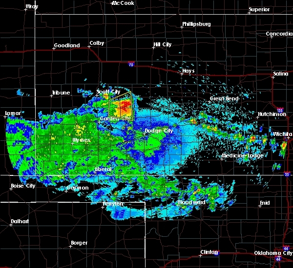 At 1019 pm cdt, a severe thunderstorm was located 16 miles south of dighton, moving northeast at 25 mph (radar indicated). Hazards include half dollar size hail. Damage to vehicles is expected. Locations impacted include, alamota and kalvesta. At 1019 pm cdt, a severe thunderstorm was located 16 miles south of dighton, moving northeast at 25 mph (radar indicated). Hazards include half dollar size hail. Damage to vehicles is expected. Locations impacted include, alamota and kalvesta.
|
| 7/20/2018 9:56 PM CDT |
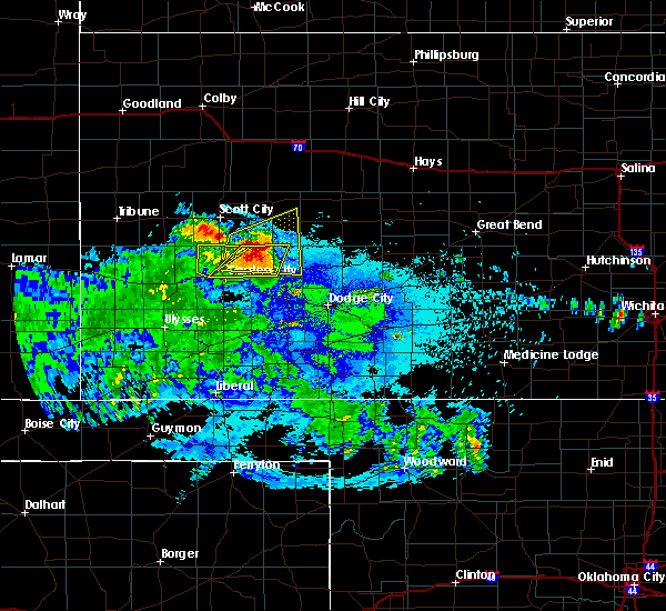 At 955 pm cdt, a severe thunderstorm was located 16 miles east of friend, moving northeast at 25 mph (radar indicated). Hazards include two inch hail and 60 mph wind gusts. People and animals outdoors will be injured. expect hail damage to roofs, siding, windows, and vehicles. Expect wind damage to roofs, siding, and trees. At 955 pm cdt, a severe thunderstorm was located 16 miles east of friend, moving northeast at 25 mph (radar indicated). Hazards include two inch hail and 60 mph wind gusts. People and animals outdoors will be injured. expect hail damage to roofs, siding, windows, and vehicles. Expect wind damage to roofs, siding, and trees.
|
| 6/30/2018 10:42 PM CDT |
 At 1042 pm cdt, severe thunderstorms were located along a line extending from 5 miles northeast of pendennis to 11 miles south of dighton, moving east at 35 mph (radar indicated). Hazards include 60 mph wind gusts and nickel size hail. expect damage to roofs, siding, and trees At 1042 pm cdt, severe thunderstorms were located along a line extending from 5 miles northeast of pendennis to 11 miles south of dighton, moving east at 35 mph (radar indicated). Hazards include 60 mph wind gusts and nickel size hail. expect damage to roofs, siding, and trees
|
| 6/29/2018 10:22 PM CDT |
 The severe thunderstorm warning for northeastern finney, southeastern scott and lane counties will expire at 1030 pm cdt, the storms which prompted the warning have weakened below severe limits, and no longer pose an immediate threat to life or property. therefore, the warning will be allowed to expire. however gusty winds are still possible with these thunderstorms. The severe thunderstorm warning for northeastern finney, southeastern scott and lane counties will expire at 1030 pm cdt, the storms which prompted the warning have weakened below severe limits, and no longer pose an immediate threat to life or property. therefore, the warning will be allowed to expire. however gusty winds are still possible with these thunderstorms.
|
| 6/29/2018 10:13 PM CDT |
 At 1013 pm cdt, severe thunderstorms were located along a line extending from near shields to 14 miles south of dighton, moving northeast at 30 mph (radar indicated). Hazards include 60 mph wind gusts and quarter size hail. Hail damage to vehicles is expected. expect wind damage to roofs, siding, and trees. Locations impacted include, dighton, alamota, grigston, healy, friend, kalvesta and shallow water. At 1013 pm cdt, severe thunderstorms were located along a line extending from near shields to 14 miles south of dighton, moving northeast at 30 mph (radar indicated). Hazards include 60 mph wind gusts and quarter size hail. Hail damage to vehicles is expected. expect wind damage to roofs, siding, and trees. Locations impacted include, dighton, alamota, grigston, healy, friend, kalvesta and shallow water.
|
| 6/29/2018 10:02 PM CDT |
 At 1002 pm cdt, severe thunderstorms were located along a line extending from near amy to 15 miles east of friend, moving east at 45 mph (radar indicated). Hazards include 60 mph wind gusts and quarter size hail. Hail damage to vehicles is expected. expect wind damage to roofs, siding, and trees. Locations impacted include, dighton, alamota, grigston, healy, friend, kalvesta and shallow water. At 1002 pm cdt, severe thunderstorms were located along a line extending from near amy to 15 miles east of friend, moving east at 45 mph (radar indicated). Hazards include 60 mph wind gusts and quarter size hail. Hail damage to vehicles is expected. expect wind damage to roofs, siding, and trees. Locations impacted include, dighton, alamota, grigston, healy, friend, kalvesta and shallow water.
|
| 6/29/2018 9:50 PM CDT |
 At 949 pm cdt, severe thunderstorms were located along a line extending from grigston to 7 miles southeast of friend, moving northeast at 45 mph (radar indicated). Hazards include 60 mph wind gusts and nickel size hail. Expect damage to roofs, siding, and trees. Locations impacted include, garden city, scott city, holcomb, dighton, alamota, grigston and scott state lake. At 949 pm cdt, severe thunderstorms were located along a line extending from grigston to 7 miles southeast of friend, moving northeast at 45 mph (radar indicated). Hazards include 60 mph wind gusts and nickel size hail. Expect damage to roofs, siding, and trees. Locations impacted include, garden city, scott city, holcomb, dighton, alamota, grigston and scott state lake.
|
| 6/29/2018 9:29 PM CDT |
 At 929 pm cdt, severe thunderstorms were located along a line extending from 4 miles north of manning to 5 miles northeast of holcomb, moving east at 45 mph (radar indicated). Hazards include 60 mph wind gusts and quarter size hail. Hail damage to vehicles is expected. Expect wind damage to roofs, siding, and trees. At 929 pm cdt, severe thunderstorms were located along a line extending from 4 miles north of manning to 5 miles northeast of holcomb, moving east at 45 mph (radar indicated). Hazards include 60 mph wind gusts and quarter size hail. Hail damage to vehicles is expected. Expect wind damage to roofs, siding, and trees.
|
| 6/23/2018 9:40 PM CDT | Mesonet station e1393... 3 sse dighto in lane county KS, 3.6 miles NNW of Dighton, KS |
| 6/23/2018 9:22 PM CDT |
 At 921 pm cdt/821 pm mdt/, severe thunderstorms were located along a line extending from near healy to 9 miles north of deerfield to near kendall, moving southeast at 15 mph (radar indicated). Hazards include 60 mph wind gusts and quarter size hail. Hail damage to vehicles is expected. expect wind damage to roofs, siding, and trees. Locations impacted include, garden city, scott city, lakin, holcomb, syracuse, dighton, deerfield, coolidge, kendall, grigston, shallow water, manning, pendennis, amy, plymell, healy, friend and shields. At 921 pm cdt/821 pm mdt/, severe thunderstorms were located along a line extending from near healy to 9 miles north of deerfield to near kendall, moving southeast at 15 mph (radar indicated). Hazards include 60 mph wind gusts and quarter size hail. Hail damage to vehicles is expected. expect wind damage to roofs, siding, and trees. Locations impacted include, garden city, scott city, lakin, holcomb, syracuse, dighton, deerfield, coolidge, kendall, grigston, shallow water, manning, pendennis, amy, plymell, healy, friend and shields.
|
| 6/23/2018 9:05 PM CDT |
 At 903 pm cdt/803 pm mdt/, severe thunderstorms were located along a line extending from 5 miles northwest of healy to 14 miles north of deerfield to 6 miles northwest of kendall, moving southeast at 25 mph. this warning replaces the previous warning for scott county (radar indicated). Hazards include 60 mph wind gusts and quarter size hail. Hail damage to vehicles is expected. Expect wind damage to roofs, siding, and trees. At 903 pm cdt/803 pm mdt/, severe thunderstorms were located along a line extending from 5 miles northwest of healy to 14 miles north of deerfield to 6 miles northwest of kendall, moving southeast at 25 mph. this warning replaces the previous warning for scott county (radar indicated). Hazards include 60 mph wind gusts and quarter size hail. Hail damage to vehicles is expected. Expect wind damage to roofs, siding, and trees.
|
| 6/22/2018 5:54 PM CDT |
 At 554 pm cdt, severe thunderstorms were located along a line extending from 5 miles northwest of alamota to 7 miles east of friend, moving east at 50 mph (radar indicated). Hazards include 60 mph wind gusts and penny size hail. Expect damage to roofs, siding, and trees. Locations impacted include, dighton, alamota and amy. At 554 pm cdt, severe thunderstorms were located along a line extending from 5 miles northwest of alamota to 7 miles east of friend, moving east at 50 mph (radar indicated). Hazards include 60 mph wind gusts and penny size hail. Expect damage to roofs, siding, and trees. Locations impacted include, dighton, alamota and amy.
|
| 6/22/2018 5:44 PM CDT |
 At 543 pm cdt, severe thunderstorms were located along a line extending from 2 miles southwest of utica to 7 miles east of friend, moving southeast at 50 mph (radar indicated). Hazards include 70 mph wind gusts and half dollar size hail. Hail damage to vehicles is expected. expect considerable tree damage. wind damage is also likely to mobile homes, roofs, and outbuildings. This warning extends the previous warning which was in effect for portions of scott, lane, and ness county. At 543 pm cdt, severe thunderstorms were located along a line extending from 2 miles southwest of utica to 7 miles east of friend, moving southeast at 50 mph (radar indicated). Hazards include 70 mph wind gusts and half dollar size hail. Hail damage to vehicles is expected. expect considerable tree damage. wind damage is also likely to mobile homes, roofs, and outbuildings. This warning extends the previous warning which was in effect for portions of scott, lane, and ness county.
|
| 6/22/2018 5:23 PM CDT |
 At 523 pm cdt, a severe thunderstorm was located 4 miles west of scott city, moving east at 55 mph (radar indicated). Hazards include 70 mph wind gusts and half dollar size hail. Hail damage to vehicles is expected. expect considerable tree damage. wind damage is also likely to mobile homes, roofs, and outbuildings. Locations impacted include, scott city, dighton, alamota, grigston, healy, friend, scott state lake, modoc, shallow water, manning and amy. At 523 pm cdt, a severe thunderstorm was located 4 miles west of scott city, moving east at 55 mph (radar indicated). Hazards include 70 mph wind gusts and half dollar size hail. Hail damage to vehicles is expected. expect considerable tree damage. wind damage is also likely to mobile homes, roofs, and outbuildings. Locations impacted include, scott city, dighton, alamota, grigston, healy, friend, scott state lake, modoc, shallow water, manning and amy.
|
| 6/22/2018 5:08 PM CDT |
 At 508 pm cdt, a severe thunderstorm was located 5 miles northeast of leoti, moving east at 50 mph (radar indicated). Hazards include 70 mph wind gusts and half dollar size hail. Hail damage to vehicles is expected. expect considerable tree damage. Wind damage is also likely to mobile homes, roofs, and outbuildings. At 508 pm cdt, a severe thunderstorm was located 5 miles northeast of leoti, moving east at 50 mph (radar indicated). Hazards include 70 mph wind gusts and half dollar size hail. Hail damage to vehicles is expected. expect considerable tree damage. Wind damage is also likely to mobile homes, roofs, and outbuildings.
|
| 6/19/2018 9:51 PM CDT |
 At 949 pm cdt, severe thunderstorms were located along a line extending from 2 miles northeast of arnold to 4 miles northwest of kalvesta to 11 miles southwest of plymell, moving southeast at 40 mph (radar indicated and winds measured by automated weather stations). Hazards include 70 mph wind gusts and penny size hail. Expect considerable tree damage. damage is likely to mobile homes, roofs, and outbuildings. locations impacted include, dodge city, garden city, cimarron, holcomb, sublette, ness city, dighton, montezuma, jetmore, pierceville, copeland, ingalls, ransom, ensign, utica, alamota, charleston, howell, shields and beeler. At 935 pm cdt, a 65 mph wind gust was measured by a mesonet station in garden city. At 949 pm cdt, severe thunderstorms were located along a line extending from 2 miles northeast of arnold to 4 miles northwest of kalvesta to 11 miles southwest of plymell, moving southeast at 40 mph (radar indicated and winds measured by automated weather stations). Hazards include 70 mph wind gusts and penny size hail. Expect considerable tree damage. damage is likely to mobile homes, roofs, and outbuildings. locations impacted include, dodge city, garden city, cimarron, holcomb, sublette, ness city, dighton, montezuma, jetmore, pierceville, copeland, ingalls, ransom, ensign, utica, alamota, charleston, howell, shields and beeler. At 935 pm cdt, a 65 mph wind gust was measured by a mesonet station in garden city.
|
| 6/19/2018 9:25 PM CDT |
 At 924 pm cdt, the leading edge of severe thunderstorms were located along a line extending from 5 miles north of shields to 15 miles southeast of friend to 2 miles southeast of lakin, moving southeast at 55 mph (radar indicated and measured winds from automated weather stations). Hazards include 70 mph wind gusts and penny size hail. Expect considerable tree damage. Damage is likely to mobile homes, roofs, and outbuildings. At 924 pm cdt, the leading edge of severe thunderstorms were located along a line extending from 5 miles north of shields to 15 miles southeast of friend to 2 miles southeast of lakin, moving southeast at 55 mph (radar indicated and measured winds from automated weather stations). Hazards include 70 mph wind gusts and penny size hail. Expect considerable tree damage. Damage is likely to mobile homes, roofs, and outbuildings.
|
| 6/19/2018 9:18 PM CDT | Storm damage reported in lane county KS, 8.9 miles S of Dighton, KS |
| 6/19/2018 9:12 PM CDT |
 At 911 pm cdt/811 pm mdt/, severe thunderstorms were located along a line extending from 9 miles north of healy to 7 miles southwest of friend to 16 miles south of coolidge, moving south at 40 mph (radar indicated and observed by automated weather station). Hazards include 70 mph wind gusts and penny size hail. Expect considerable tree damage. damage is likely to mobile homes, roofs, and outbuildings. locations impacted include, garden city, scott city, lakin, holcomb, syracuse, dighton, deerfield, pierceville, coolidge, alamota, kendall, grigston, scott state lake, modoc, shallow water, manning, pendennis, amy, plymell and healy. At 902 pm, a 64 mph wind gust was measured at scott city airport. At 911 pm cdt/811 pm mdt/, severe thunderstorms were located along a line extending from 9 miles north of healy to 7 miles southwest of friend to 16 miles south of coolidge, moving south at 40 mph (radar indicated and observed by automated weather station). Hazards include 70 mph wind gusts and penny size hail. Expect considerable tree damage. damage is likely to mobile homes, roofs, and outbuildings. locations impacted include, garden city, scott city, lakin, holcomb, syracuse, dighton, deerfield, pierceville, coolidge, alamota, kendall, grigston, scott state lake, modoc, shallow water, manning, pendennis, amy, plymell and healy. At 902 pm, a 64 mph wind gust was measured at scott city airport.
|
| 6/19/2018 9:03 PM CDT |
 At 902 pm cdt/802 pm mdt/, the leading edge of severe thunderstorms were located along a line extending from 11 miles southwest of gove to 7 miles west of friend to 11 miles south of holly, moving south at 40 mph (radar indicated). Hazards include 60 mph wind gusts and nickel size hail. Expect damage to roofs, siding, and trees. Locations impacted include, garden city, scott city, lakin, holcomb, syracuse, dighton, deerfield, pierceville, coolidge, alamota, kendall, grigston, scott state lake, modoc, shallow water, manning, pendennis, amy, plymell and healy. At 902 pm cdt/802 pm mdt/, the leading edge of severe thunderstorms were located along a line extending from 11 miles southwest of gove to 7 miles west of friend to 11 miles south of holly, moving south at 40 mph (radar indicated). Hazards include 60 mph wind gusts and nickel size hail. Expect damage to roofs, siding, and trees. Locations impacted include, garden city, scott city, lakin, holcomb, syracuse, dighton, deerfield, pierceville, coolidge, alamota, kendall, grigston, scott state lake, modoc, shallow water, manning, pendennis, amy, plymell and healy.
|
| 6/19/2018 8:36 PM CDT |
 At 836 pm cdt/736 pm mdt/, severe thunderstorms were located along a line extending from 6 miles southwest of gove to near modoc to 6 miles north of coolidge, moving south at 45 mph (radar indicated). Hazards include 60 mph wind gusts and quarter size hail. Hail damage to vehicles is expected. Expect wind damage to roofs, siding, and trees. At 836 pm cdt/736 pm mdt/, severe thunderstorms were located along a line extending from 6 miles southwest of gove to near modoc to 6 miles north of coolidge, moving south at 45 mph (radar indicated). Hazards include 60 mph wind gusts and quarter size hail. Hail damage to vehicles is expected. Expect wind damage to roofs, siding, and trees.
|
| 6/19/2018 5:27 PM CDT |
 At 525 pm cdt, a severe thunderstorm was located 4 miles south of grigston, moving east at 10 mph. other severe thunderstorms producing large hail and torrential rainfall were occurring across much of scott county (radar indicated). Hazards include two inch hail and 70 mph wind gusts. People and animals outdoors will be injured. expect hail damage to roofs, siding, windows, and vehicles. expect considerable tree damage. wind damage is also likely to mobile homes, roofs, and outbuildings. Locations impacted include, scott city, dighton, grigston, healy, scott state lake, modoc, shallow water, manning and amy. At 525 pm cdt, a severe thunderstorm was located 4 miles south of grigston, moving east at 10 mph. other severe thunderstorms producing large hail and torrential rainfall were occurring across much of scott county (radar indicated). Hazards include two inch hail and 70 mph wind gusts. People and animals outdoors will be injured. expect hail damage to roofs, siding, windows, and vehicles. expect considerable tree damage. wind damage is also likely to mobile homes, roofs, and outbuildings. Locations impacted include, scott city, dighton, grigston, healy, scott state lake, modoc, shallow water, manning and amy.
|
| 6/19/2018 5:06 PM CDT |
 At 504 pm cdt, a severe thunderstorm was located 6 miles southeast of scott city, moving east at 15 mph. another severe thunderstorm located 8 miles west of scott city was moving northeast at 20 mph (radar indicated). Hazards include two inch hail and 70 mph wind gusts. People and animals outdoors will be injured. expect hail damage to roofs, siding, windows, and vehicles. expect considerable tree damage. Wind damage is also likely to mobile homes, roofs, and outbuildings. At 504 pm cdt, a severe thunderstorm was located 6 miles southeast of scott city, moving east at 15 mph. another severe thunderstorm located 8 miles west of scott city was moving northeast at 20 mph (radar indicated). Hazards include two inch hail and 70 mph wind gusts. People and animals outdoors will be injured. expect hail damage to roofs, siding, windows, and vehicles. expect considerable tree damage. Wind damage is also likely to mobile homes, roofs, and outbuildings.
|
| 5/28/2018 8:23 PM CDT |
 The severe thunderstorm warning for northeastern finney, ness, northern hodgeman, southern trego, northwestern pawnee, lane, rush and southwestern ellis counties will expire at 830 pm cdt, the storms which prompted the warning have moved out of the area. therefore the warning will be allowed to expire. however small hail, gusty winds and heavy rain are still possible with these thunderstorms. a tornado watch remains in effect until 1000 pm cdt for central and west central kansas. a severe thunderstorm watch remains in effect until 1000 pm cdt for south central and southwestern kansas. The severe thunderstorm warning for northeastern finney, ness, northern hodgeman, southern trego, northwestern pawnee, lane, rush and southwestern ellis counties will expire at 830 pm cdt, the storms which prompted the warning have moved out of the area. therefore the warning will be allowed to expire. however small hail, gusty winds and heavy rain are still possible with these thunderstorms. a tornado watch remains in effect until 1000 pm cdt for central and west central kansas. a severe thunderstorm watch remains in effect until 1000 pm cdt for south central and southwestern kansas.
|
| 5/28/2018 7:47 PM CDT |
 At 747 pm cdt, severe thunderstorms were located along a line extending from 2 miles northwest of cedar bluff to 14 miles south of dighton, moving east at 50 mph (radar indicated). Hazards include 70 mph wind gusts and quarter size hail. Hail damage to vehicles is expected. expect considerable tree damage. wind damage is also likely to mobile homes, roofs, and outbuildings. locations impacted include, ness city, la crosse, dighton, bazine, ransom, schoenchen, mccracken, rush center, utica, liebenthal, alamota, alexander, brownell, cedar bluff, beeler, pendennis, amy, arnold, nekoma and hargrave. A tornado watch remains in effect until 1000 pm cdt for central and west central kansas. At 747 pm cdt, severe thunderstorms were located along a line extending from 2 miles northwest of cedar bluff to 14 miles south of dighton, moving east at 50 mph (radar indicated). Hazards include 70 mph wind gusts and quarter size hail. Hail damage to vehicles is expected. expect considerable tree damage. wind damage is also likely to mobile homes, roofs, and outbuildings. locations impacted include, ness city, la crosse, dighton, bazine, ransom, schoenchen, mccracken, rush center, utica, liebenthal, alamota, alexander, brownell, cedar bluff, beeler, pendennis, amy, arnold, nekoma and hargrave. A tornado watch remains in effect until 1000 pm cdt for central and west central kansas.
|
| 5/28/2018 7:37 PM CDT |
 The severe thunderstorm warning for northern ness, southeastern scott, southern trego and lane counties will expire at 745 pm cdt, the storms which prompted the warning have moved out of the area. therefore the warning will be allowed to expire. however small hail, gusty winds and heavy rain are still possible with these thunderstorms. a tornado watch remains in effect until 1000 pm cdt for west central kansas. a severe thunderstorm watch remains in effect until 1000 pm cdt for southwestern kansas. The severe thunderstorm warning for northern ness, southeastern scott, southern trego and lane counties will expire at 745 pm cdt, the storms which prompted the warning have moved out of the area. therefore the warning will be allowed to expire. however small hail, gusty winds and heavy rain are still possible with these thunderstorms. a tornado watch remains in effect until 1000 pm cdt for west central kansas. a severe thunderstorm watch remains in effect until 1000 pm cdt for southwestern kansas.
|
| 5/28/2018 7:37 PM CDT |
 At 736 pm cdt, severe thunderstorms were located along a line extending from 5 miles southwest of trego center to 14 miles south of amy, moving east at 50 mph (radar indicated). Hazards include 60 mph wind gusts and quarter size hail. Hail damage to vehicles is expected. Expect wind damage to roofs, siding, and trees. At 736 pm cdt, severe thunderstorms were located along a line extending from 5 miles southwest of trego center to 14 miles south of amy, moving east at 50 mph (radar indicated). Hazards include 60 mph wind gusts and quarter size hail. Hail damage to vehicles is expected. Expect wind damage to roofs, siding, and trees.
|
| 5/28/2018 7:19 PM CDT |
 At 719 pm cdt, severe thunderstorms were located along a line extending from 4 miles northeast of ogallah to near pendennis, moving northeast at 60 mph (radar indicated). Hazards include 70 mph wind gusts and quarter size hail. Hail damage to vehicles is expected. expect considerable tree damage. wind damage is also likely to mobile homes, roofs, and outbuildings. locations impacted include, dighton, ransom, utica, alamota, brownell, grigston, trego center, cedar bluff, beeler, pendennis, amy, arnold, healy and shields. A tornado watch remains in effect until 1000 pm cdt for west central kansas. At 719 pm cdt, severe thunderstorms were located along a line extending from 4 miles northeast of ogallah to near pendennis, moving northeast at 60 mph (radar indicated). Hazards include 70 mph wind gusts and quarter size hail. Hail damage to vehicles is expected. expect considerable tree damage. wind damage is also likely to mobile homes, roofs, and outbuildings. locations impacted include, dighton, ransom, utica, alamota, brownell, grigston, trego center, cedar bluff, beeler, pendennis, amy, arnold, healy and shields. A tornado watch remains in effect until 1000 pm cdt for west central kansas.
|
| 5/28/2018 7:11 PM CDT |
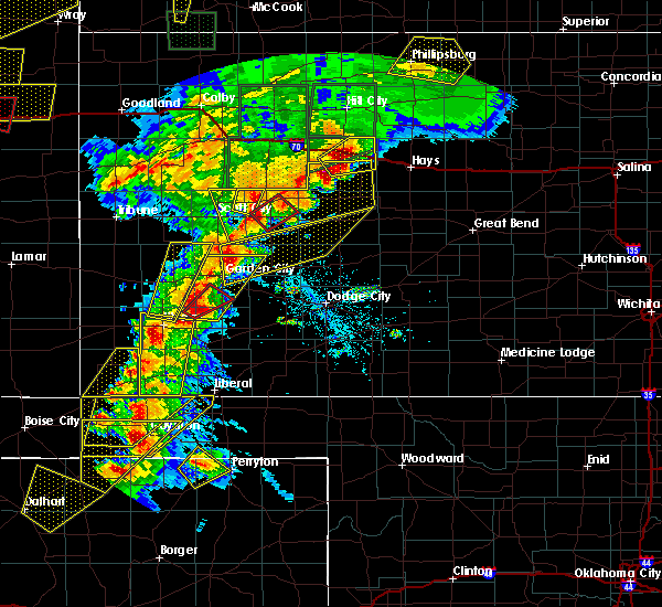 At 711 pm cdt, a severe thunderstorm capable of producing a tornado was located very near dighton, moving northeast at 20 mph (radar indicated rotation). Hazards include tornado and quarter size hail. Flying debris will be dangerous to those caught without shelter. mobile homes will be damaged or destroyed. damage to roofs, windows, and vehicles will occur. tree damage is likely. this dangerous storm will be near, dighton around 715 pm cdt. Shields around 735 pm cdt. At 711 pm cdt, a severe thunderstorm capable of producing a tornado was located very near dighton, moving northeast at 20 mph (radar indicated rotation). Hazards include tornado and quarter size hail. Flying debris will be dangerous to those caught without shelter. mobile homes will be damaged or destroyed. damage to roofs, windows, and vehicles will occur. tree damage is likely. this dangerous storm will be near, dighton around 715 pm cdt. Shields around 735 pm cdt.
|
| 5/28/2018 7:10 PM CDT | Grain bins blown off foundations and into a pil in lane county KS, 3.7 miles ENE of Dighton, KS |
| 5/28/2018 6:55 PM CDT |
 At 655 pm cdt, severe thunderstorms were located along a line extending from 7 miles west of trego center to 4 miles southeast of grigston, moving northeast at 55 mph (radar indicated). Hazards include 60 mph wind gusts and quarter size hail. Hail damage to vehicles is expected. Expect wind damage to roofs, siding, and trees. At 655 pm cdt, severe thunderstorms were located along a line extending from 7 miles west of trego center to 4 miles southeast of grigston, moving northeast at 55 mph (radar indicated). Hazards include 60 mph wind gusts and quarter size hail. Hail damage to vehicles is expected. Expect wind damage to roofs, siding, and trees.
|
| 5/28/2018 5:32 PM CDT |
 At 531 pm cdt, a severe thunderstorm was located near amy, moving north at 40 mph (public. at 5:29 pm quarter sized hail was reported in amy). Hazards include ping pong ball size hail and 60 mph wind gusts. People and animals outdoors will be injured. expect hail damage to roofs, siding, windows, and vehicles. expect wind damage to roofs, siding, and trees. locations impacted include, dighton, healy, amy and shields. A tornado watch remains in effect until 1000 pm cdt for west central kansas. At 531 pm cdt, a severe thunderstorm was located near amy, moving north at 40 mph (public. at 5:29 pm quarter sized hail was reported in amy). Hazards include ping pong ball size hail and 60 mph wind gusts. People and animals outdoors will be injured. expect hail damage to roofs, siding, windows, and vehicles. expect wind damage to roofs, siding, and trees. locations impacted include, dighton, healy, amy and shields. A tornado watch remains in effect until 1000 pm cdt for west central kansas.
|
| 5/28/2018 5:30 PM CDT |
 At 531 pm cdt, a severe thunderstorm was located near amy, moving north at 40 mph (public. at 5:29 pm quarter sized hail was reported in amy). Hazards include ping pong ball size hail and 60 mph wind gusts. People and animals outdoors will be injured. expect hail damage to roofs, siding, windows, and vehicles. expect wind damage to roofs, siding, and trees. locations impacted include, dighton, healy, amy and shields. A tornado watch remains in effect until 1000 pm cdt for west central kansas. At 531 pm cdt, a severe thunderstorm was located near amy, moving north at 40 mph (public. at 5:29 pm quarter sized hail was reported in amy). Hazards include ping pong ball size hail and 60 mph wind gusts. People and animals outdoors will be injured. expect hail damage to roofs, siding, windows, and vehicles. expect wind damage to roofs, siding, and trees. locations impacted include, dighton, healy, amy and shields. A tornado watch remains in effect until 1000 pm cdt for west central kansas.
|
| 5/28/2018 5:20 PM CDT |
 At 519 pm cdt, a severe thunderstorm was located 7 miles south of amy, moving north at 45 mph (radar indicated). Hazards include ping pong ball size hail and 60 mph wind gusts. People and animals outdoors will be injured. expect hail damage to roofs, siding, windows, and vehicles. Expect wind damage to roofs, siding, and trees. At 519 pm cdt, a severe thunderstorm was located 7 miles south of amy, moving north at 45 mph (radar indicated). Hazards include ping pong ball size hail and 60 mph wind gusts. People and animals outdoors will be injured. expect hail damage to roofs, siding, windows, and vehicles. Expect wind damage to roofs, siding, and trees.
|
| 5/28/2018 4:49 PM CDT |
 At 449 pm cdt, a severe thunderstorm was located 8 miles northeast of garden city, moving north at 40 mph (radar indicated). Hazards include ping pong ball size hail and 60 mph wind gusts. People and animals outdoors will be injured. expect hail damage to roofs, siding, windows, and vehicles. Expect wind damage to roofs, siding, and trees. At 449 pm cdt, a severe thunderstorm was located 8 miles northeast of garden city, moving north at 40 mph (radar indicated). Hazards include ping pong ball size hail and 60 mph wind gusts. People and animals outdoors will be injured. expect hail damage to roofs, siding, windows, and vehicles. Expect wind damage to roofs, siding, and trees.
|
| 5/18/2018 8:32 PM CDT |
 At 832 pm cdt, a severe thunderstorm was located 6 miles north of alamota, moving northeast at 30 mph (radar indicated). Hazards include 60 mph wind gusts and quarter size hail. Hail damage to vehicles is expected. expect wind damage to roofs, siding, and trees. Locations impacted include, dighton, utica, alamota, beeler, pendennis, shields and arnold. At 832 pm cdt, a severe thunderstorm was located 6 miles north of alamota, moving northeast at 30 mph (radar indicated). Hazards include 60 mph wind gusts and quarter size hail. Hail damage to vehicles is expected. expect wind damage to roofs, siding, and trees. Locations impacted include, dighton, utica, alamota, beeler, pendennis, shields and arnold.
|
| 5/18/2018 7:54 PM CDT |
 At 754 pm cdt, a severe thunderstorm was located 9 miles south of alamota, moving north at 40 mph (radar indicated). Hazards include 70 mph wind gusts and ping pong ball size hail. People and animals outdoors will be injured. expect hail damage to roofs, siding, windows, and vehicles. expect considerable tree damage. Wind damage is also likely to mobile homes, roofs, and outbuildings. At 754 pm cdt, a severe thunderstorm was located 9 miles south of alamota, moving north at 40 mph (radar indicated). Hazards include 70 mph wind gusts and ping pong ball size hail. People and animals outdoors will be injured. expect hail damage to roofs, siding, windows, and vehicles. expect considerable tree damage. Wind damage is also likely to mobile homes, roofs, and outbuildings.
|
| 5/14/2018 9:30 PM CDT | Golf Ball sized hail reported 15.4 miles WNW of Dighton, KS |
| 5/14/2018 9:13 PM CDT |
 At 912 pm cdt, a severe thunderstorm was located very near alamota, moving east at 45 mph. this is a very dangerous storm (radar indicated). Hazards include 90 mph wind gusts and three inch hail. You are in a life-threatening situation. flying debris may be deadly to those caught without shelter. mobile homes will be heavily damaged or destroyed. homes and businesses will have substantial roof and window damage. expect extensive tree damage and power outages. Locations impacted include, dighton, utica, alamota, healy, beeler, pendennis, amy, shields and arnold. At 912 pm cdt, a severe thunderstorm was located very near alamota, moving east at 45 mph. this is a very dangerous storm (radar indicated). Hazards include 90 mph wind gusts and three inch hail. You are in a life-threatening situation. flying debris may be deadly to those caught without shelter. mobile homes will be heavily damaged or destroyed. homes and businesses will have substantial roof and window damage. expect extensive tree damage and power outages. Locations impacted include, dighton, utica, alamota, healy, beeler, pendennis, amy, shields and arnold.
|
| 5/14/2018 9:05 PM CDT | Golf Ball sized hail reported 0.3 miles ENE of Dighton, KS, golf ball sized on social media. |
| 5/14/2018 9:00 PM CDT | Baseball sized hail reported 4.1 miles E of Dighton, KS, baseball sized on social media. |
| 5/14/2018 8:51 PM CDT |
 At 850 pm cdt, a severe thunderstorm was located 3 miles east of amy, moving east at 50 mph. this is a very dangerous storm (radar indicated). Hazards include 90 mph wind gusts and three inch hail. You are in a life-threatening situation. flying debris may be deadly to those caught without shelter. mobile homes will be heavily damaged or destroyed. homes and businesses will have substantial roof and window damage. expect extensive tree damage and power outages. Locations impacted include, dighton, utica, alamota, grigston, healy, manning, beeler, pendennis, amy, shields and arnold. At 850 pm cdt, a severe thunderstorm was located 3 miles east of amy, moving east at 50 mph. this is a very dangerous storm (radar indicated). Hazards include 90 mph wind gusts and three inch hail. You are in a life-threatening situation. flying debris may be deadly to those caught without shelter. mobile homes will be heavily damaged or destroyed. homes and businesses will have substantial roof and window damage. expect extensive tree damage and power outages. Locations impacted include, dighton, utica, alamota, grigston, healy, manning, beeler, pendennis, amy, shields and arnold.
|
| 5/14/2018 8:40 PM CDT |
 At 839 pm cdt, a severe thunderstorm was located near grigston, moving east at 50 mph. this is a very dangerous storm (radar indicated). Hazards include 90 mph wind gusts and tennis ball size hail. You are in a life-threatening situation. flying debris may be deadly to those caught without shelter. mobile homes will be heavily damaged or destroyed. homes and businesses will have substantial roof and window damage. Expect extensive tree damage and power outages. At 839 pm cdt, a severe thunderstorm was located near grigston, moving east at 50 mph. this is a very dangerous storm (radar indicated). Hazards include 90 mph wind gusts and tennis ball size hail. You are in a life-threatening situation. flying debris may be deadly to those caught without shelter. mobile homes will be heavily damaged or destroyed. homes and businesses will have substantial roof and window damage. Expect extensive tree damage and power outages.
|
| 4/17/2018 8:17 PM CDT | Measured at mesonet station lnuk in lane county KS, 7.5 miles S of Dighton, KS |
| 10/6/2017 4:28 PM CDT | Ping Pong Ball sized hail reported 16.2 miles NW of Dighton, KS, there was almost no wind with the hail. |
| 9/24/2017 7:06 PM CDT |
 At 705 pm cdt, a severe thunderstorm was located near amy, or 7 miles west of dighton, moving northeast at 35 mph (radar indicated). Hazards include 60 mph wind gusts and quarter size hail. Hail damage to vehicles is expected. expect wind damage to roofs, siding, and trees. Locations impacted include, dighton, healy, shields and amy. At 705 pm cdt, a severe thunderstorm was located near amy, or 7 miles west of dighton, moving northeast at 35 mph (radar indicated). Hazards include 60 mph wind gusts and quarter size hail. Hail damage to vehicles is expected. expect wind damage to roofs, siding, and trees. Locations impacted include, dighton, healy, shields and amy.
|
| 9/24/2017 6:43 PM CDT |
 At 643 pm cdt, a severe thunderstorm was located 7 miles east of shallow water, or 10 miles southeast of scott city, moving northeast at 30 mph (radar indicated). Hazards include 60 mph wind gusts and quarter size hail. Hail damage to vehicles is expected. Expect wind damage to roofs, siding, and trees. At 643 pm cdt, a severe thunderstorm was located 7 miles east of shallow water, or 10 miles southeast of scott city, moving northeast at 30 mph (radar indicated). Hazards include 60 mph wind gusts and quarter size hail. Hail damage to vehicles is expected. Expect wind damage to roofs, siding, and trees.
|
| 6/22/2017 9:02 PM CDT |
 At 902 pm cdt, a severe thunderstorm was located near amy, or 5 miles west of dighton, moving east at 35 mph (radar indicated). Hazards include 60 mph wind gusts and quarter size hail. Hail damage to vehicles is expected. expect wind damage to roofs, siding, and trees. Locations impacted include, dighton, healy, alamota, shields, pendennis, amy and finney state lake. At 902 pm cdt, a severe thunderstorm was located near amy, or 5 miles west of dighton, moving east at 35 mph (radar indicated). Hazards include 60 mph wind gusts and quarter size hail. Hail damage to vehicles is expected. expect wind damage to roofs, siding, and trees. Locations impacted include, dighton, healy, alamota, shields, pendennis, amy and finney state lake.
|
| 6/22/2017 8:41 PM CDT |
 At 841 pm cdt, a severe thunderstorm was located 4 miles west of grigston, or 6 miles east of scott city, moving east at 25 mph (radar indicated). Hazards include 60 mph wind gusts and quarter size hail. Hail damage to vehicles is expected. expect wind damage to roofs, siding, and trees. Locations impacted include, scott city, dighton, healy, alamota, shields, grigston, pendennis, shallow water, amy, friend, manning, scott state lake, the tractor elevator, finney state lake and the tennis elevator. At 841 pm cdt, a severe thunderstorm was located 4 miles west of grigston, or 6 miles east of scott city, moving east at 25 mph (radar indicated). Hazards include 60 mph wind gusts and quarter size hail. Hail damage to vehicles is expected. expect wind damage to roofs, siding, and trees. Locations impacted include, scott city, dighton, healy, alamota, shields, grigston, pendennis, shallow water, amy, friend, manning, scott state lake, the tractor elevator, finney state lake and the tennis elevator.
|
| 6/22/2017 8:16 PM CDT |
 At 816 pm cdt, a severe thunderstorm was located near scott city, moving east at 35 mph (radar indicated). Hazards include 60 mph wind gusts and quarter size hail. Hail damage to vehicles is expected. Expect wind damage to roofs, siding, and trees. At 816 pm cdt, a severe thunderstorm was located near scott city, moving east at 35 mph (radar indicated). Hazards include 60 mph wind gusts and quarter size hail. Hail damage to vehicles is expected. Expect wind damage to roofs, siding, and trees.
|
| 5/16/2017 5:22 PM CDT |
 The severe thunderstorm warning for central ness and northeastern lane counties will expire at 530 pm cdt, the storm which prompted the warning has weakened below severe limits, and no longer poses an immediate threat to life or property. therefore the warning will be allowed to expire. however small hail and gusty winds are still possible with this thunderstorm. a tornado watch remains in effect until 1000 pm cdt for west central kansas. The severe thunderstorm warning for central ness and northeastern lane counties will expire at 530 pm cdt, the storm which prompted the warning has weakened below severe limits, and no longer poses an immediate threat to life or property. therefore the warning will be allowed to expire. however small hail and gusty winds are still possible with this thunderstorm. a tornado watch remains in effect until 1000 pm cdt for west central kansas.
|
| 5/16/2017 5:02 PM CDT |
 At 502 pm cdt, a severe thunderstorm was located 5 miles south of brownell, or 10 miles northeast of ness city, moving north at 35 mph (radar indicated). Hazards include 60 mph wind gusts and quarter size hail. Hail damage to vehicles is expected. expect wind damage to roofs, siding, and trees. locations impacted include, ness city, dighton, ransom, utica, alamota, arnold, brownell, shields, beeler, pendennis and the laird elevator. A tornado watch remains in effect until 1000 pm cdt for west central kansas. At 502 pm cdt, a severe thunderstorm was located 5 miles south of brownell, or 10 miles northeast of ness city, moving north at 35 mph (radar indicated). Hazards include 60 mph wind gusts and quarter size hail. Hail damage to vehicles is expected. expect wind damage to roofs, siding, and trees. locations impacted include, ness city, dighton, ransom, utica, alamota, arnold, brownell, shields, beeler, pendennis and the laird elevator. A tornado watch remains in effect until 1000 pm cdt for west central kansas.
|
| 5/16/2017 4:40 PM CDT |
 At 440 pm cdt, a severe thunderstorm was located 5 miles southeast of pendennis, or 13 miles northeast of dighton, moving north at 35 mph (radar indicated). Hazards include two inch hail and 60 mph wind gusts. People and animals outdoors will be injured. expect hail damage to roofs, siding, windows, and vehicles. Expect wind damage to roofs, siding, and trees. At 440 pm cdt, a severe thunderstorm was located 5 miles southeast of pendennis, or 13 miles northeast of dighton, moving north at 35 mph (radar indicated). Hazards include two inch hail and 60 mph wind gusts. People and animals outdoors will be injured. expect hail damage to roofs, siding, windows, and vehicles. Expect wind damage to roofs, siding, and trees.
|
| 4/12/2017 7:42 PM CDT |
 The severe thunderstorm warning for southern scott, southwestern ness and southern lane counties will expire at 745 pm cdt, the storms which prompted the warning have weakened below severe limits, and no longer pose an immediate threat to life or property. therefore the warning will be allowed to expire. however small hail and heavy rain are still possible with these thunderstorms. The severe thunderstorm warning for southern scott, southwestern ness and southern lane counties will expire at 745 pm cdt, the storms which prompted the warning have weakened below severe limits, and no longer pose an immediate threat to life or property. therefore the warning will be allowed to expire. however small hail and heavy rain are still possible with these thunderstorms.
|
| 4/12/2017 7:27 PM CDT |
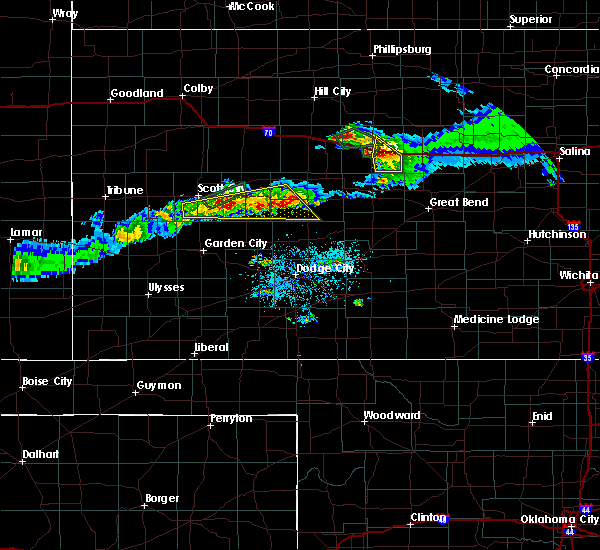 At 726 pm cdt, severe thunderstorms were located along a line extending from 8 miles east of friend to 6 miles west of ness city, moving southeast at 15 mph (radar indicated). Hazards include quarter size hail. Damage to vehicles is expected. Locations impacted include, dighton, alamota, beeler, shallow water, amy and the laird elevator. At 726 pm cdt, severe thunderstorms were located along a line extending from 8 miles east of friend to 6 miles west of ness city, moving southeast at 15 mph (radar indicated). Hazards include quarter size hail. Damage to vehicles is expected. Locations impacted include, dighton, alamota, beeler, shallow water, amy and the laird elevator.
|
| 4/12/2017 6:46 PM CDT |
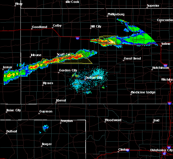 At 646 pm cdt, severe thunderstorms were located along a line extending from near shallow water to 4 miles northeast of beeler, moving southeast at 20 mph (radar indicated). Hazards include 60 mph wind gusts and quarter size hail. Hail damage to vehicles is expected. Expect wind damage to roofs, siding, and trees. At 646 pm cdt, severe thunderstorms were located along a line extending from near shallow water to 4 miles northeast of beeler, moving southeast at 20 mph (radar indicated). Hazards include 60 mph wind gusts and quarter size hail. Hail damage to vehicles is expected. Expect wind damage to roofs, siding, and trees.
|
| 4/12/2017 6:01 PM CDT |
 At 601 pm cdt, severe thunderstorms were located along a line extending from 6 miles southwest of grigston to 2 miles southeast of arnold, moving east at 20 mph (radar indicated). Hazards include 60 mph wind gusts and quarter size hail. Hail damage to vehicles is expected. Expect wind damage to roofs, siding, and trees. At 601 pm cdt, severe thunderstorms were located along a line extending from 6 miles southwest of grigston to 2 miles southeast of arnold, moving east at 20 mph (radar indicated). Hazards include 60 mph wind gusts and quarter size hail. Hail damage to vehicles is expected. Expect wind damage to roofs, siding, and trees.
|
| 4/12/2017 5:06 PM CDT |
 At 506 pm cdt, a severe thunderstorm was located 4 miles southeast of healy, or 7 miles northwest of dighton, moving east at 25 mph (radar indicated). Hazards include 60 mph wind gusts and quarter size hail. Hail damage to vehicles is expected. Expect wind damage to roofs, siding, and trees. At 506 pm cdt, a severe thunderstorm was located 4 miles southeast of healy, or 7 miles northwest of dighton, moving east at 25 mph (radar indicated). Hazards include 60 mph wind gusts and quarter size hail. Hail damage to vehicles is expected. Expect wind damage to roofs, siding, and trees.
|
| 3/23/2017 5:08 PM CDT |
 At 507 pm cdt, a severe thunderstorm was located 5 miles southeast of friend, or 17 miles north of garden city, moving northeast at 50 mph (radar indicated). Hazards include 60 mph wind gusts and up to half dollar size hail. Hail damage to vehicles is expected. Expect wind damage to roofs, siding, and trees. At 507 pm cdt, a severe thunderstorm was located 5 miles southeast of friend, or 17 miles north of garden city, moving northeast at 50 mph (radar indicated). Hazards include 60 mph wind gusts and up to half dollar size hail. Hail damage to vehicles is expected. Expect wind damage to roofs, siding, and trees.
|
| 8/4/2016 6:25 PM CDT | Quarter sized hail reported 11.7 miles S of Dighton, KS, . |
| 8/4/2016 6:25 PM CDT | . in lane county KS, 11.7 miles S of Dighton, KS |
| 7/5/2016 11:07 PM CDT |
 At 1107 pm cdt, severe thunderstorms were located along a line extending from 2 miles southeast of ogallah to 3 miles southwest of ransom to 3 miles northwest of alamota, moving southeast at 50 mph (radar indicated). Hazards include 70 mph wind gusts and half dollar size hail. Hail damage to vehicles is expected. expect considerable tree damage. wind damage is also likely to mobile homes, roofs and outbuildings. Locations impacted include, ness city, dighton, bazine, ransom, ogallah, utica, brownell, shields, trego center, pendennis, cedar bluff and arnold. At 1107 pm cdt, severe thunderstorms were located along a line extending from 2 miles southeast of ogallah to 3 miles southwest of ransom to 3 miles northwest of alamota, moving southeast at 50 mph (radar indicated). Hazards include 70 mph wind gusts and half dollar size hail. Hail damage to vehicles is expected. expect considerable tree damage. wind damage is also likely to mobile homes, roofs and outbuildings. Locations impacted include, ness city, dighton, bazine, ransom, ogallah, utica, brownell, shields, trego center, pendennis, cedar bluff and arnold.
|
| 7/5/2016 10:47 PM CDT |
 At 1046 pm cdt, a severe thunderstorm was located 9 miles west of trego center, moving southeast at 30 mph (radar indicated). Hazards include 70 mph wind gusts and half dollar size hail. Hail damage to vehicles is expected. expect considerable tree damage. Wind damage is also likely to mobile homes, roofs and outbuildings. At 1046 pm cdt, a severe thunderstorm was located 9 miles west of trego center, moving southeast at 30 mph (radar indicated). Hazards include 70 mph wind gusts and half dollar size hail. Hail damage to vehicles is expected. expect considerable tree damage. Wind damage is also likely to mobile homes, roofs and outbuildings.
|
| 6/9/2016 5:21 PM CDT |
 At 520 pm cdt, a severe thunderstorm was located near shields, moving northeast at 5 mph. a second storm was developing 7 miles north of amy, also moving very slowly northeast (radar indicated). Hazards include 60 mph wind gusts and quarter size hail. Hail damage to vehicles is expected. Expect wind damage to roofs, siding and trees. At 520 pm cdt, a severe thunderstorm was located near shields, moving northeast at 5 mph. a second storm was developing 7 miles north of amy, also moving very slowly northeast (radar indicated). Hazards include 60 mph wind gusts and quarter size hail. Hail damage to vehicles is expected. Expect wind damage to roofs, siding and trees.
|
| 5/27/2016 6:52 PM CDT |
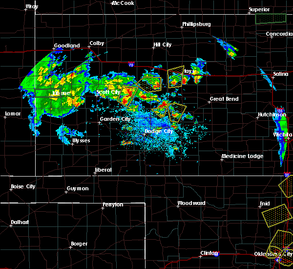 At 652 pm cdt, a severe thunderstorm was located 7 miles southwest of alamota, moving west at 5 mph (radar indicated). Hazards include quarter size hail. damage to vehicles is expected At 652 pm cdt, a severe thunderstorm was located 7 miles southwest of alamota, moving west at 5 mph (radar indicated). Hazards include quarter size hail. damage to vehicles is expected
|
| 5/27/2016 6:29 PM CDT | Quarter sized hail reported 8.6 miles WSW of Dighton, KS |
| 5/27/2016 5:56 PM CDT | Quarter sized hail reported 13.2 miles N of Dighton, KS |
| 5/27/2016 5:49 PM CDT |
 At 549 pm cdt, a severe thunderstorm was located 9 miles south of dighton, moving northwest at 15 mph (radar indicated). Hazards include ping pong ball size hail and 60 mph wind gusts. People and animals outdoors will be injured. expect hail damage to roofs, siding, windows and vehicles. Expect wind damage to roofs, siding and trees. At 549 pm cdt, a severe thunderstorm was located 9 miles south of dighton, moving northwest at 15 mph (radar indicated). Hazards include ping pong ball size hail and 60 mph wind gusts. People and animals outdoors will be injured. expect hail damage to roofs, siding, windows and vehicles. Expect wind damage to roofs, siding and trees.
|
| 5/27/2016 5:41 PM CDT |
 At 540 pm cdt, a severe thunderstorm capable of producing a tornado was located 3 miles north of dighton, moving northwest at 10 mph (radar indicated rotation). Hazards include tornado and ping pong ball size hail. Flying debris will be dangerous to those caught without shelter. mobile homes will be damaged or destroyed. damage to roofs, windows and vehicles will occur. tree damage is likely. This dangerous storm will be near, shields around 600 pm cdt. At 540 pm cdt, a severe thunderstorm capable of producing a tornado was located 3 miles north of dighton, moving northwest at 10 mph (radar indicated rotation). Hazards include tornado and ping pong ball size hail. Flying debris will be dangerous to those caught without shelter. mobile homes will be damaged or destroyed. damage to roofs, windows and vehicles will occur. tree damage is likely. This dangerous storm will be near, shields around 600 pm cdt.
|
| 5/27/2016 5:33 PM CDT |
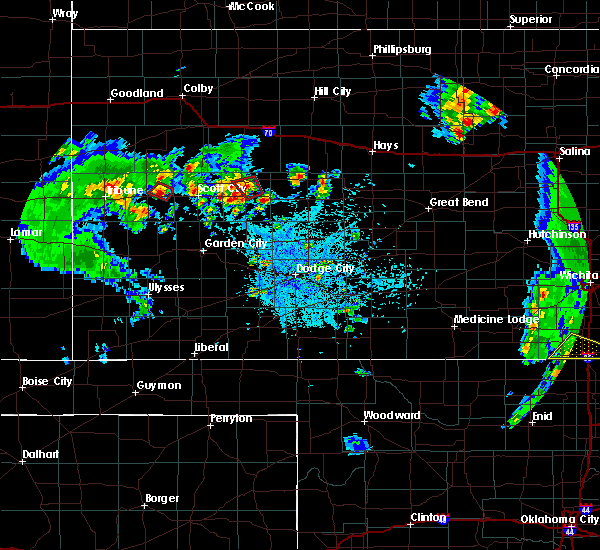 At 533 pm cdt, a severe thunderstorm capable of producing a tornado was located 4 miles northeast of dighton, moving north at 15 mph (radar indicated rotation). Hazards include tornado and ping pong ball size hail. Flying debris will be dangerous to those caught without shelter. mobile homes will be damaged or destroyed. damage to roofs, windows and vehicles will occur. tree damage is likely. This dangerous storm will be near, shields around 600 pm cdt. At 533 pm cdt, a severe thunderstorm capable of producing a tornado was located 4 miles northeast of dighton, moving north at 15 mph (radar indicated rotation). Hazards include tornado and ping pong ball size hail. Flying debris will be dangerous to those caught without shelter. mobile homes will be damaged or destroyed. damage to roofs, windows and vehicles will occur. tree damage is likely. This dangerous storm will be near, shields around 600 pm cdt.
|
| 5/27/2016 4:26 PM CDT |
 At 426 pm cdt, a severe thunderstorm was located near healy, moving northwest at 15 mph (radar indicated). Hazards include 60 mph wind gusts and quarter size hail. Hail damage to vehicles is expected. expect wind damage to roofs, siding and trees. Locations impacted include, dighton, scott state lake, amy, healy, manning and shields. At 426 pm cdt, a severe thunderstorm was located near healy, moving northwest at 15 mph (radar indicated). Hazards include 60 mph wind gusts and quarter size hail. Hail damage to vehicles is expected. expect wind damage to roofs, siding and trees. Locations impacted include, dighton, scott state lake, amy, healy, manning and shields.
|
| 5/27/2016 4:11 PM CDT |
 At 411 pm cdt, a severe thunderstorm was located 3 miles west of manning, moving northwest at 20 mph (radar indicated). Hazards include 60 mph wind gusts and half dollar size hail. Hail damage to vehicles is expected. Expect wind damage to roofs, siding and trees. At 411 pm cdt, a severe thunderstorm was located 3 miles west of manning, moving northwest at 20 mph (radar indicated). Hazards include 60 mph wind gusts and half dollar size hail. Hail damage to vehicles is expected. Expect wind damage to roofs, siding and trees.
|
| 5/24/2016 5:50 PM CDT | Golf Ball sized hail reported 16.6 miles S of Dighton, KS |
| 5/8/2016 5:21 PM CDT |
 At 521 pm cdt, a severe thunderstorm was located 4 miles northwest of alamota, moving north at 20 mph (radar indicated). Hazards include golf ball size hail and 60 mph wind gusts. People and animals outdoors will be injured. expect hail damage to roofs, siding, windows and vehicles. expect wind damage to roofs, siding and trees. locations impacted include, dighton, utica, alamota and pendennis. A tornado watch remains in effect until 1000 pm cdt for west central kansas. At 521 pm cdt, a severe thunderstorm was located 4 miles northwest of alamota, moving north at 20 mph (radar indicated). Hazards include golf ball size hail and 60 mph wind gusts. People and animals outdoors will be injured. expect hail damage to roofs, siding, windows and vehicles. expect wind damage to roofs, siding and trees. locations impacted include, dighton, utica, alamota and pendennis. A tornado watch remains in effect until 1000 pm cdt for west central kansas.
|
| 5/8/2016 5:12 PM CDT |
 At 512 pm cdt, a severe thunderstorm was located 4 miles east of dighton, moving north at 20 mph (radar indicated). Hazards include golf ball size hail and 60 mph wind gusts. People and animals outdoors will be injured. expect hail damage to roofs, siding, windows and vehicles. expect wind damage to roofs, siding and trees. locations impacted include, dighton, utica, alamota and pendennis. A tornado watch remains in effect until 1000 pm cdt for west central kansas. At 512 pm cdt, a severe thunderstorm was located 4 miles east of dighton, moving north at 20 mph (radar indicated). Hazards include golf ball size hail and 60 mph wind gusts. People and animals outdoors will be injured. expect hail damage to roofs, siding, windows and vehicles. expect wind damage to roofs, siding and trees. locations impacted include, dighton, utica, alamota and pendennis. A tornado watch remains in effect until 1000 pm cdt for west central kansas.
|
| 5/8/2016 5:04 PM CDT |
 At 504 pm cdt, a severe thunderstorm was located 5 miles southeast of dighton, moving northeast at 20 mph (radar indicated). Hazards include golf ball size hail and 60 mph wind gusts. People and animals outdoors will be injured. expect hail damage to roofs, siding, windows and vehicles. Expect wind damage to roofs, siding and trees. At 504 pm cdt, a severe thunderstorm was located 5 miles southeast of dighton, moving northeast at 20 mph (radar indicated). Hazards include golf ball size hail and 60 mph wind gusts. People and animals outdoors will be injured. expect hail damage to roofs, siding, windows and vehicles. Expect wind damage to roofs, siding and trees.
|
| 8/4/2015 6:39 PM CDT |
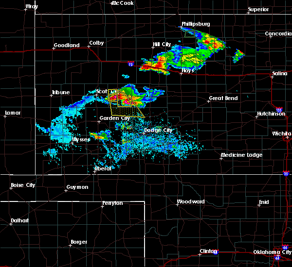 At 638 pm cdt, a severe thunderstorm was located 7 miles south of alamota, moving southeast at 20 mph (radar indicated). Hazards include tennis ball size hail and 70 mph wind gusts. People and animals outdoors will be injured. expect hail damage to roofs, siding, windows and vehicles. expect considerable tree damage. Wind damage is also likely to mobile homes, roofs and outbuildings. At 638 pm cdt, a severe thunderstorm was located 7 miles south of alamota, moving southeast at 20 mph (radar indicated). Hazards include tennis ball size hail and 70 mph wind gusts. People and animals outdoors will be injured. expect hail damage to roofs, siding, windows and vehicles. expect considerable tree damage. Wind damage is also likely to mobile homes, roofs and outbuildings.
|
| 8/4/2015 6:26 PM CDT |
 At 626 pm cdt, a severe thunderstorm was located 6 miles southwest of alamota, moving southeast at 25 mph (radar indicated). Hazards include two inch hail and 70 mph wind gusts. People and animals outdoors will be injured. expect hail damage to roofs, siding, windows and vehicles. expect considerable tree damage. wind damage is also likely to mobile homes, roofs and outbuildings. Locations impacted include, dighton. At 626 pm cdt, a severe thunderstorm was located 6 miles southwest of alamota, moving southeast at 25 mph (radar indicated). Hazards include two inch hail and 70 mph wind gusts. People and animals outdoors will be injured. expect hail damage to roofs, siding, windows and vehicles. expect considerable tree damage. wind damage is also likely to mobile homes, roofs and outbuildings. Locations impacted include, dighton.
|
| 8/4/2015 5:58 PM CDT |
 At 557 pm cdt, a severe thunderstorm was located near dighton, moving south at 20 mph (radar indicated). Hazards include two inch hail and 70 mph wind gusts. People and animals outdoors will be injured. expect hail damage to roofs, siding, windows and vehicles. expect considerable tree damage. wind damage is also likely to mobile homes, roofs and outbuildings. locations impacted include, dighton and alamota. At 550 pm, golfball size hail was located 2 miles north northeast of dighton. At 557 pm cdt, a severe thunderstorm was located near dighton, moving south at 20 mph (radar indicated). Hazards include two inch hail and 70 mph wind gusts. People and animals outdoors will be injured. expect hail damage to roofs, siding, windows and vehicles. expect considerable tree damage. wind damage is also likely to mobile homes, roofs and outbuildings. locations impacted include, dighton and alamota. At 550 pm, golfball size hail was located 2 miles north northeast of dighton.
|
| 8/4/2015 5:55 PM CDT | Hen Egg sized hail reported 2.9 miles W of Dighton, KS |
| 8/4/2015 5:50 PM CDT | Golf Ball sized hail reported 2.1 miles SSW of Dighton, KS |
| 8/4/2015 5:46 PM CDT |
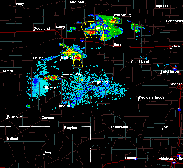 At 546 pm cdt, a severe thunderstorm was located 4 miles northeast of dighton, moving southeast at 25 mph (radar indicated). Hazards include 60 mph wind gusts and quarter size hail. Hail damage to vehicles is expected. Expect wind damage to roofs, siding and trees. At 546 pm cdt, a severe thunderstorm was located 4 miles northeast of dighton, moving southeast at 25 mph (radar indicated). Hazards include 60 mph wind gusts and quarter size hail. Hail damage to vehicles is expected. Expect wind damage to roofs, siding and trees.
|
| 8/4/2015 5:03 PM CDT |
 At 502 pm cdt, a severe thunderstorm was located 8 miles north of healy, and is nearly stationary (radar indicated). Hazards include 60 mph wind gusts and quarter size hail. Hail damage to vehicles is expected. expect wind damage to roofs, siding and trees. Locations impacted include, dighton, amy, shields and healy. At 502 pm cdt, a severe thunderstorm was located 8 miles north of healy, and is nearly stationary (radar indicated). Hazards include 60 mph wind gusts and quarter size hail. Hail damage to vehicles is expected. expect wind damage to roofs, siding and trees. Locations impacted include, dighton, amy, shields and healy.
|
| 8/4/2015 4:50 PM CDT |
 At 450 pm cdt, a severe thunderstorm was located 7 miles east of the monument rocks, moving southeast at 15 mph (radar indicated). Hazards include 60 mph wind gusts and quarter size hail. Hail damage to vehicles is expected. Expect wind damage to roofs, siding and trees. At 450 pm cdt, a severe thunderstorm was located 7 miles east of the monument rocks, moving southeast at 15 mph (radar indicated). Hazards include 60 mph wind gusts and quarter size hail. Hail damage to vehicles is expected. Expect wind damage to roofs, siding and trees.
|
| 7/26/2015 10:41 PM CDT |
 At 1041 pm cdt, severe thunderstorms were located along a line extending from 2 miles west of ransom to 10 miles northeast of kalvesta, moving east at 30 mph (radar indicated). Hazards include 70 mph wind gusts and penny size hail. Expect considerable tree damage. damage is likely to mobile homes, roofs and outbuildings. Locations impacted include, gray, ness city, dighton, jetmore, bazine, ransom, hanston, utica, alamota, brownell, arnold, beeler, shields and pendennis. At 1041 pm cdt, severe thunderstorms were located along a line extending from 2 miles west of ransom to 10 miles northeast of kalvesta, moving east at 30 mph (radar indicated). Hazards include 70 mph wind gusts and penny size hail. Expect considerable tree damage. damage is likely to mobile homes, roofs and outbuildings. Locations impacted include, gray, ness city, dighton, jetmore, bazine, ransom, hanston, utica, alamota, brownell, arnold, beeler, shields and pendennis.
|
| 7/26/2015 10:36 PM CDT |
 The severe thunderstorm warning for northern finney, lane and southeastern scott counties will expire at 1045 pm cdt, the storm which prompted the warning has weakened below severe limits, and no longer pose an immediate threat to life or property. therefore the warning will be allowed to expire. however gusty winds are still possible with this thunderstorm. The severe thunderstorm warning for northern finney, lane and southeastern scott counties will expire at 1045 pm cdt, the storm which prompted the warning has weakened below severe limits, and no longer pose an immediate threat to life or property. therefore the warning will be allowed to expire. however gusty winds are still possible with this thunderstorm.
|
| 7/26/2015 10:16 PM CDT |
 At 1015 pm cdt, a severe thunderstorm was located 5 miles southwest of alamota, moving east at 40 mph (radar indicated). Hazards include 70 mph wind gusts and nickel size hail. Expect considerable tree damage. Damage is likely to mobile homes, roofs and outbuildings. At 1015 pm cdt, a severe thunderstorm was located 5 miles southwest of alamota, moving east at 40 mph (radar indicated). Hazards include 70 mph wind gusts and nickel size hail. Expect considerable tree damage. Damage is likely to mobile homes, roofs and outbuildings.
|
| 7/26/2015 10:07 PM CDT |
 At 1006 pm cdt, a severe thunderstorm was located 13 miles south of dighton, moving southeast at 50 mph (radar indicated). Hazards include 70 mph wind gusts and penny size hail. Expect considerable tree damage. damage is likely to mobile homes, roofs and outbuildings. Locations impacted include, scott city, dighton, alamota, amy, shallow water, friend, grigston and manning. At 1006 pm cdt, a severe thunderstorm was located 13 miles south of dighton, moving southeast at 50 mph (radar indicated). Hazards include 70 mph wind gusts and penny size hail. Expect considerable tree damage. damage is likely to mobile homes, roofs and outbuildings. Locations impacted include, scott city, dighton, alamota, amy, shallow water, friend, grigston and manning.
|
| 7/26/2015 9:47 PM CDT |
 At 947 pm cdt, a severe thunderstorm was located 3 miles south of shallow water, moving east at 35 mph (radar indicated). Hazards include 70 mph wind gusts and penny size hail. Expect considerable tree damage. Damage is likely to mobile homes, roofs and outbuildings. At 947 pm cdt, a severe thunderstorm was located 3 miles south of shallow water, moving east at 35 mph (radar indicated). Hazards include 70 mph wind gusts and penny size hail. Expect considerable tree damage. Damage is likely to mobile homes, roofs and outbuildings.
|
| 7/19/2015 10:10 PM CDT |
 The severe thunderstorm warning for north central finney, lane and scott counties will expire at 1015 pm cdt, a new severe thunderstorm warning was issued for eastern scott county, which is in effect until 1100 pm. gusty winds to 55 mph can still be expected across the remainder of scott county, north central finney county, and lane county. The severe thunderstorm warning for north central finney, lane and scott counties will expire at 1015 pm cdt, a new severe thunderstorm warning was issued for eastern scott county, which is in effect until 1100 pm. gusty winds to 55 mph can still be expected across the remainder of scott county, north central finney county, and lane county.
|
| 7/19/2015 9:15 PM CDT |
 At 915 pm cdt, severe thunderstorms were located along a line extending from 3 miles southeast of modoc to 3 miles east of shallow water to 4 miles southeast of friend, moving northeast at 45 mph (radar indicated). Hazards include 70 mph wind gusts and nickel size hail. Expect considerable tree damage. Damage is likely to mobile homes, roofs and outbuildings. At 915 pm cdt, severe thunderstorms were located along a line extending from 3 miles southeast of modoc to 3 miles east of shallow water to 4 miles southeast of friend, moving northeast at 45 mph (radar indicated). Hazards include 70 mph wind gusts and nickel size hail. Expect considerable tree damage. Damage is likely to mobile homes, roofs and outbuildings.
|
| 7/14/2015 11:14 PM CDT |
 At 1113 pm cdt, a severe thunderstorm was located 3 miles south of scott city, moving northeast at 30 mph (radar indicated). Hazards include 60 mph wind gusts and quarter size hail. Hail damage to vehicles is expected. Expect wind damage to roofs, siding and trees. At 1113 pm cdt, a severe thunderstorm was located 3 miles south of scott city, moving northeast at 30 mph (radar indicated). Hazards include 60 mph wind gusts and quarter size hail. Hail damage to vehicles is expected. Expect wind damage to roofs, siding and trees.
|
| 6/4/2015 8:10 PM CDT | Tea Cup sized hail reported 16.1 miles SSW of Dighton, KS, craters in the ground from hail...measured post storm by storm chaser. time is estimated from radar. |
| 6/4/2015 7:24 PM CDT | Quarter sized hail reported 13.1 miles SSW of Dighton, KS |
| 5/28/2015 6:52 PM CDT | The severe thunderstorm warning for hodgeman, ness, northeastern finney and eastern lane counties will expire at 700 pm cdt, the storm which prompted the warning has weakened below severe limits, and no longer pose an immediate threat to life or property. therefore the warning will be allowed to expire. however gusty winds and heavy rain are still possible with this thunderstorm. |
| 5/28/2015 6:24 PM CDT | At 624 pm cdt, a severe thunderstorm was located 9 miles southwest of ness city, moving east at 45 mph (radar indicated). Hazards include 60 mph wind gusts and quarter size hail. Hail damage to vehicles is expected. expect wind damage to roofs, siding and trees. Locations impacted include, gray, ness city, dighton, jetmore, bazine, ransom, hanston, utica, alamota, brownell, arnold, beeler and pendennis. |
| 5/28/2015 6:08 PM CDT | The severe thunderstorm warning for northeastern finney, lane and southeastern scott counties will expire at 615 pm cdt, the storm which prompted the warning has moved out of the area. therefore the warning will be allowed to expire. however gusty winds and heavy rain are still possible with this thunderstorm. |
| 5/28/2015 5:59 PM CDT | At 559 pm cdt, a severe thunderstorm was located 4 miles southwest of alamota, moving east at 50 mph (radar indicated). Hazards include 60 mph wind gusts and quarter size hail. Hail damage to vehicles is expected. Expect wind damage to roofs, siding and trees. |
| 5/28/2015 5:52 PM CDT | Storm damage reported in lane county KS, 2.7 miles S of Dighton, KS |
| 5/28/2015 5:49 PM CDT | At 549 pm cdt, a severe thunderstorm was located 3 miles southeast of dighton, moving east at 35 mph (radar indicated). Hazards include 60 mph wind gusts and quarter size hail. Hail damage to vehicles is expected. expect wind damage to roofs, siding and trees. Locations impacted include, dighton, alamota, amy, shields, pendennis, healy and grigston. |
| 5/28/2015 5:28 PM CDT | At 528 pm cdt, a severe thunderstorm was located 5 miles southwest of amy, moving east at 35 mph (radar indicated). Hazards include 60 mph wind gusts and quarter size hail. Hail damage to vehicles is expected. Expect wind damage to roofs, siding and trees. |
| 5/27/2015 5:52 PM CDT | Ping Pong Ball sized hail reported 16 miles NNW of Dighton, KS |
| 5/27/2015 5:07 PM CDT | The severe thunderstorm warning for west central ness and central lane counties will expire at 515 pm cdt, the storm which prompted the warning has moved out of the area. therefore the warning will be allowed to expire. however small. |
| 5/27/2015 4:58 PM CDT | Half Dollar sized hail reported 9.1 miles N of Dighton, KS |
| 5/27/2015 4:42 PM CDT | At 442 pm cdt, a severe thunderstorm was located near alamota, moving northeast at 15 mph (radar indicated). Hazards include ping pong ball size hail and 60 mph wind gusts. People and animals outdoors will be injured. expect hail damage to roofs, siding, windows and vehicles. expect wind damage to roofs, siding and trees. locations impacted include, dighton and alamota. A tornado watch remains in effect until 1000 pm cdt for west central kansas. |
| 5/27/2015 4:40 PM CDT | Quarter sized hail reported 10.4 miles ENE of Dighton, KS |
| 5/27/2015 4:31 PM CDT | At 431 pm cdt, a severe thunderstorm was located 4 miles southwest of alamota, moving northeast at 15 mph (radar indicated). Hazards include two inch hail and 60 mph wind gusts. People and animals outdoors will be injured. expect hail damage to roofs, siding, windows and vehicles. Expect wind damage to roofs, siding and trees. |
| 5/27/2015 4:07 PM CDT | At 407 pm cdt, a severe thunderstorm was located 7 miles south of dighton, moving northeast at 10 mph (radar indicated). Hazards include tennis ball size hail and 60 mph wind gusts. People and animals outdoors will be injured. expect hail damage to roofs, siding, windows and vehicles. expect wind damage to roofs, siding and trees. locations impacted include, dighton and amy. A tornado watch remains in effect until 1000 pm cdt for west central kansas. |
| 5/27/2015 3:41 PM CDT | At 341 pm cdt, a severe thunderstorm was located 11 miles south of amy, moving northeast at 10 mph (radar indicated). Hazards include tennis ball size hail and 60 mph wind gusts. People and animals outdoors will be injured. expect hail damage to roofs, siding, windows and vehicles. Expect wind damage to roofs, siding and trees. |
| 5/27/2015 2:46 PM CDT | At 246 pm cdt, a severe thunderstorm was located 9 miles south of dighton, moving northeast at 10 mph (radar indicated). Hazards include 60 mph wind gusts and half dollar size hail. Hail damage to vehicles is expected. expect wind damage to roofs, siding and trees. locations impacted include, dighton, alamota and amy. A tornado watch remains in effect until 1000 pm cdt for west central kansas. |
| 5/27/2015 2:30 PM CDT | At 229 pm cdt, a severe thunderstorm was located 12 miles south of amy, moving northeast at 25 mph (radar indicated). Hazards include 60 mph wind gusts and quarter size hail. Hail damage to vehicles is expected. Expect wind damage to roofs, siding and trees. |
| 4/12/2015 1:32 AM CDT | A severe thunderstorm warning remains in effect until 200 am cdt for west central hodgeman. northeastern finney and southern lane counties. at 132 am cdt. a severe thunderstorm was located 14 miles southwest of alamota. moving northeast at 20 mph. hazard. 60 mph wind gusts and quarter size hail. |
| 4/12/2015 1:12 AM CDT | The national weather service in dodge city has issued a * severe thunderstorm warning for. west central hodgeman county in southwestern kansas. northeastern finney county in southwestern kansas. southern lane county in west central kansas. Southeastern scott county in west central kansas. |
| 4/2/2015 8:48 PM CST | Quarter sized hail reported 11.6 miles W of Dighton, KS, the hail was nickel to quarter size. |
| 4/2/2015 9:36 PM CDT | A severe thunderstorm warning remains in effect until 1015 pm cdt for southern trego. northwestern rush. northwestern hodgeman. ness. northeastern finney. northeastern gray. southwestern ellis and southeastern lane counties. at 934 pm cdt. Severe thunderstorms were located along a line extending from near arnold to near beeler to 14 miles west of. |
| 4/2/2015 8:35 PM CST | Quarter sized hail reported 0.3 miles ENE of Dighton, KS |
| 4/2/2015 9:20 PM CDT | The national weather service in dodge city has issued a * severe thunderstorm warning for. southern trego county in west central kansas. northwestern rush county in central kansas. northwestern hodgeman county in southwestern kansas. Ness county in west central kansas. |
| 4/2/2015 9:03 PM CDT | A severe thunderstorm warning remains in effect until 945 pm cdt for northwestern lane and scott counties. at 902 pm cdt. a severe thunderstorm was located near scott state lake. moving east at 45 mph. hazard. 60 mph wind gusts and quarter size hail. source. Radar indicated. |
| 4/2/2015 8:49 PM CDT | The national weather service in dodge city has issued a * severe thunderstorm warning for. northwestern lane county in west central kansas. scott county in west central kansas. until 945 pm cdt * at 848 pm cdt. A severe thunderstorm was located 7 miles north of. |
| 7/26/2014 8:05 PM CDT | Quarter sized hail reported 15.7 miles NW of Dighton, KS |
| 6/22/2014 8:36 PM CDT | Storm damage reported in lane county KS, 0.3 miles ENE of Dighton, KS |
| 6/14/2014 10:28 PM CDT | Storm damage reported in lane county KS, 0.3 miles ENE of Dighton, KS |
| 6/11/2014 8:49 PM CDT | Reports of 6 inch tree limbs down as well as estimated 60 to 80 mph wind gust in lane county KS, 8.2 miles ENE of Dighton, KS |
| 6/11/2014 8:49 PM CDT | Reports of a few power poles as well as tree damage in dighto in lane county KS, 0.3 miles ENE of Dighton, KS |
| 8/5/2013 5:18 PM CDT | Also pea sized hail...very heavy rain...and visibilities less than a quarter of a mil in lane county KS, 4.8 miles S of Dighton, KS |
| 5/7/2013 5:45 PM CDT | Golf Ball sized hail reported 2.7 miles S of Dighton, KS |
| 5/7/2013 5:33 PM CDT | Quarter sized hail reported 3.6 miles E of Dighton, KS |
| 5/7/2013 5:33 PM CDT | Golf Ball sized hail reported 2 miles E of Dighton, KS |
| 5/7/2013 5:22 PM CDT | Quarter sized hail reported 7.2 miles NE of Dighton, KS |
| 9/6/2012 7:15 PM CDT | Storm damage reported in ness county KS, 14.2 miles WNW of Dighton, KS |
| 9/6/2012 5:40 PM CDT | Quarter sized hail reported 13.8 miles SW of Dighton, KS |
| 9/6/2012 5:36 PM CDT | Quarter sized hail reported 12.8 miles SSW of Dighton, KS |
| 6/14/2012 7:10 PM CDT | Quarter sized hail reported 5 miles NE of Dighton, KS |
| 1/1/0001 12:00 AM | Storm damage reported in lane county KS, 9.1 miles N of Dighton, KS |
| 1/1/0001 12:00 AM | Power poles down were downed in portions of the c in lane county KS, 0.3 miles ENE of Dighton, KS |
| 1/1/0001 12:00 AM | Power poles were downed in portions of the c in lane county KS, 0.3 miles ENE of Dighton, KS |
| 1/1/0001 12:00 AM | Numerous 6 inch diameter tree limbs down around the city as well as power outage in lane county KS, 0.3 miles ENE of Dighton, KS |
| 1/1/0001 12:00 AM | Quarter sized hail reported 8.8 miles SSW of Dighton, KS |
| 1/1/0001 12:00 AM | Storm damage reported in lane county KS, 6.3 miles N of Dighton, KS |
| 1/1/0001 12:00 AM | Quarter sized hail reported 10.4 miles S of Dighton, KS |
Hail Maps for Dighton, KS

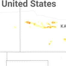
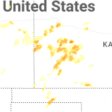


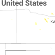


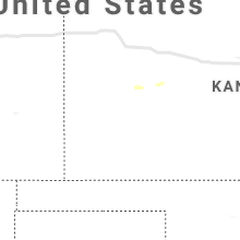


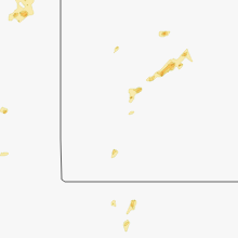


Connect with Interactive Hail Maps