

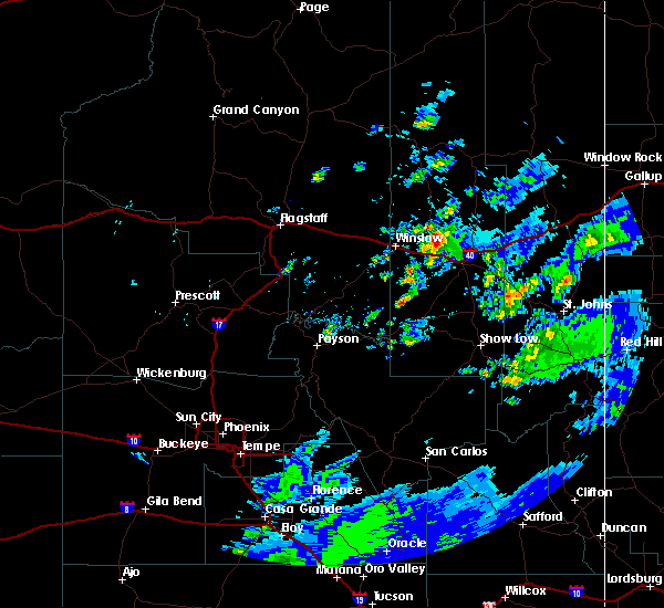
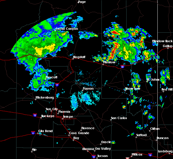
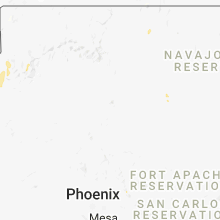
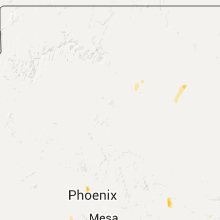
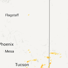
Hail Map for Dilkon, AZ
The Dilkon, AZ area has had 0 reports of on-the-ground hail by trained spotters, and has been under severe weather warnings 0 times during the past 12 months. Doppler radar has detected hail at or near Dilkon, AZ on 11 occasions.
| Name: | Dilkon, AZ |
| Where Located: | 76 miles E of Flagstaff, AZ |
| Map: | Google Map for Dilkon, AZ |
| Population: | 1184 |
| Housing Units: | 361 |
| More Info: | Search Google for Dilkon, AZ |
5
The Top Recent Hail Date for Dilkon, AZ is Wednesday, August 2, 2023 (1st out of 11)

Hail and Wind Damage Spotted near Dilkon, AZ
| Date / Time | Report Details |
|---|---|
| 9/2/2018 5:44 PM MST |
 At 544 pm mst, a severe thunderstorm was located 8 miles north of seba dalkai, or 19 miles southwest of keams canyon, moving southeast at 15 mph (radar indicated). Hazards include quarter size hail. damage to vehicles is expected At 544 pm mst, a severe thunderstorm was located 8 miles north of seba dalkai, or 19 miles southwest of keams canyon, moving southeast at 15 mph (radar indicated). Hazards include quarter size hail. damage to vehicles is expected
|
| 9/1/2018 6:06 PM MDT |
 At 506 pm mst, a severe thunderstorm was located 15 miles north of winslow, moving east at 20 mph (radar indicated). Hazards include 60 mph wind gusts and half dollar size hail. Hail damage to vehicles is expected. expect wind damage to roofs, siding, and trees. locations impacted include, winslow, dilkon, cedar springs, castle butte and homolovi state park campground. this includes the following highways, business interstate 40 between mile markers 252 and 257. interstate 40 between mile markers 246 and 269. state route 87 between mile markers 338 and 382. State route 99 between mile markers 35 and 53. At 506 pm mst, a severe thunderstorm was located 15 miles north of winslow, moving east at 20 mph (radar indicated). Hazards include 60 mph wind gusts and half dollar size hail. Hail damage to vehicles is expected. expect wind damage to roofs, siding, and trees. locations impacted include, winslow, dilkon, cedar springs, castle butte and homolovi state park campground. this includes the following highways, business interstate 40 between mile markers 252 and 257. interstate 40 between mile markers 246 and 269. state route 87 between mile markers 338 and 382. State route 99 between mile markers 35 and 53.
|
| 9/1/2018 5:47 PM MDT |
 At 447 pm mst, a severe thunderstorm was located 13 miles east of leupp, or 15 miles north of winslow, moving east at 20 mph (radar indicated). Hazards include 60 mph wind gusts and half dollar size hail. Hail damage to vehicles is expected. Expect wind damage to roofs, siding, and trees. At 447 pm mst, a severe thunderstorm was located 13 miles east of leupp, or 15 miles north of winslow, moving east at 20 mph (radar indicated). Hazards include 60 mph wind gusts and half dollar size hail. Hail damage to vehicles is expected. Expect wind damage to roofs, siding, and trees.
|
| 9/3/2015 4:36 PM MDT |
 At 335 pm mst, doppler radar indicated a severe thunderstorm capable of producing quarter size hail. this storm was located 11 miles north of joseph city, or 20 miles east of winslow, and moving northeast at 30 mph. * this severe thunderstorm will be near, castle butte around 400 pm mst. this includes state route 87 between mile markers 361 and 377. At 335 pm mst, doppler radar indicated a severe thunderstorm capable of producing quarter size hail. this storm was located 11 miles north of joseph city, or 20 miles east of winslow, and moving northeast at 30 mph. * this severe thunderstorm will be near, castle butte around 400 pm mst. this includes state route 87 between mile markers 361 and 377.
|
| 8/11/2015 3:38 PM MDT |
 At 237 pm mst, doppler radar indicated a severe thunderstorm capable of producing damaging winds in excess of 60 mph. this storm was located over cedar springs, or 28 miles south of keams canyon, and moving northeast at 10 mph. nickel size hail may also accompany the damaging winds. At 237 pm mst, doppler radar indicated a severe thunderstorm capable of producing damaging winds in excess of 60 mph. this storm was located over cedar springs, or 28 miles south of keams canyon, and moving northeast at 10 mph. nickel size hail may also accompany the damaging winds.
|
Hail Maps for Dilkon, AZ


Connect with Interactive Hail Maps