

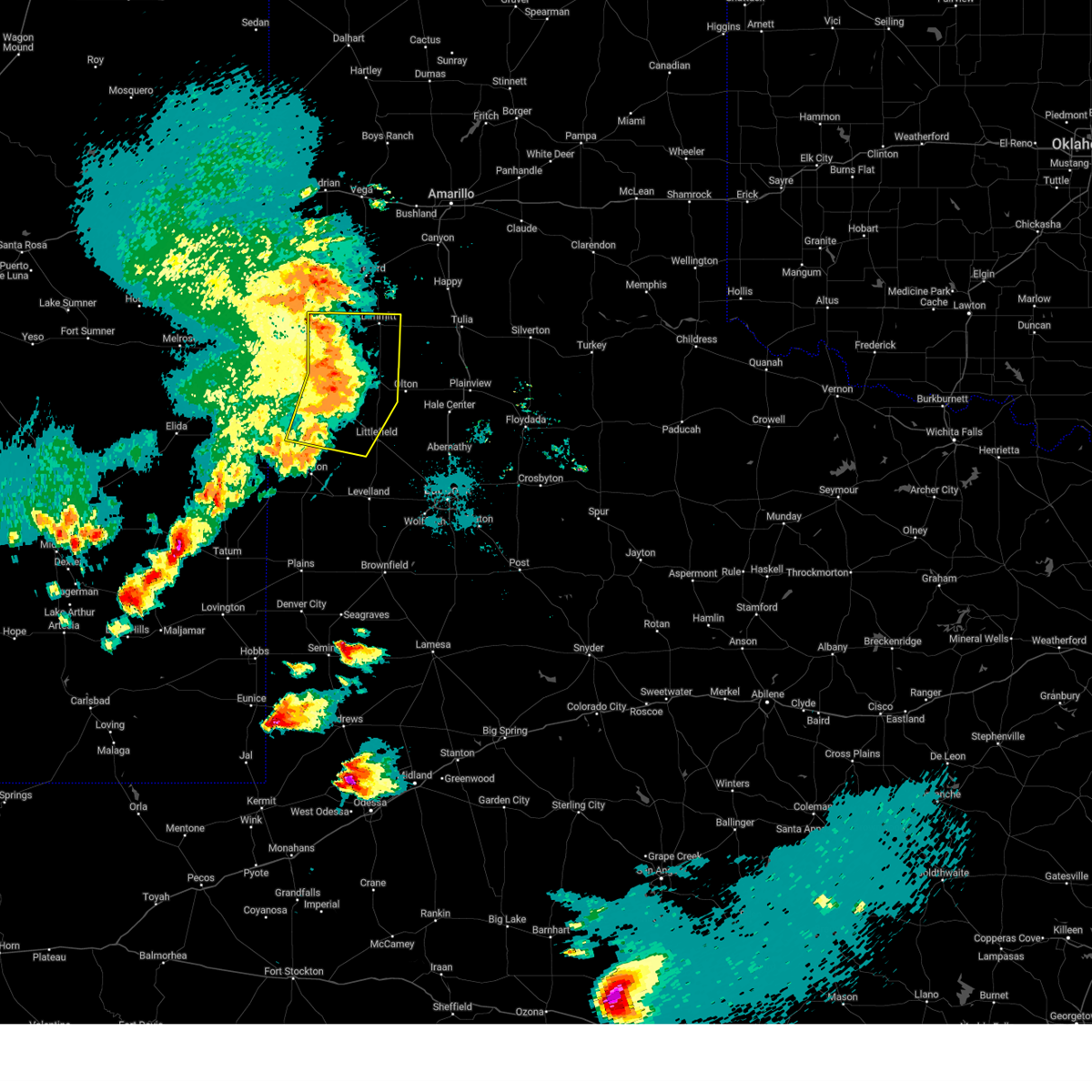
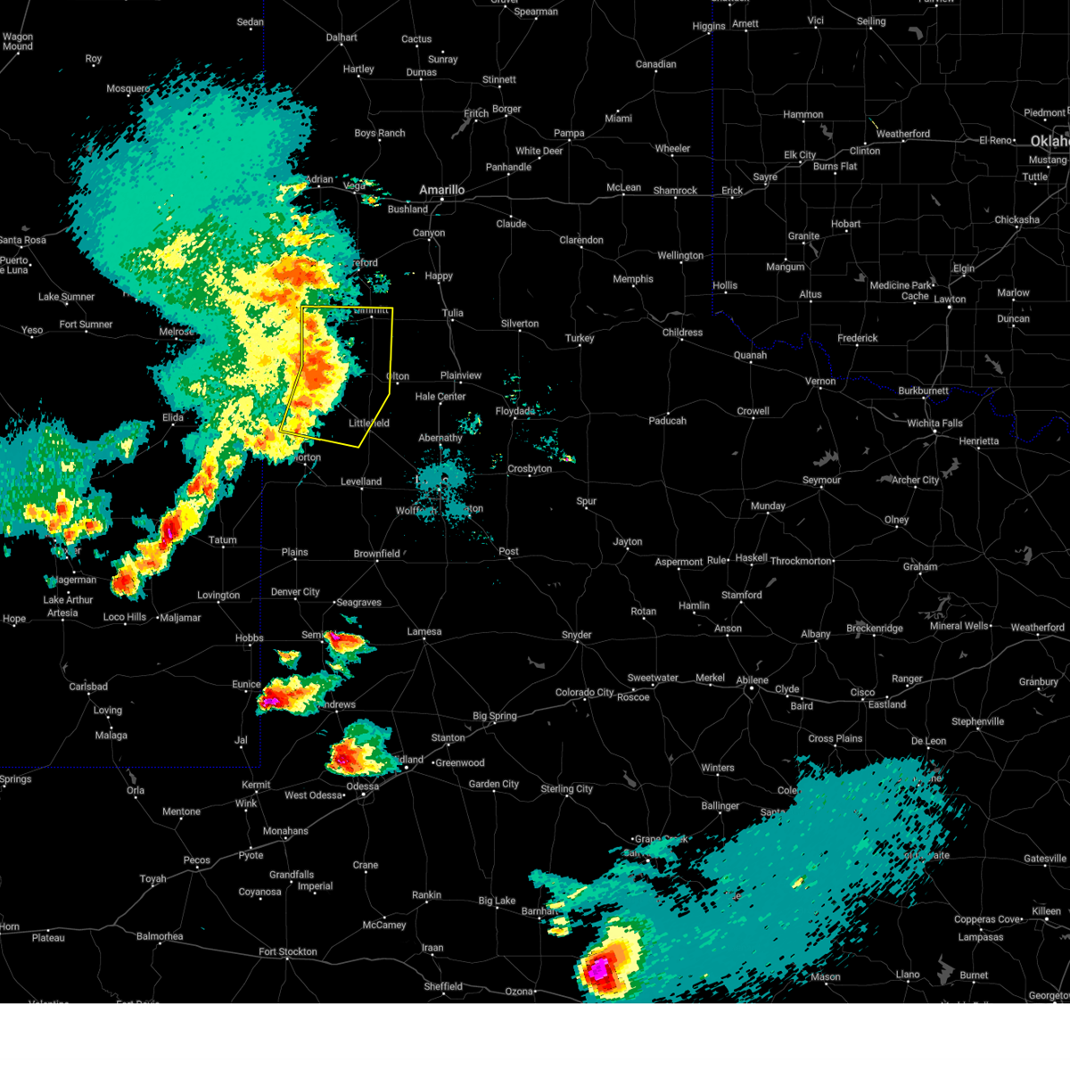
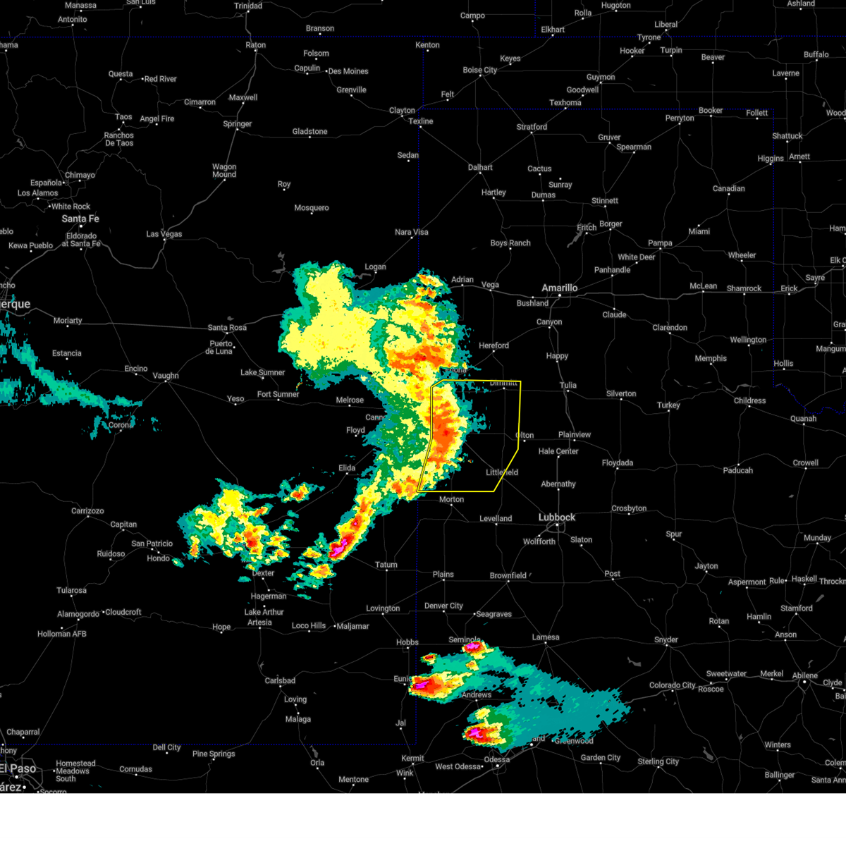
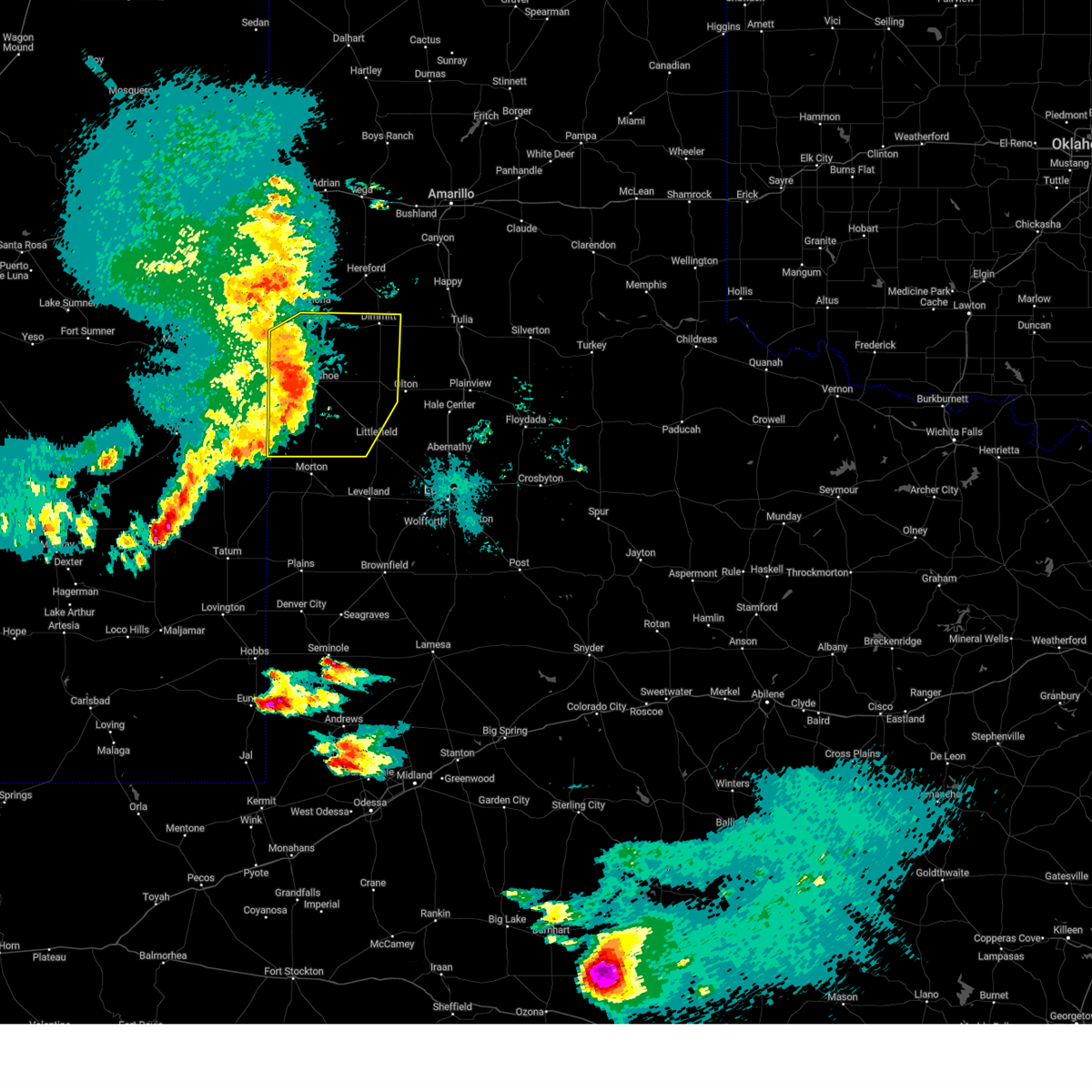
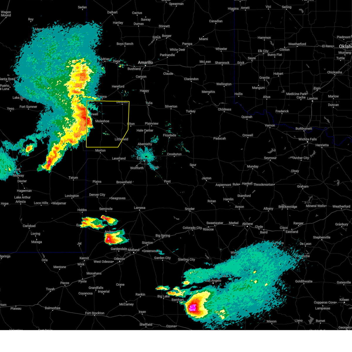
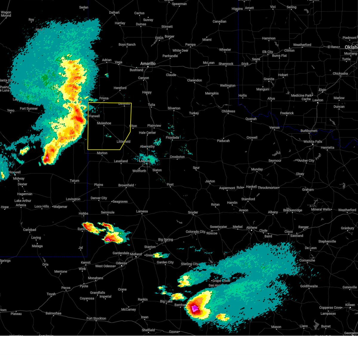
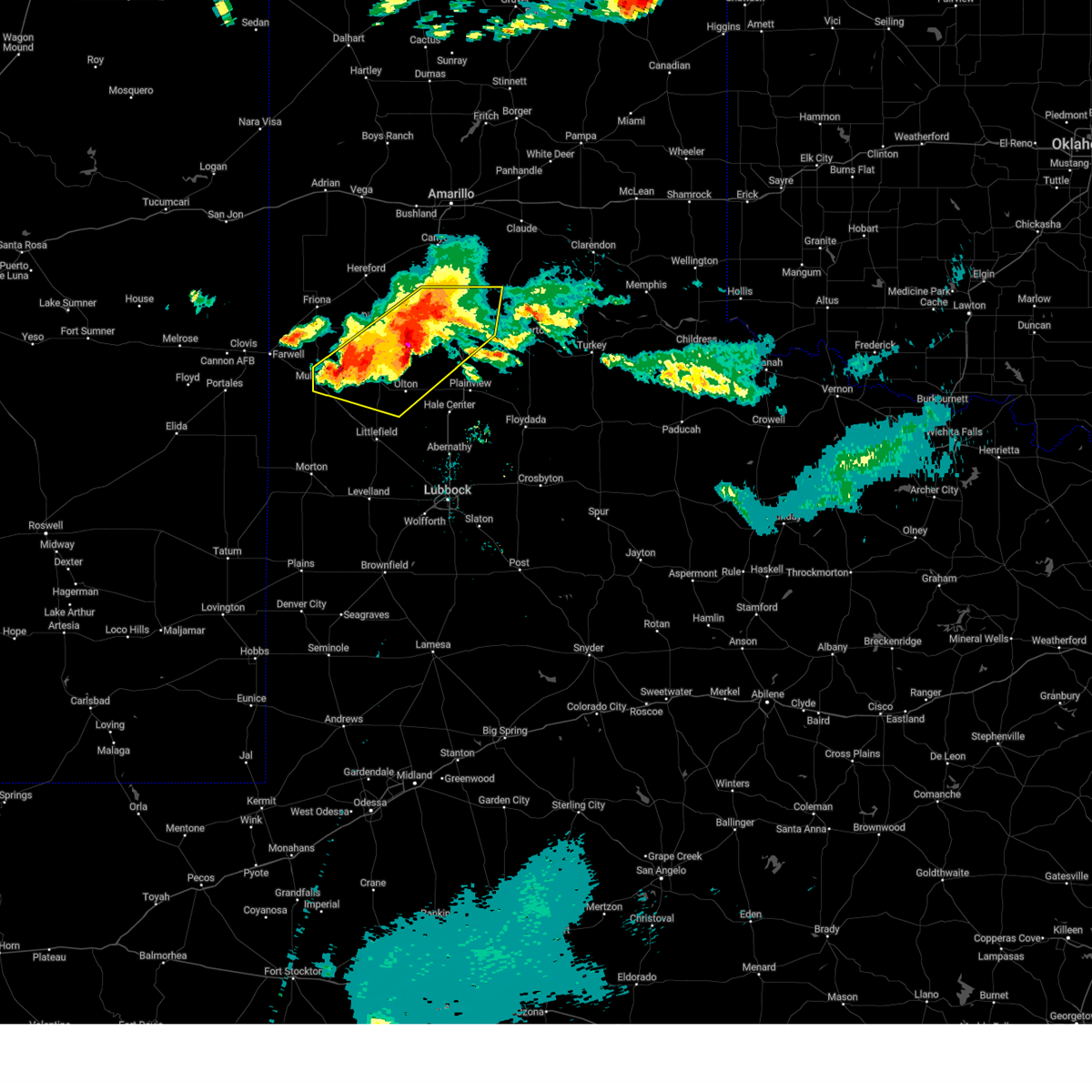
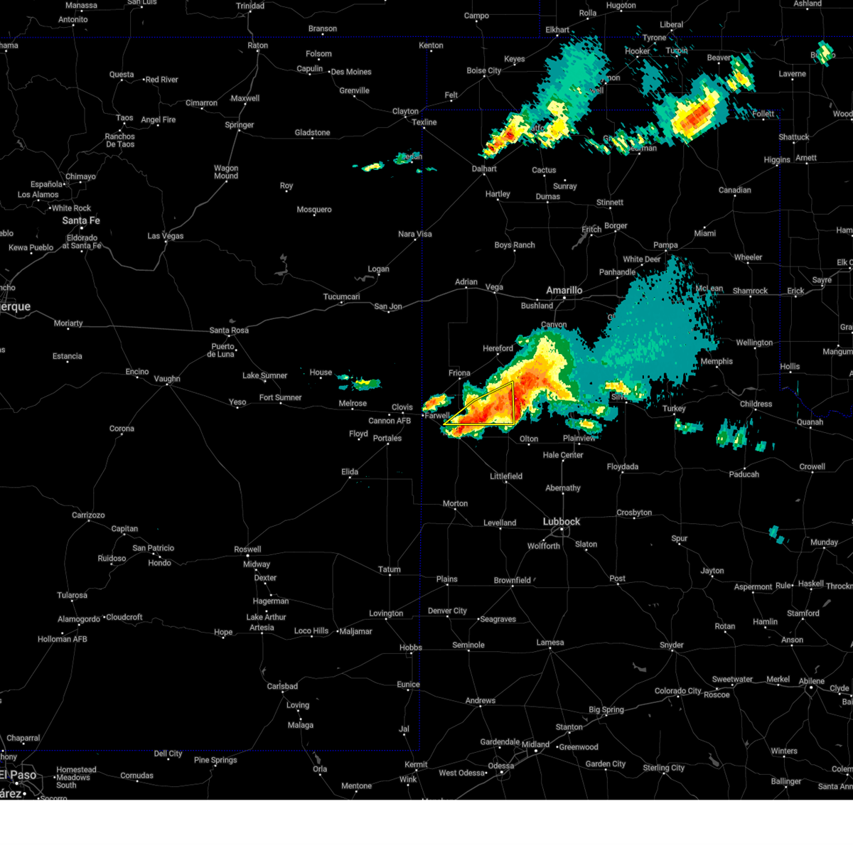
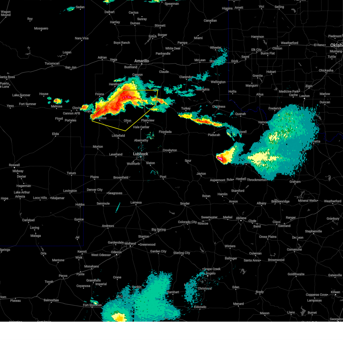
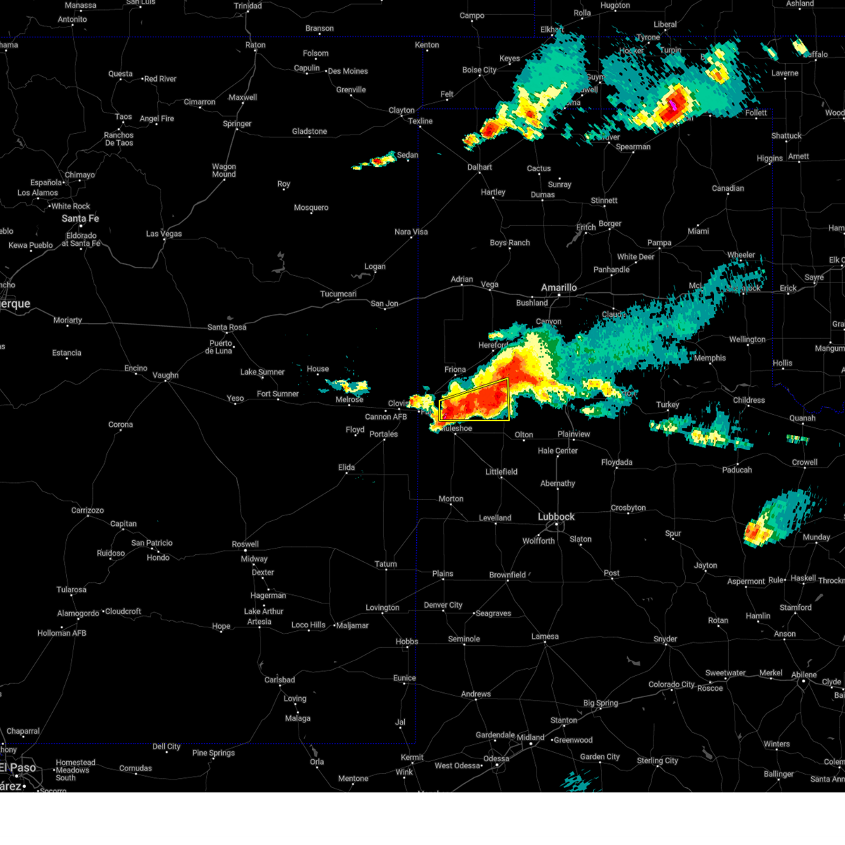
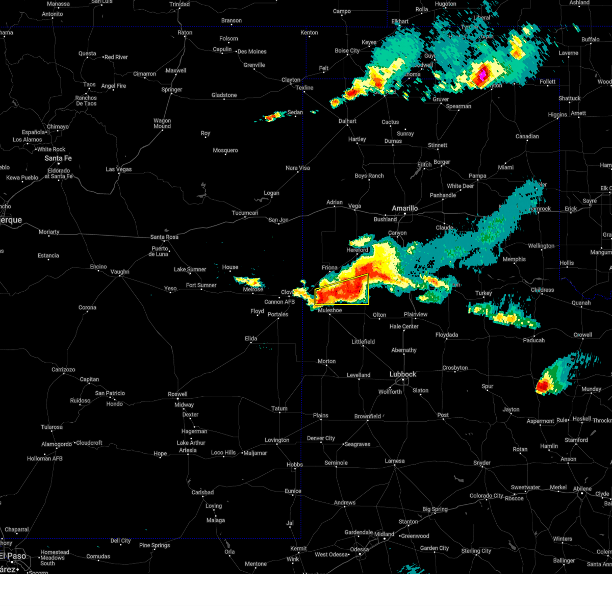
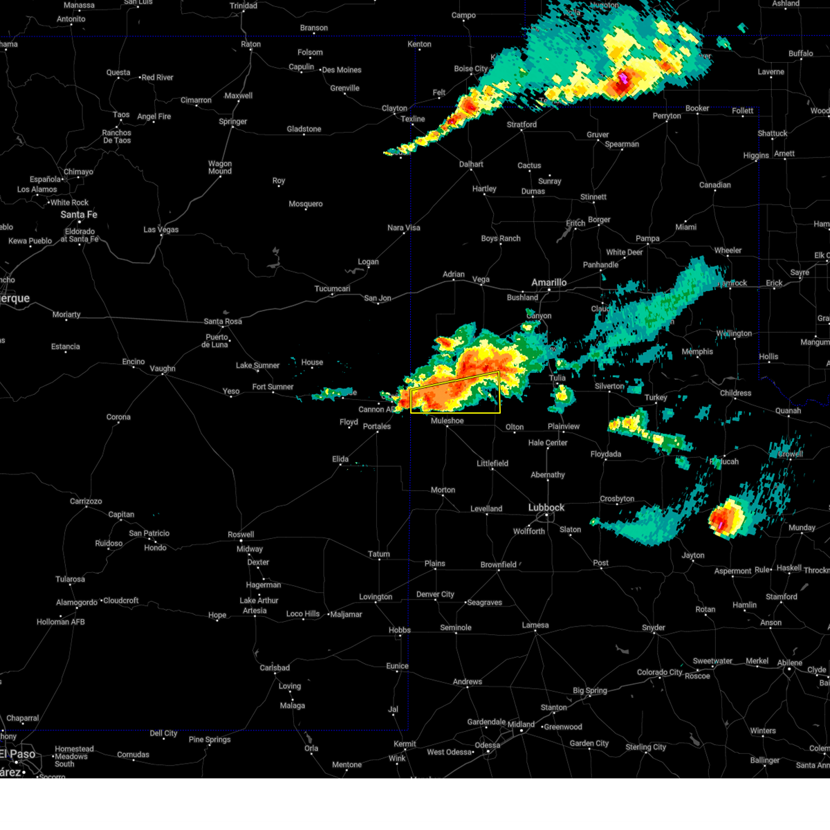
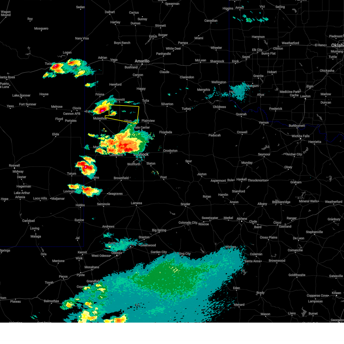
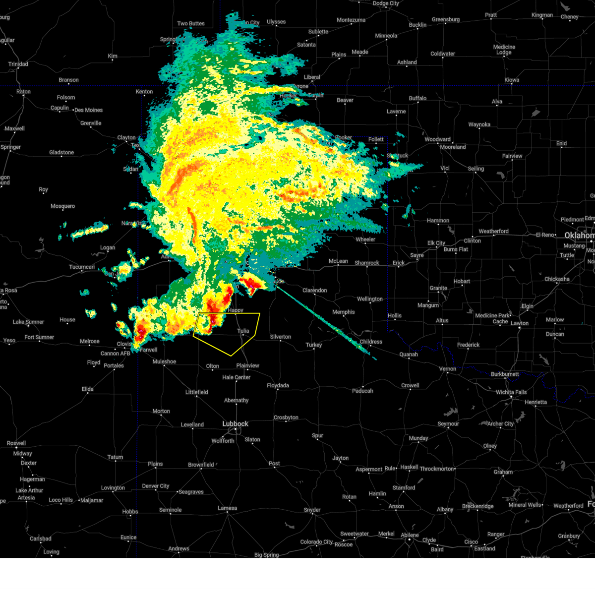
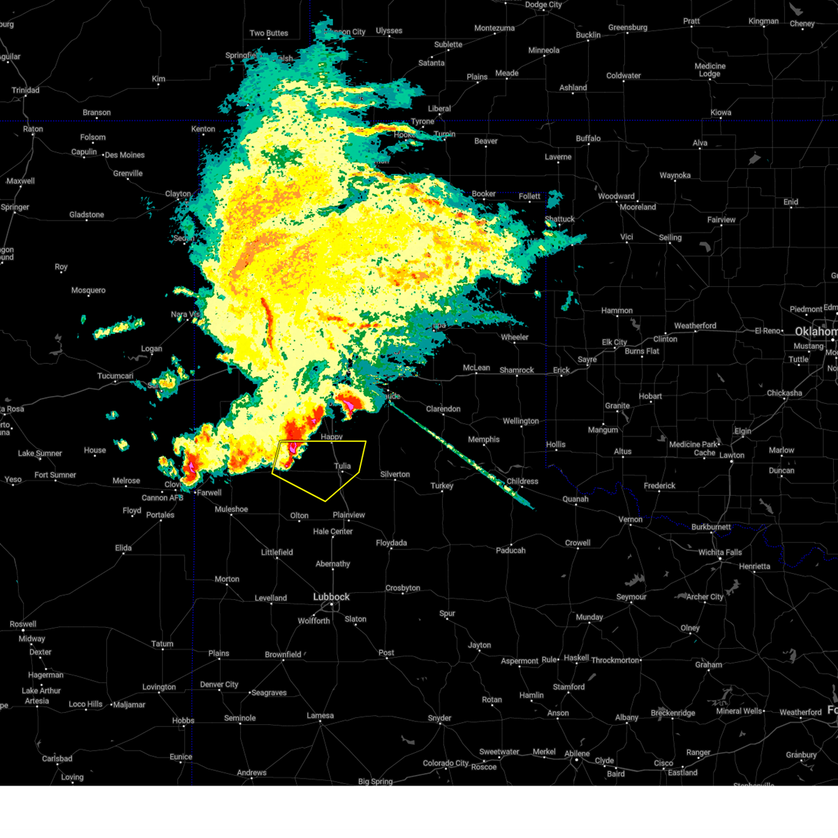
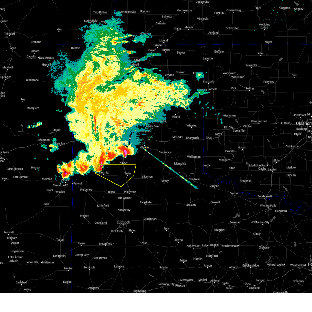
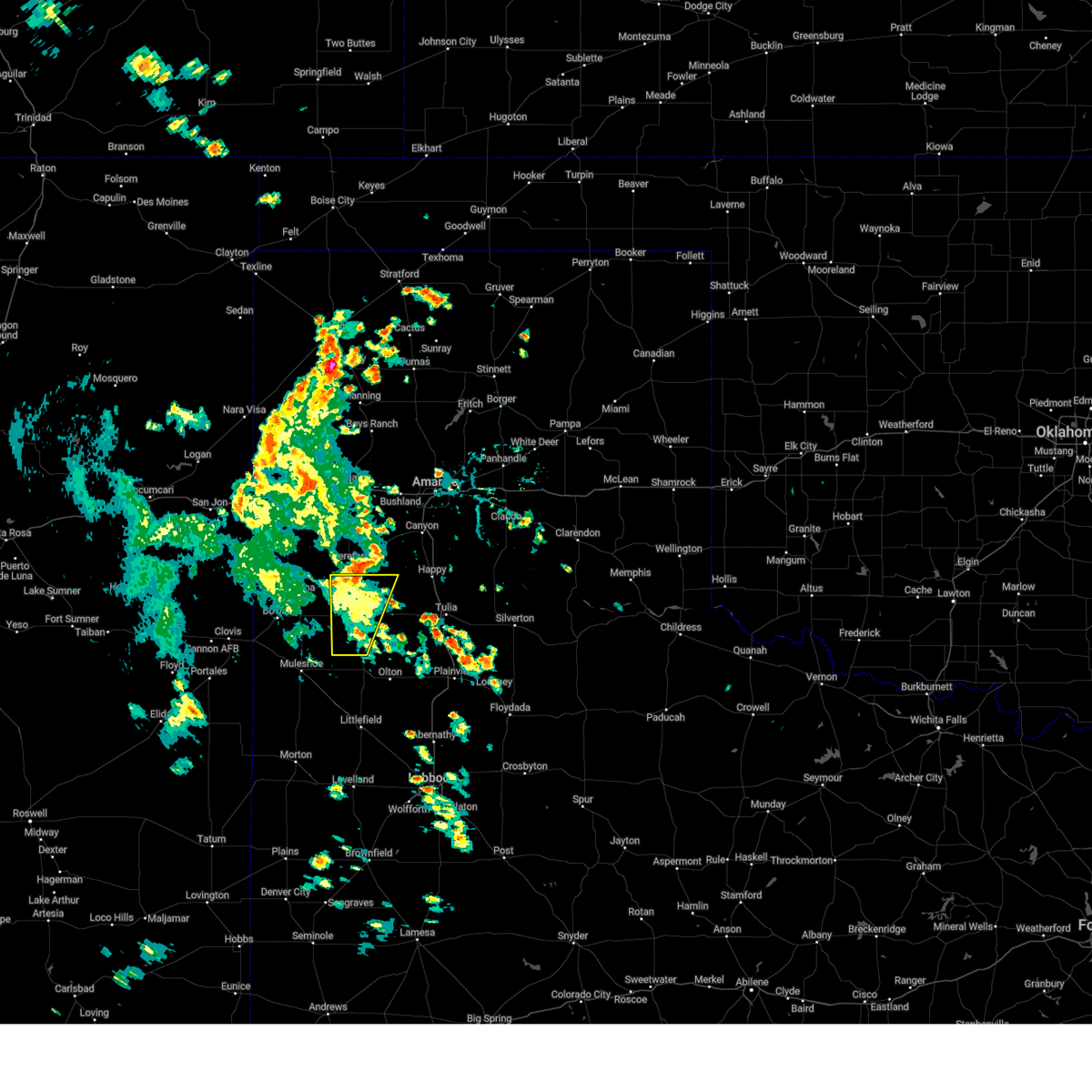
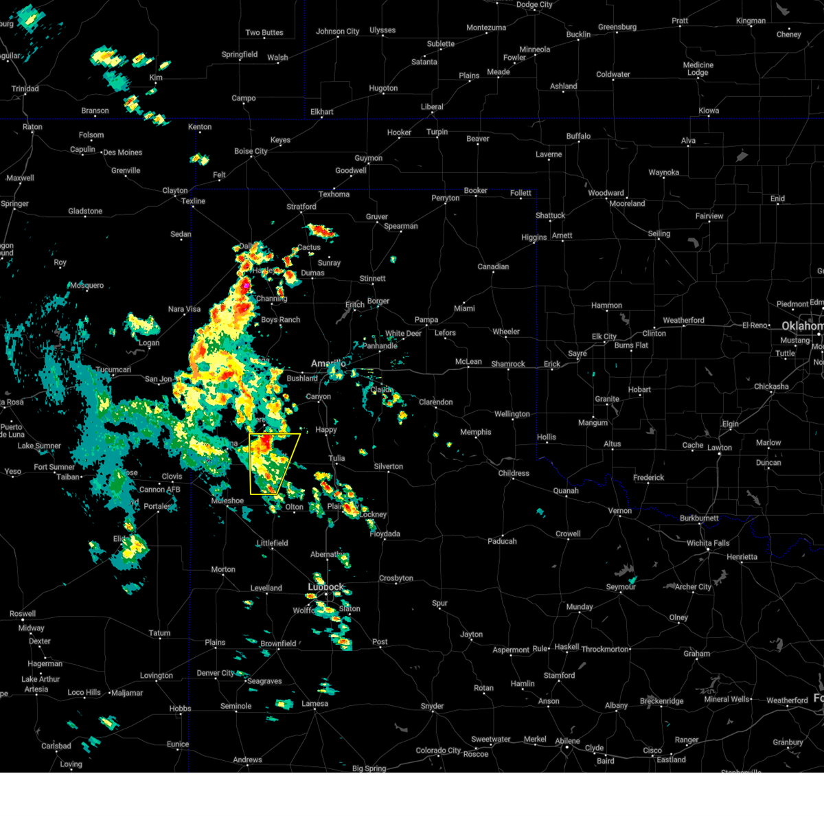
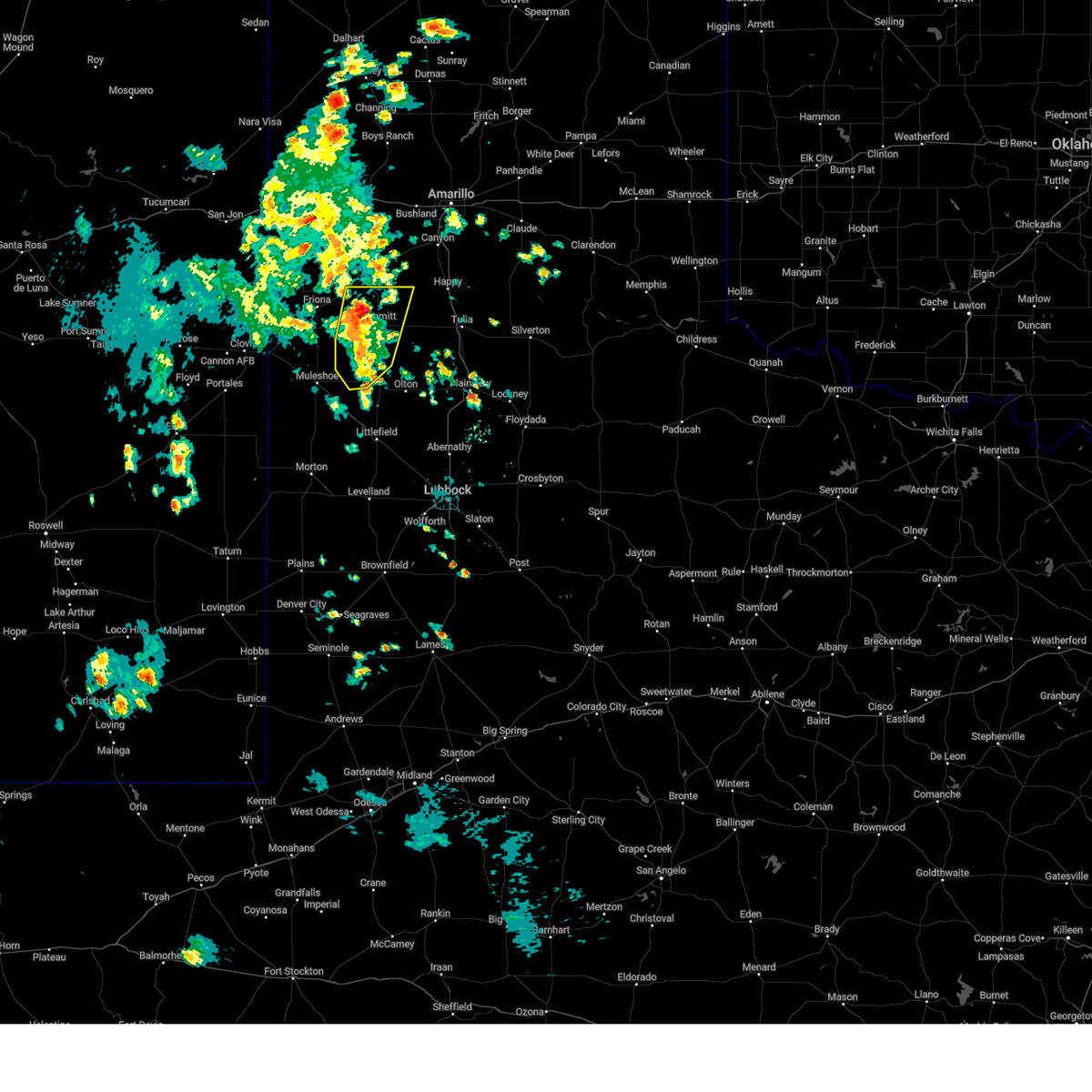
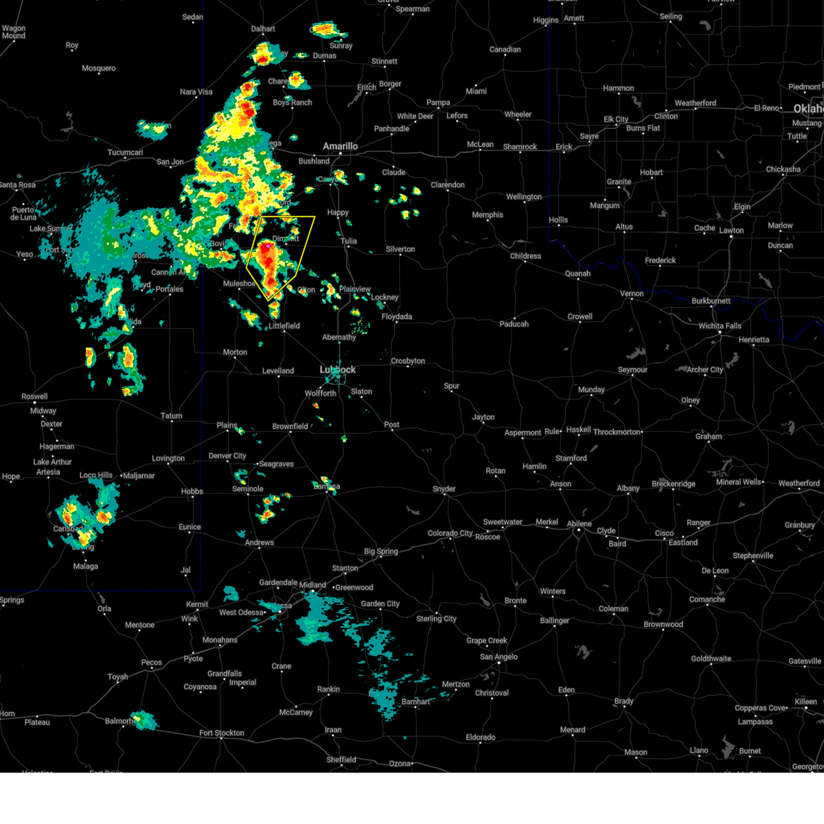
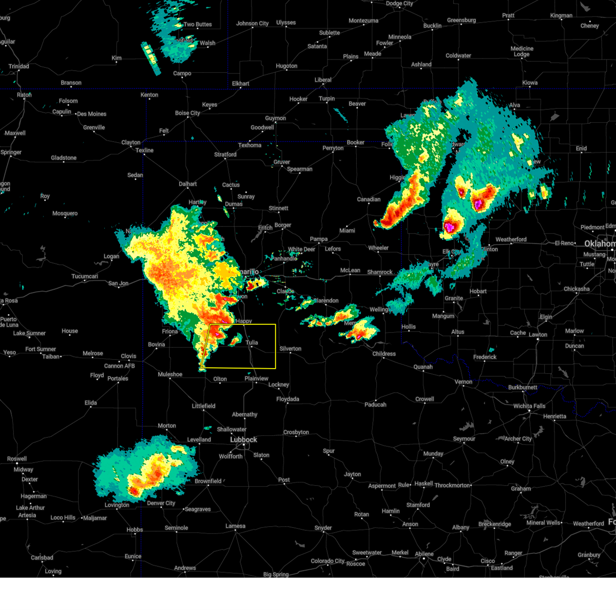
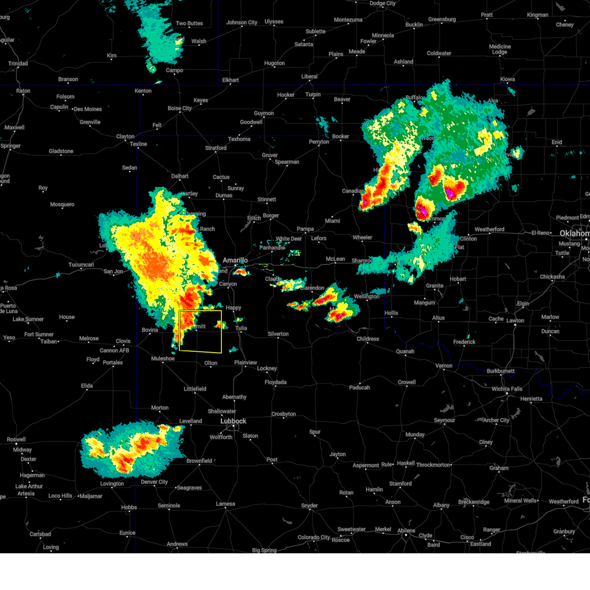
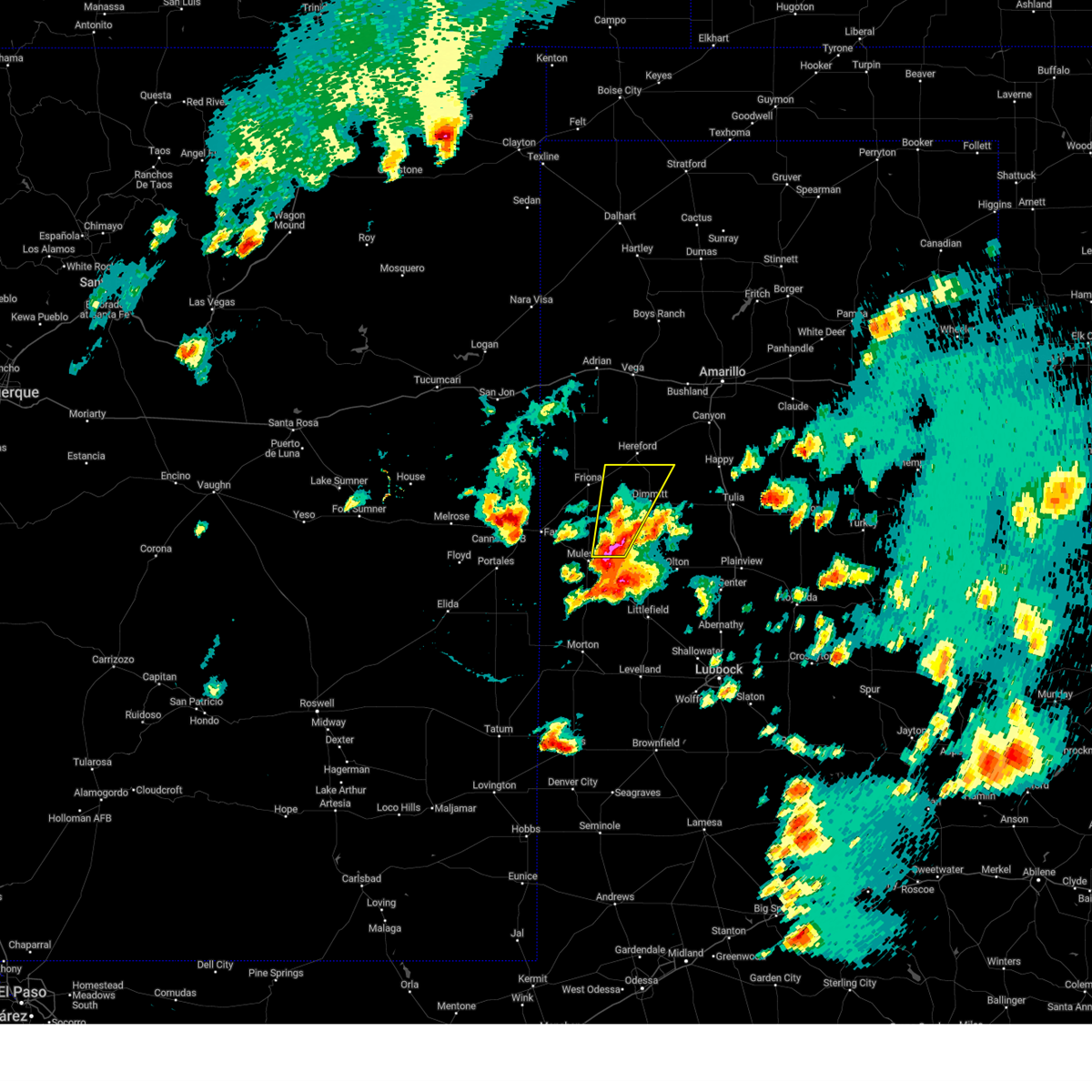
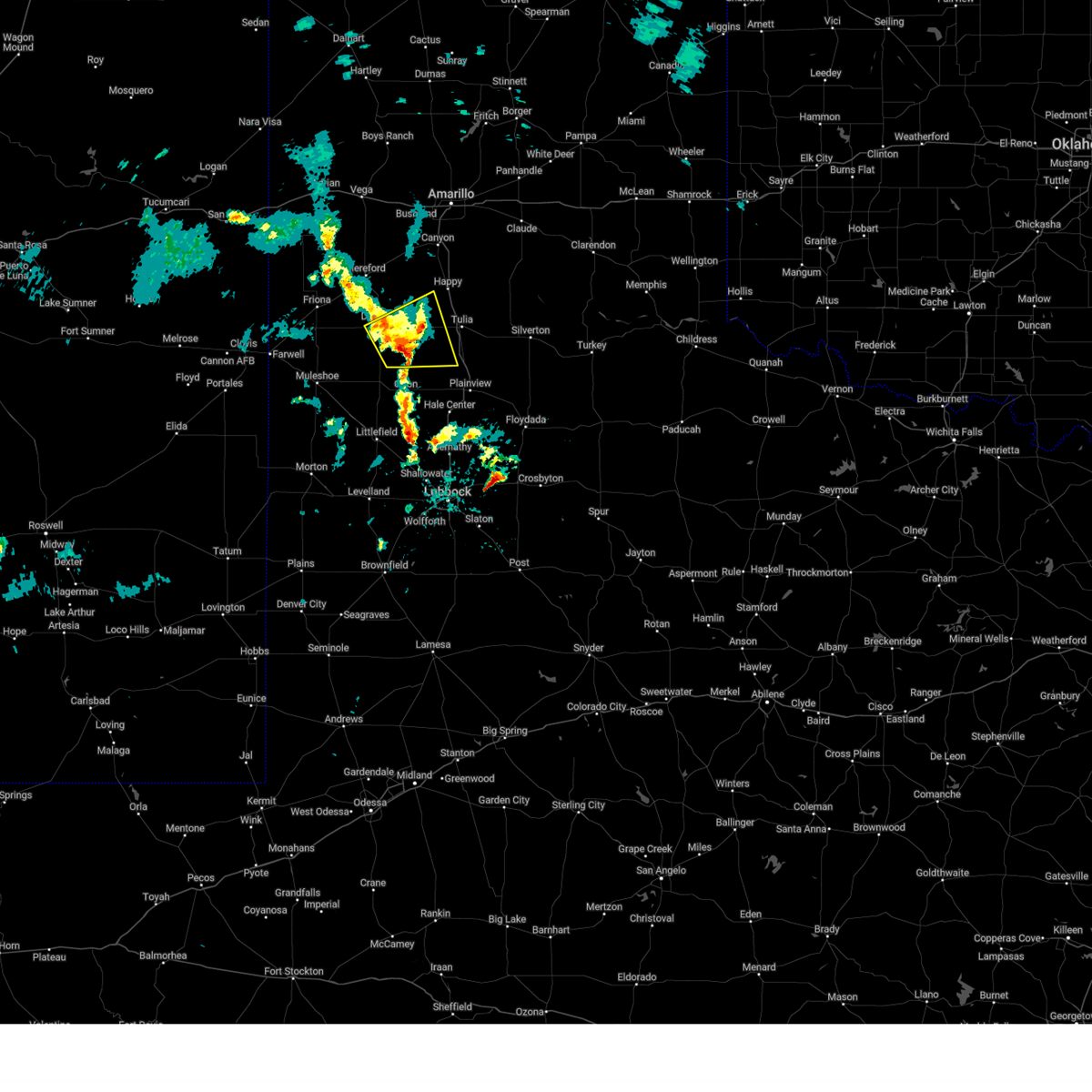
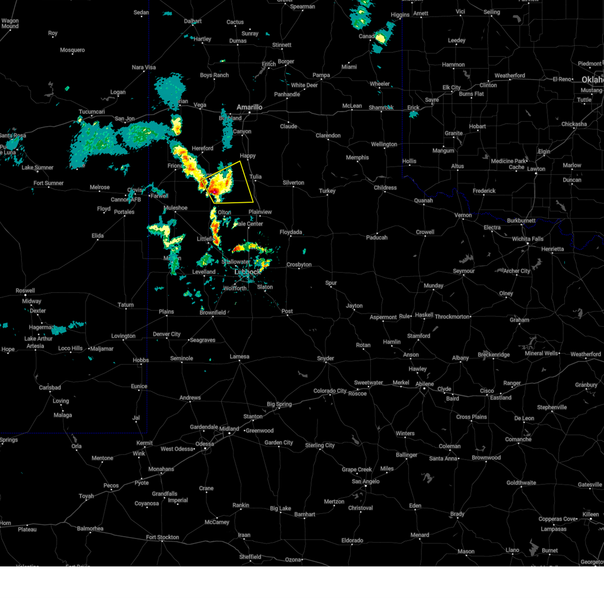
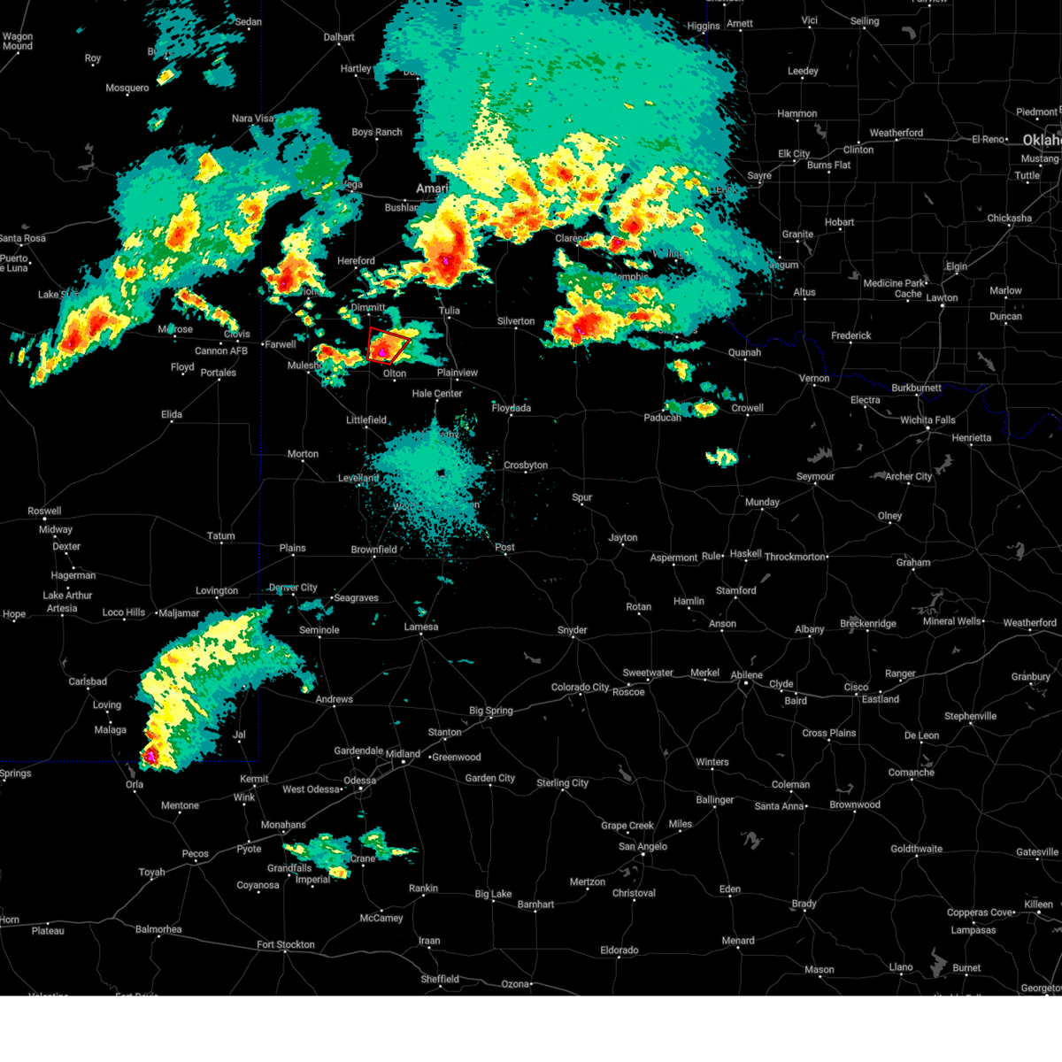
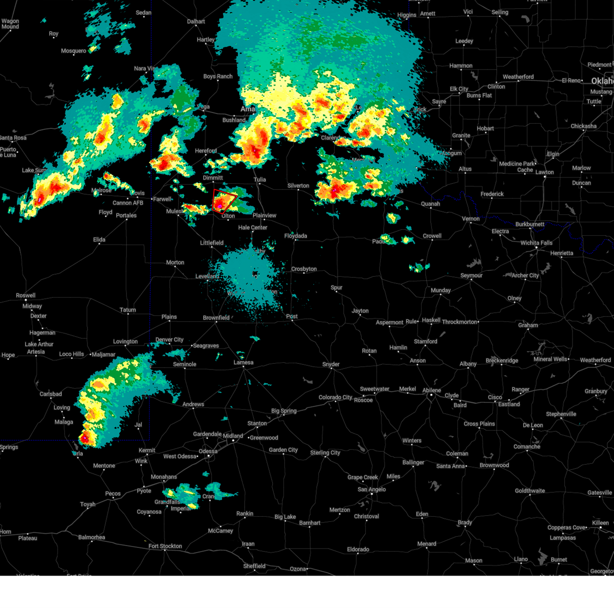
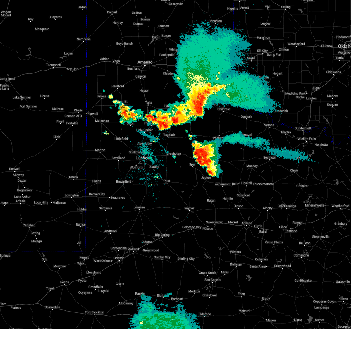
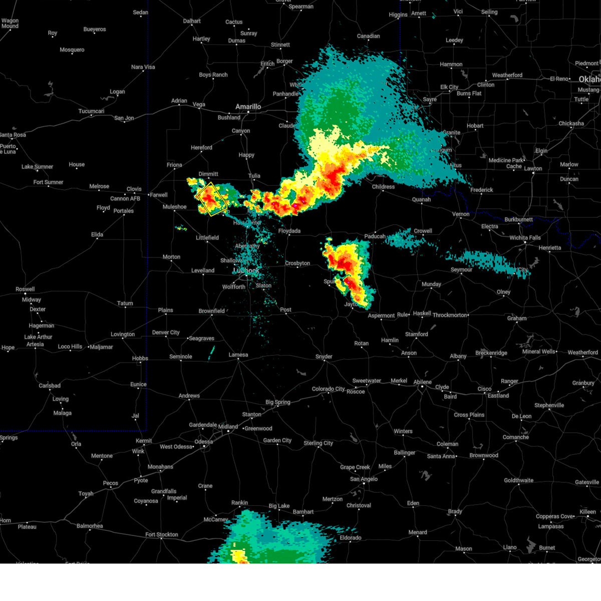
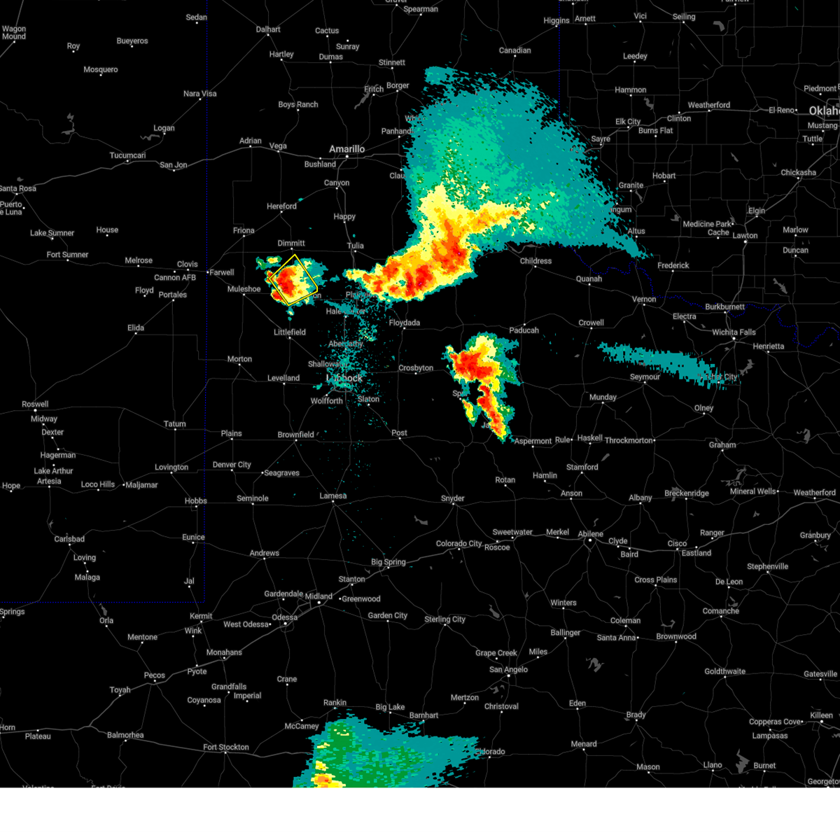
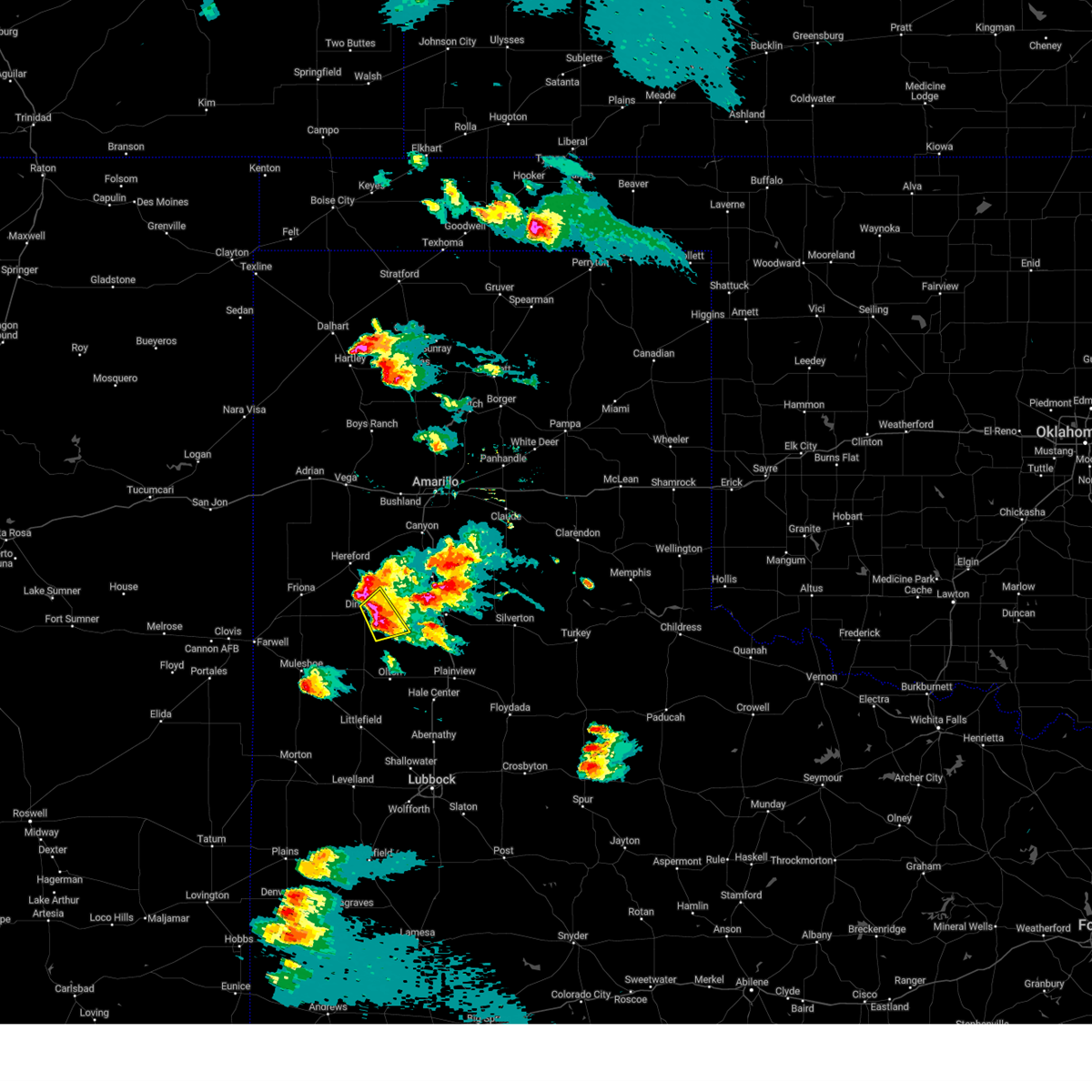
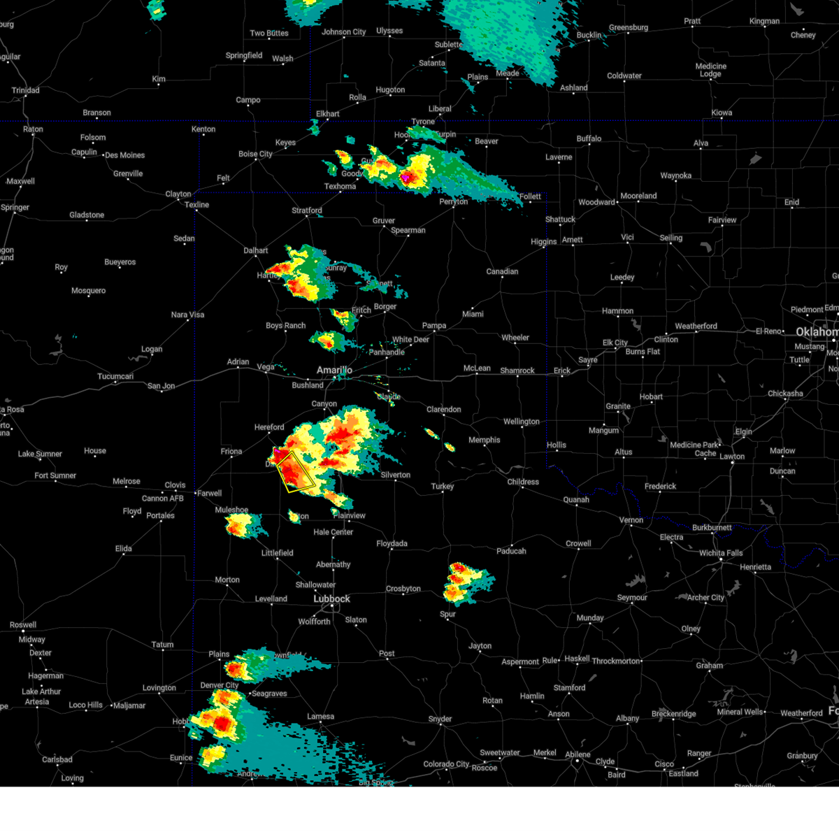
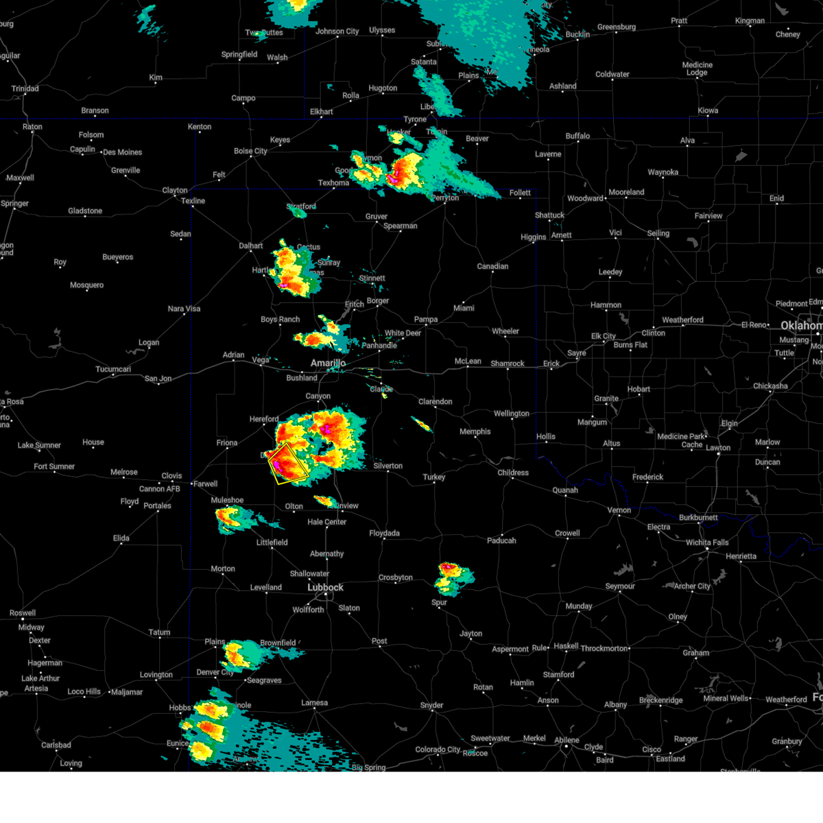
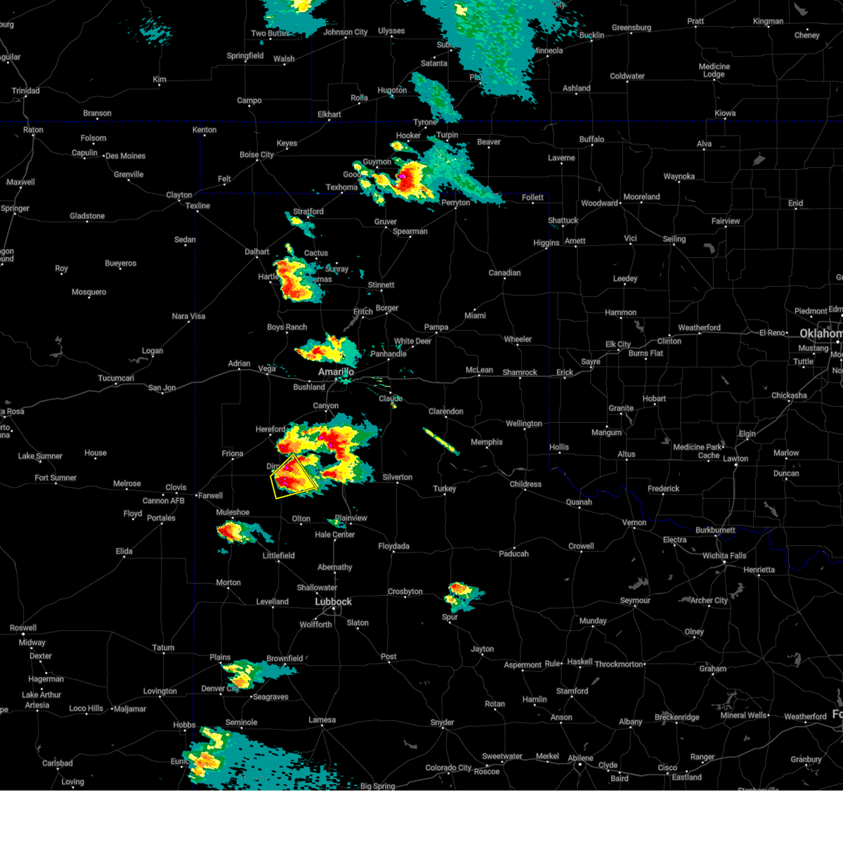
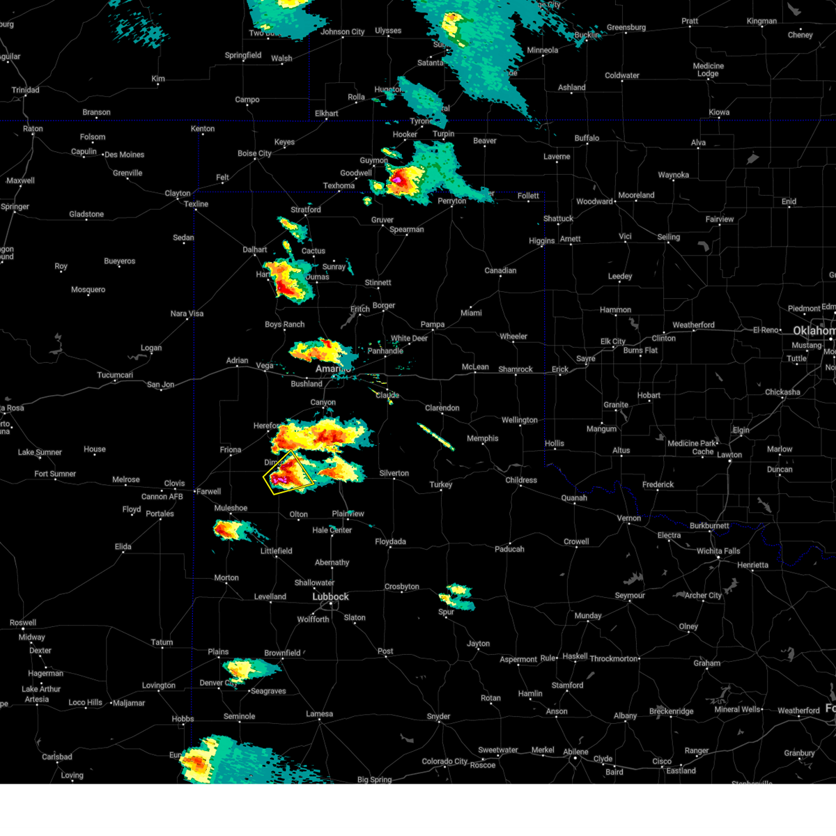
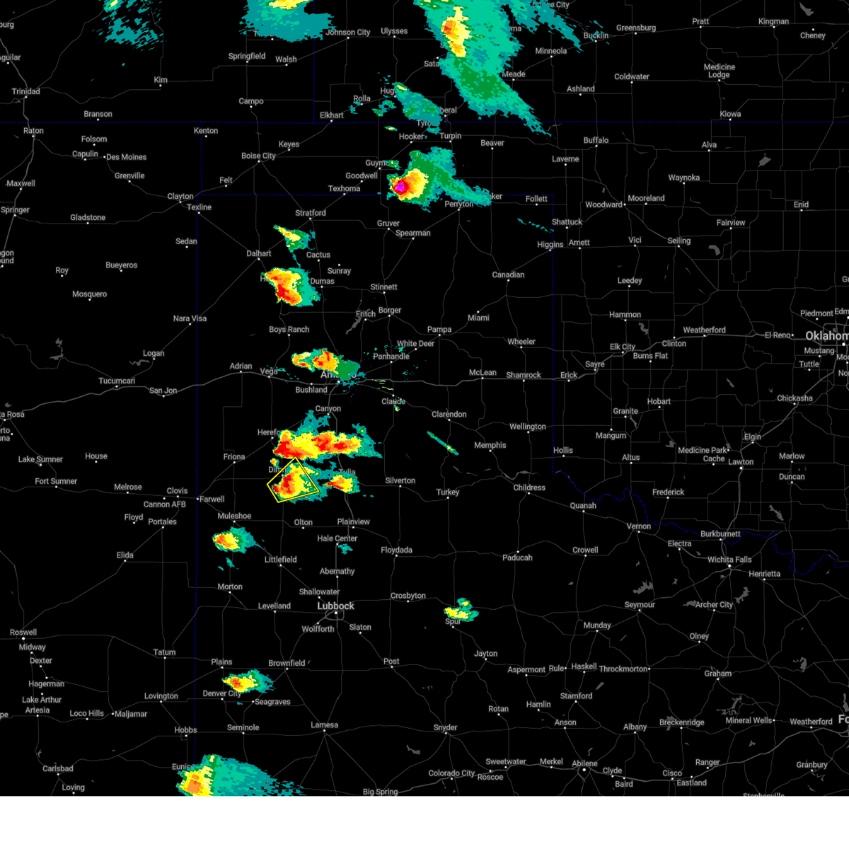
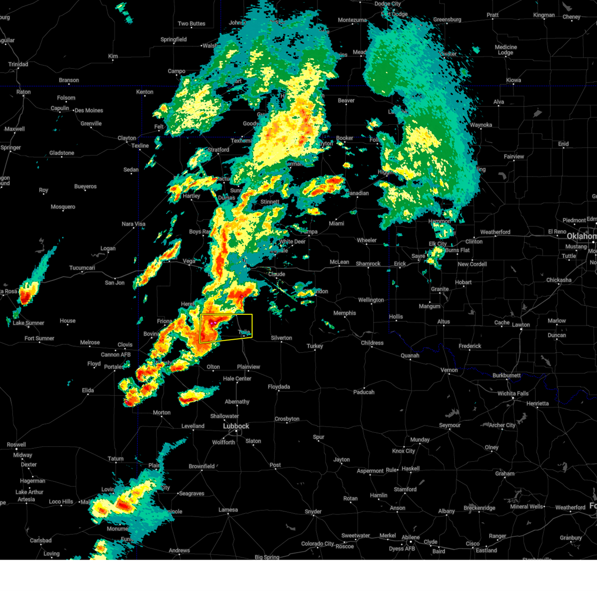
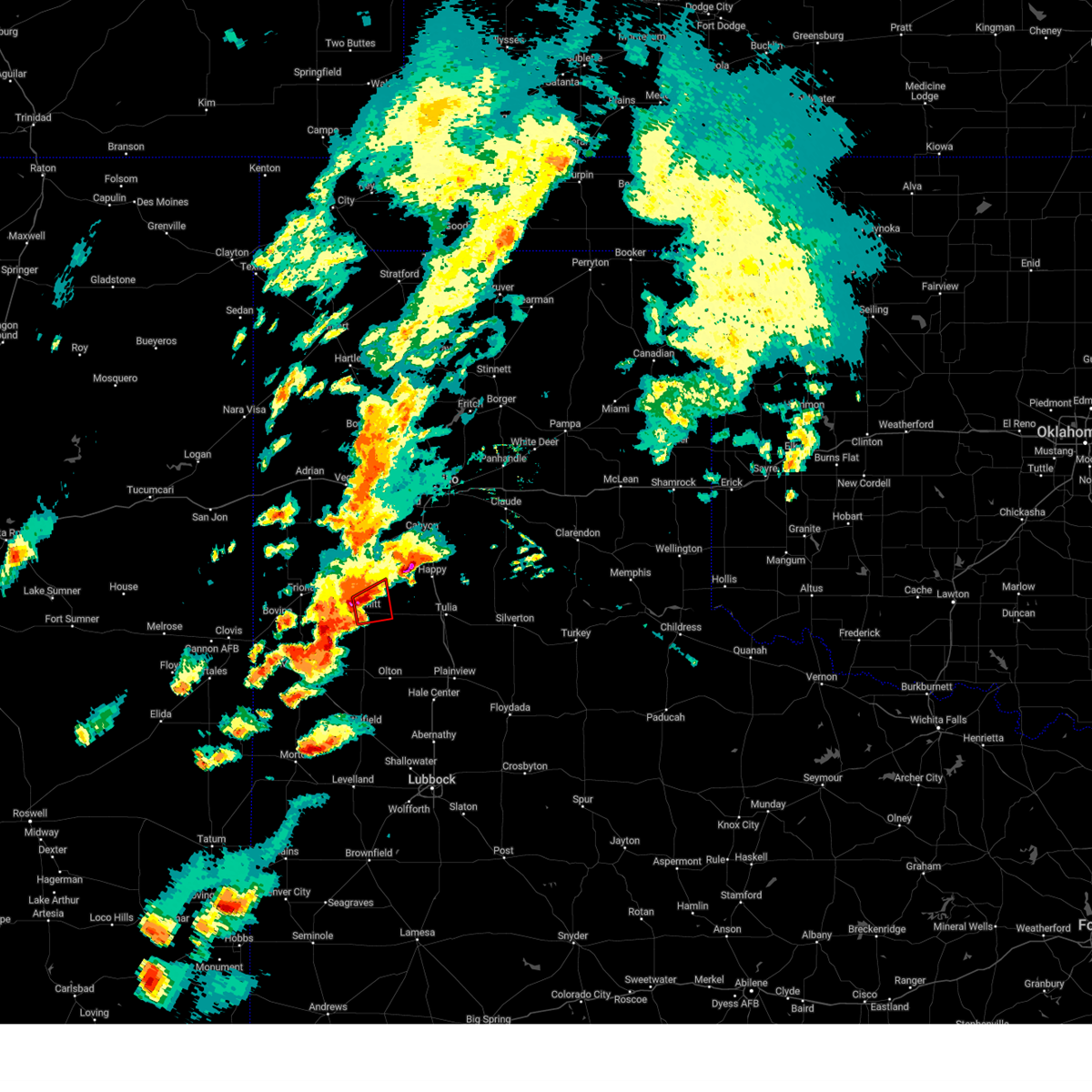
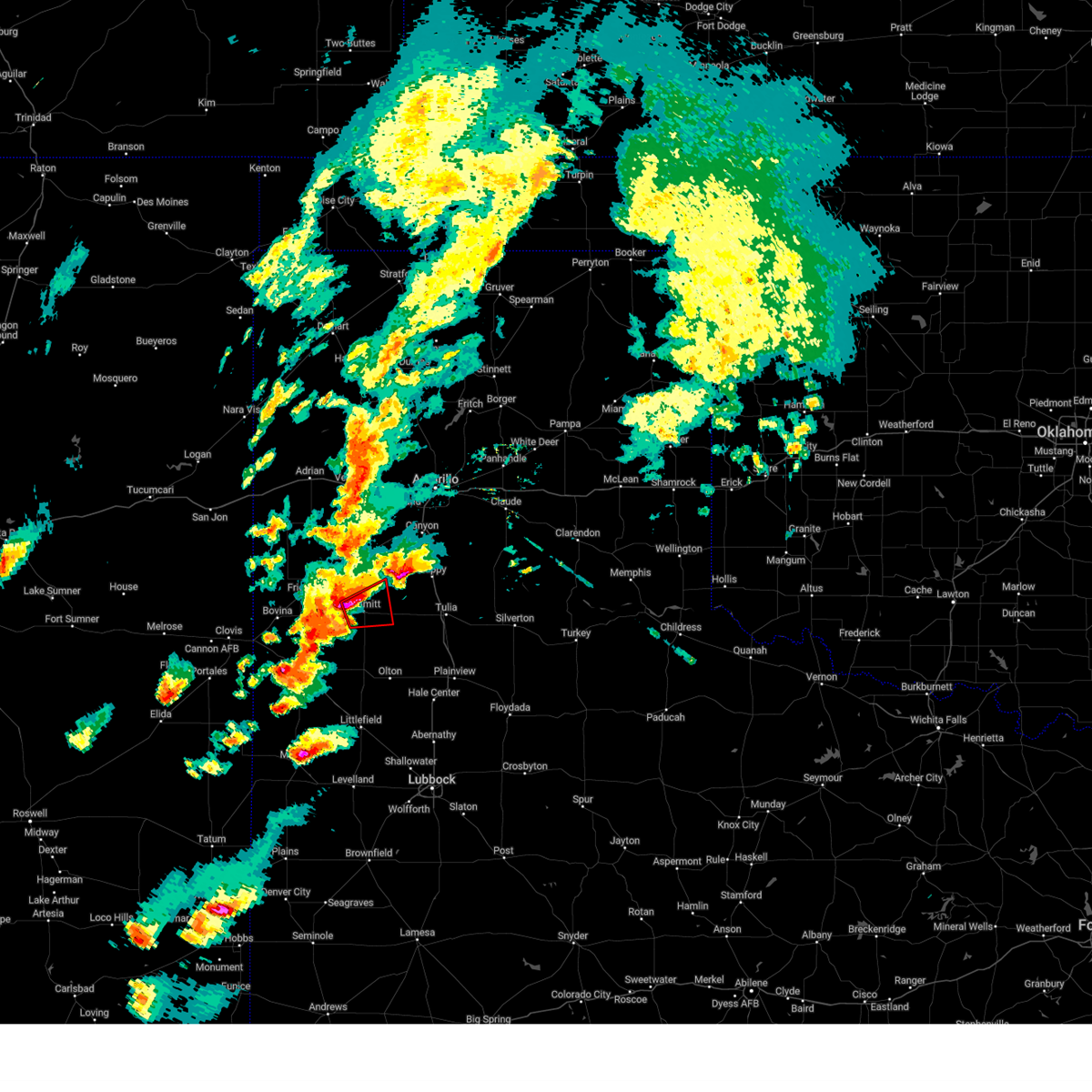
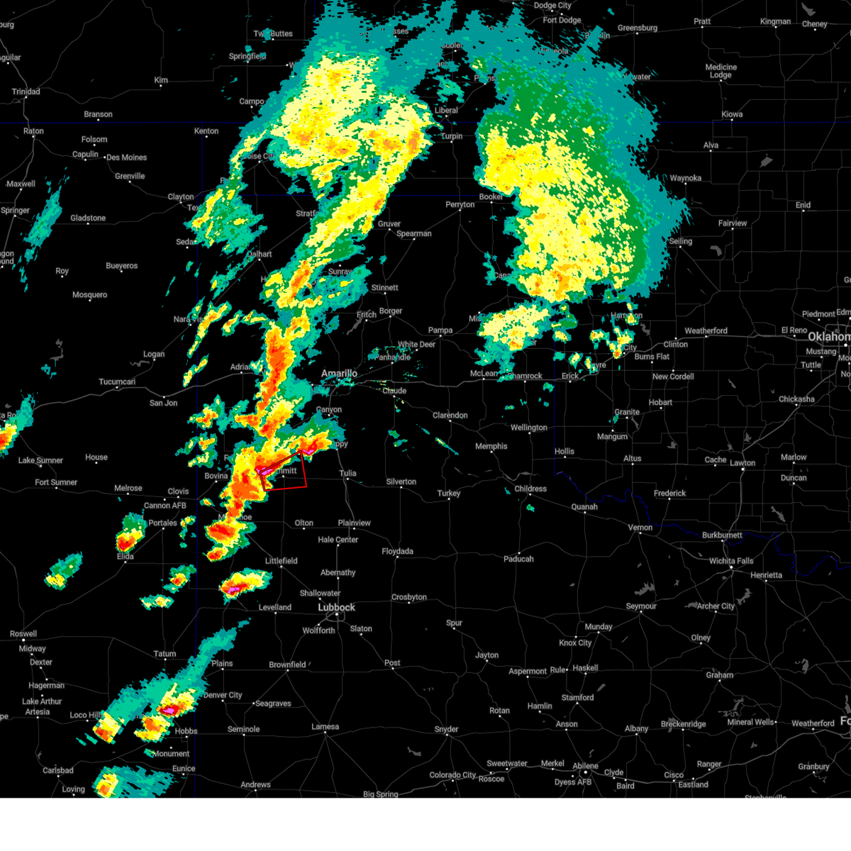
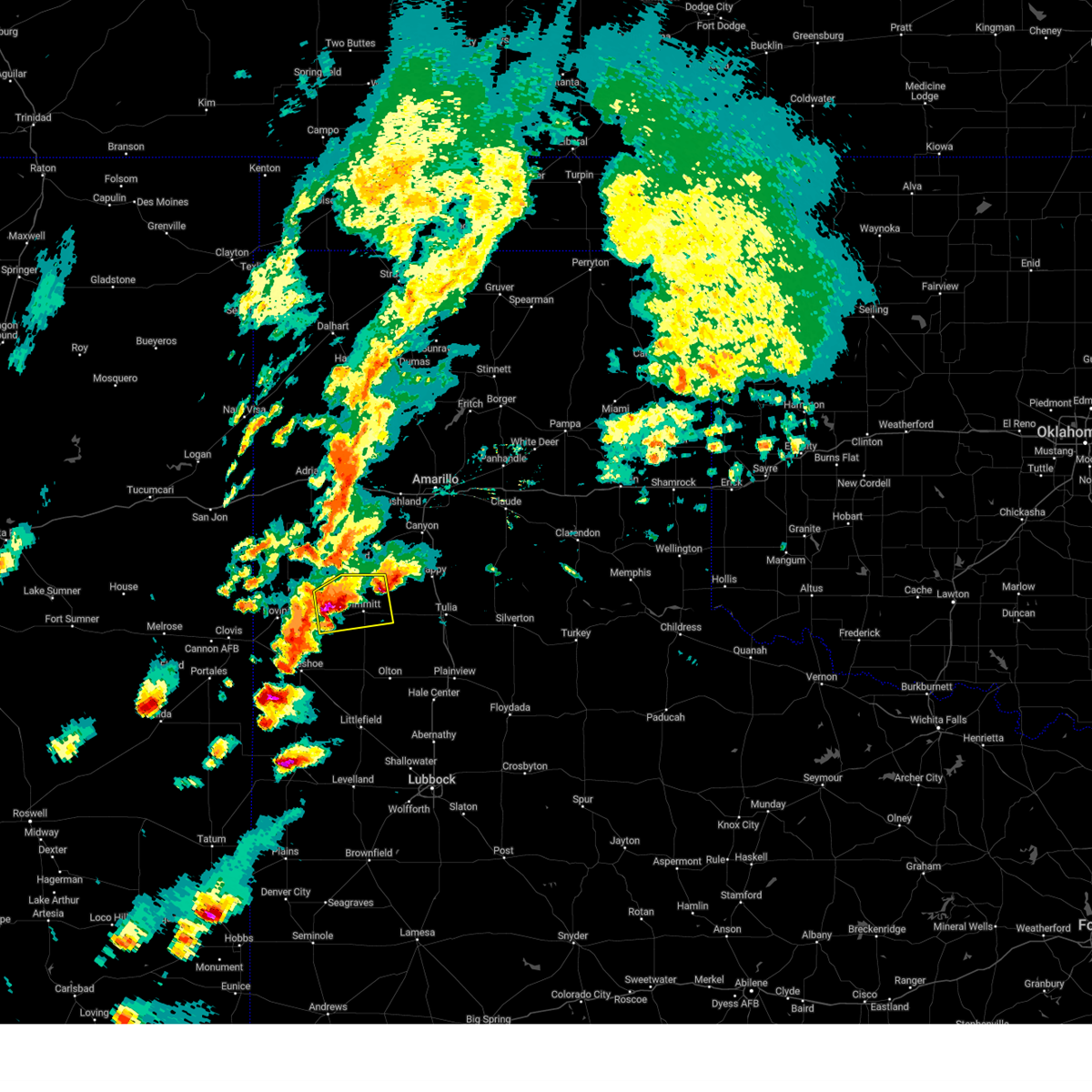
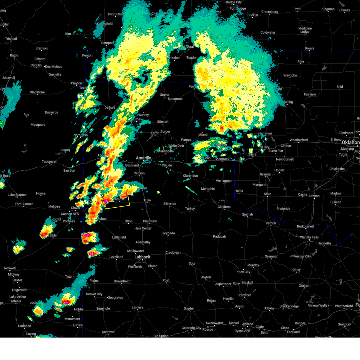
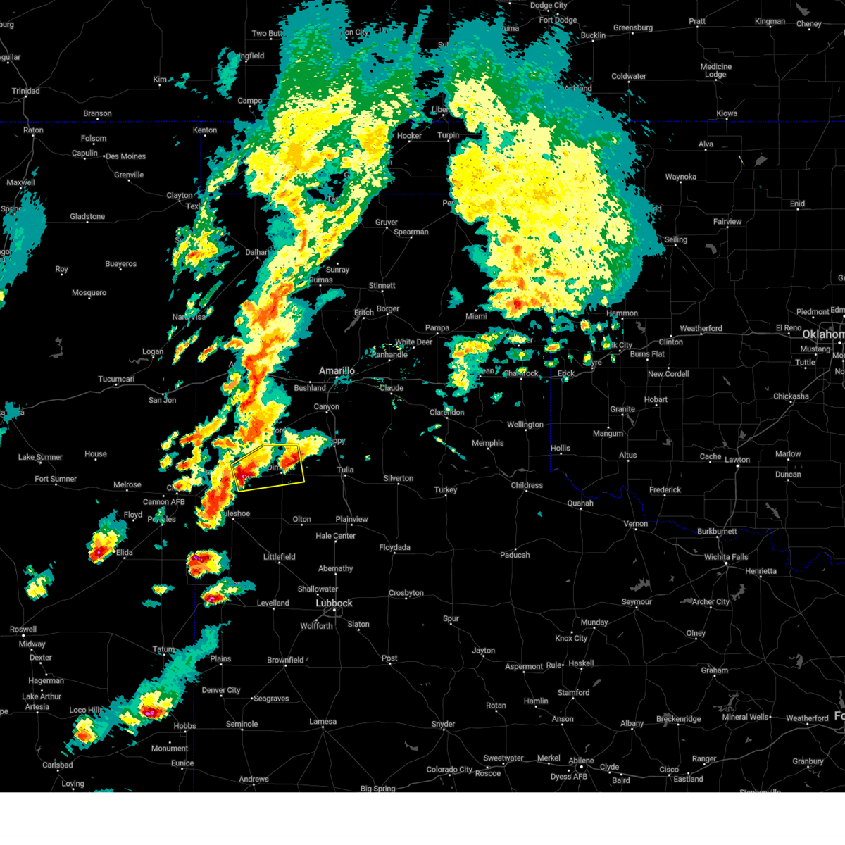
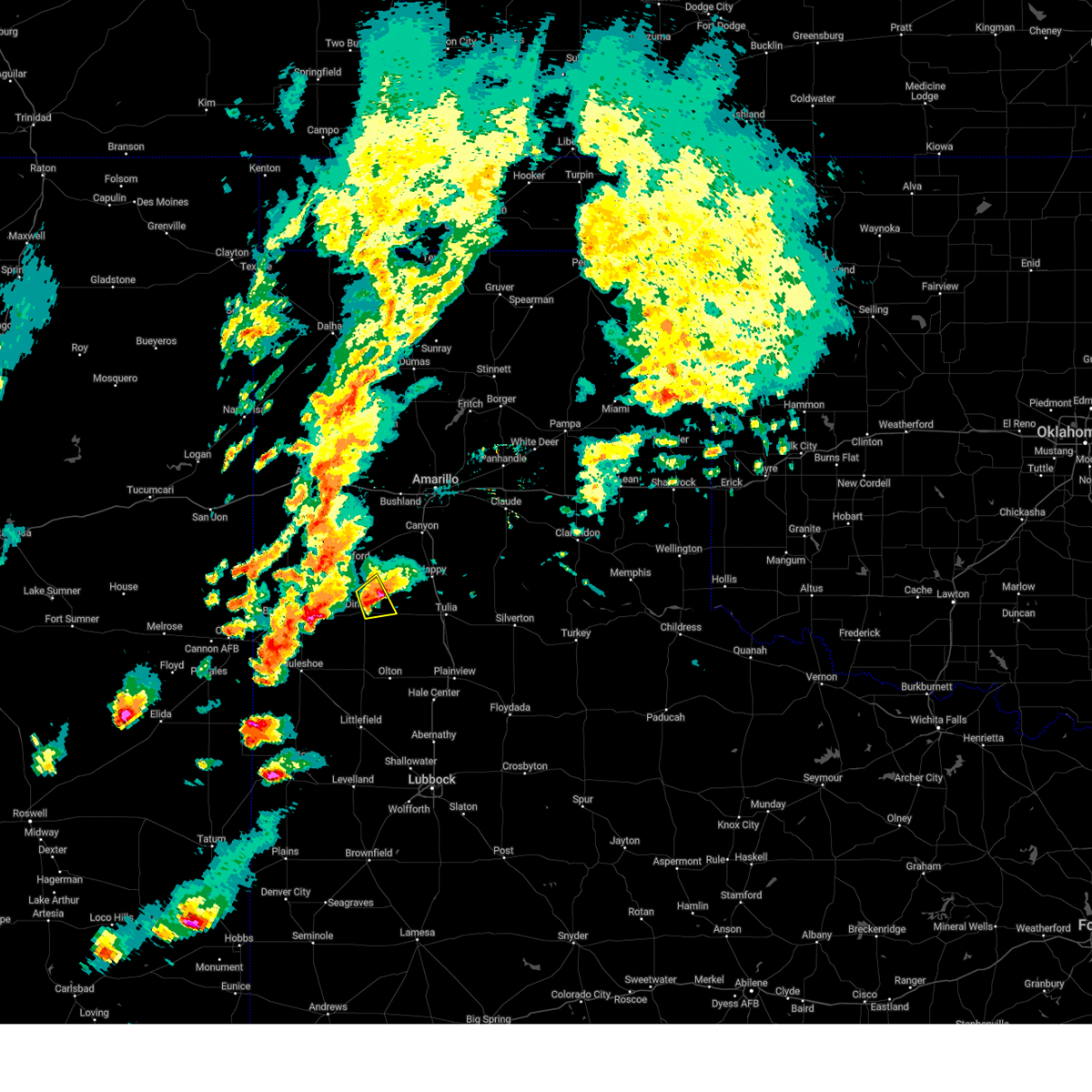
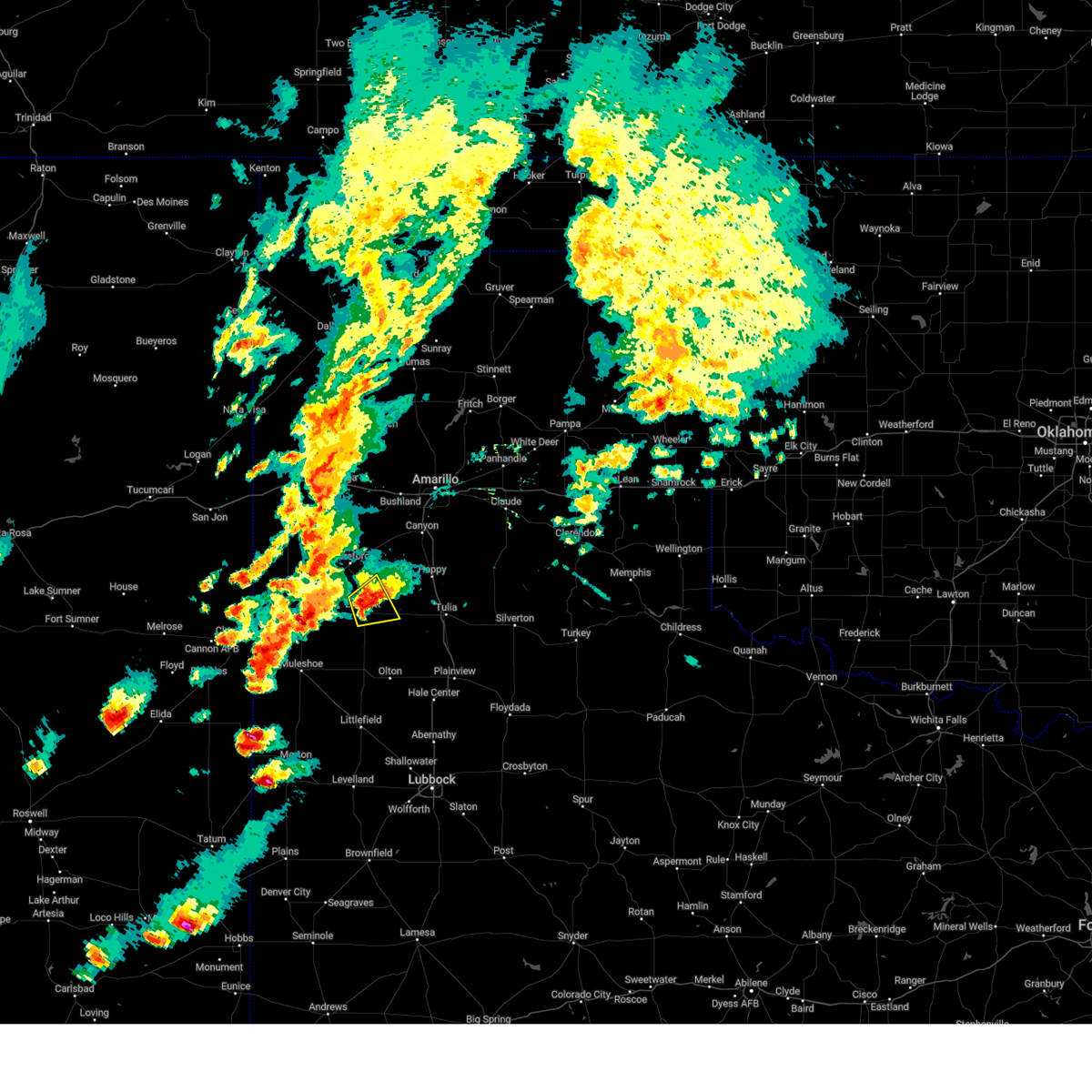
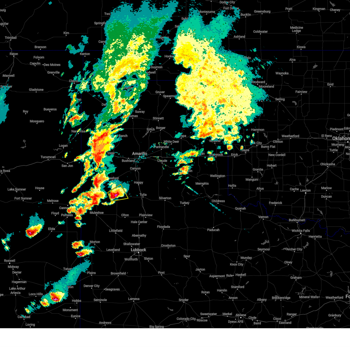
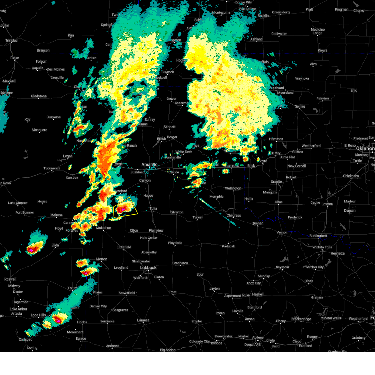
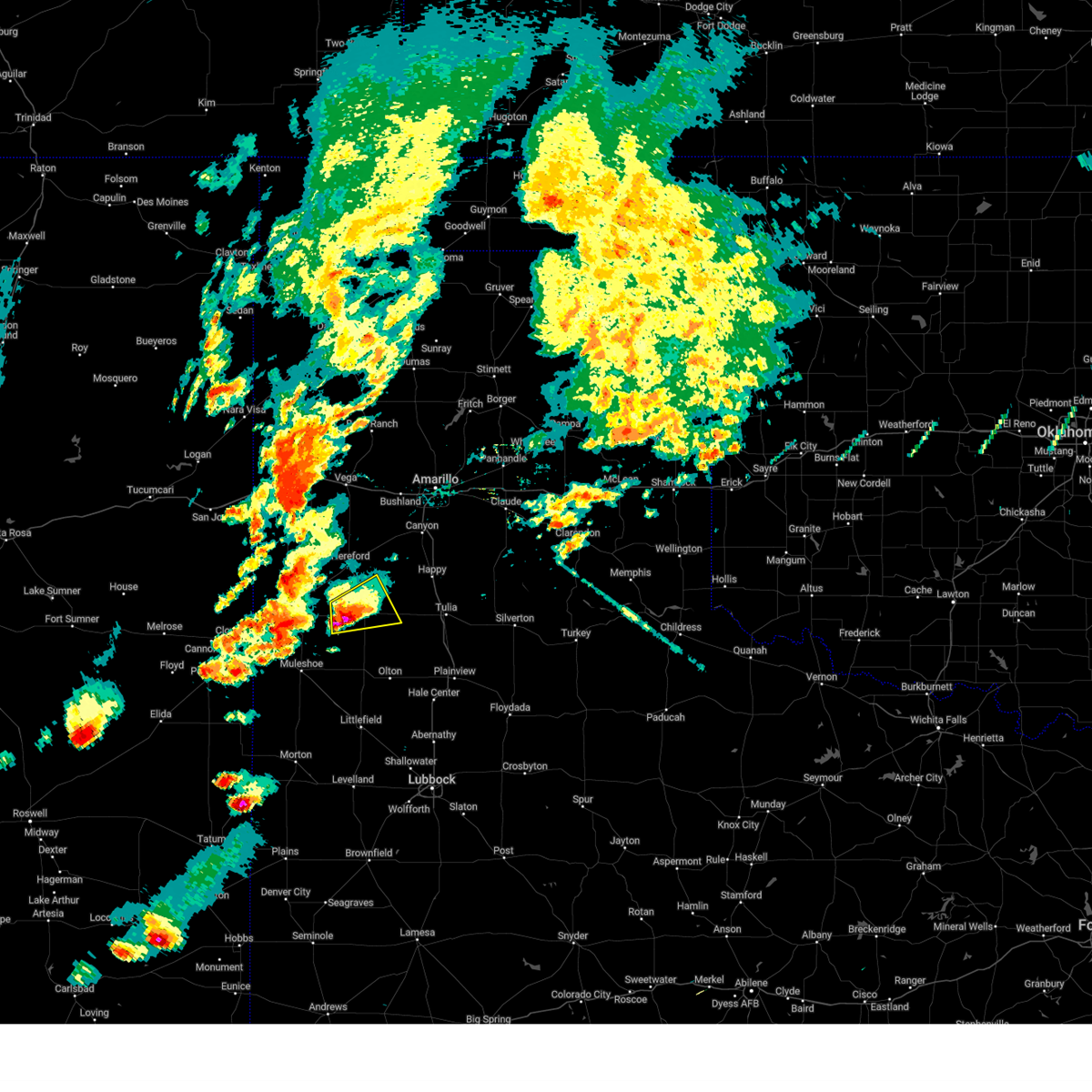
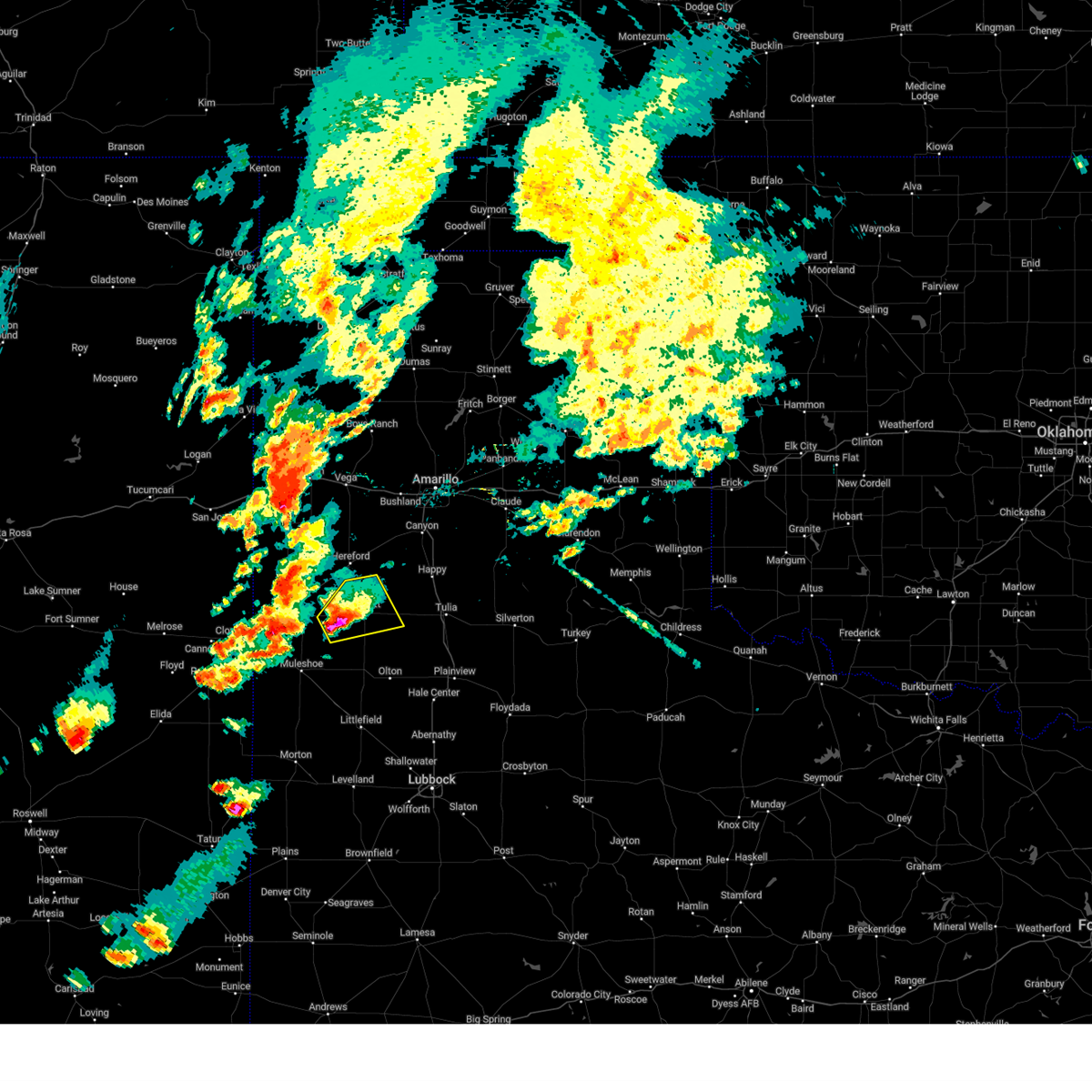
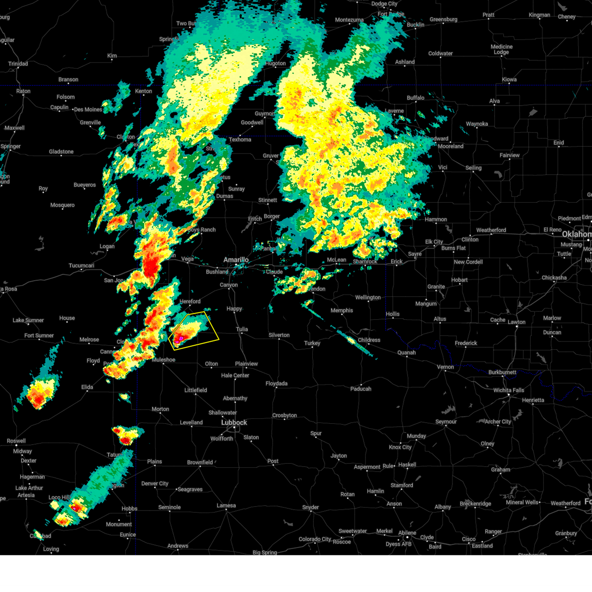
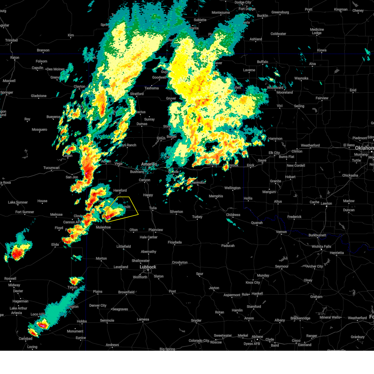
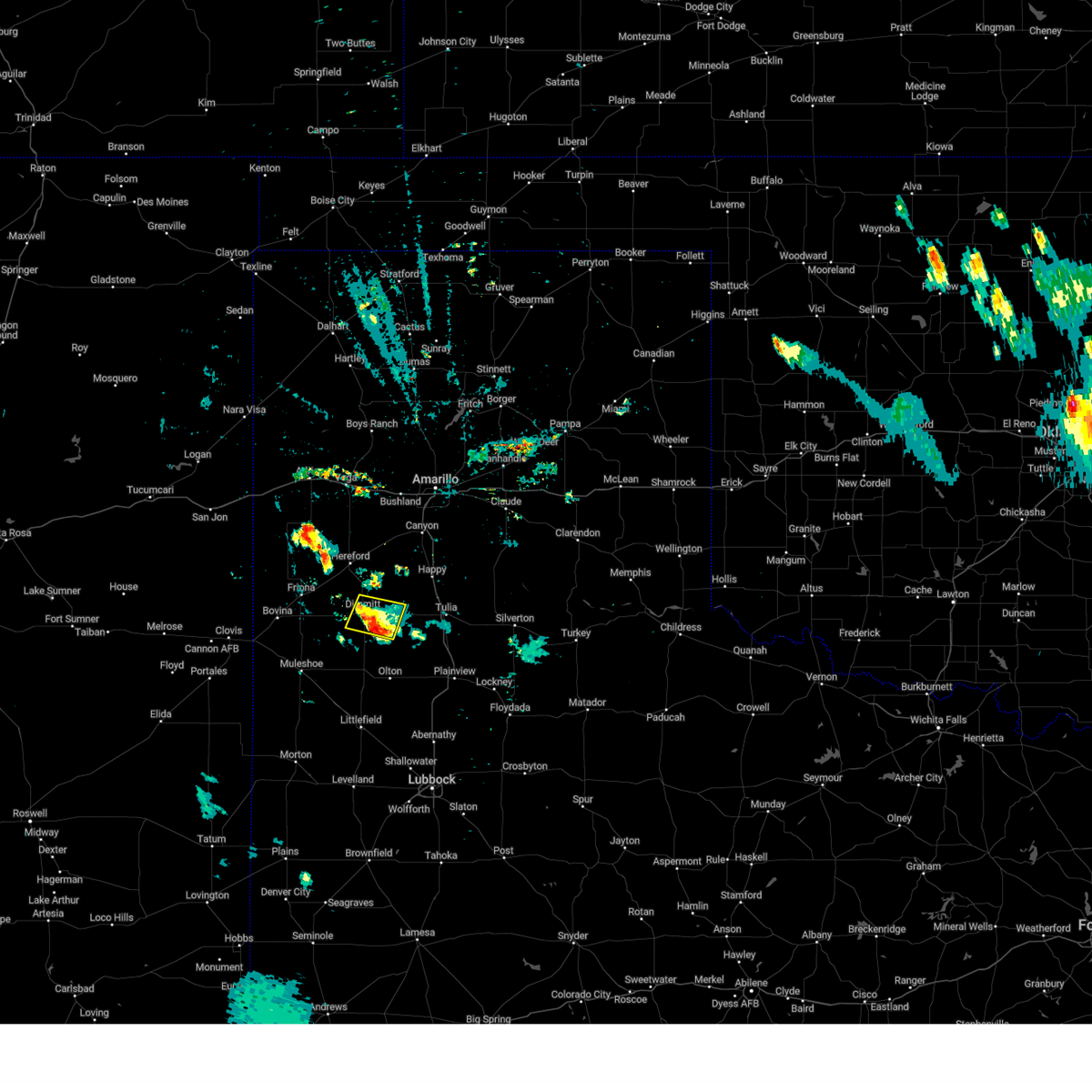
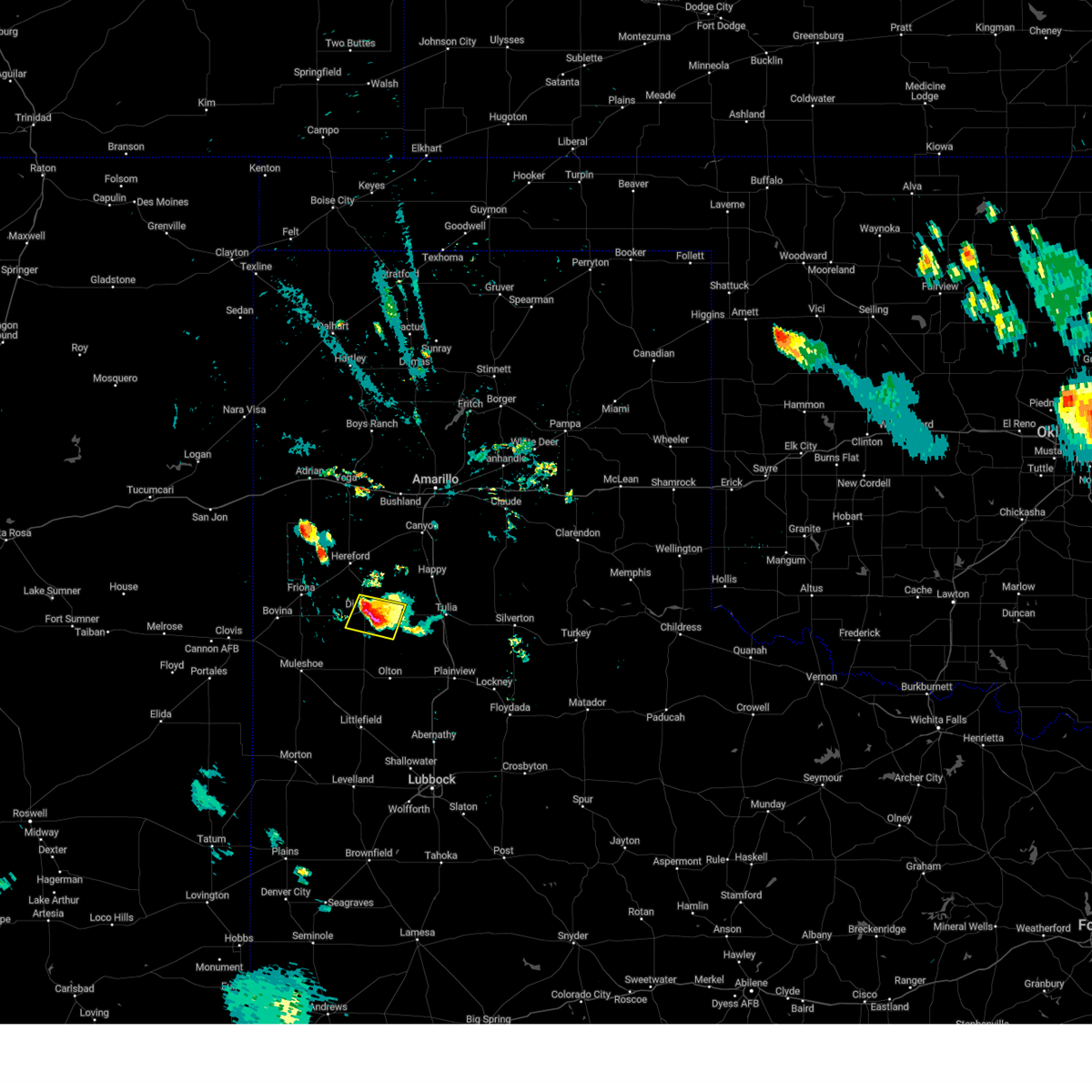
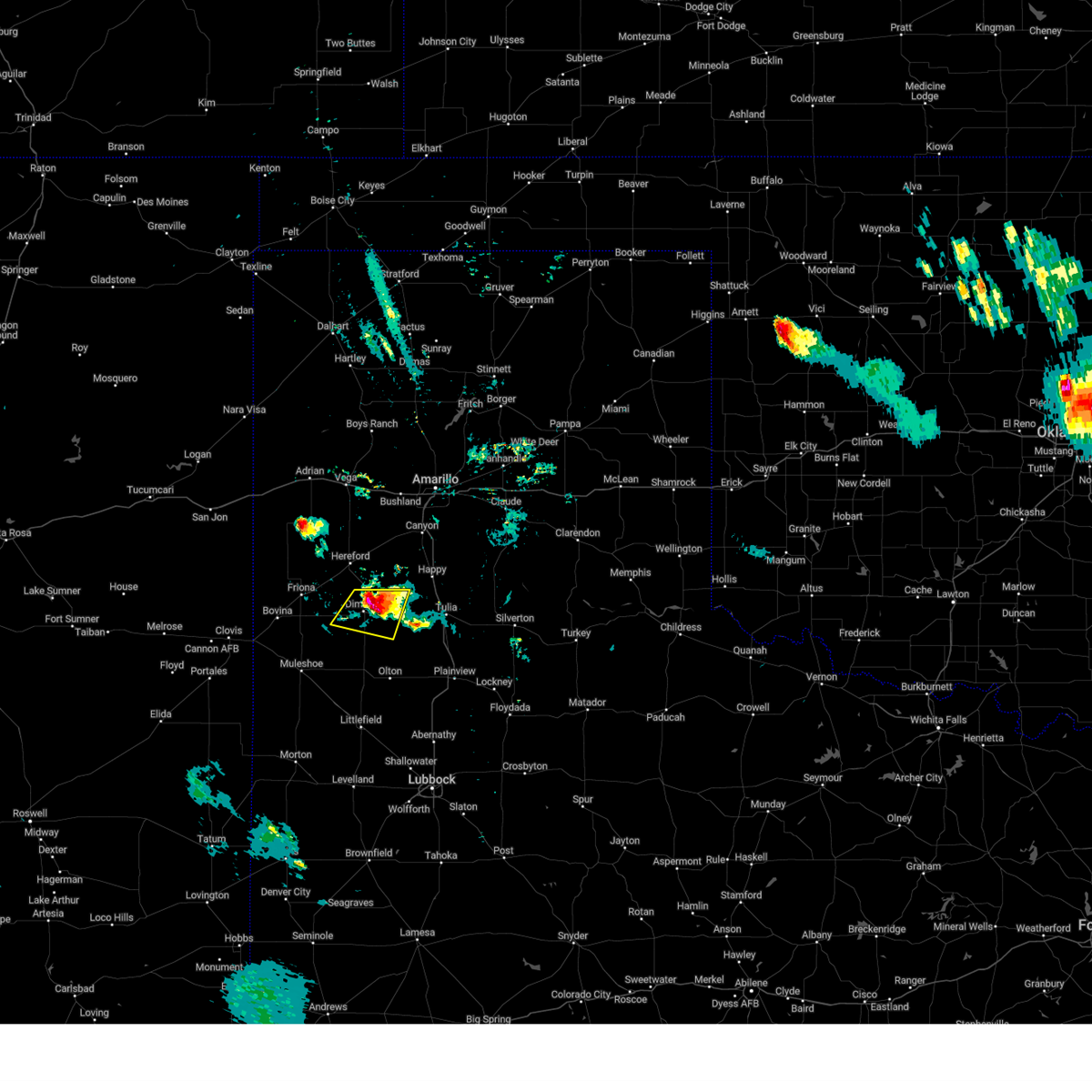
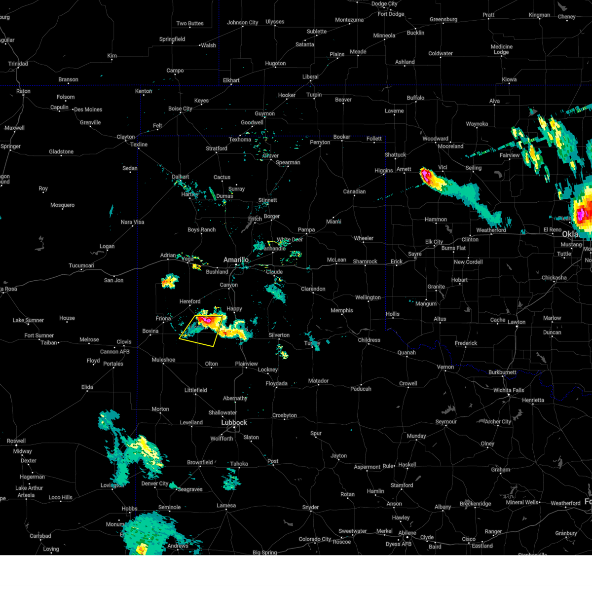
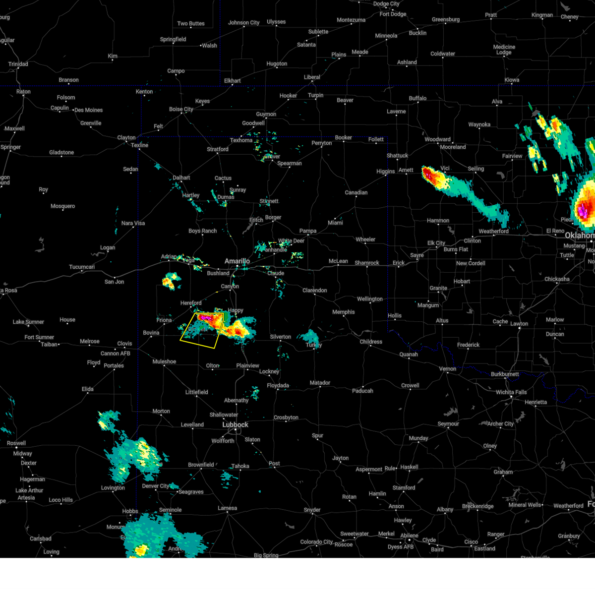
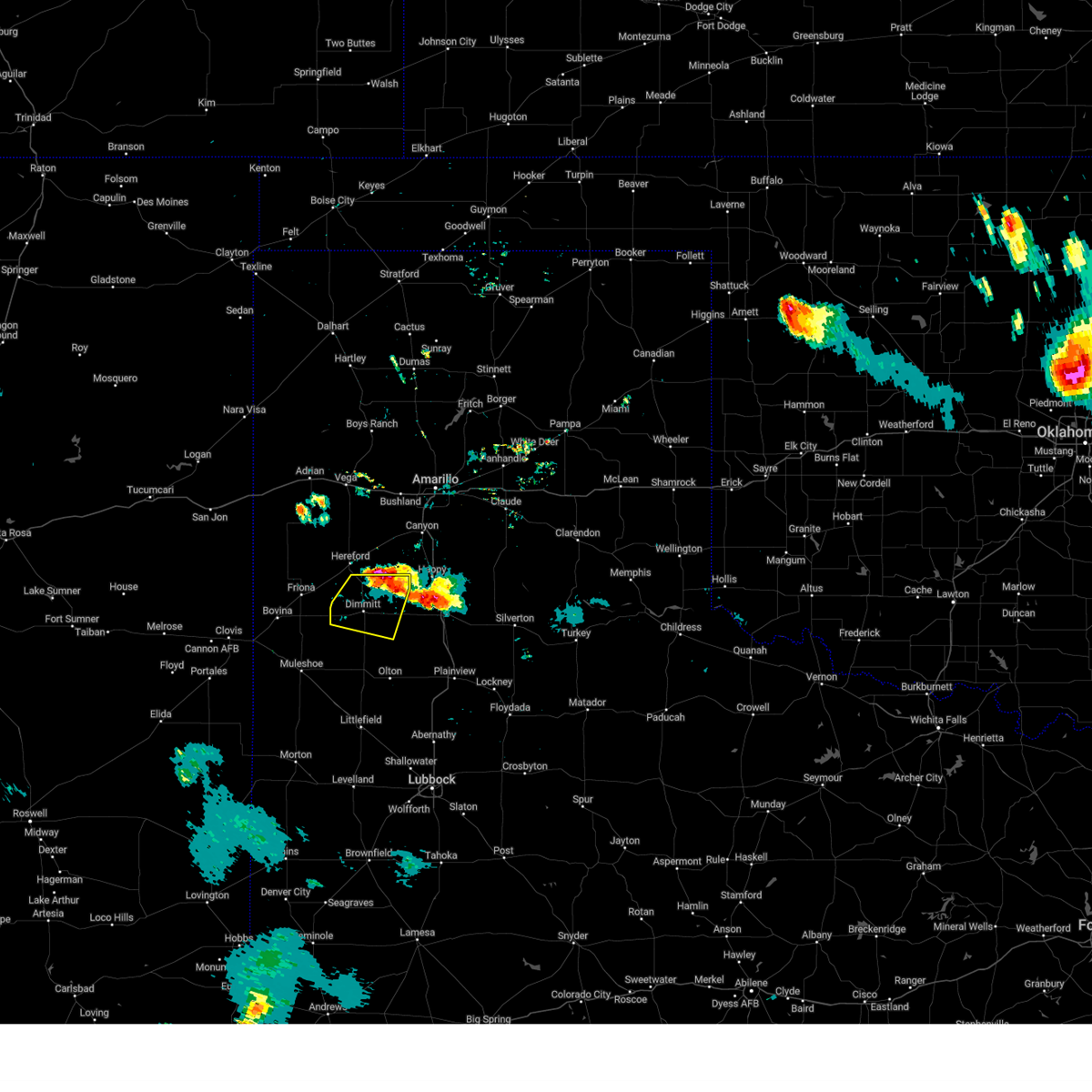
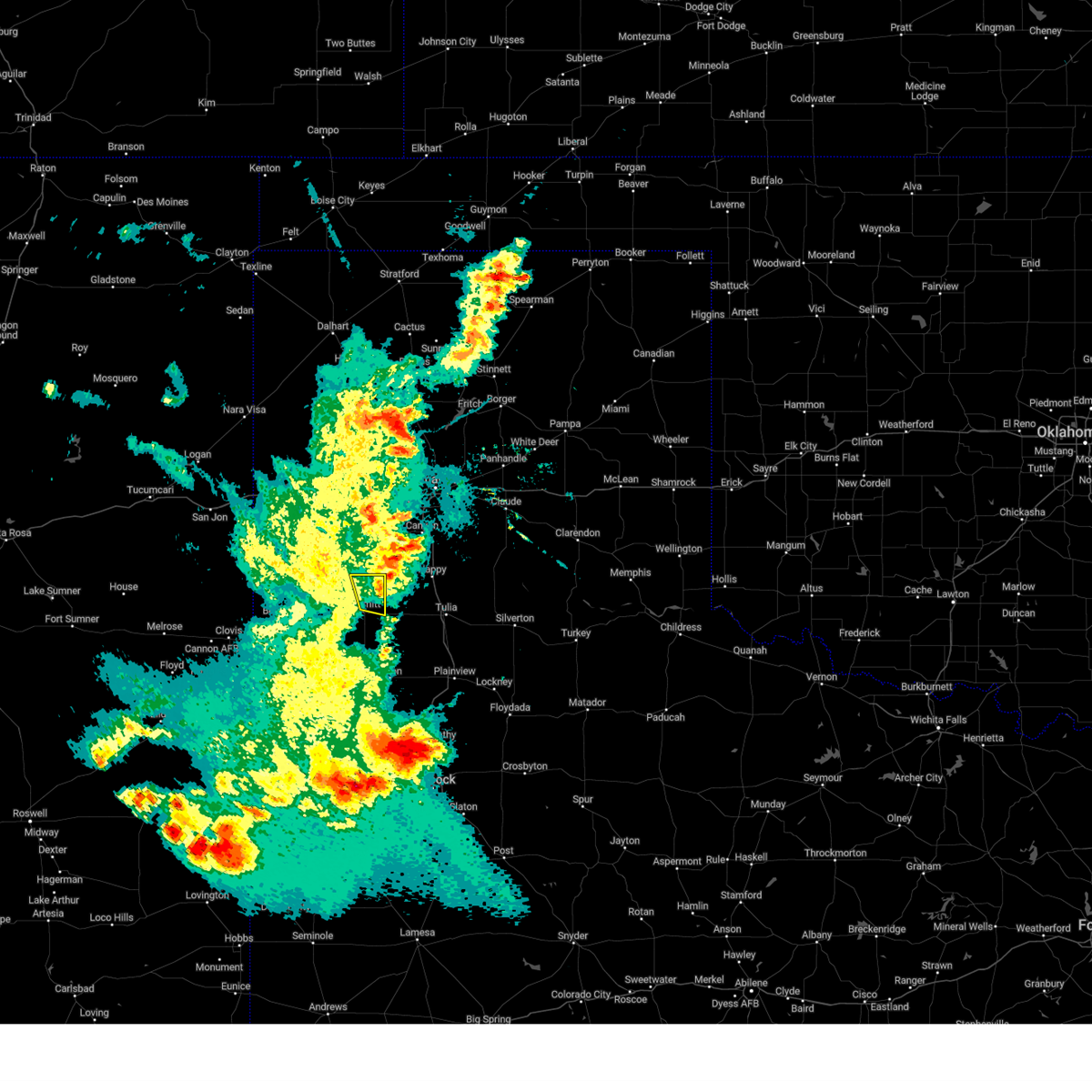
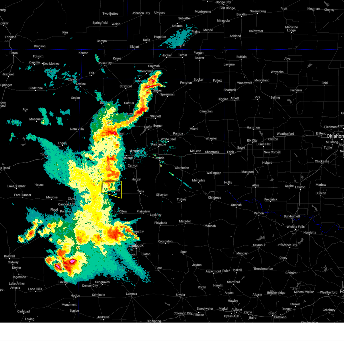
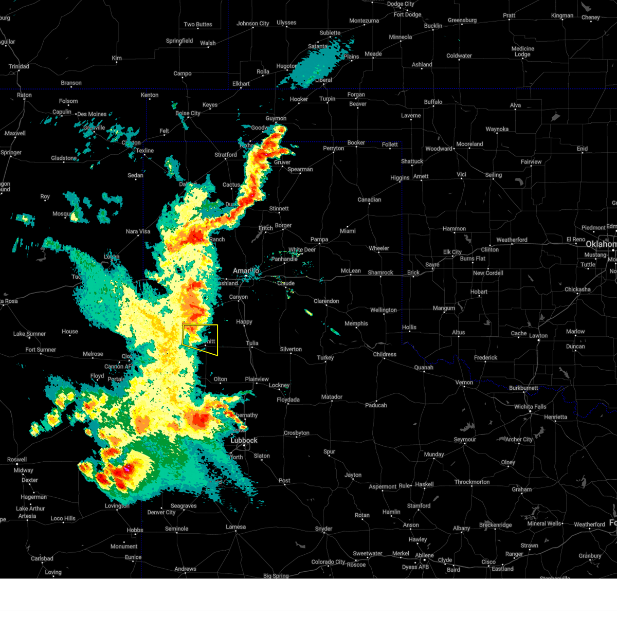
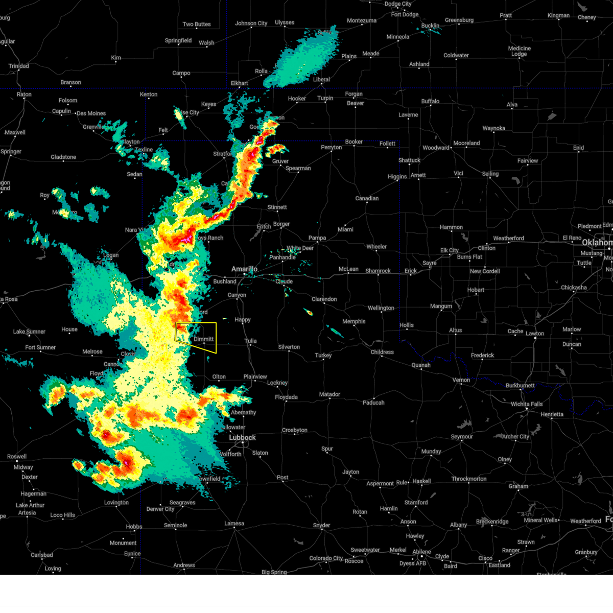
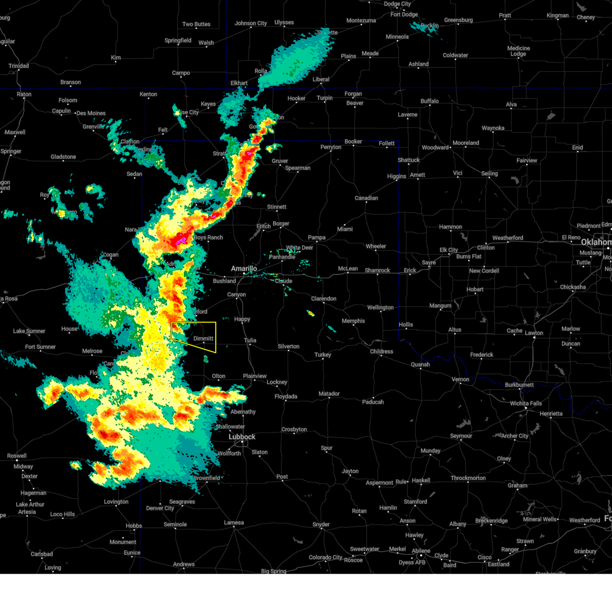
Hail Map for Dimmitt, TX
The Dimmitt, TX area has had 15 reports of on-the-ground hail by trained spotters, and has been under severe weather warnings 63 times during the past 12 months. Doppler radar has detected hail at or near Dimmitt, TX on 92 occasions, including 10 occasions during the past year.
| Name: | Dimmitt, TX |
| Where Located: | 53.4 miles SSW of Amarillo, TX |
| Map: | Google Map for Dimmitt, TX |
| Population: | 4393 |
| Housing Units: | 1667 |
| More Info: | Search Google for Dimmitt, TX |
3
The Top Recent Hail Date for Dimmitt, TX is Saturday, September 21, 2024 (5th out of 92)

Hail and Wind Damage Spotted near Dimmitt, TX
| Date / Time | Report Details |
|---|---|
| 6/9/2025 10:44 PM CDT |
 The storm which prompted the warning has weakened below severe limits, and no longer poses an immediate threat to life or property. therefore, the warning will be allowed to expire. a severe thunderstorm watch remains in effect until 200 am cdt for the panhandle of and northwestern texas. The storm which prompted the warning has weakened below severe limits, and no longer poses an immediate threat to life or property. therefore, the warning will be allowed to expire. a severe thunderstorm watch remains in effect until 200 am cdt for the panhandle of and northwestern texas.
|
| 6/9/2025 10:36 PM CDT |
 At 1036 pm cdt, a severe thunderstorm was located 6 miles west of earth, moving east at 40 mph (radar indicated). Hazards include 60 mph wind gusts. Expect damage to roofs, siding, and trees. Locations impacted include, littlefield, muleshoe, dimmitt, earth, sudan, amherst, needmore, lazbuddie, bula, muleshoe wildlife refuge, and springlake. At 1036 pm cdt, a severe thunderstorm was located 6 miles west of earth, moving east at 40 mph (radar indicated). Hazards include 60 mph wind gusts. Expect damage to roofs, siding, and trees. Locations impacted include, littlefield, muleshoe, dimmitt, earth, sudan, amherst, needmore, lazbuddie, bula, muleshoe wildlife refuge, and springlake.
|
| 6/9/2025 10:27 PM CDT |
 At 1026 pm cdt, a severe thunderstorm was located 6 miles southeast of muleshoe, moving east at 35 mph (radar indicated). Hazards include 60 mph wind gusts. Expect damage to roofs, siding, and trees. Locations impacted include, littlefield, muleshoe, dimmitt, earth, bovina, sudan, amherst, needmore, lazbuddie, progress, oklahoma lane, lariat, enochs, bula, muleshoe wildlife refuge, maple, and springlake. At 1026 pm cdt, a severe thunderstorm was located 6 miles southeast of muleshoe, moving east at 35 mph (radar indicated). Hazards include 60 mph wind gusts. Expect damage to roofs, siding, and trees. Locations impacted include, littlefield, muleshoe, dimmitt, earth, bovina, sudan, amherst, needmore, lazbuddie, progress, oklahoma lane, lariat, enochs, bula, muleshoe wildlife refuge, maple, and springlake.
|
| 6/9/2025 10:18 PM CDT |
 At 1018 pm cdt, severe thunderstorms were located along a line extending from 4 miles southeast of bovina to near muleshoe to 4 miles northeast of maple, moving east at 40 mph (radar indicated). Hazards include 70 mph wind gusts. Expect considerable tree damage. damage is likely to mobile homes, roofs, and outbuildings. Locations impacted include, littlefield, muleshoe, dimmitt, earth, bovina, farwell, sudan, amherst, needmore, lazbuddie, progress, oklahoma lane, lariat, west camp, enochs, bula, muleshoe wildlife refuge, maple, and springlake. At 1018 pm cdt, severe thunderstorms were located along a line extending from 4 miles southeast of bovina to near muleshoe to 4 miles northeast of maple, moving east at 40 mph (radar indicated). Hazards include 70 mph wind gusts. Expect considerable tree damage. damage is likely to mobile homes, roofs, and outbuildings. Locations impacted include, littlefield, muleshoe, dimmitt, earth, bovina, farwell, sudan, amherst, needmore, lazbuddie, progress, oklahoma lane, lariat, west camp, enochs, bula, muleshoe wildlife refuge, maple, and springlake.
|
| 6/9/2025 9:58 PM CDT |
 At 958 pm cdt, severe thunderstorms were located along a line extending from 6 miles north of texico to 5 miles south of west camp to 5 miles east of dora, moving east at 35 mph (radar indicated). Hazards include 70 mph wind gusts and quarter size hail. Hail damage to vehicles is expected. expect considerable tree damage. wind damage is also likely to mobile homes, roofs, and outbuildings. Locations impacted include, littlefield, muleshoe, dimmitt, earth, bovina, farwell, sudan, amherst, needmore, lazbuddie, progress, oklahoma lane, lariat, west camp, enochs, bula, muleshoe wildlife refuge, maple, and springlake. At 958 pm cdt, severe thunderstorms were located along a line extending from 6 miles north of texico to 5 miles south of west camp to 5 miles east of dora, moving east at 35 mph (radar indicated). Hazards include 70 mph wind gusts and quarter size hail. Hail damage to vehicles is expected. expect considerable tree damage. wind damage is also likely to mobile homes, roofs, and outbuildings. Locations impacted include, littlefield, muleshoe, dimmitt, earth, bovina, farwell, sudan, amherst, needmore, lazbuddie, progress, oklahoma lane, lariat, west camp, enochs, bula, muleshoe wildlife refuge, maple, and springlake.
|
| 6/9/2025 9:41 PM CDT |
 Svrlub the national weather service in lubbock texas has issued a * severe thunderstorm warning for, bailey county in northwestern texas, parmer county in the panhandle of texas, southwestern castro county in the panhandle of texas, lamb county in northwestern texas, * until 1045 pm cdt. * at 940 pm cdt, severe thunderstorms were located along a line extending from 6 miles north of clovis to 7 miles north of arch to 8 miles east of elida, moving east at 40 mph (radar indicated). Hazards include 70 mph wind gusts and quarter size hail. Hail damage to vehicles is expected. expect considerable tree damage. Wind damage is also likely to mobile homes, roofs, and outbuildings. Svrlub the national weather service in lubbock texas has issued a * severe thunderstorm warning for, bailey county in northwestern texas, parmer county in the panhandle of texas, southwestern castro county in the panhandle of texas, lamb county in northwestern texas, * until 1045 pm cdt. * at 940 pm cdt, severe thunderstorms were located along a line extending from 6 miles north of clovis to 7 miles north of arch to 8 miles east of elida, moving east at 40 mph (radar indicated). Hazards include 70 mph wind gusts and quarter size hail. Hail damage to vehicles is expected. expect considerable tree damage. Wind damage is also likely to mobile homes, roofs, and outbuildings.
|
| 6/6/2025 12:57 AM CDT |
 At 1256 am cdt, severe thunderstorms were located along a line extending from 13 miles west of tulia to muleshoe, moving east at 45 mph. large hail up to 2 inches in diameter is possible near hart (radar indicated). Hazards include two inch hail and 60 mph wind gusts. People and animals outdoors will be injured. expect hail damage to roofs, siding, windows, and vehicles. expect wind damage to roofs, siding, and trees. Locations impacted include, muleshoe, tulia, dimmitt, olton, hart, earth, kress, happy, lazbuddie, nazareth, edmonson, and springlake. At 1256 am cdt, severe thunderstorms were located along a line extending from 13 miles west of tulia to muleshoe, moving east at 45 mph. large hail up to 2 inches in diameter is possible near hart (radar indicated). Hazards include two inch hail and 60 mph wind gusts. People and animals outdoors will be injured. expect hail damage to roofs, siding, windows, and vehicles. expect wind damage to roofs, siding, and trees. Locations impacted include, muleshoe, tulia, dimmitt, olton, hart, earth, kress, happy, lazbuddie, nazareth, edmonson, and springlake.
|
| 6/6/2025 12:43 AM CDT |
 At 1243 am cdt, severe thunderstorms were located along a line extending from 7 miles east of dimmitt to 6 miles southwest of lazbuddie, moving east at 25 mph (radar indicated). Hazards include 60 mph wind gusts and half dollar size hail. Hail damage to vehicles is expected. expect wind damage to roofs, siding, and trees. Locations impacted include, dimmitt and lazbuddie. At 1243 am cdt, severe thunderstorms were located along a line extending from 7 miles east of dimmitt to 6 miles southwest of lazbuddie, moving east at 25 mph (radar indicated). Hazards include 60 mph wind gusts and half dollar size hail. Hail damage to vehicles is expected. expect wind damage to roofs, siding, and trees. Locations impacted include, dimmitt and lazbuddie.
|
| 6/6/2025 12:31 AM CDT |
 Svrlub the national weather service in lubbock texas has issued a * severe thunderstorm warning for, northeastern bailey county in northwestern texas, southeastern parmer county in the panhandle of texas, northwestern hale county in northwestern texas, castro county in the panhandle of texas, swisher county in the panhandle of texas, northern lamb county in northwestern texas, * until 130 am cdt. * at 1231 am cdt, severe thunderstorms were located along a line extending from 14 miles east of dimmitt to near muleshoe, moving east at 35 mph (radar indicated). Hazards include 60 mph wind gusts and half dollar size hail. Hail damage to vehicles is expected. Expect wind damage to roofs, siding, and trees. Svrlub the national weather service in lubbock texas has issued a * severe thunderstorm warning for, northeastern bailey county in northwestern texas, southeastern parmer county in the panhandle of texas, northwestern hale county in northwestern texas, castro county in the panhandle of texas, swisher county in the panhandle of texas, northern lamb county in northwestern texas, * until 130 am cdt. * at 1231 am cdt, severe thunderstorms were located along a line extending from 14 miles east of dimmitt to near muleshoe, moving east at 35 mph (radar indicated). Hazards include 60 mph wind gusts and half dollar size hail. Hail damage to vehicles is expected. Expect wind damage to roofs, siding, and trees.
|
| 6/6/2025 12:24 AM CDT |
 At 1223 am cdt, severe thunderstorms were located along a line extending from dimmitt to 3 miles north of progress, moving east at 35 mph. a wind gust to 64 mph was measured near dimmitt with these storms (radar indicated). Hazards include ping pong ball size hail and 60 mph wind gusts. People and animals outdoors will be injured. expect hail damage to roofs, siding, windows, and vehicles. expect wind damage to roofs, siding, and trees. Locations impacted include, dimmitt and lazbuddie. At 1223 am cdt, severe thunderstorms were located along a line extending from dimmitt to 3 miles north of progress, moving east at 35 mph. a wind gust to 64 mph was measured near dimmitt with these storms (radar indicated). Hazards include ping pong ball size hail and 60 mph wind gusts. People and animals outdoors will be injured. expect hail damage to roofs, siding, windows, and vehicles. expect wind damage to roofs, siding, and trees. Locations impacted include, dimmitt and lazbuddie.
|
| 6/6/2025 12:20 AM CDT |
 At 1220 am cdt, a severe thunderstorm was located near oklahoma lane, or 10 miles northwest of muleshoe, moving east at 30 mph (radar indicated). Hazards include ping pong ball size hail and 60 mph wind gusts. People and animals outdoors will be injured. expect hail damage to roofs, siding, windows, and vehicles. expect wind damage to roofs, siding, and trees. Locations impacted include, dimmitt, lazbuddie, and oklahoma lane. At 1220 am cdt, a severe thunderstorm was located near oklahoma lane, or 10 miles northwest of muleshoe, moving east at 30 mph (radar indicated). Hazards include ping pong ball size hail and 60 mph wind gusts. People and animals outdoors will be injured. expect hail damage to roofs, siding, windows, and vehicles. expect wind damage to roofs, siding, and trees. Locations impacted include, dimmitt, lazbuddie, and oklahoma lane.
|
| 6/6/2025 12:19 AM CDT | Storm damage reported in castro county TX, 2.4 miles SSW of Dimmitt, TX |
| 6/5/2025 11:54 PM CDT |
 Svrlub the national weather service in lubbock texas has issued a * severe thunderstorm warning for, southern parmer county in the panhandle of texas, southwestern castro county in the panhandle of texas, * until 100 am cdt. * at 1154 pm cdt, a severe thunderstorm was located near oklahoma lane, or 11 miles northwest of muleshoe, moving east at 25 mph (radar indicated). Hazards include ping pong ball size hail and 60 mph wind gusts. People and animals outdoors will be injured. expect hail damage to roofs, siding, windows, and vehicles. Expect wind damage to roofs, siding, and trees. Svrlub the national weather service in lubbock texas has issued a * severe thunderstorm warning for, southern parmer county in the panhandle of texas, southwestern castro county in the panhandle of texas, * until 100 am cdt. * at 1154 pm cdt, a severe thunderstorm was located near oklahoma lane, or 11 miles northwest of muleshoe, moving east at 25 mph (radar indicated). Hazards include ping pong ball size hail and 60 mph wind gusts. People and animals outdoors will be injured. expect hail damage to roofs, siding, windows, and vehicles. Expect wind damage to roofs, siding, and trees.
|
| 6/5/2025 7:17 PM CDT |
 Svrlub the national weather service in lubbock texas has issued a * severe thunderstorm warning for, northwestern hale county in northwestern texas, southern castro county in the panhandle of texas, southwestern swisher county in the panhandle of texas, northern lamb county in northwestern texas, * until 815 pm cdt. * at 717 pm cdt, a severe thunderstorm was located 5 miles east of lazbuddie, or 10 miles northwest of earth, moving east at 25 mph (radar indicated). Hazards include 60 mph wind gusts and half dollar size hail. Hail damage to vehicles is expected. Expect wind damage to roofs, siding, and trees. Svrlub the national weather service in lubbock texas has issued a * severe thunderstorm warning for, northwestern hale county in northwestern texas, southern castro county in the panhandle of texas, southwestern swisher county in the panhandle of texas, northern lamb county in northwestern texas, * until 815 pm cdt. * at 717 pm cdt, a severe thunderstorm was located 5 miles east of lazbuddie, or 10 miles northwest of earth, moving east at 25 mph (radar indicated). Hazards include 60 mph wind gusts and half dollar size hail. Hail damage to vehicles is expected. Expect wind damage to roofs, siding, and trees.
|
| 6/4/2025 11:44 PM CDT |
 At 1143 pm cdt, a severe thunderstorm was located 13 miles southwest of happy, or 15 miles northeast of dimmitt, moving east at 40 mph (radar indicated). Hazards include two inch hail and 60 mph wind gusts. People and animals outdoors will be injured. expect hail damage to roofs, siding, windows, and vehicles. expect wind damage to roofs, siding, and trees. Locations impacted include, tulia, dimmitt, happy, and nazareth. At 1143 pm cdt, a severe thunderstorm was located 13 miles southwest of happy, or 15 miles northeast of dimmitt, moving east at 40 mph (radar indicated). Hazards include two inch hail and 60 mph wind gusts. People and animals outdoors will be injured. expect hail damage to roofs, siding, windows, and vehicles. expect wind damage to roofs, siding, and trees. Locations impacted include, tulia, dimmitt, happy, and nazareth.
|
| 6/4/2025 11:37 PM CDT |
 At 1137 pm cdt, a severe thunderstorm was located 11 miles northeast of dimmitt, moving east at 40 mph (radar indicated). Hazards include golf ball size hail and 60 mph wind gusts. People and animals outdoors will be injured. expect hail damage to roofs, siding, windows, and vehicles. expect wind damage to roofs, siding, and trees. Locations impacted include, tulia, dimmitt, happy, and nazareth. At 1137 pm cdt, a severe thunderstorm was located 11 miles northeast of dimmitt, moving east at 40 mph (radar indicated). Hazards include golf ball size hail and 60 mph wind gusts. People and animals outdoors will be injured. expect hail damage to roofs, siding, windows, and vehicles. expect wind damage to roofs, siding, and trees. Locations impacted include, tulia, dimmitt, happy, and nazareth.
|
| 6/4/2025 11:23 PM CDT |
 Svrlub the national weather service in lubbock texas has issued a * severe thunderstorm warning for, northeastern castro county in the panhandle of texas, northwestern swisher county in the panhandle of texas, * until 1230 am cdt. * at 1123 pm cdt, a severe thunderstorm was located 6 miles east of easter, or 7 miles north of dimmitt, moving east at 40 mph (radar indicated). Hazards include golf ball size hail and 60 mph wind gusts. People and animals outdoors will be injured. expect hail damage to roofs, siding, windows, and vehicles. Expect wind damage to roofs, siding, and trees. Svrlub the national weather service in lubbock texas has issued a * severe thunderstorm warning for, northeastern castro county in the panhandle of texas, northwestern swisher county in the panhandle of texas, * until 1230 am cdt. * at 1123 pm cdt, a severe thunderstorm was located 6 miles east of easter, or 7 miles north of dimmitt, moving east at 40 mph (radar indicated). Hazards include golf ball size hail and 60 mph wind gusts. People and animals outdoors will be injured. expect hail damage to roofs, siding, windows, and vehicles. Expect wind damage to roofs, siding, and trees.
|
| 6/2/2025 3:16 PM CDT |
 the severe thunderstorm warning has been cancelled and is no longer in effect the severe thunderstorm warning has been cancelled and is no longer in effect
|
| 6/2/2025 3:04 PM CDT |
 At 303 pm cdt, a severe thunderstorm was located 5 miles north of easter, or 6 miles south of hereford, moving north at 40 mph (radar indicated). Hazards include 60 mph wind gusts and nickel size hail. Expect damage to roofs, siding, and trees. Locations impacted include, dimmitt, summerfield, and easter. At 303 pm cdt, a severe thunderstorm was located 5 miles north of easter, or 6 miles south of hereford, moving north at 40 mph (radar indicated). Hazards include 60 mph wind gusts and nickel size hail. Expect damage to roofs, siding, and trees. Locations impacted include, dimmitt, summerfield, and easter.
|
| 6/2/2025 3:04 PM CDT |
 the severe thunderstorm warning has been cancelled and is no longer in effect the severe thunderstorm warning has been cancelled and is no longer in effect
|
| 6/2/2025 2:56 PM CDT |
 At 255 pm cdt, a severe thunderstorm was located 4 miles west of dimmitt, moving northeast at 30 mph (radar indicated). Hazards include 60 mph wind gusts and nickel size hail. Expect damage to roofs, siding, and trees. Locations impacted include, dimmitt, earth, summerfield, and easter. At 255 pm cdt, a severe thunderstorm was located 4 miles west of dimmitt, moving northeast at 30 mph (radar indicated). Hazards include 60 mph wind gusts and nickel size hail. Expect damage to roofs, siding, and trees. Locations impacted include, dimmitt, earth, summerfield, and easter.
|
| 6/2/2025 2:47 PM CDT |
 Svrlub the national weather service in lubbock texas has issued a * severe thunderstorm warning for, southeastern parmer county in the panhandle of texas, castro county in the panhandle of texas, northwestern lamb county in northwestern texas, * until 345 pm cdt. * at 246 pm cdt, a severe thunderstorm was located 8 miles southwest of dimmitt, moving northeast at 35 mph (radar indicated). Hazards include 60 mph wind gusts and nickel size hail. expect damage to roofs, siding, and trees Svrlub the national weather service in lubbock texas has issued a * severe thunderstorm warning for, southeastern parmer county in the panhandle of texas, castro county in the panhandle of texas, northwestern lamb county in northwestern texas, * until 345 pm cdt. * at 246 pm cdt, a severe thunderstorm was located 8 miles southwest of dimmitt, moving northeast at 35 mph (radar indicated). Hazards include 60 mph wind gusts and nickel size hail. expect damage to roofs, siding, and trees
|
| 6/2/2025 2:46 PM CDT | Peak gust from west texas mesonet. severe gusts from 2:45 to 2:48 pm cd in castro county TX, 2.4 miles SSW of Dimmitt, TX |
| 5/26/2025 9:21 PM CDT |
 Svrlub the national weather service in lubbock texas has issued a * severe thunderstorm warning for, eastern castro county in the panhandle of texas, swisher county in the panhandle of texas, * until 1015 pm cdt. * at 921 pm cdt, severe thunderstorms were located along a line extending from 12 miles west of happy to 5 miles northwest of hart, moving east at 45 mph (radar indicated). Hazards include 60 mph wind gusts and nickel size hail. expect damage to roofs, siding, and trees Svrlub the national weather service in lubbock texas has issued a * severe thunderstorm warning for, eastern castro county in the panhandle of texas, swisher county in the panhandle of texas, * until 1015 pm cdt. * at 921 pm cdt, severe thunderstorms were located along a line extending from 12 miles west of happy to 5 miles northwest of hart, moving east at 45 mph (radar indicated). Hazards include 60 mph wind gusts and nickel size hail. expect damage to roofs, siding, and trees
|
| 5/26/2025 9:06 PM CDT |
 At 905 pm cdt, severe thunderstorms were located along a line extending from 9 miles northeast of easter to 9 miles southwest of dimmitt, moving east at 45 mph (radar indicated). Hazards include 60 mph wind gusts and nickel size hail. Expect damage to roofs, siding, and trees. Locations impacted include, dimmitt, hart, summerfield, easter, and nazareth. At 905 pm cdt, severe thunderstorms were located along a line extending from 9 miles northeast of easter to 9 miles southwest of dimmitt, moving east at 45 mph (radar indicated). Hazards include 60 mph wind gusts and nickel size hail. Expect damage to roofs, siding, and trees. Locations impacted include, dimmitt, hart, summerfield, easter, and nazareth.
|
| 5/26/2025 9:06 PM CDT |
 the severe thunderstorm warning has been cancelled and is no longer in effect the severe thunderstorm warning has been cancelled and is no longer in effect
|
| 5/26/2025 8:37 PM CDT | Svrlub the national weather service in lubbock texas has issued a * severe thunderstorm warning for, eastern parmer county in the panhandle of texas, castro county in the panhandle of texas, * until 930 pm cdt. * at 836 pm cdt, severe thunderstorms were located along a line extending from 3 miles northwest of summerfield to 6 miles south of friona, moving east at 45 mph (radar indicated). Hazards include 60 mph wind gusts and nickel size hail. expect damage to roofs, siding, and trees |
| 5/25/2025 7:52 PM CDT | The storm which prompted the warning has weakened below severe limits, and has exited the warned area. therefore, the warning will be allowed to expire. however, small hail, gusty winds and heavy rain are still possible with this thunderstorm. a severe thunderstorm watch remains in effect until 100 am cdt for the panhandle of and northwestern texas. to report severe weather, contact your nearest law enforcement agency. they will relay your report to the national weather service lubbock texas. |
| 5/25/2025 7:30 PM CDT | At 730 pm cdt, a severe thunderstorm was located 4 miles southeast of lazbuddie, or 11 miles northwest of earth, moving north at 20 mph (radar indicated). Hazards include 60 mph wind gusts and quarter size hail. Hail damage to vehicles is expected. expect wind damage to roofs, siding, and trees. Locations impacted include, dimmitt, summerfield, easter, lazbuddie, and black. |
| 5/25/2025 7:18 PM CDT |
 Svrlub the national weather service in lubbock texas has issued a * severe thunderstorm warning for, northeastern bailey county in northwestern texas, eastern parmer county in the panhandle of texas, western castro county in the panhandle of texas, northwestern lamb county in northwestern texas, * until 800 pm cdt. * at 718 pm cdt, a severe thunderstorm was located 6 miles south of lazbuddie, or 9 miles northeast of muleshoe, moving north at 40 mph (radar indicated). Hazards include ping pong ball size hail and 60 mph wind gusts. People and animals outdoors will be injured. expect hail damage to roofs, siding, windows, and vehicles. Expect wind damage to roofs, siding, and trees. Svrlub the national weather service in lubbock texas has issued a * severe thunderstorm warning for, northeastern bailey county in northwestern texas, eastern parmer county in the panhandle of texas, western castro county in the panhandle of texas, northwestern lamb county in northwestern texas, * until 800 pm cdt. * at 718 pm cdt, a severe thunderstorm was located 6 miles south of lazbuddie, or 9 miles northeast of muleshoe, moving north at 40 mph (radar indicated). Hazards include ping pong ball size hail and 60 mph wind gusts. People and animals outdoors will be injured. expect hail damage to roofs, siding, windows, and vehicles. Expect wind damage to roofs, siding, and trees.
|
| 5/6/2025 6:31 PM CDT |
 At 631 pm cdt, a severe thunderstorm was located over hart, moving east at 15 mph (radar indicated). Hazards include quarter size hail. Damage to vehicles is expected. Locations impacted include, dimmitt, hart, and nazareth. At 631 pm cdt, a severe thunderstorm was located over hart, moving east at 15 mph (radar indicated). Hazards include quarter size hail. Damage to vehicles is expected. Locations impacted include, dimmitt, hart, and nazareth.
|
| 5/6/2025 6:16 PM CDT |
 Svrlub the national weather service in lubbock texas has issued a * severe thunderstorm warning for, eastern castro county in the panhandle of texas, western swisher county in the panhandle of texas, * until 715 pm cdt. * at 616 pm cdt, a severe thunderstorm was located 7 miles west of hart, moving northeast at 15 mph (radar indicated). Hazards include quarter size hail. damage to vehicles is expected Svrlub the national weather service in lubbock texas has issued a * severe thunderstorm warning for, eastern castro county in the panhandle of texas, western swisher county in the panhandle of texas, * until 715 pm cdt. * at 616 pm cdt, a severe thunderstorm was located 7 miles west of hart, moving northeast at 15 mph (radar indicated). Hazards include quarter size hail. damage to vehicles is expected
|
| 4/26/2025 2:15 AM CDT |
 At 215 am cdt, a severe thunderstorm capable of producing a tornado was located 8 miles southwest of hart, moving north at 10 mph (radar indicated rotation). Hazards include tornado and tennis ball size hail. Flying debris will be dangerous to those caught without shelter. mobile homes will be damaged or destroyed. damage to roofs, windows, and vehicles will occur. tree damage is likely. Locations impacted include, hart. At 215 am cdt, a severe thunderstorm capable of producing a tornado was located 8 miles southwest of hart, moving north at 10 mph (radar indicated rotation). Hazards include tornado and tennis ball size hail. Flying debris will be dangerous to those caught without shelter. mobile homes will be damaged or destroyed. damage to roofs, windows, and vehicles will occur. tree damage is likely. Locations impacted include, hart.
|
| 4/26/2025 2:07 AM CDT |
 Torlub the national weather service in lubbock texas has issued a * tornado warning for, southeastern castro county in the panhandle of texas, north central lamb county in northwestern texas, * until 230 am cdt. * at 207 am cdt, a severe thunderstorm capable of producing a tornado was located 9 miles east of earth, moving north at 10 mph (radar indicated rotation). Hazards include tornado and hail up to two inches in diameter. Flying debris will be dangerous to those caught without shelter. mobile homes will be damaged or destroyed. damage to roofs, windows, and vehicles will occur. tree damage is likely. This tornadic thunderstorm will remain over mainly rural areas of southeastern castro and north central lamb counties. Torlub the national weather service in lubbock texas has issued a * tornado warning for, southeastern castro county in the panhandle of texas, north central lamb county in northwestern texas, * until 230 am cdt. * at 207 am cdt, a severe thunderstorm capable of producing a tornado was located 9 miles east of earth, moving north at 10 mph (radar indicated rotation). Hazards include tornado and hail up to two inches in diameter. Flying debris will be dangerous to those caught without shelter. mobile homes will be damaged or destroyed. damage to roofs, windows, and vehicles will occur. tree damage is likely. This tornadic thunderstorm will remain over mainly rural areas of southeastern castro and north central lamb counties.
|
| 4/23/2025 11:07 PM CDT |
 At 1107 pm cdt, a severe thunderstorm was located 7 miles west of hart, moving northeast at 15 mph (radar indicated). Hazards include 60 mph wind gusts and penny size hail. Expect damage to roofs, siding, and trees. This severe thunderstorm will remain over mainly rural areas of south central castro and north central lamb counties. At 1107 pm cdt, a severe thunderstorm was located 7 miles west of hart, moving northeast at 15 mph (radar indicated). Hazards include 60 mph wind gusts and penny size hail. Expect damage to roofs, siding, and trees. This severe thunderstorm will remain over mainly rural areas of south central castro and north central lamb counties.
|
| 4/23/2025 10:56 PM CDT |
 At 1056 pm cdt, a severe thunderstorm was located 9 miles west of hart, moving northeast at 25 mph (radar indicated). Hazards include 60 mph wind gusts and penny size hail. Expect damage to roofs, siding, and trees. Locations impacted include, springlake. At 1056 pm cdt, a severe thunderstorm was located 9 miles west of hart, moving northeast at 25 mph (radar indicated). Hazards include 60 mph wind gusts and penny size hail. Expect damage to roofs, siding, and trees. Locations impacted include, springlake.
|
| 4/23/2025 10:43 PM CDT |
 Svrlub the national weather service in lubbock texas has issued a * severe thunderstorm warning for, southwestern castro county in the panhandle of texas, northeastern lamb county in northwestern texas, * until 1115 pm cdt. * at 1043 pm cdt, a severe thunderstorm was located 4 miles northeast of earth, moving northeast at 10 mph (radar indicated). Hazards include 60 mph wind gusts and quarter size hail. Hail damage to vehicles is expected. Expect wind damage to roofs, siding, and trees. Svrlub the national weather service in lubbock texas has issued a * severe thunderstorm warning for, southwestern castro county in the panhandle of texas, northeastern lamb county in northwestern texas, * until 1115 pm cdt. * at 1043 pm cdt, a severe thunderstorm was located 4 miles northeast of earth, moving northeast at 10 mph (radar indicated). Hazards include 60 mph wind gusts and quarter size hail. Hail damage to vehicles is expected. Expect wind damage to roofs, siding, and trees.
|
| 4/23/2025 8:12 PM CDT | Tennis Ball sized hail reported 5.3 miles NW of Dimmitt, TX, report from mping: tennis ball (2.50 in.). |
| 4/23/2025 8:02 PM CDT |
 At 801 pm cdt, a severe thunderstorm was located 8 miles east of dimmitt, moving northeast at 10 mph. this is a destructive storm for nazareth (public). Hazards include three inch hail and 60 mph wind gusts. People and animals outdoors will be severely injured. expect shattered windows, extensive damage to roofs, siding, and vehicles. Locations impacted include, nazareth and dimmitt. At 801 pm cdt, a severe thunderstorm was located 8 miles east of dimmitt, moving northeast at 10 mph. this is a destructive storm for nazareth (public). Hazards include three inch hail and 60 mph wind gusts. People and animals outdoors will be severely injured. expect shattered windows, extensive damage to roofs, siding, and vehicles. Locations impacted include, nazareth and dimmitt.
|
| 4/23/2025 7:51 PM CDT |
 At 750 pm cdt, a severe thunderstorm was located 7 miles southeast of dimmitt, moving northeast at 10 mph (public). Hazards include two inch hail and 60 mph wind gusts. People and animals outdoors will be injured. expect hail damage to roofs, siding, windows, and vehicles. expect wind damage to roofs, siding, and trees. Locations impacted include, nazareth and dimmitt. At 750 pm cdt, a severe thunderstorm was located 7 miles southeast of dimmitt, moving northeast at 10 mph (public). Hazards include two inch hail and 60 mph wind gusts. People and animals outdoors will be injured. expect hail damage to roofs, siding, windows, and vehicles. expect wind damage to roofs, siding, and trees. Locations impacted include, nazareth and dimmitt.
|
| 4/23/2025 7:37 PM CDT |
 At 736 pm cdt, a severe thunderstorm was located 6 miles southeast of dimmitt, moving northeast at 10 mph. this is a destructive storm for dimmitt and nazerath (public). Hazards include softball size hail and 60 mph wind gusts. People and animals outdoors will be severely injured. expect shattered windows, extensive damage to roofs, siding, and vehicles. Locations impacted include, nazareth and dimmitt. At 736 pm cdt, a severe thunderstorm was located 6 miles southeast of dimmitt, moving northeast at 10 mph. this is a destructive storm for dimmitt and nazerath (public). Hazards include softball size hail and 60 mph wind gusts. People and animals outdoors will be severely injured. expect shattered windows, extensive damage to roofs, siding, and vehicles. Locations impacted include, nazareth and dimmitt.
|
| 4/23/2025 7:32 PM CDT | Golf Ball sized hail reported 0.8 miles SE of Dimmitt, TX |
| 4/23/2025 7:32 PM CDT | Tea Cup sized hail reported 4.9 miles N of Dimmitt, TX, report from mping: baseball++ (3.50 in.). |
| 4/23/2025 7:30 PM CDT |
 At 729 pm cdt, a severe thunderstorm was located 5 miles southeast of dimmitt, moving east at 10 mph. this is a destructive storm for dimmitt and nazareth (broadcast media. tennis ball size hail was observed two miles south of dimmitt along highway 385). Hazards include baseball size hail and 60 mph wind gusts. People and animals outdoors will be severely injured. expect shattered windows, extensive damage to roofs, siding, and vehicles. Locations impacted include, nazareth and dimmitt. At 729 pm cdt, a severe thunderstorm was located 5 miles southeast of dimmitt, moving east at 10 mph. this is a destructive storm for dimmitt and nazareth (broadcast media. tennis ball size hail was observed two miles south of dimmitt along highway 385). Hazards include baseball size hail and 60 mph wind gusts. People and animals outdoors will be severely injured. expect shattered windows, extensive damage to roofs, siding, and vehicles. Locations impacted include, nazareth and dimmitt.
|
| 4/23/2025 7:23 PM CDT | Hen Egg sized hail reported 0.8 miles SE of Dimmitt, TX, via live stream. |
| 4/23/2025 7:16 PM CDT |
 At 715 pm cdt, a severe thunderstorm was located 5 miles southeast of dimmitt, moving northeast at 10 mph. this is a destructive storm for dimmitt and nazareth (radar indicated). Hazards include baseball size hail and 60 mph wind gusts. People and animals outdoors will be severely injured. expect shattered windows, extensive damage to roofs, siding, and vehicles. Locations impacted include, nazareth and dimmitt. At 715 pm cdt, a severe thunderstorm was located 5 miles southeast of dimmitt, moving northeast at 10 mph. this is a destructive storm for dimmitt and nazareth (radar indicated). Hazards include baseball size hail and 60 mph wind gusts. People and animals outdoors will be severely injured. expect shattered windows, extensive damage to roofs, siding, and vehicles. Locations impacted include, nazareth and dimmitt.
|
| 4/23/2025 7:10 PM CDT |
 Svrlub the national weather service in lubbock texas has issued a * severe thunderstorm warning for, central castro county in the panhandle of texas, * until 815 pm cdt. * at 709 pm cdt, a severe thunderstorm was located 4 miles southeast of dimmitt, moving northeast at 10 mph (radar indicated). Hazards include ping pong ball size hail and 60 mph wind gusts. People and animals outdoors will be injured. expect hail damage to roofs, siding, windows, and vehicles. Expect wind damage to roofs, siding, and trees. Svrlub the national weather service in lubbock texas has issued a * severe thunderstorm warning for, central castro county in the panhandle of texas, * until 815 pm cdt. * at 709 pm cdt, a severe thunderstorm was located 4 miles southeast of dimmitt, moving northeast at 10 mph (radar indicated). Hazards include ping pong ball size hail and 60 mph wind gusts. People and animals outdoors will be injured. expect hail damage to roofs, siding, windows, and vehicles. Expect wind damage to roofs, siding, and trees.
|
| 9/21/2024 7:03 PM CDT |
 At 703 pm cdt, a severe thunderstorm was located 11 miles southwest of happy, or 16 miles northwest of tulia, moving northeast at 30 mph (radar indicated). Hazards include 60 mph wind gusts and quarter size hail. Hail damage to vehicles is expected. expect wind damage to roofs, siding, and trees. Locations impacted include, tulia, happy, and nazareth. At 703 pm cdt, a severe thunderstorm was located 11 miles southwest of happy, or 16 miles northwest of tulia, moving northeast at 30 mph (radar indicated). Hazards include 60 mph wind gusts and quarter size hail. Hail damage to vehicles is expected. expect wind damage to roofs, siding, and trees. Locations impacted include, tulia, happy, and nazareth.
|
| 9/21/2024 6:51 PM CDT |
 the severe thunderstorm warning has been cancelled and is no longer in effect the severe thunderstorm warning has been cancelled and is no longer in effect
|
| 9/21/2024 6:51 PM CDT |
 At 651 pm cdt, a severe thunderstorm was located 7 miles west of hart, moving east at 35 mph (radar indicated). Hazards include 70 mph wind gusts and quarter size hail. Hail damage to vehicles is expected. expect considerable tree damage. wind damage is also likely to mobile homes, roofs, and outbuildings. Locations impacted include, hart, earth, and springlake. At 651 pm cdt, a severe thunderstorm was located 7 miles west of hart, moving east at 35 mph (radar indicated). Hazards include 70 mph wind gusts and quarter size hail. Hail damage to vehicles is expected. expect considerable tree damage. wind damage is also likely to mobile homes, roofs, and outbuildings. Locations impacted include, hart, earth, and springlake.
|
| 9/21/2024 6:44 PM CDT |
 Svrlub the national weather service in lubbock texas has issued a * severe thunderstorm warning for, castro county in the panhandle of texas, northwestern swisher county in the panhandle of texas, * until 745 pm cdt. * at 644 pm cdt, a severe thunderstorm was located 8 miles east of dimmitt, moving northeast at 30 mph (radar indicated). Hazards include ping pong ball size hail and 60 mph wind gusts. People and animals outdoors will be injured. expect hail damage to roofs, siding, windows, and vehicles. Expect wind damage to roofs, siding, and trees. Svrlub the national weather service in lubbock texas has issued a * severe thunderstorm warning for, castro county in the panhandle of texas, northwestern swisher county in the panhandle of texas, * until 745 pm cdt. * at 644 pm cdt, a severe thunderstorm was located 8 miles east of dimmitt, moving northeast at 30 mph (radar indicated). Hazards include ping pong ball size hail and 60 mph wind gusts. People and animals outdoors will be injured. expect hail damage to roofs, siding, windows, and vehicles. Expect wind damage to roofs, siding, and trees.
|
| 9/21/2024 6:38 PM CDT |
 At 638 pm cdt, a severe thunderstorm was located 7 miles northeast of dimmitt, moving east at 25 mph (radar indicated). Hazards include golf ball size hail and 60 mph wind gusts. People and animals outdoors will be injured. expect hail damage to roofs, siding, windows, and vehicles. expect wind damage to roofs, siding, and trees. Locations impacted include, dimmitt and easter. At 638 pm cdt, a severe thunderstorm was located 7 miles northeast of dimmitt, moving east at 25 mph (radar indicated). Hazards include golf ball size hail and 60 mph wind gusts. People and animals outdoors will be injured. expect hail damage to roofs, siding, windows, and vehicles. expect wind damage to roofs, siding, and trees. Locations impacted include, dimmitt and easter.
|
| 9/21/2024 6:38 PM CDT |
 the severe thunderstorm warning has been cancelled and is no longer in effect the severe thunderstorm warning has been cancelled and is no longer in effect
|
| 9/21/2024 6:30 PM CDT | Svrlub the national weather service in lubbock texas has issued a * severe thunderstorm warning for, southeastern parmer county in the panhandle of texas, northwestern hale county in northwestern texas, southern castro county in the panhandle of texas, southwestern swisher county in the panhandle of texas, northern lamb county in northwestern texas, * until 715 pm cdt. * at 630 pm cdt, a severe thunderstorm was located 8 miles east of lazbuddie, or 9 miles north of earth, moving east at 35 mph (radar indicated). Hazards include 70 mph wind gusts and ping pong ball size hail. People and animals outdoors will be injured. expect hail damage to roofs, siding, windows, and vehicles. expect considerable tree damage. Wind damage is also likely to mobile homes, roofs, and outbuildings. |
| 9/21/2024 6:28 PM CDT |
 At 628 pm cdt, a severe thunderstorm capable of producing a tornado was located over dimmitt, moving northeast at 30 mph (radar indicated rotation). Hazards include tornado and two inch hail. Flying debris will be dangerous to those caught without shelter. mobile homes will be damaged or destroyed. damage to roofs, windows, and vehicles will occur. tree damage is likely. This tornadic thunderstorm will remain over mainly rural areas of central castro county. At 628 pm cdt, a severe thunderstorm capable of producing a tornado was located over dimmitt, moving northeast at 30 mph (radar indicated rotation). Hazards include tornado and two inch hail. Flying debris will be dangerous to those caught without shelter. mobile homes will be damaged or destroyed. damage to roofs, windows, and vehicles will occur. tree damage is likely. This tornadic thunderstorm will remain over mainly rural areas of central castro county.
|
| 9/21/2024 6:21 PM CDT |
 At 621 pm cdt, a severe thunderstorm capable of producing a tornado was located over dimmitt, moving northeast at 30 mph (radar indicated rotation). Hazards include tornado and two inch hail. Flying debris will be dangerous to those caught without shelter. mobile homes will be damaged or destroyed. damage to roofs, windows, and vehicles will occur. tree damage is likely. This dangerous storm will be near, dimmitt around 625 pm cdt. At 621 pm cdt, a severe thunderstorm capable of producing a tornado was located over dimmitt, moving northeast at 30 mph (radar indicated rotation). Hazards include tornado and two inch hail. Flying debris will be dangerous to those caught without shelter. mobile homes will be damaged or destroyed. damage to roofs, windows, and vehicles will occur. tree damage is likely. This dangerous storm will be near, dimmitt around 625 pm cdt.
|
| 9/21/2024 6:14 PM CDT |
 Torlub the national weather service in lubbock texas has issued a * tornado warning for, central castro county in the panhandle of texas, * until 645 pm cdt. * at 614 pm cdt, a severe thunderstorm capable of producing a tornado was located 4 miles west of dimmitt, moving northeast at 30 mph (radar indicated rotation). Hazards include tornado and hail up to two inches in diameter. Flying debris will be dangerous to those caught without shelter. mobile homes will be damaged or destroyed. damage to roofs, windows, and vehicles will occur. tree damage is likely. This dangerous storm will be near, dimmitt around 620 pm cdt. Torlub the national weather service in lubbock texas has issued a * tornado warning for, central castro county in the panhandle of texas, * until 645 pm cdt. * at 614 pm cdt, a severe thunderstorm capable of producing a tornado was located 4 miles west of dimmitt, moving northeast at 30 mph (radar indicated rotation). Hazards include tornado and hail up to two inches in diameter. Flying debris will be dangerous to those caught without shelter. mobile homes will be damaged or destroyed. damage to roofs, windows, and vehicles will occur. tree damage is likely. This dangerous storm will be near, dimmitt around 620 pm cdt.
|
| 9/21/2024 6:05 PM CDT |
 At 605 pm cdt, a severe thunderstorm was located 7 miles southwest of easter, or 10 miles west of dimmitt, moving northeast at 30 mph (radar indicated). Hazards include two inch hail and 60 mph wind gusts. People and animals outdoors will be injured. expect hail damage to roofs, siding, windows, and vehicles. expect wind damage to roofs, siding, and trees. Locations impacted include, dimmitt and easter. At 605 pm cdt, a severe thunderstorm was located 7 miles southwest of easter, or 10 miles west of dimmitt, moving northeast at 30 mph (radar indicated). Hazards include two inch hail and 60 mph wind gusts. People and animals outdoors will be injured. expect hail damage to roofs, siding, windows, and vehicles. expect wind damage to roofs, siding, and trees. Locations impacted include, dimmitt and easter.
|
| 9/21/2024 6:00 PM CDT |
 At 600 pm cdt, a severe thunderstorm was located 9 miles southeast of black, or 12 miles southeast of friona, moving northeast at 30 mph (radar indicated). Hazards include golf ball size hail and 60 mph wind gusts. People and animals outdoors will be injured. expect hail damage to roofs, siding, windows, and vehicles. expect wind damage to roofs, siding, and trees. Locations impacted include, dimmitt and easter. At 600 pm cdt, a severe thunderstorm was located 9 miles southeast of black, or 12 miles southeast of friona, moving northeast at 30 mph (radar indicated). Hazards include golf ball size hail and 60 mph wind gusts. People and animals outdoors will be injured. expect hail damage to roofs, siding, windows, and vehicles. expect wind damage to roofs, siding, and trees. Locations impacted include, dimmitt and easter.
|
| 9/21/2024 5:52 PM CDT |
 Svrlub the national weather service in lubbock texas has issued a * severe thunderstorm warning for, northeastern parmer county in the panhandle of texas, northern castro county in the panhandle of texas, * until 645 pm cdt. * at 552 pm cdt, a severe thunderstorm was located 9 miles north of lazbuddie, or 10 miles southeast of friona, moving northeast at 30 mph (radar indicated). Hazards include ping pong ball size hail and 60 mph wind gusts. People and animals outdoors will be injured. expect hail damage to roofs, siding, windows, and vehicles. Expect wind damage to roofs, siding, and trees. Svrlub the national weather service in lubbock texas has issued a * severe thunderstorm warning for, northeastern parmer county in the panhandle of texas, northern castro county in the panhandle of texas, * until 645 pm cdt. * at 552 pm cdt, a severe thunderstorm was located 9 miles north of lazbuddie, or 10 miles southeast of friona, moving northeast at 30 mph (radar indicated). Hazards include ping pong ball size hail and 60 mph wind gusts. People and animals outdoors will be injured. expect hail damage to roofs, siding, windows, and vehicles. Expect wind damage to roofs, siding, and trees.
|
| 9/21/2024 5:47 PM CDT |
 At 546 pm cdt, a severe thunderstorm was located 7 miles northeast of dimmitt, moving northeast at 30 mph (radar indicated). Hazards include 60 mph wind gusts and quarter size hail. Hail damage to vehicles is expected. expect wind damage to roofs, siding, and trees. Locations impacted include, dimmitt and nazareth. At 546 pm cdt, a severe thunderstorm was located 7 miles northeast of dimmitt, moving northeast at 30 mph (radar indicated). Hazards include 60 mph wind gusts and quarter size hail. Hail damage to vehicles is expected. expect wind damage to roofs, siding, and trees. Locations impacted include, dimmitt and nazareth.
|
| 9/21/2024 5:41 PM CDT |
 At 541 pm cdt, a severe thunderstorm was located 4 miles northeast of dimmitt, moving northeast at 25 mph (radar indicated). Hazards include ping pong ball size hail and 60 mph wind gusts. People and animals outdoors will be injured. expect hail damage to roofs, siding, windows, and vehicles. expect wind damage to roofs, siding, and trees. Locations impacted include, dimmitt and nazareth. At 541 pm cdt, a severe thunderstorm was located 4 miles northeast of dimmitt, moving northeast at 25 mph (radar indicated). Hazards include ping pong ball size hail and 60 mph wind gusts. People and animals outdoors will be injured. expect hail damage to roofs, siding, windows, and vehicles. expect wind damage to roofs, siding, and trees. Locations impacted include, dimmitt and nazareth.
|
| 9/21/2024 5:31 PM CDT |
 At 531 pm cdt, a severe thunderstorm was located over dimmitt, moving northeast at 30 mph (law enforcement reported golf ball size hail in dimmitt at 531 pm cdt). Hazards include golf ball size hail and 60 mph wind gusts. People and animals outdoors will be injured. expect hail damage to roofs, siding, windows, and vehicles. expect wind damage to roofs, siding, and trees. Locations impacted include, dimmitt, easter, and nazareth. At 531 pm cdt, a severe thunderstorm was located over dimmitt, moving northeast at 30 mph (law enforcement reported golf ball size hail in dimmitt at 531 pm cdt). Hazards include golf ball size hail and 60 mph wind gusts. People and animals outdoors will be injured. expect hail damage to roofs, siding, windows, and vehicles. expect wind damage to roofs, siding, and trees. Locations impacted include, dimmitt, easter, and nazareth.
|
| 9/21/2024 5:27 PM CDT |
 At 526 pm cdt, a severe thunderstorm was located over dimmitt, moving northeast at 30 mph (law enforcement reported golf ball size hail 2 miles southwest of dimmitt at 525 pm cdt). Hazards include golf ball size hail and 60 mph wind gusts. People and animals outdoors will be injured. expect hail damage to roofs, siding, windows, and vehicles. expect wind damage to roofs, siding, and trees. Locations impacted include, dimmitt, easter, and nazareth. At 526 pm cdt, a severe thunderstorm was located over dimmitt, moving northeast at 30 mph (law enforcement reported golf ball size hail 2 miles southwest of dimmitt at 525 pm cdt). Hazards include golf ball size hail and 60 mph wind gusts. People and animals outdoors will be injured. expect hail damage to roofs, siding, windows, and vehicles. expect wind damage to roofs, siding, and trees. Locations impacted include, dimmitt, easter, and nazareth.
|
| 9/21/2024 5:25 PM CDT | Golf Ball sized hail reported 1.8 miles ENE of Dimmitt, TX |
| 9/21/2024 5:25 PM CDT | Hen Egg sized hail reported 0.8 miles SE of Dimmitt, TX |
| 9/21/2024 5:23 PM CDT |
 At 523 pm cdt, a severe thunderstorm was located near dimmitt, moving northeast at 35 mph (radar indicated). Hazards include golf ball size hail and 60 mph wind gusts. People and animals outdoors will be injured. expect hail damage to roofs, siding, windows, and vehicles. expect wind damage to roofs, siding, and trees. Locations impacted include, dimmitt, easter, and nazareth. At 523 pm cdt, a severe thunderstorm was located near dimmitt, moving northeast at 35 mph (radar indicated). Hazards include golf ball size hail and 60 mph wind gusts. People and animals outdoors will be injured. expect hail damage to roofs, siding, windows, and vehicles. expect wind damage to roofs, siding, and trees. Locations impacted include, dimmitt, easter, and nazareth.
|
| 9/21/2024 5:23 PM CDT |
 the severe thunderstorm warning has been cancelled and is no longer in effect the severe thunderstorm warning has been cancelled and is no longer in effect
|
| 9/21/2024 5:16 PM CDT |
 At 516 pm cdt, a severe thunderstorm was located 9 miles southwest of dimmitt, moving northeast at 30 mph (radar indicated). Hazards include golf ball size hail and 60 mph wind gusts. People and animals outdoors will be injured. expect hail damage to roofs, siding, windows, and vehicles. expect wind damage to roofs, siding, and trees. Locations impacted include, dimmitt, easter, and nazareth. At 516 pm cdt, a severe thunderstorm was located 9 miles southwest of dimmitt, moving northeast at 30 mph (radar indicated). Hazards include golf ball size hail and 60 mph wind gusts. People and animals outdoors will be injured. expect hail damage to roofs, siding, windows, and vehicles. expect wind damage to roofs, siding, and trees. Locations impacted include, dimmitt, easter, and nazareth.
|
| 9/21/2024 5:08 PM CDT |
 At 508 pm cdt, a severe thunderstorm was located 6 miles northeast of lazbuddie, or 13 miles southwest of dimmitt, moving northeast at 30 mph (radar indicated). Hazards include ping pong ball size hail and 60 mph wind gusts. People and animals outdoors will be injured. expect hail damage to roofs, siding, windows, and vehicles. expect wind damage to roofs, siding, and trees. Locations impacted include, dimmitt, easter, and nazareth. At 508 pm cdt, a severe thunderstorm was located 6 miles northeast of lazbuddie, or 13 miles southwest of dimmitt, moving northeast at 30 mph (radar indicated). Hazards include ping pong ball size hail and 60 mph wind gusts. People and animals outdoors will be injured. expect hail damage to roofs, siding, windows, and vehicles. expect wind damage to roofs, siding, and trees. Locations impacted include, dimmitt, easter, and nazareth.
|
| 9/21/2024 4:59 PM CDT |
 Svrlub the national weather service in lubbock texas has issued a * severe thunderstorm warning for, southeastern parmer county in the panhandle of texas, central castro county in the panhandle of texas, * until 600 pm cdt. * at 459 pm cdt, a severe thunderstorm was located near lazbuddie, or 15 miles southeast of friona, moving northeast at 30 mph (radar indicated). Hazards include ping pong ball size hail and 60 mph wind gusts. People and animals outdoors will be injured. expect hail damage to roofs, siding, windows, and vehicles. Expect wind damage to roofs, siding, and trees. Svrlub the national weather service in lubbock texas has issued a * severe thunderstorm warning for, southeastern parmer county in the panhandle of texas, central castro county in the panhandle of texas, * until 600 pm cdt. * at 459 pm cdt, a severe thunderstorm was located near lazbuddie, or 15 miles southeast of friona, moving northeast at 30 mph (radar indicated). Hazards include ping pong ball size hail and 60 mph wind gusts. People and animals outdoors will be injured. expect hail damage to roofs, siding, windows, and vehicles. Expect wind damage to roofs, siding, and trees.
|
| 6/25/2024 10:43 PM CDT |
 The storm which prompted the warning has weakened below severe limits, and no longer poses an immediate threat to life or property. therefore, the warning will be allowed to expire. The storm which prompted the warning has weakened below severe limits, and no longer poses an immediate threat to life or property. therefore, the warning will be allowed to expire.
|
| 6/25/2024 10:31 PM CDT |
 At 1031 pm cdt, a severe thunderstorm was located 4 miles southeast of dimmitt, moving south at 20 mph (radar indicated). Hazards include 60 mph wind gusts and quarter size hail. Hail damage to vehicles is expected. expect wind damage to roofs, siding, and trees. Locations impacted include, dimmitt and nazareth. At 1031 pm cdt, a severe thunderstorm was located 4 miles southeast of dimmitt, moving south at 20 mph (radar indicated). Hazards include 60 mph wind gusts and quarter size hail. Hail damage to vehicles is expected. expect wind damage to roofs, siding, and trees. Locations impacted include, dimmitt and nazareth.
|
| 6/25/2024 10:20 PM CDT |
 At 1020 pm cdt, a severe thunderstorm was located over dimmitt, moving southwest at 25 mph (radar indicated). Hazards include 60 mph wind gusts and half dollar size hail. Hail damage to vehicles is expected. expect wind damage to roofs, siding, and trees. Locations impacted include, dimmitt and nazareth. At 1020 pm cdt, a severe thunderstorm was located over dimmitt, moving southwest at 25 mph (radar indicated). Hazards include 60 mph wind gusts and half dollar size hail. Hail damage to vehicles is expected. expect wind damage to roofs, siding, and trees. Locations impacted include, dimmitt and nazareth.
|
| 6/25/2024 10:10 PM CDT |
 At 1010 pm cdt, a severe thunderstorm was located 7 miles northeast of dimmitt, moving southwest at 20 mph (radar indicated). Hazards include ping pong ball size hail and 60 mph wind gusts. People and animals outdoors will be injured. expect hail damage to roofs, siding, windows, and vehicles. expect wind damage to roofs, siding, and trees. Locations impacted include, dimmitt and nazareth. At 1010 pm cdt, a severe thunderstorm was located 7 miles northeast of dimmitt, moving southwest at 20 mph (radar indicated). Hazards include ping pong ball size hail and 60 mph wind gusts. People and animals outdoors will be injured. expect hail damage to roofs, siding, windows, and vehicles. expect wind damage to roofs, siding, and trees. Locations impacted include, dimmitt and nazareth.
|
| 6/25/2024 9:57 PM CDT |
 At 957 pm cdt, a severe thunderstorm was located 9 miles east of easter, or 10 miles northeast of dimmitt, moving south at 15 mph (radar indicated). Hazards include ping pong ball size hail and 60 mph wind gusts. People and animals outdoors will be injured. expect hail damage to roofs, siding, windows, and vehicles. expect wind damage to roofs, siding, and trees. Locations impacted include, dimmitt, easter, and nazareth. At 957 pm cdt, a severe thunderstorm was located 9 miles east of easter, or 10 miles northeast of dimmitt, moving south at 15 mph (radar indicated). Hazards include ping pong ball size hail and 60 mph wind gusts. People and animals outdoors will be injured. expect hail damage to roofs, siding, windows, and vehicles. expect wind damage to roofs, siding, and trees. Locations impacted include, dimmitt, easter, and nazareth.
|
| 6/25/2024 9:47 PM CDT |
 Svrlub the national weather service in lubbock texas has issued a * severe thunderstorm warning for, castro county in the panhandle of texas, * until 1045 pm cdt. * at 947 pm cdt, a severe thunderstorm was located 11 miles south of buffalo lake, or 12 miles southeast of hereford, moving southwest at 20 mph (radar indicated). Hazards include 60 mph wind gusts and half dollar size hail. Hail damage to vehicles is expected. Expect wind damage to roofs, siding, and trees. Svrlub the national weather service in lubbock texas has issued a * severe thunderstorm warning for, castro county in the panhandle of texas, * until 1045 pm cdt. * at 947 pm cdt, a severe thunderstorm was located 11 miles south of buffalo lake, or 12 miles southeast of hereford, moving southwest at 20 mph (radar indicated). Hazards include 60 mph wind gusts and half dollar size hail. Hail damage to vehicles is expected. Expect wind damage to roofs, siding, and trees.
|
| 6/6/2024 9:54 PM CDT |
 At 953 pm cdt, a severe thunderstorm was located 4 miles northeast of earth, moving southeast at 35 mph (radar indicated). Hazards include 60 mph wind gusts and penny size hail. Expect damage to roofs, siding, and trees. Locations impacted include, hart and lazbuddie. At 953 pm cdt, a severe thunderstorm was located 4 miles northeast of earth, moving southeast at 35 mph (radar indicated). Hazards include 60 mph wind gusts and penny size hail. Expect damage to roofs, siding, and trees. Locations impacted include, hart and lazbuddie.
|
| 6/6/2024 9:54 PM CDT |
 the severe thunderstorm warning has been cancelled and is no longer in effect the severe thunderstorm warning has been cancelled and is no longer in effect
|
| 6/6/2024 9:16 PM CDT |
 Svrlub the national weather service in lubbock texas has issued a * severe thunderstorm warning for, northeastern bailey county in northwestern texas, southeastern parmer county in the panhandle of texas, northwestern hale county in northwestern texas, southwestern castro county in the panhandle of texas, northern lamb county in northwestern texas, * until 1015 pm cdt. * at 915 pm cdt, a severe thunderstorm was located 8 miles north of lazbuddie, or 11 miles southeast of friona, moving southeast at 35 mph (radar indicated). Hazards include 60 mph wind gusts and penny size hail. expect damage to roofs, siding, and trees Svrlub the national weather service in lubbock texas has issued a * severe thunderstorm warning for, northeastern bailey county in northwestern texas, southeastern parmer county in the panhandle of texas, northwestern hale county in northwestern texas, southwestern castro county in the panhandle of texas, northern lamb county in northwestern texas, * until 1015 pm cdt. * at 915 pm cdt, a severe thunderstorm was located 8 miles north of lazbuddie, or 11 miles southeast of friona, moving southeast at 35 mph (radar indicated). Hazards include 60 mph wind gusts and penny size hail. expect damage to roofs, siding, and trees
|
| 6/6/2024 8:33 PM CDT | Severe gusts continued through 8:34 p in castro county TX, 2.4 miles SSW of Dimmitt, TX |
| 6/6/2024 8:14 PM CDT |
 Svrlub the national weather service in lubbock texas has issued a * severe thunderstorm warning for, northern castro county in the panhandle of texas, northwestern swisher county in the panhandle of texas, * until 915 pm cdt. * at 813 pm cdt, a severe thunderstorm was located 8 miles northeast of dimmitt, moving east at 35 mph (radar indicated). Hazards include 60 mph wind gusts and penny size hail. expect damage to roofs, siding, and trees Svrlub the national weather service in lubbock texas has issued a * severe thunderstorm warning for, northern castro county in the panhandle of texas, northwestern swisher county in the panhandle of texas, * until 915 pm cdt. * at 813 pm cdt, a severe thunderstorm was located 8 miles northeast of dimmitt, moving east at 35 mph (radar indicated). Hazards include 60 mph wind gusts and penny size hail. expect damage to roofs, siding, and trees
|
| 5/31/2024 9:56 PM CDT |
 the severe thunderstorm warning has been cancelled and is no longer in effect the severe thunderstorm warning has been cancelled and is no longer in effect
|
| 5/31/2024 9:42 PM CDT |
 the severe thunderstorm warning has been cancelled and is no longer in effect the severe thunderstorm warning has been cancelled and is no longer in effect
|
| 5/31/2024 9:42 PM CDT |
 At 942 pm cdt, a severe thunderstorm was located 8 miles east of easter, or 9 miles northeast of dimmitt, moving east at 25 mph (radar indicated). Hazards include 60 mph wind gusts. Expect damage to roofs, siding, and trees. Locations impacted include, dimmitt. At 942 pm cdt, a severe thunderstorm was located 8 miles east of easter, or 9 miles northeast of dimmitt, moving east at 25 mph (radar indicated). Hazards include 60 mph wind gusts. Expect damage to roofs, siding, and trees. Locations impacted include, dimmitt.
|
| 5/31/2024 9:36 PM CDT |
 At 936 pm cdt, a severe thunderstorm was located 5 miles east of easter, or 6 miles north of dimmitt, moving east at 30 mph (radar indicated). Hazards include 60 mph wind gusts. Expect damage to roofs, siding, and trees. Locations impacted include, dimmitt, summerfield, and easter. At 936 pm cdt, a severe thunderstorm was located 5 miles east of easter, or 6 miles north of dimmitt, moving east at 30 mph (radar indicated). Hazards include 60 mph wind gusts. Expect damage to roofs, siding, and trees. Locations impacted include, dimmitt, summerfield, and easter.
|
| 5/31/2024 9:23 PM CDT |
 At 923 pm cdt, a severe thunderstorm was located near easter, or 11 miles northwest of dimmitt, moving east at 30 mph (radar indicated). Hazards include 60 mph wind gusts and penny size hail. Expect damage to roofs, siding, and trees. Locations impacted include, dimmitt, summerfield, and easter. At 923 pm cdt, a severe thunderstorm was located near easter, or 11 miles northwest of dimmitt, moving east at 30 mph (radar indicated). Hazards include 60 mph wind gusts and penny size hail. Expect damage to roofs, siding, and trees. Locations impacted include, dimmitt, summerfield, and easter.
|
| 5/31/2024 9:18 PM CDT |
 At 917 pm cdt, a severe thunderstorm was located 4 miles south of summerfield, or 11 miles southwest of hereford, moving east at 30 mph (radar indicated). Hazards include 60 mph wind gusts and quarter size hail. Hail damage to vehicles is expected. expect wind damage to roofs, siding, and trees. Locations impacted include, dimmitt, summerfield, easter, and black. At 917 pm cdt, a severe thunderstorm was located 4 miles south of summerfield, or 11 miles southwest of hereford, moving east at 30 mph (radar indicated). Hazards include 60 mph wind gusts and quarter size hail. Hail damage to vehicles is expected. expect wind damage to roofs, siding, and trees. Locations impacted include, dimmitt, summerfield, easter, and black.
|
| 5/31/2024 9:09 PM CDT |
 Svrlub the national weather service in lubbock texas has issued a * severe thunderstorm warning for, northeastern parmer county in the panhandle of texas, northwestern castro county in the panhandle of texas, * until 1015 pm cdt. * at 909 pm cdt, a severe thunderstorm was located over black, or 6 miles northeast of friona, moving southeast at 25 mph (radar indicated). Hazards include 60 mph wind gusts and quarter size hail. Hail damage to vehicles is expected. Expect wind damage to roofs, siding, and trees. Svrlub the national weather service in lubbock texas has issued a * severe thunderstorm warning for, northeastern parmer county in the panhandle of texas, northwestern castro county in the panhandle of texas, * until 1015 pm cdt. * at 909 pm cdt, a severe thunderstorm was located over black, or 6 miles northeast of friona, moving southeast at 25 mph (radar indicated). Hazards include 60 mph wind gusts and quarter size hail. Hail damage to vehicles is expected. Expect wind damage to roofs, siding, and trees.
|
| 12/23/2023 4:28 PM CST |
 The severe thunderstorm warning for castro county will expire at 430 pm cst. the storm which prompted the warning has weakened below severe limits and no longer poses an immediate threat to life or property. therefore, the warning will be allowed to expire. However, gusty winds are still possible with this storm. The severe thunderstorm warning for castro county will expire at 430 pm cst. the storm which prompted the warning has weakened below severe limits and no longer poses an immediate threat to life or property. therefore, the warning will be allowed to expire. However, gusty winds are still possible with this storm.
|
| 12/23/2023 4:13 PM CST |
 At 411 pm cst, severe thunderstorms were located along a line extending from 12 miles south of buffalo lake to 7 miles west of hart, moving east at 40 mph (radar indicated). Hazards include 60 mph wind gusts. Expect damage to roofs, siding, and trees. locations impacted include, dimmitt, hart, and nazareth. hail threat, radar indicated max hail size, <. 75 in wind threat, radar indicated max wind gust, 60 mph. At 411 pm cst, severe thunderstorms were located along a line extending from 12 miles south of buffalo lake to 7 miles west of hart, moving east at 40 mph (radar indicated). Hazards include 60 mph wind gusts. Expect damage to roofs, siding, and trees. locations impacted include, dimmitt, hart, and nazareth. hail threat, radar indicated max hail size, <. 75 in wind threat, radar indicated max wind gust, 60 mph.
|
| 12/23/2023 3:54 PM CST |
 At 353 pm cst, severe thunderstorms were located along a line extending from 5 miles east of summerfield to 10 miles east of lazbuddie, moving northeast at 40 mph. earlier this storm produced a wind gust to 62 mph near friona (radar indicated). Hazards include 60 mph wind gusts and penny size hail. Expect damage to roofs, siding, and trees. locations impacted include, dimmitt, hart, summerfield, easter, and nazareth. hail threat, radar indicated max hail size, 0. 75 in wind threat, radar indicated max wind gust, 60 mph. At 353 pm cst, severe thunderstorms were located along a line extending from 5 miles east of summerfield to 10 miles east of lazbuddie, moving northeast at 40 mph. earlier this storm produced a wind gust to 62 mph near friona (radar indicated). Hazards include 60 mph wind gusts and penny size hail. Expect damage to roofs, siding, and trees. locations impacted include, dimmitt, hart, summerfield, easter, and nazareth. hail threat, radar indicated max hail size, 0. 75 in wind threat, radar indicated max wind gust, 60 mph.
|
| 12/23/2023 3:37 PM CST |
 At 336 pm cst, severe thunderstorms were located along a line extending from 3 miles west of summerfield to 5 miles south of lazbuddie, moving northeast at 40 mph. at 329 pm, a west texas mesonet near friona measured a wind gust to 62 mph (west texas mesonet). Hazards include 60 mph wind gusts. expect damage to roofs, siding, and trees At 336 pm cst, severe thunderstorms were located along a line extending from 3 miles west of summerfield to 5 miles south of lazbuddie, moving northeast at 40 mph. at 329 pm, a west texas mesonet near friona measured a wind gust to 62 mph (west texas mesonet). Hazards include 60 mph wind gusts. expect damage to roofs, siding, and trees
|
| 9/16/2023 12:23 AM CDT |
 The severe thunderstorm warning for northeastern bailey, southeastern parmer, southern castro, southwestern swisher and northwestern lamb counties will expire at 1230 am cdt, the storm which prompted the warning has weakened below severe limits, and no longer poses an immediate threat to life or property. therefore, the warning will be allowed to expire. however, small hail, gusty winds and heavy rain are still possible with this thunderstorm. a severe thunderstorm watch remains in effect until 200 am cdt for the panhandle of and northwestern texas. The severe thunderstorm warning for northeastern bailey, southeastern parmer, southern castro, southwestern swisher and northwestern lamb counties will expire at 1230 am cdt, the storm which prompted the warning has weakened below severe limits, and no longer poses an immediate threat to life or property. therefore, the warning will be allowed to expire. however, small hail, gusty winds and heavy rain are still possible with this thunderstorm. a severe thunderstorm watch remains in effect until 200 am cdt for the panhandle of and northwestern texas.
|
| 9/15/2023 11:49 PM CDT |
 At 1149 pm cdt, a severe thunderstorm was located 6 miles east of lazbuddie, or 9 miles northwest of earth, moving southeast at 30 mph (radar indicated). Hazards include 60 mph wind gusts and penny size hail. Expect damage to roofs, siding, and trees. locations impacted include, hart, earth, lazbuddie, and springlake. hail threat, radar indicated max hail size, 0. 75 in wind threat, radar indicated max wind gust, 60 mph. At 1149 pm cdt, a severe thunderstorm was located 6 miles east of lazbuddie, or 9 miles northwest of earth, moving southeast at 30 mph (radar indicated). Hazards include 60 mph wind gusts and penny size hail. Expect damage to roofs, siding, and trees. locations impacted include, hart, earth, lazbuddie, and springlake. hail threat, radar indicated max hail size, 0. 75 in wind threat, radar indicated max wind gust, 60 mph.
|
| 9/15/2023 11:39 PM CDT |
 At 1139 pm cdt, a severe thunderstorm was located over lazbuddie, or 14 miles northeast of muleshoe, moving southeast at 35 mph (radar indicated). Hazards include 60 mph wind gusts and quarter size hail. Hail damage to vehicles is expected. expect wind damage to roofs, siding, and trees. locations impacted include, hart, earth, lazbuddie, and springlake. hail threat, radar indicated max hail size, 1. 00 in wind threat, radar indicated max wind gust, 60 mph. At 1139 pm cdt, a severe thunderstorm was located over lazbuddie, or 14 miles northeast of muleshoe, moving southeast at 35 mph (radar indicated). Hazards include 60 mph wind gusts and quarter size hail. Hail damage to vehicles is expected. expect wind damage to roofs, siding, and trees. locations impacted include, hart, earth, lazbuddie, and springlake. hail threat, radar indicated max hail size, 1. 00 in wind threat, radar indicated max wind gust, 60 mph.
|
| 9/15/2023 11:29 PM CDT |
 At 1129 pm cdt, a severe thunderstorm was located 8 miles north of lazbuddie, or 9 miles southeast of friona, moving southeast at 30 mph (radar indicated). Hazards include ping pong ball size hail and 60 mph wind gusts. People and animals outdoors will be injured. expect hail damage to roofs, siding, windows, and vehicles. Expect wind damage to roofs, siding, and trees. At 1129 pm cdt, a severe thunderstorm was located 8 miles north of lazbuddie, or 9 miles southeast of friona, moving southeast at 30 mph (radar indicated). Hazards include ping pong ball size hail and 60 mph wind gusts. People and animals outdoors will be injured. expect hail damage to roofs, siding, windows, and vehicles. Expect wind damage to roofs, siding, and trees.
|
| 9/15/2023 9:58 PM CDT |
 At 957 pm cdt, a severe thunderstorm was located 5 miles east of easter, or 6 miles north of dimmitt, moving southeast at 25 mph (radar indicated). Hazards include 70 mph wind gusts and ping pong ball size hail. People and animals outdoors will be injured. expect hail damage to roofs, siding, windows, and vehicles. expect considerable tree damage. wind damage is also likely to mobile homes, roofs, and outbuildings. locations impacted include, tulia, dimmitt, hart, easter, and nazareth. thunderstorm damage threat, considerable hail threat, radar indicated max hail size, 1. 50 in wind threat, radar indicated max wind gust, 70 mph. At 957 pm cdt, a severe thunderstorm was located 5 miles east of easter, or 6 miles north of dimmitt, moving southeast at 25 mph (radar indicated). Hazards include 70 mph wind gusts and ping pong ball size hail. People and animals outdoors will be injured. expect hail damage to roofs, siding, windows, and vehicles. expect considerable tree damage. wind damage is also likely to mobile homes, roofs, and outbuildings. locations impacted include, tulia, dimmitt, hart, easter, and nazareth. thunderstorm damage threat, considerable hail threat, radar indicated max hail size, 1. 50 in wind threat, radar indicated max wind gust, 70 mph.
|
| 9/15/2023 9:38 PM CDT |
 At 937 pm cdt, a severe thunderstorm was located 5 miles east of summerfield, or 6 miles south of hereford, moving southeast at 35 mph (radar indicated). Hazards include ping pong ball size hail and 60 mph wind gusts. People and animals outdoors will be injured. expect hail damage to roofs, siding, windows, and vehicles. Expect wind damage to roofs, siding, and trees. At 937 pm cdt, a severe thunderstorm was located 5 miles east of summerfield, or 6 miles south of hereford, moving southeast at 35 mph (radar indicated). Hazards include ping pong ball size hail and 60 mph wind gusts. People and animals outdoors will be injured. expect hail damage to roofs, siding, windows, and vehicles. Expect wind damage to roofs, siding, and trees.
|
| 9/10/2023 10:02 PM CDT |
 At 1002 pm cdt, severe thunderstorms were located along a line extending from 8 miles northeast of dimmitt to 4 miles northeast of earth to 4 miles northwest of sudan, moving southeast at 45 mph (radar indicated). Hazards include 60 mph wind gusts. Expect damage to roofs, siding, and trees. locations impacted include, muleshoe, dimmitt, earth, easter, lazbuddie, and springlake. hail threat, radar indicated max hail size, <. 75 in wind threat, radar indicated max wind gust, 60 mph. At 1002 pm cdt, severe thunderstorms were located along a line extending from 8 miles northeast of dimmitt to 4 miles northeast of earth to 4 miles northwest of sudan, moving southeast at 45 mph (radar indicated). Hazards include 60 mph wind gusts. Expect damage to roofs, siding, and trees. locations impacted include, muleshoe, dimmitt, earth, easter, lazbuddie, and springlake. hail threat, radar indicated max hail size, <. 75 in wind threat, radar indicated max wind gust, 60 mph.
|
| 9/10/2023 9:45 PM CDT |
 At 945 pm cdt, severe thunderstorms were located along a line extending from near summerfield to lazbuddie to 6 miles southwest of progress, moving southeast at 45 mph (west texas mesonet). Hazards include 70 mph wind gusts. Expect considerable tree damage. damage is likely to mobile homes, roofs, and outbuildings. locations impacted include, muleshoe, dimmitt, friona, earth, summerfield, easter, lazbuddie, progress, lariat, black, and springlake. thunderstorm damage threat, considerable hail threat, radar indicated max hail size, <. 75 in wind threat, observed max wind gust, 70 mph. At 945 pm cdt, severe thunderstorms were located along a line extending from near summerfield to lazbuddie to 6 miles southwest of progress, moving southeast at 45 mph (west texas mesonet). Hazards include 70 mph wind gusts. Expect considerable tree damage. damage is likely to mobile homes, roofs, and outbuildings. locations impacted include, muleshoe, dimmitt, friona, earth, summerfield, easter, lazbuddie, progress, lariat, black, and springlake. thunderstorm damage threat, considerable hail threat, radar indicated max hail size, <. 75 in wind threat, observed max wind gust, 70 mph.
|
| 8/5/2023 4:29 PM CDT |
 At 428 pm cdt, a severe thunderstorm was located near earth, moving southeast at 20 mph (radar indicated). Hazards include golf ball size hail and 60 mph wind gusts. People and animals outdoors will be injured. expect hail damage to roofs, siding, windows, and vehicles. expect wind damage to roofs, siding, and trees. locations impacted include, earth and springlake. thunderstorm damage threat, considerable hail threat, radar indicated max hail size, 1. 75 in wind threat, radar indicated max wind gust, 60 mph. At 428 pm cdt, a severe thunderstorm was located near earth, moving southeast at 20 mph (radar indicated). Hazards include golf ball size hail and 60 mph wind gusts. People and animals outdoors will be injured. expect hail damage to roofs, siding, windows, and vehicles. expect wind damage to roofs, siding, and trees. locations impacted include, earth and springlake. thunderstorm damage threat, considerable hail threat, radar indicated max hail size, 1. 75 in wind threat, radar indicated max wind gust, 60 mph.
|
| 8/5/2023 4:15 PM CDT |
 At 415 pm cdt, a severe thunderstorm was located 8 miles north of earth, moving southeast at 15 mph (radar indicated). Hazards include golf ball size hail and 60 mph wind gusts. People and animals outdoors will be injured. expect hail damage to roofs, siding, windows, and vehicles. expect wind damage to roofs, siding, and trees. locations impacted include, earth and springlake. thunderstorm damage threat, considerable hail threat, radar indicated max hail size, 1. 75 in wind threat, radar indicated max wind gust, 60 mph. At 415 pm cdt, a severe thunderstorm was located 8 miles north of earth, moving southeast at 15 mph (radar indicated). Hazards include golf ball size hail and 60 mph wind gusts. People and animals outdoors will be injured. expect hail damage to roofs, siding, windows, and vehicles. expect wind damage to roofs, siding, and trees. locations impacted include, earth and springlake. thunderstorm damage threat, considerable hail threat, radar indicated max hail size, 1. 75 in wind threat, radar indicated max wind gust, 60 mph.
|
| 8/5/2023 4:01 PM CDT |
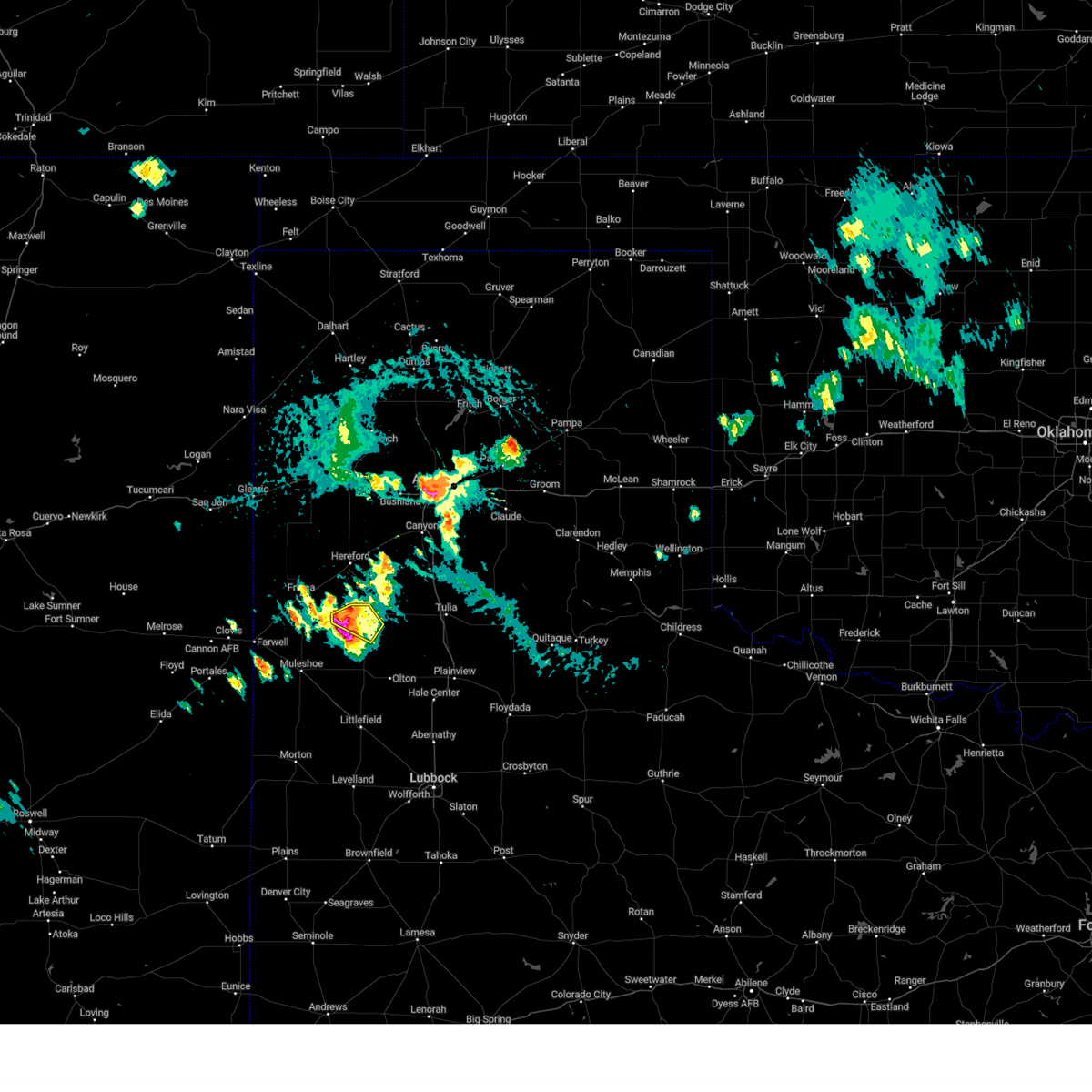 At 401 pm cdt, a severe thunderstorm was located 11 miles southwest of dimmitt, moving southeast at 20 mph (radar indicated). Hazards include two inch hail and 60 mph wind gusts. People and animals outdoors will be injured. expect hail damage to roofs, siding, windows, and vehicles. expect wind damage to roofs, siding, and trees. locations impacted include, dimmitt. thunderstorm damage threat, considerable hail threat, radar indicated max hail size, 2. 00 in wind threat, radar indicated max wind gust, 60 mph. At 401 pm cdt, a severe thunderstorm was located 11 miles southwest of dimmitt, moving southeast at 20 mph (radar indicated). Hazards include two inch hail and 60 mph wind gusts. People and animals outdoors will be injured. expect hail damage to roofs, siding, windows, and vehicles. expect wind damage to roofs, siding, and trees. locations impacted include, dimmitt. thunderstorm damage threat, considerable hail threat, radar indicated max hail size, 2. 00 in wind threat, radar indicated max wind gust, 60 mph.
|
| 8/5/2023 3:54 PM CDT |
 At 354 pm cdt, a severe thunderstorm was located 10 miles southwest of dimmitt, moving southeast at 20 mph (radar indicated). Hazards include two inch hail and 60 mph wind gusts. People and animals outdoors will be injured. expect hail damage to roofs, siding, windows, and vehicles. Expect wind damage to roofs, siding, and trees. At 354 pm cdt, a severe thunderstorm was located 10 miles southwest of dimmitt, moving southeast at 20 mph (radar indicated). Hazards include two inch hail and 60 mph wind gusts. People and animals outdoors will be injured. expect hail damage to roofs, siding, windows, and vehicles. Expect wind damage to roofs, siding, and trees.
|
| 8/5/2023 3:52 PM CDT |
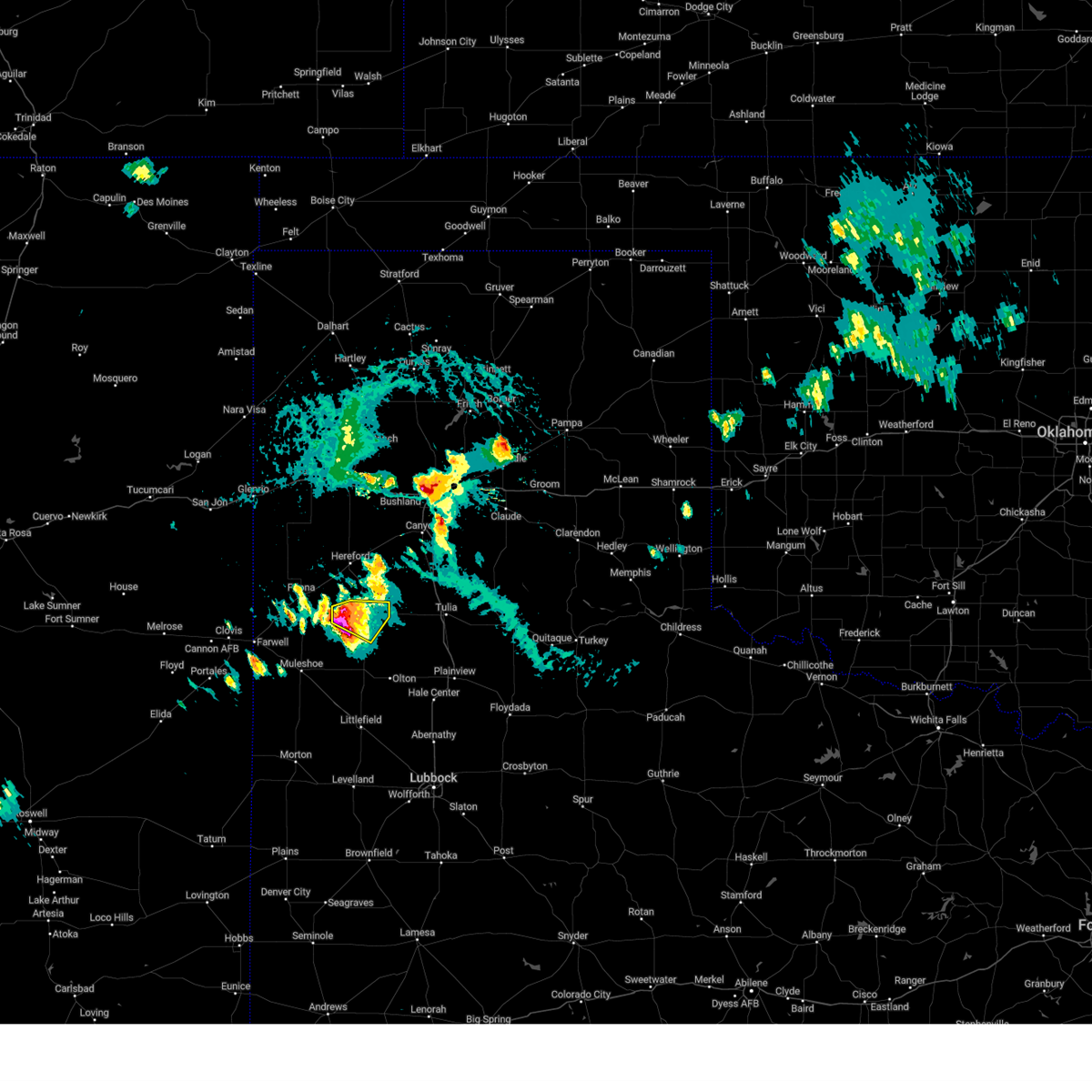 At 352 pm cdt, a severe thunderstorm was located 9 miles southwest of dimmitt, moving southeast at 20 mph (radar indicated). Hazards include two inch hail and 60 mph wind gusts. People and animals outdoors will be injured. expect hail damage to roofs, siding, windows, and vehicles. expect wind damage to roofs, siding, and trees. locations impacted include, dimmitt. thunderstorm damage threat, considerable hail threat, radar indicated max hail size, 2. 00 in wind threat, radar indicated max wind gust, 60 mph. At 352 pm cdt, a severe thunderstorm was located 9 miles southwest of dimmitt, moving southeast at 20 mph (radar indicated). Hazards include two inch hail and 60 mph wind gusts. People and animals outdoors will be injured. expect hail damage to roofs, siding, windows, and vehicles. expect wind damage to roofs, siding, and trees. locations impacted include, dimmitt. thunderstorm damage threat, considerable hail threat, radar indicated max hail size, 2. 00 in wind threat, radar indicated max wind gust, 60 mph.
|
| 8/5/2023 3:43 PM CDT |
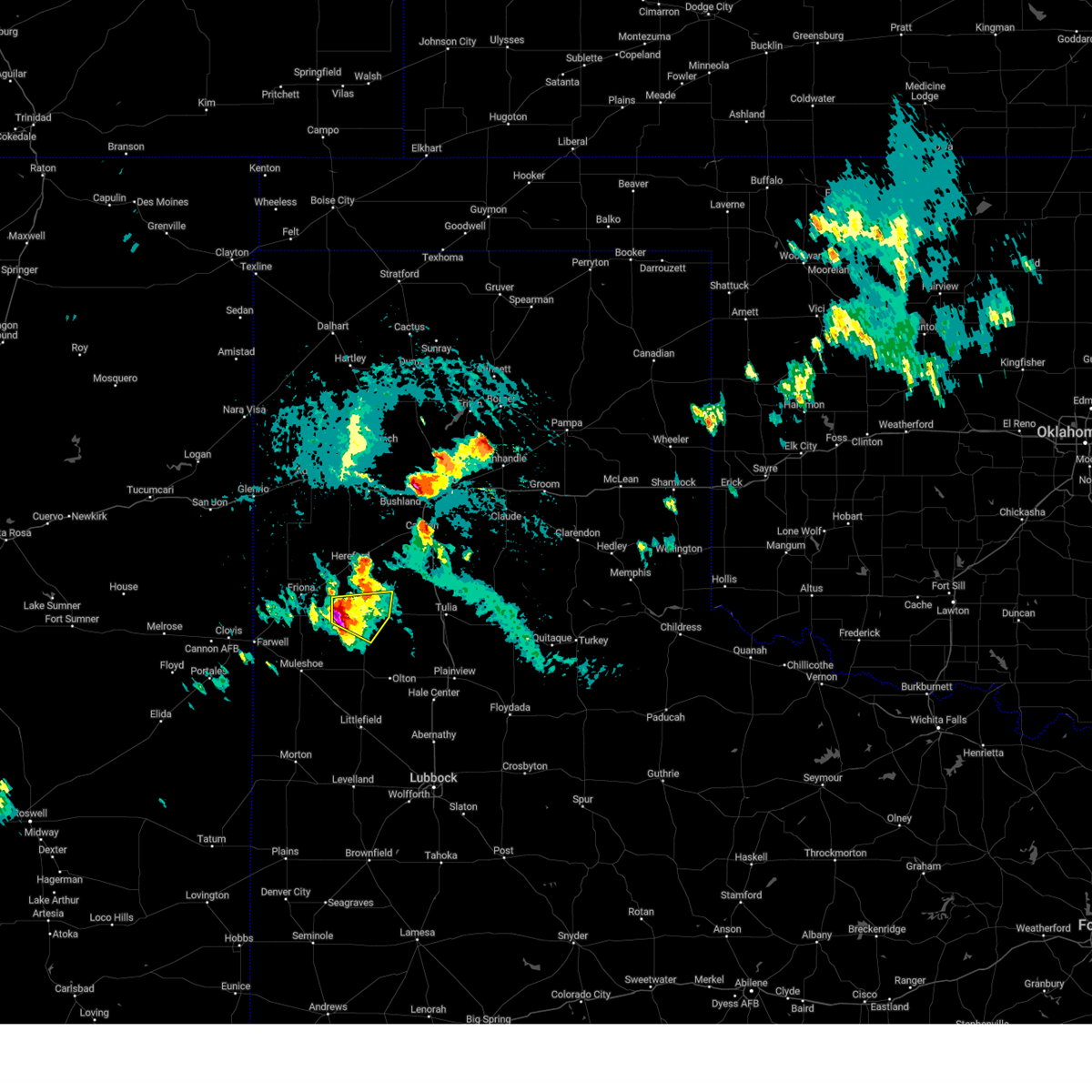 At 343 pm cdt, a severe thunderstorm was located 8 miles southwest of dimmitt, moving southeast at 15 mph (radar indicated). Hazards include two inch hail and 60 mph wind gusts. People and animals outdoors will be injured. expect hail damage to roofs, siding, windows, and vehicles. expect wind damage to roofs, siding, and trees. locations impacted include, dimmitt. thunderstorm damage threat, considerable hail threat, radar indicated max hail size, 2. 00 in wind threat, radar indicated max wind gust, 60 mph. At 343 pm cdt, a severe thunderstorm was located 8 miles southwest of dimmitt, moving southeast at 15 mph (radar indicated). Hazards include two inch hail and 60 mph wind gusts. People and animals outdoors will be injured. expect hail damage to roofs, siding, windows, and vehicles. expect wind damage to roofs, siding, and trees. locations impacted include, dimmitt. thunderstorm damage threat, considerable hail threat, radar indicated max hail size, 2. 00 in wind threat, radar indicated max wind gust, 60 mph.
|
| 8/5/2023 3:30 PM CDT |
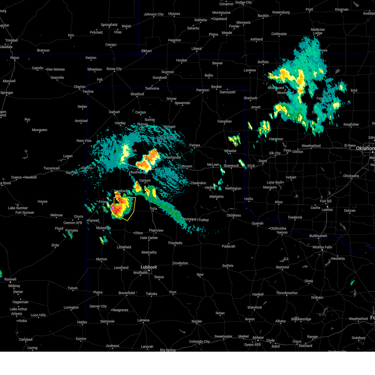 At 330 pm cdt, a severe thunderstorm was located 8 miles southwest of easter, or 9 miles west of dimmitt, moving east at 10 mph (radar indicated). Hazards include ping pong ball size hail and 60 mph wind gusts. People and animals outdoors will be injured. expect hail damage to roofs, siding, windows, and vehicles. expect wind damage to roofs, siding, and trees. locations impacted include, dimmitt, summerfield and easter. hail threat, radar indicated max hail size, 1. 50 in wind threat, radar indicated max wind gust, 60 mph. At 330 pm cdt, a severe thunderstorm was located 8 miles southwest of easter, or 9 miles west of dimmitt, moving east at 10 mph (radar indicated). Hazards include ping pong ball size hail and 60 mph wind gusts. People and animals outdoors will be injured. expect hail damage to roofs, siding, windows, and vehicles. expect wind damage to roofs, siding, and trees. locations impacted include, dimmitt, summerfield and easter. hail threat, radar indicated max hail size, 1. 50 in wind threat, radar indicated max wind gust, 60 mph.
|
| 8/5/2023 3:19 PM CDT |
 At 319 pm cdt, a severe thunderstorm was located near easter, or 10 miles south of hereford, moving east at 15 mph (radar indicated). Hazards include ping pong ball size hail and 60 mph wind gusts. People and animals outdoors will be injured. expect hail damage to roofs, siding, windows, and vehicles. expect wind damage to roofs, siding, and trees. locations impacted include, dimmitt, summerfield and easter. hail threat, radar indicated max hail size, 1. 50 in wind threat, radar indicated max wind gust, 60 mph. At 319 pm cdt, a severe thunderstorm was located near easter, or 10 miles south of hereford, moving east at 15 mph (radar indicated). Hazards include ping pong ball size hail and 60 mph wind gusts. People and animals outdoors will be injured. expect hail damage to roofs, siding, windows, and vehicles. expect wind damage to roofs, siding, and trees. locations impacted include, dimmitt, summerfield and easter. hail threat, radar indicated max hail size, 1. 50 in wind threat, radar indicated max wind gust, 60 mph.
|
| 8/5/2023 3:12 PM CDT |
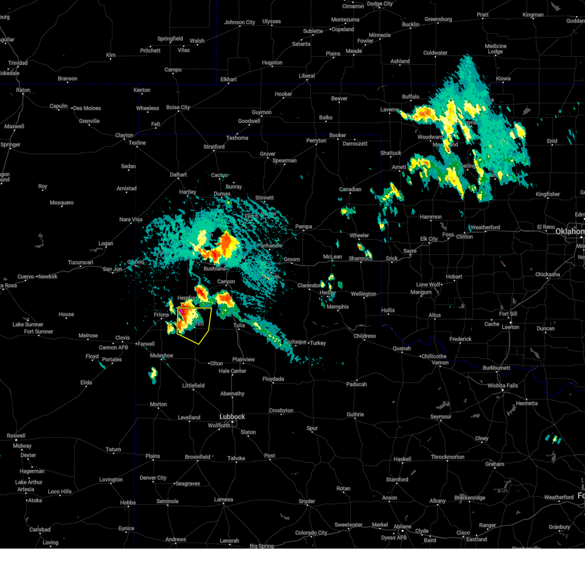 At 312 pm cdt, a severe thunderstorm was located 4 miles northwest of easter, or 9 miles south of hereford, moving east at 15 mph (radar indicated). Hazards include 60 mph wind gusts and quarter size hail. Hail damage to vehicles is expected. Expect wind damage to roofs, siding, and trees. At 312 pm cdt, a severe thunderstorm was located 4 miles northwest of easter, or 9 miles south of hereford, moving east at 15 mph (radar indicated). Hazards include 60 mph wind gusts and quarter size hail. Hail damage to vehicles is expected. Expect wind damage to roofs, siding, and trees.
|
| 1/1/0001 12:00 AM | West texas mesonet report in castro county TX, 2.4 miles SSW of Dimmitt, TX |
| 7/7/2023 6:16 PM CDT |
 At 616 pm cdt, severe thunderstorms were located along a line extending from 8 miles east of happy to kress to cotton center, moving east at 45 mph (radar indicated). Hazards include 70 mph wind gusts. Expect considerable tree damage. damage is likely to mobile homes, roofs, and outbuildings. locations impacted include, plainview, littlefield, tulia, dimmitt, abernathy, hale center, olton, hart, earth, petersburg, sudan, amherst, kress, happy, cotton center, vigo park, fieldton, spade, claytonville and halfway. thunderstorm damage threat, considerable hail threat, radar indicated max hail size, <. 75 in wind threat, radar indicated max wind gust, 70 mph. At 616 pm cdt, severe thunderstorms were located along a line extending from 8 miles east of happy to kress to cotton center, moving east at 45 mph (radar indicated). Hazards include 70 mph wind gusts. Expect considerable tree damage. damage is likely to mobile homes, roofs, and outbuildings. locations impacted include, plainview, littlefield, tulia, dimmitt, abernathy, hale center, olton, hart, earth, petersburg, sudan, amherst, kress, happy, cotton center, vigo park, fieldton, spade, claytonville and halfway. thunderstorm damage threat, considerable hail threat, radar indicated max hail size, <. 75 in wind threat, radar indicated max wind gust, 70 mph.
|
| 7/7/2023 6:10 PM CDT |
 At 609 pm cdt, severe thunderstorms were located along a line extending from 4 miles east of happy to 3 miles southwest of kress to near cotton center, moving east at 45 mph (radar indicated). Hazards include 70 mph wind gusts. Expect considerable tree damage. damage is likely to mobile homes, roofs, and outbuildings. locations impacted include, plainview, littlefield, tulia, dimmitt, abernathy, hale center, olton, hart, earth, petersburg, sudan, amherst, kress, happy, cotton center, vigo park, fieldton, spade, claytonville and halfway. thunderstorm damage threat, considerable hail threat, radar indicated max hail size, <. 75 in wind threat, radar indicated max wind gust, 70 mph. At 609 pm cdt, severe thunderstorms were located along a line extending from 4 miles east of happy to 3 miles southwest of kress to near cotton center, moving east at 45 mph (radar indicated). Hazards include 70 mph wind gusts. Expect considerable tree damage. damage is likely to mobile homes, roofs, and outbuildings. locations impacted include, plainview, littlefield, tulia, dimmitt, abernathy, hale center, olton, hart, earth, petersburg, sudan, amherst, kress, happy, cotton center, vigo park, fieldton, spade, claytonville and halfway. thunderstorm damage threat, considerable hail threat, radar indicated max hail size, <. 75 in wind threat, radar indicated max wind gust, 70 mph.
|
| 7/7/2023 5:34 PM CDT | West texas mesonet report. multiple severe gusts from 5:25p to 5:38 in castro county TX, 2.4 miles SSW of Dimmitt, TX |
| 7/7/2023 5:31 PM CDT |
 At 530 pm cdt, severe thunderstorms were located along a line extending from 5 miles east of easter to 5 miles northeast of earth to 5 miles east of bula, moving east at 45 mph (west texas mesonet. at 525 pm cdt, dimmitt mesonet gusted to 64 mph). Hazards include 70 mph wind gusts. Expect considerable tree damage. Damage is likely to mobile homes, roofs, and outbuildings. At 530 pm cdt, severe thunderstorms were located along a line extending from 5 miles east of easter to 5 miles northeast of earth to 5 miles east of bula, moving east at 45 mph (west texas mesonet. at 525 pm cdt, dimmitt mesonet gusted to 64 mph). Hazards include 70 mph wind gusts. Expect considerable tree damage. Damage is likely to mobile homes, roofs, and outbuildings.
|
| 7/7/2023 5:21 PM CDT |
 At 521 pm cdt, severe thunderstorms were located along a line extending from 4 miles west of dimmitt to 4 miles southwest of earth to bula, moving east at 40 mph (radar indicated). Hazards include 70 mph wind gusts and quarter size hail. Hail damage to vehicles is expected. expect considerable tree damage. wind damage is also likely to mobile homes, roofs, and outbuildings. locations impacted include, littlefield, muleshoe, dimmitt, friona, earth, bovina, sudan, amherst, summerfield, needmore, easter, lazbuddie, progress, oklahoma lane, lariat, enochs, black, bula and muleshoe wildlife refuge. thunderstorm damage threat, considerable hail threat, radar indicated max hail size, 1. 00 in wind threat, radar indicated max wind gust, 70 mph. At 521 pm cdt, severe thunderstorms were located along a line extending from 4 miles west of dimmitt to 4 miles southwest of earth to bula, moving east at 40 mph (radar indicated). Hazards include 70 mph wind gusts and quarter size hail. Hail damage to vehicles is expected. expect considerable tree damage. wind damage is also likely to mobile homes, roofs, and outbuildings. locations impacted include, littlefield, muleshoe, dimmitt, friona, earth, bovina, sudan, amherst, summerfield, needmore, easter, lazbuddie, progress, oklahoma lane, lariat, enochs, black, bula and muleshoe wildlife refuge. thunderstorm damage threat, considerable hail threat, radar indicated max hail size, 1. 00 in wind threat, radar indicated max wind gust, 70 mph.
|
| 7/7/2023 5:01 PM CDT |
 At 501 pm cdt, severe thunderstorms were located along a line extending from 3 miles west of black to 4 miles east of progress to 5 miles north of maple, moving northeast at 45 mph (west texas mesonet. at 455 pm cdt, the friona mesonet gusted to 67 mph). Hazards include 70 mph wind gusts and quarter size hail. Hail damage to vehicles is expected. expect considerable tree damage. wind damage is also likely to mobile homes, roofs, and outbuildings. locations impacted include, littlefield, muleshoe, dimmitt, friona, earth, bovina, farwell, sudan, amherst, summerfield, needmore, easter, lazbuddie, progress, oklahoma lane, lariat, enochs, west camp, black and rhea. thunderstorm damage threat, considerable hail threat, radar indicated max hail size, 1. 00 in wind threat, observed max wind gust, 70 mph. At 501 pm cdt, severe thunderstorms were located along a line extending from 3 miles west of black to 4 miles east of progress to 5 miles north of maple, moving northeast at 45 mph (west texas mesonet. at 455 pm cdt, the friona mesonet gusted to 67 mph). Hazards include 70 mph wind gusts and quarter size hail. Hail damage to vehicles is expected. expect considerable tree damage. wind damage is also likely to mobile homes, roofs, and outbuildings. locations impacted include, littlefield, muleshoe, dimmitt, friona, earth, bovina, farwell, sudan, amherst, summerfield, needmore, easter, lazbuddie, progress, oklahoma lane, lariat, enochs, west camp, black and rhea. thunderstorm damage threat, considerable hail threat, radar indicated max hail size, 1. 00 in wind threat, observed max wind gust, 70 mph.
|
| 7/7/2023 4:40 PM CDT |
 At 439 pm cdt, severe thunderstorms were located along a line extending from near bovina to 4 miles southeast of west camp to 5 miles north of causey, moving northeast at 40 mph. at 428 pm cdt, the clovis municipal aiport reported a wind gust of 66 mph (asos). Hazards include 70 mph wind gusts and quarter size hail. Hail damage to vehicles is expected. expect considerable tree damage. wind damage is also likely to mobile homes, roofs, and outbuildings. locations impacted include, littlefield, muleshoe, dimmitt, friona, earth, bovina, farwell, sudan, amherst, summerfield, needmore, easter, lazbuddie, progress, oklahoma lane, lariat, enochs, west camp, black and rhea. thunderstorm damage threat, considerable hail threat, radar indicated max hail size, 1. 00 in wind threat, observed max wind gust, 70 mph. At 439 pm cdt, severe thunderstorms were located along a line extending from near bovina to 4 miles southeast of west camp to 5 miles north of causey, moving northeast at 40 mph. at 428 pm cdt, the clovis municipal aiport reported a wind gust of 66 mph (asos). Hazards include 70 mph wind gusts and quarter size hail. Hail damage to vehicles is expected. expect considerable tree damage. wind damage is also likely to mobile homes, roofs, and outbuildings. locations impacted include, littlefield, muleshoe, dimmitt, friona, earth, bovina, farwell, sudan, amherst, summerfield, needmore, easter, lazbuddie, progress, oklahoma lane, lariat, enochs, west camp, black and rhea. thunderstorm damage threat, considerable hail threat, radar indicated max hail size, 1. 00 in wind threat, observed max wind gust, 70 mph.
|
| 7/7/2023 4:30 PM CDT |
 At 430 pm cdt, severe thunderstorms were located along a line extending from 5 miles south of rhea to west camp to 5 miles northeast of dora, moving northeast at 45 mph (radar indicated). Hazards include 60 mph wind gusts and quarter size hail. Hail damage to vehicles is expected. Expect wind damage to roofs, siding, and trees. At 430 pm cdt, severe thunderstorms were located along a line extending from 5 miles south of rhea to west camp to 5 miles northeast of dora, moving northeast at 45 mph (radar indicated). Hazards include 60 mph wind gusts and quarter size hail. Hail damage to vehicles is expected. Expect wind damage to roofs, siding, and trees.
|
| 7/6/2023 12:50 AM CDT |
 At 1249 am cdt, severe thunderstorms were located along a line extending from 5 miles south of happy to 8 miles northwest of olton, moving east at 35 mph (radar indicated). Hazards include 60 mph wind gusts. Expect damage to roofs, siding, and trees. locations impacted include, dimmitt, hart, happy, easter and nazareth. hail threat, radar indicated max hail size, <. 75 in wind threat, radar indicated max wind gust, 60 mph. At 1249 am cdt, severe thunderstorms were located along a line extending from 5 miles south of happy to 8 miles northwest of olton, moving east at 35 mph (radar indicated). Hazards include 60 mph wind gusts. Expect damage to roofs, siding, and trees. locations impacted include, dimmitt, hart, happy, easter and nazareth. hail threat, radar indicated max hail size, <. 75 in wind threat, radar indicated max wind gust, 60 mph.
|
| 7/6/2023 12:34 AM CDT |
 At 1233 am cdt, severe thunderstorms were located along a line extending from 13 miles south of buffalo lake to 5 miles north of earth, moving east at 40 mph (radar indicated). Hazards include 60 mph wind gusts. Expect damage to roofs, siding, and trees. locations impacted include, dimmitt, friona, hart, happy, summerfield, easter, lazbuddie, black and nazareth. hail threat, radar indicated max hail size, <. 75 in wind threat, radar indicated max wind gust, 60 mph. At 1233 am cdt, severe thunderstorms were located along a line extending from 13 miles south of buffalo lake to 5 miles north of earth, moving east at 40 mph (radar indicated). Hazards include 60 mph wind gusts. Expect damage to roofs, siding, and trees. locations impacted include, dimmitt, friona, hart, happy, summerfield, easter, lazbuddie, black and nazareth. hail threat, radar indicated max hail size, <. 75 in wind threat, radar indicated max wind gust, 60 mph.
|
| 7/6/2023 12:13 AM CDT |
 At 1212 am cdt, severe thunderstorms with a history of producing destructive winds were located along a line extending from 8 miles southeast of hereford to 3 miles southwest of lazbuddie, moving east at 40 mph (west texas mesonet). Hazards include 70 mph wind gusts and penny size hail. Expect considerable tree damage. Damage is likely to mobile homes, roofs, and outbuildings. At 1212 am cdt, severe thunderstorms with a history of producing destructive winds were located along a line extending from 8 miles southeast of hereford to 3 miles southwest of lazbuddie, moving east at 40 mph (west texas mesonet). Hazards include 70 mph wind gusts and penny size hail. Expect considerable tree damage. Damage is likely to mobile homes, roofs, and outbuildings.
|
| 6/23/2023 6:56 PM CDT |
 At 656 pm cdt, severe thunderstorms were located along a line extending from 8 miles southwest of kress to 8 miles northeast of earth, moving east at 25 mph (radar indicated). Hazards include ping pong ball size hail and 60 mph wind gusts. People and animals outdoors will be injured. expect hail damage to roofs, siding, windows, and vehicles. expect wind damage to roofs, siding, and trees. locations impacted include, plainview, tulia, olton, hart, earth, kress, vigo park, halfway, claytonville, seth ward, edmonson and springlake. hail threat, radar indicated max hail size, 1. 50 in wind threat, radar indicated max wind gust, 60 mph. At 656 pm cdt, severe thunderstorms were located along a line extending from 8 miles southwest of kress to 8 miles northeast of earth, moving east at 25 mph (radar indicated). Hazards include ping pong ball size hail and 60 mph wind gusts. People and animals outdoors will be injured. expect hail damage to roofs, siding, windows, and vehicles. expect wind damage to roofs, siding, and trees. locations impacted include, plainview, tulia, olton, hart, earth, kress, vigo park, halfway, claytonville, seth ward, edmonson and springlake. hail threat, radar indicated max hail size, 1. 50 in wind threat, radar indicated max wind gust, 60 mph.
|
| 6/23/2023 6:45 PM CDT |
 At 645 pm cdt, severe thunderstorms were located along a line extending from 8 miles southwest of kress to 4 miles northeast of earth, moving east at 40 mph (radar indicated). Hazards include 60 mph wind gusts and half dollar size hail. Hail damage to vehicles is expected. expect wind damage to roofs, siding, and trees. locations impacted include, plainview, tulia, olton, hart, earth, kress, vigo park, halfway, claytonville, seth ward, edmonson and springlake. hail threat, radar indicated max hail size, 1. 25 in wind threat, radar indicated max wind gust, 60 mph. At 645 pm cdt, severe thunderstorms were located along a line extending from 8 miles southwest of kress to 4 miles northeast of earth, moving east at 40 mph (radar indicated). Hazards include 60 mph wind gusts and half dollar size hail. Hail damage to vehicles is expected. expect wind damage to roofs, siding, and trees. locations impacted include, plainview, tulia, olton, hart, earth, kress, vigo park, halfway, claytonville, seth ward, edmonson and springlake. hail threat, radar indicated max hail size, 1. 25 in wind threat, radar indicated max wind gust, 60 mph.
|
| 6/23/2023 6:38 PM CDT |
 At 638 pm cdt, severe thunderstorms were located along a line extending from 6 miles north of halfway to near earth, moving east at 40 mph (radar indicated). Hazards include 60 mph wind gusts and half dollar size hail. Hail damage to vehicles is expected. Expect wind damage to roofs, siding, and trees. At 638 pm cdt, severe thunderstorms were located along a line extending from 6 miles north of halfway to near earth, moving east at 40 mph (radar indicated). Hazards include 60 mph wind gusts and half dollar size hail. Hail damage to vehicles is expected. Expect wind damage to roofs, siding, and trees.
|
| 6/23/2023 6:33 PM CDT |
 At 633 pm cdt, a severe thunderstorm was located near earth, moving east at 25 mph (radar indicated). Hazards include 60 mph wind gusts and quarter size hail. Hail damage to vehicles is expected. expect wind damage to roofs, siding, and trees. locations impacted include, earth and springlake. hail threat, radar indicated max hail size, 1. 00 in wind threat, radar indicated max wind gust, 60 mph. At 633 pm cdt, a severe thunderstorm was located near earth, moving east at 25 mph (radar indicated). Hazards include 60 mph wind gusts and quarter size hail. Hail damage to vehicles is expected. expect wind damage to roofs, siding, and trees. locations impacted include, earth and springlake. hail threat, radar indicated max hail size, 1. 00 in wind threat, radar indicated max wind gust, 60 mph.
|
| 6/23/2023 6:20 PM CDT |
 At 619 pm cdt, a severe thunderstorm was located 7 miles northwest of earth, moving northeast at 35 mph (radar indicated). Hazards include 60 mph wind gusts and quarter size hail. Hail damage to vehicles is expected. expect wind damage to roofs, siding, and trees. locations impacted include, dimmitt, earth and springlake. hail threat, radar indicated max hail size, 1. 00 in wind threat, radar indicated max wind gust, 60 mph. At 619 pm cdt, a severe thunderstorm was located 7 miles northwest of earth, moving northeast at 35 mph (radar indicated). Hazards include 60 mph wind gusts and quarter size hail. Hail damage to vehicles is expected. expect wind damage to roofs, siding, and trees. locations impacted include, dimmitt, earth and springlake. hail threat, radar indicated max hail size, 1. 00 in wind threat, radar indicated max wind gust, 60 mph.
|
| 6/23/2023 6:09 PM CDT |
 At 609 pm cdt, a severe thunderstorm was located 8 miles west of earth, moving northeast at 45 mph (radar indicated). Hazards include 60 mph wind gusts and quarter size hail. Hail damage to vehicles is expected. Expect wind damage to roofs, siding, and trees. At 609 pm cdt, a severe thunderstorm was located 8 miles west of earth, moving northeast at 45 mph (radar indicated). Hazards include 60 mph wind gusts and quarter size hail. Hail damage to vehicles is expected. Expect wind damage to roofs, siding, and trees.
|
| 6/23/2023 5:56 PM CDT |
 At 555 pm cdt, a severe thunderstorm was located near hart, moving east at 25 mph. a second thunderstorm core was located 3 miles east of dimmitt (radar indicated). Hazards include 70 mph wind gusts and quarter size hail. Hail damage to vehicles is expected. expect considerable tree damage. wind damage is also likely to mobile homes, roofs, and outbuildings. locations impacted include, dimmitt, hart, nazareth and edmonson. thunderstorm damage threat, considerable hail threat, radar indicated max hail size, 1. 00 in wind threat, radar indicated max wind gust, 70 mph. At 555 pm cdt, a severe thunderstorm was located near hart, moving east at 25 mph. a second thunderstorm core was located 3 miles east of dimmitt (radar indicated). Hazards include 70 mph wind gusts and quarter size hail. Hail damage to vehicles is expected. expect considerable tree damage. wind damage is also likely to mobile homes, roofs, and outbuildings. locations impacted include, dimmitt, hart, nazareth and edmonson. thunderstorm damage threat, considerable hail threat, radar indicated max hail size, 1. 00 in wind threat, radar indicated max wind gust, 70 mph.
|
| 6/23/2023 5:47 PM CDT | Quarter sized hail reported 0.7 miles S of Dimmitt, TX, report from mping: quarter (1.00 in.). |
| 6/23/2023 5:44 PM CDT |
 At 544 pm cdt, a severe thunderstorm was located 7 miles south of dimmitt, moving east at 35 mph (radar indicated). Hazards include 70 mph wind gusts and ping pong ball size hail. People and animals outdoors will be injured. expect hail damage to roofs, siding, windows, and vehicles. expect considerable tree damage. Wind damage is also likely to mobile homes, roofs, and outbuildings. At 544 pm cdt, a severe thunderstorm was located 7 miles south of dimmitt, moving east at 35 mph (radar indicated). Hazards include 70 mph wind gusts and ping pong ball size hail. People and animals outdoors will be injured. expect hail damage to roofs, siding, windows, and vehicles. expect considerable tree damage. Wind damage is also likely to mobile homes, roofs, and outbuildings.
|
| 6/23/2023 5:39 PM CDT |
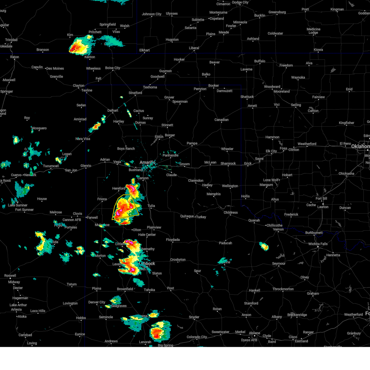 At 538 pm cdt, a severe thunderstorm was located 5 miles south of dimmitt, moving east at 30 mph. this is a destructive storm for areas near and southwest of dimmitt (radar indicated). Hazards include baseball size hail and 70 mph wind gusts. People and animals outdoors will be severely injured. expect shattered windows, extensive damage to roofs, siding, and vehicles. locations impacted include, dimmitt, easter and nazareth. thunderstorm damage threat, destructive hail threat, radar indicated max hail size, 2. 75 in wind threat, radar indicated max wind gust, 70 mph. At 538 pm cdt, a severe thunderstorm was located 5 miles south of dimmitt, moving east at 30 mph. this is a destructive storm for areas near and southwest of dimmitt (radar indicated). Hazards include baseball size hail and 70 mph wind gusts. People and animals outdoors will be severely injured. expect shattered windows, extensive damage to roofs, siding, and vehicles. locations impacted include, dimmitt, easter and nazareth. thunderstorm damage threat, destructive hail threat, radar indicated max hail size, 2. 75 in wind threat, radar indicated max wind gust, 70 mph.
|
| 6/23/2023 5:28 PM CDT |
 At 527 pm cdt, a severe thunderstorm was located over dimmitt, moving east at 40 mph. this is a destructive storm for western and southwestern castro county (radar indicated). Hazards include baseball size hail and 70 mph wind gusts. People and animals outdoors will be severely injured. expect shattered windows, extensive damage to roofs, siding, and vehicles. locations impacted include, dimmitt, easter and nazareth. thunderstorm damage threat, destructive hail threat, radar indicated max hail size, 2. 75 in wind threat, radar indicated max wind gust, 70 mph. At 527 pm cdt, a severe thunderstorm was located over dimmitt, moving east at 40 mph. this is a destructive storm for western and southwestern castro county (radar indicated). Hazards include baseball size hail and 70 mph wind gusts. People and animals outdoors will be severely injured. expect shattered windows, extensive damage to roofs, siding, and vehicles. locations impacted include, dimmitt, easter and nazareth. thunderstorm damage threat, destructive hail threat, radar indicated max hail size, 2. 75 in wind threat, radar indicated max wind gust, 70 mph.
|
| 6/23/2023 5:26 PM CDT |
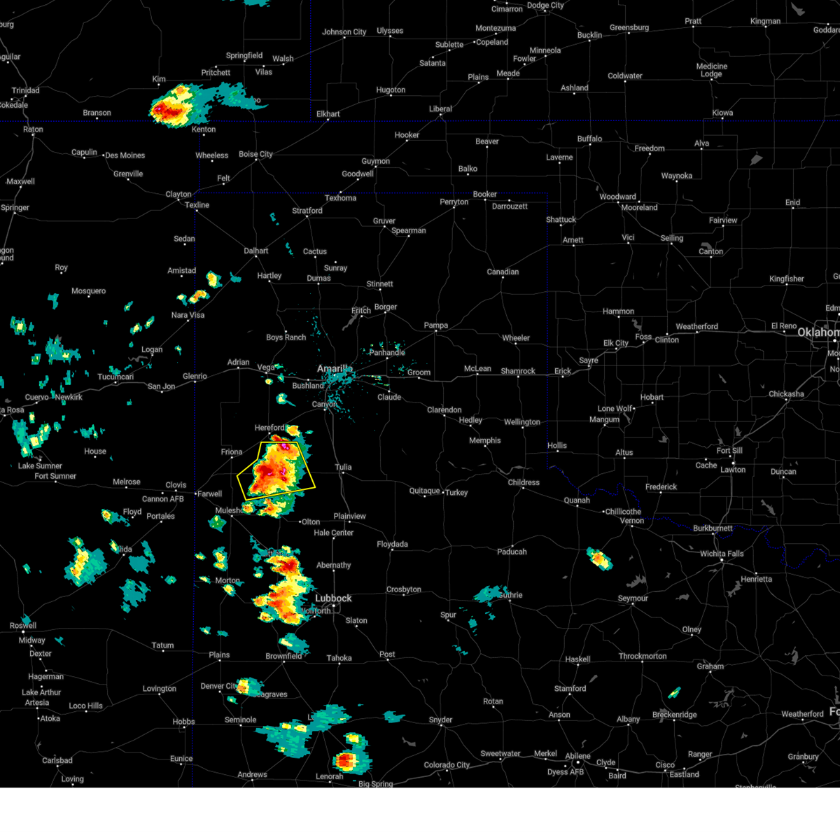 At 525 pm cdt, a severe thunderstorm was located near dimmitt, moving east at 40 mph. this is a destructive storm for western and southwestern castro county (radar indicated). Hazards include baseball size hail and 70 mph wind gusts. People and animals outdoors will be severely injured. expect shattered windows, extensive damage to roofs, siding, and vehicles. locations impacted include, dimmitt, easter, lazbuddie and nazareth. thunderstorm damage threat, destructive hail threat, radar indicated max hail size, 2. 75 in wind threat, radar indicated max wind gust, 70 mph. At 525 pm cdt, a severe thunderstorm was located near dimmitt, moving east at 40 mph. this is a destructive storm for western and southwestern castro county (radar indicated). Hazards include baseball size hail and 70 mph wind gusts. People and animals outdoors will be severely injured. expect shattered windows, extensive damage to roofs, siding, and vehicles. locations impacted include, dimmitt, easter, lazbuddie and nazareth. thunderstorm damage threat, destructive hail threat, radar indicated max hail size, 2. 75 in wind threat, radar indicated max wind gust, 70 mph.
|
| 6/23/2023 5:21 PM CDT |
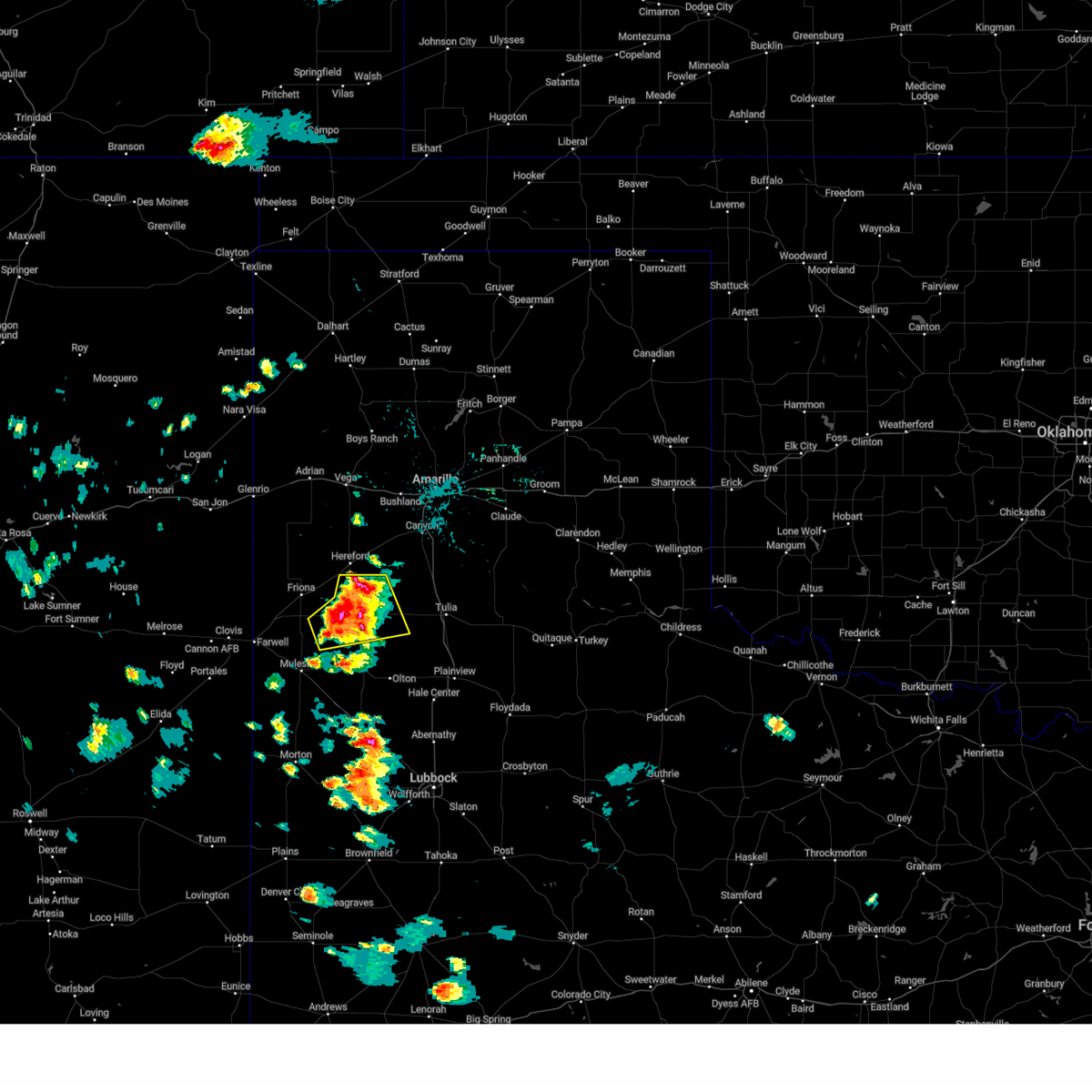 At 519 pm cdt, a severe thunderstorm was located 6 miles west of dimmitt, moving northeast at 40 mph. doppler radar indicates the wind threat is increasing across central portions of castro county (radar indicated). Hazards include tennis ball size hail and 70 mph wind gusts. People and animals outdoors will be injured. expect hail damage to roofs, siding, windows, and vehicles. expect considerable tree damage. wind damage is also likely to mobile homes, roofs, and outbuildings. locations impacted include, dimmitt, easter, lazbuddie and nazareth. thunderstorm damage threat, considerable hail threat, radar indicated max hail size, 2. 50 in wind threat, radar indicated max wind gust, 70 mph. At 519 pm cdt, a severe thunderstorm was located 6 miles west of dimmitt, moving northeast at 40 mph. doppler radar indicates the wind threat is increasing across central portions of castro county (radar indicated). Hazards include tennis ball size hail and 70 mph wind gusts. People and animals outdoors will be injured. expect hail damage to roofs, siding, windows, and vehicles. expect considerable tree damage. wind damage is also likely to mobile homes, roofs, and outbuildings. locations impacted include, dimmitt, easter, lazbuddie and nazareth. thunderstorm damage threat, considerable hail threat, radar indicated max hail size, 2. 50 in wind threat, radar indicated max wind gust, 70 mph.
|
| 6/23/2023 5:10 PM CDT |
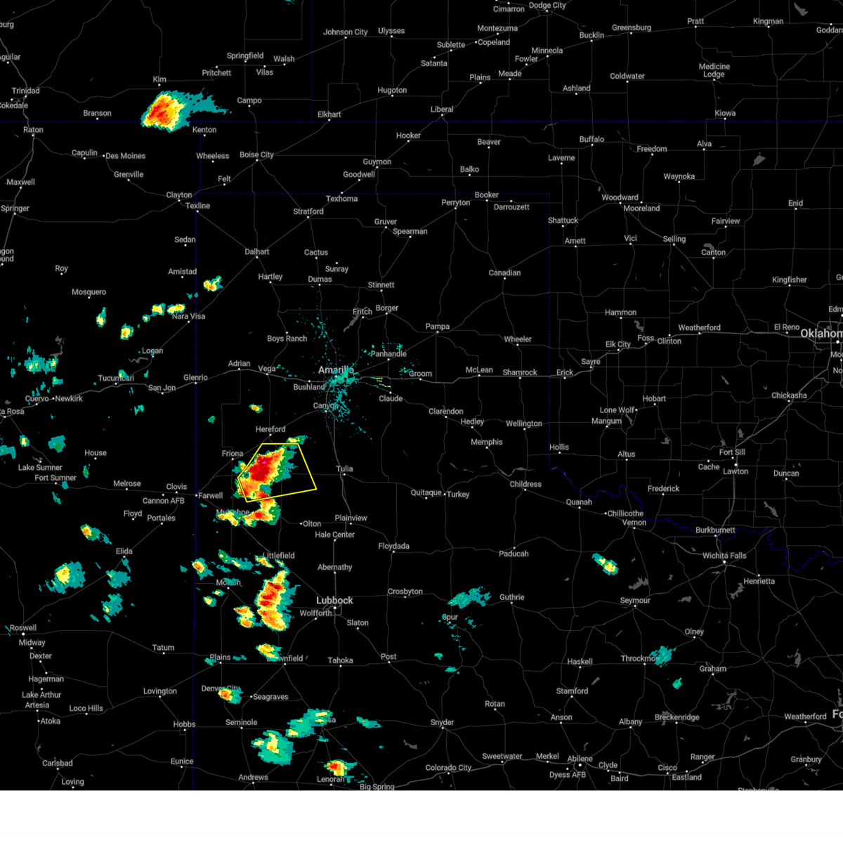 At 509 pm cdt, a severe thunderstorm was located near easter, or 6 miles northwest of dimmitt, moving northeast at 30 mph. a second thunderstorm core was located near lazbuddie (radar indicated). Hazards include golf ball size hail and 70 mph wind gusts. People and animals outdoors will be injured. expect hail damage to roofs, siding, windows, and vehicles. expect considerable tree damage. wind damage is also likely to mobile homes, roofs, and outbuildings. locations impacted include, dimmitt, easter, lazbuddie and nazareth. thunderstorm damage threat, considerable hail threat, radar indicated max hail size, 1. 75 in wind threat, radar indicated max wind gust, 70 mph. At 509 pm cdt, a severe thunderstorm was located near easter, or 6 miles northwest of dimmitt, moving northeast at 30 mph. a second thunderstorm core was located near lazbuddie (radar indicated). Hazards include golf ball size hail and 70 mph wind gusts. People and animals outdoors will be injured. expect hail damage to roofs, siding, windows, and vehicles. expect considerable tree damage. wind damage is also likely to mobile homes, roofs, and outbuildings. locations impacted include, dimmitt, easter, lazbuddie and nazareth. thunderstorm damage threat, considerable hail threat, radar indicated max hail size, 1. 75 in wind threat, radar indicated max wind gust, 70 mph.
|
| 6/23/2023 5:02 PM CDT |
 At 502 pm cdt, a severe thunderstorm was located near earth, moving east at 40 mph (radar indicated). Hazards include 60 mph wind gusts and quarter size hail. Hail damage to vehicles is expected. expect wind damage to roofs, siding, and trees. locations impacted include, olton, earth and springlake. hail threat, radar indicated max hail size, 1. 00 in wind threat, radar indicated max wind gust, 60 mph. At 502 pm cdt, a severe thunderstorm was located near earth, moving east at 40 mph (radar indicated). Hazards include 60 mph wind gusts and quarter size hail. Hail damage to vehicles is expected. expect wind damage to roofs, siding, and trees. locations impacted include, olton, earth and springlake. hail threat, radar indicated max hail size, 1. 00 in wind threat, radar indicated max wind gust, 60 mph.
|
| 6/23/2023 5:00 PM CDT |
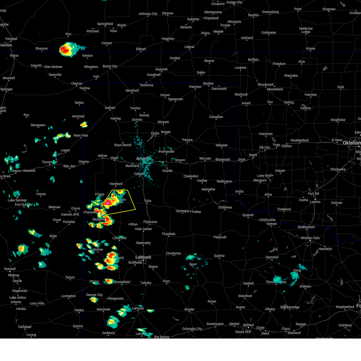 At 500 pm cdt, a severe thunderstorm was located 7 miles southwest of easter, or 9 miles west of dimmitt, moving northeast at 30 mph (radar indicated). Hazards include tennis ball size hail and 70 mph wind gusts. People and animals outdoors will be injured. expect hail damage to roofs, siding, windows, and vehicles. expect considerable tree damage. wind damage is also likely to mobile homes, roofs, and outbuildings. locations impacted include, dimmitt, easter, lazbuddie and nazareth. thunderstorm damage threat, considerable hail threat, radar indicated max hail size, 2. 50 in wind threat, radar indicated max wind gust, 70 mph. At 500 pm cdt, a severe thunderstorm was located 7 miles southwest of easter, or 9 miles west of dimmitt, moving northeast at 30 mph (radar indicated). Hazards include tennis ball size hail and 70 mph wind gusts. People and animals outdoors will be injured. expect hail damage to roofs, siding, windows, and vehicles. expect considerable tree damage. wind damage is also likely to mobile homes, roofs, and outbuildings. locations impacted include, dimmitt, easter, lazbuddie and nazareth. thunderstorm damage threat, considerable hail threat, radar indicated max hail size, 2. 50 in wind threat, radar indicated max wind gust, 70 mph.
|
| 6/23/2023 4:54 PM CDT |
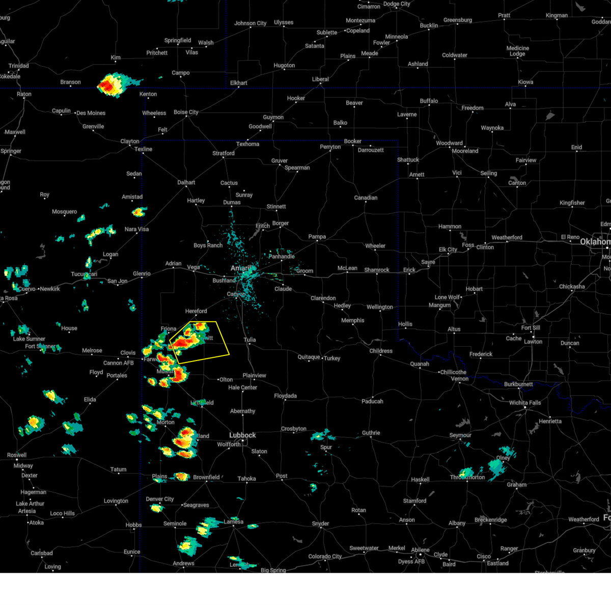 At 453 pm cdt, a severe thunderstorm was located 10 miles southeast of black, or 12 miles southeast of friona, moving northeast at 30 mph (radar indicated). Hazards include two inch hail and 70 mph wind gusts. People and animals outdoors will be injured. expect hail damage to roofs, siding, windows, and vehicles. expect considerable tree damage. wind damage is also likely to mobile homes, roofs, and outbuildings. locations impacted include, dimmitt, easter, lazbuddie and nazareth. thunderstorm damage threat, considerable hail threat, radar indicated max hail size, 2. 00 in wind threat, radar indicated max wind gust, 70 mph. At 453 pm cdt, a severe thunderstorm was located 10 miles southeast of black, or 12 miles southeast of friona, moving northeast at 30 mph (radar indicated). Hazards include two inch hail and 70 mph wind gusts. People and animals outdoors will be injured. expect hail damage to roofs, siding, windows, and vehicles. expect considerable tree damage. wind damage is also likely to mobile homes, roofs, and outbuildings. locations impacted include, dimmitt, easter, lazbuddie and nazareth. thunderstorm damage threat, considerable hail threat, radar indicated max hail size, 2. 00 in wind threat, radar indicated max wind gust, 70 mph.
|
| 6/23/2023 4:48 PM CDT |
 At 448 pm cdt, a severe thunderstorm was located 9 miles north of lazbuddie, or 10 miles southeast of friona, moving northeast at 30 mph (radar indicated). Hazards include 60 mph wind gusts and half dollar size hail. Hail damage to vehicles is expected. Expect wind damage to roofs, siding, and trees. At 448 pm cdt, a severe thunderstorm was located 9 miles north of lazbuddie, or 10 miles southeast of friona, moving northeast at 30 mph (radar indicated). Hazards include 60 mph wind gusts and half dollar size hail. Hail damage to vehicles is expected. Expect wind damage to roofs, siding, and trees.
|
| 6/23/2023 4:42 PM CDT |
 At 441 pm cdt, a severe thunderstorm was located near muleshoe, moving east at 40 mph (radar indicated). Hazards include 60 mph wind gusts and half dollar size hail. Hail damage to vehicles is expected. Expect wind damage to roofs, siding, and trees. At 441 pm cdt, a severe thunderstorm was located near muleshoe, moving east at 40 mph (radar indicated). Hazards include 60 mph wind gusts and half dollar size hail. Hail damage to vehicles is expected. Expect wind damage to roofs, siding, and trees.
|
| 6/3/2023 7:44 PM CDT |
 At 744 pm cdt, a severe thunderstorm was located near black, or near friona, moving south at 20 mph (radar indicated). Hazards include 60 mph wind gusts and half dollar size hail. Hail damage to vehicles is expected. expect wind damage to roofs, siding, and trees. locations impacted include, dimmitt, friona, bovina, farwell, summerfield, easter, lazbuddie, oklahoma lane, lariat, rhea and black. hail threat, radar indicated max hail size, 1. 25 in wind threat, radar indicated max wind gust, 60 mph. At 744 pm cdt, a severe thunderstorm was located near black, or near friona, moving south at 20 mph (radar indicated). Hazards include 60 mph wind gusts and half dollar size hail. Hail damage to vehicles is expected. expect wind damage to roofs, siding, and trees. locations impacted include, dimmitt, friona, bovina, farwell, summerfield, easter, lazbuddie, oklahoma lane, lariat, rhea and black. hail threat, radar indicated max hail size, 1. 25 in wind threat, radar indicated max wind gust, 60 mph.
|
| 6/3/2023 7:30 PM CDT |
 At 730 pm cdt, a severe thunderstorm was located 4 miles east of black, or 11 miles east of friona, moving south at 15 mph (radar indicated). Hazards include ping pong ball size hail and 60 mph wind gusts. People and animals outdoors will be injured. expect hail damage to roofs, siding, windows, and vehicles. Expect wind damage to roofs, siding, and trees. At 730 pm cdt, a severe thunderstorm was located 4 miles east of black, or 11 miles east of friona, moving south at 15 mph (radar indicated). Hazards include ping pong ball size hail and 60 mph wind gusts. People and animals outdoors will be injured. expect hail damage to roofs, siding, windows, and vehicles. Expect wind damage to roofs, siding, and trees.
|
| 6/3/2023 7:18 PM CDT |
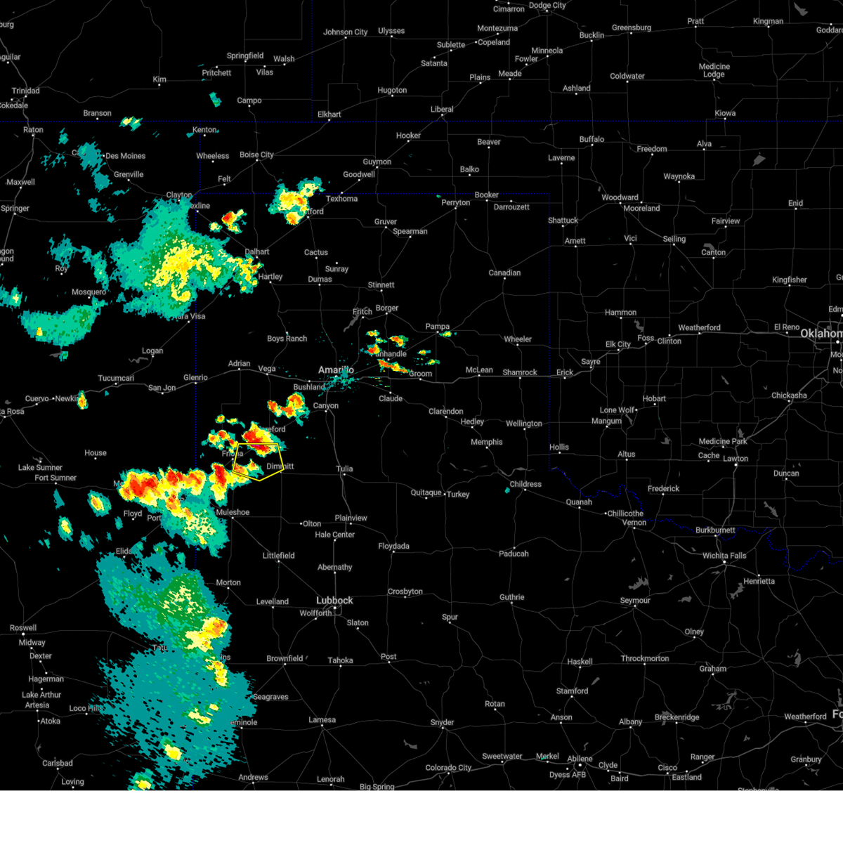 At 717 pm cdt, a severe thunderstorm was located over summerfield, or 10 miles southwest of hereford, moving south at 15 mph (radar indicated). Hazards include ping pong ball size hail and 60 mph wind gusts. People and animals outdoors will be injured. expect hail damage to roofs, siding, windows, and vehicles. expect wind damage to roofs, siding, and trees. locations impacted include, dimmitt, summerfield, easter and black. hail threat, radar indicated max hail size, 1. 50 in wind threat, radar indicated max wind gust, 60 mph. At 717 pm cdt, a severe thunderstorm was located over summerfield, or 10 miles southwest of hereford, moving south at 15 mph (radar indicated). Hazards include ping pong ball size hail and 60 mph wind gusts. People and animals outdoors will be injured. expect hail damage to roofs, siding, windows, and vehicles. expect wind damage to roofs, siding, and trees. locations impacted include, dimmitt, summerfield, easter and black. hail threat, radar indicated max hail size, 1. 50 in wind threat, radar indicated max wind gust, 60 mph.
|
| 6/3/2023 7:05 PM CDT |
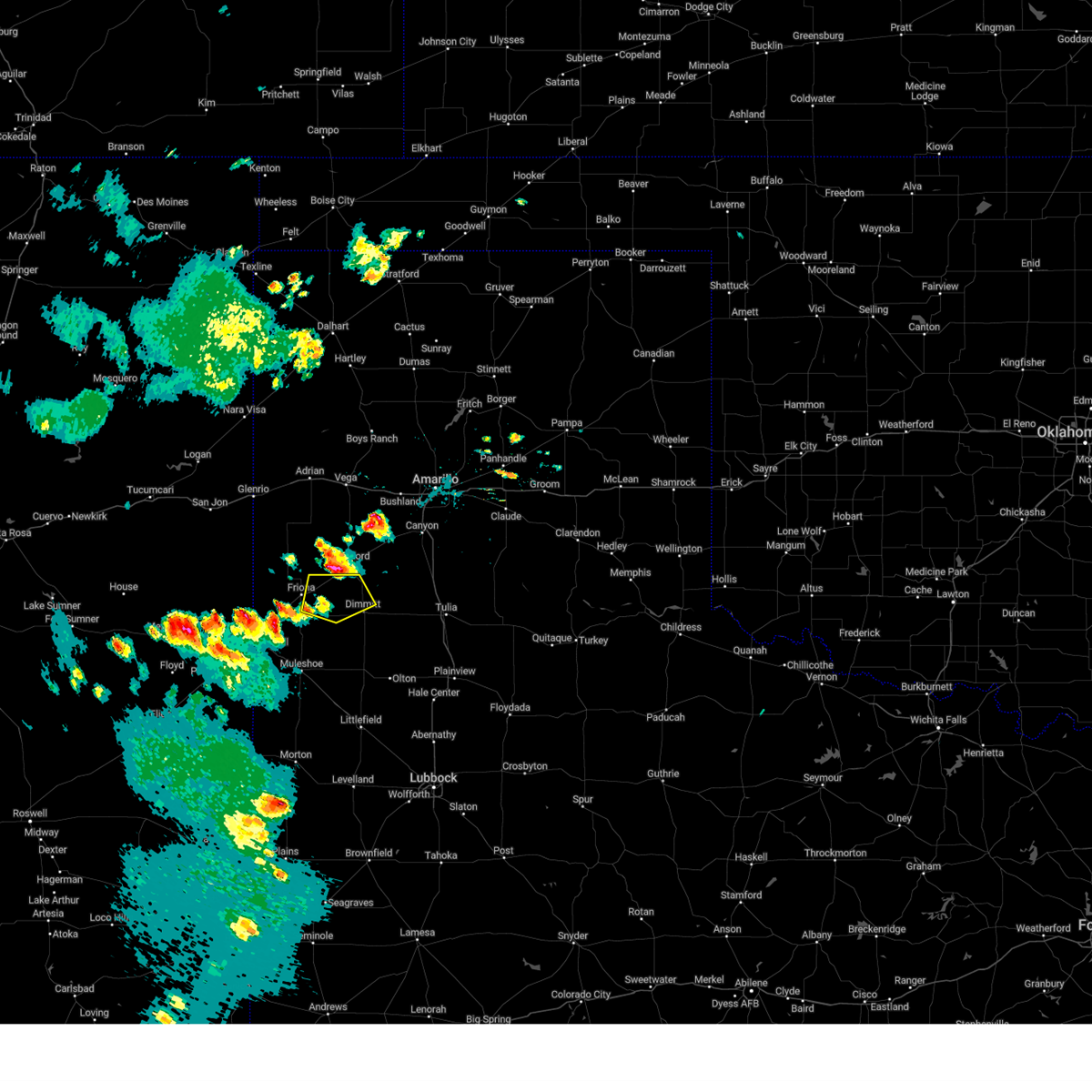 At 704 pm cdt, a severe thunderstorm was located over summerfield, or 9 miles southwest of hereford, moving south at 15 mph (radar indicated). Hazards include 60 mph wind gusts and half dollar size hail. Hail damage to vehicles is expected. expect wind damage to roofs, siding, and trees. locations impacted include, dimmitt, summerfield, easter and black. hail threat, radar indicated max hail size, 1. 25 in wind threat, radar indicated max wind gust, 60 mph. At 704 pm cdt, a severe thunderstorm was located over summerfield, or 9 miles southwest of hereford, moving south at 15 mph (radar indicated). Hazards include 60 mph wind gusts and half dollar size hail. Hail damage to vehicles is expected. expect wind damage to roofs, siding, and trees. locations impacted include, dimmitt, summerfield, easter and black. hail threat, radar indicated max hail size, 1. 25 in wind threat, radar indicated max wind gust, 60 mph.
|
| 6/3/2023 6:55 PM CDT |
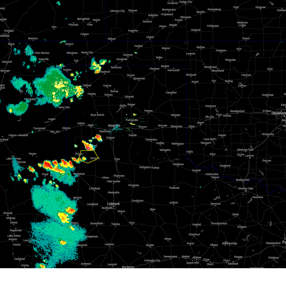 At 655 pm cdt, a severe thunderstorm was located near summerfield, or 7 miles west of hereford, moving south at 15 mph (radar indicated). Hazards include 60 mph wind gusts and quarter size hail. Hail damage to vehicles is expected. Expect wind damage to roofs, siding, and trees. At 655 pm cdt, a severe thunderstorm was located near summerfield, or 7 miles west of hereford, moving south at 15 mph (radar indicated). Hazards include 60 mph wind gusts and quarter size hail. Hail damage to vehicles is expected. Expect wind damage to roofs, siding, and trees.
|
| 5/24/2023 11:34 PM CDT |
 At 1134 pm cdt, severe thunderstorms were located along a line extending from 5 miles southeast of dimmitt to 5 miles southwest of sudan, moving southeast at 30 mph (radar indicated). Hazards include 60 mph wind gusts and penny size hail. Expect damage to roofs, siding, and trees. locations impacted include, muleshoe, dimmitt, hart, earth, sudan and springlake. hail threat, radar indicated max hail size, 0. 75 in wind threat, radar indicated max wind gust, 60 mph. At 1134 pm cdt, severe thunderstorms were located along a line extending from 5 miles southeast of dimmitt to 5 miles southwest of sudan, moving southeast at 30 mph (radar indicated). Hazards include 60 mph wind gusts and penny size hail. Expect damage to roofs, siding, and trees. locations impacted include, muleshoe, dimmitt, hart, earth, sudan and springlake. hail threat, radar indicated max hail size, 0. 75 in wind threat, radar indicated max wind gust, 60 mph.
|
| 5/24/2023 11:00 PM CDT |
 At 1100 pm cdt, severe thunderstorms were located along a line extending from 3 miles north of dimmitt to progress, moving southeast at 20 mph (radar indicated). Hazards include 60 mph wind gusts and penny size hail. expect damage to roofs, siding, and trees At 1100 pm cdt, severe thunderstorms were located along a line extending from 3 miles north of dimmitt to progress, moving southeast at 20 mph (radar indicated). Hazards include 60 mph wind gusts and penny size hail. expect damage to roofs, siding, and trees
|
| 5/24/2023 10:35 PM CDT |
 At 1035 pm cdt, severe thunderstorms were located along a line extending from 6 miles southwest of easter to near oklahoma lane, moving southeast at 20 mph (west texas mesonet). Hazards include 70 mph wind gusts and quarter size hail. Hail damage to vehicles is expected. expect considerable tree damage. wind damage is also likely to mobile homes, roofs, and outbuildings. locations impacted include, dimmitt, friona, bovina, summerfield, easter, lazbuddie, progress, oklahoma lane, lariat, west camp and black. thunderstorm damage threat, considerable hail threat, radar indicated max hail size, 1. 00 in wind threat, observed max wind gust, 70 mph. At 1035 pm cdt, severe thunderstorms were located along a line extending from 6 miles southwest of easter to near oklahoma lane, moving southeast at 20 mph (west texas mesonet). Hazards include 70 mph wind gusts and quarter size hail. Hail damage to vehicles is expected. expect considerable tree damage. wind damage is also likely to mobile homes, roofs, and outbuildings. locations impacted include, dimmitt, friona, bovina, summerfield, easter, lazbuddie, progress, oklahoma lane, lariat, west camp and black. thunderstorm damage threat, considerable hail threat, radar indicated max hail size, 1. 00 in wind threat, observed max wind gust, 70 mph.
|
| 5/24/2023 10:17 PM CDT |
 At 1016 pm cdt, severe thunderstorms were located along a line extending from 3 miles east of black to 4 miles north of oklahoma lane, moving southeast at 25 mph. at 10:06 pm, a west texas mesonet near friona measured a wind gust to 67 mph (west texas mesonet). Hazards include 70 mph wind gusts and quarter size hail. Hail damage to vehicles is expected. expect considerable tree damage. wind damage is also likely to mobile homes, roofs, and outbuildings. locations impacted include, dimmitt, friona, bovina, farwell, summerfield, easter, lazbuddie, progress, oklahoma lane, lariat, west camp and black. thunderstorm damage threat, considerable hail threat, radar indicated max hail size, 1. 00 in wind threat, observed max wind gust, 70 mph. At 1016 pm cdt, severe thunderstorms were located along a line extending from 3 miles east of black to 4 miles north of oklahoma lane, moving southeast at 25 mph. at 10:06 pm, a west texas mesonet near friona measured a wind gust to 67 mph (west texas mesonet). Hazards include 70 mph wind gusts and quarter size hail. Hail damage to vehicles is expected. expect considerable tree damage. wind damage is also likely to mobile homes, roofs, and outbuildings. locations impacted include, dimmitt, friona, bovina, farwell, summerfield, easter, lazbuddie, progress, oklahoma lane, lariat, west camp and black. thunderstorm damage threat, considerable hail threat, radar indicated max hail size, 1. 00 in wind threat, observed max wind gust, 70 mph.
|
| 5/24/2023 10:10 PM CDT |
 At 1009 pm cdt, severe thunderstorms were located along a line extending from 3 miles northeast of black to 3 miles south of bovina, moving southeast at 25 mph. the west texas mesonet near friona measured wind gust to 64 mph at 10:05 pm (west texas mesonet). Hazards include 60 mph wind gusts and quarter size hail. Hail damage to vehicles is expected. Expect wind damage to roofs, siding, and trees. At 1009 pm cdt, severe thunderstorms were located along a line extending from 3 miles northeast of black to 3 miles south of bovina, moving southeast at 25 mph. the west texas mesonet near friona measured wind gust to 64 mph at 10:05 pm (west texas mesonet). Hazards include 60 mph wind gusts and quarter size hail. Hail damage to vehicles is expected. Expect wind damage to roofs, siding, and trees.
|
| 5/23/2023 6:51 PM CDT |
 At 651 pm cdt, a severe thunderstorm was located over lazbuddie, or 12 miles northeast of muleshoe, moving east at 30 mph (radar indicated). Hazards include 60 mph wind gusts and quarter size hail. Hail damage to vehicles is expected. expect wind damage to roofs, siding, and trees. locations impacted include, muleshoe, dimmitt, lazbuddie, and progress. hail threat, radar indicated max hail size, 1. 00 in wind threat, radar indicated max wind gust, 60 mph. At 651 pm cdt, a severe thunderstorm was located over lazbuddie, or 12 miles northeast of muleshoe, moving east at 30 mph (radar indicated). Hazards include 60 mph wind gusts and quarter size hail. Hail damage to vehicles is expected. expect wind damage to roofs, siding, and trees. locations impacted include, muleshoe, dimmitt, lazbuddie, and progress. hail threat, radar indicated max hail size, 1. 00 in wind threat, radar indicated max wind gust, 60 mph.
|
| 5/23/2023 6:39 PM CDT |
 At 639 pm cdt, a severe thunderstorm was located 4 miles west of lazbuddie, or 11 miles north of muleshoe, moving east at 30 mph (radar indicated). Hazards include 60 mph wind gusts and quarter size hail. Hail damage to vehicles is expected. Expect wind damage to roofs, siding, and trees. At 639 pm cdt, a severe thunderstorm was located 4 miles west of lazbuddie, or 11 miles north of muleshoe, moving east at 30 mph (radar indicated). Hazards include 60 mph wind gusts and quarter size hail. Hail damage to vehicles is expected. Expect wind damage to roofs, siding, and trees.
|
| 4/9/2023 5:17 PM CDT |
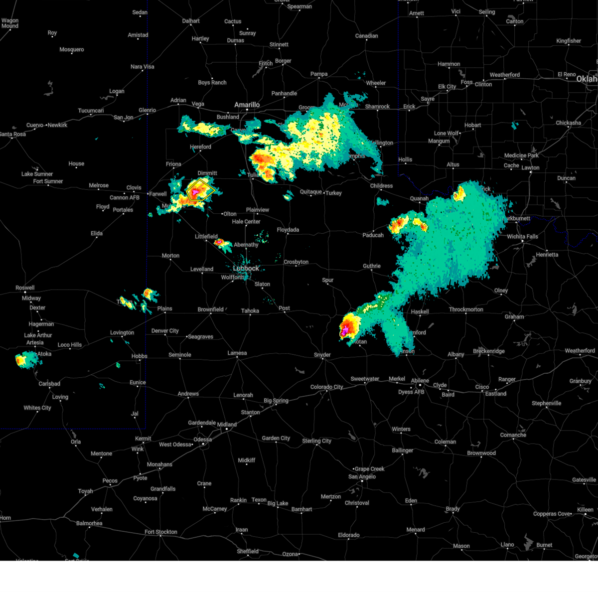 At 516 pm cdt, a severe thunderstorm was located 8 miles east of lazbuddie, or 11 miles north of earth, moving southeast at 10 mph (radar indicated). Hazards include 60 mph wind gusts and quarter size hail. Hail damage to vehicles is expected. expect wind damage to roofs, siding, and trees. this severe thunderstorm will remain over mainly rural areas of eastern parmer and southwestern castro counties. hail threat, radar indicated max hail size, 1. 00 in wind threat, radar indicated max wind gust, 60 mph. At 516 pm cdt, a severe thunderstorm was located 8 miles east of lazbuddie, or 11 miles north of earth, moving southeast at 10 mph (radar indicated). Hazards include 60 mph wind gusts and quarter size hail. Hail damage to vehicles is expected. expect wind damage to roofs, siding, and trees. this severe thunderstorm will remain over mainly rural areas of eastern parmer and southwestern castro counties. hail threat, radar indicated max hail size, 1. 00 in wind threat, radar indicated max wind gust, 60 mph.
|
| 4/9/2023 5:02 PM CDT |
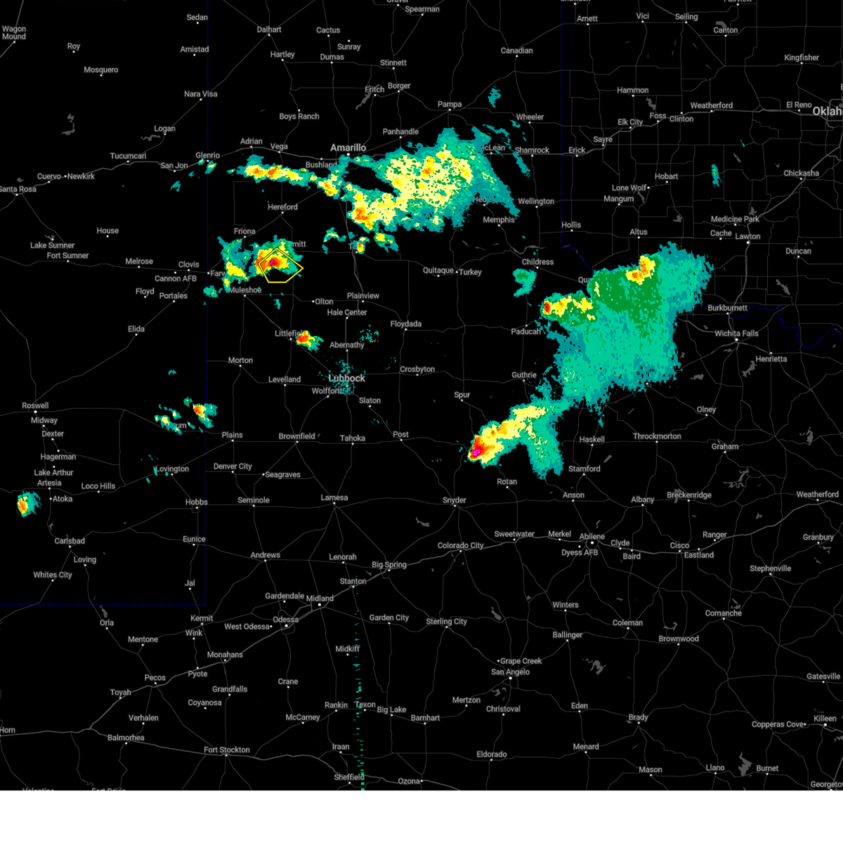 At 501 pm cdt, a severe thunderstorm was located 7 miles east of lazbuddie, or 12 miles southwest of dimmitt, moving south at 10 mph (radar indicated). Hazards include 60 mph wind gusts and quarter size hail. Hail damage to vehicles is expected. expect wind damage to roofs, siding, and trees. this severe thunderstorm will remain over mainly rural areas of east central parmer and southwestern castro counties. hail threat, radar indicated max hail size, 1. 00 in wind threat, radar indicated max wind gust, 60 mph. At 501 pm cdt, a severe thunderstorm was located 7 miles east of lazbuddie, or 12 miles southwest of dimmitt, moving south at 10 mph (radar indicated). Hazards include 60 mph wind gusts and quarter size hail. Hail damage to vehicles is expected. expect wind damage to roofs, siding, and trees. this severe thunderstorm will remain over mainly rural areas of east central parmer and southwestern castro counties. hail threat, radar indicated max hail size, 1. 00 in wind threat, radar indicated max wind gust, 60 mph.
|
| 4/9/2023 4:51 PM CDT |
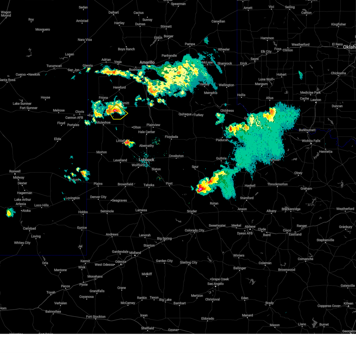 At 450 pm cdt, a severe thunderstorm was located 8 miles northeast of lazbuddie, or 11 miles southwest of dimmitt, moving southeast at 5 mph (radar indicated). Hazards include 60 mph wind gusts and quarter size hail. Hail damage to vehicles is expected. expect wind damage to roofs, siding, and trees. this severe thunderstorm will remain over mainly rural areas of east central parmer and southwestern castro counties. hail threat, radar indicated max hail size, 1. 00 in wind threat, radar indicated max wind gust, 60 mph. At 450 pm cdt, a severe thunderstorm was located 8 miles northeast of lazbuddie, or 11 miles southwest of dimmitt, moving southeast at 5 mph (radar indicated). Hazards include 60 mph wind gusts and quarter size hail. Hail damage to vehicles is expected. expect wind damage to roofs, siding, and trees. this severe thunderstorm will remain over mainly rural areas of east central parmer and southwestern castro counties. hail threat, radar indicated max hail size, 1. 00 in wind threat, radar indicated max wind gust, 60 mph.
|
| 10/16/2022 1:40 AM CDT |
 The severe thunderstorm warning for eastern castro county will expire at 145 am cdt, the storm which prompted the warning has weakened below severe limits, and has exited the warned area. therefore, the warning will be allowed to expire. The severe thunderstorm warning for eastern castro county will expire at 145 am cdt, the storm which prompted the warning has weakened below severe limits, and has exited the warned area. therefore, the warning will be allowed to expire.
|
| 10/16/2022 1:33 AM CDT |
 At 133 am cdt, a severe thunderstorm was located over hart, moving northeast at 25 mph (radar indicated). Hazards include 60 mph wind gusts. Expect damage to roofs, siding, and trees. locations impacted include, dimmitt and hart. hail threat, radar indicated max hail size, <. 75 in wind threat, radar indicated max wind gust, 60 mph. At 133 am cdt, a severe thunderstorm was located over hart, moving northeast at 25 mph (radar indicated). Hazards include 60 mph wind gusts. Expect damage to roofs, siding, and trees. locations impacted include, dimmitt and hart. hail threat, radar indicated max hail size, <. 75 in wind threat, radar indicated max wind gust, 60 mph.
|
| 10/16/2022 1:24 AM CDT |
 At 123 am cdt, a severe thunderstorm was located over hart, moving northeast at 25 mph (radar indicated). Hazards include 60 mph wind gusts. Expect damage to roofs, siding, and trees. locations impacted include, dimmitt, hart and springlake. hail threat, radar indicated max hail size, <. 75 in wind threat, radar indicated max wind gust, 60 mph. At 123 am cdt, a severe thunderstorm was located over hart, moving northeast at 25 mph (radar indicated). Hazards include 60 mph wind gusts. Expect damage to roofs, siding, and trees. locations impacted include, dimmitt, hart and springlake. hail threat, radar indicated max hail size, <. 75 in wind threat, radar indicated max wind gust, 60 mph.
|
| 10/16/2022 1:07 AM CDT |
 At 106 am cdt, a severe thunderstorm was located 9 miles west of hart, moving northeast at 20 mph (radar indicated). Hazards include 70 mph wind gusts. Expect considerable tree damage. Damage is likely to mobile homes, roofs, and outbuildings. At 106 am cdt, a severe thunderstorm was located 9 miles west of hart, moving northeast at 20 mph (radar indicated). Hazards include 70 mph wind gusts. Expect considerable tree damage. Damage is likely to mobile homes, roofs, and outbuildings.
|
| 7/12/2022 9:05 PM CDT | West texas mesonet in castro county TX, 2.4 miles SSW of Dimmitt, TX |
| 5/23/2022 9:27 PM CDT |
 At 927 pm cdt, a severe thunderstorm was located 4 miles south of dimmitt, moving east at 25 mph (radar indicated). Hazards include 70 mph wind gusts and quarter size hail. Hail damage to vehicles is expected. expect considerable tree damage. Wind damage is also likely to mobile homes, roofs, and outbuildings. At 927 pm cdt, a severe thunderstorm was located 4 miles south of dimmitt, moving east at 25 mph (radar indicated). Hazards include 70 mph wind gusts and quarter size hail. Hail damage to vehicles is expected. expect considerable tree damage. Wind damage is also likely to mobile homes, roofs, and outbuildings.
|
| 5/23/2022 9:10 PM CDT |
 At 910 pm cdt, a severe thunderstorm was located near dimmitt, moving east at 30 mph (radar indicated). Hazards include 70 mph wind gusts and quarter size hail. Hail damage to vehicles is expected. expect considerable tree damage. wind damage is also likely to mobile homes, roofs, and outbuildings. locations impacted include, dimmitt and easter. thunderstorm damage threat, considerable hail threat, radar indicated max hail size, 1. 00 in wind threat, radar indicated max wind gust, 70 mph. At 910 pm cdt, a severe thunderstorm was located near dimmitt, moving east at 30 mph (radar indicated). Hazards include 70 mph wind gusts and quarter size hail. Hail damage to vehicles is expected. expect considerable tree damage. wind damage is also likely to mobile homes, roofs, and outbuildings. locations impacted include, dimmitt and easter. thunderstorm damage threat, considerable hail threat, radar indicated max hail size, 1. 00 in wind threat, radar indicated max wind gust, 70 mph.
|
| 5/23/2022 8:57 PM CDT |
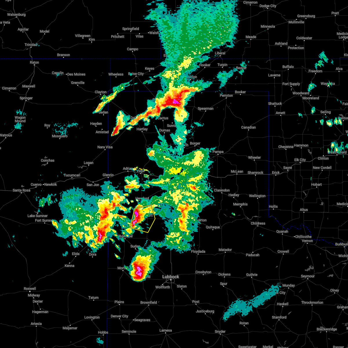 At 856 pm cdt, a severe thunderstorm was located 7 miles west of dimmitt, moving east at 25 mph (radar indicated). Hazards include 70 mph wind gusts and ping pong ball size hail. People and animals outdoors will be injured. expect hail damage to roofs, siding, windows, and vehicles. expect considerable tree damage. Wind damage is also likely to mobile homes, roofs, and outbuildings. At 856 pm cdt, a severe thunderstorm was located 7 miles west of dimmitt, moving east at 25 mph (radar indicated). Hazards include 70 mph wind gusts and ping pong ball size hail. People and animals outdoors will be injured. expect hail damage to roofs, siding, windows, and vehicles. expect considerable tree damage. Wind damage is also likely to mobile homes, roofs, and outbuildings.
|
| 5/23/2022 7:51 PM CDT |
 At 751 pm cdt, a severe thunderstorm was located 9 miles southwest of dimmitt, moving north at 10 mph (radar indicated). Hazards include 60 mph wind gusts and quarter size hail. Hail damage to vehicles is expected. expect wind damage to roofs, siding, and trees. locations impacted include, dimmitt. hail threat, radar indicated max hail size, 1. 00 in wind threat, radar indicated max wind gust, 60 mph. At 751 pm cdt, a severe thunderstorm was located 9 miles southwest of dimmitt, moving north at 10 mph (radar indicated). Hazards include 60 mph wind gusts and quarter size hail. Hail damage to vehicles is expected. expect wind damage to roofs, siding, and trees. locations impacted include, dimmitt. hail threat, radar indicated max hail size, 1. 00 in wind threat, radar indicated max wind gust, 60 mph.
|
| 5/23/2022 7:25 PM CDT |
 At 724 pm cdt, a severe thunderstorm was located 8 miles north of earth, moving north at 15 mph (radar indicated). Hazards include 60 mph wind gusts and quarter size hail. Hail damage to vehicles is expected. expect wind damage to roofs, siding, and trees. locations impacted include, dimmitt. hail threat, radar indicated max hail size, 1. 00 in wind threat, radar indicated max wind gust, 60 mph. At 724 pm cdt, a severe thunderstorm was located 8 miles north of earth, moving north at 15 mph (radar indicated). Hazards include 60 mph wind gusts and quarter size hail. Hail damage to vehicles is expected. expect wind damage to roofs, siding, and trees. locations impacted include, dimmitt. hail threat, radar indicated max hail size, 1. 00 in wind threat, radar indicated max wind gust, 60 mph.
|
| 5/23/2022 7:13 PM CDT |
 At 713 pm cdt, a severe thunderstorm was located 6 miles northwest of earth, moving north at 10 mph (radar indicated). Hazards include 60 mph wind gusts and quarter size hail. Hail damage to vehicles is expected. Expect wind damage to roofs, siding, and trees. At 713 pm cdt, a severe thunderstorm was located 6 miles northwest of earth, moving north at 10 mph (radar indicated). Hazards include 60 mph wind gusts and quarter size hail. Hail damage to vehicles is expected. Expect wind damage to roofs, siding, and trees.
|
| 5/10/2022 6:32 PM CDT |
 At 632 pm cdt, severe thunderstorms were located along a line extending from 8 miles east of lazbuddie to 7 miles northwest of olton to 5 miles east of amherst, moving northeast at 30 mph (west texas mesonet. at 625 pm cdt, the west texas mesonet at hart measured a wind gust of 69 mph). Hazards include 70 mph wind gusts and nickel size hail. Expect considerable tree damage. damage is likely to mobile homes, roofs, and outbuildings. locations impacted include, olton, hart, and springlake. thunderstorm damage threat, considerable hail threat, radar indicated max hail size, 0. 88 in wind threat, radar indicated max wind gust, 70 mph. At 632 pm cdt, severe thunderstorms were located along a line extending from 8 miles east of lazbuddie to 7 miles northwest of olton to 5 miles east of amherst, moving northeast at 30 mph (west texas mesonet. at 625 pm cdt, the west texas mesonet at hart measured a wind gust of 69 mph). Hazards include 70 mph wind gusts and nickel size hail. Expect considerable tree damage. damage is likely to mobile homes, roofs, and outbuildings. locations impacted include, olton, hart, and springlake. thunderstorm damage threat, considerable hail threat, radar indicated max hail size, 0. 88 in wind threat, radar indicated max wind gust, 70 mph.
|
| 5/10/2022 6:31 PM CDT |
 At 630 pm cdt, severe thunderstorms were located along a line extending from 8 miles east of lazbuddie to 7 miles northwest of olton to 5 miles east of amherst, moving northeast at 30 mph (radar indicated). Hazards include 70 mph wind gusts and nickel size hail. Expect considerable tree damage. damage is likely to mobile homes, roofs, and outbuildings. locations impacted include, olton, hart, and springlake. thunderstorm damage threat, considerable hail threat, radar indicated max hail size, 0. 88 in wind threat, radar indicated max wind gust, 70 mph. At 630 pm cdt, severe thunderstorms were located along a line extending from 8 miles east of lazbuddie to 7 miles northwest of olton to 5 miles east of amherst, moving northeast at 30 mph (radar indicated). Hazards include 70 mph wind gusts and nickel size hail. Expect considerable tree damage. damage is likely to mobile homes, roofs, and outbuildings. locations impacted include, olton, hart, and springlake. thunderstorm damage threat, considerable hail threat, radar indicated max hail size, 0. 88 in wind threat, radar indicated max wind gust, 70 mph.
|
| 5/10/2022 6:22 PM CDT |
 At 621 pm cdt, severe thunderstorms were located along a line extending from 5 miles southeast of lazbuddie to 6 miles east of earth to 3 miles northwest of littlefield, moving northeast at 30 mph. these are destructive storms for northeastern lamb county and southeastern castro counties, including springlake, olton, and hart (west texas mesonet. at 612 pm cdt, the west texas mesonet at hart measured a wind gust of 82 mph). Hazards include 90 mph wind gusts and nickel size hail. You are in a life-threatening situation. flying debris may be deadly to those caught without shelter. mobile homes will be heavily damaged or destroyed. homes and businesses will have substantial roof and window damage. expect extensive tree damage and power outages. locations impacted include, olton, hart, earth, and springlake. thunderstorm damage threat, destructive hail threat, radar indicated max hail size, 0. 88 in wind threat, radar indicated max wind gust, 90 mph. At 621 pm cdt, severe thunderstorms were located along a line extending from 5 miles southeast of lazbuddie to 6 miles east of earth to 3 miles northwest of littlefield, moving northeast at 30 mph. these are destructive storms for northeastern lamb county and southeastern castro counties, including springlake, olton, and hart (west texas mesonet. at 612 pm cdt, the west texas mesonet at hart measured a wind gust of 82 mph). Hazards include 90 mph wind gusts and nickel size hail. You are in a life-threatening situation. flying debris may be deadly to those caught without shelter. mobile homes will be heavily damaged or destroyed. homes and businesses will have substantial roof and window damage. expect extensive tree damage and power outages. locations impacted include, olton, hart, earth, and springlake. thunderstorm damage threat, destructive hail threat, radar indicated max hail size, 0. 88 in wind threat, radar indicated max wind gust, 90 mph.
|
| 5/10/2022 6:20 PM CDT | Social media report of flipped center pivots. time estimated from rada in castro county TX, 11.9 miles N of Dimmitt, TX |
| 5/10/2022 6:19 PM CDT |
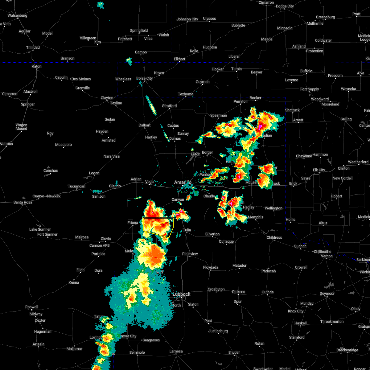 At 619 pm cdt, severe thunderstorms were located along a line extending from near summerfield to 13 miles northeast of dimmitt, moving northeast at 45 mph (radar indicated). Hazards include 70 mph wind gusts and nickel size hail. Expect considerable tree damage. damage is likely to mobile homes, roofs, and outbuildings. locations impacted include, dimmitt, summerfield, easter and nazareth. thunderstorm damage threat, considerable hail threat, radar indicated max hail size, 0. 88 in wind threat, radar indicated max wind gust, 70 mph. At 619 pm cdt, severe thunderstorms were located along a line extending from near summerfield to 13 miles northeast of dimmitt, moving northeast at 45 mph (radar indicated). Hazards include 70 mph wind gusts and nickel size hail. Expect considerable tree damage. damage is likely to mobile homes, roofs, and outbuildings. locations impacted include, dimmitt, summerfield, easter and nazareth. thunderstorm damage threat, considerable hail threat, radar indicated max hail size, 0. 88 in wind threat, radar indicated max wind gust, 70 mph.
|
| 5/10/2022 6:18 PM CDT |
 At 618 pm cdt, severe thunderstorms were located along a line extending from 5 miles southeast of lazbuddie to 6 miles southeast of earth to 4 miles west of littlefield, moving northeast at 30 mph. these are destructive storms for northeastern lamb county, including springlake, olton, and earth (west texas mesonet. at 602 pm cdt, the west texas mesonet at amherst measured a wind gust of 87 mph). Hazards include 90 mph wind gusts and nickel size hail. You are in a life-threatening situation. flying debris may be deadly to those caught without shelter. mobile homes will be heavily damaged or destroyed. homes and businesses will have substantial roof and window damage. expect extensive tree damage and power outages. locations impacted include, olton, hart, earth, and springlake. thunderstorm damage threat, destructive hail threat, radar indicated max hail size, 0. 88 in wind threat, radar indicated max wind gust, 90 mph. At 618 pm cdt, severe thunderstorms were located along a line extending from 5 miles southeast of lazbuddie to 6 miles southeast of earth to 4 miles west of littlefield, moving northeast at 30 mph. these are destructive storms for northeastern lamb county, including springlake, olton, and earth (west texas mesonet. at 602 pm cdt, the west texas mesonet at amherst measured a wind gust of 87 mph). Hazards include 90 mph wind gusts and nickel size hail. You are in a life-threatening situation. flying debris may be deadly to those caught without shelter. mobile homes will be heavily damaged or destroyed. homes and businesses will have substantial roof and window damage. expect extensive tree damage and power outages. locations impacted include, olton, hart, earth, and springlake. thunderstorm damage threat, destructive hail threat, radar indicated max hail size, 0. 88 in wind threat, radar indicated max wind gust, 90 mph.
|
| 5/10/2022 6:15 PM CDT |
 At 615 pm cdt, severe thunderstorms were located along a line extending from near summerfield to 13 miles northeast of dimmitt, moving northeast at 40 mph (radar indicated). Hazards include 70 mph wind gusts and nickel size hail. Expect considerable tree damage. Damage is likely to mobile homes, roofs, and outbuildings. At 615 pm cdt, severe thunderstorms were located along a line extending from near summerfield to 13 miles northeast of dimmitt, moving northeast at 40 mph (radar indicated). Hazards include 70 mph wind gusts and nickel size hail. Expect considerable tree damage. Damage is likely to mobile homes, roofs, and outbuildings.
|
| 5/10/2022 6:13 PM CDT |
 At 611 pm cdt, severe thunderstorms were located along a line extending from 6 miles south of lazbuddie to 5 miles southeast of earth to 5 miles west of littlefield, moving northeast at 30 mph. these are destructive storms for central and northeastern lamb county, including amherst, springlake, olton, and earth (west texas mesonet. at 602 pm cdt, the west texas mesonet at amherst measured a wind gust of 87 mph). Hazards include 90 mph wind gusts and nickel size hail. You are in a life-threatening situation. flying debris may be deadly to those caught without shelter. mobile homes will be heavily damaged or destroyed. homes and businesses will have substantial roof and window damage. expect extensive tree damage and power outages. locations impacted include, littlefield, olton, hart, earth, sudan, amherst, fieldton, and springlake. thunderstorm damage threat, destructive hail threat, radar indicated max hail size, 0. 88 in wind threat, radar indicated max wind gust, 90 mph. At 611 pm cdt, severe thunderstorms were located along a line extending from 6 miles south of lazbuddie to 5 miles southeast of earth to 5 miles west of littlefield, moving northeast at 30 mph. these are destructive storms for central and northeastern lamb county, including amherst, springlake, olton, and earth (west texas mesonet. at 602 pm cdt, the west texas mesonet at amherst measured a wind gust of 87 mph). Hazards include 90 mph wind gusts and nickel size hail. You are in a life-threatening situation. flying debris may be deadly to those caught without shelter. mobile homes will be heavily damaged or destroyed. homes and businesses will have substantial roof and window damage. expect extensive tree damage and power outages. locations impacted include, littlefield, olton, hart, earth, sudan, amherst, fieldton, and springlake. thunderstorm damage threat, destructive hail threat, radar indicated max hail size, 0. 88 in wind threat, radar indicated max wind gust, 90 mph.
|
| 5/10/2022 6:09 PM CDT |
 At 608 pm cdt, severe thunderstorms were located along a line extending from 7 miles south of lazbuddie to 6 miles southeast of earth to 6 miles west of littlefield, moving northeast at 30 mph (west texas mesonet. at 550 pm cdt, the west texas mesonet at amherst measured a wind gust of 66 mph). Hazards include 70 mph wind gusts and nickel size hail. Expect considerable tree damage. damage is likely to mobile homes, roofs, and outbuildings. locations impacted include, littlefield, olton, hart, earth, sudan, amherst, fieldton, and springlake. thunderstorm damage threat, considerable hail threat, radar indicated max hail size, 0. 88 in wind threat, radar indicated max wind gust, 70 mph. At 608 pm cdt, severe thunderstorms were located along a line extending from 7 miles south of lazbuddie to 6 miles southeast of earth to 6 miles west of littlefield, moving northeast at 30 mph (west texas mesonet. at 550 pm cdt, the west texas mesonet at amherst measured a wind gust of 66 mph). Hazards include 70 mph wind gusts and nickel size hail. Expect considerable tree damage. damage is likely to mobile homes, roofs, and outbuildings. locations impacted include, littlefield, olton, hart, earth, sudan, amherst, fieldton, and springlake. thunderstorm damage threat, considerable hail threat, radar indicated max hail size, 0. 88 in wind threat, radar indicated max wind gust, 70 mph.
|
| 5/10/2022 6:05 PM CDT |
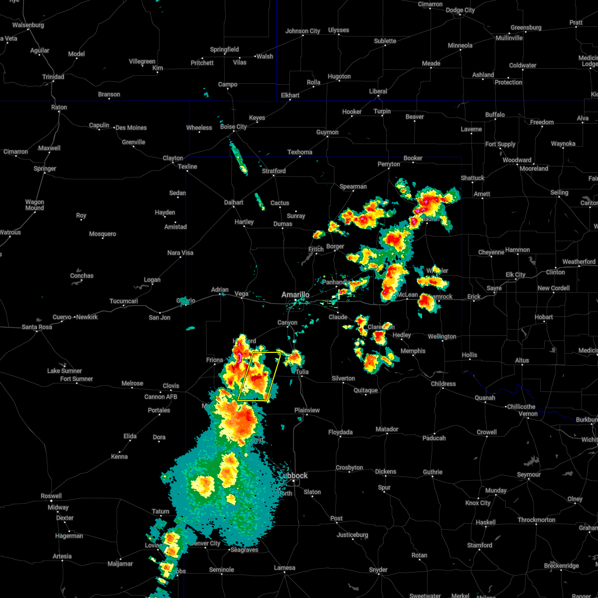 At 604 pm cdt, a severe thunderstorm was located 8 miles northeast of dimmitt, moving north at 40 mph (west texas mesonet. at 556 pm cdt, the west texas mesonet at dimmitt measured a wind gust of 70 mph). Hazards include 70 mph wind gusts and nickel size hail. Expect considerable tree damage. damage is likely to mobile homes, roofs, and outbuildings. locations impacted include, dimmitt, hart, and nazareth. thunderstorm damage threat, considerable hail threat, radar indicated max hail size, 0. 88 in wind threat, radar indicated max wind gust, 70 mph. At 604 pm cdt, a severe thunderstorm was located 8 miles northeast of dimmitt, moving north at 40 mph (west texas mesonet. at 556 pm cdt, the west texas mesonet at dimmitt measured a wind gust of 70 mph). Hazards include 70 mph wind gusts and nickel size hail. Expect considerable tree damage. damage is likely to mobile homes, roofs, and outbuildings. locations impacted include, dimmitt, hart, and nazareth. thunderstorm damage threat, considerable hail threat, radar indicated max hail size, 0. 88 in wind threat, radar indicated max wind gust, 70 mph.
|
| 5/10/2022 6:04 PM CDT |
 At 603 pm cdt, severe thunderstorms were located along a line extending from 7 miles east of muleshoe to 7 miles south of earth to 6 miles northeast of pep, moving northeast at 30 mph (west texas mesonet. at 550 pm cdt, the west texas mesonet at amherst measured a wind gust of 66 mph). Hazards include 70 mph wind gusts and nickel size hail. Expect considerable tree damage. damage is likely to mobile homes, roofs, and outbuildings. locations impacted include, littlefield, olton, hart, earth, sudan, amherst, fieldton, and springlake. thunderstorm damage threat, considerable hail threat, radar indicated max hail size, 0. 88 in wind threat, radar indicated max wind gust, 70 mph. At 603 pm cdt, severe thunderstorms were located along a line extending from 7 miles east of muleshoe to 7 miles south of earth to 6 miles northeast of pep, moving northeast at 30 mph (west texas mesonet. at 550 pm cdt, the west texas mesonet at amherst measured a wind gust of 66 mph). Hazards include 70 mph wind gusts and nickel size hail. Expect considerable tree damage. damage is likely to mobile homes, roofs, and outbuildings. locations impacted include, littlefield, olton, hart, earth, sudan, amherst, fieldton, and springlake. thunderstorm damage threat, considerable hail threat, radar indicated max hail size, 0. 88 in wind threat, radar indicated max wind gust, 70 mph.
|
| 5/10/2022 6:01 PM CDT |
 At 600 pm cdt, a severe thunderstorm was located 5 miles east of dimmitt, moving north at 40 mph (west texas mesonet. at 554 pm cdt, the west texas mesonet at dimmitt measured a wind gust of 63 mph). Hazards include 70 mph wind gusts and nickel size hail. Expect considerable tree damage. damage is likely to mobile homes, roofs, and outbuildings. locations impacted include, dimmitt, hart, and nazareth. thunderstorm damage threat, considerable hail threat, radar indicated max hail size, 0. 88 in wind threat, radar indicated max wind gust, 70 mph. At 600 pm cdt, a severe thunderstorm was located 5 miles east of dimmitt, moving north at 40 mph (west texas mesonet. at 554 pm cdt, the west texas mesonet at dimmitt measured a wind gust of 63 mph). Hazards include 70 mph wind gusts and nickel size hail. Expect considerable tree damage. damage is likely to mobile homes, roofs, and outbuildings. locations impacted include, dimmitt, hart, and nazareth. thunderstorm damage threat, considerable hail threat, radar indicated max hail size, 0. 88 in wind threat, radar indicated max wind gust, 70 mph.
|
| 5/10/2022 5:56 PM CDT | West texas mesonet initial severe gust of 63 at 5:54 pm. severe gusts occurred through 5:58 pm with the peak gust reporte in castro county TX, 2.4 miles SSW of Dimmitt, TX |
| 5/10/2022 5:56 PM CDT |
 At 555 pm cdt, severe thunderstorms were located along a line extending from 4 miles east of muleshoe to 5 miles north of amherst to 3 miles east of pep, moving northeast at 30 mph (west texas mesonet. at 550 pm cdt, the west texas mesonet at amherst measured a wind gust of 66 mph). Hazards include 70 mph wind gusts and nickel size hail. Expect considerable tree damage. damage is likely to mobile homes, roofs, and outbuildings. locations impacted include, littlefield, muleshoe, olton, hart, earth, sudan, amherst, fieldton, and springlake. thunderstorm damage threat, considerable hail threat, radar indicated max hail size, 0. 88 in wind threat, radar indicated max wind gust, 70 mph. At 555 pm cdt, severe thunderstorms were located along a line extending from 4 miles east of muleshoe to 5 miles north of amherst to 3 miles east of pep, moving northeast at 30 mph (west texas mesonet. at 550 pm cdt, the west texas mesonet at amherst measured a wind gust of 66 mph). Hazards include 70 mph wind gusts and nickel size hail. Expect considerable tree damage. damage is likely to mobile homes, roofs, and outbuildings. locations impacted include, littlefield, muleshoe, olton, hart, earth, sudan, amherst, fieldton, and springlake. thunderstorm damage threat, considerable hail threat, radar indicated max hail size, 0. 88 in wind threat, radar indicated max wind gust, 70 mph.
|
| 5/10/2022 5:53 PM CDT |
 At 553 pm cdt, a severe thunderstorm was located 4 miles southeast of dimmitt, moving north at 40 mph (radar indicated). Hazards include 60 mph wind gusts and nickel size hail. Expect damage to roofs, siding, and trees. locations impacted include, dimmitt, hart, and nazareth. hail threat, radar indicated max hail size, 0. 88 in wind threat, radar indicated max wind gust, 60 mph. At 553 pm cdt, a severe thunderstorm was located 4 miles southeast of dimmitt, moving north at 40 mph (radar indicated). Hazards include 60 mph wind gusts and nickel size hail. Expect damage to roofs, siding, and trees. locations impacted include, dimmitt, hart, and nazareth. hail threat, radar indicated max hail size, 0. 88 in wind threat, radar indicated max wind gust, 60 mph.
|
| 5/10/2022 5:52 PM CDT |
 At 551 pm cdt, severe thunderstorms were located along a line extending from 4 miles east of muleshoe to 5 miles north of amherst to 3 miles east of pep, moving northeast at 30 mph (west texas mesonet. at 545 pm cdt, the west texas mesonet at amherst measured a wind gust of 63 mph). Hazards include 70 mph wind gusts and nickel size hail. Expect considerable tree damage. Damage is likely to mobile homes, roofs, and outbuildings. At 551 pm cdt, severe thunderstorms were located along a line extending from 4 miles east of muleshoe to 5 miles north of amherst to 3 miles east of pep, moving northeast at 30 mph (west texas mesonet. at 545 pm cdt, the west texas mesonet at amherst measured a wind gust of 63 mph). Hazards include 70 mph wind gusts and nickel size hail. Expect considerable tree damage. Damage is likely to mobile homes, roofs, and outbuildings.
|
| 5/10/2022 5:29 PM CDT |
 At 529 pm cdt, a severe thunderstorm was located 5 miles northeast of earth, moving north at 40 mph (radar indicated). Hazards include 60 mph wind gusts and nickel size hail. expect damage to roofs, siding, and trees At 529 pm cdt, a severe thunderstorm was located 5 miles northeast of earth, moving north at 40 mph (radar indicated). Hazards include 60 mph wind gusts and nickel size hail. expect damage to roofs, siding, and trees
|
| 5/1/2022 6:34 PM CDT |
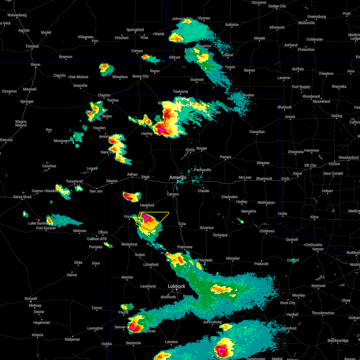 At 634 pm cdt, a severe thunderstorm was located near easter, or 9 miles south of hereford, moving northeast at 55 mph (trained weather spotters). Hazards include two inch hail and 60 mph wind gusts. People and animals outdoors will be injured. expect hail damage to roofs, siding, windows, and vehicles. expect wind damage to roofs, siding, and trees. locations impacted include, dimmitt, summerfield and easter. thunderstorm damage threat, considerable hail threat, radar indicated max hail size, 2. 00 in wind threat, radar indicated max wind gust, 60 mph. At 634 pm cdt, a severe thunderstorm was located near easter, or 9 miles south of hereford, moving northeast at 55 mph (trained weather spotters). Hazards include two inch hail and 60 mph wind gusts. People and animals outdoors will be injured. expect hail damage to roofs, siding, windows, and vehicles. expect wind damage to roofs, siding, and trees. locations impacted include, dimmitt, summerfield and easter. thunderstorm damage threat, considerable hail threat, radar indicated max hail size, 2. 00 in wind threat, radar indicated max wind gust, 60 mph.
|
| 5/1/2022 6:25 PM CDT |
 At 625 pm cdt, a severe thunderstorm was located 6 miles west of dimmitt, moving northeast at 45 mph (trained weather spotters). Hazards include tennis ball size hail and 60 mph wind gusts. People and animals outdoors will be injured. expect hail damage to roofs, siding, windows, and vehicles. expect wind damage to roofs, siding, and trees. locations impacted include, dimmitt, summerfield, easter and nazareth. thunderstorm damage threat, considerable hail threat, radar indicated max hail size, 2. 50 in wind threat, radar indicated max wind gust, 60 mph. At 625 pm cdt, a severe thunderstorm was located 6 miles west of dimmitt, moving northeast at 45 mph (trained weather spotters). Hazards include tennis ball size hail and 60 mph wind gusts. People and animals outdoors will be injured. expect hail damage to roofs, siding, windows, and vehicles. expect wind damage to roofs, siding, and trees. locations impacted include, dimmitt, summerfield, easter and nazareth. thunderstorm damage threat, considerable hail threat, radar indicated max hail size, 2. 50 in wind threat, radar indicated max wind gust, 60 mph.
|
| 5/1/2022 6:20 PM CDT |
 At 620 pm cdt, a severe thunderstorm was located 10 miles west of dimmitt, moving northeast at 45 mph (radar indicated). Hazards include two inch hail and 60 mph wind gusts. People and animals outdoors will be injured. expect hail damage to roofs, siding, windows, and vehicles. Expect wind damage to roofs, siding, and trees. At 620 pm cdt, a severe thunderstorm was located 10 miles west of dimmitt, moving northeast at 45 mph (radar indicated). Hazards include two inch hail and 60 mph wind gusts. People and animals outdoors will be injured. expect hail damage to roofs, siding, windows, and vehicles. Expect wind damage to roofs, siding, and trees.
|
| 4/22/2022 6:51 PM CDT |
 At 650 pm cdt, a severe thunderstorm was located 6 miles northwest of olton, moving northeast at 55 mph (radar indicated). Hazards include 60 mph wind gusts and quarter size hail. Hail damage to vehicles is expected. Expect wind damage to roofs, siding, and trees. At 650 pm cdt, a severe thunderstorm was located 6 miles northwest of olton, moving northeast at 55 mph (radar indicated). Hazards include 60 mph wind gusts and quarter size hail. Hail damage to vehicles is expected. Expect wind damage to roofs, siding, and trees.
|
| 7/17/2021 9:50 PM CDT |
 At 950 pm cdt, severe thunderstorms were located along a line extending from 4 miles southeast of dimmitt to 5 miles south of lazbuddie to 5 miles west of west camp, moving south at 20 mph (radar indicated). Hazards include 60 mph wind gusts and nickel size hail. Expect damage to roofs, siding, and trees. Locations impacted include, muleshoe, dimmitt, earth, bovina, sudan, needmore, lazbuddie, oklahoma lane, progress, lariat, west camp and springlake. At 950 pm cdt, severe thunderstorms were located along a line extending from 4 miles southeast of dimmitt to 5 miles south of lazbuddie to 5 miles west of west camp, moving south at 20 mph (radar indicated). Hazards include 60 mph wind gusts and nickel size hail. Expect damage to roofs, siding, and trees. Locations impacted include, muleshoe, dimmitt, earth, bovina, sudan, needmore, lazbuddie, oklahoma lane, progress, lariat, west camp and springlake.
|
| 7/17/2021 9:39 PM CDT |
 At 939 pm cdt, severe thunderstorms were located along a line extending from dimmitt to near lazbuddie to 3 miles southwest of texico, moving southeast at 15 mph (radar indicated). Hazards include 60 mph wind gusts and nickel size hail. Expect damage to roofs, siding, and trees. Locations impacted include, muleshoe, dimmitt, friona, hart, earth, bovina, farwell, sudan, needmore, easter, lazbuddie, oklahoma lane, progress, lariat, west camp and springlake. At 939 pm cdt, severe thunderstorms were located along a line extending from dimmitt to near lazbuddie to 3 miles southwest of texico, moving southeast at 15 mph (radar indicated). Hazards include 60 mph wind gusts and nickel size hail. Expect damage to roofs, siding, and trees. Locations impacted include, muleshoe, dimmitt, friona, hart, earth, bovina, farwell, sudan, needmore, easter, lazbuddie, oklahoma lane, progress, lariat, west camp and springlake.
|
| 7/17/2021 9:27 PM CDT |
 At 926 pm cdt, severe thunderstorms were located along a line extending from near dimmitt to lazbuddie to near clovis, moving south at 20 mph (radar indicated). Hazards include 60 mph wind gusts and nickel size hail. Expect damage to roofs, siding, and trees. Locations impacted include, muleshoe, dimmitt, friona, hart, earth, bovina, farwell, sudan, summerfield, needmore, easter, lazbuddie, oklahoma lane, progress, lariat, west camp, black, rhea and springlake. At 926 pm cdt, severe thunderstorms were located along a line extending from near dimmitt to lazbuddie to near clovis, moving south at 20 mph (radar indicated). Hazards include 60 mph wind gusts and nickel size hail. Expect damage to roofs, siding, and trees. Locations impacted include, muleshoe, dimmitt, friona, hart, earth, bovina, farwell, sudan, summerfield, needmore, easter, lazbuddie, oklahoma lane, progress, lariat, west camp, black, rhea and springlake.
|
| 7/17/2021 9:13 PM CDT |
 At 913 pm cdt, severe thunderstorms were located along a line extending from 4 miles east of easter to 4 miles northwest of lazbuddie to 5 miles north of clovis, moving south at 20 mph (radar indicated). Hazards include 60 mph wind gusts and nickel size hail. expect damage to roofs, siding, and trees At 913 pm cdt, severe thunderstorms were located along a line extending from 4 miles east of easter to 4 miles northwest of lazbuddie to 5 miles north of clovis, moving south at 20 mph (radar indicated). Hazards include 60 mph wind gusts and nickel size hail. expect damage to roofs, siding, and trees
|
| 7/17/2021 9:02 PM CDT |
 At 901 pm cdt, severe thunderstorms were located along a line extending from 10 miles southwest of rhea to 4 miles south of easter to 8 miles southeast of hereford, moving south at 30 mph (64 mph wind gust measured at the hereford west texas mesonet). Hazards include 70 mph wind gusts and nickel size hail. Expect considerable tree damage. damage is likely to mobile homes, roofs, and outbuildings. Locations impacted include, dimmitt, friona, bovina, farwell, summerfield, easter, lazbuddie, oklahoma lane, lariat, rhea and black. At 901 pm cdt, severe thunderstorms were located along a line extending from 10 miles southwest of rhea to 4 miles south of easter to 8 miles southeast of hereford, moving south at 30 mph (64 mph wind gust measured at the hereford west texas mesonet). Hazards include 70 mph wind gusts and nickel size hail. Expect considerable tree damage. damage is likely to mobile homes, roofs, and outbuildings. Locations impacted include, dimmitt, friona, bovina, farwell, summerfield, easter, lazbuddie, oklahoma lane, lariat, rhea and black.
|
| 7/17/2021 8:49 PM CDT |
 At 848 pm cdt, severe thunderstorms were located along a line extending from 10 miles west of rhea to easter to 5 miles south of dawn, moving south at 20 mph (61 mph wind gust measured at the hereford west texas mesonet). Hazards include 70 mph wind gusts and nickel size hail. Expect considerable tree damage. damage is likely to mobile homes, roofs, and outbuildings. Locations impacted include, dimmitt, friona, hart, bovina, farwell, summerfield, easter, lazbuddie, oklahoma lane, lariat, black, rhea and nazareth. At 848 pm cdt, severe thunderstorms were located along a line extending from 10 miles west of rhea to easter to 5 miles south of dawn, moving south at 20 mph (61 mph wind gust measured at the hereford west texas mesonet). Hazards include 70 mph wind gusts and nickel size hail. Expect considerable tree damage. damage is likely to mobile homes, roofs, and outbuildings. Locations impacted include, dimmitt, friona, hart, bovina, farwell, summerfield, easter, lazbuddie, oklahoma lane, lariat, black, rhea and nazareth.
|
| 7/17/2021 8:36 PM CDT |
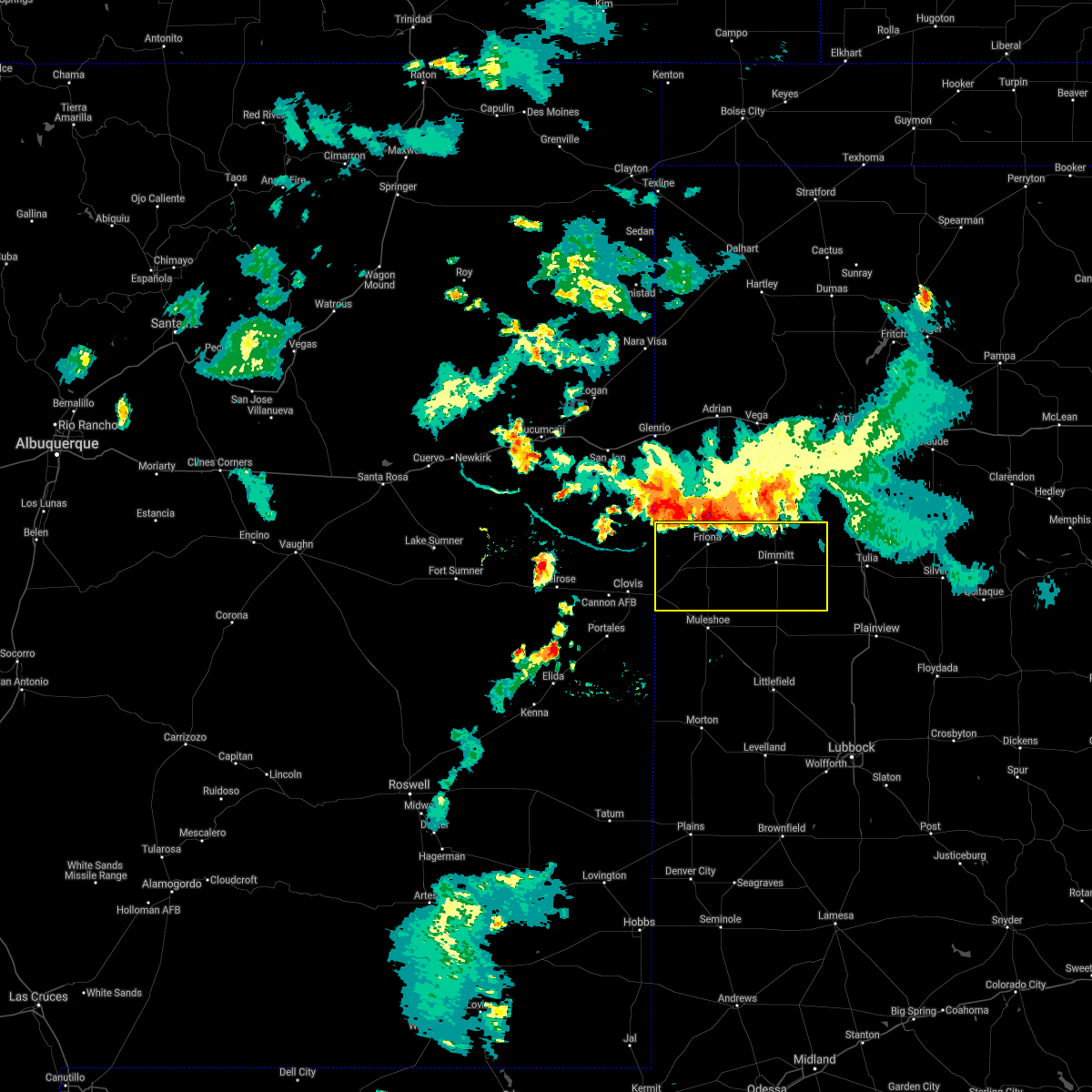 At 834 pm cdt, severe thunderstorms were located along a line extending from 4 miles northwest of rhea to 4 miles southwest of happy, moving southeast at 30 mph (66 mph wind gust measured at the hereford west texas mesonet). Hazards include 70 mph wind gusts and nickel size hail. Expect considerable tree damage. damage is likely to mobile homes, roofs, and outbuildings. Locations impacted include, dimmitt, friona, hart, bovina, farwell, summerfield, easter, lazbuddie, oklahoma lane, lariat, black, rhea and nazareth. At 834 pm cdt, severe thunderstorms were located along a line extending from 4 miles northwest of rhea to 4 miles southwest of happy, moving southeast at 30 mph (66 mph wind gust measured at the hereford west texas mesonet). Hazards include 70 mph wind gusts and nickel size hail. Expect considerable tree damage. damage is likely to mobile homes, roofs, and outbuildings. Locations impacted include, dimmitt, friona, hart, bovina, farwell, summerfield, easter, lazbuddie, oklahoma lane, lariat, black, rhea and nazareth.
|
| 7/17/2021 8:18 PM CDT |
 At 817 pm cdt, severe thunderstorms were located along a line extending from near bellview to 6 miles northwest of happy, moving southeast at 25 mph (66 mph wind measured at the hereford west texas mesonet). Hazards include 70 mph wind gusts and nickel size hail. Expect considerable tree damage. Damage is likely to mobile homes, roofs, and outbuildings. At 817 pm cdt, severe thunderstorms were located along a line extending from near bellview to 6 miles northwest of happy, moving southeast at 25 mph (66 mph wind measured at the hereford west texas mesonet). Hazards include 70 mph wind gusts and nickel size hail. Expect considerable tree damage. Damage is likely to mobile homes, roofs, and outbuildings.
|
| 6/26/2021 12:31 AM CDT |
 At 1231 am cdt, severe thunderstorms were located along a line extending from 9 miles southeast of hereford to 7 miles northwest of hart to 6 miles northeast of earth, moving east at 30 mph (radar indicated). Hazards include 60 mph wind gusts. Expect damage to roofs, siding, and trees. Locations impacted include, tulia, dimmitt, hart, kress, happy and nazareth. At 1231 am cdt, severe thunderstorms were located along a line extending from 9 miles southeast of hereford to 7 miles northwest of hart to 6 miles northeast of earth, moving east at 30 mph (radar indicated). Hazards include 60 mph wind gusts. Expect damage to roofs, siding, and trees. Locations impacted include, tulia, dimmitt, hart, kress, happy and nazareth.
|
| 6/26/2021 12:24 AM CDT |
 At 1224 am cdt, severe thunderstorms were located along a line extending from 8 miles southeast of hereford to 7 miles southeast of dimmitt to 4 miles northeast of earth, moving east at 30 mph (radar indicated). Hazards include 60 mph wind gusts and penny size hail. Expect damage to roofs, siding, and trees. Locations impacted include, plainview, tulia, dimmitt, olton, hart, earth, kress, happy, easter, halfway, nazareth, edmonson and springlake. At 1224 am cdt, severe thunderstorms were located along a line extending from 8 miles southeast of hereford to 7 miles southeast of dimmitt to 4 miles northeast of earth, moving east at 30 mph (radar indicated). Hazards include 60 mph wind gusts and penny size hail. Expect damage to roofs, siding, and trees. Locations impacted include, plainview, tulia, dimmitt, olton, hart, earth, kress, happy, easter, halfway, nazareth, edmonson and springlake.
|
| 6/26/2021 12:08 AM CDT |
 At 1208 am cdt, severe thunderstorms were located along a line extending from 4 miles south of hereford to 5 miles south of dimmitt to 4 miles northwest of earth, moving east at 30 mph (radar indicated). Hazards include 60 mph wind gusts and penny size hail. expect damage to roofs, siding, and trees At 1208 am cdt, severe thunderstorms were located along a line extending from 4 miles south of hereford to 5 miles south of dimmitt to 4 miles northwest of earth, moving east at 30 mph (radar indicated). Hazards include 60 mph wind gusts and penny size hail. expect damage to roofs, siding, and trees
|
| 6/7/2021 8:55 PM CDT | Measured by the ttu mesonet in castro county TX, 2.4 miles SSW of Dimmitt, TX |
| 6/6/2021 9:56 PM CDT |
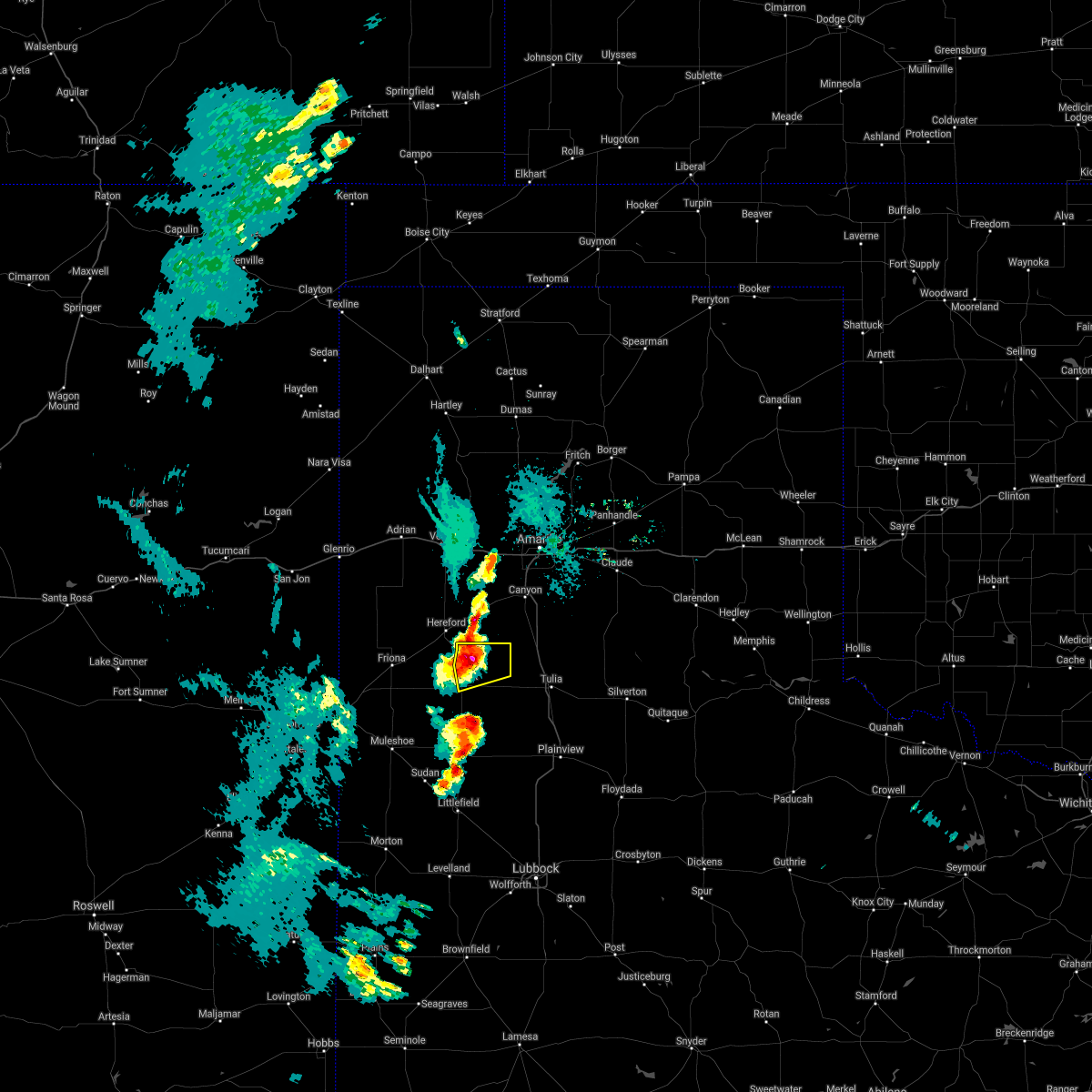 At 955 pm cdt, a severe thunderstorm was located 10 miles northeast of dimmitt, moving east at 30 mph (radar indicated). Hazards include 60 mph wind gusts and quarter size hail. Hail damage to vehicles is expected. expect wind damage to roofs, siding, and trees. Locations impacted include, dimmitt. At 955 pm cdt, a severe thunderstorm was located 10 miles northeast of dimmitt, moving east at 30 mph (radar indicated). Hazards include 60 mph wind gusts and quarter size hail. Hail damage to vehicles is expected. expect wind damage to roofs, siding, and trees. Locations impacted include, dimmitt.
|
| 6/6/2021 9:31 PM CDT |
 At 930 pm cdt, a severe thunderstorm was located over easter, or 6 miles northwest of dimmitt, moving east at 30 mph (radar indicated). Hazards include 60 mph wind gusts and quarter size hail. Hail damage to vehicles is expected. Expect wind damage to roofs, siding, and trees. At 930 pm cdt, a severe thunderstorm was located over easter, or 6 miles northwest of dimmitt, moving east at 30 mph (radar indicated). Hazards include 60 mph wind gusts and quarter size hail. Hail damage to vehicles is expected. Expect wind damage to roofs, siding, and trees.
|
| 6/6/2021 9:27 PM CDT |
 At 927 pm cdt, a severe thunderstorm was located 8 miles north of earth, moving northeast at 20 mph (radar indicated). Hazards include 60 mph wind gusts and quarter size hail. Hail damage to vehicles is expected. Expect wind damage to roofs, siding, and trees. At 927 pm cdt, a severe thunderstorm was located 8 miles north of earth, moving northeast at 20 mph (radar indicated). Hazards include 60 mph wind gusts and quarter size hail. Hail damage to vehicles is expected. Expect wind damage to roofs, siding, and trees.
|
| 5/26/2021 9:09 PM CDT |
 At 909 pm cdt, a severe thunderstorm was located 7 miles east of dimmitt, moving northeast at 40 mph (radar indicated). Hazards include 70 mph wind gusts and ping pong ball size hail. People and animals outdoors will be injured. expect hail damage to roofs, siding, windows, and vehicles. expect considerable tree damage. wind damage is also likely to mobile homes, roofs, and outbuildings. Locations impacted include, nazareth. At 909 pm cdt, a severe thunderstorm was located 7 miles east of dimmitt, moving northeast at 40 mph (radar indicated). Hazards include 70 mph wind gusts and ping pong ball size hail. People and animals outdoors will be injured. expect hail damage to roofs, siding, windows, and vehicles. expect considerable tree damage. wind damage is also likely to mobile homes, roofs, and outbuildings. Locations impacted include, nazareth.
|
| 5/26/2021 9:05 PM CDT |
 At 905 pm cdt, a severe thunderstorm was located 5 miles east of dimmitt, moving northeast at 40 mph (radar indicated). Hazards include 70 mph wind gusts and ping pong ball size hail. People and animals outdoors will be injured. expect hail damage to roofs, siding, windows, and vehicles. expect considerable tree damage. wind damage is also likely to mobile homes, roofs, and outbuildings. Locations impacted include, dimmitt, easter and nazareth. At 905 pm cdt, a severe thunderstorm was located 5 miles east of dimmitt, moving northeast at 40 mph (radar indicated). Hazards include 70 mph wind gusts and ping pong ball size hail. People and animals outdoors will be injured. expect hail damage to roofs, siding, windows, and vehicles. expect considerable tree damage. wind damage is also likely to mobile homes, roofs, and outbuildings. Locations impacted include, dimmitt, easter and nazareth.
|
| 5/26/2021 8:50 PM CDT |
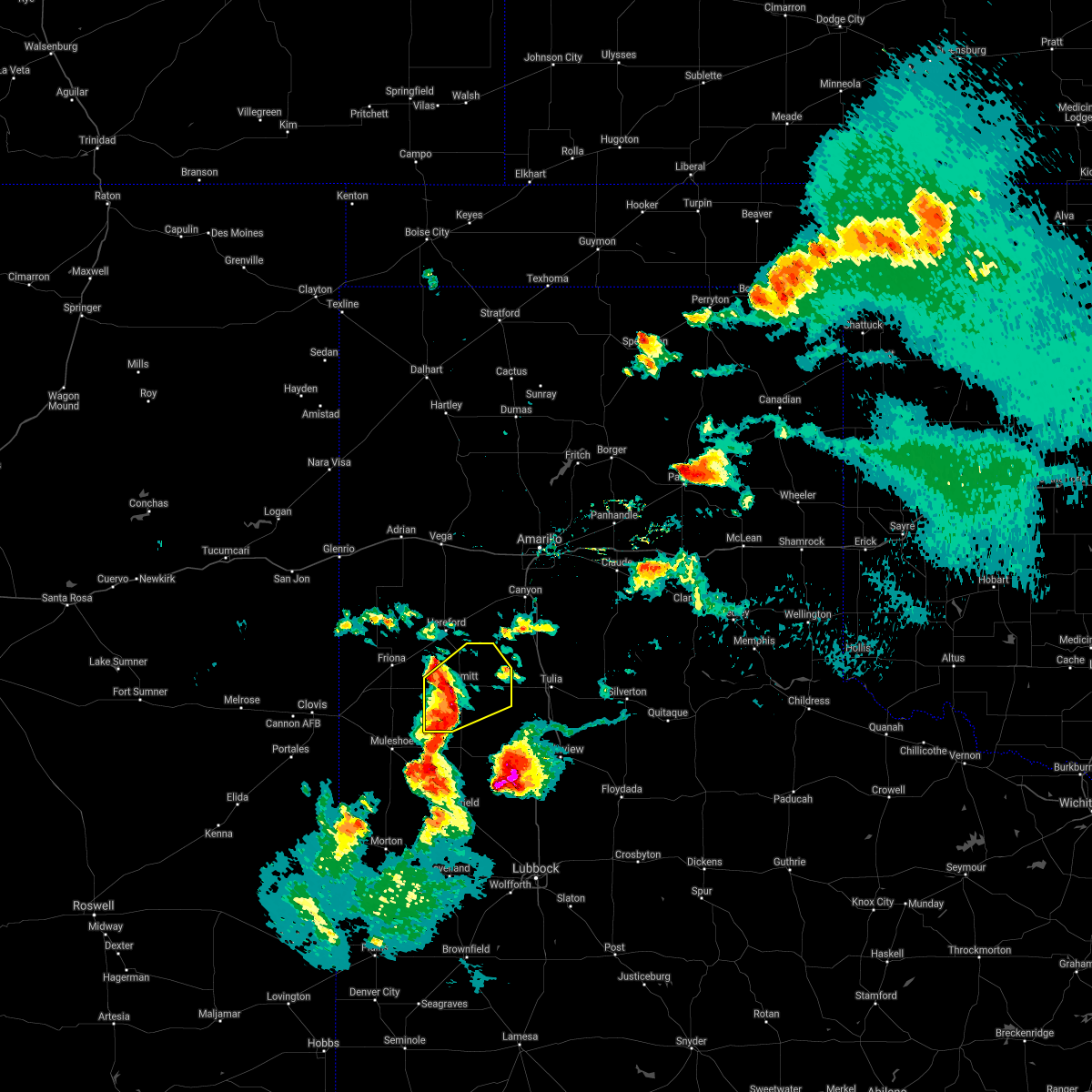 At 850 pm cdt, a severe thunderstorm was located 6 miles southwest of dimmitt, moving northeast at 40 mph (radar indicated). Hazards include 70 mph wind gusts and ping pong ball size hail. People and animals outdoors will be injured. expect hail damage to roofs, siding, windows, and vehicles. expect considerable tree damage. wind damage is also likely to mobile homes, roofs, and outbuildings. Locations impacted include, dimmitt, easter and nazareth. At 850 pm cdt, a severe thunderstorm was located 6 miles southwest of dimmitt, moving northeast at 40 mph (radar indicated). Hazards include 70 mph wind gusts and ping pong ball size hail. People and animals outdoors will be injured. expect hail damage to roofs, siding, windows, and vehicles. expect considerable tree damage. wind damage is also likely to mobile homes, roofs, and outbuildings. Locations impacted include, dimmitt, easter and nazareth.
|
| 5/26/2021 8:43 PM CDT |
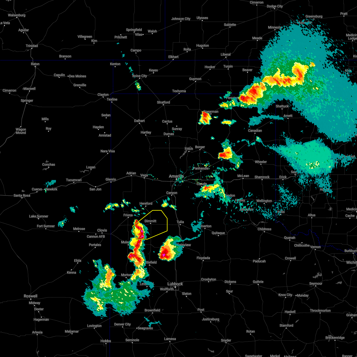 At 843 pm cdt, a severe thunderstorm was located 9 miles east of lazbuddie, or 10 miles southwest of dimmitt, moving northeast at 40 mph (radar indicated). Hazards include 70 mph wind gusts and ping pong ball size hail. People and animals outdoors will be injured. expect hail damage to roofs, siding, windows, and vehicles. expect considerable tree damage. wind damage is also likely to mobile homes, roofs, and outbuildings. Locations impacted include, dimmitt, easter and nazareth. At 843 pm cdt, a severe thunderstorm was located 9 miles east of lazbuddie, or 10 miles southwest of dimmitt, moving northeast at 40 mph (radar indicated). Hazards include 70 mph wind gusts and ping pong ball size hail. People and animals outdoors will be injured. expect hail damage to roofs, siding, windows, and vehicles. expect considerable tree damage. wind damage is also likely to mobile homes, roofs, and outbuildings. Locations impacted include, dimmitt, easter and nazareth.
|
| 5/26/2021 8:31 PM CDT |
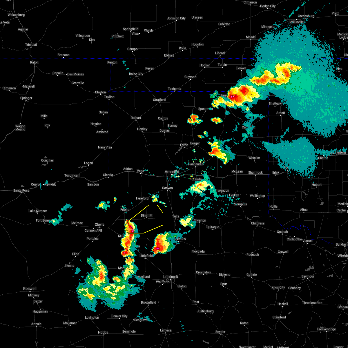 At 831 pm cdt, a severe thunderstorm was located over lazbuddie, or 13 miles northwest of earth, moving northeast at 40 mph (radar indicated). Hazards include 70 mph wind gusts and ping pong ball size hail. People and animals outdoors will be injured. expect hail damage to roofs, siding, windows, and vehicles. expect considerable tree damage. Wind damage is also likely to mobile homes, roofs, and outbuildings. At 831 pm cdt, a severe thunderstorm was located over lazbuddie, or 13 miles northwest of earth, moving northeast at 40 mph (radar indicated). Hazards include 70 mph wind gusts and ping pong ball size hail. People and animals outdoors will be injured. expect hail damage to roofs, siding, windows, and vehicles. expect considerable tree damage. Wind damage is also likely to mobile homes, roofs, and outbuildings.
|
| 5/26/2021 6:44 PM CDT |
 At 644 pm cdt, a severe thunderstorm was located 9 miles northeast of earth, moving northeast at 15 mph (radar indicated). Hazards include 60 mph wind gusts and quarter size hail. Hail damage to vehicles is expected. expect wind damage to roofs, siding, and trees. Locations impacted include, hart, happy and nazareth. At 644 pm cdt, a severe thunderstorm was located 9 miles northeast of earth, moving northeast at 15 mph (radar indicated). Hazards include 60 mph wind gusts and quarter size hail. Hail damage to vehicles is expected. expect wind damage to roofs, siding, and trees. Locations impacted include, hart, happy and nazareth.
|
| 5/26/2021 6:31 PM CDT |
 At 630 pm cdt, a severe thunderstorm was located 5 miles north of earth, moving northeast at 15 mph (radar indicated). Hazards include 60 mph wind gusts and quarter size hail. Hail damage to vehicles is expected. expect wind damage to roofs, siding, and trees. Locations impacted include, hart, earth, happy and nazareth. At 630 pm cdt, a severe thunderstorm was located 5 miles north of earth, moving northeast at 15 mph (radar indicated). Hazards include 60 mph wind gusts and quarter size hail. Hail damage to vehicles is expected. expect wind damage to roofs, siding, and trees. Locations impacted include, hart, earth, happy and nazareth.
|
| 5/26/2021 6:05 PM CDT |
 At 605 pm cdt, a severe thunderstorm was located near earth, moving northeast at 15 mph (radar indicated). Hazards include 60 mph wind gusts and quarter size hail. Hail damage to vehicles is expected. expect wind damage to roofs, siding, and trees. Locations impacted include, dimmitt, hart, earth, happy and nazareth. At 605 pm cdt, a severe thunderstorm was located near earth, moving northeast at 15 mph (radar indicated). Hazards include 60 mph wind gusts and quarter size hail. Hail damage to vehicles is expected. expect wind damage to roofs, siding, and trees. Locations impacted include, dimmitt, hart, earth, happy and nazareth.
|
| 5/26/2021 5:56 PM CDT |
 At 556 pm cdt, a severe thunderstorm was located 5 miles west of earth, moving northeast at 15 mph (radar indicated). Hazards include 60 mph wind gusts and quarter size hail. Hail damage to vehicles is expected. Expect wind damage to roofs, siding, and trees. At 556 pm cdt, a severe thunderstorm was located 5 miles west of earth, moving northeast at 15 mph (radar indicated). Hazards include 60 mph wind gusts and quarter size hail. Hail damage to vehicles is expected. Expect wind damage to roofs, siding, and trees.
|
| 5/24/2021 7:47 PM CDT |
 At 747 pm cdt, a severe thunderstorm was located near earth, moving northeast at 15 mph (radar indicated). Hazards include 60 mph wind gusts and quarter size hail. Hail damage to vehicles is expected. expect wind damage to roofs, siding, and trees. Locations impacted include, plainview, tulia, hale center, olton, hart, earth, kress, cotton center, fieldton, spade, claytonville, halfway, mackenzie reservoir, seth ward, nazareth, edmonson and springlake. At 747 pm cdt, a severe thunderstorm was located near earth, moving northeast at 15 mph (radar indicated). Hazards include 60 mph wind gusts and quarter size hail. Hail damage to vehicles is expected. expect wind damage to roofs, siding, and trees. Locations impacted include, plainview, tulia, hale center, olton, hart, earth, kress, cotton center, fieldton, spade, claytonville, halfway, mackenzie reservoir, seth ward, nazareth, edmonson and springlake.
|
| 5/24/2021 7:28 PM CDT |
 At 728 pm cdt, a cluster of severe thunderstorms were located 6 miles south of earth to near tulia, moving northeast at 15 mph (radar indicated). Hazards include 60 mph wind gusts and quarter size hail. Hail damage to vehicles is expected. Expect wind damage to roofs, siding, and trees. At 728 pm cdt, a cluster of severe thunderstorms were located 6 miles south of earth to near tulia, moving northeast at 15 mph (radar indicated). Hazards include 60 mph wind gusts and quarter size hail. Hail damage to vehicles is expected. Expect wind damage to roofs, siding, and trees.
|
| 5/24/2021 6:59 PM CDT |
 At 642 pm cdt, a cluster of severe thunderstorms were located 8 miles west of hart, moving northeast at 15 mph (radar indicated). Hazards include ping pong ball size hail and 60 mph wind gusts. People and animals outdoors will be injured. expect hail damage to roofs, siding, windows, and vehicles. expect wind damage to roofs, siding, and trees. Locations impacted include, olton, hart, earth, nazareth and springlake. At 642 pm cdt, a cluster of severe thunderstorms were located 8 miles west of hart, moving northeast at 15 mph (radar indicated). Hazards include ping pong ball size hail and 60 mph wind gusts. People and animals outdoors will be injured. expect hail damage to roofs, siding, windows, and vehicles. expect wind damage to roofs, siding, and trees. Locations impacted include, olton, hart, earth, nazareth and springlake.
|
| 5/24/2021 6:43 PM CDT |
 At 642 pm cdt, a cluster of severe thunderstorms were located 8 miles west of hart, moving northeast at 15 mph (radar indicated). Hazards include ping pong ball size hail and 60 mph wind gusts. People and animals outdoors will be injured. expect hail damage to roofs, siding, windows, and vehicles. expect wind damage to roofs, siding, and trees. Locations impacted include, olton, hart, earth, nazareth and springlake. At 642 pm cdt, a cluster of severe thunderstorms were located 8 miles west of hart, moving northeast at 15 mph (radar indicated). Hazards include ping pong ball size hail and 60 mph wind gusts. People and animals outdoors will be injured. expect hail damage to roofs, siding, windows, and vehicles. expect wind damage to roofs, siding, and trees. Locations impacted include, olton, hart, earth, nazareth and springlake.
|
| 5/24/2021 6:24 PM CDT |
 At 623 pm cdt, a cluster of severe thunderstorms were located 10 miles northeast of earth, moving northeast at 15 mph (radar indicated). Hazards include 60 mph wind gusts and quarter size hail. Hail damage to vehicles is expected. Expect wind damage to roofs, siding, and trees. At 623 pm cdt, a cluster of severe thunderstorms were located 10 miles northeast of earth, moving northeast at 15 mph (radar indicated). Hazards include 60 mph wind gusts and quarter size hail. Hail damage to vehicles is expected. Expect wind damage to roofs, siding, and trees.
|
| 5/18/2021 5:46 PM CDT |
 At 546 pm cdt, severe thunderstorms were located along a line extending from 5 miles south of buffalo lake to 3 miles northwest of littlefield, moving east at 25 mph (radar indicated). Hazards include 60 mph wind gusts and quarter size hail. Hail damage to vehicles is expected. Expect wind damage to roofs, siding, and trees. At 546 pm cdt, severe thunderstorms were located along a line extending from 5 miles south of buffalo lake to 3 miles northwest of littlefield, moving east at 25 mph (radar indicated). Hazards include 60 mph wind gusts and quarter size hail. Hail damage to vehicles is expected. Expect wind damage to roofs, siding, and trees.
|
| 5/17/2021 7:41 PM CDT |
 The severe thunderstorm warning for northeastern castro and northwestern swisher counties will expire at 745 pm cdt, the storm which prompted the warning has moved out of the area. therefore, the warning will be allowed to expire. however small hail, gusty winds and heavy rain are still possible with this thunderstorm. a tornado watch remains in effect until 1100 pm cdt for the panhandle of texas. to report severe weather, contact your nearest law enforcement agency. they will relay your report to the national weather service lubbock texas. The severe thunderstorm warning for northeastern castro and northwestern swisher counties will expire at 745 pm cdt, the storm which prompted the warning has moved out of the area. therefore, the warning will be allowed to expire. however small hail, gusty winds and heavy rain are still possible with this thunderstorm. a tornado watch remains in effect until 1100 pm cdt for the panhandle of texas. to report severe weather, contact your nearest law enforcement agency. they will relay your report to the national weather service lubbock texas.
|
| 5/17/2021 7:20 PM CDT | West texas mesonet in castro county TX, 2.4 miles SSW of Dimmitt, TX |
| 5/17/2021 6:42 PM CDT |
 At 642 pm cdt, a severe thunderstorm was located 4 miles north of dimmitt, moving northeast at 20 mph (radar indicated). Hazards include 70 mph wind gusts and half dollar size hail. Hail damage to vehicles is expected. expect considerable tree damage. Wind damage is also likely to mobile homes, roofs, and outbuildings. At 642 pm cdt, a severe thunderstorm was located 4 miles north of dimmitt, moving northeast at 20 mph (radar indicated). Hazards include 70 mph wind gusts and half dollar size hail. Hail damage to vehicles is expected. expect considerable tree damage. Wind damage is also likely to mobile homes, roofs, and outbuildings.
|
| 5/7/2021 7:17 PM CDT |
 At 716 pm cdt, severe thunderstorms were located along a line extending from 7 miles southeast of buffalo lake to 8 miles west of mackenzie reservoir, moving east at 35 mph (radar indicated). Hazards include 60 mph wind gusts. Expect damage to roofs, siding, and trees. Locations impacted include, tulia, happy, vigo park, mackenzie reservoir and nazareth. At 716 pm cdt, severe thunderstorms were located along a line extending from 7 miles southeast of buffalo lake to 8 miles west of mackenzie reservoir, moving east at 35 mph (radar indicated). Hazards include 60 mph wind gusts. Expect damage to roofs, siding, and trees. Locations impacted include, tulia, happy, vigo park, mackenzie reservoir and nazareth.
|
| 5/7/2021 6:58 PM CDT |
 At 639 pm cdt, severe thunderstorms were located along a line extending from summerfield to 6 miles northeast of hart, moving east at 25 mph (radar indicated). Hazards include 60 mph wind gusts and penny size hail. expect damage to roofs, siding, and trees At 639 pm cdt, severe thunderstorms were located along a line extending from summerfield to 6 miles northeast of hart, moving east at 25 mph (radar indicated). Hazards include 60 mph wind gusts and penny size hail. expect damage to roofs, siding, and trees
|
| 5/7/2021 6:40 PM CDT |
 At 639 pm cdt, severe thunderstorms were located along a line extending from summerfield to 6 miles northeast of hart, moving east at 25 mph (radar indicated). Hazards include 60 mph wind gusts and penny size hail. expect damage to roofs, siding, and trees At 639 pm cdt, severe thunderstorms were located along a line extending from summerfield to 6 miles northeast of hart, moving east at 25 mph (radar indicated). Hazards include 60 mph wind gusts and penny size hail. expect damage to roofs, siding, and trees
|
| 5/7/2021 6:30 PM CDT | Storm damage reported in castro county TX, 2.4 miles SSW of Dimmitt, TX |
| 3/13/2021 2:52 PM CST |
 At 252 pm cst, a severe thunderstorm was located 13 miles northeast of dimmitt, moving northeast at 45 mph (radar indicated). Hazards include ping pong ball size hail and 60 mph wind gusts. People and animals outdoors will be injured. expect hail damage to roofs, siding, windows, and vehicles. expect wind damage to roofs, siding, and trees. Locations impacted include, dimmitt, happy and nazareth. At 252 pm cst, a severe thunderstorm was located 13 miles northeast of dimmitt, moving northeast at 45 mph (radar indicated). Hazards include ping pong ball size hail and 60 mph wind gusts. People and animals outdoors will be injured. expect hail damage to roofs, siding, windows, and vehicles. expect wind damage to roofs, siding, and trees. Locations impacted include, dimmitt, happy and nazareth.
|
| 3/13/2021 2:37 PM CST |
 At 236 pm cst, a severe thunderstorm was located 6 miles southeast of dimmitt, moving northeast at 45 mph (radar indicated). Hazards include ping pong ball size hail and 60 mph wind gusts. People and animals outdoors will be injured. expect hail damage to roofs, siding, windows, and vehicles. Expect wind damage to roofs, siding, and trees. At 236 pm cst, a severe thunderstorm was located 6 miles southeast of dimmitt, moving northeast at 45 mph (radar indicated). Hazards include ping pong ball size hail and 60 mph wind gusts. People and animals outdoors will be injured. expect hail damage to roofs, siding, windows, and vehicles. Expect wind damage to roofs, siding, and trees.
|
| 3/13/2021 2:29 PM CST |
 At 228 pm cst, a severe thunderstorm was located 10 miles south of dimmitt, moving north at 35 mph (radar indicated). Hazards include ping pong ball size hail and 60 mph wind gusts. People and animals outdoors will be injured. expect hail damage to roofs, siding, windows, and vehicles. expect wind damage to roofs, siding, and trees. Locations impacted include, dimmitt and hart. At 228 pm cst, a severe thunderstorm was located 10 miles south of dimmitt, moving north at 35 mph (radar indicated). Hazards include ping pong ball size hail and 60 mph wind gusts. People and animals outdoors will be injured. expect hail damage to roofs, siding, windows, and vehicles. expect wind damage to roofs, siding, and trees. Locations impacted include, dimmitt and hart.
|
| 3/13/2021 2:23 PM CST |
 At 222 pm cst, a severe thunderstorm was located 8 miles north of earth, moving north at 35 mph (radar indicated). Hazards include ping pong ball size hail and 60 mph wind gusts. People and animals outdoors will be injured. expect hail damage to roofs, siding, windows, and vehicles. expect wind damage to roofs, siding, and trees. Locations impacted include, dimmitt and hart. At 222 pm cst, a severe thunderstorm was located 8 miles north of earth, moving north at 35 mph (radar indicated). Hazards include ping pong ball size hail and 60 mph wind gusts. People and animals outdoors will be injured. expect hail damage to roofs, siding, windows, and vehicles. expect wind damage to roofs, siding, and trees. Locations impacted include, dimmitt and hart.
|
| 8/11/2020 8:17 PM CDT |
 At 816 pm cdt, a severe thunderstorm was located 10 miles east of lazbuddie, or 11 miles southwest of dimmitt, moving east at 20 mph (radar indicated). Hazards include 70 mph wind gusts and ping pong ball size hail. People and animals outdoors will be injured. expect hail damage to roofs, siding, windows, and vehicles. expect considerable tree damage. wind damage is also likely to mobile homes, roofs, and outbuildings. Locations impacted include, dimmitt, olton, hart and springlake. At 816 pm cdt, a severe thunderstorm was located 10 miles east of lazbuddie, or 11 miles southwest of dimmitt, moving east at 20 mph (radar indicated). Hazards include 70 mph wind gusts and ping pong ball size hail. People and animals outdoors will be injured. expect hail damage to roofs, siding, windows, and vehicles. expect considerable tree damage. wind damage is also likely to mobile homes, roofs, and outbuildings. Locations impacted include, dimmitt, olton, hart and springlake.
|
| 8/11/2020 7:56 PM CDT |
 At 756 pm cdt, a severe thunderstorm was located 5 miles northeast of lazbuddie, or 14 miles southwest of dimmitt, moving east at 20 mph (radar indicated). Hazards include 60 mph wind gusts and quarter size hail. Hail damage to vehicles is expected. Expect wind damage to roofs, siding, and trees. At 756 pm cdt, a severe thunderstorm was located 5 miles northeast of lazbuddie, or 14 miles southwest of dimmitt, moving east at 20 mph (radar indicated). Hazards include 60 mph wind gusts and quarter size hail. Hail damage to vehicles is expected. Expect wind damage to roofs, siding, and trees.
|
| 8/10/2020 9:31 PM CDT |
 At 929 pm cdt, a severe thunderstorm was located 11 miles south of buffalo lake, or 15 miles northeast of dimmitt, moving southeast at 25 mph. several inches of accumulating hail have been reported with this storm across deaf smith county (radar indicated). Hazards include 60 mph wind gusts and half dollar size accumulating hail. Hail damage to vehicles is expected. expect wind damage to roofs, siding, and trees. Locations impacted include, happy and nazareth. At 929 pm cdt, a severe thunderstorm was located 11 miles south of buffalo lake, or 15 miles northeast of dimmitt, moving southeast at 25 mph. several inches of accumulating hail have been reported with this storm across deaf smith county (radar indicated). Hazards include 60 mph wind gusts and half dollar size accumulating hail. Hail damage to vehicles is expected. expect wind damage to roofs, siding, and trees. Locations impacted include, happy and nazareth.
|
| 8/10/2020 9:14 PM CDT |
 At 913 pm cdt, a severe thunderstorm was located 7 miles southwest of buffalo lake, or 11 miles east of hereford, moving southeast at 25 mph (radar indicated). Hazards include golf ball size hail and 60 mph wind gusts. People and animals outdoors will be injured. expect hail damage to roofs, siding, windows, and vehicles. Expect wind damage to roofs, siding, and trees. At 913 pm cdt, a severe thunderstorm was located 7 miles southwest of buffalo lake, or 11 miles east of hereford, moving southeast at 25 mph (radar indicated). Hazards include golf ball size hail and 60 mph wind gusts. People and animals outdoors will be injured. expect hail damage to roofs, siding, windows, and vehicles. Expect wind damage to roofs, siding, and trees.
|
| 6/22/2020 10:40 PM CDT |
 At 1040 pm cdt, severe thunderstorms were located along a line extending from 8 miles south of silverton to 8 miles southwest of hart, moving southeast at 30 mph (radar indicated). Hazards include 60 mph wind gusts and quarter size hail. Hail damage to vehicles is expected. expect wind damage to roofs, siding, and trees. Locations impacted include, plainview, tulia, dimmitt, friona, olton, hart, earth, silverton, kress, lazbuddie, south plains, claytonville, mackenzie reservoir, aiken, halfway, seth ward, nazareth, edmonson and springlake. At 1040 pm cdt, severe thunderstorms were located along a line extending from 8 miles south of silverton to 8 miles southwest of hart, moving southeast at 30 mph (radar indicated). Hazards include 60 mph wind gusts and quarter size hail. Hail damage to vehicles is expected. expect wind damage to roofs, siding, and trees. Locations impacted include, plainview, tulia, dimmitt, friona, olton, hart, earth, silverton, kress, lazbuddie, south plains, claytonville, mackenzie reservoir, aiken, halfway, seth ward, nazareth, edmonson and springlake.
|
| 6/22/2020 10:21 PM CDT |
 At 1021 pm cdt, severe thunderstorms were located along a line extending from 7 miles northeast of claytonville to 9 miles east of lazbuddie, moving southeast at 40 mph (radar indicated). Hazards include 60 mph wind gusts and quarter size hail. Hail damage to vehicles is expected. expect wind damage to roofs, siding, and trees. Locations impacted include, plainview, tulia, dimmitt, friona, olton, hart, earth, silverton, kress, happy, summerfield, vigo park, easter, lazbuddie, south plains, claytonville, mackenzie reservoir, aiken, black and halfway. At 1021 pm cdt, severe thunderstorms were located along a line extending from 7 miles northeast of claytonville to 9 miles east of lazbuddie, moving southeast at 40 mph (radar indicated). Hazards include 60 mph wind gusts and quarter size hail. Hail damage to vehicles is expected. expect wind damage to roofs, siding, and trees. Locations impacted include, plainview, tulia, dimmitt, friona, olton, hart, earth, silverton, kress, happy, summerfield, vigo park, easter, lazbuddie, south plains, claytonville, mackenzie reservoir, aiken, black and halfway.
|
| 6/22/2020 9:59 PM CDT |
 The national weather service in lubbock texas has issued a * severe thunderstorm warning for. northern floyd county in northwestern texas. eastern parmer county in the panhandle of texas. northern hale county in northwestern texas. Castro county in the panhandle of texas. The national weather service in lubbock texas has issued a * severe thunderstorm warning for. northern floyd county in northwestern texas. eastern parmer county in the panhandle of texas. northern hale county in northwestern texas. Castro county in the panhandle of texas.
|
| 6/22/2020 9:31 PM CDT |
 At 931 pm cdt, severe thunderstorms were located along a line extending from 5 miles west of wayside to 8 miles northeast of dimmitt, moving south at 30 mph (radar indicated). Hazards include 60 mph wind gusts and quarter size hail. Hail damage to vehicles is expected. expect wind damage to roofs, siding, and trees. Locations impacted include, tulia, dimmitt, hart, happy, vigo park, mackenzie reservoir and nazareth. At 931 pm cdt, severe thunderstorms were located along a line extending from 5 miles west of wayside to 8 miles northeast of dimmitt, moving south at 30 mph (radar indicated). Hazards include 60 mph wind gusts and quarter size hail. Hail damage to vehicles is expected. expect wind damage to roofs, siding, and trees. Locations impacted include, tulia, dimmitt, hart, happy, vigo park, mackenzie reservoir and nazareth.
|
| 6/22/2020 9:07 PM CDT |
 At 906 pm cdt, severe thunderstorms were located along a line extending from 3 miles northwest of palo duro canyon to 6 miles east of hereford, moving south at 30 mph (radar indicated). Hazards include 60 mph wind gusts and quarter size hail. Hail damage to vehicles is expected. Expect wind damage to roofs, siding, and trees. At 906 pm cdt, severe thunderstorms were located along a line extending from 3 miles northwest of palo duro canyon to 6 miles east of hereford, moving south at 30 mph (radar indicated). Hazards include 60 mph wind gusts and quarter size hail. Hail damage to vehicles is expected. Expect wind damage to roofs, siding, and trees.
|
| 5/23/2020 4:19 PM CDT |
 At 418 pm cdt, a severe thunderstorm was located 7 miles east of earth, moving northeast at 25 mph (radar indicated). Hazards include 60 mph wind gusts and quarter size hail. Hail damage to vehicles is expected. Expect wind damage to roofs, siding, and trees. At 418 pm cdt, a severe thunderstorm was located 7 miles east of earth, moving northeast at 25 mph (radar indicated). Hazards include 60 mph wind gusts and quarter size hail. Hail damage to vehicles is expected. Expect wind damage to roofs, siding, and trees.
|
| 5/20/2020 9:17 PM CDT |
 At 916 pm cdt, a severe thunderstorm was located over dimmitt, moving north at 30 mph (radar indicated). Hazards include 60 mph wind gusts and half dollar size hail. Hail damage to vehicles is expected. expect wind damage to roofs, siding, and trees. Locations impacted include, dimmitt, hart and nazareth. At 916 pm cdt, a severe thunderstorm was located over dimmitt, moving north at 30 mph (radar indicated). Hazards include 60 mph wind gusts and half dollar size hail. Hail damage to vehicles is expected. expect wind damage to roofs, siding, and trees. Locations impacted include, dimmitt, hart and nazareth.
|
| 5/20/2020 9:08 PM CDT |
 At 907 pm cdt, a severe thunderstorm was located 4 miles southwest of dimmitt, moving northeast at 40 mph (radar indicated). Hazards include 60 mph wind gusts and half dollar size hail. Hail damage to vehicles is expected. expect wind damage to roofs, siding, and trees. Locations impacted include, tulia, dimmitt, hart, kress and nazareth. At 907 pm cdt, a severe thunderstorm was located 4 miles southwest of dimmitt, moving northeast at 40 mph (radar indicated). Hazards include 60 mph wind gusts and half dollar size hail. Hail damage to vehicles is expected. expect wind damage to roofs, siding, and trees. Locations impacted include, tulia, dimmitt, hart, kress and nazareth.
|
| 5/20/2020 8:41 PM CDT |
 At 841 pm cdt, a severe thunderstorm was located 6 miles north of olton, moving north at 25 mph (radar indicated). Hazards include 60 mph wind gusts and half dollar size hail. Hail damage to vehicles is expected. expect wind damage to roofs, siding, and trees. Locations impacted include, tulia, dimmitt, hart, kress, nazareth and edmonson. At 841 pm cdt, a severe thunderstorm was located 6 miles north of olton, moving north at 25 mph (radar indicated). Hazards include 60 mph wind gusts and half dollar size hail. Hail damage to vehicles is expected. expect wind damage to roofs, siding, and trees. Locations impacted include, tulia, dimmitt, hart, kress, nazareth and edmonson.
|
| 5/20/2020 8:25 PM CDT |
 At 824 pm cdt, a severe thunderstorm was located over olton, moving north at 30 mph (radar indicated). Hazards include 60 mph wind gusts and half dollar size hail. Hail damage to vehicles is expected. Expect wind damage to roofs, siding, and trees. At 824 pm cdt, a severe thunderstorm was located over olton, moving north at 30 mph (radar indicated). Hazards include 60 mph wind gusts and half dollar size hail. Hail damage to vehicles is expected. Expect wind damage to roofs, siding, and trees.
|
| 5/20/2020 6:34 PM CDT |
 At 633 pm cdt, a severe thunderstorm was located 8 miles west of hart, moving northeast at 20 mph (radar indicated). Hazards include 60 mph wind gusts and quarter size hail. Hail damage to vehicles is expected. Expect wind damage to roofs, siding, and trees. At 633 pm cdt, a severe thunderstorm was located 8 miles west of hart, moving northeast at 20 mph (radar indicated). Hazards include 60 mph wind gusts and quarter size hail. Hail damage to vehicles is expected. Expect wind damage to roofs, siding, and trees.
|
| 5/20/2020 5:06 PM CDT |
 At 504 pm cdt, a severe thunderstorm was located 10 miles northeast of dimmitt, moving northeast at 35 mph (trained weather spotters reported ping pong ball sized hail west of dimmit). Hazards include two inch hail and 60 mph wind gusts. People and animals outdoors will be injured. expect hail damage to roofs, siding, windows, and vehicles. expect wind damage to roofs, siding, and trees. Locations impacted include, easter. At 504 pm cdt, a severe thunderstorm was located 10 miles northeast of dimmitt, moving northeast at 35 mph (trained weather spotters reported ping pong ball sized hail west of dimmit). Hazards include two inch hail and 60 mph wind gusts. People and animals outdoors will be injured. expect hail damage to roofs, siding, windows, and vehicles. expect wind damage to roofs, siding, and trees. Locations impacted include, easter.
|
| 5/20/2020 4:58 PM CDT | Half Dollar sized hail reported 5.1 miles E of Dimmitt, TX |
| 5/20/2020 4:55 PM CDT |
 The severe thunderstorm warning for southeastern castro and northeastern lamb counties will expire at 500 pm cdt, the severe thunderstorm which prompted the warning has weakened. therefore, the warning will be allowed to expire. a severe thunderstorm watch remains in effect until midnight cdt for the panhandle of and northwestern texas. remember, a severe thunderstorm warning still remains in effect for north central castro county. The severe thunderstorm warning for southeastern castro and northeastern lamb counties will expire at 500 pm cdt, the severe thunderstorm which prompted the warning has weakened. therefore, the warning will be allowed to expire. a severe thunderstorm watch remains in effect until midnight cdt for the panhandle of and northwestern texas. remember, a severe thunderstorm warning still remains in effect for north central castro county.
|
| 5/20/2020 4:50 PM CDT | Ping Pong Ball sized hail reported 4.6 miles E of Dimmitt, TX |
| 5/20/2020 4:43 PM CDT |
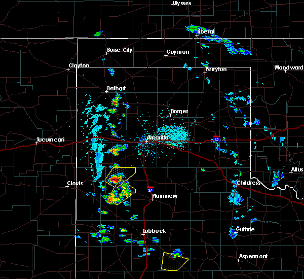 At 442 pm cdt, a severe thunderstorm was located near dimmitt, moving northeast at 25 mph (radar indicated). Hazards include tennis ball size hail and 60 mph wind gusts. People and animals outdoors will be injured. expect hail damage to roofs, siding, windows, and vehicles. expect wind damage to roofs, siding, and trees. Locations impacted include, dimmitt and easter. At 442 pm cdt, a severe thunderstorm was located near dimmitt, moving northeast at 25 mph (radar indicated). Hazards include tennis ball size hail and 60 mph wind gusts. People and animals outdoors will be injured. expect hail damage to roofs, siding, windows, and vehicles. expect wind damage to roofs, siding, and trees. Locations impacted include, dimmitt and easter.
|
| 5/20/2020 4:35 PM CDT |
 At 435 pm cdt, a severe thunderstorm was located 7 miles northeast of earth, moving northeast at 15 mph (radar indicated). Hazards include 60 mph wind gusts and quarter size hail. Hail damage to vehicles is expected. expect wind damage to roofs, siding, and trees. Locations impacted include, hart, earth and springlake. At 435 pm cdt, a severe thunderstorm was located 7 miles northeast of earth, moving northeast at 15 mph (radar indicated). Hazards include 60 mph wind gusts and quarter size hail. Hail damage to vehicles is expected. expect wind damage to roofs, siding, and trees. Locations impacted include, hart, earth and springlake.
|
| 5/20/2020 4:25 PM CDT |
 At 424 pm cdt, a severe thunderstorm was located near dimmitt, moving northeast at 35 mph (radar indicated). Hazards include ping pong ball size hail and 60 mph wind gusts. People and animals outdoors will be injured. expect hail damage to roofs, siding, windows, and vehicles. Expect wind damage to roofs, siding, and trees. At 424 pm cdt, a severe thunderstorm was located near dimmitt, moving northeast at 35 mph (radar indicated). Hazards include ping pong ball size hail and 60 mph wind gusts. People and animals outdoors will be injured. expect hail damage to roofs, siding, windows, and vehicles. Expect wind damage to roofs, siding, and trees.
|
| 5/20/2020 4:06 PM CDT |
 At 405 pm cdt, a severe thunderstorm was located near earth, moving northeast at 20 mph (radar indicated). Hazards include ping pong ball size hail and 60 mph wind gusts. People and animals outdoors will be injured. expect hail damage to roofs, siding, windows, and vehicles. Expect wind damage to roofs, siding, and trees. At 405 pm cdt, a severe thunderstorm was located near earth, moving northeast at 20 mph (radar indicated). Hazards include ping pong ball size hail and 60 mph wind gusts. People and animals outdoors will be injured. expect hail damage to roofs, siding, windows, and vehicles. Expect wind damage to roofs, siding, and trees.
|
| 5/19/2020 7:57 PM CDT |
 At 757 pm cdt, a severe thunderstorm was located near dimmitt, moving northeast at 20 mph (radar indicated). Hazards include 60 mph wind gusts and quarter size hail. Hail damage to vehicles is expected. expect wind damage to roofs, siding, and trees. Locations impacted include, dimmitt and nazareth. At 757 pm cdt, a severe thunderstorm was located near dimmitt, moving northeast at 20 mph (radar indicated). Hazards include 60 mph wind gusts and quarter size hail. Hail damage to vehicles is expected. expect wind damage to roofs, siding, and trees. Locations impacted include, dimmitt and nazareth.
|
| 5/19/2020 7:41 PM CDT |
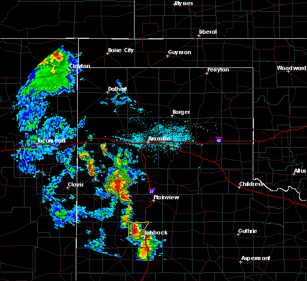 At 740 pm cdt, a severe thunderstorm was located 6 miles south of dimmitt, moving northeast at 10 mph (radar indicated). Hazards include ping pong ball size hail and 60 mph wind gusts. People and animals outdoors will be injured. expect hail damage to roofs, siding, windows, and vehicles. Expect wind damage to roofs, siding, and trees. At 740 pm cdt, a severe thunderstorm was located 6 miles south of dimmitt, moving northeast at 10 mph (radar indicated). Hazards include ping pong ball size hail and 60 mph wind gusts. People and animals outdoors will be injured. expect hail damage to roofs, siding, windows, and vehicles. Expect wind damage to roofs, siding, and trees.
|
| 5/19/2020 7:30 PM CDT |
 At 730 pm cdt, a severe thunderstorm was located 9 miles southwest of dimmitt, moving northeast at 10 mph (radar indicated). Hazards include ping pong ball size hail and 60 mph wind gusts. People and animals outdoors will be injured. expect hail damage to roofs, siding, windows, and vehicles. expect wind damage to roofs, siding, and trees. Locations impacted include, dimmitt. At 730 pm cdt, a severe thunderstorm was located 9 miles southwest of dimmitt, moving northeast at 10 mph (radar indicated). Hazards include ping pong ball size hail and 60 mph wind gusts. People and animals outdoors will be injured. expect hail damage to roofs, siding, windows, and vehicles. expect wind damage to roofs, siding, and trees. Locations impacted include, dimmitt.
|
| 5/19/2020 7:13 PM CDT |
 At 713 pm cdt, a severe thunderstorm was located 10 miles southwest of dimmitt, moving northeast at 15 mph (radar indicated). Hazards include 60 mph wind gusts and half dollar size hail. Hail damage to vehicles is expected. Expect wind damage to roofs, siding, and trees. At 713 pm cdt, a severe thunderstorm was located 10 miles southwest of dimmitt, moving northeast at 15 mph (radar indicated). Hazards include 60 mph wind gusts and half dollar size hail. Hail damage to vehicles is expected. Expect wind damage to roofs, siding, and trees.
|
| 9/28/2019 7:37 PM CDT | Broken power pole south side of town along farm-to-market 3215 in castro county TX, 0.9 miles NE of Dimmitt, TX |
| 7/10/2019 3:26 PM CDT |
 The severe thunderstorm warning for northeastern bailey, southeastern parmer, southwestern castro and northwestern lamb counties will expire at 330 pm cdt, the storm which prompted the warning has weakened below severe limits, and no longer poses an immediate threat to life or property. therefore, the warning will be allowed to expire. however gusty winds and heavy rain are still possible with this thunderstorm. The severe thunderstorm warning for northeastern bailey, southeastern parmer, southwestern castro and northwestern lamb counties will expire at 330 pm cdt, the storm which prompted the warning has weakened below severe limits, and no longer poses an immediate threat to life or property. therefore, the warning will be allowed to expire. however gusty winds and heavy rain are still possible with this thunderstorm.
|
| 7/10/2019 3:09 PM CDT |
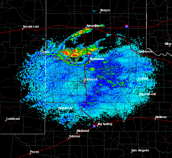 At 309 pm cdt, a severe thunderstorm was located 7 miles north of earth, moving southwest at 25 mph (radar indicated). Hazards include 60 mph wind gusts and quarter size hail. Hail damage to vehicles is expected. expect wind damage to roofs, siding, and trees. Locations impacted include, dimmitt, earth and lazbuddie. At 309 pm cdt, a severe thunderstorm was located 7 miles north of earth, moving southwest at 25 mph (radar indicated). Hazards include 60 mph wind gusts and quarter size hail. Hail damage to vehicles is expected. expect wind damage to roofs, siding, and trees. Locations impacted include, dimmitt, earth and lazbuddie.
|
| 7/10/2019 2:51 PM CDT |
 At 251 pm cdt, a severe thunderstorm was located 10 miles south of dimmitt, moving southwest at 20 mph (radar indicated). Hazards include 60 mph wind gusts and quarter size hail. Hail damage to vehicles is expected. Expect wind damage to roofs, siding, and trees. At 251 pm cdt, a severe thunderstorm was located 10 miles south of dimmitt, moving southwest at 20 mph (radar indicated). Hazards include 60 mph wind gusts and quarter size hail. Hail damage to vehicles is expected. Expect wind damage to roofs, siding, and trees.
|
| 6/18/2019 6:55 PM CDT |
 At 654 pm cdt, a severe thunderstorm was located 4 miles southwest of earth, moving east at 35 mph (radar indicated). Hazards include 70 mph wind gusts and ping pong ball size hail. People and animals outdoors will be injured. expect hail damage to roofs, siding, windows, and vehicles. expect considerable tree damage. wind damage is also likely to mobile homes, roofs, and outbuildings. Locations impacted include, muleshoe, olton, earth, sudan, needmore and springlake. At 654 pm cdt, a severe thunderstorm was located 4 miles southwest of earth, moving east at 35 mph (radar indicated). Hazards include 70 mph wind gusts and ping pong ball size hail. People and animals outdoors will be injured. expect hail damage to roofs, siding, windows, and vehicles. expect considerable tree damage. wind damage is also likely to mobile homes, roofs, and outbuildings. Locations impacted include, muleshoe, olton, earth, sudan, needmore and springlake.
|
| 6/18/2019 6:29 PM CDT |
 At 628 pm cdt, a severe thunderstorm was located 11 miles east of arch, or 16 miles southwest of muleshoe, moving east at 30 mph (radar indicated). Hazards include 70 mph wind gusts and ping pong ball size hail. People and animals outdoors will be injured. expect hail damage to roofs, siding, windows, and vehicles. expect considerable tree damage. Wind damage is also likely to mobile homes, roofs, and outbuildings. At 628 pm cdt, a severe thunderstorm was located 11 miles east of arch, or 16 miles southwest of muleshoe, moving east at 30 mph (radar indicated). Hazards include 70 mph wind gusts and ping pong ball size hail. People and animals outdoors will be injured. expect hail damage to roofs, siding, windows, and vehicles. expect considerable tree damage. Wind damage is also likely to mobile homes, roofs, and outbuildings.
|
| 6/17/2019 8:15 PM CDT | Storm damage reported in castro county TX, 2.4 miles SSW of Dimmitt, TX |
| 6/15/2019 5:12 PM CDT |
 At 511 pm cdt, a severe thunderstorm was located 6 miles southwest of easter, or 11 miles west of dimmitt, moving north at 20 mph (radar indicated). Hazards include 60 mph wind gusts and half dollar size hail. Hail damage to vehicles is expected. Expect wind damage to roofs, siding, and trees. At 511 pm cdt, a severe thunderstorm was located 6 miles southwest of easter, or 11 miles west of dimmitt, moving north at 20 mph (radar indicated). Hazards include 60 mph wind gusts and half dollar size hail. Hail damage to vehicles is expected. Expect wind damage to roofs, siding, and trees.
|
| 6/4/2019 12:57 AM CDT |
 At 1257 am cdt, severe thunderstorms were located along a line extending from 9 miles southeast of buffalo lake to 13 miles east of dimmitt to 9 miles northeast of earth, moving east at 40 mph (radar indicated). Hazards include 60 mph wind gusts and nickel size hail. Expect damage to roofs, siding, and trees. Locations impacted include, hart and nazareth. At 1257 am cdt, severe thunderstorms were located along a line extending from 9 miles southeast of buffalo lake to 13 miles east of dimmitt to 9 miles northeast of earth, moving east at 40 mph (radar indicated). Hazards include 60 mph wind gusts and nickel size hail. Expect damage to roofs, siding, and trees. Locations impacted include, hart and nazareth.
|
| 6/4/2019 12:46 AM CDT |
 At 1245 am cdt, severe thunderstorms were located along a line extending from 8 miles southwest of buffalo lake to 7 miles east of dimmitt to 10 miles northeast of earth, moving east at 30 mph. this line produced winds to 59 mph at dimmitt around 1230 am (radar indicated). Hazards include 60 mph wind gusts and quarter size hail. Hail damage to vehicles is expected. expect wind damage to roofs, siding, and trees. Locations impacted include, dimmitt, hart and nazareth. At 1245 am cdt, severe thunderstorms were located along a line extending from 8 miles southwest of buffalo lake to 7 miles east of dimmitt to 10 miles northeast of earth, moving east at 30 mph. this line produced winds to 59 mph at dimmitt around 1230 am (radar indicated). Hazards include 60 mph wind gusts and quarter size hail. Hail damage to vehicles is expected. expect wind damage to roofs, siding, and trees. Locations impacted include, dimmitt, hart and nazareth.
|
| 6/4/2019 12:34 AM CDT |
 At 1233 am cdt, severe thunderstorms were located along a line extending from 6 miles southeast of hereford to 5 miles east of easter to 7 miles north of earth, moving east at 25 mph. this storm produced a 59 mph wind gust north of dimmitt at 1230 am (radar indicated). Hazards include 60 mph wind gusts and quarter size hail. Hail damage to vehicles is expected. expect wind damage to roofs, siding, and trees. Locations impacted include, dimmitt, hart, easter and nazareth. At 1233 am cdt, severe thunderstorms were located along a line extending from 6 miles southeast of hereford to 5 miles east of easter to 7 miles north of earth, moving east at 25 mph. this storm produced a 59 mph wind gust north of dimmitt at 1230 am (radar indicated). Hazards include 60 mph wind gusts and quarter size hail. Hail damage to vehicles is expected. expect wind damage to roofs, siding, and trees. Locations impacted include, dimmitt, hart, easter and nazareth.
|
| 6/4/2019 12:13 AM CDT |
 At 1212 am cdt, severe thunderstorms were located along a line extending from 4 miles east of summerfield to 3 miles southwest of easter to 7 miles northwest of earth, moving northeast at 30 mph (radar indicated). Hazards include ping pong ball size hail. People and animals outdoors will be injured. Expect damage to roofs, siding, windows, and vehicles. At 1212 am cdt, severe thunderstorms were located along a line extending from 4 miles east of summerfield to 3 miles southwest of easter to 7 miles northwest of earth, moving northeast at 30 mph (radar indicated). Hazards include ping pong ball size hail. People and animals outdoors will be injured. Expect damage to roofs, siding, windows, and vehicles.
|
| 5/26/2019 10:29 PM CDT |
 At 1028 pm cdt, a confirmed tornado was located 8 miles west of hart, moving northeast at 40 mph (weather spotters confirmed tornado). Hazards include damaging tornado and ping pong ball size hail. Flying debris will be dangerous to those caught without shelter. mobile homes will be damaged or destroyed. damage to roofs, windows, and vehicles will occur. Tree damage is likely. At 1028 pm cdt, a confirmed tornado was located 8 miles west of hart, moving northeast at 40 mph (weather spotters confirmed tornado). Hazards include damaging tornado and ping pong ball size hail. Flying debris will be dangerous to those caught without shelter. mobile homes will be damaged or destroyed. damage to roofs, windows, and vehicles will occur. Tree damage is likely.
|
| 5/26/2019 10:15 PM CDT |
 At 1011 pm cdt, a confirmed tornado was located 4 miles north- northwest of earth, moving northeast at 45 mph (weather spotters confirmed tornado). Hazards include damaging tornado and ping pong ball size hail. Flying debris will be dangerous to those caught without shelter. mobile homes will be damaged or destroyed. damage to roofs, windows, and vehicles will occur. tree damage is likely. Locations impacted include, tulia, dimmitt, hart, kress and nazareth. At 1011 pm cdt, a confirmed tornado was located 4 miles north- northwest of earth, moving northeast at 45 mph (weather spotters confirmed tornado). Hazards include damaging tornado and ping pong ball size hail. Flying debris will be dangerous to those caught without shelter. mobile homes will be damaged or destroyed. damage to roofs, windows, and vehicles will occur. tree damage is likely. Locations impacted include, tulia, dimmitt, hart, kress and nazareth.
|
| 5/26/2019 9:59 PM CDT |
 At 959 pm cdt, a confirmed tornado was located 6 miles west of earth, moving northeast at 45 mph (weather spotters confirmed tornado). Hazards include damaging tornado and hail up to two inches in diameter. Flying debris will be dangerous to those caught without shelter. mobile homes will be damaged or destroyed. damage to roofs, windows, and vehicles will occur. Tree damage is likely. At 959 pm cdt, a confirmed tornado was located 6 miles west of earth, moving northeast at 45 mph (weather spotters confirmed tornado). Hazards include damaging tornado and hail up to two inches in diameter. Flying debris will be dangerous to those caught without shelter. mobile homes will be damaged or destroyed. damage to roofs, windows, and vehicles will occur. Tree damage is likely.
|
| 5/25/2019 6:46 PM CDT | Ping Pong Ball sized hail reported 0.8 miles SE of Dimmitt, TX |
| 5/25/2019 6:45 PM CDT |
 At 645 pm cdt, a severe thunderstorm was located over dimmitt, moving northeast at 45 mph (radar indicated). Hazards include 60 mph wind gusts and quarter size hail. Hail damage to vehicles is expected. Expect wind damage to roofs, siding, and trees. At 645 pm cdt, a severe thunderstorm was located over dimmitt, moving northeast at 45 mph (radar indicated). Hazards include 60 mph wind gusts and quarter size hail. Hail damage to vehicles is expected. Expect wind damage to roofs, siding, and trees.
|
| 5/23/2019 5:46 PM CDT |
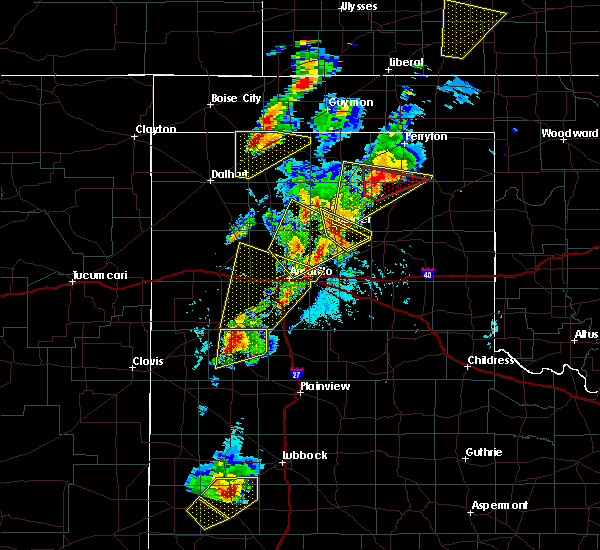 At 545 pm cdt, a severe thunderstorm was located 13 miles northeast of dimmitt, moving north at 60 mph (radar indicated). Hazards include two inch hail and 70 mph wind gusts. People and animals outdoors will be injured. expect hail damage to roofs, siding, windows, and vehicles. expect considerable tree damage. wind damage is also likely to mobile homes, roofs, and outbuildings. Locations impacted include, dimmitt, easter and nazareth. At 545 pm cdt, a severe thunderstorm was located 13 miles northeast of dimmitt, moving north at 60 mph (radar indicated). Hazards include two inch hail and 70 mph wind gusts. People and animals outdoors will be injured. expect hail damage to roofs, siding, windows, and vehicles. expect considerable tree damage. wind damage is also likely to mobile homes, roofs, and outbuildings. Locations impacted include, dimmitt, easter and nazareth.
|
| 5/23/2019 5:31 PM CDT |
 At 530 pm cdt, a severe thunderstorm was located 5 miles northwest of hart, moving north at 60 mph (radar indicated). Hazards include two inch hail and 60 mph wind gusts. People and animals outdoors will be injured. expect hail damage to roofs, siding, windows, and vehicles. expect wind damage to roofs, siding, and trees. Locations impacted include, dimmitt, hart, happy, easter and nazareth. At 530 pm cdt, a severe thunderstorm was located 5 miles northwest of hart, moving north at 60 mph (radar indicated). Hazards include two inch hail and 60 mph wind gusts. People and animals outdoors will be injured. expect hail damage to roofs, siding, windows, and vehicles. expect wind damage to roofs, siding, and trees. Locations impacted include, dimmitt, hart, happy, easter and nazareth.
|
| 5/23/2019 5:29 PM CDT |
 At 511 pm cdt, a severe thunderstorm was located 6 miles southeast of earth, moving northeast at 60 mph (radar indicated). Hazards include ping pong ball size hail and 60 mph wind gusts. People and animals outdoors will be injured. expect hail damage to roofs, siding, windows, and vehicles. Expect wind damage to roofs, siding, and trees. At 511 pm cdt, a severe thunderstorm was located 6 miles southeast of earth, moving northeast at 60 mph (radar indicated). Hazards include ping pong ball size hail and 60 mph wind gusts. People and animals outdoors will be injured. expect hail damage to roofs, siding, windows, and vehicles. Expect wind damage to roofs, siding, and trees.
|
| 5/23/2019 5:12 PM CDT |
 At 511 pm cdt, a severe thunderstorm was located 6 miles southeast of earth, moving northeast at 60 mph (radar indicated). Hazards include ping pong ball size hail and 60 mph wind gusts. People and animals outdoors will be injured. expect hail damage to roofs, siding, windows, and vehicles. Expect wind damage to roofs, siding, and trees. At 511 pm cdt, a severe thunderstorm was located 6 miles southeast of earth, moving northeast at 60 mph (radar indicated). Hazards include ping pong ball size hail and 60 mph wind gusts. People and animals outdoors will be injured. expect hail damage to roofs, siding, windows, and vehicles. Expect wind damage to roofs, siding, and trees.
|
| 5/20/2019 7:17 AM CDT |
 The national weather service in lubbock texas has issued a * severe thunderstorm warning for. eastern castro county in the panhandle of texas. northwestern swisher county in the panhandle of texas. until 745 am cdt. At 716 am cdt, a severe thunderstorm was located 5 miles southeast. The national weather service in lubbock texas has issued a * severe thunderstorm warning for. eastern castro county in the panhandle of texas. northwestern swisher county in the panhandle of texas. until 745 am cdt. At 716 am cdt, a severe thunderstorm was located 5 miles southeast.
|
| 5/8/2019 10:39 PM CDT |
 At 1039 pm cdt, severe thunderstorms were located along a line extending from 6 miles east of hereford to 9 miles east of easter to 6 miles northeast of dimmitt, moving east at 25 mph (radar indicated). Hazards include ping pong ball size hail and 60 mph wind gusts. People and animals outdoors will be injured. expect hail damage to roofs, siding, windows, and vehicles. expect wind damage to roofs, siding, and trees. Locations impacted include, dimmitt and happy. At 1039 pm cdt, severe thunderstorms were located along a line extending from 6 miles east of hereford to 9 miles east of easter to 6 miles northeast of dimmitt, moving east at 25 mph (radar indicated). Hazards include ping pong ball size hail and 60 mph wind gusts. People and animals outdoors will be injured. expect hail damage to roofs, siding, windows, and vehicles. expect wind damage to roofs, siding, and trees. Locations impacted include, dimmitt and happy.
|
| 5/8/2019 10:27 PM CDT |
 At 1027 pm cdt, severe thunderstorms were located along a line extending from 3 miles southeast of hereford to 5 miles east of easter to near dimmitt, moving east at 25 mph (radar indicated). Hazards include ping pong ball size hail and 60 mph wind gusts. People and animals outdoors will be injured. expect hail damage to roofs, siding, windows, and vehicles. Expect wind damage to roofs, siding, and trees. At 1027 pm cdt, severe thunderstorms were located along a line extending from 3 miles southeast of hereford to 5 miles east of easter to near dimmitt, moving east at 25 mph (radar indicated). Hazards include ping pong ball size hail and 60 mph wind gusts. People and animals outdoors will be injured. expect hail damage to roofs, siding, windows, and vehicles. Expect wind damage to roofs, siding, and trees.
|
| 5/8/2019 10:05 PM CDT |
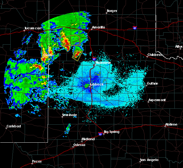 At 1005 pm cdt, a severe thunderstorm was located 8 miles west of hart, moving east at 25 mph (radar indicated). Hazards include ping pong ball size hail and 60 mph wind gusts. People and animals outdoors will be injured. expect hail damage to roofs, siding, windows, and vehicles. expect wind damage to roofs, siding, and trees. Locations impacted include, dimmitt and nazareth. At 1005 pm cdt, a severe thunderstorm was located 8 miles west of hart, moving east at 25 mph (radar indicated). Hazards include ping pong ball size hail and 60 mph wind gusts. People and animals outdoors will be injured. expect hail damage to roofs, siding, windows, and vehicles. expect wind damage to roofs, siding, and trees. Locations impacted include, dimmitt and nazareth.
|
| 5/8/2019 9:55 PM CDT |
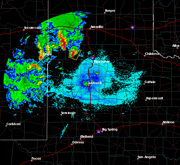 At 955 pm cdt, a severe thunderstorm was located 8 miles south of dimmitt, moving east at 20 mph (radar indicated). Hazards include 60 mph wind gusts and half dollar size hail. Hail damage to vehicles is expected. expect wind damage to roofs, siding, and trees. Locations impacted include, dimmitt and nazareth. At 955 pm cdt, a severe thunderstorm was located 8 miles south of dimmitt, moving east at 20 mph (radar indicated). Hazards include 60 mph wind gusts and half dollar size hail. Hail damage to vehicles is expected. expect wind damage to roofs, siding, and trees. Locations impacted include, dimmitt and nazareth.
|
| 5/8/2019 9:47 PM CDT |
 At 946 pm cdt, a severe thunderstorm was located 8 miles southwest of dimmitt, moving east at 25 mph (radar indicated). Hazards include 60 mph wind gusts and half dollar size hail. Hail damage to vehicles is expected. expect wind damage to roofs, siding, and trees. Locations impacted include, dimmitt and nazareth. At 946 pm cdt, a severe thunderstorm was located 8 miles southwest of dimmitt, moving east at 25 mph (radar indicated). Hazards include 60 mph wind gusts and half dollar size hail. Hail damage to vehicles is expected. expect wind damage to roofs, siding, and trees. Locations impacted include, dimmitt and nazareth.
|
| 5/8/2019 9:37 PM CDT |
 At 936 pm cdt, a severe thunderstorm was located 9 miles east of lazbuddie, or 10 miles southwest of dimmitt, moving east at 25 mph. this storm continues to exhibit good rotation above the base of the storm (radar indicated). Hazards include 60 mph wind gusts and half dollar size hail. Hail damage to vehicles is expected. expect wind damage to roofs, siding, and trees. Locations impacted include, dimmitt, earth, nazareth and springlake. At 936 pm cdt, a severe thunderstorm was located 9 miles east of lazbuddie, or 10 miles southwest of dimmitt, moving east at 25 mph. this storm continues to exhibit good rotation above the base of the storm (radar indicated). Hazards include 60 mph wind gusts and half dollar size hail. Hail damage to vehicles is expected. expect wind damage to roofs, siding, and trees. Locations impacted include, dimmitt, earth, nazareth and springlake.
|
| 5/8/2019 9:25 PM CDT |
 At 924 pm cdt, a severe thunderstorm was located 6 miles northeast of lazbuddie, or 13 miles southwest of dimmitt, moving east at 25 mph. this storm is showing strong rotation aloft though the surface layer has remained stable thus far. tornado development is possible (radar indicated). Hazards include 60 mph wind gusts and half dollar size hail. Hail damage to vehicles is expected. Expect wind damage to roofs, siding, and trees. At 924 pm cdt, a severe thunderstorm was located 6 miles northeast of lazbuddie, or 13 miles southwest of dimmitt, moving east at 25 mph. this storm is showing strong rotation aloft though the surface layer has remained stable thus far. tornado development is possible (radar indicated). Hazards include 60 mph wind gusts and half dollar size hail. Hail damage to vehicles is expected. Expect wind damage to roofs, siding, and trees.
|
| 5/4/2019 10:05 PM CDT |
 At 944 pm cdt, severe thunderstorms were located along a line extending from 3 miles west of easter to 5 miles southwest of happy, moving southeast at 30 mph (radar indicated). Hazards include 60 mph wind gusts and quarter size hail. Hail damage to vehicles is expected. expect wind damage to roofs, siding and trees. Locations impacted include, tulia, dimmitt, hart, kress, easter and claytonville. At 944 pm cdt, severe thunderstorms were located along a line extending from 3 miles west of easter to 5 miles southwest of happy, moving southeast at 30 mph (radar indicated). Hazards include 60 mph wind gusts and quarter size hail. Hail damage to vehicles is expected. expect wind damage to roofs, siding and trees. Locations impacted include, tulia, dimmitt, hart, kress, easter and claytonville.
|
| 5/4/2019 9:44 PM CDT |
 At 944 pm cdt, severe thunderstorms were located along a line extending from 3 miles west of easter to 5 miles southwest of happy, moving southeast at 30 mph (radar indicated). Hazards include 60 mph wind gusts and quarter size hail. Hail damage to vehicles is expected. expect wind damage to roofs, siding and trees. Locations impacted include, tulia, dimmitt, hart, kress, easter and claytonville. At 944 pm cdt, severe thunderstorms were located along a line extending from 3 miles west of easter to 5 miles southwest of happy, moving southeast at 30 mph (radar indicated). Hazards include 60 mph wind gusts and quarter size hail. Hail damage to vehicles is expected. expect wind damage to roofs, siding and trees. Locations impacted include, tulia, dimmitt, hart, kress, easter and claytonville.
|
| 5/4/2019 9:24 PM CDT |
 At 924 pm cdt, severe thunderstorms were located along a line extending from 7 miles west of happy to 3 miles west of summerfield, moving southeast at 35 mph (radar indicated). Hazards include 60 mph wind gusts. Expect damage to roofs. siding and trees. Locations impacted include, tulia, dimmitt, hart, kress, happy and summerfield. At 924 pm cdt, severe thunderstorms were located along a line extending from 7 miles west of happy to 3 miles west of summerfield, moving southeast at 35 mph (radar indicated). Hazards include 60 mph wind gusts. Expect damage to roofs. siding and trees. Locations impacted include, tulia, dimmitt, hart, kress, happy and summerfield.
|
| 5/4/2019 9:09 PM CDT |
 At 909 pm cdt, severe thunderstorms were located along a line extending from 6 miles southeast of buffalo lake, moving southeast at 35 mph (radar indicated). Hazards include 60 mph wind gusts and quarter size hail. Hail damage to vehicles is expected. Expect wind damage to roofs, siding and trees. At 909 pm cdt, severe thunderstorms were located along a line extending from 6 miles southeast of buffalo lake, moving southeast at 35 mph (radar indicated). Hazards include 60 mph wind gusts and quarter size hail. Hail damage to vehicles is expected. Expect wind damage to roofs, siding and trees.
|
| 3/12/2019 11:30 PM CDT | Steel building completely destroyed 1/4 mile southeast of dimmitt. power is out throughout dimmitt. time estimated from mesone in castro county TX, 0.8 miles SE of Dimmitt, TX |
| 3/9/2019 1:49 AM CST |
 At 147 am cst, severe thunderstorms with a history of wind gusts around 60 mph were located from near littlefield to near happy, moving east at 60 mph (radar and mesonet indicated). Hazards include 60 mph wind gusts. Expect damage to roofs. siding and trees. Locations impacted include, plainview, tulia, dimmitt, hale center, olton and hart. At 147 am cst, severe thunderstorms with a history of wind gusts around 60 mph were located from near littlefield to near happy, moving east at 60 mph (radar and mesonet indicated). Hazards include 60 mph wind gusts. Expect damage to roofs. siding and trees. Locations impacted include, plainview, tulia, dimmitt, hale center, olton and hart.
|
| 3/9/2019 1:30 AM CST |
 At 129 am cst, severe thunderstorms were located along a line extending from 3 miles south of sudan, moving east at 45 mph (radar indicated). Hazards include 60 mph wind gusts. Expect damage to roofs. Siding and trees. At 129 am cst, severe thunderstorms were located along a line extending from 3 miles south of sudan, moving east at 45 mph (radar indicated). Hazards include 60 mph wind gusts. Expect damage to roofs. Siding and trees.
|
| 3/9/2019 1:11 AM CST |
 At 109 am cst, severe thunderstorms were located along a line extending from near lazbuddie to easter, moving east at 55 mph. at 1255 am, a wind gust to 60 mph was measured near friona (radar and mesonet indicated). Hazards include 70 mph wind gusts. Expect considerable tree damage. damage is likely to mobile homes, roofs and outbuildings. Locations impacted include, dimmitt, friona, bovina, summerfield, lazbuddie and easter. At 109 am cst, severe thunderstorms were located along a line extending from near lazbuddie to easter, moving east at 55 mph. at 1255 am, a wind gust to 60 mph was measured near friona (radar and mesonet indicated). Hazards include 70 mph wind gusts. Expect considerable tree damage. damage is likely to mobile homes, roofs and outbuildings. Locations impacted include, dimmitt, friona, bovina, summerfield, lazbuddie and easter.
|
| 3/9/2019 12:50 AM CST |
 At 1249 am cst, severe thunderstorms were located along a line extending from 4 miles northwest of black to 3 miles northwest of lariat, moving east at 50 mph (radar indicated). Hazards include 70 mph wind gusts. Expect considerable tree damage. Damage is likely to mobile homes, roofs and outbuildings. At 1249 am cst, severe thunderstorms were located along a line extending from 4 miles northwest of black to 3 miles northwest of lariat, moving east at 50 mph (radar indicated). Hazards include 70 mph wind gusts. Expect considerable tree damage. Damage is likely to mobile homes, roofs and outbuildings.
|
| 8/14/2018 9:53 PM CDT |
 At 953 pm cdt, a severe thunderstorm was located near dimmitt, moving southwest at 15 mph (radar indicated). Hazards include 60 mph wind gusts and quarter size hail. Hail damage to vehicles is expected. expect wind damage to roofs, siding, and trees. Locations impacted include, hart. At 953 pm cdt, a severe thunderstorm was located near dimmitt, moving southwest at 15 mph (radar indicated). Hazards include 60 mph wind gusts and quarter size hail. Hail damage to vehicles is expected. expect wind damage to roofs, siding, and trees. Locations impacted include, hart.
|
| 8/14/2018 9:46 PM CDT |
 At 945 pm cdt, a severe thunderstorm was located over dimmitt, moving southwest at 15 mph (at 925 pm 62 mph wind gust was reported at dimmitt west texas mesonet station). Hazards include 60 mph wind gusts and quarter size hail. Hail damage to vehicles is expected. expect wind damage to roofs, siding, and trees. Locations impacted include, dimmitt, hart and nazareth. At 945 pm cdt, a severe thunderstorm was located over dimmitt, moving southwest at 15 mph (at 925 pm 62 mph wind gust was reported at dimmitt west texas mesonet station). Hazards include 60 mph wind gusts and quarter size hail. Hail damage to vehicles is expected. expect wind damage to roofs, siding, and trees. Locations impacted include, dimmitt, hart and nazareth.
|
| 8/14/2018 9:30 PM CDT |
 At 930 pm cdt, a severe thunderstorm was located over dimmitt, moving southwest at 15 mph (radar indicated). Hazards include 60 mph wind gusts and quarter size hail. Hail damage to vehicles is expected. expect wind damage to roofs, siding, and trees. Locations impacted include, dimmitt, hart and nazareth. At 930 pm cdt, a severe thunderstorm was located over dimmitt, moving southwest at 15 mph (radar indicated). Hazards include 60 mph wind gusts and quarter size hail. Hail damage to vehicles is expected. expect wind damage to roofs, siding, and trees. Locations impacted include, dimmitt, hart and nazareth.
|
| 8/14/2018 9:25 PM CDT | Storm damage reported in castro county TX, 2.4 miles SSW of Dimmitt, TX |
| 8/14/2018 9:16 PM CDT |
 At 916 pm cdt, a severe thunderstorm was located 4 miles northeast of dimmitt, moving southwest at 15 mph (radar indicated). Hazards include 60 mph wind gusts and quarter size hail. Hail damage to vehicles is expected. Expect wind damage to roofs, siding, and trees. At 916 pm cdt, a severe thunderstorm was located 4 miles northeast of dimmitt, moving southwest at 15 mph (radar indicated). Hazards include 60 mph wind gusts and quarter size hail. Hail damage to vehicles is expected. Expect wind damage to roofs, siding, and trees.
|
| 8/14/2018 8:47 PM CDT |
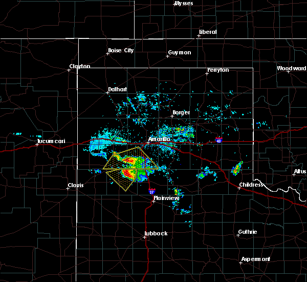 At 846 pm cdt, a severe thunderstorm was located 12 miles northeast of dimmitt, moving southwest at 10 mph (radar indicated). Hazards include 60 mph wind gusts and quarter size hail. Hail damage to vehicles is expected. Expect wind damage to roofs, siding, and trees. At 846 pm cdt, a severe thunderstorm was located 12 miles northeast of dimmitt, moving southwest at 10 mph (radar indicated). Hazards include 60 mph wind gusts and quarter size hail. Hail damage to vehicles is expected. Expect wind damage to roofs, siding, and trees.
|
| 6/22/2018 8:40 PM CDT |
 At 839 pm cdt, a severe thunderstorm was located 6 miles north of earth, moving east at 30 mph (radar indicated. at 818 pm, quarter size hail was observed 8 miles west of lazbuddie). Hazards include 60 mph wind gusts and half dollar size hail. Hail damage to vehicles is expected. expect wind damage to roofs, siding, and trees. Locations impacted include, hart, earth and springlake. At 839 pm cdt, a severe thunderstorm was located 6 miles north of earth, moving east at 30 mph (radar indicated. at 818 pm, quarter size hail was observed 8 miles west of lazbuddie). Hazards include 60 mph wind gusts and half dollar size hail. Hail damage to vehicles is expected. expect wind damage to roofs, siding, and trees. Locations impacted include, hart, earth and springlake.
|
| 6/22/2018 8:23 PM CDT |
 At 822 pm cdt, a severe thunderstorm was located near lazbuddie, or 11 miles northeast of muleshoe, moving east at 25 mph (radar indicated). Hazards include 70 mph wind gusts and half dollar size hail. Hail damage to vehicles is expected. expect considerable tree damage. wind damage is also likely to mobile homes, roofs, and outbuildings. Locations impacted include, earth, lazbuddie and springlake. At 822 pm cdt, a severe thunderstorm was located near lazbuddie, or 11 miles northeast of muleshoe, moving east at 25 mph (radar indicated). Hazards include 70 mph wind gusts and half dollar size hail. Hail damage to vehicles is expected. expect considerable tree damage. wind damage is also likely to mobile homes, roofs, and outbuildings. Locations impacted include, earth, lazbuddie and springlake.
|
| 6/22/2018 7:58 PM CDT |
 At 756 pm cdt, a severe thunderstorm was located 7 miles west of lazbuddie, or 10 miles north of muleshoe, moving east at 30 mph (radar indicated). Hazards include 70 mph wind gusts and half dollar size hail. Hail damage to vehicles is expected. expect considerable tree damage. Wind damage is also likely to mobile homes, roofs, and outbuildings. At 756 pm cdt, a severe thunderstorm was located 7 miles west of lazbuddie, or 10 miles north of muleshoe, moving east at 30 mph (radar indicated). Hazards include 70 mph wind gusts and half dollar size hail. Hail damage to vehicles is expected. expect considerable tree damage. Wind damage is also likely to mobile homes, roofs, and outbuildings.
|
| 6/22/2018 7:35 PM CDT |
 At 732 pm cdt, a severe thunderstorm was located 4 miles south of bovina, or 16 miles southwest of friona, moving east at 30 mph. an additional thunderstorm located 15 miles west of dimmitt cold produce wind gusts in excess of 60 mph (radar indicated). Hazards include 70 mph wind gusts and half dollar size hail. Hail damage to vehicles is expected. expect considerable tree damage. wind damage is also likely to mobile homes, roofs, and outbuildings. Locations impacted include, dimmitt, friona, hart, bovina, farwell, easter, lazbuddie, oklahoma lane, lariat, rhea, black and nazareth. At 732 pm cdt, a severe thunderstorm was located 4 miles south of bovina, or 16 miles southwest of friona, moving east at 30 mph. an additional thunderstorm located 15 miles west of dimmitt cold produce wind gusts in excess of 60 mph (radar indicated). Hazards include 70 mph wind gusts and half dollar size hail. Hail damage to vehicles is expected. expect considerable tree damage. wind damage is also likely to mobile homes, roofs, and outbuildings. Locations impacted include, dimmitt, friona, hart, bovina, farwell, easter, lazbuddie, oklahoma lane, lariat, rhea, black and nazareth.
|
| 6/22/2018 7:21 PM CDT |
 At 720 pm cdt, a severe thunderstorm was located near farwell, or 11 miles east of clovis, moving east at 30 mph. an additional thunderstorm capable of producing severe wind gusts was located 5 miles southeast of friona, moving east at 30 mph (radar indicated). Hazards include ping pong ball size hail and 60 mph wind gusts. People and animals outdoors will be injured. expect hail damage to roofs, siding, windows, and vehicles. expect wind damage to roofs, siding, and trees. Locations impacted include, dimmitt, friona, hart, bovina, farwell, easter, lazbuddie, oklahoma lane, lariat, rhea, black and nazareth. At 720 pm cdt, a severe thunderstorm was located near farwell, or 11 miles east of clovis, moving east at 30 mph. an additional thunderstorm capable of producing severe wind gusts was located 5 miles southeast of friona, moving east at 30 mph (radar indicated). Hazards include ping pong ball size hail and 60 mph wind gusts. People and animals outdoors will be injured. expect hail damage to roofs, siding, windows, and vehicles. expect wind damage to roofs, siding, and trees. Locations impacted include, dimmitt, friona, hart, bovina, farwell, easter, lazbuddie, oklahoma lane, lariat, rhea, black and nazareth.
|
| 6/22/2018 7:03 PM CDT |
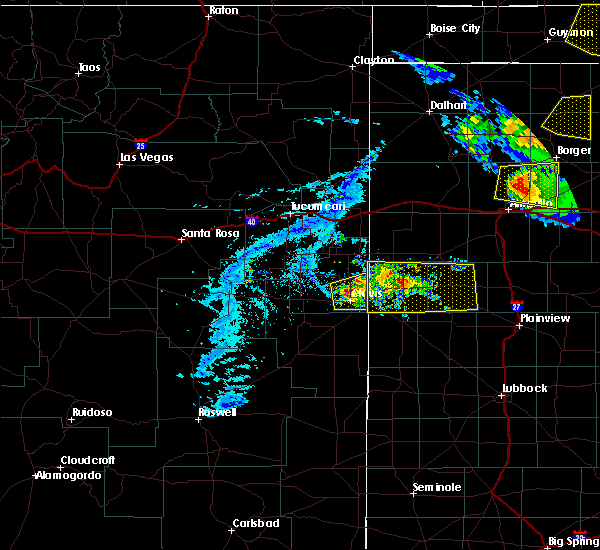 At 703 pm cdt, a severe thunderstorm was located 5 miles south of friona, moving east at 30 mph. an additional severe thunderstorm was located near clovis, also moving east at 30 mph (radar indicated). Hazards include 60 mph wind gusts and penny size hail. expect damage to roofs, siding, and trees At 703 pm cdt, a severe thunderstorm was located 5 miles south of friona, moving east at 30 mph. an additional severe thunderstorm was located near clovis, also moving east at 30 mph (radar indicated). Hazards include 60 mph wind gusts and penny size hail. expect damage to roofs, siding, and trees
|
| 6/9/2018 1:55 AM CDT | Storm damage reported in castro county TX, 2.4 miles SSW of Dimmitt, TX |
| 5/17/2018 4:35 PM CDT |
 At 434 pm cdt, a severe thunderstorm was located over hart, moving northeast at 25 mph (radar indicated). Hazards include 60 mph wind gusts and half dollar size hail. Hail damage to vehicles is expected. Expect wind damage to roofs, siding, and trees. At 434 pm cdt, a severe thunderstorm was located over hart, moving northeast at 25 mph (radar indicated). Hazards include 60 mph wind gusts and half dollar size hail. Hail damage to vehicles is expected. Expect wind damage to roofs, siding, and trees.
|
| 5/17/2018 4:31 PM CDT |
 At 430 pm cdt, a severe thunderstorm was located near hart, moving northeast at 25 mph (radar indicated). Hazards include 60 mph wind gusts and quarter size hail. Hail damage to vehicles is expected. expect wind damage to roofs, siding, and trees. Locations impacted include, dimmitt, hart and nazareth. At 430 pm cdt, a severe thunderstorm was located near hart, moving northeast at 25 mph (radar indicated). Hazards include 60 mph wind gusts and quarter size hail. Hail damage to vehicles is expected. expect wind damage to roofs, siding, and trees. Locations impacted include, dimmitt, hart and nazareth.
|
| 5/17/2018 4:19 PM CDT |
 At 417 pm cdt, a severe thunderstorm was located over dimmitt, moving northeast at 30 mph. a second severe thunderstorm was located 4 miles south of summerfield, also moving northeast at 30 mph (radar indicated). Hazards include 60 mph wind gusts and quarter size hail. Hail damage to vehicles is expected. expect wind damage to roofs, siding, and trees. Locations impacted include, dimmitt, hart, summerfield, easter and nazareth. At 417 pm cdt, a severe thunderstorm was located over dimmitt, moving northeast at 30 mph. a second severe thunderstorm was located 4 miles south of summerfield, also moving northeast at 30 mph (radar indicated). Hazards include 60 mph wind gusts and quarter size hail. Hail damage to vehicles is expected. expect wind damage to roofs, siding, and trees. Locations impacted include, dimmitt, hart, summerfield, easter and nazareth.
|
| 5/17/2018 3:53 PM CDT |
 At 352 pm cdt, a severe thunderstorm was located 7 miles northeast of lazbuddie, or 12 miles southwest of dimmitt, moving northeast at 30 mph. a second severe thunderstorm was located near friona, also moving northeast at 30 mph (radar indicated). Hazards include 60 mph wind gusts and quarter size hail. Hail damage to vehicles is expected. Expect wind damage to roofs, siding, and trees. At 352 pm cdt, a severe thunderstorm was located 7 miles northeast of lazbuddie, or 12 miles southwest of dimmitt, moving northeast at 30 mph. a second severe thunderstorm was located near friona, also moving northeast at 30 mph (radar indicated). Hazards include 60 mph wind gusts and quarter size hail. Hail damage to vehicles is expected. Expect wind damage to roofs, siding, and trees.
|
| 5/15/2018 8:37 PM CDT |
 At 835 pm cdt, severe thunderstorms were located along a line extending from near tulia to near halfway to 6 miles west of olton, moving southeast at 35 mph (radar indicated. at 832 pm a wind gust of 60 mph was reported 2 miles west northwest of olton). Hazards include 70 mph wind gusts and half dollar size hail. Hail damage to vehicles is expected. expect considerable tree damage. wind damage is also likely to mobile homes, roofs, and outbuildings. Locations impacted include, plainview, tulia, dimmitt, olton, hart, earth, kress, fieldton, halfway, nazareth, edmonson and springlake. At 835 pm cdt, severe thunderstorms were located along a line extending from near tulia to near halfway to 6 miles west of olton, moving southeast at 35 mph (radar indicated. at 832 pm a wind gust of 60 mph was reported 2 miles west northwest of olton). Hazards include 70 mph wind gusts and half dollar size hail. Hail damage to vehicles is expected. expect considerable tree damage. wind damage is also likely to mobile homes, roofs, and outbuildings. Locations impacted include, plainview, tulia, dimmitt, olton, hart, earth, kress, fieldton, halfway, nazareth, edmonson and springlake.
|
| 5/15/2018 8:17 PM CDT |
 At 816 pm cdt, severe thunderstorms were located along a line extending from 10 miles west of tulia to near hart to near earth, moving southeast at 35 mph (radar indicated. at 807 pm downed power lines were reported at flagg). Hazards include 70 mph wind gusts and half dollar size hail. Hail damage to vehicles is expected. expect considerable tree damage. Wind damage is also likely to mobile homes, roofs, and outbuildings. At 816 pm cdt, severe thunderstorms were located along a line extending from 10 miles west of tulia to near hart to near earth, moving southeast at 35 mph (radar indicated. at 807 pm downed power lines were reported at flagg). Hazards include 70 mph wind gusts and half dollar size hail. Hail damage to vehicles is expected. expect considerable tree damage. Wind damage is also likely to mobile homes, roofs, and outbuildings.
|
| 5/15/2018 8:07 PM CDT | Downed powerline near flagg in castro county TX, 9.5 miles NE of Dimmitt, TX |
| 5/15/2018 7:58 PM CDT |
 At 758 pm cdt, severe thunderstorms were located along a line extending from 12 miles northeast of dimmitt to 9 miles west of hart to 8 miles northwest of earth, moving southeast at 35 mph (radar indicated). Hazards include 70 mph wind gusts and ping pong ball size hail. People and animals outdoors will be injured. expect hail damage to roofs, siding, windows, and vehicles. expect considerable tree damage. Wind damage is also likely to mobile homes, roofs, and outbuildings. At 758 pm cdt, severe thunderstorms were located along a line extending from 12 miles northeast of dimmitt to 9 miles west of hart to 8 miles northwest of earth, moving southeast at 35 mph (radar indicated). Hazards include 70 mph wind gusts and ping pong ball size hail. People and animals outdoors will be injured. expect hail damage to roofs, siding, windows, and vehicles. expect considerable tree damage. Wind damage is also likely to mobile homes, roofs, and outbuildings.
|
| 5/15/2018 7:55 PM CDT | Storm damage reported in castro county TX, 2.4 miles SSW of Dimmitt, TX |
| 5/15/2018 7:44 PM CDT |
 At 743 pm cdt, severe thunderstorms were located along a line extending from near easter to near lazbuddie, moving southeast at 30 mph. these are very dangerous storms (radar indicated). Hazards include 80 mph wind gusts and ping pong ball size hail. Flying debris will be dangerous to those caught without shelter. mobile homes will be heavily damaged. expect considerable damage to roofs, windows, and vehicles. extensive tree damage and power outages are likely. Locations impacted include, muleshoe, dimmitt, hart, earth, sudan, summerfield, easter, lazbuddie, black, nazareth and springlake. At 743 pm cdt, severe thunderstorms were located along a line extending from near easter to near lazbuddie, moving southeast at 30 mph. these are very dangerous storms (radar indicated). Hazards include 80 mph wind gusts and ping pong ball size hail. Flying debris will be dangerous to those caught without shelter. mobile homes will be heavily damaged. expect considerable damage to roofs, windows, and vehicles. extensive tree damage and power outages are likely. Locations impacted include, muleshoe, dimmitt, hart, earth, sudan, summerfield, easter, lazbuddie, black, nazareth and springlake.
|
| 5/15/2018 7:33 PM CDT |
 At 732 pm cdt, severe thunderstorms were located along a line extending from near easter to 7 miles northeast of oklahoma lane, moving southeast at 30 mph (radar indicated. at 720 pm a 58 mph wind gusts was reported at the west texas mesonet station located 2 miles northeast of friona). Hazards include ping pong ball size hail and 60 mph wind gusts. People and animals outdoors will be injured. expect hail damage to roofs, siding, windows, and vehicles. expect wind damage to roofs, siding, and trees. Locations impacted include, muleshoe, dimmitt, friona, hart, earth, bovina, sudan, summerfield, easter, lazbuddie, black, nazareth and springlake. At 732 pm cdt, severe thunderstorms were located along a line extending from near easter to 7 miles northeast of oklahoma lane, moving southeast at 30 mph (radar indicated. at 720 pm a 58 mph wind gusts was reported at the west texas mesonet station located 2 miles northeast of friona). Hazards include ping pong ball size hail and 60 mph wind gusts. People and animals outdoors will be injured. expect hail damage to roofs, siding, windows, and vehicles. expect wind damage to roofs, siding, and trees. Locations impacted include, muleshoe, dimmitt, friona, hart, earth, bovina, sudan, summerfield, easter, lazbuddie, black, nazareth and springlake.
|
| 5/15/2018 7:18 PM CDT |
 At 717 pm cdt, severe thunderstorms were located along a line extending from near summerfield to near bovina, moving southeast at 30 mph (radar indicated). Hazards include ping pong ball size hail and 60 mph wind gusts. People and animals outdoors will be injured. expect hail damage to roofs, siding, windows, and vehicles. Expect wind damage to roofs, siding, and trees. At 717 pm cdt, severe thunderstorms were located along a line extending from near summerfield to near bovina, moving southeast at 30 mph (radar indicated). Hazards include ping pong ball size hail and 60 mph wind gusts. People and animals outdoors will be injured. expect hail damage to roofs, siding, windows, and vehicles. Expect wind damage to roofs, siding, and trees.
|
| 4/29/2018 8:50 PM CDT | Storm damage reported in castro county TX, 2.4 miles SSW of Dimmitt, TX |
| 10/6/2017 9:19 PM CDT |
 A severe thunderstorm warning remains in effect until 930 pm cdt for southwestern castro and northern lamb counties. at 918 pm cdt, a severe thunderstorm was located 10 miles west of hart, moving east at 50 mph. hazard. 60 mph wind gusts and quarter size hail. source. Radar indicated. A severe thunderstorm warning remains in effect until 930 pm cdt for southwestern castro and northern lamb counties. at 918 pm cdt, a severe thunderstorm was located 10 miles west of hart, moving east at 50 mph. hazard. 60 mph wind gusts and quarter size hail. source. Radar indicated.
|
| 10/6/2017 9:14 PM CDT |
 At 913 pm cdt, a severe thunderstorm was located 8 miles northeast of dimmitt, moving northeast at 60 mph (radar indicated). Hazards include 60 mph wind gusts and quarter size hail. Hail damage to vehicles is expected. Expect wind damage to roofs, siding, and trees. At 913 pm cdt, a severe thunderstorm was located 8 miles northeast of dimmitt, moving northeast at 60 mph (radar indicated). Hazards include 60 mph wind gusts and quarter size hail. Hail damage to vehicles is expected. Expect wind damage to roofs, siding, and trees.
|
| 10/6/2017 8:57 PM CDT |
 At 856 pm cdt, a severe thunderstorm was located 7 miles northeast of easter, or 10 miles southeast of hereford, moving northeast at 60 mph (radar indicated). Hazards include 60 mph wind gusts and quarter size hail. Hail damage to vehicles is expected. expect wind damage to roofs, siding, and trees. Locations impacted include, dimmitt, summerfield, lazbuddie and easter. At 856 pm cdt, a severe thunderstorm was located 7 miles northeast of easter, or 10 miles southeast of hereford, moving northeast at 60 mph (radar indicated). Hazards include 60 mph wind gusts and quarter size hail. Hail damage to vehicles is expected. expect wind damage to roofs, siding, and trees. Locations impacted include, dimmitt, summerfield, lazbuddie and easter.
|
| 10/6/2017 8:54 PM CDT |
 At 853 pm cdt, a severe thunderstorm was located near muleshoe, moving east at 50 mph (radar indicated). Hazards include 60 mph wind gusts and quarter size hail. Hail damage to vehicles is expected. Expect wind damage to roofs, siding, and trees. At 853 pm cdt, a severe thunderstorm was located near muleshoe, moving east at 50 mph (radar indicated). Hazards include 60 mph wind gusts and quarter size hail. Hail damage to vehicles is expected. Expect wind damage to roofs, siding, and trees.
|
| 10/6/2017 8:38 PM CDT |
 At 838 pm cdt, a severe thunderstorm was located near black, or 7 miles east of friona, moving east at 60 mph (radar indicated). Hazards include 60 mph wind gusts and quarter size hail. Hail damage to vehicles is expected. Expect wind damage to roofs, siding, and trees. At 838 pm cdt, a severe thunderstorm was located near black, or 7 miles east of friona, moving east at 60 mph (radar indicated). Hazards include 60 mph wind gusts and quarter size hail. Hail damage to vehicles is expected. Expect wind damage to roofs, siding, and trees.
|
| 7/4/2017 8:21 PM CDT |
 At 819 pm cdt, severe thunderstorms were located along a line extending from 9 miles north of hart to olton to near bula, moving east at 30 mph. at 810 pm, the west texas mesonet station at olton reported a wind gust to 62 mph. near zero visibility is also reported in spots along highway 385 near littlefield due to blowing dust (radar indicated). Hazards include 70 mph wind gusts and penny size hail. Expect considerable tree damage. damage is likely to mobile homes, roofs, and outbuildings. Locations impacted include, littlefield, muleshoe, tulia, olton, hart, earth, sudan, amherst, happy, needmore, fieldton, enochs, halfway, muleshoe wildlife refuge, bula, nazareth, edmonson and springlake. At 819 pm cdt, severe thunderstorms were located along a line extending from 9 miles north of hart to olton to near bula, moving east at 30 mph. at 810 pm, the west texas mesonet station at olton reported a wind gust to 62 mph. near zero visibility is also reported in spots along highway 385 near littlefield due to blowing dust (radar indicated). Hazards include 70 mph wind gusts and penny size hail. Expect considerable tree damage. damage is likely to mobile homes, roofs, and outbuildings. Locations impacted include, littlefield, muleshoe, tulia, olton, hart, earth, sudan, amherst, happy, needmore, fieldton, enochs, halfway, muleshoe wildlife refuge, bula, nazareth, edmonson and springlake.
|
| 7/4/2017 8:03 PM CDT |
 At 802 pm cdt, severe thunderstorms were located along a line extending from 14 miles northeast of dimmitt to 9 miles northeast of earth to near sudan, moving southeast at 30 mph (radar indicated). Hazards include 70 mph wind gusts and penny size hail. Expect considerable tree damage. damage is likely to mobile homes, roofs, and outbuildings. Locations impacted include, littlefield, muleshoe, tulia, dimmitt, olton, hart, earth, sudan, amherst, happy, needmore, fieldton, enochs, halfway, muleshoe wildlife refuge, bula, nazareth, edmonson and springlake. At 802 pm cdt, severe thunderstorms were located along a line extending from 14 miles northeast of dimmitt to 9 miles northeast of earth to near sudan, moving southeast at 30 mph (radar indicated). Hazards include 70 mph wind gusts and penny size hail. Expect considerable tree damage. damage is likely to mobile homes, roofs, and outbuildings. Locations impacted include, littlefield, muleshoe, tulia, dimmitt, olton, hart, earth, sudan, amherst, happy, needmore, fieldton, enochs, halfway, muleshoe wildlife refuge, bula, nazareth, edmonson and springlake.
|
| 7/4/2017 7:48 PM CDT |
 At 747 pm cdt, severe thunderstorms were located along a line extending from 11 miles east of easter to 6 miles north of earth to near muleshoe, moving southeast at 30 mph (radar indicated). Hazards include 70 mph wind gusts and nickel size hail. Expect considerable tree damage. Damage is likely to mobile homes, roofs, and outbuildings. At 747 pm cdt, severe thunderstorms were located along a line extending from 11 miles east of easter to 6 miles north of earth to near muleshoe, moving southeast at 30 mph (radar indicated). Hazards include 70 mph wind gusts and nickel size hail. Expect considerable tree damage. Damage is likely to mobile homes, roofs, and outbuildings.
|
| 7/4/2017 7:45 PM CDT | Measured by the texas tech west texas mesone in castro county TX, 2.4 miles SSW of Dimmitt, TX |
| 7/4/2017 7:42 PM CDT |
 At 741 pm cdt, severe thunderstorms were located along a line extending from near easter to 8 miles north of earth, moving southeast at 40 mph. the west texas mesonet site in dimmitt reported wind gusts to 70 mph and local media reported wind gusts to 70 mph in springlake earth with near zero visibility. these are very dangerous storms (radar indicated). Hazards include 80 mph wind gusts and quarter size hail. Flying debris will be dangerous to those caught without shelter. mobile homes will be heavily damaged. expect considerable damage to roofs, windows, and vehicles. extensive tree damage and power outages are likely. Locations impacted include, dimmitt, earth, summerfield, lazbuddie, easter and springlake. At 741 pm cdt, severe thunderstorms were located along a line extending from near easter to 8 miles north of earth, moving southeast at 40 mph. the west texas mesonet site in dimmitt reported wind gusts to 70 mph and local media reported wind gusts to 70 mph in springlake earth with near zero visibility. these are very dangerous storms (radar indicated). Hazards include 80 mph wind gusts and quarter size hail. Flying debris will be dangerous to those caught without shelter. mobile homes will be heavily damaged. expect considerable damage to roofs, windows, and vehicles. extensive tree damage and power outages are likely. Locations impacted include, dimmitt, earth, summerfield, lazbuddie, easter and springlake.
|
| 7/4/2017 7:35 PM CDT | Measured by the texas tech west texas mesone in castro county TX, 2.4 miles SSW of Dimmitt, TX |
| 7/4/2017 7:35 PM CDT |
 At 734 pm cdt, severe thunderstorms were located along a line extending from easter to 6 miles east of lazbuddie, moving east southeast at 35 mph (radar indicated). Hazards include 70 mph wind gusts and quarter size hail. Hail damage to vehicles is expected. expect considerable tree damage. wind damage is also likely to mobile homes, roofs, and outbuildings. Locations impacted include, dimmitt, earth, summerfield, lazbuddie, easter and springlake. At 734 pm cdt, severe thunderstorms were located along a line extending from easter to 6 miles east of lazbuddie, moving east southeast at 35 mph (radar indicated). Hazards include 70 mph wind gusts and quarter size hail. Hail damage to vehicles is expected. expect considerable tree damage. wind damage is also likely to mobile homes, roofs, and outbuildings. Locations impacted include, dimmitt, earth, summerfield, lazbuddie, easter and springlake.
|
| 7/4/2017 7:14 PM CDT |
 At 714 pm cdt, severe thunderstorms were located along a line extending from near summerfield to near lazbuddie, moving southeast at 35 mph (radar indicated). Hazards include 70 mph wind gusts and quarter size hail. Hail damage to vehicles is expected. expect considerable tree damage. Wind damage is also likely to mobile homes, roofs, and outbuildings. At 714 pm cdt, severe thunderstorms were located along a line extending from near summerfield to near lazbuddie, moving southeast at 35 mph (radar indicated). Hazards include 70 mph wind gusts and quarter size hail. Hail damage to vehicles is expected. expect considerable tree damage. Wind damage is also likely to mobile homes, roofs, and outbuildings.
|
| 7/3/2017 6:10 PM CDT | Measured by the texas tech university west texas mesonet in castro county TX, 2.4 miles SSW of Dimmitt, TX |
| 7/1/2017 11:10 PM CDT |
 At 1110 pm cdt, severe thunderstorms were located along a line extending from near hereford to progress to near causey, moving southeast at 30 mph (radar indicated). Hazards include 70 mph wind gusts. Expect considerable tree damage. damage is likely to mobile homes, roofs, and outbuildings. Locations impacted include, muleshoe, dimmitt, friona, bovina, farwell, sudan, summerfield, needmore, lazbuddie, easter, oklahoma lane, progress, lariat, enochs, west camp, black, rhea, muleshoe wildlife refuge, bula and maple. At 1110 pm cdt, severe thunderstorms were located along a line extending from near hereford to progress to near causey, moving southeast at 30 mph (radar indicated). Hazards include 70 mph wind gusts. Expect considerable tree damage. damage is likely to mobile homes, roofs, and outbuildings. Locations impacted include, muleshoe, dimmitt, friona, bovina, farwell, sudan, summerfield, needmore, lazbuddie, easter, oklahoma lane, progress, lariat, enochs, west camp, black, rhea, muleshoe wildlife refuge, bula and maple.
|
| 7/1/2017 10:48 PM CDT |
 At 1047 pm cdt, severe thunderstorms were located along a line extending from 7 miles northeast of bootleg to near farwell to arch, moving east at 30 mph (radar indicated). Hazards include 70 mph wind gusts. Expect considerable tree damage. Damage is likely to mobile homes, roofs, and outbuildings. At 1047 pm cdt, severe thunderstorms were located along a line extending from 7 miles northeast of bootleg to near farwell to arch, moving east at 30 mph (radar indicated). Hazards include 70 mph wind gusts. Expect considerable tree damage. Damage is likely to mobile homes, roofs, and outbuildings.
|
| 6/25/2017 10:59 PM CDT |
 At 1042 pm cdt, a severe thunderstorm was located near easter, or 11 miles northwest of dimmitt, moving south at 15 mph (radar indicated). Hazards include 70 mph wind gusts and quarter size hail. Hail damage to vehicles is expected. expect considerable tree damage. Wind damage is also likely to mobile homes, roofs, and outbuildings. At 1042 pm cdt, a severe thunderstorm was located near easter, or 11 miles northwest of dimmitt, moving south at 15 mph (radar indicated). Hazards include 70 mph wind gusts and quarter size hail. Hail damage to vehicles is expected. expect considerable tree damage. Wind damage is also likely to mobile homes, roofs, and outbuildings.
|
| 6/25/2017 10:42 PM CDT |
 At 1042 pm cdt, a severe thunderstorm was located near easter, or 11 miles northwest of dimmitt, moving south at 15 mph (radar indicated). Hazards include 70 mph wind gusts and quarter size hail. Hail damage to vehicles is expected. expect considerable tree damage. Wind damage is also likely to mobile homes, roofs, and outbuildings. At 1042 pm cdt, a severe thunderstorm was located near easter, or 11 miles northwest of dimmitt, moving south at 15 mph (radar indicated). Hazards include 70 mph wind gusts and quarter size hail. Hail damage to vehicles is expected. expect considerable tree damage. Wind damage is also likely to mobile homes, roofs, and outbuildings.
|
| 6/21/2017 9:20 PM CDT |
 At 918 pm cdt, severe thunderstorms were located along a line extending from 7 miles east of easter to 11 miles west of needmore, moving southeast at 25 mph (radar indicated). Hazards include 60 mph wind gusts. Expect damage to roofs, siding, and trees. Locations impacted include, muleshoe, dimmitt, earth, needmore, lazbuddie, easter, progress, muleshoe wildlife refuge, enochs and maple. At 918 pm cdt, severe thunderstorms were located along a line extending from 7 miles east of easter to 11 miles west of needmore, moving southeast at 25 mph (radar indicated). Hazards include 60 mph wind gusts. Expect damage to roofs, siding, and trees. Locations impacted include, muleshoe, dimmitt, earth, needmore, lazbuddie, easter, progress, muleshoe wildlife refuge, enochs and maple.
|
| 6/21/2017 9:10 PM CDT |
 At 909 pm cdt, severe thunderstorms were located along a line extending from 7 miles northeast of easter to 10 miles east of arch, moving southeast at 25 mph (radar indicated). Hazards include 70 mph wind gusts. Expect considerable tree damage. damage is likely to mobile homes, roofs, and outbuildings. Locations impacted include, muleshoe, dimmitt, earth, needmore, lazbuddie, easter, progress, lariat, muleshoe wildlife refuge, enochs and maple. At 909 pm cdt, severe thunderstorms were located along a line extending from 7 miles northeast of easter to 10 miles east of arch, moving southeast at 25 mph (radar indicated). Hazards include 70 mph wind gusts. Expect considerable tree damage. damage is likely to mobile homes, roofs, and outbuildings. Locations impacted include, muleshoe, dimmitt, earth, needmore, lazbuddie, easter, progress, lariat, muleshoe wildlife refuge, enochs and maple.
|
| 6/21/2017 8:43 PM CDT |
 At 841 pm cdt, severe thunderstorms were located along a line extending from near black to 6 miles southwest of west camp, moving southeast at 25 mph. these storms have produced measured wind gusts to 65 mph near friona at 825 pm (radar indicated). Hazards include 70 mph wind gusts and quarter size hail. Hail damage to vehicles is expected. expect considerable tree damage. Wind damage is also likely to mobile homes, roofs, and outbuildings. At 841 pm cdt, severe thunderstorms were located along a line extending from near black to 6 miles southwest of west camp, moving southeast at 25 mph. these storms have produced measured wind gusts to 65 mph near friona at 825 pm (radar indicated). Hazards include 70 mph wind gusts and quarter size hail. Hail damage to vehicles is expected. expect considerable tree damage. Wind damage is also likely to mobile homes, roofs, and outbuildings.
|
| 6/8/2017 9:20 PM CDT |
 At 920 pm cdt, severe thunderstorms were located along a line extending from 6 miles east of dimmitt to near earth, moving southeast at 30 mph (radar indicated). Hazards include 60 mph wind gusts. Expect damage to roofs. siding and trees. Locations impacted include, dimmitt, hart and nazareth. At 920 pm cdt, severe thunderstorms were located along a line extending from 6 miles east of dimmitt to near earth, moving southeast at 30 mph (radar indicated). Hazards include 60 mph wind gusts. Expect damage to roofs. siding and trees. Locations impacted include, dimmitt, hart and nazareth.
|
| 6/8/2017 8:54 PM CDT |
 At 854 pm cdt, severe thunderstorms were located along a line extending from near easter to 7 miles northeast of lazbuddie, moving southeast at 30 mph (radar indicated). Hazards include 60 mph wind gusts and penny size hail. Expect damage to roofs. Siding and trees. At 854 pm cdt, severe thunderstorms were located along a line extending from near easter to 7 miles northeast of lazbuddie, moving southeast at 30 mph (radar indicated). Hazards include 60 mph wind gusts and penny size hail. Expect damage to roofs. Siding and trees.
|
| 5/10/2017 2:40 AM CDT |
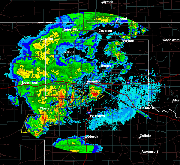 At 240 am cdt, a severe thunderstorm was located near summerfield, moving northeast at 35 mph (radar indicated). Hazards include 60 mph wind gusts and half dollar size hail. Hail damage to vehicles is expected. expect wind damage to roofs, siding and trees. Locations impacted include, summerfield, easter and black. At 240 am cdt, a severe thunderstorm was located near summerfield, moving northeast at 35 mph (radar indicated). Hazards include 60 mph wind gusts and half dollar size hail. Hail damage to vehicles is expected. expect wind damage to roofs, siding and trees. Locations impacted include, summerfield, easter and black.
|
| 5/10/2017 2:26 AM CDT |
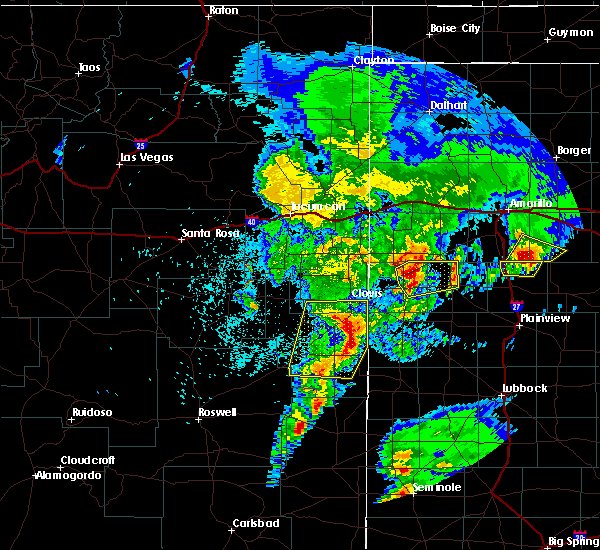 At 225 am cdt, a severe thunderstorm was located near black, moving northeast at 40 mph (radar indicated). Hazards include 60 mph wind gusts and half dollar size hail. Hail damage to vehicles is expected. expect wind damage to roofs, siding and trees. Locations impacted include, friona, summerfield, easter and black. At 225 am cdt, a severe thunderstorm was located near black, moving northeast at 40 mph (radar indicated). Hazards include 60 mph wind gusts and half dollar size hail. Hail damage to vehicles is expected. expect wind damage to roofs, siding and trees. Locations impacted include, friona, summerfield, easter and black.
|
| 5/10/2017 2:13 AM CDT |
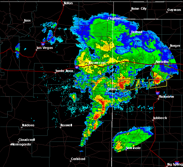 At 212 am cdt, a severe thunderstorm was located near bovina, moving northeast at 40 mph (radar indicated). Hazards include ping pong ball size hail and 60 mph wind gusts. People and animals outdoors will be injured. expect hail damage to roofs, siding, windows and vehicles. Expect wind damage to roofs, siding and trees. At 212 am cdt, a severe thunderstorm was located near bovina, moving northeast at 40 mph (radar indicated). Hazards include ping pong ball size hail and 60 mph wind gusts. People and animals outdoors will be injured. expect hail damage to roofs, siding, windows and vehicles. Expect wind damage to roofs, siding and trees.
|
| 5/10/2017 1:15 AM CDT |
 At 114 am cdt, a severe thunderstorm was located near hart, moving northeast at 20 mph (radar indicated). Hazards include two inch hail and 60 mph wind gusts. People and animals outdoors will be injured. expect hail damage to roofs, siding, windows and vehicles. expect wind damage to roofs, siding and trees. Locations impacted include, hart and nazareth. At 114 am cdt, a severe thunderstorm was located near hart, moving northeast at 20 mph (radar indicated). Hazards include two inch hail and 60 mph wind gusts. People and animals outdoors will be injured. expect hail damage to roofs, siding, windows and vehicles. expect wind damage to roofs, siding and trees. Locations impacted include, hart and nazareth.
|
| 5/10/2017 1:05 AM CDT |
 At 104 am cdt, a severe thunderstorm was located about 12 miles south of dimmitt, moving northeast at 30 mph (radar indicated). Hazards include two inch hail and 60 mph wind gusts. People and animals outdoors will be injured. expect hail damage to roofs, siding, windows and vehicles. expect wind damage to roofs, siding and trees. Locations impacted include, hart and nazareth. At 104 am cdt, a severe thunderstorm was located about 12 miles south of dimmitt, moving northeast at 30 mph (radar indicated). Hazards include two inch hail and 60 mph wind gusts. People and animals outdoors will be injured. expect hail damage to roofs, siding, windows and vehicles. expect wind damage to roofs, siding and trees. Locations impacted include, hart and nazareth.
|
| 5/10/2017 12:55 AM CDT |
 At 1254 am cdt, a severe thunderstorm was located 7 miles north of earth, moving northeast at 35 mph (radar indicated). Hazards include two inch hail and 60 mph wind gusts. People and animals outdoors will be injured. expect hail damage to roofs, siding, windows and vehicles. Expect wind damage to roofs, siding and trees. At 1254 am cdt, a severe thunderstorm was located 7 miles north of earth, moving northeast at 35 mph (radar indicated). Hazards include two inch hail and 60 mph wind gusts. People and animals outdoors will be injured. expect hail damage to roofs, siding, windows and vehicles. Expect wind damage to roofs, siding and trees.
|
| 4/14/2017 11:30 PM CDT |
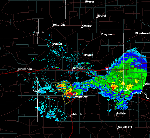 At 1129 pm cdt, a severe thunderstorm was located near dimmitt, moving east at 20 mph (radar indicated). Hazards include 60 mph wind gusts and half dollar size hail. Hail damage to vehicles is expected. Expect wind damage to roofs, siding, and trees. At 1129 pm cdt, a severe thunderstorm was located near dimmitt, moving east at 20 mph (radar indicated). Hazards include 60 mph wind gusts and half dollar size hail. Hail damage to vehicles is expected. Expect wind damage to roofs, siding, and trees.
|
| 4/14/2017 10:15 PM CDT |
 At 1014 pm cdt, a severe thunderstorm was located 7 miles north of hart, and is nearly stationary. public reported golf ball size hail in nazareth at 955pm. there are indications of low level rotation between nazareth and hart (radar indicated). Hazards include golf ball size hail and 60 mph wind gusts. People and animals outdoors will be injured. expect hail damage to roofs, siding, windows, and vehicles. expect wind damage to roofs, siding, and trees. Locations impacted include, dimmitt and nazareth. At 1014 pm cdt, a severe thunderstorm was located 7 miles north of hart, and is nearly stationary. public reported golf ball size hail in nazareth at 955pm. there are indications of low level rotation between nazareth and hart (radar indicated). Hazards include golf ball size hail and 60 mph wind gusts. People and animals outdoors will be injured. expect hail damage to roofs, siding, windows, and vehicles. expect wind damage to roofs, siding, and trees. Locations impacted include, dimmitt and nazareth.
|
| 4/14/2017 10:04 PM CDT |
 At 1003 pm cdt, a severe thunderstorm was located 7 miles north of hart, and is nearly stationary. a circulation was noted between nazareth and hart with a potential funnel cloud (radar indicated). Hazards include ping pong ball size hail and 60 mph wind gusts. People and animals outdoors will be injured. expect hail damage to roofs, siding, windows, and vehicles. expect wind damage to roofs, siding, and trees. Locations impacted include, dimmitt and nazareth. At 1003 pm cdt, a severe thunderstorm was located 7 miles north of hart, and is nearly stationary. a circulation was noted between nazareth and hart with a potential funnel cloud (radar indicated). Hazards include ping pong ball size hail and 60 mph wind gusts. People and animals outdoors will be injured. expect hail damage to roofs, siding, windows, and vehicles. expect wind damage to roofs, siding, and trees. Locations impacted include, dimmitt and nazareth.
|
| 4/14/2017 9:55 PM CDT |
 At 955 pm cdt, a severe thunderstorm was located 10 miles east of dimmitt, moving east at 15 mph (radar indicated). Hazards include ping pong ball size hail and 60 mph wind gusts. People and animals outdoors will be injured. expect hail damage to roofs, siding, windows, and vehicles. Expect wind damage to roofs, siding, and trees. At 955 pm cdt, a severe thunderstorm was located 10 miles east of dimmitt, moving east at 15 mph (radar indicated). Hazards include ping pong ball size hail and 60 mph wind gusts. People and animals outdoors will be injured. expect hail damage to roofs, siding, windows, and vehicles. Expect wind damage to roofs, siding, and trees.
|
| 4/14/2017 9:51 PM CDT |
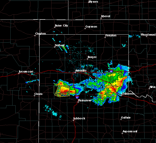 At 950 pm cdt, a severe thunderstorm was located 8 miles east of dimmitt, moving east at 15 mph (trained weather spotters). Hazards include ping pong ball size hail. People and animals outdoors will be injured. expect damage to roofs, siding, windows, and vehicles. Locations impacted include, dimmitt, easter and nazareth. At 950 pm cdt, a severe thunderstorm was located 8 miles east of dimmitt, moving east at 15 mph (trained weather spotters). Hazards include ping pong ball size hail. People and animals outdoors will be injured. expect damage to roofs, siding, windows, and vehicles. Locations impacted include, dimmitt, easter and nazareth.
|
| 4/14/2017 9:29 PM CDT |
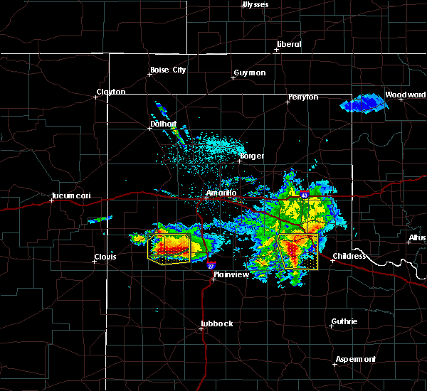 At 927 pm cdt, a severe thunderstorm was located 9 miles east of dimmitt, moving east at 10 mph. this storm has a history of large hail and remains in an environment favorable for producing tornadoes. baseball size hail was reported at 920pm just north of dimmitt. this is a very dangerous storm (trained weather spotters). Hazards include baseball size hail. People and animals outdoors will be severely injured. Expect shattered windows, extensive damage to roofs, siding, and vehicles. At 927 pm cdt, a severe thunderstorm was located 9 miles east of dimmitt, moving east at 10 mph. this storm has a history of large hail and remains in an environment favorable for producing tornadoes. baseball size hail was reported at 920pm just north of dimmitt. this is a very dangerous storm (trained weather spotters). Hazards include baseball size hail. People and animals outdoors will be severely injured. Expect shattered windows, extensive damage to roofs, siding, and vehicles.
|
| 4/14/2017 9:20 PM CDT | Baseball sized hail reported 1.4 miles S of Dimmitt, TX |
| 4/14/2017 9:16 PM CDT |
 At 913 pm cdt, a severe thunderstorm was located near dimmitt, and is slowly drifting east. there are two areas of circulation with these storms. the first is located about 5 miles west southwest of dimmitt. the second was located about 7 mile southeast of dimmitt. these storms could produce a tornado with little warning (radar indicated). Hazards include two inch hail and 60 mph wind gusts. People and animals outdoors will be injured. expect hail damage to roofs, siding, windows, and vehicles. expect wind damage to roofs, siding, and trees. Locations impacted include, dimmitt, summerfield, easter and nazareth. At 913 pm cdt, a severe thunderstorm was located near dimmitt, and is slowly drifting east. there are two areas of circulation with these storms. the first is located about 5 miles west southwest of dimmitt. the second was located about 7 mile southeast of dimmitt. these storms could produce a tornado with little warning (radar indicated). Hazards include two inch hail and 60 mph wind gusts. People and animals outdoors will be injured. expect hail damage to roofs, siding, windows, and vehicles. expect wind damage to roofs, siding, and trees. Locations impacted include, dimmitt, summerfield, easter and nazareth.
|
| 4/14/2017 9:09 PM CDT |
 At 906 pm cdt, a severe thunderstorm was located near easter, or 9 miles west of dimmitt, moving east at 10 mph. a second storm was located 5 miles northeast of dimmit. both storms are capable of 2 inch plus hail. in addition, these storms both exhibit low level circulation close to highway 86 east and west of dimmitt (radar indicated). Hazards include two inch hail and 60 mph wind gusts. People and animals outdoors will be injured. expect hail damage to roofs, siding, windows, and vehicles. Expect wind damage to roofs, siding, and trees. At 906 pm cdt, a severe thunderstorm was located near easter, or 9 miles west of dimmitt, moving east at 10 mph. a second storm was located 5 miles northeast of dimmit. both storms are capable of 2 inch plus hail. in addition, these storms both exhibit low level circulation close to highway 86 east and west of dimmitt (radar indicated). Hazards include two inch hail and 60 mph wind gusts. People and animals outdoors will be injured. expect hail damage to roofs, siding, windows, and vehicles. Expect wind damage to roofs, siding, and trees.
|
| 4/14/2017 8:58 PM CDT |
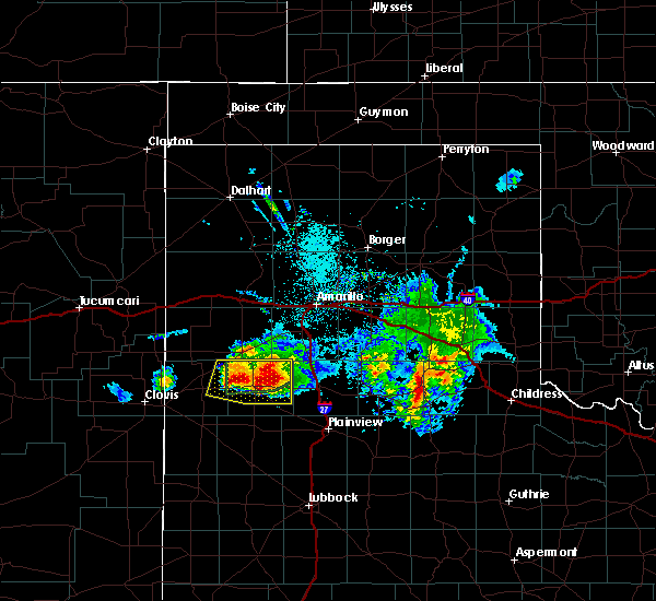 At 856 pm cdt, a severe thunderstorm was located near dimmitt, moving east at 10 mph. a second severe storm was located just north of highway 86 near the parmer and castro county line. both storms are exhibiting low level rotation. the environment continues to be favorable for tornado development (radar indicated). Hazards include two inch hail and 60 mph wind gusts. People and animals outdoors will be injured. expect hail damage to roofs, siding, windows, and vehicles. Expect wind damage to roofs, siding, and trees. At 856 pm cdt, a severe thunderstorm was located near dimmitt, moving east at 10 mph. a second severe storm was located just north of highway 86 near the parmer and castro county line. both storms are exhibiting low level rotation. the environment continues to be favorable for tornado development (radar indicated). Hazards include two inch hail and 60 mph wind gusts. People and animals outdoors will be injured. expect hail damage to roofs, siding, windows, and vehicles. Expect wind damage to roofs, siding, and trees.
|
| 4/14/2017 8:50 PM CDT |
 At 847 pm cdt, a severe thunderstorm capable of producing a tornado was located near dimmitt, moving east at 10 mph. the greatest area of concern is about 3 miles southeast of dimmitt. a second area of rotation was located about 12 miles west of dimmitt. these storms continue to evolve and require constant monitoring (radar indicated rotation). Hazards include tornado and ping pong ball size hail. Flying debris will be dangerous to those caught without shelter. mobile homes will be damaged or destroyed. damage to roofs, windows, and vehicles will occur. tree damage is likely. Locations impacted include, dimmitt, easter and nazareth. At 847 pm cdt, a severe thunderstorm capable of producing a tornado was located near dimmitt, moving east at 10 mph. the greatest area of concern is about 3 miles southeast of dimmitt. a second area of rotation was located about 12 miles west of dimmitt. these storms continue to evolve and require constant monitoring (radar indicated rotation). Hazards include tornado and ping pong ball size hail. Flying debris will be dangerous to those caught without shelter. mobile homes will be damaged or destroyed. damage to roofs, windows, and vehicles will occur. tree damage is likely. Locations impacted include, dimmitt, easter and nazareth.
|
| 4/14/2017 8:39 PM CDT | Quarter sized hail reported 0.7 miles S of Dimmitt, TX, nickel to quarter size hail falling in dimmitt currently. |
| 4/14/2017 8:36 PM CDT |
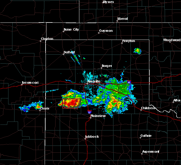 At 835 pm cdt, a severe thunderstorm capable of producing a tornado was located near dimmitt, moving east at 15 mph. the circulation was located about 2 miles south southeast of dimmitt. an additional area of concern was located about 8 miles northeast of dimmitt (radar indicated rotation). Hazards include tornado and golf ball size hail. Flying debris will be dangerous to those caught without shelter. mobile homes will be damaged or destroyed. damage to roofs, windows, and vehicles will occur. tree damage is likely. This tornadic thunderstorm will remain over mainly rural areas of northern castro county, including the following locations: nazareth. At 835 pm cdt, a severe thunderstorm capable of producing a tornado was located near dimmitt, moving east at 15 mph. the circulation was located about 2 miles south southeast of dimmitt. an additional area of concern was located about 8 miles northeast of dimmitt (radar indicated rotation). Hazards include tornado and golf ball size hail. Flying debris will be dangerous to those caught without shelter. mobile homes will be damaged or destroyed. damage to roofs, windows, and vehicles will occur. tree damage is likely. This tornadic thunderstorm will remain over mainly rural areas of northern castro county, including the following locations: nazareth.
|
| 4/14/2017 8:30 PM CDT |
 At 829 pm cdt, a severe thunderstorm capable of producing a tornado was located over dimmitt, moving northeast at 10 mph (radar indicated rotation). Hazards include tornado and half dollar size hail. Flying debris will be dangerous to those caught without shelter. mobile homes will be damaged or destroyed. damage to roofs, windows, and vehicles will occur. tree damage is likely. this dangerous storm will be near, dimmitt around 850 pm cdt. easter around 900 pm cdt. Other locations impacted by this tornadic thunderstorm include nazareth. At 829 pm cdt, a severe thunderstorm capable of producing a tornado was located over dimmitt, moving northeast at 10 mph (radar indicated rotation). Hazards include tornado and half dollar size hail. Flying debris will be dangerous to those caught without shelter. mobile homes will be damaged or destroyed. damage to roofs, windows, and vehicles will occur. tree damage is likely. this dangerous storm will be near, dimmitt around 850 pm cdt. easter around 900 pm cdt. Other locations impacted by this tornadic thunderstorm include nazareth.
|
| 4/14/2017 8:16 PM CDT | Power pole snapped about 10 feet above the ground. the time of damage is unknow in castro county TX, 1.7 miles SE of Dimmitt, TX |
| 4/14/2017 8:16 PM CDT |
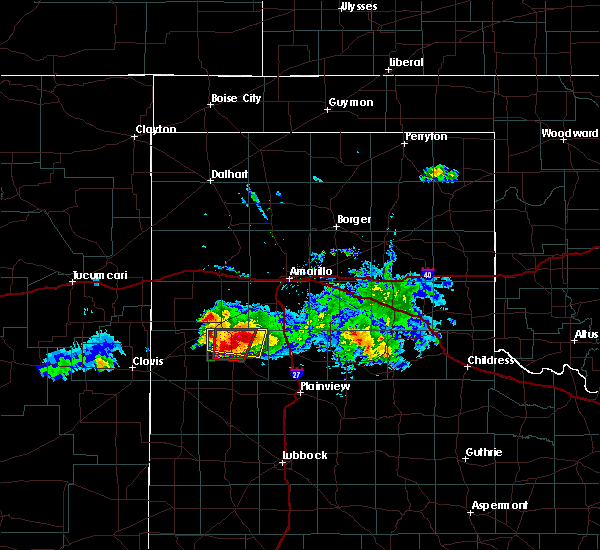 At 815 pm cdt, a confirmed tornado was located 10 miles east of easter, or 11 miles northeast of dimmitt, moving northeast at 10 mph. there is also a second circulation 4 miles west of dimmitt that has produced a tornado (weather spotters confirmed tornado). Hazards include damaging tornado and ping pong ball size hail. Flying debris will be dangerous to those caught without shelter. mobile homes will be damaged or destroyed. damage to roofs, windows, and vehicles will occur. tree damage is likely. Locations impacted include, dimmitt and easter. At 815 pm cdt, a confirmed tornado was located 10 miles east of easter, or 11 miles northeast of dimmitt, moving northeast at 10 mph. there is also a second circulation 4 miles west of dimmitt that has produced a tornado (weather spotters confirmed tornado). Hazards include damaging tornado and ping pong ball size hail. Flying debris will be dangerous to those caught without shelter. mobile homes will be damaged or destroyed. damage to roofs, windows, and vehicles will occur. tree damage is likely. Locations impacted include, dimmitt and easter.
|
| 4/14/2017 8:13 PM CDT |
 At 812 pm cdt, a confirmed tornado was located 9 miles east of easter, or 9 miles northeast of dimmitt, moving northeast at 35 mph. there is also a second circulation 4 miles west of dimmitt which has produced a tornado (weather spotters confirmed tornado). Hazards include damaging tornado and ping pong ball size hail. Flying debris will be dangerous to those caught without shelter. mobile homes will be damaged or destroyed. damage to roofs, windows, and vehicles will occur. tree damage is likely. This tornadic thunderstorm will remain over mainly rural areas of northwestern castro county. At 812 pm cdt, a confirmed tornado was located 9 miles east of easter, or 9 miles northeast of dimmitt, moving northeast at 35 mph. there is also a second circulation 4 miles west of dimmitt which has produced a tornado (weather spotters confirmed tornado). Hazards include damaging tornado and ping pong ball size hail. Flying debris will be dangerous to those caught without shelter. mobile homes will be damaged or destroyed. damage to roofs, windows, and vehicles will occur. tree damage is likely. This tornadic thunderstorm will remain over mainly rural areas of northwestern castro county.
|
| 4/14/2017 8:06 PM CDT |
 At 805 pm cdt, a confirmed tornado was located 6 miles west of dimmitt, moving northeast at 20 mph (weather spotters confirmed tornado). Hazards include damaging tornado and tennis ball size hail. Flying debris will be dangerous to those caught without shelter. mobile homes will be damaged or destroyed. damage to roofs, windows, and vehicles will occur. tree damage is likely. Locations impacted include, dimmitt and easter. At 805 pm cdt, a confirmed tornado was located 6 miles west of dimmitt, moving northeast at 20 mph (weather spotters confirmed tornado). Hazards include damaging tornado and tennis ball size hail. Flying debris will be dangerous to those caught without shelter. mobile homes will be damaged or destroyed. damage to roofs, windows, and vehicles will occur. tree damage is likely. Locations impacted include, dimmitt and easter.
|
| 4/14/2017 7:58 PM CDT |
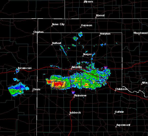 At 756 pm cdt, a severe thunderstorm capable of producing a tornado was located near easter, or near dimmitt, moving northeast at 20 mph. new circulation has developed 5 miles northwest of dimmitt in addition to the originally warned circulation 7 miles northeast of dimmitt (radar indicated rotation). Hazards include tornado and tennis ball size hail. Flying debris will be dangerous to those caught without shelter. mobile homes will be damaged or destroyed. damage to roofs, windows, and vehicles will occur. tree damage is likely. Locations impacted include, dimmitt and easter. At 756 pm cdt, a severe thunderstorm capable of producing a tornado was located near easter, or near dimmitt, moving northeast at 20 mph. new circulation has developed 5 miles northwest of dimmitt in addition to the originally warned circulation 7 miles northeast of dimmitt (radar indicated rotation). Hazards include tornado and tennis ball size hail. Flying debris will be dangerous to those caught without shelter. mobile homes will be damaged or destroyed. damage to roofs, windows, and vehicles will occur. tree damage is likely. Locations impacted include, dimmitt and easter.
|
| 4/14/2017 7:53 PM CDT |
 At 752 pm cdt, a severe thunderstorm capable of producing a tornado was located 4 miles north of dimmitt, moving north at 10 mph. a brief tornado was reported from storm chasers in the area (radar indicated rotation). Hazards include tornado and tennis ball size hail. Flying debris will be dangerous to those caught without shelter. mobile homes will be damaged or destroyed. damage to roofs, windows, and vehicles will occur. Tree damage is likely. At 752 pm cdt, a severe thunderstorm capable of producing a tornado was located 4 miles north of dimmitt, moving north at 10 mph. a brief tornado was reported from storm chasers in the area (radar indicated rotation). Hazards include tornado and tennis ball size hail. Flying debris will be dangerous to those caught without shelter. mobile homes will be damaged or destroyed. damage to roofs, windows, and vehicles will occur. Tree damage is likely.
|
| 4/14/2017 7:50 PM CDT | West texas mesonet measured a southerly inflow wind gust to 60 mp in castro county TX, 2.4 miles SSW of Dimmitt, TX |
| 4/14/2017 7:44 PM CDT |
 At 743 pm cdt, a severe thunderstorm capable of producing a tornado was located near dimmitt, moving north at 10 mph. circulation is currently just north of dimmitt proper (radar indicated rotation). Hazards include tornado and tennis ball size hail. Flying debris will be dangerous to those caught without shelter. mobile homes will be damaged or destroyed. damage to roofs, windows, and vehicles will occur. Tree damage is likely. At 743 pm cdt, a severe thunderstorm capable of producing a tornado was located near dimmitt, moving north at 10 mph. circulation is currently just north of dimmitt proper (radar indicated rotation). Hazards include tornado and tennis ball size hail. Flying debris will be dangerous to those caught without shelter. mobile homes will be damaged or destroyed. damage to roofs, windows, and vehicles will occur. Tree damage is likely.
|
| 4/14/2017 7:41 PM CDT |
 At 741 pm cdt, a severe thunderstorm was located near easter, or near dimmitt, moving north at 10 mph. this is a very dangerous storm (radar indicated). Hazards include three inch hail and 60 mph wind gusts. People and animals outdoors will be severely injured. Expect shattered windows, extensive damage to roofs, siding, and vehicles. At 741 pm cdt, a severe thunderstorm was located near easter, or near dimmitt, moving north at 10 mph. this is a very dangerous storm (radar indicated). Hazards include three inch hail and 60 mph wind gusts. People and animals outdoors will be severely injured. Expect shattered windows, extensive damage to roofs, siding, and vehicles.
|
| 4/14/2017 7:32 PM CDT |
 At 731 pm cdt, a severe thunderstorm was located near easter, or 7 miles north of dimmitt, moving northeast at 15 mph. this is a very dangerous storm (radar indicated). Hazards include three inch hail and 60 mph wind gusts. People and animals outdoors will be severely injured. expect shattered windows, extensive damage to roofs, siding, and vehicles. Locations impacted include, dimmitt, summerfield and easter. At 731 pm cdt, a severe thunderstorm was located near easter, or 7 miles north of dimmitt, moving northeast at 15 mph. this is a very dangerous storm (radar indicated). Hazards include three inch hail and 60 mph wind gusts. People and animals outdoors will be severely injured. expect shattered windows, extensive damage to roofs, siding, and vehicles. Locations impacted include, dimmitt, summerfield and easter.
|
| 4/14/2017 6:59 PM CDT |
 At 659 pm cdt, a severe thunderstorm was located near easter, or near dimmitt, moving northeast at 15 mph. this is a very dangerous storm (radar indicated). Hazards include three inch hail and 60 mph wind gusts. People and animals outdoors will be severely injured. Expect shattered windows, extensive damage to roofs, siding, and vehicles. At 659 pm cdt, a severe thunderstorm was located near easter, or near dimmitt, moving northeast at 15 mph. this is a very dangerous storm (radar indicated). Hazards include three inch hail and 60 mph wind gusts. People and animals outdoors will be severely injured. Expect shattered windows, extensive damage to roofs, siding, and vehicles.
|
| 4/14/2017 6:56 PM CDT | 8-10 power poles snapped off... possibly from an earlier tornado. time of damage is estimate in castro county TX, 2.9 miles ENE of Dimmitt, TX |
| 4/14/2017 6:56 PM CDT |
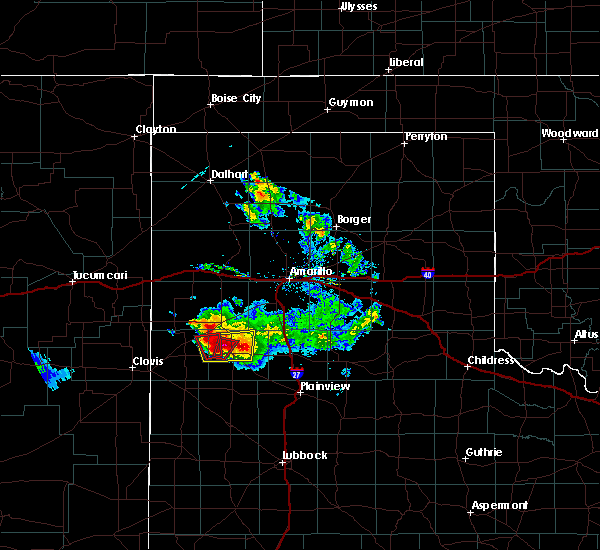 At 656 pm cdt, a confirmed large and extremely dangerous tornado was located near dimmitt, moving northeast at 15 mph. this is a particularly dangerous situation. take cover now! (radar confirmed tornado). Hazards include damaging tornado. You are in a life-threatening situation. flying debris may be deadly to those caught without shelter. mobile homes will be destroyed. considerable damage to homes, businesses, and vehicles is likely and complete destruction is possible. Locations impacted include, dimmitt and easter. At 656 pm cdt, a confirmed large and extremely dangerous tornado was located near dimmitt, moving northeast at 15 mph. this is a particularly dangerous situation. take cover now! (radar confirmed tornado). Hazards include damaging tornado. You are in a life-threatening situation. flying debris may be deadly to those caught without shelter. mobile homes will be destroyed. considerable damage to homes, businesses, and vehicles is likely and complete destruction is possible. Locations impacted include, dimmitt and easter.
|
| 4/14/2017 6:42 PM CDT |
 At 642 pm cdt, a confirmed large and extremely dangerous tornado was located near dimmitt, moving north at 15 mph. this is a particularly dangerous situation. take cover now! (weather spotters confirmed tornado). Hazards include damaging tornado. You are in a life-threatening situation. flying debris may be deadly to those caught without shelter. mobile homes will be destroyed. Considerable damage to homes, businesses, and vehicles is likely and complete destruction is possible. At 642 pm cdt, a confirmed large and extremely dangerous tornado was located near dimmitt, moving north at 15 mph. this is a particularly dangerous situation. take cover now! (weather spotters confirmed tornado). Hazards include damaging tornado. You are in a life-threatening situation. flying debris may be deadly to those caught without shelter. mobile homes will be destroyed. Considerable damage to homes, businesses, and vehicles is likely and complete destruction is possible.
|
| 4/14/2017 6:34 PM CDT |
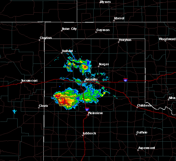 At 634 pm cdt, a severe thunderstorm was located near easter, or near dimmitt, moving northeast at 15 mph. this is a very dangerous storm (radar indicated). Hazards include baseball size hail and 60 mph wind gusts. People and animals outdoors will be severely injured. expect shattered windows, extensive damage to roofs, siding, and vehicles. Locations impacted include, dimmitt, easter and black. At 634 pm cdt, a severe thunderstorm was located near easter, or near dimmitt, moving northeast at 15 mph. this is a very dangerous storm (radar indicated). Hazards include baseball size hail and 60 mph wind gusts. People and animals outdoors will be severely injured. expect shattered windows, extensive damage to roofs, siding, and vehicles. Locations impacted include, dimmitt, easter and black.
|
| 4/14/2017 6:10 PM CDT |
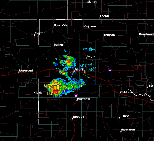 At 610 pm cdt, a severe thunderstorm was located 8 miles west of dimmitt, moving northeast at 15 mph. this is a very dangerous storm (radar indicated). Hazards include three inch hail and 60 mph wind gusts. People and animals outdoors will be severely injured. Expect shattered windows, extensive damage to roofs, siding, and vehicles. At 610 pm cdt, a severe thunderstorm was located 8 miles west of dimmitt, moving northeast at 15 mph. this is a very dangerous storm (radar indicated). Hazards include three inch hail and 60 mph wind gusts. People and animals outdoors will be severely injured. Expect shattered windows, extensive damage to roofs, siding, and vehicles.
|
| 7/6/2016 5:00 PM CDT | Storm damage reported in castro county TX, 2.4 miles SSW of Dimmitt, TX |
| 7/3/2016 9:55 PM CDT |
 At 952 pm cdt, a severe thunderstorm was located 5 miles southeast of black, or 9 miles east of friona, moving southeast at 40 mph. at 945 pm, the texas tech mesonet station 2 miles northeast of friona recorded a wind gust to 71 mph (radar indicated). Hazards include 70 mph wind gusts and quarter size hail. Hail damage to vehicles is expected. expect considerable tree damage. wind damage is also likely to mobile homes, roofs and outbuildings. Locations impacted include, dimmitt, friona, summerfield, black and easter. At 952 pm cdt, a severe thunderstorm was located 5 miles southeast of black, or 9 miles east of friona, moving southeast at 40 mph. at 945 pm, the texas tech mesonet station 2 miles northeast of friona recorded a wind gust to 71 mph (radar indicated). Hazards include 70 mph wind gusts and quarter size hail. Hail damage to vehicles is expected. expect considerable tree damage. wind damage is also likely to mobile homes, roofs and outbuildings. Locations impacted include, dimmitt, friona, summerfield, black and easter.
|
| 7/3/2016 9:30 PM CDT |
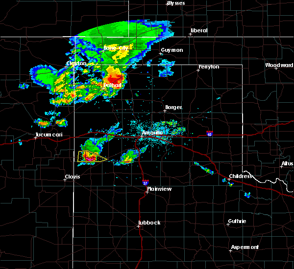 At 929 pm cdt, a severe thunderstorm was located 7 miles east of bootleg, or 10 miles north of friona, moving southeast at 40 mph (radar indicated). Hazards include 60 mph wind gusts and quarter size hail. Hail damage to vehicles is expected. Expect wind damage to roofs, siding and trees. At 929 pm cdt, a severe thunderstorm was located 7 miles east of bootleg, or 10 miles north of friona, moving southeast at 40 mph (radar indicated). Hazards include 60 mph wind gusts and quarter size hail. Hail damage to vehicles is expected. Expect wind damage to roofs, siding and trees.
|
| 6/15/2016 7:30 PM CDT | Measured by the west texas mesone in castro county TX, 2.4 miles SSW of Dimmitt, TX |
| 5/30/2016 7:54 PM CDT |
 At 753 pm cdt, a severe thunderstorm was located 8 miles north of earth, moving east at 20 mph (radar indicated). Hazards include 60 mph wind gusts and quarter size hail. Hail damage to vehicles is expected. Expect wind damage to roofs, siding and trees. At 753 pm cdt, a severe thunderstorm was located 8 miles north of earth, moving east at 20 mph (radar indicated). Hazards include 60 mph wind gusts and quarter size hail. Hail damage to vehicles is expected. Expect wind damage to roofs, siding and trees.
|
| 4/10/2016 7:42 PM CDT |
 At 742 pm cdt, a severe thunderstorm was located near hart, or 13 miles southeast of dimmitt, moving east at 30 mph (radar indicated). Hazards include 60 mph wind gusts and half dollar size hail. Hail damage to vehicles is expected. Expect wind damage to roofs, siding and trees. At 742 pm cdt, a severe thunderstorm was located near hart, or 13 miles southeast of dimmitt, moving east at 30 mph (radar indicated). Hazards include 60 mph wind gusts and half dollar size hail. Hail damage to vehicles is expected. Expect wind damage to roofs, siding and trees.
|
| 4/10/2016 7:39 PM CDT |
 At 739 pm cdt, a severe thunderstorm was located near hart, or 13 miles southeast of dimmitt, moving east at 30 mph (radar indicated). Hazards include 60 mph wind gusts and half dollar size hail. Hail damage to vehicles is expected. expect wind damage to roofs, siding and trees. Locations impacted include, hart and nazareth. At 739 pm cdt, a severe thunderstorm was located near hart, or 13 miles southeast of dimmitt, moving east at 30 mph (radar indicated). Hazards include 60 mph wind gusts and half dollar size hail. Hail damage to vehicles is expected. expect wind damage to roofs, siding and trees. Locations impacted include, hart and nazareth.
|
| 4/10/2016 7:30 PM CDT |
 At 730 pm cdt, a severe thunderstorm was located 10 miles west of hart, or 12 miles south of dimmitt, moving east at 25 mph (radar indicated). Hazards include 60 mph wind gusts and half dollar size hail. Hail damage to vehicles is expected. expect wind damage to roofs, siding and trees. Locations impacted include, hart and nazareth. At 730 pm cdt, a severe thunderstorm was located 10 miles west of hart, or 12 miles south of dimmitt, moving east at 25 mph (radar indicated). Hazards include 60 mph wind gusts and half dollar size hail. Hail damage to vehicles is expected. expect wind damage to roofs, siding and trees. Locations impacted include, hart and nazareth.
|
| 4/10/2016 7:10 PM CDT |
 At 710 pm cdt, a severe thunderstorm was located near earth, or 16 miles southwest of dimmitt, moving east at 30 mph (radar indicated). Hazards include 60 mph wind gusts and half dollar size hail. Hail damage to vehicles is expected. Expect wind damage to roofs, siding and trees. At 710 pm cdt, a severe thunderstorm was located near earth, or 16 miles southwest of dimmitt, moving east at 30 mph (radar indicated). Hazards include 60 mph wind gusts and half dollar size hail. Hail damage to vehicles is expected. Expect wind damage to roofs, siding and trees.
|
| 4/10/2016 5:11 PM CDT |
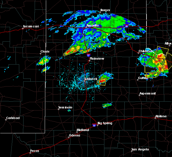 The severe thunderstorm warning for southern castro county will expire at 515 pm cdt, the storm which prompted the warning has weakened below severe limits, and no longer pose an immediate threat to life or property. therefore the warning will be allowed to expire. however small hail and gusty winds are still possible with this thunderstorm. a severe thunderstorm watch remains in effect until 1000 pm cdt for central texas. The severe thunderstorm warning for southern castro county will expire at 515 pm cdt, the storm which prompted the warning has weakened below severe limits, and no longer pose an immediate threat to life or property. therefore the warning will be allowed to expire. however small hail and gusty winds are still possible with this thunderstorm. a severe thunderstorm watch remains in effect until 1000 pm cdt for central texas.
|
| 4/10/2016 5:00 PM CDT |
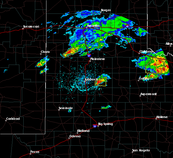 At 459 pm cdt, a severe thunderstorm was located 8 miles southwest of dimmitt, moving northeast at 20 mph (radar indicated). Hazards include 60 mph wind gusts and quarter size hail. Hail damage to vehicles is expected. expect wind damage to roofs, siding and trees. Locations impacted include, dimmitt. At 459 pm cdt, a severe thunderstorm was located 8 miles southwest of dimmitt, moving northeast at 20 mph (radar indicated). Hazards include 60 mph wind gusts and quarter size hail. Hail damage to vehicles is expected. expect wind damage to roofs, siding and trees. Locations impacted include, dimmitt.
|
| 4/10/2016 4:48 PM CDT |
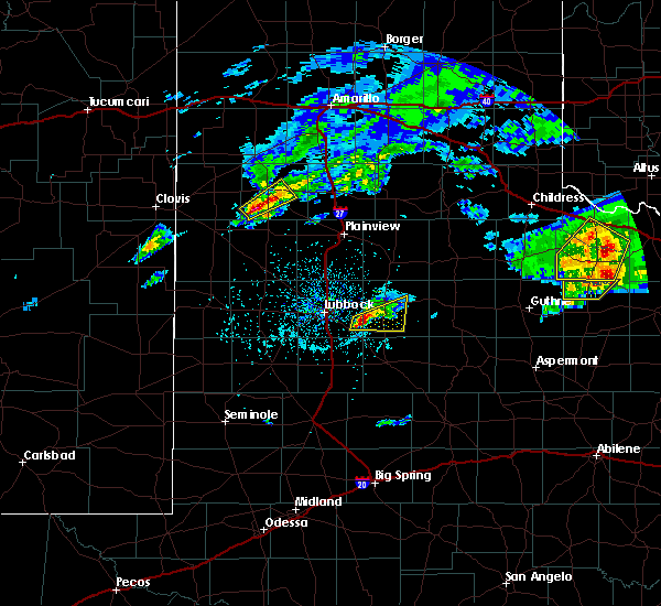 At 447 pm cdt, a severe thunderstorm was located over mainly rural areas of southwest castro county, moving northeast at 25 mph (radar indicated). Hazards include 60 mph wind gusts and quarter size hail. Hail damage to vehicles is expected. Expect wind damage to roofs, siding and trees. At 447 pm cdt, a severe thunderstorm was located over mainly rural areas of southwest castro county, moving northeast at 25 mph (radar indicated). Hazards include 60 mph wind gusts and quarter size hail. Hail damage to vehicles is expected. Expect wind damage to roofs, siding and trees.
|
| 8/19/2015 2:02 AM CDT |
 At 200 am cdt, severe thunderstorms were located along a line extending from near canyon to 6 miles northeast of dimmitt, moving southeast at 40 mph. a second severe thunderstorm was located 5 miles west of hereford also moving southeast at 40 mph (radar indicated). Hazards include half dollar size hail and 60 mph wind gusts. Hail damage to vehicles is expected. expect wind damage to roofs, siding and trees. Locations impacted include, tulia, dimmitt, happy, summerfield, easter and nazareth. At 200 am cdt, severe thunderstorms were located along a line extending from near canyon to 6 miles northeast of dimmitt, moving southeast at 40 mph. a second severe thunderstorm was located 5 miles west of hereford also moving southeast at 40 mph (radar indicated). Hazards include half dollar size hail and 60 mph wind gusts. Hail damage to vehicles is expected. expect wind damage to roofs, siding and trees. Locations impacted include, tulia, dimmitt, happy, summerfield, easter and nazareth.
|
| 8/19/2015 1:37 AM CDT |
 At 136 am cdt, a severe thunderstorm was located near hereford, moving southeast at 35 mph (radar indicated). Hazards include ping pong ball size hail and 60 mph wind gusts. People and animals outdoors will be injured. expect hail damage to roofs, siding, windows and vehicles. Expect wind damage to roofs, siding and trees. At 136 am cdt, a severe thunderstorm was located near hereford, moving southeast at 35 mph (radar indicated). Hazards include ping pong ball size hail and 60 mph wind gusts. People and animals outdoors will be injured. expect hail damage to roofs, siding, windows and vehicles. Expect wind damage to roofs, siding and trees.
|
| 8/9/2015 6:02 PM CDT |
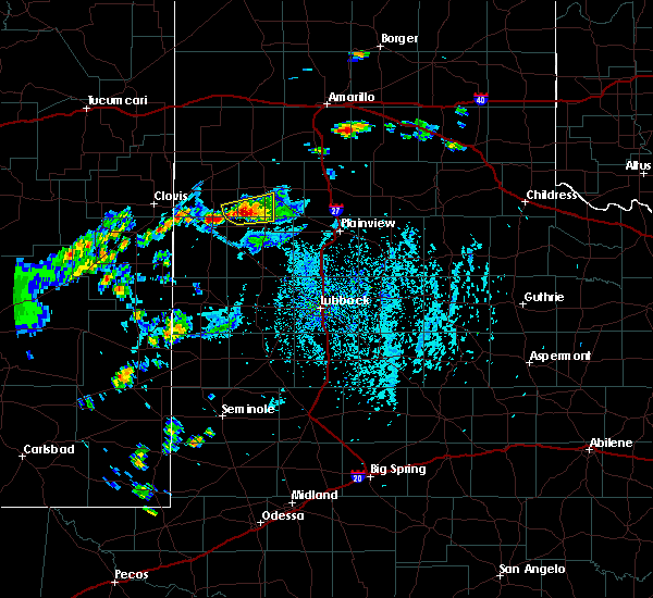 At 601 pm cdt, a severe thunderstorm was located near earth, or 16 miles southwest of dimmitt, moving northeast at 10 mph (radar indicated). Hazards include 60 mph wind gusts and penny size hail. Expect damage to roofs. siding and trees. Locations impacted include, rural areas, including in and around dodd. At 601 pm cdt, a severe thunderstorm was located near earth, or 16 miles southwest of dimmitt, moving northeast at 10 mph (radar indicated). Hazards include 60 mph wind gusts and penny size hail. Expect damage to roofs. siding and trees. Locations impacted include, rural areas, including in and around dodd.
|
| 8/9/2015 5:44 PM CDT |
 At 541 pm cdt, doppler radar indicated a severe thunderstorm capable of producing quarter size hail and damaging winds in excess of 60 mph. this storm was located near earth, or 15 miles east of muleshoe, and moving northeast at 10 mph. an additional severe thunderstorm was located 3 miles southeast of lazbuddie, moving slowly east. At 541 pm cdt, doppler radar indicated a severe thunderstorm capable of producing quarter size hail and damaging winds in excess of 60 mph. this storm was located near earth, or 15 miles east of muleshoe, and moving northeast at 10 mph. an additional severe thunderstorm was located 3 miles southeast of lazbuddie, moving slowly east.
|
| 8/9/2015 5:14 PM CDT |
 At 510 pm cdt, a severe thunderstorm was located 9 miles northeast of earth, or 14 miles south of dimmitt, and is nearly stationary. a weather station in sunnyside recorded a 67 mph gust with this storm at 4:56 pm. in addition, 1.21 inches of rain fell in a short period of time, with instantaneous rates near 6 inches an hour (radar indicated). Hazards include half dollar size hail and 70 mph wind gusts. Hail damage to vehicles is expected. expect considerable tree damage. wind damage is also likely to mobile homes, roofs and outbuildings. Locations impacted include, sunnyside, highway 385 between dimmitt and spring lake and earth. At 510 pm cdt, a severe thunderstorm was located 9 miles northeast of earth, or 14 miles south of dimmitt, and is nearly stationary. a weather station in sunnyside recorded a 67 mph gust with this storm at 4:56 pm. in addition, 1.21 inches of rain fell in a short period of time, with instantaneous rates near 6 inches an hour (radar indicated). Hazards include half dollar size hail and 70 mph wind gusts. Hail damage to vehicles is expected. expect considerable tree damage. wind damage is also likely to mobile homes, roofs and outbuildings. Locations impacted include, sunnyside, highway 385 between dimmitt and spring lake and earth.
|
| 8/9/2015 5:13 PM CDT | Quarter sized hail reported 13.1 miles N of Dimmitt, TX, community of sunnyside. |
| 8/9/2015 4:56 PM CDT |
 At 454 pm cdt, a severe thunderstorm was located 10 miles northeast of earth, or 13 miles south of dimmitt, moving northeast at 5 mph. another severe storm was located 8 miles south of dimmitt, moving northeast at 5 mph (radar indicated). Hazards include 60 mph wind gusts and quarter size hail. Hail damage to vehicles is expected. Expect wind damage to roofs, siding and trees. At 454 pm cdt, a severe thunderstorm was located 10 miles northeast of earth, or 13 miles south of dimmitt, moving northeast at 5 mph. another severe storm was located 8 miles south of dimmitt, moving northeast at 5 mph (radar indicated). Hazards include 60 mph wind gusts and quarter size hail. Hail damage to vehicles is expected. Expect wind damage to roofs, siding and trees.
|
| 6/12/2015 4:45 PM CDT |
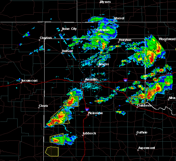 At 444 pm cdt, a severe thunderstorm was located near dimmitt, moving east at 40 mph. at 435pm, this storm generated a 60 mph wind gust at the dimmitt mesonet station (radar indicated). Hazards include half dollar size hail and 60 mph wind gusts. Hail damage to vehicles is expected. expect wind damage to roofs, siding and trees. locations impacted include, dimmitt and nazareth. A tornado watch remains in effect until 1000 pm cdt for central texas. At 444 pm cdt, a severe thunderstorm was located near dimmitt, moving east at 40 mph. at 435pm, this storm generated a 60 mph wind gust at the dimmitt mesonet station (radar indicated). Hazards include half dollar size hail and 60 mph wind gusts. Hail damage to vehicles is expected. expect wind damage to roofs, siding and trees. locations impacted include, dimmitt and nazareth. A tornado watch remains in effect until 1000 pm cdt for central texas.
|
| 6/12/2015 4:35 PM CDT | Storm damage reported in castro county TX, 2.4 miles SSW of Dimmitt, TX |
| 6/12/2015 4:29 PM CDT |
 A severe thunderstorm warning remains in effect until 500 pm cdt for northern castro county. at 428 pm cdt. a severe thunderstorm was located 9 miles east of dimmitt. moving east at 40 mph. at 425 pm. dime size hail was reported two miles north of dimmitt. This storm will continue to affect us highway 385 between dimmitt and hereford. A severe thunderstorm warning remains in effect until 500 pm cdt for northern castro county. at 428 pm cdt. a severe thunderstorm was located 9 miles east of dimmitt. moving east at 40 mph. at 425 pm. dime size hail was reported two miles north of dimmitt. This storm will continue to affect us highway 385 between dimmitt and hereford.
|
| 6/12/2015 4:15 PM CDT |
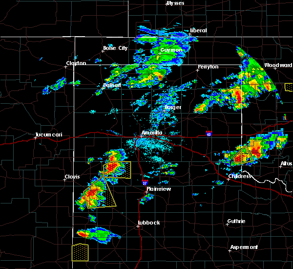 At 414 pm cdt, a severe thunderstorm was located over dimmitt, moving east at 40 mph. two areas of rotation are associated with this storm. both are expected to pass just north of dimmitt and affect us highway 385 (radar indicated). Hazards include golf ball size hail and 70 mph wind gusts. People and animals outdoors will be injured. expect hail damage to roofs, siding, windows and vehicles. expect considerable tree damage. Wind damage is also likely to mobile homes, roofs and outbuildings. At 414 pm cdt, a severe thunderstorm was located over dimmitt, moving east at 40 mph. two areas of rotation are associated with this storm. both are expected to pass just north of dimmitt and affect us highway 385 (radar indicated). Hazards include golf ball size hail and 70 mph wind gusts. People and animals outdoors will be injured. expect hail damage to roofs, siding, windows and vehicles. expect considerable tree damage. Wind damage is also likely to mobile homes, roofs and outbuildings.
|
| 6/12/2015 3:57 PM CDT |
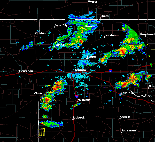 At 356 pm cdt, a severe thunderstorm was located near easter, or 8 miles west of dimmitt, moving east at 25 mph. this storm is exhibiting rotation about 5 miles northwest of dimmitt. the hail core will affect us highway 385 between dimmitt and hereford (radar indicated). Hazards include two inch hail and 70 mph wind gusts. People and animals outdoors will be injured. expect hail damage to roofs, siding, windows and vehicles. expect considerable tree damage. wind damage is also likely to mobile homes, roofs and outbuildings. locations impacted include, dimmitt and easter. A tornado watch remains in effect until 1000 pm cdt for central texas. At 356 pm cdt, a severe thunderstorm was located near easter, or 8 miles west of dimmitt, moving east at 25 mph. this storm is exhibiting rotation about 5 miles northwest of dimmitt. the hail core will affect us highway 385 between dimmitt and hereford (radar indicated). Hazards include two inch hail and 70 mph wind gusts. People and animals outdoors will be injured. expect hail damage to roofs, siding, windows and vehicles. expect considerable tree damage. wind damage is also likely to mobile homes, roofs and outbuildings. locations impacted include, dimmitt and easter. A tornado watch remains in effect until 1000 pm cdt for central texas.
|
| 6/12/2015 3:40 PM CDT |
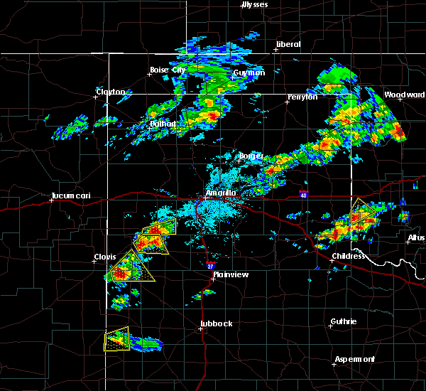 At 339 pm cdt, a severe thunderstorm was located near black, or 10 miles east of friona, moving northeast at 25 mph. this storm continues to exhibit broad rotation 5 miles east of friona (radar indicated). Hazards include ping pong size hail and 70 mph wind gusts. People and animals outdoors will be injured. expect hail damage to roofs, siding, windows and vehicles. expect considerable tree damage. wind damage is also likely to mobile homes, roofs and outbuildings. locations impacted include, dimmitt, summerfield, black and easter. A tornado watch remains in effect until 1000 pm cdt for central texas. At 339 pm cdt, a severe thunderstorm was located near black, or 10 miles east of friona, moving northeast at 25 mph. this storm continues to exhibit broad rotation 5 miles east of friona (radar indicated). Hazards include ping pong size hail and 70 mph wind gusts. People and animals outdoors will be injured. expect hail damage to roofs, siding, windows and vehicles. expect considerable tree damage. wind damage is also likely to mobile homes, roofs and outbuildings. locations impacted include, dimmitt, summerfield, black and easter. A tornado watch remains in effect until 1000 pm cdt for central texas.
|
| 6/12/2015 3:28 PM CDT |
 At 327 pm cdt, a severe thunderstorm was located near black, or near friona, moving northeast at 25 mph. this storm is featuring low level rotation just southeast of friona (radar indicated). Hazards include two inch hail and 70 mph wind gusts. People and animals outdoors will be injured. expect hail damage to roofs, siding, windows and vehicles. expect considerable tree damage. Wind damage is also likely to mobile homes, roofs and outbuildings. At 327 pm cdt, a severe thunderstorm was located near black, or near friona, moving northeast at 25 mph. this storm is featuring low level rotation just southeast of friona (radar indicated). Hazards include two inch hail and 70 mph wind gusts. People and animals outdoors will be injured. expect hail damage to roofs, siding, windows and vehicles. expect considerable tree damage. Wind damage is also likely to mobile homes, roofs and outbuildings.
|
| 5/29/2015 8:55 PM CDT | At 852 pm cdt, severe thunderstorms were located along a line from 15 miles west of happy to near hart, moving east at 35 mph. this storm produced a 60 mph at the dimmitt west texas mesonet as it moved through at 830 pm (radar indicated). Hazards include quarter size hail and 60 mph wind gusts. Hail damage to vehicles is expected. expect wind damage to roofs, siding and trees. Locations impacted include, tulia, dimmitt, hart, kress, happy, nazareth and edmonson. |
| 5/29/2015 8:31 PM CDT | At 831 pm cdt, a severe thunderstorm was located near dimmitt, moving east at 35 mph (radar indicated). Hazards include 60 mph wind gusts and quarter size hail. Hail damage to vehicles is expected. Expect wind damage to roofs, siding and trees. |
| 5/29/2015 8:30 PM CDT | Measured by the west texas mesonet in castro county TX, 2.4 miles SSW of Dimmitt, TX |
| 5/9/2015 4:58 AM CDT | At 458 am cdt, severe thunderstorms were located along a line extending from near black to near lazbuddie, moving northeast at 40 mph (radar indicated). Hazards include quarter size hail. damage to vehicles is expected |
| 4/20/2015 9:17 PM CDT | At 915 pm cdt, a severe thunderstorm was located over easter, or near dimmitt, moving southeast at 35 mph (radar indicated). Hazards include 60 mph wind gusts. Expect damage to roofs. Siding and trees. |
| 4/16/2015 7:17 PM CDT | At 717 pm cdt, a severe thunderstorm was located near earth, or 19 miles south of dimmitt, moving northeast at 35 mph (radar indicated). Hazards include quarter size hail and 60 mph wind gusts. Hail damage to vehicles is expected. expect wind damage to roofs, siding and trees. locations impacted include, hart. 1. 00in. |
| 4/16/2015 7:01 PM CDT | At 701 pm cdt, a severe thunderstorm was located near earth, or 18 miles south of dimmitt, moving northeast at 35 mph (radar indicated). Hazards include quarter size hail and 60 mph wind gusts. Hail damage to vehicles is expected. expect wind damage to roofs, siding and trees. locations impacted include, hart, earth and springlake. 1. 00in. |
| 4/16/2015 6:41 PM CDT | At 641 pm cdt, a severe thunderstorm was located 7 miles southwest of earth, or 12 miles east of muleshoe, moving northeast at 35 mph (radar indicated). Hazards include 60 mph wind gusts and quarter size hail. Hail damage to vehicles is expected. Expect wind damage to roofs, siding and trees. |
| 6/7/2014 11:15 PM CDT | Storm damage reported in castro county TX, 2.4 miles SSW of Dimmitt, TX |
| 6/7/2014 11:10 PM CDT | Storm damage reported in castro county TX, 2.4 miles SSW of Dimmitt, TX |
| 6/6/2014 8:40 PM CDT | West texas mesonet in castro county TX, 2.4 miles SSW of Dimmitt, TX |
| 5/21/2014 6:50 PM CDT | Storm damage reported in castro county TX, 2.4 miles SSW of Dimmitt, TX |
| 6/20/2013 7:00 PM CDT | West texas mesonet in castro county TX, 2.4 miles SSW of Dimmitt, TX |
| 6/20/2013 6:55 PM CDT | West texas mesonet in castro county TX, 2.4 miles SSW of Dimmitt, TX |
| 6/17/2013 12:50 AM CDT | Storm damage reported in castro county TX, 2.4 miles SSW of Dimmitt, TX |
| 5/21/2013 7:00 AM CDT | West texas mesonet report in castro county TX, 2.4 miles SSW of Dimmitt, TX |
| 12/14/2012 3:20 PM CST | Storm damage reported in castro county TX, 2.4 miles SSW of Dimmitt, TX |
| 12/14/2012 3:16 PM CST | Dimmit middle school schoolnet in castro county TX, 0.7 miles S of Dimmitt, TX |
| 8/20/2012 7:30 PM CDT | Quarter sized hail reported 7.5 miles NE of Dimmitt, TX, reported by public near flag community |
| 8/20/2012 7:29 PM CDT | Power poles snapped along fm1055 in castro county TX, 8.4 miles NE of Dimmitt, TX |
| 8/20/2012 7:20 PM CDT | Crops reported stripped due to hail near community of flag in castro county TX, 8.8 miles NE of Dimmitt, TX |
| 6/12/2012 11:35 PM CDT | Measured by the west texas mesonet in castro county TX, 2.4 miles SSW of Dimmitt, TX |
| 1/1/0001 12:00 AM | Quarter sized hail reported 0.7 miles S of Dimmitt, TX, kvii-tv received this report via their facebook page |
| 1/1/0001 12:00 AM | Significant damage to dimmitt mesonet station. damage to radiation shields... guide wires pulled out of ground and a pole bent. center pivot damaged in vicinity of meso in castro county TX, 2.4 miles SSW of Dimmitt, TX |
| 1/1/0001 12:00 AM | Feed lot office heavily damaged in dimmitt from strong thunderstorm winds in castro county TX, 0.7 miles S of Dimmitt, TX |
| 1/1/0001 12:00 AM | 7 power poles down at county rd 621 and fm 1055 in castro county TX, 7.5 miles NE of Dimmitt, TX |
Hail Maps for Dimmitt, TX
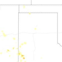


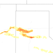
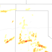

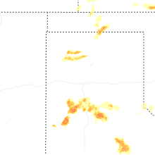


Connect with Interactive Hail Maps