

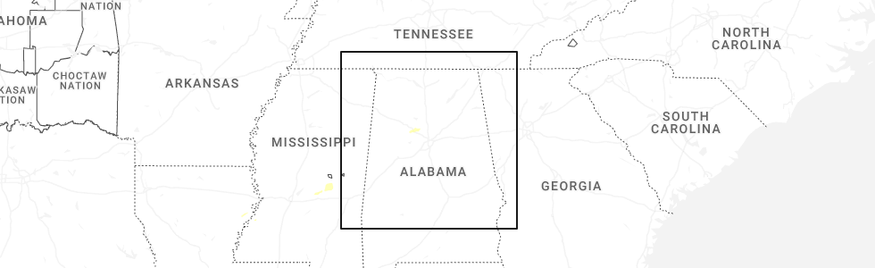
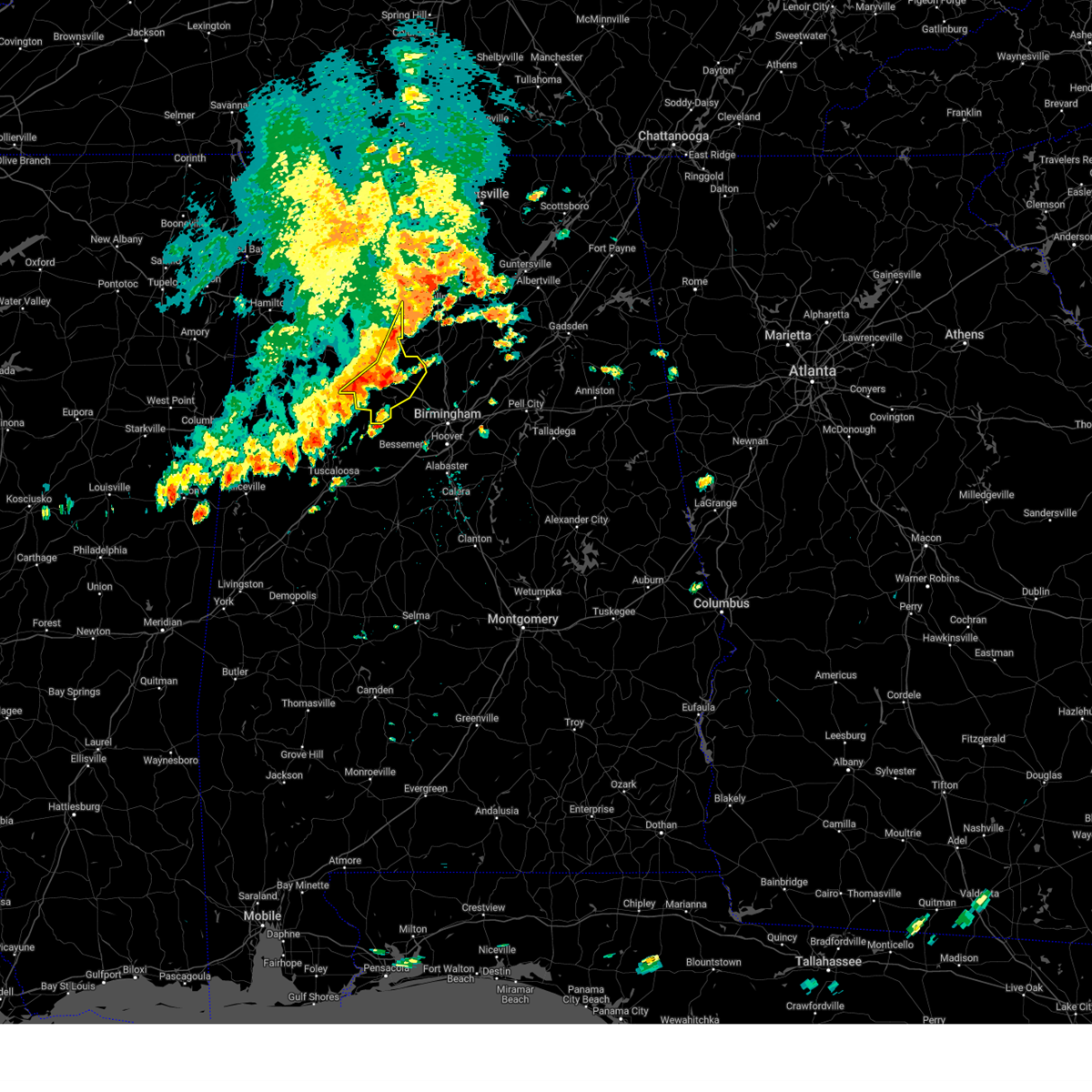
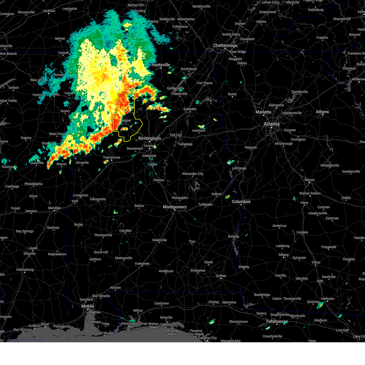
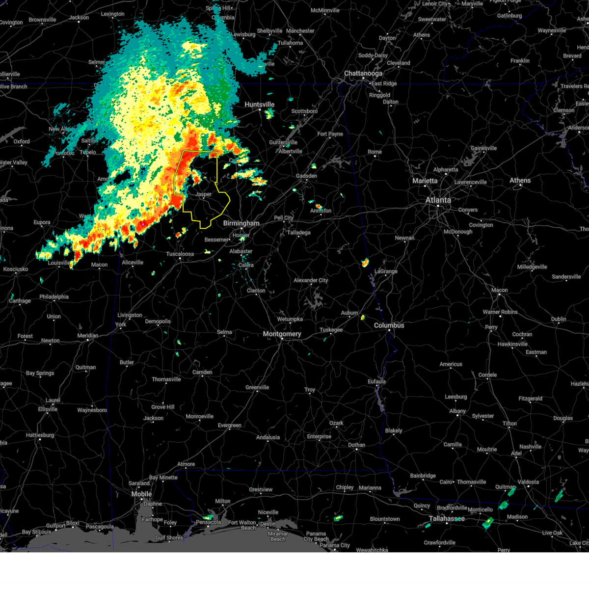
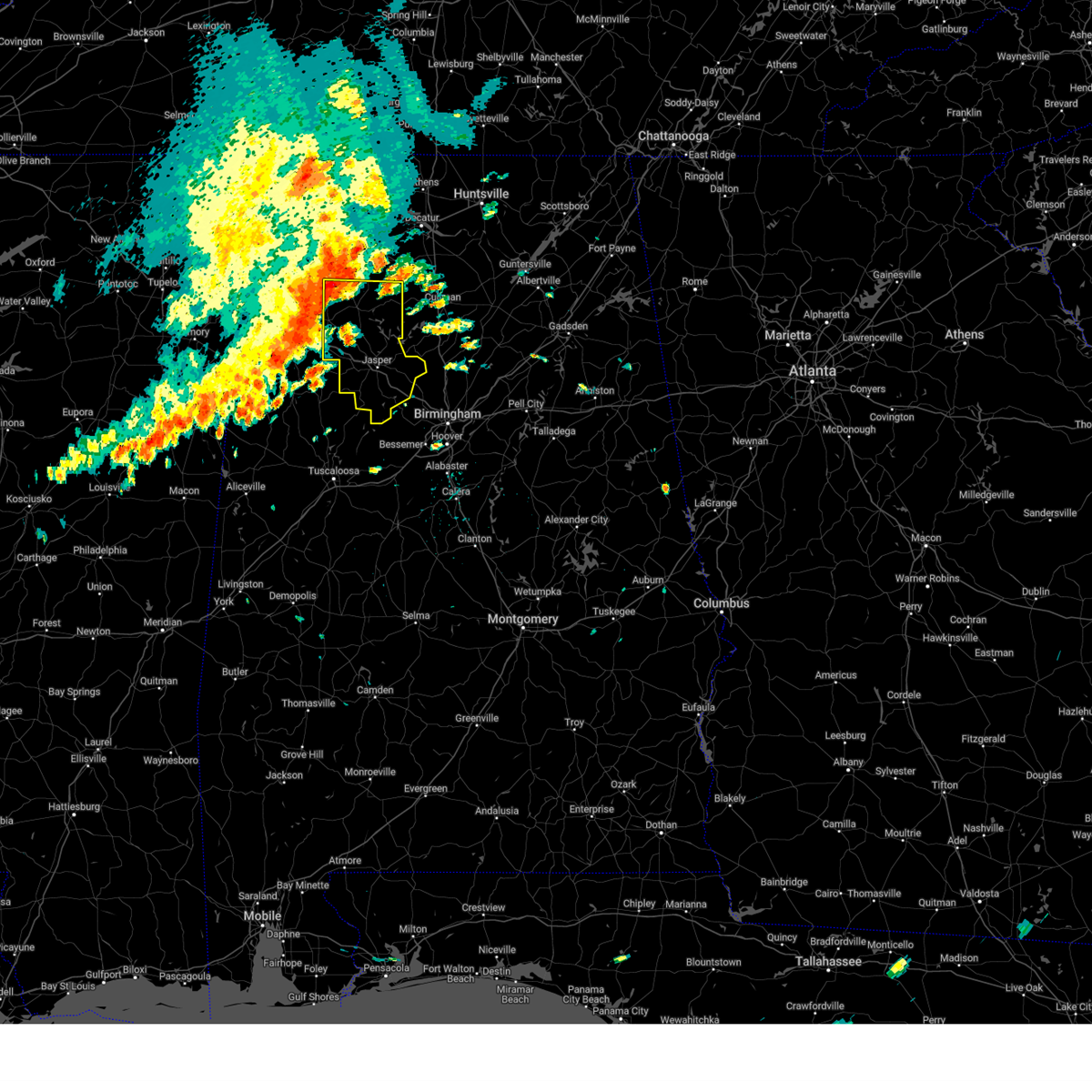
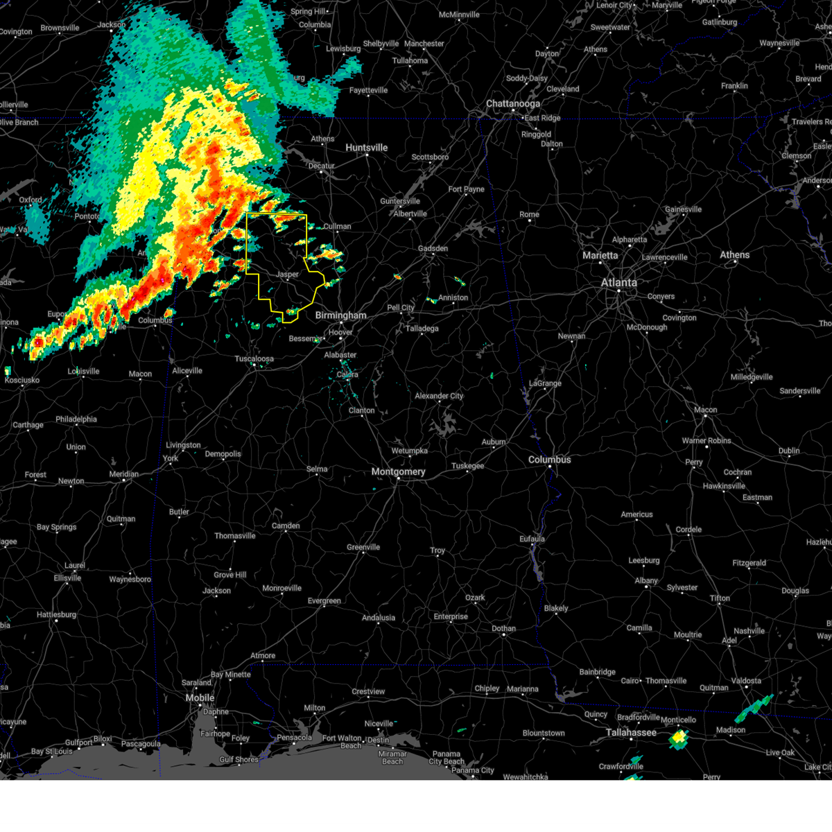
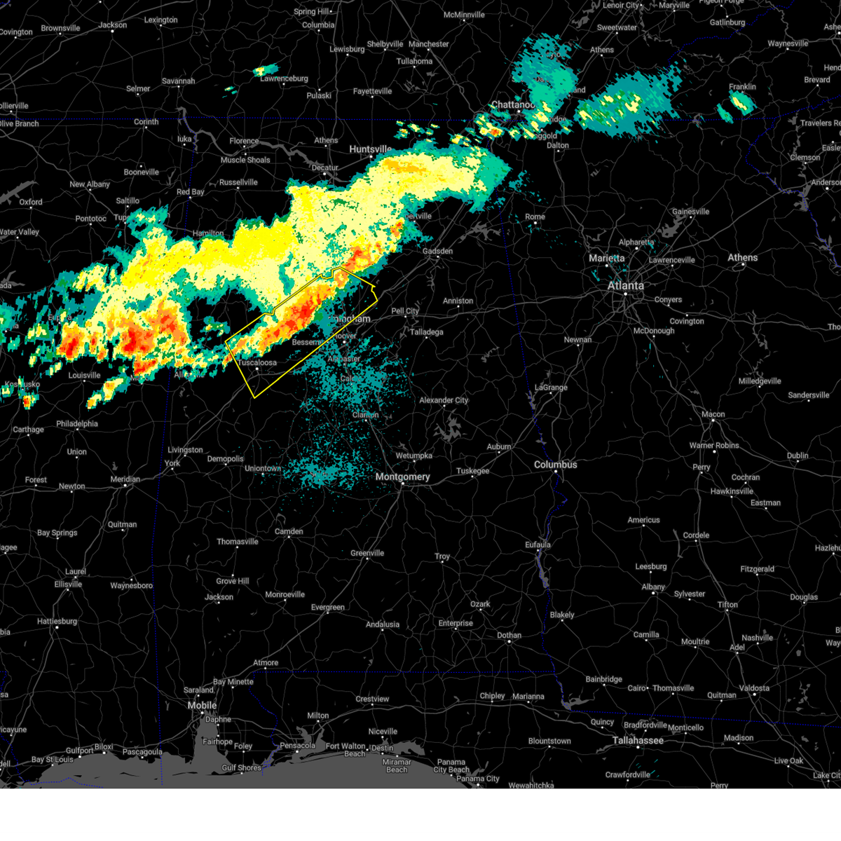
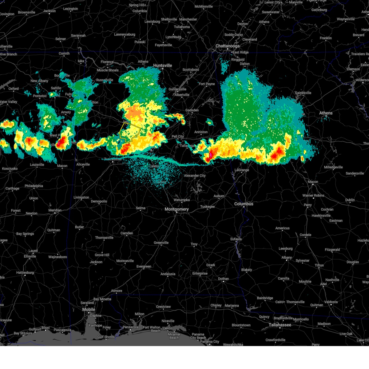
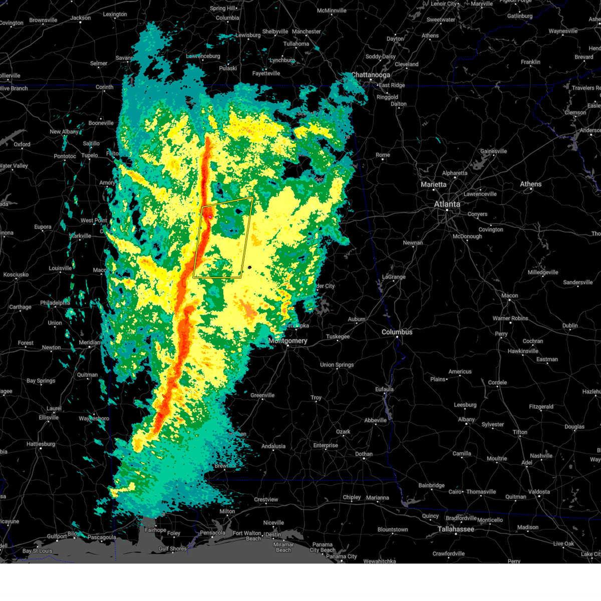
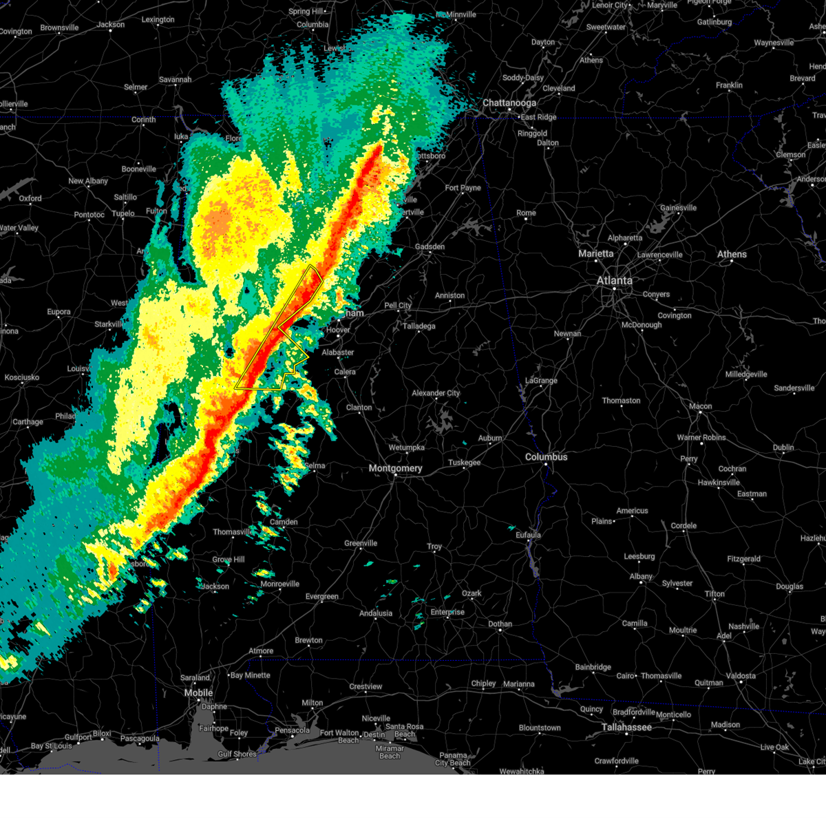
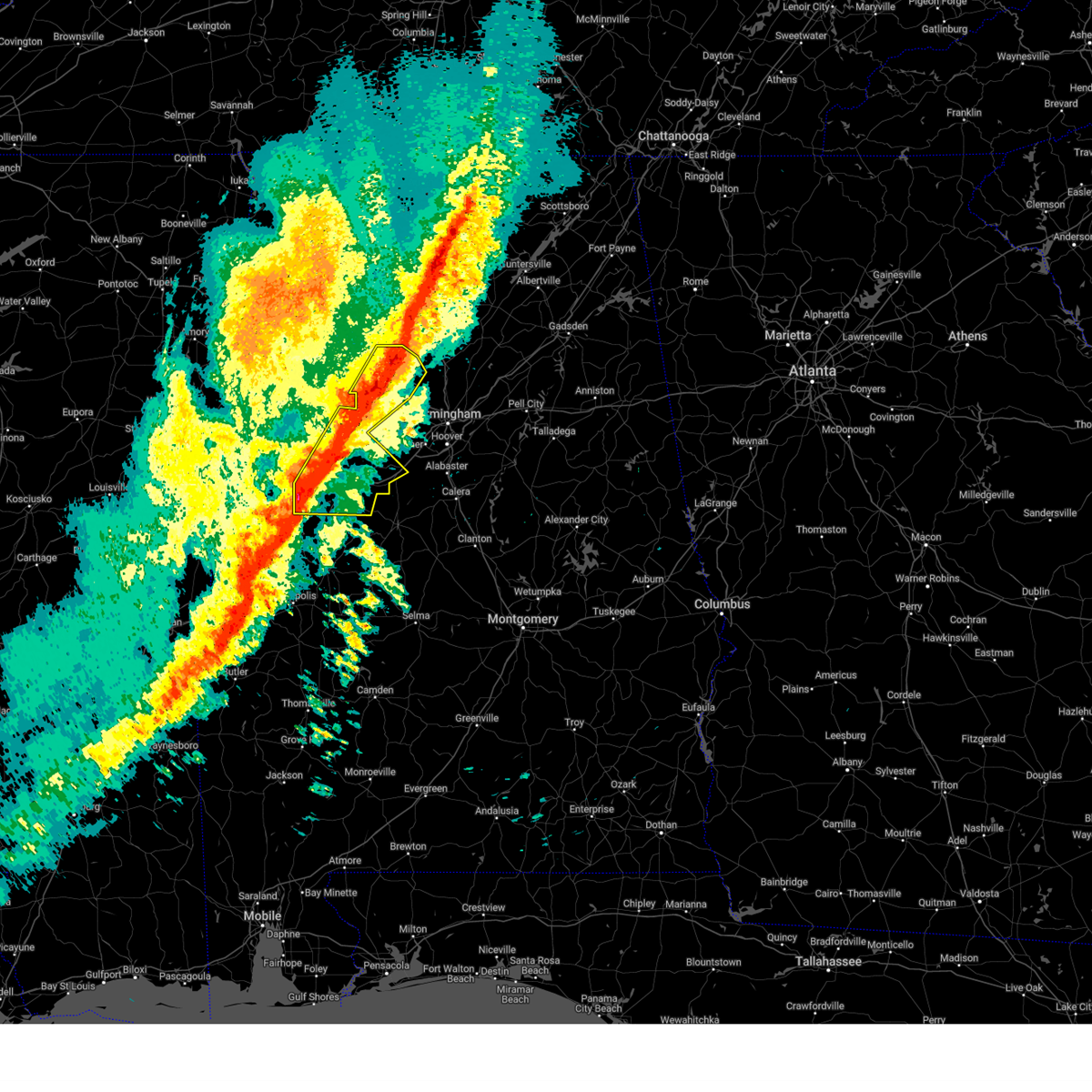
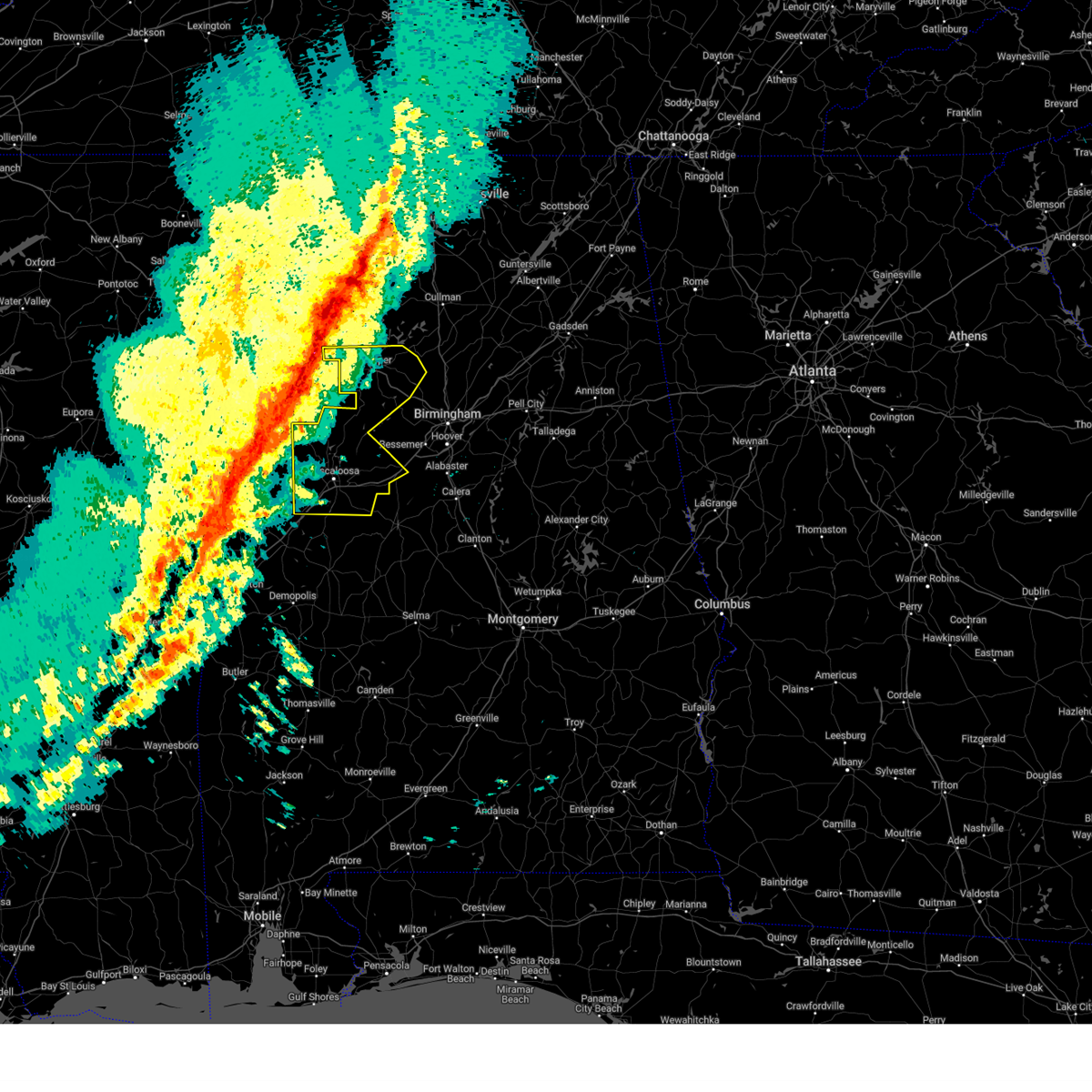
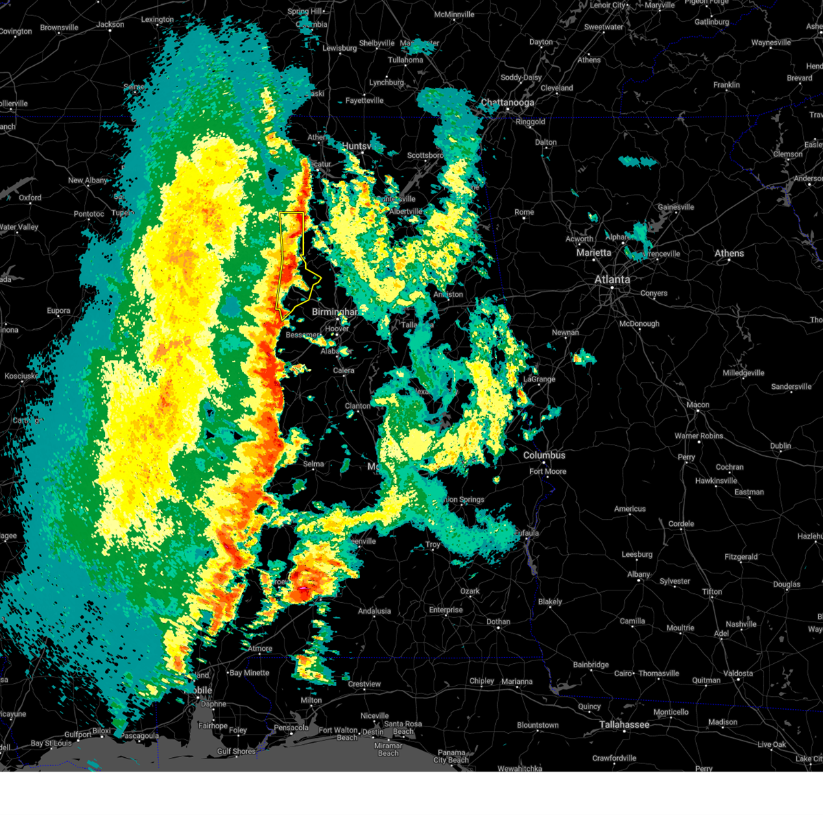
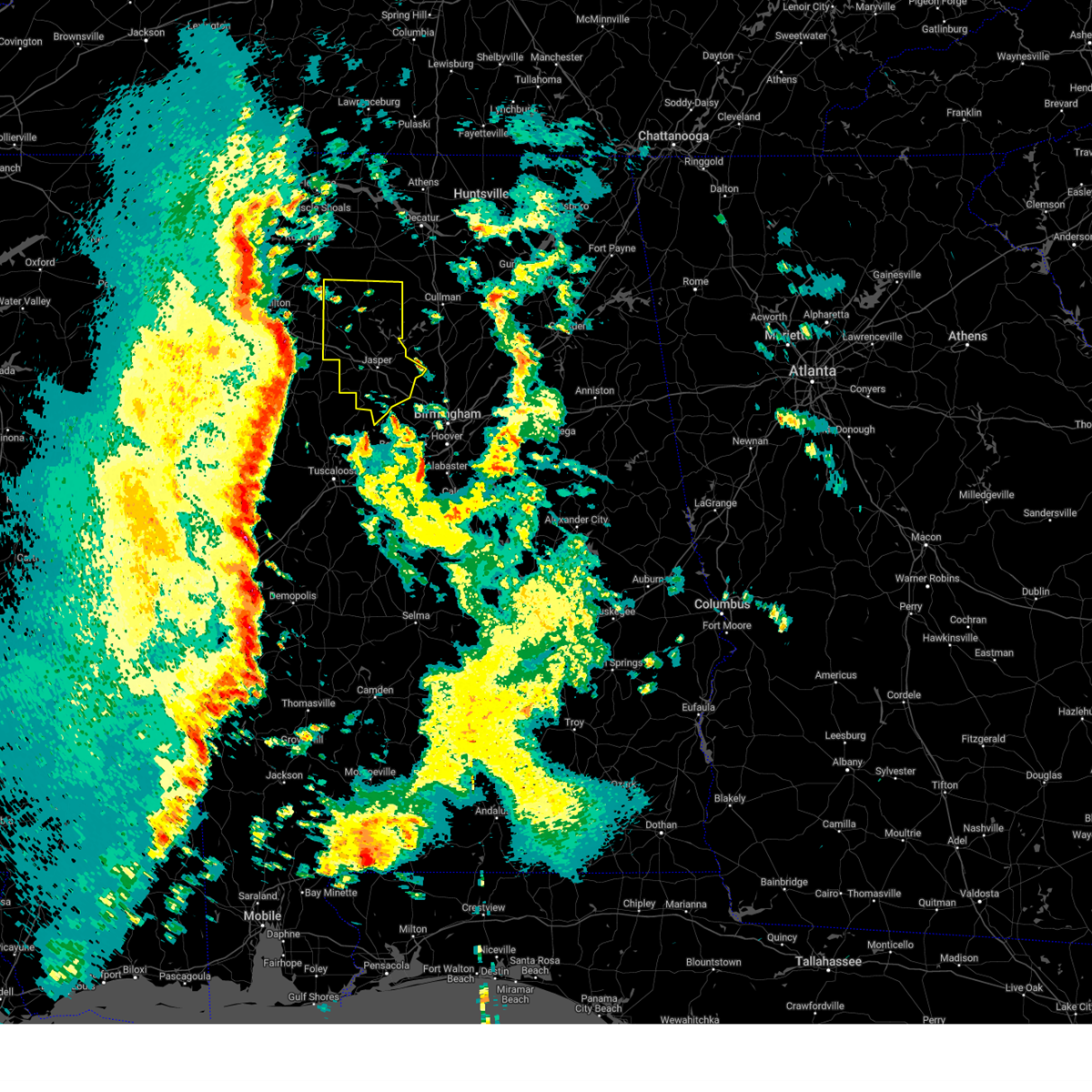
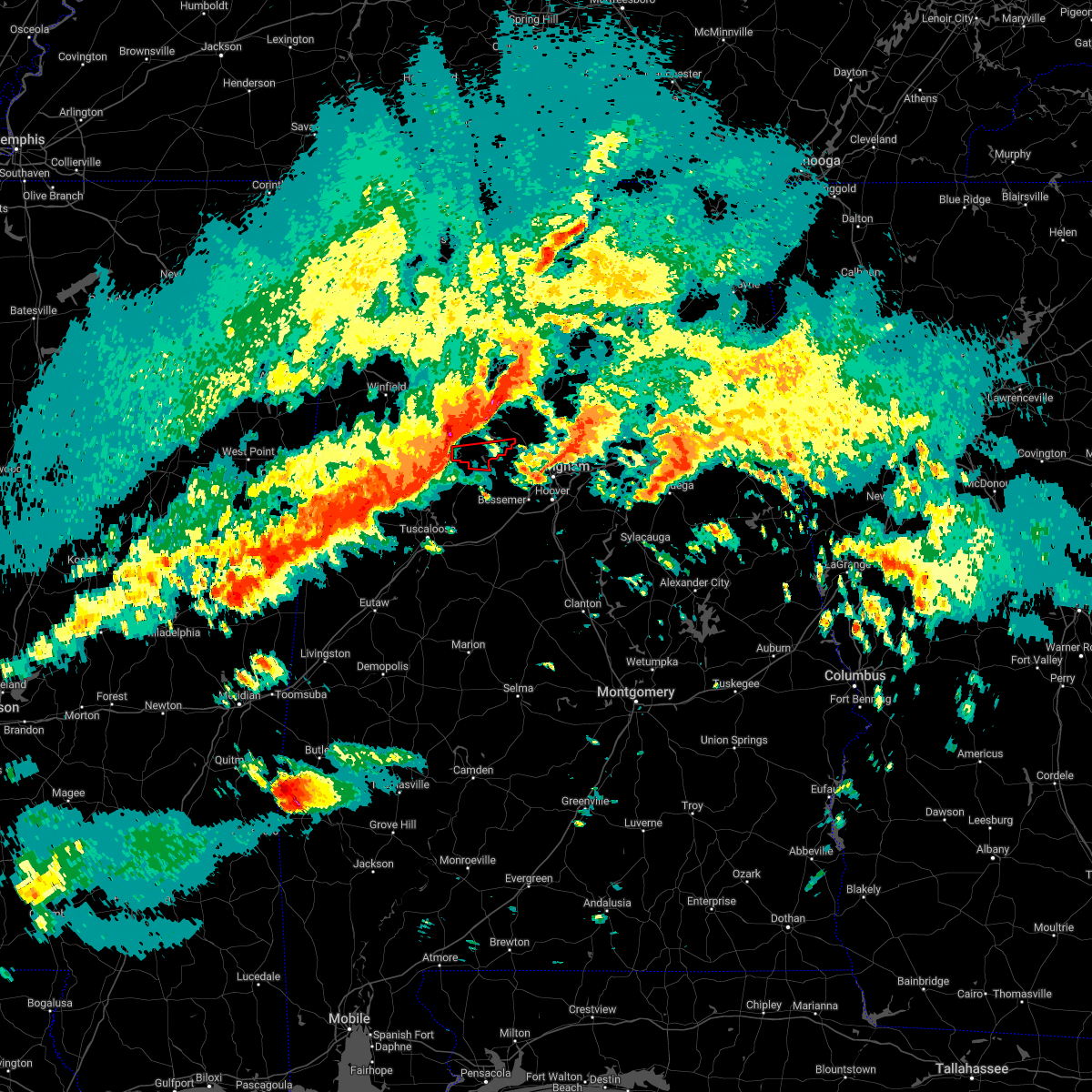
Hail Map for Dora, AL
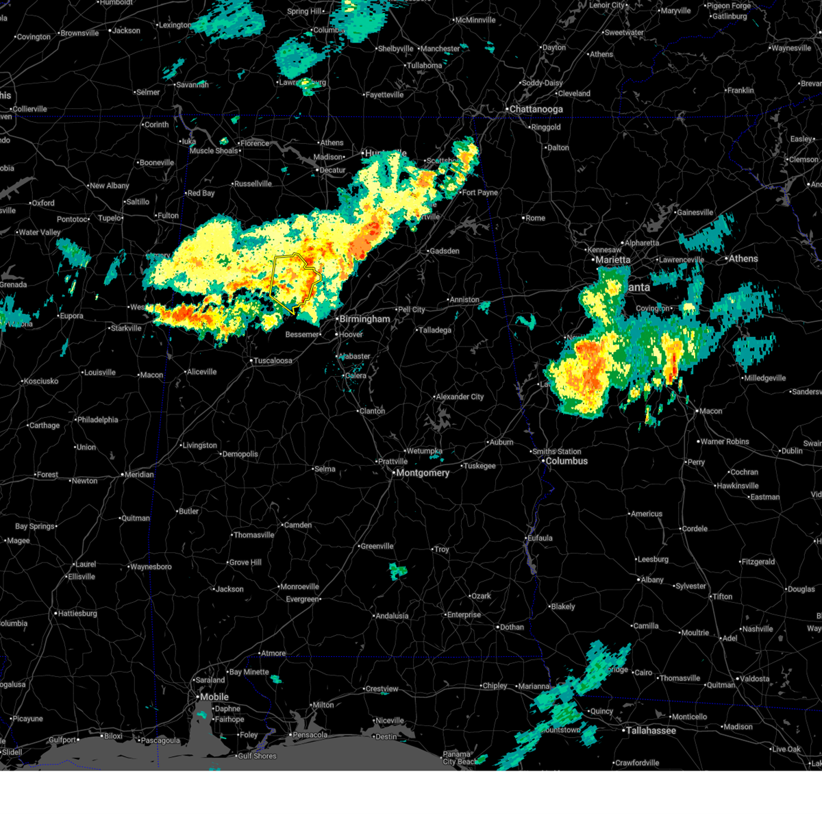
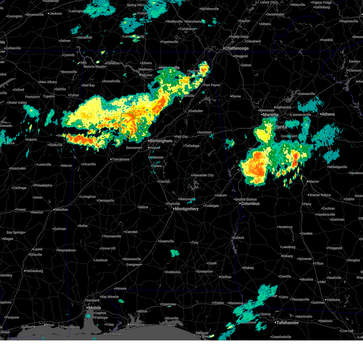
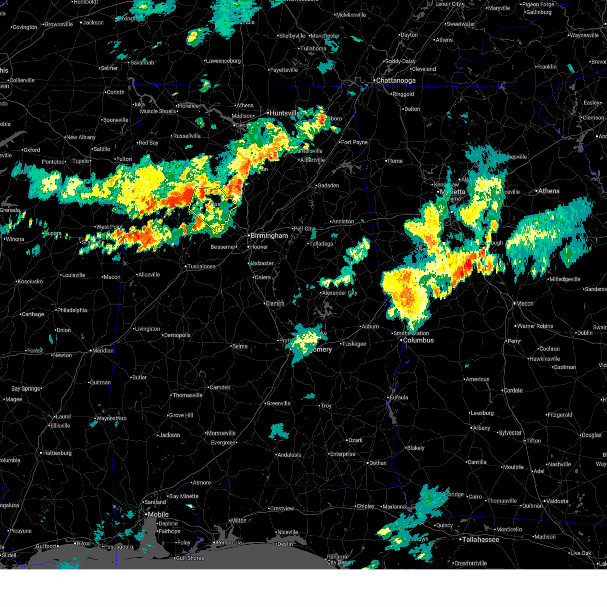
The Dora, AL area has had 7 reports of on-the-ground hail by trained spotters, and has been under severe weather warnings 40 times during the past 12 months. Doppler radar has detected hail at or near Dora, AL on 70 occasions, including 10 occasions during the past year.
| Name: | Dora, AL |
| Where Located: | 21.1 miles NW of Birmingham, AL |
| Map: | Google Map for Dora, AL |
| Population: | 2025 |
| Housing Units: | 959 |
| More Info: | Search Google for Dora, AL |
2
The Top Recent Hail Date for Dora, AL is Monday, April 21, 2025 (20th out of 70)
Hail and Wind Damage Spotted near Dora, AL
| Date / Time | Report Details |
|---|---|
| 6/14/2025 8:34 PM CDT |
 the severe thunderstorm warning has been cancelled and is no longer in effect the severe thunderstorm warning has been cancelled and is no longer in effect
|
| 6/14/2025 8:27 PM CDT |
 At 827 pm cdt, a severe thunderstorm was located over beloit, or over cordova, moving southeast at 35 mph (radar indicated). Hazards include 60 mph wind gusts. Expect damage to roofs, siding, and trees. Locations impacted include, jasper, sumiton, cordova, dora, parrish, oakman, sipsey, curry, gorgas steam plant, smith dam, gorgas, rocky hollow, burnwell, beloit, quinton, lynns park, smith lake, empire, powellville, and goodsprings. At 827 pm cdt, a severe thunderstorm was located over beloit, or over cordova, moving southeast at 35 mph (radar indicated). Hazards include 60 mph wind gusts. Expect damage to roofs, siding, and trees. Locations impacted include, jasper, sumiton, cordova, dora, parrish, oakman, sipsey, curry, gorgas steam plant, smith dam, gorgas, rocky hollow, burnwell, beloit, quinton, lynns park, smith lake, empire, powellville, and goodsprings.
|
| 6/14/2025 8:05 PM CDT |
 Svrbmx the national weather service in birmingham has issued a * severe thunderstorm warning for, walker county in central alabama, * until 900 pm cdt. * at 805 pm cdt, a severe thunderstorm was located near jasper, moving southeast at 35 mph (radar indicated). Hazards include 60 mph wind gusts. expect damage to roofs, siding, and trees Svrbmx the national weather service in birmingham has issued a * severe thunderstorm warning for, walker county in central alabama, * until 900 pm cdt. * at 805 pm cdt, a severe thunderstorm was located near jasper, moving southeast at 35 mph (radar indicated). Hazards include 60 mph wind gusts. expect damage to roofs, siding, and trees
|
| 6/7/2025 1:58 PM CDT |
 At 158 pm cdt, severe thunderstorms were located along a line extending from 6 miles northwest of cullman to sipsey to 7 miles north of bankhead lock and dam, moving east at 55 mph (radar indicated). Hazards include 70 mph wind gusts and penny size hail. Expect considerable tree damage. damage is likely to mobile homes, roofs, and outbuildings. Locations impacted include, jasper, sumiton, cordova, dora, parrish, oakman, sipsey, west jefferson, curry, gorgas steam plant, helicon, gorgas, rocky hollow, burnwell, beloit, quinton, lynns park, nesmith, smith lake, and mill branch. At 158 pm cdt, severe thunderstorms were located along a line extending from 6 miles northwest of cullman to sipsey to 7 miles north of bankhead lock and dam, moving east at 55 mph (radar indicated). Hazards include 70 mph wind gusts and penny size hail. Expect considerable tree damage. damage is likely to mobile homes, roofs, and outbuildings. Locations impacted include, jasper, sumiton, cordova, dora, parrish, oakman, sipsey, west jefferson, curry, gorgas steam plant, helicon, gorgas, rocky hollow, burnwell, beloit, quinton, lynns park, nesmith, smith lake, and mill branch.
|
| 6/7/2025 1:40 PM CDT |
 At 140 pm cdt, severe thunderstorms were located along a line extending from near inmanfield to near jasper to near boley springs, moving east at 60 mph (radar indicated). Hazards include 70 mph wind gusts and penny size hail. Expect considerable tree damage. damage is likely to mobile homes, roofs, and outbuildings. Locations impacted include, jasper, sumiton, cordova, dora, carbon hill, arley, double springs, parrish, oakman, addison, sipsey, west jefferson, curry, houston recreational area, camp mcdowell, gorgas steam plant, nesmith, brushy lake, poplar springs, and burnwell. At 140 pm cdt, severe thunderstorms were located along a line extending from near inmanfield to near jasper to near boley springs, moving east at 60 mph (radar indicated). Hazards include 70 mph wind gusts and penny size hail. Expect considerable tree damage. damage is likely to mobile homes, roofs, and outbuildings. Locations impacted include, jasper, sumiton, cordova, dora, carbon hill, arley, double springs, parrish, oakman, addison, sipsey, west jefferson, curry, houston recreational area, camp mcdowell, gorgas steam plant, nesmith, brushy lake, poplar springs, and burnwell.
|
| 6/7/2025 1:29 PM CDT |
 At 129 pm cdt, severe thunderstorms were located along a line extending from near brushy lake to near carbon hill to near bankston, moving east at 60 mph (radar indicated). Hazards include 70 mph wind gusts and penny size hail. Expect considerable tree damage. damage is likely to mobile homes, roofs, and outbuildings. Locations impacted include, jasper, sumiton, cordova, dora, carbon hill, lynn, arley, double springs, parrish, oakman, addison, sipsey, west jefferson, kansas, nauvoo, eldridge, curry, houston recreational area, camp mcdowell, and gorgas steam plant. At 129 pm cdt, severe thunderstorms were located along a line extending from near brushy lake to near carbon hill to near bankston, moving east at 60 mph (radar indicated). Hazards include 70 mph wind gusts and penny size hail. Expect considerable tree damage. damage is likely to mobile homes, roofs, and outbuildings. Locations impacted include, jasper, sumiton, cordova, dora, carbon hill, lynn, arley, double springs, parrish, oakman, addison, sipsey, west jefferson, kansas, nauvoo, eldridge, curry, houston recreational area, camp mcdowell, and gorgas steam plant.
|
| 6/7/2025 1:17 PM CDT |
 At 117 pm cdt, severe thunderstorms were located along a line extending from near needmore to near eldridge to belk, moving east at 60 mph (radar indicated). Hazards include 70 mph wind gusts and penny size hail. Expect considerable tree damage. damage is likely to mobile homes, roofs, and outbuildings. Locations impacted include, jasper, haleyville, sumiton, cordova, dora, carbon hill, lynn, arley, double springs, parrish, oakman, addison, sipsey, west jefferson, kansas, nauvoo, eldridge, curry, houston recreational area, and camp mcdowell. At 117 pm cdt, severe thunderstorms were located along a line extending from near needmore to near eldridge to belk, moving east at 60 mph (radar indicated). Hazards include 70 mph wind gusts and penny size hail. Expect considerable tree damage. damage is likely to mobile homes, roofs, and outbuildings. Locations impacted include, jasper, haleyville, sumiton, cordova, dora, carbon hill, lynn, arley, double springs, parrish, oakman, addison, sipsey, west jefferson, kansas, nauvoo, eldridge, curry, houston recreational area, and camp mcdowell.
|
| 6/7/2025 1:01 PM CDT |
 Svrbmx the national weather service in birmingham has issued a * severe thunderstorm warning for, walker county in central alabama, winston county in northwestern alabama, * until 215 pm cdt. * at 101 pm cdt, severe thunderstorms were located along a line extending from near hackleburg to near gu-win to 7 miles east of caledonia, moving east at 60 mph (radar indicated). Hazards include 70 mph wind gusts and penny size hail. Expect considerable tree damage. Damage is likely to mobile homes, roofs, and outbuildings. Svrbmx the national weather service in birmingham has issued a * severe thunderstorm warning for, walker county in central alabama, winston county in northwestern alabama, * until 215 pm cdt. * at 101 pm cdt, severe thunderstorms were located along a line extending from near hackleburg to near gu-win to 7 miles east of caledonia, moving east at 60 mph (radar indicated). Hazards include 70 mph wind gusts and penny size hail. Expect considerable tree damage. Damage is likely to mobile homes, roofs, and outbuildings.
|
| 5/20/2025 9:52 PM CDT |
 The storm which prompted the warning has moved out of the area. therefore, the warning will be allowed to expire. a tornado watch remains in effect until 100 am cdt for central alabama. The storm which prompted the warning has moved out of the area. therefore, the warning will be allowed to expire. a tornado watch remains in effect until 100 am cdt for central alabama.
|
| 5/20/2025 9:46 PM CDT |
 At 946 pm cdt, a severe thunderstorm was located near sumiton, moving east at 40 mph (radar indicated). Hazards include 60 mph wind gusts and quarter size hail. Hail damage to vehicles is expected. expect wind damage to roofs, siding, and trees. Locations impacted include, sumiton, dora, and empire. At 946 pm cdt, a severe thunderstorm was located near sumiton, moving east at 40 mph (radar indicated). Hazards include 60 mph wind gusts and quarter size hail. Hail damage to vehicles is expected. expect wind damage to roofs, siding, and trees. Locations impacted include, sumiton, dora, and empire.
|
| 5/20/2025 9:32 PM CDT |
 At 932 pm cdt, a severe thunderstorm was located over cordova, moving east at 40 mph (radar indicated). Hazards include 60 mph wind gusts and quarter size hail. Hail damage to vehicles is expected. expect wind damage to roofs, siding, and trees. Locations impacted include, sumiton, cordova, dora, sipsey, beloit, rocky hollow, burnwell, lynns park, empire, and boldo. At 932 pm cdt, a severe thunderstorm was located over cordova, moving east at 40 mph (radar indicated). Hazards include 60 mph wind gusts and quarter size hail. Hail damage to vehicles is expected. expect wind damage to roofs, siding, and trees. Locations impacted include, sumiton, cordova, dora, sipsey, beloit, rocky hollow, burnwell, lynns park, empire, and boldo.
|
| 5/20/2025 9:17 PM CDT |
 Svrbmx the national weather service in birmingham has issued a * severe thunderstorm warning for, central walker county in central alabama, * until 1000 pm cdt. * at 916 pm cdt, a severe thunderstorm was located near oakman, or near jasper, moving east at 40 mph (radar indicated). Hazards include 60 mph wind gusts and quarter size hail. Hail damage to vehicles is expected. Expect wind damage to roofs, siding, and trees. Svrbmx the national weather service in birmingham has issued a * severe thunderstorm warning for, central walker county in central alabama, * until 1000 pm cdt. * at 916 pm cdt, a severe thunderstorm was located near oakman, or near jasper, moving east at 40 mph (radar indicated). Hazards include 60 mph wind gusts and quarter size hail. Hail damage to vehicles is expected. Expect wind damage to roofs, siding, and trees.
|
| 5/17/2025 4:41 AM CDT |
 the severe thunderstorm warning has been cancelled and is no longer in effect the severe thunderstorm warning has been cancelled and is no longer in effect
|
| 5/17/2025 4:41 AM CDT |
 At 440 am cdt, severe thunderstorms were located along a line extending from near morris to near benevola, moving southeast at 35 mph (radar indicated). Hazards include 60 mph wind gusts and quarter size hail. Hail damage to vehicles is expected. expect wind damage to roofs, siding, and trees. locations impacted include, lake tuscaloosa, palmerdale, englewood, northport, smoke rise, samantha, brookwood, mulga, new castle, mcfarland mall, ensley, miller steam plant, wiley, echola, tuscaloosa regional airport, lake tuscaloosa dam, camp horne b. s. a. Burnwell, village springs, and weller. At 440 am cdt, severe thunderstorms were located along a line extending from near morris to near benevola, moving southeast at 35 mph (radar indicated). Hazards include 60 mph wind gusts and quarter size hail. Hail damage to vehicles is expected. expect wind damage to roofs, siding, and trees. locations impacted include, lake tuscaloosa, palmerdale, englewood, northport, smoke rise, samantha, brookwood, mulga, new castle, mcfarland mall, ensley, miller steam plant, wiley, echola, tuscaloosa regional airport, lake tuscaloosa dam, camp horne b. s. a. Burnwell, village springs, and weller.
|
| 5/17/2025 4:23 AM CDT |
 the severe thunderstorm warning has been cancelled and is no longer in effect the severe thunderstorm warning has been cancelled and is no longer in effect
|
| 5/17/2025 4:23 AM CDT |
 At 423 am cdt, severe thunderstorms were located along a line extending from near arkadelphia to near carrollton, moving southeast at 35 mph (radar indicated). Hazards include 60 mph wind gusts and quarter size hail. Hail damage to vehicles is expected. expect wind damage to roofs, siding, and trees. Locations impacted include, aliceville, lake tuscaloosa, palmerdale, carrollton, englewood, ralph, northport, smoke rise, samantha, brookwood, mulga, new castle, mcfarland mall, kirk, ensley, miller steam plant, pleasant ridge, wiley, lewiston, and benevola. At 423 am cdt, severe thunderstorms were located along a line extending from near arkadelphia to near carrollton, moving southeast at 35 mph (radar indicated). Hazards include 60 mph wind gusts and quarter size hail. Hail damage to vehicles is expected. expect wind damage to roofs, siding, and trees. Locations impacted include, aliceville, lake tuscaloosa, palmerdale, carrollton, englewood, ralph, northport, smoke rise, samantha, brookwood, mulga, new castle, mcfarland mall, kirk, ensley, miller steam plant, pleasant ridge, wiley, lewiston, and benevola.
|
| 5/17/2025 4:00 AM CDT |
 Svrbmx the national weather service in birmingham has issued a * severe thunderstorm warning for, walker county in central alabama, tuscaloosa county in west central alabama, pickens county in west central alabama, southwestern blount county in central alabama, northern greene county in west central alabama, jefferson county in central alabama, southeastern winston county in northwestern alabama, fayette county in west central alabama, southeastern lamar county in west central alabama, * until 500 am cdt. * at 400 am cdt, severe thunderstorms were located along a line extending from smith dam to near ethelsville, moving southeast at 35 mph (radar indicated). Hazards include 60 mph wind gusts and quarter size hail. Hail damage to vehicles is expected. Expect wind damage to roofs, siding, and trees. Svrbmx the national weather service in birmingham has issued a * severe thunderstorm warning for, walker county in central alabama, tuscaloosa county in west central alabama, pickens county in west central alabama, southwestern blount county in central alabama, northern greene county in west central alabama, jefferson county in central alabama, southeastern winston county in northwestern alabama, fayette county in west central alabama, southeastern lamar county in west central alabama, * until 500 am cdt. * at 400 am cdt, severe thunderstorms were located along a line extending from smith dam to near ethelsville, moving southeast at 35 mph (radar indicated). Hazards include 60 mph wind gusts and quarter size hail. Hail damage to vehicles is expected. Expect wind damage to roofs, siding, and trees.
|
| 5/2/2025 5:29 PM CDT |
 At 528 pm cdt, severe thunderstorms were located along a line extending from 9 miles west of arab to near bangor to near gorgas steam plant, moving east at 40 mph (radar indicated). Hazards include 60 mph wind gusts and quarter size hail. Hail damage to vehicles is expected. expect wind damage to roofs, siding, and trees. Locations impacted include, beloit, quinton, barney, gorgas steam plant, gorgas, empire, rocky hollow, sumiton, tutwiler, burnwell, dora, and sipsey. At 528 pm cdt, severe thunderstorms were located along a line extending from 9 miles west of arab to near bangor to near gorgas steam plant, moving east at 40 mph (radar indicated). Hazards include 60 mph wind gusts and quarter size hail. Hail damage to vehicles is expected. expect wind damage to roofs, siding, and trees. Locations impacted include, beloit, quinton, barney, gorgas steam plant, gorgas, empire, rocky hollow, sumiton, tutwiler, burnwell, dora, and sipsey.
|
| 5/2/2025 5:12 PM CDT | the severe thunderstorm warning has been cancelled and is no longer in effect |
| 5/2/2025 5:12 PM CDT | At 512 pm cdt, severe thunderstorms were located along a line extending from 7 miles southeast of falkville to near dodge city to near gorgas, moving east at 40 mph (radar indicated). Hazards include 60 mph wind gusts and quarter size hail. Hail damage to vehicles is expected. expect wind damage to roofs, siding, and trees. Locations impacted include, curry, gorgas steam plant, empire, sumiton, gorgas, powellville, goodsprings, barney, rocky hollow, burnwell, beloit, quinton, jasper, sipsey, the wye, manchester, tutwiler, parrish, dora, and gamble. |
| 5/2/2025 4:57 PM CDT | At 456 pm cdt, severe thunderstorms were located along a line extending from near falkville to near dodge city to 7 miles southeast of boley springs, moving east at 40 mph (radar indicated). Hazards include 60 mph wind gusts and quarter size hail. Hail damage to vehicles is expected. expect wind damage to roofs, siding, and trees. Locations impacted include, curry, gorgas steam plant, empire, sumiton, west corona, gorgas, powellville, oakman, corona, goodsprings, barney, boley springs, rocky hollow, burnwell, beloit, quinton, jasper, sipsey, the wye, and manchester. |
| 5/2/2025 4:57 PM CDT | the severe thunderstorm warning has been cancelled and is no longer in effect |
| 5/2/2025 4:42 PM CDT | At 442 pm cdt, severe thunderstorms were located along a line extending from 8 miles southwest of falkville to near smith dam to near boley springs, moving east at 40 mph (radar indicated). Hazards include 60 mph wind gusts and quarter size hail. Hail damage to vehicles is expected. expect wind damage to roofs, siding, and trees. Locations impacted include, curry, gorgas steam plant, mill branch, sumiton, nesmith, powellville, corona, battle branch, hidden cove campground, townley, boley springs, addison town hall, berry, wilson bend, devils branch, burnwell, duncan bridge, falls city, beloit, and quinton. |
| 5/2/2025 4:26 PM CDT |
 Svrbmx the national weather service in birmingham has issued a * severe thunderstorm warning for, walker county in central alabama, eastern winston county in northwestern alabama, eastern fayette county in west central alabama, * until 545 pm cdt. * at 426 pm cdt, severe thunderstorms were located along a line extending from near inmanfield to curry to 7 miles south of bankston, moving east at 40 mph (radar indicated). Hazards include 60 mph wind gusts and quarter size hail. Hail damage to vehicles is expected. Expect wind damage to roofs, siding, and trees. Svrbmx the national weather service in birmingham has issued a * severe thunderstorm warning for, walker county in central alabama, eastern winston county in northwestern alabama, eastern fayette county in west central alabama, * until 545 pm cdt. * at 426 pm cdt, severe thunderstorms were located along a line extending from near inmanfield to curry to 7 miles south of bankston, moving east at 40 mph (radar indicated). Hazards include 60 mph wind gusts and quarter size hail. Hail damage to vehicles is expected. Expect wind damage to roofs, siding, and trees.
|
| 4/10/2025 8:52 PM CDT |
 The storm which prompted the warning has moved out of the area. therefore, the warning will be allowed to expire. a severe thunderstorm watch remains in effect until 1100 pm cdt for central and west central alabama. The storm which prompted the warning has moved out of the area. therefore, the warning will be allowed to expire. a severe thunderstorm watch remains in effect until 1100 pm cdt for central and west central alabama.
|
| 4/10/2025 8:34 PM CDT |
 At 834 pm cdt, a severe thunderstorm was located over gorgas steam plant, or 8 miles southwest of dora, moving southeast at 50 mph (radar indicated). Hazards include 60 mph wind gusts. Expect damage to roofs, siding, and trees. Locations impacted include, goodsprings, barney, gorgas steam plant, rocky hollow, sumiton, burnwell, beloit, quinton, gorgas, the wye, tutwiler, parrish, oakman, dora, cordova, and jasper. At 834 pm cdt, a severe thunderstorm was located over gorgas steam plant, or 8 miles southwest of dora, moving southeast at 50 mph (radar indicated). Hazards include 60 mph wind gusts. Expect damage to roofs, siding, and trees. Locations impacted include, goodsprings, barney, gorgas steam plant, rocky hollow, sumiton, burnwell, beloit, quinton, gorgas, the wye, tutwiler, parrish, oakman, dora, cordova, and jasper.
|
| 4/10/2025 8:22 PM CDT |
 Svrbmx the national weather service in birmingham has issued a * severe thunderstorm warning for, central walker county in central alabama, * until 900 pm cdt. * at 822 pm cdt, a severe thunderstorm was located over oakman, or 9 miles southwest of jasper, moving southeast at 40 mph (radar indicated). Hazards include 60 mph wind gusts. expect damage to roofs, siding, and trees Svrbmx the national weather service in birmingham has issued a * severe thunderstorm warning for, central walker county in central alabama, * until 900 pm cdt. * at 822 pm cdt, a severe thunderstorm was located over oakman, or 9 miles southwest of jasper, moving southeast at 40 mph (radar indicated). Hazards include 60 mph wind gusts. expect damage to roofs, siding, and trees
|
| 3/15/2025 4:38 PM CDT | At 437 pm cdt, a confirmed tornado was located near cordova, moving northeast at 55 mph (radar confirmed tornado). Hazards include damaging tornado. Flying debris will be dangerous to those caught without shelter. mobile homes will be damaged or destroyed. damage to roofs, windows, and vehicles will occur. tree damage is likely. Locations impacted include, goodsprings, barney, empire, rocky hollow, sumiton, beloit, sipsey, gorgas, powellville, parrish, dora, boldo, cordova, lynns park, and jasper. |
| 3/15/2025 4:28 PM CDT | At 428 pm cdt, a confirmed tornado was located near gorgas, or 12 miles southwest of cordova, moving northeast at 45 mph (radar confirmed tornado). Hazards include damaging tornado. Flying debris will be dangerous to those caught without shelter. mobile homes will be damaged or destroyed. damage to roofs, windows, and vehicles will occur. tree damage is likely. Locations impacted include, goodsprings, barney, gorgas steam plant, empire, rocky hollow, sumiton, burnwell, beloit, sipsey, gorgas, the wye, powellville, tutwiler, parrish, dora, boldo, cordova, lynns park, and jasper. |
| 3/15/2025 4:27 PM CDT | At 427 pm cdt, a confirmed tornado was located near gorgas, or 12 miles southwest of cordova, moving northeast at 50 mph (radar confirmed tornado). Hazards include damaging tornado. Flying debris will be dangerous to those caught without shelter. mobile homes will be damaged or destroyed. damage to roofs, windows, and vehicles will occur. tree damage is likely. Locations impacted include, goodsprings, barney, gorgas steam plant, empire, rocky hollow, sumiton, burnwell, beloit, sipsey, gorgas, the wye, powellville, tutwiler, parrish, dora, boldo, cordova, lynns park, and jasper. |
| 3/15/2025 4:20 PM CDT | Torbmx the national weather service in birmingham has issued a * tornado warning for, eastern walker county in central alabama, * until 515 pm cdt. * at 420 pm cdt, a tornado producing storm was located near bankhead lock and dam, or 20 miles southwest of cordova, moving northeast at 45 mph (radar confirmed tornado). Hazards include damaging tornado. Flying debris will be dangerous to those caught without shelter. mobile homes will be damaged or destroyed. damage to roofs, windows, and vehicles will occur. Tree damage is likely. |
| 3/4/2025 8:30 PM CST |
 At 830 pm cst, severe thunderstorms were located along a line extending from near arkadelphia to near splash adventure, moving northeast at 55 mph (radar indicated). Hazards include 60 mph wind gusts. Expect damage to roofs, siding, and trees. Locations impacted include, sayre, birmingham fairgounds, cardiff, lipscomb, sumiton, adamsville, watson, shannon, mulga, woodstock, green pond, pleasant grove, gardendale, ensley, miller steam plant, docena, maylene, caffee junction, helena, and morris. At 830 pm cst, severe thunderstorms were located along a line extending from near arkadelphia to near splash adventure, moving northeast at 55 mph (radar indicated). Hazards include 60 mph wind gusts. Expect damage to roofs, siding, and trees. Locations impacted include, sayre, birmingham fairgounds, cardiff, lipscomb, sumiton, adamsville, watson, shannon, mulga, woodstock, green pond, pleasant grove, gardendale, ensley, miller steam plant, docena, maylene, caffee junction, helena, and morris.
|
| 3/4/2025 8:29 PM CST |
 Svrbmx the national weather service in birmingham has issued a * severe thunderstorm warning for, northeastern walker county in central alabama, blount county in central alabama, north central jefferson county in central alabama, * until 930 pm cst. * at 829 pm cst, a severe thunderstorm was located over sipsey, or near sumiton, moving northeast at 45 mph (radar indicated). Hazards include 60 mph wind gusts. expect damage to roofs, siding, and trees Svrbmx the national weather service in birmingham has issued a * severe thunderstorm warning for, northeastern walker county in central alabama, blount county in central alabama, north central jefferson county in central alabama, * until 930 pm cst. * at 829 pm cst, a severe thunderstorm was located over sipsey, or near sumiton, moving northeast at 45 mph (radar indicated). Hazards include 60 mph wind gusts. expect damage to roofs, siding, and trees
|
| 3/4/2025 8:09 PM CST |
 Svrbmx the national weather service in birmingham has issued a * severe thunderstorm warning for, southeastern walker county in central alabama, eastern tuscaloosa county in west central alabama, southwestern blount county in central alabama, southwestern shelby county in central alabama, northern bibb county in central alabama, jefferson county in central alabama, * until 915 pm cst. * at 808 pm cst, severe thunderstorms were located along a line extending from 6 miles southwest of gorgas to near coaling, moving east at 35 mph (radar indicated). Hazards include 60 mph wind gusts. expect damage to roofs, siding, and trees Svrbmx the national weather service in birmingham has issued a * severe thunderstorm warning for, southeastern walker county in central alabama, eastern tuscaloosa county in west central alabama, southwestern blount county in central alabama, southwestern shelby county in central alabama, northern bibb county in central alabama, jefferson county in central alabama, * until 915 pm cst. * at 808 pm cst, severe thunderstorms were located along a line extending from 6 miles southwest of gorgas to near coaling, moving east at 35 mph (radar indicated). Hazards include 60 mph wind gusts. expect damage to roofs, siding, and trees
|
| 2/16/2025 12:39 AM CST |
 At 1239 am cst, severe thunderstorms were located along a line extending from near blount springs to near moundville, moving east at 55 mph (radar indicated). Hazards include 70 mph wind gusts. Expect considerable tree damage. damage is likely to mobile homes, roofs, and outbuildings. Locations impacted include, tuscaloosa, northport, sumiton, cordova, dora, holt, lake view, brookwood, coaling, vance, sipsey, west jefferson, gorgas steam plant, mcfarland mall, tuscaloosa amphitheater, lake wildwood, burnwell, beloit, quinton, and mercedes benz of alabama. At 1239 am cst, severe thunderstorms were located along a line extending from near blount springs to near moundville, moving east at 55 mph (radar indicated). Hazards include 70 mph wind gusts. Expect considerable tree damage. damage is likely to mobile homes, roofs, and outbuildings. Locations impacted include, tuscaloosa, northport, sumiton, cordova, dora, holt, lake view, brookwood, coaling, vance, sipsey, west jefferson, gorgas steam plant, mcfarland mall, tuscaloosa amphitheater, lake wildwood, burnwell, beloit, quinton, and mercedes benz of alabama.
|
| 2/16/2025 12:26 AM CST |
 At 1226 am cst, severe thunderstorms were located along a line extending from near smith dam to 6 miles northwest of moundville, moving east at 55 mph (radar indicated). Hazards include 70 mph wind gusts. Expect considerable tree damage. damage is likely to mobile homes, roofs, and outbuildings. Locations impacted include, tuscaloosa, northport, jasper, sumiton, cordova, dora, holt, lake view, brookwood, coaling, vance, parrish, coker, oakman, sipsey, west jefferson, gorgas steam plant, samantha, smith dam, and mcfarland mall. At 1226 am cst, severe thunderstorms were located along a line extending from near smith dam to 6 miles northwest of moundville, moving east at 55 mph (radar indicated). Hazards include 70 mph wind gusts. Expect considerable tree damage. damage is likely to mobile homes, roofs, and outbuildings. Locations impacted include, tuscaloosa, northport, jasper, sumiton, cordova, dora, holt, lake view, brookwood, coaling, vance, parrish, coker, oakman, sipsey, west jefferson, gorgas steam plant, samantha, smith dam, and mcfarland mall.
|
| 2/16/2025 12:11 AM CST | At 1211 am cst, severe thunderstorms were located along a line extending from near jasper to mantua, moving east at 55 mph (radar indicated). Hazards include 70 mph wind gusts. Expect considerable tree damage. damage is likely to mobile homes, roofs, and outbuildings. Locations impacted include, tuscaloosa, northport, jasper, sumiton, cordova, dora, carbon hill, holt, lake view, brookwood, coaling, vance, parrish, coker, oakman, sipsey, west jefferson, samantha, mcfarland mall, and tuscaloosa regional airport. |
| 2/15/2025 11:46 PM CST |
 Svrbmx the national weather service in birmingham has issued a * severe thunderstorm warning for, walker county in central alabama, tuscaloosa county in west central alabama, * until 100 am cst. * at 1146 pm cst, severe thunderstorms were located along a line extending from near glen allen to near cooksville, moving east at 55 mph (radar indicated). Hazards include 60 mph wind gusts. expect damage to roofs, siding, and trees Svrbmx the national weather service in birmingham has issued a * severe thunderstorm warning for, walker county in central alabama, tuscaloosa county in west central alabama, * until 100 am cst. * at 1146 pm cst, severe thunderstorms were located along a line extending from near glen allen to near cooksville, moving east at 55 mph (radar indicated). Hazards include 60 mph wind gusts. expect damage to roofs, siding, and trees
|
| 12/28/2024 11:05 PM CST |
 At 1104 pm cst, severe thunderstorms were located along a line extending from near moulton to near smith lake to near west jefferson, moving northeast at 60 mph (radar indicated). Hazards include 60 mph wind gusts. Expect damage to roofs, siding, and trees. Locations impacted include, jasper, sumiton, cordova, dora, arley, parrish, addison, sipsey, west jefferson, curry, gorgas steam plant, smith dam, nesmith, brushy lake, burnwell, falls city, beloit, quinton, moreland, and smith lake. At 1104 pm cst, severe thunderstorms were located along a line extending from near moulton to near smith lake to near west jefferson, moving northeast at 60 mph (radar indicated). Hazards include 60 mph wind gusts. Expect damage to roofs, siding, and trees. Locations impacted include, jasper, sumiton, cordova, dora, arley, parrish, addison, sipsey, west jefferson, curry, gorgas steam plant, smith dam, nesmith, brushy lake, burnwell, falls city, beloit, quinton, moreland, and smith lake.
|
| 12/28/2024 9:58 PM CST |
 Svrbmx the national weather service in birmingham has issued a * severe thunderstorm warning for, walker county in central alabama, winston county in northwestern alabama, * until 1115 pm cst. * at 957 pm cst, severe thunderstorms were located along a line extending from 8 miles southeast of red bay to near glen allen to near ashcraft corner, moving northeast at 60 mph (radar indicated). Hazards include 70 mph wind gusts. Expect considerable tree damage. Damage is likely to mobile homes, roofs, and outbuildings. Svrbmx the national weather service in birmingham has issued a * severe thunderstorm warning for, walker county in central alabama, winston county in northwestern alabama, * until 1115 pm cst. * at 957 pm cst, severe thunderstorms were located along a line extending from 8 miles southeast of red bay to near glen allen to near ashcraft corner, moving northeast at 60 mph (radar indicated). Hazards include 70 mph wind gusts. Expect considerable tree damage. Damage is likely to mobile homes, roofs, and outbuildings.
|
| 6/5/2024 8:32 PM CDT |
 the severe thunderstorm warning has been cancelled and is no longer in effect the severe thunderstorm warning has been cancelled and is no longer in effect
|
| 6/5/2024 8:22 PM CDT |
 The storm which prompted the warning has moved out of the area. therefore, the warning will be allowed to expire. to report severe weather, contact your nearest law enforcement agency. they will relay your report to the national weather service birmingham. The storm which prompted the warning has moved out of the area. therefore, the warning will be allowed to expire. to report severe weather, contact your nearest law enforcement agency. they will relay your report to the national weather service birmingham.
|
| 6/5/2024 8:21 PM CDT |
 At 820 pm cdt, severe thunderstorms were located along a line extending from helicon to quinton, moving east at 50 mph (radar indicated). Hazards include 60 mph wind gusts. Expect damage to roofs, siding, and trees. Locations impacted include, sumiton, dora, arley, addison, sipsey, curry, smith dam, nesmith, smith lake, helicon, rocky hollow, falls city, quinton, mill branch, maple branch, empire, little dismal creek, powellville, battle branch, and hidden cove campground. At 820 pm cdt, severe thunderstorms were located along a line extending from helicon to quinton, moving east at 50 mph (radar indicated). Hazards include 60 mph wind gusts. Expect damage to roofs, siding, and trees. Locations impacted include, sumiton, dora, arley, addison, sipsey, curry, smith dam, nesmith, smith lake, helicon, rocky hollow, falls city, quinton, mill branch, maple branch, empire, little dismal creek, powellville, battle branch, and hidden cove campground.
|
| 6/5/2024 8:01 PM CDT |
 the severe thunderstorm warning has been cancelled and is no longer in effect the severe thunderstorm warning has been cancelled and is no longer in effect
|
| 6/5/2024 8:01 PM CDT |
 At 801 pm cdt, a severe thunderstorm was located over gorgas, or 8 miles southwest of cordova, moving northeast at 45 mph (radar indicated). Hazards include 60 mph wind gusts and penny size hail. Expect damage to roofs, siding, and trees. Locations impacted include, jasper, cordova, dora, parrish, oakman, sipsey, gorgas steam plant, rocky hollow, burnwell, beloit, gorgas, lynns park, goodsprings, barney, the wye, and tutwiler. At 801 pm cdt, a severe thunderstorm was located over gorgas, or 8 miles southwest of cordova, moving northeast at 45 mph (radar indicated). Hazards include 60 mph wind gusts and penny size hail. Expect damage to roofs, siding, and trees. Locations impacted include, jasper, cordova, dora, parrish, oakman, sipsey, gorgas steam plant, rocky hollow, burnwell, beloit, gorgas, lynns park, goodsprings, barney, the wye, and tutwiler.
|
| 6/5/2024 7:59 PM CDT |
 Svrbmx the national weather service in birmingham has issued a * severe thunderstorm warning for, walker county in central alabama, southeastern winston county in northwestern alabama, * until 845 pm cdt. * at 758 pm cdt, severe thunderstorms were located along a line extending from camp mcdowell to near bankhead lock and dam, moving northeast at 50 mph (radar indicated). Hazards include 60 mph wind gusts. expect damage to roofs, siding, and trees Svrbmx the national weather service in birmingham has issued a * severe thunderstorm warning for, walker county in central alabama, southeastern winston county in northwestern alabama, * until 845 pm cdt. * at 758 pm cdt, severe thunderstorms were located along a line extending from camp mcdowell to near bankhead lock and dam, moving northeast at 50 mph (radar indicated). Hazards include 60 mph wind gusts. expect damage to roofs, siding, and trees
|
| 6/5/2024 7:32 PM CDT |
 Svrbmx the national weather service in birmingham has issued a * severe thunderstorm warning for, central walker county in central alabama, northeastern tuscaloosa county in west central alabama, southeastern fayette county in west central alabama, * until 830 pm cdt. * at 731 pm cdt, a severe thunderstorm was located near samantha, or 16 miles north of northport, moving northeast at 45 mph (radar indicated). Hazards include 60 mph wind gusts and penny size hail. expect damage to roofs, siding, and trees Svrbmx the national weather service in birmingham has issued a * severe thunderstorm warning for, central walker county in central alabama, northeastern tuscaloosa county in west central alabama, southeastern fayette county in west central alabama, * until 830 pm cdt. * at 731 pm cdt, a severe thunderstorm was located near samantha, or 16 miles north of northport, moving northeast at 45 mph (radar indicated). Hazards include 60 mph wind gusts and penny size hail. expect damage to roofs, siding, and trees
|
| 6/5/2024 6:58 PM CDT |
 Svrbmx the national weather service in birmingham has issued a * severe thunderstorm warning for, southeastern walker county in central alabama, north central chilton county in central alabama, eastern tuscaloosa county in west central alabama, western shelby county in central alabama, bibb county in central alabama, jefferson county in central alabama, * until 800 pm cdt. * at 658 pm cdt, severe thunderstorms were located along a line extending from near concord to near centreville, moving northeast at 45 mph (radar indicated). Hazards include 60 mph wind gusts. expect damage to roofs, siding, and trees Svrbmx the national weather service in birmingham has issued a * severe thunderstorm warning for, southeastern walker county in central alabama, north central chilton county in central alabama, eastern tuscaloosa county in west central alabama, western shelby county in central alabama, bibb county in central alabama, jefferson county in central alabama, * until 800 pm cdt. * at 658 pm cdt, severe thunderstorms were located along a line extending from near concord to near centreville, moving northeast at 45 mph (radar indicated). Hazards include 60 mph wind gusts. expect damage to roofs, siding, and trees
|
| 9/6/2023 4:44 PM CDT |
 At 444 pm cdt, a severe thunderstorm was located near west jefferson, or 7 miles south of dora, moving southeast at 15 mph (radar indicated). Hazards include 60 mph wind gusts and quarter size hail. Hail damage to vehicles is expected. Expect wind damage to roofs, siding, and trees. At 444 pm cdt, a severe thunderstorm was located near west jefferson, or 7 miles south of dora, moving southeast at 15 mph (radar indicated). Hazards include 60 mph wind gusts and quarter size hail. Hail damage to vehicles is expected. Expect wind damage to roofs, siding, and trees.
|
| 8/11/2023 6:58 PM CDT | Trees down on bryan road in sumito in walker county AL, 2.1 miles W of Dora, AL |
| 8/7/2023 3:37 PM CDT |
 At 336 pm cdt, severe thunderstorms were located along a line extending from argo to maytown to near samantha, moving southeast at 30 mph (radar indicated). Hazards include 60 mph wind gusts. Expect damage to roofs, siding, and trees. locations impacted include, northern birmingham, trussville, gardendale, fultondale, sumiton, dora, center point, clay, pinson, tarrant, adamsville, warrior, kimberly, graysville, morris, brookside, trafford, maytown, west jefferson and county line. hail threat, radar indicated max hail size, <. 75 in wind threat, radar indicated max wind gust, 60 mph. At 336 pm cdt, severe thunderstorms were located along a line extending from argo to maytown to near samantha, moving southeast at 30 mph (radar indicated). Hazards include 60 mph wind gusts. Expect damage to roofs, siding, and trees. locations impacted include, northern birmingham, trussville, gardendale, fultondale, sumiton, dora, center point, clay, pinson, tarrant, adamsville, warrior, kimberly, graysville, morris, brookside, trafford, maytown, west jefferson and county line. hail threat, radar indicated max hail size, <. 75 in wind threat, radar indicated max wind gust, 60 mph.
|
| 8/7/2023 3:26 PM CDT |
 At 326 pm cdt, severe thunderstorms were located along a line extending from clay to near west jefferson to 6 miles north of samantha, moving southeast at 30 mph (radar indicated). Hazards include 60 mph wind gusts. Expect damage to roofs, siding, and trees. locations impacted include, northern birmingham, trussville, jasper, gardendale, fultondale, fayette, sumiton, cordova, dora, reform, center point, clay, pinson, tarrant, adamsville, warrior, kimberly, graysville, morris and brookside. hail threat, radar indicated max hail size, <. 75 in wind threat, radar indicated max wind gust, 60 mph. At 326 pm cdt, severe thunderstorms were located along a line extending from clay to near west jefferson to 6 miles north of samantha, moving southeast at 30 mph (radar indicated). Hazards include 60 mph wind gusts. Expect damage to roofs, siding, and trees. locations impacted include, northern birmingham, trussville, jasper, gardendale, fultondale, fayette, sumiton, cordova, dora, reform, center point, clay, pinson, tarrant, adamsville, warrior, kimberly, graysville, morris and brookside. hail threat, radar indicated max hail size, <. 75 in wind threat, radar indicated max wind gust, 60 mph.
|
| 8/7/2023 3:07 PM CDT |
 At 307 pm cdt, severe thunderstorms were located along a line extending from near county line to gorgas to 8 miles northeast of ashcraft corner, moving southeast at 30 mph (radar indicated). Hazards include 60 mph wind gusts. Expect damage to roofs, siding, and trees. locations impacted include, northern birmingham, trussville, jasper, gardendale, fultondale, fayette, sumiton, cordova, dora, carbon hill, vernon, reform, millport, center point, clay, pinson, tarrant, adamsville, warrior and kimberly. hail threat, radar indicated max hail size, <. 75 in wind threat, radar indicated max wind gust, 60 mph. At 307 pm cdt, severe thunderstorms were located along a line extending from near county line to gorgas to 8 miles northeast of ashcraft corner, moving southeast at 30 mph (radar indicated). Hazards include 60 mph wind gusts. Expect damage to roofs, siding, and trees. locations impacted include, northern birmingham, trussville, jasper, gardendale, fultondale, fayette, sumiton, cordova, dora, carbon hill, vernon, reform, millport, center point, clay, pinson, tarrant, adamsville, warrior and kimberly. hail threat, radar indicated max hail size, <. 75 in wind threat, radar indicated max wind gust, 60 mph.
|
| 8/7/2023 2:47 PM CDT |
 At 246 pm cdt, severe thunderstorms were located along a line extending from near arkadelphia to oakman to belk, moving southeast at 30 mph (radar indicated). Hazards include 60 mph wind gusts. expect damage to roofs, siding, and trees At 246 pm cdt, severe thunderstorms were located along a line extending from near arkadelphia to oakman to belk, moving southeast at 30 mph (radar indicated). Hazards include 60 mph wind gusts. expect damage to roofs, siding, and trees
|
| 8/6/2023 3:08 PM CDT |
 At 308 pm cdt, severe thunderstorms were located along a line extending from near arkadelphia to 7 miles south of gorgas steam plant, moving east at 50 mph (radar indicated). Hazards include 60 mph wind gusts. Expect damage to roofs, siding, and trees. locations impacted include, sumiton, cordova, dora, sipsey, west jefferson, gorgas steam plant, rocky hollow, burnwell, beloit, gorgas, barney, empire and tutwiler. hail threat, radar indicated max hail size, <. 75 in wind threat, radar indicated max wind gust, 60 mph. At 308 pm cdt, severe thunderstorms were located along a line extending from near arkadelphia to 7 miles south of gorgas steam plant, moving east at 50 mph (radar indicated). Hazards include 60 mph wind gusts. Expect damage to roofs, siding, and trees. locations impacted include, sumiton, cordova, dora, sipsey, west jefferson, gorgas steam plant, rocky hollow, burnwell, beloit, gorgas, barney, empire and tutwiler. hail threat, radar indicated max hail size, <. 75 in wind threat, radar indicated max wind gust, 60 mph.
|
| 8/6/2023 3:06 PM CDT | Tree down on a house on manning r in jefferson county AL, 7.4 miles WSW of Dora, AL |
| 8/6/2023 2:43 PM CDT |
 At 243 pm cdt, severe thunderstorms were located along a line extending from near camp mcdowell to near boley springs, moving east at 45 mph (radar indicated). Hazards include 60 mph wind gusts. Expect damage to roofs, siding, and trees. locations impacted include, jasper, sumiton, cordova, dora, carbon hill, parrish, oakman, sipsey, west jefferson, kansas, nauvoo, curry, gorgas steam plant, gorgas, rocky hollow, burnwell, beloit, lynns park, smith dam and smith lake. hail threat, radar indicated max hail size, <. 75 in wind threat, radar indicated max wind gust, 60 mph. At 243 pm cdt, severe thunderstorms were located along a line extending from near camp mcdowell to near boley springs, moving east at 45 mph (radar indicated). Hazards include 60 mph wind gusts. Expect damage to roofs, siding, and trees. locations impacted include, jasper, sumiton, cordova, dora, carbon hill, parrish, oakman, sipsey, west jefferson, kansas, nauvoo, curry, gorgas steam plant, gorgas, rocky hollow, burnwell, beloit, lynns park, smith dam and smith lake. hail threat, radar indicated max hail size, <. 75 in wind threat, radar indicated max wind gust, 60 mph.
|
| 8/6/2023 2:30 PM CDT |
 At 230 pm cdt, severe thunderstorms were located along a line extending from near poplar springs to near berry, moving east at 40 mph (radar indicated). Hazards include 60 mph wind gusts. Expect damage to roofs, siding, and trees. locations impacted include, jasper, sumiton, cordova, dora, carbon hill, parrish, oakman, sipsey, west jefferson, kansas, nauvoo, eldridge, curry, gorgas steam plant, gorgas, rocky hollow, burnwell, beloit, lynns park and smith dam. hail threat, radar indicated max hail size, <. 75 in wind threat, radar indicated max wind gust, 60 mph. At 230 pm cdt, severe thunderstorms were located along a line extending from near poplar springs to near berry, moving east at 40 mph (radar indicated). Hazards include 60 mph wind gusts. Expect damage to roofs, siding, and trees. locations impacted include, jasper, sumiton, cordova, dora, carbon hill, parrish, oakman, sipsey, west jefferson, kansas, nauvoo, eldridge, curry, gorgas steam plant, gorgas, rocky hollow, burnwell, beloit, lynns park and smith dam. hail threat, radar indicated max hail size, <. 75 in wind threat, radar indicated max wind gust, 60 mph.
|
| 8/6/2023 2:09 PM CDT |
 At 208 pm cdt, severe thunderstorms were located along a line extending from near lake buttahatchee to near ashcraft corner, moving east at 45 mph (radar indicated). Hazards include 70 mph wind gusts. Expect considerable tree damage. Damage is likely to mobile homes, roofs, and outbuildings. At 208 pm cdt, severe thunderstorms were located along a line extending from near lake buttahatchee to near ashcraft corner, moving east at 45 mph (radar indicated). Hazards include 70 mph wind gusts. Expect considerable tree damage. Damage is likely to mobile homes, roofs, and outbuildings.
|
| 8/3/2023 2:53 PM CDT |
 At 253 pm cdt, severe thunderstorms were located along a line extending from near ragland to near harrisburg to birmingham to near oakman, moving southeast at 35 mph (radar indicated). Hazards include 60 mph wind gusts. Expect damage to roofs, siding, and trees. locations impacted include, birmingham, vestavia hills, homewood, mountain brook, trussville, hueytown, gardendale, pell city, irondale, leeds, moody, fairfield, rainbow city, fultondale, springville, odenville, dora, center point, pleasant grove and clay. hail threat, radar indicated max hail size, <. 75 in wind threat, radar indicated max wind gust, 60 mph. At 253 pm cdt, severe thunderstorms were located along a line extending from near ragland to near harrisburg to birmingham to near oakman, moving southeast at 35 mph (radar indicated). Hazards include 60 mph wind gusts. Expect damage to roofs, siding, and trees. locations impacted include, birmingham, vestavia hills, homewood, mountain brook, trussville, hueytown, gardendale, pell city, irondale, leeds, moody, fairfield, rainbow city, fultondale, springville, odenville, dora, center point, pleasant grove and clay. hail threat, radar indicated max hail size, <. 75 in wind threat, radar indicated max wind gust, 60 mph.
|
| 8/3/2023 2:53 PM CDT |
 At 253 pm cdt, severe thunderstorms were located along a line extending from margaret to near oakman, moving southeast at 35 mph (radar indicated). Hazards include 60 mph wind gusts and quarter size hail. Hail damage to vehicles is expected. expect wind damage to roofs, siding, and trees. locations impacted include, jasper, sumiton, cordova, dora, carbon hill, clay, pinson, warrior, kimberly, morris, parrish, oakman, trafford, sipsey, county line, kansas, rocky hollow, beloit, lynns park and burnwell. hail threat, radar indicated max hail size, 1. 00 in wind threat, radar indicated max wind gust, 60 mph. At 253 pm cdt, severe thunderstorms were located along a line extending from margaret to near oakman, moving southeast at 35 mph (radar indicated). Hazards include 60 mph wind gusts and quarter size hail. Hail damage to vehicles is expected. expect wind damage to roofs, siding, and trees. locations impacted include, jasper, sumiton, cordova, dora, carbon hill, clay, pinson, warrior, kimberly, morris, parrish, oakman, trafford, sipsey, county line, kansas, rocky hollow, beloit, lynns park and burnwell. hail threat, radar indicated max hail size, 1. 00 in wind threat, radar indicated max wind gust, 60 mph.
|
| 8/3/2023 2:38 PM CDT |
 At 238 pm cdt, severe thunderstorms were located along a line extending from near ashville to margaret to near graysville to near oakman, moving southeast at 40 mph (radar indicated). Hazards include 60 mph wind gusts. Expect damage to roofs, siding, and trees. locations impacted include, birmingham, vestavia hills, homewood, mountain brook, trussville, hueytown, gardendale, pell city, irondale, leeds, moody, fairfield, rainbow city, fultondale, springville, odenville, dora, center point, pleasant grove and clay. hail threat, radar indicated max hail size, <. 75 in wind threat, radar indicated max wind gust, 60 mph. At 238 pm cdt, severe thunderstorms were located along a line extending from near ashville to margaret to near graysville to near oakman, moving southeast at 40 mph (radar indicated). Hazards include 60 mph wind gusts. Expect damage to roofs, siding, and trees. locations impacted include, birmingham, vestavia hills, homewood, mountain brook, trussville, hueytown, gardendale, pell city, irondale, leeds, moody, fairfield, rainbow city, fultondale, springville, odenville, dora, center point, pleasant grove and clay. hail threat, radar indicated max hail size, <. 75 in wind threat, radar indicated max wind gust, 60 mph.
|
| 8/3/2023 2:29 PM CDT |
 At 229 pm cdt, severe thunderstorms were located along a line extending from near dallas to near carbon hill, moving southeast at 30 mph (radar indicated). Hazards include 60 mph wind gusts and quarter size hail. Hail damage to vehicles is expected. expect wind damage to roofs, siding, and trees. locations impacted include, jasper, sumiton, cordova, dora, carbon hill, clay, pinson, warrior, kimberly, morris, parrish, oakman, trafford, sipsey, county line, kansas, eldridge, rocky hollow, beloit and lynns park. hail threat, radar indicated max hail size, 1. 00 in wind threat, radar indicated max wind gust, 60 mph. At 229 pm cdt, severe thunderstorms were located along a line extending from near dallas to near carbon hill, moving southeast at 30 mph (radar indicated). Hazards include 60 mph wind gusts and quarter size hail. Hail damage to vehicles is expected. expect wind damage to roofs, siding, and trees. locations impacted include, jasper, sumiton, cordova, dora, carbon hill, clay, pinson, warrior, kimberly, morris, parrish, oakman, trafford, sipsey, county line, kansas, eldridge, rocky hollow, beloit and lynns park. hail threat, radar indicated max hail size, 1. 00 in wind threat, radar indicated max wind gust, 60 mph.
|
| 8/3/2023 2:21 PM CDT |
 At 220 pm cdt, severe thunderstorms were located along a line extending from susan moore to locust fork to near lynns park to eldridge, moving southeast at 35 mph (radar indicated). Hazards include 60 mph wind gusts. expect damage to roofs, siding, and trees At 220 pm cdt, severe thunderstorms were located along a line extending from susan moore to locust fork to near lynns park to eldridge, moving southeast at 35 mph (radar indicated). Hazards include 60 mph wind gusts. expect damage to roofs, siding, and trees
|
| 8/3/2023 2:08 PM CDT |
 At 207 pm cdt, severe thunderstorms were located along a line extending from hanceville to near lynn, moving southeast at 35 mph (radar indicated). Hazards include 60 mph wind gusts and quarter size hail. Hail damage to vehicles is expected. Expect wind damage to roofs, siding, and trees. At 207 pm cdt, severe thunderstorms were located along a line extending from hanceville to near lynn, moving southeast at 35 mph (radar indicated). Hazards include 60 mph wind gusts and quarter size hail. Hail damage to vehicles is expected. Expect wind damage to roofs, siding, and trees.
|
| 7/30/2023 10:45 AM CDT | Several trees down in the bagley are in jefferson county AL, 6.2 miles WSW of Dora, AL |
| 3/3/2023 11:52 AM CST |
 The severe thunderstorm warning for southeastern walker county will expire at noon cst, the storms which prompted the warning have moved out of the area. therefore, the warning will be allowed to expire. a tornado watch remains in effect until 100 pm cst for central alabama. a tornado watch also remains in effect until 400 pm cst for central and west central alabama. to report severe weather, contact your nearest law enforcement agency. they will relay your report to the national weather service birmingham. The severe thunderstorm warning for southeastern walker county will expire at noon cst, the storms which prompted the warning have moved out of the area. therefore, the warning will be allowed to expire. a tornado watch remains in effect until 100 pm cst for central alabama. a tornado watch also remains in effect until 400 pm cst for central and west central alabama. to report severe weather, contact your nearest law enforcement agency. they will relay your report to the national weather service birmingham.
|
| 3/3/2023 11:45 AM CST |
 At 1145 am cst, severe thunderstorms were located along a line extending from hanceville to quinton, moving east at 45 mph (radar indicated). Hazards include 60 mph wind gusts. Expect damage to roofs, siding, and trees. locations impacted include, sumiton, cordova, dora, sipsey, beloit, quinton, gorgas steam plant, gorgas, rocky hollow, burnwell, barney and empire. hail threat, radar indicated max hail size, <. 75 in wind threat, radar indicated max wind gust, 60 mph. At 1145 am cst, severe thunderstorms were located along a line extending from hanceville to quinton, moving east at 45 mph (radar indicated). Hazards include 60 mph wind gusts. Expect damage to roofs, siding, and trees. locations impacted include, sumiton, cordova, dora, sipsey, beloit, quinton, gorgas steam plant, gorgas, rocky hollow, burnwell, barney and empire. hail threat, radar indicated max hail size, <. 75 in wind threat, radar indicated max wind gust, 60 mph.
|
| 3/3/2023 11:16 AM CST |
 At 1116 am cst, severe thunderstorms were located along a line extending from near smith dam to near boley springs, moving east at 45 mph (radar indicated). Hazards include 60 mph wind gusts. expect damage to roofs, siding, and trees At 1116 am cst, severe thunderstorms were located along a line extending from near smith dam to near boley springs, moving east at 45 mph (radar indicated). Hazards include 60 mph wind gusts. expect damage to roofs, siding, and trees
|
| 11/30/2022 12:44 AM CST |
 At 1244 am cst, severe thunderstorms were located along a line extending from near arkadelphia to 6 miles southeast of gorgas steam plant to near johnston lake, moving east at 60 mph (radar indicated). Hazards include 60 mph wind gusts. Expect damage to roofs, siding, and trees. locations impacted include, tuscaloosa, northport, sumiton, cordova, dora, holt, brookwood, coker, sipsey, west jefferson, gorgas steam plant, samantha, lake lurleen state park, tuscaloosa amphitheater, tuscaloosa regional airport, lake wildwood, burnwell, beloit, quinton and binion creek landing. hail threat, radar indicated max hail size, <. 75 in wind threat, radar indicated max wind gust, 60 mph. At 1244 am cst, severe thunderstorms were located along a line extending from near arkadelphia to 6 miles southeast of gorgas steam plant to near johnston lake, moving east at 60 mph (radar indicated). Hazards include 60 mph wind gusts. Expect damage to roofs, siding, and trees. locations impacted include, tuscaloosa, northport, sumiton, cordova, dora, holt, brookwood, coker, sipsey, west jefferson, gorgas steam plant, samantha, lake lurleen state park, tuscaloosa amphitheater, tuscaloosa regional airport, lake wildwood, burnwell, beloit, quinton and binion creek landing. hail threat, radar indicated max hail size, <. 75 in wind threat, radar indicated max wind gust, 60 mph.
|
| 11/30/2022 12:31 AM CST |
 At 1231 am cst, a confirmed tornado was located near gorgas, or 10 miles southwest of cordova, moving east at 60 mph (radar confirmed tornado). Hazards include damaging tornado. Flying debris will be dangerous to those caught without shelter. mobile homes will be damaged or destroyed. damage to roofs, windows, and vehicles will occur. tree damage is likely. Locations impacted include, dora, quinton, gorgas steam plant, gorgas, goodsprings, the wye and tutwiler. At 1231 am cst, a confirmed tornado was located near gorgas, or 10 miles southwest of cordova, moving east at 60 mph (radar confirmed tornado). Hazards include damaging tornado. Flying debris will be dangerous to those caught without shelter. mobile homes will be damaged or destroyed. damage to roofs, windows, and vehicles will occur. tree damage is likely. Locations impacted include, dora, quinton, gorgas steam plant, gorgas, goodsprings, the wye and tutwiler.
|
| 11/30/2022 12:29 AM CST |
 At 1229 am cst, a severe thunderstorm capable of producing a tornado was located near oakman, or 11 miles southwest of cordova, moving east at 60 mph (radar indicated rotation). Hazards include tornado. Flying debris will be dangerous to those caught without shelter. mobile homes will be damaged or destroyed. damage to roofs, windows, and vehicles will occur. Tree damage is likely. At 1229 am cst, a severe thunderstorm capable of producing a tornado was located near oakman, or 11 miles southwest of cordova, moving east at 60 mph (radar indicated rotation). Hazards include tornado. Flying debris will be dangerous to those caught without shelter. mobile homes will be damaged or destroyed. damage to roofs, windows, and vehicles will occur. Tree damage is likely.
|
| 11/30/2022 12:28 AM CST |
 At 1227 am cst, severe thunderstorms were located along a line extending from near smith dam to 7 miles southeast of boley springs to near gordo, moving east at 60 mph (radar indicated). Hazards include 60 mph wind gusts. Expect damage to roofs, siding, and trees. locations impacted include, tuscaloosa, northport, jasper, sumiton, cordova, dora, gordo, carrollton, holt, brookwood, parrish, coker, oakman, sipsey, west jefferson, gorgas steam plant, samantha, lake lurleen state park, tuscaloosa amphitheater and tuscaloosa regional airport. hail threat, radar indicated max hail size, <. 75 in wind threat, radar indicated max wind gust, 60 mph. At 1227 am cst, severe thunderstorms were located along a line extending from near smith dam to 7 miles southeast of boley springs to near gordo, moving east at 60 mph (radar indicated). Hazards include 60 mph wind gusts. Expect damage to roofs, siding, and trees. locations impacted include, tuscaloosa, northport, jasper, sumiton, cordova, dora, gordo, carrollton, holt, brookwood, parrish, coker, oakman, sipsey, west jefferson, gorgas steam plant, samantha, lake lurleen state park, tuscaloosa amphitheater and tuscaloosa regional airport. hail threat, radar indicated max hail size, <. 75 in wind threat, radar indicated max wind gust, 60 mph.
|
| 11/30/2022 12:14 AM CST |
 At 1213 am cst, severe thunderstorms were located along a line extending from near carbon hill to 7 miles south of bankston to near carrollton, moving east at 60 mph (radar indicated). Hazards include 60 mph wind gusts. Expect damage to roofs, siding, and trees. locations impacted include, tuscaloosa, northport, jasper, sumiton, cordova, dora, carbon hill, gordo, reform, carrollton, pickensville, holt, brookwood, berry, parrish, coker, oakman, sipsey, west jefferson and kansas. hail threat, radar indicated max hail size, <. 75 in wind threat, radar indicated max wind gust, 60 mph. At 1213 am cst, severe thunderstorms were located along a line extending from near carbon hill to 7 miles south of bankston to near carrollton, moving east at 60 mph (radar indicated). Hazards include 60 mph wind gusts. Expect damage to roofs, siding, and trees. locations impacted include, tuscaloosa, northport, jasper, sumiton, cordova, dora, carbon hill, gordo, reform, carrollton, pickensville, holt, brookwood, berry, parrish, coker, oakman, sipsey, west jefferson and kansas. hail threat, radar indicated max hail size, <. 75 in wind threat, radar indicated max wind gust, 60 mph.
|
| 11/30/2022 12:00 AM CST |
 At 1200 am cst, severe thunderstorms were located along a line extending from near glen allen to near ashcraft corner to near pickensville, moving east at 60 mph (radar indicated). Hazards include 60 mph wind gusts. expect damage to roofs, siding, and trees At 1200 am cst, severe thunderstorms were located along a line extending from near glen allen to near ashcraft corner to near pickensville, moving east at 60 mph (radar indicated). Hazards include 60 mph wind gusts. expect damage to roofs, siding, and trees
|
| 11/29/2022 7:07 PM CST |
 At 707 pm cst, a severe thunderstorm was located near jasper, moving east at 40 mph (radar indicated). Hazards include 60 mph wind gusts and quarter size hail. Hail damage to vehicles is expected. expect wind damage to roofs, siding, and trees. locations impacted include, jasper, sumiton, cordova, dora, parrish, sipsey, curry, rocky hollow, smith dam, beloit, lynns park, smith lake, barney, empire, powellville, manchester and boldo. hail threat, radar indicated max hail size, 1. 00 in wind threat, radar indicated max wind gust, 60 mph. At 707 pm cst, a severe thunderstorm was located near jasper, moving east at 40 mph (radar indicated). Hazards include 60 mph wind gusts and quarter size hail. Hail damage to vehicles is expected. expect wind damage to roofs, siding, and trees. locations impacted include, jasper, sumiton, cordova, dora, parrish, sipsey, curry, rocky hollow, smith dam, beloit, lynns park, smith lake, barney, empire, powellville, manchester and boldo. hail threat, radar indicated max hail size, 1. 00 in wind threat, radar indicated max wind gust, 60 mph.
|
| 11/29/2022 6:52 PM CST |
 At 649 pm cst, a severe thunderstorm was located near oakman, or 8 miles southeast of carbon hill, moving east at 40 mph (radar indicated). Hazards include 60 mph wind gusts and quarter size hail. Hail damage to vehicles is expected. Expect wind damage to roofs, siding, and trees. At 649 pm cst, a severe thunderstorm was located near oakman, or 8 miles southeast of carbon hill, moving east at 40 mph (radar indicated). Hazards include 60 mph wind gusts and quarter size hail. Hail damage to vehicles is expected. Expect wind damage to roofs, siding, and trees.
|
| 7/21/2022 4:55 PM CDT |
 At 455 pm cdt, severe thunderstorms were located along a line extending from near springville to 8 miles north of bankhead lock and dam, moving south at 25 mph (radar indicated). Hazards include 70 mph wind gusts. Expect considerable tree damage. damage is likely to mobile homes, roofs, and outbuildings. locations impacted include, birmingham, hoover, vestavia hills, bessemer, homewood, mountain brook, trussville, hueytown, gardendale, irondale, leeds, moody, fairfield, fultondale, springville, odenville, sumiton, dora, dallas and center point. thunderstorm damage threat, considerable hail threat, radar indicated max hail size, <. 75 in wind threat, radar indicated max wind gust, 70 mph. At 455 pm cdt, severe thunderstorms were located along a line extending from near springville to 8 miles north of bankhead lock and dam, moving south at 25 mph (radar indicated). Hazards include 70 mph wind gusts. Expect considerable tree damage. damage is likely to mobile homes, roofs, and outbuildings. locations impacted include, birmingham, hoover, vestavia hills, bessemer, homewood, mountain brook, trussville, hueytown, gardendale, irondale, leeds, moody, fairfield, fultondale, springville, odenville, sumiton, dora, dallas and center point. thunderstorm damage threat, considerable hail threat, radar indicated max hail size, <. 75 in wind threat, radar indicated max wind gust, 70 mph.
|
| 7/21/2022 4:39 PM CDT |
 At 438 pm cdt, severe thunderstorms were located along a line extending from near inland lake to near oakman, moving southeast at 25 mph (radar indicated). Hazards include 60 mph wind gusts. Expect damage to roofs, siding, and trees. locations impacted include, birmingham, hoover, vestavia hills, bessemer, homewood, mountain brook, trussville, hueytown, jasper, gardendale, irondale, leeds, moody, fairfield, fultondale, oneonta, springville, odenville, sumiton and cordova. hail threat, radar indicated max hail size, <. 75 in wind threat, radar indicated max wind gust, 60 mph. At 438 pm cdt, severe thunderstorms were located along a line extending from near inland lake to near oakman, moving southeast at 25 mph (radar indicated). Hazards include 60 mph wind gusts. Expect damage to roofs, siding, and trees. locations impacted include, birmingham, hoover, vestavia hills, bessemer, homewood, mountain brook, trussville, hueytown, jasper, gardendale, irondale, leeds, moody, fairfield, fultondale, oneonta, springville, odenville, sumiton and cordova. hail threat, radar indicated max hail size, <. 75 in wind threat, radar indicated max wind gust, 60 mph.
|
| 7/21/2022 4:29 PM CDT |
 At 429 pm cdt, severe thunderstorms were located along a line extending from near oneonta to near oakman, moving south at 25 mph (radar indicated). Hazards include 60 mph wind gusts. expect damage to roofs, siding, and trees At 429 pm cdt, severe thunderstorms were located along a line extending from near oneonta to near oakman, moving south at 25 mph (radar indicated). Hazards include 60 mph wind gusts. expect damage to roofs, siding, and trees
|
| 6/17/2022 3:47 PM CDT |
 At 346 pm cdt, severe thunderstorms were located along a line extending from 7 miles east of carbon hill to 7 miles northeast of berry to near bankston, moving southeast at 45 mph (radar indicated). Hazards include 60 mph wind gusts. expect damage to roofs, siding, and trees At 346 pm cdt, severe thunderstorms were located along a line extending from 7 miles east of carbon hill to 7 miles northeast of berry to near bankston, moving southeast at 45 mph (radar indicated). Hazards include 60 mph wind gusts. expect damage to roofs, siding, and trees
|
| 4/13/2022 11:08 PM CDT |
 At 1108 pm cdt, a severe thunderstorm was located near west jefferson, or 9 miles south of dora, moving east at 40 mph (radar indicated). Hazards include 60 mph wind gusts. expect damage to roofs, siding, and trees At 1108 pm cdt, a severe thunderstorm was located near west jefferson, or 9 miles south of dora, moving east at 40 mph (radar indicated). Hazards include 60 mph wind gusts. expect damage to roofs, siding, and trees
|
| 4/13/2022 10:58 PM CDT |
 At 1057 pm cdt, severe thunderstorms were located along a line extending from parrish to near bull city, moving east at 45 mph (radar indicated). Hazards include 70 mph wind gusts. Expect considerable tree damage. damage is likely to mobile homes, roofs, and outbuildings. Locations impacted include, hueytown, sumiton, dora, adamsville, sylvan springs, parrish, maytown, west jefferson, gorgas steam plant, concord, burnwell, quinton, gorgas, sayre, goodsprings, barney, birmingport, miller steam plant, tutwiler and little shoal. At 1057 pm cdt, severe thunderstorms were located along a line extending from parrish to near bull city, moving east at 45 mph (radar indicated). Hazards include 70 mph wind gusts. Expect considerable tree damage. damage is likely to mobile homes, roofs, and outbuildings. Locations impacted include, hueytown, sumiton, dora, adamsville, sylvan springs, parrish, maytown, west jefferson, gorgas steam plant, concord, burnwell, quinton, gorgas, sayre, goodsprings, barney, birmingport, miller steam plant, tutwiler and little shoal.
|
| 4/13/2022 10:44 PM CDT |
 At 1044 pm cdt, severe thunderstorms were located along a line extending from oakman to 7 miles southwest of bankhead lock and dam, moving east at 45 mph (radar indicated). Hazards include 70 mph wind gusts. Expect considerable tree damage. damage is likely to mobile homes, roofs, and outbuildings. Locations impacted include, hueytown, sumiton, cordova, dora, pleasant grove, adamsville, graysville, sylvan springs, parrish, oakman, maytown, west jefferson, north johns, gorgas steam plant, bull city, gorgas, concord, burnwell, beloit and quinton. At 1044 pm cdt, severe thunderstorms were located along a line extending from oakman to 7 miles southwest of bankhead lock and dam, moving east at 45 mph (radar indicated). Hazards include 70 mph wind gusts. Expect considerable tree damage. damage is likely to mobile homes, roofs, and outbuildings. Locations impacted include, hueytown, sumiton, cordova, dora, pleasant grove, adamsville, graysville, sylvan springs, parrish, oakman, maytown, west jefferson, north johns, gorgas steam plant, bull city, gorgas, concord, burnwell, beloit and quinton.
|
| 4/13/2022 10:40 PM CDT |
 At 1040 pm cdt, severe thunderstorms were located along a line extending from near oakman to 7 miles east of binion creek landing, moving east at 45 mph (radar indicated). Hazards include 70 mph wind gusts. Expect considerable tree damage. damage is likely to mobile homes, roofs, and outbuildings. locations impacted include, hueytown, sumiton, cordova, dora, pleasant grove, adamsville, graysville, sylvan springs, parrish, oakman, maytown, west jefferson, north johns, gorgas steam plant, bull city, gorgas, boley springs, concord, burnwell and beloit. thunderstorm damage threat, considerable hail threat, radar indicated max hail size, <. 75 in wind threat, radar indicated max wind gust, 70 mph. At 1040 pm cdt, severe thunderstorms were located along a line extending from near oakman to 7 miles east of binion creek landing, moving east at 45 mph (radar indicated). Hazards include 70 mph wind gusts. Expect considerable tree damage. damage is likely to mobile homes, roofs, and outbuildings. locations impacted include, hueytown, sumiton, cordova, dora, pleasant grove, adamsville, graysville, sylvan springs, parrish, oakman, maytown, west jefferson, north johns, gorgas steam plant, bull city, gorgas, boley springs, concord, burnwell and beloit. thunderstorm damage threat, considerable hail threat, radar indicated max hail size, <. 75 in wind threat, radar indicated max wind gust, 70 mph.
|
| 4/13/2022 10:29 PM CDT |
 At 1029 pm cdt, severe thunderstorms were located along a line extending from 6 miles north of boley springs to binion creek landing, moving east at 40 mph (radar indicated). Hazards include 60 mph wind gusts. expect damage to roofs, siding, and trees At 1029 pm cdt, severe thunderstorms were located along a line extending from 6 miles north of boley springs to binion creek landing, moving east at 40 mph (radar indicated). Hazards include 60 mph wind gusts. expect damage to roofs, siding, and trees
|
| 2/17/2022 4:40 PM CST |
 At 440 pm cst, a severe thunderstorm capable of producing a tornado was located over cordova, moving northeast at 60 mph (radar indicated rotation). Hazards include tornado. Flying debris will be dangerous to those caught without shelter. mobile homes will be damaged or destroyed. damage to roofs, windows, and vehicles will occur. tree damage is likely. Locations impacted include, sumiton, cordova, dora, sipsey, gorgas steam plant, rocky hollow, burnwell, beloit, quinton, gorgas, lynns park, goodsprings, barney and empire. At 440 pm cst, a severe thunderstorm capable of producing a tornado was located over cordova, moving northeast at 60 mph (radar indicated rotation). Hazards include tornado. Flying debris will be dangerous to those caught without shelter. mobile homes will be damaged or destroyed. damage to roofs, windows, and vehicles will occur. tree damage is likely. Locations impacted include, sumiton, cordova, dora, sipsey, gorgas steam plant, rocky hollow, burnwell, beloit, quinton, gorgas, lynns park, goodsprings, barney and empire.
|
| 2/17/2022 4:26 PM CST |
 At 426 pm cst, a severe thunderstorm capable of producing a tornado was located near oakman, or 13 miles southwest of cordova, moving northeast at 55 mph (radar indicated rotation). Hazards include tornado. Flying debris will be dangerous to those caught without shelter. mobile homes will be damaged or destroyed. damage to roofs, windows, and vehicles will occur. tree damage is likely. Locations impacted include, jasper, sumiton, cordova, dora, parrish, oakman, sipsey, gorgas steam plant, rocky hollow, burnwell, beloit, quinton, gorgas, lynns park, goodsprings, barney, empire, the wye, powellville and boldo. At 426 pm cst, a severe thunderstorm capable of producing a tornado was located near oakman, or 13 miles southwest of cordova, moving northeast at 55 mph (radar indicated rotation). Hazards include tornado. Flying debris will be dangerous to those caught without shelter. mobile homes will be damaged or destroyed. damage to roofs, windows, and vehicles will occur. tree damage is likely. Locations impacted include, jasper, sumiton, cordova, dora, parrish, oakman, sipsey, gorgas steam plant, rocky hollow, burnwell, beloit, quinton, gorgas, lynns park, goodsprings, barney, empire, the wye, powellville and boldo.
|
| 2/17/2022 4:17 PM CST |
 At 416 pm cst, a confirmed large and extremely dangerous tornado was located over boley springs, or 19 miles east of fayette, moving northeast at 55 mph. this is a particularly dangerous situation. take cover now! (radar confirmed tornado). Hazards include damaging tornado. You are in a life-threatening situation. flying debris may be deadly to those caught without shelter. mobile homes will be destroyed. considerable damage to homes, businesses, and vehicles is likely and complete destruction is possible. Locations impacted include, jasper, sumiton, cordova, dora, berry, parrish, oakman, sipsey, gorgas steam plant, gorgas, boley springs, rocky hollow, burnwell, beloit, quinton, lynns park, whitson, empire, west corona and powellville. At 416 pm cst, a confirmed large and extremely dangerous tornado was located over boley springs, or 19 miles east of fayette, moving northeast at 55 mph. this is a particularly dangerous situation. take cover now! (radar confirmed tornado). Hazards include damaging tornado. You are in a life-threatening situation. flying debris may be deadly to those caught without shelter. mobile homes will be destroyed. considerable damage to homes, businesses, and vehicles is likely and complete destruction is possible. Locations impacted include, jasper, sumiton, cordova, dora, berry, parrish, oakman, sipsey, gorgas steam plant, gorgas, boley springs, rocky hollow, burnwell, beloit, quinton, lynns park, whitson, empire, west corona and powellville.
|
| 2/17/2022 4:07 PM CST |
 At 407 pm cst, a severe thunderstorm capable of producing a tornado was located 7 miles south of berry, or 13 miles southeast of fayette, moving northeast at 65 mph (radar indicated rotation). Hazards include tornado. Flying debris will be dangerous to those caught without shelter. mobile homes will be damaged or destroyed. damage to roofs, windows, and vehicles will occur. Tree damage is likely. At 407 pm cst, a severe thunderstorm capable of producing a tornado was located 7 miles south of berry, or 13 miles southeast of fayette, moving northeast at 65 mph (radar indicated rotation). Hazards include tornado. Flying debris will be dangerous to those caught without shelter. mobile homes will be damaged or destroyed. damage to roofs, windows, and vehicles will occur. Tree damage is likely.
|
| 12/29/2021 8:00 PM CST |
 At 800 pm cst, a severe thunderstorm capable of producing a tornado was located over lynns park, or near dora, moving east at 45 mph (radar indicated rotation). Hazards include tornado. Flying debris will be dangerous to those caught without shelter. mobile homes will be damaged or destroyed. damage to roofs, windows, and vehicles will occur. Tree damage is likely. At 800 pm cst, a severe thunderstorm capable of producing a tornado was located over lynns park, or near dora, moving east at 45 mph (radar indicated rotation). Hazards include tornado. Flying debris will be dangerous to those caught without shelter. mobile homes will be damaged or destroyed. damage to roofs, windows, and vehicles will occur. Tree damage is likely.
|
| 12/6/2021 9:09 AM CST |
 At 908 am cst, a severe thunderstorm was located near boley springs, or 18 miles southwest of cordova, moving east at 40 mph (radar indicated). Hazards include 60 mph wind gusts. expect damage to roofs, siding, and trees At 908 am cst, a severe thunderstorm was located near boley springs, or 18 miles southwest of cordova, moving east at 40 mph (radar indicated). Hazards include 60 mph wind gusts. expect damage to roofs, siding, and trees
|
| 10/3/2021 8:18 PM CDT | Multiple trees and powerlines reported down in the dora are in walker county AL, 0.6 miles SSE of Dora, AL |
| 8/21/2021 3:23 PM CDT |
 At 323 pm cdt, a severe thunderstorm was located over arkadelphia, or 11 miles northeast of sumiton, moving east at 35 mph (radar indicated). Hazards include 60 mph wind gusts. expect damage to roofs, siding, and trees At 323 pm cdt, a severe thunderstorm was located over arkadelphia, or 11 miles northeast of sumiton, moving east at 35 mph (radar indicated). Hazards include 60 mph wind gusts. expect damage to roofs, siding, and trees
|
| 7/31/2021 3:09 PM CDT |
 At 309 pm cdt, severe thunderstorms were located along a line extending from near county line to near gorgas, moving south at 35 mph (radar indicated). Hazards include 60 mph wind gusts. Expect damage to roofs, siding, and trees. Locations impacted include, birmingham, hoover, vestavia hills, bessemer, homewood, mountain brook, trussville, helena, hueytown, gardendale, irondale, leeds, fairfield, fultondale, sumiton, cordova, dora, dallas, center point and pleasant grove. At 309 pm cdt, severe thunderstorms were located along a line extending from near county line to near gorgas, moving south at 35 mph (radar indicated). Hazards include 60 mph wind gusts. Expect damage to roofs, siding, and trees. Locations impacted include, birmingham, hoover, vestavia hills, bessemer, homewood, mountain brook, trussville, helena, hueytown, gardendale, irondale, leeds, fairfield, fultondale, sumiton, cordova, dora, dallas, center point and pleasant grove.
|
| 7/31/2021 2:56 PM CDT |
 At 256 pm cdt, severe thunderstorms were located along a line extending from near dallas to parrish, moving south at 35 mph (radar indicated). Hazards include 60 mph wind gusts. expect damage to roofs, siding, and trees At 256 pm cdt, severe thunderstorms were located along a line extending from near dallas to parrish, moving south at 35 mph (radar indicated). Hazards include 60 mph wind gusts. expect damage to roofs, siding, and trees
|
| 5/6/2021 7:11 PM CDT |
 At 710 pm cdt, severe thunderstorms were located along a line extending from near curry to near berry to near kennedy, moving southeast at 40 mph (radar indicated). Hazards include 60 mph wind gusts. Expect damage to roofs, siding, and trees. Locations impacted include, jasper, fayette, sumiton, cordova, dora, carbon hill, millport, berry, parrish, oakman, kennedy, sipsey, kansas, belk, eldridge, curry, smith dam, boley springs, burnwell and beloit. At 710 pm cdt, severe thunderstorms were located along a line extending from near curry to near berry to near kennedy, moving southeast at 40 mph (radar indicated). Hazards include 60 mph wind gusts. Expect damage to roofs, siding, and trees. Locations impacted include, jasper, fayette, sumiton, cordova, dora, carbon hill, millport, berry, parrish, oakman, kennedy, sipsey, kansas, belk, eldridge, curry, smith dam, boley springs, burnwell and beloit.
|
| 5/6/2021 6:27 PM CDT |
 At 626 pm cdt, severe thunderstorms were located along a line extending from near ashridge to near lake buttahatchee to near detroit, moving southeast at 50 mph (radar indicated). Hazards include 60 mph wind gusts. expect damage to roofs, siding, and trees At 626 pm cdt, severe thunderstorms were located along a line extending from near ashridge to near lake buttahatchee to near detroit, moving southeast at 50 mph (radar indicated). Hazards include 60 mph wind gusts. expect damage to roofs, siding, and trees
|
| 5/4/2021 12:03 PM CDT | Trees uprooted. reported by trained spotte in jefferson county AL, 6.5 miles WSW of Dora, AL |
| 5/4/2021 11:45 AM CDT |
 At 1145 am cdt, severe thunderstorms were located along a line extending from 6 miles southwest of dodge city to near gorgas steam plant, moving east at 20 mph (radar indicated). Hazards include 60 mph wind gusts and quarter size hail. Hail damage to vehicles is expected. expect wind damage to roofs, siding, and trees. Locations impacted include, sumiton, cordova, dora, adamsville, graysville, brookside, parrish, sipsey, maytown, west jefferson, cardiff, gorgas steam plant, gorgas, rocky hollow, burnwell, beloit, quinton, forestdale, sayre and empire. At 1145 am cdt, severe thunderstorms were located along a line extending from 6 miles southwest of dodge city to near gorgas steam plant, moving east at 20 mph (radar indicated). Hazards include 60 mph wind gusts and quarter size hail. Hail damage to vehicles is expected. expect wind damage to roofs, siding, and trees. Locations impacted include, sumiton, cordova, dora, adamsville, graysville, brookside, parrish, sipsey, maytown, west jefferson, cardiff, gorgas steam plant, gorgas, rocky hollow, burnwell, beloit, quinton, forestdale, sayre and empire.
|
| 5/4/2021 11:25 AM CDT |
 At 1124 am cdt, severe thunderstorms were located along a line extending from near smith dam to near gorgas, moving east at 20 mph (radar indicated). Hazards include 60 mph wind gusts and quarter size hail. Hail damage to vehicles is expected. Expect wind damage to roofs, siding, and trees. At 1124 am cdt, severe thunderstorms were located along a line extending from near smith dam to near gorgas, moving east at 20 mph (radar indicated). Hazards include 60 mph wind gusts and quarter size hail. Hail damage to vehicles is expected. Expect wind damage to roofs, siding, and trees.
|
| 4/24/2021 4:31 PM CDT |
 At 431 pm cdt, a severe thunderstorm was located over gorgas, or near cordova, moving east at 40 mph (radar indicated). Hazards include 60 mph wind gusts and half dollar size hail. Hail damage to vehicles is expected. Expect wind damage to roofs, siding, and trees. At 431 pm cdt, a severe thunderstorm was located over gorgas, or near cordova, moving east at 40 mph (radar indicated). Hazards include 60 mph wind gusts and half dollar size hail. Hail damage to vehicles is expected. Expect wind damage to roofs, siding, and trees.
|
| 4/9/2021 1:37 PM CDT |
 At 137 pm cdt, a severe thunderstorm was located over sumiton, moving northeast at 10 mph (radar indicated). Hazards include 60 mph wind gusts and quarter size hail. Hail damage to vehicles is expected. expect wind damage to roofs, siding, and trees. Locations impacted include, sumiton, dora, warrior, kimberly, morris, trafford, county line, arkadelphia, sayre, empire, rickwood caverns, partridge crossroads and smoke rise. At 137 pm cdt, a severe thunderstorm was located over sumiton, moving northeast at 10 mph (radar indicated). Hazards include 60 mph wind gusts and quarter size hail. Hail damage to vehicles is expected. expect wind damage to roofs, siding, and trees. Locations impacted include, sumiton, dora, warrior, kimberly, morris, trafford, county line, arkadelphia, sayre, empire, rickwood caverns, partridge crossroads and smoke rise.
|
| 4/9/2021 1:22 PM CDT | Quarter sized hail reported 0.7 miles SW of Dora, AL, quarter size hail reported on sharon blvd in dora. via social media. |
| 4/9/2021 1:22 PM CDT |
 At 122 pm cdt, a severe thunderstorm was located over sumiton, moving northeast at 10 mph (radar indicated). Hazards include 60 mph wind gusts and quarter size hail. Hail damage to vehicles is expected. Expect wind damage to roofs, siding, and trees. At 122 pm cdt, a severe thunderstorm was located over sumiton, moving northeast at 10 mph (radar indicated). Hazards include 60 mph wind gusts and quarter size hail. Hail damage to vehicles is expected. Expect wind damage to roofs, siding, and trees.
|
| 4/9/2021 1:18 PM CDT | Quarter sized hail reported 0.7 miles SW of Dora, AL, picture of quarter size hail received through social media near dora. |
| 3/28/2021 6:13 AM CDT |
 At 613 am cdt, a severe thunderstorm was located over cordova, moving east at 50 mph (radar indicated). Hazards include 60 mph wind gusts. expect damage to roofs, siding, and trees At 613 am cdt, a severe thunderstorm was located over cordova, moving east at 50 mph (radar indicated). Hazards include 60 mph wind gusts. expect damage to roofs, siding, and trees
|
| 3/27/2021 4:25 PM CDT |
 At 425 pm cdt, severe thunderstorms were located along a line extending from near cordova to near gorgas steam plant, moving northeast at 35 mph (radar indicated). Hazards include 60 mph wind gusts and quarter size hail. Hail damage to vehicles is expected. Expect wind damage to roofs, siding, and trees. At 425 pm cdt, severe thunderstorms were located along a line extending from near cordova to near gorgas steam plant, moving northeast at 35 mph (radar indicated). Hazards include 60 mph wind gusts and quarter size hail. Hail damage to vehicles is expected. Expect wind damage to roofs, siding, and trees.
|
| 3/25/2021 2:55 PM CDT |
 At 254 pm cdt, a severe thunderstorm capable of producing a tornado was located near boley springs, or 17 miles southwest of cordova, moving northeast at 50 mph (radar indicated rotation). Hazards include tornado. Flying debris will be dangerous to those caught without shelter. mobile homes will be damaged or destroyed. damage to roofs, windows, and vehicles will occur. tree damage is likely. Locations impacted include, jasper, sumiton, cordova, dora, parrish, oakman, sipsey, boley springs, gorgas steam plant, rocky hollow, burnwell, smith dam, beloit, gorgas, lynns park, smith lake, goodsprings, barney, empire and the wye. At 254 pm cdt, a severe thunderstorm capable of producing a tornado was located near boley springs, or 17 miles southwest of cordova, moving northeast at 50 mph (radar indicated rotation). Hazards include tornado. Flying debris will be dangerous to those caught without shelter. mobile homes will be damaged or destroyed. damage to roofs, windows, and vehicles will occur. tree damage is likely. Locations impacted include, jasper, sumiton, cordova, dora, parrish, oakman, sipsey, boley springs, gorgas steam plant, rocky hollow, burnwell, smith dam, beloit, gorgas, lynns park, smith lake, goodsprings, barney, empire and the wye.
|
| 3/25/2021 2:45 PM CDT |
 At 244 pm cdt, a severe thunderstorm capable of producing a tornado was located 7 miles southwest of boley springs, or 17 miles southeast of fayette, moving northeast at 50 mph (radar indicated rotation). Hazards include tornado. Flying debris will be dangerous to those caught without shelter. mobile homes will be damaged or destroyed. damage to roofs, windows, and vehicles will occur. Tree damage is likely. At 244 pm cdt, a severe thunderstorm capable of producing a tornado was located 7 miles southwest of boley springs, or 17 miles southeast of fayette, moving northeast at 50 mph (radar indicated rotation). Hazards include tornado. Flying debris will be dangerous to those caught without shelter. mobile homes will be damaged or destroyed. damage to roofs, windows, and vehicles will occur. Tree damage is likely.
|
| 3/25/2021 11:14 AM CDT |
 At 1113 am cdt, a severe thunderstorm was located over graysville, or near dora, moving east at 60 mph (radar indicated). Hazards include 60 mph wind gusts and quarter size hail. Hail damage to vehicles is expected. Expect wind damage to roofs, siding, and trees. At 1113 am cdt, a severe thunderstorm was located over graysville, or near dora, moving east at 60 mph (radar indicated). Hazards include 60 mph wind gusts and quarter size hail. Hail damage to vehicles is expected. Expect wind damage to roofs, siding, and trees.
|
| 3/17/2021 2:40 PM CDT |
 At 240 pm cdt, a confirmed tornado was located over quinton, or near dora, moving northeast at 30 mph (emergency management confirmed tornado). Hazards include damaging tornado and quarter size hail. Flying debris will be dangerous to those caught without shelter. mobile homes will be damaged or destroyed. damage to roofs, windows, and vehicles will occur. tree damage is likely. Locations impacted include, gardendale, sumiton, dora, adamsville, graysville, brookside, west jefferson, cardiff, burnwell, quinton, sayre, miller steam plant and partridge crossroads. At 240 pm cdt, a confirmed tornado was located over quinton, or near dora, moving northeast at 30 mph (emergency management confirmed tornado). Hazards include damaging tornado and quarter size hail. Flying debris will be dangerous to those caught without shelter. mobile homes will be damaged or destroyed. damage to roofs, windows, and vehicles will occur. tree damage is likely. Locations impacted include, gardendale, sumiton, dora, adamsville, graysville, brookside, west jefferson, cardiff, burnwell, quinton, sayre, miller steam plant and partridge crossroads.
|
| 3/17/2021 2:26 PM CDT |
 At 226 pm cdt, a confirmed tornado was located near west jefferson, or 8 miles south of dora, moving northeast at 30 mph (law enforcement confirmed tornado). Hazards include damaging tornado and quarter size hail. Flying debris will be dangerous to those caught without shelter. mobile homes will be damaged or destroyed. damage to roofs, windows, and vehicles will occur. tree damage is likely. Locations impacted include, gardendale, sumiton, dora, adamsville, graysville, brookside, maytown, west jefferson, cardiff, burnwell, quinton, forestdale, sayre, birmingport, miller steam plant and partridge crossroads. At 226 pm cdt, a confirmed tornado was located near west jefferson, or 8 miles south of dora, moving northeast at 30 mph (law enforcement confirmed tornado). Hazards include damaging tornado and quarter size hail. Flying debris will be dangerous to those caught without shelter. mobile homes will be damaged or destroyed. damage to roofs, windows, and vehicles will occur. tree damage is likely. Locations impacted include, gardendale, sumiton, dora, adamsville, graysville, brookside, maytown, west jefferson, cardiff, burnwell, quinton, forestdale, sayre, birmingport, miller steam plant and partridge crossroads.
|
| 3/17/2021 2:14 PM CDT |
 At 214 pm cdt, a severe thunderstorm capable of producing a tornado was located near gorgas steam plant, or 13 miles southwest of dora, moving northeast at 30 mph (radar indicated rotation). Hazards include tornado and quarter size hail. Flying debris will be dangerous to those caught without shelter. mobile homes will be damaged or destroyed. damage to roofs, windows, and vehicles will occur. Tree damage is likely. At 214 pm cdt, a severe thunderstorm capable of producing a tornado was located near gorgas steam plant, or 13 miles southwest of dora, moving northeast at 30 mph (radar indicated rotation). Hazards include tornado and quarter size hail. Flying debris will be dangerous to those caught without shelter. mobile homes will be damaged or destroyed. damage to roofs, windows, and vehicles will occur. Tree damage is likely.
|
| 7/31/2020 1:50 PM CDT |
 At 150 pm cdt, a severe thunderstorm was located over sipsey, or near sumiton, moving east at 25 mph (radar indicated). Hazards include 60 mph wind gusts and penny size hail. Expect damage to roofs, siding, and trees. Locations impacted include, jasper, sumiton, cordova, dora, parrish, sipsey, rocky hollow, burnwell, beloit, quinton, lynns park, barney, empire, powellville and boldo. At 150 pm cdt, a severe thunderstorm was located over sipsey, or near sumiton, moving east at 25 mph (radar indicated). Hazards include 60 mph wind gusts and penny size hail. Expect damage to roofs, siding, and trees. Locations impacted include, jasper, sumiton, cordova, dora, parrish, sipsey, rocky hollow, burnwell, beloit, quinton, lynns park, barney, empire, powellville and boldo.
|
| 7/31/2020 1:36 PM CDT |
 At 135 pm cdt, a severe thunderstorm was located over lynns park, or near cordova, moving east at 30 mph (radar indicated). Hazards include 60 mph wind gusts and penny size hail. Expect damage to roofs, siding, and trees. Locations impacted include, jasper, sumiton, cordova, dora, parrish, oakman, sipsey, rocky hollow, burnwell, smith dam, beloit, quinton, lynns park, barney, empire, powellville, manchester, boldo and goodsprings. At 135 pm cdt, a severe thunderstorm was located over lynns park, or near cordova, moving east at 30 mph (radar indicated). Hazards include 60 mph wind gusts and penny size hail. Expect damage to roofs, siding, and trees. Locations impacted include, jasper, sumiton, cordova, dora, parrish, oakman, sipsey, rocky hollow, burnwell, smith dam, beloit, quinton, lynns park, barney, empire, powellville, manchester, boldo and goodsprings.
|
| 7/31/2020 1:22 PM CDT |
 At 122 pm cdt, a severe thunderstorm was located near jasper, moving east at 30 mph (radar indicated). Hazards include 60 mph wind gusts and penny size hail. expect damage to roofs, siding, and trees At 122 pm cdt, a severe thunderstorm was located near jasper, moving east at 30 mph (radar indicated). Hazards include 60 mph wind gusts and penny size hail. expect damage to roofs, siding, and trees
|
| 7/12/2020 12:49 PM CDT |
 At 1248 pm cdt, severe thunderstorms were located along a line extending from near warrior to near burnwell to near boley springs, moving southeast at 50 mph (radar indicated). Hazards include 60 mph wind gusts and quarter size hail. Hail damage to vehicles is expected. Expect wind damage to roofs, siding, and trees. At 1248 pm cdt, severe thunderstorms were located along a line extending from near warrior to near burnwell to near boley springs, moving southeast at 50 mph (radar indicated). Hazards include 60 mph wind gusts and quarter size hail. Hail damage to vehicles is expected. Expect wind damage to roofs, siding, and trees.
|
| 7/12/2020 12:09 PM CDT |
 At 1208 pm cdt, severe thunderstorms were located along a line extending from near moreland to near glen allen, moving southeast at 35 mph (radar indicated). Hazards include 60 mph wind gusts and quarter size hail. Hail damage to vehicles is expected. Expect wind damage to roofs, siding, and trees. At 1208 pm cdt, severe thunderstorms were located along a line extending from near moreland to near glen allen, moving southeast at 35 mph (radar indicated). Hazards include 60 mph wind gusts and quarter size hail. Hail damage to vehicles is expected. Expect wind damage to roofs, siding, and trees.
|
| 6/21/2020 4:39 PM CDT |
 At 439 pm cdt, a severe thunderstorm was located over sipsey, or near sumiton, moving east at 30 mph (radar indicated). Hazards include 60 mph wind gusts. Expect damage to roofs, siding, and trees. Locations impacted include, jasper, sumiton, cordova, dora, parrish, sipsey, rocky hollow, burnwell, beloit, lynns park, barney, empire, powellville and boldo. At 439 pm cdt, a severe thunderstorm was located over sipsey, or near sumiton, moving east at 30 mph (radar indicated). Hazards include 60 mph wind gusts. Expect damage to roofs, siding, and trees. Locations impacted include, jasper, sumiton, cordova, dora, parrish, sipsey, rocky hollow, burnwell, beloit, lynns park, barney, empire, powellville and boldo.
|
| 6/21/2020 4:19 PM CDT |
 At 419 pm cdt, a severe thunderstorm was located over lynns park, or near cordova, moving east at 35 mph (radar indicated). Hazards include 60 mph wind gusts and quarter size hail. Hail damage to vehicles is expected. Expect wind damage to roofs, siding, and trees. At 419 pm cdt, a severe thunderstorm was located over lynns park, or near cordova, moving east at 35 mph (radar indicated). Hazards include 60 mph wind gusts and quarter size hail. Hail damage to vehicles is expected. Expect wind damage to roofs, siding, and trees.
|
| 4/12/2020 8:33 PM CDT |
 At 832 pm cdt, severe thunderstorms were located along a line extending from curry to rocky hollow to 8 miles northeast of bankhead lock and dam, moving east at 65 mph (radar indicated). Hazards include 70 mph wind gusts. Expect considerable tree damage. damage is likely to mobile homes, roofs, and outbuildings. Locations impacted include, jasper, sumiton, cordova, dora, parrish, oakman, sipsey, curry, gorgas steam plant, gorgas, rocky hollow, burnwell, beloit, quinton, lynns park, smith lake, empire, cedrum area, holly grove and lupton. At 832 pm cdt, severe thunderstorms were located along a line extending from curry to rocky hollow to 8 miles northeast of bankhead lock and dam, moving east at 65 mph (radar indicated). Hazards include 70 mph wind gusts. Expect considerable tree damage. damage is likely to mobile homes, roofs, and outbuildings. Locations impacted include, jasper, sumiton, cordova, dora, parrish, oakman, sipsey, curry, gorgas steam plant, gorgas, rocky hollow, burnwell, beloit, quinton, lynns park, smith lake, empire, cedrum area, holly grove and lupton.
|
| 4/12/2020 8:08 PM CDT |
 At 808 pm cdt, severe thunderstorms were located along a line extending from near eldridge to 7 miles south of carbon hill to 8 miles southwest of bankston, moving east at 65 mph (radar indicated). Hazards include 60 mph wind gusts. expect damage to roofs, siding, and trees At 808 pm cdt, severe thunderstorms were located along a line extending from near eldridge to 7 miles south of carbon hill to 8 miles southwest of bankston, moving east at 65 mph (radar indicated). Hazards include 60 mph wind gusts. expect damage to roofs, siding, and trees
|
| 4/12/2020 5:18 PM CDT | Trees were blown down and a roof was blown off a home in bagel in jefferson county AL, 8.7 miles WSW of Dora, AL |
| 4/12/2020 5:17 PM CDT | Several business destroyed along highway 78 near sayre. possible tornad in jefferson county AL, 4.5 miles W of Dora, AL |
| 4/12/2020 5:16 PM CDT |
 At 516 pm cdt, a confirmed tornado was located over burnwell, or over dora, moving northeast at 45 mph (radar confirmed tornado). Hazards include damaging tornado. Flying debris will be dangerous to those caught without shelter. mobile homes will be damaged or destroyed. damage to roofs, windows, and vehicles will occur. tree damage is likely. Locations impacted include, sumiton, cordova, dora, sipsey, west jefferson, beloit, quinton, rocky hollow, burnwell, barney and empire. At 516 pm cdt, a confirmed tornado was located over burnwell, or over dora, moving northeast at 45 mph (radar confirmed tornado). Hazards include damaging tornado. Flying debris will be dangerous to those caught without shelter. mobile homes will be damaged or destroyed. damage to roofs, windows, and vehicles will occur. tree damage is likely. Locations impacted include, sumiton, cordova, dora, sipsey, west jefferson, beloit, quinton, rocky hollow, burnwell, barney and empire.
|
| 4/12/2020 5:09 PM CDT |
 At 509 pm cdt, a confirmed tornado was located near burnwell, or near dora, moving northeast at 50 mph (radar confirmed tornado). Hazards include damaging tornado. Flying debris will be dangerous to those caught without shelter. mobile homes will be damaged or destroyed. damage to roofs, windows, and vehicles will occur. tree damage is likely. Locations impacted include, jasper, sumiton, cordova, dora, parrish, sipsey, west jefferson, curry, gorgas steam plant, gorgas, rocky hollow, burnwell, beloit, quinton, lynns park, smith dam, smith lake, empire, goodsprings and barney. At 509 pm cdt, a confirmed tornado was located near burnwell, or near dora, moving northeast at 50 mph (radar confirmed tornado). Hazards include damaging tornado. Flying debris will be dangerous to those caught without shelter. mobile homes will be damaged or destroyed. damage to roofs, windows, and vehicles will occur. tree damage is likely. Locations impacted include, jasper, sumiton, cordova, dora, parrish, sipsey, west jefferson, curry, gorgas steam plant, gorgas, rocky hollow, burnwell, beloit, quinton, lynns park, smith dam, smith lake, empire, goodsprings and barney.
|
| 4/12/2020 5:07 PM CDT | Trees blown down... car thrown near the gorgas steam plant. possible tornad in walker county AL, 6 miles NE of Dora, AL |
| 4/12/2020 4:59 PM CDT |
 At 459 pm cdt, a severe thunderstorm capable of producing a tornado was located near jasper, moving northeast at 60 mph (radar indicated rotation). Hazards include tornado. Flying debris will be dangerous to those caught without shelter. mobile homes will be damaged or destroyed. damage to roofs, windows, and vehicles will occur. tree damage is likely. Locations impacted include, jasper, sumiton, cordova, dora, carbon hill, parrish, oakman, sipsey, west jefferson, curry, gorgas steam plant, gorgas, rocky hollow, burnwell, beloit, quinton, lynns park, smith dam, smith lake and empire. At 459 pm cdt, a severe thunderstorm capable of producing a tornado was located near jasper, moving northeast at 60 mph (radar indicated rotation). Hazards include tornado. Flying debris will be dangerous to those caught without shelter. mobile homes will be damaged or destroyed. damage to roofs, windows, and vehicles will occur. tree damage is likely. Locations impacted include, jasper, sumiton, cordova, dora, carbon hill, parrish, oakman, sipsey, west jefferson, curry, gorgas steam plant, gorgas, rocky hollow, burnwell, beloit, quinton, lynns park, smith dam, smith lake and empire.
|
| 4/12/2020 4:44 PM CDT |
 At 444 pm cdt, a confirmed tornado was located over boley springs, or 15 miles south of carbon hill, moving northeast at 50 mph (radar confirmed tornado). Hazards include damaging tornado. Flying debris will be dangerous to those caught without shelter. mobile homes will be damaged or destroyed. damage to roofs, windows, and vehicles will occur. tree damage is likely. Locations impacted include, jasper, sumiton, cordova, dora, carbon hill, parrish, oakman, sipsey, west jefferson, curry, gorgas steam plant, gorgas, rocky hollow, burnwell, beloit, quinton, lynns park, smith dam, smith lake and empire. At 444 pm cdt, a confirmed tornado was located over boley springs, or 15 miles south of carbon hill, moving northeast at 50 mph (radar confirmed tornado). Hazards include damaging tornado. Flying debris will be dangerous to those caught without shelter. mobile homes will be damaged or destroyed. damage to roofs, windows, and vehicles will occur. tree damage is likely. Locations impacted include, jasper, sumiton, cordova, dora, carbon hill, parrish, oakman, sipsey, west jefferson, curry, gorgas steam plant, gorgas, rocky hollow, burnwell, beloit, quinton, lynns park, smith dam, smith lake and empire.
|
| 4/12/2020 4:40 PM CDT |
 At 440 pm cdt, a severe thunderstorm capable of producing a tornado was located over berry, or 13 miles east of fayette, moving northeast at 60 mph (radar indicated rotation). Hazards include tornado. Flying debris will be dangerous to those caught without shelter. mobile homes will be damaged or destroyed. damage to roofs, windows, and vehicles will occur. Tree damage is likely. At 440 pm cdt, a severe thunderstorm capable of producing a tornado was located over berry, or 13 miles east of fayette, moving northeast at 60 mph (radar indicated rotation). Hazards include tornado. Flying debris will be dangerous to those caught without shelter. mobile homes will be damaged or destroyed. damage to roofs, windows, and vehicles will occur. Tree damage is likely.
|
| 3/23/2020 5:53 AM CDT |
 The severe thunderstorm warning for southeastern walker county will expire at 600 am cdt, the storms which prompted the warning have weakened below severe limits, and no longer pose an immediate threat to life or property. therefore, the warning will be allowed to expire. The severe thunderstorm warning for southeastern walker county will expire at 600 am cdt, the storms which prompted the warning have weakened below severe limits, and no longer pose an immediate threat to life or property. therefore, the warning will be allowed to expire.
|
| 3/23/2020 5:43 AM CDT |
 At 542 am cdt, severe thunderstorms were located along a line extending from rocky hollow to near gorgas to 6 miles southeast of boley springs, moving east at 50 mph (radar indicated). Hazards include 60 mph wind gusts and quarter size hail. Hail damage to vehicles is expected. expect wind damage to roofs, siding, and trees. Locations impacted include, sumiton, cordova, dora, parrish, sipsey, gorgas steam plant, rocky hollow, burnwell, beloit, quinton, gorgas, lynns park, goodsprings, barney, empire, the wye and tutwiler. At 542 am cdt, severe thunderstorms were located along a line extending from rocky hollow to near gorgas to 6 miles southeast of boley springs, moving east at 50 mph (radar indicated). Hazards include 60 mph wind gusts and quarter size hail. Hail damage to vehicles is expected. expect wind damage to roofs, siding, and trees. Locations impacted include, sumiton, cordova, dora, parrish, sipsey, gorgas steam plant, rocky hollow, burnwell, beloit, quinton, gorgas, lynns park, goodsprings, barney, empire, the wye and tutwiler.
|
| 3/23/2020 5:23 AM CDT |
 At 523 am cdt, severe thunderstorms were located along a line extending from near jasper to near boley springs to near bankston, moving east at 50 mph (radar indicated). Hazards include 60 mph wind gusts and quarter size hail. Hail damage to vehicles is expected. expect wind damage to roofs, siding, and trees. Locations impacted include, jasper, sumiton, cordova, dora, berry, parrish, oakman, sipsey, gorgas steam plant, gorgas, boley springs, rocky hollow, burnwell, beloit, quinton, lynns park, empire, west corona, holly grove and corona. At 523 am cdt, severe thunderstorms were located along a line extending from near jasper to near boley springs to near bankston, moving east at 50 mph (radar indicated). Hazards include 60 mph wind gusts and quarter size hail. Hail damage to vehicles is expected. expect wind damage to roofs, siding, and trees. Locations impacted include, jasper, sumiton, cordova, dora, berry, parrish, oakman, sipsey, gorgas steam plant, gorgas, boley springs, rocky hollow, burnwell, beloit, quinton, lynns park, empire, west corona, holly grove and corona.
|
| 3/23/2020 5:08 AM CDT |
 At 508 am cdt, severe thunderstorms were located along a line extending from 6 miles south of eldridge to bankston to near belk, moving east at 50 mph (radar indicated). Hazards include 60 mph wind gusts and quarter size hail. Hail damage to vehicles is expected. Expect wind damage to roofs, siding, and trees. At 508 am cdt, severe thunderstorms were located along a line extending from 6 miles south of eldridge to bankston to near belk, moving east at 50 mph (radar indicated). Hazards include 60 mph wind gusts and quarter size hail. Hail damage to vehicles is expected. Expect wind damage to roofs, siding, and trees.
|
| 1/11/2020 12:35 PM CST |
 At 1234 pm cst, severe thunderstorms were located along a line extending from near smith dam to mulga to near west blocton, moving northeast at 65 mph (radar indicated). Hazards include 70 mph wind gusts. Expect considerable tree damage. damage is likely to mobile homes, roofs, and outbuildings. Locations impacted include, birmingham, hoover, vestavia hills, alabaster, bessemer, homewood, pelham, mountain brook, helena, hueytown, jasper, gardendale, fairfield, fultondale, montevallo, sumiton, cordova, dora, pleasant grove and tarrant. At 1234 pm cst, severe thunderstorms were located along a line extending from near smith dam to mulga to near west blocton, moving northeast at 65 mph (radar indicated). Hazards include 70 mph wind gusts. Expect considerable tree damage. damage is likely to mobile homes, roofs, and outbuildings. Locations impacted include, birmingham, hoover, vestavia hills, alabaster, bessemer, homewood, pelham, mountain brook, helena, hueytown, jasper, gardendale, fairfield, fultondale, montevallo, sumiton, cordova, dora, pleasant grove and tarrant.
|
| 1/11/2020 12:19 PM CST |
 At 1219 pm cst, severe thunderstorms were located along a line extending from 6 miles south of camp mcdowell to near bull city to near low gap, moving northeast at 60 mph (radar indicated). Hazards include 70 mph wind gusts. Expect considerable tree damage. damage is likely to mobile homes, roofs, and outbuildings. Locations impacted include, birmingham, hoover, vestavia hills, alabaster, bessemer, homewood, pelham, mountain brook, helena, hueytown, jasper, gardendale, fairfield, fultondale, montevallo, sumiton, cordova, dora, pleasant grove and tarrant. At 1219 pm cst, severe thunderstorms were located along a line extending from 6 miles south of camp mcdowell to near bull city to near low gap, moving northeast at 60 mph (radar indicated). Hazards include 70 mph wind gusts. Expect considerable tree damage. damage is likely to mobile homes, roofs, and outbuildings. Locations impacted include, birmingham, hoover, vestavia hills, alabaster, bessemer, homewood, pelham, mountain brook, helena, hueytown, jasper, gardendale, fairfield, fultondale, montevallo, sumiton, cordova, dora, pleasant grove and tarrant.
|
| 1/11/2020 12:01 PM CST |
 At 1201 pm cst, severe thunderstorms were located along a line extending from near carbon hill to 6 miles southwest of bankhead lock and dam to 8 miles southeast of moundville, moving northeast at 65 mph (radar indicated). Hazards include 70 mph wind gusts. Expect considerable tree damage. Damage is likely to mobile homes, roofs, and outbuildings. At 1201 pm cst, severe thunderstorms were located along a line extending from near carbon hill to 6 miles southwest of bankhead lock and dam to 8 miles southeast of moundville, moving northeast at 65 mph (radar indicated). Hazards include 70 mph wind gusts. Expect considerable tree damage. Damage is likely to mobile homes, roofs, and outbuildings.
|
| 8/27/2019 4:44 PM CDT |
 At 443 pm cdt, a severe thunderstorm was located over sumiton, moving southeast at 15 mph (radar indicated). Hazards include 60 mph wind gusts and quarter size hail. Hail damage to vehicles is expected. Expect wind damage to roofs, siding, and trees. At 443 pm cdt, a severe thunderstorm was located over sumiton, moving southeast at 15 mph (radar indicated). Hazards include 60 mph wind gusts and quarter size hail. Hail damage to vehicles is expected. Expect wind damage to roofs, siding, and trees.
|
| 8/27/2019 4:42 PM CDT | A few trees were blown down near highway 78 and jasper roa in jefferson county AL, 4.5 miles W of Dora, AL |
| 8/27/2019 4:40 PM CDT | Trees were blown down on johnson drive and thed brassfield roa in jefferson county AL, 4.5 miles W of Dora, AL |
| 6/22/2019 3:05 PM CDT | Quarter sized hail reported 0.6 miles SSE of Dora, AL, received via social media. time estimated from radar. |
| 6/22/2019 2:53 PM CDT |
 At 253 pm cdt, severe thunderstorms were located along a line extending from near sipsey to near oakman, moving east at 25 mph (radar indicated). Hazards include 60 mph wind gusts and nickel size hail. Expect damage to roofs, siding, and trees. Locations impacted include, jasper, sumiton, cordova, dora, parrish, oakman, sipsey, gorgas steam plant, rocky hollow, burnwell, beloit, quinton, gorgas, lynns park, goodsprings, barney, empire, corona and boldo. At 253 pm cdt, severe thunderstorms were located along a line extending from near sipsey to near oakman, moving east at 25 mph (radar indicated). Hazards include 60 mph wind gusts and nickel size hail. Expect damage to roofs, siding, and trees. Locations impacted include, jasper, sumiton, cordova, dora, parrish, oakman, sipsey, gorgas steam plant, rocky hollow, burnwell, beloit, quinton, gorgas, lynns park, goodsprings, barney, empire, corona and boldo.
|
| 6/22/2019 2:36 PM CDT |
 At 236 pm cdt, a severe thunderstorm was located over oakman, or 11 miles southwest of jasper, moving east at 25 mph (radar indicated). Hazards include 60 mph wind gusts and nickel size hail. expect damage to roofs, siding, and trees At 236 pm cdt, a severe thunderstorm was located over oakman, or 11 miles southwest of jasper, moving east at 25 mph (radar indicated). Hazards include 60 mph wind gusts and nickel size hail. expect damage to roofs, siding, and trees
|
| 6/20/2019 2:40 AM CDT |
 At 240 am cdt, severe thunderstorms were located along a line extending from 8 miles northeast of inmanfield to lynns park to coaling, moving east at 50 mph (radar indicated). Hazards include 60 mph wind gusts and penny size hail. Expect damage to roofs, siding, and trees. Locations impacted include, tuscaloosa, northport, jasper, sumiton, cordova, dora, arley, holt, lake view, brookwood, coaling, vance, double springs, parrish, oakman, addison, sipsey, west jefferson, camp mcdowell and mcfarland mall. At 240 am cdt, severe thunderstorms were located along a line extending from 8 miles northeast of inmanfield to lynns park to coaling, moving east at 50 mph (radar indicated). Hazards include 60 mph wind gusts and penny size hail. Expect damage to roofs, siding, and trees. Locations impacted include, tuscaloosa, northport, jasper, sumiton, cordova, dora, arley, holt, lake view, brookwood, coaling, vance, double springs, parrish, oakman, addison, sipsey, west jefferson, camp mcdowell and mcfarland mall.
|
| 6/20/2019 2:21 AM CDT |
 At 221 am cdt, severe thunderstorms were located along a line extending from 6 miles northwest of brushy lake to near oakman to shelton state community college, moving east at 50 mph (radar indicated). Hazards include 60 mph wind gusts and penny size hail. Expect damage to roofs, siding, and trees. Locations impacted include, tuscaloosa, northport, jasper, haleyville, sumiton, cordova, dora, carbon hill, lynn, arley, holt, lake view, brookwood, coaling, vance, berry, double springs, parrish, coker and oakman. At 221 am cdt, severe thunderstorms were located along a line extending from 6 miles northwest of brushy lake to near oakman to shelton state community college, moving east at 50 mph (radar indicated). Hazards include 60 mph wind gusts and penny size hail. Expect damage to roofs, siding, and trees. Locations impacted include, tuscaloosa, northport, jasper, haleyville, sumiton, cordova, dora, carbon hill, lynn, arley, holt, lake view, brookwood, coaling, vance, berry, double springs, parrish, coker and oakman.
|
| 6/20/2019 1:52 AM CDT |
 The national weather service in birmingham has issued a * severe thunderstorm warning for. walker county in central alabama. tuscaloosa county in west central alabama. eastern marion county in northwestern alabama. Winston county in northwestern alabama. The national weather service in birmingham has issued a * severe thunderstorm warning for. walker county in central alabama. tuscaloosa county in west central alabama. eastern marion county in northwestern alabama. Winston county in northwestern alabama.
|
| 5/9/2019 12:23 PM CDT | Trees down along sharon blv in walker county AL, 0.6 miles SSE of Dora, AL |
| 5/9/2019 12:23 PM CDT | Tree down along hwy 78 near a busines in jefferson county AL, 4.5 miles W of Dora, AL |
| 5/9/2019 12:22 PM CDT |
 The severe thunderstorm warning for southeastern walker county will expire at 1230 pm cdt, the storms which prompted the warning have moved out of the area. therefore, the warning will be allowed to expire. The severe thunderstorm warning for southeastern walker county will expire at 1230 pm cdt, the storms which prompted the warning have moved out of the area. therefore, the warning will be allowed to expire.
|
| 5/9/2019 12:17 PM CDT | Trees down along the intersection of jim goggans rd and baggly r in jefferson county AL, 5.9 miles WSW of Dora, AL |
| 5/9/2019 12:16 PM CDT |
 At 1157 am cdt, severe thunderstorms were located along a line extending from smith dam to near gorgas steam plant, moving east at 30 mph (radar indicated). Hazards include 60 mph wind gusts. Expect damage to roofs, siding, and trees. Locations impacted include, sumiton, cordova, dora, sipsey, west jefferson, gorgas steam plant, rocky hollow, burnwell, smith dam, beloit, quinton, gorgas, lynns park, smith lake, barney, empire, powellville and boldo. At 1157 am cdt, severe thunderstorms were located along a line extending from smith dam to near gorgas steam plant, moving east at 30 mph (radar indicated). Hazards include 60 mph wind gusts. Expect damage to roofs, siding, and trees. Locations impacted include, sumiton, cordova, dora, sipsey, west jefferson, gorgas steam plant, rocky hollow, burnwell, smith dam, beloit, quinton, gorgas, lynns park, smith lake, barney, empire, powellville and boldo.
|
| 5/9/2019 12:10 PM CDT |
 At 1148 am cdt, severe thunderstorms were located along a line extending from smith lake to near gorgas, moving east at 30 mph (radar indicated). Hazards include 60 mph wind gusts. Expect damage to roofs, siding, and trees. Locations impacted include, jasper, sumiton, cordova, dora, parrish, sipsey, west jefferson, curry, gorgas steam plant, smith dam, gorgas, rocky hollow, burnwell, beloit, quinton, lynns park, smith lake, empire, powellville and goodsprings. At 1148 am cdt, severe thunderstorms were located along a line extending from smith lake to near gorgas, moving east at 30 mph (radar indicated). Hazards include 60 mph wind gusts. Expect damage to roofs, siding, and trees. Locations impacted include, jasper, sumiton, cordova, dora, parrish, sipsey, west jefferson, curry, gorgas steam plant, smith dam, gorgas, rocky hollow, burnwell, beloit, quinton, lynns park, smith lake, empire, powellville and goodsprings.
|
| 5/9/2019 12:05 PM CDT | Tree blocking humber road in nw jefferson count in jefferson county AL, 7 miles WSW of Dora, AL |
| 5/9/2019 11:57 AM CDT |
 At 1135 am cdt, severe thunderstorms were located along a line extending from near curry to 7 miles southeast of boley springs, moving east at 30 mph (radar indicated). Hazards include 60 mph wind gusts. Expect damage to roofs, siding, and trees. Locations impacted include, jasper, sumiton, cordova, dora, parrish, oakman, sipsey, west jefferson, curry, gorgas steam plant, smith dam, gorgas, rocky hollow, burnwell, beloit, quinton, lynns park, smith lake, empire and powellville. At 1135 am cdt, severe thunderstorms were located along a line extending from near curry to 7 miles southeast of boley springs, moving east at 30 mph (radar indicated). Hazards include 60 mph wind gusts. Expect damage to roofs, siding, and trees. Locations impacted include, jasper, sumiton, cordova, dora, parrish, oakman, sipsey, west jefferson, curry, gorgas steam plant, smith dam, gorgas, rocky hollow, burnwell, beloit, quinton, lynns park, smith lake, empire and powellville.
|
| 5/9/2019 11:48 AM CDT |
 At 1135 am cdt, severe thunderstorms were located along a line extending from near curry to 7 miles southeast of boley springs, moving east at 30 mph (radar indicated). Hazards include 60 mph wind gusts. Expect damage to roofs, siding, and trees. Locations impacted include, jasper, sumiton, cordova, dora, parrish, oakman, sipsey, west jefferson, curry, gorgas steam plant, smith dam, gorgas, rocky hollow, burnwell, beloit, quinton, lynns park, smith lake, empire and powellville. At 1135 am cdt, severe thunderstorms were located along a line extending from near curry to 7 miles southeast of boley springs, moving east at 30 mph (radar indicated). Hazards include 60 mph wind gusts. Expect damage to roofs, siding, and trees. Locations impacted include, jasper, sumiton, cordova, dora, parrish, oakman, sipsey, west jefferson, curry, gorgas steam plant, smith dam, gorgas, rocky hollow, burnwell, beloit, quinton, lynns park, smith lake, empire and powellville.
|
| 5/9/2019 11:35 AM CDT |
 At 1135 am cdt, severe thunderstorms were located along a line extending from near curry to 7 miles southeast of boley springs, moving east at 30 mph (radar indicated). Hazards include 60 mph wind gusts. Expect damage to roofs, siding, and trees. Locations impacted include, jasper, sumiton, cordova, dora, parrish, oakman, sipsey, west jefferson, curry, gorgas steam plant, smith dam, gorgas, rocky hollow, burnwell, beloit, quinton, lynns park, smith lake, empire and powellville. At 1135 am cdt, severe thunderstorms were located along a line extending from near curry to 7 miles southeast of boley springs, moving east at 30 mph (radar indicated). Hazards include 60 mph wind gusts. Expect damage to roofs, siding, and trees. Locations impacted include, jasper, sumiton, cordova, dora, parrish, oakman, sipsey, west jefferson, curry, gorgas steam plant, smith dam, gorgas, rocky hollow, burnwell, beloit, quinton, lynns park, smith lake, empire and powellville.
|
| 5/9/2019 11:23 AM CDT |
 At 1123 am cdt, severe thunderstorms were located along a line extending from camp mcdowell to near boley springs, moving east at 30 mph (radar indicated). Hazards include 60 mph wind gusts. expect damage to roofs, siding, and trees At 1123 am cdt, severe thunderstorms were located along a line extending from camp mcdowell to near boley springs, moving east at 30 mph (radar indicated). Hazards include 60 mph wind gusts. expect damage to roofs, siding, and trees
|
| 4/18/2019 6:58 PM CDT |
 At 658 pm cdt, severe thunderstorms were located along a line extending from winfield to 6 miles south of bankston, moving east at 45 mph (radar indicated). Hazards include 70 mph wind gusts. Expect considerable tree damage. Damage is likely to mobile homes, roofs, and outbuildings. At 658 pm cdt, severe thunderstorms were located along a line extending from winfield to 6 miles south of bankston, moving east at 45 mph (radar indicated). Hazards include 70 mph wind gusts. Expect considerable tree damage. Damage is likely to mobile homes, roofs, and outbuildings.
|
| 4/7/2019 6:34 PM CDT |
 At 633 pm cdt, a severe thunderstorm was located over dora, moving northeast at 20 mph. at 629 pm, a nws trained spotter reported quarter size hail near riverview dr (public). Hazards include 60 mph wind gusts and quarter size hail. Hail damage to vehicles is expected. expect wind damage to roofs, siding, and trees. Locations impacted include, sumiton, cordova, dora, beloit, quinton, rocky hollow, burnwell and barney. At 633 pm cdt, a severe thunderstorm was located over dora, moving northeast at 20 mph. at 629 pm, a nws trained spotter reported quarter size hail near riverview dr (public). Hazards include 60 mph wind gusts and quarter size hail. Hail damage to vehicles is expected. expect wind damage to roofs, siding, and trees. Locations impacted include, sumiton, cordova, dora, beloit, quinton, rocky hollow, burnwell and barney.
|
| 4/7/2019 6:29 PM CDT | Quarter sized hail reported 3.4 miles ENE of Dora, AL |
| 4/7/2019 6:16 PM CDT |
 At 616 pm cdt, a severe thunderstorm was located near gorgas steam plant, or near cordova, moving northeast at 20 mph (radar indicated). Hazards include 60 mph wind gusts and quarter size hail. Hail damage to vehicles is expected. expect wind damage to roofs, siding, and trees. Locations impacted include, sumiton, cordova, dora, beloit, quinton, gorgas steam plant, gorgas, rocky hollow, burnwell, goodsprings and barney. At 616 pm cdt, a severe thunderstorm was located near gorgas steam plant, or near cordova, moving northeast at 20 mph (radar indicated). Hazards include 60 mph wind gusts and quarter size hail. Hail damage to vehicles is expected. expect wind damage to roofs, siding, and trees. Locations impacted include, sumiton, cordova, dora, beloit, quinton, gorgas steam plant, gorgas, rocky hollow, burnwell, goodsprings and barney.
|
| 4/7/2019 5:59 PM CDT |
 At 559 pm cdt, a severe thunderstorm was located near gorgas, or 9 miles southwest of cordova, moving northeast at 20 mph (radar indicated). Hazards include 60 mph wind gusts and quarter size hail. Hail damage to vehicles is expected. Expect wind damage to roofs, siding, and trees. At 559 pm cdt, a severe thunderstorm was located near gorgas, or 9 miles southwest of cordova, moving northeast at 20 mph (radar indicated). Hazards include 60 mph wind gusts and quarter size hail. Hail damage to vehicles is expected. Expect wind damage to roofs, siding, and trees.
|
| 3/14/2019 4:46 PM CDT |
 At 446 pm cdt, a severe thunderstorm was located over burnwell, or near dora, moving northeast at 45 mph (radar indicated). Hazards include 60 mph wind gusts and quarter size hail. Hail damage to vehicles is expected. expect wind damage to roofs, siding, and trees. locations impacted include, sumiton, cordova, dora, sipsey, gorgas steam plant, rocky hollow, burnwell, beloit, quinton, gorgas, goodsprings, barney and empire. A tornado watch remains in effect until 700 pm cdt for central alabama. At 446 pm cdt, a severe thunderstorm was located over burnwell, or near dora, moving northeast at 45 mph (radar indicated). Hazards include 60 mph wind gusts and quarter size hail. Hail damage to vehicles is expected. expect wind damage to roofs, siding, and trees. locations impacted include, sumiton, cordova, dora, sipsey, gorgas steam plant, rocky hollow, burnwell, beloit, quinton, gorgas, goodsprings, barney and empire. A tornado watch remains in effect until 700 pm cdt for central alabama.
|
| 3/14/2019 4:34 PM CDT |
 At 434 pm cdt, a severe thunderstorm was located near gorgas, or 10 miles southwest of cordova, moving east at 45 mph (radar indicated). Hazards include 60 mph wind gusts and quarter size hail. Hail damage to vehicles is expected. expect wind damage to roofs, siding, and trees. locations impacted include, sumiton, cordova, dora, parrish, sipsey, gorgas steam plant, rocky hollow, burnwell, beloit, quinton, gorgas, lynns park, goodsprings, barney, empire, the wye and tutwiler. A tornado watch remains in effect until 700 pm cdt for central and west central alabama. At 434 pm cdt, a severe thunderstorm was located near gorgas, or 10 miles southwest of cordova, moving east at 45 mph (radar indicated). Hazards include 60 mph wind gusts and quarter size hail. Hail damage to vehicles is expected. expect wind damage to roofs, siding, and trees. locations impacted include, sumiton, cordova, dora, parrish, sipsey, gorgas steam plant, rocky hollow, burnwell, beloit, quinton, gorgas, lynns park, goodsprings, barney, empire, the wye and tutwiler. A tornado watch remains in effect until 700 pm cdt for central and west central alabama.
|
| 3/14/2019 4:24 PM CDT |
 At 424 pm cdt, a severe thunderstorm was located near boley springs, or 15 miles southwest of cordova, moving northeast at 45 mph (radar indicated). Hazards include 60 mph wind gusts and quarter size hail. Hail damage to vehicles is expected. Expect wind damage to roofs, siding, and trees. At 424 pm cdt, a severe thunderstorm was located near boley springs, or 15 miles southwest of cordova, moving northeast at 45 mph (radar indicated). Hazards include 60 mph wind gusts and quarter size hail. Hail damage to vehicles is expected. Expect wind damage to roofs, siding, and trees.
|
| 3/14/2019 4:18 PM CDT |
 At 417 pm cdt, a severe thunderstorm was located over sipsey, or near sumiton, moving east at 40 mph (radar indicated). Hazards include 60 mph wind gusts. expect damage to roofs, siding, and trees At 417 pm cdt, a severe thunderstorm was located over sipsey, or near sumiton, moving east at 40 mph (radar indicated). Hazards include 60 mph wind gusts. expect damage to roofs, siding, and trees
|
| 2/19/2019 5:24 PM CST |
 At 524 pm cst, a severe thunderstorm was located near gorgas steam plant, or 10 miles south of dora, moving northeast at 65 mph (radar indicated). Hazards include quarter size hail. damage to vehicles is expected At 524 pm cst, a severe thunderstorm was located near gorgas steam plant, or 10 miles south of dora, moving northeast at 65 mph (radar indicated). Hazards include quarter size hail. damage to vehicles is expected
|
| 6/28/2018 3:16 PM CDT |
 At 315 pm cdt, severe thunderstorms were located along a line extending from near curry to near parrish to quinton, moving west at 25 mph (radar indicated). Hazards include 60 mph wind gusts and quarter size hail. Hail damage to vehicles is expected. Expect wind damage to roofs, siding, and trees. At 315 pm cdt, severe thunderstorms were located along a line extending from near curry to near parrish to quinton, moving west at 25 mph (radar indicated). Hazards include 60 mph wind gusts and quarter size hail. Hail damage to vehicles is expected. Expect wind damage to roofs, siding, and trees.
|
| 7/6/2017 6:20 PM CDT |
 At 620 pm cdt, severe thunderstorms were located along a line extending from cordova to near gorgas steam plant to 7 miles southeast of boley springs, moving east at 20 mph (radar indicated). Hazards include 60 mph wind gusts. Expect damage to roofs, siding, and trees. Locations impacted include, quinton, gorgas steam plant, gorgas, goodsprings, barney, the wye and tutwiler. At 620 pm cdt, severe thunderstorms were located along a line extending from cordova to near gorgas steam plant to 7 miles southeast of boley springs, moving east at 20 mph (radar indicated). Hazards include 60 mph wind gusts. Expect damage to roofs, siding, and trees. Locations impacted include, quinton, gorgas steam plant, gorgas, goodsprings, barney, the wye and tutwiler.
|
| 7/6/2017 6:11 PM CDT |
 At 611 pm cdt, severe thunderstorms were located along a line extending from near cordova to near gorgas to 6 miles southeast of boley springs, moving southeast at 25 mph (radar indicated). Hazards include 60 mph wind gusts. Expect damage to roofs, siding, and trees. Locations impacted include, dora, parrish, oakman, quinton, boley springs, gorgas steam plant, gorgas, goodsprings, barney, the wye and tutwiler. At 611 pm cdt, severe thunderstorms were located along a line extending from near cordova to near gorgas to 6 miles southeast of boley springs, moving southeast at 25 mph (radar indicated). Hazards include 60 mph wind gusts. Expect damage to roofs, siding, and trees. Locations impacted include, dora, parrish, oakman, quinton, boley springs, gorgas steam plant, gorgas, goodsprings, barney, the wye and tutwiler.
|
| 7/6/2017 6:00 PM CDT |
 At 600 pm cdt, severe thunderstorms were located along a line extending from near jasper to near oakman to 7 miles east of ashcraft corner, moving east at 20 mph (radar indicated). Hazards include 60 mph wind gusts. expect damage to roofs, siding, and trees At 600 pm cdt, severe thunderstorms were located along a line extending from near jasper to near oakman to 7 miles east of ashcraft corner, moving east at 20 mph (radar indicated). Hazards include 60 mph wind gusts. expect damage to roofs, siding, and trees
|
| 7/6/2017 5:44 PM CDT |
 At 544 pm cdt, severe thunderstorms were located along a line extending from jasper to near oakman to near ashcraft corner, moving east at 25 mph (radar indicated). Hazards include 60 mph wind gusts. Expect damage to roofs, siding, and trees. Locations impacted include, jasper, sumiton, cordova, dora, berry, parrish, oakman, sipsey, bankston, gorgas steam plant, gorgas, boley springs, rocky hollow, burnwell, beloit, quinton, lynns park, stone wall, empire and west corona. At 544 pm cdt, severe thunderstorms were located along a line extending from jasper to near oakman to near ashcraft corner, moving east at 25 mph (radar indicated). Hazards include 60 mph wind gusts. Expect damage to roofs, siding, and trees. Locations impacted include, jasper, sumiton, cordova, dora, berry, parrish, oakman, sipsey, bankston, gorgas steam plant, gorgas, boley springs, rocky hollow, burnwell, beloit, quinton, lynns park, stone wall, empire and west corona.
|
| 7/6/2017 5:27 PM CDT |
 At 527 pm cdt, severe thunderstorms were located along a line extending from cordova to near bankston to near kennedy, moving east at 25 mph (radar indicated). Hazards include 60 mph wind gusts and penny size hail. Expect damage to roofs, siding, and trees. Locations impacted include, jasper, fayette, sumiton, cordova, dora, berry, parrish, oakman, sipsey, belk, bankston, gorgas steam plant, gorgas, boley springs, rocky hollow, burnwell, beloit, quinton, lynns park and stone wall. At 527 pm cdt, severe thunderstorms were located along a line extending from cordova to near bankston to near kennedy, moving east at 25 mph (radar indicated). Hazards include 60 mph wind gusts and penny size hail. Expect damage to roofs, siding, and trees. Locations impacted include, jasper, fayette, sumiton, cordova, dora, berry, parrish, oakman, sipsey, belk, bankston, gorgas steam plant, gorgas, boley springs, rocky hollow, burnwell, beloit, quinton, lynns park and stone wall.
|
| 7/6/2017 5:11 PM CDT |
 At 511 pm cdt, severe thunderstorms were located along a line extending from near parrish to near bankston to near kennedy, moving east at 20 mph (radar indicated). Hazards include 60 mph wind gusts and penny size hail. expect damage to roofs, siding, and trees At 511 pm cdt, severe thunderstorms were located along a line extending from near parrish to near bankston to near kennedy, moving east at 20 mph (radar indicated). Hazards include 60 mph wind gusts and penny size hail. expect damage to roofs, siding, and trees
|
| 7/3/2017 8:05 PM CDT |
 At 805 pm cdt, a severe thunderstorm was located over smith dam, or 9 miles northeast of jasper, moving east at 25 mph (radar indicated). Hazards include 60 mph wind gusts. expect damage to roofs, siding, and trees At 805 pm cdt, a severe thunderstorm was located over smith dam, or 9 miles northeast of jasper, moving east at 25 mph (radar indicated). Hazards include 60 mph wind gusts. expect damage to roofs, siding, and trees
|
| 5/28/2017 2:53 AM CDT |
 At 253 am cdt, severe thunderstorms were located along a line extending from 6 miles northwest of oak grove to near morris, moving southeast at 40 mph (radar indicated). Hazards include 60 mph wind gusts. Expect damage to roofs, siding, and trees. Locations impacted include, birmingham, hoover, vestavia hills, bessemer, homewood, mountain brook, trussville, hueytown, gardendale, irondale, leeds, moody, fairfield, fultondale, sumiton, cordova, dora, pinson-clay-chalkv, center point and pleasant grove. At 253 am cdt, severe thunderstorms were located along a line extending from 6 miles northwest of oak grove to near morris, moving southeast at 40 mph (radar indicated). Hazards include 60 mph wind gusts. Expect damage to roofs, siding, and trees. Locations impacted include, birmingham, hoover, vestavia hills, bessemer, homewood, mountain brook, trussville, hueytown, gardendale, irondale, leeds, moody, fairfield, fultondale, sumiton, cordova, dora, pinson-clay-chalkv, center point and pleasant grove.
|
| 5/28/2017 2:28 AM CDT |
 At 228 am cdt, severe thunderstorms were located along a line extending from near oakman to near smith dam, moving southeast at 40 mph (radar indicated). Hazards include 60 mph wind gusts. expect damage to roofs, siding, and trees At 228 am cdt, severe thunderstorms were located along a line extending from near oakman to near smith dam, moving southeast at 40 mph (radar indicated). Hazards include 60 mph wind gusts. expect damage to roofs, siding, and trees
|
| 5/28/2017 2:05 AM CDT |
 At 205 am cdt, severe thunderstorms were located along a line extending from 7 miles west of cullman to near kansas, moving southeast at 45 mph (radar indicated). Hazards include 70 mph wind gusts. Expect considerable tree damage. damage is likely to mobile homes, roofs, and outbuildings. Locations impacted include, jasper, sumiton, cordova, dora, carbon hill, lynn, arley, double springs, parrish, oakman, addison, sipsey, west jefferson, kansas, nauvoo, eldridge, curry, gorgas steam plant, houston recreational area and smith dam. At 205 am cdt, severe thunderstorms were located along a line extending from 7 miles west of cullman to near kansas, moving southeast at 45 mph (radar indicated). Hazards include 70 mph wind gusts. Expect considerable tree damage. damage is likely to mobile homes, roofs, and outbuildings. Locations impacted include, jasper, sumiton, cordova, dora, carbon hill, lynn, arley, double springs, parrish, oakman, addison, sipsey, west jefferson, kansas, nauvoo, eldridge, curry, gorgas steam plant, houston recreational area and smith dam.
|
| 5/28/2017 1:43 AM CDT |
 At 143 am cdt, severe thunderstorms were located along a line extending from near brushy lake to winfield, moving southeast at 60 mph (radar indicated). Hazards include 70 mph wind gusts. Expect considerable tree damage. damage is likely to mobile homes, roofs, and outbuildings. Locations impacted include, jasper, haleyville, sumiton, cordova, dora, carbon hill, lynn, arley, double springs, parrish, oakman, addison, sipsey, west jefferson, kansas, nauvoo, eldridge, curry, gorgas steam plant and houston recreational area. At 143 am cdt, severe thunderstorms were located along a line extending from near brushy lake to winfield, moving southeast at 60 mph (radar indicated). Hazards include 70 mph wind gusts. Expect considerable tree damage. damage is likely to mobile homes, roofs, and outbuildings. Locations impacted include, jasper, haleyville, sumiton, cordova, dora, carbon hill, lynn, arley, double springs, parrish, oakman, addison, sipsey, west jefferson, kansas, nauvoo, eldridge, curry, gorgas steam plant and houston recreational area.
|
| 5/28/2017 1:21 AM CDT |
 At 121 am cdt, severe thunderstorms were located along a line extending from 7 miles northeast of phil campbell to near detroit, moving southeast at 60 mph (radar indicated). Hazards include 70 mph wind gusts. Expect considerable tree damage. Damage is likely to mobile homes, roofs, and outbuildings. At 121 am cdt, severe thunderstorms were located along a line extending from 7 miles northeast of phil campbell to near detroit, moving southeast at 60 mph (radar indicated). Hazards include 70 mph wind gusts. Expect considerable tree damage. Damage is likely to mobile homes, roofs, and outbuildings.
|
| 4/30/2017 1:50 PM CDT |
 At 149 pm cdt, severe thunderstorms were located along a line extending from 7 miles southeast of helicon to near warrior to near brierfield ironworks park, moving east at 45 mph (radar indicated). Hazards include 70 mph wind gusts. Expect considerable tree damage. damage is likely to mobile homes, roofs, and outbuildings. locations impacted include, birmingham, bessemer, hueytown, sumiton, cordova, dora, pleasant grove, adamsville, graysville, sylvan springs, vance, woodstock, west blocton, mulga, sipsey, maytown, west jefferson, north johns, gorgas steam plant and smith dam. A tornado watch remains in effect until 700 pm cdt for west central alabama. At 149 pm cdt, severe thunderstorms were located along a line extending from 7 miles southeast of helicon to near warrior to near brierfield ironworks park, moving east at 45 mph (radar indicated). Hazards include 70 mph wind gusts. Expect considerable tree damage. damage is likely to mobile homes, roofs, and outbuildings. locations impacted include, birmingham, bessemer, hueytown, sumiton, cordova, dora, pleasant grove, adamsville, graysville, sylvan springs, vance, woodstock, west blocton, mulga, sipsey, maytown, west jefferson, north johns, gorgas steam plant and smith dam. A tornado watch remains in effect until 700 pm cdt for west central alabama.
|
| 4/30/2017 1:14 PM CDT |
 At 113 pm cdt, severe thunderstorms were located along a line extending from near russellville to 10 miles north of ashridge to 6 miles west of jasper, moving northeast at 50 mph (radar indicated). Hazards include 70 mph wind gusts. Expect considerable tree damage. damage is likely to mobile homes, roofs, and outbuildings. locations impacted include, jasper, haleyville, sumiton, cordova, dora, carbon hill, lynn, arley, double springs, parrish, oakman, addison, sipsey, kansas, nauvoo, eldridge, curry, gorgas steam plant, houston recreational area and nesmith. A tornado watch remains in effect until 700 pm cdt for northwestern, west central alabama. At 113 pm cdt, severe thunderstorms were located along a line extending from near russellville to 10 miles north of ashridge to 6 miles west of jasper, moving northeast at 50 mph (radar indicated). Hazards include 70 mph wind gusts. Expect considerable tree damage. damage is likely to mobile homes, roofs, and outbuildings. locations impacted include, jasper, haleyville, sumiton, cordova, dora, carbon hill, lynn, arley, double springs, parrish, oakman, addison, sipsey, kansas, nauvoo, eldridge, curry, gorgas steam plant, houston recreational area and nesmith. A tornado watch remains in effect until 700 pm cdt for northwestern, west central alabama.
|
| 4/30/2017 1:12 PM CDT |
 At 112 pm cdt, severe thunderstorms were located along a line extending from nauvoo to near parrish to near low gap, moving east at 45 mph (radar indicated). Hazards include 70 mph wind gusts. Expect considerable tree damage. Damage is likely to mobile homes, roofs, and outbuildings. At 112 pm cdt, severe thunderstorms were located along a line extending from nauvoo to near parrish to near low gap, moving east at 45 mph (radar indicated). Hazards include 70 mph wind gusts. Expect considerable tree damage. Damage is likely to mobile homes, roofs, and outbuildings.
|
| 4/30/2017 12:54 PM CDT |
 At 1254 pm cdt, severe thunderstorms were located along a line extending from near hackleburg to near haleyville to boley springs, moving northeast at 50 mph (radar indicated). Hazards include 70 mph wind gusts. Expect considerable tree damage. Damage is likely to mobile homes, roofs, and outbuildings. At 1254 pm cdt, severe thunderstorms were located along a line extending from near hackleburg to near haleyville to boley springs, moving northeast at 50 mph (radar indicated). Hazards include 70 mph wind gusts. Expect considerable tree damage. Damage is likely to mobile homes, roofs, and outbuildings.
|
| 3/1/2017 3:05 PM CST |
 At 305 pm cst, severe thunderstorms were located along a line extending from near smith dam to cordova to near oakman, moving east at 50 mph (radar indicated). Hazards include 60 mph wind gusts and quarter size hail. Hail damage to vehicles is expected. expect wind damage to roofs, siding, and trees. locations impacted include, jasper, sumiton, cordova, dora, parrish, oakman, sipsey, gorgas steam plant, rocky hollow, burnwell, smith dam, beloit, quinton, gorgas, lynns park, goodsprings, barney, empire, the wye and powellville. A tornado watch remains in effect until 600 pm cst for alabama. At 305 pm cst, severe thunderstorms were located along a line extending from near smith dam to cordova to near oakman, moving east at 50 mph (radar indicated). Hazards include 60 mph wind gusts and quarter size hail. Hail damage to vehicles is expected. expect wind damage to roofs, siding, and trees. locations impacted include, jasper, sumiton, cordova, dora, parrish, oakman, sipsey, gorgas steam plant, rocky hollow, burnwell, smith dam, beloit, quinton, gorgas, lynns park, goodsprings, barney, empire, the wye and powellville. A tornado watch remains in effect until 600 pm cst for alabama.
|
| 3/1/2017 2:53 PM CST |
 At 253 pm cst, severe thunderstorms were located along a line extending from near carbon hill to near oakman to berry, moving east at 45 mph (radar indicated). Hazards include 60 mph wind gusts and quarter size hail. Hail damage to vehicles is expected. expect wind damage to roofs, siding, and trees. locations impacted include, jasper, sumiton, cordova, dora, berry, parrish, oakman, sipsey, gorgas steam plant, smith dam, gorgas, boley springs, rocky hollow, burnwell, beloit, quinton, lynns park, empire, west corona and cedrum area. A tornado watch remains in effect until 600 pm cst for west central alabama. At 253 pm cst, severe thunderstorms were located along a line extending from near carbon hill to near oakman to berry, moving east at 45 mph (radar indicated). Hazards include 60 mph wind gusts and quarter size hail. Hail damage to vehicles is expected. expect wind damage to roofs, siding, and trees. locations impacted include, jasper, sumiton, cordova, dora, berry, parrish, oakman, sipsey, gorgas steam plant, smith dam, gorgas, boley springs, rocky hollow, burnwell, beloit, quinton, lynns park, empire, west corona and cedrum area. A tornado watch remains in effect until 600 pm cst for west central alabama.
|
| 3/1/2017 2:37 PM CST |
 At 237 pm cst, severe thunderstorms were located along a line extending from near kansas to near fayette, moving east at 45 mph (radar indicated). Hazards include 60 mph wind gusts and quarter size hail. Hail damage to vehicles is expected. Expect wind damage to roofs, siding, and trees. At 237 pm cst, severe thunderstorms were located along a line extending from near kansas to near fayette, moving east at 45 mph (radar indicated). Hazards include 60 mph wind gusts and quarter size hail. Hail damage to vehicles is expected. Expect wind damage to roofs, siding, and trees.
|
| 7/14/2016 3:25 PM CDT |
 At 324 pm cdt, a severe thunderstorm was located over burnwell, or near dora, moving east at 20 mph (radar indicated). Hazards include 60 mph wind gusts and quarter size hail. Hail damage to vehicles is expected. expect wind damage to roofs, siding, and trees. Locations impacted include, sumiton, cordova, dora, gorgas steam plant, rocky hollow, burnwell, quinton, beloit, gorgas, barney and goodsprings. At 324 pm cdt, a severe thunderstorm was located over burnwell, or near dora, moving east at 20 mph (radar indicated). Hazards include 60 mph wind gusts and quarter size hail. Hail damage to vehicles is expected. expect wind damage to roofs, siding, and trees. Locations impacted include, sumiton, cordova, dora, gorgas steam plant, rocky hollow, burnwell, quinton, beloit, gorgas, barney and goodsprings.
|
| 7/14/2016 3:08 PM CDT |
 At 307 pm cdt, a severe thunderstorm was located over gorgas, or near cordova, moving east at 20 mph (radar indicated). Hazards include 60 mph wind gusts and quarter size hail. Hail damage to vehicles is expected. Expect wind damage to roofs, siding, and trees. At 307 pm cdt, a severe thunderstorm was located over gorgas, or near cordova, moving east at 20 mph (radar indicated). Hazards include 60 mph wind gusts and quarter size hail. Hail damage to vehicles is expected. Expect wind damage to roofs, siding, and trees.
|
| 6/17/2016 2:42 PM CDT |
 At 241 pm cdt, severe thunderstorms were located along a line extending from near carbon hill to near oak grove, moving southeast at 10 mph (radar indicated). Hazards include 60 mph wind gusts and quarter size hail. Hail damage to vehicles is expected. expect wind damage to roofs, siding, and trees. Locations impacted include, sumiton, cordova, dora, parrish, oakman, gorgas steam plant, gorgas, rocky hollow, burnwell, quinton, beloit, west corona, corona, barney, tutwiler, the wye and goodsprings. At 241 pm cdt, severe thunderstorms were located along a line extending from near carbon hill to near oak grove, moving southeast at 10 mph (radar indicated). Hazards include 60 mph wind gusts and quarter size hail. Hail damage to vehicles is expected. expect wind damage to roofs, siding, and trees. Locations impacted include, sumiton, cordova, dora, parrish, oakman, gorgas steam plant, gorgas, rocky hollow, burnwell, quinton, beloit, west corona, corona, barney, tutwiler, the wye and goodsprings.
|
| 6/17/2016 2:33 PM CDT |
 At 233 pm cdt, severe thunderstorms were located along a line extending from carbon hill to 7 miles northeast of bankhead lock and dam, moving southeast at 30 mph (radar indicated). Hazards include 60 mph wind gusts and quarter size hail. Hail damage to vehicles is expected. expect wind damage to roofs, siding, and trees. Locations impacted include, jasper, sumiton, cordova, dora, carbon hill, berry, parrish, oakman, west jefferson, kansas, eldridge, gorgas, boley springs, quinton, gorgas steam plant, rocky hollow, burnwell, beloit, lynns park and west corona. At 233 pm cdt, severe thunderstorms were located along a line extending from carbon hill to 7 miles northeast of bankhead lock and dam, moving southeast at 30 mph (radar indicated). Hazards include 60 mph wind gusts and quarter size hail. Hail damage to vehicles is expected. expect wind damage to roofs, siding, and trees. Locations impacted include, jasper, sumiton, cordova, dora, carbon hill, berry, parrish, oakman, west jefferson, kansas, eldridge, gorgas, boley springs, quinton, gorgas steam plant, rocky hollow, burnwell, beloit, lynns park and west corona.
|
| 6/17/2016 2:19 PM CDT |
 At 218 pm cdt, severe thunderstorms were located along a line extending from near lynn to 8 miles northeast of bankhead lock and dam, moving southeast at 30 mph (radar indicated). Hazards include 60 mph wind gusts and quarter size hail. Hail damage to vehicles is expected. expect wind damage to roofs, siding, and trees. Locations impacted include, jasper, sumiton, cordova, dora, carbon hill, lynn, berry, parrish, oakman, sipsey, west jefferson, kansas, nauvoo, eldridge, gorgas, boley springs, quinton, gorgas steam plant, rocky hollow and ashbank. At 218 pm cdt, severe thunderstorms were located along a line extending from near lynn to 8 miles northeast of bankhead lock and dam, moving southeast at 30 mph (radar indicated). Hazards include 60 mph wind gusts and quarter size hail. Hail damage to vehicles is expected. expect wind damage to roofs, siding, and trees. Locations impacted include, jasper, sumiton, cordova, dora, carbon hill, lynn, berry, parrish, oakman, sipsey, west jefferson, kansas, nauvoo, eldridge, gorgas, boley springs, quinton, gorgas steam plant, rocky hollow and ashbank.
|
| 6/17/2016 2:05 PM CDT |
 At 205 pm cdt, severe thunderstorms were located along a line extending from near guin to near smith dam, moving southeast at 30 mph (radar indicated). Hazards include 60 mph wind gusts and quarter size hail. Hail damage to vehicles is expected. expect wind damage to roofs, siding, and trees. Locations impacted include, jasper, hamilton, winfield, fayette, sumiton, cordova, dora, carbon hill, lynn, arley, guin, berry, double springs, parrish, brilliant, oakman, glen allen, sipsey, west jefferson and kansas. At 205 pm cdt, severe thunderstorms were located along a line extending from near guin to near smith dam, moving southeast at 30 mph (radar indicated). Hazards include 60 mph wind gusts and quarter size hail. Hail damage to vehicles is expected. expect wind damage to roofs, siding, and trees. Locations impacted include, jasper, hamilton, winfield, fayette, sumiton, cordova, dora, carbon hill, lynn, arley, guin, berry, double springs, parrish, brilliant, oakman, glen allen, sipsey, west jefferson and kansas.
|
| 6/17/2016 1:44 PM CDT |
 At 144 pm cdt, severe thunderstorms were located along a line extending from near beaverton to near smith lake, moving south at 25 mph (radar indicated). Hazards include 60 mph wind gusts and quarter size hail. Hail damage to vehicles is expected. Expect wind damage to roofs, siding, and trees. At 144 pm cdt, severe thunderstorms were located along a line extending from near beaverton to near smith lake, moving south at 25 mph (radar indicated). Hazards include 60 mph wind gusts and quarter size hail. Hail damage to vehicles is expected. Expect wind damage to roofs, siding, and trees.
|
| 4/29/2016 5:42 PM CDT |
 At 542 pm cdt, severe thunderstorms were located along a line extending from near smith dam to near deerlick creek campgrounds, moving east at 35 mph (radar indicated). Hazards include 60 mph wind gusts and quarter size hail. Hail damage to vehicles is expected. Expect wind damage to roofs, siding, and trees. At 542 pm cdt, severe thunderstorms were located along a line extending from near smith dam to near deerlick creek campgrounds, moving east at 35 mph (radar indicated). Hazards include 60 mph wind gusts and quarter size hail. Hail damage to vehicles is expected. Expect wind damage to roofs, siding, and trees.
|
| 3/31/2016 7:59 PM CDT |
 At 759 pm cdt, a severe thunderstorm capable of producing a tornado was located over berry, or 14 miles east of fayette, moving northeast at 40 mph (radar indicated rotation). Hazards include tornado. Flying debris will be dangerous to those caught without shelter. mobile homes will be damaged or destroyed. damage to roofs, windows, and vehicles will occur. tree damage is likely. this dangerous storm will be near, boley springs around 805 pm cdt. oakman around 820 pm cdt. jasper and parrish around 830 pm cdt. cordova around 840 pm cdt. Other locations impacted by this tornadic thunderstorm include west corona, corona, gamble, barney, manchester and goodsprings. At 759 pm cdt, a severe thunderstorm capable of producing a tornado was located over berry, or 14 miles east of fayette, moving northeast at 40 mph (radar indicated rotation). Hazards include tornado. Flying debris will be dangerous to those caught without shelter. mobile homes will be damaged or destroyed. damage to roofs, windows, and vehicles will occur. tree damage is likely. this dangerous storm will be near, boley springs around 805 pm cdt. oakman around 820 pm cdt. jasper and parrish around 830 pm cdt. cordova around 840 pm cdt. Other locations impacted by this tornadic thunderstorm include west corona, corona, gamble, barney, manchester and goodsprings.
|
| 8/10/2015 8:11 PM CDT |
 At 810 pm cdt, a severe thunderstorm was located over parrish, or near cordova, moving south at 15 mph (radar indicated). Hazards include 60 mph wind gusts and quarter size hail. Hail damage to vehicles is expected. expect wind damage to roofs, siding and trees. Locations impacted include, jasper, sumiton, cordova, dora, carbon hill, parrish, sipsey, rocky hollow, beloit, lynns park, gamble, townley, boldo, holly grove, cedrum area and empire. At 810 pm cdt, a severe thunderstorm was located over parrish, or near cordova, moving south at 15 mph (radar indicated). Hazards include 60 mph wind gusts and quarter size hail. Hail damage to vehicles is expected. expect wind damage to roofs, siding and trees. Locations impacted include, jasper, sumiton, cordova, dora, carbon hill, parrish, sipsey, rocky hollow, beloit, lynns park, gamble, townley, boldo, holly grove, cedrum area and empire.
|
| 8/10/2015 7:57 PM CDT |
 At 756 pm cdt, a severe thunderstorm was located over rocky hollow, or over dora, moving southeast at 25 mph (radar indicated). Hazards include 60 mph wind gusts. Expect damage to roofs. Siding and trees. At 756 pm cdt, a severe thunderstorm was located over rocky hollow, or over dora, moving southeast at 25 mph (radar indicated). Hazards include 60 mph wind gusts. Expect damage to roofs. Siding and trees.
|
| 8/10/2015 7:48 PM CDT |
 At 747 pm cdt, a severe thunderstorm was located near smith dam, or 8 miles northeast of jasper, moving southeast at 10 mph (radar indicated). Hazards include 60 mph wind gusts and quarter size hail. Hail damage to vehicles is expected. expect wind damage to roofs, siding and trees. Locations impacted include, jasper, sumiton, cordova, dora, carbon hill, parrish, sipsey, kansas, smith dam, rocky hollow, beloit, lynns park, smith lake, gamble, townley, boldo, holly grove, walker county airport, cedrum area and powellville. At 747 pm cdt, a severe thunderstorm was located near smith dam, or 8 miles northeast of jasper, moving southeast at 10 mph (radar indicated). Hazards include 60 mph wind gusts and quarter size hail. Hail damage to vehicles is expected. expect wind damage to roofs, siding and trees. Locations impacted include, jasper, sumiton, cordova, dora, carbon hill, parrish, sipsey, kansas, smith dam, rocky hollow, beloit, lynns park, smith lake, gamble, townley, boldo, holly grove, walker county airport, cedrum area and powellville.
|
| 8/10/2015 7:27 PM CDT |
 At 727 pm cdt, a severe thunderstorm was located over curry, or 7 miles northeast of jasper, moving southeast at 10 mph (radar indicated). Hazards include 60 mph wind gusts and quarter size hail. Hail damage to vehicles is expected. Expect wind damage to roofs, siding and trees. At 727 pm cdt, a severe thunderstorm was located over curry, or 7 miles northeast of jasper, moving southeast at 10 mph (radar indicated). Hazards include 60 mph wind gusts and quarter size hail. Hail damage to vehicles is expected. Expect wind damage to roofs, siding and trees.
|
| 7/14/2015 8:01 PM CDT |
 At 800 pm cdt, severe thunderstorms were located along a line extending from near ashcraft corner to 8 miles south of fayette to 6 miles south of boley springs to 7 miles north of bankhead lock and dam to forestdale to birmingham to margaret, moving southeast at 50 mph (radar indicated). Hazards include 70 mph wind gusts and penny size hail. Expect considerable tree damage. damage is likely to mobile homes, roofs and outbuildings. Locations impacted include, jasper, fayette, sumiton, cordova, dora, vernon, millport, berry, parrish, oakman, kennedy, sipsey, west jefferson, belk, gorgas, boley springs, blooming grove, bankston, quinton and gorgas steam plant. At 800 pm cdt, severe thunderstorms were located along a line extending from near ashcraft corner to 8 miles south of fayette to 6 miles south of boley springs to 7 miles north of bankhead lock and dam to forestdale to birmingham to margaret, moving southeast at 50 mph (radar indicated). Hazards include 70 mph wind gusts and penny size hail. Expect considerable tree damage. damage is likely to mobile homes, roofs and outbuildings. Locations impacted include, jasper, fayette, sumiton, cordova, dora, vernon, millport, berry, parrish, oakman, kennedy, sipsey, west jefferson, belk, gorgas, boley springs, blooming grove, bankston, quinton and gorgas steam plant.
|
| 7/14/2015 7:45 PM CDT | Large tree snapped in dora. reported via social media with phot in walker county AL, 0.7 miles SW of Dora, AL |
| 7/14/2015 7:34 PM CDT |
 At 734 pm cdt, severe thunderstorms were located along a line extending from near vernon to blooming grove to 8 miles north of bankston to 7 miles south of carbon hill to sipsey to near warrior to near nectar, moving southeast at 50 mph (radar indicated). Hazards include 70 mph wind gusts and penny size hail. Expect considerable tree damage. damage is likely to mobile homes, roofs and outbuildings. Locations impacted include, jasper, winfield, fayette, sumiton, cordova, dora, carbon hill, vernon, sulligent, millport, berry, parrish, oakman, glen allen, kennedy, sipsey, west jefferson, detroit, kansas and nauvoo. At 734 pm cdt, severe thunderstorms were located along a line extending from near vernon to blooming grove to 8 miles north of bankston to 7 miles south of carbon hill to sipsey to near warrior to near nectar, moving southeast at 50 mph (radar indicated). Hazards include 70 mph wind gusts and penny size hail. Expect considerable tree damage. damage is likely to mobile homes, roofs and outbuildings. Locations impacted include, jasper, winfield, fayette, sumiton, cordova, dora, carbon hill, vernon, sulligent, millport, berry, parrish, oakman, glen allen, kennedy, sipsey, west jefferson, detroit, kansas and nauvoo.
|
| 7/14/2015 7:10 PM CDT |
 At 709 pm cdt, severe thunderstorms were located along a line extending from 7 miles southeast of amory to near detroit to guin to near glen allen to camp mcdowell to 6 miles southeast of helicon to good hope, moving southeast at 55 mph (radar indicated). Hazards include 70 mph wind gusts and penny size hail. Expect considerable tree damage. Damage is likely to mobile homes, roofs and outbuildings. At 709 pm cdt, severe thunderstorms were located along a line extending from 7 miles southeast of amory to near detroit to guin to near glen allen to camp mcdowell to 6 miles southeast of helicon to good hope, moving southeast at 55 mph (radar indicated). Hazards include 70 mph wind gusts and penny size hail. Expect considerable tree damage. Damage is likely to mobile homes, roofs and outbuildings.
|
| 10/13/2014 3:51 PM CDT | Multiple trees down. time estimated from rada in walker county AL, 1.5 miles N of Dora, AL |
| 10/13/2014 3:48 PM CDT | *** 1 fatal *** elderly woman killed from tree falling on mobile home on creel street near dora. time estimated from rada in walker county AL, 1.5 miles N of Dora, AL |
| 1/1/0001 12:00 AM | Hen Egg sized hail reported 6.2 miles WSW of Dora, AL, multiple cars damaged. |
| 1/1/0001 12:00 AM | Quarter sized hail reported 0.7 miles SW of Dora, AL |
| 1/1/0001 12:00 AM | Quarter sized hail reported 0.7 miles SW of Dora, AL, quarter size hail was observed in dora. |
Hail Maps for Dora, AL
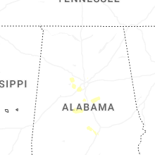
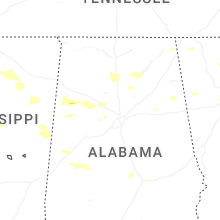
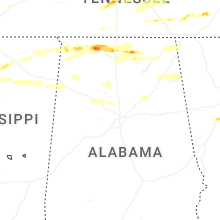
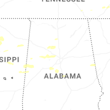

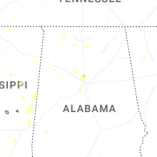
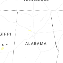
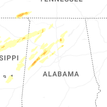


Connect with Interactive Hail Maps