

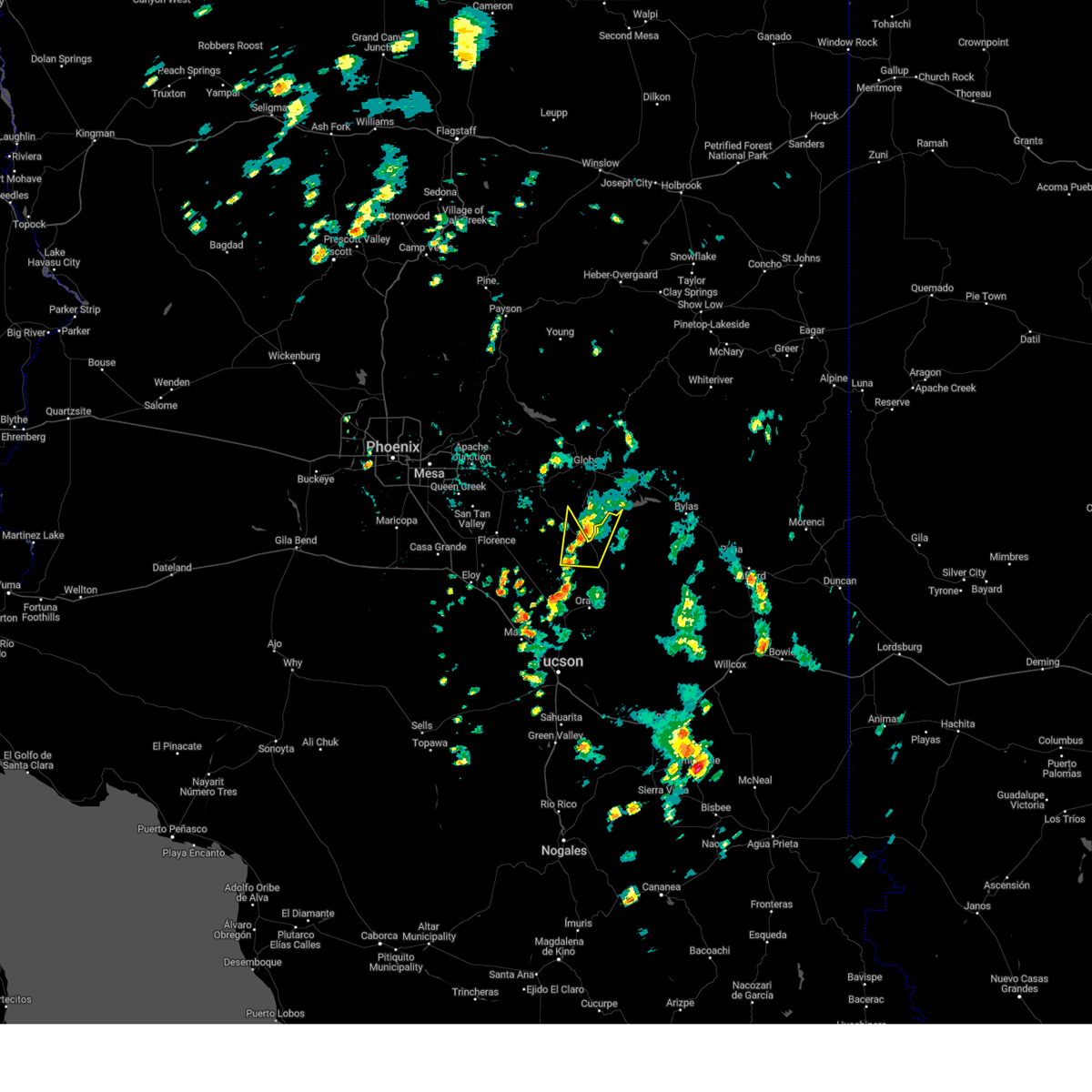
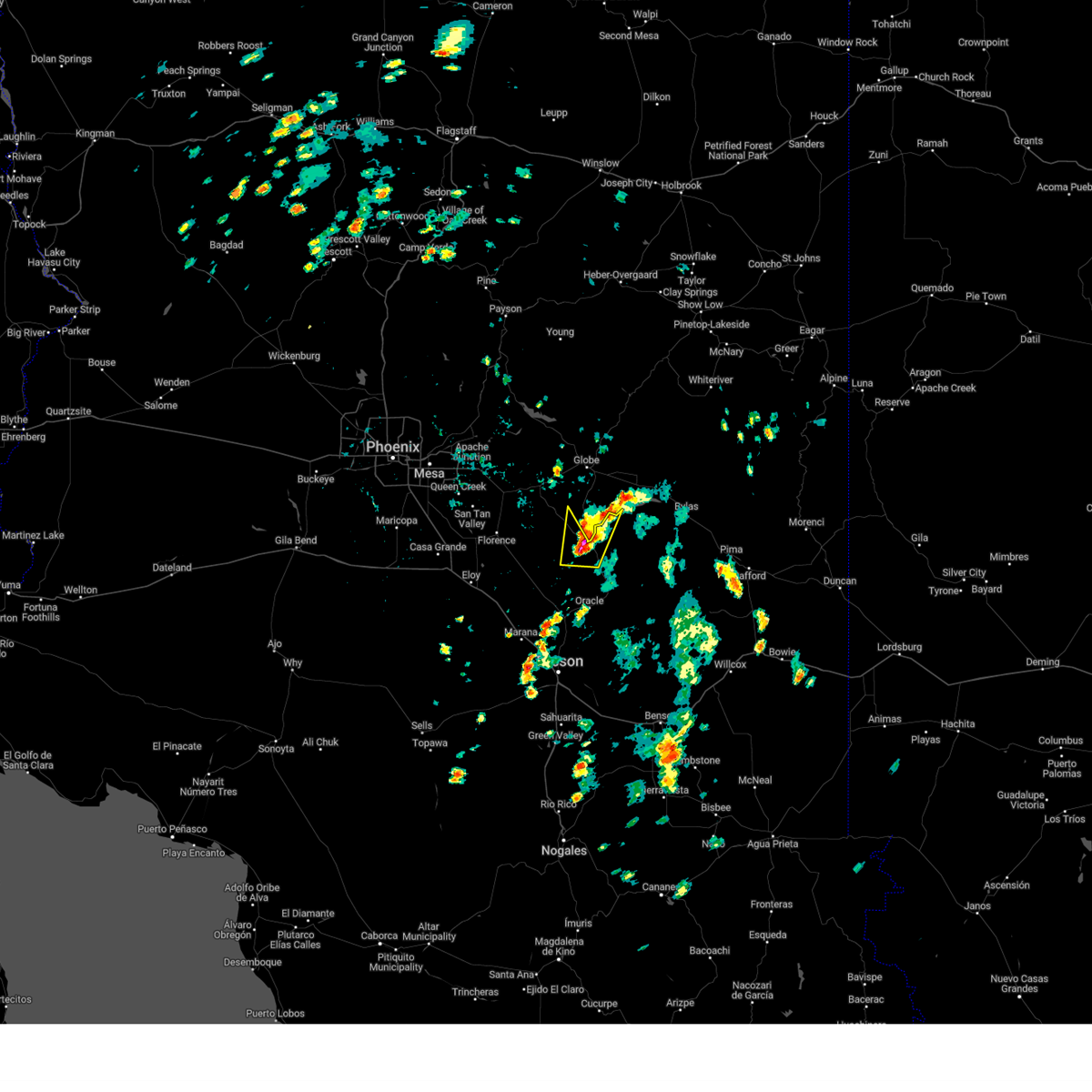
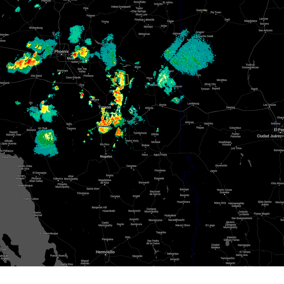
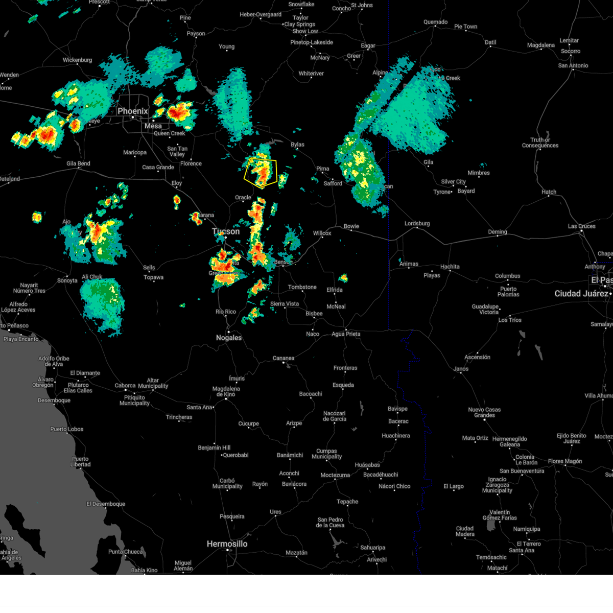
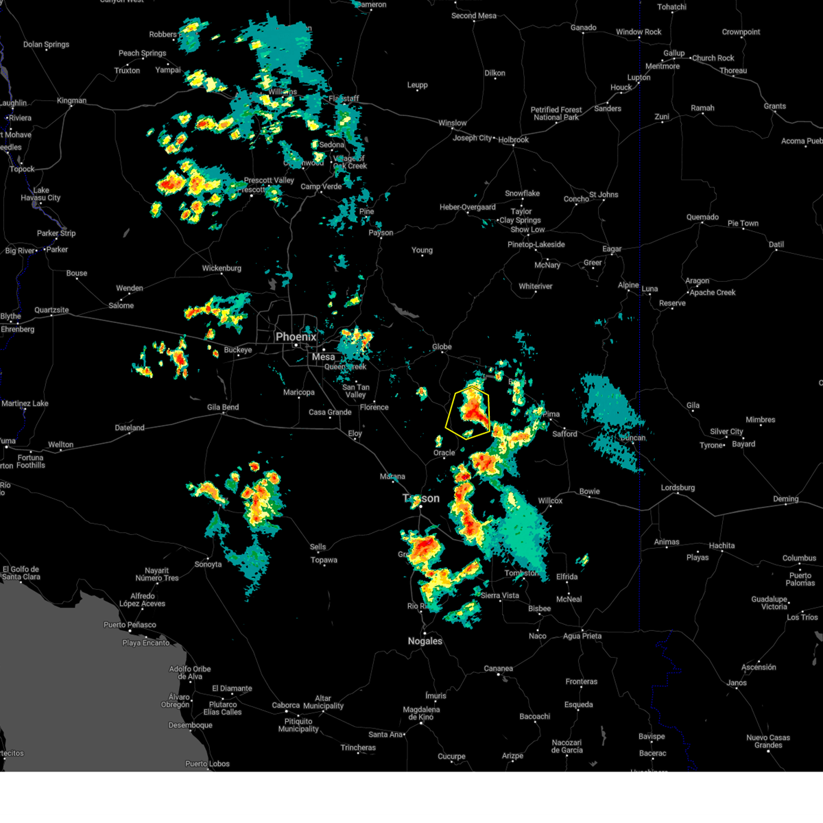
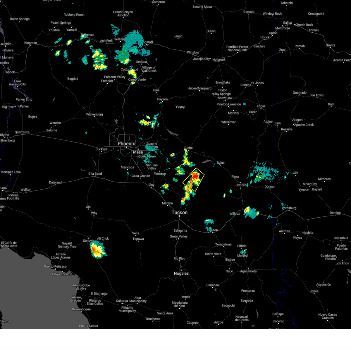
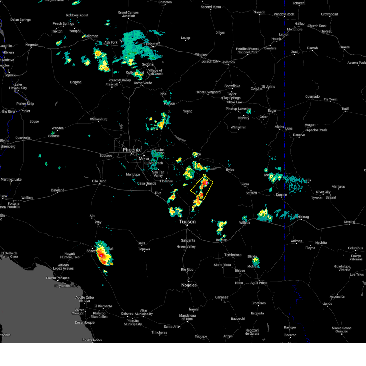
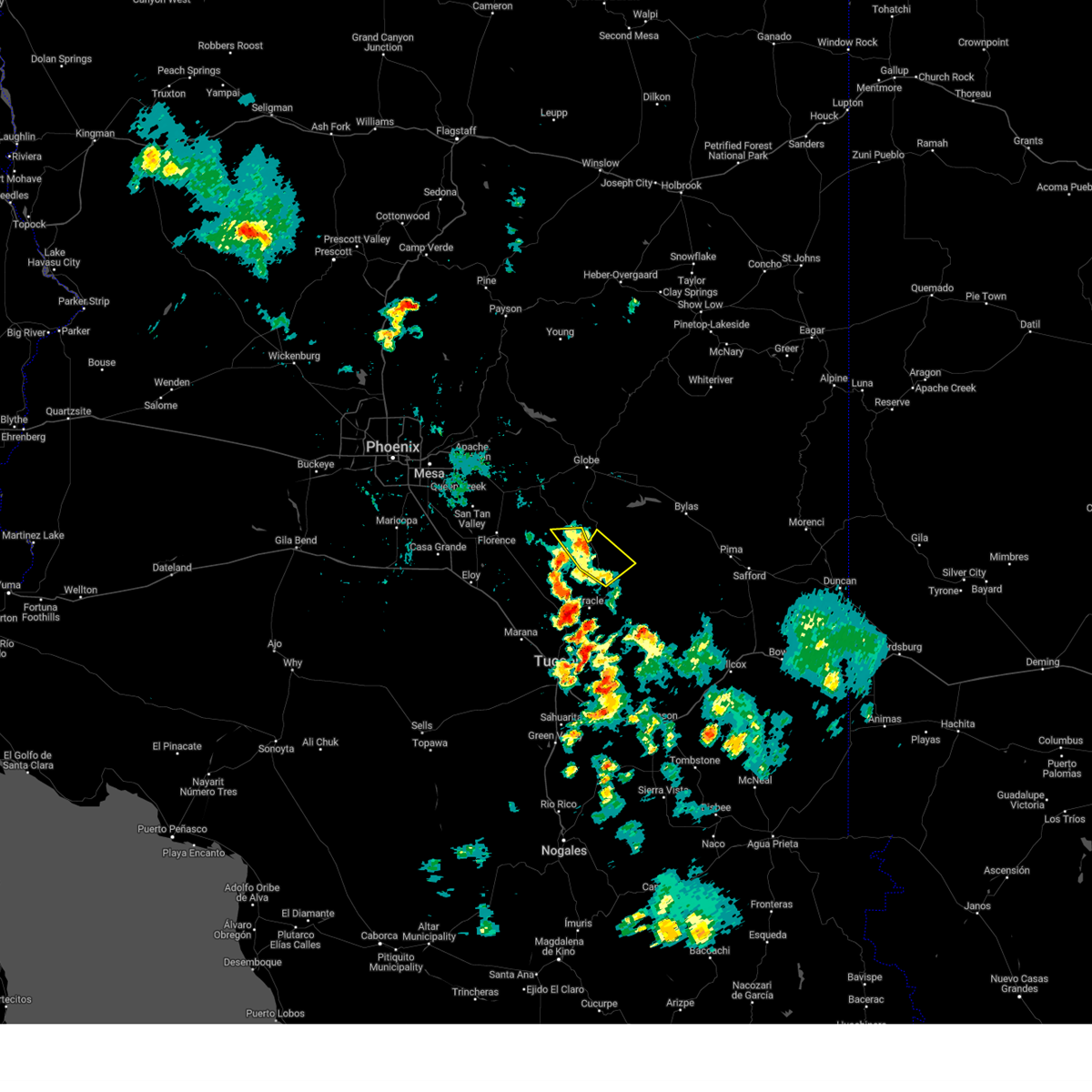
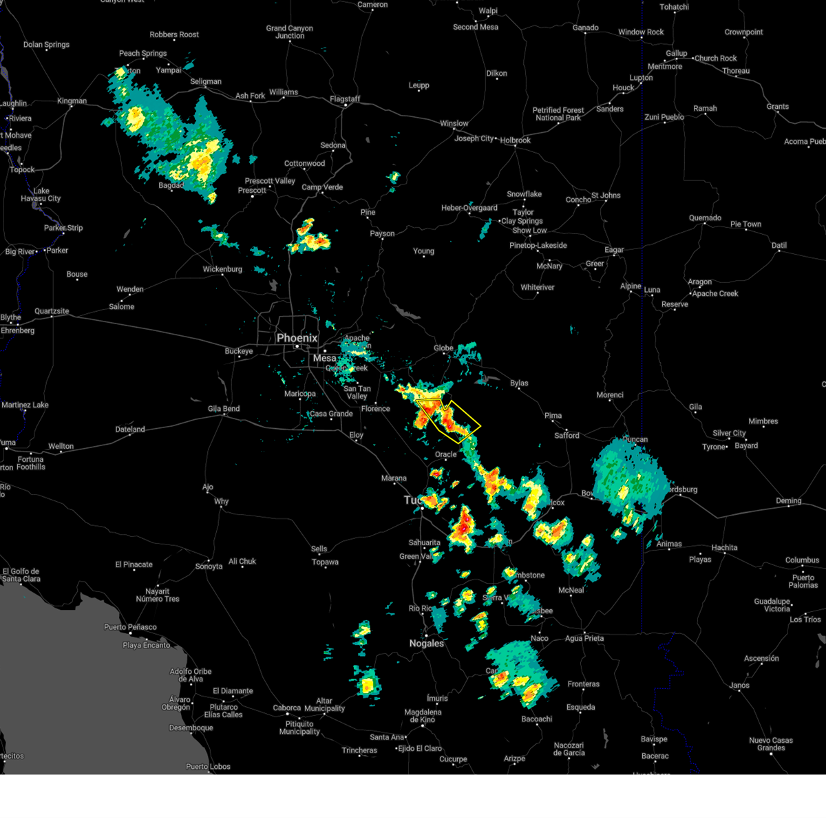
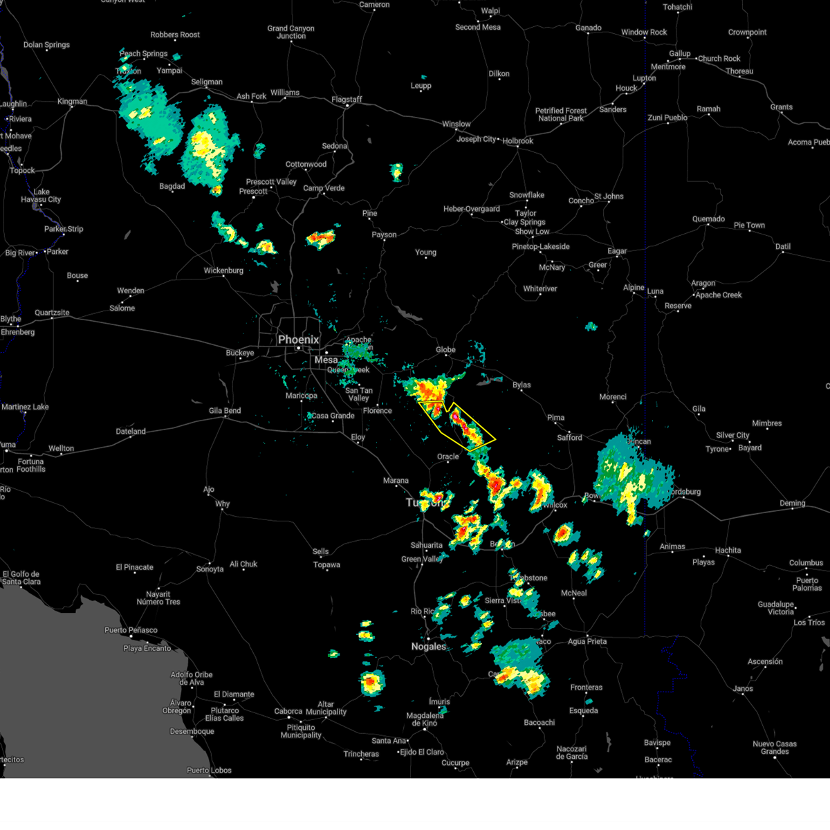
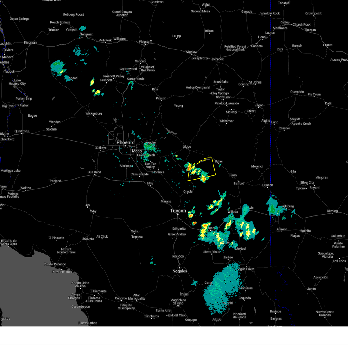
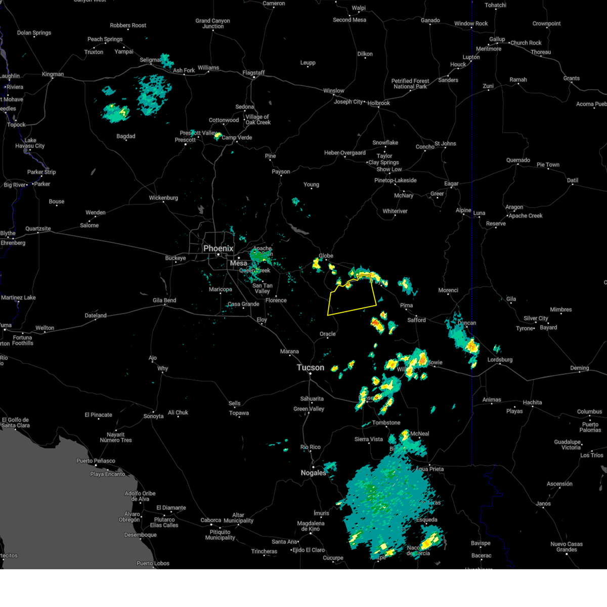
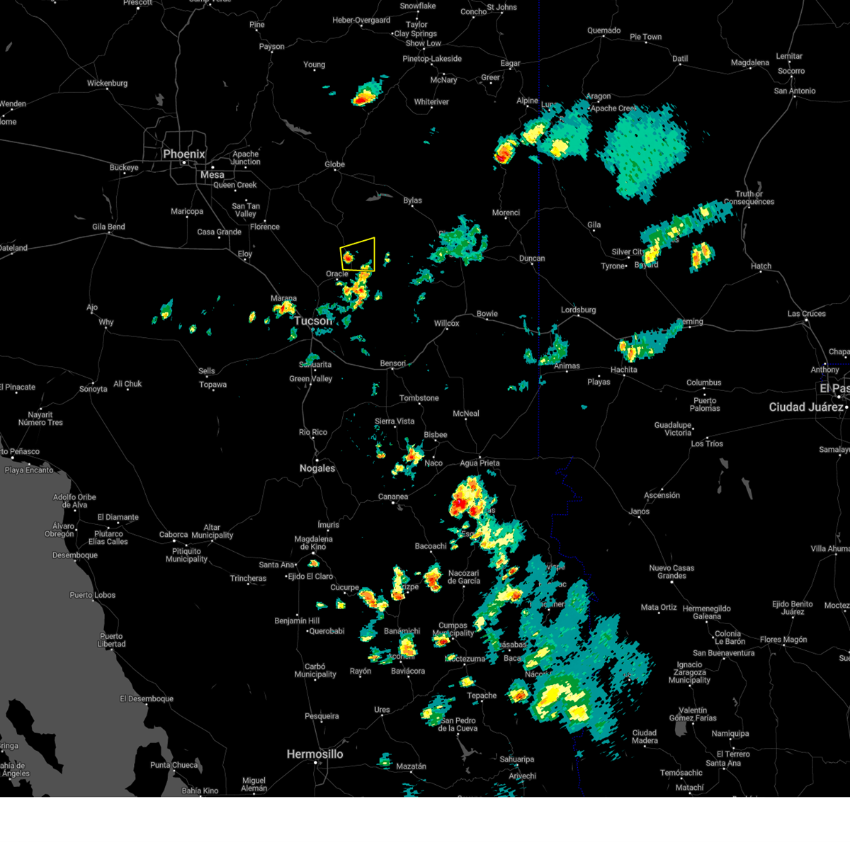
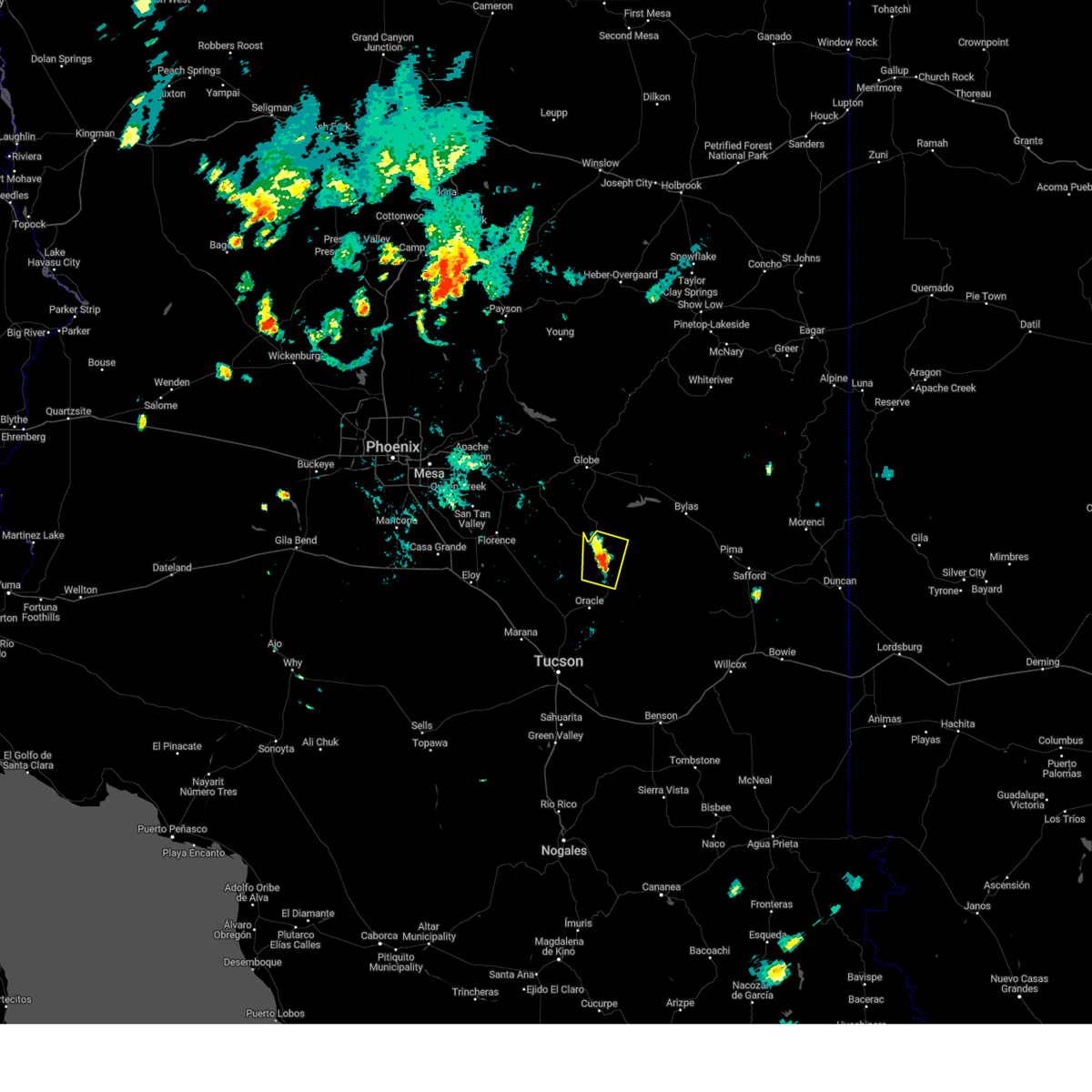
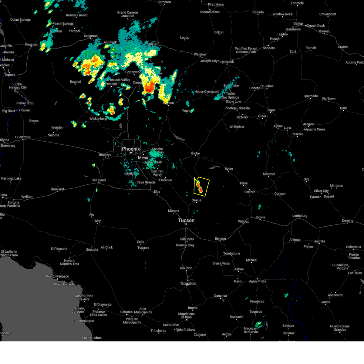
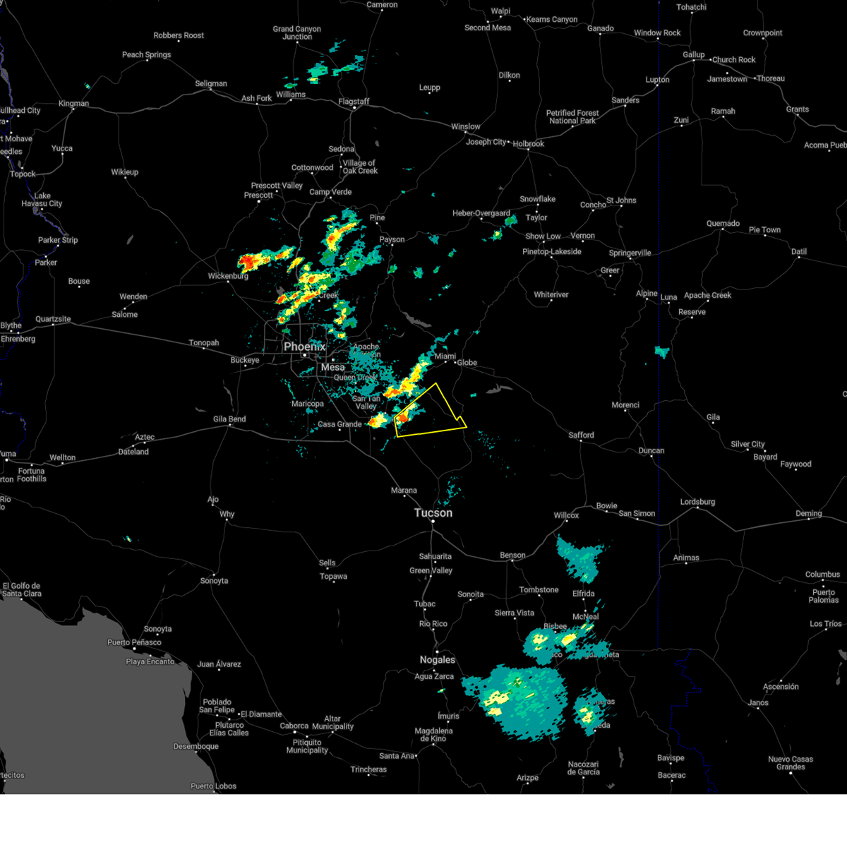
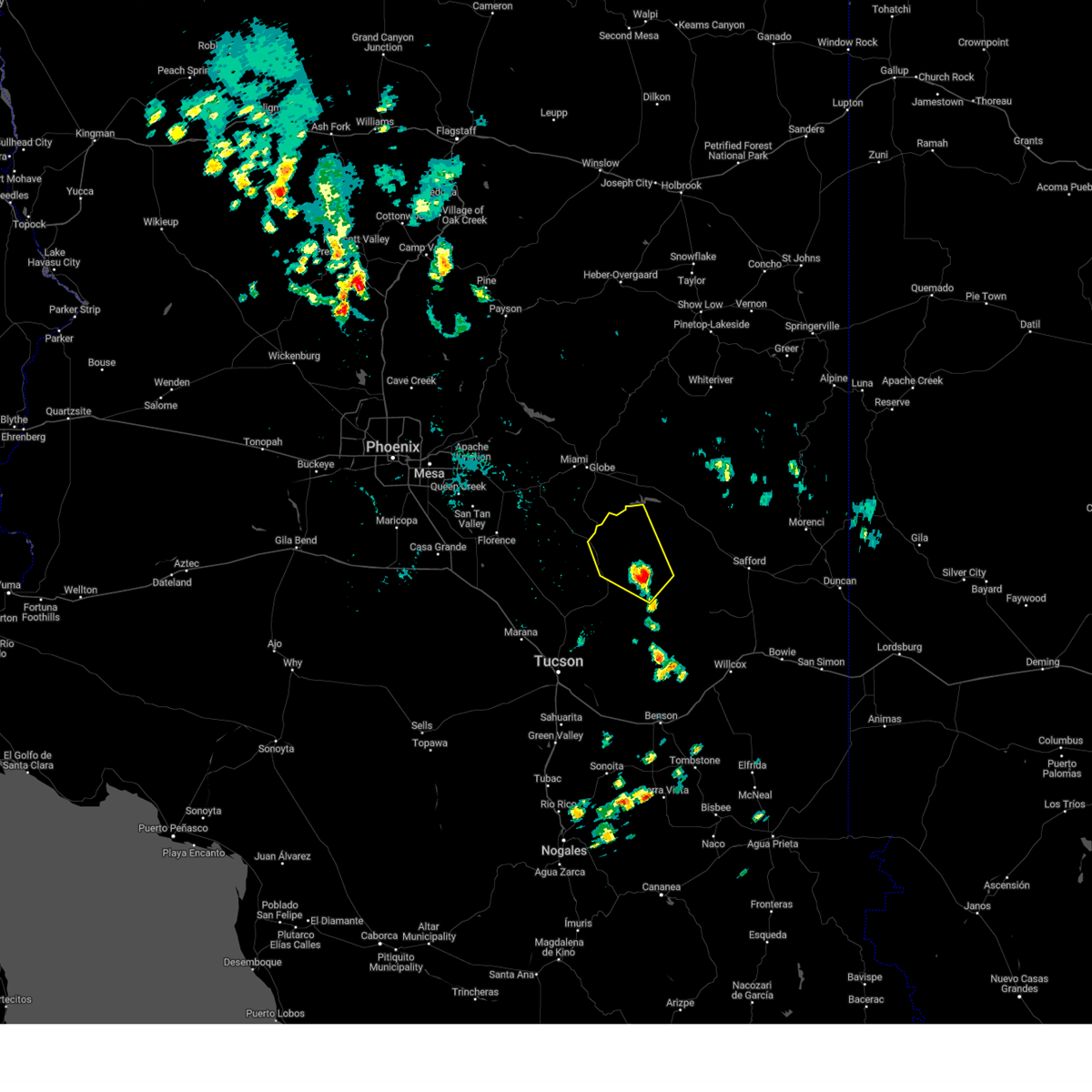
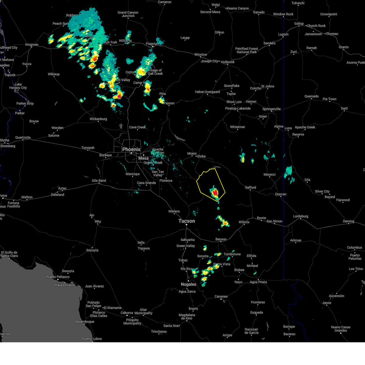
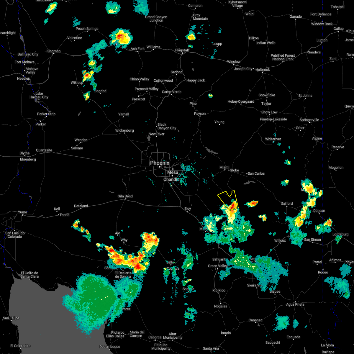
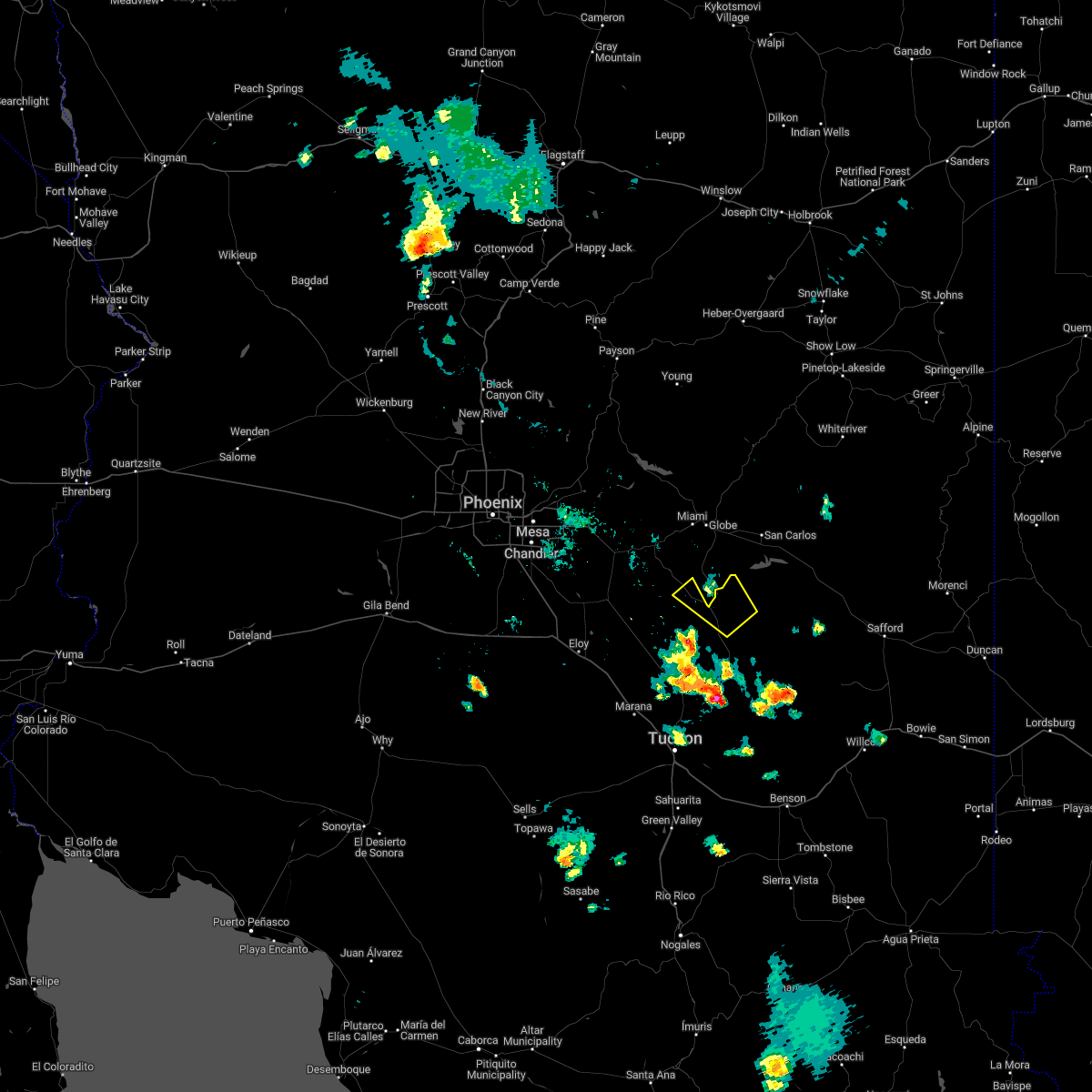
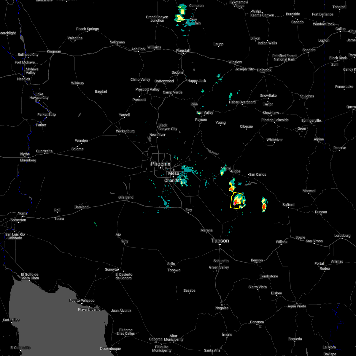
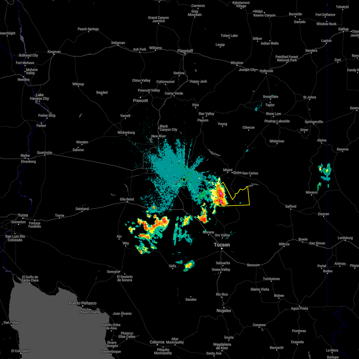
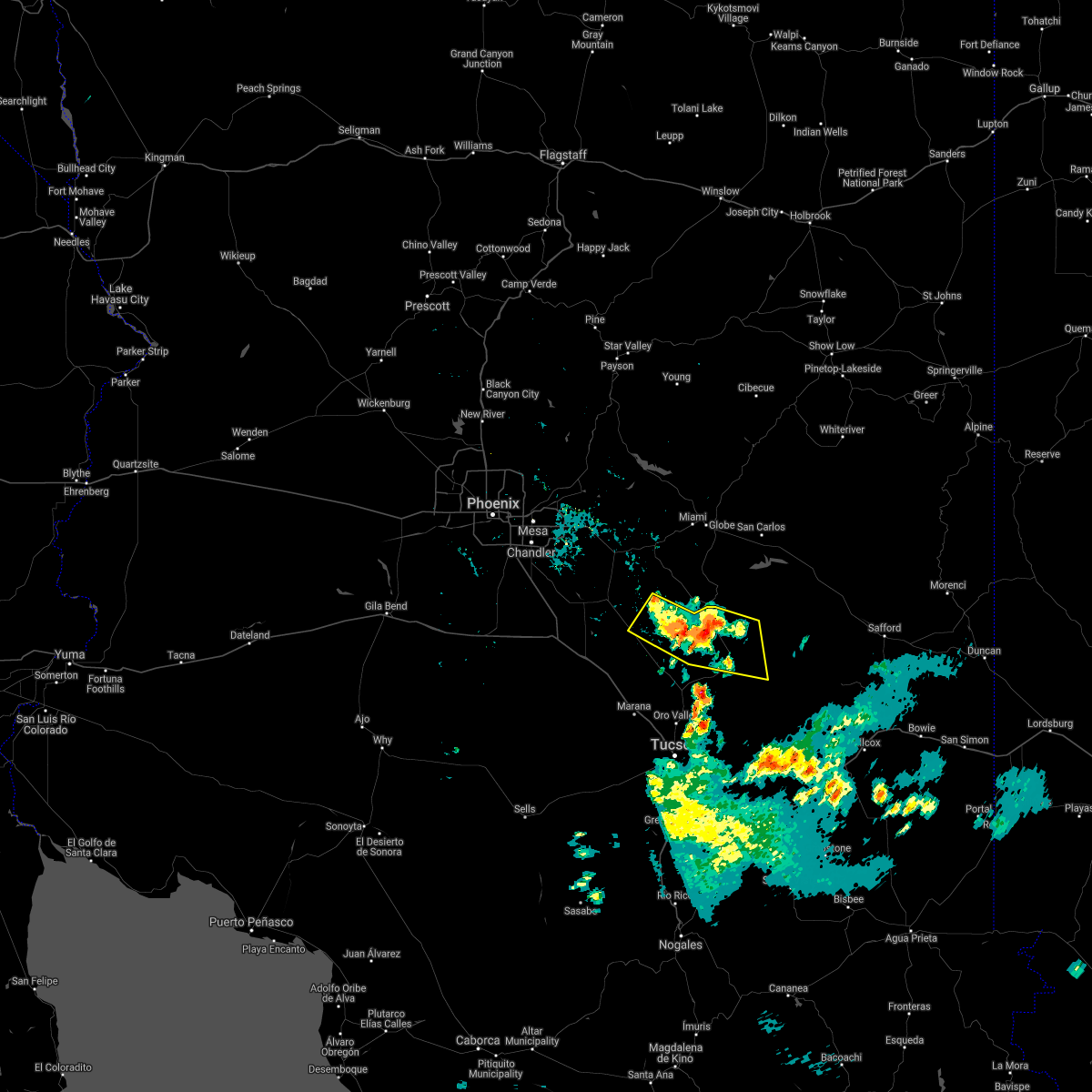
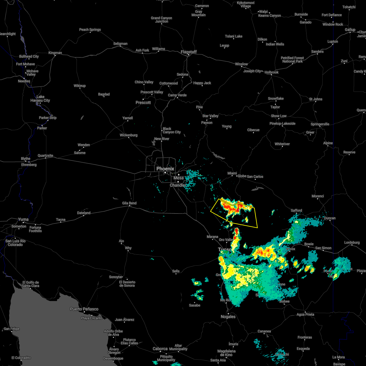
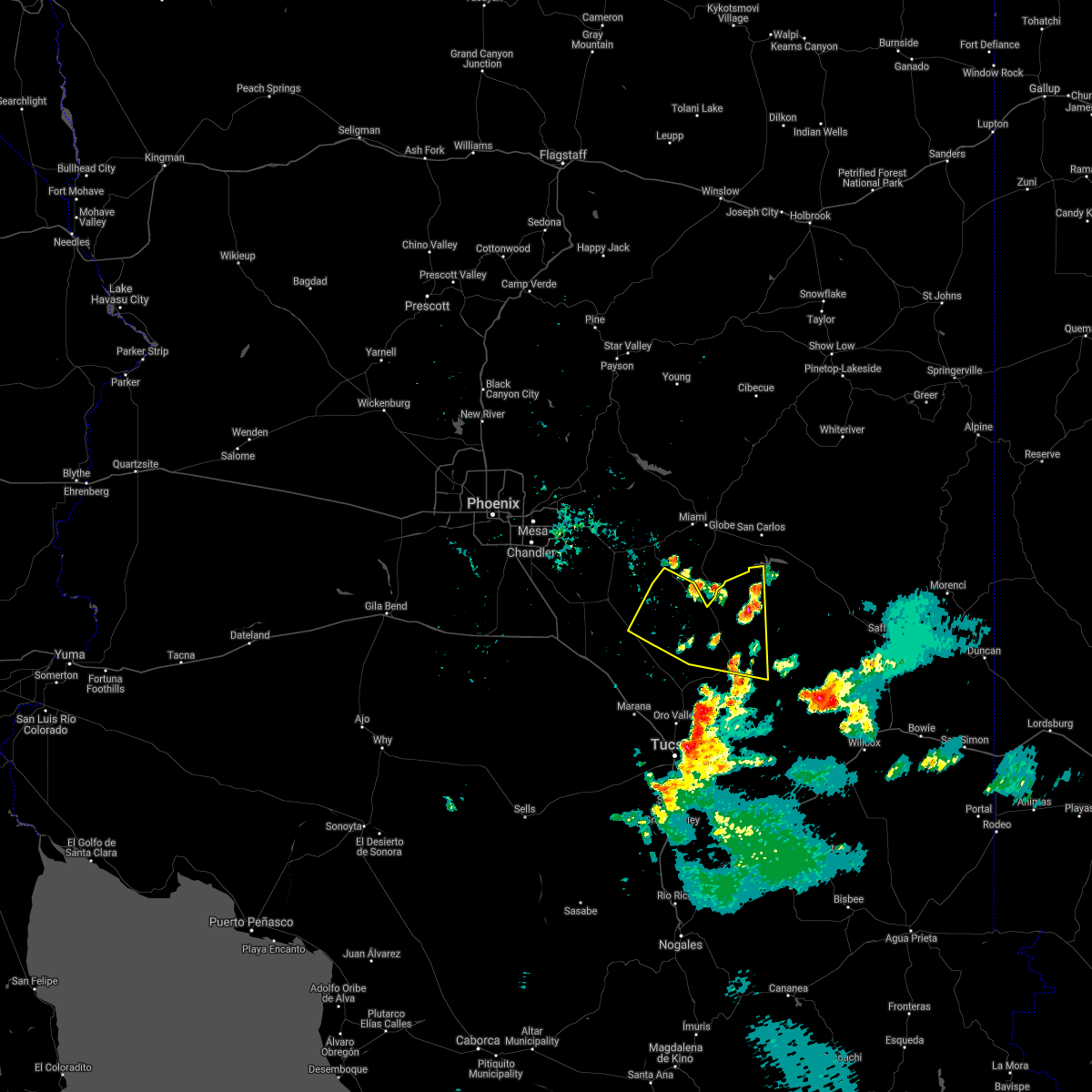
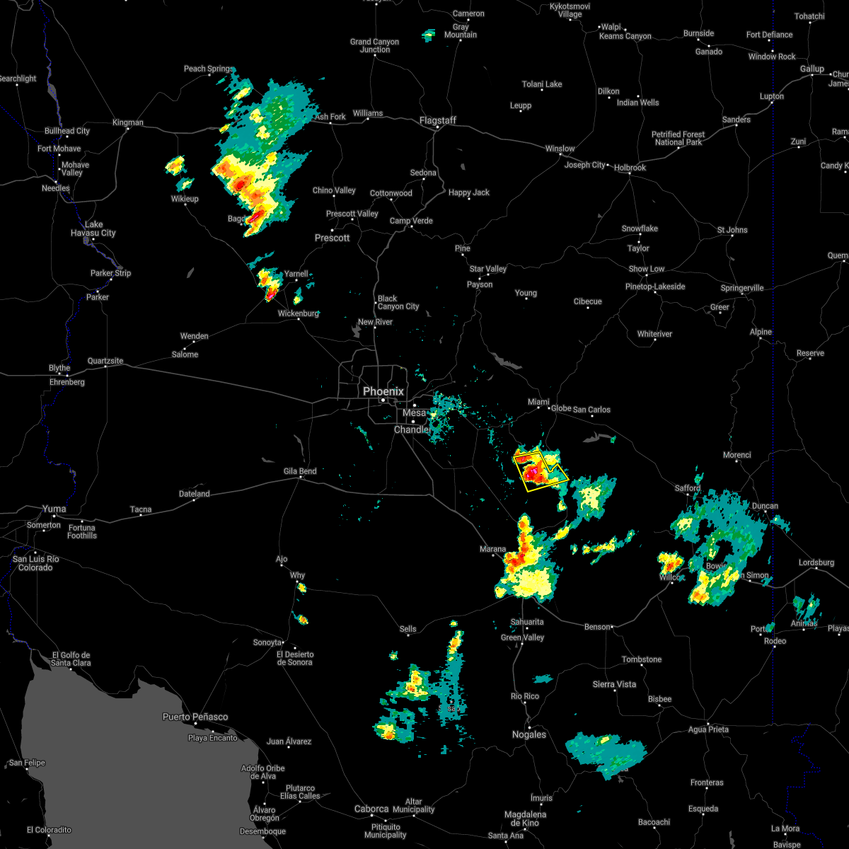
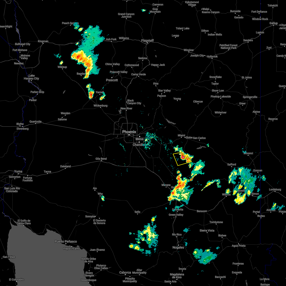
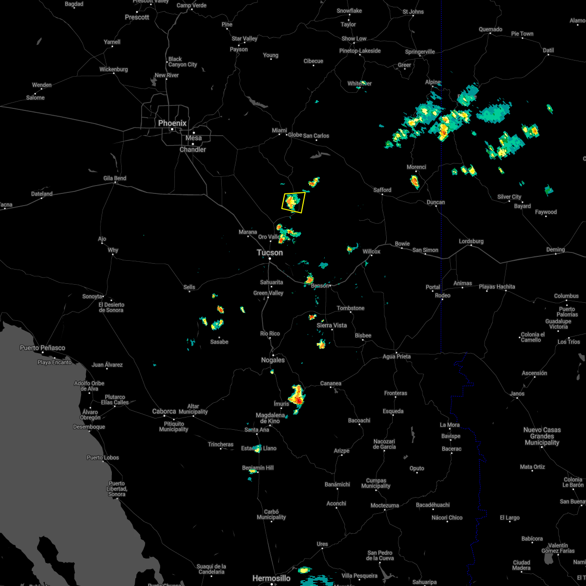
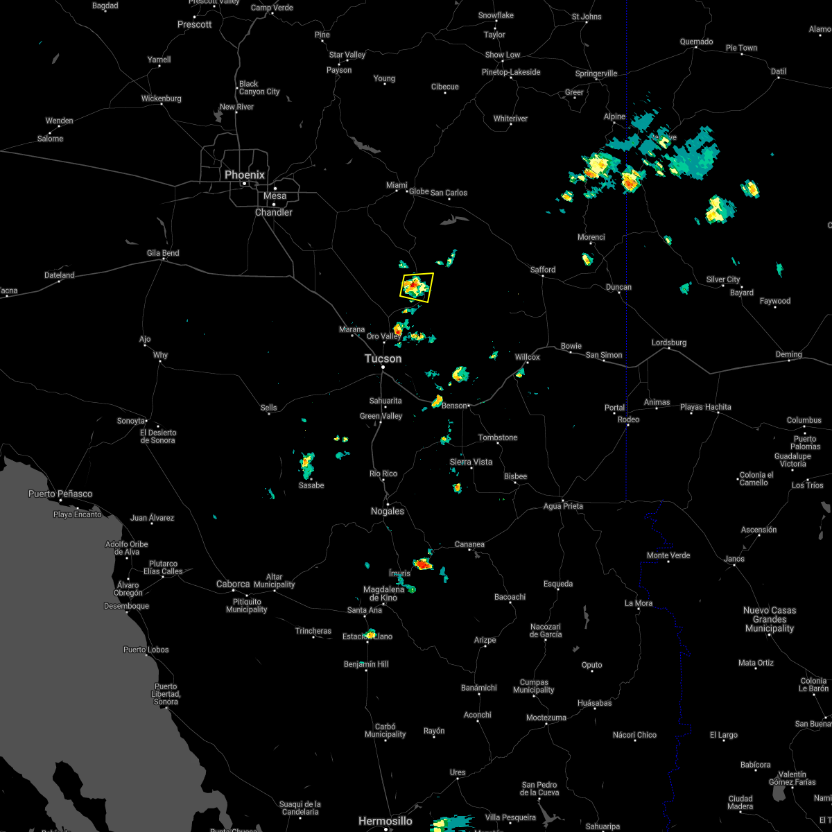
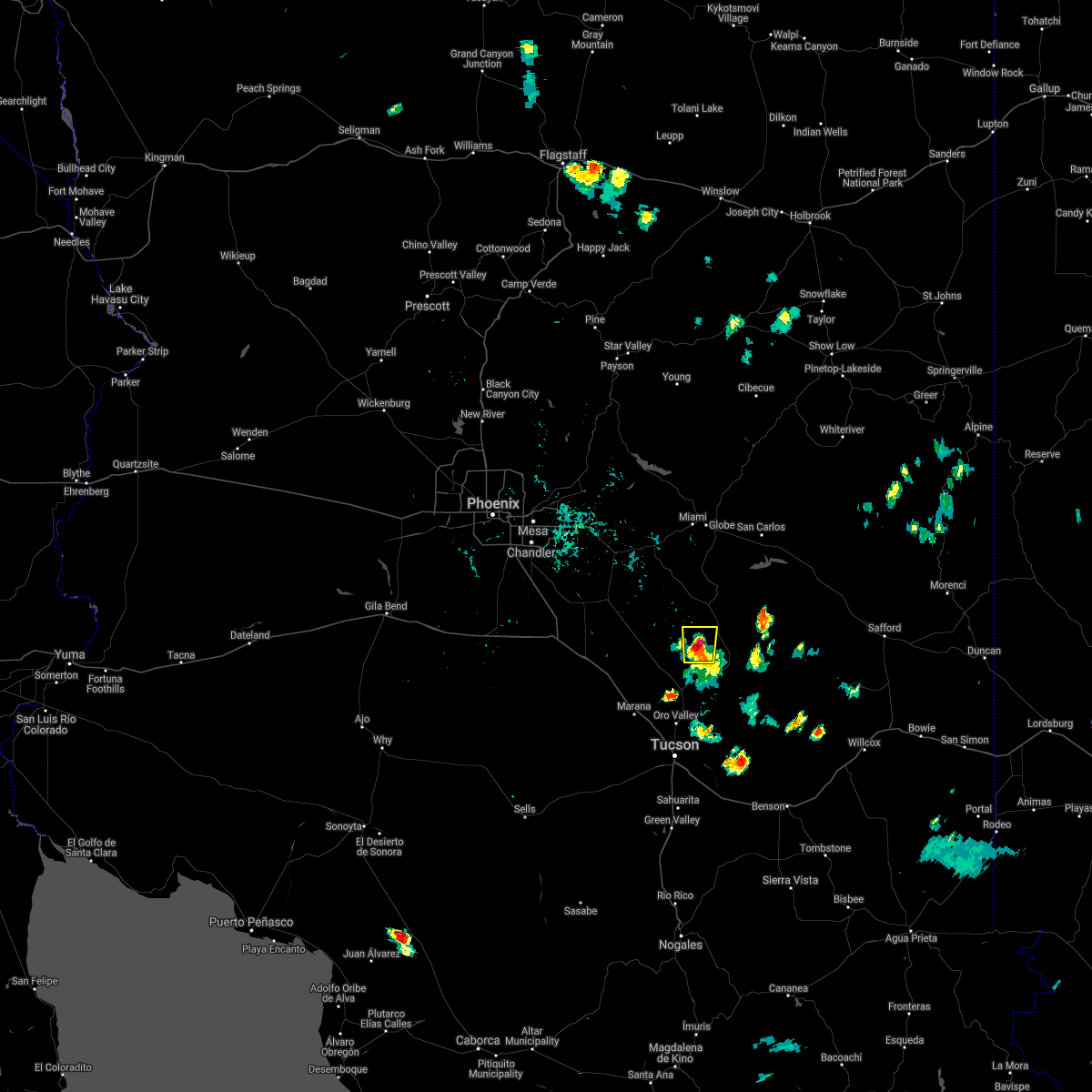
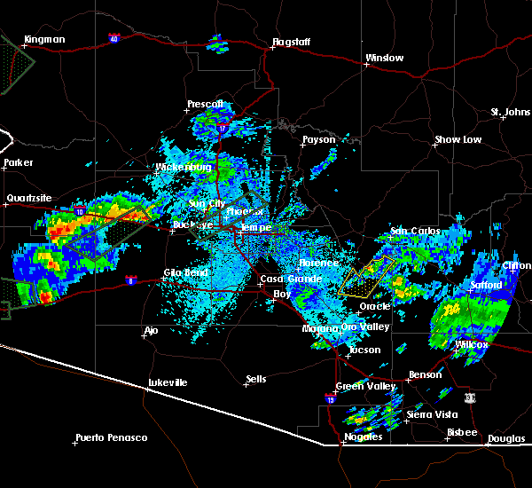
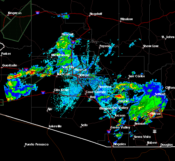
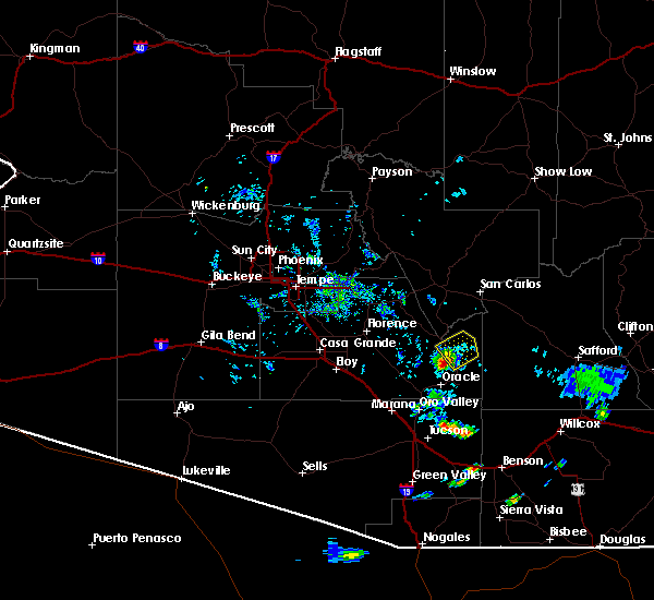
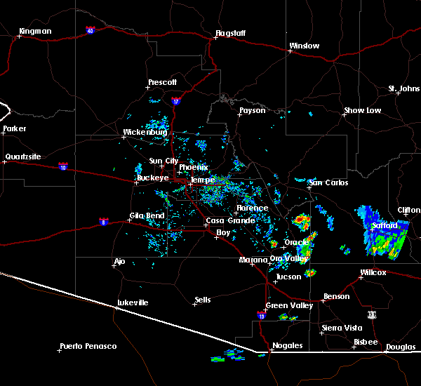
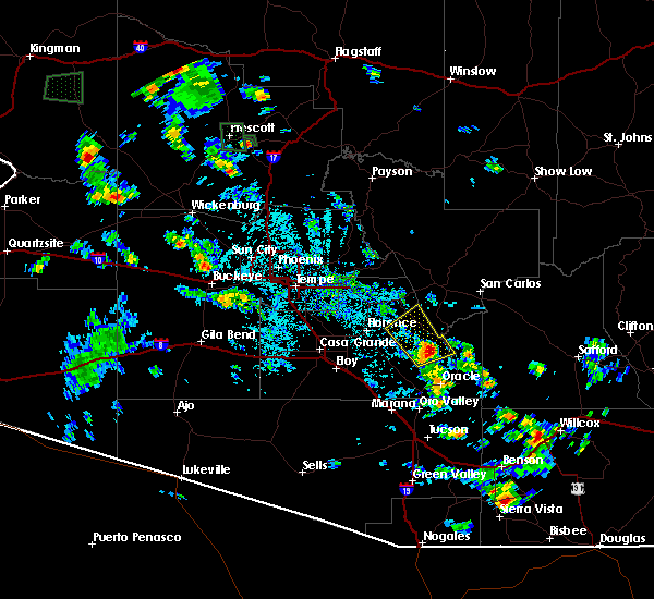
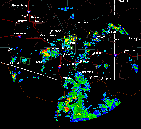
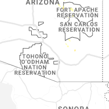
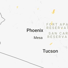
Hail Map for Dudleyville, AZ
The Dudleyville, AZ area has had 0 reports of on-the-ground hail by trained spotters, and has been under severe weather warnings 24 times during the past 12 months. Doppler radar has detected hail at or near Dudleyville, AZ on 55 occasions, including 4 occasions during the past year.
| Name: | Dudleyville, AZ |
| Where Located: | 49.6 miles NNE of Tucson, AZ |
| Map: | Google Map for Dudleyville, AZ |
| Population: | 959 |
| Housing Units: | 423 |
| More Info: | Search Google for Dudleyville, AZ |
1
The Top Recent Hail Date for Dudleyville, AZ is Thursday, August 22, 2024 (9th out of 55)

Hail and Wind Damage Spotted near Dudleyville, AZ
| Date / Time | Report Details |
|---|---|
| 8/22/2024 2:53 PM MST |
 The storm which prompted the warning has weakened below severe limits, and no longer poses an immediate threat to life or property. therefore, the warning will be allowed to expire. however, heavy rain is still possible with this thunderstorm. a flash flood warning remains in effect until 530 pm mst in pinal county for kearny and dudleyville. The storm which prompted the warning has weakened below severe limits, and no longer poses an immediate threat to life or property. therefore, the warning will be allowed to expire. however, heavy rain is still possible with this thunderstorm. a flash flood warning remains in effect until 530 pm mst in pinal county for kearny and dudleyville.
|
| 8/22/2024 2:22 PM MST |
 Svrtwc the national weather service in tucson has issued a * severe thunderstorm warning for, northeastern pinal county in southeastern arizona, * until 300 pm mst. * at 222 pm mst, a severe thunderstorm was located over winkelman, moving north at 5 mph (radar indicated). Hazards include 60 mph wind gusts and quarter size hail. Hail damage to vehicles is expected. Expect wind damage to roofs, siding, and trees. Svrtwc the national weather service in tucson has issued a * severe thunderstorm warning for, northeastern pinal county in southeastern arizona, * until 300 pm mst. * at 222 pm mst, a severe thunderstorm was located over winkelman, moving north at 5 mph (radar indicated). Hazards include 60 mph wind gusts and quarter size hail. Hail damage to vehicles is expected. Expect wind damage to roofs, siding, and trees.
|
| 7/25/2024 6:40 PM MST |
 The storm which prompted the warning has weakened below severe limits, and no longer poses an immediate threat to life or property. therefore, the warning will be allowed to expire. however, heavy rain is still possible with this thunderstorm. The storm which prompted the warning has weakened below severe limits, and no longer poses an immediate threat to life or property. therefore, the warning will be allowed to expire. however, heavy rain is still possible with this thunderstorm.
|
| 7/25/2024 6:21 PM MST |
 At 620 pm mst, a severe thunderstorm was located over aravaipa canyon wilderness, or 12 miles northeast of mammoth, moving south at 10 mph (radar indicated). Hazards include 60 mph wind gusts. Expect damage to roofs, siding, and trees. locations impacted include, dudleyville and aravaipa canyon wilderness. This includes route 77 between mile markers 121 and 129. At 620 pm mst, a severe thunderstorm was located over aravaipa canyon wilderness, or 12 miles northeast of mammoth, moving south at 10 mph (radar indicated). Hazards include 60 mph wind gusts. Expect damage to roofs, siding, and trees. locations impacted include, dudleyville and aravaipa canyon wilderness. This includes route 77 between mile markers 121 and 129.
|
| 7/25/2024 6:05 PM MST |
 Svrtwc the national weather service in tucson has issued a * severe thunderstorm warning for, west central graham county in southeastern arizona, east central pinal county in southeastern arizona, * until 645 pm mst. * at 605 pm mst, a severe thunderstorm was located over aravaipa canyon wilderness, or 14 miles northeast of mammoth, moving south at 5 mph (radar indicated). Hazards include 60 mph wind gusts. expect damage to roofs, siding, and trees Svrtwc the national weather service in tucson has issued a * severe thunderstorm warning for, west central graham county in southeastern arizona, east central pinal county in southeastern arizona, * until 645 pm mst. * at 605 pm mst, a severe thunderstorm was located over aravaipa canyon wilderness, or 14 miles northeast of mammoth, moving south at 5 mph (radar indicated). Hazards include 60 mph wind gusts. expect damage to roofs, siding, and trees
|
| 7/24/2024 6:52 PM MST |
 The storm which prompted the warning has weakened below severe limits, and no longer poses an immediate threat to life or property. therefore, the warning will be allowed to expire. a severe thunderstorm watch remains in effect until 900 pm mst for southeastern arizona. The storm which prompted the warning has weakened below severe limits, and no longer poses an immediate threat to life or property. therefore, the warning will be allowed to expire. a severe thunderstorm watch remains in effect until 900 pm mst for southeastern arizona.
|
| 7/24/2024 6:32 PM MST |
 At 632 pm mst, a severe thunderstorm was located 9 miles southwest of dudleyville, or 12 miles northwest of mammoth, moving southwest at 10 mph (radar indicated). Hazards include 60 mph wind gusts and quarter size hail. Hail damage to vehicles is expected. expect wind damage to roofs, siding, and trees. locations impacted include, oracle and dudleyville. This includes route 77 between mile markers 100 and 107, and between mile markers 117 and 124. At 632 pm mst, a severe thunderstorm was located 9 miles southwest of dudleyville, or 12 miles northwest of mammoth, moving southwest at 10 mph (radar indicated). Hazards include 60 mph wind gusts and quarter size hail. Hail damage to vehicles is expected. expect wind damage to roofs, siding, and trees. locations impacted include, oracle and dudleyville. This includes route 77 between mile markers 100 and 107, and between mile markers 117 and 124.
|
| 7/24/2024 6:07 PM MST |
 Svrtwc the national weather service in tucson has issued a * severe thunderstorm warning for, southeastern pinal county in southeastern arizona, * until 700 pm mst. * at 607 pm mst, a severe thunderstorm was located near dudleyville, or 9 miles south of winkelman, moving southwest at 10 mph (radar indicated). Hazards include 60 mph wind gusts and quarter size hail. Hail damage to vehicles is expected. Expect wind damage to roofs, siding, and trees. Svrtwc the national weather service in tucson has issued a * severe thunderstorm warning for, southeastern pinal county in southeastern arizona, * until 700 pm mst. * at 607 pm mst, a severe thunderstorm was located near dudleyville, or 9 miles south of winkelman, moving southwest at 10 mph (radar indicated). Hazards include 60 mph wind gusts and quarter size hail. Hail damage to vehicles is expected. Expect wind damage to roofs, siding, and trees.
|
| 7/24/2024 5:47 PM MST |
 At 547 pm mst, a severe thunderstorm was located near dudleyville, or 7 miles southeast of winkelman, moving southwest at 10 mph (radar indicated). Hazards include 60 mph wind gusts and quarter size hail. Hail damage to vehicles is expected. expect wind damage to roofs, siding, and trees. locations impacted include, mammoth, dudleyville, and aravaipa canyon wilderness. This includes route 77 between mile markers 112 and 133. At 547 pm mst, a severe thunderstorm was located near dudleyville, or 7 miles southeast of winkelman, moving southwest at 10 mph (radar indicated). Hazards include 60 mph wind gusts and quarter size hail. Hail damage to vehicles is expected. expect wind damage to roofs, siding, and trees. locations impacted include, mammoth, dudleyville, and aravaipa canyon wilderness. This includes route 77 between mile markers 112 and 133.
|
| 7/24/2024 5:24 PM MST |
 Svrtwc the national weather service in tucson has issued a * severe thunderstorm warning for, east central pinal county in southeastern arizona, * until 615 pm mst. * at 524 pm mst, a severe thunderstorm was located 7 miles northwest of aravaipa canyon wilderness, or 9 miles east of winkelman, moving southwest at 10 mph (radar indicated). Hazards include 60 mph wind gusts and quarter size hail. Hail damage to vehicles is expected. Expect wind damage to roofs, siding, and trees. Svrtwc the national weather service in tucson has issued a * severe thunderstorm warning for, east central pinal county in southeastern arizona, * until 615 pm mst. * at 524 pm mst, a severe thunderstorm was located 7 miles northwest of aravaipa canyon wilderness, or 9 miles east of winkelman, moving southwest at 10 mph (radar indicated). Hazards include 60 mph wind gusts and quarter size hail. Hail damage to vehicles is expected. Expect wind damage to roofs, siding, and trees.
|
| 7/21/2024 4:26 PM MST |
 The storm which prompted the warning has weakened below severe limits, and no longer poses an immediate threat to life or property. therefore, the warning will be allowed to expire. a severe thunderstorm watch remains in effect until 800 pm mst for southeastern arizona. The storm which prompted the warning has weakened below severe limits, and no longer poses an immediate threat to life or property. therefore, the warning will be allowed to expire. a severe thunderstorm watch remains in effect until 800 pm mst for southeastern arizona.
|
| 7/21/2024 4:06 PM MST |
 At 406 pm mst, severe thunderstorms were located over mammoth, moving south at 15 mph (radar indicated). Hazards include 60 mph wind gusts and nickel size hail. Expect damage to roofs, siding, and trees. locations impacted include, oracle, mammoth, saddlebrooke, san manuel, saddlebrooke ranch, dudleyville, aravaipa canyon wilderness, campo bonito, and biosphere 2. This includes route 77 between mile markers 93 and 131. At 406 pm mst, severe thunderstorms were located over mammoth, moving south at 15 mph (radar indicated). Hazards include 60 mph wind gusts and nickel size hail. Expect damage to roofs, siding, and trees. locations impacted include, oracle, mammoth, saddlebrooke, san manuel, saddlebrooke ranch, dudleyville, aravaipa canyon wilderness, campo bonito, and biosphere 2. This includes route 77 between mile markers 93 and 131.
|
| 7/21/2024 3:48 PM MST |
 Svrtwc the national weather service in tucson has issued a * severe thunderstorm warning for, southeastern pinal county in southeastern arizona, * until 430 pm mst. * at 347 pm mst, severe thunderstorms were located near mammoth, moving south at 15 mph (radar indicated). Hazards include 60 mph wind gusts and nickel size hail. expect damage to roofs, siding, and trees Svrtwc the national weather service in tucson has issued a * severe thunderstorm warning for, southeastern pinal county in southeastern arizona, * until 430 pm mst. * at 347 pm mst, severe thunderstorms were located near mammoth, moving south at 15 mph (radar indicated). Hazards include 60 mph wind gusts and nickel size hail. expect damage to roofs, siding, and trees
|
| 7/18/2024 5:26 PM MST |
 The storm which prompted the warning in southeast pinal county has weakened below severe limits. therefore, the warning will be allowed to expire. however, heavy rain is still possible with this thunderstorm. The storm which prompted the warning in southeast pinal county has weakened below severe limits. therefore, the warning will be allowed to expire. however, heavy rain is still possible with this thunderstorm.
|
| 7/18/2024 4:44 PM MST |
 Svrtwc the national weather service in tucson has issued a * severe thunderstorm warning for, southeastern pinal county in southeastern arizona, * until 530 pm mst. * at 444 pm mst, a severe thunderstorm was located near mammoth, moving southwest at 5 to 10 mph (radar indicated). Hazards include 60 mph wind gusts. expect damage to roofs, siding, and trees Svrtwc the national weather service in tucson has issued a * severe thunderstorm warning for, southeastern pinal county in southeastern arizona, * until 530 pm mst. * at 444 pm mst, a severe thunderstorm was located near mammoth, moving southwest at 5 to 10 mph (radar indicated). Hazards include 60 mph wind gusts. expect damage to roofs, siding, and trees
|
| 7/14/2024 7:19 PM MST |
 the severe thunderstorm warning has been cancelled and is no longer in effect the severe thunderstorm warning has been cancelled and is no longer in effect
|
| 7/14/2024 6:49 PM MST |
 Svrtwc the national weather service in tucson has issued a * severe thunderstorm warning for, southeastern pinal county in southeastern arizona, * until 730 pm mst. * at 649 pm mst, a severe thunderstorm was located over oracle, moving northwest at 10 mph (radar indicated). Hazards include 60 mph wind gusts and penny size hail. expect damage to roofs, siding, and trees Svrtwc the national weather service in tucson has issued a * severe thunderstorm warning for, southeastern pinal county in southeastern arizona, * until 730 pm mst. * at 649 pm mst, a severe thunderstorm was located over oracle, moving northwest at 10 mph (radar indicated). Hazards include 60 mph wind gusts and penny size hail. expect damage to roofs, siding, and trees
|
| 7/11/2024 4:51 PM MST |
 The storm which prompted the warning has moved out of the area. therefore, the warning will be allowed to expire. however, gusty winds are still possible with this thunderstorm. remember, a severe thunderstorm warning still remains in effect for pinal county until 4:30 pm mst. The storm which prompted the warning has moved out of the area. therefore, the warning will be allowed to expire. however, gusty winds are still possible with this thunderstorm. remember, a severe thunderstorm warning still remains in effect for pinal county until 4:30 pm mst.
|
| 7/11/2024 4:33 PM MST |
 the severe thunderstorm warning has been cancelled and is no longer in effect the severe thunderstorm warning has been cancelled and is no longer in effect
|
| 7/11/2024 4:33 PM MST |
 At 432 pm mst, a severe thunderstorm was located near dudleyville, or 8 miles north of mammoth, moving southwest at 15 mph (radar indicated). Hazards include 60 mph wind gusts and quarter size hail. Hail damage to vehicles is expected. expect wind damage to roofs, siding, and trees. locations impacted include, mammoth, kearny, dudleyville, and aravaipa canyon wilderness. this includes the following highways, route 77 between mile markers 116 and 134. Route 177 between mile markers 139 and 145. At 432 pm mst, a severe thunderstorm was located near dudleyville, or 8 miles north of mammoth, moving southwest at 15 mph (radar indicated). Hazards include 60 mph wind gusts and quarter size hail. Hail damage to vehicles is expected. expect wind damage to roofs, siding, and trees. locations impacted include, mammoth, kearny, dudleyville, and aravaipa canyon wilderness. this includes the following highways, route 77 between mile markers 116 and 134. Route 177 between mile markers 139 and 145.
|
| 7/11/2024 4:17 PM MST |
 Svrtwc the national weather service in tucson has issued a * severe thunderstorm warning for, southwestern graham county in southeastern arizona, east central pinal county in southeastern arizona, * until 500 pm mst. * at 417 pm mst, a severe thunderstorm was located near dudleyville, or 9 miles north of mammoth, moving southwest at 15 mph (radar indicated). Hazards include 60 mph wind gusts and quarter size hail. Hail damage to vehicles is expected. Expect wind damage to roofs, siding, and trees. Svrtwc the national weather service in tucson has issued a * severe thunderstorm warning for, southwestern graham county in southeastern arizona, east central pinal county in southeastern arizona, * until 500 pm mst. * at 417 pm mst, a severe thunderstorm was located near dudleyville, or 9 miles north of mammoth, moving southwest at 15 mph (radar indicated). Hazards include 60 mph wind gusts and quarter size hail. Hail damage to vehicles is expected. Expect wind damage to roofs, siding, and trees.
|
| 7/9/2024 5:33 PM MST |
 The storm which prompted the warning has weakened below severe limits, and has exited the warned area. therefore, the warning has been allowed to expire. The storm which prompted the warning has weakened below severe limits, and has exited the warned area. therefore, the warning has been allowed to expire.
|
| 7/9/2024 4:40 PM MST |
 Svrtwc the national weather service in tucson has issued a * severe thunderstorm warning for, west central graham county in southeastern arizona, east central pinal county in southeastern arizona, * until 530 pm mst. * at 438 pm mst, a severe thunderstorm was located near san carlos reservoir, or about 13 miles north of aravaipa canyon wilderness, moving south at 15 to 20 mph (radar indicated). Hazards include 60 mph wind gusts and penny size hail. expect damage to roofs, siding, and trees Svrtwc the national weather service in tucson has issued a * severe thunderstorm warning for, west central graham county in southeastern arizona, east central pinal county in southeastern arizona, * until 530 pm mst. * at 438 pm mst, a severe thunderstorm was located near san carlos reservoir, or about 13 miles north of aravaipa canyon wilderness, moving south at 15 to 20 mph (radar indicated). Hazards include 60 mph wind gusts and penny size hail. expect damage to roofs, siding, and trees
|
| 7/2/2024 4:47 PM MST |
 Svrtwc the national weather service in tucson has issued a * severe thunderstorm warning for, east central pinal county in southeastern arizona, * until 530 pm mst. * at 447 pm mst, a severe thunderstorm was located over mammoth, moving east at 20 mph (radar indicated). Hazards include 60 mph wind gusts and quarter size hail. Hail damage to vehicles is expected. Expect wind damage to roofs, siding, and trees. Svrtwc the national weather service in tucson has issued a * severe thunderstorm warning for, east central pinal county in southeastern arizona, * until 530 pm mst. * at 447 pm mst, a severe thunderstorm was located over mammoth, moving east at 20 mph (radar indicated). Hazards include 60 mph wind gusts and quarter size hail. Hail damage to vehicles is expected. Expect wind damage to roofs, siding, and trees.
|
| 6/25/2024 4:34 PM MST |
 the severe thunderstorm warning has been cancelled and is no longer in effect the severe thunderstorm warning has been cancelled and is no longer in effect
|
| 6/25/2024 4:15 PM MST |
 Svrtwc the national weather service in tucson has issued a * severe thunderstorm warning for, east central pinal county in southeastern arizona, * until 500 pm mst. * at 415 pm mst, a severe thunderstorm was located near dudleyville, or 8 miles north of mammoth, moving north at 15 mph (radar indicated). Hazards include 60 mph wind gusts and penny size hail. expect damage to roofs, siding, and trees Svrtwc the national weather service in tucson has issued a * severe thunderstorm warning for, east central pinal county in southeastern arizona, * until 500 pm mst. * at 415 pm mst, a severe thunderstorm was located near dudleyville, or 8 miles north of mammoth, moving north at 15 mph (radar indicated). Hazards include 60 mph wind gusts and penny size hail. expect damage to roofs, siding, and trees
|
| 9/12/2023 10:15 PM MST |
 At 1015 pm mst, a severe thunderstorm was located 9 miles southeast of florence, moving east at 25 mph (radar indicated). Hazards include 60 mph wind gusts and nickel size hail. expect damage to roofs, siding, and trees At 1015 pm mst, a severe thunderstorm was located 9 miles southeast of florence, moving east at 25 mph (radar indicated). Hazards include 60 mph wind gusts and nickel size hail. expect damage to roofs, siding, and trees
|
| 7/28/2023 4:03 PM MST |
 At 402 pm mst, a severe thunderstorm was located 7 miles southeast of aravaipa canyon wilderness, or 14 miles northeast of mammoth, moving northwest at 10 mph. while the storm has started to weaken, gusty outflow winds will occur miles away from the storm (radar indicated). Hazards include 60 mph wind gusts and penny size hail. Expect damage to roofs, siding, and trees. locations impacted include, dudleyville, aravaipa canyon wilderness, san carlos reservoir and klondyke. hail threat, radar indicated max hail size, 0. 75 in wind threat, radar indicated max wind gust, 60 mph. At 402 pm mst, a severe thunderstorm was located 7 miles southeast of aravaipa canyon wilderness, or 14 miles northeast of mammoth, moving northwest at 10 mph. while the storm has started to weaken, gusty outflow winds will occur miles away from the storm (radar indicated). Hazards include 60 mph wind gusts and penny size hail. Expect damage to roofs, siding, and trees. locations impacted include, dudleyville, aravaipa canyon wilderness, san carlos reservoir and klondyke. hail threat, radar indicated max hail size, 0. 75 in wind threat, radar indicated max wind gust, 60 mph.
|
| 7/28/2023 3:50 PM MST |
 At 349 pm mst, a severe thunderstorm was located 9 miles southeast of aravaipa canyon wilderness, or 14 miles east of mammoth, moving northwest at 10 mph (radar indicated). Hazards include 60 mph wind gusts and quarter size hail. Hail damage to vehicles is expected. Expect wind damage to roofs, siding, and trees. At 349 pm mst, a severe thunderstorm was located 9 miles southeast of aravaipa canyon wilderness, or 14 miles east of mammoth, moving northwest at 10 mph (radar indicated). Hazards include 60 mph wind gusts and quarter size hail. Hail damage to vehicles is expected. Expect wind damage to roofs, siding, and trees.
|
| 7/17/2023 6:21 PM MST |
 The severe thunderstorm warning for southeastern pinal county will expire at 630 pm mst, the severe thunderstorm which prompted the warning has weakened. therefore, the warning will be allowed to expire. however gusty winds and heavy rain are still possible with this thunderstorm. The severe thunderstorm warning for southeastern pinal county will expire at 630 pm mst, the severe thunderstorm which prompted the warning has weakened. therefore, the warning will be allowed to expire. however gusty winds and heavy rain are still possible with this thunderstorm.
|
| 7/17/2023 5:43 PM MST |
 At 542 pm mst, a severe thunderstorm was located over mammoth, moving northwest at 15 mph (radar indicated). Hazards include 60 mph wind gusts and quarter size hail. Hail damage to vehicles is expected. Expect wind damage to roofs, siding, and trees. At 542 pm mst, a severe thunderstorm was located over mammoth, moving northwest at 15 mph (radar indicated). Hazards include 60 mph wind gusts and quarter size hail. Hail damage to vehicles is expected. Expect wind damage to roofs, siding, and trees.
|
| 9/21/2022 4:50 PM MST |
 At 450 pm mst, a severe thunderstorm was located over oracle, moving north at 25 mph (radar indicated). Hazards include 60 mph wind gusts and quarter size hail. Hail damage to vehicles is expected. Expect wind damage to roofs, siding, and trees. At 450 pm mst, a severe thunderstorm was located over oracle, moving north at 25 mph (radar indicated). Hazards include 60 mph wind gusts and quarter size hail. Hail damage to vehicles is expected. Expect wind damage to roofs, siding, and trees.
|
| 8/23/2022 4:56 PM MST | The severe thunderstorm warning for west central graham and east central pinal counties will expire at 500 pm mst, the storm which prompted the warning has weakened below severe limits, and no longer poses an immediate threat to life or property. therefore, the warning will be allowed to expire. however small hail, gusty winds and heavy rain are still possible with this thunderstorm. |
| 8/23/2022 4:12 PM MST | At 412 pm mst, a severe thunderstorm was located near aravaipa canyon wilderness, or 10 miles east of winkelman, moving southwest at 15 mph (radar indicated). Hazards include 60 mph wind gusts and quarter size hail. Hail damage to vehicles is expected. Expect wind damage to roofs, siding, and trees. |
| 7/24/2022 4:57 PM MST |
 At 456 pm mst, a severe thunderstorm was located over dudleyville, or near winkelman, moving northwest at 20 mph (radar indicated). Hazards include 60 mph wind gusts. Expect damage to roofs, siding, and trees. locations impacted include, dudleyville. hail threat, radar indicated max hail size, <. 75 in wind threat, radar indicated max wind gust, 60 mph. At 456 pm mst, a severe thunderstorm was located over dudleyville, or near winkelman, moving northwest at 20 mph (radar indicated). Hazards include 60 mph wind gusts. Expect damage to roofs, siding, and trees. locations impacted include, dudleyville. hail threat, radar indicated max hail size, <. 75 in wind threat, radar indicated max wind gust, 60 mph.
|
| 7/24/2022 4:40 PM MST |
 At 440 pm mst, a severe thunderstorm was located near dudleyville, or 9 miles northwest of mammoth, moving northwest at 15 mph (radar indicated). Hazards include 60 mph wind gusts and quarter size hail. Hail damage to vehicles is expected. Expect wind damage to roofs, siding, and trees. At 440 pm mst, a severe thunderstorm was located near dudleyville, or 9 miles northwest of mammoth, moving northwest at 15 mph (radar indicated). Hazards include 60 mph wind gusts and quarter size hail. Hail damage to vehicles is expected. Expect wind damage to roofs, siding, and trees.
|
| 7/24/2022 3:59 AM MST |
 At 358 am mst, a severe thunderstorm was located near to south of hayden, moving northwest at 20 mph (radar indicated). Hazards include 70 mph wind gusts and quarter size hail. Hail damage to vehicles is expected. expect considerable tree damage. wind damage is also likely to mobile homes, roofs, and outbuildings. locations impacted include, oracle, mammoth, san manuel, kearny, dudleyville, aravaipa canyon wilderness, cactus forest and kelvin. thunderstorm damage threat, considerable hail threat, radar indicated max hail size, 1. 00 in wind threat, radar indicated max wind gust, 70 mph. At 358 am mst, a severe thunderstorm was located near to south of hayden, moving northwest at 20 mph (radar indicated). Hazards include 70 mph wind gusts and quarter size hail. Hail damage to vehicles is expected. expect considerable tree damage. wind damage is also likely to mobile homes, roofs, and outbuildings. locations impacted include, oracle, mammoth, san manuel, kearny, dudleyville, aravaipa canyon wilderness, cactus forest and kelvin. thunderstorm damage threat, considerable hail threat, radar indicated max hail size, 1. 00 in wind threat, radar indicated max wind gust, 70 mph.
|
| 7/24/2022 3:42 AM MST |
 At 341 am mst, a severe thunderstorm was located near and north of dudleyville, or near winkelman, moving northwest at 25 mph (radar indicated). Hazards include 60 mph wind gusts and quarter size hail. Hail damage to vehicles is expected. Expect wind damage to roofs, siding, and trees. At 341 am mst, a severe thunderstorm was located near and north of dudleyville, or near winkelman, moving northwest at 25 mph (radar indicated). Hazards include 60 mph wind gusts and quarter size hail. Hail damage to vehicles is expected. Expect wind damage to roofs, siding, and trees.
|
| 7/17/2022 5:54 PM MST |
 The severe thunderstorm warning for northeastern pinal county will expire at 600 pm mst, the storm which prompted the warning has weakened below severe limits, and has exited the warned area. therefore, the warning will be allowed to expire. The severe thunderstorm warning for northeastern pinal county will expire at 600 pm mst, the storm which prompted the warning has weakened below severe limits, and has exited the warned area. therefore, the warning will be allowed to expire.
|
| 7/17/2022 5:22 PM MST |
 At 522 pm mst, a severe thunderstorm was located 7 miles northeast of dudleyville, or 7 miles east of winkelman, moving northwest at 15 mph (radar indicated). Hazards include 60 mph wind gusts and quarter size hail. Hail damage to vehicles is expected. Expect wind damage to roofs, siding, and trees. At 522 pm mst, a severe thunderstorm was located 7 miles northeast of dudleyville, or 7 miles east of winkelman, moving northwest at 15 mph (radar indicated). Hazards include 60 mph wind gusts and quarter size hail. Hail damage to vehicles is expected. Expect wind damage to roofs, siding, and trees.
|
| 7/16/2022 6:27 PM MST |
 The severe thunderstorm warning for western graham and southeastern pinal counties will expire at 630 pm mst, the storm which prompted the warning has weakened below severe limits, and no longer poses an immediate threat to life or property. therefore, the warning will be allowed to expire. however gusty winds are still possible with this thunderstorm. The severe thunderstorm warning for western graham and southeastern pinal counties will expire at 630 pm mst, the storm which prompted the warning has weakened below severe limits, and no longer poses an immediate threat to life or property. therefore, the warning will be allowed to expire. however gusty winds are still possible with this thunderstorm.
|
| 7/16/2022 6:06 PM MST |
 At 605 pm mst, a severe thunderstorm was located near mammoth, moving west at 15 mph (radar indicated). Hazards include 60 mph wind gusts and quarter size hail. Hail damage to vehicles is expected. expect wind damage to roofs, siding, and trees. locations impacted include, oracle, mammoth, san manuel, dudleyville and aravaipa canyon wilderness. hail threat, radar indicated max hail size, 1. 00 in wind threat, radar indicated max wind gust, 60 mph. At 605 pm mst, a severe thunderstorm was located near mammoth, moving west at 15 mph (radar indicated). Hazards include 60 mph wind gusts and quarter size hail. Hail damage to vehicles is expected. expect wind damage to roofs, siding, and trees. locations impacted include, oracle, mammoth, san manuel, dudleyville and aravaipa canyon wilderness. hail threat, radar indicated max hail size, 1. 00 in wind threat, radar indicated max wind gust, 60 mph.
|
| 7/16/2022 5:38 PM MST |
 At 538 pm mst, a severe thunderstorm was located 10 miles east of mammoth, moving west at 15 mph (radar indicated). Hazards include 60 mph wind gusts and quarter size hail. Hail damage to vehicles is expected. Expect wind damage to roofs, siding, and trees. At 538 pm mst, a severe thunderstorm was located 10 miles east of mammoth, moving west at 15 mph (radar indicated). Hazards include 60 mph wind gusts and quarter size hail. Hail damage to vehicles is expected. Expect wind damage to roofs, siding, and trees.
|
| 7/5/2022 4:39 PM MST |
 The severe thunderstorm warning for east central pinal county will expire at 445 pm mst, the storm which prompted the warning has weakened below severe limits, and no longer poses an immediate threat to life or property. therefore, the warning will be allowed to expire. The severe thunderstorm warning for east central pinal county will expire at 445 pm mst, the storm which prompted the warning has weakened below severe limits, and no longer poses an immediate threat to life or property. therefore, the warning will be allowed to expire.
|
| 7/5/2022 4:22 PM MST |
 At 422 pm mst, a severe thunderstorm was located over dudleyville, or 7 miles southeast of winkelman, moving north at 5 mph (radar indicated). Hazards include 60 mph wind gusts and quarter size hail. Hail damage to vehicles is expected. expect wind damage to roofs, siding, and trees. locations impacted include, dudleyville. hail threat, radar indicated max hail size, 1. 00 in wind threat, radar indicated max wind gust, 60 mph. At 422 pm mst, a severe thunderstorm was located over dudleyville, or 7 miles southeast of winkelman, moving north at 5 mph (radar indicated). Hazards include 60 mph wind gusts and quarter size hail. Hail damage to vehicles is expected. expect wind damage to roofs, siding, and trees. locations impacted include, dudleyville. hail threat, radar indicated max hail size, 1. 00 in wind threat, radar indicated max wind gust, 60 mph.
|
| 7/5/2022 3:56 PM MST |
 At 355 pm mst, a severe thunderstorm was located near dudleyville, or 9 miles north of mammoth, moving north at 15 mph (radar indicated). Hazards include 60 mph wind gusts and quarter size hail. Hail damage to vehicles is expected. Expect wind damage to roofs, siding, and trees. At 355 pm mst, a severe thunderstorm was located near dudleyville, or 9 miles north of mammoth, moving north at 15 mph (radar indicated). Hazards include 60 mph wind gusts and quarter size hail. Hail damage to vehicles is expected. Expect wind damage to roofs, siding, and trees.
|
| 9/30/2021 1:28 AM MST |
 The severe thunderstorm warning for northeastern pinal county will expire at 130 am mst, the storm which prompted the warning has weakened below severe limits, and no longer poses an immediate threat to life or property. therefore, the warning will be allowed to expire. The severe thunderstorm warning for northeastern pinal county will expire at 130 am mst, the storm which prompted the warning has weakened below severe limits, and no longer poses an immediate threat to life or property. therefore, the warning will be allowed to expire.
|
| 9/30/2021 1:08 AM MST |
 At 108 am mst, a severe thunderstorm was located over christmas, moving east at 25 mph (radar indicated). Hazards include 60 mph wind gusts and quarter size hail. Hail damage to vehicles is expected. expect wind damage to roofs, siding, and trees. locations impacted include, kearny, dudleyville, aravaipa canyon wilderness and san carlos reservoir. hail threat, radar indicated max hail size, 1. 00 in wind threat, radar indicated max wind gust, 60 mph. At 108 am mst, a severe thunderstorm was located over christmas, moving east at 25 mph (radar indicated). Hazards include 60 mph wind gusts and quarter size hail. Hail damage to vehicles is expected. expect wind damage to roofs, siding, and trees. locations impacted include, kearny, dudleyville, aravaipa canyon wilderness and san carlos reservoir. hail threat, radar indicated max hail size, 1. 00 in wind threat, radar indicated max wind gust, 60 mph.
|
| 9/30/2021 12:40 AM MST |
 At 1240 am mst, a severe thunderstorm was located over kearny, or 9 miles west of hayden, moving east at 25 mph (radar indicated). Hazards include 60 mph wind gusts and quarter size hail. Hail damage to vehicles is expected. Expect wind damage to roofs, siding, and trees. At 1240 am mst, a severe thunderstorm was located over kearny, or 9 miles west of hayden, moving east at 25 mph (radar indicated). Hazards include 60 mph wind gusts and quarter size hail. Hail damage to vehicles is expected. Expect wind damage to roofs, siding, and trees.
|
| 9/5/2021 5:58 PM MST |
 At 558 pm mst, severe thunderstorms were located along a line extending from 6 miles southeast of dudleyville to 10 miles north of oracle to 17 miles north of saddlebrooke to 18 miles southwest of kearny, moving southwest at 25 mph (radar indicated). Hazards include 60 mph wind gusts. expect damage to roofs, siding, and trees At 558 pm mst, severe thunderstorms were located along a line extending from 6 miles southeast of dudleyville to 10 miles north of oracle to 17 miles north of saddlebrooke to 18 miles southwest of kearny, moving southwest at 25 mph (radar indicated). Hazards include 60 mph wind gusts. expect damage to roofs, siding, and trees
|
| 9/5/2021 5:55 PM MST |
 The severe thunderstorm warning for western graham and east central pinal counties will expire at 600 pm mst, the storms which prompted the warning have moved out of the area. therefore, the warning will be allowed to expire. however gusty winds and heavy rain are still possible with these thunderstorms. to report severe weather, contact your nearest law enforcement agency. they will relay your report to the national weather service tucson. The severe thunderstorm warning for western graham and east central pinal counties will expire at 600 pm mst, the storms which prompted the warning have moved out of the area. therefore, the warning will be allowed to expire. however gusty winds and heavy rain are still possible with these thunderstorms. to report severe weather, contact your nearest law enforcement agency. they will relay your report to the national weather service tucson.
|
| 9/5/2021 5:48 PM MST |
 At 547 pm mst, severe thunderstorms were located along a line extending from near aravaipa canyon wilderness to 7 miles south of dudleyville to 15 miles southwest of winkelman to 13 miles southwest of kearny, moving south at 20 mph (radar indicated). Hazards include 60 mph wind gusts and quarter size hail. Hail damage to vehicles is expected. expect wind damage to roofs, siding, and trees. locations impacted include, mammoth, dudleyville and aravaipa canyon wilderness. hail threat, radar indicated max hail size, 1. 00 in wind threat, radar indicated max wind gust, 60 mph. At 547 pm mst, severe thunderstorms were located along a line extending from near aravaipa canyon wilderness to 7 miles south of dudleyville to 15 miles southwest of winkelman to 13 miles southwest of kearny, moving south at 20 mph (radar indicated). Hazards include 60 mph wind gusts and quarter size hail. Hail damage to vehicles is expected. expect wind damage to roofs, siding, and trees. locations impacted include, mammoth, dudleyville and aravaipa canyon wilderness. hail threat, radar indicated max hail size, 1. 00 in wind threat, radar indicated max wind gust, 60 mph.
|
| 9/5/2021 5:01 PM MST |
 At 501 pm mst, severe thunderstorms were located along a line extending from near aravaipa canyon wilderness to near dudleyville to near kearny to 13 miles southeast of superior, moving south at 20 mph (radar indicated). Hazards include 60 mph wind gusts and quarter size hail. Hail damage to vehicles is expected. Expect wind damage to roofs, siding, and trees. At 501 pm mst, severe thunderstorms were located along a line extending from near aravaipa canyon wilderness to near dudleyville to near kearny to 13 miles southeast of superior, moving south at 20 mph (radar indicated). Hazards include 60 mph wind gusts and quarter size hail. Hail damage to vehicles is expected. Expect wind damage to roofs, siding, and trees.
|
| 8/28/2021 5:57 PM MST |
 The severe thunderstorm warning for northeastern pinal county will expire at 600 pm mst, the storm which prompted the warning has weakened below severe limits, and has exited the warned area. therefore, the warning will be allowed to expire. however gusty winds resulting in dense blowing dust and heavy rain are still possible with this thunderstorm. The severe thunderstorm warning for northeastern pinal county will expire at 600 pm mst, the storm which prompted the warning has weakened below severe limits, and has exited the warned area. therefore, the warning will be allowed to expire. however gusty winds resulting in dense blowing dust and heavy rain are still possible with this thunderstorm.
|
| 8/28/2021 5:37 PM MST |
 At 536 pm mst, a severe thunderstorm was located over kearny, or 8 miles west of hayden, moving west at 15 mph (radar indicated). Hazards include 60 mph wind gusts and penny size hail. Expect damage to roofs, siding, and trees. locations impacted include, kearny and dudleyville. hail threat, radar indicated max hail size, 0. 75 in wind threat, radar indicated max wind gust, 60 mph. At 536 pm mst, a severe thunderstorm was located over kearny, or 8 miles west of hayden, moving west at 15 mph (radar indicated). Hazards include 60 mph wind gusts and penny size hail. Expect damage to roofs, siding, and trees. locations impacted include, kearny and dudleyville. hail threat, radar indicated max hail size, 0. 75 in wind threat, radar indicated max wind gust, 60 mph.
|
| 8/28/2021 5:20 PM MST |
 At 520 pm mst, a severe thunderstorm was located over kearny, or near hayden, moving west at 15 mph (radar indicated). Hazards include 60 mph wind gusts and quarter size hail. Hail damage to vehicles is expected. Expect wind damage to roofs, siding, and trees. At 520 pm mst, a severe thunderstorm was located over kearny, or near hayden, moving west at 15 mph (radar indicated). Hazards include 60 mph wind gusts and quarter size hail. Hail damage to vehicles is expected. Expect wind damage to roofs, siding, and trees.
|
| 8/26/2021 3:22 PM MST |
 The severe thunderstorm warning for east central pinal county will expire at 330 pm mst, the storm which prompted the warning has weakened below severe limits, and no longer poses an immediate threat to life or property. therefore, the warning will be allowed to expire. The severe thunderstorm warning for east central pinal county will expire at 330 pm mst, the storm which prompted the warning has weakened below severe limits, and no longer poses an immediate threat to life or property. therefore, the warning will be allowed to expire.
|
| 8/26/2021 3:02 PM MST |
 At 302 pm mst, a severe thunderstorm was located near mammoth, and is nearly stationary (radar indicated). Hazards include 60 mph wind gusts and quarter size hail. Hail damage to vehicles is expected. expect wind damage to roofs, siding, and trees. locations impacted include, mammoth. hail threat, radar indicated max hail size, 1. 00 in wind threat, radar indicated max wind gust, 60 mph. At 302 pm mst, a severe thunderstorm was located near mammoth, and is nearly stationary (radar indicated). Hazards include 60 mph wind gusts and quarter size hail. Hail damage to vehicles is expected. expect wind damage to roofs, siding, and trees. locations impacted include, mammoth. hail threat, radar indicated max hail size, 1. 00 in wind threat, radar indicated max wind gust, 60 mph.
|
| 8/26/2021 2:43 PM MST |
 At 243 pm mst, a severe thunderstorm was located near mammoth, and is nearly stationary (radar indicated). Hazards include 60 mph wind gusts and quarter size hail. Hail damage to vehicles is expected. Expect wind damage to roofs, siding, and trees. At 243 pm mst, a severe thunderstorm was located near mammoth, and is nearly stationary (radar indicated). Hazards include 60 mph wind gusts and quarter size hail. Hail damage to vehicles is expected. Expect wind damage to roofs, siding, and trees.
|
| 8/16/2021 10:41 PM MST |
 At 1039 pm mst, several severe thunderstorms were impacting mammoth, san manuel and oracle. additional storms were impacting kearny and kelvin. movement of storms is generally to the south at 15 mph (radar indicated). Hazards include 60 mph wind gusts and quarter size hail. Hail damage to vehicles is expected. expect wind damage to roofs, siding, and trees. locations impacted include, oracle, mammoth, saddlebrooke, san manuel, kearny, dudleyville, aravaipa canyon wilderness, cactus forest, campo bonito, kelvin, oracle junction, biosphere 2 and san carlos reservoir. hail threat, radar indicated max hail size, 1. 00 in wind threat, radar indicated max wind gust, 60 mph. At 1039 pm mst, several severe thunderstorms were impacting mammoth, san manuel and oracle. additional storms were impacting kearny and kelvin. movement of storms is generally to the south at 15 mph (radar indicated). Hazards include 60 mph wind gusts and quarter size hail. Hail damage to vehicles is expected. expect wind damage to roofs, siding, and trees. locations impacted include, oracle, mammoth, saddlebrooke, san manuel, kearny, dudleyville, aravaipa canyon wilderness, cactus forest, campo bonito, kelvin, oracle junction, biosphere 2 and san carlos reservoir. hail threat, radar indicated max hail size, 1. 00 in wind threat, radar indicated max wind gust, 60 mph.
|
| 8/16/2021 10:24 PM MST |
 At 1023 pm mst, a several severe thunderstorms across eastern pinal county. one was located near mammoth while another one was approaching kearny. these storms were movint to the south around 10 to 15 mph (radar indicated). Hazards include 60 mph wind gusts. expect damage to roofs, siding, and trees At 1023 pm mst, a several severe thunderstorms across eastern pinal county. one was located near mammoth while another one was approaching kearny. these storms were movint to the south around 10 to 15 mph (radar indicated). Hazards include 60 mph wind gusts. expect damage to roofs, siding, and trees
|
| 8/16/2021 1:27 PM MST |
 At 127 pm mst, a severe thunderstorm was located 11 miles southwest of dudleyville, or 11 miles west of mammoth, and is nearly stationary (radar indicated). Hazards include 60 mph wind gusts and quarter size hail. Hail damage to vehicles is expected. Expect wind damage to roofs, siding, and trees. At 127 pm mst, a severe thunderstorm was located 11 miles southwest of dudleyville, or 11 miles west of mammoth, and is nearly stationary (radar indicated). Hazards include 60 mph wind gusts and quarter size hail. Hail damage to vehicles is expected. Expect wind damage to roofs, siding, and trees.
|
| 7/12/2021 9:11 PM MST |
 The severe thunderstorm warning for northeastern pinal county will expire at 915 pm mst, the storm which prompted the warning has weakened below severe limits, and has exited the warned area. therefore, the warning will be allowed to expire. The severe thunderstorm warning for northeastern pinal county will expire at 915 pm mst, the storm which prompted the warning has weakened below severe limits, and has exited the warned area. therefore, the warning will be allowed to expire.
|
| 7/12/2021 8:37 PM MST |
 At 836 pm mst, a severe thunderstorm was located near christmas, moving southwest at 30 mph (radar indicated). Hazards include 60 mph wind gusts and quarter size hail. Hail damage to vehicles is expected. Expect wind damage to roofs, siding, and trees. At 836 pm mst, a severe thunderstorm was located near christmas, moving southwest at 30 mph (radar indicated). Hazards include 60 mph wind gusts and quarter size hail. Hail damage to vehicles is expected. Expect wind damage to roofs, siding, and trees.
|
| 8/16/2020 4:25 PM MST |
 At 424 pm mst, severe thunderstorms were located along a line extending from near hayden to near catalina state park north of tucson, moving southwest at 10 to 15 mph (radar indicated). Hazards include 60 mph wind gusts and quarter size hail. Hail damage to vehicles is expected. Expect wind damage to roofs, siding, and trees. At 424 pm mst, severe thunderstorms were located along a line extending from near hayden to near catalina state park north of tucson, moving southwest at 10 to 15 mph (radar indicated). Hazards include 60 mph wind gusts and quarter size hail. Hail damage to vehicles is expected. Expect wind damage to roofs, siding, and trees.
|
| 11/29/2019 7:30 AM MST |
 At 729 am mst, severe thunderstorms were located along a line extending from 9 miles east of aravaipa canyon wilderness to near green valley, including the tucson metro area, moving east at 35 mph (radar indicated). Hazards include 60 mph wind gusts. expect damage to roofs, siding, and trees At 729 am mst, severe thunderstorms were located along a line extending from 9 miles east of aravaipa canyon wilderness to near green valley, including the tucson metro area, moving east at 35 mph (radar indicated). Hazards include 60 mph wind gusts. expect damage to roofs, siding, and trees
|
| 11/29/2019 6:58 AM MST |
 At 656 am mst, a line of scattered showers and thunderstorms extended across portions of the area, moving east at 40 mph (radar indicated). Hazards include 60 mph wind gusts. expect damage to roofs, siding, and trees At 656 am mst, a line of scattered showers and thunderstorms extended across portions of the area, moving east at 40 mph (radar indicated). Hazards include 60 mph wind gusts. expect damage to roofs, siding, and trees
|
| 9/23/2019 10:05 PM MST |
 The severe thunderstorm warning for northwestern graham and east central pinal counties will expire at 1015 pm mst, the storm which prompted the warning has weakened below severe limits, and has exited the warned area. therefore, the warning will be allowed to expire. The severe thunderstorm warning for northwestern graham and east central pinal counties will expire at 1015 pm mst, the storm which prompted the warning has weakened below severe limits, and has exited the warned area. therefore, the warning will be allowed to expire.
|
| 9/23/2019 9:43 PM MST |
 At 942 pm mst, a severe thunderstorm was located over winkelman, moving northeast at 30 mph (radar indicated). Hazards include 60 mph wind gusts and quarter size hail. Hail damage to vehicles is expected. expect wind damage to roofs, siding, and trees. locations impacted include, dudleyville. this includes the following highways, route 77 between mile markers 121 and 134. Route 177 between mile markers 139 and 141. At 942 pm mst, a severe thunderstorm was located over winkelman, moving northeast at 30 mph (radar indicated). Hazards include 60 mph wind gusts and quarter size hail. Hail damage to vehicles is expected. expect wind damage to roofs, siding, and trees. locations impacted include, dudleyville. this includes the following highways, route 77 between mile markers 121 and 134. Route 177 between mile markers 139 and 141.
|
| 9/23/2019 9:25 PM MST |
 At 925 pm mst, a severe thunderstorm was located near dudleyville, or 9 miles south of winkelman, moving northeast at 30 mph (radar indicated). Hazards include 60 mph wind gusts and quarter size hail. Hail damage to vehicles is expected. Expect wind damage to roofs, siding, and trees. At 925 pm mst, a severe thunderstorm was located near dudleyville, or 9 miles south of winkelman, moving northeast at 30 mph (radar indicated). Hazards include 60 mph wind gusts and quarter size hail. Hail damage to vehicles is expected. Expect wind damage to roofs, siding, and trees.
|
| 8/31/2019 6:26 PM MST |
 The severe thunderstorm warning for east central pinal county will expire at 630 pm mst, the storm which prompted the warning has moved out of the area. therefore, the warning will be allowed to expire. The severe thunderstorm warning for east central pinal county will expire at 630 pm mst, the storm which prompted the warning has moved out of the area. therefore, the warning will be allowed to expire.
|
| 8/31/2019 6:05 PM MST |
 At 604 pm mst, a severe thunderstorm was located near aravaipa canyon wilderness, or 10 miles north of mammoth, moving west at 15 mph (radar indicated). Hazards include 60 mph wind gusts and quarter size hail. Hail damage to vehicles is expected. expect wind damage to roofs, siding, and trees. locations impacted include, dudleyville and aravaipa canyon wilderness. This includes route 77 between mile markers 117 and 133. At 604 pm mst, a severe thunderstorm was located near aravaipa canyon wilderness, or 10 miles north of mammoth, moving west at 15 mph (radar indicated). Hazards include 60 mph wind gusts and quarter size hail. Hail damage to vehicles is expected. expect wind damage to roofs, siding, and trees. locations impacted include, dudleyville and aravaipa canyon wilderness. This includes route 77 between mile markers 117 and 133.
|
| 8/31/2019 5:40 PM MST |
 At 540 pm mst, a severe thunderstorm was located 8 miles east of dudleyville, or 10 miles east of winkelman, moving southwest at 15 mph (radar indicated). Hazards include 60 mph wind gusts and quarter size hail. Hail damage to vehicles is expected. Expect wind damage to roofs, siding, and trees. At 540 pm mst, a severe thunderstorm was located 8 miles east of dudleyville, or 10 miles east of winkelman, moving southwest at 15 mph (radar indicated). Hazards include 60 mph wind gusts and quarter size hail. Hail damage to vehicles is expected. Expect wind damage to roofs, siding, and trees.
|
| 8/12/2018 5:27 PM MST |
 At 526 pm mst, severe thunderstorms were located along a line extending from near kearny to near mammoth, moving southwest at 20 to 25 mph (radar indicated). Hazards include 70 mph wind gusts and ping pong ball size hail. People and animals outdoors will be injured. expect hail damage to roofs, siding, windows, and vehicles. expect considerable tree damage. wind damage is also likely to mobile homes, roofs, and outbuildings. locations impacted include, mammoth, oracle, aravaipa creek preserve and dudleyville. This includes route 77 between mile markers 103 and 134. At 526 pm mst, severe thunderstorms were located along a line extending from near kearny to near mammoth, moving southwest at 20 to 25 mph (radar indicated). Hazards include 70 mph wind gusts and ping pong ball size hail. People and animals outdoors will be injured. expect hail damage to roofs, siding, windows, and vehicles. expect considerable tree damage. wind damage is also likely to mobile homes, roofs, and outbuildings. locations impacted include, mammoth, oracle, aravaipa creek preserve and dudleyville. This includes route 77 between mile markers 103 and 134.
|
| 8/12/2018 5:05 PM MST |
 At 505 pm mst, severe thunderstorms were located along a line extending from just southeast of kearny to 10 miles northeast of mammoth, moving southwest at 25 mph (radar indicated). Hazards include 70 mph wind gusts and ping pong ball size hail. People and animals outdoors will be injured. expect hail damage to roofs, siding, windows, and vehicles. expect considerable tree damage. Wind damage is also likely to mobile homes, roofs, and outbuildings. At 505 pm mst, severe thunderstorms were located along a line extending from just southeast of kearny to 10 miles northeast of mammoth, moving southwest at 25 mph (radar indicated). Hazards include 70 mph wind gusts and ping pong ball size hail. People and animals outdoors will be injured. expect hail damage to roofs, siding, windows, and vehicles. expect considerable tree damage. Wind damage is also likely to mobile homes, roofs, and outbuildings.
|
| 7/19/2017 1:41 PM MST |
 At 141 pm mst, a severe thunderstorm was located 8 miles southwest of winkelman, moving northwest at 15 mph (radar indicated). Hazards include 60 mph wind gusts. expect damage to roofs, siding, and trees At 141 pm mst, a severe thunderstorm was located 8 miles southwest of winkelman, moving northwest at 15 mph (radar indicated). Hazards include 60 mph wind gusts. expect damage to roofs, siding, and trees
|
| 7/17/2017 4:02 PM MST |
 At 401 pm mst, a severe thunderstorm was located 10 miles northeast of mammoth, or 16 miles southeast of winkelman, moving north at 15 mph (radar indicated). Hazards include 60 mph wind gusts and penny size hail. expect damage to roofs, siding, and trees At 401 pm mst, a severe thunderstorm was located 10 miles northeast of mammoth, or 16 miles southeast of winkelman, moving north at 15 mph (radar indicated). Hazards include 60 mph wind gusts and penny size hail. expect damage to roofs, siding, and trees
|
| 7/17/2017 3:33 PM MST |
 At 331 pm mst, a severe thunderstorm was located near mammoth, just northeast of oracle, moving northwest at 25 mph (radar indicated). Hazards include 65 mph wind gusts and penny size hail, along with torrential rainfall. Expect damage to roofs, siding, and trees. Locations impacted include, mammoth, san manuel, oracle, campo bonito, aravaipa creek preserve and dudleyville. At 331 pm mst, a severe thunderstorm was located near mammoth, just northeast of oracle, moving northwest at 25 mph (radar indicated). Hazards include 65 mph wind gusts and penny size hail, along with torrential rainfall. Expect damage to roofs, siding, and trees. Locations impacted include, mammoth, san manuel, oracle, campo bonito, aravaipa creek preserve and dudleyville.
|
| 7/17/2017 3:09 PM MST |
 The national weather service in tucson has issued a * severe thunderstorm warning for. northeastern pima county in southeastern arizona. southeastern pinal county in southeastern arizona. Until 400 pm mst * at 308 pm mst, a severe thunderstorm was located over oracle, or 19. The national weather service in tucson has issued a * severe thunderstorm warning for. northeastern pima county in southeastern arizona. southeastern pinal county in southeastern arizona. Until 400 pm mst * at 308 pm mst, a severe thunderstorm was located over oracle, or 19.
|
| 7/14/2017 4:55 PM MST |
 At 454 pm mst, a severe thunderstorm was located near winkelman, moving south at 15 mph (radar indicated). Hazards include 60 mph wind gusts. expect damage to roofs, siding, and trees At 454 pm mst, a severe thunderstorm was located near winkelman, moving south at 15 mph (radar indicated). Hazards include 60 mph wind gusts. expect damage to roofs, siding, and trees
|
| 7/9/2017 4:42 PM MST |
 At 419 pm mst, a severe thunderstorm was located 7 miles northeast of san manuel, or 26 miles southeast of winkelman, moving northwest at 15 mph (radar indicated). Hazards include 60 mph wind gusts and quarter size hail. Hail damage to vehicles is expected. Expect wind damage to roofs, siding, and trees. At 419 pm mst, a severe thunderstorm was located 7 miles northeast of san manuel, or 26 miles southeast of winkelman, moving northwest at 15 mph (radar indicated). Hazards include 60 mph wind gusts and quarter size hail. Hail damage to vehicles is expected. Expect wind damage to roofs, siding, and trees.
|
| 7/9/2017 4:20 PM MST |
 At 419 pm mst, a severe thunderstorm was located 7 miles northeast of san manuel, or 26 miles southeast of winkelman, moving northwest at 15 mph (radar indicated). Hazards include 60 mph wind gusts and quarter size hail. Hail damage to vehicles is expected. Expect wind damage to roofs, siding, and trees. At 419 pm mst, a severe thunderstorm was located 7 miles northeast of san manuel, or 26 miles southeast of winkelman, moving northwest at 15 mph (radar indicated). Hazards include 60 mph wind gusts and quarter size hail. Hail damage to vehicles is expected. Expect wind damage to roofs, siding, and trees.
|
| 9/12/2016 5:17 PM MST |
 At 515 pm mst, doppler radar indicated a severe thunderstorm capable of producing half dollar size hail and destructive winds in excess of 75 mph. this storm was located near west oracle, moving east at 25 mph. locations impacted include, oracle, dudleyville, biosphere 2, oracle junction and saddlebrooke. At 515 pm mst, doppler radar indicated a severe thunderstorm capable of producing half dollar size hail and destructive winds in excess of 75 mph. this storm was located near west oracle, moving east at 25 mph. locations impacted include, oracle, dudleyville, biosphere 2, oracle junction and saddlebrooke.
|
| 9/12/2016 4:42 PM MST |
 At 438 pm mst, doppler radar indicated a severe thunderstorm capable of producing damaging winds in excess of 60 mph. this storm was located 25 miles west of oracle, or 21 miles north of marana, and moving east at 20 to 25 mph. At 438 pm mst, doppler radar indicated a severe thunderstorm capable of producing damaging winds in excess of 60 mph. this storm was located 25 miles west of oracle, or 21 miles north of marana, and moving east at 20 to 25 mph.
|
| 6/29/2016 6:11 PM MST |
 The severe thunderstorm warning for east central pinal county will expire at 615 pm mst, the severe thunderstorm which prompted the warning has weakened. therefore the warning will be allowed to expire. The severe thunderstorm warning for east central pinal county will expire at 615 pm mst, the severe thunderstorm which prompted the warning has weakened. therefore the warning will be allowed to expire.
|
| 6/29/2016 5:46 PM MST |
 At 545 pm mst, doppler radar indicated a severe thunderstorm capable of producing damaging winds in excess of 60 mph. this storm was located 9 miles south of winkelman, moving northwest at 20 mph. locations impacted include, hayden, winkelman, mammoth, dudleyville and aravaipa creek preserve. At 545 pm mst, doppler radar indicated a severe thunderstorm capable of producing damaging winds in excess of 60 mph. this storm was located 9 miles south of winkelman, moving northwest at 20 mph. locations impacted include, hayden, winkelman, mammoth, dudleyville and aravaipa creek preserve.
|
| 6/29/2016 5:33 PM MST |
 At 533 pm mst, doppler radar indicated a severe thunderstorm capable of producing damaging winds in excess of 60 mph. this storm was located 8 miles north of mammoth, or 11 miles south of winkelman, and moving northwest at 25 mph. At 533 pm mst, doppler radar indicated a severe thunderstorm capable of producing damaging winds in excess of 60 mph. this storm was located 8 miles north of mammoth, or 11 miles south of winkelman, and moving northwest at 25 mph.
|
| 6/11/2016 2:57 PM MST |
 At 256 pm mst, doppler radar indicated a severe thunderstorm capable of producing damaging winds in excess of 60 mph. this storm was located near winkelman, and moving north at 5 mph. At 256 pm mst, doppler radar indicated a severe thunderstorm capable of producing damaging winds in excess of 60 mph. this storm was located near winkelman, and moving north at 5 mph.
|
| 8/23/2015 6:25 PM MST |
 The severe thunderstorm warning for east central pinal county will expire at 630 pm mst, the storm which prompted the warning now near mammoth has weakened below severe limits, and no longer poses an immediate threat. therefore the warning will be allowed to expire. wind gusts to 40 mph and locally heavy rain will still be possible in the area. The severe thunderstorm warning for east central pinal county will expire at 630 pm mst, the storm which prompted the warning now near mammoth has weakened below severe limits, and no longer poses an immediate threat. therefore the warning will be allowed to expire. wind gusts to 40 mph and locally heavy rain will still be possible in the area.
|
| 8/23/2015 6:00 PM MST |
 At 559 pm mst, doppler radar indicated a severe thunderstorm capable of producing large hail and damaging winds in excess of 60 mph. this storm was located near aravaipa creek preserve, along highway 77 between dudleyville and mammoth and moving southwest at 10 mph. At 559 pm mst, doppler radar indicated a severe thunderstorm capable of producing large hail and damaging winds in excess of 60 mph. this storm was located near aravaipa creek preserve, along highway 77 between dudleyville and mammoth and moving southwest at 10 mph.
|
| 8/23/2015 5:55 PM MST |
 The severe thunderstorm warning for northeastern pinal county will expire at 600 pm mst, the storm which prompted the warning has weakened below severe limits, and no longer poses an immediate threat to life or property. therefore the warning will be allowed to expire. heavy rain is possible around kearny and hayden, with localized flooding possible. The severe thunderstorm warning for northeastern pinal county will expire at 600 pm mst, the storm which prompted the warning has weakened below severe limits, and no longer poses an immediate threat to life or property. therefore the warning will be allowed to expire. heavy rain is possible around kearny and hayden, with localized flooding possible.
|
| 8/23/2015 5:22 PM MST |
 At 521 pm mst, doppler radar indicated a severe thunderstorm capable of producing quarter size hail and damaging winds in excess of 60 mph. this storm was located near kearny, and moving southwest at 10 to mph. another severe storm was located in a remote area just east of hayden. At 521 pm mst, doppler radar indicated a severe thunderstorm capable of producing quarter size hail and damaging winds in excess of 60 mph. this storm was located near kearny, and moving southwest at 10 to mph. another severe storm was located in a remote area just east of hayden.
|
| 8/7/2015 1:16 PM MST |
 At 114 pm mst, an area of severe thunderstorms capable of producing quarter size hail and damaging winds in excess of 60 mph continued in northeast pinal and northwest graham counties. the strongest severe thunderstorm was located near kearny, moving north at 5 mph. locations impacted include, hayden, winkelman, kearny, san carlos reservoir and dudleyville. At 114 pm mst, an area of severe thunderstorms capable of producing quarter size hail and damaging winds in excess of 60 mph continued in northeast pinal and northwest graham counties. the strongest severe thunderstorm was located near kearny, moving north at 5 mph. locations impacted include, hayden, winkelman, kearny, san carlos reservoir and dudleyville.
|
| 8/7/2015 12:57 PM MST |
 At 1255 pm mst, doppler radar indicated an area of severe thunderstorms capable of producing quarter size hail and damaging winds in excess of 60 mph. these storms was located near san carlos reservoir, kearny and winkelman, and moving north at 5 mph. At 1255 pm mst, doppler radar indicated an area of severe thunderstorms capable of producing quarter size hail and damaging winds in excess of 60 mph. these storms was located near san carlos reservoir, kearny and winkelman, and moving north at 5 mph.
|
| 9/22/2013 10:00 AM MST | Storm damage reported in pinal county AZ, 14.4 miles W of Dudleyville, AZ |
| 7/2/2013 8:02 PM MST | Horse camp raws recorded a wind gust of 70 mp in pinal county AZ, 14.4 miles W of Dudleyville, AZ |
Hail Maps for Dudleyville, AZ


Connect with Interactive Hail Maps