

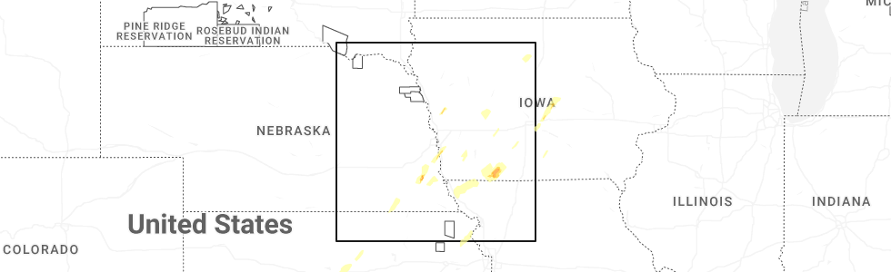
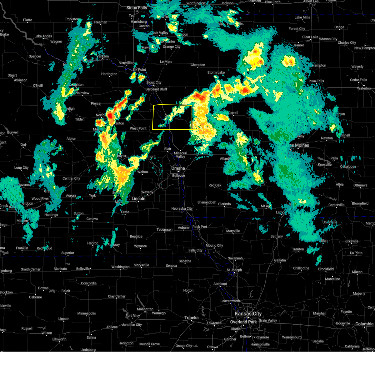
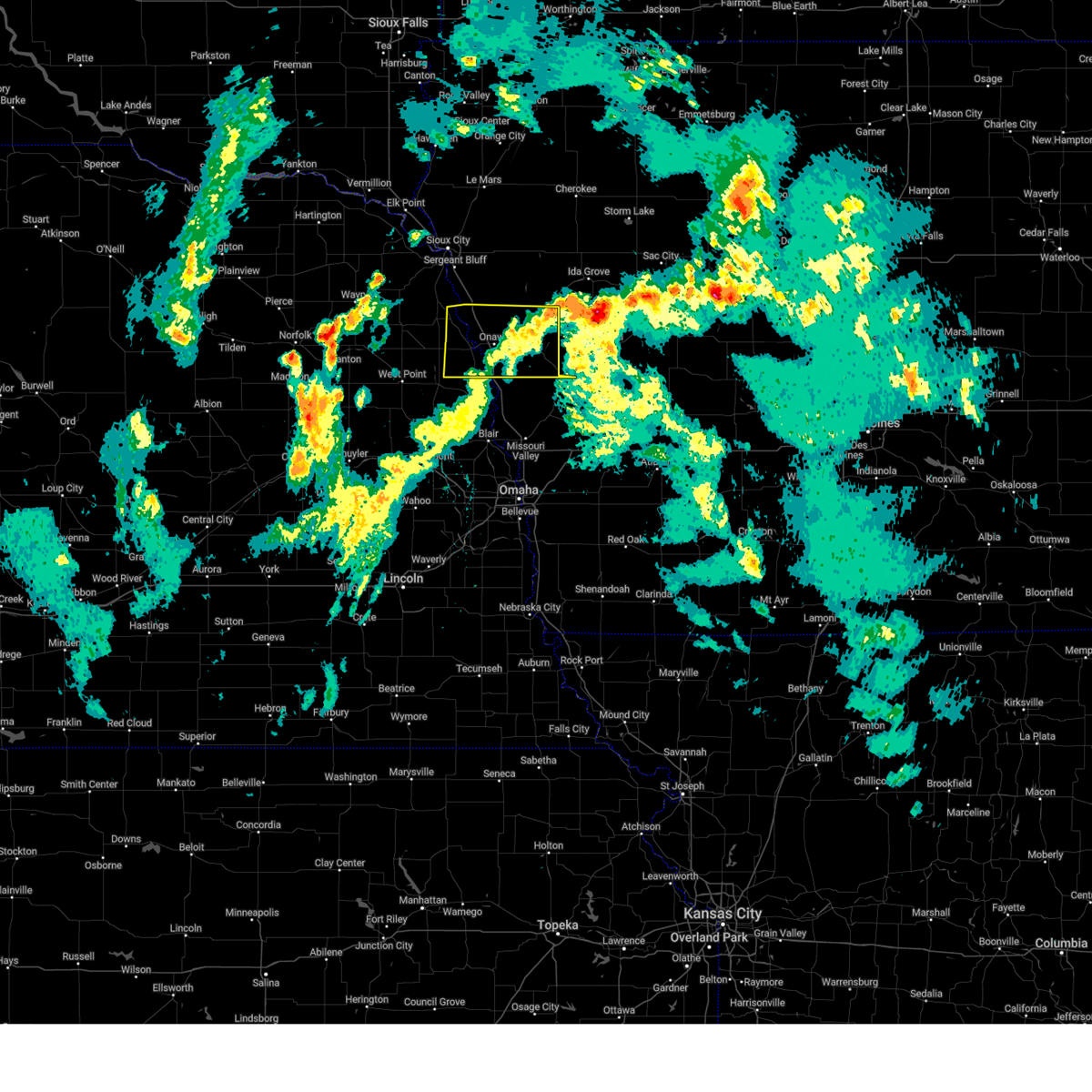
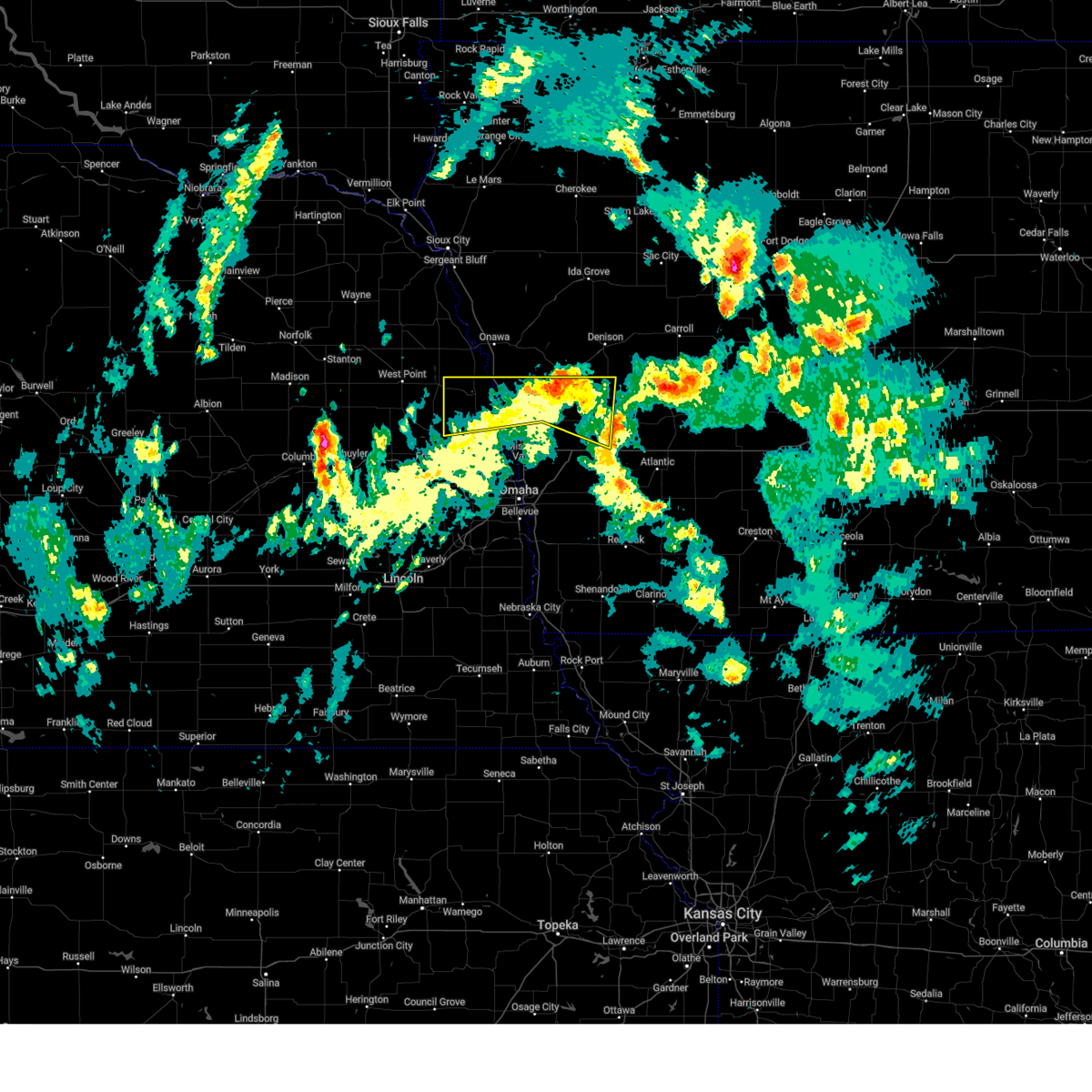
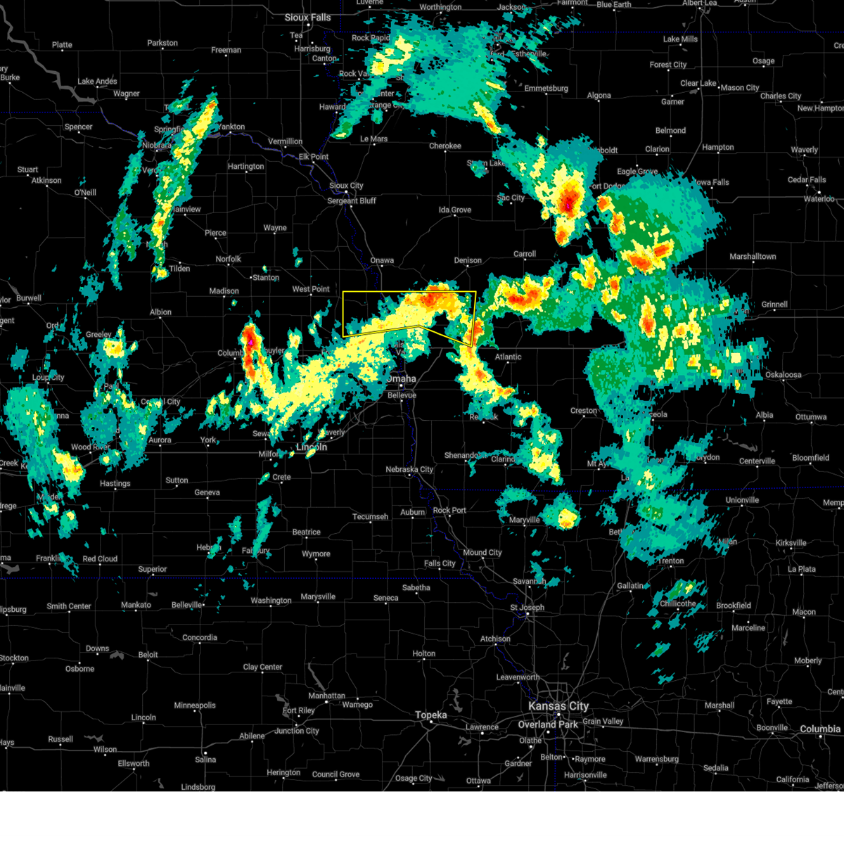
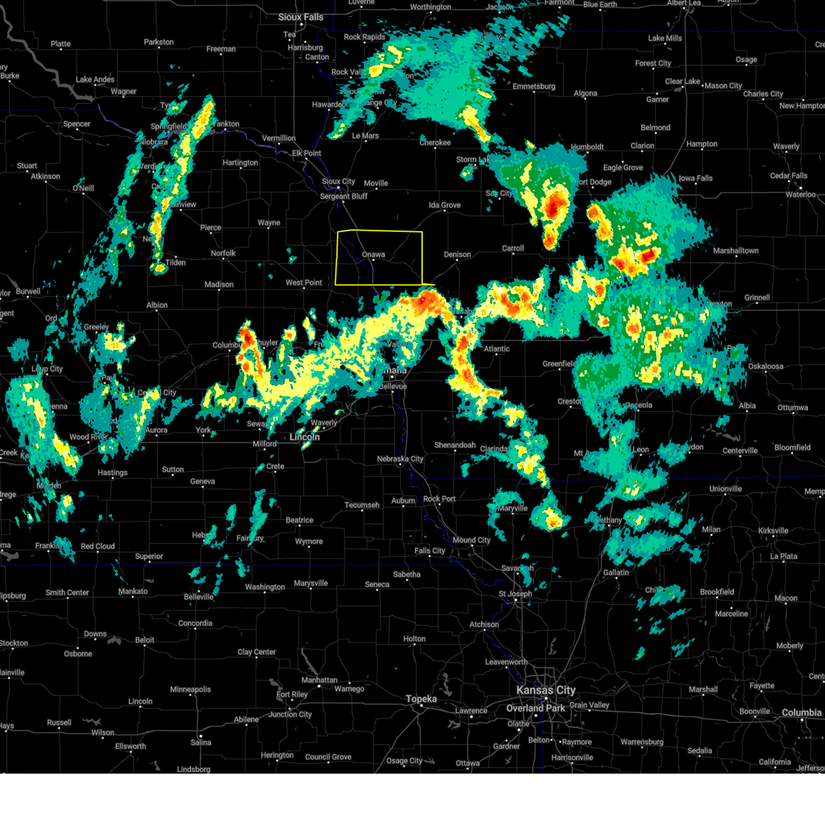
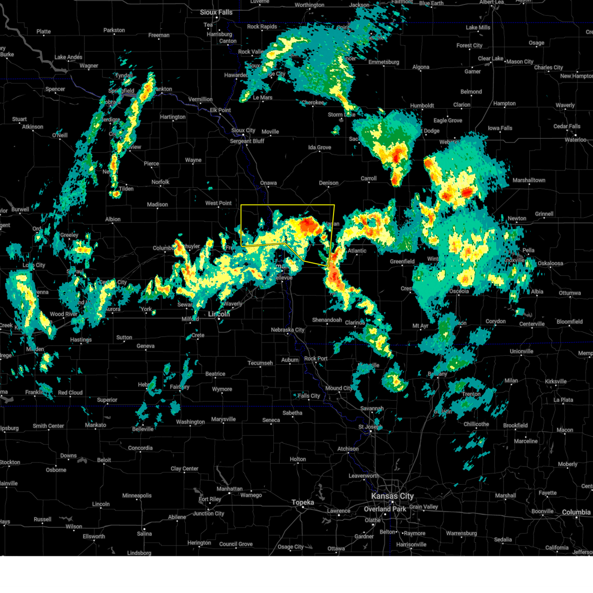
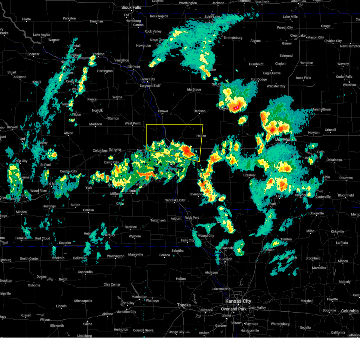
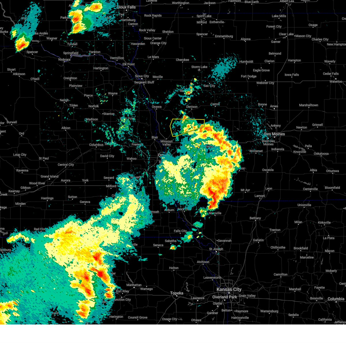
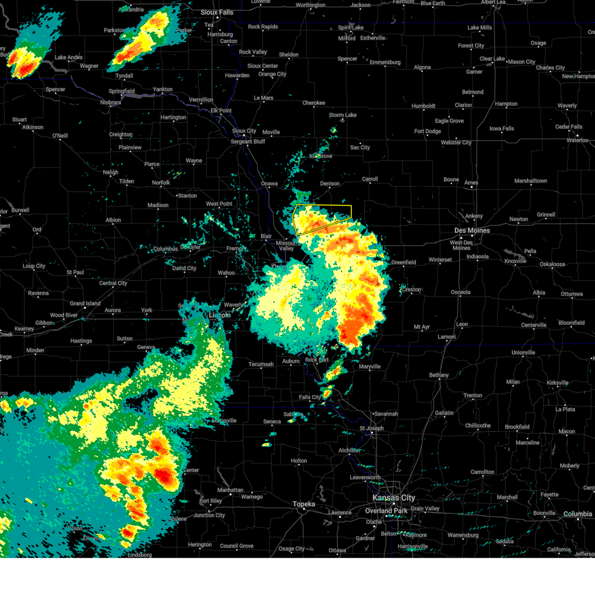
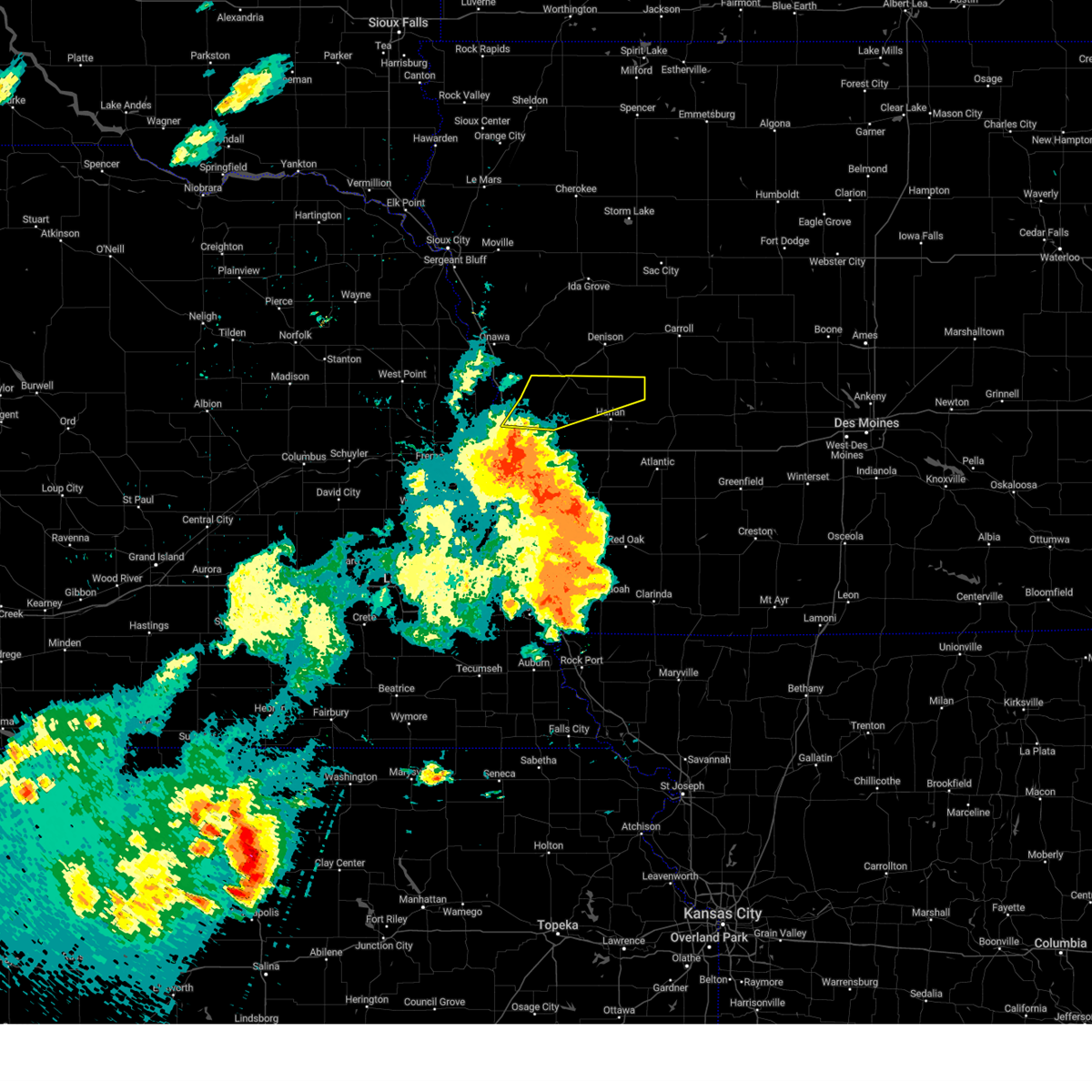
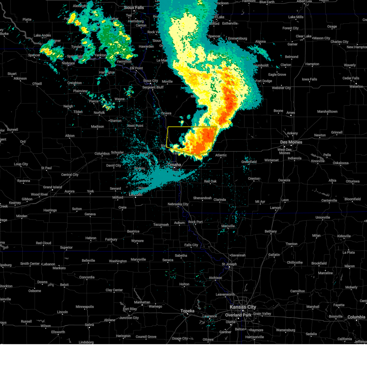
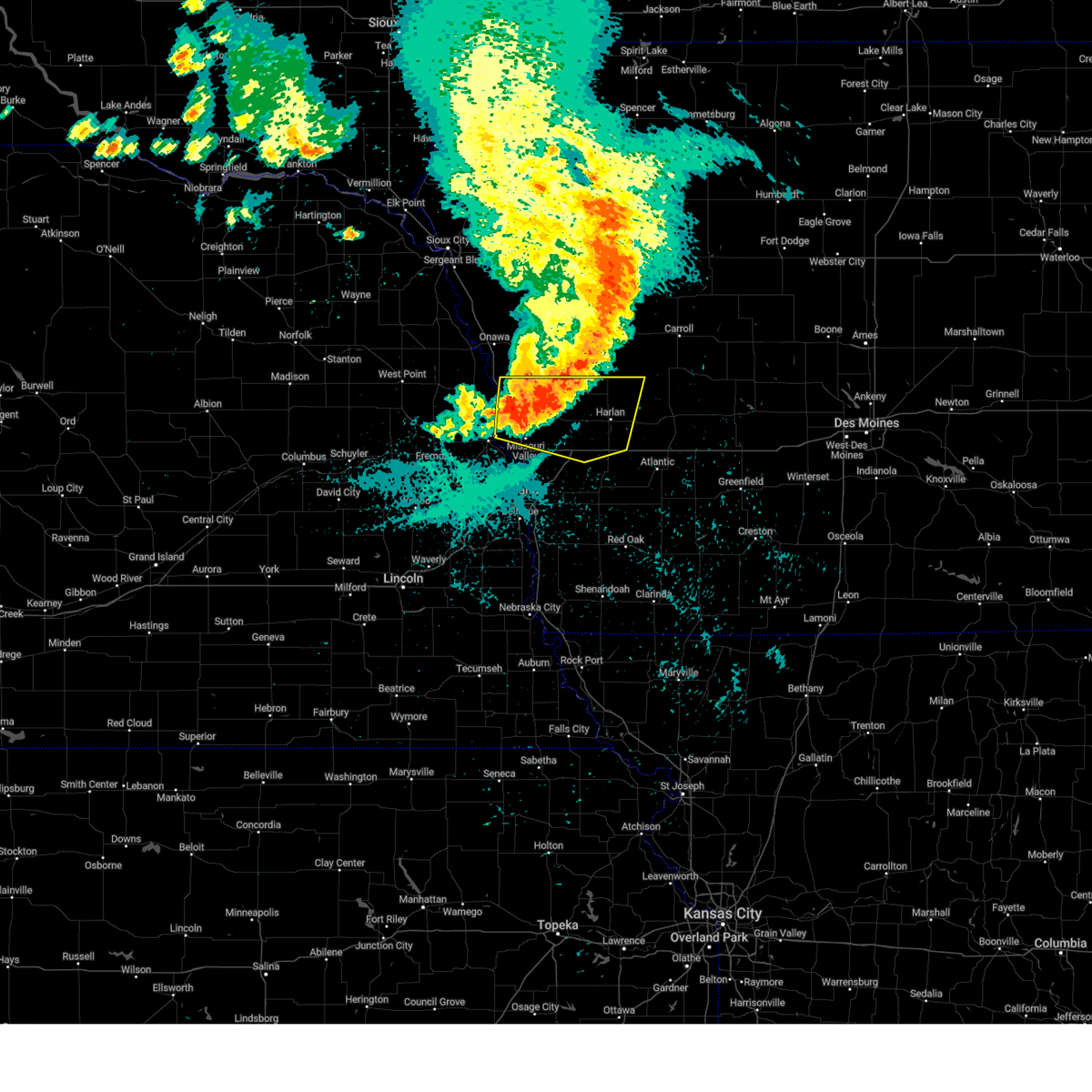
Hail Map for Dunlap, IA
The Dunlap, IA area has had 2 reports of on-the-ground hail by trained spotters, and has been under severe weather warnings 22 times during the past 12 months. Doppler radar has detected hail at or near Dunlap, IA on 83 occasions, including 2 occasions during the past year.
| Name: | Dunlap, IA |
| Where Located: | 44.7 miles NNE of Omaha, NE |
| Map: | Google Map for Dunlap, IA |
| Population: | 1042 |
| Housing Units: | 519 |
| More Info: | Search Google for Dunlap, IA |
0
The Top Recent Hail Date for Dunlap, IA is Wednesday, October 30, 2024 (83rd out of 83)
Hail and Wind Damage Spotted near Dunlap, IA
| Date / Time | Report Details |
|---|---|
| 4/1/2025 11:21 PM CDT |
 The storms which prompted the warning have weakened. therefore, the warning will be allowed to expire. however, small hail and gusty winds are still possible with these thunderstorms. a severe thunderstorm watch remains in effect until 300 am cdt for southwestern iowa. The storms which prompted the warning have weakened. therefore, the warning will be allowed to expire. however, small hail and gusty winds are still possible with these thunderstorms. a severe thunderstorm watch remains in effect until 300 am cdt for southwestern iowa.
|
| 4/1/2025 11:00 PM CDT |
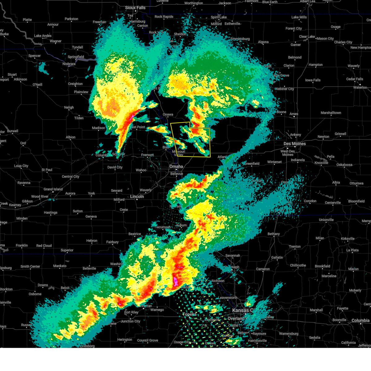
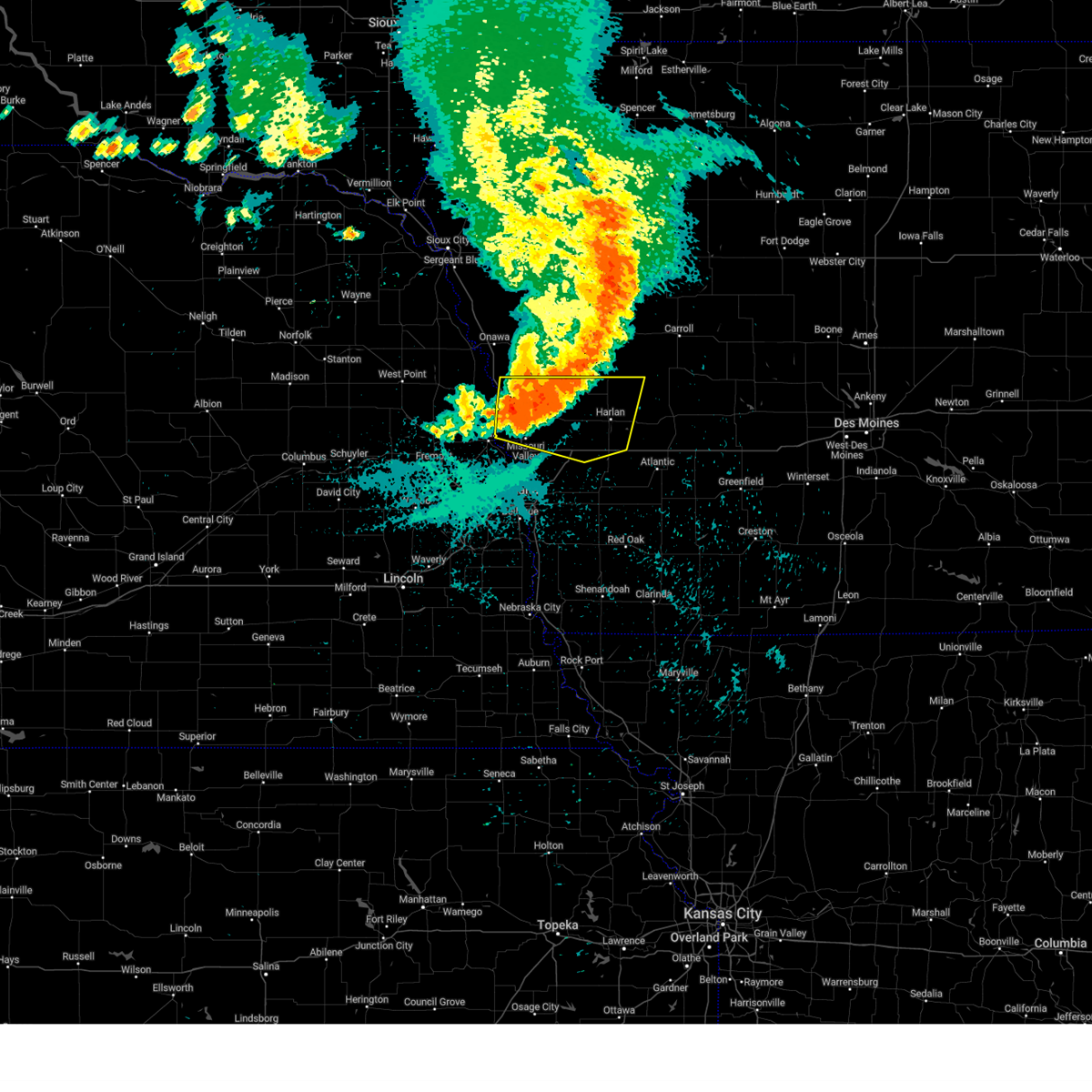
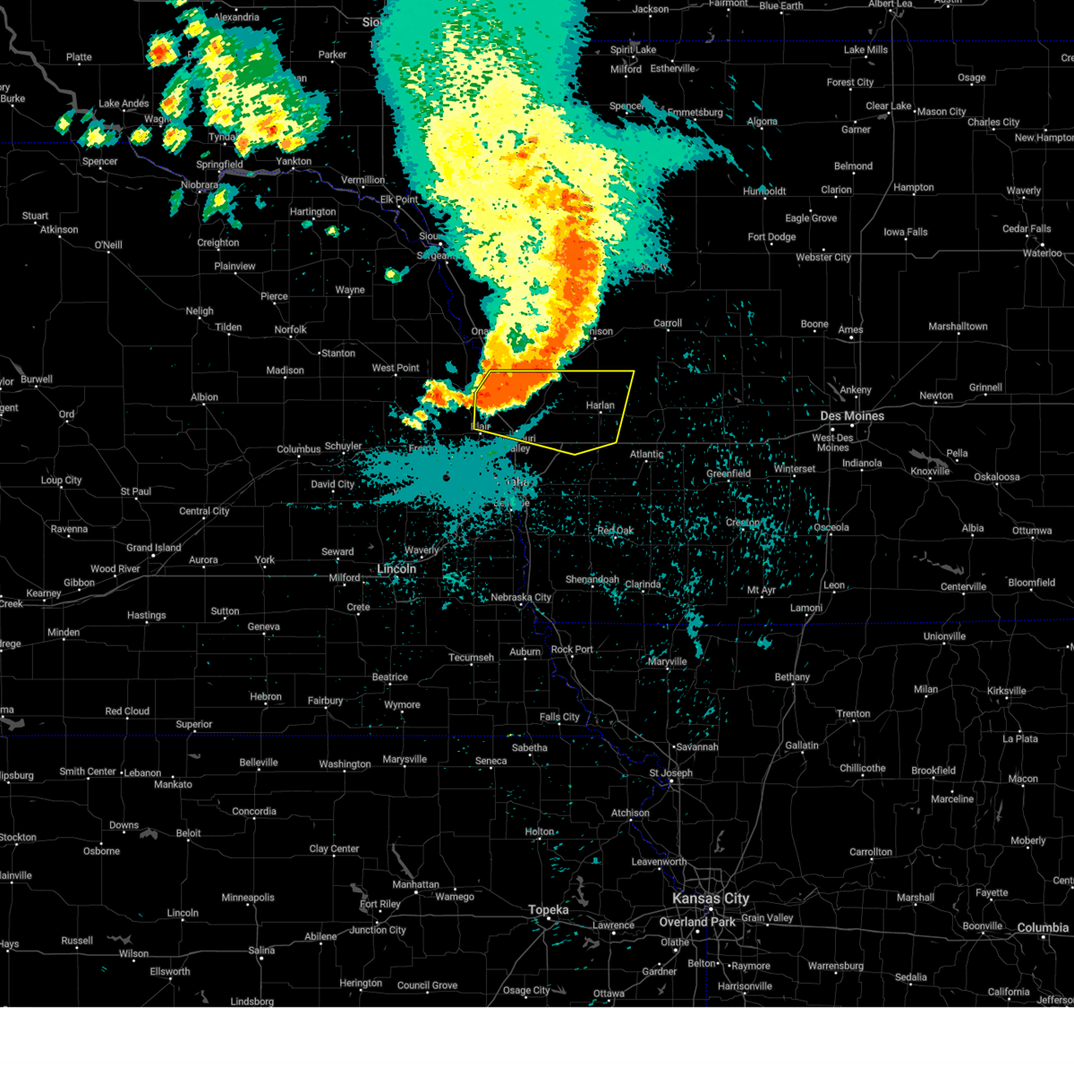
 At 1059 pm cdt, severe thunderstorms were located along a line extending from near moorhead to 3 miles north of underwood, moving east at 45 mph (radar indicated). Hazards include 60 mph wind gusts and quarter size hail. Hail damage to vehicles is expected. expect wind damage to roofs, siding, and trees. these severe storms will be near, minden, woodbine, neola, and persia around 1105 pm cdt. dunlap and shelby around 1110 pm cdt. panama around 1115 pm cdt. earling and avoca around 1120 pm cdt. defiance and harlan around 1125 pm cdt. Other locations impacted by these severe thunderstorms include tennant, manteno recreation area, nishna bend recreation area, preparation canyon state park, schaben park, portsmouth, willow lake recreation area, little sioux scout ranch, historical village welcome center, and westphalia. At 1059 pm cdt, severe thunderstorms were located along a line extending from near moorhead to 3 miles north of underwood, moving east at 45 mph (radar indicated). Hazards include 60 mph wind gusts and quarter size hail. Hail damage to vehicles is expected. expect wind damage to roofs, siding, and trees. these severe storms will be near, minden, woodbine, neola, and persia around 1105 pm cdt. dunlap and shelby around 1110 pm cdt. panama around 1115 pm cdt. earling and avoca around 1120 pm cdt. defiance and harlan around 1125 pm cdt. Other locations impacted by these severe thunderstorms include tennant, manteno recreation area, nishna bend recreation area, preparation canyon state park, schaben park, portsmouth, willow lake recreation area, little sioux scout ranch, historical village welcome center, and westphalia.
|
| 4/1/2025 11:00 PM CDT |
 the severe thunderstorm warning has been cancelled and is no longer in effect the severe thunderstorm warning has been cancelled and is no longer in effect
|
| 4/1/2025 10:40 PM CDT |
 Svroax the national weather service in omaha has issued a * severe thunderstorm warning for, southeastern monona county in west central iowa, northern pottawattamie county in southwestern iowa, harrison county in southwestern iowa, western shelby county in southwestern iowa, east central washington county in east central nebraska, * until 1130 pm cdt. * at 1040 pm cdt, severe thunderstorms were located along a line extending from 3 miles southwest of blencoe to 5 miles northwest of crescent, moving east at 50 mph (radar indicated). Hazards include 70 mph wind gusts and quarter size hail. Hail damage to vehicles is expected. expect considerable tree damage. wind damage is also likely to mobile homes, roofs, and outbuildings. severe thunderstorms will be near, pisgah, mondamin, magnolia, little sioux, and missouri valley around 1045 pm cdt. logan around 1050 pm cdt. moorhead, woodbine, and neola around 1055 pm cdt. minden and persia around 1100 pm cdt. dunlap and shelby around 1105 pm cdt. panama around 1110 pm cdt. earling and avoca around 1115 pm cdt. defiance and harlan around 1120 pm cdt. other locations impacted by these severe thunderstorms include tennant, manteno recreation area, nishna bend recreation area, preparation canyon state park, schaben park, portsmouth, willow lake recreation area, little sioux scout ranch, arrowhead park, and historical village welcome center. this includes the following highways, interstate 29 between mile markers 68 and 105. Interstate 80 in iowa between mile markers 23 and 43. Svroax the national weather service in omaha has issued a * severe thunderstorm warning for, southeastern monona county in west central iowa, northern pottawattamie county in southwestern iowa, harrison county in southwestern iowa, western shelby county in southwestern iowa, east central washington county in east central nebraska, * until 1130 pm cdt. * at 1040 pm cdt, severe thunderstorms were located along a line extending from 3 miles southwest of blencoe to 5 miles northwest of crescent, moving east at 50 mph (radar indicated). Hazards include 70 mph wind gusts and quarter size hail. Hail damage to vehicles is expected. expect considerable tree damage. wind damage is also likely to mobile homes, roofs, and outbuildings. severe thunderstorms will be near, pisgah, mondamin, magnolia, little sioux, and missouri valley around 1045 pm cdt. logan around 1050 pm cdt. moorhead, woodbine, and neola around 1055 pm cdt. minden and persia around 1100 pm cdt. dunlap and shelby around 1105 pm cdt. panama around 1110 pm cdt. earling and avoca around 1115 pm cdt. defiance and harlan around 1120 pm cdt. other locations impacted by these severe thunderstorms include tennant, manteno recreation area, nishna bend recreation area, preparation canyon state park, schaben park, portsmouth, willow lake recreation area, little sioux scout ranch, arrowhead park, and historical village welcome center. this includes the following highways, interstate 29 between mile markers 68 and 105. Interstate 80 in iowa between mile markers 23 and 43.
|
| 3/14/2025 6:25 PM CDT |
 The storms which prompted the warning have weakened below severe limits, and no longer pose an immediate threat to life or property. therefore, the warning will be allowed to expire. however, gusty winds are still possible with these thunderstorms. a severe thunderstorm watch remains in effect until 1000 pm cdt for west central iowa, and northeastern and east central nebraska. The storms which prompted the warning have weakened below severe limits, and no longer pose an immediate threat to life or property. therefore, the warning will be allowed to expire. however, gusty winds are still possible with these thunderstorms. a severe thunderstorm watch remains in effect until 1000 pm cdt for west central iowa, and northeastern and east central nebraska.
|
| 3/14/2025 6:13 PM CDT |
 At 613 pm cdt, severe thunderstorms were located along a line extending from 4 miles east of mapleton to 6 miles north of tekamah, moving north at 35 mph (radar indicated). Hazards include 60 mph wind gusts and quarter size hail. Hail damage to vehicles is expected. expect wind damage to roofs, siding, and trees. Locations impacted include, turin, onawa, lewis and clark state park, rodney, ute, castana, mapleton, moorhead, preparation canyon state park, little sioux scout ranch, macy, blencoe, decatur, whiting, soldier, kennebec, dunlap, omaha reservation, and winnebago reservation. At 613 pm cdt, severe thunderstorms were located along a line extending from 4 miles east of mapleton to 6 miles north of tekamah, moving north at 35 mph (radar indicated). Hazards include 60 mph wind gusts and quarter size hail. Hail damage to vehicles is expected. expect wind damage to roofs, siding, and trees. Locations impacted include, turin, onawa, lewis and clark state park, rodney, ute, castana, mapleton, moorhead, preparation canyon state park, little sioux scout ranch, macy, blencoe, decatur, whiting, soldier, kennebec, dunlap, omaha reservation, and winnebago reservation.
|
| 3/14/2025 5:45 PM CDT |
 the severe thunderstorm warning has been cancelled and is no longer in effect the severe thunderstorm warning has been cancelled and is no longer in effect
|
| 3/14/2025 5:45 PM CDT |
 At 545 pm cdt, severe thunderstorms were located along a line extending from 3 miles southwest of craig to 2 miles north of little sioux to 3 miles southeast of defiance, moving north at 30 mph (radar indicated). Hazards include 60 mph wind gusts and nickel size hail. Expect damage to roofs, siding, and trees. Locations impacted include, modale, willow lake recreation area, summit lake state recreation area, tennant, nishna bend recreation area, little sioux, pisgah, panama, defiance, schaben park, earling, herman, pelican point state recreation area, harlan, magnolia, manteno recreation area, dunlap, logan, craig, and woodbine. At 545 pm cdt, severe thunderstorms were located along a line extending from 3 miles southwest of craig to 2 miles north of little sioux to 3 miles southeast of defiance, moving north at 30 mph (radar indicated). Hazards include 60 mph wind gusts and nickel size hail. Expect damage to roofs, siding, and trees. Locations impacted include, modale, willow lake recreation area, summit lake state recreation area, tennant, nishna bend recreation area, little sioux, pisgah, panama, defiance, schaben park, earling, herman, pelican point state recreation area, harlan, magnolia, manteno recreation area, dunlap, logan, craig, and woodbine.
|
| 3/14/2025 5:41 PM CDT |
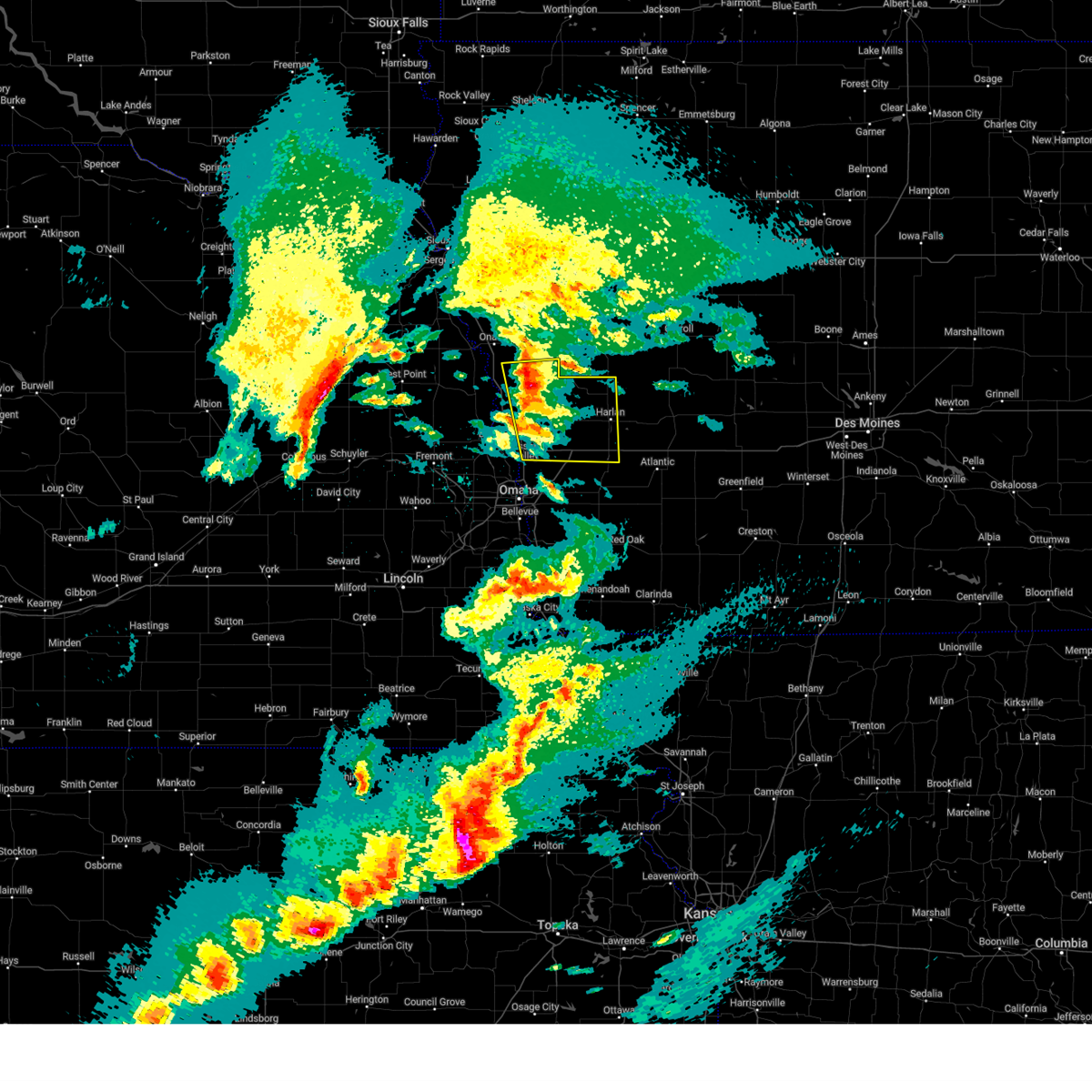
 Svroax the national weather service in omaha has issued a * severe thunderstorm warning for, monona county in west central iowa, northwestern harrison county in southwestern iowa, northeastern burt county in east central nebraska, southeastern thurston county in northeastern nebraska, * until 630 pm cdt. * at 540 pm cdt, severe thunderstorms were located along a line extending from near dunlap to craig, moving north at 45 mph (radar indicated). Hazards include 60 mph wind gusts and quarter size hail. Hail damage to vehicles is expected. Expect wind damage to roofs, siding, and trees. Svroax the national weather service in omaha has issued a * severe thunderstorm warning for, monona county in west central iowa, northwestern harrison county in southwestern iowa, northeastern burt county in east central nebraska, southeastern thurston county in northeastern nebraska, * until 630 pm cdt. * at 540 pm cdt, severe thunderstorms were located along a line extending from near dunlap to craig, moving north at 45 mph (radar indicated). Hazards include 60 mph wind gusts and quarter size hail. Hail damage to vehicles is expected. Expect wind damage to roofs, siding, and trees.
|
| 3/14/2025 5:29 PM CDT |
 At 528 pm cdt, severe thunderstorms were located along a line extending from 4 miles southeast of uehling to 3 miles north of mondamin to harlan, moving north at 45 mph (radar indicated). Hazards include 60 mph wind gusts and quarter size hail. Hail damage to vehicles is expected. expect wind damage to roofs, siding, and trees. Locations impacted include, missouri valley, modale, hancock, oakland, willow lake recreation area, botna bend park, summit lake state recreation area, tennant, nishna bend recreation area, little sioux, pisgah, panama, neola, defiance, schaben park, historical village welcome center, earling, herman, underwood, and persia. At 528 pm cdt, severe thunderstorms were located along a line extending from 4 miles southeast of uehling to 3 miles north of mondamin to harlan, moving north at 45 mph (radar indicated). Hazards include 60 mph wind gusts and quarter size hail. Hail damage to vehicles is expected. expect wind damage to roofs, siding, and trees. Locations impacted include, missouri valley, modale, hancock, oakland, willow lake recreation area, botna bend park, summit lake state recreation area, tennant, nishna bend recreation area, little sioux, pisgah, panama, neola, defiance, schaben park, historical village welcome center, earling, herman, underwood, and persia.
|
| 3/14/2025 5:14 PM CDT |
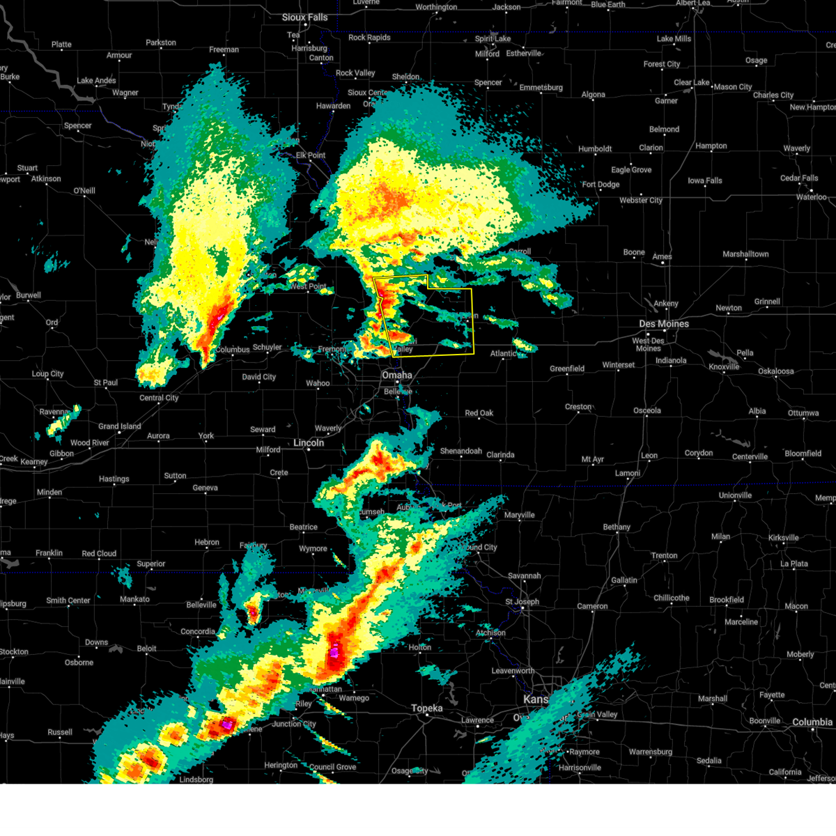
 Svroax the national weather service in omaha has issued a * severe thunderstorm warning for, northern pottawattamie county in southwestern iowa, harrison county in southwestern iowa, western shelby county in southwestern iowa, southeastern burt county in east central nebraska, washington county in east central nebraska, * until 600 pm cdt. * at 513 pm cdt, severe thunderstorms were located along a line extending from 4 miles northeast of nickerson to near modale to 2 miles south of avoca, moving north at 35 mph (radar indicated). Hazards include 60 mph wind gusts and quarter size hail. Hail damage to vehicles is expected. Expect wind damage to roofs, siding, and trees. Svroax the national weather service in omaha has issued a * severe thunderstorm warning for, northern pottawattamie county in southwestern iowa, harrison county in southwestern iowa, western shelby county in southwestern iowa, southeastern burt county in east central nebraska, washington county in east central nebraska, * until 600 pm cdt. * at 513 pm cdt, severe thunderstorms were located along a line extending from 4 miles northeast of nickerson to near modale to 2 miles south of avoca, moving north at 35 mph (radar indicated). Hazards include 60 mph wind gusts and quarter size hail. Hail damage to vehicles is expected. Expect wind damage to roofs, siding, and trees.
|
| 8/29/2024 5:28 PM CDT | The storm which prompted the warning has weakened below severe limits, and has exited the warned area. therefore, the warning will be allowed to expire. however, additional thunderstorms are still affecting the area and gusty winds and heavy rain remain possible. to report severe weather, contact your nearest law enforcement agency. they will relay your report to the national weather service des moines. |
| 8/29/2024 5:06 PM CDT |
 At 506 pm cdt, a severe thunderstorm was located over odebolt, or 12 miles east of ida grove, moving northeast at 40 mph. while the clusters of thunderstorms that prompted the warning have moved into sac county, additional strong storms also continue to move into crawford county from the southwest (radar indicated). Hazards include 60 mph wind gusts and penny size hail. Expect damage to roofs, siding, and trees. Locations impacted include, denison, sac city, pocahontas, laurens, lake view, dunlap, odebolt, black hawk lake, schleswig, wall lake, schaller, fonda, rolfe, early, dow city, charter oak, vail, lytton, kiron, and deloit. At 506 pm cdt, a severe thunderstorm was located over odebolt, or 12 miles east of ida grove, moving northeast at 40 mph. while the clusters of thunderstorms that prompted the warning have moved into sac county, additional strong storms also continue to move into crawford county from the southwest (radar indicated). Hazards include 60 mph wind gusts and penny size hail. Expect damage to roofs, siding, and trees. Locations impacted include, denison, sac city, pocahontas, laurens, lake view, dunlap, odebolt, black hawk lake, schleswig, wall lake, schaller, fonda, rolfe, early, dow city, charter oak, vail, lytton, kiron, and deloit.
|
| 8/29/2024 4:43 PM CDT |
 Svrdmx the national weather service in des moines has issued a * severe thunderstorm warning for, pocahontas county in northwestern iowa, sac county in west central iowa, northwestern calhoun county in west central iowa, crawford county in west central iowa, * until 530 pm cdt. * at 442 pm cdt, a severe thunderstorm was located over schleswig, or 10 miles northwest of denison, moving northeast at 45 mph (radar indicated). Hazards include 60 mph wind gusts and penny size hail. expect damage to roofs, siding, and trees Svrdmx the national weather service in des moines has issued a * severe thunderstorm warning for, pocahontas county in northwestern iowa, sac county in west central iowa, northwestern calhoun county in west central iowa, crawford county in west central iowa, * until 530 pm cdt. * at 442 pm cdt, a severe thunderstorm was located over schleswig, or 10 miles northwest of denison, moving northeast at 45 mph (radar indicated). Hazards include 60 mph wind gusts and penny size hail. expect damage to roofs, siding, and trees
|
| 7/31/2024 7:34 PM CDT |
 the severe thunderstorm warning has been cancelled and is no longer in effect the severe thunderstorm warning has been cancelled and is no longer in effect
|
| 7/31/2024 7:10 PM CDT |
 At 710 pm cdt, severe thunderstorms were located along a line extending from 2 miles south of dunlap to earling to 5 miles south of irwin, moving northeast at 30 mph (radar indicated. these storms have a history of producing widspread wind damage). Hazards include 60 mph wind gusts. Expect damage to roofs, siding, and trees. Locations impacted include, woodbine, dunlap, earling, irwin, defiance, panama, portsmouth, westphalia, kirkman, manteno recreation area, schaben park, and willow lake recreation area. At 710 pm cdt, severe thunderstorms were located along a line extending from 2 miles south of dunlap to earling to 5 miles south of irwin, moving northeast at 30 mph (radar indicated. these storms have a history of producing widspread wind damage). Hazards include 60 mph wind gusts. Expect damage to roofs, siding, and trees. Locations impacted include, woodbine, dunlap, earling, irwin, defiance, panama, portsmouth, westphalia, kirkman, manteno recreation area, schaben park, and willow lake recreation area.
|
| 7/31/2024 6:25 PM CDT |
 Svroax the national weather service in omaha has issued a * severe thunderstorm warning for, central harrison county in southwestern iowa, northern shelby county in southwestern iowa, * until 800 pm cdt. * at 623 pm cdt, severe thunderstorms were located along a line extending from 2 miles northwest of modale to 3 miles northeast of missouri valley to 6 miles northwest of neola, moving northeast at 30 mph. these are destructive storms for modale, magnolia, woodbine, logan, dunlap, panama, earling, defiance, and other nearby areas (emergency management. these storms have produced widespread wind damage to trees, powerlines, structures, and vehicles). Hazards include 80 mph wind gusts. Flying debris will be dangerous to those caught without shelter. mobile homes will be heavily damaged. expect considerable damage to roofs, windows, and vehicles. Extensive tree damage and power outages are likely. Svroax the national weather service in omaha has issued a * severe thunderstorm warning for, central harrison county in southwestern iowa, northern shelby county in southwestern iowa, * until 800 pm cdt. * at 623 pm cdt, severe thunderstorms were located along a line extending from 2 miles northwest of modale to 3 miles northeast of missouri valley to 6 miles northwest of neola, moving northeast at 30 mph. these are destructive storms for modale, magnolia, woodbine, logan, dunlap, panama, earling, defiance, and other nearby areas (emergency management. these storms have produced widespread wind damage to trees, powerlines, structures, and vehicles). Hazards include 80 mph wind gusts. Flying debris will be dangerous to those caught without shelter. mobile homes will be heavily damaged. expect considerable damage to roofs, windows, and vehicles. Extensive tree damage and power outages are likely.
|
| 7/30/2024 1:26 AM CDT |
 The storms which prompted the warning have weakened below severe limits, and no longer pose an immediate threat to life or property. therefore, the warning will be allowed to expire. however, gusty winds to 50 mph are still possible with these thunderstorms. a severe thunderstorm watch remains in effect until 200 am cdt for east central nebraska. The storms which prompted the warning have weakened below severe limits, and no longer pose an immediate threat to life or property. therefore, the warning will be allowed to expire. however, gusty winds to 50 mph are still possible with these thunderstorms. a severe thunderstorm watch remains in effect until 200 am cdt for east central nebraska.
|
| 7/30/2024 12:58 AM CDT |
 At 1257 am cdt, severe thunderstorms were located along a line extending from 3 miles west of defiance to 5 miles southeast of logan to 4 miles east of blair, moving southeast at 50 mph (radar indicated). Hazards include 60 mph wind gusts and penny size hail. Expect damage to roofs, siding, and trees. Locations impacted include, harlan, missouri valley, logan, avoca, woodbine, dunlap, walnut, shelby, minden, earling, mondamin, irwin, persia, defiance, modale, pisgah, panama, magnolia, little sioux, and portsmouth. At 1257 am cdt, severe thunderstorms were located along a line extending from 3 miles west of defiance to 5 miles southeast of logan to 4 miles east of blair, moving southeast at 50 mph (radar indicated). Hazards include 60 mph wind gusts and penny size hail. Expect damage to roofs, siding, and trees. Locations impacted include, harlan, missouri valley, logan, avoca, woodbine, dunlap, walnut, shelby, minden, earling, mondamin, irwin, persia, defiance, modale, pisgah, panama, magnolia, little sioux, and portsmouth.
|
| 7/30/2024 12:58 AM CDT |
 the severe thunderstorm warning has been cancelled and is no longer in effect the severe thunderstorm warning has been cancelled and is no longer in effect
|
| 7/30/2024 12:47 AM CDT |
 Svroax the national weather service in omaha has issued a * severe thunderstorm warning for, north central pottawattamie county in southwestern iowa, harrison county in southwestern iowa, shelby county in southwestern iowa, southeastern burt county in east central nebraska, northeastern washington county in east central nebraska, * until 130 am cdt. * at 1247 am cdt, severe thunderstorms were located along a line extending from 4 miles east of dunlap to near logan to 3 miles north of blair, moving southeast at 50 mph (weather instrument measurement). Hazards include 60 mph wind gusts and penny size hail. expect damage to roofs, siding, and trees Svroax the national weather service in omaha has issued a * severe thunderstorm warning for, north central pottawattamie county in southwestern iowa, harrison county in southwestern iowa, shelby county in southwestern iowa, southeastern burt county in east central nebraska, northeastern washington county in east central nebraska, * until 130 am cdt. * at 1247 am cdt, severe thunderstorms were located along a line extending from 4 miles east of dunlap to near logan to 3 miles north of blair, moving southeast at 50 mph (weather instrument measurement). Hazards include 60 mph wind gusts and penny size hail. expect damage to roofs, siding, and trees
|
| 7/30/2024 12:24 AM CDT | Svrdmx the national weather service in des moines has issued a * severe thunderstorm warning for, sac county in west central iowa, crawford county in west central iowa, western carroll county in west central iowa, * until 115 am cdt. * at 1224 am cdt, severe thunderstorms were located along a line extending from near quimby to near battle creek to near danbury to near turin, moving east at 50 mph (radar indicated). Hazards include 60 mph wind gusts. expect damage to roofs, siding, and trees |
| 6/25/2024 9:00 PM CDT |
 the severe thunderstorm warning has been cancelled and is no longer in effect the severe thunderstorm warning has been cancelled and is no longer in effect
|
| 6/25/2024 8:44 PM CDT |
 At 844 pm cdt, severe thunderstorms were located along a line extending from 6 miles north of dunlap to 5 miles south of woodbine, moving east at 20 mph (radar indicated). Hazards include 60 mph wind gusts and quarter size hail. Hail damage to vehicles is expected. expect wind damage to roofs, siding, and trees. Locations impacted include, woodbine, dunlap, ute, soldier, schaben park, and willow lake recreation area. At 844 pm cdt, severe thunderstorms were located along a line extending from 6 miles north of dunlap to 5 miles south of woodbine, moving east at 20 mph (radar indicated). Hazards include 60 mph wind gusts and quarter size hail. Hail damage to vehicles is expected. expect wind damage to roofs, siding, and trees. Locations impacted include, woodbine, dunlap, ute, soldier, schaben park, and willow lake recreation area.
|
| 6/25/2024 8:25 PM CDT |
 Svroax the national weather service in omaha has issued a * severe thunderstorm warning for, southeastern monona county in west central iowa, northeastern harrison county in southwestern iowa, * until 915 pm cdt. * at 824 pm cdt, severe thunderstorms were located along a line extending from near soldier to 7 miles southeast of moorhead to 2 miles northwest of logan, moving east at 20 mph (radar indicated). Hazards include ping pong ball size hail and 60 mph wind gusts. People and animals outdoors will be injured. expect hail damage to roofs, siding, windows, and vehicles. Expect wind damage to roofs, siding, and trees. Svroax the national weather service in omaha has issued a * severe thunderstorm warning for, southeastern monona county in west central iowa, northeastern harrison county in southwestern iowa, * until 915 pm cdt. * at 824 pm cdt, severe thunderstorms were located along a line extending from near soldier to 7 miles southeast of moorhead to 2 miles northwest of logan, moving east at 20 mph (radar indicated). Hazards include ping pong ball size hail and 60 mph wind gusts. People and animals outdoors will be injured. expect hail damage to roofs, siding, windows, and vehicles. Expect wind damage to roofs, siding, and trees.
|
| 5/24/2024 3:10 AM CDT |
 the tornado warning has been cancelled and is no longer in effect the tornado warning has been cancelled and is no longer in effect
|
| 5/24/2024 3:07 AM CDT |
 Svroax the national weather service in omaha has issued a * severe thunderstorm warning for, fremont county in southwestern iowa, montgomery county in southwestern iowa, mills county in southwestern iowa, pottawattamie county in southwestern iowa, eastern harrison county in southwestern iowa, page county in southwestern iowa, shelby county in southwestern iowa, * until 345 am cdt. * at 307 am cdt, severe thunderstorms were located along a line extending from near dunlap to 5 miles southeast of panama to 3 miles southwest of henderson to 5 miles west of hamburg, moving east at 55 mph (radar indicated). Hazards include 70 mph wind gusts and quarter size hail. Hail damage to vehicles is expected. expect considerable tree damage. Wind damage is also likely to mobile homes, roofs, and outbuildings. Svroax the national weather service in omaha has issued a * severe thunderstorm warning for, fremont county in southwestern iowa, montgomery county in southwestern iowa, mills county in southwestern iowa, pottawattamie county in southwestern iowa, eastern harrison county in southwestern iowa, page county in southwestern iowa, shelby county in southwestern iowa, * until 345 am cdt. * at 307 am cdt, severe thunderstorms were located along a line extending from near dunlap to 5 miles southeast of panama to 3 miles southwest of henderson to 5 miles west of hamburg, moving east at 55 mph (radar indicated). Hazards include 70 mph wind gusts and quarter size hail. Hail damage to vehicles is expected. expect considerable tree damage. Wind damage is also likely to mobile homes, roofs, and outbuildings.
|
| 5/24/2024 2:56 AM CDT |
 At 256 am cdt, severe thunderstorms capable of producing tornadoes were located along a line extending from 3 miles east of pisgah to 2 miles northwest of persia, moving east at 55 mph (radar indicated rotation). Hazards include tornado. Flying debris will be dangerous to those caught without shelter. mobile homes will be damaged or destroyed. damage to roofs, windows, and vehicles will occur. tree damage is likely. these dangerous storms will be near, woodbine around 300 am cdt. harlan, dunlap, and panama around 305 am cdt. Other locations in the path of these tornadic storms include earling and defiance. At 256 am cdt, severe thunderstorms capable of producing tornadoes were located along a line extending from 3 miles east of pisgah to 2 miles northwest of persia, moving east at 55 mph (radar indicated rotation). Hazards include tornado. Flying debris will be dangerous to those caught without shelter. mobile homes will be damaged or destroyed. damage to roofs, windows, and vehicles will occur. tree damage is likely. these dangerous storms will be near, woodbine around 300 am cdt. harlan, dunlap, and panama around 305 am cdt. Other locations in the path of these tornadic storms include earling and defiance.
|
| 5/24/2024 2:53 AM CDT |
 the severe thunderstorm warning has been cancelled and is no longer in effect the severe thunderstorm warning has been cancelled and is no longer in effect
|
| 5/24/2024 2:53 AM CDT |
 At 252 am cdt, severe thunderstorms were located along a line extending from near smithland to 3 miles southeast of castana to 2 miles southeast of little sioux, moving east at 45 mph (radar indicated). Hazards include 70 mph wind gusts and quarter size hail. Hail damage to vehicles is expected. expect considerable tree damage. wind damage is also likely to mobile homes, roofs, and outbuildings. Locations impacted include, onawa, mapleton, dunlap, whiting, ute, defiance, pisgah, moorhead, blencoe, soldier, little sioux, castana, turin, rodney, pelican point state recreation area, preparation canyon state park, little sioux scout ranch, manteno recreation area, kennebec, and schaben park. At 252 am cdt, severe thunderstorms were located along a line extending from near smithland to 3 miles southeast of castana to 2 miles southeast of little sioux, moving east at 45 mph (radar indicated). Hazards include 70 mph wind gusts and quarter size hail. Hail damage to vehicles is expected. expect considerable tree damage. wind damage is also likely to mobile homes, roofs, and outbuildings. Locations impacted include, onawa, mapleton, dunlap, whiting, ute, defiance, pisgah, moorhead, blencoe, soldier, little sioux, castana, turin, rodney, pelican point state recreation area, preparation canyon state park, little sioux scout ranch, manteno recreation area, kennebec, and schaben park.
|
| 5/24/2024 2:49 AM CDT |
 At 248 am cdt, severe thunderstorms capable of producing tornadoes were located along a line extending from 2 miles northeast of little sioux to 6 miles southeast of logan, moving east at 55 mph (radar indicated rotation). Hazards include tornado. Flying debris will be dangerous to those caught without shelter. mobile homes will be damaged or destroyed. damage to roofs, windows, and vehicles will occur. tree damage is likely. these dangerous storms will be near, woodbine, persia, pisgah, and moorhead around 255 am cdt. Other locations in the path of these tornadic storms include dunlap, panama, harlan, earling and defiance. At 248 am cdt, severe thunderstorms capable of producing tornadoes were located along a line extending from 2 miles northeast of little sioux to 6 miles southeast of logan, moving east at 55 mph (radar indicated rotation). Hazards include tornado. Flying debris will be dangerous to those caught without shelter. mobile homes will be damaged or destroyed. damage to roofs, windows, and vehicles will occur. tree damage is likely. these dangerous storms will be near, woodbine, persia, pisgah, and moorhead around 255 am cdt. Other locations in the path of these tornadic storms include dunlap, panama, harlan, earling and defiance.
|
| 5/24/2024 2:49 AM CDT |
 the tornado warning has been cancelled and is no longer in effect the tornado warning has been cancelled and is no longer in effect
|
| 5/24/2024 2:39 AM CDT |
 Toroax the national weather service in omaha has issued a * tornado warning for, southeastern monona county in west central iowa, northwestern pottawattamie county in southwestern iowa, harrison county in southwestern iowa, northwestern shelby county in southwestern iowa, southeastern burt county in east central nebraska, northeastern washington county in east central nebraska, * until 330 am cdt. * at 238 am cdt, severe thunderstorms capable of producing a tornado were located along a line extending from 3 miles northeast of tekamah to 2 miles southwest of missouri valley, moving east at 55 mph (radar indicated rotation). Hazards include tornado. Flying debris will be dangerous to those caught without shelter. mobile homes will be damaged or destroyed. damage to roofs, windows, and vehicles will occur. tree damage is likely. these dangerous storms will be near, missouri valley, logan, pisgah, magnolia, and little sioux around 245 am cdt. woodbine, persia, and moorhead around 255 am cdt. Other locations in the path of these tornadic storms include dunlap, panama, harlan, earling and defiance. Toroax the national weather service in omaha has issued a * tornado warning for, southeastern monona county in west central iowa, northwestern pottawattamie county in southwestern iowa, harrison county in southwestern iowa, northwestern shelby county in southwestern iowa, southeastern burt county in east central nebraska, northeastern washington county in east central nebraska, * until 330 am cdt. * at 238 am cdt, severe thunderstorms capable of producing a tornado were located along a line extending from 3 miles northeast of tekamah to 2 miles southwest of missouri valley, moving east at 55 mph (radar indicated rotation). Hazards include tornado. Flying debris will be dangerous to those caught without shelter. mobile homes will be damaged or destroyed. damage to roofs, windows, and vehicles will occur. tree damage is likely. these dangerous storms will be near, missouri valley, logan, pisgah, magnolia, and little sioux around 245 am cdt. woodbine, persia, and moorhead around 255 am cdt. Other locations in the path of these tornadic storms include dunlap, panama, harlan, earling and defiance.
|
| 5/24/2024 2:31 AM CDT |
 Svroax the national weather service in omaha has issued a * severe thunderstorm warning for, monona county in west central iowa, northern harrison county in southwestern iowa, northwestern shelby county in southwestern iowa, eastern burt county in east central nebraska, northeastern thurston county in northeastern nebraska, * until 315 am cdt. * at 231 am cdt, severe thunderstorms were located along a line extending from 3 miles southwest of sloan to 3 miles west of onawa to 3 miles west of tekamah, moving east at 45 mph (radar indicated). Hazards include 70 mph wind gusts and quarter size hail. Hail damage to vehicles is expected. expect considerable tree damage. Wind damage is also likely to mobile homes, roofs, and outbuildings. Svroax the national weather service in omaha has issued a * severe thunderstorm warning for, monona county in west central iowa, northern harrison county in southwestern iowa, northwestern shelby county in southwestern iowa, eastern burt county in east central nebraska, northeastern thurston county in northeastern nebraska, * until 315 am cdt. * at 231 am cdt, severe thunderstorms were located along a line extending from 3 miles southwest of sloan to 3 miles west of onawa to 3 miles west of tekamah, moving east at 45 mph (radar indicated). Hazards include 70 mph wind gusts and quarter size hail. Hail damage to vehicles is expected. expect considerable tree damage. Wind damage is also likely to mobile homes, roofs, and outbuildings.
|
| 5/21/2024 2:11 PM CDT |
 the severe thunderstorm warning has been cancelled and is no longer in effect the severe thunderstorm warning has been cancelled and is no longer in effect
|
| 5/21/2024 1:59 PM CDT |
 Svroax the national weather service in omaha has issued a * severe thunderstorm warning for, eastern monona county in west central iowa, northeastern harrison county in southwestern iowa, * until 245 pm cdt. * at 159 pm cdt, severe thunderstorms were located along a line extending from 2 miles northwest of danbury to 5 miles north of ute to 3 miles west of dunlap, moving northeast at 50 mph (radar indicated). Hazards include 60 mph wind gusts and nickel size hail. expect damage to roofs, siding, and trees Svroax the national weather service in omaha has issued a * severe thunderstorm warning for, eastern monona county in west central iowa, northeastern harrison county in southwestern iowa, * until 245 pm cdt. * at 159 pm cdt, severe thunderstorms were located along a line extending from 2 miles northwest of danbury to 5 miles north of ute to 3 miles west of dunlap, moving northeast at 50 mph (radar indicated). Hazards include 60 mph wind gusts and nickel size hail. expect damage to roofs, siding, and trees
|
| 5/21/2024 1:50 PM CDT |
 At 149 pm cdt, severe thunderstorms were located along a line extending from 4 miles west of mapleton to 3 miles north of soldier to 3 miles west of woodbine, moving northeast at 50 mph (radar indicated). Hazards include 70 mph wind gusts and quarter size hail. Hail damage to vehicles is expected. expect considerable tree damage. wind damage is also likely to mobile homes, roofs, and outbuildings. Locations impacted include, woodbine, mapleton, dunlap, ute, magnolia, soldier, castana, turin, rodney, kennebec, schaben park, and willow lake recreation area. At 149 pm cdt, severe thunderstorms were located along a line extending from 4 miles west of mapleton to 3 miles north of soldier to 3 miles west of woodbine, moving northeast at 50 mph (radar indicated). Hazards include 70 mph wind gusts and quarter size hail. Hail damage to vehicles is expected. expect considerable tree damage. wind damage is also likely to mobile homes, roofs, and outbuildings. Locations impacted include, woodbine, mapleton, dunlap, ute, magnolia, soldier, castana, turin, rodney, kennebec, schaben park, and willow lake recreation area.
|
| 5/21/2024 1:39 PM CDT |
 the severe thunderstorm warning has been cancelled and is no longer in effect the severe thunderstorm warning has been cancelled and is no longer in effect
|
| 5/21/2024 1:39 PM CDT |
 At 138 pm cdt, severe thunderstorms were located along a line extending from 3 miles west of castana to pisgah, moving northeast at 50 mph (radar indicated). Hazards include 70 mph wind gusts and quarter size hail. Hail damage to vehicles is expected. expect considerable tree damage. wind damage is also likely to mobile homes, roofs, and outbuildings. Locations impacted include, onawa, woodbine, mapleton, dunlap, ute, pisgah, moorhead, blencoe, magnolia, soldier, little sioux, castana, turin, rodney, preparation canyon state park, willow lake recreation area, little sioux scout ranch, kennebec, and schaben park. At 138 pm cdt, severe thunderstorms were located along a line extending from 3 miles west of castana to pisgah, moving northeast at 50 mph (radar indicated). Hazards include 70 mph wind gusts and quarter size hail. Hail damage to vehicles is expected. expect considerable tree damage. wind damage is also likely to mobile homes, roofs, and outbuildings. Locations impacted include, onawa, woodbine, mapleton, dunlap, ute, pisgah, moorhead, blencoe, magnolia, soldier, little sioux, castana, turin, rodney, preparation canyon state park, willow lake recreation area, little sioux scout ranch, kennebec, and schaben park.
|
| 5/21/2024 1:24 PM CDT |
 At 124 pm cdt, severe thunderstorms were located along a line extending from 4 miles west of blencoe to 5 miles northeast of herman, moving northeast at 45 mph (radar indicated). Hazards include 70 mph wind gusts and quarter size hail. Hail damage to vehicles is expected. expect considerable tree damage. wind damage is also likely to mobile homes, roofs, and outbuildings. Locations impacted include, blair, onawa, woodbine, mapleton, dunlap, whiting, decatur, mondamin, ute, modale, pisgah, moorhead, blencoe, magnolia, soldier, little sioux, castana, turin, rodney, and preparation canyon state park. At 124 pm cdt, severe thunderstorms were located along a line extending from 4 miles west of blencoe to 5 miles northeast of herman, moving northeast at 45 mph (radar indicated). Hazards include 70 mph wind gusts and quarter size hail. Hail damage to vehicles is expected. expect considerable tree damage. wind damage is also likely to mobile homes, roofs, and outbuildings. Locations impacted include, blair, onawa, woodbine, mapleton, dunlap, whiting, decatur, mondamin, ute, modale, pisgah, moorhead, blencoe, magnolia, soldier, little sioux, castana, turin, rodney, and preparation canyon state park.
|
| 5/21/2024 12:59 PM CDT |
 Svroax the national weather service in omaha has issued a * severe thunderstorm warning for, monona county in west central iowa, northern harrison county in southwestern iowa, central burt county in east central nebraska, western washington county in east central nebraska, * until 200 pm cdt. * at 1259 pm cdt, severe thunderstorms were located along a line extending from 2 miles southwest of craig to 4 miles north of arlington, moving northeast at 45 mph (radar indicated). Hazards include 70 mph wind gusts and ping pong ball size hail. People and animals outdoors will be injured. expect hail damage to roofs, siding, windows, and vehicles. expect considerable tree damage. Wind damage is also likely to mobile homes, roofs, and outbuildings. Svroax the national weather service in omaha has issued a * severe thunderstorm warning for, monona county in west central iowa, northern harrison county in southwestern iowa, central burt county in east central nebraska, western washington county in east central nebraska, * until 200 pm cdt. * at 1259 pm cdt, severe thunderstorms were located along a line extending from 2 miles southwest of craig to 4 miles north of arlington, moving northeast at 45 mph (radar indicated). Hazards include 70 mph wind gusts and ping pong ball size hail. People and animals outdoors will be injured. expect hail damage to roofs, siding, windows, and vehicles. expect considerable tree damage. Wind damage is also likely to mobile homes, roofs, and outbuildings.
|
| 5/21/2024 6:11 AM CDT |
 Svroax the national weather service in omaha has issued a * severe thunderstorm warning for, monona county in west central iowa, northern harrison county in southwestern iowa, northwestern shelby county in southwestern iowa, * until 700 am cdt. * at 611 am cdt, severe thunderstorms were located along a line extending from 3 miles southeast of macy to 5 miles west of blencoe to 4 miles east of tekamah, moving northeast at 65 mph (weather instrument measurement). Hazards include 70 mph wind gusts. Expect considerable tree damage. Damage is likely to mobile homes, roofs, and outbuildings. Svroax the national weather service in omaha has issued a * severe thunderstorm warning for, monona county in west central iowa, northern harrison county in southwestern iowa, northwestern shelby county in southwestern iowa, * until 700 am cdt. * at 611 am cdt, severe thunderstorms were located along a line extending from 3 miles southeast of macy to 5 miles west of blencoe to 4 miles east of tekamah, moving northeast at 65 mph (weather instrument measurement). Hazards include 70 mph wind gusts. Expect considerable tree damage. Damage is likely to mobile homes, roofs, and outbuildings.
|
| 5/6/2024 9:35 PM CDT |
 Svrdmx the national weather service in des moines has issued a * severe thunderstorm warning for, western greene county in west central iowa, sac county in west central iowa, southwestern calhoun county in west central iowa, crawford county in west central iowa, carroll county in west central iowa, * until 1015 pm cdt. * at 934 pm cdt, severe thunderstorms were located along a line extending from 5 miles south of charter oak to westphalia to near walnut, moving north at 80 mph (radar indicated). Hazards include 70 mph wind gusts and nickel size hail. Expect considerable tree damage. Damage is likely to mobile homes, roofs, and outbuildings. Svrdmx the national weather service in des moines has issued a * severe thunderstorm warning for, western greene county in west central iowa, sac county in west central iowa, southwestern calhoun county in west central iowa, crawford county in west central iowa, carroll county in west central iowa, * until 1015 pm cdt. * at 934 pm cdt, severe thunderstorms were located along a line extending from 5 miles south of charter oak to westphalia to near walnut, moving north at 80 mph (radar indicated). Hazards include 70 mph wind gusts and nickel size hail. Expect considerable tree damage. Damage is likely to mobile homes, roofs, and outbuildings.
|
| 5/6/2024 9:33 PM CDT |
 the severe thunderstorm warning has been cancelled and is no longer in effect the severe thunderstorm warning has been cancelled and is no longer in effect
|
| 5/6/2024 9:18 PM CDT |
 At 918 pm cdt, severe thunderstorms were located along a line extending from near woodbine to 3 miles north of minden, moving northeast at 45 mph (radar indicated). Hazards include 60 mph wind gusts and nickel size hail. Expect damage to roofs, siding, and trees. Locations impacted include, woodbine, dunlap, persia, and schaben park. At 918 pm cdt, severe thunderstorms were located along a line extending from near woodbine to 3 miles north of minden, moving northeast at 45 mph (radar indicated). Hazards include 60 mph wind gusts and nickel size hail. Expect damage to roofs, siding, and trees. Locations impacted include, woodbine, dunlap, persia, and schaben park.
|
| 5/6/2024 8:43 PM CDT |
 Svroax the national weather service in omaha has issued a * severe thunderstorm warning for, northwestern pottawattamie county in southwestern iowa, harrison county in southwestern iowa, * until 945 pm cdt. * at 842 pm cdt, severe thunderstorms were located along a line extending from 3 miles east of bennington to omaha, moving northeast at 40 mph (radar indicated). Hazards include 60 mph wind gusts and nickel size hail. expect damage to roofs, siding, and trees Svroax the national weather service in omaha has issued a * severe thunderstorm warning for, northwestern pottawattamie county in southwestern iowa, harrison county in southwestern iowa, * until 945 pm cdt. * at 842 pm cdt, severe thunderstorms were located along a line extending from 3 miles east of bennington to omaha, moving northeast at 40 mph (radar indicated). Hazards include 60 mph wind gusts and nickel size hail. expect damage to roofs, siding, and trees
|
| 4/30/2024 4:40 PM CDT |
 The storm which prompted the warning has moved out of the area. therefore, the warning will be allowed to expire. a tornado watch remains in effect until 1000 pm cdt for southwestern iowa. The storm which prompted the warning has moved out of the area. therefore, the warning will be allowed to expire. a tornado watch remains in effect until 1000 pm cdt for southwestern iowa.
|
| 4/30/2024 4:26 PM CDT |
 At 426 pm cdt, a severe thunderstorm was located 4 miles east of woodbine, or 15 miles west of harlan, moving northeast at 35 mph (radar indicated). Hazards include quarter size hail. Damage to vehicles is expected. Locations impacted include, woodbine, dunlap, panama, portsmouth, schaben park, and willow lake recreation area. At 426 pm cdt, a severe thunderstorm was located 4 miles east of woodbine, or 15 miles west of harlan, moving northeast at 35 mph (radar indicated). Hazards include quarter size hail. Damage to vehicles is expected. Locations impacted include, woodbine, dunlap, panama, portsmouth, schaben park, and willow lake recreation area.
|
| 4/30/2024 4:16 PM CDT |
 At 416 pm cdt, a severe thunderstorm was located 3 miles northeast of logan, or 21 miles west of harlan, moving northeast at 35 mph (radar indicated). Hazards include quarter size hail. Damage to vehicles is expected. Locations impacted include, logan, woodbine, dunlap, panama, magnolia, portsmouth, schaben park, historical village welcome center, and willow lake recreation area. At 416 pm cdt, a severe thunderstorm was located 3 miles northeast of logan, or 21 miles west of harlan, moving northeast at 35 mph (radar indicated). Hazards include quarter size hail. Damage to vehicles is expected. Locations impacted include, logan, woodbine, dunlap, panama, magnolia, portsmouth, schaben park, historical village welcome center, and willow lake recreation area.
|
| 4/30/2024 3:56 PM CDT |
 Svroax the national weather service in omaha has issued a * severe thunderstorm warning for, central harrison county in southwestern iowa, west central shelby county in southwestern iowa, * until 445 pm cdt. * at 355 pm cdt, a severe thunderstorm was located 3 miles west of missouri valley, or 9 miles east of blair, moving northeast at 35 mph (radar indicated). Hazards include half dollar size hail. damage to vehicles is expected Svroax the national weather service in omaha has issued a * severe thunderstorm warning for, central harrison county in southwestern iowa, west central shelby county in southwestern iowa, * until 445 pm cdt. * at 355 pm cdt, a severe thunderstorm was located 3 miles west of missouri valley, or 9 miles east of blair, moving northeast at 35 mph (radar indicated). Hazards include half dollar size hail. damage to vehicles is expected
|
| 4/26/2024 6:30 PM CDT |
 the tornado warning has been cancelled and is no longer in effect the tornado warning has been cancelled and is no longer in effect
|
| 4/26/2024 6:20 PM CDT |
 At 620 pm cdt, a severe thunderstorm was located 4 miles northwest of persia, or 14 miles west of harlan, moving northeast at 45 mph (radar indicated). Hazards include 60 mph wind gusts and quarter size hail. Hail damage to vehicles is expected. expect wind damage to roofs, siding, and trees. Locations impacted include, dunlap and portsmouth. At 620 pm cdt, a severe thunderstorm was located 4 miles northwest of persia, or 14 miles west of harlan, moving northeast at 45 mph (radar indicated). Hazards include 60 mph wind gusts and quarter size hail. Hail damage to vehicles is expected. expect wind damage to roofs, siding, and trees. Locations impacted include, dunlap and portsmouth.
|
| 4/26/2024 6:20 PM CDT |
 the severe thunderstorm warning has been cancelled and is no longer in effect the severe thunderstorm warning has been cancelled and is no longer in effect
|
| 4/26/2024 6:18 PM CDT |
 At 618 pm cdt, a severe thunderstorm capable of producing a tornado was located 6 miles southeast of woodbine, or 14 miles west of harlan, moving northeast at 50 mph (radar indicated rotation). Hazards include tornado and quarter size hail. Flying debris will be dangerous to those caught without shelter. mobile homes will be damaged or destroyed. damage to roofs, windows, and vehicles will occur. tree damage is likely. This dangerous storm will be near, panama around 625 pm cdt. At 618 pm cdt, a severe thunderstorm capable of producing a tornado was located 6 miles southeast of woodbine, or 14 miles west of harlan, moving northeast at 50 mph (radar indicated rotation). Hazards include tornado and quarter size hail. Flying debris will be dangerous to those caught without shelter. mobile homes will be damaged or destroyed. damage to roofs, windows, and vehicles will occur. tree damage is likely. This dangerous storm will be near, panama around 625 pm cdt.
|
| 4/26/2024 6:17 PM CDT |
 Toroax the national weather service in omaha has issued a * tornado warning for, eastern harrison county in southwestern iowa, northwestern shelby county in southwestern iowa, * until 645 pm cdt. * at 617 pm cdt, a severe thunderstorm capable of producing a tornado was located 6 miles southeast of woodbine, or 14 miles west of harlan, moving northeast at 50 mph (radar indicated rotation). Hazards include tornado and quarter size hail. Flying debris will be dangerous to those caught without shelter. mobile homes will be damaged or destroyed. damage to roofs, windows, and vehicles will occur. tree damage is likely. This dangerous storm will be near, panama around 625 pm cdt. Toroax the national weather service in omaha has issued a * tornado warning for, eastern harrison county in southwestern iowa, northwestern shelby county in southwestern iowa, * until 645 pm cdt. * at 617 pm cdt, a severe thunderstorm capable of producing a tornado was located 6 miles southeast of woodbine, or 14 miles west of harlan, moving northeast at 50 mph (radar indicated rotation). Hazards include tornado and quarter size hail. Flying debris will be dangerous to those caught without shelter. mobile homes will be damaged or destroyed. damage to roofs, windows, and vehicles will occur. tree damage is likely. This dangerous storm will be near, panama around 625 pm cdt.
|
| 4/26/2024 6:06 PM CDT |
 Svroax the national weather service in omaha has issued a * severe thunderstorm warning for, northwestern pottawattamie county in southwestern iowa, eastern harrison county in southwestern iowa, west central shelby county in southwestern iowa, * until 630 pm cdt. * at 605 pm cdt, a severe thunderstorm was located 4 miles south of logan, or 18 miles east of blair, moving northeast at 40 mph (radar indicated). Hazards include 60 mph wind gusts and half dollar size hail. Hail damage to vehicles is expected. Expect wind damage to roofs, siding, and trees. Svroax the national weather service in omaha has issued a * severe thunderstorm warning for, northwestern pottawattamie county in southwestern iowa, eastern harrison county in southwestern iowa, west central shelby county in southwestern iowa, * until 630 pm cdt. * at 605 pm cdt, a severe thunderstorm was located 4 miles south of logan, or 18 miles east of blair, moving northeast at 40 mph (radar indicated). Hazards include 60 mph wind gusts and half dollar size hail. Hail damage to vehicles is expected. Expect wind damage to roofs, siding, and trees.
|
| 4/26/2024 5:53 PM CDT |
 the tornado warning has been cancelled and is no longer in effect the tornado warning has been cancelled and is no longer in effect
|
| 4/26/2024 5:45 PM CDT |
 At 544 pm cdt, a severe thunderstorm capable of producing a tornado was located 4 miles east of logan, or 19 miles west of harlan, moving northeast at 35 mph (radar indicated rotation). Hazards include tornado and golf ball size hail. Flying debris will be dangerous to those caught without shelter. mobile homes will be damaged or destroyed. damage to roofs, windows, and vehicles will occur. tree damage is likely. Locations impacted include, woodbine and dunlap. At 544 pm cdt, a severe thunderstorm capable of producing a tornado was located 4 miles east of logan, or 19 miles west of harlan, moving northeast at 35 mph (radar indicated rotation). Hazards include tornado and golf ball size hail. Flying debris will be dangerous to those caught without shelter. mobile homes will be damaged or destroyed. damage to roofs, windows, and vehicles will occur. tree damage is likely. Locations impacted include, woodbine and dunlap.
|
| 4/26/2024 5:45 PM CDT |
 the tornado warning has been cancelled and is no longer in effect the tornado warning has been cancelled and is no longer in effect
|
| 4/26/2024 5:35 PM CDT |
 At 534 pm cdt, a severe thunderstorm capable of producing a tornado was located 6 miles west of persia, or 19 miles west of harlan, moving northeast at 35 mph (radar indicated rotation). Hazards include tornado and golf ball size hail. Flying debris will be dangerous to those caught without shelter. mobile homes will be damaged or destroyed. damage to roofs, windows, and vehicles will occur. tree damage is likely. Locations impacted include, dunlap. At 534 pm cdt, a severe thunderstorm capable of producing a tornado was located 6 miles west of persia, or 19 miles west of harlan, moving northeast at 35 mph (radar indicated rotation). Hazards include tornado and golf ball size hail. Flying debris will be dangerous to those caught without shelter. mobile homes will be damaged or destroyed. damage to roofs, windows, and vehicles will occur. tree damage is likely. Locations impacted include, dunlap.
|
| 4/26/2024 5:25 PM CDT |
 Toroax the national weather service in omaha has issued a * tornado warning for, north central pottawattamie county in southwestern iowa, eastern harrison county in southwestern iowa, northwestern shelby county in southwestern iowa, * until 615 pm cdt. * at 525 pm cdt, a tornado producing storm was located 7 miles northwest of neola, or 20 miles north of council bluffs, moving northeast at 35 mph (radar confirmed tornado). Hazards include damaging tornado and golf ball size hail. Flying debris will be dangerous to those caught without shelter. mobile homes will be damaged or destroyed. damage to roofs, windows, and vehicles will occur. tree damage is likely. This tornadic thunderstorm will remain over mainly rural areas of north central pottawattamie, eastern harrison and northwestern shelby counties, including the following locations, portsmouth. Toroax the national weather service in omaha has issued a * tornado warning for, north central pottawattamie county in southwestern iowa, eastern harrison county in southwestern iowa, northwestern shelby county in southwestern iowa, * until 615 pm cdt. * at 525 pm cdt, a tornado producing storm was located 7 miles northwest of neola, or 20 miles north of council bluffs, moving northeast at 35 mph (radar confirmed tornado). Hazards include damaging tornado and golf ball size hail. Flying debris will be dangerous to those caught without shelter. mobile homes will be damaged or destroyed. damage to roofs, windows, and vehicles will occur. tree damage is likely. This tornadic thunderstorm will remain over mainly rural areas of north central pottawattamie, eastern harrison and northwestern shelby counties, including the following locations, portsmouth.
|
| 7/17/2023 5:23 AM CDT |
 At 522 am cdt, a severe thunderstorm was located near woodbine, or 20 miles northwest of harlan, moving southeast at 45 mph (radar indicated). Hazards include half dollar size hail. Damage to vehicles is expected. this severe storm will be near, panama around 535 am cdt. other locations in the path of this severe thunderstorm include persia. hail threat, radar indicated max hail size, 1. 25 in wind threat, radar indicated max wind gust, <50 mph. At 522 am cdt, a severe thunderstorm was located near woodbine, or 20 miles northwest of harlan, moving southeast at 45 mph (radar indicated). Hazards include half dollar size hail. Damage to vehicles is expected. this severe storm will be near, panama around 535 am cdt. other locations in the path of this severe thunderstorm include persia. hail threat, radar indicated max hail size, 1. 25 in wind threat, radar indicated max wind gust, <50 mph.
|
| 7/17/2023 5:15 AM CDT |
 At 515 am cdt, a severe thunderstorm was located 6 miles southeast of moorhead, or 24 miles southwest of denison, moving southeast at 40 mph (radar indicated). Hazards include quarter size hail. Damage to vehicles is expected. this severe thunderstorm will be near, woodbine and dunlap around 525 am cdt. other locations in the path of this severe thunderstorm include panama and persia. this includes interstate 80 in iowa near mile marker 27. hail threat, radar indicated max hail size, 1. 00 in wind threat, radar indicated max wind gust, <50 mph. At 515 am cdt, a severe thunderstorm was located 6 miles southeast of moorhead, or 24 miles southwest of denison, moving southeast at 40 mph (radar indicated). Hazards include quarter size hail. Damage to vehicles is expected. this severe thunderstorm will be near, woodbine and dunlap around 525 am cdt. other locations in the path of this severe thunderstorm include panama and persia. this includes interstate 80 in iowa near mile marker 27. hail threat, radar indicated max hail size, 1. 00 in wind threat, radar indicated max wind gust, <50 mph.
|
| 7/12/2023 6:05 AM CDT |
 At 605 am cdt, severe thunderstorms were located along a line extending from 2 miles east of ute to near logan to 5 miles southeast of yutan to 2 miles southwest of dwight, moving southeast at 65 mph (weather instrument measurement). Hazards include 70 mph wind gusts. Expect considerable tree damage. damage is likely to mobile homes, roofs, and outbuildings. severe thunderstorms will be near, gretna, millard, logan, ute and zorinsky lake around 610 am cdt. springfield, neola, valparaiso, persia, prairie queen recreation area, wehrspann lake, walnut creek recreation area and chalco around 615 am cdt. papillion, louisville, shelby, minden, cedar creek, malcolm and raymond around 620 am cdt. bellevue, offutt afb, avoca, defiance, davey and lincoln airport around 625 am cdt. other locations in the path of these severe thunderstorms include lincoln, plattsmouth, waverly, walnut, murray, irwin, hancock, beaver lake, holmes lake park, pacific junction, walton, tabor, eagle, bennet, elmwood and palmyra. people attending westfair amphitheater should seek safe shelter immediately! this includes the following highways, interstate 29 between mile markers 15 and 82. interstate 80 in iowa between mile markers 1 and 48. interstate 80 in nebraska between mile markers 382 and 454. thunderstorm damage threat, considerable hail threat, radar indicated max hail size, <. 75 in wind threat, observed max wind gust, 70 mph. At 605 am cdt, severe thunderstorms were located along a line extending from 2 miles east of ute to near logan to 5 miles southeast of yutan to 2 miles southwest of dwight, moving southeast at 65 mph (weather instrument measurement). Hazards include 70 mph wind gusts. Expect considerable tree damage. damage is likely to mobile homes, roofs, and outbuildings. severe thunderstorms will be near, gretna, millard, logan, ute and zorinsky lake around 610 am cdt. springfield, neola, valparaiso, persia, prairie queen recreation area, wehrspann lake, walnut creek recreation area and chalco around 615 am cdt. papillion, louisville, shelby, minden, cedar creek, malcolm and raymond around 620 am cdt. bellevue, offutt afb, avoca, defiance, davey and lincoln airport around 625 am cdt. other locations in the path of these severe thunderstorms include lincoln, plattsmouth, waverly, walnut, murray, irwin, hancock, beaver lake, holmes lake park, pacific junction, walton, tabor, eagle, bennet, elmwood and palmyra. people attending westfair amphitheater should seek safe shelter immediately! this includes the following highways, interstate 29 between mile markers 15 and 82. interstate 80 in iowa between mile markers 1 and 48. interstate 80 in nebraska between mile markers 382 and 454. thunderstorm damage threat, considerable hail threat, radar indicated max hail size, <. 75 in wind threat, observed max wind gust, 70 mph.
|
| 4/19/2023 6:11 PM CDT |
 At 610 pm cdt, a severe thunderstorm was located over minden, or 16 miles southwest of harlan, moving north at 50 mph (radar indicated). Hazards include 60 mph wind gusts and quarter size hail. Hail damage to vehicles is expected. expect wind damage to roofs, siding, and trees. this severe thunderstorm will be near, shelby around 615 pm cdt. persia around 620 pm cdt. earling and panama around 635 pm cdt. dunlap and defiance around 645 pm cdt. other locations impacted by this severe thunderstorm include tennant, manteno recreation area, portsmouth, arrowhead park and westphalia. this includes interstate 80 in iowa between mile markers 23 and 34. hail threat, radar indicated max hail size, 1. 00 in wind threat, radar indicated max wind gust, 60 mph. At 610 pm cdt, a severe thunderstorm was located over minden, or 16 miles southwest of harlan, moving north at 50 mph (radar indicated). Hazards include 60 mph wind gusts and quarter size hail. Hail damage to vehicles is expected. expect wind damage to roofs, siding, and trees. this severe thunderstorm will be near, shelby around 615 pm cdt. persia around 620 pm cdt. earling and panama around 635 pm cdt. dunlap and defiance around 645 pm cdt. other locations impacted by this severe thunderstorm include tennant, manteno recreation area, portsmouth, arrowhead park and westphalia. this includes interstate 80 in iowa between mile markers 23 and 34. hail threat, radar indicated max hail size, 1. 00 in wind threat, radar indicated max wind gust, 60 mph.
|
| 7/23/2022 8:53 PM CDT |
 At 851 pm cdt, severe thunderstorms were located along a line extending from 2 miles west of panama to 5 miles northeast of persia to near shelby, moving east at 50 mph. severe winds have persisted behind the inital line of storms for 20 to 30 minutes in some areas (emergency management. these storms have produced widespread wind damage across harrison county). Hazards include 70 mph wind gusts. Expect considerable tree damage. damage is likely to mobile homes, roofs, and outbuildings. these severe thunderstorms will remain over mainly rural areas of northwestern pottawattamie and harrison counties, including the following locations, schaben park, wilson island state park, willow lake recreation area, arrowhead park and historical village welcome center. people attending harrison county fair should seek safe shelter immediately! thunderstorm damage threat, considerable hail threat, radar indicated max hail size, <. 75 in wind threat, observed max wind gust, 70 mph. At 851 pm cdt, severe thunderstorms were located along a line extending from 2 miles west of panama to 5 miles northeast of persia to near shelby, moving east at 50 mph. severe winds have persisted behind the inital line of storms for 20 to 30 minutes in some areas (emergency management. these storms have produced widespread wind damage across harrison county). Hazards include 70 mph wind gusts. Expect considerable tree damage. damage is likely to mobile homes, roofs, and outbuildings. these severe thunderstorms will remain over mainly rural areas of northwestern pottawattamie and harrison counties, including the following locations, schaben park, wilson island state park, willow lake recreation area, arrowhead park and historical village welcome center. people attending harrison county fair should seek safe shelter immediately! thunderstorm damage threat, considerable hail threat, radar indicated max hail size, <. 75 in wind threat, observed max wind gust, 70 mph.
|
| 7/23/2022 8:32 PM CDT |
 At 831 pm cdt, severe thunderstorms were located along a line extending from 6 miles north of magnolia to logan to 6 miles east of missouri valley, moving east at 60 mph. these are destructive storms for woodbine and persia (emergency management. these storms have produced an 87 mph wind gust at craig and a 74 mph wind gust at tekamah). Hazards include 80 mph wind gusts. Flying debris will be dangerous to those caught without shelter. mobile homes will be heavily damaged. expect considerable damage to roofs, windows, and vehicles. extensive tree damage and power outages are likely. these severe storms will be near, woodbine, neola and persia around 840 pm cdt. other locations in the path of these severe thunderstorms include dunlap and minden. people attending harrison county fair should seek safe shelter immediately! thunderstorm damage threat, destructive hail threat, radar indicated max hail size, <. 75 in wind threat, observed max wind gust, 80 mph. At 831 pm cdt, severe thunderstorms were located along a line extending from 6 miles north of magnolia to logan to 6 miles east of missouri valley, moving east at 60 mph. these are destructive storms for woodbine and persia (emergency management. these storms have produced an 87 mph wind gust at craig and a 74 mph wind gust at tekamah). Hazards include 80 mph wind gusts. Flying debris will be dangerous to those caught without shelter. mobile homes will be heavily damaged. expect considerable damage to roofs, windows, and vehicles. extensive tree damage and power outages are likely. these severe storms will be near, woodbine, neola and persia around 840 pm cdt. other locations in the path of these severe thunderstorms include dunlap and minden. people attending harrison county fair should seek safe shelter immediately! thunderstorm damage threat, destructive hail threat, radar indicated max hail size, <. 75 in wind threat, observed max wind gust, 80 mph.
|
| 7/23/2022 8:20 PM CDT |
 At 819 pm cdt, severe thunderstorms were located along a line extending from 5 miles east of tekamah to 4 miles northwest of modale to 3 miles east of blair, moving east at 50 mph. these are destructive storms for mondamin, magnolia, and missouri valley (emergency management). Hazards include 80 mph wind gusts. Flying debris will be dangerous to those caught without shelter. mobile homes will be heavily damaged. expect considerable damage to roofs, windows, and vehicles. extensive tree damage and power outages are likely. severe thunderstorms will be near, missouri valley and pisgah around 830 pm cdt. logan and magnolia around 835 pm cdt. other locations in the path of these severe thunderstorms include woodbine, neola, persia and minden. people attending harrison county fair should seek safe shelter immediately! this includes the following highways, interstate 29 between mile markers 68 and 99. interstate 80 in iowa between mile markers 23 and 31. thunderstorm damage threat, destructive hail threat, radar indicated max hail size, <. 75 in wind threat, radar indicated max wind gust, 80 mph. At 819 pm cdt, severe thunderstorms were located along a line extending from 5 miles east of tekamah to 4 miles northwest of modale to 3 miles east of blair, moving east at 50 mph. these are destructive storms for mondamin, magnolia, and missouri valley (emergency management). Hazards include 80 mph wind gusts. Flying debris will be dangerous to those caught without shelter. mobile homes will be heavily damaged. expect considerable damage to roofs, windows, and vehicles. extensive tree damage and power outages are likely. severe thunderstorms will be near, missouri valley and pisgah around 830 pm cdt. logan and magnolia around 835 pm cdt. other locations in the path of these severe thunderstorms include woodbine, neola, persia and minden. people attending harrison county fair should seek safe shelter immediately! this includes the following highways, interstate 29 between mile markers 68 and 99. interstate 80 in iowa between mile markers 23 and 31. thunderstorm damage threat, destructive hail threat, radar indicated max hail size, <. 75 in wind threat, radar indicated max wind gust, 80 mph.
|
| 7/11/2022 3:15 AM CDT |
 At 315 am cdt, severe thunderstorms were located along a line extending from 3 miles east of dunlap to 2 miles southeast of earling to 2 miles north of avoca, moving east at 55 mph (radar indicated). Hazards include 60 mph wind gusts. Expect damage to roofs, siding, and trees. locations impacted include, harlan, logan, woodbine, dunlap, shelby, earling, persia, defiance, pisgah, panama, magnolia, little sioux, portsmouth, westphalia, tennant, kirkman, preparation canyon state park, willow lake recreation area, little sioux scout ranch and manteno recreation area. hail threat, radar indicated max hail size, <. 75 in wind threat, radar indicated max wind gust, 60 mph. At 315 am cdt, severe thunderstorms were located along a line extending from 3 miles east of dunlap to 2 miles southeast of earling to 2 miles north of avoca, moving east at 55 mph (radar indicated). Hazards include 60 mph wind gusts. Expect damage to roofs, siding, and trees. locations impacted include, harlan, logan, woodbine, dunlap, shelby, earling, persia, defiance, pisgah, panama, magnolia, little sioux, portsmouth, westphalia, tennant, kirkman, preparation canyon state park, willow lake recreation area, little sioux scout ranch and manteno recreation area. hail threat, radar indicated max hail size, <. 75 in wind threat, radar indicated max wind gust, 60 mph.
|
| 7/11/2022 3:02 AM CDT |
 At 302 am cdt, severe thunderstorms were located along a line extending from 2 miles east of moorhead to 5 miles east of woodbine to 4 miles north of neola, moving east at 55 mph (radar indicated). Hazards include 70 mph wind gusts. Expect considerable tree damage. damage is likely to mobile homes, roofs, and outbuildings. locations impacted include, harlan, logan, woodbine, dunlap, shelby, earling, persia, defiance, pisgah, panama, magnolia, little sioux, portsmouth, westphalia, tennant, kirkman, preparation canyon state park, willow lake recreation area, little sioux scout ranch and manteno recreation area. thunderstorm damage threat, considerable hail threat, radar indicated max hail size, <. 75 in wind threat, radar indicated max wind gust, 70 mph. At 302 am cdt, severe thunderstorms were located along a line extending from 2 miles east of moorhead to 5 miles east of woodbine to 4 miles north of neola, moving east at 55 mph (radar indicated). Hazards include 70 mph wind gusts. Expect considerable tree damage. damage is likely to mobile homes, roofs, and outbuildings. locations impacted include, harlan, logan, woodbine, dunlap, shelby, earling, persia, defiance, pisgah, panama, magnolia, little sioux, portsmouth, westphalia, tennant, kirkman, preparation canyon state park, willow lake recreation area, little sioux scout ranch and manteno recreation area. thunderstorm damage threat, considerable hail threat, radar indicated max hail size, <. 75 in wind threat, radar indicated max wind gust, 70 mph.
|
| 7/11/2022 2:54 AM CDT |
 At 253 am cdt, severe thunderstorms were located along a line extending from 5 miles west of moorhead to 2 miles southwest of woodbine to 8 miles southeast of missouri valley, moving east at 55 mph (radar indicated). Hazards include 70 mph wind gusts. Expect considerable tree damage. damage is likely to mobile homes, roofs, and outbuildings. locations impacted include, persia, shelby, panama, dunlap, earling, harlan and defiance. thunderstorm damage threat, considerable hail threat, radar indicated max hail size, <. 75 in wind threat, radar indicated max wind gust, 70 mph. At 253 am cdt, severe thunderstorms were located along a line extending from 5 miles west of moorhead to 2 miles southwest of woodbine to 8 miles southeast of missouri valley, moving east at 55 mph (radar indicated). Hazards include 70 mph wind gusts. Expect considerable tree damage. damage is likely to mobile homes, roofs, and outbuildings. locations impacted include, persia, shelby, panama, dunlap, earling, harlan and defiance. thunderstorm damage threat, considerable hail threat, radar indicated max hail size, <. 75 in wind threat, radar indicated max wind gust, 70 mph.
|
| 7/11/2022 2:42 AM CDT |
 At 242 am cdt, severe thunderstorms were located along a line extending from 4 miles southwest of blencoe to 3 miles east of mondamin to 3 miles northeast of fort calhoun, moving east at 55 mph (radar indicated). Hazards include 60 mph wind gusts. Expect damage to roofs, siding, and trees. severe thunderstorms will be near, logan around 250 am cdt. woodbine around 255 am cdt. other locations in the path of these severe thunderstorms include persia, dunlap, shelby, panama, harlan, earling and defiance. this includes interstate 29 between mile markers 74 and 82, and between mile markers 95 and 101. hail threat, radar indicated max hail size, <. 75 in wind threat, radar indicated max wind gust, 60 mph. At 242 am cdt, severe thunderstorms were located along a line extending from 4 miles southwest of blencoe to 3 miles east of mondamin to 3 miles northeast of fort calhoun, moving east at 55 mph (radar indicated). Hazards include 60 mph wind gusts. Expect damage to roofs, siding, and trees. severe thunderstorms will be near, logan around 250 am cdt. woodbine around 255 am cdt. other locations in the path of these severe thunderstorms include persia, dunlap, shelby, panama, harlan, earling and defiance. this includes interstate 29 between mile markers 74 and 82, and between mile markers 95 and 101. hail threat, radar indicated max hail size, <. 75 in wind threat, radar indicated max wind gust, 60 mph.
|
| 5/18/2022 1:22 AM CDT |
 At 122 am cdt, a severe thunderstorm was located over woodbine, or 21 miles west of harlan, moving east at 25 mph (radar indicated). Hazards include ping pong ball size hail. People and animals outdoors will be injured. expect damage to roofs, siding, windows, and vehicles. locations impacted include, dunlap. hail threat, radar indicated max hail size, 1. 50 in wind threat, radar indicated max wind gust, <50 mph. At 122 am cdt, a severe thunderstorm was located over woodbine, or 21 miles west of harlan, moving east at 25 mph (radar indicated). Hazards include ping pong ball size hail. People and animals outdoors will be injured. expect damage to roofs, siding, windows, and vehicles. locations impacted include, dunlap. hail threat, radar indicated max hail size, 1. 50 in wind threat, radar indicated max wind gust, <50 mph.
|
| 5/18/2022 1:17 AM CDT |
 At 117 am cdt, a severe thunderstorm was located near woodbine, or 23 miles west of harlan, moving east at 25 mph (radar indicated). Hazards include quarter size hail. Damage to vehicles is expected. this severe thunderstorm will be near, woodbine around 125 am cdt. other locations in the path of this severe thunderstorm include dunlap. hail threat, radar indicated max hail size, 1. 00 in wind threat, radar indicated max wind gust, <50 mph. At 117 am cdt, a severe thunderstorm was located near woodbine, or 23 miles west of harlan, moving east at 25 mph (radar indicated). Hazards include quarter size hail. Damage to vehicles is expected. this severe thunderstorm will be near, woodbine around 125 am cdt. other locations in the path of this severe thunderstorm include dunlap. hail threat, radar indicated max hail size, 1. 00 in wind threat, radar indicated max wind gust, <50 mph.
|
| 5/12/2022 7:23 PM CDT |
 The severe thunderstorm warning for monona, harrison, eastern burt, central washington and southeastern thurston counties will expire at 730 pm cdt, the storms which prompted the warning have weakened below severe limits, and have exited the warned area. therefore, the warning will be allowed to expire. however small hail and gusty winds are still possible with these thunderstorms. a severe thunderstorm watch remains in effect until 900 pm cdt for southwestern and west central iowa, and northeastern and east central nebraska. The severe thunderstorm warning for monona, harrison, eastern burt, central washington and southeastern thurston counties will expire at 730 pm cdt, the storms which prompted the warning have weakened below severe limits, and have exited the warned area. therefore, the warning will be allowed to expire. however small hail and gusty winds are still possible with these thunderstorms. a severe thunderstorm watch remains in effect until 900 pm cdt for southwestern and west central iowa, and northeastern and east central nebraska.
|
| 5/12/2022 7:12 PM CDT |
 At 712 pm cdt, severe thunderstorms were located along a line extending from 4 miles southeast of lawton to 4 miles southeast of hornick to 4 miles southwest of little sioux, moving northeast at 85 mph (trained weather spotters). Hazards include 70 mph wind gusts and quarter size hail. Hail damage to vehicles is expected. expect considerable tree damage. wind damage is also likely to mobile homes, roofs, and outbuildings. locations impacted include, blair, tekamah, onawa, missouri valley, logan, woodbine, mapleton, dunlap, whiting, decatur, mondamin, ute, kennard, modale, herman, pisgah, moorhead, blencoe, magnolia and soldier. thunderstorm damage threat, considerable hail threat, radar indicated max hail size, 1. 00 in wind threat, radar indicated max wind gust, 70 mph. At 712 pm cdt, severe thunderstorms were located along a line extending from 4 miles southeast of lawton to 4 miles southeast of hornick to 4 miles southwest of little sioux, moving northeast at 85 mph (trained weather spotters). Hazards include 70 mph wind gusts and quarter size hail. Hail damage to vehicles is expected. expect considerable tree damage. wind damage is also likely to mobile homes, roofs, and outbuildings. locations impacted include, blair, tekamah, onawa, missouri valley, logan, woodbine, mapleton, dunlap, whiting, decatur, mondamin, ute, kennard, modale, herman, pisgah, moorhead, blencoe, magnolia and soldier. thunderstorm damage threat, considerable hail threat, radar indicated max hail size, 1. 00 in wind threat, radar indicated max wind gust, 70 mph.
|
| 5/12/2022 6:57 PM CDT |
 At 657 pm cdt, severe thunderstorms were located along a line extending from 6 miles north of macy to 3 miles south of decatur to 6 miles northwest of kennard, moving northeast at 60 mph (trained weather spotters). Hazards include 70 mph wind gusts, quarter size hail, and blowing dust. Hail damage to vehicles is expected. expect considerable tree damage. wind damage is also likely to mobile homes, roofs, and outbuildings. locations impacted include, decatur, onawa, tekamah, whiting, mondamin, little sioux, pisgah, blencoe, moorhead, soldier, ute, castana and mapleton. thunderstorm damage threat, considerable hail threat, radar indicated max hail size, 1. 00 in wind threat, radar indicated max wind gust, 70 mph. At 657 pm cdt, severe thunderstorms were located along a line extending from 6 miles north of macy to 3 miles south of decatur to 6 miles northwest of kennard, moving northeast at 60 mph (trained weather spotters). Hazards include 70 mph wind gusts, quarter size hail, and blowing dust. Hail damage to vehicles is expected. expect considerable tree damage. wind damage is also likely to mobile homes, roofs, and outbuildings. locations impacted include, decatur, onawa, tekamah, whiting, mondamin, little sioux, pisgah, blencoe, moorhead, soldier, ute, castana and mapleton. thunderstorm damage threat, considerable hail threat, radar indicated max hail size, 1. 00 in wind threat, radar indicated max wind gust, 70 mph.
|
| 5/12/2022 6:39 PM CDT |
 At 638 pm cdt, severe thunderstorms were located along a line extending from 2 miles northwest of lyons to 5 miles east of uehling to 2 miles south of leshara, moving northeast at 85 mph (radar indicated). Hazards include 70 mph wind gusts, quarter size hail, and blowing dust. Hail damage to vehicles is expected. expect considerable tree damage. wind damage is also likely to mobile homes, roofs, and outbuildings. severe thunderstorms will be near, tekamah around 645 pm cdt. kennard and macy around 650 pm cdt. blair, decatur and blencoe around 655 pm cdt. other locations in the path of these severe thunderstorms include onawa, whiting, modale, herman, mondamin, castana, mapleton, pisgah, magnolia, little sioux, moorhead and soldier. this includes the following highways, interstate 29 between mile markers 63 and 125. Interstate 80 in iowa between mile markers 23 and 27. At 638 pm cdt, severe thunderstorms were located along a line extending from 2 miles northwest of lyons to 5 miles east of uehling to 2 miles south of leshara, moving northeast at 85 mph (radar indicated). Hazards include 70 mph wind gusts, quarter size hail, and blowing dust. Hail damage to vehicles is expected. expect considerable tree damage. wind damage is also likely to mobile homes, roofs, and outbuildings. severe thunderstorms will be near, tekamah around 645 pm cdt. kennard and macy around 650 pm cdt. blair, decatur and blencoe around 655 pm cdt. other locations in the path of these severe thunderstorms include onawa, whiting, modale, herman, mondamin, castana, mapleton, pisgah, magnolia, little sioux, moorhead and soldier. this includes the following highways, interstate 29 between mile markers 63 and 125. Interstate 80 in iowa between mile markers 23 and 27.
|
| 4/23/2022 5:36 AM CDT |
 At 536 am cdt, a severe thunderstorm was located near dunlap, or 17 miles west of denison, moving north at 50 mph (radar indicated). Hazards include 60 mph wind gusts and quarter size hail. Hail damage to vehicles is expected. expect wind damage to roofs, siding, and trees. this severe thunderstorm will be near, charter oak around 550 am cdt. ricketts around 555 am cdt. hail threat, radar indicated max hail size, 1. 00 in wind threat, radar indicated max wind gust, 60 mph. At 536 am cdt, a severe thunderstorm was located near dunlap, or 17 miles west of denison, moving north at 50 mph (radar indicated). Hazards include 60 mph wind gusts and quarter size hail. Hail damage to vehicles is expected. expect wind damage to roofs, siding, and trees. this severe thunderstorm will be near, charter oak around 550 am cdt. ricketts around 555 am cdt. hail threat, radar indicated max hail size, 1. 00 in wind threat, radar indicated max wind gust, 60 mph.
|
| 4/12/2022 8:53 PM CDT |
 At 851 pm cdt, severe thunderstorms were located along a line extending from 6 miles southwest of black hawk lake to 6 miles southeast of minden, moving east at 40 mph (radar indicated). Hazards include 70 mph wind gusts and penny size hail. Expect considerable tree damage. damage is likely to mobile homes, roofs, and outbuildings. severe thunderstorms will be near, walnut around 910 pm cdt. this includes the following highways, interstate 29 between mile markers 66 and 72. interstate 80 in iowa between mile markers 20 and 48. thunderstorm damage threat, considerable hail threat, radar indicated max hail size, 0. 75 in wind threat, radar indicated max wind gust, 70 mph. At 851 pm cdt, severe thunderstorms were located along a line extending from 6 miles southwest of black hawk lake to 6 miles southeast of minden, moving east at 40 mph (radar indicated). Hazards include 70 mph wind gusts and penny size hail. Expect considerable tree damage. damage is likely to mobile homes, roofs, and outbuildings. severe thunderstorms will be near, walnut around 910 pm cdt. this includes the following highways, interstate 29 between mile markers 66 and 72. interstate 80 in iowa between mile markers 20 and 48. thunderstorm damage threat, considerable hail threat, radar indicated max hail size, 0. 75 in wind threat, radar indicated max wind gust, 70 mph.
|
| 4/12/2022 8:31 PM CDT |
 At 830 pm cdt, severe thunderstorms were located along a line extending from 5 miles south of odebolt to 4 miles southwest of minden, moving east at 55 mph (radar indicated). Hazards include 70 mph wind gusts and nickel size hail. Expect considerable tree damage. damage is likely to mobile homes, roofs, and outbuildings. locations impacted include, harlan, missouri valley, logan, avoca, underwood, walnut, shelby, minden, earling, irwin, persia, defiance, woodbine, dunlap, neola, panama, hancock, portsmouth, westphalia and tennant. thunderstorm damage threat, considerable hail threat, radar indicated max hail size, 0. 88 in wind threat, radar indicated max wind gust, 70 mph. At 830 pm cdt, severe thunderstorms were located along a line extending from 5 miles south of odebolt to 4 miles southwest of minden, moving east at 55 mph (radar indicated). Hazards include 70 mph wind gusts and nickel size hail. Expect considerable tree damage. damage is likely to mobile homes, roofs, and outbuildings. locations impacted include, harlan, missouri valley, logan, avoca, underwood, walnut, shelby, minden, earling, irwin, persia, defiance, woodbine, dunlap, neola, panama, hancock, portsmouth, westphalia and tennant. thunderstorm damage threat, considerable hail threat, radar indicated max hail size, 0. 88 in wind threat, radar indicated max wind gust, 70 mph.
|
| 4/12/2022 8:28 PM CDT |
 At 828 pm cdt, a tornado producing storm was located 8 miles northeast of logan, or 25 miles southwest of denison, moving northeast at 45 mph (radar confirmed tornado). Hazards include damaging tornado and quarter size hail. Flying debris will be dangerous to those caught without shelter. mobile homes will be damaged or destroyed. damage to roofs, windows, and vehicles will occur. tree damage is likely. This tornadic storm will be near, dunlap around 840 pm cdt. At 828 pm cdt, a tornado producing storm was located 8 miles northeast of logan, or 25 miles southwest of denison, moving northeast at 45 mph (radar confirmed tornado). Hazards include damaging tornado and quarter size hail. Flying debris will be dangerous to those caught without shelter. mobile homes will be damaged or destroyed. damage to roofs, windows, and vehicles will occur. tree damage is likely. This tornadic storm will be near, dunlap around 840 pm cdt.
|
| 4/12/2022 8:04 PM CDT |
 At 804 pm cdt, severe thunderstorms were located along a line extending from near danbury to 4 miles south of fort calhoun, moving east at 55 mph (radar indicated). Hazards include 70 mph wind gusts and nickel size hail. Expect considerable tree damage. Damage is likely to mobile homes, roofs, and outbuildings. At 804 pm cdt, severe thunderstorms were located along a line extending from near danbury to 4 miles south of fort calhoun, moving east at 55 mph (radar indicated). Hazards include 70 mph wind gusts and nickel size hail. Expect considerable tree damage. Damage is likely to mobile homes, roofs, and outbuildings.
|
| 12/15/2021 4:25 PM CST |
 At 423 pm cst, severe thunderstorms were located along a line extending from 6 miles north of hornick to near mondamin, moving northeast at 65 mph. these are destructive storms! (radar indicated. this storm has a history of producing significant wind damage). Hazards include 80 mph wind gusts and nickel size hail. Flying debris will be dangerous to those caught without shelter. mobile homes will be heavily damaged. expect considerable damage to roofs, windows, and vehicles. extensive tree damage and power outages are likely. Locations impacted include, dunlap and nearby communities. At 423 pm cst, severe thunderstorms were located along a line extending from 6 miles north of hornick to near mondamin, moving northeast at 65 mph. these are destructive storms! (radar indicated. this storm has a history of producing significant wind damage). Hazards include 80 mph wind gusts and nickel size hail. Flying debris will be dangerous to those caught without shelter. mobile homes will be heavily damaged. expect considerable damage to roofs, windows, and vehicles. extensive tree damage and power outages are likely. Locations impacted include, dunlap and nearby communities.
|
| 12/15/2021 3:41 PM CST |
 At 340 pm cst, severe thunderstorms were located along a line extending from 4 miles northwest of wisner to near west point to 6 miles northeast of north bend, moving northeast at 80 mph. these are destructive storms! (trained weather spotters and emergency management have reported widespread wind damage and measured winds to 80 mph with these storms). Hazards include 80 mph wind gusts and nickel size hail. Flying debris will be dangerous to those caught without shelter. mobile homes will be heavily damaged. expect considerable damage to roofs, windows, and vehicles. extensive tree damage and power outages are likely. severe thunderstorms will be near, pender around 350 pm cst. lyons, emerson and bancroft around 355 pm cst. walthill, craig and macy around 400 pm cst. other locations in the path of these severe thunderstorms include tekamah, whiting, decatur and onawa. This includes interstate 29 between mile markers 84 and 125. At 340 pm cst, severe thunderstorms were located along a line extending from 4 miles northwest of wisner to near west point to 6 miles northeast of north bend, moving northeast at 80 mph. these are destructive storms! (trained weather spotters and emergency management have reported widespread wind damage and measured winds to 80 mph with these storms). Hazards include 80 mph wind gusts and nickel size hail. Flying debris will be dangerous to those caught without shelter. mobile homes will be heavily damaged. expect considerable damage to roofs, windows, and vehicles. extensive tree damage and power outages are likely. severe thunderstorms will be near, pender around 350 pm cst. lyons, emerson and bancroft around 355 pm cst. walthill, craig and macy around 400 pm cst. other locations in the path of these severe thunderstorms include tekamah, whiting, decatur and onawa. This includes interstate 29 between mile markers 84 and 125.
|
| 8/30/2021 11:39 PM CDT |
 The severe thunderstorm warning for southwestern crawford and southwestern carroll counties will expire at 1145 pm cdt, the storm which prompted the warning has weakened below severe limits, and no longer poses an immediate threat to life or property. therefore, the warning will be allowed to expire. however small hail and gusty winds are still possible with this thunderstorm. to report severe weather, contact your nearest law enforcement agency. they will relay your report to the national weather service des moines. The severe thunderstorm warning for southwestern crawford and southwestern carroll counties will expire at 1145 pm cdt, the storm which prompted the warning has weakened below severe limits, and no longer poses an immediate threat to life or property. therefore, the warning will be allowed to expire. however small hail and gusty winds are still possible with this thunderstorm. to report severe weather, contact your nearest law enforcement agency. they will relay your report to the national weather service des moines.
|
| 8/30/2021 11:21 PM CDT |
 At 1121 pm cdt, a severe thunderstorm was located near denison, moving southeast at 25 mph (radar indicated). Hazards include 60 mph wind gusts and half dollar size hail. Hail damage to vehicles is expected. expect wind damage to roofs, siding, and trees. locations impacted include, denison, manning, dunlap, manilla, dow city, charter oak, ricketts, arion, buck grove, aspinwall, manning municipal airport and denison municipal airport. hail threat, radar indicated max hail size, 1. 25 in wind threat, radar indicated max wind gust, 60 mph. At 1121 pm cdt, a severe thunderstorm was located near denison, moving southeast at 25 mph (radar indicated). Hazards include 60 mph wind gusts and half dollar size hail. Hail damage to vehicles is expected. expect wind damage to roofs, siding, and trees. locations impacted include, denison, manning, dunlap, manilla, dow city, charter oak, ricketts, arion, buck grove, aspinwall, manning municipal airport and denison municipal airport. hail threat, radar indicated max hail size, 1. 25 in wind threat, radar indicated max wind gust, 60 mph.
|
| 8/30/2021 10:50 PM CDT |
 At 1050 pm cdt, a severe thunderstorm was located near ute, or 15 miles west of denison, moving southeast at 25 mph (radar indicated). Hazards include 60 mph wind gusts and half dollar size hail. Hail damage to vehicles is expected. Expect wind damage to roofs, siding, and trees. At 1050 pm cdt, a severe thunderstorm was located near ute, or 15 miles west of denison, moving southeast at 25 mph (radar indicated). Hazards include 60 mph wind gusts and half dollar size hail. Hail damage to vehicles is expected. Expect wind damage to roofs, siding, and trees.
|
| 8/26/2021 8:09 AM CDT |
 The severe thunderstorm warning for northeastern harrison and northwestern shelby counties will expire at 815 am cdt, the storm which prompted the warning has moved out of the area. therefore, the warning will be allowed to expire. however small hail is still possible with this thunderstorm. to report severe weather, contact your nearest law enforcement agency. they will relay your report to the national weather service omaha. The severe thunderstorm warning for northeastern harrison and northwestern shelby counties will expire at 815 am cdt, the storm which prompted the warning has moved out of the area. therefore, the warning will be allowed to expire. however small hail is still possible with this thunderstorm. to report severe weather, contact your nearest law enforcement agency. they will relay your report to the national weather service omaha.
|
| 8/26/2021 8:03 AM CDT |
 At 802 am cdt, a severe thunderstorm was located near dunlap, or 15 miles southwest of denison, moving east at 25 mph (radar indicated). Hazards include 70 mph wind gusts and quarter size hail. Hail damage to vehicles is expected. expect considerable tree damage. wind damage is also likely to mobile homes, roofs, and outbuildings. this severe storm will be near, defiance around 815 am cdt. other locations impacted by this severe thunderstorm include manteno recreation area, dunlap, schaben park and woodbine. thunderstorm damage threat, considerable hail threat, radar indicated max hail size, 1. 00 in wind threat, radar indicated max wind gust, 70 mph. At 802 am cdt, a severe thunderstorm was located near dunlap, or 15 miles southwest of denison, moving east at 25 mph (radar indicated). Hazards include 70 mph wind gusts and quarter size hail. Hail damage to vehicles is expected. expect considerable tree damage. wind damage is also likely to mobile homes, roofs, and outbuildings. this severe storm will be near, defiance around 815 am cdt. other locations impacted by this severe thunderstorm include manteno recreation area, dunlap, schaben park and woodbine. thunderstorm damage threat, considerable hail threat, radar indicated max hail size, 1. 00 in wind threat, radar indicated max wind gust, 70 mph.
|
| 8/26/2021 7:51 AM CDT |
 At 751 am cdt, a severe thunderstorm was located 7 miles southwest of dunlap, or 23 miles southwest of denison, moving east at 25 mph (radar indicated). Hazards include 70 mph wind gusts and quarter size hail. Hail damage to vehicles is expected. expect considerable tree damage. wind damage is also likely to mobile homes, roofs, and outbuildings. this severe storm will be near, earling around 805 am cdt. defiance around 815 am cdt. other locations impacted by this severe thunderstorm include woodbine, manteno recreation area, dunlap, schaben park and willow lake recreation area. thunderstorm damage threat, considerable hail threat, radar indicated max hail size, 1. 00 in wind threat, radar indicated max wind gust, 70 mph. At 751 am cdt, a severe thunderstorm was located 7 miles southwest of dunlap, or 23 miles southwest of denison, moving east at 25 mph (radar indicated). Hazards include 70 mph wind gusts and quarter size hail. Hail damage to vehicles is expected. expect considerable tree damage. wind damage is also likely to mobile homes, roofs, and outbuildings. this severe storm will be near, earling around 805 am cdt. defiance around 815 am cdt. other locations impacted by this severe thunderstorm include woodbine, manteno recreation area, dunlap, schaben park and willow lake recreation area. thunderstorm damage threat, considerable hail threat, radar indicated max hail size, 1. 00 in wind threat, radar indicated max wind gust, 70 mph.
|
| 8/26/2021 7:42 AM CDT |
 At 742 am cdt, a severe thunderstorm was located 5 miles southeast of pisgah, or 30 miles southwest of denison, moving east at 25 mph (radar indicated). Hazards include 70 mph wind gusts and quarter size hail. Hail damage to vehicles is expected. expect considerable tree damage. wind damage is also likely to mobile homes, roofs, and outbuildings. this severe thunderstorm will be near, earling around 805 am cdt. defiance around 810 am cdt. other locations impacted by this severe thunderstorm include woodbine, manteno recreation area, dunlap, magnolia, schaben park and willow lake recreation area. thunderstorm damage threat, considerable hail threat, radar indicated max hail size, 1. 00 in wind threat, radar indicated max wind gust, 70 mph. At 742 am cdt, a severe thunderstorm was located 5 miles southeast of pisgah, or 30 miles southwest of denison, moving east at 25 mph (radar indicated). Hazards include 70 mph wind gusts and quarter size hail. Hail damage to vehicles is expected. expect considerable tree damage. wind damage is also likely to mobile homes, roofs, and outbuildings. this severe thunderstorm will be near, earling around 805 am cdt. defiance around 810 am cdt. other locations impacted by this severe thunderstorm include woodbine, manteno recreation area, dunlap, magnolia, schaben park and willow lake recreation area. thunderstorm damage threat, considerable hail threat, radar indicated max hail size, 1. 00 in wind threat, radar indicated max wind gust, 70 mph.
|
| 8/26/2021 7:34 AM CDT |
 At 734 am cdt, a severe thunderstorm was located over pisgah, or 34 miles southwest of denison, moving east at 25 mph (radar indicated). Hazards include 70 mph wind gusts and quarter size hail. Hail damage to vehicles is expected. expect considerable tree damage. wind damage is also likely to mobile homes, roofs, and outbuildings. this severe storm will be near, moorhead around 745 am cdt. thunderstorm damage threat, considerable hail threat, radar indicated max hail size, 1. 00 in wind threat, radar indicated max wind gust, 70 mph. At 734 am cdt, a severe thunderstorm was located over pisgah, or 34 miles southwest of denison, moving east at 25 mph (radar indicated). Hazards include 70 mph wind gusts and quarter size hail. Hail damage to vehicles is expected. expect considerable tree damage. wind damage is also likely to mobile homes, roofs, and outbuildings. this severe storm will be near, moorhead around 745 am cdt. thunderstorm damage threat, considerable hail threat, radar indicated max hail size, 1. 00 in wind threat, radar indicated max wind gust, 70 mph.
|
| 8/26/2021 7:28 AM CDT |
 At 727 am cdt, a severe thunderstorm was located near mondamin, or 35 miles north of omaha, moving east at 25 mph (radar indicated). Hazards include 70 mph wind gusts and quarter size hail. Hail damage to vehicles is expected. expect considerable tree damage. wind damage is also likely to mobile homes, roofs, and outbuildings. locations impacted include, pisgah and moorhead. thunderstorm damage threat, considerable hail threat, radar indicated max hail size, 1. 00 in wind threat, radar indicated max wind gust, 70 mph. At 727 am cdt, a severe thunderstorm was located near mondamin, or 35 miles north of omaha, moving east at 25 mph (radar indicated). Hazards include 70 mph wind gusts and quarter size hail. Hail damage to vehicles is expected. expect considerable tree damage. wind damage is also likely to mobile homes, roofs, and outbuildings. locations impacted include, pisgah and moorhead. thunderstorm damage threat, considerable hail threat, radar indicated max hail size, 1. 00 in wind threat, radar indicated max wind gust, 70 mph.
|
| 8/26/2021 7:19 AM CDT |
 At 719 am cdt, a severe thunderstorm was located 6 miles north of mondamin, or 37 miles north of omaha, moving east at 25 mph (radar indicated). Hazards include 70 mph wind gusts and quarter size hail. Hail damage to vehicles is expected. expect considerable tree damage. wind damage is also likely to mobile homes, roofs, and outbuildings. this severe thunderstorm will be near, pisgah around 725 am cdt. moorhead around 735 am cdt. this includes interstate 29 between mile markers 86 and 101. thunderstorm damage threat, considerable hail threat, radar indicated max hail size, 1. 00 in wind threat, radar indicated max wind gust, 70 mph. At 719 am cdt, a severe thunderstorm was located 6 miles north of mondamin, or 37 miles north of omaha, moving east at 25 mph (radar indicated). Hazards include 70 mph wind gusts and quarter size hail. Hail damage to vehicles is expected. expect considerable tree damage. wind damage is also likely to mobile homes, roofs, and outbuildings. this severe thunderstorm will be near, pisgah around 725 am cdt. moorhead around 735 am cdt. this includes interstate 29 between mile markers 86 and 101. thunderstorm damage threat, considerable hail threat, radar indicated max hail size, 1. 00 in wind threat, radar indicated max wind gust, 70 mph.
|
| 7/10/2021 2:56 PM CDT |
 The severe thunderstorm warning for central pottawattamie, eastern harrison and western shelby counties will expire at 300 pm cdt, the storms which prompted the warning have weakened and have exited the warned area. therefore, the warning will be allowed to expire. a severe thunderstorm watch remains in effect until 1000 pm cdt for southwestern iowa. The severe thunderstorm warning for central pottawattamie, eastern harrison and western shelby counties will expire at 300 pm cdt, the storms which prompted the warning have weakened and have exited the warned area. therefore, the warning will be allowed to expire. a severe thunderstorm watch remains in effect until 1000 pm cdt for southwestern iowa.
|
| 7/10/2021 2:51 PM CDT |
 At 234 pm cdt, severe thunderstorms were located along a line extending from 4 miles southwest of irwin to near underwood to 7 miles northeast of council bluffs, moving southeast at 30 mph (radar indicated. these storms have a history of producing 60 mph wind gusts in southwest harrison county). Hazards include 60 mph wind gusts. Expect damage to roofs, siding, and trees. Locations impacted include, harlan. At 234 pm cdt, severe thunderstorms were located along a line extending from 4 miles southwest of irwin to near underwood to 7 miles northeast of council bluffs, moving southeast at 30 mph (radar indicated. these storms have a history of producing 60 mph wind gusts in southwest harrison county). Hazards include 60 mph wind gusts. Expect damage to roofs, siding, and trees. Locations impacted include, harlan.
|
| 7/10/2021 2:18 PM CDT |
 At 217 pm cdt, severe thunderstorms were located along a line extending from 4 miles west of defiance to 7 miles northwest of underwood to 7 miles southeast of fort calhoun, moving southeast at 30 mph (radar indicated). Hazards include 60 mph wind gusts. Expect damage to roofs, siding, and trees. severe thunderstorms will be near, defiance around 225 pm cdt. underwood around 230 pm cdt. northeastern council bluffs and minden around 235 pm cdt. other locations in the path of these severe thunderstorms include harlan. this includes the following highways, interstate 29 between mile markers 71 and 77. Interstate 80 in iowa between mile markers 8 and 37. At 217 pm cdt, severe thunderstorms were located along a line extending from 4 miles west of defiance to 7 miles northwest of underwood to 7 miles southeast of fort calhoun, moving southeast at 30 mph (radar indicated). Hazards include 60 mph wind gusts. Expect damage to roofs, siding, and trees. severe thunderstorms will be near, defiance around 225 pm cdt. underwood around 230 pm cdt. northeastern council bluffs and minden around 235 pm cdt. other locations in the path of these severe thunderstorms include harlan. this includes the following highways, interstate 29 between mile markers 71 and 77. Interstate 80 in iowa between mile markers 8 and 37.
|
| 7/9/2021 11:26 PM CDT |
 At 1126 pm cdt, severe thunderstorms were located along a line extending from 8 miles northeast of walnut to persia, moving south at 35 mph (radar indicated). Hazards include 60 mph wind gusts and penny size hail. Expect damage to roofs, siding, and trees. These severe thunderstorms will remain over mainly rural areas of eastern harrison and shelby counties, including the following locations, tennant, prairie rose state park, nishna bend recreation area, dunlap, panama, woodbine, kirkman, schaben park, portsmouth and elk horn creek recreation area. At 1126 pm cdt, severe thunderstorms were located along a line extending from 8 miles northeast of walnut to persia, moving south at 35 mph (radar indicated). Hazards include 60 mph wind gusts and penny size hail. Expect damage to roofs, siding, and trees. These severe thunderstorms will remain over mainly rural areas of eastern harrison and shelby counties, including the following locations, tennant, prairie rose state park, nishna bend recreation area, dunlap, panama, woodbine, kirkman, schaben park, portsmouth and elk horn creek recreation area.
|
| 7/9/2021 11:02 PM CDT |
 At 1102 pm cdt, severe thunderstorms were located along a line extending from irwin to 7 miles southwest of dunlap, moving southeast at 15 mph (radar indicated). Hazards include 60 mph wind gusts and quarter size hail. Hail damage to vehicles is expected. expect wind damage to roofs, siding, and trees. severe thunderstorms will be near, irwin around 1105 pm cdt. Other locations in the path of these severe thunderstorms include earling. At 1102 pm cdt, severe thunderstorms were located along a line extending from irwin to 7 miles southwest of dunlap, moving southeast at 15 mph (radar indicated). Hazards include 60 mph wind gusts and quarter size hail. Hail damage to vehicles is expected. expect wind damage to roofs, siding, and trees. severe thunderstorms will be near, irwin around 1105 pm cdt. Other locations in the path of these severe thunderstorms include earling.
|
| 6/24/2021 2:35 AM CDT |
 At 234 am cdt, severe thunderstorms were located along a line extending from 7 miles east of onawa to omaha, moving east at 65 mph (radar indicated). Hazards include 60 mph wind gusts. Expect damage to roofs, siding, and trees. locations impacted include, council bluffs, ute, treynor, oakland, carson and macedonia. People near td ameritrade park should seek safe shelter immediately!. At 234 am cdt, severe thunderstorms were located along a line extending from 7 miles east of onawa to omaha, moving east at 65 mph (radar indicated). Hazards include 60 mph wind gusts. Expect damage to roofs, siding, and trees. locations impacted include, council bluffs, ute, treynor, oakland, carson and macedonia. People near td ameritrade park should seek safe shelter immediately!.
|
| 6/24/2021 2:15 AM CDT |
 At 214 am cdt, severe thunderstorms were located along a line extending from 4 miles south of macy to yutan, moving east at 65 mph (radar indicated). Hazards include 70 mph wind gusts. this storm has a history of producing widespread wind damage. Expect considerable tree damage. damage is likely to mobile homes, roofs, and outbuildings. severe thunderstorms will be near, whiting and decatur around 220 am cdt. gretna, onawa, elkhorn and millard around 225 am cdt. other locations in the path of these severe thunderstorms include bellevue, papillion, la vista, ralston, council bluffs, ute, treynor, carson, macedonia and oakland. people near td ameritrade park should seek safe shelter immediately! this includes the following highways, interstate 29 between mile markers 35 and 125. interstate 80 in iowa between mile markers 1 and 34. Interstate 80 in nebraska between mile markers 430 and 454. At 214 am cdt, severe thunderstorms were located along a line extending from 4 miles south of macy to yutan, moving east at 65 mph (radar indicated). Hazards include 70 mph wind gusts. this storm has a history of producing widespread wind damage. Expect considerable tree damage. damage is likely to mobile homes, roofs, and outbuildings. severe thunderstorms will be near, whiting and decatur around 220 am cdt. gretna, onawa, elkhorn and millard around 225 am cdt. other locations in the path of these severe thunderstorms include bellevue, papillion, la vista, ralston, council bluffs, ute, treynor, carson, macedonia and oakland. people near td ameritrade park should seek safe shelter immediately! this includes the following highways, interstate 29 between mile markers 35 and 125. interstate 80 in iowa between mile markers 1 and 34. Interstate 80 in nebraska between mile markers 430 and 454.
|
| 6/11/2021 9:00 AM CDT | Large tree limb on us 30... blocking the roa in harrison county IA, 0.4 miles NNE of Dunlap, IA |
| 5/2/2021 8:21 PM CDT |
 The severe thunderstorm warning for northeastern harrison county will expire at 830 pm cdt, the storm which prompted the warning has weakened below severe limits, and no longer poses an immediate threat to life or property. therefore, the warning will be allowed to expire. however small hail and gusty winds are still possible with this thunderstorm. The severe thunderstorm warning for northeastern harrison county will expire at 830 pm cdt, the storm which prompted the warning has weakened below severe limits, and no longer poses an immediate threat to life or property. therefore, the warning will be allowed to expire. however small hail and gusty winds are still possible with this thunderstorm.
|
| 5/2/2021 8:01 PM CDT |
 At 801 pm cdt, a severe thunderstorm was located 6 miles northeast of logan, or 27 miles southwest of denison, moving east at 35 mph (radar indicated). Hazards include 60 mph wind gusts and quarter size hail. Hail damage to vehicles is expected. expect wind damage to roofs, siding, and trees. Locations impacted include, logan, woodbine, dunlap, magnolia, schaben park and willow lake recreation area. At 801 pm cdt, a severe thunderstorm was located 6 miles northeast of logan, or 27 miles southwest of denison, moving east at 35 mph (radar indicated). Hazards include 60 mph wind gusts and quarter size hail. Hail damage to vehicles is expected. expect wind damage to roofs, siding, and trees. Locations impacted include, logan, woodbine, dunlap, magnolia, schaben park and willow lake recreation area.
|
| 5/2/2021 7:42 PM CDT |
 At 742 pm cdt, a severe thunderstorm was located 5 miles east of mondamin, or 32 miles north of omaha, moving east at 35 mph (radar indicated). Hazards include 60 mph wind gusts and quarter size hail. Hail damage to vehicles is expected. Expect wind damage to roofs, siding, and trees. At 742 pm cdt, a severe thunderstorm was located 5 miles east of mondamin, or 32 miles north of omaha, moving east at 35 mph (radar indicated). Hazards include 60 mph wind gusts and quarter size hail. Hail damage to vehicles is expected. Expect wind damage to roofs, siding, and trees.
|
| 8/10/2020 9:10 AM CDT |
 At 910 am cdt, a severe thunderstorm was located 8 miles west of denison, moving east at 55 mph (radar indicated). Hazards include 70 mph wind gusts and quarter size hail. Hail damage to vehicles is expected. expect considerable tree damage. wind damage is also likely to mobile homes, roofs, and outbuildings. Locations impacted include, denison, sac city, manning, lake view, dunlap, odebolt, black hawk lake, schleswig, wall lake, manilla, schaller, early, dow city, charter oak, arcadia, vail, westside, kiron, deloit and ricketts. At 910 am cdt, a severe thunderstorm was located 8 miles west of denison, moving east at 55 mph (radar indicated). Hazards include 70 mph wind gusts and quarter size hail. Hail damage to vehicles is expected. expect considerable tree damage. wind damage is also likely to mobile homes, roofs, and outbuildings. Locations impacted include, denison, sac city, manning, lake view, dunlap, odebolt, black hawk lake, schleswig, wall lake, manilla, schaller, early, dow city, charter oak, arcadia, vail, westside, kiron, deloit and ricketts.
|
| 8/10/2020 8:57 AM CDT |
 At 856 am cdt, severe thunderstorms were located along a line extending from near correctionville to moorhead to missouri valley, moving east at 60 mph (radar indicated). Hazards include 60 mph wind gusts. Expect damage to roofs, siding, and trees. locations impacted include, blair, harlan, onawa, missouri valley, logan, earling, mondamin, ute, persia, defiance, modale, pisgah, moorhead, woodbine, mapleton, dunlap, blencoe, panama, portsmouth and magnolia. This includes interstate 29 between mile markers 75 and 101. At 856 am cdt, severe thunderstorms were located along a line extending from near correctionville to moorhead to missouri valley, moving east at 60 mph (radar indicated). Hazards include 60 mph wind gusts. Expect damage to roofs, siding, and trees. locations impacted include, blair, harlan, onawa, missouri valley, logan, earling, mondamin, ute, persia, defiance, modale, pisgah, moorhead, woodbine, mapleton, dunlap, blencoe, panama, portsmouth and magnolia. This includes interstate 29 between mile markers 75 and 101.
|
| 8/10/2020 8:53 AM CDT |
 At 853 am cdt, a severe thunderstorm was located near ute, or 23 miles west of denison, moving east at 55 mph (radar indicated). Hazards include 60 mph wind gusts and quarter size hail. Hail damage to vehicles is expected. Expect wind damage to roofs, siding, and trees. At 853 am cdt, a severe thunderstorm was located near ute, or 23 miles west of denison, moving east at 55 mph (radar indicated). Hazards include 60 mph wind gusts and quarter size hail. Hail damage to vehicles is expected. Expect wind damage to roofs, siding, and trees.
|
| 8/10/2020 8:46 AM CDT |
 At 846 am cdt, severe thunderstorms were located along a line extending from 4 miles northwest of anthon to 5 miles northwest of pisgah to 4 miles south of modale, moving east at 50 mph (radar indicated). Hazards include 60 mph wind gusts. expect damage to roofs, siding, and trees At 846 am cdt, severe thunderstorms were located along a line extending from 4 miles northwest of anthon to 5 miles northwest of pisgah to 4 miles south of modale, moving east at 50 mph (radar indicated). Hazards include 60 mph wind gusts. expect damage to roofs, siding, and trees
|
| 5/24/2020 5:38 AM CDT |
 At 538 am cdt, severe thunderstorms were located along a line extending from 7 miles southwest of earling to 5 miles west of minden to near bellevue, moving southeast at 30 mph (radar indicated). Hazards include 60 mph wind gusts. expect damage to roofs, siding, and trees At 538 am cdt, severe thunderstorms were located along a line extending from 7 miles southwest of earling to 5 miles west of minden to near bellevue, moving southeast at 30 mph (radar indicated). Hazards include 60 mph wind gusts. expect damage to roofs, siding, and trees
|
| 5/24/2020 5:12 AM CDT |
 At 512 am cdt, severe thunderstorms were located along a line extending from 4 miles west of logan to fort calhoun to elkhorn, moving southeast at 30 mph (radar indicated). Hazards include 70 mph wind gusts. Expect considerable tree damage. Damage is likely to mobile homes, roofs, and outbuildings. At 512 am cdt, severe thunderstorms were located along a line extending from 4 miles west of logan to fort calhoun to elkhorn, moving southeast at 30 mph (radar indicated). Hazards include 70 mph wind gusts. Expect considerable tree damage. Damage is likely to mobile homes, roofs, and outbuildings.
|
| 9/24/2019 6:14 PM CDT |
 At 614 pm cdt, a severe thunderstorm capable of producing a tornado was located near dunlap, or 20 miles southwest of denison, moving east at 20 mph (radar indicated rotation). Hazards include tornado and golf ball size hail. Flying debris will be dangerous to those caught without shelter. mobile homes will be damaged or destroyed. damage to roofs, windows, and vehicles will occur. tree damage is likely. this dangerous storm will be near, dunlap around 625 pm cdt. earling around 655 pm cdt. defiance around 700 pm cdt. Other locations impacted by this tornadic thunderstorm include schaben park, manteno recreation area and dunlap. At 614 pm cdt, a severe thunderstorm capable of producing a tornado was located near dunlap, or 20 miles southwest of denison, moving east at 20 mph (radar indicated rotation). Hazards include tornado and golf ball size hail. Flying debris will be dangerous to those caught without shelter. mobile homes will be damaged or destroyed. damage to roofs, windows, and vehicles will occur. tree damage is likely. this dangerous storm will be near, dunlap around 625 pm cdt. earling around 655 pm cdt. defiance around 700 pm cdt. Other locations impacted by this tornadic thunderstorm include schaben park, manteno recreation area and dunlap.
|
| 9/24/2019 6:01 PM CDT |
 At 559 pm cdt, a confirmed tornado was located 9 miles southwest of dunlap, or 25 miles southwest of denison, moving east at 25 mph (weather spotters confirmed tornado 5 miles southeast of pisgah. two brief touchdowns occurred between 550 pm and 557 pm). Hazards include damaging tornado and golf ball hail. Flying debris will be dangerous to those caught without shelter. mobile homes will be damaged or destroyed. damage to roofs, windows, and vehicles will occur. tree damage is likely. this tornado will be near, dunlap around 615 pm cdt. Other locations impacted by this tornadic thunderstorm include woodbine, dunlap, schaben park and willow lake recreation area. At 559 pm cdt, a confirmed tornado was located 9 miles southwest of dunlap, or 25 miles southwest of denison, moving east at 25 mph (weather spotters confirmed tornado 5 miles southeast of pisgah. two brief touchdowns occurred between 550 pm and 557 pm). Hazards include damaging tornado and golf ball hail. Flying debris will be dangerous to those caught without shelter. mobile homes will be damaged or destroyed. damage to roofs, windows, and vehicles will occur. tree damage is likely. this tornado will be near, dunlap around 615 pm cdt. Other locations impacted by this tornadic thunderstorm include woodbine, dunlap, schaben park and willow lake recreation area.
|
| 9/24/2019 5:50 PM CDT |
 At 550 pm cdt, a severe thunderstorm capable of producing a tornado was located 6 miles southeast of pisgah, or 29 miles southwest of denison, moving east at 25 mph (radar indicated rotation). Hazards include tornado and golf ball size hail. Flying debris will be dangerous to those caught without shelter. mobile homes will be damaged or destroyed. damage to roofs, windows, and vehicles will occur. tree damage is likely. this dangerous storm will be near, dunlap around 615 pm cdt. Other locations impacted by this tornadic thunderstorm include woodbine, dunlap, schaben park and willow lake recreation area. At 550 pm cdt, a severe thunderstorm capable of producing a tornado was located 6 miles southeast of pisgah, or 29 miles southwest of denison, moving east at 25 mph (radar indicated rotation). Hazards include tornado and golf ball size hail. Flying debris will be dangerous to those caught without shelter. mobile homes will be damaged or destroyed. damage to roofs, windows, and vehicles will occur. tree damage is likely. this dangerous storm will be near, dunlap around 615 pm cdt. Other locations impacted by this tornadic thunderstorm include woodbine, dunlap, schaben park and willow lake recreation area.
|
| 9/14/2019 10:56 AM CDT |
 The national weather service in des moines has issued a * severe thunderstorm warning for. southern crawford county in west central iowa. southwestern carroll county in west central iowa. until 1145 am cdt. At 1056 am cdt, a severe thunderstorm was located near dunlap, or. The national weather service in des moines has issued a * severe thunderstorm warning for. southern crawford county in west central iowa. southwestern carroll county in west central iowa. until 1145 am cdt. At 1056 am cdt, a severe thunderstorm was located near dunlap, or.
|
| 6/20/2019 8:27 PM CDT |
 At 816 pm cdt, a severe thunderstorm was located near moorhead, or 28 miles west of denison, moving southeast at 25 mph (radar indicated). Hazards include 60 mph wind gusts and quarter size hail. Hail damage to vehicles is expected. expect wind damage to roofs, siding, and trees. Locations impacted include, moorhead, woodbine, dunlap, preparation canyon state park and schaben park. At 816 pm cdt, a severe thunderstorm was located near moorhead, or 28 miles west of denison, moving southeast at 25 mph (radar indicated). Hazards include 60 mph wind gusts and quarter size hail. Hail damage to vehicles is expected. expect wind damage to roofs, siding, and trees. Locations impacted include, moorhead, woodbine, dunlap, preparation canyon state park and schaben park.
|
| 6/20/2019 8:17 PM CDT |
 At 816 pm cdt, a severe thunderstorm was located near moorhead, or 28 miles west of denison, moving southeast at 25 mph (radar indicated). Hazards include 60 mph wind gusts and quarter size hail. Hail damage to vehicles is expected. expect wind damage to roofs, siding, and trees. Locations impacted include, moorhead, woodbine, dunlap, preparation canyon state park and schaben park. At 816 pm cdt, a severe thunderstorm was located near moorhead, or 28 miles west of denison, moving southeast at 25 mph (radar indicated). Hazards include 60 mph wind gusts and quarter size hail. Hail damage to vehicles is expected. expect wind damage to roofs, siding, and trees. Locations impacted include, moorhead, woodbine, dunlap, preparation canyon state park and schaben park.
|
| 6/20/2019 8:05 PM CDT |
 At 804 pm cdt, a severe thunderstorm was located near moorhead, or 24 miles west of denison, moving southeast at 35 mph (radar indicated). Hazards include 60 mph wind gusts and quarter size hail. Hail damage to vehicles is expected. expect wind damage to roofs, siding, and trees. Locations impacted include, moorhead, woodbine, dunlap, preparation canyon state park and schaben park. At 804 pm cdt, a severe thunderstorm was located near moorhead, or 24 miles west of denison, moving southeast at 35 mph (radar indicated). Hazards include 60 mph wind gusts and quarter size hail. Hail damage to vehicles is expected. expect wind damage to roofs, siding, and trees. Locations impacted include, moorhead, woodbine, dunlap, preparation canyon state park and schaben park.
|
| 6/20/2019 7:51 PM CDT |
 At 750 pm cdt, a severe thunderstorm was located near moorhead, or 27 miles west of denison, moving southeast at 25 mph (radar indicated). Hazards include 60 mph wind gusts and quarter size hail. Hail damage to vehicles is expected. Expect wind damage to roofs, siding, and trees. At 750 pm cdt, a severe thunderstorm was located near moorhead, or 27 miles west of denison, moving southeast at 25 mph (radar indicated). Hazards include 60 mph wind gusts and quarter size hail. Hail damage to vehicles is expected. Expect wind damage to roofs, siding, and trees.
|
| 9/20/2018 6:04 PM CDT |
 At 601 pm cdt, severe thunderstorms were located along a line extending from 6 miles northwest of manning to 3 miles northeast of persia, moving east at 55 mph (radar indicated). Hazards include 65 mph wind gusts. Expect damage to roofs, siding, and trees. locations impacted include, harlan, logan, earling, mondamin, ute, irwin, defiance, modale, pisgah, moorhead, woodbine, dunlap, panama, portsmouth, magnolia, soldier, westphalia, kirkman, willow lake recreation area and manteno recreation area. This includes interstate 29 between mile markers 82 and 86. At 601 pm cdt, severe thunderstorms were located along a line extending from 6 miles northwest of manning to 3 miles northeast of persia, moving east at 55 mph (radar indicated). Hazards include 65 mph wind gusts. Expect damage to roofs, siding, and trees. locations impacted include, harlan, logan, earling, mondamin, ute, irwin, defiance, modale, pisgah, moorhead, woodbine, dunlap, panama, portsmouth, magnolia, soldier, westphalia, kirkman, willow lake recreation area and manteno recreation area. This includes interstate 29 between mile markers 82 and 86.
|
| 9/20/2018 5:46 PM CDT |
 At 545 pm cdt, severe thunderstorms were located along a line extending from 6 miles east of dunlap to 3 miles east of missouri valley, moving east at 55 mph (radar indicated). Hazards include 60 mph wind gusts. Expect damage to roofs, siding, and trees. locations impacted include, harlan, logan, earling, mondamin, ute, irwin, defiance, modale, pisgah, moorhead, woodbine, dunlap, panama, portsmouth, magnolia, soldier, little sioux, westphalia, kirkman and preparation canyon state park. This includes interstate 29 between mile markers 82 and 95. At 545 pm cdt, severe thunderstorms were located along a line extending from 6 miles east of dunlap to 3 miles east of missouri valley, moving east at 55 mph (radar indicated). Hazards include 60 mph wind gusts. Expect damage to roofs, siding, and trees. locations impacted include, harlan, logan, earling, mondamin, ute, irwin, defiance, modale, pisgah, moorhead, woodbine, dunlap, panama, portsmouth, magnolia, soldier, little sioux, westphalia, kirkman and preparation canyon state park. This includes interstate 29 between mile markers 82 and 95.
|
| 9/20/2018 5:43 PM CDT |
 At 543 pm cdt, severe thunderstorms were located along a line extending from 8 miles southeast of battle creek to near dunlap, moving northeast at 65 mph (radar indicated). Hazards include 60 mph wind gusts. expect damage to roofs, siding, and trees At 543 pm cdt, severe thunderstorms were located along a line extending from 8 miles southeast of battle creek to near dunlap, moving northeast at 65 mph (radar indicated). Hazards include 60 mph wind gusts. expect damage to roofs, siding, and trees
|
| 9/20/2018 5:26 PM CDT |
 At 526 pm cdt, severe thunderstorms were located along a line extending from near ute to 4 miles southeast of pisgah, moving east at 65 mph (radar indicated). Hazards include 65 mph wind gusts. expect damage to roofs, siding, and trees At 526 pm cdt, severe thunderstorms were located along a line extending from near ute to 4 miles southeast of pisgah, moving east at 65 mph (radar indicated). Hazards include 65 mph wind gusts. expect damage to roofs, siding, and trees
|
| 7/4/2018 10:15 PM CDT |
 At 1014 pm cdt, severe thunderstorms were located along a line extending from 3 miles northeast of defiance to 4 miles northwest of minden, moving east at 25 mph (radar indicated). Hazards include 60 mph wind gusts. Expect damage to roofs, siding, and trees. locations impacted include, harlan, logan, avoca, walnut, shelby, earling, irwin, persia, defiance, woodbine, dunlap, panama, portsmouth, westphalia, tennant, kirkman, prairie rose state park, manteno recreation area, nishna bend recreation area and elk horn creek recreation area. This includes interstate 80 in iowa between mile markers 27 and 48. At 1014 pm cdt, severe thunderstorms were located along a line extending from 3 miles northeast of defiance to 4 miles northwest of minden, moving east at 25 mph (radar indicated). Hazards include 60 mph wind gusts. Expect damage to roofs, siding, and trees. locations impacted include, harlan, logan, avoca, walnut, shelby, earling, irwin, persia, defiance, woodbine, dunlap, panama, portsmouth, westphalia, tennant, kirkman, prairie rose state park, manteno recreation area, nishna bend recreation area and elk horn creek recreation area. This includes interstate 80 in iowa between mile markers 27 and 48.
|
| 7/4/2018 10:08 PM CDT |
 At 1008 pm cdt, severe thunderstorms were located along a line extending from 3 miles northwest of defiance to 5 miles northwest of minden, moving east at 25 mph (radar indicated). Hazards include 60 mph wind gusts. Expect damage to roofs, siding, and trees. locations impacted include, harlan, logan, avoca, walnut, shelby, earling, irwin, persia, defiance, woodbine, dunlap, panama, portsmouth, westphalia, tennant, kirkman, prairie rose state park, manteno recreation area, nishna bend recreation area and elk horn creek recreation area. This includes interstate 80 in iowa between mile markers 27 and 48. At 1008 pm cdt, severe thunderstorms were located along a line extending from 3 miles northwest of defiance to 5 miles northwest of minden, moving east at 25 mph (radar indicated). Hazards include 60 mph wind gusts. Expect damage to roofs, siding, and trees. locations impacted include, harlan, logan, avoca, walnut, shelby, earling, irwin, persia, defiance, woodbine, dunlap, panama, portsmouth, westphalia, tennant, kirkman, prairie rose state park, manteno recreation area, nishna bend recreation area and elk horn creek recreation area. This includes interstate 80 in iowa between mile markers 27 and 48.
|
| 7/4/2018 9:59 PM CDT |
 At 958 pm cdt, severe thunderstorms were located along a line extending from 5 miles east of dunlap to 8 miles southwest of persia, moving east at 20 mph (radar indicated). Hazards include 60 mph wind gusts. expect damage to roofs, siding, and trees At 958 pm cdt, severe thunderstorms were located along a line extending from 5 miles east of dunlap to 8 miles southwest of persia, moving east at 20 mph (radar indicated). Hazards include 60 mph wind gusts. expect damage to roofs, siding, and trees
|
| 6/30/2018 4:51 PM CDT |
 The severe thunderstorm warning for northeastern harrison and northwestern shelby counties will expire at 500 pm cdt, the storm which prompted the warning has weakened below severe limits, and no longer poses an immediate threat to life or property. therefore, the warning will be allowed to expire. however heavy rain is still possible with this thunderstorm. a severe thunderstorm watch remains in effect until 900 pm cdt for southwestern iowa. The severe thunderstorm warning for northeastern harrison and northwestern shelby counties will expire at 500 pm cdt, the storm which prompted the warning has weakened below severe limits, and no longer poses an immediate threat to life or property. therefore, the warning will be allowed to expire. however heavy rain is still possible with this thunderstorm. a severe thunderstorm watch remains in effect until 900 pm cdt for southwestern iowa.
|
| 6/30/2018 4:40 PM CDT |
 At 440 pm cdt, a severe thunderstorm was located near earling, or 16 miles south of denison, moving east at 10 mph (radar indicated). Hazards include 60 mph wind gusts and quarter size hail. Hail damage to vehicles is expected. expect wind damage to roofs, siding, and trees. Locations impacted include, earling, defiance, dunlap, panama and manteno recreation area. At 440 pm cdt, a severe thunderstorm was located near earling, or 16 miles south of denison, moving east at 10 mph (radar indicated). Hazards include 60 mph wind gusts and quarter size hail. Hail damage to vehicles is expected. expect wind damage to roofs, siding, and trees. Locations impacted include, earling, defiance, dunlap, panama and manteno recreation area.
|
| 6/30/2018 4:29 PM CDT |
 At 428 pm cdt, a severe thunderstorm was located 4 miles west of earling, or 16 miles southwest of denison, moving northeast at 15 mph (radar indicated). Hazards include 60 mph wind gusts and quarter size hail. Hail damage to vehicles is expected. Expect wind damage to roofs, siding, and trees. At 428 pm cdt, a severe thunderstorm was located 4 miles west of earling, or 16 miles southwest of denison, moving northeast at 15 mph (radar indicated). Hazards include 60 mph wind gusts and quarter size hail. Hail damage to vehicles is expected. Expect wind damage to roofs, siding, and trees.
|
| 6/30/2018 4:17 PM CDT |
 At 416 pm cdt, a severe thunderstorm capable of producing a tornado was located 6 miles west of earling, or 19 miles southwest of denison, moving northeast at 15 mph (radar indicated rotation). Hazards include tornado and half dollar size hail. Flying debris will be dangerous to those caught without shelter. mobile homes will be damaged or destroyed. damage to roofs, windows, and vehicles will occur. tree damage is likely. this dangerous storm will be near, earling around 430 pm cdt. Other locations impacted by this tornadic thunderstorm include manteno recreation area, panama and dunlap. At 416 pm cdt, a severe thunderstorm capable of producing a tornado was located 6 miles west of earling, or 19 miles southwest of denison, moving northeast at 15 mph (radar indicated rotation). Hazards include tornado and half dollar size hail. Flying debris will be dangerous to those caught without shelter. mobile homes will be damaged or destroyed. damage to roofs, windows, and vehicles will occur. tree damage is likely. this dangerous storm will be near, earling around 430 pm cdt. Other locations impacted by this tornadic thunderstorm include manteno recreation area, panama and dunlap.
|
| 6/30/2018 4:07 PM CDT |
 At 407 pm cdt, a severe thunderstorm capable of producing a tornado was located 7 miles south of dunlap, or 21 miles southwest of denison, moving northeast at 15 mph (radar indicated rotation). Hazards include tornado and half dollar size hail. Flying debris will be dangerous to those caught without shelter. mobile homes will be damaged or destroyed. damage to roofs, windows, and vehicles will occur. tree damage is likely. this dangerous storm will be near, dunlap around 420 pm cdt. earling around 430 pm cdt. Other locations impacted by this tornadic thunderstorm include manteno recreation area, dunlap, schaben park, panama and portsmouth. At 407 pm cdt, a severe thunderstorm capable of producing a tornado was located 7 miles south of dunlap, or 21 miles southwest of denison, moving northeast at 15 mph (radar indicated rotation). Hazards include tornado and half dollar size hail. Flying debris will be dangerous to those caught without shelter. mobile homes will be damaged or destroyed. damage to roofs, windows, and vehicles will occur. tree damage is likely. this dangerous storm will be near, dunlap around 420 pm cdt. earling around 430 pm cdt. Other locations impacted by this tornadic thunderstorm include manteno recreation area, dunlap, schaben park, panama and portsmouth.
|
| 6/28/2018 10:27 AM CDT |
 At 1025 am cdt, severe thunderstorms were located along a line extending from 3 miles northwest of earling to near harlan to near minden, moving east at 45 mph (trained weather spotters reported large tree limbs down in mondamin and wind gusts estimated at 70 mph). Hazards include 70 mph wind gusts and nickel size hail. Expect considerable tree damage. damage is likely to mobile homes, roofs, and outbuildings. locations impacted include, harlan, avoca, walnut, shelby, minden, earling, irwin, persia, defiance, dunlap, panama, portsmouth, westphalia, tennant, kirkman, prairie rose state park, manteno recreation area, nishna bend recreation area and elk horn creek recreation area. This includes interstate 80 in iowa between mile markers 27 and 48. At 1025 am cdt, severe thunderstorms were located along a line extending from 3 miles northwest of earling to near harlan to near minden, moving east at 45 mph (trained weather spotters reported large tree limbs down in mondamin and wind gusts estimated at 70 mph). Hazards include 70 mph wind gusts and nickel size hail. Expect considerable tree damage. damage is likely to mobile homes, roofs, and outbuildings. locations impacted include, harlan, avoca, walnut, shelby, minden, earling, irwin, persia, defiance, dunlap, panama, portsmouth, westphalia, tennant, kirkman, prairie rose state park, manteno recreation area, nishna bend recreation area and elk horn creek recreation area. This includes interstate 80 in iowa between mile markers 27 and 48.
|
| 6/28/2018 10:02 AM CDT |
 At 1001 am cdt, severe thunderstorms were located along a line extending from 5 miles southeast of moorhead to 6 miles northeast of logan to 4 miles east of missouri valley, moving east at 45 mph (trained weather spotters have reported tree damage with this storm and it has a history of producing 65 to 75 mph wind gusts in the tekamah area). Hazards include 70 mph wind gusts and nickel size hail. Expect considerable tree damage. Damage is likely to mobile homes, roofs, and outbuildings. At 1001 am cdt, severe thunderstorms were located along a line extending from 5 miles southeast of moorhead to 6 miles northeast of logan to 4 miles east of missouri valley, moving east at 45 mph (trained weather spotters have reported tree damage with this storm and it has a history of producing 65 to 75 mph wind gusts in the tekamah area). Hazards include 70 mph wind gusts and nickel size hail. Expect considerable tree damage. Damage is likely to mobile homes, roofs, and outbuildings.
|
| 6/18/2018 7:09 PM CDT |
 At 708 pm cdt, severe thunderstorms were located along a line extending from 9 miles south of dunlap to 6 miles northwest of oakland, moving northeast at 15 mph (radar indicated). Hazards include 60 mph wind gusts and penny size hail. Expect damage to roofs, siding, and trees. locations impacted include, harlan, avoca, walnut, shelby, minden, earling, irwin, persia, defiance, woodbine, dunlap, neola, panama, hancock, portsmouth, westphalia, tennant, kirkman, prairie rose state park and botna bend park. the strongest winds are expected near tennant and portsmouth. This includes interstate 80 in iowa between mile markers 23 and 48. At 708 pm cdt, severe thunderstorms were located along a line extending from 9 miles south of dunlap to 6 miles northwest of oakland, moving northeast at 15 mph (radar indicated). Hazards include 60 mph wind gusts and penny size hail. Expect damage to roofs, siding, and trees. locations impacted include, harlan, avoca, walnut, shelby, minden, earling, irwin, persia, defiance, woodbine, dunlap, neola, panama, hancock, portsmouth, westphalia, tennant, kirkman, prairie rose state park and botna bend park. the strongest winds are expected near tennant and portsmouth. This includes interstate 80 in iowa between mile markers 23 and 48.
|
| 6/18/2018 7:02 PM CDT |
 At 702 pm cdt, severe thunderstorms were located along a line extending from 8 miles south of dunlap to 6 miles west of oakland, moving east at 20 mph (radar indicated). Hazards include 60 mph wind gusts and penny size hail. Expect damage to roofs, siding, and trees. locations impacted include, harlan, avoca, walnut, shelby, minden, earling, irwin, persia, defiance, woodbine, dunlap, neola, panama, hancock, portsmouth, westphalia, tennant, kirkman, prairie rose state park and botna bend park. This includes interstate 80 in iowa between mile markers 23 and 48. At 702 pm cdt, severe thunderstorms were located along a line extending from 8 miles south of dunlap to 6 miles west of oakland, moving east at 20 mph (radar indicated). Hazards include 60 mph wind gusts and penny size hail. Expect damage to roofs, siding, and trees. locations impacted include, harlan, avoca, walnut, shelby, minden, earling, irwin, persia, defiance, woodbine, dunlap, neola, panama, hancock, portsmouth, westphalia, tennant, kirkman, prairie rose state park and botna bend park. This includes interstate 80 in iowa between mile markers 23 and 48.
|
| 6/18/2018 6:56 PM CDT |
 At 656 pm cdt, severe thunderstorms were located along a line extending from 9 miles north of persia to near shelby, moving northeast at 35 mph (radar indicated). Hazards include 60 mph wind gusts and penny size hail. Expect damage to roofs, siding, and trees. locations impacted include, harlan, avoca, walnut, shelby, minden, earling, irwin, persia, defiance, woodbine, dunlap, neola, panama, hancock, portsmouth, westphalia, tennant, kirkman, prairie rose state park and botna bend park. This includes interstate 80 in iowa between mile markers 23 and 48. At 656 pm cdt, severe thunderstorms were located along a line extending from 9 miles north of persia to near shelby, moving northeast at 35 mph (radar indicated). Hazards include 60 mph wind gusts and penny size hail. Expect damage to roofs, siding, and trees. locations impacted include, harlan, avoca, walnut, shelby, minden, earling, irwin, persia, defiance, woodbine, dunlap, neola, panama, hancock, portsmouth, westphalia, tennant, kirkman, prairie rose state park and botna bend park. This includes interstate 80 in iowa between mile markers 23 and 48.
|
| 6/18/2018 6:47 PM CDT |
 At 647 pm cdt, severe thunderstorms were located along a line extending from 6 miles northeast of logan to minden, moving northeast at 45 mph (radar indicated). Hazards include 60 mph wind gusts and penny size hail. expect damage to roofs, siding, and trees At 647 pm cdt, severe thunderstorms were located along a line extending from 6 miles northeast of logan to minden, moving northeast at 45 mph (radar indicated). Hazards include 60 mph wind gusts and penny size hail. expect damage to roofs, siding, and trees
|
| 6/17/2018 4:56 PM CDT |
 The severe thunderstorm warning for southeastern monona, northeastern harrison and northwestern shelby counties will expire at 500 pm cdt, the storms which prompted the warning have moved out of the area. therefore, the warning will be allowed to expire. however gusty winds are still possible with these thunderstorms. The severe thunderstorm warning for southeastern monona, northeastern harrison and northwestern shelby counties will expire at 500 pm cdt, the storms which prompted the warning have moved out of the area. therefore, the warning will be allowed to expire. however gusty winds are still possible with these thunderstorms.
|
| 6/17/2018 4:47 PM CDT |
 At 446 pm cdt, severe thunderstorms were located along a line extending from 3 miles southeast of moorhead to 4 miles southeast of dunlap to 4 miles south of earling, moving northeast at 45 mph (radar indicated). Hazards include 60 mph wind gusts. Expect damage to roofs, siding, and trees. Locations impacted include, earling, defiance, dunlap, panama, westphalia, manteno recreation area and schaben park. At 446 pm cdt, severe thunderstorms were located along a line extending from 3 miles southeast of moorhead to 4 miles southeast of dunlap to 4 miles south of earling, moving northeast at 45 mph (radar indicated). Hazards include 60 mph wind gusts. Expect damage to roofs, siding, and trees. Locations impacted include, earling, defiance, dunlap, panama, westphalia, manteno recreation area and schaben park.
|
| 6/17/2018 4:29 PM CDT |
 At 429 pm cdt, severe thunderstorms were located along a line extending from pisgah to 8 miles south of dunlap to 4 miles northeast of persia, moving northeast at 40 mph (radar indicated). Hazards include 60 mph wind gusts. expect damage to roofs, siding, and trees At 429 pm cdt, severe thunderstorms were located along a line extending from pisgah to 8 miles south of dunlap to 4 miles northeast of persia, moving northeast at 40 mph (radar indicated). Hazards include 60 mph wind gusts. expect damage to roofs, siding, and trees
|
| 6/2/2018 12:56 AM CDT |
 The severe thunderstorm warning for monona, harrison and western shelby counties will expire at 100 am cdt, the storms which prompted the warning have weakened and no longer pose an immediate threat to life or property. therefore, the warning will be allowed to expire. however gusty winds up to 40 mph are still possible with these thunderstorms as they move through the area early this morning. a severe thunderstorm watch remains in effect until 400 am cdt for southwestern and west central iowa. The severe thunderstorm warning for monona, harrison and western shelby counties will expire at 100 am cdt, the storms which prompted the warning have weakened and no longer pose an immediate threat to life or property. therefore, the warning will be allowed to expire. however gusty winds up to 40 mph are still possible with these thunderstorms as they move through the area early this morning. a severe thunderstorm watch remains in effect until 400 am cdt for southwestern and west central iowa.
|
| 6/2/2018 12:43 AM CDT |
 At 1242 am cdt, severe thunderstorms were located along a line extending from 3 miles east of danbury to 4 miles east of logan, moving east at 45 mph (radar indicated). Hazards include 70 mph wind gusts. Expect considerable tree damage. damage is likely to mobile homes, roofs, and outbuildings. locations impacted include, logan, earling, ute, persia, pisgah, moorhead, woodbine, mapleton, dunlap, panama, portsmouth, magnolia, soldier, castana, turin, tennant, rodney, preparation canyon state park, willow lake recreation area and little sioux scout ranch. This includes interstate 29 near mile marker 79. At 1242 am cdt, severe thunderstorms were located along a line extending from 3 miles east of danbury to 4 miles east of logan, moving east at 45 mph (radar indicated). Hazards include 70 mph wind gusts. Expect considerable tree damage. damage is likely to mobile homes, roofs, and outbuildings. locations impacted include, logan, earling, ute, persia, pisgah, moorhead, woodbine, mapleton, dunlap, panama, portsmouth, magnolia, soldier, castana, turin, tennant, rodney, preparation canyon state park, willow lake recreation area and little sioux scout ranch. This includes interstate 29 near mile marker 79.
|
| 6/2/2018 12:19 AM CDT |
 At 1218 am cdt, severe thunderstorms were located along a line extending from near smithland to modale, moving east at 45 mph (radar indicated). Hazards include 70 mph wind gusts. this line of storms has a history of 60 to 70 mph winds and some tree and power line damage. Expect considerable tree damage. Damage is likely to mobile homes, roofs, and outbuildings. At 1218 am cdt, severe thunderstorms were located along a line extending from near smithland to modale, moving east at 45 mph (radar indicated). Hazards include 70 mph wind gusts. this line of storms has a history of 60 to 70 mph winds and some tree and power line damage. Expect considerable tree damage. Damage is likely to mobile homes, roofs, and outbuildings.
|
| 5/29/2018 4:56 PM CDT |
 The severe thunderstorm warning for northeastern harrison county will expire at 500 pm cdt, the storm which prompted the warning has weakened below severe limits, and no longer poses an immediate threat to life or property. therefore, the warning will be allowed to expire. The severe thunderstorm warning for northeastern harrison county will expire at 500 pm cdt, the storm which prompted the warning has weakened below severe limits, and no longer poses an immediate threat to life or property. therefore, the warning will be allowed to expire.
|
| 5/29/2018 4:40 PM CDT |
 At 440 pm cdt, a severe thunderstorm was located 8 miles southwest of dunlap, or 24 miles southwest of denison, moving north at 30 mph (radar indicated). Hazards include 60 mph wind gusts and nickel size hail. Expect damage to roofs, siding, and trees. Locations impacted include, woodbine, dunlap, schaben park and willow lake recreation area. At 440 pm cdt, a severe thunderstorm was located 8 miles southwest of dunlap, or 24 miles southwest of denison, moving north at 30 mph (radar indicated). Hazards include 60 mph wind gusts and nickel size hail. Expect damage to roofs, siding, and trees. Locations impacted include, woodbine, dunlap, schaben park and willow lake recreation area.
|
| 5/29/2018 4:28 PM CDT |
 At 427 pm cdt, a severe thunderstorm was located 7 miles northwest of persia, or 28 miles southwest of denison, moving north at 30 mph (radar indicated). Hazards include 60 mph wind gusts and nickel size hail. expect damage to roofs, siding, and trees At 427 pm cdt, a severe thunderstorm was located 7 miles northwest of persia, or 28 miles southwest of denison, moving north at 30 mph (radar indicated). Hazards include 60 mph wind gusts and nickel size hail. expect damage to roofs, siding, and trees
|
| 5/29/2018 4:01 PM CDT |
 At 400 pm cdt, a severe thunderstorm was located 7 miles west of earling, or 20 miles southwest of denison, moving north at 25 mph (radar indicated). Hazards include 60 mph wind gusts and nickel size hail. Expect damage to roofs, siding, and trees. Locations impacted include, earling, persia, dunlap, panama, portsmouth, tennant and manteno recreation area. At 400 pm cdt, a severe thunderstorm was located 7 miles west of earling, or 20 miles southwest of denison, moving north at 25 mph (radar indicated). Hazards include 60 mph wind gusts and nickel size hail. Expect damage to roofs, siding, and trees. Locations impacted include, earling, persia, dunlap, panama, portsmouth, tennant and manteno recreation area.
|
| 5/29/2018 3:51 PM CDT |
 At 348 pm cdt, a severe thunderstorm was located 7 miles north of persia, or 24 miles south of denison, moving north at 25 mph. a second severe thunderstorm was located 3 miles north of harlan. another severe thunderstorm was located 4 miles southeast of dunlap (trained weather spotters. the harlan county airport reported a 64 mph wind gust at 335 pm). Hazards include 60 mph wind gusts and nickel size hail. Expect damage to roofs, siding, and trees. locations impacted include, harlan, earling, persia, defiance, dunlap, panama, portsmouth, westphalia, tennant and manteno recreation area. This includes highway 59 in iowa between mile markers 73 and 91. At 348 pm cdt, a severe thunderstorm was located 7 miles north of persia, or 24 miles south of denison, moving north at 25 mph. a second severe thunderstorm was located 3 miles north of harlan. another severe thunderstorm was located 4 miles southeast of dunlap (trained weather spotters. the harlan county airport reported a 64 mph wind gust at 335 pm). Hazards include 60 mph wind gusts and nickel size hail. Expect damage to roofs, siding, and trees. locations impacted include, harlan, earling, persia, defiance, dunlap, panama, portsmouth, westphalia, tennant and manteno recreation area. This includes highway 59 in iowa between mile markers 73 and 91.
|
| 5/29/2018 3:45 PM CDT |
 At 345 pm cdt, a severe thunderstorm was located 5 miles north of persia, or 26 miles south of denison, moving north at 25 mph (radar indicated). Hazards include 60 mph wind gusts and nickel size hail. expect damage to roofs, siding, and trees At 345 pm cdt, a severe thunderstorm was located 5 miles north of persia, or 26 miles south of denison, moving north at 25 mph (radar indicated). Hazards include 60 mph wind gusts and nickel size hail. expect damage to roofs, siding, and trees
|
| 5/29/2018 3:27 PM CDT |
 At 327 pm cdt, a severe thunderstorm was located 5 miles southwest of earling, or 21 miles south of denison, moving north at 25 mph (radar indicated). Hazards include 60 mph wind gusts and nickel size hail. expect damage to roofs, siding, and trees At 327 pm cdt, a severe thunderstorm was located 5 miles southwest of earling, or 21 miles south of denison, moving north at 25 mph (radar indicated). Hazards include 60 mph wind gusts and nickel size hail. expect damage to roofs, siding, and trees
|
| 6/29/2017 2:41 PM CDT |
 The severe thunderstorm warning for northeastern harrison and northwestern shelby counties will expire at 745 pm cdt, the storm which prompted the warning has weakened below severe limits, and has exited the warned area. therefore, the warning will be allowed to expire. a severe thunderstorm watch remains in effect until 1100 pm cdt for southwestern and west central iowa. The severe thunderstorm warning for northeastern harrison and northwestern shelby counties will expire at 745 pm cdt, the storm which prompted the warning has weakened below severe limits, and has exited the warned area. therefore, the warning will be allowed to expire. a severe thunderstorm watch remains in effect until 1100 pm cdt for southwestern and west central iowa.
|
| 6/29/2017 2:25 PM CDT |
 At 724 pm cdt, a severe thunderstorm was located 6 miles southwest of dunlap, or 23 miles southwest of denison, moving east at 30 mph (radar indicated). Hazards include 60 mph wind gusts and quarter size hail. Hail damage to vehicles is expected. expect wind damage to roofs, siding, and trees. Locations impacted include, woodbine, dunlap, schaben park and willow lake recreation area. At 724 pm cdt, a severe thunderstorm was located 6 miles southwest of dunlap, or 23 miles southwest of denison, moving east at 30 mph (radar indicated). Hazards include 60 mph wind gusts and quarter size hail. Hail damage to vehicles is expected. expect wind damage to roofs, siding, and trees. Locations impacted include, woodbine, dunlap, schaben park and willow lake recreation area.
|
| 6/29/2017 2:13 PM CDT |
 At 712 pm cdt, a severe thunderstorm was located 5 miles east of pisgah, or 27 miles southwest of denison, moving east at 30 mph (radar indicated). Hazards include 60 mph wind gusts and quarter size hail. Hail damage to vehicles is expected. Expect wind damage to roofs, siding, and trees. At 712 pm cdt, a severe thunderstorm was located 5 miles east of pisgah, or 27 miles southwest of denison, moving east at 30 mph (radar indicated). Hazards include 60 mph wind gusts and quarter size hail. Hail damage to vehicles is expected. Expect wind damage to roofs, siding, and trees.
|
| 5/16/2017 7:32 PM CDT |
 At 732 pm cdt, a severe thunderstorm was located near irwin, or 17 miles west of audubon, moving northeast at 50 mph. this is a very dangerous storm (radar indicated). Hazards include 80 mph wind gusts. Flying debris will be dangerous to those caught without shelter. mobile homes will be heavily damaged. expect considerable damage to roofs, windows, and vehicles. extensive tree damage and power outages are likely. locations impacted include, harlan, shelby, earling, irwin, persia, defiance, dunlap, panama, portsmouth, westphalia, tennant, kirkman, prairie rose state park, manteno recreation area, nishna bend recreation area and elk horn creek recreation area. This includes highway 59 in iowa between mile markers 67 and 89. At 732 pm cdt, a severe thunderstorm was located near irwin, or 17 miles west of audubon, moving northeast at 50 mph. this is a very dangerous storm (radar indicated). Hazards include 80 mph wind gusts. Flying debris will be dangerous to those caught without shelter. mobile homes will be heavily damaged. expect considerable damage to roofs, windows, and vehicles. extensive tree damage and power outages are likely. locations impacted include, harlan, shelby, earling, irwin, persia, defiance, dunlap, panama, portsmouth, westphalia, tennant, kirkman, prairie rose state park, manteno recreation area, nishna bend recreation area and elk horn creek recreation area. This includes highway 59 in iowa between mile markers 67 and 89.
|
| 5/16/2017 7:28 PM CDT |
 At 728 pm cdt, a severe thunderstorm was located 5 miles north of moorhead, or 24 miles west of denison, moving northeast at 40 mph (radar indicated). Hazards include 70 mph wind gusts and penny size hail. Expect considerable tree damage. damage is likely to mobile homes, roofs, and outbuildings. locations impacted include, onawa, ute, pisgah, moorhead, mapleton, dunlap, blencoe, soldier, little sioux, castana, turin, preparation canyon state park and little sioux scout ranch. This includes interstate 29 between mile markers 107 and 109. At 728 pm cdt, a severe thunderstorm was located 5 miles north of moorhead, or 24 miles west of denison, moving northeast at 40 mph (radar indicated). Hazards include 70 mph wind gusts and penny size hail. Expect considerable tree damage. damage is likely to mobile homes, roofs, and outbuildings. locations impacted include, onawa, ute, pisgah, moorhead, mapleton, dunlap, blencoe, soldier, little sioux, castana, turin, preparation canyon state park and little sioux scout ranch. This includes interstate 29 between mile markers 107 and 109.
|
| 5/16/2017 7:25 PM CDT |
 At 725 pm cdt, a severe thunderstorm was located near denison, moving northeast at 40 mph (radar indicated). Hazards include 60 mph wind gusts and quarter size hail. Hail damage to vehicles is expected. expect wind damage to roofs, siding, and trees. Locations impacted include, denison, dunlap, schleswig, manilla, dow city, charter oak, vail, westside, kiron, deloit, ricketts, arion, buck grove, aspinwall and denison municipal airport. At 725 pm cdt, a severe thunderstorm was located near denison, moving northeast at 40 mph (radar indicated). Hazards include 60 mph wind gusts and quarter size hail. Hail damage to vehicles is expected. expect wind damage to roofs, siding, and trees. Locations impacted include, denison, dunlap, schleswig, manilla, dow city, charter oak, vail, westside, kiron, deloit, ricketts, arion, buck grove, aspinwall and denison municipal airport.
|
| 5/16/2017 7:14 PM CDT |
 At 714 pm cdt, a severe thunderstorm was located 4 miles west of moorhead, or 30 miles west of denison, moving east at 50 mph (radar indicated). Hazards include 70 mph wind gusts and penny size hail. Expect considerable tree damage. damage is likely to mobile homes, roofs, and outbuildings. locations impacted include, onawa, ute, pisgah, moorhead, mapleton, dunlap, blencoe, soldier, little sioux, castana, turin, pelican point state recreation area, preparation canyon state park and little sioux scout ranch. This includes interstate 29 between mile markers 92 and 109. At 714 pm cdt, a severe thunderstorm was located 4 miles west of moorhead, or 30 miles west of denison, moving east at 50 mph (radar indicated). Hazards include 70 mph wind gusts and penny size hail. Expect considerable tree damage. damage is likely to mobile homes, roofs, and outbuildings. locations impacted include, onawa, ute, pisgah, moorhead, mapleton, dunlap, blencoe, soldier, little sioux, castana, turin, pelican point state recreation area, preparation canyon state park and little sioux scout ranch. This includes interstate 29 between mile markers 92 and 109.
|
| 5/16/2017 7:10 PM CDT |
 At 710 pm cdt, a severe thunderstorm was located near persia, or 29 miles northwest of atlantic, moving east at 50 mph. this is a very dangerous storm (radar indicated). Hazards include 80 mph wind gusts. Flying debris will be dangerous to those caught without shelter. mobile homes will be heavily damaged. expect considerable damage to roofs, windows, and vehicles. Extensive tree damage and power outages are likely. At 710 pm cdt, a severe thunderstorm was located near persia, or 29 miles northwest of atlantic, moving east at 50 mph. this is a very dangerous storm (radar indicated). Hazards include 80 mph wind gusts. Flying debris will be dangerous to those caught without shelter. mobile homes will be heavily damaged. expect considerable damage to roofs, windows, and vehicles. Extensive tree damage and power outages are likely.
|
| 5/16/2017 7:07 PM CDT |
 At 707 pm cdt, a severe thunderstorm was located 7 miles northwest of pisgah, or 37 miles west of denison, moving east at 45 mph (radar indicated). Hazards include 60 mph wind gusts and penny size hail. expect damage to roofs, siding, and trees At 707 pm cdt, a severe thunderstorm was located 7 miles northwest of pisgah, or 37 miles west of denison, moving east at 45 mph (radar indicated). Hazards include 60 mph wind gusts and penny size hail. expect damage to roofs, siding, and trees
|
| 5/16/2017 7:02 PM CDT |
 At 702 pm cdt, a severe thunderstorm was located over dunlap, or 18 miles southwest of denison, moving northeast at 50 mph (radar indicated). Hazards include 60 mph wind gusts and quarter size hail. Hail damage to vehicles is expected. Expect wind damage to roofs, siding, and trees. At 702 pm cdt, a severe thunderstorm was located over dunlap, or 18 miles southwest of denison, moving northeast at 50 mph (radar indicated). Hazards include 60 mph wind gusts and quarter size hail. Hail damage to vehicles is expected. Expect wind damage to roofs, siding, and trees.
|
| 5/16/2017 6:50 PM CDT |
 At 649 pm cdt, a severe thunderstorm was located over logan, or 27 miles north of omaha, moving northeast at 50 mph. this is a very dangerous storm (radar indicated). Hazards include 80 mph wind gusts and quarter size hail. Flying debris will be dangerous to those caught without shelter. mobile homes will be heavily damaged. expect considerable damage to roofs, windows, and vehicles. extensive tree damage and power outages are likely. Locations impacted include, missouri valley, tekamah, logan, avoca, shelby, minden, mondamin, persia, modale, pisgah, moorhead, woodbine, dunlap, panama, portsmouth, magnolia, little sioux, tennant, preparation canyon state park and willow lake recreation area. At 649 pm cdt, a severe thunderstorm was located over logan, or 27 miles north of omaha, moving northeast at 50 mph. this is a very dangerous storm (radar indicated). Hazards include 80 mph wind gusts and quarter size hail. Flying debris will be dangerous to those caught without shelter. mobile homes will be heavily damaged. expect considerable damage to roofs, windows, and vehicles. extensive tree damage and power outages are likely. Locations impacted include, missouri valley, tekamah, logan, avoca, shelby, minden, mondamin, persia, modale, pisgah, moorhead, woodbine, dunlap, panama, portsmouth, magnolia, little sioux, tennant, preparation canyon state park and willow lake recreation area.
|
| 5/16/2017 6:37 PM CDT |
 At 636 pm cdt, a severe thunderstorm was located 4 miles south of modale, or 19 miles north of omaha, moving east at 45 mph. this is a very dangerous storm (radar indicated). Hazards include 80 mph wind gusts and half dollar size hail. Flying debris will be dangerous to those caught without shelter. mobile homes will be heavily damaged. expect considerable damage to roofs, windows, and vehicles. Extensive tree damage and power outages are likely. At 636 pm cdt, a severe thunderstorm was located 4 miles south of modale, or 19 miles north of omaha, moving east at 45 mph. this is a very dangerous storm (radar indicated). Hazards include 80 mph wind gusts and half dollar size hail. Flying debris will be dangerous to those caught without shelter. mobile homes will be heavily damaged. expect considerable damage to roofs, windows, and vehicles. Extensive tree damage and power outages are likely.
|
| 4/19/2017 7:18 PM CDT |
 At 717 pm cdt, a severe thunderstorm was located 7 miles south of denison, moving northeast at 40 mph (radar indicated). Hazards include 60 mph wind gusts and quarter size hail. Hail damage to vehicles is expected. Expect wind damage to roofs, siding, and trees. At 717 pm cdt, a severe thunderstorm was located 7 miles south of denison, moving northeast at 40 mph (radar indicated). Hazards include 60 mph wind gusts and quarter size hail. Hail damage to vehicles is expected. Expect wind damage to roofs, siding, and trees.
|
| 3/6/2017 3:58 PM CST |
 At 357 pm cst, a severe thunderstorm was located 7 miles north of persia, or 25 miles southwest of denison, moving northeast at 60 mph (radar indicated). Hazards include 60 mph wind gusts and half dollar size hail. Hail damage to vehicles is expected. expect wind damage to roofs, siding, and trees. locations impacted include, eastern omaha, council bluffs, underwood, earling, persia, defiance, carter lake, woodbine, dunlap, neola, crescent, panama, portsmouth, mcclelland, westphalia, tennant, manteno recreation area, hitchcock nature center, schaben park and arrowhead park. this includes the following highways, highway 59 in iowa between mile markers 83 and 89. highway 75 in nebraska near mile marker 91. interstate 29 between mile markers 47 and 63. interstate 80 in iowa between mile markers 3 and 29. A tornado watch remains in effect until 1000 pm cst for southwestern iowa. At 357 pm cst, a severe thunderstorm was located 7 miles north of persia, or 25 miles southwest of denison, moving northeast at 60 mph (radar indicated). Hazards include 60 mph wind gusts and half dollar size hail. Hail damage to vehicles is expected. expect wind damage to roofs, siding, and trees. locations impacted include, eastern omaha, council bluffs, underwood, earling, persia, defiance, carter lake, woodbine, dunlap, neola, crescent, panama, portsmouth, mcclelland, westphalia, tennant, manteno recreation area, hitchcock nature center, schaben park and arrowhead park. this includes the following highways, highway 59 in iowa between mile markers 83 and 89. highway 75 in nebraska near mile marker 91. interstate 29 between mile markers 47 and 63. interstate 80 in iowa between mile markers 3 and 29. A tornado watch remains in effect until 1000 pm cst for southwestern iowa.
|
| 3/6/2017 3:44 PM CST |
 At 344 pm cst, a severe thunderstorm was located 7 miles east of missouri valley, or 22 miles northeast of omaha, moving northeast at 55 mph (radar indicated). Hazards include two inch hail and 60 mph wind gusts. People and animals outdoors will be injured. expect hail damage to roofs, siding, windows, and vehicles. expect wind damage to roofs, siding, and trees. locations impacted include, omaha, council bluffs, missouri valley, logan, underwood, fort calhoun, earling, persia, defiance, carter lake, woodbine, dunlap, neola, crescent, panama, portsmouth, mcclelland, westphalia, tennant and willow lake recreation area. this includes the following highways, highway 59 in iowa between mile markers 83 and 89. highway 75 in nebraska between mile markers 91 and 105. interstate 29 between mile markers 47 and 77. interstate 80 in iowa between mile markers 3 and 29. A tornado watch remains in effect until 1000 pm cst for southwestern iowa. At 344 pm cst, a severe thunderstorm was located 7 miles east of missouri valley, or 22 miles northeast of omaha, moving northeast at 55 mph (radar indicated). Hazards include two inch hail and 60 mph wind gusts. People and animals outdoors will be injured. expect hail damage to roofs, siding, windows, and vehicles. expect wind damage to roofs, siding, and trees. locations impacted include, omaha, council bluffs, missouri valley, logan, underwood, fort calhoun, earling, persia, defiance, carter lake, woodbine, dunlap, neola, crescent, panama, portsmouth, mcclelland, westphalia, tennant and willow lake recreation area. this includes the following highways, highway 59 in iowa between mile markers 83 and 89. highway 75 in nebraska between mile markers 91 and 105. interstate 29 between mile markers 47 and 77. interstate 80 in iowa between mile markers 3 and 29. A tornado watch remains in effect until 1000 pm cst for southwestern iowa.
|
| 3/6/2017 3:38 PM CST |
 At 337 pm cst, a severe thunderstorm was located near missouri valley, or 20 miles northeast of omaha, moving northeast at 60 mph (trained weather spotters). Hazards include ping pong ball size hail and 60 mph wind gusts. People and animals outdoors will be injured. expect hail damage to roofs, siding, windows, and vehicles. Expect wind damage to roofs, siding, and trees. At 337 pm cst, a severe thunderstorm was located near missouri valley, or 20 miles northeast of omaha, moving northeast at 60 mph (trained weather spotters). Hazards include ping pong ball size hail and 60 mph wind gusts. People and animals outdoors will be injured. expect hail damage to roofs, siding, windows, and vehicles. Expect wind damage to roofs, siding, and trees.
|
| 9/15/2016 7:48 PM CDT |
 At 747 pm cdt, severe thunderstorms were located along a line extending from 5 miles north of ute to 4 miles northwest of dunlap to near mondamin, moving northeast at 25 mph (radar indicated). Hazards include 60 mph wind gusts and quarter size hail. Hail damage to vehicles is expected. expect wind damage to roofs, siding, and trees. locations impacted include, logan, mondamin, ute, persia, modale, pisgah, moorhead, woodbine, dunlap, portsmouth, magnolia, soldier, castana, preparation canyon state park, schaben park and willow lake recreation area. This includes interstate 29 between mile markers 79 and 86. At 747 pm cdt, severe thunderstorms were located along a line extending from 5 miles north of ute to 4 miles northwest of dunlap to near mondamin, moving northeast at 25 mph (radar indicated). Hazards include 60 mph wind gusts and quarter size hail. Hail damage to vehicles is expected. expect wind damage to roofs, siding, and trees. locations impacted include, logan, mondamin, ute, persia, modale, pisgah, moorhead, woodbine, dunlap, portsmouth, magnolia, soldier, castana, preparation canyon state park, schaben park and willow lake recreation area. This includes interstate 29 between mile markers 79 and 86.
|
| 9/15/2016 7:42 PM CDT |
 At 742 pm cdt, severe thunderstorms were located along a line extending from 4 miles northeast of ute to 5 miles east of moorhead to 3 miles north of modale, moving northeast at 25 mph (radar indicated). Hazards include 60 mph wind gusts and quarter size hail. Hail damage to vehicles is expected. expect wind damage to roofs, siding, and trees. locations impacted include, logan, mondamin, ute, persia, modale, pisgah, moorhead, woodbine, dunlap, portsmouth, magnolia, soldier, castana, preparation canyon state park, schaben park and willow lake recreation area. This includes interstate 29 between mile markers 79 and 86. At 742 pm cdt, severe thunderstorms were located along a line extending from 4 miles northeast of ute to 5 miles east of moorhead to 3 miles north of modale, moving northeast at 25 mph (radar indicated). Hazards include 60 mph wind gusts and quarter size hail. Hail damage to vehicles is expected. expect wind damage to roofs, siding, and trees. locations impacted include, logan, mondamin, ute, persia, modale, pisgah, moorhead, woodbine, dunlap, portsmouth, magnolia, soldier, castana, preparation canyon state park, schaben park and willow lake recreation area. This includes interstate 29 between mile markers 79 and 86.
|
| 9/15/2016 7:37 PM CDT |
 At 736 pm cdt, severe thunderstorms were located along a line extending from ute to 5 miles west of dunlap to modale, moving east at 30 mph (radar indicated). Hazards include 60 mph wind gusts and quarter size hail. Hail damage to vehicles is expected. expect wind damage to roofs, siding, and trees. locations impacted include, logan, mondamin, ute, persia, modale, pisgah, moorhead, woodbine, dunlap, portsmouth, magnolia, soldier, castana, preparation canyon state park, schaben park and willow lake recreation area. This includes interstate 29 between mile markers 79 and 86. At 736 pm cdt, severe thunderstorms were located along a line extending from ute to 5 miles west of dunlap to modale, moving east at 30 mph (radar indicated). Hazards include 60 mph wind gusts and quarter size hail. Hail damage to vehicles is expected. expect wind damage to roofs, siding, and trees. locations impacted include, logan, mondamin, ute, persia, modale, pisgah, moorhead, woodbine, dunlap, portsmouth, magnolia, soldier, castana, preparation canyon state park, schaben park and willow lake recreation area. This includes interstate 29 between mile markers 79 and 86.
|
| 9/15/2016 7:31 PM CDT |
 At 731 pm cdt, severe thunderstorms were located along a line extending from 5 miles southwest of ute to 5 miles northeast of modale, moving northeast at 25 mph (radar indicated). Hazards include 60 mph wind gusts and quarter size hail. Hail damage to vehicles is expected. expect wind damage to roofs, siding, and trees. locations impacted include, logan, mondamin, ute, persia, modale, pisgah, moorhead, woodbine, dunlap, portsmouth, magnolia, soldier, castana, preparation canyon state park, schaben park and willow lake recreation area. This includes interstate 29 between mile markers 79 and 86. At 731 pm cdt, severe thunderstorms were located along a line extending from 5 miles southwest of ute to 5 miles northeast of modale, moving northeast at 25 mph (radar indicated). Hazards include 60 mph wind gusts and quarter size hail. Hail damage to vehicles is expected. expect wind damage to roofs, siding, and trees. locations impacted include, logan, mondamin, ute, persia, modale, pisgah, moorhead, woodbine, dunlap, portsmouth, magnolia, soldier, castana, preparation canyon state park, schaben park and willow lake recreation area. This includes interstate 29 between mile markers 79 and 86.
|
| 9/15/2016 7:23 PM CDT |
 At 722 pm cdt, severe thunderstorms were located along a line extending from 3 miles north of moorhead to near modale, moving northeast at 25 mph (radar indicated). Hazards include 60 mph wind gusts and quarter size hail. Hail damage to vehicles is expected. expect wind damage to roofs, siding, and trees. locations impacted include, logan, mondamin, ute, persia, modale, pisgah, moorhead, woodbine, dunlap, portsmouth, magnolia, soldier, castana, preparation canyon state park, schaben park and willow lake recreation area. This includes interstate 29 between mile markers 79 and 86. At 722 pm cdt, severe thunderstorms were located along a line extending from 3 miles north of moorhead to near modale, moving northeast at 25 mph (radar indicated). Hazards include 60 mph wind gusts and quarter size hail. Hail damage to vehicles is expected. expect wind damage to roofs, siding, and trees. locations impacted include, logan, mondamin, ute, persia, modale, pisgah, moorhead, woodbine, dunlap, portsmouth, magnolia, soldier, castana, preparation canyon state park, schaben park and willow lake recreation area. This includes interstate 29 between mile markers 79 and 86.
|
| 9/15/2016 7:16 PM CDT |
 At 716 pm cdt, severe thunderstorms were located along a line extending from 3 miles north of moorhead to modale, moving northeast at 25 mph (radar indicated). Hazards include 60 mph wind gusts and quarter size hail. Hail damage to vehicles is expected. Expect wind damage to roofs, siding, and trees. At 716 pm cdt, severe thunderstorms were located along a line extending from 3 miles north of moorhead to modale, moving northeast at 25 mph (radar indicated). Hazards include 60 mph wind gusts and quarter size hail. Hail damage to vehicles is expected. Expect wind damage to roofs, siding, and trees.
|
| 9/12/2016 10:32 PM CDT |
 At 1031 pm cdt, a severe thunderstorm was located 7 miles north of logan, or 30 miles southwest of denison, moving northeast at 15 mph (radar indicated). Hazards include quarter size hail. damage to vehicles is expected At 1031 pm cdt, a severe thunderstorm was located 7 miles north of logan, or 30 miles southwest of denison, moving northeast at 15 mph (radar indicated). Hazards include quarter size hail. damage to vehicles is expected
|
| 9/9/2016 1:09 PM CDT |
 At 109 pm cdt, a severe thunderstorm was located 6 miles southeast of moorhead, or 22 miles southwest of denison, moving east at 35 mph (radar indicated). Hazards include 60 mph wind gusts and penny size hail. Expect damage to roofs. siding. and trees. Locations impacted include, moorhead, dunlap, soldier and schaben park. At 109 pm cdt, a severe thunderstorm was located 6 miles southeast of moorhead, or 22 miles southwest of denison, moving east at 35 mph (radar indicated). Hazards include 60 mph wind gusts and penny size hail. Expect damage to roofs. siding. and trees. Locations impacted include, moorhead, dunlap, soldier and schaben park.
|
| 9/9/2016 12:57 PM CDT |
 At 1257 pm cdt, a severe thunderstorm was located near pisgah, or 30 miles west of denison, moving east at 30 mph (radar indicated). Hazards include 60 mph wind gusts and penny size hail. Expect damage to roofs. siding. And trees. At 1257 pm cdt, a severe thunderstorm was located near pisgah, or 30 miles west of denison, moving east at 30 mph (radar indicated). Hazards include 60 mph wind gusts and penny size hail. Expect damage to roofs. siding. And trees.
|
| 8/11/2016 7:28 PM CDT |
 The severe thunderstorm warning for northwestern shelby. eastern harrison and southeastern monona counties will expire at 730 pm cdt. the storms which prompted the warning have moved east out of the warned area. therefore. this warning will be allowed to expire. However gusty winds and heavy rain are still possible with these. The severe thunderstorm warning for northwestern shelby. eastern harrison and southeastern monona counties will expire at 730 pm cdt. the storms which prompted the warning have moved east out of the warned area. therefore. this warning will be allowed to expire. However gusty winds and heavy rain are still possible with these.
|
| 8/11/2016 7:22 PM CDT |
 At 721 pm cdt, severe thunderstorms were located along a line extending from 7 miles southwest of denison to 3 miles northwest of persia, moving east at 35 mph (radar indicated). Hazards include 60 mph wind gusts and penny size hail. Expect damage to roofs. siding. and trees. Locations impacted include, logan, persia, woodbine, dunlap, panama, portsmouth, schaben park and willow lake recreation area. At 721 pm cdt, severe thunderstorms were located along a line extending from 7 miles southwest of denison to 3 miles northwest of persia, moving east at 35 mph (radar indicated). Hazards include 60 mph wind gusts and penny size hail. Expect damage to roofs. siding. and trees. Locations impacted include, logan, persia, woodbine, dunlap, panama, portsmouth, schaben park and willow lake recreation area.
|
| 8/11/2016 7:14 PM CDT |
 At 714 pm cdt, severe thunderstorms were located along a line extending from 5 miles northeast of dunlap to 5 miles northwest of persia, moving east at 35 mph (radar indicated). Hazards include 60 mph wind gusts and penny size hail. Expect damage to roofs. siding. and trees. locations impacted include, logan, ute, persia, modale, moorhead, woodbine, dunlap, panama, portsmouth, magnolia, soldier, schaben park and willow lake recreation area. This includes interstate 29 near mile marker 82. At 714 pm cdt, severe thunderstorms were located along a line extending from 5 miles northeast of dunlap to 5 miles northwest of persia, moving east at 35 mph (radar indicated). Hazards include 60 mph wind gusts and penny size hail. Expect damage to roofs. siding. and trees. locations impacted include, logan, ute, persia, modale, moorhead, woodbine, dunlap, panama, portsmouth, magnolia, soldier, schaben park and willow lake recreation area. This includes interstate 29 near mile marker 82.
|
| 8/11/2016 7:02 PM CDT |
 At 700 pm cdt, severe thunderstorms were located along a line extending from 7 miles northeast of ute to near logan, moving east at 40 mph (radar indicated). Hazards include 60 mph wind gusts and quarter size hail. Hail damage to vehicles is expected. expect wind damage to roofs, siding, and trees. locations impacted include, logan, mondamin, ute, persia, modale, pisgah, moorhead, woodbine, mapleton, dunlap, panama, portsmouth, magnolia, soldier, preparation canyon state park, little sioux scout ranch, schaben park and willow lake recreation area. This includes interstate 29 between mile markers 82 and 89. At 700 pm cdt, severe thunderstorms were located along a line extending from 7 miles northeast of ute to near logan, moving east at 40 mph (radar indicated). Hazards include 60 mph wind gusts and quarter size hail. Hail damage to vehicles is expected. expect wind damage to roofs, siding, and trees. locations impacted include, logan, mondamin, ute, persia, modale, pisgah, moorhead, woodbine, mapleton, dunlap, panama, portsmouth, magnolia, soldier, preparation canyon state park, little sioux scout ranch, schaben park and willow lake recreation area. This includes interstate 29 between mile markers 82 and 89.
|
| 8/11/2016 6:54 PM CDT |
 At 653 pm cdt, severe thunderstorms were located along a line extending from 6 miles north of ute to 6 miles west of logan, moving east at 35 mph (radar indicated). Hazards include 60 mph wind gusts and quarter size hail. Hail damage to vehicles is expected. expect wind damage to roofs, siding, and trees. locations impacted include, logan, mondamin, ute, persia, modale, pisgah, moorhead, woodbine, mapleton, dunlap, panama, portsmouth, magnolia, soldier, little sioux, castana, turin, preparation canyon state park, little sioux scout ranch and schaben park. This includes interstate 29 between mile markers 82 and 92. At 653 pm cdt, severe thunderstorms were located along a line extending from 6 miles north of ute to 6 miles west of logan, moving east at 35 mph (radar indicated). Hazards include 60 mph wind gusts and quarter size hail. Hail damage to vehicles is expected. expect wind damage to roofs, siding, and trees. locations impacted include, logan, mondamin, ute, persia, modale, pisgah, moorhead, woodbine, mapleton, dunlap, panama, portsmouth, magnolia, soldier, little sioux, castana, turin, preparation canyon state park, little sioux scout ranch and schaben park. This includes interstate 29 between mile markers 82 and 92.
|
| 8/11/2016 6:48 PM CDT |
 At 648 pm cdt, severe thunderstorms were located along a line extending from 7 miles southwest of danbury to near mondamin, moving east at 30 mph (radar indicated). Hazards include 60 mph wind gusts and quarter size hail. Hail damage to vehicles is expected. expect wind damage to roofs, siding, and trees. locations impacted include, logan, mondamin, ute, persia, modale, pisgah, moorhead, woodbine, mapleton, dunlap, panama, portsmouth, magnolia, soldier, little sioux, castana, turin, preparation canyon state park, little sioux scout ranch and schaben park. This includes interstate 29 between mile markers 79 and 95. At 648 pm cdt, severe thunderstorms were located along a line extending from 7 miles southwest of danbury to near mondamin, moving east at 30 mph (radar indicated). Hazards include 60 mph wind gusts and quarter size hail. Hail damage to vehicles is expected. expect wind damage to roofs, siding, and trees. locations impacted include, logan, mondamin, ute, persia, modale, pisgah, moorhead, woodbine, mapleton, dunlap, panama, portsmouth, magnolia, soldier, little sioux, castana, turin, preparation canyon state park, little sioux scout ranch and schaben park. This includes interstate 29 between mile markers 79 and 95.
|
| 8/11/2016 6:35 PM CDT |
 At 634 pm cdt, severe thunderstorms were located along a line extending from 4 miles east of smithland to near mondamin, moving east at 40 mph (radar indicated). Hazards include 60 mph wind gusts and nickel size hail. Expect damage to roofs. siding. And trees. At 634 pm cdt, severe thunderstorms were located along a line extending from 4 miles east of smithland to near mondamin, moving east at 40 mph (radar indicated). Hazards include 60 mph wind gusts and nickel size hail. Expect damage to roofs. siding. And trees.
|
| 7/11/2016 9:08 PM CDT |
 The severe thunderstorm warning for crawford county will expire at 915 pm cdt, the storms which prompted the warning have moved out of the area. therefore the warning will be allowed to expire. however gusty winds and heavy rain are still possible with these thunderstorms. a severe thunderstorm watch remains in effect until 1000 pm cdt for west central iowa. The severe thunderstorm warning for crawford county will expire at 915 pm cdt, the storms which prompted the warning have moved out of the area. therefore the warning will be allowed to expire. however gusty winds and heavy rain are still possible with these thunderstorms. a severe thunderstorm watch remains in effect until 1000 pm cdt for west central iowa.
|
| 7/11/2016 8:58 PM CDT |
 At 857 pm cdt, severe thunderstorms were located along a line extending from 7 miles southwest of odebolt to near defiance, moving east at 35 mph (trained weather spotters reported power outages and trees down 5 miles west of dow city at 850 pm). Hazards include 60 mph wind gusts and penny size hail. Expect damage to roofs. siding. and trees. Locations impacted include, denison, dunlap, schleswig, manilla, dow city, charter oak, vail, kiron, deloit, ricketts, arion, buck grove and denison municipal airport. At 857 pm cdt, severe thunderstorms were located along a line extending from 7 miles southwest of odebolt to near defiance, moving east at 35 mph (trained weather spotters reported power outages and trees down 5 miles west of dow city at 850 pm). Hazards include 60 mph wind gusts and penny size hail. Expect damage to roofs. siding. and trees. Locations impacted include, denison, dunlap, schleswig, manilla, dow city, charter oak, vail, kiron, deloit, ricketts, arion, buck grove and denison municipal airport.
|
| 7/11/2016 8:29 PM CDT |
 At 829 pm cdt, a severe thunderstorm was located near ute, or 18 miles southwest of ida grove, moving east at 45 mph (radar indicated). Hazards include 60 mph wind gusts and penny size hail. Expect damage to roofs. siding. And trees. At 829 pm cdt, a severe thunderstorm was located near ute, or 18 miles southwest of ida grove, moving east at 45 mph (radar indicated). Hazards include 60 mph wind gusts and penny size hail. Expect damage to roofs. siding. And trees.
|
| 7/11/2016 8:25 PM CDT |
 At 825 pm cdt, severe thunderstorms were located along a line extending from 4 miles southwest of danbury to 6 miles southeast of pisgah, moving east at 45 mph (radar indicated). Hazards include 60 mph wind gusts and nickel size hail. Expect damage to roofs. siding. and trees. Locations impacted include, ute, pisgah, moorhead, woodbine, mapleton, dunlap, soldier, castana, turin, rodney, preparation canyon state park, schaben park, willow lake recreation area and little sioux scout ranch. At 825 pm cdt, severe thunderstorms were located along a line extending from 4 miles southwest of danbury to 6 miles southeast of pisgah, moving east at 45 mph (radar indicated). Hazards include 60 mph wind gusts and nickel size hail. Expect damage to roofs. siding. and trees. Locations impacted include, ute, pisgah, moorhead, woodbine, mapleton, dunlap, soldier, castana, turin, rodney, preparation canyon state park, schaben park, willow lake recreation area and little sioux scout ranch.
|
| 7/11/2016 8:10 PM CDT |
 At 810 pm cdt, severe thunderstorms were located along a line extending from 3 miles south of smithland to 3 miles northwest of mondamin, moving east at 45 mph (radar indicated). Hazards include 60 mph wind gusts and nickel size hail. Expect damage to roofs. siding. And trees. At 810 pm cdt, severe thunderstorms were located along a line extending from 3 miles south of smithland to 3 miles northwest of mondamin, moving east at 45 mph (radar indicated). Hazards include 60 mph wind gusts and nickel size hail. Expect damage to roofs. siding. And trees.
|
| 7/7/2016 5:53 PM CDT | The severe thunderstorm warning for northeastern harrison county will expire at 600 pm cdt, the storm which prompted the warning has weakened below severe limits, and no longer pose an immediate threat to life or property. therefore, the warning will be allowed to expire. however small. |
| 7/7/2016 5:45 PM CDT | At 544 pm cdt, a severe thunderstorm was located 7 miles southwest of dunlap, or 24 miles southwest of denison, moving east at 40 mph (radar indicated). Hazards include 60 mph wind gusts and penny size hail. Expect damage to roofs. siding and trees. Locations impacted include, woodbine, dunlap, schaben park and willow lake recreation area. |
| 7/7/2016 5:32 PM CDT |
 At 531 pm cdt, a severe thunderstorm was located near pisgah, or 32 miles southwest of denison, moving east at 30 mph (radar indicated). Hazards include 60 mph wind gusts and quarter size hail. Hail damage to vehicles is expected. expect wind damage to roofs, siding and trees. Locations impacted include, pisgah, woodbine, dunlap, schaben park and willow lake recreation area. At 531 pm cdt, a severe thunderstorm was located near pisgah, or 32 miles southwest of denison, moving east at 30 mph (radar indicated). Hazards include 60 mph wind gusts and quarter size hail. Hail damage to vehicles is expected. expect wind damage to roofs, siding and trees. Locations impacted include, pisgah, woodbine, dunlap, schaben park and willow lake recreation area.
|
| 7/7/2016 5:22 PM CDT |
 At 522 pm cdt, a severe thunderstorm was located near pisgah, or 34 miles southwest of denison, moving east at 35 mph (radar indicated). Hazards include 60 mph wind gusts and quarter size hail. Hail damage to vehicles is expected. expect wind damage to roofs, siding and trees. Locations impacted include, pisgah, woodbine, dunlap, little sioux, schaben park and willow lake recreation area. At 522 pm cdt, a severe thunderstorm was located near pisgah, or 34 miles southwest of denison, moving east at 35 mph (radar indicated). Hazards include 60 mph wind gusts and quarter size hail. Hail damage to vehicles is expected. expect wind damage to roofs, siding and trees. Locations impacted include, pisgah, woodbine, dunlap, little sioux, schaben park and willow lake recreation area.
|
| 7/7/2016 5:12 PM CDT |
 At 512 pm cdt, a severe thunderstorm was located 7 miles west of pisgah, or 38 miles west of denison, moving east at 35 mph (radar indicated). Hazards include 60 mph wind gusts and quarter size hail. Hail damage to vehicles is expected. Expect wind damage to roofs, siding and trees. At 512 pm cdt, a severe thunderstorm was located 7 miles west of pisgah, or 38 miles west of denison, moving east at 35 mph (radar indicated). Hazards include 60 mph wind gusts and quarter size hail. Hail damage to vehicles is expected. Expect wind damage to roofs, siding and trees.
|
| 7/5/2016 11:25 PM CDT |
 The severe thunderstorm warning for shelby and northeastern harrison counties will expire at 1130 pm cdt, the storm which prompted the warning has moved out of the area. therefore the warning will be allowed to expire. however gusty winds are still possible with this thunderstorm. a severe thunderstorm watch remains in effect until 100 am cdt for southwestern iowa. The severe thunderstorm warning for shelby and northeastern harrison counties will expire at 1130 pm cdt, the storm which prompted the warning has moved out of the area. therefore the warning will be allowed to expire. however gusty winds are still possible with this thunderstorm. a severe thunderstorm watch remains in effect until 100 am cdt for southwestern iowa.
|
| 7/5/2016 11:20 PM CDT |
 At 1118 pm cdt, a severe thunderstorm was located 6 miles west of earling, or 20 miles southwest of denison, moving east at 35 mph (radar indicated). Hazards include 60 mph wind gusts and quarter size hail. Hail damage to vehicles is expected. expect wind damage to roofs, siding and trees. locations impacted include, harlan, earling, irwin, defiance, dunlap, panama, portsmouth, westphalia, kirkman, schaben park and manteno recreation area. This includes highway 59 in iowa between mile markers 80 and 89. At 1118 pm cdt, a severe thunderstorm was located 6 miles west of earling, or 20 miles southwest of denison, moving east at 35 mph (radar indicated). Hazards include 60 mph wind gusts and quarter size hail. Hail damage to vehicles is expected. expect wind damage to roofs, siding and trees. locations impacted include, harlan, earling, irwin, defiance, dunlap, panama, portsmouth, westphalia, kirkman, schaben park and manteno recreation area. This includes highway 59 in iowa between mile markers 80 and 89.
|
| 7/5/2016 11:14 PM CDT |
 At 1112 pm cdt, severe thunderstorms were located along a line extending from 6 miles north of ute to earling, moving east at 35 mph (radar indicated). Hazards include 60 mph wind gusts and nickel size hail. Expect damage to roofs. siding and trees. locations impacted include, harlan, earling, ute, irwin, defiance, woodbine, mapleton, dunlap, panama, portsmouth, soldier, westphalia, kirkman, schaben park and manteno recreation area. This includes highway 59 in iowa between mile markers 80 and 89. At 1112 pm cdt, severe thunderstorms were located along a line extending from 6 miles north of ute to earling, moving east at 35 mph (radar indicated). Hazards include 60 mph wind gusts and nickel size hail. Expect damage to roofs. siding and trees. locations impacted include, harlan, earling, ute, irwin, defiance, woodbine, mapleton, dunlap, panama, portsmouth, soldier, westphalia, kirkman, schaben park and manteno recreation area. This includes highway 59 in iowa between mile markers 80 and 89.
|
| 7/5/2016 10:57 PM CDT |
 At 1056 pm cdt, severe thunderstorms were located along a line extending from near danbury to 8 miles north of persia, moving east at 35 mph. these are very dangerous storms (radar indicated). Hazards include 80 mph wind gusts and quarter size hail. Flying debris will be dangerous to those caught without shelter. mobile homes will be heavily damaged. expect considerable damage to roofs, windows and vehicles. extensive tree damage and power outages are likely. locations impacted include, harlan, earling, ute, irwin, defiance, moorhead, woodbine, mapleton, dunlap, panama, portsmouth, soldier, westphalia, tennant, kirkman, schaben park, manteno recreation area and willow lake recreation area. This includes highway 59 in iowa between mile markers 73 and 89. At 1056 pm cdt, severe thunderstorms were located along a line extending from near danbury to 8 miles north of persia, moving east at 35 mph. these are very dangerous storms (radar indicated). Hazards include 80 mph wind gusts and quarter size hail. Flying debris will be dangerous to those caught without shelter. mobile homes will be heavily damaged. expect considerable damage to roofs, windows and vehicles. extensive tree damage and power outages are likely. locations impacted include, harlan, earling, ute, irwin, defiance, moorhead, woodbine, mapleton, dunlap, panama, portsmouth, soldier, westphalia, tennant, kirkman, schaben park, manteno recreation area and willow lake recreation area. This includes highway 59 in iowa between mile markers 73 and 89.
|
| 7/5/2016 10:46 PM CDT |
 At 1045 pm cdt, severe thunderstorms were located along a line extending from 3 miles west of danbury to 6 miles east of logan, moving northeast at 40 mph. these are very dangerous storms (radar indicated). Hazards include 80 mph wind gusts and quarter size hail. Flying debris will be dangerous to those caught without shelter. mobile homes will be heavily damaged. expect considerable damage to roofs, windows and vehicles. Extensive tree damage and power outages are likely. At 1045 pm cdt, severe thunderstorms were located along a line extending from 3 miles west of danbury to 6 miles east of logan, moving northeast at 40 mph. these are very dangerous storms (radar indicated). Hazards include 80 mph wind gusts and quarter size hail. Flying debris will be dangerous to those caught without shelter. mobile homes will be heavily damaged. expect considerable damage to roofs, windows and vehicles. Extensive tree damage and power outages are likely.
|
| 6/29/2016 5:00 PM CDT | Quarter sized hail reported 5.2 miles N of Dunlap, IA |
| 5/30/2016 11:41 PM CDT | The severe thunderstorm warning for northeastern harrison and northwestern shelby counties will expire at 1145 pm cdt. the storm which prompted the warning has weakened below severe limits. therefore the warning will be allowed to expire. However small hail is still possible with this thunderstorm. |
| 5/30/2016 11:34 PM CDT |
 At 1134 pm cdt, a severe thunderstorm was located 5 miles west of earling, or 18 miles southwest of denison, moving northeast at 20 mph (radar indicated). Hazards include quarter size hail. Damage to vehicles is expected. Locations impacted include, earling, dunlap, panama and manteno recreation area. At 1134 pm cdt, a severe thunderstorm was located 5 miles west of earling, or 18 miles southwest of denison, moving northeast at 20 mph (radar indicated). Hazards include quarter size hail. Damage to vehicles is expected. Locations impacted include, earling, dunlap, panama and manteno recreation area.
|
| 5/30/2016 11:19 PM CDT |
 At 1119 pm cdt, a severe thunderstorm was located 8 miles southwest of earling, or 23 miles southwest of denison, moving northeast at 20 mph (radar indicated). Hazards include half dollar size hail. damage to vehicles is expected At 1119 pm cdt, a severe thunderstorm was located 8 miles southwest of earling, or 23 miles southwest of denison, moving northeast at 20 mph (radar indicated). Hazards include half dollar size hail. damage to vehicles is expected
|
| 6/7/2015 12:01 AM CDT | At 1201 am cdt, severe thunderstorms were located along a line extending from 7 miles west of denison to near dunlap to modale, moving east at 35 mph (trained weather spotters reported 60 mph winds in little sioux). Hazards include 60 mph wind gusts. Expect damage to roofs. siding and trees. locations impacted include, harlan, missouri valley, logan, earling, mondamin, ute, irwin, persia, defiance, modale, pisgah, woodbine, dunlap, panama, portsmouth, magnolia, soldier, little sioux, westphalia and tennant. this includes the following highways, highway 30 in iowa between mile markers 1 and 5. highway 59 in iowa between mile markers 80 and 89. interstate 29 between mile markers 74 and 95. A tornado watch remains in effect until 300 am cdt for west central iowa and east central nebraska. |
| 6/6/2015 11:51 PM CDT | At 1151 pm cdt, severe thunderstorms were located along a line extending from near ute to 7 miles southeast of moorhead to near blair, moving east at 35 mph (radar indicated). Hazards include 60 mph wind gusts. Expect damage to roofs. Siding and trees. |
| 5/25/2015 7:26 PM CDT | The severe thunderstorm warning for southern crawford county will expire at 730 pm cdt, the storm which prompted the warning has weakened below severe limits, and no longer pose an immediate threat to life or property. therefore the warning will be allowed to expire. however small hail is still possible with this thunderstorm. a severe thunderstorm watch remains in effect until 100 am cdt for west central iowa. |
| 5/25/2015 7:23 PM CDT | At 722 pm cdt, a severe thunderstorm was located 8 miles north of logan, or 26 miles southwest of denison, moving northeast at 20 mph (radar indicated). Hazards include 60 mph wind gusts and quarter size hail. Hail damage to vehicles is expected. expect wind damage to roofs, siding and trees. Locations impacted include, woodbine, dunlap, schaben park and willow lake recreation area. |
| 5/25/2015 7:13 PM CDT | At 713 pm cdt, a severe thunderstorm was located 7 miles north of logan, or 28 miles southwest of denison, moving northeast at 25 mph (radar indicated). Hazards include 60 mph wind gusts and quarter size hail. Hail damage to vehicles is expected. expect wind damage to roofs, siding and trees. Locations impacted include, logan, woodbine, dunlap, schaben park and willow lake recreation area. |
| 5/25/2015 7:11 PM CDT | At 711 pm cdt, a severe thunderstorm was located 7 miles southwest of denison, moving northeast at 25 mph (radar indicated). Hazards include 60 mph wind gusts and quarter size hail. Hail damage to vehicles is expected. expect wind damage to roofs, siding and trees. Locations impacted include, denison, dunlap, manilla, dow city, arion, buck grove and denison municipal airport. |
| 5/25/2015 7:05 PM CDT | At 705 pm cdt, a severe thunderstorm was located near logan, or 31 miles southwest of denison, moving northeast at 25 mph (radar indicated). Hazards include 60 mph wind gusts and half dollar size hail. Hail damage to vehicles is expected. Expect wind damage to roofs, siding and trees. |
| 5/25/2015 6:52 PM CDT | At 652 pm cdt, a severe thunderstorm was located 4 miles southeast of dunlap, or 15 miles southwest of denison, moving northeast at 25 mph (radar indicated). Hazards include 60 mph wind gusts and half dollar size hail. Hail damage to vehicles is expected. Expect wind damage to roofs, siding and trees. |
| 5/19/2013 4:30 PM CDT | Quarter sized hail reported 0.4 miles NNE of Dunlap, IA, mostly pea to nickle with just a few quarter size hailstones. |
| 5/19/2012 8:40 PM CDT | Storm damage reported in crawford county IA, 1.7 miles S of Dunlap, IA |
| 5/19/2012 8:38 PM CDT | Storm damage reported in crawford county IA, 3.5 miles SSE of Dunlap, IA |
| 1/1/0001 12:00 AM | Storm damage reported in crawford county IA, 3.5 miles SSE of Dunlap, IA |
Hail Maps for Dunlap, IA
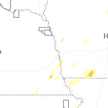


Connect with Interactive Hail Maps