

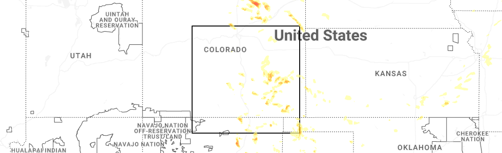
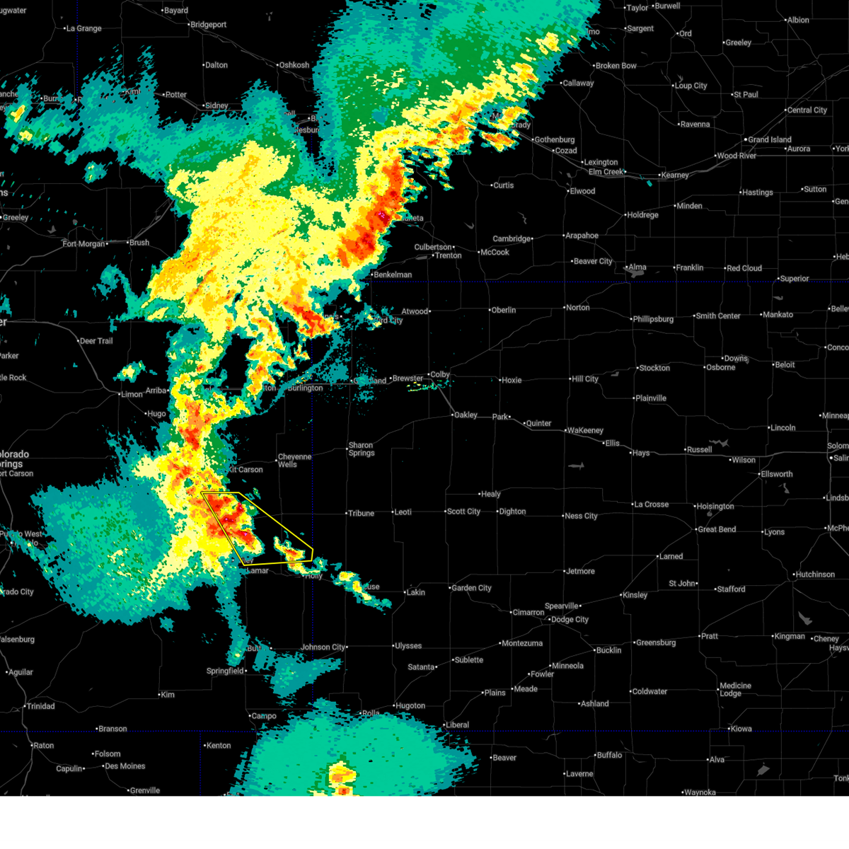
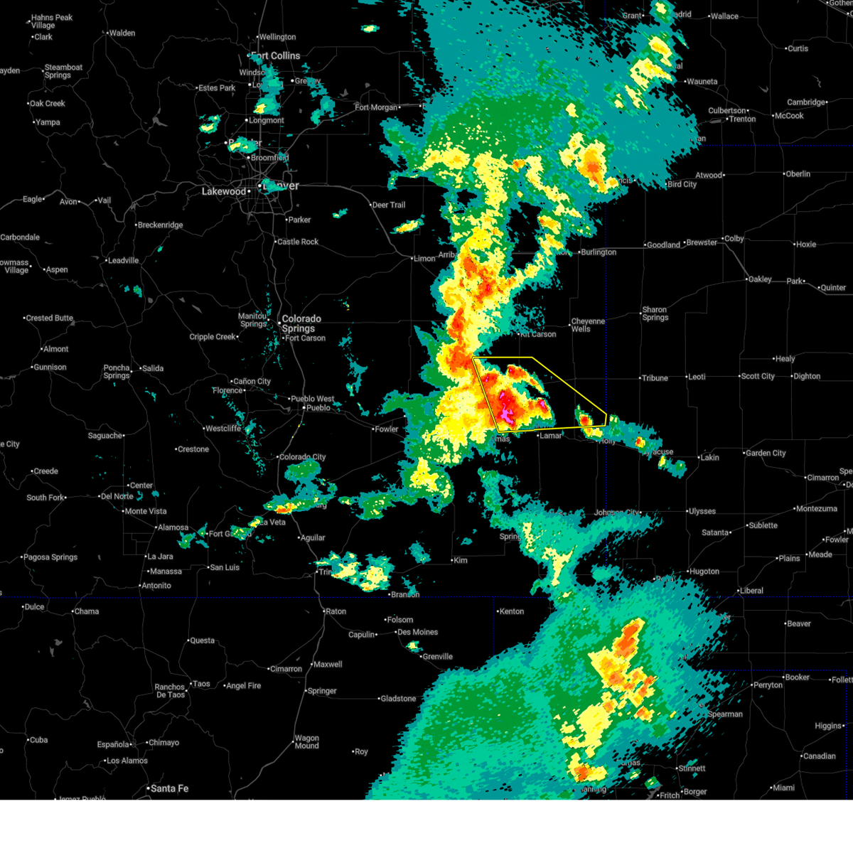
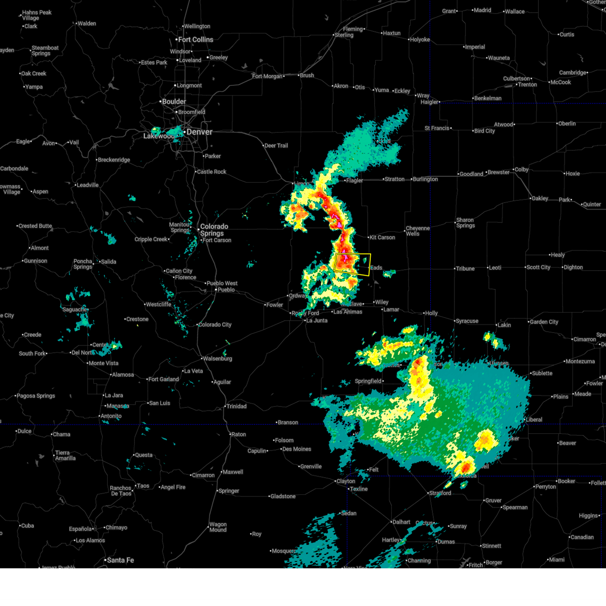
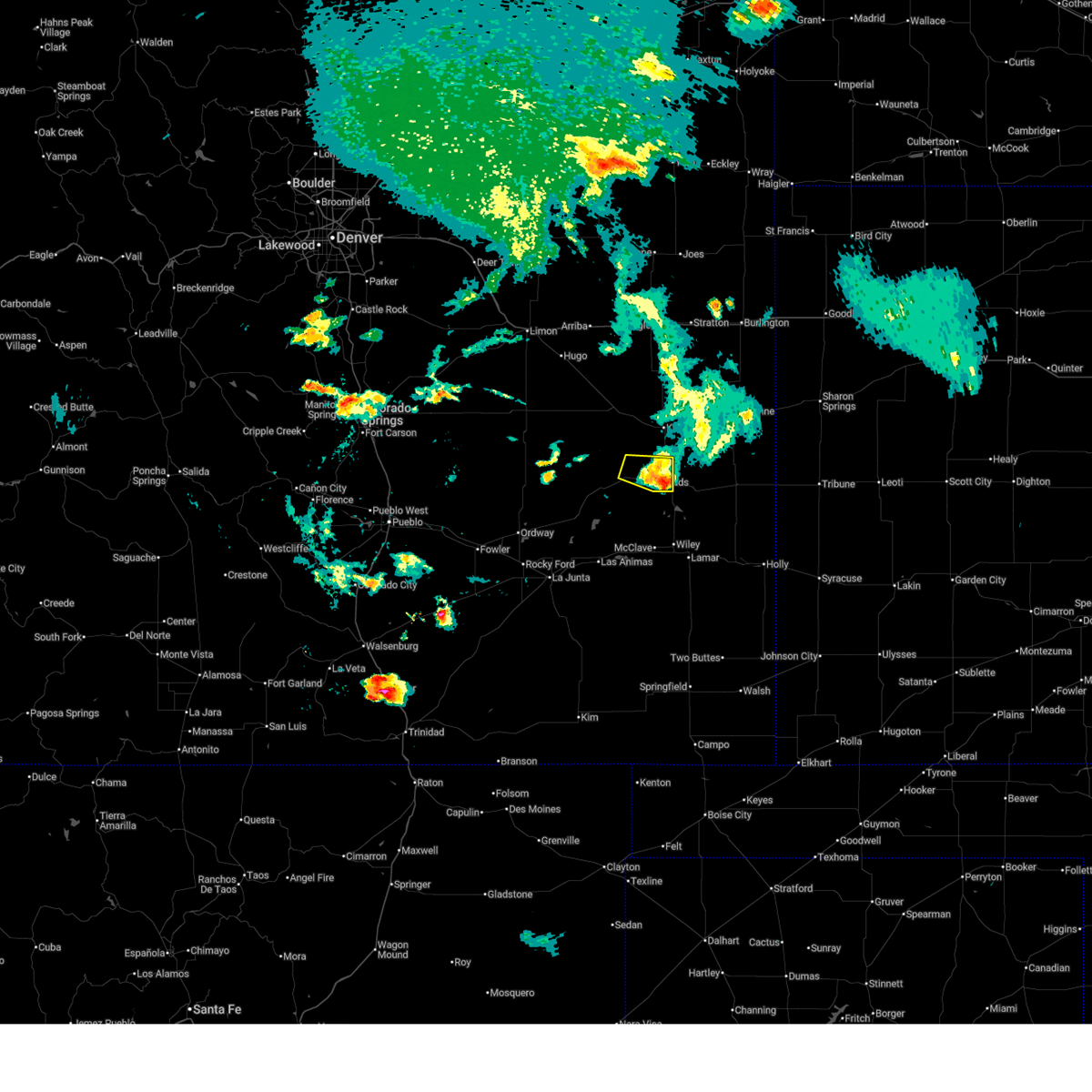
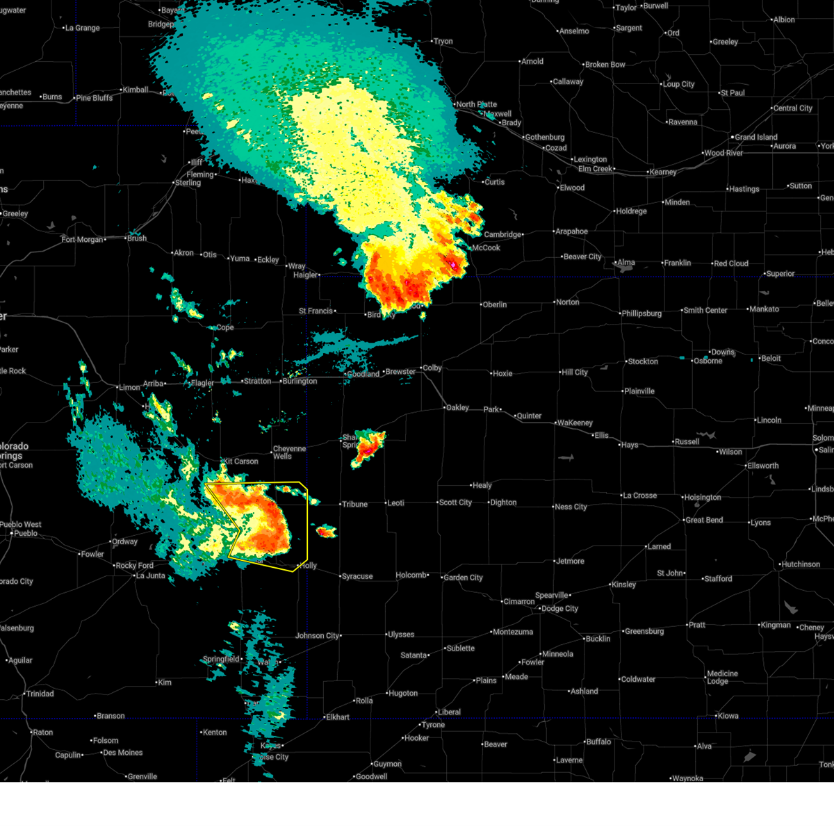
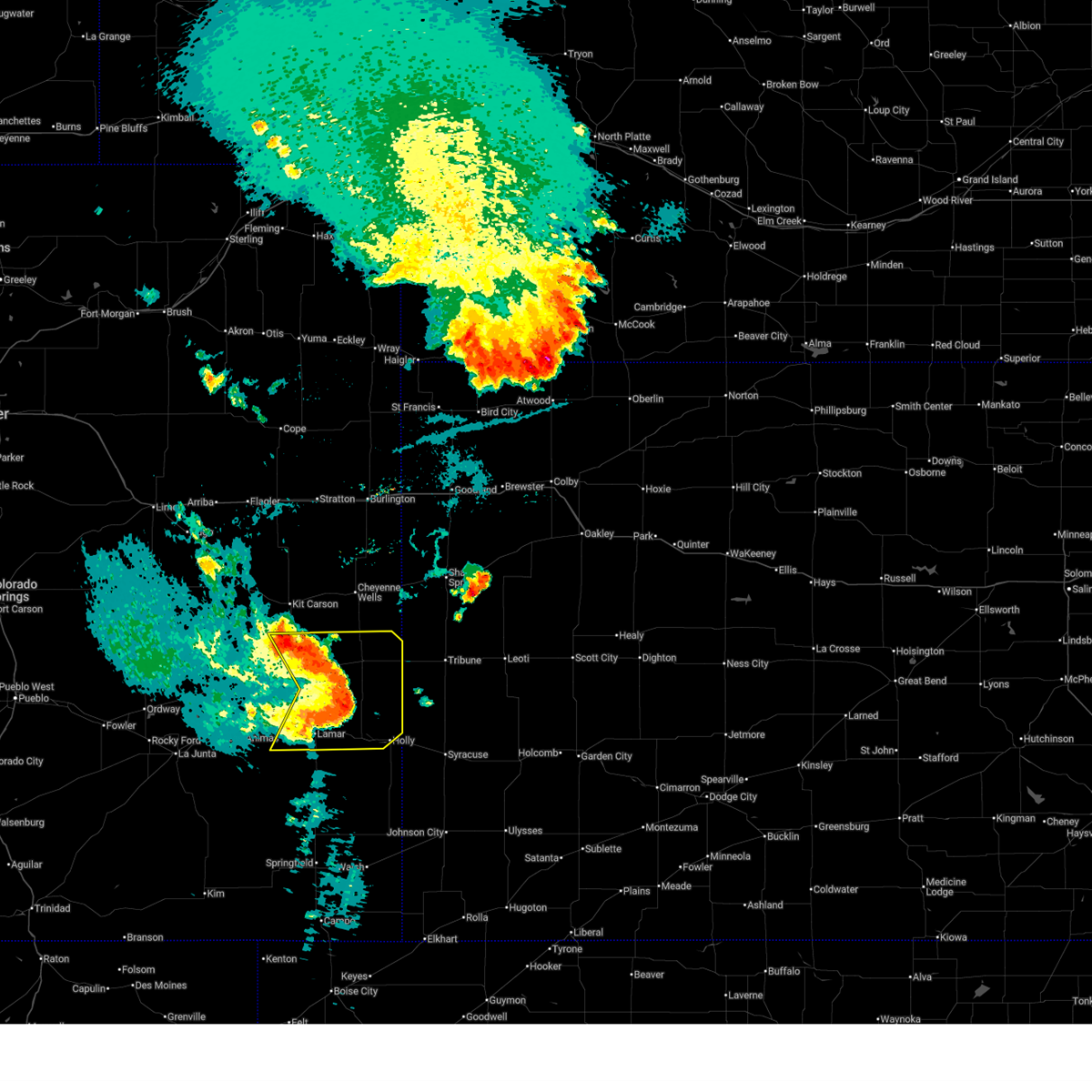
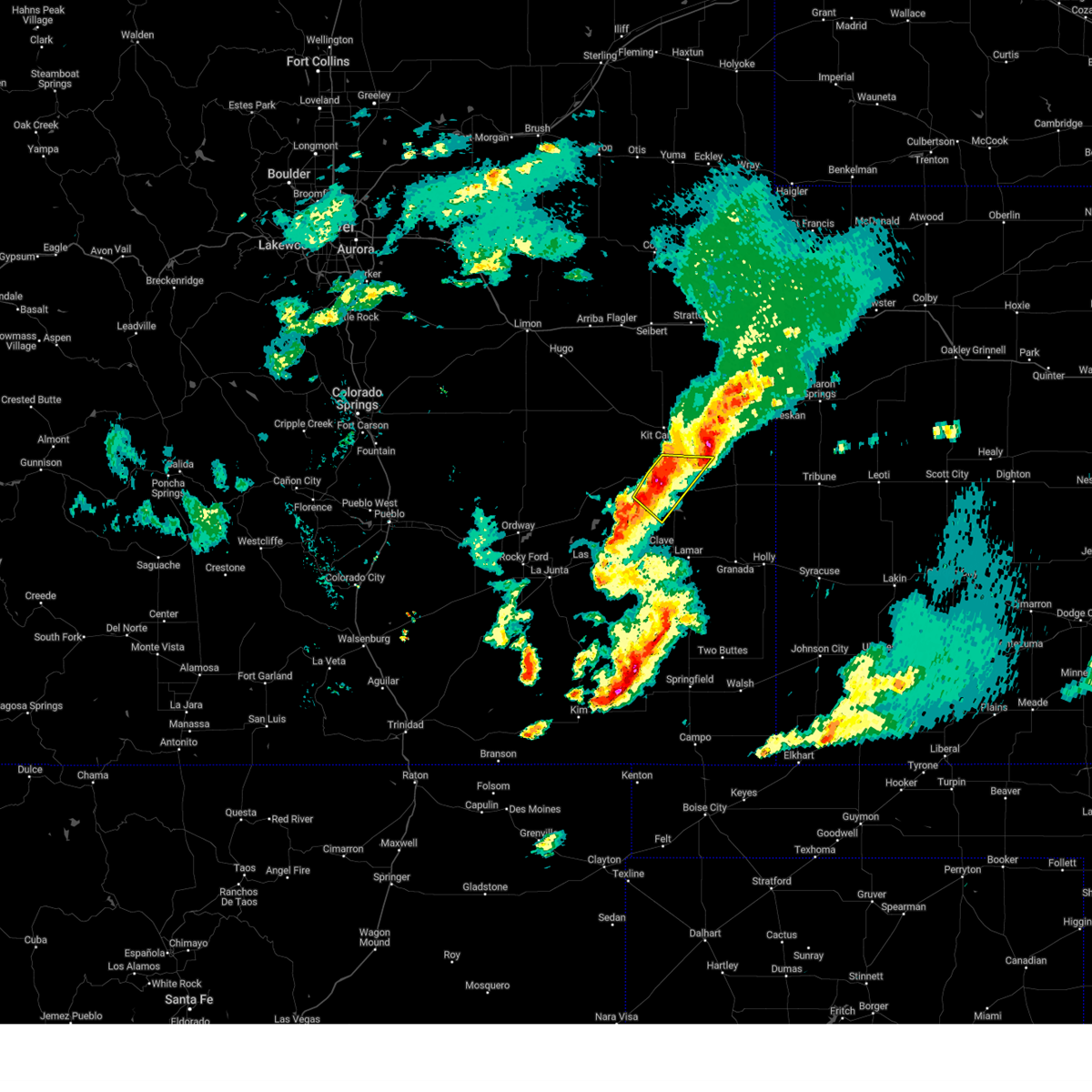
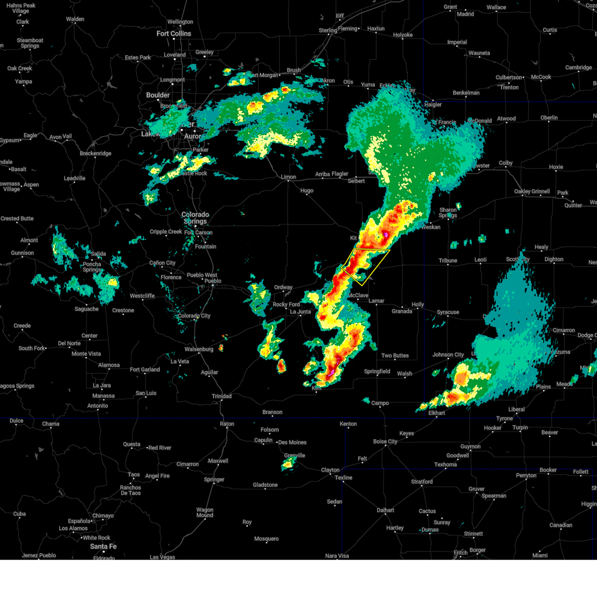
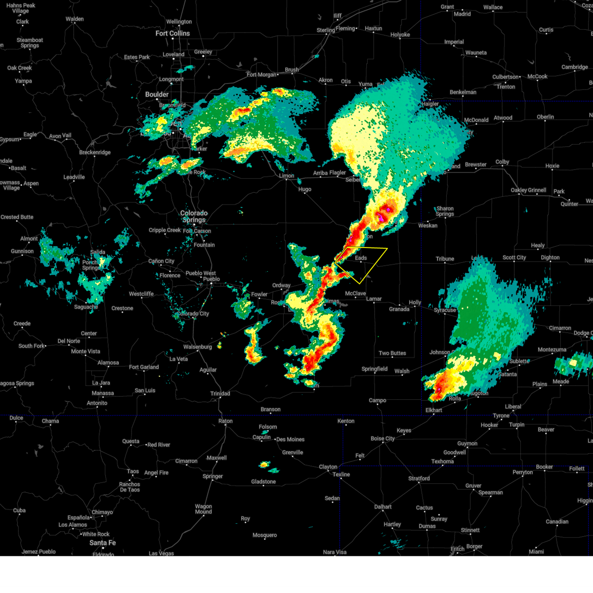
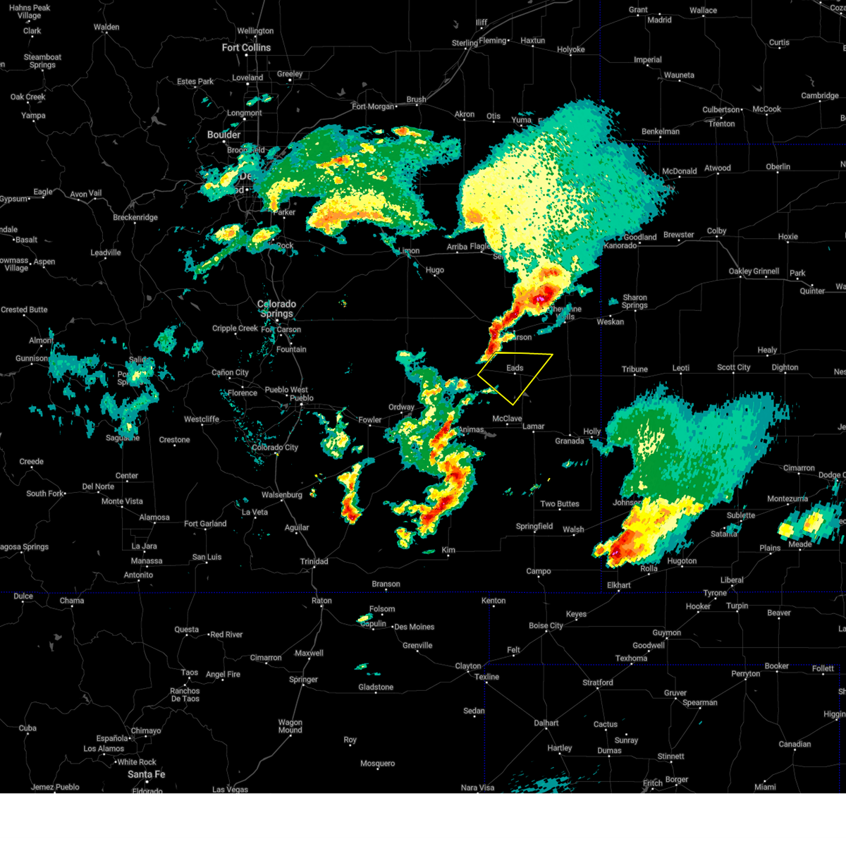
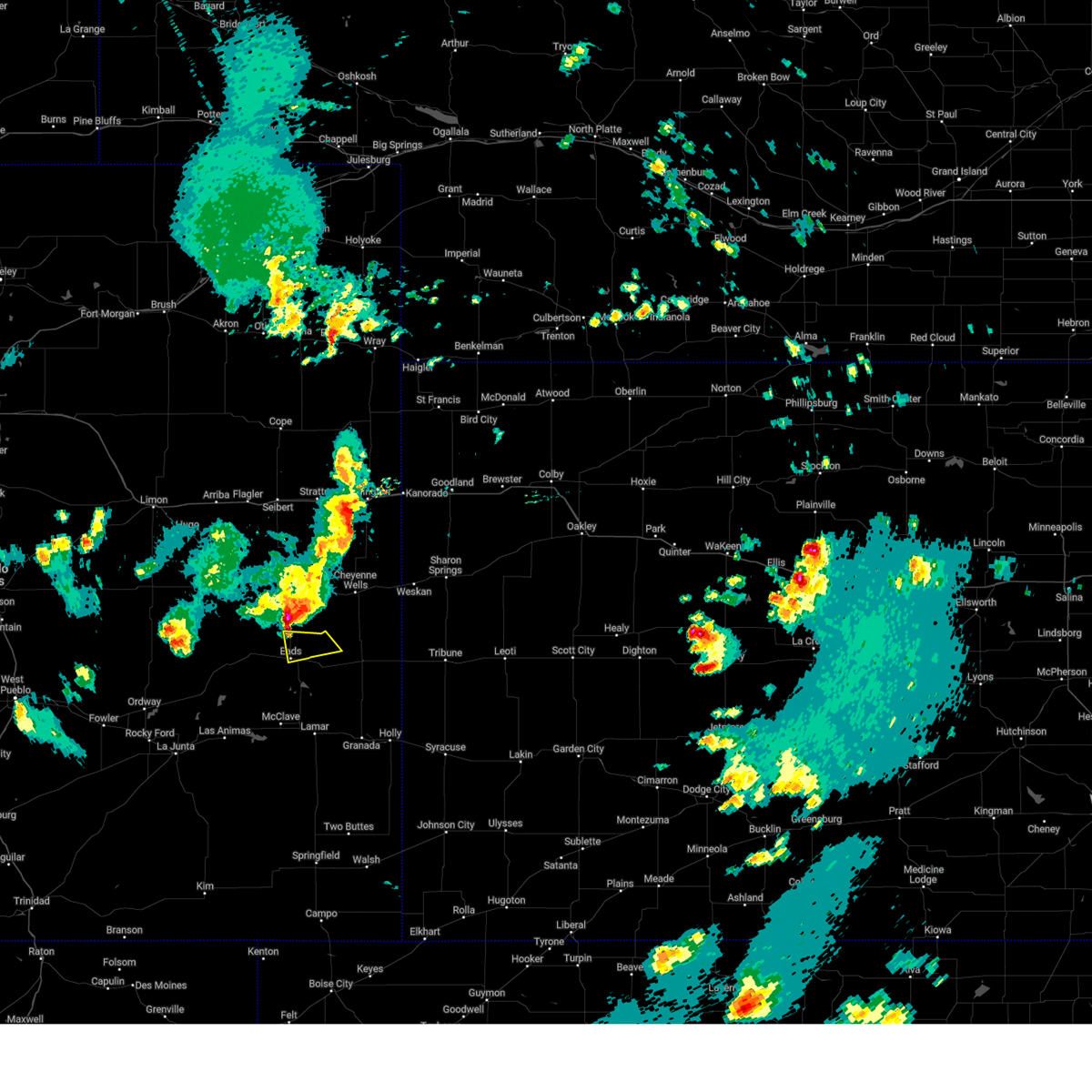
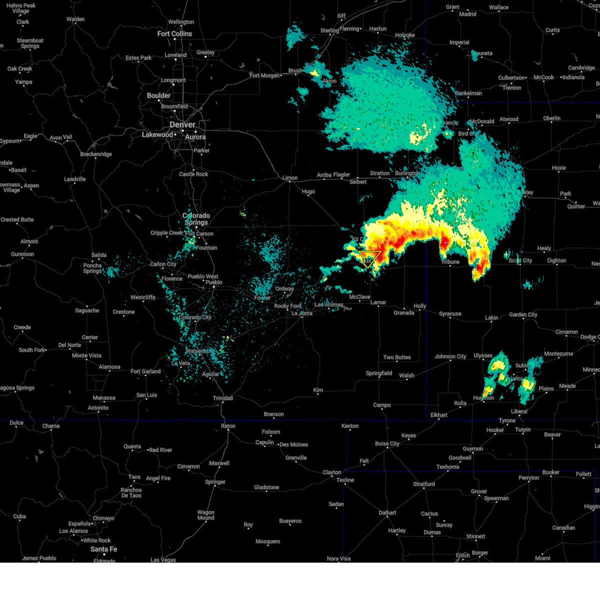
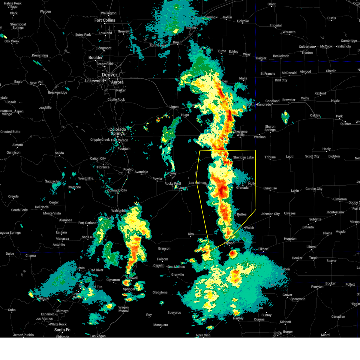
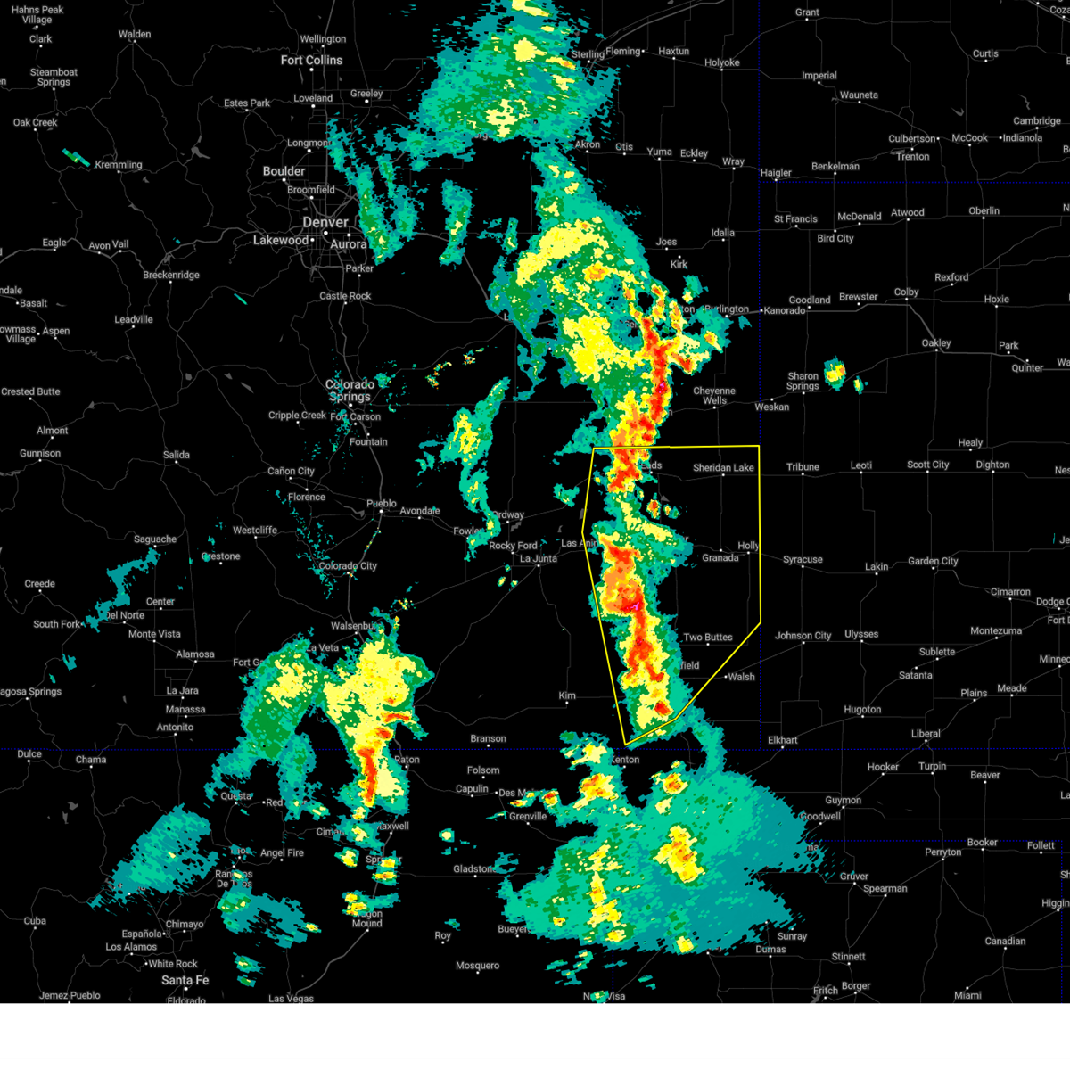
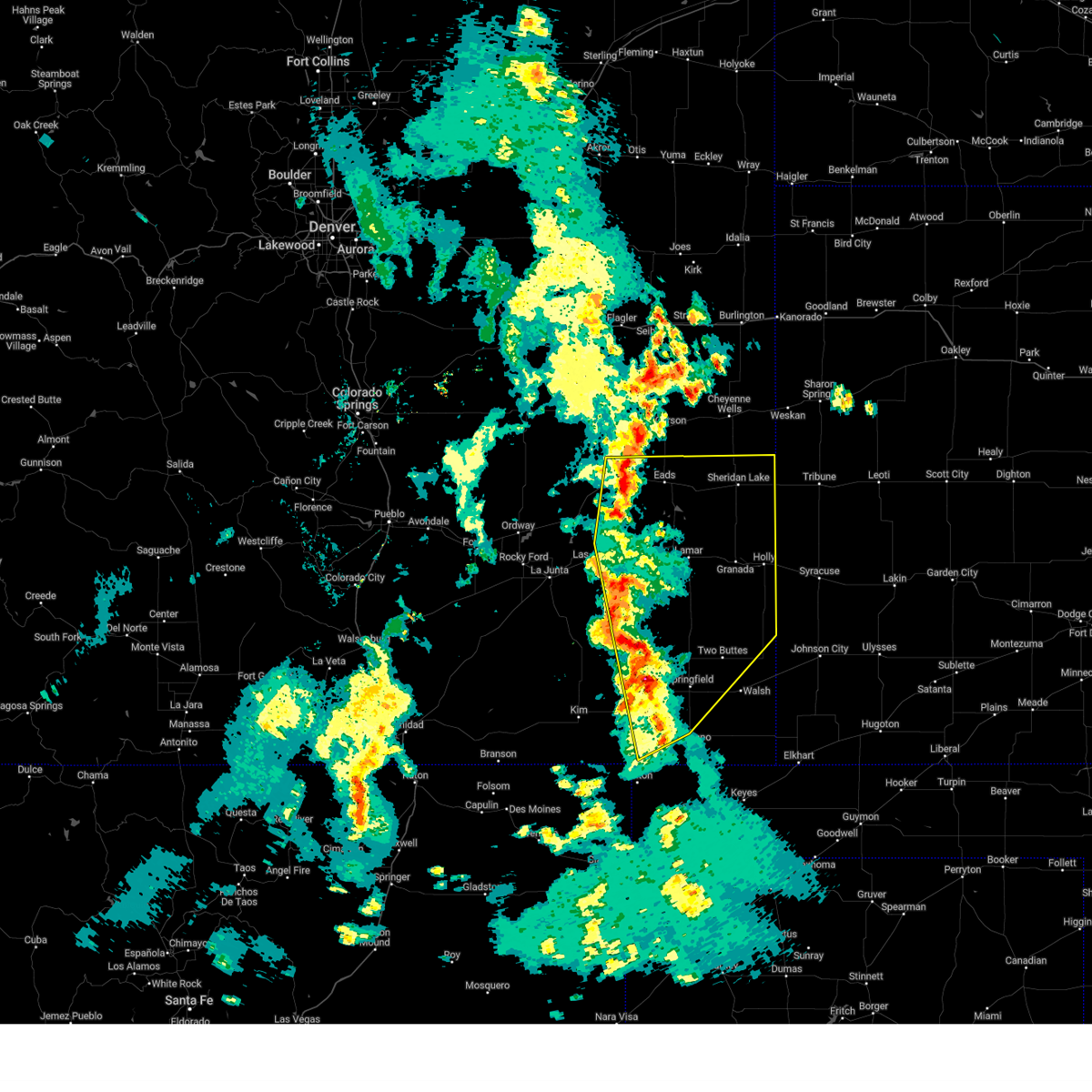
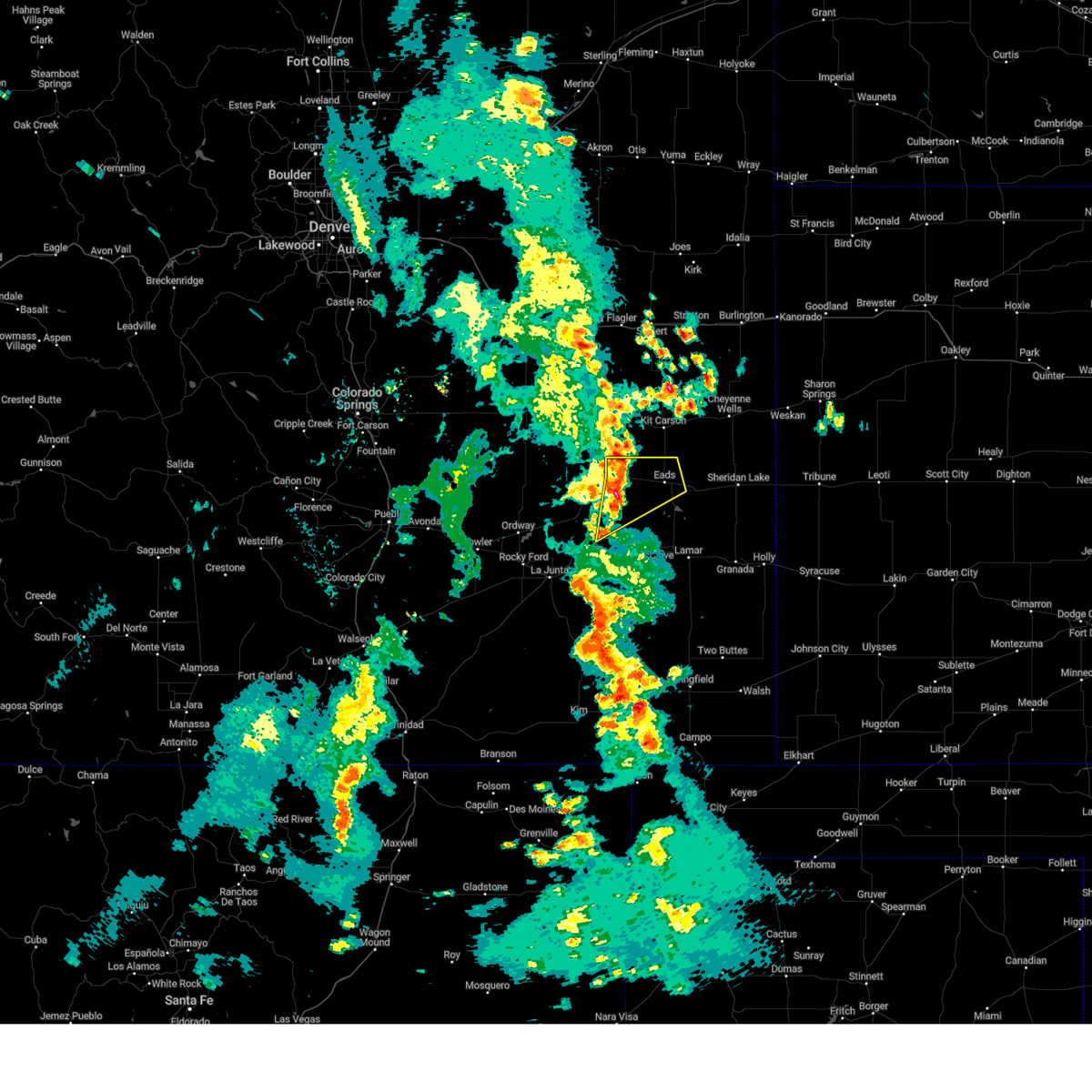
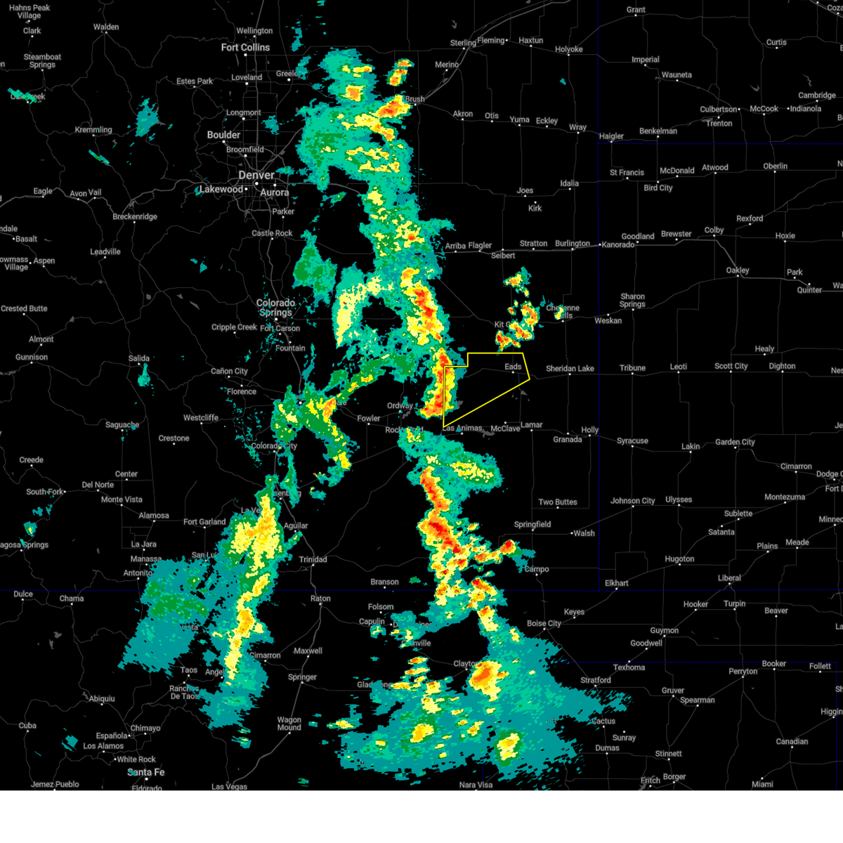
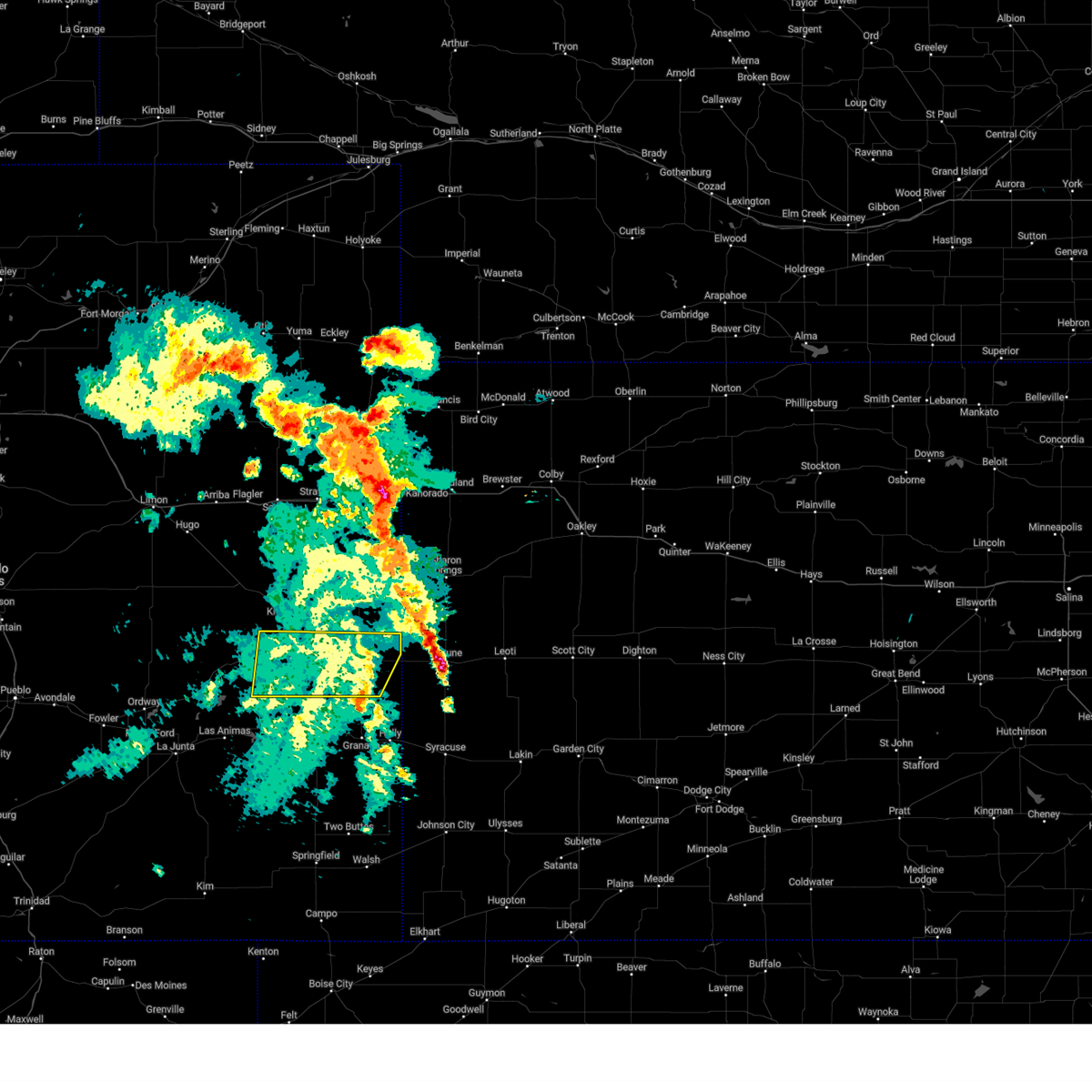
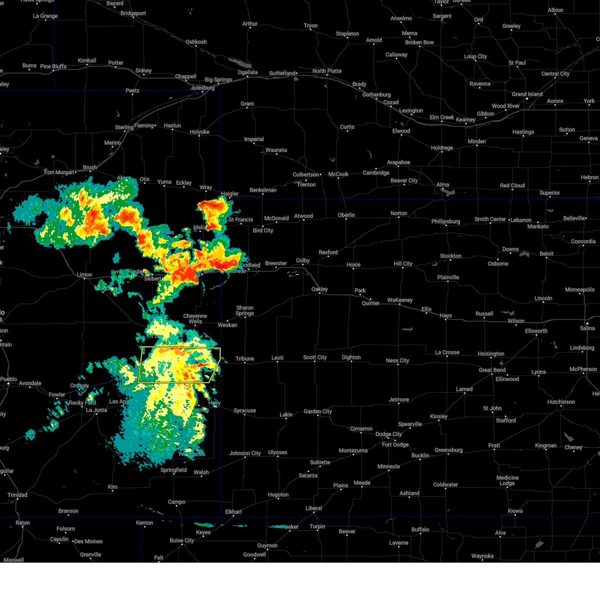
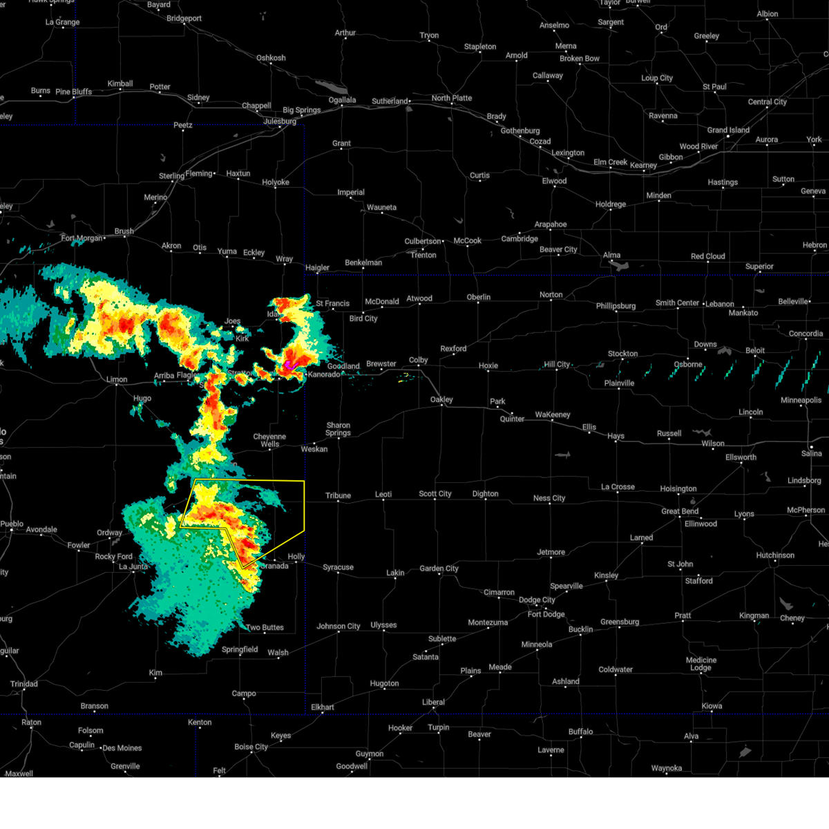
Hail Map for Eads, CO
The Eads, CO area has had 29 reports of on-the-ground hail by trained spotters, and has been under severe weather warnings 29 times during the past 12 months. Doppler radar has detected hail at or near Eads, CO on 97 occasions, including 6 occasions during the past year.
| Name: | Eads, CO |
| Where Located: | 100.6 miles E of Pueblo, CO |
| Map: | Google Map for Eads, CO |
| Population: | 609 |
| Housing Units: | 352 |
| More Info: | Search Google for Eads, CO |
0
The Top Recent Hail Date for Eads, CO is Friday, July 11, 2025 (15th out of 97)
Hail and Wind Damage Spotted near Eads, CO
| Date / Time | Report Details |
|---|---|
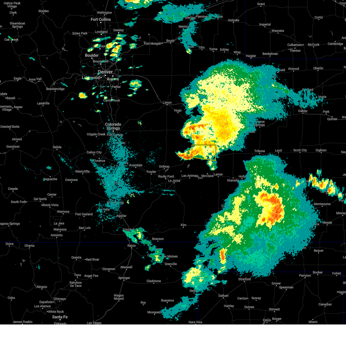
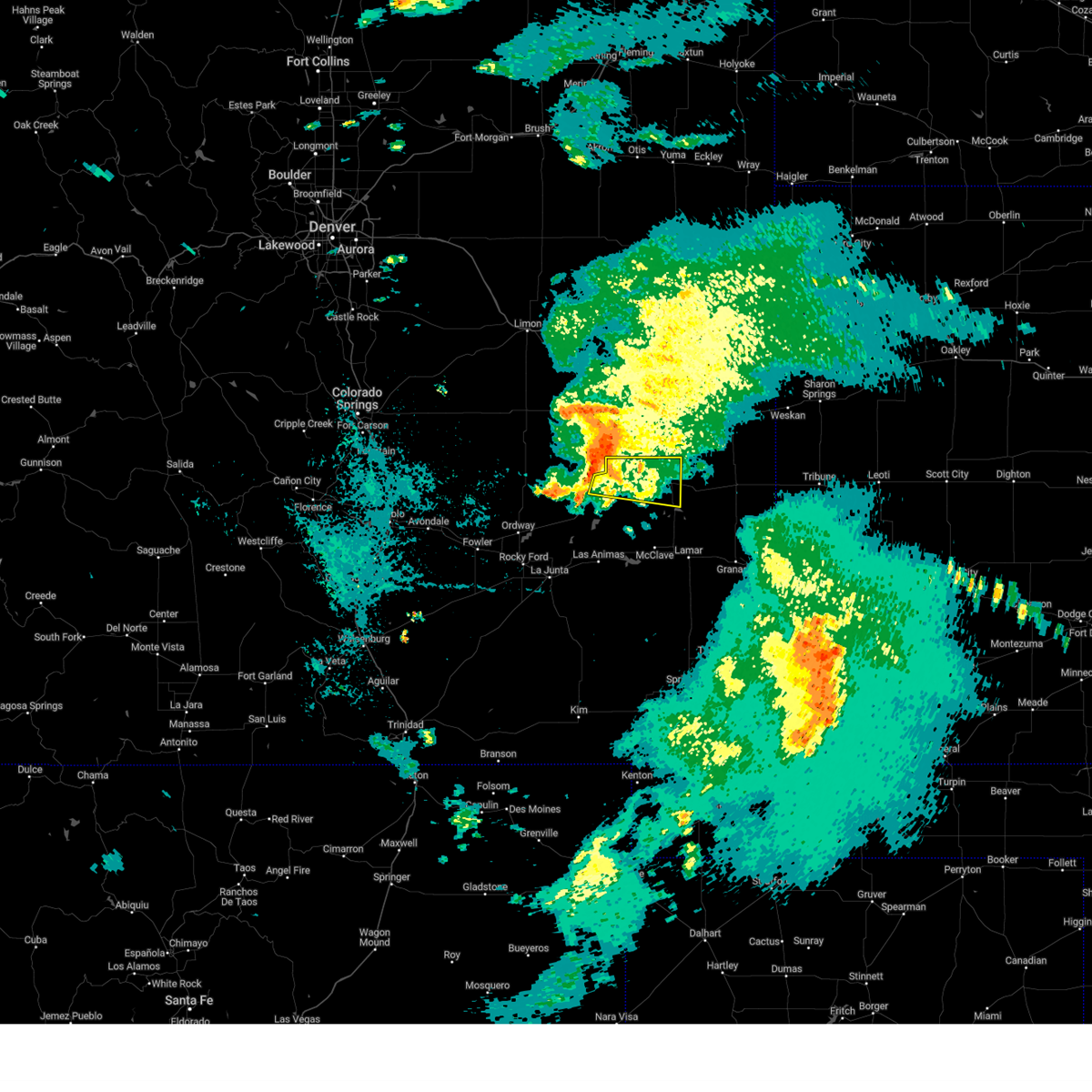
| 7/11/2025 10:13 PM MDT |
 At 1013 pm mdt, severe thunderstorms were located along a line extending from 6 miles northwest of eads to queens reservoir, moving northeast at 15 mph (radar indicated). Hazards include 60 mph wind gusts and quarter size hail. Hail damage to vehicles is expected. expect wind damage to roofs, siding, and trees. Locations impacted include, eads, neeoshe reservoir, sweetwater reservoir, chivington, brandon, neegronda reservoir, and queens reservoir. At 1013 pm mdt, severe thunderstorms were located along a line extending from 6 miles northwest of eads to queens reservoir, moving northeast at 15 mph (radar indicated). Hazards include 60 mph wind gusts and quarter size hail. Hail damage to vehicles is expected. expect wind damage to roofs, siding, and trees. Locations impacted include, eads, neeoshe reservoir, sweetwater reservoir, chivington, brandon, neegronda reservoir, and queens reservoir.
|
| 7/11/2025 10:13 PM MDT |
 the severe thunderstorm warning has been cancelled and is no longer in effect the severe thunderstorm warning has been cancelled and is no longer in effect
|
| 7/11/2025 10:00 PM MDT |
 Svrpub the national weather service in pueblo has issued a * severe thunderstorm warning for, northern prowers county in southeastern colorado, central kiowa county in southeastern colorado, northeastern bent county in southeastern colorado, * until 1030 pm mdt. * at 959 pm mdt, a cluster of severe thunderstorms were located along a line extending from 6 miles east of haswell to 6 miles southwest of neegronda reservoir, moving east at 15 mph (radar indicated). Hazards include 60 mph wind gusts and quarter size hail. Hail damage to vehicles is expected. Expect wind damage to roofs, siding, and trees. Svrpub the national weather service in pueblo has issued a * severe thunderstorm warning for, northern prowers county in southeastern colorado, central kiowa county in southeastern colorado, northeastern bent county in southeastern colorado, * until 1030 pm mdt. * at 959 pm mdt, a cluster of severe thunderstorms were located along a line extending from 6 miles east of haswell to 6 miles southwest of neegronda reservoir, moving east at 15 mph (radar indicated). Hazards include 60 mph wind gusts and quarter size hail. Hail damage to vehicles is expected. Expect wind damage to roofs, siding, and trees.
|
| 6/29/2025 8:39 PM MDT |
 The storm which prompted the warning has weakened below severe limits, and no longer poses an immediate threat to life or property. therefore, the warning will be allowed to expire. however, small hail and gusty winds are still possible with this thunderstorm. The storm which prompted the warning has weakened below severe limits, and no longer poses an immediate threat to life or property. therefore, the warning will be allowed to expire. however, small hail and gusty winds are still possible with this thunderstorm.
|
| 6/29/2025 8:14 PM MDT |
 Svrpub the national weather service in pueblo has issued a * severe thunderstorm warning for, northwestern kiowa county in southeastern colorado, * until 845 pm mdt. * at 814 pm mdt, a severe thunderstorm was located 9 miles northeast of haswell, or 41 miles northwest of lamar, moving east at 20 mph (radar indicated). Hazards include 60 mph wind gusts and quarter size hail. Hail damage to vehicles is expected. Expect wind damage to roofs, siding, and trees. Svrpub the national weather service in pueblo has issued a * severe thunderstorm warning for, northwestern kiowa county in southeastern colorado, * until 845 pm mdt. * at 814 pm mdt, a severe thunderstorm was located 9 miles northeast of haswell, or 41 miles northwest of lamar, moving east at 20 mph (radar indicated). Hazards include 60 mph wind gusts and quarter size hail. Hail damage to vehicles is expected. Expect wind damage to roofs, siding, and trees.
|
| 6/17/2025 4:11 PM MDT |
 The storm which prompted the warning has weakened below severe limits, and no longer poses an immediate threat to life or property. therefore, the warning will be allowed to expire. however, small hail and gusty winds are still possible with this thunderstorm. The storm which prompted the warning has weakened below severe limits, and no longer poses an immediate threat to life or property. therefore, the warning will be allowed to expire. however, small hail and gusty winds are still possible with this thunderstorm.
|
| 6/17/2025 3:45 PM MDT | Svrpub the national weather service in pueblo has issued a * severe thunderstorm warning for, north central kiowa county in southeastern colorado, * until 415 pm mdt. * at 344 pm mdt, a severe thunderstorm was located 10 miles northwest of eads, or 37 miles northwest of lamar, moving east at 25 mph (radar indicated). Hazards include 60 mph wind gusts and quarter size hail. Hail damage to vehicles is expected. Expect wind damage to roofs, siding, and trees. |
| 6/13/2025 11:58 PM MDT |
 At 1158 pm mdt, severe thunderstorms were located along a line extending from 13 miles northeast of eads to 10 miles south of towner to near bristol, moving east at 55 mph (radar indicated). Hazards include 70 mph wind gusts and quarter size hail. Hail damage to vehicles is expected. expect considerable tree damage. wind damage is also likely to mobile homes, roofs, and outbuildings. Locations impacted include, lamar, holly, eads, granada, sheridan lake, hartman, towner, bristol, chivington, brandon, and neeoshe reservoir. At 1158 pm mdt, severe thunderstorms were located along a line extending from 13 miles northeast of eads to 10 miles south of towner to near bristol, moving east at 55 mph (radar indicated). Hazards include 70 mph wind gusts and quarter size hail. Hail damage to vehicles is expected. expect considerable tree damage. wind damage is also likely to mobile homes, roofs, and outbuildings. Locations impacted include, lamar, holly, eads, granada, sheridan lake, hartman, towner, bristol, chivington, brandon, and neeoshe reservoir.
|
| 6/13/2025 11:58 PM MDT |
 the severe thunderstorm warning has been cancelled and is no longer in effect the severe thunderstorm warning has been cancelled and is no longer in effect
|
| 6/13/2025 11:36 PM MDT |
 Svrpub the national weather service in pueblo has issued a * severe thunderstorm warning for, northern prowers county in southeastern colorado, eastern kiowa county in southeastern colorado, northeastern bent county in southeastern colorado, * until 1215 am mdt. * at 1135 pm mdt, severe thunderstorms were located along a line extending from 13 miles northeast of haswell to 9 miles south of brandon to near mcclave, moving east at 55 mph (radar indicated). Hazards include 70 mph wind gusts and quarter size hail. Hail damage to vehicles is expected. expect considerable tree damage. Wind damage is also likely to mobile homes, roofs, and outbuildings. Svrpub the national weather service in pueblo has issued a * severe thunderstorm warning for, northern prowers county in southeastern colorado, eastern kiowa county in southeastern colorado, northeastern bent county in southeastern colorado, * until 1215 am mdt. * at 1135 pm mdt, severe thunderstorms were located along a line extending from 13 miles northeast of haswell to 9 miles south of brandon to near mcclave, moving east at 55 mph (radar indicated). Hazards include 70 mph wind gusts and quarter size hail. Hail damage to vehicles is expected. expect considerable tree damage. Wind damage is also likely to mobile homes, roofs, and outbuildings.
|
| 6/5/2025 7:43 PM MDT |
 At 743 pm mdt, a severe thunderstorm was located over eads, or 27 miles north of lamar, moving southeast at 15 mph (radar indicated). Hazards include 60 mph wind gusts and quarter size hail. Hail damage to vehicles is expected. expect wind damage to roofs, siding, and trees. This severe thunderstorm will remain over mainly rural areas of central kiowa county. At 743 pm mdt, a severe thunderstorm was located over eads, or 27 miles north of lamar, moving southeast at 15 mph (radar indicated). Hazards include 60 mph wind gusts and quarter size hail. Hail damage to vehicles is expected. expect wind damage to roofs, siding, and trees. This severe thunderstorm will remain over mainly rural areas of central kiowa county.
|
| 6/5/2025 7:29 PM MDT |
 At 729 pm mdt, a severe thunderstorm was located over eads, or 29 miles north of lamar, moving southeast at 20 mph (radar indicated). Hazards include quarter size hail. Damage to vehicles is expected. This severe storm will be near, eads around 735 pm mdt. At 729 pm mdt, a severe thunderstorm was located over eads, or 29 miles north of lamar, moving southeast at 20 mph (radar indicated). Hazards include quarter size hail. Damage to vehicles is expected. This severe storm will be near, eads around 735 pm mdt.
|
| 6/5/2025 7:13 PM MDT |
 At 712 pm mdt, a severe thunderstorm was located 7 miles northwest of eads, or 35 miles northwest of lamar, moving southeast at 20 mph (radar indicated). Hazards include 60 mph wind gusts and quarter size hail. Hail damage to vehicles is expected. expect wind damage to roofs, siding, and trees. This severe storm will be near, eads around 720 pm mdt. At 712 pm mdt, a severe thunderstorm was located 7 miles northwest of eads, or 35 miles northwest of lamar, moving southeast at 20 mph (radar indicated). Hazards include 60 mph wind gusts and quarter size hail. Hail damage to vehicles is expected. expect wind damage to roofs, siding, and trees. This severe storm will be near, eads around 720 pm mdt.
|
| 6/5/2025 7:08 PM MDT |
 Svrpub the national weather service in pueblo has issued a * severe thunderstorm warning for, central kiowa county in southeastern colorado, * until 800 pm mdt. * at 708 pm mdt, a severe thunderstorm was located 9 miles northwest of eads, which is 36 miles northwest of lamar, moving southeast at 20 mph (radar indicated). Hazards include 60 mph wind gusts and quarter size hail. Hail damage to vehicles is expected. expect wind damage to roofs, siding, and trees. This severe thunderstorm will be near, eads around 720 pm mdt. Svrpub the national weather service in pueblo has issued a * severe thunderstorm warning for, central kiowa county in southeastern colorado, * until 800 pm mdt. * at 708 pm mdt, a severe thunderstorm was located 9 miles northwest of eads, which is 36 miles northwest of lamar, moving southeast at 20 mph (radar indicated). Hazards include 60 mph wind gusts and quarter size hail. Hail damage to vehicles is expected. expect wind damage to roofs, siding, and trees. This severe thunderstorm will be near, eads around 720 pm mdt.
|
| 4/24/2025 8:06 PM MDT |
 Svrpub the national weather service in pueblo has issued a * severe thunderstorm warning for, north central kiowa county in southeastern colorado, * until 830 pm mdt. * at 806 pm mdt, a severe thunderstorm was located 7 miles south of kit carson, or 25 miles southwest of cheyenne wells, moving southeast at 25 mph (radar indicated). Hazards include ping pong ball size hail and 60 mph wind gusts. People and animals outdoors will be injured. expect hail damage to roofs, siding, windows, and vehicles. Expect wind damage to roofs, siding, and trees. Svrpub the national weather service in pueblo has issued a * severe thunderstorm warning for, north central kiowa county in southeastern colorado, * until 830 pm mdt. * at 806 pm mdt, a severe thunderstorm was located 7 miles south of kit carson, or 25 miles southwest of cheyenne wells, moving southeast at 25 mph (radar indicated). Hazards include ping pong ball size hail and 60 mph wind gusts. People and animals outdoors will be injured. expect hail damage to roofs, siding, windows, and vehicles. Expect wind damage to roofs, siding, and trees.
|
| 4/23/2025 11:13 PM MDT |
 The severe thunderstorm which prompted the warning has weakened and moved out of the warned area. therefore, the warning will be allowed to expire. this storm is moving east and is still capable of producing nickel sized hail and wind gusts to 55 mph. The severe thunderstorm which prompted the warning has weakened and moved out of the warned area. therefore, the warning will be allowed to expire. this storm is moving east and is still capable of producing nickel sized hail and wind gusts to 55 mph.
|
| 4/23/2025 11:01 PM MDT |
 At 1101 pm mdt, a severe thunderstorm was located 8 miles northeast of eads, or 25 miles southwest of cheyenne wells, moving northeast at 30 mph (radar indicated). Hazards include 60 mph wind gusts and quarter size hail. Hail damage to vehicles is expected. expect wind damage to roofs, siding, and trees. Locations impacted include, eads. At 1101 pm mdt, a severe thunderstorm was located 8 miles northeast of eads, or 25 miles southwest of cheyenne wells, moving northeast at 30 mph (radar indicated). Hazards include 60 mph wind gusts and quarter size hail. Hail damage to vehicles is expected. expect wind damage to roofs, siding, and trees. Locations impacted include, eads.
|
| 4/23/2025 10:39 PM MDT |
 Svrpub the national weather service in pueblo has issued a * severe thunderstorm warning for, north central kiowa county in southeastern colorado, * until 1115 pm mdt. * at 1039 pm mdt, a severe thunderstorm was located near eads, or 33 miles north of lamar, moving northeast at 15 mph (radar indicated). Hazards include 60 mph wind gusts and quarter size hail. Hail damage to vehicles is expected. Expect wind damage to roofs, siding, and trees. Svrpub the national weather service in pueblo has issued a * severe thunderstorm warning for, north central kiowa county in southeastern colorado, * until 1115 pm mdt. * at 1039 pm mdt, a severe thunderstorm was located near eads, or 33 miles north of lamar, moving northeast at 15 mph (radar indicated). Hazards include 60 mph wind gusts and quarter size hail. Hail damage to vehicles is expected. Expect wind damage to roofs, siding, and trees.
|
| 9/17/2024 5:39 PM MDT |
 At 538 pm mdt, a severe thunderstorm was located over lamar, moving northeast at 50 mph (the lamar weather station reported a wind gusts to 72 mph at 5:38 pm). Hazards include 72 mph wind gusts and nickel size hail. Expect considerable tree damage. damage is likely to mobile homes, roofs, and outbuildings. Locations impacted include, lamar, springfield, las animas, holly, eads, granada, wiley, pritchett, vilas, sheridan lake, hartman, haswell, two buttes, neeoshe reservoir, chivington, bristol, sweetwater reservoir, two buttes reservoir, hasty, and john martin reservoir. At 538 pm mdt, a severe thunderstorm was located over lamar, moving northeast at 50 mph (the lamar weather station reported a wind gusts to 72 mph at 5:38 pm). Hazards include 72 mph wind gusts and nickel size hail. Expect considerable tree damage. damage is likely to mobile homes, roofs, and outbuildings. Locations impacted include, lamar, springfield, las animas, holly, eads, granada, wiley, pritchett, vilas, sheridan lake, hartman, haswell, two buttes, neeoshe reservoir, chivington, bristol, sweetwater reservoir, two buttes reservoir, hasty, and john martin reservoir.
|
| 9/17/2024 5:34 PM MDT |
 At 533 pm mdt, a severe thunderstorm was located near lamar, moving northeast at 50 mph. other strong to severe storms were noted in northcentral kiowa county and 15 miles north of springfield (radar indicated). Hazards include 70 mph wind gusts and nickel size hail. Expect considerable tree damage. damage is likely to mobile homes, roofs, and outbuildings. Locations impacted include, lamar, springfield, las animas, holly, eads, granada, wiley, pritchett, vilas, sheridan lake, hartman, haswell, two buttes, neeoshe reservoir, chivington, bristol, sweetwater reservoir, two buttes reservoir, hasty, and john martin reservoir. At 533 pm mdt, a severe thunderstorm was located near lamar, moving northeast at 50 mph. other strong to severe storms were noted in northcentral kiowa county and 15 miles north of springfield (radar indicated). Hazards include 70 mph wind gusts and nickel size hail. Expect considerable tree damage. damage is likely to mobile homes, roofs, and outbuildings. Locations impacted include, lamar, springfield, las animas, holly, eads, granada, wiley, pritchett, vilas, sheridan lake, hartman, haswell, two buttes, neeoshe reservoir, chivington, bristol, sweetwater reservoir, two buttes reservoir, hasty, and john martin reservoir.
|
| 9/17/2024 5:18 PM MDT |
 At 513 pm mdt, a broken line of strong to severe thunderstorms extended southward from 5 miles west of eads, to 15 miles west of lamar, to 4 miles west of springfield. the line of storms were moving northeast at 50 mph. the most intense storms were in southeastern bent county and northwest baca county. these storms will affect highway 50 from east of the town of las animas to the kansas border, and highway 287 from near springfield to the kiowa and cheyenne county line (radar indicated). Hazards include 60 mph wind gusts and nickel size hail. Expect damage to roofs, siding, and trees. Locations impacted include, lamar, springfield, las animas, holly, eads, granada, wiley, pritchett, vilas, sheridan lake, hartman, haswell, two buttes, neeoshe reservoir, chivington, bristol, sweetwater reservoir, two buttes reservoir, hasty, and john martin reservoir. At 513 pm mdt, a broken line of strong to severe thunderstorms extended southward from 5 miles west of eads, to 15 miles west of lamar, to 4 miles west of springfield. the line of storms were moving northeast at 50 mph. the most intense storms were in southeastern bent county and northwest baca county. these storms will affect highway 50 from east of the town of las animas to the kansas border, and highway 287 from near springfield to the kiowa and cheyenne county line (radar indicated). Hazards include 60 mph wind gusts and nickel size hail. Expect damage to roofs, siding, and trees. Locations impacted include, lamar, springfield, las animas, holly, eads, granada, wiley, pritchett, vilas, sheridan lake, hartman, haswell, two buttes, neeoshe reservoir, chivington, bristol, sweetwater reservoir, two buttes reservoir, hasty, and john martin reservoir.
|
| 9/17/2024 5:09 PM MDT |
 Svrpub the national weather service in pueblo has issued a * severe thunderstorm warning for, prowers county in southeastern colorado, northwestern baca county in southeastern colorado, kiowa county in southeastern colorado, east central las animas county in southeastern colorado, bent county in southeastern colorado, * until 615 pm mdt. * at 508 pm mdt, a severe thunderstorm was located 19 miles west of two buttes reservoir, or 27 miles northwest of springfield, moving northeast at 50 mph (radar indicated). Hazards include 60 mph wind gusts and nickel size hail. expect damage to roofs, siding, and trees Svrpub the national weather service in pueblo has issued a * severe thunderstorm warning for, prowers county in southeastern colorado, northwestern baca county in southeastern colorado, kiowa county in southeastern colorado, east central las animas county in southeastern colorado, bent county in southeastern colorado, * until 615 pm mdt. * at 508 pm mdt, a severe thunderstorm was located 19 miles west of two buttes reservoir, or 27 miles northwest of springfield, moving northeast at 50 mph (radar indicated). Hazards include 60 mph wind gusts and nickel size hail. expect damage to roofs, siding, and trees
|
| 9/17/2024 4:58 PM MDT |
 At 458 pm mdt, a severe thunderstorm was located 7 miles east of haswell, or 34 miles northwest of lamar, moving northeast at 35 mph (radar indicated). Hazards include 60 mph wind gusts and nickel size hail. Expect damage to roofs, siding, and trees. Locations impacted include, eads, haswell, and blue lake. At 458 pm mdt, a severe thunderstorm was located 7 miles east of haswell, or 34 miles northwest of lamar, moving northeast at 35 mph (radar indicated). Hazards include 60 mph wind gusts and nickel size hail. Expect damage to roofs, siding, and trees. Locations impacted include, eads, haswell, and blue lake.
|
| 9/17/2024 4:32 PM MDT |
 Svrpub the national weather service in pueblo has issued a * severe thunderstorm warning for, western kiowa county in southeastern colorado, northwestern bent county in southeastern colorado, * until 515 pm mdt. * at 432 pm mdt, a severe thunderstorm was located near arlington, or 30 miles northeast of north la junta, moving northeast at 45 mph (radar indicated). Hazards include 60 mph wind gusts and nickel size hail. expect damage to roofs, siding, and trees Svrpub the national weather service in pueblo has issued a * severe thunderstorm warning for, western kiowa county in southeastern colorado, northwestern bent county in southeastern colorado, * until 515 pm mdt. * at 432 pm mdt, a severe thunderstorm was located near arlington, or 30 miles northeast of north la junta, moving northeast at 45 mph (radar indicated). Hazards include 60 mph wind gusts and nickel size hail. expect damage to roofs, siding, and trees
|
| 8/22/2024 7:27 PM MDT |
 The storms which prompted the warning have weakened below severe limits, and have exited the warned area. therefore, the warning will be allowed to expire. The storms which prompted the warning have weakened below severe limits, and have exited the warned area. therefore, the warning will be allowed to expire.
|
| 8/22/2024 6:58 PM MDT |
 Svrpub the national weather service in pueblo has issued a * severe thunderstorm warning for, kiowa county in southeastern colorado, * until 730 pm mdt. * at 657 pm mdt, severe thunderstorms were located along a line extending from 8 miles north of eads to 11 miles northeast of brandon to near sheridan lake, moving northeast at 60 mph (radar indicated). Hazards include 60 mph wind gusts. expect damage to roofs, siding, and trees Svrpub the national weather service in pueblo has issued a * severe thunderstorm warning for, kiowa county in southeastern colorado, * until 730 pm mdt. * at 657 pm mdt, severe thunderstorms were located along a line extending from 8 miles north of eads to 11 miles northeast of brandon to near sheridan lake, moving northeast at 60 mph (radar indicated). Hazards include 60 mph wind gusts. expect damage to roofs, siding, and trees
|
| 8/22/2024 6:29 PM MDT |
 Svrpub the national weather service in pueblo has issued a * severe thunderstorm warning for, northwestern prowers county in southeastern colorado, kiowa county in southeastern colorado, * until 700 pm mdt. * at 629 pm mdt, severe thunderstorms were located along a line extending from 11 miles east of haswell to 6 miles east of eads to 9 miles northeast of lamar, moving northeast at 55 mph (radar indicated). Hazards include 70 mph wind gusts and penny size hail. Expect considerable tree damage. Damage is likely to mobile homes, roofs, and outbuildings. Svrpub the national weather service in pueblo has issued a * severe thunderstorm warning for, northwestern prowers county in southeastern colorado, kiowa county in southeastern colorado, * until 700 pm mdt. * at 629 pm mdt, severe thunderstorms were located along a line extending from 11 miles east of haswell to 6 miles east of eads to 9 miles northeast of lamar, moving northeast at 55 mph (radar indicated). Hazards include 70 mph wind gusts and penny size hail. Expect considerable tree damage. Damage is likely to mobile homes, roofs, and outbuildings.
|
| 8/12/2024 9:53 PM MDT |
 The storms which prompted the warning have weakened below severe limits, and no longer pose an immediate threat to life or property. therefore, the warning will be allowed to expire. however, small hail, gusty winds and heavy rain are still possible with these thunderstorms. The storms which prompted the warning have weakened below severe limits, and no longer pose an immediate threat to life or property. therefore, the warning will be allowed to expire. however, small hail, gusty winds and heavy rain are still possible with these thunderstorms.
|
| 8/12/2024 9:28 PM MDT |
 Svrpub the national weather service in pueblo has issued a * severe thunderstorm warning for, central kiowa county in southeastern colorado, * until 1000 pm mdt. * at 927 pm mdt, severe thunderstorms were located along a line extending from 12 miles southeast of boyero to 7 miles northwest of haswell, moving northeast at 20 mph (radar indicated). Hazards include 60 mph wind gusts and nickel size hail. expect damage to roofs, siding, and trees Svrpub the national weather service in pueblo has issued a * severe thunderstorm warning for, central kiowa county in southeastern colorado, * until 1000 pm mdt. * at 927 pm mdt, severe thunderstorms were located along a line extending from 12 miles southeast of boyero to 7 miles northwest of haswell, moving northeast at 20 mph (radar indicated). Hazards include 60 mph wind gusts and nickel size hail. expect damage to roofs, siding, and trees
|
| 7/7/2024 7:58 PM MDT |
 The storm which prompted the warning has weakened below severe limits, and no longer poses an immediate threat to life or property. therefore, the warning will be allowed to expire. however, gusty winds and heavy rain are still possible with this thunderstorm. a severe thunderstorm watch remains in effect until 1100 pm mdt for southeastern colorado. The storm which prompted the warning has weakened below severe limits, and no longer poses an immediate threat to life or property. therefore, the warning will be allowed to expire. however, gusty winds and heavy rain are still possible with this thunderstorm. a severe thunderstorm watch remains in effect until 1100 pm mdt for southeastern colorado.
|
| 7/7/2024 7:54 PM MDT |
 At 753 pm mdt, a severe thunderstorm was located near neeoshe reservoir, or 23 miles north of lamar, moving southeast at 35 mph (radar indicated). Hazards include 60 mph wind gusts and penny size hail. Expect damage to roofs, siding, and trees. Locations impacted include, eads. At 753 pm mdt, a severe thunderstorm was located near neeoshe reservoir, or 23 miles north of lamar, moving southeast at 35 mph (radar indicated). Hazards include 60 mph wind gusts and penny size hail. Expect damage to roofs, siding, and trees. Locations impacted include, eads.
|
| 7/7/2024 7:42 PM MDT |
 At 742 pm mdt, a severe thunderstorm was located over eads, or 29 miles north of lamar, moving southeast at 35 mph (radar indicated). Hazards include 70 mph wind gusts and quarter size hail. Hail damage to vehicles is expected. expect considerable tree damage. wind damage is also likely to mobile homes, roofs, and outbuildings. Locations impacted include, eads. At 742 pm mdt, a severe thunderstorm was located over eads, or 29 miles north of lamar, moving southeast at 35 mph (radar indicated). Hazards include 70 mph wind gusts and quarter size hail. Hail damage to vehicles is expected. expect considerable tree damage. wind damage is also likely to mobile homes, roofs, and outbuildings. Locations impacted include, eads.
|
| 7/7/2024 7:27 PM MDT |
 At 727 pm mdt, a severe thunderstorm was located 8 miles northwest of eads, or 33 miles southwest of cheyenne wells, moving southeast at 30 mph (radar indicated). Hazards include ping pong ball size hail and 60 mph wind gusts. People and animals outdoors will be injured. expect hail damage to roofs, siding, windows, and vehicles. expect wind damage to roofs, siding, and trees. Locations impacted include, eads. At 727 pm mdt, a severe thunderstorm was located 8 miles northwest of eads, or 33 miles southwest of cheyenne wells, moving southeast at 30 mph (radar indicated). Hazards include ping pong ball size hail and 60 mph wind gusts. People and animals outdoors will be injured. expect hail damage to roofs, siding, windows, and vehicles. expect wind damage to roofs, siding, and trees. Locations impacted include, eads.
|
| 7/7/2024 7:12 PM MDT |
 Svrpub the national weather service in pueblo has issued a * severe thunderstorm warning for, central kiowa county in southeastern colorado, * until 800 pm mdt. * at 712 pm mdt, a severe thunderstorm was located 12 miles southwest of kit carson, or 35 miles west of cheyenne wells, moving southeast at 35 mph (radar indicated). Hazards include ping pong ball size hail and 60 mph wind gusts. People and animals outdoors will be injured. expect hail damage to roofs, siding, windows, and vehicles. Expect wind damage to roofs, siding, and trees. Svrpub the national weather service in pueblo has issued a * severe thunderstorm warning for, central kiowa county in southeastern colorado, * until 800 pm mdt. * at 712 pm mdt, a severe thunderstorm was located 12 miles southwest of kit carson, or 35 miles west of cheyenne wells, moving southeast at 35 mph (radar indicated). Hazards include ping pong ball size hail and 60 mph wind gusts. People and animals outdoors will be injured. expect hail damage to roofs, siding, windows, and vehicles. Expect wind damage to roofs, siding, and trees.
|
| 6/14/2024 4:48 PM MDT |
 At 448 pm mdt, a severe thunderstorm was located over lamar, moving east at 35 mph (radar indicated). Hazards include 60 mph wind gusts and penny size hail. Expect damage to roofs, siding, and trees. Locations impacted include, lamar, eads, granada, wiley, sheridan lake, neeoshe reservoir, mcclave, chivington, brandon, bristol, sweetwater reservoir, neegronda reservoir, and queens reservoir. At 448 pm mdt, a severe thunderstorm was located over lamar, moving east at 35 mph (radar indicated). Hazards include 60 mph wind gusts and penny size hail. Expect damage to roofs, siding, and trees. Locations impacted include, lamar, eads, granada, wiley, sheridan lake, neeoshe reservoir, mcclave, chivington, brandon, bristol, sweetwater reservoir, neegronda reservoir, and queens reservoir.
|
| 6/14/2024 4:39 PM MDT |
 Svrpub the national weather service in pueblo has issued a * severe thunderstorm warning for, prowers county in southeastern colorado, central kiowa county in southeastern colorado, eastern bent county in southeastern colorado, * until 500 pm mdt. * at 437 pm mdt, a severe thunderstorm was located near wiley, or 7 miles west of lamar, moving northeast at 30 mph. at 431 pm mdt, winds at the lamar airport gusted to 64 mph (radar indicated). Hazards include 60 mph wind gusts and quarter size hail. Hail damage to vehicles is expected. Expect wind damage to roofs, siding, and trees. Svrpub the national weather service in pueblo has issued a * severe thunderstorm warning for, prowers county in southeastern colorado, central kiowa county in southeastern colorado, eastern bent county in southeastern colorado, * until 500 pm mdt. * at 437 pm mdt, a severe thunderstorm was located near wiley, or 7 miles west of lamar, moving northeast at 30 mph. at 431 pm mdt, winds at the lamar airport gusted to 64 mph (radar indicated). Hazards include 60 mph wind gusts and quarter size hail. Hail damage to vehicles is expected. Expect wind damage to roofs, siding, and trees.
|
| 6/8/2024 6:39 PM MDT |
 At 639 pm mdt, a severe thunderstorm was located near eads, or 31 miles north of lamar, moving southeast at 15 mph (radar indicated). Hazards include 60 mph wind gusts and quarter size hail. Hail damage to vehicles is expected. expect wind damage to roofs, siding, and trees. Locations impacted include, eads, sheridan lake, neeoshe reservoir, towner, chivington, brandon, queens reservoir, and neegronda reservoir. At 639 pm mdt, a severe thunderstorm was located near eads, or 31 miles north of lamar, moving southeast at 15 mph (radar indicated). Hazards include 60 mph wind gusts and quarter size hail. Hail damage to vehicles is expected. expect wind damage to roofs, siding, and trees. Locations impacted include, eads, sheridan lake, neeoshe reservoir, towner, chivington, brandon, queens reservoir, and neegronda reservoir.
|
| 6/8/2024 6:25 PM MDT |
 At 625 pm mdt, a severe thunderstorm was located near eads, or 34 miles southwest of cheyenne wells, moving southeast at 15 mph (radar indicated). Hazards include two inch hail and 70 mph wind gusts. People and animals outdoors will be injured. expect hail damage to roofs, siding, windows, and vehicles. expect considerable tree damage. wind damage is also likely to mobile homes, roofs, and outbuildings. Locations impacted include, eads, sheridan lake, neeoshe reservoir, towner, sweetwater reservoir, chivington, brandon, neegronda reservoir, and queens reservoir. At 625 pm mdt, a severe thunderstorm was located near eads, or 34 miles southwest of cheyenne wells, moving southeast at 15 mph (radar indicated). Hazards include two inch hail and 70 mph wind gusts. People and animals outdoors will be injured. expect hail damage to roofs, siding, windows, and vehicles. expect considerable tree damage. wind damage is also likely to mobile homes, roofs, and outbuildings. Locations impacted include, eads, sheridan lake, neeoshe reservoir, towner, sweetwater reservoir, chivington, brandon, neegronda reservoir, and queens reservoir.
|
| 6/8/2024 6:14 PM MDT |
 The tornado threat has diminished and the tornado warning has been cancelled. however, large hail and damaging winds remain likely and a severe thunderstorm warning remains in effect for the area. a severe thunderstorm watch remains in effect until 700 pm mdt for southeastern colorado. The tornado threat has diminished and the tornado warning has been cancelled. however, large hail and damaging winds remain likely and a severe thunderstorm warning remains in effect for the area. a severe thunderstorm watch remains in effect until 700 pm mdt for southeastern colorado.
|
| 6/8/2024 6:13 PM MDT |
 Svrpub the national weather service in pueblo has issued a * severe thunderstorm warning for, kiowa county in southeastern colorado, * until 715 pm mdt. * at 611 pm mdt, a severe thunderstorm was located 10 miles northwest of eads, or 34 miles southwest of cheyenne wells, moving southeast at 15 mph (radar indicated). Hazards include two inch hail and 70 mph wind gusts. People and animals outdoors will be injured. expect hail damage to roofs, siding, windows, and vehicles. expect considerable tree damage. Wind damage is also likely to mobile homes, roofs, and outbuildings. Svrpub the national weather service in pueblo has issued a * severe thunderstorm warning for, kiowa county in southeastern colorado, * until 715 pm mdt. * at 611 pm mdt, a severe thunderstorm was located 10 miles northwest of eads, or 34 miles southwest of cheyenne wells, moving southeast at 15 mph (radar indicated). Hazards include two inch hail and 70 mph wind gusts. People and animals outdoors will be injured. expect hail damage to roofs, siding, windows, and vehicles. expect considerable tree damage. Wind damage is also likely to mobile homes, roofs, and outbuildings.
|
| 6/8/2024 6:02 PM MDT |
 At 600 pm mdt, a severe thunderstorm capable of producing a tornado was located 8 miles northwest of eads, or 35 miles southwest of cheyenne wells, moving southeast at 15 mph. the low level rotation within this storm has weakened some, but this storm is likely producing hail to 3 inches in diameter. the low level rotation with this storm could quickly intensify, and produce a tornado (radar indicated rotation). Hazards include tornado and three inch hail. Flying debris will be dangerous to those caught without shelter. mobile homes will be damaged or destroyed. damage to roofs, windows, and vehicles will occur. tree damage is likely. This dangerous storm will be near, eads around 620 pm mdt. At 600 pm mdt, a severe thunderstorm capable of producing a tornado was located 8 miles northwest of eads, or 35 miles southwest of cheyenne wells, moving southeast at 15 mph. the low level rotation within this storm has weakened some, but this storm is likely producing hail to 3 inches in diameter. the low level rotation with this storm could quickly intensify, and produce a tornado (radar indicated rotation). Hazards include tornado and three inch hail. Flying debris will be dangerous to those caught without shelter. mobile homes will be damaged or destroyed. damage to roofs, windows, and vehicles will occur. tree damage is likely. This dangerous storm will be near, eads around 620 pm mdt.
|
| 6/8/2024 5:43 PM MDT |
 At 543 pm mdt, a severe thunderstorm capable of producing a tornado was located 10 miles northwest of eads, or 34 miles southwest of cheyenne wells, moving southeast at 20 mph (radar indicated rotation). Hazards include tornado and two inch hail. Flying debris will be dangerous to those caught without shelter. mobile homes will be damaged or destroyed. damage to roofs, windows, and vehicles will occur. tree damage is likely. This dangerous storm will be near, eads around 600 pm mdt. At 543 pm mdt, a severe thunderstorm capable of producing a tornado was located 10 miles northwest of eads, or 34 miles southwest of cheyenne wells, moving southeast at 20 mph (radar indicated rotation). Hazards include tornado and two inch hail. Flying debris will be dangerous to those caught without shelter. mobile homes will be damaged or destroyed. damage to roofs, windows, and vehicles will occur. tree damage is likely. This dangerous storm will be near, eads around 600 pm mdt.
|
| 6/8/2024 5:29 PM MDT |
 Torpub the national weather service in pueblo has issued a * tornado warning for, north central kiowa county in southeastern colorado, * until 615 pm mdt. * at 529 pm mdt, a severe thunderstorm capable of producing a tornado was located 14 miles southwest of kit carson, or 37 miles west of cheyenne wells, moving southeast at 30 mph (radar indicated rotation). Hazards include tornado and tennis ball size hail. Flying debris will be dangerous to those caught without shelter. mobile homes will be damaged or destroyed. damage to roofs, windows, and vehicles will occur. tree damage is likely. This dangerous storm will be near, eads around 555 pm mdt. Torpub the national weather service in pueblo has issued a * tornado warning for, north central kiowa county in southeastern colorado, * until 615 pm mdt. * at 529 pm mdt, a severe thunderstorm capable of producing a tornado was located 14 miles southwest of kit carson, or 37 miles west of cheyenne wells, moving southeast at 30 mph (radar indicated rotation). Hazards include tornado and tennis ball size hail. Flying debris will be dangerous to those caught without shelter. mobile homes will be damaged or destroyed. damage to roofs, windows, and vehicles will occur. tree damage is likely. This dangerous storm will be near, eads around 555 pm mdt.
|
| 6/8/2024 5:18 PM MDT |
 At 518 pm mdt, severe thunderstorms were located along a line extending from haswell to 8 miles southeast of cheraw, moving northeast at 50 mph. these are destructive storms for the las animas area! (radar indicated). Hazards include 80 mph wind gusts and golf ball size hail. Flying debris will be dangerous to those caught without shelter. mobile homes will be heavily damaged. expect considerable damage to roofs, windows, and vehicles. extensive tree damage and power outages are likely. Locations impacted include, la junta, north la junta, las animas, eads, cheraw, haswell, mcclave, blue lake, sweetwater reservoir, hasty, neegronda reservoir, arlington, john martin reservoir, caddoa, and fort lyon. At 518 pm mdt, severe thunderstorms were located along a line extending from haswell to 8 miles southeast of cheraw, moving northeast at 50 mph. these are destructive storms for the las animas area! (radar indicated). Hazards include 80 mph wind gusts and golf ball size hail. Flying debris will be dangerous to those caught without shelter. mobile homes will be heavily damaged. expect considerable damage to roofs, windows, and vehicles. extensive tree damage and power outages are likely. Locations impacted include, la junta, north la junta, las animas, eads, cheraw, haswell, mcclave, blue lake, sweetwater reservoir, hasty, neegronda reservoir, arlington, john martin reservoir, caddoa, and fort lyon.
|
| 6/8/2024 5:12 PM MDT |
 At 511 pm mdt, severe thunderstorms were located along a line extending from near haswell to near north la junta, moving northeast at 50 mph. these are destructive storms for the las animas area! (radar indicated). Hazards include 80 mph wind gusts and ping pong ball size hail. Flying debris will be dangerous to those caught without shelter. mobile homes will be heavily damaged. expect considerable damage to roofs, windows, and vehicles. extensive tree damage and power outages are likely. Locations impacted include, la junta, north la junta, las animas, swink, eads, sugar city, cheraw, haswell, mcclave, higbee, blue lake, sweetwater reservoir, hasty, neegronda reservoir, arlington, john martin reservoir, caddoa, and fort lyon. At 511 pm mdt, severe thunderstorms were located along a line extending from near haswell to near north la junta, moving northeast at 50 mph. these are destructive storms for the las animas area! (radar indicated). Hazards include 80 mph wind gusts and ping pong ball size hail. Flying debris will be dangerous to those caught without shelter. mobile homes will be heavily damaged. expect considerable damage to roofs, windows, and vehicles. extensive tree damage and power outages are likely. Locations impacted include, la junta, north la junta, las animas, swink, eads, sugar city, cheraw, haswell, mcclave, higbee, blue lake, sweetwater reservoir, hasty, neegronda reservoir, arlington, john martin reservoir, caddoa, and fort lyon.
|
| 6/8/2024 4:57 PM MDT |
 Svrpub the national weather service in pueblo has issued a * severe thunderstorm warning for, eastern otero county in southeastern colorado, western kiowa county in southeastern colorado, southeastern crowley county in southeastern colorado, bent county in southeastern colorado, * until 545 pm mdt. * at 456 pm mdt, severe thunderstorms were located along a line extending from near arlington to 6 miles south of swink, moving northeast at 50 mph. these are destructive storms for the la junta area!! (radar indicated). Hazards include 80 mph wind gusts and ping pong ball size hail. Flying debris will be dangerous to those caught without shelter. mobile homes will be heavily damaged. expect considerable damage to roofs, windows, and vehicles. Extensive tree damage and power outages are likely. Svrpub the national weather service in pueblo has issued a * severe thunderstorm warning for, eastern otero county in southeastern colorado, western kiowa county in southeastern colorado, southeastern crowley county in southeastern colorado, bent county in southeastern colorado, * until 545 pm mdt. * at 456 pm mdt, severe thunderstorms were located along a line extending from near arlington to 6 miles south of swink, moving northeast at 50 mph. these are destructive storms for the la junta area!! (radar indicated). Hazards include 80 mph wind gusts and ping pong ball size hail. Flying debris will be dangerous to those caught without shelter. mobile homes will be heavily damaged. expect considerable damage to roofs, windows, and vehicles. Extensive tree damage and power outages are likely.
|
| 6/2/2024 10:45 PM MDT |
 At 1045 pm mdt, severe thunderstorms were located along a line extending from 8 miles north of towner to 6 miles north of chivington to near eads, moving east at 15 mph (radar indicated). Hazards include 60 mph wind gusts and quarter size hail. Hail damage to vehicles is expected. expect wind damage to roofs, siding, and trees. Locations impacted include, eads, sheridan lake, chivington, and brandon. At 1045 pm mdt, severe thunderstorms were located along a line extending from 8 miles north of towner to 6 miles north of chivington to near eads, moving east at 15 mph (radar indicated). Hazards include 60 mph wind gusts and quarter size hail. Hail damage to vehicles is expected. expect wind damage to roofs, siding, and trees. Locations impacted include, eads, sheridan lake, chivington, and brandon.
|
| 6/2/2024 10:34 PM MDT |
 At 1034 pm mdt, severe thunderstorms were located along a line extending from 9 miles northeast of sheridan lake to 7 miles northwest of chivington to near eads, moving east at 15 mph (radar indicated). Hazards include 60 mph wind gusts and quarter size hail. Hail damage to vehicles is expected. expect wind damage to roofs, siding, and trees. Locations impacted include, eads, sheridan lake, chivington, and brandon. At 1034 pm mdt, severe thunderstorms were located along a line extending from 9 miles northeast of sheridan lake to 7 miles northwest of chivington to near eads, moving east at 15 mph (radar indicated). Hazards include 60 mph wind gusts and quarter size hail. Hail damage to vehicles is expected. expect wind damage to roofs, siding, and trees. Locations impacted include, eads, sheridan lake, chivington, and brandon.
|
| 6/2/2024 10:23 PM MDT |
 Svrpub the national weather service in pueblo has issued a * severe thunderstorm warning for, northeastern kiowa county in southeastern colorado, * until 1100 pm mdt. * at 1023 pm mdt, severe thunderstorms were located along a line extending from 8 miles north of sheridan lake to 8 miles northwest of chivington to near eads, moving east at 15 mph (radar indicated). Hazards include 60 mph wind gusts and quarter size hail. Hail damage to vehicles is expected. Expect wind damage to roofs, siding, and trees. Svrpub the national weather service in pueblo has issued a * severe thunderstorm warning for, northeastern kiowa county in southeastern colorado, * until 1100 pm mdt. * at 1023 pm mdt, severe thunderstorms were located along a line extending from 8 miles north of sheridan lake to 8 miles northwest of chivington to near eads, moving east at 15 mph (radar indicated). Hazards include 60 mph wind gusts and quarter size hail. Hail damage to vehicles is expected. Expect wind damage to roofs, siding, and trees.
|
| 5/28/2024 5:16 PM MDT |
 At 516 pm mdt, a severe thunderstorm was located near eads, or 27 miles north of lamar, moving northeast at 20 mph (radar indicated). Hazards include ping pong ball size hail and 60 mph wind gusts. People and animals outdoors will be injured. expect hail damage to roofs, siding, windows, and vehicles. expect wind damage to roofs, siding, and trees. Locations impacted include, eads. At 516 pm mdt, a severe thunderstorm was located near eads, or 27 miles north of lamar, moving northeast at 20 mph (radar indicated). Hazards include ping pong ball size hail and 60 mph wind gusts. People and animals outdoors will be injured. expect hail damage to roofs, siding, windows, and vehicles. expect wind damage to roofs, siding, and trees. Locations impacted include, eads.
|
| 5/28/2024 5:04 PM MDT |
 Svrpub the national weather service in pueblo has issued a * severe thunderstorm warning for, central kiowa county in southeastern colorado, * until 530 pm mdt. * at 504 pm mdt, a severe thunderstorm was located near eads, or 24 miles north of lamar, moving northeast at 25 mph (radar indicated). Hazards include ping pong ball size hail and 60 mph wind gusts. People and animals outdoors will be injured. expect hail damage to roofs, siding, windows, and vehicles. Expect wind damage to roofs, siding, and trees. Svrpub the national weather service in pueblo has issued a * severe thunderstorm warning for, central kiowa county in southeastern colorado, * until 530 pm mdt. * at 504 pm mdt, a severe thunderstorm was located near eads, or 24 miles north of lamar, moving northeast at 25 mph (radar indicated). Hazards include ping pong ball size hail and 60 mph wind gusts. People and animals outdoors will be injured. expect hail damage to roofs, siding, windows, and vehicles. Expect wind damage to roofs, siding, and trees.
|
| 5/18/2024 8:37 PM MDT |
 The storm which prompted the warning has moved out of the area. therefore, the warning will be allowed to expire. The storm which prompted the warning has moved out of the area. therefore, the warning will be allowed to expire.
|
| 5/18/2024 8:26 PM MDT |
 the severe thunderstorm warning has been cancelled and is no longer in effect the severe thunderstorm warning has been cancelled and is no longer in effect
|
| 5/18/2024 8:26 PM MDT |
 At 824 pm mdt, a severe thunderstorm was located near eads, or 28 miles southwest of cheyenne wells, moving north at 40 mph (radar indicated). Hazards include 60 mph wind gusts and quarter size hail. Hail damage to vehicles is expected. expect wind damage to roofs, siding, and trees. Locations impacted include, eads and chivington. At 824 pm mdt, a severe thunderstorm was located near eads, or 28 miles southwest of cheyenne wells, moving north at 40 mph (radar indicated). Hazards include 60 mph wind gusts and quarter size hail. Hail damage to vehicles is expected. expect wind damage to roofs, siding, and trees. Locations impacted include, eads and chivington.
|
| 5/18/2024 7:58 PM MDT |
 Svrpub the national weather service in pueblo has issued a * severe thunderstorm warning for, northwestern prowers county in southeastern colorado, central kiowa county in southeastern colorado, northeastern bent county in southeastern colorado, * until 845 pm mdt. * at 758 pm mdt, a severe thunderstorm was located near neegronda reservoir, or 12 miles northwest of lamar, moving north at 40 mph (radar indicated). Hazards include 60 mph wind gusts and quarter size hail. Hail damage to vehicles is expected. Expect wind damage to roofs, siding, and trees. Svrpub the national weather service in pueblo has issued a * severe thunderstorm warning for, northwestern prowers county in southeastern colorado, central kiowa county in southeastern colorado, northeastern bent county in southeastern colorado, * until 845 pm mdt. * at 758 pm mdt, a severe thunderstorm was located near neegronda reservoir, or 12 miles northwest of lamar, moving north at 40 mph (radar indicated). Hazards include 60 mph wind gusts and quarter size hail. Hail damage to vehicles is expected. Expect wind damage to roofs, siding, and trees.
|
| 5/3/2024 3:34 PM MDT |
 Svrpub the national weather service in pueblo has issued a * severe thunderstorm warning for, northwestern prowers county in southeastern colorado, eastern kiowa county in southeastern colorado, northeastern bent county in southeastern colorado, * until 400 pm mdt. * at 334 pm mdt, a severe thunderstorm was located near neegronda reservoir, or 12 miles northwest of lamar, moving northeast at 30 mph (radar indicated). Hazards include 60 mph wind gusts and quarter size hail. Hail damage to vehicles is expected. Expect wind damage to roofs, siding, and trees. Svrpub the national weather service in pueblo has issued a * severe thunderstorm warning for, northwestern prowers county in southeastern colorado, eastern kiowa county in southeastern colorado, northeastern bent county in southeastern colorado, * until 400 pm mdt. * at 334 pm mdt, a severe thunderstorm was located near neegronda reservoir, or 12 miles northwest of lamar, moving northeast at 30 mph (radar indicated). Hazards include 60 mph wind gusts and quarter size hail. Hail damage to vehicles is expected. Expect wind damage to roofs, siding, and trees.
|
| 8/8/2023 7:41 PM MDT |
 At 741 pm mdt, a severe thunderstorm capable of producing a tornado was located 7 miles northeast of haswell, or 42 miles northwest of lamar, moving southeast at 30 mph (radar indicated rotation). Hazards include tornado and golf ball size hail. Flying debris will be dangerous to those caught without shelter. mobile homes will be damaged or destroyed. damage to roofs, windows, and vehicles will occur. tree damage is likely. Locations impacted include, eads. At 741 pm mdt, a severe thunderstorm capable of producing a tornado was located 7 miles northeast of haswell, or 42 miles northwest of lamar, moving southeast at 30 mph (radar indicated rotation). Hazards include tornado and golf ball size hail. Flying debris will be dangerous to those caught without shelter. mobile homes will be damaged or destroyed. damage to roofs, windows, and vehicles will occur. tree damage is likely. Locations impacted include, eads.
|
| 8/8/2023 7:21 PM MDT |
 At 721 pm mdt, a severe thunderstorm capable of producing a tornado was located 16 miles south of boyero, or 42 miles south of flagler, moving southeast at 30 mph (radar indicated rotation). Hazards include tornado and baseball size hail. Flying debris will be dangerous to those caught without shelter. mobile homes will be damaged or destroyed. damage to roofs, windows, and vehicles will occur. Tree damage is likely. At 721 pm mdt, a severe thunderstorm capable of producing a tornado was located 16 miles south of boyero, or 42 miles south of flagler, moving southeast at 30 mph (radar indicated rotation). Hazards include tornado and baseball size hail. Flying debris will be dangerous to those caught without shelter. mobile homes will be damaged or destroyed. damage to roofs, windows, and vehicles will occur. Tree damage is likely.
|
| 7/6/2023 10:54 PM MDT | The severe thunderstorm warning for north central prowers and southeastern kiowa counties will expire at 1100 pm mdt, the storm which prompted the warning has weakened below severe limits, and no longer poses an immediate threat to life or property. therefore, the warning will be allowed to expire. however small hail and heavy rain are still possible with this thunderstorm. a tornado watch remains in effect until 100 am mdt for southeastern colorado. |
| 7/6/2023 10:30 PM MDT | At 1030 pm mdt, a severe thunderstorm was located near eads, or 25 miles north of lamar, moving southeast at 50 mph (radar indicated). Hazards include 70 mph wind gusts and ping pong ball size hail. People and animals outdoors will be injured. expect hail damage to roofs, siding, windows, and vehicles. expect considerable tree damage. wind damage is also likely to mobile homes, roofs, and outbuildings. this severe thunderstorm will be near, neeoshe reservoir around 1040 pm mdt. thunderstorm damage threat, considerable hail threat, radar indicated max hail size, 1. 50 in wind threat, radar indicated max wind gust, 70 mph. |
| 7/6/2023 10:15 PM MDT |
 At 1015 pm mdt, a severe thunderstorm was located near chivington, or 19 miles north of lamar, moving southeast at 45 mph (radar indicated). Hazards include 60 mph wind gusts and half dollar size hail. Hail damage to vehicles is expected. expect wind damage to roofs, siding, and trees. locations impacted include, eads, chivington and neeoshe reservoir. hail threat, radar indicated max hail size, 1. 25 in wind threat, radar indicated max wind gust, 60 mph. At 1015 pm mdt, a severe thunderstorm was located near chivington, or 19 miles north of lamar, moving southeast at 45 mph (radar indicated). Hazards include 60 mph wind gusts and half dollar size hail. Hail damage to vehicles is expected. expect wind damage to roofs, siding, and trees. locations impacted include, eads, chivington and neeoshe reservoir. hail threat, radar indicated max hail size, 1. 25 in wind threat, radar indicated max wind gust, 60 mph.
|
| 7/6/2023 10:03 PM MDT |
 At 1003 pm mdt, a severe thunderstorm was located near eads, or 26 miles north of lamar, moving southeast at 45 mph (radar indicated). Hazards include two inch hail and 70 mph wind gusts. People and animals outdoors will be injured. expect hail damage to roofs, siding, windows, and vehicles. expect considerable tree damage. wind damage is also likely to mobile homes, roofs, and outbuildings. Locations impacted include, chivington. At 1003 pm mdt, a severe thunderstorm was located near eads, or 26 miles north of lamar, moving southeast at 45 mph (radar indicated). Hazards include two inch hail and 70 mph wind gusts. People and animals outdoors will be injured. expect hail damage to roofs, siding, windows, and vehicles. expect considerable tree damage. wind damage is also likely to mobile homes, roofs, and outbuildings. Locations impacted include, chivington.
|
| 7/6/2023 9:41 PM MDT |
 At 940 pm mdt, a severe thunderstorm was located 13 miles northwest of eads, or 36 miles southwest of cheyenne wells, moving southeast at 50 mph. this is a destructive storm for kiowa and northwest prowers counties (radar indicated). Hazards include baseball size hail and 70 mph wind gusts. People and animals outdoors will be severely injured. expect shattered windows, extensive damage to roofs, siding, and vehicles. this severe thunderstorm will be near, eads around 1000 pm mdt. Other locations in the path of this severe thunderstorm include neeoshe reservoir and chivington. At 940 pm mdt, a severe thunderstorm was located 13 miles northwest of eads, or 36 miles southwest of cheyenne wells, moving southeast at 50 mph. this is a destructive storm for kiowa and northwest prowers counties (radar indicated). Hazards include baseball size hail and 70 mph wind gusts. People and animals outdoors will be severely injured. expect shattered windows, extensive damage to roofs, siding, and vehicles. this severe thunderstorm will be near, eads around 1000 pm mdt. Other locations in the path of this severe thunderstorm include neeoshe reservoir and chivington.
|
| 7/6/2023 9:28 PM MDT |
 At 928 pm mdt, a severe thunderstorm was located over lamar, moving southeast at 50 mph. this is a destructive storm for kiowa, prowers, and eastern bent counties (broadcast media reported baseball sized hail with this storm. radar estimated winds are up to 80 mph). Hazards include 80 mph wind gusts and tennis ball size hail. Flying debris will be dangerous to those caught without shelter. mobile homes will be heavily damaged. expect considerable damage to roofs, windows, and vehicles. extensive tree damage and power outages are likely. This severe thunderstorm will remain over mainly rural areas of northern prowers, central kiowa and northeastern bent counties, including the following locations, caddoa. At 928 pm mdt, a severe thunderstorm was located over lamar, moving southeast at 50 mph. this is a destructive storm for kiowa, prowers, and eastern bent counties (broadcast media reported baseball sized hail with this storm. radar estimated winds are up to 80 mph). Hazards include 80 mph wind gusts and tennis ball size hail. Flying debris will be dangerous to those caught without shelter. mobile homes will be heavily damaged. expect considerable damage to roofs, windows, and vehicles. extensive tree damage and power outages are likely. This severe thunderstorm will remain over mainly rural areas of northern prowers, central kiowa and northeastern bent counties, including the following locations, caddoa.
|
| 7/6/2023 9:17 PM MDT |
 At 917 pm mdt, a severe thunderstorm was located near wiley, or 11 miles northwest of lamar, moving southeast at 50 mph. this is a destructive storm for kiowa, prowers, and eastern bent counties (broadcast media reported baseball sized hail with this storm. radar estimated winds are up to 80 mph). Hazards include 80 mph wind gusts and tennis ball size hail. Flying debris will be dangerous to those caught without shelter. mobile homes will be heavily damaged. expect considerable damage to roofs, windows, and vehicles. extensive tree damage and power outages are likely. this severe storm will be near, wiley around 920 pm mdt. Other locations in the path of this severe thunderstorm include lamar. At 917 pm mdt, a severe thunderstorm was located near wiley, or 11 miles northwest of lamar, moving southeast at 50 mph. this is a destructive storm for kiowa, prowers, and eastern bent counties (broadcast media reported baseball sized hail with this storm. radar estimated winds are up to 80 mph). Hazards include 80 mph wind gusts and tennis ball size hail. Flying debris will be dangerous to those caught without shelter. mobile homes will be heavily damaged. expect considerable damage to roofs, windows, and vehicles. extensive tree damage and power outages are likely. this severe storm will be near, wiley around 920 pm mdt. Other locations in the path of this severe thunderstorm include lamar.
|
| 7/6/2023 9:00 PM MDT |
 At 859 pm mdt, a severe thunderstorm was located near sweetwater reservoir, or 26 miles northwest of lamar, moving southeast at 50 mph. this is a destructive storm for kiowa, prowers, and eastern bent counties (broadcast media reported baseball sized hail with this storm. radar estimated winds are up to 80 mph). Hazards include 80 mph wind gusts and three inch hail. Flying debris will be dangerous to those caught without shelter. mobile homes will be heavily damaged. expect considerable damage to roofs, windows, and vehicles. extensive tree damage and power outages are likely. this severe thunderstorm will be near, sweetwater reservoir around 905 pm mdt. neegronda reservoir and neeoshe reservoir around 910 pm mdt. queens reservoir around 915 pm mdt. Other locations in the path of this severe thunderstorm include wiley and lamar. At 859 pm mdt, a severe thunderstorm was located near sweetwater reservoir, or 26 miles northwest of lamar, moving southeast at 50 mph. this is a destructive storm for kiowa, prowers, and eastern bent counties (broadcast media reported baseball sized hail with this storm. radar estimated winds are up to 80 mph). Hazards include 80 mph wind gusts and three inch hail. Flying debris will be dangerous to those caught without shelter. mobile homes will be heavily damaged. expect considerable damage to roofs, windows, and vehicles. extensive tree damage and power outages are likely. this severe thunderstorm will be near, sweetwater reservoir around 905 pm mdt. neegronda reservoir and neeoshe reservoir around 910 pm mdt. queens reservoir around 915 pm mdt. Other locations in the path of this severe thunderstorm include wiley and lamar.
|
| 7/6/2023 8:50 PM MDT |
 At 849 pm mdt, a severe thunderstorm was located near sweetwater reservoir, or 25 miles northwest of lamar, moving southeast at 45 mph. this is a destructive storm for central kiowa county (trained weather spotters). Hazards include 80 mph wind gusts and three inch hail. Flying debris will be dangerous to those caught without shelter. mobile homes will be heavily damaged. expect considerable damage to roofs, windows, and vehicles. extensive tree damage and power outages are likely. Locations impacted include, eads, haswell, neeoshe reservoir, neegronda reservoir, sweetwater reservoir and queens reservoir. At 849 pm mdt, a severe thunderstorm was located near sweetwater reservoir, or 25 miles northwest of lamar, moving southeast at 45 mph. this is a destructive storm for central kiowa county (trained weather spotters). Hazards include 80 mph wind gusts and three inch hail. Flying debris will be dangerous to those caught without shelter. mobile homes will be heavily damaged. expect considerable damage to roofs, windows, and vehicles. extensive tree damage and power outages are likely. Locations impacted include, eads, haswell, neeoshe reservoir, neegronda reservoir, sweetwater reservoir and queens reservoir.
|
| 7/6/2023 8:37 PM MDT |
 At 837 pm mdt, a severe thunderstorm was located 10 miles east of haswell, or 35 miles northwest of lamar, moving southeast at 45 mph. this is a destructive storm for central kiowa county (radar indicated). Hazards include 80 mph wind gusts and three inch hail. Flying debris will be dangerous to those caught without shelter. mobile homes will be heavily damaged. expect considerable damage to roofs, windows, and vehicles. extensive tree damage and power outages are likely. Locations impacted include, eads, haswell, neeoshe reservoir, neegronda reservoir, sweetwater reservoir and queens reservoir. At 837 pm mdt, a severe thunderstorm was located 10 miles east of haswell, or 35 miles northwest of lamar, moving southeast at 45 mph. this is a destructive storm for central kiowa county (radar indicated). Hazards include 80 mph wind gusts and three inch hail. Flying debris will be dangerous to those caught without shelter. mobile homes will be heavily damaged. expect considerable damage to roofs, windows, and vehicles. extensive tree damage and power outages are likely. Locations impacted include, eads, haswell, neeoshe reservoir, neegronda reservoir, sweetwater reservoir and queens reservoir.
|
| 7/6/2023 8:26 PM MDT |
 At 826 pm mdt, a severe thunderstorm was located 11 miles northeast of haswell, or 41 miles west of cheyenne wells, moving southeast at 45 mph. this is a destructive storm for kiowa county (radar indicated). Hazards include three inch hail and 70 mph wind gusts. People and animals outdoors will be severely injured. Expect shattered windows, extensive damage to roofs, siding, and vehicles. At 826 pm mdt, a severe thunderstorm was located 11 miles northeast of haswell, or 41 miles west of cheyenne wells, moving southeast at 45 mph. this is a destructive storm for kiowa county (radar indicated). Hazards include three inch hail and 70 mph wind gusts. People and animals outdoors will be severely injured. Expect shattered windows, extensive damage to roofs, siding, and vehicles.
|
| 7/6/2023 8:12 PM MDT |
 At 811 pm mdt, a severe thunderstorm was located 15 miles north of haswell, or 42 miles south of flagler, moving southeast at 45 mph (radar indicated). Hazards include tennis ball size hail and 70 mph wind gusts. People and animals outdoors will be injured. expect hail damage to roofs, siding, windows, and vehicles. expect considerable tree damage. Wind damage is also likely to mobile homes, roofs, and outbuildings. At 811 pm mdt, a severe thunderstorm was located 15 miles north of haswell, or 42 miles south of flagler, moving southeast at 45 mph (radar indicated). Hazards include tennis ball size hail and 70 mph wind gusts. People and animals outdoors will be injured. expect hail damage to roofs, siding, windows, and vehicles. expect considerable tree damage. Wind damage is also likely to mobile homes, roofs, and outbuildings.
|
| 7/5/2023 8:42 PM MDT |
 At 840 pm mdt, severe thunderstorms were located along a line extending from 8 miles west of eads to 6 miles northwest of olney springs, moving southeast at 20 mph. the most intense storms were over northern and western crowley county and western kiowa county (radar indicated). Hazards include ping pong ball size hail and 60 mph wind gusts. People and animals outdoors will be injured. expect hail damage to roofs, siding, windows, and vehicles. expect wind damage to roofs, siding, and trees. locations impacted include, rocky ford, fowler, ordway, eads, manzanola, olney springs, sugar city, cheraw, crowley, haswell, neeoshe reservoir, blue lake, sweetwater reservoir, neegronda reservoir, arlington and queens reservoir. hail threat, radar indicated max hail size, 1. 50 in wind threat, radar indicated max wind gust, 60 mph. At 840 pm mdt, severe thunderstorms were located along a line extending from 8 miles west of eads to 6 miles northwest of olney springs, moving southeast at 20 mph. the most intense storms were over northern and western crowley county and western kiowa county (radar indicated). Hazards include ping pong ball size hail and 60 mph wind gusts. People and animals outdoors will be injured. expect hail damage to roofs, siding, windows, and vehicles. expect wind damage to roofs, siding, and trees. locations impacted include, rocky ford, fowler, ordway, eads, manzanola, olney springs, sugar city, cheraw, crowley, haswell, neeoshe reservoir, blue lake, sweetwater reservoir, neegronda reservoir, arlington and queens reservoir. hail threat, radar indicated max hail size, 1. 50 in wind threat, radar indicated max wind gust, 60 mph.
|
| 7/5/2023 8:24 PM MDT |
 At 824 pm mdt, severe thunderstorms were located along a line extending from 9 miles west of eads to near boone, moving southeast at 20 mph (radar indicated). Hazards include ping pong ball size hail and 60 mph wind gusts. People and animals outdoors will be injured. expect hail damage to roofs, siding, windows, and vehicles. Expect wind damage to roofs, siding, and trees. At 824 pm mdt, severe thunderstorms were located along a line extending from 9 miles west of eads to near boone, moving southeast at 20 mph (radar indicated). Hazards include ping pong ball size hail and 60 mph wind gusts. People and animals outdoors will be injured. expect hail damage to roofs, siding, windows, and vehicles. Expect wind damage to roofs, siding, and trees.
|
| 6/22/2023 4:20 AM MDT |
 A severe thunderstorm warning remains in effect until 430 am mdt for northwestern prowers. central kiowa and northeastern bent counties. At 420 am mdt, severe thunderstorms were located along a line extending from near chivington to near john martin reservoir, moving southeast at 35 mph. A severe thunderstorm warning remains in effect until 430 am mdt for northwestern prowers. central kiowa and northeastern bent counties. At 420 am mdt, severe thunderstorms were located along a line extending from near chivington to near john martin reservoir, moving southeast at 35 mph.
|
| 6/22/2023 3:47 AM MDT |
 At 346 am mdt, severe thunderstorms were located along a line extending from near eads to near las animas, moving southeast at 20 mph (radar indicated). Hazards include two inch hail and 70 mph wind gusts. People and animals outdoors will be injured. expect hail damage to roofs, siding, windows, and vehicles. expect considerable tree damage. Wind damage is also likely to mobile homes, roofs, and outbuildings. At 346 am mdt, severe thunderstorms were located along a line extending from near eads to near las animas, moving southeast at 20 mph (radar indicated). Hazards include two inch hail and 70 mph wind gusts. People and animals outdoors will be injured. expect hail damage to roofs, siding, windows, and vehicles. expect considerable tree damage. Wind damage is also likely to mobile homes, roofs, and outbuildings.
|
| 6/22/2023 3:42 AM MDT |
 At 341 am mdt, severe thunderstorms were located along a line extending from near eads to near las animas, moving east at 45 mph (radar indicated). Hazards include golf ball size hail and 70 mph wind gusts. People and animals outdoors will be injured. expect hail damage to roofs, siding, windows, and vehicles. expect considerable tree damage. wind damage is also likely to mobile homes, roofs, and outbuildings. Locations impacted include, las animas, eads, haswell, blue lake, john martin reservoir and fort lyon. At 341 am mdt, severe thunderstorms were located along a line extending from near eads to near las animas, moving east at 45 mph (radar indicated). Hazards include golf ball size hail and 70 mph wind gusts. People and animals outdoors will be injured. expect hail damage to roofs, siding, windows, and vehicles. expect considerable tree damage. wind damage is also likely to mobile homes, roofs, and outbuildings. Locations impacted include, las animas, eads, haswell, blue lake, john martin reservoir and fort lyon.
|
| 6/22/2023 3:30 AM MDT |
 At 329 am mdt, severe thunderstorms were located along a line extending from 7 miles northeast of haswell to 6 miles northwest of las animas, moving east at 25 mph (radar indicated). Hazards include 60 mph wind gusts and half dollar size hail. Hail damage to vehicles is expected. expect wind damage to roofs, siding, and trees. Locations impacted include, las animas, eads, haswell, blue lake, arlington, john martin reservoir and fort lyon. At 329 am mdt, severe thunderstorms were located along a line extending from 7 miles northeast of haswell to 6 miles northwest of las animas, moving east at 25 mph (radar indicated). Hazards include 60 mph wind gusts and half dollar size hail. Hail damage to vehicles is expected. expect wind damage to roofs, siding, and trees. Locations impacted include, las animas, eads, haswell, blue lake, arlington, john martin reservoir and fort lyon.
|
| 6/22/2023 3:15 AM MDT |
 At 314 am mdt, severe thunderstorms were located along a line extending from near haswell to near cheraw, moving east at 25 mph (radar indicated). Hazards include 60 mph wind gusts and half dollar size hail. Hail damage to vehicles is expected. Expect wind damage to roofs, siding, and trees. At 314 am mdt, severe thunderstorms were located along a line extending from near haswell to near cheraw, moving east at 25 mph (radar indicated). Hazards include 60 mph wind gusts and half dollar size hail. Hail damage to vehicles is expected. Expect wind damage to roofs, siding, and trees.
|
| 6/12/2023 4:45 PM MDT | At least 7 power poles were snapped 2/3rds of the way down. all facing the same direction from straight line wind in kiowa county CO, 3.4 miles NW of Eads, CO |
| 6/12/2023 4:45 PM MDT |
 At 444 pm mdt, severe thunderstorms were located along a line extending from 11 miles northwest of chivington to near eads to 11 miles west of sweetwater reservoir, moving east at 25 mph (radar indicated). Hazards include 60 mph wind gusts and quarter size hail. Hail damage to vehicles is expected. Expect wind damage to roofs, siding, and trees. At 444 pm mdt, severe thunderstorms were located along a line extending from 11 miles northwest of chivington to near eads to 11 miles west of sweetwater reservoir, moving east at 25 mph (radar indicated). Hazards include 60 mph wind gusts and quarter size hail. Hail damage to vehicles is expected. Expect wind damage to roofs, siding, and trees.
|
| 5/27/2023 6:14 PM MDT |
 At 614 pm mdt, a severe thunderstorm was located near neegronda reservoir, or 17 miles northwest of lamar, moving northeast at 15 mph (radar indicated). Hazards include two inch hail and 70 mph wind gusts. People and animals outdoors will be injured. expect hail damage to roofs, siding, windows, and vehicles. expect considerable tree damage. wind damage is also likely to mobile homes, roofs, and outbuildings. this severe thunderstorm will be near, neegronda reservoir around 630 pm mdt. other locations in the path of this severe thunderstorm include sweetwater reservoir, neeoshe reservoir and queens reservoir. thunderstorm damage threat, considerable hail threat, radar indicated max hail size, 2. 00 in wind threat, radar indicated max wind gust, 70 mph. At 614 pm mdt, a severe thunderstorm was located near neegronda reservoir, or 17 miles northwest of lamar, moving northeast at 15 mph (radar indicated). Hazards include two inch hail and 70 mph wind gusts. People and animals outdoors will be injured. expect hail damage to roofs, siding, windows, and vehicles. expect considerable tree damage. wind damage is also likely to mobile homes, roofs, and outbuildings. this severe thunderstorm will be near, neegronda reservoir around 630 pm mdt. other locations in the path of this severe thunderstorm include sweetwater reservoir, neeoshe reservoir and queens reservoir. thunderstorm damage threat, considerable hail threat, radar indicated max hail size, 2. 00 in wind threat, radar indicated max wind gust, 70 mph.
|
| 7/24/2022 9:21 PM MDT |
 The severe thunderstorm warning for northwestern prowers and central kiowa counties will expire at 930 pm mdt, the storms which prompted the warning have moved out of the area. therefore, the warning will be allowed to expire. however gusty winds and heavy rain are still possible with these thunderstorms. remember, a severe thunderstorm warning still remains in effect for eastern kiowa and prowers counties through 10 pm. The severe thunderstorm warning for northwestern prowers and central kiowa counties will expire at 930 pm mdt, the storms which prompted the warning have moved out of the area. therefore, the warning will be allowed to expire. however gusty winds and heavy rain are still possible with these thunderstorms. remember, a severe thunderstorm warning still remains in effect for eastern kiowa and prowers counties through 10 pm.
|
| 7/24/2022 9:03 PM MDT |
 At 902 pm mdt, severe thunderstorms were located along a line extending from 8 miles north of chivington to near queens reservoir to near lamar, moving east at 25 mph (radar indicated. at 746 pm mdt, damage to multiple trees was reported in wiley, with branches down blocking roads). Hazards include 70 mph wind gusts and penny size hail. Expect considerable tree damage. damage is likely to mobile homes, roofs, and outbuildings. Locations impacted include, lamar, eads, neeoshe reservoir, sweetwater reservoir, chivington, neegronda reservoir and queens reservoir. At 902 pm mdt, severe thunderstorms were located along a line extending from 8 miles north of chivington to near queens reservoir to near lamar, moving east at 25 mph (radar indicated. at 746 pm mdt, damage to multiple trees was reported in wiley, with branches down blocking roads). Hazards include 70 mph wind gusts and penny size hail. Expect considerable tree damage. damage is likely to mobile homes, roofs, and outbuildings. Locations impacted include, lamar, eads, neeoshe reservoir, sweetwater reservoir, chivington, neegronda reservoir and queens reservoir.
|
| 7/24/2022 8:59 PM MDT |
 At 859 pm mdt, severe thunderstorms were located along a line extending from 8 miles north of chivington to queens reservoir to near lamar, moving east at 25 mph (radar indicated). Hazards include 70 mph wind gusts and penny size hail. Expect considerable tree damage. damage is likely to mobile homes, roofs, and outbuildings. Locations impacted include, lamar, eads, neeoshe reservoir, sweetwater reservoir, chivington, neegronda reservoir and queens reservoir. At 859 pm mdt, severe thunderstorms were located along a line extending from 8 miles north of chivington to queens reservoir to near lamar, moving east at 25 mph (radar indicated). Hazards include 70 mph wind gusts and penny size hail. Expect considerable tree damage. damage is likely to mobile homes, roofs, and outbuildings. Locations impacted include, lamar, eads, neeoshe reservoir, sweetwater reservoir, chivington, neegronda reservoir and queens reservoir.
|
| 7/24/2022 8:56 PM MDT |
 At 855 pm mdt, severe thunderstorms were located along a line extending from 8 miles northwest of chivington to queens reservoir to near lamar, moving east at 25 mph (radar indicated). Hazards include 70 mph wind gusts and penny size hail. Expect considerable tree damage. damage is likely to mobile homes, roofs, and outbuildings. Locations impacted include, chivington. At 855 pm mdt, severe thunderstorms were located along a line extending from 8 miles northwest of chivington to queens reservoir to near lamar, moving east at 25 mph (radar indicated). Hazards include 70 mph wind gusts and penny size hail. Expect considerable tree damage. damage is likely to mobile homes, roofs, and outbuildings. Locations impacted include, chivington.
|
| 7/24/2022 8:42 PM MDT |
 At 842 pm mdt, severe thunderstorms were located along a line extending from 6 miles northeast of eads to neegronda reservoir to lamar, moving east at 25 mph (radar indicated). Hazards include 70 mph wind gusts and penny size hail. Expect considerable tree damage. damage is likely to mobile homes, roofs, and outbuildings. these severe storms will be near, lamar around 845 pm mdt. queens reservoir around 855 pm mdt. Chivington around 915 pm mdt. At 842 pm mdt, severe thunderstorms were located along a line extending from 6 miles northeast of eads to neegronda reservoir to lamar, moving east at 25 mph (radar indicated). Hazards include 70 mph wind gusts and penny size hail. Expect considerable tree damage. damage is likely to mobile homes, roofs, and outbuildings. these severe storms will be near, lamar around 845 pm mdt. queens reservoir around 855 pm mdt. Chivington around 915 pm mdt.
|
| 7/24/2022 8:14 PM MDT |
 At 814 pm mdt, severe thunderstorms were located along a line extending from 7 miles west of eads to 10 miles north of hasty to 7 miles south of mcclave, moving east at 25 mph (radar indicated). Hazards include 70 mph wind gusts and quarter size hail. Hail damage to vehicles is expected. expect considerable tree damage. wind damage is also likely to mobile homes, roofs, and outbuildings. these severe storms will be near, eads around 830 pm mdt. neegronda reservoir and sweetwater reservoir around 840 pm mdt. lamar around 845 pm mdt. neeoshe reservoir around 850 pm mdt. queens reservoir around 855 pm mdt. chivington around 915 pm mdt. Other locations impacted by these severe thunderstorms include caddoa. At 814 pm mdt, severe thunderstorms were located along a line extending from 7 miles west of eads to 10 miles north of hasty to 7 miles south of mcclave, moving east at 25 mph (radar indicated). Hazards include 70 mph wind gusts and quarter size hail. Hail damage to vehicles is expected. expect considerable tree damage. wind damage is also likely to mobile homes, roofs, and outbuildings. these severe storms will be near, eads around 830 pm mdt. neegronda reservoir and sweetwater reservoir around 840 pm mdt. lamar around 845 pm mdt. neeoshe reservoir around 850 pm mdt. queens reservoir around 855 pm mdt. chivington around 915 pm mdt. Other locations impacted by these severe thunderstorms include caddoa.
|
| 7/24/2022 8:08 PM MDT |
 At 807 pm mdt, severe thunderstorms were located along a line extending from 9 miles west of eads to 11 miles northwest of mcclave to 7 miles southeast of hasty, moving east at 25 mph (radar indicated). Hazards include 70 mph wind gusts and penny size hail. Expect considerable tree damage. damage is likely to mobile homes, roofs, and outbuildings. these severe storms will be near, mcclave around 815 pm mdt. eads around 830 pm mdt. neegronda reservoir and sweetwater reservoir around 840 pm mdt. lamar around 845 pm mdt. neeoshe reservoir around 850 pm mdt. queens reservoir around 855 pm mdt. Other locations impacted by these severe thunderstorms include caddoa. At 807 pm mdt, severe thunderstorms were located along a line extending from 9 miles west of eads to 11 miles northwest of mcclave to 7 miles southeast of hasty, moving east at 25 mph (radar indicated). Hazards include 70 mph wind gusts and penny size hail. Expect considerable tree damage. damage is likely to mobile homes, roofs, and outbuildings. these severe storms will be near, mcclave around 815 pm mdt. eads around 830 pm mdt. neegronda reservoir and sweetwater reservoir around 840 pm mdt. lamar around 845 pm mdt. neeoshe reservoir around 850 pm mdt. queens reservoir around 855 pm mdt. Other locations impacted by these severe thunderstorms include caddoa.
|
| 7/24/2022 7:54 PM MDT |
 At 754 pm mdt, severe thunderstorms were located along a line extending from 7 miles east of haswell to 9 miles east of blue lake to 7 miles southeast of john martin reservoir, moving east at 25 mph (radar indicated). Hazards include 60 mph wind gusts and penny size hail. Expect damage to roofs, siding, and trees. severe thunderstorms will be near, hasty around 800 pm mdt. mcclave around 815 pm mdt. eads around 825 pm mdt. wiley around 830 pm mdt. neegronda reservoir and sweetwater reservoir around 835 pm mdt. lamar around 845 pm mdt. queens reservoir and neeoshe reservoir around 850 pm mdt. other locations impacted by these severe thunderstorms include caddoa. hail threat, radar indicated max hail size, 0. 75 in wind threat, radar indicated max wind gust, 60 mph. At 754 pm mdt, severe thunderstorms were located along a line extending from 7 miles east of haswell to 9 miles east of blue lake to 7 miles southeast of john martin reservoir, moving east at 25 mph (radar indicated). Hazards include 60 mph wind gusts and penny size hail. Expect damage to roofs, siding, and trees. severe thunderstorms will be near, hasty around 800 pm mdt. mcclave around 815 pm mdt. eads around 825 pm mdt. wiley around 830 pm mdt. neegronda reservoir and sweetwater reservoir around 835 pm mdt. lamar around 845 pm mdt. queens reservoir and neeoshe reservoir around 850 pm mdt. other locations impacted by these severe thunderstorms include caddoa. hail threat, radar indicated max hail size, 0. 75 in wind threat, radar indicated max wind gust, 60 mph.
|
| 7/6/2022 9:57 PM MDT |
 At 957 pm mdt, severe thunderstorms were located along a line extending from 7 miles north of eads to neegronda reservoir, moving east at 35 mph (radar indicated). Hazards include 60 mph wind gusts. Expect damage to roofs, siding, and trees. Locations impacted include, eads, neegronda reservoir, sweetwater reservoir, neeoshe reservoir and queens reservoir. At 957 pm mdt, severe thunderstorms were located along a line extending from 7 miles north of eads to neegronda reservoir, moving east at 35 mph (radar indicated). Hazards include 60 mph wind gusts. Expect damage to roofs, siding, and trees. Locations impacted include, eads, neegronda reservoir, sweetwater reservoir, neeoshe reservoir and queens reservoir.
|
| 7/6/2022 9:35 PM MDT |
 At 934 pm mdt, severe thunderstorms were located along a line extending from 12 miles northeast of haswell to 10 miles west of neegronda reservoir, moving east at 40 mph (radar indicated). Hazards include 70 mph wind gusts and quarter size hail. Hail damage to vehicles is expected. expect considerable tree damage. wind damage is also likely to mobile homes, roofs, and outbuildings. severe thunderstorms will be near, neegronda reservoir and sweetwater reservoir around 950 pm mdt. Other locations in the path of these severe thunderstorms include eads, neeoshe reservoir and queens reservoir. At 934 pm mdt, severe thunderstorms were located along a line extending from 12 miles northeast of haswell to 10 miles west of neegronda reservoir, moving east at 40 mph (radar indicated). Hazards include 70 mph wind gusts and quarter size hail. Hail damage to vehicles is expected. expect considerable tree damage. wind damage is also likely to mobile homes, roofs, and outbuildings. severe thunderstorms will be near, neegronda reservoir and sweetwater reservoir around 950 pm mdt. Other locations in the path of these severe thunderstorms include eads, neeoshe reservoir and queens reservoir.
|
| 6/7/2022 10:49 PM MDT |
 At 1049 pm mdt, a severe thunderstorm was located near neegronda reservoir, or 19 miles northwest of lamar, moving southeast at 30 mph (radar indicated). Hazards include two inch hail and 60 mph wind gusts. People and animals outdoors will be injured. expect hail damage to roofs, siding, windows, and vehicles. expect wind damage to roofs, siding, and trees. Locations impacted include, eads, haswell, neegronda reservoir, sweetwater reservoir and neeoshe reservoir. At 1049 pm mdt, a severe thunderstorm was located near neegronda reservoir, or 19 miles northwest of lamar, moving southeast at 30 mph (radar indicated). Hazards include two inch hail and 60 mph wind gusts. People and animals outdoors will be injured. expect hail damage to roofs, siding, windows, and vehicles. expect wind damage to roofs, siding, and trees. Locations impacted include, eads, haswell, neegronda reservoir, sweetwater reservoir and neeoshe reservoir.
|
| 6/7/2022 10:17 PM MDT |
 At 1016 pm mdt, a severe thunderstorm was located near haswell, or 35 miles northwest of lamar, moving southeast at 30 mph (trained weather spotters). Hazards include golf ball size hail and 60 mph wind gusts. People and animals outdoors will be injured. expect hail damage to roofs, siding, windows, and vehicles. expect wind damage to roofs, siding, and trees. locations impacted include, eads, haswell, neegronda reservoir, sweetwater reservoir and neeoshe reservoir. thunderstorm damage threat, considerable hail threat, radar indicated max hail size, 1. 75 in wind threat, radar indicated max wind gust, 60 mph. At 1016 pm mdt, a severe thunderstorm was located near haswell, or 35 miles northwest of lamar, moving southeast at 30 mph (trained weather spotters). Hazards include golf ball size hail and 60 mph wind gusts. People and animals outdoors will be injured. expect hail damage to roofs, siding, windows, and vehicles. expect wind damage to roofs, siding, and trees. locations impacted include, eads, haswell, neegronda reservoir, sweetwater reservoir and neeoshe reservoir. thunderstorm damage threat, considerable hail threat, radar indicated max hail size, 1. 75 in wind threat, radar indicated max wind gust, 60 mph.
|
| 6/7/2022 10:13 PM MDT |
 At 1013 pm mdt, a severe thunderstorm was located near haswell, or 36 miles northwest of lamar, moving southeast at 30 mph (radar indicated). Hazards include two inch hail and 60 mph wind gusts. People and animals outdoors will be injured. expect hail damage to roofs, siding, windows, and vehicles. expect wind damage to roofs, siding, and trees. locations impacted include, eads, haswell, neegronda reservoir, sweetwater reservoir and neeoshe reservoir. thunderstorm damage threat, considerable hail threat, radar indicated max hail size, 2. 00 in wind threat, radar indicated max wind gust, 60 mph. At 1013 pm mdt, a severe thunderstorm was located near haswell, or 36 miles northwest of lamar, moving southeast at 30 mph (radar indicated). Hazards include two inch hail and 60 mph wind gusts. People and animals outdoors will be injured. expect hail damage to roofs, siding, windows, and vehicles. expect wind damage to roofs, siding, and trees. locations impacted include, eads, haswell, neegronda reservoir, sweetwater reservoir and neeoshe reservoir. thunderstorm damage threat, considerable hail threat, radar indicated max hail size, 2. 00 in wind threat, radar indicated max wind gust, 60 mph.
|
| 6/7/2022 9:37 PM MDT |
 At 937 pm mdt, a severe thunderstorm was located 11 miles northeast of wild horse point, or 46 miles south of flagler, moving southeast at 30 mph (radar indicated). Hazards include golf ball size hail and 60 mph wind gusts. People and animals outdoors will be injured. expect hail damage to roofs, siding, windows, and vehicles. Expect wind damage to roofs, siding, and trees. At 937 pm mdt, a severe thunderstorm was located 11 miles northeast of wild horse point, or 46 miles south of flagler, moving southeast at 30 mph (radar indicated). Hazards include golf ball size hail and 60 mph wind gusts. People and animals outdoors will be injured. expect hail damage to roofs, siding, windows, and vehicles. Expect wind damage to roofs, siding, and trees.
|
| 6/6/2022 8:41 PM MDT |
 At 841 pm mdt, a severe thunderstorm was located 11 miles southeast of haswell, or 27 miles northwest of lamar, moving southeast at 35 mph (radar indicated). Hazards include 60 mph wind gusts and penny size hail. Expect damage to roofs, siding, and trees. locations impacted include, eads and haswell. hail threat, radar indicated max hail size, 0. 75 in wind threat, radar indicated max wind gust, 60 mph. At 841 pm mdt, a severe thunderstorm was located 11 miles southeast of haswell, or 27 miles northwest of lamar, moving southeast at 35 mph (radar indicated). Hazards include 60 mph wind gusts and penny size hail. Expect damage to roofs, siding, and trees. locations impacted include, eads and haswell. hail threat, radar indicated max hail size, 0. 75 in wind threat, radar indicated max wind gust, 60 mph.
|
| 6/6/2022 8:25 PM MDT |
 At 825 pm mdt, a severe thunderstorm was located near haswell, or 36 miles northwest of lamar, moving east at 55 mph (radar indicated). Hazards include 60 mph wind gusts and quarter size hail. Hail damage to vehicles is expected. expect wind damage to roofs, siding, and trees. locations impacted include, eads, haswell, arlington and blue lake. hail threat, radar indicated max hail size, 1. 00 in wind threat, radar indicated max wind gust, 60 mph. At 825 pm mdt, a severe thunderstorm was located near haswell, or 36 miles northwest of lamar, moving east at 55 mph (radar indicated). Hazards include 60 mph wind gusts and quarter size hail. Hail damage to vehicles is expected. expect wind damage to roofs, siding, and trees. locations impacted include, eads, haswell, arlington and blue lake. hail threat, radar indicated max hail size, 1. 00 in wind threat, radar indicated max wind gust, 60 mph.
|
| 6/6/2022 7:48 PM MDT |
 At 748 pm mdt, a severe thunderstorm was located near wild horse point, or 41 miles north of la junta, moving east at 40 mph (radar indicated). Hazards include 70 mph wind gusts and quarter size hail. Hail damage to vehicles is expected. expect considerable tree damage. wind damage is also likely to mobile homes, roofs, and outbuildings. locations impacted include, eads, haswell, arlington and blue lake. thunderstorm damage threat, considerable hail threat, radar indicated max hail size, 1. 00 in wind threat, radar indicated max wind gust, 70 mph. At 748 pm mdt, a severe thunderstorm was located near wild horse point, or 41 miles north of la junta, moving east at 40 mph (radar indicated). Hazards include 70 mph wind gusts and quarter size hail. Hail damage to vehicles is expected. expect considerable tree damage. wind damage is also likely to mobile homes, roofs, and outbuildings. locations impacted include, eads, haswell, arlington and blue lake. thunderstorm damage threat, considerable hail threat, radar indicated max hail size, 1. 00 in wind threat, radar indicated max wind gust, 70 mph.
|
| 6/6/2022 7:45 PM MDT |
 At 744 pm mdt, a severe thunderstorm was located near wild horse point, or 42 miles north of la junta, moving east at 40 mph (radar indicated). Hazards include 60 mph wind gusts and quarter size hail. Hail damage to vehicles is expected. Expect wind damage to roofs, siding, and trees. At 744 pm mdt, a severe thunderstorm was located near wild horse point, or 42 miles north of la junta, moving east at 40 mph (radar indicated). Hazards include 60 mph wind gusts and quarter size hail. Hail damage to vehicles is expected. Expect wind damage to roofs, siding, and trees.
|
| 6/3/2022 5:36 PM MDT |
 At 536 pm mdt, severe thunderstorms were located along a line extending from 12 miles northeast of eads to 10 miles north of hasty, moving east at 35 mph (radar indicated). Hazards include golf ball size hail and 70 mph wind gusts. People and animals outdoors will be injured. expect hail damage to roofs, siding, windows, and vehicles. expect considerable tree damage. wind damage is also likely to mobile homes, roofs, and outbuildings. severe thunderstorms will be near, neegronda reservoir and sweetwater reservoir around 555 pm mdt. Other locations in the path of these severe thunderstorms include neeoshe reservoir and queens reservoir. At 536 pm mdt, severe thunderstorms were located along a line extending from 12 miles northeast of eads to 10 miles north of hasty, moving east at 35 mph (radar indicated). Hazards include golf ball size hail and 70 mph wind gusts. People and animals outdoors will be injured. expect hail damage to roofs, siding, windows, and vehicles. expect considerable tree damage. wind damage is also likely to mobile homes, roofs, and outbuildings. severe thunderstorms will be near, neegronda reservoir and sweetwater reservoir around 555 pm mdt. Other locations in the path of these severe thunderstorms include neeoshe reservoir and queens reservoir.
|
| 6/3/2022 5:36 PM MDT |
 At 533 pm mdt, severe thunderstorms were located along a line extending from 11 miles southeast of kit carson to near haswell, moving east at 30 mph. a tornado warning still remains in effect for southern kiowa county and northern bent county (radar indicated). Hazards include golf ball size hail and 70 mph wind gusts. People and animals outdoors will be injured. expect hail damage to roofs, siding, windows, and vehicles. expect considerable tree damage. wind damage is also likely to mobile homes, roofs, and outbuildings. Locations impacted include, eads, haswell and blue lake. At 533 pm mdt, severe thunderstorms were located along a line extending from 11 miles southeast of kit carson to near haswell, moving east at 30 mph. a tornado warning still remains in effect for southern kiowa county and northern bent county (radar indicated). Hazards include golf ball size hail and 70 mph wind gusts. People and animals outdoors will be injured. expect hail damage to roofs, siding, windows, and vehicles. expect considerable tree damage. wind damage is also likely to mobile homes, roofs, and outbuildings. Locations impacted include, eads, haswell and blue lake.
|
| 6/3/2022 5:00 PM MDT |
 At 458 pm mdt, severe thunderstorms were located along a line extending from 13 miles northwest of eads to 6 miles west of arlington, moving east at 30 mph. these are destructive storms for eads, arlington, and haswell (radar indicated). Hazards include baseball size hail and 70 mph wind gusts. People and animals outdoors will be severely injured. expect shattered windows, extensive damage to roofs, siding, and vehicles. Locations impacted include, eads, haswell, blue lake and arlington. At 458 pm mdt, severe thunderstorms were located along a line extending from 13 miles northwest of eads to 6 miles west of arlington, moving east at 30 mph. these are destructive storms for eads, arlington, and haswell (radar indicated). Hazards include baseball size hail and 70 mph wind gusts. People and animals outdoors will be severely injured. expect shattered windows, extensive damage to roofs, siding, and vehicles. Locations impacted include, eads, haswell, blue lake and arlington.
|
| 6/3/2022 4:48 PM MDT |
 At 447 pm mdt, severe thunderstorms were located along a line extending from 10 miles northeast of haswell to 10 miles west of arlington, moving east at 30 mph. these are destructive storms for eads, arlington, and haswell (radar indicated). Hazards include baseball size hail and 70 mph wind gusts. People and animals outdoors will be severely injured. Expect shattered windows, extensive damage to roofs, siding, and vehicles. At 447 pm mdt, severe thunderstorms were located along a line extending from 10 miles northeast of haswell to 10 miles west of arlington, moving east at 30 mph. these are destructive storms for eads, arlington, and haswell (radar indicated). Hazards include baseball size hail and 70 mph wind gusts. People and animals outdoors will be severely injured. Expect shattered windows, extensive damage to roofs, siding, and vehicles.
|
| 9/12/2021 6:29 PM MDT |
 At 628 pm mdt, a severe thunderstorm was located near eads, or 32 miles southwest of cheyenne wells, moving east at 40 mph (radar indicated). Hazards include 60 mph wind gusts and quarter size hail. Hail damage to vehicles is expected. expect wind damage to roofs, siding, and trees. this severe thunderstorm will be near, eads around 635 pm mdt. other locations in the path of this severe thunderstorm include chivington and brandon. hail threat, radar indicated max hail size, 1. 00 in wind threat, radar indicated max wind gust, 60 mph. At 628 pm mdt, a severe thunderstorm was located near eads, or 32 miles southwest of cheyenne wells, moving east at 40 mph (radar indicated). Hazards include 60 mph wind gusts and quarter size hail. Hail damage to vehicles is expected. expect wind damage to roofs, siding, and trees. this severe thunderstorm will be near, eads around 635 pm mdt. other locations in the path of this severe thunderstorm include chivington and brandon. hail threat, radar indicated max hail size, 1. 00 in wind threat, radar indicated max wind gust, 60 mph.
|
| 9/3/2021 9:32 PM MDT |
 At 932 pm mdt, severe thunderstorms were located along a line extending from 11 miles northwest of brandon to near chivington to 9 miles west of sweetwater reservoir, moving east at 30 mph (radar indicated). Hazards include 60 mph wind gusts and quarter size hail. Hail damage to vehicles is expected. expect wind damage to roofs, siding, and trees. Locations impacted include, eads, sheridan lake, neeoshe reservoir, sweetwater reservoir, chivington, brandon, neegronda reservoir and queens reservoir. At 932 pm mdt, severe thunderstorms were located along a line extending from 11 miles northwest of brandon to near chivington to 9 miles west of sweetwater reservoir, moving east at 30 mph (radar indicated). Hazards include 60 mph wind gusts and quarter size hail. Hail damage to vehicles is expected. expect wind damage to roofs, siding, and trees. Locations impacted include, eads, sheridan lake, neeoshe reservoir, sweetwater reservoir, chivington, brandon, neegronda reservoir and queens reservoir.
|
| 9/3/2021 9:19 PM MDT |
 At 919 pm mdt, severe thunderstorms were located along a line extending from 12 miles northwest of chivington to near eads, moving east at 25 mph (radar indicated). Hazards include 60 mph wind gusts and quarter size hail. Hail damage to vehicles is expected. expect wind damage to roofs, siding, and trees. Locations impacted include, eads, sheridan lake, haswell, neeoshe reservoir, sweetwater reservoir, chivington, brandon, neegronda reservoir and queens reservoir. At 919 pm mdt, severe thunderstorms were located along a line extending from 12 miles northwest of chivington to near eads, moving east at 25 mph (radar indicated). Hazards include 60 mph wind gusts and quarter size hail. Hail damage to vehicles is expected. expect wind damage to roofs, siding, and trees. Locations impacted include, eads, sheridan lake, haswell, neeoshe reservoir, sweetwater reservoir, chivington, brandon, neegronda reservoir and queens reservoir.
|
| 9/3/2021 8:58 PM MDT |
 At 858 pm mdt, severe thunderstorms were located along a line extending from 11 miles south of kit carson to 6 miles west of eads, moving east at 30 mph (radar indicated). Hazards include 70 mph wind gusts and quarter size hail. Hail damage to vehicles is expected. expect considerable tree damage. wind damage is also likely to mobile homes, roofs, and outbuildings. Locations impacted include, eads, sheridan lake, haswell, neeoshe reservoir, sweetwater reservoir, chivington, brandon, neegronda reservoir and queens reservoir. At 858 pm mdt, severe thunderstorms were located along a line extending from 11 miles south of kit carson to 6 miles west of eads, moving east at 30 mph (radar indicated). Hazards include 70 mph wind gusts and quarter size hail. Hail damage to vehicles is expected. expect considerable tree damage. wind damage is also likely to mobile homes, roofs, and outbuildings. Locations impacted include, eads, sheridan lake, haswell, neeoshe reservoir, sweetwater reservoir, chivington, brandon, neegronda reservoir and queens reservoir.
|
| 9/3/2021 8:39 PM MDT |
 At 839 pm mdt, severe thunderstorms were located along a line extending from 7 miles southwest of kit carson to 8 miles north of haswell, moving east at 25 mph (radar indicated). Hazards include 60 mph wind gusts and penny size hail. expect damage to roofs, siding, and trees At 839 pm mdt, severe thunderstorms were located along a line extending from 7 miles southwest of kit carson to 8 miles north of haswell, moving east at 25 mph (radar indicated). Hazards include 60 mph wind gusts and penny size hail. expect damage to roofs, siding, and trees
|
| 7/25/2021 4:20 PM MDT |
 At 420 pm mdt, severe thunderstorms were located along a line extending from near brandon to 10 miles southeast of haswell, moving south at 10 mph (radar indicated). Hazards include 60 mph wind gusts and quarter size hail. Hail damage to vehicles is expected. expect wind damage to roofs, siding, and trees. Locations impacted include, eads, neeoshe reservoir, sweetwater reservoir, chivington, brandon, neegronda reservoir and queens reservoir. At 420 pm mdt, severe thunderstorms were located along a line extending from near brandon to 10 miles southeast of haswell, moving south at 10 mph (radar indicated). Hazards include 60 mph wind gusts and quarter size hail. Hail damage to vehicles is expected. expect wind damage to roofs, siding, and trees. Locations impacted include, eads, neeoshe reservoir, sweetwater reservoir, chivington, brandon, neegronda reservoir and queens reservoir.
|
| 7/25/2021 3:54 PM MDT |
 At 354 pm mdt, severe thunderstorms were located along a line extending from near brandon to near haswell, moving southwest at 10 mph (radar indicated). Hazards include golf ball size hail and 70 mph wind gusts. People and animals outdoors will be injured. expect hail damage to roofs, siding, windows, and vehicles. expect considerable tree damage. wind damage is also likely to mobile homes, roofs, and outbuildings. Locations impacted include, eads, haswell, neeoshe reservoir, sweetwater reservoir, chivington, brandon, neegronda reservoir, queens reservoir and blue lake. At 354 pm mdt, severe thunderstorms were located along a line extending from near brandon to near haswell, moving southwest at 10 mph (radar indicated). Hazards include golf ball size hail and 70 mph wind gusts. People and animals outdoors will be injured. expect hail damage to roofs, siding, windows, and vehicles. expect considerable tree damage. wind damage is also likely to mobile homes, roofs, and outbuildings. Locations impacted include, eads, haswell, neeoshe reservoir, sweetwater reservoir, chivington, brandon, neegronda reservoir, queens reservoir and blue lake.
|
| 7/25/2021 3:47 PM MDT |
 At 347 pm mdt, severe thunderstorms were located along a line extending from near brandon to near haswell, moving southwest at 10 mph (radar indicated). Hazards include golf ball size hail and 70 mph wind gusts. People and animals outdoors will be injured. expect hail damage to roofs, siding, windows, and vehicles. expect considerable tree damage. wind damage is also likely to mobile homes, roofs, and outbuildings. Locations impacted include, eads, haswell, neeoshe reservoir, sweetwater reservoir, chivington, brandon, neegronda reservoir, queens reservoir and blue lake. At 347 pm mdt, severe thunderstorms were located along a line extending from near brandon to near haswell, moving southwest at 10 mph (radar indicated). Hazards include golf ball size hail and 70 mph wind gusts. People and animals outdoors will be injured. expect hail damage to roofs, siding, windows, and vehicles. expect considerable tree damage. wind damage is also likely to mobile homes, roofs, and outbuildings. Locations impacted include, eads, haswell, neeoshe reservoir, sweetwater reservoir, chivington, brandon, neegronda reservoir, queens reservoir and blue lake.
|
| 7/25/2021 3:37 PM MDT |
 At 337 pm mdt, severe thunderstorms were located along a line extending from near brandon to 7 miles northeast of haswell, moving southwest at 10 mph (radar indicated). Hazards include ping pong ball size hail and 60 mph wind gusts. People and animals outdoors will be injured. expect hail damage to roofs, siding, windows, and vehicles. Expect wind damage to roofs, siding, and trees. At 337 pm mdt, severe thunderstorms were located along a line extending from near brandon to 7 miles northeast of haswell, moving southwest at 10 mph (radar indicated). Hazards include ping pong ball size hail and 60 mph wind gusts. People and animals outdoors will be injured. expect hail damage to roofs, siding, windows, and vehicles. Expect wind damage to roofs, siding, and trees.
|
| 7/18/2021 3:23 PM MDT |
 At 322 pm mdt, severe thunderstorms were located along a line extending from 15 miles northwest of manter to 16 miles southeast of lamar to 10 miles east of blue lake, moving south at 10 mph (radar indicated). Hazards include 60 mph wind gusts and quarter size hail. Hail damage to vehicles is expected. Expect wind damage to roofs, siding, and trees. At 322 pm mdt, severe thunderstorms were located along a line extending from 15 miles northwest of manter to 16 miles southeast of lamar to 10 miles east of blue lake, moving south at 10 mph (radar indicated). Hazards include 60 mph wind gusts and quarter size hail. Hail damage to vehicles is expected. Expect wind damage to roofs, siding, and trees.
|
| 7/18/2021 3:00 PM MDT |
 At 300 pm mdt, severe thunderstorms were located along a line extending from near hartman to 10 miles southeast of queens reservoir to near eads, moving west at 35 mph (radar indicated). Hazards include 60 mph wind gusts and quarter size hail. Hail damage to vehicles is expected. expect wind damage to roofs, siding, and trees. Locations impacted include, holly, eads, granada, hartman, neeoshe reservoir, bristol, queens reservoir, neegronda reservoir and sweetwater reservoir. At 300 pm mdt, severe thunderstorms were located along a line extending from near hartman to 10 miles southeast of queens reservoir to near eads, moving west at 35 mph (radar indicated). Hazards include 60 mph wind gusts and quarter size hail. Hail damage to vehicles is expected. expect wind damage to roofs, siding, and trees. Locations impacted include, holly, eads, granada, hartman, neeoshe reservoir, bristol, queens reservoir, neegronda reservoir and sweetwater reservoir.
|
| 7/18/2021 2:34 PM MDT |
 At 234 pm mdt, severe thunderstorms were located along a line extending from 12 miles northeast of hartman to 6 miles northwest of chivington, moving southwest at 25 mph. there is a small chance for a brief tornado in southeast kiowa county and northeast prowers county (radar indicated). Hazards include golf ball size hail and 70 mph wind gusts. People and animals outdoors will be injured. expect hail damage to roofs, siding, windows, and vehicles. expect considerable tree damage. wind damage is also likely to mobile homes, roofs, and outbuildings. Locations impacted include, holly, eads, granada, hartman, neeoshe reservoir, bristol, queens reservoir, neegronda reservoir and sweetwater reservoir. At 234 pm mdt, severe thunderstorms were located along a line extending from 12 miles northeast of hartman to 6 miles northwest of chivington, moving southwest at 25 mph. there is a small chance for a brief tornado in southeast kiowa county and northeast prowers county (radar indicated). Hazards include golf ball size hail and 70 mph wind gusts. People and animals outdoors will be injured. expect hail damage to roofs, siding, windows, and vehicles. expect considerable tree damage. wind damage is also likely to mobile homes, roofs, and outbuildings. Locations impacted include, holly, eads, granada, hartman, neeoshe reservoir, bristol, queens reservoir, neegronda reservoir and sweetwater reservoir.
|
| 7/18/2021 2:23 PM MDT |
 At 223 pm mdt, severe thunderstorms were located along a line extending from 12 miles northeast of hartman to 7 miles north of chivington, moving southwest at 30 mph (radar indicated). Hazards include golf ball size hail and 70 mph wind gusts. wind-driven hail. People and animals outdoors will be injured. expect hail damage to roofs, siding, windows, and vehicles. expect considerable tree damage. wind damage is also likely to mobile homes, roofs, and outbuildings. wind-driven hail may produce substantial damage. Locations impacted include, holly, eads, granada, hartman, neeoshe reservoir, bristol, queens reservoir, neegronda reservoir and sweetwater reservoir. At 223 pm mdt, severe thunderstorms were located along a line extending from 12 miles northeast of hartman to 7 miles north of chivington, moving southwest at 30 mph (radar indicated). Hazards include golf ball size hail and 70 mph wind gusts. wind-driven hail. People and animals outdoors will be injured. expect hail damage to roofs, siding, windows, and vehicles. expect considerable tree damage. wind damage is also likely to mobile homes, roofs, and outbuildings. wind-driven hail may produce substantial damage. Locations impacted include, holly, eads, granada, hartman, neeoshe reservoir, bristol, queens reservoir, neegronda reservoir and sweetwater reservoir.
|
| 7/18/2021 2:15 PM MDT |
 At 214 pm mdt, scattered severe thunderstorms were located along a line extending from 14 miles south of towner to 9 miles north of chivington, moving southwest at 30 mph (radar indicated). Hazards include ping pong ball size hail and 60 mph wind gusts. People and animals outdoors will be injured. expect hail damage to roofs, siding, windows, and vehicles. Expect wind damage to roofs, siding, and trees. At 214 pm mdt, scattered severe thunderstorms were located along a line extending from 14 miles south of towner to 9 miles north of chivington, moving southwest at 30 mph (radar indicated). Hazards include ping pong ball size hail and 60 mph wind gusts. People and animals outdoors will be injured. expect hail damage to roofs, siding, windows, and vehicles. Expect wind damage to roofs, siding, and trees.
|
| 7/9/2021 9:32 PM MDT |
 At 931 pm mdt, a severe thunderstorm was located over eads, or 30 miles north of lamar, moving southeast at 40 mph (radar indicated). Hazards include 70 mph wind gusts and quarter size hail. Hail damage to vehicles is expected. expect considerable tree damage. wind damage is also likely to mobile homes, roofs, and outbuildings. near zero visibility in blowing dust is possible as well. Locations impacted include, eads, sheridan lake, neeoshe reservoir, towner, sweetwater reservoir, chivington, brandon, neegronda reservoir and queens reservoir. At 931 pm mdt, a severe thunderstorm was located over eads, or 30 miles north of lamar, moving southeast at 40 mph (radar indicated). Hazards include 70 mph wind gusts and quarter size hail. Hail damage to vehicles is expected. expect considerable tree damage. wind damage is also likely to mobile homes, roofs, and outbuildings. near zero visibility in blowing dust is possible as well. Locations impacted include, eads, sheridan lake, neeoshe reservoir, towner, sweetwater reservoir, chivington, brandon, neegronda reservoir and queens reservoir.
|
| 7/9/2021 9:22 PM MDT |
 At 921 pm mdt, a severe thunderstorm was located 8 miles north of eads, or 30 miles southwest of cheyenne wells, moving southeast at 40 mph (radar indicated). Hazards include 70 mph wind gusts and quarter size hail. Hail damage to vehicles is expected. expect considerable tree damage. wind damage is also likely to mobile homes, roofs, and outbuildings. blowing dust ahead of this storm will likely reduce visibility to near zero at times. Locations impacted include, eads, sheridan lake, neeoshe reservoir, towner, sweetwater reservoir, chivington, brandon, neegronda reservoir and queens reservoir. At 921 pm mdt, a severe thunderstorm was located 8 miles north of eads, or 30 miles southwest of cheyenne wells, moving southeast at 40 mph (radar indicated). Hazards include 70 mph wind gusts and quarter size hail. Hail damage to vehicles is expected. expect considerable tree damage. wind damage is also likely to mobile homes, roofs, and outbuildings. blowing dust ahead of this storm will likely reduce visibility to near zero at times. Locations impacted include, eads, sheridan lake, neeoshe reservoir, towner, sweetwater reservoir, chivington, brandon, neegronda reservoir and queens reservoir.
|
| 7/9/2021 9:13 PM MDT |
 At 912 pm mdt, a severe thunderstorm was located 7 miles southwest of kit carson, or 30 miles west of cheyenne wells, moving southeast at 40 mph (radar indicated). Hazards include 70 mph wind gusts and quarter size hail. Hail damage to vehicles is expected. expect considerable tree damage. Wind damage is also likely to mobile homes, roofs, and outbuildings. At 912 pm mdt, a severe thunderstorm was located 7 miles southwest of kit carson, or 30 miles west of cheyenne wells, moving southeast at 40 mph (radar indicated). Hazards include 70 mph wind gusts and quarter size hail. Hail damage to vehicles is expected. expect considerable tree damage. Wind damage is also likely to mobile homes, roofs, and outbuildings.
|
| 6/24/2021 8:13 PM MDT | At 812 pm mdt, severe thunderstorms were located along a line extending from near neeoshe reservoir to 7 miles southeast of wild horse point, moving northwest at 25 mph (radar indicated). Hazards include golf ball size hail and 60 mph wind gusts. blowing dust reducing visibility to near zero. People and animals outdoors will be injured. expect hail damage to roofs, siding, windows, and vehicles. expect wind damage to roofs, siding, and trees. Locations impacted include, eads, sheridan lake, haswell, neeoshe reservoir, towner, sweetwater reservoir, chivington, brandon, neegronda reservoir, arlington, queens reservoir and blue lake. |
| 6/24/2021 8:02 PM MDT | At 802 pm mdt, severe thunderstorms were located along a line extending from near queens reservoir to 8 miles west of haswell, moving northwest at 20 mph (radar indicated). Hazards include golf ball size hail and 60 mph wind gusts. People and animals outdoors will be injured. expect hail damage to roofs, siding, windows, and vehicles. expect wind damage to roofs, siding, and trees. Locations impacted include, eads, sheridan lake, haswell, neeoshe reservoir, towner, sweetwater reservoir, chivington, brandon, neegronda reservoir, arlington, queens reservoir and blue lake. |
| 6/24/2021 7:41 PM MDT | At 741 pm mdt, severe thunderstorms were located along a line extending from 7 miles south of towner to 11 miles southwest of wild horse point, moving northwest at 25 mph (radar indicated). Hazards include 60 mph wind gusts and quarter size hail. Hail damage to vehicles is expected. Expect wind damage to roofs, siding, and trees. |
| 6/24/2021 7:09 PM MDT |
 At 709 pm mdt, a severe thunderstorm was located 8 miles north of eads, or 28 miles southwest of cheyenne wells, moving northeast at 25 mph (radar indicated). Hazards include golf ball size hail and 60 mph wind gusts. People and animals outdoors will be injured. expect hail damage to roofs, siding, windows, and vehicles. expect wind damage to roofs, siding, and trees. Locations impacted include, eads. At 709 pm mdt, a severe thunderstorm was located 8 miles north of eads, or 28 miles southwest of cheyenne wells, moving northeast at 25 mph (radar indicated). Hazards include golf ball size hail and 60 mph wind gusts. People and animals outdoors will be injured. expect hail damage to roofs, siding, windows, and vehicles. expect wind damage to roofs, siding, and trees. Locations impacted include, eads.
|
| 6/24/2021 7:02 PM MDT | Quarter sized hail reported 9.3 miles SE of Eads, CO |
| 6/24/2021 6:57 PM MDT |
 At 657 pm mdt, a severe thunderstorm was located 8 miles northwest of eads, or 31 miles southwest of cheyenne wells, moving east at 20 mph (radar indicated). Hazards include golf ball size hail and 60 mph wind gusts. People and animals outdoors will be injured. expect hail damage to roofs, siding, windows, and vehicles. expect wind damage to roofs, siding, and trees. Locations impacted include, eads. At 657 pm mdt, a severe thunderstorm was located 8 miles northwest of eads, or 31 miles southwest of cheyenne wells, moving east at 20 mph (radar indicated). Hazards include golf ball size hail and 60 mph wind gusts. People and animals outdoors will be injured. expect hail damage to roofs, siding, windows, and vehicles. expect wind damage to roofs, siding, and trees. Locations impacted include, eads.
|
| 6/24/2021 6:52 PM MDT |
 At 652 pm mdt, a severe thunderstorm was located 9 miles northwest of eads, or 32 miles southwest of cheyenne wells, moving northeast at 30 mph (radar indicated). Hazards include 60 mph wind gusts and quarter size hail. Hail damage to vehicles is expected. expect wind damage to roofs, siding, and trees. Locations impacted include, eads. At 652 pm mdt, a severe thunderstorm was located 9 miles northwest of eads, or 32 miles southwest of cheyenne wells, moving northeast at 30 mph (radar indicated). Hazards include 60 mph wind gusts and quarter size hail. Hail damage to vehicles is expected. expect wind damage to roofs, siding, and trees. Locations impacted include, eads.
|
| 6/24/2021 6:38 PM MDT |
 At 637 pm mdt, a severe thunderstorm was located 12 miles northeast of haswell, or 38 miles northwest of lamar, moving northeast at 20 mph. additional severe thunderstorms may move into northern parts of the warning area after 645 pm mdt (radar indicated). Hazards include 60 mph wind gusts and quarter size hail. Hail damage to vehicles is expected. expect wind damage to roofs, siding, and trees. Locations impacted include, eads. At 637 pm mdt, a severe thunderstorm was located 12 miles northeast of haswell, or 38 miles northwest of lamar, moving northeast at 20 mph. additional severe thunderstorms may move into northern parts of the warning area after 645 pm mdt (radar indicated). Hazards include 60 mph wind gusts and quarter size hail. Hail damage to vehicles is expected. expect wind damage to roofs, siding, and trees. Locations impacted include, eads.
|
| 6/24/2021 6:23 PM MDT |
 At 622 pm mdt, a severe thunderstorm was located 8 miles northeast of haswell, or 38 miles northwest of lamar, moving northeast at 25 mph. other thunderstorms may move into the warning area and become severe (radar indicated). Hazards include 60 mph wind gusts and quarter size hail. Hail damage to vehicles is expected. Expect wind damage to roofs, siding, and trees. At 622 pm mdt, a severe thunderstorm was located 8 miles northeast of haswell, or 38 miles northwest of lamar, moving northeast at 25 mph. other thunderstorms may move into the warning area and become severe (radar indicated). Hazards include 60 mph wind gusts and quarter size hail. Hail damage to vehicles is expected. Expect wind damage to roofs, siding, and trees.
|
| 6/19/2021 7:46 PM MDT |
 At 746 pm mdt, severe thunderstorms were located along a line extending from near eads to near holly, moving northeast at 45 mph (radar indicated). Hazards include golf ball size hail and 70 mph wind gusts. People and animals outdoors will be injured. expect hail damage to roofs, siding, windows, and vehicles. expect considerable tree damage. wind damage is also likely to mobile homes, roofs, and outbuildings. Locations impacted include, lamar, holly, eads, granada, wiley, sheridan lake, hartman, neeoshe reservoir, mcclave, chivington, brandon, towner, bristol, sweetwater reservoir, neegronda reservoir, queens reservoir and caddoa. At 746 pm mdt, severe thunderstorms were located along a line extending from near eads to near holly, moving northeast at 45 mph (radar indicated). Hazards include golf ball size hail and 70 mph wind gusts. People and animals outdoors will be injured. expect hail damage to roofs, siding, windows, and vehicles. expect considerable tree damage. wind damage is also likely to mobile homes, roofs, and outbuildings. Locations impacted include, lamar, holly, eads, granada, wiley, sheridan lake, hartman, neeoshe reservoir, mcclave, chivington, brandon, towner, bristol, sweetwater reservoir, neegronda reservoir, queens reservoir and caddoa.
|
| 6/19/2021 7:37 PM MDT |
 At 737 pm mdt, severe thunderstorms were located along a line extending from near sweetwater reservoir to hartman, moving northeast at 45 mph (radar indicated). Hazards include 70 mph wind gusts and ping pong ball size hail. People and animals outdoors will be injured. expect hail damage to roofs, siding, windows, and vehicles. expect considerable tree damage. wind damage is also likely to mobile homes, roofs, and outbuildings. Locations impacted include, lamar, holly, eads, granada, wiley, sheridan lake, hartman, neeoshe reservoir, mcclave, chivington, brandon, towner, bristol, sweetwater reservoir, neegronda reservoir, queens reservoir and caddoa. At 737 pm mdt, severe thunderstorms were located along a line extending from near sweetwater reservoir to hartman, moving northeast at 45 mph (radar indicated). Hazards include 70 mph wind gusts and ping pong ball size hail. People and animals outdoors will be injured. expect hail damage to roofs, siding, windows, and vehicles. expect considerable tree damage. wind damage is also likely to mobile homes, roofs, and outbuildings. Locations impacted include, lamar, holly, eads, granada, wiley, sheridan lake, hartman, neeoshe reservoir, mcclave, chivington, brandon, towner, bristol, sweetwater reservoir, neegronda reservoir, queens reservoir and caddoa.
|
| 6/19/2021 7:35 PM MDT |
 At 735 pm mdt, severe thunderstorms were located along a line extending from near sweetwater reservoir to hartman, moving northeast at 45 mph (radar indicated). Hazards include ping pong ball size hail. People and animals outdoors will be injured. Expect damage to roofs, siding, windows, and vehicles. At 735 pm mdt, severe thunderstorms were located along a line extending from near sweetwater reservoir to hartman, moving northeast at 45 mph (radar indicated). Hazards include ping pong ball size hail. People and animals outdoors will be injured. Expect damage to roofs, siding, windows, and vehicles.
|
| 6/19/2021 6:45 PM MDT |
 At 644 pm mdt, severe thunderstorms were located along a line extending from near lamar to 10 miles south of john martin reservoir, moving east at 25 mph. other severe thunderstorms are developing elsewhere across the warning area (radar indicated). Hazards include 60 mph wind gusts and quarter size hail. Hail damage to vehicles is expected. Expect wind damage to roofs, siding, and trees. At 644 pm mdt, severe thunderstorms were located along a line extending from near lamar to 10 miles south of john martin reservoir, moving east at 25 mph. other severe thunderstorms are developing elsewhere across the warning area (radar indicated). Hazards include 60 mph wind gusts and quarter size hail. Hail damage to vehicles is expected. Expect wind damage to roofs, siding, and trees.
|
| 6/1/2021 5:49 PM MDT | Quarter sized hail reported 10.7 miles ESE of Eads, CO |
| 5/23/2021 8:13 PM MDT |
 The severe thunderstorm warning for northwestern prowers, central kiowa and northeastern bent counties will expire at 815 pm mdt, the storm which prompted the warning has weakened below severe limits, and no longer poses an immediate threat to life or property. therefore, the warning will be allowed to expire. however gusty winds are still possible with this thunderstorm. a severe thunderstorm watch remains in effect until 1100 pm mdt for southeastern colorado. to report severe weather, contact your nearest law enforcement agency. they will relay your report to the national weather service pueblo. The severe thunderstorm warning for northwestern prowers, central kiowa and northeastern bent counties will expire at 815 pm mdt, the storm which prompted the warning has weakened below severe limits, and no longer poses an immediate threat to life or property. therefore, the warning will be allowed to expire. however gusty winds are still possible with this thunderstorm. a severe thunderstorm watch remains in effect until 1100 pm mdt for southeastern colorado. to report severe weather, contact your nearest law enforcement agency. they will relay your report to the national weather service pueblo.
|
| 5/23/2021 7:46 PM MDT |
 At 745 pm mdt, a severe thunderstorm was located near sweetwater reservoir, or 23 miles north of lamar, moving northeast at 40 mph (radar indicated). Hazards include 60 mph wind gusts and half dollar size hail. Hail damage to vehicles is expected. Expect wind damage to roofs, siding, and trees. At 745 pm mdt, a severe thunderstorm was located near sweetwater reservoir, or 23 miles north of lamar, moving northeast at 40 mph (radar indicated). Hazards include 60 mph wind gusts and half dollar size hail. Hail damage to vehicles is expected. Expect wind damage to roofs, siding, and trees.
|
| 5/23/2021 7:23 PM MDT |
 At 723 pm mdt, a severe thunderstorm was located 9 miles northwest of mcclave, or 20 miles northwest of lamar, moving northeast at 40 mph (radar indicated). Hazards include ping pong ball size hail and 60 mph wind gusts. People and animals outdoors will be injured. expect hail damage to roofs, siding, windows, and vehicles. expect wind damage to roofs, siding, and trees. Locations impacted include, eads, neeoshe reservoir, mcclave, sweetwater reservoir, hasty, neegronda reservoir, john martin reservoir, fort lyon and caddoa. At 723 pm mdt, a severe thunderstorm was located 9 miles northwest of mcclave, or 20 miles northwest of lamar, moving northeast at 40 mph (radar indicated). Hazards include ping pong ball size hail and 60 mph wind gusts. People and animals outdoors will be injured. expect hail damage to roofs, siding, windows, and vehicles. expect wind damage to roofs, siding, and trees. Locations impacted include, eads, neeoshe reservoir, mcclave, sweetwater reservoir, hasty, neegronda reservoir, john martin reservoir, fort lyon and caddoa.
|
| 5/23/2021 7:09 PM MDT |
 At 709 pm mdt, a severe thunderstorm was located near hasty, or 22 miles west of lamar, moving northeast at 40 mph (radar indicated). Hazards include 60 mph wind gusts and half dollar size hail. Hail damage to vehicles is expected. Expect wind damage to roofs, siding, and trees. At 709 pm mdt, a severe thunderstorm was located near hasty, or 22 miles west of lamar, moving northeast at 40 mph (radar indicated). Hazards include 60 mph wind gusts and half dollar size hail. Hail damage to vehicles is expected. Expect wind damage to roofs, siding, and trees.
|
| 5/23/2021 6:59 PM MDT |
 At 658 pm mdt, a severe thunderstorm was located near eads, or 30 miles northwest of lamar, moving northeast at 50 mph (radar indicated). Hazards include 60 mph wind gusts and half dollar size hail. Hail damage to vehicles is expected. expect wind damage to roofs, siding, and trees. Locations impacted include, eads. At 658 pm mdt, a severe thunderstorm was located near eads, or 30 miles northwest of lamar, moving northeast at 50 mph (radar indicated). Hazards include 60 mph wind gusts and half dollar size hail. Hail damage to vehicles is expected. expect wind damage to roofs, siding, and trees. Locations impacted include, eads.
|
| 5/23/2021 6:49 PM MDT |
 At 648 pm mdt, a severe thunderstorm was located 10 miles west of sweetwater reservoir, or 27 miles northwest of lamar, moving northeast at 50 mph (radar indicated). Hazards include 60 mph wind gusts and quarter size hail. Hail damage to vehicles is expected. Expect wind damage to roofs, siding, and trees. At 648 pm mdt, a severe thunderstorm was located 10 miles west of sweetwater reservoir, or 27 miles northwest of lamar, moving northeast at 50 mph (radar indicated). Hazards include 60 mph wind gusts and quarter size hail. Hail damage to vehicles is expected. Expect wind damage to roofs, siding, and trees.
|
| 5/21/2021 8:10 PM MDT |
 At 810 pm mdt, a severe thunderstorm was located 9 miles northwest of hasty, or 25 miles northwest of lamar, moving north at 50 mph (radar indicated). Hazards include 60 mph wind gusts and quarter size hail. Hail damage to vehicles is expected. expect wind damage to roofs, siding, and trees. Locations impacted include, eads and john martin reservoir. At 810 pm mdt, a severe thunderstorm was located 9 miles northwest of hasty, or 25 miles northwest of lamar, moving north at 50 mph (radar indicated). Hazards include 60 mph wind gusts and quarter size hail. Hail damage to vehicles is expected. expect wind damage to roofs, siding, and trees. Locations impacted include, eads and john martin reservoir.
|
| 5/21/2021 7:58 PM MDT |
 At 757 pm mdt, a severe thunderstorm was located over john martin reservoir, or 24 miles east of la junta, moving north at 50 mph (radar indicated). Hazards include 60 mph wind gusts and quarter size hail. Hail damage to vehicles is expected. Expect wind damage to roofs, siding, and trees. At 757 pm mdt, a severe thunderstorm was located over john martin reservoir, or 24 miles east of la junta, moving north at 50 mph (radar indicated). Hazards include 60 mph wind gusts and quarter size hail. Hail damage to vehicles is expected. Expect wind damage to roofs, siding, and trees.
|
| 5/16/2021 5:58 PM MDT |
 At 557 pm mdt, a severe thunderstorm capable of producing a tornado was located 8 miles northwest of eads, or 33 miles southwest of cheyenne wells, moving southwest at 5 mph (radar indicated rotation). Hazards include tornado and ping pong ball size hail. Expect damage to mobile homes, roofs, and vehicles. This tornadic thunderstorm will remain over mainly rural areas of north central kiowa county. At 557 pm mdt, a severe thunderstorm capable of producing a tornado was located 8 miles northwest of eads, or 33 miles southwest of cheyenne wells, moving southwest at 5 mph (radar indicated rotation). Hazards include tornado and ping pong ball size hail. Expect damage to mobile homes, roofs, and vehicles. This tornadic thunderstorm will remain over mainly rural areas of north central kiowa county.
|
| 5/16/2021 5:33 PM MDT |
 At 533 pm mdt, severe thunderstorms capable of producing a tornado were located along a line extending from 14 miles southwest of kit carson to 6 miles northeast of eads, moving south at 5 mph (radar indicated rotation). Hazards include tornado and ping pong ball size hail. Expect damage to mobile homes, roofs, and vehicles. These dangerous storms will be near, eads around 615 pm mdt. At 533 pm mdt, severe thunderstorms capable of producing a tornado were located along a line extending from 14 miles southwest of kit carson to 6 miles northeast of eads, moving south at 5 mph (radar indicated rotation). Hazards include tornado and ping pong ball size hail. Expect damage to mobile homes, roofs, and vehicles. These dangerous storms will be near, eads around 615 pm mdt.
|
| 5/2/2021 4:17 PM MDT |
 At 413 pm mdt, the leading edge of a line of severe wind gusts associated with thunderstorm activity was located along a line extending from brandon to 18 miles southeast of john martin reservoir, moving east at 50 mph (radar indicated). Hazards include 70 mph wind gusts and quarter size hail. brief, weak circulations could accompany the leading edge of this activity, producing locally higher wind gusts. also, blowing dust reducing visibilities to one-quarter mile is expected in some locations, producing very hazardous travel. this activity may produce strong, and potentially damaging cross winds along u.s. highway 287, especially in and around lamar. Hail damage to vehicles is expected. expect considerable tree damage. wind damage is also likely to mobile homes, roofs, and outbuildings. Locations impacted include, lamar, las animas, eads, wiley, sheridan lake, haswell, neeoshe reservoir, mcclave, chivington, brandon, blue lake, bristol, sweetwater reservoir, hasty, neegronda reservoir, arlington, queens reservoir, john martin reservoir, caddoa and fort lyon. At 413 pm mdt, the leading edge of a line of severe wind gusts associated with thunderstorm activity was located along a line extending from brandon to 18 miles southeast of john martin reservoir, moving east at 50 mph (radar indicated). Hazards include 70 mph wind gusts and quarter size hail. brief, weak circulations could accompany the leading edge of this activity, producing locally higher wind gusts. also, blowing dust reducing visibilities to one-quarter mile is expected in some locations, producing very hazardous travel. this activity may produce strong, and potentially damaging cross winds along u.s. highway 287, especially in and around lamar. Hail damage to vehicles is expected. expect considerable tree damage. wind damage is also likely to mobile homes, roofs, and outbuildings. Locations impacted include, lamar, las animas, eads, wiley, sheridan lake, haswell, neeoshe reservoir, mcclave, chivington, brandon, blue lake, bristol, sweetwater reservoir, hasty, neegronda reservoir, arlington, queens reservoir, john martin reservoir, caddoa and fort lyon.
|
| 5/2/2021 3:53 PM MDT |
 At 351 pm mdt, the leading edge of a line of severe wind gusts associated with thunderstorm activity was located along a line extending from near eads to 12 miles northeast of higbee, moving east at 50 mph (a measured severe wind gust of 61 mph has been reported from the la junta automated observing system). Hazards include 70 mph wind gusts and quarter size hail. brief, weak circulations could accompany the leading edge of this activity, producing locally higher wind gusts. also, blowing dust reducing visibilities to one-quarter mile is expected in some locations, producing very hazardous travel. Hail damage to vehicles is expected. expect considerable tree damage. Wind damage is also likely to mobile homes, roofs, and outbuildings. At 351 pm mdt, the leading edge of a line of severe wind gusts associated with thunderstorm activity was located along a line extending from near eads to 12 miles northeast of higbee, moving east at 50 mph (a measured severe wind gust of 61 mph has been reported from the la junta automated observing system). Hazards include 70 mph wind gusts and quarter size hail. brief, weak circulations could accompany the leading edge of this activity, producing locally higher wind gusts. also, blowing dust reducing visibilities to one-quarter mile is expected in some locations, producing very hazardous travel. Hail damage to vehicles is expected. expect considerable tree damage. Wind damage is also likely to mobile homes, roofs, and outbuildings.
|
| 7/20/2020 6:12 PM MDT |
 At 611 pm mdt, a severe thunderstorm was located near sweetwater reservoir, or 21 miles northwest of lamar, moving south at 15 mph (radar indicated). Hazards include ping pong ball size hail and 60 mph wind gusts. People and animals outdoors will be injured. expect hail damage to roofs, siding, windows, and vehicles. expect wind damage to roofs, siding, and trees. Locations impacted include, neeoshe reservoir, neegronda reservoir, and sweetwater reservoir. At 611 pm mdt, a severe thunderstorm was located near sweetwater reservoir, or 21 miles northwest of lamar, moving south at 15 mph (radar indicated). Hazards include ping pong ball size hail and 60 mph wind gusts. People and animals outdoors will be injured. expect hail damage to roofs, siding, windows, and vehicles. expect wind damage to roofs, siding, and trees. Locations impacted include, neeoshe reservoir, neegronda reservoir, and sweetwater reservoir.
|
| 7/20/2020 6:03 PM MDT |
 At 602 pm mdt, a severe thunderstorm was located near eads, or 28 miles northwest of lamar, moving south at 15 mph (radar indicated). Hazards include 60 mph wind gusts and quarter size hail. Hail damage to vehicles is expected. expect wind damage to roofs, siding, and trees. Locations impacted include, eads. At 602 pm mdt, a severe thunderstorm was located near eads, or 28 miles northwest of lamar, moving south at 15 mph (radar indicated). Hazards include 60 mph wind gusts and quarter size hail. Hail damage to vehicles is expected. expect wind damage to roofs, siding, and trees. Locations impacted include, eads.
|
| 7/20/2020 5:53 PM MDT |
 At 553 pm mdt, a severe thunderstorm was located near eads, or 29 miles northwest of lamar, moving south at 5 mph (radar indicated). Hazards include 60 mph wind gusts and quarter size hail. Hail damage to vehicles is expected. expect wind damage to roofs, siding, and trees. Locations impacted include, eads. At 553 pm mdt, a severe thunderstorm was located near eads, or 29 miles northwest of lamar, moving south at 5 mph (radar indicated). Hazards include 60 mph wind gusts and quarter size hail. Hail damage to vehicles is expected. expect wind damage to roofs, siding, and trees. Locations impacted include, eads.
|
| 7/20/2020 5:45 PM MDT |
 At 545 pm mdt, a severe thunderstorm was located 10 miles southwest of kit carson, or 33 miles west of cheyenne wells, moving south at 15 mph (radar indicated). Hazards include 60 mph wind gusts and half dollar size hail. Hail damage to vehicles is expected. expect wind damage to roofs, siding, and trees. Locations impacted include, eads. At 545 pm mdt, a severe thunderstorm was located 10 miles southwest of kit carson, or 33 miles west of cheyenne wells, moving south at 15 mph (radar indicated). Hazards include 60 mph wind gusts and half dollar size hail. Hail damage to vehicles is expected. expect wind damage to roofs, siding, and trees. Locations impacted include, eads.
|
| 7/20/2020 5:40 PM MDT |
 At 539 pm mdt, a severe thunderstorm was located 10 miles southwest of kit carson, or 33 miles west of cheyenne wells, moving south at 15 mph (radar indicated). Hazards include ping pong ball size hail and 60 mph wind gusts. People and animals outdoors will be injured. expect hail damage to roofs, siding, windows, and vehicles. Expect wind damage to roofs, siding, and trees. At 539 pm mdt, a severe thunderstorm was located 10 miles southwest of kit carson, or 33 miles west of cheyenne wells, moving south at 15 mph (radar indicated). Hazards include ping pong ball size hail and 60 mph wind gusts. People and animals outdoors will be injured. expect hail damage to roofs, siding, windows, and vehicles. Expect wind damage to roofs, siding, and trees.
|
| 7/3/2020 5:30 PM MDT | Golf Ball sized hail reported 10.5 miles ESE of Eads, CO, 0.40 inches of water. |
| 7/3/2020 5:14 PM MDT |
 At 513 pm mdt, a severe thunderstorm was located near wiley, or 11 miles northwest of lamar, moving north at 25 mph (radar indicated). Hazards include 60 mph wind gusts and half dollar size hail. Hail damage to vehicles is expected. Expect wind damage to roofs, siding, and trees. At 513 pm mdt, a severe thunderstorm was located near wiley, or 11 miles northwest of lamar, moving north at 25 mph (radar indicated). Hazards include 60 mph wind gusts and half dollar size hail. Hail damage to vehicles is expected. Expect wind damage to roofs, siding, and trees.
|
| 6/27/2020 7:11 PM MDT |
 The severe thunderstorm warning for north central kiowa county will expire at 715 pm mdt, the storm which prompted the warning has weakened below severe limits, and has exited the warned area. therefore, the warning will be allowed to expire. however small hail and gusty winds are still possible with this thunderstorm. The severe thunderstorm warning for north central kiowa county will expire at 715 pm mdt, the storm which prompted the warning has weakened below severe limits, and has exited the warned area. therefore, the warning will be allowed to expire. however small hail and gusty winds are still possible with this thunderstorm.
|
| 6/27/2020 6:51 PM MDT |
 At 651 pm mdt, a severe thunderstorm was located near eads, or 26 miles southwest of cheyenne wells, moving northeast at 20 mph (radar indicated). Hazards include 60 mph wind gusts and nickel size hail. Expect damage to roofs, siding, and trees. Locations impacted include, eads. At 651 pm mdt, a severe thunderstorm was located near eads, or 26 miles southwest of cheyenne wells, moving northeast at 20 mph (radar indicated). Hazards include 60 mph wind gusts and nickel size hail. Expect damage to roofs, siding, and trees. Locations impacted include, eads.
|
| 6/27/2020 6:35 PM MDT | Quarter sized hail reported 6.4 miles ESE of Eads, CO |
| 6/27/2020 6:30 PM MDT |
 At 629 pm mdt, a severe thunderstorm was located near eads, or 31 miles southwest of cheyenne wells, moving northeast at 35 mph (radar indicated). Hazards include 60 mph wind gusts and nickel size hail. expect damage to roofs, siding, and trees At 629 pm mdt, a severe thunderstorm was located near eads, or 31 miles southwest of cheyenne wells, moving northeast at 35 mph (radar indicated). Hazards include 60 mph wind gusts and nickel size hail. expect damage to roofs, siding, and trees
|
| 6/26/2020 9:41 PM MDT |
 The severe thunderstorm warning for northwestern prowers, central kiowa and northeastern bent counties will expire at 945 pm mdt, the storms which prompted the warning have weakened below severe limits, and no longer pose an immediate threat to life or property. therefore, the warning will be allowed to expire. however small hail, gusty winds and heavy rain are still possible with these thunderstorms. a severe thunderstorm watch remains in effect until 1100 pm mdt for southeastern colorado. The severe thunderstorm warning for northwestern prowers, central kiowa and northeastern bent counties will expire at 945 pm mdt, the storms which prompted the warning have weakened below severe limits, and no longer pose an immediate threat to life or property. therefore, the warning will be allowed to expire. however small hail, gusty winds and heavy rain are still possible with these thunderstorms. a severe thunderstorm watch remains in effect until 1100 pm mdt for southeastern colorado.
|
| 6/26/2020 9:25 PM MDT |
 At 924 pm mdt, severe thunderstorms were located along a line extending from chivington to queens reservoir to near mcclave, moving east at 30 mph (radar indicated). Hazards include 60 mph wind gusts and quarter size hail. Hail damage to vehicles is expected. expect wind damage to roofs, siding, and trees. Locations impacted include, lamar, eads, wiley, neeoshe reservoir, mcclave, sweetwater reservoir, chivington, neegronda reservoir and queens reservoir. At 924 pm mdt, severe thunderstorms were located along a line extending from chivington to queens reservoir to near mcclave, moving east at 30 mph (radar indicated). Hazards include 60 mph wind gusts and quarter size hail. Hail damage to vehicles is expected. expect wind damage to roofs, siding, and trees. Locations impacted include, lamar, eads, wiley, neeoshe reservoir, mcclave, sweetwater reservoir, chivington, neegronda reservoir and queens reservoir.
|
| 6/26/2020 9:10 PM MDT |
 At 910 pm mdt, severe thunderstorms were located along a line extending from near eads to near neegronda reservoir to 6 miles north of hasty, moving east at 30 mph (radar indicated). Hazards include 60 mph wind gusts and quarter size hail. Hail damage to vehicles is expected. expect wind damage to roofs, siding, and trees. Locations impacted include, lamar, eads, wiley, neeoshe reservoir, mcclave, sweetwater reservoir, chivington, neegronda reservoir and queens reservoir. At 910 pm mdt, severe thunderstorms were located along a line extending from near eads to near neegronda reservoir to 6 miles north of hasty, moving east at 30 mph (radar indicated). Hazards include 60 mph wind gusts and quarter size hail. Hail damage to vehicles is expected. expect wind damage to roofs, siding, and trees. Locations impacted include, lamar, eads, wiley, neeoshe reservoir, mcclave, sweetwater reservoir, chivington, neegronda reservoir and queens reservoir.
|
| 6/26/2020 8:56 PM MDT |
 At 856 pm mdt, severe thunderstorms were located along a line extending from near eads to 7 miles west of neegronda reservoir to 8 miles north of john martin reservoir, moving east at 25 mph (radar indicated). Hazards include 60 mph wind gusts and quarter size hail. Hail damage to vehicles is expected. expect wind damage to roofs, siding, and trees. Locations impacted include, lamar, eads, wiley, haswell, neeoshe reservoir, mcclave, sweetwater reservoir, chivington, blue lake, neegronda reservoir and queens reservoir. At 856 pm mdt, severe thunderstorms were located along a line extending from near eads to 7 miles west of neegronda reservoir to 8 miles north of john martin reservoir, moving east at 25 mph (radar indicated). Hazards include 60 mph wind gusts and quarter size hail. Hail damage to vehicles is expected. expect wind damage to roofs, siding, and trees. Locations impacted include, lamar, eads, wiley, haswell, neeoshe reservoir, mcclave, sweetwater reservoir, chivington, blue lake, neegronda reservoir and queens reservoir.
|
| 6/26/2020 8:41 PM MDT |
 At 841 pm mdt, severe thunderstorms were located along a line extending from near haswell to 14 miles west of sweetwater reservoir to near blue lake, moving east at 30 mph (radar indicated). Hazards include 60 mph wind gusts and quarter size hail. Hail damage to vehicles is expected. Expect wind damage to roofs, siding, and trees. At 841 pm mdt, severe thunderstorms were located along a line extending from near haswell to 14 miles west of sweetwater reservoir to near blue lake, moving east at 30 mph (radar indicated). Hazards include 60 mph wind gusts and quarter size hail. Hail damage to vehicles is expected. Expect wind damage to roofs, siding, and trees.
|
| 5/16/2020 12:57 AM MDT |
 The severe thunderstorm warning for northwestern prowers, south central kiowa and northeastern bent counties will expire at 100 am mdt, the storm which prompted the warning has weakened below severe limits, and no longer poses an immediate threat to life or property. therefore, the warning will be allowed to expire. however small hail and gusty winds are still possible with this thunderstorm. The severe thunderstorm warning for northwestern prowers, south central kiowa and northeastern bent counties will expire at 100 am mdt, the storm which prompted the warning has weakened below severe limits, and no longer poses an immediate threat to life or property. therefore, the warning will be allowed to expire. however small hail and gusty winds are still possible with this thunderstorm.
|
| 5/16/2020 12:40 AM MDT |
 At 1240 am mdt, a severe thunderstorm was located near sweetwater reservoir, or 24 miles northwest of lamar, moving east at 15 mph (radar indicated). Hazards include 60 mph wind gusts and quarter size hail. Hail damage to vehicles is expected. expect wind damage to roofs, siding, and trees. Locations impacted include, eads, neeoshe reservoir, neegronda reservoir, sweetwater reservoir and queens reservoir. At 1240 am mdt, a severe thunderstorm was located near sweetwater reservoir, or 24 miles northwest of lamar, moving east at 15 mph (radar indicated). Hazards include 60 mph wind gusts and quarter size hail. Hail damage to vehicles is expected. expect wind damage to roofs, siding, and trees. Locations impacted include, eads, neeoshe reservoir, neegronda reservoir, sweetwater reservoir and queens reservoir.
|
| 5/16/2020 12:28 AM MDT |
 At 1228 am mdt, a severe thunderstorm was located near sweetwater reservoir, or 25 miles northwest of lamar, moving southeast at 15 mph (radar indicated). Hazards include 60 mph wind gusts and half dollar size hail. Hail damage to vehicles is expected. Expect wind damage to roofs, siding, and trees. At 1228 am mdt, a severe thunderstorm was located near sweetwater reservoir, or 25 miles northwest of lamar, moving southeast at 15 mph (radar indicated). Hazards include 60 mph wind gusts and half dollar size hail. Hail damage to vehicles is expected. Expect wind damage to roofs, siding, and trees.
|
| 5/16/2020 12:17 AM MDT |
 At 1217 am mdt, a severe thunderstorm was located 7 miles southwest of eads, or 29 miles northwest of lamar, moving southeast at 15 mph (radar indicated). Hazards include 60 mph wind gusts and half dollar size hail. Hail damage to vehicles is expected. expect wind damage to roofs, siding, and trees. Locations impacted include, eads, neeoshe reservoir and sweetwater reservoir. At 1217 am mdt, a severe thunderstorm was located 7 miles southwest of eads, or 29 miles northwest of lamar, moving southeast at 15 mph (radar indicated). Hazards include 60 mph wind gusts and half dollar size hail. Hail damage to vehicles is expected. expect wind damage to roofs, siding, and trees. Locations impacted include, eads, neeoshe reservoir and sweetwater reservoir.
|
| 5/16/2020 12:07 AM MDT |
 At 1207 am mdt, a severe thunderstorm was located 9 miles west of eads, or 31 miles northwest of lamar, moving east at 15 mph (radar indicated). Hazards include half dollar size hail. damage to vehicles is expected At 1207 am mdt, a severe thunderstorm was located 9 miles west of eads, or 31 miles northwest of lamar, moving east at 15 mph (radar indicated). Hazards include half dollar size hail. damage to vehicles is expected
|
| 8/23/2019 8:58 PM MDT |
 At 857 pm mdt, severe thunderstorms were located along a line extending from 12 miles south of kit carson to near eads, moving east at 20 mph (radar indicated). Hazards include 60 mph wind gusts and half dollar size hail. Hail damage to vehicles is expected. expect wind damage to roofs, siding, and trees. Locations impacted include, eads, chivington and neenoshe reservoir. At 857 pm mdt, severe thunderstorms were located along a line extending from 12 miles south of kit carson to near eads, moving east at 20 mph (radar indicated). Hazards include 60 mph wind gusts and half dollar size hail. Hail damage to vehicles is expected. expect wind damage to roofs, siding, and trees. Locations impacted include, eads, chivington and neenoshe reservoir.
|
| 8/23/2019 8:45 PM MDT |
 At 844 pm mdt, severe thunderstorms were located along a line extending from 12 miles south of kit carson to near eads, moving east at 25 mph (radar indicated). Hazards include 60 mph wind gusts and half dollar size hail. Hail damage to vehicles is expected. expect wind damage to roofs, siding, and trees. Locations impacted include, eads, chivington and neenoshe reservoir. At 844 pm mdt, severe thunderstorms were located along a line extending from 12 miles south of kit carson to near eads, moving east at 25 mph (radar indicated). Hazards include 60 mph wind gusts and half dollar size hail. Hail damage to vehicles is expected. expect wind damage to roofs, siding, and trees. Locations impacted include, eads, chivington and neenoshe reservoir.
|
| 8/23/2019 8:36 PM MDT |
 At 835 pm mdt, severe thunderstorms were located along a line extending from 13 miles southwest of kit carson to near eads, moving east at 20 mph (radar indicated). Hazards include 60 mph wind gusts and half dollar size hail. Hail damage to vehicles is expected. Expect wind damage to roofs, siding, and trees. At 835 pm mdt, severe thunderstorms were located along a line extending from 13 miles southwest of kit carson to near eads, moving east at 20 mph (radar indicated). Hazards include 60 mph wind gusts and half dollar size hail. Hail damage to vehicles is expected. Expect wind damage to roofs, siding, and trees.
|
| 8/23/2019 5:45 PM MDT |
 At 543 pm mdt, a severe thunderstorm was located near neegronda reservoir, or 15 miles northwest of lamar, moving north at 15 mph (radar indicated). Hazards include 60 mph wind gusts and half dollar size hail. Hail damage to vehicles is expected. expect wind damage to roofs, siding, and trees. Locations impacted include, eads, wiley, neenoshe reservoir, neegronda reservoir, queens reservoir and sweetwater reservoir. At 543 pm mdt, a severe thunderstorm was located near neegronda reservoir, or 15 miles northwest of lamar, moving north at 15 mph (radar indicated). Hazards include 60 mph wind gusts and half dollar size hail. Hail damage to vehicles is expected. expect wind damage to roofs, siding, and trees. Locations impacted include, eads, wiley, neenoshe reservoir, neegronda reservoir, queens reservoir and sweetwater reservoir.
|
| 8/23/2019 5:33 PM MDT |
 At 532 pm mdt, a severe thunderstorm was located near neegronda reservoir, or 13 miles northwest of lamar, moving north at 15 mph (radar indicated). Hazards include ping pong ball size hail and 60 mph wind gusts. People and animals outdoors will be injured. expect hail damage to roofs, siding, windows, and vehicles. Expect wind damage to roofs, siding, and trees. At 532 pm mdt, a severe thunderstorm was located near neegronda reservoir, or 13 miles northwest of lamar, moving north at 15 mph (radar indicated). Hazards include ping pong ball size hail and 60 mph wind gusts. People and animals outdoors will be injured. expect hail damage to roofs, siding, windows, and vehicles. Expect wind damage to roofs, siding, and trees.
|
| 8/23/2019 5:28 PM MDT |
 The tornado warning for north central kiowa county will expire at 530 pm mdt, the tornado threat has diminished and the tornado warning will expire. however, large hail and damaging winds remain likely and a severe thunderstorm warning remains in effect for the area. a severe thunderstorm watch remains in effect until 1000 pm mdt for southeastern colorado. remember, a severe thunderstorm warning still remains in effect for north central kiowa county until 600 pm. The tornado warning for north central kiowa county will expire at 530 pm mdt, the tornado threat has diminished and the tornado warning will expire. however, large hail and damaging winds remain likely and a severe thunderstorm warning remains in effect for the area. a severe thunderstorm watch remains in effect until 1000 pm mdt for southeastern colorado. remember, a severe thunderstorm warning still remains in effect for north central kiowa county until 600 pm.
|
| 8/23/2019 5:24 PM MDT |
 At 523 pm mdt, a severe thunderstorm was located near eads, or 28 miles southwest of cheyenne wells, moving north at 5 mph (radar indicated). Hazards include 60 mph wind gusts and half dollar size hail. Hail damage to vehicles is expected. Expect wind damage to roofs, siding, and trees. At 523 pm mdt, a severe thunderstorm was located near eads, or 28 miles southwest of cheyenne wells, moving north at 5 mph (radar indicated). Hazards include 60 mph wind gusts and half dollar size hail. Hail damage to vehicles is expected. Expect wind damage to roofs, siding, and trees.
|
| 8/23/2019 5:17 PM MDT |
 At 516 pm mdt, a severe thunderstorm capable of producing a tornado was located near eads, or 28 miles southwest of cheyenne wells, moving northeast at 10 mph (radar indicated rotation). Hazards include tornado and ping pong ball size hail. Flying debris will be dangerous to those caught without shelter. mobile homes will be damaged or destroyed. damage to roofs, windows, and vehicles will occur. tree damage is likely. Locations impacted include, open country northeast of eads. At 516 pm mdt, a severe thunderstorm capable of producing a tornado was located near eads, or 28 miles southwest of cheyenne wells, moving northeast at 10 mph (radar indicated rotation). Hazards include tornado and ping pong ball size hail. Flying debris will be dangerous to those caught without shelter. mobile homes will be damaged or destroyed. damage to roofs, windows, and vehicles will occur. tree damage is likely. Locations impacted include, open country northeast of eads.
|
| 8/23/2019 5:07 PM MDT |
 At 506 pm mdt, a severe thunderstorm capable of producing a tornado was located near eads, or 28 miles north of lamar, moving northeast at 5 mph (radar indicated rotation). Hazards include tornado and ping pong ball size hail. Flying debris will be dangerous to those caught without shelter. mobile homes will be damaged or destroyed. damage to roofs, windows, and vehicles will occur. tree damage is likely. This tornadic thunderstorm will remain over mainly rural areas of north central kiowa county. At 506 pm mdt, a severe thunderstorm capable of producing a tornado was located near eads, or 28 miles north of lamar, moving northeast at 5 mph (radar indicated rotation). Hazards include tornado and ping pong ball size hail. Flying debris will be dangerous to those caught without shelter. mobile homes will be damaged or destroyed. damage to roofs, windows, and vehicles will occur. tree damage is likely. This tornadic thunderstorm will remain over mainly rural areas of north central kiowa county.
|
| 8/23/2019 5:04 PM MDT |
 At 504 pm mdt, a severe thunderstorm was located near eads, or 28 miles southwest of cheyenne wells, moving northeast at 10 mph (radar indicated). Hazards include ping pong ball size hail and 60 mph wind gusts. People and animals outdoors will be injured. expect hail damage to roofs, siding, windows, and vehicles. Expect wind damage to roofs, siding, and trees. At 504 pm mdt, a severe thunderstorm was located near eads, or 28 miles southwest of cheyenne wells, moving northeast at 10 mph (radar indicated). Hazards include ping pong ball size hail and 60 mph wind gusts. People and animals outdoors will be injured. expect hail damage to roofs, siding, windows, and vehicles. Expect wind damage to roofs, siding, and trees.
|
| 8/16/2019 6:55 PM MDT | Ping Pong Ball sized hail reported 8.2 miles S of Eads, CO |
| 8/6/2019 5:27 PM MDT |
 At 518 pm mdt, a severe thunderstorm was located 7 miles north of eads, or 30 miles southwest of cheyenne wells, moving south at 25 mph (radar indicated). Hazards include 70 mph wind gusts and ping pong ball size hail. People and animals outdoors will be injured. expect hail damage to roofs, siding, windows, and vehicles. expect considerable tree damage. wind damage is also likely to mobile homes, roofs, and outbuildings. Locations impacted include, eads. At 518 pm mdt, a severe thunderstorm was located 7 miles north of eads, or 30 miles southwest of cheyenne wells, moving south at 25 mph (radar indicated). Hazards include 70 mph wind gusts and ping pong ball size hail. People and animals outdoors will be injured. expect hail damage to roofs, siding, windows, and vehicles. expect considerable tree damage. wind damage is also likely to mobile homes, roofs, and outbuildings. Locations impacted include, eads.
|
| 8/6/2019 5:18 PM MDT |
 At 518 pm mdt, a severe thunderstorm was located 7 miles north of eads, or 30 miles southwest of cheyenne wells, moving south at 25 mph (radar indicated). Hazards include 70 mph wind gusts and ping pong ball size hail. People and animals outdoors will be injured. expect hail damage to roofs, siding, windows, and vehicles. expect considerable tree damage. wind damage is also likely to mobile homes, roofs, and outbuildings. Locations impacted include, eads. At 518 pm mdt, a severe thunderstorm was located 7 miles north of eads, or 30 miles southwest of cheyenne wells, moving south at 25 mph (radar indicated). Hazards include 70 mph wind gusts and ping pong ball size hail. People and animals outdoors will be injured. expect hail damage to roofs, siding, windows, and vehicles. expect considerable tree damage. wind damage is also likely to mobile homes, roofs, and outbuildings. Locations impacted include, eads.
|
| 8/6/2019 5:06 PM MDT |
 At 506 pm mdt, a severe thunderstorm was located 9 miles southwest of kit carson, or 30 miles southwest of cheyenne wells, moving south at 25 mph (radar indicated). Hazards include 70 mph wind gusts and ping pong ball size hail. People and animals outdoors will be injured. expect hail damage to roofs, siding, windows, and vehicles. expect considerable tree damage. Wind damage is also likely to mobile homes, roofs, and outbuildings. At 506 pm mdt, a severe thunderstorm was located 9 miles southwest of kit carson, or 30 miles southwest of cheyenne wells, moving south at 25 mph (radar indicated). Hazards include 70 mph wind gusts and ping pong ball size hail. People and animals outdoors will be injured. expect hail damage to roofs, siding, windows, and vehicles. expect considerable tree damage. Wind damage is also likely to mobile homes, roofs, and outbuildings.
|
| 8/1/2019 7:56 PM MDT |
 At 737 pm mdt, a severe thunderstorm was located near eads, or 29 miles southwest of cheyenne wells, moving northeast at 30 mph (radar indicated). Hazards include 60 mph wind gusts and quarter size hail. Hail damage to vehicles is expected. expect wind damage to roofs, siding, and trees. Locations impacted include, eads, and open country north of eads. At 737 pm mdt, a severe thunderstorm was located near eads, or 29 miles southwest of cheyenne wells, moving northeast at 30 mph (radar indicated). Hazards include 60 mph wind gusts and quarter size hail. Hail damage to vehicles is expected. expect wind damage to roofs, siding, and trees. Locations impacted include, eads, and open country north of eads.
|
| 8/1/2019 7:37 PM MDT |
 At 737 pm mdt, a severe thunderstorm was located near eads, or 29 miles southwest of cheyenne wells, moving northeast at 30 mph (radar indicated). Hazards include 60 mph wind gusts and quarter size hail. Hail damage to vehicles is expected. expect wind damage to roofs, siding, and trees. Locations impacted include, eads, and open country north of eads. At 737 pm mdt, a severe thunderstorm was located near eads, or 29 miles southwest of cheyenne wells, moving northeast at 30 mph (radar indicated). Hazards include 60 mph wind gusts and quarter size hail. Hail damage to vehicles is expected. expect wind damage to roofs, siding, and trees. Locations impacted include, eads, and open country north of eads.
|
| 8/1/2019 7:24 PM MDT |
 At 724 pm mdt, a severe thunderstorm was located near eads, or 31 miles north of lamar, moving northeast at 30 mph (radar indicated). Hazards include 60 mph wind gusts and quarter size hail. Hail damage to vehicles is expected. Expect wind damage to roofs, siding, and trees. At 724 pm mdt, a severe thunderstorm was located near eads, or 31 miles north of lamar, moving northeast at 30 mph (radar indicated). Hazards include 60 mph wind gusts and quarter size hail. Hail damage to vehicles is expected. Expect wind damage to roofs, siding, and trees.
|
| 7/20/2019 9:28 PM MDT |
 The severe thunderstorm warning for eastern kiowa county will expire at 930 pm mdt, the storm which prompted the warning has weakened below severe limits, and no longer poses an immediate threat to life or property. therefore, the warning will be allowed to expire. however, this storm was still producing torrential rainfall, especially in areas northwest of eads. a flash flood warning is in effect for parts of kiowa county. strong gusty winds to 50 to 55 mph were also likely occurring over the eastern one half of the county. abundant amounts of small hail were likely occurring with this storm northwest of eads. a severe thunderstorm watch remains in effect until 1100 pm mdt for southeastern colorado. The severe thunderstorm warning for eastern kiowa county will expire at 930 pm mdt, the storm which prompted the warning has weakened below severe limits, and no longer poses an immediate threat to life or property. therefore, the warning will be allowed to expire. however, this storm was still producing torrential rainfall, especially in areas northwest of eads. a flash flood warning is in effect for parts of kiowa county. strong gusty winds to 50 to 55 mph were also likely occurring over the eastern one half of the county. abundant amounts of small hail were likely occurring with this storm northwest of eads. a severe thunderstorm watch remains in effect until 1100 pm mdt for southeastern colorado.
|
| 7/20/2019 9:02 PM MDT |
 At 902 pm mdt, a severe thunderstorm was located over chivington, or 25 miles south of cheyenne wells, moving northeast at 40 mph (radar indicated). Hazards include 60 mph wind gusts and nickel size hail. Expect damage to roofs, siding, and trees. Locations impacted include, eads, sheridan lake, chivington, brandon and towner. At 902 pm mdt, a severe thunderstorm was located over chivington, or 25 miles south of cheyenne wells, moving northeast at 40 mph (radar indicated). Hazards include 60 mph wind gusts and nickel size hail. Expect damage to roofs, siding, and trees. Locations impacted include, eads, sheridan lake, chivington, brandon and towner.
|
| 7/20/2019 8:53 PM MDT |
 At 853 pm mdt, a severe thunderstorm was located near neenoshe reservoir, or 20 miles north of lamar, moving east at 55 mph (radar indicated). Hazards include 60 mph wind gusts and nickel size hail. expect damage to roofs, siding, and trees At 853 pm mdt, a severe thunderstorm was located near neenoshe reservoir, or 20 miles north of lamar, moving east at 55 mph (radar indicated). Hazards include 60 mph wind gusts and nickel size hail. expect damage to roofs, siding, and trees
|
| 7/20/2019 7:33 PM MDT |
 At 731 pm mdt, a severe thunderstorm was located 14 miles south of john martin reservoir, or 25 miles southwest of lamar, moving east at 45 mph. other strong to severe storms were noted along the kiowa and bent county line, and 5 miles west of john martin reservoir (radar indicated). Hazards include 70 mph wind gusts and half dollar size hail. Hail damage to vehicles is expected. expect considerable tree damage. wind damage is also likely to mobile homes, roofs, and outbuildings. significant amounts of wind damage to trees was reported in sugar city as this line of storms moved through. Locations impacted include, lamar, las animas, eads, wiley, mcclave, blue lake, sweetwater reservoir, hasty, neenoshe reservoir, neegronda reservoir, arlington, queens reservoir, john martin reservoir, caddoa and fort lyon. At 731 pm mdt, a severe thunderstorm was located 14 miles south of john martin reservoir, or 25 miles southwest of lamar, moving east at 45 mph. other strong to severe storms were noted along the kiowa and bent county line, and 5 miles west of john martin reservoir (radar indicated). Hazards include 70 mph wind gusts and half dollar size hail. Hail damage to vehicles is expected. expect considerable tree damage. wind damage is also likely to mobile homes, roofs, and outbuildings. significant amounts of wind damage to trees was reported in sugar city as this line of storms moved through. Locations impacted include, lamar, las animas, eads, wiley, mcclave, blue lake, sweetwater reservoir, hasty, neenoshe reservoir, neegronda reservoir, arlington, queens reservoir, john martin reservoir, caddoa and fort lyon.
|
| 7/20/2019 7:17 PM MDT |
 At 716 pm mdt, a severe thunderstorm was located near las animas, or 11 miles east of north la junta, moving east at 30 mph (radar indicated). Hazards include 70 mph wind gusts and half dollar size hail. Hail damage to vehicles is expected. expect considerable tree damage. Wind damage is also likely to mobile homes, roofs, and outbuildings. At 716 pm mdt, a severe thunderstorm was located near las animas, or 11 miles east of north la junta, moving east at 30 mph (radar indicated). Hazards include 70 mph wind gusts and half dollar size hail. Hail damage to vehicles is expected. expect considerable tree damage. Wind damage is also likely to mobile homes, roofs, and outbuildings.
|
| 6/17/2019 2:52 PM MDT | Golf Ball sized hail reported 9.2 miles W of Eads, CO |
| 5/26/2019 4:23 PM MDT | Golf Ball sized hail reported 5.1 miles NNW of Eads, CO |
| 5/26/2019 4:13 PM MDT |
 At 412 pm mdt, a severe thunderstorm was located near eads, or 26 miles north of lamar, moving northeast at 40 mph. there have been reports of 2.0 inch hail 5 miles north of sweetwater reservoir. this storm is a tornado warned cell (trained weather spotters). Hazards include two inch hail and 60 mph wind gusts. People and animals outdoors will be injured. expect hail damage to roofs, siding, windows, and vehicles. Expect wind damage to roofs, siding, and trees. At 412 pm mdt, a severe thunderstorm was located near eads, or 26 miles north of lamar, moving northeast at 40 mph. there have been reports of 2.0 inch hail 5 miles north of sweetwater reservoir. this storm is a tornado warned cell (trained weather spotters). Hazards include two inch hail and 60 mph wind gusts. People and animals outdoors will be injured. expect hail damage to roofs, siding, windows, and vehicles. Expect wind damage to roofs, siding, and trees.
|
| 5/26/2019 4:12 PM MDT | Half Dollar sized hail reported 1.1 miles E of Eads, CO |
| 5/26/2019 4:05 PM MDT | Hen Egg sized hail reported 3.5 miles N of Eads, CO |
| 5/26/2019 4:05 PM MDT |
 At 405 pm mdt, a severe thunderstorm was located over sweetwater reservoir, or 20 miles north of lamar, moving northeast at 30 mph. there has been 1.5 inch hail observed at the sweetwater reservoir in kiowa county. there is a tornado warning for this thunderstorm (trained weather spotters). Hazards include ping pong ball size hail and 60 mph wind gusts. People and animals outdoors will be injured. expect hail damage to roofs, siding, windows, and vehicles. expect wind damage to roofs, siding, and trees. Locations impacted include, eads, chivington, neeoshe reservoir, neegronda reservoir, queens reservoir and sweetwater reservoir. At 405 pm mdt, a severe thunderstorm was located over sweetwater reservoir, or 20 miles north of lamar, moving northeast at 30 mph. there has been 1.5 inch hail observed at the sweetwater reservoir in kiowa county. there is a tornado warning for this thunderstorm (trained weather spotters). Hazards include ping pong ball size hail and 60 mph wind gusts. People and animals outdoors will be injured. expect hail damage to roofs, siding, windows, and vehicles. expect wind damage to roofs, siding, and trees. Locations impacted include, eads, chivington, neeoshe reservoir, neegronda reservoir, queens reservoir and sweetwater reservoir.
|
| 5/26/2019 4:03 PM MDT | Quarter sized hail reported 0.7 miles S of Eads, CO |
| 5/26/2019 4:00 PM MDT | Ping Pong Ball sized hail reported 6.3 miles N of Eads, CO |
| 5/26/2019 3:40 PM MDT |
 At 340 pm mdt, a severe thunderstorm was located near mcclave, or 16 miles northwest of lamar, moving northeast at 35 mph (radar indicated). Hazards include ping pong ball size hail and 60 mph wind gusts. People and animals outdoors will be injured. expect hail damage to roofs, siding, windows, and vehicles. Expect wind damage to roofs, siding, and trees. At 340 pm mdt, a severe thunderstorm was located near mcclave, or 16 miles northwest of lamar, moving northeast at 35 mph (radar indicated). Hazards include ping pong ball size hail and 60 mph wind gusts. People and animals outdoors will be injured. expect hail damage to roofs, siding, windows, and vehicles. Expect wind damage to roofs, siding, and trees.
|
| 7/29/2018 7:35 PM MDT |
 At 734 pm mdt, a severe thunderstorm was located over chivington, or 23 miles north of lamar, moving south at 55 mph. this is a very dangerous storm (radar indicated). Hazards include 80 mph wind gusts and tennis ball size hail. Flying debris will be dangerous to those caught without shelter. mobile homes will be heavily damaged. expect considerable damage to roofs, windows, and vehicles. extensive tree damage and power outages are likely. large hail is expected to remain east of eads, but eads could see damaging wind gusts. Locations impacted include, sheridan lake, neeoshe reservoir, chivington, brandon, neegronda reservoir, queens reservoir and sweetwater reservoir. At 734 pm mdt, a severe thunderstorm was located over chivington, or 23 miles north of lamar, moving south at 55 mph. this is a very dangerous storm (radar indicated). Hazards include 80 mph wind gusts and tennis ball size hail. Flying debris will be dangerous to those caught without shelter. mobile homes will be heavily damaged. expect considerable damage to roofs, windows, and vehicles. extensive tree damage and power outages are likely. large hail is expected to remain east of eads, but eads could see damaging wind gusts. Locations impacted include, sheridan lake, neeoshe reservoir, chivington, brandon, neegronda reservoir, queens reservoir and sweetwater reservoir.
|
| 7/29/2018 7:28 PM MDT |
 At 726 pm mdt, a severe thunderstorm was located near chivington, or 23 miles southwest of cheyenne wells, moving southeast at 40 mph. this is a very dangerous storm (radar indicated). Hazards include 80 mph wind gusts and tennis ball size hail. Flying debris will be dangerous to those caught without shelter. mobile homes will be heavily damaged. expect considerable damage to roofs, windows, and vehicles. extensive tree damage and power outages are likely. the large hail is expected to remain east of eads, but eads could see damaging wind gusts. Locations impacted include, eads, sheridan lake, neeoshe reservoir, sweetwater reservoir, chivington, brandon, neegronda reservoir and queens reservoir. At 726 pm mdt, a severe thunderstorm was located near chivington, or 23 miles southwest of cheyenne wells, moving southeast at 40 mph. this is a very dangerous storm (radar indicated). Hazards include 80 mph wind gusts and tennis ball size hail. Flying debris will be dangerous to those caught without shelter. mobile homes will be heavily damaged. expect considerable damage to roofs, windows, and vehicles. extensive tree damage and power outages are likely. the large hail is expected to remain east of eads, but eads could see damaging wind gusts. Locations impacted include, eads, sheridan lake, neeoshe reservoir, sweetwater reservoir, chivington, brandon, neegronda reservoir and queens reservoir.
|
| 7/29/2018 7:19 PM MDT |
 At 718 pm mdt, a severe thunderstorm was located 10 miles northeast of eads, or 22 miles southwest of cheyenne wells, moving southeast at 55 mph. this is a very dangerous storm, and has a history or producing baseball size hail near kit carson (radar indicated). Hazards include 80 mph wind gusts and tennis ball size hail. Flying debris will be dangerous to those caught without shelter. mobile homes will be heavily damaged. expect considerable damage to roofs, windows, and vehicles. extensive tree damage and power outages are likely. Locations impacted include, eads, sheridan lake, neeoshe reservoir, sweetwater reservoir, chivington, brandon, neegronda reservoir and queens reservoir. At 718 pm mdt, a severe thunderstorm was located 10 miles northeast of eads, or 22 miles southwest of cheyenne wells, moving southeast at 55 mph. this is a very dangerous storm, and has a history or producing baseball size hail near kit carson (radar indicated). Hazards include 80 mph wind gusts and tennis ball size hail. Flying debris will be dangerous to those caught without shelter. mobile homes will be heavily damaged. expect considerable damage to roofs, windows, and vehicles. extensive tree damage and power outages are likely. Locations impacted include, eads, sheridan lake, neeoshe reservoir, sweetwater reservoir, chivington, brandon, neegronda reservoir and queens reservoir.
|
| 7/29/2018 7:12 PM MDT |
 At 711 pm mdt, a severe thunderstorm was located 9 miles southeast of kit carson, or 21 miles southwest of cheyenne wells, moving southeast at 45 mph. this is a very dangerous storm (radar indicated). Hazards include 80 mph wind gusts and two inch hail. Flying debris will be dangerous to those caught without shelter. mobile homes will be heavily damaged. expect considerable damage to roofs, windows, and vehicles. extensive tree damage and power outages are likely. Locations impacted include, eads, sheridan lake, neeoshe reservoir, sweetwater reservoir, chivington, brandon, neegronda reservoir and queens reservoir. At 711 pm mdt, a severe thunderstorm was located 9 miles southeast of kit carson, or 21 miles southwest of cheyenne wells, moving southeast at 45 mph. this is a very dangerous storm (radar indicated). Hazards include 80 mph wind gusts and two inch hail. Flying debris will be dangerous to those caught without shelter. mobile homes will be heavily damaged. expect considerable damage to roofs, windows, and vehicles. extensive tree damage and power outages are likely. Locations impacted include, eads, sheridan lake, neeoshe reservoir, sweetwater reservoir, chivington, brandon, neegronda reservoir and queens reservoir.
|
| 7/29/2018 7:00 PM MDT |
 At 658 pm mdt, a severe thunderstorm was located over kit carson, or 23 miles west of cheyenne wells, moving south at 55 mph. this is a very dangerous storm (radar indicated). Hazards include 80 mph wind gusts and tennis ball size hail. Flying debris will be dangerous to those caught without shelter. mobile homes will be heavily damaged. expect considerable damage to roofs, windows, and vehicles. Extensive tree damage and power outages are likely. At 658 pm mdt, a severe thunderstorm was located over kit carson, or 23 miles west of cheyenne wells, moving south at 55 mph. this is a very dangerous storm (radar indicated). Hazards include 80 mph wind gusts and tennis ball size hail. Flying debris will be dangerous to those caught without shelter. mobile homes will be heavily damaged. expect considerable damage to roofs, windows, and vehicles. Extensive tree damage and power outages are likely.
|
| 7/27/2018 7:31 PM MDT | 4 inch diameter tree limbs broke in kiowa county CO, 1.1 miles W of Eads, CO |
| 7/27/2018 7:23 PM MDT | Corrects time on previous tstm wnd dmg report from 1 e eads. 4 inch diameter tree limbs broke in kiowa county CO, 1.1 miles W of Eads, CO |
| 7/27/2018 7:19 PM MDT |
 At 718 pm mdt, a severe thunderstorm was located near neeoshe reservoir, or 22 miles north of lamar, moving southeast at 25 mph (radar indicated). Hazards include 70 mph wind gusts and ping pong ball size hail. People and animals outdoors will be injured. expect hail damage to roofs, siding, windows, and vehicles. expect considerable tree damage. wind damage is also likely to mobile homes, roofs, and outbuildings. Locations impacted include, eads, chivington, neeoshe reservoir, neegronda reservoir, sweetwater reservoir and queens reservoir. At 718 pm mdt, a severe thunderstorm was located near neeoshe reservoir, or 22 miles north of lamar, moving southeast at 25 mph (radar indicated). Hazards include 70 mph wind gusts and ping pong ball size hail. People and animals outdoors will be injured. expect hail damage to roofs, siding, windows, and vehicles. expect considerable tree damage. wind damage is also likely to mobile homes, roofs, and outbuildings. Locations impacted include, eads, chivington, neeoshe reservoir, neegronda reservoir, sweetwater reservoir and queens reservoir.
|
| 7/27/2018 7:11 PM MDT |
 At 710 pm mdt, a severe thunderstorm was located near eads, or 28 miles north of lamar, moving south at 30 mph (radar indicated). Hazards include 70 mph wind gusts and quarter size hail. Hail damage to vehicles is expected. expect considerable tree damage. wind damage is also likely to mobile homes, roofs, and outbuildings. Locations impacted include, eads, chivington, neeoshe reservoir, neegronda reservoir, sweetwater reservoir and queens reservoir. At 710 pm mdt, a severe thunderstorm was located near eads, or 28 miles north of lamar, moving south at 30 mph (radar indicated). Hazards include 70 mph wind gusts and quarter size hail. Hail damage to vehicles is expected. expect considerable tree damage. wind damage is also likely to mobile homes, roofs, and outbuildings. Locations impacted include, eads, chivington, neeoshe reservoir, neegronda reservoir, sweetwater reservoir and queens reservoir.
|
| 7/27/2018 7:03 PM MDT |
 At 702 pm mdt, a severe thunderstorm was located near eads, or 26 miles southwest of cheyenne wells, moving south at 30 mph (radar indicated). Hazards include 70 mph wind gusts and nickel size hail. Expect considerable tree damage. Damage is likely to mobile homes, roofs, and outbuildings. At 702 pm mdt, a severe thunderstorm was located near eads, or 26 miles southwest of cheyenne wells, moving south at 30 mph (radar indicated). Hazards include 70 mph wind gusts and nickel size hail. Expect considerable tree damage. Damage is likely to mobile homes, roofs, and outbuildings.
|
| 6/23/2018 6:21 PM MDT |
 At 621 pm mdt, a severe thunderstorm was located near eads, or 29 miles southwest of cheyenne wells, moving east at 20 mph (radar indicated). Hazards include ping pong ball size hail and 60 mph wind gusts. People and animals outdoors will be injured. expect hail damage to roofs, siding, windows, and vehicles. expect wind damage to roofs, siding, and trees. Locations impacted include, eads. At 621 pm mdt, a severe thunderstorm was located near eads, or 29 miles southwest of cheyenne wells, moving east at 20 mph (radar indicated). Hazards include ping pong ball size hail and 60 mph wind gusts. People and animals outdoors will be injured. expect hail damage to roofs, siding, windows, and vehicles. expect wind damage to roofs, siding, and trees. Locations impacted include, eads.
|
| 6/23/2018 6:10 PM MDT | Quarter sized hail reported 6.1 miles ESE of Eads, CO |
| 6/23/2018 6:03 PM MDT |
 At 602 pm mdt, a severe thunderstorm was located near eads, or 33 miles southwest of cheyenne wells, moving east at 20 mph (radar indicated). Hazards include ping pong ball size hail and 60 mph wind gusts. People and animals outdoors will be injured. expect hail damage to roofs, siding, windows, and vehicles. Expect wind damage to roofs, siding, and trees. At 602 pm mdt, a severe thunderstorm was located near eads, or 33 miles southwest of cheyenne wells, moving east at 20 mph (radar indicated). Hazards include ping pong ball size hail and 60 mph wind gusts. People and animals outdoors will be injured. expect hail damage to roofs, siding, windows, and vehicles. Expect wind damage to roofs, siding, and trees.
|
| 6/23/2018 5:38 PM MDT |
 At 538 pm mdt, a severe thunderstorm was located 8 miles north of eads, or 29 miles southwest of cheyenne wells, moving east at 15 mph (radar indicated). Hazards include 60 mph wind gusts and half dollar size hail. Hail damage to vehicles is expected. expect wind damage to roofs, siding, and trees. Locations impacted include, eads. At 538 pm mdt, a severe thunderstorm was located 8 miles north of eads, or 29 miles southwest of cheyenne wells, moving east at 15 mph (radar indicated). Hazards include 60 mph wind gusts and half dollar size hail. Hail damage to vehicles is expected. expect wind damage to roofs, siding, and trees. Locations impacted include, eads.
|
| 6/23/2018 5:20 PM MDT |
 At 520 pm mdt, a severe thunderstorm was located 11 miles southwest of kit carson, or 32 miles southwest of cheyenne wells, moving east at 15 mph (radar indicated). Hazards include golf ball size hail and 60 mph wind gusts. People and animals outdoors will be injured. expect hail damage to roofs, siding, windows, and vehicles. Expect wind damage to roofs, siding, and trees. At 520 pm mdt, a severe thunderstorm was located 11 miles southwest of kit carson, or 32 miles southwest of cheyenne wells, moving east at 15 mph (radar indicated). Hazards include golf ball size hail and 60 mph wind gusts. People and animals outdoors will be injured. expect hail damage to roofs, siding, windows, and vehicles. Expect wind damage to roofs, siding, and trees.
|
| 5/18/2018 7:09 PM MDT |
 At 709 pm mdt, a severe thunderstorm was located near brandon, or 26 miles south of cheyenne wells, moving northeast at 50 mph (radar indicated). Hazards include 70 mph wind gusts. Expect considerable tree damage. Damage is likely to mobile homes, roofs, and outbuildings. At 709 pm mdt, a severe thunderstorm was located near brandon, or 26 miles south of cheyenne wells, moving northeast at 50 mph (radar indicated). Hazards include 70 mph wind gusts. Expect considerable tree damage. Damage is likely to mobile homes, roofs, and outbuildings.
|
| 5/18/2018 7:03 PM MDT |
 At 703 pm mdt, a severe thunderstorm was located near eads, or 26 miles north of lamar, moving east at 25 mph (radar indicated). Hazards include 60 mph wind gusts and penny size hail. Expect damage to roofs, siding, and trees. Locations impacted include, eads, haswell, chivington, brandon, neeoshe reservoir and queens reservoir. At 703 pm mdt, a severe thunderstorm was located near eads, or 26 miles north of lamar, moving east at 25 mph (radar indicated). Hazards include 60 mph wind gusts and penny size hail. Expect damage to roofs, siding, and trees. Locations impacted include, eads, haswell, chivington, brandon, neeoshe reservoir and queens reservoir.
|
| 5/18/2018 6:51 PM MDT |
 At 651 pm mdt, a severe thunderstorm was located over eads, or 28 miles north of lamar, moving east at 25 mph. another severe storm was over haswell and was moving northeast at 20 mph (radar indicated). Hazards include 60 mph wind gusts and half dollar size hail. Hail damage to vehicles is expected. expect wind damage to roofs, siding, and trees. Locations impacted include, eads, haswell, neeoshe reservoir, sweetwater reservoir, chivington, brandon, neegronda reservoir, queens reservoir and blue lake. At 651 pm mdt, a severe thunderstorm was located over eads, or 28 miles north of lamar, moving east at 25 mph. another severe storm was over haswell and was moving northeast at 20 mph (radar indicated). Hazards include 60 mph wind gusts and half dollar size hail. Hail damage to vehicles is expected. expect wind damage to roofs, siding, and trees. Locations impacted include, eads, haswell, neeoshe reservoir, sweetwater reservoir, chivington, brandon, neegronda reservoir, queens reservoir and blue lake.
|
| 5/18/2018 6:42 PM MDT |
 At 641 pm mdt, a severe thunderstorm was located near eads, or 30 miles northwest of lamar, moving east at 25 mph (radar indicated). Hazards include 60 mph wind gusts and half dollar size hail. Hail damage to vehicles is expected. Expect wind damage to roofs, siding, and trees. At 641 pm mdt, a severe thunderstorm was located near eads, or 30 miles northwest of lamar, moving east at 25 mph (radar indicated). Hazards include 60 mph wind gusts and half dollar size hail. Hail damage to vehicles is expected. Expect wind damage to roofs, siding, and trees.
|
| 5/18/2018 6:36 PM MDT |
 At 635 pm mdt, a severe thunderstorm was located near eads, or 31 miles northwest of lamar, moving east at 20 mph. another severe thunderstorm was located 2 miles north of wiley and was moving northeast at 30 mph (radar indicated). Hazards include 70 mph wind gusts and quarter size hail. Hail damage to vehicles is expected. expect considerable tree damage. wind damage is also likely to mobile homes, roofs, and outbuildings. Locations impacted include, lamar, eads, wiley, neeoshe reservoir, sweetwater reservoir, chivington, neegronda reservoir and queens reservoir. At 635 pm mdt, a severe thunderstorm was located near eads, or 31 miles northwest of lamar, moving east at 20 mph. another severe thunderstorm was located 2 miles north of wiley and was moving northeast at 30 mph (radar indicated). Hazards include 70 mph wind gusts and quarter size hail. Hail damage to vehicles is expected. expect considerable tree damage. wind damage is also likely to mobile homes, roofs, and outbuildings. Locations impacted include, lamar, eads, wiley, neeoshe reservoir, sweetwater reservoir, chivington, neegronda reservoir and queens reservoir.
|
| 5/18/2018 6:23 PM MDT |
 At 621 pm mdt, a severe thunderstorm was located 7 miles southwest of neegronda reservoir, or 18 miles northwest of lamar, moving north at 30 mph. another severe thunderstorm was located 12 miles west northwest of eads, and was moving northeast at 20 mph (radar indicated). Hazards include 70 mph wind gusts and quarter size hail. Hail damage to vehicles is expected. expect considerable tree damage. wind damage is also likely to mobile homes, roofs, and outbuildings. Locations impacted include, eads, wiley, neeoshe reservoir, mcclave, sweetwater reservoir, chivington, neegronda reservoir, queens reservoir, john martin reservoir and caddoa. At 621 pm mdt, a severe thunderstorm was located 7 miles southwest of neegronda reservoir, or 18 miles northwest of lamar, moving north at 30 mph. another severe thunderstorm was located 12 miles west northwest of eads, and was moving northeast at 20 mph (radar indicated). Hazards include 70 mph wind gusts and quarter size hail. Hail damage to vehicles is expected. expect considerable tree damage. wind damage is also likely to mobile homes, roofs, and outbuildings. Locations impacted include, eads, wiley, neeoshe reservoir, mcclave, sweetwater reservoir, chivington, neegronda reservoir, queens reservoir, john martin reservoir and caddoa.
|
| 5/18/2018 6:04 PM MDT |
 At 604 pm mdt, a severe thunderstorm was located over hasty, or 16 miles west of lamar, moving north at 30 mph (radar indicated). Hazards include 60 mph wind gusts and quarter size hail. Hail damage to vehicles is expected. Expect wind damage to roofs, siding, and trees. At 604 pm mdt, a severe thunderstorm was located over hasty, or 16 miles west of lamar, moving north at 30 mph (radar indicated). Hazards include 60 mph wind gusts and quarter size hail. Hail damage to vehicles is expected. Expect wind damage to roofs, siding, and trees.
|
| 8/10/2017 6:12 PM MDT |
 The tornado warning for northwestern prowers, central kiowa and northeastern bent counties will expire at 615 pm mdt, the tornado threat has diminished and the tornado warning has been cancelled. however, large hail and damaging winds remain likely and a severe thunderstorm warning remains in effect for the area. however small hail is still possible with this thunderstorm. a severe thunderstorm watch remains in effect until 1000 pm mdt for southeastern colorado. The tornado warning for northwestern prowers, central kiowa and northeastern bent counties will expire at 615 pm mdt, the tornado threat has diminished and the tornado warning has been cancelled. however, large hail and damaging winds remain likely and a severe thunderstorm warning remains in effect for the area. however small hail is still possible with this thunderstorm. a severe thunderstorm watch remains in effect until 1000 pm mdt for southeastern colorado.
|
| 8/10/2017 6:11 PM MDT |
 At 611 pm mdt, a severe thunderstorm was located near sweetwater reservoir, or 22 miles northwest of lamar, moving southeast at 30 mph (radar indicated). Hazards include 60 mph wind gusts and half dollar size hail. Hail damage to vehicles is expected. Expect wind damage to roofs, siding, and trees. At 611 pm mdt, a severe thunderstorm was located near sweetwater reservoir, or 22 miles northwest of lamar, moving southeast at 30 mph (radar indicated). Hazards include 60 mph wind gusts and half dollar size hail. Hail damage to vehicles is expected. Expect wind damage to roofs, siding, and trees.
|
| 8/10/2017 5:56 PM MDT |
 At 555 pm mdt, a severe thunderstorm capable of producing a tornado was located 10 miles west of sweetwater reservoir, or 28 miles northwest of lamar, moving southeast at 25 mph (radar indicated rotation). Hazards include tornado and golf ball size hail. Flying debris will be dangerous to those caught without shelter. mobile homes will be damaged or destroyed. damage to roofs, windows, and vehicles will occur. tree damage is likely. This dangerous storm will be near, neegronda reservoir and sweetwater reservoir around 615 pm mdt. At 555 pm mdt, a severe thunderstorm capable of producing a tornado was located 10 miles west of sweetwater reservoir, or 28 miles northwest of lamar, moving southeast at 25 mph (radar indicated rotation). Hazards include tornado and golf ball size hail. Flying debris will be dangerous to those caught without shelter. mobile homes will be damaged or destroyed. damage to roofs, windows, and vehicles will occur. tree damage is likely. This dangerous storm will be near, neegronda reservoir and sweetwater reservoir around 615 pm mdt.
|
| 8/10/2017 5:43 PM MDT |
 At 543 pm mdt, a severe thunderstorm capable of producing a tornado was located 8 miles east of haswell, or 34 miles northwest of lamar, moving southeast at 25 mph (radar indicated rotation). Hazards include tornado and golf ball size hail. Flying debris will be dangerous to those caught without shelter. mobile homes will be damaged or destroyed. damage to roofs, windows, and vehicles will occur. tree damage is likely. This dangerous storm will be near, sweetwater reservoir and neegronda reservoir around 615 pm mdt. At 543 pm mdt, a severe thunderstorm capable of producing a tornado was located 8 miles east of haswell, or 34 miles northwest of lamar, moving southeast at 25 mph (radar indicated rotation). Hazards include tornado and golf ball size hail. Flying debris will be dangerous to those caught without shelter. mobile homes will be damaged or destroyed. damage to roofs, windows, and vehicles will occur. tree damage is likely. This dangerous storm will be near, sweetwater reservoir and neegronda reservoir around 615 pm mdt.
|
| 8/10/2017 5:33 PM MDT |
 At 533 pm mdt, a severe thunderstorm was located 8 miles northeast of haswell, or 39 miles northwest of lamar, moving southeast at 25 mph (radar indicated). Hazards include ping pong ball size hail and 60 mph wind gusts. People and animals outdoors will be injured. expect hail damage to roofs, siding, windows, and vehicles. expect wind damage to roofs, siding, and trees. Locations impacted include, eads and haswell. At 533 pm mdt, a severe thunderstorm was located 8 miles northeast of haswell, or 39 miles northwest of lamar, moving southeast at 25 mph (radar indicated). Hazards include ping pong ball size hail and 60 mph wind gusts. People and animals outdoors will be injured. expect hail damage to roofs, siding, windows, and vehicles. expect wind damage to roofs, siding, and trees. Locations impacted include, eads and haswell.
|
| 8/10/2017 5:14 PM MDT |
 At 514 pm mdt, a severe thunderstorm was located 11 miles north of haswell, or 45 miles west of cheyenne wells, moving southeast at 25 mph (radar indicated). Hazards include 60 mph wind gusts and quarter size hail. Hail damage to vehicles is expected. Expect wind damage to roofs, siding, and trees. At 514 pm mdt, a severe thunderstorm was located 11 miles north of haswell, or 45 miles west of cheyenne wells, moving southeast at 25 mph (radar indicated). Hazards include 60 mph wind gusts and quarter size hail. Hail damage to vehicles is expected. Expect wind damage to roofs, siding, and trees.
|
| 8/2/2017 7:44 PM MDT |
 At 743 pm mdt, a severe thunderstorm was located near eads, or 25 miles north of lamar, moving southeast at 30 mph (radar indicated). Hazards include 60 mph wind gusts and quarter size hail. Hail damage to vehicles is expected. Expect wind damage to roofs, siding, and trees. At 743 pm mdt, a severe thunderstorm was located near eads, or 25 miles north of lamar, moving southeast at 30 mph (radar indicated). Hazards include 60 mph wind gusts and quarter size hail. Hail damage to vehicles is expected. Expect wind damage to roofs, siding, and trees.
|
| 8/2/2017 7:37 PM MDT |
 At 736 pm mdt, a severe thunderstorm was located near eads, or 25 miles north of lamar, moving southeast at 35 mph (radar indicated). Hazards include 60 mph wind gusts and quarter size hail. Hail damage to vehicles is expected. expect wind damage to roofs, siding, and trees. Locations impacted include, eads, neeoshe reservoir, neegronda reservoir, sweetwater reservoir and queens reservoir. At 736 pm mdt, a severe thunderstorm was located near eads, or 25 miles north of lamar, moving southeast at 35 mph (radar indicated). Hazards include 60 mph wind gusts and quarter size hail. Hail damage to vehicles is expected. expect wind damage to roofs, siding, and trees. Locations impacted include, eads, neeoshe reservoir, neegronda reservoir, sweetwater reservoir and queens reservoir.
|
| 8/2/2017 7:23 PM MDT |
 At 722 pm mdt, a severe thunderstorm was located near eads, or 32 miles southwest of cheyenne wells, moving southeast at 35 mph (radar indicated). Hazards include ping pong ball size hail and 60 mph wind gusts. People and animals outdoors will be injured. expect hail damage to roofs, siding, windows, and vehicles. expect wind damage to roofs, siding, and trees. Locations impacted include, eads, haswell, neeoshe reservoir, sweetwater reservoir, neegronda reservoir, queens reservoir and blue lake. At 722 pm mdt, a severe thunderstorm was located near eads, or 32 miles southwest of cheyenne wells, moving southeast at 35 mph (radar indicated). Hazards include ping pong ball size hail and 60 mph wind gusts. People and animals outdoors will be injured. expect hail damage to roofs, siding, windows, and vehicles. expect wind damage to roofs, siding, and trees. Locations impacted include, eads, haswell, neeoshe reservoir, sweetwater reservoir, neegronda reservoir, queens reservoir and blue lake.
|
| 8/2/2017 7:06 PM MDT |
 At 705 pm mdt, a severe thunderstorm was located 11 miles southwest of kit carson, or 33 miles west of cheyenne wells, moving south at 40 mph (radar indicated). Hazards include ping pong ball size hail and 60 mph wind gusts. People and animals outdoors will be injured. expect hail damage to roofs, siding, windows, and vehicles. Expect wind damage to roofs, siding, and trees. At 705 pm mdt, a severe thunderstorm was located 11 miles southwest of kit carson, or 33 miles west of cheyenne wells, moving south at 40 mph (radar indicated). Hazards include ping pong ball size hail and 60 mph wind gusts. People and animals outdoors will be injured. expect hail damage to roofs, siding, windows, and vehicles. Expect wind damage to roofs, siding, and trees.
|
| 7/28/2017 9:30 PM MDT |
 At 929 pm mdt, a cluster of severe thunderstorms were located near las animas, or 16 miles northeast of north la junta, moving southeast at 15 mph (radar indicated). Hazards include 60 mph wind gusts and nickel size hail. expect damage to roofs, siding, and trees At 929 pm mdt, a cluster of severe thunderstorms were located near las animas, or 16 miles northeast of north la junta, moving southeast at 15 mph (radar indicated). Hazards include 60 mph wind gusts and nickel size hail. expect damage to roofs, siding, and trees
|
| 7/12/2017 8:26 PM MDT |
 The severe thunderstorm warning for northeastern kiowa county will expire at 830 pm mdt, the storms which prompted the warning have weakened below severe limits, and no longer pose an immediate threat to life or property. therefore the warning will be allowed to expire. however small hail, gusty winds and heavy rain are still possible with these thunderstorms. The severe thunderstorm warning for northeastern kiowa county will expire at 830 pm mdt, the storms which prompted the warning have weakened below severe limits, and no longer pose an immediate threat to life or property. therefore the warning will be allowed to expire. however small hail, gusty winds and heavy rain are still possible with these thunderstorms.
|
| 7/12/2017 8:13 PM MDT |
 At 813 pm mdt, severe thunderstorms were located along a line extending from 7 miles north of eads to near brandon to near towner, moving north at 10 mph (radar indicated). Hazards include 60 mph wind gusts and half dollar size hail. Hail damage to vehicles is expected. expect wind damage to roofs, siding, and trees. Locations impacted include, eads, sheridan lake, chivington, brandon and towner. At 813 pm mdt, severe thunderstorms were located along a line extending from 7 miles north of eads to near brandon to near towner, moving north at 10 mph (radar indicated). Hazards include 60 mph wind gusts and half dollar size hail. Hail damage to vehicles is expected. expect wind damage to roofs, siding, and trees. Locations impacted include, eads, sheridan lake, chivington, brandon and towner.
|
| 7/12/2017 7:57 PM MDT |
 At 756 pm mdt, severe thunderstorms were located along a line extending from near eads to near brandon to 6 miles southeast of towner, moving north at 10 mph (radar indicated). Hazards include 60 mph wind gusts and half dollar size hail. Hail damage to vehicles is expected. Expect wind damage to roofs, siding, and trees. At 756 pm mdt, severe thunderstorms were located along a line extending from near eads to near brandon to 6 miles southeast of towner, moving north at 10 mph (radar indicated). Hazards include 60 mph wind gusts and half dollar size hail. Hail damage to vehicles is expected. Expect wind damage to roofs, siding, and trees.
|
| 6/29/2017 5:50 PM MDT | Hen Egg sized hail reported 14.9 miles NNW of Eads, CO, lots of hail. covered the ground. |
| 6/29/2017 12:43 PM MDT |
 At 643 pm mdt, a severe thunderstorm was located over haswell, or 37 miles northeast of north la junta, moving east at 35 mph (radar indicated). Hazards include 70 mph wind gusts and half dollar size hail. Hail damage to vehicles is expected. expect considerable tree damage. Wind damage is also likely to mobile homes, roofs, and outbuildings. At 643 pm mdt, a severe thunderstorm was located over haswell, or 37 miles northeast of north la junta, moving east at 35 mph (radar indicated). Hazards include 70 mph wind gusts and half dollar size hail. Hail damage to vehicles is expected. expect considerable tree damage. Wind damage is also likely to mobile homes, roofs, and outbuildings.
|
| 6/29/2017 11:37 AM MDT |
 At 536 pm mdt, a severe thunderstorm was located over neegronda reservoir, or 17 miles northwest of lamar, moving east at 40 mph (radar indicated). Hazards include 60 mph wind gusts and quarter size hail. Hail damage to vehicles is expected. Expect wind damage to roofs, siding, and trees. At 536 pm mdt, a severe thunderstorm was located over neegronda reservoir, or 17 miles northwest of lamar, moving east at 40 mph (radar indicated). Hazards include 60 mph wind gusts and quarter size hail. Hail damage to vehicles is expected. Expect wind damage to roofs, siding, and trees.
|
| 6/29/2017 10:52 AM MDT |
 At 451 pm mdt, a severe thunderstorm was located 9 miles southeast of haswell, or 30 miles northwest of lamar, moving southeast at 25 mph (radar indicated). Hazards include 60 mph wind gusts and quarter size hail. Hail damage to vehicles is expected. expect wind damage to roofs, siding, and trees. Locations impacted include, eads, haswell and sweetwater reservoir. At 451 pm mdt, a severe thunderstorm was located 9 miles southeast of haswell, or 30 miles northwest of lamar, moving southeast at 25 mph (radar indicated). Hazards include 60 mph wind gusts and quarter size hail. Hail damage to vehicles is expected. expect wind damage to roofs, siding, and trees. Locations impacted include, eads, haswell and sweetwater reservoir.
|
| 6/29/2017 10:16 AM MDT |
 At 415 pm mdt, a severe thunderstorm was located near haswell, or 39 miles north of north la junta, moving southeast at 35 mph. this is a very dangerous storm (radar indicated). Hazards include 80 mph wind gusts and golf ball size hail. Flying debris will be dangerous to those caught without shelter. mobile homes will be heavily damaged. expect considerable damage to roofs, windows, and vehicles. extensive tree damage and power outages are likely. Locations impacted include, eads, haswell, blue lake, arlington and sweetwater reservoir. At 415 pm mdt, a severe thunderstorm was located near haswell, or 39 miles north of north la junta, moving southeast at 35 mph. this is a very dangerous storm (radar indicated). Hazards include 80 mph wind gusts and golf ball size hail. Flying debris will be dangerous to those caught without shelter. mobile homes will be heavily damaged. expect considerable damage to roofs, windows, and vehicles. extensive tree damage and power outages are likely. Locations impacted include, eads, haswell, blue lake, arlington and sweetwater reservoir.
|
| 6/29/2017 9:57 AM MDT |
 At 357 pm mdt, a severe thunderstorm was located near wild horse point, or 42 miles north of la junta, moving southeast at 35 mph (radar indicated). Hazards include golf ball size hail and 70 mph wind gusts. People and animals outdoors will be injured. expect hail damage to roofs, siding, windows, and vehicles. expect considerable tree damage. Wind damage is also likely to mobile homes, roofs, and outbuildings. At 357 pm mdt, a severe thunderstorm was located near wild horse point, or 42 miles north of la junta, moving southeast at 35 mph (radar indicated). Hazards include golf ball size hail and 70 mph wind gusts. People and animals outdoors will be injured. expect hail damage to roofs, siding, windows, and vehicles. expect considerable tree damage. Wind damage is also likely to mobile homes, roofs, and outbuildings.
|
| 6/26/2017 4:28 PM MDT |
 The severe thunderstorm warning for north central kiowa county will expire at 430 pm mdt. the storm which prompted the warning has weakened below severe limits, and no longer poses an immediate threat to life or property. therefore the warning will be allowed to expire. A severe thunderstorm watch remains in effect until 900 pm mdt for. The severe thunderstorm warning for north central kiowa county will expire at 430 pm mdt. the storm which prompted the warning has weakened below severe limits, and no longer poses an immediate threat to life or property. therefore the warning will be allowed to expire. A severe thunderstorm watch remains in effect until 900 pm mdt for.
|
| 6/26/2017 4:01 PM MDT |
 At 401 pm mdt, a severe thunderstorm was located 10 miles northwest of eads, or 37 miles northwest of lamar, moving south at 25 mph (radar indicated). Hazards include 60 mph wind gusts and half dollar size hail. Hail damage to vehicles is expected. expect wind damage to roofs, siding, and trees. Locations impacted include, eads. At 401 pm mdt, a severe thunderstorm was located 10 miles northwest of eads, or 37 miles northwest of lamar, moving south at 25 mph (radar indicated). Hazards include 60 mph wind gusts and half dollar size hail. Hail damage to vehicles is expected. expect wind damage to roofs, siding, and trees. Locations impacted include, eads.
|
| 6/26/2017 3:42 PM MDT |
 At 339 pm mdt, a severe thunderstorm was located 11 miles southwest of kit carson, or 35 miles west of cheyenne wells, moving south at 15 mph (radar indicated). Hazards include 60 mph wind gusts and half dollar size hail. Hail damage to vehicles is expected. Expect wind damage to roofs, siding, and trees. At 339 pm mdt, a severe thunderstorm was located 11 miles southwest of kit carson, or 35 miles west of cheyenne wells, moving south at 15 mph (radar indicated). Hazards include 60 mph wind gusts and half dollar size hail. Hail damage to vehicles is expected. Expect wind damage to roofs, siding, and trees.
|
| 6/22/2017 4:26 PM MDT |
 At 426 pm mdt, a severe thunderstorm was located 10 miles north of eads, or 29 miles southwest of cheyenne wells, moving southeast at 35 mph (radar indicated). Hazards include 60 mph wind gusts and quarter size hail. Hail damage to vehicles is expected. Expect wind damage to roofs, siding, and trees. At 426 pm mdt, a severe thunderstorm was located 10 miles north of eads, or 29 miles southwest of cheyenne wells, moving southeast at 35 mph (radar indicated). Hazards include 60 mph wind gusts and quarter size hail. Hail damage to vehicles is expected. Expect wind damage to roofs, siding, and trees.
|
| 6/6/2017 6:39 PM MDT |
 The severe thunderstorm warning for central kiowa county will expire at 645 pm mdt, the storm which prompted the warning has weakened below severe limits, and no longer poses an immediate threat to life or property. therefore the warning will be allowed to expire. however heavy rain is still possible with this thunderstorm. to report severe weather, contact your nearest law enforcement agency. they will relay your report to the national weather service pueblo. The severe thunderstorm warning for central kiowa county will expire at 645 pm mdt, the storm which prompted the warning has weakened below severe limits, and no longer poses an immediate threat to life or property. therefore the warning will be allowed to expire. however heavy rain is still possible with this thunderstorm. to report severe weather, contact your nearest law enforcement agency. they will relay your report to the national weather service pueblo.
|
| 6/6/2017 6:18 PM MDT |
 At 617 pm mdt, a severe thunderstorm was located near eads, or 31 miles northwest of lamar, and is nearly stationary (radar indicated). Hazards include 60 mph wind gusts and quarter size hail. Hail damage to vehicles is expected. expect wind damage to roofs, siding, and trees. Locations impacted include, eads. At 617 pm mdt, a severe thunderstorm was located near eads, or 31 miles northwest of lamar, and is nearly stationary (radar indicated). Hazards include 60 mph wind gusts and quarter size hail. Hail damage to vehicles is expected. expect wind damage to roofs, siding, and trees. Locations impacted include, eads.
|
| 6/6/2017 6:06 PM MDT |
 At 606 pm mdt, a severe thunderstorm was located near eads, or 30 miles northwest of lamar, moving west at 20 mph (radar indicated). Hazards include 60 mph wind gusts and quarter size hail. Hail damage to vehicles is expected. expect wind damage to roofs, siding, and trees. Locations impacted include, eads. At 606 pm mdt, a severe thunderstorm was located near eads, or 30 miles northwest of lamar, moving west at 20 mph (radar indicated). Hazards include 60 mph wind gusts and quarter size hail. Hail damage to vehicles is expected. expect wind damage to roofs, siding, and trees. Locations impacted include, eads.
|
| 6/6/2017 5:56 PM MDT |
 At 556 pm mdt, a severe thunderstorm was located over eads, or 30 miles north of lamar, moving west at 20 mph (radar indicated). Hazards include 60 mph wind gusts and quarter size hail. Hail damage to vehicles is expected. Expect wind damage to roofs, siding, and trees. At 556 pm mdt, a severe thunderstorm was located over eads, or 30 miles north of lamar, moving west at 20 mph (radar indicated). Hazards include 60 mph wind gusts and quarter size hail. Hail damage to vehicles is expected. Expect wind damage to roofs, siding, and trees.
|
| 6/6/2017 5:45 PM MDT |
 At 544 pm mdt, a severe thunderstorm was located near eads, or 27 miles southwest of cheyenne wells, moving west at 10 mph (radar indicated). Hazards include 60 mph wind gusts and quarter size hail. Hail damage to vehicles is expected. expect wind damage to roofs, siding, and trees. Locations impacted include, eads. At 544 pm mdt, a severe thunderstorm was located near eads, or 27 miles southwest of cheyenne wells, moving west at 10 mph (radar indicated). Hazards include 60 mph wind gusts and quarter size hail. Hail damage to vehicles is expected. expect wind damage to roofs, siding, and trees. Locations impacted include, eads.
|
| 6/6/2017 5:36 PM MDT |
 At 536 pm mdt, a severe thunderstorm was located near eads, or 27 miles southwest of cheyenne wells, moving west at 10 mph (radar indicated). Hazards include 60 mph wind gusts and quarter size hail. Hail damage to vehicles is expected. Expect wind damage to roofs, siding, and trees. At 536 pm mdt, a severe thunderstorm was located near eads, or 27 miles southwest of cheyenne wells, moving west at 10 mph (radar indicated). Hazards include 60 mph wind gusts and quarter size hail. Hail damage to vehicles is expected. Expect wind damage to roofs, siding, and trees.
|
| 5/15/2017 5:08 PM MDT |
 The severe thunderstorm warning for central kiowa county will expire at 515 pm mdt, the storm which prompted the warning has weakened below severe limits, and has exited the warned area. therefore, the warning will be allowed to expire. however gusty winds are still possible with this thunderstorm. to report severe weather, contact your nearest law enforcement agency. they will relay your report to the national weather service pueblo. The severe thunderstorm warning for central kiowa county will expire at 515 pm mdt, the storm which prompted the warning has weakened below severe limits, and has exited the warned area. therefore, the warning will be allowed to expire. however gusty winds are still possible with this thunderstorm. to report severe weather, contact your nearest law enforcement agency. they will relay your report to the national weather service pueblo.
|
| 5/15/2017 4:57 PM MDT |
 At 457 pm mdt, a severe thunderstorm was located over eads, or 29 miles north of lamar, moving northeast at 35 mph (public). Hazards include 60 mph wind gusts and quarter size hail. Hail damage to vehicles is expected. expect wind damage to roofs, siding, and trees. Locations impacted include, eads. At 457 pm mdt, a severe thunderstorm was located over eads, or 29 miles north of lamar, moving northeast at 35 mph (public). Hazards include 60 mph wind gusts and quarter size hail. Hail damage to vehicles is expected. expect wind damage to roofs, siding, and trees. Locations impacted include, eads.
|
| 5/15/2017 4:50 PM MDT |
 At 448 pm mdt, a severe thunderstorm was located near eads, or 27 miles northwest of lamar, moving northeast at 35 mph. at 445 pm mdt, the public reported one inch diameter hail 6 miles west southwest of eads (public). Hazards include 60 mph wind gusts and quarter size hail. Hail damage to vehicles is expected. expect wind damage to roofs, siding, and trees. Locations impacted include, eads. At 448 pm mdt, a severe thunderstorm was located near eads, or 27 miles northwest of lamar, moving northeast at 35 mph. at 445 pm mdt, the public reported one inch diameter hail 6 miles west southwest of eads (public). Hazards include 60 mph wind gusts and quarter size hail. Hail damage to vehicles is expected. expect wind damage to roofs, siding, and trees. Locations impacted include, eads.
|
| 5/15/2017 4:45 PM MDT | Quarter sized hail reported 6.3 miles ENE of Eads, CO |
| 5/15/2017 4:41 PM MDT |
 At 441 pm mdt, a severe thunderstorm was located 8 miles west of sweetwater reservoir, or 27 miles northwest of lamar, moving northeast at 40 mph (radar indicated). Hazards include 60 mph wind gusts and half dollar size hail. Hail damage to vehicles is expected. expect wind damage to roofs, siding, and trees. Locations impacted include, eads. At 441 pm mdt, a severe thunderstorm was located 8 miles west of sweetwater reservoir, or 27 miles northwest of lamar, moving northeast at 40 mph (radar indicated). Hazards include 60 mph wind gusts and half dollar size hail. Hail damage to vehicles is expected. expect wind damage to roofs, siding, and trees. Locations impacted include, eads.
|
| 5/15/2017 4:36 PM MDT |
 At 436 pm mdt, a severe thunderstorm was located 8 miles west of sweetwater reservoir, or 24 miles northwest of lamar, moving northeast at 35 mph (radar indicated). Hazards include 60 mph wind gusts and quarter size hail. Hail damage to vehicles is expected. Expect wind damage to roofs, siding, and trees. At 436 pm mdt, a severe thunderstorm was located 8 miles west of sweetwater reservoir, or 24 miles northwest of lamar, moving northeast at 35 mph (radar indicated). Hazards include 60 mph wind gusts and quarter size hail. Hail damage to vehicles is expected. Expect wind damage to roofs, siding, and trees.
|
| 5/9/2017 5:41 PM MDT |
 The severe thunderstorm warning for central kiowa county will expire at 545 pm mdt, the storm which prompted the warning has weakened below severe limits, and no longer pose an immediate threat to life or property. therefore the warning will be allowed to expire. The severe thunderstorm warning for central kiowa county will expire at 545 pm mdt, the storm which prompted the warning has weakened below severe limits, and no longer pose an immediate threat to life or property. therefore the warning will be allowed to expire.
|
| 5/9/2017 5:30 PM MDT |
 At 529 pm mdt, a severe thunderstorm was located near eads, or 29 miles northwest of lamar, moving north at 25 mph (radar indicated). Hazards include 60 mph wind gusts and quarter size hail. Hail damage to vehicles is expected. expect wind damage to roofs, siding, and trees. Locations impacted include, eads. At 529 pm mdt, a severe thunderstorm was located near eads, or 29 miles northwest of lamar, moving north at 25 mph (radar indicated). Hazards include 60 mph wind gusts and quarter size hail. Hail damage to vehicles is expected. expect wind damage to roofs, siding, and trees. Locations impacted include, eads.
|
| 5/9/2017 5:23 PM MDT |
 At 523 pm mdt, a severe thunderstorm was located near eads, or 27 miles northwest of lamar, moving north at 25 mph (radar indicated). Hazards include 60 mph wind gusts and quarter size hail. Hail damage to vehicles is expected. expect wind damage to roofs, siding, and trees. Locations impacted include, eads. At 523 pm mdt, a severe thunderstorm was located near eads, or 27 miles northwest of lamar, moving north at 25 mph (radar indicated). Hazards include 60 mph wind gusts and quarter size hail. Hail damage to vehicles is expected. expect wind damage to roofs, siding, and trees. Locations impacted include, eads.
|
| 5/9/2017 5:15 PM MDT |
 At 514 pm mdt, a severe thunderstorm was located near sweetwater reservoir, or 24 miles northwest of lamar, moving north at 25 mph (radar indicated). Hazards include 60 mph wind gusts and quarter size hail. Hail damage to vehicles is expected. Expect wind damage to roofs, siding, and trees. At 514 pm mdt, a severe thunderstorm was located near sweetwater reservoir, or 24 miles northwest of lamar, moving north at 25 mph (radar indicated). Hazards include 60 mph wind gusts and quarter size hail. Hail damage to vehicles is expected. Expect wind damage to roofs, siding, and trees.
|
| 9/4/2016 2:10 PM MDT |
 The severe thunderstorm warning for north central kiowa county will expire at 215 pm mdt, the storm which prompted the warning has moved out of the area. therefore the warning will be allowed to expire. remember, a severe thunderstorm warning still remains in effect for southeast kiowa county and northeast prowers county. The severe thunderstorm warning for north central kiowa county will expire at 215 pm mdt, the storm which prompted the warning has moved out of the area. therefore the warning will be allowed to expire. remember, a severe thunderstorm warning still remains in effect for southeast kiowa county and northeast prowers county.
|
| 9/4/2016 2:03 PM MDT |
 At 202 pm mdt, a severe thunderstorm was located north of eads, or 26 miles southwest of cheyenne wells, moving northeast at 25 mph (radar indicated). Hazards include 60 mph wind gusts. Expect damage to roofs. siding. and trees. Locations impacted include, areas north of eads. At 202 pm mdt, a severe thunderstorm was located north of eads, or 26 miles southwest of cheyenne wells, moving northeast at 25 mph (radar indicated). Hazards include 60 mph wind gusts. Expect damage to roofs. siding. and trees. Locations impacted include, areas north of eads.
|
| 9/4/2016 1:55 PM MDT |
 At 154 pm mdt, a severe thunderstorm was centered over eads, or 30 miles north of lamar, moving northeast at 20 mph (radar indicated). Hazards include 60 mph wind gusts and penny size hail. Expect damage to roofs. siding. and trees. Locations impacted include, eads. At 154 pm mdt, a severe thunderstorm was centered over eads, or 30 miles north of lamar, moving northeast at 20 mph (radar indicated). Hazards include 60 mph wind gusts and penny size hail. Expect damage to roofs. siding. and trees. Locations impacted include, eads.
|
| 9/4/2016 1:47 PM MDT |
 At 147 pm mdt, a severe thunderstorm was located over eads, or 29 miles north of lamar, moving northeast at 30 mph (radar indicated). Hazards include 60 mph wind gusts and penny size hail. Expect damage to roofs. siding. and trees. Locations impacted include, eads. At 147 pm mdt, a severe thunderstorm was located over eads, or 29 miles north of lamar, moving northeast at 30 mph (radar indicated). Hazards include 60 mph wind gusts and penny size hail. Expect damage to roofs. siding. and trees. Locations impacted include, eads.
|
| 9/4/2016 1:36 PM MDT |
 At 136 pm mdt, a severe thunderstorm was located 8 miles southwest of eads, or 28 miles northwest of lamar, moving northeast at 20 mph (radar indicated). Hazards include 60 mph wind gusts and penny size hail. Expect damage to roofs. siding. And trees. At 136 pm mdt, a severe thunderstorm was located 8 miles southwest of eads, or 28 miles northwest of lamar, moving northeast at 20 mph (radar indicated). Hazards include 60 mph wind gusts and penny size hail. Expect damage to roofs. siding. And trees.
|
| 9/3/2016 6:15 PM MDT | Half Dollar sized hail reported 18.1 miles WNW of Eads, CO, . |
| 7/8/2016 2:11 AM MDT |
 At 211 am mdt, a severe thunderstorm was located near queens reservoir, or 13 miles north of lamar, moving east at 20 mph (radar indicated). Hazards include two inch hail and 70 mph wind gusts. People and animals outdoors will be injured. expect hail damage to roofs, siding, windows, and vehicles. expect considerable tree damage. wind damage is also likely to mobile homes, roofs, and outbuildings. Locations impacted include, eads, sheridan lake, sweetwater reservoir, queens reservoir, neegronda reservoir, neeoshe reservoir, brandon, chivington and towner. At 211 am mdt, a severe thunderstorm was located near queens reservoir, or 13 miles north of lamar, moving east at 20 mph (radar indicated). Hazards include two inch hail and 70 mph wind gusts. People and animals outdoors will be injured. expect hail damage to roofs, siding, windows, and vehicles. expect considerable tree damage. wind damage is also likely to mobile homes, roofs, and outbuildings. Locations impacted include, eads, sheridan lake, sweetwater reservoir, queens reservoir, neegronda reservoir, neeoshe reservoir, brandon, chivington and towner.
|
| 7/8/2016 2:02 AM MDT |
 At 202 am mdt, a severe thunderstorm was located over neeoshe reservoir, or 18 miles north of lamar, moving east at 30 mph (radar indicated). Hazards include two inch hail and 70 mph wind gusts. People and animals outdoors will be injured. expect hail damage to roofs, siding, windows, and vehicles. expect considerable tree damage. wind damage is also likely to mobile homes, roofs, and outbuildings. Locations impacted include, eads, sheridan lake, sweetwater reservoir, queens reservoir, neegronda reservoir, neeoshe reservoir, brandon, chivington and towner. At 202 am mdt, a severe thunderstorm was located over neeoshe reservoir, or 18 miles north of lamar, moving east at 30 mph (radar indicated). Hazards include two inch hail and 70 mph wind gusts. People and animals outdoors will be injured. expect hail damage to roofs, siding, windows, and vehicles. expect considerable tree damage. wind damage is also likely to mobile homes, roofs, and outbuildings. Locations impacted include, eads, sheridan lake, sweetwater reservoir, queens reservoir, neegronda reservoir, neeoshe reservoir, brandon, chivington and towner.
|
| 7/8/2016 1:55 AM MDT |
 At 155 am mdt, a severe thunderstorm was located over neeoshe reservoir, or 20 miles north of lamar, moving east at 45 mph (radar indicated). Hazards include two inch hail and 70 mph wind gusts. People and animals outdoors will be injured. expect hail damage to roofs, siding, windows, and vehicles. expect considerable tree damage. Wind damage is also likely to mobile homes, roofs, and outbuildings. At 155 am mdt, a severe thunderstorm was located over neeoshe reservoir, or 20 miles north of lamar, moving east at 45 mph (radar indicated). Hazards include two inch hail and 70 mph wind gusts. People and animals outdoors will be injured. expect hail damage to roofs, siding, windows, and vehicles. expect considerable tree damage. Wind damage is also likely to mobile homes, roofs, and outbuildings.
|
| 7/8/2016 1:46 AM MDT |
 At 146 am mdt, a severe thunderstorm was located over sweetwater reservoir, or 20 miles northwest of lamar, moving east at 25 mph (radar indicated). Hazards include ping pong ball size hail and 60 mph wind gusts. People and animals outdoors will be injured. expect hail damage to roofs, siding, windows, and vehicles. expect wind damage to roofs, siding, and trees. Locations impacted include, eads, sweetwater reservoir, queens reservoir, neegronda reservoir, neeoshe reservoir, brandon and chivington. At 146 am mdt, a severe thunderstorm was located over sweetwater reservoir, or 20 miles northwest of lamar, moving east at 25 mph (radar indicated). Hazards include ping pong ball size hail and 60 mph wind gusts. People and animals outdoors will be injured. expect hail damage to roofs, siding, windows, and vehicles. expect wind damage to roofs, siding, and trees. Locations impacted include, eads, sweetwater reservoir, queens reservoir, neegronda reservoir, neeoshe reservoir, brandon and chivington.
|
| 7/8/2016 1:41 AM MDT |
 At 140 am mdt, a severe thunderstorm was located near sweetwater reservoir, or 22 miles northwest of lamar, moving east at 35 mph (radar indicated). Hazards include two inch hail and 60 mph wind gusts. People and animals outdoors will be injured. expect hail damage to roofs, siding, windows, and vehicles. expect wind damage to roofs, siding, and trees. Locations impacted include, eads, sweetwater reservoir, queens reservoir, neegronda reservoir, neeoshe reservoir, brandon and chivington. At 140 am mdt, a severe thunderstorm was located near sweetwater reservoir, or 22 miles northwest of lamar, moving east at 35 mph (radar indicated). Hazards include two inch hail and 60 mph wind gusts. People and animals outdoors will be injured. expect hail damage to roofs, siding, windows, and vehicles. expect wind damage to roofs, siding, and trees. Locations impacted include, eads, sweetwater reservoir, queens reservoir, neegronda reservoir, neeoshe reservoir, brandon and chivington.
|
| 7/8/2016 1:29 AM MDT |
 At 129 am mdt, a severe thunderstorm was located over eads, or 30 miles north of lamar, moving east at 25 mph (radar indicated). Hazards include golf ball size hail and 60 mph wind gusts. People and animals outdoors will be injured. expect hail damage to roofs, siding, windows, and vehicles. expect wind damage to roofs, siding, and trees. Locations impacted include, eads, sweetwater reservoir, queens reservoir, neegronda reservoir, neeoshe reservoir, brandon and chivington. At 129 am mdt, a severe thunderstorm was located over eads, or 30 miles north of lamar, moving east at 25 mph (radar indicated). Hazards include golf ball size hail and 60 mph wind gusts. People and animals outdoors will be injured. expect hail damage to roofs, siding, windows, and vehicles. expect wind damage to roofs, siding, and trees. Locations impacted include, eads, sweetwater reservoir, queens reservoir, neegronda reservoir, neeoshe reservoir, brandon and chivington.
|
| 7/8/2016 1:21 AM MDT |
 At 121 am mdt, a severe thunderstorm was located near eads, or 28 miles northwest of lamar, moving east at 25 mph (radar indicated). Hazards include ping pong ball size hail and 60 mph wind gusts. People and animals outdoors will be injured. expect hail damage to roofs, siding, windows, and vehicles. expect wind damage to roofs, siding, and trees. Locations impacted include, eads, sweetwater reservoir, queens reservoir, neegronda reservoir, neeoshe reservoir, brandon and chivington. At 121 am mdt, a severe thunderstorm was located near eads, or 28 miles northwest of lamar, moving east at 25 mph (radar indicated). Hazards include ping pong ball size hail and 60 mph wind gusts. People and animals outdoors will be injured. expect hail damage to roofs, siding, windows, and vehicles. expect wind damage to roofs, siding, and trees. Locations impacted include, eads, sweetwater reservoir, queens reservoir, neegronda reservoir, neeoshe reservoir, brandon and chivington.
|
| 7/8/2016 1:12 AM MDT |
 At 111 am mdt, a severe thunderstorm was located 7 miles west of eads, or 30 miles northwest of lamar, moving southeast at 20 mph (radar indicated). Hazards include ping pong ball size hail and 60 mph wind gusts. People and animals outdoors will be injured. expect hail damage to roofs, siding, windows, and vehicles. Expect wind damage to roofs, siding, and trees. At 111 am mdt, a severe thunderstorm was located 7 miles west of eads, or 30 miles northwest of lamar, moving southeast at 20 mph (radar indicated). Hazards include ping pong ball size hail and 60 mph wind gusts. People and animals outdoors will be injured. expect hail damage to roofs, siding, windows, and vehicles. Expect wind damage to roofs, siding, and trees.
|
| 7/8/2016 12:59 AM MDT |
 At 1259 am mdt, a severe thunderstorm was located over haswell, or 39 miles northwest of lamar, moving east at 15 mph (radar indicated). Hazards include ping pong ball size hail and 60 mph wind gusts. People and animals outdoors will be injured. expect hail damage to roofs, siding, windows, and vehicles. expect wind damage to roofs, siding, and trees. Locations impacted include, eads, haswell, neeoshe reservoir, sweetwater reservoir and neegronda reservoir. At 1259 am mdt, a severe thunderstorm was located over haswell, or 39 miles northwest of lamar, moving east at 15 mph (radar indicated). Hazards include ping pong ball size hail and 60 mph wind gusts. People and animals outdoors will be injured. expect hail damage to roofs, siding, windows, and vehicles. expect wind damage to roofs, siding, and trees. Locations impacted include, eads, haswell, neeoshe reservoir, sweetwater reservoir and neegronda reservoir.
|
| 7/8/2016 12:45 AM MDT |
 At 1244 am mdt, a severe thunderstorm was located 12 miles northwest of eads, or 38 miles southwest of cheyenne wells, moving east at 40 mph (radar indicated). Hazards include ping pong ball size hail and 60 mph wind gusts. People and animals outdoors will be injured. expect hail damage to roofs, siding, windows, and vehicles. expect wind damage to roofs, siding, and trees. Locations impacted include, eads, haswell, neeoshe reservoir, sweetwater reservoir and neegronda reservoir. At 1244 am mdt, a severe thunderstorm was located 12 miles northwest of eads, or 38 miles southwest of cheyenne wells, moving east at 40 mph (radar indicated). Hazards include ping pong ball size hail and 60 mph wind gusts. People and animals outdoors will be injured. expect hail damage to roofs, siding, windows, and vehicles. expect wind damage to roofs, siding, and trees. Locations impacted include, eads, haswell, neeoshe reservoir, sweetwater reservoir and neegronda reservoir.
|
| 7/8/2016 12:36 AM MDT |
 At 1235 am mdt, a severe thunderstorm was located 7 miles northeast of haswell, or 41 miles northwest of lamar, moving southeast at 50 mph (radar indicated). Hazards include two inch hail and 60 mph wind gusts. People and animals outdoors will be injured. expect hail damage to roofs, siding, windows, and vehicles. expect wind damage to roofs, siding, and trees. Locations impacted include, eads, haswell, sweetwater reservoir, neeoshe reservoir, arlington, neegronda reservoir and blue lake. At 1235 am mdt, a severe thunderstorm was located 7 miles northeast of haswell, or 41 miles northwest of lamar, moving southeast at 50 mph (radar indicated). Hazards include two inch hail and 60 mph wind gusts. People and animals outdoors will be injured. expect hail damage to roofs, siding, windows, and vehicles. expect wind damage to roofs, siding, and trees. Locations impacted include, eads, haswell, sweetwater reservoir, neeoshe reservoir, arlington, neegronda reservoir and blue lake.
|
| 7/8/2016 12:16 AM MDT |
 At 1216 am mdt, a severe thunderstorm was located 13 miles north of haswell, or 45 miles south of flagler, moving southeast at 35 mph (radar indicated). Hazards include two inch hail and 60 mph wind gusts. People and animals outdoors will be injured. expect hail damage to roofs, siding, windows, and vehicles. Expect wind damage to roofs, siding, and trees. At 1216 am mdt, a severe thunderstorm was located 13 miles north of haswell, or 45 miles south of flagler, moving southeast at 35 mph (radar indicated). Hazards include two inch hail and 60 mph wind gusts. People and animals outdoors will be injured. expect hail damage to roofs, siding, windows, and vehicles. Expect wind damage to roofs, siding, and trees.
|
| 6/12/2016 9:23 PM MDT |
 At 923 pm mdt, a severe thunderstorm was located near eads, or 29 miles northwest of lamar, moving east at 25 mph (radar indicated). Hazards include 60 mph wind gusts. Expect damage to roofs. siding. and trees. Locations impacted include, eads, sweetwater reservoir and neegronda reservoir. At 923 pm mdt, a severe thunderstorm was located near eads, or 29 miles northwest of lamar, moving east at 25 mph (radar indicated). Hazards include 60 mph wind gusts. Expect damage to roofs. siding. and trees. Locations impacted include, eads, sweetwater reservoir and neegronda reservoir.
|
| 6/12/2016 9:10 PM MDT |
 At 910 pm mdt, a severe thunderstorm was located 9 miles east of haswell, or 33 miles northwest of lamar, moving east at 20 mph (radar indicated). Hazards include 70 mph wind gusts and half dollar size hail. Hail damage to vehicles is expected. expect considerable tree damage. wind damage is also likely to mobile homes, roofs, and outbuildings. Locations impacted include, eads, haswell, sweetwater reservoir, neegronda reservoir and blue lake. At 910 pm mdt, a severe thunderstorm was located 9 miles east of haswell, or 33 miles northwest of lamar, moving east at 20 mph (radar indicated). Hazards include 70 mph wind gusts and half dollar size hail. Hail damage to vehicles is expected. expect considerable tree damage. wind damage is also likely to mobile homes, roofs, and outbuildings. Locations impacted include, eads, haswell, sweetwater reservoir, neegronda reservoir and blue lake.
|
| 6/12/2016 8:54 PM MDT |
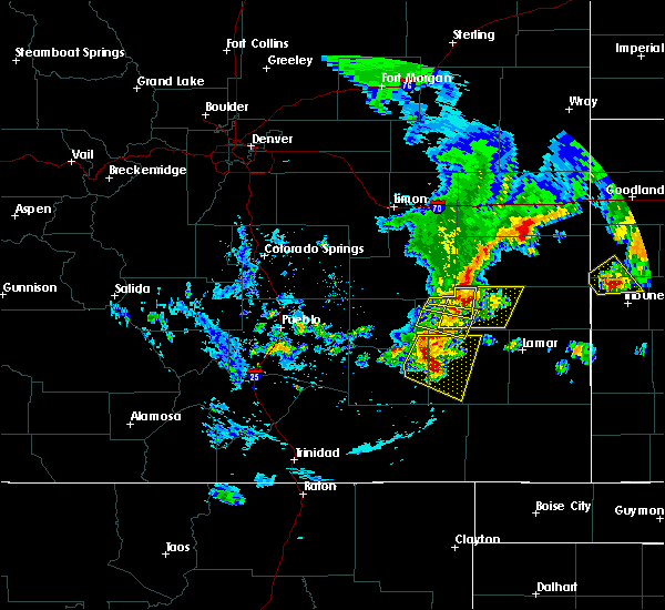 At 854 pm mdt, a severe thunderstorm was located near haswell, or 36 miles northwest of lamar, moving east at 15 mph (radar indicated). Hazards include 70 mph wind gusts and half dollar size hail. Hail damage to vehicles is expected. expect considerable tree damage. Wind damage is also likely to mobile homes, roofs, and outbuildings. At 854 pm mdt, a severe thunderstorm was located near haswell, or 36 miles northwest of lamar, moving east at 15 mph (radar indicated). Hazards include 70 mph wind gusts and half dollar size hail. Hail damage to vehicles is expected. expect considerable tree damage. Wind damage is also likely to mobile homes, roofs, and outbuildings.
|
| 5/31/2016 11:30 PM MDT |
 At 1130 pm mdt, a severe thunderstorm was located near hasty, or 20 miles west of lamar, moving east at 40 mph (radar indicated). Hazards include 60 mph wind gusts. Expect damage to roofs. siding. and trees. Locations impacted include, lamar, eads, granada, wiley, sheridan lake, hartman, john martin reservoir, bristol, sweetwater reservoir, neegronda reservoir, towner, queens reservoir, neeoshe reservoir, brandon, mcclave, chivington, hasty, blue lake, caddoa and fort lyon. At 1130 pm mdt, a severe thunderstorm was located near hasty, or 20 miles west of lamar, moving east at 40 mph (radar indicated). Hazards include 60 mph wind gusts. Expect damage to roofs. siding. and trees. Locations impacted include, lamar, eads, granada, wiley, sheridan lake, hartman, john martin reservoir, bristol, sweetwater reservoir, neegronda reservoir, towner, queens reservoir, neeoshe reservoir, brandon, mcclave, chivington, hasty, blue lake, caddoa and fort lyon.
|
| 5/31/2016 11:18 PM MDT |
 At 1117 pm mdt, a severe thunderstorm was located near hasty, or 21 miles west of lamar, moving northeast at 40 mph (radar indicated). Hazards include 60 mph wind gusts. Expect damage to roofs. siding. and trees. Locations impacted include, lamar, las animas, eads, granada, wiley, sheridan lake, hartman, john martin reservoir, bristol, sweetwater reservoir, neegronda reservoir, towner, blue lake, queens reservoir, neeoshe reservoir, brandon, mcclave, chivington, hasty and arlington. At 1117 pm mdt, a severe thunderstorm was located near hasty, or 21 miles west of lamar, moving northeast at 40 mph (radar indicated). Hazards include 60 mph wind gusts. Expect damage to roofs. siding. and trees. Locations impacted include, lamar, las animas, eads, granada, wiley, sheridan lake, hartman, john martin reservoir, bristol, sweetwater reservoir, neegronda reservoir, towner, blue lake, queens reservoir, neeoshe reservoir, brandon, mcclave, chivington, hasty and arlington.
|
| 5/31/2016 11:07 PM MDT |
 At 1107 pm mdt, a severe thunderstorm was located near las animas, or 22 miles east of north la junta, moving east at 35 mph (public). Hazards include 60 mph wind gusts. Expect damage to roofs. siding. and trees. Locations impacted include, lamar, las animas, eads, granada, wiley, sheridan lake, hartman, john martin reservoir, bristol, sweetwater reservoir, neegronda reservoir, towner, blue lake, queens reservoir, neeoshe reservoir, brandon, mcclave, chivington, hasty and arlington. At 1107 pm mdt, a severe thunderstorm was located near las animas, or 22 miles east of north la junta, moving east at 35 mph (public). Hazards include 60 mph wind gusts. Expect damage to roofs. siding. and trees. Locations impacted include, lamar, las animas, eads, granada, wiley, sheridan lake, hartman, john martin reservoir, bristol, sweetwater reservoir, neegronda reservoir, towner, blue lake, queens reservoir, neeoshe reservoir, brandon, mcclave, chivington, hasty and arlington.
|
| 5/31/2016 10:59 PM MDT |
 At 1058 pm mdt, a severe thunderstorm was located near las animas, or 21 miles northeast of north la junta, moving northeast at 45 mph (radar indicated). Hazards include 65 mph wind gusts and quarter size hail. Hail damage to vehicles is expected. expect wind damage to roofs, siding, and trees. Locations impacted include, lamar, las animas, eads, granada, wiley, sheridan lake, hartman, john martin reservoir, bristol, sweetwater reservoir, neegronda reservoir, towner, blue lake, queens reservoir, neeoshe reservoir, brandon, mcclave, chivington, hasty and arlington. At 1058 pm mdt, a severe thunderstorm was located near las animas, or 21 miles northeast of north la junta, moving northeast at 45 mph (radar indicated). Hazards include 65 mph wind gusts and quarter size hail. Hail damage to vehicles is expected. expect wind damage to roofs, siding, and trees. Locations impacted include, lamar, las animas, eads, granada, wiley, sheridan lake, hartman, john martin reservoir, bristol, sweetwater reservoir, neegronda reservoir, towner, blue lake, queens reservoir, neeoshe reservoir, brandon, mcclave, chivington, hasty and arlington.
|
| 5/31/2016 10:43 PM MDT |
 At 1043 pm mdt, a severe thunderstorm was located near las animas, or 15 miles northeast of north la junta, moving east at 35 mph (radar indicated). Hazards include 60 mph wind gusts and quarter size hail. Hail damage to vehicles is expected. Expect wind damage to roofs, siding, and trees. At 1043 pm mdt, a severe thunderstorm was located near las animas, or 15 miles northeast of north la junta, moving east at 35 mph (radar indicated). Hazards include 60 mph wind gusts and quarter size hail. Hail damage to vehicles is expected. Expect wind damage to roofs, siding, and trees.
|
| 5/30/2016 6:08 PM MDT |
 At 608 pm mdt, a severe thunderstorm was located 8 miles northwest of chivington, or 22 miles southwest of cheyenne wells, moving northeast at 25 mph (radar indicated). Hazards include 60 mph wind gusts and quarter size hail. Hail damage to vehicles is expected. expect wind damage to roofs, siding, and trees. Locations impacted include, eads, sheridan lake, brandon and chivington. At 608 pm mdt, a severe thunderstorm was located 8 miles northwest of chivington, or 22 miles southwest of cheyenne wells, moving northeast at 25 mph (radar indicated). Hazards include 60 mph wind gusts and quarter size hail. Hail damage to vehicles is expected. expect wind damage to roofs, siding, and trees. Locations impacted include, eads, sheridan lake, brandon and chivington.
|
| 5/30/2016 5:57 PM MDT |
 At 556 pm mdt, a severe thunderstorm was located near eads, or 28 miles southwest of cheyenne wells, moving northeast at 25 mph (radar indicated. at 555 pm mdt a weather spotter in eads reported ping ball size hail). Hazards include ping pong ball size hail and 60 mph wind gusts. People and animals outdoors will be injured. expect hail damage to roofs, siding, windows, and vehicles. expect wind damage to roofs, siding, and trees. Locations impacted include, eads, sheridan lake, brandon and chivington. At 556 pm mdt, a severe thunderstorm was located near eads, or 28 miles southwest of cheyenne wells, moving northeast at 25 mph (radar indicated. at 555 pm mdt a weather spotter in eads reported ping ball size hail). Hazards include ping pong ball size hail and 60 mph wind gusts. People and animals outdoors will be injured. expect hail damage to roofs, siding, windows, and vehicles. expect wind damage to roofs, siding, and trees. Locations impacted include, eads, sheridan lake, brandon and chivington.
|
| 5/30/2016 5:55 PM MDT | Ping Pong Ball sized hail reported 0 miles NE of Eads, CO |
| 5/30/2016 5:50 PM MDT | Quarter sized hail reported 0.5 miles W of Eads, CO |
| 5/30/2016 5:50 PM MDT |
 At 549 pm mdt, a severe thunderstorm was located over eads, or 29 miles north of lamar, moving northeast at 25 mph (radar indicated). Hazards include 60 mph wind gusts and half dollar size hail. Hail damage to vehicles is expected. Expect wind damage to roofs, siding, and trees. At 549 pm mdt, a severe thunderstorm was located over eads, or 29 miles north of lamar, moving northeast at 25 mph (radar indicated). Hazards include 60 mph wind gusts and half dollar size hail. Hail damage to vehicles is expected. Expect wind damage to roofs, siding, and trees.
|
| 5/26/2016 5:36 PM MDT |
 At 535 pm mdt, a severe thunderstorm was located near chivington, or 24 miles south of cheyenne wells, moving east at 35 mph (radar indicated). Hazards include 70 mph wind gusts and quarter size hail. Hail damage to vehicles is expected. expect considerable tree damage. wind damage is also likely to mobile homes, roofs, and outbuildings. locations impacted include, eads, sweetwater reservoir, queens reservoir, neegronda reservoir, neeoshe reservoir, brandon and chivington. A tornado watch remains in effect until 700 pm mdt for southeastern colorado. At 535 pm mdt, a severe thunderstorm was located near chivington, or 24 miles south of cheyenne wells, moving east at 35 mph (radar indicated). Hazards include 70 mph wind gusts and quarter size hail. Hail damage to vehicles is expected. expect considerable tree damage. wind damage is also likely to mobile homes, roofs, and outbuildings. locations impacted include, eads, sweetwater reservoir, queens reservoir, neegronda reservoir, neeoshe reservoir, brandon and chivington. A tornado watch remains in effect until 700 pm mdt for southeastern colorado.
|
| 5/26/2016 5:20 PM MDT | Semi truck and trailers blown over on highway 287 between mm 115 and 120. time estimated in kiowa county CO, 2.7 miles S of Eads, CO |
| 5/26/2016 5:12 PM MDT |
 At 510 pm mdt, a severe thunderstorm was located over eads, or 27 miles north of lamar, moving east at 30 mph (radar indicated). Hazards include 70 mph wind gusts and quarter size hail. Hail damage to vehicles is expected. expect considerable tree damage. wind damage is also likely to mobile homes, roofs, and outbuildings. locations impacted include, eads, sweetwater reservoir, queens reservoir, neegronda reservoir, neeoshe reservoir, brandon and chivington. A tornado watch remains in effect until 700 pm mdt for southeastern colorado. At 510 pm mdt, a severe thunderstorm was located over eads, or 27 miles north of lamar, moving east at 30 mph (radar indicated). Hazards include 70 mph wind gusts and quarter size hail. Hail damage to vehicles is expected. expect considerable tree damage. wind damage is also likely to mobile homes, roofs, and outbuildings. locations impacted include, eads, sweetwater reservoir, queens reservoir, neegronda reservoir, neeoshe reservoir, brandon and chivington. A tornado watch remains in effect until 700 pm mdt for southeastern colorado.
|
| 5/26/2016 5:02 PM MDT |
 At 502 pm mdt, a severe thunderstorm was located near eads, or 28 miles northwest of lamar, moving east at 35 mph (radar indicated). Hazards include 70 mph wind gusts and quarter size hail. Hail damage to vehicles is expected. expect considerable tree damage. Wind damage is also likely to mobile homes, roofs, and outbuildings. At 502 pm mdt, a severe thunderstorm was located near eads, or 28 miles northwest of lamar, moving east at 35 mph (radar indicated). Hazards include 70 mph wind gusts and quarter size hail. Hail damage to vehicles is expected. expect considerable tree damage. Wind damage is also likely to mobile homes, roofs, and outbuildings.
|
| 5/26/2016 5:00 PM MDT | Roof damage to a home with estimated winds close to 60 mp in kiowa county CO, 8.3 miles S of Eads, CO |
| 5/26/2016 5:00 PM MDT | Multiple trees downed due to estimated winds near 75 mp in kiowa county CO, 6.8 miles SE of Eads, CO |
| 4/15/2016 6:53 PM MDT |
 The severe thunderstorm warning for northwestern prowers and south central kiowa counties will expire at 700 pm mdt, the storm which prompted the warning has weakened below severe limits, and no longer pose an immediate threat to life or property. therefore the warning will be allowed to expire. however gusty winds and heavy rain are still possible with this thunderstorm. a tornado watch remains in effect until 900 pm mdt for southeastern colorado. The severe thunderstorm warning for northwestern prowers and south central kiowa counties will expire at 700 pm mdt, the storm which prompted the warning has weakened below severe limits, and no longer pose an immediate threat to life or property. therefore the warning will be allowed to expire. however gusty winds and heavy rain are still possible with this thunderstorm. a tornado watch remains in effect until 900 pm mdt for southeastern colorado.
|
| 4/15/2016 6:45 PM MDT |
 At 645 pm mdt, a severe thunderstorm was located over neegronda reservoir, or 17 miles north of lamar, moving northeast at 25 mph (radar indicated). Hazards include 60 mph wind gusts and nickel size hail. Expect damage to roofs. siding. and trees. locations impacted include, eads, neeoshe reservoir, sweetwater reservoir, queens reservoir and neegronda reservoir. A tornado watch remains in effect until 900 pm mdt for southeastern colorado. At 645 pm mdt, a severe thunderstorm was located over neegronda reservoir, or 17 miles north of lamar, moving northeast at 25 mph (radar indicated). Hazards include 60 mph wind gusts and nickel size hail. Expect damage to roofs. siding. and trees. locations impacted include, eads, neeoshe reservoir, sweetwater reservoir, queens reservoir and neegronda reservoir. A tornado watch remains in effect until 900 pm mdt for southeastern colorado.
|
| 4/15/2016 6:31 PM MDT |
 At 631 pm mdt, a severe thunderstorm was located over neegronda reservoir, or 17 miles north of lamar, moving north at 35 mph (radar indicated). Hazards include 60 mph wind gusts and nickel size hail. Expect damage to roofs. siding. and trees. locations impacted include, eads, neeoshe reservoir, sweetwater reservoir, queens reservoir and neegronda reservoir. A tornado watch remains in effect until 900 pm mdt for southeastern colorado. At 631 pm mdt, a severe thunderstorm was located over neegronda reservoir, or 17 miles north of lamar, moving north at 35 mph (radar indicated). Hazards include 60 mph wind gusts and nickel size hail. Expect damage to roofs. siding. and trees. locations impacted include, eads, neeoshe reservoir, sweetwater reservoir, queens reservoir and neegronda reservoir. A tornado watch remains in effect until 900 pm mdt for southeastern colorado.
|
| 4/15/2016 6:24 PM MDT |
 At 620 pm mdt, a severe thunderstorm was located near neegronda reservoir, or 13 miles northwest of lamar, moving northeast at 30 mph (radar indicated. at 615 pm...a brief weak tornado was reported 3 to 4 miles west of wiley). Hazards include 60 mph wind gusts and quarter size hail. Hail damage to vehicles is expected. expect wind damage to roofs, siding, and trees. rotation has weakened considerably with this storm however brief weak tornadoes can occur with severe thunderstorms. locations impacted include, eads, neeoshe reservoir, sweetwater reservoir, queens reservoir and neegronda reservoir. A tornado watch remains in effect until 900 pm mdt for southeastern colorado. At 620 pm mdt, a severe thunderstorm was located near neegronda reservoir, or 13 miles northwest of lamar, moving northeast at 30 mph (radar indicated. at 615 pm...a brief weak tornado was reported 3 to 4 miles west of wiley). Hazards include 60 mph wind gusts and quarter size hail. Hail damage to vehicles is expected. expect wind damage to roofs, siding, and trees. rotation has weakened considerably with this storm however brief weak tornadoes can occur with severe thunderstorms. locations impacted include, eads, neeoshe reservoir, sweetwater reservoir, queens reservoir and neegronda reservoir. A tornado watch remains in effect until 900 pm mdt for southeastern colorado.
|
| 4/15/2016 6:11 PM MDT |
 At 610 pm mdt, a severe thunderstorm was located near mcclave, or 12 miles northwest of lamar, moving northeast at 35 mph (radar indicated). Hazards include 60 mph wind gusts and quarter size hail. Hail damage to vehicles is expected. Expect wind damage to roofs, siding, and trees. At 610 pm mdt, a severe thunderstorm was located near mcclave, or 12 miles northwest of lamar, moving northeast at 35 mph (radar indicated). Hazards include 60 mph wind gusts and quarter size hail. Hail damage to vehicles is expected. Expect wind damage to roofs, siding, and trees.
|
| 4/15/2016 4:05 PM MDT | Ping Pong Ball sized hail reported 2.1 miles N of Eads, CO, size range 1-1.5 inch. |
| 4/15/2016 4:00 PM MDT |
 At 359 pm mdt, a severe thunderstorm was located near eads, or 30 miles southwest of cheyenne wells, moving north at 35 mph (radar indicated). Hazards include 60 mph wind gusts and half dollar size hail. Hail damage to vehicles is expected. expect wind damage to roofs, siding, and trees. locations impacted include, eads. A tornado watch remains in effect until 900 pm mdt for southeastern colorado. At 359 pm mdt, a severe thunderstorm was located near eads, or 30 miles southwest of cheyenne wells, moving north at 35 mph (radar indicated). Hazards include 60 mph wind gusts and half dollar size hail. Hail damage to vehicles is expected. expect wind damage to roofs, siding, and trees. locations impacted include, eads. A tornado watch remains in effect until 900 pm mdt for southeastern colorado.
|
| 4/15/2016 3:54 PM MDT |
 At 354 pm mdt, a severe thunderstorm was located over eads, or 28 miles north of lamar, moving north at 35 mph (radar indicated). Hazards include 60 mph wind gusts and half dollar size hail. Hail damage to vehicles is expected. expect wind damage to roofs, siding, and trees. locations impacted include, eads. A tornado watch remains in effect until 900 pm mdt for southeastern colorado. At 354 pm mdt, a severe thunderstorm was located over eads, or 28 miles north of lamar, moving north at 35 mph (radar indicated). Hazards include 60 mph wind gusts and half dollar size hail. Hail damage to vehicles is expected. expect wind damage to roofs, siding, and trees. locations impacted include, eads. A tornado watch remains in effect until 900 pm mdt for southeastern colorado.
|
| 4/15/2016 3:49 PM MDT |
 At 349 pm mdt, a severe thunderstorm was located near eads, or 27 miles northwest of lamar, moving north at 30 mph (radar indicated). Hazards include 60 mph wind gusts and half dollar size hail. Hail damage to vehicles is expected. expect wind damage to roofs, siding, and trees. locations impacted include, eads. A tornado watch remains in effect until 900 pm mdt for southeastern colorado. At 349 pm mdt, a severe thunderstorm was located near eads, or 27 miles northwest of lamar, moving north at 30 mph (radar indicated). Hazards include 60 mph wind gusts and half dollar size hail. Hail damage to vehicles is expected. expect wind damage to roofs, siding, and trees. locations impacted include, eads. A tornado watch remains in effect until 900 pm mdt for southeastern colorado.
|
| 4/15/2016 3:40 PM MDT |
 At 340 pm mdt, a severe thunderstorm was located near sweetwater reservoir, or 25 miles northwest of lamar, moving north at 30 mph (radar indicated). Hazards include 60 mph wind gusts and half dollar size hail. Hail damage to vehicles is expected. expect wind damage to roofs, siding, and trees. locations impacted include, eads. A tornado watch remains in effect until 900 pm mdt for southeastern colorado. At 340 pm mdt, a severe thunderstorm was located near sweetwater reservoir, or 25 miles northwest of lamar, moving north at 30 mph (radar indicated). Hazards include 60 mph wind gusts and half dollar size hail. Hail damage to vehicles is expected. expect wind damage to roofs, siding, and trees. locations impacted include, eads. A tornado watch remains in effect until 900 pm mdt for southeastern colorado.
|
| 4/15/2016 3:34 PM MDT |
 At 333 pm mdt, a severe thunderstorm was located near sweetwater reservoir, or 22 miles northwest of lamar, moving north at 35 mph (radar indicated). Hazards include 60 mph wind gusts and half dollar size hail. Hail damage to vehicles is expected. expect wind damage to roofs, siding, and trees. locations impacted include, eads. A tornado watch remains in effect until 900 pm mdt for southeastern colorado. At 333 pm mdt, a severe thunderstorm was located near sweetwater reservoir, or 22 miles northwest of lamar, moving north at 35 mph (radar indicated). Hazards include 60 mph wind gusts and half dollar size hail. Hail damage to vehicles is expected. expect wind damage to roofs, siding, and trees. locations impacted include, eads. A tornado watch remains in effect until 900 pm mdt for southeastern colorado.
|
| 4/15/2016 3:25 PM MDT |
 At 324 pm mdt, a severe thunderstorm was located 7 miles west of sweetwater reservoir, or 22 miles northwest of lamar, moving north at 45 mph (radar indicated). Hazards include ping pong ball size hail and 60 mph wind gusts. People and animals outdoors will be injured. expect hail damage to roofs, siding, windows, and vehicles. Expect wind damage to roofs, siding, and trees. At 324 pm mdt, a severe thunderstorm was located 7 miles west of sweetwater reservoir, or 22 miles northwest of lamar, moving north at 45 mph (radar indicated). Hazards include ping pong ball size hail and 60 mph wind gusts. People and animals outdoors will be injured. expect hail damage to roofs, siding, windows, and vehicles. Expect wind damage to roofs, siding, and trees.
|
| 4/15/2016 3:20 PM MDT | Quarter sized hail reported 4.8 miles S of Eads, CO, via twitter |
| 4/15/2016 2:56 PM MDT |
 At 256 pm mdt, a severe thunderstorm capable of producing a tornado was located near eads, or 28 miles southwest of cheyenne wells, moving north at 20 mph (radar indicated rotation). Hazards include tornado and ping pong ball size hail. Flying debris will be dangerous to those caught without shelter. mobile homes will be damaged or destroyed. damage to roofs, windows, and vehicles will occur. tree damage is likely. Locations impacted include, eads. At 256 pm mdt, a severe thunderstorm capable of producing a tornado was located near eads, or 28 miles southwest of cheyenne wells, moving north at 20 mph (radar indicated rotation). Hazards include tornado and ping pong ball size hail. Flying debris will be dangerous to those caught without shelter. mobile homes will be damaged or destroyed. damage to roofs, windows, and vehicles will occur. tree damage is likely. Locations impacted include, eads.
|
| 4/15/2016 2:52 PM MDT |
 At 250 pm mdt, a severe thunderstorm capable of producing a tornado was located near eads, or 29 miles north of lamar, moving north at 25 mph (radar indicated rotation. at 248 pm...ping pong ball size hail was reported 4 miles southwest of eads. the center of the new rotating was located just east of eads). Hazards include tornado and ping pong ball size hail. Flying debris will be dangerous to those caught without shelter. mobile homes will be damaged or destroyed. damage to roofs, windows, and vehicles will occur. tree damage is likely. Locations impacted include, eads. At 250 pm mdt, a severe thunderstorm capable of producing a tornado was located near eads, or 29 miles north of lamar, moving north at 25 mph (radar indicated rotation. at 248 pm...ping pong ball size hail was reported 4 miles southwest of eads. the center of the new rotating was located just east of eads). Hazards include tornado and ping pong ball size hail. Flying debris will be dangerous to those caught without shelter. mobile homes will be damaged or destroyed. damage to roofs, windows, and vehicles will occur. tree damage is likely. Locations impacted include, eads.
|
| 4/15/2016 2:50 PM MDT | Ping Pong Ball sized hail reported 4.8 miles NE of Eads, CO |
| 4/15/2016 2:39 PM MDT |
 At 238 pm mdt, a severe thunderstorm capable of producing a tornado was located near eads, or 28 miles north of lamar, moving north at 20 mph (radar indicated rotation). Hazards include tornado and ping pong ball size hail. Flying debris will be dangerous to those caught without shelter. mobile homes will be damaged or destroyed. damage to roofs, windows, and vehicles will occur. tree damage is likely. This tornadic thunderstorm will remain over mainly rural areas near eads in north central kiowa county. At 238 pm mdt, a severe thunderstorm capable of producing a tornado was located near eads, or 28 miles north of lamar, moving north at 20 mph (radar indicated rotation). Hazards include tornado and ping pong ball size hail. Flying debris will be dangerous to those caught without shelter. mobile homes will be damaged or destroyed. damage to roofs, windows, and vehicles will occur. tree damage is likely. This tornadic thunderstorm will remain over mainly rural areas near eads in north central kiowa county.
|
| 4/15/2016 2:30 PM MDT |
 At 229 pm mdt, a confirmed tornado was located near eads, or 25 miles northwest of lamar, moving north at 20 mph (weather spotters confirmed tornado). Hazards include damaging tornado and golf ball size hail. Flying debris will be dangerous to those caught without shelter. mobile homes will be damaged or destroyed. damage to roofs, windows, and vehicles will occur. tree damage is likely. This tornado will be near, eads around 245 pm mdt. At 229 pm mdt, a confirmed tornado was located near eads, or 25 miles northwest of lamar, moving north at 20 mph (weather spotters confirmed tornado). Hazards include damaging tornado and golf ball size hail. Flying debris will be dangerous to those caught without shelter. mobile homes will be damaged or destroyed. damage to roofs, windows, and vehicles will occur. tree damage is likely. This tornado will be near, eads around 245 pm mdt.
|
| 4/15/2016 2:24 PM MDT |
 At 223 pm mdt, a confirmed tornado was located near sweetwater reservoir, or 23 miles northwest of lamar, moving north at 20 mph (weather spotters confirmed tornado. at 223 pm...a tornado was reported 5 miles southwest of eads). Hazards include damaging tornado and golf ball size hail. Flying debris will be dangerous to those caught without shelter. mobile homes will be damaged or destroyed. damage to roofs, windows, and vehicles will occur. tree damage is likely. This tornado will be near, eads around 245 pm mdt. At 223 pm mdt, a confirmed tornado was located near sweetwater reservoir, or 23 miles northwest of lamar, moving north at 20 mph (weather spotters confirmed tornado. at 223 pm...a tornado was reported 5 miles southwest of eads). Hazards include damaging tornado and golf ball size hail. Flying debris will be dangerous to those caught without shelter. mobile homes will be damaged or destroyed. damage to roofs, windows, and vehicles will occur. tree damage is likely. This tornado will be near, eads around 245 pm mdt.
|
| 4/15/2016 2:21 PM MDT |
 At 220 pm mdt, a severe thunderstorm capable of producing a tornado was located near sweetwater reservoir, or 23 miles northwest of lamar, moving north at 30 mph (radar indicated rotation). Hazards include tornado and golf ball size hail. Flying debris will be dangerous to those caught without shelter. mobile homes will be damaged or destroyed. damage to roofs, windows, and vehicles will occur. tree damage is likely. This dangerous storm will be near, eads around 235 pm mdt. At 220 pm mdt, a severe thunderstorm capable of producing a tornado was located near sweetwater reservoir, or 23 miles northwest of lamar, moving north at 30 mph (radar indicated rotation). Hazards include tornado and golf ball size hail. Flying debris will be dangerous to those caught without shelter. mobile homes will be damaged or destroyed. damage to roofs, windows, and vehicles will occur. tree damage is likely. This dangerous storm will be near, eads around 235 pm mdt.
|
| 4/15/2016 2:18 PM MDT |
 At 216 pm mdt, a severe thunderstorm capable of producing a tornado was located over sweetwater reservoir, or 21 miles northwest of lamar, moving north at 20 mph (radar indicated rotation. at 209 pm...a brief tornado was reported 11 miles north of mcclave). Hazards include tornado and golf ball size hail. Flying debris will be dangerous to those caught without shelter. mobile homes will be damaged or destroyed. damage to roofs, windows, and vehicles will occur. tree damage is likely. this dangerous storm will be near, sweetwater reservoir around 220 pm mdt. Eads around 245 pm mdt. At 216 pm mdt, a severe thunderstorm capable of producing a tornado was located over sweetwater reservoir, or 21 miles northwest of lamar, moving north at 20 mph (radar indicated rotation. at 209 pm...a brief tornado was reported 11 miles north of mcclave). Hazards include tornado and golf ball size hail. Flying debris will be dangerous to those caught without shelter. mobile homes will be damaged or destroyed. damage to roofs, windows, and vehicles will occur. tree damage is likely. this dangerous storm will be near, sweetwater reservoir around 220 pm mdt. Eads around 245 pm mdt.
|
| 4/15/2016 2:07 PM MDT |
 At 207 pm mdt, a severe thunderstorm capable of producing a tornado was located 7 miles west of sweetwater reservoir, or 22 miles northwest of lamar, moving north at 20 mph (radar indicated rotation). Hazards include tornado and golf ball size hail. Flying debris will be dangerous to those caught without shelter. mobile homes will be damaged or destroyed. damage to roofs, windows, and vehicles will occur. tree damage is likely. this dangerous storm will be near, sweetwater reservoir around 220 pm mdt. Eads around 245 pm mdt. At 207 pm mdt, a severe thunderstorm capable of producing a tornado was located 7 miles west of sweetwater reservoir, or 22 miles northwest of lamar, moving north at 20 mph (radar indicated rotation). Hazards include tornado and golf ball size hail. Flying debris will be dangerous to those caught without shelter. mobile homes will be damaged or destroyed. damage to roofs, windows, and vehicles will occur. tree damage is likely. this dangerous storm will be near, sweetwater reservoir around 220 pm mdt. Eads around 245 pm mdt.
|
| 4/15/2016 1:44 PM MDT |
 At 144 pm mdt, a severe thunderstorm was located 12 miles west of sweetwater reservoir, or 24 miles northwest of lamar, moving north at 20 mph (radar indicated). Hazards include 60 mph wind gusts and quarter size hail. Hail damage to vehicles is expected. Expect wind damage to roofs, siding, and trees. At 144 pm mdt, a severe thunderstorm was located 12 miles west of sweetwater reservoir, or 24 miles northwest of lamar, moving north at 20 mph (radar indicated). Hazards include 60 mph wind gusts and quarter size hail. Hail damage to vehicles is expected. Expect wind damage to roofs, siding, and trees.
|
| 8/8/2015 9:03 PM MDT |
 At 903 pm mdt, doppler radar indicated a severe thunderstorm capable of producing quarter size hail and damaging winds in excess of 60 mph. this storm was located near eads, or 19 miles south of kit carson, moving east at 10 mph. locations impacted include, eads, sweetwater reservoir and neeoshe reservoir. At 903 pm mdt, doppler radar indicated a severe thunderstorm capable of producing quarter size hail and damaging winds in excess of 60 mph. this storm was located near eads, or 19 miles south of kit carson, moving east at 10 mph. locations impacted include, eads, sweetwater reservoir and neeoshe reservoir.
|
| 8/8/2015 8:52 PM MDT |
 At 852 pm mdt, doppler radar indicated a severe thunderstorm capable of producing quarter size hail and damaging winds in excess of 60 mph. this storm was located 8 miles west of eads, or 20 miles south of kit carson, and moving east at 10 mph. At 852 pm mdt, doppler radar indicated a severe thunderstorm capable of producing quarter size hail and damaging winds in excess of 60 mph. this storm was located 8 miles west of eads, or 20 miles south of kit carson, and moving east at 10 mph.
|
| 7/19/2015 4:32 PM MDT |
 At 432 pm mdt, a severe thunderstorm was located near eads, or 16 miles south of kit carson, moving east at 15 mph (trained weather spotters. at 416 pm mdt...penny size hail was reported by the public 9 miles northwest of eads). Hazards include golf ball size hail and 70 mph wind gusts. People and animals outdoors will be injured. expect hail damage to roofs, siding, windows and vehicles. expect considerable tree damage. wind damage is also likely to mobile homes, roofs and outbuildings. Locations impacted include, eads, sweetwater reservoir, neegronda reservoir and neeoshe reservoir. At 432 pm mdt, a severe thunderstorm was located near eads, or 16 miles south of kit carson, moving east at 15 mph (trained weather spotters. at 416 pm mdt...penny size hail was reported by the public 9 miles northwest of eads). Hazards include golf ball size hail and 70 mph wind gusts. People and animals outdoors will be injured. expect hail damage to roofs, siding, windows and vehicles. expect considerable tree damage. wind damage is also likely to mobile homes, roofs and outbuildings. Locations impacted include, eads, sweetwater reservoir, neegronda reservoir and neeoshe reservoir.
|
| 7/19/2015 4:13 PM MDT |
 At 413 pm mdt, a severe thunderstorm was located near eads, or 17 miles south of kit carson, moving southeast at 35 mph (radar indicated). Hazards include golf ball size hail and 70 mph wind gusts. People and animals outdoors will be injured. expect hail damage to roofs, siding, windows and vehicles. expect considerable tree damage. wind damage is also likely to mobile homes, roofs and outbuildings. Locations impacted include, eads, sweetwater reservoir, neegronda reservoir and neeoshe reservoir. At 413 pm mdt, a severe thunderstorm was located near eads, or 17 miles south of kit carson, moving southeast at 35 mph (radar indicated). Hazards include golf ball size hail and 70 mph wind gusts. People and animals outdoors will be injured. expect hail damage to roofs, siding, windows and vehicles. expect considerable tree damage. wind damage is also likely to mobile homes, roofs and outbuildings. Locations impacted include, eads, sweetwater reservoir, neegronda reservoir and neeoshe reservoir.
|
| 7/19/2015 3:56 PM MDT |
 At 356 pm mdt, a severe thunderstorm was located 10 miles northeast of haswell, or 17 miles south of wild horse, moving southeast at 15 mph (radar indicated). Hazards include golf ball size hail and 70 mph wind gusts. People and animals outdoors will be injured. expect hail damage to roofs, siding, windows and vehicles. expect considerable tree damage. wind damage is also likely to mobile homes, roofs and outbuildings. Locations impacted include, eads, sweetwater reservoir, neegronda reservoir and neeoshe reservoir. At 356 pm mdt, a severe thunderstorm was located 10 miles northeast of haswell, or 17 miles south of wild horse, moving southeast at 15 mph (radar indicated). Hazards include golf ball size hail and 70 mph wind gusts. People and animals outdoors will be injured. expect hail damage to roofs, siding, windows and vehicles. expect considerable tree damage. wind damage is also likely to mobile homes, roofs and outbuildings. Locations impacted include, eads, sweetwater reservoir, neegronda reservoir and neeoshe reservoir.
|
| 7/19/2015 3:45 PM MDT |
 At 345 pm mdt, a severe thunderstorm was located 13 miles northeast of haswell, or 13 miles south of wild horse, moving southeast at 25 mph (radar indicated). Hazards include golf ball size hail and 70 mph wind gusts. People and animals outdoors will be injured. expect hail damage to roofs, siding, windows and vehicles. expect considerable tree damage. Wind damage is also likely to mobile homes, roofs and outbuildings. At 345 pm mdt, a severe thunderstorm was located 13 miles northeast of haswell, or 13 miles south of wild horse, moving southeast at 25 mph (radar indicated). Hazards include golf ball size hail and 70 mph wind gusts. People and animals outdoors will be injured. expect hail damage to roofs, siding, windows and vehicles. expect considerable tree damage. Wind damage is also likely to mobile homes, roofs and outbuildings.
|
| 7/4/2015 12:38 AM MDT |
 The severe thunderstorm warning for central kiowa county will expire at 1245 am mdt, the storm which prompted the warning has weakened below severe limits, and no longer pose an immediate threat to life or property. therefore the warning will be allowed to expire. however hail up to dime size and gusty winds are still possible with this thunderstorm. The severe thunderstorm warning for central kiowa county will expire at 1245 am mdt, the storm which prompted the warning has weakened below severe limits, and no longer pose an immediate threat to life or property. therefore the warning will be allowed to expire. however hail up to dime size and gusty winds are still possible with this thunderstorm.
|
| 7/4/2015 12:32 AM MDT |
 At 1232 am mdt, a severe thunderstorm was located near eads, or 16 miles south of kit carson, moving south at 30 mph (radar indicated). Hazards include 60 mph wind gusts and quarter size hail. Hail damage to vehicles is expected. expect wind damage to roofs, siding and trees. Locations impacted include, eads. At 1232 am mdt, a severe thunderstorm was located near eads, or 16 miles south of kit carson, moving south at 30 mph (radar indicated). Hazards include 60 mph wind gusts and quarter size hail. Hail damage to vehicles is expected. expect wind damage to roofs, siding and trees. Locations impacted include, eads.
|
| 7/4/2015 12:17 AM MDT |
 At 1216 am mdt, a severe thunderstorm was located 10 miles southeast of kit carson, moving south at 30 mph (radar indicated). Hazards include 60 mph wind gusts and quarter size hail. Hail damage to vehicles is expected. Expect wind damage to roofs, siding and trees. At 1216 am mdt, a severe thunderstorm was located 10 miles southeast of kit carson, moving south at 30 mph (radar indicated). Hazards include 60 mph wind gusts and quarter size hail. Hail damage to vehicles is expected. Expect wind damage to roofs, siding and trees.
|
| 5/9/2015 4:30 PM MDT | At 430 pm mdt, a confirmed tornado was located near eads, or 19 miles south of kit carson, moving northeast at 35 mph. a large tornaod is being observed 12 miles west of chivington (weather spotters confirmed tornado). Hazards include damaging tornado and half dollar size hail. Flying debris will be dangerous to those caught without shelter. mobile homes will be damaged or destroyed. damage to roofs, windows and vehicles will occur. tree damage is likely. locations impacted include, eads and chivington. Observed. |
| 5/9/2015 4:27 PM MDT | At 427 pm mdt, a confirmed tornado was located near eads, or 20 miles south of kit carson, moving northeast at 35 mph (weather spotters confirmed tornado). Hazards include damaging tornado and half dollar size hail. Flying debris will be dangerous to those caught without shelter. mobile homes will be damaged or destroyed. damage to roofs, windows and vehicles will occur. tree damage is likely. locations impacted include, eads and chivington. Observed. |
| 5/9/2015 4:25 PM MDT | Half Dollar sized hail reported 3 miles WNW of Eads, CO, mostly quarter ... some half dollar sized hail. |
| 5/9/2015 4:24 PM MDT | At 424 pm mdt, a severe thunderstorm capable of producing a tornado was located over eads, or 21 miles south of kit carson, moving northeast at 35 mph (radar indicated rotation). Hazards include tornado and half dollar size hail. Flying debris will be dangerous to those caught without shelter. mobile homes will be damaged or destroyed. damage to roofs, windows and vehicles will occur. tree damage is likely. this tornadic thunderstorm will remain over mainly rural areas of north central kiowa county. Radar indicated. |
| 5/9/2015 4:19 PM MDT | At 419 pm mdt, a severe thunderstorm was located near eads, or 22 miles south of kit carson, moving northeast at 35 mph (radar indicated). Hazards include 60 mph wind gusts and half dollar size hail. Hail damage to vehicles is expected. Expect wind damage to roofs, siding and trees. |
| 5/2/2015 6:48 PM MDT | At 648 pm mdt, a severe thunderstorm was located 7 miles southwest of sweetwater reservoir, or 21 miles northwest of lamar, moving northeast at 15 mph (radar indicated). Hazards include 60 mph wind gusts and quarter size hail. Hail damage to vehicles is expected. expect wind damage to roofs, siding and trees. locations impacted include, eads, brandon, neeoshe reservoir, neegronda reservoir, chivington, sweetwater reservoir and queens reservoir. 1. 00in. |
| 5/2/2015 6:37 PM MDT | At 636 pm mdt, a severe thunderstorm was located near sweetwater reservoir, or 24 miles northwest of lamar, moving east at 20 mph (radar indicated). Hazards include 60 mph wind gusts and quarter size hail. Hail damage to vehicles is expected. expect wind damage to roofs, siding and trees. locations impacted include, eads, haswell, brandon, neeoshe reservoir, neegronda reservoir, chivington, sweetwater reservoir and queens reservoir. 1. 00in. |
| 5/2/2015 6:25 PM MDT | At 623 pm mdt, a severe thunderstorm was located near sweetwater reservoir, or 25 miles northwest of lamar, moving east at 20 mph. other strong storms were noted near arlington (radar indicated). Hazards include 60 mph wind gusts and quarter size hail. Hail damage to vehicles is expected. Expect wind damage to roofs, siding and trees. |
| 6/5/2014 7:42 PM MDT | Quarter sized hail reported 16.3 miles ENE of Eads, CO |
| 7/10/2013 6:54 PM MDT | Storm damage reported in kiowa county CO, 0.5 miles W of Eads, CO |
| 5/8/2013 2:06 PM MDT | Quarter sized hail reported 16.4 miles WNW of Eads, CO |
| 5/8/2013 12:59 PM MDT | Quarter sized hail reported 0 miles NE of Eads, CO |
| 6/2/2012 5:05 PM MDT | Quarter sized hail reported 0 miles NE of Eads, CO |
| 6/2/2012 5:05 PM MDT | Golf Ball sized hail reported 3 miles NW of Eads, CO |
| 5/19/2012 10:02 AM MDT | Quarter sized hail reported 5.1 miles NW of Eads, CO, significant accumulation on the ground. |
| 1/1/0001 12:00 AM | Quarter sized hail reported 9.7 miles N of Eads, CO |
| 1/1/0001 12:00 AM | Deputy reported numerous power poles blown dow in kiowa county CO, 5.1 miles NW of Eads, CO |
| 1/1/0001 12:00 AM | Quarter sized hail reported 10.9 miles E of Eads, CO |
Hail Maps for Eads, CO
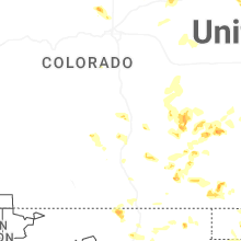

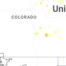
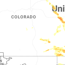
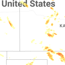
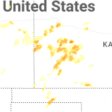


Connect with Interactive Hail Maps