

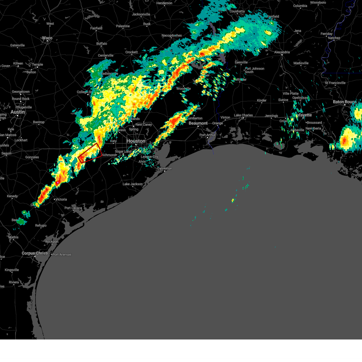
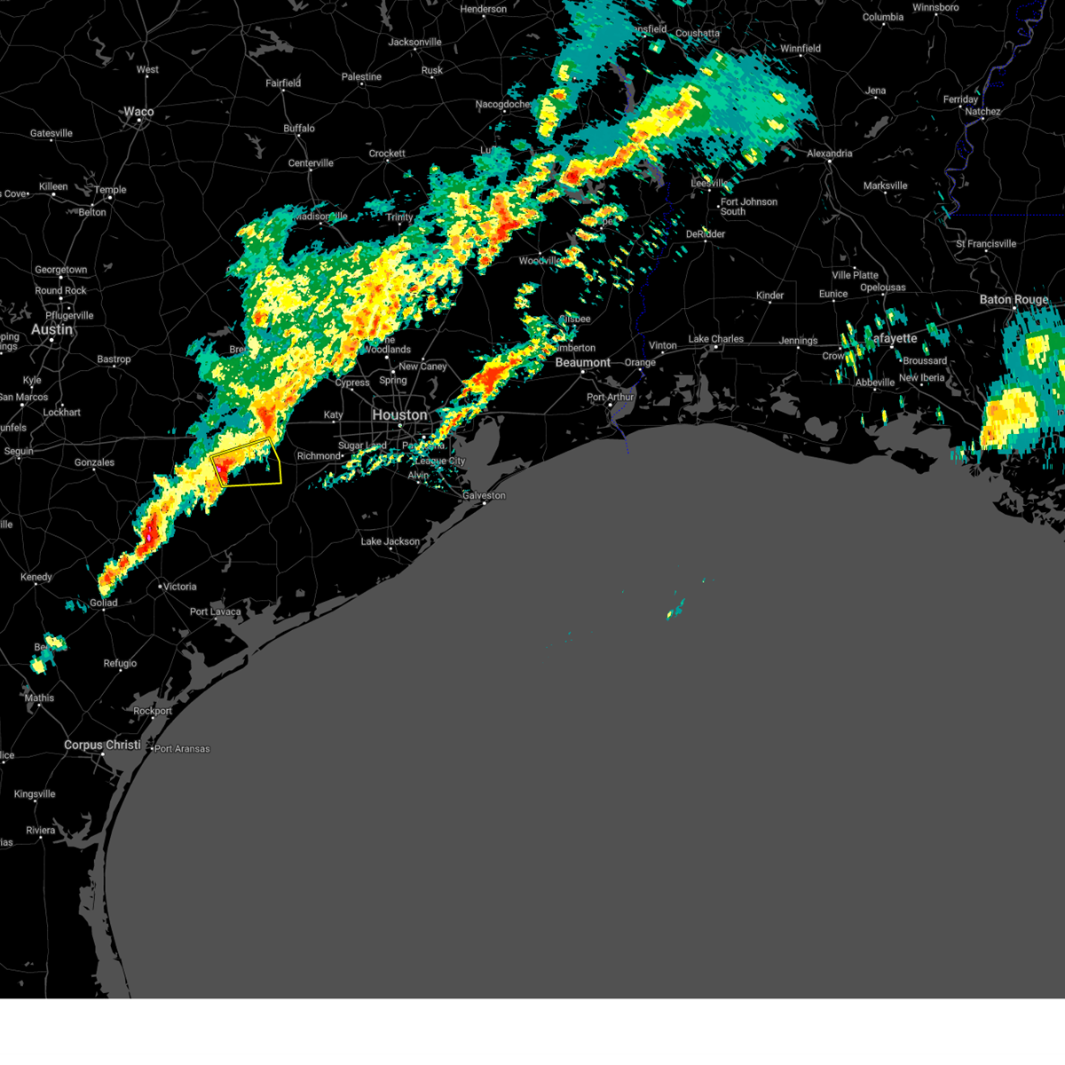
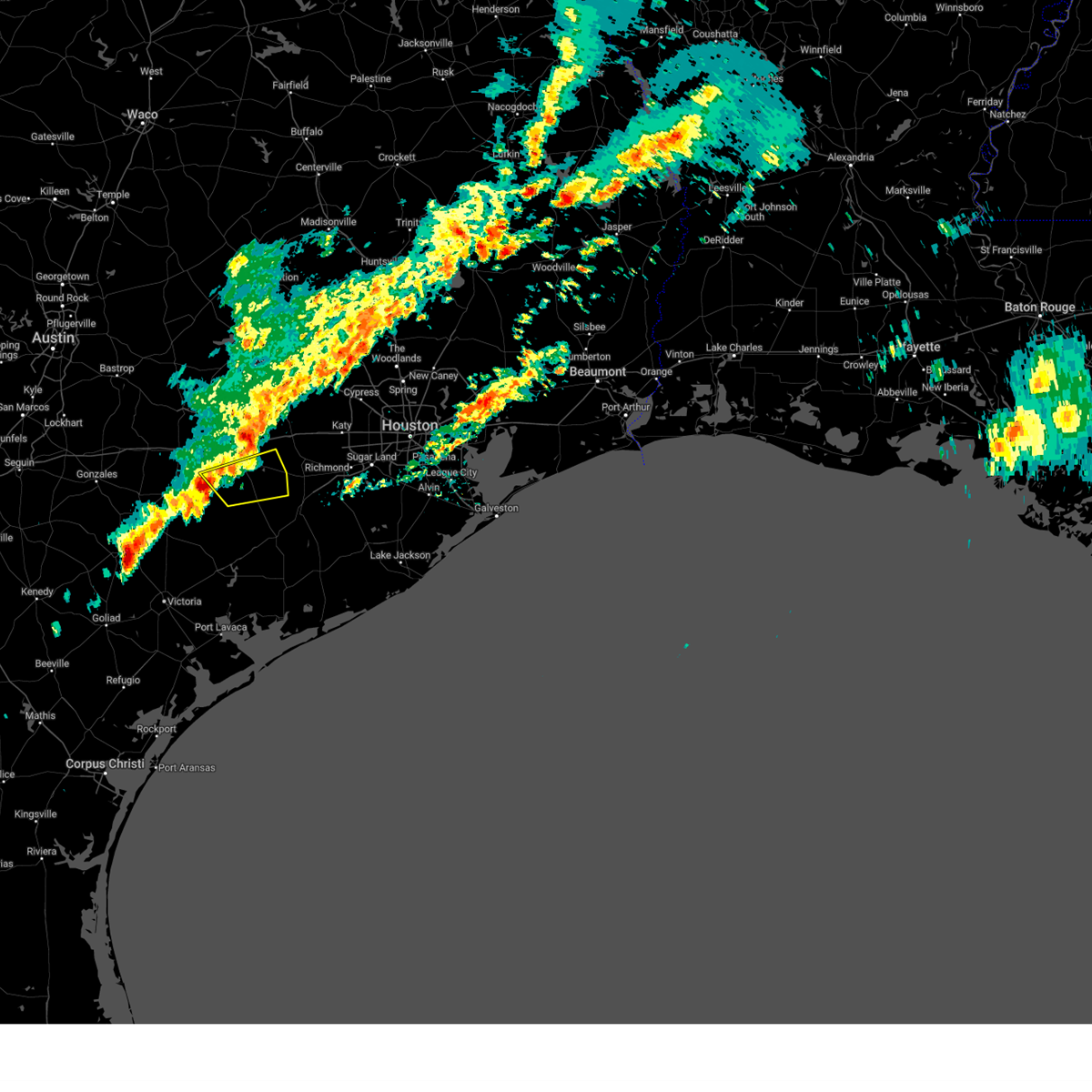
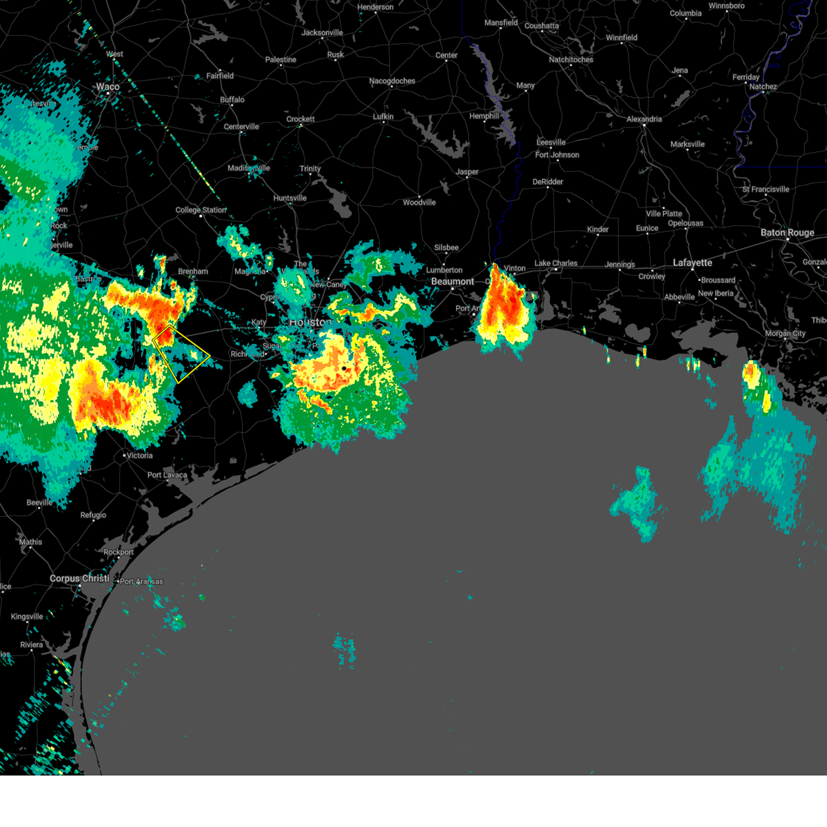
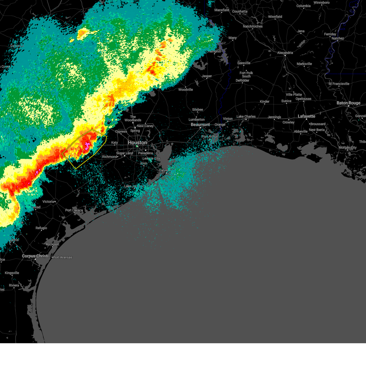
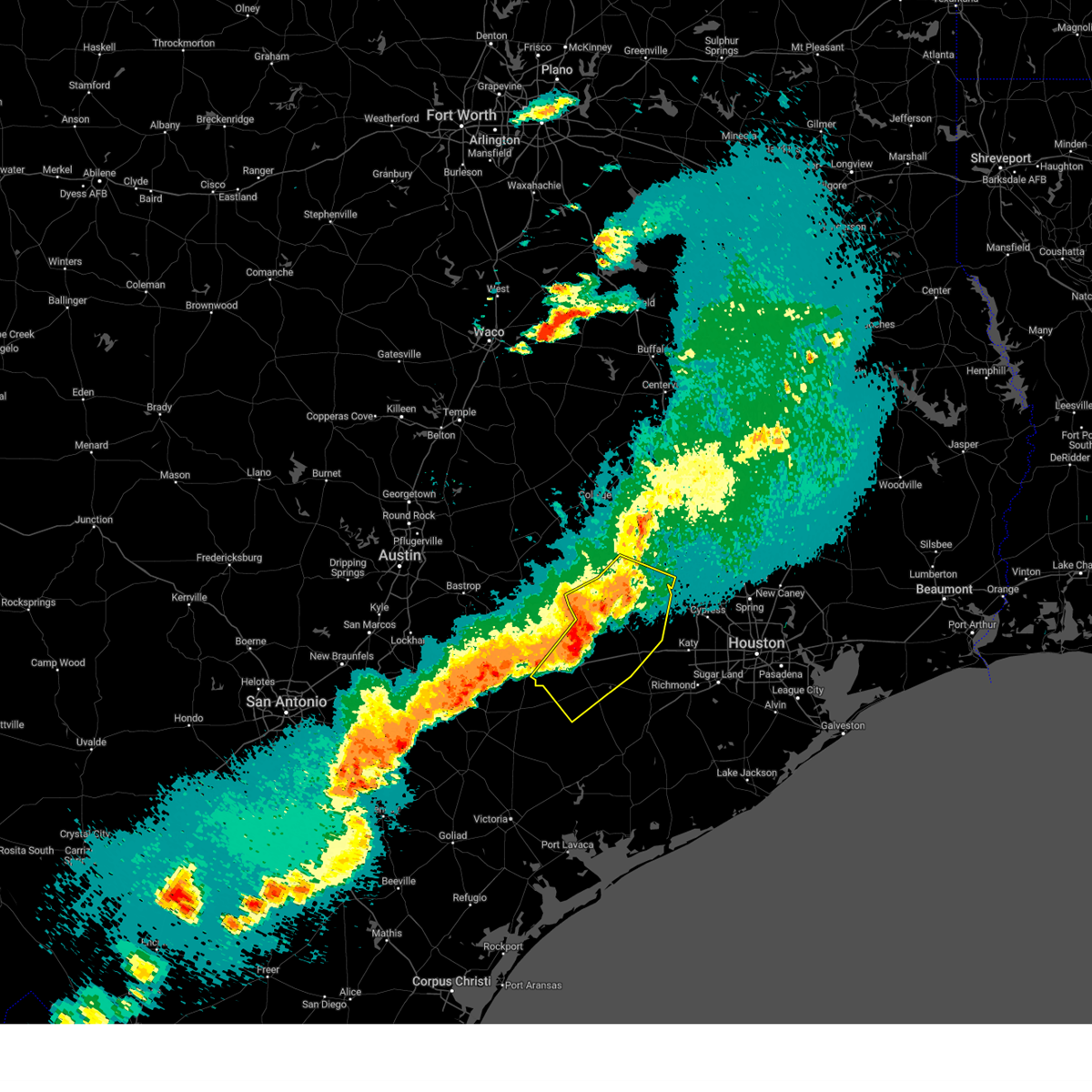
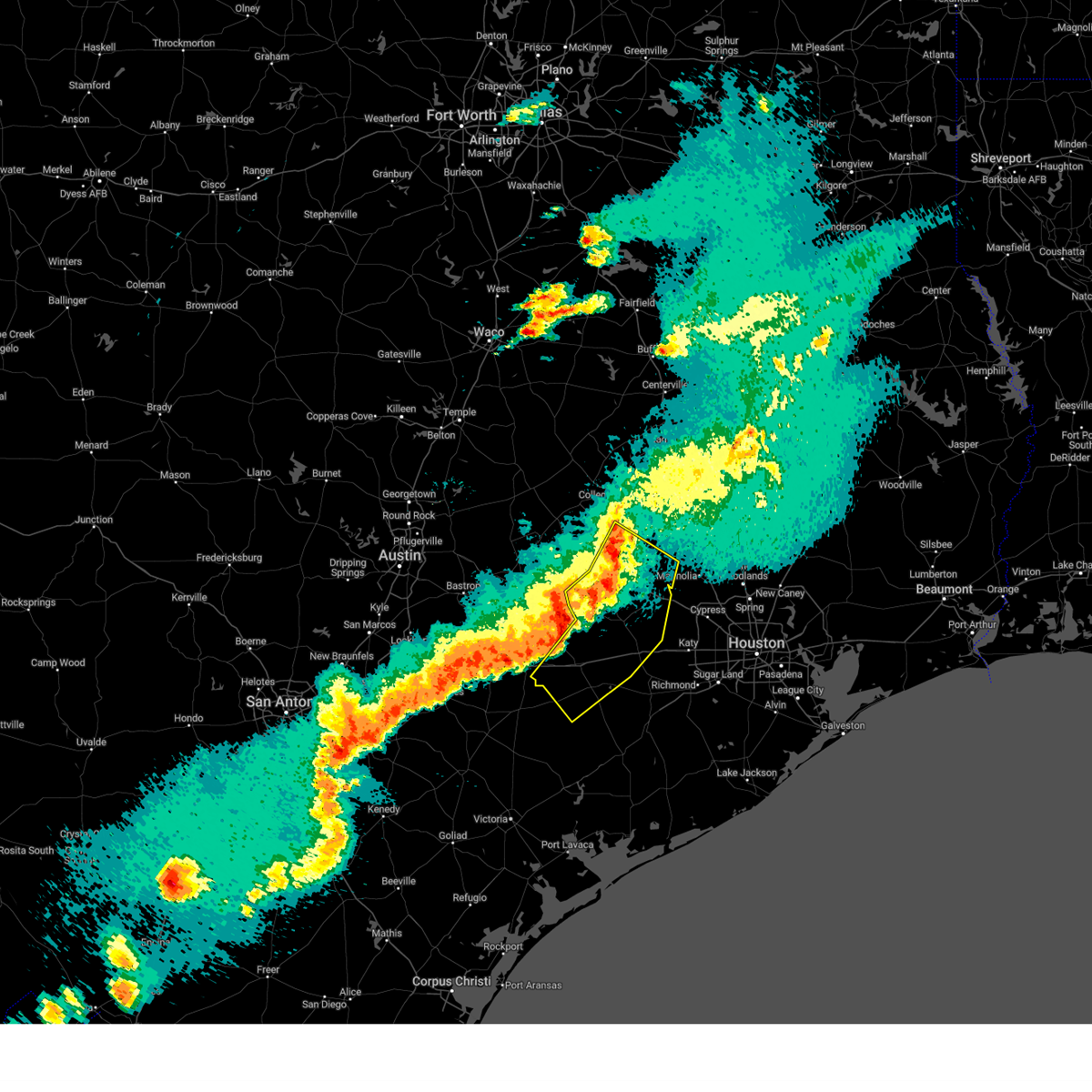
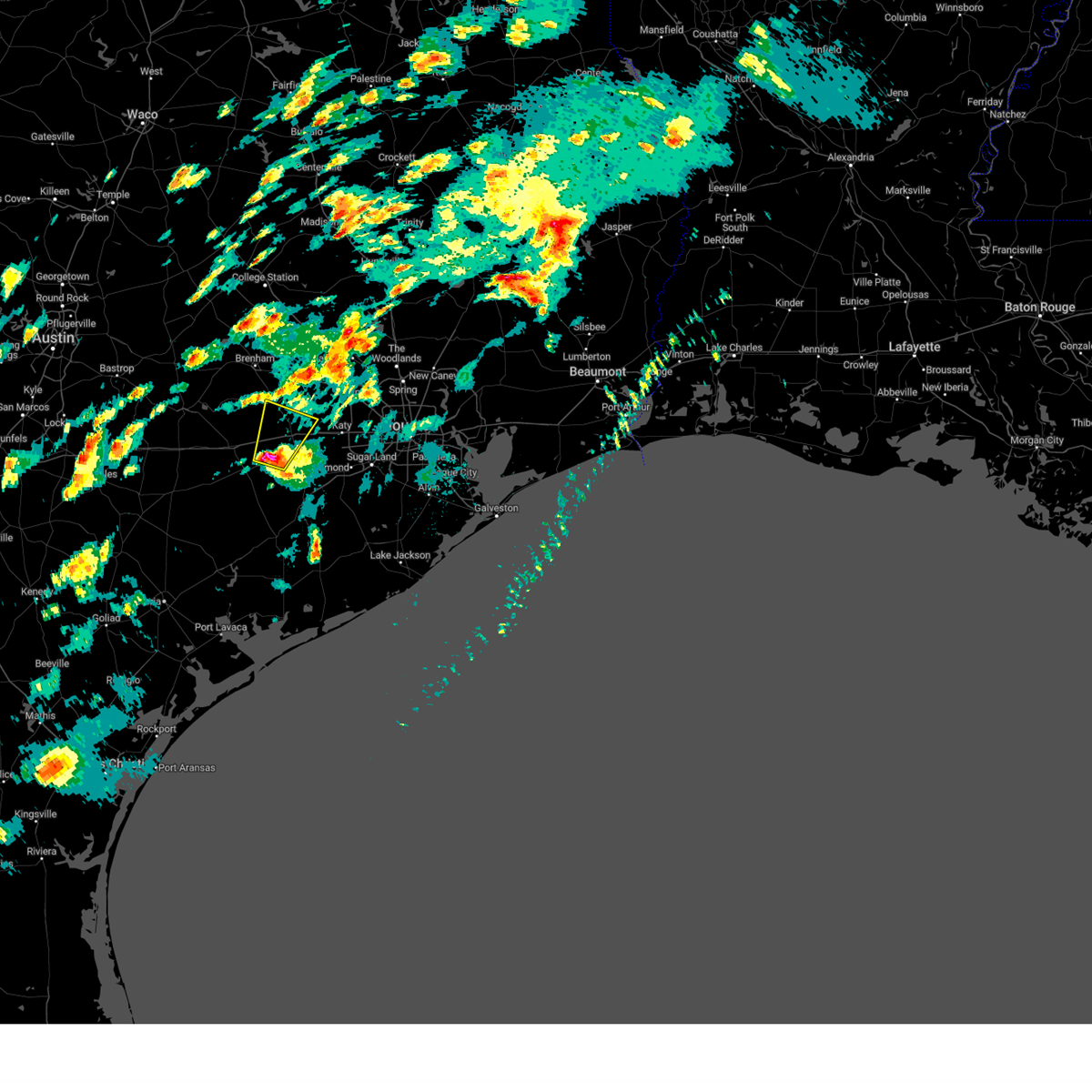
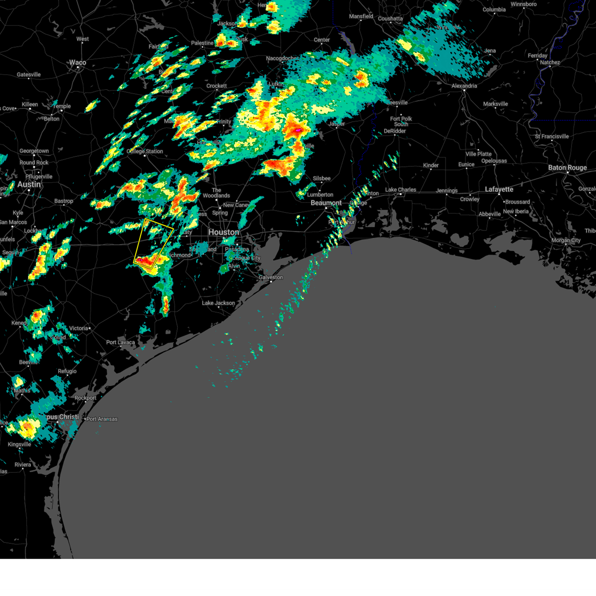
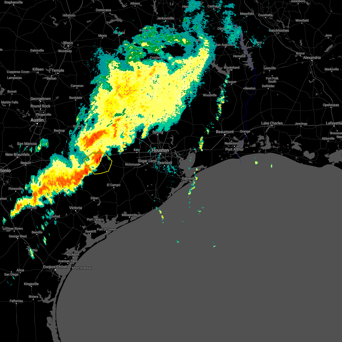
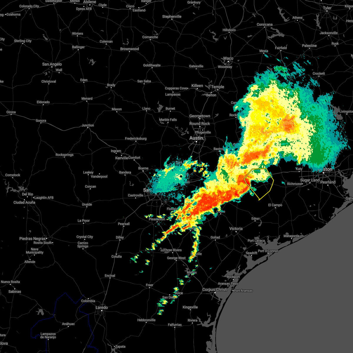
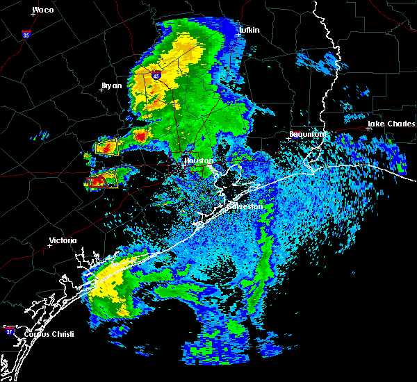
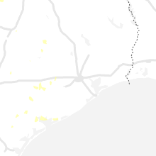
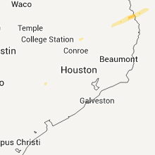
Hail Map for Eagle Lake, TX
The Eagle Lake, TX area has had 2 reports of on-the-ground hail by trained spotters, and has been under severe weather warnings 3 times during the past 12 months. Doppler radar has detected hail at or near Eagle Lake, TX on 33 occasions, including 1 occasion during the past year.
| Name: | Eagle Lake, TX |
| Where Located: | 59.3 miles WSW of Houston, TX |
| Map: | Google Map for Eagle Lake, TX |
| Population: | 3639 |
| Housing Units: | 1517 |
| More Info: | Search Google for Eagle Lake, TX |
0
The Top Recent Hail Date for Eagle Lake, TX is Friday, August 9, 2024 (33rd out of 33)

Hail and Wind Damage Spotted near Eagle Lake, TX
| Date / Time | Report Details |
|---|---|
| 5/2/2025 4:07 PM CDT | The storm which prompted the warning is weakening below severe limits, and no longer poses an immediate threat to life or property. therefore, the warning will be allowed to expire. however, this thunderstorm is still strong and small hail, gusty winds and heavy rain are still possible. a severe thunderstorm watch remains in effect until 800 pm cdt for southeastern texas. to report severe weather, contact your nearest law enforcement agency. they will relay your report to the national weather service league city. |
| 5/2/2025 3:43 PM CDT | At 342 pm cdt, a severe thunderstorm was located near columbus, moving east at 15 mph (trained weather spotters have reported quarter-size hail. multiple reports of a non-rotating wall cloud have been received). Hazards include 60 mph wind gusts and quarter size hail. Hail damage to vehicles is expected. expect wind damage to roofs, siding, and trees. Locations impacted include, columbus and eagle lake. |
| 5/2/2025 3:31 PM CDT | Svrhgx the national weather service in league city has issued a * severe thunderstorm warning for, central colorado county in southeastern texas, south central austin county in southeastern texas, * until 415 pm cdt. * at 331 pm cdt, a severe thunderstorm was located over columbus, moving east at 15 mph (radar indicated). Hazards include 60 mph wind gusts and quarter size hail. Hail damage to vehicles is expected. Expect wind damage to roofs, siding, and trees. |
| 5/31/2024 6:22 AM CDT |
 Svrhgx the national weather service in league city has issued a * severe thunderstorm warning for, central trinity county in southeastern texas, east central colorado county in southeastern texas, northeastern wharton county in southeastern texas, southeastern austin county in southeastern texas, northwestern fort bend county in southeastern texas, central montgomery county in southeastern texas, western san jacinto county in southeastern texas, east central houston county in southeastern texas, southeastern waller county in southeastern texas, west central polk county in southeastern texas, southeastern walker county in southeastern texas, central harris county in southeastern texas, * until 645 am cdt. * at 621 am cdt, severe thunderstorms were located along a line extending from near point blank to near eagle lake, moving southeast at around 50 mph (radar indicated). Hazards include 60 mph wind gusts and penny size hail. expect damage to roofs, siding, and trees Svrhgx the national weather service in league city has issued a * severe thunderstorm warning for, central trinity county in southeastern texas, east central colorado county in southeastern texas, northeastern wharton county in southeastern texas, southeastern austin county in southeastern texas, northwestern fort bend county in southeastern texas, central montgomery county in southeastern texas, western san jacinto county in southeastern texas, east central houston county in southeastern texas, southeastern waller county in southeastern texas, west central polk county in southeastern texas, southeastern walker county in southeastern texas, central harris county in southeastern texas, * until 645 am cdt. * at 621 am cdt, severe thunderstorms were located along a line extending from near point blank to near eagle lake, moving southeast at around 50 mph (radar indicated). Hazards include 60 mph wind gusts and penny size hail. expect damage to roofs, siding, and trees
|
| 3/16/2024 2:24 AM CDT |
 The storm which prompted the warning has weakened below severe limits, and no longer poses an immediate threat to life or property. therefore, the warning will be allowed to expire. however, small hail is still possible with this thunderstorm. The storm which prompted the warning has weakened below severe limits, and no longer poses an immediate threat to life or property. therefore, the warning will be allowed to expire. however, small hail is still possible with this thunderstorm.
|
| 3/16/2024 2:03 AM CDT |
 At 202 am cdt, a severe thunderstorm was located near eagle lake, moving east at 30 mph (radar indicated). Hazards include ping pong ball size hail and 60 mph wind gusts. People and animals outdoors will be injured. expect hail damage to roofs, siding, windows, and vehicles. expect wind damage to roofs, siding, and trees. Locations impacted include, sealy and eagle lake. At 202 am cdt, a severe thunderstorm was located near eagle lake, moving east at 30 mph (radar indicated). Hazards include ping pong ball size hail and 60 mph wind gusts. People and animals outdoors will be injured. expect hail damage to roofs, siding, windows, and vehicles. expect wind damage to roofs, siding, and trees. Locations impacted include, sealy and eagle lake.
|
| 3/16/2024 1:57 AM CDT |
 Svrhgx the national weather service in league city has issued a * severe thunderstorm warning for, east central colorado county in southeastern texas, northern wharton county in southeastern texas, southeastern austin county in southeastern texas, * until 230 am cdt. * at 157 am cdt, a severe thunderstorm was located near eagle lake, moving east at 35 mph (radar indicated). Hazards include quarter size hail. damage to vehicles is expected Svrhgx the national weather service in league city has issued a * severe thunderstorm warning for, east central colorado county in southeastern texas, northern wharton county in southeastern texas, southeastern austin county in southeastern texas, * until 230 am cdt. * at 157 am cdt, a severe thunderstorm was located near eagle lake, moving east at 35 mph (radar indicated). Hazards include quarter size hail. damage to vehicles is expected
|
| 2/2/2024 11:45 PM CST |
 At 1145 pm cst, severe thunderstorms were located along a line extending from 7 miles south of fayetteville to near columbus to 12 miles southwest of eagle lake to near speaks, moving northeast at 50 mph (radar indicated). Hazards include 60 mph wind gusts. expect damage to roofs, siding, and trees At 1145 pm cst, severe thunderstorms were located along a line extending from 7 miles south of fayetteville to near columbus to 12 miles southwest of eagle lake to near speaks, moving northeast at 50 mph (radar indicated). Hazards include 60 mph wind gusts. expect damage to roofs, siding, and trees
|
| 2/2/2024 11:23 PM CST |
 At 1122 pm cst, severe thunderstorms were located along a line extending from 7 miles south of la grange to sublime to 7 miles south of ezzell, moving northeast at 55 mph (radar indicated). Hazards include 60 mph wind gusts. expect damage to roofs, siding, and trees At 1122 pm cst, severe thunderstorms were located along a line extending from 7 miles south of la grange to sublime to 7 miles south of ezzell, moving northeast at 55 mph (radar indicated). Hazards include 60 mph wind gusts. expect damage to roofs, siding, and trees
|
| 1/8/2024 4:07 PM CST |
 At 406 pm cst, a severe thunderstorm capable of producing a tornado was located over eagle lake, moving northeast at 35 mph (radar indicated rotation). Hazards include tornado and quarter size hail. Flying debris will be dangerous to those caught without shelter. mobile homes will be damaged or destroyed. damage to roofs, windows, and vehicles will occur. tree damage is likely. this dangerous storm will be near, eagle lake around 410 pm cst. Sealy and wallis around 420 pm cst. At 406 pm cst, a severe thunderstorm capable of producing a tornado was located over eagle lake, moving northeast at 35 mph (radar indicated rotation). Hazards include tornado and quarter size hail. Flying debris will be dangerous to those caught without shelter. mobile homes will be damaged or destroyed. damage to roofs, windows, and vehicles will occur. tree damage is likely. this dangerous storm will be near, eagle lake around 410 pm cst. Sealy and wallis around 420 pm cst.
|
| 1/8/2024 3:59 PM CST |
 At 358 pm cst, a severe thunderstorm capable of producing a tornado was located near eagle lake, moving northeast at 35 mph (radar indicated rotation). Hazards include tornado and quarter size hail. Flying debris will be dangerous to those caught without shelter. mobile homes will be damaged or destroyed. damage to roofs, windows, and vehicles will occur. tree damage is likely. this dangerous storm will be near, eagle lake around 405 pm cst. Other locations impacted by this tornadic thunderstorm include altair. At 358 pm cst, a severe thunderstorm capable of producing a tornado was located near eagle lake, moving northeast at 35 mph (radar indicated rotation). Hazards include tornado and quarter size hail. Flying debris will be dangerous to those caught without shelter. mobile homes will be damaged or destroyed. damage to roofs, windows, and vehicles will occur. tree damage is likely. this dangerous storm will be near, eagle lake around 405 pm cst. Other locations impacted by this tornadic thunderstorm include altair.
|
| 1/8/2024 3:53 PM CST |
 At 353 pm cst, a severe thunderstorm capable of producing a tornado was located 8 miles southwest of eagle lake, moving northeast at 35 mph (radar indicated rotation). Hazards include tornado and quarter size hail. Flying debris will be dangerous to those caught without shelter. mobile homes will be damaged or destroyed. damage to roofs, windows, and vehicles will occur. tree damage is likely. this dangerous storm will be near, eagle lake around 400 pm cst. Other locations impacted by this tornadic thunderstorm include altair. At 353 pm cst, a severe thunderstorm capable of producing a tornado was located 8 miles southwest of eagle lake, moving northeast at 35 mph (radar indicated rotation). Hazards include tornado and quarter size hail. Flying debris will be dangerous to those caught without shelter. mobile homes will be damaged or destroyed. damage to roofs, windows, and vehicles will occur. tree damage is likely. this dangerous storm will be near, eagle lake around 400 pm cst. Other locations impacted by this tornadic thunderstorm include altair.
|
| 1/8/2024 3:47 PM CST |
 At 346 pm cst, a severe thunderstorm was located 12 miles southwest of eagle lake, moving east at 45 mph (radar indicated). Hazards include 60 mph wind gusts and quarter size hail. Hail damage to vehicles is expected. expect wind damage to roofs, siding, and trees. locations impacted include, eagle lake, altair, garwood, and rock island. hail threat, radar indicated max hail size, 1. 00 in wind threat, radar indicated max wind gust, 60 mph. At 346 pm cst, a severe thunderstorm was located 12 miles southwest of eagle lake, moving east at 45 mph (radar indicated). Hazards include 60 mph wind gusts and quarter size hail. Hail damage to vehicles is expected. expect wind damage to roofs, siding, and trees. locations impacted include, eagle lake, altair, garwood, and rock island. hail threat, radar indicated max hail size, 1. 00 in wind threat, radar indicated max wind gust, 60 mph.
|
| 1/8/2024 3:33 PM CST |
 At 332 pm cst, a severe thunderstorm was located near sublime, or 14 miles east of hallettsville, moving east at 45 mph (radar indicated). Hazards include 60 mph wind gusts and quarter size hail. Hail damage to vehicles is expected. Expect wind damage to roofs, siding, and trees. At 332 pm cst, a severe thunderstorm was located near sublime, or 14 miles east of hallettsville, moving east at 45 mph (radar indicated). Hazards include 60 mph wind gusts and quarter size hail. Hail damage to vehicles is expected. Expect wind damage to roofs, siding, and trees.
|
| 6/21/2023 10:09 PM CDT |
 At 1008 pm cdt, a severe thunderstorm was located near columbus, moving southeast at 25 mph (radar indicated). Hazards include quarter size hail. damage to vehicles is expected At 1008 pm cdt, a severe thunderstorm was located near columbus, moving southeast at 25 mph (radar indicated). Hazards include quarter size hail. damage to vehicles is expected
|
| 4/28/2023 8:00 PM CDT |
 At 759 pm cdt, severe thunderstorms were located along a line extending from 8 miles southeast of washington to 9 miles north of san felipe to 6 miles southwest of sealy to 6 miles southeast of sublime, moving southeast at 35 mph (radar indicated). Hazards include 60 mph wind gusts and quarter size hail. Hail damage to vehicles is expected. expect wind damage to roofs, siding, and trees. Locations impacted include, sealy, bellville, columbus, eagle lake, weimar, san felipe, monaville, new ulm, cat spring, sheridan, altair, frelsburg and rock island. At 759 pm cdt, severe thunderstorms were located along a line extending from 8 miles southeast of washington to 9 miles north of san felipe to 6 miles southwest of sealy to 6 miles southeast of sublime, moving southeast at 35 mph (radar indicated). Hazards include 60 mph wind gusts and quarter size hail. Hail damage to vehicles is expected. expect wind damage to roofs, siding, and trees. Locations impacted include, sealy, bellville, columbus, eagle lake, weimar, san felipe, monaville, new ulm, cat spring, sheridan, altair, frelsburg and rock island.
|
| 4/28/2023 7:47 PM CDT |
 At 746 pm cdt, severe thunderstorms were located along a line extending from near washington to 7 miles northeast of bellville to 11 miles west of sealy to sublime, moving southeast at 35 mph (radar indicated). Hazards include 60 mph wind gusts and quarter size hail. Hail damage to vehicles is expected. expect wind damage to roofs, siding, and trees. Locations impacted include, sealy, hempstead, prairie view, bellville, columbus, eagle lake, weimar, pine island, san felipe, industry, monaville, new ulm, cat spring, sheridan, altair, frelsburg and rock island. At 746 pm cdt, severe thunderstorms were located along a line extending from near washington to 7 miles northeast of bellville to 11 miles west of sealy to sublime, moving southeast at 35 mph (radar indicated). Hazards include 60 mph wind gusts and quarter size hail. Hail damage to vehicles is expected. expect wind damage to roofs, siding, and trees. Locations impacted include, sealy, hempstead, prairie view, bellville, columbus, eagle lake, weimar, pine island, san felipe, industry, monaville, new ulm, cat spring, sheridan, altair, frelsburg and rock island.
|
| 4/28/2023 7:37 PM CDT |
 At 737 pm cdt, severe thunderstorms were located along a line extending from near washington to 7 miles northeast of bellville to 11 miles southeast of industry to near sublime, moving east at 30 mph (radar indicated). Hazards include 60 mph wind gusts and quarter size hail. Hail damage to vehicles is expected. expect wind damage to roofs, siding, and trees. locations impacted include, brenham, sealy, hempstead, prairie view, bellville, columbus, eagle lake, shelby, weimar, pine island, san felipe, industry, monaville, new ulm, cat spring, sheridan, altair, frelsburg and rock island. hail threat, radar indicated max hail size, 1. 00 in wind threat, radar indicated max wind gust, 60 mph. At 737 pm cdt, severe thunderstorms were located along a line extending from near washington to 7 miles northeast of bellville to 11 miles southeast of industry to near sublime, moving east at 30 mph (radar indicated). Hazards include 60 mph wind gusts and quarter size hail. Hail damage to vehicles is expected. expect wind damage to roofs, siding, and trees. locations impacted include, brenham, sealy, hempstead, prairie view, bellville, columbus, eagle lake, shelby, weimar, pine island, san felipe, industry, monaville, new ulm, cat spring, sheridan, altair, frelsburg and rock island. hail threat, radar indicated max hail size, 1. 00 in wind threat, radar indicated max wind gust, 60 mph.
|
| 4/28/2023 7:25 PM CDT |
 At 724 pm cdt, severe thunderstorms were located along a line extending from near millican to 8 miles southeast of brenham to near industry to near schulenburg, moving southeast at 35 mph (radar indicated). Hazards include 60 mph wind gusts and quarter size hail. Hail damage to vehicles is expected. Expect wind damage to roofs, siding, and trees. At 724 pm cdt, severe thunderstorms were located along a line extending from near millican to 8 miles southeast of brenham to near industry to near schulenburg, moving southeast at 35 mph (radar indicated). Hazards include 60 mph wind gusts and quarter size hail. Hail damage to vehicles is expected. Expect wind damage to roofs, siding, and trees.
|
| 4/5/2023 9:37 PM CDT |
 The severe thunderstorm warning for northeastern colorado, northern wharton, southeastern austin and southwestern waller counties will expire at 945 pm cdt, the storm which prompted the warning has weakened below severe limits, and no longer poses an immediate threat to life or property. therefore, the warning will be allowed to expire. however small hail is still possible with this thunderstorm. The severe thunderstorm warning for northeastern colorado, northern wharton, southeastern austin and southwestern waller counties will expire at 945 pm cdt, the storm which prompted the warning has weakened below severe limits, and no longer poses an immediate threat to life or property. therefore, the warning will be allowed to expire. however small hail is still possible with this thunderstorm.
|
| 4/5/2023 9:18 PM CDT |
 At 918 pm cdt, a severe thunderstorm was located 8 miles southwest of sealy, moving northeast at 50 mph (radar indicated). Hazards include quarter size hail. Damage to vehicles is expected. locations impacted include, sealy, bellville, san felipe and cat spring. hail threat, radar indicated max hail size, 1. 00 in wind threat, radar indicated max wind gust, <50 mph. At 918 pm cdt, a severe thunderstorm was located 8 miles southwest of sealy, moving northeast at 50 mph (radar indicated). Hazards include quarter size hail. Damage to vehicles is expected. locations impacted include, sealy, bellville, san felipe and cat spring. hail threat, radar indicated max hail size, 1. 00 in wind threat, radar indicated max wind gust, <50 mph.
|
| 4/5/2023 9:08 PM CDT | Quarter sized hail reported 1 miles SSE of Eagle Lake, TX, quarter sized hail on the west side of eagle lake. |
| 4/5/2023 9:08 PM CDT |
 At 907 pm cdt, a severe thunderstorm was located over eagle lake, moving northeast at 50 mph (radar indicated). Hazards include quarter size hail. damage to vehicles is expected At 907 pm cdt, a severe thunderstorm was located over eagle lake, moving northeast at 50 mph (radar indicated). Hazards include quarter size hail. damage to vehicles is expected
|
| 1/24/2023 11:31 AM CST |
 At 1129 am cst, a severe thunderstorm capable of producing a tornado was located 7 miles north of eagle lake, moving northeast at 45 mph. storm spotters reported a tornado as crossed over highway 102 as it passed west of eagle lake (radar indicated rotation). Hazards include tornado. Flying debris will be dangerous to those caught without shelter. mobile homes will be damaged or destroyed. damage to roofs, windows, and vehicles will occur. tree damage is likely. this dangerous storm will be near, sealy around 1145 am cst. san felipe around 1150 am cst. Other locations impacted by this tornadic thunderstorm include cat spring. At 1129 am cst, a severe thunderstorm capable of producing a tornado was located 7 miles north of eagle lake, moving northeast at 45 mph. storm spotters reported a tornado as crossed over highway 102 as it passed west of eagle lake (radar indicated rotation). Hazards include tornado. Flying debris will be dangerous to those caught without shelter. mobile homes will be damaged or destroyed. damage to roofs, windows, and vehicles will occur. tree damage is likely. this dangerous storm will be near, sealy around 1145 am cst. san felipe around 1150 am cst. Other locations impacted by this tornadic thunderstorm include cat spring.
|
| 5/25/2022 1:29 AM CDT |
 At 127 am cdt, severe thunderstorms were located along a line extending from 10 miles southwest of centerville to near bedias to near navasota to 9 miles north of bellville to sublime, moving southeast at 50 mph (radar indicated). Hazards include 60 mph wind gusts. expect damage to roofs, siding, and trees At 127 am cdt, severe thunderstorms were located along a line extending from 10 miles southwest of centerville to near bedias to near navasota to 9 miles north of bellville to sublime, moving southeast at 50 mph (radar indicated). Hazards include 60 mph wind gusts. expect damage to roofs, siding, and trees
|
| 3/22/2022 5:28 AM CDT |
 At 527 am cdt, severe thunderstorms were located along a line extending from 7 miles east of brenham to near sealy to near pierce, moving northeast at 45 mph (radar indicated). Hazards include 60 mph wind gusts. expect damage to roofs, siding, and trees At 527 am cdt, severe thunderstorms were located along a line extending from 7 miles east of brenham to near sealy to near pierce, moving northeast at 45 mph (radar indicated). Hazards include 60 mph wind gusts. expect damage to roofs, siding, and trees
|
| 3/22/2022 5:20 AM CDT |
 At 520 am cdt, a severe thunderstorm capable of producing a tornado was located near eagle lake, moving northeast at 50 mph (radar indicated rotation). Hazards include tornado. Flying debris will be dangerous to those caught without shelter. mobile homes will be damaged or destroyed. damage to roofs, windows, and vehicles will occur. tree damage is likely. this dangerous storm will be near, wallis around 540 am cdt. Sealy around 545 am cdt. At 520 am cdt, a severe thunderstorm capable of producing a tornado was located near eagle lake, moving northeast at 50 mph (radar indicated rotation). Hazards include tornado. Flying debris will be dangerous to those caught without shelter. mobile homes will be damaged or destroyed. damage to roofs, windows, and vehicles will occur. tree damage is likely. this dangerous storm will be near, wallis around 540 am cdt. Sealy around 545 am cdt.
|
| 3/22/2022 5:04 AM CDT |
 At 503 am cdt, severe thunderstorms were located along a line extending from 9 miles south of industry to near eagle lake to 12 miles east of speaks, moving northeast at 65 mph (radar indicated). Hazards include 60 mph wind gusts. expect damage to roofs, siding, and trees At 503 am cdt, severe thunderstorms were located along a line extending from 9 miles south of industry to near eagle lake to 12 miles east of speaks, moving northeast at 65 mph (radar indicated). Hazards include 60 mph wind gusts. expect damage to roofs, siding, and trees
|
| 10/14/2021 5:50 AM CDT |
 The severe thunderstorm warning for central colorado county will expire at 600 am cdt, the storms which prompted the warning have weakened below severe limits, and no longer pose an immediate threat to life or property. therefore, the warning will be allowed to expire. however gusty winds are still possible with these thunderstorms. The severe thunderstorm warning for central colorado county will expire at 600 am cdt, the storms which prompted the warning have weakened below severe limits, and no longer pose an immediate threat to life or property. therefore, the warning will be allowed to expire. however gusty winds are still possible with these thunderstorms.
|
| 10/14/2021 5:35 AM CDT |
 At 535 am cdt, severe thunderstorms were located along a line extending from near weimar to 6 miles southwest of columbus to 6 miles southeast of sublime to 8 miles northeast of ezzell, moving east at 35 mph (radar indicated). Hazards include 60 mph wind gusts. Expect damage to roofs, siding, and trees. locations impacted include, columbus, eagle lake, weimar, sheridan, altair and rock island. hail threat, radar indicated max hail size, <. 75 in wind threat, radar indicated max wind gust, 60 mph. At 535 am cdt, severe thunderstorms were located along a line extending from near weimar to 6 miles southwest of columbus to 6 miles southeast of sublime to 8 miles northeast of ezzell, moving east at 35 mph (radar indicated). Hazards include 60 mph wind gusts. Expect damage to roofs, siding, and trees. locations impacted include, columbus, eagle lake, weimar, sheridan, altair and rock island. hail threat, radar indicated max hail size, <. 75 in wind threat, radar indicated max wind gust, 60 mph.
|
| 10/14/2021 5:16 AM CDT |
 At 515 am cdt, severe thunderstorms were located along a line extending from near weimar to near schulenburg to near sublime to near hallettsville, moving east at 35 mph (radar indicated). Hazards include 60 mph wind gusts. expect damage to roofs, siding, and trees At 515 am cdt, severe thunderstorms were located along a line extending from near weimar to near schulenburg to near sublime to near hallettsville, moving east at 35 mph (radar indicated). Hazards include 60 mph wind gusts. expect damage to roofs, siding, and trees
|
| 5/19/2021 3:25 AM CDT |
 At 325 am cdt, severe thunderstorms located near ganado, or near edna, moving east at 50-60 mph (radar indicated). Hazards include 60 mph wind gusts and penny size hail. expect damage to roofs, siding, and trees At 325 am cdt, severe thunderstorms located near ganado, or near edna, moving east at 50-60 mph (radar indicated). Hazards include 60 mph wind gusts and penny size hail. expect damage to roofs, siding, and trees
|
| 5/18/2021 9:27 PM CDT |
 The severe thunderstorm warning for eastern colorado, northern wharton, southeastern austin, northwestern fort bend and southwestern waller counties will expire at 930 pm cdt, the storms which prompted the warning have moved out of the area. therefore, the warning will be allowed to expire. however gusty winds and heavy rain are still possible with these thunderstorms. a tornado watch remains in effect until 200 am cdt for southeastern texas. remember, a severe thunderstorm warning still remains in effect for portions waller and fort bend counties!. The severe thunderstorm warning for eastern colorado, northern wharton, southeastern austin, northwestern fort bend and southwestern waller counties will expire at 930 pm cdt, the storms which prompted the warning have moved out of the area. therefore, the warning will be allowed to expire. however gusty winds and heavy rain are still possible with these thunderstorms. a tornado watch remains in effect until 200 am cdt for southeastern texas. remember, a severe thunderstorm warning still remains in effect for portions waller and fort bend counties!.
|
| 5/18/2021 8:41 PM CDT |
 The national weather service in league city has issued a * severe thunderstorm warning for. eastern colorado county in southeastern texas. northern wharton county in southeastern texas. southeastern austin county in southeastern texas. Northwestern fort bend county in southeastern texas. The national weather service in league city has issued a * severe thunderstorm warning for. eastern colorado county in southeastern texas. northern wharton county in southeastern texas. southeastern austin county in southeastern texas. Northwestern fort bend county in southeastern texas.
|
| 5/16/2020 2:39 AM CDT | Large tree limbs down and hail up to dime size in colorado county TX, 0.4 miles SW of Eagle Lake, TX |
| 5/16/2020 2:13 AM CDT |
 The severe thunderstorm warning for southeastern colorado, central wharton and northern jackson counties will expire at 215 am cdt, the storms which prompted the warning have weakened below severe limits, and are exiting the warned area. therefore, the warning will be allowed to expire. however, there is a small bowing segment which may still be severe, and a new severe thunderstorm warning has been issued for parts of wharton and fort bend counties. see the bulletin for severe thunderstorm warning 74 for more details. a severe thunderstorm watch remains in effect until 500 am cdt for south central and southeastern texas. The severe thunderstorm warning for southeastern colorado, central wharton and northern jackson counties will expire at 215 am cdt, the storms which prompted the warning have weakened below severe limits, and are exiting the warned area. therefore, the warning will be allowed to expire. however, there is a small bowing segment which may still be severe, and a new severe thunderstorm warning has been issued for parts of wharton and fort bend counties. see the bulletin for severe thunderstorm warning 74 for more details. a severe thunderstorm watch remains in effect until 500 am cdt for south central and southeastern texas.
|
| 5/16/2020 1:53 AM CDT |
 At 153 am cdt, severe thunderstorms were located along a line extending from 9 miles southwest of eagle lake to 14 miles northwest of el campo to 7 miles southeast of speaks, moving east at 55 mph (radar indicated). Hazards include 60 mph wind gusts. Expect damage to roofs, siding, and trees. Locations impacted include, el campo, wharton, eagle lake, pierce, cordele, egypt, louise, altair, nada, morales, garwood, rock island and hungerford. At 153 am cdt, severe thunderstorms were located along a line extending from 9 miles southwest of eagle lake to 14 miles northwest of el campo to 7 miles southeast of speaks, moving east at 55 mph (radar indicated). Hazards include 60 mph wind gusts. Expect damage to roofs, siding, and trees. Locations impacted include, el campo, wharton, eagle lake, pierce, cordele, egypt, louise, altair, nada, morales, garwood, rock island and hungerford.
|
| 5/16/2020 1:25 AM CDT |
 At 125 am cdt, severe thunderstorms were located along a line extending from near sublime to near ezzell to near fordtran, moving east at 55 mph (radar indicated). Hazards include 60 mph wind gusts. expect damage to roofs, siding, and trees At 125 am cdt, severe thunderstorms were located along a line extending from near sublime to near ezzell to near fordtran, moving east at 55 mph (radar indicated). Hazards include 60 mph wind gusts. expect damage to roofs, siding, and trees
|
| 1/10/2020 11:05 PM CST | Line of tree and structural damage near s mccarty av in colorado county TX, 0.5 miles NE of Eagle Lake, TX |
| 6/6/2019 5:45 PM CDT |
 At 542 pm cdt, a severe thunderstorm was located 8 miles northeast of eagle lake, moving east at 45 mph. law enforcement has reported trees down near columbus (radar indicated). Hazards include 60 mph wind gusts and quarter size hail. this storm has had a history of producing damaging winds. Hail damage to vehicles is expected. Expect wind damage to roofs, siding, and trees. At 542 pm cdt, a severe thunderstorm was located 8 miles northeast of eagle lake, moving east at 45 mph. law enforcement has reported trees down near columbus (radar indicated). Hazards include 60 mph wind gusts and quarter size hail. this storm has had a history of producing damaging winds. Hail damage to vehicles is expected. Expect wind damage to roofs, siding, and trees.
|
| 6/6/2019 5:31 PM CDT |
 At 507 pm cdt, a severe thunderstorm was located over fayetteville, or 11 miles east of la grange, moving east at 25 mph (radar indicated). Hazards include 60 mph wind gusts and quarter size hail. this storm has a history of producing heavy rain, large hail, and damaging winds. Hail damage to vehicles is expected. Expect wind damage to roofs, siding, and trees. At 507 pm cdt, a severe thunderstorm was located over fayetteville, or 11 miles east of la grange, moving east at 25 mph (radar indicated). Hazards include 60 mph wind gusts and quarter size hail. this storm has a history of producing heavy rain, large hail, and damaging winds. Hail damage to vehicles is expected. Expect wind damage to roofs, siding, and trees.
|
| 6/6/2019 5:08 PM CDT |
 At 507 pm cdt, a severe thunderstorm was located over fayetteville, or 11 miles east of la grange, moving east at 25 mph (radar indicated). Hazards include 60 mph wind gusts and quarter size hail. this storm has a history of producing heavy rain, large hail, and damaging winds. Hail damage to vehicles is expected. Expect wind damage to roofs, siding, and trees. At 507 pm cdt, a severe thunderstorm was located over fayetteville, or 11 miles east of la grange, moving east at 25 mph (radar indicated). Hazards include 60 mph wind gusts and quarter size hail. this storm has a history of producing heavy rain, large hail, and damaging winds. Hail damage to vehicles is expected. Expect wind damage to roofs, siding, and trees.
|
| 6/6/2019 5:32 AM CDT |
 At 532 am cdt, a severe thunderstorm was located 8 miles southwest of eagle lake, moving east at 35 mph (radar indicated). Hazards include 60 mph wind gusts and quarter size hail. Hail damage to vehicles is expected. Expect wind damage to roofs, siding, and trees. At 532 am cdt, a severe thunderstorm was located 8 miles southwest of eagle lake, moving east at 35 mph (radar indicated). Hazards include 60 mph wind gusts and quarter size hail. Hail damage to vehicles is expected. Expect wind damage to roofs, siding, and trees.
|
| 5/9/2019 7:47 PM CDT |
 At 747 pm cdt, a severe thunderstorm was located 12 miles northwest of pierce, or 12 miles south of eagle lake, moving northeast at 15 mph (radar indicated). Hazards include golf ball size hail. People and animals outdoors will be injured. Expect damage to roofs, siding, windows, and vehicles. At 747 pm cdt, a severe thunderstorm was located 12 miles northwest of pierce, or 12 miles south of eagle lake, moving northeast at 15 mph (radar indicated). Hazards include golf ball size hail. People and animals outdoors will be injured. Expect damage to roofs, siding, windows, and vehicles.
|
| 5/3/2019 1:57 PM CDT |
 The national weather service in league city has issued a * tornado warning for. east central colorado county in southeastern texas. northeastern wharton county in southeastern texas. southeastern austin county in southeastern texas. West central fort bend county in southeastern texas. The national weather service in league city has issued a * tornado warning for. east central colorado county in southeastern texas. northeastern wharton county in southeastern texas. southeastern austin county in southeastern texas. West central fort bend county in southeastern texas.
|
| 5/3/2019 1:37 PM CDT |
 At 137 pm cdt, a confirmed tornado was located near eagle lake, moving east at 15 mph (weather spotters confirmed tornado earlier). Hazards include damaging tornado and quarter size hail. Flying debris will be dangerous to those caught without shelter. mobile homes will be damaged or destroyed. damage to roofs, windows, and vehicles will occur. tree damage is likely. This tornado will be near, east bernard around 200 pm cdt. At 137 pm cdt, a confirmed tornado was located near eagle lake, moving east at 15 mph (weather spotters confirmed tornado earlier). Hazards include damaging tornado and quarter size hail. Flying debris will be dangerous to those caught without shelter. mobile homes will be damaged or destroyed. damage to roofs, windows, and vehicles will occur. tree damage is likely. This tornado will be near, east bernard around 200 pm cdt.
|
| 5/3/2019 1:24 PM CDT |
 At 124 pm cdt, a confirmed tornado was located over eagle lake, moving east at 15 mph (weather spotters confirmed tornado). Hazards include damaging tornado and quarter size hail. Flying debris will be dangerous to those caught without shelter. mobile homes will be damaged or destroyed. damage to roofs, windows, and vehicles will occur. tree damage is likely. The tornado will be near, east bernard and wallis around 200 pm cdt. At 124 pm cdt, a confirmed tornado was located over eagle lake, moving east at 15 mph (weather spotters confirmed tornado). Hazards include damaging tornado and quarter size hail. Flying debris will be dangerous to those caught without shelter. mobile homes will be damaged or destroyed. damage to roofs, windows, and vehicles will occur. tree damage is likely. The tornado will be near, east bernard and wallis around 200 pm cdt.
|
| 5/3/2019 12:57 PM CDT |
 At 1257 pm cdt, a severe thunderstorm was located near eagle lake, moving east at 15 mph (radar indicated). Hazards include 60 mph wind gusts and half dollar size hail. Hail damage to vehicles is expected. Expect wind damage to roofs, siding, and trees. At 1257 pm cdt, a severe thunderstorm was located near eagle lake, moving east at 15 mph (radar indicated). Hazards include 60 mph wind gusts and half dollar size hail. Hail damage to vehicles is expected. Expect wind damage to roofs, siding, and trees.
|
| 5/3/2019 12:54 PM CDT |
 At 1253 pm cdt, a severe thunderstorm capable of producing a tornado was located near eagle lake, moving east at 15 mph (radar indicated rotation). Hazards include tornado and half dollar size hail. Flying debris will be dangerous to those caught without shelter. mobile homes will be damaged or destroyed. damage to roofs, windows, and vehicles will occur. tree damage is likely. This tornadic thunderstorm will remain over mainly rural areas of east central colorado and northern wharton counties, including the following locations, altair. At 1253 pm cdt, a severe thunderstorm capable of producing a tornado was located near eagle lake, moving east at 15 mph (radar indicated rotation). Hazards include tornado and half dollar size hail. Flying debris will be dangerous to those caught without shelter. mobile homes will be damaged or destroyed. damage to roofs, windows, and vehicles will occur. tree damage is likely. This tornadic thunderstorm will remain over mainly rural areas of east central colorado and northern wharton counties, including the following locations, altair.
|
| 5/3/2019 12:45 PM CDT |
 At 1245 pm cdt, a confirmed tornado was located near eagle lake, moving east at 15 mph (weather spotters confirmed tornado). Hazards include damaging tornado. Flying debris will be dangerous to those caught without shelter. mobile homes will be damaged or destroyed. damage to roofs, windows, and vehicles will occur. tree damage is likely. this tornado will be near, eagle lake around 100 pm cdt. Other locations impacted by this tornadic thunderstorm include altair. At 1245 pm cdt, a confirmed tornado was located near eagle lake, moving east at 15 mph (weather spotters confirmed tornado). Hazards include damaging tornado. Flying debris will be dangerous to those caught without shelter. mobile homes will be damaged or destroyed. damage to roofs, windows, and vehicles will occur. tree damage is likely. this tornado will be near, eagle lake around 100 pm cdt. Other locations impacted by this tornadic thunderstorm include altair.
|
| 5/3/2019 12:26 PM CDT |
 At 1226 pm cdt, a confirmed tornado was located 8 miles south of columbus, moving east at 10 mph (weather spotters confirmed tornado). Hazards include damaging tornado. Flying debris will be dangerous to those caught without shelter. mobile homes will be damaged or destroyed. damage to roofs, windows, and vehicles will occur. tree damage is likely. the tornado will be near, eagle lake around 100 pm cdt. Other locations impacted by this tornadic thunderstorm include altair. At 1226 pm cdt, a confirmed tornado was located 8 miles south of columbus, moving east at 10 mph (weather spotters confirmed tornado). Hazards include damaging tornado. Flying debris will be dangerous to those caught without shelter. mobile homes will be damaged or destroyed. damage to roofs, windows, and vehicles will occur. tree damage is likely. the tornado will be near, eagle lake around 100 pm cdt. Other locations impacted by this tornadic thunderstorm include altair.
|
| 4/7/2019 11:23 AM CDT |
 At 1122 am cdt, severe thunderstorms were located along a line extending from near east bernard to near van vleck, moving northeast at 50 mph (radar indicated). Hazards include 60 mph wind gusts. expect damage to roofs, siding, and trees At 1122 am cdt, severe thunderstorms were located along a line extending from near east bernard to near van vleck, moving northeast at 50 mph (radar indicated). Hazards include 60 mph wind gusts. expect damage to roofs, siding, and trees
|
| 4/7/2019 11:18 AM CDT |
 At 1118 am cdt, a severe thunderstorm was located near van vleck, or near bay city, moving northeast at 35 mph (radar indicated). Hazards include 60 mph wind gusts. Expect damage to roofs, siding, and trees. Locations impacted include, matagorda, bay city, el campo, wharton, eagle lake, south texas nuclear plant, sargent, pierce, markham, van vleck, boling-iago, egypt, hungerford, wadsworth and garwood. At 1118 am cdt, a severe thunderstorm was located near van vleck, or near bay city, moving northeast at 35 mph (radar indicated). Hazards include 60 mph wind gusts. Expect damage to roofs, siding, and trees. Locations impacted include, matagorda, bay city, el campo, wharton, eagle lake, south texas nuclear plant, sargent, pierce, markham, van vleck, boling-iago, egypt, hungerford, wadsworth and garwood.
|
| 4/7/2019 11:05 AM CDT |
 At 1104 am cdt, a severe thunderstorm was located over markham, or near bay city, moving northeast at 35 mph. this line of thunderstorms produced wind damage earlier this morning near ganado (radar indicated). Hazards include 60 mph wind gusts. expect damage to roofs, siding, and trees At 1104 am cdt, a severe thunderstorm was located over markham, or near bay city, moving northeast at 35 mph. this line of thunderstorms produced wind damage earlier this morning near ganado (radar indicated). Hazards include 60 mph wind gusts. expect damage to roofs, siding, and trees
|
| 7/7/2018 4:53 PM CDT |
 At 453 pm cdt, a severe thunderstorm was located 7 miles northeast of eagle lake, moving west at 30 mph (radar indicated). Hazards include 60 mph wind gusts. Expect damage to roofs, siding, and trees. Locations impacted include, sealy, eagle lake and wallis. At 453 pm cdt, a severe thunderstorm was located 7 miles northeast of eagle lake, moving west at 30 mph (radar indicated). Hazards include 60 mph wind gusts. Expect damage to roofs, siding, and trees. Locations impacted include, sealy, eagle lake and wallis.
|
| 7/7/2018 4:32 PM CDT |
 The national weather service in league city has issued a * severe thunderstorm warning for. east central colorado county in southeastern texas. north central wharton county in southeastern texas. southeastern austin county in southeastern texas. Northwestern fort bend county in southeastern texas. The national weather service in league city has issued a * severe thunderstorm warning for. east central colorado county in southeastern texas. north central wharton county in southeastern texas. southeastern austin county in southeastern texas. Northwestern fort bend county in southeastern texas.
|
| 4/3/2018 10:15 PM CDT |
 At 1015 pm cdt, severe thunderstorms were located along a line extending from near pattison to 8 miles north of eagle lake, moving east at 30 mph (radar indicated). Hazards include quarter size hail. Damage to vehicles is expected. Locations impacted include, katy, sealy, brookshire, eagle lake, southwestern eldridge / west oaks, east bernard, wallis, fulshear, pine island, simonton, san felipe, pattison, orchard, cinco ranch, weston lakes, monaville and egypt. At 1015 pm cdt, severe thunderstorms were located along a line extending from near pattison to 8 miles north of eagle lake, moving east at 30 mph (radar indicated). Hazards include quarter size hail. Damage to vehicles is expected. Locations impacted include, katy, sealy, brookshire, eagle lake, southwestern eldridge / west oaks, east bernard, wallis, fulshear, pine island, simonton, san felipe, pattison, orchard, cinco ranch, weston lakes, monaville and egypt.
|
| 4/3/2018 10:01 PM CDT |
 At 1001 pm cdt, severe thunderstorms were located along a line extending from near san felipe to 9 miles east of columbus, moving east at 35 mph (radar indicated). Hazards include quarter size hail. damage to vehicles is expected At 1001 pm cdt, severe thunderstorms were located along a line extending from near san felipe to 9 miles east of columbus, moving east at 35 mph (radar indicated). Hazards include quarter size hail. damage to vehicles is expected
|
| 7/15/2017 4:39 PM CDT |
 At 439 pm cdt, a severe thunderstorm was located 10 miles east of columbus, moving south at 30 mph (radar indicated). Hazards include 60 mph wind gusts and penny size hail. expect damage to roofs, siding, and trees At 439 pm cdt, a severe thunderstorm was located 10 miles east of columbus, moving south at 30 mph (radar indicated). Hazards include 60 mph wind gusts and penny size hail. expect damage to roofs, siding, and trees
|
| 5/23/2017 7:03 PM CDT |
 At 701 pm cdt, a severe thunderstorm was located near sealy, moving southeast at 65 mph. large tree reported down in frelsburg on fm 109 (radar indicated). Hazards include 60 mph wind gusts and quarter size hail. Hail damage to vehicles is expected. expect wind damage to roofs, siding, and trees. Locations impacted include, northwestern rosenberg, katy, sealy, brookshire, bellville, eagle lake, southwestern addicks park ten, east bernard, wallis, fulshear, simonton, san felipe, pattison, orchard, cinco ranch, weston lakes, egypt, cat spring and hungerford. At 701 pm cdt, a severe thunderstorm was located near sealy, moving southeast at 65 mph. large tree reported down in frelsburg on fm 109 (radar indicated). Hazards include 60 mph wind gusts and quarter size hail. Hail damage to vehicles is expected. expect wind damage to roofs, siding, and trees. Locations impacted include, northwestern rosenberg, katy, sealy, brookshire, bellville, eagle lake, southwestern addicks park ten, east bernard, wallis, fulshear, simonton, san felipe, pattison, orchard, cinco ranch, weston lakes, egypt, cat spring and hungerford.
|
| 5/23/2017 6:55 PM CDT |
 At 654 pm cdt, a severe thunderstorm was located 7 miles west of sealy, moving southeast at 60 mph (radar indicated). Hazards include 60 mph wind gusts and quarter size hail. Hail damage to vehicles is expected. Expect wind damage to roofs, siding, and trees. At 654 pm cdt, a severe thunderstorm was located 7 miles west of sealy, moving southeast at 60 mph (radar indicated). Hazards include 60 mph wind gusts and quarter size hail. Hail damage to vehicles is expected. Expect wind damage to roofs, siding, and trees.
|
| 5/23/2017 6:35 PM CDT |
 At 634 pm cdt, a severe thunderstorm was located near industry, or 17 miles southwest of brenham, moving southeast at 55 mph (radar indicated). Hazards include 60 mph wind gusts and nickel size hail. Expect damage to roofs, siding, and trees. Locations impacted include, columbus, eagle lake, shelby, new ulm, altair and frelsburg. At 634 pm cdt, a severe thunderstorm was located near industry, or 17 miles southwest of brenham, moving southeast at 55 mph (radar indicated). Hazards include 60 mph wind gusts and nickel size hail. Expect damage to roofs, siding, and trees. Locations impacted include, columbus, eagle lake, shelby, new ulm, altair and frelsburg.
|
| 5/23/2017 6:15 PM CDT |
 At 614 pm cdt, a severe thunderstorm was located 7 miles southwest of round top, or 7 miles northeast of la grange, moving southeast at 65 mph. this storm has a history of wind damage and quarter size hail (radar indicated). Hazards include 70 mph wind gusts and quarter size hail. Hail damage to vehicles is expected. expect considerable tree damage. Wind damage is also likely to mobile homes, roofs, and outbuildings. At 614 pm cdt, a severe thunderstorm was located 7 miles southwest of round top, or 7 miles northeast of la grange, moving southeast at 65 mph. this storm has a history of wind damage and quarter size hail (radar indicated). Hazards include 70 mph wind gusts and quarter size hail. Hail damage to vehicles is expected. expect considerable tree damage. Wind damage is also likely to mobile homes, roofs, and outbuildings.
|
| 3/24/2017 9:05 PM CDT | Storm winds damaged the porch of a residence and also damaged some barns and trees on cr 111 nw of garwoo in colorado county TX, 11 miles NE of Eagle Lake, TX |
| 2/20/2017 5:09 AM CST |
 At 509 am cst, severe thunderstorms were located along a line extending from 10 miles east of columbus to 7 miles east of eagle lake to 6 miles northwest of wharton, moving northeast at 45 mph (radar indicated). Hazards include 60 mph wind gusts. expect damage to roofs, siding, and trees At 509 am cst, severe thunderstorms were located along a line extending from 10 miles east of columbus to 7 miles east of eagle lake to 6 miles northwest of wharton, moving northeast at 45 mph (radar indicated). Hazards include 60 mph wind gusts. expect damage to roofs, siding, and trees
|
| 2/20/2017 4:47 AM CST |
 At 446 am cst, severe thunderstorms were located along a line extending from near columbus to 7 miles southwest of eagle lake to 9 miles northwest of el campo, moving northeast at 50 mph (radar indicated). Hazards include 60 mph wind gusts. expect damage to roofs, siding, and trees At 446 am cst, severe thunderstorms were located along a line extending from near columbus to 7 miles southwest of eagle lake to 9 miles northwest of el campo, moving northeast at 50 mph (radar indicated). Hazards include 60 mph wind gusts. expect damage to roofs, siding, and trees
|
| 2/14/2017 7:25 AM CST |
 At 724 am cst, severe thunderstorms were located along a line extending from near wallis to near lolita, moving east at 30 mph (radar indicated). Hazards include 60 mph wind gusts. expect damage to roofs, siding, and trees At 724 am cst, severe thunderstorms were located along a line extending from near wallis to near lolita, moving east at 30 mph (radar indicated). Hazards include 60 mph wind gusts. expect damage to roofs, siding, and trees
|
| 2/14/2017 6:42 AM CST |
 At 642 am cst, severe thunderstorms were located along a line extending from 8 miles east of lake somerville dam to 13 miles east of sublime, moving east at 30 to 35 mph (radar indicated). Hazards include 60 mph wind gusts. expect damage to roofs, siding, and trees At 642 am cst, severe thunderstorms were located along a line extending from 8 miles east of lake somerville dam to 13 miles east of sublime, moving east at 30 to 35 mph (radar indicated). Hazards include 60 mph wind gusts. expect damage to roofs, siding, and trees
|
| 2/14/2017 6:28 AM CST |
 At 628 am cst, severe thunderstorms were located along a line extending from 6 miles northeast of speaks to 6 miles northeast of salem, moving northeast at 45 mph (radar indicated). Hazards include 60 mph wind gusts. expect damage to roofs, siding, and trees At 628 am cst, severe thunderstorms were located along a line extending from 6 miles northeast of speaks to 6 miles northeast of salem, moving northeast at 45 mph (radar indicated). Hazards include 60 mph wind gusts. expect damage to roofs, siding, and trees
|
| 4/30/2016 6:23 AM CDT |
 At 622 am cdt, severe thunderstorms were located along a line extending from snook to industry to 7 miles northeast of sublime, moving east at 40 mph (radar indicated). Hazards include 60 mph wind gusts and quarter size hail. Downed trees. trees can topple at winds speeds under 60 mph due to saturated grounds. possible home damage from both hail and wind. Locations impacted include, college station, bryan, brenham, navasota, sealy, hempstead, prairie view, caldwell, bellville, columbus, eagle lake, washington, weimar, somerville, wallis, pine island, san felipe, snook, pattison and kurten. At 622 am cdt, severe thunderstorms were located along a line extending from snook to industry to 7 miles northeast of sublime, moving east at 40 mph (radar indicated). Hazards include 60 mph wind gusts and quarter size hail. Downed trees. trees can topple at winds speeds under 60 mph due to saturated grounds. possible home damage from both hail and wind. Locations impacted include, college station, bryan, brenham, navasota, sealy, hempstead, prairie view, caldwell, bellville, columbus, eagle lake, washington, weimar, somerville, wallis, pine island, san felipe, snook, pattison and kurten.
|
| 4/30/2016 5:51 AM CDT |
 At 548 am cdt, severe thunderstorms were located along a line extending from 7 miles east of tanglewood to near la grange to near moulton, moving east at 45 mph (radar indicated). Hazards include 60 mph wind gusts and quarter size hail. Expect possible wind damage to homes and downed trees. trees will topple more easily due to the saturated grounds. Hail damage to vehicles may occur. At 548 am cdt, severe thunderstorms were located along a line extending from 7 miles east of tanglewood to near la grange to near moulton, moving east at 45 mph (radar indicated). Hazards include 60 mph wind gusts and quarter size hail. Expect possible wind damage to homes and downed trees. trees will topple more easily due to the saturated grounds. Hail damage to vehicles may occur.
|
| 4/13/2016 12:46 AM CDT |
 At 1245 am cdt, severe thunderstorms were located along a line extending from near fayetteville to 10 miles south of industry to 7 miles east of columbus to 6 miles northwest of eagle lake to 17 miles east of sublime, moving east at 45 mph (radar indicated). Hazards include 60 mph wind gusts and penny size hail. Expect damage to roofs. siding. and trees. Locations impacted include, northwestern rosenberg, sealy, brookshire, bellville, columbus, eagle lake, east bernard, wallis, fulshear, simonton, san felipe, pattison, orchard, weston lakes, frelsburg, altair, cat spring, rock island, garwood and new ulm. At 1245 am cdt, severe thunderstorms were located along a line extending from near fayetteville to 10 miles south of industry to 7 miles east of columbus to 6 miles northwest of eagle lake to 17 miles east of sublime, moving east at 45 mph (radar indicated). Hazards include 60 mph wind gusts and penny size hail. Expect damage to roofs. siding. and trees. Locations impacted include, northwestern rosenberg, sealy, brookshire, bellville, columbus, eagle lake, east bernard, wallis, fulshear, simonton, san felipe, pattison, orchard, weston lakes, frelsburg, altair, cat spring, rock island, garwood and new ulm.
|
| 4/13/2016 12:25 AM CDT |
 At 1224 am cdt, severe thunderstorms were located along a line extending from near fayetteville to 9 miles northeast of weimar to columbus to 8 miles east of sublime, moving east at 45 mph (radar indicated). Hazards include 60 mph wind gusts and quarter size hail. Hail damage to vehicles is expected. Expect wind damage to roofs, siding, and trees. At 1224 am cdt, severe thunderstorms were located along a line extending from near fayetteville to 9 miles northeast of weimar to columbus to 8 miles east of sublime, moving east at 45 mph (radar indicated). Hazards include 60 mph wind gusts and quarter size hail. Hail damage to vehicles is expected. Expect wind damage to roofs, siding, and trees.
|
| 4/12/2016 11:42 PM CDT |
 At 1141 pm cdt, severe thunderstorms were located along a line extending from 8 miles northwest of la grange to near schulenburg to 7 miles southeast of moulton to near shiner, moving east at 45 mph (radar indicated). Hazards include 60 mph wind gusts and half dollar size hail. Hail damage to vehicles is expected. Expect wind damage to roofs, siding, and trees. At 1141 pm cdt, severe thunderstorms were located along a line extending from 8 miles northwest of la grange to near schulenburg to 7 miles southeast of moulton to near shiner, moving east at 45 mph (radar indicated). Hazards include 60 mph wind gusts and half dollar size hail. Hail damage to vehicles is expected. Expect wind damage to roofs, siding, and trees.
|
| 5/25/2015 9:09 PM CDT | At 908 pm cdt, doppler radar indicated a line of severe thunderstorms capable of producing quarter size hail and damaging winds in excess of 60 mph. these storms were located along a line extending from near industry to 11 miles southwest of eagle lake, and moving east at 50 mph. |
| 5/24/2015 4:20 AM CDT | At 419 am cdt, doppler radar indicated a line of severe thunderstorms capable of producing damaging winds in excess of 60 mph. these storms were located along a line extending from near weimar to 7 miles west of eagle lake to 13 miles northwest of wharton to 8 miles southwest of el campo to 17 miles east of port oconnor, and moving east northeast at 40 mph. |
| 5/24/2015 3:39 AM CDT | At 338 am cdt, doppler radar indicated a line of severe thunderstorms capable of producing damaging winds in excess of 60 mph. these storms were located along a line extending from near speaks to 6 miles north of la ward to near alamo beach, and moving northeast at 45 mph. |
| 5/11/2015 1:41 PM CDT | At 140 pm cdt, doppler radar indicated a severe thunderstorm capable of producing quarter size hail and damaging winds in excess of 60 mph. this storm was located 7 miles southeast of weimar, or 9 miles southwest of columbus, and moving east at 15 mph. |
| 4/27/2015 3:38 AM CDT | At 336 am cdt, doppler radar indicated a line of severe thunderstorms capable of producing damaging winds in excess of 60 mph. these storms were located along a line extending from 13 miles northwest of snook to 6 miles southeast of caldwell to near burton to near industry to 6 miles west of columbus, moving east at 45 mph. storm spotters measured a 48 mph gust at lake somervile at 331 am. locations impacted include, college station, bryan, brenham, navasota, sealy, hempstead, bellville, columbus, eagle lake, washington, weimar, somerville, snook, kurten, industry, burton, wixon valley, millican, kyle field and lake somerville dam. a tornado watch remains in effect until 900 am cdt for southeastern texas. |
| 4/27/2015 3:21 AM CDT | At 319 am cdt, doppler radar indicated a line of severe thunderstorms capable of producing damaging winds in excess of 60 mph. these storms were located along a line extending from 15 miles east of rockdale to 6 miles south of caldwell to near burton to near fayetteville to weimar, and moving east at 45 mph. these storms have a history of downing trees as they moved through areas just west of the region. |
| 4/19/2015 8:02 PM CDT | At 801 pm cdt, doppler radar indicated a line of severe thunderstorms capable of producing quarter size hail. these storms were located along a line extending from 7 miles southwest of columbus to wallis, moving southeast at 20 mph. locations impacted include, eagle lake, needville, east bernard, wallis, beasley, kendleton, orchard, altair, hungerford, egypt, sheridan, rock island, garwood and nada. at 750 pm, one-half to one inch hail was reported in weimar and columbus. |
| 4/19/2015 7:46 PM CDT | At 746 pm cdt, doppler radar indicated a line of severe thunderstorms capable of producing quarter size hail. these storms were located along a line extending from 7 miles southwest of columbus to wallis, and moving south at 20 mph. |
| 4/17/2015 6:21 PM CDT | At 620 pm cdt, doppler radar indicated a line of severe thunderstorms capable of producing damaging winds in excess of 60 mph. these storms were located along a line extending from near columbus to near el campo to lolita, and moving northeast at 45 mph. this storm has a history of producing wind damage in jackson county earlier this evening. |
| 4/16/2015 8:57 PM CDT | At 855 pm cdt, doppler radar indicated a line of severe thunderstorms capable of producing quarter size hail and damaging winds in excess of 60 mph. the line was centered 8 miles southwest of sealy, and moving east at 30 mph. |
| 4/16/2015 8:47 PM CDT | At 845 pm cdt, doppler radar indicated a line of severe thunderstorms capable of producing quarter size hail and damaging winds in excess of 60 mph. this line was located from near eagle lake to cat spring, moving east at 25 mph. golfball size hail was reported in altair. locations impacted include, sealy, bellville, eagle lake, cat spring, garwood and altair. a tornado watch remains in effect until midnight cdt for southeastern texas. |
| 4/16/2015 8:22 PM CDT | At 821 pm cdt, doppler radar indicated a cluster of strong to severe thunderstorms capable of producing quarter size hail and damaging winds in excess of 60 mph. the strongest storm was located 12 miles southwest of eagle lake, and moving east at 25 mph. |
| 5/25/2011 11:50 PM CDT | Golf Ball sized hail reported 9.3 miles ENE of Eagle Lake, TX, golf ball size hail in altair at the intersection of highways 71 and 98. |
Hail Maps for Eagle Lake, TX


Connect with Interactive Hail Maps