

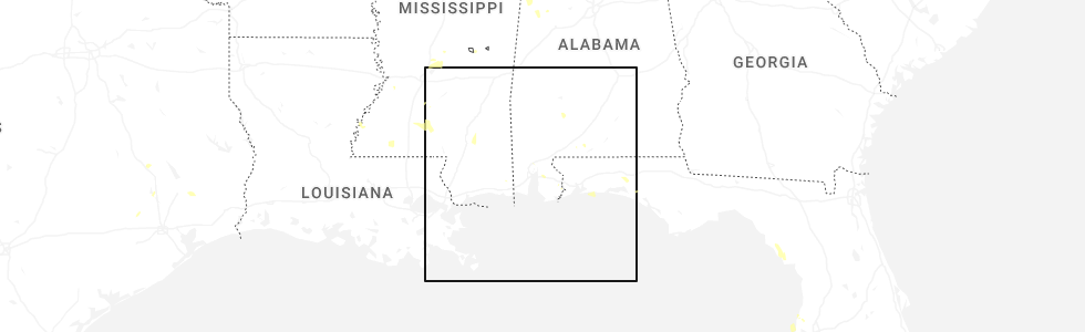
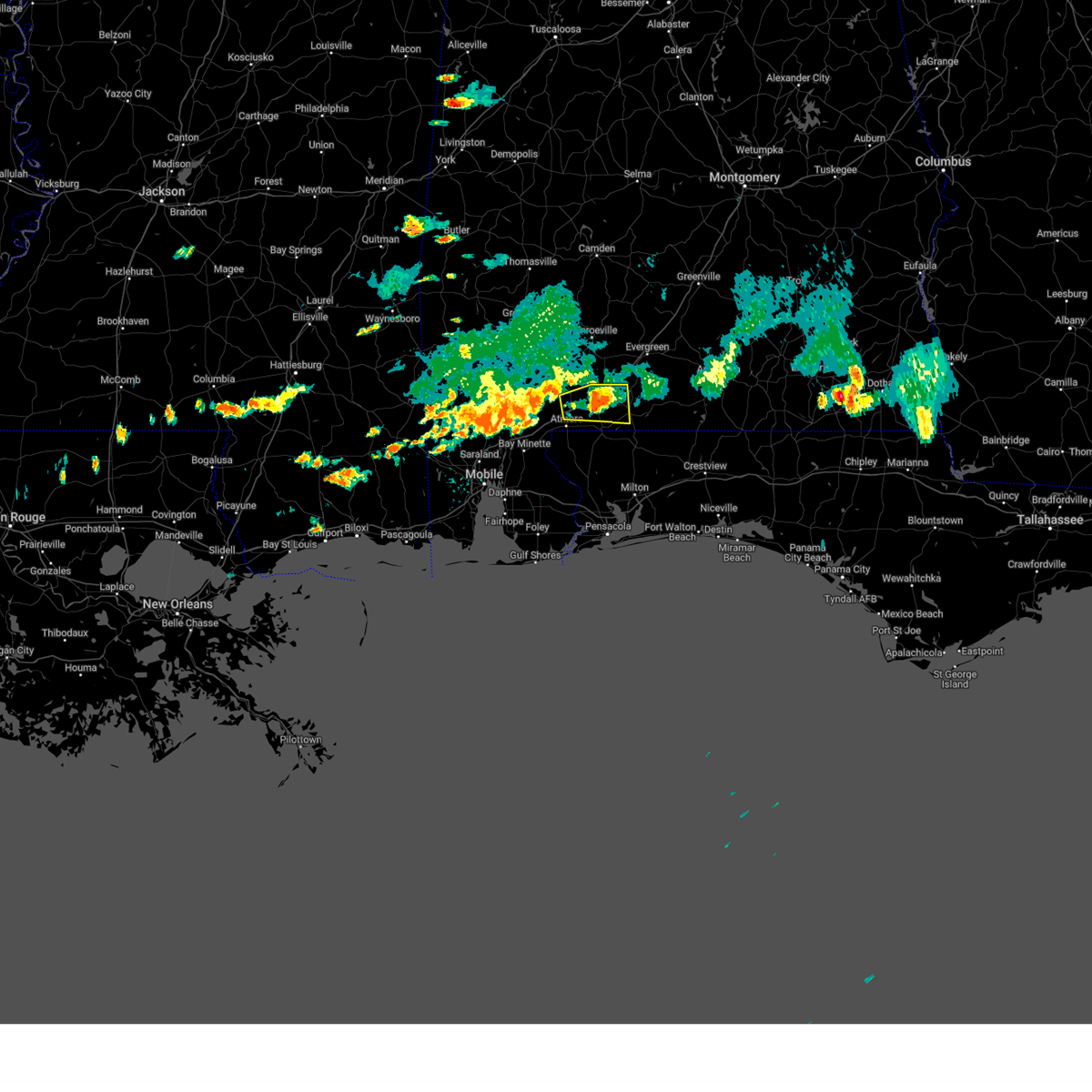
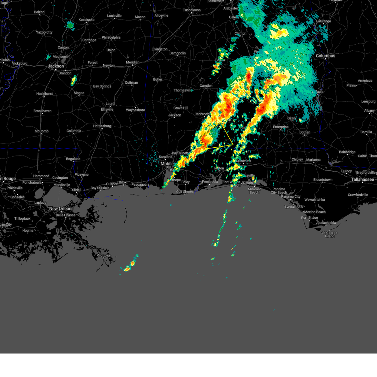
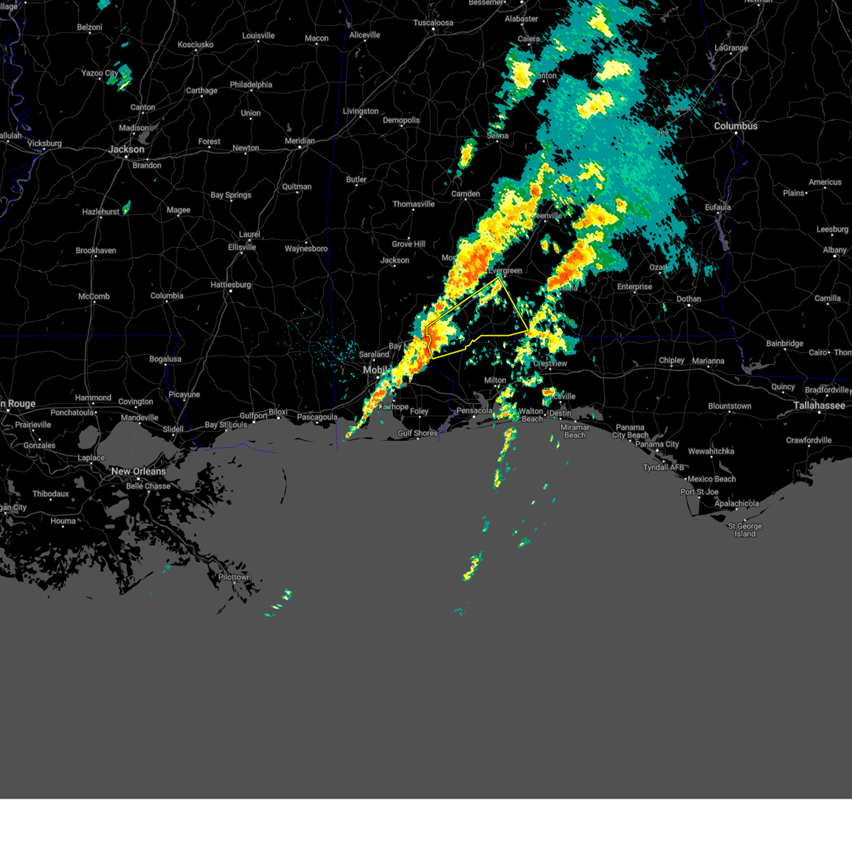
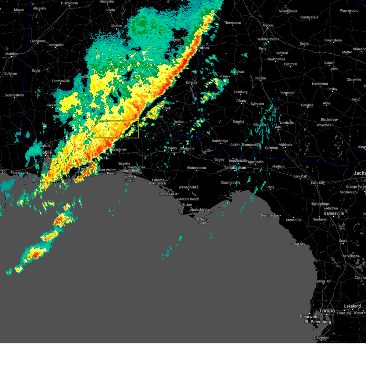
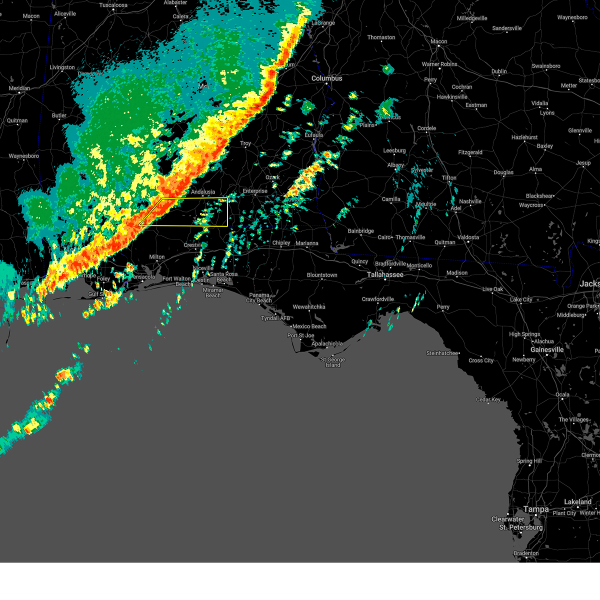
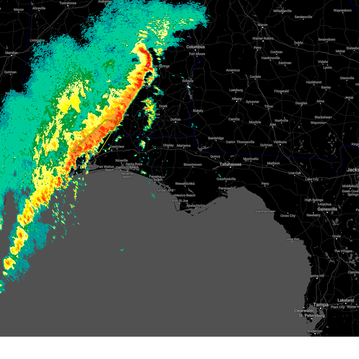
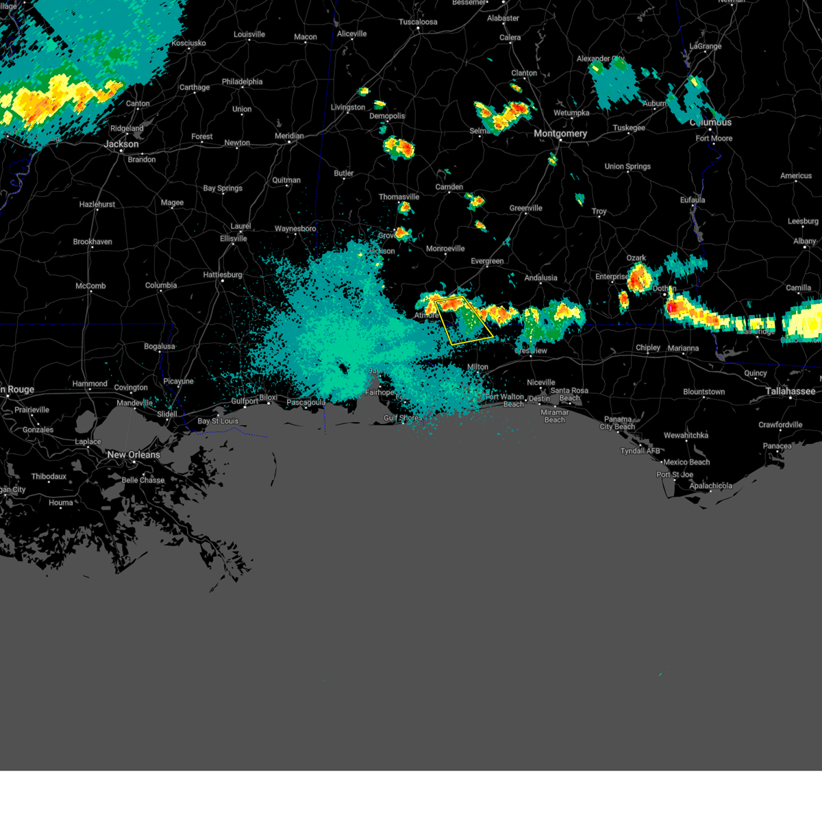
Hail Map for East Brewton, AL
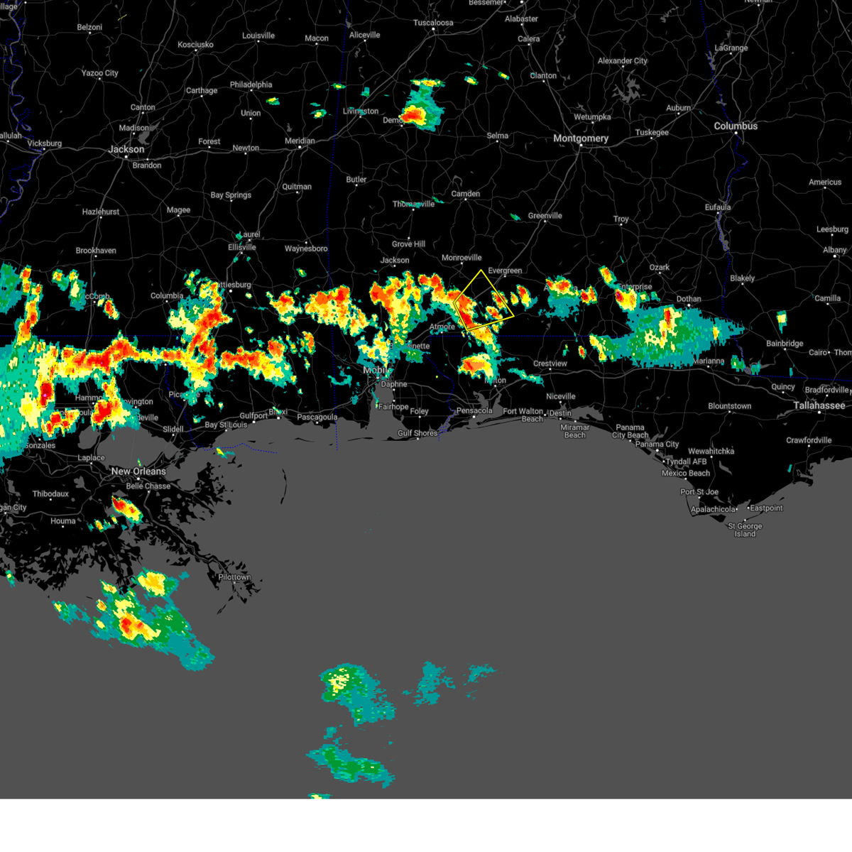
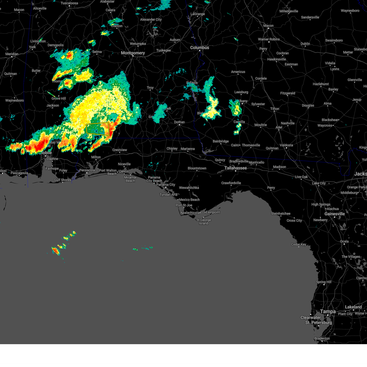
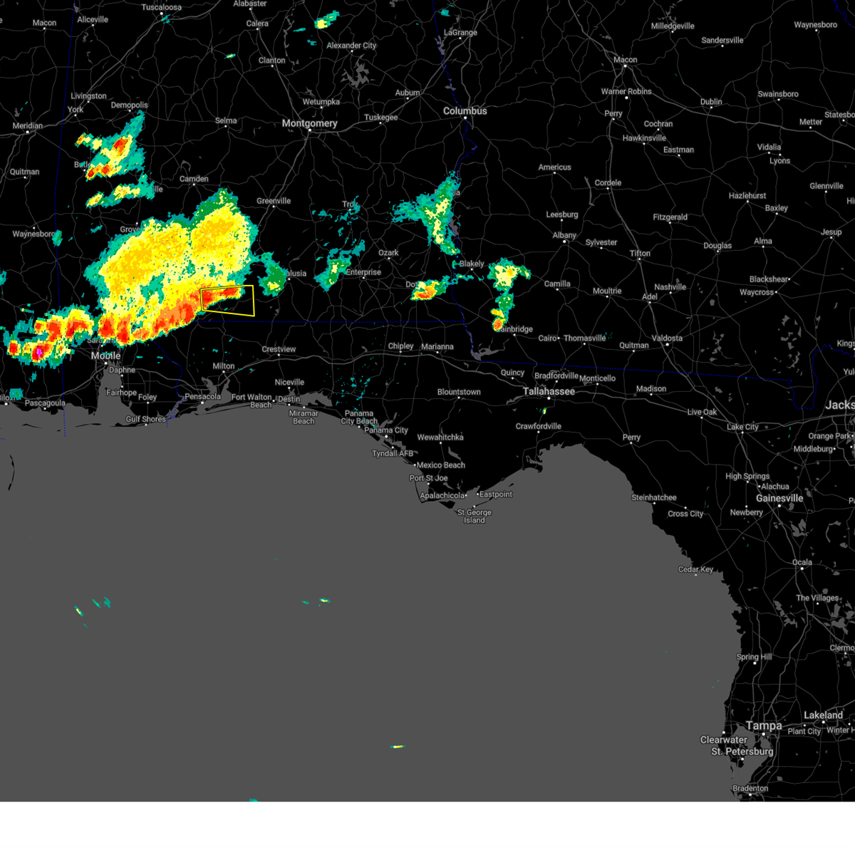
The East Brewton, AL area has had 0 reports of on-the-ground hail by trained spotters, and has been under severe weather warnings 18 times during the past 12 months. Doppler radar has detected hail at or near East Brewton, AL on 45 occasions, including 2 occasions during the past year.
| Name: | East Brewton, AL |
| Where Located: | 63.6 miles SSE of Camden, AL |
| Map: | Google Map for East Brewton, AL |
| Population: | 2478 |
| Housing Units: | 1226 |
| More Info: | Search Google for East Brewton, AL |
0
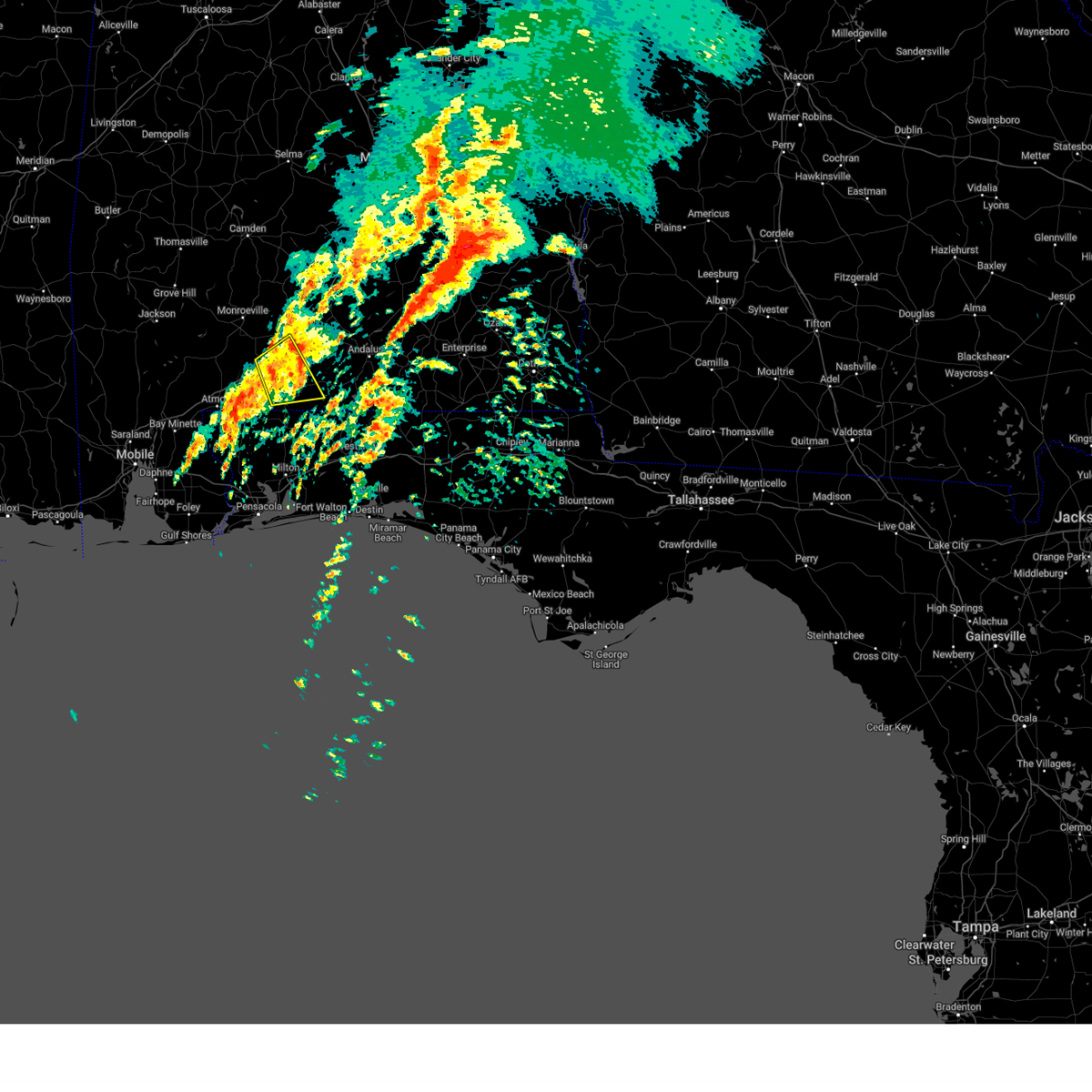
The Top Recent Hail Date for East Brewton, AL is Monday, June 23, 2025 (45th out of 45)
Hail and Wind Damage Spotted near East Brewton, AL
| Date / Time | Report Details |
|---|---|
| 6/10/2025 4:02 PM CDT | the severe thunderstorm warning has been cancelled and is no longer in effect |
| 6/10/2025 3:24 PM CDT |
 Svrmob the national weather service in mobile has issued a * severe thunderstorm warning for, eastern escambia county in south central alabama, southwestern conecuh county in south central alabama, * until 415 pm cdt. * at 324 pm cdt, a severe thunderstorm was located near i65 and al 113, or 11 miles north of flomaton, moving northeast at 20 mph (radar indicated). Hazards include 60 mph wind gusts and penny size hail. expect damage to roofs, siding, and trees Svrmob the national weather service in mobile has issued a * severe thunderstorm warning for, eastern escambia county in south central alabama, southwestern conecuh county in south central alabama, * until 415 pm cdt. * at 324 pm cdt, a severe thunderstorm was located near i65 and al 113, or 11 miles north of flomaton, moving northeast at 20 mph (radar indicated). Hazards include 60 mph wind gusts and penny size hail. expect damage to roofs, siding, and trees
|
| 6/9/2025 6:22 PM CDT |
 The storm which prompted the warning has moved out of the area. therefore, the warning will be allowed to expire. The storm which prompted the warning has moved out of the area. therefore, the warning will be allowed to expire.
|
| 6/9/2025 5:40 PM CDT |
 Svrmob the national weather service in mobile has issued a * severe thunderstorm warning for, eastern escambia county in south central alabama, * until 630 pm cdt. * at 540 pm cdt, a severe thunderstorm was located 6 miles northwest of brewton, moving east at 25 mph (radar indicated). Hazards include ping pong ball size hail and 60 mph wind gusts. People and animals outdoors will be injured. expect hail damage to roofs, siding, windows, and vehicles. Expect wind damage to roofs, siding, and trees. Svrmob the national weather service in mobile has issued a * severe thunderstorm warning for, eastern escambia county in south central alabama, * until 630 pm cdt. * at 540 pm cdt, a severe thunderstorm was located 6 miles northwest of brewton, moving east at 25 mph (radar indicated). Hazards include ping pong ball size hail and 60 mph wind gusts. People and animals outdoors will be injured. expect hail damage to roofs, siding, windows, and vehicles. Expect wind damage to roofs, siding, and trees.
|
| 6/9/2025 4:54 PM CDT |
 the severe thunderstorm warning has been cancelled and is no longer in effect the severe thunderstorm warning has been cancelled and is no longer in effect
|
| 6/9/2025 4:30 PM CDT |
 Svrmob the national weather service in mobile has issued a * severe thunderstorm warning for, western escambia county in south central alabama, * until 515 pm cdt. * at 430 pm cdt, a severe thunderstorm was located over i65 and al 21, or 7 miles north of atmore, moving east at 20 mph (radar indicated). Hazards include 60 mph wind gusts and quarter size hail. Hail damage to vehicles is expected. Expect wind damage to roofs, siding, and trees. Svrmob the national weather service in mobile has issued a * severe thunderstorm warning for, western escambia county in south central alabama, * until 515 pm cdt. * at 430 pm cdt, a severe thunderstorm was located over i65 and al 21, or 7 miles north of atmore, moving east at 20 mph (radar indicated). Hazards include 60 mph wind gusts and quarter size hail. Hail damage to vehicles is expected. Expect wind damage to roofs, siding, and trees.
|
| 3/15/2025 11:13 PM CDT |
 The storm which prompted the warning has moved out of the area. therefore, the warning will be allowed to expire. a tornado watch remains in effect until 300 am cdt for south central alabama. The storm which prompted the warning has moved out of the area. therefore, the warning will be allowed to expire. a tornado watch remains in effect until 300 am cdt for south central alabama.
|
| 3/15/2025 10:57 PM CDT |
 At 1057 pm cdt, a severe thunderstorm was located 4 miles northwest of brewton, moving northeast at 55 mph (radar indicated). Hazards include 60 mph wind gusts and nickel size hail. Expect damage to roofs, siding, and trees. Locations impacted include, i65 and us 84, brewton, riverview, castleberry, and east brewton. At 1057 pm cdt, a severe thunderstorm was located 4 miles northwest of brewton, moving northeast at 55 mph (radar indicated). Hazards include 60 mph wind gusts and nickel size hail. Expect damage to roofs, siding, and trees. Locations impacted include, i65 and us 84, brewton, riverview, castleberry, and east brewton.
|
| 3/15/2025 10:44 PM CDT |
 At 1044 pm cdt, a severe thunderstorm was located 5 miles north of flomaton, moving northeast at 55 mph (radar indicated). Hazards include 70 mph wind gusts and quarter size hail. Hail damage to vehicles is expected. expect considerable tree damage. wind damage is also likely to mobile homes, roofs, and outbuildings. Locations impacted include, i65 and us 84, pollard, east brewton, brewton, i65 and al 113, riverview, castleberry, and flomaton. At 1044 pm cdt, a severe thunderstorm was located 5 miles north of flomaton, moving northeast at 55 mph (radar indicated). Hazards include 70 mph wind gusts and quarter size hail. Hail damage to vehicles is expected. expect considerable tree damage. wind damage is also likely to mobile homes, roofs, and outbuildings. Locations impacted include, i65 and us 84, pollard, east brewton, brewton, i65 and al 113, riverview, castleberry, and flomaton.
|
| 3/15/2025 10:44 PM CDT |
 the severe thunderstorm warning has been cancelled and is no longer in effect the severe thunderstorm warning has been cancelled and is no longer in effect
|
| 3/15/2025 10:26 PM CDT |
 Svrmob the national weather service in mobile has issued a * severe thunderstorm warning for, escambia county in south central alabama, south central conecuh county in south central alabama, northwestern escambia county in northwestern florida, * until 1115 pm cdt. * at 1025 pm cdt, a severe thunderstorm was located 6 miles southwest of atmore, moving northeast at 55 mph (radar indicated). Hazards include golf ball size hail and 70 mph wind gusts. People and animals outdoors will be injured. expect hail damage to roofs, siding, windows, and vehicles. expect considerable tree damage. Wind damage is also likely to mobile homes, roofs, and outbuildings. Svrmob the national weather service in mobile has issued a * severe thunderstorm warning for, escambia county in south central alabama, south central conecuh county in south central alabama, northwestern escambia county in northwestern florida, * until 1115 pm cdt. * at 1025 pm cdt, a severe thunderstorm was located 6 miles southwest of atmore, moving northeast at 55 mph (radar indicated). Hazards include golf ball size hail and 70 mph wind gusts. People and animals outdoors will be injured. expect hail damage to roofs, siding, windows, and vehicles. expect considerable tree damage. Wind damage is also likely to mobile homes, roofs, and outbuildings.
|
| 2/16/2025 3:42 AM CST |
 The storms which prompted the warning have moved out of eastern escambia and southeastern conecuh counties. therefore, the warning will be allowed to expire. a tornado watch remains in effect until 600 am cst for south central alabama, and northwestern florida. remember, a severe thunderstorm warning still remains in effect for southern covington county until 430 am cst. The storms which prompted the warning have moved out of eastern escambia and southeastern conecuh counties. therefore, the warning will be allowed to expire. a tornado watch remains in effect until 600 am cst for south central alabama, and northwestern florida. remember, a severe thunderstorm warning still remains in effect for southern covington county until 430 am cst.
|
| 2/16/2025 3:07 AM CST |
 Svrmob the national weather service in mobile has issued a * severe thunderstorm warning for, eastern escambia county in south central alabama, southeastern conecuh county in south central alabama, southern covington county in south central alabama, * until 345 am cst. * at 306 am cst, severe thunderstorms were located along a line extending from 12 miles southwest of red level to near riverview, moving east at 60 mph (radar indicated). Hazards include 60 mph wind gusts. expect damage to roofs, siding, and trees Svrmob the national weather service in mobile has issued a * severe thunderstorm warning for, eastern escambia county in south central alabama, southeastern conecuh county in south central alabama, southern covington county in south central alabama, * until 345 am cst. * at 306 am cst, severe thunderstorms were located along a line extending from 12 miles southwest of red level to near riverview, moving east at 60 mph (radar indicated). Hazards include 60 mph wind gusts. expect damage to roofs, siding, and trees
|
| 12/29/2024 1:23 AM CST |
 At 123 am cst, severe thunderstorms were located along a line extending from 3 miles south of andalusia to point baker, moving east at 45 mph (radar indicated). Hazards include 60 mph wind gusts. Expect damage to roofs, siding, and trees. Locations impacted include, molino and jay. At 123 am cst, severe thunderstorms were located along a line extending from 3 miles south of andalusia to point baker, moving east at 45 mph (radar indicated). Hazards include 60 mph wind gusts. Expect damage to roofs, siding, and trees. Locations impacted include, molino and jay.
|
| 12/29/2024 12:45 AM CST |
 Svrmob the national weather service in mobile has issued a * severe thunderstorm warning for, escambia county in south central alabama, southeastern conecuh county in south central alabama, west central covington county in south central alabama, northwestern okaloosa county in northwestern florida, northern santa rosa county in northwestern florida, northwestern escambia county in northwestern florida, * until 145 am cst. * at 1245 am cst, severe thunderstorms were located along a line extending from 8 miles east of castleberry to 10 miles southwest of molino, moving east at 25 mph (radar indicated). Hazards include 60 mph wind gusts. expect damage to roofs, siding, and trees Svrmob the national weather service in mobile has issued a * severe thunderstorm warning for, escambia county in south central alabama, southeastern conecuh county in south central alabama, west central covington county in south central alabama, northwestern okaloosa county in northwestern florida, northern santa rosa county in northwestern florida, northwestern escambia county in northwestern florida, * until 145 am cst. * at 1245 am cst, severe thunderstorms were located along a line extending from 8 miles east of castleberry to 10 miles southwest of molino, moving east at 25 mph (radar indicated). Hazards include 60 mph wind gusts. expect damage to roofs, siding, and trees
|
| 12/29/2024 12:04 AM CST |
 Svrmob the national weather service in mobile has issued a * severe thunderstorm warning for, escambia county in south central alabama, southern conecuh county in south central alabama, northwestern santa rosa county in northwestern florida, northwestern escambia county in northwestern florida, * until 1245 am cst. * at 1204 am cst, severe thunderstorms were located along a line extending from 7 miles south of repton to 9 miles southwest of bratt, moving east at 25 mph (radar indicated). Hazards include 60 mph wind gusts. expect damage to roofs, siding, and trees Svrmob the national weather service in mobile has issued a * severe thunderstorm warning for, escambia county in south central alabama, southern conecuh county in south central alabama, northwestern santa rosa county in northwestern florida, northwestern escambia county in northwestern florida, * until 1245 am cst. * at 1204 am cst, severe thunderstorms were located along a line extending from 7 miles south of repton to 9 miles southwest of bratt, moving east at 25 mph (radar indicated). Hazards include 60 mph wind gusts. expect damage to roofs, siding, and trees
|
| 8/18/2024 9:28 PM CDT |
 the severe thunderstorm warning has been cancelled and is no longer in effect the severe thunderstorm warning has been cancelled and is no longer in effect
|
| 8/18/2024 9:00 PM CDT |
 Svrmob the national weather service in mobile has issued a * severe thunderstorm warning for, western escambia county in south central alabama, northwestern santa rosa county in northwestern florida, north central escambia county in northwestern florida, * until 945 pm cdt. * at 900 pm cdt, a severe thunderstorm was located 6 miles southeast of i65 and al 113, or 9 miles north of flomaton, moving southeast at 25 mph (radar indicated). Hazards include 60 mph wind gusts. expect damage to roofs, siding, and trees Svrmob the national weather service in mobile has issued a * severe thunderstorm warning for, western escambia county in south central alabama, northwestern santa rosa county in northwestern florida, north central escambia county in northwestern florida, * until 945 pm cdt. * at 900 pm cdt, a severe thunderstorm was located 6 miles southeast of i65 and al 113, or 9 miles north of flomaton, moving southeast at 25 mph (radar indicated). Hazards include 60 mph wind gusts. expect damage to roofs, siding, and trees
|
| 5/13/2024 9:52 AM CDT |
 At 951 am cdt, severe thunderstorms were located along a line extending from 3 miles west of brewton to 5 miles northeast of gonzalez to summerdale, moving southeast at 55 mph (radar indicated). Hazards include 70 mph wind gusts and penny size hail. Expect considerable tree damage. damage is likely to mobile homes, roofs, and outbuildings. Locations impacted include, pensacola, ferry pass, brent, west pensacola, ensley, daphne, warrington, gonzalez, pace, milton, brewton, goulding, robertsdale, century, flomaton, bagdad, loxley, lillian, myrtle grove, and east brewton. At 951 am cdt, severe thunderstorms were located along a line extending from 3 miles west of brewton to 5 miles northeast of gonzalez to summerdale, moving southeast at 55 mph (radar indicated). Hazards include 70 mph wind gusts and penny size hail. Expect considerable tree damage. damage is likely to mobile homes, roofs, and outbuildings. Locations impacted include, pensacola, ferry pass, brent, west pensacola, ensley, daphne, warrington, gonzalez, pace, milton, brewton, goulding, robertsdale, century, flomaton, bagdad, loxley, lillian, myrtle grove, and east brewton.
|
| 5/13/2024 9:31 AM CDT |
 Svrmob the national weather service in mobile has issued a * severe thunderstorm warning for, central baldwin county in southwestern alabama, southern escambia county in south central alabama, santa rosa county in northwestern florida, escambia county in northwestern florida, * until 1015 am cdt. * at 930 am cdt, severe thunderstorms were located along a line extending from 4 miles southwest of i65 and al 113 to 11 miles west of molino to near fairhope, moving southeast at 55 mph. these are destructive storms for northerm baldwin, southwestern escambia alabama, and northwestern escambia florida counties (radar indicated). Hazards include 80 mph wind gusts and nickel size hail. Flying debris will be dangerous to those caught without shelter. mobile homes will be heavily damaged. expect considerable damage to roofs, windows, and vehicles. Extensive tree damage and power outages are likely. Svrmob the national weather service in mobile has issued a * severe thunderstorm warning for, central baldwin county in southwestern alabama, southern escambia county in south central alabama, santa rosa county in northwestern florida, escambia county in northwestern florida, * until 1015 am cdt. * at 930 am cdt, severe thunderstorms were located along a line extending from 4 miles southwest of i65 and al 113 to 11 miles west of molino to near fairhope, moving southeast at 55 mph. these are destructive storms for northerm baldwin, southwestern escambia alabama, and northwestern escambia florida counties (radar indicated). Hazards include 80 mph wind gusts and nickel size hail. Flying debris will be dangerous to those caught without shelter. mobile homes will be heavily damaged. expect considerable damage to roofs, windows, and vehicles. Extensive tree damage and power outages are likely.
|
| 5/10/2024 3:55 AM CDT |
 At 354 am cdt, severe thunderstorms were located along a line extending from 9 miles east of east brewton to 11 miles southeast of riverview to 11 miles north of roeville to 7 miles north of point baker, moving east at 65 mph (radar indicated). Hazards include 70 mph wind gusts. Expect considerable tree damage. damage is likely to mobile homes, roofs, and outbuildings. Locations impacted include, brewton, baker, east brewton, jay, pollard, and riverview. At 354 am cdt, severe thunderstorms were located along a line extending from 9 miles east of east brewton to 11 miles southeast of riverview to 11 miles north of roeville to 7 miles north of point baker, moving east at 65 mph (radar indicated). Hazards include 70 mph wind gusts. Expect considerable tree damage. damage is likely to mobile homes, roofs, and outbuildings. Locations impacted include, brewton, baker, east brewton, jay, pollard, and riverview.
|
| 5/10/2024 3:55 AM CDT |
 the severe thunderstorm warning has been cancelled and is no longer in effect the severe thunderstorm warning has been cancelled and is no longer in effect
|
| 5/10/2024 3:23 AM CDT |
 Svrmob the national weather service in mobile has issued a * severe thunderstorm warning for, central baldwin county in southwestern alabama, escambia county in south central alabama, southeastern conecuh county in south central alabama, southwestern covington county in south central alabama, northwestern okaloosa county in northwestern florida, northern santa rosa county in northwestern florida, northwestern escambia county in northwestern florida, * until 415 am cdt. * at 322 am cdt, severe thunderstorms were located along a line extending from near i65 and al 21 to near atmore to 9 miles southwest of bratt to 8 miles east of bay minette, moving east at 65 mph (radar indicated). Hazards include 60 mph wind gusts. expect damage to roofs, siding, and trees Svrmob the national weather service in mobile has issued a * severe thunderstorm warning for, central baldwin county in southwestern alabama, escambia county in south central alabama, southeastern conecuh county in south central alabama, southwestern covington county in south central alabama, northwestern okaloosa county in northwestern florida, northern santa rosa county in northwestern florida, northwestern escambia county in northwestern florida, * until 415 am cdt. * at 322 am cdt, severe thunderstorms were located along a line extending from near i65 and al 21 to near atmore to 9 miles southwest of bratt to 8 miles east of bay minette, moving east at 65 mph (radar indicated). Hazards include 60 mph wind gusts. expect damage to roofs, siding, and trees
|
| 4/10/2024 2:01 PM CDT |
 At 201 pm cdt, severe thunderstorms were located along a line extending from 8 miles southeast of riverview to 12 miles northeast of roeville to 6 miles south of bagdad to 4 miles south of pensacola beach, moving east at 45 mph (radar indicated). Hazards include 60 mph wind gusts and penny size hail. Expect damage to roofs, siding, and trees. Locations impacted include, wright, crestview, milton, gulf breeze, mary esther, bagdad, baker, oriole beach, navarre, riverview, pensacola beach, point baker, navarre beach, pea ridge, and roeville. At 201 pm cdt, severe thunderstorms were located along a line extending from 8 miles southeast of riverview to 12 miles northeast of roeville to 6 miles south of bagdad to 4 miles south of pensacola beach, moving east at 45 mph (radar indicated). Hazards include 60 mph wind gusts and penny size hail. Expect damage to roofs, siding, and trees. Locations impacted include, wright, crestview, milton, gulf breeze, mary esther, bagdad, baker, oriole beach, navarre, riverview, pensacola beach, point baker, navarre beach, pea ridge, and roeville.
|
| 4/10/2024 1:36 PM CDT |
 Svrmob the national weather service in mobile has issued a * severe thunderstorm warning for, southeastern escambia county in south central alabama, southwestern covington county in south central alabama, okaloosa county in northwestern florida, santa rosa county in northwestern florida, eastern escambia county in northwestern florida, * until 230 pm cdt. * at 136 pm cdt, severe thunderstorms were located along a line extending from 3 miles east of flomaton to 10 miles northeast of molino to near brent to 9 miles southeast of perdido beach, moving east at 45 mph (radar indicated). Hazards include 60 mph wind gusts and penny size hail. expect damage to roofs, siding, and trees Svrmob the national weather service in mobile has issued a * severe thunderstorm warning for, southeastern escambia county in south central alabama, southwestern covington county in south central alabama, okaloosa county in northwestern florida, santa rosa county in northwestern florida, eastern escambia county in northwestern florida, * until 230 pm cdt. * at 136 pm cdt, severe thunderstorms were located along a line extending from 3 miles east of flomaton to 10 miles northeast of molino to near brent to 9 miles southeast of perdido beach, moving east at 45 mph (radar indicated). Hazards include 60 mph wind gusts and penny size hail. expect damage to roofs, siding, and trees
|
| 1/9/2024 5:26 AM CST |
 The national weather service in mobile has issued a * severe thunderstorm warning for. eastern escambia county in south central alabama. southeastern conecuh county in south central alabama. southern covington county in south central alabama. Western okaloosa county in northwestern florida. The national weather service in mobile has issued a * severe thunderstorm warning for. eastern escambia county in south central alabama. southeastern conecuh county in south central alabama. southern covington county in south central alabama. Western okaloosa county in northwestern florida.
|
| 1/9/2024 5:26 AM CST |
 At 525 am cst, severe thunderstorms were located along a line extending from 4 miles south of castleberry to 4 miles east of perdido beach, moving east at 40 mph (radar indicated). Hazards include 60 mph wind gusts. expect damage to roofs, siding, and trees At 525 am cst, severe thunderstorms were located along a line extending from 4 miles south of castleberry to 4 miles east of perdido beach, moving east at 40 mph (radar indicated). Hazards include 60 mph wind gusts. expect damage to roofs, siding, and trees
|
| 1/9/2024 4:48 AM CST |
 At 447 am cst, severe thunderstorms were located along a line extending from near mccullough to 5 miles south of point clear, moving east at 40 mph (radar indicated). Hazards include 70 mph wind gusts. Expect considerable tree damage. Damage is likely to mobile homes, roofs, and outbuildings. At 447 am cst, severe thunderstorms were located along a line extending from near mccullough to 5 miles south of point clear, moving east at 40 mph (radar indicated). Hazards include 70 mph wind gusts. Expect considerable tree damage. Damage is likely to mobile homes, roofs, and outbuildings.
|
| 8/15/2023 7:10 PM CDT |
 The severe thunderstorm warning for southeastern escambia, northwestern santa rosa and north central escambia counties will expire at 715 pm cdt, the storm which prompted the warning has weakened below severe limits, and no longer poses an immediate threat to life or property. therefore, the warning will be allowed to expire. however, gusty winds and heavy rain are still possible with this thunderstorm. The severe thunderstorm warning for southeastern escambia, northwestern santa rosa and north central escambia counties will expire at 715 pm cdt, the storm which prompted the warning has weakened below severe limits, and no longer poses an immediate threat to life or property. therefore, the warning will be allowed to expire. however, gusty winds and heavy rain are still possible with this thunderstorm.
|
| 8/15/2023 6:29 PM CDT |
 At 629 pm cdt, a severe thunderstorm was located over flomaton, and is nearly stationary (radar indicated). Hazards include 60 mph wind gusts. expect damage to roofs, siding, and trees At 629 pm cdt, a severe thunderstorm was located over flomaton, and is nearly stationary (radar indicated). Hazards include 60 mph wind gusts. expect damage to roofs, siding, and trees
|
| 6/17/2023 2:14 PM CDT |
 At 214 pm cdt, a severe thunderstorm was located 5 miles west of castleberry, or 11 miles southwest of evergreen, moving southeast at 25 mph. this is a destructive storm for castleberry! (radar indicated). Hazards include baseball size hail and 60 mph wind gusts. People and animals outdoors will be severely injured. expect shattered windows, extensive damage to roofs, siding, and vehicles. Locations impacted include, castleberry. At 214 pm cdt, a severe thunderstorm was located 5 miles west of castleberry, or 11 miles southwest of evergreen, moving southeast at 25 mph. this is a destructive storm for castleberry! (radar indicated). Hazards include baseball size hail and 60 mph wind gusts. People and animals outdoors will be severely injured. expect shattered windows, extensive damage to roofs, siding, and vehicles. Locations impacted include, castleberry.
|
| 6/17/2023 2:09 PM CDT |
 At 209 pm cdt, a severe thunderstorm was located 6 miles northwest of castleberry, or 11 miles southwest of evergreen, moving southeast at 25 mph (radar indicated). Hazards include ping pong ball size hail and 60 mph wind gusts. People and animals outdoors will be injured. expect hail damage to roofs, siding, windows, and vehicles. Expect wind damage to roofs, siding, and trees. At 209 pm cdt, a severe thunderstorm was located 6 miles northwest of castleberry, or 11 miles southwest of evergreen, moving southeast at 25 mph (radar indicated). Hazards include ping pong ball size hail and 60 mph wind gusts. People and animals outdoors will be injured. expect hail damage to roofs, siding, windows, and vehicles. Expect wind damage to roofs, siding, and trees.
|
| 6/16/2023 8:28 AM CDT |
 At 827 am cdt, severe thunderstorms were located along a line extending from near pine apple to 6 miles west of i65 and us 84 to 8 miles southwest of bratt, moving east at 65 mph (radar indicated). Hazards include 70 mph wind gusts and penny size hail. Expect considerable tree damage. Damage is likely to mobile homes, roofs, and outbuildings. At 827 am cdt, severe thunderstorms were located along a line extending from near pine apple to 6 miles west of i65 and us 84 to 8 miles southwest of bratt, moving east at 65 mph (radar indicated). Hazards include 70 mph wind gusts and penny size hail. Expect considerable tree damage. Damage is likely to mobile homes, roofs, and outbuildings.
|
| 6/16/2023 8:03 AM CDT |
 At 802 am cdt, severe thunderstorms were located along a line extending from near yellow bluff to 10 miles west of uriah to 3 miles southeast of creola, moving east at 55 mph (radar indicated). Hazards include 70 mph wind gusts and quarter size hail. Hail damage to vehicles is expected. expect considerable tree damage. Wind damage is also likely to mobile homes, roofs, and outbuildings. At 802 am cdt, severe thunderstorms were located along a line extending from near yellow bluff to 10 miles west of uriah to 3 miles southeast of creola, moving east at 55 mph (radar indicated). Hazards include 70 mph wind gusts and quarter size hail. Hail damage to vehicles is expected. expect considerable tree damage. Wind damage is also likely to mobile homes, roofs, and outbuildings.
|
| 6/15/2023 4:12 PM CDT |
 The severe thunderstorm warning for central escambia county will expire at 415 pm cdt, the storm which prompted the warning has moved out of the area. therefore, the warning will be allowed to expire. a severe thunderstorm watch remains in effect until 900 pm cdt for south central alabama. The severe thunderstorm warning for central escambia county will expire at 415 pm cdt, the storm which prompted the warning has moved out of the area. therefore, the warning will be allowed to expire. a severe thunderstorm watch remains in effect until 900 pm cdt for south central alabama.
|
| 6/15/2023 4:04 PM CDT |
 At 404 pm cdt, a severe thunderstorm was located over riverview, or near brewton, moving east at 30 mph (radar indicated). Hazards include golf ball size hail and 60 mph wind gusts. People and animals outdoors will be injured. expect hail damage to roofs, siding, windows, and vehicles. Expect wind damage to roofs, siding, and trees. At 404 pm cdt, a severe thunderstorm was located over riverview, or near brewton, moving east at 30 mph (radar indicated). Hazards include golf ball size hail and 60 mph wind gusts. People and animals outdoors will be injured. expect hail damage to roofs, siding, windows, and vehicles. Expect wind damage to roofs, siding, and trees.
|
| 6/15/2023 3:41 PM CDT |
 At 341 pm cdt, a severe thunderstorm was located 5 miles southwest of i65 and al 113, or 11 miles northeast of atmore, moving east at 35 mph (radar indicated). Hazards include two inch hail and 60 mph wind gusts. People and animals outdoors will be injured. expect hail damage to roofs, siding, windows, and vehicles. expect wind damage to roofs, siding, and trees. locations impacted include, brewton, east brewton, pollard, riverview and i65 and al 113. thunderstorm damage threat, considerable hail threat, radar indicated max hail size, 2. 00 in wind threat, radar indicated max wind gust, 60 mph. At 341 pm cdt, a severe thunderstorm was located 5 miles southwest of i65 and al 113, or 11 miles northeast of atmore, moving east at 35 mph (radar indicated). Hazards include two inch hail and 60 mph wind gusts. People and animals outdoors will be injured. expect hail damage to roofs, siding, windows, and vehicles. expect wind damage to roofs, siding, and trees. locations impacted include, brewton, east brewton, pollard, riverview and i65 and al 113. thunderstorm damage threat, considerable hail threat, radar indicated max hail size, 2. 00 in wind threat, radar indicated max wind gust, 60 mph.
|
| 6/15/2023 3:36 PM CDT |
 At 336 pm cdt, a severe thunderstorm was located near i65 and al 21, or 9 miles north of atmore, moving east at 30 mph (radar indicated). Hazards include 60 mph wind gusts and quarter size hail. Hail damage to vehicles is expected. Expect wind damage to roofs, siding, and trees. At 336 pm cdt, a severe thunderstorm was located near i65 and al 21, or 9 miles north of atmore, moving east at 30 mph (radar indicated). Hazards include 60 mph wind gusts and quarter size hail. Hail damage to vehicles is expected. Expect wind damage to roofs, siding, and trees.
|
| 6/15/2023 3:27 PM CDT |
 At 327 pm cdt, a severe thunderstorm was located over brewton, moving east at 30 mph (radar indicated). Hazards include 60 mph wind gusts and quarter size hail. Hail damage to vehicles is expected. expect wind damage to roofs, siding, and trees. locations impacted include, brewton, east brewton and riverview. hail threat, radar indicated max hail size, 1. 00 in wind threat, radar indicated max wind gust, 60 mph. At 327 pm cdt, a severe thunderstorm was located over brewton, moving east at 30 mph (radar indicated). Hazards include 60 mph wind gusts and quarter size hail. Hail damage to vehicles is expected. expect wind damage to roofs, siding, and trees. locations impacted include, brewton, east brewton and riverview. hail threat, radar indicated max hail size, 1. 00 in wind threat, radar indicated max wind gust, 60 mph.
|
| 6/15/2023 3:09 PM CDT |
 At 308 pm cdt, a severe thunderstorm was located 4 miles southeast of i65 and al 113, or 10 miles north of flomaton, moving east at 30 mph (radar indicated. broadcast media recently reported golf ball size hail near the i-65 corridor). Hazards include golf ball size hail and 60 mph wind gusts. People and animals outdoors will be injured. expect hail damage to roofs, siding, windows, and vehicles. Expect wind damage to roofs, siding, and trees. At 308 pm cdt, a severe thunderstorm was located 4 miles southeast of i65 and al 113, or 10 miles north of flomaton, moving east at 30 mph (radar indicated. broadcast media recently reported golf ball size hail near the i-65 corridor). Hazards include golf ball size hail and 60 mph wind gusts. People and animals outdoors will be injured. expect hail damage to roofs, siding, windows, and vehicles. Expect wind damage to roofs, siding, and trees.
|
| 6/15/2023 2:57 PM CDT |
 At 256 pm cdt, a severe thunderstorm was located 7 miles northeast of brewton, moving east at 30 mph (radar indicated). Hazards include 60 mph wind gusts and quarter size hail. Hail damage to vehicles is expected. Expect wind damage to roofs, siding, and trees. At 256 pm cdt, a severe thunderstorm was located 7 miles northeast of brewton, moving east at 30 mph (radar indicated). Hazards include 60 mph wind gusts and quarter size hail. Hail damage to vehicles is expected. Expect wind damage to roofs, siding, and trees.
|
| 6/15/2023 2:13 PM CDT |
 At 213 pm cdt, a severe thunderstorm was located 7 miles south of repton, or 13 miles southeast of frisco city, moving southeast at 30 mph (radar indicated). Hazards include 60 mph wind gusts and quarter size hail. Hail damage to vehicles is expected. Expect wind damage to roofs, siding, and trees. At 213 pm cdt, a severe thunderstorm was located 7 miles south of repton, or 13 miles southeast of frisco city, moving southeast at 30 mph (radar indicated). Hazards include 60 mph wind gusts and quarter size hail. Hail damage to vehicles is expected. Expect wind damage to roofs, siding, and trees.
|
| 6/14/2023 9:28 PM CDT |
 At 925 pm cdt, severe thunderstorms were located along a line extending from 8 miles east of riverview to 10 miles southeast of jay to 3 miles east of molino, moving east at 50 mph. sifnigicant wind damage could be possible with this storm moving towards baker and crestview florida. these are destructive storms for northeastern santa rosa and north okaloosa county (radar indicated). Hazards include 80 mph wind gusts. Flying debris will be dangerous to those caught without shelter. mobile homes will be heavily damaged. expect considerable damage to roofs, windows, and vehicles. extensive tree damage and power outages are likely. locations impacted include, crestview, niceville, milton, valparaiso, brewton, florala, baker, east brewton, laurel hill, lockhart, riverview, point baker and roeville. thunderstorm damage threat, destructive hail threat, radar indicated max hail size, <. 75 in wind threat, radar indicated max wind gust, 80 mph. At 925 pm cdt, severe thunderstorms were located along a line extending from 8 miles east of riverview to 10 miles southeast of jay to 3 miles east of molino, moving east at 50 mph. sifnigicant wind damage could be possible with this storm moving towards baker and crestview florida. these are destructive storms for northeastern santa rosa and north okaloosa county (radar indicated). Hazards include 80 mph wind gusts. Flying debris will be dangerous to those caught without shelter. mobile homes will be heavily damaged. expect considerable damage to roofs, windows, and vehicles. extensive tree damage and power outages are likely. locations impacted include, crestview, niceville, milton, valparaiso, brewton, florala, baker, east brewton, laurel hill, lockhart, riverview, point baker and roeville. thunderstorm damage threat, destructive hail threat, radar indicated max hail size, <. 75 in wind threat, radar indicated max wind gust, 80 mph.
|
| 6/14/2023 9:09 PM CDT |
 At 908 pm cdt, severe thunderstorms were located along a line extending from 3 miles northeast of pollard to 5 miles southeast of century to 9 miles west of molino, moving east at 50 mph. getting estimated reports of wind in excess of 60 mph with trees down across bay minette alabama (radar indicated). Hazards include 70 mph wind gusts. Expect considerable tree damage. damage is likely to mobile homes, roofs, and outbuildings. locations impacted include, wright, fort walton beach, crestview, niceville, destin, eglin afb, pace, milton, valparaiso, brewton, mary esther, florala, century, flomaton, bagdad, ocean city, lake lorraine, baker, east brewton and molino. thunderstorm damage threat, considerable hail threat, radar indicated max hail size, <. 75 in wind threat, radar indicated max wind gust, 70 mph. At 908 pm cdt, severe thunderstorms were located along a line extending from 3 miles northeast of pollard to 5 miles southeast of century to 9 miles west of molino, moving east at 50 mph. getting estimated reports of wind in excess of 60 mph with trees down across bay minette alabama (radar indicated). Hazards include 70 mph wind gusts. Expect considerable tree damage. damage is likely to mobile homes, roofs, and outbuildings. locations impacted include, wright, fort walton beach, crestview, niceville, destin, eglin afb, pace, milton, valparaiso, brewton, mary esther, florala, century, flomaton, bagdad, ocean city, lake lorraine, baker, east brewton and molino. thunderstorm damage threat, considerable hail threat, radar indicated max hail size, <. 75 in wind threat, radar indicated max wind gust, 70 mph.
|
| 6/14/2023 8:55 PM CDT |
 At 854 pm cdt, severe thunderstorms were located along a line extending from 5 miles south of i65 and al 113 to bratt to 9 miles southeast of bay minette, moving east at 50 mph (radar indicated). Hazards include 60 mph wind gusts. expect damage to roofs, siding, and trees At 854 pm cdt, severe thunderstorms were located along a line extending from 5 miles south of i65 and al 113 to bratt to 9 miles southeast of bay minette, moving east at 50 mph (radar indicated). Hazards include 60 mph wind gusts. expect damage to roofs, siding, and trees
|
| 6/14/2023 8:49 PM CDT |
 At 848 pm cdt, severe thunderstorms were located along a line extending from 4 miles northeast of i65 and al 21 to near atmore to 4 miles southeast of bay minette, moving east at 80 mph (radar indicated). Hazards include 60 mph wind gusts and penny size hail. Expect damage to roofs, siding, and trees. locations impacted include, atmore, brewton, century, flomaton, stockton, mccullough, east brewton, uriah, castleberry, pollard, riverview, bratt, i65 and cr 1, i65 and al 113, i65 and al 21, i65 and al 225 and poarch creek reservation. hail threat, radar indicated max hail size, 0. 75 in wind threat, radar indicated max wind gust, 60 mph. At 848 pm cdt, severe thunderstorms were located along a line extending from 4 miles northeast of i65 and al 21 to near atmore to 4 miles southeast of bay minette, moving east at 80 mph (radar indicated). Hazards include 60 mph wind gusts and penny size hail. Expect damage to roofs, siding, and trees. locations impacted include, atmore, brewton, century, flomaton, stockton, mccullough, east brewton, uriah, castleberry, pollard, riverview, bratt, i65 and cr 1, i65 and al 113, i65 and al 21, i65 and al 225 and poarch creek reservation. hail threat, radar indicated max hail size, 0. 75 in wind threat, radar indicated max wind gust, 60 mph.
|
| 6/14/2023 8:21 PM CDT |
 At 821 pm cdt, severe thunderstorms were located along a line extending from mcintosh to near calvert to 3 miles south of citronelle, moving east at 80 mph (radar indicated). Hazards include 60 mph wind gusts and penny size hail. expect damage to roofs, siding, and trees At 821 pm cdt, severe thunderstorms were located along a line extending from mcintosh to near calvert to 3 miles south of citronelle, moving east at 80 mph (radar indicated). Hazards include 60 mph wind gusts and penny size hail. expect damage to roofs, siding, and trees
|
| 4/15/2023 4:13 PM CDT |
 At 412 pm cdt, severe thunderstorms were located along a line extending from 7 miles southeast of castleberry to 11 miles east of riverview to 10 miles west of baker, moving east at 55 mph (radar indicated). Hazards include 60 mph wind gusts and penny size hail. Expect damage to roofs, siding, and trees. locations impacted include, andalusia, laurel hill and lockhart. hail threat, radar indicated max hail size, 0. 75 in wind threat, radar indicated max wind gust, 60 mph. At 412 pm cdt, severe thunderstorms were located along a line extending from 7 miles southeast of castleberry to 11 miles east of riverview to 10 miles west of baker, moving east at 55 mph (radar indicated). Hazards include 60 mph wind gusts and penny size hail. Expect damage to roofs, siding, and trees. locations impacted include, andalusia, laurel hill and lockhart. hail threat, radar indicated max hail size, 0. 75 in wind threat, radar indicated max wind gust, 60 mph.
|
| 4/15/2023 3:52 PM CDT |
 At 351 pm cdt, severe thunderstorms were located along a line extending from 7 miles east of i65 and al 113 to pollard to 9 miles south of jay, moving northeast at 50 mph (radar indicated). Hazards include 60 mph wind gusts and penny size hail. expect damage to roofs, siding, and trees At 351 pm cdt, severe thunderstorms were located along a line extending from 7 miles east of i65 and al 113 to pollard to 9 miles south of jay, moving northeast at 50 mph (radar indicated). Hazards include 60 mph wind gusts and penny size hail. expect damage to roofs, siding, and trees
|
| 3/28/2023 2:36 AM CDT |
 The severe thunderstorm warning for south central escambia, northwestern santa rosa and north central escambia counties will expire at 245 am cdt, the storm which prompted the warning has weakened below severe limits. therefore, the warning will be allowed to expire. The severe thunderstorm warning for south central escambia, northwestern santa rosa and north central escambia counties will expire at 245 am cdt, the storm which prompted the warning has weakened below severe limits. therefore, the warning will be allowed to expire.
|
| 3/28/2023 2:29 AM CDT |
 At 229 am cdt, a severe thunderstorm was located over flomaton, moving east at 25 mph (radar indicated). Hazards include 60 mph wind gusts and quarter size hail. Hail damage to vehicles is expected. expect wind damage to roofs, siding, and trees. locations impacted include, brewton, century, flomaton, east brewton, jay, pollard and riverview. hail threat, radar indicated max hail size, 1. 00 in wind threat, radar indicated max wind gust, 60 mph. At 229 am cdt, a severe thunderstorm was located over flomaton, moving east at 25 mph (radar indicated). Hazards include 60 mph wind gusts and quarter size hail. Hail damage to vehicles is expected. expect wind damage to roofs, siding, and trees. locations impacted include, brewton, century, flomaton, east brewton, jay, pollard and riverview. hail threat, radar indicated max hail size, 1. 00 in wind threat, radar indicated max wind gust, 60 mph.
|
| 3/28/2023 2:07 AM CDT |
 At 206 am cdt, a severe thunderstorm was located over bratt, or 4 miles southeast of atmore, moving east at 25 mph (radar indicated). Hazards include ping pong ball size hail and 60 mph wind gusts. People and animals outdoors will be injured. expect hail damage to roofs, siding, windows, and vehicles. Expect wind damage to roofs, siding, and trees. At 206 am cdt, a severe thunderstorm was located over bratt, or 4 miles southeast of atmore, moving east at 25 mph (radar indicated). Hazards include ping pong ball size hail and 60 mph wind gusts. People and animals outdoors will be injured. expect hail damage to roofs, siding, windows, and vehicles. Expect wind damage to roofs, siding, and trees.
|
| 3/26/2023 1:56 PM CDT |
 The severe thunderstorm warning for south central escambia, northern santa rosa and north central escambia counties will expire at 200 pm cdt, the severe thunderstorm which prompted the warning has weakened. therefore, the warning will be allowed to expire. a severe thunderstorm watch remains in effect until 600 pm cdt for south central alabama, and northwestern florida. The severe thunderstorm warning for south central escambia, northern santa rosa and north central escambia counties will expire at 200 pm cdt, the severe thunderstorm which prompted the warning has weakened. therefore, the warning will be allowed to expire. a severe thunderstorm watch remains in effect until 600 pm cdt for south central alabama, and northwestern florida.
|
| 3/26/2023 1:42 PM CDT |
 At 141 pm cdt, a severe thunderstorm was located over jay, or 5 miles southeast of century, moving east at 30 mph (radar indicated). Hazards include 60 mph wind gusts and quarter size hail. Hail damage to vehicles is expected. expect wind damage to roofs, siding, and trees. locations impacted include, century, flomaton, east brewton, jay, pollard and riverview. hail threat, radar indicated max hail size, 1. 00 in wind threat, radar indicated max wind gust, 60 mph. At 141 pm cdt, a severe thunderstorm was located over jay, or 5 miles southeast of century, moving east at 30 mph (radar indicated). Hazards include 60 mph wind gusts and quarter size hail. Hail damage to vehicles is expected. expect wind damage to roofs, siding, and trees. locations impacted include, century, flomaton, east brewton, jay, pollard and riverview. hail threat, radar indicated max hail size, 1. 00 in wind threat, radar indicated max wind gust, 60 mph.
|
| 3/26/2023 1:19 PM CDT |
 At 119 pm cdt, a severe thunderstorm was located 6 miles southeast of bratt, or 7 miles southwest of century, moving east at 30 mph (radar indicated). Hazards include 60 mph wind gusts and quarter size hail. Hail damage to vehicles is expected. Expect wind damage to roofs, siding, and trees. At 119 pm cdt, a severe thunderstorm was located 6 miles southeast of bratt, or 7 miles southwest of century, moving east at 30 mph (radar indicated). Hazards include 60 mph wind gusts and quarter size hail. Hail damage to vehicles is expected. Expect wind damage to roofs, siding, and trees.
|
| 1/25/2023 2:24 AM CST |
 At 224 am cst, a severe thunderstorm was located over century, moving northeast at 70 mph (radar indicated). Hazards include 60 mph wind gusts. expect damage to roofs, siding, and trees At 224 am cst, a severe thunderstorm was located over century, moving northeast at 70 mph (radar indicated). Hazards include 60 mph wind gusts. expect damage to roofs, siding, and trees
|
| 12/30/2022 1:12 PM CST |
 At 111 pm cst, severe thunderstorms were located along a line extending from 3 miles southeast of bratt to near molino to 3 miles north of lillian to 3 miles northwest of orange beach, moving east at 30 mph (radar indicated). Hazards include 60 mph wind gusts. Expect damage to roofs, siding, and trees. Locations impacted include, pensacola, ferry pass, brent, west pensacola, ensley, warrington, gonzalez, atmore, pace, gulf breeze, brewton, orange beach, goulding, century, flomaton, lillian, myrtle grove, mccullough, east brewton and molino. At 111 pm cst, severe thunderstorms were located along a line extending from 3 miles southeast of bratt to near molino to 3 miles north of lillian to 3 miles northwest of orange beach, moving east at 30 mph (radar indicated). Hazards include 60 mph wind gusts. Expect damage to roofs, siding, and trees. Locations impacted include, pensacola, ferry pass, brent, west pensacola, ensley, warrington, gonzalez, atmore, pace, gulf breeze, brewton, orange beach, goulding, century, flomaton, lillian, myrtle grove, mccullough, east brewton and molino.
|
| 12/30/2022 12:42 PM CST |
 At 1241 pm cst, severe thunderstorms were located along a line extending from 8 miles east of bay minette to 11 miles east of stapleton to near summerdale to 8 miles west of bon secour, moving east at 30 mph (radar indicated). Hazards include 60 mph wind gusts. expect damage to roofs, siding, and trees At 1241 pm cst, severe thunderstorms were located along a line extending from 8 miles east of bay minette to 11 miles east of stapleton to near summerdale to 8 miles west of bon secour, moving east at 30 mph (radar indicated). Hazards include 60 mph wind gusts. expect damage to roofs, siding, and trees
|
| 11/26/2022 9:35 PM CST |
 At 934 pm cst, a severe thunderstorm was located 4 miles south of castleberry, or 9 miles north of brewton, moving northeast at 55 mph (radar indicated). Hazards include 70 mph wind gusts. Expect considerable tree damage. damage is likely to mobile homes, roofs, and outbuildings. locations impacted include, brewton, evergreen, east brewton, castleberry and riverview. thunderstorm damage threat, considerable hail threat, radar indicated max hail size, <. 75 in wind threat, radar indicated max wind gust, 70 mph. At 934 pm cst, a severe thunderstorm was located 4 miles south of castleberry, or 9 miles north of brewton, moving northeast at 55 mph (radar indicated). Hazards include 70 mph wind gusts. Expect considerable tree damage. damage is likely to mobile homes, roofs, and outbuildings. locations impacted include, brewton, evergreen, east brewton, castleberry and riverview. thunderstorm damage threat, considerable hail threat, radar indicated max hail size, <. 75 in wind threat, radar indicated max wind gust, 70 mph.
|
| 11/26/2022 9:16 PM CST |
 At 916 pm cst, a severe thunderstorm was located over pollard, or near flomaton, moving northeast at 50 mph (radar indicated). Hazards include 70 mph wind gusts. Expect considerable tree damage. Damage is likely to mobile homes, roofs, and outbuildings. At 916 pm cst, a severe thunderstorm was located over pollard, or near flomaton, moving northeast at 50 mph (radar indicated). Hazards include 70 mph wind gusts. Expect considerable tree damage. Damage is likely to mobile homes, roofs, and outbuildings.
|
| 11/26/2022 9:10 PM CST |
 At 910 pm cst, a severe thunderstorm was located near century, moving northeast at 45 mph (radar indicated). Hazards include 60 mph wind gusts. Expect damage to roofs, siding, and trees. locations impacted include, century, flomaton, jay, pollard and riverview. hail threat, radar indicated max hail size, <. 75 in wind threat, radar indicated max wind gust, 60 mph. At 910 pm cst, a severe thunderstorm was located near century, moving northeast at 45 mph (radar indicated). Hazards include 60 mph wind gusts. Expect damage to roofs, siding, and trees. locations impacted include, century, flomaton, jay, pollard and riverview. hail threat, radar indicated max hail size, <. 75 in wind threat, radar indicated max wind gust, 60 mph.
|
| 11/26/2022 8:41 PM CST |
 At 840 pm cst, a severe thunderstorm was located 11 miles west of molino, or 16 miles northwest of gonzalez, moving northeast at 50 mph (radar indicated). Hazards include 60 mph wind gusts. expect damage to roofs, siding, and trees At 840 pm cst, a severe thunderstorm was located 11 miles west of molino, or 16 miles northwest of gonzalez, moving northeast at 50 mph (radar indicated). Hazards include 60 mph wind gusts. expect damage to roofs, siding, and trees
|
| 7/21/2022 10:25 PM CDT |
 The severe thunderstorm warning for southwestern butler, monroe, eastern escambia, southwestern wilcox and conecuh counties will expire at 1030 pm cdt, the storms which prompted the warning have weakened below severe limits. therefore, the warning will be allowed to expire. however gusty winds up to 50mph are still possible with these thunderstorms. a severe thunderstorm watch remains in effect until 100 am cdt for south central and southwestern alabama. The severe thunderstorm warning for southwestern butler, monroe, eastern escambia, southwestern wilcox and conecuh counties will expire at 1030 pm cdt, the storms which prompted the warning have weakened below severe limits. therefore, the warning will be allowed to expire. however gusty winds up to 50mph are still possible with these thunderstorms. a severe thunderstorm watch remains in effect until 100 am cdt for south central and southwestern alabama.
|
| 7/21/2022 10:06 PM CDT |
 At 1005 pm cdt, severe thunderstorms were located along a line extending from 11 miles northwest of monroeville to 9 miles east of castleberry to 11 miles southeast of evergreen, moving south at 35 mph (radar indicated). Hazards include 60 mph wind gusts. Expect damage to roofs, siding, and trees. locations impacted include, monroeville, brewton, evergreen, frisco city, peterman, east brewton, georgiana, castleberry, excel, beatrice, vredenburgh, repton, yellow bluff, riverview and i65 and us 84. hail threat, radar indicated max hail size, <. 75 in wind threat, radar indicated max wind gust, 60 mph. At 1005 pm cdt, severe thunderstorms were located along a line extending from 11 miles northwest of monroeville to 9 miles east of castleberry to 11 miles southeast of evergreen, moving south at 35 mph (radar indicated). Hazards include 60 mph wind gusts. Expect damage to roofs, siding, and trees. locations impacted include, monroeville, brewton, evergreen, frisco city, peterman, east brewton, georgiana, castleberry, excel, beatrice, vredenburgh, repton, yellow bluff, riverview and i65 and us 84. hail threat, radar indicated max hail size, <. 75 in wind threat, radar indicated max wind gust, 60 mph.
|
| 7/21/2022 9:32 PM CDT |
 At 932 pm cdt, severe thunderstorms were located along a line extending from 5 miles southeast of yellow bluff to 7 miles west of mckenzie to 9 miles northwest of dozier, moving south at 35 mph (radar indicated). Hazards include 60 mph wind gusts. expect damage to roofs, siding, and trees At 932 pm cdt, severe thunderstorms were located along a line extending from 5 miles southeast of yellow bluff to 7 miles west of mckenzie to 9 miles northwest of dozier, moving south at 35 mph (radar indicated). Hazards include 60 mph wind gusts. expect damage to roofs, siding, and trees
|
| 5/25/2022 6:14 AM CDT |
 At 614 am cdt, a severe thunderstorm was located near jay, or 8 miles south of brewton, moving north at 35 mph (radar indicated). Hazards include 60 mph wind gusts. expect damage to roofs, siding, and trees At 614 am cdt, a severe thunderstorm was located near jay, or 8 miles south of brewton, moving north at 35 mph (radar indicated). Hazards include 60 mph wind gusts. expect damage to roofs, siding, and trees
|
| 5/25/2022 5:43 AM CDT |
 At 542 am cdt, severe thunderstorms were located along a line extending from 5 miles east of molino to 11 miles south of jay to 5 miles north of point baker to near roeville to 3 miles east of bagdad, moving north at 45 mph (radar indicated). Hazards include 60 mph wind gusts. Expect damage to roofs, siding, and trees. locations impacted include, milton, brewton, east brewton, jay, pollard, riverview, roeville and point baker. hail threat, radar indicated max hail size, <. 75 in wind threat, radar indicated max wind gust, 60 mph. At 542 am cdt, severe thunderstorms were located along a line extending from 5 miles east of molino to 11 miles south of jay to 5 miles north of point baker to near roeville to 3 miles east of bagdad, moving north at 45 mph (radar indicated). Hazards include 60 mph wind gusts. Expect damage to roofs, siding, and trees. locations impacted include, milton, brewton, east brewton, jay, pollard, riverview, roeville and point baker. hail threat, radar indicated max hail size, <. 75 in wind threat, radar indicated max wind gust, 60 mph.
|
| 5/25/2022 5:29 AM CDT |
 At 529 am cdt, severe thunderstorms were located along a line extending from 4 miles north of gonzalez to 5 miles north of pace to 3 miles west of milton to bagdad, moving north at 40 mph (radar indicated). Hazards include 60 mph wind gusts and penny size hail. expect damage to roofs, siding, and trees At 529 am cdt, severe thunderstorms were located along a line extending from 4 miles north of gonzalez to 5 miles north of pace to 3 miles west of milton to bagdad, moving north at 40 mph (radar indicated). Hazards include 60 mph wind gusts and penny size hail. expect damage to roofs, siding, and trees
|
| 5/6/2022 4:50 AM CDT |
 At 449 am cdt, severe thunderstorms were located along a line extending from 5 miles east of jay to 12 miles north of roeville to point baker, moving northeast at 60 mph. these are destructive storms for locations in northern santa rosa and northern okaloosa counties in florida and southern escambia and southern covington counties in alabama (radar indicated). Hazards include 80 mph wind gusts. Flying debris will be dangerous to those caught without shelter. mobile homes will be heavily damaged. expect considerable damage to roofs, windows, and vehicles. Extensive tree damage and power outages are likely. At 449 am cdt, severe thunderstorms were located along a line extending from 5 miles east of jay to 12 miles north of roeville to point baker, moving northeast at 60 mph. these are destructive storms for locations in northern santa rosa and northern okaloosa counties in florida and southern escambia and southern covington counties in alabama (radar indicated). Hazards include 80 mph wind gusts. Flying debris will be dangerous to those caught without shelter. mobile homes will be heavily damaged. expect considerable damage to roofs, windows, and vehicles. Extensive tree damage and power outages are likely.
|
| 5/6/2022 4:40 AM CDT |
 At 440 am cdt, severe thunderstorms were located along a line extending from east brewton to 7 miles southeast of jay to 4 miles southwest of point baker to warrington, moving east at 55 mph (radar indicated). Hazards include 70 mph wind gusts. Expect considerable tree damage. damage is likely to mobile homes, roofs, and outbuildings. Locations impacted include, pensacola, ferry pass, brent, west pensacola, ensley, warrington, gonzalez, pace, milton, gulf breeze, brewton, goulding, century, flomaton, bagdad, myrtle grove, oriole beach, navarre, east brewton and molino. At 440 am cdt, severe thunderstorms were located along a line extending from east brewton to 7 miles southeast of jay to 4 miles southwest of point baker to warrington, moving east at 55 mph (radar indicated). Hazards include 70 mph wind gusts. Expect considerable tree damage. damage is likely to mobile homes, roofs, and outbuildings. Locations impacted include, pensacola, ferry pass, brent, west pensacola, ensley, warrington, gonzalez, pace, milton, gulf breeze, brewton, goulding, century, flomaton, bagdad, myrtle grove, oriole beach, navarre, east brewton and molino.
|
| 5/6/2022 4:26 AM CDT |
 At 426 am cdt, severe thunderstorms were located along a line extending from 3 miles north of flomaton to 6 miles north of molino to 4 miles northwest of gonzalez to perdido beach, moving east at 55 mph (radar indicated). Hazards include 70 mph wind gusts. Expect considerable tree damage. damage is likely to mobile homes, roofs, and outbuildings. Locations impacted include, pensacola, ferry pass, brent, west pensacola, ensley, warrington, gonzalez, pace, milton, gulf breeze, brewton, orange beach, goulding, century, flomaton, bagdad, lillian, myrtle grove, oriole beach and navarre. At 426 am cdt, severe thunderstorms were located along a line extending from 3 miles north of flomaton to 6 miles north of molino to 4 miles northwest of gonzalez to perdido beach, moving east at 55 mph (radar indicated). Hazards include 70 mph wind gusts. Expect considerable tree damage. damage is likely to mobile homes, roofs, and outbuildings. Locations impacted include, pensacola, ferry pass, brent, west pensacola, ensley, warrington, gonzalez, pace, milton, gulf breeze, brewton, orange beach, goulding, century, flomaton, bagdad, lillian, myrtle grove, oriole beach and navarre.
|
| 5/6/2022 4:12 AM CDT |
 At 412 am cdt, severe thunderstorms were located along a line extending from atmore to 12 miles west of molino to 10 miles east of robertsdale to bon secour, moving east at 55 mph (radar indicated). Hazards include 60 mph wind gusts. expect damage to roofs, siding, and trees At 412 am cdt, severe thunderstorms were located along a line extending from atmore to 12 miles west of molino to 10 miles east of robertsdale to bon secour, moving east at 55 mph (radar indicated). Hazards include 60 mph wind gusts. expect damage to roofs, siding, and trees
|
| 4/5/2022 11:56 AM CDT |
 At 1156 am cdt, severe thunderstorms were located along a line extending from near brantley to 5 miles west of flomaton, moving east at 55 mph (radar indicated). Hazards include 60 mph wind gusts. expect damage to roofs, siding, and trees At 1156 am cdt, severe thunderstorms were located along a line extending from near brantley to 5 miles west of flomaton, moving east at 55 mph (radar indicated). Hazards include 60 mph wind gusts. expect damage to roofs, siding, and trees
|
| 4/5/2022 11:48 AM CDT |
 At 1148 am cdt, severe thunderstorms were located along a line extending from dozier to bratt, moving east at 40 mph (radar indicated). Hazards include 60 mph wind gusts and quarter size hail. Hail damage to vehicles is expected. expect wind damage to roofs, siding, and trees. Locations impacted include, andalusia, atmore, brewton, evergreen, east brewton, brantley, mckenzie, river falls, castleberry, red level, dozier, heath, gantt, pollard, riverview, i65 and us 84, i65 and cr 1, i65 and al 113 and i65 and al 21. At 1148 am cdt, severe thunderstorms were located along a line extending from dozier to bratt, moving east at 40 mph (radar indicated). Hazards include 60 mph wind gusts and quarter size hail. Hail damage to vehicles is expected. expect wind damage to roofs, siding, and trees. Locations impacted include, andalusia, atmore, brewton, evergreen, east brewton, brantley, mckenzie, river falls, castleberry, red level, dozier, heath, gantt, pollard, riverview, i65 and us 84, i65 and cr 1, i65 and al 113 and i65 and al 21.
|
| 4/5/2022 11:15 AM CDT |
 At 1114 am cdt, severe thunderstorms were located along a line extending from near mckenzie to 7 miles northeast of stockton, moving east at 40 mph (radar indicated). Hazards include 60 mph wind gusts and quarter size hail. Hail damage to vehicles is expected. Expect wind damage to roofs, siding, and trees. At 1114 am cdt, severe thunderstorms were located along a line extending from near mckenzie to 7 miles northeast of stockton, moving east at 40 mph (radar indicated). Hazards include 60 mph wind gusts and quarter size hail. Hail damage to vehicles is expected. Expect wind damage to roofs, siding, and trees.
|
| 3/31/2022 12:58 AM CDT |
 At 1258 am cdt, severe thunderstorms were located along a line extending from near logan to 6 miles southeast of riverview, moving east at 25 mph (radar indicated). Hazards include 70 mph wind gusts. Expect considerable tree damage. damage is likely to mobile homes, roofs, and outbuildings. Locations impacted include, andalusia, greenville, brewton, luverne, east brewton, georgiana, brantley, mckenzie, river falls, red level, rutledge, dozier, heath, gantt, glenwood, riverview, petrey and highland home. At 1258 am cdt, severe thunderstorms were located along a line extending from near logan to 6 miles southeast of riverview, moving east at 25 mph (radar indicated). Hazards include 70 mph wind gusts. Expect considerable tree damage. damage is likely to mobile homes, roofs, and outbuildings. Locations impacted include, andalusia, greenville, brewton, luverne, east brewton, georgiana, brantley, mckenzie, river falls, red level, rutledge, dozier, heath, gantt, glenwood, riverview, petrey and highland home.
|
| 3/31/2022 12:23 AM CDT |
 At 1223 am cdt, severe thunderstorms were located along a line extending from 11 miles west of lowndes county airport to near pollard, moving east at 35 mph (radar indicated). Hazards include 60 mph wind gusts. expect damage to roofs, siding, and trees At 1223 am cdt, severe thunderstorms were located along a line extending from 11 miles west of lowndes county airport to near pollard, moving east at 35 mph (radar indicated). Hazards include 60 mph wind gusts. expect damage to roofs, siding, and trees
|
| 3/30/2022 11:46 PM CDT |
 At 1145 pm cdt, severe thunderstorms were located along a line extending from 5 miles northwest of mccullough to 5 miles southwest of atmore to 3 miles east of loxley, moving northeast at 65 mph (radar indicated). Hazards include 70 mph wind gusts and penny size hail. Expect considerable tree damage. Damage is likely to mobile homes, roofs, and outbuildings. At 1145 pm cdt, severe thunderstorms were located along a line extending from 5 miles northwest of mccullough to 5 miles southwest of atmore to 3 miles east of loxley, moving northeast at 65 mph (radar indicated). Hazards include 70 mph wind gusts and penny size hail. Expect considerable tree damage. Damage is likely to mobile homes, roofs, and outbuildings.
|
| 3/18/2022 11:19 AM CDT |
 At 1118 am cdt, severe thunderstorms were located along a line extending from 12 miles southwest of river falls to 3 miles south of elberta, moving southeast at 35 mph (radar indicated). Hazards include 70 mph wind gusts and quarter size hail. Hail damage to vehicles is expected. expect considerable tree damage. wind damage is also likely to mobile homes, roofs, and outbuildings. locations impacted include, pensacola, ferry pass, brent, west pensacola, ensley, warrington, gonzalez, gulf shores, foley, pace, milton, gulf breeze, brewton, orange beach, goulding, robertsdale, point clear, century, flomaton and bagdad. thunderstorm damage threat, considerable hail threat, radar indicated max hail size, 1. 00 in wind threat, radar indicated max wind gust, 70 mph. At 1118 am cdt, severe thunderstorms were located along a line extending from 12 miles southwest of river falls to 3 miles south of elberta, moving southeast at 35 mph (radar indicated). Hazards include 70 mph wind gusts and quarter size hail. Hail damage to vehicles is expected. expect considerable tree damage. wind damage is also likely to mobile homes, roofs, and outbuildings. locations impacted include, pensacola, ferry pass, brent, west pensacola, ensley, warrington, gonzalez, gulf shores, foley, pace, milton, gulf breeze, brewton, orange beach, goulding, robertsdale, point clear, century, flomaton and bagdad. thunderstorm damage threat, considerable hail threat, radar indicated max hail size, 1. 00 in wind threat, radar indicated max wind gust, 70 mph.
|
| 3/18/2022 11:07 AM CDT |
 At 1107 am cdt, severe thunderstorms were located along a line extending from 13 miles southwest of red level to near foley, moving southeast at 20 mph (radar indicated). Hazards include 60 mph wind gusts and quarter size hail. Hail damage to vehicles is expected. Expect wind damage to roofs, siding, and trees. At 1107 am cdt, severe thunderstorms were located along a line extending from 13 miles southwest of red level to near foley, moving southeast at 20 mph (radar indicated). Hazards include 60 mph wind gusts and quarter size hail. Hail damage to vehicles is expected. Expect wind damage to roofs, siding, and trees.
|
| 3/18/2022 10:36 AM CDT |
 At 1035 am cdt, a severe thunderstorm was located 6 miles northwest of brewton, moving east at 40 mph (radar indicated). Hazards include 60 mph wind gusts and quarter size hail. Hail damage to vehicles is expected. Expect wind damage to roofs, siding, and trees. At 1035 am cdt, a severe thunderstorm was located 6 miles northwest of brewton, moving east at 40 mph (radar indicated). Hazards include 60 mph wind gusts and quarter size hail. Hail damage to vehicles is expected. Expect wind damage to roofs, siding, and trees.
|
| 9/1/2021 8:07 PM CDT |
 The severe thunderstorm warning for south central escambia, northern santa rosa and north central escambia counties will expire at 815 pm cdt, the storms which prompted the warning have weakened to below severe limits, and no longer pose an immediate threat to life or property. therefore, the warning will be allowed to expire. however, gusty winds and heavy rain are still possible with these thunderstorms. The severe thunderstorm warning for south central escambia, northern santa rosa and north central escambia counties will expire at 815 pm cdt, the storms which prompted the warning have weakened to below severe limits, and no longer pose an immediate threat to life or property. therefore, the warning will be allowed to expire. however, gusty winds and heavy rain are still possible with these thunderstorms.
|
| 9/1/2021 7:35 PM CDT |
 At 734 pm cdt, severe thunderstorms were located along a line extending from 12 miles east of east brewton to 5 miles northwest of pollard, moving south at 20 mph (radar indicated). Hazards include 60 mph wind gusts and penny size hail. expect damage to roofs, siding, and trees At 734 pm cdt, severe thunderstorms were located along a line extending from 12 miles east of east brewton to 5 miles northwest of pollard, moving south at 20 mph (radar indicated). Hazards include 60 mph wind gusts and penny size hail. expect damage to roofs, siding, and trees
|
| 8/30/2021 8:53 AM CDT |
 At 852 am cdt, a severe thunderstorm capable of producing a tornado was located 6 miles northeast of brewton, moving north at 35 mph (radar indicated rotation). Hazards include tornado. Flying debris will be dangerous to those caught without shelter. mobile homes will be damaged or destroyed. damage to roofs, windows, and vehicles will occur. tree damage is likely. this dangerous storm will be near, castleberry around 905 am cdt. Evergreen and i65 and us 84 around 920 am cdt. At 852 am cdt, a severe thunderstorm capable of producing a tornado was located 6 miles northeast of brewton, moving north at 35 mph (radar indicated rotation). Hazards include tornado. Flying debris will be dangerous to those caught without shelter. mobile homes will be damaged or destroyed. damage to roofs, windows, and vehicles will occur. tree damage is likely. this dangerous storm will be near, castleberry around 905 am cdt. Evergreen and i65 and us 84 around 920 am cdt.
|
| 8/30/2021 8:40 AM CDT |
 At 839 am cdt, a severe thunderstorm capable of producing a tornado was located over riverview, or near brewton, moving north at 35 mph (radar indicated rotation). Hazards include tornado. Flying debris will be dangerous to those caught without shelter. mobile homes will be damaged or destroyed. damage to roofs, windows, and vehicles will occur. tree damage is likely. this dangerous storm will be near, castleberry around 905 am cdt. Evergreen and i65 and us 84 around 920 am cdt. At 839 am cdt, a severe thunderstorm capable of producing a tornado was located over riverview, or near brewton, moving north at 35 mph (radar indicated rotation). Hazards include tornado. Flying debris will be dangerous to those caught without shelter. mobile homes will be damaged or destroyed. damage to roofs, windows, and vehicles will occur. tree damage is likely. this dangerous storm will be near, castleberry around 905 am cdt. Evergreen and i65 and us 84 around 920 am cdt.
|
| 7/8/2021 5:14 PM CDT |
 At 514 pm cdt, a severe thunderstorm was located near jay, or 9 miles south of brewton, moving northeast at 15 mph (radar indicated). Hazards include 60 mph wind gusts and nickel size hail. expect damage to roofs, siding, and trees At 514 pm cdt, a severe thunderstorm was located near jay, or 9 miles south of brewton, moving northeast at 15 mph (radar indicated). Hazards include 60 mph wind gusts and nickel size hail. expect damage to roofs, siding, and trees
|
| 6/24/2021 6:45 PM CDT |
 At 644 pm cdt, severe thunderstorms were located along a line extending from 3 miles southwest of excel to 6 miles south of castleberry, moving southwest at 15 mph (radar indicated). Hazards include 60 mph wind gusts and quarter size hail. Hail damage to vehicles is expected. Expect wind damage to roofs, siding, and trees. At 644 pm cdt, severe thunderstorms were located along a line extending from 3 miles southwest of excel to 6 miles south of castleberry, moving southwest at 15 mph (radar indicated). Hazards include 60 mph wind gusts and quarter size hail. Hail damage to vehicles is expected. Expect wind damage to roofs, siding, and trees.
|
| 6/19/2021 7:45 AM CDT |
 At 744 am cdt, a confirmed tornado was located 4 miles south of castleberry, or 8 miles north of brewton, moving north at 55 mph (radar confirmed tornado). Hazards include damaging tornado. Flying debris will be dangerous to those caught without shelter. mobile homes will be damaged or destroyed. damage to roofs, windows, and vehicles will occur. tree damage is likely. this tornado will be near, castleberry around 750 am cdt. Evergreen and i65 and us 84 around 800 am cdt. At 744 am cdt, a confirmed tornado was located 4 miles south of castleberry, or 8 miles north of brewton, moving north at 55 mph (radar confirmed tornado). Hazards include damaging tornado. Flying debris will be dangerous to those caught without shelter. mobile homes will be damaged or destroyed. damage to roofs, windows, and vehicles will occur. tree damage is likely. this tornado will be near, castleberry around 750 am cdt. Evergreen and i65 and us 84 around 800 am cdt.
|
| 6/19/2021 7:37 AM CDT |
 At 737 am cdt, a severe thunderstorm capable of producing a tornado was located over riverview, or near brewton, moving north at 50 mph (radar indicated rotation). Hazards include tornado. Flying debris will be dangerous to those caught without shelter. mobile homes will be damaged or destroyed. damage to roofs, windows, and vehicles will occur. tree damage is likely. this dangerous storm will be near, castleberry around 800 am cdt. Evergreen and i65 and us 84 around 810 am cdt. At 737 am cdt, a severe thunderstorm capable of producing a tornado was located over riverview, or near brewton, moving north at 50 mph (radar indicated rotation). Hazards include tornado. Flying debris will be dangerous to those caught without shelter. mobile homes will be damaged or destroyed. damage to roofs, windows, and vehicles will occur. tree damage is likely. this dangerous storm will be near, castleberry around 800 am cdt. Evergreen and i65 and us 84 around 810 am cdt.
|
| 6/19/2021 7:33 AM CDT |
 At 733 am cdt, a severe thunderstorm was located 10 miles southwest of bratt, or 13 miles south of atmore, moving northeast at 60 mph (radar indicated). Hazards include 60 mph wind gusts. expect damage to roofs, siding, and trees At 733 am cdt, a severe thunderstorm was located 10 miles southwest of bratt, or 13 miles south of atmore, moving northeast at 60 mph (radar indicated). Hazards include 60 mph wind gusts. expect damage to roofs, siding, and trees
|
| 4/24/2021 6:42 AM CDT |
 At 641 am cdt, severe thunderstorms were located along a line extending from 6 miles north of opp to 9 miles north of lockhart to 14 miles southeast of riverview, moving east at 80 mph (radar indicated). Hazards include 70 mph wind gusts. Expect considerable tree damage. Damage is likely to mobile homes, roofs, and outbuildings. At 641 am cdt, severe thunderstorms were located along a line extending from 6 miles north of opp to 9 miles north of lockhart to 14 miles southeast of riverview, moving east at 80 mph (radar indicated). Hazards include 70 mph wind gusts. Expect considerable tree damage. Damage is likely to mobile homes, roofs, and outbuildings.
|
| 4/24/2021 5:51 AM CDT |
 At 551 am cdt, severe thunderstorms were located along a line extending from 9 miles northwest of georgiana to 3 miles southeast of castleberry to 4 miles west of flomaton, moving east at 45 mph (radar indicated). Hazards include 70 mph wind gusts. Expect considerable tree damage. Damage is likely to mobile homes, roofs, and outbuildings. At 551 am cdt, severe thunderstorms were located along a line extending from 9 miles northwest of georgiana to 3 miles southeast of castleberry to 4 miles west of flomaton, moving east at 45 mph (radar indicated). Hazards include 70 mph wind gusts. Expect considerable tree damage. Damage is likely to mobile homes, roofs, and outbuildings.
|
| 4/24/2021 5:09 AM CDT |
 At 508 am cdt, severe thunderstorms were located along a line extending from 3 miles southeast of whatley to 11 miles northwest of mccullough to 5 miles southwest of i65 and al 225, moving east at 70 mph (radar indicated). Hazards include 70 mph wind gusts. Expect considerable tree damage. Damage is likely to mobile homes, roofs, and outbuildings. At 508 am cdt, severe thunderstorms were located along a line extending from 3 miles southeast of whatley to 11 miles northwest of mccullough to 5 miles southwest of i65 and al 225, moving east at 70 mph (radar indicated). Hazards include 70 mph wind gusts. Expect considerable tree damage. Damage is likely to mobile homes, roofs, and outbuildings.
|
| 4/10/2021 4:53 AM CDT |
 At 452 am cdt, severe thunderstorms were located along a line extending from near pollard to 4 miles north of molino to 7 miles west of bon secour to 13 miles southeast of petit bois island, moving east at 60 mph (radar indicated). Hazards include 60 mph wind gusts and penny size hail. expect damage to roofs, siding, and trees At 452 am cdt, severe thunderstorms were located along a line extending from near pollard to 4 miles north of molino to 7 miles west of bon secour to 13 miles southeast of petit bois island, moving east at 60 mph (radar indicated). Hazards include 60 mph wind gusts and penny size hail. expect damage to roofs, siding, and trees
|
| 4/10/2021 3:53 AM CDT |
 At 353 am cdt, severe thunderstorms were located along a line extending from 7 miles southwest of belknap to flomaton to midtown mobile to 4 miles northeast of gulf park estates, moving east at 40 mph (radar indicated). Hazards include 60 mph wind gusts and quarter size hail. Hail damage to vehicles is expected. Expect wind damage to roofs, siding, and trees. At 353 am cdt, severe thunderstorms were located along a line extending from 7 miles southwest of belknap to flomaton to midtown mobile to 4 miles northeast of gulf park estates, moving east at 40 mph (radar indicated). Hazards include 60 mph wind gusts and quarter size hail. Hail damage to vehicles is expected. Expect wind damage to roofs, siding, and trees.
|
| 7/12/2020 5:57 PM CDT |
 At 556 pm cdt, a cluster of severe thunderstorms was located along a line extending from elba to near andalusia to near castleberry, moving southeast at 45 mph (radar indicated). Hazards include 60 mph wind gusts. expect damage to roofs, siding, and trees At 556 pm cdt, a cluster of severe thunderstorms was located along a line extending from elba to near andalusia to near castleberry, moving southeast at 45 mph (radar indicated). Hazards include 60 mph wind gusts. expect damage to roofs, siding, and trees
|
| 6/24/2020 2:56 PM CDT |
 At 256 pm cdt, severe thunderstorms were located along a line extending from 6 miles west of i65 and al 113 to 12 miles south of gulf shores, moving east at 35 mph (radar indicated). Hazards include 60 mph wind gusts. expect damage to roofs, siding, and trees At 256 pm cdt, severe thunderstorms were located along a line extending from 6 miles west of i65 and al 113 to 12 miles south of gulf shores, moving east at 35 mph (radar indicated). Hazards include 60 mph wind gusts. expect damage to roofs, siding, and trees
|
| 5/27/2020 1:06 PM CDT |
 At 105 pm cdt, severe thunderstorms were located along a line extending from 3 miles northwest of monroeville to near repton to near brewton to 9 miles southeast of jay, moving northeast at 35 mph (radar indicated). Hazards include 60 mph wind gusts. Expect damage to roofs, siding, and trees. Locations impacted include, monroeville, brewton, evergreen, flomaton, frisco city, peterman, east brewton, castleberry, excel, jay, beatrice, repton, pollard, riverview and i65 and us 84. At 105 pm cdt, severe thunderstorms were located along a line extending from 3 miles northwest of monroeville to near repton to near brewton to 9 miles southeast of jay, moving northeast at 35 mph (radar indicated). Hazards include 60 mph wind gusts. Expect damage to roofs, siding, and trees. Locations impacted include, monroeville, brewton, evergreen, flomaton, frisco city, peterman, east brewton, castleberry, excel, jay, beatrice, repton, pollard, riverview and i65 and us 84.
|
| 5/27/2020 12:50 PM CDT |
 At 1249 pm cdt, severe thunderstorms were located along a line extending from 5 miles northwest of frisco city to 6 miles southwest of repton to pollard to 7 miles northwest of point baker, moving northeast at 35 mph (radar indicated). Hazards include 60 mph wind gusts. expect damage to roofs, siding, and trees At 1249 pm cdt, severe thunderstorms were located along a line extending from 5 miles northwest of frisco city to 6 miles southwest of repton to pollard to 7 miles northwest of point baker, moving northeast at 35 mph (radar indicated). Hazards include 60 mph wind gusts. expect damage to roofs, siding, and trees
|
| 5/27/2020 12:39 PM CDT |
 At 1239 pm cdt, severe thunderstorms were located along a line extending from 5 miles north of uriah to i65 and al 113 to near flomaton, moving northeast at 35 mph (radar indicated). Hazards include 60 mph wind gusts. Expect damage to roofs, siding, and trees. Locations impacted include, monroeville, brewton, century, flomaton, frisco city, mccullough, east brewton, uriah, excel, jay, repton, pollard, riverview, i65 and al 113, i65 and al 21 and bratt. At 1239 pm cdt, severe thunderstorms were located along a line extending from 5 miles north of uriah to i65 and al 113 to near flomaton, moving northeast at 35 mph (radar indicated). Hazards include 60 mph wind gusts. Expect damage to roofs, siding, and trees. Locations impacted include, monroeville, brewton, century, flomaton, frisco city, mccullough, east brewton, uriah, excel, jay, repton, pollard, riverview, i65 and al 113, i65 and al 21 and bratt.
|
| 5/27/2020 12:16 PM CDT |
 At 1216 pm cdt, severe thunderstorms were located along a line extending from 9 miles northwest of mccullough to i65 and cr 1 to 7 miles south of bratt, moving northeast at 30 mph (radar indicated). Hazards include 60 mph wind gusts. expect damage to roofs, siding, and trees At 1216 pm cdt, severe thunderstorms were located along a line extending from 9 miles northwest of mccullough to i65 and cr 1 to 7 miles south of bratt, moving northeast at 30 mph (radar indicated). Hazards include 60 mph wind gusts. expect damage to roofs, siding, and trees
|
| 4/23/2020 8:16 AM CDT |
 At 816 am cdt, severe thunderstorms were located along a line extending from 15 miles southeast of castleberry to 8 miles southeast of riverview to 8 miles east of jay, moving east at 55 mph (radar indicated). Hazards include 60 mph wind gusts and penny size hail. Expect damage to roofs, siding, and trees. Locations impacted include, east brewton, jay and riverview. At 816 am cdt, severe thunderstorms were located along a line extending from 15 miles southeast of castleberry to 8 miles southeast of riverview to 8 miles east of jay, moving east at 55 mph (radar indicated). Hazards include 60 mph wind gusts and penny size hail. Expect damage to roofs, siding, and trees. Locations impacted include, east brewton, jay and riverview.
|
| 4/23/2020 8:12 AM CDT |
 At 812 am cdt, severe thunderstorms were located along a line extending from near mckenzie to 16 miles east of east brewton to 4 miles south of jay, moving east at 45 mph (radar indicated). Hazards include 60 mph wind gusts and penny size hail. expect damage to roofs, siding, and trees At 812 am cdt, severe thunderstorms were located along a line extending from near mckenzie to 16 miles east of east brewton to 4 miles south of jay, moving east at 45 mph (radar indicated). Hazards include 60 mph wind gusts and penny size hail. expect damage to roofs, siding, and trees
|
| 4/23/2020 7:57 AM CDT |
 At 756 am cdt, severe thunderstorms were located along a line extending from 3 miles northeast of brewton to near century to 6 miles southwest of flomaton, moving east at 55 mph (radar indicated). Hazards include 60 mph wind gusts and penny size hail. Expect damage to roofs, siding, and trees. Locations impacted include, brewton, century, flomaton, east brewton, jay, pollard and riverview. At 756 am cdt, severe thunderstorms were located along a line extending from 3 miles northeast of brewton to near century to 6 miles southwest of flomaton, moving east at 55 mph (radar indicated). Hazards include 60 mph wind gusts and penny size hail. Expect damage to roofs, siding, and trees. Locations impacted include, brewton, century, flomaton, east brewton, jay, pollard and riverview.
|
| 4/23/2020 7:35 AM CDT |
 At 735 am cdt, severe thunderstorms were located along a line extending from 5 miles east of i65 and al 21 to 5 miles southwest of atmore to 4 miles east of bay minette, moving east at 55 mph (radar indicated). Hazards include 60 mph wind gusts and penny size hail. expect damage to roofs, siding, and trees At 735 am cdt, severe thunderstorms were located along a line extending from 5 miles east of i65 and al 21 to 5 miles southwest of atmore to 4 miles east of bay minette, moving east at 55 mph (radar indicated). Hazards include 60 mph wind gusts and penny size hail. expect damage to roofs, siding, and trees
|
| 4/20/2020 12:05 AM CDT |
 At 1204 am cdt, severe thunderstorms were located along a line extending from 3 miles north of brewton to 7 miles southeast of jay to 3 miles southwest of molino, moving east at 80 mph (radar indicated). Hazards include 70 mph wind gusts. Expect considerable tree damage. Damage is likely to mobile homes, roofs, and outbuildings. At 1204 am cdt, severe thunderstorms were located along a line extending from 3 miles north of brewton to 7 miles southeast of jay to 3 miles southwest of molino, moving east at 80 mph (radar indicated). Hazards include 70 mph wind gusts. Expect considerable tree damage. Damage is likely to mobile homes, roofs, and outbuildings.
|
| 4/19/2020 11:41 PM CDT |
 The national weather service in mobile has issued a * severe thunderstorm warning for. southwestern escambia county in south central alabama. northwestern santa rosa county in northwestern florida. northwestern escambia county in northwestern florida. Until 1215 am cdt. The national weather service in mobile has issued a * severe thunderstorm warning for. southwestern escambia county in south central alabama. northwestern santa rosa county in northwestern florida. northwestern escambia county in northwestern florida. Until 1215 am cdt.
|
| 4/19/2020 11:41 PM CDT |
 At 1140 pm cdt, a severe thunderstorm was located 4 miles southwest of bratt, or 7 miles south of atmore, moving east at 65 mph (radar indicated). Hazards include 70 mph wind gusts. Expect considerable tree damage. Damage is likely to mobile homes, roofs, and outbuildings. At 1140 pm cdt, a severe thunderstorm was located 4 miles southwest of bratt, or 7 miles south of atmore, moving east at 65 mph (radar indicated). Hazards include 70 mph wind gusts. Expect considerable tree damage. Damage is likely to mobile homes, roofs, and outbuildings.
|
| 3/31/2020 11:31 AM CDT |
 At 1131 am cdt, severe thunderstorms were located along a line extending from 5 miles southwest of new brockton to 7 miles northeast of florala to 12 miles north of baker to 6 miles southeast of jay, moving east at 45 mph (radar indicated). Hazards include 60 mph wind gusts. Expect damage to roofs, siding, and trees. Locations impacted include, crestview, opp, florala, baker, jay, laurel hill, lockhart, riverview, roeville and point baker. At 1131 am cdt, severe thunderstorms were located along a line extending from 5 miles southwest of new brockton to 7 miles northeast of florala to 12 miles north of baker to 6 miles southeast of jay, moving east at 45 mph (radar indicated). Hazards include 60 mph wind gusts. Expect damage to roofs, siding, and trees. Locations impacted include, crestview, opp, florala, baker, jay, laurel hill, lockhart, riverview, roeville and point baker.
|
| 3/31/2020 10:58 AM CDT |
 The national weather service in mobile has issued a * severe thunderstorm warning for. eastern escambia county in south central alabama. southeastern conecuh county in south central alabama. covington county in south central alabama. Northern okaloosa county in northwestern florida. The national weather service in mobile has issued a * severe thunderstorm warning for. eastern escambia county in south central alabama. southeastern conecuh county in south central alabama. covington county in south central alabama. Northern okaloosa county in northwestern florida.
|
| 3/31/2020 10:47 AM CDT |
 At 1046 am cdt, severe thunderstorms were located along a line extending from 3 miles southwest of brundidge to heath to 12 miles southeast of castleberry to atmore, moving east at 50 mph (radar indicated). Hazards include 60 mph wind gusts and quarter size hail. Hail damage to vehicles is expected. expect wind damage to roofs, siding, and trees. Locations impacted include, andalusia, atmore, opp, brewton, century, flomaton, east brewton, brantley, river falls, castleberry, jay, red level, dozier, heath, gantt, pollard, riverview, bratt, i65 and cr 1 and i65 and al 113. At 1046 am cdt, severe thunderstorms were located along a line extending from 3 miles southwest of brundidge to heath to 12 miles southeast of castleberry to atmore, moving east at 50 mph (radar indicated). Hazards include 60 mph wind gusts and quarter size hail. Hail damage to vehicles is expected. expect wind damage to roofs, siding, and trees. Locations impacted include, andalusia, atmore, opp, brewton, century, flomaton, east brewton, brantley, river falls, castleberry, jay, red level, dozier, heath, gantt, pollard, riverview, bratt, i65 and cr 1 and i65 and al 113.
|
| 3/31/2020 10:25 AM CDT |
 At 1025 am cdt, a severe thunderstorm capable of producing a tornado was located 7 miles southeast of i65 and al 113, or 8 miles west of brewton, moving east at 45 mph (radar indicated rotation). Hazards include tornado. Flying debris will be dangerous to those caught without shelter. mobile homes will be damaged or destroyed. damage to roofs, windows, and vehicles will occur. tree damage is likely. This dangerous storm will be near, brewton and east brewton around 1035 am cdt. At 1025 am cdt, a severe thunderstorm capable of producing a tornado was located 7 miles southeast of i65 and al 113, or 8 miles west of brewton, moving east at 45 mph (radar indicated rotation). Hazards include tornado. Flying debris will be dangerous to those caught without shelter. mobile homes will be damaged or destroyed. damage to roofs, windows, and vehicles will occur. tree damage is likely. This dangerous storm will be near, brewton and east brewton around 1035 am cdt.
|
| 3/31/2020 10:07 AM CDT |
 At 1007 am cdt, severe thunderstorms were located along a line extending from 6 miles northwest of rutledge to 9 miles east of mckenzie to 7 miles southeast of evergreen to mccullough, moving east at 40 mph (radar indicated). Hazards include 70 mph wind gusts and quarter size hail. Hail damage to vehicles is expected. expect considerable tree damage. Wind damage is also likely to mobile homes, roofs, and outbuildings. At 1007 am cdt, severe thunderstorms were located along a line extending from 6 miles northwest of rutledge to 9 miles east of mckenzie to 7 miles southeast of evergreen to mccullough, moving east at 40 mph (radar indicated). Hazards include 70 mph wind gusts and quarter size hail. Hail damage to vehicles is expected. expect considerable tree damage. Wind damage is also likely to mobile homes, roofs, and outbuildings.
|
| 3/4/2020 8:15 AM CST |
 At 815 am cst, severe thunderstorms were located along a line extending from 3 miles east of evergreen to 8 miles southeast of castleberry to 5 miles east of east brewton, moving east at 50 mph (radar indicated). Hazards include 60 mph wind gusts. Expect damage to roofs, siding, and trees. Locations impacted include, brewton, evergreen, east brewton, river falls, castleberry and red level. At 815 am cst, severe thunderstorms were located along a line extending from 3 miles east of evergreen to 8 miles southeast of castleberry to 5 miles east of east brewton, moving east at 50 mph (radar indicated). Hazards include 60 mph wind gusts. Expect damage to roofs, siding, and trees. Locations impacted include, brewton, evergreen, east brewton, river falls, castleberry and red level.
|
| 3/4/2020 8:06 AM CST |
 At 805 am cst, severe thunderstorms were located along a line extending from i65 and us 84 to 5 miles south of castleberry to 3 miles west of brewton, moving east at 50 mph (radar indicated). Hazards include 60 mph wind gusts. Expect damage to roofs, siding, and trees. Locations impacted include, brewton, evergreen, east brewton, river falls, castleberry, red level and i65 and us 84. At 805 am cst, severe thunderstorms were located along a line extending from i65 and us 84 to 5 miles south of castleberry to 3 miles west of brewton, moving east at 50 mph (radar indicated). Hazards include 60 mph wind gusts. Expect damage to roofs, siding, and trees. Locations impacted include, brewton, evergreen, east brewton, river falls, castleberry, red level and i65 and us 84.
|
| 3/4/2020 7:54 AM CST |
 At 754 am cst, severe thunderstorms were located along a line extending from repton to 4 miles east of i65 and al 113 to 7 miles northwest of flomaton, moving east at 45 mph (radar indicated). Hazards include 60 mph wind gusts. expect damage to roofs, siding, and trees At 754 am cst, severe thunderstorms were located along a line extending from repton to 4 miles east of i65 and al 113 to 7 miles northwest of flomaton, moving east at 45 mph (radar indicated). Hazards include 60 mph wind gusts. expect damage to roofs, siding, and trees
|
| 1/11/2020 2:14 PM CST |
 At 213 pm cst, severe thunderstorms were located along a line extending from 6 miles southeast of castleberry to 6 miles south of warrington, moving east at 40 mph (radar indicated). Hazards include 60 mph wind gusts. Expect damage to roofs, siding, and trees. Locations impacted include, pensacola, ferry pass, brent, west pensacola, ensley, warrington, gonzalez, pace, milton, gulf breeze, brewton, goulding, bagdad, myrtle grove, oriole beach, east brewton, jay, pollard, riverview and pensacola beach. At 213 pm cst, severe thunderstorms were located along a line extending from 6 miles southeast of castleberry to 6 miles south of warrington, moving east at 40 mph (radar indicated). Hazards include 60 mph wind gusts. Expect damage to roofs, siding, and trees. Locations impacted include, pensacola, ferry pass, brent, west pensacola, ensley, warrington, gonzalez, pace, milton, gulf breeze, brewton, goulding, bagdad, myrtle grove, oriole beach, east brewton, jay, pollard, riverview and pensacola beach.
|
| 1/11/2020 1:47 PM CST |
 At 147 pm cst, severe thunderstorms were located along a line extending from 9 miles east of i65 and al 113 to 3 miles east of orange beach, moving east at 45 mph (radar indicated). Hazards include 60 mph wind gusts. expect damage to roofs, siding, and trees At 147 pm cst, severe thunderstorms were located along a line extending from 9 miles east of i65 and al 113 to 3 miles east of orange beach, moving east at 45 mph (radar indicated). Hazards include 60 mph wind gusts. expect damage to roofs, siding, and trees
|
| 4/18/2019 9:07 PM CDT |
 The severe thunderstorm warning for southeastern baldwin, eastern escambia, western santa rosa and escambia counties will expire at 915 pm cdt, the storms which prompted the warning have weakened below severe limits, and the warning will be allowed to expire. however gusty winds are still possible with these thunderstorms. a tornado watch remains in effect until 1100 pm cdt for south central and southwestern alabama, and northwestern florida. The severe thunderstorm warning for southeastern baldwin, eastern escambia, western santa rosa and escambia counties will expire at 915 pm cdt, the storms which prompted the warning have weakened below severe limits, and the warning will be allowed to expire. however gusty winds are still possible with these thunderstorms. a tornado watch remains in effect until 1100 pm cdt for south central and southwestern alabama, and northwestern florida.
|
| 4/18/2019 8:50 PM CDT |
 At 849 pm cdt, severe thunderstorms were located along a line extending from 3 miles southwest of castleberry to 8 miles southeast of gulf shores, moving east at 30 mph (radar indicated). Hazards include 60 mph wind gusts. Expect damage to roofs, siding, and trees. Locations impacted include, pensacola, ferry pass, brent, west pensacola, ensley, warrington, gonzalez, pace, milton, gulf breeze, brewton, orange beach, goulding, century, flomaton, lillian, myrtle grove, east brewton, molino and perdido beach. At 849 pm cdt, severe thunderstorms were located along a line extending from 3 miles southwest of castleberry to 8 miles southeast of gulf shores, moving east at 30 mph (radar indicated). Hazards include 60 mph wind gusts. Expect damage to roofs, siding, and trees. Locations impacted include, pensacola, ferry pass, brent, west pensacola, ensley, warrington, gonzalez, pace, milton, gulf breeze, brewton, orange beach, goulding, century, flomaton, lillian, myrtle grove, east brewton, molino and perdido beach.
|
| 4/18/2019 8:13 PM CDT |
 At 813 pm cdt, severe thunderstorms were located along a line extending from near i65 and al 113 to 11 miles southeast of fort morgan, moving east at 30 mph (radar indicated). Hazards include 60 mph wind gusts. expect damage to roofs, siding, and trees At 813 pm cdt, severe thunderstorms were located along a line extending from near i65 and al 113 to 11 miles southeast of fort morgan, moving east at 30 mph (radar indicated). Hazards include 60 mph wind gusts. expect damage to roofs, siding, and trees
|
| 4/14/2019 5:16 AM CDT |
 At 516 am cdt, a severe thunderstorm was located near castleberry, or 10 miles north of brewton, moving northeast at 40 mph (radar indicated). Hazards include 60 mph wind gusts. expect damage to roofs, siding, and trees At 516 am cdt, a severe thunderstorm was located near castleberry, or 10 miles north of brewton, moving northeast at 40 mph (radar indicated). Hazards include 60 mph wind gusts. expect damage to roofs, siding, and trees
|
| 3/25/2019 9:33 PM CDT |
 At 933 pm cdt, a severe thunderstorm was located 6 miles northeast of brewton, moving southeast at 35 mph (radar indicated). Hazards include 60 mph wind gusts and quarter size hail. Hail damage to vehicles is expected. expect wind damage to roofs, siding, and trees. This severe thunderstorm will remain over mainly rural areas of eastern escambia county. At 933 pm cdt, a severe thunderstorm was located 6 miles northeast of brewton, moving southeast at 35 mph (radar indicated). Hazards include 60 mph wind gusts and quarter size hail. Hail damage to vehicles is expected. expect wind damage to roofs, siding, and trees. This severe thunderstorm will remain over mainly rural areas of eastern escambia county.
|
| 3/25/2019 9:16 PM CDT |
 At 916 pm cdt, a severe thunderstorm was located 8 miles west of castleberry, or 12 miles northwest of brewton, moving southeast at 20 mph (radar indicated). Hazards include 60 mph wind gusts and quarter size hail. Hail damage to vehicles is expected. Expect wind damage to roofs, siding, and trees. At 916 pm cdt, a severe thunderstorm was located 8 miles west of castleberry, or 12 miles northwest of brewton, moving southeast at 20 mph (radar indicated). Hazards include 60 mph wind gusts and quarter size hail. Hail damage to vehicles is expected. Expect wind damage to roofs, siding, and trees.
|
| 3/3/2019 3:17 PM CST |
 At 317 pm cst, a severe thunderstorm was located 13 miles east of castleberry, or 16 miles southeast of evergreen, moving east at 50 mph (radar indicated). Hazards include 60 mph wind gusts and nickel size hail. Expect damage to roofs, siding, and trees. this severe thunderstorm will remain over mainly rural areas of eastern escambia and southeastern conecuh counties. A tornado watch remains in effect until 600 pm cst for south central alabama. At 317 pm cst, a severe thunderstorm was located 13 miles east of castleberry, or 16 miles southeast of evergreen, moving east at 50 mph (radar indicated). Hazards include 60 mph wind gusts and nickel size hail. Expect damage to roofs, siding, and trees. this severe thunderstorm will remain over mainly rural areas of eastern escambia and southeastern conecuh counties. A tornado watch remains in effect until 600 pm cst for south central alabama.
|
| 3/3/2019 2:38 PM CST |
 At 238 pm cst, a severe thunderstorm was located near i65 and al 113, or 13 miles south of frisco city, moving east at 50 mph (radar indicated). Hazards include 60 mph wind gusts and nickel size hail. expect damage to roofs, siding, and trees At 238 pm cst, a severe thunderstorm was located near i65 and al 113, or 13 miles south of frisco city, moving east at 50 mph (radar indicated). Hazards include 60 mph wind gusts and nickel size hail. expect damage to roofs, siding, and trees
|
| 11/1/2018 8:58 AM CDT |
 At 858 am cdt, severe thunderstorms were located along a line extending from 3 miles south of castleberry to 5 miles east of riverview to 9 miles southeast of jay, moving northeast at 40 mph (radar indicated). Hazards include 60 mph wind gusts. Expect damage to roofs, siding, and trees. locations impacted include, castleberry. A tornado watch remains in effect until 100 pm cdt for south central alabama, and northwestern florida. At 858 am cdt, severe thunderstorms were located along a line extending from 3 miles south of castleberry to 5 miles east of riverview to 9 miles southeast of jay, moving northeast at 40 mph (radar indicated). Hazards include 60 mph wind gusts. Expect damage to roofs, siding, and trees. locations impacted include, castleberry. A tornado watch remains in effect until 100 pm cdt for south central alabama, and northwestern florida.
|
| 11/1/2018 8:39 AM CDT |
 At 839 am cdt, severe thunderstorms were located along a line extending from 7 miles east of i65 and al 113 to jay to 5 miles northeast of molino, moving northeast at 40 mph (radar indicated). Hazards include 60 mph wind gusts. expect damage to roofs, siding, and trees At 839 am cdt, severe thunderstorms were located along a line extending from 7 miles east of i65 and al 113 to jay to 5 miles northeast of molino, moving northeast at 40 mph (radar indicated). Hazards include 60 mph wind gusts. expect damage to roofs, siding, and trees
|
| 11/1/2018 8:03 AM CDT |
 At 803 am cdt, severe thunderstorms were located along a line extending from near uriah to 12 miles west of molino, moving northeast at 50 mph (radar indicated). Hazards include 60 mph wind gusts. expect damage to roofs, siding, and trees At 803 am cdt, severe thunderstorms were located along a line extending from near uriah to 12 miles west of molino, moving northeast at 50 mph (radar indicated). Hazards include 60 mph wind gusts. expect damage to roofs, siding, and trees
|
| 6/28/2018 6:17 PM CDT |
 At 616 pm cdt, severe thunderstorms were located along a line extending from 4 miles south of i65 and us 84 to 5 miles south of andalusia to 8 miles north of geneva, moving south at 30 mph (radar indicated). Hazards include 60 mph wind gusts. expect damage to roofs, siding, and trees At 616 pm cdt, severe thunderstorms were located along a line extending from 4 miles south of i65 and us 84 to 5 miles south of andalusia to 8 miles north of geneva, moving south at 30 mph (radar indicated). Hazards include 60 mph wind gusts. expect damage to roofs, siding, and trees
|
| 6/2/2018 8:04 PM CDT |
 At 803 pm cdt, a severe thunderstorm was located 6 miles southeast of repton, or 12 miles west of evergreen, moving south at 25 mph (radar indicated). Hazards include 60 mph wind gusts and penny size hail. expect damage to roofs, siding, and trees At 803 pm cdt, a severe thunderstorm was located 6 miles southeast of repton, or 12 miles west of evergreen, moving south at 25 mph (radar indicated). Hazards include 60 mph wind gusts and penny size hail. expect damage to roofs, siding, and trees
|
| 6/30/2017 8:33 PM CDT |
 At 833 pm cdt, a severe thunderstorm was located 12 miles east of riverview, or 13 miles east of brewton, moving southeast at 30 mph (radar indicated). Hazards include 60 mph wind gusts. Expect damage to roofs, siding, and trees. Locations impacted include, brewton, east brewton and riverview. At 833 pm cdt, a severe thunderstorm was located 12 miles east of riverview, or 13 miles east of brewton, moving southeast at 30 mph (radar indicated). Hazards include 60 mph wind gusts. Expect damage to roofs, siding, and trees. Locations impacted include, brewton, east brewton and riverview.
|
| 6/30/2017 7:53 PM CDT |
 At 753 pm cdt, a severe thunderstorm was located 7 miles northwest of brewton, moving southeast at 35 mph (radar indicated). Hazards include 70 mph wind gusts. Expect considerable tree damage. Damage is likely to mobile homes, roofs, and outbuildings. At 753 pm cdt, a severe thunderstorm was located 7 miles northwest of brewton, moving southeast at 35 mph (radar indicated). Hazards include 70 mph wind gusts. Expect considerable tree damage. Damage is likely to mobile homes, roofs, and outbuildings.
|
| 6/21/2017 7:57 PM CDT |
 At 757 pm cdt, a severe thunderstorm was located near riverview, or near brewton, moving north at 25 mph (radar indicated). Hazards include 60 mph wind gusts. Expect damage to roofs, siding, and trees. locations impacted include, brewton, east brewton, pollard and riverview. A tornado watch remains in effect until 300 am cdt for south central alabama, and northwestern florida. At 757 pm cdt, a severe thunderstorm was located near riverview, or near brewton, moving north at 25 mph (radar indicated). Hazards include 60 mph wind gusts. Expect damage to roofs, siding, and trees. locations impacted include, brewton, east brewton, pollard and riverview. A tornado watch remains in effect until 300 am cdt for south central alabama, and northwestern florida.
|
| 6/21/2017 7:41 PM CDT |
 At 741 pm cdt, a severe thunderstorm was located near jay, or 11 miles east of century, moving north at 25 mph (radar indicated). Hazards include 60 mph wind gusts. expect damage to roofs, siding, and trees At 741 pm cdt, a severe thunderstorm was located near jay, or 11 miles east of century, moving north at 25 mph (radar indicated). Hazards include 60 mph wind gusts. expect damage to roofs, siding, and trees
|
| 5/12/2017 2:15 PM CDT |
 At 215 pm cdt, severe thunderstorms were located along a line extending from near i65 and al 21 to 7 miles southwest of century to 9 miles east of robertsdale, moving east at 45 mph (radar indicated). Hazards include 60 mph wind gusts. expect damage to roofs, siding, and trees At 215 pm cdt, severe thunderstorms were located along a line extending from near i65 and al 21 to 7 miles southwest of century to 9 miles east of robertsdale, moving east at 45 mph (radar indicated). Hazards include 60 mph wind gusts. expect damage to roofs, siding, and trees
|
| 4/30/2017 6:38 PM CDT |
 The severe thunderstorm warning for western escambia and southwestern conecuh counties will expire at 645 pm cdt, the storm which prompted the warning has weakened below severe limits. therefore, the warning will be allowed to expire. however gusty winds and heavy rain are still possible with this thunderstorm. a tornado watch remains in effect until 700 pm cdt for south central alabama. The severe thunderstorm warning for western escambia and southwestern conecuh counties will expire at 645 pm cdt, the storm which prompted the warning has weakened below severe limits. therefore, the warning will be allowed to expire. however gusty winds and heavy rain are still possible with this thunderstorm. a tornado watch remains in effect until 700 pm cdt for south central alabama.
|
| 4/30/2017 6:10 PM CDT |
 At 609 pm cdt, a severe thunderstorm was located over i65 and al 21, or near atmore, moving northeast at 40 mph (radar indicated). Hazards include 60 mph wind gusts. expect damage to roofs, siding, and trees At 609 pm cdt, a severe thunderstorm was located over i65 and al 21, or near atmore, moving northeast at 40 mph (radar indicated). Hazards include 60 mph wind gusts. expect damage to roofs, siding, and trees
|
| 4/5/2017 9:19 AM CDT |
 At 919 am cdt, severe thunderstorms were located along a line extending from near uriah to near mccullough to 11 miles northeast of stockton, moving east at 15 mph (radar indicated). Hazards include 60 mph wind gusts and half dollar size hail. Hail damage to vehicles is expected. Expect wind damage to roofs, siding, and trees. At 919 am cdt, severe thunderstorms were located along a line extending from near uriah to near mccullough to 11 miles northeast of stockton, moving east at 15 mph (radar indicated). Hazards include 60 mph wind gusts and half dollar size hail. Hail damage to vehicles is expected. Expect wind damage to roofs, siding, and trees.
|
| 4/5/2017 8:55 AM CDT |
 At 855 am cdt, a severe thunderstorm was located 9 miles southeast of castleberry, or 10 miles northeast of brewton, moving east at 40 mph (radar indicated). Hazards include 60 mph wind gusts and half dollar size hail. Hail damage to vehicles is expected. Expect wind damage to roofs, siding, and trees. At 855 am cdt, a severe thunderstorm was located 9 miles southeast of castleberry, or 10 miles northeast of brewton, moving east at 40 mph (radar indicated). Hazards include 60 mph wind gusts and half dollar size hail. Hail damage to vehicles is expected. Expect wind damage to roofs, siding, and trees.
|
| 4/5/2017 1:50 AM CDT |
 At 150 am cdt, a severe thunderstorm was located near castleberry, or 9 miles northeast of brewton, moving northeast at 40 mph (radar indicated). Hazards include 60 mph wind gusts and quarter size hail. Hail damage to vehicles is expected. expect wind damage to roofs, siding, and trees. Locations impacted include, brewton and castleberry. At 150 am cdt, a severe thunderstorm was located near castleberry, or 9 miles northeast of brewton, moving northeast at 40 mph (radar indicated). Hazards include 60 mph wind gusts and quarter size hail. Hail damage to vehicles is expected. expect wind damage to roofs, siding, and trees. Locations impacted include, brewton and castleberry.
|
| 4/5/2017 1:25 AM CDT |
 At 125 am cdt, a severe thunderstorm was located near pollard, or 7 miles north of flomaton, moving northeast at 40 mph (radar indicated). Hazards include 60 mph wind gusts and quarter size hail. Hail damage to vehicles is expected. Expect wind damage to roofs, siding, and trees. At 125 am cdt, a severe thunderstorm was located near pollard, or 7 miles north of flomaton, moving northeast at 40 mph (radar indicated). Hazards include 60 mph wind gusts and quarter size hail. Hail damage to vehicles is expected. Expect wind damage to roofs, siding, and trees.
|
| 4/3/2017 8:26 AM CDT |
 At 825 am cdt, severe thunderstorms were located along a line extending from near greenville to 7 miles south of red level to 12 miles southeast of riverview, moving northeast at 40 mph (radar indicated). Hazards include 60 mph wind gusts and quarter size hail. Hail damage to vehicles is expected. Expect wind damage to roofs, siding, and trees. At 825 am cdt, severe thunderstorms were located along a line extending from near greenville to 7 miles south of red level to 12 miles southeast of riverview, moving northeast at 40 mph (radar indicated). Hazards include 60 mph wind gusts and quarter size hail. Hail damage to vehicles is expected. Expect wind damage to roofs, siding, and trees.
|
| 4/3/2017 8:09 AM CDT |
 At 808 am cdt, severe thunderstorms were located along a line extending from near castleberry to near big point, moving east at 30 mph (radar indicated). Hazards include 60 mph wind gusts and quarter size hail. Hail damage to vehicles is expected. Expect wind damage to roofs, siding, and trees. At 808 am cdt, severe thunderstorms were located along a line extending from near castleberry to near big point, moving east at 30 mph (radar indicated). Hazards include 60 mph wind gusts and quarter size hail. Hail damage to vehicles is expected. Expect wind damage to roofs, siding, and trees.
|
| 1/21/2017 8:49 PM CST |
 At 847 pm cst, a severe thunderstorm capable of producing a tornado was located over riverview, or near brewton, moving northeast at 45 mph (radar indicated rotation). Hazards include tornado and quarter size hail. Flying debris will be dangerous to those caught without shelter. mobile homes will be damaged or destroyed. damage to roofs, windows, and vehicles will occur. tree damage is likely. This tornadic thunderstorm will remain over mainly rural areas of eastern escambia county. At 847 pm cst, a severe thunderstorm capable of producing a tornado was located over riverview, or near brewton, moving northeast at 45 mph (radar indicated rotation). Hazards include tornado and quarter size hail. Flying debris will be dangerous to those caught without shelter. mobile homes will be damaged or destroyed. damage to roofs, windows, and vehicles will occur. tree damage is likely. This tornadic thunderstorm will remain over mainly rural areas of eastern escambia county.
|
| 1/21/2017 8:33 PM CST |
 At 832 pm cst, a severe thunderstorm capable of producing a tornado was located over jay, or near century, moving east at 40 mph (radar indicated rotation). Hazards include tornado and half dollar size hail. Flying debris will be dangerous to those caught without shelter. mobile homes will be damaged or destroyed. damage to roofs, windows, and vehicles will occur. tree damage is likely. This dangerous storm will be near, brewton, east brewton and riverview around 845 pm cst. At 832 pm cst, a severe thunderstorm capable of producing a tornado was located over jay, or near century, moving east at 40 mph (radar indicated rotation). Hazards include tornado and half dollar size hail. Flying debris will be dangerous to those caught without shelter. mobile homes will be damaged or destroyed. damage to roofs, windows, and vehicles will occur. tree damage is likely. This dangerous storm will be near, brewton, east brewton and riverview around 845 pm cst.
|
| 1/21/2017 8:11 PM CST |
 At 811 pm cst, a severe thunderstorm capable of producing a tornado was located near century, moving northeast at 40 mph (radar indicated rotation). Hazards include tornado and half dollar size hail. Flying debris will be dangerous to those caught without shelter. mobile homes will be damaged or destroyed. damage to roofs, windows, and vehicles will occur. tree damage is likely. this dangerous storm will be near, jay and pollard around 820 pm cst. riverview around 830 pm cst. Brewton and east brewton around 835 pm cst. At 811 pm cst, a severe thunderstorm capable of producing a tornado was located near century, moving northeast at 40 mph (radar indicated rotation). Hazards include tornado and half dollar size hail. Flying debris will be dangerous to those caught without shelter. mobile homes will be damaged or destroyed. damage to roofs, windows, and vehicles will occur. tree damage is likely. this dangerous storm will be near, jay and pollard around 820 pm cst. riverview around 830 pm cst. Brewton and east brewton around 835 pm cst.
|
| 1/21/2017 7:51 PM CST |
 At 751 pm cst, a severe thunderstorm was located near pollard, or near flomaton, moving northeast at 50 mph (radar indicated). Hazards include 60 mph wind gusts and half dollar size hail. Hail damage to vehicles is expected. Expect wind damage to roofs, siding, and trees. At 751 pm cst, a severe thunderstorm was located near pollard, or near flomaton, moving northeast at 50 mph (radar indicated). Hazards include 60 mph wind gusts and half dollar size hail. Hail damage to vehicles is expected. Expect wind damage to roofs, siding, and trees.
|
| 1/2/2017 5:47 PM CST |
 At 546 pm cst, severe thunderstorms were located along a line extending from 13 miles southeast of beatrice to 7 miles northwest of brewton to near century to near magnolia springs to near fort morgan, moving east at 35 mph (radar indicated). Hazards include 60 mph wind gusts and quarter size hail. Hail damage to vehicles is expected. expect wind damage to roofs, siding, and trees. locations impacted include, downtown mobile, pensacola, ferry pass, brent, west pensacola, ensley, daphne, warrington, fairhope, gonzalez, gulf shores, foley, pace, gulf breeze, brewton, orange beach, spanish fort, goulding, robertsdale and evergreen. A tornado watch remains in effect until 800 pm cst for south central and southwestern alabama, and northwestern florida. At 546 pm cst, severe thunderstorms were located along a line extending from 13 miles southeast of beatrice to 7 miles northwest of brewton to near century to near magnolia springs to near fort morgan, moving east at 35 mph (radar indicated). Hazards include 60 mph wind gusts and quarter size hail. Hail damage to vehicles is expected. expect wind damage to roofs, siding, and trees. locations impacted include, downtown mobile, pensacola, ferry pass, brent, west pensacola, ensley, daphne, warrington, fairhope, gonzalez, gulf shores, foley, pace, gulf breeze, brewton, orange beach, spanish fort, goulding, robertsdale and evergreen. A tornado watch remains in effect until 800 pm cst for south central and southwestern alabama, and northwestern florida.
|
| 1/2/2017 5:42 PM CST |
 At 541 pm cst, severe thunderstorms were located along a line extending from near repton to near brewton to 8 miles east of jay to gulf shores, moving east at 45 mph (radar indicated). Hazards include 60 mph wind gusts and up to quarter size hail. expect damage to roofs, siding, and trees At 541 pm cst, severe thunderstorms were located along a line extending from near repton to near brewton to 8 miles east of jay to gulf shores, moving east at 45 mph (radar indicated). Hazards include 60 mph wind gusts and up to quarter size hail. expect damage to roofs, siding, and trees
|
| 1/2/2017 5:30 PM CST |
 At 528 pm cst, severe thunderstorms were located along a line extending from near beatrice, to near i65 and al 113, to near bratt, to near i10 and i65, to near alabama port, moving east at 45 mph (radar indicated). Hazards include 60 mph wind gusts and quarter size hail. Hail damage to vehicles is expected. expect wind damage to roofs, siding, and trees. locations impacted include, downtown mobile, midtown mobile, pensacola, prichard, ferry pass, brent, west pensacola, ensley, daphne, tillmans corner, warrington, fairhope, gonzalez, gulf shores, bay minette, atmore, foley, pace, monroeville and theodore. A tornado watch remains in effect until 800 pm cst for south central and southwestern alabama, and northwestern florida. At 528 pm cst, severe thunderstorms were located along a line extending from near beatrice, to near i65 and al 113, to near bratt, to near i10 and i65, to near alabama port, moving east at 45 mph (radar indicated). Hazards include 60 mph wind gusts and quarter size hail. Hail damage to vehicles is expected. expect wind damage to roofs, siding, and trees. locations impacted include, downtown mobile, midtown mobile, pensacola, prichard, ferry pass, brent, west pensacola, ensley, daphne, tillmans corner, warrington, fairhope, gonzalez, gulf shores, bay minette, atmore, foley, pace, monroeville and theodore. A tornado watch remains in effect until 800 pm cst for south central and southwestern alabama, and northwestern florida.
|
| 1/2/2017 5:15 PM CST |
 At 513 pm cst, severe thunderstorms were located along a line extending from near beatrice to near uriah to near poarch creek reservation to daphne to near alabama port, moving east at 35 mph (radar indicated). Hazards include 60 mph wind gusts and quarter size hail. Hail damage to vehicles is expected. expect wind damage to roofs, siding, and trees. locations impacted include, downtown mobile, midtown mobile, pensacola, prichard, ferry pass, brent, west pensacola, ensley, daphne, tillmans corner, warrington, fairhope, gonzalez, gulf shores, bay minette, atmore, foley, pace, monroeville and theodore. A tornado watch remains in effect until 800 pm cst for south central and southwestern alabama, and northwestern florida. At 513 pm cst, severe thunderstorms were located along a line extending from near beatrice to near uriah to near poarch creek reservation to daphne to near alabama port, moving east at 35 mph (radar indicated). Hazards include 60 mph wind gusts and quarter size hail. Hail damage to vehicles is expected. expect wind damage to roofs, siding, and trees. locations impacted include, downtown mobile, midtown mobile, pensacola, prichard, ferry pass, brent, west pensacola, ensley, daphne, tillmans corner, warrington, fairhope, gonzalez, gulf shores, bay minette, atmore, foley, pace, monroeville and theodore. A tornado watch remains in effect until 800 pm cst for south central and southwestern alabama, and northwestern florida.
|
| 1/2/2017 4:55 PM CST |
 At 454 pm cst, severe thunderstorms were located along a line extending from 7 miles west of vredenburgh to 13 miles southeast of jackson to 8 miles northeast of stockton to near i10 and i65 to near grand bay, moving east at 35 mph (radar indicated). Hazards include 60 mph wind gusts and quarter size hail. Hail damage to vehicles is expected. Expect wind damage to roofs, siding, and trees. At 454 pm cst, severe thunderstorms were located along a line extending from 7 miles west of vredenburgh to 13 miles southeast of jackson to 8 miles northeast of stockton to near i10 and i65 to near grand bay, moving east at 35 mph (radar indicated). Hazards include 60 mph wind gusts and quarter size hail. Hail damage to vehicles is expected. Expect wind damage to roofs, siding, and trees.
|
| 11/30/2016 1:01 PM CST |
 At 101 pm cst, severe thunderstorms were located along a line extending from near mckenzie to near river falls to 13 miles east of riverview, moving east at 50 mph (radar indicated). Hazards include 60 mph wind gusts. Expect damage to roofs. siding. and trees. locations impacted include, andalusia, opp, brewton, east brewton, river falls, red level, heath, gantt and riverview. A tornado watch remains in effect until 500 pm cst for south central alabama. At 101 pm cst, severe thunderstorms were located along a line extending from near mckenzie to near river falls to 13 miles east of riverview, moving east at 50 mph (radar indicated). Hazards include 60 mph wind gusts. Expect damage to roofs. siding. and trees. locations impacted include, andalusia, opp, brewton, east brewton, river falls, red level, heath, gantt and riverview. A tornado watch remains in effect until 500 pm cst for south central alabama.
|
| 11/30/2016 1:00 PM CST |
 At 100 pm cst, severe thunderstorms were located along a line extending from 13 miles east of castleberry to 15 miles east of east brewton to 11 miles southeast of riverview to 6 miles southeast of jay, moving east at 45 mph (radar indicated). Hazards include 60 mph wind gusts. Expect damage to roofs. siding. and trees. locations impacted include, brewton, east brewton and riverview. A tornado watch remains in effect until 500 pm cst for south central alabama, and northwestern florida. At 100 pm cst, severe thunderstorms were located along a line extending from 13 miles east of castleberry to 15 miles east of east brewton to 11 miles southeast of riverview to 6 miles southeast of jay, moving east at 45 mph (radar indicated). Hazards include 60 mph wind gusts. Expect damage to roofs. siding. and trees. locations impacted include, brewton, east brewton and riverview. A tornado watch remains in effect until 500 pm cst for south central alabama, and northwestern florida.
|
| 11/30/2016 12:40 PM CST |
 At 1240 pm cst, severe thunderstorms were located along a line extending from i65 and us 84 to 6 miles southeast of castleberry to riverview, moving east at 60 mph (radar indicated). Hazards include 60 mph wind gusts. Expect damage to roofs. siding. And trees. At 1240 pm cst, severe thunderstorms were located along a line extending from i65 and us 84 to 6 miles southeast of castleberry to riverview, moving east at 60 mph (radar indicated). Hazards include 60 mph wind gusts. Expect damage to roofs. siding. And trees.
|
| 11/30/2016 12:25 PM CST |
 At 1224 pm cst, severe thunderstorms were located along a line extending from 8 miles east of i65 and al 113 to near pollard to century to near bratt, moving northeast at 60 mph (radar indicated). Hazards include 60 mph wind gusts. Expect damage to roofs. siding. And trees. At 1224 pm cst, severe thunderstorms were located along a line extending from 8 miles east of i65 and al 113 to near pollard to century to near bratt, moving northeast at 60 mph (radar indicated). Hazards include 60 mph wind gusts. Expect damage to roofs. siding. And trees.
|
| 11/30/2016 12:18 PM CST |
 At 1218 pm cst, severe thunderstorms were located along a line extending from 6 miles east of i65 and al 113 to near bratt to near spanish fort, moving east at 60 mph (radar indicated). Hazards include 60 mph wind gusts. Expect damage to roofs. siding. and trees. locations impacted include, brewton, century, flomaton, loxley, east brewton, molino, jay, pollard and bratt. A tornado watch remains in effect until 500 pm cst for south central and southwestern alabama, and northwestern florida. At 1218 pm cst, severe thunderstorms were located along a line extending from 6 miles east of i65 and al 113 to near bratt to near spanish fort, moving east at 60 mph (radar indicated). Hazards include 60 mph wind gusts. Expect damage to roofs. siding. and trees. locations impacted include, brewton, century, flomaton, loxley, east brewton, molino, jay, pollard and bratt. A tornado watch remains in effect until 500 pm cst for south central and southwestern alabama, and northwestern florida.
|
| 11/30/2016 12:07 PM CST |
 At 1207 pm cst, severe thunderstorms were located along a line extending from near i65 and al 21 to 8 miles east of stapleton, moving east at 50 mph (radar indicated). Hazards include 60 mph wind gusts. Expect damage to roofs. siding. and trees. locations impacted include, bay minette, atmore, brewton, century, flomaton, loxley, stapleton, east brewton, molino, jay, pollard, poarch creek reservation, i65 and al 21, bratt and i65 and cr 1. A tornado watch remains in effect until 500 pm cst for south central and southwestern alabama, and northwestern florida. At 1207 pm cst, severe thunderstorms were located along a line extending from near i65 and al 21 to 8 miles east of stapleton, moving east at 50 mph (radar indicated). Hazards include 60 mph wind gusts. Expect damage to roofs. siding. and trees. locations impacted include, bay minette, atmore, brewton, century, flomaton, loxley, stapleton, east brewton, molino, jay, pollard, poarch creek reservation, i65 and al 21, bratt and i65 and cr 1. A tornado watch remains in effect until 500 pm cst for south central and southwestern alabama, and northwestern florida.
|
| 11/30/2016 11:49 AM CST |
 At 1149 am cst, severe thunderstorms were located along a line extending from near poarch creek reservation to near spanish fort, moving east at 50 mph (radar indicated). Hazards include 60 mph wind gusts. Expect damage to roofs. siding. And trees. At 1149 am cst, severe thunderstorms were located along a line extending from near poarch creek reservation to near spanish fort, moving east at 50 mph (radar indicated). Hazards include 60 mph wind gusts. Expect damage to roofs. siding. And trees.
|
| 7/21/2016 3:44 PM CDT |
 At 343 pm cdt, severe thunderstorms were located along a line extending from near brewton to near riverview to 10 miles southeast of east brewton, moving southwest at 15 mph (radar indicated). Hazards include 60 mph wind gusts and penny size hail. Expect damage to roofs. siding. And trees. At 343 pm cdt, severe thunderstorms were located along a line extending from near brewton to near riverview to 10 miles southeast of east brewton, moving southwest at 15 mph (radar indicated). Hazards include 60 mph wind gusts and penny size hail. Expect damage to roofs. siding. And trees.
|
| 6/26/2016 7:10 PM CDT |
 At 709 pm cdt, a severe thunderstorm was located 11 miles northwest of baker, or 19 miles northwest of crestview, moving southwest at 15 mph (radar indicated). Hazards include 60 mph wind gusts and quarter size hail. Hail damage to vehicles is expected. expect wind damage to roofs, siding, and trees. Locations impacted include, brewton, east brewton and riverview. At 709 pm cdt, a severe thunderstorm was located 11 miles northwest of baker, or 19 miles northwest of crestview, moving southwest at 15 mph (radar indicated). Hazards include 60 mph wind gusts and quarter size hail. Hail damage to vehicles is expected. expect wind damage to roofs, siding, and trees. Locations impacted include, brewton, east brewton and riverview.
|
| 6/26/2016 6:50 PM CDT |
 At 649 pm cdt, doppler radar indicated a line of severe thunderstorms capable of producing quarter size hail and damaging winds in excess of 60 mph. these storms were located along a line extending from 9 miles northeast of east brewton to 14 miles southeast of riverview to 9 miles northwest of baker, and moving southwest at 5 mph. At 649 pm cdt, doppler radar indicated a line of severe thunderstorms capable of producing quarter size hail and damaging winds in excess of 60 mph. these storms were located along a line extending from 9 miles northeast of east brewton to 14 miles southeast of riverview to 9 miles northwest of baker, and moving southwest at 5 mph.
|
| 6/17/2016 6:46 PM CDT |
 At 645 pm cdt, severe thunderstorms were located along a line extending from near macedonia to near citronelle to 16 miles north of baker to 9 miles north of new brockton, moving southeast at 45 mph (radar indicated). Hazards include 60 mph wind gusts and nickel size hail. Expect damage to roofs. siding. and trees. Locations impacted include, andalusia, atmore, opp, brewton, citronelle, florala, richton, leakesville, mccullough, deer park, east brewton, uriah, beaumont, brantley, mount vernon, calvert, new augusta, river falls, mclain and castleberry. At 645 pm cdt, severe thunderstorms were located along a line extending from near macedonia to near citronelle to 16 miles north of baker to 9 miles north of new brockton, moving southeast at 45 mph (radar indicated). Hazards include 60 mph wind gusts and nickel size hail. Expect damage to roofs. siding. and trees. Locations impacted include, andalusia, atmore, opp, brewton, citronelle, florala, richton, leakesville, mccullough, deer park, east brewton, uriah, beaumont, brantley, mount vernon, calvert, new augusta, river falls, mclain and castleberry.
|
| 6/17/2016 6:11 PM CDT |
 At 610 pm cdt, severe thunderstorms were located along a line extending from near moss to 6 miles southwest of state line to near castleberry to near goshen, moving southeast at 50 mph (radar indicated). Hazards include 60 mph wind gusts and quarter size hail. Hail damage to vehicles is expected. expect wind damage to roofs, siding, and trees. Locations impacted include, andalusia, atmore, greenville, monroeville, opp, brewton, jackson, waynesboro, citronelle, evergreen, luverne, florala, frisco city, chatom, richton, leakesville, mccullough, peterman, saint stephens and wagarville. At 610 pm cdt, severe thunderstorms were located along a line extending from near moss to 6 miles southwest of state line to near castleberry to near goshen, moving southeast at 50 mph (radar indicated). Hazards include 60 mph wind gusts and quarter size hail. Hail damage to vehicles is expected. expect wind damage to roofs, siding, and trees. Locations impacted include, andalusia, atmore, greenville, monroeville, opp, brewton, jackson, waynesboro, citronelle, evergreen, luverne, florala, frisco city, chatom, richton, leakesville, mccullough, peterman, saint stephens and wagarville.
|
| 6/17/2016 6:00 PM CDT |
 At 559 pm cdt, severe thunderstorms were located along a line extending from bay springs to near buckatunna to near i65 and us 84 to near lapine, moving southeast at 50 mph (radar indicated). Hazards include 60 mph wind gusts and nickel size hail. Expect damage to roofs. siding. And trees. At 559 pm cdt, severe thunderstorms were located along a line extending from bay springs to near buckatunna to near i65 and us 84 to near lapine, moving southeast at 50 mph (radar indicated). Hazards include 60 mph wind gusts and nickel size hail. Expect damage to roofs. siding. And trees.
|
| 6/13/2016 3:12 PM CDT |
 At 311 pm cdt, doppler radar indicated a severe thunderstorm capable of producing quarter size hail and damaging winds in excess of 60 mph. this storm was located over flomaton, and moving southeast at 10 mph. At 311 pm cdt, doppler radar indicated a severe thunderstorm capable of producing quarter size hail and damaging winds in excess of 60 mph. this storm was located over flomaton, and moving southeast at 10 mph.
|
| 3/31/2016 12:55 PM CDT |
 At 1254 pm cdt, a severe thunderstorm was located over us 29 and cr 43, or 14 miles east of east brewton, moving east at 30 mph (radar indicated). Hazards include 60 mph wind gusts and quarter size hail. Hail damage to vehicles is expected. expect wind damage to roofs, siding, and trees. locations impacted include, us 29 and cr 43. A tornado watch remains in effect until 200 pm cdt for south central alabama. At 1254 pm cdt, a severe thunderstorm was located over us 29 and cr 43, or 14 miles east of east brewton, moving east at 30 mph (radar indicated). Hazards include 60 mph wind gusts and quarter size hail. Hail damage to vehicles is expected. expect wind damage to roofs, siding, and trees. locations impacted include, us 29 and cr 43. A tornado watch remains in effect until 200 pm cdt for south central alabama.
|
| 3/31/2016 12:25 PM CDT |
 At 1224 pm cdt, a severe thunderstorm was located 7 miles southeast of castleberry, or 11 miles northeast of brewton, moving east at 40 mph. quarter size hail was reported by the public in appleton at 1208 pm with this storm. doppler radar continues to indicate large hail and 70 mph winds are possible with this storm (public). Hazards include 70 mph wind gusts and half dollar size hail. Hail damage to vehicles is expected. expect considerable tree damage. wind damage is also likely to mobile homes, roofs, and outbuildings. locations impacted include, brewton, castleberry and us 29 and cr 43. A tornado watch remains in effect until 200 pm cdt for south central alabama. At 1224 pm cdt, a severe thunderstorm was located 7 miles southeast of castleberry, or 11 miles northeast of brewton, moving east at 40 mph. quarter size hail was reported by the public in appleton at 1208 pm with this storm. doppler radar continues to indicate large hail and 70 mph winds are possible with this storm (public). Hazards include 70 mph wind gusts and half dollar size hail. Hail damage to vehicles is expected. expect considerable tree damage. wind damage is also likely to mobile homes, roofs, and outbuildings. locations impacted include, brewton, castleberry and us 29 and cr 43. A tornado watch remains in effect until 200 pm cdt for south central alabama.
|
| 3/31/2016 12:09 PM CDT |
 At 1209 pm cdt, a severe thunderstorm was located 7 miles north of brewton, moving east at 35 mph (radar indicated). Hazards include 70 mph wind gusts and ping pong ball size hail. People and animals outdoors will be injured. expect hail damage to roofs, siding, windows, and vehicles. expect considerable tree damage. wind damage is also likely to mobile homes, roofs, and outbuildings. locations impacted include, brewton, east brewton, riverview and us 29 and cr 43. A tornado watch remains in effect until 200 pm cdt for south central alabama. At 1209 pm cdt, a severe thunderstorm was located 7 miles north of brewton, moving east at 35 mph (radar indicated). Hazards include 70 mph wind gusts and ping pong ball size hail. People and animals outdoors will be injured. expect hail damage to roofs, siding, windows, and vehicles. expect considerable tree damage. wind damage is also likely to mobile homes, roofs, and outbuildings. locations impacted include, brewton, east brewton, riverview and us 29 and cr 43. A tornado watch remains in effect until 200 pm cdt for south central alabama.
|
| 3/31/2016 11:57 AM CDT |
 At 1156 am cdt, a severe thunderstorm was located near i65 and al 41, or 10 miles northwest of brewton, moving east at 35 mph (radar indicated). Hazards include 60 mph wind gusts and half dollar size hail. Hail damage to vehicles is expected. Expect wind damage to roofs, siding, and trees. At 1156 am cdt, a severe thunderstorm was located near i65 and al 41, or 10 miles northwest of brewton, moving east at 35 mph (radar indicated). Hazards include 60 mph wind gusts and half dollar size hail. Hail damage to vehicles is expected. Expect wind damage to roofs, siding, and trees.
|
| 3/24/2016 2:14 PM CDT |
 At 212 pm cdt, severe thunderstorms were located along a line extending from near i65 and cr 7 to 7 miles south of us 29 and cr 43 to near gonzalez, moving east at 60 mph (radar indicated). Hazards include 70 mph wind gusts and penny size hail. Expect considerable tree damage. damage is likely to mobile homes, roofs, and outbuildings. locations impacted include, andalusia, milton, brewton, evergreen, east brewton, century, flomaton, pace, bagdad, molino, georgiana, castleberry, jay, mckenzie, river falls, red level, carolina, heath, gantt and riverview. A tornado watch remains in effect until 700 pm cdt for southwestern alabama, and northwestern florida. At 212 pm cdt, severe thunderstorms were located along a line extending from near i65 and cr 7 to 7 miles south of us 29 and cr 43 to near gonzalez, moving east at 60 mph (radar indicated). Hazards include 70 mph wind gusts and penny size hail. Expect considerable tree damage. damage is likely to mobile homes, roofs, and outbuildings. locations impacted include, andalusia, milton, brewton, evergreen, east brewton, century, flomaton, pace, bagdad, molino, georgiana, castleberry, jay, mckenzie, river falls, red level, carolina, heath, gantt and riverview. A tornado watch remains in effect until 700 pm cdt for southwestern alabama, and northwestern florida.
|
| 3/24/2016 1:46 PM CDT |
 At 145 pm cdt, severe thunderstorms were located along a line extending from near peterman to 7 miles southwest of century to near silverhill, moving east at 50 mph (radar indicated). Hazards include 70 mph wind gusts and penny size hail. Expect considerable tree damage. Damage is likely to mobile homes, roofs, and outbuildings. At 145 pm cdt, severe thunderstorms were located along a line extending from near peterman to 7 miles southwest of century to near silverhill, moving east at 50 mph (radar indicated). Hazards include 70 mph wind gusts and penny size hail. Expect considerable tree damage. Damage is likely to mobile homes, roofs, and outbuildings.
|
| 2/15/2016 4:18 PM CST |
 At 417 pm cst, a severe thunderstorm was located near flomaton, moving northeast at 55 mph (radar indicated). Hazards include 60 mph wind gusts and quarter size hail. Hail damage to vehicles is expected. expect wind damage to roofs, siding, and trees. locations impacted include, atmore, brewton, east brewton, century, flomaton, riverview, pollard and i65 and al 113. A tornado watch remains in effect until 900 pm cst for south central alabama and northwestern florida. At 417 pm cst, a severe thunderstorm was located near flomaton, moving northeast at 55 mph (radar indicated). Hazards include 60 mph wind gusts and quarter size hail. Hail damage to vehicles is expected. expect wind damage to roofs, siding, and trees. locations impacted include, atmore, brewton, east brewton, century, flomaton, riverview, pollard and i65 and al 113. A tornado watch remains in effect until 900 pm cst for south central alabama and northwestern florida.
|
| 2/15/2016 4:07 PM CST |
 At 406 pm cst, a confirmed tornado was located over brewton, moving northeast at 35 mph (public confirmed tornado). Hazards include damaging tornado and ping pong ball size hail. Flying debris will be dangerous to those caught without shelter. mobile homes will be damaged or destroyed. damage to roofs, windows, and vehicles will occur. tree damage is likely. This tornadic thunderstorm will remain over mainly rural areas of southeastern conecuh and eastern escambia counties. At 406 pm cst, a confirmed tornado was located over brewton, moving northeast at 35 mph (public confirmed tornado). Hazards include damaging tornado and ping pong ball size hail. Flying debris will be dangerous to those caught without shelter. mobile homes will be damaged or destroyed. damage to roofs, windows, and vehicles will occur. tree damage is likely. This tornadic thunderstorm will remain over mainly rural areas of southeastern conecuh and eastern escambia counties.
|
| 2/15/2016 4:04 PM CST |
 At 403 pm cst, a severe thunderstorm was located 7 miles south of atmore, moving northeast at 55 mph (radar indicated). Hazards include 60 mph wind gusts and quarter size hail. Hail damage to vehicles is expected. Expect wind damage to roofs, siding, and trees. At 403 pm cst, a severe thunderstorm was located 7 miles south of atmore, moving northeast at 55 mph (radar indicated). Hazards include 60 mph wind gusts and quarter size hail. Hail damage to vehicles is expected. Expect wind damage to roofs, siding, and trees.
|
| 2/15/2016 3:56 PM CST |
 At 356 pm cst, a confirmed large and extremely dangerous tornado was located over pollard, or near flomaton, moving northeast at 40 mph. this is a particularly dangerous situation (radar confirmed tornado). Hazards include damaging tornado. You are in a life threatening situation. flying debris may be deadly to those caught without shelter. mobile homes will be destroyed. considerable damage to homes, businesses, and vehicles is likely and complete destruction is possible. the tornado will be near, riverview around 405 pm cst. brewton and east brewton around 410 pm cst. Us 29 and cr 43 around 430 pm cst. At 356 pm cst, a confirmed large and extremely dangerous tornado was located over pollard, or near flomaton, moving northeast at 40 mph. this is a particularly dangerous situation (radar confirmed tornado). Hazards include damaging tornado. You are in a life threatening situation. flying debris may be deadly to those caught without shelter. mobile homes will be destroyed. considerable damage to homes, businesses, and vehicles is likely and complete destruction is possible. the tornado will be near, riverview around 405 pm cst. brewton and east brewton around 410 pm cst. Us 29 and cr 43 around 430 pm cst.
|
| 2/15/2016 3:45 PM CST |
 At 345 pm cst, a confirmed large and extremely dangerous tornado was located over century, moving northeast at 35 mph. this is a particularly dangerous situation (law enforcement confirmed tornado). Hazards include damaging tornado. You are in a life threatening situation. flying debris may be deadly to those caught without shelter. mobile homes will be destroyed. considerable damage to homes, businesses, and vehicles is likely and complete destruction is possible. the tornado will be near, jay around 355 pm cst. Brewton, east brewton, riverview and pollard around 400 pm cst. At 345 pm cst, a confirmed large and extremely dangerous tornado was located over century, moving northeast at 35 mph. this is a particularly dangerous situation (law enforcement confirmed tornado). Hazards include damaging tornado. You are in a life threatening situation. flying debris may be deadly to those caught without shelter. mobile homes will be destroyed. considerable damage to homes, businesses, and vehicles is likely and complete destruction is possible. the tornado will be near, jay around 355 pm cst. Brewton, east brewton, riverview and pollard around 400 pm cst.
|
| 2/15/2016 3:34 PM CST |
 At 333 pm cst, a severe thunderstorm capable of producing a tornado was located 8 miles southwest of century, moving northeast at 35 mph (radar indicated rotation). Hazards include tornado and half dollar size hail. Flying debris will be dangerous to those caught without shelter. mobile homes will be damaged or destroyed. damage to roofs, windows, and vehicles will occur. tree damage is likely. this dangerous storm will be near, century around 345 pm cst. flomaton around 350 pm cst. jay around 355 pm cst. Brewton, east brewton, riverview and pollard around 400 pm cst. At 333 pm cst, a severe thunderstorm capable of producing a tornado was located 8 miles southwest of century, moving northeast at 35 mph (radar indicated rotation). Hazards include tornado and half dollar size hail. Flying debris will be dangerous to those caught without shelter. mobile homes will be damaged or destroyed. damage to roofs, windows, and vehicles will occur. tree damage is likely. this dangerous storm will be near, century around 345 pm cst. flomaton around 350 pm cst. jay around 355 pm cst. Brewton, east brewton, riverview and pollard around 400 pm cst.
|
| 2/15/2016 3:21 PM CST |
 At 321 pm cst, a severe thunderstorm capable of producing a tornado was located 10 miles northwest of molino, moving northeast at 35 mph (radar indicated rotation). Hazards include tornado and ping pong ball size hail. Flying debris will be dangerous to those caught without shelter. mobile homes will be damaged or destroyed. damage to roofs, windows, and vehicles will occur. tree damage is likely. this dangerous storm will be near, century around 345 pm cst. flomaton around 350 pm cst. jay around 355 pm cst. Riverview and pollard around 400 pm cst. At 321 pm cst, a severe thunderstorm capable of producing a tornado was located 10 miles northwest of molino, moving northeast at 35 mph (radar indicated rotation). Hazards include tornado and ping pong ball size hail. Flying debris will be dangerous to those caught without shelter. mobile homes will be damaged or destroyed. damage to roofs, windows, and vehicles will occur. tree damage is likely. this dangerous storm will be near, century around 345 pm cst. flomaton around 350 pm cst. jay around 355 pm cst. Riverview and pollard around 400 pm cst.
|
| 1/21/2016 11:46 PM CST | At 1146 pm cst, severe thunderstorms were located along a line extending from 5 miles southeast of evergreen to 6 miles northeast of brewton to 3 miles southeast of riverview to 3 miles west of whitfield, moving east to northeast at 55 mph (radar indicated). Hazards include 60 mph wind gusts. Expect damage to roofs. Siding and trees. |
| 1/21/2016 11:46 PM CST | At 1146 pm cst, severe thunderstorms were located along a line extending from 5 miles southeast of evergreen to 6 miles northeast of brewton to 3 miles southeast of riverview to 3 miles west of whitfield, moving east to northeast at 55 mph (radar indicated). Hazards include 60 mph wind gusts. Expect damage to roofs. Siding and trees. |
| 1/21/2016 11:39 PM CST | At 1139 pm cst, severe thunderstorms were located along a line extending from i65 and al 83 to 3 miles northeast of castleberry to 6 miles north of brewton to near riverview, moving northeast at 100 mph (radar indicated). Hazards include 60 mph wind gusts. Expect damage to roofs. siding and trees. locations impacted include, brewton, evergreen, east brewton, castleberry, i65 and us 84 and i65 and al 83. A tornado watch remains in effect until 300 am cst for south central alabama. |
| 1/21/2016 11:24 PM CST | At 1124 pm cst, severe thunderstorms were located along a line extending from 3 miles south of repton to 4 miles southeast of i65 and al 41 to century to 5 miles northwest of molino, moving northeast at 60 mph (radar indicated). Hazards include 60 mph wind gusts. Expect damage to roofs. siding and trees. locations impacted include, brewton, evergreen, east brewton, century, castleberry, i65 and al 41, i65 and al 83, i65 and cr 6 and i65 and us 84. A tornado watch remains in effect until 300 am cst for south central alabama. |
| 1/21/2016 11:05 PM CST | At 1105 pm cst, severe thunderstorms were located along a line extending from 5 miles southeast of uriah to 5 miles east of i65 and al 21 to 12 miles northwest of molino to 7 miles east of loxley, moving northeast at 60 mph (radar indicated). Hazards include 60 mph wind gusts. Expect damage to roofs. Siding and trees. |
| 12/28/2015 10:01 AM CST |
 At 1000 am cst, a severe thunderstorm was located near east brewton, moving north at 35 mph (radar indicated). Hazards include 60 mph wind gusts. Expect damage to roofs. Siding and trees. At 1000 am cst, a severe thunderstorm was located near east brewton, moving north at 35 mph (radar indicated). Hazards include 60 mph wind gusts. Expect damage to roofs. Siding and trees.
|
| 12/28/2015 9:24 AM CST |
 At 922 am cst, a severe thunderstorm was located just southeast of castleberry, or 11 miles south of evergreen, moving north at 45 mph (radar indicated). Hazards include 60 mph wind gusts. Expect damage to roofs. siding and trees. locations impacted include, brewton, evergreen, east brewton, castleberry, riverview, pollard and i65 and us 84. A tornado watch remains in effect until noon cst for south central alabama. At 922 am cst, a severe thunderstorm was located just southeast of castleberry, or 11 miles south of evergreen, moving north at 45 mph (radar indicated). Hazards include 60 mph wind gusts. Expect damage to roofs. siding and trees. locations impacted include, brewton, evergreen, east brewton, castleberry, riverview, pollard and i65 and us 84. A tornado watch remains in effect until noon cst for south central alabama.
|
| 12/28/2015 8:59 AM CST |
 At 859 am cst, a severe thunderstorm capable of producing damaging winds over 60 mph was located near riverview, or near east brewton, and moving north at 45 mph. At 859 am cst, a severe thunderstorm capable of producing damaging winds over 60 mph was located near riverview, or near east brewton, and moving north at 45 mph.
|
| 12/28/2015 8:44 AM CST |
 At 843 am cst, a severe thunderstorm capable of producing a tornado was located near jay, or 7 miles southeast of century, moving northeast at 40 mph (radar indicated rotation). Hazards include tornado. Flying debris will be dangerous to those caught without shelter. mobile homes will be damaged or destroyed. damage to roofs, windows and vehicles will occur. tree damage is likely. this dangerous storm will be near, jay around 850 am cst. Brewton, east brewton, riverview and pollard around 900 am cst. At 843 am cst, a severe thunderstorm capable of producing a tornado was located near jay, or 7 miles southeast of century, moving northeast at 40 mph (radar indicated rotation). Hazards include tornado. Flying debris will be dangerous to those caught without shelter. mobile homes will be damaged or destroyed. damage to roofs, windows and vehicles will occur. tree damage is likely. this dangerous storm will be near, jay around 850 am cst. Brewton, east brewton, riverview and pollard around 900 am cst.
|
| 12/28/2015 8:31 AM CST |
 At 831 am cst, a confirmed large and extremely dangerous tornado was located near molino, moving north at 35 mph. this is a particularly dangerous situation (radar confirmed tornado). Hazards include damaging tornado. You are in a life threatening situation. flying debris may be deadly to those caught without shelter. mobile homes will be destroyed. considerable damage to homes, businesses and vehicles is likely and complete destruction is possible. the tornado will be near, century and jay around 850 am cst. flomaton around 855 am cst. Pollard around 900 am cst. At 831 am cst, a confirmed large and extremely dangerous tornado was located near molino, moving north at 35 mph. this is a particularly dangerous situation (radar confirmed tornado). Hazards include damaging tornado. You are in a life threatening situation. flying debris may be deadly to those caught without shelter. mobile homes will be destroyed. considerable damage to homes, businesses and vehicles is likely and complete destruction is possible. the tornado will be near, century and jay around 850 am cst. flomaton around 855 am cst. Pollard around 900 am cst.
|
| 12/28/2015 8:19 AM CST |
 The national weather service in mobile has issued a * tornado warning for. south central escambia county in south central alabama. north central escambia county in northwestern florida. northwestern santa rosa county in northwestern florida. Until 900 am cst. The national weather service in mobile has issued a * tornado warning for. south central escambia county in south central alabama. north central escambia county in northwestern florida. northwestern santa rosa county in northwestern florida. Until 900 am cst.
|
| 12/28/2015 8:16 AM CST |
 At 815 am cst, a severe thunderstorm capable of producing a tornado was located near molino, moving north at 50 mph (radar indicated rotation). Hazards include tornado. Flying debris will be dangerous to those caught without shelter. mobile homes will be damaged or destroyed. damage to roofs, windows and vehicles will occur. tree damage is likely. this dangerous storm will be near, century around 825 am cst. flomaton and jay around 830 am cst. pollard around 835 am cst. brewton around 840 am cst. i65 and al 41 around 855 am cst. castleberry and i65 and cr 6 around 900 am cst. i65 and us 84 around 905 am cst. Evergreen and i65 and al 83 around 910 am cst. At 815 am cst, a severe thunderstorm capable of producing a tornado was located near molino, moving north at 50 mph (radar indicated rotation). Hazards include tornado. Flying debris will be dangerous to those caught without shelter. mobile homes will be damaged or destroyed. damage to roofs, windows and vehicles will occur. tree damage is likely. this dangerous storm will be near, century around 825 am cst. flomaton and jay around 830 am cst. pollard around 835 am cst. brewton around 840 am cst. i65 and al 41 around 855 am cst. castleberry and i65 and cr 6 around 900 am cst. i65 and us 84 around 905 am cst. Evergreen and i65 and al 83 around 910 am cst.
|
| 12/23/2015 8:38 AM CST | The national weather service in mobile has issued a * severe thunderstorm warning for. southeastern conecuh county in south central alabama. covington county in south central alabama. eastern escambia county in south central alabama. Until 945 am cst. |
| 12/23/2015 8:22 AM CST | At 821 am cst, a severe thunderstorm was located over jay, or 9 miles south of east brewton, moving northeast at 45 mph (radar indicated). Hazards include 60 mph wind gusts and quarter size hail. Hail damage to vehicles is expected. expect wind damage to roofs, siding and trees. Locations impacted include, brewton, east brewton, century, flomaton, jay, riverview, pollard, whiting field, whitfield and point baker. |
| 12/23/2015 8:22 AM CST | At 821 am cst, a severe thunderstorm was located over jay, or 9 miles south of east brewton, moving northeast at 45 mph (radar indicated). Hazards include 60 mph wind gusts and quarter size hail. Hail damage to vehicles is expected. expect wind damage to roofs, siding and trees. Locations impacted include, brewton, east brewton, century, flomaton, jay, riverview, pollard, whiting field, whitfield and point baker. |
| 12/23/2015 7:56 AM CST | At 755 am cst, a severe thunderstorm was located 11 miles northwest of molino, moving northeast at 45 mph (radar indicated). Hazards include 60 mph wind gusts and half dollar size hail. Hail damage to vehicles is expected. expect wind damage to roofs, siding and trees. Locations impacted include, atmore, brewton, east brewton, century, flomaton, molino, jay, riverview, pollard, whiting field, whitfield and point baker. |
| 12/23/2015 7:56 AM CST | At 755 am cst, a severe thunderstorm was located 11 miles northwest of molino, moving northeast at 45 mph (radar indicated). Hazards include 60 mph wind gusts and half dollar size hail. Hail damage to vehicles is expected. expect wind damage to roofs, siding and trees. Locations impacted include, atmore, brewton, east brewton, century, flomaton, molino, jay, riverview, pollard, whiting field, whitfield and point baker. |
| 12/23/2015 7:40 AM CST | At 740 am cst, a severe thunderstorm was located 11 miles east of stapleton, or 12 miles southeast of bay minette, moving northeast at 45 mph (radar indicated). Hazards include 60 mph wind gusts and half dollar size hail. Hail damage to vehicles is expected. Expect wind damage to roofs, siding and trees. |
| 12/23/2015 7:40 AM CST | At 740 am cst, a severe thunderstorm was located 11 miles east of stapleton, or 12 miles southeast of bay minette, moving northeast at 45 mph (radar indicated). Hazards include 60 mph wind gusts and half dollar size hail. Hail damage to vehicles is expected. Expect wind damage to roofs, siding and trees. |
| 7/1/2015 6:57 PM CDT |
 At 657 pm cdt, a severe thunderstorm capable of producing quarter size hail and damaging winds over 60 mph was located near east brewton, and moving east at 25 mph. At 657 pm cdt, a severe thunderstorm capable of producing quarter size hail and damaging winds over 60 mph was located near east brewton, and moving east at 25 mph.
|
| 5/20/2015 6:49 PM CDT | At 649 pm cdt, a severe thunderstorm capable of producing quarter size hail and damaging winds over 60 mph was located over east brewton, and moving east at 20 mph. |
| 4/25/2015 3:48 PM CDT | At 346 pm cdt, a line of severe thunderstorms capable of producing quarter size hail and damaging winds over 60 mph was located along a line extending from near i65 and cr 29 to 6 miles south of castleberry to jay, and moving east at 20 mph. |
| 4/25/2015 3:48 PM CDT | At 346 pm cdt, a line of severe thunderstorms capable of producing quarter size hail and damaging winds over 60 mph was located along a line extending from near i65 and cr 29 to 6 miles south of castleberry to jay, and moving east at 20 mph. |
| 4/25/2015 6:07 AM CDT | At 606 am cdt, the storm that prompted the warning for south central escambia and northwestern santa rosa counties has moved out of the warned area, thus the tornado warning will be allowed to expire at 615 am cdt. |
| 4/25/2015 6:07 AM CDT | At 606 am cdt, the storm that prompted the warning for south central escambia and northwestern santa rosa counties has moved out of the warned area, thus the tornado warning will be allowed to expire at 615 am cdt. |
| 4/25/2015 6:02 AM CDT | At 559 am cdt, a severe thunderstorm capable of producing a tornado was located was located 9 miles southeast of east brewton, moving east at 55 mph. locations impacted include, riverview, pollard, whitfield, keego, welka, fidelis, cobbtown, berrydale, sellersville,. |
| 4/25/2015 6:02 AM CDT | At 559 am cdt, a severe thunderstorm capable of producing a tornado was located was located 9 miles southeast of east brewton, moving east at 55 mph. locations impacted include, riverview, pollard, whitfield, keego, welka, fidelis, cobbtown, berrydale, sellersville,. |
| 4/25/2015 5:41 AM CDT | At 541 am cdt, a severe thunderstorm capable of producing a tornado was located near flomaton, and moving east at 55 mph. |
| 4/25/2015 5:41 AM CDT | At 541 am cdt, a severe thunderstorm capable of producing a tornado was located near flomaton, and moving east at 55 mph. |
| 4/15/2015 4:33 PM CDT | The national weather service in mobile has issued a * severe thunderstorm warning for. south central conecuh county in south central alabama. central escambia county in south central alabama. until 530 pm cdt * at 433 pm cdt. A severe thunderstorm capable of producing damaging. |
| 9/24/2013 6:30 PM CDT | The escambia county sheriffs office reported a large tree down at the intersection of ridge road and maycreek road east of brewto in escambia county AL, 6 miles WSW of East Brewton, AL |
| 1/1/0001 12:00 AM | Large tree blown onto mobile hom in escambia county AL, 0.7 miles E of East Brewton, AL |
Hail Maps for East Brewton, AL


Connect with Interactive Hail Maps