

Hail Map for East Spencer, NC
The East Spencer, NC area has had 0 reports of on-the-ground hail by trained spotters, and has been under severe weather warnings 14 times during the past 12 months. Doppler radar has detected hail at or near East Spencer, NC on 32 occasions.
| Name: | East Spencer, NC |
| Where Located: | 39.8 miles NE of Charlotte, NC |
| Map: | Google Map for East Spencer, NC |
| Population: | 1534 |
| Housing Units: | 857 |
| More Info: | Search Google for East Spencer, NC |
2
The Top Recent Hail Date for East Spencer, NC is Thursday, August 24, 2023 (9th out of 32)

Hail and Wind Damage Spotted near East Spencer, NC
| Date / Time | Report Details |
|---|---|
| 6/29/2025 8:20 PM EDT |
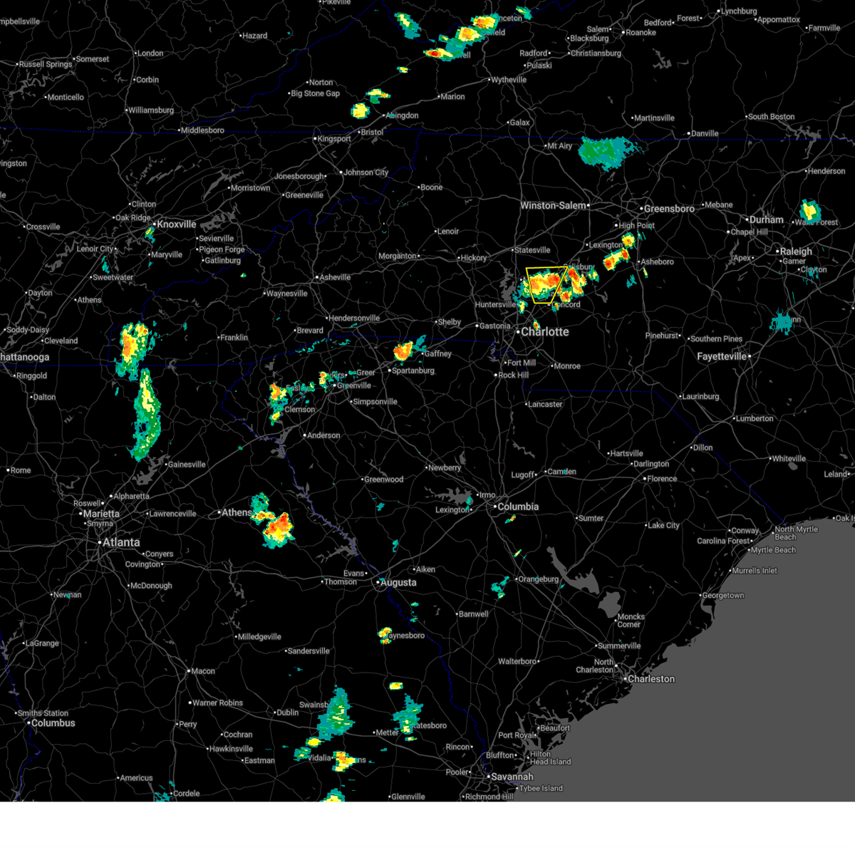 The storms which prompted the warning have weakened below severe limits, and have exited the warned area. therefore, the warning will be allowed to expire. however, heavy rain is still possible with these thunderstorms. to report severe weather to the national weather service greenville-spartanburg, call toll free, 1, 800, 2 6 7, 8 1 0 1, or post on our facebook page, or post it to x using hashtag nwsgsp. your message should describe the event and the specific location where it occurred. The storms which prompted the warning have weakened below severe limits, and have exited the warned area. therefore, the warning will be allowed to expire. however, heavy rain is still possible with these thunderstorms. to report severe weather to the national weather service greenville-spartanburg, call toll free, 1, 800, 2 6 7, 8 1 0 1, or post on our facebook page, or post it to x using hashtag nwsgsp. your message should describe the event and the specific location where it occurred.
|
| 6/29/2025 7:44 PM EDT |
 Svrgsp the national weather service in greenville-spartanburg has issued a * severe thunderstorm warning for, northwestern cabarrus county in the piedmont of north carolina, southwestern rowan county in the piedmont of north carolina, * until 830 pm edt. * at 744 pm edt, severe thunderstorms were located along a line extending from 9 miles north of downtown concord to 3 miles southwest of kannapolis, moving northeast at 15 mph (radar indicated). Hazards include 60 mph wind gusts and quarter size hail. Minor hail damage to vehicles is expected. Expect wind damage to trees and power lines. Svrgsp the national weather service in greenville-spartanburg has issued a * severe thunderstorm warning for, northwestern cabarrus county in the piedmont of north carolina, southwestern rowan county in the piedmont of north carolina, * until 830 pm edt. * at 744 pm edt, severe thunderstorms were located along a line extending from 9 miles north of downtown concord to 3 miles southwest of kannapolis, moving northeast at 15 mph (radar indicated). Hazards include 60 mph wind gusts and quarter size hail. Minor hail damage to vehicles is expected. Expect wind damage to trees and power lines.
|
| 5/4/2025 1:39 AM EDT |
 The storms which prompted the warning have weakened below severe limits, and have exited the warned area. therefore, the warning will be allowed to expire. to report severe weather to the national weather service greenville-spartanburg, call toll free, 1, 800, 2 6 7, 8 1 0 1, or post on our facebook page, or tweet it using hashtag nwsgsp. your message should describe the event and the specific location where it occurred. The storms which prompted the warning have weakened below severe limits, and have exited the warned area. therefore, the warning will be allowed to expire. to report severe weather to the national weather service greenville-spartanburg, call toll free, 1, 800, 2 6 7, 8 1 0 1, or post on our facebook page, or tweet it using hashtag nwsgsp. your message should describe the event and the specific location where it occurred.
|
| 5/4/2025 1:21 AM EDT |
 At 120 am edt, severe thunderstorms were located along a line extending from 9 miles southwest of mocksville to near kannapolis, moving northeast at 35 mph (radar indicated). Hazards include 60 mph wind gusts. Expect damage to trees and power lines. Locations impacted include, fork church, advance, piedmont research station, faith, spencer, cooleemee, cleveland, landis, salisbury, and china grove. At 120 am edt, severe thunderstorms were located along a line extending from 9 miles southwest of mocksville to near kannapolis, moving northeast at 35 mph (radar indicated). Hazards include 60 mph wind gusts. Expect damage to trees and power lines. Locations impacted include, fork church, advance, piedmont research station, faith, spencer, cooleemee, cleveland, landis, salisbury, and china grove.
|
| 5/4/2025 1:21 AM EDT |
 the severe thunderstorm warning has been cancelled and is no longer in effect the severe thunderstorm warning has been cancelled and is no longer in effect
|
| 5/4/2025 1:05 AM EDT |
 Svrgsp the national weather service in greenville-spartanburg has issued a * severe thunderstorm warning for, northwestern cabarrus county in the piedmont of north carolina, southeastern davie county in the piedmont of north carolina, southeastern iredell county in the piedmont of north carolina, north central mecklenburg county in the piedmont of north carolina, rowan county in the piedmont of north carolina, * until 145 am edt. * at 105 am edt, severe thunderstorms were located along a line extending from 10 miles southeast of statesville to 5 miles east of huntersville, moving northeast at 35 mph (radar indicated). Hazards include 60 mph wind gusts. expect damage to trees and power lines Svrgsp the national weather service in greenville-spartanburg has issued a * severe thunderstorm warning for, northwestern cabarrus county in the piedmont of north carolina, southeastern davie county in the piedmont of north carolina, southeastern iredell county in the piedmont of north carolina, north central mecklenburg county in the piedmont of north carolina, rowan county in the piedmont of north carolina, * until 145 am edt. * at 105 am edt, severe thunderstorms were located along a line extending from 10 miles southeast of statesville to 5 miles east of huntersville, moving northeast at 35 mph (radar indicated). Hazards include 60 mph wind gusts. expect damage to trees and power lines
|
| 3/5/2025 7:59 AM EST |
 Svrgsp the national weather service in greenville-spartanburg has issued a * severe thunderstorm warning for, davie county in the piedmont of north carolina, southeastern iredell county in the piedmont of north carolina, rowan county in the piedmont of north carolina, * until 830 am est. * at 758 am est, severe thunderstorms were located along a line extending from 3 miles north of mocksville to 9 miles northwest of kannapolis, moving northeast at 45 mph (radar indicated). Hazards include 60 mph wind gusts. expect damage to trees and power lines Svrgsp the national weather service in greenville-spartanburg has issued a * severe thunderstorm warning for, davie county in the piedmont of north carolina, southeastern iredell county in the piedmont of north carolina, rowan county in the piedmont of north carolina, * until 830 am est. * at 758 am est, severe thunderstorms were located along a line extending from 3 miles north of mocksville to 9 miles northwest of kannapolis, moving northeast at 45 mph (radar indicated). Hazards include 60 mph wind gusts. expect damage to trees and power lines
|
| 12/29/2024 9:50 AM EST |
 Svrgsp the national weather service in greenville-spartanburg has issued a * severe thunderstorm warning for, northeastern cabarrus county in the piedmont of north carolina, davie county in the piedmont of north carolina, northeastern iredell county in the piedmont of north carolina, rowan county in the piedmont of north carolina, * until 1045 am est. * at 950 am est, severe thunderstorms were located along a line extending from 9 miles southeast of wilkesboro to 7 miles southwest of salisbury to 14 miles southeast of downtown concord, moving northeast at 65 mph (radar indicated). Hazards include 60 mph wind gusts. expect damage to trees and power lines Svrgsp the national weather service in greenville-spartanburg has issued a * severe thunderstorm warning for, northeastern cabarrus county in the piedmont of north carolina, davie county in the piedmont of north carolina, northeastern iredell county in the piedmont of north carolina, rowan county in the piedmont of north carolina, * until 1045 am est. * at 950 am est, severe thunderstorms were located along a line extending from 9 miles southeast of wilkesboro to 7 miles southwest of salisbury to 14 miles southeast of downtown concord, moving northeast at 65 mph (radar indicated). Hazards include 60 mph wind gusts. expect damage to trees and power lines
|
| 8/2/2024 9:42 PM EDT |
 the severe thunderstorm warning has been cancelled and is no longer in effect the severe thunderstorm warning has been cancelled and is no longer in effect
|
| 8/2/2024 9:42 PM EDT |
 At 942 pm edt, a severe thunderstorm was located 4 miles south of salisbury, or near faith, moving northeast at 20 mph (radar indicated). Hazards include 60 mph wind gusts. Expect damage to trees and power lines. Locations impacted include, salisbury, china grove, spencer, granite quarry, rockwell, faith, and high rock lake. At 942 pm edt, a severe thunderstorm was located 4 miles south of salisbury, or near faith, moving northeast at 20 mph (radar indicated). Hazards include 60 mph wind gusts. Expect damage to trees and power lines. Locations impacted include, salisbury, china grove, spencer, granite quarry, rockwell, faith, and high rock lake.
|
| 8/2/2024 9:19 PM EDT |
 Svrgsp the national weather service in greenville-spartanburg has issued a * severe thunderstorm warning for, north central cabarrus county in the piedmont of north carolina, southern rowan county in the piedmont of north carolina, * until 1000 pm edt. * at 919 pm edt, a severe thunderstorm was located near kannapolis, or near landis, moving northeast at 20 mph (radar indicated). Hazards include 60 mph wind gusts and penny size hail. expect damage to trees and power lines Svrgsp the national weather service in greenville-spartanburg has issued a * severe thunderstorm warning for, north central cabarrus county in the piedmont of north carolina, southern rowan county in the piedmont of north carolina, * until 1000 pm edt. * at 919 pm edt, a severe thunderstorm was located near kannapolis, or near landis, moving northeast at 20 mph (radar indicated). Hazards include 60 mph wind gusts and penny size hail. expect damage to trees and power lines
|
| 7/18/2024 5:02 PM EDT |
 At 502 pm edt, a severe thunderstorm was located 9 miles south of lexington, or near high rock lake, moving east at 35 mph (radar indicated). Hazards include 60 mph wind gusts and penny size hail. Expect damage to trees and power lines. Locations impacted include, salisbury, china grove, spencer, granite quarry, rockwell, cleveland, faith, mount ulla, gold hill, and piedmont research station. At 502 pm edt, a severe thunderstorm was located 9 miles south of lexington, or near high rock lake, moving east at 35 mph (radar indicated). Hazards include 60 mph wind gusts and penny size hail. Expect damage to trees and power lines. Locations impacted include, salisbury, china grove, spencer, granite quarry, rockwell, cleveland, faith, mount ulla, gold hill, and piedmont research station.
|
| 7/18/2024 5:02 PM EDT |
 the severe thunderstorm warning has been cancelled and is no longer in effect the severe thunderstorm warning has been cancelled and is no longer in effect
|
| 7/18/2024 4:14 PM EDT |
 Svrgsp the national weather service in greenville-spartanburg has issued a * severe thunderstorm warning for, southeastern iredell county in the piedmont of north carolina, rowan county in the piedmont of north carolina, * until 515 pm edt. * at 414 pm edt, a severe thunderstorm was located 11 miles southeast of statesville, or 6 miles northeast of mooresville, moving east at 35 mph (radar indicated). Hazards include 60 mph wind gusts and penny size hail. expect damage to trees and power lines Svrgsp the national weather service in greenville-spartanburg has issued a * severe thunderstorm warning for, southeastern iredell county in the piedmont of north carolina, rowan county in the piedmont of north carolina, * until 515 pm edt. * at 414 pm edt, a severe thunderstorm was located 11 miles southeast of statesville, or 6 miles northeast of mooresville, moving east at 35 mph (radar indicated). Hazards include 60 mph wind gusts and penny size hail. expect damage to trees and power lines
|
| 4/11/2024 8:26 PM EDT |
 At 826 pm edt, a severe thunderstorm was located 6 miles northwest of salisbury, or 4 miles south of cooleemee, moving northeast at 45 mph (radar indicated). Hazards include 60 mph wind gusts. Expect damage to trees and power lines. Locations impacted include, salisbury, mocksville, spencer, bermuda run, cooleemee, fork church, advance, piedmont research station, farmington, and woodleaf. At 826 pm edt, a severe thunderstorm was located 6 miles northwest of salisbury, or 4 miles south of cooleemee, moving northeast at 45 mph (radar indicated). Hazards include 60 mph wind gusts. Expect damage to trees and power lines. Locations impacted include, salisbury, mocksville, spencer, bermuda run, cooleemee, fork church, advance, piedmont research station, farmington, and woodleaf.
|
| 4/11/2024 8:07 PM EDT |
 Svrgsp the national weather service in greenville-spartanburg has issued a * severe thunderstorm warning for, davie county in the piedmont of north carolina, rowan county in the piedmont of north carolina, * until 845 pm edt. * at 806 pm edt, a severe thunderstorm was located 4 miles south of mocksville, or near cooleemee, moving northeast at 45 mph (radar indicated). Hazards include 60 mph wind gusts. expect damage to trees and power lines Svrgsp the national weather service in greenville-spartanburg has issued a * severe thunderstorm warning for, davie county in the piedmont of north carolina, rowan county in the piedmont of north carolina, * until 845 pm edt. * at 806 pm edt, a severe thunderstorm was located 4 miles south of mocksville, or near cooleemee, moving northeast at 45 mph (radar indicated). Hazards include 60 mph wind gusts. expect damage to trees and power lines
|
| 4/11/2024 8:01 PM EDT |
 Svrgsp the national weather service in greenville-spartanburg has issued a * severe thunderstorm warning for, northeastern cabarrus county in the piedmont of north carolina, southeastern rowan county in the piedmont of north carolina, * until 845 pm edt. * at 801 pm edt, a severe thunderstorm was located 5 miles northeast of downtown concord, or 4 miles northwest of mt pleasant, moving northeast at 45 mph (radar indicated). Hazards include 60 mph wind gusts and nickel size hail. expect damage to trees and power lines Svrgsp the national weather service in greenville-spartanburg has issued a * severe thunderstorm warning for, northeastern cabarrus county in the piedmont of north carolina, southeastern rowan county in the piedmont of north carolina, * until 845 pm edt. * at 801 pm edt, a severe thunderstorm was located 5 miles northeast of downtown concord, or 4 miles northwest of mt pleasant, moving northeast at 45 mph (radar indicated). Hazards include 60 mph wind gusts and nickel size hail. expect damage to trees and power lines
|
| 1/9/2024 1:51 PM EST |
 At 150 pm est, severe thunderstorms were located along a line extending from 9 miles north of lexington to 9 miles east of downtown concord, moving northeast at 80 mph (radar indicated). Hazards include 70 mph wind gusts. Expect considerable tree damage. damage is likely to mobile homes, roofs, and outbuildings. locations impacted include, downtown concord, east charlotte, mint hill, pineville, harrisburg, spencer, granite quarry, rockwell, mt pleasant, and faith. thunderstorm damage threat, considerable hail threat, radar indicated max hail size, <. 75 in wind threat, radar indicated max wind gust, 70 mph. At 150 pm est, severe thunderstorms were located along a line extending from 9 miles north of lexington to 9 miles east of downtown concord, moving northeast at 80 mph (radar indicated). Hazards include 70 mph wind gusts. Expect considerable tree damage. damage is likely to mobile homes, roofs, and outbuildings. locations impacted include, downtown concord, east charlotte, mint hill, pineville, harrisburg, spencer, granite quarry, rockwell, mt pleasant, and faith. thunderstorm damage threat, considerable hail threat, radar indicated max hail size, <. 75 in wind threat, radar indicated max wind gust, 70 mph.
|
| 1/9/2024 1:37 PM EST |
 At 137 pm est, severe thunderstorms were located along a line extending from 5 miles east of mocksville to 11 miles east of uptown charlotte, moving northeast at 65 mph (radar indicated). Hazards include 70 mph wind gusts. Expect considerable tree damage. damage is likely to mobile homes, roofs, and outbuildings. locations impacted include, kannapolis, downtown concord, salisbury, mocksville, east charlotte, west concord, mint hill, pineville, harrisburg, and china grove. thunderstorm damage threat, considerable hail threat, radar indicated max hail size, <. 75 in wind threat, radar indicated max wind gust, 70 mph. At 137 pm est, severe thunderstorms were located along a line extending from 5 miles east of mocksville to 11 miles east of uptown charlotte, moving northeast at 65 mph (radar indicated). Hazards include 70 mph wind gusts. Expect considerable tree damage. damage is likely to mobile homes, roofs, and outbuildings. locations impacted include, kannapolis, downtown concord, salisbury, mocksville, east charlotte, west concord, mint hill, pineville, harrisburg, and china grove. thunderstorm damage threat, considerable hail threat, radar indicated max hail size, <. 75 in wind threat, radar indicated max wind gust, 70 mph.
|
| 1/9/2024 1:28 PM EST |
 At 128 pm est, severe thunderstorms were located along a line extending from 7 miles northeast of mocksville to 7 miles southeast of uptown charlotte, moving northeast at 85 mph (radar indicated). Hazards include 60 mph wind gusts. Expect damage to trees and power lines. locations impacted include, kannapolis, downtown concord, salisbury, mocksville, northeast charlotte, east charlotte, west concord, mint hill, pineville, and harrisburg. hail threat, radar indicated max hail size, <. 75 in wind threat, radar indicated max wind gust, 60 mph. At 128 pm est, severe thunderstorms were located along a line extending from 7 miles northeast of mocksville to 7 miles southeast of uptown charlotte, moving northeast at 85 mph (radar indicated). Hazards include 60 mph wind gusts. Expect damage to trees and power lines. locations impacted include, kannapolis, downtown concord, salisbury, mocksville, northeast charlotte, east charlotte, west concord, mint hill, pineville, and harrisburg. hail threat, radar indicated max hail size, <. 75 in wind threat, radar indicated max wind gust, 60 mph.
|
| 1/9/2024 1:10 PM EST |
 At 110 pm est, severe thunderstorms were located along a line extending from 8 miles southeast of statesville to 3 miles southwest of rock hill, moving northeast at 85 mph (radar indicated). Hazards include 60 mph wind gusts. expect damage to trees and power lines At 110 pm est, severe thunderstorms were located along a line extending from 8 miles southeast of statesville to 3 miles southwest of rock hill, moving northeast at 85 mph (radar indicated). Hazards include 60 mph wind gusts. expect damage to trees and power lines
|
| 8/24/2023 7:33 PM EDT |
 At 733 pm edt, a severe thunderstorm was located 4 miles southeast of salisbury, or near granite quarry, moving southeast at 15 mph (radar indicated). Hazards include 60 mph wind gusts and nickel size hail. expect damage to trees and power lines At 733 pm edt, a severe thunderstorm was located 4 miles southeast of salisbury, or near granite quarry, moving southeast at 15 mph (radar indicated). Hazards include 60 mph wind gusts and nickel size hail. expect damage to trees and power lines
|
| 8/24/2023 7:09 PM EDT |
 At 708 pm edt, a severe thunderstorm was located near salisbury, or near spencer, moving southeast at 15 mph (radar indicated). Hazards include 60 mph wind gusts and quarter size hail. Minor hail damage to vehicles is expected. expect wind damage to trees and power lines. locations impacted include, salisbury, spencer, granite quarry and high rock lake. hail threat, radar indicated max hail size, 1. 00 in wind threat, radar indicated max wind gust, 60 mph. At 708 pm edt, a severe thunderstorm was located near salisbury, or near spencer, moving southeast at 15 mph (radar indicated). Hazards include 60 mph wind gusts and quarter size hail. Minor hail damage to vehicles is expected. expect wind damage to trees and power lines. locations impacted include, salisbury, spencer, granite quarry and high rock lake. hail threat, radar indicated max hail size, 1. 00 in wind threat, radar indicated max wind gust, 60 mph.
|
| 8/24/2023 6:47 PM EDT |
 At 647 pm edt, a severe thunderstorm was located near salisbury, moving southeast at 15 mph (radar indicated). Hazards include 60 mph wind gusts and quarter size hail. Minor hail damage to vehicles is expected. Expect wind damage to trees and power lines. At 647 pm edt, a severe thunderstorm was located near salisbury, moving southeast at 15 mph (radar indicated). Hazards include 60 mph wind gusts and quarter size hail. Minor hail damage to vehicles is expected. Expect wind damage to trees and power lines.
|
| 8/15/2023 3:28 PM EDT |
 At 328 pm edt, a severe thunderstorm was located 8 miles southeast of salisbury, or near high rock lake, moving east at 25 mph (radar indicated). Hazards include 60 mph wind gusts and quarter size hail. Minor hail damage to vehicles is expected. Expect wind damage to trees and power lines. At 328 pm edt, a severe thunderstorm was located 8 miles southeast of salisbury, or near high rock lake, moving east at 25 mph (radar indicated). Hazards include 60 mph wind gusts and quarter size hail. Minor hail damage to vehicles is expected. Expect wind damage to trees and power lines.
|
| 8/7/2023 5:43 PM EDT |
 At 542 pm edt, severe thunderstorms were located along a line extending from 10 miles southwest of winston-salem to 6 miles south of lexington to 10 miles west of albemarle, moving east at 45 mph (radar indicated). Hazards include 70 mph wind gusts and penny size hail. Expect considerable tree damage. damage is likely to mobile homes, roofs, and outbuildings. Locations impacted include, huntersville, kannapolis, downtown concord, salisbury, mocksville, northeast charlotte, west concord, harrisburg, china grove and spencer. At 542 pm edt, severe thunderstorms were located along a line extending from 10 miles southwest of winston-salem to 6 miles south of lexington to 10 miles west of albemarle, moving east at 45 mph (radar indicated). Hazards include 70 mph wind gusts and penny size hail. Expect considerable tree damage. damage is likely to mobile homes, roofs, and outbuildings. Locations impacted include, huntersville, kannapolis, downtown concord, salisbury, mocksville, northeast charlotte, west concord, harrisburg, china grove and spencer.
|
| 8/7/2023 5:20 PM EDT |
 At 519 pm edt, severe thunderstorms were located along a line extending from 8 miles south of yadkinville to 3 miles south of mocksville to 4 miles west of salisbury to 3 miles south of downtown concord, moving east at 45 mph (radar indicated). Hazards include 70 mph wind gusts and penny size hail. Expect considerable tree damage. Damage is likely to mobile homes, roofs, and outbuildings. At 519 pm edt, severe thunderstorms were located along a line extending from 8 miles south of yadkinville to 3 miles south of mocksville to 4 miles west of salisbury to 3 miles south of downtown concord, moving east at 45 mph (radar indicated). Hazards include 70 mph wind gusts and penny size hail. Expect considerable tree damage. Damage is likely to mobile homes, roofs, and outbuildings.
|
| 8/6/2023 4:24 PM EDT |
 At 424 pm edt, severe thunderstorms were located along a line extending from 7 miles east of salisbury to 12 miles northwest of albemarle to 10 miles south of downtown concord, moving east at 15 mph (radar indicated). Hazards include 60 mph wind gusts and penny size hail. Expect damage to trees and power lines. locations impacted include, east charlotte, granite quarry, rockwell, mt pleasant, faith, midland, gold hill, high rock, reedy creek park and high rock lake. hail threat, radar indicated max hail size, 0. 75 in wind threat, radar indicated max wind gust, 60 mph. At 424 pm edt, severe thunderstorms were located along a line extending from 7 miles east of salisbury to 12 miles northwest of albemarle to 10 miles south of downtown concord, moving east at 15 mph (radar indicated). Hazards include 60 mph wind gusts and penny size hail. Expect damage to trees and power lines. locations impacted include, east charlotte, granite quarry, rockwell, mt pleasant, faith, midland, gold hill, high rock, reedy creek park and high rock lake. hail threat, radar indicated max hail size, 0. 75 in wind threat, radar indicated max wind gust, 60 mph.
|
| 8/6/2023 4:06 PM EDT |
 At 406 pm edt, severe thunderstorms were located along a line extending from 3 miles east of salisbury to 8 miles east of downtown concord to 10 miles east of uptown charlotte, moving east at 20 mph (radar indicated). Hazards include 60 mph wind gusts and penny size hail. expect damage to trees and power lines At 406 pm edt, severe thunderstorms were located along a line extending from 3 miles east of salisbury to 8 miles east of downtown concord to 10 miles east of uptown charlotte, moving east at 20 mph (radar indicated). Hazards include 60 mph wind gusts and penny size hail. expect damage to trees and power lines
|
| 7/29/2023 8:08 PM EDT |
 At 807 pm edt, severe thunderstorms were located along a line extending from 12 miles southwest of mocksville to 8 miles south of statesville, moving east at 20 mph (radar indicated). Hazards include 60 mph wind gusts and nickel size hail. expect damage to trees and power lines At 807 pm edt, severe thunderstorms were located along a line extending from 12 miles southwest of mocksville to 8 miles south of statesville, moving east at 20 mph (radar indicated). Hazards include 60 mph wind gusts and nickel size hail. expect damage to trees and power lines
|
| 7/9/2023 11:55 AM EDT |
 At 1155 am edt, a severe thunderstorm was located 8 miles east of salisbury, or near high rock lake, moving east at 35 mph (radar indicated). Hazards include 60 mph wind gusts. expect damage to trees and power lines At 1155 am edt, a severe thunderstorm was located 8 miles east of salisbury, or near high rock lake, moving east at 35 mph (radar indicated). Hazards include 60 mph wind gusts. expect damage to trees and power lines
|
| 6/26/2023 9:59 PM EDT |
 At 959 pm edt, a severe thunderstorm was located 9 miles northwest of kannapolis, or 5 miles east of mooresville, moving east at 30 mph (radar indicated). Hazards include 60 mph wind gusts and quarter size hail. Minor hail damage to vehicles is expected. Expect wind damage to trees and power lines. At 959 pm edt, a severe thunderstorm was located 9 miles northwest of kannapolis, or 5 miles east of mooresville, moving east at 30 mph (radar indicated). Hazards include 60 mph wind gusts and quarter size hail. Minor hail damage to vehicles is expected. Expect wind damage to trees and power lines.
|
| 6/26/2023 9:44 PM EDT |
 At 944 pm edt, a severe thunderstorm was located 8 miles west of salisbury, or 4 miles southeast of cleveland, moving east at 25 mph (radar indicated). Hazards include 60 mph wind gusts and quarter size hail. Minor hail damage to vehicles is expected. Expect wind damage to trees and power lines. At 944 pm edt, a severe thunderstorm was located 8 miles west of salisbury, or 4 miles southeast of cleveland, moving east at 25 mph (radar indicated). Hazards include 60 mph wind gusts and quarter size hail. Minor hail damage to vehicles is expected. Expect wind damage to trees and power lines.
|
| 6/26/2023 9:01 PM EDT |
 At 901 pm edt, a severe thunderstorm was located near salisbury, or over spencer, moving northeast at 15 mph (radar indicated). Hazards include 70 mph wind gusts and quarter size hail. Minor hail damage to vehicles is expected. expect considerable tree damage. Wind damage is also likely to mobile homes, roofs, and outbuildings. At 901 pm edt, a severe thunderstorm was located near salisbury, or over spencer, moving northeast at 15 mph (radar indicated). Hazards include 70 mph wind gusts and quarter size hail. Minor hail damage to vehicles is expected. expect considerable tree damage. Wind damage is also likely to mobile homes, roofs, and outbuildings.
|
| 6/26/2023 8:10 PM EDT |
 At 810 pm edt, a severe thunderstorm was located 6 miles west of salisbury, moving east at 25 mph (radar indicated). Hazards include 60 mph wind gusts and quarter size hail. Minor hail damage to vehicles is expected. Expect wind damage to trees and power lines. At 810 pm edt, a severe thunderstorm was located 6 miles west of salisbury, moving east at 25 mph (radar indicated). Hazards include 60 mph wind gusts and quarter size hail. Minor hail damage to vehicles is expected. Expect wind damage to trees and power lines.
|
| 6/19/2023 6:46 PM EDT |
 At 646 pm edt, a severe thunderstorm capable of producing a tornado was located 7 miles west of salisbury, or 5 miles north of china grove, moving northeast at 20 mph (radar indicated rotation). Hazards include tornado. Flying debris will be dangerous to those caught without shelter. mobile homes will be damaged or destroyed. damage to roofs, windows, and vehicles will occur. tree damage is likely. this dangerous storm will be near, granite quarry around 710 pm edt. salisbury and spencer around 720 pm edt. Other locations impacted by this tornadic thunderstorm include piedmont research station. At 646 pm edt, a severe thunderstorm capable of producing a tornado was located 7 miles west of salisbury, or 5 miles north of china grove, moving northeast at 20 mph (radar indicated rotation). Hazards include tornado. Flying debris will be dangerous to those caught without shelter. mobile homes will be damaged or destroyed. damage to roofs, windows, and vehicles will occur. tree damage is likely. this dangerous storm will be near, granite quarry around 710 pm edt. salisbury and spencer around 720 pm edt. Other locations impacted by this tornadic thunderstorm include piedmont research station.
|
| 6/19/2023 6:25 PM EDT |
 At 625 pm edt, a severe thunderstorm capable of producing a tornado was located 7 miles northwest of kannapolis, or 5 miles north of enochville, moving northeast at 15 mph (radar indicated rotation). Hazards include tornado. Flying debris will be dangerous to those caught without shelter. mobile homes will be damaged or destroyed. damage to roofs, windows, and vehicles will occur. tree damage is likely. this dangerous storm will be near, landis around 630 pm edt. china grove around 650 pm edt. granite quarry and faith around 720 pm edt. salisbury and spencer around 730 pm edt. Other locations impacted by this dangerous thunderstorm include mount ulla and piedmont research station. At 625 pm edt, a severe thunderstorm capable of producing a tornado was located 7 miles northwest of kannapolis, or 5 miles north of enochville, moving northeast at 15 mph (radar indicated rotation). Hazards include tornado. Flying debris will be dangerous to those caught without shelter. mobile homes will be damaged or destroyed. damage to roofs, windows, and vehicles will occur. tree damage is likely. this dangerous storm will be near, landis around 630 pm edt. china grove around 650 pm edt. granite quarry and faith around 720 pm edt. salisbury and spencer around 730 pm edt. Other locations impacted by this dangerous thunderstorm include mount ulla and piedmont research station.
|
| 4/6/2023 8:57 PM EDT |
 At 857 pm edt, a severe thunderstorm was located 11 miles southeast of statesville, or near mooresville, moving northeast at 30 mph (radar indicated). Hazards include 60 mph wind gusts and quarter size hail. Minor hail damage to vehicles is expected. expect wind damage to trees and power lines. locations impacted include, salisbury, mooresville, china grove, spencer, granite quarry, cooleemee, cleveland, lake norman state park, mount ulla and piedmont research station. hail threat, radar indicated max hail size, 1. 00 in wind threat, radar indicated max wind gust, 60 mph. At 857 pm edt, a severe thunderstorm was located 11 miles southeast of statesville, or near mooresville, moving northeast at 30 mph (radar indicated). Hazards include 60 mph wind gusts and quarter size hail. Minor hail damage to vehicles is expected. expect wind damage to trees and power lines. locations impacted include, salisbury, mooresville, china grove, spencer, granite quarry, cooleemee, cleveland, lake norman state park, mount ulla and piedmont research station. hail threat, radar indicated max hail size, 1. 00 in wind threat, radar indicated max wind gust, 60 mph.
|
| 4/6/2023 8:44 PM EDT |
 At 844 pm edt, a severe thunderstorm was located 12 miles north of huntersville, or near lake norman, moving northeast at 30 mph (radar indicated). Hazards include 60 mph wind gusts and quarter size hail. Minor hail damage to vehicles is expected. Expect wind damage to trees and power lines. At 844 pm edt, a severe thunderstorm was located 12 miles north of huntersville, or near lake norman, moving northeast at 30 mph (radar indicated). Hazards include 60 mph wind gusts and quarter size hail. Minor hail damage to vehicles is expected. Expect wind damage to trees and power lines.
|
| 1/12/2023 7:24 PM EST |
 The severe thunderstorm warning for southeastern rowan county will expire at 730 pm est, the storms which prompted the warning have moved out of the area. therefore, the warning will be allowed to expire. however heavy rain is still possible with these thunderstorms. a tornado watch remains in effect until 1000 pm est for the piedmont of north carolina. The severe thunderstorm warning for southeastern rowan county will expire at 730 pm est, the storms which prompted the warning have moved out of the area. therefore, the warning will be allowed to expire. however heavy rain is still possible with these thunderstorms. a tornado watch remains in effect until 1000 pm est for the piedmont of north carolina.
|
| 1/12/2023 6:58 PM EST |
 At 658 pm est, severe thunderstorms were located along a line extending from 6 miles northeast of salisbury to 8 miles east of kannapolis, moving east at 50 mph (radar indicated). Hazards include 60 mph wind gusts and penny size hail. expect damage to trees and power lines At 658 pm est, severe thunderstorms were located along a line extending from 6 miles northeast of salisbury to 8 miles east of kannapolis, moving east at 50 mph (radar indicated). Hazards include 60 mph wind gusts and penny size hail. expect damage to trees and power lines
|
| 1/12/2023 6:18 PM EST |
 At 618 pm est, severe thunderstorms were located along a line extending from 13 miles east of taylorsville to 6 miles southwest of statesville to 13 miles northwest of huntersville, moving northeast at 65 mph (radar indicated). Hazards include 60 mph wind gusts and quarter size hail. Minor hail damage to vehicles is expected. Expect wind damage to trees and power lines. At 618 pm est, severe thunderstorms were located along a line extending from 13 miles east of taylorsville to 6 miles southwest of statesville to 13 miles northwest of huntersville, moving northeast at 65 mph (radar indicated). Hazards include 60 mph wind gusts and quarter size hail. Minor hail damage to vehicles is expected. Expect wind damage to trees and power lines.
|
| 7/24/2022 3:56 PM EDT |
 At 356 pm edt, a severe thunderstorm was located 4 miles north of salisbury, or near spencer, moving northeast at 5 mph (radar indicated). Hazards include 60 mph wind gusts and penny size hail. Expect damage to trees and power lines. locations impacted include, salisbury, spencer, high rock lake, woodleaf, cooleemee, granite quarry and fork church. hail threat, radar indicated max hail size, 0. 75 in wind threat, radar indicated max wind gust, 60 mph. At 356 pm edt, a severe thunderstorm was located 4 miles north of salisbury, or near spencer, moving northeast at 5 mph (radar indicated). Hazards include 60 mph wind gusts and penny size hail. Expect damage to trees and power lines. locations impacted include, salisbury, spencer, high rock lake, woodleaf, cooleemee, granite quarry and fork church. hail threat, radar indicated max hail size, 0. 75 in wind threat, radar indicated max wind gust, 60 mph.
|
| 7/24/2022 3:42 PM EDT |
 The severe thunderstorm warning for southwestern rowan county will expire at 345 pm edt, the first storm which prompted the warning for rowan county has weakened below severe limits, and no longer poses an immediate threat to life or property. therefore, the warning will be allowed to expire. however, gusty winds and heavy rain are still possible with this thunderstorm. The severe thunderstorm warning for southwestern rowan county will expire at 345 pm edt, the first storm which prompted the warning for rowan county has weakened below severe limits, and no longer poses an immediate threat to life or property. therefore, the warning will be allowed to expire. however, gusty winds and heavy rain are still possible with this thunderstorm.
|
| 7/24/2022 3:38 PM EDT |
 At 337 pm edt, a severe thunderstorm was located near salisbury, moving northeast at 5 mph (radar indicated). Hazards include 60 mph wind gusts and quarter size hail. Minor hail damage to vehicles is expected. Expect wind damage to trees and power lines. At 337 pm edt, a severe thunderstorm was located near salisbury, moving northeast at 5 mph (radar indicated). Hazards include 60 mph wind gusts and quarter size hail. Minor hail damage to vehicles is expected. Expect wind damage to trees and power lines.
|
| 7/24/2022 3:25 PM EDT |
 At 325 pm edt, a severe thunderstorm was located 7 miles northwest of kannapolis, or 4 miles northwest of landis, and is nearly stationary (radar indicated). Hazards include 60 mph wind gusts and penny size hail. Expect damage to trees and power lines. locations impacted include, salisbury, china grove, landis, granite quarry, cleveland, faith, piedmont research station, spencer, enochville and kannapolis. hail threat, radar indicated max hail size, 0. 75 in wind threat, radar indicated max wind gust, 60 mph. At 325 pm edt, a severe thunderstorm was located 7 miles northwest of kannapolis, or 4 miles northwest of landis, and is nearly stationary (radar indicated). Hazards include 60 mph wind gusts and penny size hail. Expect damage to trees and power lines. locations impacted include, salisbury, china grove, landis, granite quarry, cleveland, faith, piedmont research station, spencer, enochville and kannapolis. hail threat, radar indicated max hail size, 0. 75 in wind threat, radar indicated max wind gust, 60 mph.
|
| 7/24/2022 3:03 PM EDT |
 At 302 pm edt, a severe thunderstorm was located 7 miles north of kannapolis, or near china grove, and is nearly stationary (radar indicated). Hazards include 60 mph wind gusts and quarter size hail. Minor hail damage to vehicles is expected. Expect wind damage to trees and power lines. At 302 pm edt, a severe thunderstorm was located 7 miles north of kannapolis, or near china grove, and is nearly stationary (radar indicated). Hazards include 60 mph wind gusts and quarter size hail. Minor hail damage to vehicles is expected. Expect wind damage to trees and power lines.
|
| 7/23/2022 10:52 PM EDT |
 The severe thunderstorm warning for eastern catawba, davie, iredell and rowan counties will expire at 1100 pm edt, the storms which prompted the warning have weakened below severe limits, and no longer pose an immediate threat to life or property. therefore, the warning will be allowed to expire. however gusty winds to 35 mph are still possible with the lingering thunderstorm outflows. The severe thunderstorm warning for eastern catawba, davie, iredell and rowan counties will expire at 1100 pm edt, the storms which prompted the warning have weakened below severe limits, and no longer pose an immediate threat to life or property. therefore, the warning will be allowed to expire. however gusty winds to 35 mph are still possible with the lingering thunderstorm outflows.
|
| 7/23/2022 10:31 PM EDT |
 At 1031 pm edt, severe thunderstorms were located along a line extending from 7 miles northwest of lexington to 11 miles west of salisbury to 10 miles southwest of statesville, moving south at 30 mph (radar indicated). Hazards include 60 mph wind gusts. Expect damage to trees and power lines. locations impacted include, salisbury, statesville, mocksville, mooresville, china grove, spencer, landis, enochville, granite quarry and rockwell. hail threat, radar indicated max hail size, <. 75 in wind threat, radar indicated max wind gust, 60 mph. At 1031 pm edt, severe thunderstorms were located along a line extending from 7 miles northwest of lexington to 11 miles west of salisbury to 10 miles southwest of statesville, moving south at 30 mph (radar indicated). Hazards include 60 mph wind gusts. Expect damage to trees and power lines. locations impacted include, salisbury, statesville, mocksville, mooresville, china grove, spencer, landis, enochville, granite quarry and rockwell. hail threat, radar indicated max hail size, <. 75 in wind threat, radar indicated max wind gust, 60 mph.
|
| 7/23/2022 10:11 PM EDT |
 At 1011 pm edt, severe thunderstorms were located along a line extending from 10 miles southwest of winston-salem to 11 miles southwest of mocksville to 8 miles west of statesville, moving south at 35 mph (radar indicated). Hazards include 60 mph wind gusts and penny size hail. expect damage to trees and power lines At 1011 pm edt, severe thunderstorms were located along a line extending from 10 miles southwest of winston-salem to 11 miles southwest of mocksville to 8 miles west of statesville, moving south at 35 mph (radar indicated). Hazards include 60 mph wind gusts and penny size hail. expect damage to trees and power lines
|
| 7/16/2022 1:31 PM EDT |
 At 131 pm edt, a severe thunderstorm was located 4 miles southeast of salisbury, or over granite quarry, moving southeast at 10 mph (radar indicated). Hazards include 60 mph wind gusts and quarter size hail. Minor hail damage to vehicles is expected. Expect wind damage to trees and power lines. At 131 pm edt, a severe thunderstorm was located 4 miles southeast of salisbury, or over granite quarry, moving southeast at 10 mph (radar indicated). Hazards include 60 mph wind gusts and quarter size hail. Minor hail damage to vehicles is expected. Expect wind damage to trees and power lines.
|
| 7/5/2022 7:24 PM EDT |
 At 723 pm edt, severe thunderstorms were located along a line extending from 15 miles southwest of hickory to 5 miles northwest of salisbury, moving south at 15 mph (radar indicated). Hazards include 60 mph wind gusts and quarter size hail. Minor hail damage to vehicles is expected. Expect wind damage to trees and power lines. At 723 pm edt, severe thunderstorms were located along a line extending from 15 miles southwest of hickory to 5 miles northwest of salisbury, moving south at 15 mph (radar indicated). Hazards include 60 mph wind gusts and quarter size hail. Minor hail damage to vehicles is expected. Expect wind damage to trees and power lines.
|
| 6/17/2022 5:40 PM EDT |
 At 540 pm edt, a severe thunderstorm was located 4 miles east of salisbury, or near spencer, moving southeast at 25 mph (radar indicated). Hazards include 60 mph wind gusts and quarter size hail. Minor hail damage to vehicles is expected. Expect wind damage to trees and power lines. At 540 pm edt, a severe thunderstorm was located 4 miles east of salisbury, or near spencer, moving southeast at 25 mph (radar indicated). Hazards include 60 mph wind gusts and quarter size hail. Minor hail damage to vehicles is expected. Expect wind damage to trees and power lines.
|
| 6/16/2022 3:57 PM EDT |
 The severe thunderstorm warning for southeastern rowan county will expire at 400 pm edt, the storm which prompted the warning has moved out of the area. therefore, the warning will be allowed to expire. a severe thunderstorm watch remains in effect until 900 pm edt for the piedmont of north carolina. remember, a severe thunderstorm warning still remains in effect for southern rowan county until 4:15 pm edt. The severe thunderstorm warning for southeastern rowan county will expire at 400 pm edt, the storm which prompted the warning has moved out of the area. therefore, the warning will be allowed to expire. a severe thunderstorm watch remains in effect until 900 pm edt for the piedmont of north carolina. remember, a severe thunderstorm warning still remains in effect for southern rowan county until 4:15 pm edt.
|
| 6/16/2022 3:14 PM EDT |
 At 314 pm edt, a severe thunderstorm was located 5 miles east of salisbury, or near spencer, and is nearly stationary (radar indicated). Hazards include 60 mph wind gusts and quarter size hail. Minor hail damage to vehicles is expected. Expect wind damage to trees and power lines. At 314 pm edt, a severe thunderstorm was located 5 miles east of salisbury, or near spencer, and is nearly stationary (radar indicated). Hazards include 60 mph wind gusts and quarter size hail. Minor hail damage to vehicles is expected. Expect wind damage to trees and power lines.
|
| 5/26/2022 9:41 PM EDT |
 The severe thunderstorm warning for cabarrus, davie, southeastern iredell, mecklenburg, rowan and northeastern york counties will expire at 945 pm edt, the storms which prompted the warning have weakened below severe limits, and no longer pose an immediate threat to life or property. therefore, the warning will be allowed to expire. a severe thunderstorm watch remains in effect until 1000 pm edt for the piedmont of north carolina, and upstate south carolina. The severe thunderstorm warning for cabarrus, davie, southeastern iredell, mecklenburg, rowan and northeastern york counties will expire at 945 pm edt, the storms which prompted the warning have weakened below severe limits, and no longer pose an immediate threat to life or property. therefore, the warning will be allowed to expire. a severe thunderstorm watch remains in effect until 1000 pm edt for the piedmont of north carolina, and upstate south carolina.
|
| 5/26/2022 9:17 PM EDT |
 At 916 pm edt, severe thunderstorms were located along a line extending from near east bend to near mocksville to 8 miles northwest of kannapolis to 10 miles northwest of indian land, moving northeast at 35 mph (radar indicated). Hazards include 60 mph wind gusts and quarter size hail. Minor hail damage to vehicles is expected. expect wind damage to trees and power lines. locations impacted include, uptown charlotte, huntersville, kannapolis, downtown concord, salisbury, mocksville, central charlotte, northeast charlotte, southwest charlotte and east charlotte. hail threat, radar indicated max hail size, 1. 00 in wind threat, radar indicated max wind gust, 60 mph. At 916 pm edt, severe thunderstorms were located along a line extending from near east bend to near mocksville to 8 miles northwest of kannapolis to 10 miles northwest of indian land, moving northeast at 35 mph (radar indicated). Hazards include 60 mph wind gusts and quarter size hail. Minor hail damage to vehicles is expected. expect wind damage to trees and power lines. locations impacted include, uptown charlotte, huntersville, kannapolis, downtown concord, salisbury, mocksville, central charlotte, northeast charlotte, southwest charlotte and east charlotte. hail threat, radar indicated max hail size, 1. 00 in wind threat, radar indicated max wind gust, 60 mph.
|
| 5/26/2022 8:45 PM EDT |
 At 845 pm edt, severe thunderstorms were located along a line extending from 6 miles south of yadkinville to 7 miles west of mocksville to 9 miles north of huntersville to 11 miles southwest of uptown charlotte, moving northeast at 30 mph (radar indicated). Hazards include 60 mph wind gusts and quarter size hail. Minor hail damage to vehicles is expected. Expect wind damage to trees and power lines. At 845 pm edt, severe thunderstorms were located along a line extending from 6 miles south of yadkinville to 7 miles west of mocksville to 9 miles north of huntersville to 11 miles southwest of uptown charlotte, moving northeast at 30 mph (radar indicated). Hazards include 60 mph wind gusts and quarter size hail. Minor hail damage to vehicles is expected. Expect wind damage to trees and power lines.
|
| 5/21/2022 4:13 PM EDT |
 At 412 pm edt, a severe thunderstorm was located 4 miles west of salisbury, moving northeast at 20 mph (radar indicated). Hazards include 60 mph wind gusts and quarter size hail. Minor hail damage to vehicles is expected. Expect wind damage to trees and power lines. At 412 pm edt, a severe thunderstorm was located 4 miles west of salisbury, moving northeast at 20 mph (radar indicated). Hazards include 60 mph wind gusts and quarter size hail. Minor hail damage to vehicles is expected. Expect wind damage to trees and power lines.
|
| 5/21/2022 4:00 PM EDT |
 At 400 pm edt, a severe thunderstorm was located near salisbury, or near faith, moving northeast at 20 mph (radar indicated). Hazards include 60 mph wind gusts and quarter size hail. Minor hail damage to vehicles is expected. expect wind damage to trees and power lines. locations impacted include, salisbury, china grove, spencer, landis, granite quarry, rockwell, faith, high rock lake, enochville and kannapolis. hail threat, radar indicated max hail size, 1. 00 in wind threat, radar indicated max wind gust, 60 mph. At 400 pm edt, a severe thunderstorm was located near salisbury, or near faith, moving northeast at 20 mph (radar indicated). Hazards include 60 mph wind gusts and quarter size hail. Minor hail damage to vehicles is expected. expect wind damage to trees and power lines. locations impacted include, salisbury, china grove, spencer, landis, granite quarry, rockwell, faith, high rock lake, enochville and kannapolis. hail threat, radar indicated max hail size, 1. 00 in wind threat, radar indicated max wind gust, 60 mph.
|
| 5/21/2022 3:47 PM EDT |
 At 347 pm edt, a severe thunderstorm was located 5 miles northeast of kannapolis, or near china grove, moving northeast at 20 mph (radar indicated). Hazards include 60 mph wind gusts and quarter size hail. Minor hail damage to vehicles is expected. Expect wind damage to trees and power lines. At 347 pm edt, a severe thunderstorm was located 5 miles northeast of kannapolis, or near china grove, moving northeast at 20 mph (radar indicated). Hazards include 60 mph wind gusts and quarter size hail. Minor hail damage to vehicles is expected. Expect wind damage to trees and power lines.
|
| 8/13/2021 11:56 PM EDT |
 The severe thunderstorm warning for eastern davie and western rowan counties will expire at midnight edt, the storm which prompted the warning has weakened below severe limits, and no longer poses an immediate threat to life or property. therefore, the warning will be allowed to expire. however, additional thunderstorms are redeveloping to the southwest of the area, and these may pose a threat of hail, gusty winds, and heavy rainfall over the next hour. The severe thunderstorm warning for eastern davie and western rowan counties will expire at midnight edt, the storm which prompted the warning has weakened below severe limits, and no longer poses an immediate threat to life or property. therefore, the warning will be allowed to expire. however, additional thunderstorms are redeveloping to the southwest of the area, and these may pose a threat of hail, gusty winds, and heavy rainfall over the next hour.
|
| 8/13/2021 11:37 PM EDT |
 At 1136 pm edt, a severe thunderstorm was located 5 miles northwest of salisbury, moving northeast at 15 mph (radar indicated). Hazards include 60 mph wind gusts and quarter size hail. Minor hail damage to vehicles is expected. expect wind damage to trees and power lines. locations impacted include, salisbury, mocksville, spencer, bermuda run, cooleemee, cleveland, fork church, advance, piedmont research station and woodleaf. hail threat, radar indicated max hail size, 1. 00 in wind threat, radar indicated max wind gust, 60 mph. At 1136 pm edt, a severe thunderstorm was located 5 miles northwest of salisbury, moving northeast at 15 mph (radar indicated). Hazards include 60 mph wind gusts and quarter size hail. Minor hail damage to vehicles is expected. expect wind damage to trees and power lines. locations impacted include, salisbury, mocksville, spencer, bermuda run, cooleemee, cleveland, fork church, advance, piedmont research station and woodleaf. hail threat, radar indicated max hail size, 1. 00 in wind threat, radar indicated max wind gust, 60 mph.
|
| 8/13/2021 11:15 PM EDT |
 At 1115 pm edt, a severe thunderstorm was located 7 miles west of salisbury, or 6 miles southeast of cleveland, moving northeast at 35 mph (radar indicated). Hazards include 60 mph wind gusts and quarter size hail. Minor hail damage to vehicles is expected. Expect wind damage to trees and power lines. At 1115 pm edt, a severe thunderstorm was located 7 miles west of salisbury, or 6 miles southeast of cleveland, moving northeast at 35 mph (radar indicated). Hazards include 60 mph wind gusts and quarter size hail. Minor hail damage to vehicles is expected. Expect wind damage to trees and power lines.
|
| 5/29/2021 4:27 PM EDT |
 The severe thunderstorm warning for southeastern rowan county will expire at 430 pm edt, the storm which prompted the warning has moved out of the area. therefore the warning will be allowed to expire. The severe thunderstorm warning for southeastern rowan county will expire at 430 pm edt, the storm which prompted the warning has moved out of the area. therefore the warning will be allowed to expire.
|
| 5/29/2021 4:09 PM EDT |
 At 409 pm edt, a severe thunderstorm was located 8 miles southwest of lexington, or near high rock lake, moving northeast at 25 mph (radar indicated). Hazards include ping pong ball size hail and 60 mph wind gusts. People and animals outdoors will be injured. expect hail damage to roofs, siding, windows, and vehicles. expect wind damage to trees and power lines. Locations impacted include, spencer, high rock lake and salisbury. At 409 pm edt, a severe thunderstorm was located 8 miles southwest of lexington, or near high rock lake, moving northeast at 25 mph (radar indicated). Hazards include ping pong ball size hail and 60 mph wind gusts. People and animals outdoors will be injured. expect hail damage to roofs, siding, windows, and vehicles. expect wind damage to trees and power lines. Locations impacted include, spencer, high rock lake and salisbury.
|
| 5/29/2021 3:53 PM EDT |
 At 353 pm edt, a severe thunderstorm was located near salisbury, or near granite quarry, moving northeast at 25 mph (radar indicated). Hazards include 60 mph wind gusts and half dollar size hail. Minor hail damage to vehicles is expected. Expect wind damage to trees and power lines. At 353 pm edt, a severe thunderstorm was located near salisbury, or near granite quarry, moving northeast at 25 mph (radar indicated). Hazards include 60 mph wind gusts and half dollar size hail. Minor hail damage to vehicles is expected. Expect wind damage to trees and power lines.
|
| 5/10/2021 8:05 PM EDT |
 The severe thunderstorm warning for southeastern rowan county will expire at 815 pm edt, the storm which prompted the warning has weakened below severe limits, and no longer poses an immediate threat to life or property. therefore the warning will be allowed to expire. however small hail and gusty winds are still possible with this thunderstorm. The severe thunderstorm warning for southeastern rowan county will expire at 815 pm edt, the storm which prompted the warning has weakened below severe limits, and no longer poses an immediate threat to life or property. therefore the warning will be allowed to expire. however small hail and gusty winds are still possible with this thunderstorm.
|
| 5/10/2021 7:49 PM EDT |
 At 748 pm edt, a severe thunderstorm was located 5 miles southeast of salisbury, or near granite quarry, moving east at 20 mph (radar indicated). Hazards include 60 mph wind gusts and quarter size hail. Minor hail damage to vehicles is expected. expect wind damage to trees and power lines. Locations impacted include, salisbury, spencer, granite quarry, rockwell, faith, high rock lake, gold hill and high rock. At 748 pm edt, a severe thunderstorm was located 5 miles southeast of salisbury, or near granite quarry, moving east at 20 mph (radar indicated). Hazards include 60 mph wind gusts and quarter size hail. Minor hail damage to vehicles is expected. expect wind damage to trees and power lines. Locations impacted include, salisbury, spencer, granite quarry, rockwell, faith, high rock lake, gold hill and high rock.
|
| 5/10/2021 7:23 PM EDT |
 At 723 pm edt, a severe thunderstorm was located near salisbury, moving east at 15 mph (radar indicated). Hazards include 60 mph wind gusts and quarter size hail. Minor hail damage to vehicles is expected. Expect wind damage to trees and power lines. At 723 pm edt, a severe thunderstorm was located near salisbury, moving east at 15 mph (radar indicated). Hazards include 60 mph wind gusts and quarter size hail. Minor hail damage to vehicles is expected. Expect wind damage to trees and power lines.
|
| 8/28/2020 6:39 PM EDT |
 At 639 pm edt, a severe thunderstorm was located 7 miles south of salisbury, or near faith, moving northeast at 35 mph (radar indicated). Hazards include 60 mph wind gusts. expect damage to trees and power lines At 639 pm edt, a severe thunderstorm was located 7 miles south of salisbury, or near faith, moving northeast at 35 mph (radar indicated). Hazards include 60 mph wind gusts. expect damage to trees and power lines
|
| 7/18/2020 6:26 PM EDT |
 The severe thunderstorm warning for cabarrus and southeastern rowan counties will expire at 630 pm edt, the storm which prompted the warning has moved out of the area. therefore the warning will be allowed to expire. however gusty winds and heavy rain are still possible with this thunderstorm. The severe thunderstorm warning for cabarrus and southeastern rowan counties will expire at 630 pm edt, the storm which prompted the warning has moved out of the area. therefore the warning will be allowed to expire. however gusty winds and heavy rain are still possible with this thunderstorm.
|
| 7/18/2020 5:38 PM EDT |
 At 538 pm edt, a severe thunderstorm was located 4 miles northeast of downtown concord, moving southeast at 10 mph (radar indicated). Hazards include 60 mph wind gusts and quarter size hail. Minor hail damage to vehicles is expected. Expect wind damage to trees and power lines. At 538 pm edt, a severe thunderstorm was located 4 miles northeast of downtown concord, moving southeast at 10 mph (radar indicated). Hazards include 60 mph wind gusts and quarter size hail. Minor hail damage to vehicles is expected. Expect wind damage to trees and power lines.
|
| 7/10/2020 8:18 PM EDT |
 At 817 pm edt, a severe thunderstorm was located near salisbury, or near granite quarry, moving southeast at 25 mph (radar indicated). Hazards include 60 mph wind gusts and quarter size hail. Minor hail damage to vehicles is expected. expect wind damage to trees and power lines. Locations impacted include, salisbury, china grove, spencer, landis, granite quarry, rockwell, faith, high rock lake, gold hill and high rock. At 817 pm edt, a severe thunderstorm was located near salisbury, or near granite quarry, moving southeast at 25 mph (radar indicated). Hazards include 60 mph wind gusts and quarter size hail. Minor hail damage to vehicles is expected. expect wind damage to trees and power lines. Locations impacted include, salisbury, china grove, spencer, landis, granite quarry, rockwell, faith, high rock lake, gold hill and high rock.
|
| 7/10/2020 8:08 PM EDT |
 At 808 pm edt, a severe thunderstorm was located over salisbury, moving southeast at 25 mph (radar indicated). Hazards include 60 mph wind gusts and quarter size hail. Minor hail damage to vehicles is expected. Expect wind damage to trees and power lines. At 808 pm edt, a severe thunderstorm was located over salisbury, moving southeast at 25 mph (radar indicated). Hazards include 60 mph wind gusts and quarter size hail. Minor hail damage to vehicles is expected. Expect wind damage to trees and power lines.
|
| 6/22/2020 7:20 PM EDT |
 At 719 pm edt, severe thunderstorms were located along a line extending from 7 miles southwest of salisbury to 5 miles east of downtown concord to 14 miles east of uptown charlotte, moving east at 35 mph (radar indicated). Hazards include 60 mph wind gusts and penny size hail. Expect damage to trees and power lines. Locations impacted include, kannapolis, downtown concord, salisbury, west concord, mint hill, harrisburg, china grove, spencer, landis and enochville. At 719 pm edt, severe thunderstorms were located along a line extending from 7 miles southwest of salisbury to 5 miles east of downtown concord to 14 miles east of uptown charlotte, moving east at 35 mph (radar indicated). Hazards include 60 mph wind gusts and penny size hail. Expect damage to trees and power lines. Locations impacted include, kannapolis, downtown concord, salisbury, west concord, mint hill, harrisburg, china grove, spencer, landis and enochville.
|
| 6/22/2020 7:07 PM EDT |
 At 706 pm edt, severe thunderstorms were located along a line extending from 6 miles northwest of kannapolis to 3 miles southwest of downtown concord to 8 miles southeast of uptown charlotte, moving east at 35 mph (radar indicated). Hazards include 60 mph wind gusts and quarter size hail. Minor hail damage to vehicles is expected. expect wind damage to trees and power lines. Locations impacted include, kannapolis, downtown concord, salisbury, east charlotte, west concord, mint hill, harrisburg, china grove, spencer and landis. At 706 pm edt, severe thunderstorms were located along a line extending from 6 miles northwest of kannapolis to 3 miles southwest of downtown concord to 8 miles southeast of uptown charlotte, moving east at 35 mph (radar indicated). Hazards include 60 mph wind gusts and quarter size hail. Minor hail damage to vehicles is expected. expect wind damage to trees and power lines. Locations impacted include, kannapolis, downtown concord, salisbury, east charlotte, west concord, mint hill, harrisburg, china grove, spencer and landis.
|
| 6/22/2020 6:48 PM EDT |
 At 647 pm edt, severe thunderstorms were located along a line extending from 14 miles west of kannapolis to 5 miles south of huntersville to 6 miles southwest of uptown charlotte, moving east at 35 mph (radar indicated). Hazards include 60 mph wind gusts and quarter size hail. Minor hail damage to vehicles is expected. Expect wind damage to trees and power lines. At 647 pm edt, severe thunderstorms were located along a line extending from 14 miles west of kannapolis to 5 miles south of huntersville to 6 miles southwest of uptown charlotte, moving east at 35 mph (radar indicated). Hazards include 60 mph wind gusts and quarter size hail. Minor hail damage to vehicles is expected. Expect wind damage to trees and power lines.
|
| 4/13/2020 5:51 AM EDT |
 The severe thunderstorm warning for cabarrus, central davie, mecklenburg, rowan, union, chester and southeastern york counties will expire at 600 am edt, the storms which prompted the warning have moved out of the area. therefore the warning will be allowed to expire. a tornado watch remains in effect until 800 am edt for the piedmont of north carolina, and upstate south carolina. if you observed large hail or wind damage, please report it to the national weather service greenville-spartanburg by calling toll free, 1, 800, 2 6 7, 8 1 0 1, or by posting on our facebook page, or tweet it using hashtag nwsgsp. your message should describe the event and the specific location where it occurred. remember, a severe thunderstorm warning still remains in effect for central and eastern union county in north carolina until 630 am edt. The severe thunderstorm warning for cabarrus, central davie, mecklenburg, rowan, union, chester and southeastern york counties will expire at 600 am edt, the storms which prompted the warning have moved out of the area. therefore the warning will be allowed to expire. a tornado watch remains in effect until 800 am edt for the piedmont of north carolina, and upstate south carolina. if you observed large hail or wind damage, please report it to the national weather service greenville-spartanburg by calling toll free, 1, 800, 2 6 7, 8 1 0 1, or by posting on our facebook page, or tweet it using hashtag nwsgsp. your message should describe the event and the specific location where it occurred. remember, a severe thunderstorm warning still remains in effect for central and eastern union county in north carolina until 630 am edt.
|
| 4/13/2020 5:10 AM EDT |
 At 509 am edt, severe thunderstorms were located along a line extending from 5 miles east of mocksville to 9 miles southeast of chester, moving northeast at 60 mph (radar indicated). Hazards include 60 mph wind gusts. expect damage to trees and power lines At 509 am edt, severe thunderstorms were located along a line extending from 5 miles east of mocksville to 9 miles southeast of chester, moving northeast at 60 mph (radar indicated). Hazards include 60 mph wind gusts. expect damage to trees and power lines
|
| 4/13/2020 4:52 AM EDT |
 At 450 am edt, a line of strong to severe thunderstorms was located along a line extending from 9 miles west of mocksville to 5 miles northeast of york, moving northeast at 70 mph (radar indicated). Hazards include 60 mph wind gusts. Expect damage to trees and power lines. Locations impacted include, charlotte, huntersville, kannapolis, concord, salisbury, and mocksville. At 450 am edt, a line of strong to severe thunderstorms was located along a line extending from 9 miles west of mocksville to 5 miles northeast of york, moving northeast at 70 mph (radar indicated). Hazards include 60 mph wind gusts. Expect damage to trees and power lines. Locations impacted include, charlotte, huntersville, kannapolis, concord, salisbury, and mocksville.
|
| 4/13/2020 4:13 AM EDT |
 At 411 am edt, strong to severe thunderstorms were located along a line extending from 11 miles southeast of wilkesboro to 7 miles southeast of shelby, moving northeast at 70 mph. scattered pockets of wind damage will occur across the north carolina piedmont early this morning, including portions of the charlotte metropolitan area (radar indicated). Hazards include 60 mph wind gusts. expect damage to trees and power lines At 411 am edt, strong to severe thunderstorms were located along a line extending from 11 miles southeast of wilkesboro to 7 miles southeast of shelby, moving northeast at 70 mph. scattered pockets of wind damage will occur across the north carolina piedmont early this morning, including portions of the charlotte metropolitan area (radar indicated). Hazards include 60 mph wind gusts. expect damage to trees and power lines
|
| 2/6/2020 10:47 AM EST |
 At 1047 am est, a severe thunderstorm capable of producing a tornado was located 12 miles west of salisbury, or near cleveland, moving east at 60 mph (radar indicated rotation). Hazards include tornado. Flying debris will be dangerous to those caught without shelter. mobile homes will be damaged or destroyed. damage to roofs, windows, and vehicles will occur. tree damage is likely. this dangerous storm will be near, salisbury, spencer and cooleemee around 1100 am est. high rock lake around 1110 am est. Other locations impacted by this dangerous thunderstorm include mount ulla, woodleaf and piedmont research station. At 1047 am est, a severe thunderstorm capable of producing a tornado was located 12 miles west of salisbury, or near cleveland, moving east at 60 mph (radar indicated rotation). Hazards include tornado. Flying debris will be dangerous to those caught without shelter. mobile homes will be damaged or destroyed. damage to roofs, windows, and vehicles will occur. tree damage is likely. this dangerous storm will be near, salisbury, spencer and cooleemee around 1100 am est. high rock lake around 1110 am est. Other locations impacted by this dangerous thunderstorm include mount ulla, woodleaf and piedmont research station.
|
| 1/11/2020 10:19 PM EST |
 At 1019 pm est, severe thunderstorms were located along a line extending from 11 miles west of winston-salem to 9 miles east of uptown charlotte, moving northeast at 40 mph (radar indicated). Hazards include 60 mph wind gusts. expect damage to trees and power lines At 1019 pm est, severe thunderstorms were located along a line extending from 11 miles west of winston-salem to 9 miles east of uptown charlotte, moving northeast at 40 mph (radar indicated). Hazards include 60 mph wind gusts. expect damage to trees and power lines
|
| 10/31/2019 5:35 PM EDT |
 At 534 pm edt, severe thunderstorms were located along a line extending from 6 miles south of mocksville to 8 miles northeast of uptown charlotte to 7 miles north of indian land, moving northeast at 50 mph (radar indicated). Hazards include 60 mph wind gusts. expect damage to trees and power lines At 534 pm edt, severe thunderstorms were located along a line extending from 6 miles south of mocksville to 8 miles northeast of uptown charlotte to 7 miles north of indian land, moving northeast at 50 mph (radar indicated). Hazards include 60 mph wind gusts. expect damage to trees and power lines
|
| 10/31/2019 5:31 PM EDT |
 At 531 pm edt, severe thunderstorms were located along a line extending from 7 miles northeast of huntersville to 3 miles south of uptown charlotte, moving northeast at 65 mph (radar indicated). Hazards include 60 mph wind gusts. Expect damage to trees and power lines. locations impacted include, rock hill, uptown charlotte, huntersville, kannapolis, downtown concord, salisbury, york, central charlotte, south charlotte and northeast charlotte. A tornado watch remains in effect until 1100 pm edt for the piedmont of north carolina, and upstate south carolina. At 531 pm edt, severe thunderstorms were located along a line extending from 7 miles northeast of huntersville to 3 miles south of uptown charlotte, moving northeast at 65 mph (radar indicated). Hazards include 60 mph wind gusts. Expect damage to trees and power lines. locations impacted include, rock hill, uptown charlotte, huntersville, kannapolis, downtown concord, salisbury, york, central charlotte, south charlotte and northeast charlotte. A tornado watch remains in effect until 1100 pm edt for the piedmont of north carolina, and upstate south carolina.
|
| 10/31/2019 5:10 PM EDT |
 At 509 pm edt, severe thunderstorms were located along a line extending from 5 miles east of gastonia to 13 miles north of rock hill to 4 miles east of york, moving northeast at 55 mph. another line of severe storms was located in southern iredell and northern mecklenburg counties, also moving northeast at 50-55 mph (radar indicated). Hazards include 60 mph wind gusts. Expect damage to trees and power lines. locations impacted include, gastonia, rock hill, uptown charlotte, huntersville, kannapolis, downtown concord, salisbury, york, central charlotte and south charlotte. A tornado watch remains in effect until 1100 pm edt for the piedmont of north carolina, and upstate south carolina. At 509 pm edt, severe thunderstorms were located along a line extending from 5 miles east of gastonia to 13 miles north of rock hill to 4 miles east of york, moving northeast at 55 mph. another line of severe storms was located in southern iredell and northern mecklenburg counties, also moving northeast at 50-55 mph (radar indicated). Hazards include 60 mph wind gusts. Expect damage to trees and power lines. locations impacted include, gastonia, rock hill, uptown charlotte, huntersville, kannapolis, downtown concord, salisbury, york, central charlotte and south charlotte. A tornado watch remains in effect until 1100 pm edt for the piedmont of north carolina, and upstate south carolina.
|
| 10/31/2019 4:58 PM EDT |
 At 457 pm edt, severe thunderstorms were located along a line extending from 10 miles east of lincolnton to 3 miles southeast of gastonia to 13 miles northwest of chester, moving northeast at 55 mph (radar indicated). Hazards include 60 mph wind gusts. expect damage to trees and power lines At 457 pm edt, severe thunderstorms were located along a line extending from 10 miles east of lincolnton to 3 miles southeast of gastonia to 13 miles northwest of chester, moving northeast at 55 mph (radar indicated). Hazards include 60 mph wind gusts. expect damage to trees and power lines
|
| 8/13/2019 4:38 PM EDT |
 The severe thunderstorm warning for davie, east central iredell and northwestern rowan counties will expire at 445 pm edt, the storm which prompted the warning has weakened below severe limits, and no longer poses an immediate threat to life or property. therefore the warning will be allowed to expire. however gusty winds are still possible with this thunderstorm. a severe thunderstorm watch remains in effect until 700 pm edt for the piedmont of north carolina. if you observed large hail or wind damage, please report it to the national weather service greenville-spartanburg by calling toll free, 1, 800, 2 6 7, 8 1 0 1, or by posting on our facebook page, or tweet it using hashtag nwsgsp. your message should describe the event and the specific location where it occurred. The severe thunderstorm warning for davie, east central iredell and northwestern rowan counties will expire at 445 pm edt, the storm which prompted the warning has weakened below severe limits, and no longer poses an immediate threat to life or property. therefore the warning will be allowed to expire. however gusty winds are still possible with this thunderstorm. a severe thunderstorm watch remains in effect until 700 pm edt for the piedmont of north carolina. if you observed large hail or wind damage, please report it to the national weather service greenville-spartanburg by calling toll free, 1, 800, 2 6 7, 8 1 0 1, or by posting on our facebook page, or tweet it using hashtag nwsgsp. your message should describe the event and the specific location where it occurred.
|
| 8/13/2019 4:23 PM EDT |
 At 403 pm edt, severe thunderstorms were located along a line extending from 7 miles southwest of yadkinville to 6 miles west of statesville, moving east at 35 mph (radar indicated). Hazards include 60 mph wind gusts. expect damage to trees and power lines At 403 pm edt, severe thunderstorms were located along a line extending from 7 miles southwest of yadkinville to 6 miles west of statesville, moving east at 35 mph (radar indicated). Hazards include 60 mph wind gusts. expect damage to trees and power lines
|
| 8/13/2019 4:03 PM EDT |
 The national weather service in greenville-spartanburg has issued a * severe thunderstorm warning for. davie county in the piedmont of north carolina. northern iredell county in the piedmont of north carolina. western rowan county in the piedmont of north carolina. Until 445 pm edt. The national weather service in greenville-spartanburg has issued a * severe thunderstorm warning for. davie county in the piedmont of north carolina. northern iredell county in the piedmont of north carolina. western rowan county in the piedmont of north carolina. Until 445 pm edt.
|
| 6/24/2019 10:03 PM EDT |
 At 1003 pm edt, severe thunderstorms were located along a line extending from 12 miles southwest of winston-salem to 5 miles southeast of mocksville to 12 miles south of lexington to near downtown concord to 16 miles southwest of albemarle to 11 miles southwest of monroe to 13 miles south of lancaster, moving east at 40 mph (radar indicated). Hazards include 60 mph wind gusts. Expect damage to trees and power lines. Locations impacted include, rock hill, kannapolis, downtown concord, monroe, salisbury, mocksville, central charlotte, south charlotte, southwest charlotte and east charlotte. At 1003 pm edt, severe thunderstorms were located along a line extending from 12 miles southwest of winston-salem to 5 miles southeast of mocksville to 12 miles south of lexington to near downtown concord to 16 miles southwest of albemarle to 11 miles southwest of monroe to 13 miles south of lancaster, moving east at 40 mph (radar indicated). Hazards include 60 mph wind gusts. Expect damage to trees and power lines. Locations impacted include, rock hill, kannapolis, downtown concord, monroe, salisbury, mocksville, central charlotte, south charlotte, southwest charlotte and east charlotte.
|
| 6/24/2019 9:48 PM EDT |
 At 948 pm edt, severe thunderstorms were located along a line extending from 7 miles south of yadkinville to 7 miles southwest of mocksville to 4 miles east of salisbury to 6 miles east of huntersville to 14 miles north of monroe to 8 miles south of indian land to 14 miles southwest of lancaster, moving east at 25 mph (radar indicated). Hazards include 60 mph wind gusts. Expect damage to trees and power lines. Locations impacted include, rock hill, uptown charlotte, huntersville, kannapolis, downtown concord, monroe, salisbury, chester, mocksville and central charlotte. At 948 pm edt, severe thunderstorms were located along a line extending from 7 miles south of yadkinville to 7 miles southwest of mocksville to 4 miles east of salisbury to 6 miles east of huntersville to 14 miles north of monroe to 8 miles south of indian land to 14 miles southwest of lancaster, moving east at 25 mph (radar indicated). Hazards include 60 mph wind gusts. Expect damage to trees and power lines. Locations impacted include, rock hill, uptown charlotte, huntersville, kannapolis, downtown concord, monroe, salisbury, chester, mocksville and central charlotte.
|
| 6/24/2019 9:27 PM EDT |
 At 927 pm edt, severe thunderstorms were located along a line extending from 6 miles south of yadkinville to 4 miles north of statesville to 8 miles north of kannapolis to near huntersville to 7 miles northeast of indian land to 4 miles southwest of rock hill to 11 miles north of winnsboro, moving east at 40 mph (radar indicated). Hazards include 70 mph wind gusts. Expect considerable tree damage. Damage is likely to mobile homes, roofs, and outbuildings. At 927 pm edt, severe thunderstorms were located along a line extending from 6 miles south of yadkinville to 4 miles north of statesville to 8 miles north of kannapolis to near huntersville to 7 miles northeast of indian land to 4 miles southwest of rock hill to 11 miles north of winnsboro, moving east at 40 mph (radar indicated). Hazards include 70 mph wind gusts. Expect considerable tree damage. Damage is likely to mobile homes, roofs, and outbuildings.
|
| 6/20/2019 3:45 PM EDT |
 At 345 pm edt, a severe thunderstorm was located 7 miles southwest of salisbury, or near china grove, moving east at 35 mph (radar indicated). Hazards include 60 mph wind gusts and quarter size hail. Minor hail damage to vehicles is expected. Expect wind damage to trees and power lines. At 345 pm edt, a severe thunderstorm was located 7 miles southwest of salisbury, or near china grove, moving east at 35 mph (radar indicated). Hazards include 60 mph wind gusts and quarter size hail. Minor hail damage to vehicles is expected. Expect wind damage to trees and power lines.
|
| 9/27/2018 9:50 PM EDT |
 At 949 pm edt, severe thunderstorms were located along a line extending from near salisbury to 9 miles southeast of downtown concord to 5 miles southwest of monroe, moving northeast at 45 mph (law enforcement reported widespread tree damage as these storms crossed the north carolina piedmont). Hazards include 60 mph wind gusts. Expect damage to trees and power lines. Locations impacted include, monroe, salisbury, unionville, wingate, spencer, marshville, granite quarry, rockwell, mt pleasant and faith. At 949 pm edt, severe thunderstorms were located along a line extending from near salisbury to 9 miles southeast of downtown concord to 5 miles southwest of monroe, moving northeast at 45 mph (law enforcement reported widespread tree damage as these storms crossed the north carolina piedmont). Hazards include 60 mph wind gusts. Expect damage to trees and power lines. Locations impacted include, monroe, salisbury, unionville, wingate, spencer, marshville, granite quarry, rockwell, mt pleasant and faith.
|
| 9/27/2018 9:27 PM EDT |
 At 925 pm edt, severe thunderstorms were located along a line extending from 9 miles north of kannapolis to 7 miles northwest of lancaster, moving east at 40 mph (law enforcement reported widespread wind damage as this line of storms moved through the western parts of the charlotte metropolitan area). Hazards include 60 mph wind gusts. expect damage to trees and power lines At 925 pm edt, severe thunderstorms were located along a line extending from 9 miles north of kannapolis to 7 miles northwest of lancaster, moving east at 40 mph (law enforcement reported widespread wind damage as this line of storms moved through the western parts of the charlotte metropolitan area). Hazards include 60 mph wind gusts. expect damage to trees and power lines
|
| 8/30/2018 10:45 PM EDT |
 At 1044 pm edt, a severe thunderstorm was located 6 miles north of salisbury, or 4 miles southeast of cooleemee, moving northeast at 15 mph. another strong thunderstorm was located near faith, also moving northeast at 10 mph (radar indicated). Hazards include 60 mph wind gusts and quarter size hail. Minor hail damage to vehicles is expected. expect wind damage to trees and power lines. Locations impacted include, salisbury, china grove, spencer, granite quarry, rockwell, cooleemee, cleveland, faith, gold hill and piedmont research station. At 1044 pm edt, a severe thunderstorm was located 6 miles north of salisbury, or 4 miles southeast of cooleemee, moving northeast at 15 mph. another strong thunderstorm was located near faith, also moving northeast at 10 mph (radar indicated). Hazards include 60 mph wind gusts and quarter size hail. Minor hail damage to vehicles is expected. expect wind damage to trees and power lines. Locations impacted include, salisbury, china grove, spencer, granite quarry, rockwell, cooleemee, cleveland, faith, gold hill and piedmont research station.
|
| 8/30/2018 10:30 PM EDT |
 At 1029 pm edt, a severe thunderstorm was located 4 miles northwest of salisbury, moving northeast at 10 mph. other thunderstorms within the warned area near rockwell may also become severe (radar indicated). Hazards include 60 mph wind gusts and quarter size hail. Minor hail damage to vehicles is expected. Expect wind damage to trees and power lines. At 1029 pm edt, a severe thunderstorm was located 4 miles northwest of salisbury, moving northeast at 10 mph. other thunderstorms within the warned area near rockwell may also become severe (radar indicated). Hazards include 60 mph wind gusts and quarter size hail. Minor hail damage to vehicles is expected. Expect wind damage to trees and power lines.
|
| 8/30/2018 10:20 PM EDT |
 At 1019 pm edt, a severe thunderstorm was located 4 miles northwest of salisbury, moving north at 15 mph (radar indicated). Hazards include 60 mph wind gusts and quarter size hail. Minor hail damage to vehicles is expected. expect wind damage to trees and power lines. Locations impacted include, salisbury, china grove, spencer, landis, enochville, granite quarry, faith, piedmont research station, woodleaf and kannapolis. At 1019 pm edt, a severe thunderstorm was located 4 miles northwest of salisbury, moving north at 15 mph (radar indicated). Hazards include 60 mph wind gusts and quarter size hail. Minor hail damage to vehicles is expected. expect wind damage to trees and power lines. Locations impacted include, salisbury, china grove, spencer, landis, enochville, granite quarry, faith, piedmont research station, woodleaf and kannapolis.
|
| 8/30/2018 10:02 PM EDT |
 At 1001 pm edt, a severe thunderstorm was located 6 miles northeast of kannapolis, or over china grove, moving northeast at 10 mph. a new severe thunderstorm cell was also developing between china grove and salisbury, also moving slowly northeast at around 10 mph (radar indicated). Hazards include 60 mph wind gusts and quarter size hail. Minor hail damage to vehicles is expected. expect wind damage to trees and power lines. Locations impacted include, kannapolis, salisbury, china grove, spencer, landis, enochville, granite quarry, faith, piedmont research station and woodleaf. At 1001 pm edt, a severe thunderstorm was located 6 miles northeast of kannapolis, or over china grove, moving northeast at 10 mph. a new severe thunderstorm cell was also developing between china grove and salisbury, also moving slowly northeast at around 10 mph (radar indicated). Hazards include 60 mph wind gusts and quarter size hail. Minor hail damage to vehicles is expected. expect wind damage to trees and power lines. Locations impacted include, kannapolis, salisbury, china grove, spencer, landis, enochville, granite quarry, faith, piedmont research station and woodleaf.
|
| 8/30/2018 9:48 PM EDT |
 At 948 pm edt, a severe thunderstorm was located 4 miles north of kannapolis, or near landis, moving north at 15 mph (radar indicated). Hazards include 60 mph wind gusts and quarter size hail. Minor hail damage to vehicles is expected. Expect wind damage to trees and power lines. At 948 pm edt, a severe thunderstorm was located 4 miles north of kannapolis, or near landis, moving north at 15 mph (radar indicated). Hazards include 60 mph wind gusts and quarter size hail. Minor hail damage to vehicles is expected. Expect wind damage to trees and power lines.
|
| 8/8/2018 6:57 PM EDT |
 A severe thunderstorm warning remains in effect until 715 pm edt for eastern cabarrus and southeastern rowan counties. At 656 pm edt, severe thunderstorms were located along a line extending from 4 miles east of salisbury to 11 miles northwest of albemarle to 15 miles southeast of downtown concord, moving east at 35 mph. A severe thunderstorm warning remains in effect until 715 pm edt for eastern cabarrus and southeastern rowan counties. At 656 pm edt, severe thunderstorms were located along a line extending from 4 miles east of salisbury to 11 miles northwest of albemarle to 15 miles southeast of downtown concord, moving east at 35 mph.
|
| 8/8/2018 6:30 PM EDT |
 At 629 pm edt, severe thunderstorms were located along a line extending from 12 miles southeast of statesville to 3 miles southwest of kannapolis to 6 miles east of uptown charlotte, moving east at 45 mph (radar indicated). Hazards include 60 mph wind gusts and penny size hail. expect damage to trees and power lines At 629 pm edt, severe thunderstorms were located along a line extending from 12 miles southeast of statesville to 3 miles southwest of kannapolis to 6 miles east of uptown charlotte, moving east at 45 mph (radar indicated). Hazards include 60 mph wind gusts and penny size hail. expect damage to trees and power lines
|
| 7/22/2018 7:55 PM EDT |
 At 755 pm edt, severe thunderstorms were located along a line extending from 6 miles east of salisbury to 9 miles northwest of albemarle, moving northeast at 25 mph (radar indicated). Hazards include 60 mph wind gusts and penny size hail. expect damage to trees and power lines At 755 pm edt, severe thunderstorms were located along a line extending from 6 miles east of salisbury to 9 miles northwest of albemarle, moving northeast at 25 mph (radar indicated). Hazards include 60 mph wind gusts and penny size hail. expect damage to trees and power lines
|
| 6/25/2018 7:00 PM EDT |
 At 700 pm edt, severe thunderstorms were located along a line extending from 8 miles south of winston-salem to 5 miles southwest of kannapolis, moving east at 30 mph (radar indicated). Hazards include 60 mph wind gusts and quarter size hail. Minor hail damage to vehicles is expected. expect wind damage to trees and power lines. Locations impacted include, kannapolis, downtown concord, salisbury, mocksville, west concord, china grove, spencer, landis, enochville and granite quarry. At 700 pm edt, severe thunderstorms were located along a line extending from 8 miles south of winston-salem to 5 miles southwest of kannapolis, moving east at 30 mph (radar indicated). Hazards include 60 mph wind gusts and quarter size hail. Minor hail damage to vehicles is expected. expect wind damage to trees and power lines. Locations impacted include, kannapolis, downtown concord, salisbury, mocksville, west concord, china grove, spencer, landis, enochville and granite quarry.
|
| 6/25/2018 6:43 PM EDT |
 At 643 pm edt, severe thunderstorms were located along a line extending from 9 miles northeast of mocksville to 3 miles northeast of huntersville, moving east at 30 mph (radar indicated). Hazards include 60 mph wind gusts and quarter size hail. Minor hail damage to vehicles is expected. Expect wind damage to trees and power lines. At 643 pm edt, severe thunderstorms were located along a line extending from 9 miles northeast of mocksville to 3 miles northeast of huntersville, moving east at 30 mph (radar indicated). Hazards include 60 mph wind gusts and quarter size hail. Minor hail damage to vehicles is expected. Expect wind damage to trees and power lines.
|
| 6/11/2018 6:40 PM EDT |
 At 640 pm edt, a severe thunderstorm was located near salisbury, moving south at 25 mph (radar indicated). Hazards include 60 mph wind gusts and quarter size hail. Minor hail damage to vehicles is expected. expect wind damage to trees and power lines. Locations impacted include, salisbury, china grove, spencer, landis, enochville, granite quarry, rockwell, faith, piedmont research station and woodleaf. At 640 pm edt, a severe thunderstorm was located near salisbury, moving south at 25 mph (radar indicated). Hazards include 60 mph wind gusts and quarter size hail. Minor hail damage to vehicles is expected. expect wind damage to trees and power lines. Locations impacted include, salisbury, china grove, spencer, landis, enochville, granite quarry, rockwell, faith, piedmont research station and woodleaf.
|
| 6/11/2018 6:12 PM EDT |
 At 612 pm edt, a severe thunderstorm was located 7 miles south of mocksville, or near cooleemee, moving south at 25 mph (radar indicated). Hazards include 60 mph wind gusts and quarter size hail. Minor hail damage to vehicles is expected. Expect wind damage to trees and power lines. At 612 pm edt, a severe thunderstorm was located 7 miles south of mocksville, or near cooleemee, moving south at 25 mph (radar indicated). Hazards include 60 mph wind gusts and quarter size hail. Minor hail damage to vehicles is expected. Expect wind damage to trees and power lines.
|
| 6/3/2018 8:53 PM EDT |
 At 853 pm edt, a severe thunderstorm was located 12 miles east of downtown concord, or 4 miles northeast of mt pleasant, moving southeast at 30 mph (radar indicated). Hazards include 60 mph wind gusts and quarter size hail. Minor hail damage to vehicles is expected. expect wind damage to trees and power lines. Locations impacted include, kannapolis, downtown concord, salisbury, west concord, china grove, landis, enochville, granite quarry, rockwell and mt pleasant. At 853 pm edt, a severe thunderstorm was located 12 miles east of downtown concord, or 4 miles northeast of mt pleasant, moving southeast at 30 mph (radar indicated). Hazards include 60 mph wind gusts and quarter size hail. Minor hail damage to vehicles is expected. expect wind damage to trees and power lines. Locations impacted include, kannapolis, downtown concord, salisbury, west concord, china grove, landis, enochville, granite quarry, rockwell and mt pleasant.
|
| 6/3/2018 8:39 PM EDT |
 At 839 pm edt, a severe thunderstorm was located 7 miles south of salisbury, or near faith, moving southeast at 30 mph (radar indicated). Hazards include 60 mph wind gusts and quarter size hail. Minor hail damage to vehicles is expected. expect wind damage to trees and power lines. Locations impacted include, kannapolis, downtown concord, salisbury, west concord, mooresville, davidson, harrisburg, china grove, landis and enochville. At 839 pm edt, a severe thunderstorm was located 7 miles south of salisbury, or near faith, moving southeast at 30 mph (radar indicated). Hazards include 60 mph wind gusts and quarter size hail. Minor hail damage to vehicles is expected. expect wind damage to trees and power lines. Locations impacted include, kannapolis, downtown concord, salisbury, west concord, mooresville, davidson, harrisburg, china grove, landis and enochville.
|
| 6/3/2018 8:25 PM EDT |
 At 825 pm edt, a severe thunderstorm was located 12 miles southeast of statesville, or near mooresville, moving southeast at 25 mph (radar indicated). Hazards include 60 mph wind gusts and quarter size hail. Minor hail damage to vehicles is expected. Expect wind damage to trees and power lines. At 825 pm edt, a severe thunderstorm was located 12 miles southeast of statesville, or near mooresville, moving southeast at 25 mph (radar indicated). Hazards include 60 mph wind gusts and quarter size hail. Minor hail damage to vehicles is expected. Expect wind damage to trees and power lines.
|
| 6/2/2018 6:55 PM EDT |
 The severe thunderstorm warning for central rowan county will expire at 700 pm edt, the storm which prompted the warning has weakened below severe limits, and no longer poses an immediate threat to life or property. therefore the warning will be allowed to expire. however heavy rain and cloud to ground lightning are still possible with this thunderstorm. The severe thunderstorm warning for central rowan county will expire at 700 pm edt, the storm which prompted the warning has weakened below severe limits, and no longer poses an immediate threat to life or property. therefore the warning will be allowed to expire. however heavy rain and cloud to ground lightning are still possible with this thunderstorm.
|
| 6/2/2018 6:37 PM EDT |
 A severe thunderstorm warning remains in effect until 700 pm edt for central rowan county. at 636 pm edt, a severe thunderstorm was located near salisbury, moving southeast at 20 mph. hazard. 60 mph wind gusts and half dollar size hail. source. Radar indicated. A severe thunderstorm warning remains in effect until 700 pm edt for central rowan county. at 636 pm edt, a severe thunderstorm was located near salisbury, moving southeast at 20 mph. hazard. 60 mph wind gusts and half dollar size hail. source. Radar indicated.
|
| 6/2/2018 6:19 PM EDT |
 The national weather service in greenville-spartanburg has issued a * severe thunderstorm warning for. southwestern davie county in the piedmont of north carolina. central rowan county in the piedmont of north carolina. until 700 pm edt. At 619 pm edt, a severe thunderstorm was located near salisbury,. The national weather service in greenville-spartanburg has issued a * severe thunderstorm warning for. southwestern davie county in the piedmont of north carolina. central rowan county in the piedmont of north carolina. until 700 pm edt. At 619 pm edt, a severe thunderstorm was located near salisbury,.
|
| 6/1/2018 5:52 PM EDT |
 At 552 pm edt, a severe thunderstorm was located 6 miles south of mocksville, or near cooleemee, moving east at 25 mph (radar indicated). Hazards include 60 mph wind gusts. Expect damage to trees and power lines. Locations impacted include, salisbury, mocksville, spencer, granite quarry, cooleemee, cleveland, fork church, piedmont research station and woodleaf. At 552 pm edt, a severe thunderstorm was located 6 miles south of mocksville, or near cooleemee, moving east at 25 mph (radar indicated). Hazards include 60 mph wind gusts. Expect damage to trees and power lines. Locations impacted include, salisbury, mocksville, spencer, granite quarry, cooleemee, cleveland, fork church, piedmont research station and woodleaf.
|
| 6/1/2018 5:24 PM EDT |
 The national weather service in greenville-spartanburg has issued a * severe thunderstorm warning for. southern davie county in the piedmont of north carolina. northeastern iredell county in the piedmont of north carolina. western rowan county in the piedmont of north carolina. Until 630 pm edt. The national weather service in greenville-spartanburg has issued a * severe thunderstorm warning for. southern davie county in the piedmont of north carolina. northeastern iredell county in the piedmont of north carolina. western rowan county in the piedmont of north carolina. Until 630 pm edt.
|
| 5/10/2018 5:58 PM EDT |
 The severe thunderstorm warning for central davie, northeastern iredell and rowan counties will expire at 600 pm edt, the storm which prompted the warning has weakened below severe limits, and no longer poses an immediate threat to life or property. therefore the warning will be allowed to expire. however gusty winds and heavy rain are still possible with this thunderstorm. a severe thunderstorm watch remains in effect until 1000 pm edt for the piedmont of north carolina. The severe thunderstorm warning for central davie, northeastern iredell and rowan counties will expire at 600 pm edt, the storm which prompted the warning has weakened below severe limits, and no longer poses an immediate threat to life or property. therefore the warning will be allowed to expire. however gusty winds and heavy rain are still possible with this thunderstorm. a severe thunderstorm watch remains in effect until 1000 pm edt for the piedmont of north carolina.
|
| 5/10/2018 5:43 PM EDT |
 At 543 pm edt, a severe thunderstorm was located 6 miles northwest of salisbury, or near cooleemee, moving east at 30 mph (radar indicated). Hazards include 60 mph wind gusts and quarter size hail. Minor hail damage to vehicles is expected. expect wind damage to trees and power lines. Locations impacted include, salisbury, statesville, mocksville, spencer, granite quarry, rockwell, cooleemee, cleveland, faith and harmony. At 543 pm edt, a severe thunderstorm was located 6 miles northwest of salisbury, or near cooleemee, moving east at 30 mph (radar indicated). Hazards include 60 mph wind gusts and quarter size hail. Minor hail damage to vehicles is expected. expect wind damage to trees and power lines. Locations impacted include, salisbury, statesville, mocksville, spencer, granite quarry, rockwell, cooleemee, cleveland, faith and harmony.
|
| 5/10/2018 5:15 PM EDT |
 At 514 pm edt, a severe thunderstorm was located 4 miles east of statesville, moving east at 30 mph (radar indicated). Hazards include 60 mph wind gusts and quarter size hail. Minor hail damage to vehicles is expected. Expect wind damage to trees and power lines. At 514 pm edt, a severe thunderstorm was located 4 miles east of statesville, moving east at 30 mph (radar indicated). Hazards include 60 mph wind gusts and quarter size hail. Minor hail damage to vehicles is expected. Expect wind damage to trees and power lines.
|
| 4/15/2018 4:38 PM EDT |
 The severe thunderstorm warning for southeastern rowan county will expire at 445 pm edt, the storm which prompted the warning has moved out of the area. therefore the warning will be allowed to expire. a tornado watch remains in effect until 700 pm edt for the piedmont of north carolina. The severe thunderstorm warning for southeastern rowan county will expire at 445 pm edt, the storm which prompted the warning has moved out of the area. therefore the warning will be allowed to expire. a tornado watch remains in effect until 700 pm edt for the piedmont of north carolina.
|
| 4/15/2018 4:24 PM EDT |
 At 423 pm edt, a severe thunderstorm was located 4 miles southeast of salisbury, or near granite quarry, moving north at 50 mph (radar indicated). Hazards include 60 mph wind gusts and quarter size hail. Minor hail damage to vehicles is expected. expect wind damage to trees and power lines. locations impacted include, salisbury, china grove, spencer, granite quarry, rockwell, faith, high rock lake, gold hill and high rock. A tornado watch remains in effect until 700 pm edt for the piedmont of north carolina. At 423 pm edt, a severe thunderstorm was located 4 miles southeast of salisbury, or near granite quarry, moving north at 50 mph (radar indicated). Hazards include 60 mph wind gusts and quarter size hail. Minor hail damage to vehicles is expected. expect wind damage to trees and power lines. locations impacted include, salisbury, china grove, spencer, granite quarry, rockwell, faith, high rock lake, gold hill and high rock. A tornado watch remains in effect until 700 pm edt for the piedmont of north carolina.
|
| 4/15/2018 4:14 PM EDT |
 At 414 pm edt, a severe thunderstorm was located 9 miles south of salisbury, or near rockwell, moving northeast at 55 mph (radar indicated). Hazards include 60 mph wind gusts and quarter size hail. Minor hail damage to vehicles is expected. Expect wind damage to trees and power lines. At 414 pm edt, a severe thunderstorm was located 9 miles south of salisbury, or near rockwell, moving northeast at 55 mph (radar indicated). Hazards include 60 mph wind gusts and quarter size hail. Minor hail damage to vehicles is expected. Expect wind damage to trees and power lines.
|
| 4/15/2018 3:55 PM EDT |
 At 354 pm edt, a severe thunderstorm was located 9 miles east of statesville, or 6 miles north of cleveland, moving northeast at 55 mph (radar indicated). Hazards include 60 mph wind gusts and quarter size hail. Minor hail damage to vehicles is expected. Expect wind damage to trees and power lines. At 354 pm edt, a severe thunderstorm was located 9 miles east of statesville, or 6 miles north of cleveland, moving northeast at 55 mph (radar indicated). Hazards include 60 mph wind gusts and quarter size hail. Minor hail damage to vehicles is expected. Expect wind damage to trees and power lines.
|
| 4/15/2018 3:25 PM EDT |
 At 324 pm edt, a severe thunderstorm was located 4 miles southwest of huntersville, moving northeast at 50 mph (radar indicated). Hazards include 60 mph wind gusts and quarter size hail. Minor hail damage to vehicles is expected. Expect wind damage to trees and power lines. At 324 pm edt, a severe thunderstorm was located 4 miles southwest of huntersville, moving northeast at 50 mph (radar indicated). Hazards include 60 mph wind gusts and quarter size hail. Minor hail damage to vehicles is expected. Expect wind damage to trees and power lines.
|
| 10/23/2017 6:14 PM EDT |
 At 614 pm edt, a severe thunderstorm was located 4 miles east of salisbury, or near spencer, moving northeast at 20 mph (radar indicated). Hazards include 60 mph wind gusts. Expect damage to trees and power lines. locations impacted include, salisbury, spencer, granite quarry, faith and high rock lake. A tornado watch remains in effect until 900 pm edt for the piedmont of north carolina. At 614 pm edt, a severe thunderstorm was located 4 miles east of salisbury, or near spencer, moving northeast at 20 mph (radar indicated). Hazards include 60 mph wind gusts. Expect damage to trees and power lines. locations impacted include, salisbury, spencer, granite quarry, faith and high rock lake. A tornado watch remains in effect until 900 pm edt for the piedmont of north carolina.
|
| 10/23/2017 6:05 PM EDT |
 At 604 pm edt, a severe thunderstorm was located 5 miles southwest of salisbury, or near china grove, moving northeast at 40 mph (radar indicated). Hazards include 60 mph wind gusts. Expect damage to trees and power lines. locations impacted include, salisbury, china grove, spencer, granite quarry, faith, high rock lake, landis and piedmont research station. A tornado watch remains in effect until 900 pm edt for the piedmont of north carolina. At 604 pm edt, a severe thunderstorm was located 5 miles southwest of salisbury, or near china grove, moving northeast at 40 mph (radar indicated). Hazards include 60 mph wind gusts. Expect damage to trees and power lines. locations impacted include, salisbury, china grove, spencer, granite quarry, faith, high rock lake, landis and piedmont research station. A tornado watch remains in effect until 900 pm edt for the piedmont of north carolina.
|
| 10/23/2017 5:48 PM EDT |
 At 548 pm edt, a severe thunderstorm was located 6 miles north of kannapolis, or near landis, moving northeast at 20 mph (radar indicated). Hazards include 60 mph wind gusts. expect damage to trees and power lines At 548 pm edt, a severe thunderstorm was located 6 miles north of kannapolis, or near landis, moving northeast at 20 mph (radar indicated). Hazards include 60 mph wind gusts. expect damage to trees and power lines
|
| 9/1/2017 7:23 PM EDT |
 At 723 pm edt, a severe thunderstorm capable of producing a tornado was located near kannapolis, or near coddle creek reservoir, moving northeast at 45 mph (radar indicated rotation). Hazards include tornado. Flying debris will be dangerous to those caught without shelter. mobile homes will be damaged or destroyed. damage to roofs, windows, and vehicles will occur. tree damage is likely. this dangerous storm will be near, landis around 730 pm edt. Salisbury, faith, china grove, granite quarry and rockwell around 740 pm edt. At 723 pm edt, a severe thunderstorm capable of producing a tornado was located near kannapolis, or near coddle creek reservoir, moving northeast at 45 mph (radar indicated rotation). Hazards include tornado. Flying debris will be dangerous to those caught without shelter. mobile homes will be damaged or destroyed. damage to roofs, windows, and vehicles will occur. tree damage is likely. this dangerous storm will be near, landis around 730 pm edt. Salisbury, faith, china grove, granite quarry and rockwell around 740 pm edt.
|
| 9/1/2017 7:18 PM EDT |
 At 717 pm edt, a severe thunderstorm was located 6 miles northwest of salisbury, or 5 miles east of cleveland, moving northeast at 50 mph (radar indicated). Hazards include 60 mph wind gusts and quarter size hail. Minor hail damage to vehicles is expected. expect wind damage to trees and power lines. locations impacted include, huntersville, kannapolis, salisbury, northeast charlotte, cornelius, mooresville, davidson, china grove, spencer and landis. A tornado watch remains in effect until 1000 pm edt for the piedmont of north carolina. At 717 pm edt, a severe thunderstorm was located 6 miles northwest of salisbury, or 5 miles east of cleveland, moving northeast at 50 mph (radar indicated). Hazards include 60 mph wind gusts and quarter size hail. Minor hail damage to vehicles is expected. expect wind damage to trees and power lines. locations impacted include, huntersville, kannapolis, salisbury, northeast charlotte, cornelius, mooresville, davidson, china grove, spencer and landis. A tornado watch remains in effect until 1000 pm edt for the piedmont of north carolina.
|
| 9/1/2017 7:12 PM EDT |
 At 711 pm edt, a severe thunderstorm capable of producing a tornado was located near huntersville, moving northeast at 45 mph (radar indicated rotation). Hazards include tornado. Flying debris will be dangerous to those caught without shelter. mobile homes will be damaged or destroyed. damage to roofs, windows, and vehicles will occur. tree damage is likely. this dangerous storm will be near, coddle creek reservoir around 720 pm edt. kannapolis, enochville and landis around 730 pm edt. china grove, faith, granite quarry and rockwell around 740 pm edt. Other locations impacted by this dangerous thunderstorm include croft. At 711 pm edt, a severe thunderstorm capable of producing a tornado was located near huntersville, moving northeast at 45 mph (radar indicated rotation). Hazards include tornado. Flying debris will be dangerous to those caught without shelter. mobile homes will be damaged or destroyed. damage to roofs, windows, and vehicles will occur. tree damage is likely. this dangerous storm will be near, coddle creek reservoir around 720 pm edt. kannapolis, enochville and landis around 730 pm edt. china grove, faith, granite quarry and rockwell around 740 pm edt. Other locations impacted by this dangerous thunderstorm include croft.
|
| 9/1/2017 6:49 PM EDT |
 At 648 pm edt, a severe thunderstorm was located near huntersville, moving northeast at 50 mph (radar indicated). Hazards include 60 mph wind gusts and quarter size hail. Minor hail damage to vehicles is expected. Expect wind damage to trees and power lines. At 648 pm edt, a severe thunderstorm was located near huntersville, moving northeast at 50 mph (radar indicated). Hazards include 60 mph wind gusts and quarter size hail. Minor hail damage to vehicles is expected. Expect wind damage to trees and power lines.
|
| 9/1/2017 3:14 PM EDT |
 At 313 pm edt, a severe thunderstorm was located 5 miles east of salisbury, or near spencer, moving northeast at 55 mph (radar indicated). Hazards include 60 mph wind gusts and quarter size hail. Minor hail damage to vehicles is expected. expect wind damage to trees and power lines. locations impacted include, kannapolis, downtown concord, salisbury, west concord, harrisburg, china grove, spencer, landis, enochville and granite quarry. A tornado watch remains in effect until 1000 pm edt for the piedmont of north carolina. At 313 pm edt, a severe thunderstorm was located 5 miles east of salisbury, or near spencer, moving northeast at 55 mph (radar indicated). Hazards include 60 mph wind gusts and quarter size hail. Minor hail damage to vehicles is expected. expect wind damage to trees and power lines. locations impacted include, kannapolis, downtown concord, salisbury, west concord, harrisburg, china grove, spencer, landis, enochville and granite quarry. A tornado watch remains in effect until 1000 pm edt for the piedmont of north carolina.
|
| 9/1/2017 2:45 PM EDT |
 At 245 pm edt, a severe thunderstorm was located 7 miles southwest of downtown concord, or near charlotte motor speedway, moving northeast at 55 mph (radar indicated). Hazards include 60 mph wind gusts and quarter size hail. Minor hail damage to vehicles is expected. Expect wind damage to trees and power lines. At 245 pm edt, a severe thunderstorm was located 7 miles southwest of downtown concord, or near charlotte motor speedway, moving northeast at 55 mph (radar indicated). Hazards include 60 mph wind gusts and quarter size hail. Minor hail damage to vehicles is expected. Expect wind damage to trees and power lines.
|
| 7/28/2017 5:42 PM EDT |
 At 542 pm edt, severe thunderstorms were located along a line extending from 9 miles southeast of yadkinville to 9 miles west of lexington to 8 miles east of kannapolis, moving east at 25 mph (radar indicated). Hazards include 70 mph wind gusts. Expect considerable tree damage. damage is likely to mobile homes, roofs, and outbuildings. Locations impacted include, salisbury, mocksville, china grove, spencer, granite quarry, rockwell, bermuda run, cooleemee, faith and fork church. At 542 pm edt, severe thunderstorms were located along a line extending from 9 miles southeast of yadkinville to 9 miles west of lexington to 8 miles east of kannapolis, moving east at 25 mph (radar indicated). Hazards include 70 mph wind gusts. Expect considerable tree damage. damage is likely to mobile homes, roofs, and outbuildings. Locations impacted include, salisbury, mocksville, china grove, spencer, granite quarry, rockwell, bermuda run, cooleemee, faith and fork church.
|
| 7/28/2017 5:28 PM EDT |
 At 528 pm edt, severe thunderstorms were located along a line extending from 6 miles south of yadkinville to 7 miles south of mocksville to 3 miles east of kannapolis, moving east at 25 mph (radar indicated). Hazards include 70 mph wind gusts. Expect considerable tree damage. damage is likely to mobile homes, roofs, and outbuildings. Locations impacted include, salisbury, mocksville, china grove, spencer, landis, enochville, granite quarry, rockwell, bermuda run and cooleemee. At 528 pm edt, severe thunderstorms were located along a line extending from 6 miles south of yadkinville to 7 miles south of mocksville to 3 miles east of kannapolis, moving east at 25 mph (radar indicated). Hazards include 70 mph wind gusts. Expect considerable tree damage. damage is likely to mobile homes, roofs, and outbuildings. Locations impacted include, salisbury, mocksville, china grove, spencer, landis, enochville, granite quarry, rockwell, bermuda run and cooleemee.
|
| 7/28/2017 5:12 PM EDT |
 At 511 pm edt, severe thunderstorms were located along a line extending from 9 miles southwest of yadkinville to 9 miles southwest of mocksville to 3 miles west of kannapolis, moving east at 25 mph (radar indicated). Hazards include 70 mph wind gusts. Expect considerable tree damage. Damage is likely to mobile homes, roofs, and outbuildings. At 511 pm edt, severe thunderstorms were located along a line extending from 9 miles southwest of yadkinville to 9 miles southwest of mocksville to 3 miles west of kannapolis, moving east at 25 mph (radar indicated). Hazards include 70 mph wind gusts. Expect considerable tree damage. Damage is likely to mobile homes, roofs, and outbuildings.
|
| 7/15/2017 5:27 PM EDT |
 At 527 pm edt, severe thunderstorms were located along a line extending from 8 miles south of mocksville to 8 miles northeast of huntersville, moving southeast at 20 mph (radar indicated). Hazards include 60 mph wind gusts. Expect damage to trees and power lines. Locations impacted include, kannapolis, salisbury, cornelius, mooresville, davidson, china grove, spencer, landis, enochville and cooleemee. At 527 pm edt, severe thunderstorms were located along a line extending from 8 miles south of mocksville to 8 miles northeast of huntersville, moving southeast at 20 mph (radar indicated). Hazards include 60 mph wind gusts. Expect damage to trees and power lines. Locations impacted include, kannapolis, salisbury, cornelius, mooresville, davidson, china grove, spencer, landis, enochville and cooleemee.
|
| 7/15/2017 5:05 PM EDT |
 At 505 pm edt, severe thunderstorms were located along a line extending from 9 miles southwest of mocksville to 12 miles north of huntersville, moving southeast at 25 mph (radar indicated). Hazards include 60 mph wind gusts and quarter size hail. Minor hail damage to vehicles is expected. Expect wind damage to trees and power lines. At 505 pm edt, severe thunderstorms were located along a line extending from 9 miles southwest of mocksville to 12 miles north of huntersville, moving southeast at 25 mph (radar indicated). Hazards include 60 mph wind gusts and quarter size hail. Minor hail damage to vehicles is expected. Expect wind damage to trees and power lines.
|
| 6/13/2017 5:38 PM EDT |
 At 537 pm edt, a severe thunderstorm was located 12 miles northwest of albemarle, or 5 miles south of rockwell, moving southeast at 15 mph. another severe storm was located between concord and mount pleasant (radar indicated). Hazards include 60 mph wind gusts and quarter size hail. Minor hail damage to vehicles is expected. expect wind damage to trees and power lines. Locations impacted include, kannapolis, downtown concord, salisbury, china grove, spencer, landis, granite quarry, rockwell, mt pleasant and faith. At 537 pm edt, a severe thunderstorm was located 12 miles northwest of albemarle, or 5 miles south of rockwell, moving southeast at 15 mph. another severe storm was located between concord and mount pleasant (radar indicated). Hazards include 60 mph wind gusts and quarter size hail. Minor hail damage to vehicles is expected. expect wind damage to trees and power lines. Locations impacted include, kannapolis, downtown concord, salisbury, china grove, spencer, landis, granite quarry, rockwell, mt pleasant and faith.
|
| 6/13/2017 5:23 PM EDT |
 At 523 pm edt, a severe thunderstorm was located 7 miles northeast of kannapolis, or 4 miles southwest of faith, moving southeast at 15 mph (radar indicated). Hazards include 60 mph wind gusts and quarter size hail. Minor hail damage to vehicles is expected. expect wind damage to trees and power lines. Locations impacted include, kannapolis, salisbury, west concord, mooresville, china grove, spencer, landis, enochville, granite quarry and cleveland. At 523 pm edt, a severe thunderstorm was located 7 miles northeast of kannapolis, or 4 miles southwest of faith, moving southeast at 15 mph (radar indicated). Hazards include 60 mph wind gusts and quarter size hail. Minor hail damage to vehicles is expected. expect wind damage to trees and power lines. Locations impacted include, kannapolis, salisbury, west concord, mooresville, china grove, spencer, landis, enochville, granite quarry and cleveland.
|
| 6/13/2017 5:16 PM EDT |
 At 515 pm edt, a severe thunderstorm was located 8 miles northeast of downtown concord, or 4 miles north of mt pleasant, moving southeast at 10 mph. other storms will likely develop into eastern rowan county (radar indicated). Hazards include 60 mph wind gusts and quarter size hail. Minor hail damage to vehicles is expected. Expect wind damage to trees and power lines. At 515 pm edt, a severe thunderstorm was located 8 miles northeast of downtown concord, or 4 miles north of mt pleasant, moving southeast at 10 mph. other storms will likely develop into eastern rowan county (radar indicated). Hazards include 60 mph wind gusts and quarter size hail. Minor hail damage to vehicles is expected. Expect wind damage to trees and power lines.
|
| 6/13/2017 4:56 PM EDT |
 At 455 pm edt, a severe thunderstorm was located 9 miles north of kannapolis, or 5 miles northwest of china grove, moving southeast at 10 mph. another severe storm was located east of woodleaf. additional severe storms will develop toward kannapolis and concord (radar indicated). Hazards include 60 mph wind gusts and quarter size hail. Minor hail damage to vehicles is expected. Expect wind damage to trees and power lines. At 455 pm edt, a severe thunderstorm was located 9 miles north of kannapolis, or 5 miles northwest of china grove, moving southeast at 10 mph. another severe storm was located east of woodleaf. additional severe storms will develop toward kannapolis and concord (radar indicated). Hazards include 60 mph wind gusts and quarter size hail. Minor hail damage to vehicles is expected. Expect wind damage to trees and power lines.
|
| 5/28/2017 2:57 AM EDT |
 At 257 am edt, severe thunderstorms were located along a line extending from 10 miles northeast of mocksville to 8 miles south of salisbury to near downtown concord, moving east at 40 mph (radar indicated). Hazards include 60 mph wind gusts. Expect damage to trees and power lines. Locations impacted include, kannapolis, downtown concord, salisbury, mocksville, china grove, spencer, landis, granite quarry, rockwell and mt pleasant. At 257 am edt, severe thunderstorms were located along a line extending from 10 miles northeast of mocksville to 8 miles south of salisbury to near downtown concord, moving east at 40 mph (radar indicated). Hazards include 60 mph wind gusts. Expect damage to trees and power lines. Locations impacted include, kannapolis, downtown concord, salisbury, mocksville, china grove, spencer, landis, granite quarry, rockwell and mt pleasant.
|
| 5/28/2017 2:38 AM EDT |
 At 238 am edt, severe thunderstorms were located along a line extending from 6 miles south of yadkinville to 6 miles southwest of uptown charlotte, moving east at 40 mph (radar indicated). Hazards include 60 mph wind gusts. Expect damage to trees and power lines. Locations impacted include, kannapolis, downtown concord, salisbury, mocksville, west concord, harrisburg, china grove, spencer, landis and enochville. At 238 am edt, severe thunderstorms were located along a line extending from 6 miles south of yadkinville to 6 miles southwest of uptown charlotte, moving east at 40 mph (radar indicated). Hazards include 60 mph wind gusts. Expect damage to trees and power lines. Locations impacted include, kannapolis, downtown concord, salisbury, mocksville, west concord, harrisburg, china grove, spencer, landis and enochville.
|
| 5/28/2017 2:05 AM EDT |
 At 204 am edt, severe thunderstorms were located along a line extending from 10 miles southeast of wilkesboro to 9 miles southwest of gastonia, moving east at 40 mph (radar indicated). Hazards include 60 mph wind gusts. expect damage to trees and power lines At 204 am edt, severe thunderstorms were located along a line extending from 10 miles southeast of wilkesboro to 9 miles southwest of gastonia, moving east at 40 mph (radar indicated). Hazards include 60 mph wind gusts. expect damage to trees and power lines
|
| 3/21/2017 9:46 PM EDT |
 At 946 pm edt, a severe thunderstorm was located 7 miles east of salisbury, or near high rock lake, moving east at 30 mph (radar indicated). Hazards include 60 mph wind gusts and quarter size hail. Hail damage to vehicles is expected. expect wind damage to roofs, siding and trees. Locations impacted include, salisbury, spencer, granite quarry, faith, high rock lake and high rock. At 946 pm edt, a severe thunderstorm was located 7 miles east of salisbury, or near high rock lake, moving east at 30 mph (radar indicated). Hazards include 60 mph wind gusts and quarter size hail. Hail damage to vehicles is expected. expect wind damage to roofs, siding and trees. Locations impacted include, salisbury, spencer, granite quarry, faith, high rock lake and high rock.
|
| 3/21/2017 9:25 PM EDT |
 At 924 pm edt, a severe thunderstorm was located 5 miles southwest of salisbury, or 4 miles north of china grove, moving east at 35 mph (radar indicated). Hazards include 60 mph wind gusts and quarter size hail. Hail damage to vehicles is expected. expect wind damage to roofs, siding and trees. Locations impacted include, salisbury, china grove, spencer, landis, enochville, granite quarry, rockwell, faith, high rock lake and gold hill. At 924 pm edt, a severe thunderstorm was located 5 miles southwest of salisbury, or 4 miles north of china grove, moving east at 35 mph (radar indicated). Hazards include 60 mph wind gusts and quarter size hail. Hail damage to vehicles is expected. expect wind damage to roofs, siding and trees. Locations impacted include, salisbury, china grove, spencer, landis, enochville, granite quarry, rockwell, faith, high rock lake and gold hill.
|
| 3/21/2017 9:13 PM EDT |
 At 913 pm edt, a severe thunderstorm was located 8 miles northwest of kannapolis, or 5 miles north of enochville, moving east at 30 mph (radar indicated). Hazards include 60 mph wind gusts and quarter size hail. Hail damage to vehicles is expected. Expect wind damage to roofs, siding and trees. At 913 pm edt, a severe thunderstorm was located 8 miles northwest of kannapolis, or 5 miles north of enochville, moving east at 30 mph (radar indicated). Hazards include 60 mph wind gusts and quarter size hail. Hail damage to vehicles is expected. Expect wind damage to roofs, siding and trees.
|
| 3/1/2017 5:55 PM EST |
 At 554 pm est, a severe thunderstorm was located 6 miles southwest of mocksville, or near cooleemee, moving east at 50 mph (radar indicated). Hazards include 60 mph wind gusts and quarter size hail. Hail damage to vehicles is expected. expect wind damage to roofs, siding and trees. Locations impacted include, spencer, cooleemee, cleveland, fork church, advance, piedmont research station, woodleaf, mocksville, salisbury and high rock lake. At 554 pm est, a severe thunderstorm was located 6 miles southwest of mocksville, or near cooleemee, moving east at 50 mph (radar indicated). Hazards include 60 mph wind gusts and quarter size hail. Hail damage to vehicles is expected. expect wind damage to roofs, siding and trees. Locations impacted include, spencer, cooleemee, cleveland, fork church, advance, piedmont research station, woodleaf, mocksville, salisbury and high rock lake.
|
| 3/1/2017 5:40 PM EST |
 At 540 pm est, a severe thunderstorm was located near statesville, moving east at 50 mph (radar indicated). Hazards include 60 mph wind gusts and half dollar size hail. Hail damage to vehicles is expected. Expect wind damage to roofs, siding and trees. At 540 pm est, a severe thunderstorm was located near statesville, moving east at 50 mph (radar indicated). Hazards include 60 mph wind gusts and half dollar size hail. Hail damage to vehicles is expected. Expect wind damage to roofs, siding and trees.
|
| 11/30/2016 7:25 PM EST |
 The severe thunderstorm warning for rowan, union, eastern cabarrus and davie counties will expire at 730 pm est, the storms which prompted the warning have moved out of the area. therefore the warning will be allowed to expire. The severe thunderstorm warning for rowan, union, eastern cabarrus and davie counties will expire at 730 pm est, the storms which prompted the warning have moved out of the area. therefore the warning will be allowed to expire.
|
| 11/30/2016 7:11 PM EST |
 At 711 pm est, severe thunderstorms were located along a line extending from 9 miles northeast of mocksville to 9 miles southeast of monroe, moving northeast at 30 mph (radar indicated). Hazards include 60 mph wind gusts. Expect damage to roofs. siding and trees. Locations impacted include, monroe, salisbury, mocksville, unionville, wingate, spencer, marshville, granite quarry, rockwell and mt pleasant. At 711 pm est, severe thunderstorms were located along a line extending from 9 miles northeast of mocksville to 9 miles southeast of monroe, moving northeast at 30 mph (radar indicated). Hazards include 60 mph wind gusts. Expect damage to roofs. siding and trees. Locations impacted include, monroe, salisbury, mocksville, unionville, wingate, spencer, marshville, granite quarry, rockwell and mt pleasant.
|
| 11/30/2016 6:56 PM EST |
 At 656 pm est, severe thunderstorms were located along a line extending from 5 miles northeast of mocksville to 12 miles south of monroe, moving northeast at 60 mph (radar indicated). Hazards include 60 mph wind gusts. Expect damage to roofs. Siding and trees. At 656 pm est, severe thunderstorms were located along a line extending from 5 miles northeast of mocksville to 12 miles south of monroe, moving northeast at 60 mph (radar indicated). Hazards include 60 mph wind gusts. Expect damage to roofs. Siding and trees.
|
| 11/30/2016 6:40 PM EST |
 At 639 pm est, severe thunderstorms were located along a line extending from 9 miles southeast of yadkinville to 7 miles southeast of statesville to 10 miles north of huntersville to 10 miles southeast of uptown charlotte to 13 miles south of lancaster, moving east at 25 mph (radar indicated). Hazards include 60 mph wind gusts. Expect damage to roofs. siding and trees. Locations impacted include, uptown charlotte, huntersville, kannapolis, downtown concord, monroe, salisbury, statesville, mocksville, central charlotte and south charlotte. At 639 pm est, severe thunderstorms were located along a line extending from 9 miles southeast of yadkinville to 7 miles southeast of statesville to 10 miles north of huntersville to 10 miles southeast of uptown charlotte to 13 miles south of lancaster, moving east at 25 mph (radar indicated). Hazards include 60 mph wind gusts. Expect damage to roofs. siding and trees. Locations impacted include, uptown charlotte, huntersville, kannapolis, downtown concord, monroe, salisbury, statesville, mocksville, central charlotte and south charlotte.
|
| 11/30/2016 6:13 PM EST |
 At 613 pm est, severe thunderstorms were located along a line extending from 6 miles north of mocksville to 9 miles southwest of statesville to 10 miles northeast of lincolnton to 9 miles north of winnsboro, moving east at 35 mph (radar indicated). Hazards include 60 mph wind gusts. Expect damage to roofs. Siding and trees. At 613 pm est, severe thunderstorms were located along a line extending from 6 miles north of mocksville to 9 miles southwest of statesville to 10 miles northeast of lincolnton to 9 miles north of winnsboro, moving east at 35 mph (radar indicated). Hazards include 60 mph wind gusts. Expect damage to roofs. Siding and trees.
|
| 8/27/2016 3:24 PM EDT |
 At 323 pm edt, a severe thunderstorm was located 10 miles southwest of mocksville, or near cleveland, moving west at 15 mph (radar indicated). Hazards include 60 mph wind gusts. Expect damage to roofs. Siding and trees. At 323 pm edt, a severe thunderstorm was located 10 miles southwest of mocksville, or near cleveland, moving west at 15 mph (radar indicated). Hazards include 60 mph wind gusts. Expect damage to roofs. Siding and trees.
|
| 8/27/2016 2:58 PM EDT |
 At 257 pm edt, a severe thunderstorm was located 7 miles southwest of salisbury, or near china grove, moving west at 20 mph (radar indicated). Hazards include 60 mph wind gusts. Expect damage to roofs. Siding and trees. At 257 pm edt, a severe thunderstorm was located 7 miles southwest of salisbury, or near china grove, moving west at 20 mph (radar indicated). Hazards include 60 mph wind gusts. Expect damage to roofs. Siding and trees.
|
| 6/15/2016 4:45 PM EDT |
 At 444 pm edt, a severe thunderstorm was located 10 miles north of kannapolis, or 6 miles south of cleveland, moving northeast at 20 mph (radar indicated). Hazards include 60 mph wind gusts and quarter size hail. Hail damage to vehicles is expected. Expect wind damage to roofs, siding and trees. At 444 pm edt, a severe thunderstorm was located 10 miles north of kannapolis, or 6 miles south of cleveland, moving northeast at 20 mph (radar indicated). Hazards include 60 mph wind gusts and quarter size hail. Hail damage to vehicles is expected. Expect wind damage to roofs, siding and trees.
|
| 5/3/2016 7:42 PM EDT |
 At 742 pm edt, a severe thunderstorm was located 4 miles south of salisbury, or near faith, moving east at 40 mph (radar indicated). Hazards include 60 mph wind gusts and quarter size hail. Hail damage to vehicles is expected. Expect wind damage to roofs, siding and trees. At 742 pm edt, a severe thunderstorm was located 4 miles south of salisbury, or near faith, moving east at 40 mph (radar indicated). Hazards include 60 mph wind gusts and quarter size hail. Hail damage to vehicles is expected. Expect wind damage to roofs, siding and trees.
|
| 5/3/2016 7:28 PM EDT |
 At 728 pm edt, a severe thunderstorm was located 7 miles northwest of kannapolis, or 5 miles northwest of landis, moving east at 25 mph (radar indicated). Hazards include 60 mph wind gusts and quarter size hail. Hail damage to vehicles is expected. expect wind damage to roofs, siding and trees. Locations impacted include, salisbury, china grove, spencer, landis, enochville, granite quarry, rockwell, faith, mount ulla and piedmont research station. At 728 pm edt, a severe thunderstorm was located 7 miles northwest of kannapolis, or 5 miles northwest of landis, moving east at 25 mph (radar indicated). Hazards include 60 mph wind gusts and quarter size hail. Hail damage to vehicles is expected. expect wind damage to roofs, siding and trees. Locations impacted include, salisbury, china grove, spencer, landis, enochville, granite quarry, rockwell, faith, mount ulla and piedmont research station.
|
| 5/3/2016 7:07 PM EDT |
 At 707 pm edt, a severe thunderstorm was located 12 miles north of huntersville, or near mooresville, moving east at 25 mph (radar indicated. this storm has a history of producing quarter sized hail). Hazards include 60 mph wind gusts and quarter size hail. Hail damage to vehicles is expected. Expect wind damage to roofs, siding and trees. At 707 pm edt, a severe thunderstorm was located 12 miles north of huntersville, or near mooresville, moving east at 25 mph (radar indicated. this storm has a history of producing quarter sized hail). Hazards include 60 mph wind gusts and quarter size hail. Hail damage to vehicles is expected. Expect wind damage to roofs, siding and trees.
|
| 2/24/2016 1:35 PM EST |
 At 134 pm est, doppler radar indicated a line of severe thunderstorms with a history of producing damaging winds in excess of 60 mph, along with numerous downed trees. these storms were located along a line extending from 8 miles southwest of lexington to 9 miles south of salisbury to 10 miles northeast of lancaster, moving northeast at 50 mph. locations impacted include, kannapolis, downtown concord, monroe, salisbury, west concord, matthews, mint hill, indian trail, weddington and stallings. a tornado watch remains in effect until 700 pm est for central north carolina. At 134 pm est, doppler radar indicated a line of severe thunderstorms with a history of producing damaging winds in excess of 60 mph, along with numerous downed trees. these storms were located along a line extending from 8 miles southwest of lexington to 9 miles south of salisbury to 10 miles northeast of lancaster, moving northeast at 50 mph. locations impacted include, kannapolis, downtown concord, monroe, salisbury, west concord, matthews, mint hill, indian trail, weddington and stallings. a tornado watch remains in effect until 700 pm est for central north carolina.
|
| 2/24/2016 1:14 PM EST |
 At 113 pm est, doppler radar indicated a line of severe thunderstorms with a history of producing hurricane force winds in excess of 70 mph, along with numerous downed trees. these storms were located along a line extending from 8 miles northeast of mocksville to 5 miles southeast of salisbury to near downtown concord to 6 miles north of lancaster, and moving northeast at 80 mph. * locations in the warning include, kannapolis, downtown concord, monroe, salisbury, mocksville, west concord, matthews, mint hill, indian trail and weddington. At 113 pm est, doppler radar indicated a line of severe thunderstorms with a history of producing hurricane force winds in excess of 70 mph, along with numerous downed trees. these storms were located along a line extending from 8 miles northeast of mocksville to 5 miles southeast of salisbury to near downtown concord to 6 miles north of lancaster, and moving northeast at 80 mph. * locations in the warning include, kannapolis, downtown concord, monroe, salisbury, mocksville, west concord, matthews, mint hill, indian trail and weddington.
|
| 2/24/2016 1:03 PM EST |
 At 102 pm est, doppler radar indicated a line of severe thunderstorms with a history of producing hurricane force winds in excess of 70 mph, along with downing numerous trees. these storms were located along a line extending from 8 miles northeast of mocksville to 6 miles northeast of kannapolis to 11 miles east of rock hill, moving northeast at 85 mph. locations impacted include, uptown charlotte, huntersville, kannapolis, downtown concord, monroe, salisbury, mocksville, central charlotte, south charlotte and southwest charlotte. a tornado watch remains in effect until 700 pm est for central north carolina and central south carolina. At 102 pm est, doppler radar indicated a line of severe thunderstorms with a history of producing hurricane force winds in excess of 70 mph, along with downing numerous trees. these storms were located along a line extending from 8 miles northeast of mocksville to 6 miles northeast of kannapolis to 11 miles east of rock hill, moving northeast at 85 mph. locations impacted include, uptown charlotte, huntersville, kannapolis, downtown concord, monroe, salisbury, mocksville, central charlotte, south charlotte and southwest charlotte. a tornado watch remains in effect until 700 pm est for central north carolina and central south carolina.
|
| 2/24/2016 12:55 PM EST |
 At 1255 pm est, doppler radar indicated a line of severe thunderstorms capable of producing damaging winds in excess of 60 mph. these storms were located along a line extending from 4 miles southeast of mocksville to near downtown concord to 7 miles southeast of rock hill, moving northeast at 70 mph. locations impacted include, rock hill, uptown charlotte, huntersville, kannapolis, downtown concord, monroe, salisbury, york, chester and mocksville. a tornado watch remains in effect until 700 pm est for central north carolina and central south carolina. At 1255 pm est, doppler radar indicated a line of severe thunderstorms capable of producing damaging winds in excess of 60 mph. these storms were located along a line extending from 4 miles southeast of mocksville to near downtown concord to 7 miles southeast of rock hill, moving northeast at 70 mph. locations impacted include, rock hill, uptown charlotte, huntersville, kannapolis, downtown concord, monroe, salisbury, york, chester and mocksville. a tornado watch remains in effect until 700 pm est for central north carolina and central south carolina.
|
| 2/24/2016 12:13 PM EST |
 At 1212 pm est, doppler radar indicated a line of severe thunderstorms capable of producing damaging winds in excess of 60 mph. these storms were located along a line extending from 8 miles east of gastonia to 15 miles west of winnsboro, and moving northeast at 85 mph. * locations in the warning include, rock hill, uptown charlotte, huntersville, kannapolis, downtown concord, monroe, salisbury, york, chester and mocksville. At 1212 pm est, doppler radar indicated a line of severe thunderstorms capable of producing damaging winds in excess of 60 mph. these storms were located along a line extending from 8 miles east of gastonia to 15 miles west of winnsboro, and moving northeast at 85 mph. * locations in the warning include, rock hill, uptown charlotte, huntersville, kannapolis, downtown concord, monroe, salisbury, york, chester and mocksville.
|
| 9/10/2015 5:58 PM EDT |
 At 557 pm edt, doppler radar indicated a severe thunderstorm capable of producing quarter size hail and damaging winds in excess of 60 mph. this storm was located near kannapolis, moving east at 25 mph. another strong to severe thunderstorm will move across concord through 615 pm. locations impacted include, east concord, kannapolis, salisbury, china grove, spencer, landis, enochville, granite quarry, rockwell and faith. At 557 pm edt, doppler radar indicated a severe thunderstorm capable of producing quarter size hail and damaging winds in excess of 60 mph. this storm was located near kannapolis, moving east at 25 mph. another strong to severe thunderstorm will move across concord through 615 pm. locations impacted include, east concord, kannapolis, salisbury, china grove, spencer, landis, enochville, granite quarry, rockwell and faith.
|
| 9/10/2015 5:38 PM EDT |
 At 537 pm edt, doppler radar indicated a severe thunderstorm capable of producing quarter size hail and damaging winds in excess of 60 mph. this storm was located 5 miles west of kannapolis, or near enochville, and moving east at 25 mph. other strong to severe storms in rowan county will move east at 25 mph across the area near salisbury and spencer. * locations in the warning include, east concord, kannapolis, salisbury, cornelius, davidson, china grove, spencer, landis, enochville and granite quarry. At 537 pm edt, doppler radar indicated a severe thunderstorm capable of producing quarter size hail and damaging winds in excess of 60 mph. this storm was located 5 miles west of kannapolis, or near enochville, and moving east at 25 mph. other strong to severe storms in rowan county will move east at 25 mph across the area near salisbury and spencer. * locations in the warning include, east concord, kannapolis, salisbury, cornelius, davidson, china grove, spencer, landis, enochville and granite quarry.
|
| 8/19/2015 5:01 PM EDT |
 At 501 pm edt, doppler radar indicated a severe thunderstorm capable of producing quarter size hail and damaging winds in excess of 60 mph. this storm was located 4 miles east of east concord, moving northeast at 10 mph. locations impacted include, east concord, kannapolis, china grove, landis, granite quarry, rockwell, mt pleasant, faith, high rock lake and gold hill. At 501 pm edt, doppler radar indicated a severe thunderstorm capable of producing quarter size hail and damaging winds in excess of 60 mph. this storm was located 4 miles east of east concord, moving northeast at 10 mph. locations impacted include, east concord, kannapolis, china grove, landis, granite quarry, rockwell, mt pleasant, faith, high rock lake and gold hill.
|
| 8/19/2015 4:38 PM EDT |
 At 438 pm edt, doppler radar indicated a severe thunderstorm capable of producing quarter size hail and damaging winds in excess of 60 mph. this storm was located near east concord, moving northeast at 10 mph. locations impacted include, east concord, kannapolis, china grove, landis, enochville, granite quarry, rockwell, mount pleasant, faith and high rock lake. At 438 pm edt, doppler radar indicated a severe thunderstorm capable of producing quarter size hail and damaging winds in excess of 60 mph. this storm was located near east concord, moving northeast at 10 mph. locations impacted include, east concord, kannapolis, china grove, landis, enochville, granite quarry, rockwell, mount pleasant, faith and high rock lake.
|
| 8/19/2015 4:24 PM EDT |
 At 424 pm edt, doppler radar indicated a severe thunderstorm capable of producing quarter size hail and damaging winds in excess of 60 mph. this storm was located 8 miles east of kannapolis, or 4 miles southwest of rockwell, and moving east at 10 mph. * locations in the warning include, east concord, kannapolis, china grove, landis, enochville, granite quarry, rockwell, mt pleasant, faith and high rock lake. At 424 pm edt, doppler radar indicated a severe thunderstorm capable of producing quarter size hail and damaging winds in excess of 60 mph. this storm was located 8 miles east of kannapolis, or 4 miles southwest of rockwell, and moving east at 10 mph. * locations in the warning include, east concord, kannapolis, china grove, landis, enochville, granite quarry, rockwell, mt pleasant, faith and high rock lake.
|
| 7/13/2015 9:26 PM EDT |
 At 925 pm edt, doppler radar indicated a line of severe thunderstorms capable of producing damaging winds in excess of 60 mph. these storms were located along a line extending from 7 miles west of lexington to 12 miles northwest of badin lake to 7 miles southwest of albemarle, moving east at 20 mph. locations impacted include, spencer, rockwell, high rock lake, gold hill, high rock lake, granite quarry and salisbury. At 925 pm edt, doppler radar indicated a line of severe thunderstorms capable of producing damaging winds in excess of 60 mph. these storms were located along a line extending from 7 miles west of lexington to 12 miles northwest of badin lake to 7 miles southwest of albemarle, moving east at 20 mph. locations impacted include, spencer, rockwell, high rock lake, gold hill, high rock lake, granite quarry and salisbury.
|
| 7/13/2015 8:58 PM EDT |
 At 858 pm edt, doppler radar indicated a line of severe thunderstorms capable of producing damaging winds in excess of 60 mph. these storms were located along a line extending from 7 miles south of mocksville to 7 miles south of salisbury to 12 miles southeast of east concord, and moving east at 30 mph. At 858 pm edt, doppler radar indicated a line of severe thunderstorms capable of producing damaging winds in excess of 60 mph. these storms were located along a line extending from 7 miles south of mocksville to 7 miles south of salisbury to 12 miles southeast of east concord, and moving east at 30 mph.
|
| 6/19/2015 5:41 PM EDT | The severe thunderstorm warning for central rowan and eastern davie counties will expire at 545 pm edt, the storm which prompted the warning has moved out of the area. therefore the warning will be allowed to expire. however, a severe thunderstorm warning still remains in effect for southeastern rowan county for a different storm. |
| 6/19/2015 5:18 PM EDT |
 At 518 pm edt, doppler radar indicated a severe thunderstorm capable of producing quarter size hail and damaging winds in excess of 60 mph. this storm was located 6 miles east of mocksville, moving east at 35 mph. locations impacted include, salisbury, mocksville, spencer, granite quarry, rockwell, bermuda run, cooleemee, faith, high rock lake and gold hill. At 518 pm edt, doppler radar indicated a severe thunderstorm capable of producing quarter size hail and damaging winds in excess of 60 mph. this storm was located 6 miles east of mocksville, moving east at 35 mph. locations impacted include, salisbury, mocksville, spencer, granite quarry, rockwell, bermuda run, cooleemee, faith, high rock lake and gold hill.
|
| 6/19/2015 5:03 PM EDT |
 At 503 pm edt, doppler radar indicated a severe thunderstorm capable of producing quarter size hail and damaging winds in excess of 60 mph. this storm was located 4 miles southwest of mocksville, or near cooleemee, and moving east at 35 mph. At 503 pm edt, doppler radar indicated a severe thunderstorm capable of producing quarter size hail and damaging winds in excess of 60 mph. this storm was located 4 miles southwest of mocksville, or near cooleemee, and moving east at 35 mph.
|
| 6/19/2015 4:37 PM EDT |
 At 437 pm edt, doppler radar indicated a severe thunderstorm capable of producing quarter size hail and damaging winds in excess of 60 mph. this storm was located 5 miles west of salisbury, moving east at 10 mph. locations impacted include, salisbury, spencer, granite quarry, cooleemee, cleveland, mount ulla, piedmont research station, woodleaf, high rock lake and high rock lake. At 437 pm edt, doppler radar indicated a severe thunderstorm capable of producing quarter size hail and damaging winds in excess of 60 mph. this storm was located 5 miles west of salisbury, moving east at 10 mph. locations impacted include, salisbury, spencer, granite quarry, cooleemee, cleveland, mount ulla, piedmont research station, woodleaf, high rock lake and high rock lake.
|
| 6/19/2015 4:19 PM EDT |
 At 419 pm edt, doppler radar indicated a severe thunderstorm capable of producing quarter size hail and damaging winds in excess of 60 mph. this storm was located 8 miles west of salisbury, or 4 miles southeast of cleveland, and moving east at 15 mph. At 419 pm edt, doppler radar indicated a severe thunderstorm capable of producing quarter size hail and damaging winds in excess of 60 mph. this storm was located 8 miles west of salisbury, or 4 miles southeast of cleveland, and moving east at 15 mph.
|
| 6/18/2014 6:05 PM EDT | A few trees down from a wind gust in stor in rowan county NC, 2.6 miles W of East Spencer, NC |
| 7/28/2012 7:27 PM EDT | Two trees down and several large limbs on andrews street in east spencer. debris and a few limbs extend back a few blocks to first street in spencer where the tree fell in rowan county NC, 0.4 miles SSE of East Spencer, NC |
| 1/1/0001 12:00 AM | One large limb down blocking long ferry road near the intersection with blue heron roa in rowan county NC, 3.3 miles WNW of East Spencer, NC |
Hail Maps for East Spencer, NC


Connect with Interactive Hail Maps