

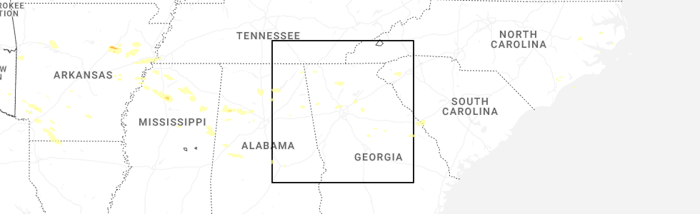
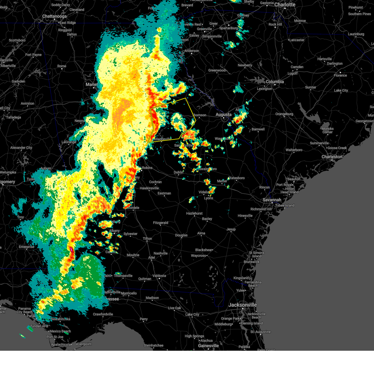
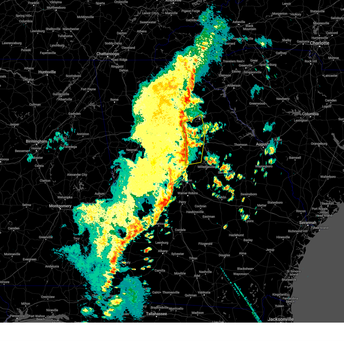
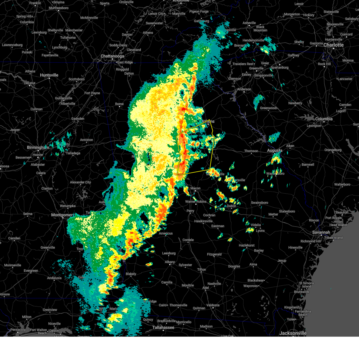
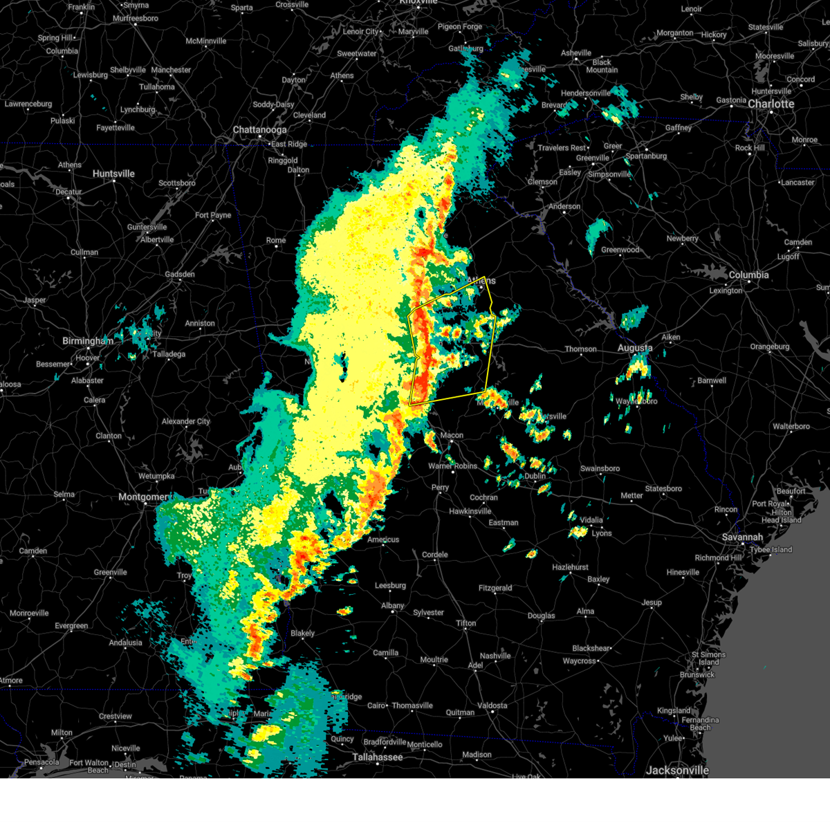
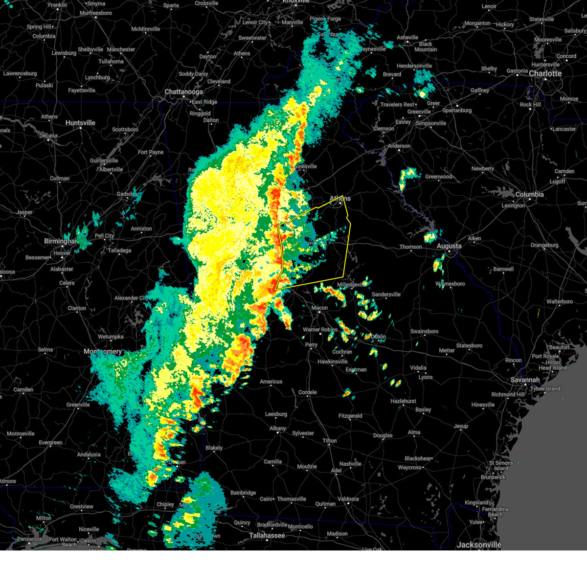
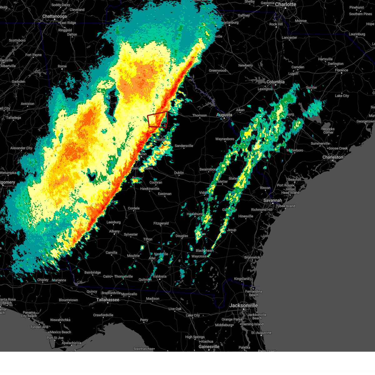
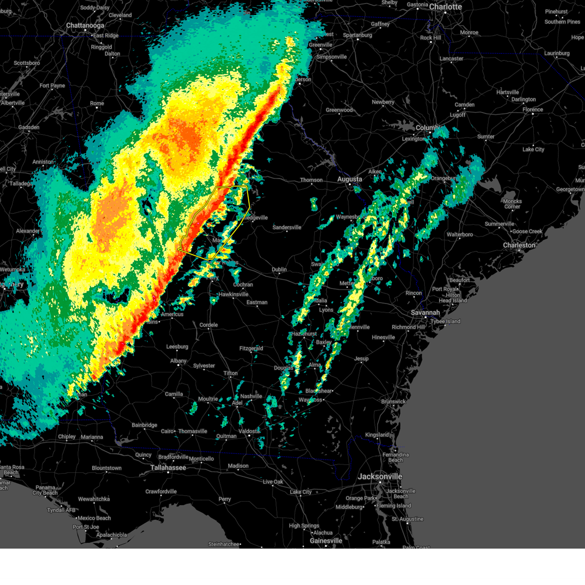
Hail Map for Eatonton, GA
The Eatonton, GA area has had 7 reports of on-the-ground hail by trained spotters, and has been under severe weather warnings 30 times during the past 12 months. Doppler radar has detected hail at or near Eatonton, GA on 57 occasions, including 7 occasions during the past year.
| Name: | Eatonton, GA |
| Where Located: | 64.7 miles ESE of Atlanta, GA |
| Map: | Google Map for Eatonton, GA |
| Population: | 6480 |
| Housing Units: | 2744 |
| More Info: | Search Google for Eatonton, GA |
1
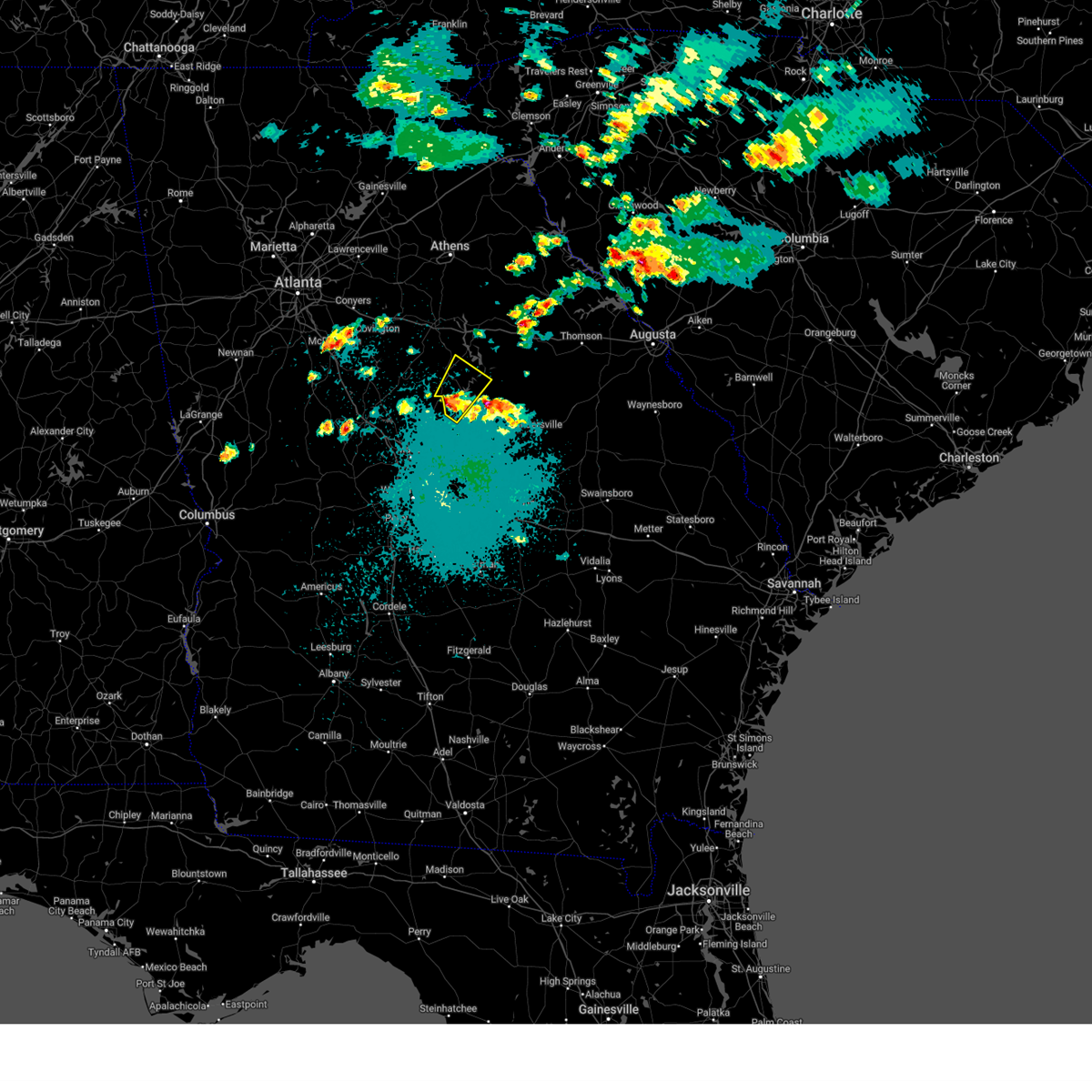
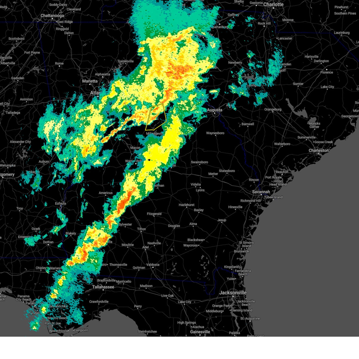
The Top Recent Hail Date for Eatonton, GA is Saturday, June 7, 2025 (8th out of 57)
Hail and Wind Damage Spotted near Eatonton, GA
| Date / Time | Report Details |
|---|---|
| 6/7/2025 7:20 PM EDT |
 The storms which prompted the warning have weakened below severe limits, and have exited the warned area. therefore, the warning will be allowed to expire. however, gusty winds are still possible with these thunderstorms. a severe thunderstorm watch remains in effect until 900 pm edt for central, north central and east central georgia. The storms which prompted the warning have weakened below severe limits, and have exited the warned area. therefore, the warning will be allowed to expire. however, gusty winds are still possible with these thunderstorms. a severe thunderstorm watch remains in effect until 900 pm edt for central, north central and east central georgia.
|
| 6/7/2025 7:15 PM EDT |
 At 715 pm edt, severe thunderstorms were located along a line extending from parks mill to eatonton to near stanfordville, moving east at 40 mph (radar indicated). Hazards include 60 mph wind gusts. Expect damage to roofs, siding, and trees. Locations impacted include, eatonton, white plains, phoenix, reynolds at lake oconee, liberty, meriwether, ethridge, veazey, harmony, resseaus crossroads, oconee springs park, warfield, willard, rockville, rock eagle 4-h center, plant harlee branch, parks mill, shoulderbone, stanfordville, and adgateville. At 715 pm edt, severe thunderstorms were located along a line extending from parks mill to eatonton to near stanfordville, moving east at 40 mph (radar indicated). Hazards include 60 mph wind gusts. Expect damage to roofs, siding, and trees. Locations impacted include, eatonton, white plains, phoenix, reynolds at lake oconee, liberty, meriwether, ethridge, veazey, harmony, resseaus crossroads, oconee springs park, warfield, willard, rockville, rock eagle 4-h center, plant harlee branch, parks mill, shoulderbone, stanfordville, and adgateville.
|
| 6/7/2025 6:46 PM EDT |
 Svrffc the national weather service in peachtree city has issued a * severe thunderstorm warning for, northwestern baldwin county in central georgia, southern morgan county in north central georgia, putnam county in central georgia, northwestern hancock county in east central georgia, southeastern greene county in east central georgia, northeastern jones county in central georgia, jasper county in central georgia, * until 730 pm edt. * at 646 pm edt, severe thunderstorms were located along a line extending from near rutledge to near shady dale to near turtle cove, moving east at 35 mph (radar indicated). Hazards include 60 mph wind gusts. expect damage to roofs, siding, and trees Svrffc the national weather service in peachtree city has issued a * severe thunderstorm warning for, northwestern baldwin county in central georgia, southern morgan county in north central georgia, putnam county in central georgia, northwestern hancock county in east central georgia, southeastern greene county in east central georgia, northeastern jones county in central georgia, jasper county in central georgia, * until 730 pm edt. * at 646 pm edt, severe thunderstorms were located along a line extending from near rutledge to near shady dale to near turtle cove, moving east at 35 mph (radar indicated). Hazards include 60 mph wind gusts. expect damage to roofs, siding, and trees
|
| 5/9/2025 12:51 AM EDT |
 Svrffc the national weather service in peachtree city has issued a * severe thunderstorm warning for, northwestern baldwin county in central georgia, southeastern putnam county in central georgia, west central hancock county in east central georgia, * until 115 am edt. * at 1251 am edt, a severe thunderstorm was located near meriwether, or 9 miles northwest of milledgeville, moving northeast at 25 mph (radar indicated). Hazards include 60 mph wind gusts and quarter size hail. Hail damage to vehicles is expected. Expect wind damage to roofs, siding, and trees. Svrffc the national weather service in peachtree city has issued a * severe thunderstorm warning for, northwestern baldwin county in central georgia, southeastern putnam county in central georgia, west central hancock county in east central georgia, * until 115 am edt. * at 1251 am edt, a severe thunderstorm was located near meriwether, or 9 miles northwest of milledgeville, moving northeast at 25 mph (radar indicated). Hazards include 60 mph wind gusts and quarter size hail. Hail damage to vehicles is expected. Expect wind damage to roofs, siding, and trees.
|
| 4/7/2025 9:10 AM EDT |
 the severe thunderstorm warning has been cancelled and is no longer in effect the severe thunderstorm warning has been cancelled and is no longer in effect
|
| 4/7/2025 8:59 AM EDT |
 the severe thunderstorm warning has been cancelled and is no longer in effect the severe thunderstorm warning has been cancelled and is no longer in effect
|
| 4/7/2025 8:59 AM EDT |
 At 858 am edt, severe thunderstorms were located along a line extending from rock eagle 4-h center to near warfield to near hillsboro, moving east at 45 mph (radar indicated). Hazards include 60 mph wind gusts. Expect damage to roofs, siding, and trees. Locations impacted include, veazey, greensboro, oconee springs park, warfield, liberty, rockville, plant harlee branch, parks mill, carey, swords, shoulderbone, phoenix, reynolds at lake oconee, siloam, union point, white plains, and eatonton. At 858 am edt, severe thunderstorms were located along a line extending from rock eagle 4-h center to near warfield to near hillsboro, moving east at 45 mph (radar indicated). Hazards include 60 mph wind gusts. Expect damage to roofs, siding, and trees. Locations impacted include, veazey, greensboro, oconee springs park, warfield, liberty, rockville, plant harlee branch, parks mill, carey, swords, shoulderbone, phoenix, reynolds at lake oconee, siloam, union point, white plains, and eatonton.
|
| 4/7/2025 8:37 AM EDT |
 Svrffc the national weather service in peachtree city has issued a * severe thunderstorm warning for, southeastern morgan county in north central georgia, putnam county in central georgia, northwestern hancock county in east central georgia, southern greene county in east central georgia, southeastern jasper county in central georgia, * until 930 am edt. * at 837 am edt, severe thunderstorms were located along a line extending from calvin to near monticello to berner, moving east at 45 mph (radar indicated). Hazards include 60 mph wind gusts. expect damage to roofs, siding, and trees Svrffc the national weather service in peachtree city has issued a * severe thunderstorm warning for, southeastern morgan county in north central georgia, putnam county in central georgia, northwestern hancock county in east central georgia, southern greene county in east central georgia, southeastern jasper county in central georgia, * until 930 am edt. * at 837 am edt, severe thunderstorms were located along a line extending from calvin to near monticello to berner, moving east at 45 mph (radar indicated). Hazards include 60 mph wind gusts. expect damage to roofs, siding, and trees
|
| 3/31/2025 2:10 PM EDT | Portions of the roof of a warehouse building located on the 100 block of e marion st were peeled back/damage in putnam county GA, 0.3 miles S of Eatonton, GA |
| 3/31/2025 2:09 PM EDT |
 Svrffc the national weather service in peachtree city has issued a * severe thunderstorm warning for, northern baldwin county in central georgia, warren county in east central georgia, southeastern morgan county in north central georgia, putnam county in central georgia, hancock county in east central georgia, greene county in east central georgia, taliaferro county in east central georgia, southwestern wilkes county in east central georgia, northeastern jones county in central georgia, * until 300 pm edt. * at 209 pm edt, severe thunderstorms were located along a line extending from near madison to near warfield to near blountsville, moving east at 55 mph (radar indicated). Hazards include 60 mph wind gusts. expect damage to roofs, siding, and trees Svrffc the national weather service in peachtree city has issued a * severe thunderstorm warning for, northern baldwin county in central georgia, warren county in east central georgia, southeastern morgan county in north central georgia, putnam county in central georgia, hancock county in east central georgia, greene county in east central georgia, taliaferro county in east central georgia, southwestern wilkes county in east central georgia, northeastern jones county in central georgia, * until 300 pm edt. * at 209 pm edt, severe thunderstorms were located along a line extending from near madison to near warfield to near blountsville, moving east at 55 mph (radar indicated). Hazards include 60 mph wind gusts. expect damage to roofs, siding, and trees
|
| 3/31/2025 1:56 PM EDT |
 the severe thunderstorm warning has been cancelled and is no longer in effect the severe thunderstorm warning has been cancelled and is no longer in effect
|
| 3/31/2025 1:56 PM EDT |
 At 155 pm edt, severe thunderstorms were located along a line extending from gratis to near rutledge to near hillsboro, moving northeast at 55 mph (radar indicated). Hazards include 60 mph wind gusts. Expect damage to roofs, siding, and trees. Locations impacted include, bishop, madison, north high shoals, beechwood hills, good hope, oconee heights, wrayswood, eastville, resseaus crossroads, barnett shoals, greshamville, barretts mill, shady dale, pannell, central georgia experiment stn, swords, watkinsville, apalachee, whitehall, and james holland youth sports cmpx. At 155 pm edt, severe thunderstorms were located along a line extending from gratis to near rutledge to near hillsboro, moving northeast at 55 mph (radar indicated). Hazards include 60 mph wind gusts. Expect damage to roofs, siding, and trees. Locations impacted include, bishop, madison, north high shoals, beechwood hills, good hope, oconee heights, wrayswood, eastville, resseaus crossroads, barnett shoals, greshamville, barretts mill, shady dale, pannell, central georgia experiment stn, swords, watkinsville, apalachee, whitehall, and james holland youth sports cmpx.
|
| 3/31/2025 1:38 PM EDT |
 At 138 pm edt, severe thunderstorms were located along a line extending from youth to near starrsville to near berner, moving east at 55 mph (radar indicated). Hazards include 60 mph wind gusts. Expect damage to roofs, siding, and trees. Locations impacted include, beechwood hills, turtle cove, oconee heights, eastville, nicholasville, jackson, big haynes creek park, greshamville, barretts mill, covington, eudora, mcelheneys crossroads, jersey, watkinsville, whitehall, james holland youth sports cmpx, ebenezer, harmony, almon, and between. At 138 pm edt, severe thunderstorms were located along a line extending from youth to near starrsville to near berner, moving east at 55 mph (radar indicated). Hazards include 60 mph wind gusts. Expect damage to roofs, siding, and trees. Locations impacted include, beechwood hills, turtle cove, oconee heights, eastville, nicholasville, jackson, big haynes creek park, greshamville, barretts mill, covington, eudora, mcelheneys crossroads, jersey, watkinsville, whitehall, james holland youth sports cmpx, ebenezer, harmony, almon, and between.
|
| 3/31/2025 1:38 PM EDT |
 the severe thunderstorm warning has been cancelled and is no longer in effect the severe thunderstorm warning has been cancelled and is no longer in effect
|
| 3/31/2025 1:23 PM EDT |
 Svrffc the national weather service in peachtree city has issued a * severe thunderstorm warning for, southeastern dekalb county in north central georgia, clarke county in northeastern georgia, northwestern monroe county in central georgia, butts county in central georgia, newton county in north central georgia, rockdale county in north central georgia, oconee county in northeastern georgia, morgan county in north central georgia, putnam county in central georgia, southeastern henry county in north central georgia, walton county in north central georgia, northwestern greene county in east central georgia, jasper county in central georgia, northeastern lamar county in west central georgia, * until 215 pm edt. * at 123 pm edt, severe thunderstorms were located along a line extending from near lithonia to oak hill to jenkinsburg, moving east at 65 mph (radar indicated). Hazards include 60 mph wind gusts. expect damage to roofs, siding, and trees Svrffc the national weather service in peachtree city has issued a * severe thunderstorm warning for, southeastern dekalb county in north central georgia, clarke county in northeastern georgia, northwestern monroe county in central georgia, butts county in central georgia, newton county in north central georgia, rockdale county in north central georgia, oconee county in northeastern georgia, morgan county in north central georgia, putnam county in central georgia, southeastern henry county in north central georgia, walton county in north central georgia, northwestern greene county in east central georgia, jasper county in central georgia, northeastern lamar county in west central georgia, * until 215 pm edt. * at 123 pm edt, severe thunderstorms were located along a line extending from near lithonia to oak hill to jenkinsburg, moving east at 65 mph (radar indicated). Hazards include 60 mph wind gusts. expect damage to roofs, siding, and trees
|
| 2/16/2025 5:51 AM EST |
 The tornado threat has diminished and the tornado warning has been cancelled. however, damaging winds remain likely and a severe thunderstorm warning remains in effect for the area. The tornado threat has diminished and the tornado warning has been cancelled. however, damaging winds remain likely and a severe thunderstorm warning remains in effect for the area.
|
| 2/16/2025 5:48 AM EST |
 the tornado warning has been cancelled and is no longer in effect the tornado warning has been cancelled and is no longer in effect
|
| 2/16/2025 5:48 AM EST |
 At 547 am est, a severe thunderstorm capable of producing a tornado was located over rock eagle 4-h center, or near eatonton, moving east at 60 mph (radar indicated rotation). Hazards include tornado. Flying debris will be dangerous to those caught without shelter. mobile homes will be damaged or destroyed. damage to roofs, windows, and vehicles will occur. tree damage is likely. Locations impacted include, eatonton, greensboro, phoenix, reynolds at lake oconee, liberty, veazey, harmony, rockville, rock eagle 4-h center, central georgia experiment stn, parks mill, carey, and swords. At 547 am est, a severe thunderstorm capable of producing a tornado was located over rock eagle 4-h center, or near eatonton, moving east at 60 mph (radar indicated rotation). Hazards include tornado. Flying debris will be dangerous to those caught without shelter. mobile homes will be damaged or destroyed. damage to roofs, windows, and vehicles will occur. tree damage is likely. Locations impacted include, eatonton, greensboro, phoenix, reynolds at lake oconee, liberty, veazey, harmony, rockville, rock eagle 4-h center, central georgia experiment stn, parks mill, carey, and swords.
|
| 2/16/2025 5:37 AM EST |
 the severe thunderstorm warning has been cancelled and is no longer in effect the severe thunderstorm warning has been cancelled and is no longer in effect
|
| 2/16/2025 5:37 AM EST |
 At 537 am est, severe thunderstorms were located along a line extending from calvin to near adgateville to plant scherer to near russellville, moving east at 55 mph (radar indicated). Hazards include 70 mph wind gusts. Expect considerable tree damage. damage is likely to mobile homes, roofs, and outbuildings. Locations impacted include, macon, eatonton, forsyth, gray, monticello, shady dale, payne, culloden, payne city, postell, lake tobesofkee, bradley, wayside, resseaus crossroads, round oak, russellville, central georgia experiment stn, plant harlee branch, wesleyan, and skipperton. At 537 am est, severe thunderstorms were located along a line extending from calvin to near adgateville to plant scherer to near russellville, moving east at 55 mph (radar indicated). Hazards include 70 mph wind gusts. Expect considerable tree damage. damage is likely to mobile homes, roofs, and outbuildings. Locations impacted include, macon, eatonton, forsyth, gray, monticello, shady dale, payne, culloden, payne city, postell, lake tobesofkee, bradley, wayside, resseaus crossroads, round oak, russellville, central georgia experiment stn, plant harlee branch, wesleyan, and skipperton.
|
| 2/16/2025 5:36 AM EST |
 At 536 am est, a severe thunderstorm capable of producing a tornado was located over shady dale, or 9 miles northeast of monticello, moving east at 60 mph (radar indicated rotation). Hazards include tornado. Flying debris will be dangerous to those caught without shelter. mobile homes will be damaged or destroyed. damage to roofs, windows, and vehicles will occur. tree damage is likely. Locations impacted include, eatonton, greensboro, shady dale, phoenix, reynolds at lake oconee, liberty, veazey, harmony, godfrey, rockville, rock eagle 4-h center, central georgia experiment stn, farrar, parks mill, carey, and swords. At 536 am est, a severe thunderstorm capable of producing a tornado was located over shady dale, or 9 miles northeast of monticello, moving east at 60 mph (radar indicated rotation). Hazards include tornado. Flying debris will be dangerous to those caught without shelter. mobile homes will be damaged or destroyed. damage to roofs, windows, and vehicles will occur. tree damage is likely. Locations impacted include, eatonton, greensboro, shady dale, phoenix, reynolds at lake oconee, liberty, veazey, harmony, godfrey, rockville, rock eagle 4-h center, central georgia experiment stn, farrar, parks mill, carey, and swords.
|
| 2/16/2025 5:27 AM EST | Torffc the national weather service in peachtree city has issued a * tornado warning for, southeastern morgan county in north central georgia, northern putnam county in central georgia, south central greene county in east central georgia, northern jasper county in central georgia, * until 600 am est. * at 527 am est, a tornado producing storm was located over eudora, or 7 miles northwest of monticello, moving east at 60 mph (radar confirmed tornado). Hazards include damaging tornado. Flying debris will be dangerous to those caught without shelter. mobile homes will be damaged or destroyed. damage to roofs, windows, and vehicles will occur. Tree damage is likely. |
| 2/16/2025 5:05 AM EST | Svrffc the national weather service in peachtree city has issued a * severe thunderstorm warning for, eastern spalding county in west central georgia, bibb county in central georgia, southeastern pike county in west central georgia, monroe county in central georgia, upson county in west central georgia, butts county in central georgia, jones county in central georgia, south central newton county in north central georgia, northwestern baldwin county in central georgia, putnam county in central georgia, southeastern henry county in north central georgia, northern crawford county in central georgia, jasper county in central georgia, lamar county in west central georgia, * until 600 am est. * at 505 am est, severe thunderstorms were located along a line extending from blacksville to walker mill to near milner to sprewell bluff state park, moving east at 55 mph (radar indicated). Hazards include 70 mph wind gusts. Expect considerable tree damage. Damage is likely to mobile homes, roofs, and outbuildings. |
| 12/29/2024 6:44 AM EST |
 The storms which prompted the warning have weakened below severe limits, and no longer pose an immediate threat to life or property. therefore, the warning will be allowed to expire. however, gusty winds are still possible with these thunderstorms. a tornado watch remains in effect until 900 am est for central and east central georgia. The storms which prompted the warning have weakened below severe limits, and no longer pose an immediate threat to life or property. therefore, the warning will be allowed to expire. however, gusty winds are still possible with these thunderstorms. a tornado watch remains in effect until 900 am est for central and east central georgia.
|
| 12/29/2024 5:51 AM EST |
 Svrffc the national weather service in peachtree city has issued a * severe thunderstorm warning for, western laurens county in central georgia, northwestern dodge county in central georgia, hancock county in east central georgia, west central glascock county in east central georgia, east central houston county in central georgia, taliaferro county in east central georgia, wilkinson county in central georgia, baldwin county in central georgia, western warren county in east central georgia, southeastern morgan county in north central georgia, twiggs county in central georgia, central putnam county in central georgia, bleckley county in central georgia, southern greene county in east central georgia, washington county in east central georgia, northwestern johnson county in east central georgia, * until 645 am est. * at 550 am est, severe thunderstorms were located along a line extending from swords to near gordon to bonaire, moving east at 35 mph (radar indicated). Hazards include 60 mph wind gusts. expect damage to roofs, siding, and trees Svrffc the national weather service in peachtree city has issued a * severe thunderstorm warning for, western laurens county in central georgia, northwestern dodge county in central georgia, hancock county in east central georgia, west central glascock county in east central georgia, east central houston county in central georgia, taliaferro county in east central georgia, wilkinson county in central georgia, baldwin county in central georgia, western warren county in east central georgia, southeastern morgan county in north central georgia, twiggs county in central georgia, central putnam county in central georgia, bleckley county in central georgia, southern greene county in east central georgia, washington county in east central georgia, northwestern johnson county in east central georgia, * until 645 am est. * at 550 am est, severe thunderstorms were located along a line extending from swords to near gordon to bonaire, moving east at 35 mph (radar indicated). Hazards include 60 mph wind gusts. expect damage to roofs, siding, and trees
|
| 12/29/2024 5:31 AM EST |
 the severe thunderstorm warning has been cancelled and is no longer in effect the severe thunderstorm warning has been cancelled and is no longer in effect
|
| 12/29/2024 5:31 AM EST |
 At 530 am est, severe thunderstorms were located along a line extending from near rutledge to clinton to near lakewood, moving east at 55 mph (radar indicated). Hazards include 60 mph wind gusts. Expect damage to roofs, siding, and trees. Locations impacted include, macon, milledgeville, eatonton, madison, gray, monticello, jeffersonville, warner robins, centerville, byron, gordon, ivey, shady dale, payne, buckhead, robins afb, payne city, phoenix, meriwether, and marion. At 530 am est, severe thunderstorms were located along a line extending from near rutledge to clinton to near lakewood, moving east at 55 mph (radar indicated). Hazards include 60 mph wind gusts. Expect damage to roofs, siding, and trees. Locations impacted include, macon, milledgeville, eatonton, madison, gray, monticello, jeffersonville, warner robins, centerville, byron, gordon, ivey, shady dale, payne, buckhead, robins afb, payne city, phoenix, meriwether, and marion.
|
| 12/29/2024 5:18 AM EST |
 the severe thunderstorm warning has been cancelled and is no longer in effect the severe thunderstorm warning has been cancelled and is no longer in effect
|
| 12/29/2024 5:18 AM EST |
 At 518 am est, severe thunderstorms were located along a line extending from conyers to calvin to near monticello to near jarrell plantation to fort valley, moving northeast at 75 mph (radar indicated). Hazards include 60 mph wind gusts. Expect damage to roofs, siding, and trees. Locations impacted include, macon, milledgeville, conyers, monroe, covington, fort valley, eatonton, madison, gray, monticello, jeffersonville, warner robins, centerville, byron, social circle, oxford, gordon, porterdale, walnut grove, and ivey. At 518 am est, severe thunderstorms were located along a line extending from conyers to calvin to near monticello to near jarrell plantation to fort valley, moving northeast at 75 mph (radar indicated). Hazards include 60 mph wind gusts. Expect damage to roofs, siding, and trees. Locations impacted include, macon, milledgeville, conyers, monroe, covington, fort valley, eatonton, madison, gray, monticello, jeffersonville, warner robins, centerville, byron, social circle, oxford, gordon, porterdale, walnut grove, and ivey.
|
| 12/29/2024 4:53 AM EST |
 Svrffc the national weather service in peachtree city has issued a * severe thunderstorm warning for, bibb county in central georgia, monroe county in central georgia, northeastern houston county in central georgia, butts county in central georgia, jones county in central georgia, newton county in north central georgia, rockdale county in north central georgia, northwestern wilkinson county in central georgia, western baldwin county in central georgia, morgan county in north central georgia, twiggs county in central georgia, putnam county in central georgia, henry county in north central georgia, walton county in north central georgia, peach county in central georgia, crawford county in central georgia, jasper county in central georgia, northeastern taylor county in west central georgia, northeastern lamar county in west central georgia, * until 600 am est. * at 452 am est, severe thunderstorms were located along a line extending from stockbridge to high falls state park to brent to near reynolds, moving east at 50 mph (radar indicated). Hazards include 60 mph wind gusts. expect damage to roofs, siding, and trees Svrffc the national weather service in peachtree city has issued a * severe thunderstorm warning for, bibb county in central georgia, monroe county in central georgia, northeastern houston county in central georgia, butts county in central georgia, jones county in central georgia, newton county in north central georgia, rockdale county in north central georgia, northwestern wilkinson county in central georgia, western baldwin county in central georgia, morgan county in north central georgia, twiggs county in central georgia, putnam county in central georgia, henry county in north central georgia, walton county in north central georgia, peach county in central georgia, crawford county in central georgia, jasper county in central georgia, northeastern taylor county in west central georgia, northeastern lamar county in west central georgia, * until 600 am est. * at 452 am est, severe thunderstorms were located along a line extending from stockbridge to high falls state park to brent to near reynolds, moving east at 50 mph (radar indicated). Hazards include 60 mph wind gusts. expect damage to roofs, siding, and trees
|
| 8/18/2024 5:44 PM EDT | A tree was reported down on bluegill road at southshore r in putnam county GA, 9.5 miles N of Eatonton, GA |
| 8/18/2024 5:39 PM EDT | A tree was reported down on highway 129 between highway 212 and the jones county lin in putnam county GA, 9.7 miles NNE of Eatonton, GA |
| 8/18/2024 5:34 PM EDT | A tree was reported down along rabbit skip rd s in putnam county GA, 8.8 miles NE of Eatonton, GA |
| 7/31/2024 5:24 PM EDT |
 Svrffc the national weather service in peachtree city has issued a * severe thunderstorm warning for, baldwin county in central georgia, southwestern putnam county in central georgia, southwestern hancock county in east central georgia, northeastern jones county in central georgia, * until 615 pm edt. * at 524 pm edt, a severe thunderstorm was located over resseaus crossroads, or 9 miles south of eatonton, moving southeast at 20 mph (radar indicated). Hazards include 60 mph wind gusts and quarter size hail. Hail damage to vehicles is expected. Expect wind damage to roofs, siding, and trees. Svrffc the national weather service in peachtree city has issued a * severe thunderstorm warning for, baldwin county in central georgia, southwestern putnam county in central georgia, southwestern hancock county in east central georgia, northeastern jones county in central georgia, * until 615 pm edt. * at 524 pm edt, a severe thunderstorm was located over resseaus crossroads, or 9 miles south of eatonton, moving southeast at 20 mph (radar indicated). Hazards include 60 mph wind gusts and quarter size hail. Hail damage to vehicles is expected. Expect wind damage to roofs, siding, and trees.
|
| 7/15/2024 6:05 PM EDT | Multiple trees as well as power lines were reported down in the area of glenwood springs road at halls roa in putnam county GA, 4.7 miles NE of Eatonton, GA |
| 6/10/2024 4:19 AM EDT |
 the severe thunderstorm warning has been cancelled and is no longer in effect the severe thunderstorm warning has been cancelled and is no longer in effect
|
| 6/10/2024 4:01 AM EDT |
 Svrffc the national weather service in peachtree city has issued a * severe thunderstorm warning for, northwestern baldwin county in central georgia, southwestern putnam county in central georgia, east central butts county in central georgia, northeastern jones county in central georgia, southern jasper county in central georgia, * until 430 am edt. * at 400 am edt, a severe thunderstorm was located near mcelheneys crossroads, or near monticello, moving east at 35 mph (radar indicated). Hazards include 60 mph wind gusts and penny size hail. expect damage to roofs, siding, and trees Svrffc the national weather service in peachtree city has issued a * severe thunderstorm warning for, northwestern baldwin county in central georgia, southwestern putnam county in central georgia, east central butts county in central georgia, northeastern jones county in central georgia, southern jasper county in central georgia, * until 430 am edt. * at 400 am edt, a severe thunderstorm was located near mcelheneys crossroads, or near monticello, moving east at 35 mph (radar indicated). Hazards include 60 mph wind gusts and penny size hail. expect damage to roofs, siding, and trees
|
| 2/28/2024 4:46 PM EST |
 Svrffc the national weather service in peachtree city has issued a * severe thunderstorm warning for, southern morgan county in north central georgia, northern putnam county in central georgia, northwestern hancock county in east central georgia, southern greene county in east central georgia, southwestern taliaferro county in east central georgia, northern jasper county in central georgia, * until 530 pm est. * at 446 pm est, severe thunderstorms were located along a line extending from near greshamville to near madison to eudora, moving east at 45 mph (radar indicated). Hazards include 60 mph wind gusts. expect damage to roofs, siding, and trees Svrffc the national weather service in peachtree city has issued a * severe thunderstorm warning for, southern morgan county in north central georgia, northern putnam county in central georgia, northwestern hancock county in east central georgia, southern greene county in east central georgia, southwestern taliaferro county in east central georgia, northern jasper county in central georgia, * until 530 pm est. * at 446 pm est, severe thunderstorms were located along a line extending from near greshamville to near madison to eudora, moving east at 45 mph (radar indicated). Hazards include 60 mph wind gusts. expect damage to roofs, siding, and trees
|
| 1/9/2024 10:15 AM EST | Tree down near the intersection of collins rd and little rd nw of milledgevill in baldwin county GA, 11.3 miles NNW of Eatonton, GA |
| 9/7/2023 2:21 PM EDT |
 At 220 pm edt, severe thunderstorms were located along a line extending from rockville to near haddock, moving east at 30 mph (radar indicated). Hazards include 60 mph wind gusts and quarter size hail. Hail damage to vehicles is expected. expect wind damage to roofs, siding, and trees. locations impacted include, milledgeville, eatonton, gray, midway-hardwick, meriwether, ethridge, postell, james, bradley, coopers, allenwood, mountain springs, haddock, resseaus crossroads, oconee springs park, warfield, greenberry crossroads, clinton, rockville, and plant harlee branch. hail threat, radar indicated max hail size, 1. 00 in wind threat, radar indicated max wind gust, 60 mph. At 220 pm edt, severe thunderstorms were located along a line extending from rockville to near haddock, moving east at 30 mph (radar indicated). Hazards include 60 mph wind gusts and quarter size hail. Hail damage to vehicles is expected. expect wind damage to roofs, siding, and trees. locations impacted include, milledgeville, eatonton, gray, midway-hardwick, meriwether, ethridge, postell, james, bradley, coopers, allenwood, mountain springs, haddock, resseaus crossroads, oconee springs park, warfield, greenberry crossroads, clinton, rockville, and plant harlee branch. hail threat, radar indicated max hail size, 1. 00 in wind threat, radar indicated max wind gust, 60 mph.
|
| 9/7/2023 2:13 PM EDT |
 At 212 pm edt, severe thunderstorms were located along a line extending from near rockville to near greenberry crossroads, moving east at 30 mph (radar indicated). Hazards include 60 mph wind gusts and quarter size hail. Hail damage to vehicles is expected. expect wind damage to roofs, siding, and trees. locations impacted include, milledgeville, eatonton, gray, midway-hardwick, meriwether, ethridge, postell, james, bradley, coopers, allenwood, mountain springs, haddock, resseaus crossroads, oconee springs park, warfield, greenberry crossroads, clinton, rockville, and plant harlee branch. hail threat, radar indicated max hail size, 1. 00 in wind threat, radar indicated max wind gust, 60 mph. At 212 pm edt, severe thunderstorms were located along a line extending from near rockville to near greenberry crossroads, moving east at 30 mph (radar indicated). Hazards include 60 mph wind gusts and quarter size hail. Hail damage to vehicles is expected. expect wind damage to roofs, siding, and trees. locations impacted include, milledgeville, eatonton, gray, midway-hardwick, meriwether, ethridge, postell, james, bradley, coopers, allenwood, mountain springs, haddock, resseaus crossroads, oconee springs park, warfield, greenberry crossroads, clinton, rockville, and plant harlee branch. hail threat, radar indicated max hail size, 1. 00 in wind threat, radar indicated max wind gust, 60 mph.
|
| 9/7/2023 1:44 PM EDT |
 At 144 pm edt, severe thunderstorms were located along a line extending from willard to near arkwright, moving east at 30 mph (radar indicated). Hazards include 60 mph wind gusts and quarter size hail. Hail damage to vehicles is expected. Expect wind damage to roofs, siding, and trees. At 144 pm edt, severe thunderstorms were located along a line extending from willard to near arkwright, moving east at 30 mph (radar indicated). Hazards include 60 mph wind gusts and quarter size hail. Hail damage to vehicles is expected. Expect wind damage to roofs, siding, and trees.
|
| 8/15/2023 4:40 PM EDT | Golf Ball sized hail reported 9.6 miles SW of Eatonton, GA, golf ball sized hail reported near the intersection of harmony ln and harmony rd. |
| 8/15/2023 4:25 PM EDT | Golf Ball sized hail reported 10.5 miles SW of Eatonton, GA, golf ball hail reported at hwy 44 and thunder rd. |
| 8/15/2023 4:24 PM EDT | Golf Ball sized hail reported 9.6 miles SW of Eatonton, GA, corrects previous hail report from 1 nnw phoenix. golf ball sized hail reported near the intersection of harmony ln and harmony rd. |
| 8/15/2023 4:24 PM EDT |
 At 424 pm edt, a severe thunderstorm was located over phoenix, or 10 miles northeast of eatonton, moving east at 30 mph (radar indicated). Hazards include 60 mph wind gusts and quarter size hail. Hail damage to vehicles is expected. Expect wind damage to roofs, siding, and trees. At 424 pm edt, a severe thunderstorm was located over phoenix, or 10 miles northeast of eatonton, moving east at 30 mph (radar indicated). Hazards include 60 mph wind gusts and quarter size hail. Hail damage to vehicles is expected. Expect wind damage to roofs, siding, and trees.
|
| 8/15/2023 4:19 PM EDT |
 At 419 pm edt, a severe thunderstorm was located over veazey, or near greensboro, moving east at 40 mph (radar indicated). Hazards include 60 mph wind gusts and penny size hail. Expect damage to roofs, siding, and trees. locations impacted include, eatonton, madison, greensboro, monticello, union point, woodville, white plains, siloam, shady dale, buckhead, phoenix, reynolds at lake oconee, liberty, veazey, greshamville, central georgia experiment stn, parks mill, swords, shoulderbone, and harmony. hail threat, radar indicated max hail size, 0. 75 in wind threat, radar indicated max wind gust, 60 mph. At 419 pm edt, a severe thunderstorm was located over veazey, or near greensboro, moving east at 40 mph (radar indicated). Hazards include 60 mph wind gusts and penny size hail. Expect damage to roofs, siding, and trees. locations impacted include, eatonton, madison, greensboro, monticello, union point, woodville, white plains, siloam, shady dale, buckhead, phoenix, reynolds at lake oconee, liberty, veazey, greshamville, central georgia experiment stn, parks mill, swords, shoulderbone, and harmony. hail threat, radar indicated max hail size, 0. 75 in wind threat, radar indicated max wind gust, 60 mph.
|
| 8/15/2023 3:51 PM EDT |
 At 350 pm edt, a severe thunderstorm was located near godfrey, or near madison, moving east at 40 mph (radar indicated). Hazards include 60 mph wind gusts and penny size hail. expect damage to roofs, siding, and trees At 350 pm edt, a severe thunderstorm was located near godfrey, or near madison, moving east at 40 mph (radar indicated). Hazards include 60 mph wind gusts and penny size hail. expect damage to roofs, siding, and trees
|
| 8/12/2023 6:13 PM EDT |
 At 613 pm edt, severe thunderstorms were located along a line extending from near farrar to near calvin, moving east at 35 mph (radar indicated). Hazards include 60 mph wind gusts. expect damage to roofs, siding, and trees At 613 pm edt, severe thunderstorms were located along a line extending from near farrar to near calvin, moving east at 35 mph (radar indicated). Hazards include 60 mph wind gusts. expect damage to roofs, siding, and trees
|
| 8/7/2023 6:25 PM EDT |
 At 625 pm edt, severe thunderstorms were located along a line extending from eudora to near calvin to near mcelheneys crossroads, moving east at 45 mph (radar indicated). Hazards include 60 mph wind gusts. expect damage to roofs, siding, and trees At 625 pm edt, severe thunderstorms were located along a line extending from eudora to near calvin to near mcelheneys crossroads, moving east at 45 mph (radar indicated). Hazards include 60 mph wind gusts. expect damage to roofs, siding, and trees
|
| 8/3/2023 5:50 PM EDT |
 At 550 pm edt, severe thunderstorms were located along a line extending from near veazey to near rockville to near monticello, moving southeast at 25 mph (radar indicated). Hazards include 60 mph wind gusts and quarter size hail. Hail damage to vehicles is expected. expect wind damage to roofs, siding, and trees. locations impacted include, eatonton, greensboro, monticello, white plains, siloam, shady dale, phoenix, reynolds at lake oconee, liberty, springfield, veazey, turtle cove, resseaus crossroads, central georgia experiment stn, plant harlee branch, eudora, north alcovy, mcelheneys crossroads, shoulderbone, and harmony. hail threat, radar indicated max hail size, 1. 00 in wind threat, radar indicated max wind gust, 60 mph. At 550 pm edt, severe thunderstorms were located along a line extending from near veazey to near rockville to near monticello, moving southeast at 25 mph (radar indicated). Hazards include 60 mph wind gusts and quarter size hail. Hail damage to vehicles is expected. expect wind damage to roofs, siding, and trees. locations impacted include, eatonton, greensboro, monticello, white plains, siloam, shady dale, phoenix, reynolds at lake oconee, liberty, springfield, veazey, turtle cove, resseaus crossroads, central georgia experiment stn, plant harlee branch, eudora, north alcovy, mcelheneys crossroads, shoulderbone, and harmony. hail threat, radar indicated max hail size, 1. 00 in wind threat, radar indicated max wind gust, 60 mph.
|
| 8/3/2023 5:23 PM EDT |
 At 523 pm edt, severe thunderstorms were located along a line extending from near greensboro to near farrar to worthville, moving southeast at 35 mph (radar indicated). Hazards include 60 mph wind gusts. expect damage to roofs, siding, and trees At 523 pm edt, severe thunderstorms were located along a line extending from near greensboro to near farrar to worthville, moving southeast at 35 mph (radar indicated). Hazards include 60 mph wind gusts. expect damage to roofs, siding, and trees
|
| 7/21/2023 6:55 PM EDT |
 At 655 pm edt, severe thunderstorms were located along a line extending from godfrey to swords to woodville, moving southeast at 25 mph (radar indicated). Hazards include 60 mph wind gusts and penny size hail. expect damage to roofs, siding, and trees At 655 pm edt, severe thunderstorms were located along a line extending from godfrey to swords to woodville, moving southeast at 25 mph (radar indicated). Hazards include 60 mph wind gusts and penny size hail. expect damage to roofs, siding, and trees
|
| 7/20/2023 6:46 PM EDT |
 At 646 pm edt, severe thunderstorms were located along a line extending from near carlton to conyers, moving southeast at 50 mph (radar indicated). Hazards include 60 mph wind gusts and nickel size hail. expect damage to roofs, siding, and trees At 646 pm edt, severe thunderstorms were located along a line extending from near carlton to conyers, moving southeast at 50 mph (radar indicated). Hazards include 60 mph wind gusts and nickel size hail. expect damage to roofs, siding, and trees
|
| 6/25/2023 6:37 PM EDT |
 At 637 pm edt, severe thunderstorms were located along a line extending from crawford to near social circle, moving southeast at 45 mph (radar indicated). Hazards include 60 mph wind gusts. expect damage to roofs, siding, and trees At 637 pm edt, severe thunderstorms were located along a line extending from crawford to near social circle, moving southeast at 45 mph (radar indicated). Hazards include 60 mph wind gusts. expect damage to roofs, siding, and trees
|
| 4/6/2023 4:30 PM EDT | Quarter sized hail reported 1.5 miles SW of Eatonton, GA, quarter-sized hail reported in eatonton. |
| 4/6/2023 4:13 PM EDT |
 At 413 pm edt, a severe thunderstorm was located over eatonton, moving northeast at 10 mph (radar indicated). Hazards include 60 mph wind gusts. expect damage to roofs, siding, and trees At 413 pm edt, a severe thunderstorm was located over eatonton, moving northeast at 10 mph (radar indicated). Hazards include 60 mph wind gusts. expect damage to roofs, siding, and trees
|
| 3/27/2023 1:23 AM EDT |
 The severe thunderstorm warning for southeastern morgan, northern putnam, greene and jasper counties will expire at 130 am edt, the storms which prompted the warning have weakened below severe limits, and no longer pose an immediate threat to life or property. therefore, the warning will be allowed to expire. however gusty winds and heavy rain are still possible with these thunderstorms. a severe thunderstorm watch remains in effect until 400 am edt for central, north central and east central georgia. to report severe weather, contact your nearest law enforcement agency. they will relay your report to the national weather service peachtree city. The severe thunderstorm warning for southeastern morgan, northern putnam, greene and jasper counties will expire at 130 am edt, the storms which prompted the warning have weakened below severe limits, and no longer pose an immediate threat to life or property. therefore, the warning will be allowed to expire. however gusty winds and heavy rain are still possible with these thunderstorms. a severe thunderstorm watch remains in effect until 400 am edt for central, north central and east central georgia. to report severe weather, contact your nearest law enforcement agency. they will relay your report to the national weather service peachtree city.
|
| 3/27/2023 1:03 AM EDT |
 At 103 am edt, severe thunderstorms were located along a line extending from near lexington to buckhead, moving northeast at 60 mph (radar indicated). Hazards include 60 mph wind gusts. Expect damage to roofs, siding, and trees. locations impacted include, eatonton, greensboro, monticello, union point, woodville, white plains, siloam, shady dale, buckhead, phoenix, reynolds at lake oconee, veazey, central georgia experiment stn, parks mill, swords, penfield, mcelheneys crossroads, harmony, godfrey and daniel springs. hail threat, radar indicated max hail size, <. 75 in wind threat, radar indicated max wind gust, 60 mph. At 103 am edt, severe thunderstorms were located along a line extending from near lexington to buckhead, moving northeast at 60 mph (radar indicated). Hazards include 60 mph wind gusts. Expect damage to roofs, siding, and trees. locations impacted include, eatonton, greensboro, monticello, union point, woodville, white plains, siloam, shady dale, buckhead, phoenix, reynolds at lake oconee, veazey, central georgia experiment stn, parks mill, swords, penfield, mcelheneys crossroads, harmony, godfrey and daniel springs. hail threat, radar indicated max hail size, <. 75 in wind threat, radar indicated max wind gust, 60 mph.
|
| 3/27/2023 12:30 AM EDT |
 At 1230 am edt, severe thunderstorms were located along a line extending from near bostwick to turtle cove, moving northeast at 60 mph (radar indicated). Hazards include 60 mph wind gusts. expect damage to roofs, siding, and trees At 1230 am edt, severe thunderstorms were located along a line extending from near bostwick to turtle cove, moving northeast at 60 mph (radar indicated). Hazards include 60 mph wind gusts. expect damage to roofs, siding, and trees
|
| 3/26/2023 7:25 AM EDT |
 At 725 am edt, a severe thunderstorm was located over milledgeville, moving east at 40 mph (radar indicated). Hazards include 60 mph wind gusts and half dollar size hail. Hail damage to vehicles is expected. expect wind damage to roofs, siding, and trees. Locations impacted include, milledgeville, eatonton, midway-hardwick, liberty, meriwether, devereux, beulah, underwood, allenwood, oconee springs park, warfield, rockville, plant harlee branch, hardwick, browns crossing and shoulderbone. At 725 am edt, a severe thunderstorm was located over milledgeville, moving east at 40 mph (radar indicated). Hazards include 60 mph wind gusts and half dollar size hail. Hail damage to vehicles is expected. expect wind damage to roofs, siding, and trees. Locations impacted include, milledgeville, eatonton, midway-hardwick, liberty, meriwether, devereux, beulah, underwood, allenwood, oconee springs park, warfield, rockville, plant harlee branch, hardwick, browns crossing and shoulderbone.
|
| 3/26/2023 7:12 AM EDT |
 At 712 am edt, a severe thunderstorm was located near browns crossing, or 8 miles west of milledgeville, moving east at 40 mph (radar indicated). Hazards include 60 mph wind gusts and half dollar size hail. Hail damage to vehicles is expected. expect wind damage to roofs, siding, and trees. Locations impacted include, milledgeville, eatonton, gray, midway-hardwick, liberty, meriwether, ethridge, devereux, beulah, underwood, allenwood, haddock, resseaus crossroads, oconee springs park, warfield, scottsboro, rockville, plant harlee branch, hardwick and browns crossing. At 712 am edt, a severe thunderstorm was located near browns crossing, or 8 miles west of milledgeville, moving east at 40 mph (radar indicated). Hazards include 60 mph wind gusts and half dollar size hail. Hail damage to vehicles is expected. expect wind damage to roofs, siding, and trees. Locations impacted include, milledgeville, eatonton, gray, midway-hardwick, liberty, meriwether, ethridge, devereux, beulah, underwood, allenwood, haddock, resseaus crossroads, oconee springs park, warfield, scottsboro, rockville, plant harlee branch, hardwick and browns crossing.
|
| 3/26/2023 6:57 AM EDT |
 At 656 am edt, a severe thunderstorm was located over bradley, or near gray, moving east at 40 mph (radar indicated). Hazards include 60 mph wind gusts and half dollar size hail. Hail damage to vehicles is expected. Expect wind damage to roofs, siding, and trees. At 656 am edt, a severe thunderstorm was located over bradley, or near gray, moving east at 40 mph (radar indicated). Hazards include 60 mph wind gusts and half dollar size hail. Hail damage to vehicles is expected. Expect wind damage to roofs, siding, and trees.
|
| 1/12/2023 5:19 PM EST |
 At 518 pm est, severe thunderstorms were located along a line extending from harmony to near eatonton to bradley, moving east at 50 mph (radar indicated). Hazards include 60 mph wind gusts. expect damage to roofs, siding, and trees At 518 pm est, severe thunderstorms were located along a line extending from harmony to near eatonton to bradley, moving east at 50 mph (radar indicated). Hazards include 60 mph wind gusts. expect damage to roofs, siding, and trees
|
| 1/12/2023 4:49 PM EST |
 At 449 pm est, severe thunderstorms were located along a line extending from north alcovy to near mcelheneys crossroads to near forsyth, moving northeast at 60 mph (radar indicated). Hazards include 60 mph wind gusts. expect damage to roofs, siding, and trees At 449 pm est, severe thunderstorms were located along a line extending from north alcovy to near mcelheneys crossroads to near forsyth, moving northeast at 60 mph (radar indicated). Hazards include 60 mph wind gusts. expect damage to roofs, siding, and trees
|
| 8/3/2022 7:08 PM EDT |
 At 708 pm edt, a severe thunderstorm was located near browns crossing, or 7 miles west of milledgeville, moving north at 10 mph (radar indicated). Hazards include 60 mph wind gusts. expect damage to roofs, siding, and trees At 708 pm edt, a severe thunderstorm was located near browns crossing, or 7 miles west of milledgeville, moving north at 10 mph (radar indicated). Hazards include 60 mph wind gusts. expect damage to roofs, siding, and trees
|
| 6/17/2022 7:23 PM EDT |
 At 722 pm edt, a severe thunderstorm was located over stanfordville, or 8 miles southwest of eatonton, moving southeast at 25 mph (radar indicated). Hazards include 60 mph wind gusts and quarter size hail. Hail damage to vehicles is expected. Expect wind damage to roofs, siding, and trees. At 722 pm edt, a severe thunderstorm was located over stanfordville, or 8 miles southwest of eatonton, moving southeast at 25 mph (radar indicated). Hazards include 60 mph wind gusts and quarter size hail. Hail damage to vehicles is expected. Expect wind damage to roofs, siding, and trees.
|
| 6/17/2022 7:00 PM EDT |
 At 700 pm edt, a severe thunderstorm was located over monticello, moving southeast at 20 mph (radar indicated). Hazards include 60 mph wind gusts and quarter size hail. Hail damage to vehicles is expected. Expect wind damage to roofs, siding, and trees. At 700 pm edt, a severe thunderstorm was located over monticello, moving southeast at 20 mph (radar indicated). Hazards include 60 mph wind gusts and quarter size hail. Hail damage to vehicles is expected. Expect wind damage to roofs, siding, and trees.
|
| 1/9/2022 6:19 PM EST | Tree fell on power line on south little river cour in putnam county GA, 8 miles N of Eatonton, GA |
| 1/9/2022 6:12 PM EST |
 The severe thunderstorm warning for southern morgan, western putnam and northern jasper counties will expire at 615 pm est, the storm which prompted the warning has weakened below severe limits, and has exited the warned area. therefore, the warning will be allowed to expire. however gusty winds are still possible with this thunderstorm. The severe thunderstorm warning for southern morgan, western putnam and northern jasper counties will expire at 615 pm est, the storm which prompted the warning has weakened below severe limits, and has exited the warned area. therefore, the warning will be allowed to expire. however gusty winds are still possible with this thunderstorm.
|
| 1/9/2022 5:59 PM EST |
 At 558 pm est, a severe thunderstorm was located over central georgia experiment stn, or 9 miles northwest of eatonton, moving east at 50 mph (radar indicated). Hazards include 60 mph wind gusts. Expect damage to roofs, siding, and trees. locations impacted include, eatonton, madison, monticello, shady dale, rock eagle 4-h center, central georgia experiment stn, calvin, swords, harmony, godfrey, warfield and willard. hail threat, radar indicated max hail size, <. 75 in wind threat, radar indicated max wind gust, 60 mph. At 558 pm est, a severe thunderstorm was located over central georgia experiment stn, or 9 miles northwest of eatonton, moving east at 50 mph (radar indicated). Hazards include 60 mph wind gusts. Expect damage to roofs, siding, and trees. locations impacted include, eatonton, madison, monticello, shady dale, rock eagle 4-h center, central georgia experiment stn, calvin, swords, harmony, godfrey, warfield and willard. hail threat, radar indicated max hail size, <. 75 in wind threat, radar indicated max wind gust, 60 mph.
|
| 1/9/2022 5:41 PM EST |
 At 541 pm est, a severe thunderstorm was located over eudora, or 8 miles northwest of monticello, moving east at 50 mph (radar indicated). Hazards include 60 mph wind gusts. expect damage to roofs, siding, and trees At 541 pm est, a severe thunderstorm was located over eudora, or 8 miles northwest of monticello, moving east at 50 mph (radar indicated). Hazards include 60 mph wind gusts. expect damage to roofs, siding, and trees
|
| 12/30/2021 2:58 PM EST |
 At 257 pm est, a severe thunderstorm was located over hillsboro, or 9 miles south of monticello, moving east at 40 mph (radar indicated). Hazards include 60 mph wind gusts and penny size hail. Expect damage to roofs, siding, and trees. locations impacted include, eatonton, ethridge, hillsboro, resseaus crossroads, round oak, stanfordville, adgateville, blountsville and willard. hail threat, radar indicated max hail size, 0. 75 in wind threat, radar indicated max wind gust, 60 mph. At 257 pm est, a severe thunderstorm was located over hillsboro, or 9 miles south of monticello, moving east at 40 mph (radar indicated). Hazards include 60 mph wind gusts and penny size hail. Expect damage to roofs, siding, and trees. locations impacted include, eatonton, ethridge, hillsboro, resseaus crossroads, round oak, stanfordville, adgateville, blountsville and willard. hail threat, radar indicated max hail size, 0. 75 in wind threat, radar indicated max wind gust, 60 mph.
|
| 12/30/2021 2:45 PM EST |
 At 243 pm est, a severe thunderstorm was located over juliette, or 10 miles northeast of forsyth, moving east at 40 mph (radar indicated). Hazards include 60 mph wind gusts and penny size hail. expect damage to roofs, siding, and trees At 243 pm est, a severe thunderstorm was located over juliette, or 10 miles northeast of forsyth, moving east at 40 mph (radar indicated). Hazards include 60 mph wind gusts and penny size hail. expect damage to roofs, siding, and trees
|
| 8/10/2021 5:22 PM EDT |
 The severe thunderstorm warning for central putnam county will expire at 530 pm edt, the storm which prompted the warning has weakened below severe limits, and no longer poses an immediate threat to life or property. therefore, the warning will be allowed to expire. The severe thunderstorm warning for central putnam county will expire at 530 pm edt, the storm which prompted the warning has weakened below severe limits, and no longer poses an immediate threat to life or property. therefore, the warning will be allowed to expire.
|
| 8/10/2021 4:39 PM EDT |
 At 439 pm edt, a severe thunderstorm was located near oconee springs park, or near eatonton, and is nearly stationary (radar indicated). Hazards include 60 mph wind gusts and nickel size hail. expect damage to roofs, siding, and trees At 439 pm edt, a severe thunderstorm was located near oconee springs park, or near eatonton, and is nearly stationary (radar indicated). Hazards include 60 mph wind gusts and nickel size hail. expect damage to roofs, siding, and trees
|
| 4/24/2021 10:11 PM EDT |
 The severe thunderstorm warning for oconee, morgan, putnam, southeastern clarke, greene, oglethorpe and northern jasper counties will expire at 1015 pm edt, the storms which prompted the warning have weakened below severe limits, and no longer pose an immediate threat to life or property. therefore, the warning will be allowed to expire. The severe thunderstorm warning for oconee, morgan, putnam, southeastern clarke, greene, oglethorpe and northern jasper counties will expire at 1015 pm edt, the storms which prompted the warning have weakened below severe limits, and no longer pose an immediate threat to life or property. therefore, the warning will be allowed to expire.
|
| 4/24/2021 9:36 PM EDT |
 At 936 pm edt, severe thunderstorms were located along a line extending from near eastville to 6 miles southwest of madison to near flovilla, moving east at 45 mph (radar indicated). Hazards include 60 mph wind gusts and penny size hail. expect damage to roofs, siding, and trees At 936 pm edt, severe thunderstorms were located along a line extending from near eastville to 6 miles southwest of madison to near flovilla, moving east at 45 mph (radar indicated). Hazards include 60 mph wind gusts and penny size hail. expect damage to roofs, siding, and trees
|
| 1/1/2021 3:40 PM EST | Multiple trees down near the intersection of twin bridges road and dennis station road. possible tornado. time estimated from rada in putnam county GA, 7.7 miles NNW of Eatonton, GA |
| 1/1/2021 3:36 PM EST |
 At 336 pm est, a severe thunderstorm capable of producing a tornado was located over warfield, or near eatonton, moving northeast at 30 mph (radar indicated rotation). Hazards include tornado. Flying debris will be dangerous to those caught without shelter. mobile homes will be damaged or destroyed. damage to roofs, windows, and vehicles will occur. Tree damage is likely. At 336 pm est, a severe thunderstorm capable of producing a tornado was located over warfield, or near eatonton, moving northeast at 30 mph (radar indicated rotation). Hazards include tornado. Flying debris will be dangerous to those caught without shelter. mobile homes will be damaged or destroyed. damage to roofs, windows, and vehicles will occur. Tree damage is likely.
|
| 1/1/2021 2:57 PM EST |
 At 257 pm est, a tornado producing storm was located over jarrell plantation, or 11 miles east of forsyth, moving northeast at 40 mph (radar confirmed tornado). Hazards include damaging tornado. Flying debris will be dangerous to those caught without shelter. mobile homes will be damaged or destroyed. damage to roofs, windows, and vehicles will occur. Tree damage is likely. At 257 pm est, a tornado producing storm was located over jarrell plantation, or 11 miles east of forsyth, moving northeast at 40 mph (radar confirmed tornado). Hazards include damaging tornado. Flying debris will be dangerous to those caught without shelter. mobile homes will be damaged or destroyed. damage to roofs, windows, and vehicles will occur. Tree damage is likely.
|
| 7/25/2020 3:12 PM EDT | A tree was reported down near the intersection of highway 212 and twin bridges road s in putnam county GA, 8.9 miles N of Eatonton, GA |
| 4/13/2020 3:28 AM EDT |
 At 328 am edt, a confirmed tornado was located over rock eagle 4-h center, or near eatonton, moving northeast at 40 mph (radar confirmed tornado). Hazards include damaging tornado. Flying debris will be dangerous to those caught without shelter. mobile homes will be damaged or destroyed. damage to roofs, windows, and vehicles will occur. tree damage is likely. Locations impacted include, eatonton, greensboro, union point, white plains, siloam, phoenix, reynolds at lake oconee, liberty, veazey, oconee springs park, warfield, rockville, rock eagle 4-h center, shoulderbone and harmony. At 328 am edt, a confirmed tornado was located over rock eagle 4-h center, or near eatonton, moving northeast at 40 mph (radar confirmed tornado). Hazards include damaging tornado. Flying debris will be dangerous to those caught without shelter. mobile homes will be damaged or destroyed. damage to roofs, windows, and vehicles will occur. tree damage is likely. Locations impacted include, eatonton, greensboro, union point, white plains, siloam, phoenix, reynolds at lake oconee, liberty, veazey, oconee springs park, warfield, rockville, rock eagle 4-h center, shoulderbone and harmony.
|
| 4/13/2020 3:24 AM EDT |
 At 324 am edt, severe thunderstorms capable of producing a tornado was located near eatonton. another circulation was located near resseaus crossroads, moving northeast at 50 mph (radar indicated rotation). Hazards include tornado. Flying debris will be dangerous to those caught without shelter. mobile homes will be damaged or destroyed. damage to roofs, windows, and vehicles will occur. Tree damage is likely. At 324 am edt, severe thunderstorms capable of producing a tornado was located near eatonton. another circulation was located near resseaus crossroads, moving northeast at 50 mph (radar indicated rotation). Hazards include tornado. Flying debris will be dangerous to those caught without shelter. mobile homes will be damaged or destroyed. damage to roofs, windows, and vehicles will occur. Tree damage is likely.
|
| 4/13/2020 3:21 AM EDT | Multiple trees reported down along old glenwood springs r in putnam county GA, 1.2 miles NNE of Eatonton, GA |
| 4/13/2020 3:19 AM EDT |
 At 319 am edt, a severe thunderstorm capable of producing a tornado was located over stanfordville, or 8 miles southwest of eatonton, moving northeast at 60 mph (radar indicated rotation). Hazards include tornado. Flying debris will be dangerous to those caught without shelter. mobile homes will be damaged or destroyed. damage to roofs, windows, and vehicles will occur. tree damage is likely. Locations impacted include, eatonton, resseaus crossroads, stanfordville and warfield. At 319 am edt, a severe thunderstorm capable of producing a tornado was located over stanfordville, or 8 miles southwest of eatonton, moving northeast at 60 mph (radar indicated rotation). Hazards include tornado. Flying debris will be dangerous to those caught without shelter. mobile homes will be damaged or destroyed. damage to roofs, windows, and vehicles will occur. tree damage is likely. Locations impacted include, eatonton, resseaus crossroads, stanfordville and warfield.
|
| 4/13/2020 3:14 AM EDT |
 At 314 am edt, a severe thunderstorm capable of producing a tornado was located near stanfordville, or 11 miles southeast of monticello, moving northeast at 55 mph (radar indicated rotation). Hazards include tornado. Flying debris will be dangerous to those caught without shelter. mobile homes will be damaged or destroyed. damage to roofs, windows, and vehicles will occur. tree damage is likely. Locations impacted include, eatonton, ethridge, resseaus crossroads, stanfordville and warfield. At 314 am edt, a severe thunderstorm capable of producing a tornado was located near stanfordville, or 11 miles southeast of monticello, moving northeast at 55 mph (radar indicated rotation). Hazards include tornado. Flying debris will be dangerous to those caught without shelter. mobile homes will be damaged or destroyed. damage to roofs, windows, and vehicles will occur. tree damage is likely. Locations impacted include, eatonton, ethridge, resseaus crossroads, stanfordville and warfield.
|
| 4/13/2020 3:13 AM EDT |
 At 313 am edt, severe thunderstorms were located along a line extending from near willard to wayside to near postell to byron, moving east at 50 mph (radar indicated). Hazards include 60 mph wind gusts. Expect damage to roofs, siding, and trees. Locations impacted include, macon, milledgeville, eatonton, gray, jeffersonville, warner robins, centerville, byron, gordon, ivey, mcintyre, shady dale, robins air force base, phoenix, midway-hardwick, meriwether, marion, postell, wayside and allenwood. At 313 am edt, severe thunderstorms were located along a line extending from near willard to wayside to near postell to byron, moving east at 50 mph (radar indicated). Hazards include 60 mph wind gusts. Expect damage to roofs, siding, and trees. Locations impacted include, macon, milledgeville, eatonton, gray, jeffersonville, warner robins, centerville, byron, gordon, ivey, mcintyre, shady dale, robins air force base, phoenix, midway-hardwick, meriwether, marion, postell, wayside and allenwood.
|
| 4/13/2020 3:05 AM EDT |
 At 305 am edt, a severe thunderstorm capable of producing a tornado was located over jarrell plantation, or 10 miles northwest of gray, moving northeast at 60 mph (radar indicated rotation). Hazards include tornado. Flying debris will be dangerous to those caught without shelter. mobile homes will be damaged or destroyed. damage to roofs, windows, and vehicles will occur. Tree damage is likely. At 305 am edt, a severe thunderstorm capable of producing a tornado was located over jarrell plantation, or 10 miles northwest of gray, moving northeast at 60 mph (radar indicated rotation). Hazards include tornado. Flying debris will be dangerous to those caught without shelter. mobile homes will be damaged or destroyed. damage to roofs, windows, and vehicles will occur. Tree damage is likely.
|
| 4/13/2020 2:54 AM EDT |
 At 254 am edt, severe thunderstorms were located along a line extending from near mcelheneys crossroads to near bolingbroke to near lee pope, moving east at 45 mph (radar indicated). Hazards include 60 mph wind gusts. expect damage to roofs, siding, and trees At 254 am edt, severe thunderstorms were located along a line extending from near mcelheneys crossroads to near bolingbroke to near lee pope, moving east at 45 mph (radar indicated). Hazards include 60 mph wind gusts. expect damage to roofs, siding, and trees
|
| 2/6/2020 12:48 PM EST |
 At 1248 pm est, a severe thunderstorm capable of producing a tornado was located over warfield, or over eatonton, moving northeast at 35 mph (radar indicated rotation). Hazards include tornado. Flying debris will be dangerous to those caught without shelter. mobile homes will be damaged or destroyed. damage to roofs, windows, and vehicles will occur. tree damage is likely. Locations impacted include, eatonton, rockville and warfield. At 1248 pm est, a severe thunderstorm capable of producing a tornado was located over warfield, or over eatonton, moving northeast at 35 mph (radar indicated rotation). Hazards include tornado. Flying debris will be dangerous to those caught without shelter. mobile homes will be damaged or destroyed. damage to roofs, windows, and vehicles will occur. tree damage is likely. Locations impacted include, eatonton, rockville and warfield.
|
| 2/6/2020 12:35 PM EST |
 At 1234 pm est, a severe thunderstorm capable of producing a tornado was located over stanfordville, or 10 miles southwest of eatonton, moving northeast at 25 mph (radar indicated rotation). Hazards include tornado. Flying debris will be dangerous to those caught without shelter. mobile homes will be damaged or destroyed. damage to roofs, windows, and vehicles will occur. Tree damage is likely. At 1234 pm est, a severe thunderstorm capable of producing a tornado was located over stanfordville, or 10 miles southwest of eatonton, moving northeast at 25 mph (radar indicated rotation). Hazards include tornado. Flying debris will be dangerous to those caught without shelter. mobile homes will be damaged or destroyed. damage to roofs, windows, and vehicles will occur. Tree damage is likely.
|
| 1/11/2020 7:26 PM EST |
 The severe thunderstorm warning for south central morgan and northwestern putnam counties will expire at 730 pm est, the storm which prompted the warning has weakened below severe limits, and has exited the warned area. therefore, the warning will be allowed to expire. however heavy rain is still possible with this thunderstorm. a tornado watch remains in effect until midnight est for central and north central georgia. The severe thunderstorm warning for south central morgan and northwestern putnam counties will expire at 730 pm est, the storm which prompted the warning has weakened below severe limits, and has exited the warned area. therefore, the warning will be allowed to expire. however heavy rain is still possible with this thunderstorm. a tornado watch remains in effect until midnight est for central and north central georgia.
|
| 1/11/2020 7:11 PM EST |
 At 710 pm est, a severe thunderstorm was located over central georgia experiment stn, or near eatonton, moving east at 40 mph (radar indicated). Hazards include 60 mph wind gusts. Expect damage to roofs, siding, and trees. Locations impacted include, eatonton, rock eagle 4-h center, godfrey, central georgia experiment stn and warfield. At 710 pm est, a severe thunderstorm was located over central georgia experiment stn, or near eatonton, moving east at 40 mph (radar indicated). Hazards include 60 mph wind gusts. Expect damage to roofs, siding, and trees. Locations impacted include, eatonton, rock eagle 4-h center, godfrey, central georgia experiment stn and warfield.
|
| 1/11/2020 6:52 PM EST |
 At 652 pm est, a severe thunderstorm was located over calvin, or near monticello, moving east at 40 mph (radar indicated). Hazards include 60 mph wind gusts. expect damage to roofs, siding, and trees At 652 pm est, a severe thunderstorm was located over calvin, or near monticello, moving east at 40 mph (radar indicated). Hazards include 60 mph wind gusts. expect damage to roofs, siding, and trees
|
| 6/23/2019 5:06 PM EDT | Powerline down near the intersection of river oak dr and hwy 129 in putnam county GA, 4.9 miles NNE of Eatonton, GA |
| 6/22/2019 5:13 PM EDT | Tree down across the road at the intersection of hwy 142 and georgia 1 in putnam county GA, 5.3 miles ENE of Eatonton, GA |
| 6/22/2019 4:56 PM EDT |
 At 455 pm edt, a severe thunderstorm was located near phoenix, or near eatonton, moving southeast at 25 mph (radar indicated). Hazards include 60 mph wind gusts and quarter size hail. Hail damage to vehicles is expected. Expect wind damage to roofs, siding, and trees. At 455 pm edt, a severe thunderstorm was located near phoenix, or near eatonton, moving southeast at 25 mph (radar indicated). Hazards include 60 mph wind gusts and quarter size hail. Hail damage to vehicles is expected. Expect wind damage to roofs, siding, and trees.
|
| 6/20/2019 3:44 PM EDT |
 At 344 pm edt, a severe thunderstorm was located over rock eagle 4-h center, or 7 miles north of eatonton, moving east at 35 mph (radar indicated). Hazards include 60 mph wind gusts and quarter size hail. Hail damage to vehicles is expected. Expect wind damage to roofs, siding, and trees. At 344 pm edt, a severe thunderstorm was located over rock eagle 4-h center, or 7 miles north of eatonton, moving east at 35 mph (radar indicated). Hazards include 60 mph wind gusts and quarter size hail. Hail damage to vehicles is expected. Expect wind damage to roofs, siding, and trees.
|
| 3/25/2019 8:06 PM EDT |
 At 806 pm edt, a severe thunderstorm was located over oconee springs park, or 10 miles west of sparta, moving east at 40 mph (radar indicated). Hazards include 60 mph wind gusts and quarter size hail. Hail damage to vehicles is expected. expect wind damage to roofs, siding, and trees. Locations impacted include, eatonton, reynolds plantation, phoenix, liberty, rockville, devereux, shoulderbone, oconee springs park and warfield. At 806 pm edt, a severe thunderstorm was located over oconee springs park, or 10 miles west of sparta, moving east at 40 mph (radar indicated). Hazards include 60 mph wind gusts and quarter size hail. Hail damage to vehicles is expected. expect wind damage to roofs, siding, and trees. Locations impacted include, eatonton, reynolds plantation, phoenix, liberty, rockville, devereux, shoulderbone, oconee springs park and warfield.
|
| 3/25/2019 7:48 PM EDT |
 At 748 pm edt, a severe thunderstorm was located near eatonton, moving east at 40 mph (radar indicated). Hazards include 60 mph wind gusts and quarter size hail. Hail damage to vehicles is expected. Expect wind damage to roofs, siding, and trees. At 748 pm edt, a severe thunderstorm was located near eatonton, moving east at 40 mph (radar indicated). Hazards include 60 mph wind gusts and quarter size hail. Hail damage to vehicles is expected. Expect wind damage to roofs, siding, and trees.
|
| 8/2/2018 4:25 PM EDT |
 At 425 pm edt, a severe thunderstorm capable of producing a tornado was located near adgateville, or near monticello, moving northeast at 20 mph (radar indicated rotation). Hazards include tornado. Flying debris will be dangerous to those caught without shelter. mobile homes will be damaged or destroyed. damage to roofs, windows, and vehicles will occur. Tree damage is likely. At 425 pm edt, a severe thunderstorm capable of producing a tornado was located near adgateville, or near monticello, moving northeast at 20 mph (radar indicated rotation). Hazards include tornado. Flying debris will be dangerous to those caught without shelter. mobile homes will be damaged or destroyed. damage to roofs, windows, and vehicles will occur. Tree damage is likely.
|
| 6/24/2018 9:00 PM EDT | Tree reported down at the intersection of crooked creek rd and scuffleboro r in putnam county GA, 7.8 miles NW of Eatonton, GA |
| 6/24/2018 8:30 PM EDT |
 At 829 pm edt, a severe thunderstorm was located over phoenix, or 8 miles northeast of eatonton, moving south at 10 mph (radar indicated). Hazards include 60 mph wind gusts. Expect damage to roofs, siding, and trees. Locations impacted include, eatonton, greensboro, buckhead, reynolds plantation, phoenix, liberty, harmony, warfield, rockville, rock eagle 4-h center, parks mill, carey and swords. At 829 pm edt, a severe thunderstorm was located over phoenix, or 8 miles northeast of eatonton, moving south at 10 mph (radar indicated). Hazards include 60 mph wind gusts. Expect damage to roofs, siding, and trees. Locations impacted include, eatonton, greensboro, buckhead, reynolds plantation, phoenix, liberty, harmony, warfield, rockville, rock eagle 4-h center, parks mill, carey and swords.
|
| 6/24/2018 8:08 PM EDT |
 At 807 pm edt, a severe thunderstorm was located over harmony, or 10 miles southwest of greensboro, moving south at 10 mph (radar indicated). Hazards include 60 mph wind gusts and penny size hail. expect damage to roofs, siding, and trees At 807 pm edt, a severe thunderstorm was located over harmony, or 10 miles southwest of greensboro, moving south at 10 mph (radar indicated). Hazards include 60 mph wind gusts and penny size hail. expect damage to roofs, siding, and trees
|
| 6/16/2018 9:11 PM EDT | Tree and power lines reported down at the intersection of wesley chapel rd and hwy 4 in putnam county GA, 3.7 miles SW of Eatonton, GA |
| 6/11/2018 4:54 PM EDT |
 At 454 pm edt, a severe thunderstorm was located over warfield, or near eatonton, moving south at 5 mph (radar indicated). Hazards include 60 mph wind gusts and quarter size hail. Hail damage to vehicles is expected. Expect wind damage to roofs, siding, and trees. At 454 pm edt, a severe thunderstorm was located over warfield, or near eatonton, moving south at 5 mph (radar indicated). Hazards include 60 mph wind gusts and quarter size hail. Hail damage to vehicles is expected. Expect wind damage to roofs, siding, and trees.
|
| 6/8/2018 5:13 PM EDT | Tree down accross crooked creek rd... se of eatonto in putnam county GA, 3.5 miles W of Eatonton, GA |
| 6/8/2018 5:05 PM EDT |
 At 505 pm edt, a severe thunderstorm was located over eatonton, moving west at 10 mph (radar indicated). Hazards include 60 mph wind gusts and quarter size hail. Hail damage to vehicles is expected. Expect wind damage to roofs, siding, and trees. At 505 pm edt, a severe thunderstorm was located over eatonton, moving west at 10 mph (radar indicated). Hazards include 60 mph wind gusts and quarter size hail. Hail damage to vehicles is expected. Expect wind damage to roofs, siding, and trees.
|
| 6/3/2018 7:47 PM EDT |
 At 747 pm edt, a severe thunderstorm was located over adgateville, or near monticello, moving southeast at 35 mph (radar indicated). Hazards include 60 mph wind gusts and quarter size hail. Hail damage to vehicles is expected. Expect wind damage to roofs, siding, and trees. At 747 pm edt, a severe thunderstorm was located over adgateville, or near monticello, moving southeast at 35 mph (radar indicated). Hazards include 60 mph wind gusts and quarter size hail. Hail damage to vehicles is expected. Expect wind damage to roofs, siding, and trees.
|
| 6/1/2018 5:19 PM EDT |
 At 519 pm edt, severe thunderstorms were located along a line extending from veazey to hillsboro, moving southeast at 15 mph (radar indicated). Hazards include 60 mph wind gusts and penny size hail. expect damage to roofs, siding, and trees At 519 pm edt, severe thunderstorms were located along a line extending from veazey to hillsboro, moving southeast at 15 mph (radar indicated). Hazards include 60 mph wind gusts and penny size hail. expect damage to roofs, siding, and trees
|
| 6/1/2018 4:47 PM EDT |
 At 447 pm edt, severe thunderstorms were located along a line extending from near buckhead to central georgia experiment stn to near monticello, moving east at 30 mph (radar indicated). Hazards include 60 mph wind gusts and penny size hail. expect damage to roofs, siding, and trees At 447 pm edt, severe thunderstorms were located along a line extending from near buckhead to central georgia experiment stn to near monticello, moving east at 30 mph (radar indicated). Hazards include 60 mph wind gusts and penny size hail. expect damage to roofs, siding, and trees
|
| 3/20/2018 1:13 AM EDT |
 At 112 am edt, a severe thunderstorm was located over resseaus crossroads, or 9 miles south of eatonton, moving east at 50 mph (radar indicated). Hazards include 60 mph wind gusts and quarter size hail. Hail damage to vehicles is expected. Expect wind damage to roofs, siding, and trees. At 112 am edt, a severe thunderstorm was located over resseaus crossroads, or 9 miles south of eatonton, moving east at 50 mph (radar indicated). Hazards include 60 mph wind gusts and quarter size hail. Hail damage to vehicles is expected. Expect wind damage to roofs, siding, and trees.
|
| 3/20/2018 1:10 AM EDT | A tree was blown down near the intersection of forest hill drive and twisting hill roa in putnam county GA, 9.6 miles NW of Eatonton, GA |
| 3/20/2018 12:36 AM EDT | Two trees were blown down near the intersection of godfrey rd and glades r in putnam county GA, 5.9 miles SE of Eatonton, GA |
| 3/20/2018 12:27 AM EDT |
 At 1227 am edt, a severe thunderstorm was located over shady dale, or 9 miles northeast of monticello, moving east at 45 mph (radar indicated). Hazards include 60 mph wind gusts and quarter size hail. Hail damage to vehicles is expected. Expect wind damage to roofs, siding, and trees. At 1227 am edt, a severe thunderstorm was located over shady dale, or 9 miles northeast of monticello, moving east at 45 mph (radar indicated). Hazards include 60 mph wind gusts and quarter size hail. Hail damage to vehicles is expected. Expect wind damage to roofs, siding, and trees.
|
| 7/4/2017 7:39 PM EDT |
 At 738 pm edt, a severe thunderstorm was located over willard, moving east at 30 mph (radar indicated). Hazards include 60 mph wind gusts and quarter size hail. Hail damage to vehicles is expected. Expect wind damage to roofs, siding, and trees. At 738 pm edt, a severe thunderstorm was located over willard, moving east at 30 mph (radar indicated). Hazards include 60 mph wind gusts and quarter size hail. Hail damage to vehicles is expected. Expect wind damage to roofs, siding, and trees.
|
| 6/22/2017 8:21 PM EDT |
 At 821 pm edt, severe thunderstorms were located along a line extending from gratis to near buckhead, moving northeast at 45 mph (radar indicated). Hazards include 60 mph wind gusts. Expect damage to roofs, siding, and trees. Locations impacted include, monroe, covington, eatonton, monticello, social circle, oxford, porterdale, rutledge, newborn, mansfield, shady dale, godfrey, starrsville, warfield, brick store, willard, central georgia experiment stn, herndonville, calvin and farrar. At 821 pm edt, severe thunderstorms were located along a line extending from gratis to near buckhead, moving northeast at 45 mph (radar indicated). Hazards include 60 mph wind gusts. Expect damage to roofs, siding, and trees. Locations impacted include, monroe, covington, eatonton, monticello, social circle, oxford, porterdale, rutledge, newborn, mansfield, shady dale, godfrey, starrsville, warfield, brick store, willard, central georgia experiment stn, herndonville, calvin and farrar.
|
| 6/22/2017 8:13 PM EDT |
 At 813 pm edt, severe thunderstorms were located along a line extending from oxford to near godfrey to near adgateville, moving northeast at 25 mph (radar indicated). Hazards include 60 mph wind gusts. expect damage to roofs, siding, and trees At 813 pm edt, severe thunderstorms were located along a line extending from oxford to near godfrey to near adgateville, moving northeast at 25 mph (radar indicated). Hazards include 60 mph wind gusts. expect damage to roofs, siding, and trees
|
| 6/22/2017 7:41 PM EDT |
 At 741 pm edt, severe thunderstorms were located along a line extending from oak hill to near mcelheneys crossroads, moving northeast at 45 mph (radar indicated). Hazards include 60 mph wind gusts. expect damage to roofs, siding, and trees At 741 pm edt, severe thunderstorms were located along a line extending from oak hill to near mcelheneys crossroads, moving northeast at 45 mph (radar indicated). Hazards include 60 mph wind gusts. expect damage to roofs, siding, and trees
|
| 5/30/2017 6:11 PM EDT | A tree was reported down near the intersection of rabbit skip road southwest and highway 12 in putnam county GA, 7.7 miles NNE of Eatonton, GA |
| 5/30/2017 5:48 PM EDT |
 At 547 pm edt, a severe thunderstorm was located near adgateville, or near monticello, moving east at 25 mph (radar indicated). Hazards include 60 mph wind gusts and quarter size hail. Hail damage to vehicles is expected. Expect wind damage to roofs, siding, and trees. At 547 pm edt, a severe thunderstorm was located near adgateville, or near monticello, moving east at 25 mph (radar indicated). Hazards include 60 mph wind gusts and quarter size hail. Hail damage to vehicles is expected. Expect wind damage to roofs, siding, and trees.
|
| 4/3/2017 2:05 PM EDT |
 At 205 pm edt, a severe squall line capable of producing both tornadoes and extensive straight line wind damage was located near plant harlee branch, or near eatonton, moving east at 45 mph (radar indicated rotation). Hazards include tornado. Flying debris will be dangerous to those caught without shelter. mobile homes will be damaged or destroyed. damage to roofs, windows, and vehicles will occur. tree damage is likely. Locations impacted include, eatonton, meriwether, resseaus crossroads, plant harlee branch and warfield. At 205 pm edt, a severe squall line capable of producing both tornadoes and extensive straight line wind damage was located near plant harlee branch, or near eatonton, moving east at 45 mph (radar indicated rotation). Hazards include tornado. Flying debris will be dangerous to those caught without shelter. mobile homes will be damaged or destroyed. damage to roofs, windows, and vehicles will occur. tree damage is likely. Locations impacted include, eatonton, meriwether, resseaus crossroads, plant harlee branch and warfield.
|
| 4/3/2017 2:03 PM EDT |
 At 203 pm edt, severe thunderstorms were located along a line extending from eatonton to haddock to near dry branch, moving east at 35 mph (radar indicated). Hazards include 60 mph wind gusts and penny size hail. expect damage to roofs, siding, and trees At 203 pm edt, severe thunderstorms were located along a line extending from eatonton to haddock to near dry branch, moving east at 35 mph (radar indicated). Hazards include 60 mph wind gusts and penny size hail. expect damage to roofs, siding, and trees
|
| 4/3/2017 1:41 PM EDT |
 At 140 pm edt, severe thunderstorms capable of producing both tornadoes and extensive straight line wind damage were located over hillsboro, or 10 miles south of monticello, moving east at 45 mph (radar indicated rotation). Hazards include tornado. Flying debris will be dangerous to those caught without shelter. mobile homes will be damaged or destroyed. damage to roofs, windows, and vehicles will occur. Tree damage is likely. At 140 pm edt, severe thunderstorms capable of producing both tornadoes and extensive straight line wind damage were located over hillsboro, or 10 miles south of monticello, moving east at 45 mph (radar indicated rotation). Hazards include tornado. Flying debris will be dangerous to those caught without shelter. mobile homes will be damaged or destroyed. damage to roofs, windows, and vehicles will occur. Tree damage is likely.
|
| 4/3/2017 1:36 PM EDT |
 At 136 pm edt, severe thunderstorms were located along a line extending from near newborn to shady dale to near adgateville, moving east at 50 mph (radar indicated). Hazards include 60 mph wind gusts and penny size hail. expect damage to roofs, siding, and trees At 136 pm edt, severe thunderstorms were located along a line extending from near newborn to shady dale to near adgateville, moving east at 50 mph (radar indicated). Hazards include 60 mph wind gusts and penny size hail. expect damage to roofs, siding, and trees
|
| 4/3/2017 1:32 PM EDT |
 At 132 pm edt, severe thunderstorms were located along a line extending from near adgateville to jarrell plantation to payne city, moving east at 40 mph (radar indicated). Hazards include 60 mph wind gusts and penny size hail. expect damage to roofs, siding, and trees At 132 pm edt, severe thunderstorms were located along a line extending from near adgateville to jarrell plantation to payne city, moving east at 40 mph (radar indicated). Hazards include 60 mph wind gusts and penny size hail. expect damage to roofs, siding, and trees
|
| 3/21/2017 9:45 PM EDT |
 At 944 pm edt, severe thunderstorms were located extending from near vesta to near union point to near buckhead to newborn, moving southeast at 55 mph (radar indicated, plus numerous reports of downed trees and powerlines across north georgia). Hazards include 60 mph wind gusts and quarter size hail. Hail damage to vehicles is expected. Expect wind damage to roofs, siding, and trees. At 944 pm edt, severe thunderstorms were located extending from near vesta to near union point to near buckhead to newborn, moving southeast at 55 mph (radar indicated, plus numerous reports of downed trees and powerlines across north georgia). Hazards include 60 mph wind gusts and quarter size hail. Hail damage to vehicles is expected. Expect wind damage to roofs, siding, and trees.
|
| 3/21/2017 9:45 PM EDT |
 At 1018 pm edt, severe thunderstorms were located extending from near cadley to near hamburg state park to linton, moving southeast at 60 mph (radar indicated). Hazards include 60 mph wind gusts and quarter size hail. Hail damage to vehicles is expected. expect wind damage to roofs, siding, and trees. Locations impacted include, warrenton, sparta, norwood, mitchell, camak, phoenix, springfield, hamburg state park, cadley, shoals, devereux, jewell, beulah, beall springs, mayfield, oconee springs park, rockville, powelton, barnett and agricola. At 1018 pm edt, severe thunderstorms were located extending from near cadley to near hamburg state park to linton, moving southeast at 60 mph (radar indicated). Hazards include 60 mph wind gusts and quarter size hail. Hail damage to vehicles is expected. expect wind damage to roofs, siding, and trees. Locations impacted include, warrenton, sparta, norwood, mitchell, camak, phoenix, springfield, hamburg state park, cadley, shoals, devereux, jewell, beulah, beall springs, mayfield, oconee springs park, rockville, powelton, barnett and agricola.
|
| 7/19/2016 4:27 PM EDT |
 At 427 pm edt, a severe thunderstorm was located near buckhead, or 7 miles southwest of greensboro, moving south at 15 mph (radar indicated). Hazards include 60 mph wind gusts and quarter size hail. Hail damage to vehicles is expected. expect wind damage to roofs, siding, and trees. Other locations in the warning include but are not limited to eatonton, greensboro, buckhead, reynolds plantation, phoenix, swords, parks mill, harmony, carey and rock eagle 4-h center. At 427 pm edt, a severe thunderstorm was located near buckhead, or 7 miles southwest of greensboro, moving south at 15 mph (radar indicated). Hazards include 60 mph wind gusts and quarter size hail. Hail damage to vehicles is expected. expect wind damage to roofs, siding, and trees. Other locations in the warning include but are not limited to eatonton, greensboro, buckhead, reynolds plantation, phoenix, swords, parks mill, harmony, carey and rock eagle 4-h center.
|
| 7/6/2016 2:18 PM EDT |
 At 218 pm edt, a severe thunderstorm was located near phoenix, or near eatonton, moving east at 30 mph (radar indicated). Hazards include 60 mph wind gusts. Expect damage to roofs. siding. and trees. Other locations in the warning include but are not limited to eatonton, sparta, white plains, reynolds plantation, phoenix, liberty, springfield, oconee springs park, shoulderbone and rockville. At 218 pm edt, a severe thunderstorm was located near phoenix, or near eatonton, moving east at 30 mph (radar indicated). Hazards include 60 mph wind gusts. Expect damage to roofs. siding. and trees. Other locations in the warning include but are not limited to eatonton, sparta, white plains, reynolds plantation, phoenix, liberty, springfield, oconee springs park, shoulderbone and rockville.
|
| 6/30/2016 5:53 PM EDT |
 At 552 pm edt, a severe thunderstorm was located near eatonton, moving northeast at 5 mph (radar indicated). Hazards include 60 mph wind gusts and quarter size hail. Hail damage to vehicles is expected. expect wind damage to roofs, siding, and trees. Other locations in the warning include but are not limited to eatonton, willard, warfield, oconee springs park, stanfordville, rockville, resseaus crossroads and plant harlee branch. At 552 pm edt, a severe thunderstorm was located near eatonton, moving northeast at 5 mph (radar indicated). Hazards include 60 mph wind gusts and quarter size hail. Hail damage to vehicles is expected. expect wind damage to roofs, siding, and trees. Other locations in the warning include but are not limited to eatonton, willard, warfield, oconee springs park, stanfordville, rockville, resseaus crossroads and plant harlee branch.
|
| 6/17/2016 3:39 PM EDT |
 At 339 pm edt, a severe thunderstorm was located 7 miles northwest of milledgeville, moving southeast at 35 mph (radar indicated). Hazards include 60 mph wind gusts and quarter size hail. Hail damage to vehicles is expected. expect wind damage to roofs, siding, and trees. Other locations in the warning include but are not limited to milledgeville, eatonton, midway-hardwick, meriwether, hardwick, beulah, resseaus crossroads, blountsville, allenwood, underwood, browns crossing, ethridge and plant harlee branch. At 339 pm edt, a severe thunderstorm was located 7 miles northwest of milledgeville, moving southeast at 35 mph (radar indicated). Hazards include 60 mph wind gusts and quarter size hail. Hail damage to vehicles is expected. expect wind damage to roofs, siding, and trees. Other locations in the warning include but are not limited to milledgeville, eatonton, midway-hardwick, meriwether, hardwick, beulah, resseaus crossroads, blountsville, allenwood, underwood, browns crossing, ethridge and plant harlee branch.
|
| 6/17/2016 3:18 PM EDT |
 At 318 pm edt, a severe thunderstorm was located over eatonton, moving southeast at 25 mph (radar indicated). Hazards include 60 mph wind gusts and quarter size hail. Hail damage to vehicles is expected. expect wind damage to roofs, siding, and trees. Other locations in the warning include but are not limited to milledgeville, eatonton, midway-hardwick, meriwether, warfield, hardwick, beulah, stanfordville, resseaus crossroads, blountsville, allenwood, willard, underwood, browns crossing, ethridge and plant harlee branch. At 318 pm edt, a severe thunderstorm was located over eatonton, moving southeast at 25 mph (radar indicated). Hazards include 60 mph wind gusts and quarter size hail. Hail damage to vehicles is expected. expect wind damage to roofs, siding, and trees. Other locations in the warning include but are not limited to milledgeville, eatonton, midway-hardwick, meriwether, warfield, hardwick, beulah, stanfordville, resseaus crossroads, blountsville, allenwood, willard, underwood, browns crossing, ethridge and plant harlee branch.
|
| 8/6/2015 4:10 PM EDT |
 At 409 pm edt, severe thunderstorms were located extending from near tignall to near white plains to 9 miles south of eatonton, moving east at 35 mph (radar indicated). Hazards include 60 mph wind gusts and quarter size hail. Hail damage to vehicles is expected. expect wind damage to roofs, siding and trees. Other locations in the warning include but are not limited to eatonton, washington, greensboro, crawfordville, union point, tignall, woodville, white plains, siloam, rayle, phoenix, reynolds plantation, liberty, meriwether, penfield, warfield, alexander stephens park, harmony, stanfordville and rockville. At 409 pm edt, severe thunderstorms were located extending from near tignall to near white plains to 9 miles south of eatonton, moving east at 35 mph (radar indicated). Hazards include 60 mph wind gusts and quarter size hail. Hail damage to vehicles is expected. expect wind damage to roofs, siding and trees. Other locations in the warning include but are not limited to eatonton, washington, greensboro, crawfordville, union point, tignall, woodville, white plains, siloam, rayle, phoenix, reynolds plantation, liberty, meriwether, penfield, warfield, alexander stephens park, harmony, stanfordville and rockville.
|
| 8/6/2015 3:48 PM EDT |
 At 347 pm edt, severe thunderstorms were located extending from near rayle to near phoenix to 9 miles south of monticello, moving east at 25 mph (radar indicated). Hazards include 60 mph wind gusts and quarter size hail. Hail damage to vehicles is expected. expect wind damage to roofs, siding and trees. Other locations in the warning include but are not limited to eatonton, washington, greensboro, crawfordville, union point, tignall, woodville, white plains, siloam, rayle, phoenix, reynolds plantation, liberty, meriwether, penfield, warfield, alexander stephens park, harmony, stanfordville and rockville. At 347 pm edt, severe thunderstorms were located extending from near rayle to near phoenix to 9 miles south of monticello, moving east at 25 mph (radar indicated). Hazards include 60 mph wind gusts and quarter size hail. Hail damage to vehicles is expected. expect wind damage to roofs, siding and trees. Other locations in the warning include but are not limited to eatonton, washington, greensboro, crawfordville, union point, tignall, woodville, white plains, siloam, rayle, phoenix, reynolds plantation, liberty, meriwether, penfield, warfield, alexander stephens park, harmony, stanfordville and rockville.
|
| 7/3/2015 11:15 AM EDT |
 At 1115 am edt, a severe thunderstorm was located 9 miles north of gray, moving southeast at 45 mph (radar indicated). Hazards include 60 mph wind gusts. Expect damage to roofs. siding and trees. Other locations in the warning include but are not limited to milledgeville, eatonton, madison, gray, monticello, sparta, shady dale, phoenix, reynolds plantation, midway-hardwick, liberty, meriwether, scottsboro, jarrell plantation, warfield, harmony, griswoldville, allenwood, greenberry crossroads and central georgia experiment stn. At 1115 am edt, a severe thunderstorm was located 9 miles north of gray, moving southeast at 45 mph (radar indicated). Hazards include 60 mph wind gusts. Expect damage to roofs. siding and trees. Other locations in the warning include but are not limited to milledgeville, eatonton, madison, gray, monticello, sparta, shady dale, phoenix, reynolds plantation, midway-hardwick, liberty, meriwether, scottsboro, jarrell plantation, warfield, harmony, griswoldville, allenwood, greenberry crossroads and central georgia experiment stn.
|
| 7/3/2015 10:47 AM EDT |
 At 1046 am edt, a severe thunderstorm was located near flovilla, or 7 miles west of monticello, moving southeast at 45 mph (radar indicated). Hazards include 60 mph wind gusts. Expect damage to roofs. siding and trees. Other locations in the warning include but are not limited to milledgeville, eatonton, jackson, madison, gray, monticello, sparta, rutledge, flovilla, jenkinsburg, shady dale, phoenix, reynolds plantation, midway-hardwick, liberty, meriwether, calvin, scottsboro, jarrell plantation and warfield. At 1046 am edt, a severe thunderstorm was located near flovilla, or 7 miles west of monticello, moving southeast at 45 mph (radar indicated). Hazards include 60 mph wind gusts. Expect damage to roofs. siding and trees. Other locations in the warning include but are not limited to milledgeville, eatonton, jackson, madison, gray, monticello, sparta, rutledge, flovilla, jenkinsburg, shady dale, phoenix, reynolds plantation, midway-hardwick, liberty, meriwether, calvin, scottsboro, jarrell plantation and warfield.
|
| 6/24/2015 5:57 PM EDT |
 At 557 pm edt, a severe thunderstorm was located near phoenix, or 8 miles north of eatonton, moving southeast at 10 mph (radar indicated). Hazards include 60 mph wind gusts and quarter size hail. Hail damage to vehicles is expected. expect wind damage to roofs, siding and trees. Other locations in the warning include but are not limited to eatonton, warfield, willard, harmony, resseaus crossroads, rock eagle 4-h center and plant harlee branch. At 557 pm edt, a severe thunderstorm was located near phoenix, or 8 miles north of eatonton, moving southeast at 10 mph (radar indicated). Hazards include 60 mph wind gusts and quarter size hail. Hail damage to vehicles is expected. expect wind damage to roofs, siding and trees. Other locations in the warning include but are not limited to eatonton, warfield, willard, harmony, resseaus crossroads, rock eagle 4-h center and plant harlee branch.
|
| 5/26/2015 6:11 PM EDT | The severe thunderstorm warning for southwestern greene, northeastern jasper, southeastern morgan and putnam counties will expire at 615 pm edt, the storms which prompted the warning have moved out of the area. therefore the warning will be allowed to expire. however heavy rain is still possible with these thunderstorms. |
| 5/26/2015 5:54 PM EDT | At 554 pm edt, severe thunderstorms were located along a line extending from near shady dale to near eatonton, moving northeast at 35 mph (radar indicated). Hazards include 60 mph wind gusts and quarter size hail. Hail damage to vehicles is expected. expect wind damage to roofs, siding and trees. Other locations in the warning include but are not limited to eatonton, greensboro, shady dale, reynolds plantation, phoenix, swords, warfield, harmony, rock eagle 4-h center, godfrey, parks mill, willard, central georgia experiment stn and carey. |
| 5/26/2015 5:37 PM EDT | Couple of trees down along hwy 16 west of eatonton. time estimated by rada in putnam county GA, 5.3 miles ENE of Eatonton, GA |
| 5/26/2015 5:25 PM EDT | At 525 pm edt, a severe thunderstorm was located near shady dale, or near monticello, moving northeast at 40 mph (radar indicated). Hazards include 60 mph wind gusts and quarter size hail. Hail damage to vehicles is expected. expect wind damage to roofs, siding and trees. Other locations in the warning include but are not limited to eatonton, greensboro, shady dale, reynolds plantation, phoenix, swords, warfield, harmony, stanfordville, rock eagle 4-h center, godfrey, parks mill, willard, central georgia experiment stn and carey. |
| 4/2/2015 3:39 PM EDT | The national weather service in peachtree city has issued a * severe thunderstorm warning for. northwestern greene county in east central georgia. southeastern morgan county in north central georgia. northwestern putnam county in central georgia. Until 430 pm edt. |
| 3/18/2013 7:10 PM EDT | Golf Ball sized hail reported 0.3 miles S of Eatonton, GA, public reported the size of golfball sized hail in eatonton. the hail was so deep it covered the ground completly. |
| 3/18/2013 6:55 PM EDT | Golf Ball sized hail reported 0.3 miles S of Eatonton, GA, lasted 20 minutes...hail up to golfball sized hail. |
| 7/1/2012 6:18 PM EDT | Putnam county 911 relayed reports of several downed trees in the northern portion of the county. radar estimated time 1818 edt to 1841 ed in putnam county GA, 8.8 miles SSE of Eatonton, GA |
| 7/1/2012 5:41 PM EDT | Putnam county 911 relayed reports of several downed trees in eastern portions of the county with the storm late in the 1700 hour. radar estimated time around 1741 ed in putnam county GA, 6.6 miles WSW of Eatonton, GA |
| 6/10/2012 4:55 PM EDT | Putnam county 911 relayed a report of 2 trees downed onto lines. radar estimated time of 1655 ed in putnam county GA, 0.3 miles S of Eatonton, GA |
| 5/31/2012 8:28 PM EDT | 911 center reported several trees and a few power lines down in the city of eatonto in putnam county GA, 0.3 miles S of Eatonton, GA |
| 1/1/0001 12:00 AM | Power line down in the twin bridges are in putnam county GA, 7.9 miles NNE of Eatonton, GA |
| 1/1/0001 12:00 AM | One tree down on hwy 12 in putnam county GA, 8.3 miles NE of Eatonton, GA |
| 1/1/0001 12:00 AM | The putnam 911 center reported trees down along route 129 and trees down in eatonton as well as traffic lights ou in putnam county GA, 0.3 miles S of Eatonton, GA |
| 1/1/0001 12:00 AM | A couple of trees down in the north part of the county...one on glades road near the 4h camp in the northwest part and another on phoenix road in the northeast part of in putnam county GA, 5.1 miles SE of Eatonton, GA |
| 1/1/0001 12:00 AM | Quarter sized hail reported 0.3 miles S of Eatonton, GA, putnam county 911 reported nickle to quarter sized hail outside the 911 center in eatonton. |
Hail Maps for Eatonton, GA

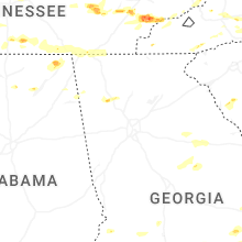


Connect with Interactive Hail Maps