

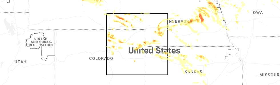
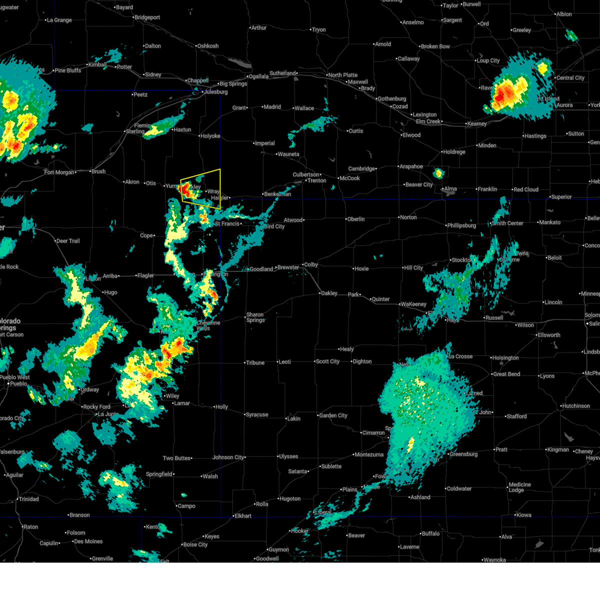
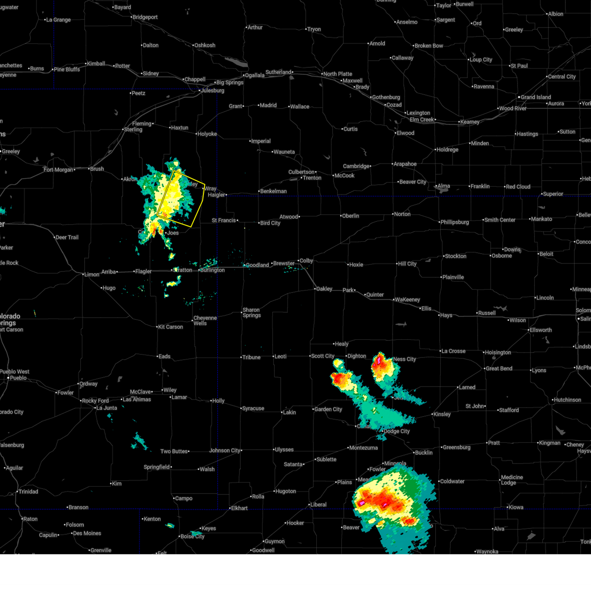
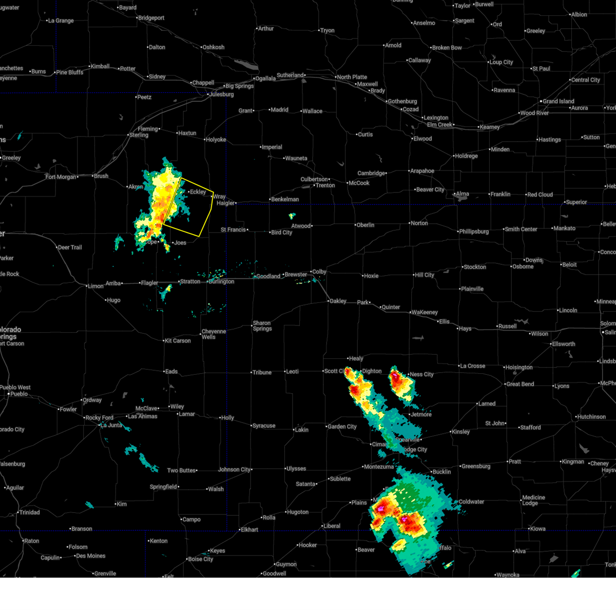
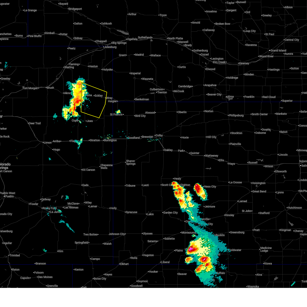
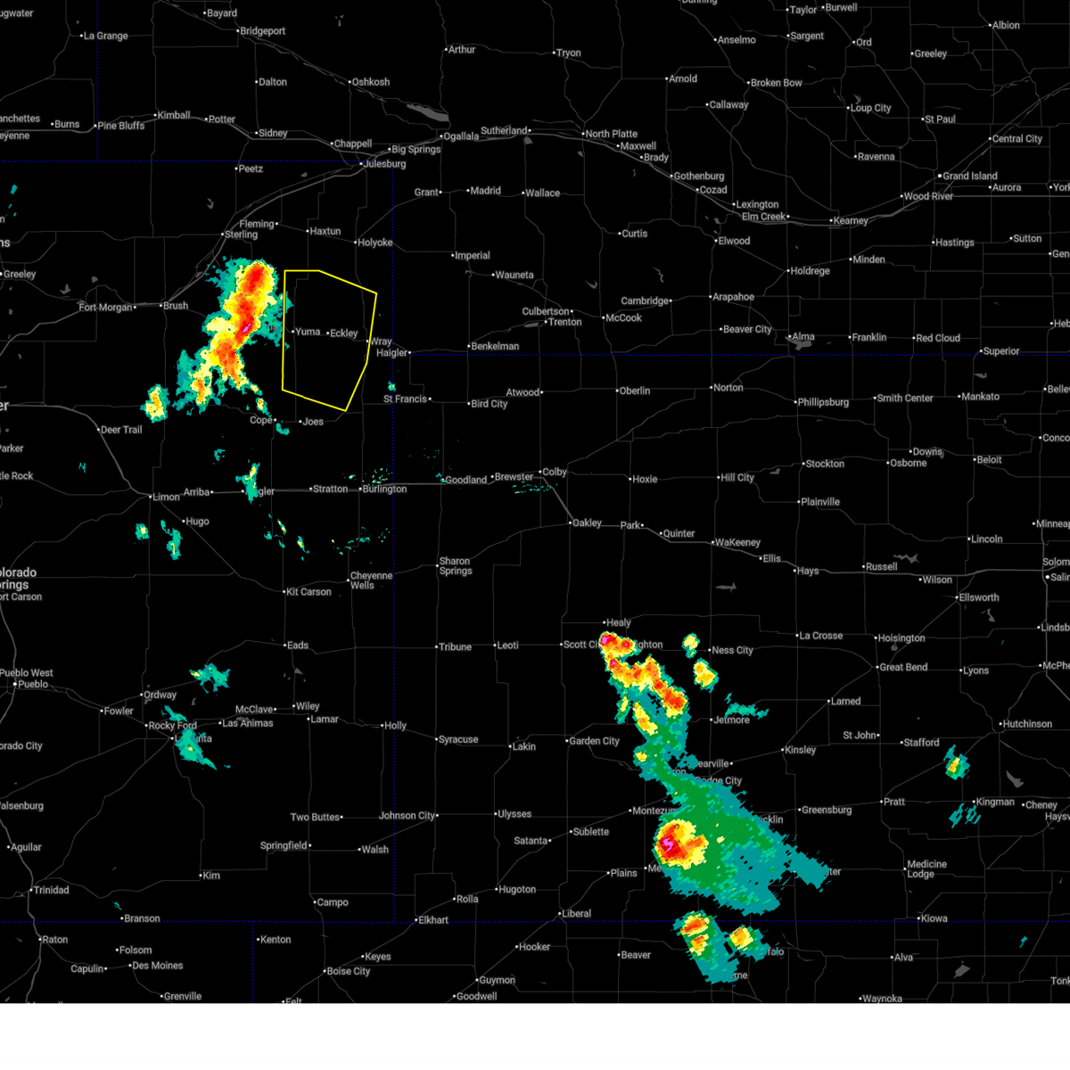
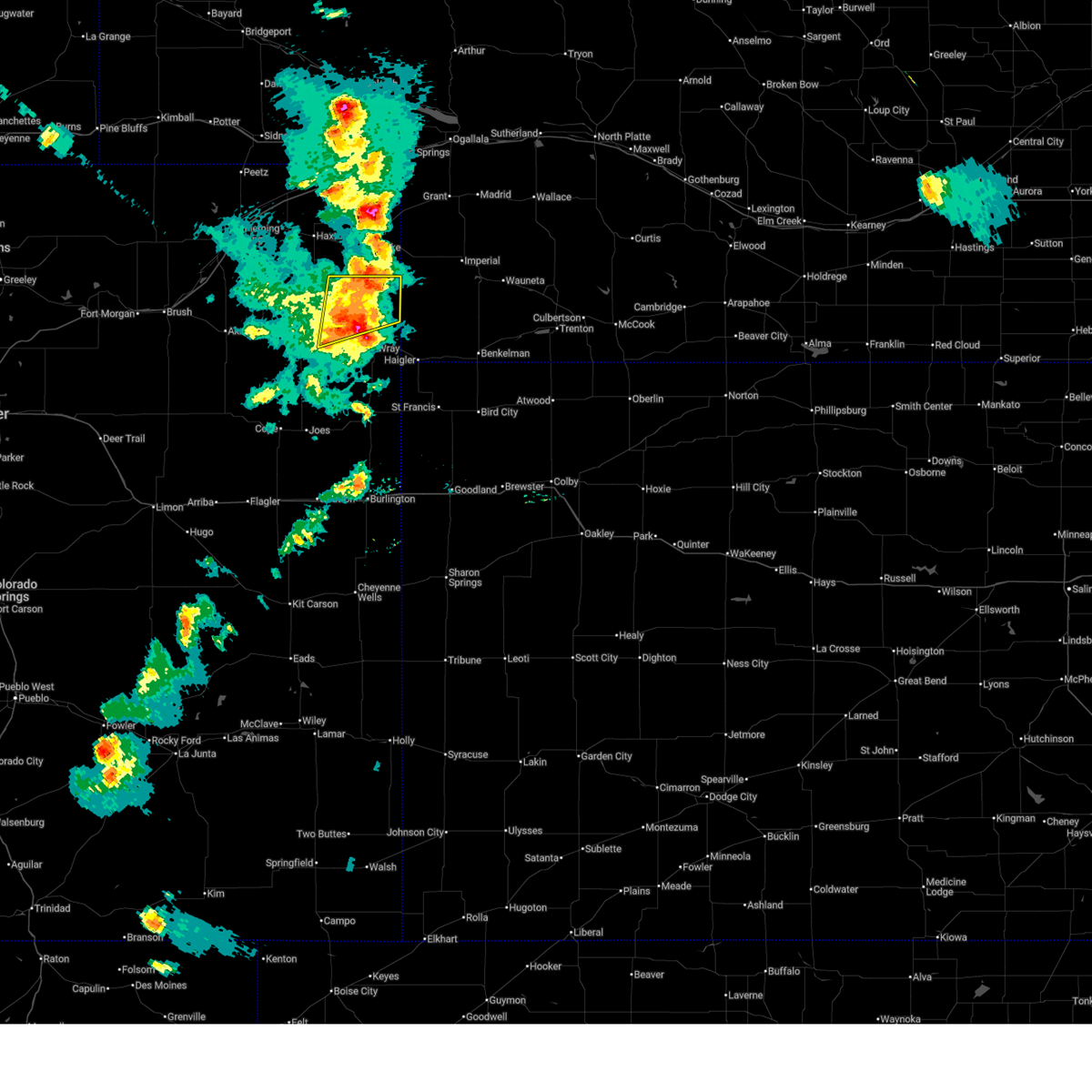
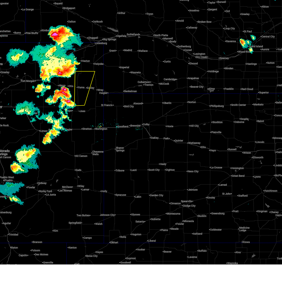
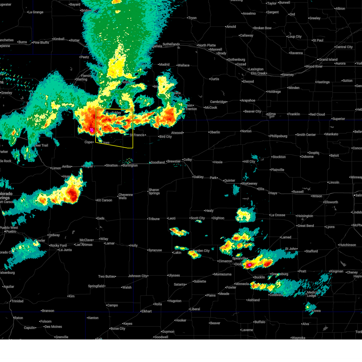
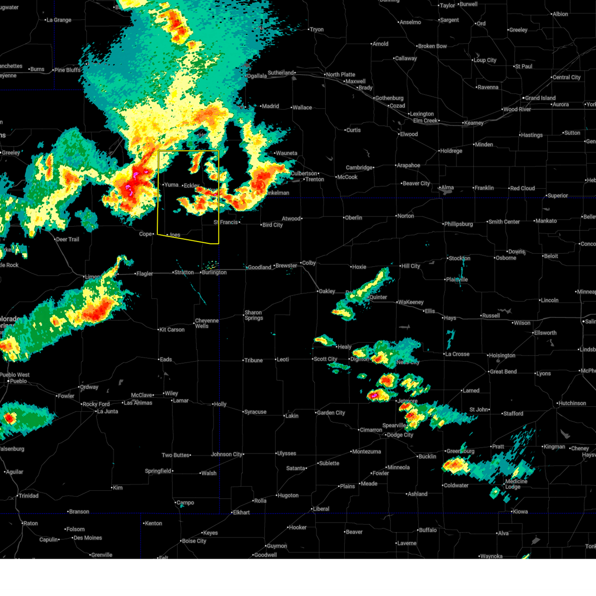
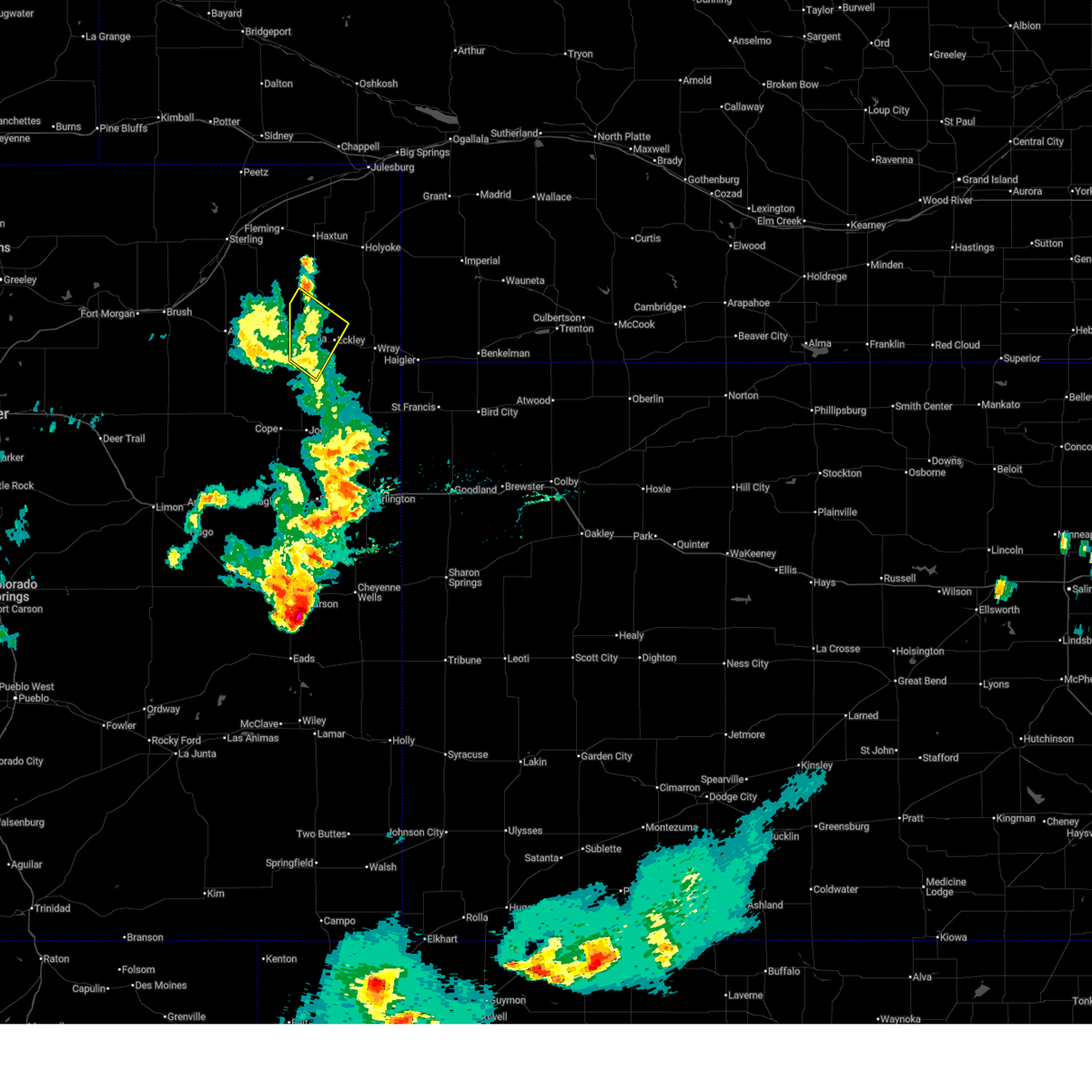
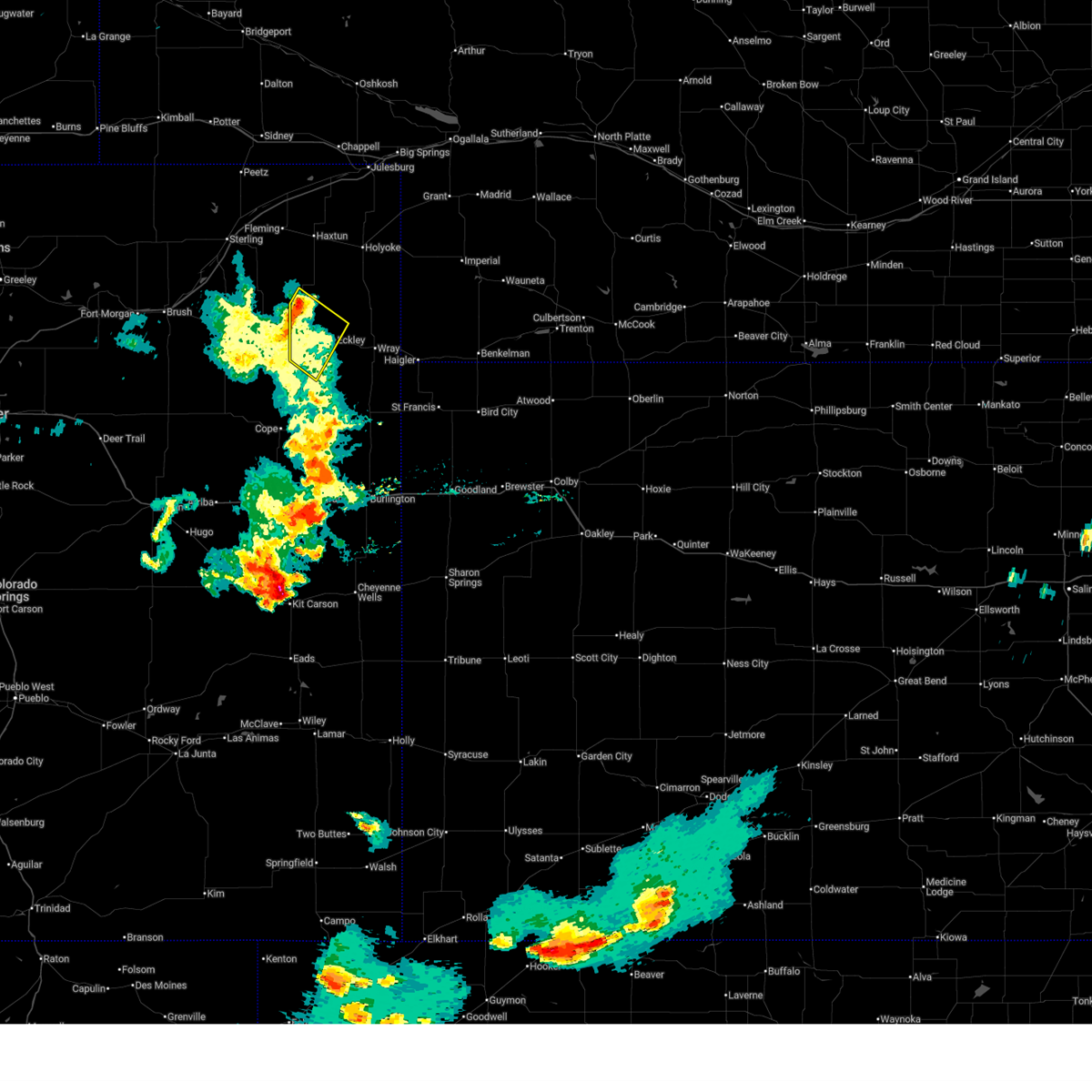
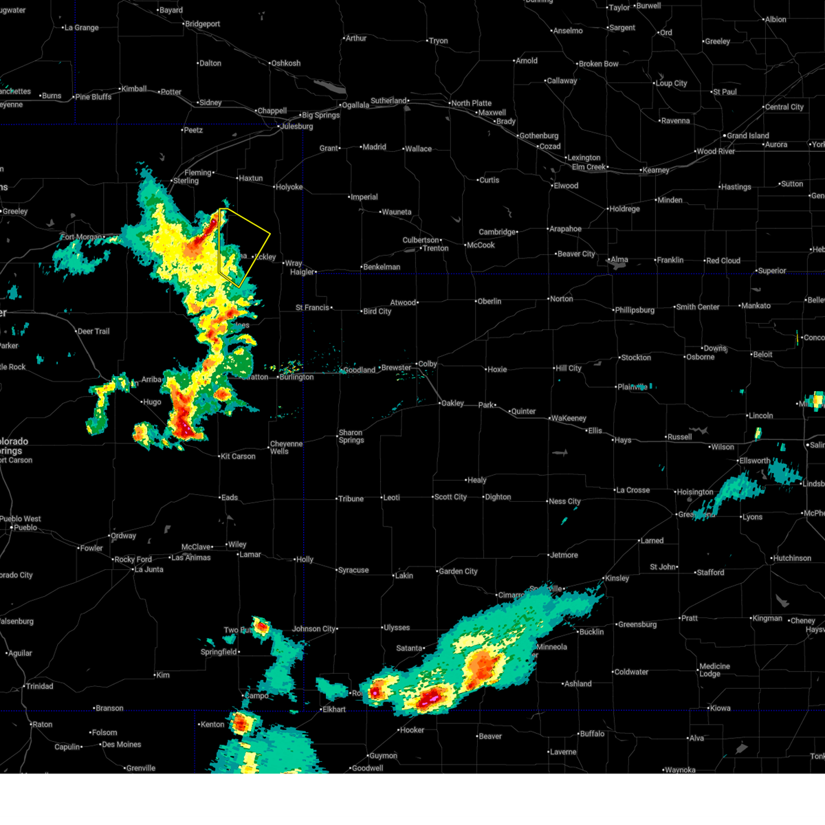
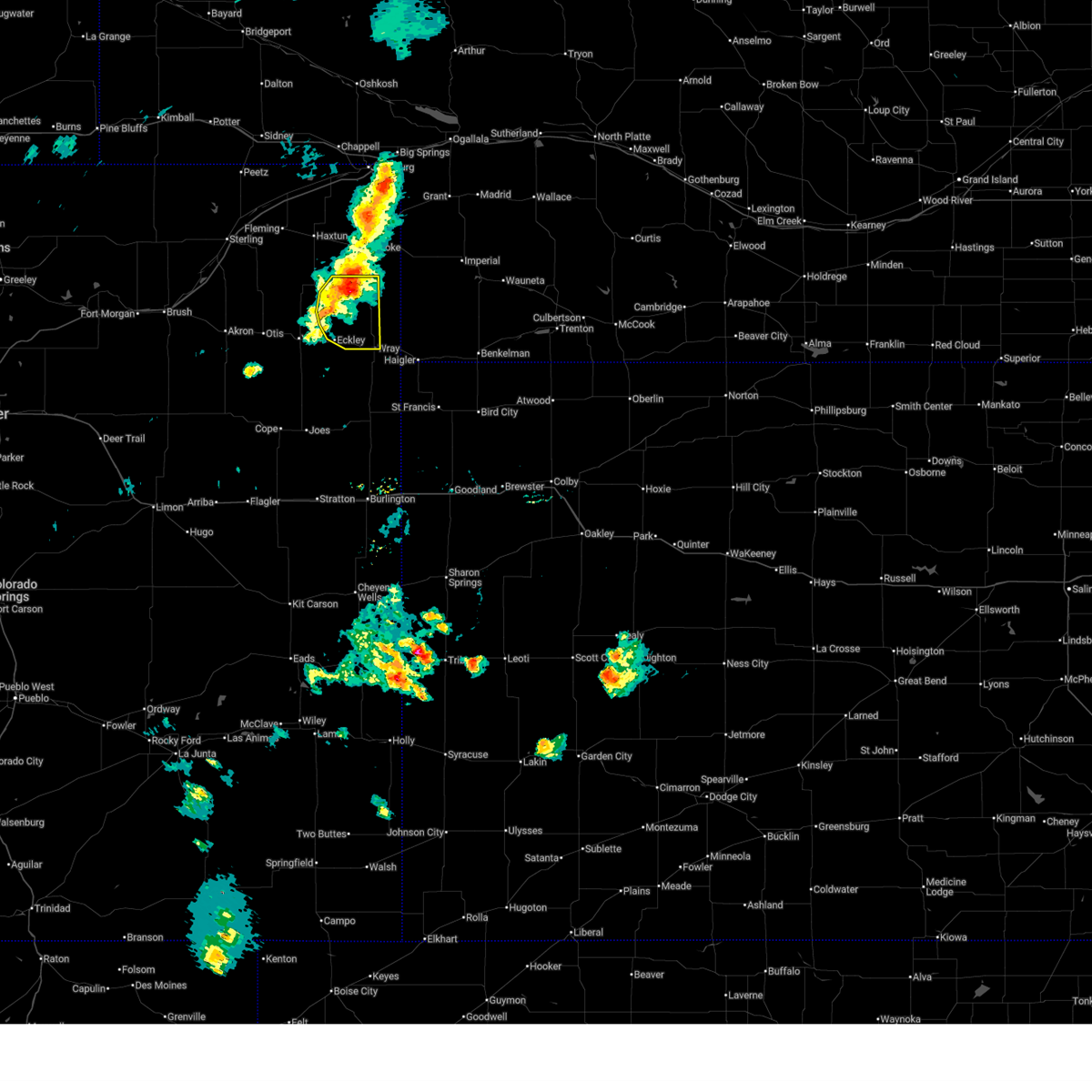
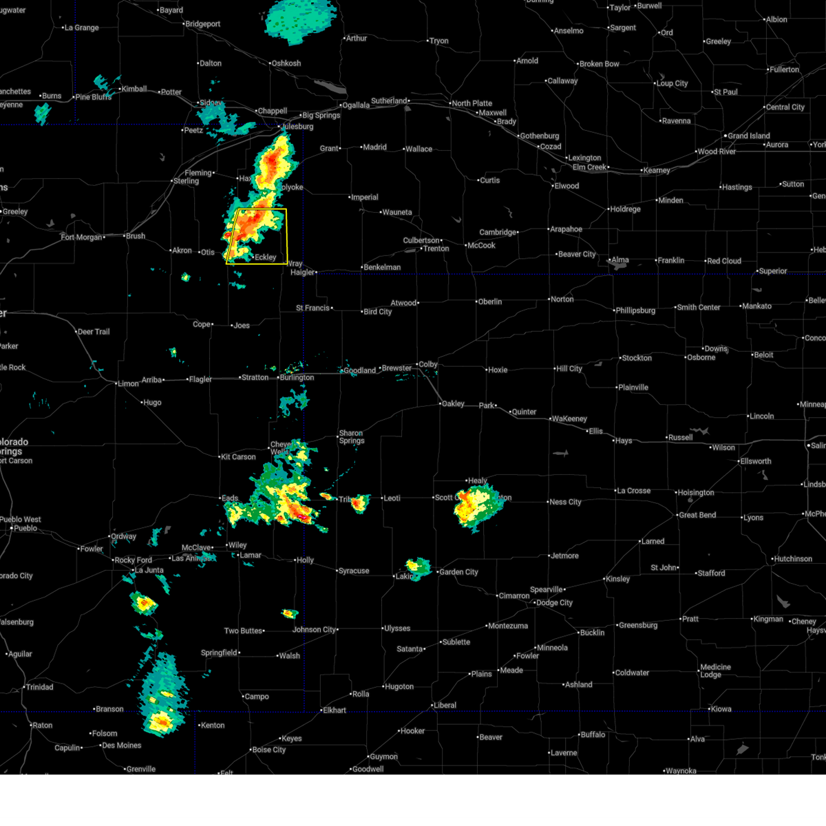
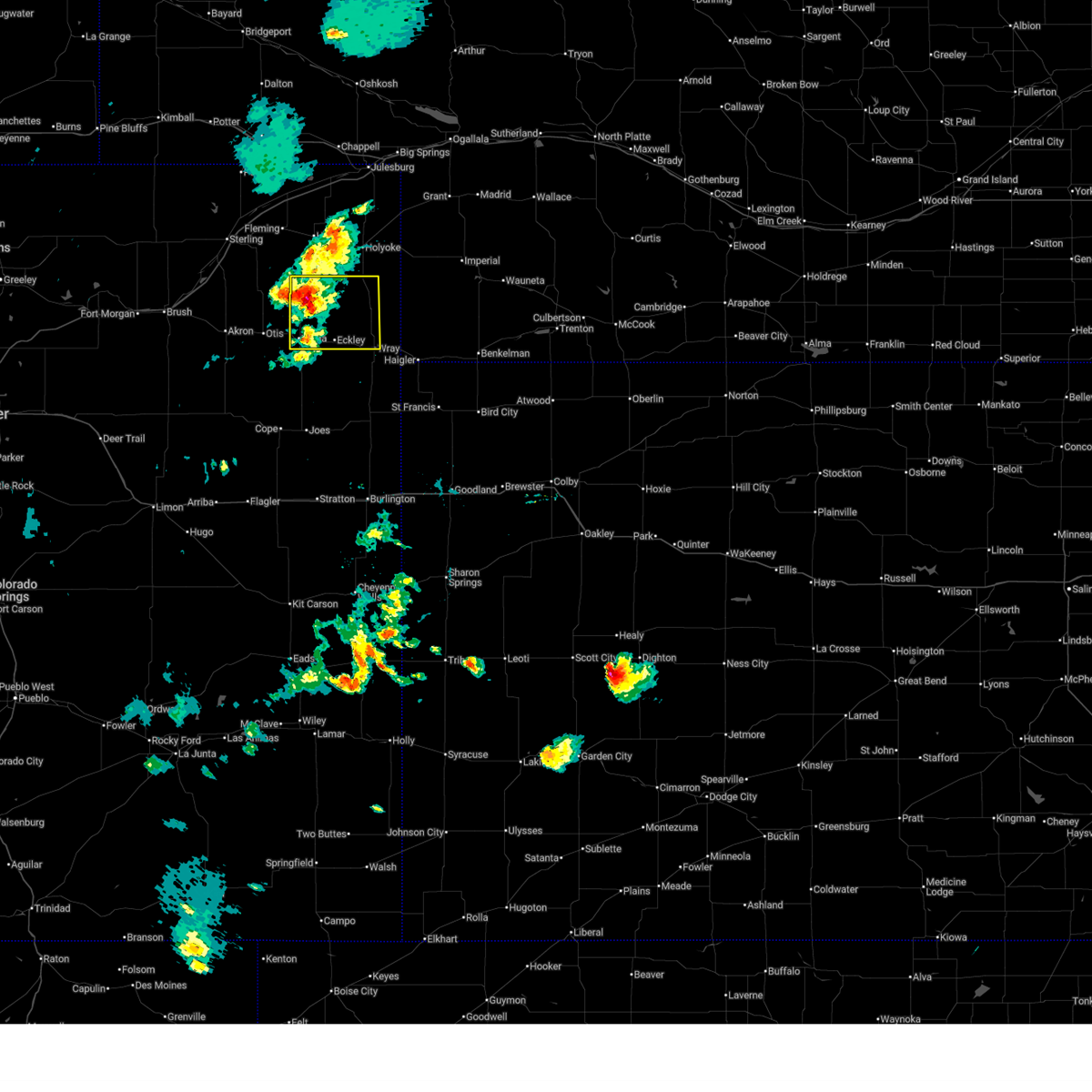
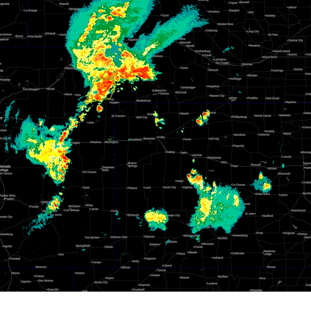
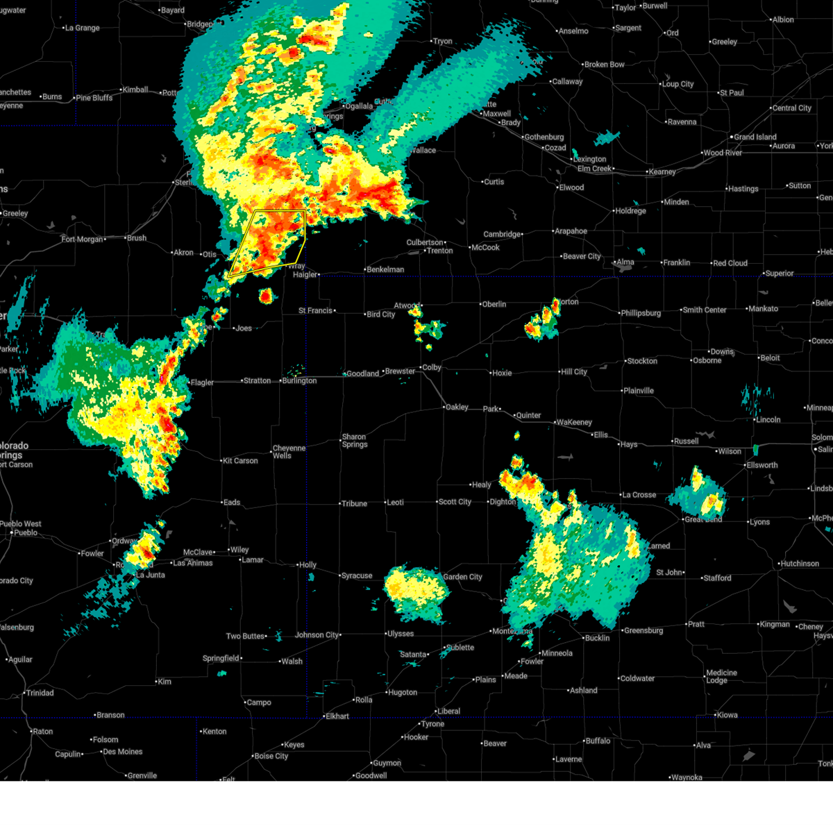
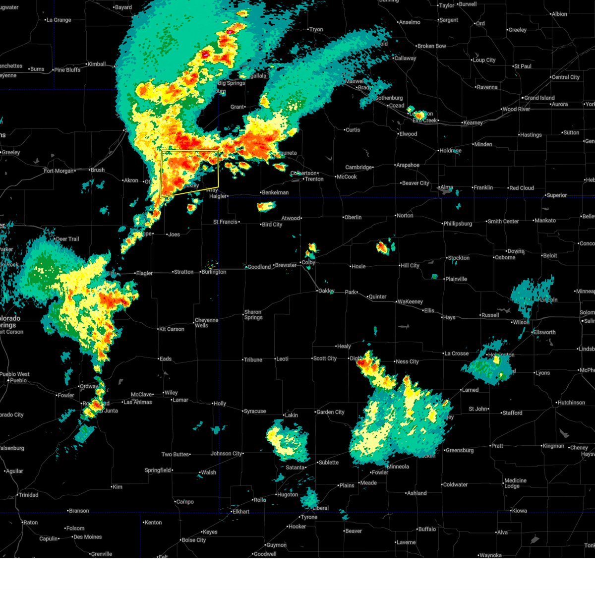
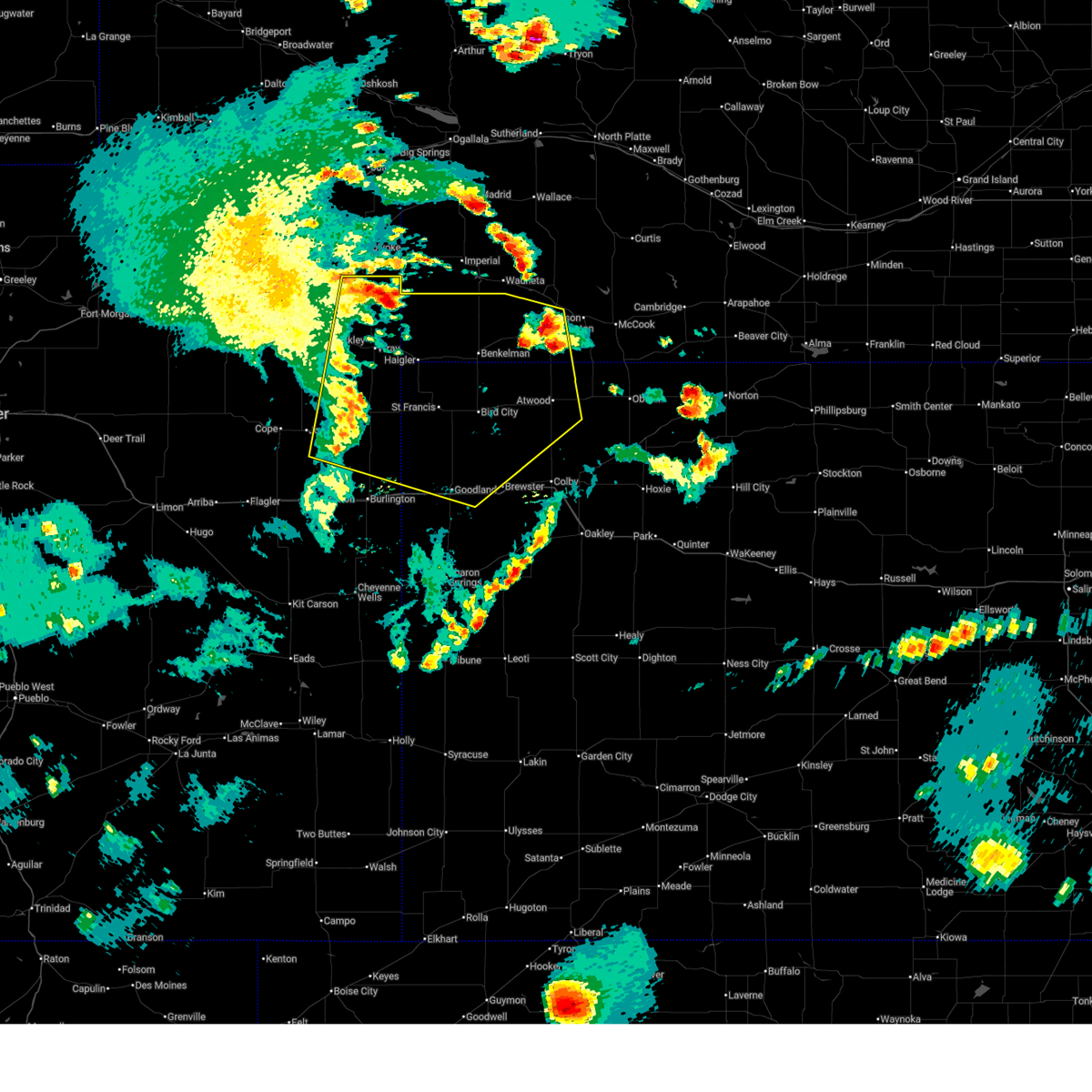
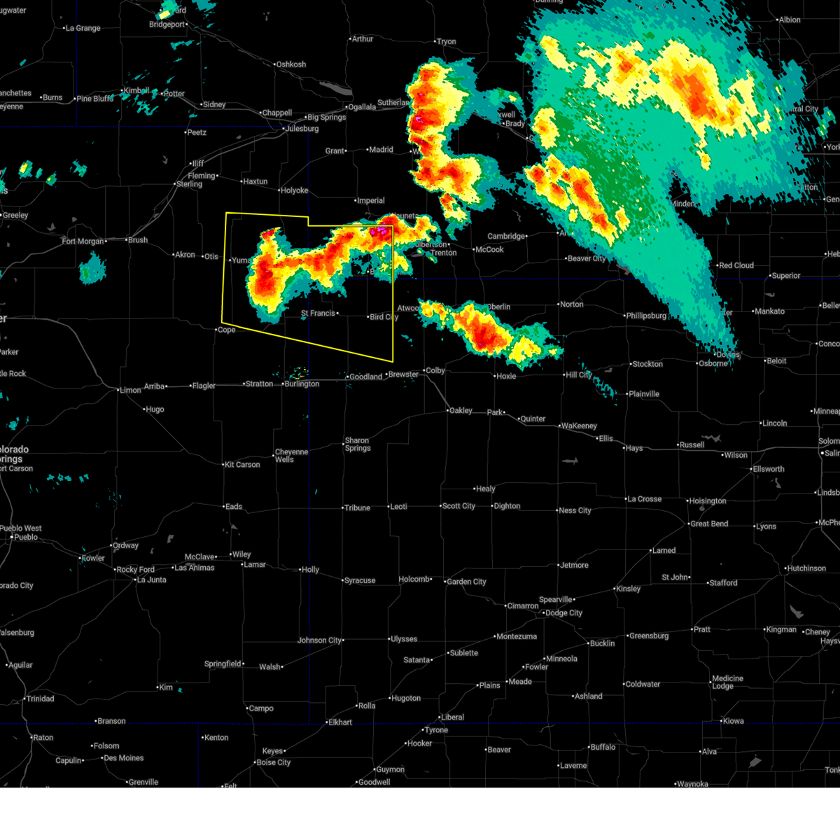
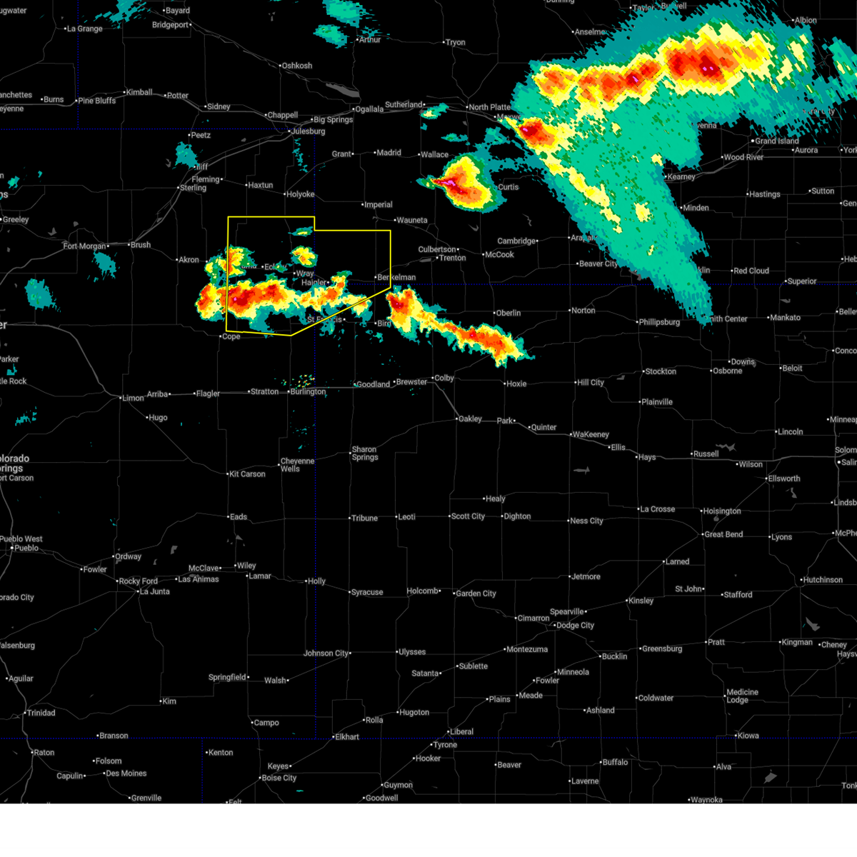
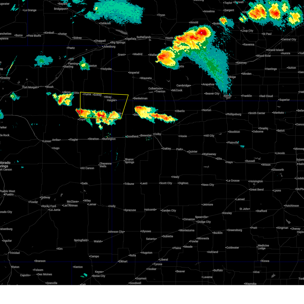
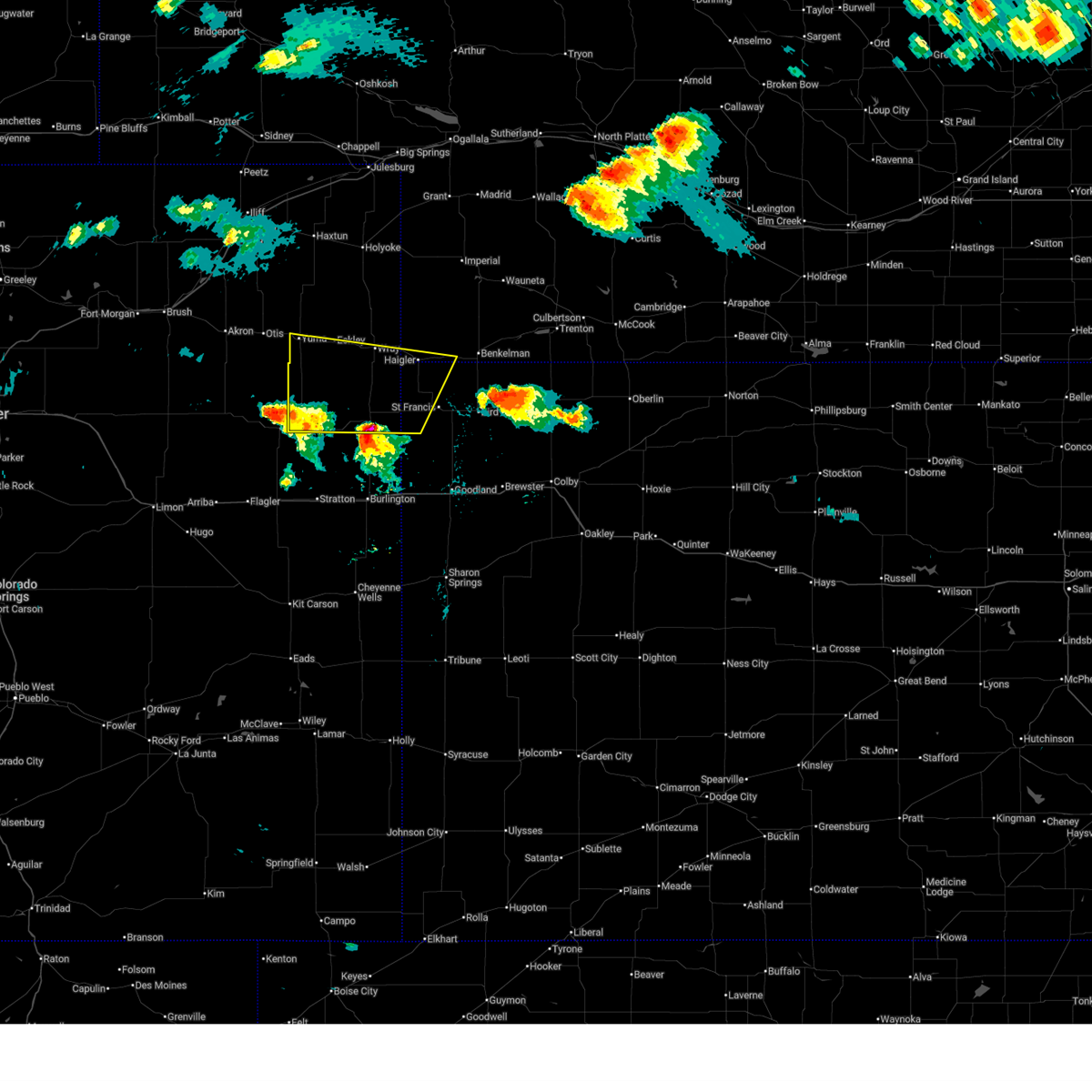
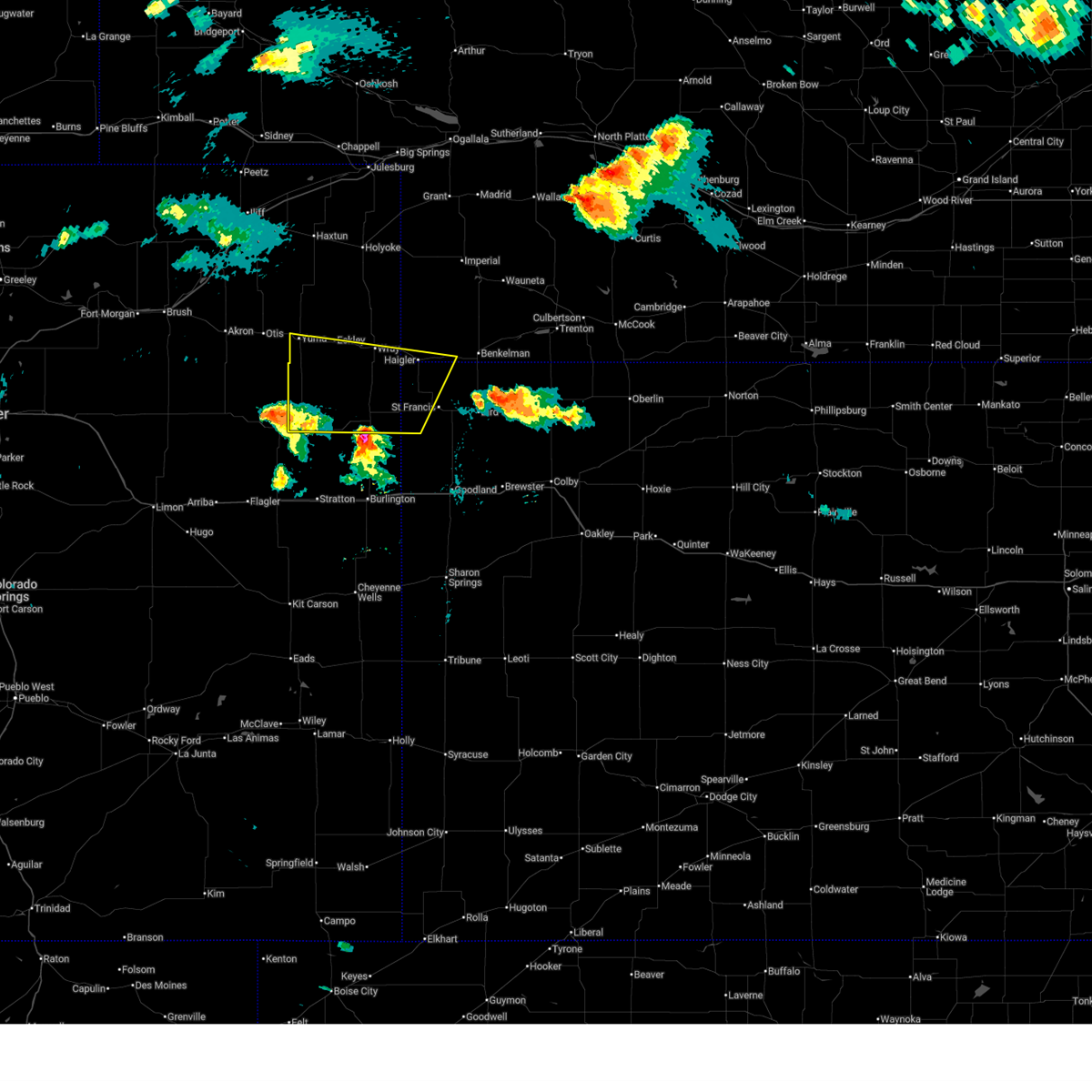
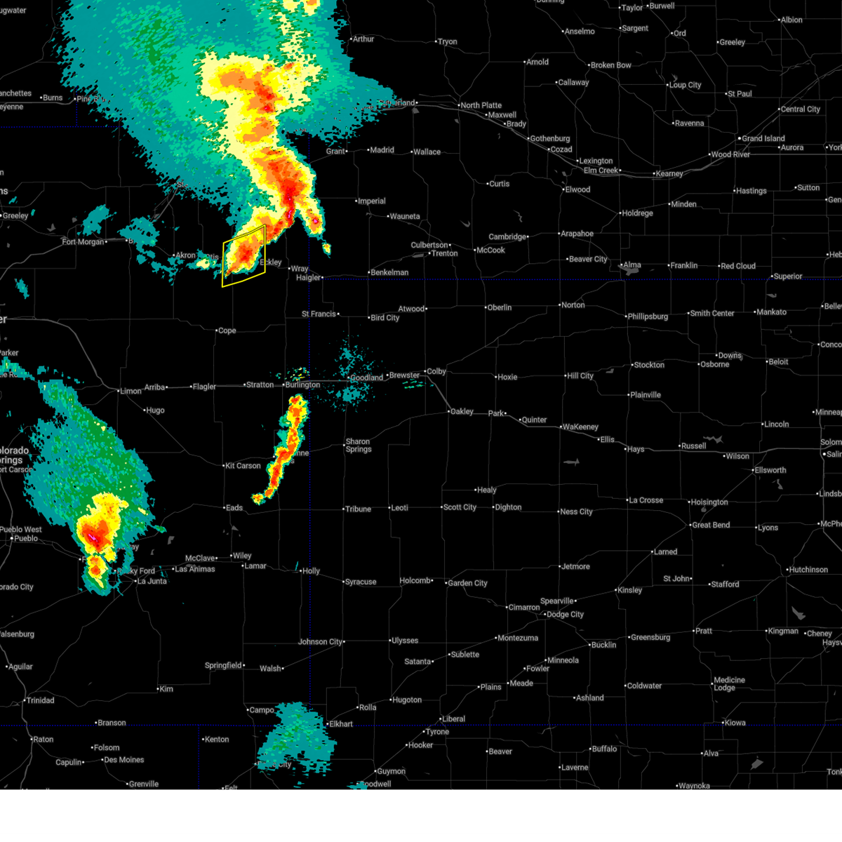
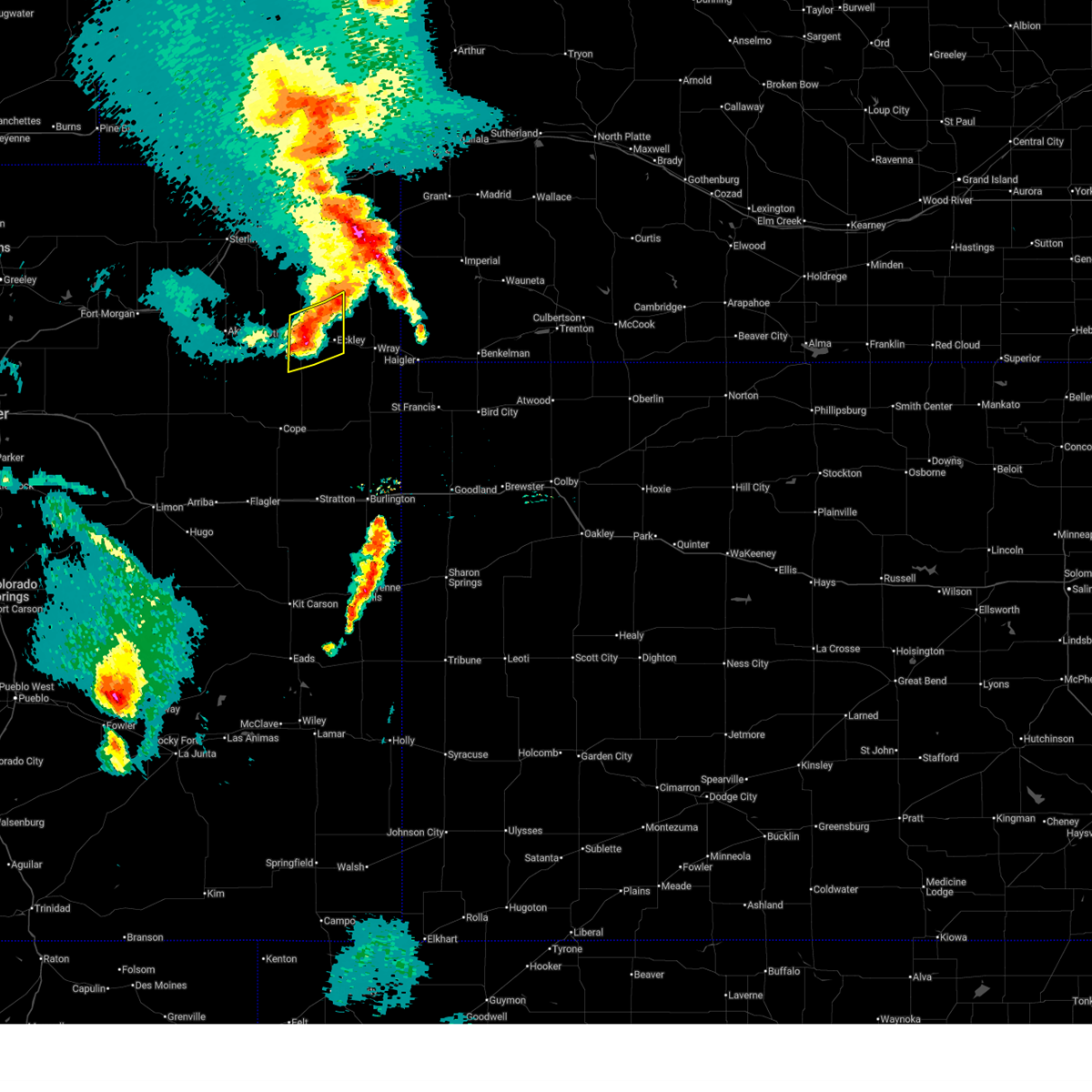
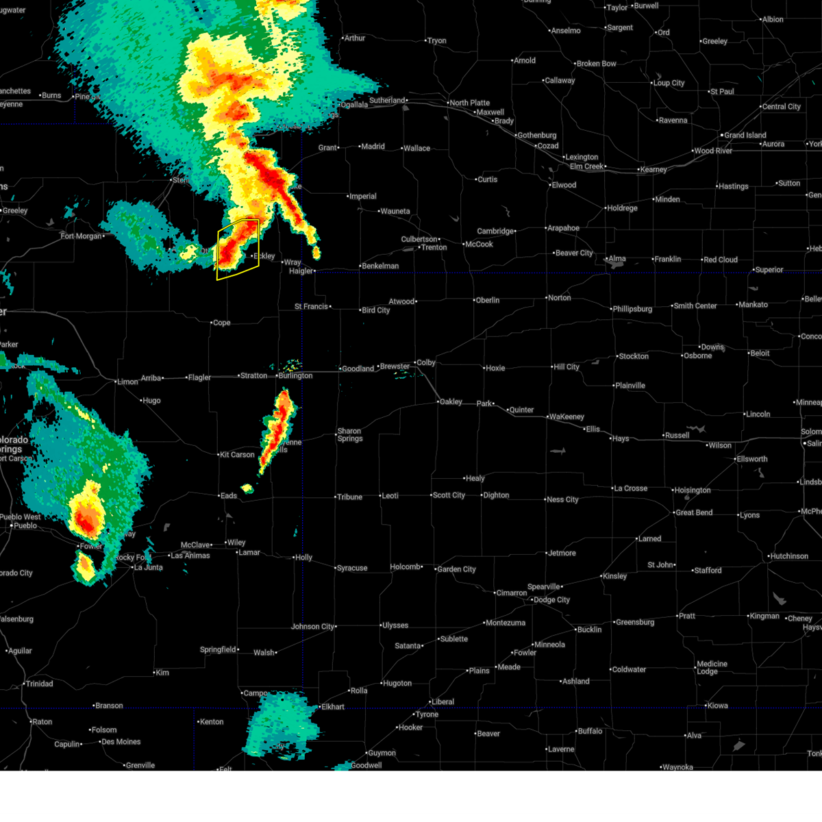
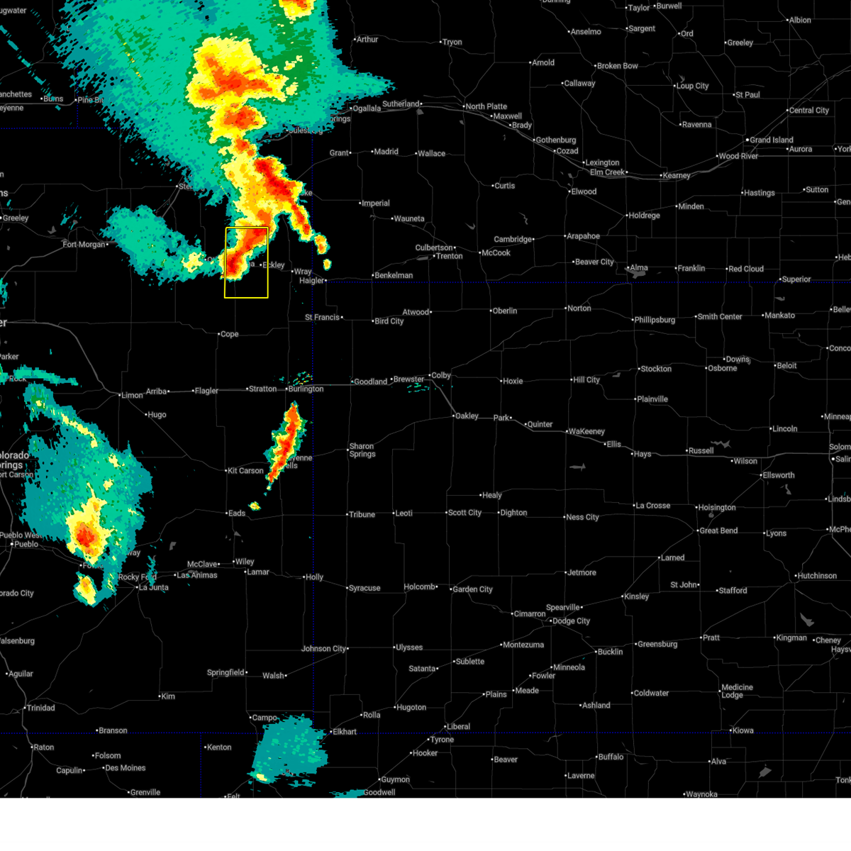
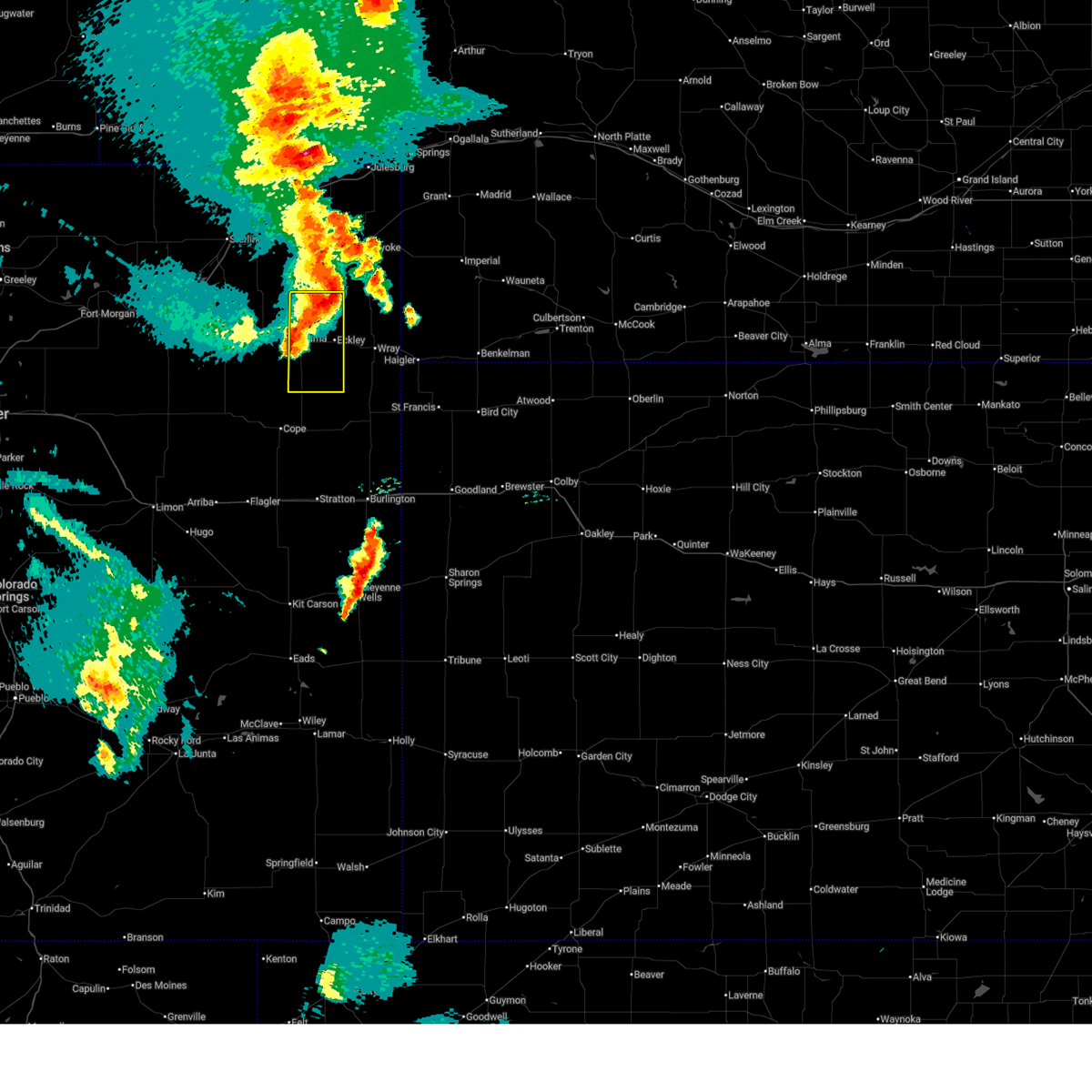
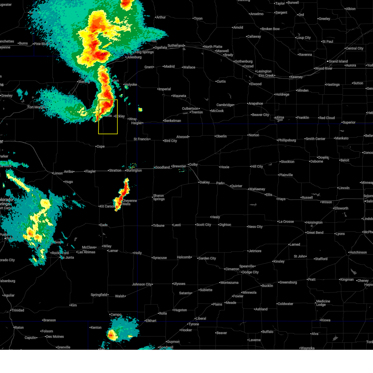
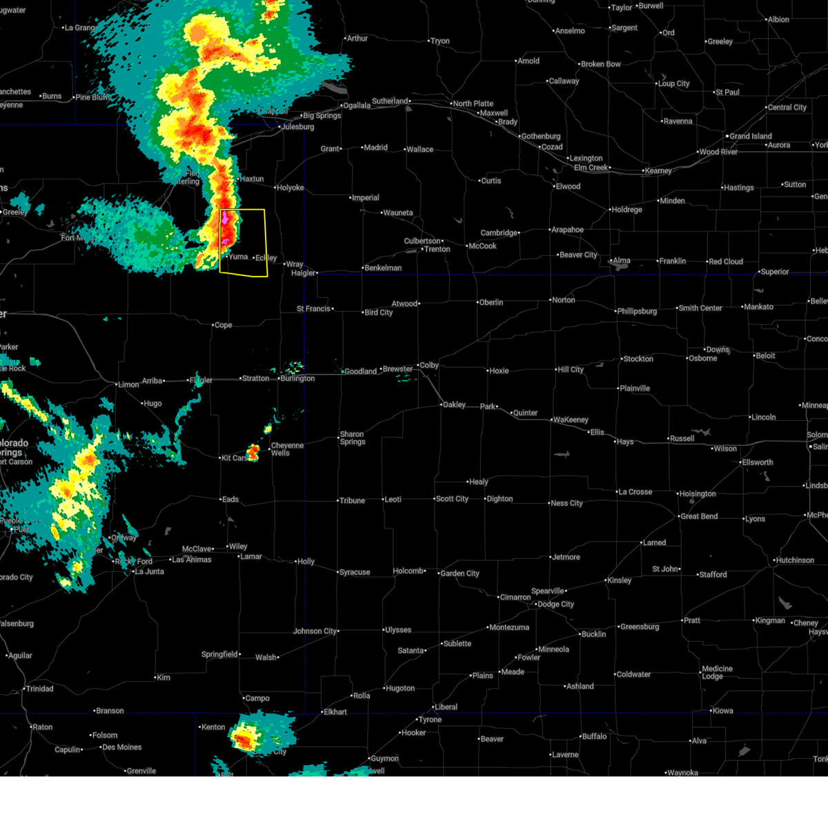
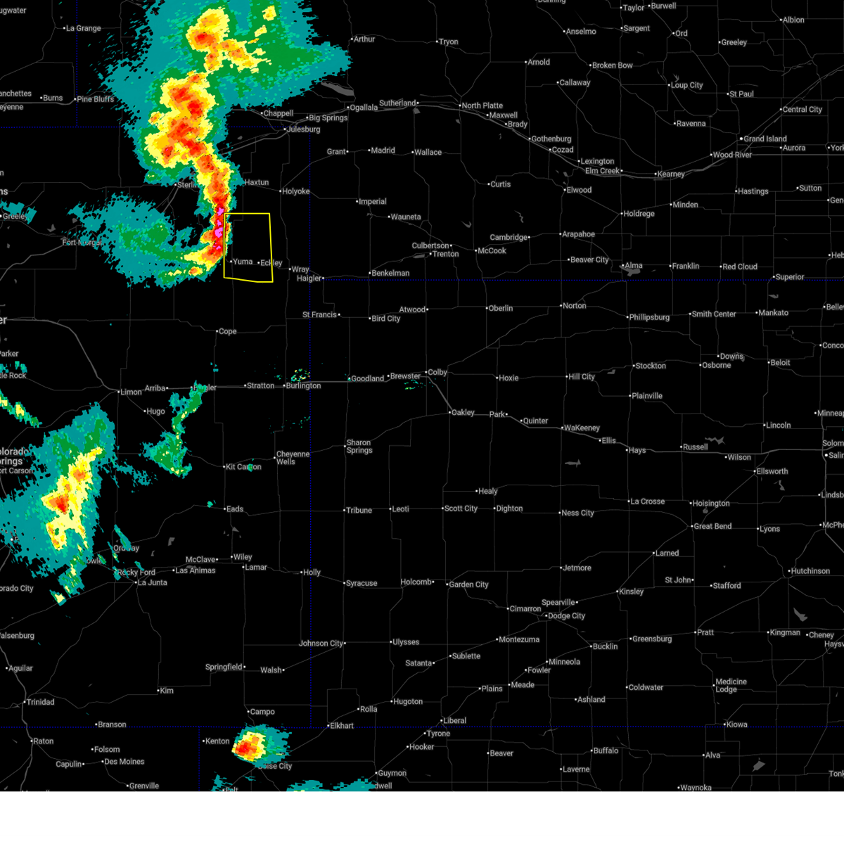
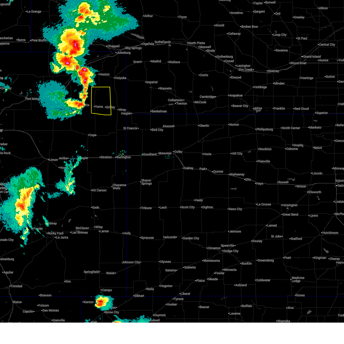
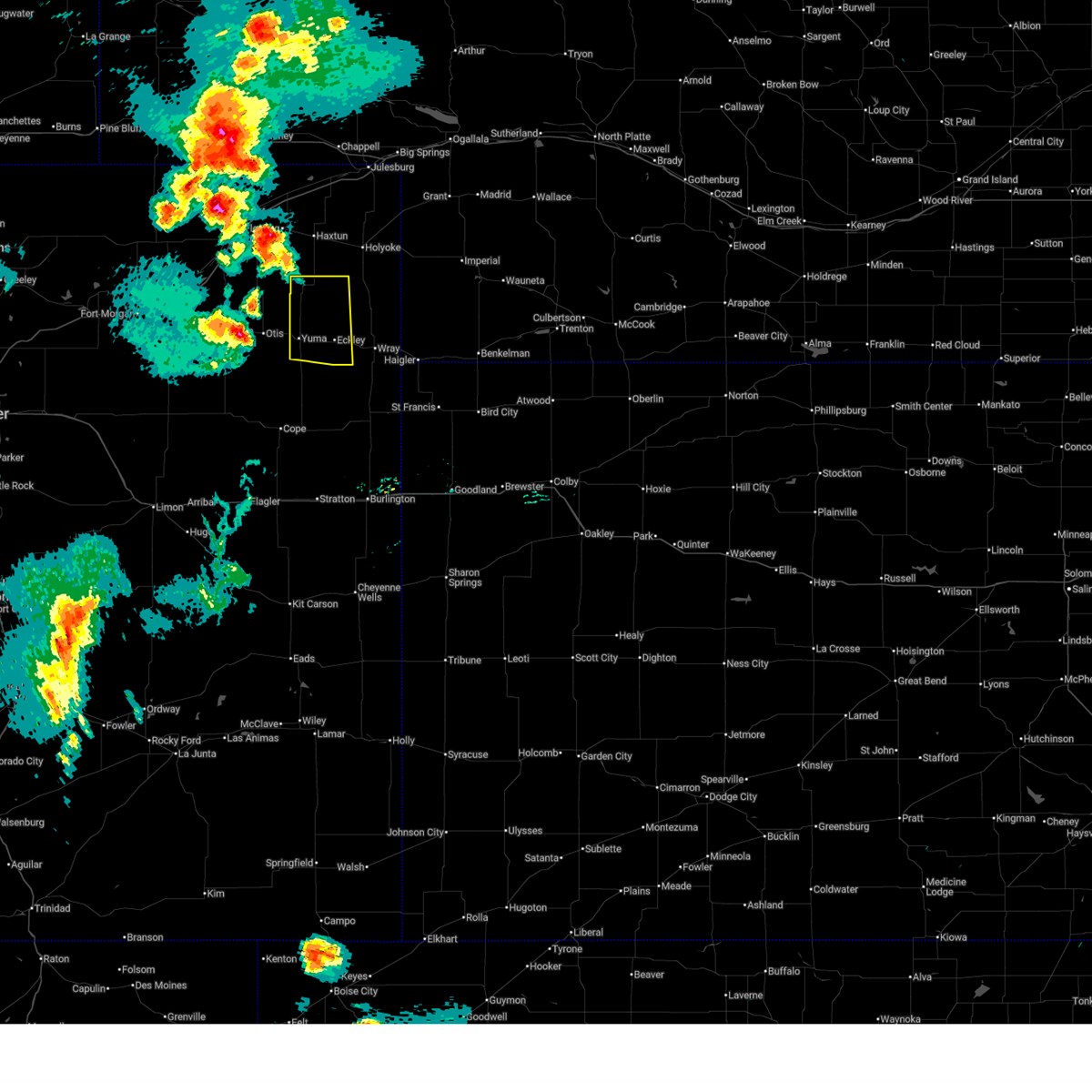
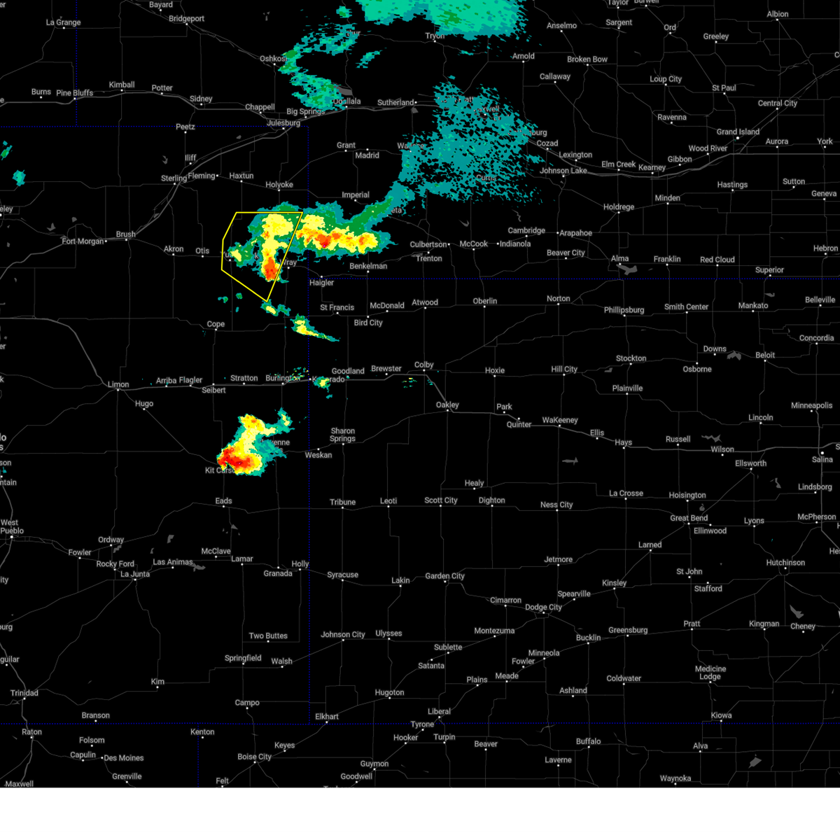
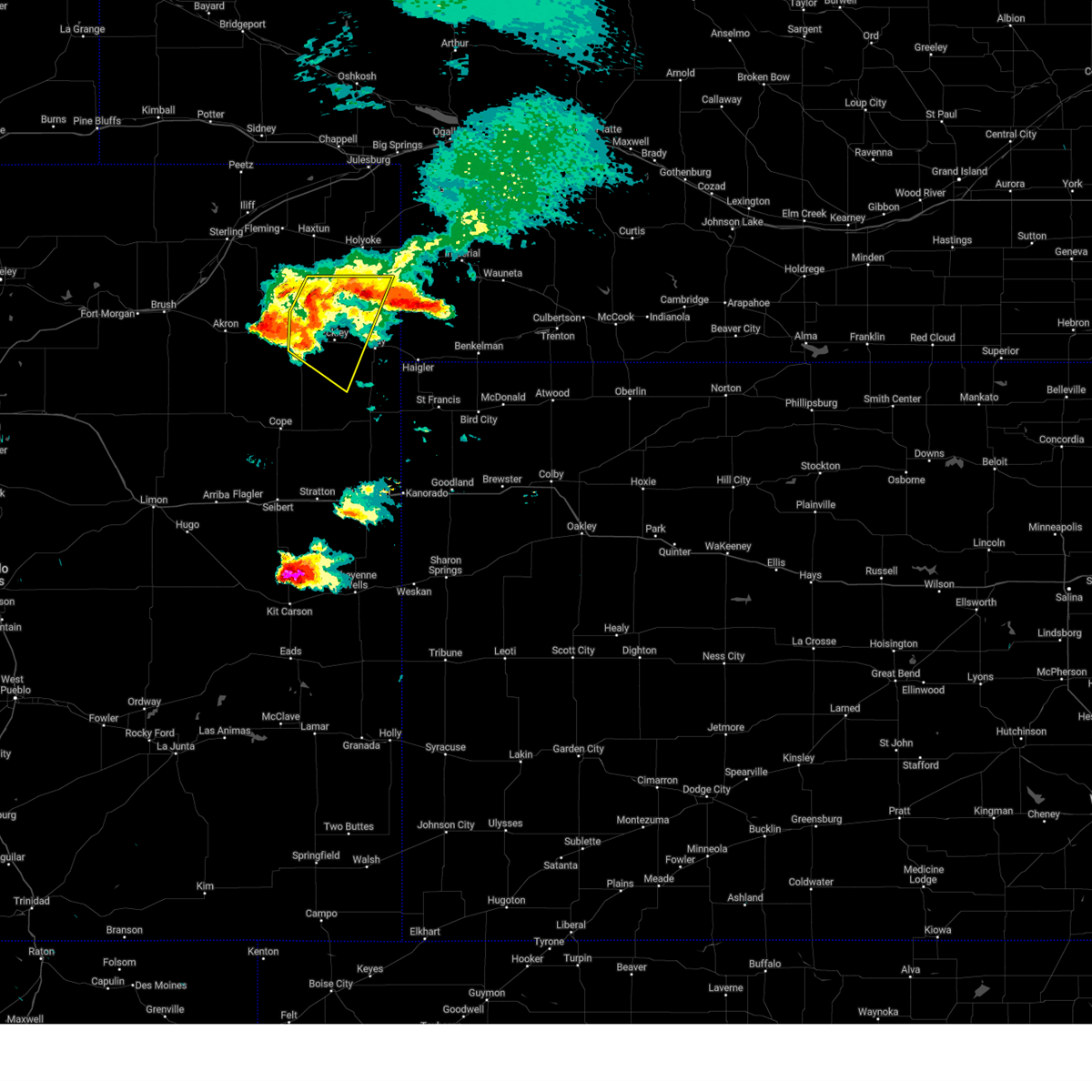
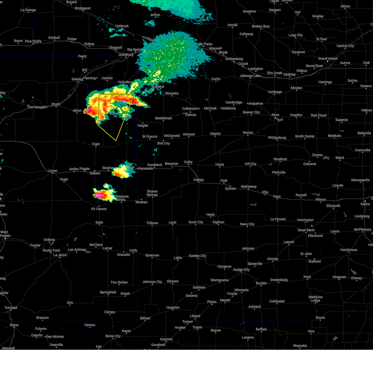
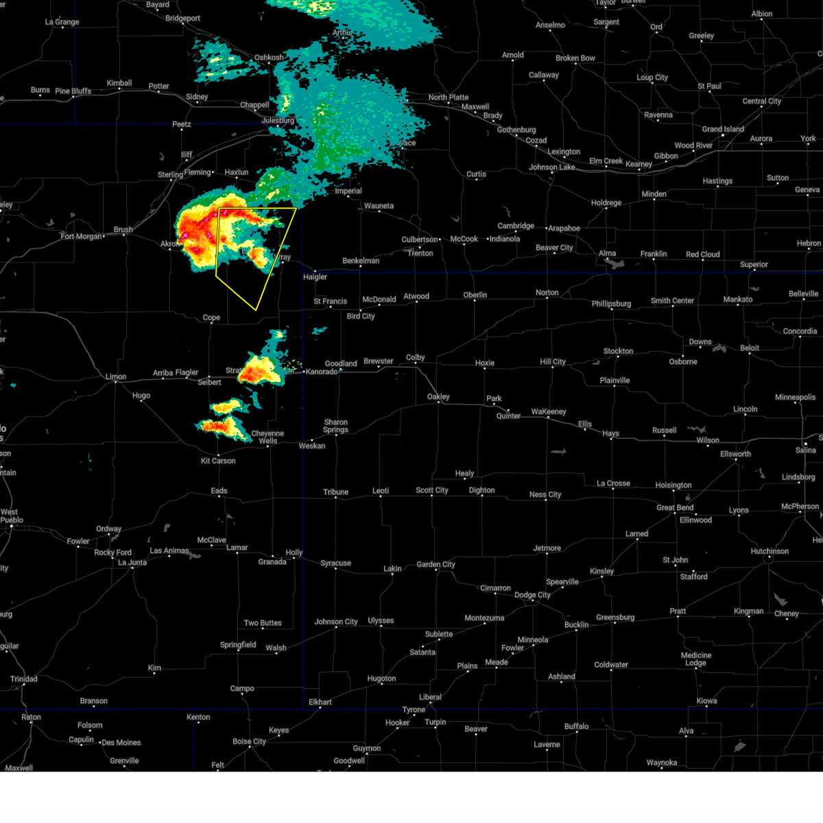
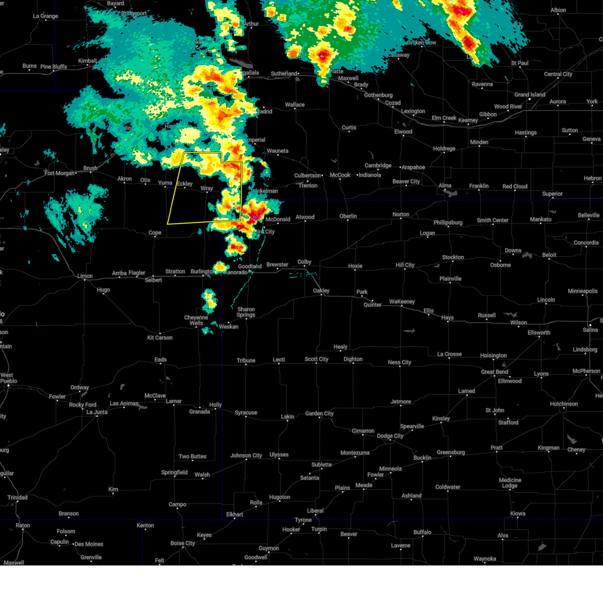
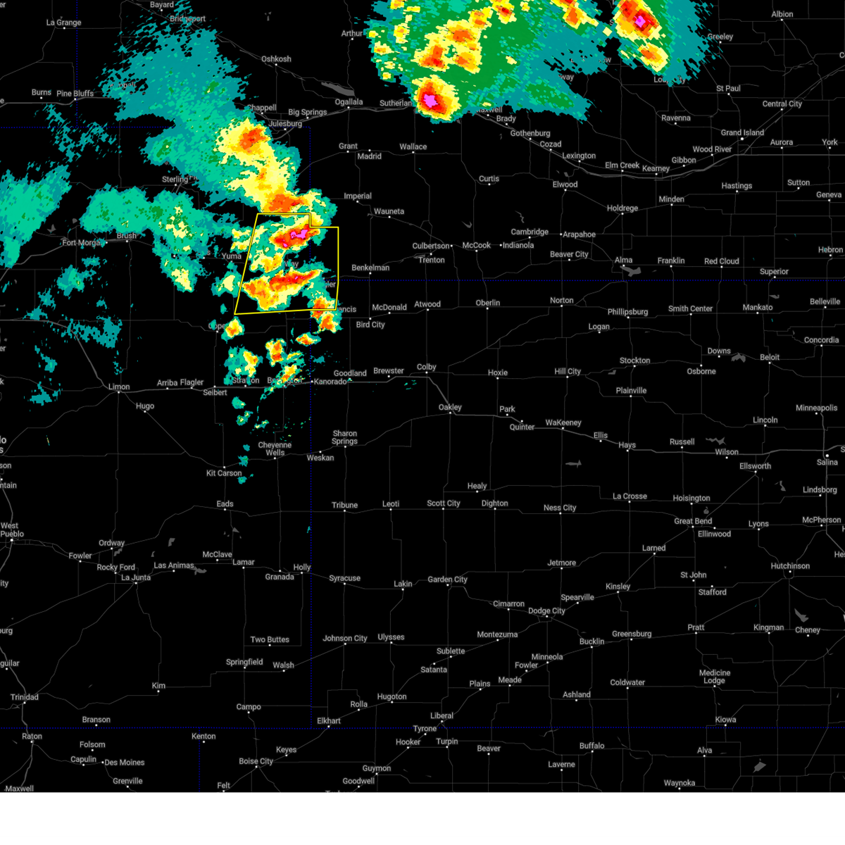
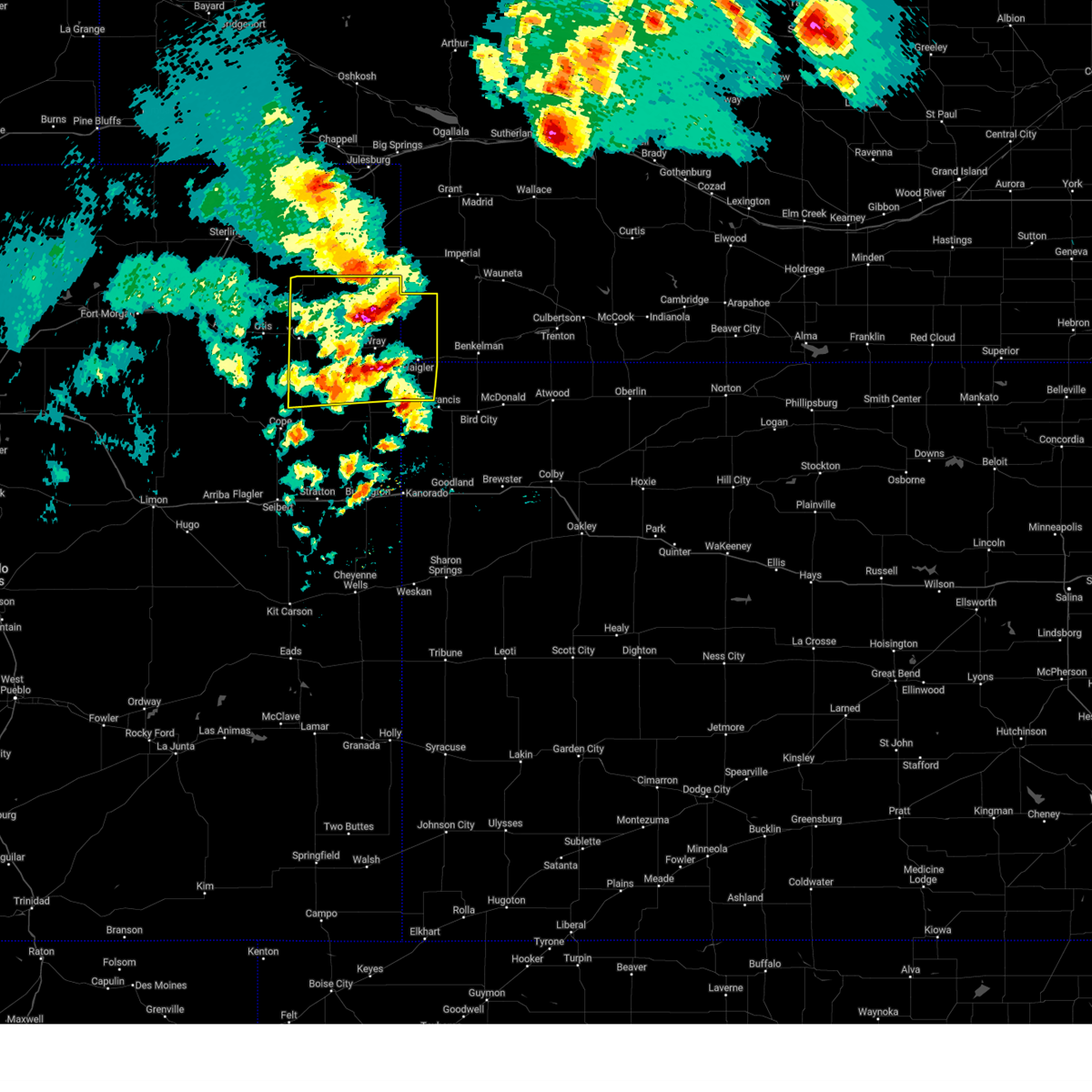
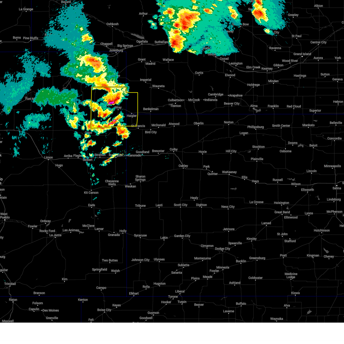
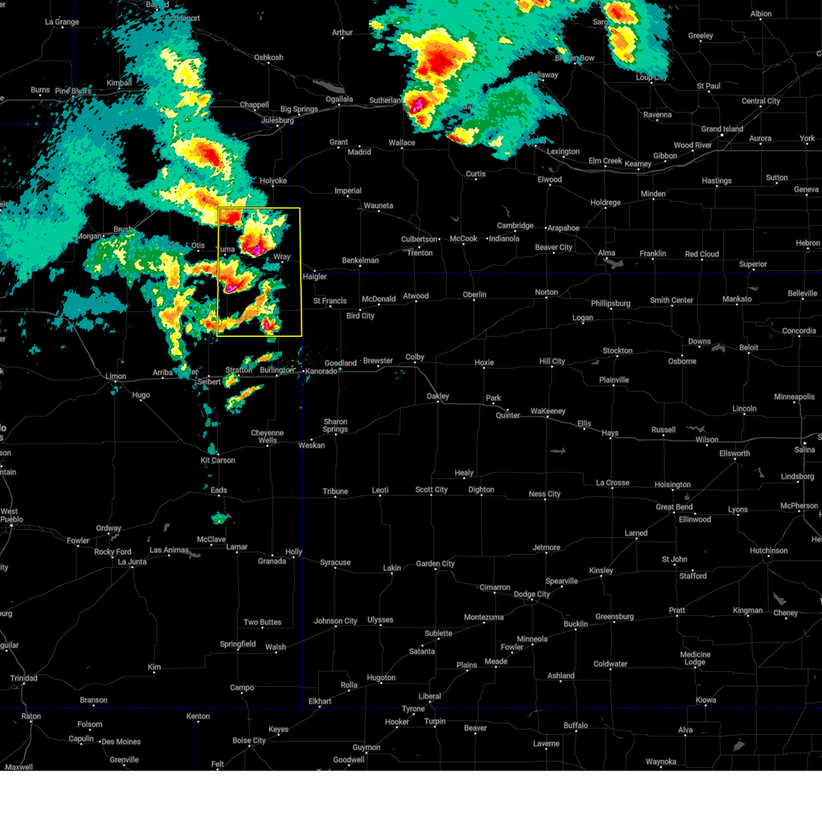
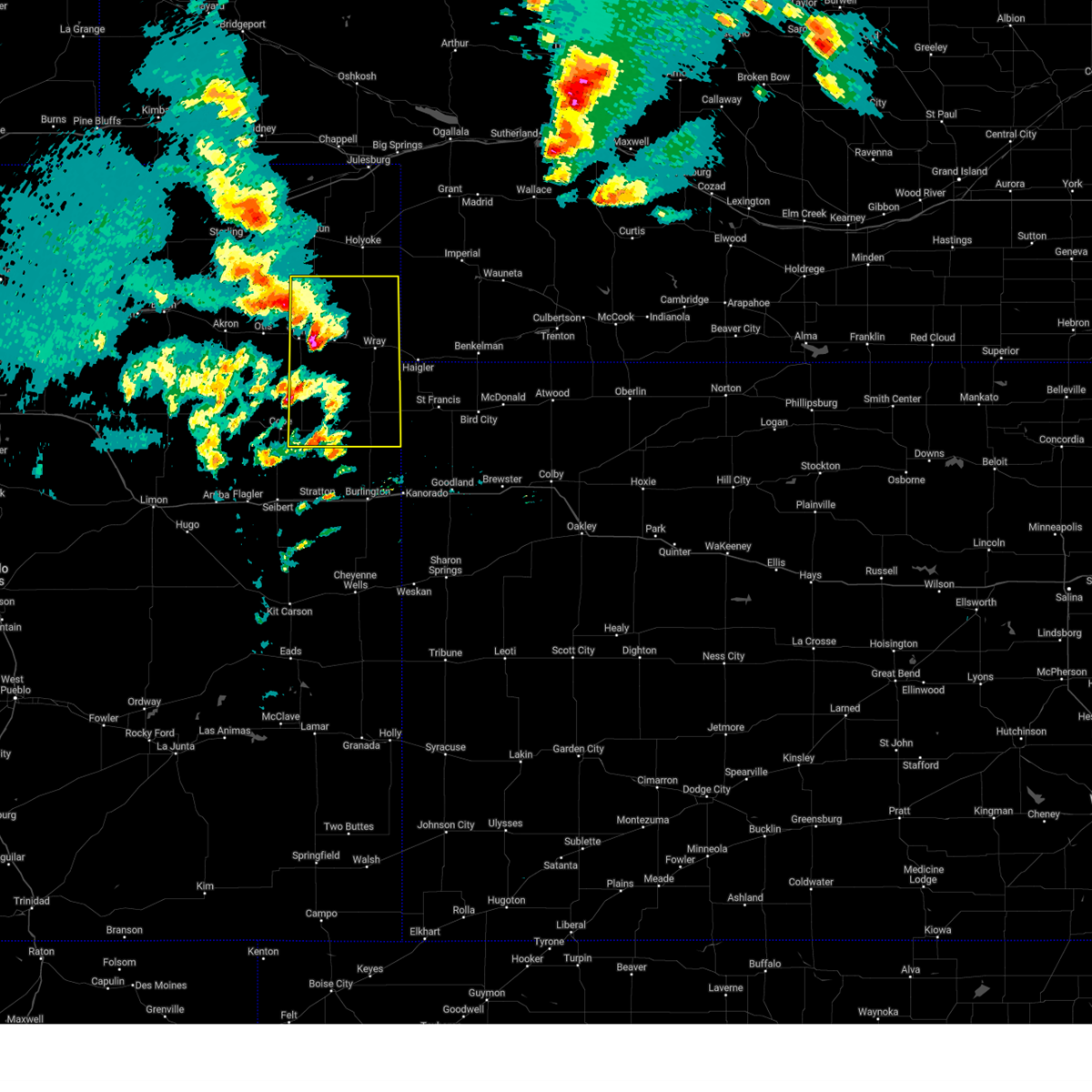
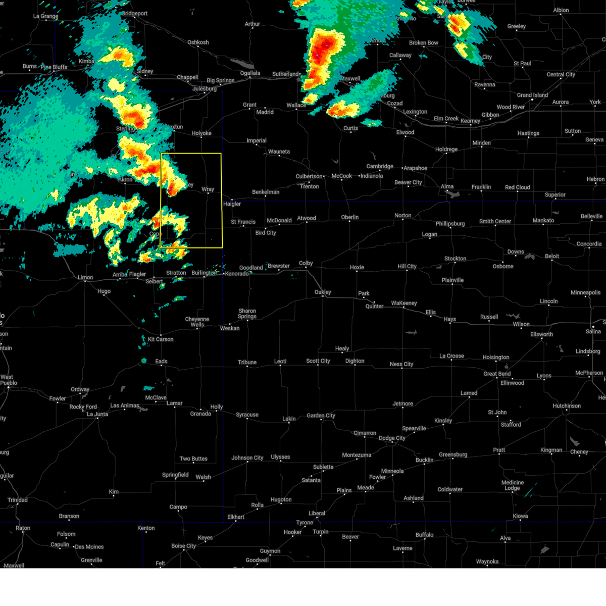
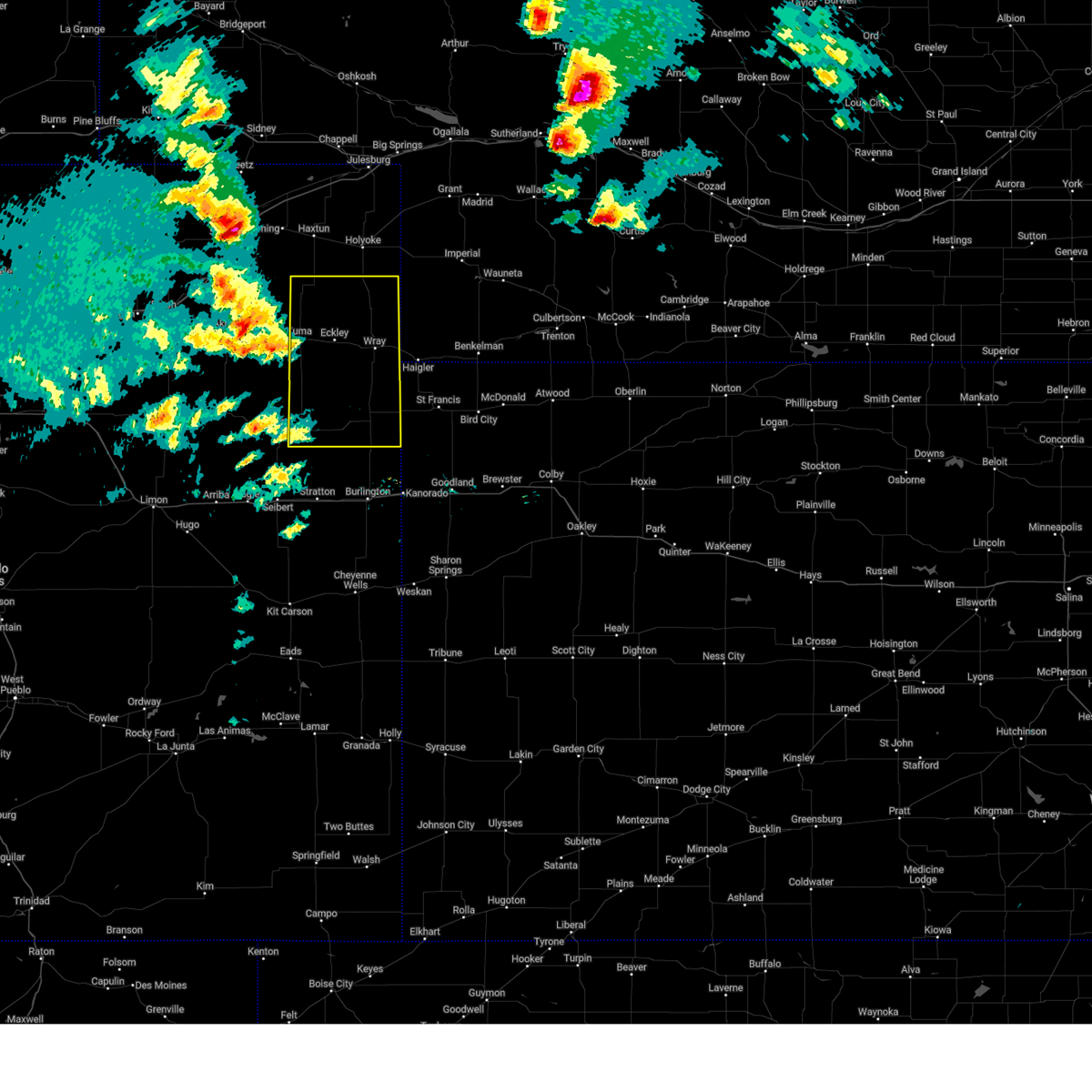
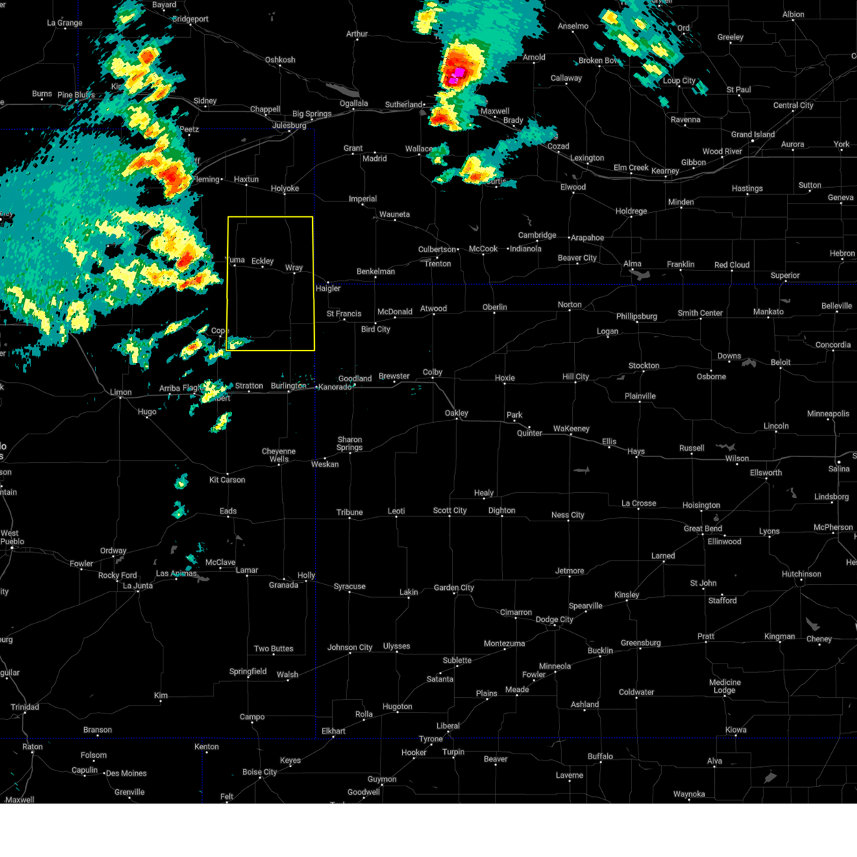
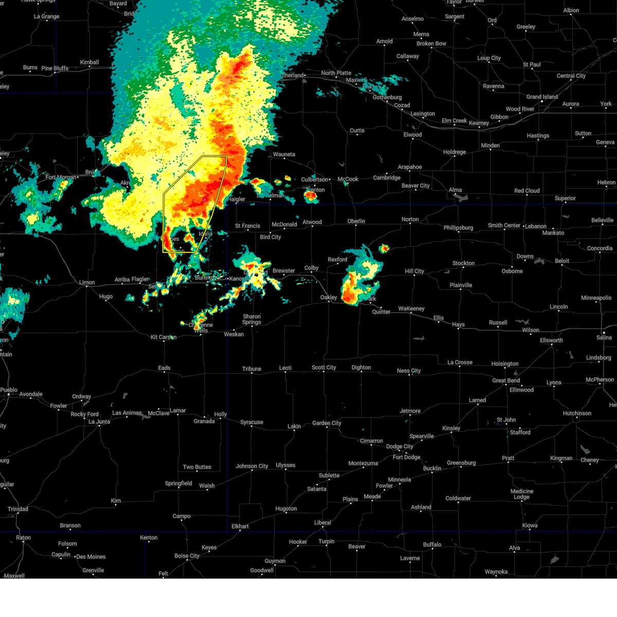
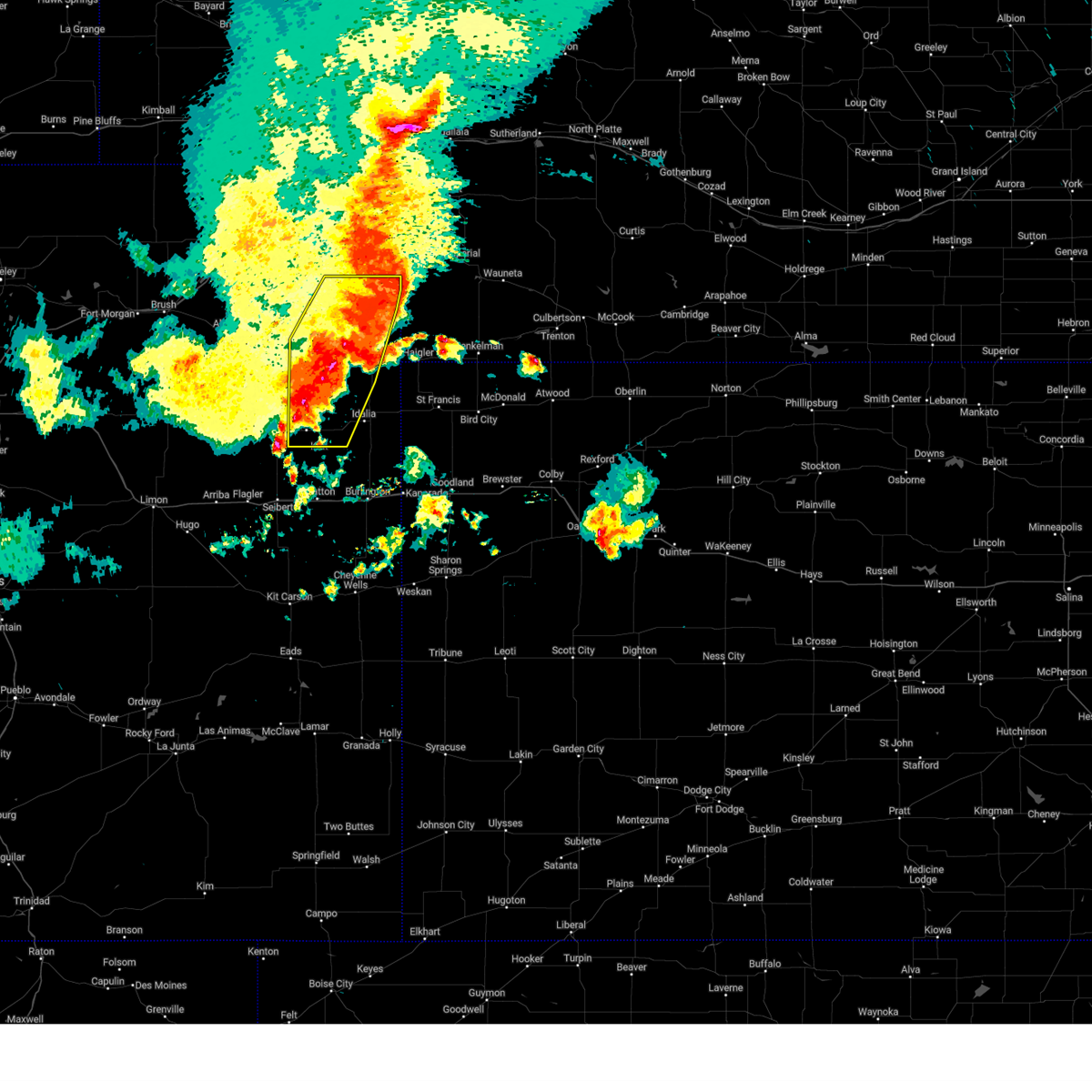
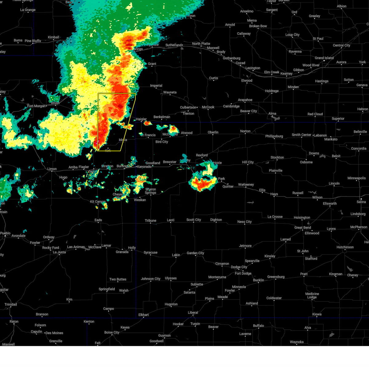
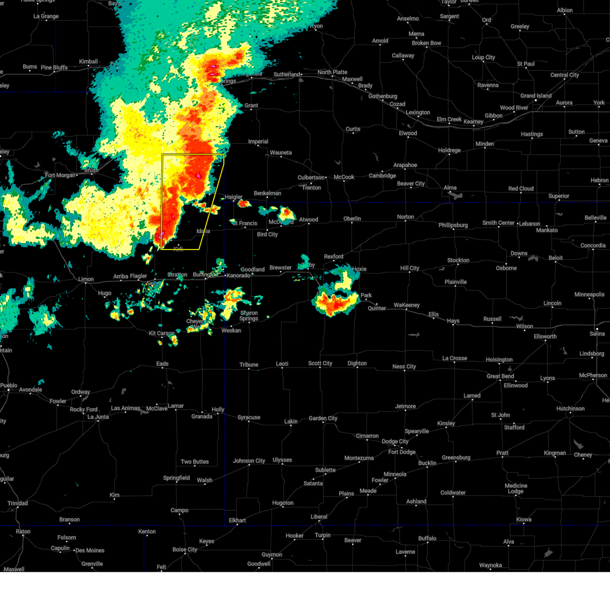
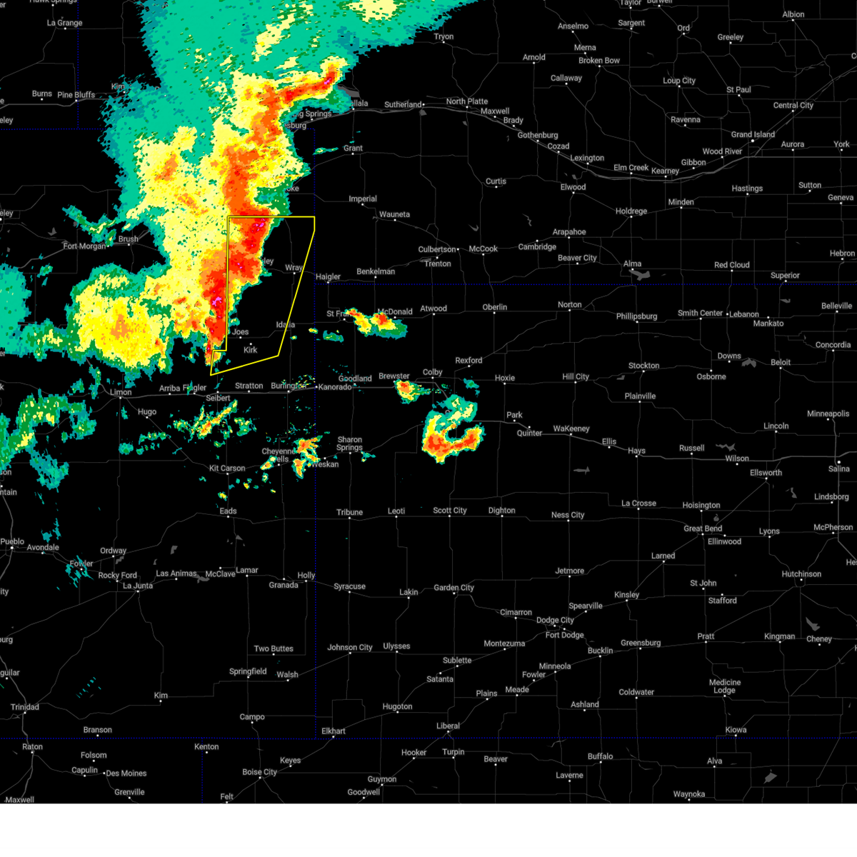
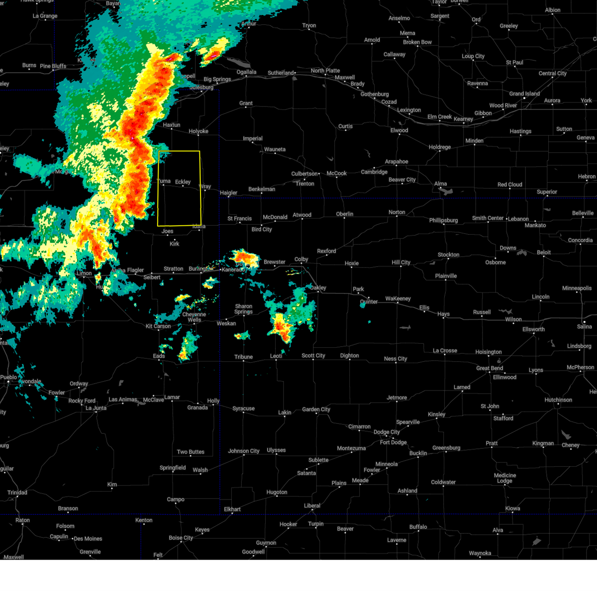
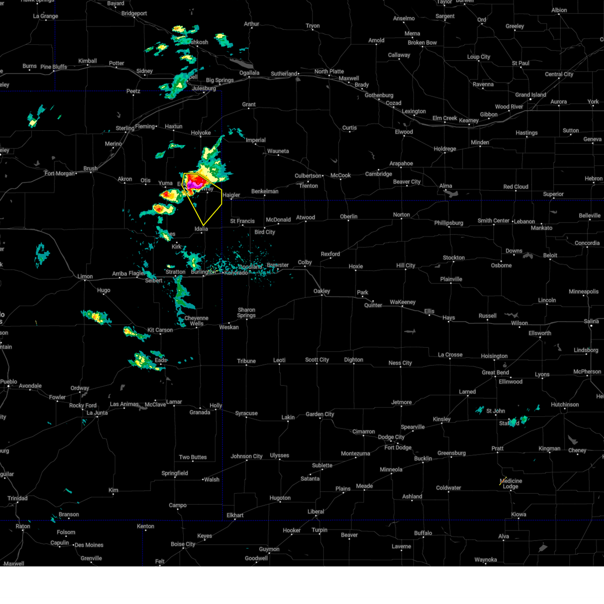
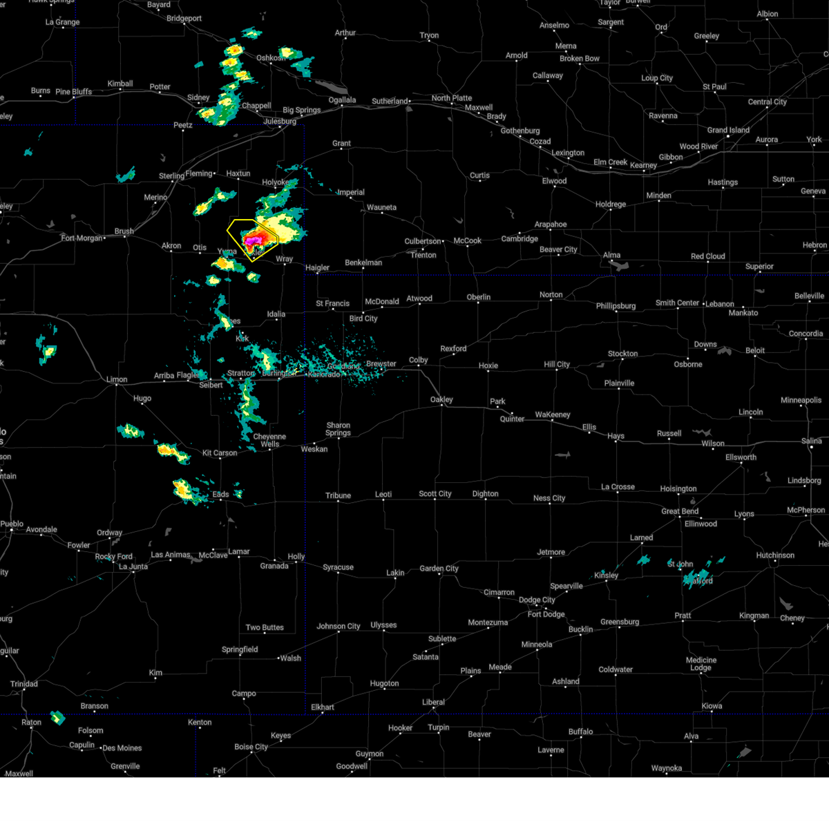
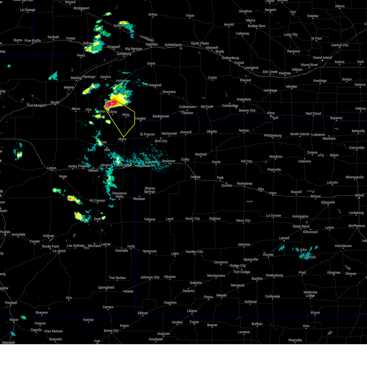
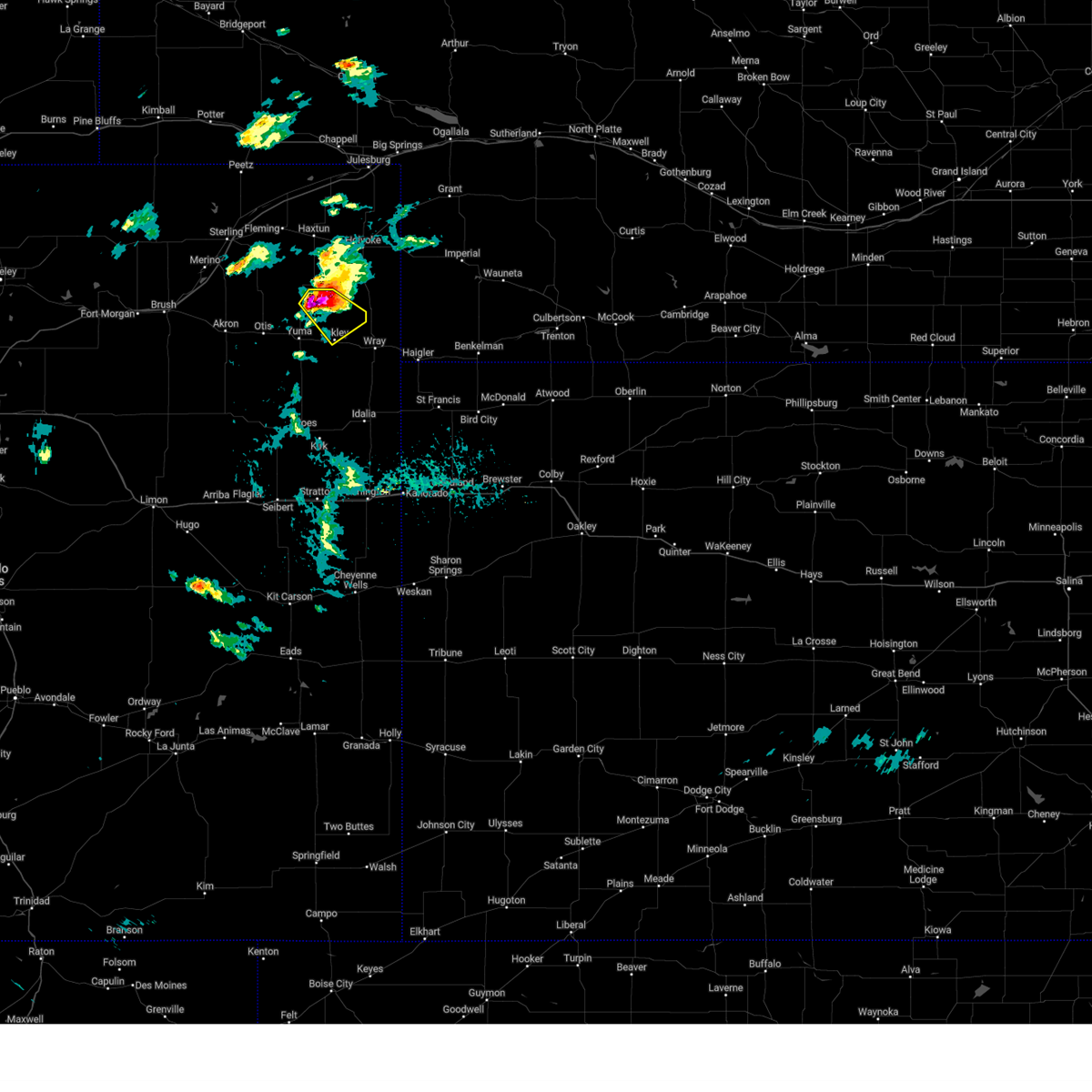
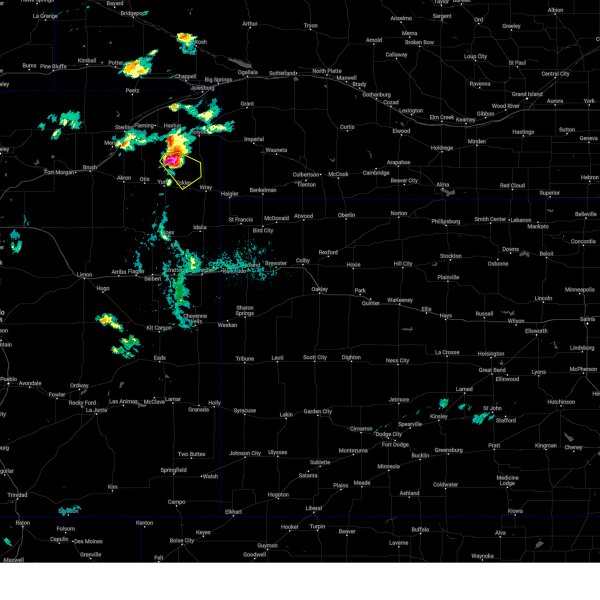
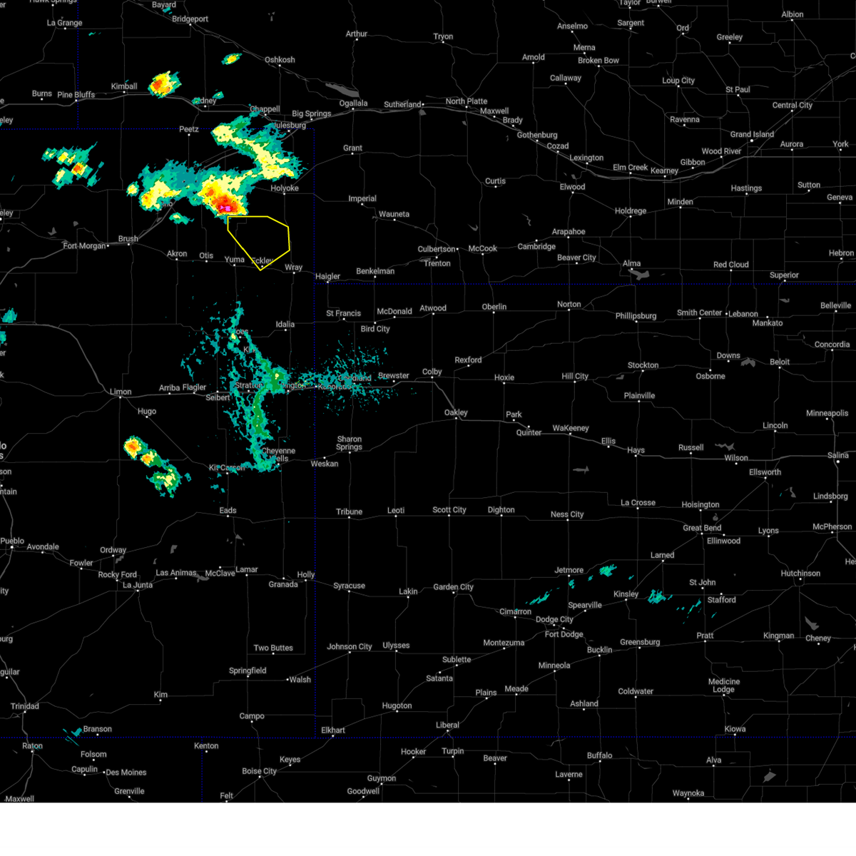
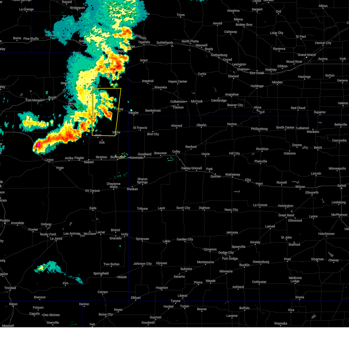
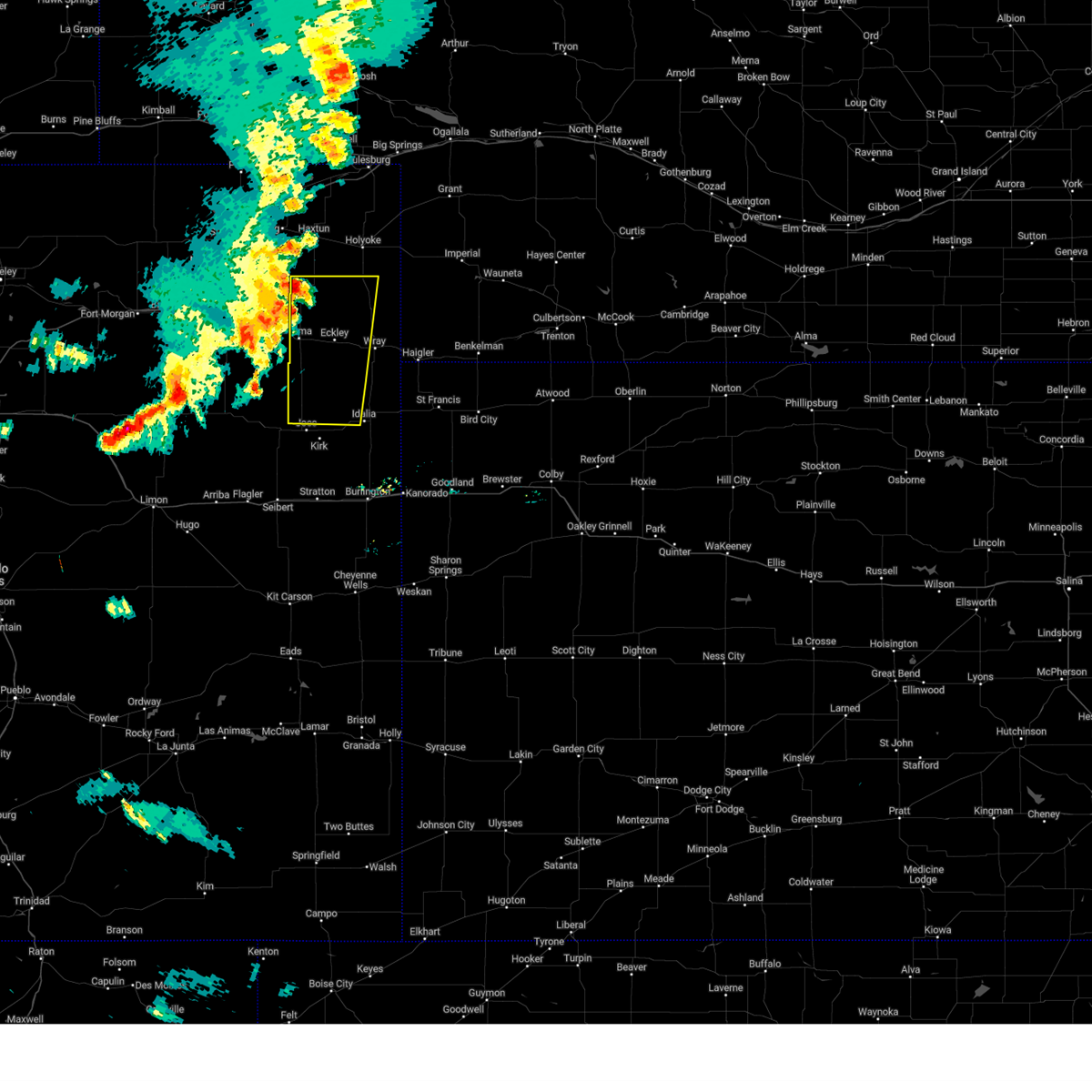
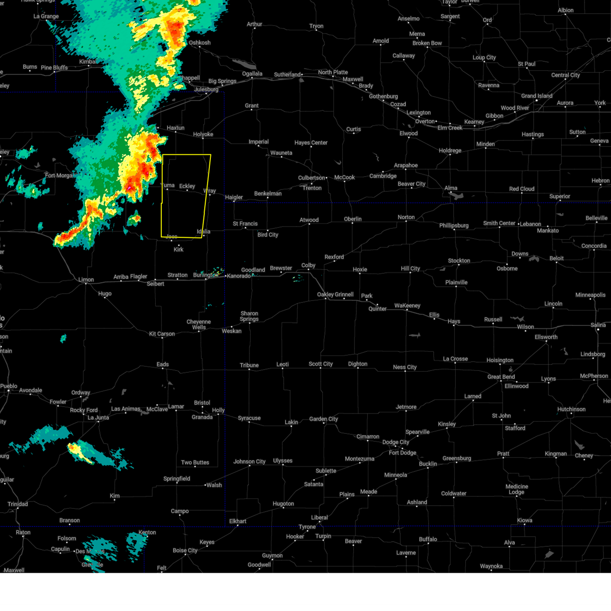
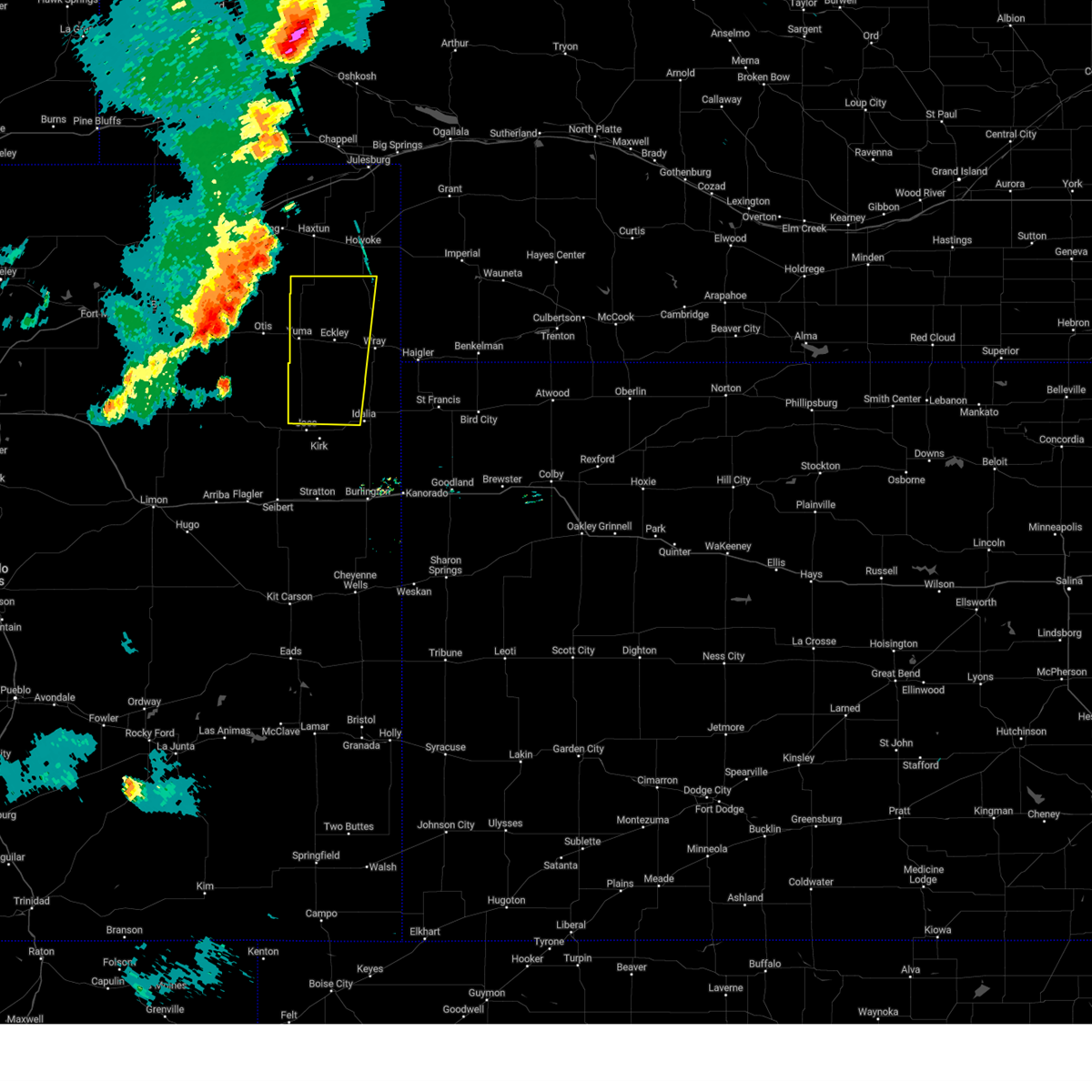
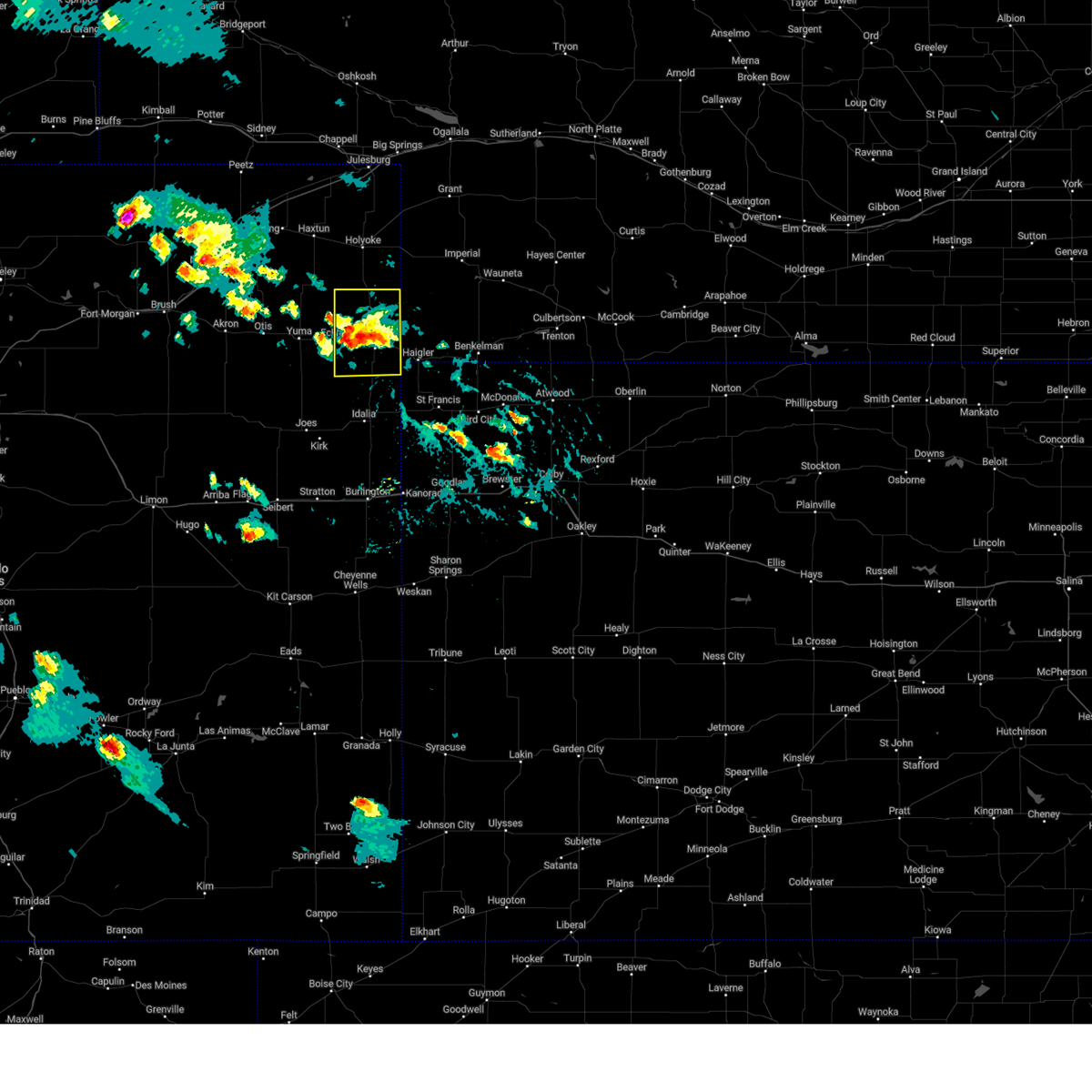
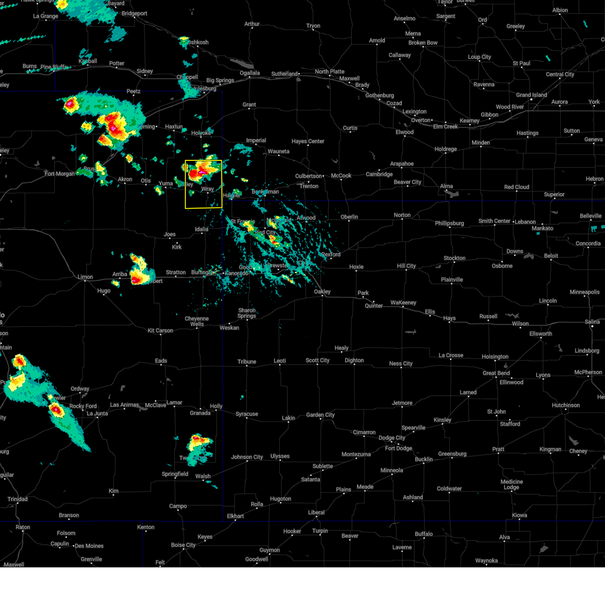
Hail Map for Eckley, CO
The Eckley, CO area has had 15 reports of on-the-ground hail by trained spotters, and has been under severe weather warnings 88 times during the past 12 months. Doppler radar has detected hail at or near Eckley, CO on 83 occasions, including 10 occasions during the past year.
| Name: | Eckley, CO |
| Where Located: | 12.4 miles E of Yuma, CO |
| Map: | Google Map for Eckley, CO |
| Population: | 257 |
| Housing Units: | 132 |
| More Info: | Search Google for Eckley, CO |
5
The Top Recent Hail Date for Eckley, CO is Monday, June 16, 2025 (3rd out of 83)
Hail and Wind Damage Spotted near Eckley, CO
| Date / Time | Report Details |
|---|---|
| 7/11/2025 6:40 PM MDT | Svrgld the national weather service in goodland has issued a * severe thunderstorm warning for, northeastern yuma county in northeastern colorado, * until 745 pm mdt. * at 639 pm mdt, a severe thunderstorm was located 9 miles north of eckley, or 15 miles northwest of wray, moving southeast at 15 mph (radar indicated). Hazards include 60 mph wind gusts and quarter size hail. Hail damage to vehicles is expected. Expect wind damage to roofs, siding, and trees. |
| 7/10/2025 4:54 PM MDT |
 At 454 pm mdt, a severe thunderstorm was located 4 miles southeast of eckley, or 9 miles west of wray, moving east at 25 mph (radar indicated). Hazards include 60 mph wind gusts and quarter size hail. Hail damage to vehicles is expected. expect wind damage to roofs, siding, and trees. this severe storm will be near, wray around 505 pm mdt. other locations impacted by this severe thunderstorm include laird. This includes highway 385 between mile markers 234 and 255. At 454 pm mdt, a severe thunderstorm was located 4 miles southeast of eckley, or 9 miles west of wray, moving east at 25 mph (radar indicated). Hazards include 60 mph wind gusts and quarter size hail. Hail damage to vehicles is expected. expect wind damage to roofs, siding, and trees. this severe storm will be near, wray around 505 pm mdt. other locations impacted by this severe thunderstorm include laird. This includes highway 385 between mile markers 234 and 255.
|
| 7/10/2025 4:42 PM MDT | Svrgld the national weather service in goodland has issued a * severe thunderstorm warning for, east central yuma county in northeastern colorado, * until 530 pm mdt. * at 442 pm mdt, a severe thunderstorm was located near eckley, or 12 miles east of yuma, moving east at 25 mph (radar indicated). Hazards include 60 mph wind gusts and half dollar size hail. Hail damage to vehicles is expected. expect wind damage to roofs, siding, and trees. this severe thunderstorm will be near, eckley around 445 pm mdt. other locations in the path of this severe thunderstorm include wray. This includes highway 385 between mile markers 233 and 255. |
| 7/8/2025 8:35 PM MDT | Corrects previous tstm wnd dmg report from 7 ene heartstrong. relayed report. report of a damaged outbuilding with pictures that may be related to storm winds. time was in yuma county CO, 7.8 miles N of Eckley, CO |
| 7/8/2025 7:20 PM MDT |
 The storms which prompted the warning have weakened below severe limits, and no longer pose an immediate threat to life or property. therefore, the warning will be allowed to expire. The storms which prompted the warning have weakened below severe limits, and no longer pose an immediate threat to life or property. therefore, the warning will be allowed to expire.
|
| 7/8/2025 7:18 PM MDT | Relayed report. report of a damaged outbuilding with pictures that may be related to storm winds. time estimated from radar. damage found at 840pm m in yuma county CO, 7.8 miles N of Eckley, CO |
| 7/8/2025 7:08 PM MDT |
 At 707 pm mdt, severe thunderstorms were located along a line extending from 9 miles north of eckley to 14 miles southeast of yuma to 7 miles northeast of cope, moving east at 35 mph (radar indicated). Hazards include 60 mph wind gusts. Expect damage to roofs, siding, and trees. these severe storms will be near, eckley around 715 pm mdt. wray around 730 pm mdt. other locations impacted by these severe thunderstorms include abarr, heartstrong, and vernon. This includes highway 385 between mile markers 234 and 246. At 707 pm mdt, severe thunderstorms were located along a line extending from 9 miles north of eckley to 14 miles southeast of yuma to 7 miles northeast of cope, moving east at 35 mph (radar indicated). Hazards include 60 mph wind gusts. Expect damage to roofs, siding, and trees. these severe storms will be near, eckley around 715 pm mdt. wray around 730 pm mdt. other locations impacted by these severe thunderstorms include abarr, heartstrong, and vernon. This includes highway 385 between mile markers 234 and 246.
|
| 7/8/2025 6:49 PM MDT |
 At 648 pm mdt, severe thunderstorms were located along a line extending from 7 miles southeast of lone star to 8 miles south of yuma to 5 miles northeast of arickaree school, moving southeast at 40 mph (radar indicated). Hazards include 60 mph wind gusts. Expect damage to roofs, siding, and trees. these severe storms will be near, yuma around 655 pm mdt. eckley around 710 pm mdt. other locations impacted by these severe thunderstorms include abarr, heartstrong, and vernon. This includes highway 385 between mile markers 234 and 252. At 648 pm mdt, severe thunderstorms were located along a line extending from 7 miles southeast of lone star to 8 miles south of yuma to 5 miles northeast of arickaree school, moving southeast at 40 mph (radar indicated). Hazards include 60 mph wind gusts. Expect damage to roofs, siding, and trees. these severe storms will be near, yuma around 655 pm mdt. eckley around 710 pm mdt. other locations impacted by these severe thunderstorms include abarr, heartstrong, and vernon. This includes highway 385 between mile markers 234 and 252.
|
| 7/8/2025 6:30 PM MDT |
 Svrgld the national weather service in goodland has issued a * severe thunderstorm warning for, central yuma county in northeastern colorado, * until 730 pm mdt. * at 629 pm mdt, severe thunderstorms were located along a line extending from 5 miles north of lone star to 3 miles east of otis to 6 miles east of elba, moving east at 35 mph (radar indicated). Hazards include 60 mph wind gusts and penny size hail. Expect damage to roofs, siding, and trees. severe thunderstorms will be near, yuma around 635 pm mdt. other locations in the path of these severe thunderstorms include eckley. This includes highway 385 between mile markers 234 and 263. Svrgld the national weather service in goodland has issued a * severe thunderstorm warning for, central yuma county in northeastern colorado, * until 730 pm mdt. * at 629 pm mdt, severe thunderstorms were located along a line extending from 5 miles north of lone star to 3 miles east of otis to 6 miles east of elba, moving east at 35 mph (radar indicated). Hazards include 60 mph wind gusts and penny size hail. Expect damage to roofs, siding, and trees. severe thunderstorms will be near, yuma around 635 pm mdt. other locations in the path of these severe thunderstorms include eckley. This includes highway 385 between mile markers 234 and 263.
|
| 7/7/2025 5:29 PM MDT |
 At 529 pm mdt, a severe thunderstorm was located 5 miles southeast of holyoke, moving northeast at 30 mph (trained weather spotters). Hazards include golf ball size hail and 70 mph wind gusts. People and animals outdoors will be injured. expect hail damage to roofs, siding, windows, and vehicles. expect considerable tree damage. wind damage is also likely to mobile homes, roofs, and outbuildings. Locations impacted include, eckley, alvin, and wauneta. At 529 pm mdt, a severe thunderstorm was located 5 miles southeast of holyoke, moving northeast at 30 mph (trained weather spotters). Hazards include golf ball size hail and 70 mph wind gusts. People and animals outdoors will be injured. expect hail damage to roofs, siding, windows, and vehicles. expect considerable tree damage. wind damage is also likely to mobile homes, roofs, and outbuildings. Locations impacted include, eckley, alvin, and wauneta.
|
| 7/7/2025 5:28 PM MDT |
 Svrgld the national weather service in goodland has issued a * severe thunderstorm warning for, east central yuma county in northeastern colorado, * until 545 pm mdt. * at 528 pm mdt, a severe thunderstorm was located 4 miles northeast of wray, moving east at 60 mph (radar indicated). Hazards include golf ball size hail and 70 mph wind gusts. People and animals outdoors will be injured. expect hail damage to roofs, siding, windows, and vehicles. expect considerable tree damage. wind damage is also likely to mobile homes, roofs, and outbuildings. This severe thunderstorm will remain over mainly rural areas of east central yuma county, including the following locations, laird. Svrgld the national weather service in goodland has issued a * severe thunderstorm warning for, east central yuma county in northeastern colorado, * until 545 pm mdt. * at 528 pm mdt, a severe thunderstorm was located 4 miles northeast of wray, moving east at 60 mph (radar indicated). Hazards include golf ball size hail and 70 mph wind gusts. People and animals outdoors will be injured. expect hail damage to roofs, siding, windows, and vehicles. expect considerable tree damage. wind damage is also likely to mobile homes, roofs, and outbuildings. This severe thunderstorm will remain over mainly rural areas of east central yuma county, including the following locations, laird.
|
| 7/7/2025 5:06 PM MDT | Svrgld the national weather service in goodland has issued a * severe thunderstorm warning for, northern yuma county in northeastern colorado, * until 545 pm mdt. * at 506 pm mdt, a severe thunderstorm was located 12 miles southeast of highland center, or 14 miles southwest of holyoke, moving northeast at 30 mph (trained weather spotters). Hazards include golf ball size hail and 60 mph wind gusts. People and animals outdoors will be injured. expect hail damage to roofs, siding, windows, and vehicles. expect wind damage to roofs, siding, and trees. this severe thunderstorm will remain over mainly rural areas of northern yuma county, including the following locations, alvin, clarkville, and wauneta. This includes highway 385 between mile markers 251 and 270. |
| 7/7/2025 4:15 PM MDT |
 Svrgld the national weather service in goodland has issued a * severe thunderstorm warning for, northwestern yuma county in northeastern colorado, * until 515 pm mdt. * at 414 pm mdt, a severe thunderstorm was located over otis, or 11 miles east of akron, moving northeast at 30 mph (radar indicated). Hazards include 60 mph wind gusts and half dollar size hail. Hail damage to vehicles is expected. expect wind damage to roofs, siding, and trees. this severe thunderstorm will remain over mainly rural areas of northwestern yuma county, including the following locations, abarr, heartstrong, and clarkville. This includes highway 385 between mile markers 267 and 269. Svrgld the national weather service in goodland has issued a * severe thunderstorm warning for, northwestern yuma county in northeastern colorado, * until 515 pm mdt. * at 414 pm mdt, a severe thunderstorm was located over otis, or 11 miles east of akron, moving northeast at 30 mph (radar indicated). Hazards include 60 mph wind gusts and half dollar size hail. Hail damage to vehicles is expected. expect wind damage to roofs, siding, and trees. this severe thunderstorm will remain over mainly rural areas of northwestern yuma county, including the following locations, abarr, heartstrong, and clarkville. This includes highway 385 between mile markers 267 and 269.
|
| 7/6/2025 7:47 PM MDT |
 At 747 pm mdt, severe thunderstorms were located along a line extending from 5 miles north of yuma to 18 miles northeast of arickaree school to 5 miles northeast of cope, moving southeast at 35 mph (radar indicated). Hazards include 60 mph wind gusts and quarter size hail. Hail damage to vehicles is expected. expect wind damage to roofs, siding, and trees. these severe storms will be near, yuma around 750 pm mdt. other locations impacted by these severe thunderstorms include joes, hale, abarr, beecher island, heartstrong, laird, and idalia. This includes highway 385 between mile markers 208 and 210, and between mile markers 212 and 250. At 747 pm mdt, severe thunderstorms were located along a line extending from 5 miles north of yuma to 18 miles northeast of arickaree school to 5 miles northeast of cope, moving southeast at 35 mph (radar indicated). Hazards include 60 mph wind gusts and quarter size hail. Hail damage to vehicles is expected. expect wind damage to roofs, siding, and trees. these severe storms will be near, yuma around 750 pm mdt. other locations impacted by these severe thunderstorms include joes, hale, abarr, beecher island, heartstrong, laird, and idalia. This includes highway 385 between mile markers 208 and 210, and between mile markers 212 and 250.
|
| 7/6/2025 7:16 PM MDT |
 Svrgld the national weather service in goodland has issued a * severe thunderstorm warning for, yuma county in northeastern colorado, * until 815 pm mdt. * at 715 pm mdt, severe thunderstorms were located along a line extending from 6 miles northeast of lone star to 4 miles west of yuma to 5 miles northwest of arickaree school, moving east at 45 mph (radar indicated). Hazards include 60 mph wind gusts and quarter size hail. Hail damage to vehicles is expected. expect wind damage to roofs, siding, and trees. severe thunderstorms will be near, yuma around 720 pm mdt. eckley around 730 pm mdt. other locations in the path of these severe thunderstorms include wray. This includes highway 385 between mile markers 208 and 210, and between mile markers 212 and 270. Svrgld the national weather service in goodland has issued a * severe thunderstorm warning for, yuma county in northeastern colorado, * until 815 pm mdt. * at 715 pm mdt, severe thunderstorms were located along a line extending from 6 miles northeast of lone star to 4 miles west of yuma to 5 miles northwest of arickaree school, moving east at 45 mph (radar indicated). Hazards include 60 mph wind gusts and quarter size hail. Hail damage to vehicles is expected. expect wind damage to roofs, siding, and trees. severe thunderstorms will be near, yuma around 720 pm mdt. eckley around 730 pm mdt. other locations in the path of these severe thunderstorms include wray. This includes highway 385 between mile markers 208 and 210, and between mile markers 212 and 270.
|
| 7/5/2025 7:41 PM MDT |
 The storm which prompted the warning has weakened below severe limits, and no longer poses an immediate threat to life or property. therefore, the warning will be allowed to expire. however, gusty winds are still possible with this thunderstorm. to report severe weather, contact your nearest law enforcement agency. they will relay your report to the national weather service goodland. The storm which prompted the warning has weakened below severe limits, and no longer poses an immediate threat to life or property. therefore, the warning will be allowed to expire. however, gusty winds are still possible with this thunderstorm. to report severe weather, contact your nearest law enforcement agency. they will relay your report to the national weather service goodland.
|
| 7/5/2025 7:19 PM MDT |
 At 719 pm mdt, a severe thunderstorm was located 4 miles north of yuma, moving southeast at 25 mph (radar indicated). Hazards include 60 mph wind gusts. Expect damage to roofs, siding, and trees. This severe storm will be near, yuma around 725 pm mdt. At 719 pm mdt, a severe thunderstorm was located 4 miles north of yuma, moving southeast at 25 mph (radar indicated). Hazards include 60 mph wind gusts. Expect damage to roofs, siding, and trees. This severe storm will be near, yuma around 725 pm mdt.
|
| 7/5/2025 6:58 PM MDT |
 Svrgld the national weather service in goodland has issued a * severe thunderstorm warning for, northwestern yuma county in northeastern colorado, * until 745 pm mdt. * at 657 pm mdt, a severe thunderstorm was located 5 miles northeast of otis, or 11 miles northwest of yuma, moving east at 25 mph (radar indicated). Hazards include 60 mph wind gusts and nickel size hail. Expect damage to roofs, siding, and trees. This severe thunderstorm will be near, yuma around 715 pm mdt. Svrgld the national weather service in goodland has issued a * severe thunderstorm warning for, northwestern yuma county in northeastern colorado, * until 745 pm mdt. * at 657 pm mdt, a severe thunderstorm was located 5 miles northeast of otis, or 11 miles northwest of yuma, moving east at 25 mph (radar indicated). Hazards include 60 mph wind gusts and nickel size hail. Expect damage to roofs, siding, and trees. This severe thunderstorm will be near, yuma around 715 pm mdt.
|
| 6/28/2025 5:50 PM MDT |
 At 549 pm mdt, a severe thunderstorm was located 12 miles south of holyoke, moving northeast at 20 mph (radar indicated). Hazards include 60 mph wind gusts. Expect damage to roofs, siding, and trees. locations impacted include, wray, eckley, and wauneta. This includes highway 385 between mile markers 244 and 270. At 549 pm mdt, a severe thunderstorm was located 12 miles south of holyoke, moving northeast at 20 mph (radar indicated). Hazards include 60 mph wind gusts. Expect damage to roofs, siding, and trees. locations impacted include, wray, eckley, and wauneta. This includes highway 385 between mile markers 244 and 270.
|
| 6/28/2025 5:40 PM MDT |
 At 540 pm mdt, a severe thunderstorm was located 15 miles southeast of highland center, or 15 miles south of holyoke, moving east at 15 mph (radar indicated). Hazards include 60 mph wind gusts and pea to penny size hail. Expect damage to roofs, siding, and trees. locations impacted include, yuma, wray, eckley, clarkville, and wauneta. This includes highway 385 between mile markers 244 and 270. At 540 pm mdt, a severe thunderstorm was located 15 miles southeast of highland center, or 15 miles south of holyoke, moving east at 15 mph (radar indicated). Hazards include 60 mph wind gusts and pea to penny size hail. Expect damage to roofs, siding, and trees. locations impacted include, yuma, wray, eckley, clarkville, and wauneta. This includes highway 385 between mile markers 244 and 270.
|
| 6/28/2025 5:17 PM MDT |
 Svrgld the national weather service in goodland has issued a * severe thunderstorm warning for, northern yuma county in northeastern colorado, * until 615 pm mdt. * at 517 pm mdt, a severe thunderstorm was located 10 miles east of lone star, or 13 miles north of yuma, moving east at 10 mph (radar indicated). Hazards include 60 mph wind gusts and quarter size hail. Hail damage to vehicles is expected. expect wind damage to roofs, siding, and trees. this severe thunderstorm will remain over mainly rural areas of northern yuma county, including the following locations, clarkville and wauneta. This includes highway 385 between mile markers 244 and 270. Svrgld the national weather service in goodland has issued a * severe thunderstorm warning for, northern yuma county in northeastern colorado, * until 615 pm mdt. * at 517 pm mdt, a severe thunderstorm was located 10 miles east of lone star, or 13 miles north of yuma, moving east at 10 mph (radar indicated). Hazards include 60 mph wind gusts and quarter size hail. Hail damage to vehicles is expected. expect wind damage to roofs, siding, and trees. this severe thunderstorm will remain over mainly rural areas of northern yuma county, including the following locations, clarkville and wauneta. This includes highway 385 between mile markers 244 and 270.
|
| 6/24/2025 7:01 PM MDT |
 the severe thunderstorm warning has been cancelled and is no longer in effect the severe thunderstorm warning has been cancelled and is no longer in effect
|
| 6/24/2025 6:53 PM MDT |
 At 652 pm mdt, a severe thunderstorm was located 11 miles northeast of eckley, or 14 miles northwest of wray, moving northeast at 30 mph (radar indicated). Hazards include 60 mph wind gusts and penny size hail. Expect damage to roofs, siding, and trees. this severe thunderstorm will remain over mainly rural areas of northern yuma county, including the following locations, alvin and wauneta. This includes highway 385 between mile markers 244 and 269. At 652 pm mdt, a severe thunderstorm was located 11 miles northeast of eckley, or 14 miles northwest of wray, moving northeast at 30 mph (radar indicated). Hazards include 60 mph wind gusts and penny size hail. Expect damage to roofs, siding, and trees. this severe thunderstorm will remain over mainly rural areas of northern yuma county, including the following locations, alvin and wauneta. This includes highway 385 between mile markers 244 and 269.
|
| 6/24/2025 6:26 PM MDT |
 Svrgld the national weather service in goodland has issued a * severe thunderstorm warning for, northern yuma county in northeastern colorado, * until 715 pm mdt. * at 625 pm mdt, severe thunderstorms were located along a line extending from 13 miles northwest of wray to near eckley, moving northeast at 30 mph (radar indicated). Hazards include 60 mph wind gusts and penny size hail. Expect damage to roofs, siding, and trees. severe thunderstorms will be near, eckley around 630 pm mdt. This includes highway 385 between mile markers 244 and 270. Svrgld the national weather service in goodland has issued a * severe thunderstorm warning for, northern yuma county in northeastern colorado, * until 715 pm mdt. * at 625 pm mdt, severe thunderstorms were located along a line extending from 13 miles northwest of wray to near eckley, moving northeast at 30 mph (radar indicated). Hazards include 60 mph wind gusts and penny size hail. Expect damage to roofs, siding, and trees. severe thunderstorms will be near, eckley around 630 pm mdt. This includes highway 385 between mile markers 244 and 270.
|
| 6/17/2025 5:18 PM MDT |
 Svrgld the national weather service in goodland has issued a * severe thunderstorm warning for, yuma county in northeastern colorado, northeastern kit carson county in east central colorado, cheyenne county in northwestern kansas, northwestern thomas county in northwestern kansas, rawlins county in northwestern kansas, northern sherman county in northwestern kansas, dundy county in southwestern nebraska, western hitchcock county in southwestern nebraska, * until 600 pm mdt/700 pm cdt/. * at 517 pm mdt/617 pm cdt/, severe thunderstorms were located along a line extending from 10 miles southwest of champion to 10 miles northeast of st. francis to 6 miles southwest of bonny reservoir, moving east at 50 mph (radar indicated). Hazards include 60 mph wind gusts. Expect damage to roofs, siding, and trees. severe thunderstorms will be near, st. francis around 625 pm cdt. benkelman around 525 pm mdt. bird city around 630 pm cdt. mcdonald around 635 pm cdt. Other locations in the path of these severe thunderstorms include stratton. Svrgld the national weather service in goodland has issued a * severe thunderstorm warning for, yuma county in northeastern colorado, northeastern kit carson county in east central colorado, cheyenne county in northwestern kansas, northwestern thomas county in northwestern kansas, rawlins county in northwestern kansas, northern sherman county in northwestern kansas, dundy county in southwestern nebraska, western hitchcock county in southwestern nebraska, * until 600 pm mdt/700 pm cdt/. * at 517 pm mdt/617 pm cdt/, severe thunderstorms were located along a line extending from 10 miles southwest of champion to 10 miles northeast of st. francis to 6 miles southwest of bonny reservoir, moving east at 50 mph (radar indicated). Hazards include 60 mph wind gusts. Expect damage to roofs, siding, and trees. severe thunderstorms will be near, st. francis around 625 pm cdt. benkelman around 525 pm mdt. bird city around 630 pm cdt. mcdonald around 635 pm cdt. Other locations in the path of these severe thunderstorms include stratton.
|
| 6/16/2025 8:43 PM MDT |
 Svrgld the national weather service in goodland has issued a * severe thunderstorm warning for, yuma county in northeastern colorado, cheyenne county in northwestern kansas, northwestern thomas county in northwestern kansas, western rawlins county in northwestern kansas, northeastern sherman county in northwestern kansas, dundy county in southwestern nebraska, * until 930 pm mdt/1030 pm cdt/. * at 842 pm mdt/942 pm cdt/, a severe thunderstorm was located 6 miles southeast of eckley, or 8 miles west of wray, moving east at 30 mph (radar indicated). Hazards include golf ball size hail and 60 mph wind gusts. People and animals outdoors will be injured. expect hail damage to roofs, siding, windows, and vehicles. expect wind damage to roofs, siding, and trees. This severe thunderstorm will be near, wray around 850 pm mdt. Svrgld the national weather service in goodland has issued a * severe thunderstorm warning for, yuma county in northeastern colorado, cheyenne county in northwestern kansas, northwestern thomas county in northwestern kansas, western rawlins county in northwestern kansas, northeastern sherman county in northwestern kansas, dundy county in southwestern nebraska, * until 930 pm mdt/1030 pm cdt/. * at 842 pm mdt/942 pm cdt/, a severe thunderstorm was located 6 miles southeast of eckley, or 8 miles west of wray, moving east at 30 mph (radar indicated). Hazards include golf ball size hail and 60 mph wind gusts. People and animals outdoors will be injured. expect hail damage to roofs, siding, windows, and vehicles. expect wind damage to roofs, siding, and trees. This severe thunderstorm will be near, wray around 850 pm mdt.
|
| 6/16/2025 7:59 PM MDT |
 Svrgld the national weather service in goodland has issued a * severe thunderstorm warning for, yuma county in northeastern colorado, northern cheyenne county in northwestern kansas, dundy county in southwestern nebraska, * until 845 pm mdt/945 pm cdt/. * at 759 pm mdt/859 pm cdt/, a severe thunderstorm was located 15 miles south of yuma, moving northeast at 30 mph (radar indicated). Hazards include 70 mph wind gusts and ping pong ball size hail. People and animals outdoors will be injured. expect hail damage to roofs, siding, windows, and vehicles. expect considerable tree damage. Wind damage is also likely to mobile homes, roofs, and outbuildings. Svrgld the national weather service in goodland has issued a * severe thunderstorm warning for, yuma county in northeastern colorado, northern cheyenne county in northwestern kansas, dundy county in southwestern nebraska, * until 845 pm mdt/945 pm cdt/. * at 759 pm mdt/859 pm cdt/, a severe thunderstorm was located 15 miles south of yuma, moving northeast at 30 mph (radar indicated). Hazards include 70 mph wind gusts and ping pong ball size hail. People and animals outdoors will be injured. expect hail damage to roofs, siding, windows, and vehicles. expect considerable tree damage. Wind damage is also likely to mobile homes, roofs, and outbuildings.
|
| 6/16/2025 7:45 PM MDT | At 744 pm mdt/844 pm cdt/, a severe thunderstorm was located 13 miles south of eckley, or 14 miles southwest of wray, moving northeast at 25 mph (radar indicated). Hazards include golf ball size hail and 70 mph wind gusts. People and animals outdoors will be injured. expect hail damage to roofs, siding, windows, and vehicles. expect considerable tree damage. wind damage is also likely to mobile homes, roofs, and outbuildings. locations impacted include, yuma, wray, st. Francis, eckley, haigler, abarr, and beecher island. |
| 6/16/2025 7:15 PM MDT |
 Svrgld the national weather service in goodland has issued a * severe thunderstorm warning for, central yuma county in northeastern colorado, northwestern cheyenne county in northwestern kansas, southwestern dundy county in southwestern nebraska, * until 800 pm mdt/900 pm cdt/. * at 714 pm mdt/814 pm cdt/, a severe thunderstorm was located 15 miles northwest of bonny reservoir, moving north at 25 mph (radar indicated). Hazards include 70 mph wind gusts and quarter size hail. Hail damage to vehicles is expected. expect considerable tree damage. wind damage is also likely to mobile homes, roofs, and outbuildings. This severe thunderstorm will remain over mainly rural areas of central yuma county in northeastern colorado, northwestern cheyenne county in northwestern kansas and southwestern dundy counties in southwestern nebraska, including the following locations, abarr, beecher island, heartstrong, laird, parks, idalia, and vernon. Svrgld the national weather service in goodland has issued a * severe thunderstorm warning for, central yuma county in northeastern colorado, northwestern cheyenne county in northwestern kansas, southwestern dundy county in southwestern nebraska, * until 800 pm mdt/900 pm cdt/. * at 714 pm mdt/814 pm cdt/, a severe thunderstorm was located 15 miles northwest of bonny reservoir, moving north at 25 mph (radar indicated). Hazards include 70 mph wind gusts and quarter size hail. Hail damage to vehicles is expected. expect considerable tree damage. wind damage is also likely to mobile homes, roofs, and outbuildings. This severe thunderstorm will remain over mainly rural areas of central yuma county in northeastern colorado, northwestern cheyenne county in northwestern kansas and southwestern dundy counties in southwestern nebraska, including the following locations, abarr, beecher island, heartstrong, laird, parks, idalia, and vernon.
|
| 6/16/2025 6:39 PM MDT |
 At 638 pm mdt/738 pm cdt/, a severe thunderstorm was located 5 miles northwest of bonny reservoir, moving northeast at 25 mph (radar indicated). Hazards include golf ball size hail and 60 mph wind gusts. People and animals outdoors will be injured. expect hail damage to roofs, siding, windows, and vehicles. expect wind damage to roofs, siding, and trees. Locations impacted include, yuma, wray, eckley, haigler, joes, abarr, and beecher island. At 638 pm mdt/738 pm cdt/, a severe thunderstorm was located 5 miles northwest of bonny reservoir, moving northeast at 25 mph (radar indicated). Hazards include golf ball size hail and 60 mph wind gusts. People and animals outdoors will be injured. expect hail damage to roofs, siding, windows, and vehicles. expect wind damage to roofs, siding, and trees. Locations impacted include, yuma, wray, eckley, haigler, joes, abarr, and beecher island.
|
| 6/16/2025 6:33 PM MDT |
 Svrgld the national weather service in goodland has issued a * severe thunderstorm warning for, southern yuma county in northeastern colorado, western cheyenne county in northwestern kansas, southwestern dundy county in southwestern nebraska, * until 715 pm mdt/815 pm cdt/. * at 632 pm mdt/732 pm cdt/, a severe thunderstorm was located 6 miles west of bonny reservoir, moving northeast at 20 mph (radar indicated). Hazards include 60 mph wind gusts and half dollar size hail. Hail damage to vehicles is expected. expect wind damage to roofs, siding, and trees. This severe thunderstorm will remain over mainly rural areas of southern yuma county in northeastern colorado, western cheyenne county in northwestern kansas and southwestern dundy counties in southwestern nebraska, including the following locations, joes, abarr, beecher island, heartstrong, idalia, and vernon. Svrgld the national weather service in goodland has issued a * severe thunderstorm warning for, southern yuma county in northeastern colorado, western cheyenne county in northwestern kansas, southwestern dundy county in southwestern nebraska, * until 715 pm mdt/815 pm cdt/. * at 632 pm mdt/732 pm cdt/, a severe thunderstorm was located 6 miles west of bonny reservoir, moving northeast at 20 mph (radar indicated). Hazards include 60 mph wind gusts and half dollar size hail. Hail damage to vehicles is expected. expect wind damage to roofs, siding, and trees. This severe thunderstorm will remain over mainly rural areas of southern yuma county in northeastern colorado, western cheyenne county in northwestern kansas and southwestern dundy counties in southwestern nebraska, including the following locations, joes, abarr, beecher island, heartstrong, idalia, and vernon.
|
| 6/13/2025 9:13 PM MDT |
 the severe thunderstorm warning has been cancelled and is no longer in effect the severe thunderstorm warning has been cancelled and is no longer in effect
|
| 6/13/2025 9:05 PM MDT |
 At 904 pm mdt, a severe thunderstorm was located 5 miles west of eckley, or 7 miles east of yuma, moving east at 20 mph (radar indicated). Hazards include 60 mph wind gusts and quarter size hail. Hail damage to vehicles is expected. expect wind damage to roofs, siding, and trees. this severe storm will be near, eckley around 910 pm mdt. A spotter reported nickel size hail with this storm in yuma, colorado at 849 pm mdt. At 904 pm mdt, a severe thunderstorm was located 5 miles west of eckley, or 7 miles east of yuma, moving east at 20 mph (radar indicated). Hazards include 60 mph wind gusts and quarter size hail. Hail damage to vehicles is expected. expect wind damage to roofs, siding, and trees. this severe storm will be near, eckley around 910 pm mdt. A spotter reported nickel size hail with this storm in yuma, colorado at 849 pm mdt.
|
| 6/13/2025 8:58 PM MDT |
 At 858 pm mdt, a severe thunderstorm was located 5 miles east of yuma, moving northeast at 15 mph (radar indicated). Hazards include 60 mph wind gusts and quarter size hail. Hail damage to vehicles is expected. expect wind damage to roofs, siding, and trees. this severe storm will be near, eckley around 910 pm mdt. A spotter reported nickel size hail with this storm in yuma, colorado at 849 pm mdt. At 858 pm mdt, a severe thunderstorm was located 5 miles east of yuma, moving northeast at 15 mph (radar indicated). Hazards include 60 mph wind gusts and quarter size hail. Hail damage to vehicles is expected. expect wind damage to roofs, siding, and trees. this severe storm will be near, eckley around 910 pm mdt. A spotter reported nickel size hail with this storm in yuma, colorado at 849 pm mdt.
|
| 6/13/2025 8:52 PM MDT |
 At 851 pm mdt, a severe thunderstorm was located near yuma, moving east at 15 mph (radar indicated). Hazards include 60 mph wind gusts and quarter size hail. Hail damage to vehicles is expected. expect wind damage to roofs, siding, and trees. this severe storm will be near, eckley around 910 pm mdt. other locations impacted by this severe thunderstorm include heartstrong. A spotter reported nickel size hail with this storm in yuma, colorado at 849 pm mdt. At 851 pm mdt, a severe thunderstorm was located near yuma, moving east at 15 mph (radar indicated). Hazards include 60 mph wind gusts and quarter size hail. Hail damage to vehicles is expected. expect wind damage to roofs, siding, and trees. this severe storm will be near, eckley around 910 pm mdt. other locations impacted by this severe thunderstorm include heartstrong. A spotter reported nickel size hail with this storm in yuma, colorado at 849 pm mdt.
|
| 6/13/2025 8:43 PM MDT |
 At 843 pm mdt, a severe thunderstorm was located near yuma, moving east at 15 mph (radar indicated). Hazards include 60 mph wind gusts and quarter size hail. Hail damage to vehicles is expected. expect wind damage to roofs, siding, and trees. this severe storm will be near, yuma around 850 pm mdt. eckley around 920 pm mdt. Other locations impacted by this severe thunderstorm include heartstrong and abarr. At 843 pm mdt, a severe thunderstorm was located near yuma, moving east at 15 mph (radar indicated). Hazards include 60 mph wind gusts and quarter size hail. Hail damage to vehicles is expected. expect wind damage to roofs, siding, and trees. this severe storm will be near, yuma around 850 pm mdt. eckley around 920 pm mdt. Other locations impacted by this severe thunderstorm include heartstrong and abarr.
|
| 6/13/2025 8:35 PM MDT |
 Svrgld the national weather service in goodland has issued a * severe thunderstorm warning for, northwestern yuma county in northeastern colorado, * until 930 pm mdt. * at 834 pm mdt, a severe thunderstorm was located near yuma, moving east at 15 mph (radar indicated). Hazards include 60 mph wind gusts and quarter size hail. Hail damage to vehicles is expected. expect wind damage to roofs, siding, and trees. This severe thunderstorm will be near, yuma around 840 pm mdt. Svrgld the national weather service in goodland has issued a * severe thunderstorm warning for, northwestern yuma county in northeastern colorado, * until 930 pm mdt. * at 834 pm mdt, a severe thunderstorm was located near yuma, moving east at 15 mph (radar indicated). Hazards include 60 mph wind gusts and quarter size hail. Hail damage to vehicles is expected. expect wind damage to roofs, siding, and trees. This severe thunderstorm will be near, yuma around 840 pm mdt.
|
| 6/13/2025 8:20 PM MDT |
 At 820 pm mdt, a severe thunderstorm was located 9 miles north of eckley, or 12 miles northeast of yuma, moving east at 25 mph (radar indicated). Hazards include 60 mph wind gusts. Expect damage to roofs, siding, and trees. This severe thunderstorm will remain over mainly rural areas of northwestern yuma county, including the following locations, clarkville. At 820 pm mdt, a severe thunderstorm was located 9 miles north of eckley, or 12 miles northeast of yuma, moving east at 25 mph (radar indicated). Hazards include 60 mph wind gusts. Expect damage to roofs, siding, and trees. This severe thunderstorm will remain over mainly rural areas of northwestern yuma county, including the following locations, clarkville.
|
| 6/13/2025 8:09 PM MDT |
 At 808 pm mdt, a severe thunderstorm was located 7 miles northeast of yuma, moving east at 25 mph (this storm produced a 64 mph wind gust in akron, colorado at 725 pm mdt). Hazards include 65 mph wind gusts. Expect damage to roofs, siding, and trees. This severe thunderstorm will remain over mainly rural areas of northwestern yuma county, including the following locations, clarkville. At 808 pm mdt, a severe thunderstorm was located 7 miles northeast of yuma, moving east at 25 mph (this storm produced a 64 mph wind gust in akron, colorado at 725 pm mdt). Hazards include 65 mph wind gusts. Expect damage to roofs, siding, and trees. This severe thunderstorm will remain over mainly rural areas of northwestern yuma county, including the following locations, clarkville.
|
| 6/13/2025 7:57 PM MDT |
 At 756 pm mdt, a severe thunderstorm was located near yuma, moving east at 30 mph (this storm produced a 64 mph wind gust in akron, colorado at 725 pm mdt). Hazards include 65 mph wind gusts. Expect damage to roofs, siding, and trees. this severe storm will be near, yuma around 800 pm mdt. eckley around 820 pm mdt. Other locations impacted by this severe thunderstorm include clarkville. At 756 pm mdt, a severe thunderstorm was located near yuma, moving east at 30 mph (this storm produced a 64 mph wind gust in akron, colorado at 725 pm mdt). Hazards include 65 mph wind gusts. Expect damage to roofs, siding, and trees. this severe storm will be near, yuma around 800 pm mdt. eckley around 820 pm mdt. Other locations impacted by this severe thunderstorm include clarkville.
|
| 6/13/2025 7:45 PM MDT |
 At 743 pm mdt, a severe thunderstorm was located near otis, or 9 miles west of yuma, moving east at 30 mph (this storm produced a 64 mph wind gust in akron, colorado at 725 pm mdt). Hazards include 65 mph wind gusts. Expect damage to roofs, siding, and trees. this severe storm will be near, yuma around 750 pm mdt. eckley around 820 pm mdt. Other locations impacted by this severe thunderstorm include clarkville. At 743 pm mdt, a severe thunderstorm was located near otis, or 9 miles west of yuma, moving east at 30 mph (this storm produced a 64 mph wind gust in akron, colorado at 725 pm mdt). Hazards include 65 mph wind gusts. Expect damage to roofs, siding, and trees. this severe storm will be near, yuma around 750 pm mdt. eckley around 820 pm mdt. Other locations impacted by this severe thunderstorm include clarkville.
|
| 6/13/2025 7:34 PM MDT |
 Svrgld the national weather service in goodland has issued a * severe thunderstorm warning for, northwestern yuma county in northeastern colorado, * until 830 pm mdt. * at 730 pm mdt, a severe thunderstorm was located over otis, or 11 miles east of akron, moving east at 30 mph (this storm produced a 64 mph wind gust in akron, colorado at 725 pm mdt). Hazards include 65 mph wind gusts. Expect damage to roofs, siding, and trees. this severe thunderstorm will be near, yuma around 750 pm mdt. Other locations in the path of this severe thunderstorm include eckley. Svrgld the national weather service in goodland has issued a * severe thunderstorm warning for, northwestern yuma county in northeastern colorado, * until 830 pm mdt. * at 730 pm mdt, a severe thunderstorm was located over otis, or 11 miles east of akron, moving east at 30 mph (this storm produced a 64 mph wind gust in akron, colorado at 725 pm mdt). Hazards include 65 mph wind gusts. Expect damage to roofs, siding, and trees. this severe thunderstorm will be near, yuma around 750 pm mdt. Other locations in the path of this severe thunderstorm include eckley.
|
| 5/23/2025 7:22 PM MDT |
 The storm which prompted the warning has weakened below severe limits, and no longer poses an immediate threat to life or property. therefore, the warning will be allowed to expire. a severe thunderstorm watch remains in effect until 900 pm mdt for northeastern colorado. The storm which prompted the warning has weakened below severe limits, and no longer poses an immediate threat to life or property. therefore, the warning will be allowed to expire. a severe thunderstorm watch remains in effect until 900 pm mdt for northeastern colorado.
|
| 5/23/2025 6:59 PM MDT |
 At 659 pm mdt, a severe thunderstorm was located 4 miles east of yuma, moving southeast at 30 mph (radar indicated). Hazards include 60 mph wind gusts and quarter size hail. Hail damage to vehicles is expected. expect wind damage to roofs, siding, and trees. this severe thunderstorm will remain over mainly rural areas of northern yuma county, including the following locations, heartstrong, clarkville, and wauneta. This includes highway 385 between mile markers 250 and 269. At 659 pm mdt, a severe thunderstorm was located 4 miles east of yuma, moving southeast at 30 mph (radar indicated). Hazards include 60 mph wind gusts and quarter size hail. Hail damage to vehicles is expected. expect wind damage to roofs, siding, and trees. this severe thunderstorm will remain over mainly rural areas of northern yuma county, including the following locations, heartstrong, clarkville, and wauneta. This includes highway 385 between mile markers 250 and 269.
|
| 5/23/2025 6:45 PM MDT |
 At 645 pm mdt, a severe thunderstorm was located near yuma, moving southeast at 30 mph (radar indicated). Hazards include 60 mph wind gusts and quarter size hail. Hail damage to vehicles is expected. expect wind damage to roofs, siding, and trees. this severe storm will be near, yuma around 650 pm mdt. eckley around 715 pm mdt. other locations impacted by this severe thunderstorm include heartstrong, clarkville, and wauneta. This includes highway 385 between mile markers 250 and 270. At 645 pm mdt, a severe thunderstorm was located near yuma, moving southeast at 30 mph (radar indicated). Hazards include 60 mph wind gusts and quarter size hail. Hail damage to vehicles is expected. expect wind damage to roofs, siding, and trees. this severe storm will be near, yuma around 650 pm mdt. eckley around 715 pm mdt. other locations impacted by this severe thunderstorm include heartstrong, clarkville, and wauneta. This includes highway 385 between mile markers 250 and 270.
|
| 5/23/2025 6:32 PM MDT |
 Svrgld the national weather service in goodland has issued a * severe thunderstorm warning for, northwestern yuma county in northeastern colorado, * until 730 pm mdt. * at 631 pm mdt, a severe thunderstorm was located 5 miles northeast of otis, or 9 miles northwest of yuma, moving southeast at 35 mph (radar indicated). Hazards include 60 mph wind gusts and quarter size hail. Hail damage to vehicles is expected. expect wind damage to roofs, siding, and trees. this severe thunderstorm will be near, yuma around 640 pm mdt. This includes highway 385 between mile markers 250 and 270. Svrgld the national weather service in goodland has issued a * severe thunderstorm warning for, northwestern yuma county in northeastern colorado, * until 730 pm mdt. * at 631 pm mdt, a severe thunderstorm was located 5 miles northeast of otis, or 9 miles northwest of yuma, moving southeast at 35 mph (radar indicated). Hazards include 60 mph wind gusts and quarter size hail. Hail damage to vehicles is expected. expect wind damage to roofs, siding, and trees. this severe thunderstorm will be near, yuma around 640 pm mdt. This includes highway 385 between mile markers 250 and 270.
|
| 5/14/2025 7:20 PM MDT |
 The storm which prompted the warning has moved out of the area. therefore, the warning will be allowed to expire. a severe thunderstorm watch remains in effect until 1000 pm mdt/1100 pm cdt/ for northeastern colorado, northwestern kansas, and southwestern nebraska. The storm which prompted the warning has moved out of the area. therefore, the warning will be allowed to expire. a severe thunderstorm watch remains in effect until 1000 pm mdt/1100 pm cdt/ for northeastern colorado, northwestern kansas, and southwestern nebraska.
|
| 5/14/2025 6:44 PM MDT |
 At 643 pm mdt/743 pm cdt/, a severe thunderstorm was located 15 miles northeast of wray, moving northeast at 40 mph. a larger area of strong winds is persisting behind intial area of storms, resulting in strong wind gusts to 60 mph across much of yuma county, even after storms pass (radar indicated). Hazards include 60 mph wind gusts and quarter size hail. Hail damage to vehicles is expected. expect wind damage to roofs, siding, and trees. locations impacted include, wray, eckley, haigler, beecher island, heartstrong, alvin, and wauneta. This includes highway 385 between mile markers 224 and 269. At 643 pm mdt/743 pm cdt/, a severe thunderstorm was located 15 miles northeast of wray, moving northeast at 40 mph. a larger area of strong winds is persisting behind intial area of storms, resulting in strong wind gusts to 60 mph across much of yuma county, even after storms pass (radar indicated). Hazards include 60 mph wind gusts and quarter size hail. Hail damage to vehicles is expected. expect wind damage to roofs, siding, and trees. locations impacted include, wray, eckley, haigler, beecher island, heartstrong, alvin, and wauneta. This includes highway 385 between mile markers 224 and 269.
|
| 5/14/2025 6:37 PM MDT |
 At 635 pm mdt/735 pm cdt/, a severe thunderstorm was located 10 miles north of wray, moving northeast at 30 mph (radar indicated). Hazards include 70 mph wind gusts and half dollar size hail. a larger area of strong winds is persisting behind intial area of storms, resulting in strong wind gusts to 60 mph across much of yuma county, even after storms pass. Hail damage to vehicles is expected. expect considerable tree damage. wind damage is also likely to mobile homes, roofs, and outbuildings. locations impacted include, yuma, wray, eckley, haigler, abarr, beecher island, and heartstrong. This includes highway 385 between mile markers 224 and 270. At 635 pm mdt/735 pm cdt/, a severe thunderstorm was located 10 miles north of wray, moving northeast at 30 mph (radar indicated). Hazards include 70 mph wind gusts and half dollar size hail. a larger area of strong winds is persisting behind intial area of storms, resulting in strong wind gusts to 60 mph across much of yuma county, even after storms pass. Hail damage to vehicles is expected. expect considerable tree damage. wind damage is also likely to mobile homes, roofs, and outbuildings. locations impacted include, yuma, wray, eckley, haigler, abarr, beecher island, and heartstrong. This includes highway 385 between mile markers 224 and 270.
|
| 5/14/2025 6:26 PM MDT |
 At 626 pm mdt/726 pm cdt/, severe thunderstorms were located along a line extending from 8 miles southeast of highland center to 5 miles north of wray, moving east at 35 mph (radar indicated). Hazards include 70 mph wind gusts and half dollar size hail. Hail damage to vehicles is expected. expect considerable tree damage. wind damage is also likely to mobile homes, roofs, and outbuildings. these severe thunderstorms will remain over mainly rural areas of yuma county in northeastern colorado, northwestern cheyenne county in northwestern kansas and western dundy counties in southwestern nebraska, including the following locations, abarr, beecher island, heartstrong, alvin, clarkville, wauneta, and laird. This includes highway 385 between mile markers 224 and 270. At 626 pm mdt/726 pm cdt/, severe thunderstorms were located along a line extending from 8 miles southeast of highland center to 5 miles north of wray, moving east at 35 mph (radar indicated). Hazards include 70 mph wind gusts and half dollar size hail. Hail damage to vehicles is expected. expect considerable tree damage. wind damage is also likely to mobile homes, roofs, and outbuildings. these severe thunderstorms will remain over mainly rural areas of yuma county in northeastern colorado, northwestern cheyenne county in northwestern kansas and western dundy counties in southwestern nebraska, including the following locations, abarr, beecher island, heartstrong, alvin, clarkville, wauneta, and laird. This includes highway 385 between mile markers 224 and 270.
|
| 5/14/2025 6:12 PM MDT |
 The warning that was previously in effect for yuma county has been replaced by a new severe thunderstorm warning. a severe thunderstorm watch remains in effect until 1000 pm mdt for northeastern colorado, and northwestern kansas. to report severe weather, contact your nearest law enforcement agency. they will relay your report to the national weather service goodland. remember, a severe thunderstorm warning still remains in effect for yuma county. The warning that was previously in effect for yuma county has been replaced by a new severe thunderstorm warning. a severe thunderstorm watch remains in effect until 1000 pm mdt for northeastern colorado, and northwestern kansas. to report severe weather, contact your nearest law enforcement agency. they will relay your report to the national weather service goodland. remember, a severe thunderstorm warning still remains in effect for yuma county.
|
| 5/14/2025 6:10 PM MDT |
 Svrgld the national weather service in goodland has issued a * severe thunderstorm warning for, yuma county in northeastern colorado, northwestern cheyenne county in northwestern kansas, western dundy county in southwestern nebraska, * until 730 pm mdt/830 pm cdt/. * at 610 pm mdt/710 pm cdt/, severe thunderstorms were located along a line extending from 10 miles south of highland center to 3 miles east of eckley to 14 miles northeast of cope, moving east at 25 mph (radar indicated). Hazards include 60 mph wind gusts and half dollar size hail. Hail damage to vehicles is expected. expect wind damage to roofs, siding, and trees. severe thunderstorms will be near, wray around 625 pm mdt. This includes highway 385 between mile markers 224 and 270. Svrgld the national weather service in goodland has issued a * severe thunderstorm warning for, yuma county in northeastern colorado, northwestern cheyenne county in northwestern kansas, western dundy county in southwestern nebraska, * until 730 pm mdt/830 pm cdt/. * at 610 pm mdt/710 pm cdt/, severe thunderstorms were located along a line extending from 10 miles south of highland center to 3 miles east of eckley to 14 miles northeast of cope, moving east at 25 mph (radar indicated). Hazards include 60 mph wind gusts and half dollar size hail. Hail damage to vehicles is expected. expect wind damage to roofs, siding, and trees. severe thunderstorms will be near, wray around 625 pm mdt. This includes highway 385 between mile markers 224 and 270.
|
| 5/14/2025 6:03 PM MDT |
 At 603 pm mdt, severe thunderstorms were located along a line extending from 12 miles northeast of yuma to 4 miles south of eckley to 12 miles northeast of cope, moving east at 35 mph (radar indicated). Hazards include 60 mph wind gusts and half dollar size hail. Hail damage to vehicles is expected. expect wind damage to roofs, siding, and trees. these severe storms will be near, wray around 620 pm mdt. other locations impacted by these severe thunderstorms include joes, hale, abarr, beecher island, kirk, heartstrong, and alvin. This includes highway 385 between mile markers 207 and 210, and between mile markers 212 and 270. At 603 pm mdt, severe thunderstorms were located along a line extending from 12 miles northeast of yuma to 4 miles south of eckley to 12 miles northeast of cope, moving east at 35 mph (radar indicated). Hazards include 60 mph wind gusts and half dollar size hail. Hail damage to vehicles is expected. expect wind damage to roofs, siding, and trees. these severe storms will be near, wray around 620 pm mdt. other locations impacted by these severe thunderstorms include joes, hale, abarr, beecher island, kirk, heartstrong, and alvin. This includes highway 385 between mile markers 207 and 210, and between mile markers 212 and 270.
|
| 5/14/2025 5:54 PM MDT |
 At 554 pm mdt, severe thunderstorms were located along a line extending from 10 miles south of highland center to 8 miles southeast of yuma to 3 miles southeast of arickaree school, moving east at 60 mph (radar indicated). Hazards include 60 mph wind gusts and nickel size hail. Expect damage to roofs, siding, and trees. these severe storms will be near, eckley around 600 pm mdt. wray around 610 pm mdt. other locations impacted by these severe thunderstorms include joes, hale, abarr, beecher island, kirk, heartstrong, and alvin. This includes highway 385 between mile markers 207 and 210, and between mile markers 212 and 270. At 554 pm mdt, severe thunderstorms were located along a line extending from 10 miles south of highland center to 8 miles southeast of yuma to 3 miles southeast of arickaree school, moving east at 60 mph (radar indicated). Hazards include 60 mph wind gusts and nickel size hail. Expect damage to roofs, siding, and trees. these severe storms will be near, eckley around 600 pm mdt. wray around 610 pm mdt. other locations impacted by these severe thunderstorms include joes, hale, abarr, beecher island, kirk, heartstrong, and alvin. This includes highway 385 between mile markers 207 and 210, and between mile markers 212 and 270.
|
| 5/14/2025 5:35 PM MDT |
 At 534 pm mdt, severe thunderstorms were located along a line extending from 3 miles east of burdett to 9 miles south of otis to 4 miles southwest of anton, moving east at 45 mph (radar indicated). Hazards include 70 mph wind gusts. Expect considerable tree damage. damage is likely to mobile homes, roofs, and outbuildings. these severe storms will be near, yuma around 540 pm mdt. eckley around 600 pm mdt. wray around 615 pm mdt. other locations impacted by these severe thunderstorms include joes, hale, abarr, beecher island, kirk, heartstrong, and alvin. This includes highway 385 between mile markers 207 and 210, and between mile markers 212 and 270. At 534 pm mdt, severe thunderstorms were located along a line extending from 3 miles east of burdett to 9 miles south of otis to 4 miles southwest of anton, moving east at 45 mph (radar indicated). Hazards include 70 mph wind gusts. Expect considerable tree damage. damage is likely to mobile homes, roofs, and outbuildings. these severe storms will be near, yuma around 540 pm mdt. eckley around 600 pm mdt. wray around 615 pm mdt. other locations impacted by these severe thunderstorms include joes, hale, abarr, beecher island, kirk, heartstrong, and alvin. This includes highway 385 between mile markers 207 and 210, and between mile markers 212 and 270.
|
| 5/14/2025 5:23 PM MDT |
 Svrgld the national weather service in goodland has issued a * severe thunderstorm warning for, yuma county in northeastern colorado, * until 615 pm mdt. * at 522 pm mdt, severe thunderstorms were located along a line extending from 3 miles west of burdett to 10 miles northeast of elba to 10 miles south of lindon, moving east at 70 mph (radar indicated. numerous reports of tree damage and wind gusts around 70 mph were reported as this line went through brush). Hazards include 70 mph wind gusts. Expect considerable tree damage. damage is likely to mobile homes, roofs, and outbuildings. severe thunderstorms will be near, yuma around 535 pm mdt. other locations in the path of these severe thunderstorms include eckley and wray. This includes highway 385 between mile markers 207 and 210, and between mile markers 212 and 270. Svrgld the national weather service in goodland has issued a * severe thunderstorm warning for, yuma county in northeastern colorado, * until 615 pm mdt. * at 522 pm mdt, severe thunderstorms were located along a line extending from 3 miles west of burdett to 10 miles northeast of elba to 10 miles south of lindon, moving east at 70 mph (radar indicated. numerous reports of tree damage and wind gusts around 70 mph were reported as this line went through brush). Hazards include 70 mph wind gusts. Expect considerable tree damage. damage is likely to mobile homes, roofs, and outbuildings. severe thunderstorms will be near, yuma around 535 pm mdt. other locations in the path of these severe thunderstorms include eckley and wray. This includes highway 385 between mile markers 207 and 210, and between mile markers 212 and 270.
|
| 8/13/2024 8:23 PM MDT |
 At 823 pm mdt, severe thunderstorms were located along a line extending from 8 miles west of champion to 18 miles northwest of bonny reservoir, moving northeast at 45 mph (radar indicated). Hazards include 60 mph wind gusts and quarter size hail. Hail damage to vehicles is expected. expect wind damage to roofs, siding, and trees. these severe storms will be near, wray around 830 pm mdt. other locations impacted by these severe thunderstorms include joes, abarr, kirk, heartstrong, alvin, wauneta, and vernon. This includes highway 385 between mile markers 227 and 269. At 823 pm mdt, severe thunderstorms were located along a line extending from 8 miles west of champion to 18 miles northwest of bonny reservoir, moving northeast at 45 mph (radar indicated). Hazards include 60 mph wind gusts and quarter size hail. Hail damage to vehicles is expected. expect wind damage to roofs, siding, and trees. these severe storms will be near, wray around 830 pm mdt. other locations impacted by these severe thunderstorms include joes, abarr, kirk, heartstrong, alvin, wauneta, and vernon. This includes highway 385 between mile markers 227 and 269.
|
| 8/13/2024 8:11 PM MDT |
 At 811 pm mdt, severe thunderstorms were located along a line extending from 12 miles south of pleasant valley to 10 miles east of cope, moving northeast at 35 mph (radar indicated). Hazards include 60 mph wind gusts and quarter size hail. Hail damage to vehicles is expected. expect wind damage to roofs, siding, and trees. these severe storms will be near, wray around 815 pm mdt. other locations impacted by these severe thunderstorms include joes, abarr, kirk, heartstrong, alvin, wauneta, and vernon. This includes highway 385 between mile markers 227 and 269. At 811 pm mdt, severe thunderstorms were located along a line extending from 12 miles south of pleasant valley to 10 miles east of cope, moving northeast at 35 mph (radar indicated). Hazards include 60 mph wind gusts and quarter size hail. Hail damage to vehicles is expected. expect wind damage to roofs, siding, and trees. these severe storms will be near, wray around 815 pm mdt. other locations impacted by these severe thunderstorms include joes, abarr, kirk, heartstrong, alvin, wauneta, and vernon. This includes highway 385 between mile markers 227 and 269.
|
| 8/13/2024 7:55 PM MDT |
 At 754 pm mdt, severe thunderstorms were located along a line extending from 9 miles southwest of pleasant valley to 6 miles southeast of cope, moving northeast at 40 mph (trained weather spotters reported quarter sized hail 4 miles southeast of yuma at 7:30 pm). Hazards include 60 mph wind gusts and quarter size hail. Hail damage to vehicles is expected. expect wind damage to roofs, siding, and trees. these severe storms will be near, wray around 805 pm mdt. other locations impacted by these severe thunderstorms include joes, abarr, kirk, heartstrong, alvin, clarkville, and wauneta. This includes highway 385 between mile markers 225 and 270. At 754 pm mdt, severe thunderstorms were located along a line extending from 9 miles southwest of pleasant valley to 6 miles southeast of cope, moving northeast at 40 mph (trained weather spotters reported quarter sized hail 4 miles southeast of yuma at 7:30 pm). Hazards include 60 mph wind gusts and quarter size hail. Hail damage to vehicles is expected. expect wind damage to roofs, siding, and trees. these severe storms will be near, wray around 805 pm mdt. other locations impacted by these severe thunderstorms include joes, abarr, kirk, heartstrong, alvin, clarkville, and wauneta. This includes highway 385 between mile markers 225 and 270.
|
| 8/13/2024 7:55 PM MDT |
 the severe thunderstorm warning has been cancelled and is no longer in effect the severe thunderstorm warning has been cancelled and is no longer in effect
|
| 8/13/2024 7:42 PM MDT |
 The storms which prompted the warning is expiring and a new warning has been issued. a severe thunderstorm watch remains in effect until 100 am mdt for northeastern colorado. to report severe weather, contact your nearest law enforcement agency. they will relay your report to the national weather service goodland. remember, a severe thunderstorm warning still remains in effect for yuma county until 9 pm mt. remember, a tornado warning still remains in effect for yuma county until 8 pm mt. The storms which prompted the warning is expiring and a new warning has been issued. a severe thunderstorm watch remains in effect until 100 am mdt for northeastern colorado. to report severe weather, contact your nearest law enforcement agency. they will relay your report to the national weather service goodland. remember, a severe thunderstorm warning still remains in effect for yuma county until 9 pm mt. remember, a tornado warning still remains in effect for yuma county until 8 pm mt.
|
| 8/13/2024 7:39 PM MDT |
 Svrgld the national weather service in goodland has issued a * severe thunderstorm warning for, yuma county in northeastern colorado, northwestern kit carson county in east central colorado, * until 900 pm mdt. * at 739 pm mdt, severe thunderstorms were located along a line extending from 11 miles southeast of highland center to 9 miles south of cope, moving northeast at 20 mph (trained weather spotters reported quarter sized hail 4 miles southeast of yuma at 7:30 pm). Hazards include 60 mph wind gusts and quarter size hail. Hail damage to vehicles is expected. expect wind damage to roofs, siding, and trees. severe thunderstorms will be near, eckley around 745 pm mdt. This includes highway 385 between mile markers 225 and 269. Svrgld the national weather service in goodland has issued a * severe thunderstorm warning for, yuma county in northeastern colorado, northwestern kit carson county in east central colorado, * until 900 pm mdt. * at 739 pm mdt, severe thunderstorms were located along a line extending from 11 miles southeast of highland center to 9 miles south of cope, moving northeast at 20 mph (trained weather spotters reported quarter sized hail 4 miles southeast of yuma at 7:30 pm). Hazards include 60 mph wind gusts and quarter size hail. Hail damage to vehicles is expected. expect wind damage to roofs, siding, and trees. severe thunderstorms will be near, eckley around 745 pm mdt. This includes highway 385 between mile markers 225 and 269.
|
| 8/13/2024 7:00 PM MDT |
 At 700 pm mdt, severe thunderstorms were located along a line extending from 6 miles north of lone star to 11 miles north of cope, moving east at 35 mph (radar indicated). Hazards include 60 mph wind gusts and penny size hail. Expect damage to roofs, siding, and trees. these severe storms will be near, yuma around 705 pm mdt. eckley around 730 pm mdt. other locations impacted by these severe thunderstorms include abarr, heartstrong, clarkville, and vernon. This includes highway 385 between mile markers 267 and 270. At 700 pm mdt, severe thunderstorms were located along a line extending from 6 miles north of lone star to 11 miles north of cope, moving east at 35 mph (radar indicated). Hazards include 60 mph wind gusts and penny size hail. Expect damage to roofs, siding, and trees. these severe storms will be near, yuma around 705 pm mdt. eckley around 730 pm mdt. other locations impacted by these severe thunderstorms include abarr, heartstrong, clarkville, and vernon. This includes highway 385 between mile markers 267 and 270.
|
| 8/13/2024 6:54 PM MDT |
 Svrgld the national weather service in goodland has issued a * severe thunderstorm warning for, western yuma county in northeastern colorado, * until 745 pm mdt. * at 653 pm mdt, severe thunderstorms were located along a line extending from 5 miles north of burdett to 9 miles northeast of arickaree school, moving east at 35 mph (radar indicated). Hazards include 60 mph wind gusts and penny size hail. Expect damage to roofs, siding, and trees. severe thunderstorms will be near, yuma around 705 pm mdt. other locations in the path of these severe thunderstorms include eckley. This includes highway 385 between mile markers 267 and 270. Svrgld the national weather service in goodland has issued a * severe thunderstorm warning for, western yuma county in northeastern colorado, * until 745 pm mdt. * at 653 pm mdt, severe thunderstorms were located along a line extending from 5 miles north of burdett to 9 miles northeast of arickaree school, moving east at 35 mph (radar indicated). Hazards include 60 mph wind gusts and penny size hail. Expect damage to roofs, siding, and trees. severe thunderstorms will be near, yuma around 705 pm mdt. other locations in the path of these severe thunderstorms include eckley. This includes highway 385 between mile markers 267 and 270.
|
| 8/11/2024 4:25 PM MDT |
 At 424 pm mdt, a severe thunderstorm was located 5 miles east of eckley, or 9 miles west of wray, moving southeast at 45 mph (radar indicated). Hazards include ping pong ball size hail and 60 mph wind gusts. People and animals outdoors will be injured. expect hail damage to roofs, siding, windows, and vehicles. expect wind damage to roofs, siding, and trees. locations impacted include, wray, eckley, laird, and vernon. This includes highway 385 between mile markers 222 and 252. At 424 pm mdt, a severe thunderstorm was located 5 miles east of eckley, or 9 miles west of wray, moving southeast at 45 mph (radar indicated). Hazards include ping pong ball size hail and 60 mph wind gusts. People and animals outdoors will be injured. expect hail damage to roofs, siding, windows, and vehicles. expect wind damage to roofs, siding, and trees. locations impacted include, wray, eckley, laird, and vernon. This includes highway 385 between mile markers 222 and 252.
|
| 8/11/2024 4:23 PM MDT | Ping Pong Ball sized hail reported 3.3 miles S of Eckley, CO, reported near cr t and 41. |
| 8/11/2024 4:13 PM MDT |
 The storm which prompted the warning is still in the area. the warning will be allowed to expire and a new one has be. en issued. a severe thunderstorm watch remains in effect until 900 pm mdt for northeastern colorado. to report severe weather, contact your nearest law enforcement agency. they will relay your report to the national weather service goodland. remember, a severe thunderstorm warning still remains in effect for yuma county until 5:15 pm mt. The storm which prompted the warning is still in the area. the warning will be allowed to expire and a new one has be. en issued. a severe thunderstorm watch remains in effect until 900 pm mdt for northeastern colorado. to report severe weather, contact your nearest law enforcement agency. they will relay your report to the national weather service goodland. remember, a severe thunderstorm warning still remains in effect for yuma county until 5:15 pm mt.
|
| 8/11/2024 4:09 PM MDT |
 Svrgld the national weather service in goodland has issued a * severe thunderstorm warning for, central yuma county in northeastern colorado, * until 515 pm mdt. * at 409 pm mdt, a severe thunderstorm was located 9 miles north of eckley, or 12 miles northeast of yuma, moving southeast at 25 mph (radar indicated). Hazards include two inch hail and 60 mph wind gusts. People and animals outdoors will be injured. expect hail damage to roofs, siding, windows, and vehicles. Expect wind damage to roofs, siding, and trees. Svrgld the national weather service in goodland has issued a * severe thunderstorm warning for, central yuma county in northeastern colorado, * until 515 pm mdt. * at 409 pm mdt, a severe thunderstorm was located 9 miles north of eckley, or 12 miles northeast of yuma, moving southeast at 25 mph (radar indicated). Hazards include two inch hail and 60 mph wind gusts. People and animals outdoors will be injured. expect hail damage to roofs, siding, windows, and vehicles. Expect wind damage to roofs, siding, and trees.
|
| 8/11/2024 4:00 PM MDT | Estimated 50-60 mph gusts at this location as storm moved throug in yuma county CO, 8.9 miles S of Eckley, CO |
| 8/11/2024 3:58 PM MDT |
 At 357 pm mdt, a severe thunderstorm was located 13 miles northeast of yuma, moving southeast at 35 mph (at 3:40 pm storm chasers reported quarter sized hail in northwestern yuma). Hazards include two inch hail and 60 mph wind gusts. People and animals outdoors will be injured. expect hail damage to roofs, siding, windows, and vehicles. expect wind damage to roofs, siding, and trees. Locations impacted include, eckley. At 357 pm mdt, a severe thunderstorm was located 13 miles northeast of yuma, moving southeast at 35 mph (at 3:40 pm storm chasers reported quarter sized hail in northwestern yuma). Hazards include two inch hail and 60 mph wind gusts. People and animals outdoors will be injured. expect hail damage to roofs, siding, windows, and vehicles. expect wind damage to roofs, siding, and trees. Locations impacted include, eckley.
|
| 8/11/2024 3:48 PM MDT |
 At 347 pm mdt, a severe thunderstorm was located 10 miles east of lone star, or 15 miles north of yuma, moving southeast at 35 mph (radar indicated). Hazards include ping pong ball size hail and 60 mph wind gusts. People and animals outdoors will be injured. expect hail damage to roofs, siding, windows, and vehicles. expect wind damage to roofs, siding, and trees. Locations impacted include, eckley and clarkville. At 347 pm mdt, a severe thunderstorm was located 10 miles east of lone star, or 15 miles north of yuma, moving southeast at 35 mph (radar indicated). Hazards include ping pong ball size hail and 60 mph wind gusts. People and animals outdoors will be injured. expect hail damage to roofs, siding, windows, and vehicles. expect wind damage to roofs, siding, and trees. Locations impacted include, eckley and clarkville.
|
| 8/11/2024 3:45 PM MDT |
 At 345 pm mdt, a severe thunderstorm was located 10 miles east of lone star, or 16 miles north of yuma, moving southeast at 40 mph (radar indicated). Hazards include 60 mph wind gusts and half dollar size hail. Hail damage to vehicles is expected. expect wind damage to roofs, siding, and trees. Locations impacted include, eckley and clarkville. At 345 pm mdt, a severe thunderstorm was located 10 miles east of lone star, or 16 miles north of yuma, moving southeast at 40 mph (radar indicated). Hazards include 60 mph wind gusts and half dollar size hail. Hail damage to vehicles is expected. expect wind damage to roofs, siding, and trees. Locations impacted include, eckley and clarkville.
|
| 8/11/2024 3:24 PM MDT |
 Svrgld the national weather service in goodland has issued a * severe thunderstorm warning for, northwestern yuma county in northeastern colorado, * until 415 pm mdt. * at 324 pm mdt, a severe thunderstorm was located 6 miles southeast of st petersburg, or 24 miles north of yuma, moving southeast at 35 mph (radar indicated). Hazards include 60 mph wind gusts and quarter size hail. Hail damage to vehicles is expected. expect wind damage to roofs, siding, and trees. This severe thunderstorm will remain over mainly rural areas of northwestern yuma county, including the following locations, clarkville. Svrgld the national weather service in goodland has issued a * severe thunderstorm warning for, northwestern yuma county in northeastern colorado, * until 415 pm mdt. * at 324 pm mdt, a severe thunderstorm was located 6 miles southeast of st petersburg, or 24 miles north of yuma, moving southeast at 35 mph (radar indicated). Hazards include 60 mph wind gusts and quarter size hail. Hail damage to vehicles is expected. expect wind damage to roofs, siding, and trees. This severe thunderstorm will remain over mainly rural areas of northwestern yuma county, including the following locations, clarkville.
|
| 8/2/2024 8:09 PM MDT |
 The storms which prompted the warning have weakened below severe limits, and no longer pose an immediate threat to life or property. therefore, the warning will be allowed to expire. however, gusty winds are still possible with these thunderstorms. The storms which prompted the warning have weakened below severe limits, and no longer pose an immediate threat to life or property. therefore, the warning will be allowed to expire. however, gusty winds are still possible with these thunderstorms.
|
| 8/2/2024 7:28 PM MDT |
 Svrgld the national weather service in goodland has issued a * severe thunderstorm warning for, yuma county in northeastern colorado, * until 815 pm mdt. * at 728 pm mdt, severe thunderstorms were located along a line extending from 9 miles east of lone star to 9 miles north of arickaree school, moving northeast at 45 mph (radar indicated). Hazards include 60 mph wind gusts. Expect damage to roofs, siding, and trees. severe thunderstorms will be near, yuma around 735 pm mdt. other locations in the path of these severe thunderstorms include eckley. This includes highway 385 between mile markers 249 and 269. Svrgld the national weather service in goodland has issued a * severe thunderstorm warning for, yuma county in northeastern colorado, * until 815 pm mdt. * at 728 pm mdt, severe thunderstorms were located along a line extending from 9 miles east of lone star to 9 miles north of arickaree school, moving northeast at 45 mph (radar indicated). Hazards include 60 mph wind gusts. Expect damage to roofs, siding, and trees. severe thunderstorms will be near, yuma around 735 pm mdt. other locations in the path of these severe thunderstorms include eckley. This includes highway 385 between mile markers 249 and 269.
|
| 8/2/2024 7:10 PM MDT |
 At 710 pm mdt, severe thunderstorms were located along a line extending from near st petersburg to 7 miles south of platner, moving southeast at 25 mph (trained weather spotters). Hazards include 70 mph wind gusts. Expect considerable tree damage. damage is likely to mobile homes, roofs, and outbuildings. locations impacted include, yuma, eckley, abarr, heartstrong, clarkville, wauneta, and vernon. This includes highway 385 between mile markers 253 and 270. At 710 pm mdt, severe thunderstorms were located along a line extending from near st petersburg to 7 miles south of platner, moving southeast at 25 mph (trained weather spotters). Hazards include 70 mph wind gusts. Expect considerable tree damage. damage is likely to mobile homes, roofs, and outbuildings. locations impacted include, yuma, eckley, abarr, heartstrong, clarkville, wauneta, and vernon. This includes highway 385 between mile markers 253 and 270.
|
| 8/2/2024 6:44 PM MDT |
 Svrgld the national weather service in goodland has issued a * severe thunderstorm warning for, yuma county in northeastern colorado, * until 730 pm mdt. * at 643 pm mdt, severe thunderstorms were located along a line extending from near fleming to 3 miles east of akron, moving east at 45 mph (trained weather spotters). Hazards include 60 mph wind gusts. expect damage to roofs, siding, and trees Svrgld the national weather service in goodland has issued a * severe thunderstorm warning for, yuma county in northeastern colorado, * until 730 pm mdt. * at 643 pm mdt, severe thunderstorms were located along a line extending from near fleming to 3 miles east of akron, moving east at 45 mph (trained weather spotters). Hazards include 60 mph wind gusts. expect damage to roofs, siding, and trees
|
| 7/20/2024 4:31 PM MDT |
 The storm which prompted the warning has weakened. as a result, the warning has been allowed to expire. dime to nickel size hail and wind gusts up to 55 mph remain possible with this storm as it tracks southward along highway 385 in yuma county. The storm which prompted the warning has weakened. as a result, the warning has been allowed to expire. dime to nickel size hail and wind gusts up to 55 mph remain possible with this storm as it tracks southward along highway 385 in yuma county.
|
| 7/20/2024 4:12 PM MDT |
 At 412 pm mdt, a severe thunderstorm was located 7 miles north of wray, moving south at 35 mph (this storm produced a 59 mph wind gust in holyoke at 335 pm mdt). Hazards include 60 mph wind gusts and quarter size hail. Hail damage to vehicles is expected. expect wind damage to roofs, siding, and trees. locations impacted include, wray, eckley, laird, alvin, wauneta, and vernon. This includes highway 385 between mile markers 234 and 264. At 412 pm mdt, a severe thunderstorm was located 7 miles north of wray, moving south at 35 mph (this storm produced a 59 mph wind gust in holyoke at 335 pm mdt). Hazards include 60 mph wind gusts and quarter size hail. Hail damage to vehicles is expected. expect wind damage to roofs, siding, and trees. locations impacted include, wray, eckley, laird, alvin, wauneta, and vernon. This includes highway 385 between mile markers 234 and 264.
|
| 7/20/2024 4:02 PM MDT |
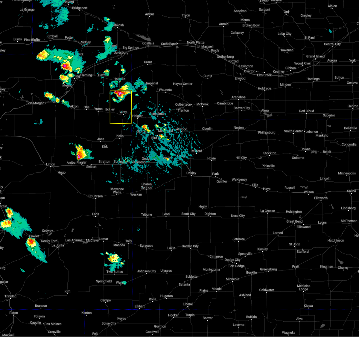 At 401 pm mdt, a severe thunderstorm was located 12 miles north of wray, moving south at 30 mph (this storm produced a 59 mph wind gust in holyoke at 335 pm mdt). Hazards include 60 mph wind gusts and nickel size hail. Expect damage to roofs, siding, and trees. locations impacted include, wray, eckley, laird, alvin, wauneta, and vernon. This includes highway 385 between mile markers 234 and 270. At 401 pm mdt, a severe thunderstorm was located 12 miles north of wray, moving south at 30 mph (this storm produced a 59 mph wind gust in holyoke at 335 pm mdt). Hazards include 60 mph wind gusts and nickel size hail. Expect damage to roofs, siding, and trees. locations impacted include, wray, eckley, laird, alvin, wauneta, and vernon. This includes highway 385 between mile markers 234 and 270.
|
| 7/20/2024 3:47 PM MDT |
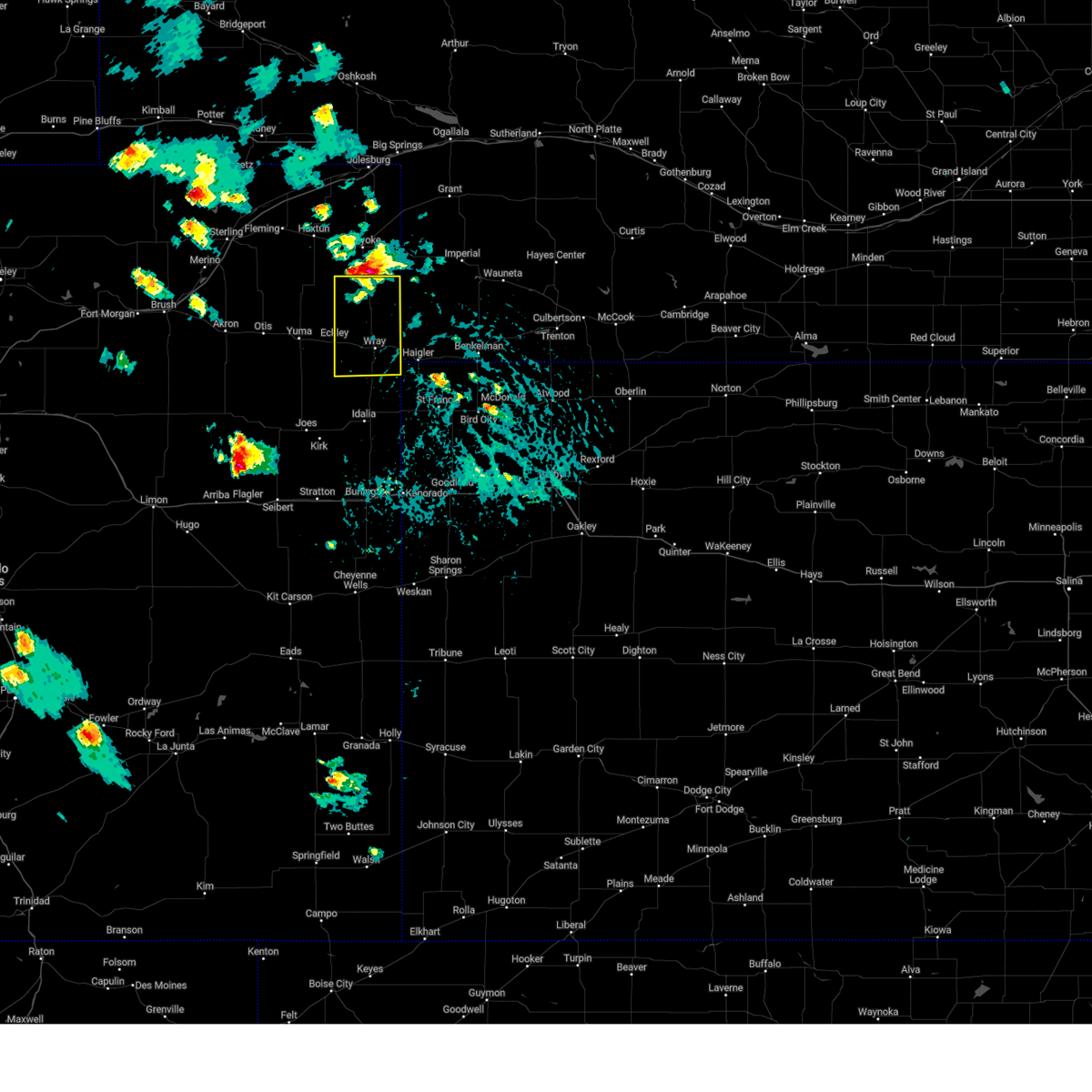 Svrgld the national weather service in goodland has issued a * severe thunderstorm warning for, northeastern yuma county in northeastern colorado, * until 430 pm mdt. * at 347 pm mdt, a severe thunderstorm was located 14 miles southwest of pleasant valley, or 15 miles south of holyoke, moving south at 30 mph (this storm produced a 59 mph wind gust in holyoke at 335 pm mdt). Hazards include 60 mph wind gusts and nickel size hail. expect damage to roofs, siding, and trees Svrgld the national weather service in goodland has issued a * severe thunderstorm warning for, northeastern yuma county in northeastern colorado, * until 430 pm mdt. * at 347 pm mdt, a severe thunderstorm was located 14 miles southwest of pleasant valley, or 15 miles south of holyoke, moving south at 30 mph (this storm produced a 59 mph wind gust in holyoke at 335 pm mdt). Hazards include 60 mph wind gusts and nickel size hail. expect damage to roofs, siding, and trees
|
| 7/19/2024 9:50 PM MDT |
 The storm which prompted the warning has moved out of the area. therefore, the warning will be allowed to expire. however, gusty winds and heavy rain are still possible with this thunderstorm. a severe thunderstorm watch remains in effect until 1100 pm mdt for northeastern colorado. to report severe weather, contact your nearest law enforcement agency. they will relay your report to the national weather service goodland. The storm which prompted the warning has moved out of the area. therefore, the warning will be allowed to expire. however, gusty winds and heavy rain are still possible with this thunderstorm. a severe thunderstorm watch remains in effect until 1100 pm mdt for northeastern colorado. to report severe weather, contact your nearest law enforcement agency. they will relay your report to the national weather service goodland.
|
| 7/19/2024 9:36 PM MDT |
 At 936 pm mdt, a severe thunderstorm was located 9 miles southwest of eckley, or 10 miles southeast of yuma, moving south at 30 mph (radar indicated). Hazards include 60 mph wind gusts and nickel size hail. Expect damage to roofs, siding, and trees. Locations impacted include, yuma and eckley. At 936 pm mdt, a severe thunderstorm was located 9 miles southwest of eckley, or 10 miles southeast of yuma, moving south at 30 mph (radar indicated). Hazards include 60 mph wind gusts and nickel size hail. Expect damage to roofs, siding, and trees. Locations impacted include, yuma and eckley.
|
| 7/19/2024 9:24 PM MDT |
 Svrgld the national weather service in goodland has issued a * severe thunderstorm warning for, southern yuma county in northeastern colorado, * until 1030 pm mdt. * at 923 pm mdt, a severe thunderstorm was located 6 miles south of eckley, or 13 miles west of wray, moving south at 35 mph (radar indicated). Hazards include 70 mph wind gusts and nickel size hail. Expect considerable tree damage. damage is likely to mobile homes, roofs, and outbuildings. this severe thunderstorm will remain over mainly rural areas of southern yuma county, including the following locations, kirk, heartstrong, idalia, and vernon. This includes highway 385 between mile markers 208 and 210, and between mile markers 212 and 228. Svrgld the national weather service in goodland has issued a * severe thunderstorm warning for, southern yuma county in northeastern colorado, * until 1030 pm mdt. * at 923 pm mdt, a severe thunderstorm was located 6 miles south of eckley, or 13 miles west of wray, moving south at 35 mph (radar indicated). Hazards include 70 mph wind gusts and nickel size hail. Expect considerable tree damage. damage is likely to mobile homes, roofs, and outbuildings. this severe thunderstorm will remain over mainly rural areas of southern yuma county, including the following locations, kirk, heartstrong, idalia, and vernon. This includes highway 385 between mile markers 208 and 210, and between mile markers 212 and 228.
|
| 7/19/2024 9:17 PM MDT |
 At 917 pm mdt, a severe thunderstorm was located 4 miles east of yuma, moving south at 30 mph (radar indicated). Hazards include 70 mph wind gusts and half dollar size hail. Hail damage to vehicles is expected. expect considerable tree damage. wind damage is also likely to mobile homes, roofs, and outbuildings. This severe thunderstorm will remain over mainly rural areas of northwestern yuma county, including the following locations, clarkville. At 917 pm mdt, a severe thunderstorm was located 4 miles east of yuma, moving south at 30 mph (radar indicated). Hazards include 70 mph wind gusts and half dollar size hail. Hail damage to vehicles is expected. expect considerable tree damage. wind damage is also likely to mobile homes, roofs, and outbuildings. This severe thunderstorm will remain over mainly rural areas of northwestern yuma county, including the following locations, clarkville.
|
| 7/19/2024 9:11 PM MDT |
 At 910 pm mdt, a severe thunderstorm was located 6 miles north of yuma, moving south at 30 mph (mesonet. the yuma airport recorded a 60 mph wind gust at 9:10pm mt). Hazards include 60 mph wind gusts and half dollar size hail. Hail damage to vehicles is expected. expect wind damage to roofs, siding, and trees. this severe storm will be near, yuma around 915 pm mdt. Other locations impacted by this severe thunderstorm include clarkville. At 910 pm mdt, a severe thunderstorm was located 6 miles north of yuma, moving south at 30 mph (mesonet. the yuma airport recorded a 60 mph wind gust at 9:10pm mt). Hazards include 60 mph wind gusts and half dollar size hail. Hail damage to vehicles is expected. expect wind damage to roofs, siding, and trees. this severe storm will be near, yuma around 915 pm mdt. Other locations impacted by this severe thunderstorm include clarkville.
|
| 7/19/2024 8:55 PM MDT |
 Svrgld the national weather service in goodland has issued a * severe thunderstorm warning for, northwestern yuma county in northeastern colorado, * until 1000 pm mdt. * at 855 pm mdt, a severe thunderstorm was located 7 miles east of lone star, or 13 miles north of yuma, moving south at 30 mph (radar indicated). Hazards include 60 mph wind gusts and half dollar size hail. Hail damage to vehicles is expected. expect wind damage to roofs, siding, and trees. This severe thunderstorm will be near, yuma around 915 pm mdt. Svrgld the national weather service in goodland has issued a * severe thunderstorm warning for, northwestern yuma county in northeastern colorado, * until 1000 pm mdt. * at 855 pm mdt, a severe thunderstorm was located 7 miles east of lone star, or 13 miles north of yuma, moving south at 30 mph (radar indicated). Hazards include 60 mph wind gusts and half dollar size hail. Hail damage to vehicles is expected. expect wind damage to roofs, siding, and trees. This severe thunderstorm will be near, yuma around 915 pm mdt.
|
| 7/14/2024 6:51 PM MDT |
 At 651 pm mdt, a severe thunderstorm was located 17 miles south of eckley, or 18 miles south of yuma, moving northeast at 20 mph (radar indicated). Hazards include 60 mph wind gusts and penny size hail. Expect damage to roofs, siding, and trees. Locations impacted include, yuma, eckley, abarr, and heartstrong. At 651 pm mdt, a severe thunderstorm was located 17 miles south of eckley, or 18 miles south of yuma, moving northeast at 20 mph (radar indicated). Hazards include 60 mph wind gusts and penny size hail. Expect damage to roofs, siding, and trees. Locations impacted include, yuma, eckley, abarr, and heartstrong.
|
| 7/14/2024 6:42 PM MDT |
 At 642 pm mdt, a severe thunderstorm was located 13 miles northeast of cope, or 20 miles south of yuma, moving east at 15 mph (radar indicated). Hazards include 60 mph wind gusts and quarter size hail. Hail damage to vehicles is expected. expect wind damage to roofs, siding, and trees. Locations impacted include, yuma, eckley, abarr, and heartstrong. At 642 pm mdt, a severe thunderstorm was located 13 miles northeast of cope, or 20 miles south of yuma, moving east at 15 mph (radar indicated). Hazards include 60 mph wind gusts and quarter size hail. Hail damage to vehicles is expected. expect wind damage to roofs, siding, and trees. Locations impacted include, yuma, eckley, abarr, and heartstrong.
|
| 7/14/2024 6:30 PM MDT |
 At 629 pm mdt, a severe thunderstorm was located 12 miles south of yuma, moving southeast at 20 mph (radar indicated). Hazards include 60 to 70 mph wind gusts and quarter size hail. Hail damage to vehicles is expected. expect considerable tree damage. wind damage is also likely to mobile homes, roofs, and outbuildings. Locations impacted include, yuma, eckley, abarr, and heartstrong. At 629 pm mdt, a severe thunderstorm was located 12 miles south of yuma, moving southeast at 20 mph (radar indicated). Hazards include 60 to 70 mph wind gusts and quarter size hail. Hail damage to vehicles is expected. expect considerable tree damage. wind damage is also likely to mobile homes, roofs, and outbuildings. Locations impacted include, yuma, eckley, abarr, and heartstrong.
|
| 7/14/2024 6:19 PM MDT |
 At 618 pm mdt, a severe thunderstorm was located 8 miles southwest of yuma, moving southeast at 20 mph (radar indicated). Hazards include 60 to 70 mph wind gusts and quarter size hail. Hail damage to vehicles is expected. expect considerable tree damage. wind damage is also likely to mobile homes, roofs, and outbuildings. Locations impacted include, yuma, eckley, abarr, and heartstrong. At 618 pm mdt, a severe thunderstorm was located 8 miles southwest of yuma, moving southeast at 20 mph (radar indicated). Hazards include 60 to 70 mph wind gusts and quarter size hail. Hail damage to vehicles is expected. expect considerable tree damage. wind damage is also likely to mobile homes, roofs, and outbuildings. Locations impacted include, yuma, eckley, abarr, and heartstrong.
|
| 7/14/2024 6:09 PM MDT |
 Svrgld the national weather service in goodland has issued a * severe thunderstorm warning for, western yuma county in northeastern colorado, * until 715 pm mdt. * at 608 pm mdt, a severe thunderstorm was located 9 miles southwest of yuma, moving southeast at 20 mph (radar indicated). Hazards include 60 mph wind gusts and quarter size hail. Hail damage to vehicles is expected. expect wind damage to roofs, siding, and trees. This severe thunderstorm will remain over mainly rural areas of western yuma county, including the following locations, abarr and heartstrong. Svrgld the national weather service in goodland has issued a * severe thunderstorm warning for, western yuma county in northeastern colorado, * until 715 pm mdt. * at 608 pm mdt, a severe thunderstorm was located 9 miles southwest of yuma, moving southeast at 20 mph (radar indicated). Hazards include 60 mph wind gusts and quarter size hail. Hail damage to vehicles is expected. expect wind damage to roofs, siding, and trees. This severe thunderstorm will remain over mainly rural areas of western yuma county, including the following locations, abarr and heartstrong.
|
| 6/15/2024 9:05 PM MDT |
 The storms which prompted the warning have weakened below severe limits, and no longer pose an immediate threat to life or property. therefore, the warning will be allowed to expire. however, gusty winds are still possible with these thunderstorms. to report severe weather, contact your nearest law enforcement agency. they will relay your report to the national weather service goodland. The storms which prompted the warning have weakened below severe limits, and no longer pose an immediate threat to life or property. therefore, the warning will be allowed to expire. however, gusty winds are still possible with these thunderstorms. to report severe weather, contact your nearest law enforcement agency. they will relay your report to the national weather service goodland.
|
| 6/15/2024 8:50 PM MDT |
 At 850 pm mdt, severe thunderstorms were located along a line extending from 11 miles northeast of yuma to 9 miles southwest of eckley to 6 miles northeast of cope, moving east at 30 mph (radar indicated). Hazards include 60 mph wind gusts. Expect damage to roofs, siding, and trees. these severe storms will be near, eckley around 855 pm mdt. other locations impacted by these severe thunderstorms include abarr, heartstrong, idalia, vernon, and wauneta. This includes highway 385 between mile markers 218 and 264. At 850 pm mdt, severe thunderstorms were located along a line extending from 11 miles northeast of yuma to 9 miles southwest of eckley to 6 miles northeast of cope, moving east at 30 mph (radar indicated). Hazards include 60 mph wind gusts. Expect damage to roofs, siding, and trees. these severe storms will be near, eckley around 855 pm mdt. other locations impacted by these severe thunderstorms include abarr, heartstrong, idalia, vernon, and wauneta. This includes highway 385 between mile markers 218 and 264.
|
| 6/15/2024 8:31 PM MDT |
 At 830 pm mdt, severe thunderstorms were located along a line extending from 8 miles north of yuma to 15 miles southwest of eckley to 3 miles northwest of cope, moving east at 35 mph (radar indicated. this storm has had a history of producing wind gusts approaching 70 mph). Hazards include 60 mph wind gusts. Expect damage to roofs, siding, and trees. these severe storms will be near, yuma around 835 pm mdt. eckley around 845 pm mdt. wray around 905 pm mdt. other locations impacted by these severe thunderstorms include joes, abarr, kirk, heartstrong, wauneta, idalia, and vernon. This includes highway 385 between mile markers 218 and 264. At 830 pm mdt, severe thunderstorms were located along a line extending from 8 miles north of yuma to 15 miles southwest of eckley to 3 miles northwest of cope, moving east at 35 mph (radar indicated. this storm has had a history of producing wind gusts approaching 70 mph). Hazards include 60 mph wind gusts. Expect damage to roofs, siding, and trees. these severe storms will be near, yuma around 835 pm mdt. eckley around 845 pm mdt. wray around 905 pm mdt. other locations impacted by these severe thunderstorms include joes, abarr, kirk, heartstrong, wauneta, idalia, and vernon. This includes highway 385 between mile markers 218 and 264.
|
| 6/15/2024 8:11 PM MDT |
 Svrgld the national weather service in goodland has issued a * severe thunderstorm warning for, yuma county in northeastern colorado, * until 915 pm mdt. * at 811 pm mdt, severe thunderstorms were located along a line extending from 6 miles north of otis to 14 miles east of elba to 4 miles southwest of arickaree school, moving east at 35 mph (radar indicated). Hazards include 60 mph wind gusts. Expect damage to roofs, siding, and trees. severe thunderstorms will be near, yuma around 825 pm mdt. other locations in the path of these severe thunderstorms include eckley and wray. This includes highway 385 between mile markers 218 and 264. Svrgld the national weather service in goodland has issued a * severe thunderstorm warning for, yuma county in northeastern colorado, * until 915 pm mdt. * at 811 pm mdt, severe thunderstorms were located along a line extending from 6 miles north of otis to 14 miles east of elba to 4 miles southwest of arickaree school, moving east at 35 mph (radar indicated). Hazards include 60 mph wind gusts. Expect damage to roofs, siding, and trees. severe thunderstorms will be near, yuma around 825 pm mdt. other locations in the path of these severe thunderstorms include eckley and wray. This includes highway 385 between mile markers 218 and 264.
|
| 6/14/2024 3:20 PM MDT | Quarter sized hail reported 11.6 miles S of Eckley, CO, public report and photo via social media. location estimated. |
| 6/8/2024 5:26 PM MDT |
 At 526 pm mdt, severe thunderstorms were located along a line extending from 7 miles south of yuma to 4 miles southwest of arickaree school to 7 miles east of agate, moving southeast at 30 mph (radar indicated). Hazards include 60 mph wind gusts and quarter size hail. Hail damage to vehicles is expected. expect wind damage to roofs, siding, and trees. These severe thunderstorms will remain over mainly rural areas of southwestern yuma and northwestern kit carson counties, including the following locations, joes, abarr, and heartstrong. At 526 pm mdt, severe thunderstorms were located along a line extending from 7 miles south of yuma to 4 miles southwest of arickaree school to 7 miles east of agate, moving southeast at 30 mph (radar indicated). Hazards include 60 mph wind gusts and quarter size hail. Hail damage to vehicles is expected. expect wind damage to roofs, siding, and trees. These severe thunderstorms will remain over mainly rural areas of southwestern yuma and northwestern kit carson counties, including the following locations, joes, abarr, and heartstrong.
|
| 6/8/2024 4:58 PM MDT |
 Svrgld the national weather service in goodland has issued a * severe thunderstorm warning for, southwestern yuma county in northeastern colorado, northwestern kit carson county in east central colorado, * until 600 pm mdt. * at 457 pm mdt, severe thunderstorms were located along a line extending from 4 miles southwest of otis to 4 miles northeast of lindon to 4 miles northwest of agate, moving southeast at 30 mph (radar indicated). Hazards include 70 mph wind gusts and quarter size hail. Hail damage to vehicles is expected. expect considerable tree damage. wind damage is also likely to mobile homes, roofs, and outbuildings. These severe thunderstorms will remain over mainly rural areas of southwestern yuma and northwestern kit carson counties, including the following locations, joes, abarr, and heartstrong. Svrgld the national weather service in goodland has issued a * severe thunderstorm warning for, southwestern yuma county in northeastern colorado, northwestern kit carson county in east central colorado, * until 600 pm mdt. * at 457 pm mdt, severe thunderstorms were located along a line extending from 4 miles southwest of otis to 4 miles northeast of lindon to 4 miles northwest of agate, moving southeast at 30 mph (radar indicated). Hazards include 70 mph wind gusts and quarter size hail. Hail damage to vehicles is expected. expect considerable tree damage. wind damage is also likely to mobile homes, roofs, and outbuildings. These severe thunderstorms will remain over mainly rural areas of southwestern yuma and northwestern kit carson counties, including the following locations, joes, abarr, and heartstrong.
|
| 6/2/2024 5:50 PM MDT |
 Svrgld the national weather service in goodland has issued a * severe thunderstorm warning for, yuma county in northeastern colorado, cheyenne county in northwestern kansas, northwestern rawlins county in northwestern kansas, western hitchcock county in southwestern nebraska, dundy county in southwestern nebraska, * until 615 pm mdt/715 pm cdt/. * at 549 pm mdt/649 pm cdt/, severe thunderstorms were located along a line extending from 6 miles south of wauneta to 12 miles north of haigler to 15 miles southwest of eckley, moving southeast at 45 mph (radar indicated). Hazards include 70 mph wind gusts and quarter size hail. Hail damage to vehicles is expected. expect considerable tree damage. wind damage is also likely to mobile homes, roofs, and outbuildings. severe thunderstorms will be near, wray around 555 pm mdt. haigler around 605 pm mdt. other locations impacted by these severe thunderstorms include hale, beecher island, max, heartstrong, alvin, wauneta, and laird. This includes highway 385 between mile markers 217 and 264. Svrgld the national weather service in goodland has issued a * severe thunderstorm warning for, yuma county in northeastern colorado, cheyenne county in northwestern kansas, northwestern rawlins county in northwestern kansas, western hitchcock county in southwestern nebraska, dundy county in southwestern nebraska, * until 615 pm mdt/715 pm cdt/. * at 549 pm mdt/649 pm cdt/, severe thunderstorms were located along a line extending from 6 miles south of wauneta to 12 miles north of haigler to 15 miles southwest of eckley, moving southeast at 45 mph (radar indicated). Hazards include 70 mph wind gusts and quarter size hail. Hail damage to vehicles is expected. expect considerable tree damage. wind damage is also likely to mobile homes, roofs, and outbuildings. severe thunderstorms will be near, wray around 555 pm mdt. haigler around 605 pm mdt. other locations impacted by these severe thunderstorms include hale, beecher island, max, heartstrong, alvin, wauneta, and laird. This includes highway 385 between mile markers 217 and 264.
|
| 5/29/2024 5:36 PM MDT |
 Svrgld the national weather service in goodland has issued a * severe thunderstorm warning for, western yuma county in northeastern colorado, * until 615 pm mdt. * at 535 pm mdt, severe thunderstorms were located along a line extending from 6 miles north of platner to 10 miles south of otis to 7 miles northeast of arickaree school, moving east at 25 mph (radar indicated). Hazards include 60 mph wind gusts and nickel size hail. Expect damage to roofs, siding, and trees. Severe thunderstorms will be near, yuma around 550 pm mdt. Svrgld the national weather service in goodland has issued a * severe thunderstorm warning for, western yuma county in northeastern colorado, * until 615 pm mdt. * at 535 pm mdt, severe thunderstorms were located along a line extending from 6 miles north of platner to 10 miles south of otis to 7 miles northeast of arickaree school, moving east at 25 mph (radar indicated). Hazards include 60 mph wind gusts and nickel size hail. Expect damage to roofs, siding, and trees. Severe thunderstorms will be near, yuma around 550 pm mdt.
|
| 5/20/2024 10:23 PM MDT |
 At 1023 pm mdt, severe thunderstorms were located along a line extending from 18 miles northeast of eckley to 7 miles east of wray to 9 miles west of haigler, moving east at 50 mph. these are destructive storms for rural yuma and dundy counties (radar indicated). Hazards include 80 mph wind gusts and two inch hail. Flying debris will be dangerous to those caught without shelter. mobile homes will be heavily damaged. expect considerable damage to roofs, windows, and vehicles. extensive tree damage and power outages are likely. these severe storms will be near, haigler around 1030 pm mdt. other locations impacted by these severe thunderstorms include laird, parks, alvin, and wauneta. This includes highway 385 between mile markers 237 and 263. At 1023 pm mdt, severe thunderstorms were located along a line extending from 18 miles northeast of eckley to 7 miles east of wray to 9 miles west of haigler, moving east at 50 mph. these are destructive storms for rural yuma and dundy counties (radar indicated). Hazards include 80 mph wind gusts and two inch hail. Flying debris will be dangerous to those caught without shelter. mobile homes will be heavily damaged. expect considerable damage to roofs, windows, and vehicles. extensive tree damage and power outages are likely. these severe storms will be near, haigler around 1030 pm mdt. other locations impacted by these severe thunderstorms include laird, parks, alvin, and wauneta. This includes highway 385 between mile markers 237 and 263.
|
| 5/20/2024 10:03 PM MDT |
 At 1002 pm mdt, a severe thunderstorm was located near wray, moving east at 35 mph. this is a destructive storm for wray colorado (radar indicated. this storm has a history of producing 75 mph 8 miles south of eckley and a history of prodicing hail larger than tennis balls). Hazards include baseball size hail and 70 mph wind gusts. People and animals outdoors will be severely injured. expect shattered windows, extensive damage to roofs, siding, and vehicles. this severe storm will be near, wray around 1010 pm mdt. other locations impacted by this severe thunderstorm include laird, parks, alvin, and wauneta. This includes highway 385 between mile markers 237 and 263. At 1002 pm mdt, a severe thunderstorm was located near wray, moving east at 35 mph. this is a destructive storm for wray colorado (radar indicated. this storm has a history of producing 75 mph 8 miles south of eckley and a history of prodicing hail larger than tennis balls). Hazards include baseball size hail and 70 mph wind gusts. People and animals outdoors will be severely injured. expect shattered windows, extensive damage to roofs, siding, and vehicles. this severe storm will be near, wray around 1010 pm mdt. other locations impacted by this severe thunderstorm include laird, parks, alvin, and wauneta. This includes highway 385 between mile markers 237 and 263.
|
| 5/20/2024 9:50 PM MDT | Occurred with nickel size hai in yuma county CO, 7.7 miles N of Eckley, CO |
| 5/20/2024 9:43 PM MDT | Tennis Ball sized hail reported 3.5 miles SSW of Eckley, CO, report from mping: tennis ball (2.50 in.). |
| 5/20/2024 9:41 PM MDT |
 Svrgld the national weather service in goodland has issued a * severe thunderstorm warning for, northeastern yuma county in northeastern colorado, western dundy county in southwestern nebraska, * until 1045 pm mdt. * at 939 pm mdt, a severe thunderstorm was located 4 miles east of eckley, or 9 miles west of wray, moving east at 30 mph. this is a destructive storm for eckley colorado and rural northeast yuma county (radar indicated. this storm has a history of destructive wind gusts to 75 mph and hail in excess of baseball size). Hazards include baseball size hail and 70 mph wind gusts. People and animals outdoors will be severely injured. expect shattered windows, extensive damage to roofs, siding, and vehicles. this severe thunderstorm will be near, wray around 950 pm mdt. This includes highway 385 between mile markers 237 and 263. Svrgld the national weather service in goodland has issued a * severe thunderstorm warning for, northeastern yuma county in northeastern colorado, western dundy county in southwestern nebraska, * until 1045 pm mdt. * at 939 pm mdt, a severe thunderstorm was located 4 miles east of eckley, or 9 miles west of wray, moving east at 30 mph. this is a destructive storm for eckley colorado and rural northeast yuma county (radar indicated. this storm has a history of destructive wind gusts to 75 mph and hail in excess of baseball size). Hazards include baseball size hail and 70 mph wind gusts. People and animals outdoors will be severely injured. expect shattered windows, extensive damage to roofs, siding, and vehicles. this severe thunderstorm will be near, wray around 950 pm mdt. This includes highway 385 between mile markers 237 and 263.
|
| 5/20/2024 9:33 PM MDT | Ping Pong Ball sized hail reported 3.5 miles SSW of Eckley, CO, report from mping: ping pong ball (1.50 in.). |
| 5/20/2024 9:32 PM MDT | Quarter sized hail reported 3.5 miles SSW of Eckley, CO, report from mping: quarter (1.00 in.). |
| 5/20/2024 9:20 PM MDT |
 At 918 pm mdt, a severe thunderstorm was located 5 miles west of eckley, or 6 miles east of yuma, moving east at 40 mph. this is a destructive storm for eckley colorado! (radar indicated. at 9 pm mdt tennis to softball size hail was reported 1 mile south of yuma). Hazards include baseball size hail and 70 mph wind gusts. People and animals outdoors will be severely injured. expect shattered windows, extensive damage to roofs, siding, and vehicles. this severe storm will be near, eckley around 925 pm mdt. Other locations impacted by this severe thunderstorm include heartstrong. At 918 pm mdt, a severe thunderstorm was located 5 miles west of eckley, or 6 miles east of yuma, moving east at 40 mph. this is a destructive storm for eckley colorado! (radar indicated. at 9 pm mdt tennis to softball size hail was reported 1 mile south of yuma). Hazards include baseball size hail and 70 mph wind gusts. People and animals outdoors will be severely injured. expect shattered windows, extensive damage to roofs, siding, and vehicles. this severe storm will be near, eckley around 925 pm mdt. Other locations impacted by this severe thunderstorm include heartstrong.
|
| 5/20/2024 9:14 PM MDT |
 At 913 pm mdt, a severe thunderstorm was located 6 miles west of eckley, or 6 miles east of yuma, moving east at 40 mph. this is a destructive storm for yuma colorado! (radar indicated). Hazards include baseball size hail and 70 mph wind gusts. People and animals outdoors will be severely injured. expect shattered windows, extensive damage to roofs, siding, and vehicles. this severe storm will be near, eckley around 920 pm mdt. Other locations impacted by this severe thunderstorm include heartstrong. At 913 pm mdt, a severe thunderstorm was located 6 miles west of eckley, or 6 miles east of yuma, moving east at 40 mph. this is a destructive storm for yuma colorado! (radar indicated). Hazards include baseball size hail and 70 mph wind gusts. People and animals outdoors will be severely injured. expect shattered windows, extensive damage to roofs, siding, and vehicles. this severe storm will be near, eckley around 920 pm mdt. Other locations impacted by this severe thunderstorm include heartstrong.
|
| 5/20/2024 8:59 PM MDT |
 Svrgld the national weather service in goodland has issued a * severe thunderstorm warning for, northwestern yuma county in northeastern colorado, * until 1000 pm mdt. * at 858 pm mdt, a severe thunderstorm was located near yuma, moving east at 20 mph. this is a destructive storm for yuma colorado (radar indicated). Hazards include baseball size hail and 70 mph wind gusts. People and animals outdoors will be severely injured. expect shattered windows, extensive damage to roofs, siding, and vehicles. this severe thunderstorm will be near, yuma around 905 pm mdt. Other locations in the path of this severe thunderstorm include eckley. Svrgld the national weather service in goodland has issued a * severe thunderstorm warning for, northwestern yuma county in northeastern colorado, * until 1000 pm mdt. * at 858 pm mdt, a severe thunderstorm was located near yuma, moving east at 20 mph. this is a destructive storm for yuma colorado (radar indicated). Hazards include baseball size hail and 70 mph wind gusts. People and animals outdoors will be severely injured. expect shattered windows, extensive damage to roofs, siding, and vehicles. this severe thunderstorm will be near, yuma around 905 pm mdt. Other locations in the path of this severe thunderstorm include eckley.
|
| 5/3/2024 5:25 PM MDT |
 At 524 pm mdt/624 pm cdt/, severe thunderstorms were located along a line extending from 9 miles south of wauneta to 9 miles west of st. francis to 11 miles southeast of cope, moving southeast at 35 mph (trained weather spotters reported 50-60 mph wind gusts and nickel size hail in eckley). Hazards include 60 mph wind gusts and quarter size hail. Hail damage to vehicles is expected. expect wind damage to roofs, siding, and trees. these severe storms will be near, benkelman and bonny reservoir around 530 pm mdt. st. francis around 635 pm cdt. bird city around 655 pm cdt. other locations impacted by these severe thunderstorms include abarr, beecher island, max, wauneta, vernon, joes, and hale. This includes highway 385 between mile markers 194 and 270. At 524 pm mdt/624 pm cdt/, severe thunderstorms were located along a line extending from 9 miles south of wauneta to 9 miles west of st. francis to 11 miles southeast of cope, moving southeast at 35 mph (trained weather spotters reported 50-60 mph wind gusts and nickel size hail in eckley). Hazards include 60 mph wind gusts and quarter size hail. Hail damage to vehicles is expected. expect wind damage to roofs, siding, and trees. these severe storms will be near, benkelman and bonny reservoir around 530 pm mdt. st. francis around 635 pm cdt. bird city around 655 pm cdt. other locations impacted by these severe thunderstorms include abarr, beecher island, max, wauneta, vernon, joes, and hale. This includes highway 385 between mile markers 194 and 270.
|
| 5/3/2024 5:20 PM MDT |
 At 519 pm mdt/619 pm cdt/, severe thunderstorms were located along a line extending from 7 miles southwest of wauneta to 11 miles south of haigler to 8 miles southeast of cope, moving southeast at 25 mph (radar indicated). Hazards include 60 mph wind gusts and quarter size hail. Hail damage to vehicles is expected. expect wind damage to roofs, siding, and trees. these severe storms will be near, benkelman around 535 pm mdt. st. francis around 640 pm cdt. bonny reservoir around 540 pm mdt. other locations impacted by these severe thunderstorms include abarr, beecher island, max, wauneta, vernon, joes, and hale. This includes highway 385 between mile markers 194 and 270. At 519 pm mdt/619 pm cdt/, severe thunderstorms were located along a line extending from 7 miles southwest of wauneta to 11 miles south of haigler to 8 miles southeast of cope, moving southeast at 25 mph (radar indicated). Hazards include 60 mph wind gusts and quarter size hail. Hail damage to vehicles is expected. expect wind damage to roofs, siding, and trees. these severe storms will be near, benkelman around 535 pm mdt. st. francis around 640 pm cdt. bonny reservoir around 540 pm mdt. other locations impacted by these severe thunderstorms include abarr, beecher island, max, wauneta, vernon, joes, and hale. This includes highway 385 between mile markers 194 and 270.
|
| 5/3/2024 5:10 PM MDT |
 At 509 pm mdt/609 pm cdt/, severe thunderstorms were located along a line extending from 10 miles northwest of benkelman to 11 miles south of haigler to 11 miles southeast of cope, moving southeast at 35 mph (radar indicated. blowing dust has also been observed 8 miles to the south of haigler, nebraska). Hazards include 60 mph wind gusts and nickel size hail. Expect damage to roofs, siding, and trees. these severe storms will be near, st. francis around 620 pm cdt. benkelman and bonny reservoir around 520 pm mdt. bird city around 640 pm cdt. other locations impacted by these severe thunderstorms include abarr, beecher island, max, wauneta, vernon, joes, and hale. This includes highway 385 between mile markers 194 and 270. At 509 pm mdt/609 pm cdt/, severe thunderstorms were located along a line extending from 10 miles northwest of benkelman to 11 miles south of haigler to 11 miles southeast of cope, moving southeast at 35 mph (radar indicated. blowing dust has also been observed 8 miles to the south of haigler, nebraska). Hazards include 60 mph wind gusts and nickel size hail. Expect damage to roofs, siding, and trees. these severe storms will be near, st. francis around 620 pm cdt. benkelman and bonny reservoir around 520 pm mdt. bird city around 640 pm cdt. other locations impacted by these severe thunderstorms include abarr, beecher island, max, wauneta, vernon, joes, and hale. This includes highway 385 between mile markers 194 and 270.
|
| 5/3/2024 5:07 PM MDT | Trained spotter estimated winds gusting 50 to 60 mph. time estimated based on rada in yuma county CO, 12.6 miles N of Eckley, CO |
| 5/3/2024 4:55 PM MDT |
 At 454 pm mdt/554 pm cdt/, severe thunderstorms were located along a line extending from 12 miles south of champion to 7 miles southwest of haigler to 4 miles east of cope, moving southeast at 35 mph (radar indicated. the wray airport gusted to 57 mph at 450pm mt). Hazards include 60 mph wind gusts and nickel size hail. Expect damage to roofs, siding, and trees. these severe storms will be near, haigler around 500 pm mdt. benkelman around 515 pm mdt. st. francis around 620 pm cdt. bonny reservoir around 520 pm mdt. bird city around 640 pm cdt. other locations impacted by these severe thunderstorms include abarr, beecher island, max, wauneta, vernon, joes, and hale. This includes highway 385 between mile markers 194 and 270. At 454 pm mdt/554 pm cdt/, severe thunderstorms were located along a line extending from 12 miles south of champion to 7 miles southwest of haigler to 4 miles east of cope, moving southeast at 35 mph (radar indicated. the wray airport gusted to 57 mph at 450pm mt). Hazards include 60 mph wind gusts and nickel size hail. Expect damage to roofs, siding, and trees. these severe storms will be near, haigler around 500 pm mdt. benkelman around 515 pm mdt. st. francis around 620 pm cdt. bonny reservoir around 520 pm mdt. bird city around 640 pm cdt. other locations impacted by these severe thunderstorms include abarr, beecher island, max, wauneta, vernon, joes, and hale. This includes highway 385 between mile markers 194 and 270.
|
| 5/3/2024 4:46 PM MDT |
 Svrgld the national weather service in goodland has issued a * severe thunderstorm warning for, yuma county in northeastern colorado, northeastern kit carson county in east central colorado, cheyenne county in northwestern kansas, northwestern sherman county in northwestern kansas, dundy county in southwestern nebraska, * until 545 pm mdt/645 pm cdt/. * at 446 pm mdt/546 pm cdt/, severe thunderstorms were located along a line extending from 8 miles south of champion to 7 miles southeast of wray to 4 miles northeast of cope, moving southeast at 35 mph (radar indicated). Hazards include 60 mph wind gusts. Expect damage to roofs, siding, and trees. severe thunderstorms will be near, haigler around 450 pm mdt. other locations in the path of these severe thunderstorms include benkelman, st. francis and bonny reservoir. This includes highway 385 between mile markers 194 and 270. Svrgld the national weather service in goodland has issued a * severe thunderstorm warning for, yuma county in northeastern colorado, northeastern kit carson county in east central colorado, cheyenne county in northwestern kansas, northwestern sherman county in northwestern kansas, dundy county in southwestern nebraska, * until 545 pm mdt/645 pm cdt/. * at 446 pm mdt/546 pm cdt/, severe thunderstorms were located along a line extending from 8 miles south of champion to 7 miles southeast of wray to 4 miles northeast of cope, moving southeast at 35 mph (radar indicated). Hazards include 60 mph wind gusts. Expect damage to roofs, siding, and trees. severe thunderstorms will be near, haigler around 450 pm mdt. other locations in the path of these severe thunderstorms include benkelman, st. francis and bonny reservoir. This includes highway 385 between mile markers 194 and 270.
|
| 5/1/2024 6:36 PM MDT |
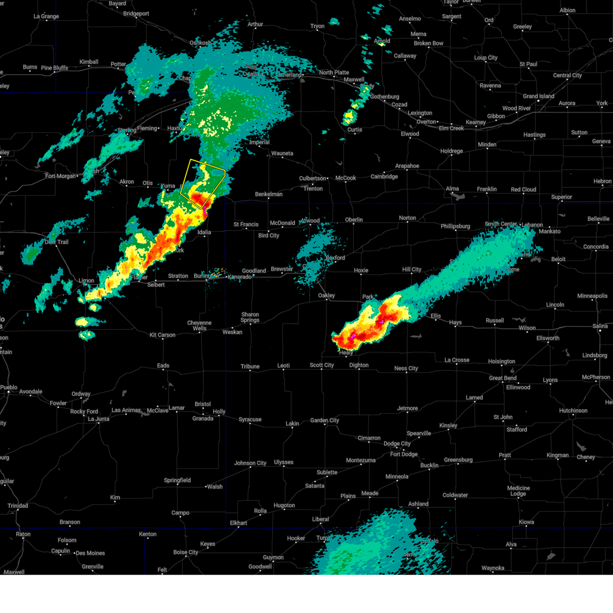 Svrgld the national weather service in goodland has issued a * severe thunderstorm warning for, northeastern yuma county in northeastern colorado, * until 715 pm mdt. * at 636 pm mdt, a severe thunderstorm was located 6 miles southeast of eckley, or 8 miles west of wray, moving northeast at 35 mph (radar indicated). Hazards include golf ball size hail and 60 mph wind gusts. People and animals outdoors will be injured. expect hail damage to roofs, siding, windows, and vehicles. expect wind damage to roofs, siding, and trees. this severe thunderstorm will remain over mainly rural areas of northeastern yuma county, including the following locations, wauneta. This includes highway 385 between mile markers 244 and 263. Svrgld the national weather service in goodland has issued a * severe thunderstorm warning for, northeastern yuma county in northeastern colorado, * until 715 pm mdt. * at 636 pm mdt, a severe thunderstorm was located 6 miles southeast of eckley, or 8 miles west of wray, moving northeast at 35 mph (radar indicated). Hazards include golf ball size hail and 60 mph wind gusts. People and animals outdoors will be injured. expect hail damage to roofs, siding, windows, and vehicles. expect wind damage to roofs, siding, and trees. this severe thunderstorm will remain over mainly rural areas of northeastern yuma county, including the following locations, wauneta. This includes highway 385 between mile markers 244 and 263.
|
| 4/25/2024 7:31 PM MDT |
 At 730 pm mdt/830 pm cdt/, severe thunderstorms were located along a line extending from 8 miles northeast of haigler to 9 miles northwest of bonny reservoir, moving east at 55 mph (trained weather spotters report 1 inch diameter hail near idalia at 7:27 pm). Hazards include 60 mph wind gusts and quarter size hail. Hail damage to vehicles is expected. expect wind damage to roofs, siding, and trees. these severe thunderstorms will remain over mainly rural areas of eastern yuma county in northeastern colorado, northwestern cheyenne county in northwestern kansas and dundy counties in southwestern nebraska, including the following locations, hale, beecher island, alvin, wauneta, laird, parks, and idalia. This includes highway 385 between mile markers 207 and 210, and between mile markers 212 and 268. At 730 pm mdt/830 pm cdt/, severe thunderstorms were located along a line extending from 8 miles northeast of haigler to 9 miles northwest of bonny reservoir, moving east at 55 mph (trained weather spotters report 1 inch diameter hail near idalia at 7:27 pm). Hazards include 60 mph wind gusts and quarter size hail. Hail damage to vehicles is expected. expect wind damage to roofs, siding, and trees. these severe thunderstorms will remain over mainly rural areas of eastern yuma county in northeastern colorado, northwestern cheyenne county in northwestern kansas and dundy counties in southwestern nebraska, including the following locations, hale, beecher island, alvin, wauneta, laird, parks, and idalia. This includes highway 385 between mile markers 207 and 210, and between mile markers 212 and 268.
|
| 4/25/2024 7:16 PM MDT |
 Svrgld the national weather service in goodland has issued a * severe thunderstorm warning for, eastern yuma county in northeastern colorado, northwestern cheyenne county in northwestern kansas, dundy county in southwestern nebraska, * until 815 pm mdt/915 pm cdt/. * at 715 pm mdt/815 pm cdt/, severe thunderstorms were located along a line extending from 6 miles south of haigler to 9 miles west of bonny reservoir, moving north at 55 mph (radar indicated). Hazards include 60 mph wind gusts and quarter size hail. Hail damage to vehicles is expected. expect wind damage to roofs, siding, and trees. severe thunderstorms will be near, haigler around 720 pm mdt. This includes highway 385 between mile markers 207 and 210, and between mile markers 212 and 268. Svrgld the national weather service in goodland has issued a * severe thunderstorm warning for, eastern yuma county in northeastern colorado, northwestern cheyenne county in northwestern kansas, dundy county in southwestern nebraska, * until 815 pm mdt/915 pm cdt/. * at 715 pm mdt/815 pm cdt/, severe thunderstorms were located along a line extending from 6 miles south of haigler to 9 miles west of bonny reservoir, moving north at 55 mph (radar indicated). Hazards include 60 mph wind gusts and quarter size hail. Hail damage to vehicles is expected. expect wind damage to roofs, siding, and trees. severe thunderstorms will be near, haigler around 720 pm mdt. This includes highway 385 between mile markers 207 and 210, and between mile markers 212 and 268.
|
| 8/9/2023 12:29 AM MDT |
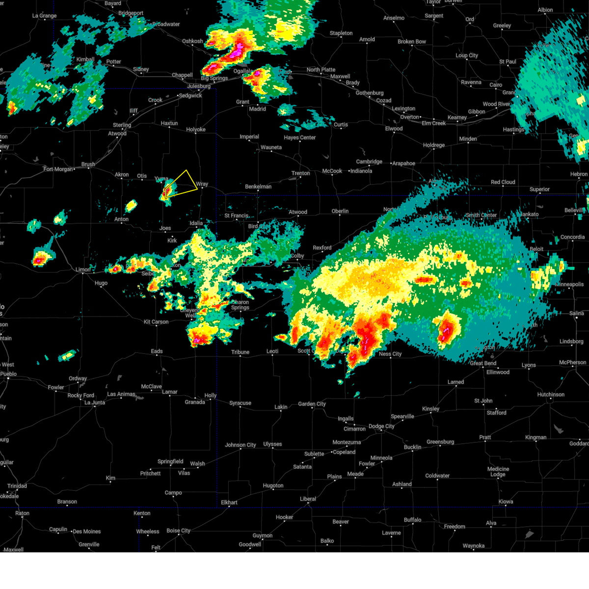 At 1228 am mdt, a severe thunderstorm was located 6 miles southwest of eckley, or 7 miles southeast of yuma, moving east at 25 mph (radar indicated). Hazards include 60 mph wind gusts and quarter size hail. Hail damage to vehicles is expected. expect wind damage to roofs, siding, and trees. locations impacted include, eckley. hail threat, radar indicated max hail size, 1. 00 in wind threat, radar indicated max wind gust, 60 mph. At 1228 am mdt, a severe thunderstorm was located 6 miles southwest of eckley, or 7 miles southeast of yuma, moving east at 25 mph (radar indicated). Hazards include 60 mph wind gusts and quarter size hail. Hail damage to vehicles is expected. expect wind damage to roofs, siding, and trees. locations impacted include, eckley. hail threat, radar indicated max hail size, 1. 00 in wind threat, radar indicated max wind gust, 60 mph.
|
| 8/9/2023 12:16 AM MDT |
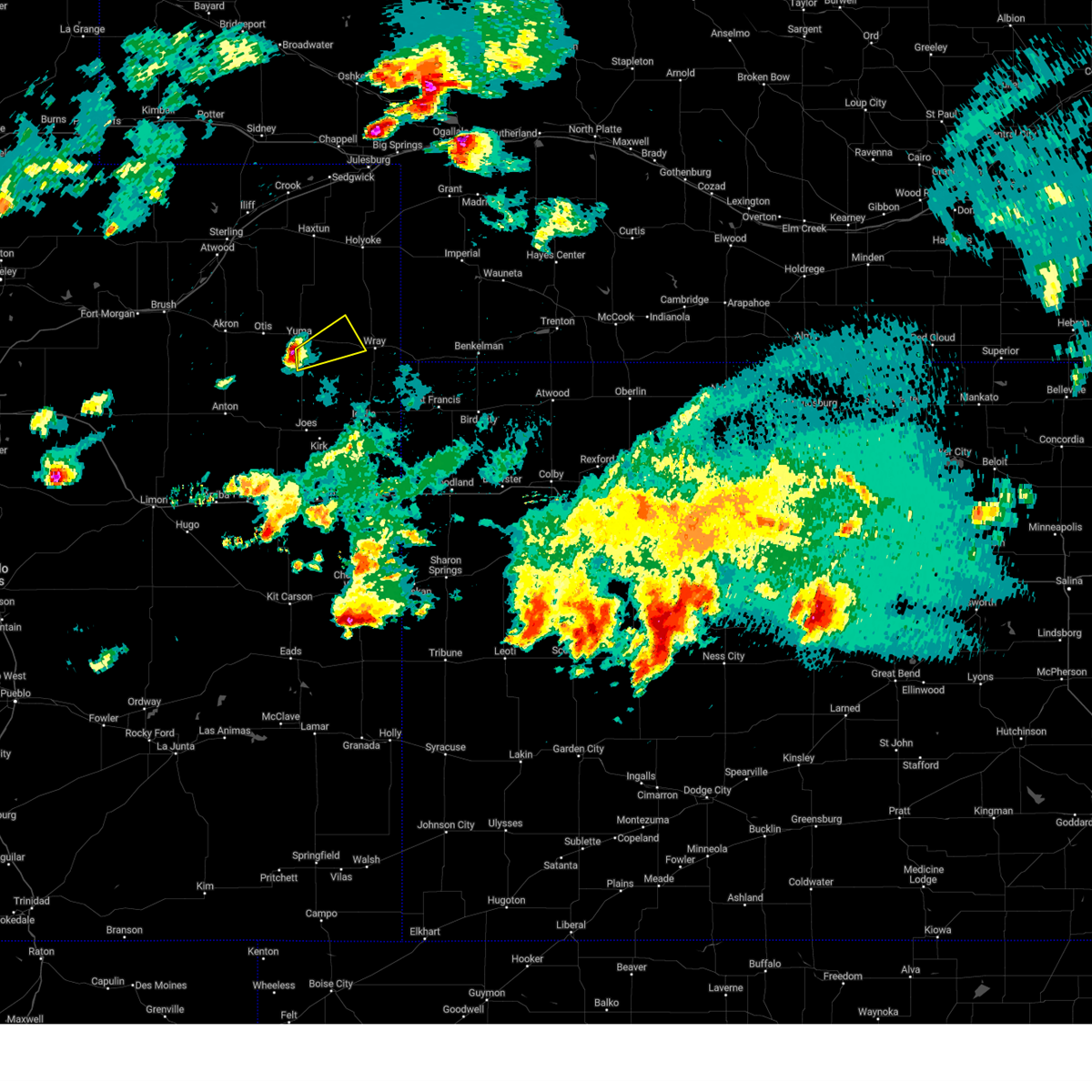 At 1216 am mdt, a severe thunderstorm was located 5 miles southeast of yuma, moving east at 25 mph (radar indicated). Hazards include 60 mph wind gusts and quarter size hail. Hail damage to vehicles is expected. expect wind damage to roofs, siding, and trees. locations impacted include, eckley. hail threat, radar indicated max hail size, 1. 00 in wind threat, radar indicated max wind gust, 60 mph. At 1216 am mdt, a severe thunderstorm was located 5 miles southeast of yuma, moving east at 25 mph (radar indicated). Hazards include 60 mph wind gusts and quarter size hail. Hail damage to vehicles is expected. expect wind damage to roofs, siding, and trees. locations impacted include, eckley. hail threat, radar indicated max hail size, 1. 00 in wind threat, radar indicated max wind gust, 60 mph.
|
| 8/9/2023 12:01 AM MDT |
 At 1200 am mdt, a severe thunderstorm was located 6 miles southwest of yuma, moving east at 25 mph (radar indicated). Hazards include 60 mph wind gusts and quarter size hail. Hail damage to vehicles is expected. expect wind damage to roofs, siding, and trees. this severe thunderstorm will be near, yuma around 1215 am mdt. other locations in the path of this severe thunderstorm include eckley. hail threat, radar indicated max hail size, 1. 00 in wind threat, radar indicated max wind gust, 60 mph. At 1200 am mdt, a severe thunderstorm was located 6 miles southwest of yuma, moving east at 25 mph (radar indicated). Hazards include 60 mph wind gusts and quarter size hail. Hail damage to vehicles is expected. expect wind damage to roofs, siding, and trees. this severe thunderstorm will be near, yuma around 1215 am mdt. other locations in the path of this severe thunderstorm include eckley. hail threat, radar indicated max hail size, 1. 00 in wind threat, radar indicated max wind gust, 60 mph.
|
| 8/8/2023 6:35 PM MDT |
 At 635 pm mdt, a severe thunderstorm was located 15 miles south of eckley, or 18 miles southeast of yuma, moving southeast at 10 mph (radar indicated). Hazards include two inch hail and 60 mph wind gusts. People and animals outdoors will be injured. expect hail damage to roofs, siding, windows, and vehicles. expect wind damage to roofs, siding, and trees. locations impacted include, wray, eckley and heartstrong. this includes highway 385 between mile markers 247 and 249. thunderstorm damage threat, considerable hail threat, observed max hail size, 2. 00 in wind threat, radar indicated max wind gust, 60 mph. At 635 pm mdt, a severe thunderstorm was located 15 miles south of eckley, or 18 miles southeast of yuma, moving southeast at 10 mph (radar indicated). Hazards include two inch hail and 60 mph wind gusts. People and animals outdoors will be injured. expect hail damage to roofs, siding, windows, and vehicles. expect wind damage to roofs, siding, and trees. locations impacted include, wray, eckley and heartstrong. this includes highway 385 between mile markers 247 and 249. thunderstorm damage threat, considerable hail threat, observed max hail size, 2. 00 in wind threat, radar indicated max wind gust, 60 mph.
|
| 8/8/2023 6:27 PM MDT |
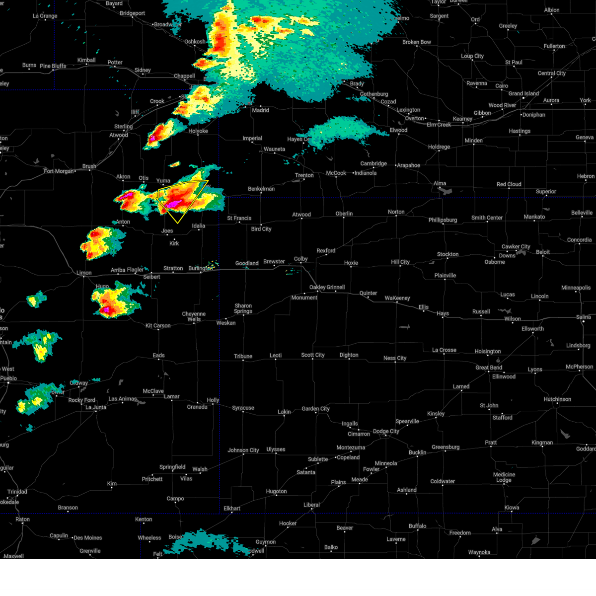 At 626 pm mdt, a severe thunderstorm was located 15 miles south of eckley, or 18 miles southeast of yuma, moving southeast at 15 mph. this is a destructive storm for western yuma county (trained weather spotters 5 miles south of yuma). Hazards include three inch hail. People and animals outdoors will be severely injured. expect shattered windows, extensive damage to roofs, siding, and vehicles. locations impacted include, wray, eckley and heartstrong. this includes highway 385 between mile markers 247 and 249. thunderstorm damage threat, destructive hail threat, observed max hail size, 3. 00 in wind threat, radar indicated max wind gust, <50 mph. At 626 pm mdt, a severe thunderstorm was located 15 miles south of eckley, or 18 miles southeast of yuma, moving southeast at 15 mph. this is a destructive storm for western yuma county (trained weather spotters 5 miles south of yuma). Hazards include three inch hail. People and animals outdoors will be severely injured. expect shattered windows, extensive damage to roofs, siding, and vehicles. locations impacted include, wray, eckley and heartstrong. this includes highway 385 between mile markers 247 and 249. thunderstorm damage threat, destructive hail threat, observed max hail size, 3. 00 in wind threat, radar indicated max wind gust, <50 mph.
|
| 8/8/2023 6:19 PM MDT |
 At 619 pm mdt, a severe thunderstorm was located 14 miles south of eckley, or 16 miles southeast of yuma, moving south at 20 mph (radar indicated). Hazards include two inch hail. People and animals outdoors will be injured. expect damage to roofs, siding, windows, and vehicles. locations impacted include, wray, eckley and heartstrong. this includes highway 385 between mile markers 247 and 249. thunderstorm damage threat, considerable hail threat, radar indicated max hail size, 2. 00 in wind threat, radar indicated max wind gust, <50 mph. At 619 pm mdt, a severe thunderstorm was located 14 miles south of eckley, or 16 miles southeast of yuma, moving south at 20 mph (radar indicated). Hazards include two inch hail. People and animals outdoors will be injured. expect damage to roofs, siding, windows, and vehicles. locations impacted include, wray, eckley and heartstrong. this includes highway 385 between mile markers 247 and 249. thunderstorm damage threat, considerable hail threat, radar indicated max hail size, 2. 00 in wind threat, radar indicated max wind gust, <50 mph.
|
| 8/8/2023 5:58 PM MDT |
 At 558 pm mdt, a severe thunderstorm was located 8 miles southwest of eckley, or 10 miles southeast of yuma, moving southeast at 10 mph (radar indicated). Hazards include two inch hail. People and animals outdoors will be injured. expect damage to roofs, siding, windows, and vehicles. locations impacted include, yuma, wray, eckley and heartstrong. this includes highway 385 between mile markers 247 and 250. thunderstorm damage threat, considerable hail threat, radar indicated max hail size, 2. 00 in wind threat, radar indicated max wind gust, <50 mph. At 558 pm mdt, a severe thunderstorm was located 8 miles southwest of eckley, or 10 miles southeast of yuma, moving southeast at 10 mph (radar indicated). Hazards include two inch hail. People and animals outdoors will be injured. expect damage to roofs, siding, windows, and vehicles. locations impacted include, yuma, wray, eckley and heartstrong. this includes highway 385 between mile markers 247 and 250. thunderstorm damage threat, considerable hail threat, radar indicated max hail size, 2. 00 in wind threat, radar indicated max wind gust, <50 mph.
|
| 8/8/2023 5:48 PM MDT |
 At 547 pm mdt, a severe thunderstorm was located 5 miles southwest of eckley, or 10 miles southeast of yuma, moving southeast at 15 mph (radar indicated). Hazards include two inch hail. People and animals outdoors will be injured. expect damage to roofs, siding, windows, and vehicles. locations impacted include, yuma, wray, eckley and heartstrong. this includes highway 385 between mile markers 247 and 251. thunderstorm damage threat, considerable hail threat, observed max hail size, 2. 00 in wind threat, radar indicated max wind gust, <50 mph. At 547 pm mdt, a severe thunderstorm was located 5 miles southwest of eckley, or 10 miles southeast of yuma, moving southeast at 15 mph (radar indicated). Hazards include two inch hail. People and animals outdoors will be injured. expect damage to roofs, siding, windows, and vehicles. locations impacted include, yuma, wray, eckley and heartstrong. this includes highway 385 between mile markers 247 and 251. thunderstorm damage threat, considerable hail threat, observed max hail size, 2. 00 in wind threat, radar indicated max wind gust, <50 mph.
|
| 8/8/2023 5:38 PM MDT |
 At 538 pm mdt, a severe thunderstorm was located 6 miles southwest of eckley, or 8 miles southeast of yuma, moving southeast at 15 mph (radar indicated). Hazards include two inch hail. People and animals outdoors will be injured. expect damage to roofs, siding, windows, and vehicles. locations impacted include, yuma, wray, eckley and heartstrong. This includes highway 385 between mile markers 247 and 252. At 538 pm mdt, a severe thunderstorm was located 6 miles southwest of eckley, or 8 miles southeast of yuma, moving southeast at 15 mph (radar indicated). Hazards include two inch hail. People and animals outdoors will be injured. expect damage to roofs, siding, windows, and vehicles. locations impacted include, yuma, wray, eckley and heartstrong. This includes highway 385 between mile markers 247 and 252.
|
| 8/8/2023 5:23 PM MDT |
 At 522 pm mdt, a severe thunderstorm was located near yuma, moving southeast at 30 mph. this is a destructive storm for yuma, colorado and surrounding locations (trained weather spotters). Hazards include baseball size hail. People and animals outdoors will be severely injured. expect shattered windows, extensive damage to roofs, siding, and vehicles. locations impacted include, eckley. this includes highway 385 between mile markers 247 and 252. thunderstorm damage threat, destructive hail threat, observed max hail size, 2. 75 in wind threat, radar indicated max wind gust, <50 mph. At 522 pm mdt, a severe thunderstorm was located near yuma, moving southeast at 30 mph. this is a destructive storm for yuma, colorado and surrounding locations (trained weather spotters). Hazards include baseball size hail. People and animals outdoors will be severely injured. expect shattered windows, extensive damage to roofs, siding, and vehicles. locations impacted include, eckley. this includes highway 385 between mile markers 247 and 252. thunderstorm damage threat, destructive hail threat, observed max hail size, 2. 75 in wind threat, radar indicated max wind gust, <50 mph.
|
| 8/8/2023 5:12 PM MDT |
 At 511 pm mdt, a severe thunderstorm was located over yuma, moving southeast at 20 mph. this is a destructive storm for northeast yuma county and the town of yuma (radar indicated). Hazards include softball size hail and 70 mph wind gusts. People and animals outdoors will be severely injured. expect shattered windows, extensive damage to roofs, siding, and vehicles. this severe thunderstorm will be near, yuma around 515 pm mdt. other locations in the path of this severe thunderstorm include eckley. this includes highway 385 between mile markers 247 and 252. thunderstorm damage threat, destructive hail threat, radar indicated max hail size, 4. 00 in wind threat, radar indicated max wind gust, 70 mph. At 511 pm mdt, a severe thunderstorm was located over yuma, moving southeast at 20 mph. this is a destructive storm for northeast yuma county and the town of yuma (radar indicated). Hazards include softball size hail and 70 mph wind gusts. People and animals outdoors will be severely injured. expect shattered windows, extensive damage to roofs, siding, and vehicles. this severe thunderstorm will be near, yuma around 515 pm mdt. other locations in the path of this severe thunderstorm include eckley. this includes highway 385 between mile markers 247 and 252. thunderstorm damage threat, destructive hail threat, radar indicated max hail size, 4. 00 in wind threat, radar indicated max wind gust, 70 mph.
|
| 8/8/2023 5:02 PM MDT |
 At 501 pm mdt, a severe thunderstorm was located 4 miles northwest of yuma, moving southeast at 20 mph (radar indicated). Hazards include tennis ball size hail and 60 mph wind gusts. this storm is also producing a confirmed tornado. People and animals outdoors will be injured. expect hail damage to roofs, siding, windows, and vehicles. expect wind damage to roofs, siding, and trees. locations impacted include, yuma and eckley. thunderstorm damage threat, considerable hail threat, radar indicated max hail size, 2. 50 in wind threat, radar indicated max wind gust, 60 mph. At 501 pm mdt, a severe thunderstorm was located 4 miles northwest of yuma, moving southeast at 20 mph (radar indicated). Hazards include tennis ball size hail and 60 mph wind gusts. this storm is also producing a confirmed tornado. People and animals outdoors will be injured. expect hail damage to roofs, siding, windows, and vehicles. expect wind damage to roofs, siding, and trees. locations impacted include, yuma and eckley. thunderstorm damage threat, considerable hail threat, radar indicated max hail size, 2. 50 in wind threat, radar indicated max wind gust, 60 mph.
|
| 8/8/2023 4:47 PM MDT |
 At 447 pm mdt, a severe thunderstorm was located 6 miles northwest of yuma, moving southeast at 15 mph (radar indicated). Hazards include golf ball size hail and 60 mph wind gusts. this storm is also capable of producing a tornado. People and animals outdoors will be injured. expect hail damage to roofs, siding, windows, and vehicles. expect wind damage to roofs, siding, and trees. locations impacted include, yuma and eckley. thunderstorm damage threat, considerable hail threat, radar indicated max hail size, 1. 75 in wind threat, radar indicated max wind gust, 60 mph. At 447 pm mdt, a severe thunderstorm was located 6 miles northwest of yuma, moving southeast at 15 mph (radar indicated). Hazards include golf ball size hail and 60 mph wind gusts. this storm is also capable of producing a tornado. People and animals outdoors will be injured. expect hail damage to roofs, siding, windows, and vehicles. expect wind damage to roofs, siding, and trees. locations impacted include, yuma and eckley. thunderstorm damage threat, considerable hail threat, radar indicated max hail size, 1. 75 in wind threat, radar indicated max wind gust, 60 mph.
|
| 8/8/2023 4:34 PM MDT |
 At 434 pm mdt, a severe thunderstorm was located 5 miles northwest of yuma, moving southeast at 25 mph (radar indicated). Hazards include golf ball size hail and 60 mph wind gusts. People and animals outdoors will be injured. expect hail damage to roofs, siding, windows, and vehicles. expect wind damage to roofs, siding, and trees. locations impacted include, yuma and eckley. thunderstorm damage threat, considerable hail threat, radar indicated max hail size, 1. 75 in wind threat, radar indicated max wind gust, 60 mph. At 434 pm mdt, a severe thunderstorm was located 5 miles northwest of yuma, moving southeast at 25 mph (radar indicated). Hazards include golf ball size hail and 60 mph wind gusts. People and animals outdoors will be injured. expect hail damage to roofs, siding, windows, and vehicles. expect wind damage to roofs, siding, and trees. locations impacted include, yuma and eckley. thunderstorm damage threat, considerable hail threat, radar indicated max hail size, 1. 75 in wind threat, radar indicated max wind gust, 60 mph.
|
| 8/8/2023 4:26 PM MDT |
 At 425 pm mdt, a severe thunderstorm was located 5 miles northwest of yuma, moving southeast at 25 mph (trained weather spotters). Hazards include two inch hail and 60 mph wind gusts. People and animals outdoors will be injured. expect hail damage to roofs, siding, windows, and vehicles. expect wind damage to roofs, siding, and trees. locations impacted include, yuma and eckley. thunderstorm damage threat, considerable hail threat, radar indicated max hail size, 2. 00 in wind threat, radar indicated max wind gust, 60 mph. At 425 pm mdt, a severe thunderstorm was located 5 miles northwest of yuma, moving southeast at 25 mph (trained weather spotters). Hazards include two inch hail and 60 mph wind gusts. People and animals outdoors will be injured. expect hail damage to roofs, siding, windows, and vehicles. expect wind damage to roofs, siding, and trees. locations impacted include, yuma and eckley. thunderstorm damage threat, considerable hail threat, radar indicated max hail size, 2. 00 in wind threat, radar indicated max wind gust, 60 mph.
|
| 8/8/2023 4:11 PM MDT |
 At 411 pm mdt, a severe thunderstorm was located 7 miles south of lone star, or 11 miles northwest of yuma, moving southeast at 25 mph (trained weather spotters). Hazards include two inch hail and 60 mph wind gusts. People and animals outdoors will be injured. expect hail damage to roofs, siding, windows, and vehicles. Expect wind damage to roofs, siding, and trees. At 411 pm mdt, a severe thunderstorm was located 7 miles south of lone star, or 11 miles northwest of yuma, moving southeast at 25 mph (trained weather spotters). Hazards include two inch hail and 60 mph wind gusts. People and animals outdoors will be injured. expect hail damage to roofs, siding, windows, and vehicles. Expect wind damage to roofs, siding, and trees.
|
| 8/7/2023 4:56 PM MDT |
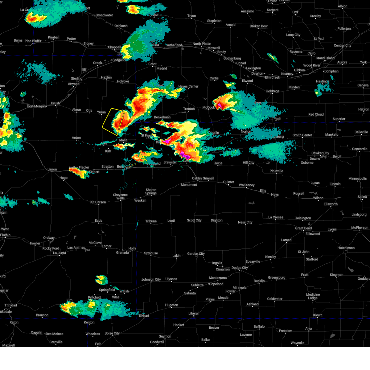 The severe thunderstorm warning for central yuma county will expire at 500 pm mdt, the storm which prompted the warning has moved out of the area. therefore, the warning will be allowed to expire. a severe thunderstorm watch remains in effect until 900 pm mdt for northeastern colorado. to report severe weather, contact your nearest law enforcement agency. they will relay your report to the national weather service goodland. remember, a severe thunderstorm warning still remains in effect for for eastern yuma county. The severe thunderstorm warning for central yuma county will expire at 500 pm mdt, the storm which prompted the warning has moved out of the area. therefore, the warning will be allowed to expire. a severe thunderstorm watch remains in effect until 900 pm mdt for northeastern colorado. to report severe weather, contact your nearest law enforcement agency. they will relay your report to the national weather service goodland. remember, a severe thunderstorm warning still remains in effect for for eastern yuma county.
|
| 8/7/2023 4:42 PM MDT |
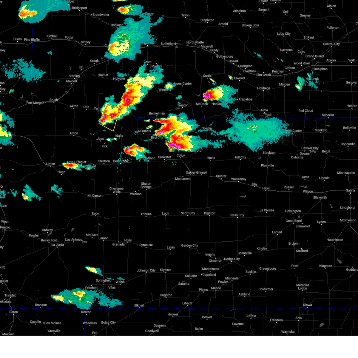 At 442 pm mdt, a severe thunderstorm was located 8 miles south of eckley, or 13 miles southeast of yuma, moving east at 35 mph (radar indicated). Hazards include 60 mph wind gusts and half dollar size hail. Hail damage to vehicles is expected. expect wind damage to roofs, siding, and trees. Locations impacted include, eckley and heartstrong. At 442 pm mdt, a severe thunderstorm was located 8 miles south of eckley, or 13 miles southeast of yuma, moving east at 35 mph (radar indicated). Hazards include 60 mph wind gusts and half dollar size hail. Hail damage to vehicles is expected. expect wind damage to roofs, siding, and trees. Locations impacted include, eckley and heartstrong.
|
| 8/7/2023 4:34 PM MDT |
 At 434 pm mdt, a severe thunderstorm was located 8 miles southeast of yuma, moving east at 30 mph (radar indicated). Hazards include 60 mph wind gusts and half dollar size hail. Hail damage to vehicles is expected. expect wind damage to roofs, siding, and trees. Locations impacted include, yuma, eckley and heartstrong. At 434 pm mdt, a severe thunderstorm was located 8 miles southeast of yuma, moving east at 30 mph (radar indicated). Hazards include 60 mph wind gusts and half dollar size hail. Hail damage to vehicles is expected. expect wind damage to roofs, siding, and trees. Locations impacted include, yuma, eckley and heartstrong.
|
| 8/7/2023 4:16 PM MDT |
 At 416 pm mdt, a severe thunderstorm was located 5 miles southwest of yuma, moving east at 30 mph (trained weather spotters have reported half dollar size hail with this storm). Hazards include 60 mph wind gusts and half dollar size hail. Hail damage to vehicles is expected. expect wind damage to roofs, siding, and trees. Locations impacted include, yuma, eckley and heartstrong. At 416 pm mdt, a severe thunderstorm was located 5 miles southwest of yuma, moving east at 30 mph (trained weather spotters have reported half dollar size hail with this storm). Hazards include 60 mph wind gusts and half dollar size hail. Hail damage to vehicles is expected. expect wind damage to roofs, siding, and trees. Locations impacted include, yuma, eckley and heartstrong.
|
| 8/7/2023 4:05 PM MDT |
 At 404 pm mdt, a severe thunderstorm was located near otis, or 9 miles west of yuma, moving east at 30 mph (trained weather spotters reported half dollar size hail in otis). Hazards include 60 mph wind gusts and half dollar size hail. Hail damage to vehicles is expected. expect wind damage to roofs, siding, and trees. locations impacted include, yuma, eckley and heartstrong. hail threat, radar indicated max hail size, 1. 25 in wind threat, radar indicated max wind gust, 60 mph. At 404 pm mdt, a severe thunderstorm was located near otis, or 9 miles west of yuma, moving east at 30 mph (trained weather spotters reported half dollar size hail in otis). Hazards include 60 mph wind gusts and half dollar size hail. Hail damage to vehicles is expected. expect wind damage to roofs, siding, and trees. locations impacted include, yuma, eckley and heartstrong. hail threat, radar indicated max hail size, 1. 25 in wind threat, radar indicated max wind gust, 60 mph.
|
| 8/7/2023 3:55 PM MDT |
 At 355 pm mdt, a severe thunderstorm was located over otis, or 11 miles east of akron, moving southeast at 30 mph (radar indicated). Hazards include 60 mph wind gusts and half dollar size hail. Hail damage to vehicles is expected. Expect wind damage to roofs, siding, and trees. At 355 pm mdt, a severe thunderstorm was located over otis, or 11 miles east of akron, moving southeast at 30 mph (radar indicated). Hazards include 60 mph wind gusts and half dollar size hail. Hail damage to vehicles is expected. Expect wind damage to roofs, siding, and trees.
|
| 8/1/2023 9:17 PM MDT |
 At 917 pm mdt, a severe thunderstorm was located near yuma, moving northeast at 15 mph (radar indicated). Hazards include 60 mph wind gusts. Expect damage to roofs, siding, and trees. locations impacted include, yuma, eckley, heartstrong and clarkville. hail threat, radar indicated max hail size, <. 75 in wind threat, observed max wind gust, 60 mph. At 917 pm mdt, a severe thunderstorm was located near yuma, moving northeast at 15 mph (radar indicated). Hazards include 60 mph wind gusts. Expect damage to roofs, siding, and trees. locations impacted include, yuma, eckley, heartstrong and clarkville. hail threat, radar indicated max hail size, <. 75 in wind threat, observed max wind gust, 60 mph.
|
| 8/1/2023 8:57 PM MDT |
 At 855 pm mdt, a severe thunderstorm was located 5 miles west of yuma, moving northeast at 15 mph (radar indicated. at 845 pm mdt, a mesonet weather station 4 miles east of yuma measured a wind gust of 67 mph). Hazards include 70 mph wind gusts and penny size hail. Expect considerable tree damage. damage is likely to mobile homes, roofs, and outbuildings. locations impacted include, yuma, eckley, abarr, heartstrong and clarkville. thunderstorm damage threat, considerable hail threat, radar indicated max hail size, 0. 75 in wind threat, observed max wind gust, 70 mph. At 855 pm mdt, a severe thunderstorm was located 5 miles west of yuma, moving northeast at 15 mph (radar indicated. at 845 pm mdt, a mesonet weather station 4 miles east of yuma measured a wind gust of 67 mph). Hazards include 70 mph wind gusts and penny size hail. Expect considerable tree damage. damage is likely to mobile homes, roofs, and outbuildings. locations impacted include, yuma, eckley, abarr, heartstrong and clarkville. thunderstorm damage threat, considerable hail threat, radar indicated max hail size, 0. 75 in wind threat, observed max wind gust, 70 mph.
|
| 8/1/2023 8:49 PM MDT |
 At 847 pm mdt, a severe thunderstorm was located 6 miles southeast of otis, or 7 miles west of yuma, moving northeast at 15 mph (radar indicated. at 845 pm mdt, a mesonet weather station 5 southeast of yuma measured a wind gust of 60 mph). Hazards include 60 mph wind gusts and penny size hail. expect damage to roofs, siding, and trees At 847 pm mdt, a severe thunderstorm was located 6 miles southeast of otis, or 7 miles west of yuma, moving northeast at 15 mph (radar indicated. at 845 pm mdt, a mesonet weather station 5 southeast of yuma measured a wind gust of 60 mph). Hazards include 60 mph wind gusts and penny size hail. expect damage to roofs, siding, and trees
|
| 7/26/2023 6:51 PM MDT |
 At 650 pm mdt/750 pm cdt/, severe thunderstorms were located along a line extending from 10 miles northwest of haigler to 9 miles northwest of bonny reservoir to near vona, moving southeast at 45 mph (public. at 643 pm mdt, a 64 mph wind gust was reported 5 miles north northwest of heartstrong). Hazards include 70 mph wind gusts and quarter size hail. Hail damage to vehicles is expected. expect considerable tree damage. wind damage is also likely to mobile homes, roofs, and outbuildings. severe thunderstorms will be near, haigler around 700 pm mdt. bonny reservoir around 705 pm mdt. other locations impacted by these severe thunderstorms include joes, hale, abarr, beecher island, kirk, heartstrong and alvin. this includes the following highways, interstate 70 in colorado between mile markers 403 and 410. highway 385 between mile markers 191 and 263. thunderstorm damage threat, considerable hail threat, radar indicated max hail size, 1. 00 in wind threat, observed max wind gust, 70 mph. At 650 pm mdt/750 pm cdt/, severe thunderstorms were located along a line extending from 10 miles northwest of haigler to 9 miles northwest of bonny reservoir to near vona, moving southeast at 45 mph (public. at 643 pm mdt, a 64 mph wind gust was reported 5 miles north northwest of heartstrong). Hazards include 70 mph wind gusts and quarter size hail. Hail damage to vehicles is expected. expect considerable tree damage. wind damage is also likely to mobile homes, roofs, and outbuildings. severe thunderstorms will be near, haigler around 700 pm mdt. bonny reservoir around 705 pm mdt. other locations impacted by these severe thunderstorms include joes, hale, abarr, beecher island, kirk, heartstrong and alvin. this includes the following highways, interstate 70 in colorado between mile markers 403 and 410. highway 385 between mile markers 191 and 263. thunderstorm damage threat, considerable hail threat, radar indicated max hail size, 1. 00 in wind threat, observed max wind gust, 70 mph.
|
| 7/20/2023 8:57 AM MDT |
 The severe thunderstorm warning for central yuma county will expire at 900 am mdt, the storms which prompted the warning have weakened below severe limits, and no longer pose an immediate threat to life or property. therefore, the warning will be allowed to expire. however gusty winds are still possible with these thunderstorms. The severe thunderstorm warning for central yuma county will expire at 900 am mdt, the storms which prompted the warning have weakened below severe limits, and no longer pose an immediate threat to life or property. therefore, the warning will be allowed to expire. however gusty winds are still possible with these thunderstorms.
|
| 7/20/2023 8:30 AM MDT |
 At 830 am mdt, severe thunderstorms were located along a line extending from 4 miles south of burdett to 11 miles north of cope, moving northeast at 30 mph (public). Hazards include 70 mph wind gusts. Expect considerable tree damage. damage is likely to mobile homes, roofs, and outbuildings. locations impacted include, yuma, wray, eckley, abarr, heartstrong, clarkville and vernon. this includes highway 385 between mile markers 227 and 246, and between mile markers 248 and 250. thunderstorm damage threat, considerable hail threat, radar indicated max hail size, <. 75 in wind threat, observed max wind gust, 70 mph. At 830 am mdt, severe thunderstorms were located along a line extending from 4 miles south of burdett to 11 miles north of cope, moving northeast at 30 mph (public). Hazards include 70 mph wind gusts. Expect considerable tree damage. damage is likely to mobile homes, roofs, and outbuildings. locations impacted include, yuma, wray, eckley, abarr, heartstrong, clarkville and vernon. this includes highway 385 between mile markers 227 and 246, and between mile markers 248 and 250. thunderstorm damage threat, considerable hail threat, radar indicated max hail size, <. 75 in wind threat, observed max wind gust, 70 mph.
|
| 7/20/2023 8:04 AM MDT |
 At 803 am mdt, severe thunderstorms were located along a line extending from 4 miles northeast of akron to near arickaree school, moving northeast at 35 mph (public). Hazards include 70 mph wind gusts. Expect considerable tree damage. damage is likely to mobile homes, roofs, and outbuildings. these severe thunderstorms will remain over mainly rural areas of central yuma county, including the following locations, abarr, heartstrong, clarkville and vernon. this includes highway 385 between mile markers 227 and 246, and between mile markers 248 and 250. thunderstorm damage threat, considerable hail threat, radar indicated max hail size, <. 75 in wind threat, radar indicated max wind gust, 70 mph. At 803 am mdt, severe thunderstorms were located along a line extending from 4 miles northeast of akron to near arickaree school, moving northeast at 35 mph (public). Hazards include 70 mph wind gusts. Expect considerable tree damage. damage is likely to mobile homes, roofs, and outbuildings. these severe thunderstorms will remain over mainly rural areas of central yuma county, including the following locations, abarr, heartstrong, clarkville and vernon. this includes highway 385 between mile markers 227 and 246, and between mile markers 248 and 250. thunderstorm damage threat, considerable hail threat, radar indicated max hail size, <. 75 in wind threat, radar indicated max wind gust, 70 mph.
|
| 7/13/2023 12:55 PM MDT |
 At 1254 pm mdt, a severe thunderstorm was located 14 miles northeast of cope, or 23 miles south of yuma, moving northeast at 30 mph (radar indicated). Hazards include 60 mph wind gusts and quarter size hail. Hail damage to vehicles is expected. expect wind damage to roofs, siding, and trees. locations impacted include, abarr, beecher island, heartstrong and vernon. this includes highway 385 between mile markers 226 and 238. hail threat, radar indicated max hail size, 1. 00 in wind threat, radar indicated max wind gust, 60 mph. At 1254 pm mdt, a severe thunderstorm was located 14 miles northeast of cope, or 23 miles south of yuma, moving northeast at 30 mph (radar indicated). Hazards include 60 mph wind gusts and quarter size hail. Hail damage to vehicles is expected. expect wind damage to roofs, siding, and trees. locations impacted include, abarr, beecher island, heartstrong and vernon. this includes highway 385 between mile markers 226 and 238. hail threat, radar indicated max hail size, 1. 00 in wind threat, radar indicated max wind gust, 60 mph.
|
| 7/13/2023 12:36 PM MDT |
 At 1236 pm mdt, a severe thunderstorm was located 5 miles northeast of cope, or 28 miles south of yuma, moving northeast at 30 mph (radar indicated). Hazards include ping pong ball size hail and 60 mph wind gusts. People and animals outdoors will be injured. expect hail damage to roofs, siding, windows, and vehicles. expect wind damage to roofs, siding, and trees. this severe thunderstorm will remain over mainly rural areas of southern yuma county, including the following locations, abarr, beecher island, heartstrong and vernon. this includes highway 385 between mile markers 226 and 238. hail threat, radar indicated max hail size, 1. 50 in wind threat, radar indicated max wind gust, 60 mph. At 1236 pm mdt, a severe thunderstorm was located 5 miles northeast of cope, or 28 miles south of yuma, moving northeast at 30 mph (radar indicated). Hazards include ping pong ball size hail and 60 mph wind gusts. People and animals outdoors will be injured. expect hail damage to roofs, siding, windows, and vehicles. expect wind damage to roofs, siding, and trees. this severe thunderstorm will remain over mainly rural areas of southern yuma county, including the following locations, abarr, beecher island, heartstrong and vernon. this includes highway 385 between mile markers 226 and 238. hail threat, radar indicated max hail size, 1. 50 in wind threat, radar indicated max wind gust, 60 mph.
|
| 7/10/2023 4:49 PM MDT |
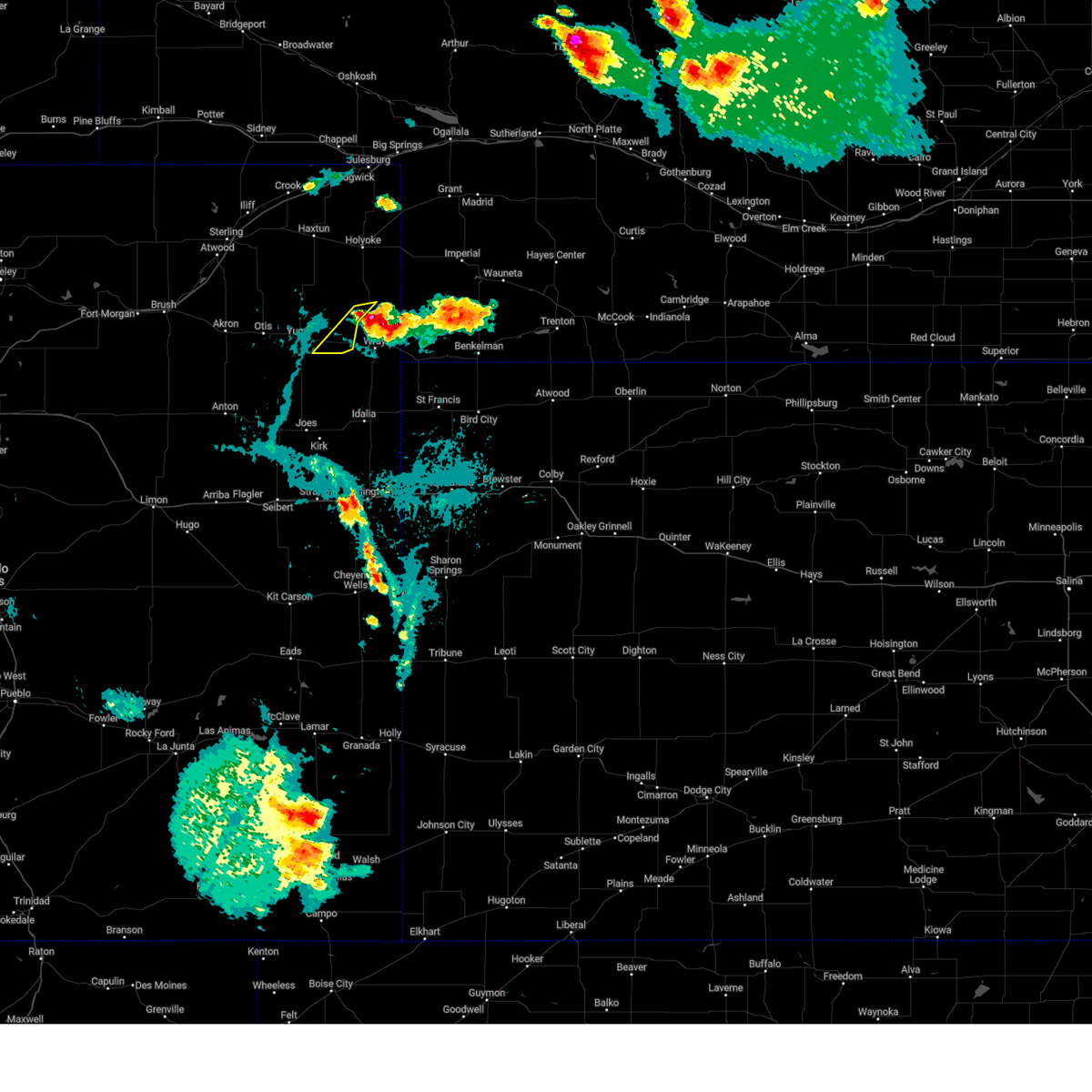 At 449 pm mdt, a severe thunderstorm was located 13 miles north of wray, moving southwest at 10 mph (radar indicated). Hazards include 60 mph wind gusts and quarter size hail. Hail damage to vehicles is expected. expect wind damage to roofs, siding, and trees. locations impacted include, eckley and wauneta. this includes highway 385 between mile markers 259 and 260. hail threat, radar indicated max hail size, 1. 00 in wind threat, radar indicated max wind gust, 60 mph. At 449 pm mdt, a severe thunderstorm was located 13 miles north of wray, moving southwest at 10 mph (radar indicated). Hazards include 60 mph wind gusts and quarter size hail. Hail damage to vehicles is expected. expect wind damage to roofs, siding, and trees. locations impacted include, eckley and wauneta. this includes highway 385 between mile markers 259 and 260. hail threat, radar indicated max hail size, 1. 00 in wind threat, radar indicated max wind gust, 60 mph.
|
| 7/10/2023 4:30 PM MDT |
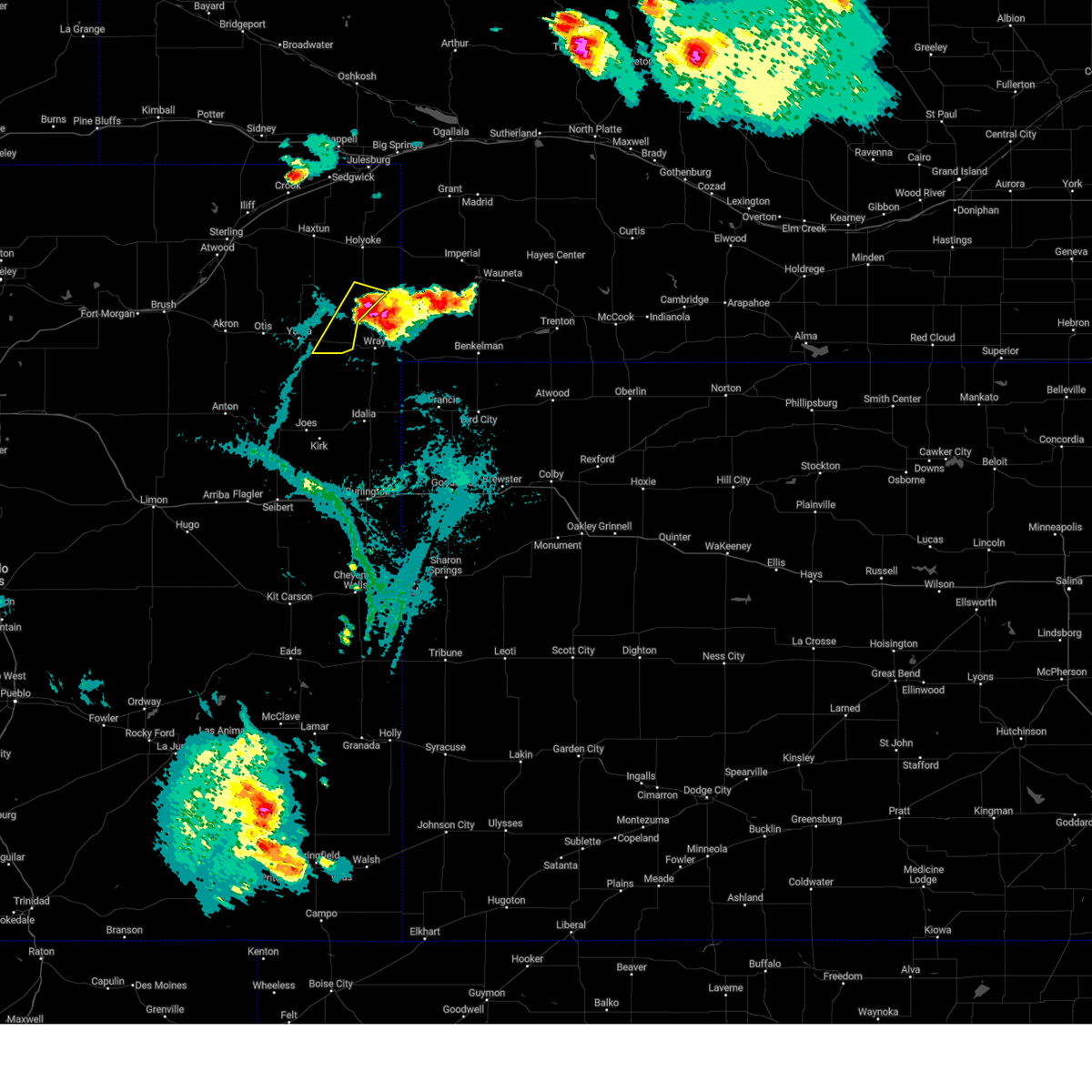 At 430 pm mdt, a severe thunderstorm was located 14 miles north of wray, moving southwest at 10 mph (radar indicated). Hazards include 60 mph wind gusts and half dollar size hail. Hail damage to vehicles is expected. expect wind damage to roofs, siding, and trees. this severe thunderstorm will remain over mainly rural areas of north central yuma county, including the following locations, wauneta. this includes highway 385 between mile markers 259 and 266. hail threat, radar indicated max hail size, 1. 25 in wind threat, radar indicated max wind gust, 60 mph. At 430 pm mdt, a severe thunderstorm was located 14 miles north of wray, moving southwest at 10 mph (radar indicated). Hazards include 60 mph wind gusts and half dollar size hail. Hail damage to vehicles is expected. expect wind damage to roofs, siding, and trees. this severe thunderstorm will remain over mainly rural areas of north central yuma county, including the following locations, wauneta. this includes highway 385 between mile markers 259 and 266. hail threat, radar indicated max hail size, 1. 25 in wind threat, radar indicated max wind gust, 60 mph.
|
| 6/29/2023 2:00 AM MDT | Golf Ball sized hail reported 0.1 miles NE of Eckley, CO, delayed report of golf ball sized hail for about a minute followed by 5 minutes of nickel to ping pong ball sized hail. |
| 6/29/2023 2:00 AM MDT | Golf Ball sized hail reported 7.7 miles N of Eckley, CO, corrects previous hail report from eckley. delayed report of golf ball sized hail for about a minute followed by 5 minutes of nickel to ping pong ball sized hail 8 mile |
| 6/29/2023 1:08 AM MDT |
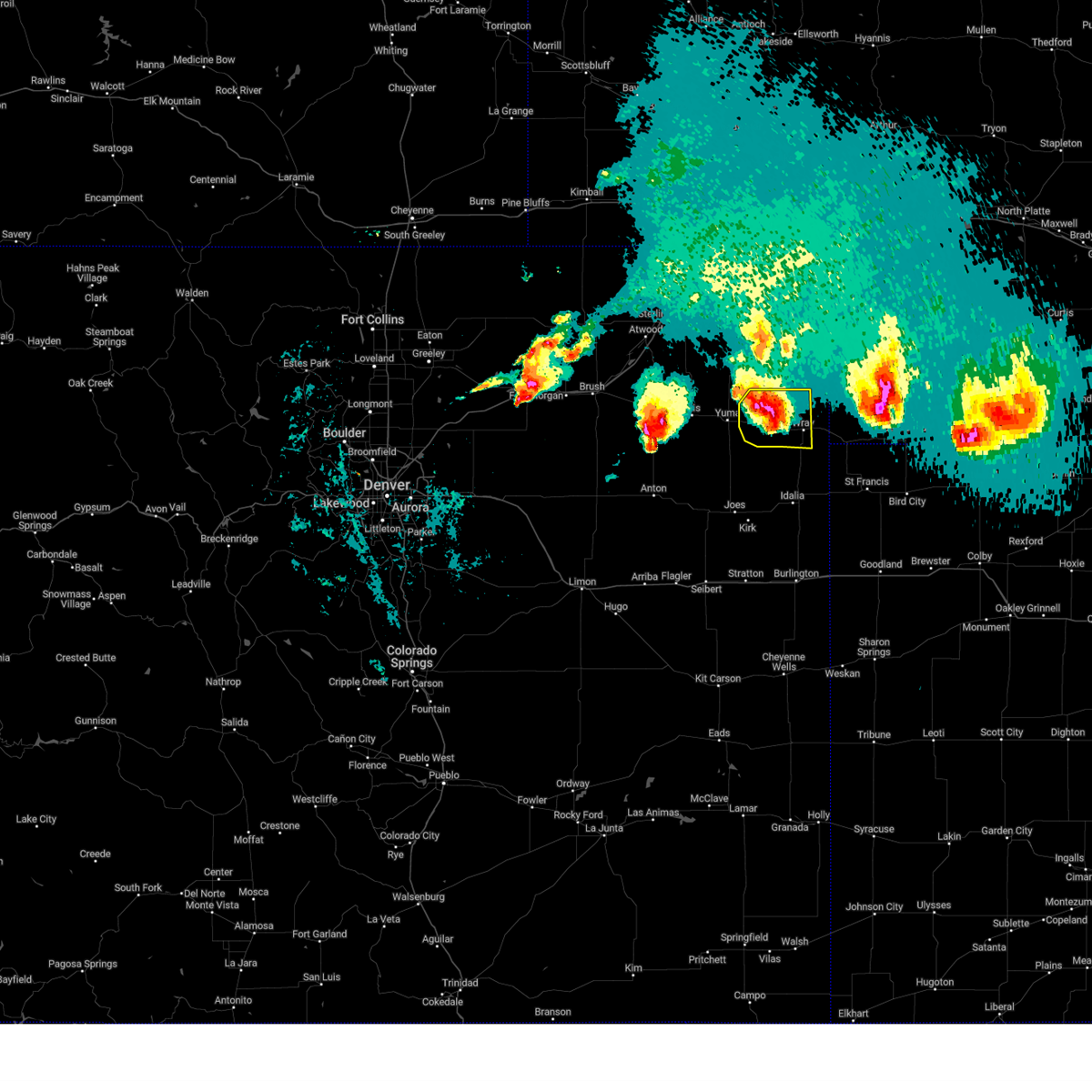 At 108 am mdt, a severe thunderstorm was located 4 miles northwest of wray, moving east at 35 mph (radar indicated). Hazards include 60 mph wind gusts and half dollar size hail. Hail damage to vehicles is expected. expect wind damage to roofs, siding, and trees. this storm has a history of producing quarter to ping pong ball size hail. locations impacted include, wray and eckley. this includes highway 385 between mile markers 237 and 258. hail threat, radar indicated max hail size, 1. 25 in wind threat, radar indicated max wind gust, 60 mph. At 108 am mdt, a severe thunderstorm was located 4 miles northwest of wray, moving east at 35 mph (radar indicated). Hazards include 60 mph wind gusts and half dollar size hail. Hail damage to vehicles is expected. expect wind damage to roofs, siding, and trees. this storm has a history of producing quarter to ping pong ball size hail. locations impacted include, wray and eckley. this includes highway 385 between mile markers 237 and 258. hail threat, radar indicated max hail size, 1. 25 in wind threat, radar indicated max wind gust, 60 mph.
|
| 6/29/2023 12:48 AM MDT |
 At 1248 am mdt, a severe thunderstorm was located near eckley, or 9 miles east of yuma, moving east at 30 mph (trained weather spotters reported ping pong ball size hail on highway 34 near yuma at 1241 am mdt). Hazards include ping pong ball size hail and 60 mph wind gusts. People and animals outdoors will be injured. expect hail damage to roofs, siding, windows, and vehicles. expect wind damage to roofs, siding, and trees. locations impacted include, yuma, wray and eckley. this includes highway 385 between mile markers 237 and 258. hail threat, observed max hail size, 1. 50 in wind threat, radar indicated max wind gust, 60 mph. At 1248 am mdt, a severe thunderstorm was located near eckley, or 9 miles east of yuma, moving east at 30 mph (trained weather spotters reported ping pong ball size hail on highway 34 near yuma at 1241 am mdt). Hazards include ping pong ball size hail and 60 mph wind gusts. People and animals outdoors will be injured. expect hail damage to roofs, siding, windows, and vehicles. expect wind damage to roofs, siding, and trees. locations impacted include, yuma, wray and eckley. this includes highway 385 between mile markers 237 and 258. hail threat, observed max hail size, 1. 50 in wind threat, radar indicated max wind gust, 60 mph.
|
| 6/29/2023 12:45 AM MDT | Hen Egg sized hail reported 0.1 miles NE of Eckley, CO, delayed report with photos of 2 inch hail in eckley... co. |
| 6/29/2023 12:39 AM MDT |
 At 1239 am mdt, a severe thunderstorm was located 4 miles east of yuma, moving east at 30 mph (radar indicated). Hazards include two inch hail and 60 mph wind gusts. People and animals outdoors will be injured. expect hail damage to roofs, siding, windows, and vehicles. expect wind damage to roofs, siding, and trees. locations impacted include, yuma, wray and eckley. this includes highway 385 between mile markers 237 and 258. thunderstorm damage threat, considerable hail threat, radar indicated max hail size, 2. 00 in wind threat, radar indicated max wind gust, 60 mph. At 1239 am mdt, a severe thunderstorm was located 4 miles east of yuma, moving east at 30 mph (radar indicated). Hazards include two inch hail and 60 mph wind gusts. People and animals outdoors will be injured. expect hail damage to roofs, siding, windows, and vehicles. expect wind damage to roofs, siding, and trees. locations impacted include, yuma, wray and eckley. this includes highway 385 between mile markers 237 and 258. thunderstorm damage threat, considerable hail threat, radar indicated max hail size, 2. 00 in wind threat, radar indicated max wind gust, 60 mph.
|
| 6/29/2023 12:30 AM MDT |
 At 1229 am mdt, a severe thunderstorm was located over yuma, moving east at 30 mph (radar indicated). Hazards include golf ball size hail and 60 mph wind gusts. People and animals outdoors will be injured. expect hail damage to roofs, siding, windows, and vehicles. expect wind damage to roofs, siding, and trees. locations impacted include, eckley and wray. this includes highway 385 between mile markers 237 and 258. thunderstorm damage threat, considerable hail threat, radar indicated max hail size, 1. 75 in wind threat, radar indicated max wind gust, 60 mph. At 1229 am mdt, a severe thunderstorm was located over yuma, moving east at 30 mph (radar indicated). Hazards include golf ball size hail and 60 mph wind gusts. People and animals outdoors will be injured. expect hail damage to roofs, siding, windows, and vehicles. expect wind damage to roofs, siding, and trees. locations impacted include, eckley and wray. this includes highway 385 between mile markers 237 and 258. thunderstorm damage threat, considerable hail threat, radar indicated max hail size, 1. 75 in wind threat, radar indicated max wind gust, 60 mph.
|
| 6/29/2023 12:16 AM MDT |
 At 1216 am mdt, a severe thunderstorm was located 6 miles east of otis, or 6 miles west of yuma, moving east at 30 mph (radar indicated). Hazards include golf ball size hail and 60 mph wind gusts. People and animals outdoors will be injured. expect hail damage to roofs, siding, windows, and vehicles. expect wind damage to roofs, siding, and trees. this severe thunderstorm will be near, yuma around 1225 am mdt. other locations in the path of this severe thunderstorm include eckley and wray. this includes highway 385 between mile markers 237 and 258. thunderstorm damage threat, considerable hail threat, radar indicated max hail size, 1. 75 in wind threat, radar indicated max wind gust, 60 mph. At 1216 am mdt, a severe thunderstorm was located 6 miles east of otis, or 6 miles west of yuma, moving east at 30 mph (radar indicated). Hazards include golf ball size hail and 60 mph wind gusts. People and animals outdoors will be injured. expect hail damage to roofs, siding, windows, and vehicles. expect wind damage to roofs, siding, and trees. this severe thunderstorm will be near, yuma around 1225 am mdt. other locations in the path of this severe thunderstorm include eckley and wray. this includes highway 385 between mile markers 237 and 258. thunderstorm damage threat, considerable hail threat, radar indicated max hail size, 1. 75 in wind threat, radar indicated max wind gust, 60 mph.
|
| 6/27/2023 5:54 PM MDT |
 At 553 pm mdt, a severe thunderstorm was located 11 miles north of wray, moving east at 30 mph. additional severe storms are located north of eckley and across northern dundy county (radar indicated). Hazards include two inch hail and 60 mph wind gusts. People and animals outdoors will be injured. expect hail damage to roofs, siding, windows, and vehicles. expect wind damage to roofs, siding, and trees. locations impacted include, yuma, wray, eckley, alvin, clarkville and wauneta. this includes highway 385 between mile markers 244 and 268. thunderstorm damage threat, considerable hail threat, radar indicated max hail size, 2. 00 in wind threat, radar indicated max wind gust, 60 mph. At 553 pm mdt, a severe thunderstorm was located 11 miles north of wray, moving east at 30 mph. additional severe storms are located north of eckley and across northern dundy county (radar indicated). Hazards include two inch hail and 60 mph wind gusts. People and animals outdoors will be injured. expect hail damage to roofs, siding, windows, and vehicles. expect wind damage to roofs, siding, and trees. locations impacted include, yuma, wray, eckley, alvin, clarkville and wauneta. this includes highway 385 between mile markers 244 and 268. thunderstorm damage threat, considerable hail threat, radar indicated max hail size, 2. 00 in wind threat, radar indicated max wind gust, 60 mph.
|
| 6/27/2023 5:45 PM MDT |
 At 543 pm mdt, a a cluster of severe storms are moving east at 30 mph across northern portions of yuma and dundy counties (trained weather spotters reported quarter size hail 6 miles north of alvin ). Hazards include golf ball size hail and 60 mph wind gusts. People and animals outdoors will be injured. expect hail damage to roofs, siding, windows, and vehicles. expect wind damage to roofs, siding, and trees. locations impacted include, yuma, wray, eckley, alvin, clarkville and wauneta. this includes highway 385 between mile markers 244 and 268. thunderstorm damage threat, considerable hail threat, radar indicated max hail size, 1. 75 in wind threat, radar indicated max wind gust, 60 mph. At 543 pm mdt, a a cluster of severe storms are moving east at 30 mph across northern portions of yuma and dundy counties (trained weather spotters reported quarter size hail 6 miles north of alvin ). Hazards include golf ball size hail and 60 mph wind gusts. People and animals outdoors will be injured. expect hail damage to roofs, siding, windows, and vehicles. expect wind damage to roofs, siding, and trees. locations impacted include, yuma, wray, eckley, alvin, clarkville and wauneta. this includes highway 385 between mile markers 244 and 268. thunderstorm damage threat, considerable hail threat, radar indicated max hail size, 1. 75 in wind threat, radar indicated max wind gust, 60 mph.
|
| 6/27/2023 5:27 PM MDT |
 At 526 pm mdt, a severe thunderstorm was located 14 miles south of pleasant valley, or 19 miles northeast of wray, moving east at 35 mph. additional clusters of severe storms are developing behind this storm (radar indicated). Hazards include 60 mph wind gusts and half dollar size hail. Hail damage to vehicles is expected. expect wind damage to roofs, siding, and trees. this severe thunderstorm will remain over mainly rural areas of northern yuma and dundy counties, including the following locations, alvin, clarkville and wauneta. this includes highway 385 between mile markers 244 and 268. hail threat, radar indicated max hail size, 1. 25 in wind threat, radar indicated max wind gust, 60 mph. At 526 pm mdt, a severe thunderstorm was located 14 miles south of pleasant valley, or 19 miles northeast of wray, moving east at 35 mph. additional clusters of severe storms are developing behind this storm (radar indicated). Hazards include 60 mph wind gusts and half dollar size hail. Hail damage to vehicles is expected. expect wind damage to roofs, siding, and trees. this severe thunderstorm will remain over mainly rural areas of northern yuma and dundy counties, including the following locations, alvin, clarkville and wauneta. this includes highway 385 between mile markers 244 and 268. hail threat, radar indicated max hail size, 1. 25 in wind threat, radar indicated max wind gust, 60 mph.
|
| 6/10/2023 7:41 PM MDT |
 At 740 pm mdt/840 pm cdt/, severe thunderstorms were located along a line extending from 5 miles south of wray to 11 miles northwest of bonny reservoir, moving east at 45 mph (mesonet. at 7:40pm mt wray airport recorded at 61 mph wind gust). Hazards include 60 mph wind gusts and quarter size hail. Hail damage to vehicles is expected. expect wind damage to roofs, siding, and trees. locations impacted include, wray, st. francis, bonny reservoir, eckley, haigler, beecher island and vernon. this includes highway 385 between mile markers 203 and 248. hail threat, radar indicated max hail size, 1. 00 in wind threat, radar indicated max wind gust, 60 mph. At 740 pm mdt/840 pm cdt/, severe thunderstorms were located along a line extending from 5 miles south of wray to 11 miles northwest of bonny reservoir, moving east at 45 mph (mesonet. at 7:40pm mt wray airport recorded at 61 mph wind gust). Hazards include 60 mph wind gusts and quarter size hail. Hail damage to vehicles is expected. expect wind damage to roofs, siding, and trees. locations impacted include, wray, st. francis, bonny reservoir, eckley, haigler, beecher island and vernon. this includes highway 385 between mile markers 203 and 248. hail threat, radar indicated max hail size, 1. 00 in wind threat, radar indicated max wind gust, 60 mph.
|
| 6/10/2023 7:30 PM MDT |
 At 729 pm mdt/829 pm cdt/, severe thunderstorms were located along a line extending from 6 miles west of wray to 17 miles southeast of eckley to 18 miles northwest of bonny reservoir, moving southeast at 45 mph (radar indicated). Hazards include 60 mph wind gusts and quarter size hail. Hail damage to vehicles is expected. Expect wind damage to roofs, siding, and trees. At 729 pm mdt/829 pm cdt/, severe thunderstorms were located along a line extending from 6 miles west of wray to 17 miles southeast of eckley to 18 miles northwest of bonny reservoir, moving southeast at 45 mph (radar indicated). Hazards include 60 mph wind gusts and quarter size hail. Hail damage to vehicles is expected. Expect wind damage to roofs, siding, and trees.
|
| 5/30/2023 7:12 PM MDT |
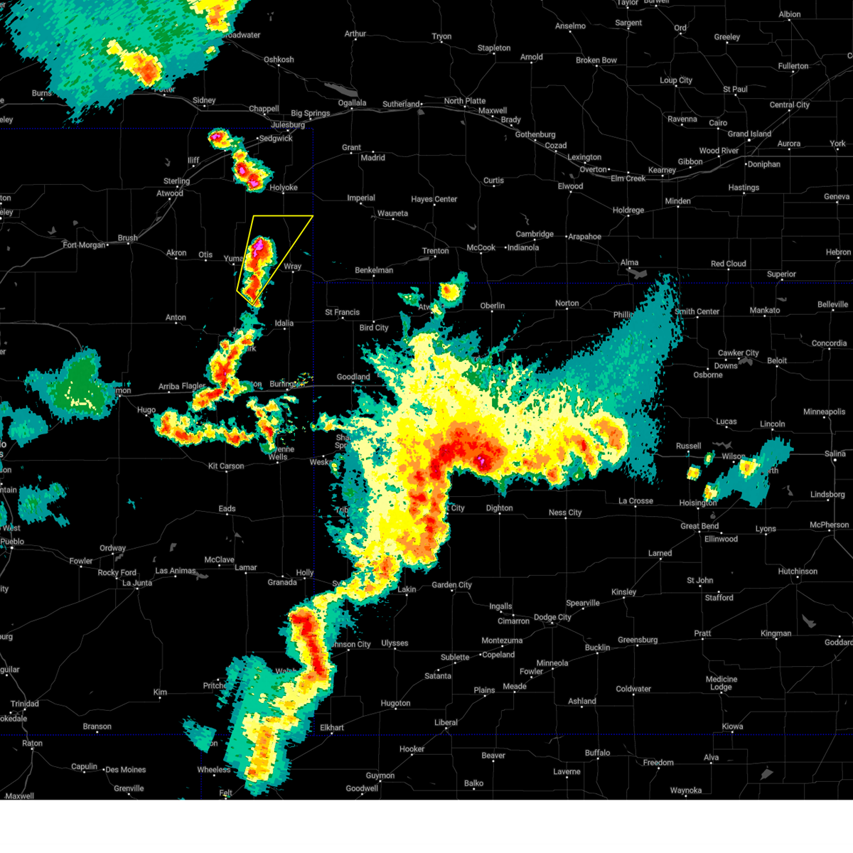 At 712 pm mdt, a severe thunderstorm was located 13 miles north of eckley, or 18 miles northeast of yuma, moving northeast at 45 mph (radar indicated). Hazards include 60 mph wind gusts and quarter size hail. Hail damage to vehicles is expected. expect wind damage to roofs, siding, and trees. this severe thunderstorm will remain over mainly rural areas of northern yuma county, including the following locations, heartstrong and wauneta. this includes highway 385 between mile markers 255 and 270. hail threat, radar indicated max hail size, 1. 00 in wind threat, radar indicated max wind gust, 60 mph. At 712 pm mdt, a severe thunderstorm was located 13 miles north of eckley, or 18 miles northeast of yuma, moving northeast at 45 mph (radar indicated). Hazards include 60 mph wind gusts and quarter size hail. Hail damage to vehicles is expected. expect wind damage to roofs, siding, and trees. this severe thunderstorm will remain over mainly rural areas of northern yuma county, including the following locations, heartstrong and wauneta. this includes highway 385 between mile markers 255 and 270. hail threat, radar indicated max hail size, 1. 00 in wind threat, radar indicated max wind gust, 60 mph.
|
| 5/30/2023 7:01 PM MDT |
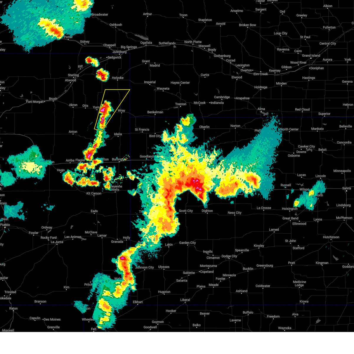 At 701 pm mdt, a severe thunderstorm was located 6 miles west of eckley, or 6 miles east of yuma, moving northeast at 40 mph (radar indicated). Hazards include 60 mph wind gusts and quarter size hail. Hail damage to vehicles is expected. expect wind damage to roofs, siding, and trees. this severe storm will be near, eckley around 710 pm mdt. this includes highway 385 between mile markers 254 and 269. hail threat, radar indicated max hail size, 1. 00 in wind threat, radar indicated max wind gust, 60 mph. At 701 pm mdt, a severe thunderstorm was located 6 miles west of eckley, or 6 miles east of yuma, moving northeast at 40 mph (radar indicated). Hazards include 60 mph wind gusts and quarter size hail. Hail damage to vehicles is expected. expect wind damage to roofs, siding, and trees. this severe storm will be near, eckley around 710 pm mdt. this includes highway 385 between mile markers 254 and 269. hail threat, radar indicated max hail size, 1. 00 in wind threat, radar indicated max wind gust, 60 mph.
|
| 5/30/2023 6:51 PM MDT |
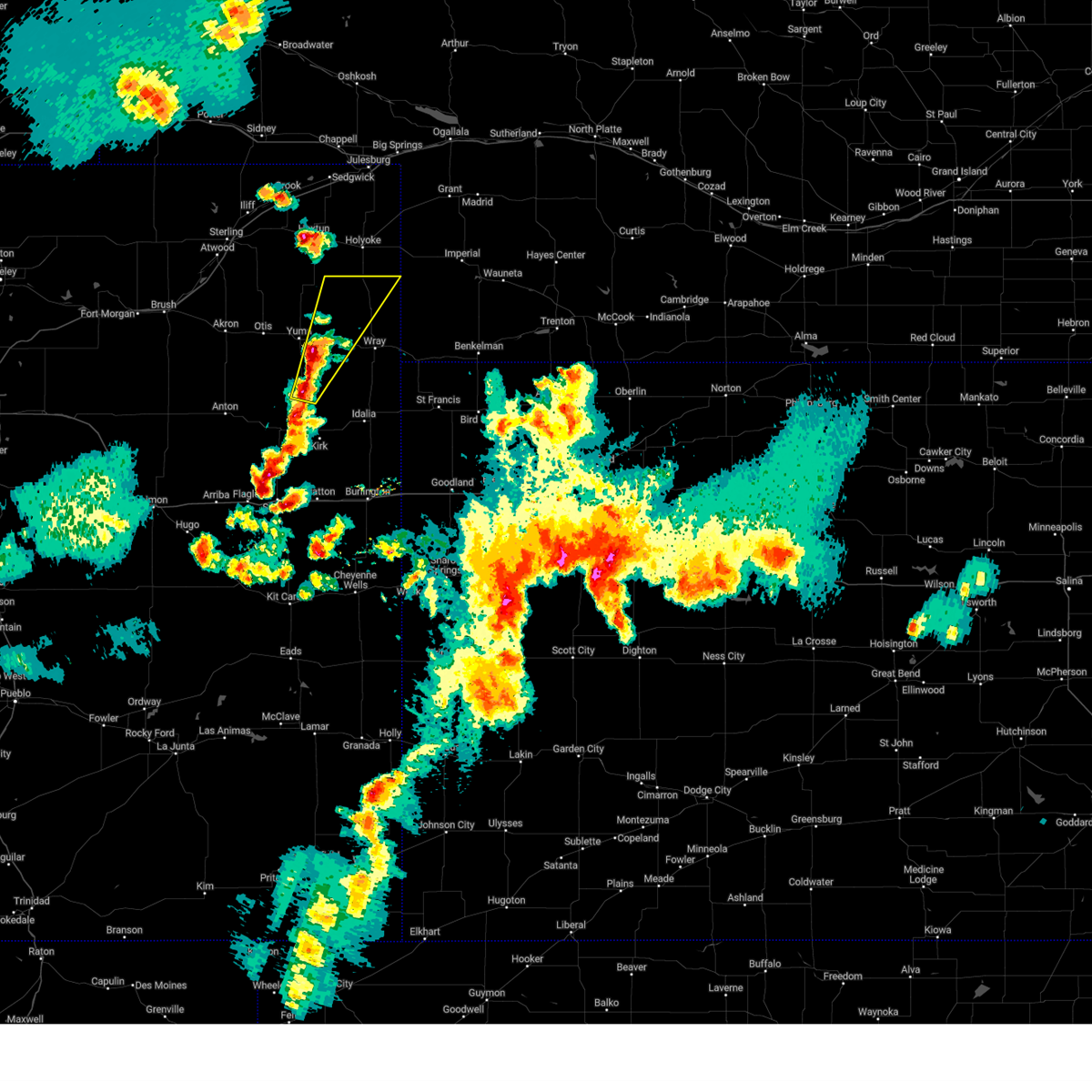 At 650 pm mdt, a severe thunderstorm was located 10 miles southwest of eckley, or 11 miles southeast of yuma, moving northeast at 40 mph (radar indicated). Hazards include 60 mph wind gusts and quarter size hail. Hail damage to vehicles is expected. expect wind damage to roofs, siding, and trees. this severe thunderstorm will be near, eckley around 710 pm mdt. this includes highway 385 between mile markers 254 and 269. hail threat, radar indicated max hail size, 1. 00 in wind threat, radar indicated max wind gust, 60 mph. At 650 pm mdt, a severe thunderstorm was located 10 miles southwest of eckley, or 11 miles southeast of yuma, moving northeast at 40 mph (radar indicated). Hazards include 60 mph wind gusts and quarter size hail. Hail damage to vehicles is expected. expect wind damage to roofs, siding, and trees. this severe thunderstorm will be near, eckley around 710 pm mdt. this includes highway 385 between mile markers 254 and 269. hail threat, radar indicated max hail size, 1. 00 in wind threat, radar indicated max wind gust, 60 mph.
|
| 5/18/2023 5:51 PM MDT |
 The severe thunderstorm warning for northwestern yuma county will expire at 600 pm mdt, the storms which prompted the warning have weakened below severe limits, and no longer pose an immediate threat to life or property. therefore, the warning will be allowed to expire. however gusty winds and heavy rain are still possible with these thunderstorms. The severe thunderstorm warning for northwestern yuma county will expire at 600 pm mdt, the storms which prompted the warning have weakened below severe limits, and no longer pose an immediate threat to life or property. therefore, the warning will be allowed to expire. however gusty winds and heavy rain are still possible with these thunderstorms.
|
| 5/18/2023 5:32 PM MDT |
 At 531 pm mdt, severe thunderstorms were located along a line extending from 10 miles south of highland center to 8 miles north of eckley to 3 miles south of yuma, moving southeast at 30 mph (radar indicated. at 529 pm mdt, a personal weather station 1 mile northwest of yuma reported a wind gust of 54 mph). Hazards include 60 mph wind gusts. Expect damage to roofs, siding, and trees. locations impacted include, yuma, eckley, heartstrong and clarkville. hail threat, radar indicated max hail size, <. 75 in wind threat, observed max wind gust, 60 mph. At 531 pm mdt, severe thunderstorms were located along a line extending from 10 miles south of highland center to 8 miles north of eckley to 3 miles south of yuma, moving southeast at 30 mph (radar indicated. at 529 pm mdt, a personal weather station 1 mile northwest of yuma reported a wind gust of 54 mph). Hazards include 60 mph wind gusts. Expect damage to roofs, siding, and trees. locations impacted include, yuma, eckley, heartstrong and clarkville. hail threat, radar indicated max hail size, <. 75 in wind threat, observed max wind gust, 60 mph.
|
| 5/18/2023 5:06 PM MDT |
 At 506 pm mdt, severe thunderstorms were located along a line extending from 7 miles south of st petersburg to 5 miles east of lone star to 6 miles northeast of otis, moving southeast at 25 mph (radar indicated). Hazards include 60 mph wind gusts. expect damage to roofs, siding, and trees At 506 pm mdt, severe thunderstorms were located along a line extending from 7 miles south of st petersburg to 5 miles east of lone star to 6 miles northeast of otis, moving southeast at 25 mph (radar indicated). Hazards include 60 mph wind gusts. expect damage to roofs, siding, and trees
|
| 5/10/2023 5:57 PM MDT |
 The severe thunderstorm warning for yuma county will expire at 600 pm mdt, the storms which prompted the warning has weakened below severe limits, and no longer poses an immediate threat to life or property. therefore, the warning will be allowed to expire. however small hail and gusty winds are still possible with this thunderstorm. a tornado watch remains in effect until 900 pm mdt for northeastern colorado, northwestern kansas, and southwestern nebraska. The severe thunderstorm warning for yuma county will expire at 600 pm mdt, the storms which prompted the warning has weakened below severe limits, and no longer poses an immediate threat to life or property. therefore, the warning will be allowed to expire. however small hail and gusty winds are still possible with this thunderstorm. a tornado watch remains in effect until 900 pm mdt for northeastern colorado, northwestern kansas, and southwestern nebraska.
|
| 5/10/2023 5:37 PM MDT |
 At 536 pm mdt, a cluster of severe thunderstorm are moving north at 30 mph across northern yuma county (radar indicated). Hazards include ping pong ball size hail and 60 mph wind gusts. People and animals outdoors will be injured. expect hail damage to roofs, siding, windows, and vehicles. expect wind damage to roofs, siding, and trees. this includes highway 385 between mile markers 224 and 270. hail threat, radar indicated max hail size, 1. 50 in wind threat, radar indicated max wind gust, 60 mph. At 536 pm mdt, a cluster of severe thunderstorm are moving north at 30 mph across northern yuma county (radar indicated). Hazards include ping pong ball size hail and 60 mph wind gusts. People and animals outdoors will be injured. expect hail damage to roofs, siding, windows, and vehicles. expect wind damage to roofs, siding, and trees. this includes highway 385 between mile markers 224 and 270. hail threat, radar indicated max hail size, 1. 50 in wind threat, radar indicated max wind gust, 60 mph.
|
| 5/10/2023 5:01 PM MDT |
 At 459 pm mdt, a cluster of severe thunderstorm was moving across northern yuma county , moving north at 30 mph (radar indicated). Hazards include two inch hail and 60 mph wind gusts. People and animals outdoors will be injured. expect hail damage to roofs, siding, windows, and vehicles. expect wind damage to roofs, siding, and trees. this includes highway 385 between mile markers 220 and 269. thunderstorm damage threat, considerable hail threat, radar indicated max hail size, 2. 00 in wind threat, radar indicated max wind gust, 60 mph. At 459 pm mdt, a cluster of severe thunderstorm was moving across northern yuma county , moving north at 30 mph (radar indicated). Hazards include two inch hail and 60 mph wind gusts. People and animals outdoors will be injured. expect hail damage to roofs, siding, windows, and vehicles. expect wind damage to roofs, siding, and trees. this includes highway 385 between mile markers 220 and 269. thunderstorm damage threat, considerable hail threat, radar indicated max hail size, 2. 00 in wind threat, radar indicated max wind gust, 60 mph.
|
| 4/27/2023 4:43 PM MDT |
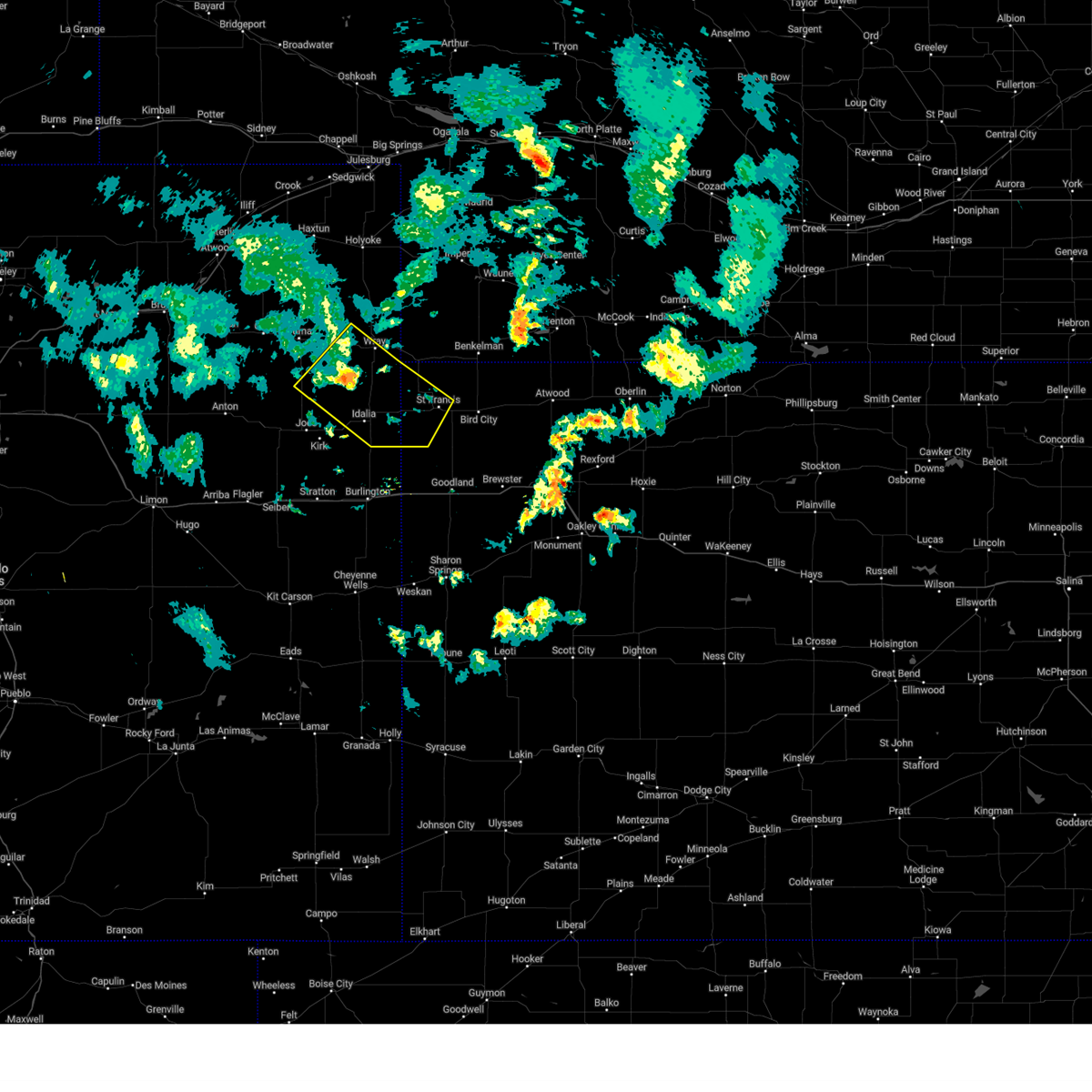 At 443 pm mdt/543 pm cdt/, severe thunderstorms were located along a line extending from 6 miles west of wray to 16 miles southeast of eckley to 18 miles northeast of cope, moving southeast at 50 mph (radar indicated). Hazards include 60 mph wind gusts. Expect damage to roofs, siding, and trees. locations impacted include, bonny reservoir and st. francis. this includes highway 385 between mile markers 207 and 210, and between mile markers 212 and 245. hail threat, radar indicated max hail size, <. 75 in wind threat, radar indicated max wind gust, 60 mph. At 443 pm mdt/543 pm cdt/, severe thunderstorms were located along a line extending from 6 miles west of wray to 16 miles southeast of eckley to 18 miles northeast of cope, moving southeast at 50 mph (radar indicated). Hazards include 60 mph wind gusts. Expect damage to roofs, siding, and trees. locations impacted include, bonny reservoir and st. francis. this includes highway 385 between mile markers 207 and 210, and between mile markers 212 and 245. hail threat, radar indicated max hail size, <. 75 in wind threat, radar indicated max wind gust, 60 mph.
|
| 4/27/2023 4:32 PM MDT |
 At 431 pm mdt/531 pm cdt/, severe thunderstorms were located along a line extending from 4 miles north of eckley to 15 miles southwest of wray to 13 miles south of yuma, moving southeast at 50 mph (radar indicated). Hazards include 60 mph wind gusts. Expect damage to roofs, siding, and trees. severe thunderstorms will be near, wray around 450 pm mdt. other locations in the path of these severe thunderstorms include bonny reservoir. this includes highway 385 between mile markers 207 and 210, and between mile markers 212 and 245. hail threat, radar indicated max hail size, <. 75 in wind threat, radar indicated max wind gust, 60 mph. At 431 pm mdt/531 pm cdt/, severe thunderstorms were located along a line extending from 4 miles north of eckley to 15 miles southwest of wray to 13 miles south of yuma, moving southeast at 50 mph (radar indicated). Hazards include 60 mph wind gusts. Expect damage to roofs, siding, and trees. severe thunderstorms will be near, wray around 450 pm mdt. other locations in the path of these severe thunderstorms include bonny reservoir. this includes highway 385 between mile markers 207 and 210, and between mile markers 212 and 245. hail threat, radar indicated max hail size, <. 75 in wind threat, radar indicated max wind gust, 60 mph.
|
| 7/27/2022 7:43 PM MDT |
 At 743 pm mdt, a severe thunderstorm was located near yuma, moving south at 10 mph (radar indicated). Hazards include 60 mph wind gusts and half dollar size hail. Hail damage to vehicles is expected. expect wind damage to roofs, siding, and trees. locations impacted include, yuma, eckley, heartstrong and vernon. hail threat, radar indicated max hail size, 1. 25 in wind threat, radar indicated max wind gust, 60 mph. At 743 pm mdt, a severe thunderstorm was located near yuma, moving south at 10 mph (radar indicated). Hazards include 60 mph wind gusts and half dollar size hail. Hail damage to vehicles is expected. expect wind damage to roofs, siding, and trees. locations impacted include, yuma, eckley, heartstrong and vernon. hail threat, radar indicated max hail size, 1. 25 in wind threat, radar indicated max wind gust, 60 mph.
|
| 7/27/2022 7:32 PM MDT |
 At 732 pm mdt, a severe thunderstorm was located near yuma, moving southeast at 20 mph (radar indicated). Hazards include 60 mph wind gusts and half dollar size hail. Hail damage to vehicles is expected. expect wind damage to roofs, siding, and trees. locations impacted include, yuma, eckley, heartstrong and vernon. hail threat, radar indicated max hail size, 1. 25 in wind threat, radar indicated max wind gust, 60 mph. At 732 pm mdt, a severe thunderstorm was located near yuma, moving southeast at 20 mph (radar indicated). Hazards include 60 mph wind gusts and half dollar size hail. Hail damage to vehicles is expected. expect wind damage to roofs, siding, and trees. locations impacted include, yuma, eckley, heartstrong and vernon. hail threat, radar indicated max hail size, 1. 25 in wind threat, radar indicated max wind gust, 60 mph.
|
| 7/27/2022 7:30 PM MDT | Tea Cup sized hail reported 11.7 miles SW of Eckley, CO, public report via photo on social media of a hail stone next to a tape measure. at maximum diameter... the hail stone seems to be around 3.75 inches. location was near |
| 7/27/2022 7:21 PM MDT |
 At 720 pm mdt, a severe thunderstorm was located over yuma, moving southeast at 20 mph (radar indicated). Hazards include 60 mph wind gusts and half dollar size hail. Hail damage to vehicles is expected. expect wind damage to roofs, siding, and trees. this severe thunderstorm will remain over mainly rural areas of northwestern yuma county, including the following locations, heartstrong and vernon. hail threat, radar indicated max hail size, 1. 25 in wind threat, radar indicated max wind gust, 60 mph. At 720 pm mdt, a severe thunderstorm was located over yuma, moving southeast at 20 mph (radar indicated). Hazards include 60 mph wind gusts and half dollar size hail. Hail damage to vehicles is expected. expect wind damage to roofs, siding, and trees. this severe thunderstorm will remain over mainly rural areas of northwestern yuma county, including the following locations, heartstrong and vernon. hail threat, radar indicated max hail size, 1. 25 in wind threat, radar indicated max wind gust, 60 mph.
|
| 6/7/2022 5:10 PM MDT |
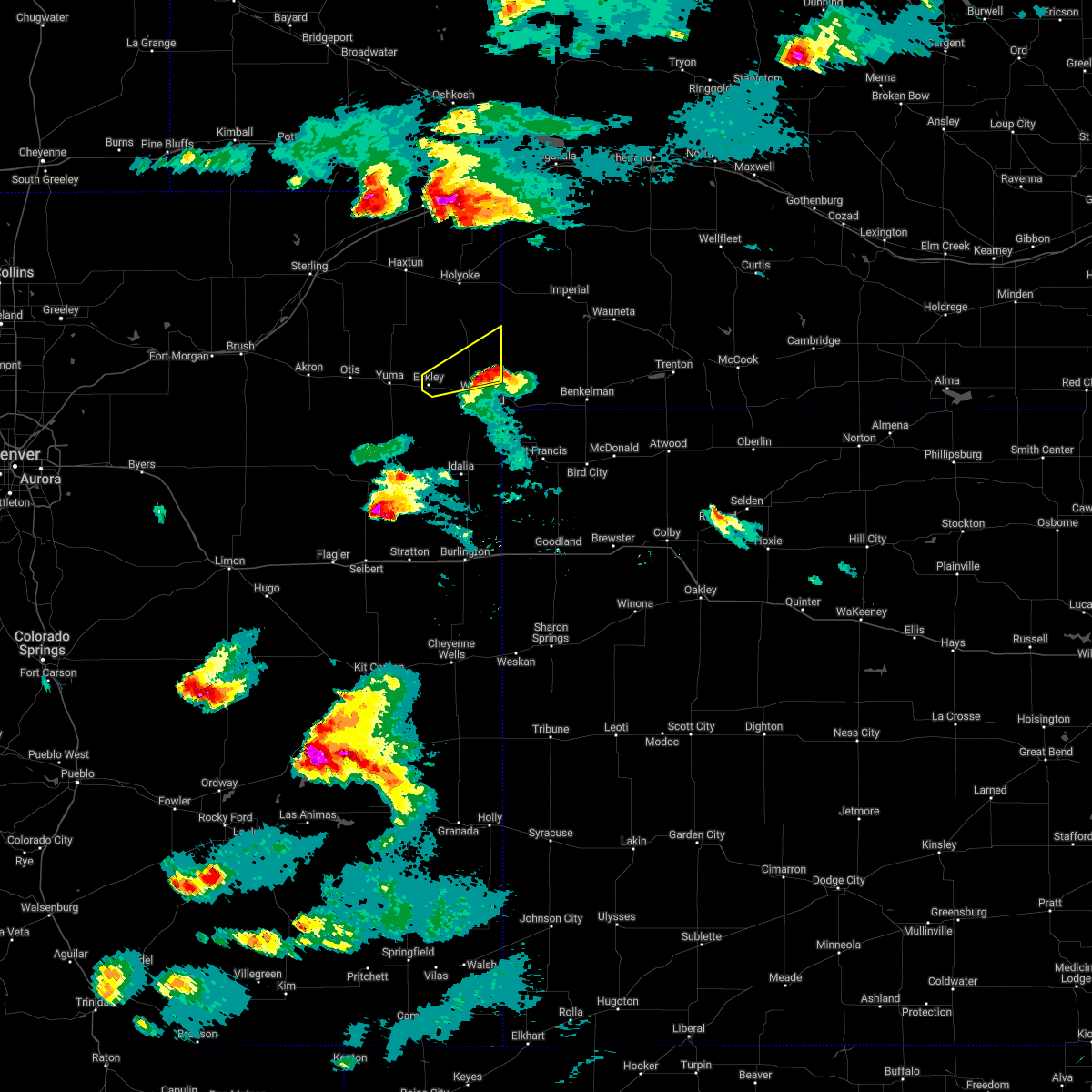 The severe thunderstorm warning for northeastern yuma county will expire at 515 pm mdt, the storm which prompted the warning has weakened below severe limits, and no longer poses an immediate threat to life or property. therefore, the warning will be allowed to expire. however small hail is still possible with this thunderstorm. a severe thunderstorm watch remains in effect until 800 pm mdt for northeastern colorado. a severe thunderstorm watch also remains in effect until midnight mdt for southwestern nebraska. remember, a severe thunderstorm warning still remains in effect for southern yuma county. The severe thunderstorm warning for northeastern yuma county will expire at 515 pm mdt, the storm which prompted the warning has weakened below severe limits, and no longer poses an immediate threat to life or property. therefore, the warning will be allowed to expire. however small hail is still possible with this thunderstorm. a severe thunderstorm watch remains in effect until 800 pm mdt for northeastern colorado. a severe thunderstorm watch also remains in effect until midnight mdt for southwestern nebraska. remember, a severe thunderstorm warning still remains in effect for southern yuma county.
|
| 6/7/2022 4:52 PM MDT |
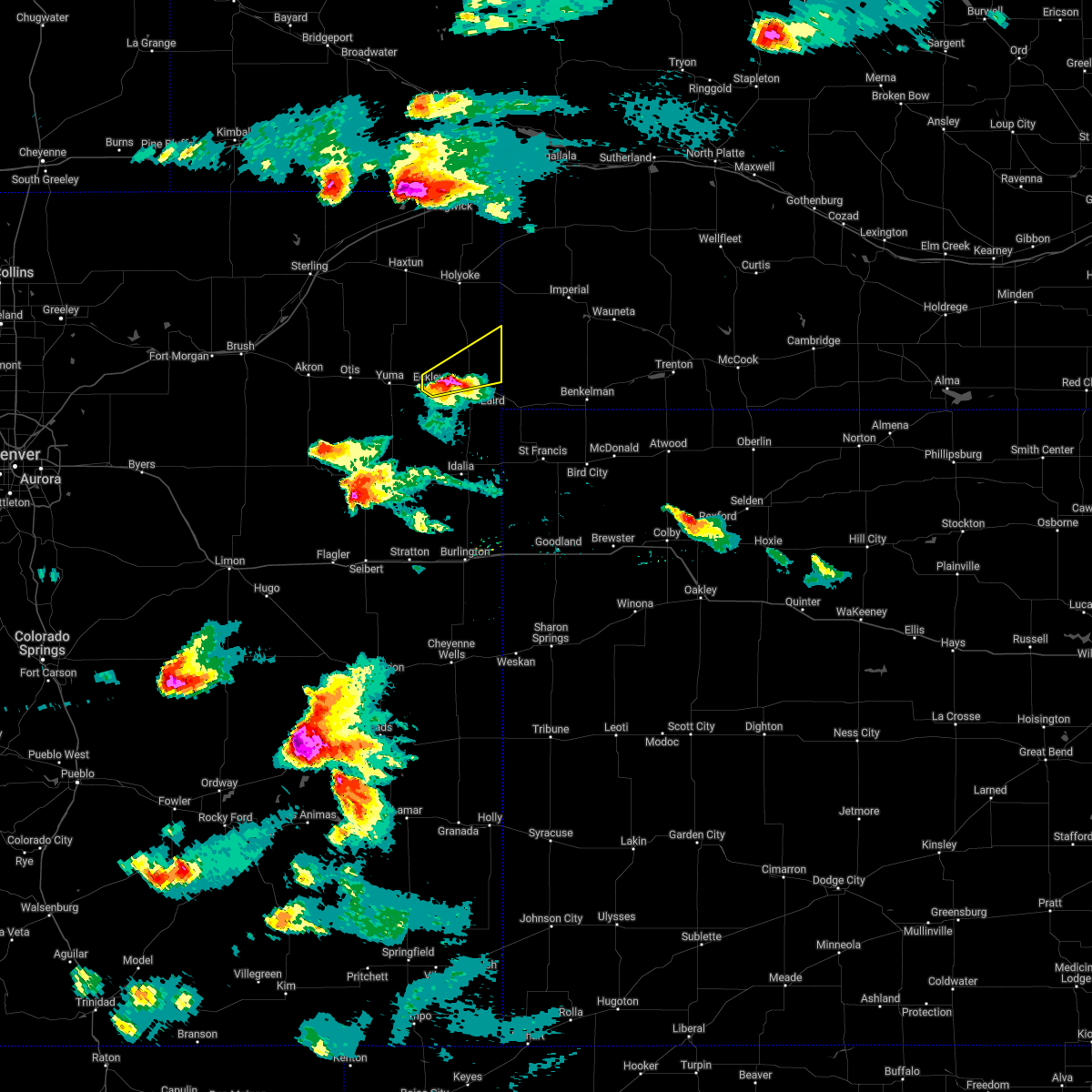 At 451 pm mdt, a severe thunderstorm was located 6 miles east of eckley, or 8 miles northwest of wray, moving east at 50 mph (trained weather spotters. at 440 pm mdt...dime size hail was reported in eckley). Hazards include ping pong ball size hail and 60 mph wind gusts. People and animals outdoors will be injured. expect hail damage to roofs, siding, windows, and vehicles. expect wind damage to roofs, siding, and trees. locations impacted include, wray, eckley, alvin and wauneta. this includes highway 385 between mile markers 246 and 259. hail threat, observed max hail size, 1. 50 in wind threat, radar indicated max wind gust, 60 mph. At 451 pm mdt, a severe thunderstorm was located 6 miles east of eckley, or 8 miles northwest of wray, moving east at 50 mph (trained weather spotters. at 440 pm mdt...dime size hail was reported in eckley). Hazards include ping pong ball size hail and 60 mph wind gusts. People and animals outdoors will be injured. expect hail damage to roofs, siding, windows, and vehicles. expect wind damage to roofs, siding, and trees. locations impacted include, wray, eckley, alvin and wauneta. this includes highway 385 between mile markers 246 and 259. hail threat, observed max hail size, 1. 50 in wind threat, radar indicated max wind gust, 60 mph.
|
| 6/7/2022 4:38 PM MDT |
 At 438 pm mdt, a severe thunderstorm was located 5 miles west of eckley, or 6 miles east of yuma, moving east at 50 mph (trained weather spotters. at 431 pm mdt...quarter size hail was reported 4 miles southeast of yuma). Hazards include golf ball size hail and 60 mph wind gusts. People and animals outdoors will be injured. expect hail damage to roofs, siding, windows, and vehicles. expect wind damage to roofs, siding, and trees. locations impacted include, wray. this includes highway 385 between mile markers 246 and 266. thunderstorm damage threat, considerable hail threat, observed max hail size, 1. 75 in wind threat, radar indicated max wind gust, 60 mph. At 438 pm mdt, a severe thunderstorm was located 5 miles west of eckley, or 6 miles east of yuma, moving east at 50 mph (trained weather spotters. at 431 pm mdt...quarter size hail was reported 4 miles southeast of yuma). Hazards include golf ball size hail and 60 mph wind gusts. People and animals outdoors will be injured. expect hail damage to roofs, siding, windows, and vehicles. expect wind damage to roofs, siding, and trees. locations impacted include, wray. this includes highway 385 between mile markers 246 and 266. thunderstorm damage threat, considerable hail threat, observed max hail size, 1. 75 in wind threat, radar indicated max wind gust, 60 mph.
|
| 6/7/2022 4:27 PM MDT |
 At 427 pm mdt, a severe thunderstorm was located 5 miles southwest of yuma, moving east at 45 mph (radar indicated). Hazards include two inch hail and 60 mph wind gusts. People and animals outdoors will be injured. expect hail damage to roofs, siding, windows, and vehicles. expect wind damage to roofs, siding, and trees. this severe storm will be near, yuma around 430 pm mdt. other locations in the path of this severe thunderstorm include eckley and wray. this includes highway 385 between mile markers 246 and 269. thunderstorm damage threat, considerable hail threat, radar indicated max hail size, 2. 00 in wind threat, radar indicated max wind gust, 60 mph. At 427 pm mdt, a severe thunderstorm was located 5 miles southwest of yuma, moving east at 45 mph (radar indicated). Hazards include two inch hail and 60 mph wind gusts. People and animals outdoors will be injured. expect hail damage to roofs, siding, windows, and vehicles. expect wind damage to roofs, siding, and trees. this severe storm will be near, yuma around 430 pm mdt. other locations in the path of this severe thunderstorm include eckley and wray. this includes highway 385 between mile markers 246 and 269. thunderstorm damage threat, considerable hail threat, radar indicated max hail size, 2. 00 in wind threat, radar indicated max wind gust, 60 mph.
|
| 6/7/2022 4:16 PM MDT |
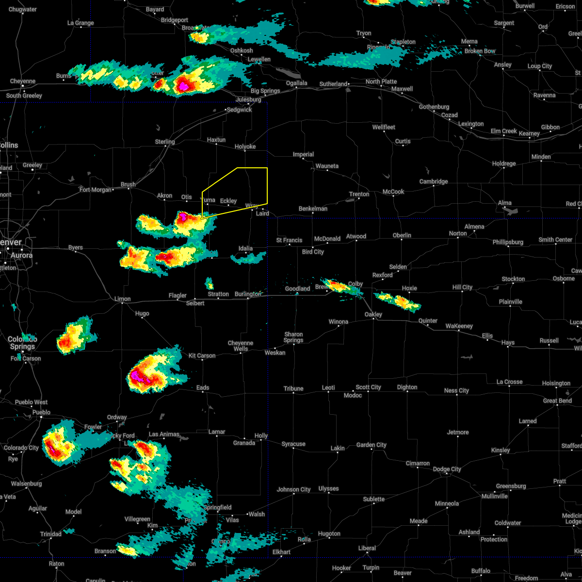 At 416 pm mdt, a severe thunderstorm was located 8 miles south of otis, or 13 miles southwest of yuma, moving east at 45 mph (radar indicated). Hazards include ping pong ball size hail and 60 mph wind gusts. People and animals outdoors will be injured. expect hail damage to roofs, siding, windows, and vehicles. expect wind damage to roofs, siding, and trees. this severe thunderstorm will be near, yuma around 435 pm mdt. other locations in the path of this severe thunderstorm include eckley and wray. This includes highway 385 between mile markers 246 and 269. At 416 pm mdt, a severe thunderstorm was located 8 miles south of otis, or 13 miles southwest of yuma, moving east at 45 mph (radar indicated). Hazards include ping pong ball size hail and 60 mph wind gusts. People and animals outdoors will be injured. expect hail damage to roofs, siding, windows, and vehicles. expect wind damage to roofs, siding, and trees. this severe thunderstorm will be near, yuma around 435 pm mdt. other locations in the path of this severe thunderstorm include eckley and wray. This includes highway 385 between mile markers 246 and 269.
|
| 6/3/2022 7:25 PM MDT |
 At 724 pm mdt, severe thunderstorms were located along a line extending from 10 miles north of wray to 15 miles northeast of cope, moving southeast at 35 mph (radar indicated). Hazards include 70 mph wind gusts and half dollar size hail. Hail damage to vehicles is expected. expect considerable tree damage. wind damage is also likely to mobile homes, roofs, and outbuildings. locations impacted include, wray, bonny reservoir, eckley, abarr, beecher island, wauneta and vernon. this includes highway 385 between mile markers 207 and 210, and between mile markers 212 and 269. thunderstorm damage threat, considerable hail threat, radar indicated max hail size, 1. 25 in wind threat, radar indicated max wind gust, 70 mph. At 724 pm mdt, severe thunderstorms were located along a line extending from 10 miles north of wray to 15 miles northeast of cope, moving southeast at 35 mph (radar indicated). Hazards include 70 mph wind gusts and half dollar size hail. Hail damage to vehicles is expected. expect considerable tree damage. wind damage is also likely to mobile homes, roofs, and outbuildings. locations impacted include, wray, bonny reservoir, eckley, abarr, beecher island, wauneta and vernon. this includes highway 385 between mile markers 207 and 210, and between mile markers 212 and 269. thunderstorm damage threat, considerable hail threat, radar indicated max hail size, 1. 25 in wind threat, radar indicated max wind gust, 70 mph.
|
| 6/3/2022 7:10 PM MDT |
 At 709 pm mdt, severe thunderstorms were located along a line extending from 16 miles northeast of eckley to 14 miles northeast of cope, moving southeast at 30 mph (radar indicated). Hazards include 70 mph wind gusts and half dollar size hail. Hail damage to vehicles is expected. expect considerable tree damage. wind damage is also likely to mobile homes, roofs, and outbuildings. locations impacted include, wray, bonny reservoir, eckley, abarr, beecher island, wauneta and vernon. this includes highway 385 between mile markers 207 and 210, and between mile markers 212 and 269. thunderstorm damage threat, considerable hail threat, radar indicated max hail size, 1. 25 in wind threat, radar indicated max wind gust, 70 mph. At 709 pm mdt, severe thunderstorms were located along a line extending from 16 miles northeast of eckley to 14 miles northeast of cope, moving southeast at 30 mph (radar indicated). Hazards include 70 mph wind gusts and half dollar size hail. Hail damage to vehicles is expected. expect considerable tree damage. wind damage is also likely to mobile homes, roofs, and outbuildings. locations impacted include, wray, bonny reservoir, eckley, abarr, beecher island, wauneta and vernon. this includes highway 385 between mile markers 207 and 210, and between mile markers 212 and 269. thunderstorm damage threat, considerable hail threat, radar indicated max hail size, 1. 25 in wind threat, radar indicated max wind gust, 70 mph.
|
| 6/3/2022 6:44 PM MDT |
 At 644 pm mdt, severe thunderstorms were located along a line extending from 6 miles southeast of highland center to 10 miles southwest of yuma, moving southeast at 35 mph (radar indicated). Hazards include 70 mph wind gusts and quarter size hail. Hail damage to vehicles is expected. expect considerable tree damage. Wind damage is also likely to mobile homes, roofs, and outbuildings. At 644 pm mdt, severe thunderstorms were located along a line extending from 6 miles southeast of highland center to 10 miles southwest of yuma, moving southeast at 35 mph (radar indicated). Hazards include 70 mph wind gusts and quarter size hail. Hail damage to vehicles is expected. expect considerable tree damage. Wind damage is also likely to mobile homes, roofs, and outbuildings.
|
| 4/22/2022 10:26 PM MDT |
 At 1026 pm mdt, severe thunderstorms were located along a line extending from 4 miles southeast of paoli to eckley, moving east at 30 mph (radar indicated). Hazards include 60 mph wind gusts. Expect damage to roofs, siding, and trees. locations impacted include, yuma, wray, eckley, alvin, clarkville and wauneta. this includes highway 385 between mile markers 245 and 270. hail threat, radar indicated max hail size, <. 75 in wind threat, radar indicated max wind gust, 60 mph. At 1026 pm mdt, severe thunderstorms were located along a line extending from 4 miles southeast of paoli to eckley, moving east at 30 mph (radar indicated). Hazards include 60 mph wind gusts. Expect damage to roofs, siding, and trees. locations impacted include, yuma, wray, eckley, alvin, clarkville and wauneta. this includes highway 385 between mile markers 245 and 270. hail threat, radar indicated max hail size, <. 75 in wind threat, radar indicated max wind gust, 60 mph.
|
| 4/22/2022 10:11 PM MDT |
 At 1011 pm mdt, severe thunderstorms were located along a line extending from 3 miles east of highland center to 6 miles west of eckley, moving east at 20 mph (radar indicated). Hazards include 60 mph wind gusts. Expect damage to roofs, siding, and trees. locations impacted include, yuma, wray, eckley, alvin, clarkville and wauneta. This includes highway 385 between mile markers 245 and 270. At 1011 pm mdt, severe thunderstorms were located along a line extending from 3 miles east of highland center to 6 miles west of eckley, moving east at 20 mph (radar indicated). Hazards include 60 mph wind gusts. Expect damage to roofs, siding, and trees. locations impacted include, yuma, wray, eckley, alvin, clarkville and wauneta. This includes highway 385 between mile markers 245 and 270.
|
| 4/22/2022 9:46 PM MDT |
 At 946 pm mdt, severe thunderstorms were located along a line extending from haxtun to 5 miles north of yuma, moving east at 30 mph (radar indicated). Hazards include 60 mph wind gusts. Expect damage to roofs, siding, and trees. these severe thunderstorms will remain over mainly rural areas of northern yuma county, including the following locations, alvin, clarkville and wauneta. This includes highway 385 between mile markers 245 and 270. At 946 pm mdt, severe thunderstorms were located along a line extending from haxtun to 5 miles north of yuma, moving east at 30 mph (radar indicated). Hazards include 60 mph wind gusts. Expect damage to roofs, siding, and trees. these severe thunderstorms will remain over mainly rural areas of northern yuma county, including the following locations, alvin, clarkville and wauneta. This includes highway 385 between mile markers 245 and 270.
|
| 8/19/2021 7:47 PM MDT |
 At 747 pm mdt, severe thunderstorms were located along a line extending from 3 miles south of pleasant valley to 16 miles north of wray to 6 miles east of eckley, moving northeast at 25 mph (radar indicated). Hazards include 60 mph wind gusts and quarter size hail. Hail damage to vehicles is expected. expect wind damage to roofs, siding, and trees. locations impacted include, eckley, alvin and wauneta. this includes highway 385 between mile markers 248 and 270. A tornado watch remains in effect until 1100 pm mdt for northeastern colorado, and southwestern nebraska. At 747 pm mdt, severe thunderstorms were located along a line extending from 3 miles south of pleasant valley to 16 miles north of wray to 6 miles east of eckley, moving northeast at 25 mph (radar indicated). Hazards include 60 mph wind gusts and quarter size hail. Hail damage to vehicles is expected. expect wind damage to roofs, siding, and trees. locations impacted include, eckley, alvin and wauneta. this includes highway 385 between mile markers 248 and 270. A tornado watch remains in effect until 1100 pm mdt for northeastern colorado, and southwestern nebraska.
|
| 8/19/2021 7:31 PM MDT |
 At 730 pm mdt, severe thunderstorms were located along a line extending from 6 miles southeast of holyoke to 14 miles northwest of wray to 4 miles south of eckley, moving northeast at 25 mph (radar indicated). Hazards include 60 mph wind gusts and quarter size hail. Hail damage to vehicles is expected. expect wind damage to roofs, siding, and trees. these severe thunderstorms will remain over mainly rural areas of northeastern yuma county, including the following locations, alvin and wauneta. This includes highway 385 between mile markers 247 and 270. At 730 pm mdt, severe thunderstorms were located along a line extending from 6 miles southeast of holyoke to 14 miles northwest of wray to 4 miles south of eckley, moving northeast at 25 mph (radar indicated). Hazards include 60 mph wind gusts and quarter size hail. Hail damage to vehicles is expected. expect wind damage to roofs, siding, and trees. these severe thunderstorms will remain over mainly rural areas of northeastern yuma county, including the following locations, alvin and wauneta. This includes highway 385 between mile markers 247 and 270.
|
| 8/19/2021 2:49 PM MDT |
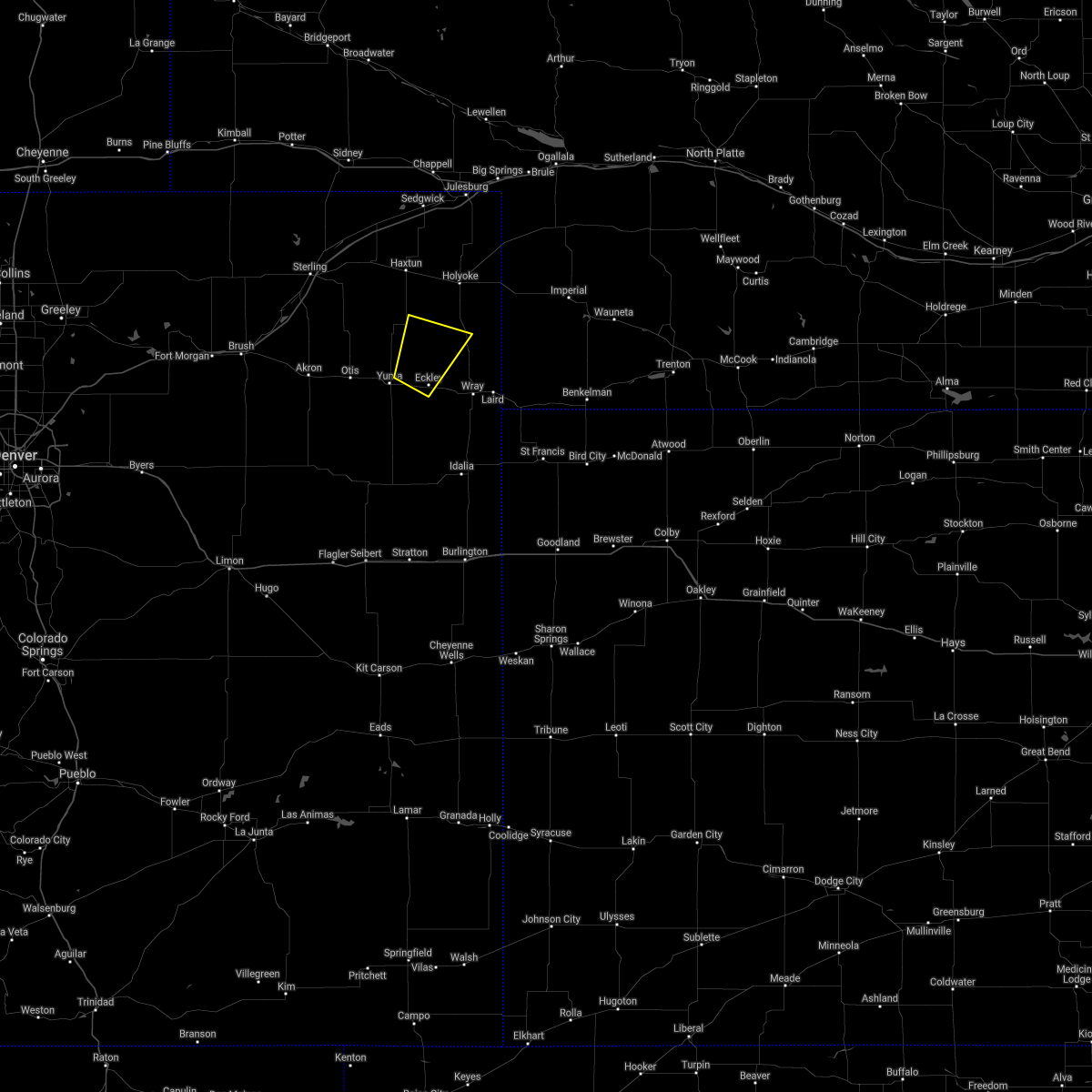 At 248 pm mdt, a severe thunderstorm was located 5 miles northwest of eckley, or 9 miles northeast of yuma, moving northeast at 35 mph (radar indicated). Hazards include 60 mph wind gusts and quarter size hail. Hail damage to vehicles is expected. expect wind damage to roofs, siding, and trees. this severe thunderstorm will remain over mainly rural areas of northwestern yuma county, including the following locations, clarkville. this includes highway 385 between mile markers 262 and 263. hail threat, radar indicated max hail size, 1. 00 in wind threat, radar indicated max wind gust, 60 mph. At 248 pm mdt, a severe thunderstorm was located 5 miles northwest of eckley, or 9 miles northeast of yuma, moving northeast at 35 mph (radar indicated). Hazards include 60 mph wind gusts and quarter size hail. Hail damage to vehicles is expected. expect wind damage to roofs, siding, and trees. this severe thunderstorm will remain over mainly rural areas of northwestern yuma county, including the following locations, clarkville. this includes highway 385 between mile markers 262 and 263. hail threat, radar indicated max hail size, 1. 00 in wind threat, radar indicated max wind gust, 60 mph.
|
| 6/19/2021 5:37 PM MDT |
 At 536 pm mdt, severe thunderstorms were located along a line extending from near holyoke to 7 miles southeast of eckley to 18 miles east of cope, moving east at 30 mph. this storm has a history of producing 70 mph wind gusts (radar indicated). Hazards include 70 mph wind gusts. Expect considerable tree damage. damage is likely to mobile homes, roofs, and outbuildings. locations impacted include, wray. This includes highway 385 between mile markers 207 and 210, and between mile markers 212 and 269. At 536 pm mdt, severe thunderstorms were located along a line extending from near holyoke to 7 miles southeast of eckley to 18 miles east of cope, moving east at 30 mph. this storm has a history of producing 70 mph wind gusts (radar indicated). Hazards include 70 mph wind gusts. Expect considerable tree damage. damage is likely to mobile homes, roofs, and outbuildings. locations impacted include, wray. This includes highway 385 between mile markers 207 and 210, and between mile markers 212 and 269.
|
| 6/19/2021 5:02 PM MDT |
 At 502 pm mdt, severe thunderstorms were located along a line extending from 3 miles northwest of highland center to 5 miles south of yuma to 5 miles south of cope, moving east at 35 mph (radar indicated). Hazards include 60 mph wind gusts and quarter size hail. Hail damage to vehicles is expected. expect wind damage to roofs, siding, and trees. severe thunderstorms will be near, eckley around 520 pm mdt. other locations in the path of these severe thunderstorms include wray. This includes highway 385 between mile markers 207 and 210, and between mile markers 212 and 270. At 502 pm mdt, severe thunderstorms were located along a line extending from 3 miles northwest of highland center to 5 miles south of yuma to 5 miles south of cope, moving east at 35 mph (radar indicated). Hazards include 60 mph wind gusts and quarter size hail. Hail damage to vehicles is expected. expect wind damage to roofs, siding, and trees. severe thunderstorms will be near, eckley around 520 pm mdt. other locations in the path of these severe thunderstorms include wray. This includes highway 385 between mile markers 207 and 210, and between mile markers 212 and 270.
|
| 5/23/2021 6:14 PM MDT |
 At 614 pm mdt, a severe thunderstorm capable of producing a tornado was located near eckley, or 9 miles east of yuma, moving northeast at 35 mph (radar indicated rotation). Hazards include tornado and half dollar size hail. Flying debris will be dangerous to those caught without shelter. mobile homes will be damaged or destroyed. damage to roofs, windows, and vehicles will occur. tree damage is likely. this dangerous storm will be near, eckley around 620 pm mdt. This includes highway 385 near mile marker 255. At 614 pm mdt, a severe thunderstorm capable of producing a tornado was located near eckley, or 9 miles east of yuma, moving northeast at 35 mph (radar indicated rotation). Hazards include tornado and half dollar size hail. Flying debris will be dangerous to those caught without shelter. mobile homes will be damaged or destroyed. damage to roofs, windows, and vehicles will occur. tree damage is likely. this dangerous storm will be near, eckley around 620 pm mdt. This includes highway 385 near mile marker 255.
|
| 5/23/2021 6:01 PM MDT |
 At 601 pm mdt, a severe thunderstorm capable of producing a tornado was located 9 miles south of yuma, moving northeast at 35 mph (radar indicated rotation). Hazards include tornado and half dollar size hail. Flying debris will be dangerous to those caught without shelter. mobile homes will be damaged or destroyed. damage to roofs, windows, and vehicles will occur. tree damage is likely. this dangerous storm will be near, eckley around 620 pm mdt. This includes highway 385 near mile marker 255. At 601 pm mdt, a severe thunderstorm capable of producing a tornado was located 9 miles south of yuma, moving northeast at 35 mph (radar indicated rotation). Hazards include tornado and half dollar size hail. Flying debris will be dangerous to those caught without shelter. mobile homes will be damaged or destroyed. damage to roofs, windows, and vehicles will occur. tree damage is likely. this dangerous storm will be near, eckley around 620 pm mdt. This includes highway 385 near mile marker 255.
|
| 5/23/2021 5:57 PM MDT |
 At 557 pm mdt, severe thunderstorms were located along a line extending from 4 miles southwest of highland center to 16 miles south of yuma, moving northeast at 30 mph (radar indicated). Hazards include 60 mph wind gusts and quarter size hail. Hail damage to vehicles is expected. Expect wind damage to roofs, siding, and trees. At 557 pm mdt, severe thunderstorms were located along a line extending from 4 miles southwest of highland center to 16 miles south of yuma, moving northeast at 30 mph (radar indicated). Hazards include 60 mph wind gusts and quarter size hail. Hail damage to vehicles is expected. Expect wind damage to roofs, siding, and trees.
|
| 5/23/2021 5:26 PM MDT |
 At 526 pm mdt, severe thunderstorms were located along a line extending from 5 miles south of st petersburg to 13 miles south of otis, moving northeast at 40 mph (radar indicated). Hazards include 60 mph wind gusts and half dollar size hail. Hail damage to vehicles is expected. Expect wind damage to roofs, siding, and trees. At 526 pm mdt, severe thunderstorms were located along a line extending from 5 miles south of st petersburg to 13 miles south of otis, moving northeast at 40 mph (radar indicated). Hazards include 60 mph wind gusts and half dollar size hail. Hail damage to vehicles is expected. Expect wind damage to roofs, siding, and trees.
|
| 8/16/2020 7:11 PM CDT |
 At 609 pm mdt/709 pm cdt/, severe thunderstorms were located along a line extending from 13 miles east of cope to 8 miles south of bonny reservoir to 5 miles south of goodland to 10 miles south of brewster to near grinnell to 9 miles north of wakeeney, moving south at 25 mph (these storms have a history of producing wind gusts up to 70 mph. an automated weather observation site in st. francis reported a 67 mph wind gust at 535 pm mdt). Hazards include 70 mph wind gusts and penny size hail. Expect considerable tree damage. damage is likely to mobile homes, roofs, and outbuildings. locations impacted include, colby, goodland, burlington, yuma, wray, hill city and st. francis. this includes the following highways, interstate 70 in kansas between mile markers 0 and 74. interstate 70 in colorado between mile markers 423 and 450. Highway 385 between mile markers 170 and 258. At 609 pm mdt/709 pm cdt/, severe thunderstorms were located along a line extending from 13 miles east of cope to 8 miles south of bonny reservoir to 5 miles south of goodland to 10 miles south of brewster to near grinnell to 9 miles north of wakeeney, moving south at 25 mph (these storms have a history of producing wind gusts up to 70 mph. an automated weather observation site in st. francis reported a 67 mph wind gust at 535 pm mdt). Hazards include 70 mph wind gusts and penny size hail. Expect considerable tree damage. damage is likely to mobile homes, roofs, and outbuildings. locations impacted include, colby, goodland, burlington, yuma, wray, hill city and st. francis. this includes the following highways, interstate 70 in kansas between mile markers 0 and 74. interstate 70 in colorado between mile markers 423 and 450. Highway 385 between mile markers 170 and 258.
|
| 8/16/2020 6:54 PM CDT |
 At 552 pm mdt/652 pm cdt/, severe thunderstorms were located along a line extending from 15 miles southwest of eckley to 3 miles north of bonny reservoir to 6 miles north of goodland to near brewster to 7 miles east of menlo to 3 miles southwest of hill city, moving south at 20 mph (these storms have a history of producing wind gusts up to 70 mph. an automated weather observation site in st. francis reported a 67 mph wind gust at 535 pm mdt). Hazards include quarter size hail and 70 mph wind gusts. People and animals outdoors will be injured. expect hail damage to roofs, siding, windows, and vehicles. expect considerable tree damage. wind damage is also likely to mobile homes, roofs, and outbuildings. locations impacted include, colby, goodland, burlington, yuma, wray, oberlin and hill city. this includes the following highways, interstate 70 in kansas between mile markers 0 and 74. interstate 70 in colorado between mile markers 391 and 450. Highway 385 between mile markers 170 and 269. At 552 pm mdt/652 pm cdt/, severe thunderstorms were located along a line extending from 15 miles southwest of eckley to 3 miles north of bonny reservoir to 6 miles north of goodland to near brewster to 7 miles east of menlo to 3 miles southwest of hill city, moving south at 20 mph (these storms have a history of producing wind gusts up to 70 mph. an automated weather observation site in st. francis reported a 67 mph wind gust at 535 pm mdt). Hazards include quarter size hail and 70 mph wind gusts. People and animals outdoors will be injured. expect hail damage to roofs, siding, windows, and vehicles. expect considerable tree damage. wind damage is also likely to mobile homes, roofs, and outbuildings. locations impacted include, colby, goodland, burlington, yuma, wray, oberlin and hill city. this includes the following highways, interstate 70 in kansas between mile markers 0 and 74. interstate 70 in colorado between mile markers 391 and 450. Highway 385 between mile markers 170 and 269.
|
| 8/16/2020 6:43 PM CDT |
 At 540 pm mdt/640 pm cdt/, severe thunderstorms were located along a line extending from 8 miles south of yuma to 10 miles north of bonny reservoir to 14 miles north of goodland to 9 miles north of brewster to 6 miles southeast of rexford to 6 miles northwest of hill city, moving south at 20 to 30 mph. the strongest storm within the line was progressing southward from cheyenne county, kansas into sherman county, kansas (these storms have a history of producing quarter to golf ball size hail and wind gusts up to 65 mph). Hazards include quarter to golf ball size hail and 70 mph wind gusts. People and animals outdoors will be injured. expect hail damage to roofs, siding, windows, and vehicles. expect considerable tree damage. wind damage is also likely to mobile homes, roofs, and outbuildings. locations impacted include, colby, goodland, burlington, yuma, norton, wray and oberlin. this includes the following highways, interstate 70 in kansas between mile markers 0 and 74. interstate 70 in colorado between mile markers 391 and 450. Highway 385 between mile markers 170 and 269. At 540 pm mdt/640 pm cdt/, severe thunderstorms were located along a line extending from 8 miles south of yuma to 10 miles north of bonny reservoir to 14 miles north of goodland to 9 miles north of brewster to 6 miles southeast of rexford to 6 miles northwest of hill city, moving south at 20 to 30 mph. the strongest storm within the line was progressing southward from cheyenne county, kansas into sherman county, kansas (these storms have a history of producing quarter to golf ball size hail and wind gusts up to 65 mph). Hazards include quarter to golf ball size hail and 70 mph wind gusts. People and animals outdoors will be injured. expect hail damage to roofs, siding, windows, and vehicles. expect considerable tree damage. wind damage is also likely to mobile homes, roofs, and outbuildings. locations impacted include, colby, goodland, burlington, yuma, norton, wray and oberlin. this includes the following highways, interstate 70 in kansas between mile markers 0 and 74. interstate 70 in colorado between mile markers 391 and 450. Highway 385 between mile markers 170 and 269.
|
| 8/16/2020 6:28 PM CDT |
 At 523 pm mdt/623 pm cdt/, severe thunderstorms were located along a line extending from 8 miles southwest of eckley to 12 miles south of bird city to 9 miles southeast of lenora, moving south at 25 mph. the strongest storm within the line was located in southern cheyenne county kansas, moving southward into sherman county, kansas (these storms have a history of producing quarter to golf ball size hail and wind gusts up to 65 mph). Hazards include quarter to golf ball size hail and 70 mph wind gusts. People and animals outdoors will be injured. expect hail damage to roofs, siding, windows, and vehicles. expect considerable tree damage. wind damage is also likely to mobile homes, roofs, and outbuildings. locations impacted include, colby, goodland, burlington, yuma, norton, wray and oberlin. this includes the following highways, interstate 70 in kansas between mile markers 0 and 74. interstate 70 in colorado between mile markers 391 and 450. Highway 385 between mile markers 170 and 269. At 523 pm mdt/623 pm cdt/, severe thunderstorms were located along a line extending from 8 miles southwest of eckley to 12 miles south of bird city to 9 miles southeast of lenora, moving south at 25 mph. the strongest storm within the line was located in southern cheyenne county kansas, moving southward into sherman county, kansas (these storms have a history of producing quarter to golf ball size hail and wind gusts up to 65 mph). Hazards include quarter to golf ball size hail and 70 mph wind gusts. People and animals outdoors will be injured. expect hail damage to roofs, siding, windows, and vehicles. expect considerable tree damage. wind damage is also likely to mobile homes, roofs, and outbuildings. locations impacted include, colby, goodland, burlington, yuma, norton, wray and oberlin. this includes the following highways, interstate 70 in kansas between mile markers 0 and 74. interstate 70 in colorado between mile markers 391 and 450. Highway 385 between mile markers 170 and 269.
|
| 8/16/2020 6:11 PM CDT |
 At 507 pm mdt/607 pm cdt/, severe thunderstorms were located along a line extending from 7 miles southeast of yuma to 11 miles south of bird city to 3 miles southwest of edmond, moving south at 15 mph. the strongest storm within the line was located in central cheyenne county, kansas moving south toward sherman county, kansas (these storms have a history of producing quarter to golf ball size hail and wind gusts up to 65 mph). Hazards include quarter to golf ball size hail and 70 mph wind gusts. People and animals outdoors will be injured. expect hail damage to roofs, siding, windows, and vehicles. expect considerable tree damage. wind damage is also likely to mobile homes, roofs, and outbuildings. locations impacted include, colby, goodland, burlington, yuma, norton, wray and oberlin. this includes the following highways, interstate 70 in kansas between mile markers 0 and 74. interstate 70 in colorado between mile markers 391 and 450. Highway 385 between mile markers 170 and 269. At 507 pm mdt/607 pm cdt/, severe thunderstorms were located along a line extending from 7 miles southeast of yuma to 11 miles south of bird city to 3 miles southwest of edmond, moving south at 15 mph. the strongest storm within the line was located in central cheyenne county, kansas moving south toward sherman county, kansas (these storms have a history of producing quarter to golf ball size hail and wind gusts up to 65 mph). Hazards include quarter to golf ball size hail and 70 mph wind gusts. People and animals outdoors will be injured. expect hail damage to roofs, siding, windows, and vehicles. expect considerable tree damage. wind damage is also likely to mobile homes, roofs, and outbuildings. locations impacted include, colby, goodland, burlington, yuma, norton, wray and oberlin. this includes the following highways, interstate 70 in kansas between mile markers 0 and 74. interstate 70 in colorado between mile markers 391 and 450. Highway 385 between mile markers 170 and 269.
|
| 8/16/2020 5:54 PM CDT |
 At 453 pm mdt/553 pm cdt/, severe thunderstorms were located along a line extending from 9 miles east of bonny reservoir to 6 miles west of logan, moving south at 15 mph (radar indicated). Hazards include two inch hail and 70 mph wind gusts. People and animals outdoors will be injured. expect hail damage to roofs, siding, windows, and vehicles. expect considerable tree damage. Wind damage is also likely to mobile homes, roofs, and outbuildings. At 453 pm mdt/553 pm cdt/, severe thunderstorms were located along a line extending from 9 miles east of bonny reservoir to 6 miles west of logan, moving south at 15 mph (radar indicated). Hazards include two inch hail and 70 mph wind gusts. People and animals outdoors will be injured. expect hail damage to roofs, siding, windows, and vehicles. expect considerable tree damage. Wind damage is also likely to mobile homes, roofs, and outbuildings.
|
| 8/11/2020 3:21 PM MDT |
 At 320 pm mdt, severe thunderstorms were located along a line extending from 9 miles northeast of eckley to 14 miles southwest of wray to 12 miles northeast of cope, moving east at 35 mph (radar indicated. at 315 pm mdt a personal weather station 5 miles northwest of heartstrong recorded a wind gust of 59 mph). Hazards include 60 mph wind gusts and penny size hail. Expect damage to roofs, siding, and trees. locations impacted include, yuma, wray, eckley, abarr, heartstrong, wauneta and laird. This includes highway 385 between mile markers 237 and 269. At 320 pm mdt, severe thunderstorms were located along a line extending from 9 miles northeast of eckley to 14 miles southwest of wray to 12 miles northeast of cope, moving east at 35 mph (radar indicated. at 315 pm mdt a personal weather station 5 miles northwest of heartstrong recorded a wind gust of 59 mph). Hazards include 60 mph wind gusts and penny size hail. Expect damage to roofs, siding, and trees. locations impacted include, yuma, wray, eckley, abarr, heartstrong, wauneta and laird. This includes highway 385 between mile markers 237 and 269.
|
| 8/11/2020 3:11 PM MDT |
 At 311 pm mdt, severe thunderstorms were located along a line extending from 8 miles north of eckley to 17 miles southeast of yuma to 8 miles northeast of cope, moving east at 35 mph (radar indicated). Hazards include 60 mph wind gusts and penny size hail. Expect damage to roofs, siding, and trees. locations impacted include, yuma, wray, eckley, abarr, heartstrong, wauneta and laird. This includes highway 385 between mile markers 237 and 269. At 311 pm mdt, severe thunderstorms were located along a line extending from 8 miles north of eckley to 17 miles southeast of yuma to 8 miles northeast of cope, moving east at 35 mph (radar indicated). Hazards include 60 mph wind gusts and penny size hail. Expect damage to roofs, siding, and trees. locations impacted include, yuma, wray, eckley, abarr, heartstrong, wauneta and laird. This includes highway 385 between mile markers 237 and 269.
|
| 8/11/2020 2:57 PM MDT |
 At 243 pm mdt, a severe thunderstorm was located 7 miles southwest of yuma, moving northeast at 35 mph (radar indicated). Hazards include 70 mph wind gusts and quarter size hail. Hail damage to vehicles is expected. expect considerable tree damage. Wind damage is also likely to mobile homes, roofs, and outbuildings. At 243 pm mdt, a severe thunderstorm was located 7 miles southwest of yuma, moving northeast at 35 mph (radar indicated). Hazards include 70 mph wind gusts and quarter size hail. Hail damage to vehicles is expected. expect considerable tree damage. Wind damage is also likely to mobile homes, roofs, and outbuildings.
|
| 8/11/2020 2:43 PM MDT |
 At 243 pm mdt, a severe thunderstorm was located 7 miles southwest of yuma, moving northeast at 35 mph (radar indicated). Hazards include 70 mph wind gusts and quarter size hail. Hail damage to vehicles is expected. expect considerable tree damage. Wind damage is also likely to mobile homes, roofs, and outbuildings. At 243 pm mdt, a severe thunderstorm was located 7 miles southwest of yuma, moving northeast at 35 mph (radar indicated). Hazards include 70 mph wind gusts and quarter size hail. Hail damage to vehicles is expected. expect considerable tree damage. Wind damage is also likely to mobile homes, roofs, and outbuildings.
|
| 8/5/2020 7:17 PM MDT |
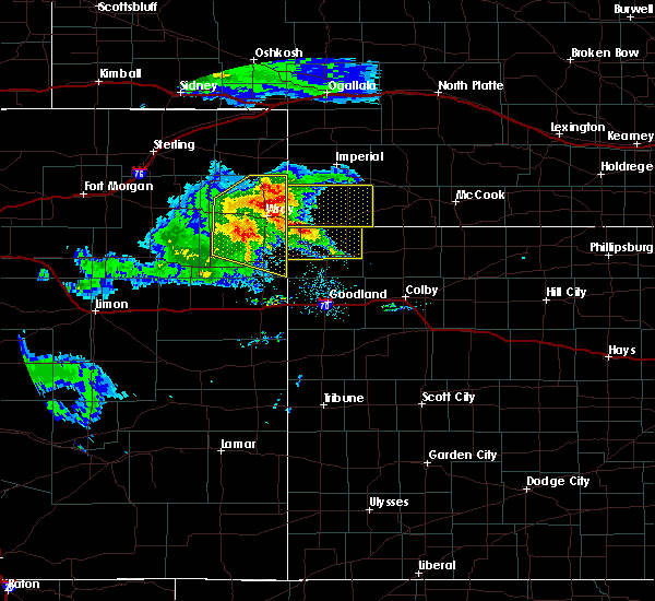 At 717 pm mdt, severe thunderstorms were located along a line extending from 9 miles northwest of wray to 11 miles south of eckley, moving east at 30 mph (this storm has had a history of producing 50-60 mph wind gusts). Hazards include 60 mph wind gusts and nickel size hail. Expect damage to roofs, siding, and trees. locations impacted include, wray, bonny reservoir, eckley, hale, beecher island, heartstrong and alvin. This includes highway 385 between mile markers 212 and 269. At 717 pm mdt, severe thunderstorms were located along a line extending from 9 miles northwest of wray to 11 miles south of eckley, moving east at 30 mph (this storm has had a history of producing 50-60 mph wind gusts). Hazards include 60 mph wind gusts and nickel size hail. Expect damage to roofs, siding, and trees. locations impacted include, wray, bonny reservoir, eckley, hale, beecher island, heartstrong and alvin. This includes highway 385 between mile markers 212 and 269.
|
| 8/5/2020 6:51 PM MDT |
 At 650 pm mdt, severe thunderstorms were located along a line extending from 8 miles northwest of eckley to 10 miles south of yuma, moving east at 40 mph (radar indicated). Hazards include 70 mph wind gusts and nickel size hail. Expect considerable tree damage. damage is likely to mobile homes, roofs, and outbuildings. locations impacted include, yuma, wray, bonny reservoir, eckley, abarr, beecher island and wauneta. People attending yuma county fairgrounds should seek safe shelter immediately! this includes highway 385 between mile markers 212 and 269. At 650 pm mdt, severe thunderstorms were located along a line extending from 8 miles northwest of eckley to 10 miles south of yuma, moving east at 40 mph (radar indicated). Hazards include 70 mph wind gusts and nickel size hail. Expect considerable tree damage. damage is likely to mobile homes, roofs, and outbuildings. locations impacted include, yuma, wray, bonny reservoir, eckley, abarr, beecher island and wauneta. People attending yuma county fairgrounds should seek safe shelter immediately! this includes highway 385 between mile markers 212 and 269.
|
| 8/5/2020 6:46 PM MDT |
 At 645 pm mdt, severe thunderstorms were located along a line extending from 6 miles southeast of paoli to 7 miles northwest of eckley to 9 miles south of yuma, moving east at 30 mph (radar indicated). Hazards include 70 mph wind gusts and nickel size hail. Expect considerable tree damage. damage is likely to mobile homes, roofs, and outbuildings. locations impacted include, yuma, wray, bonny reservoir, eckley, abarr, beecher island and wauneta. People attending yuma county fairgrounds should seek safe shelter immediately! this includes highway 385 between mile markers 212 and 269. At 645 pm mdt, severe thunderstorms were located along a line extending from 6 miles southeast of paoli to 7 miles northwest of eckley to 9 miles south of yuma, moving east at 30 mph (radar indicated). Hazards include 70 mph wind gusts and nickel size hail. Expect considerable tree damage. damage is likely to mobile homes, roofs, and outbuildings. locations impacted include, yuma, wray, bonny reservoir, eckley, abarr, beecher island and wauneta. People attending yuma county fairgrounds should seek safe shelter immediately! this includes highway 385 between mile markers 212 and 269.
|
| 8/5/2020 6:35 PM MDT |
 At 633 pm mdt, severe thunderstorms were located along a line extending from near otis to 12 miles southwest of wray, moving east at 10 mph (radar indicated). Hazards include 70 mph wind gusts and nickel size hail. Expect considerable tree damage. damage is likely to mobile homes, roofs, and outbuildings. locations impacted include, yuma, eckley, abarr and heartstrong. people attending yuma county fairgrounds should seek safe shelter immediately! this warning has been replaced with a more recent warning encompassing most of yuma county. Therefore no further updates to this warning are anticipated. At 633 pm mdt, severe thunderstorms were located along a line extending from near otis to 12 miles southwest of wray, moving east at 10 mph (radar indicated). Hazards include 70 mph wind gusts and nickel size hail. Expect considerable tree damage. damage is likely to mobile homes, roofs, and outbuildings. locations impacted include, yuma, eckley, abarr and heartstrong. people attending yuma county fairgrounds should seek safe shelter immediately! this warning has been replaced with a more recent warning encompassing most of yuma county. Therefore no further updates to this warning are anticipated.
|
| 8/5/2020 6:30 PM MDT |
 At 629 pm mdt, severe thunderstorms were located along a line extending from near highland center to 7 miles southwest of yuma, moving east at 30 mph (radar indicated). Hazards include 70 mph wind gusts and nickel size hail. Expect considerable tree damage. Damage is likely to mobile homes, roofs, and outbuildings. At 629 pm mdt, severe thunderstorms were located along a line extending from near highland center to 7 miles southwest of yuma, moving east at 30 mph (radar indicated). Hazards include 70 mph wind gusts and nickel size hail. Expect considerable tree damage. Damage is likely to mobile homes, roofs, and outbuildings.
|
| 8/5/2020 6:25 PM MDT |
 At 624 pm mdt, severe thunderstorms were located along a line extending from near otis to 13 miles southwest of wray, moving east at 15 mph (radar indicated). Hazards include 70 mph wind gusts and nickel size hail. Expect considerable tree damage. damage is likely to mobile homes, roofs, and outbuildings. locations impacted include, yuma, eckley, abarr and heartstrong. People attending yuma county fairgrounds should seek safe shelter immediately!. At 624 pm mdt, severe thunderstorms were located along a line extending from near otis to 13 miles southwest of wray, moving east at 15 mph (radar indicated). Hazards include 70 mph wind gusts and nickel size hail. Expect considerable tree damage. damage is likely to mobile homes, roofs, and outbuildings. locations impacted include, yuma, eckley, abarr and heartstrong. People attending yuma county fairgrounds should seek safe shelter immediately!.
|
| 8/5/2020 6:08 PM MDT |
 At 607 pm mdt, severe thunderstorms were located along a line extending from 9 miles south of yuma to 15 miles south of eckley, moving east at 10 mph (measured at two miles northeast of heartstrong). Hazards include 60 mph wind gusts. Expect damage to roofs, siding, and trees. locations impacted include, yuma, eckley, abarr and heartstrong. People attending yuma county fairgrounds should seek safe shelter immediately!. At 607 pm mdt, severe thunderstorms were located along a line extending from 9 miles south of yuma to 15 miles south of eckley, moving east at 10 mph (measured at two miles northeast of heartstrong). Hazards include 60 mph wind gusts. Expect damage to roofs, siding, and trees. locations impacted include, yuma, eckley, abarr and heartstrong. People attending yuma county fairgrounds should seek safe shelter immediately!.
|
| 8/5/2020 6:00 PM MDT | Storm damage reported in yuma county CO, 9.5 miles NNE of Eckley, CO |
| 8/5/2020 5:59 PM MDT |
 At 559 pm mdt, severe thunderstorms were located along a line extending from 11 miles south of yuma to 16 miles south of eckley, moving northeast at 10 mph (radar indicated). Hazards include 60 mph wind gusts and quarter size hail. Hail damage to vehicles is expected. expect wind damage to roofs, siding, and trees. locations impacted include, yuma, eckley, abarr and heartstrong. People attending yuma county fairgrounds should seek safe shelter immediately!. At 559 pm mdt, severe thunderstorms were located along a line extending from 11 miles south of yuma to 16 miles south of eckley, moving northeast at 10 mph (radar indicated). Hazards include 60 mph wind gusts and quarter size hail. Hail damage to vehicles is expected. expect wind damage to roofs, siding, and trees. locations impacted include, yuma, eckley, abarr and heartstrong. People attending yuma county fairgrounds should seek safe shelter immediately!.
|
| 8/5/2020 5:45 PM MDT |
 At 545 pm mdt, a severe thunderstorm was located 16 miles south of yuma, moving north at 10 mph (radar indicated). Hazards include 60 mph wind gusts and quarter size hail. Hail damage to vehicles is expected. Expect wind damage to roofs, siding, and trees. At 545 pm mdt, a severe thunderstorm was located 16 miles south of yuma, moving north at 10 mph (radar indicated). Hazards include 60 mph wind gusts and quarter size hail. Hail damage to vehicles is expected. Expect wind damage to roofs, siding, and trees.
|
| 7/29/2020 7:54 PM MDT |
 The severe thunderstorm warning for yuma county will expire at 800 pm mdt, the storms which prompted the warning have weakened below severe limits, and no longer pose an immediate threat to life or property. therefore, the warning will be allowed to expire. however gusty winds are still possible with these thunderstorms. The severe thunderstorm warning for yuma county will expire at 800 pm mdt, the storms which prompted the warning have weakened below severe limits, and no longer pose an immediate threat to life or property. therefore, the warning will be allowed to expire. however gusty winds are still possible with these thunderstorms.
|
| 7/29/2020 7:28 PM MDT |
 At 728 pm mdt, severe thunderstorms were located along a line extending from 10 miles southeast of highland center to 6 miles southeast of lone star to 4 miles south of otis, moving east at 35 mph (radar indicated). Hazards include 60 mph wind gusts. Expect damage to roofs, siding, and trees. locations impacted include, yuma, wray, eckley, abarr, heartstrong, clarkville and wauneta. This includes highway 385 between mile markers 234 and 269. At 728 pm mdt, severe thunderstorms were located along a line extending from 10 miles southeast of highland center to 6 miles southeast of lone star to 4 miles south of otis, moving east at 35 mph (radar indicated). Hazards include 60 mph wind gusts. Expect damage to roofs, siding, and trees. locations impacted include, yuma, wray, eckley, abarr, heartstrong, clarkville and wauneta. This includes highway 385 between mile markers 234 and 269.
|
| 7/29/2020 7:07 PM MDT |
 At 707 pm mdt, severe thunderstorms were located along a line extending from 8 miles east of lone star to 6 miles south of burdett to 7 miles southeast of akron, moving southeast at 40 mph (radar indicated). Hazards include 60 mph wind gusts. expect damage to roofs, siding, and trees At 707 pm mdt, severe thunderstorms were located along a line extending from 8 miles east of lone star to 6 miles south of burdett to 7 miles southeast of akron, moving southeast at 40 mph (radar indicated). Hazards include 60 mph wind gusts. expect damage to roofs, siding, and trees
|
| 7/21/2020 10:40 PM MDT |
 At 1039 pm mdt, a severe thunderstorm was located 7 miles east of lone star, or 15 miles north of yuma, moving southeast at 15 mph (this storm has a history of producing quarter size hail near the logan and washington county line). Hazards include 60 mph wind gusts and quarter size hail. Hail damage to vehicles is expected. expect wind damage to roofs, siding, and trees. locations impacted include, eckley and clarkville. This includes highway 385 between mile markers 266 and 269. At 1039 pm mdt, a severe thunderstorm was located 7 miles east of lone star, or 15 miles north of yuma, moving southeast at 15 mph (this storm has a history of producing quarter size hail near the logan and washington county line). Hazards include 60 mph wind gusts and quarter size hail. Hail damage to vehicles is expected. expect wind damage to roofs, siding, and trees. locations impacted include, eckley and clarkville. This includes highway 385 between mile markers 266 and 269.
|
| 7/21/2020 10:28 PM MDT |
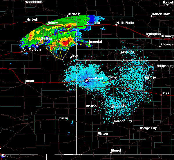 At 1027 pm mdt, a severe thunderstorm was located 4 miles east of lone star, or 16 miles north of yuma, moving southeast at 15 mph (this storm has a history of producing quarter size hail near the logan and washington county line). Hazards include 60 mph wind gusts and quarter size hail. Hail damage to vehicles is expected. expect wind damage to roofs, siding, and trees. locations impacted include, eckley and clarkville. This includes highway 385 between mile markers 266 and 269. At 1027 pm mdt, a severe thunderstorm was located 4 miles east of lone star, or 16 miles north of yuma, moving southeast at 15 mph (this storm has a history of producing quarter size hail near the logan and washington county line). Hazards include 60 mph wind gusts and quarter size hail. Hail damage to vehicles is expected. expect wind damage to roofs, siding, and trees. locations impacted include, eckley and clarkville. This includes highway 385 between mile markers 266 and 269.
|
| 7/21/2020 10:02 PM MDT |
 At 1002 pm mdt, a severe thunderstorm was located near lone star, or 18 miles north of yuma, moving east at 25 mph (this storm has a history of producing quarter size hail near the logan and washington county line). Hazards include 60 mph wind gusts and quarter size hail. Hail damage to vehicles is expected. Expect wind damage to roofs, siding, and trees. At 1002 pm mdt, a severe thunderstorm was located near lone star, or 18 miles north of yuma, moving east at 25 mph (this storm has a history of producing quarter size hail near the logan and washington county line). Hazards include 60 mph wind gusts and quarter size hail. Hail damage to vehicles is expected. Expect wind damage to roofs, siding, and trees.
|
| 7/19/2020 6:49 PM MDT |
 At 648 pm mdt, severe thunderstorms were located along a line extending from 3 miles southwest of pleasant valley to 3 miles southeast of highland center, moving east at 20 mph (radar indicated). Hazards include 70 mph wind gusts and nickel size hail. Expect considerable tree damage. damage is likely to mobile homes, roofs, and outbuildings. locations impacted include, wray, eckley, beecher island, alvin, clarkville, wauneta and laird. This includes highway 385 between mile markers 233 and 269. At 648 pm mdt, severe thunderstorms were located along a line extending from 3 miles southwest of pleasant valley to 3 miles southeast of highland center, moving east at 20 mph (radar indicated). Hazards include 70 mph wind gusts and nickel size hail. Expect considerable tree damage. damage is likely to mobile homes, roofs, and outbuildings. locations impacted include, wray, eckley, beecher island, alvin, clarkville, wauneta and laird. This includes highway 385 between mile markers 233 and 269.
|
| 7/19/2020 6:20 PM MDT |
 At 620 pm mdt, severe thunderstorms were located along a line extending from 4 miles northwest of paoli to 5 miles south of st petersburg, moving southeast at 30 mph (radar indicated). Hazards include 70 mph wind gusts and quarter size hail. Hail damage to vehicles is expected. expect considerable tree damage. Wind damage is also likely to mobile homes, roofs, and outbuildings. At 620 pm mdt, severe thunderstorms were located along a line extending from 4 miles northwest of paoli to 5 miles south of st petersburg, moving southeast at 30 mph (radar indicated). Hazards include 70 mph wind gusts and quarter size hail. Hail damage to vehicles is expected. expect considerable tree damage. Wind damage is also likely to mobile homes, roofs, and outbuildings.
|
| 7/13/2020 5:36 PM MDT |
 At 535 pm mdt, a severe thunderstorm was located 13 miles southeast of highland center, or 18 miles southwest of holyoke, moving east at 50 mph. additional severe storms are approaching wray (emergency management. at 532 pm mdt, 60 mph wind gusts were reported in clarkville). Hazards include two inch hail and 60 mph wind gusts. People and animals outdoors will be injured. expect hail damage to roofs, siding, windows, and vehicles. expect wind damage to roofs, siding, and trees. locations impacted include, wray, eckley, clarkville and wauneta. This includes highway 385 between mile markers 241 and 269. At 535 pm mdt, a severe thunderstorm was located 13 miles southeast of highland center, or 18 miles southwest of holyoke, moving east at 50 mph. additional severe storms are approaching wray (emergency management. at 532 pm mdt, 60 mph wind gusts were reported in clarkville). Hazards include two inch hail and 60 mph wind gusts. People and animals outdoors will be injured. expect hail damage to roofs, siding, windows, and vehicles. expect wind damage to roofs, siding, and trees. locations impacted include, wray, eckley, clarkville and wauneta. This includes highway 385 between mile markers 241 and 269.
|
| 7/13/2020 5:32 PM MDT |
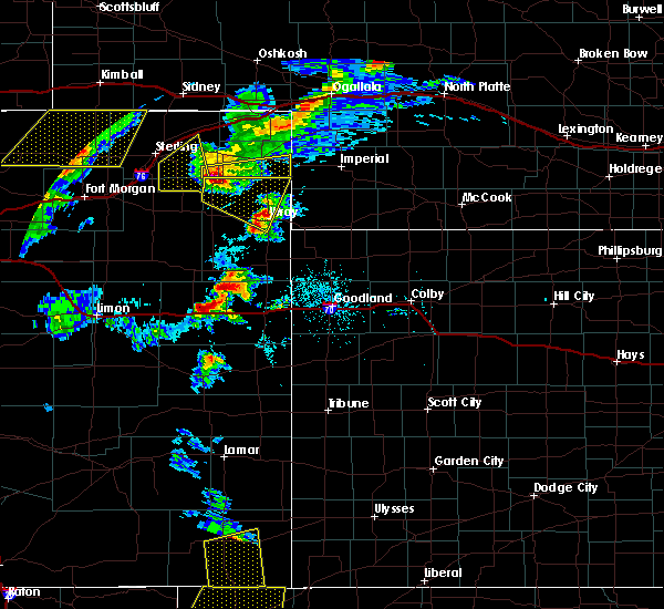 At 532 pm mdt, a severe thunderstorm was located 12 miles south of highland center, or 18 miles southwest of holyoke, moving east at 50 mph. additional severe thunderstorms are approaching wray (radar indicated). Hazards include two inch hail and 60 mph wind gusts. People and animals outdoors will be injured. expect hail damage to roofs, siding, windows, and vehicles. expect wind damage to roofs, siding, and trees. locations impacted include, wray, eckley, clarkville and wauneta. This includes highway 385 between mile markers 241 and 269. At 532 pm mdt, a severe thunderstorm was located 12 miles south of highland center, or 18 miles southwest of holyoke, moving east at 50 mph. additional severe thunderstorms are approaching wray (radar indicated). Hazards include two inch hail and 60 mph wind gusts. People and animals outdoors will be injured. expect hail damage to roofs, siding, windows, and vehicles. expect wind damage to roofs, siding, and trees. locations impacted include, wray, eckley, clarkville and wauneta. This includes highway 385 between mile markers 241 and 269.
|
| 7/13/2020 5:16 PM MDT |
 At 516 pm mdt, a severe thunderstorm was located 7 miles northeast of lone star, or 20 miles north of yuma, moving east at 35 mph (radar indicated). Hazards include 60 mph wind gusts and half dollar size hail. Hail damage to vehicles is expected. expect wind damage to roofs, siding, and trees. locations impacted include, wray, eckley, clarkville and wauneta. This includes highway 385 between mile markers 241 and 269. At 516 pm mdt, a severe thunderstorm was located 7 miles northeast of lone star, or 20 miles north of yuma, moving east at 35 mph (radar indicated). Hazards include 60 mph wind gusts and half dollar size hail. Hail damage to vehicles is expected. expect wind damage to roofs, siding, and trees. locations impacted include, wray, eckley, clarkville and wauneta. This includes highway 385 between mile markers 241 and 269.
|
| 7/13/2020 5:02 PM MDT |
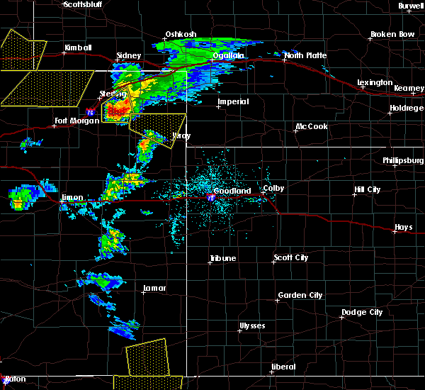 At 502 pm mdt, a severe thunderstorm was located near lone star, or 20 miles north of yuma, moving east at 50 mph (radar indicated). Hazards include 60 mph wind gusts and half dollar size hail. Hail damage to vehicles is expected. Expect wind damage to roofs, siding, and trees. At 502 pm mdt, a severe thunderstorm was located near lone star, or 20 miles north of yuma, moving east at 50 mph (radar indicated). Hazards include 60 mph wind gusts and half dollar size hail. Hail damage to vehicles is expected. Expect wind damage to roofs, siding, and trees.
|
| 7/7/2020 8:49 PM MDT |
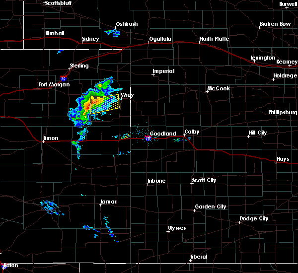 At 848 pm mdt, a severe thunderstorm was located 4 miles southwest of eckley, or 11 miles southeast of yuma, moving east at 35 mph (weather instrument at yuma airport). Hazards include 58 mph wind gusts. Expect damage to roofs, siding, and trees. Locations impacted include, eckley and heartstrong. At 848 pm mdt, a severe thunderstorm was located 4 miles southwest of eckley, or 11 miles southeast of yuma, moving east at 35 mph (weather instrument at yuma airport). Hazards include 58 mph wind gusts. Expect damage to roofs, siding, and trees. Locations impacted include, eckley and heartstrong.
|
| 7/7/2020 8:37 PM MDT |
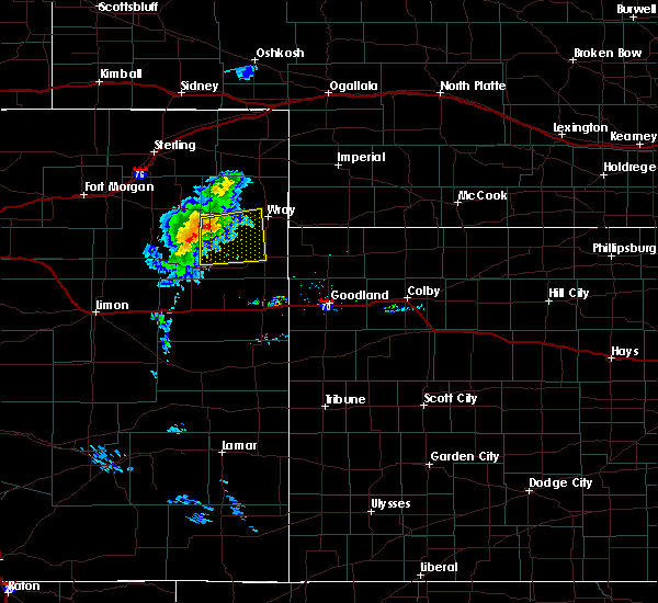 At 829 pm mdt, a severe thunderstorm was located 15 miles south of eckley, or 16 miles southeast of yuma, moving east at 30 mph (radar indicated). Hazards include 70 mph wind gusts. Expect considerable tree damage. damage is likely to mobile homes, roofs, and outbuildings. locations impacted include, eckley, abarr, heartstrong and vernon. This includes highway 385 between mile markers 218 and 226. At 829 pm mdt, a severe thunderstorm was located 15 miles south of eckley, or 16 miles southeast of yuma, moving east at 30 mph (radar indicated). Hazards include 70 mph wind gusts. Expect considerable tree damage. damage is likely to mobile homes, roofs, and outbuildings. locations impacted include, eckley, abarr, heartstrong and vernon. This includes highway 385 between mile markers 218 and 226.
|
| 7/7/2020 8:29 PM MDT |
 At 829 pm mdt, a severe thunderstorm was located 15 miles south of eckley, or 16 miles southeast of yuma, moving east at 30 mph (radar indicated). Hazards include 70 mph wind gusts. Expect considerable tree damage. damage is likely to mobile homes, roofs, and outbuildings. locations impacted include, eckley, abarr, heartstrong and vernon. This includes highway 385 between mile markers 218 and 226. At 829 pm mdt, a severe thunderstorm was located 15 miles south of eckley, or 16 miles southeast of yuma, moving east at 30 mph (radar indicated). Hazards include 70 mph wind gusts. Expect considerable tree damage. damage is likely to mobile homes, roofs, and outbuildings. locations impacted include, eckley, abarr, heartstrong and vernon. This includes highway 385 between mile markers 218 and 226.
|
| 7/7/2020 8:12 PM MDT |
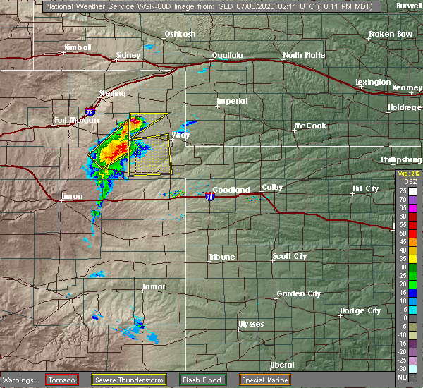 At 812 pm mdt, a severe thunderstorm was located 15 miles northeast of cope, or 16 miles south of yuma, moving east at 30 mph (radar indicated). Hazards include 70 mph wind gusts. Expect considerable tree damage. damage is likely to mobile homes, roofs, and outbuildings. locations impacted include, eckley, abarr, heartstrong and vernon. This includes highway 385 between mile markers 218 and 226. At 812 pm mdt, a severe thunderstorm was located 15 miles northeast of cope, or 16 miles south of yuma, moving east at 30 mph (radar indicated). Hazards include 70 mph wind gusts. Expect considerable tree damage. damage is likely to mobile homes, roofs, and outbuildings. locations impacted include, eckley, abarr, heartstrong and vernon. This includes highway 385 between mile markers 218 and 226.
|
| 7/7/2020 8:00 PM MDT |
 At 800 pm mdt, a severe thunderstorm was located 10 miles northeast of arickaree school, or 21 miles south of yuma, moving east at 35 mph (radar indicated). Hazards include 70 mph wind gusts. Expect considerable tree damage. Damage is likely to mobile homes, roofs, and outbuildings. At 800 pm mdt, a severe thunderstorm was located 10 miles northeast of arickaree school, or 21 miles south of yuma, moving east at 35 mph (radar indicated). Hazards include 70 mph wind gusts. Expect considerable tree damage. Damage is likely to mobile homes, roofs, and outbuildings.
|
| 6/6/2020 6:58 PM MDT |
 At 658 pm mdt/758 pm cdt/, severe thunderstorms were located along a line extending from 6 miles southeast of paoli to 3 miles north of eckley to 14 miles northeast of cope to 3 miles north of seibert, moving east at 35 mph (radar indicated). Hazards include 60 mph wind gusts. expect damage to roofs, siding, and trees At 658 pm mdt/758 pm cdt/, severe thunderstorms were located along a line extending from 6 miles southeast of paoli to 3 miles north of eckley to 14 miles northeast of cope to 3 miles north of seibert, moving east at 35 mph (radar indicated). Hazards include 60 mph wind gusts. expect damage to roofs, siding, and trees
|
| 6/6/2020 6:58 PM MDT |
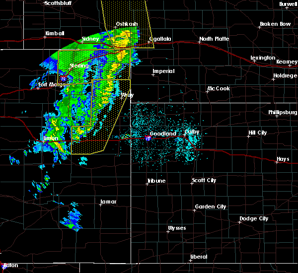 At 658 pm mdt/758 pm cdt/, severe thunderstorms were located along a line extending from 6 miles southeast of paoli to 3 miles north of eckley to 14 miles northeast of cope to 3 miles north of seibert, moving east at 35 mph (radar indicated). Hazards include 60 mph wind gusts. expect damage to roofs, siding, and trees At 658 pm mdt/758 pm cdt/, severe thunderstorms were located along a line extending from 6 miles southeast of paoli to 3 miles north of eckley to 14 miles northeast of cope to 3 miles north of seibert, moving east at 35 mph (radar indicated). Hazards include 60 mph wind gusts. expect damage to roofs, siding, and trees
|
| 6/6/2020 6:44 PM MDT |
 At 643 pm mdt, severe thunderstorms were located along a line extending from 5 miles east of oshkosh to near sixteen-mile corner to near eckley to 13 miles south of seibert, moving northeast at 55 mph (radar indicated). Hazards include 70 mph wind gusts. Expect considerable tree damage. damage is likely to mobile homes, roofs, and outbuildings. locations impacted include, yuma, wray, stratton, flagler, seibert, eckley and vona. this includes the following highways, interstate 70 in colorado between mile markers 391 and 426. Highway 385 between mile markers 225 and 269. At 643 pm mdt, severe thunderstorms were located along a line extending from 5 miles east of oshkosh to near sixteen-mile corner to near eckley to 13 miles south of seibert, moving northeast at 55 mph (radar indicated). Hazards include 70 mph wind gusts. Expect considerable tree damage. damage is likely to mobile homes, roofs, and outbuildings. locations impacted include, yuma, wray, stratton, flagler, seibert, eckley and vona. this includes the following highways, interstate 70 in colorado between mile markers 391 and 426. Highway 385 between mile markers 225 and 269.
|
| 6/6/2020 6:15 PM MDT |
 At 615 pm mdt, severe thunderstorms were located along a line extending from 8 miles north of lodgepole to 4 miles northwest of highland center to 12 miles south of otis to 4 miles northwest of boyero, moving northeast at 55 mph (radar indicated). Hazards include 70 mph wind gusts. Expect considerable tree damage. Damage is likely to mobile homes, roofs, and outbuildings. At 615 pm mdt, severe thunderstorms were located along a line extending from 8 miles north of lodgepole to 4 miles northwest of highland center to 12 miles south of otis to 4 miles northwest of boyero, moving northeast at 55 mph (radar indicated). Hazards include 70 mph wind gusts. Expect considerable tree damage. Damage is likely to mobile homes, roofs, and outbuildings.
|
| 6/4/2020 4:13 PM MDT | Storm damage reported in yuma county CO, 17.4 miles N of Eckley, CO |
| 6/4/2020 3:53 PM MDT |
 At 353 pm mdt, severe thunderstorms were located along a line extending from 14 miles north of eckley to 5 miles south of cope, moving east at 50 mph (radar indicated). Hazards include 60 mph wind gusts. Expect damage to roofs, siding, and trees. locations impacted include, yuma, wray, eckley, joes, abarr, kirk and heartstrong. This includes highway 385 between mile markers 242 and 269. At 353 pm mdt, severe thunderstorms were located along a line extending from 14 miles north of eckley to 5 miles south of cope, moving east at 50 mph (radar indicated). Hazards include 60 mph wind gusts. Expect damage to roofs, siding, and trees. locations impacted include, yuma, wray, eckley, joes, abarr, kirk and heartstrong. This includes highway 385 between mile markers 242 and 269.
|
| 6/4/2020 3:35 PM MDT |
 At 334 pm mdt, severe thunderstorms were located along a line extending from 3 miles northeast of lone star to 5 miles northeast of thurman, moving east at 35 mph (radar indicated). Hazards include 60 mph wind gusts. expect damage to roofs, siding, and trees At 334 pm mdt, severe thunderstorms were located along a line extending from 3 miles northeast of lone star to 5 miles northeast of thurman, moving east at 35 mph (radar indicated). Hazards include 60 mph wind gusts. expect damage to roofs, siding, and trees
|
| 5/4/2020 1:19 AM MDT |
 At 119 am mdt, a severe thunderstorm was located 12 miles north of eckley, or 17 miles northwest of wray, moving east at 25 mph (radar indicated). Hazards include quarter size hail. Damage to vehicles is expected. locations impacted include, eckley, alvin, clarkville and wauneta. This includes highway 385 between mile markers 247 and 269. At 119 am mdt, a severe thunderstorm was located 12 miles north of eckley, or 17 miles northwest of wray, moving east at 25 mph (radar indicated). Hazards include quarter size hail. Damage to vehicles is expected. locations impacted include, eckley, alvin, clarkville and wauneta. This includes highway 385 between mile markers 247 and 269.
|
| 5/4/2020 1:12 AM MDT |
 At 112 am mdt, a severe thunderstorm was located 11 miles north of eckley, or 15 miles northeast of yuma, moving east at 35 mph (radar indicated). Hazards include quarter size hail. Damage to vehicles is expected. locations impacted include, yuma, eckley, alvin, clarkville and wauneta. This includes highway 385 between mile markers 247 and 269. At 112 am mdt, a severe thunderstorm was located 11 miles north of eckley, or 15 miles northeast of yuma, moving east at 35 mph (radar indicated). Hazards include quarter size hail. Damage to vehicles is expected. locations impacted include, yuma, eckley, alvin, clarkville and wauneta. This includes highway 385 between mile markers 247 and 269.
|
| 5/4/2020 12:52 AM MDT |
 At 1252 am mdt, a severe thunderstorm was located 11 miles east of lone star, or 13 miles north of yuma, moving east at 35 mph (radar indicated). Hazards include quarter size hail. Damage to vehicles is expected. locations impacted include, yuma, eckley, alvin, clarkville and wauneta. This includes highway 385 between mile markers 247 and 269. At 1252 am mdt, a severe thunderstorm was located 11 miles east of lone star, or 13 miles north of yuma, moving east at 35 mph (radar indicated). Hazards include quarter size hail. Damage to vehicles is expected. locations impacted include, yuma, eckley, alvin, clarkville and wauneta. This includes highway 385 between mile markers 247 and 269.
|
| 5/4/2020 12:35 AM MDT |
 At 1234 am mdt, a severe thunderstorm was located near lone star, or 13 miles northwest of yuma, moving east at 40 mph (radar indicated). Hazards include quarter size hail. damage to vehicles is expected At 1234 am mdt, a severe thunderstorm was located near lone star, or 13 miles northwest of yuma, moving east at 40 mph (radar indicated). Hazards include quarter size hail. damage to vehicles is expected
|
| 5/4/2020 12:13 AM MDT |
 At 1213 am mdt, a severe thunderstorm was located 12 miles south of eckley, or 13 miles southwest of wray, moving east at 25 mph (radar indicated). Hazards include quarter size hail. Damage to vehicles is expected. locations impacted include, wray, eckley, laird, beecher island, heartstrong and vernon. This includes highway 385 between mile markers 223 and 252. At 1213 am mdt, a severe thunderstorm was located 12 miles south of eckley, or 13 miles southwest of wray, moving east at 25 mph (radar indicated). Hazards include quarter size hail. Damage to vehicles is expected. locations impacted include, wray, eckley, laird, beecher island, heartstrong and vernon. This includes highway 385 between mile markers 223 and 252.
|
| 5/4/2020 12:04 AM MDT |
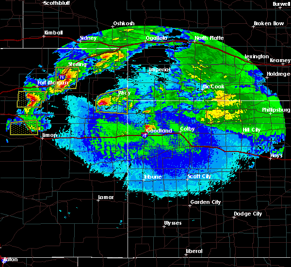 At 1204 am mdt, a severe thunderstorm was located 12 miles south of eckley, or 16 miles southwest of wray, moving east at 25 mph (radar indicated). Hazards include quarter size hail. damage to vehicles is expected At 1204 am mdt, a severe thunderstorm was located 12 miles south of eckley, or 16 miles southwest of wray, moving east at 25 mph (radar indicated). Hazards include quarter size hail. damage to vehicles is expected
|
| 5/3/2020 5:42 PM MDT |
 At 541 pm mdt, a severe thunderstorm was located near wray, moving east at 35 mph (radar indicated). Hazards include 60 mph wind gusts and quarter size hail. Hail damage to vehicles is expected. Expect wind damage to roofs, siding, and trees. At 541 pm mdt, a severe thunderstorm was located near wray, moving east at 35 mph (radar indicated). Hazards include 60 mph wind gusts and quarter size hail. Hail damage to vehicles is expected. Expect wind damage to roofs, siding, and trees.
|
| 5/3/2020 5:29 PM MDT |
 At 528 pm mdt, a severe thunderstorm was located 4 miles east of eckley, or 9 miles west of wray, moving northeast at 45 mph (radar indicated). Hazards include 60 mph wind gusts and quarter size hail. Hail damage to vehicles is expected. expect wind damage to roofs, siding, and trees. locations impacted include, wray, eckley and heartstrong. This includes highway 385 between mile markers 239 and 253. At 528 pm mdt, a severe thunderstorm was located 4 miles east of eckley, or 9 miles west of wray, moving northeast at 45 mph (radar indicated). Hazards include 60 mph wind gusts and quarter size hail. Hail damage to vehicles is expected. expect wind damage to roofs, siding, and trees. locations impacted include, wray, eckley and heartstrong. This includes highway 385 between mile markers 239 and 253.
|
| 5/3/2020 5:14 PM MDT |
 At 514 pm mdt, a severe thunderstorm was located 7 miles southwest of eckley, or 9 miles southeast of yuma, moving northeast at 45 mph (radar indicated). Hazards include 60 mph wind gusts and quarter size hail. Hail damage to vehicles is expected. Expect wind damage to roofs, siding, and trees. At 514 pm mdt, a severe thunderstorm was located 7 miles southwest of eckley, or 9 miles southeast of yuma, moving northeast at 45 mph (radar indicated). Hazards include 60 mph wind gusts and quarter size hail. Hail damage to vehicles is expected. Expect wind damage to roofs, siding, and trees.
|
| 8/16/2019 6:10 PM MDT |
 The severe thunderstorm warning for northwestern yuma county will expire at 615 pm mdt, the storm which prompted the warning has weakened below severe limits, and no longer poses an immediate threat to life or property. therefore, the warning will be allowed to expire. a severe thunderstorm watch remains in effect until 1000 pm mdt for northeastern colorado. The severe thunderstorm warning for northwestern yuma county will expire at 615 pm mdt, the storm which prompted the warning has weakened below severe limits, and no longer poses an immediate threat to life or property. therefore, the warning will be allowed to expire. a severe thunderstorm watch remains in effect until 1000 pm mdt for northeastern colorado.
|
| 8/16/2019 6:05 PM MDT |
 At 519 pm mdt, a severe thunderstorm was located 7 miles north of yuma, and is nearly stationary (trained weather spotters reported half dollar sized hail). Hazards include 60 mph wind gusts and half dollar size hail. Hail damage to vehicles is expected. expect wind damage to roofs, siding, and trees. locations impacted include, yuma, wray, eckley, clarkville and wauneta. This includes highway 385 between mile markers 239 and 269. At 519 pm mdt, a severe thunderstorm was located 7 miles north of yuma, and is nearly stationary (trained weather spotters reported half dollar sized hail). Hazards include 60 mph wind gusts and half dollar size hail. Hail damage to vehicles is expected. expect wind damage to roofs, siding, and trees. locations impacted include, yuma, wray, eckley, clarkville and wauneta. This includes highway 385 between mile markers 239 and 269.
|
| 8/16/2019 5:53 PM MDT |
 At 552 pm mdt, a severe thunderstorm was located 9 miles northeast of yuma, moving east at 25 mph (trained weather spotters reported half dollar sized hail). Hazards include 60 mph wind gusts and half dollar size hail. Hail damage to vehicles is expected. expect wind damage to roofs, siding, and trees. Locations impacted include, yuma, eckley and clarkville. At 552 pm mdt, a severe thunderstorm was located 9 miles northeast of yuma, moving east at 25 mph (trained weather spotters reported half dollar sized hail). Hazards include 60 mph wind gusts and half dollar size hail. Hail damage to vehicles is expected. expect wind damage to roofs, siding, and trees. Locations impacted include, yuma, eckley and clarkville.
|
| 8/16/2019 5:42 PM MDT |
 At 542 pm mdt, a severe thunderstorm was located 8 miles north of yuma, moving east at 25 mph (trained weather spotters reported dollar sized hail). Hazards include 60 mph wind gusts and half dollar size hail. Hail damage to vehicles is expected. expect wind damage to roofs, siding, and trees. Locations impacted include, yuma, eckley and clarkville. At 542 pm mdt, a severe thunderstorm was located 8 miles north of yuma, moving east at 25 mph (trained weather spotters reported dollar sized hail). Hazards include 60 mph wind gusts and half dollar size hail. Hail damage to vehicles is expected. expect wind damage to roofs, siding, and trees. Locations impacted include, yuma, eckley and clarkville.
|
| 8/16/2019 5:20 PM MDT |
 At 511 pm mdt, a severe thunderstorm was located 8 miles northwest of yuma, moving east at 25 mph (radar indicated). Hazards include 60 mph wind gusts and quarter size hail. Hail damage to vehicles is expected. Expect wind damage to roofs, siding, and trees. At 511 pm mdt, a severe thunderstorm was located 8 miles northwest of yuma, moving east at 25 mph (radar indicated). Hazards include 60 mph wind gusts and quarter size hail. Hail damage to vehicles is expected. Expect wind damage to roofs, siding, and trees.
|
| 8/16/2019 5:12 PM MDT |
 The national weather service in goodland has issued a * severe thunderstorm warning for. northern yuma county in northeastern colorado. until 615 pm mdt. At 511 pm mdt, a severe thunderstorm was located 8 miles northwest of yuma, moving east at 25 mph. The national weather service in goodland has issued a * severe thunderstorm warning for. northern yuma county in northeastern colorado. until 615 pm mdt. At 511 pm mdt, a severe thunderstorm was located 8 miles northwest of yuma, moving east at 25 mph.
|
| 8/11/2019 6:15 PM MDT | Occurred with quarter size hai in yuma county CO, 4.2 miles N of Eckley, CO |
| 8/11/2019 6:15 PM MDT | Quarter sized hail reported 4.2 miles N of Eckley, CO, hail ranged from nickel to quarter in size. |
| 7/29/2019 3:50 PM MDT |
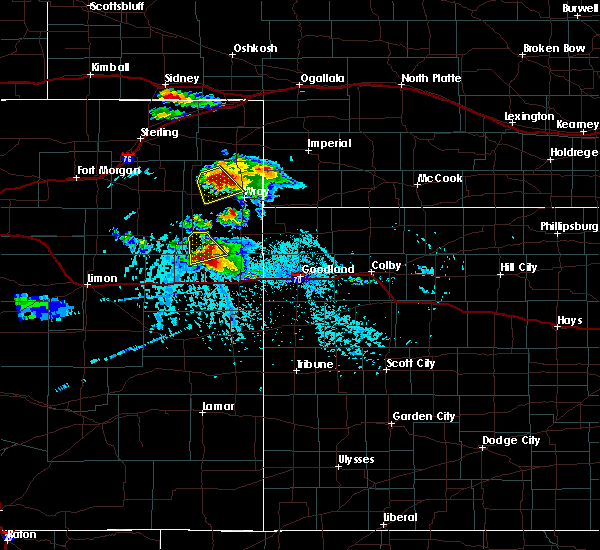 A severe thunderstorm warning remains in effect until 415 pm mdt for northwestern yuma county. at 348 pm mdt, a severe thunderstorm was located 9 miles north of eckley, or 14 miles northeast of yuma, moving southeast at 10 mph. hazard. 60 mph wind gusts and quarter size hail. source. Radar indicated. A severe thunderstorm warning remains in effect until 415 pm mdt for northwestern yuma county. at 348 pm mdt, a severe thunderstorm was located 9 miles north of eckley, or 14 miles northeast of yuma, moving southeast at 10 mph. hazard. 60 mph wind gusts and quarter size hail. source. Radar indicated.
|
| 7/29/2019 3:32 PM MDT |
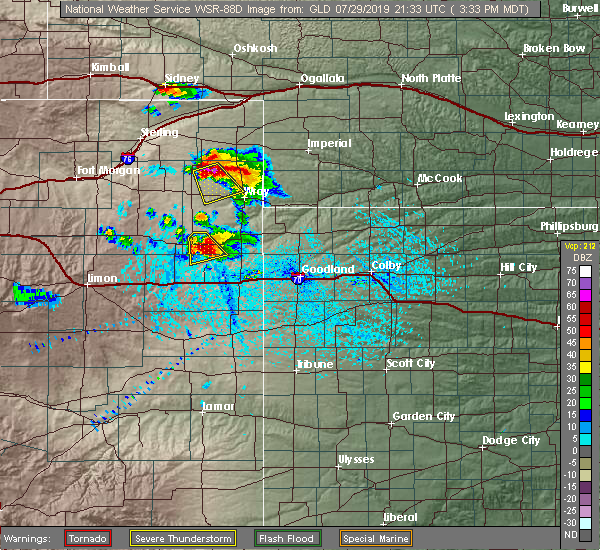 The national weather service in goodland has issued a * severe thunderstorm warning for. northwestern yuma county in northeastern colorado. until 415 pm mdt. At 331 pm mdt, a severe thunderstorm was located 14 miles north of eckley, or 16 miles northeast of yuma, moving southeast at 10 mph. The national weather service in goodland has issued a * severe thunderstorm warning for. northwestern yuma county in northeastern colorado. until 415 pm mdt. At 331 pm mdt, a severe thunderstorm was located 14 miles north of eckley, or 16 miles northeast of yuma, moving southeast at 10 mph.
|
| 6/20/2019 7:39 PM MDT |
 The severe thunderstorm warning for southwestern yuma county will expire at 745 pm mdt, the storms which prompted the warning have moved out of the area. therefore, the warning will be allowed to expire. a tornado watch remains in effect until 1000 pm mdt for northeastern colorado. remember, a severe thunderstorm warning still remains in effect for portions of yuma county. The severe thunderstorm warning for southwestern yuma county will expire at 745 pm mdt, the storms which prompted the warning have moved out of the area. therefore, the warning will be allowed to expire. a tornado watch remains in effect until 1000 pm mdt for northeastern colorado. remember, a severe thunderstorm warning still remains in effect for portions of yuma county.
|
| 6/20/2019 7:31 PM MDT |
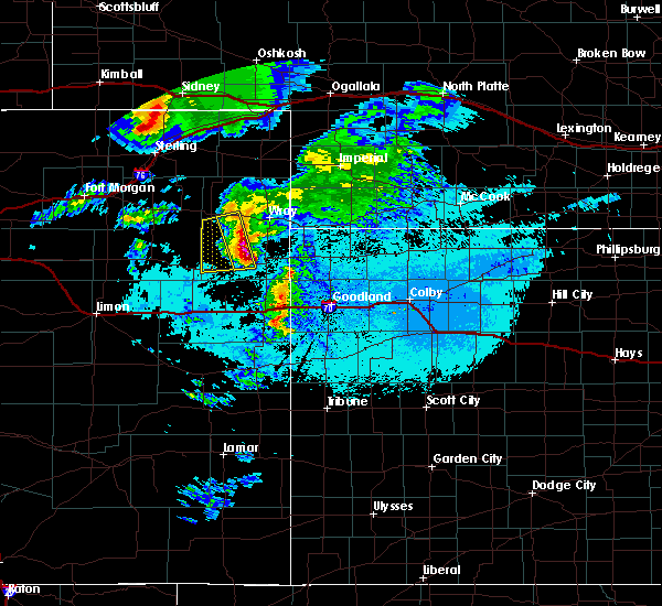 At 729 pm mdt, severe thunderstorms were located along a line extending from 4 miles southwest of yuma to 12 miles east of cope, moving east at 25 mph (law enforcement reported this storm producing golf ball size hail). Hazards include golf ball size hail and 60 mph wind gusts. People and animals outdoors will be injured. expect hail damage to roofs, siding, windows, and vehicles. expect wind damage to roofs, siding, and trees. locations impacted include, eckley and heartstrong. A tornado watch remains in effect until 1000 pm mdt for northeastern colorado. At 729 pm mdt, severe thunderstorms were located along a line extending from 4 miles southwest of yuma to 12 miles east of cope, moving east at 25 mph (law enforcement reported this storm producing golf ball size hail). Hazards include golf ball size hail and 60 mph wind gusts. People and animals outdoors will be injured. expect hail damage to roofs, siding, windows, and vehicles. expect wind damage to roofs, siding, and trees. locations impacted include, eckley and heartstrong. A tornado watch remains in effect until 1000 pm mdt for northeastern colorado.
|
| 6/20/2019 7:18 PM MDT |
 At 717 pm mdt, severe thunderstorms were located along a line extending from 6 miles southwest of yuma to 8 miles east of cope, moving east at 25 mph (law enforcement reported golf ball sized hail with this storm). Hazards include golf ball size hail and 60 mph wind gusts. People and animals outdoors will be injured. expect hail damage to roofs, siding, windows, and vehicles. Expect wind damage to roofs, siding, and trees. At 717 pm mdt, severe thunderstorms were located along a line extending from 6 miles southwest of yuma to 8 miles east of cope, moving east at 25 mph (law enforcement reported golf ball sized hail with this storm). Hazards include golf ball size hail and 60 mph wind gusts. People and animals outdoors will be injured. expect hail damage to roofs, siding, windows, and vehicles. Expect wind damage to roofs, siding, and trees.
|
| 6/20/2019 6:57 PM MDT |
 At 657 pm mdt, severe thunderstorms were located along a line extending from 6 miles south of otis to cope, moving east at 25 mph (radar indicated). Hazards include 60 mph wind gusts and quarter size hail. Hail damage to vehicles is expected. Expect wind damage to roofs, siding, and trees. At 657 pm mdt, severe thunderstorms were located along a line extending from 6 miles south of otis to cope, moving east at 25 mph (radar indicated). Hazards include 60 mph wind gusts and quarter size hail. Hail damage to vehicles is expected. Expect wind damage to roofs, siding, and trees.
|
| 5/27/2019 11:07 PM MDT |
 At 1107 pm mdt/1207 am cdt/, severe thunderstorms were located along a line extending from 10 miles northeast of eckley to 3 miles northeast of wray to 13 miles west of haigler, moving east at 30 mph (radar indicated). Hazards include two inch hail and 70 mph wind gusts. People and animals outdoors will be injured. expect hail damage to roofs, siding, windows, and vehicles. expect considerable tree damage. wind damage is also likely to mobile homes, roofs, and outbuildings. locations impacted include, wray, eckley, haigler, laird, alvin and wauneta. This includes highway 385 between mile markers 231 and 264. At 1107 pm mdt/1207 am cdt/, severe thunderstorms were located along a line extending from 10 miles northeast of eckley to 3 miles northeast of wray to 13 miles west of haigler, moving east at 30 mph (radar indicated). Hazards include two inch hail and 70 mph wind gusts. People and animals outdoors will be injured. expect hail damage to roofs, siding, windows, and vehicles. expect considerable tree damage. wind damage is also likely to mobile homes, roofs, and outbuildings. locations impacted include, wray, eckley, haigler, laird, alvin and wauneta. This includes highway 385 between mile markers 231 and 264.
|
| 5/27/2019 10:51 PM MDT |
 At 1051 pm mdt/1151 pm cdt/, severe thunderstorms were located along a line extending from 13 miles northeast of yuma to 7 miles southeast of eckley to 17 miles northwest of bonny reservoir, moving east at 35 mph (radar indicated). Hazards include two inch hail and 70 mph wind gusts. People and animals outdoors will be injured. expect hail damage to roofs, siding, windows, and vehicles. expect considerable tree damage. wind damage is also likely to mobile homes, roofs, and outbuildings. locations impacted include, wray, eckley, haigler, beecher island, heartstrong, alvin and wauneta. This includes highway 385 between mile markers 228 and 268. At 1051 pm mdt/1151 pm cdt/, severe thunderstorms were located along a line extending from 13 miles northeast of yuma to 7 miles southeast of eckley to 17 miles northwest of bonny reservoir, moving east at 35 mph (radar indicated). Hazards include two inch hail and 70 mph wind gusts. People and animals outdoors will be injured. expect hail damage to roofs, siding, windows, and vehicles. expect considerable tree damage. wind damage is also likely to mobile homes, roofs, and outbuildings. locations impacted include, wray, eckley, haigler, beecher island, heartstrong, alvin and wauneta. This includes highway 385 between mile markers 228 and 268.
|
| 5/27/2019 10:35 PM MDT |
 At 1035 pm mdt/1135 pm cdt/, severe thunderstorms were located along a line extending from 8 miles north of yuma to 8 miles south of eckley to 17 miles east of cope, moving east at 35 mph (radar indicated). Hazards include two inch hail and 70 mph wind gusts. People and animals outdoors will be injured. expect hail damage to roofs, siding, windows, and vehicles. expect considerable tree damage. Wind damage is also likely to mobile homes, roofs, and outbuildings. At 1035 pm mdt/1135 pm cdt/, severe thunderstorms were located along a line extending from 8 miles north of yuma to 8 miles south of eckley to 17 miles east of cope, moving east at 35 mph (radar indicated). Hazards include two inch hail and 70 mph wind gusts. People and animals outdoors will be injured. expect hail damage to roofs, siding, windows, and vehicles. expect considerable tree damage. Wind damage is also likely to mobile homes, roofs, and outbuildings.
|
| 5/27/2019 7:02 PM MDT |
 At 702 pm mdt, a severe thunderstorm was located 7 miles southeast of yuma, moving northeast at 25 mph (radar indicated). Hazards include 60 mph wind gusts and quarter size hail. Hail damage to vehicles is expected. expect wind damage to roofs, siding, and trees. Locations impacted include, yuma and eckley. At 702 pm mdt, a severe thunderstorm was located 7 miles southeast of yuma, moving northeast at 25 mph (radar indicated). Hazards include 60 mph wind gusts and quarter size hail. Hail damage to vehicles is expected. expect wind damage to roofs, siding, and trees. Locations impacted include, yuma and eckley.
|
| 5/27/2019 6:55 PM MDT |
 At 654 pm mdt, a severe thunderstorm was located 8 miles southeast of yuma, moving northeast at 25 mph (radar indicated). Hazards include 60 mph wind gusts and quarter to half dollar size hail. Hail damage to vehicles is expected. expect wind damage to roofs, siding, and trees. locations impacted include, yuma, wray, eckley and heartstrong. This includes highway 385 between mile markers 244 and 245. At 654 pm mdt, a severe thunderstorm was located 8 miles southeast of yuma, moving northeast at 25 mph (radar indicated). Hazards include 60 mph wind gusts and quarter to half dollar size hail. Hail damage to vehicles is expected. expect wind damage to roofs, siding, and trees. locations impacted include, yuma, wray, eckley and heartstrong. This includes highway 385 between mile markers 244 and 245.
|
| 5/27/2019 6:51 PM MDT |
 At 651 pm mdt, a severe thunderstorm was located 9 miles south of yuma, moving northeast at 20 mph (radar indicated). Hazards include 60 mph wind gusts and quarter size hail. Hail damage to vehicles is expected. expect wind damage to roofs, siding, and trees. locations impacted include, yuma, wray, eckley, heartstrong and abarr. This includes highway 385 between mile markers 244 and 245. At 651 pm mdt, a severe thunderstorm was located 9 miles south of yuma, moving northeast at 20 mph (radar indicated). Hazards include 60 mph wind gusts and quarter size hail. Hail damage to vehicles is expected. expect wind damage to roofs, siding, and trees. locations impacted include, yuma, wray, eckley, heartstrong and abarr. This includes highway 385 between mile markers 244 and 245.
|
| 5/27/2019 6:42 PM MDT |
 At 642 pm mdt, a severe thunderstorm was located 12 miles south of yuma, moving northeast at 25 mph (radar indicated). Hazards include 60 mph wind gusts and quarter size hail. Hail damage to vehicles is expected. Expect wind damage to roofs, siding, and trees. At 642 pm mdt, a severe thunderstorm was located 12 miles south of yuma, moving northeast at 25 mph (radar indicated). Hazards include 60 mph wind gusts and quarter size hail. Hail damage to vehicles is expected. Expect wind damage to roofs, siding, and trees.
|
| 4/16/2019 9:37 PM MDT |
 The severe thunderstorm warning for west central yuma county will expire at 945 pm mdt, the storm which prompted the warning has weakened below severe limits, and has exited the warned area. therefore, the warning will be allowed to expire. however, a severe thunderstorm warning still remains in effect for northwestern yuma county until 945 pm mdt. The severe thunderstorm warning for west central yuma county will expire at 945 pm mdt, the storm which prompted the warning has weakened below severe limits, and has exited the warned area. therefore, the warning will be allowed to expire. however, a severe thunderstorm warning still remains in effect for northwestern yuma county until 945 pm mdt.
|
| 4/16/2019 9:23 PM MDT |
 At 923 pm mdt, a severe thunderstorm was located 6 miles southwest of eckley, or 8 miles southeast of yuma, moving northeast at 25 mph (radar indicated). Hazards include 60 mph wind gusts and quarter size hail. Hail damage to vehicles is expected. expect wind damage to roofs, siding, and trees. Locations impacted include, yuma, eckley and heartstrong. At 923 pm mdt, a severe thunderstorm was located 6 miles southwest of eckley, or 8 miles southeast of yuma, moving northeast at 25 mph (radar indicated). Hazards include 60 mph wind gusts and quarter size hail. Hail damage to vehicles is expected. expect wind damage to roofs, siding, and trees. Locations impacted include, yuma, eckley and heartstrong.
|
| 4/16/2019 9:08 PM MDT |
 At 907 pm mdt, a severe thunderstorm was located 8 miles south of yuma, moving northeast at 25 mph (radar indicated). Hazards include 60 mph wind gusts and quarter size hail. Hail damage to vehicles is expected. Expect wind damage to roofs, siding, and trees. At 907 pm mdt, a severe thunderstorm was located 8 miles south of yuma, moving northeast at 25 mph (radar indicated). Hazards include 60 mph wind gusts and quarter size hail. Hail damage to vehicles is expected. Expect wind damage to roofs, siding, and trees.
|
| 8/7/2018 8:16 PM MDT |
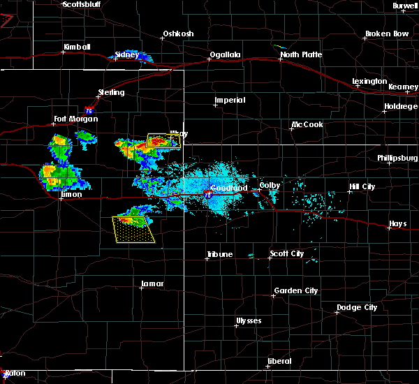 At 816 pm mdt, a severe thunderstorm was located 6 miles southeast of eckley, or 9 miles west of wray, moving east at 20 mph (trained weather spotters). Hazards include 60 mph wind gusts and quarter size hail. Hail damage to vehicles is expected. expect wind damage to roofs, siding, and trees. locations impacted include, wray and eckley. This includes highway 385 between mile markers 236 and 248. At 816 pm mdt, a severe thunderstorm was located 6 miles southeast of eckley, or 9 miles west of wray, moving east at 20 mph (trained weather spotters). Hazards include 60 mph wind gusts and quarter size hail. Hail damage to vehicles is expected. expect wind damage to roofs, siding, and trees. locations impacted include, wray and eckley. This includes highway 385 between mile markers 236 and 248.
|
| 8/7/2018 8:06 PM MDT |
 At 805 pm mdt, a severe thunderstorm was located near eckley, or 11 miles west of wray, moving east at 25 mph (trained weather spotters). Hazards include 60 mph wind gusts and half dollar size hail. Hail damage to vehicles is expected. expect wind damage to roofs, siding, and trees. locations impacted include, wray, eckley and wauneta. This includes highway 385 between mile markers 236 and 261. At 805 pm mdt, a severe thunderstorm was located near eckley, or 11 miles west of wray, moving east at 25 mph (trained weather spotters). Hazards include 60 mph wind gusts and half dollar size hail. Hail damage to vehicles is expected. expect wind damage to roofs, siding, and trees. locations impacted include, wray, eckley and wauneta. This includes highway 385 between mile markers 236 and 261.
|
| 8/7/2018 7:59 PM MDT | Half Dollar sized hail reported 0.9 miles NNW of Eckley, CO |
| 8/7/2018 7:47 PM MDT |
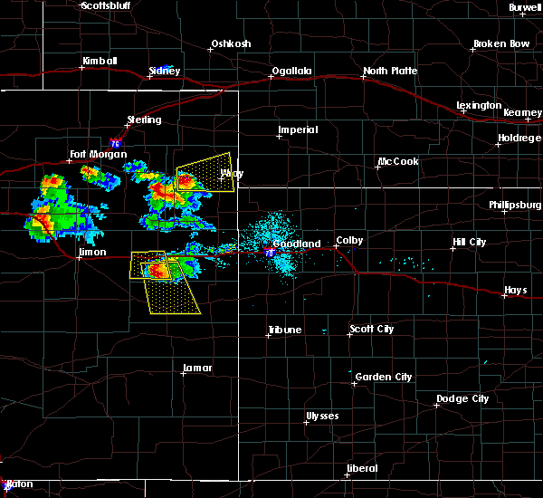 At 747 pm mdt, a severe thunderstorm was located 5 miles west of eckley, or 8 miles east of yuma, moving east at 25 mph (radar indicated). Hazards include 60 mph wind gusts and quarter size hail. Hail damage to vehicles is expected. Expect wind damage to roofs, siding, and trees. At 747 pm mdt, a severe thunderstorm was located 5 miles west of eckley, or 8 miles east of yuma, moving east at 25 mph (radar indicated). Hazards include 60 mph wind gusts and quarter size hail. Hail damage to vehicles is expected. Expect wind damage to roofs, siding, and trees.
|
| 7/28/2018 7:26 PM MDT |
 At 725 pm mdt/825 pm cdt/, a severe thunderstorm was located over eckley, or 10 miles east of yuma, moving southeast at 15 mph (radar indicated). Hazards include 70 mph wind gusts and ping pong ball size hail. People and animals outdoors will be injured. expect hail damage to roofs, siding, windows, and vehicles. expect considerable tree damage. Wind damage is also likely to mobile homes, roofs, and outbuildings. At 725 pm mdt/825 pm cdt/, a severe thunderstorm was located over eckley, or 10 miles east of yuma, moving southeast at 15 mph (radar indicated). Hazards include 70 mph wind gusts and ping pong ball size hail. People and animals outdoors will be injured. expect hail damage to roofs, siding, windows, and vehicles. expect considerable tree damage. Wind damage is also likely to mobile homes, roofs, and outbuildings.
|
| 7/28/2018 7:15 PM MDT | Quarter sized hail reported 0.1 miles NE of Eckley, CO, report of dime to quarter sized hail near eckley... co by a trained spotter. time estimated by radar. |
| 7/28/2018 6:49 PM MDT |
 At 649 pm mdt, a severe thunderstorm was located near eckley, or 9 miles east of yuma, moving southeast at 40 mph (radar indicated). Hazards include 70 mph wind gusts and quarter size hail. Hail damage to vehicles is expected. expect considerable tree damage. Wind damage is also likely to mobile homes, roofs, and outbuildings. At 649 pm mdt, a severe thunderstorm was located near eckley, or 9 miles east of yuma, moving southeast at 40 mph (radar indicated). Hazards include 70 mph wind gusts and quarter size hail. Hail damage to vehicles is expected. expect considerable tree damage. Wind damage is also likely to mobile homes, roofs, and outbuildings.
|
| 7/26/2018 4:40 PM MDT |
 At 439 pm mdt/539 pm cdt/, severe thunderstorms were located along a line extending from 15 miles north of haigler to 4 miles east of eckley, moving southeast at 15 mph. these are very dangerous storms (radar indicated). Hazards include 80 mph wind gusts and ping pong ball size hail. Flying debris will be dangerous to those caught without shelter. mobile homes will be heavily damaged. expect considerable damage to roofs, windows, and vehicles. Extensive tree damage and power outages are likely. At 439 pm mdt/539 pm cdt/, severe thunderstorms were located along a line extending from 15 miles north of haigler to 4 miles east of eckley, moving southeast at 15 mph. these are very dangerous storms (radar indicated). Hazards include 80 mph wind gusts and ping pong ball size hail. Flying debris will be dangerous to those caught without shelter. mobile homes will be heavily damaged. expect considerable damage to roofs, windows, and vehicles. Extensive tree damage and power outages are likely.
|
| 7/26/2018 4:24 PM MDT |
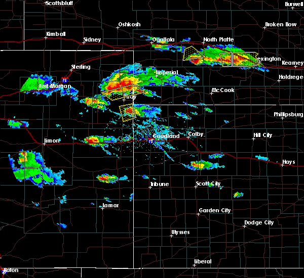 At 424 pm mdt, severe thunderstorms were located along a line extending from 16 miles south of lamar to 7 miles north of eckley, moving southeast at 10 mph (radar indicated). Hazards include 70 mph wind gusts and ping pong ball size hail. People and animals outdoors will be injured. expect hail damage to roofs, siding, windows, and vehicles. expect considerable tree damage. Wind damage is also likely to mobile homes, roofs, and outbuildings. At 424 pm mdt, severe thunderstorms were located along a line extending from 16 miles south of lamar to 7 miles north of eckley, moving southeast at 10 mph (radar indicated). Hazards include 70 mph wind gusts and ping pong ball size hail. People and animals outdoors will be injured. expect hail damage to roofs, siding, windows, and vehicles. expect considerable tree damage. Wind damage is also likely to mobile homes, roofs, and outbuildings.
|
| 6/30/2018 5:36 PM MDT |
 At 536 pm mdt, severe thunderstorms were located along a line extending from near yuma to 9 miles northeast of cope, moving east at 15 mph (radar indicated). Hazards include 60 mph wind gusts and nickel size hail. Expect damage to roofs, siding, and trees. locations impacted include, yuma, eckley, abarr, heartstrong and vernon. This includes highway 385 between mile markers 221 and 238. At 536 pm mdt, severe thunderstorms were located along a line extending from near yuma to 9 miles northeast of cope, moving east at 15 mph (radar indicated). Hazards include 60 mph wind gusts and nickel size hail. Expect damage to roofs, siding, and trees. locations impacted include, yuma, eckley, abarr, heartstrong and vernon. This includes highway 385 between mile markers 221 and 238.
|
| 6/30/2018 5:11 PM MDT |
 At 511 pm mdt, a severe thunderstorm was located 14 miles south of yuma, moving east at 30 mph (radar indicated). Hazards include 60 mph wind gusts and quarter size hail. Hail damage to vehicles is expected. Expect wind damage to roofs, siding, and trees. At 511 pm mdt, a severe thunderstorm was located 14 miles south of yuma, moving east at 30 mph (radar indicated). Hazards include 60 mph wind gusts and quarter size hail. Hail damage to vehicles is expected. Expect wind damage to roofs, siding, and trees.
|
| 6/22/2018 1:05 PM MDT |
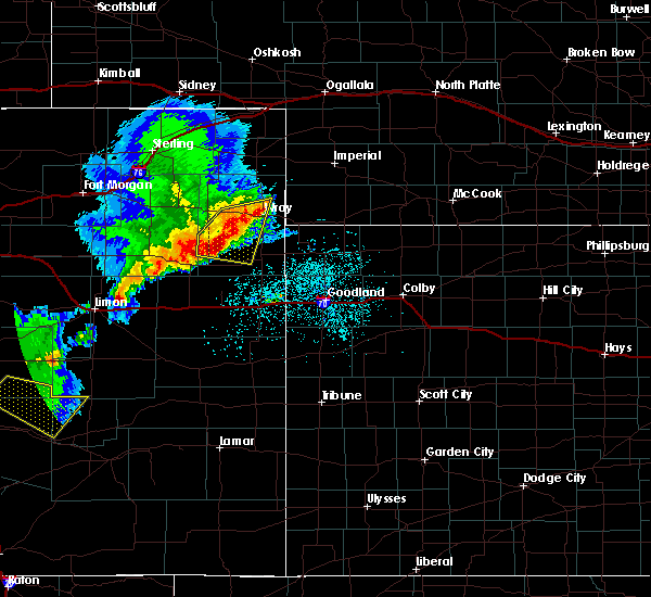 At 105 pm mdt, severe thunderstorms were located along a line extending from near eckley to 18 miles southeast of yuma to 10 miles northeast of cope, moving east at 25 mph (radar indicated). Hazards include 60 mph wind gusts and quarter size hail. Hail damage to vehicles is expected. expect wind damage to roofs, siding, and trees. locations impacted include, wray, eckley, abarr, heartstrong and vernon. This includes highway 385 between mile markers 236 and 238, and between mile markers 240 and 253. At 105 pm mdt, severe thunderstorms were located along a line extending from near eckley to 18 miles southeast of yuma to 10 miles northeast of cope, moving east at 25 mph (radar indicated). Hazards include 60 mph wind gusts and quarter size hail. Hail damage to vehicles is expected. expect wind damage to roofs, siding, and trees. locations impacted include, wray, eckley, abarr, heartstrong and vernon. This includes highway 385 between mile markers 236 and 238, and between mile markers 240 and 253.
|
| 6/22/2018 12:52 PM MDT |
 At 1252 pm mdt, severe thunderstorms were located along a line extending from 6 miles west of eckley to 16 miles south of yuma, moving east at 30 mph (radar indicated). Hazards include 60 mph wind gusts and quarter size hail. Hail damage to vehicles is expected. expect wind damage to roofs, siding, and trees. locations impacted include, yuma, wray, eckley, abarr, heartstrong and vernon. This includes highway 385 between mile markers 236 and 238, and between mile markers 240 and 254. At 1252 pm mdt, severe thunderstorms were located along a line extending from 6 miles west of eckley to 16 miles south of yuma, moving east at 30 mph (radar indicated). Hazards include 60 mph wind gusts and quarter size hail. Hail damage to vehicles is expected. expect wind damage to roofs, siding, and trees. locations impacted include, yuma, wray, eckley, abarr, heartstrong and vernon. This includes highway 385 between mile markers 236 and 238, and between mile markers 240 and 254.
|
| 6/22/2018 12:36 PM MDT |
 At 1235 pm mdt, severe thunderstorms were located along a line extending from near yuma to 15 miles north of cope, moving east at 25 mph (radar indicated). Hazards include 60 mph wind gusts and quarter size hail. Hail damage to vehicles is expected. Expect wind damage to roofs, siding, and trees. At 1235 pm mdt, severe thunderstorms were located along a line extending from near yuma to 15 miles north of cope, moving east at 25 mph (radar indicated). Hazards include 60 mph wind gusts and quarter size hail. Hail damage to vehicles is expected. Expect wind damage to roofs, siding, and trees.
|
| 6/19/2018 5:27 PM MDT |
 At 527 pm mdt, severe thunderstorms were located along a line extending from 15 miles south of wray to 9 miles northwest of bethune, moving southeast at 50 mph. these are very dangerous storms (radar indicated). Hazards include 80 mph wind gusts and two inch hail. Flying debris will be dangerous to those caught without shelter. mobile homes will be heavily damaged. expect considerable damage to roofs, windows, and vehicles. extensive tree damage and power outages are likely. locations impacted include, burlington, wray, bonny reservoir, eckley, joes, hale and abarr. this includes the following highways, interstate 70 in colorado between mile markers 434 and 449. highway 385 between mile markers 185 and 242. A tornado watch remains in effect until 700 pm mdt for northeastern and east central colorado. At 527 pm mdt, severe thunderstorms were located along a line extending from 15 miles south of wray to 9 miles northwest of bethune, moving southeast at 50 mph. these are very dangerous storms (radar indicated). Hazards include 80 mph wind gusts and two inch hail. Flying debris will be dangerous to those caught without shelter. mobile homes will be heavily damaged. expect considerable damage to roofs, windows, and vehicles. extensive tree damage and power outages are likely. locations impacted include, burlington, wray, bonny reservoir, eckley, joes, hale and abarr. this includes the following highways, interstate 70 in colorado between mile markers 434 and 449. highway 385 between mile markers 185 and 242. A tornado watch remains in effect until 700 pm mdt for northeastern and east central colorado.
|
| 6/19/2018 5:09 PM MDT |
 At 509 pm mdt, severe thunderstorms were located along a line extending from 13 miles south of eckley to 12 miles north of vona, moving east at 50 mph (radar indicated). Hazards include two inch hail and 70 mph wind gusts. People and animals outdoors will be injured. expect hail damage to roofs, siding, windows, and vehicles. expect considerable tree damage. Wind damage is also likely to mobile homes, roofs, and outbuildings. At 509 pm mdt, severe thunderstorms were located along a line extending from 13 miles south of eckley to 12 miles north of vona, moving east at 50 mph (radar indicated). Hazards include two inch hail and 70 mph wind gusts. People and animals outdoors will be injured. expect hail damage to roofs, siding, windows, and vehicles. expect considerable tree damage. Wind damage is also likely to mobile homes, roofs, and outbuildings.
|
| 6/17/2018 6:24 PM MDT |
 The severe thunderstorm warning for northwestern yuma county will expire at 630 pm mdt, the storm which prompted the warning has weakened below severe limits, and no longer poses an immediate threat to life or property. therefore, the warning will be allowed to expire. a tornado watch remains in effect until 900 pm mdt for northeastern colorado. The severe thunderstorm warning for northwestern yuma county will expire at 630 pm mdt, the storm which prompted the warning has weakened below severe limits, and no longer poses an immediate threat to life or property. therefore, the warning will be allowed to expire. a tornado watch remains in effect until 900 pm mdt for northeastern colorado.
|
| 6/17/2018 6:08 PM MDT |
 At 607 pm mdt, a severe thunderstorm was located 5 miles east of yuma, moving northeast at 30 mph (radar indicated). Hazards include 60 mph wind gusts and quarter size hail. Hail damage to vehicles is expected. expect wind damage to roofs, siding, and trees. locations impacted include, yuma and eckley. A tornado watch remains in effect until 900 pm mdt for northeastern colorado. At 607 pm mdt, a severe thunderstorm was located 5 miles east of yuma, moving northeast at 30 mph (radar indicated). Hazards include 60 mph wind gusts and quarter size hail. Hail damage to vehicles is expected. expect wind damage to roofs, siding, and trees. locations impacted include, yuma and eckley. A tornado watch remains in effect until 900 pm mdt for northeastern colorado.
|
| 6/17/2018 5:41 PM MDT |
 At 541 pm mdt, a severe thunderstorm was located 9 miles southwest of yuma, moving northeast at 30 mph (radar indicated). Hazards include 60 mph wind gusts and half dollar size hail. Hail damage to vehicles is expected. Expect wind damage to roofs, siding, and trees. At 541 pm mdt, a severe thunderstorm was located 9 miles southwest of yuma, moving northeast at 30 mph (radar indicated). Hazards include 60 mph wind gusts and half dollar size hail. Hail damage to vehicles is expected. Expect wind damage to roofs, siding, and trees.
|
| 6/6/2018 10:32 PM MDT |
 At 1031 pm mdt, a severe thunderstorm was located over yuma, moving northeast at 5 mph (radar indicated). Hazards include half dollar size hail. Damage to vehicles is expected. Locations impacted include, yuma and eckley. At 1031 pm mdt, a severe thunderstorm was located over yuma, moving northeast at 5 mph (radar indicated). Hazards include half dollar size hail. Damage to vehicles is expected. Locations impacted include, yuma and eckley.
|
| 6/6/2018 10:09 PM MDT |
 At 1008 pm mdt, a severe thunderstorm was located 11 miles north of eckley, or 16 miles northeast of yuma, moving northeast at 20 mph (radar indicated). Hazards include 60 mph wind gusts and half dollar size hail. Hail damage to vehicles is expected. Expect wind damage to roofs, siding, and trees. At 1008 pm mdt, a severe thunderstorm was located 11 miles north of eckley, or 16 miles northeast of yuma, moving northeast at 20 mph (radar indicated). Hazards include 60 mph wind gusts and half dollar size hail. Hail damage to vehicles is expected. Expect wind damage to roofs, siding, and trees.
|
| 6/6/2018 9:55 PM MDT |
 At 953 pm mdt, severe thunderstorms were located along a line extending from 9 miles north of eckley to yuma, and are nearly stationary (radar indicated). Hazards include two inch hail and 60 mph wind gusts. People and animals outdoors will be injured. expect hail damage to roofs, siding, windows, and vehicles. expect wind damage to roofs, siding, and trees. Locations impacted include, yuma and eckley. At 953 pm mdt, severe thunderstorms were located along a line extending from 9 miles north of eckley to yuma, and are nearly stationary (radar indicated). Hazards include two inch hail and 60 mph wind gusts. People and animals outdoors will be injured. expect hail damage to roofs, siding, windows, and vehicles. expect wind damage to roofs, siding, and trees. Locations impacted include, yuma and eckley.
|
| 6/6/2018 9:27 PM MDT |
 At 927 pm mdt, severe thunderstorms were located along a line extending from 17 miles south of lamar to 3 miles southwest of yuma, moving south at 8 mph (radar indicated). Hazards include two inch hail and 70 mph wind gusts. People and animals outdoors will be injured. expect hail damage to roofs, siding, windows, and vehicles. expect considerable tree damage. Wind damage is also likely to mobile homes, roofs, and outbuildings. At 927 pm mdt, severe thunderstorms were located along a line extending from 17 miles south of lamar to 3 miles southwest of yuma, moving south at 8 mph (radar indicated). Hazards include two inch hail and 70 mph wind gusts. People and animals outdoors will be injured. expect hail damage to roofs, siding, windows, and vehicles. expect considerable tree damage. Wind damage is also likely to mobile homes, roofs, and outbuildings.
|
| 6/6/2018 9:04 PM MDT |
 At 903 pm mdt, a severe thunderstorm was located 13 miles north of haigler, or 13 miles northeast of wray, moving east at 35 mph (radar indicated). Hazards include golf ball size hail and 70 mph wind gusts. People and animals outdoors will be injured. expect hail damage to roofs, siding, windows, and vehicles. expect considerable tree damage. wind damage is also likely to mobile homes, roofs, and outbuildings. locations impacted include, yuma, wray, eckley, abarr, heartstrong, alvin and clarkville. This includes highway 385 between mile markers 236 and 269. At 903 pm mdt, a severe thunderstorm was located 13 miles north of haigler, or 13 miles northeast of wray, moving east at 35 mph (radar indicated). Hazards include golf ball size hail and 70 mph wind gusts. People and animals outdoors will be injured. expect hail damage to roofs, siding, windows, and vehicles. expect considerable tree damage. wind damage is also likely to mobile homes, roofs, and outbuildings. locations impacted include, yuma, wray, eckley, abarr, heartstrong, alvin and clarkville. This includes highway 385 between mile markers 236 and 269.
|
| 6/6/2018 9:04 PM MDT |
 At 841 pm mdt, a severe thunderstorm was located 10 miles northwest of wray, moving east at 40 mph (radar indicated). Hazards include 70 mph wind gusts and half dollar size hail. Hail damage to vehicles is expected. expect considerable tree damage. Wind damage is also likely to mobile homes, roofs, and outbuildings. At 841 pm mdt, a severe thunderstorm was located 10 miles northwest of wray, moving east at 40 mph (radar indicated). Hazards include 70 mph wind gusts and half dollar size hail. Hail damage to vehicles is expected. expect considerable tree damage. Wind damage is also likely to mobile homes, roofs, and outbuildings.
|
| 6/6/2018 8:42 PM MDT |
 At 841 pm mdt, a severe thunderstorm was located 10 miles northwest of wray, moving east at 40 mph (radar indicated). Hazards include 70 mph wind gusts and half dollar size hail. Hail damage to vehicles is expected. expect considerable tree damage. Wind damage is also likely to mobile homes, roofs, and outbuildings. At 841 pm mdt, a severe thunderstorm was located 10 miles northwest of wray, moving east at 40 mph (radar indicated). Hazards include 70 mph wind gusts and half dollar size hail. Hail damage to vehicles is expected. expect considerable tree damage. Wind damage is also likely to mobile homes, roofs, and outbuildings.
|
| 5/28/2018 7:39 PM MDT |
 The severe thunderstorm warning for eastern yuma county in northeastern colorado, western cheyenne county in northwestern kansas and western dundy counties in southwestern nebraska will expire at 745 pm mdt/845 pm cdt/, the storms which prompted the warning have weakened below severe limits, and no longer pose an immediate threat to life or property. therefore the warning will be allowed to expire. however small hail and heavy rain are still possible with these thunderstorms. a tornado watch remains in effect until 900 pm mdt/1000 pm cdt/ for northeastern and east central colorado, northwestern kansas, and southwestern nebraska. to report severe weather, contact your nearest law enforcement agency. they will relay your report to the national weather service goodland. The severe thunderstorm warning for eastern yuma county in northeastern colorado, western cheyenne county in northwestern kansas and western dundy counties in southwestern nebraska will expire at 745 pm mdt/845 pm cdt/, the storms which prompted the warning have weakened below severe limits, and no longer pose an immediate threat to life or property. therefore the warning will be allowed to expire. however small hail and heavy rain are still possible with these thunderstorms. a tornado watch remains in effect until 900 pm mdt/1000 pm cdt/ for northeastern and east central colorado, northwestern kansas, and southwestern nebraska. to report severe weather, contact your nearest law enforcement agency. they will relay your report to the national weather service goodland.
|
| 5/28/2018 7:02 PM MDT |
 At 702 pm mdt/802 pm cdt/, severe thunderstorms were located along a line extending from near wray to 7 miles west of bonny reservoir, moving northeast at 40 mph (radar indicated). Hazards include golf ball size hail and 70 mph wind gusts. People and animals outdoors will be injured. expect hail damage to roofs, siding, windows, and vehicles. expect considerable tree damage. wind damage is also likely to mobile homes, roofs, and outbuildings. locations impacted include, wray, st. francis, bonny reservoir, eckley, haigler, hale and beecher island. this includes highway 385 between mile markers 208 and 210, and between mile markers 212 and 256. A tornado watch remains in effect until 900 pm mdt/1000 pm cdt/ for northeastern and east central colorado, northwestern kansas, and southwestern nebraska. At 702 pm mdt/802 pm cdt/, severe thunderstorms were located along a line extending from near wray to 7 miles west of bonny reservoir, moving northeast at 40 mph (radar indicated). Hazards include golf ball size hail and 70 mph wind gusts. People and animals outdoors will be injured. expect hail damage to roofs, siding, windows, and vehicles. expect considerable tree damage. wind damage is also likely to mobile homes, roofs, and outbuildings. locations impacted include, wray, st. francis, bonny reservoir, eckley, haigler, hale and beecher island. this includes highway 385 between mile markers 208 and 210, and between mile markers 212 and 256. A tornado watch remains in effect until 900 pm mdt/1000 pm cdt/ for northeastern and east central colorado, northwestern kansas, and southwestern nebraska.
|
| 5/28/2018 7:02 PM MDT |
 At 658 pm mdt/758 pm cdt/, severe thunderstorms were located along a line extending from near wray to 8 miles west of bonny reservoir, moving northeast at 40 mph (radar indicated). Hazards include 70 mph wind gusts and ping pong ball size hail. People and animals outdoors will be injured. expect hail damage to roofs, siding, windows, and vehicles. expect considerable tree damage. Wind damage is also likely to mobile homes, roofs, and outbuildings. At 658 pm mdt/758 pm cdt/, severe thunderstorms were located along a line extending from near wray to 8 miles west of bonny reservoir, moving northeast at 40 mph (radar indicated). Hazards include 70 mph wind gusts and ping pong ball size hail. People and animals outdoors will be injured. expect hail damage to roofs, siding, windows, and vehicles. expect considerable tree damage. Wind damage is also likely to mobile homes, roofs, and outbuildings.
|
| 5/28/2018 7:02 PM MDT |
 At 702 pm mdt/802 pm cdt/, severe thunderstorms were located along a line extending from near wray to 7 miles west of bonny reservoir, moving northeast at 40 mph (radar indicated). Hazards include golf ball size hail and 70 mph wind gusts. People and animals outdoors will be injured. expect hail damage to roofs, siding, windows, and vehicles. expect considerable tree damage. wind damage is also likely to mobile homes, roofs, and outbuildings. locations impacted include, wray, st. francis, bonny reservoir, eckley, haigler, hale and beecher island. this includes highway 385 between mile markers 208 and 210, and between mile markers 212 and 256. A tornado watch remains in effect until 900 pm mdt/1000 pm cdt/ for northeastern and east central colorado, northwestern kansas, and southwestern nebraska. At 702 pm mdt/802 pm cdt/, severe thunderstorms were located along a line extending from near wray to 7 miles west of bonny reservoir, moving northeast at 40 mph (radar indicated). Hazards include golf ball size hail and 70 mph wind gusts. People and animals outdoors will be injured. expect hail damage to roofs, siding, windows, and vehicles. expect considerable tree damage. wind damage is also likely to mobile homes, roofs, and outbuildings. locations impacted include, wray, st. francis, bonny reservoir, eckley, haigler, hale and beecher island. this includes highway 385 between mile markers 208 and 210, and between mile markers 212 and 256. A tornado watch remains in effect until 900 pm mdt/1000 pm cdt/ for northeastern and east central colorado, northwestern kansas, and southwestern nebraska.
|
| 5/28/2018 5:52 PM MDT |
 At 552 pm mdt, a severe thunderstorm was located 5 miles east of yuma, moving northeast at 25 mph (radar indicated). Hazards include 70 mph wind gusts and half dollar size hail. Hail damage to vehicles is expected. expect considerable tree damage. Wind damage is also likely to mobile homes, roofs, and outbuildings. At 552 pm mdt, a severe thunderstorm was located 5 miles east of yuma, moving northeast at 25 mph (radar indicated). Hazards include 70 mph wind gusts and half dollar size hail. Hail damage to vehicles is expected. expect considerable tree damage. Wind damage is also likely to mobile homes, roofs, and outbuildings.
|
| 5/1/2018 6:12 PM MDT |
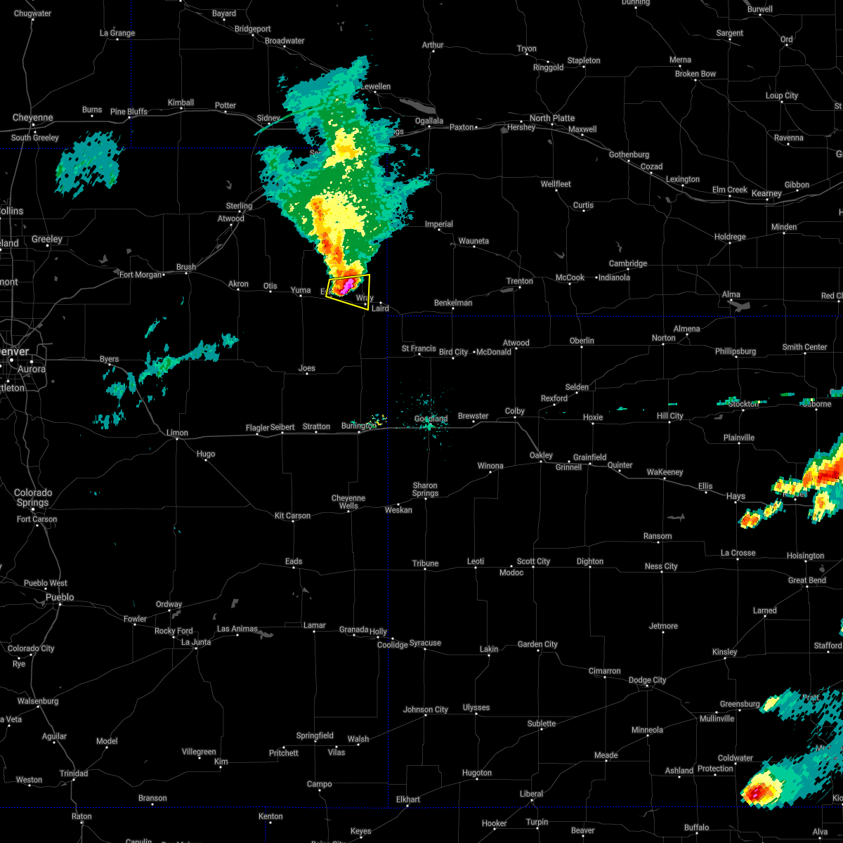 The severe thunderstorm warning for east central yuma county will expire at 615 pm mdt, the storm which prompted the warning has weakened below severe limits, and no longer poses an immediate threat to life or property. therefore the warning will be allowed to expire. however small hail and gusty winds are still possible with this thunderstorm. The severe thunderstorm warning for east central yuma county will expire at 615 pm mdt, the storm which prompted the warning has weakened below severe limits, and no longer poses an immediate threat to life or property. therefore the warning will be allowed to expire. however small hail and gusty winds are still possible with this thunderstorm.
|
| 5/1/2018 6:09 PM MDT |
 At 609 pm mdt, a severe thunderstorm was located 7 miles northwest of wray, moving east at 45 mph (radar indicated). Hazards include 60 mph wind gusts and quarter size hail. Hail damage to vehicles is expected. expect wind damage to roofs, siding, and trees. locations impacted include, wray and eckley. This includes highway 385 between mile markers 242 and 255. At 609 pm mdt, a severe thunderstorm was located 7 miles northwest of wray, moving east at 45 mph (radar indicated). Hazards include 60 mph wind gusts and quarter size hail. Hail damage to vehicles is expected. expect wind damage to roofs, siding, and trees. locations impacted include, wray and eckley. This includes highway 385 between mile markers 242 and 255.
|
| 5/1/2018 6:00 PM MDT |
 At 600 pm mdt, a severe thunderstorm was located near eckley, or 12 miles northwest of wray, moving east at 45 mph (radar indicated). Hazards include 60 mph wind gusts and quarter size hail. Hail damage to vehicles is expected. expect wind damage to roofs, siding, and trees. locations impacted include, wray and eckley. This includes highway 385 between mile markers 238 and 255. At 600 pm mdt, a severe thunderstorm was located near eckley, or 12 miles northwest of wray, moving east at 45 mph (radar indicated). Hazards include 60 mph wind gusts and quarter size hail. Hail damage to vehicles is expected. expect wind damage to roofs, siding, and trees. locations impacted include, wray and eckley. This includes highway 385 between mile markers 238 and 255.
|
| 5/1/2018 5:50 PM MDT |
 At 550 pm mdt, a severe thunderstorm was located 4 miles northwest of eckley, or 9 miles east of yuma, moving east at 40 mph (radar indicated). Hazards include 60 mph wind gusts and quarter size hail. Hail damage to vehicles is expected. expect wind damage to roofs, siding, and trees. locations impacted include, yuma, wray and eckley. This includes highway 385 between mile markers 238 and 255. At 550 pm mdt, a severe thunderstorm was located 4 miles northwest of eckley, or 9 miles east of yuma, moving east at 40 mph (radar indicated). Hazards include 60 mph wind gusts and quarter size hail. Hail damage to vehicles is expected. expect wind damage to roofs, siding, and trees. locations impacted include, yuma, wray and eckley. This includes highway 385 between mile markers 238 and 255.
|
| 5/1/2018 5:40 PM MDT |
 At 540 pm mdt, a severe thunderstorm was located over yuma, moving east at 30 mph (radar indicated). Hazards include 60 mph wind gusts and half dollar size hail. Hail damage to vehicles is expected. expect wind damage to roofs, siding, and trees. locations impacted include, yuma, wray and eckley. This includes highway 385 between mile markers 237 and 255. At 540 pm mdt, a severe thunderstorm was located over yuma, moving east at 30 mph (radar indicated). Hazards include 60 mph wind gusts and half dollar size hail. Hail damage to vehicles is expected. expect wind damage to roofs, siding, and trees. locations impacted include, yuma, wray and eckley. This includes highway 385 between mile markers 237 and 255.
|
| 5/1/2018 5:31 PM MDT |
 At 531 pm mdt, a severe thunderstorm was located near yuma, moving east at 35 mph (radar indicated). Hazards include 60 mph wind gusts and half dollar size hail. Hail damage to vehicles is expected. expect wind damage to roofs, siding, and trees. locations impacted include, yuma, wray and eckley. This includes highway 385 between mile markers 237 and 255. At 531 pm mdt, a severe thunderstorm was located near yuma, moving east at 35 mph (radar indicated). Hazards include 60 mph wind gusts and half dollar size hail. Hail damage to vehicles is expected. expect wind damage to roofs, siding, and trees. locations impacted include, yuma, wray and eckley. This includes highway 385 between mile markers 237 and 255.
|
| 5/1/2018 5:25 PM MDT |
 At 525 pm mdt, a severe thunderstorm was located 6 miles west of yuma, moving east at 35 mph (radar indicated). Hazards include 60 mph wind gusts and half dollar size hail. Hail damage to vehicles is expected. Expect wind damage to roofs, siding, and trees. At 525 pm mdt, a severe thunderstorm was located 6 miles west of yuma, moving east at 35 mph (radar indicated). Hazards include 60 mph wind gusts and half dollar size hail. Hail damage to vehicles is expected. Expect wind damage to roofs, siding, and trees.
|
| 10/2/2017 7:27 PM MDT |
 At 726 pm mdt, a severe thunderstorm was located 5 miles northwest of eckley, or 11 miles east of yuma, moving northeast at 55 mph (radar indicated). Hazards include quarter size hail. Damage to vehicles is expected. locations impacted include, eckley and wauneta. This includes highway 385 between mile markers 257 and 269. At 726 pm mdt, a severe thunderstorm was located 5 miles northwest of eckley, or 11 miles east of yuma, moving northeast at 55 mph (radar indicated). Hazards include quarter size hail. Damage to vehicles is expected. locations impacted include, eckley and wauneta. This includes highway 385 between mile markers 257 and 269.
|
| 10/2/2017 7:15 PM MDT |
 At 715 pm mdt, a severe thunderstorm was located near yuma, moving northeast at 55 mph (radar indicated). Hazards include quarter size hail. damage to vehicles is expected At 715 pm mdt, a severe thunderstorm was located near yuma, moving northeast at 55 mph (radar indicated). Hazards include quarter size hail. damage to vehicles is expected
|
| 7/18/2017 5:15 PM MDT |
 At 514 pm mdt, a severe thunderstorm was located 5 miles south of yuma, and is nearly stationary (emergency management. at 505 mdt, quarter size hail was reported in yuma). Hazards include 60 mph wind gusts and quarter size hail. Hail damage to vehicles is expected. expect wind damage to roofs, siding, and trees. Locations impacted include, yuma and eckley. At 514 pm mdt, a severe thunderstorm was located 5 miles south of yuma, and is nearly stationary (emergency management. at 505 mdt, quarter size hail was reported in yuma). Hazards include 60 mph wind gusts and quarter size hail. Hail damage to vehicles is expected. expect wind damage to roofs, siding, and trees. Locations impacted include, yuma and eckley.
|
| 7/18/2017 4:48 PM MDT |
 At 447 pm mdt, a severe thunderstorm was located 4 miles south of yuma, and is nearly stationary (radar indicated). Hazards include golf ball size hail and 60 mph wind gusts. People and animals outdoors will be injured. expect hail damage to roofs, siding, windows, and vehicles. expect wind damage to roofs, siding, and trees. Locations impacted include, yuma, eckley and heartstrong. At 447 pm mdt, a severe thunderstorm was located 4 miles south of yuma, and is nearly stationary (radar indicated). Hazards include golf ball size hail and 60 mph wind gusts. People and animals outdoors will be injured. expect hail damage to roofs, siding, windows, and vehicles. expect wind damage to roofs, siding, and trees. Locations impacted include, yuma, eckley and heartstrong.
|
| 7/18/2017 4:40 PM MDT |
 At 439 pm mdt, a severe thunderstorm was located 4 miles south of yuma, and is nearly stationary (radar indicated). Hazards include 60 mph wind gusts and quarter size hail. Hail damage to vehicles is expected. Expect wind damage to roofs, siding, and trees. At 439 pm mdt, a severe thunderstorm was located 4 miles south of yuma, and is nearly stationary (radar indicated). Hazards include 60 mph wind gusts and quarter size hail. Hail damage to vehicles is expected. Expect wind damage to roofs, siding, and trees.
|
| 6/7/2017 7:57 PM MDT |
 At 757 pm mdt/857 pm cdt/, a severe thunderstorm was located 5 miles south of haigler, or 13 miles northwest of st. francis, moving southeast at 45 mph (radar indicated). Hazards include 60 mph wind gusts and penny size hail. Expect damage to roofs, siding, and trees. locations impacted include, wray, st. francis, bird city, eckley, haigler, beecher island and alvin. This includes highway 385 between mile markers 218 and 268. At 757 pm mdt/857 pm cdt/, a severe thunderstorm was located 5 miles south of haigler, or 13 miles northwest of st. francis, moving southeast at 45 mph (radar indicated). Hazards include 60 mph wind gusts and penny size hail. Expect damage to roofs, siding, and trees. locations impacted include, wray, st. francis, bird city, eckley, haigler, beecher island and alvin. This includes highway 385 between mile markers 218 and 268.
|
| 6/7/2017 7:39 PM MDT |
 At 739 pm mdt/839 pm cdt/, a severe thunderstorm was located 8 miles northeast of wray, moving southeast at 35 mph (radar indicated). Hazards include 60 mph wind gusts and penny size hail. expect damage to roofs, siding, and trees At 739 pm mdt/839 pm cdt/, a severe thunderstorm was located 8 miles northeast of wray, moving southeast at 35 mph (radar indicated). Hazards include 60 mph wind gusts and penny size hail. expect damage to roofs, siding, and trees
|
| 5/31/2017 5:25 PM MDT |
 The severe thunderstorm warning for west central yuma county will expire at 530 pm mdt, the storm which prompted the warning has weakened below severe limits, and no longer poses an immediate threat to life or property. therefore the warning will be allowed to expire. however nickel size hail and heavy rain are still possible with this thunderstorm. remember, a severe thunderstorm warning still remains in effect for the far eastern portion of the county. The severe thunderstorm warning for west central yuma county will expire at 530 pm mdt, the storm which prompted the warning has weakened below severe limits, and no longer poses an immediate threat to life or property. therefore the warning will be allowed to expire. however nickel size hail and heavy rain are still possible with this thunderstorm. remember, a severe thunderstorm warning still remains in effect for the far eastern portion of the county.
|
| 5/31/2017 5:03 PM MDT |
 At 503 pm mdt, a severe thunderstorm was located 5 miles east of yuma, moving southeast at 15 mph (radar indicated). Hazards include 60 mph wind gusts and quarter size hail. Hail damage to vehicles is expected. expect wind damage to roofs, siding, and trees. Locations impacted include, yuma and eckley. At 503 pm mdt, a severe thunderstorm was located 5 miles east of yuma, moving southeast at 15 mph (radar indicated). Hazards include 60 mph wind gusts and quarter size hail. Hail damage to vehicles is expected. expect wind damage to roofs, siding, and trees. Locations impacted include, yuma and eckley.
|
| 5/31/2017 4:55 PM MDT |
 At 455 pm mdt, a severe thunderstorm was located 5 miles east of yuma, moving east at 15 mph (radar indicated). Hazards include 60 mph wind gusts and half dollar size hail. Hail damage to vehicles is expected. expect wind damage to roofs, siding, and trees. Locations impacted include, yuma and eckley. At 455 pm mdt, a severe thunderstorm was located 5 miles east of yuma, moving east at 15 mph (radar indicated). Hazards include 60 mph wind gusts and half dollar size hail. Hail damage to vehicles is expected. expect wind damage to roofs, siding, and trees. Locations impacted include, yuma and eckley.
|
| 5/31/2017 4:40 PM MDT |
 At 440 pm mdt, a severe thunderstorm was located 4 miles northeast of yuma, moving east at 10 mph (radar indicated). Hazards include 60 mph wind gusts and half dollar size hail. Hail damage to vehicles is expected. Expect wind damage to roofs, siding, and trees. At 440 pm mdt, a severe thunderstorm was located 4 miles northeast of yuma, moving east at 10 mph (radar indicated). Hazards include 60 mph wind gusts and half dollar size hail. Hail damage to vehicles is expected. Expect wind damage to roofs, siding, and trees.
|
| 5/25/2017 3:18 PM MDT |
 At 318 pm mdt, a severe thunderstorm was located 16 miles south of wray, moving east at 25 mph (radar indicated). Hazards include 60 mph wind gusts and half dollar size hail. Hail damage to vehicles is expected. Expect wind damage to roofs, siding, and trees. At 318 pm mdt, a severe thunderstorm was located 16 miles south of wray, moving east at 25 mph (radar indicated). Hazards include 60 mph wind gusts and half dollar size hail. Hail damage to vehicles is expected. Expect wind damage to roofs, siding, and trees.
|
| 5/25/2017 3:02 PM MDT |
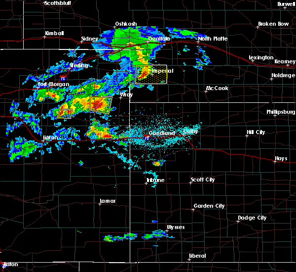 At 302 pm mdt, a severe thunderstorm was located 12 miles south of yuma, moving east at 25 mph (radar indicated). Hazards include 60 mph wind gusts and quarter size hail. Hail damage to vehicles is expected. expect wind damage to roofs, siding, and trees. Locations impacted include, eckley, heartstrong and abarr. At 302 pm mdt, a severe thunderstorm was located 12 miles south of yuma, moving east at 25 mph (radar indicated). Hazards include 60 mph wind gusts and quarter size hail. Hail damage to vehicles is expected. expect wind damage to roofs, siding, and trees. Locations impacted include, eckley, heartstrong and abarr.
|
| 5/25/2017 2:42 PM MDT |
 At 241 pm mdt, a severe thunderstorm was located 11 miles southwest of yuma, moving east at 25 mph (radar indicated). Hazards include 60 mph wind gusts and quarter size hail. Hail damage to vehicles is expected. Expect wind damage to roofs, siding, and trees. At 241 pm mdt, a severe thunderstorm was located 11 miles southwest of yuma, moving east at 25 mph (radar indicated). Hazards include 60 mph wind gusts and quarter size hail. Hail damage to vehicles is expected. Expect wind damage to roofs, siding, and trees.
|
| 5/25/2017 1:53 PM MDT |
 At 152 pm mdt, severe thunderstorms were located along a line extending from 4 miles east of st petersburg to 7 miles southeast of lone star to 8 miles south of platner, moving east at 30 mph (radar indicated). Hazards include 60 mph wind gusts and quarter size hail. Hail damage to vehicles is expected. Expect wind damage to roofs, siding, and trees. At 152 pm mdt, severe thunderstorms were located along a line extending from 4 miles east of st petersburg to 7 miles southeast of lone star to 8 miles south of platner, moving east at 30 mph (radar indicated). Hazards include 60 mph wind gusts and quarter size hail. Hail damage to vehicles is expected. Expect wind damage to roofs, siding, and trees.
|
| 9/17/2016 2:08 PM MDT |
 At 208 pm mdt, a severe thunderstorm was located 4 miles southwest of yuma, moving east southeast at 10 mph (radar indicated). Hazards include 60 mph wind gusts and quarter size hail. Hail damage to vehicles is expected. Expect wind damage to roofs, siding, and trees. At 208 pm mdt, a severe thunderstorm was located 4 miles southwest of yuma, moving east southeast at 10 mph (radar indicated). Hazards include 60 mph wind gusts and quarter size hail. Hail damage to vehicles is expected. Expect wind damage to roofs, siding, and trees.
|
| 7/31/2016 7:13 PM MDT |
 At 712 pm mdt, outflow winds from strong thunderstorms was located along a line extending from 5 miles north of eckley to 10 miles southwest of wray to 14 miles northwest of bonny reservoir, moving east at 35 mph (trained weather spotters 4 south of yuma). Hazards include 60 mph wind gusts. Expect damage to roofs. siding. and trees. locations impacted include, yuma, wray, eckley, laird, beecher island, kirk and abarr. This includes highway 385 between mile markers 213 and 269. At 712 pm mdt, outflow winds from strong thunderstorms was located along a line extending from 5 miles north of eckley to 10 miles southwest of wray to 14 miles northwest of bonny reservoir, moving east at 35 mph (trained weather spotters 4 south of yuma). Hazards include 60 mph wind gusts. Expect damage to roofs. siding. and trees. locations impacted include, yuma, wray, eckley, laird, beecher island, kirk and abarr. This includes highway 385 between mile markers 213 and 269.
|
| 7/31/2016 7:05 PM MDT |
 At 702 pm mdt, thunderstorm outflow winds were located along a line extending from near yuma to 13 miles south of eckley to 16 miles east of cope, moving east at 35 mph (trained weather spotters 4 south of yuma). Hazards include 60 mph wind gusts. Expect damage to roofs. siding. and trees. locations impacted include, yuma, wray, eckley, laird, beecher island, kirk and abarr. This includes highway 385 between mile markers 213 and 269. At 702 pm mdt, thunderstorm outflow winds were located along a line extending from near yuma to 13 miles south of eckley to 16 miles east of cope, moving east at 35 mph (trained weather spotters 4 south of yuma). Hazards include 60 mph wind gusts. Expect damage to roofs. siding. and trees. locations impacted include, yuma, wray, eckley, laird, beecher island, kirk and abarr. This includes highway 385 between mile markers 213 and 269.
|
| 7/31/2016 7:00 PM MDT |
 At 700 pm mdt, severe thunderstorms were located along a line extending from 4 miles northeast of yuma to 12 miles south of eckley to 18 miles east of cope, moving east at 45 mph (trained weather spotters 4 south of yuma). Hazards include 60 mph wind gusts. Expect damage to roofs. siding. And trees. At 700 pm mdt, severe thunderstorms were located along a line extending from 4 miles northeast of yuma to 12 miles south of eckley to 18 miles east of cope, moving east at 45 mph (trained weather spotters 4 south of yuma). Hazards include 60 mph wind gusts. Expect damage to roofs. siding. And trees.
|
| 7/29/2016 11:20 PM MDT |
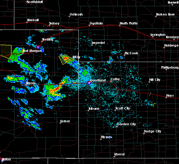 The severe thunderstorm warning for central yuma county will expire at 1130 pm mdt, the storm which prompted the warning has weakened below severe limits, and no longer pose an immediate threat to life or property. therefore the warning will be allowed to expire. however heavy rain is still possible with this thunderstorm. The severe thunderstorm warning for central yuma county will expire at 1130 pm mdt, the storm which prompted the warning has weakened below severe limits, and no longer pose an immediate threat to life or property. therefore the warning will be allowed to expire. however heavy rain is still possible with this thunderstorm.
|
| 7/29/2016 11:01 PM MDT |
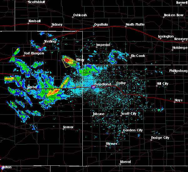 At 1101 pm mdt, a severe thunderstorm was located over eckley, or 12 miles east of yuma, moving southeast at 15 mph (radar indicated). Hazards include ping pong ball size hail and 60 mph wind gusts. People and animals outdoors will be injured. expect hail damage to roofs, siding, windows, and vehicles. expect wind damage to roofs, siding, and trees. locations impacted include, wray and eckley. This includes highway 385 between mile markers 244 and 245. At 1101 pm mdt, a severe thunderstorm was located over eckley, or 12 miles east of yuma, moving southeast at 15 mph (radar indicated). Hazards include ping pong ball size hail and 60 mph wind gusts. People and animals outdoors will be injured. expect hail damage to roofs, siding, windows, and vehicles. expect wind damage to roofs, siding, and trees. locations impacted include, wray and eckley. This includes highway 385 between mile markers 244 and 245.
|
| 7/29/2016 10:50 PM MDT |
 At 1049 pm mdt, a severe thunderstorm was located near eckley, or 11 miles east of yuma, moving southeast at 15 mph (radar indicated). Hazards include ping pong ball size hail and 60 mph wind gusts. People and animals outdoors will be injured. expect hail damage to roofs, siding, windows, and vehicles. Expect wind damage to roofs, siding, and trees. At 1049 pm mdt, a severe thunderstorm was located near eckley, or 11 miles east of yuma, moving southeast at 15 mph (radar indicated). Hazards include ping pong ball size hail and 60 mph wind gusts. People and animals outdoors will be injured. expect hail damage to roofs, siding, windows, and vehicles. Expect wind damage to roofs, siding, and trees.
|
| 7/28/2016 2:24 AM MDT |
 The severe thunderstorm warning for east central yuma and southwestern dundy counties will expire at 230 am mdt, the storms which prompted the warning have moved out of the area. therefore the warning will be allowed to expire. however gusty winds and heavy rain are still possible with these thunderstorms. remember, a severe thunderstorm warning still remains in effect for southeastern yuma county until 245 am mdt. The severe thunderstorm warning for east central yuma and southwestern dundy counties will expire at 230 am mdt, the storms which prompted the warning have moved out of the area. therefore the warning will be allowed to expire. however gusty winds and heavy rain are still possible with these thunderstorms. remember, a severe thunderstorm warning still remains in effect for southeastern yuma county until 245 am mdt.
|
| 7/28/2016 2:09 AM MDT |
 At 209 am mdt, severe thunderstorms were located along a line extending from 6 miles north of haigler to 4 miles south of wray, moving south at 45 mph (radar indicated). Hazards include 70 mph wind gusts and nickel size hail. Expect considerable tree damage. damage is likely to mobile homes, roofs, and outbuildings. locations impacted include, wray, eckley, haigler, vernon and laird. This includes highway 385 between mile markers 230 and 253. At 209 am mdt, severe thunderstorms were located along a line extending from 6 miles north of haigler to 4 miles south of wray, moving south at 45 mph (radar indicated). Hazards include 70 mph wind gusts and nickel size hail. Expect considerable tree damage. damage is likely to mobile homes, roofs, and outbuildings. locations impacted include, wray, eckley, haigler, vernon and laird. This includes highway 385 between mile markers 230 and 253.
|
| 7/28/2016 1:54 AM MDT |
 At 154 am mdt, severe thunderstorms were located along a line extending from 13 miles northeast of wray to 6 miles east of eckley, moving south at 50 mph. these are very dangerous storms (radar indicated). Hazards include 80 mph wind gusts and nickel size hail. Flying debris will be dangerous to those caught without shelter. mobile homes will be heavily damaged. expect considerable damage to roofs, windows, and vehicles. extensive tree damage and power outages are likely. locations impacted include, wray, eckley, haigler, vernon, laird, alvin and wauneta. This includes highway 385 between mile markers 230 and 269. At 154 am mdt, severe thunderstorms were located along a line extending from 13 miles northeast of wray to 6 miles east of eckley, moving south at 50 mph. these are very dangerous storms (radar indicated). Hazards include 80 mph wind gusts and nickel size hail. Flying debris will be dangerous to those caught without shelter. mobile homes will be heavily damaged. expect considerable damage to roofs, windows, and vehicles. extensive tree damage and power outages are likely. locations impacted include, wray, eckley, haigler, vernon, laird, alvin and wauneta. This includes highway 385 between mile markers 230 and 269.
|
| 7/28/2016 1:48 AM MDT |
 At 148 am mdt, severe thunderstorms were located along a line extending from 16 miles north of wray to 7 miles northeast of eckley, moving south at 55 mph (radar indicated). Hazards include 70 mph wind gusts and nickel size hail. Expect considerable tree damage. Damage is likely to mobile homes, roofs, and outbuildings. At 148 am mdt, severe thunderstorms were located along a line extending from 16 miles north of wray to 7 miles northeast of eckley, moving south at 55 mph (radar indicated). Hazards include 70 mph wind gusts and nickel size hail. Expect considerable tree damage. Damage is likely to mobile homes, roofs, and outbuildings.
|
| 7/18/2016 9:03 PM MDT |
 At 903 pm mdt, severe thunderstorms were located along a line extending from 6 miles west of st petersburg to 3 miles northeast of lone star to 10 miles northwest of eckley, moving north at 35 mph (radar indicated). Hazards include 60 mph wind gusts and quarter size hail. Hail damage to vehicles is expected. expect wind damage to roofs, siding, and trees. Locations impacted include, yuma, eckley, heartstrong and clarkville. At 903 pm mdt, severe thunderstorms were located along a line extending from 6 miles west of st petersburg to 3 miles northeast of lone star to 10 miles northwest of eckley, moving north at 35 mph (radar indicated). Hazards include 60 mph wind gusts and quarter size hail. Hail damage to vehicles is expected. expect wind damage to roofs, siding, and trees. Locations impacted include, yuma, eckley, heartstrong and clarkville.
|
| 7/18/2016 8:33 PM MDT |
 At 833 pm mdt, severe thunderstorms were located along a line extending from 3 miles south of burdett to 5 miles west of yuma to 9 miles southwest of eckley, moving north at 35 mph (radar indicated). Hazards include 60 mph wind gusts and quarter size hail. Hail damage to vehicles is expected. Expect wind damage to roofs, siding, and trees. At 833 pm mdt, severe thunderstorms were located along a line extending from 3 miles south of burdett to 5 miles west of yuma to 9 miles southwest of eckley, moving north at 35 mph (radar indicated). Hazards include 60 mph wind gusts and quarter size hail. Hail damage to vehicles is expected. Expect wind damage to roofs, siding, and trees.
|
| 7/8/2016 8:15 PM MDT |
 At 815 pm mdt, a severe thunderstorm was located 6 miles north of yuma, moving southeast at 25 mph (radar indicated). Hazards include 60 mph wind gusts and quarter size hail. Hail damage to vehicles is expected. Expect wind damage to roofs, siding, and trees. At 815 pm mdt, a severe thunderstorm was located 6 miles north of yuma, moving southeast at 25 mph (radar indicated). Hazards include 60 mph wind gusts and quarter size hail. Hail damage to vehicles is expected. Expect wind damage to roofs, siding, and trees.
|
| 7/5/2016 4:49 PM MDT |
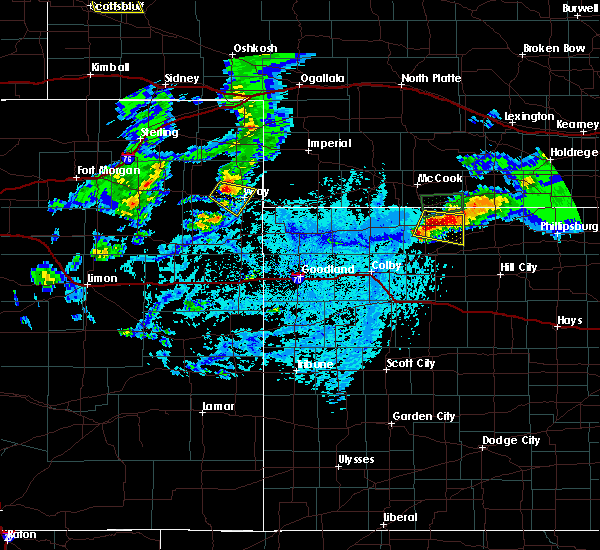 At 449 pm mdt, a severe thunderstorm was located 4 miles east of eckley, or 10 miles west of wray, moving southeast at 20 mph (radar indicated). Hazards include 60 mph wind gusts and quarter size hail. Hail damage to vehicles is expected. expect wind damage to roofs, siding, and trees. locations impacted include, wray and eckley. This includes highway 385 between mile markers 237 and 252. At 449 pm mdt, a severe thunderstorm was located 4 miles east of eckley, or 10 miles west of wray, moving southeast at 20 mph (radar indicated). Hazards include 60 mph wind gusts and quarter size hail. Hail damage to vehicles is expected. expect wind damage to roofs, siding, and trees. locations impacted include, wray and eckley. This includes highway 385 between mile markers 237 and 252.
|
| 7/5/2016 4:26 PM MDT |
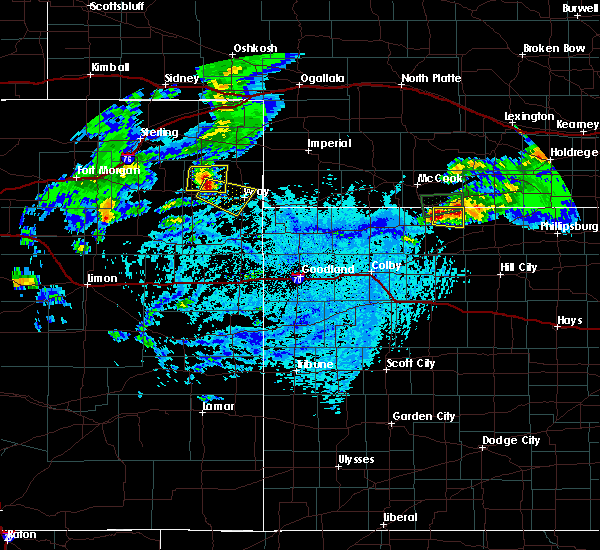 At 426 pm mdt, a severe thunderstorm was located 4 miles northwest of eckley, or 10 miles east of yuma, moving southeast at 20 mph (radar indicated). Hazards include 70 mph wind gusts and ping pong ball size hail. People and animals outdoors will be injured. expect hail damage to roofs, siding, windows, and vehicles. expect considerable tree damage. Wind damage is also likely to mobile homes, roofs, and outbuildings. At 426 pm mdt, a severe thunderstorm was located 4 miles northwest of eckley, or 10 miles east of yuma, moving southeast at 20 mph (radar indicated). Hazards include 70 mph wind gusts and ping pong ball size hail. People and animals outdoors will be injured. expect hail damage to roofs, siding, windows, and vehicles. expect considerable tree damage. Wind damage is also likely to mobile homes, roofs, and outbuildings.
|
| 6/28/2016 9:56 PM MDT |
 At 956 pm mdt, severe thunderstorm were located 8 miles south of yuma, moving southeast at 15 mph (radar indicated). Hazards include two inch hail and 70 mph wind gusts. People and animals outdoors will be injured. expect hail damage to roofs, siding, windows, and vehicles. expect considerable tree damage. Wind damage is also likely to mobile homes, roofs, and outbuildings. At 956 pm mdt, severe thunderstorm were located 8 miles south of yuma, moving southeast at 15 mph (radar indicated). Hazards include two inch hail and 70 mph wind gusts. People and animals outdoors will be injured. expect hail damage to roofs, siding, windows, and vehicles. expect considerable tree damage. Wind damage is also likely to mobile homes, roofs, and outbuildings.
|
| 6/28/2016 9:45 PM MDT |
 At 945 pm mdt, a severe thunderstorm was located 13 miles west of bonny reservoir, moving southeast at 40 mph. this is a very dangerous storm (radar indicated). Hazards include 80 mph wind gusts and two inch hail. Flying debris will be dangerous to those caught without shelter. mobile homes will be heavily damaged. expect considerable damage to roofs, windows, and vehicles. extensive tree damage and power outages are likely. locations impacted include, yuma, eckley, vernon, heartstrong, idalia, kirk and abarr. This includes highway 385 between mile markers 215 and 225. At 945 pm mdt, a severe thunderstorm was located 13 miles west of bonny reservoir, moving southeast at 40 mph. this is a very dangerous storm (radar indicated). Hazards include 80 mph wind gusts and two inch hail. Flying debris will be dangerous to those caught without shelter. mobile homes will be heavily damaged. expect considerable damage to roofs, windows, and vehicles. extensive tree damage and power outages are likely. locations impacted include, yuma, eckley, vernon, heartstrong, idalia, kirk and abarr. This includes highway 385 between mile markers 215 and 225.
|
| 6/28/2016 9:41 PM MDT |
 At 940 pm mdt, a severe thunderstorm was located 16 miles west of bonny reservoir, moving southeast at 40 mph. this is a very dangerous storm (radar indicated). Hazards include 80 mph wind gusts and two inch hail. Flying debris will be dangerous to those caught without shelter. mobile homes will be heavily damaged. expect considerable damage to roofs, windows, and vehicles. extensive tree damage and power outages are likely. locations impacted include, yuma, eckley, vernon, heartstrong, idalia, clarkville and kirk. This includes highway 385 between mile markers 215 and 225. At 940 pm mdt, a severe thunderstorm was located 16 miles west of bonny reservoir, moving southeast at 40 mph. this is a very dangerous storm (radar indicated). Hazards include 80 mph wind gusts and two inch hail. Flying debris will be dangerous to those caught without shelter. mobile homes will be heavily damaged. expect considerable damage to roofs, windows, and vehicles. extensive tree damage and power outages are likely. locations impacted include, yuma, eckley, vernon, heartstrong, idalia, clarkville and kirk. This includes highway 385 between mile markers 215 and 225.
|
| 6/28/2016 9:28 PM MDT |
 At 927 pm mdt, severe thunderstorms were located 15 miles northeast of cope, or 24 miles northwest of bonny reservoir, moving southeast at 40 mph. this is a very dangerous storm (radar indicated). Hazards include 80 mph wind gusts and golf ball size hail. Flying debris will be dangerous to those caught without shelter. mobile homes will be heavily damaged. expect considerable damage to roofs, windows, and vehicles. Extensive tree damage and power outages are likely. At 927 pm mdt, severe thunderstorms were located 15 miles northeast of cope, or 24 miles northwest of bonny reservoir, moving southeast at 40 mph. this is a very dangerous storm (radar indicated). Hazards include 80 mph wind gusts and golf ball size hail. Flying debris will be dangerous to those caught without shelter. mobile homes will be heavily damaged. expect considerable damage to roofs, windows, and vehicles. Extensive tree damage and power outages are likely.
|
| 6/28/2016 9:22 PM MDT | Also nickel size hail and 3 to 5 inch diameter tree limbs dow in yuma county CO, 13.2 miles N of Eckley, CO |
| 6/28/2016 8:29 PM MDT |
 At 829 pm mdt, a severe thunderstorm was located 6 miles south of eckley, or 13 miles west of wray, moving southeast at 35 mph (radar indicated). Hazards include 70 mph wind gusts and quarter size hail. Hail damage to vehicles is expected. expect considerable tree damage. wind damage is also likely to mobile homes, roofs, and outbuildings. Locations impacted include, yuma, eckley and heartstrong. At 829 pm mdt, a severe thunderstorm was located 6 miles south of eckley, or 13 miles west of wray, moving southeast at 35 mph (radar indicated). Hazards include 70 mph wind gusts and quarter size hail. Hail damage to vehicles is expected. expect considerable tree damage. wind damage is also likely to mobile homes, roofs, and outbuildings. Locations impacted include, yuma, eckley and heartstrong.
|
| 6/28/2016 8:14 PM MDT |
 At 814 pm mdt, a severe thunderstorm was located 6 miles west of eckley, or 6 miles east of yuma, moving southeast at 35 mph (radar indicated). Hazards include 60 mph wind gusts and quarter size hail. Hail damage to vehicles is expected. Expect wind damage to roofs, siding, and trees. At 814 pm mdt, a severe thunderstorm was located 6 miles west of eckley, or 6 miles east of yuma, moving southeast at 35 mph (radar indicated). Hazards include 60 mph wind gusts and quarter size hail. Hail damage to vehicles is expected. Expect wind damage to roofs, siding, and trees.
|
| 6/23/2016 7:57 PM MDT |
 At 757 pm mdt, a severe thunderstorm was located 6 miles northwest of eckley, or 8 miles east of yuma, moving east at 25 mph (radar indicated). Hazards include 60 mph wind gusts and quarter size hail. Hail damage to vehicles is expected. expect wind damage to roofs, siding, and trees. Locations impacted include, eckley. At 757 pm mdt, a severe thunderstorm was located 6 miles northwest of eckley, or 8 miles east of yuma, moving east at 25 mph (radar indicated). Hazards include 60 mph wind gusts and quarter size hail. Hail damage to vehicles is expected. expect wind damage to roofs, siding, and trees. Locations impacted include, eckley.
|
| 6/23/2016 7:51 PM MDT |
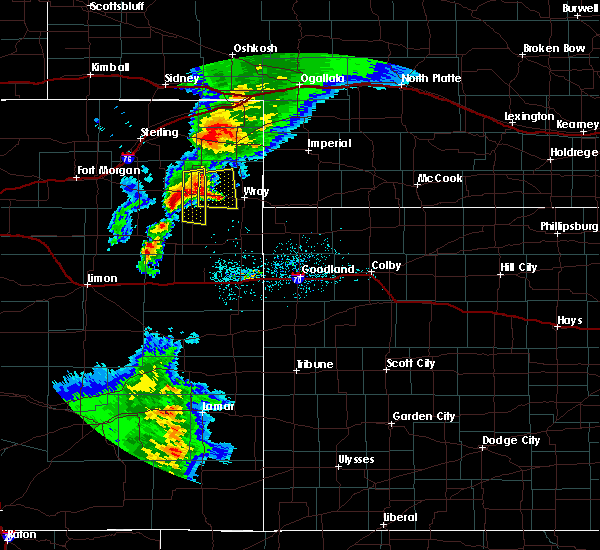 At 750 pm mdt, a severe thunderstorm was located 7 miles northeast of yuma, moving east at 30 mph (radar indicated). Hazards include 60 mph wind gusts and quarter size hail. Hail damage to vehicles is expected. expect wind damage to roofs, siding, and trees. Locations impacted include, eckley. At 750 pm mdt, a severe thunderstorm was located 7 miles northeast of yuma, moving east at 30 mph (radar indicated). Hazards include 60 mph wind gusts and quarter size hail. Hail damage to vehicles is expected. expect wind damage to roofs, siding, and trees. Locations impacted include, eckley.
|
| 6/23/2016 7:40 PM MDT |
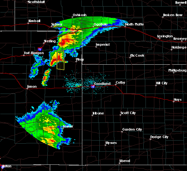 At 740 pm mdt, a severe thunderstorm was located near yuma, moving east at 30 mph (radar indicated). Hazards include 60 mph wind gusts and half dollar size hail. Hail damage to vehicles is expected. Expect wind damage to roofs, siding, and trees. At 740 pm mdt, a severe thunderstorm was located near yuma, moving east at 30 mph (radar indicated). Hazards include 60 mph wind gusts and half dollar size hail. Hail damage to vehicles is expected. Expect wind damage to roofs, siding, and trees.
|
| 6/12/2016 1:52 PM MDT |
 At 152 pm mdt, a severe thunderstorm was located 7 miles southwest of eckley, or 9 miles southeast of yuma, moving east at 10 mph (radar indicated). Hazards include 60 mph wind gusts and quarter size hail. Hail damage to vehicles is expected. Expect wind damage to roofs, siding, and trees. At 152 pm mdt, a severe thunderstorm was located 7 miles southwest of eckley, or 9 miles southeast of yuma, moving east at 10 mph (radar indicated). Hazards include 60 mph wind gusts and quarter size hail. Hail damage to vehicles is expected. Expect wind damage to roofs, siding, and trees.
|
| 5/26/2016 6:19 PM MDT |
 At 617 pm mdt, severe thunderstorms capable of producing a tornado were located along a line extending from 10 miles south of eckley to 10 miles southeast of burlington, moving east at 30 mph (radar indicated rotation). Hazards include tornado and ping pong ball size hail. Flying debris will be dangerous to those caught without shelter. mobile homes will be damaged or destroyed. damage to roofs, windows, and vehicles will occur. tree damage is likely. these dangerous storms will be near, 15 miles west of burlington around 718 pm cdt. Other locations impacted by these tornadic storms include hale, vernon, heartstrong, idalia and beecher island. At 617 pm mdt, severe thunderstorms capable of producing a tornado were located along a line extending from 10 miles south of eckley to 10 miles southeast of burlington, moving east at 30 mph (radar indicated rotation). Hazards include tornado and ping pong ball size hail. Flying debris will be dangerous to those caught without shelter. mobile homes will be damaged or destroyed. damage to roofs, windows, and vehicles will occur. tree damage is likely. these dangerous storms will be near, 15 miles west of burlington around 718 pm cdt. Other locations impacted by these tornadic storms include hale, vernon, heartstrong, idalia and beecher island.
|
| 5/7/2016 5:33 PM MDT |
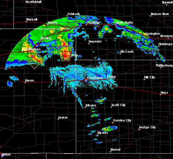 At 532 pm mdt, a severe thunderstorm was located 5 miles southeast of eckley, or 8 miles west of wray, moving north at 15 mph (trained weather spotters. at 530 pm mdt....quarter size hail was reported 4 miles northwest of vernon). Hazards include 60 mph wind gusts and half dollar size hail. Hail damage to vehicles is expected. expect wind damage to roofs, siding, and trees. locations impacted include, eckley, wauneta and clarkville. this includes highway 385 between mile markers 249 and 269. A tornado watch remains in effect until 700 pm mdt for northeastern colorado. At 532 pm mdt, a severe thunderstorm was located 5 miles southeast of eckley, or 8 miles west of wray, moving north at 15 mph (trained weather spotters. at 530 pm mdt....quarter size hail was reported 4 miles northwest of vernon). Hazards include 60 mph wind gusts and half dollar size hail. Hail damage to vehicles is expected. expect wind damage to roofs, siding, and trees. locations impacted include, eckley, wauneta and clarkville. this includes highway 385 between mile markers 249 and 269. A tornado watch remains in effect until 700 pm mdt for northeastern colorado.
|
| 5/7/2016 5:23 PM MDT |
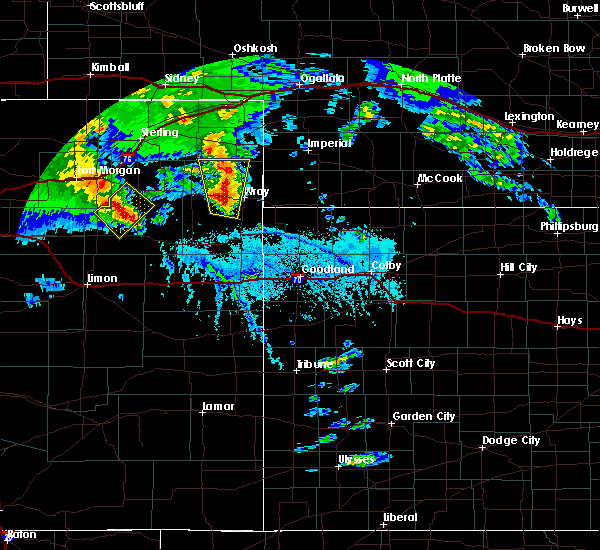 At 523 pm mdt, a severe thunderstorm was located 5 miles southeast of eckley, or 10 miles west of wray, moving north at 30 mph (radar indicated). Hazards include 60 mph wind gusts and half dollar size hail. Hail damage to vehicles is expected. expect wind damage to roofs, siding, and trees. locations impacted include, wray, eckley, vernon, wauneta and clarkville. this includes highway 385 between mile markers 248 and 269. A tornado watch remains in effect until 700 pm mdt for northeastern colorado. At 523 pm mdt, a severe thunderstorm was located 5 miles southeast of eckley, or 10 miles west of wray, moving north at 30 mph (radar indicated). Hazards include 60 mph wind gusts and half dollar size hail. Hail damage to vehicles is expected. expect wind damage to roofs, siding, and trees. locations impacted include, wray, eckley, vernon, wauneta and clarkville. this includes highway 385 between mile markers 248 and 269. A tornado watch remains in effect until 700 pm mdt for northeastern colorado.
|
| 5/7/2016 5:11 PM MDT |
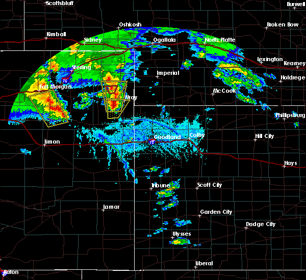 At 511 pm mdt, a severe thunderstorm was located 8 miles southeast of eckley, or 11 miles southwest of wray, moving north at 20 mph (radar indicated). Hazards include ping pong ball size hail and 60 mph wind gusts. People and animals outdoors will be injured. expect hail damage to roofs, siding, windows, and vehicles. Expect wind damage to roofs, siding, and trees. At 511 pm mdt, a severe thunderstorm was located 8 miles southeast of eckley, or 11 miles southwest of wray, moving north at 20 mph (radar indicated). Hazards include ping pong ball size hail and 60 mph wind gusts. People and animals outdoors will be injured. expect hail damage to roofs, siding, windows, and vehicles. Expect wind damage to roofs, siding, and trees.
|
| 5/7/2016 4:53 PM MDT |
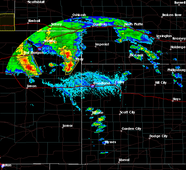 At 453 pm mdt, a severe thunderstorm was located 12 miles south of eckley, or 13 miles southwest of wray, moving north at 25 mph (radar indicated). Hazards include ping pong ball size hail and 60 mph wind gusts. People and animals outdoors will be injured. expect hail damage to roofs, siding, windows, and vehicles. expect wind damage to roofs, siding, and trees. locations impacted include, wray, eckley and vernon. this includes highway 385 between mile markers 232 and 245. A tornado watch remains in effect until 700 pm mdt for northeastern colorado. At 453 pm mdt, a severe thunderstorm was located 12 miles south of eckley, or 13 miles southwest of wray, moving north at 25 mph (radar indicated). Hazards include ping pong ball size hail and 60 mph wind gusts. People and animals outdoors will be injured. expect hail damage to roofs, siding, windows, and vehicles. expect wind damage to roofs, siding, and trees. locations impacted include, wray, eckley and vernon. this includes highway 385 between mile markers 232 and 245. A tornado watch remains in effect until 700 pm mdt for northeastern colorado.
|
| 5/7/2016 4:49 PM MDT |
 At 449 pm mdt, a severe thunderstorm was located 6 miles north of eckley, or 14 miles northeast of yuma, moving north at 25 mph (trained weather spotters. at 432 pm mdt...quarter size hail was reported 2 miles east of eckley). Hazards include 60 mph wind gusts and half dollar size hail. Hail damage to vehicles is expected. expect wind damage to roofs, siding, and trees. locations impacted include, eckley and wauneta. this includes highway 385 between mile markers 259 and 269. A tornado watch remains in effect until 700 pm mdt for northeastern colorado. At 449 pm mdt, a severe thunderstorm was located 6 miles north of eckley, or 14 miles northeast of yuma, moving north at 25 mph (trained weather spotters. at 432 pm mdt...quarter size hail was reported 2 miles east of eckley). Hazards include 60 mph wind gusts and half dollar size hail. Hail damage to vehicles is expected. expect wind damage to roofs, siding, and trees. locations impacted include, eckley and wauneta. this includes highway 385 between mile markers 259 and 269. A tornado watch remains in effect until 700 pm mdt for northeastern colorado.
|
| 5/7/2016 4:45 PM MDT |
 At 444 pm mdt, a severe thunderstorm was located 15 miles southwest of wray, moving north at 35 mph (radar indicated). Hazards include 60 mph wind gusts and quarter size hail. Hail damage to vehicles is expected. Expect wind damage to roofs, siding, and trees. At 444 pm mdt, a severe thunderstorm was located 15 miles southwest of wray, moving north at 35 mph (radar indicated). Hazards include 60 mph wind gusts and quarter size hail. Hail damage to vehicles is expected. Expect wind damage to roofs, siding, and trees.
|
| 5/7/2016 4:34 PM MDT |
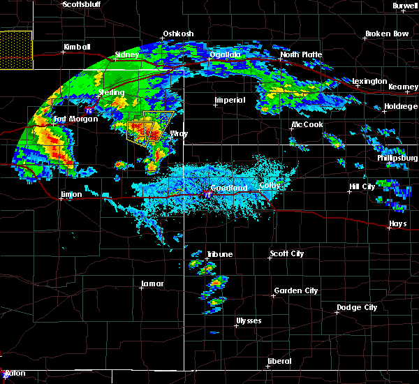 At 433 pm mdt, a severe thunderstorm was located near eckley, or 12 miles west of wray, moving north at 40 mph (trained weather spotters. at 432 pm mdt...quarter size hail was reported 2 miles east of eckley). Hazards include ping pong ball size hail and 60 mph wind gusts. People and animals outdoors will be injured. expect hail damage to roofs, siding, windows, and vehicles. expect wind damage to roofs, siding, and trees. locations impacted include, eckley and wauneta. this includes highway 385 between mile markers 259 and 269. A tornado watch remains in effect until 700 pm mdt for northeastern colorado. At 433 pm mdt, a severe thunderstorm was located near eckley, or 12 miles west of wray, moving north at 40 mph (trained weather spotters. at 432 pm mdt...quarter size hail was reported 2 miles east of eckley). Hazards include ping pong ball size hail and 60 mph wind gusts. People and animals outdoors will be injured. expect hail damage to roofs, siding, windows, and vehicles. expect wind damage to roofs, siding, and trees. locations impacted include, eckley and wauneta. this includes highway 385 between mile markers 259 and 269. A tornado watch remains in effect until 700 pm mdt for northeastern colorado.
|
| 5/7/2016 4:32 PM MDT | Quarter sized hail reported 2 miles W of Eckley, CO |
| 5/7/2016 4:29 PM MDT |
 At 429 pm mdt, a severe thunderstorm was located near eckley, or 11 miles west of wray, moving north at 45 mph (radar indicated). Hazards include ping pong ball size hail and 60 mph wind gusts. People and animals outdoors will be injured. expect hail damage to roofs, siding, windows, and vehicles. Expect wind damage to roofs, siding, and trees. At 429 pm mdt, a severe thunderstorm was located near eckley, or 11 miles west of wray, moving north at 45 mph (radar indicated). Hazards include ping pong ball size hail and 60 mph wind gusts. People and animals outdoors will be injured. expect hail damage to roofs, siding, windows, and vehicles. Expect wind damage to roofs, siding, and trees.
|
| 5/7/2016 4:19 PM MDT |
 At 418 pm mdt, a severe thunderstorm capable of producing a tornado was located 7 miles south of eckley, or 12 miles southeast of yuma, moving north at 15 mph (radar indicated rotation. at 414 pm mdt...a tornado was reported by storm chasers 9 miles southeast of yuma). Hazards include tornado and golf ball size hail. Flying debris will be dangerous to those caught without shelter. mobile homes will be damaged or destroyed. damage to roofs, windows, and vehicles will occur. tree damage is likely. Locations impacted include, eckley. At 418 pm mdt, a severe thunderstorm capable of producing a tornado was located 7 miles south of eckley, or 12 miles southeast of yuma, moving north at 15 mph (radar indicated rotation. at 414 pm mdt...a tornado was reported by storm chasers 9 miles southeast of yuma). Hazards include tornado and golf ball size hail. Flying debris will be dangerous to those caught without shelter. mobile homes will be damaged or destroyed. damage to roofs, windows, and vehicles will occur. tree damage is likely. Locations impacted include, eckley.
|
| 5/7/2016 4:15 PM MDT |
 At 415 pm mdt, a severe thunderstorm capable of producing a tornado was located 7 miles south of eckley, or 13 miles southeast of yuma, moving northeast at 25 mph (radar indicated rotation). Hazards include tornado and golf ball size hail. Flying debris will be dangerous to those caught without shelter. mobile homes will be damaged or destroyed. damage to roofs, windows, and vehicles will occur. tree damage is likely. Locations impacted include, eckley. At 415 pm mdt, a severe thunderstorm capable of producing a tornado was located 7 miles south of eckley, or 13 miles southeast of yuma, moving northeast at 25 mph (radar indicated rotation). Hazards include tornado and golf ball size hail. Flying debris will be dangerous to those caught without shelter. mobile homes will be damaged or destroyed. damage to roofs, windows, and vehicles will occur. tree damage is likely. Locations impacted include, eckley.
|
| 5/7/2016 4:08 PM MDT |
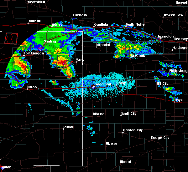 At 408 pm mdt, a severe thunderstorm capable of producing a tornado was located 10 miles south of eckley, or 14 miles southeast of yuma, moving northeast at 30 mph (radar indicated rotation). Hazards include tornado and golf ball size hail. Flying debris will be dangerous to those caught without shelter. mobile homes will be damaged or destroyed. damage to roofs, windows, and vehicles will occur. Tree damage is likely. At 408 pm mdt, a severe thunderstorm capable of producing a tornado was located 10 miles south of eckley, or 14 miles southeast of yuma, moving northeast at 30 mph (radar indicated rotation). Hazards include tornado and golf ball size hail. Flying debris will be dangerous to those caught without shelter. mobile homes will be damaged or destroyed. damage to roofs, windows, and vehicles will occur. Tree damage is likely.
|
| 4/26/2016 1:44 AM MDT |
 At 143 am mdt, severe thunderstorms were located along a line extending from 14 miles east of yuma to 5 miles northeast of eckley to 5 miles west of wray, moving north at 45 mph (radar indicated). Hazards include golf ball size hail and 70 mph wind gusts. People and animals outdoors will be injured. expect hail damage to roofs, siding, windows, and vehicles. expect considerable tree damage. wind damage is also likely to mobile homes, roofs, and outbuildings. locations impacted include, wray and eckley. This includes highway 385 between mile markers 246 and 256. At 143 am mdt, severe thunderstorms were located along a line extending from 14 miles east of yuma to 5 miles northeast of eckley to 5 miles west of wray, moving north at 45 mph (radar indicated). Hazards include golf ball size hail and 70 mph wind gusts. People and animals outdoors will be injured. expect hail damage to roofs, siding, windows, and vehicles. expect considerable tree damage. wind damage is also likely to mobile homes, roofs, and outbuildings. locations impacted include, wray and eckley. This includes highway 385 between mile markers 246 and 256.
|
| 4/26/2016 1:25 AM MDT |
 At 124 am mdt, severe thunderstorms were located along a line extending from 7 miles southwest of eckley to 14 miles southeast of yuma to 16 miles southwest of wray, moving north at 45 mph (radar indicated). Hazards include golf ball size hail and 70 mph wind gusts. People and animals outdoors will be injured. expect hail damage to roofs, siding, windows, and vehicles. expect considerable tree damage. Wind damage is also likely to mobile homes, roofs, and outbuildings. At 124 am mdt, severe thunderstorms were located along a line extending from 7 miles southwest of eckley to 14 miles southeast of yuma to 16 miles southwest of wray, moving north at 45 mph (radar indicated). Hazards include golf ball size hail and 70 mph wind gusts. People and animals outdoors will be injured. expect hail damage to roofs, siding, windows, and vehicles. expect considerable tree damage. Wind damage is also likely to mobile homes, roofs, and outbuildings.
|
| 10/20/2015 6:23 PM MDT |
 At 623 pm mdt, a severe thunderstorm was located 5 miles north of eckley, or 11 miles east of yuma, moving north at 20 mph (radar indicated). Hazards include 70 mph wind gusts and ping pong ball size hail. People and animals outdoors will be injured. expect hail damage to roofs, siding, windows and vehicles. expect considerable tree damage. Wind damage is also likely to mobile homes, roofs and outbuildings. At 623 pm mdt, a severe thunderstorm was located 5 miles north of eckley, or 11 miles east of yuma, moving north at 20 mph (radar indicated). Hazards include 70 mph wind gusts and ping pong ball size hail. People and animals outdoors will be injured. expect hail damage to roofs, siding, windows and vehicles. expect considerable tree damage. Wind damage is also likely to mobile homes, roofs and outbuildings.
|
| 7/19/2015 6:09 PM MDT |
 At 609 pm mdt, a severe thunderstorm was located 8 miles southeast of yuma, moving north at 15 mph (radar indicated). Hazards include 60 mph wind gusts and quarter size hail. Hail damage to vehicles is expected. expect wind damage to roofs, siding and trees. Locations impacted include, eckley. At 609 pm mdt, a severe thunderstorm was located 8 miles southeast of yuma, moving north at 15 mph (radar indicated). Hazards include 60 mph wind gusts and quarter size hail. Hail damage to vehicles is expected. expect wind damage to roofs, siding and trees. Locations impacted include, eckley.
|
| 7/19/2015 5:52 PM MDT |
 At 552 pm mdt, a severe thunderstorm was located 11 miles south of yuma, moving north at 20 mph (radar indicated). Hazards include 60 mph wind gusts and quarter size hail. Hail damage to vehicles is expected. expect wind damage to roofs, siding and trees. Locations impacted include, yuma, eckley, heartstrong and abarr. At 552 pm mdt, a severe thunderstorm was located 11 miles south of yuma, moving north at 20 mph (radar indicated). Hazards include 60 mph wind gusts and quarter size hail. Hail damage to vehicles is expected. expect wind damage to roofs, siding and trees. Locations impacted include, yuma, eckley, heartstrong and abarr.
|
| 7/19/2015 5:37 PM MDT |
 At 536 pm mdt, a severe thunderstorm was located 16 miles northeast of cope, or 19 miles south of yuma, moving north at 15 mph (radar indicated). Hazards include golf ball size hail and 60 mph wind gusts. People and animals outdoors will be injured. expect hail damage to roofs, siding, windows and vehicles. expect wind damage to roofs, siding and trees. Locations impacted include, yuma, eckley, heartstrong and abarr. At 536 pm mdt, a severe thunderstorm was located 16 miles northeast of cope, or 19 miles south of yuma, moving north at 15 mph (radar indicated). Hazards include golf ball size hail and 60 mph wind gusts. People and animals outdoors will be injured. expect hail damage to roofs, siding, windows and vehicles. expect wind damage to roofs, siding and trees. Locations impacted include, yuma, eckley, heartstrong and abarr.
|
| 7/19/2015 5:20 PM MDT |
 At 520 pm mdt, a severe thunderstorm was located 13 miles northeast of cope, or 22 miles south of yuma, moving north at 15 mph (radar indicated). Hazards include tennis ball size hail and 60 mph wind gusts. People and animals outdoors will be injured. expect hail damage to roofs, siding, windows and vehicles. Expect wind damage to roofs, siding and trees. At 520 pm mdt, a severe thunderstorm was located 13 miles northeast of cope, or 22 miles south of yuma, moving north at 15 mph (radar indicated). Hazards include tennis ball size hail and 60 mph wind gusts. People and animals outdoors will be injured. expect hail damage to roofs, siding, windows and vehicles. Expect wind damage to roofs, siding and trees.
|
| 6/25/2015 8:51 PM MDT |
 At 850 pm mdt, a severe thunderstorm was located 6 miles northwest of wray, moving southeast at 40 mph (radar indicated). Hazards include 60 mph wind gusts and quarter size hail. Hail damage to vehicles is expected. expect wind damage to roofs, siding and trees. locations impacted include, wray, eckley, vernon and laird. This includes highway 385 between mile markers 229 and 257. At 850 pm mdt, a severe thunderstorm was located 6 miles northwest of wray, moving southeast at 40 mph (radar indicated). Hazards include 60 mph wind gusts and quarter size hail. Hail damage to vehicles is expected. expect wind damage to roofs, siding and trees. locations impacted include, wray, eckley, vernon and laird. This includes highway 385 between mile markers 229 and 257.
|
| 6/25/2015 8:24 PM MDT |
 At 824 pm mdt, a severe thunderstorm was located 14 miles south of highland center, or 17 miles northeast of yuma, moving southeast at 40 mph (radar indicated). Hazards include 60 mph wind gusts and quarter size hail. Hail damage to vehicles is expected. Expect wind damage to roofs, siding and trees. At 824 pm mdt, a severe thunderstorm was located 14 miles south of highland center, or 17 miles northeast of yuma, moving southeast at 40 mph (radar indicated). Hazards include 60 mph wind gusts and quarter size hail. Hail damage to vehicles is expected. Expect wind damage to roofs, siding and trees.
|
| 6/1/2015 11:11 PM MDT | The severe thunderstorm warning for northwestern yuma county will expire at 1115 pm mdt, the storm which prompted the warning has weakened below severe limits, and no longer pose an immediate threat to life or property. therefore the warning will be allowed to expire. however small. |
| 6/1/2015 10:48 PM MDT | At 1048 pm mdt, a severe thunderstorm was located 4 miles east of yuma, moving east at 15 mph (trained weather spotters). Hazards include 60 mph wind gusts and quarter size hail. Hail damage to vehicles is expected. expect wind damage to roofs, siding and trees. Locations impacted include, yuma and eckley. |
| 6/1/2015 10:39 PM MDT | At 1038 pm mdt, a severe thunderstorm was located over yuma, moving east at 15 mph (radar indicated. at 1035 mdt...quarter size hail was reported in yuma). Hazards include 60 mph wind gusts and half dollar size hail. Hail damage to vehicles is expected. expect wind damage to roofs, siding and trees. Locations impacted include, yuma and eckley. |
| 6/1/2015 10:30 PM MDT | At 1029 pm mdt, a severe thunderstorm was located over yuma, moving east at 10 mph (radar indicated). Hazards include golf ball size hail and 60 mph wind gusts. People and animals outdoors will be injured. expect hail damage to roofs, siding, windows and vehicles. expect wind damage to roofs, siding and trees. Locations impacted include, yuma and eckley. |
| 6/1/2015 10:12 PM MDT | At 1011 pm mdt, a severe thunderstorm was located over yuma, moving east at 20 mph (radar indicated). Hazards include two inch hail and 60 mph wind gusts. People and animals outdoors will be injured. expect hail damage to roofs, siding, windows and vehicles. Expect wind damage to roofs, siding and trees. |
| 5/28/2015 4:40 PM MDT | At 440 pm mdt, a severe thunderstorm was located 9 miles northeast of eckley, or 14 miles northwest of wray, moving north at 15 mph (radar indicated). Hazards include 60 mph wind gusts and quarter size hail. Hail damage to vehicles is expected. expect wind damage to roofs, siding and trees. locations impacted include, wray, eckley and wauneta. This includes highway 385 between mile markers 235 and 269. |
| 5/28/2015 4:08 PM MDT | At 407 pm mdt, a severe thunderstorm was located 15 miles north of eckley, or 18 miles south of holyoke, moving east at 15 mph (radar indicated). Hazards include 60 mph wind gusts and quarter size hail. Hail damage to vehicles is expected. Expect wind damage to roofs, siding and trees. |
| 5/24/2015 3:55 PM MDT | At 354 pm mdt, a severe thunderstorm was located near yuma, moving northeast at 25 mph (radar indicated). Hazards include 60 mph wind gusts and quarter size hail. Hail damage to vehicles is expected. expect wind damage to roofs, siding and trees. Locations impacted include, yuma and eckley. |
| 5/24/2015 3:38 PM MDT | At 338 pm mdt, a severe thunderstorm was located 8 miles southwest of yuma, moving northeast at 30 mph (radar indicated). Hazards include 60 mph wind gusts and quarter size hail. Hail damage to vehicles is expected. Expect wind damage to roofs, siding and trees. |
| 9/29/2014 7:40 PM MDT | Several limbs down and a pull behind trailer moved 20 feet. time estimated by rada in yuma county CO, 16.5 miles S of Eckley, CO |
| 8/23/2014 7:25 PM MDT | Spotter estimated 50 to 60 mph winds at county road r and county road 3 in yuma county CO, 14.6 miles S of Eckley, CO |
| 8/23/2014 7:25 PM MDT | Spotter estimated 50 to 60 mph winds at county road r and county road 3 in yuma county CO, 6 miles NNE of Eckley, CO |
| 5/16/2013 12:50 PM MDT | Quarter sized hail reported 3.4 miles SW of Eckley, CO |
| 5/16/2013 12:24 PM MDT | Golf Ball sized hail reported 2 miles S of Eckley, CO |
Hail Maps for Eckley, CO
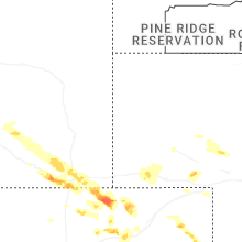
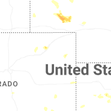
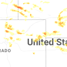
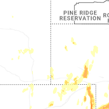
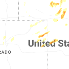


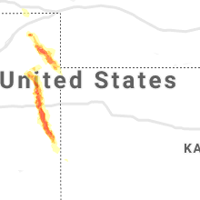


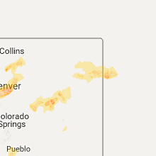


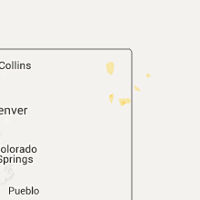


Connect with Interactive Hail Maps