

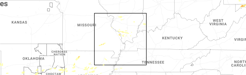
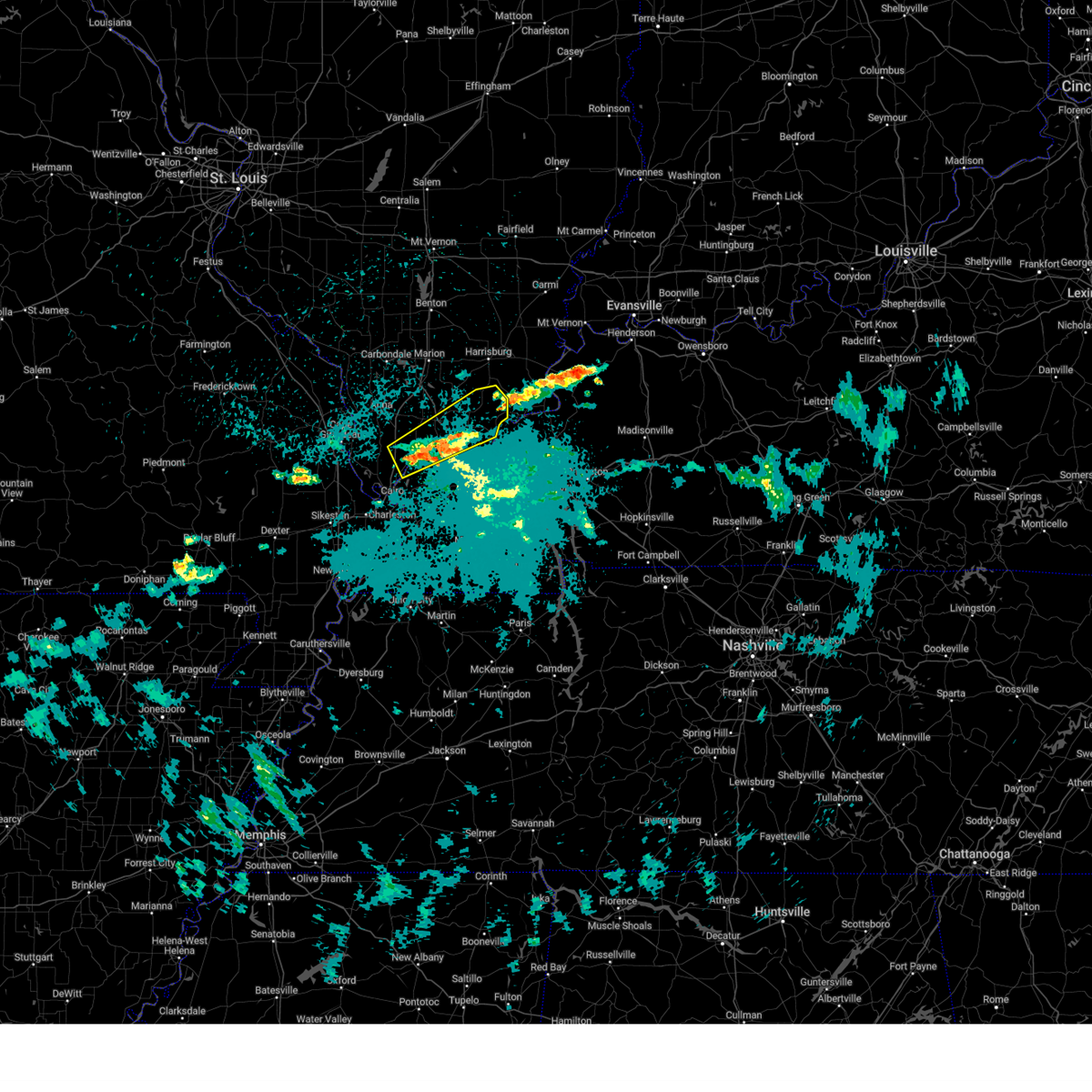
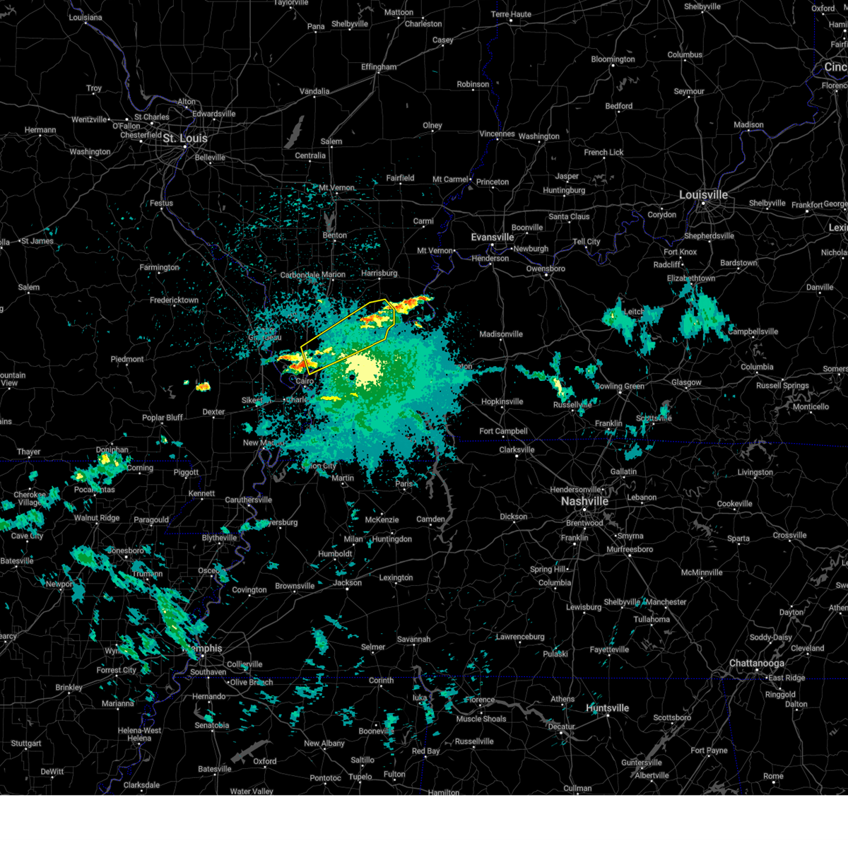
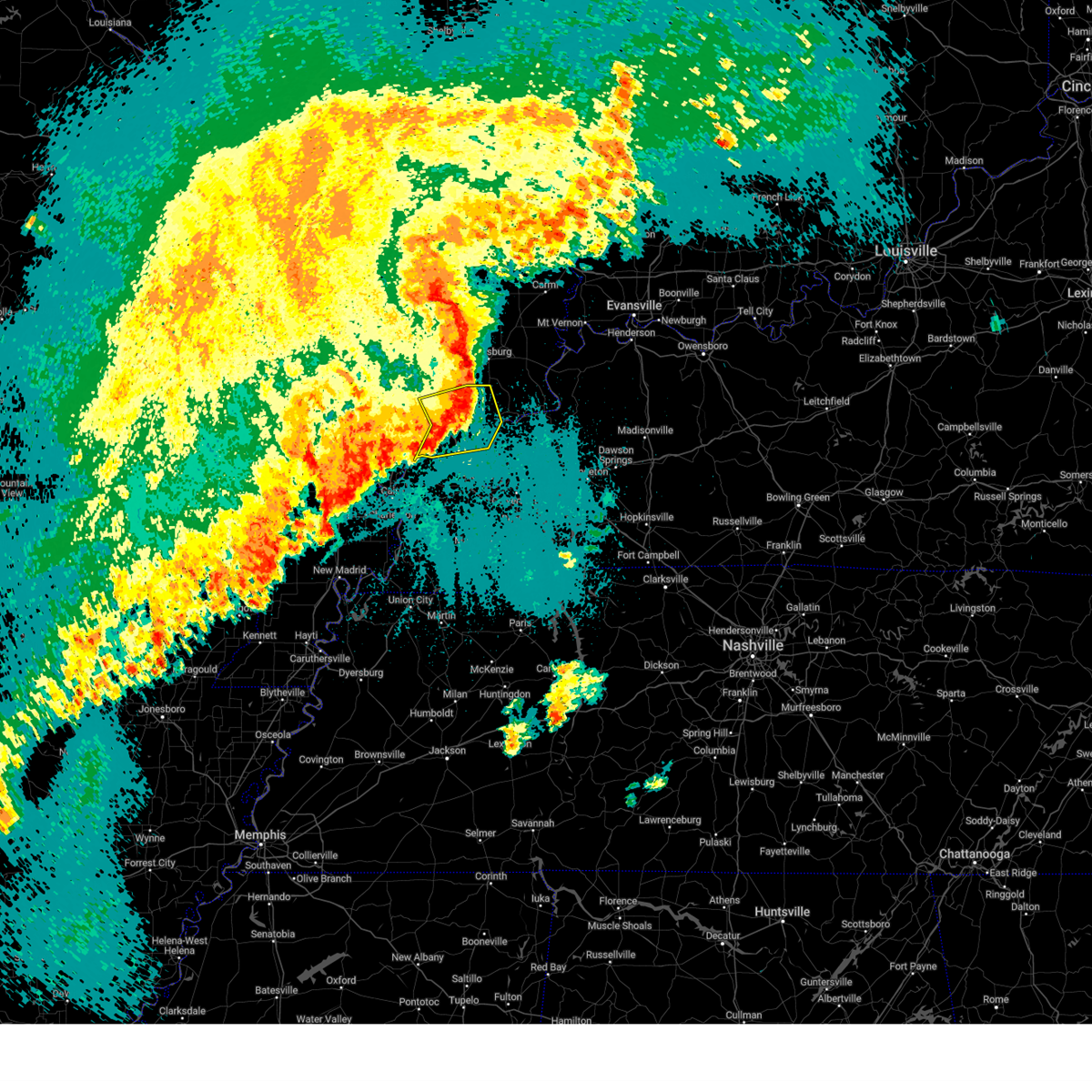
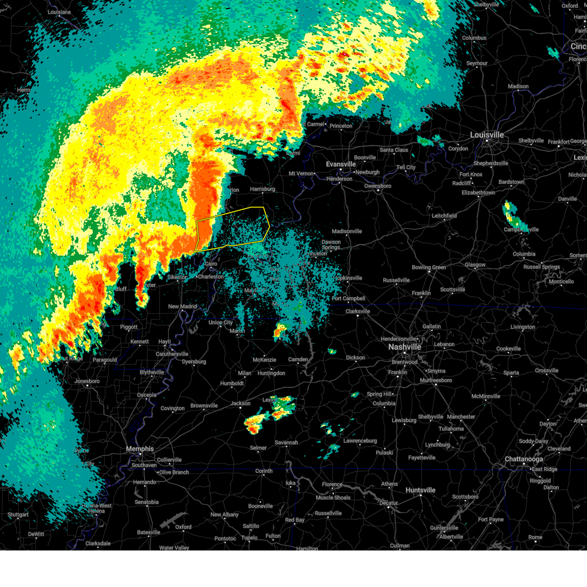
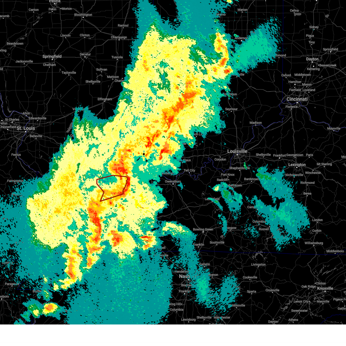
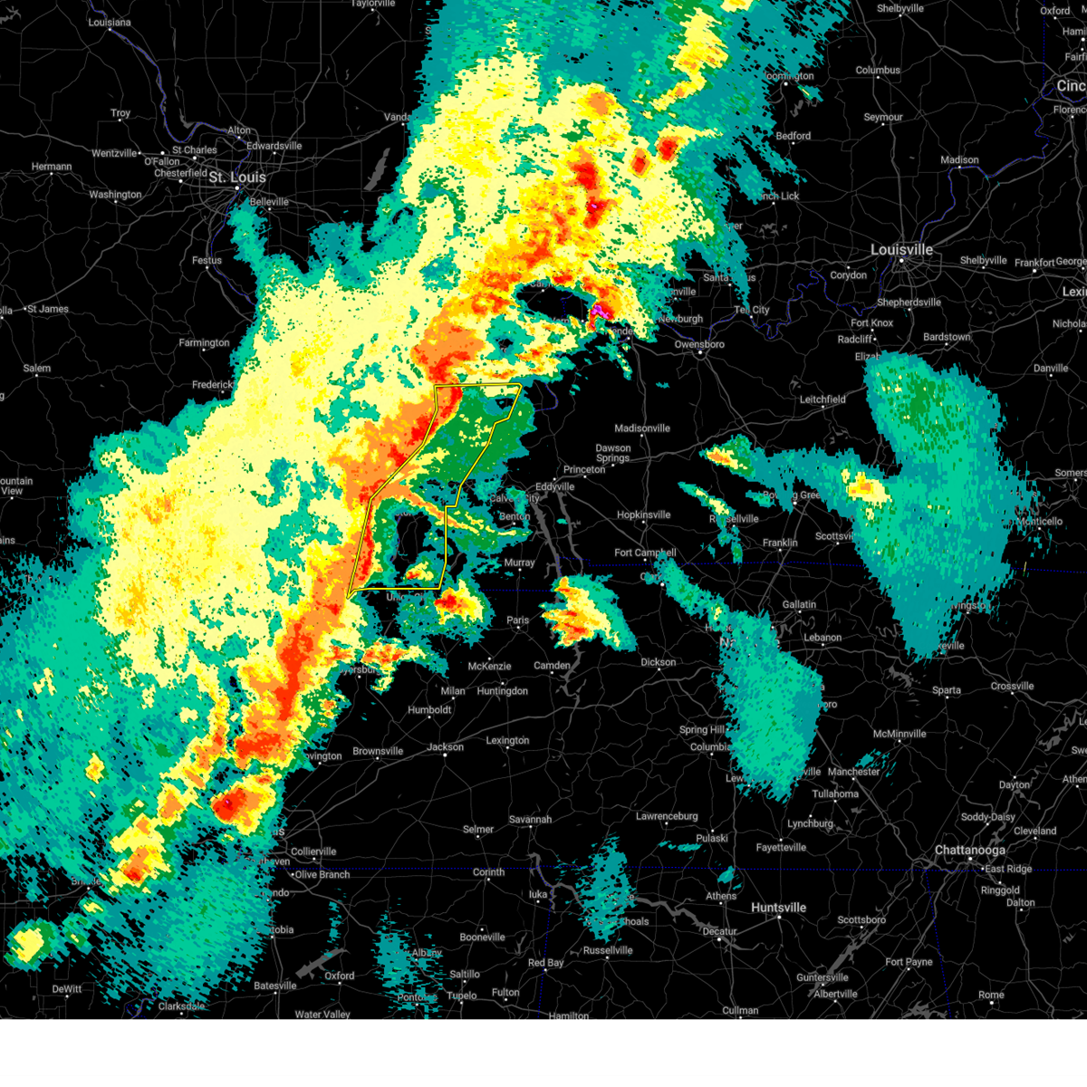
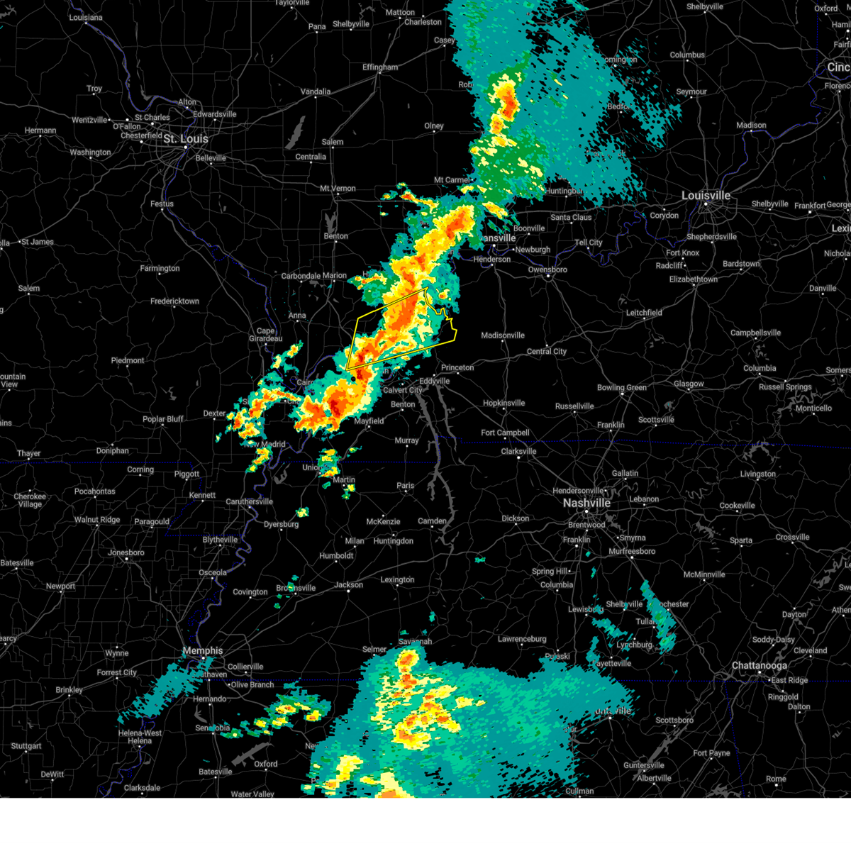
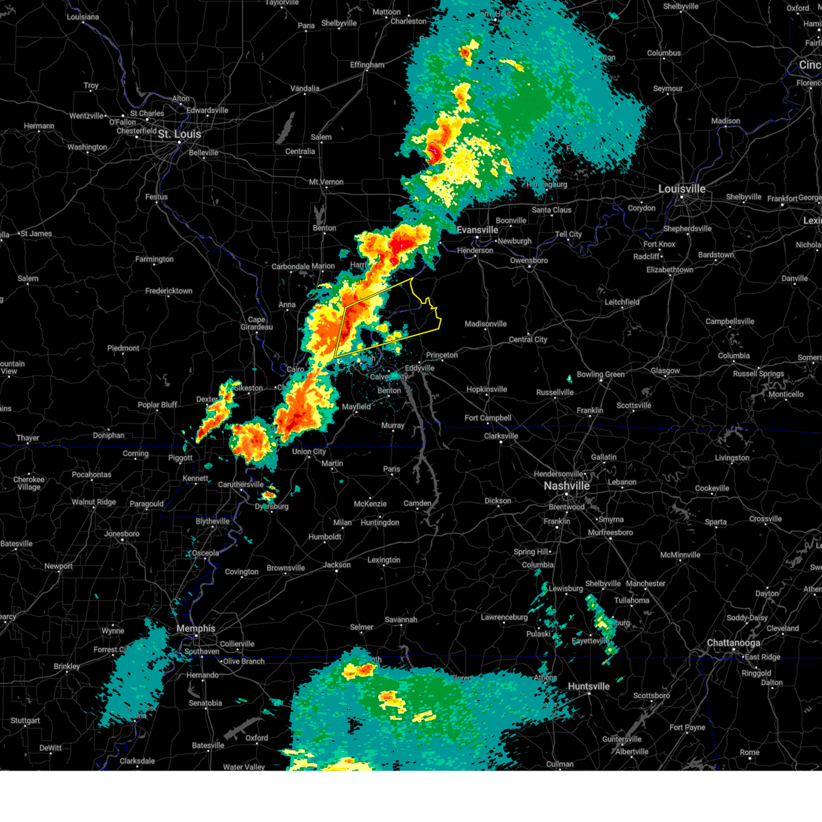
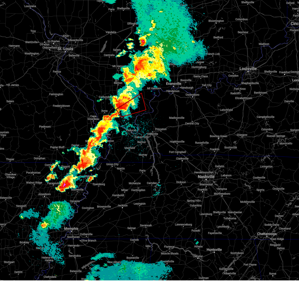
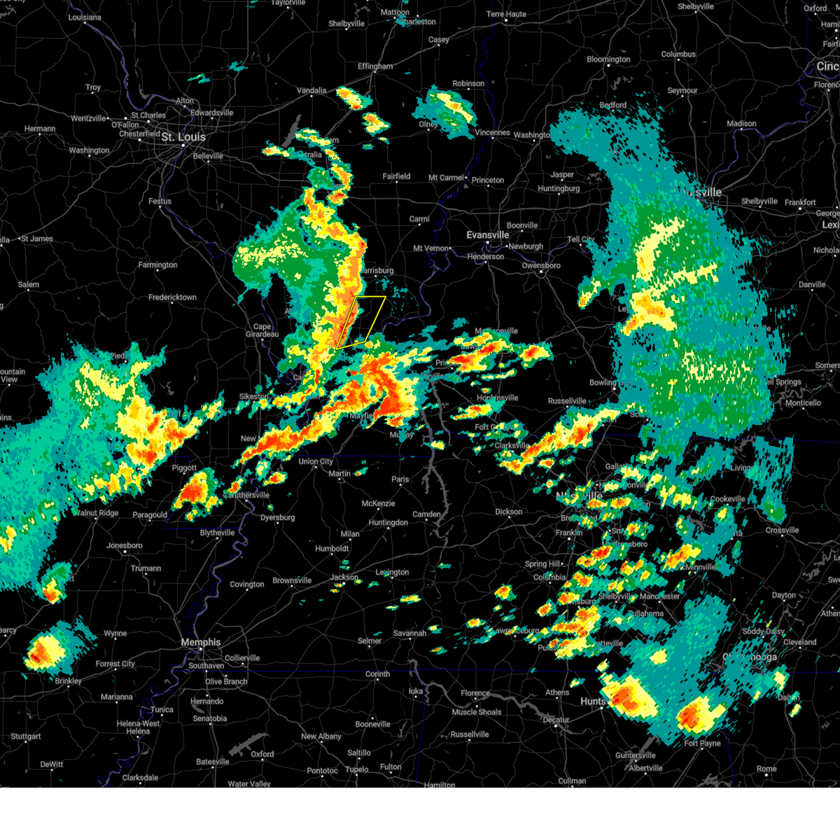
Hail Map for Eddyville, IL
The Eddyville, IL area has had 1 report of on-the-ground hail by trained spotters, and has been under severe weather warnings 32 times during the past 12 months. Doppler radar has detected hail at or near Eddyville, IL on 68 occasions, including 4 occasions during the past year.
| Name: | Eddyville, IL |
| Where Located: | 54.5 miles ENE of Cape Girardeau, MO |
| Map: | Google Map for Eddyville, IL |
| Population: | 101 |
| Housing Units: | 69 |
| More Info: | Search Google for Eddyville, IL |
0
The Top Recent Hail Date for Eddyville, IL is Thursday, May 1, 2025 (40th out of 68)
Hail and Wind Damage Spotted near Eddyville, IL
| Date / Time | Report Details |
|---|---|
| 5/20/2025 2:26 AM CDT |
 the severe thunderstorm warning has been cancelled and is no longer in effect the severe thunderstorm warning has been cancelled and is no longer in effect
|
| 5/20/2025 1:54 AM CDT |
 Svrpah the national weather service in paducah has issued a * severe thunderstorm warning for, massac county in southern illinois, pope county in southern illinois, johnson county in southern illinois, * until 245 am cdt. * at 154 am cdt, severe thunderstorms were located along a line extending from near lake of egypt area to 8 miles east of tamms, moving east at 40 mph (radar indicated). Hazards include 60 mph wind gusts. expect damage to roofs, siding, and trees Svrpah the national weather service in paducah has issued a * severe thunderstorm warning for, massac county in southern illinois, pope county in southern illinois, johnson county in southern illinois, * until 245 am cdt. * at 154 am cdt, severe thunderstorms were located along a line extending from near lake of egypt area to 8 miles east of tamms, moving east at 40 mph (radar indicated). Hazards include 60 mph wind gusts. expect damage to roofs, siding, and trees
|
| 5/16/2025 2:19 AM CDT |
 At 219 am cdt, a severe thunderstorm was located near new columbia, or 9 miles south of vienna, moving northeast at 60 mph (radar indicated). Hazards include 60 mph wind gusts and half dollar size hail. Hail damage to vehicles is expected. expect wind damage to roofs, siding, and trees. locations impacted include, golconda, new columbia, dixon springs, joppa, eddyville, and simpson. This includes interstate 24 in illinois between mile markers 19 and 30. At 219 am cdt, a severe thunderstorm was located near new columbia, or 9 miles south of vienna, moving northeast at 60 mph (radar indicated). Hazards include 60 mph wind gusts and half dollar size hail. Hail damage to vehicles is expected. expect wind damage to roofs, siding, and trees. locations impacted include, golconda, new columbia, dixon springs, joppa, eddyville, and simpson. This includes interstate 24 in illinois between mile markers 19 and 30.
|
| 5/16/2025 2:19 AM CDT |
 the severe thunderstorm warning has been cancelled and is no longer in effect the severe thunderstorm warning has been cancelled and is no longer in effect
|
| 5/16/2025 2:11 AM CDT |
 At 211 am cdt, a severe thunderstorm was located near karnak, or 10 miles north of la center, moving northeast at 50 mph (radar indicated). Hazards include 60 mph wind gusts and half dollar size hail. Hail damage to vehicles is expected. expect wind damage to roofs, siding, and trees. locations impacted include, vienna, golconda, karnak, dixon springs, new columbia, ullin, joppa, olmsted, cypress, new grand chain, belknap, eddyville, and simpson. this includes the following highways, interstate 24 in illinois between mile markers 14 and 30. Interstate 57 in illinois between mile markers 13 and 20. At 211 am cdt, a severe thunderstorm was located near karnak, or 10 miles north of la center, moving northeast at 50 mph (radar indicated). Hazards include 60 mph wind gusts and half dollar size hail. Hail damage to vehicles is expected. expect wind damage to roofs, siding, and trees. locations impacted include, vienna, golconda, karnak, dixon springs, new columbia, ullin, joppa, olmsted, cypress, new grand chain, belknap, eddyville, and simpson. this includes the following highways, interstate 24 in illinois between mile markers 14 and 30. Interstate 57 in illinois between mile markers 13 and 20.
|
| 5/16/2025 1:55 AM CDT |
 Svrpah the national weather service in paducah has issued a * severe thunderstorm warning for, southeastern union county in southern illinois, pulaski county in southern illinois, northwestern massac county in southern illinois, pope county in southern illinois, southern johnson county in southern illinois, northwestern ballard county in western kentucky, northwestern mccracken county in western kentucky, * until 245 am cdt. * at 155 am cdt, a severe thunderstorm was located near mounds, or 10 miles north of cairo, moving northeast at 55 mph (radar indicated). Hazards include 60 mph wind gusts and half dollar size hail. Hail damage to vehicles is expected. Expect wind damage to roofs, siding, and trees. Svrpah the national weather service in paducah has issued a * severe thunderstorm warning for, southeastern union county in southern illinois, pulaski county in southern illinois, northwestern massac county in southern illinois, pope county in southern illinois, southern johnson county in southern illinois, northwestern ballard county in western kentucky, northwestern mccracken county in western kentucky, * until 245 am cdt. * at 155 am cdt, a severe thunderstorm was located near mounds, or 10 miles north of cairo, moving northeast at 55 mph (radar indicated). Hazards include 60 mph wind gusts and half dollar size hail. Hail damage to vehicles is expected. Expect wind damage to roofs, siding, and trees.
|
| 4/4/2025 9:48 PM CDT | the severe thunderstorm warning has been cancelled and is no longer in effect |
| 4/4/2025 9:30 PM CDT |
 At 930 pm cdt, severe thunderstorms were located along a line extending from 7 miles east of creal springs to near dixon springs to 6 miles southeast of karnak, moving east at 45 mph (radar indicated). Hazards include 60 mph wind gusts and penny size hail. Expect damage to roofs, siding, and trees. locations impacted include, golconda, belknap, dixon springs, vienna, new burnside, karnak, eddyville, new columbia, and simpson. This includes interstate 24 in illinois between mile markers 7 and 30. At 930 pm cdt, severe thunderstorms were located along a line extending from 7 miles east of creal springs to near dixon springs to 6 miles southeast of karnak, moving east at 45 mph (radar indicated). Hazards include 60 mph wind gusts and penny size hail. Expect damage to roofs, siding, and trees. locations impacted include, golconda, belknap, dixon springs, vienna, new burnside, karnak, eddyville, new columbia, and simpson. This includes interstate 24 in illinois between mile markers 7 and 30.
|
| 4/4/2025 9:30 PM CDT |
 the severe thunderstorm warning has been cancelled and is no longer in effect the severe thunderstorm warning has been cancelled and is no longer in effect
|
| 4/4/2025 8:54 PM CDT |
 Svrpah the national weather service in paducah has issued a * severe thunderstorm warning for, southeastern union county in southern illinois, pulaski county in southern illinois, northwestern massac county in southern illinois, pope county in southern illinois, johnson county in southern illinois, north central alexander county in southern illinois, * until 1000 pm cdt. * at 853 pm cdt, severe thunderstorms were located along a line extending from near anna to near dongola to near tamms, moving east at 40 mph (radar indicated). Hazards include 70 mph wind gusts and nickel size hail. Expect considerable tree damage. Damage is likely to mobile homes, roofs, and outbuildings. Svrpah the national weather service in paducah has issued a * severe thunderstorm warning for, southeastern union county in southern illinois, pulaski county in southern illinois, northwestern massac county in southern illinois, pope county in southern illinois, johnson county in southern illinois, north central alexander county in southern illinois, * until 1000 pm cdt. * at 853 pm cdt, severe thunderstorms were located along a line extending from near anna to near dongola to near tamms, moving east at 40 mph (radar indicated). Hazards include 70 mph wind gusts and nickel size hail. Expect considerable tree damage. Damage is likely to mobile homes, roofs, and outbuildings.
|
| 4/2/2025 8:42 PM CDT | The storms which prompted the warning have moved out of the area. therefore, the warning will be allowed to expire. however, gusty winds and heavy rain are still possible with these thunderstorms. a tornado watch remains in effect until midnight cdt for southern illinois, western kentucky, and southeastern missouri. |
| 4/2/2025 8:37 PM CDT |
 The storms which prompted the warning have moved out of the area. therefore, the warning will be allowed to expire. a tornado watch remains in effect until midnight cdt for southern, south central and southeastern illinois, southwestern indiana, and northwestern kentucky. The storms which prompted the warning have moved out of the area. therefore, the warning will be allowed to expire. a tornado watch remains in effect until midnight cdt for southern, south central and southeastern illinois, southwestern indiana, and northwestern kentucky.
|
| 4/2/2025 8:16 PM CDT | At 815 pm cdt, severe thunderstorms were located along a line extending from near carrier mills to 12 miles south of harrisburg to dixon springs to la center to hickman, moving east at 45 mph (radar indicated). Hazards include 70 mph wind gusts and quarter size hail. Hail damage to vehicles is expected. expect considerable tree damage. wind damage is also likely to mobile homes, roofs, and outbuildings. locations impacted include, karbers ridge, barkley regional airport, cayce, mound city, kevil, bardwell, fulgham, joppa, lovelaceville, olmsted, arlington, new columbia, simpson, la center, hickman, dixon springs, blandville, clinton, barlow, and wickliffe. this includes the following highways, interstate 24 in kentucky between mile markers 1 and 3. interstate 24 in illinois between mile markers 16 and 38. Interstate 69 in kentucky between mile markers 1 and 5. |
| 4/2/2025 8:16 PM CDT | the severe thunderstorm warning has been cancelled and is no longer in effect |
| 4/2/2025 8:08 PM CDT | At 808 pm cdt, a severe squall line capable of producing both tornadoes and extensive straight line wind damage was located along a line extending from near galatia to near harrisburg to 9 miles northeast of dixon springs, moving northeast at 60 mph (radar indicated rotation. this storm has a history of producing damage. take shelter now!). Hazards include tornado and quarter size hail. Flying debris will be dangerous to those caught without shelter. mobile homes will be damaged or destroyed. damage to roofs, windows, and vehicles will occur. tree damage is likely. these dangerous storms will be near, equality, galatia, and eldorado around 815 pm cdt. ridgway and shawneetown around 820 pm cdt. Other locations impacted by these tornadic storms include old shawneetown, omaha, karbers ridge, muddy, raleigh, junction, and eddyville. |
| 4/2/2025 8:08 PM CDT | the tornado warning has been cancelled and is no longer in effect |
| 4/2/2025 7:54 PM CDT | Torpah the national weather service in paducah has issued a * tornado warning for, northwestern hardin county in southern illinois, northern pope county in southern illinois, northeastern johnson county in southern illinois, southeastern williamson county in southern illinois, saline county in southern illinois, gallatin county in southern illinois, * until 845 pm cdt. * at 753 pm cdt, tornado producing storms were located along a line extending from marion to 6 miles southeast of creal springs to near vienna, moving northeast at 45 mph (radar confirmed tornado. this line of storms has a history of producing tornadoes! take shelter immediately!). Hazards include damaging tornado and quarter size hail. Flying debris will be dangerous to those caught without shelter. mobile homes will be damaged or destroyed. damage to roofs, windows, and vehicles will occur. tree damage is likely. these tornadic storms will be near, carrier mills and harrisburg around 800 pm cdt. galatia around 810 pm cdt. eldorado around 815 pm cdt. equality around 820 pm cdt. ridgway around 825 pm cdt. shawneetown around 830 pm cdt. other locations impacted by these tornadic storms include old shawneetown, stonefort, omaha, karbers ridge, muddy, raleigh, new burnside, junction, eddyville, and simpson. This includes interstate 24 in illinois near mile marker 15. |
| 4/2/2025 7:53 PM CDT |
 Svrpah the national weather service in paducah has issued a * severe thunderstorm warning for, central pulaski county in southern illinois, pope county in southern illinois, eastern johnson county in southern illinois, southeastern alexander county in southern illinois, northwestern hardin county in southern illinois, massac county in southern illinois, ballard county in western kentucky, western mccracken county in western kentucky, fulton county in western kentucky, carlisle county in western kentucky, hickman county in western kentucky, mississippi county in southeastern missouri, east central new madrid county in southeastern missouri, * until 845 pm cdt. * at 753 pm cdt, severe thunderstorms were located along a line extending from near lake of egypt area to near vienna to karnak to near cairo to 8 miles north of tiptonville, moving east at 45 mph (radar indicated). Hazards include 70 mph wind gusts and quarter size hail. Hail damage to vehicles is expected. expect considerable tree damage. Wind damage is also likely to mobile homes, roofs, and outbuildings. Svrpah the national weather service in paducah has issued a * severe thunderstorm warning for, central pulaski county in southern illinois, pope county in southern illinois, eastern johnson county in southern illinois, southeastern alexander county in southern illinois, northwestern hardin county in southern illinois, massac county in southern illinois, ballard county in western kentucky, western mccracken county in western kentucky, fulton county in western kentucky, carlisle county in western kentucky, hickman county in western kentucky, mississippi county in southeastern missouri, east central new madrid county in southeastern missouri, * until 845 pm cdt. * at 753 pm cdt, severe thunderstorms were located along a line extending from near lake of egypt area to near vienna to karnak to near cairo to 8 miles north of tiptonville, moving east at 45 mph (radar indicated). Hazards include 70 mph wind gusts and quarter size hail. Hail damage to vehicles is expected. expect considerable tree damage. Wind damage is also likely to mobile homes, roofs, and outbuildings.
|
| 4/2/2025 6:52 PM CDT | At 652 pm cdt, a severe thunderstorm capable of producing a tornado was located near dixon springs, or 16 miles east of vienna, moving northeast at 55 mph (radar indicated rotation). Hazards include tornado. Flying debris will be dangerous to those caught without shelter. mobile homes will be damaged or destroyed. damage to roofs, windows, and vehicles will occur. tree damage is likely. This tornadic thunderstorm will remain over mainly rural areas of northwestern hardin, pope, southeastern saline and southwestern gallatin counties, including the following locations, karbers ridge and eddyville. |
| 4/2/2025 6:52 PM CDT | the tornado warning has been cancelled and is no longer in effect |
| 4/2/2025 6:37 PM CDT | Torpah the national weather service in paducah has issued a * tornado warning for, northwestern hardin county in southern illinois, northwestern massac county in southern illinois, pope county in southern illinois, southeastern johnson county in southern illinois, southeastern saline county in southern illinois, southwestern gallatin county in southern illinois, * until 715 pm cdt. * at 637 pm cdt, a severe thunderstorm capable of producing a tornado was located near new columbia, or near metropolis, moving northeast at 60 mph (radar indicated rotation). Hazards include tornado. Flying debris will be dangerous to those caught without shelter. mobile homes will be damaged or destroyed. damage to roofs, windows, and vehicles will occur. tree damage is likely. this dangerous storm will be near, dixon springs around 645 pm cdt. golconda around 650 pm cdt. harrisburg around 710 pm cdt. other locations impacted by this tornadic thunderstorm include karbers ridge and eddyville. This includes interstate 24 in illinois between mile markers 22 and 37. |
| 3/30/2025 7:03 PM CDT | At 702 pm cdt, severe thunderstorms were located along a line extending from 7 miles northeast of dixon springs to 7 miles west of burna, moving east at 50 mph (radar indicated). Hazards include 60 mph wind gusts. Expect damage to roofs, siding, and trees. Locations impacted include, golconda, karbers ridge, rosiclare, joy, dixon springs, salem, gross, elizabethtown, burna, brookport, carrsville, and eddyville. |
| 3/30/2025 7:03 PM CDT | the severe thunderstorm warning has been cancelled and is no longer in effect |
| 3/30/2025 6:48 PM CDT | Svrpah the national weather service in paducah has issued a * severe thunderstorm warning for, hardin county in southern illinois, massac county in southern illinois, pope county in southern illinois, southeastern johnson county in southern illinois, western crittenden county in western kentucky, northern livingston county in western kentucky, central mccracken county in western kentucky, * until 730 pm cdt. * at 648 pm cdt, severe thunderstorms were located along a line extending from near vienna to near metropolis, moving east at 60 mph (radar indicated). Hazards include 60 mph wind gusts. expect damage to roofs, siding, and trees |
| 3/15/2025 2:32 AM CDT |
 At 232 am cdt, severe thunderstorms were located along a line extending from 10 miles northeast of rosiclare to near brookport, moving northeast at 45 mph (trained weather spotters). Hazards include 70 mph wind gusts. Expect considerable tree damage. damage is likely to mobile homes, roofs, and outbuildings. locations impacted include, golconda, karbers ridge, dixon springs, burna, metropolis, cave-in-rock, rosiclare, joy, salem, gross, elizabethtown, marion, carrsville, eddyville, new columbia, and sturgis. This includes interstate 24 in illinois between mile markers 25 and 36. At 232 am cdt, severe thunderstorms were located along a line extending from 10 miles northeast of rosiclare to near brookport, moving northeast at 45 mph (trained weather spotters). Hazards include 70 mph wind gusts. Expect considerable tree damage. damage is likely to mobile homes, roofs, and outbuildings. locations impacted include, golconda, karbers ridge, dixon springs, burna, metropolis, cave-in-rock, rosiclare, joy, salem, gross, elizabethtown, marion, carrsville, eddyville, new columbia, and sturgis. This includes interstate 24 in illinois between mile markers 25 and 36.
|
| 3/15/2025 2:05 AM CDT |
 Svrpah the national weather service in paducah has issued a * severe thunderstorm warning for, hardin county in southern illinois, central massac county in southern illinois, pope county in southern illinois, southeastern johnson county in southern illinois, southwestern gallatin county in southern illinois, crittenden county in western kentucky, northern livingston county in western kentucky, north central mccracken county in western kentucky, * until 245 am cdt. * at 205 am cdt, severe thunderstorms were located along a line extending from near dixon springs to near metropolis, moving east at 55 mph (radar indicated). Hazards include 70 mph wind gusts. Expect considerable tree damage. Damage is likely to mobile homes, roofs, and outbuildings. Svrpah the national weather service in paducah has issued a * severe thunderstorm warning for, hardin county in southern illinois, central massac county in southern illinois, pope county in southern illinois, southeastern johnson county in southern illinois, southwestern gallatin county in southern illinois, crittenden county in western kentucky, northern livingston county in western kentucky, north central mccracken county in western kentucky, * until 245 am cdt. * at 205 am cdt, severe thunderstorms were located along a line extending from near dixon springs to near metropolis, moving east at 55 mph (radar indicated). Hazards include 70 mph wind gusts. Expect considerable tree damage. Damage is likely to mobile homes, roofs, and outbuildings.
|
| 3/15/2025 1:26 AM CDT |
 Torpah the national weather service in paducah has issued a * tornado warning for, northwestern hardin county in southern illinois, northern pope county in southern illinois, northeastern johnson county in southern illinois, southeastern williamson county in southern illinois, southern saline county in southern illinois, southwestern gallatin county in southern illinois, * until 215 am cdt. * at 126 am cdt, a large and extremely dangerous tornado was located near vienna, moving northeast at 65 mph. this is a particularly dangerous situation. take cover now! (radar indicated rotation). Hazards include damaging tornado. You are in a life-threatening situation. flying debris may be deadly to those caught without shelter. mobile homes will be destroyed. considerable damage to homes, businesses, and vehicles is likely and complete destruction is possible. the tornado will be near, carrier mills and harrisburg around 135 am cdt. equality around 145 am cdt. eldorado around 150 am cdt. other locations impacted by this tornadic thunderstorm include stonefort, new burnside, karbers ridge, gross, eddyville, and simpson. This includes interstate 24 in illinois between mile markers 7 and 19. Torpah the national weather service in paducah has issued a * tornado warning for, northwestern hardin county in southern illinois, northern pope county in southern illinois, northeastern johnson county in southern illinois, southeastern williamson county in southern illinois, southern saline county in southern illinois, southwestern gallatin county in southern illinois, * until 215 am cdt. * at 126 am cdt, a large and extremely dangerous tornado was located near vienna, moving northeast at 65 mph. this is a particularly dangerous situation. take cover now! (radar indicated rotation). Hazards include damaging tornado. You are in a life-threatening situation. flying debris may be deadly to those caught without shelter. mobile homes will be destroyed. considerable damage to homes, businesses, and vehicles is likely and complete destruction is possible. the tornado will be near, carrier mills and harrisburg around 135 am cdt. equality around 145 am cdt. eldorado around 150 am cdt. other locations impacted by this tornadic thunderstorm include stonefort, new burnside, karbers ridge, gross, eddyville, and simpson. This includes interstate 24 in illinois between mile markers 7 and 19.
|
| 7/30/2024 6:48 PM CDT |
 the severe thunderstorm warning has been cancelled and is no longer in effect the severe thunderstorm warning has been cancelled and is no longer in effect
|
| 7/30/2024 6:48 PM CDT |
 At 647 pm cdt, severe thunderstorms were located along a line extending from 8 miles northeast of rosiclare to 9 miles northeast of dixon springs, moving southeast at 15 mph (radar indicated). Hazards include 60 mph wind gusts. Expect damage to roofs, siding, and trees. Locations impacted include, cave-in-rock, eddyville, and gross. At 647 pm cdt, severe thunderstorms were located along a line extending from 8 miles northeast of rosiclare to 9 miles northeast of dixon springs, moving southeast at 15 mph (radar indicated). Hazards include 60 mph wind gusts. Expect damage to roofs, siding, and trees. Locations impacted include, cave-in-rock, eddyville, and gross.
|
| 7/30/2024 6:33 PM CDT | the severe thunderstorm warning has been cancelled and is no longer in effect |
| 7/30/2024 6:33 PM CDT | At 632 pm cdt, severe thunderstorms were located along a line extending from 10 miles northeast of rosiclare to 9 miles south of carrier mills, moving southeast at 15 mph (radar indicated). Hazards include 60 mph wind gusts and quarter size hail. Hail damage to vehicles is expected. expect wind damage to roofs, siding, and trees. Locations impacted include, cave-in-rock, eddyville, karbers ridge, and gross. |
| 7/30/2024 6:11 PM CDT |
 Svrpah the national weather service in paducah has issued a * severe thunderstorm warning for, hardin county in southern illinois, northern pope county in southern illinois, southern saline county in southern illinois, southwestern gallatin county in southern illinois, * until 700 pm cdt. * at 611 pm cdt, severe thunderstorms were located along a line extending from 8 miles south of equality to 6 miles south of carrier mills, moving southeast at 15 mph (radar indicated). Hazards include 60 mph wind gusts and quarter size hail. Hail damage to vehicles is expected. Expect wind damage to roofs, siding, and trees. Svrpah the national weather service in paducah has issued a * severe thunderstorm warning for, hardin county in southern illinois, northern pope county in southern illinois, southern saline county in southern illinois, southwestern gallatin county in southern illinois, * until 700 pm cdt. * at 611 pm cdt, severe thunderstorms were located along a line extending from 8 miles south of equality to 6 miles south of carrier mills, moving southeast at 15 mph (radar indicated). Hazards include 60 mph wind gusts and quarter size hail. Hail damage to vehicles is expected. Expect wind damage to roofs, siding, and trees.
|
| 5/26/2024 9:18 PM CDT |
 the severe thunderstorm warning has been cancelled and is no longer in effect the severe thunderstorm warning has been cancelled and is no longer in effect
|
| 5/26/2024 8:29 PM CDT |
 Svrpah the national weather service in paducah has issued a * severe thunderstorm warning for, hardin county in southern illinois, east central pulaski county in southern illinois, massac county in southern illinois, pope county in southern illinois, eastern johnson county in southern illinois, saline county in southern illinois, gallatin county in southern illinois, * until 930 pm cdt. * at 828 pm cdt, severe thunderstorms were located along a line extending from near galatia to near carrier mills to near vienna to 6 miles east of tamms, moving east at 65 mph (radar indicated). Hazards include 60 mph wind gusts and quarter size hail. Hail damage to vehicles is expected. Expect wind damage to roofs, siding, and trees. Svrpah the national weather service in paducah has issued a * severe thunderstorm warning for, hardin county in southern illinois, east central pulaski county in southern illinois, massac county in southern illinois, pope county in southern illinois, eastern johnson county in southern illinois, saline county in southern illinois, gallatin county in southern illinois, * until 930 pm cdt. * at 828 pm cdt, severe thunderstorms were located along a line extending from near galatia to near carrier mills to near vienna to 6 miles east of tamms, moving east at 65 mph (radar indicated). Hazards include 60 mph wind gusts and quarter size hail. Hail damage to vehicles is expected. Expect wind damage to roofs, siding, and trees.
|
| 5/26/2024 8:21 PM CDT |
 Torpah the national weather service in paducah has issued a * tornado warning for, northern pope county in southern illinois, central johnson county in southern illinois, * until 845 pm cdt. * at 820 pm cdt, a severe thunderstorm capable of producing a tornado was located near vienna, moving east at 55 mph (radar indicated rotation). Hazards include tornado. Flying debris will be dangerous to those caught without shelter. mobile homes will be damaged or destroyed. damage to roofs, windows, and vehicles will occur. tree damage is likely. this dangerous storm will be near, vienna and lake of egypt area around 825 pm cdt. dixon springs around 830 pm cdt. other locations impacted by this tornadic thunderstorm include buncombe, simpson, and eddyville. This includes interstate 24 in illinois between mile markers 3 and 18. Torpah the national weather service in paducah has issued a * tornado warning for, northern pope county in southern illinois, central johnson county in southern illinois, * until 845 pm cdt. * at 820 pm cdt, a severe thunderstorm capable of producing a tornado was located near vienna, moving east at 55 mph (radar indicated rotation). Hazards include tornado. Flying debris will be dangerous to those caught without shelter. mobile homes will be damaged or destroyed. damage to roofs, windows, and vehicles will occur. tree damage is likely. this dangerous storm will be near, vienna and lake of egypt area around 825 pm cdt. dixon springs around 830 pm cdt. other locations impacted by this tornadic thunderstorm include buncombe, simpson, and eddyville. This includes interstate 24 in illinois between mile markers 3 and 18.
|
| 5/26/2024 9:05 AM CDT |
 The storm which prompted the warning has weakened below severe limits, and no longer poses an immediate threat to life or property. therefore, the warning will be allowed to expire. a tornado watch remains in effect until 1000 am cdt for southern illinois, and western kentucky. a tornado watch also remains in effect until 300 pm cdt for northwestern kentucky. The storm which prompted the warning has weakened below severe limits, and no longer poses an immediate threat to life or property. therefore, the warning will be allowed to expire. a tornado watch remains in effect until 1000 am cdt for southern illinois, and western kentucky. a tornado watch also remains in effect until 300 pm cdt for northwestern kentucky.
|
| 5/26/2024 8:42 AM CDT |
 the severe thunderstorm warning has been cancelled and is no longer in effect the severe thunderstorm warning has been cancelled and is no longer in effect
|
| 5/26/2024 8:42 AM CDT |
 At 841 am cdt, a severe thunderstorm was located 8 miles northeast of dixon springs, or 17 miles south of harrisburg, moving east at 60 mph (radar indicated). Hazards include 60 mph wind gusts. Expect damage to roofs, siding, and trees. Locations impacted include, shawneetown, rosiclare, ridgway, golconda, equality, cave-in-rock, elizabethtown, old shawneetown, junction, eddyville, carrsville, karbers ridge, and gross. At 841 am cdt, a severe thunderstorm was located 8 miles northeast of dixon springs, or 17 miles south of harrisburg, moving east at 60 mph (radar indicated). Hazards include 60 mph wind gusts. Expect damage to roofs, siding, and trees. Locations impacted include, shawneetown, rosiclare, ridgway, golconda, equality, cave-in-rock, elizabethtown, old shawneetown, junction, eddyville, carrsville, karbers ridge, and gross.
|
| 5/26/2024 8:28 AM CDT |
 Svrpah the national weather service in paducah has issued a * severe thunderstorm warning for, hardin county in southern illinois, northwestern massac county in southern illinois, pope county in southern illinois, eastern johnson county in southern illinois, southeastern williamson county in southern illinois, southern saline county in southern illinois, southwestern gallatin county in southern illinois, northwestern crittenden county in western kentucky, north central livingston county in western kentucky, southwestern union county in northwestern kentucky, * until 915 am cdt. * at 827 am cdt, a severe thunderstorm was located near vienna, moving northeast at 55 mph (radar indicated). Hazards include 60 mph wind gusts. expect damage to roofs, siding, and trees Svrpah the national weather service in paducah has issued a * severe thunderstorm warning for, hardin county in southern illinois, northwestern massac county in southern illinois, pope county in southern illinois, eastern johnson county in southern illinois, southeastern williamson county in southern illinois, southern saline county in southern illinois, southwestern gallatin county in southern illinois, northwestern crittenden county in western kentucky, north central livingston county in western kentucky, southwestern union county in northwestern kentucky, * until 915 am cdt. * at 827 am cdt, a severe thunderstorm was located near vienna, moving northeast at 55 mph (radar indicated). Hazards include 60 mph wind gusts. expect damage to roofs, siding, and trees
|
| 5/8/2024 11:06 PM CDT |
 The storms which prompted the warning have weakened below severe limits, and no longer pose an immediate threat to life or property. therefore, the warning will be allowed to expire. however, small hail and gusty winds are still possible with these thunderstorms. a tornado watch remains in effect until midnight cdt for southern illinois. The storms which prompted the warning have weakened below severe limits, and no longer pose an immediate threat to life or property. therefore, the warning will be allowed to expire. however, small hail and gusty winds are still possible with these thunderstorms. a tornado watch remains in effect until midnight cdt for southern illinois.
|
| 5/8/2024 10:56 PM CDT |
 the severe thunderstorm warning has been cancelled and is no longer in effect the severe thunderstorm warning has been cancelled and is no longer in effect
|
| 5/8/2024 10:56 PM CDT |
 At 1055 pm cdt, severe thunderstorms were located along a line extending from near harrisburg to 7 miles southeast of karnak, moving east at 65 mph (radar indicated). Hazards include 60 mph wind gusts and penny size hail. Expect damage to roofs, siding, and trees. locations impacted include, dixon springs, new columbia, eddyville, and simpson. This includes interstate 24 in illinois between mile markers 20 and 28. At 1055 pm cdt, severe thunderstorms were located along a line extending from near harrisburg to 7 miles southeast of karnak, moving east at 65 mph (radar indicated). Hazards include 60 mph wind gusts and penny size hail. Expect damage to roofs, siding, and trees. locations impacted include, dixon springs, new columbia, eddyville, and simpson. This includes interstate 24 in illinois between mile markers 20 and 28.
|
| 5/8/2024 10:45 PM CDT |
 the severe thunderstorm warning has been cancelled and is no longer in effect the severe thunderstorm warning has been cancelled and is no longer in effect
|
| 5/8/2024 10:45 PM CDT |
 At 1045 pm cdt, severe thunderstorms were located along a line extending from near creal springs to 6 miles northeast of mounds, moving east at 55 mph (radar indicated). Hazards include 60 mph wind gusts and half dollar size hail. Hail damage to vehicles is expected. expect wind damage to roofs, siding, and trees. locations impacted include, harrisburg, vienna, creal springs, karnak, dixon springs, carrier mills, new columbia, lake of egypt area, stonefort, cypress, new burnside, new grand chain, belknap, eddyville, muddy, and simpson. This includes interstate 24 in illinois between mile markers 7 and 28. At 1045 pm cdt, severe thunderstorms were located along a line extending from near creal springs to 6 miles northeast of mounds, moving east at 55 mph (radar indicated). Hazards include 60 mph wind gusts and half dollar size hail. Hail damage to vehicles is expected. expect wind damage to roofs, siding, and trees. locations impacted include, harrisburg, vienna, creal springs, karnak, dixon springs, carrier mills, new columbia, lake of egypt area, stonefort, cypress, new burnside, new grand chain, belknap, eddyville, muddy, and simpson. This includes interstate 24 in illinois between mile markers 7 and 28.
|
| 5/8/2024 10:30 PM CDT |
 Svrpah the national weather service in paducah has issued a * severe thunderstorm warning for, eastern union county in southern illinois, pulaski county in southern illinois, northwestern massac county in southern illinois, northwestern pope county in southern illinois, johnson county in southern illinois, southern williamson county in southern illinois, southern saline county in southern illinois, north central alexander county in southern illinois, west central gallatin county in southern illinois, * until 1115 pm cdt. * at 1030 pm cdt, severe thunderstorms were located along a line extending from 7 miles northwest of goreville to near olive branch, moving east at 55 mph (radar indicated). Hazards include 60 mph wind gusts. expect damage to roofs, siding, and trees Svrpah the national weather service in paducah has issued a * severe thunderstorm warning for, eastern union county in southern illinois, pulaski county in southern illinois, northwestern massac county in southern illinois, northwestern pope county in southern illinois, johnson county in southern illinois, southern williamson county in southern illinois, southern saline county in southern illinois, north central alexander county in southern illinois, west central gallatin county in southern illinois, * until 1115 pm cdt. * at 1030 pm cdt, severe thunderstorms were located along a line extending from 7 miles northwest of goreville to near olive branch, moving east at 55 mph (radar indicated). Hazards include 60 mph wind gusts. expect damage to roofs, siding, and trees
|
| 4/18/2024 5:35 PM CDT |
 At 535 pm cdt, a severe thunderstorm was located over dixon springs, or 10 miles east of vienna, moving northeast at 20 mph (radar indicated). Hazards include 60 mph wind gusts and quarter size hail. Hail damage to vehicles is expected. expect wind damage to roofs, siding, and trees. Locations impacted include, golconda, dixon springs, eddyville, and simpson. At 535 pm cdt, a severe thunderstorm was located over dixon springs, or 10 miles east of vienna, moving northeast at 20 mph (radar indicated). Hazards include 60 mph wind gusts and quarter size hail. Hail damage to vehicles is expected. expect wind damage to roofs, siding, and trees. Locations impacted include, golconda, dixon springs, eddyville, and simpson.
|
| 4/18/2024 5:11 PM CDT |
 Svrpah the national weather service in paducah has issued a * severe thunderstorm warning for, northwestern massac county in southern illinois, northern pope county in southern illinois, southeastern johnson county in southern illinois, * until 600 pm cdt. * at 511 pm cdt, a severe thunderstorm was located near new columbia, or near vienna, moving northeast at 25 mph (radar indicated). Hazards include 60 mph wind gusts and quarter size hail. Hail damage to vehicles is expected. Expect wind damage to roofs, siding, and trees. Svrpah the national weather service in paducah has issued a * severe thunderstorm warning for, northwestern massac county in southern illinois, northern pope county in southern illinois, southeastern johnson county in southern illinois, * until 600 pm cdt. * at 511 pm cdt, a severe thunderstorm was located near new columbia, or near vienna, moving northeast at 25 mph (radar indicated). Hazards include 60 mph wind gusts and quarter size hail. Hail damage to vehicles is expected. Expect wind damage to roofs, siding, and trees.
|
| 4/2/2024 5:11 AM CDT |
 Svrpah the national weather service in paducah has issued a * severe thunderstorm warning for, east central johnson county in southern illinois, southwestern white county in southeastern illinois, massac county in southern illinois, southeastern hamilton county in south central illinois, gallatin county in southern illinois, pope county in southern illinois, saline county in southern illinois, hardin county in southern illinois, southern vanderburgh county in southwestern indiana, southwestern posey county in southwestern indiana, henderson county in northwestern kentucky, western hopkins county in northwestern kentucky, northern lyon county in western kentucky, livingston county in western kentucky, northwestern christian county in south central kentucky, northwestern mclean county in northwestern kentucky, northwestern graves county in western kentucky, caldwell county in western kentucky, northwestern marshall county in western kentucky, southeastern ballard county in western kentucky, mccracken county in western kentucky, crittenden county in western kentucky, northeastern carlisle county in western kentucky, union county in northwestern kentucky, webster county in northwestern kentucky, * until 615 am cdt. * at 511 am cdt, severe thunderstorms were located along a line extending from near harrisburg to near west paducah, moving east at 65 mph (radar indicated). Hazards include 70 mph wind gusts. Expect considerable tree damage. Damage is likely to mobile homes, roofs, and outbuildings. Svrpah the national weather service in paducah has issued a * severe thunderstorm warning for, east central johnson county in southern illinois, southwestern white county in southeastern illinois, massac county in southern illinois, southeastern hamilton county in south central illinois, gallatin county in southern illinois, pope county in southern illinois, saline county in southern illinois, hardin county in southern illinois, southern vanderburgh county in southwestern indiana, southwestern posey county in southwestern indiana, henderson county in northwestern kentucky, western hopkins county in northwestern kentucky, northern lyon county in western kentucky, livingston county in western kentucky, northwestern christian county in south central kentucky, northwestern mclean county in northwestern kentucky, northwestern graves county in western kentucky, caldwell county in western kentucky, northwestern marshall county in western kentucky, southeastern ballard county in western kentucky, mccracken county in western kentucky, crittenden county in western kentucky, northeastern carlisle county in western kentucky, union county in northwestern kentucky, webster county in northwestern kentucky, * until 615 am cdt. * at 511 am cdt, severe thunderstorms were located along a line extending from near harrisburg to near west paducah, moving east at 65 mph (radar indicated). Hazards include 70 mph wind gusts. Expect considerable tree damage. Damage is likely to mobile homes, roofs, and outbuildings.
|
| 4/2/2024 4:56 AM CDT |
 the severe thunderstorm warning has been cancelled and is no longer in effect the severe thunderstorm warning has been cancelled and is no longer in effect
|
| 4/2/2024 4:56 AM CDT |
 At 456 am cdt, severe thunderstorms were located along a line extending from near pittsburg to near la center, moving east at 55 mph (trained weather spotters). Hazards include 70 mph wind gusts. Expect considerable tree damage. damage is likely to mobile homes, roofs, and outbuildings. locations impacted include, paducah, marion, herrin, harrisburg, west frankfort, metropolis, eldorado, johnston city, vienna, la center, reidland, lone oak, energy, goreville, brookport, galatia, barlow, golconda, mound city, and pittsburg. this includes the following highways, interstate 24 in kentucky between mile markers 1 and 13. interstate 24 in illinois between mile markers 1 and 38. Interstate 57 in illinois between mile markers 37 and 64. At 456 am cdt, severe thunderstorms were located along a line extending from near pittsburg to near la center, moving east at 55 mph (trained weather spotters). Hazards include 70 mph wind gusts. Expect considerable tree damage. damage is likely to mobile homes, roofs, and outbuildings. locations impacted include, paducah, marion, herrin, harrisburg, west frankfort, metropolis, eldorado, johnston city, vienna, la center, reidland, lone oak, energy, goreville, brookport, galatia, barlow, golconda, mound city, and pittsburg. this includes the following highways, interstate 24 in kentucky between mile markers 1 and 13. interstate 24 in illinois between mile markers 1 and 38. Interstate 57 in illinois between mile markers 37 and 64.
|
| 4/2/2024 4:35 AM CDT |
 Svrpah the national weather service in paducah has issued a * severe thunderstorm warning for, union county in southern illinois, pulaski county in southern illinois, pope county in southern illinois, johnson county in southern illinois, saline county in southern illinois, alexander county in southern illinois, southeastern franklin county in south central illinois, massac county in southern illinois, williamson county in southern illinois, southeastern jackson county in southern illinois, ballard county in western kentucky, mccracken county in western kentucky, western livingston county in western kentucky, north central mississippi county in southeastern missouri, east central scott county in southeastern missouri, * until 515 am cdt. * at 435 am cdt, severe thunderstorms were located along a line extending from near hurst to near olive branch, moving east at 55 mph (trained weather spotters. cape girardeau airport reported gusts to 66 mph). Hazards include 70 mph wind gusts. Expect considerable tree damage. Damage is likely to mobile homes, roofs, and outbuildings. Svrpah the national weather service in paducah has issued a * severe thunderstorm warning for, union county in southern illinois, pulaski county in southern illinois, pope county in southern illinois, johnson county in southern illinois, saline county in southern illinois, alexander county in southern illinois, southeastern franklin county in south central illinois, massac county in southern illinois, williamson county in southern illinois, southeastern jackson county in southern illinois, ballard county in western kentucky, mccracken county in western kentucky, western livingston county in western kentucky, north central mississippi county in southeastern missouri, east central scott county in southeastern missouri, * until 515 am cdt. * at 435 am cdt, severe thunderstorms were located along a line extending from near hurst to near olive branch, moving east at 55 mph (trained weather spotters. cape girardeau airport reported gusts to 66 mph). Hazards include 70 mph wind gusts. Expect considerable tree damage. Damage is likely to mobile homes, roofs, and outbuildings.
|
| 3/14/2024 8:29 PM CDT |
 Svrpah the national weather service in paducah has issued a * severe thunderstorm warning for, massac county in southern illinois, pope county in southern illinois, southeastern johnson county in southern illinois, fulton county in western kentucky, eastern carlisle county in western kentucky, hickman county in western kentucky, southeastern ballard county in western kentucky, mccracken county in western kentucky, graves county in western kentucky, * until 915 pm cdt. * at 829 pm cdt, severe thunderstorms were located along a line extending from near vienna to bardwell to near clayton, moving east at 45 mph (radar indicated). Hazards include 60 mph wind gusts. expect damage to roofs, siding, and trees Svrpah the national weather service in paducah has issued a * severe thunderstorm warning for, massac county in southern illinois, pope county in southern illinois, southeastern johnson county in southern illinois, fulton county in western kentucky, eastern carlisle county in western kentucky, hickman county in western kentucky, southeastern ballard county in western kentucky, mccracken county in western kentucky, graves county in western kentucky, * until 915 pm cdt. * at 829 pm cdt, severe thunderstorms were located along a line extending from near vienna to bardwell to near clayton, moving east at 45 mph (radar indicated). Hazards include 60 mph wind gusts. expect damage to roofs, siding, and trees
|
| 7/29/2023 6:31 PM CDT |
 At 630 pm cdt, severe thunderstorms were located along a line extending from 11 miles southeast of carrier mills to near new columbia to near mounds, moving southeast at 35 mph (radar indicated). Hazards include 60 mph wind gusts. Expect damage to roofs, siding, and trees. locations impacted include, scott city, vienna, dongola, tamms, kelso, karnak, cape girardeau airport, horseshoe lake conservation area, new columbia, dixon springs, olive branch, ullin, thebes, olmsted, stonefort, cypress, new burnside, new grand chain, pulaski and buncombe. this includes the following highways, interstate 24 in illinois between mile markers 8 and 25. interstate 57 in illinois between mile markers 9 and 25. interstate 55 between mile markers 88 and 92. hail threat, radar indicated max hail size, <. 75 in wind threat, observed max wind gust, 60 mph. At 630 pm cdt, severe thunderstorms were located along a line extending from 11 miles southeast of carrier mills to near new columbia to near mounds, moving southeast at 35 mph (radar indicated). Hazards include 60 mph wind gusts. Expect damage to roofs, siding, and trees. locations impacted include, scott city, vienna, dongola, tamms, kelso, karnak, cape girardeau airport, horseshoe lake conservation area, new columbia, dixon springs, olive branch, ullin, thebes, olmsted, stonefort, cypress, new burnside, new grand chain, pulaski and buncombe. this includes the following highways, interstate 24 in illinois between mile markers 8 and 25. interstate 57 in illinois between mile markers 9 and 25. interstate 55 between mile markers 88 and 92. hail threat, radar indicated max hail size, <. 75 in wind threat, observed max wind gust, 60 mph.
|
| 7/29/2023 6:28 PM CDT |
 At 627 pm cdt, severe thunderstorms were located along a line extending from near carrier mills to near vienna to olive branch, moving southeast at 35 mph (radar indicated). Hazards include 60 mph wind gusts. expect damage to roofs, siding, and trees At 627 pm cdt, severe thunderstorms were located along a line extending from near carrier mills to near vienna to olive branch, moving southeast at 35 mph (radar indicated). Hazards include 60 mph wind gusts. expect damage to roofs, siding, and trees
|
| 7/29/2023 6:01 PM CDT |
 At 600 pm cdt, severe thunderstorms were located along a line extending from near creal springs to near dongola to near cape girardeau, moving southeast at 35 mph (radar indicated). Hazards include 60 mph wind gusts and quarter size hail. Hail damage to vehicles is expected. Expect wind damage to roofs, siding, and trees. At 600 pm cdt, severe thunderstorms were located along a line extending from near creal springs to near dongola to near cape girardeau, moving southeast at 35 mph (radar indicated). Hazards include 60 mph wind gusts and quarter size hail. Hail damage to vehicles is expected. Expect wind damage to roofs, siding, and trees.
|
| 7/18/2023 12:41 PM CDT |
 At 1240 pm cdt, severe thunderstorms were located along a line extending from 7 miles east of cobden to 6 miles east of tamms to cairo to near anniston, moving east at 50 mph (radar indicated). Hazards include 70 mph wind gusts and penny size hail. Expect considerable tree damage. Damage is likely to mobile homes, roofs, and outbuildings. At 1240 pm cdt, severe thunderstorms were located along a line extending from 7 miles east of cobden to 6 miles east of tamms to cairo to near anniston, moving east at 50 mph (radar indicated). Hazards include 70 mph wind gusts and penny size hail. Expect considerable tree damage. Damage is likely to mobile homes, roofs, and outbuildings.
|
| 7/16/2023 6:34 PM CDT | Tree down in the count in pope county IL, 0.3 miles WNW of Eddyville, IL |
| 7/16/2023 6:28 PM CDT |
 At 628 pm cdt, a severe thunderstorm was located near carrier mills, or 7 miles south of harrisburg, moving southeast at 30 mph (law enforcement reported numerous trees down). Hazards include 60 mph wind gusts and penny size hail. expect damage to roofs, siding, and trees At 628 pm cdt, a severe thunderstorm was located near carrier mills, or 7 miles south of harrisburg, moving southeast at 30 mph (law enforcement reported numerous trees down). Hazards include 60 mph wind gusts and penny size hail. expect damage to roofs, siding, and trees
|
| 7/16/2023 6:17 PM CDT |
 At 617 pm cdt, a severe thunderstorm was located near carrier mills, or 9 miles southwest of harrisburg, moving southeast at 35 mph (radar indicated). Hazards include 60 mph wind gusts and penny size hail. Expect damage to roofs, siding, and trees. locations impacted include, harrisburg, creal springs, carrier mills, lake of egypt area, stonefort, new burnside, eddyville and muddy. hail threat, radar indicated max hail size, 0. 75 in wind threat, radar indicated max wind gust, 60 mph. At 617 pm cdt, a severe thunderstorm was located near carrier mills, or 9 miles southwest of harrisburg, moving southeast at 35 mph (radar indicated). Hazards include 60 mph wind gusts and penny size hail. Expect damage to roofs, siding, and trees. locations impacted include, harrisburg, creal springs, carrier mills, lake of egypt area, stonefort, new burnside, eddyville and muddy. hail threat, radar indicated max hail size, 0. 75 in wind threat, radar indicated max wind gust, 60 mph.
|
| 7/16/2023 5:53 PM CDT |
 At 553 pm cdt, a severe thunderstorm was located over pittsburg, or near marion, moving southeast at 40 mph (radar indicated). Hazards include 60 mph wind gusts and penny size hail. expect damage to roofs, siding, and trees At 553 pm cdt, a severe thunderstorm was located over pittsburg, or near marion, moving southeast at 40 mph (radar indicated). Hazards include 60 mph wind gusts and penny size hail. expect damage to roofs, siding, and trees
|
| 7/2/2023 3:19 PM CDT |
 At 319 pm cdt, severe thunderstorms were located along a line extending from near karnak to 6 miles north of la center, moving east at 45 mph (radar indicated). Hazards include 60 mph wind gusts. Expect damage to roofs, siding, and trees. locations impacted include, paducah, metropolis, vienna, brookport, karnak, dixon springs, new columbia, joppa, cypress, new grand chain, belknap, eddyville and simpson. this includes the following highways, interstate 24 in kentucky between mile markers 1 and 3. interstate 24 in illinois between mile markers 12 and 38. hail threat, radar indicated max hail size, <. 75 in wind threat, radar indicated max wind gust, 60 mph. At 319 pm cdt, severe thunderstorms were located along a line extending from near karnak to 6 miles north of la center, moving east at 45 mph (radar indicated). Hazards include 60 mph wind gusts. Expect damage to roofs, siding, and trees. locations impacted include, paducah, metropolis, vienna, brookport, karnak, dixon springs, new columbia, joppa, cypress, new grand chain, belknap, eddyville and simpson. this includes the following highways, interstate 24 in kentucky between mile markers 1 and 3. interstate 24 in illinois between mile markers 12 and 38. hail threat, radar indicated max hail size, <. 75 in wind threat, radar indicated max wind gust, 60 mph.
|
| 7/2/2023 3:10 PM CDT |
 At 309 pm cdt, severe thunderstorms were located along a line extending from near dongola to near mound city, moving east at 45 mph (radar indicated). Hazards include 60 mph wind gusts. Expect damage to roofs, siding, and trees. locations impacted include, paducah, metropolis, vienna, brookport, mounds, dongola, tamms, mound city, karnak, dixon springs, new columbia, ullin, joppa, olmsted, cypress, new grand chain, pulaski, belknap, eddyville and mill creek. this includes the following highways, interstate 24 in kentucky between mile markers 1 and 2. interstate 24 in illinois between mile markers 12 and 38. interstate 57 in illinois between mile markers 5 and 29. hail threat, radar indicated max hail size, <. 75 in wind threat, radar indicated max wind gust, 60 mph. At 309 pm cdt, severe thunderstorms were located along a line extending from near dongola to near mound city, moving east at 45 mph (radar indicated). Hazards include 60 mph wind gusts. Expect damage to roofs, siding, and trees. locations impacted include, paducah, metropolis, vienna, brookport, mounds, dongola, tamms, mound city, karnak, dixon springs, new columbia, ullin, joppa, olmsted, cypress, new grand chain, pulaski, belknap, eddyville and mill creek. this includes the following highways, interstate 24 in kentucky between mile markers 1 and 2. interstate 24 in illinois between mile markers 12 and 38. interstate 57 in illinois between mile markers 5 and 29. hail threat, radar indicated max hail size, <. 75 in wind threat, radar indicated max wind gust, 60 mph.
|
| 7/2/2023 3:00 PM CDT |
 At 300 pm cdt, severe thunderstorms were located along a line extending from near dongola to near mounds, moving east at 45 mph (radar indicated). Hazards include 70 mph wind gusts. Expect considerable tree damage. Damage is likely to mobile homes, roofs, and outbuildings. At 300 pm cdt, severe thunderstorms were located along a line extending from near dongola to near mounds, moving east at 45 mph (radar indicated). Hazards include 70 mph wind gusts. Expect considerable tree damage. Damage is likely to mobile homes, roofs, and outbuildings.
|
| 7/1/2023 5:37 PM CDT |
 At 537 pm cdt, severe thunderstorms were located along a line extending from near creal springs to near new columbia, moving east at 50 mph (radar indicated). Hazards include 60 mph wind gusts and penny size hail. expect damage to roofs, siding, and trees At 537 pm cdt, severe thunderstorms were located along a line extending from near creal springs to near new columbia, moving east at 50 mph (radar indicated). Hazards include 60 mph wind gusts and penny size hail. expect damage to roofs, siding, and trees
|
| 5/7/2023 2:55 PM CDT |
 At 255 pm cdt, severe thunderstorms were located along a line extending from 8 miles north of golconda to 8 miles northeast of brookport, moving northeast at 35 mph (radar indicated). Hazards include 60 mph wind gusts and quarter size hail. Hail damage to vehicles is expected. expect wind damage to roofs, siding, and trees. locations impacted include, rosiclare, brookport, golconda, joy, dixon springs, burna, smithland, eddyville, carrsville and hamletsburg. hail threat, radar indicated max hail size, 1. 00 in wind threat, radar indicated max wind gust, 60 mph. At 255 pm cdt, severe thunderstorms were located along a line extending from 8 miles north of golconda to 8 miles northeast of brookport, moving northeast at 35 mph (radar indicated). Hazards include 60 mph wind gusts and quarter size hail. Hail damage to vehicles is expected. expect wind damage to roofs, siding, and trees. locations impacted include, rosiclare, brookport, golconda, joy, dixon springs, burna, smithland, eddyville, carrsville and hamletsburg. hail threat, radar indicated max hail size, 1. 00 in wind threat, radar indicated max wind gust, 60 mph.
|
| 5/7/2023 2:51 PM CDT |
 At 251 pm cdt, severe thunderstorms were located along a line extending from near benton to 7 miles south of carrier mills to 11 miles south of harrisburg, moving northeast at 35 mph (trained weather spotters). Hazards include 60 mph wind gusts and quarter size hail. Hail damage to vehicles is expected. expect wind damage to roofs, siding, and trees. locations impacted include, marion, herrin, harrisburg, west frankfort, benton, eldorado, johnston city, mcleansboro, christopher, rend lake area, zeigler, galatia, valier, west city, pittsburg, creal springs, thompsonville, carrier mills, lake of egypt area and north city. this includes interstate 57 in illinois between mile markers 52 and 80. hail threat, radar indicated max hail size, 1. 00 in wind threat, radar indicated max wind gust, 60 mph. At 251 pm cdt, severe thunderstorms were located along a line extending from near benton to 7 miles south of carrier mills to 11 miles south of harrisburg, moving northeast at 35 mph (trained weather spotters). Hazards include 60 mph wind gusts and quarter size hail. Hail damage to vehicles is expected. expect wind damage to roofs, siding, and trees. locations impacted include, marion, herrin, harrisburg, west frankfort, benton, eldorado, johnston city, mcleansboro, christopher, rend lake area, zeigler, galatia, valier, west city, pittsburg, creal springs, thompsonville, carrier mills, lake of egypt area and north city. this includes interstate 57 in illinois between mile markers 52 and 80. hail threat, radar indicated max hail size, 1. 00 in wind threat, radar indicated max wind gust, 60 mph.
|
| 5/7/2023 2:27 PM CDT |
 At 227 pm cdt, severe thunderstorms were located along a line extending from 7 miles northeast of vienna to near metropolis, moving northeast at 35 mph (radar indicated). Hazards include 60 mph wind gusts and quarter size hail. Hail damage to vehicles is expected. Expect wind damage to roofs, siding, and trees. At 227 pm cdt, severe thunderstorms were located along a line extending from 7 miles northeast of vienna to near metropolis, moving northeast at 35 mph (radar indicated). Hazards include 60 mph wind gusts and quarter size hail. Hail damage to vehicles is expected. Expect wind damage to roofs, siding, and trees.
|
| 5/7/2023 2:26 PM CDT |
 At 225 pm cdt, severe thunderstorms were located along a line extending from royalton to 9 miles south of creal springs to near vienna, moving northeast at 35 mph (trained weather spotters. reports of quarter sized hail have been recieved). Hazards include 60 mph wind gusts and quarter size hail. Hail damage to vehicles is expected. Expect wind damage to roofs, siding, and trees. At 225 pm cdt, severe thunderstorms were located along a line extending from royalton to 9 miles south of creal springs to near vienna, moving northeast at 35 mph (trained weather spotters. reports of quarter sized hail have been recieved). Hazards include 60 mph wind gusts and quarter size hail. Hail damage to vehicles is expected. Expect wind damage to roofs, siding, and trees.
|
| 5/7/2023 2:16 PM CDT |
 At 215 pm cdt, severe thunderstorms were located along a line extending from near du quoin to 7 miles southeast of creal springs to near dixon springs, moving northeast at 50 mph (radar indicated). Hazards include 60 mph wind gusts and quarter size hail. Hail damage to vehicles is expected. expect wind damage to roofs, siding, and trees. locations impacted include, carbondale, marion, herrin, harrisburg, west frankfort, murphysboro, benton, carterville, johnston city, christopher, vienna, zeigler, de soto, crainville, cambria, royalton, energy, goreville, elkville and hurst. this includes the following highways, interstate 24 in illinois between mile markers 1 and 22. interstate 57 in illinois between mile markers 33 and 73. hail threat, radar indicated max hail size, 1. 00 in wind threat, radar indicated max wind gust, 60 mph. At 215 pm cdt, severe thunderstorms were located along a line extending from near du quoin to 7 miles southeast of creal springs to near dixon springs, moving northeast at 50 mph (radar indicated). Hazards include 60 mph wind gusts and quarter size hail. Hail damage to vehicles is expected. expect wind damage to roofs, siding, and trees. locations impacted include, carbondale, marion, herrin, harrisburg, west frankfort, murphysboro, benton, carterville, johnston city, christopher, vienna, zeigler, de soto, crainville, cambria, royalton, energy, goreville, elkville and hurst. this includes the following highways, interstate 24 in illinois between mile markers 1 and 22. interstate 57 in illinois between mile markers 33 and 73. hail threat, radar indicated max hail size, 1. 00 in wind threat, radar indicated max wind gust, 60 mph.
|
| 5/7/2023 2:01 PM CDT |
 At 200 pm cdt, severe thunderstorms were located along a line extending from near ava to 6 miles southeast of goreville to near vienna, moving northeast at 50 mph (radar indicated). Hazards include 60 mph wind gusts and quarter size hail. Hail damage to vehicles is expected. expect wind damage to roofs, siding, and trees. locations impacted include, carbondale, marion, herrin, harrisburg, west frankfort, murphysboro, benton, carterville, anna, johnston city, christopher, jonesboro, vienna, zeigler, de soto, crainville, cambria, cobden, royalton and energy. this includes the following highways, interstate 24 in illinois between mile markers 1 and 22. interstate 57 in illinois between mile markers 24 and 73. hail threat, radar indicated max hail size, 1. 00 in wind threat, radar indicated max wind gust, 60 mph. At 200 pm cdt, severe thunderstorms were located along a line extending from near ava to 6 miles southeast of goreville to near vienna, moving northeast at 50 mph (radar indicated). Hazards include 60 mph wind gusts and quarter size hail. Hail damage to vehicles is expected. expect wind damage to roofs, siding, and trees. locations impacted include, carbondale, marion, herrin, harrisburg, west frankfort, murphysboro, benton, carterville, anna, johnston city, christopher, jonesboro, vienna, zeigler, de soto, crainville, cambria, cobden, royalton and energy. this includes the following highways, interstate 24 in illinois between mile markers 1 and 22. interstate 57 in illinois between mile markers 24 and 73. hail threat, radar indicated max hail size, 1. 00 in wind threat, radar indicated max wind gust, 60 mph.
|
| 5/7/2023 1:47 PM CDT |
 At 146 pm cdt, severe thunderstorms were located along a line extending from 6 miles west of ava to 8 miles northeast of dongola to near karnak, moving east at 50 mph (radar indicated). Hazards include 60 mph wind gusts and quarter size hail. Hail damage to vehicles is expected. Expect wind damage to roofs, siding, and trees. At 146 pm cdt, severe thunderstorms were located along a line extending from 6 miles west of ava to 8 miles northeast of dongola to near karnak, moving east at 50 mph (radar indicated). Hazards include 60 mph wind gusts and quarter size hail. Hail damage to vehicles is expected. Expect wind damage to roofs, siding, and trees.
|
| 4/15/2023 9:51 PM CDT |
 At 951 pm cdt, a severe thunderstorm was located 8 miles southeast of creal springs, or 9 miles northeast of vienna, moving east at 35 mph (radar indicated). Hazards include 60 mph wind gusts and penny size hail. Expect damage to roofs, siding, and trees. locations impacted include, golconda, dixon springs, lake of egypt area, stonefort, new burnside, eddyville and simpson. this includes interstate 24 in illinois between mile markers 17 and 21. hail threat, radar indicated max hail size, 0. 75 in wind threat, radar indicated max wind gust, 60 mph. At 951 pm cdt, a severe thunderstorm was located 8 miles southeast of creal springs, or 9 miles northeast of vienna, moving east at 35 mph (radar indicated). Hazards include 60 mph wind gusts and penny size hail. Expect damage to roofs, siding, and trees. locations impacted include, golconda, dixon springs, lake of egypt area, stonefort, new burnside, eddyville and simpson. this includes interstate 24 in illinois between mile markers 17 and 21. hail threat, radar indicated max hail size, 0. 75 in wind threat, radar indicated max wind gust, 60 mph.
|
| 4/15/2023 9:38 PM CDT |
 At 938 pm cdt, a severe thunderstorm was located near vienna, moving east at 35 mph (radar indicated). Hazards include 60 mph wind gusts and penny size hail. Expect damage to roofs, siding, and trees. locations impacted include, vienna, goreville, golconda, lake of egypt area, dixon springs, stonefort, cypress, new burnside, buncombe, eddyville and simpson. this includes the following highways, interstate 24 in illinois between mile markers 2 and 21. interstate 57 in illinois between mile markers 40 and 43. hail threat, radar indicated max hail size, 0. 75 in wind threat, radar indicated max wind gust, 60 mph. At 938 pm cdt, a severe thunderstorm was located near vienna, moving east at 35 mph (radar indicated). Hazards include 60 mph wind gusts and penny size hail. Expect damage to roofs, siding, and trees. locations impacted include, vienna, goreville, golconda, lake of egypt area, dixon springs, stonefort, cypress, new burnside, buncombe, eddyville and simpson. this includes the following highways, interstate 24 in illinois between mile markers 2 and 21. interstate 57 in illinois between mile markers 40 and 43. hail threat, radar indicated max hail size, 0. 75 in wind threat, radar indicated max wind gust, 60 mph.
|
| 4/15/2023 9:23 PM CDT |
 At 922 pm cdt, a severe thunderstorm was located near vienna, moving east at 40 mph (radar indicated). Hazards include 60 mph wind gusts and quarter size hail. Hail damage to vehicles is expected. Expect wind damage to roofs, siding, and trees. At 922 pm cdt, a severe thunderstorm was located near vienna, moving east at 40 mph (radar indicated). Hazards include 60 mph wind gusts and quarter size hail. Hail damage to vehicles is expected. Expect wind damage to roofs, siding, and trees.
|
| 3/3/2023 11:29 AM CST |
 At 1129 am cst, severe thunderstorms were located along a line extending from 7 miles north of dixon springs to near burna, moving northeast at 70 mph (radar indicated). Hazards include 70 mph wind gusts. Expect considerable tree damage. Damage is likely to mobile homes, roofs, and outbuildings. At 1129 am cst, severe thunderstorms were located along a line extending from 7 miles north of dixon springs to near burna, moving northeast at 70 mph (radar indicated). Hazards include 70 mph wind gusts. Expect considerable tree damage. Damage is likely to mobile homes, roofs, and outbuildings.
|
| 3/3/2023 11:20 AM CST |
 At 1120 am cst, severe thunderstorms were located along a line extending from near vienna to near new columbia, moving northeast at 50 mph (radar indicated). Hazards include 60 mph wind gusts. Expect damage to roofs, siding, and trees. locations impacted include, vienna, dixon springs, new columbia, joppa, new burnside, eddyville and simpson. this includes interstate 24 in illinois between mile markers 9 and 33. hail threat, radar indicated max hail size, <. 75 in wind threat, radar indicated max wind gust, 60 mph. At 1120 am cst, severe thunderstorms were located along a line extending from near vienna to near new columbia, moving northeast at 50 mph (radar indicated). Hazards include 60 mph wind gusts. Expect damage to roofs, siding, and trees. locations impacted include, vienna, dixon springs, new columbia, joppa, new burnside, eddyville and simpson. this includes interstate 24 in illinois between mile markers 9 and 33. hail threat, radar indicated max hail size, <. 75 in wind threat, radar indicated max wind gust, 60 mph.
|
| 3/3/2023 10:55 AM CST |
 At 1055 am cst, severe thunderstorms were located along a line extending from 6 miles south of dongola to barlow, moving northeast at 50 mph (radar indicated). Hazards include 60 mph wind gusts. expect damage to roofs, siding, and trees At 1055 am cst, severe thunderstorms were located along a line extending from 6 miles south of dongola to barlow, moving northeast at 50 mph (radar indicated). Hazards include 60 mph wind gusts. expect damage to roofs, siding, and trees
|
| 2/9/2023 3:26 AM CST |
 At 325 am cst, severe thunderstorms were located along a line extending from near west frankfort to near carrier mills to 6 miles northeast of dixon springs, moving northeast at 60 mph (radar indicated). Hazards include 60 mph wind gusts. Expect damage to roofs, siding, and trees. severe thunderstorms will be near, thompsonville around 330 am cst. harrisburg around 335 am cst. eldorado and galatia around 340 am cst. mcleansboro around 345 am cst. other locations in the path of these severe thunderstorms include equality, norris city and ridgway. hail threat, radar indicated max hail size, <. 75 in wind threat, observed max wind gust, 60 mph. At 325 am cst, severe thunderstorms were located along a line extending from near west frankfort to near carrier mills to 6 miles northeast of dixon springs, moving northeast at 60 mph (radar indicated). Hazards include 60 mph wind gusts. Expect damage to roofs, siding, and trees. severe thunderstorms will be near, thompsonville around 330 am cst. harrisburg around 335 am cst. eldorado and galatia around 340 am cst. mcleansboro around 345 am cst. other locations in the path of these severe thunderstorms include equality, norris city and ridgway. hail threat, radar indicated max hail size, <. 75 in wind threat, observed max wind gust, 60 mph.
|
| 1/12/2023 2:40 AM CST |
 The severe thunderstorm warning for southwestern hardin and northern pope counties will expire at 245 am cst, the storm which prompted the warning has weakened below severe limits, and no longer poses an immediate threat to life or property. therefore, the warning will be allowed to expire. a severe thunderstorm watch remains in effect until 500 am cst for southern illinois, and western kentucky. The severe thunderstorm warning for southwestern hardin and northern pope counties will expire at 245 am cst, the storm which prompted the warning has weakened below severe limits, and no longer poses an immediate threat to life or property. therefore, the warning will be allowed to expire. a severe thunderstorm watch remains in effect until 500 am cst for southern illinois, and western kentucky.
|
| 1/12/2023 2:31 AM CST |
 At 231 am cst, a severe thunderstorm was located near golconda, or 19 miles east of vienna, moving northeast at 70 mph (radar indicated). Hazards include 60 mph wind gusts and quarter size hail. Hail damage to vehicles is expected. expect wind damage to roofs, siding, and trees. locations impacted include, rosiclare. hail threat, radar indicated max hail size, 1. 00 in wind threat, radar indicated max wind gust, 60 mph. At 231 am cst, a severe thunderstorm was located near golconda, or 19 miles east of vienna, moving northeast at 70 mph (radar indicated). Hazards include 60 mph wind gusts and quarter size hail. Hail damage to vehicles is expected. expect wind damage to roofs, siding, and trees. locations impacted include, rosiclare. hail threat, radar indicated max hail size, 1. 00 in wind threat, radar indicated max wind gust, 60 mph.
|
| 1/12/2023 2:17 AM CST |
 At 217 am cst, a severe thunderstorm was located over new columbia, or 10 miles southeast of vienna, moving northeast at 70 mph (radar indicated). Hazards include 60 mph wind gusts and quarter size hail. Hail damage to vehicles is expected. expect wind damage to roofs, siding, and trees. this severe thunderstorm will be near, golconda around 230 am cst. rosiclare around 235 am cst. this includes interstate 24 in illinois between mile markers 19 and 30. hail threat, radar indicated max hail size, 1. 00 in wind threat, radar indicated max wind gust, 60 mph. At 217 am cst, a severe thunderstorm was located over new columbia, or 10 miles southeast of vienna, moving northeast at 70 mph (radar indicated). Hazards include 60 mph wind gusts and quarter size hail. Hail damage to vehicles is expected. expect wind damage to roofs, siding, and trees. this severe thunderstorm will be near, golconda around 230 am cst. rosiclare around 235 am cst. this includes interstate 24 in illinois between mile markers 19 and 30. hail threat, radar indicated max hail size, 1. 00 in wind threat, radar indicated max wind gust, 60 mph.
|
| 6/17/2022 7:32 AM CDT |
 At 731 am cdt, severe thunderstorms were located along a line extending from equality to 8 miles north of dixon springs to near karnak, moving southeast at 50 mph (radar indicated). Hazards include 60 mph wind gusts and penny size hail. Expect damage to roofs, siding, and trees. severe thunderstorms will be near, ridgway and equality around 735 am cdt. shawneetown around 740 am cdt. golconda and new columbia around 750 am cdt. other locations in the path of these severe thunderstorms include metropolis, rosiclare and brookport. this includes interstate 24 in illinois between mile markers 12 and 38. hail threat, radar indicated max hail size, 0. 75 in wind threat, radar indicated max wind gust, 60 mph. At 731 am cdt, severe thunderstorms were located along a line extending from equality to 8 miles north of dixon springs to near karnak, moving southeast at 50 mph (radar indicated). Hazards include 60 mph wind gusts and penny size hail. Expect damage to roofs, siding, and trees. severe thunderstorms will be near, ridgway and equality around 735 am cdt. shawneetown around 740 am cdt. golconda and new columbia around 750 am cdt. other locations in the path of these severe thunderstorms include metropolis, rosiclare and brookport. this includes interstate 24 in illinois between mile markers 12 and 38. hail threat, radar indicated max hail size, 0. 75 in wind threat, radar indicated max wind gust, 60 mph.
|
| 3/30/2022 5:44 PM CDT |
 At 543 pm cdt, severe thunderstorms were located along a line extending from 8 miles west of mcleansboro to near dixon springs, moving east at 30 mph (radar indicated). Hazards include 60 mph wind gusts. Expect damage to roofs, siding, and trees. Locations impacted include, harrisburg, eldorado, mcleansboro, galatia, golconda, dixon springs, carrier mills. At 543 pm cdt, severe thunderstorms were located along a line extending from 8 miles west of mcleansboro to near dixon springs, moving east at 30 mph (radar indicated). Hazards include 60 mph wind gusts. Expect damage to roofs, siding, and trees. Locations impacted include, harrisburg, eldorado, mcleansboro, galatia, golconda, dixon springs, carrier mills.
|
| 3/30/2022 5:10 PM CDT |
 At 509 pm cdt, severe thunderstorms were located along a line extending from near west city to near karnak, moving east at 30 mph (radar indicated). Hazards include 70 mph wind gusts. Expect considerable tree damage. Damage is likely to mobile homes, roofs, and outbuildings. At 509 pm cdt, severe thunderstorms were located along a line extending from near west city to near karnak, moving east at 30 mph (radar indicated). Hazards include 70 mph wind gusts. Expect considerable tree damage. Damage is likely to mobile homes, roofs, and outbuildings.
|
| 12/5/2021 11:12 PM CST |
 At 1112 pm cst, severe thunderstorms were located along a line extending from near galatia to near carrier mills to near vienna, moving east at 55 mph (radar indicated). Hazards include 60 mph wind gusts. Expect damage to roofs, siding, and trees. locations impacted include, harrisburg, galatia and eldorado. this includes interstate 24 in illinois between mile markers 6 and 16. hail threat, radar indicated max hail size, <. 75 in wind threat, radar indicated max wind gust, 60 mph. At 1112 pm cst, severe thunderstorms were located along a line extending from near galatia to near carrier mills to near vienna, moving east at 55 mph (radar indicated). Hazards include 60 mph wind gusts. Expect damage to roofs, siding, and trees. locations impacted include, harrisburg, galatia and eldorado. this includes interstate 24 in illinois between mile markers 6 and 16. hail threat, radar indicated max hail size, <. 75 in wind threat, radar indicated max wind gust, 60 mph.
|
| 12/5/2021 10:50 PM CST |
 At 1049 pm cst, severe thunderstorms were located along a line extending from johnston city to near lake of egypt area to near anna, moving east at 55 mph (radar indicated). Hazards include 60 mph wind gusts. Expect damage to roofs, siding, and trees. severe thunderstorms will be near, marion, johnston city, pittsburg, creal springs and lake of egypt area around 1055 pm cst. goreville around 1105 pm cst. other locations in the path of these severe thunderstorms include vienna, galatia, carrier mills, harrisburg and eldorado. this includes the following highways, interstate 24 in illinois between mile markers 1 and 16. interstate 57 in illinois between mile markers 27 and 60. hail threat, radar indicated max hail size, <. 75 in wind threat, radar indicated max wind gust, 60 mph. At 1049 pm cst, severe thunderstorms were located along a line extending from johnston city to near lake of egypt area to near anna, moving east at 55 mph (radar indicated). Hazards include 60 mph wind gusts. Expect damage to roofs, siding, and trees. severe thunderstorms will be near, marion, johnston city, pittsburg, creal springs and lake of egypt area around 1055 pm cst. goreville around 1105 pm cst. other locations in the path of these severe thunderstorms include vienna, galatia, carrier mills, harrisburg and eldorado. this includes the following highways, interstate 24 in illinois between mile markers 1 and 16. interstate 57 in illinois between mile markers 27 and 60. hail threat, radar indicated max hail size, <. 75 in wind threat, radar indicated max wind gust, 60 mph.
|
| 4/8/2020 7:28 PM CDT |
 At 728 pm cdt, severe thunderstorms were located along a line extending from herrin to near lake of egypt area to 6 miles southwest of goreville, moving southeast at 40 mph (radar indicated). Hazards include 60 mph wind gusts and nickel size hail. expect damage to roofs, siding, and trees At 728 pm cdt, severe thunderstorms were located along a line extending from herrin to near lake of egypt area to 6 miles southwest of goreville, moving southeast at 40 mph (radar indicated). Hazards include 60 mph wind gusts and nickel size hail. expect damage to roofs, siding, and trees
|
| 3/12/2020 2:47 PM CDT |
 At 247 pm cdt, severe thunderstorms were located along a line extending from near galatia to 6 miles east of creal springs, moving southeast at 45 mph (trained weather spotters). Hazards include 60 mph wind gusts and half dollar size hail. Hail damage to vehicles is expected. expect wind damage to roofs, siding, and trees. Locations impacted include, harrisburg, eldorado, golconda, creal springs, carrier mills, raleigh, stonefort, new burnside, eddyville and muddy. At 247 pm cdt, severe thunderstorms were located along a line extending from near galatia to 6 miles east of creal springs, moving southeast at 45 mph (trained weather spotters). Hazards include 60 mph wind gusts and half dollar size hail. Hail damage to vehicles is expected. expect wind damage to roofs, siding, and trees. Locations impacted include, harrisburg, eldorado, golconda, creal springs, carrier mills, raleigh, stonefort, new burnside, eddyville and muddy.
|
| 3/12/2020 2:39 PM CDT |
 At 238 pm cdt, severe thunderstorms were located along a line extending from galatia to near creal springs, moving east at 50 mph (trained weather spotters). Hazards include two inch hail and 60 mph wind gusts. People and animals outdoors will be injured. expect hail damage to roofs, siding, windows, and vehicles. expect wind damage to roofs, siding, and trees. Locations impacted include, marion, harrisburg, eldorado, galatia, golconda, pittsburg, creal springs, lake of egypt area, carrier mills, raleigh, stonefort, new burnside, broughton, eddyville, muddy and simpson. At 238 pm cdt, severe thunderstorms were located along a line extending from galatia to near creal springs, moving east at 50 mph (trained weather spotters). Hazards include two inch hail and 60 mph wind gusts. People and animals outdoors will be injured. expect hail damage to roofs, siding, windows, and vehicles. expect wind damage to roofs, siding, and trees. Locations impacted include, marion, harrisburg, eldorado, galatia, golconda, pittsburg, creal springs, lake of egypt area, carrier mills, raleigh, stonefort, new burnside, broughton, eddyville, muddy and simpson.
|
| 3/12/2020 2:25 PM CDT |
 At 224 pm cdt, severe thunderstorms were located along a line extending from near west frankfort to near crainville, moving southeast at 45 mph (trained weather spotters. wind driven 2 inch hail was reported along i-57 south of west frankfort). Hazards include two inch hail and 60 mph wind gusts. People and animals outdoors will be injured. expect hail damage to roofs, siding, windows, and vehicles. expect wind damage to roofs, siding, and trees. Locations impacted include, marion, harrisburg, eldorado, johnston city, galatia, golconda, pittsburg, creal springs, thompsonville, lake of egypt area, carrier mills, raleigh, hanaford, stonefort, whiteash, williamson county regional airport, new burnside, spillertown, broughton and eddyville. At 224 pm cdt, severe thunderstorms were located along a line extending from near west frankfort to near crainville, moving southeast at 45 mph (trained weather spotters. wind driven 2 inch hail was reported along i-57 south of west frankfort). Hazards include two inch hail and 60 mph wind gusts. People and animals outdoors will be injured. expect hail damage to roofs, siding, windows, and vehicles. expect wind damage to roofs, siding, and trees. Locations impacted include, marion, harrisburg, eldorado, johnston city, galatia, golconda, pittsburg, creal springs, thompsonville, lake of egypt area, carrier mills, raleigh, hanaford, stonefort, whiteash, williamson county regional airport, new burnside, spillertown, broughton and eddyville.
|
| 3/12/2020 2:21 PM CDT |
 At 221 pm cdt, severe thunderstorms were located along a line extending from west frankfort to near crainville, moving southeast at 45 mph (radar indicated). Hazards include 60 mph wind gusts and half dollar size hail. Hail damage to vehicles is expected. Expect wind damage to roofs, siding, and trees. At 221 pm cdt, severe thunderstorms were located along a line extending from west frankfort to near crainville, moving southeast at 45 mph (radar indicated). Hazards include 60 mph wind gusts and half dollar size hail. Hail damage to vehicles is expected. Expect wind damage to roofs, siding, and trees.
|
| 10/21/2019 6:11 AM CDT |
 The severe thunderstorm warning for northwestern pope, northeastern johnson, southeastern williamson and southwestern saline counties will expire at 615 am cdt, the storm which prompted the warning has weakened below severe limits, and has exited the warned area. therefore, the warning will be allowed to expire. The severe thunderstorm warning for northwestern pope, northeastern johnson, southeastern williamson and southwestern saline counties will expire at 615 am cdt, the storm which prompted the warning has weakened below severe limits, and has exited the warned area. therefore, the warning will be allowed to expire.
|
| 10/21/2019 5:54 AM CDT |
 At 554 am cdt, a severe thunderstorm was located near creal springs, or 13 miles northeast of vienna, moving northeast at 55 mph (radar indicated). Hazards include 60 mph wind gusts. Expect damage to roofs, siding, and trees. Locations impacted include, creal springs, lake of egypt area, stonefort, new burnside, eddyville and simpson. At 554 am cdt, a severe thunderstorm was located near creal springs, or 13 miles northeast of vienna, moving northeast at 55 mph (radar indicated). Hazards include 60 mph wind gusts. Expect damage to roofs, siding, and trees. Locations impacted include, creal springs, lake of egypt area, stonefort, new burnside, eddyville and simpson.
|
| 10/21/2019 5:40 AM CDT |
 At 540 am cdt, a severe thunderstorm was located near goreville, or near vienna, moving northeast at 55 mph (radar indicated). Hazards include 60 mph wind gusts. expect damage to roofs, siding, and trees At 540 am cdt, a severe thunderstorm was located near goreville, or near vienna, moving northeast at 55 mph (radar indicated). Hazards include 60 mph wind gusts. expect damage to roofs, siding, and trees
|
| 8/6/2019 5:46 PM CDT |
 At 545 pm cdt, a severe thunderstorm was located 10 miles northwest of rosiclare, or 14 miles south of harrisburg, moving southeast at 55 mph (radar indicated). Hazards include 60 mph wind gusts and quarter size hail. Hail damage to vehicles is expected. Expect wind damage to roofs, siding, and trees. At 545 pm cdt, a severe thunderstorm was located 10 miles northwest of rosiclare, or 14 miles south of harrisburg, moving southeast at 55 mph (radar indicated). Hazards include 60 mph wind gusts and quarter size hail. Hail damage to vehicles is expected. Expect wind damage to roofs, siding, and trees.
|
| 6/23/2019 5:19 PM CDT |
 At 518 pm cdt, severe thunderstorms were located along a line extending from 7 miles northwest of rosiclare to near burna to near calvert city to near benton to 6 miles west of murray, moving east at 40 mph (radar indicated). Hazards include 70 mph wind gusts and quarter size hail. Hail damage to vehicles is expected. expect considerable tree damage. wind damage is also likely to mobile homes, roofs, and outbuildings. Locations impacted include, murray, calvert city, rosiclare, salem, burna, joy, kuttawa, hardin, grand rivers, cave-in-rock, smithland, elizabethtown, carrsville, new concord, aurora, dycusburg and gross. At 518 pm cdt, severe thunderstorms were located along a line extending from 7 miles northwest of rosiclare to near burna to near calvert city to near benton to 6 miles west of murray, moving east at 40 mph (radar indicated). Hazards include 70 mph wind gusts and quarter size hail. Hail damage to vehicles is expected. expect considerable tree damage. wind damage is also likely to mobile homes, roofs, and outbuildings. Locations impacted include, murray, calvert city, rosiclare, salem, burna, joy, kuttawa, hardin, grand rivers, cave-in-rock, smithland, elizabethtown, carrsville, new concord, aurora, dycusburg and gross.
|
| 6/23/2019 4:51 PM CDT |
 At 450 pm cdt, severe thunderstorms were located along a line extending from 6 miles northeast of vienna to near metropolis to near lone oak to near mayfield to near fulgham, moving east at 40 mph (radar indicated). Hazards include 70 mph wind gusts and quarter size hail. Hail damage to vehicles is expected. expect considerable tree damage. wind damage is also likely to mobile homes, roofs, and outbuildings. Locations impacted include, paducah, murray, mayfield, metropolis, benton, calvert city, vienna, reidland, lone oak, rosiclare, brookport, salem, golconda, barkley regional airport, burna, ledbetter, sedalia, new columbia, dixon springs and joy. At 450 pm cdt, severe thunderstorms were located along a line extending from 6 miles northeast of vienna to near metropolis to near lone oak to near mayfield to near fulgham, moving east at 40 mph (radar indicated). Hazards include 70 mph wind gusts and quarter size hail. Hail damage to vehicles is expected. expect considerable tree damage. wind damage is also likely to mobile homes, roofs, and outbuildings. Locations impacted include, paducah, murray, mayfield, metropolis, benton, calvert city, vienna, reidland, lone oak, rosiclare, brookport, salem, golconda, barkley regional airport, burna, ledbetter, sedalia, new columbia, dixon springs and joy.
|
| 6/23/2019 4:37 PM CDT |
 At 436 pm cdt, severe thunderstorms were located along a line extending from near vienna to 7 miles west of metropolis to near lovelaceville to near fulgham, moving east at 40 mph (radar indicated). Hazards include 60 mph wind gusts and half dollar size hail. Hail damage to vehicles is expected. Expect wind damage to roofs, siding, and trees. At 436 pm cdt, severe thunderstorms were located along a line extending from near vienna to 7 miles west of metropolis to near lovelaceville to near fulgham, moving east at 40 mph (radar indicated). Hazards include 60 mph wind gusts and half dollar size hail. Hail damage to vehicles is expected. Expect wind damage to roofs, siding, and trees.
|
| 6/21/2019 5:11 PM CDT |
 At 509 pm cdt, severe thunderstorms were located along a line extending from near thompsonville to 9 miles southeast of carrier mills to west paducah, moving east at 50 mph (trained weather spotters). Hazards include 70 mph wind gusts and penny size hail. numerous reports of trees down and reports of damaging winds. Expect considerable tree damage. damage is likely to mobile homes, roofs, and outbuildings. Locations impacted include, harrisburg, eldorado, shawneetown, rosiclare, brookport, galatia, ridgway, salem, golconda, equality, burna, ledbetter, dixon springs, carrier mills, joy, new haven, grand rivers, raleigh, cave-in-rock and smithland. At 509 pm cdt, severe thunderstorms were located along a line extending from near thompsonville to 9 miles southeast of carrier mills to west paducah, moving east at 50 mph (trained weather spotters). Hazards include 70 mph wind gusts and penny size hail. numerous reports of trees down and reports of damaging winds. Expect considerable tree damage. damage is likely to mobile homes, roofs, and outbuildings. Locations impacted include, harrisburg, eldorado, shawneetown, rosiclare, brookport, galatia, ridgway, salem, golconda, equality, burna, ledbetter, dixon springs, carrier mills, joy, new haven, grand rivers, raleigh, cave-in-rock and smithland.
|
| 6/21/2019 5:04 PM CDT |
 At 504 pm cdt, severe thunderstorms were located along a line extending from near thompsonville to 8 miles southeast of carrier mills to near west paducah, moving east at 50 mph (radar indicated). Hazards include 60 mph wind gusts and penny size hail. expect damage to roofs, siding, and trees At 504 pm cdt, severe thunderstorms were located along a line extending from near thompsonville to 8 miles southeast of carrier mills to near west paducah, moving east at 50 mph (radar indicated). Hazards include 60 mph wind gusts and penny size hail. expect damage to roofs, siding, and trees
|
| 6/21/2019 5:04 PM CDT |
 The national weather service in paducah has issued a * severe thunderstorm warning for. hardin county in southern illinois. eastern massac county in southern illinois. pope county in southern illinois. Saline county in southern illinois. The national weather service in paducah has issued a * severe thunderstorm warning for. hardin county in southern illinois. eastern massac county in southern illinois. pope county in southern illinois. Saline county in southern illinois.
|
| 6/21/2019 5:04 PM CDT |
 At 504 pm cdt, severe thunderstorms were located along a line extending from near thompsonville to 8 miles southeast of carrier mills to near west paducah, moving east at 50 mph (radar indicated). Hazards include 60 mph wind gusts and penny size hail. expect damage to roofs, siding, and trees At 504 pm cdt, severe thunderstorms were located along a line extending from near thompsonville to 8 miles southeast of carrier mills to near west paducah, moving east at 50 mph (radar indicated). Hazards include 60 mph wind gusts and penny size hail. expect damage to roofs, siding, and trees
|
| 6/19/2019 3:11 PM CDT |
 At 310 pm cdt, a severe thunderstorm was located near dixon springs, or 11 miles north of metropolis, moving northeast at 25 mph (trained weather spotters reported 60 mph winds in northeast massac county). Hazards include 60 mph wind gusts and quarter size hail. Hail damage to vehicles is expected. expect wind damage to roofs, siding, and trees. Locations impacted include, golconda, dixon springs and eddyville. At 310 pm cdt, a severe thunderstorm was located near dixon springs, or 11 miles north of metropolis, moving northeast at 25 mph (trained weather spotters reported 60 mph winds in northeast massac county). Hazards include 60 mph wind gusts and quarter size hail. Hail damage to vehicles is expected. expect wind damage to roofs, siding, and trees. Locations impacted include, golconda, dixon springs and eddyville.
|
| 6/19/2019 2:58 PM CDT |
 At 258 pm cdt, a severe thunderstorm was located near new columbia, or 7 miles north of metropolis, moving northeast at 25 mph (radar indicated). Hazards include 60 mph wind gusts and quarter size hail. Hail damage to vehicles is expected. Expect wind damage to roofs, siding, and trees. At 258 pm cdt, a severe thunderstorm was located near new columbia, or 7 miles north of metropolis, moving northeast at 25 mph (radar indicated). Hazards include 60 mph wind gusts and quarter size hail. Hail damage to vehicles is expected. Expect wind damage to roofs, siding, and trees.
|
| 6/28/2018 7:45 PM CDT | Several trees blocking hwy 145 between delwood and eddyville. also several trees down blocking eddyville blacktop between flick hill and hwy 146 in golcond in pope county IL, 0.3 miles ENE of Eddyville, IL |
| 6/28/2018 7:44 PM CDT |
 At 744 pm cdt, severe thunderstorms were located along a line extending from near equality to 8 miles north of golconda to 6 miles northeast of vienna to near cobden, moving southeast at 65 mph (trained weather spotters). Hazards include 70 mph wind gusts and half dollar size hail. Hail damage to vehicles is expected. expect considerable tree damage. wind damage is also likely to mobile homes, roofs, and outbuildings. Locations impacted include, carbondale, marion, herrin, harrisburg, murphysboro, carterville, anna, eldorado, johnston city, jonesboro, vienna, crainville, cambria, cobden, energy, goreville, galatia, ridgway, hurst and dongola. At 744 pm cdt, severe thunderstorms were located along a line extending from near equality to 8 miles north of golconda to 6 miles northeast of vienna to near cobden, moving southeast at 65 mph (trained weather spotters). Hazards include 70 mph wind gusts and half dollar size hail. Hail damage to vehicles is expected. expect considerable tree damage. wind damage is also likely to mobile homes, roofs, and outbuildings. Locations impacted include, carbondale, marion, herrin, harrisburg, murphysboro, carterville, anna, eldorado, johnston city, jonesboro, vienna, crainville, cambria, cobden, energy, goreville, galatia, ridgway, hurst and dongola.
|
| 6/28/2018 7:35 PM CDT |
 At 734 pm cdt, severe thunderstorms were located along a line extending from near equality to 10 miles north of dixon springs to near goreville to near cobden, moving southeast at 70 mph (trained weather spotters). Hazards include 70 mph wind gusts and quarter size hail. Hail damage to vehicles is expected. expect considerable tree damage. Wind damage is also likely to mobile homes, roofs, and outbuildings. At 734 pm cdt, severe thunderstorms were located along a line extending from near equality to 10 miles north of dixon springs to near goreville to near cobden, moving southeast at 70 mph (trained weather spotters). Hazards include 70 mph wind gusts and quarter size hail. Hail damage to vehicles is expected. expect considerable tree damage. Wind damage is also likely to mobile homes, roofs, and outbuildings.
|
| 6/28/2018 7:00 PM CDT |
 At 659 pm cdt, severe thunderstorms were located along a line extending from near bluford to near christopher to percy, moving southeast at 50 mph (radar indicated). Hazards include 70 mph wind gusts and half dollar size hail. Hail damage to vehicles is expected. expect considerable tree damage. Wind damage is also likely to mobile homes, roofs, and outbuildings. At 659 pm cdt, severe thunderstorms were located along a line extending from near bluford to near christopher to percy, moving southeast at 50 mph (radar indicated). Hazards include 70 mph wind gusts and half dollar size hail. Hail damage to vehicles is expected. expect considerable tree damage. Wind damage is also likely to mobile homes, roofs, and outbuildings.
|
| 6/26/2018 5:53 PM CDT | Power lines down on highway 3 in pope county IL, 9.7 miles SW of Eddyville, IL |
| 6/26/2018 9:33 AM CDT |
 At 931 am cdt, severe thunderstorms were located along a line extending from near eldorado to near dixon springs, moving east at 30 mph. trained spotters reported trees down with this line of storms near creal springs and harrisburg (trained weather spotters). Hazards include 60 mph wind gusts and quarter size hail. Hail damage to vehicles is expected. Expect wind damage to roofs, siding, and trees. At 931 am cdt, severe thunderstorms were located along a line extending from near eldorado to near dixon springs, moving east at 30 mph. trained spotters reported trees down with this line of storms near creal springs and harrisburg (trained weather spotters). Hazards include 60 mph wind gusts and quarter size hail. Hail damage to vehicles is expected. Expect wind damage to roofs, siding, and trees.
|
| 5/27/2017 6:10 PM CDT |
 At 608 pm cdt, severe thunderstorms were located along a line extending from goreville to near barlow to near east prairie, moving east at 65 mph. these are very dangerous storms (law enforcement. structural damage has been reported in stoddard county with 80 mph winds reported near sikeston missouri). Hazards include 80 mph wind gusts and nickel size hail. Flying debris will be dangerous to those caught without shelter. mobile homes will be heavily damaged. expect considerable damage to roofs, windows, and vehicles. Extensive tree damage and power outages are likely. At 608 pm cdt, severe thunderstorms were located along a line extending from goreville to near barlow to near east prairie, moving east at 65 mph. these are very dangerous storms (law enforcement. structural damage has been reported in stoddard county with 80 mph winds reported near sikeston missouri). Hazards include 80 mph wind gusts and nickel size hail. Flying debris will be dangerous to those caught without shelter. mobile homes will be heavily damaged. expect considerable damage to roofs, windows, and vehicles. Extensive tree damage and power outages are likely.
|
| 5/27/2017 4:30 PM CDT |
 At 428 pm cdt, severe thunderstorms were located along a line extending from 9 miles southeast of carrier mills to near dixon springs, moving east at 50 mph (radar indicated. law enforecment reported trees down across johnson county). Hazards include 60 mph wind gusts and half dollar size hail. Hail damage to vehicles is expected. expect wind damage to roofs, siding, and trees. Locations impacted include, dixon springs and eddyville. At 428 pm cdt, severe thunderstorms were located along a line extending from 9 miles southeast of carrier mills to near dixon springs, moving east at 50 mph (radar indicated. law enforecment reported trees down across johnson county). Hazards include 60 mph wind gusts and half dollar size hail. Hail damage to vehicles is expected. expect wind damage to roofs, siding, and trees. Locations impacted include, dixon springs and eddyville.
|
| 5/27/2017 4:17 PM CDT |
 At 415 pm cdt, severe thunderstorms were located along a line extending from near carrier mills to near vienna, moving east at 55 mph (trained weather spotters. law enforcement officials reported trees down on the western side of johnson county). Hazards include 60 mph wind gusts and half dollar size hail. Hail damage to vehicles is expected. expect wind damage to roofs, siding, and trees. Locations impacted include, marion, harrisburg, vienna, carrier mills, goreville, creal springs, lake of egypt area, dixon springs, carriers mills, stonefort, cypress, new burnside, buncombe, eddyville, muddy and simpson. At 415 pm cdt, severe thunderstorms were located along a line extending from near carrier mills to near vienna, moving east at 55 mph (trained weather spotters. law enforcement officials reported trees down on the western side of johnson county). Hazards include 60 mph wind gusts and half dollar size hail. Hail damage to vehicles is expected. expect wind damage to roofs, siding, and trees. Locations impacted include, marion, harrisburg, vienna, carrier mills, goreville, creal springs, lake of egypt area, dixon springs, carriers mills, stonefort, cypress, new burnside, buncombe, eddyville, muddy and simpson.
|
| 5/27/2017 4:01 PM CDT |
 At 400 pm cdt, severe thunderstorms were located along a line extending from near pittsburg to dongola, moving east at 45 mph (trained weather spotters. trees were downed by these storms as they moved through carbondale. other spotters reported winds to at least 50 mph near anna-jonesboro). Hazards include 60 mph wind gusts and half dollar size hail. Hail damage to vehicles is expected. Expect wind damage to roofs, siding, and trees. At 400 pm cdt, severe thunderstorms were located along a line extending from near pittsburg to dongola, moving east at 45 mph (trained weather spotters. trees were downed by these storms as they moved through carbondale. other spotters reported winds to at least 50 mph near anna-jonesboro). Hazards include 60 mph wind gusts and half dollar size hail. Hail damage to vehicles is expected. Expect wind damage to roofs, siding, and trees.
|
| 4/28/2017 11:29 PM CDT |
 At 1128 pm cdt, a severe thunderstorm was located near creal springs, or 8 miles northeast of vienna, moving northeast at 55 mph (radar indicated). Hazards include quarter size hail. damage to vehicles is expected At 1128 pm cdt, a severe thunderstorm was located near creal springs, or 8 miles northeast of vienna, moving northeast at 55 mph (radar indicated). Hazards include quarter size hail. damage to vehicles is expected
|
| 3/1/2017 4:44 AM CST |
 At 444 am cst, severe thunderstorms were located along a line extending from creal springs to near goreville to 7 miles northwest of vienna to near anna to 7 miles south of jonesboro, moving east at 55 mph (radar indicated). Hazards include 60 mph wind gusts and quarter size hail. Hail damage to vehicles is expected. Expect wind damage to roofs, siding, and trees. At 444 am cst, severe thunderstorms were located along a line extending from creal springs to near goreville to 7 miles northwest of vienna to near anna to 7 miles south of jonesboro, moving east at 55 mph (radar indicated). Hazards include 60 mph wind gusts and quarter size hail. Hail damage to vehicles is expected. Expect wind damage to roofs, siding, and trees.
|
| 5/10/2016 5:16 PM CDT |
 At 515 pm cdt, a severe thunderstorm capable of producing a tornado was located 10 miles southeast of carriers mills, or 13 miles south of harrisburg, moving east at 25 mph (radar indicated rotation). Hazards include tornado and quarter size hail. Flying debris will be dangerous to those caught without shelter. mobile homes will be damaged or destroyed. damage to roofs, windows, and vehicles will occur. tree damage is likely. This tornadic thunderstorm will remain over mainly rural areas of northeastern pope and northwestern hardin counties, including the following locations: karbers ridge, gross, eddyville and elizabethtown. At 515 pm cdt, a severe thunderstorm capable of producing a tornado was located 10 miles southeast of carriers mills, or 13 miles south of harrisburg, moving east at 25 mph (radar indicated rotation). Hazards include tornado and quarter size hail. Flying debris will be dangerous to those caught without shelter. mobile homes will be damaged or destroyed. damage to roofs, windows, and vehicles will occur. tree damage is likely. This tornadic thunderstorm will remain over mainly rural areas of northeastern pope and northwestern hardin counties, including the following locations: karbers ridge, gross, eddyville and elizabethtown.
|
| 5/10/2016 5:02 PM CDT |
 At 501 pm cdt, a severe thunderstorm capable of producing a tornado was located 10 miles south of carriers mills, or 14 miles south of harrisburg, moving east at 35 mph (radar indicated rotation). Hazards include tornado and quarter size hail. Flying debris will be dangerous to those caught without shelter. mobile homes will be damaged or destroyed. damage to roofs, windows, and vehicles will occur. tree damage is likely. Locations impacted include, eddyville. At 501 pm cdt, a severe thunderstorm capable of producing a tornado was located 10 miles south of carriers mills, or 14 miles south of harrisburg, moving east at 35 mph (radar indicated rotation). Hazards include tornado and quarter size hail. Flying debris will be dangerous to those caught without shelter. mobile homes will be damaged or destroyed. damage to roofs, windows, and vehicles will occur. tree damage is likely. Locations impacted include, eddyville.
|
| 5/10/2016 4:46 PM CDT |
 At 446 pm cdt, a severe thunderstorm capable of producing a tornado was located near creal springs, or 10 miles northeast of vienna, moving east at 35 mph (radar indicated rotation). Hazards include tornado and quarter size hail. Flying debris will be dangerous to those caught without shelter. mobile homes will be damaged or destroyed. damage to roofs, windows, and vehicles will occur. tree damage is likely. This tornadic thunderstorm will remain over mainly rural areas of northern pope and northeastern johnson counties, including the following locations: new burnside and eddyville. At 446 pm cdt, a severe thunderstorm capable of producing a tornado was located near creal springs, or 10 miles northeast of vienna, moving east at 35 mph (radar indicated rotation). Hazards include tornado and quarter size hail. Flying debris will be dangerous to those caught without shelter. mobile homes will be damaged or destroyed. damage to roofs, windows, and vehicles will occur. tree damage is likely. This tornadic thunderstorm will remain over mainly rural areas of northern pope and northeastern johnson counties, including the following locations: new burnside and eddyville.
|
| 4/26/2016 5:11 PM CDT |
 At 511 pm cdt, a severe thunderstorm was located over dixon springs, or 14 miles east of vienna, moving northeast at 35 mph (radar indicated). Hazards include 60 mph wind gusts and quarter size hail. Hail damage to vehicles is expected. Expect wind damage to roofs, siding, and trees. At 511 pm cdt, a severe thunderstorm was located over dixon springs, or 14 miles east of vienna, moving northeast at 35 mph (radar indicated). Hazards include 60 mph wind gusts and quarter size hail. Hail damage to vehicles is expected. Expect wind damage to roofs, siding, and trees.
|
| 12/23/2015 2:56 PM CST | At 255 pm cst, a severe thunderstorm capable of producing a tornado was located near dixon springs, or 8 miles east of vienna, moving northeast at 60 mph (radar indicated rotation). Hazards include tornado. Flying debris will be dangerous to those caught without shelter. mobile homes will be damaged or destroyed. damage to roofs, windows and vehicles will occur. tree damage is likely. This tornadic thunderstorm will remain over mainly rural areas of northern pope and southeastern johnson counties, including the following locations, eddyville and simpson. |
| 12/23/2015 12:19 PM CST | A tornado warning remains in effect until 1245 pm cst for northeastern pope county. at 1218 pm cst. a severe thunderstorm capable of producing a tornado was located 8 miles northeast of dixon springs. near eddyville. moving east at 45 mph. hazard. Tornado. |
| 12/23/2015 12:08 PM CST | The national weather service in paducah has issued a * tornado warning for. pope county in southern illinois. until 1245 pm cst * at 1207 pm cst. a severe thunderstorm capable of producing a tornado was located near dixon springs. Or 9 miles east of. |
| 6/21/2015 6:24 PM CDT |
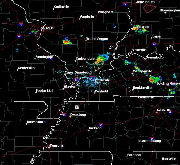 At 623 pm cdt, a severe thunderstorm was located 3 miles southeast of carrier mills, moving southeast at 20 mph (radar indicated). Hazards include 60 mph wind gusts and penny size hail. Expect damage to roofs. siding and trees. Locations impacted include, herod. At 623 pm cdt, a severe thunderstorm was located 3 miles southeast of carrier mills, moving southeast at 20 mph (radar indicated). Hazards include 60 mph wind gusts and penny size hail. Expect damage to roofs. siding and trees. Locations impacted include, herod.
|
| 6/21/2015 5:56 PM CDT |
 At 556 pm cdt, a severe thunderstorm was located between galatia and harrisburg, moving southeast at 25 mph (radar indicated). Hazards include 60 mph wind gusts and quarter size hail. Hail damage to vehicles is expected. Expect wind damage to roofs, siding and trees. At 556 pm cdt, a severe thunderstorm was located between galatia and harrisburg, moving southeast at 25 mph (radar indicated). Hazards include 60 mph wind gusts and quarter size hail. Hail damage to vehicles is expected. Expect wind damage to roofs, siding and trees.
|
| 5/8/2015 2:54 PM CDT | At 252 pm cdt, a severe thunderstorm was located over harrisburg, moving northeast at 40 mph (radar indicated. no reports of severe weather have been received at the national weather service). Hazards include 60 mph wind gusts. Expect damage to roofs. siding and trees. locations impacted include, harrisburg, carrier mills, galatia, carriers mills, stonefort, eddyville and muddy. 75in. |
| 5/8/2015 2:41 PM CDT | At 241 pm cdt, a severe thunderstorm was located over carrier mills, or near harrisburg, moving northeast at 40 mph (radar indicated). Hazards include 60 mph wind gusts. Expect damage to roofs. siding and trees. locations impacted include, harrisburg, carrier mills, galatia, carriers mills, stonefort, eddyville and muddy. 75in. |
| 5/8/2015 2:28 PM CDT | At 227 pm cdt, a severe thunderstorm was located 9 miles south of carriers mills, or 13 miles southwest of harrisburg, moving northeast at 40 mph (radar indicated). Hazards include 60 mph wind gusts. Expect damage to roofs. Siding and trees. |
| 4/25/2015 5:43 PM CDT | At 542 pm cdt, a severe thunderstorm was located near golconda, or 19 miles south of harrisburg, moving east at 35 mph (radar indicated). Hazards include ping pong ball size hail and 60 mph wind gusts. People and animals outdoors will be injured. expect hail damage to roofs, siding, windows and vehicles. Expect wind damage to roofs, siding and trees. |
| 4/25/2015 5:43 PM CDT | At 542 pm cdt, a severe thunderstorm was located near golconda, or 19 miles south of harrisburg, moving east at 35 mph (radar indicated). Hazards include ping pong ball size hail and 60 mph wind gusts. People and animals outdoors will be injured. expect hail damage to roofs, siding, windows and vehicles. Expect wind damage to roofs, siding and trees. |
| 4/3/2015 12:12 PM CDT | A severe thunderstorm warning remains in effect until 1245 pm cdt for southeastern saline. northern pope and northeastern johnson counties. at 1211 pm cdt. a severe thunderstorm was located 9 miles south of carriers mills. or 13 miles south of harrisburg. Moving northeast at 60 mph. |
| 4/3/2015 11:58 AM CDT | The national weather service in paducah has issued a * severe thunderstorm warning for. southeastern saline county in southern illinois. northern pope county in southern illinois. northeastern johnson county in southern illinois. Until 1245 pm cdt. |
| 3/25/2015 9:04 PM CDT | The national weather service in paducah has issued a * severe thunderstorm warning for. southeastern saline county in southern illinois. northeastern pope county in southern illinois. gallatin county in southern illinois. Northwestern hardin county in southern illinois. |
| 3/25/2015 8:52 PM CDT | A severe thunderstorm warning remains in effect until 900 pm cdt for southeastern saline. northern pope and northwestern hardin counties. at 852 pm cdt. a severe thunderstorm was located near dixon springs. or 14 miles east of vienna. moving northeast at 30 mph. hazard. Quarter size hail. |
| 3/25/2015 8:28 PM CDT | The national weather service in paducah has issued a * severe thunderstorm warning for. southeastern saline county in southern illinois. pope county in southern illinois. northwestern hardin county in southern illinois. Southeastern johnson county in southern illinois. |
| 11/20/2011 11:59 PM CST | Golf Ball sized hail reported 2 miles S of Eddyville, IL |
| 1/1/0001 12:00 AM | Update report from em...event occurred between eddyville and glendale illinois. large trees down. power outages along state hwy 147. partial roof removed on home and ba in pope county IL, 0.3 miles ENE of Eddyville, IL |
Hail Maps for Eddyville, IL


Connect with Interactive Hail Maps