

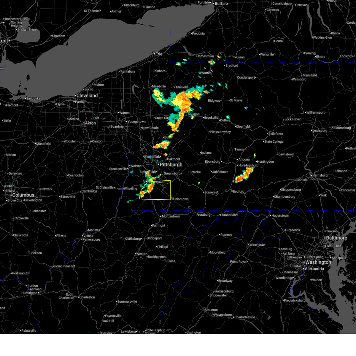
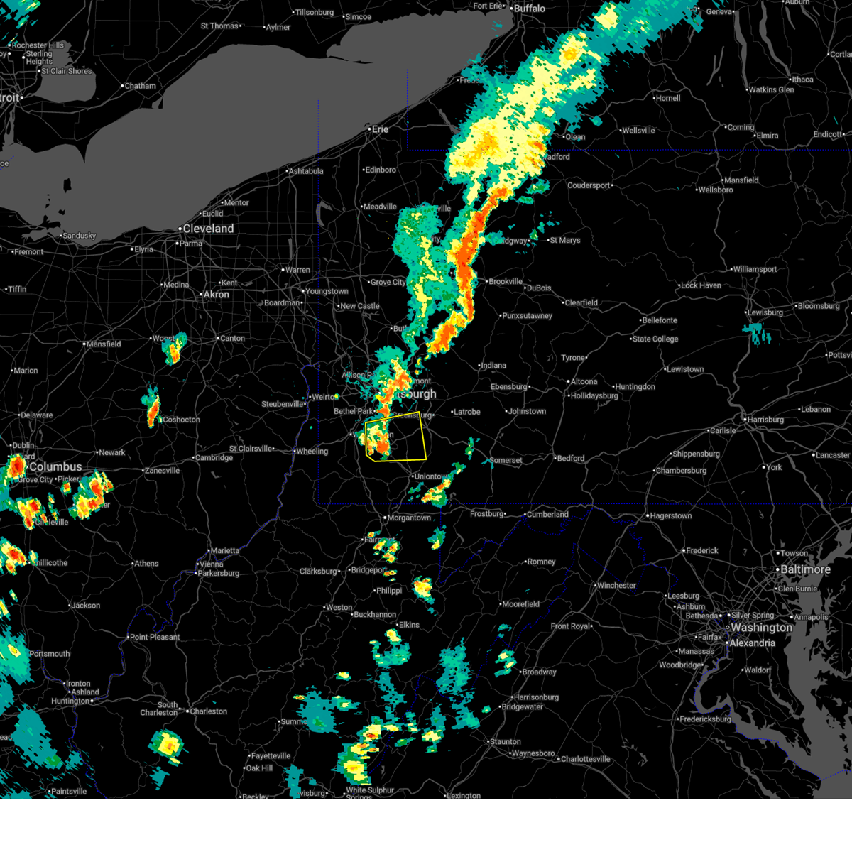
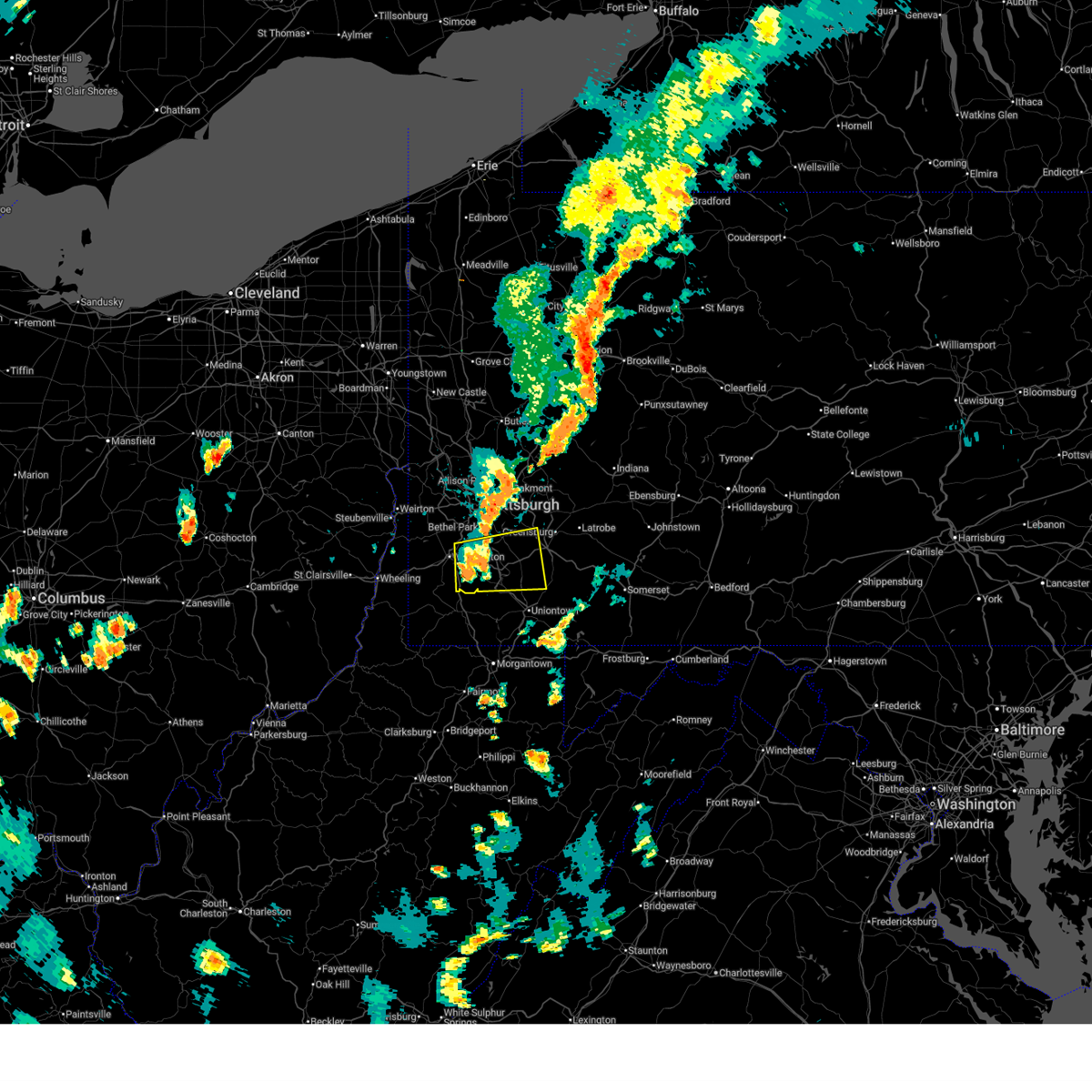
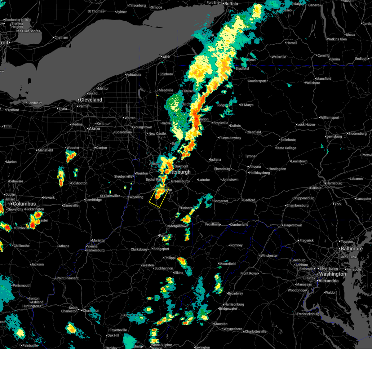
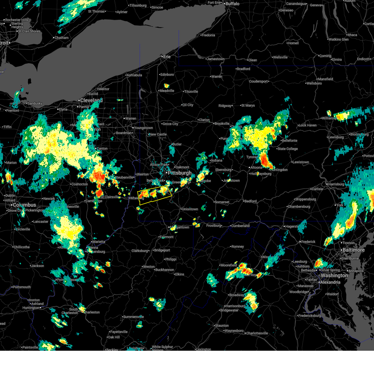
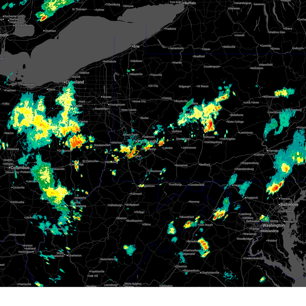
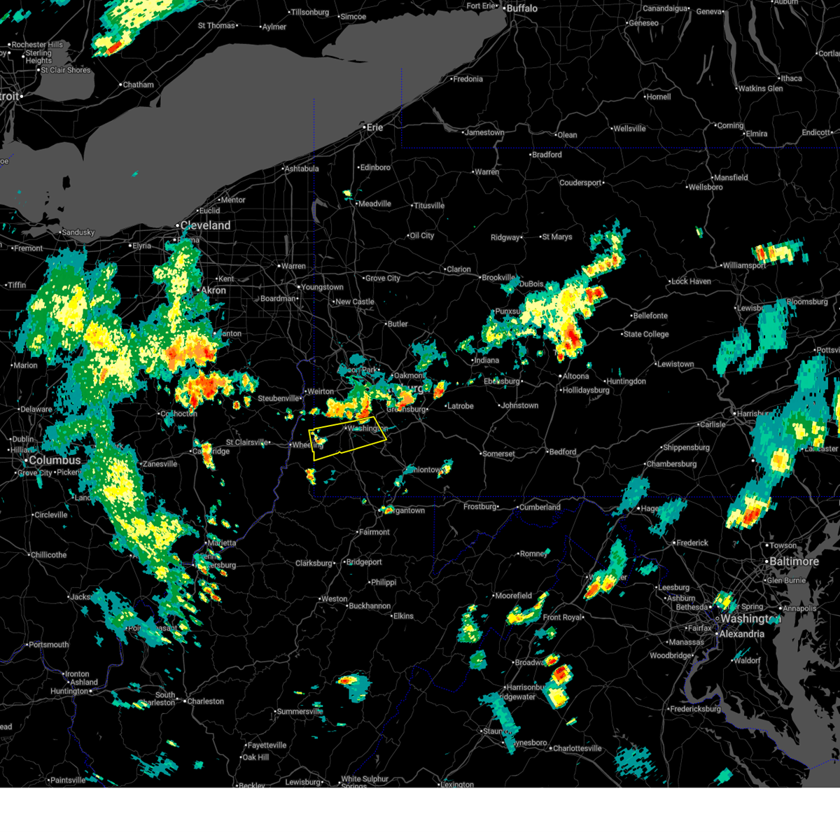
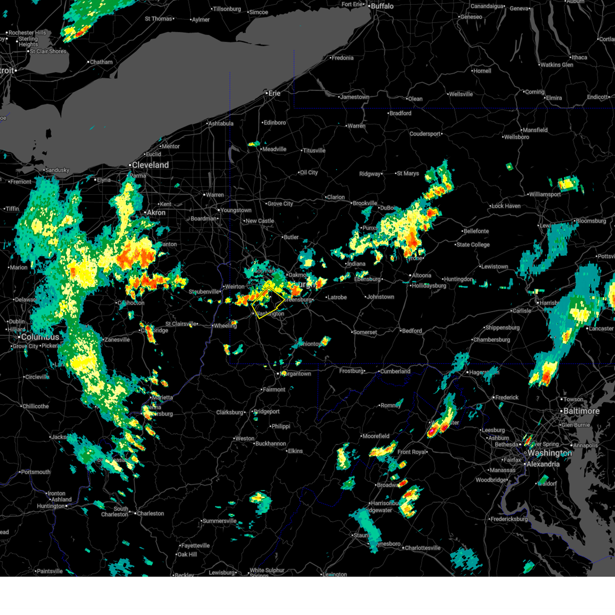
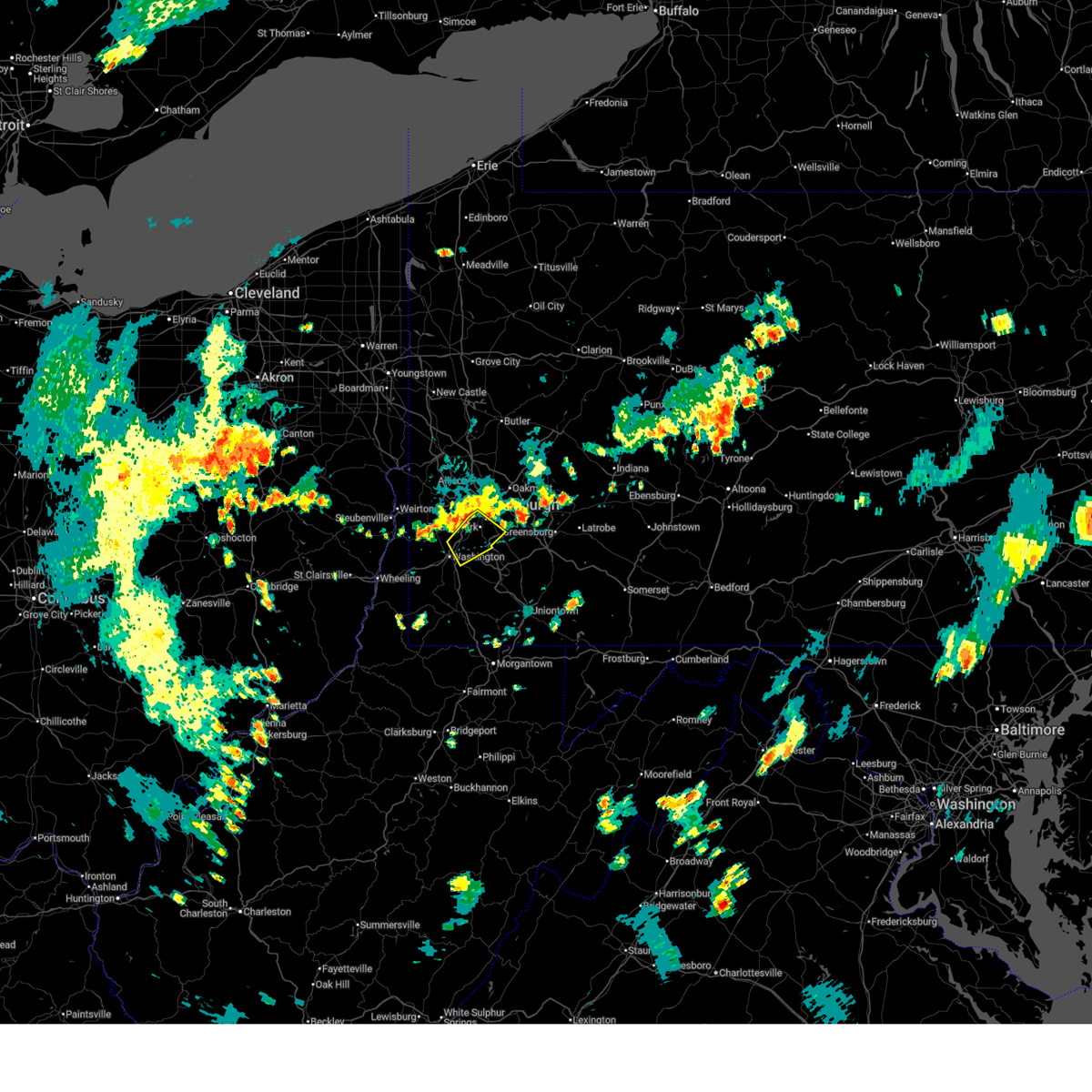
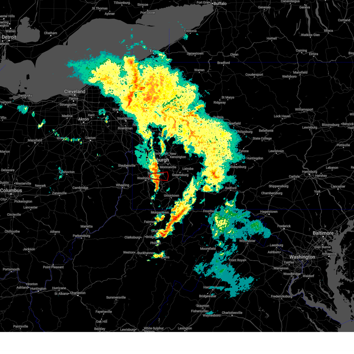
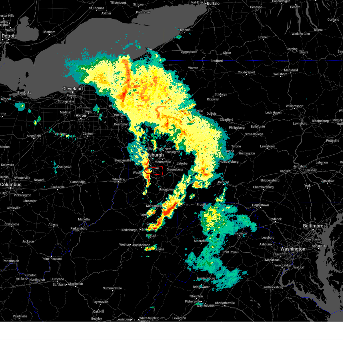
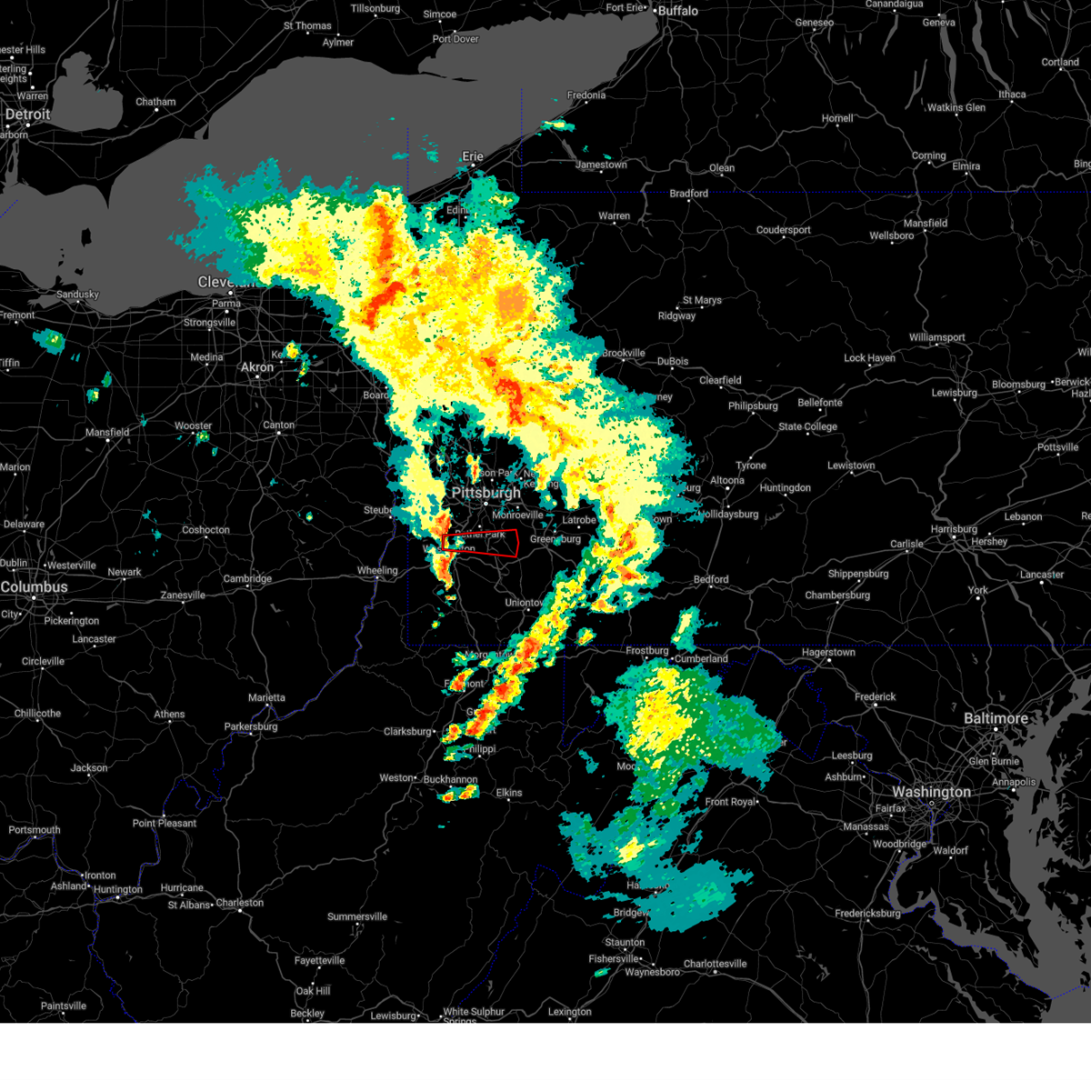
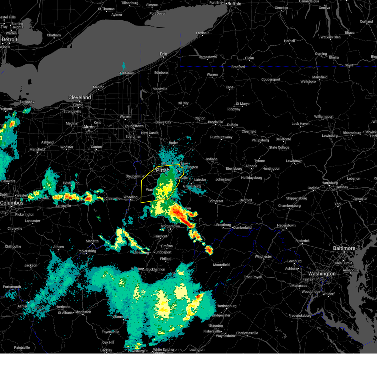
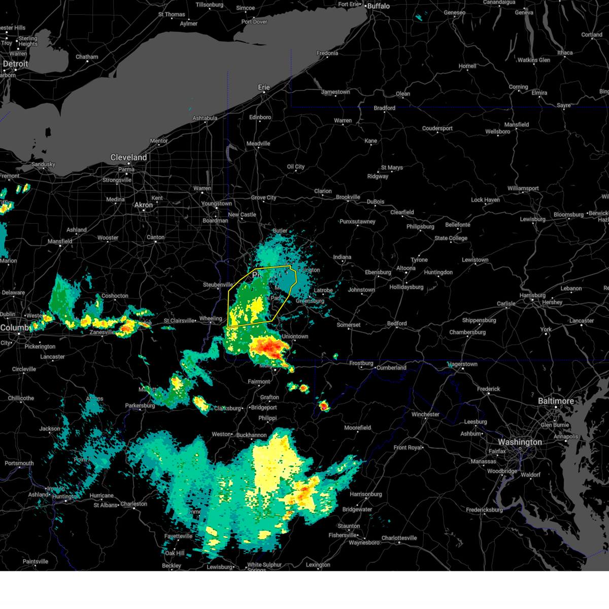
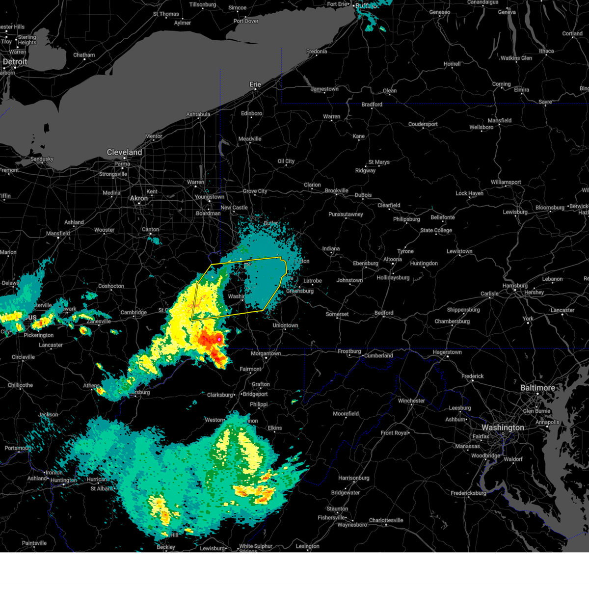
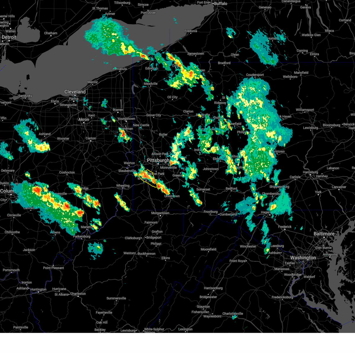
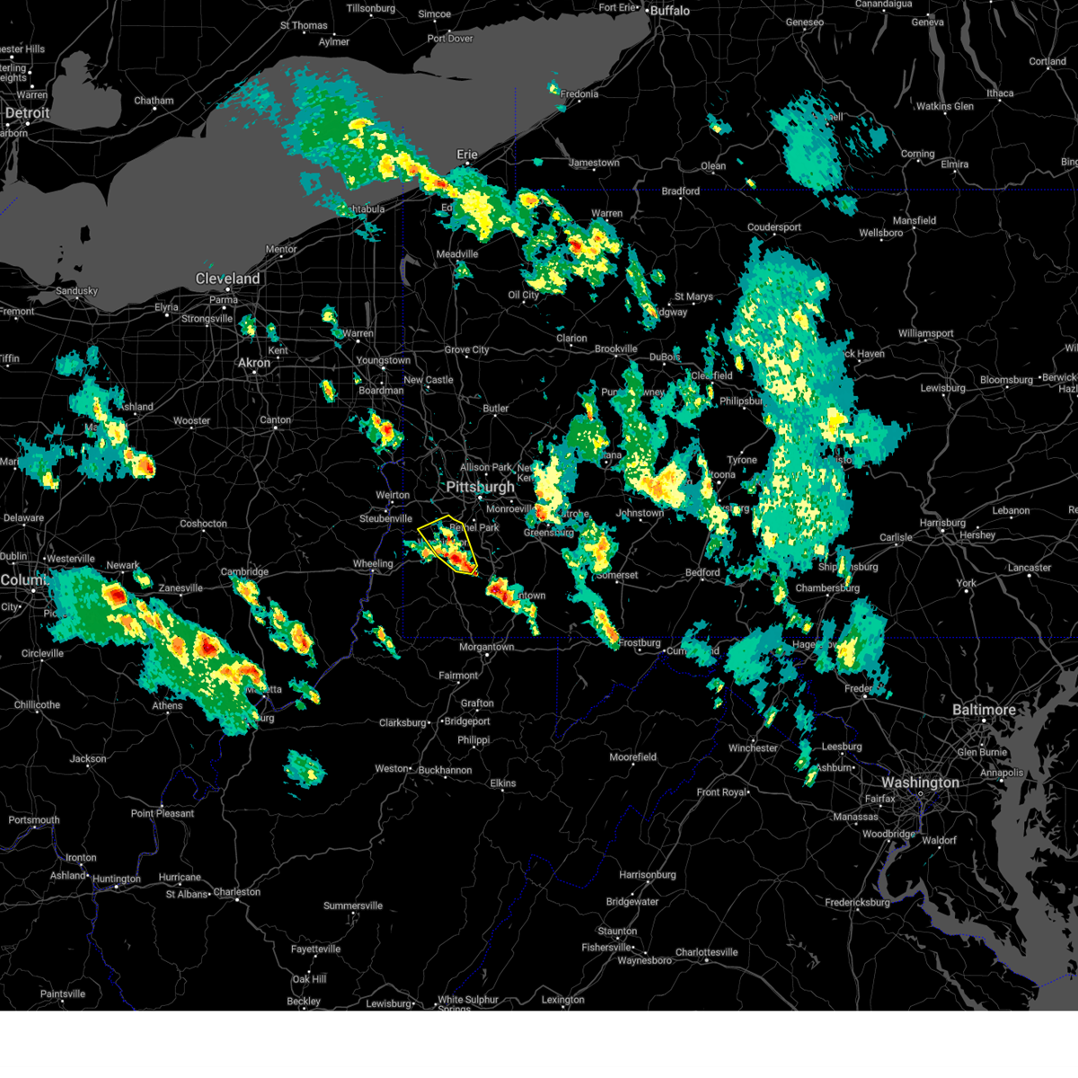
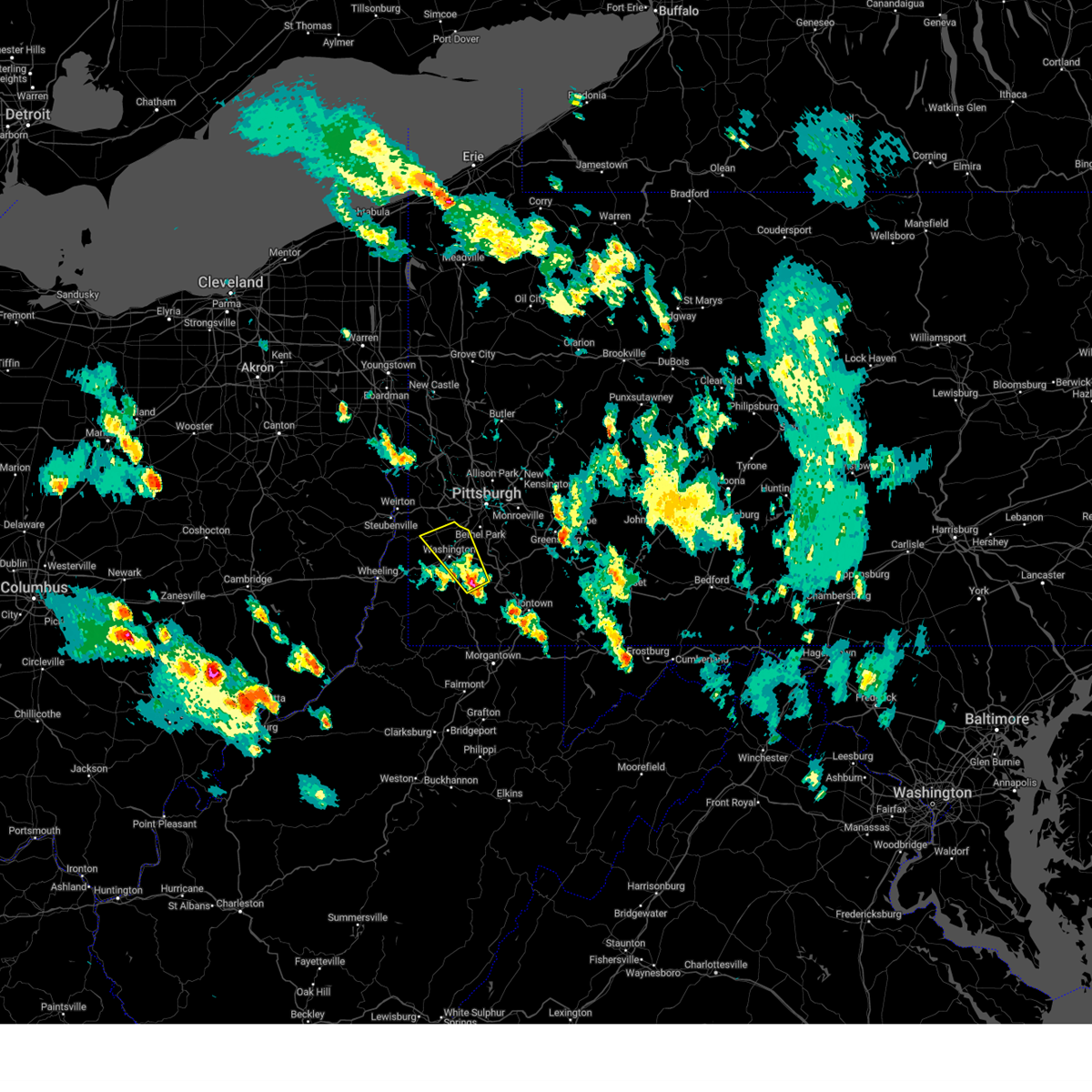
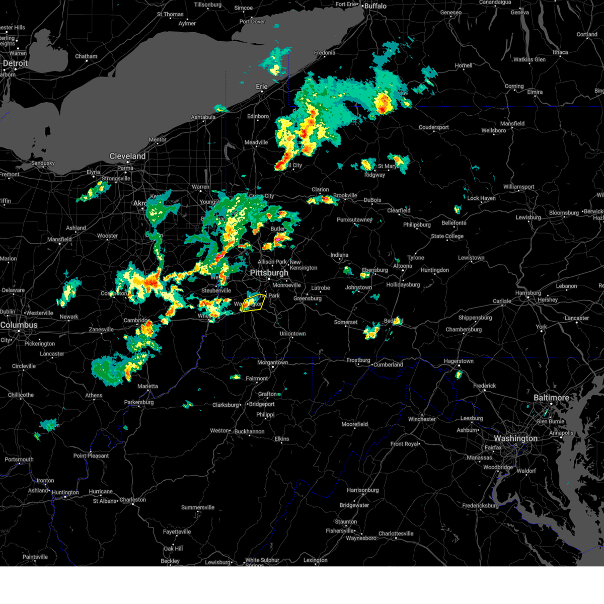
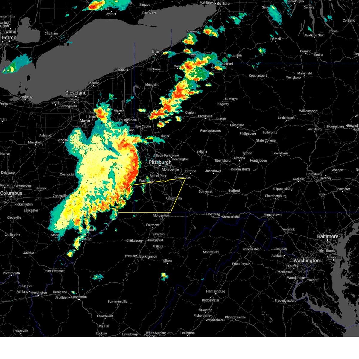
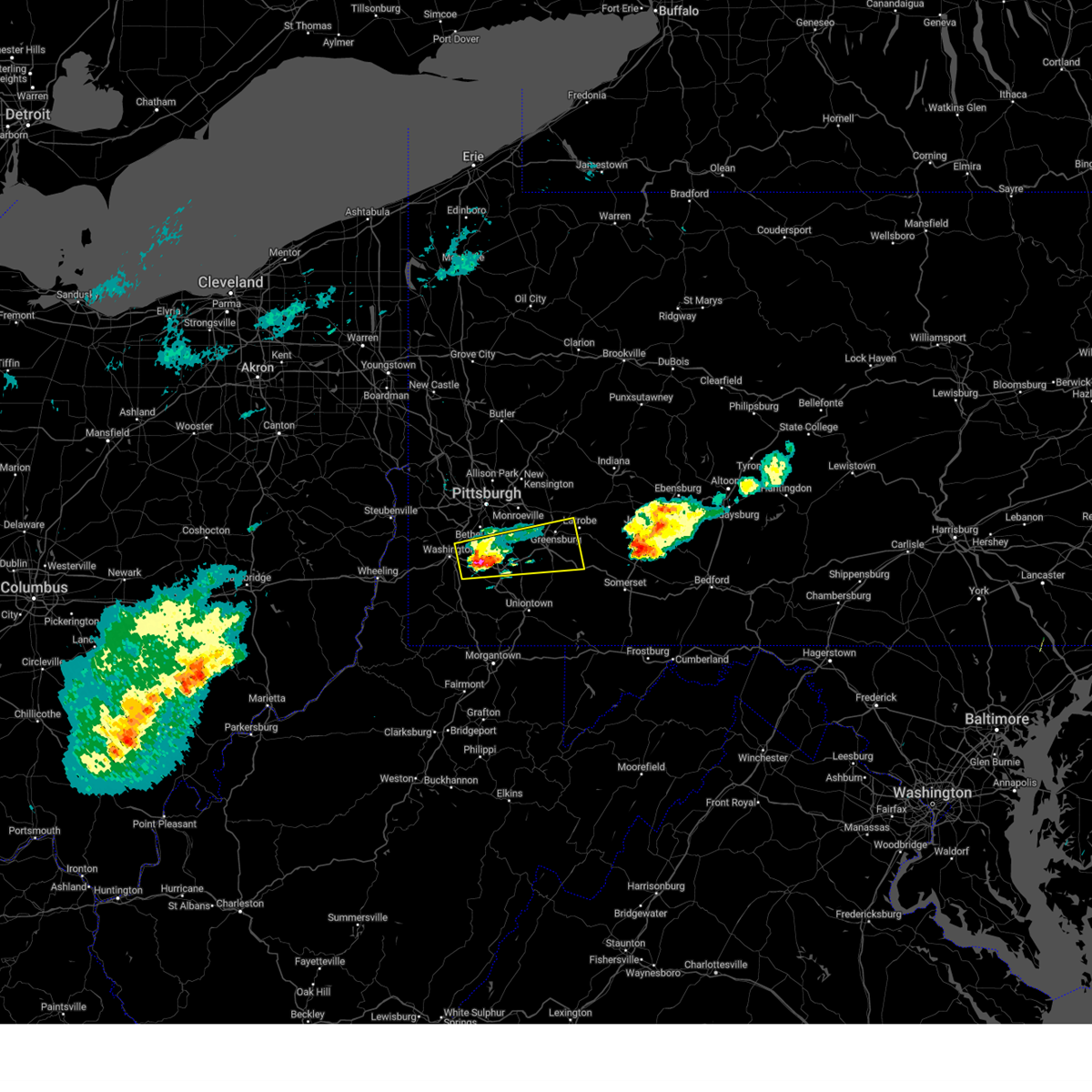
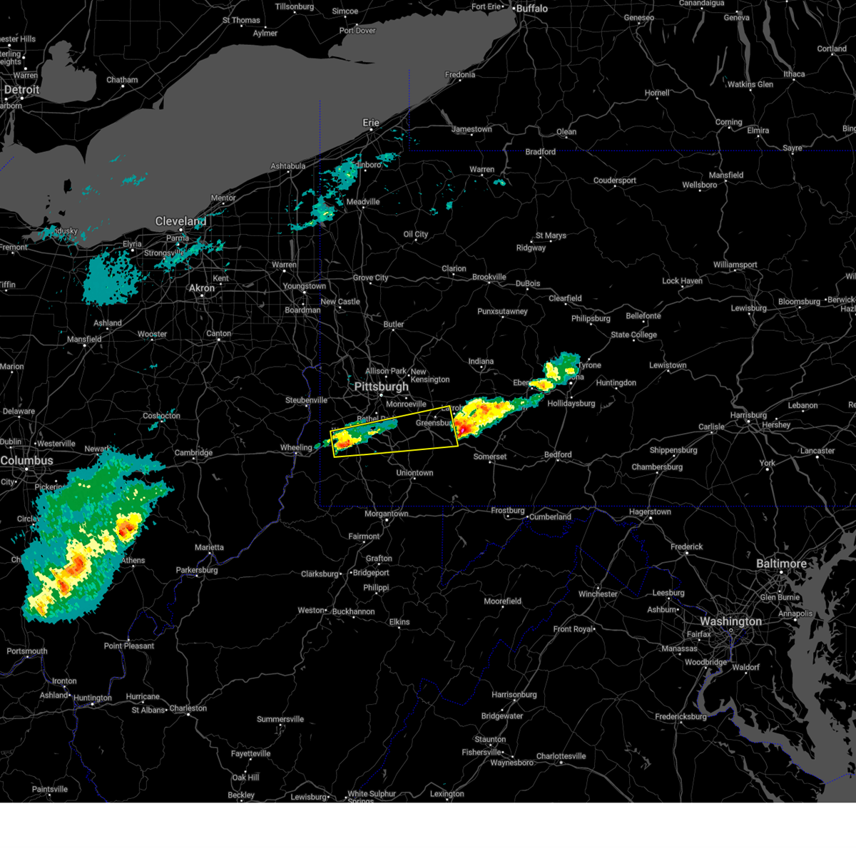
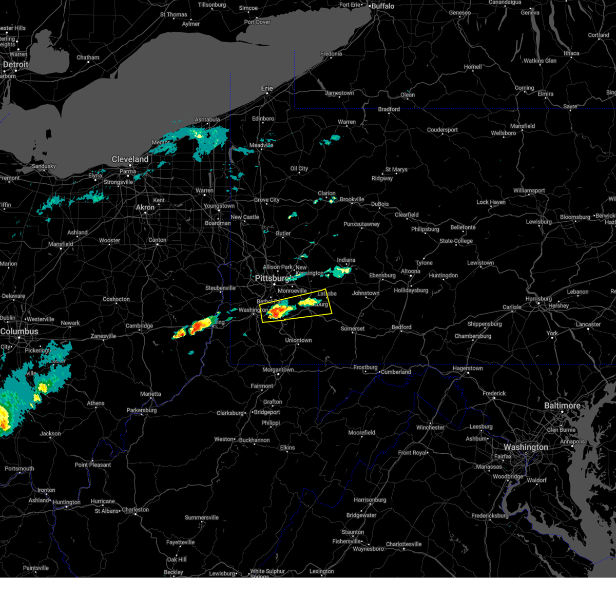
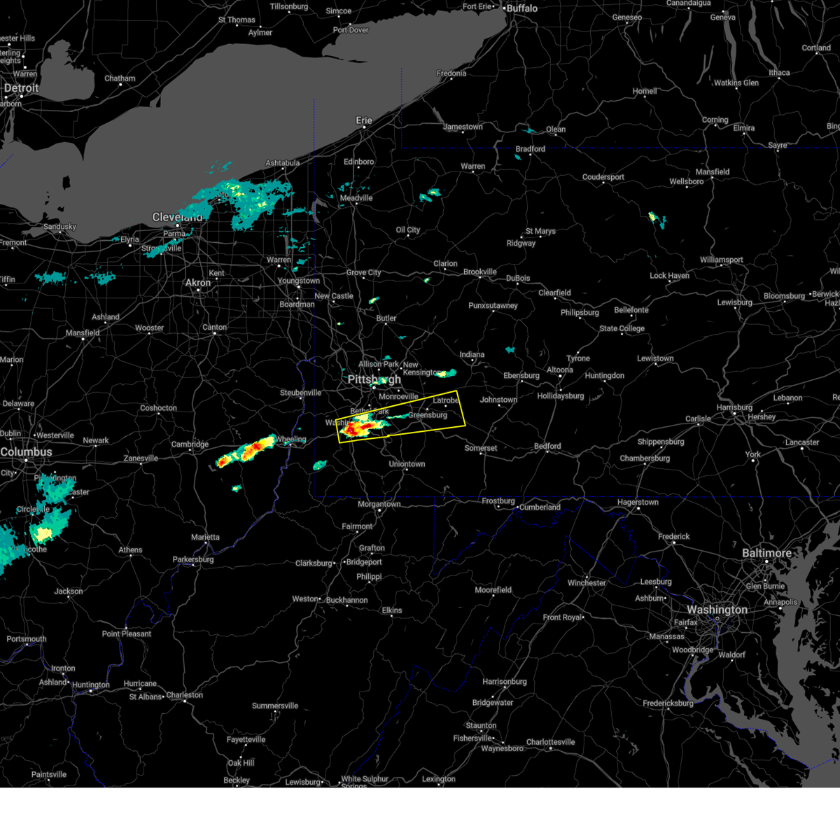
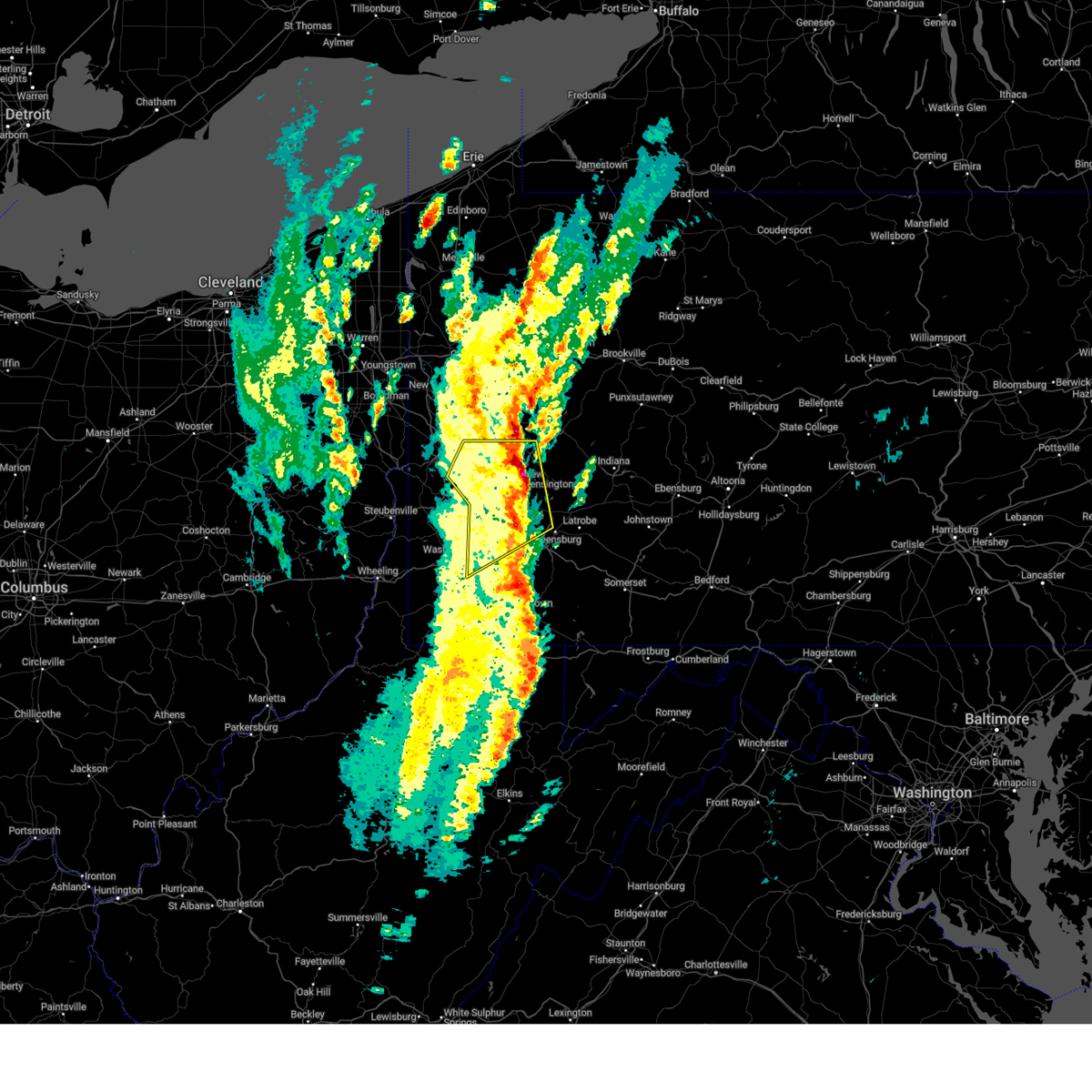
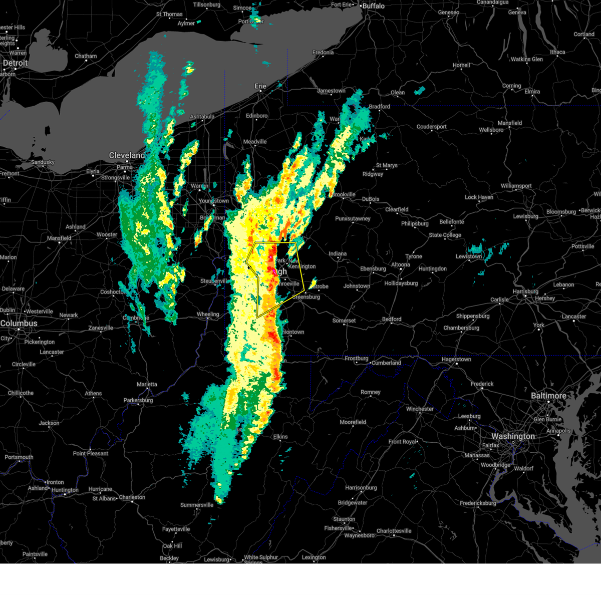
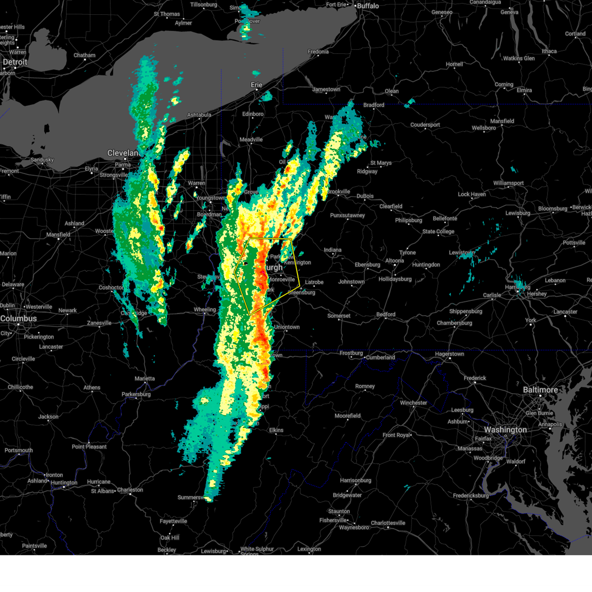
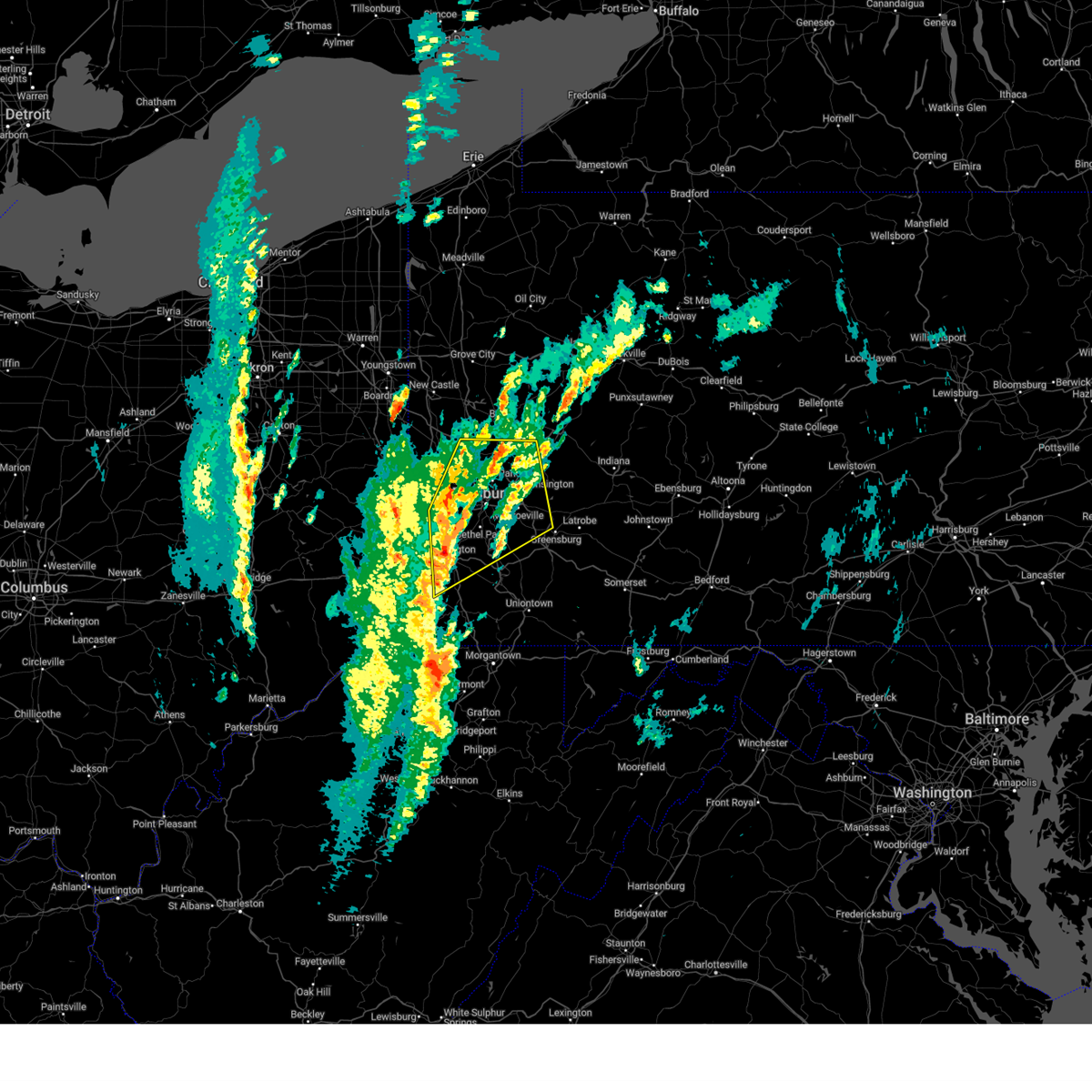
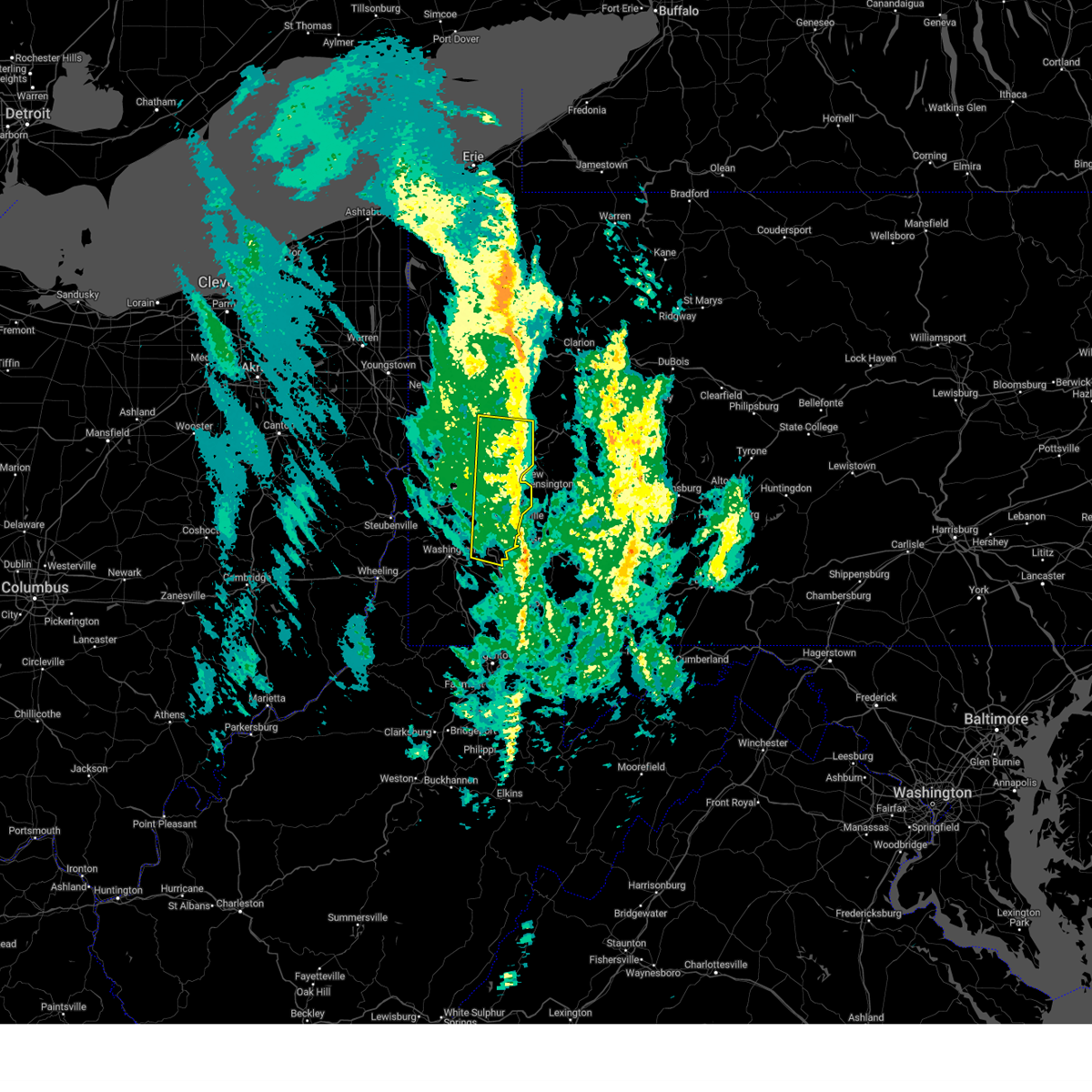
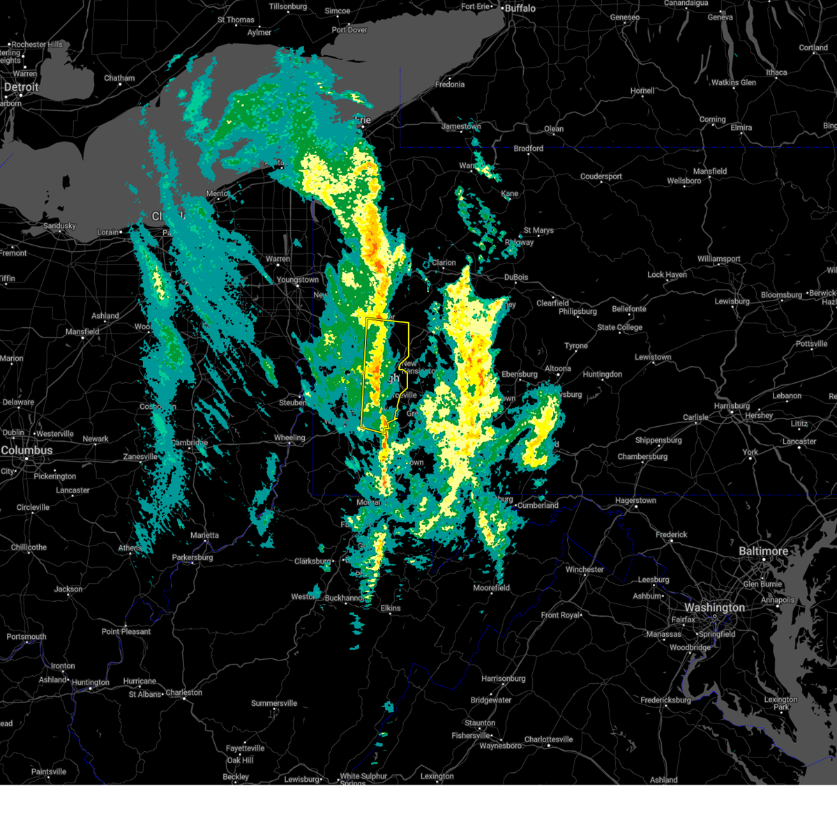
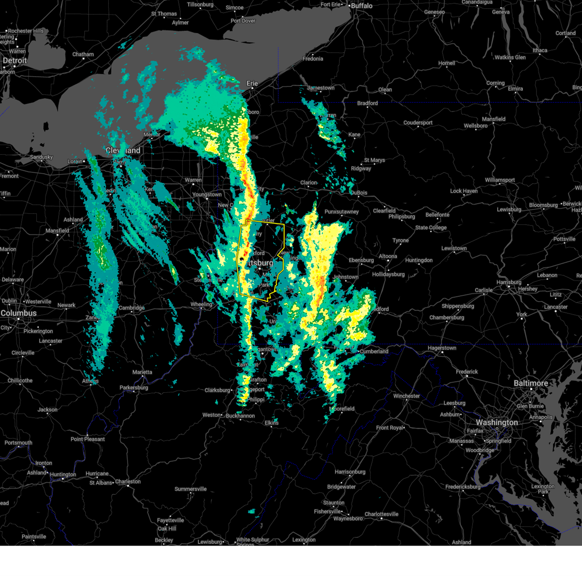
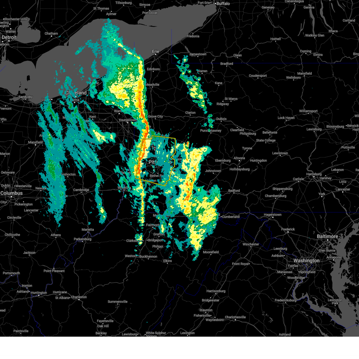
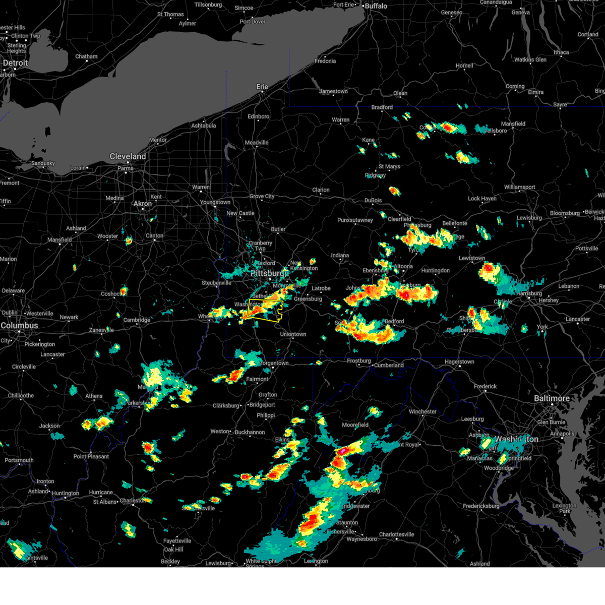
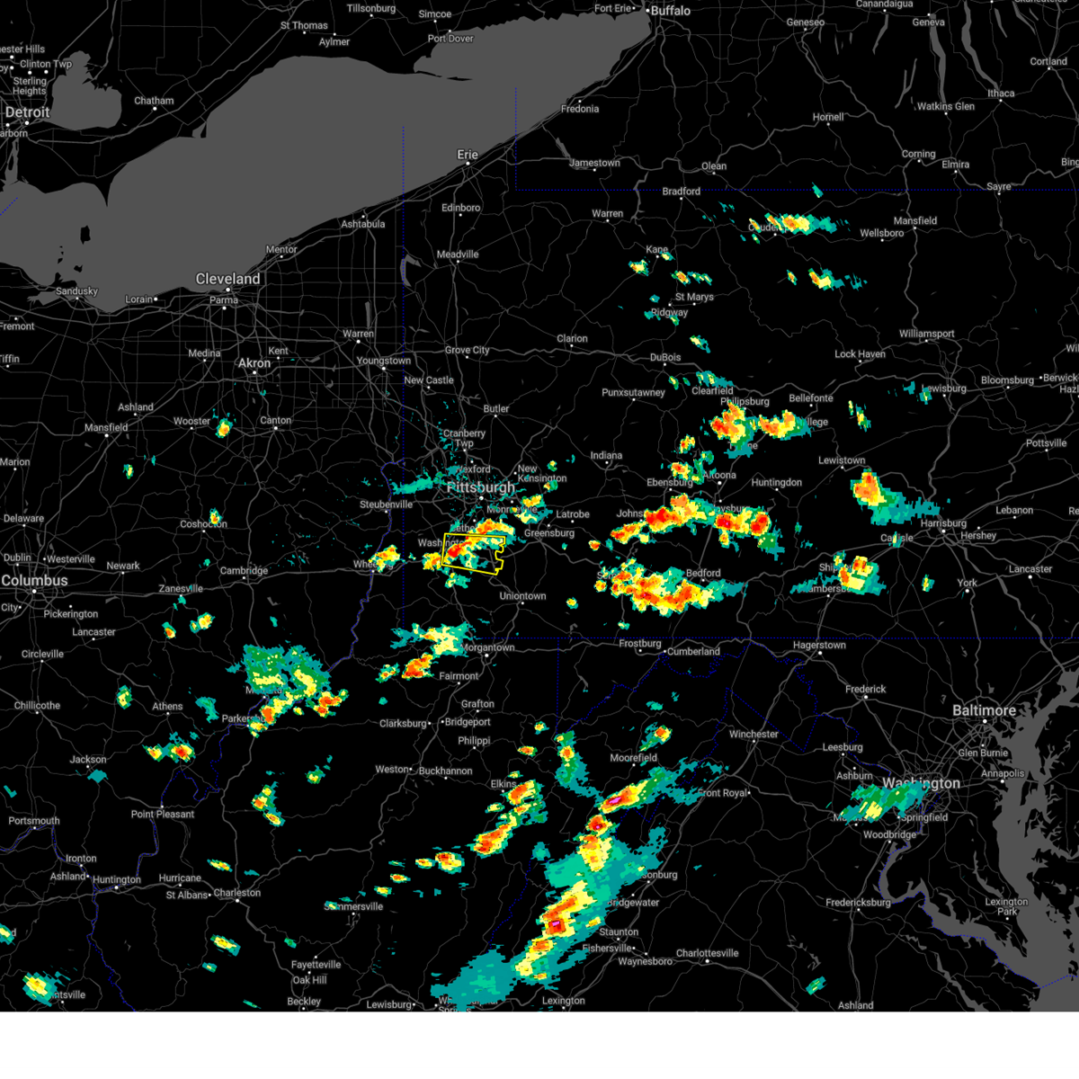
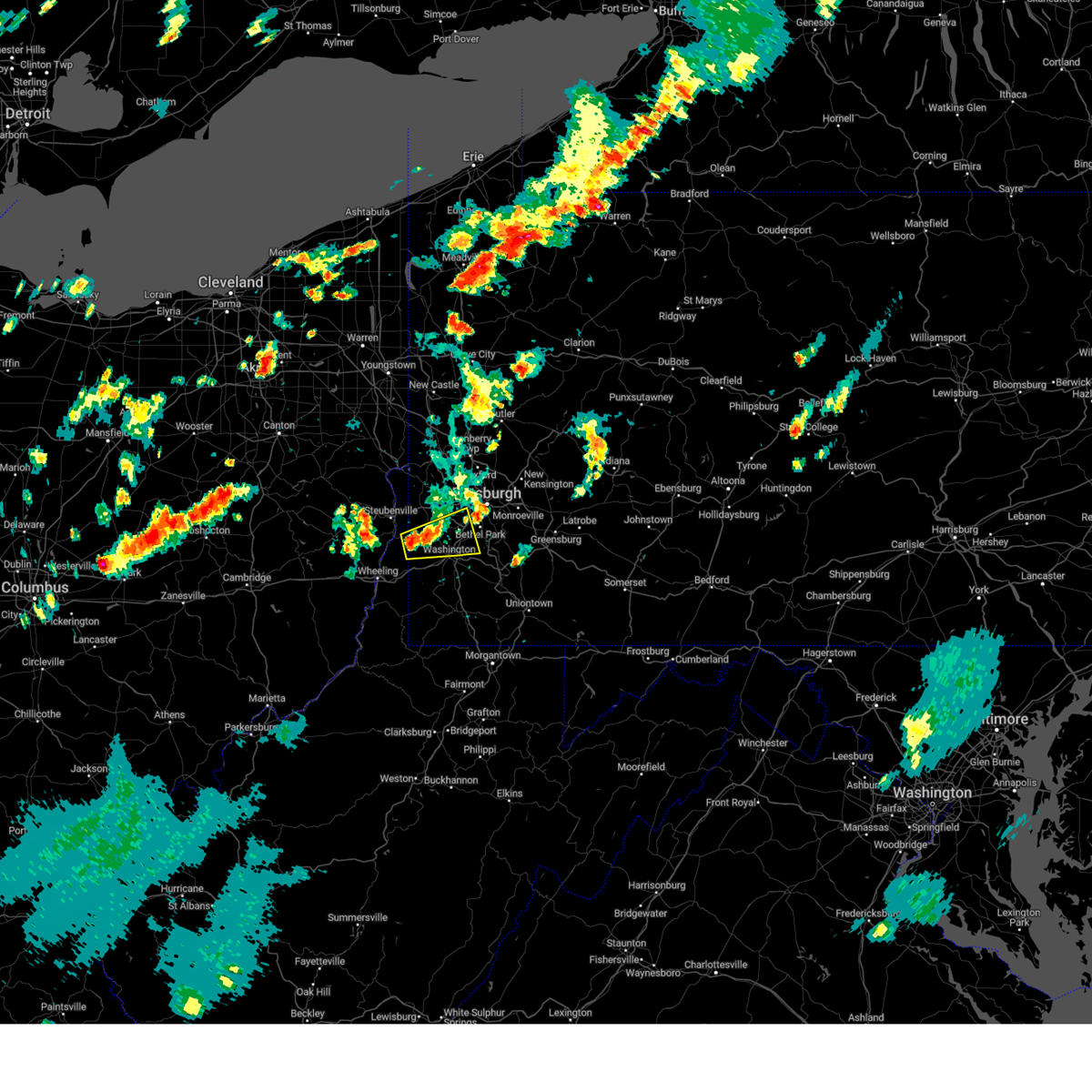
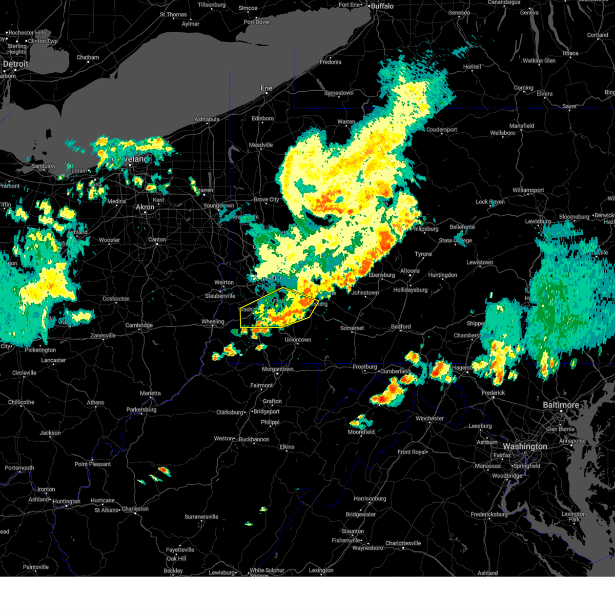
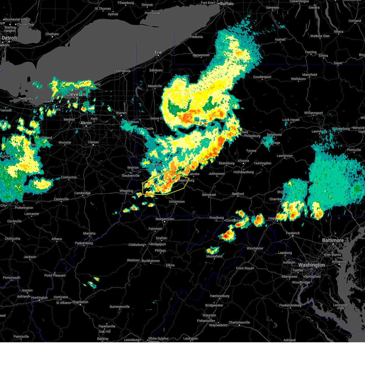
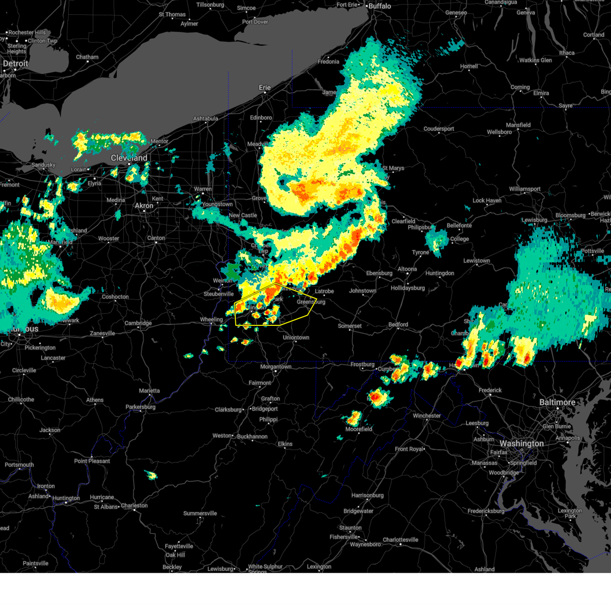
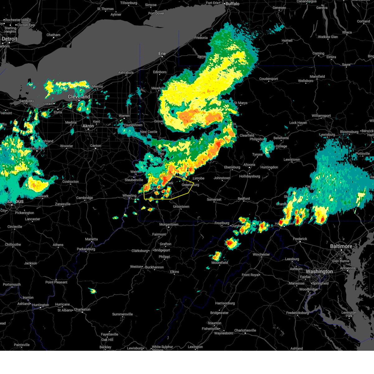
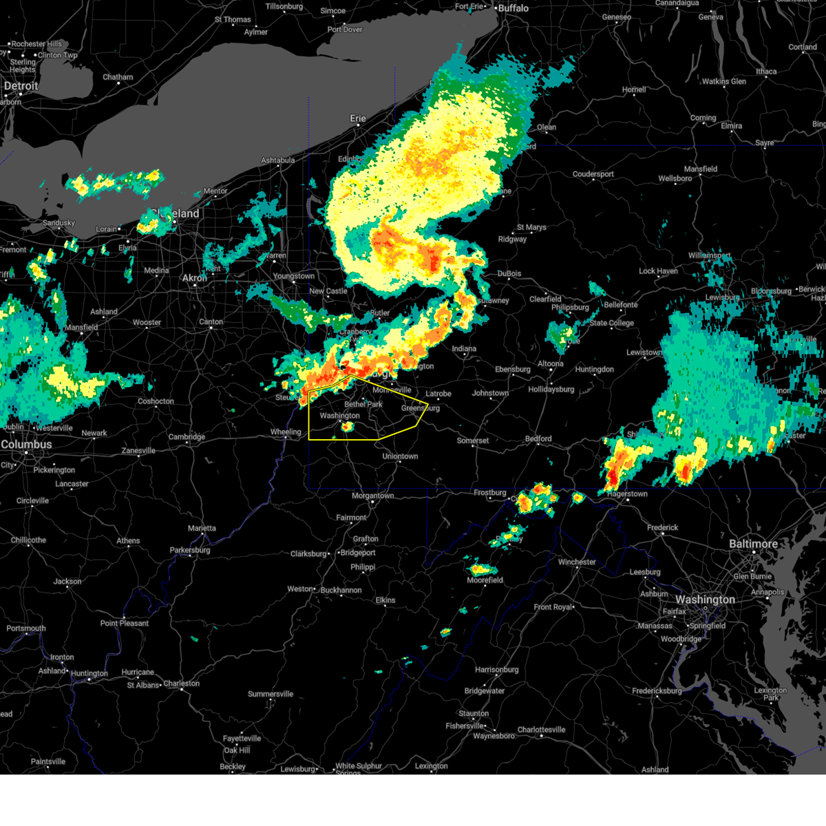
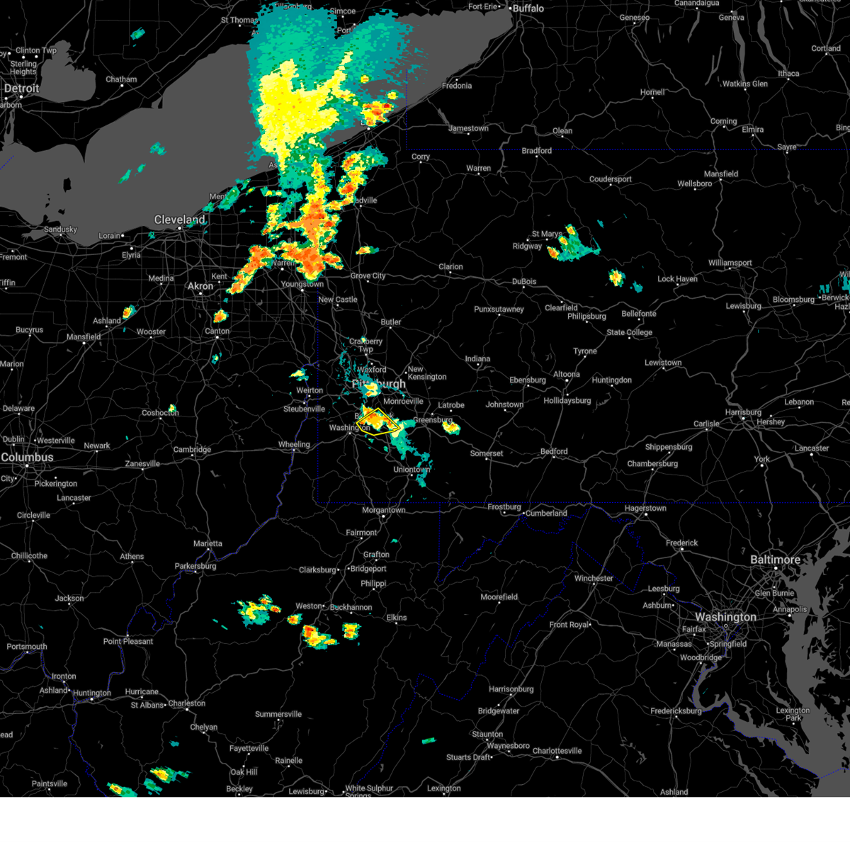
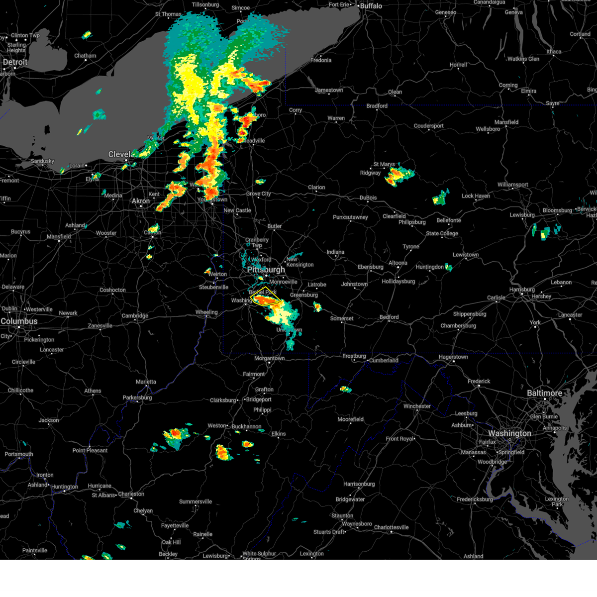
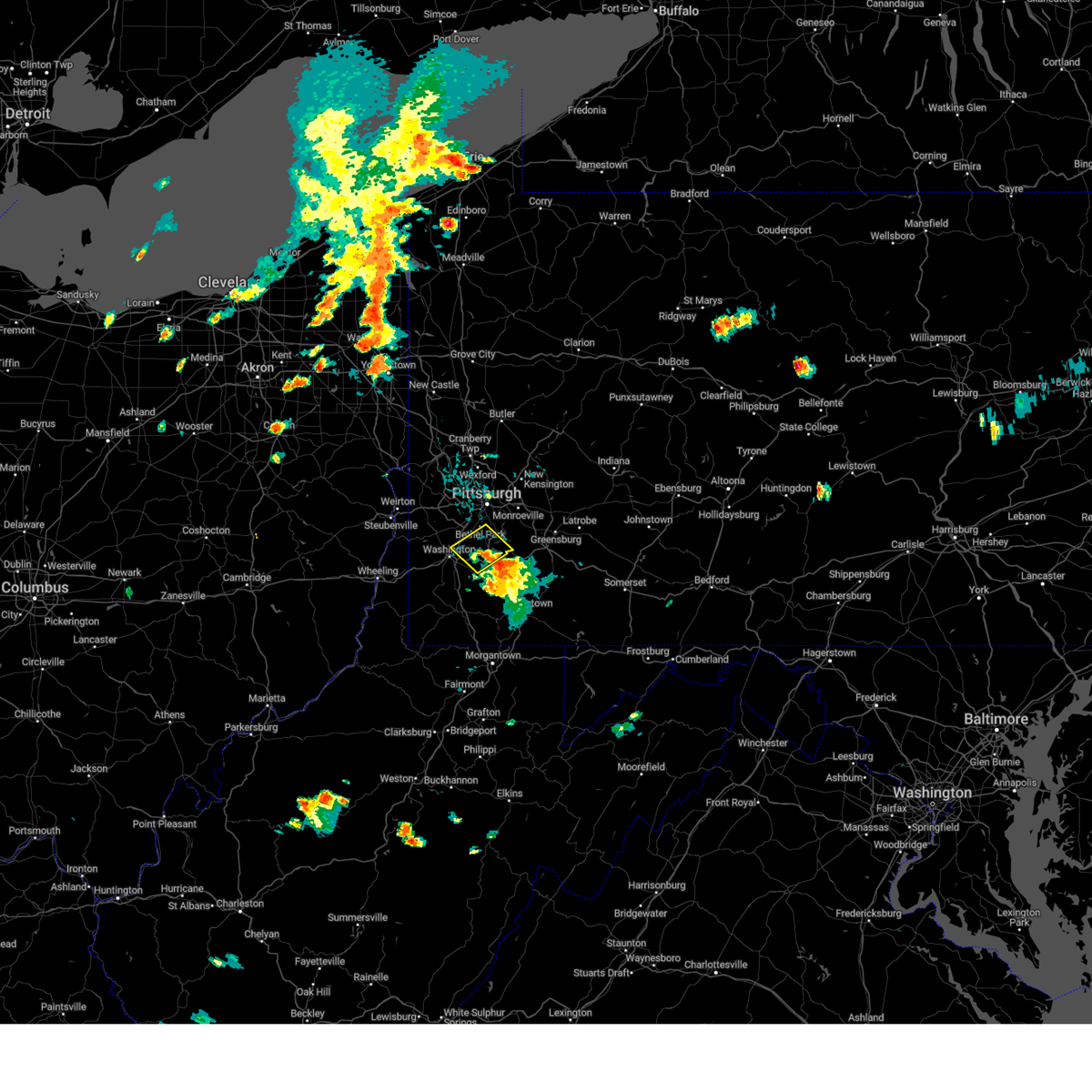
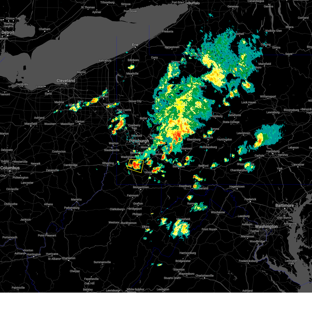
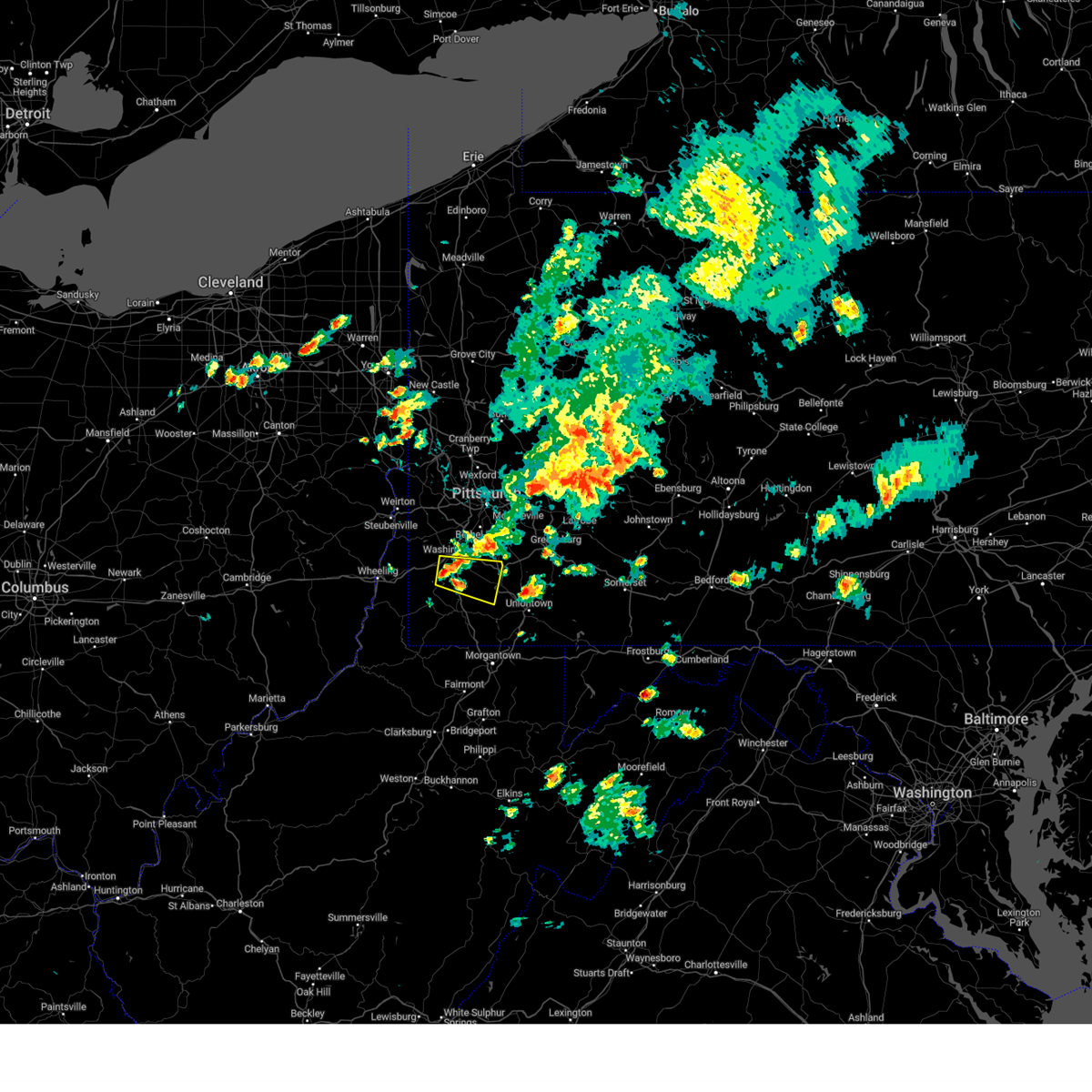
Hail Map for Eighty Four, PA
The Eighty Four, PA area has had 1 report of on-the-ground hail by trained spotters, and has been under severe weather warnings 71 times during the past 12 months. Doppler radar has detected hail at or near Eighty Four, PA on 33 occasions, including 2 occasions during the past year.
| Name: | Eighty Four, PA |
| Where Located: | 19.1 miles SSW of Pittsburgh, PA |
| Map: | Google Map for Eighty Four, PA |
| Population: | 657 |
| Housing Units: | 291 |
| More Info: | Search Google for Eighty Four, PA |
2
The Top Recent Hail Date for Eighty Four, PA is Thursday, August 29, 2024 (5th out of 33)

Hail and Wind Damage Spotted near Eighty Four, PA
| Date / Time | Report Details |
|---|---|
| 6/28/2025 12:18 PM EDT |
 Svrpbz the national weather service in pittsburgh has issued a * severe thunderstorm warning for, northwestern fayette county in southwestern pennsylvania, northern greene county in southwestern pennsylvania, southeastern washington county in southwestern pennsylvania, southwestern westmoreland county in southwestern pennsylvania, * until 100 pm edt. * at 1218 pm edt, a severe thunderstorm was located 7 miles southwest of bentleyville, or 11 miles southeast of washington, moving east at 25 mph (radar indicated). Hazards include 60 mph wind gusts. expect damage to roofs, siding, and trees Svrpbz the national weather service in pittsburgh has issued a * severe thunderstorm warning for, northwestern fayette county in southwestern pennsylvania, northern greene county in southwestern pennsylvania, southeastern washington county in southwestern pennsylvania, southwestern westmoreland county in southwestern pennsylvania, * until 100 pm edt. * at 1218 pm edt, a severe thunderstorm was located 7 miles southwest of bentleyville, or 11 miles southeast of washington, moving east at 25 mph (radar indicated). Hazards include 60 mph wind gusts. expect damage to roofs, siding, and trees
|
| 6/28/2025 12:14 PM EDT | Report of a tree and wires down blocking scott rd in somerset township. time estimated from rada in washington county PA, 3.9 miles NNW of Eighty Four, PA |
| 6/27/2025 6:04 PM EDT |
 At 604 pm edt, a severe thunderstorm was located over california, or 14 miles southeast of gastonville, moving east at 20 mph (radar indicated). Hazards include 60 mph wind gusts. Expect damage to roofs, siding, and trees. Locations impacted include, connellsville, gastonville, south park township, jefferson hills, monessen, clairton, california, donora, monongahela, charleroi, irwin, west newton, bentleyville, brownsville, fredericktown-millsboro, perryopolis, new eagle, north belle vernon, wickerham manor-fisher and baidland. At 604 pm edt, a severe thunderstorm was located over california, or 14 miles southeast of gastonville, moving east at 20 mph (radar indicated). Hazards include 60 mph wind gusts. Expect damage to roofs, siding, and trees. Locations impacted include, connellsville, gastonville, south park township, jefferson hills, monessen, clairton, california, donora, monongahela, charleroi, irwin, west newton, bentleyville, brownsville, fredericktown-millsboro, perryopolis, new eagle, north belle vernon, wickerham manor-fisher and baidland.
|
| 6/27/2025 5:54 PM EDT |
 Svrpbz the national weather service in pittsburgh has issued a * severe thunderstorm warning for, southeastern allegheny county in southwestern pennsylvania, northwestern fayette county in southwestern pennsylvania, southeastern washington county in southwestern pennsylvania, southwestern westmoreland county in southwestern pennsylvania, * until 645 pm edt. * at 554 pm edt, a severe thunderstorm was located near bentleyville, or 14 miles south of gastonville, moving east at 20 mph (radar indicated). Hazards include 60 mph wind gusts. expect damage to roofs, siding, and trees Svrpbz the national weather service in pittsburgh has issued a * severe thunderstorm warning for, southeastern allegheny county in southwestern pennsylvania, northwestern fayette county in southwestern pennsylvania, southeastern washington county in southwestern pennsylvania, southwestern westmoreland county in southwestern pennsylvania, * until 645 pm edt. * at 554 pm edt, a severe thunderstorm was located near bentleyville, or 14 miles south of gastonville, moving east at 20 mph (radar indicated). Hazards include 60 mph wind gusts. expect damage to roofs, siding, and trees
|
| 6/27/2025 5:44 PM EDT |
 The storm which prompted the warning has weakened below severe limits, and no longer poses an immediate threat to life or property. therefore, the warning will be allowed to expire. however, gusty winds and heavy rain are still possible with this thunderstorm. The storm which prompted the warning has weakened below severe limits, and no longer poses an immediate threat to life or property. therefore, the warning will be allowed to expire. however, gusty winds and heavy rain are still possible with this thunderstorm.
|
| 6/27/2025 5:33 PM EDT |
 At 533 pm edt, a severe thunderstorm was located 9 miles southeast of east washington, or 9 miles southeast of washington, moving east at 15 mph (radar indicated). Hazards include 60 mph wind gusts. Expect damage to roofs, siding, and trees. Locations impacted include, monongahela, bentleyville, new eagle, baidland, ellsworth, deemston, eighty four, cokeburg, marianna, beallsville, scenery hill and amity. At 533 pm edt, a severe thunderstorm was located 9 miles southeast of east washington, or 9 miles southeast of washington, moving east at 15 mph (radar indicated). Hazards include 60 mph wind gusts. Expect damage to roofs, siding, and trees. Locations impacted include, monongahela, bentleyville, new eagle, baidland, ellsworth, deemston, eighty four, cokeburg, marianna, beallsville, scenery hill and amity.
|
| 6/27/2025 5:17 PM EDT | Svrpbz the national weather service in pittsburgh has issued a * severe thunderstorm warning for, north central greene county in southwestern pennsylvania, southeastern washington county in southwestern pennsylvania, * until 545 pm edt. * at 517 pm edt, a severe thunderstorm was located 8 miles south of east washington, or 8 miles south of washington, moving east at 10 mph (radar indicated). Hazards include 60 mph wind gusts. expect damage to roofs, siding, and trees |
| 6/26/2025 6:53 PM EDT |
 The storm which prompted the warning has weakened below severe limits, and no longer poses an immediate threat to life or property. therefore, the warning will be allowed to expire. however, gusty winds and heavy rain are still possible with this thunderstorm. to report severe weather, contact your nearest law enforcement agency. they will send your report to the national weather service office. The storm which prompted the warning has weakened below severe limits, and no longer poses an immediate threat to life or property. therefore, the warning will be allowed to expire. however, gusty winds and heavy rain are still possible with this thunderstorm. to report severe weather, contact your nearest law enforcement agency. they will send your report to the national weather service office.
|
| 6/26/2025 6:39 PM EDT | At 639 pm edt, a severe thunderstorm was located 5 miles east of valley grove. this storm was nearly stationary (radar indicated). Hazards include 60 mph wind gusts and small hail. Expect damage to roofs, siding, and trees. Locations impacted include, washington, california, wolfdale, bentleyville, east washington, baidland, ellsworth, west finley, claysville, eighty four, cokeburg, beallsville, long branch, west alexander, twilight, taylorstown, scenery hill, amity, green hills and meadow lands. |
| 6/26/2025 6:38 PM EDT | The severe thunderstorm warning that was previously in effect has been reissued for washington county and is in effect until 700 pm edt. please refer to that bulletin for the latest severe weather information. however, heavy rain is still possible with this thunderstorm. to report severe weather, contact your nearest law enforcement agency. they will send your report to the national weather service office. |
| 6/26/2025 6:31 PM EDT |
 the severe thunderstorm warning has been cancelled and is no longer in effect the severe thunderstorm warning has been cancelled and is no longer in effect
|
| 6/26/2025 6:31 PM EDT |
 At 631 pm edt, a severe thunderstorm was located near mcmurray, moving southeast at 10 mph (radar indicated). Hazards include 60 mph wind gusts and small hail. Expect damage to roofs, siding, and trees. Locations impacted include, bethel park, mcmurray, gastonville, south park township, jefferson hills, eighty four and finleyville. At 631 pm edt, a severe thunderstorm was located near mcmurray, moving southeast at 10 mph (radar indicated). Hazards include 60 mph wind gusts and small hail. Expect damage to roofs, siding, and trees. Locations impacted include, bethel park, mcmurray, gastonville, south park township, jefferson hills, eighty four and finleyville.
|
| 6/26/2025 6:22 PM EDT |
 At 622 pm edt, a severe thunderstorm was located near mcmurray, moving southeast at 10 mph (radar indicated). Hazards include 60 mph wind gusts and small hail. Expect damage to roofs, siding, and trees. Locations impacted include, pittsburgh, mount lebanon, bethel park, mcmurray, gastonville, west mifflin, baldwin, whitehall, south park township, jefferson hills, brentwood, castle shannon, pleasant hills, clairton, eighty four and finleyville. At 622 pm edt, a severe thunderstorm was located near mcmurray, moving southeast at 10 mph (radar indicated). Hazards include 60 mph wind gusts and small hail. Expect damage to roofs, siding, and trees. Locations impacted include, pittsburgh, mount lebanon, bethel park, mcmurray, gastonville, west mifflin, baldwin, whitehall, south park township, jefferson hills, brentwood, castle shannon, pleasant hills, clairton, eighty four and finleyville.
|
| 6/26/2025 6:22 PM EDT |
 Svrpbz the national weather service in pittsburgh has issued a * severe thunderstorm warning for, southern washington county in southwestern pennsylvania, ohio county in northern west virginia, * until 700 pm edt. * at 622 pm edt, a severe thunderstorm was located near valley grove. this storm was nearly stationary (radar indicated). Hazards include 60 mph wind gusts and small hail. expect damage to roofs, siding, and trees Svrpbz the national weather service in pittsburgh has issued a * severe thunderstorm warning for, southern washington county in southwestern pennsylvania, ohio county in northern west virginia, * until 700 pm edt. * at 622 pm edt, a severe thunderstorm was located near valley grove. this storm was nearly stationary (radar indicated). Hazards include 60 mph wind gusts and small hail. expect damage to roofs, siding, and trees
|
| 6/26/2025 6:16 PM EDT |
 At 616 pm edt, a severe thunderstorm was located near mcmurray, moving southeast at 10 mph (radar indicated). Hazards include 60 mph wind gusts and small hail. Expect damage to roofs, siding, and trees. locations impacted include, pittsburgh, mount lebanon, bethel park, mcmurray, canonsburg, gastonville, west mifflin, baldwin, upper st. Clair, scott township, whitehall, south park township, cecil-bishop, jefferson hills, brentwood, dormont, castle shannon, pleasant hills, carnegie and clairton. At 616 pm edt, a severe thunderstorm was located near mcmurray, moving southeast at 10 mph (radar indicated). Hazards include 60 mph wind gusts and small hail. Expect damage to roofs, siding, and trees. locations impacted include, pittsburgh, mount lebanon, bethel park, mcmurray, canonsburg, gastonville, west mifflin, baldwin, upper st. Clair, scott township, whitehall, south park township, cecil-bishop, jefferson hills, brentwood, dormont, castle shannon, pleasant hills, carnegie and clairton.
|
| 6/26/2025 6:05 PM EDT |
 Svrpbz the national weather service in pittsburgh has issued a * severe thunderstorm warning for, south central allegheny county in southwestern pennsylvania, central washington county in southwestern pennsylvania, * until 645 pm edt. * at 605 pm edt, a severe thunderstorm was located near mcmurray, or over canonsburg, moving southeast at 10 mph (radar indicated). Hazards include 60 mph wind gusts and small hail. expect damage to roofs, siding, and trees Svrpbz the national weather service in pittsburgh has issued a * severe thunderstorm warning for, south central allegheny county in southwestern pennsylvania, central washington county in southwestern pennsylvania, * until 645 pm edt. * at 605 pm edt, a severe thunderstorm was located near mcmurray, or over canonsburg, moving southeast at 10 mph (radar indicated). Hazards include 60 mph wind gusts and small hail. expect damage to roofs, siding, and trees
|
| 6/18/2025 11:29 PM EDT |
 the severe thunderstorm warning has been cancelled and is no longer in effect the severe thunderstorm warning has been cancelled and is no longer in effect
|
| 6/18/2025 11:29 PM EDT |
 At 1129 pm edt, severe thunderstorms were located along a line from near oil city to near canonsburg, moving east at 45 mph (law enforcement reported trees down with this line of storms). Hazards include 60 mph wind gusts. Expect damage to roofs, siding, and trees. Locations impacted include, pittsburgh, penn hills, mount lebanon, bethel park, ross township, mccandless township, monroeville, cranberry, moon township, new castle, mcmurray, mckeesport, butler, washington, franklin park, oil city, jeannette, aliquippa, canonsburg and grove city. At 1129 pm edt, severe thunderstorms were located along a line from near oil city to near canonsburg, moving east at 45 mph (law enforcement reported trees down with this line of storms). Hazards include 60 mph wind gusts. Expect damage to roofs, siding, and trees. Locations impacted include, pittsburgh, penn hills, mount lebanon, bethel park, ross township, mccandless township, monroeville, cranberry, moon township, new castle, mcmurray, mckeesport, butler, washington, franklin park, oil city, jeannette, aliquippa, canonsburg and grove city.
|
| 5/21/2025 5:20 PM EDT |
 The storm which prompted the warning has weakened below severe limits, and no longer appears capable of producing a tornado. therefore, the warning will be allowed to expire. a tornado watch remains in effect until 800 pm edt for a portion of southwest pennsylvania. The storm which prompted the warning has weakened below severe limits, and no longer appears capable of producing a tornado. therefore, the warning will be allowed to expire. a tornado watch remains in effect until 800 pm edt for a portion of southwest pennsylvania.
|
| 5/21/2025 5:09 PM EDT |
 At 509 pm edt, a severe thunderstorm capable of producing a tornado was located near mcmurray, moving east at 30 mph (radar indicated rotation). Hazards include tornado. Flying debris will be dangerous to those caught without shelter. mobile homes will be damaged or destroyed. damage to roofs, windows and vehicles will occur. tree damage is likely. Locations impacted include, bethel park, mcmurray, gastonville, south park township, jefferson hills, clairton, donora, monongahela, new eagle, wickerham manor-fisher, baidland, elizabeth, lincoln, sutersville, west elizabeth and finleyville. At 509 pm edt, a severe thunderstorm capable of producing a tornado was located near mcmurray, moving east at 30 mph (radar indicated rotation). Hazards include tornado. Flying debris will be dangerous to those caught without shelter. mobile homes will be damaged or destroyed. damage to roofs, windows and vehicles will occur. tree damage is likely. Locations impacted include, bethel park, mcmurray, gastonville, south park township, jefferson hills, clairton, donora, monongahela, new eagle, wickerham manor-fisher, baidland, elizabeth, lincoln, sutersville, west elizabeth and finleyville.
|
| 5/21/2025 5:00 PM EDT |
 Torpbz the national weather service in pittsburgh has issued a * tornado warning for, southeastern allegheny county in southwestern pennsylvania, central washington county in southwestern pennsylvania, western westmoreland county in southwestern pennsylvania, * until 530 pm edt. * at 500 pm edt, a severe thunderstorm capable of producing a tornado was located over mcgovern, or over canonsburg, moving east at 40 mph (radar indicated rotation). Hazards include tornado. Flying debris will be dangerous to those caught without shelter. mobile homes will be damaged or destroyed. damage to roofs, windows and vehicles will occur. Tree damage is likely. Torpbz the national weather service in pittsburgh has issued a * tornado warning for, southeastern allegheny county in southwestern pennsylvania, central washington county in southwestern pennsylvania, western westmoreland county in southwestern pennsylvania, * until 530 pm edt. * at 500 pm edt, a severe thunderstorm capable of producing a tornado was located over mcgovern, or over canonsburg, moving east at 40 mph (radar indicated rotation). Hazards include tornado. Flying debris will be dangerous to those caught without shelter. mobile homes will be damaged or destroyed. damage to roofs, windows and vehicles will occur. Tree damage is likely.
|
| 5/17/2025 1:26 AM EDT |
 The storms which prompted the warning have weakened below severe limits, and no longer pose an immediate threat to life or property. therefore, the warning will be allowed to expire. however, gusty winds are still possible with these thunderstorms. to report severe weather, contact your nearest law enforcement agency. they will send your report to the national weather service office. a severe thunderstorm watch remains in effect until 400 am edt saturday for a portion of southwest pennsylvania. The storms which prompted the warning have weakened below severe limits, and no longer pose an immediate threat to life or property. therefore, the warning will be allowed to expire. however, gusty winds are still possible with these thunderstorms. to report severe weather, contact your nearest law enforcement agency. they will send your report to the national weather service office. a severe thunderstorm watch remains in effect until 400 am edt saturday for a portion of southwest pennsylvania.
|
| 5/17/2025 1:12 AM EDT |
 At 112 am edt, severe thunderstorms were located along a line from over mccandless township to 7 miles south of washington, moving east at 50 mph (radar indicated). Hazards include 60 mph wind gusts. Expect damage to roofs, siding, and trees. Locations impacted include, pittsburgh, penn hills, mount lebanon, bethel park, ross township, mccandless township, monroeville, moon township, mcmurray, mckeesport, washington, franklin park, canonsburg, avella, gastonville, shaler township, plum, west mifflin, north side pittsburgh and baldwin. At 112 am edt, severe thunderstorms were located along a line from over mccandless township to 7 miles south of washington, moving east at 50 mph (radar indicated). Hazards include 60 mph wind gusts. Expect damage to roofs, siding, and trees. Locations impacted include, pittsburgh, penn hills, mount lebanon, bethel park, ross township, mccandless township, monroeville, moon township, mcmurray, mckeesport, washington, franklin park, canonsburg, avella, gastonville, shaler township, plum, west mifflin, north side pittsburgh and baldwin.
|
| 5/17/2025 1:12 AM EDT |
 the severe thunderstorm warning has been cancelled and is no longer in effect the severe thunderstorm warning has been cancelled and is no longer in effect
|
| 5/17/2025 1:03 AM EDT | At 103 am edt, severe thunderstorms were located along a line from over franklin park to 11 miles southwest of wolfdale, or along a line from over franklin park to 10 miles east of valley grove, moving east at 50 mph (radar indicated). Hazards include 60 mph wind gusts. Expect damage to roofs, siding, and trees. Locations impacted include, pittsburgh, penn hills, mount lebanon, bethel park, ross township, wheeling, mccandless township, monroeville, moon township, mcmurray, weirton, mckeesport, washington, franklin park, canonsburg, martins ferry, warwood, wellsburg, bethlehem and west liberty. |
| 5/17/2025 1:03 AM EDT | the severe thunderstorm warning has been cancelled and is no longer in effect |
| 5/17/2025 12:42 AM EDT |
 Svrpbz the national weather service in pittsburgh has issued a * severe thunderstorm warning for, northeastern belmont county in east central ohio, southeastern jefferson oh county in east central ohio, allegheny county in southwestern pennsylvania, washington county in southwestern pennsylvania, southwestern beaver county in western pennsylvania, brooke county in northern west virginia, hancock county in northern west virginia, marshall county in northern west virginia, ohio county in northern west virginia, * until 130 am edt. * at 1242 am edt, severe thunderstorms were located along a line from 7 miles south of shippingport to over bellaire, or along a line from 9 miles southeast of east liverpool to over bellaire, moving east at 50 mph (radar indicated). Hazards include 60 mph wind gusts. expect damage to roofs, siding, and trees Svrpbz the national weather service in pittsburgh has issued a * severe thunderstorm warning for, northeastern belmont county in east central ohio, southeastern jefferson oh county in east central ohio, allegheny county in southwestern pennsylvania, washington county in southwestern pennsylvania, southwestern beaver county in western pennsylvania, brooke county in northern west virginia, hancock county in northern west virginia, marshall county in northern west virginia, ohio county in northern west virginia, * until 130 am edt. * at 1242 am edt, severe thunderstorms were located along a line from 7 miles south of shippingport to over bellaire, or along a line from 9 miles southeast of east liverpool to over bellaire, moving east at 50 mph (radar indicated). Hazards include 60 mph wind gusts. expect damage to roofs, siding, and trees
|
| 5/5/2025 4:59 PM EDT |
 the severe thunderstorm warning has been cancelled and is no longer in effect the severe thunderstorm warning has been cancelled and is no longer in effect
|
| 5/5/2025 4:49 PM EDT | At 449 pm edt, a severe thunderstorm was located near east washington, or near washington, moving northwest at 20 mph (radar indicated). Hazards include 60 mph wind gusts and half dollar size hail. Hail damage to vehicles is expected. expect wind damage to roofs, siding, and trees. Locations impacted include, mcmurray, washington, canonsburg, cecil-bishop, wolfdale, mcgovern, east washington, houston, ellsworth, eighty four, cokeburg, hickory, scenery hill and meadow lands. |
| 5/5/2025 4:38 PM EDT |
 At 438 pm edt, a severe thunderstorm was located 6 miles southeast of east washington, or 6 miles southeast of washington, moving northwest at 20 mph (radar indicated). Hazards include ping pong ball size hail and 60 mph wind gusts. People and animals outdoors will be injured. expect hail damage to roofs, siding, windows, and vehicles. expect wind damage to roofs, siding, and trees. Locations impacted include, mcmurray, washington, canonsburg, cecil-bishop, wolfdale, mcgovern, east washington, houston, ellsworth, eighty four, cokeburg, hickory, beallsville, scenery hill and meadow lands. At 438 pm edt, a severe thunderstorm was located 6 miles southeast of east washington, or 6 miles southeast of washington, moving northwest at 20 mph (radar indicated). Hazards include ping pong ball size hail and 60 mph wind gusts. People and animals outdoors will be injured. expect hail damage to roofs, siding, windows, and vehicles. expect wind damage to roofs, siding, and trees. Locations impacted include, mcmurray, washington, canonsburg, cecil-bishop, wolfdale, mcgovern, east washington, houston, ellsworth, eighty four, cokeburg, hickory, beallsville, scenery hill and meadow lands.
|
| 5/5/2025 4:25 PM EDT |
 Svrpbz the national weather service in pittsburgh has issued a * severe thunderstorm warning for, central washington county in southwestern pennsylvania, * until 515 pm edt. * at 425 pm edt, a severe thunderstorm was located 6 miles southwest of bentleyville, or 11 miles southeast of washington, moving northwest at 20 mph (radar indicated). Hazards include 60 mph wind gusts and quarter size hail. Hail damage to vehicles is expected. Expect wind damage to roofs, siding, and trees. Svrpbz the national weather service in pittsburgh has issued a * severe thunderstorm warning for, central washington county in southwestern pennsylvania, * until 515 pm edt. * at 425 pm edt, a severe thunderstorm was located 6 miles southwest of bentleyville, or 11 miles southeast of washington, moving northwest at 20 mph (radar indicated). Hazards include 60 mph wind gusts and quarter size hail. Hail damage to vehicles is expected. Expect wind damage to roofs, siding, and trees.
|
| 5/2/2025 5:14 PM EDT | The severe thunderstorm warning that was previously in effect has been reissued for washington county and is in effect until 545 pm edt. please refer to that bulletin for the latest severe weather information. a severe thunderstorm watch remains in effect until 700 pm edt for a portion of southwest pennsylvania. |
| 5/2/2025 5:09 PM EDT | Svrpbz the national weather service in pittsburgh has issued a * severe thunderstorm warning for, south central allegheny county in southwestern pennsylvania, east central washington county in southwestern pennsylvania, * until 545 pm edt. * at 509 pm edt, a severe thunderstorm was located near canonsburg, or near washington, moving east at 30 mph (radar indicated). Hazards include 60 mph wind gusts and small hail. expect damage to roofs, siding, and trees |
| 5/2/2025 5:02 PM EDT |
 At 502 pm edt, a severe thunderstorm was located over east washington, or over washington, moving east at 35 mph (public reported hail to the size of quarters was reported 6 miles nw of claysville). Hazards include 60 mph wind gusts and half dollar size hail. Hail damage to vehicles is expected. expect wind damage to roofs, siding, and trees. Locations impacted include, bethel park, mcmurray, washington, canonsburg, wolfdale, mcgovern, east washington, houston, eighty four and meadow lands. At 502 pm edt, a severe thunderstorm was located over east washington, or over washington, moving east at 35 mph (public reported hail to the size of quarters was reported 6 miles nw of claysville). Hazards include 60 mph wind gusts and half dollar size hail. Hail damage to vehicles is expected. expect wind damage to roofs, siding, and trees. Locations impacted include, bethel park, mcmurray, washington, canonsburg, wolfdale, mcgovern, east washington, houston, eighty four and meadow lands.
|
| 5/2/2025 4:54 PM EDT | At 454 pm edt, a severe thunderstorm was located over wolfdale, or near washington, moving east at 25 mph (hail to the size of quarters was reported 6 miles nw of claysville). Hazards include 60 mph wind gusts and half dollar size hail. Hail damage to vehicles is expected. expect wind damage to roofs, siding, and trees. Locations impacted include, bethel park, mcmurray, washington, canonsburg, cecil-bishop, wolfdale, mcgovern, east washington, houston, eighty four, taylorstown and meadow lands. |
| 5/2/2025 4:49 PM EDT | At 449 pm edt, a severe thunderstorm was located over wolfdale, or 5 miles west of washington, moving east at 25 mph (hail to the size of quarters was reported 6 miles northwest of claysville). Hazards include half dollar size hail. Damage to vehicles is expected. Locations impacted include, bethel park, mcmurray, washington, canonsburg, cecil-bishop, wolfdale, mcgovern, east washington, houston, eighty four, taylorstown and meadow lands. |
| 5/2/2025 4:35 PM EDT | Svrpbz the national weather service in pittsburgh has issued a * severe thunderstorm warning for, west central washington county in southwestern pennsylvania, * until 515 pm edt. * at 435 pm edt, a severe thunderstorm was located 8 miles south of avella, moving northeast at 30 mph (radar indicated). Hazards include quarter size hail. damage to vehicles is expected |
| 4/29/2025 5:29 PM EDT | The storms which prompted the warning have moved out of the area. therefore, the warning will be allowed to expire. however, gusty winds are still possible with these thunderstorms. a severe thunderstorm watch remains in effect until 700 pm edt for northern west virginia. a severe thunderstorm watch also remains in effect until 1000 pm edt for southwestern pennsylvania, and northern west virginia. remember, a severe thunderstorm warning still remains in effect for fayette and westmoreland counties. |
| 4/29/2025 5:26 PM EDT | The storms which prompted the warning have moved out of the area. therefore, the warning will be allowed to expire. however, gusty winds are still possible with these thunderstorms. a severe thunderstorm watch remains in effect until 1000 pm edt for western, southwestern and west central pennsylvania. remember, a severe thunderstorm warning still remains in effect for butler, armstrong, and westmoreland counties. |
| 4/29/2025 5:12 PM EDT | At 511 pm edt, severe thunderstorms were located along a line extending from near east washington to 6 miles southeast of cameron, moving east at 55 mph (radar indicated). Hazards include 70 mph wind gusts. Trees snapped and uprooted. power outages can be expected. Locations impacted include, washington, uniontown, waynesburg, monessen, california, donora, mount pleasant, scottdale, monongahela, charleroi, masontown, youngwood, west newton, bentleyville, brownsville, east washington, new stanton, fredericktown-millsboro, perryopolis, and fairdale. |
| 4/29/2025 5:12 PM EDT | the severe thunderstorm warning has been cancelled and is no longer in effect |
| 4/29/2025 5:10 PM EDT | the severe thunderstorm warning has been cancelled and is no longer in effect |
| 4/29/2025 5:10 PM EDT | At 509 pm edt, severe thunderstorms were located along a line extending from near ellwood city to near gibsonia to brentwood to mcmurray, moving east at 65 mph. these are destructive storms for allegheny, butler, and armstrong counties (radar indicated). Hazards include 80 mph wind gusts. Extensive tree damage and widespread power outages. mobile homes will be heavily damaged. expect considerable damage to roofs, windows and vehicles. Locations impacted include, pittsburgh, penn hills, mount lebanon, bethel park, ross township, mccandless township, monroeville, cranberry, moon township, mcmurray, greensburg, mckeesport, butler, washington, franklin park, jeannette, aliquippa, canonsburg, beaver falls, and monaca. |
| 4/29/2025 4:50 PM EDT |
 Svrpbz the national weather service in pittsburgh has issued a * severe thunderstorm warning for, southern washington county in southwestern pennsylvania, southwestern westmoreland county in southwestern pennsylvania, greene county in southwestern pennsylvania, western fayette county in southwestern pennsylvania, ohio county in northern west virginia, marshall county in northern west virginia, * until 530 pm edt. * at 450 pm edt, severe thunderstorms were located along a line extending from near west liberty to 6 miles south of powhatan point, moving east at 55 mph (radar indicated). Hazards include 70 mph wind gusts. Trees snapped and uprooted. Power outages can be expected. Svrpbz the national weather service in pittsburgh has issued a * severe thunderstorm warning for, southern washington county in southwestern pennsylvania, southwestern westmoreland county in southwestern pennsylvania, greene county in southwestern pennsylvania, western fayette county in southwestern pennsylvania, ohio county in northern west virginia, marshall county in northern west virginia, * until 530 pm edt. * at 450 pm edt, severe thunderstorms were located along a line extending from near west liberty to 6 miles south of powhatan point, moving east at 55 mph (radar indicated). Hazards include 70 mph wind gusts. Trees snapped and uprooted. Power outages can be expected.
|
| 4/29/2025 4:46 PM EDT | Svrpbz the national weather service in pittsburgh has issued a * severe thunderstorm warning for, eastern columbiana county in east central ohio, beaver county in western pennsylvania, northern washington county in southwestern pennsylvania, southeastern lawrence county in western pennsylvania, butler county in west central pennsylvania, southwestern indiana county in west central pennsylvania, allegheny county in southwestern pennsylvania, northwestern westmoreland county in southwestern pennsylvania, armstrong county in west central pennsylvania, ohio county in northern west virginia, brooke county in northern west virginia, hancock county in northern west virginia, * until 530 pm edt. * at 445 pm edt, severe thunderstorms were located along a line extending from lisbon to near shippingport to near avella to west liberty, moving east at 75 mph. these are destructive storms for southern beaver, northern washington, and allegheny counties (radar indicated). Hazards include 80 mph wind gusts. Extensive tree damage and widespread power outages. mobile homes will be heavily damaged. Expect considerable damage to roofs, windows and vehicles. |
| 4/19/2025 6:33 PM EDT |
 At 633 pm edt, a severe thunderstorm was located near bentleyville, or 7 miles south of gastonville, moving east at 75 mph (radar indicated). Hazards include 60 mph wind gusts and quarter size hail. Hail damage to vehicles is expected. expect wind damage to roofs, siding, and trees. Locations impacted include, greensburg, jeannette, gastonville, south park township, jefferson hills, monessen, clairton, california, donora, mount pleasant, scottdale, monongahela, charleroi, irwin, manor, youngwood, west newton, bentleyville, lawson heights and new stanton. At 633 pm edt, a severe thunderstorm was located near bentleyville, or 7 miles south of gastonville, moving east at 75 mph (radar indicated). Hazards include 60 mph wind gusts and quarter size hail. Hail damage to vehicles is expected. expect wind damage to roofs, siding, and trees. Locations impacted include, greensburg, jeannette, gastonville, south park township, jefferson hills, monessen, clairton, california, donora, mount pleasant, scottdale, monongahela, charleroi, irwin, manor, youngwood, west newton, bentleyville, lawson heights and new stanton.
|
| 4/19/2025 6:22 PM EDT |
 Svrpbz the national weather service in pittsburgh has issued a * severe thunderstorm warning for, southeastern allegheny county in southwestern pennsylvania, northwestern fayette county in southwestern pennsylvania, central washington county in southwestern pennsylvania, southwestern westmoreland county in southwestern pennsylvania, * until 700 pm edt. * at 622 pm edt, a severe thunderstorm was located near washington, moving east at 60 mph (radar indicated). Hazards include 60 mph wind gusts and quarter size hail. Hail damage to vehicles is expected. Expect wind damage to roofs, siding, and trees. Svrpbz the national weather service in pittsburgh has issued a * severe thunderstorm warning for, southeastern allegheny county in southwestern pennsylvania, northwestern fayette county in southwestern pennsylvania, central washington county in southwestern pennsylvania, southwestern westmoreland county in southwestern pennsylvania, * until 700 pm edt. * at 622 pm edt, a severe thunderstorm was located near washington, moving east at 60 mph (radar indicated). Hazards include 60 mph wind gusts and quarter size hail. Hail damage to vehicles is expected. Expect wind damage to roofs, siding, and trees.
|
| 4/19/2025 5:43 PM EDT |
 At 543 pm edt, a severe thunderstorm was located near bentleyville, or 6 miles south of gastonville, moving east at 60 mph (radar indicated). Hazards include 60 mph wind gusts and quarter size hail. Hail damage to vehicles is expected. expect wind damage to roofs, siding, and trees. Locations impacted include, mcmurray, greensburg, mckeesport, jeannette, latrobe, gastonville, south park township, jefferson hills, white oak, monessen, clairton, donora, mount pleasant, monongahela, charleroi, irwin, mcchesneytown-loyalhanna, manor, youngwood and west newton. At 543 pm edt, a severe thunderstorm was located near bentleyville, or 6 miles south of gastonville, moving east at 60 mph (radar indicated). Hazards include 60 mph wind gusts and quarter size hail. Hail damage to vehicles is expected. expect wind damage to roofs, siding, and trees. Locations impacted include, mcmurray, greensburg, mckeesport, jeannette, latrobe, gastonville, south park township, jefferson hills, white oak, monessen, clairton, donora, mount pleasant, monongahela, charleroi, irwin, mcchesneytown-loyalhanna, manor, youngwood and west newton.
|
| 4/19/2025 5:36 PM EDT |
 Svrpbz the national weather service in pittsburgh has issued a * severe thunderstorm warning for, southeastern allegheny county in southwestern pennsylvania, central washington county in southwestern pennsylvania, southwestern westmoreland county in southwestern pennsylvania, * until 615 pm edt. * at 536 pm edt, a severe thunderstorm was located near east washington, or near washington, moving east at 65 mph (radar indicated). Hazards include 60 mph wind gusts and quarter size hail. Hail damage to vehicles is expected. Expect wind damage to roofs, siding, and trees. Svrpbz the national weather service in pittsburgh has issued a * severe thunderstorm warning for, southeastern allegheny county in southwestern pennsylvania, central washington county in southwestern pennsylvania, southwestern westmoreland county in southwestern pennsylvania, * until 615 pm edt. * at 536 pm edt, a severe thunderstorm was located near east washington, or near washington, moving east at 65 mph (radar indicated). Hazards include 60 mph wind gusts and quarter size hail. Hail damage to vehicles is expected. Expect wind damage to roofs, siding, and trees.
|
| 4/3/2025 4:28 AM EDT | Svrpbz the national weather service in pittsburgh has issued a * severe thunderstorm warning for, fayette county in southwestern pennsylvania, greene county in southwestern pennsylvania, southern washington county in southwestern pennsylvania, southwestern westmoreland county in southwestern pennsylvania, preston county in northeastern west virginia, marion county in northern west virginia, marshall county in northern west virginia, monongalia county in northern west virginia, wetzel county in northern west virginia, * until 530 am edt. * at 428 am edt, severe thunderstorms were located along a line from over washington to 10 miles south of new martinsville, moving east at 60 mph (radar indicated). Hazards include 60 mph wind gusts. expect damage to roofs, siding, and trees |
| 3/16/2025 12:56 PM EDT |
 The severe thunderstorm warning that was previously in effect has been reissued for allegheny, butler, armstrong, and westmoreland counties. please refer to those bulletins for the latest severe weather information. to report severe weather, contact your nearest law enforcement agency. they will send your report to the national weather service office. The severe thunderstorm warning that was previously in effect has been reissued for allegheny, butler, armstrong, and westmoreland counties. please refer to those bulletins for the latest severe weather information. to report severe weather, contact your nearest law enforcement agency. they will send your report to the national weather service office.
|
| 3/16/2025 12:43 PM EDT |
 At 1243 pm edt, a severe thunderstorm was located over pittsburgh, moving northeast at 45 mph (radar indicated). Hazards include 70 mph wind gusts and small hail. Expect considerable tree damage. damage is likely to mobile homes, roofs, and outbuildings. Locations impacted include, pittsburgh, penn hills, mount lebanon, bethel park, ross township, mccandless township, monroeville, cranberry, moon township, mcmurray, mckeesport, franklin park, jeannette, aliquippa, gastonville, shaler township, plum, west mifflin, north side pittsburgh and baldwin. At 1243 pm edt, a severe thunderstorm was located over pittsburgh, moving northeast at 45 mph (radar indicated). Hazards include 70 mph wind gusts and small hail. Expect considerable tree damage. damage is likely to mobile homes, roofs, and outbuildings. Locations impacted include, pittsburgh, penn hills, mount lebanon, bethel park, ross township, mccandless township, monroeville, cranberry, moon township, mcmurray, mckeesport, franklin park, jeannette, aliquippa, gastonville, shaler township, plum, west mifflin, north side pittsburgh and baldwin.
|
| 3/16/2025 12:34 PM EDT |
 At 1234 pm edt, a severe thunderstorm was located over mount lebanon, moving northeast at 45 mph (radar indicated). Hazards include 70 mph wind gusts and small hail. Expect considerable tree damage. damage is likely to mobile homes, roofs, and outbuildings. Locations impacted include, pittsburgh, penn hills, mount lebanon, bethel park, ross township, mccandless township, monroeville, cranberry, moon township, mcmurray, mckeesport, washington, franklin park, jeannette, aliquippa, canonsburg, gastonville, shaler township, plum and west mifflin. At 1234 pm edt, a severe thunderstorm was located over mount lebanon, moving northeast at 45 mph (radar indicated). Hazards include 70 mph wind gusts and small hail. Expect considerable tree damage. damage is likely to mobile homes, roofs, and outbuildings. Locations impacted include, pittsburgh, penn hills, mount lebanon, bethel park, ross township, mccandless township, monroeville, cranberry, moon township, mcmurray, mckeesport, washington, franklin park, jeannette, aliquippa, canonsburg, gastonville, shaler township, plum and west mifflin.
|
| 3/16/2025 12:34 PM EDT |
 the severe thunderstorm warning has been cancelled and is no longer in effect the severe thunderstorm warning has been cancelled and is no longer in effect
|
| 3/16/2025 12:16 PM EDT |
 Svrpbz the national weather service in pittsburgh has issued a * severe thunderstorm warning for, allegheny county in southwestern pennsylvania, north central greene county in southwestern pennsylvania, central washington county in southwestern pennsylvania, northwestern westmoreland county in southwestern pennsylvania, southwestern armstrong county in west central pennsylvania, southern butler county in west central pennsylvania, southeastern beaver county in western pennsylvania, * until 100 pm edt. * at 1216 pm edt, a severe thunderstorm was located over mcgovern, or over canonsburg, moving northeast at 45 mph (radar indicated). Hazards include 60 mph wind gusts. expect damage to roofs, siding, and trees Svrpbz the national weather service in pittsburgh has issued a * severe thunderstorm warning for, allegheny county in southwestern pennsylvania, north central greene county in southwestern pennsylvania, central washington county in southwestern pennsylvania, northwestern westmoreland county in southwestern pennsylvania, southwestern armstrong county in west central pennsylvania, southern butler county in west central pennsylvania, southeastern beaver county in western pennsylvania, * until 100 pm edt. * at 1216 pm edt, a severe thunderstorm was located over mcgovern, or over canonsburg, moving northeast at 45 mph (radar indicated). Hazards include 60 mph wind gusts. expect damage to roofs, siding, and trees
|
| 11/20/2024 5:11 PM EST |
 Portions of the warning have been replaced with a new warning. gusty winds are still possible with these thunderstorms. Portions of the warning have been replaced with a new warning. gusty winds are still possible with these thunderstorms.
|
| 11/20/2024 4:59 PM EST |
 the severe thunderstorm warning has been cancelled and is no longer in effect the severe thunderstorm warning has been cancelled and is no longer in effect
|
| 11/20/2024 4:59 PM EST |
 At 459 pm est, severe thunderstorms were located along a line from 5 miles southeast of oak hills to over gastonville, or along a line from 7 miles south of butler to over gastonville, moving east at 35 mph (measured wind gust). Hazards include 60 mph wind gusts. Expect damage to roofs, siding, and trees. locations impacted include, pittsburgh, penn hills, mount lebanon, bethel park, ross township, mccandless township, monroeville, mcmurray, mckeesport, butler, franklin park, gastonville, shaler township, plum, west mifflin, north side pittsburgh, baldwin, upper st. Clair, murrysville and hampton township. At 459 pm est, severe thunderstorms were located along a line from 5 miles southeast of oak hills to over gastonville, or along a line from 7 miles south of butler to over gastonville, moving east at 35 mph (measured wind gust). Hazards include 60 mph wind gusts. Expect damage to roofs, siding, and trees. locations impacted include, pittsburgh, penn hills, mount lebanon, bethel park, ross township, mccandless township, monroeville, mcmurray, mckeesport, butler, franklin park, gastonville, shaler township, plum, west mifflin, north side pittsburgh, baldwin, upper st. Clair, murrysville and hampton township.
|
| 11/20/2024 4:43 PM EST |
 At 443 pm est, severe thunderstorms were located along a line from over evans city to over canonsburg, or along a line from 7 miles northeast of cranberry to over mcmurray, moving east at 35 mph (radar indicated). Hazards include 60 mph wind gusts. Expect damage to roofs, siding, and trees. Locations impacted include, pittsburgh, penn hills, mount lebanon, bethel park, ross township, mccandless township, monroeville, cranberry, moon township, mcmurray, mckeesport, butler, franklin park, aliquippa, canonsburg, gastonville, shaler township, plum, west mifflin and north side pittsburgh. At 443 pm est, severe thunderstorms were located along a line from over evans city to over canonsburg, or along a line from 7 miles northeast of cranberry to over mcmurray, moving east at 35 mph (radar indicated). Hazards include 60 mph wind gusts. Expect damage to roofs, siding, and trees. Locations impacted include, pittsburgh, penn hills, mount lebanon, bethel park, ross township, mccandless township, monroeville, cranberry, moon township, mcmurray, mckeesport, butler, franklin park, aliquippa, canonsburg, gastonville, shaler township, plum, west mifflin and north side pittsburgh.
|
| 11/20/2024 4:24 PM EST |
 Svrpbz the national weather service in pittsburgh has issued a * severe thunderstorm warning for, allegheny county in southwestern pennsylvania, central washington county in southwestern pennsylvania, southern butler county in west central pennsylvania, beaver county in western pennsylvania, * until 515 pm est. * at 424 pm est, severe thunderstorms were located along a line from near ellwood city to 8 miles north of wolfdale, or along a line from 6 miles northeast of beaver falls to 7 miles east of avella, moving east at 35 mph (radar indicated). Hazards include 60 mph wind gusts. expect damage to roofs, siding, and trees Svrpbz the national weather service in pittsburgh has issued a * severe thunderstorm warning for, allegheny county in southwestern pennsylvania, central washington county in southwestern pennsylvania, southern butler county in west central pennsylvania, beaver county in western pennsylvania, * until 515 pm est. * at 424 pm est, severe thunderstorms were located along a line from near ellwood city to 8 miles north of wolfdale, or along a line from 6 miles northeast of beaver falls to 7 miles east of avella, moving east at 35 mph (radar indicated). Hazards include 60 mph wind gusts. expect damage to roofs, siding, and trees
|
| 8/29/2024 4:58 PM EDT |
 The storm which prompted the warning has weakened below severe limits, and no longer poses an immediate threat to life or property. therefore, the warning will be allowed to expire. however, heavy rain is still possible with this thunderstorm. The storm which prompted the warning has weakened below severe limits, and no longer poses an immediate threat to life or property. therefore, the warning will be allowed to expire. however, heavy rain is still possible with this thunderstorm.
|
| 8/29/2024 4:46 PM EDT |
 At 446 pm edt, a severe thunderstorm was located 5 miles northwest of bentleyville, or 8 miles south of mcmurray, moving east at 10 mph (radar indicated). Hazards include 60 mph wind gusts. Expect damage to roofs, siding, and trees. Locations impacted include, washington, canonsburg, gastonville, mcgovern, bentleyville, east washington, houston, ellsworth, eighty four, cokeburg, beallsville, centerville, scenery hill and meadow lands. At 446 pm edt, a severe thunderstorm was located 5 miles northwest of bentleyville, or 8 miles south of mcmurray, moving east at 10 mph (radar indicated). Hazards include 60 mph wind gusts. Expect damage to roofs, siding, and trees. Locations impacted include, washington, canonsburg, gastonville, mcgovern, bentleyville, east washington, houston, ellsworth, eighty four, cokeburg, beallsville, centerville, scenery hill and meadow lands.
|
| 8/29/2024 4:46 PM EDT |
 the severe thunderstorm warning has been cancelled and is no longer in effect the severe thunderstorm warning has been cancelled and is no longer in effect
|
| 8/29/2024 4:31 PM EDT |
 At 431 pm edt, a severe thunderstorm was located 8 miles south of mcmurray, or 7 miles east of washington, moving east at 10 mph (radar indicated). Hazards include 60 mph wind gusts and small hail. Expect damage to roofs, siding, and trees. Locations impacted include, washington, canonsburg, monessen, california, donora, monongahela, charleroi, mcgovern, bentleyville, east washington, new eagle, wickerham manor-fisher, baidland, north charleroi, houston, speers, belle vernon, ellsworth, lynnwood-pricedale and roscoe. At 431 pm edt, a severe thunderstorm was located 8 miles south of mcmurray, or 7 miles east of washington, moving east at 10 mph (radar indicated). Hazards include 60 mph wind gusts and small hail. Expect damage to roofs, siding, and trees. Locations impacted include, washington, canonsburg, monessen, california, donora, monongahela, charleroi, mcgovern, bentleyville, east washington, new eagle, wickerham manor-fisher, baidland, north charleroi, houston, speers, belle vernon, ellsworth, lynnwood-pricedale and roscoe.
|
| 8/29/2024 4:24 PM EDT |
 At 424 pm edt, a severe thunderstorm was located 5 miles east of east washington, or 6 miles east of washington, moving east at 10 mph (radar indicated). Hazards include 60 mph wind gusts. Expect damage to roofs, siding, and trees. Locations impacted include, washington, canonsburg, monessen, california, donora, monongahela, charleroi, mcgovern, bentleyville, east washington, new eagle, wickerham manor-fisher, baidland, north charleroi, houston, speers, belle vernon, ellsworth, lynnwood-pricedale and roscoe. At 424 pm edt, a severe thunderstorm was located 5 miles east of east washington, or 6 miles east of washington, moving east at 10 mph (radar indicated). Hazards include 60 mph wind gusts. Expect damage to roofs, siding, and trees. Locations impacted include, washington, canonsburg, monessen, california, donora, monongahela, charleroi, mcgovern, bentleyville, east washington, new eagle, wickerham manor-fisher, baidland, north charleroi, houston, speers, belle vernon, ellsworth, lynnwood-pricedale and roscoe.
|
| 8/29/2024 4:15 PM EDT | Trees down in north strabane township and canonsburg. time estimated via rada in washington county PA, 1.9 miles S of Eighty Four, PA |
| 8/29/2024 4:12 PM EDT |
 Svrpbz the national weather service in pittsburgh has issued a * severe thunderstorm warning for, south central allegheny county in southwestern pennsylvania, southeastern washington county in southwestern pennsylvania, * until 500 pm edt. * at 412 pm edt, a severe thunderstorm was located 8 miles south of mcmurray, or 7 miles east of washington, moving east at 10 mph (radar indicated). Hazards include 60 mph wind gusts. expect damage to roofs, siding, and trees Svrpbz the national weather service in pittsburgh has issued a * severe thunderstorm warning for, south central allegheny county in southwestern pennsylvania, southeastern washington county in southwestern pennsylvania, * until 500 pm edt. * at 412 pm edt, a severe thunderstorm was located 8 miles south of mcmurray, or 7 miles east of washington, moving east at 10 mph (radar indicated). Hazards include 60 mph wind gusts. expect damage to roofs, siding, and trees
|
| 8/17/2024 5:30 PM EDT |
 Svrpbz the national weather service in pittsburgh has issued a * severe thunderstorm warning for, southwestern allegheny county in southwestern pennsylvania, northwestern washington county in southwestern pennsylvania, brooke county in northern west virginia, * until 615 pm edt. * at 530 pm edt, a severe thunderstorm was located near avella, moving east at 30 mph (radar indicated). Hazards include 60 mph wind gusts and quarter size hail. Hail damage to vehicles is expected. Expect wind damage to roofs, siding, and trees. Svrpbz the national weather service in pittsburgh has issued a * severe thunderstorm warning for, southwestern allegheny county in southwestern pennsylvania, northwestern washington county in southwestern pennsylvania, brooke county in northern west virginia, * until 615 pm edt. * at 530 pm edt, a severe thunderstorm was located near avella, moving east at 30 mph (radar indicated). Hazards include 60 mph wind gusts and quarter size hail. Hail damage to vehicles is expected. Expect wind damage to roofs, siding, and trees.
|
| 8/6/2024 7:43 PM EDT |
 The storms which prompted the warning have moved out of the area. therefore, the warning will be allowed to expire. to report severe weather, contact your nearest law enforcement agency. they will relay your report to the national weather service pittsburgh. remember, a severe thunderstorm warning still remains in effect for washington, fayette, and westmoreland counties until 8:30 pm edt. The storms which prompted the warning have moved out of the area. therefore, the warning will be allowed to expire. to report severe weather, contact your nearest law enforcement agency. they will relay your report to the national weather service pittsburgh. remember, a severe thunderstorm warning still remains in effect for washington, fayette, and westmoreland counties until 8:30 pm edt.
|
| 8/6/2024 7:32 PM EDT |
 At 732 pm edt, severe thunderstorms were located along a line extending from jeannette to west newton to near east washington, moving east at 50 mph (law enforcement reported wind damage in washington). Hazards include 60 mph wind gusts. Expect damage to trees and power lines, resulting in some power outages. locations impacted include, pittsburgh, bethel park, mcmurray, greensburg, mckeesport, washington, jeannette, canonsburg, gastonville, west mifflin, baldwin, upper st. Clair, whitehall, south park township, munhall, jefferson hills, north versailles, brentwood, castle shannon, and pleasant hills. At 732 pm edt, severe thunderstorms were located along a line extending from jeannette to west newton to near east washington, moving east at 50 mph (law enforcement reported wind damage in washington). Hazards include 60 mph wind gusts. Expect damage to trees and power lines, resulting in some power outages. locations impacted include, pittsburgh, bethel park, mcmurray, greensburg, mckeesport, washington, jeannette, canonsburg, gastonville, west mifflin, baldwin, upper st. Clair, whitehall, south park township, munhall, jefferson hills, north versailles, brentwood, castle shannon, and pleasant hills.
|
| 8/6/2024 7:21 PM EDT |
 the severe thunderstorm warning has been cancelled and is no longer in effect the severe thunderstorm warning has been cancelled and is no longer in effect
|
| 8/6/2024 7:21 PM EDT |
 At 721 pm edt, severe thunderstorms were located along a line extending from white oak to near jefferson hills to wolfdale, moving east at 50 mph (radar indicated). Hazards include 60 mph wind gusts. Expect damage to trees and power lines, resulting in some power outages. locations impacted include, pittsburgh, mount lebanon, bethel park, mcmurray, greensburg, mckeesport, washington, jeannette, canonsburg, gastonville, west mifflin, baldwin, upper st. Clair, scott township, whitehall, south park township, munhall, cecil-bishop, jefferson hills, and north versailles. At 721 pm edt, severe thunderstorms were located along a line extending from white oak to near jefferson hills to wolfdale, moving east at 50 mph (radar indicated). Hazards include 60 mph wind gusts. Expect damage to trees and power lines, resulting in some power outages. locations impacted include, pittsburgh, mount lebanon, bethel park, mcmurray, greensburg, mckeesport, washington, jeannette, canonsburg, gastonville, west mifflin, baldwin, upper st. Clair, scott township, whitehall, south park township, munhall, cecil-bishop, jefferson hills, and north versailles.
|
| 8/6/2024 7:06 PM EDT |
 Svrpbz the national weather service in pittsburgh has issued a * severe thunderstorm warning for, washington county in southwestern pennsylvania, southern allegheny county in southwestern pennsylvania, southwestern westmoreland county in southwestern pennsylvania, northwestern fayette county in southwestern pennsylvania, ohio county in northern west virginia, * until 745 pm edt. * at 706 pm edt, severe thunderstorms were located along a line extending from mount oliver to near cecil-bishop to near avella, moving east at 50 mph (radar indicated). Hazards include 60 mph wind gusts. expect damage to trees and power lines, resulting in some power outages Svrpbz the national weather service in pittsburgh has issued a * severe thunderstorm warning for, washington county in southwestern pennsylvania, southern allegheny county in southwestern pennsylvania, southwestern westmoreland county in southwestern pennsylvania, northwestern fayette county in southwestern pennsylvania, ohio county in northern west virginia, * until 745 pm edt. * at 706 pm edt, severe thunderstorms were located along a line extending from mount oliver to near cecil-bishop to near avella, moving east at 50 mph (radar indicated). Hazards include 60 mph wind gusts. expect damage to trees and power lines, resulting in some power outages
|
| 6/18/2024 5:16 PM EDT |
 the severe thunderstorm warning has been cancelled and is no longer in effect the severe thunderstorm warning has been cancelled and is no longer in effect
|
| 6/18/2024 5:00 PM EDT |
 At 500 pm edt, severe thunderstorms were located along a line from over mcmurray to over jefferson hills, or along a line from over mcmurray to near gastonville, moving north at 20 mph (radar indicated). Hazards include 60 mph wind gusts and quarter size hail. Hail damage to vehicles is expected. expect wind damage to roofs, siding, and trees. locations impacted include, bethel park, mcmurray, gastonville, baldwin, upper st. Clair, south park township, jefferson hills, pleasant hills, donora, monongahela, new eagle, wickerham manor-fisher, baidland, eighty four, west elizabeth and finleyville. At 500 pm edt, severe thunderstorms were located along a line from over mcmurray to over jefferson hills, or along a line from over mcmurray to near gastonville, moving north at 20 mph (radar indicated). Hazards include 60 mph wind gusts and quarter size hail. Hail damage to vehicles is expected. expect wind damage to roofs, siding, and trees. locations impacted include, bethel park, mcmurray, gastonville, baldwin, upper st. Clair, south park township, jefferson hills, pleasant hills, donora, monongahela, new eagle, wickerham manor-fisher, baidland, eighty four, west elizabeth and finleyville.
|
| 6/18/2024 4:44 PM EDT |
 Svrpbz the national weather service in pittsburgh has issued a * severe thunderstorm warning for, south central allegheny county in southwestern pennsylvania, east central washington county in southwestern pennsylvania, * until 530 pm edt. * at 444 pm edt, a severe thunderstorm was located over monongahela, or 7 miles south of gastonville, moving northwest at 10 mph. additional thunderstorms were rapidly developing across eastern washington county and are expected to become severe as well (radar indicated). Hazards include 60 mph wind gusts and quarter size hail. Hail damage to vehicles is expected. Expect wind damage to roofs, siding, and trees. Svrpbz the national weather service in pittsburgh has issued a * severe thunderstorm warning for, south central allegheny county in southwestern pennsylvania, east central washington county in southwestern pennsylvania, * until 530 pm edt. * at 444 pm edt, a severe thunderstorm was located over monongahela, or 7 miles south of gastonville, moving northwest at 10 mph. additional thunderstorms were rapidly developing across eastern washington county and are expected to become severe as well (radar indicated). Hazards include 60 mph wind gusts and quarter size hail. Hail damage to vehicles is expected. Expect wind damage to roofs, siding, and trees.
|
| 6/17/2024 6:01 PM EDT |
 The storms which prompted the warning have weakened below severe limits, and have exited the warned area. therefore, the warning has been allowed to expire. however, gusty winds are still possible with these thunderstorms. to report severe weather, contact your nearest law enforcement agency. they will relay your report to the national weather service pittsburgh. The storms which prompted the warning have weakened below severe limits, and have exited the warned area. therefore, the warning has been allowed to expire. however, gusty winds are still possible with these thunderstorms. to report severe weather, contact your nearest law enforcement agency. they will relay your report to the national weather service pittsburgh.
|
| 6/17/2024 5:44 PM EDT |
 At 543 pm edt, severe thunderstorms were located along a line extending from 8 miles west of indiana to near greensburg to near avella, moving southeast at 20 mph (law enforcement and trained spotters). Hazards include 70 mph wind gusts and nickel size hail. Trees snapped and uprooted. power outages can be expected. Locations impacted include, pittsburgh, penn hills, mount lebanon, bethel park, ross township, monroeville, moon township, mcmurray, greensburg, weirton, mckeesport, jeannette, canonsburg, vandergrift, kittanning, apollo, gastonville, shaler township, plum, and west mifflin. At 543 pm edt, severe thunderstorms were located along a line extending from 8 miles west of indiana to near greensburg to near avella, moving southeast at 20 mph (law enforcement and trained spotters). Hazards include 70 mph wind gusts and nickel size hail. Trees snapped and uprooted. power outages can be expected. Locations impacted include, pittsburgh, penn hills, mount lebanon, bethel park, ross township, monroeville, moon township, mcmurray, greensburg, weirton, mckeesport, jeannette, canonsburg, vandergrift, kittanning, apollo, gastonville, shaler township, plum, and west mifflin.
|
| 6/17/2024 5:23 PM EDT |
 Svrpbz the national weather service in pittsburgh has issued a * severe thunderstorm warning for, southern beaver county in western pennsylvania, northern washington county in southwestern pennsylvania, southeastern butler county in west central pennsylvania, western indiana county in west central pennsylvania, allegheny county in southwestern pennsylvania, northwestern westmoreland county in southwestern pennsylvania, southern armstrong county in west central pennsylvania, brooke county in northern west virginia, hancock county in northern west virginia, * until 600 pm edt. * at 522 pm edt, severe thunderstorms were located along a line extending from 8 miles east of ford city to murrysville to near avella, moving southeast at 20 mph (law enforcement and trained spotters reported widespread wind damage across the warned area). Hazards include 70 mph wind gusts and nickel size hail. Trees snapped and uprooted. Power outages can be expected. Svrpbz the national weather service in pittsburgh has issued a * severe thunderstorm warning for, southern beaver county in western pennsylvania, northern washington county in southwestern pennsylvania, southeastern butler county in west central pennsylvania, western indiana county in west central pennsylvania, allegheny county in southwestern pennsylvania, northwestern westmoreland county in southwestern pennsylvania, southern armstrong county in west central pennsylvania, brooke county in northern west virginia, hancock county in northern west virginia, * until 600 pm edt. * at 522 pm edt, severe thunderstorms were located along a line extending from 8 miles east of ford city to murrysville to near avella, moving southeast at 20 mph (law enforcement and trained spotters reported widespread wind damage across the warned area). Hazards include 70 mph wind gusts and nickel size hail. Trees snapped and uprooted. Power outages can be expected.
|
| 5/26/2024 7:29 PM EDT |
 Svrpbz the national weather service in pittsburgh has issued a * severe thunderstorm warning for, southeastern washington county in southwestern pennsylvania, southeastern allegheny county in southwestern pennsylvania, westmoreland county in southwestern pennsylvania, eastern greene county in southwestern pennsylvania, fayette county in southwestern pennsylvania, northern monongalia county in northern west virginia, northern preston county in northeastern west virginia, * until 830 pm edt. * at 729 pm edt, severe thunderstorms were located along a line extending from canonsburg to near cassville, moving northeast at 40 mph (radar indicated). Hazards include 60 mph wind gusts. expect damage to trees and power lines, resulting in some power outages Svrpbz the national weather service in pittsburgh has issued a * severe thunderstorm warning for, southeastern washington county in southwestern pennsylvania, southeastern allegheny county in southwestern pennsylvania, westmoreland county in southwestern pennsylvania, eastern greene county in southwestern pennsylvania, fayette county in southwestern pennsylvania, northern monongalia county in northern west virginia, northern preston county in northeastern west virginia, * until 830 pm edt. * at 729 pm edt, severe thunderstorms were located along a line extending from canonsburg to near cassville, moving northeast at 40 mph (radar indicated). Hazards include 60 mph wind gusts. expect damage to trees and power lines, resulting in some power outages
|
| 5/25/2024 6:37 PM EDT |
 The storm which prompted the warning has weakened below severe limits, and has exited the warned area. therefore, the warning will be allowed to expire. to report severe weather, contact your nearest law enforcement agency. they will relay your report to the national weather service pittsburgh. The storm which prompted the warning has weakened below severe limits, and has exited the warned area. therefore, the warning will be allowed to expire. to report severe weather, contact your nearest law enforcement agency. they will relay your report to the national weather service pittsburgh.
|
| 5/25/2024 6:13 PM EDT |
 At 611 pm edt, a severe thunderstorm was located over pleasant hills, or near bethel park, moving southeast at 25 mph (trained weather spotters). Hazards include 60 mph wind gusts and half dollar size hail. Minor hail damage to vehicles is possible. expect wind damage to trees and power lines, resulting in some power outages. locations impacted include, pittsburgh, bethel park, mcmurray, mckeesport, gastonville, west mifflin, baldwin, upper st. Clair, whitehall, south park township, munhall, jefferson hills, north versailles, brentwood, swissvale, pleasant hills, white oak, monessen, clairton, and california. At 611 pm edt, a severe thunderstorm was located over pleasant hills, or near bethel park, moving southeast at 25 mph (trained weather spotters). Hazards include 60 mph wind gusts and half dollar size hail. Minor hail damage to vehicles is possible. expect wind damage to trees and power lines, resulting in some power outages. locations impacted include, pittsburgh, bethel park, mcmurray, mckeesport, gastonville, west mifflin, baldwin, upper st. Clair, whitehall, south park township, munhall, jefferson hills, north versailles, brentwood, swissvale, pleasant hills, white oak, monessen, clairton, and california.
|
| 5/25/2024 5:58 PM EDT |
 At 557 pm edt, a severe thunderstorm was located over mount lebanon, moving southeast at 25 mph (trained weather spotters reported hail up to golf ball size across allegheny county). Hazards include golf ball size hail and 60 mph wind gusts. People and animals outdoors will be injured. expect hail damage to roofs, siding, windows, and vehicles. expect wind damage to trees and power lines, resulting in some power outages. locations impacted include, pittsburgh, penn hills, mount lebanon, bethel park, monroeville, mcmurray, mckeesport, jeannette, canonsburg, gastonville, shaler township, west mifflin, north side pittsburgh, baldwin, upper st. Clair, murrysville, scott township, wilkinsburg, whitehall, and south park township. At 557 pm edt, a severe thunderstorm was located over mount lebanon, moving southeast at 25 mph (trained weather spotters reported hail up to golf ball size across allegheny county). Hazards include golf ball size hail and 60 mph wind gusts. People and animals outdoors will be injured. expect hail damage to roofs, siding, windows, and vehicles. expect wind damage to trees and power lines, resulting in some power outages. locations impacted include, pittsburgh, penn hills, mount lebanon, bethel park, monroeville, mcmurray, mckeesport, jeannette, canonsburg, gastonville, shaler township, west mifflin, north side pittsburgh, baldwin, upper st. Clair, murrysville, scott township, wilkinsburg, whitehall, and south park township.
|
| 5/25/2024 4:29 PM EDT |
 At 428 pm edt, a severe thunderstorm was located 7 miles southwest of bentleyville, or 9 miles southeast of washington, moving east at 20 mph (radar indicated). Hazards include 60 mph wind gusts and penny size hail. Expect damage to trees and power lines, resulting in some power outages. Locations impacted include, california, charleroi, bentleyville, fredericktown-millsboro, north charleroi, speers, ellsworth, deemston, eighty four, cokeburg, marianna, beallsville, rices landing, long branch, twilight, clarksville, centerville, scenery hill, and amity. At 428 pm edt, a severe thunderstorm was located 7 miles southwest of bentleyville, or 9 miles southeast of washington, moving east at 20 mph (radar indicated). Hazards include 60 mph wind gusts and penny size hail. Expect damage to trees and power lines, resulting in some power outages. Locations impacted include, california, charleroi, bentleyville, fredericktown-millsboro, north charleroi, speers, ellsworth, deemston, eighty four, cokeburg, marianna, beallsville, rices landing, long branch, twilight, clarksville, centerville, scenery hill, and amity.
|
| 5/25/2024 4:14 PM EDT |
 Svrpbz the national weather service in pittsburgh has issued a * severe thunderstorm warning for, southeastern washington county in southwestern pennsylvania, northeastern greene county in southwestern pennsylvania, western fayette county in southwestern pennsylvania, * until 500 pm edt. * at 413 pm edt, a severe thunderstorm was located near washington, moving east at 20 mph (radar indicated). Hazards include 60 mph wind gusts. expect damage to trees and power lines, resulting in some power outages Svrpbz the national weather service in pittsburgh has issued a * severe thunderstorm warning for, southeastern washington county in southwestern pennsylvania, northeastern greene county in southwestern pennsylvania, western fayette county in southwestern pennsylvania, * until 500 pm edt. * at 413 pm edt, a severe thunderstorm was located near washington, moving east at 20 mph (radar indicated). Hazards include 60 mph wind gusts. expect damage to trees and power lines, resulting in some power outages
|
| 5/25/2024 3:36 PM EDT |
 At 336 pm edt, a severe thunderstorm was located over mcgovern, or near canonsburg, moving east at 20 mph (radar indicated). Hazards include 60 mph wind gusts. Expect damage to trees and power lines, resulting in some power outages. locations impacted include, mount lebanon, bethel park, mcmurray, washington, canonsburg, upper st. Clair, cecil-bishop, bridgeville, wolfdale, mcgovern, east washington, houston, eighty four, cokeburg, hickory, taylorstown, meadow lands, south fayette township, and atlasburg. At 336 pm edt, a severe thunderstorm was located over mcgovern, or near canonsburg, moving east at 20 mph (radar indicated). Hazards include 60 mph wind gusts. Expect damage to trees and power lines, resulting in some power outages. locations impacted include, mount lebanon, bethel park, mcmurray, washington, canonsburg, upper st. Clair, cecil-bishop, bridgeville, wolfdale, mcgovern, east washington, houston, eighty four, cokeburg, hickory, taylorstown, meadow lands, south fayette township, and atlasburg.
|
| 5/25/2024 3:22 PM EDT |
 Svrpbz the national weather service in pittsburgh has issued a * severe thunderstorm warning for, central washington county in southwestern pennsylvania, southwestern allegheny county in southwestern pennsylvania, * until 400 pm edt. * at 322 pm edt, a severe thunderstorm was located near wolfdale, or near avella, moving east at 20 mph (radar indicated). Hazards include 60 mph wind gusts. expect damage to trees and power lines, resulting in some power outages Svrpbz the national weather service in pittsburgh has issued a * severe thunderstorm warning for, central washington county in southwestern pennsylvania, southwestern allegheny county in southwestern pennsylvania, * until 400 pm edt. * at 322 pm edt, a severe thunderstorm was located near wolfdale, or near avella, moving east at 20 mph (radar indicated). Hazards include 60 mph wind gusts. expect damage to trees and power lines, resulting in some power outages
|
| 5/11/2024 6:22 PM EDT |
 At 621 pm edt, a severe thunderstorm was located 7 miles south of east washington, or 8 miles south of washington, moving southeast at 30 mph (radar indicated). Hazards include golf ball size hail and 60 mph wind gusts. People and animals outdoors will be injured. expect hail damage to roofs, siding, windows, and vehicles. expect wind damage to trees and power lines, resulting in some power outages. Locations impacted include, california, charleroi, bentleyville, brownsville, fredericktown-millsboro, north belle vernon, north charleroi, speers, isabella, belle vernon, ellsworth, lynnwood-pricedale, west brownsville, roscoe, deemston, eighty four, cokeburg, fayette city, newell, and allenport. At 621 pm edt, a severe thunderstorm was located 7 miles south of east washington, or 8 miles south of washington, moving southeast at 30 mph (radar indicated). Hazards include golf ball size hail and 60 mph wind gusts. People and animals outdoors will be injured. expect hail damage to roofs, siding, windows, and vehicles. expect wind damage to trees and power lines, resulting in some power outages. Locations impacted include, california, charleroi, bentleyville, brownsville, fredericktown-millsboro, north belle vernon, north charleroi, speers, isabella, belle vernon, ellsworth, lynnwood-pricedale, west brownsville, roscoe, deemston, eighty four, cokeburg, fayette city, newell, and allenport.
|
| 5/11/2024 6:14 PM EDT |
 At 613 pm edt, a severe thunderstorm was located near east washington, or near washington, moving east at 30 mph (radar indicated). Hazards include 60 mph wind gusts and quarter size hail. Minor hail damage to vehicles is possible. expect wind damage to trees and power lines, resulting in some power outages. Locations impacted include, washington, california, charleroi, wolfdale, bentleyville, brownsville, east washington, fredericktown-millsboro, north belle vernon, north charleroi, speers, isabella, belle vernon, ellsworth, lynnwood-pricedale, west brownsville, roscoe, deemston, eighty four, and cokeburg. At 613 pm edt, a severe thunderstorm was located near east washington, or near washington, moving east at 30 mph (radar indicated). Hazards include 60 mph wind gusts and quarter size hail. Minor hail damage to vehicles is possible. expect wind damage to trees and power lines, resulting in some power outages. Locations impacted include, washington, california, charleroi, wolfdale, bentleyville, brownsville, east washington, fredericktown-millsboro, north belle vernon, north charleroi, speers, isabella, belle vernon, ellsworth, lynnwood-pricedale, west brownsville, roscoe, deemston, eighty four, and cokeburg.
|
| 5/11/2024 6:09 PM EDT |
 Svrpbz the national weather service in pittsburgh has issued a * severe thunderstorm warning for, southern washington county in southwestern pennsylvania, northwestern fayette county in southwestern pennsylvania, * until 700 pm edt. * at 608 pm edt, a severe thunderstorm was located near washington, moving east at 30 mph (radar indicated). Hazards include 60 mph wind gusts and quarter size hail. Minor hail damage to vehicles is possible. Expect wind damage to trees and power lines, resulting in some power outages. Svrpbz the national weather service in pittsburgh has issued a * severe thunderstorm warning for, southern washington county in southwestern pennsylvania, northwestern fayette county in southwestern pennsylvania, * until 700 pm edt. * at 608 pm edt, a severe thunderstorm was located near washington, moving east at 30 mph (radar indicated). Hazards include 60 mph wind gusts and quarter size hail. Minor hail damage to vehicles is possible. Expect wind damage to trees and power lines, resulting in some power outages.
|
| 5/11/2024 5:55 PM EDT |
 The storm which prompted the warning has weakened below severe limits, and no longer poses an immediate threat to life or property. therefore, the warning will be allowed to expire. however, small hail and heavy rain are still possible with this thunderstorm. The storm which prompted the warning has weakened below severe limits, and no longer poses an immediate threat to life or property. therefore, the warning will be allowed to expire. however, small hail and heavy rain are still possible with this thunderstorm.
|
| 5/11/2024 5:45 PM EDT |
 At 544 pm edt, a severe thunderstorm was located near west liberty, moving east at 30 mph (radar indicated). Hazards include 60 mph wind gusts and half dollar size hail. Minor hail damage to vehicles is possible. expect wind damage to trees and power lines, resulting in some power outages. Locations impacted include, washington, canonsburg, west liberty, avella, cecil-bishop, wolfdale, mcgovern, east washington, houston, bethany, claysville, franklin, hickory, taylorstown, west middletown, green hills, and meadow lands. At 544 pm edt, a severe thunderstorm was located near west liberty, moving east at 30 mph (radar indicated). Hazards include 60 mph wind gusts and half dollar size hail. Minor hail damage to vehicles is possible. expect wind damage to trees and power lines, resulting in some power outages. Locations impacted include, washington, canonsburg, west liberty, avella, cecil-bishop, wolfdale, mcgovern, east washington, houston, bethany, claysville, franklin, hickory, taylorstown, west middletown, green hills, and meadow lands.
|
| 5/11/2024 5:33 PM EDT |
 At 532 pm edt, a severe thunderstorm was located near avella, moving east at 35 mph (radar indicated). Hazards include 60 mph wind gusts and half dollar size hail. Minor hail damage to vehicles is possible. expect wind damage to trees and power lines, resulting in some power outages. Locations impacted include, washington, canonsburg, wellsburg, west liberty, avella, cecil-bishop, wolfdale, mcgovern, hooverson heights, east washington, houston, bethany, claysville, franklin, hickory, taylorstown, west middletown, green hills, rockdale, and meadow lands. At 532 pm edt, a severe thunderstorm was located near avella, moving east at 35 mph (radar indicated). Hazards include 60 mph wind gusts and half dollar size hail. Minor hail damage to vehicles is possible. expect wind damage to trees and power lines, resulting in some power outages. Locations impacted include, washington, canonsburg, wellsburg, west liberty, avella, cecil-bishop, wolfdale, mcgovern, hooverson heights, east washington, houston, bethany, claysville, franklin, hickory, taylorstown, west middletown, green hills, rockdale, and meadow lands.
|
| 5/11/2024 5:33 PM EDT |
 the severe thunderstorm warning has been cancelled and is no longer in effect the severe thunderstorm warning has been cancelled and is no longer in effect
|
| 5/11/2024 5:18 PM EDT |
 At 518 pm edt, a severe thunderstorm was located near tiltonsville, or near wellsburg, moving east at 35 mph (radar indicated). Hazards include 60 mph wind gusts and half dollar size hail. Minor hail damage to vehicles is possible. expect wind damage to trees and power lines, resulting in some power outages. Locations impacted include, washington, canonsburg, wellsburg, west liberty, avella, clearview, cecil-bishop, mingo junction, follansbee, wolfdale, mcgovern, hooverson heights, east washington, tiltonsville, houston, yorkville, bethany, smithfield, claysville, and franklin. At 518 pm edt, a severe thunderstorm was located near tiltonsville, or near wellsburg, moving east at 35 mph (radar indicated). Hazards include 60 mph wind gusts and half dollar size hail. Minor hail damage to vehicles is possible. expect wind damage to trees and power lines, resulting in some power outages. Locations impacted include, washington, canonsburg, wellsburg, west liberty, avella, clearview, cecil-bishop, mingo junction, follansbee, wolfdale, mcgovern, hooverson heights, east washington, tiltonsville, houston, yorkville, bethany, smithfield, claysville, and franklin.
|
| 5/11/2024 5:08 PM EDT |
 Svrpbz the national weather service in pittsburgh has issued a * severe thunderstorm warning for, southeastern jefferson county in east central ohio, west central washington county in southwestern pennsylvania, ohio county in northern west virginia, brooke county in northern west virginia, * until 600 pm edt. * at 508 pm edt, a severe thunderstorm was located near tiltonsville, or 7 miles northwest of clearview, moving east at 35 mph (radar indicated). Hazards include 60 mph wind gusts and half dollar size hail. Minor hail damage to vehicles is possible. Expect wind damage to trees and power lines, resulting in some power outages. Svrpbz the national weather service in pittsburgh has issued a * severe thunderstorm warning for, southeastern jefferson county in east central ohio, west central washington county in southwestern pennsylvania, ohio county in northern west virginia, brooke county in northern west virginia, * until 600 pm edt. * at 508 pm edt, a severe thunderstorm was located near tiltonsville, or 7 miles northwest of clearview, moving east at 35 mph (radar indicated). Hazards include 60 mph wind gusts and half dollar size hail. Minor hail damage to vehicles is possible. Expect wind damage to trees and power lines, resulting in some power outages.
|
| 4/17/2024 8:10 PM EDT | Report of trees down along pa 136 near brownlee road. time estimated based on rada in washington county PA, 1.6 miles W of Eighty Four, PA |
| 8/25/2023 2:24 AM EDT |
 The severe thunderstorm warning for southeastern jefferson, washington, southern allegheny, northwestern westmoreland, northwestern greene, northwestern fayette, ohio and brooke counties will expire at 230 am edt, the storms which prompted the warning have moved out of the area. therefore, the warning will be allowed to expire. The severe thunderstorm warning for southeastern jefferson, washington, southern allegheny, northwestern westmoreland, northwestern greene, northwestern fayette, ohio and brooke counties will expire at 230 am edt, the storms which prompted the warning have moved out of the area. therefore, the warning will be allowed to expire.
|
| 8/25/2023 2:09 AM EDT |
 At 209 am edt, severe thunderstorms were located along a line extending from 7 miles east of delmont to near monessen to 9 miles northwest of waynesburg, moving southeast at 45 mph (radar indicated). Hazards include 60 mph wind gusts. Expect damage to trees and power lines, resulting in some power outages. locations impacted include, pittsburgh, penn hills, mount lebanon, bethel park, monroeville, mcmurray, greensburg, mckeesport, washington, jeannette, canonsburg, wellsburg, west liberty, avella, valley grove, gastonville, shaler township, plum, west mifflin, and north side pittsburgh. hail threat, radar indicated max hail size, <. 75 in wind threat, radar indicated max wind gust, 60 mph. At 209 am edt, severe thunderstorms were located along a line extending from 7 miles east of delmont to near monessen to 9 miles northwest of waynesburg, moving southeast at 45 mph (radar indicated). Hazards include 60 mph wind gusts. Expect damage to trees and power lines, resulting in some power outages. locations impacted include, pittsburgh, penn hills, mount lebanon, bethel park, monroeville, mcmurray, greensburg, mckeesport, washington, jeannette, canonsburg, wellsburg, west liberty, avella, valley grove, gastonville, shaler township, plum, west mifflin, and north side pittsburgh. hail threat, radar indicated max hail size, <. 75 in wind threat, radar indicated max wind gust, 60 mph.
|
| 8/25/2023 1:51 AM EDT |
 At 151 am edt, severe thunderstorms were located along a line extending from near harrison township to upper st. clair to near west liberty, moving southeast at 75 mph (radar indicated). Hazards include 60 mph wind gusts. Expect damage to trees and power lines, resulting in some power outages. locations impacted include, pittsburgh, penn hills, mount lebanon, bethel park, ross township, mccandless township, monroeville, mcmurray, greensburg, weirton, mckeesport, steubenville, washington, franklin park, jeannette, canonsburg, wellsburg, west liberty, avella, and valley grove. hail threat, radar indicated max hail size, <. 75 in wind threat, radar indicated max wind gust, 60 mph. At 151 am edt, severe thunderstorms were located along a line extending from near harrison township to upper st. clair to near west liberty, moving southeast at 75 mph (radar indicated). Hazards include 60 mph wind gusts. Expect damage to trees and power lines, resulting in some power outages. locations impacted include, pittsburgh, penn hills, mount lebanon, bethel park, ross township, mccandless township, monroeville, mcmurray, greensburg, weirton, mckeesport, steubenville, washington, franklin park, jeannette, canonsburg, wellsburg, west liberty, avella, and valley grove. hail threat, radar indicated max hail size, <. 75 in wind threat, radar indicated max wind gust, 60 mph.
|
| 8/25/2023 1:38 AM EDT |
 At 137 am edt, severe thunderstorms were located along a line extending from near oak hills to near imperial to 7 miles west of wintersville, moving southeast at 55 mph (radar indicated). Hazards include 60 mph wind gusts. expect damage to trees and power lines, resulting in some power outages At 137 am edt, severe thunderstorms were located along a line extending from near oak hills to near imperial to 7 miles west of wintersville, moving southeast at 55 mph (radar indicated). Hazards include 60 mph wind gusts. expect damage to trees and power lines, resulting in some power outages
|
| 8/12/2023 8:03 PM EDT |
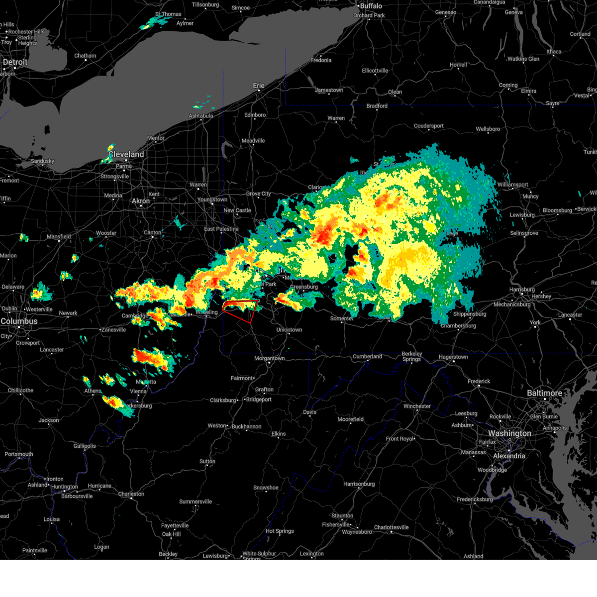 At 802 pm edt, a severe thunderstorm capable of producing a tornado was located near valley grove, moving east at 30 mph (weather spotters reported funnel cloud). Hazards include tornado and golf ball size hail. Flying debris will be dangerous to those caught without shelter. mobile homes will be damaged or destroyed. damage to roofs, windows, and vehicles will occur. tree damage is likely. This tornadic thunderstorm will remain over mainly rural areas of southwestern washington and ohio counties, including the following locations, claysville, eighty four, green hills, amity, taylorstown, and west alexander. At 802 pm edt, a severe thunderstorm capable of producing a tornado was located near valley grove, moving east at 30 mph (weather spotters reported funnel cloud). Hazards include tornado and golf ball size hail. Flying debris will be dangerous to those caught without shelter. mobile homes will be damaged or destroyed. damage to roofs, windows, and vehicles will occur. tree damage is likely. This tornadic thunderstorm will remain over mainly rural areas of southwestern washington and ohio counties, including the following locations, claysville, eighty four, green hills, amity, taylorstown, and west alexander.
|
| 8/12/2023 7:57 PM EDT |
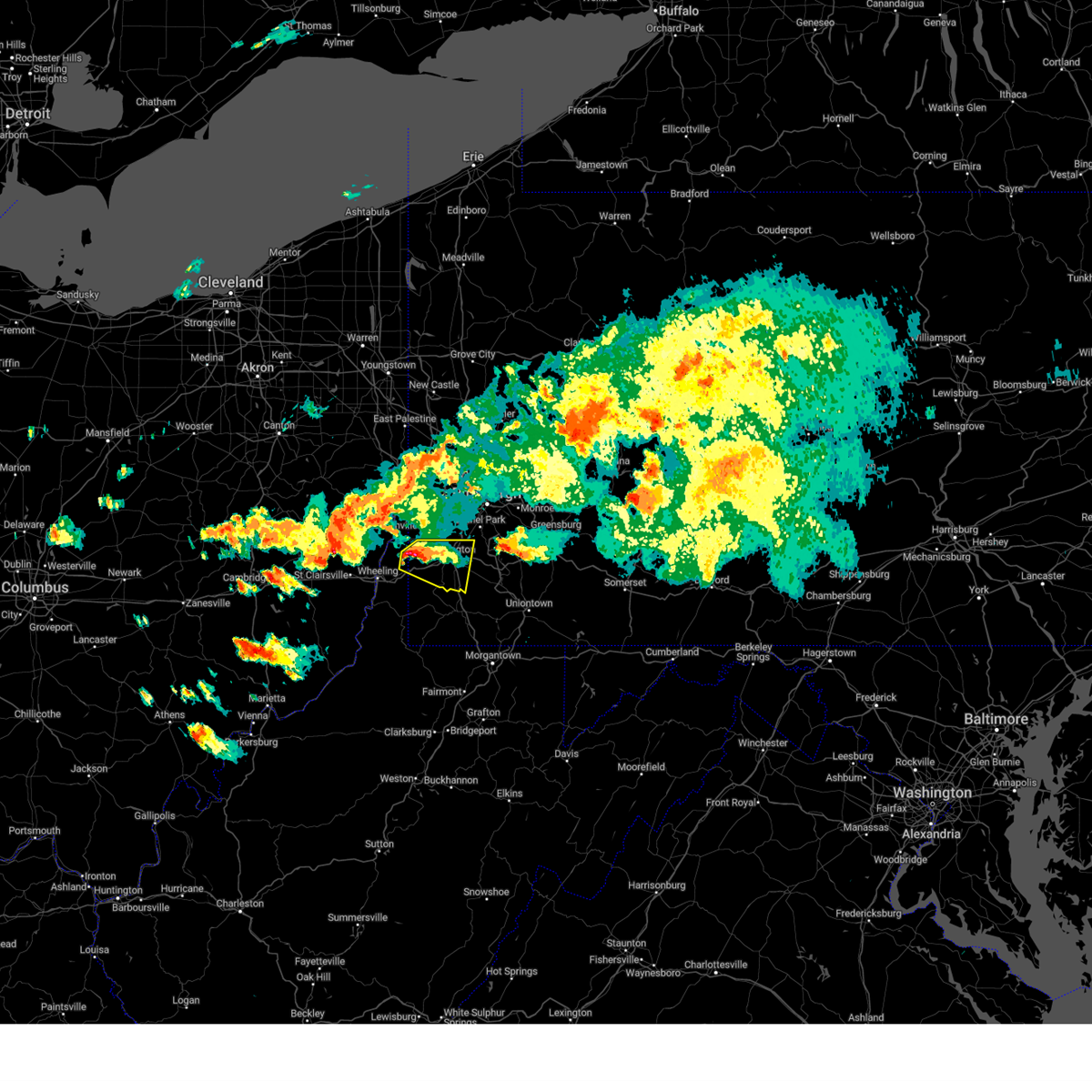 At 757 pm edt, a severe thunderstorm was located near wolfdale, or 7 miles south of avella, moving east at 25 mph (radar indicated). Hazards include ping pong ball size hail and 60 mph wind gusts. People and animals outdoors will be injured. expect hail damage to roofs, siding, windows, and vehicles. expect wind damage to trees and power lines, resulting in some power outages. Locations impacted include, washington, canonsburg, valley grove, wolfdale, mcgovern, east washington, houston, claysville, eighty four, west alexander, taylorstown, west middletown, amity, green hills, and meadow lands. At 757 pm edt, a severe thunderstorm was located near wolfdale, or 7 miles south of avella, moving east at 25 mph (radar indicated). Hazards include ping pong ball size hail and 60 mph wind gusts. People and animals outdoors will be injured. expect hail damage to roofs, siding, windows, and vehicles. expect wind damage to trees and power lines, resulting in some power outages. Locations impacted include, washington, canonsburg, valley grove, wolfdale, mcgovern, east washington, houston, claysville, eighty four, west alexander, taylorstown, west middletown, amity, green hills, and meadow lands.
|
| 8/12/2023 7:51 PM EDT |
 At 751 pm edt, a severe thunderstorm was located near avella, moving east at 25 mph (radar indicated). Hazards include 60 mph wind gusts and quarter size hail. Minor hail damage to vehicles is possible. expect wind damage to trees and power lines, resulting in some power outages. Locations impacted include, washington, canonsburg, west liberty, avella, valley grove, wolfdale, mcgovern, east washington, houston, bethany, claysville, franklin, eighty four, west alexander, taylorstown, west middletown, amity, green hills, meadow lands, and clinton. At 751 pm edt, a severe thunderstorm was located near avella, moving east at 25 mph (radar indicated). Hazards include 60 mph wind gusts and quarter size hail. Minor hail damage to vehicles is possible. expect wind damage to trees and power lines, resulting in some power outages. Locations impacted include, washington, canonsburg, west liberty, avella, valley grove, wolfdale, mcgovern, east washington, houston, bethany, claysville, franklin, eighty four, west alexander, taylorstown, west middletown, amity, green hills, meadow lands, and clinton.
|
| 8/12/2023 7:36 PM EDT |
 At 736 pm edt, a severe thunderstorm was located over west liberty, moving east at 25 mph (radar indicated). Hazards include 60 mph wind gusts and quarter size hail. Minor hail damage to vehicles is possible. Expect wind damage to trees and power lines, resulting in some power outages. At 736 pm edt, a severe thunderstorm was located over west liberty, moving east at 25 mph (radar indicated). Hazards include 60 mph wind gusts and quarter size hail. Minor hail damage to vehicles is possible. Expect wind damage to trees and power lines, resulting in some power outages.
|
| 7/13/2023 8:23 PM EDT |
 At 823 pm edt, a severe thunderstorm was located over south park township, or near gastonville, moving east at 50 mph (radar indicated). Hazards include 60 mph wind gusts and quarter size hail. Minor hail damage to vehicles is possible. expect wind damage to trees and power lines, resulting in some power outages. locations impacted include, pittsburgh, mount lebanon, bethel park, mcmurray, canonsburg, gastonville, baldwin, upper st. clair, scott township, whitehall, south park township, cecil-bishop, dormont, castle shannon, bridgeville, green tree, monongahela, new eagle, wickerham manor-fisher, and baidland. hail threat, observed max hail size, 1. 00 in wind threat, observed max wind gust, 60 mph. At 823 pm edt, a severe thunderstorm was located over south park township, or near gastonville, moving east at 50 mph (radar indicated). Hazards include 60 mph wind gusts and quarter size hail. Minor hail damage to vehicles is possible. expect wind damage to trees and power lines, resulting in some power outages. locations impacted include, pittsburgh, mount lebanon, bethel park, mcmurray, canonsburg, gastonville, baldwin, upper st. clair, scott township, whitehall, south park township, cecil-bishop, dormont, castle shannon, bridgeville, green tree, monongahela, new eagle, wickerham manor-fisher, and baidland. hail threat, observed max hail size, 1. 00 in wind threat, observed max wind gust, 60 mph.
|
| 7/13/2023 8:21 PM EDT |
 At 820 pm edt, a severe thunderstorm was located over bridgeville, or near mount lebanon, moving northeast at 45 mph (radar indicated). Hazards include 60 mph wind gusts and nickel size hail. expect damage to trees and power lines, resulting in some power outages At 820 pm edt, a severe thunderstorm was located over bridgeville, or near mount lebanon, moving northeast at 45 mph (radar indicated). Hazards include 60 mph wind gusts and nickel size hail. expect damage to trees and power lines, resulting in some power outages
|
| 7/13/2023 8:15 PM EDT |
 At 815 pm edt, a severe thunderstorm was located over mcmurray, moving east at 50 mph (radar indicated). Hazards include 60 mph wind gusts and quarter size hail. Minor hail damage to vehicles is possible. expect wind damage to trees and power lines, resulting in some power outages. locations impacted include, pittsburgh, mount lebanon, bethel park, mcmurray, canonsburg, gastonville, baldwin, upper st. clair, scott township, whitehall, south park township, cecil-bishop, dormont, castle shannon, bridgeville, green tree, monongahela, mcgovern, bentleyville, and new eagle. hail threat, observed max hail size, 1. 00 in wind threat, observed max wind gust, 60 mph. At 815 pm edt, a severe thunderstorm was located over mcmurray, moving east at 50 mph (radar indicated). Hazards include 60 mph wind gusts and quarter size hail. Minor hail damage to vehicles is possible. expect wind damage to trees and power lines, resulting in some power outages. locations impacted include, pittsburgh, mount lebanon, bethel park, mcmurray, canonsburg, gastonville, baldwin, upper st. clair, scott township, whitehall, south park township, cecil-bishop, dormont, castle shannon, bridgeville, green tree, monongahela, mcgovern, bentleyville, and new eagle. hail threat, observed max hail size, 1. 00 in wind threat, observed max wind gust, 60 mph.
|
| 7/13/2023 8:06 PM EDT |
 At 806 pm edt, a severe thunderstorm was located over mcgovern, or near washington, moving east at 50 mph (radar indicated). Hazards include 60 mph wind gusts and penny size hail. Expect damage to trees and power lines, resulting in some power outages. locations impacted include, pittsburgh, mount lebanon, bethel park, mcmurray, washington, canonsburg, gastonville, baldwin, upper st. clair, scott township, whitehall, south park township, cecil-bishop, dormont, castle shannon, carnegie, bridgeville, green tree, monongahela, and wolfdale. hail threat, radar indicated max hail size, 0. 75 in wind threat, observed max wind gust, 60 mph. At 806 pm edt, a severe thunderstorm was located over mcgovern, or near washington, moving east at 50 mph (radar indicated). Hazards include 60 mph wind gusts and penny size hail. Expect damage to trees and power lines, resulting in some power outages. locations impacted include, pittsburgh, mount lebanon, bethel park, mcmurray, washington, canonsburg, gastonville, baldwin, upper st. clair, scott township, whitehall, south park township, cecil-bishop, dormont, castle shannon, carnegie, bridgeville, green tree, monongahela, and wolfdale. hail threat, radar indicated max hail size, 0. 75 in wind threat, observed max wind gust, 60 mph.
|
| 7/13/2023 7:58 PM EDT |
 At 758 pm edt, a severe thunderstorm was located over wolfdale, or near washington, moving east at 50 mph (radar indicated). Hazards include 60 mph wind gusts and quarter size hail. Minor hail damage to vehicles is possible. Expect wind damage to trees and power lines, resulting in some power outages. At 758 pm edt, a severe thunderstorm was located over wolfdale, or near washington, moving east at 50 mph (radar indicated). Hazards include 60 mph wind gusts and quarter size hail. Minor hail damage to vehicles is possible. Expect wind damage to trees and power lines, resulting in some power outages.
|
| 6/26/2023 6:32 PM EDT |
 At 632 pm edt, a severe thunderstorm was located over canonsburg, moving northeast at 25 mph (radar indicated). Hazards include 60 mph wind gusts. expect damage to trees and power lines, resulting in some power outages At 632 pm edt, a severe thunderstorm was located over canonsburg, moving northeast at 25 mph (radar indicated). Hazards include 60 mph wind gusts. expect damage to trees and power lines, resulting in some power outages
|
| 6/3/2023 5:40 PM EDT |
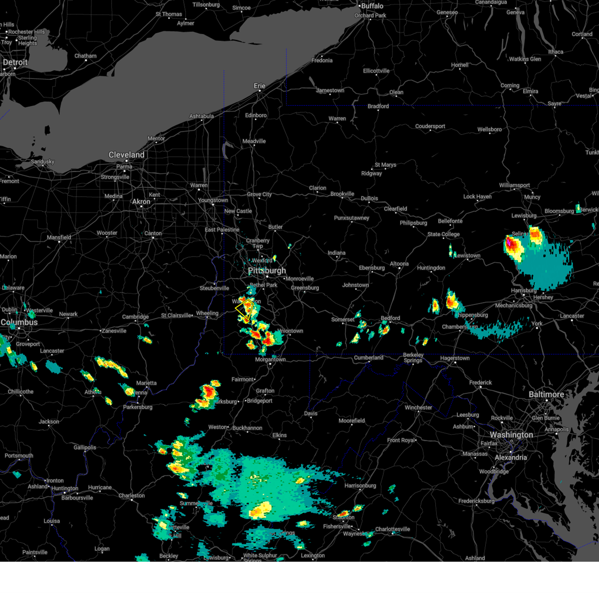 The severe thunderstorm warning for southwestern washington county will expire at 545 pm edt, the storm which prompted the warning has weakened below severe limits, and no longer poses an immediate threat to life or property. therefore, the warning will be allowed to expire. however gusty wind and heavy rain are still possible with this thunderstorm. The severe thunderstorm warning for southwestern washington county will expire at 545 pm edt, the storm which prompted the warning has weakened below severe limits, and no longer poses an immediate threat to life or property. therefore, the warning will be allowed to expire. however gusty wind and heavy rain are still possible with this thunderstorm.
|
| 6/3/2023 5:33 PM EDT |
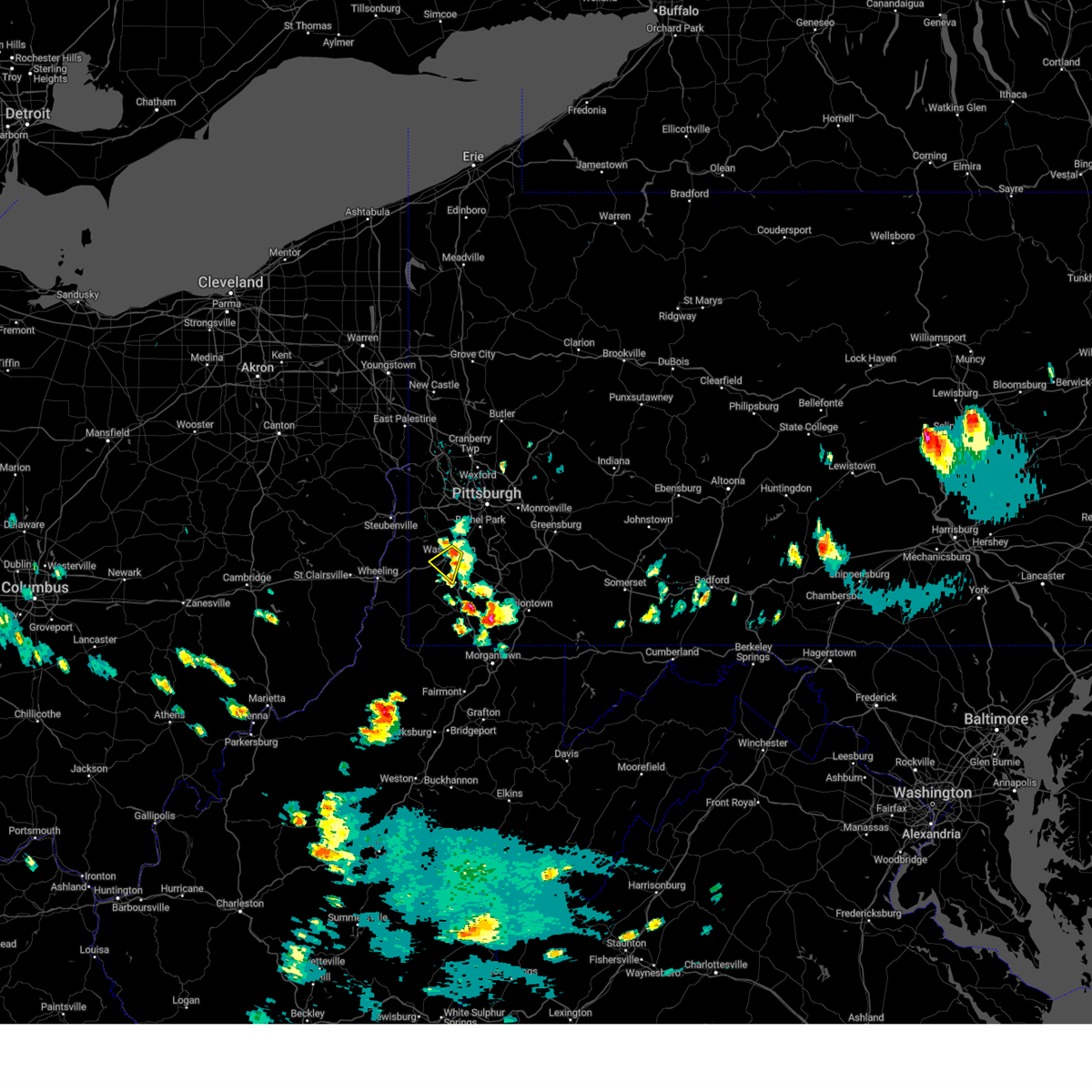 At 532 pm edt, a severe thunderstorm was located over washington, moving southwest at 15 mph (public reported quarter-size hail). Hazards include 60 mph wind gusts and quarter size hail. Hail damage to vehicles. damage to trees and power lines. locations impacted include, washington, wolfdale, east washington, green hills, and meadow lands. hail threat, observed max hail size, 1. 00 in wind threat, radar indicated max wind gust, 60 mph. At 532 pm edt, a severe thunderstorm was located over washington, moving southwest at 15 mph (public reported quarter-size hail). Hazards include 60 mph wind gusts and quarter size hail. Hail damage to vehicles. damage to trees and power lines. locations impacted include, washington, wolfdale, east washington, green hills, and meadow lands. hail threat, observed max hail size, 1. 00 in wind threat, radar indicated max wind gust, 60 mph.
|
| 6/3/2023 5:24 PM EDT |
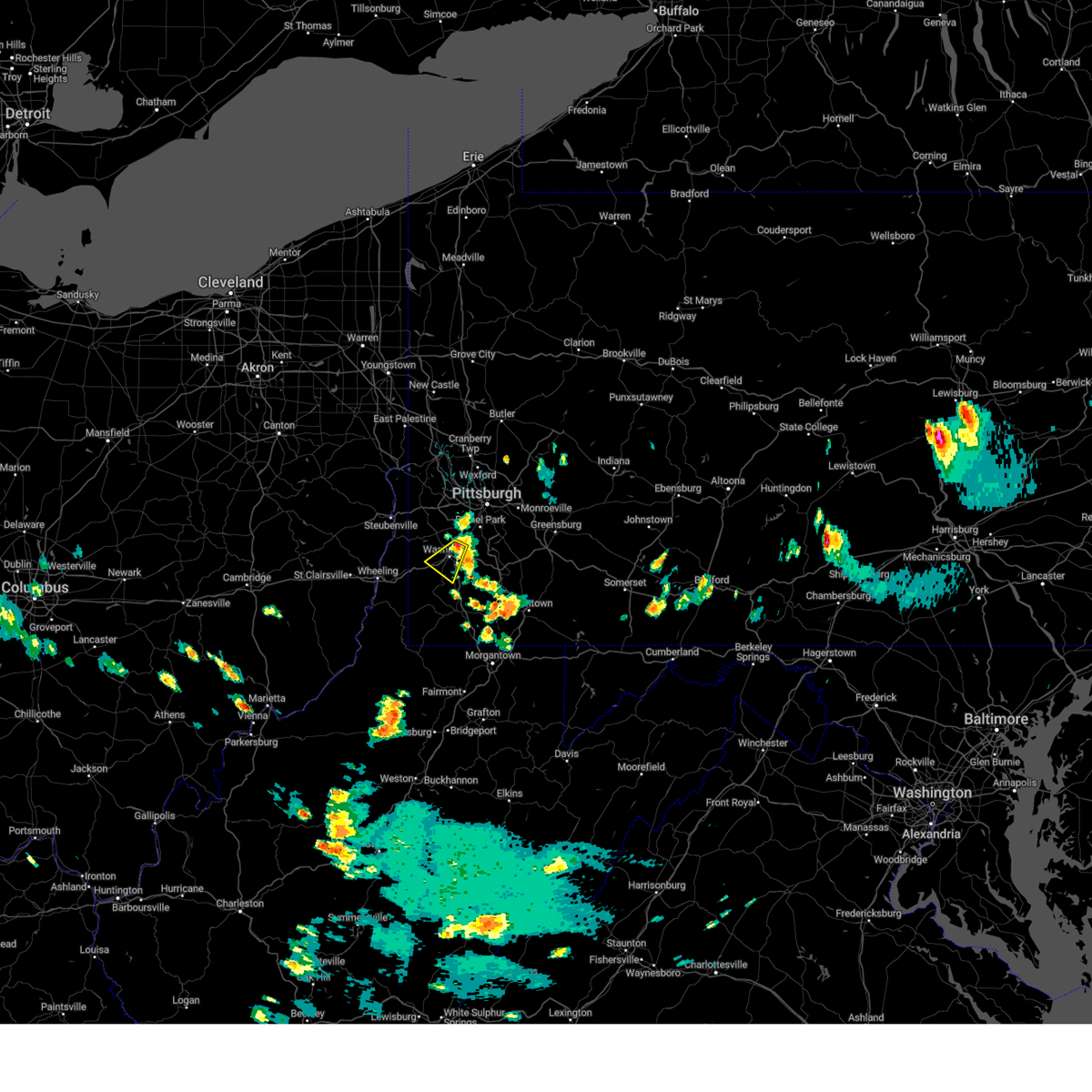 At 524 pm edt, a severe thunderstorm was located over mcgovern, or over washington, moving southwest at 15 mph (radar indicated). Hazards include 60 mph wind gusts and quarter size hail. Hail damage to vehicles. damage to trees and power lines. locations impacted include, washington, canonsburg, wolfdale, mcgovern, east washington, houston, taylorstown, green hills, and meadow lands. hail threat, radar indicated max hail size, 1. 00 in wind threat, radar indicated max wind gust, 60 mph. At 524 pm edt, a severe thunderstorm was located over mcgovern, or over washington, moving southwest at 15 mph (radar indicated). Hazards include 60 mph wind gusts and quarter size hail. Hail damage to vehicles. damage to trees and power lines. locations impacted include, washington, canonsburg, wolfdale, mcgovern, east washington, houston, taylorstown, green hills, and meadow lands. hail threat, radar indicated max hail size, 1. 00 in wind threat, radar indicated max wind gust, 60 mph.
|
| 6/3/2023 5:14 PM EDT |
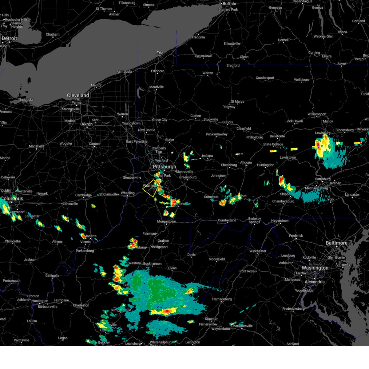 At 514 pm edt, a severe thunderstorm was located over canonsburg, moving southwest at 15 mph (radar indicated). Hazards include 60 mph wind gusts and quarter size hail. Hail damage to vehicles. Damage to trees and power lines. At 514 pm edt, a severe thunderstorm was located over canonsburg, moving southwest at 15 mph (radar indicated). Hazards include 60 mph wind gusts and quarter size hail. Hail damage to vehicles. Damage to trees and power lines.
|
| 4/5/2023 8:43 PM EDT |
 The severe thunderstorm warning for central washington and southeastern allegheny counties will expire at 845 pm edt, the storms which prompted the warning have weakened below severe limits, and no longer pose an immediate threat to life or property. therefore, the warning will be allowed to expire. a severe thunderstorm watch remains in effect until 1000 pm edt for southwestern pennsylvania. The severe thunderstorm warning for central washington and southeastern allegheny counties will expire at 845 pm edt, the storms which prompted the warning have weakened below severe limits, and no longer pose an immediate threat to life or property. therefore, the warning will be allowed to expire. a severe thunderstorm watch remains in effect until 1000 pm edt for southwestern pennsylvania.
|
| 4/5/2023 8:37 PM EDT |
 At 837 pm edt, severe thunderstorms were located along a line extending from sharpsburg to 9 miles southwest of waynesburg, moving east at 45 mph (radar indicated). Hazards include 60 mph wind gusts. Expect damage to trees and power lines, resulting in some power outages. locations impacted include, pittsburgh, penn hills, mount lebanon, bethel park, mcmurray, mckeesport, washington, canonsburg, gastonville, west mifflin, north side pittsburgh, and baldwin. hail threat, radar indicated max hail size, <. 75 in wind threat, radar indicated max wind gust, 60 mph. At 837 pm edt, severe thunderstorms were located along a line extending from sharpsburg to 9 miles southwest of waynesburg, moving east at 45 mph (radar indicated). Hazards include 60 mph wind gusts. Expect damage to trees and power lines, resulting in some power outages. locations impacted include, pittsburgh, penn hills, mount lebanon, bethel park, mcmurray, mckeesport, washington, canonsburg, gastonville, west mifflin, north side pittsburgh, and baldwin. hail threat, radar indicated max hail size, <. 75 in wind threat, radar indicated max wind gust, 60 mph.
|
| 4/5/2023 8:22 PM EDT |
 At 821 pm edt, severe thunderstorms were located along a line extending from robinson township to near cameron, moving east at 45 mph (radar indicated). Hazards include 60 mph wind gusts. Expect damage to trees and power lines, resulting in some power outages. locations impacted include, pittsburgh, penn hills, mount lebanon, bethel park, mcmurray, mckeesport, washington, canonsburg, gastonville, west mifflin, north side pittsburgh, and baldwin. hail threat, radar indicated max hail size, <. 75 in wind threat, radar indicated max wind gust, 60 mph. At 821 pm edt, severe thunderstorms were located along a line extending from robinson township to near cameron, moving east at 45 mph (radar indicated). Hazards include 60 mph wind gusts. Expect damage to trees and power lines, resulting in some power outages. locations impacted include, pittsburgh, penn hills, mount lebanon, bethel park, mcmurray, mckeesport, washington, canonsburg, gastonville, west mifflin, north side pittsburgh, and baldwin. hail threat, radar indicated max hail size, <. 75 in wind threat, radar indicated max wind gust, 60 mph.
|
| 4/5/2023 8:13 PM EDT |
 At 813 pm edt, severe thunderstorms were located along a line extending from near imperial to near cameron, moving east at 45 mph (radar indicated). Hazards include 60 mph wind gusts. Expect damage to trees and power lines, resulting in some power outages. locations impacted include, pittsburgh, penn hills, mount lebanon, bethel park, mcmurray, mckeesport, washington, canonsburg, waynesburg, gastonville, west mifflin, and north side pittsburgh. hail threat, radar indicated max hail size, <. 75 in wind threat, radar indicated max wind gust, 60 mph. At 813 pm edt, severe thunderstorms were located along a line extending from near imperial to near cameron, moving east at 45 mph (radar indicated). Hazards include 60 mph wind gusts. Expect damage to trees and power lines, resulting in some power outages. locations impacted include, pittsburgh, penn hills, mount lebanon, bethel park, mcmurray, mckeesport, washington, canonsburg, waynesburg, gastonville, west mifflin, and north side pittsburgh. hail threat, radar indicated max hail size, <. 75 in wind threat, radar indicated max wind gust, 60 mph.
|
| 4/5/2023 7:59 PM EDT |
 At 759 pm edt, severe thunderstorms were located along a line extending from 6 miles west of imperial to 7 miles southeast of powhatan point, moving east at 45 mph (radar indicated). Hazards include 60 mph wind gusts. expect damage to trees and power lines, resulting in some power outages At 759 pm edt, severe thunderstorms were located along a line extending from 6 miles west of imperial to 7 miles southeast of powhatan point, moving east at 45 mph (radar indicated). Hazards include 60 mph wind gusts. expect damage to trees and power lines, resulting in some power outages
|
| 4/1/2023 2:22 PM EDT |
 At 222 pm edt, a severe thunderstorm was located over wolfdale, or near washington, moving east at 65 mph (radar indicated). Hazards include 60 mph wind gusts. expect damage to trees and power lines, resulting in some power outages At 222 pm edt, a severe thunderstorm was located over wolfdale, or near washington, moving east at 65 mph (radar indicated). Hazards include 60 mph wind gusts. expect damage to trees and power lines, resulting in some power outages
|
| 11/27/2022 2:14 PM EST |
 At 213 pm est, severe thunderstorms were located along a line extending from 10 miles northwest of waynesburg to near hundred, moving northeast at 50 mph (radar indicated). Hazards include 60 mph wind gusts. Expect damage to trees and power lines, resulting in some power outages. locations impacted include, waynesburg, california, monongahela, bentleyville, fredericktown-millsboro, jefferson boro, new eagle, wickerham manor-fisher, baidland, north charleroi, ellsworth, and rogersville. hail threat, radar indicated max hail size, <. 75 in wind threat, radar indicated max wind gust, 60 mph. At 213 pm est, severe thunderstorms were located along a line extending from 10 miles northwest of waynesburg to near hundred, moving northeast at 50 mph (radar indicated). Hazards include 60 mph wind gusts. Expect damage to trees and power lines, resulting in some power outages. locations impacted include, waynesburg, california, monongahela, bentleyville, fredericktown-millsboro, jefferson boro, new eagle, wickerham manor-fisher, baidland, north charleroi, ellsworth, and rogersville. hail threat, radar indicated max hail size, <. 75 in wind threat, radar indicated max wind gust, 60 mph.
|
| 11/27/2022 2:14 PM EST |
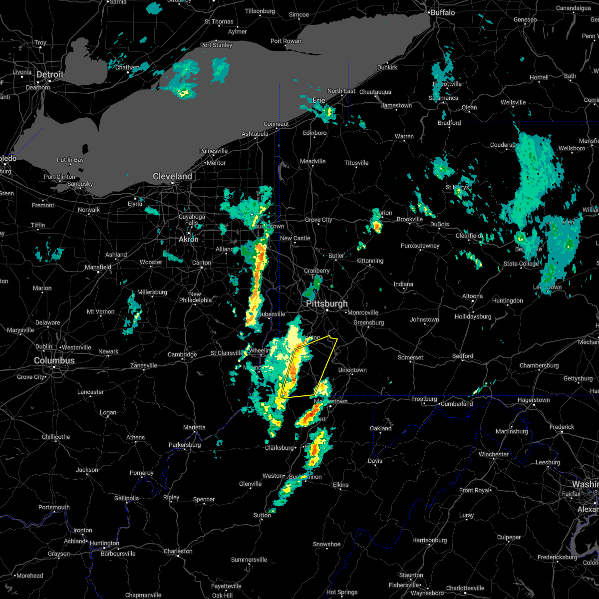 At 213 pm est, severe thunderstorms were located along a line extending from 10 miles northwest of waynesburg to near hundred, moving northeast at 50 mph (radar indicated). Hazards include 60 mph wind gusts. Expect damage to trees and power lines, resulting in some power outages. locations impacted include, waynesburg, california, monongahela, bentleyville, fredericktown-millsboro, jefferson boro, new eagle, wickerham manor-fisher, baidland, north charleroi, ellsworth, and rogersville. hail threat, radar indicated max hail size, <. 75 in wind threat, radar indicated max wind gust, 60 mph. At 213 pm est, severe thunderstorms were located along a line extending from 10 miles northwest of waynesburg to near hundred, moving northeast at 50 mph (radar indicated). Hazards include 60 mph wind gusts. Expect damage to trees and power lines, resulting in some power outages. locations impacted include, waynesburg, california, monongahela, bentleyville, fredericktown-millsboro, jefferson boro, new eagle, wickerham manor-fisher, baidland, north charleroi, ellsworth, and rogersville. hail threat, radar indicated max hail size, <. 75 in wind threat, radar indicated max wind gust, 60 mph.
|
| 11/27/2022 2:02 PM EST |
 At 201 pm est, severe thunderstorms were located along a line extending from 9 miles southeast of triadelphia to 8 miles north of pine grove, moving northeast at 50 mph (radar indicated). Hazards include 60 mph wind gusts. Expect damage to trees and power lines, resulting in some power outages. locations impacted include, waynesburg, california, monongahela, bentleyville, fredericktown-millsboro, jefferson boro, cameron, hundred, new eagle, wickerham manor-fisher, baidland, and north charleroi. hail threat, radar indicated max hail size, <. 75 in wind threat, observed max wind gust, 60 mph. At 201 pm est, severe thunderstorms were located along a line extending from 9 miles southeast of triadelphia to 8 miles north of pine grove, moving northeast at 50 mph (radar indicated). Hazards include 60 mph wind gusts. Expect damage to trees and power lines, resulting in some power outages. locations impacted include, waynesburg, california, monongahela, bentleyville, fredericktown-millsboro, jefferson boro, cameron, hundred, new eagle, wickerham manor-fisher, baidland, and north charleroi. hail threat, radar indicated max hail size, <. 75 in wind threat, observed max wind gust, 60 mph.
|
| 11/27/2022 2:02 PM EST |
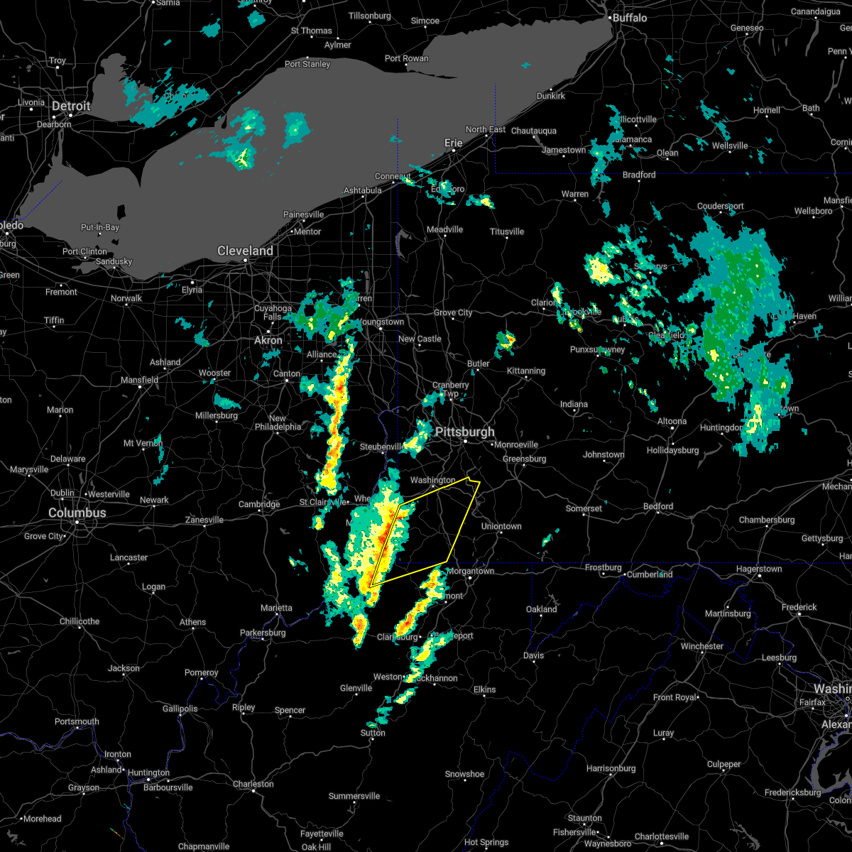 At 201 pm est, severe thunderstorms were located along a line extending from 9 miles southeast of triadelphia to 8 miles north of pine grove, moving northeast at 50 mph (radar indicated). Hazards include 60 mph wind gusts. Expect damage to trees and power lines, resulting in some power outages. locations impacted include, waynesburg, california, monongahela, bentleyville, fredericktown-millsboro, jefferson boro, cameron, hundred, new eagle, wickerham manor-fisher, baidland, and north charleroi. hail threat, radar indicated max hail size, <. 75 in wind threat, observed max wind gust, 60 mph. At 201 pm est, severe thunderstorms were located along a line extending from 9 miles southeast of triadelphia to 8 miles north of pine grove, moving northeast at 50 mph (radar indicated). Hazards include 60 mph wind gusts. Expect damage to trees and power lines, resulting in some power outages. locations impacted include, waynesburg, california, monongahela, bentleyville, fredericktown-millsboro, jefferson boro, cameron, hundred, new eagle, wickerham manor-fisher, baidland, and north charleroi. hail threat, radar indicated max hail size, <. 75 in wind threat, observed max wind gust, 60 mph.
|
| 11/27/2022 1:45 PM EST |
 At 144 pm est, severe thunderstorms were located along a line extending from near moundsville to near paden city, moving northeast at 50 mph (radar indicated). Hazards include 60 mph wind gusts. expect damage to trees and power lines, resulting in some power outages At 144 pm est, severe thunderstorms were located along a line extending from near moundsville to near paden city, moving northeast at 50 mph (radar indicated). Hazards include 60 mph wind gusts. expect damage to trees and power lines, resulting in some power outages
|
| 8/1/2022 6:24 PM EDT |
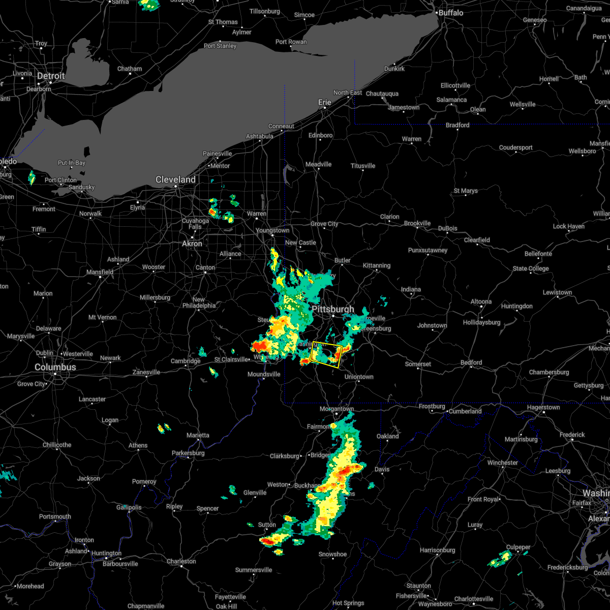 The severe thunderstorm warning for southeastern washington county will expire at 630 pm edt, the storm which prompted the warning has weakened below severe limits, and no longer poses an immediate threat to life or property. therefore, the warning will be allowed to expire. however gusty winds are still possible with this thunderstorm. The severe thunderstorm warning for southeastern washington county will expire at 630 pm edt, the storm which prompted the warning has weakened below severe limits, and no longer poses an immediate threat to life or property. therefore, the warning will be allowed to expire. however gusty winds are still possible with this thunderstorm.
|
| 8/1/2022 5:59 PM EDT |
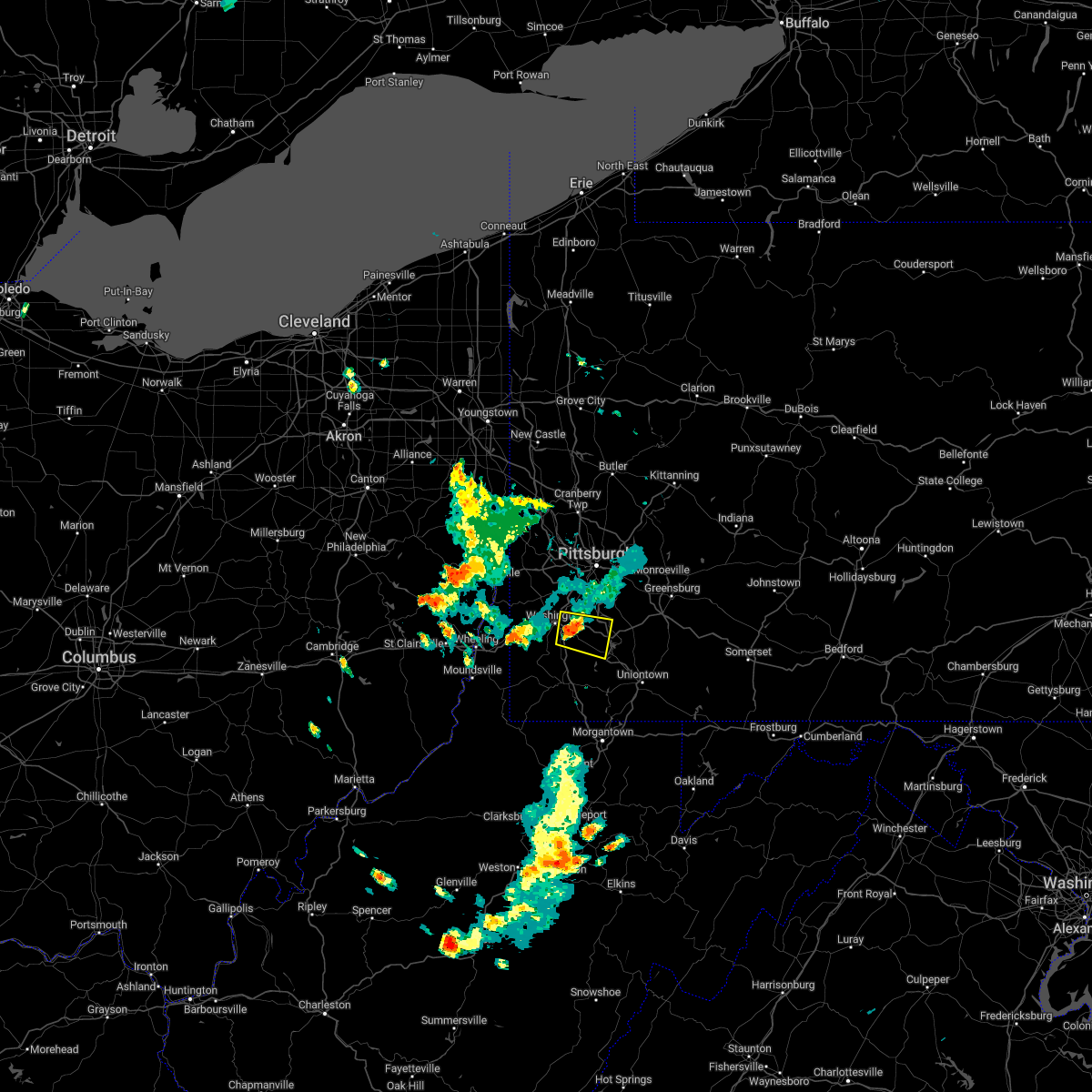 At 558 pm edt, a severe thunderstorm was located near east washington, or near washington, moving east at 25 mph (radar indicated). Hazards include 60 mph wind gusts and quarter size hail. Minor hail damage to vehicles is possible. expect wind damage to trees and power lines, resulting in some power outages. locations impacted include, washington, california, monongahela, bentleyville, wickerham manor-fisher, baidland, north charleroi, ellsworth, deemston, eighty four, cokeburg, and beallsville. hail threat, radar indicated max hail size, 1. 00 in wind threat, radar indicated max wind gust, 60 mph. At 558 pm edt, a severe thunderstorm was located near east washington, or near washington, moving east at 25 mph (radar indicated). Hazards include 60 mph wind gusts and quarter size hail. Minor hail damage to vehicles is possible. expect wind damage to trees and power lines, resulting in some power outages. locations impacted include, washington, california, monongahela, bentleyville, wickerham manor-fisher, baidland, north charleroi, ellsworth, deemston, eighty four, cokeburg, and beallsville. hail threat, radar indicated max hail size, 1. 00 in wind threat, radar indicated max wind gust, 60 mph.
|
| 8/1/2022 5:48 PM EDT |
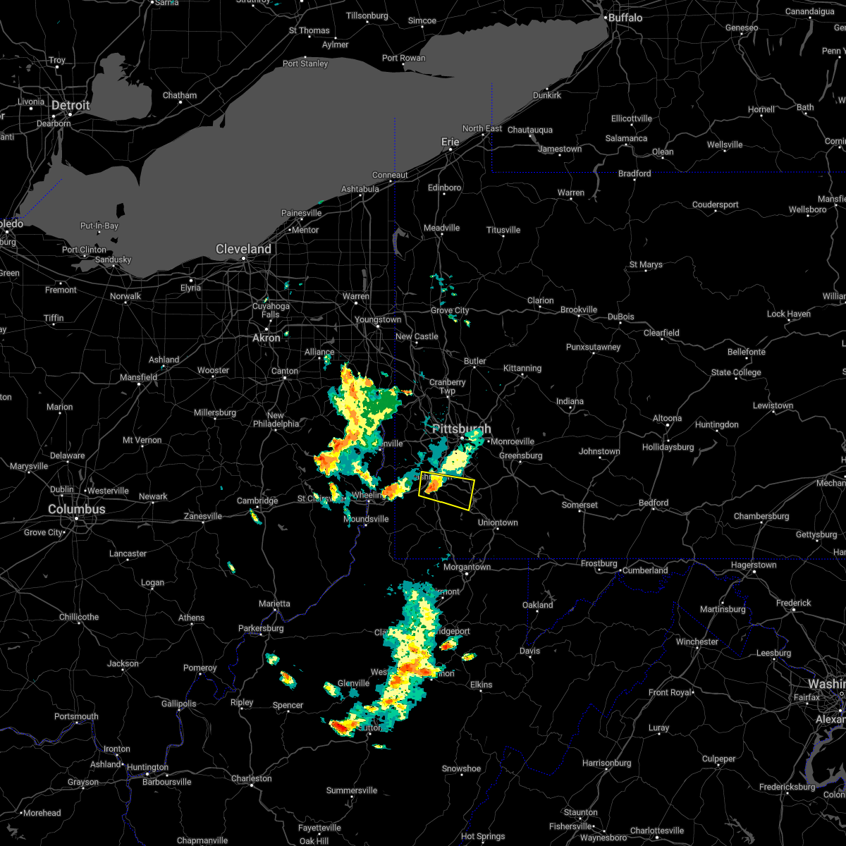 At 548 pm edt, a severe thunderstorm was located over east washington, or over washington, moving east at 25 mph (radar indicated). Hazards include 60 mph wind gusts and quarter size hail. Minor hail damage to vehicles is possible. Expect wind damage to trees and power lines, resulting in some power outages. At 548 pm edt, a severe thunderstorm was located over east washington, or over washington, moving east at 25 mph (radar indicated). Hazards include 60 mph wind gusts and quarter size hail. Minor hail damage to vehicles is possible. Expect wind damage to trees and power lines, resulting in some power outages.
|
| 7/23/2022 3:04 PM EDT |
 At 303 pm edt, a severe thunderstorm was located over forest hills, or near penn hills, moving east at 40 mph (radar indicated). Hazards include 60 mph wind gusts and quarter size hail. Minor hail damage to vehicles is possible. expect wind damage to trees and power lines, resulting in some power outages. locations impacted include, pittsburgh, penn hills, mount lebanon, bethel park, ross township, mccandless township, monroeville, moon township, mcmurray, mckeesport, washington, and franklin park. hail threat, radar indicated max hail size, 1. 00 in wind threat, observed max wind gust, 60 mph. At 303 pm edt, a severe thunderstorm was located over forest hills, or near penn hills, moving east at 40 mph (radar indicated). Hazards include 60 mph wind gusts and quarter size hail. Minor hail damage to vehicles is possible. expect wind damage to trees and power lines, resulting in some power outages. locations impacted include, pittsburgh, penn hills, mount lebanon, bethel park, ross township, mccandless township, monroeville, moon township, mcmurray, mckeesport, washington, and franklin park. hail threat, radar indicated max hail size, 1. 00 in wind threat, observed max wind gust, 60 mph.
|
| 7/23/2022 2:58 PM EDT |
 At 258 pm edt, a severe thunderstorm was located over homestead, or near pittsburgh, moving east at 40 mph (radar indicated). Hazards include 60 mph wind gusts and quarter size hail. Minor hail damage to vehicles is possible. expect wind damage to trees and power lines, resulting in some power outages. locations impacted include, pittsburgh, penn hills, mount lebanon, bethel park, ross township, mccandless township, monroeville, cranberry, moon township, mcmurray, mckeesport, and washington. hail threat, radar indicated max hail size, 1. 00 in wind threat, observed max wind gust, 60 mph. At 258 pm edt, a severe thunderstorm was located over homestead, or near pittsburgh, moving east at 40 mph (radar indicated). Hazards include 60 mph wind gusts and quarter size hail. Minor hail damage to vehicles is possible. expect wind damage to trees and power lines, resulting in some power outages. locations impacted include, pittsburgh, penn hills, mount lebanon, bethel park, ross township, mccandless township, monroeville, cranberry, moon township, mcmurray, mckeesport, and washington. hail threat, radar indicated max hail size, 1. 00 in wind threat, observed max wind gust, 60 mph.
|
| 7/23/2022 2:33 PM EDT |
 At 232 pm edt, a severe thunderstorm was located over mcdonald, or 8 miles northwest of canonsburg, moving east at 40 mph (radar indicated). Hazards include 70 mph wind gusts and quarter size hail. Minor hail damage to vehicles is possible. trees snapped and uprooted. power outages can be expected. locations impacted include, pittsburgh, penn hills, mount lebanon, bethel park, ross township, wheeling, mccandless township, monroeville, cranberry, moon township, mcmurray, and weirton. thunderstorm damage threat, considerable hail threat, radar indicated max hail size, 1. 00 in wind threat, observed max wind gust, 70 mph. At 232 pm edt, a severe thunderstorm was located over mcdonald, or 8 miles northwest of canonsburg, moving east at 40 mph (radar indicated). Hazards include 70 mph wind gusts and quarter size hail. Minor hail damage to vehicles is possible. trees snapped and uprooted. power outages can be expected. locations impacted include, pittsburgh, penn hills, mount lebanon, bethel park, ross township, wheeling, mccandless township, monroeville, cranberry, moon township, mcmurray, and weirton. thunderstorm damage threat, considerable hail threat, radar indicated max hail size, 1. 00 in wind threat, observed max wind gust, 70 mph.
|
| 7/23/2022 2:26 PM EDT |
 At 225 pm edt, a severe thunderstorm was located near mcdonald, or 8 miles northeast of avella, moving east at 40 mph (radar indicated). Hazards include 60 mph wind gusts and quarter size hail. Minor hail damage to vehicles is possible. Expect wind damage to trees and power lines, resulting in some power outages. At 225 pm edt, a severe thunderstorm was located near mcdonald, or 8 miles northeast of avella, moving east at 40 mph (radar indicated). Hazards include 60 mph wind gusts and quarter size hail. Minor hail damage to vehicles is possible. Expect wind damage to trees and power lines, resulting in some power outages.
|
| 5/3/2022 6:11 PM EDT |
 At 610 pm edt, severe thunderstorms were located along a line extending from scott township to 8 miles south of east washington, moving northeast at 40 mph (radar indicated). Hazards include 60 mph wind gusts. expect damage to trees and power lines, resulting in some power outages At 610 pm edt, severe thunderstorms were located along a line extending from scott township to 8 miles south of east washington, moving northeast at 40 mph (radar indicated). Hazards include 60 mph wind gusts. expect damage to trees and power lines, resulting in some power outages
|
| 5/3/2022 6:06 PM EDT |
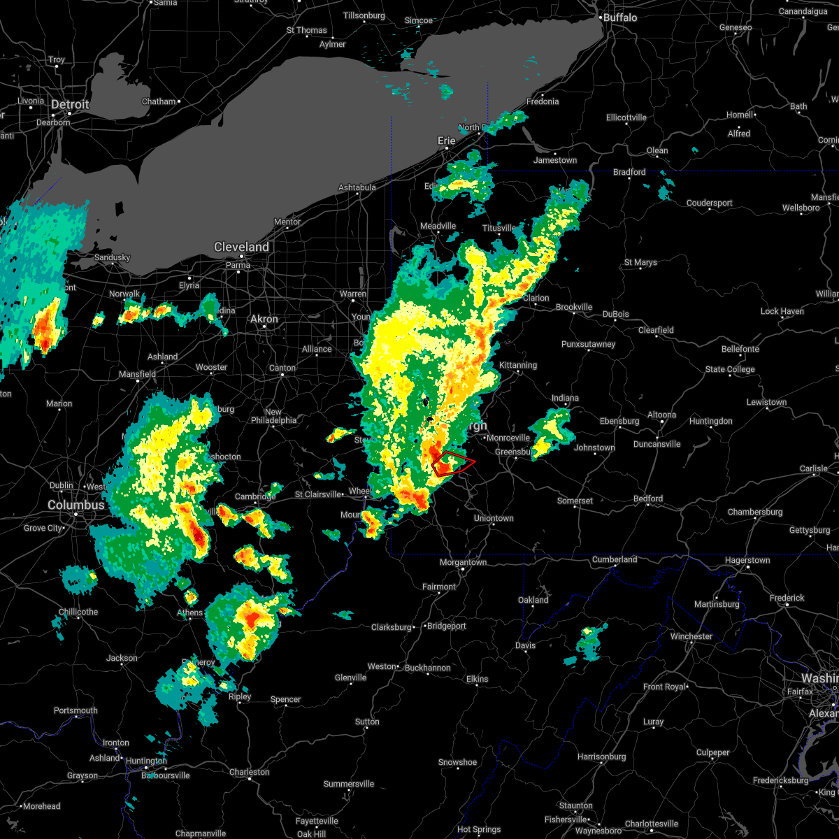 At 605 pm edt, a severe thunderstorm capable of producing a tornado was located over mcmurray, moving east at 45 mph (radar indicated rotation). Hazards include tornado. Flying debris will be dangerous to those caught without shelter. mobile homes will be damaged or destroyed. damage to roofs, windows, and vehicles will occur. tree damage is likely. this dangerous storm will be near, gastonville around 610 pm edt. south park township and jefferson hills around 615 pm edt. clairton around 620 pm edt. Other locations impacted by this tornadic thunderstorm include elizabeth, finleyville, west elizabeth and lincoln. At 605 pm edt, a severe thunderstorm capable of producing a tornado was located over mcmurray, moving east at 45 mph (radar indicated rotation). Hazards include tornado. Flying debris will be dangerous to those caught without shelter. mobile homes will be damaged or destroyed. damage to roofs, windows, and vehicles will occur. tree damage is likely. this dangerous storm will be near, gastonville around 610 pm edt. south park township and jefferson hills around 615 pm edt. clairton around 620 pm edt. Other locations impacted by this tornadic thunderstorm include elizabeth, finleyville, west elizabeth and lincoln.
|
| 5/3/2022 6:00 PM EDT | Tree and wires on vehicle along carl av in washington county PA, 1.9 miles S of Eighty Four, PA |
| 5/3/2022 5:54 PM EDT |
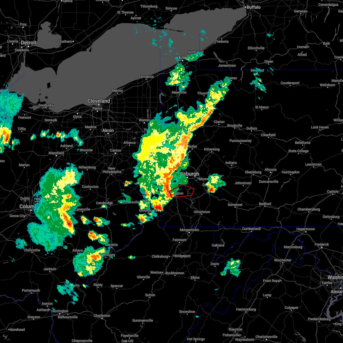 At 554 pm edt, a severe thunderstorm capable of producing a tornado was located over mcgovern, or near canonsburg, moving east at 45 mph (radar indicated rotation). Hazards include tornado. Flying debris will be dangerous to those caught without shelter. mobile homes will be damaged or destroyed. damage to roofs, windows, and vehicles will occur. tree damage is likely. this dangerous storm will be near, mcmurray around 605 pm edt. bethel park, gastonville and upper st. clair around 610 pm edt. south park township, jefferson hills, clairton and monongahela around 615 pm edt. Other locations impacted by this tornadic thunderstorm include elizabeth, finleyville, meadow lands, eighty four, baidland, new eagle, west elizabeth, houston, wickerham manor-fisher and lincoln. At 554 pm edt, a severe thunderstorm capable of producing a tornado was located over mcgovern, or near canonsburg, moving east at 45 mph (radar indicated rotation). Hazards include tornado. Flying debris will be dangerous to those caught without shelter. mobile homes will be damaged or destroyed. damage to roofs, windows, and vehicles will occur. tree damage is likely. this dangerous storm will be near, mcmurray around 605 pm edt. bethel park, gastonville and upper st. clair around 610 pm edt. south park township, jefferson hills, clairton and monongahela around 615 pm edt. Other locations impacted by this tornadic thunderstorm include elizabeth, finleyville, meadow lands, eighty four, baidland, new eagle, west elizabeth, houston, wickerham manor-fisher and lincoln.
|
| 5/3/2022 5:51 PM EDT |
 At 551 pm edt, a severe thunderstorm was located over mcdonald, or 7 miles north of canonsburg, moving northeast at 60 mph (radar indicated). Hazards include 60 mph wind gusts. Expect damage to trees and power lines, resulting in some power outages. locations impacted include, pittsburgh, mount lebanon, bethel park, ross township, wheeling, moon township, mcmurray, washington, franklin park, aliquippa, canonsburg, and bethlehem. hail threat, radar indicated max hail size, <. 75 in wind threat, radar indicated max wind gust, 60 mph. At 551 pm edt, a severe thunderstorm was located over mcdonald, or 7 miles north of canonsburg, moving northeast at 60 mph (radar indicated). Hazards include 60 mph wind gusts. Expect damage to trees and power lines, resulting in some power outages. locations impacted include, pittsburgh, mount lebanon, bethel park, ross township, wheeling, moon township, mcmurray, washington, franklin park, aliquippa, canonsburg, and bethlehem. hail threat, radar indicated max hail size, <. 75 in wind threat, radar indicated max wind gust, 60 mph.
|
| 5/3/2022 5:49 PM EDT |
 At 549 pm edt, a severe thunderstorm capable of producing a tornado was located over wolfdale, or near washington, moving east at 50 mph (radar indicated rotation). Hazards include tornado. Flying debris will be dangerous to those caught without shelter. mobile homes will be damaged or destroyed. damage to roofs, windows, and vehicles will occur. tree damage is likely. this dangerous storm will be near, canonsburg around 555 pm edt. cecil-bishop around 600 pm edt. mcmurray around 605 pm edt. bethel park, gastonville, south park township, jefferson hills and monongahela around 610 pm edt. clairton around 615 pm edt. Other locations impacted by this tornadic thunderstorm include elizabeth, finleyville, meadow lands, eighty four, green hills, baidland, new eagle, west elizabeth, houston and wickerham manor-fisher. At 549 pm edt, a severe thunderstorm capable of producing a tornado was located over wolfdale, or near washington, moving east at 50 mph (radar indicated rotation). Hazards include tornado. Flying debris will be dangerous to those caught without shelter. mobile homes will be damaged or destroyed. damage to roofs, windows, and vehicles will occur. tree damage is likely. this dangerous storm will be near, canonsburg around 555 pm edt. cecil-bishop around 600 pm edt. mcmurray around 605 pm edt. bethel park, gastonville, south park township, jefferson hills and monongahela around 610 pm edt. clairton around 615 pm edt. Other locations impacted by this tornadic thunderstorm include elizabeth, finleyville, meadow lands, eighty four, green hills, baidland, new eagle, west elizabeth, houston and wickerham manor-fisher.
|
| 5/3/2022 5:35 PM EDT |
 At 534 pm edt, a line of severe thunderstorms was located near avella, moving northeast at 50 mph (radar indicated). Hazards include 60 mph wind gusts. expect damage to trees and power lines, resulting in some power outages At 534 pm edt, a line of severe thunderstorms was located near avella, moving northeast at 50 mph (radar indicated). Hazards include 60 mph wind gusts. expect damage to trees and power lines, resulting in some power outages
|
| 10/21/2021 8:08 PM EDT | 1 home destroyed and trees down along hill place road in washington county PA, 5.2 miles SSW of Eighty Four, PA |
| 10/21/2021 8:08 PM EDT | 1 home destroyed and trees down along hill place road in washington county PA, 5.2 miles SSW of Eighty Four, PA |
| 10/21/2021 7:58 PM EDT |
 The tornado warning for central washington county will expire at 800 pm edt, the storm which prompted the warning has weakened below severe limits, and no longer appears capable of producing a tornado. therefore, the warning will be allowed to expire. however gusty winds are still possible with this thunderstorm. The tornado warning for central washington county will expire at 800 pm edt, the storm which prompted the warning has weakened below severe limits, and no longer appears capable of producing a tornado. therefore, the warning will be allowed to expire. however gusty winds are still possible with this thunderstorm.
|
| 10/21/2021 7:51 PM EDT |
 At 750 pm edt, a severe thunderstorm capable of producing a tornado was located over cecil-bishop, or over canonsburg, moving east at 45 mph (radar indicated rotation). Hazards include tornado. Flying debris will be dangerous to those caught without shelter. mobile homes will be damaged or destroyed. damage to roofs, windows, and vehicles will occur. tree damage is likely. This tornadic thunderstorm will remain over mainly rural areas of central washington county, including the following locations, hickory, houston and meadow lands. At 750 pm edt, a severe thunderstorm capable of producing a tornado was located over cecil-bishop, or over canonsburg, moving east at 45 mph (radar indicated rotation). Hazards include tornado. Flying debris will be dangerous to those caught without shelter. mobile homes will be damaged or destroyed. damage to roofs, windows, and vehicles will occur. tree damage is likely. This tornadic thunderstorm will remain over mainly rural areas of central washington county, including the following locations, hickory, houston and meadow lands.
|
| 10/21/2021 7:45 PM EDT |
 At 745 pm edt, a severe thunderstorm capable of producing a tornado was located near mcgovern, or near canonsburg, moving east at 45 mph (radar indicated rotation). Hazards include tornado. Flying debris will be dangerous to those caught without shelter. mobile homes will be damaged or destroyed. damage to roofs, windows, and vehicles will occur. tree damage is likely. this dangerous storm will be near, mcdonald around 750 pm edt. canonsburg and cecil-bishop around 755 pm edt. Other locations impacted by this tornadic thunderstorm include meadow lands, eighty four, hickory and houston. At 745 pm edt, a severe thunderstorm capable of producing a tornado was located near mcgovern, or near canonsburg, moving east at 45 mph (radar indicated rotation). Hazards include tornado. Flying debris will be dangerous to those caught without shelter. mobile homes will be damaged or destroyed. damage to roofs, windows, and vehicles will occur. tree damage is likely. this dangerous storm will be near, mcdonald around 750 pm edt. canonsburg and cecil-bishop around 755 pm edt. Other locations impacted by this tornadic thunderstorm include meadow lands, eighty four, hickory and houston.
|
| 10/21/2021 7:39 PM EDT |
 At 739 pm edt, a severe thunderstorm capable of producing a tornado was located near avella, moving east at 45 mph (radar indicated rotation). Hazards include tornado. Flying debris will be dangerous to those caught without shelter. mobile homes will be damaged or destroyed. damage to roofs, windows, and vehicles will occur. tree damage is likely. this dangerous storm will be near, washington, mcgovern and east washington around 750 pm edt. canonsburg, cecil-bishop and mcdonald around 755 pm edt. Other locations impacted by this tornadic thunderstorm include west middletown, meadow lands, eighty four, hickory and houston. At 739 pm edt, a severe thunderstorm capable of producing a tornado was located near avella, moving east at 45 mph (radar indicated rotation). Hazards include tornado. Flying debris will be dangerous to those caught without shelter. mobile homes will be damaged or destroyed. damage to roofs, windows, and vehicles will occur. tree damage is likely. this dangerous storm will be near, washington, mcgovern and east washington around 750 pm edt. canonsburg, cecil-bishop and mcdonald around 755 pm edt. Other locations impacted by this tornadic thunderstorm include west middletown, meadow lands, eighty four, hickory and houston.
|
| 10/21/2021 7:36 PM EDT |
 At 736 pm edt, a severe thunderstorm capable of producing a tornado was located over avella, moving east at 45 mph (radar indicated rotation). Hazards include tornado. Flying debris will be dangerous to those caught without shelter. mobile homes will be damaged or destroyed. damage to roofs, windows, and vehicles will occur. tree damage is likely. this dangerous storm will be near, wolfdale around 745 pm edt. washington, mcgovern and east washington around 750 pm edt. canonsburg, cecil-bishop and mcdonald around 755 pm edt. Other locations impacted by this tornadic thunderstorm include west middletown, meadow lands, eighty four, hickory and houston. At 736 pm edt, a severe thunderstorm capable of producing a tornado was located over avella, moving east at 45 mph (radar indicated rotation). Hazards include tornado. Flying debris will be dangerous to those caught without shelter. mobile homes will be damaged or destroyed. damage to roofs, windows, and vehicles will occur. tree damage is likely. this dangerous storm will be near, wolfdale around 745 pm edt. washington, mcgovern and east washington around 750 pm edt. canonsburg, cecil-bishop and mcdonald around 755 pm edt. Other locations impacted by this tornadic thunderstorm include west middletown, meadow lands, eighty four, hickory and houston.
|
| 10/21/2021 7:31 PM EDT |
 At 731 pm edt, a severe thunderstorm capable of producing a tornado was located over avella, moving east at 45 mph (radar indicated rotation). Hazards include tornado. Flying debris will be dangerous to those caught without shelter. mobile homes will be damaged or destroyed. damage to roofs, windows, and vehicles will occur. tree damage is likely. this dangerous storm will be near, wolfdale around 745 pm edt. washington, mcgovern and east washington around 750 pm edt. canonsburg, cecil-bishop and mcdonald around 755 pm edt. Other locations impacted by this tornadic thunderstorm include franklin, meadow lands, eighty four, west middletown, bethany, hickory, houston and taylorstown. At 731 pm edt, a severe thunderstorm capable of producing a tornado was located over avella, moving east at 45 mph (radar indicated rotation). Hazards include tornado. Flying debris will be dangerous to those caught without shelter. mobile homes will be damaged or destroyed. damage to roofs, windows, and vehicles will occur. tree damage is likely. this dangerous storm will be near, wolfdale around 745 pm edt. washington, mcgovern and east washington around 750 pm edt. canonsburg, cecil-bishop and mcdonald around 755 pm edt. Other locations impacted by this tornadic thunderstorm include franklin, meadow lands, eighty four, west middletown, bethany, hickory, houston and taylorstown.
|
| 10/21/2021 7:26 PM EDT |
 At 726 pm edt, a severe thunderstorm capable of producing a tornado was located near wellsburg, moving east at 45 mph (radar indicated rotation). Hazards include tornado. Flying debris will be dangerous to those caught without shelter. mobile homes will be damaged or destroyed. damage to roofs, windows, and vehicles will occur. tree damage is likely. this dangerous storm will be near, avella around 730 pm edt. washington and wolfdale around 745 pm edt. mcgovern, east washington and mcdonald around 750 pm edt. canonsburg and cecil-bishop around 755 pm edt. Other locations impacted by this tornadic thunderstorm include franklin, meadow lands, eighty four, west middletown, bethany, hickory, houston, taylorstown and brilliant. At 726 pm edt, a severe thunderstorm capable of producing a tornado was located near wellsburg, moving east at 45 mph (radar indicated rotation). Hazards include tornado. Flying debris will be dangerous to those caught without shelter. mobile homes will be damaged or destroyed. damage to roofs, windows, and vehicles will occur. tree damage is likely. this dangerous storm will be near, avella around 730 pm edt. washington and wolfdale around 745 pm edt. mcgovern, east washington and mcdonald around 750 pm edt. canonsburg and cecil-bishop around 755 pm edt. Other locations impacted by this tornadic thunderstorm include franklin, meadow lands, eighty four, west middletown, bethany, hickory, houston, taylorstown and brilliant.
|
| 8/12/2021 7:09 PM EDT |
 At 709 pm edt, severe thunderstorms were located along a line extending from new kensington to baldwin to near wolfdale, moving east at 35 mph (radar indicated). Hazards include 60 mph wind gusts. expect damage to trees and power lines, resulting in some power outages At 709 pm edt, severe thunderstorms were located along a line extending from new kensington to baldwin to near wolfdale, moving east at 35 mph (radar indicated). Hazards include 60 mph wind gusts. expect damage to trees and power lines, resulting in some power outages
|
| 8/12/2021 7:01 PM EDT |
 At 701 pm edt, severe thunderstorms were located along a line extending from new kensington to castle shannon to near west liberty, moving east at 30 mph (radar indicated). Hazards include 60 mph wind gusts. Expect damage to trees and power lines, resulting in some power outages. locations impacted include, pittsburgh, penn hills, mount lebanon, bethel park, ross township, mccandless township, monroeville, moon township, mcmurray, mckeesport, washington, and franklin park. hail threat, radar indicated max hail size, <. 75 in wind threat, radar indicated max wind gust, 60 mph. At 701 pm edt, severe thunderstorms were located along a line extending from new kensington to castle shannon to near west liberty, moving east at 30 mph (radar indicated). Hazards include 60 mph wind gusts. Expect damage to trees and power lines, resulting in some power outages. locations impacted include, pittsburgh, penn hills, mount lebanon, bethel park, ross township, mccandless township, monroeville, moon township, mcmurray, mckeesport, washington, and franklin park. hail threat, radar indicated max hail size, <. 75 in wind threat, radar indicated max wind gust, 60 mph.
|
| 8/11/2021 3:54 PM EDT |
 The severe thunderstorm warning for southeastern washington, south central allegheny, southwestern westmoreland and northwestern fayette counties will expire at 400 pm edt, the storm which prompted the warning has weakened below severe limits, and no longer poses an immediate threat to life or property. therefore, the warning will be allowed to expire. however, gusty winds and heavy rain are still possible with this thunderstorm. The severe thunderstorm warning for southeastern washington, south central allegheny, southwestern westmoreland and northwestern fayette counties will expire at 400 pm edt, the storm which prompted the warning has weakened below severe limits, and no longer poses an immediate threat to life or property. therefore, the warning will be allowed to expire. however, gusty winds and heavy rain are still possible with this thunderstorm.
|
| 8/11/2021 3:39 PM EDT |
 At 339 pm edt, a severe thunderstorm was located over monongahela, or 8 miles southeast of gastonville, moving northeast at 35 mph (radar indicated). Hazards include 60 mph wind gusts. Expect damage to trees and power lines, resulting in some power outages. locations impacted include, bethel park, gastonville, south park township, jefferson hills, monessen, california, donora, monongahela, charleroi, west newton, bentleyville, and perryopolis. hail threat, radar indicated max hail size, <. 75 in wind threat, radar indicated max wind gust, 60 mph. At 339 pm edt, a severe thunderstorm was located over monongahela, or 8 miles southeast of gastonville, moving northeast at 35 mph (radar indicated). Hazards include 60 mph wind gusts. Expect damage to trees and power lines, resulting in some power outages. locations impacted include, bethel park, gastonville, south park township, jefferson hills, monessen, california, donora, monongahela, charleroi, west newton, bentleyville, and perryopolis. hail threat, radar indicated max hail size, <. 75 in wind threat, radar indicated max wind gust, 60 mph.
|
| 8/11/2021 3:25 PM EDT |
 At 325 pm edt, a severe thunderstorm was located near bentleyville, or 9 miles southeast of washington, moving northeast at 35 mph (radar indicated). Hazards include 60 mph wind gusts. expect damage to trees and power lines, resulting in some power outages At 325 pm edt, a severe thunderstorm was located near bentleyville, or 9 miles southeast of washington, moving northeast at 35 mph (radar indicated). Hazards include 60 mph wind gusts. expect damage to trees and power lines, resulting in some power outages
|
| 8/11/2021 2:20 PM EDT | Numerous trees and wires down in washington county PA, 0.1 miles NNW of Eighty Four, PA |
| 8/11/2021 2:11 PM EDT |
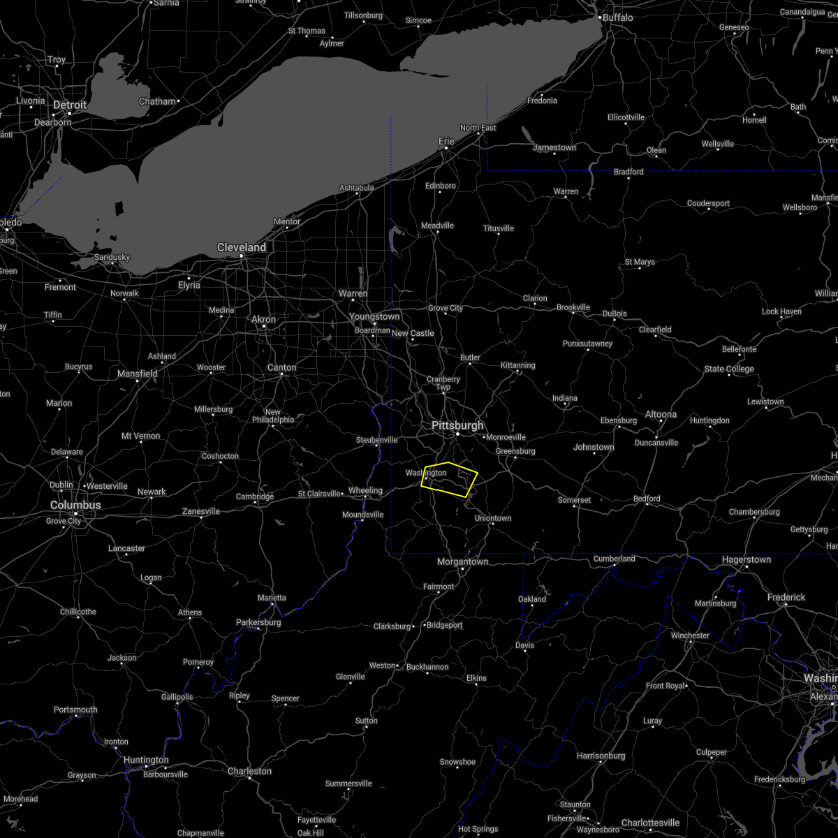 At 210 pm edt, a severe thunderstorm was located near east washington, or near washington, moving east at 30 mph (radar indicated). Hazards include 60 mph wind gusts. expect damage to trees and power lines, resulting in some power outages At 210 pm edt, a severe thunderstorm was located near east washington, or near washington, moving east at 30 mph (radar indicated). Hazards include 60 mph wind gusts. expect damage to trees and power lines, resulting in some power outages
|
| 8/10/2021 2:41 PM EDT |
 The severe thunderstorm warning for central washington county will expire at 245 pm edt, the storm which prompted the warning has weakened below severe limits, and has exited the warned area. therefore, the warning will be allowed to expire. however gusty winds and heavy rain are still possible with this thunderstorm. The severe thunderstorm warning for central washington county will expire at 245 pm edt, the storm which prompted the warning has weakened below severe limits, and has exited the warned area. therefore, the warning will be allowed to expire. however gusty winds and heavy rain are still possible with this thunderstorm.
|
| 8/10/2021 2:28 PM EDT |
 At 227 pm edt, a severe thunderstorm was located 8 miles southeast of east washington, or 9 miles southeast of washington, moving east at 50 mph (radar indicated). Hazards include 60 mph wind gusts and quarter size hail. Minor hail damage to vehicles is possible. expect wind damage to trees and power lines, resulting in some power outages. locations impacted include, mcmurray, washington, canonsburg, wolfdale, mcgovern, east washington, houston, eighty four, hickory, amity, green hills, and meadow lands. hail threat, radar indicated max hail size, 1. 00 in wind threat, radar indicated max wind gust, 60 mph. At 227 pm edt, a severe thunderstorm was located 8 miles southeast of east washington, or 9 miles southeast of washington, moving east at 50 mph (radar indicated). Hazards include 60 mph wind gusts and quarter size hail. Minor hail damage to vehicles is possible. expect wind damage to trees and power lines, resulting in some power outages. locations impacted include, mcmurray, washington, canonsburg, wolfdale, mcgovern, east washington, houston, eighty four, hickory, amity, green hills, and meadow lands. hail threat, radar indicated max hail size, 1. 00 in wind threat, radar indicated max wind gust, 60 mph.
|
| 8/10/2021 2:07 PM EDT |
 At 206 pm edt, a severe thunderstorm was located near avella, moving southeast at 30 mph (radar indicated). Hazards include 60 mph wind gusts and quarter size hail. Minor hail damage to vehicles is possible. expect wind damage to trees and power lines, resulting in some power outages. locations impacted include, mcmurray, washington, canonsburg, avella, wolfdale, mcgovern, east washington, houston, claysville, eighty four, hickory, and taylorstown. hail threat, radar indicated max hail size, 1. 00 in wind threat, radar indicated max wind gust, 60 mph. At 206 pm edt, a severe thunderstorm was located near avella, moving southeast at 30 mph (radar indicated). Hazards include 60 mph wind gusts and quarter size hail. Minor hail damage to vehicles is possible. expect wind damage to trees and power lines, resulting in some power outages. locations impacted include, mcmurray, washington, canonsburg, avella, wolfdale, mcgovern, east washington, houston, claysville, eighty four, hickory, and taylorstown. hail threat, radar indicated max hail size, 1. 00 in wind threat, radar indicated max wind gust, 60 mph.
|
| 8/10/2021 1:57 PM EDT |
 At 157 pm edt, a severe thunderstorm was located over avella, moving southeast at 30 mph (radar indicated). Hazards include 60 mph wind gusts and quarter size hail. Minor hail damage to vehicles is possible. Expect wind damage to trees and power lines, resulting in some power outages. At 157 pm edt, a severe thunderstorm was located over avella, moving southeast at 30 mph (radar indicated). Hazards include 60 mph wind gusts and quarter size hail. Minor hail damage to vehicles is possible. Expect wind damage to trees and power lines, resulting in some power outages.
|
| 7/16/2021 4:35 PM EDT |
 At 435 pm edt, a severe thunderstorm was located over east washington, or over washington, moving east at 25 mph (radar). Hazards include wind gusts to 60 mph. Expect damage to trees and power lines, resulting in some power outages. locations impacted include, washington, canonsburg, wolfdale, mcgovern, east washington, houston, claysville, eighty four, hickory, west alexander, taylorstown, west middletown, this includes the following highways, interstate 70 in pennsylvania between mile markers 1 and 25. Interstate 79 in pennsylvania between mile markers 27 and 49. At 435 pm edt, a severe thunderstorm was located over east washington, or over washington, moving east at 25 mph (radar). Hazards include wind gusts to 60 mph. Expect damage to trees and power lines, resulting in some power outages. locations impacted include, washington, canonsburg, wolfdale, mcgovern, east washington, houston, claysville, eighty four, hickory, west alexander, taylorstown, west middletown, this includes the following highways, interstate 70 in pennsylvania between mile markers 1 and 25. Interstate 79 in pennsylvania between mile markers 27 and 49.
|
| 7/16/2021 4:24 PM EDT |
 At 424 pm edt, a severe thunderstorm was located over wolfdale, or near washington, moving east at 25 mph (radar). Hazards include wind gusts to 60 mph. Expect damage to trees and power lines, resulting in some power outages. locations impacted include, washington, canonsburg, avella, wolfdale, mcgovern, east washington, houston, claysville, eighty four, hickory, west alexander, taylorstown, this includes the following highways, interstate 70 in pennsylvania between mile markers 1 and 25. Interstate 79 in pennsylvania between mile markers 27 and 49. At 424 pm edt, a severe thunderstorm was located over wolfdale, or near washington, moving east at 25 mph (radar). Hazards include wind gusts to 60 mph. Expect damage to trees and power lines, resulting in some power outages. locations impacted include, washington, canonsburg, avella, wolfdale, mcgovern, east washington, houston, claysville, eighty four, hickory, west alexander, taylorstown, this includes the following highways, interstate 70 in pennsylvania between mile markers 1 and 25. Interstate 79 in pennsylvania between mile markers 27 and 49.
|
| 7/16/2021 4:12 PM EDT |
 At 412 pm edt, a severe thunderstorm was located near wolfdale, or near avella, moving east at 25 mph (radar). Hazards include wind gusts to 60 mph. expect damage to trees and power lines, resulting in some power outages At 412 pm edt, a severe thunderstorm was located near wolfdale, or near avella, moving east at 25 mph (radar). Hazards include wind gusts to 60 mph. expect damage to trees and power lines, resulting in some power outages
|
| 7/13/2021 3:43 AM EDT |
 At 342 am edt, a severe thunderstorm was located near east washington, or near canonsburg, moving east at 45 mph (radar). Hazards include wind gusts to 60 mph. Expect damage to trees and power lines, resulting in some power outages. locations impacted include, washington, gastonville, monessen, california, donora, monongahela, charleroi, wolfdale, bentleyville, east washington, new eagle, wickerham manor-fisher, this includes the following highways, interstate 70 in pennsylvania between mile markers 15 and 40. Interstate 79 in pennsylvania between mile markers 28 and 42. At 342 am edt, a severe thunderstorm was located near east washington, or near canonsburg, moving east at 45 mph (radar). Hazards include wind gusts to 60 mph. Expect damage to trees and power lines, resulting in some power outages. locations impacted include, washington, gastonville, monessen, california, donora, monongahela, charleroi, wolfdale, bentleyville, east washington, new eagle, wickerham manor-fisher, this includes the following highways, interstate 70 in pennsylvania between mile markers 15 and 40. Interstate 79 in pennsylvania between mile markers 28 and 42.
|
| 7/13/2021 3:37 AM EDT |
 At 337 am edt, a severe thunderstorm was located over east washington, or over washington, moving east at 45 mph (radar). Hazards include wind gusts to 60 mph. expect damage to trees and power lines, resulting in some power outages At 337 am edt, a severe thunderstorm was located over east washington, or over washington, moving east at 45 mph (radar). Hazards include wind gusts to 60 mph. expect damage to trees and power lines, resulting in some power outages
|
| 7/7/2021 3:19 PM EDT |
 At 319 pm edt, an area of severe thunderstorms was located over munhall, or near pittsburgh, moving northeast at 10 mph (radar). Hazards include wind gusts to 60 mph and quarter-size hail. Minor hail damage to vehicles is possible. Expect wind damage to trees and power lines, resulting in some power outages. At 319 pm edt, an area of severe thunderstorms was located over munhall, or near pittsburgh, moving northeast at 10 mph (radar). Hazards include wind gusts to 60 mph and quarter-size hail. Minor hail damage to vehicles is possible. Expect wind damage to trees and power lines, resulting in some power outages.
|
| 6/21/2021 4:20 PM EDT |
 At 420 pm edt, a severe thunderstorm was located over bentleyville, or 11 miles south of gastonville, moving east at 60 mph (radar). Hazards include wind gusts to 60 mph. Expect damage to trees and power lines, resulting in some power outages. locations impacted include, jefferson hills, monessen, california, donora, monongahela, charleroi, bentleyville, new eagle, north belle vernon, wickerham manor-fisher, baidland, north charleroi, this includes the following highways, interstate 70 in pennsylvania near mile marker 25, and between mile markers 27 and 44. Interstate 79 in pennsylvania between mile markers 22 and 30. At 420 pm edt, a severe thunderstorm was located over bentleyville, or 11 miles south of gastonville, moving east at 60 mph (radar). Hazards include wind gusts to 60 mph. Expect damage to trees and power lines, resulting in some power outages. locations impacted include, jefferson hills, monessen, california, donora, monongahela, charleroi, bentleyville, new eagle, north belle vernon, wickerham manor-fisher, baidland, north charleroi, this includes the following highways, interstate 70 in pennsylvania near mile marker 25, and between mile markers 27 and 44. Interstate 79 in pennsylvania between mile markers 22 and 30.
|
| 6/21/2021 4:10 PM EDT |
 At 410 pm edt, a severe thunderstorm was located over bentleyville, or 7 miles south of gastonville, moving east at 90 mph (radar). Hazards include wind gusts to 60 mph. Expect damage to trees and power lines, resulting in some power outages. locations impacted include, washington, jefferson hills, monessen, california, donora, monongahela, charleroi, wolfdale, bentleyville, brownsville, east washington, perryopolis, this includes the following highways, interstate 70 in west virginia between mile markers 13 and 14. interstate 70 in pennsylvania between mile markers 0 and 44. Interstate 79 in pennsylvania between mile markers 22 and 41. At 410 pm edt, a severe thunderstorm was located over bentleyville, or 7 miles south of gastonville, moving east at 90 mph (radar). Hazards include wind gusts to 60 mph. Expect damage to trees and power lines, resulting in some power outages. locations impacted include, washington, jefferson hills, monessen, california, donora, monongahela, charleroi, wolfdale, bentleyville, brownsville, east washington, perryopolis, this includes the following highways, interstate 70 in west virginia between mile markers 13 and 14. interstate 70 in pennsylvania between mile markers 0 and 44. Interstate 79 in pennsylvania between mile markers 22 and 41.
|
| 6/21/2021 3:53 PM EDT |
 At 353 pm edt, a severe thunderstorm was located near valley grove, moving east at 90 mph (radar). Hazards include wind gusts to 60 mph. expect damage to trees and power lines, resulting in some power outages At 353 pm edt, a severe thunderstorm was located near valley grove, moving east at 90 mph (radar). Hazards include wind gusts to 60 mph. expect damage to trees and power lines, resulting in some power outages
|
| 6/14/2021 3:38 PM EDT |
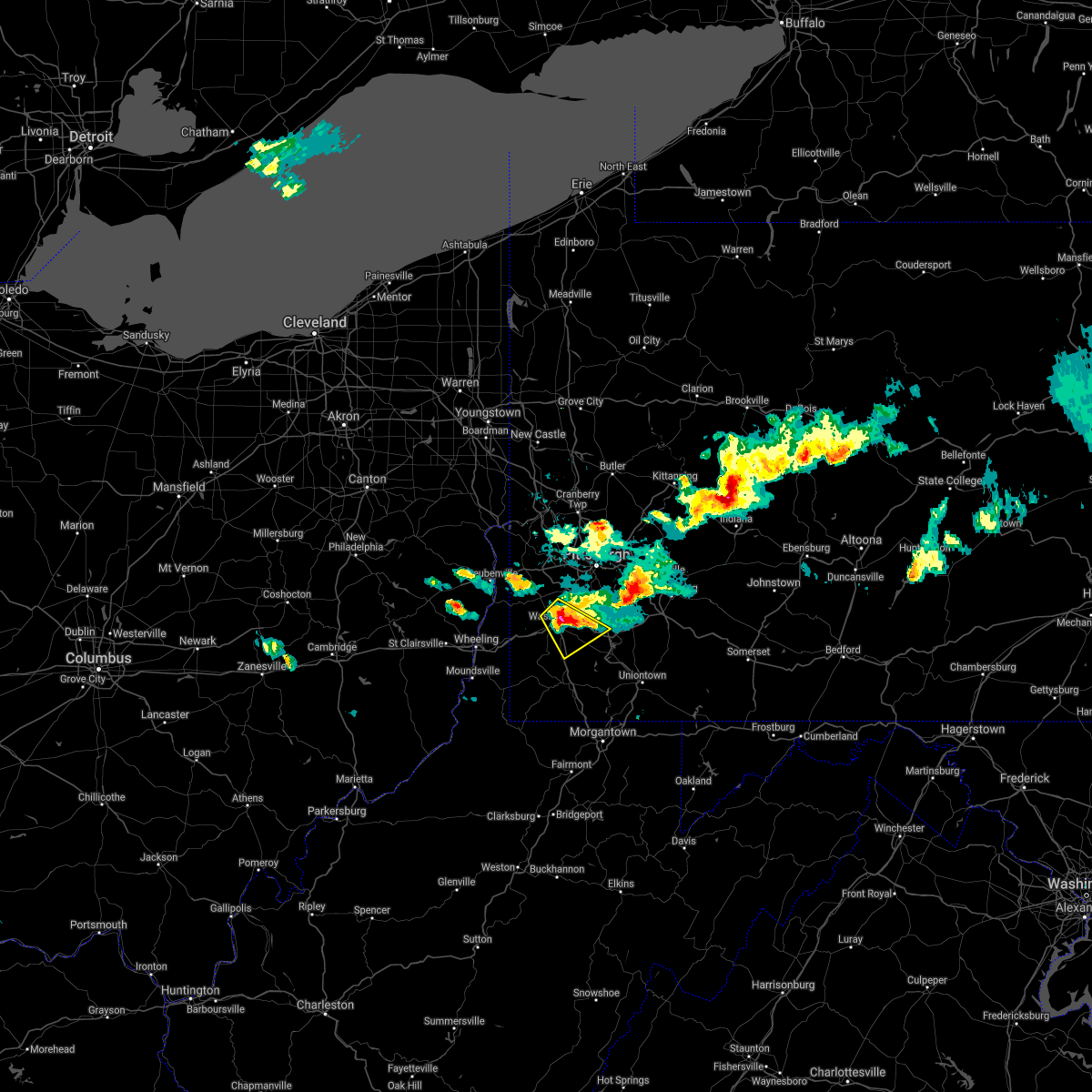 At 338 pm edt, a severe thunderstorm was located near east washington, or near washington, moving east at 45 mph (radar). Hazards include wind gusts to 60 mph and quarter-size hail. Minor hail damage to vehicles is possible. expect wind damage to trees and power lines, resulting in some power outages. locations impacted include, washington, canonsburg, wolfdale, mcgovern, bentleyville, east washington, north charleroi, houston, ellsworth, eighty four, cokeburg, scenery hill, this includes the following highways, interstate 70 in pennsylvania between mile markers 14 and 35. Interstate 79 in pennsylvania between mile markers 24 and 45. At 338 pm edt, a severe thunderstorm was located near east washington, or near washington, moving east at 45 mph (radar). Hazards include wind gusts to 60 mph and quarter-size hail. Minor hail damage to vehicles is possible. expect wind damage to trees and power lines, resulting in some power outages. locations impacted include, washington, canonsburg, wolfdale, mcgovern, bentleyville, east washington, north charleroi, houston, ellsworth, eighty four, cokeburg, scenery hill, this includes the following highways, interstate 70 in pennsylvania between mile markers 14 and 35. Interstate 79 in pennsylvania between mile markers 24 and 45.
|
| 6/14/2021 3:26 PM EDT |
 At 326 pm edt, a severe thunderstorm was located over wolfdale, or near washington, moving east at 45 mph (radar). Hazards include wind gusts to 60 mph and quarter-size hail. Minor hail damage to vehicles is possible. Expect wind damage to trees and power lines, resulting in some power outages. At 326 pm edt, a severe thunderstorm was located over wolfdale, or near washington, moving east at 45 mph (radar). Hazards include wind gusts to 60 mph and quarter-size hail. Minor hail damage to vehicles is possible. Expect wind damage to trees and power lines, resulting in some power outages.
|
| 11/15/2020 2:51 PM EST |
 At 251 pm est, severe thunderstorms were located along a line extending from near sarver to 6 miles north of cassville, moving east at 50 mph (law enforcement). Hazards include wind gusts to 60 mph. Expect damage to trees and power lines, resulting in some power outages. locations impacted include, pittsburgh, penn hills, mount lebanon, bethel park, ross township, mccandless township, monroeville, cranberry, moon township, mcmurray, mckeesport, washington, this includes the following highways, interstate 70 in pennsylvania between mile markers 8 and 48. pennsylvania turnpike between mile markers 23 and 60. interstate 79 in pennsylvania between mile markers 8 and 86. Interstate 376 in pennsylvania between mile markers 54 and 84. At 251 pm est, severe thunderstorms were located along a line extending from near sarver to 6 miles north of cassville, moving east at 50 mph (law enforcement). Hazards include wind gusts to 60 mph. Expect damage to trees and power lines, resulting in some power outages. locations impacted include, pittsburgh, penn hills, mount lebanon, bethel park, ross township, mccandless township, monroeville, cranberry, moon township, mcmurray, mckeesport, washington, this includes the following highways, interstate 70 in pennsylvania between mile markers 8 and 48. pennsylvania turnpike between mile markers 23 and 60. interstate 79 in pennsylvania between mile markers 8 and 86. Interstate 376 in pennsylvania between mile markers 54 and 84.
|
| 11/15/2020 2:43 PM EST |
 The severe thunderstorm warning for northeastern monroe, eastern jefferson, southeastern columbiana, eastern belmont, beaver, southwestern butler, northwestern allegheny, western greene, washington, ohio, northern wetzel, marshall, brooke, northwestern monongalia and hancock counties will expire at 245 pm est, the storms which prompted the warning have moved out of the area. therefore, the warning will be allowed to expire. however gusty winds are still possible with these thunderstorms. a severe thunderstorm watch remains in effect until 400 pm est for east central ohio, western and west central pennsylvania, and northern west virginia. a severe thunderstorm watch also remains in effect until 600 pm est for southwestern pennsylvania, and northern west virginia. remember, a severe thunderstorm warning still remains in effect for allegheny, greene, washington counties until 330 pm est. The severe thunderstorm warning for northeastern monroe, eastern jefferson, southeastern columbiana, eastern belmont, beaver, southwestern butler, northwestern allegheny, western greene, washington, ohio, northern wetzel, marshall, brooke, northwestern monongalia and hancock counties will expire at 245 pm est, the storms which prompted the warning have moved out of the area. therefore, the warning will be allowed to expire. however gusty winds are still possible with these thunderstorms. a severe thunderstorm watch remains in effect until 400 pm est for east central ohio, western and west central pennsylvania, and northern west virginia. a severe thunderstorm watch also remains in effect until 600 pm est for southwestern pennsylvania, and northern west virginia. remember, a severe thunderstorm warning still remains in effect for allegheny, greene, washington counties until 330 pm est.
|
| 11/15/2020 2:36 PM EST |
 At 236 pm est, severe thunderstorms were located along a line extending from mars to 9 miles southwest of waynesburg, moving east at 50 mph (law enforcement). Hazards include wind gusts to 60 mph. expect damage to trees and power lines, resulting in some power outages At 236 pm est, severe thunderstorms were located along a line extending from mars to 9 miles southwest of waynesburg, moving east at 50 mph (law enforcement). Hazards include wind gusts to 60 mph. expect damage to trees and power lines, resulting in some power outages
|
| 11/15/2020 2:30 PM EST |
 At 230 pm est, severe thunderstorms were located along a line extending from rochester to near hundred, moving east at 45 mph (radar). Hazards include wind gusts to 60 mph. Expect damage to trees and power lines, resulting in some power outages. locations impacted include, pittsburgh, ross township, wheeling, mccandless township, cranberry, moon township, weirton, steubenville, washington, franklin park, east liverpool, aliquippa, this includes the following highways, interstate 70 in ohio between mile markers 219 and 225. interstate 70 in west virginia between mile markers 0 and 14. interstate 70 in pennsylvania between mile markers 0 and 24. pennsylvania turnpike between mile markers 20 and 33. interstate 79 in pennsylvania between mile markers 21 and 84. Interstate 376 in pennsylvania between mile markers 32 and 64. At 230 pm est, severe thunderstorms were located along a line extending from rochester to near hundred, moving east at 45 mph (radar). Hazards include wind gusts to 60 mph. Expect damage to trees and power lines, resulting in some power outages. locations impacted include, pittsburgh, ross township, wheeling, mccandless township, cranberry, moon township, weirton, steubenville, washington, franklin park, east liverpool, aliquippa, this includes the following highways, interstate 70 in ohio between mile markers 219 and 225. interstate 70 in west virginia between mile markers 0 and 14. interstate 70 in pennsylvania between mile markers 0 and 24. pennsylvania turnpike between mile markers 20 and 33. interstate 79 in pennsylvania between mile markers 21 and 84. Interstate 376 in pennsylvania between mile markers 32 and 64.
|
| 11/15/2020 2:06 PM EST |
 At 205 pm est, severe thunderstorms were located along a line extending from near calcutta to near new martinsville, moving east at 45 mph (trained weather spotters). Hazards include wind gusts to 70 mph. Trees snapped and uprooted. Power outages can be expected. At 205 pm est, severe thunderstorms were located along a line extending from near calcutta to near new martinsville, moving east at 45 mph (trained weather spotters). Hazards include wind gusts to 70 mph. Trees snapped and uprooted. Power outages can be expected.
|
| 8/27/2020 7:40 PM EDT |
 At 739 pm edt, severe thunderstorms were located along a line extending from 6 miles northeast of seven springs to near connellsville to near east washington to near west liberty, moving southeast at 30 mph (radar). Hazards include wind gusts to 60 mph. expect damage to trees and power lines, resulting in some power outages At 739 pm edt, severe thunderstorms were located along a line extending from 6 miles northeast of seven springs to near connellsville to near east washington to near west liberty, moving southeast at 30 mph (radar). Hazards include wind gusts to 60 mph. expect damage to trees and power lines, resulting in some power outages
|
| 8/27/2020 7:30 PM EDT |
 At 730 pm edt, a severe thunderstorm was located near wolfdale, or near avella, moving southeast at 30 mph (radar). Hazards include wind gusts to 60 mph and quarter-size hail. Minor hail damage to vehicles is possible. expect wind damage to trees and power lines, resulting in some power outages. locations impacted include, washington, canonsburg, wellsburg, avella, wolfdale, mcgovern, east washington, houston, bethany, claysville, franklin, eighty four, this includes the following highways, interstate 70 in pennsylvania between mile markers 2 and 27. Interstate 79 in pennsylvania between mile markers 27 and 46. At 730 pm edt, a severe thunderstorm was located near wolfdale, or near avella, moving southeast at 30 mph (radar). Hazards include wind gusts to 60 mph and quarter-size hail. Minor hail damage to vehicles is possible. expect wind damage to trees and power lines, resulting in some power outages. locations impacted include, washington, canonsburg, wellsburg, avella, wolfdale, mcgovern, east washington, houston, bethany, claysville, franklin, eighty four, this includes the following highways, interstate 70 in pennsylvania between mile markers 2 and 27. Interstate 79 in pennsylvania between mile markers 27 and 46.
|
| 8/27/2020 7:10 PM EDT |
 At 710 pm edt, a severe thunderstorm was located over hooverson heights, or near avella, moving southeast at 30 mph (radar). Hazards include wind gusts to 60 mph. expect damage to trees and power lines, resulting in some power outages At 710 pm edt, a severe thunderstorm was located over hooverson heights, or near avella, moving southeast at 30 mph (radar). Hazards include wind gusts to 60 mph. expect damage to trees and power lines, resulting in some power outages
|
| 8/27/2020 6:41 PM EDT |
 At 641 pm edt, severe thunderstorms were located along a line extending from bellevue to near sturgeon-noblestown to 6 miles west of mcdonald, moving southeast at 45 mph (radar). Hazards include wind gusts to 60 mph. expect damage to trees and power lines, resulting in some power outages At 641 pm edt, severe thunderstorms were located along a line extending from bellevue to near sturgeon-noblestown to 6 miles west of mcdonald, moving southeast at 45 mph (radar). Hazards include wind gusts to 60 mph. expect damage to trees and power lines, resulting in some power outages
|
| 7/10/2020 5:54 PM EDT |
 At 554 pm edt, a severe thunderstorm was located over mcmurray, moving northeast at 30 mph (radar). Hazards include wind gusts to 60 mph. expect damage to trees and power lines, resulting in some power outages At 554 pm edt, a severe thunderstorm was located over mcmurray, moving northeast at 30 mph (radar). Hazards include wind gusts to 60 mph. expect damage to trees and power lines, resulting in some power outages
|
| 6/21/2020 4:35 PM EDT |
 The severe thunderstorm warning for south central washington county will expire at 445 pm edt, the storm which prompted the warning has weakened below severe limits, and no longer poses an immediate threat to life or property. therefore, the warning will be allowed to expire. The severe thunderstorm warning for south central washington county will expire at 445 pm edt, the storm which prompted the warning has weakened below severe limits, and no longer poses an immediate threat to life or property. therefore, the warning will be allowed to expire.
|
| 6/21/2020 4:21 PM EDT |
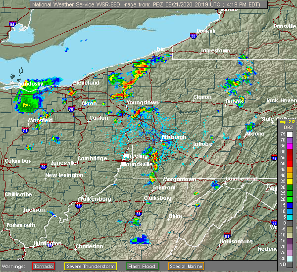 At 421 pm edt, a severe thunderstorm was located near bentleyville, or 8 miles southeast of washington, moving southeast at 5 mph (radar). Hazards include wind gusts to 60 mph and quarter-size hail. Minor hail damage to vehicles is possible. expect wind damage to trees and power lines, resulting in some power outages. Locations impacted include, bentleyville, ellsworth, cokeburg, scenery hill, this includes interstate 70 in pennsylvania near mile marker 25. At 421 pm edt, a severe thunderstorm was located near bentleyville, or 8 miles southeast of washington, moving southeast at 5 mph (radar). Hazards include wind gusts to 60 mph and quarter-size hail. Minor hail damage to vehicles is possible. expect wind damage to trees and power lines, resulting in some power outages. Locations impacted include, bentleyville, ellsworth, cokeburg, scenery hill, this includes interstate 70 in pennsylvania near mile marker 25.
|
| 6/21/2020 4:15 PM EDT |
 At 414 pm edt, a severe thunderstorm was located near bentleyville, or 7 miles southeast of washington, moving southeast at 5 mph (radar). Hazards include wind gusts to 60 mph and quarter-size hail. Minor hail damage to vehicles is possible. Expect wind damage to trees and power lines, resulting in some power outages. At 414 pm edt, a severe thunderstorm was located near bentleyville, or 7 miles southeast of washington, moving southeast at 5 mph (radar). Hazards include wind gusts to 60 mph and quarter-size hail. Minor hail damage to vehicles is possible. Expect wind damage to trees and power lines, resulting in some power outages.
|
| 6/21/2020 3:58 PM EDT |
 At 358 pm edt, a severe thunderstorm was located near east washington, or near washington, and is nearly stationary (radar). Hazards include wind gusts to 60 mph and quarter-size hail. Minor hail damage to vehicles is possible. expect wind damage to trees and power lines, resulting in some power outages. locations impacted include, washington, eighty four, this includes the following highways, interstate 70 in pennsylvania between mile markers 20 and 27. Interstate 79 in pennsylvania between mile markers 29 and 36, and near mile marker 43. At 358 pm edt, a severe thunderstorm was located near east washington, or near washington, and is nearly stationary (radar). Hazards include wind gusts to 60 mph and quarter-size hail. Minor hail damage to vehicles is possible. expect wind damage to trees and power lines, resulting in some power outages. locations impacted include, washington, eighty four, this includes the following highways, interstate 70 in pennsylvania between mile markers 20 and 27. Interstate 79 in pennsylvania between mile markers 29 and 36, and near mile marker 43.
|
| 6/21/2020 3:57 PM EDT | Trees down along valley view rd. in nottingham township in washington county PA, 4.2 miles WSW of Eighty Four, PA |
| 6/21/2020 3:48 PM EDT |
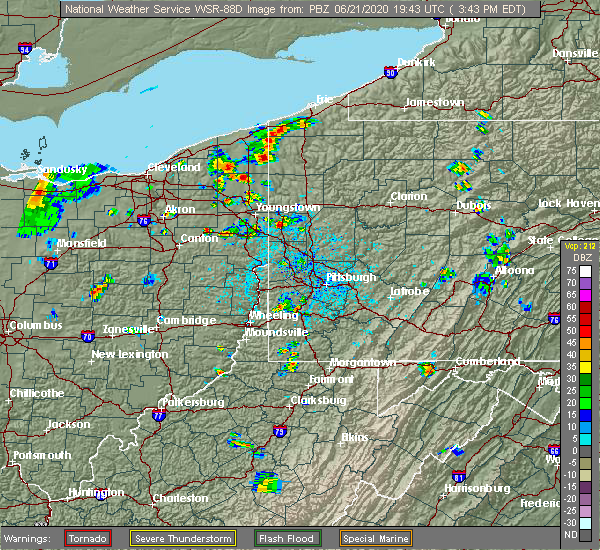 At 348 pm edt, a severe thunderstorm was located near east washington, or near washington, and is nearly stationary (radar). Hazards include wind gusts to 60 mph and quarter-size hail. Minor hail damage to vehicles is possible. Expect wind damage to trees and power lines, resulting in some power outages. At 348 pm edt, a severe thunderstorm was located near east washington, or near washington, and is nearly stationary (radar). Hazards include wind gusts to 60 mph and quarter-size hail. Minor hail damage to vehicles is possible. Expect wind damage to trees and power lines, resulting in some power outages.
|
| 6/4/2020 5:14 PM EDT |
 At 514 pm edt, severe thunderstorms were located along a line extending from near mars to etna to near east washington, moving east at 30 mph (radar). Hazards include wind gusts to 60 mph. Expect damage to trees and power lines, resulting in some power outages. locations impacted include, pittsburgh, penn hills, mount lebanon, bethel park, monroeville, mcmurray, greensburg, mckeesport, indiana, jeannette, latrobe, connellsville, this includes the following highways, interstate 70 in pennsylvania between mile markers 20 and 57. pennsylvania turnpike between mile markers 41 and 99. interstate 79 in pennsylvania between mile markers 29 and 35. Interstate 376 in pennsylvania between mile markers 73 and 84. At 514 pm edt, severe thunderstorms were located along a line extending from near mars to etna to near east washington, moving east at 30 mph (radar). Hazards include wind gusts to 60 mph. Expect damage to trees and power lines, resulting in some power outages. locations impacted include, pittsburgh, penn hills, mount lebanon, bethel park, monroeville, mcmurray, greensburg, mckeesport, indiana, jeannette, latrobe, connellsville, this includes the following highways, interstate 70 in pennsylvania between mile markers 20 and 57. pennsylvania turnpike between mile markers 41 and 99. interstate 79 in pennsylvania between mile markers 29 and 35. Interstate 376 in pennsylvania between mile markers 73 and 84.
|
| 6/4/2020 4:43 PM EDT |
 At 442 pm edt, severe thunderstorms were located along a line extending from near rochester to moon township to 6 miles west of wolfdale, moving east at 30 mph (radar). Hazards include wind gusts to 60 mph. expect damage to trees and power lines, resulting in some power outages At 442 pm edt, severe thunderstorms were located along a line extending from near rochester to moon township to 6 miles west of wolfdale, moving east at 30 mph (radar). Hazards include wind gusts to 60 mph. expect damage to trees and power lines, resulting in some power outages
|
| 6/4/2020 4:19 PM EDT |
 At 417 pm edt, severe thunderstorms were located along a line extending from near campbell to near east palestine to near shippingport to near wellsburg, moving east at 25 mph (radar). Hazards include wind gusts to 60 mph. Expect damage to trees and power lines, resulting in some power outages. locations impacted include, pittsburgh, penn hills, mount lebanon, bethel park, ross township, mccandless township, monroeville, cranberry, moon township, new castle, mcmurray, weirton, this includes the following highways, interstate 70 in pennsylvania between mile markers 14 and 33. pennsylvania turnpike between mile markers 1 and 56. interstate 79 in pennsylvania between mile markers 32 and 103. Interstate 376 in pennsylvania between mile markers 31 and 84. At 417 pm edt, severe thunderstorms were located along a line extending from near campbell to near east palestine to near shippingport to near wellsburg, moving east at 25 mph (radar). Hazards include wind gusts to 60 mph. Expect damage to trees and power lines, resulting in some power outages. locations impacted include, pittsburgh, penn hills, mount lebanon, bethel park, ross township, mccandless township, monroeville, cranberry, moon township, new castle, mcmurray, weirton, this includes the following highways, interstate 70 in pennsylvania between mile markers 14 and 33. pennsylvania turnpike between mile markers 1 and 56. interstate 79 in pennsylvania between mile markers 32 and 103. Interstate 376 in pennsylvania between mile markers 31 and 84.
|
| 6/4/2020 4:03 PM EDT |
 At 402 pm edt, severe thunderstorms were located along a line extending from near boardman to near east palestine to near midland to 6 miles north of tiltonsville, moving east at 45 mph (radar). Hazards include wind gusts to 60 mph. expect damage to trees and power lines, resulting in some power outages At 402 pm edt, severe thunderstorms were located along a line extending from near boardman to near east palestine to near midland to 6 miles north of tiltonsville, moving east at 45 mph (radar). Hazards include wind gusts to 60 mph. expect damage to trees and power lines, resulting in some power outages
|
| 8/8/2019 6:02 PM EDT |
 At 602 pm edt, a severe thunderstorm was located over washington, moving east at 35 mph (radar). Hazards include wind gusts to 60 mph. Expect damage to trees and power lines, resulting in some power outages. locations impacted include, washington, canonsburg, gastonville, jefferson hills, monessen, california, donora, monongahela, charleroi, wolfdale, mcgovern, bentleyville, this includes the following highways, interstate 70 in pennsylvania between mile markers 11 and 43. Interstate 79 in pennsylvania between mile markers 24 and 44. At 602 pm edt, a severe thunderstorm was located over washington, moving east at 35 mph (radar). Hazards include wind gusts to 60 mph. Expect damage to trees and power lines, resulting in some power outages. locations impacted include, washington, canonsburg, gastonville, jefferson hills, monessen, california, donora, monongahela, charleroi, wolfdale, mcgovern, bentleyville, this includes the following highways, interstate 70 in pennsylvania between mile markers 11 and 43. Interstate 79 in pennsylvania between mile markers 24 and 44.
|
| 8/8/2019 5:46 PM EDT |
 At 546 pm edt, a severe thunderstorm was located 7 miles southwest of wolfdale, or 8 miles northeast of valley grove, moving east at 35 mph (radar). Hazards include wind gusts to 60 mph and quarter-size hail. Minor hail damage to vehicles is possible. Expect wind damage to trees and power lines, resulting in some power outages. At 546 pm edt, a severe thunderstorm was located 7 miles southwest of wolfdale, or 8 miles northeast of valley grove, moving east at 35 mph (radar). Hazards include wind gusts to 60 mph and quarter-size hail. Minor hail damage to vehicles is possible. Expect wind damage to trees and power lines, resulting in some power outages.
|
| 8/2/2019 5:46 PM EDT |
 At 546 pm edt, a severe thunderstorm was located near east washington, or near washington, moving north at 5 mph (radar). Hazards include quarter-size hail. Minor damage to vehicles is possible. locations impacted include, bethel park, mcmurray, washington, canonsburg, gastonville, upper st. clair, south park township, cecil-bishop, wolfdale, mcgovern, east washington, houston, this includes the following highways, interstate 70 in pennsylvania between mile markers 14 and 30. Interstate 79 in pennsylvania between mile markers 32 and 49. At 546 pm edt, a severe thunderstorm was located near east washington, or near washington, moving north at 5 mph (radar). Hazards include quarter-size hail. Minor damage to vehicles is possible. locations impacted include, bethel park, mcmurray, washington, canonsburg, gastonville, upper st. clair, south park township, cecil-bishop, wolfdale, mcgovern, east washington, houston, this includes the following highways, interstate 70 in pennsylvania between mile markers 14 and 30. Interstate 79 in pennsylvania between mile markers 32 and 49.
|
| 8/2/2019 5:35 PM EDT | Quarter sized hail reported 1.7 miles ENE of Eighty Four, PA, time estimated. |
| 8/2/2019 5:28 PM EDT |
 At 528 pm edt, a severe thunderstorm was located near east washington, or near washington, moving north at 5 mph (radar). Hazards include quarter-size hail. Minor damage to vehicles is possible. locations impacted include, bethel park, mcmurray, washington, canonsburg, gastonville, upper st. clair, south park township, cecil-bishop, wolfdale, mcgovern, east washington, houston, this includes the following highways, interstate 70 in pennsylvania between mile markers 14 and 30. Interstate 79 in pennsylvania between mile markers 29 and 49. At 528 pm edt, a severe thunderstorm was located near east washington, or near washington, moving north at 5 mph (radar). Hazards include quarter-size hail. Minor damage to vehicles is possible. locations impacted include, bethel park, mcmurray, washington, canonsburg, gastonville, upper st. clair, south park township, cecil-bishop, wolfdale, mcgovern, east washington, houston, this includes the following highways, interstate 70 in pennsylvania between mile markers 14 and 30. Interstate 79 in pennsylvania between mile markers 29 and 49.
|
| 8/2/2019 5:13 PM EDT |
 At 512 pm edt, a severe thunderstorm was located near east washington, or near washington, moving north at 5 mph (radar). Hazards include wind gusts to 60 mph and quarter-size hail. Minor hail damage to vehicles is possible. Expect wind damage to trees and power lines, resulting in some power outages. At 512 pm edt, a severe thunderstorm was located near east washington, or near washington, moving north at 5 mph (radar). Hazards include wind gusts to 60 mph and quarter-size hail. Minor hail damage to vehicles is possible. Expect wind damage to trees and power lines, resulting in some power outages.
|
| 7/11/2019 5:38 PM EDT |
 The national weather service in pittsburgh has issued a * severe thunderstorm warning for. central washington county in southwestern pennsylvania. until 615 pm edt. At 538 pm edt, a severe thunderstorm was located near wolfdale, or near washington, moving east at 35 mph. The national weather service in pittsburgh has issued a * severe thunderstorm warning for. central washington county in southwestern pennsylvania. until 615 pm edt. At 538 pm edt, a severe thunderstorm was located near wolfdale, or near washington, moving east at 35 mph.
|
| 7/2/2019 8:20 PM EDT |
 The severe thunderstorm warning for southern washington, northeastern ohio and southeastern brooke counties will expire at 830 pm edt, the storms that prompted the warning have weakened below severe limits and have exited the warned area. therefore, the warning will be allowed to expire. The severe thunderstorm warning for southern washington, northeastern ohio and southeastern brooke counties will expire at 830 pm edt, the storms that prompted the warning have weakened below severe limits and have exited the warned area. therefore, the warning will be allowed to expire.
|
| 7/2/2019 8:02 PM EDT |
 At 802 pm edt, severe thunderstorms were located along a line extending from near canonsburg to 7 miles southeast of valley grove, moving southeast at 35 mph (radar). Hazards include wind gusts to 60 mph. Expect damage to trees and power lines, resulting in some power outages. Locations impacted include, mcmurray, washington, canonsburg, cecil-bishop, wolfdale, mcgovern, east washington, houston, west finley, claysville, eighty four, hickory,. At 802 pm edt, severe thunderstorms were located along a line extending from near canonsburg to 7 miles southeast of valley grove, moving southeast at 35 mph (radar). Hazards include wind gusts to 60 mph. Expect damage to trees and power lines, resulting in some power outages. Locations impacted include, mcmurray, washington, canonsburg, cecil-bishop, wolfdale, mcgovern, east washington, houston, west finley, claysville, eighty four, hickory,.
|
| 7/2/2019 7:38 PM EDT |
 At 737 pm edt, a severe thunderstorm was located over follansbee, or near steubenville, moving southeast at 20 mph (radar). Hazards include wind gusts to 60 mph and quarter-size hail. Minor hail damage to vehicles is possible. Expect wind damage to trees and power lines, resulting in some power outages. At 737 pm edt, a severe thunderstorm was located over follansbee, or near steubenville, moving southeast at 20 mph (radar). Hazards include wind gusts to 60 mph and quarter-size hail. Minor hail damage to vehicles is possible. Expect wind damage to trees and power lines, resulting in some power outages.
|
| 6/29/2019 8:06 PM EDT |
 At 806 pm edt, a severe thunderstorm was located near canonsburg, moving southeast at 25 mph (radar). Hazards include wind gusts to 60 mph. Expect damage to trees and power lines, resulting in some power outages. Locations impacted include, canonsburg, monongahela, mcgovern, bentleyville, new eagle, wickerham manor-fisher, baidland, houston, ellsworth, eighty four, cokeburg, scenery hill,. At 806 pm edt, a severe thunderstorm was located near canonsburg, moving southeast at 25 mph (radar). Hazards include wind gusts to 60 mph. Expect damage to trees and power lines, resulting in some power outages. Locations impacted include, canonsburg, monongahela, mcgovern, bentleyville, new eagle, wickerham manor-fisher, baidland, houston, ellsworth, eighty four, cokeburg, scenery hill,.
|
| 6/29/2019 8:00 PM EDT |
 At 800 pm edt, a severe thunderstorm was located over mcgovern, or over canonsburg, moving southeast at 25 mph (radar). Hazards include wind gusts to 60 mph and quarter-size hail. Minor hail damage to vehicles is possible. Expect wind damage to trees and power lines, resulting in some power outages. At 800 pm edt, a severe thunderstorm was located over mcgovern, or over canonsburg, moving southeast at 25 mph (radar). Hazards include wind gusts to 60 mph and quarter-size hail. Minor hail damage to vehicles is possible. Expect wind damage to trees and power lines, resulting in some power outages.
|
| 5/29/2019 3:28 PM EDT |
 At 328 pm edt, a severe thunderstorm was located over mcmurray, moving east at 35 mph (radar). Hazards include wind gusts to 60 mph. Expect damage to trees and power lines, resulting in some power outages. locations impacted include, mount lebanon, bethel park, mcmurray, greensburg, mckeesport, jeannette, canonsburg, gastonville, west mifflin, baldwin, upper st. clair, scott township, this includes the following highways, interstate 70 in pennsylvania between mile markers 42 and 57. pennsylvania turnpike between mile markers 66 and 83. Interstate 79 in pennsylvania between mile markers 45 and 54. At 328 pm edt, a severe thunderstorm was located over mcmurray, moving east at 35 mph (radar). Hazards include wind gusts to 60 mph. Expect damage to trees and power lines, resulting in some power outages. locations impacted include, mount lebanon, bethel park, mcmurray, greensburg, mckeesport, jeannette, canonsburg, gastonville, west mifflin, baldwin, upper st. clair, scott township, this includes the following highways, interstate 70 in pennsylvania between mile markers 42 and 57. pennsylvania turnpike between mile markers 66 and 83. Interstate 79 in pennsylvania between mile markers 45 and 54.
|
| 5/29/2019 2:55 PM EDT |
 At 255 pm edt, a severe thunderstorm was located over mcmurray, moving east at 40 mph (radar). Hazards include wind gusts to 60 mph. expect damage to trees and power lines, resulting in some power outages At 255 pm edt, a severe thunderstorm was located over mcmurray, moving east at 40 mph (radar). Hazards include wind gusts to 60 mph. expect damage to trees and power lines, resulting in some power outages
|
| 8/5/2018 2:45 PM EDT |
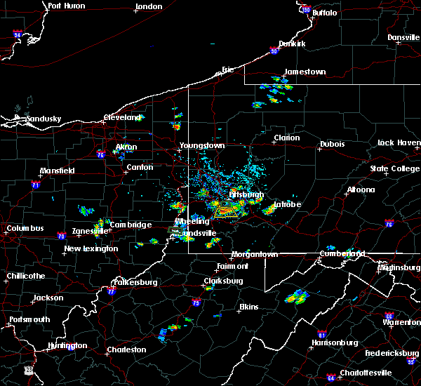 At 245 pm edt, a severe thunderstorm was located over bethel park, moving south at 5 mph (radar). Hazards include wind gusts to 60 mph and dime sized hail. expect damage to trees and power lines, resulting in some power outages At 245 pm edt, a severe thunderstorm was located over bethel park, moving south at 5 mph (radar). Hazards include wind gusts to 60 mph and dime sized hail. expect damage to trees and power lines, resulting in some power outages
|
| 7/15/2018 6:55 PM EDT |
 The severe thunderstorm warning for east central washington and southwestern westmoreland counties will expire at 700 pm edt, the storm that prompted the warning has weakened below severe limits and no longer pose an immediate threat to life and property. therefore, the warning will be allowed to expire. The severe thunderstorm warning for east central washington and southwestern westmoreland counties will expire at 700 pm edt, the storm that prompted the warning has weakened below severe limits and no longer pose an immediate threat to life and property. therefore, the warning will be allowed to expire.
|
| 7/15/2018 6:36 PM EDT |
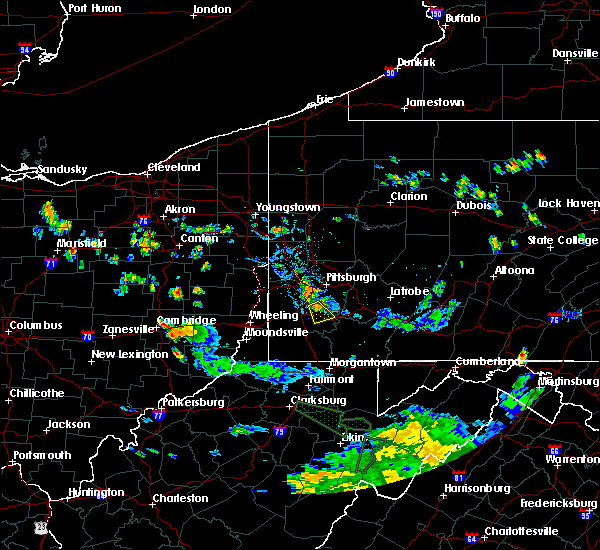 At 636 pm edt, a severe thunderstorm was located near gastonville, moving southeast at 15 mph (radar). Hazards include wind gusts to 60 mph and quarter-size hail. Minor hail damage to vehicles is possible. expect wind damage to trees and power lines, resulting in some power outages. Locations impacted include, gastonville, charleroi, bentleyville, new eagle, wickerham manor-fisher, baidland, north charleroi, speers, ellsworth, eighty four, cokeburg, twilight, this includes interstate 70 in pennsylvania between mile markers 26 and 36. At 636 pm edt, a severe thunderstorm was located near gastonville, moving southeast at 15 mph (radar). Hazards include wind gusts to 60 mph and quarter-size hail. Minor hail damage to vehicles is possible. expect wind damage to trees and power lines, resulting in some power outages. Locations impacted include, gastonville, charleroi, bentleyville, new eagle, wickerham manor-fisher, baidland, north charleroi, speers, ellsworth, eighty four, cokeburg, twilight, this includes interstate 70 in pennsylvania between mile markers 26 and 36.
|
| 7/15/2018 6:17 PM EDT |
 At 616 pm edt, a severe thunderstorm was located over mcmurray, moving southeast at 15 mph (radar). Hazards include wind gusts to 60 mph and quarter-size hail. Minor hail damage to vehicles is possible. Expect wind damage to trees and power lines, resulting in some power outages. At 616 pm edt, a severe thunderstorm was located over mcmurray, moving southeast at 15 mph (radar). Hazards include wind gusts to 60 mph and quarter-size hail. Minor hail damage to vehicles is possible. Expect wind damage to trees and power lines, resulting in some power outages.
|
| 5/22/2018 7:26 PM EDT |
 At 725 pm edt, a severe thunderstorm was located over mcmurray, moving southeast at 30 mph (radar). Hazards include wind gusts to 70 mph and quarter-size hail. Hail damage to vehicles. trees snapped and uprooted. Power outages. At 725 pm edt, a severe thunderstorm was located over mcmurray, moving southeast at 30 mph (radar). Hazards include wind gusts to 70 mph and quarter-size hail. Hail damage to vehicles. trees snapped and uprooted. Power outages.
|
| 5/13/2018 4:37 PM EDT |
 At 437 pm edt, a severe thunderstorm was located near washington, moving east at 45 mph (radar). Hazards include wind gusts to 60 mph and quarter-size hail. Minor hail damage to vehicles is possible. expect wind damage to trees and power lines, resulting in some power outages. locations impacted include, washington, wolfdale, east washington, claysville, eighty four, west alexander, taylorstown, amity, green hills, this includes the following highways, interstate 70 in pennsylvania between mile markers 0 and 26. Interstate 79 in pennsylvania between mile markers 20 and 21. At 437 pm edt, a severe thunderstorm was located near washington, moving east at 45 mph (radar). Hazards include wind gusts to 60 mph and quarter-size hail. Minor hail damage to vehicles is possible. expect wind damage to trees and power lines, resulting in some power outages. locations impacted include, washington, wolfdale, east washington, claysville, eighty four, west alexander, taylorstown, amity, green hills, this includes the following highways, interstate 70 in pennsylvania between mile markers 0 and 26. Interstate 79 in pennsylvania between mile markers 20 and 21.
|
| 5/13/2018 4:37 PM EDT |
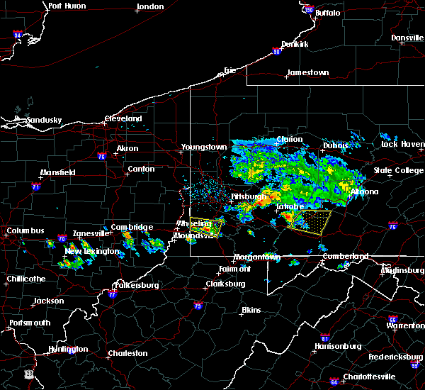 At 437 pm edt, a severe thunderstorm was located near washington, moving east at 45 mph (radar). Hazards include wind gusts to 60 mph and quarter-size hail. Minor hail damage to vehicles is possible. expect wind damage to trees and power lines, resulting in some power outages. locations impacted include, washington, wolfdale, east washington, claysville, eighty four, west alexander, taylorstown, amity, green hills, this includes the following highways, interstate 70 in pennsylvania between mile markers 0 and 26. Interstate 79 in pennsylvania between mile markers 20 and 21. At 437 pm edt, a severe thunderstorm was located near washington, moving east at 45 mph (radar). Hazards include wind gusts to 60 mph and quarter-size hail. Minor hail damage to vehicles is possible. expect wind damage to trees and power lines, resulting in some power outages. locations impacted include, washington, wolfdale, east washington, claysville, eighty four, west alexander, taylorstown, amity, green hills, this includes the following highways, interstate 70 in pennsylvania between mile markers 0 and 26. Interstate 79 in pennsylvania between mile markers 20 and 21.
|
| 5/13/2018 4:22 PM EDT |
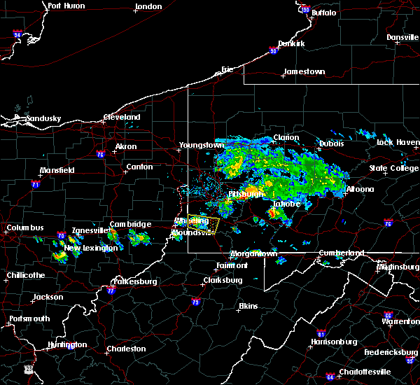 At 422 pm edt, a severe thunderstorm was located 7 miles east of valley grove, moving east at 30 mph (radar). Hazards include wind gusts to 60 mph and quarter-size hail. Minor hail damage to vehicles is possible. Expect wind damage to trees and power lines, resulting in some power outages. At 422 pm edt, a severe thunderstorm was located 7 miles east of valley grove, moving east at 30 mph (radar). Hazards include wind gusts to 60 mph and quarter-size hail. Minor hail damage to vehicles is possible. Expect wind damage to trees and power lines, resulting in some power outages.
|
| 5/12/2018 5:59 PM EDT |
 At 559 pm edt, severe thunderstorms were located along a line extending from near irwin to near donora to near mcmurray, moving east at 45 mph (radar). Hazards include wind gusts to 60 mph. Damage to trees and power lines. locations impacted include, mckeesport, canonsburg, gastonville, jefferson hills, white oak, monessen, clairton, california, donora, mount pleasant, monongahela, charleroi, this includes the following highways, interstate 70 in pennsylvania between mile markers 27 and 57. Pennsylvania turnpike between mile markers 67 and 80. At 559 pm edt, severe thunderstorms were located along a line extending from near irwin to near donora to near mcmurray, moving east at 45 mph (radar). Hazards include wind gusts to 60 mph. Damage to trees and power lines. locations impacted include, mckeesport, canonsburg, gastonville, jefferson hills, white oak, monessen, clairton, california, donora, mount pleasant, monongahela, charleroi, this includes the following highways, interstate 70 in pennsylvania between mile markers 27 and 57. Pennsylvania turnpike between mile markers 67 and 80.
|
| 5/12/2018 5:52 PM EDT |
 At 552 pm edt, a severe thunderstorm was located over donora, or 8 miles southeast of gastonville, moving southeast at 40 mph (radar). Hazards include quarter-size hail. Minor damage to vehicles is possible. locations impacted include, bethel park, mcmurray, mckeesport, jeannette, canonsburg, gastonville, west mifflin, south park township, jefferson hills, north versailles, pleasant hills, white oak, this includes the following highways, interstate 70 in pennsylvania between mile markers 25 and 57. Pennsylvania turnpike between mile markers 65 and 80. At 552 pm edt, a severe thunderstorm was located over donora, or 8 miles southeast of gastonville, moving southeast at 40 mph (radar). Hazards include quarter-size hail. Minor damage to vehicles is possible. locations impacted include, bethel park, mcmurray, mckeesport, jeannette, canonsburg, gastonville, west mifflin, south park township, jefferson hills, north versailles, pleasant hills, white oak, this includes the following highways, interstate 70 in pennsylvania between mile markers 25 and 57. Pennsylvania turnpike between mile markers 65 and 80.
|
| 5/12/2018 5:40 PM EDT | Dozens of trees snapped or uprooted. roof of barn and carport removed... among other structural damage. radar imagery at the time depicts clear downburst at this locati in washington county PA, 5.1 miles SW of Eighty Four, PA |
| 5/12/2018 5:30 PM EDT |
 The national weather service in pittsburgh has issued a * severe thunderstorm warning for. southeastern washington county in southwestern pennsylvania. southeastern allegheny county in southwestern pennsylvania. southwestern westmoreland county in southwestern pennsylvania. Northeastern greene county in southwestern pennsylvania. The national weather service in pittsburgh has issued a * severe thunderstorm warning for. southeastern washington county in southwestern pennsylvania. southeastern allegheny county in southwestern pennsylvania. southwestern westmoreland county in southwestern pennsylvania. Northeastern greene county in southwestern pennsylvania.
|
| 5/12/2018 4:35 PM EDT |
 At 435 pm edt, a severe thunderstorm was located near east washington, or near washington, moving east at 50 mph (radar). Hazards include half dollar-size hail. Minor damage to vehicles is possible. Locations impacted include, washington, monessen, california, monongahela, charleroi, bentleyville, brownsville, east washington, new eagle, wickerham manor-fisher, baidland, north charleroi, this includes interstate 70 in pennsylvania between mile markers 17 and 39. At 435 pm edt, a severe thunderstorm was located near east washington, or near washington, moving east at 50 mph (radar). Hazards include half dollar-size hail. Minor damage to vehicles is possible. Locations impacted include, washington, monessen, california, monongahela, charleroi, bentleyville, brownsville, east washington, new eagle, wickerham manor-fisher, baidland, north charleroi, this includes interstate 70 in pennsylvania between mile markers 17 and 39.
|
| 5/12/2018 4:29 PM EDT |
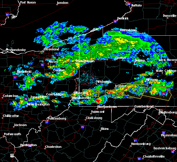 At 429 pm edt, a severe thunderstorm was located over washington, moving east at 50 mph (radar). Hazards include half dollar-size hail. Minor damage to vehicles is possible. Locations impacted include, washington, canonsburg, monessen, california, monongahela, charleroi, wolfdale, mcgovern, bentleyville, brownsville, east washington, new eagle, this includes interstate 70 in pennsylvania between mile markers 7 and 39. At 429 pm edt, a severe thunderstorm was located over washington, moving east at 50 mph (radar). Hazards include half dollar-size hail. Minor damage to vehicles is possible. Locations impacted include, washington, canonsburg, monessen, california, monongahela, charleroi, wolfdale, mcgovern, bentleyville, brownsville, east washington, new eagle, this includes interstate 70 in pennsylvania between mile markers 7 and 39.
|
| 5/12/2018 4:21 PM EDT |
 At 421 pm edt, a severe thunderstorm was located near wolfdale, or 7 miles west of washington, moving east at 50 mph (radar). Hazards include half dollar-size hail. Minor damage to vehicles is possible. locations impacted include, pittsburgh, mount lebanon, bethel park, mcmurray, washington, canonsburg, avella, gastonville, west mifflin, baldwin, upper st. clair, whitehall, this includes the following highways, interstate 70 in pennsylvania between mile markers 1 and 39. Interstate 79 in pennsylvania between mile markers 22 and 23. At 421 pm edt, a severe thunderstorm was located near wolfdale, or 7 miles west of washington, moving east at 50 mph (radar). Hazards include half dollar-size hail. Minor damage to vehicles is possible. locations impacted include, pittsburgh, mount lebanon, bethel park, mcmurray, washington, canonsburg, avella, gastonville, west mifflin, baldwin, upper st. clair, whitehall, this includes the following highways, interstate 70 in pennsylvania between mile markers 1 and 39. Interstate 79 in pennsylvania between mile markers 22 and 23.
|
| 5/12/2018 4:12 PM EDT |
 At 412 pm edt, a severe thunderstorm was located near west liberty, moving east at 35 mph (radar). Hazards include half dollar-size hail. Minor damage to vehicles is possible. locations impacted include, pittsburgh, mount lebanon, bethel park, mcmurray, washington, canonsburg, west liberty, avella, valley grove, gastonville, west mifflin, baldwin, this includes the following highways, interstate 70 in west virginia near mile marker 14. interstate 70 in pennsylvania between mile markers 0 and 39. Interstate 79 in pennsylvania between mile markers 22 and 23. At 412 pm edt, a severe thunderstorm was located near west liberty, moving east at 35 mph (radar). Hazards include half dollar-size hail. Minor damage to vehicles is possible. locations impacted include, pittsburgh, mount lebanon, bethel park, mcmurray, washington, canonsburg, west liberty, avella, valley grove, gastonville, west mifflin, baldwin, this includes the following highways, interstate 70 in west virginia near mile marker 14. interstate 70 in pennsylvania between mile markers 0 and 39. Interstate 79 in pennsylvania between mile markers 22 and 23.
|
| 5/12/2018 3:54 PM EDT |
 At 354 pm edt, a severe thunderstorm was located near tiltonsville, or near clearview, moving east at 50 mph (radar). Hazards include wind gusts to 60 mph and half dollar-size hail. Minor hail damage to vehicles is possible. Expect wind damage to trees and power lines, resulting in some power outages. At 354 pm edt, a severe thunderstorm was located near tiltonsville, or near clearview, moving east at 50 mph (radar). Hazards include wind gusts to 60 mph and half dollar-size hail. Minor hail damage to vehicles is possible. Expect wind damage to trees and power lines, resulting in some power outages.
|
| 4/3/2018 8:56 PM EDT |
 The severe thunderstorm warning for east central washington, northwestern indiana, southeastern allegheny, northwestern westmoreland and southeastern armstrong counties will expire at 900 pm edt, the storms that prompted the warning have weakened below severe limits and no longer pose an immediate threat to life and property. therefore, the warning will be allowed to expire. however gusty winds are still possible with these thunderstorms. a severe thunderstorm watch remains in effect until 100 am edt for southwestern pennsylvania. The severe thunderstorm warning for east central washington, northwestern indiana, southeastern allegheny, northwestern westmoreland and southeastern armstrong counties will expire at 900 pm edt, the storms that prompted the warning have weakened below severe limits and no longer pose an immediate threat to life and property. therefore, the warning will be allowed to expire. however gusty winds are still possible with these thunderstorms. a severe thunderstorm watch remains in effect until 100 am edt for southwestern pennsylvania.
|
| 4/3/2018 8:33 PM EDT |
 At 833 pm edt, severe thunderstorms were located along a line extending from penn hills to near mcmurray, moving northeast at 60 mph (radar). Hazards include 60 mph wind gusts. expect damage to trees and power lines, resulting in some power outages At 833 pm edt, severe thunderstorms were located along a line extending from penn hills to near mcmurray, moving northeast at 60 mph (radar). Hazards include 60 mph wind gusts. expect damage to trees and power lines, resulting in some power outages
|
| 4/3/2018 8:09 PM EDT |
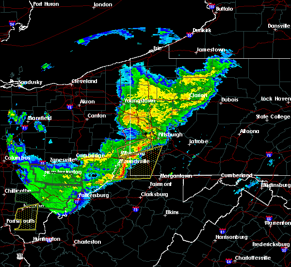 At 809 pm edt, severe thunderstorms were located along a line extending from near avella to near new martinsville, moving east at 50 mph (radar). Hazards include 60 mph wind gusts and quarter-size hail. Minor hail damage to vehicles is possible. Expect wind damage to trees and power lines, resulting in some power outages. At 809 pm edt, severe thunderstorms were located along a line extending from near avella to near new martinsville, moving east at 50 mph (radar). Hazards include 60 mph wind gusts and quarter-size hail. Minor hail damage to vehicles is possible. Expect wind damage to trees and power lines, resulting in some power outages.
|
| 8/22/2017 4:22 PM EDT | A tree down on short cut road in washington county PA, 4.8 miles WNW of Eighty Four, PA |
| 8/22/2017 4:14 PM EDT |
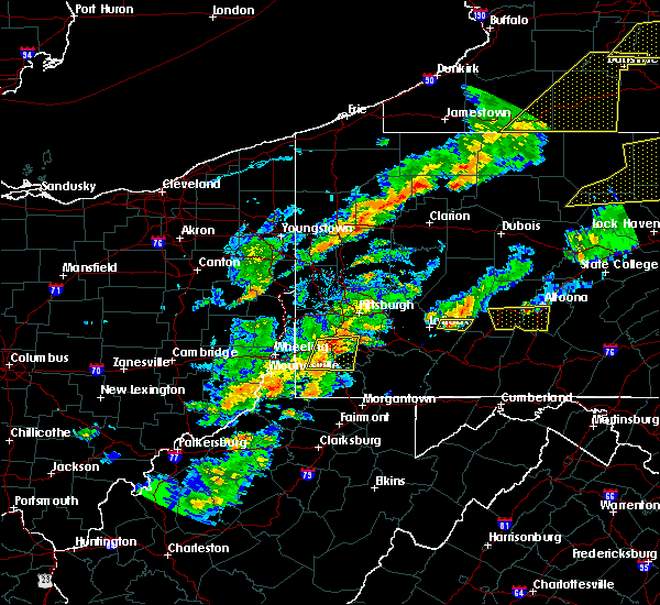 At 414 pm edt, severe thunderstorms were located along a line extending from east washington to 8 miles northwest of waynesburg, moving east at 40 mph (radar). Hazards include 60 mph wind gusts and quarter-size hail. Minor hail damage to vehicles is possible. expect wind damage to trees and power lines, resulting in some power outages. locations impacted include, washington, wolfdale, bentleyville, east washington, fredericktown-millsboro, ellsworth, deemston, eighty four, cokeburg, marianna, beallsville, rices landing, this includes the following highways, interstate 70 in pennsylvania between mile markers 10 and 33. Interstate 79 in pennsylvania between mile markers 19 and 21. At 414 pm edt, severe thunderstorms were located along a line extending from east washington to 8 miles northwest of waynesburg, moving east at 40 mph (radar). Hazards include 60 mph wind gusts and quarter-size hail. Minor hail damage to vehicles is possible. expect wind damage to trees and power lines, resulting in some power outages. locations impacted include, washington, wolfdale, bentleyville, east washington, fredericktown-millsboro, ellsworth, deemston, eighty four, cokeburg, marianna, beallsville, rices landing, this includes the following highways, interstate 70 in pennsylvania between mile markers 10 and 33. Interstate 79 in pennsylvania between mile markers 19 and 21.
|
| 8/22/2017 3:55 PM EDT |
 At 355 pm edt, severe thunderstorms were located along a line extending from near west liberty to near triadelphia, moving east at 40 mph (radar). Hazards include 60 mph wind gusts. expect damage to trees and power lines, resulting in some power outages At 355 pm edt, severe thunderstorms were located along a line extending from near west liberty to near triadelphia, moving east at 40 mph (radar). Hazards include 60 mph wind gusts. expect damage to trees and power lines, resulting in some power outages
|
| 8/17/2017 5:27 PM EDT |
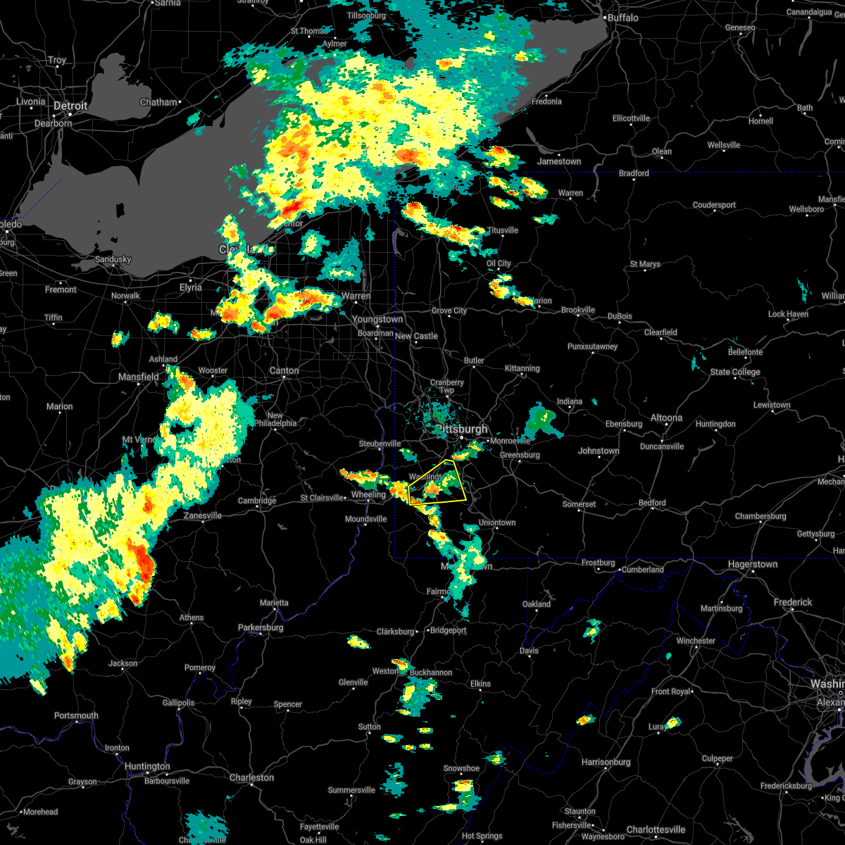 The severe thunderstorm warning for central washington county will expire at 530 pm edt, the storm that prompted the warning has weakened below severe limits and no longer pose an immediate threat to life and property. therefore, the warning will be allowed to expire. however gusty winds are still possible with this thunderstorm. The severe thunderstorm warning for central washington county will expire at 530 pm edt, the storm that prompted the warning has weakened below severe limits and no longer pose an immediate threat to life and property. therefore, the warning will be allowed to expire. however gusty winds are still possible with this thunderstorm.
|
| 8/17/2017 5:05 PM EDT |
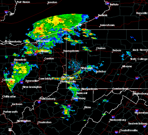 At 504 pm edt, a severe thunderstorm was located near washington, moving east at 20 mph (radar). Hazards include 60 mph wind gusts. Expect damage to trees and power lines, resulting in some power outages. locations impacted include, bethel park, mcmurray, washington, canonsburg, upper st. Clair, wolfdale, mcgovern, bentleyville, east washington, houston, ellsworth, eighty four, this includes interstate 70 in pennsylvania between mile markers 7 and 33. At 504 pm edt, a severe thunderstorm was located near washington, moving east at 20 mph (radar). Hazards include 60 mph wind gusts. Expect damage to trees and power lines, resulting in some power outages. locations impacted include, bethel park, mcmurray, washington, canonsburg, upper st. Clair, wolfdale, mcgovern, bentleyville, east washington, houston, ellsworth, eighty four, this includes interstate 70 in pennsylvania between mile markers 7 and 33.
|
| 8/17/2017 4:45 PM EDT |
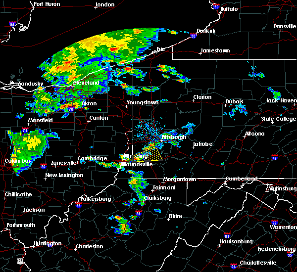 At 445 pm edt, a severe thunderstorm was located 7 miles east of valley grove, moving east at 20 mph (radar). Hazards include 60 mph wind gusts. expect damage to trees and power lines, resulting in some power outages At 445 pm edt, a severe thunderstorm was located 7 miles east of valley grove, moving east at 20 mph (radar). Hazards include 60 mph wind gusts. expect damage to trees and power lines, resulting in some power outages
|
| 8/4/2017 2:01 PM EDT |
 At 201 pm edt, severe thunderstorms were located along a line extending from follansbee to near avella to 6 miles south of east washington, moving north at 45 mph (radar). Hazards include 60 mph wind gusts. damage to trees and power lines At 201 pm edt, severe thunderstorms were located along a line extending from follansbee to near avella to 6 miles south of east washington, moving north at 45 mph (radar). Hazards include 60 mph wind gusts. damage to trees and power lines
|
| 8/4/2017 1:34 PM EDT |
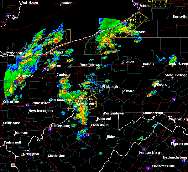 At 134 pm edt, severe thunderstorms were located along a line extending from triadelphia to near cameron, moving northeast at 45 mph (radar). Hazards include 60 mph wind gusts. damage to trees and power lines At 134 pm edt, severe thunderstorms were located along a line extending from triadelphia to near cameron, moving northeast at 45 mph (radar). Hazards include 60 mph wind gusts. damage to trees and power lines
|
| 6/23/2017 3:22 PM EDT |
 At 321 pm edt, a severe thunderstorm was located near east washington, or near washington, moving east at 45 mph (radar). Hazards include 60 mph wind gusts. Expect damage to trees and power lines, resulting in some power outages. Locations impacted include, washington, gastonville, south park township, jefferson hills, monessen, california, donora, monongahela, charleroi, mcgovern, bentleyville, brownsville, this includes interstate 70 in pennsylvania between mile markers 17 and 44. At 321 pm edt, a severe thunderstorm was located near east washington, or near washington, moving east at 45 mph (radar). Hazards include 60 mph wind gusts. Expect damage to trees and power lines, resulting in some power outages. Locations impacted include, washington, gastonville, south park township, jefferson hills, monessen, california, donora, monongahela, charleroi, mcgovern, bentleyville, brownsville, this includes interstate 70 in pennsylvania between mile markers 17 and 44.
|
| 6/23/2017 3:10 PM EDT |
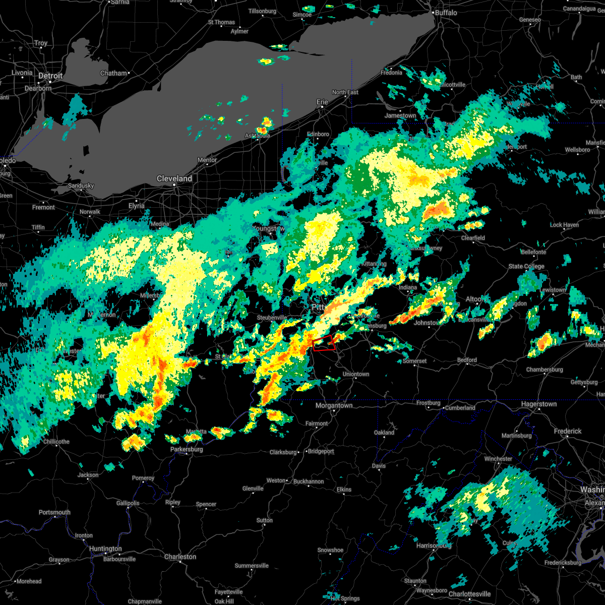 The tornado warning for east central washington county will expire at 315 pm edt, the tornado threat has diminished and the tornado warning has been cancelled. however, damaging wind remain likely, and a severe thunderstorm warning remains in effect for the area. a severe thunderstorm watch remains in effect until 1000 pm edt for southwestern pennsylvania. The tornado warning for east central washington county will expire at 315 pm edt, the tornado threat has diminished and the tornado warning has been cancelled. however, damaging wind remain likely, and a severe thunderstorm warning remains in effect for the area. a severe thunderstorm watch remains in effect until 1000 pm edt for southwestern pennsylvania.
|
| 6/23/2017 3:09 PM EDT |
 The national weather service in pittsburgh has issued a * severe thunderstorm warning for. southern washington county in southwestern pennsylvania. southeastern allegheny county in southwestern pennsylvania. western westmoreland county in southwestern pennsylvania. Northwestern fayette county in southwestern pennsylvania. The national weather service in pittsburgh has issued a * severe thunderstorm warning for. southern washington county in southwestern pennsylvania. southeastern allegheny county in southwestern pennsylvania. western westmoreland county in southwestern pennsylvania. Northwestern fayette county in southwestern pennsylvania.
|
| 6/23/2017 3:02 PM EDT |
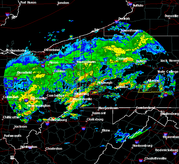 At 302 pm edt, a severe thunderstorm capable of producing a tornado was located near east washington, or near washington, moving east at 30 mph (radar indicated rotation). Hazards include tornado. Flying debris will be dangerous to those caught without shelter. mobile homes will be damaged or destroyed. damage to roofs, windows, and vehicles will occur. tree damage is likely. this dangerous storm will be near, gastonville and bentleyville around 315 pm edt. other locations impacted by this tornadic thunderstorm include eighty four, finleyville and baidland. This includes interstate 70 in pennsylvania between mile markers 22 and 32. At 302 pm edt, a severe thunderstorm capable of producing a tornado was located near east washington, or near washington, moving east at 30 mph (radar indicated rotation). Hazards include tornado. Flying debris will be dangerous to those caught without shelter. mobile homes will be damaged or destroyed. damage to roofs, windows, and vehicles will occur. tree damage is likely. this dangerous storm will be near, gastonville and bentleyville around 315 pm edt. other locations impacted by this tornadic thunderstorm include eighty four, finleyville and baidland. This includes interstate 70 in pennsylvania between mile markers 22 and 32.
|
| 6/23/2017 2:55 PM EDT |
 At 254 pm edt, a severe thunderstorm capable of producing a tornado was located over east washington, or over washington, moving east at 30 mph (radar indicated rotation). Hazards include tornado. Flying debris will be dangerous to those caught without shelter. mobile homes will be damaged or destroyed. damage to roofs, windows, and vehicles will occur. tree damage is likely. this dangerous storm will be near, gastonville and bentleyville around 315 pm edt. other locations impacted by this tornadic thunderstorm include ellsworth, finleyville, eighty four, cokeburg and baidland. This includes interstate 70 in pennsylvania between mile markers 17 and 36. At 254 pm edt, a severe thunderstorm capable of producing a tornado was located over east washington, or over washington, moving east at 30 mph (radar indicated rotation). Hazards include tornado. Flying debris will be dangerous to those caught without shelter. mobile homes will be damaged or destroyed. damage to roofs, windows, and vehicles will occur. tree damage is likely. this dangerous storm will be near, gastonville and bentleyville around 315 pm edt. other locations impacted by this tornadic thunderstorm include ellsworth, finleyville, eighty four, cokeburg and baidland. This includes interstate 70 in pennsylvania between mile markers 17 and 36.
|
| 6/23/2017 2:47 PM EDT |
 At 247 pm edt, a severe thunderstorm capable of producing a tornado was located near washington, moving east at 30 mph (radar indicated rotation). Hazards include tornado. Flying debris will be dangerous to those caught without shelter. mobile homes will be damaged or destroyed. damage to roofs, windows, and vehicles will occur. tree damage is likely. this dangerous storm will be near, gastonville and bentleyville around 315 pm edt. other locations impacted by this tornadic thunderstorm include ellsworth, finleyville, eighty four, cokeburg, scenery hill, green hills, baidland and beallsville. this includes interstate 70 in pennsylvania between mile markers 10 and 36. Please report severe weather by calling 412-262-1988, posting to the nws pittsburgh facebook page, or using twitter @nwspittsburgh. At 247 pm edt, a severe thunderstorm capable of producing a tornado was located near washington, moving east at 30 mph (radar indicated rotation). Hazards include tornado. Flying debris will be dangerous to those caught without shelter. mobile homes will be damaged or destroyed. damage to roofs, windows, and vehicles will occur. tree damage is likely. this dangerous storm will be near, gastonville and bentleyville around 315 pm edt. other locations impacted by this tornadic thunderstorm include ellsworth, finleyville, eighty four, cokeburg, scenery hill, green hills, baidland and beallsville. this includes interstate 70 in pennsylvania between mile markers 10 and 36. Please report severe weather by calling 412-262-1988, posting to the nws pittsburgh facebook page, or using twitter @nwspittsburgh.
|
| 5/31/2017 4:36 PM EDT |
 At 435 pm edt, a severe thunderstorm was located near west liberty, moving east at 55 mph (radar). Hazards include 60 mph wind gusts. Expect damage to trees and power lines, resulting in some power outages. locations impacted include, wheeling, washington, martins ferry, warwood, bethlehem, west liberty, triadelphia, clearview, valley grove, wolfdale, mcgovern, east washington, this includes the following highways, interstate 70 in west virginia between mile markers 1 and 14. interstate 70 in pennsylvania between mile markers 0 and 28. Interstate 79 in pennsylvania between mile markers 15 and 21. At 435 pm edt, a severe thunderstorm was located near west liberty, moving east at 55 mph (radar). Hazards include 60 mph wind gusts. Expect damage to trees and power lines, resulting in some power outages. locations impacted include, wheeling, washington, martins ferry, warwood, bethlehem, west liberty, triadelphia, clearview, valley grove, wolfdale, mcgovern, east washington, this includes the following highways, interstate 70 in west virginia between mile markers 1 and 14. interstate 70 in pennsylvania between mile markers 0 and 28. Interstate 79 in pennsylvania between mile markers 15 and 21.
|
| 5/31/2017 4:29 PM EDT |
 At 428 pm edt, a severe thunderstorm was located over clearview, moving east at 50 mph (radar). Hazards include 60 mph wind gusts. Expect damage to trees and power lines, resulting in some power outages. locations impacted include, wheeling, washington, martins ferry, st. clairsville, bellaire, warwood, bethlehem, west liberty, triadelphia, clearview, valley grove, wolfdale, this includes the following highways, interstate 70 in ohio between mile markers 215 and 225. interstate 70 in west virginia between mile markers 0 and 14. interstate 70 in pennsylvania between mile markers 0 and 28. Interstate 79 in pennsylvania between mile markers 15 and 21. At 428 pm edt, a severe thunderstorm was located over clearview, moving east at 50 mph (radar). Hazards include 60 mph wind gusts. Expect damage to trees and power lines, resulting in some power outages. locations impacted include, wheeling, washington, martins ferry, st. clairsville, bellaire, warwood, bethlehem, west liberty, triadelphia, clearview, valley grove, wolfdale, this includes the following highways, interstate 70 in ohio between mile markers 215 and 225. interstate 70 in west virginia between mile markers 0 and 14. interstate 70 in pennsylvania between mile markers 0 and 28. Interstate 79 in pennsylvania between mile markers 15 and 21.
|
| 5/31/2017 4:07 PM EDT |
 At 406 pm edt, a severe thunderstorm was located near st. clairsville, moving east at 55 mph (radar). Hazards include 60 mph wind gusts and quarter-size hail. Minor hail damage to vehicles is possible. Expect wind damage to trees and power lines, resulting in some power outages. At 406 pm edt, a severe thunderstorm was located near st. clairsville, moving east at 55 mph (radar). Hazards include 60 mph wind gusts and quarter-size hail. Minor hail damage to vehicles is possible. Expect wind damage to trees and power lines, resulting in some power outages.
|
| 5/31/2017 4:06 PM EDT |
 At 406 pm edt, severe thunderstorms were located along a line extending from near oak hills to millvale to near avella, moving east at 45 mph (radar). Hazards include 60 mph wind gusts. expect damage to trees and power lines, resulting in some power outages At 406 pm edt, severe thunderstorms were located along a line extending from near oak hills to millvale to near avella, moving east at 45 mph (radar). Hazards include 60 mph wind gusts. expect damage to trees and power lines, resulting in some power outages
|
| 5/1/2017 2:41 PM EDT |
 At 241 pm edt, severe thunderstorms were located along a line extending from near mcdonald to 10 miles southwest of waynesburg, moving northeast at 55 mph (radar). Hazards include 70 mph wind gusts. Trees snapped and uprooted. power outages can be expected. locations impacted include, bethel park, morgantown, mcmurray, mckeesport, washington, canonsburg, waynesburg, star city, gastonville, west mifflin, baldwin, upper st. clair, this includes the following highways, interstate 70 in pennsylvania between mile markers 17 and 40. interstate 79 in pennsylvania between mile markers 0 and 21. interstate 79 in west virginia between mile markers 154 and 160. A tornado watch remains in effect until 700 pm edt for southwestern pennsylvania, and northern west virginia. At 241 pm edt, severe thunderstorms were located along a line extending from near mcdonald to 10 miles southwest of waynesburg, moving northeast at 55 mph (radar). Hazards include 70 mph wind gusts. Trees snapped and uprooted. power outages can be expected. locations impacted include, bethel park, morgantown, mcmurray, mckeesport, washington, canonsburg, waynesburg, star city, gastonville, west mifflin, baldwin, upper st. clair, this includes the following highways, interstate 70 in pennsylvania between mile markers 17 and 40. interstate 79 in pennsylvania between mile markers 0 and 21. interstate 79 in west virginia between mile markers 154 and 160. A tornado watch remains in effect until 700 pm edt for southwestern pennsylvania, and northern west virginia.
|
| 5/1/2017 2:36 PM EDT |
 At 236 pm edt, severe thunderstorms were located along a line extending from near cecil-bishop to 7 miles northeast of hundred, moving northeast at 55 mph (radar). Hazards include 70 mph wind gusts. Trees snapped and uprooted. power outages can be expected. locations impacted include, bethel park, morgantown, mcmurray, mckeesport, washington, canonsburg, waynesburg, star city, gastonville, west mifflin, baldwin, upper st. clair, this includes the following highways, interstate 70 in pennsylvania between mile markers 11 and 40. interstate 79 in pennsylvania between mile markers 0 and 21. interstate 79 in west virginia between mile markers 154 and 160. A tornado watch remains in effect until 700 pm edt for southwestern pennsylvania, and northern west virginia. At 236 pm edt, severe thunderstorms were located along a line extending from near cecil-bishop to 7 miles northeast of hundred, moving northeast at 55 mph (radar). Hazards include 70 mph wind gusts. Trees snapped and uprooted. power outages can be expected. locations impacted include, bethel park, morgantown, mcmurray, mckeesport, washington, canonsburg, waynesburg, star city, gastonville, west mifflin, baldwin, upper st. clair, this includes the following highways, interstate 70 in pennsylvania between mile markers 11 and 40. interstate 79 in pennsylvania between mile markers 0 and 21. interstate 79 in west virginia between mile markers 154 and 160. A tornado watch remains in effect until 700 pm edt for southwestern pennsylvania, and northern west virginia.
|
| 5/1/2017 2:27 PM EDT |
 At 226 pm edt, severe thunderstorms were located along a line extending from near avella to near hundred, moving northeast at 55 mph (radar). Hazards include 70 mph wind gusts. Trees snapped and uprooted. power outages can be expected. locations impacted include, bethel park, morgantown, mcmurray, mckeesport, washington, canonsburg, waynesburg, star city, gastonville, west mifflin, baldwin, upper st. clair, this includes the following highways, interstate 70 in pennsylvania between mile markers 3 and 40. interstate 79 in pennsylvania between mile markers 0 and 21. interstate 79 in west virginia between mile markers 154 and 160. A tornado watch remains in effect until 700 pm edt for southwestern pennsylvania, and northern west virginia. At 226 pm edt, severe thunderstorms were located along a line extending from near avella to near hundred, moving northeast at 55 mph (radar). Hazards include 70 mph wind gusts. Trees snapped and uprooted. power outages can be expected. locations impacted include, bethel park, morgantown, mcmurray, mckeesport, washington, canonsburg, waynesburg, star city, gastonville, west mifflin, baldwin, upper st. clair, this includes the following highways, interstate 70 in pennsylvania between mile markers 3 and 40. interstate 79 in pennsylvania between mile markers 0 and 21. interstate 79 in west virginia between mile markers 154 and 160. A tornado watch remains in effect until 700 pm edt for southwestern pennsylvania, and northern west virginia.
|
| 5/1/2017 2:11 PM EDT |
 At 210 pm edt, severe thunderstorms were located along a line extending from near west liberty to near pine grove, moving northeast at 55 mph (radar). Hazards include 70 mph wind gusts. Trees snapped and uprooted. Power outages can be expected. At 210 pm edt, severe thunderstorms were located along a line extending from near west liberty to near pine grove, moving northeast at 55 mph (radar). Hazards include 70 mph wind gusts. Trees snapped and uprooted. Power outages can be expected.
|
| 3/1/2017 8:32 AM EST |
 At 832 am est, a severe thunderstorm was located over bethlehem, moving east at 45 mph (radar). Hazards include 60 mph wind gusts. Expect damage to trees and power lines, resulting in some power outages. locations impacted include, bethel park, wheeling, mcmurray, washington, moundsville, canonsburg, martins ferry, st. clairsville, bellaire, warwood, bethlehem, west liberty, this includes the following highways, interstate 70 in ohio between mile markers 217 and 225. interstate 70 in west virginia between mile markers 0 and 14. interstate 70 in pennsylvania between mile markers 0 and 42. Interstate 79 in pennsylvania between mile markers 16 and 21. At 832 am est, a severe thunderstorm was located over bethlehem, moving east at 45 mph (radar). Hazards include 60 mph wind gusts. Expect damage to trees and power lines, resulting in some power outages. locations impacted include, bethel park, wheeling, mcmurray, washington, moundsville, canonsburg, martins ferry, st. clairsville, bellaire, warwood, bethlehem, west liberty, this includes the following highways, interstate 70 in ohio between mile markers 217 and 225. interstate 70 in west virginia between mile markers 0 and 14. interstate 70 in pennsylvania between mile markers 0 and 42. Interstate 79 in pennsylvania between mile markers 16 and 21.
|
| 3/1/2017 8:15 AM EST |
 At 814 am est, a severe thunderstorm was located over wheeling, moving east at 85 mph (radar). Hazards include 60 mph wind gusts. expect damage to trees and power lines, resulting in some power outages At 814 am est, a severe thunderstorm was located over wheeling, moving east at 85 mph (radar). Hazards include 60 mph wind gusts. expect damage to trees and power lines, resulting in some power outages
|
| 2/12/2017 8:18 PM EST |
 At 817 pm est, severe thunderstorms were located along a line extending from 7 miles northwest of westmont to near waynesburg, moving east at 45 mph (public, law enforcement, and automated weather sensors). Hazards include 60 mph wind gusts. Expect damage to trees and power lines, resulting in some power outages. locations impacted include, greensburg, uniontown, jeannette, latrobe, connellsville, waynesburg, homer city, gastonville, murrysville, jefferson hills, monessen, california, this includes the following highways, interstate 70 in pennsylvania between mile markers 23 and 57. pennsylvania turnpike between mile markers 62 and 100. Interstate 79 in pennsylvania between mile markers 10 and 21, and between mile markers 155 and 166. At 817 pm est, severe thunderstorms were located along a line extending from 7 miles northwest of westmont to near waynesburg, moving east at 45 mph (public, law enforcement, and automated weather sensors). Hazards include 60 mph wind gusts. Expect damage to trees and power lines, resulting in some power outages. locations impacted include, greensburg, uniontown, jeannette, latrobe, connellsville, waynesburg, homer city, gastonville, murrysville, jefferson hills, monessen, california, this includes the following highways, interstate 70 in pennsylvania between mile markers 23 and 57. pennsylvania turnpike between mile markers 62 and 100. Interstate 79 in pennsylvania between mile markers 10 and 21, and between mile markers 155 and 166.
|
| 2/12/2017 7:59 PM EST |
 At 758 pm est, severe thunderstorms were located along a line extending from near blairsville to 7 miles southeast of valley grove, moving east at 45 mph (radar). Hazards include 60 mph wind gusts. expect damage to trees and power lines, resulting in some power outages At 758 pm est, severe thunderstorms were located along a line extending from near blairsville to 7 miles southeast of valley grove, moving east at 45 mph (radar). Hazards include 60 mph wind gusts. expect damage to trees and power lines, resulting in some power outages
|
| 8/28/2016 7:58 PM EDT |
 At 758 pm edt, severe thunderstorms were located along a line extending from monongahela to bentleyville, moving southeast at 15 mph (radar indicated). Hazards include 60 mph wind gusts and quarter size hail. Hail damage to vehicles is expected. expect wind damage to trees and power lines, resulting in some power outages. locations impacted include, gastonville, jefferson hills, monongahela, bentleyville, new eagle, baidland, ellsworth, deemston, eighty four, cokeburg, beallsville, finleyville and scenery hill. this includes interstate 70 in pennsylvania between mile markers 22 and 34. Please report severe weather by calling 4 1 2, 2 6 2, 1 9 8 8, posting to the nws pittsburgh facebook page, or using twitter @nwspittsburgh. At 758 pm edt, severe thunderstorms were located along a line extending from monongahela to bentleyville, moving southeast at 15 mph (radar indicated). Hazards include 60 mph wind gusts and quarter size hail. Hail damage to vehicles is expected. expect wind damage to trees and power lines, resulting in some power outages. locations impacted include, gastonville, jefferson hills, monongahela, bentleyville, new eagle, baidland, ellsworth, deemston, eighty four, cokeburg, beallsville, finleyville and scenery hill. this includes interstate 70 in pennsylvania between mile markers 22 and 34. Please report severe weather by calling 4 1 2, 2 6 2, 1 9 8 8, posting to the nws pittsburgh facebook page, or using twitter @nwspittsburgh.
|
| 8/28/2016 7:34 PM EDT |
 At 734 pm edt, severe thunderstorms were located along a line extending from near gastonville to near east washington, moving southeast at 15 mph (radar indicated). Hazards include 60 mph wind gusts and quarter size hail. Hail damage to vehicles is expected. Expect wind damage to trees and power lines, resulting in some power outages. At 734 pm edt, severe thunderstorms were located along a line extending from near gastonville to near east washington, moving southeast at 15 mph (radar indicated). Hazards include 60 mph wind gusts and quarter size hail. Hail damage to vehicles is expected. Expect wind damage to trees and power lines, resulting in some power outages.
|
| 7/23/2016 5:49 PM EDT |
 At 549 pm edt, a severe thunderstorm was located near east washington, or near washington, moving southeast at 15 mph (radar indicated). Hazards include 60 mph wind gusts. Expect damage to trees and power lines. resulting in some power outages. locations impacted include, fredericktown-millsboro, deemston, marianna, beallsville, scenery hill and amity. this includes interstate 79 in pennsylvania between mile markers 19 and 21, and between mile markers 22 and 32. Please report severe weather by calling 4 1 2, 2 6 2, 1 9 8 8, posting to the nws pittsburgh facebook page, or using twitter @nwspittsburgh. At 549 pm edt, a severe thunderstorm was located near east washington, or near washington, moving southeast at 15 mph (radar indicated). Hazards include 60 mph wind gusts. Expect damage to trees and power lines. resulting in some power outages. locations impacted include, fredericktown-millsboro, deemston, marianna, beallsville, scenery hill and amity. this includes interstate 79 in pennsylvania between mile markers 19 and 21, and between mile markers 22 and 32. Please report severe weather by calling 4 1 2, 2 6 2, 1 9 8 8, posting to the nws pittsburgh facebook page, or using twitter @nwspittsburgh.
|
| 7/23/2016 5:32 PM EDT |
 At 532 pm edt, a severe thunderstorm was located over east washington, or over washington, moving southeast at 20 mph (radar indicated). Hazards include 60 mph wind gusts and quarter size hail. Hail damage to vehicles is expected. Expect wind damage to trees and power lines, resulting in some power outages. At 532 pm edt, a severe thunderstorm was located over east washington, or over washington, moving southeast at 20 mph (radar indicated). Hazards include 60 mph wind gusts and quarter size hail. Hail damage to vehicles is expected. Expect wind damage to trees and power lines, resulting in some power outages.
|
| 6/16/2016 4:28 PM EDT |
 At 428 pm edt, severe thunderstorms were located along a line extending from swissvale to near gastonville, moving east at 30 mph (law enforcement). Hazards include 60 mph wind gusts and quarter size hail. Hail damage to vehicles is expected. expect wind damage to trees and power lines, resulting in some power outages. locations impacted include, pittsburgh, penn hills, mount lebanon, bethel park, monroeville, mcmurray, mckeesport, gastonville, plum, west mifflin, north side pittsburgh, baldwin, upper st. clair, scott township, wilkinsburg, whitehall, south park township, robinson township, munhall and jefferson hills. this includes the following highways, interstate 70 in pennsylvania between mile markers 24 and 40. pennsylvania turnpike between mile markers 55 and 57. interstate 79 in pennsylvania between mile markers 54 and 56. interstate 279 in pennsylvania between mile markers 1 and 2. interstate 376 in pennsylvania between mile markers 64 and 84. Please report severe weather by calling 4 1 2, 2 6 2, 1 9 8 8, posting to the nws pittsburgh facebook page, or using twitter @nwspittsburgh. At 428 pm edt, severe thunderstorms were located along a line extending from swissvale to near gastonville, moving east at 30 mph (law enforcement). Hazards include 60 mph wind gusts and quarter size hail. Hail damage to vehicles is expected. expect wind damage to trees and power lines, resulting in some power outages. locations impacted include, pittsburgh, penn hills, mount lebanon, bethel park, monroeville, mcmurray, mckeesport, gastonville, plum, west mifflin, north side pittsburgh, baldwin, upper st. clair, scott township, wilkinsburg, whitehall, south park township, robinson township, munhall and jefferson hills. this includes the following highways, interstate 70 in pennsylvania between mile markers 24 and 40. pennsylvania turnpike between mile markers 55 and 57. interstate 79 in pennsylvania between mile markers 54 and 56. interstate 279 in pennsylvania between mile markers 1 and 2. interstate 376 in pennsylvania between mile markers 64 and 84. Please report severe weather by calling 4 1 2, 2 6 2, 1 9 8 8, posting to the nws pittsburgh facebook page, or using twitter @nwspittsburgh.
|
| 6/16/2016 4:16 PM EDT |
 At 416 pm edt, severe thunderstorms were located along a line extending from 6 miles west of bentleyville to near waynesburg, moving east at 40 mph (radar indicated). Hazards include 60 mph wind gusts and nickel size hail. Expect damage to trees and power lines. Resulting in some power outages. At 416 pm edt, severe thunderstorms were located along a line extending from 6 miles west of bentleyville to near waynesburg, moving east at 40 mph (radar indicated). Hazards include 60 mph wind gusts and nickel size hail. Expect damage to trees and power lines. Resulting in some power outages.
|
| 6/16/2016 3:57 PM EDT |
 At 355 pm edt, severe thunderstorms were located along a line extending from near sturgeon-noblestown to near wolfdale, moving east at 30 mph (radar indicated). Hazards include 60 mph wind gusts and quarter size hail. Hail damage to vehicles is expected. expect wind damage to trees and power lines, resulting in some power outages. locations impacted include, pittsburgh, penn hills, mount lebanon, bethel park, monroeville, mcmurray, mckeesport, washington, canonsburg, gastonville, plum, west mifflin, north side pittsburgh, baldwin, upper st. clair, scott township, wilkinsburg, whitehall, south park township and robinson township. this includes the following highways, interstate 70 in pennsylvania between mile markers 10 and 40. pennsylvania turnpike between mile markers 55 and 57. interstate 79 in pennsylvania between mile markers 50 and 61, and between mile markers 29 and 49. interstate 279 in pennsylvania between mile markers 1 and 2. interstate 376 in pennsylvania between mile markers 55 and 84. Please report severe weather by calling 4 1 2, 2 6 2, 1 9 8 8, posting to the nws pittsburgh facebook page, or using twitter @nwspittsburgh. At 355 pm edt, severe thunderstorms were located along a line extending from near sturgeon-noblestown to near wolfdale, moving east at 30 mph (radar indicated). Hazards include 60 mph wind gusts and quarter size hail. Hail damage to vehicles is expected. expect wind damage to trees and power lines, resulting in some power outages. locations impacted include, pittsburgh, penn hills, mount lebanon, bethel park, monroeville, mcmurray, mckeesport, washington, canonsburg, gastonville, plum, west mifflin, north side pittsburgh, baldwin, upper st. clair, scott township, wilkinsburg, whitehall, south park township and robinson township. this includes the following highways, interstate 70 in pennsylvania between mile markers 10 and 40. pennsylvania turnpike between mile markers 55 and 57. interstate 79 in pennsylvania between mile markers 50 and 61, and between mile markers 29 and 49. interstate 279 in pennsylvania between mile markers 1 and 2. interstate 376 in pennsylvania between mile markers 55 and 84. Please report severe weather by calling 4 1 2, 2 6 2, 1 9 8 8, posting to the nws pittsburgh facebook page, or using twitter @nwspittsburgh.
|
| 6/16/2016 3:43 PM EDT |
 At 342 pm edt, severe thunderstorms were located along a line extending from near imperial to near west liberty, moving east at 30 mph (radar indicated). Hazards include 60 mph wind gusts and quarter size hail. Hail damage to vehicles is expected. Expect wind damage to trees and power lines, resulting in some power outages. At 342 pm edt, severe thunderstorms were located along a line extending from near imperial to near west liberty, moving east at 30 mph (radar indicated). Hazards include 60 mph wind gusts and quarter size hail. Hail damage to vehicles is expected. Expect wind damage to trees and power lines, resulting in some power outages.
|
| 8/4/2015 12:13 AM EDT |
 At 1212 am edt, a severe thunderstorm was located over washington, moving east at 40 mph (radar indicated). Hazards include 60 mph wind gusts and quarter size hail. Hail damage to vehicles is expected. Expect wind damage to trees and some power outages. At 1212 am edt, a severe thunderstorm was located over washington, moving east at 40 mph (radar indicated). Hazards include 60 mph wind gusts and quarter size hail. Hail damage to vehicles is expected. Expect wind damage to trees and some power outages.
|
| 8/3/2015 6:31 PM EDT |
 At 631 pm edt, a severe thunderstorm was located near east washington, or near washington, moving east at 30 mph (radar indicated). Hazards include 60 mph wind gusts and quarter size hail. Hail damage to vehicles is expected. expect wind damage to trees and some power outages. Locations impacted include, washington, monessen, california, charleroi, bentleyville, east washington, fredericktown-millsboro, jefferson boro, wickerham manor-fisher, north charleroi, ellsworth, deemston, eighty four, cokeburg, marianna, beallsville, rices landing, clarksville, centerville and scenery hill. At 631 pm edt, a severe thunderstorm was located near east washington, or near washington, moving east at 30 mph (radar indicated). Hazards include 60 mph wind gusts and quarter size hail. Hail damage to vehicles is expected. expect wind damage to trees and some power outages. Locations impacted include, washington, monessen, california, charleroi, bentleyville, east washington, fredericktown-millsboro, jefferson boro, wickerham manor-fisher, north charleroi, ellsworth, deemston, eighty four, cokeburg, marianna, beallsville, rices landing, clarksville, centerville and scenery hill.
|
| 8/3/2015 6:08 PM EDT |
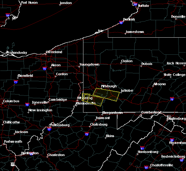 At 607 pm edt, a severe thunderstorm was located 7 miles southwest of wolfdale, or 8 miles northeast of valley grove, moving east at 25 mph (radar indicated). Hazards include 60 mph wind gusts and quarter size hail. Hail damage to vehicles is expected. Expect wind damage to trees and some power outages. At 607 pm edt, a severe thunderstorm was located 7 miles southwest of wolfdale, or 8 miles northeast of valley grove, moving east at 25 mph (radar indicated). Hazards include 60 mph wind gusts and quarter size hail. Hail damage to vehicles is expected. Expect wind damage to trees and some power outages.
|
| 7/7/2015 7:19 PM EDT |
 At 718 pm edt, severe thunderstorms were located along a line extending from near avella to 7 miles north of waynesburg, moving northeast at 40 mph (radar indicated). Hazards include 60 mph wind gusts. Expect damage to trees and some power outages locations impacted include, moon township, mcmurray, washington, canonsburg, avella, upper st. Clair, robinson township, cecil-bishop, california, bridgeville, wolfdale, mcgovern, bentleyville, imperial, brownsville, east washington, mcdonald, fredericktown-millsboro, sturgeon-noblestown and oakdale. At 718 pm edt, severe thunderstorms were located along a line extending from near avella to 7 miles north of waynesburg, moving northeast at 40 mph (radar indicated). Hazards include 60 mph wind gusts. Expect damage to trees and some power outages locations impacted include, moon township, mcmurray, washington, canonsburg, avella, upper st. Clair, robinson township, cecil-bishop, california, bridgeville, wolfdale, mcgovern, bentleyville, imperial, brownsville, east washington, mcdonald, fredericktown-millsboro, sturgeon-noblestown and oakdale.
|
| 7/7/2015 6:59 PM EDT |
 At 658 pm edt, severe thunderstorms were located along a line extending from near west liberty to 9 miles northeast of cameron, moving northeast at 40 mph (radar indicated). Hazards include 60 mph wind gusts. expect damage to trees and some power outages At 658 pm edt, severe thunderstorms were located along a line extending from near west liberty to 9 miles northeast of cameron, moving northeast at 40 mph (radar indicated). Hazards include 60 mph wind gusts. expect damage to trees and some power outages
|
| 6/23/2015 3:35 PM EDT |
 At 334 pm edt, a severe thunderstorm was located near scottdale, or 9 miles northwest of connellsville, moving east at 45 mph (radar indicated). Hazards include 60 mph wind gusts and quarter size hail. Hail damage to vehicles is expected. expect wind damage to roofs, siding and trees. Locations impacted include, monongahela, bentleyville, new eagle, wickerham manor-fisher, baidland, ellsworth, eighty four, cokeburg and beallsville. At 334 pm edt, a severe thunderstorm was located near scottdale, or 9 miles northwest of connellsville, moving east at 45 mph (radar indicated). Hazards include 60 mph wind gusts and quarter size hail. Hail damage to vehicles is expected. expect wind damage to roofs, siding and trees. Locations impacted include, monongahela, bentleyville, new eagle, wickerham manor-fisher, baidland, ellsworth, eighty four, cokeburg and beallsville.
|
| 6/23/2015 3:13 PM EDT |
 At 313 pm edt, a severe thunderstorm was located over monongahela, or near gastonville, moving east at 45 mph (radar indicated). Hazards include 60 mph wind gusts and quarter size hail. Hail damage to vehicles is expected. expect wind damage to roofs, siding and trees. Locations impacted include, mcmurray, washington, canonsburg, gastonville, south park township, jefferson hills, monongahela, wolfdale, mcgovern, bentleyville, east washington, new eagle, wickerham manor-fisher, baidland, elizabeth, houston, ellsworth, eighty four, cokeburg and west elizabeth. At 313 pm edt, a severe thunderstorm was located over monongahela, or near gastonville, moving east at 45 mph (radar indicated). Hazards include 60 mph wind gusts and quarter size hail. Hail damage to vehicles is expected. expect wind damage to roofs, siding and trees. Locations impacted include, mcmurray, washington, canonsburg, gastonville, south park township, jefferson hills, monongahela, wolfdale, mcgovern, bentleyville, east washington, new eagle, wickerham manor-fisher, baidland, elizabeth, houston, ellsworth, eighty four, cokeburg and west elizabeth.
|
| 6/23/2015 2:53 PM EDT |
 At 253 pm edt, a severe thunderstorm was located over cecil-bishop, or over canonsburg, moving east at 45 mph (radar indicated). Hazards include 60 mph wind gusts and quarter size hail. Hail damage to vehicles is expected. Expect wind damage to roofs, siding and trees. At 253 pm edt, a severe thunderstorm was located over cecil-bishop, or over canonsburg, moving east at 45 mph (radar indicated). Hazards include 60 mph wind gusts and quarter size hail. Hail damage to vehicles is expected. Expect wind damage to roofs, siding and trees.
|
| 5/31/2015 5:41 PM EDT | At 540 pm edt, a severe thunderstorm was located 7 miles west of waynesburg, moving northeast at 40 mph (radar indicated). Hazards include 60 mph wind gusts. Expect damage to roofs. Siding and trees. |
| 4/9/2015 5:56 PM EDT | The national weather service in pittsburgh has issued a * severe thunderstorm warning for. northwestern greene county in southwestern pennsylvania. beaver county in western pennsylvania. southwestern butler county in west central pennsylvania. Washington county in southwestern pennsylvania. |
| 4/9/2015 5:56 PM EDT | The national weather service in pittsburgh has issued a * severe thunderstorm warning for. northwestern greene county in southwestern pennsylvania. beaver county in western pennsylvania. southwestern butler county in west central pennsylvania. Washington county in southwestern pennsylvania. |
| 4/9/2015 5:50 PM EDT | A severe thunderstorm warning remains in effect until 600 pm edt for northwestern greene. beaver. washington. western allegheny. hancock. ohio. northeastern marshall and brooke counties. at 549 pm edt. severe thunderstorms were located along a line extending from blackhawk to near avella to near sherrard. Moving northeast at 70 mph. |
| 4/9/2015 5:50 PM EDT | A severe thunderstorm warning remains in effect until 600 pm edt for northwestern greene. beaver. washington. western allegheny. hancock. ohio. northeastern marshall and brooke counties. at 549 pm edt. severe thunderstorms were located along a line extending from blackhawk to near avella to near sherrard. Moving northeast at 70 mph. |
| 4/9/2015 5:29 PM EDT | The national weather service in pittsburgh has issued a * severe thunderstorm warning for. jefferson county in east central ohio. eastern belmont county in east central ohio. northwestern greene county in southwestern pennsylvania. Beaver county in western pennsylvania. |
| 4/9/2015 5:29 PM EDT | The national weather service in pittsburgh has issued a * severe thunderstorm warning for. jefferson county in east central ohio. eastern belmont county in east central ohio. northwestern greene county in southwestern pennsylvania. Beaver county in western pennsylvania. |
| 4/9/2015 5:29 PM EDT | The national weather service in pittsburgh has issued a * severe thunderstorm warning for. jefferson county in east central ohio. eastern belmont county in east central ohio. northwestern greene county in southwestern pennsylvania. Beaver county in western pennsylvania. |
| 7/23/2013 7:22 PM EDT | Tree down in eighty four in washington county PA, 0.1 miles NNW of Eighty Four, PA |
| 6/28/2013 1:40 PM EDT | Tree reported down zediker station rd in washington county PA, 3.3 miles NNE of Eighty Four, PA |
| 6/28/2013 1:13 PM EDT | Large tree fell on moving vehicle in washington county PA, 2.2 miles N of Eighty Four, PA |
| 6/28/2013 12:50 PM EDT | Tree reported down zediker station rd. time modified by rada in washington county PA, 3.3 miles NNE of Eighty Four, PA |
| 6/18/2013 4:05 PM EDT | Trees down in south strabane in washington county PA, 2.9 miles N of Eighty Four, PA |
| 6/13/2013 4:36 PM EDT | Wires down on route 519 in washington county PA, 0.1 miles NNW of Eighty Four, PA |
| 6/13/2013 8:36 AM EDT | Trees and wires down on intersection of 519 and 136 in washington county PA, 0.1 miles NNW of Eighty Four, PA |
| 6/13/2013 4:36 AM EDT | Wires down on route 519 in washington county PA, 0.1 miles NNW of Eighty Four, PA |
Hail Maps for Eighty Four, PA


Connect with Interactive Hail Maps