

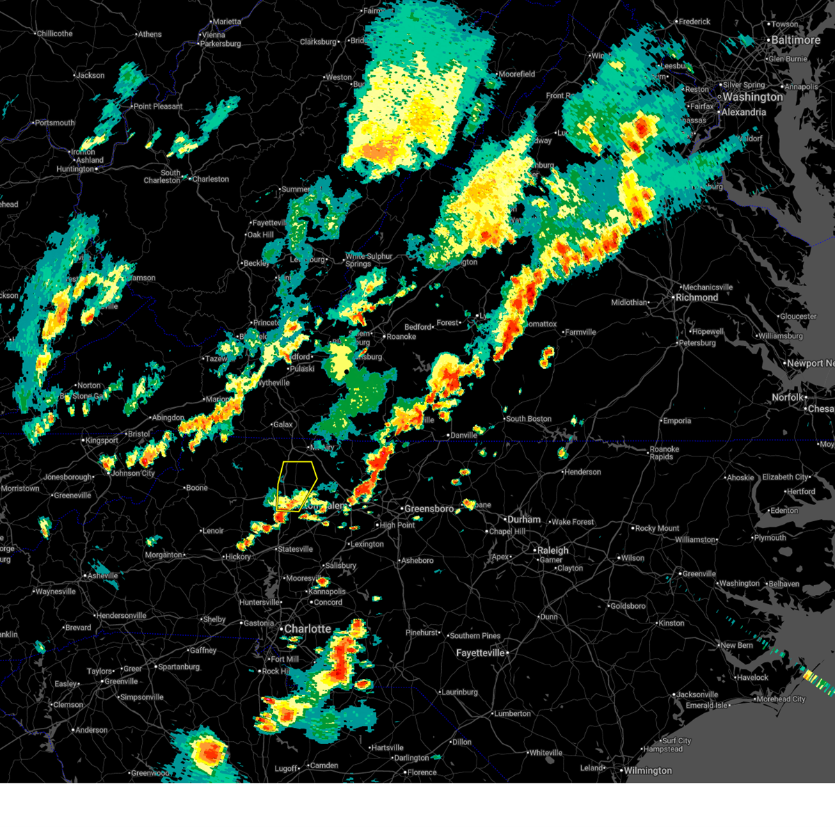
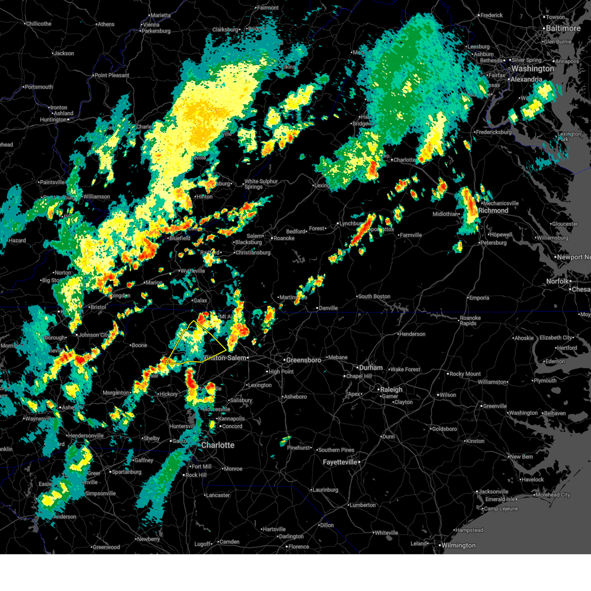
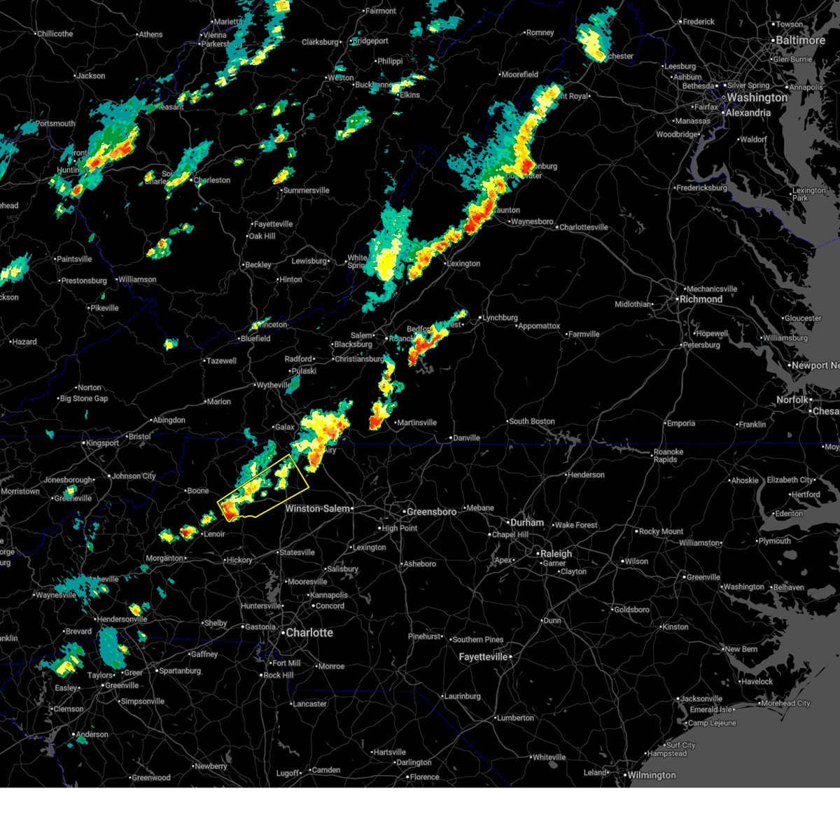
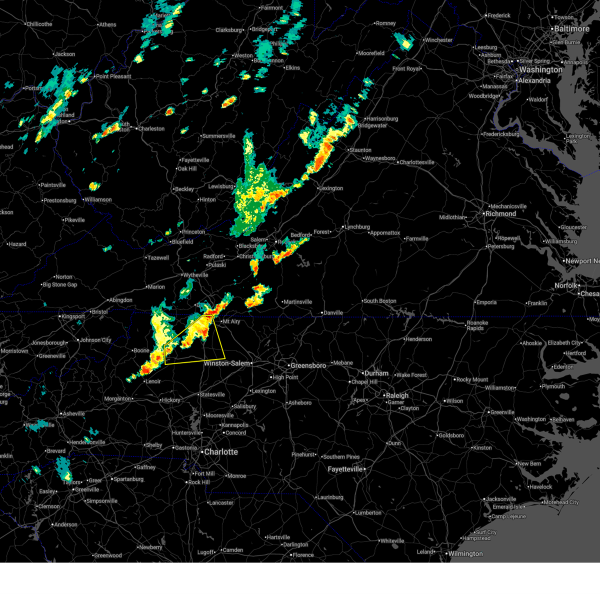
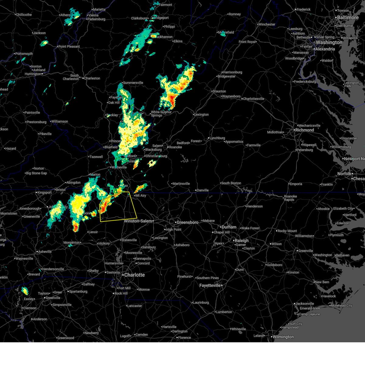
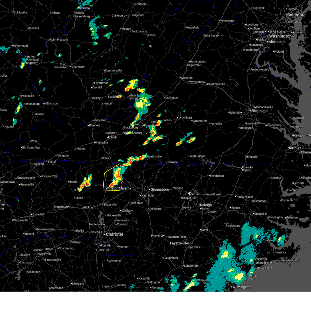
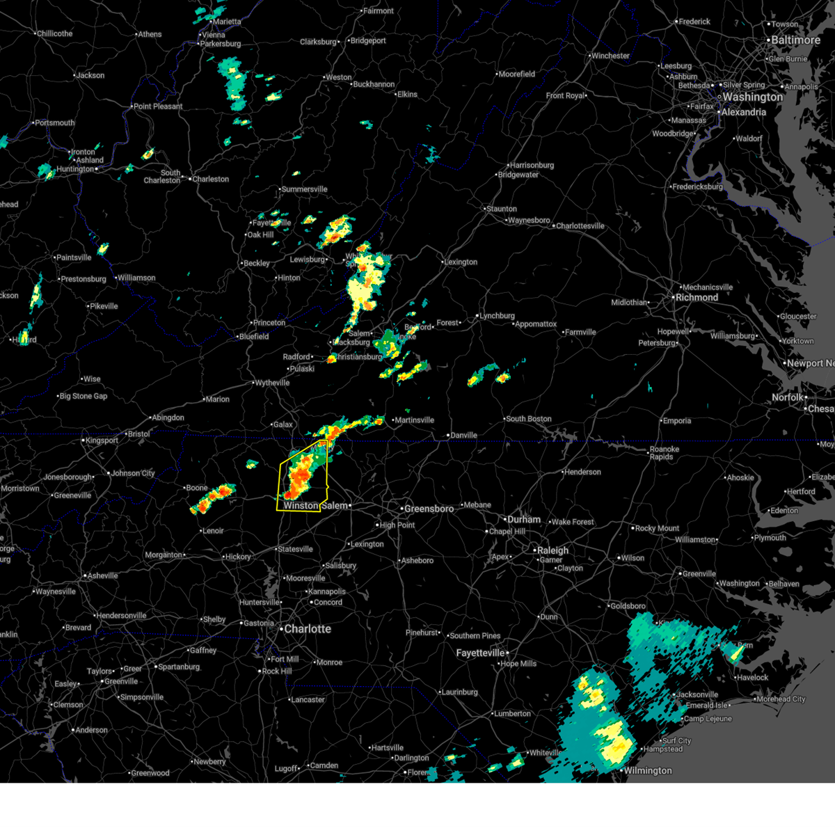
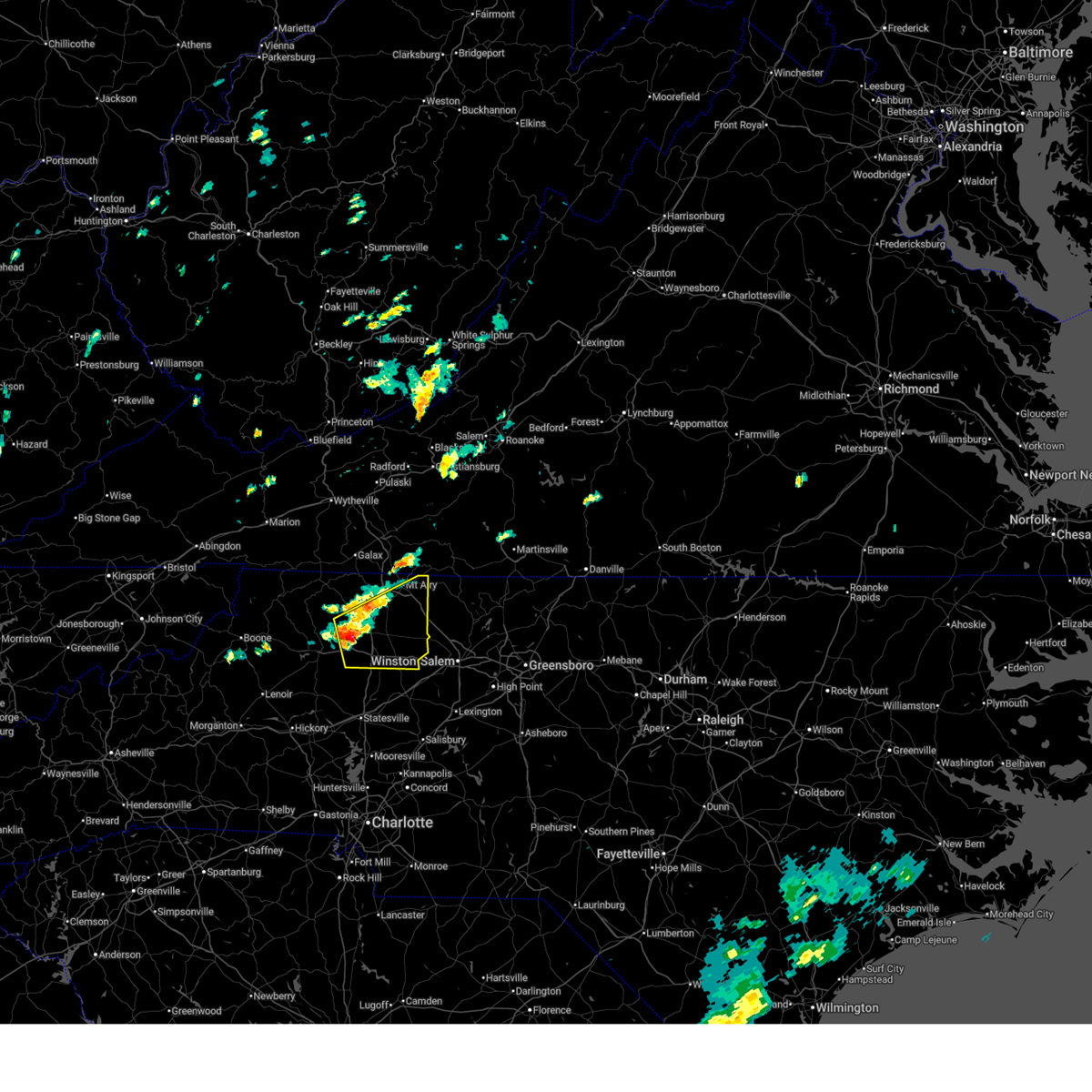
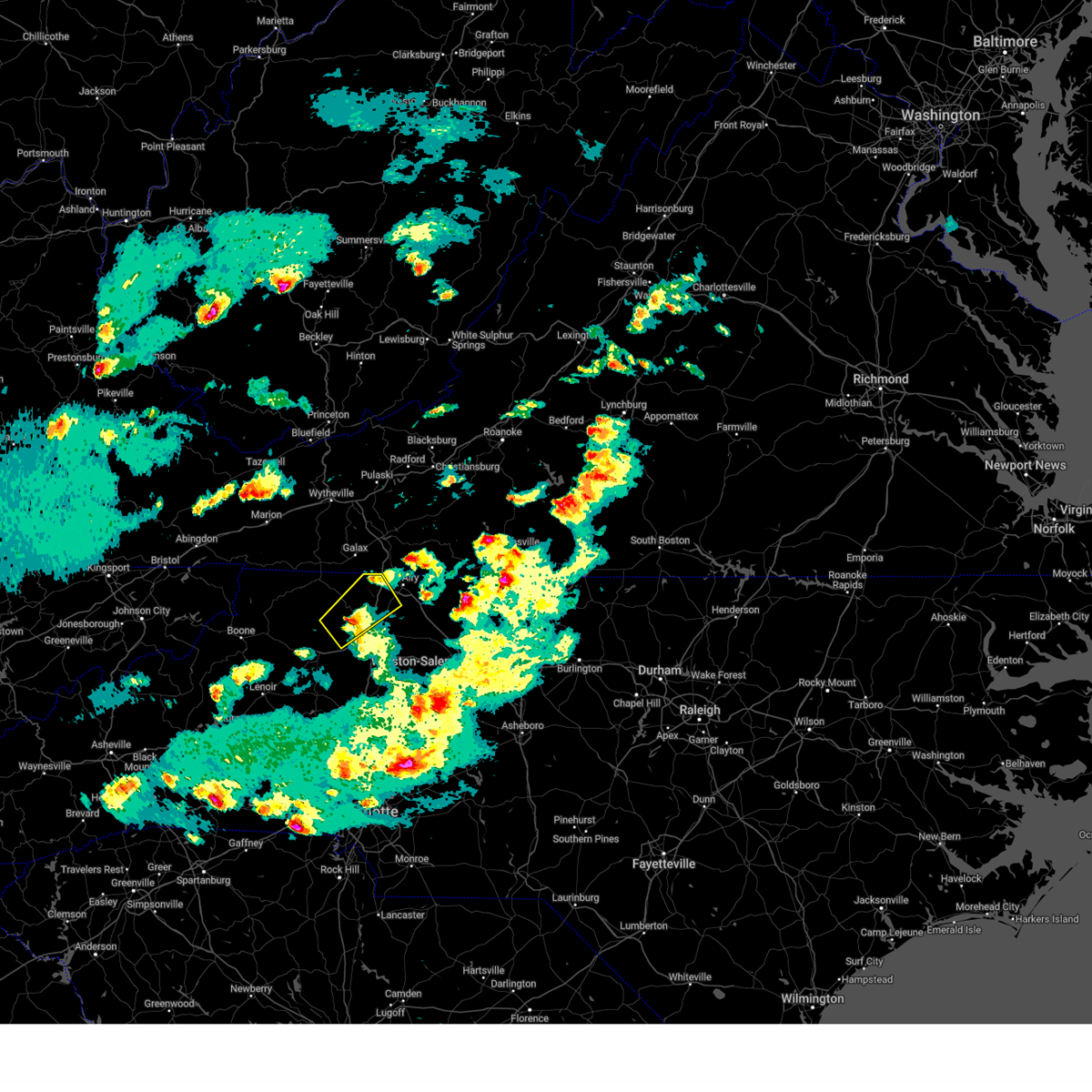
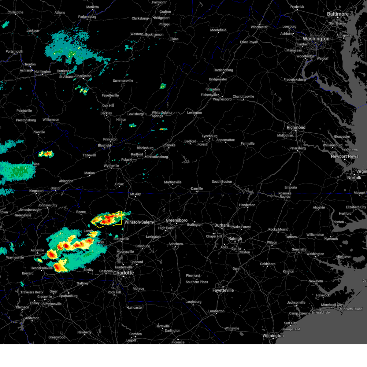
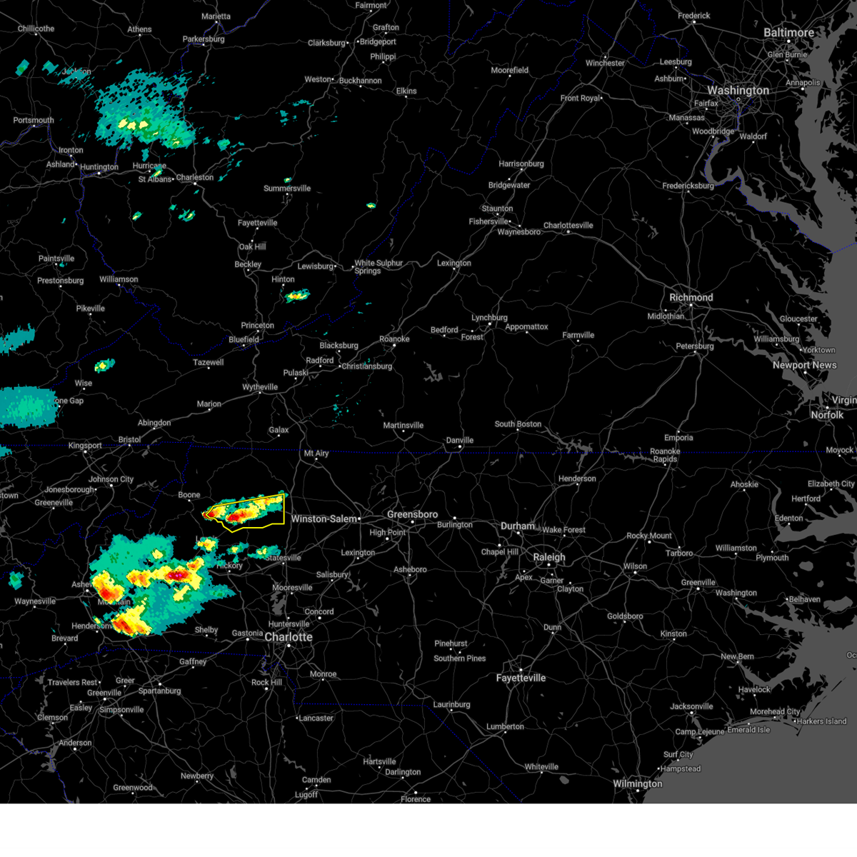
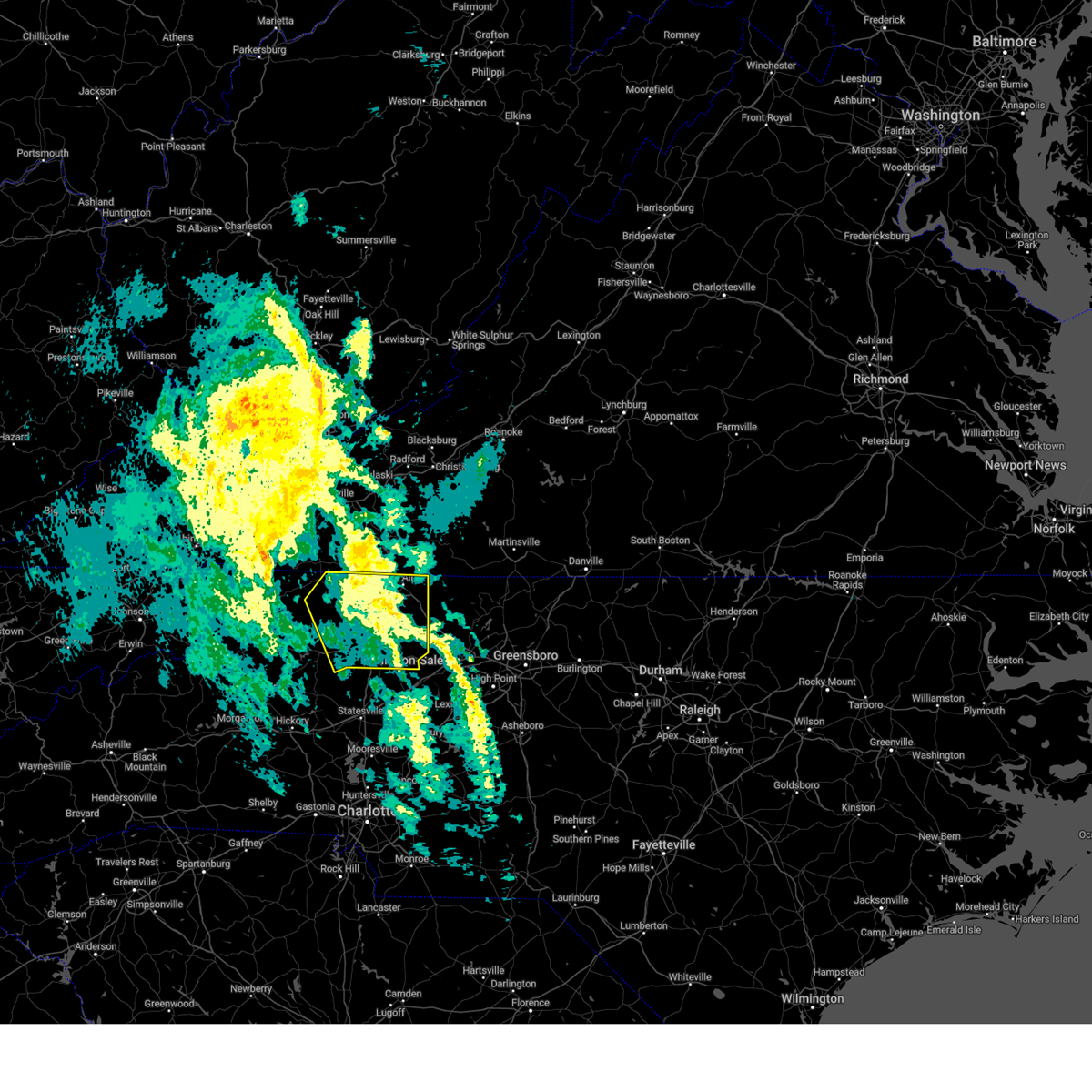
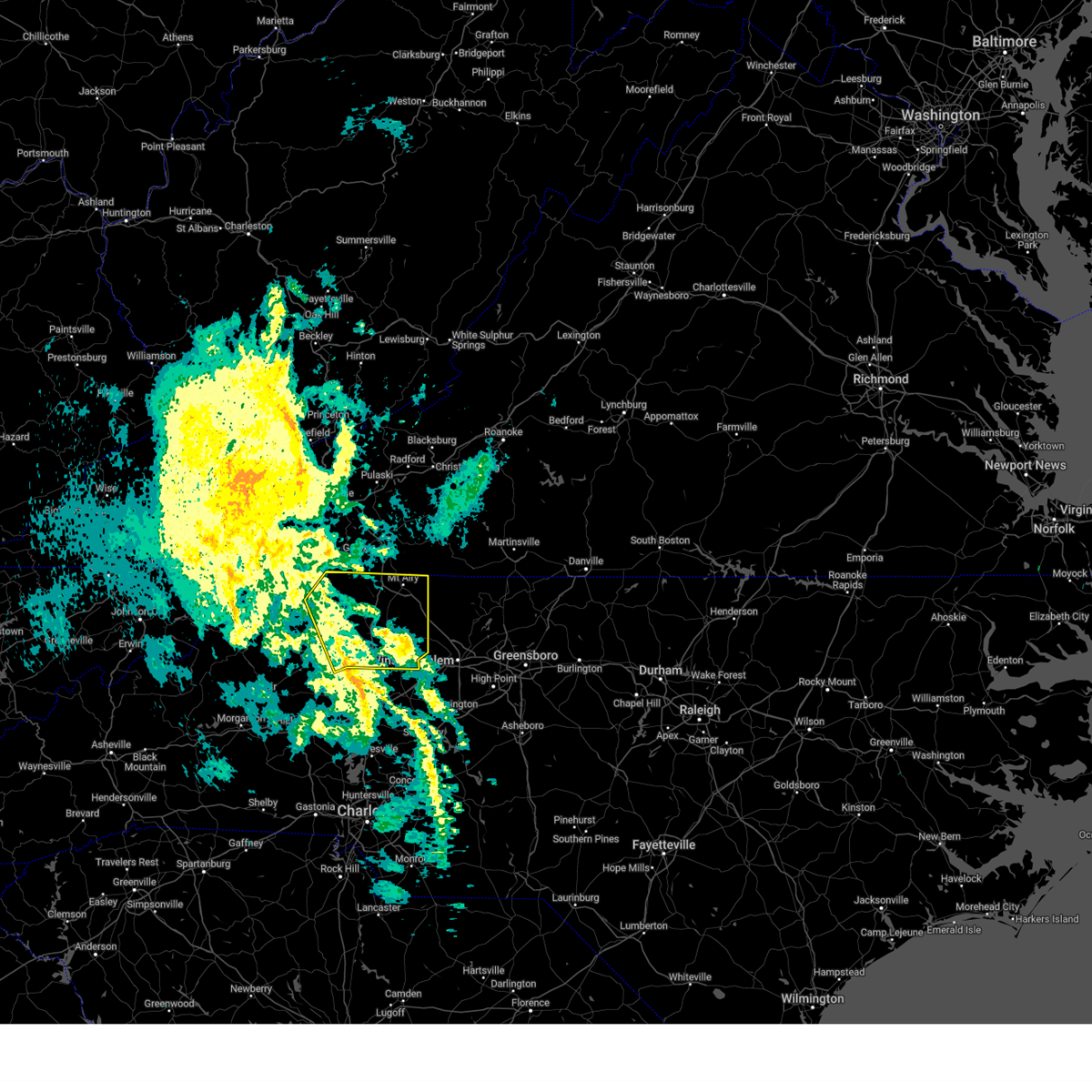
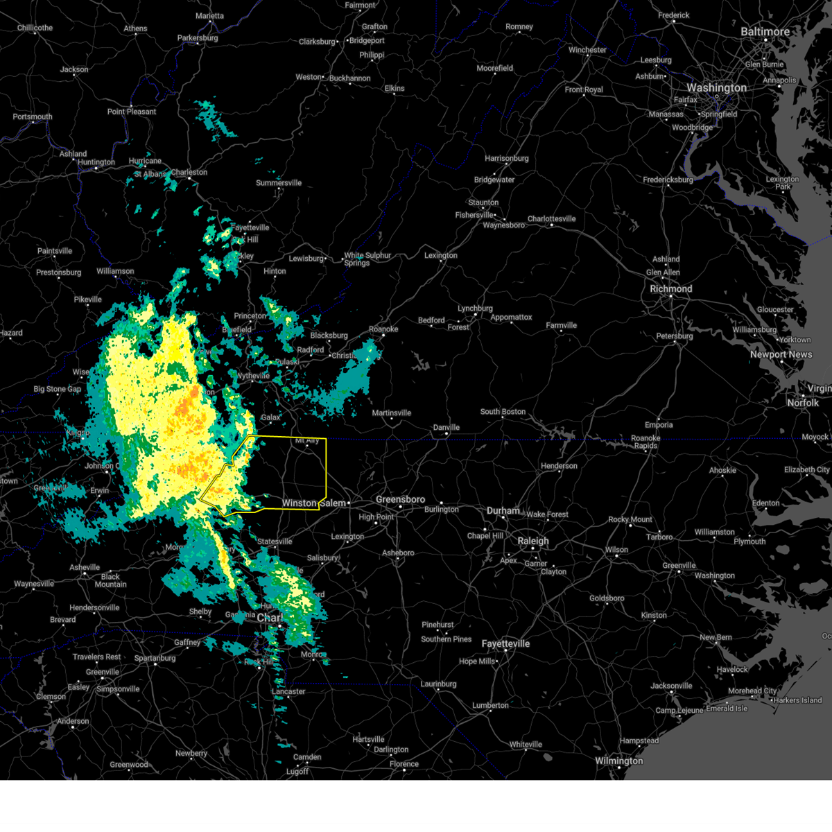
Hail Map for Elkin, NC
The Elkin, NC area has had 11 reports of on-the-ground hail by trained spotters, and has been under severe weather warnings 40 times during the past 12 months. Doppler radar has detected hail at or near Elkin, NC on 50 occasions, including 2 occasions during the past year.
| Name: | Elkin, NC |
| Where Located: | 71.8 miles N of Charlotte, NC |
| Map: | Google Map for Elkin, NC |
| Population: | 4001 |
| Housing Units: | 1982 |
| More Info: | Search Google for Elkin, NC |
0
The Top Recent Hail Date for Elkin, NC is Saturday, June 14, 2025 (25th out of 50)

Hail and Wind Damage Spotted near Elkin, NC
| Date / Time | Report Details |
|---|---|
| 7/9/2025 5:06 PM EDT |
 The storm which prompted the warning has weakened below severe limits, and no longer poses an immediate threat to life or property. therefore, the warning will be allowed to expire. a severe thunderstorm watch remains in effect until 1000 pm edt for north central and northwestern north carolina, and southwestern virginia. The storm which prompted the warning has weakened below severe limits, and no longer poses an immediate threat to life or property. therefore, the warning will be allowed to expire. a severe thunderstorm watch remains in effect until 1000 pm edt for north central and northwestern north carolina, and southwestern virginia.
|
| 7/9/2025 4:37 PM EDT |
 Svrrnk the national weather service in blacksburg has issued a * severe thunderstorm warning for, southeastern surry county in northwestern north carolina, yadkin county in northwestern north carolina, * until 515 pm edt. * at 437 pm edt, a severe thunderstorm was located over brooks crossroads, or 7 miles west of yadkinville, moving northeast at 30 mph (radar indicated). Hazards include 60 mph wind gusts and quarter size hail. Hail damage to vehicles is expected. Expect wind damage to roofs, siding, and trees. Svrrnk the national weather service in blacksburg has issued a * severe thunderstorm warning for, southeastern surry county in northwestern north carolina, yadkin county in northwestern north carolina, * until 515 pm edt. * at 437 pm edt, a severe thunderstorm was located over brooks crossroads, or 7 miles west of yadkinville, moving northeast at 30 mph (radar indicated). Hazards include 60 mph wind gusts and quarter size hail. Hail damage to vehicles is expected. Expect wind damage to roofs, siding, and trees.
|
| 7/9/2025 3:43 PM EDT | Thunderstorm winds blew down one tree near the intersection of interstate 77 and us route 21 bypas in surry county NC, 1.1 miles WNW of Elkin, NC |
| 7/9/2025 3:30 PM EDT |
 At 329 pm edt, severe thunderstorms were located along a line extending from near dobson to fairplains, moving southeast at 10 mph (radar indicated). Hazards include 60 mph wind gusts. Expect damage to roofs, siding, and trees. Locations impacted include, north wilkesboro, elkin, wilkesboro, fairview, jonesville, dobson, and ronda. At 329 pm edt, severe thunderstorms were located along a line extending from near dobson to fairplains, moving southeast at 10 mph (radar indicated). Hazards include 60 mph wind gusts. Expect damage to roofs, siding, and trees. Locations impacted include, north wilkesboro, elkin, wilkesboro, fairview, jonesville, dobson, and ronda.
|
| 7/9/2025 3:30 PM EDT |
 the severe thunderstorm warning has been cancelled and is no longer in effect the severe thunderstorm warning has been cancelled and is no longer in effect
|
| 7/9/2025 3:17 PM EDT | Thunderstorm winds blew down one tree near the intersection of grassy fork road and beaver roa in wilkes county NC, 6.3 miles SE of Elkin, NC |
| 7/9/2025 3:10 PM EDT | Thunderstorm winds blew down one tree near the intersection of thurmond road and zephyr mountain park roa in wilkes county NC, 6.5 miles SSE of Elkin, NC |
| 7/9/2025 3:03 PM EDT |
 Svrrnk the national weather service in blacksburg has issued a * severe thunderstorm warning for, southeastern alleghany county in northwestern north carolina, southern surry county in northwestern north carolina, northeastern wilkes county in northwestern north carolina, northwestern yadkin county in northwestern north carolina, * until 345 pm edt. * at 302 pm edt, severe thunderstorms were located along a line extending from near mountain park to millers creek, moving east at 25 mph (radar indicated). Hazards include 60 mph wind gusts and quarter size hail. Hail damage to vehicles is expected. Expect wind damage to roofs, siding, and trees. Svrrnk the national weather service in blacksburg has issued a * severe thunderstorm warning for, southeastern alleghany county in northwestern north carolina, southern surry county in northwestern north carolina, northeastern wilkes county in northwestern north carolina, northwestern yadkin county in northwestern north carolina, * until 345 pm edt. * at 302 pm edt, severe thunderstorms were located along a line extending from near mountain park to millers creek, moving east at 25 mph (radar indicated). Hazards include 60 mph wind gusts and quarter size hail. Hail damage to vehicles is expected. Expect wind damage to roofs, siding, and trees.
|
| 7/1/2025 6:12 PM EDT |
 The storm which prompted the warning has moved out of the area. therefore, the warning will be allowed to expire. The storm which prompted the warning has moved out of the area. therefore, the warning will be allowed to expire.
|
| 7/1/2025 5:40 PM EDT |
 At 540 pm edt, a severe thunderstorm was located over roaring river, or over ronda, moving northeast at 30 mph (radar indicated). Hazards include 60 mph wind gusts. Expect damage to roofs, siding, and trees. Locations impacted include, north wilkesboro, elkin, wilkesboro, fairview, yadkinville, jonesville, and boonville. At 540 pm edt, a severe thunderstorm was located over roaring river, or over ronda, moving northeast at 30 mph (radar indicated). Hazards include 60 mph wind gusts. Expect damage to roofs, siding, and trees. Locations impacted include, north wilkesboro, elkin, wilkesboro, fairview, yadkinville, jonesville, and boonville.
|
| 7/1/2025 5:19 PM EDT |
 Svrrnk the national weather service in blacksburg has issued a * severe thunderstorm warning for, southwestern surry county in northwestern north carolina, wilkes county in northwestern north carolina, yadkin county in northwestern north carolina, * until 615 pm edt. * at 519 pm edt, a severe thunderstorm was located near moravian falls, or near wilkesboro, moving northeast at 20 mph (radar indicated). Hazards include 60 mph wind gusts. expect damage to roofs, siding, and trees Svrrnk the national weather service in blacksburg has issued a * severe thunderstorm warning for, southwestern surry county in northwestern north carolina, wilkes county in northwestern north carolina, yadkin county in northwestern north carolina, * until 615 pm edt. * at 519 pm edt, a severe thunderstorm was located near moravian falls, or near wilkesboro, moving northeast at 20 mph (radar indicated). Hazards include 60 mph wind gusts. expect damage to roofs, siding, and trees
|
| 6/26/2025 3:09 PM EDT | Corrects previous tstm wnd dmg report from 2 se benham. large tree blown down on home damaging part of it. 6 to 8 trees dow in wilkes county NC, 3 miles ESE of Elkin, NC |
| 6/26/2025 3:09 PM EDT | Photos from emergency manager showed crops flattened and trees snapped in one direction along and near the intersection of cool springs church rd and preacher field r in wilkes county NC, 3.3 miles ESE of Elkin, NC |
| 6/19/2025 4:00 PM EDT | Svrrnk the national weather service in blacksburg has issued a * severe thunderstorm warning for, southeastern surry county in northwestern north carolina, southern wilkes county in northwestern north carolina, yadkin county in northwestern north carolina, * until 500 pm edt. * at 400 pm edt, severe thunderstorms were located along a line extending from enon to 6 miles south of darby, moving east at 35 mph (radar indicated). Hazards include 60 mph wind gusts and quarter size hail. Hail damage to vehicles is expected. Expect wind damage to roofs, siding, and trees. |
| 6/19/2025 3:00 PM EDT |
 At 259 pm edt, a severe thunderstorm was located over windy gap, or 8 miles southeast of north wilkesboro, moving northeast at 35 mph (radar indicated). Hazards include 60 mph wind gusts and quarter size hail. Hail damage to vehicles is expected. expect wind damage to roofs, siding, and trees. Locations impacted include, north wilkesboro, elkin, wilkesboro, fairview, jonesville, boonville, and ronda. At 259 pm edt, a severe thunderstorm was located over windy gap, or 8 miles southeast of north wilkesboro, moving northeast at 35 mph (radar indicated). Hazards include 60 mph wind gusts and quarter size hail. Hail damage to vehicles is expected. expect wind damage to roofs, siding, and trees. Locations impacted include, north wilkesboro, elkin, wilkesboro, fairview, jonesville, boonville, and ronda.
|
| 6/19/2025 2:20 PM EDT |
 Svrrnk the national weather service in blacksburg has issued a * severe thunderstorm warning for, southwestern surry county in northwestern north carolina, southeastern wilkes county in northwestern north carolina, northwestern yadkin county in northwestern north carolina, * until 315 pm edt. * at 219 pm edt, a severe thunderstorm was located over wilkesboro reservoir, or over boomer, moving northeast at 30 mph (radar indicated). Hazards include 60 mph wind gusts. expect damage to roofs, siding, and trees Svrrnk the national weather service in blacksburg has issued a * severe thunderstorm warning for, southwestern surry county in northwestern north carolina, southeastern wilkes county in northwestern north carolina, northwestern yadkin county in northwestern north carolina, * until 315 pm edt. * at 219 pm edt, a severe thunderstorm was located over wilkesboro reservoir, or over boomer, moving northeast at 30 mph (radar indicated). Hazards include 60 mph wind gusts. expect damage to roofs, siding, and trees
|
| 6/19/2025 1:56 PM EDT |
 At 155 pm edt, a severe thunderstorm was located over mountain park, moving east at 30 mph (radar indicated). Hazards include 60 mph wind gusts and quarter size hail. Hail damage to vehicles is expected. expect wind damage to roofs, siding, and trees. Locations impacted include, north wilkesboro, elkin, wilkesboro, fairview, yadkinville, jonesville, and dobson. At 155 pm edt, a severe thunderstorm was located over mountain park, moving east at 30 mph (radar indicated). Hazards include 60 mph wind gusts and quarter size hail. Hail damage to vehicles is expected. expect wind damage to roofs, siding, and trees. Locations impacted include, north wilkesboro, elkin, wilkesboro, fairview, yadkinville, jonesville, and dobson.
|
| 6/19/2025 1:55 PM EDT | 911 call center in surry county... nc reported a tree down across the road near the intersection of kapps mill road and david barker road near elki in surry county NC, 9.4 miles S of Elkin, NC |
| 6/19/2025 1:22 PM EDT |
 Svrrnk the national weather service in blacksburg has issued a * severe thunderstorm warning for, southern alleghany county in northwestern north carolina, western surry county in northwestern north carolina, wilkes county in northwestern north carolina, northwestern yadkin county in northwestern north carolina, * until 215 pm edt. * at 122 pm edt, a severe thunderstorm was located near dockery, or near mc grady, moving east at 30 mph (radar indicated). Hazards include 60 mph wind gusts and quarter size hail. Hail damage to vehicles is expected. Expect wind damage to roofs, siding, and trees. Svrrnk the national weather service in blacksburg has issued a * severe thunderstorm warning for, southern alleghany county in northwestern north carolina, western surry county in northwestern north carolina, wilkes county in northwestern north carolina, northwestern yadkin county in northwestern north carolina, * until 215 pm edt. * at 122 pm edt, a severe thunderstorm was located near dockery, or near mc grady, moving east at 30 mph (radar indicated). Hazards include 60 mph wind gusts and quarter size hail. Hail damage to vehicles is expected. Expect wind damage to roofs, siding, and trees.
|
| 6/14/2025 2:32 PM EDT |
 The severe thunderstorm which prompted the warning has weakened. therefore, the warning has been allowed to expire. however, heavy rain and occasional cloud-to-ground lightning is still possible with this thunderstorm. The severe thunderstorm which prompted the warning has weakened. therefore, the warning has been allowed to expire. however, heavy rain and occasional cloud-to-ground lightning is still possible with this thunderstorm.
|
| 6/14/2025 2:07 PM EDT |
 At 204 pm edt, a severe thunderstorm was located near brooks crossroads, or near boonville, moving east at 15 mph (radar indicated). Hazards include 60 mph wind gusts. half inch hail and very heavy rain is also likely. Expect damage to roofs, siding, and trees. Locations impacted include, mount airy, elkin, fairview, flat rock, yadkinville, jonesville, and dobson. At 204 pm edt, a severe thunderstorm was located near brooks crossroads, or near boonville, moving east at 15 mph (radar indicated). Hazards include 60 mph wind gusts. half inch hail and very heavy rain is also likely. Expect damage to roofs, siding, and trees. Locations impacted include, mount airy, elkin, fairview, flat rock, yadkinville, jonesville, and dobson.
|
| 6/14/2025 2:07 PM EDT |
 the severe thunderstorm warning has been cancelled and is no longer in effect the severe thunderstorm warning has been cancelled and is no longer in effect
|
| 6/14/2025 1:26 PM EDT |
 Svrrnk the national weather service in blacksburg has issued a * severe thunderstorm warning for, surry county in northwestern north carolina, eastern wilkes county in northwestern north carolina, yadkin county in northwestern north carolina, * until 230 pm edt. * at 124 pm edt, a severe thunderstorm was located over pleasant hill, or over ronda, moving east at 25 mph (radar indicated). Hazards include 60 mph wind gusts. expect damage to roofs, siding, and trees Svrrnk the national weather service in blacksburg has issued a * severe thunderstorm warning for, surry county in northwestern north carolina, eastern wilkes county in northwestern north carolina, yadkin county in northwestern north carolina, * until 230 pm edt. * at 124 pm edt, a severe thunderstorm was located over pleasant hill, or over ronda, moving east at 25 mph (radar indicated). Hazards include 60 mph wind gusts. expect damage to roofs, siding, and trees
|
| 6/6/2025 7:46 PM EDT | Large tree down across the road near the intersection of elkin wildlife road and cc camp roa in surry county NC, 2 miles WSW of Elkin, NC |
| 6/6/2025 7:45 PM EDT | Svrrnk the national weather service in blacksburg has issued a * severe thunderstorm warning for, southeastern surry county in northwestern north carolina, central yadkin county in northwestern north carolina, * until 845 pm edt. * at 744 pm edt, a severe thunderstorm was located over enon, or near east bend, moving southeast at 25 mph (radar indicated). Hazards include 60 mph wind gusts and quarter size hail. Hail damage to vehicles is expected. Expect wind damage to roofs, siding, and trees. |
| 5/8/2025 7:18 PM EDT |
 the severe thunderstorm warning has been cancelled and is no longer in effect the severe thunderstorm warning has been cancelled and is no longer in effect
|
| 5/8/2025 7:06 PM EDT | At 706 pm edt, a severe thunderstorm was located near traphill, moving northeast at 25 mph (radar indicated). Hazards include 60 mph wind gusts and quarter size hail. Hail damage to vehicles is expected. expect wind damage to roofs, siding, and trees. Locations impacted include, elkin, fairview, dobson, ronda, traphill, mountain park, and bottom. |
| 5/8/2025 6:41 PM EDT | Svrrnk the national weather service in blacksburg has issued a * severe thunderstorm warning for, southeastern alleghany county in northwestern north carolina, western surry county in northwestern north carolina, eastern wilkes county in northwestern north carolina, * until 745 pm edt. * at 641 pm edt, a severe thunderstorm was located over halls mills, or near mc grady, moving northeast at 25 mph (radar indicated). Hazards include 60 mph wind gusts and half dollar size hail. Hail damage to vehicles is expected. Expect wind damage to roofs, siding, and trees. |
| 5/8/2025 6:13 PM EDT | Svrrnk the national weather service in blacksburg has issued a * severe thunderstorm warning for, surry county in northwestern north carolina, northwestern stokes county in north central north carolina, northern yadkin county in northwestern north carolina, the city of martinsville in south central virginia, western henry county in south central virginia, patrick county in southwestern virginia, * until 715 pm edt. * at 612 pm edt, severe thunderstorms were located along a broken line extending from near sanville to near pilot mountain to near arlington, moving east at 15 mph (radar indicated). Hazards include quarter size hail. damage to vehicles is expected |
| 5/8/2025 4:56 PM EDT |
 At 455 pm edt, a severe thunderstorm was located over moravian falls, or near wilkesboro, moving southeast at 10 mph (radar indicated). Hazards include 60 mph wind gusts and quarter size hail. Hail damage to vehicles is expected. expect wind damage to roofs, siding, and trees. Locations impacted include, north wilkesboro, wilkesboro, ronda, boomer, windy gap, wilkesboro reservoir, and buck. At 455 pm edt, a severe thunderstorm was located over moravian falls, or near wilkesboro, moving southeast at 10 mph (radar indicated). Hazards include 60 mph wind gusts and quarter size hail. Hail damage to vehicles is expected. expect wind damage to roofs, siding, and trees. Locations impacted include, north wilkesboro, wilkesboro, ronda, boomer, windy gap, wilkesboro reservoir, and buck.
|
| 5/8/2025 4:32 PM EDT |
 Svrrnk the national weather service in blacksburg has issued a * severe thunderstorm warning for, southern wilkes county in northwestern north carolina, * until 530 pm edt. * at 432 pm edt, a severe thunderstorm was located over boomer, moving east at 15 mph (radar indicated). Hazards include 60 mph wind gusts and quarter size hail. Hail damage to vehicles is expected. Expect wind damage to roofs, siding, and trees. Svrrnk the national weather service in blacksburg has issued a * severe thunderstorm warning for, southern wilkes county in northwestern north carolina, * until 530 pm edt. * at 432 pm edt, a severe thunderstorm was located over boomer, moving east at 15 mph (radar indicated). Hazards include 60 mph wind gusts and quarter size hail. Hail damage to vehicles is expected. Expect wind damage to roofs, siding, and trees.
|
| 4/30/2025 5:17 PM EDT | Thunderstorm winds blew down one tree near the intersection of us route 601 and chandler roa in surry county NC, 7.3 miles W of Elkin, NC |
| 3/5/2025 7:59 AM EST |
 The storms which prompted the warning have moved out of the area. therefore, the warning will be allowed to expire. however, gusty winds are still possible with these thunderstorms. a tornado watch remains in effect until 100 pm est for north central north carolina. remember, another severe thunderstorm warning still remains in effect for surry county and yadkin county until 830 am est. The storms which prompted the warning have moved out of the area. therefore, the warning will be allowed to expire. however, gusty winds are still possible with these thunderstorms. a tornado watch remains in effect until 100 pm est for north central north carolina. remember, another severe thunderstorm warning still remains in effect for surry county and yadkin county until 830 am est.
|
| 3/5/2025 7:54 AM EST |
 Svrrnk the national weather service in blacksburg has issued a * severe thunderstorm warning for, surry county in northwestern north carolina, northwestern stokes county in north central north carolina, western yadkin county in northwestern north carolina, southeastern carroll county in southwestern virginia, southwestern patrick county in southwestern virginia, * until 830 am est. * at 754 am est, severe thunderstorms were located along a line extending from lambsburg to near arlington, moving northeast at 55 mph (radar indicated). Hazards include 60 mph wind gusts. expect damage to roofs, siding, and trees Svrrnk the national weather service in blacksburg has issued a * severe thunderstorm warning for, surry county in northwestern north carolina, northwestern stokes county in north central north carolina, western yadkin county in northwestern north carolina, southeastern carroll county in southwestern virginia, southwestern patrick county in southwestern virginia, * until 830 am est. * at 754 am est, severe thunderstorms were located along a line extending from lambsburg to near arlington, moving northeast at 55 mph (radar indicated). Hazards include 60 mph wind gusts. expect damage to roofs, siding, and trees
|
| 3/5/2025 7:43 AM EST | Tree down on west forest drive in pleasant ridge in wilkes county north carolin in wilkes county NC, 4.4 miles SSE of Elkin, NC |
| 3/5/2025 7:43 AM EST |
 the severe thunderstorm warning has been cancelled and is no longer in effect the severe thunderstorm warning has been cancelled and is no longer in effect
|
| 3/5/2025 7:43 AM EST |
 At 743 am est, severe thunderstorms were located along a line extending from near roaring gap to near buck shoals, moving northeast at 50 mph (radar indicated). Hazards include 60 mph wind gusts. Expect damage to roofs, siding, and trees. Locations impacted include, elkin, fairview, jonesville, dobson, ronda, mountain park, and windy gap. At 743 am est, severe thunderstorms were located along a line extending from near roaring gap to near buck shoals, moving northeast at 50 mph (radar indicated). Hazards include 60 mph wind gusts. Expect damage to roofs, siding, and trees. Locations impacted include, elkin, fairview, jonesville, dobson, ronda, mountain park, and windy gap.
|
| 3/5/2025 7:28 AM EST |
 Svrrnk the national weather service in blacksburg has issued a * severe thunderstorm warning for, southeastern alleghany county in northwestern north carolina, western surry county in northwestern north carolina, eastern wilkes county in northwestern north carolina, northwestern yadkin county in northwestern north carolina, * until 800 am est. * at 728 am est, severe thunderstorms were located along a line extending from dockery to 6 miles southeast of moravian falls, moving northeast at 60 mph (radar indicated). Hazards include 60 mph wind gusts. expect damage to roofs, siding, and trees Svrrnk the national weather service in blacksburg has issued a * severe thunderstorm warning for, southeastern alleghany county in northwestern north carolina, western surry county in northwestern north carolina, eastern wilkes county in northwestern north carolina, northwestern yadkin county in northwestern north carolina, * until 800 am est. * at 728 am est, severe thunderstorms were located along a line extending from dockery to 6 miles southeast of moravian falls, moving northeast at 60 mph (radar indicated). Hazards include 60 mph wind gusts. expect damage to roofs, siding, and trees
|
| 12/29/2024 10:30 AM EST |
 The storms which prompted the warning have weakened below severe limits, and no longer pose an immediate threat to life or property. therefore, the warning has been allowed to expire. however, gusty winds and heavy rain are still possible with these thunderstorms. a severe thunderstorm watch remains in effect until 500 pm est for north central and northwestern north carolina. The storms which prompted the warning have weakened below severe limits, and no longer pose an immediate threat to life or property. therefore, the warning has been allowed to expire. however, gusty winds and heavy rain are still possible with these thunderstorms. a severe thunderstorm watch remains in effect until 500 pm est for north central and northwestern north carolina.
|
| 12/29/2024 10:04 AM EST |
 At 1004 am est, severe thunderstorms were located along a line extending from twin oaks to near cleveland, moving northeast at 40 mph (radar indicated). Hazards include 60 mph wind gusts. Expect damage to roofs, siding, and trees. Locations impacted include, mount airy, north wilkesboro, elkin, fairview, flat rock, yadkinville, and jonesville. At 1004 am est, severe thunderstorms were located along a line extending from twin oaks to near cleveland, moving northeast at 40 mph (radar indicated). Hazards include 60 mph wind gusts. Expect damage to roofs, siding, and trees. Locations impacted include, mount airy, north wilkesboro, elkin, fairview, flat rock, yadkinville, and jonesville.
|
| 12/29/2024 9:25 AM EST |
 Svrrnk the national weather service in blacksburg has issued a * severe thunderstorm warning for, alleghany county in northwestern north carolina, surry county in northwestern north carolina, wilkes county in northwestern north carolina, yadkin county in northwestern north carolina, * until 1030 am est. * at 923 am est, severe thunderstorms were located along a line extending from near darby to near stanley, moving northeast at 50 mph (radar indicated). Hazards include 70 mph wind gusts. Expect considerable tree damage. Damage is likely to mobile homes, roofs, and outbuildings. Svrrnk the national weather service in blacksburg has issued a * severe thunderstorm warning for, alleghany county in northwestern north carolina, surry county in northwestern north carolina, wilkes county in northwestern north carolina, yadkin county in northwestern north carolina, * until 1030 am est. * at 923 am est, severe thunderstorms were located along a line extending from near darby to near stanley, moving northeast at 50 mph (radar indicated). Hazards include 70 mph wind gusts. Expect considerable tree damage. Damage is likely to mobile homes, roofs, and outbuildings.
|
| 9/17/2024 4:30 PM EDT | Tree down across us 21 near dollar general. reported by surry county sheriff offic in surry county NC, 4 miles SSE of Elkin, NC |
| 8/30/2024 6:10 PM EDT |
 Svrrnk the national weather service in blacksburg has issued a * severe thunderstorm warning for, southeastern alleghany county in northwestern north carolina, southwestern surry county in northwestern north carolina, eastern wilkes county in northwestern north carolina, northwestern yadkin county in northwestern north carolina, * until 700 pm edt. * at 610 pm edt, a severe thunderstorm was located over roaring river, or over ronda, moving southeast at 5 mph (radar indicated). Hazards include 60 mph wind gusts and quarter size hail. Hail damage to vehicles is expected. Expect wind damage to roofs, siding, and trees. Svrrnk the national weather service in blacksburg has issued a * severe thunderstorm warning for, southeastern alleghany county in northwestern north carolina, southwestern surry county in northwestern north carolina, eastern wilkes county in northwestern north carolina, northwestern yadkin county in northwestern north carolina, * until 700 pm edt. * at 610 pm edt, a severe thunderstorm was located over roaring river, or over ronda, moving southeast at 5 mph (radar indicated). Hazards include 60 mph wind gusts and quarter size hail. Hail damage to vehicles is expected. Expect wind damage to roofs, siding, and trees.
|
| 8/30/2024 5:23 PM EDT | Tree across the road near intersection of dry pond and zephyr roa in surry county NC, 9.6 miles SSW of Elkin, NC |
| 8/17/2024 11:10 PM EDT | The surry county 911 center reported that a tree was down blocking both lanes of traffic in the 100 block of dodson road in elkin nearf the welcome valley baptist churc in surry county NC, 5.1 miles SW of Elkin, NC |
| 8/17/2024 11:09 PM EDT | The surry county 911 center reported that a tree was down blocking both lanes of traffic near the intersection of joe layne mill road and poplar springs road in elki in surry county NC, 5.3 miles SSW of Elkin, NC |
| 7/16/2024 2:57 PM EDT |
 The storm which prompted the warning has moved out of the area. therefore, the warning will be allowed to expire. however, heavy rain is still possible with this thunderstorm. remember, a severe thunderstorm warning still remains in effect for surry county until 330 pm edt. The storm which prompted the warning has moved out of the area. therefore, the warning will be allowed to expire. however, heavy rain is still possible with this thunderstorm. remember, a severe thunderstorm warning still remains in effect for surry county until 330 pm edt.
|
| 7/16/2024 2:32 PM EDT |
 Svrrnk the national weather service in blacksburg has issued a * severe thunderstorm warning for, surry county in northwestern north carolina, * until 330 pm edt. * at 232 pm edt, a severe thunderstorm was located over mountain park, moving east at 30 mph (radar indicated). Hazards include 60 mph wind gusts, quarter-sized hail, cloud-to-ground lightning, and heavy rainfall. Hail damage to vehicles is expected. Expect wind damage to roofs, siding, and trees. Svrrnk the national weather service in blacksburg has issued a * severe thunderstorm warning for, surry county in northwestern north carolina, * until 330 pm edt. * at 232 pm edt, a severe thunderstorm was located over mountain park, moving east at 30 mph (radar indicated). Hazards include 60 mph wind gusts, quarter-sized hail, cloud-to-ground lightning, and heavy rainfall. Hail damage to vehicles is expected. Expect wind damage to roofs, siding, and trees.
|
| 7/16/2024 2:27 PM EDT |
 the severe thunderstorm warning has been cancelled and is no longer in effect the severe thunderstorm warning has been cancelled and is no longer in effect
|
| 7/16/2024 2:27 PM EDT |
 At 226 pm edt, a severe thunderstorm was located over hays, or near north wilkesboro, moving east at 20 mph (radar indicated). Hazards include 60 mph wind gusts and quarter size hail. Hail damage to vehicles is expected. expect wind damage to roofs, siding, and trees. Locations impacted include, north wilkesboro, elkin, jonesville, ronda, traphill, mc grady, and mountain park. At 226 pm edt, a severe thunderstorm was located over hays, or near north wilkesboro, moving east at 20 mph (radar indicated). Hazards include 60 mph wind gusts and quarter size hail. Hail damage to vehicles is expected. expect wind damage to roofs, siding, and trees. Locations impacted include, north wilkesboro, elkin, jonesville, ronda, traphill, mc grady, and mountain park.
|
| 7/16/2024 2:07 PM EDT |
 At 206 pm edt, a severe thunderstorm was located near wilbar, moving east at 15 mph (radar indicated). Hazards include 60 mph wind gusts and quarter size hail. Hail damage to vehicles is expected. expect wind damage to roofs, siding, and trees. Locations impacted include, north wilkesboro, elkin, jonesville, ronda, traphill, mc grady, and wilbar. At 206 pm edt, a severe thunderstorm was located near wilbar, moving east at 15 mph (radar indicated). Hazards include 60 mph wind gusts and quarter size hail. Hail damage to vehicles is expected. expect wind damage to roofs, siding, and trees. Locations impacted include, north wilkesboro, elkin, jonesville, ronda, traphill, mc grady, and wilbar.
|
| 7/16/2024 1:55 PM EDT |
 Svrrnk the national weather service in blacksburg has issued a * severe thunderstorm warning for, southeastern alleghany county in northwestern north carolina, southwestern surry county in northwestern north carolina, central wilkes county in northwestern north carolina, southeastern ashe county in northwestern north carolina, west central yadkin county in northwestern north carolina, * until 300 pm edt. * at 155 pm edt, a severe thunderstorm was located over wilbar, moving east at 20 mph (radar indicated). Hazards include 60 mph wind gusts and half dollar size hail. Hail damage to vehicles is expected. Expect wind damage to roofs, siding, and trees. Svrrnk the national weather service in blacksburg has issued a * severe thunderstorm warning for, southeastern alleghany county in northwestern north carolina, southwestern surry county in northwestern north carolina, central wilkes county in northwestern north carolina, southeastern ashe county in northwestern north carolina, west central yadkin county in northwestern north carolina, * until 300 pm edt. * at 155 pm edt, a severe thunderstorm was located over wilbar, moving east at 20 mph (radar indicated). Hazards include 60 mph wind gusts and half dollar size hail. Hail damage to vehicles is expected. Expect wind damage to roofs, siding, and trees.
|
| 7/5/2024 5:35 PM EDT |
 Svrrnk the national weather service in blacksburg has issued a * severe thunderstorm warning for, surry county in northwestern north carolina, northern stokes county in north central north carolina, northeastern wilkes county in northwestern north carolina, northwestern yadkin county in northwestern north carolina, southern carroll county in southwestern virginia, southwestern patrick county in southwestern virginia, * until 615 pm edt. * at 535 pm edt, severe thunderstorms were located along a line extending from barrett to boonville, moving northeast at 35 mph (radar indicated). Hazards include 60 mph wind gusts. expect damage to roofs, siding, and trees Svrrnk the national weather service in blacksburg has issued a * severe thunderstorm warning for, surry county in northwestern north carolina, northern stokes county in north central north carolina, northeastern wilkes county in northwestern north carolina, northwestern yadkin county in northwestern north carolina, southern carroll county in southwestern virginia, southwestern patrick county in southwestern virginia, * until 615 pm edt. * at 535 pm edt, severe thunderstorms were located along a line extending from barrett to boonville, moving northeast at 35 mph (radar indicated). Hazards include 60 mph wind gusts. expect damage to roofs, siding, and trees
|
| 7/5/2024 5:31 PM EDT | Thunderstorm winds blew down at least one tree on nc 268 near friendship motor speedway. tree is blocking whole roadwa in surry county NC, 3.4 miles W of Elkin, NC |
| 7/5/2024 5:15 PM EDT | Thunderstorm winds blew down a tree on fax welborn road. tree fell on power lin in surry county NC, 3.5 miles SSW of Elkin, NC |
| 7/5/2024 5:15 PM EDT | Tree blocking road at old quarry road and muddy flats roa in surry county NC, 1.8 miles SSW of Elkin, NC |
| 5/7/2024 6:23 PM EDT |
 Svrrnk the national weather service in blacksburg has issued a * severe thunderstorm warning for, southern surry county in northwestern north carolina, yadkin county in northwestern north carolina, * until 700 pm edt. * at 622 pm edt, a severe thunderstorm was located over burch, or near boonville, moving east at 25 mph (radar indicated). Hazards include 60 mph wind gusts and quarter size hail. Hail damage to vehicles is expected. Expect wind damage to roofs, siding, and trees. Svrrnk the national weather service in blacksburg has issued a * severe thunderstorm warning for, southern surry county in northwestern north carolina, yadkin county in northwestern north carolina, * until 700 pm edt. * at 622 pm edt, a severe thunderstorm was located over burch, or near boonville, moving east at 25 mph (radar indicated). Hazards include 60 mph wind gusts and quarter size hail. Hail damage to vehicles is expected. Expect wind damage to roofs, siding, and trees.
|
| 5/7/2024 6:00 PM EDT |
 the severe thunderstorm warning has been cancelled and is no longer in effect the severe thunderstorm warning has been cancelled and is no longer in effect
|
| 5/7/2024 5:54 PM EDT |
 At 553 pm edt, severe thunderstorms were located along a line extending from near roaring river to 8 miles south of boomer to taylorsville, moving southeast at 30 mph (radar indicated). Hazards include 60 mph wind gusts and quarter size hail. Hail damage to vehicles is expected. expect wind damage to roofs, siding, and trees. Locations impacted include, ronda, windy gap, clingman, roaring river, and pleasant hill. At 553 pm edt, severe thunderstorms were located along a line extending from near roaring river to 8 miles south of boomer to taylorsville, moving southeast at 30 mph (radar indicated). Hazards include 60 mph wind gusts and quarter size hail. Hail damage to vehicles is expected. expect wind damage to roofs, siding, and trees. Locations impacted include, ronda, windy gap, clingman, roaring river, and pleasant hill.
|
| 5/7/2024 5:41 PM EDT |
 At 540 pm edt, severe thunderstorms were located along a line extending from near wilkes county airport to near boomer to near taylorsville, moving heast at 15 mph (radar indicated). Hazards include 60 mph wind gusts and quarter size hail. Hail damage to vehicles is expected. expect wind damage to roofs, siding, and trees. Locations impacted include, north wilkesboro, wilkesboro, ronda, boomer, windy gap, fairplains, and cricket. At 540 pm edt, severe thunderstorms were located along a line extending from near wilkes county airport to near boomer to near taylorsville, moving heast at 15 mph (radar indicated). Hazards include 60 mph wind gusts and quarter size hail. Hail damage to vehicles is expected. expect wind damage to roofs, siding, and trees. Locations impacted include, north wilkesboro, wilkesboro, ronda, boomer, windy gap, fairplains, and cricket.
|
| 5/7/2024 5:28 PM EDT |
 Svrrnk the national weather service in blacksburg has issued a * severe thunderstorm warning for, southeastern wilkes county in northwestern north carolina, * until 615 pm edt. * at 528 pm edt, severe thunderstorms were located along a line extending from wilkesboro to near taylorsville, moving east at 20 mph (radar indicated). Hazards include 60 mph wind gusts and quarter size hail. Hail damage to vehicles is expected. Expect wind damage to roofs, siding, and trees. Svrrnk the national weather service in blacksburg has issued a * severe thunderstorm warning for, southeastern wilkes county in northwestern north carolina, * until 615 pm edt. * at 528 pm edt, severe thunderstorms were located along a line extending from wilkesboro to near taylorsville, moving east at 20 mph (radar indicated). Hazards include 60 mph wind gusts and quarter size hail. Hail damage to vehicles is expected. Expect wind damage to roofs, siding, and trees.
|
| 5/7/2024 4:00 PM EDT | Tree down blocking both lanes at pat nixon road and adams ridge roa in surry county NC, 4.5 miles S of Elkin, NC |
| 5/6/2024 10:24 PM EDT | Tree down near intersection of johnson ridge road and east main stree in surry county NC, 1.5 miles NW of Elkin, NC |
| 4/11/2024 7:49 PM EDT |
 the severe thunderstorm warning has been cancelled and is no longer in effect the severe thunderstorm warning has been cancelled and is no longer in effect
|
| 4/11/2024 7:49 PM EDT |
 At 748 pm edt, severe thunderstorms were located along a line extending from near lambsburg to near level cross to near yadkinville, moving northeast at 40 mph (radar indicated). Hazards include 60 mph wind gusts. Expect damage to roofs, siding, and trees. Locations impacted include, mount airy, fairview, flat rock, yadkinville, dobson, pilot mountain, and boonville. At 748 pm edt, severe thunderstorms were located along a line extending from near lambsburg to near level cross to near yadkinville, moving northeast at 40 mph (radar indicated). Hazards include 60 mph wind gusts. Expect damage to roofs, siding, and trees. Locations impacted include, mount airy, fairview, flat rock, yadkinville, dobson, pilot mountain, and boonville.
|
| 4/11/2024 7:44 PM EDT |
 The storm which prompted the warning has weakened below severe limits, and no longer appears capable of producing a tornado. therefore, the warning will be allowed to expire. a tornado watch remains in effect until 1100 pm edt for north central and northwestern north carolina, and southwestern virginia. remember, a tornado warning still remains in effect for southern surry county!. The storm which prompted the warning has weakened below severe limits, and no longer appears capable of producing a tornado. therefore, the warning will be allowed to expire. a tornado watch remains in effect until 1100 pm edt for north central and northwestern north carolina, and southwestern virginia. remember, a tornado warning still remains in effect for southern surry county!.
|
| 4/11/2024 7:42 PM EDT | A few trees blown down by thunderstorm winds in and around state road. a few trees downed across surry county... as wel in surry county NC, 3.9 miles S of Elkin, NC |
| 4/11/2024 7:33 PM EDT |
 Svrrnk the national weather service in blacksburg has issued a * severe thunderstorm warning for, eastern alleghany county in northwestern north carolina, surry county in northwestern north carolina, western stokes county in north central north carolina, northeastern wilkes county in northwestern north carolina, yadkin county in northwestern north carolina, south central carroll county in southwestern virginia, southeastern grayson county in southwestern virginia, southwestern patrick county in southwestern virginia, * until 830 pm edt. * at 733 pm edt, severe thunderstorms were located along a line extending from low gap to near burch to near buck shoals, moving northeast at 40 mph (radar indicated). Hazards include 60 mph wind gusts. expect damage to roofs, siding, and trees Svrrnk the national weather service in blacksburg has issued a * severe thunderstorm warning for, eastern alleghany county in northwestern north carolina, surry county in northwestern north carolina, western stokes county in north central north carolina, northeastern wilkes county in northwestern north carolina, yadkin county in northwestern north carolina, south central carroll county in southwestern virginia, southeastern grayson county in southwestern virginia, southwestern patrick county in southwestern virginia, * until 830 pm edt. * at 733 pm edt, severe thunderstorms were located along a line extending from low gap to near burch to near buck shoals, moving northeast at 40 mph (radar indicated). Hazards include 60 mph wind gusts. expect damage to roofs, siding, and trees
|
| 4/11/2024 7:32 PM EDT |
 The storm which prompted the warning has moved out of the area. therefore, the warning has been allowed to expire. a tornado watch remains in effect until 1100 pm edt for north central and northwestern north carolina, and southwestern virginia. The storm which prompted the warning has moved out of the area. therefore, the warning has been allowed to expire. a tornado watch remains in effect until 1100 pm edt for north central and northwestern north carolina, and southwestern virginia.
|
| 4/11/2024 7:31 PM EDT |
 the tornado warning has been cancelled and is no longer in effect the tornado warning has been cancelled and is no longer in effect
|
| 4/11/2024 7:31 PM EDT |
 At 731 pm edt, a severe thunderstorm capable of producing a tornado was located over state road, or near mountain park, moving northeast at 40 mph (radar indicated rotation). Hazards include tornado. Flying debris will be dangerous to those caught without shelter. mobile homes will be damaged or destroyed. damage to roofs, windows, and vehicles will occur. tree damage is likely. Locations impacted include, elkin, fairview, dobson, mountain park, state road, ararat, and benham. At 731 pm edt, a severe thunderstorm capable of producing a tornado was located over state road, or near mountain park, moving northeast at 40 mph (radar indicated rotation). Hazards include tornado. Flying debris will be dangerous to those caught without shelter. mobile homes will be damaged or destroyed. damage to roofs, windows, and vehicles will occur. tree damage is likely. Locations impacted include, elkin, fairview, dobson, mountain park, state road, ararat, and benham.
|
| 4/11/2024 7:17 PM EDT |
 Torrnk the national weather service in blacksburg has issued a * tornado warning for, southern surry county in northwestern north carolina, east central wilkes county in northwestern north carolina, northwestern yadkin county in northwestern north carolina, * until 745 pm edt. * at 716 pm edt, a tornado producing storm was located over ronda, moving northeast at 45 mph (radar confirmed tornado). Hazards include damaging tornado. Flying debris will be dangerous to those caught without shelter. mobile homes will be damaged or destroyed. damage to roofs, windows, and vehicles will occur. Tree damage is likely. Torrnk the national weather service in blacksburg has issued a * tornado warning for, southern surry county in northwestern north carolina, east central wilkes county in northwestern north carolina, northwestern yadkin county in northwestern north carolina, * until 745 pm edt. * at 716 pm edt, a tornado producing storm was located over ronda, moving northeast at 45 mph (radar confirmed tornado). Hazards include damaging tornado. Flying debris will be dangerous to those caught without shelter. mobile homes will be damaged or destroyed. damage to roofs, windows, and vehicles will occur. Tree damage is likely.
|
| 4/11/2024 7:13 PM EDT |
 At 713 pm edt, a confirmed tornado was located over roaring river, or over ronda, moving northeast at 35 mph (radar confirmed tornado). Hazards include damaging tornado. Flying debris will be dangerous to those caught without shelter. mobile homes will be damaged or destroyed. damage to roofs, windows, and vehicles will occur. tree damage is likely. Locations impacted include, elkin, jonesville, ronda, pleasant hill, clingman, arlington, and swancreek. At 713 pm edt, a confirmed tornado was located over roaring river, or over ronda, moving northeast at 35 mph (radar confirmed tornado). Hazards include damaging tornado. Flying debris will be dangerous to those caught without shelter. mobile homes will be damaged or destroyed. damage to roofs, windows, and vehicles will occur. tree damage is likely. Locations impacted include, elkin, jonesville, ronda, pleasant hill, clingman, arlington, and swancreek.
|
| 4/11/2024 7:06 PM EDT |
 At 706 pm edt, a severe thunderstorm capable of producing a tornado was located near windy gap, or near ronda, moving northeast at 35 mph (radar indicated rotation). Hazards include tornado. Flying debris will be dangerous to those caught without shelter. mobile homes will be damaged or destroyed. damage to roofs, windows, and vehicles will occur. tree damage is likely. Locations impacted include, elkin, jonesville, ronda, windy gap, pleasant hill, clingman, and arlington. At 706 pm edt, a severe thunderstorm capable of producing a tornado was located near windy gap, or near ronda, moving northeast at 35 mph (radar indicated rotation). Hazards include tornado. Flying debris will be dangerous to those caught without shelter. mobile homes will be damaged or destroyed. damage to roofs, windows, and vehicles will occur. tree damage is likely. Locations impacted include, elkin, jonesville, ronda, windy gap, pleasant hill, clingman, and arlington.
|
| 4/11/2024 7:00 PM EDT |
 the severe thunderstorm warning has been cancelled and is no longer in effect the severe thunderstorm warning has been cancelled and is no longer in effect
|
| 4/11/2024 7:00 PM EDT |
 At 700 pm edt, a severe thunderstorm was located over hays, or near traphill, moving northeast at 55 mph (radar indicated). Hazards include 60 mph wind gusts. Expect damage to roofs, siding, and trees. Locations impacted include, north wilkesboro, elkin, wilkesboro, jonesville, sparta, ronda, and traphill. At 700 pm edt, a severe thunderstorm was located over hays, or near traphill, moving northeast at 55 mph (radar indicated). Hazards include 60 mph wind gusts. Expect damage to roofs, siding, and trees. Locations impacted include, north wilkesboro, elkin, wilkesboro, jonesville, sparta, ronda, and traphill.
|
| 4/11/2024 6:59 PM EDT |
 Torrnk the national weather service in blacksburg has issued a * tornado warning for, south central surry county in northwestern north carolina, southeastern wilkes county in northwestern north carolina, northwestern yadkin county in northwestern north carolina, * until 730 pm edt. * at 659 pm edt, a severe thunderstorm capable of producing a tornado was located near windy gap, or 7 miles southeast of north wilkesboro, moving northeast at 35 mph (radar indicated rotation). Hazards include tornado. Flying debris will be dangerous to those caught without shelter. mobile homes will be damaged or destroyed. damage to roofs, windows, and vehicles will occur. Tree damage is likely. Torrnk the national weather service in blacksburg has issued a * tornado warning for, south central surry county in northwestern north carolina, southeastern wilkes county in northwestern north carolina, northwestern yadkin county in northwestern north carolina, * until 730 pm edt. * at 659 pm edt, a severe thunderstorm capable of producing a tornado was located near windy gap, or 7 miles southeast of north wilkesboro, moving northeast at 35 mph (radar indicated rotation). Hazards include tornado. Flying debris will be dangerous to those caught without shelter. mobile homes will be damaged or destroyed. damage to roofs, windows, and vehicles will occur. Tree damage is likely.
|
| 4/11/2024 6:34 PM EDT |
 Svrrnk the national weather service in blacksburg has issued a * severe thunderstorm warning for, southern alleghany county in northwestern north carolina, southwestern surry county in northwestern north carolina, wilkes county in northwestern north carolina, southeastern watauga county in northwestern north carolina, southeastern ashe county in northwestern north carolina, northwestern yadkin county in northwestern north carolina, * until 730 pm edt. * at 634 pm edt, a severe thunderstorm was located near boomer, moving northeast at 55 mph (radar indicated). Hazards include 60 mph wind gusts. expect damage to roofs, siding, and trees Svrrnk the national weather service in blacksburg has issued a * severe thunderstorm warning for, southern alleghany county in northwestern north carolina, southwestern surry county in northwestern north carolina, wilkes county in northwestern north carolina, southeastern watauga county in northwestern north carolina, southeastern ashe county in northwestern north carolina, northwestern yadkin county in northwestern north carolina, * until 730 pm edt. * at 634 pm edt, a severe thunderstorm was located near boomer, moving northeast at 55 mph (radar indicated). Hazards include 60 mph wind gusts. expect damage to roofs, siding, and trees
|
| 9/13/2023 3:16 PM EDT |
 At 315 pm edt, severe thunderstorms were located along a line extending from burch to near roaring river, moving east at 15 mph (radar indicated). Hazards include 60 mph wind gusts and quarter size hail. Hail damage to vehicles is expected. expect wind damage to roofs, siding, and trees. locations impacted include, elkin, fairview, yadkinville, jonesville, boonville, ronda, and nebo. hail threat, radar indicated max hail size, 1. 00 in wind threat, radar indicated max wind gust, 60 mph. At 315 pm edt, severe thunderstorms were located along a line extending from burch to near roaring river, moving east at 15 mph (radar indicated). Hazards include 60 mph wind gusts and quarter size hail. Hail damage to vehicles is expected. expect wind damage to roofs, siding, and trees. locations impacted include, elkin, fairview, yadkinville, jonesville, boonville, ronda, and nebo. hail threat, radar indicated max hail size, 1. 00 in wind threat, radar indicated max wind gust, 60 mph.
|
| 9/13/2023 3:15 PM EDT | Tree down in the vicinity of hugh chatham hospital. time estimated from rada in surry county NC, 0.6 miles WNW of Elkin, NC |
| 9/13/2023 2:53 PM EDT |
 At 253 pm edt, severe thunderstorms were located along a line extending from state road to wilkes county airport, moving east at 15 mph (radar indicated). Hazards include 60 mph wind gusts and quarter size hail. Hail damage to vehicles is expected. Expect wind damage to roofs, siding, and trees. At 253 pm edt, severe thunderstorms were located along a line extending from state road to wilkes county airport, moving east at 15 mph (radar indicated). Hazards include 60 mph wind gusts and quarter size hail. Hail damage to vehicles is expected. Expect wind damage to roofs, siding, and trees.
|
| 9/9/2023 2:25 PM EDT |
 At 223 pm edt, severe thunderstorms were located along a line extending from near alum ridge to near pilot mountain, moving northeast at 25 mph (radar indicated). Hazards include 60 mph wind gusts and quarter size hail. Hail damage to vehicles is expected. expect wind damage to roofs, siding, and trees. locations impacted include, mount airy, fairview, flat rock, dobson, pilot mountain, bottom, and level cross. hail threat, radar indicated max hail size, 1. 00 in wind threat, radar indicated max wind gust, 60 mph. At 223 pm edt, severe thunderstorms were located along a line extending from near alum ridge to near pilot mountain, moving northeast at 25 mph (radar indicated). Hazards include 60 mph wind gusts and quarter size hail. Hail damage to vehicles is expected. expect wind damage to roofs, siding, and trees. locations impacted include, mount airy, fairview, flat rock, dobson, pilot mountain, bottom, and level cross. hail threat, radar indicated max hail size, 1. 00 in wind threat, radar indicated max wind gust, 60 mph.
|
| 9/9/2023 1:41 PM EDT |
 At 141 pm edt, severe thunderstorms were located along a line extending from hillsville to crutchfield, moving northeast at 25 mph (radar indicated). Hazards include 60 mph wind gusts and quarter size hail. Hail damage to vehicles is expected. Expect wind damage to roofs, siding, and trees. At 141 pm edt, severe thunderstorms were located along a line extending from hillsville to crutchfield, moving northeast at 25 mph (radar indicated). Hazards include 60 mph wind gusts and quarter size hail. Hail damage to vehicles is expected. Expect wind damage to roofs, siding, and trees.
|
| 9/9/2023 1:15 PM EDT | Thunderstorm winds blew down one tree along mile marker 86 of the northbound lanes on interstate 7 in surry county NC, 3.3 miles SW of Elkin, NC |
| 9/7/2023 9:16 PM EDT |
 At 915 pm edt, a severe thunderstorm was located over burch, or near elkin, moving northeast at 15 mph (radar indicated). Hazards include 60 mph wind gusts and quarter size hail. Hail damage to vehicles is expected. expect wind damage to roofs, siding, and trees. locations impacted include, mount airy, elkin, fairview, flat rock, jonesville, dobson, and pilot mountain. hail threat, radar indicated max hail size, 1. 00 in wind threat, radar indicated max wind gust, 60 mph. At 915 pm edt, a severe thunderstorm was located over burch, or near elkin, moving northeast at 15 mph (radar indicated). Hazards include 60 mph wind gusts and quarter size hail. Hail damage to vehicles is expected. expect wind damage to roofs, siding, and trees. locations impacted include, mount airy, elkin, fairview, flat rock, jonesville, dobson, and pilot mountain. hail threat, radar indicated max hail size, 1. 00 in wind threat, radar indicated max wind gust, 60 mph.
|
| 9/7/2023 9:03 PM EDT |
 At 902 pm edt, a severe thunderstorm was located over roaring river, or near ronda, moving northeast at 20 mph (radar indicated). Hazards include 60 mph wind gusts and quarter size hail. Hail damage to vehicles is expected. expect wind damage to roofs, siding, and trees. locations impacted include, north wilkesboro, elkin, wilkesboro, jonesville, ronda, traphill, and mountain park. hail threat, radar indicated max hail size, 1. 00 in wind threat, radar indicated max wind gust, 60 mph. At 902 pm edt, a severe thunderstorm was located over roaring river, or near ronda, moving northeast at 20 mph (radar indicated). Hazards include 60 mph wind gusts and quarter size hail. Hail damage to vehicles is expected. expect wind damage to roofs, siding, and trees. locations impacted include, north wilkesboro, elkin, wilkesboro, jonesville, ronda, traphill, and mountain park. hail threat, radar indicated max hail size, 1. 00 in wind threat, radar indicated max wind gust, 60 mph.
|
| 9/7/2023 8:59 PM EDT |
 At 859 pm edt, a severe thunderstorm was located over arlington, or over jonesville, moving northeast at 15 mph (radar indicated). Hazards include 60 mph wind gusts and quarter size hail. Hail damage to vehicles is expected. Expect wind damage to roofs, siding, and trees. At 859 pm edt, a severe thunderstorm was located over arlington, or over jonesville, moving northeast at 15 mph (radar indicated). Hazards include 60 mph wind gusts and quarter size hail. Hail damage to vehicles is expected. Expect wind damage to roofs, siding, and trees.
|
| 9/7/2023 8:40 PM EDT |
 At 838 pm edt, severe thunderstorms were located along a line extending from near mc grady to roaring gap to ronda, moving northeast at 25 mph (radar indicated). Hazards include 60 mph wind gusts and quarter size hail. Hail damage to vehicles is expected. expect wind damage to roofs, siding, and trees. locations impacted include, north wilkesboro, elkin, wilkesboro, jonesville, ronda, traphill, and mc grady. hail threat, radar indicated max hail size, 1. 00 in wind threat, radar indicated max wind gust, 60 mph. At 838 pm edt, severe thunderstorms were located along a line extending from near mc grady to roaring gap to ronda, moving northeast at 25 mph (radar indicated). Hazards include 60 mph wind gusts and quarter size hail. Hail damage to vehicles is expected. expect wind damage to roofs, siding, and trees. locations impacted include, north wilkesboro, elkin, wilkesboro, jonesville, ronda, traphill, and mc grady. hail threat, radar indicated max hail size, 1. 00 in wind threat, radar indicated max wind gust, 60 mph.
|
| 9/7/2023 8:19 PM EDT |
 At 819 pm edt, severe thunderstorms were located along a line extending from wilbar to hays to near clingman, moving north at 15 mph (radar indicated). Hazards include 60 mph wind gusts and quarter size hail. Hail damage to vehicles is expected. Expect wind damage to roofs, siding, and trees. At 819 pm edt, severe thunderstorms were located along a line extending from wilbar to hays to near clingman, moving north at 15 mph (radar indicated). Hazards include 60 mph wind gusts and quarter size hail. Hail damage to vehicles is expected. Expect wind damage to roofs, siding, and trees.
|
| 8/15/2023 2:51 AM EDT |
 The severe thunderstorm warning for eastern wilkes county will expire at 300 am edt, the storm which prompted the warning has moved out of the area. therefore, the warning will be allowed to expire. a severe thunderstorm watch remains in effect until 400 am edt for northwestern north carolina, and southwestern virginia. The severe thunderstorm warning for eastern wilkes county will expire at 300 am edt, the storm which prompted the warning has moved out of the area. therefore, the warning will be allowed to expire. a severe thunderstorm watch remains in effect until 400 am edt for northwestern north carolina, and southwestern virginia.
|
| 8/15/2023 2:50 AM EDT |
 At 250 am edt, a severe thunderstorm was located over burch, or over fairview, moving east at 30 mph (radar indicated). Hazards include 60 mph wind gusts and quarter size hail. Hail damage to vehicles is expected. expect wind damage to roofs, siding, and trees. locations impacted include, mount airy, elkin, fairview, jonesville, dobson, pilot mountain, and boonville. hail threat, radar indicated max hail size, 1. 00 in wind threat, radar indicated max wind gust, 60 mph. At 250 am edt, a severe thunderstorm was located over burch, or over fairview, moving east at 30 mph (radar indicated). Hazards include 60 mph wind gusts and quarter size hail. Hail damage to vehicles is expected. expect wind damage to roofs, siding, and trees. locations impacted include, mount airy, elkin, fairview, jonesville, dobson, pilot mountain, and boonville. hail threat, radar indicated max hail size, 1. 00 in wind threat, radar indicated max wind gust, 60 mph.
|
| 8/15/2023 2:45 AM EDT | Multiples trees down in elki in surry county NC, 0.3 miles N of Elkin, NC |
| 8/15/2023 2:41 AM EDT | Numerous trees down in the vicinity of pleasant hill in far eastern wilkes count in wilkes county NC, 1.7 miles E of Elkin, NC |
| 8/15/2023 2:32 AM EDT |
 At 232 am edt, a severe thunderstorm was located over pleasant hill, or near elkin, moving east at 30 mph (radar indicated). Hazards include 60 mph wind gusts and quarter size hail. Hail damage to vehicles is expected. expect wind damage to roofs, siding, and trees. Locations impacted include, ronda, traphill, windy gap, pleasant hill, clingman, benham, and roaring river. At 232 am edt, a severe thunderstorm was located over pleasant hill, or near elkin, moving east at 30 mph (radar indicated). Hazards include 60 mph wind gusts and quarter size hail. Hail damage to vehicles is expected. expect wind damage to roofs, siding, and trees. Locations impacted include, ronda, traphill, windy gap, pleasant hill, clingman, benham, and roaring river.
|
| 8/15/2023 2:31 AM EDT |
 At 230 am edt, a severe thunderstorm was located over pleasant hill, or near ronda, moving east at 30 mph (radar indicated). Hazards include 60 mph wind gusts and quarter size hail. Hail damage to vehicles is expected. Expect wind damage to roofs, siding, and trees. At 230 am edt, a severe thunderstorm was located over pleasant hill, or near ronda, moving east at 30 mph (radar indicated). Hazards include 60 mph wind gusts and quarter size hail. Hail damage to vehicles is expected. Expect wind damage to roofs, siding, and trees.
|
| 8/15/2023 2:16 AM EDT |
 At 216 am edt, severe thunderstorms were located along a line extending from near stone mountain state park to near wilkes county airport to near moravian falls, moving northeast at 35 mph (radar indicated). Hazards include 60 mph wind gusts and quarter size hail. Hail damage to vehicles is expected. expect wind damage to roofs, siding, and trees. Locations impacted include, north wilkesboro, wilkesboro, ronda, traphill, windy gap, mulberry, and stone mountain state park. At 216 am edt, severe thunderstorms were located along a line extending from near stone mountain state park to near wilkes county airport to near moravian falls, moving northeast at 35 mph (radar indicated). Hazards include 60 mph wind gusts and quarter size hail. Hail damage to vehicles is expected. expect wind damage to roofs, siding, and trees. Locations impacted include, north wilkesboro, wilkesboro, ronda, traphill, windy gap, mulberry, and stone mountain state park.
|
| 8/15/2023 1:58 AM EDT |
 At 158 am edt, severe thunderstorms were located along a line extending from mc grady to buck to near elkville, moving east at 35 mph (radar indicated). Hazards include 60 mph wind gusts. expect damage to roofs, siding, and trees At 158 am edt, severe thunderstorms were located along a line extending from mc grady to buck to near elkville, moving east at 35 mph (radar indicated). Hazards include 60 mph wind gusts. expect damage to roofs, siding, and trees
|
| 7/29/2023 7:36 PM EDT |
 The severe thunderstorm warning for southern surry, east central wilkes and yadkin counties will expire at 745 pm edt, the storms which prompted the warning have moved out of the area. therefore, the warning will be allowed to expire. a severe thunderstorm watch remains in effect until 1000 pm edt for north central and northwestern north carolina, and southwestern virginia. The severe thunderstorm warning for southern surry, east central wilkes and yadkin counties will expire at 745 pm edt, the storms which prompted the warning have moved out of the area. therefore, the warning will be allowed to expire. a severe thunderstorm watch remains in effect until 1000 pm edt for north central and northwestern north carolina, and southwestern virginia.
|
| 7/29/2023 7:17 PM EDT |
 At 717 pm edt, severe thunderstorms were located along a line extending from near east bend to buck shoals, moving southeast at 30 mph (radar indicated). Hazards include 60 mph wind gusts. Expect damage to roofs, siding, and trees. locations impacted include, elkin, yadkinville, jonesville, boonville, east bend, ronda, and nebo. hail threat, radar indicated max hail size, <. 75 in wind threat, radar indicated max wind gust, 60 mph. At 717 pm edt, severe thunderstorms were located along a line extending from near east bend to buck shoals, moving southeast at 30 mph (radar indicated). Hazards include 60 mph wind gusts. Expect damage to roofs, siding, and trees. locations impacted include, elkin, yadkinville, jonesville, boonville, east bend, ronda, and nebo. hail threat, radar indicated max hail size, <. 75 in wind threat, radar indicated max wind gust, 60 mph.
|
| 7/29/2023 6:37 PM EDT |
 At 637 pm edt, severe thunderstorms were located along a line extending from fairview to mulberry, moving southeast at 30 mph (radar indicated). Hazards include 60 mph wind gusts. expect damage to roofs, siding, and trees At 637 pm edt, severe thunderstorms were located along a line extending from fairview to mulberry, moving southeast at 30 mph (radar indicated). Hazards include 60 mph wind gusts. expect damage to roofs, siding, and trees
|
| 7/9/2023 10:07 AM EDT |
 At 1007 am edt, a severe thunderstorm was located over east bend, moving east at 25 mph (radar indicated). Hazards include 60 mph wind gusts and quarter size hail. Hail damage to vehicles is expected. expect wind damage to roofs, siding, and trees. locations impacted include, fairview, yadkinville, jonesville, dobson, pilot mountain, boonville, and east bend. hail threat, radar indicated max hail size, 1. 00 in wind threat, radar indicated max wind gust, 60 mph. At 1007 am edt, a severe thunderstorm was located over east bend, moving east at 25 mph (radar indicated). Hazards include 60 mph wind gusts and quarter size hail. Hail damage to vehicles is expected. expect wind damage to roofs, siding, and trees. locations impacted include, fairview, yadkinville, jonesville, dobson, pilot mountain, boonville, and east bend. hail threat, radar indicated max hail size, 1. 00 in wind threat, radar indicated max wind gust, 60 mph.
|
| 7/9/2023 9:57 AM EDT |
 At 957 am edt, a severe thunderstorm was located over nebo, or near boonville, moving northeast at 20 mph (radar indicated). Hazards include 60 mph wind gusts and quarter size hail. Hail damage to vehicles is expected. Expect wind damage to roofs, siding, and trees. At 957 am edt, a severe thunderstorm was located over nebo, or near boonville, moving northeast at 20 mph (radar indicated). Hazards include 60 mph wind gusts and quarter size hail. Hail damage to vehicles is expected. Expect wind damage to roofs, siding, and trees.
|
| 7/8/2023 8:13 PM EDT |
 At 811 pm edt, severe thunderstorms were located along a line extending from jonesville to windy gap, moving southeast at 20 mph (radar indicated). Hazards include 60 mph wind gusts. very heavy rainfall. dangerous cloud- to-ground lightning. Expect damage to roofs, siding, and trees. Flooding possible in low-lying and flood prone areas. At 811 pm edt, severe thunderstorms were located along a line extending from jonesville to windy gap, moving southeast at 20 mph (radar indicated). Hazards include 60 mph wind gusts. very heavy rainfall. dangerous cloud- to-ground lightning. Expect damage to roofs, siding, and trees. Flooding possible in low-lying and flood prone areas.
|
| 6/26/2023 5:14 PM EDT |
 At 513 pm edt, a severe thunderstorm was located near windy gap, or near north wilkesboro, moving east at 20 mph (radar indicated). Hazards include 60 mph wind gusts and quarter size hail. Hail damage to vehicles is expected. Expect wind damage to roofs, siding, and trees. At 513 pm edt, a severe thunderstorm was located near windy gap, or near north wilkesboro, moving east at 20 mph (radar indicated). Hazards include 60 mph wind gusts and quarter size hail. Hail damage to vehicles is expected. Expect wind damage to roofs, siding, and trees.
|
| 5/16/2023 8:55 PM EDT |
 The severe thunderstorm warning for eastern surry, stokes, southeastern wilkes, northwestern rockingham and yadkin counties will expire at 900 pm edt, the storms which prompted the warning have weakened below severe limits, and have exited the warned area. therefore, the warning will be allowed to expire. a severe thunderstorm watch remains in effect until 1000 pm edt for north central and northwestern north carolina, and south central, southwestern and west central virginia. The severe thunderstorm warning for eastern surry, stokes, southeastern wilkes, northwestern rockingham and yadkin counties will expire at 900 pm edt, the storms which prompted the warning have weakened below severe limits, and have exited the warned area. therefore, the warning will be allowed to expire. a severe thunderstorm watch remains in effect until 1000 pm edt for north central and northwestern north carolina, and south central, southwestern and west central virginia.
|
| 5/16/2023 8:20 PM EDT |
 At 819 pm edt, severe thunderstorms were located along a line extending from danbury to harmony, moving east at 50 mph (radar indicated). Hazards include 60 mph wind gusts. Expect damage to roofs, siding, and trees. locations impacted include, eden, north wilkesboro, elkin, wilkesboro, fairview, yadkinville, and mayodan. hail threat, radar indicated max hail size, <. 75 in wind threat, radar indicated max wind gust, 60 mph. At 819 pm edt, severe thunderstorms were located along a line extending from danbury to harmony, moving east at 50 mph (radar indicated). Hazards include 60 mph wind gusts. Expect damage to roofs, siding, and trees. locations impacted include, eden, north wilkesboro, elkin, wilkesboro, fairview, yadkinville, and mayodan. hail threat, radar indicated max hail size, <. 75 in wind threat, radar indicated max wind gust, 60 mph.
|
| 5/16/2023 8:04 PM EDT | Report of multiple trees down near the intersection of cc camp road and friendship church roa in surry county NC, 3 miles WSW of Elkin, NC |
| 5/16/2023 7:56 PM EDT |
 At 755 pm edt, severe thunderstorms were located along a line extending from near flat rock to near windy gap, moving east at 50 mph (radar indicated). Hazards include 60 mph wind gusts. expect damage to roofs, siding, and trees At 755 pm edt, severe thunderstorms were located along a line extending from near flat rock to near windy gap, moving east at 50 mph (radar indicated). Hazards include 60 mph wind gusts. expect damage to roofs, siding, and trees
|
| 5/16/2023 7:23 PM EDT |
 At 722 pm edt, a severe thunderstorm was located over mountain park, moving northeast at 40 mph. Hazards include 60 mph wind gusts and quarter size hail. **! source, radar indicated. Hail damage to vehicles is expected. expect wind damage to roofs, siding, and trees. locations impacted include, elkin, ronda, traphill, mountain park, roaring gap, pleasant hill, and state road. hail threat, radar indicated max hail size, 1. 00 in wind threat, radar indicated max wind gust, 60 mph. At 722 pm edt, a severe thunderstorm was located over mountain park, moving northeast at 40 mph. Hazards include 60 mph wind gusts and quarter size hail. **! source, radar indicated. Hail damage to vehicles is expected. expect wind damage to roofs, siding, and trees. locations impacted include, elkin, ronda, traphill, mountain park, roaring gap, pleasant hill, and state road. hail threat, radar indicated max hail size, 1. 00 in wind threat, radar indicated max wind gust, 60 mph.
|
| 5/16/2023 7:02 PM EDT |
 At 702 pm edt, a severe thunderstorm was located near dockery, or near mc grady, moving northeast at 40 mph (radar indicated). Hazards include 60 mph wind gusts and quarter size hail. Hail damage to vehicles is expected. Expect wind damage to roofs, siding, and trees. At 702 pm edt, a severe thunderstorm was located near dockery, or near mc grady, moving northeast at 40 mph (radar indicated). Hazards include 60 mph wind gusts and quarter size hail. Hail damage to vehicles is expected. Expect wind damage to roofs, siding, and trees.
|
| 4/28/2023 4:59 PM EDT |
 At 458 pm edt, a severe thunderstorm was located over boonville, moving east at 25 mph (radar indicated). Hazards include 60 mph wind gusts and quarter size hail. Hail damage to vehicles is expected. expect wind damage to roofs, siding, and trees. locations impacted include, elkin, fairview, yadkinville, jonesville, boonville, nebo, and level cross. hail threat, radar indicated max hail size, 1. 00 in wind threat, radar indicated max wind gust, 60 mph. At 458 pm edt, a severe thunderstorm was located over boonville, moving east at 25 mph (radar indicated). Hazards include 60 mph wind gusts and quarter size hail. Hail damage to vehicles is expected. expect wind damage to roofs, siding, and trees. locations impacted include, elkin, fairview, yadkinville, jonesville, boonville, nebo, and level cross. hail threat, radar indicated max hail size, 1. 00 in wind threat, radar indicated max wind gust, 60 mph.
|
| 4/28/2023 4:50 PM EDT |
 At 449 pm edt, a severe thunderstorm was located over arlington, or over jonesville, moving east at 25 mph (radar indicated). Hazards include 60 mph wind gusts and quarter size hail. Hail damage to vehicles is expected. expect wind damage to roofs, siding, and trees. locations impacted include, elkin, fairview, yadkinville, jonesville, boonville, ronda, and nebo. hail threat, radar indicated max hail size, 1. 00 in wind threat, radar indicated max wind gust, 60 mph. At 449 pm edt, a severe thunderstorm was located over arlington, or over jonesville, moving east at 25 mph (radar indicated). Hazards include 60 mph wind gusts and quarter size hail. Hail damage to vehicles is expected. expect wind damage to roofs, siding, and trees. locations impacted include, elkin, fairview, yadkinville, jonesville, boonville, ronda, and nebo. hail threat, radar indicated max hail size, 1. 00 in wind threat, radar indicated max wind gust, 60 mph.
|
| 4/28/2023 4:45 PM EDT | Quarter sized hail reported 1.5 miles NW of Elkin, NC, part of tree down as well. |
| 4/28/2023 4:45 PM EDT | Multiple trees down and power outag in surry county NC, 0.3 miles N of Elkin, NC |
| 4/28/2023 4:30 PM EDT |
 At 430 pm edt, a severe thunderstorm was located over ronda, moving east at 20 mph (radar indicated). Hazards include 60 mph wind gusts and quarter size hail. Hail damage to vehicles is expected. Expect wind damage to roofs, siding, and trees. At 430 pm edt, a severe thunderstorm was located over ronda, moving east at 20 mph (radar indicated). Hazards include 60 mph wind gusts and quarter size hail. Hail damage to vehicles is expected. Expect wind damage to roofs, siding, and trees.
|
| 3/3/2023 7:06 PM EST |
 The severe thunderstorm warning for eastern wilkes county will expire at 715 pm est, the storm which prompted the warning has weakened below severe limits, and has exited the warned area. therefore, the warning will be allowed to expire. The severe thunderstorm warning for eastern wilkes county will expire at 715 pm est, the storm which prompted the warning has weakened below severe limits, and has exited the warned area. therefore, the warning will be allowed to expire.
|
| 3/3/2023 6:55 PM EST |
 At 654 pm est, a severe thunderstorm was located over wilkes county airport, or near north wilkesboro, moving northeast at 70 mph (radar indicated). Hazards include 60 mph wind gusts. Expect damage to roofs, siding, and trees. locations impacted include, north wilkesboro, wilkesboro, ronda, traphill, wilbar, mc grady, and windy gap. hail threat, radar indicated max hail size, <. 75 in wind threat, radar indicated max wind gust, 60 mph. At 654 pm est, a severe thunderstorm was located over wilkes county airport, or near north wilkesboro, moving northeast at 70 mph (radar indicated). Hazards include 60 mph wind gusts. Expect damage to roofs, siding, and trees. locations impacted include, north wilkesboro, wilkesboro, ronda, traphill, wilbar, mc grady, and windy gap. hail threat, radar indicated max hail size, <. 75 in wind threat, radar indicated max wind gust, 60 mph.
|
| 3/3/2023 6:41 PM EST |
 At 641 pm est, a severe thunderstorm was located near elkville, or 9 miles west of boomer, moving northeast at 70 mph (radar indicated). Hazards include 60 mph wind gusts. expect damage to roofs, siding, and trees At 641 pm est, a severe thunderstorm was located near elkville, or 9 miles west of boomer, moving northeast at 70 mph (radar indicated). Hazards include 60 mph wind gusts. expect damage to roofs, siding, and trees
|
| 7/25/2022 2:13 PM EDT | One tree and many large limbs blown dow in surry county NC, 5.7 miles SSW of Elkin, NC |
| 7/23/2022 10:07 PM EDT |
 At 1007 pm edt, a severe thunderstorm was located over buck shoals, or 11 miles southwest of yadkinville, moving south at 25 mph (radar indicated). Hazards include 60 mph wind gusts and quarter size hail. Hail damage to vehicles is expected. expect wind damage to roofs, siding, and trees. locations impacted include, yadkinville, jonesville, boonville, nebo, buck shoals, lone hickory, and courtney. hail threat, radar indicated max hail size, 1. 00 in wind threat, radar indicated max wind gust, 60 mph. At 1007 pm edt, a severe thunderstorm was located over buck shoals, or 11 miles southwest of yadkinville, moving south at 25 mph (radar indicated). Hazards include 60 mph wind gusts and quarter size hail. Hail damage to vehicles is expected. expect wind damage to roofs, siding, and trees. locations impacted include, yadkinville, jonesville, boonville, nebo, buck shoals, lone hickory, and courtney. hail threat, radar indicated max hail size, 1. 00 in wind threat, radar indicated max wind gust, 60 mph.
|
| 7/23/2022 9:55 PM EDT |
 At 955 pm edt, a severe thunderstorm was located over buck shoals, or 7 miles south of jonesville, moving south at 25 mph (radar indicated). Hazards include 60 mph wind gusts and quarter size hail. Hail damage to vehicles is expected. expect wind damage to roofs, siding, and trees. locations impacted include, elkin, yadkinville, jonesville, boonville, ronda, windy gap, and nebo. hail threat, radar indicated max hail size, 1. 00 in wind threat, radar indicated max wind gust, 60 mph. At 955 pm edt, a severe thunderstorm was located over buck shoals, or 7 miles south of jonesville, moving south at 25 mph (radar indicated). Hazards include 60 mph wind gusts and quarter size hail. Hail damage to vehicles is expected. expect wind damage to roofs, siding, and trees. locations impacted include, elkin, yadkinville, jonesville, boonville, ronda, windy gap, and nebo. hail threat, radar indicated max hail size, 1. 00 in wind threat, radar indicated max wind gust, 60 mph.
|
| 7/23/2022 9:44 PM EDT |
 At 943 pm edt, a severe thunderstorm was located over swancreek, or over jonesville, moving south at 25 mph (radar indicated). Hazards include 60 mph wind gusts and quarter size hail. Hail damage to vehicles is expected. Expect wind damage to roofs, siding, and trees. At 943 pm edt, a severe thunderstorm was located over swancreek, or over jonesville, moving south at 25 mph (radar indicated). Hazards include 60 mph wind gusts and quarter size hail. Hail damage to vehicles is expected. Expect wind damage to roofs, siding, and trees.
|
| 7/23/2022 9:36 PM EDT | Tree down near intersection of cc camp road and friendship church roa in surry county NC, 3 miles WSW of Elkin, NC |
| 7/23/2022 9:33 PM EDT | Tree down along joe layne mill roa in surry county NC, 5.6 miles WSW of Elkin, NC |
| 7/23/2022 9:13 PM EDT | Tree down along dobbins mill roa in surry county NC, 6.8 miles SSW of Elkin, NC |
| 7/17/2022 4:00 PM EDT |
 At 400 pm edt, a severe thunderstorm was located near love valley, or 10 miles northeast of taylorsville, moving northeast at 25 mph (radar indicated). Hazards include 60 mph wind gusts and quarter size hail. Hail damage to vehicles is expected. Expect wind damage to roofs, siding, and trees. At 400 pm edt, a severe thunderstorm was located near love valley, or 10 miles northeast of taylorsville, moving northeast at 25 mph (radar indicated). Hazards include 60 mph wind gusts and quarter size hail. Hail damage to vehicles is expected. Expect wind damage to roofs, siding, and trees.
|
| 7/6/2022 6:04 PM EDT |
 At 604 pm edt, severe thunderstorms were located along a line extending from mountain park to near roaring river to near buck, moving southeast at 30 mph (radar indicated). Hazards include 60 mph wind gusts. Expect damage to roofs, siding, and trees. locations impacted include, north wilkesboro, elkin, wilkesboro, fairview, yadkinville, jonesville, and boonville. hail threat, radar indicated max hail size, <. 75 in wind threat, radar indicated max wind gust, 60 mph. At 604 pm edt, severe thunderstorms were located along a line extending from mountain park to near roaring river to near buck, moving southeast at 30 mph (radar indicated). Hazards include 60 mph wind gusts. Expect damage to roofs, siding, and trees. locations impacted include, north wilkesboro, elkin, wilkesboro, fairview, yadkinville, jonesville, and boonville. hail threat, radar indicated max hail size, <. 75 in wind threat, radar indicated max wind gust, 60 mph.
|
| 7/6/2022 5:46 PM EDT |
 At 545 pm edt, severe thunderstorms were located along a line extending from near roaring gap to hays to near millers creek, moving southeast at 40 mph (radar indicated). Hazards include 60 mph wind gusts. expect damage to roofs, siding, and trees At 545 pm edt, severe thunderstorms were located along a line extending from near roaring gap to hays to near millers creek, moving southeast at 40 mph (radar indicated). Hazards include 60 mph wind gusts. expect damage to roofs, siding, and trees
|
| 7/6/2022 3:42 PM EDT |
 At 342 pm edt, a severe thunderstorm was located near brooks crossroads, or near yadkinville, moving southeast at 15 mph (radar indicated). Hazards include 60 mph wind gusts and quarter size hail. Hail damage to vehicles is expected. Expect wind damage to roofs, siding, and trees. At 342 pm edt, a severe thunderstorm was located near brooks crossroads, or near yadkinville, moving southeast at 15 mph (radar indicated). Hazards include 60 mph wind gusts and quarter size hail. Hail damage to vehicles is expected. Expect wind damage to roofs, siding, and trees.
|
| 7/5/2022 6:21 PM EDT |
 The severe thunderstorm warning for southern surry, wilkes and northern yadkin counties will expire at 630 pm edt, the storms which prompted the warning have weakened below severe limits, and have exited the warned area. therefore, the warning will be allowed to expire. The severe thunderstorm warning for southern surry, wilkes and northern yadkin counties will expire at 630 pm edt, the storms which prompted the warning have weakened below severe limits, and have exited the warned area. therefore, the warning will be allowed to expire.
|
| 7/5/2022 6:09 PM EDT |
 At 608 pm edt, severe thunderstorms were located along a line extending from near level cross to near wilkesboro reservoir, moving southeast at 15 mph (radar indicated). Hazards include 60 mph wind gusts and quarter size hail. Hail damage to vehicles is expected. expect wind damage to roofs, siding, and trees. locations impacted include, north wilkesboro, elkin, wilkesboro, fairview, jonesville, dobson, and boonville. hail threat, radar indicated max hail size, 1. 00 in wind threat, radar indicated max wind gust, 60 mph. At 608 pm edt, severe thunderstorms were located along a line extending from near level cross to near wilkesboro reservoir, moving southeast at 15 mph (radar indicated). Hazards include 60 mph wind gusts and quarter size hail. Hail damage to vehicles is expected. expect wind damage to roofs, siding, and trees. locations impacted include, north wilkesboro, elkin, wilkesboro, fairview, jonesville, dobson, and boonville. hail threat, radar indicated max hail size, 1. 00 in wind threat, radar indicated max wind gust, 60 mph.
|
| 7/5/2022 5:38 PM EDT | Numerous trees and power lines down. power line down on a vehicle along fish dam creek r in surry county NC, 0.3 miles N of Elkin, NC |
| 7/5/2022 5:31 PM EDT | Large tree down on a hous in surry county NC, 0.3 miles N of Elkin, NC |
| 7/5/2022 5:13 PM EDT |
 At 513 pm edt, severe thunderstorms were located along a line extending from bottom to deep gap, moving southeast at 15 mph (radar indicated). Hazards include 60 mph wind gusts and quarter size hail. Hail damage to vehicles is expected. Expect wind damage to roofs, siding, and trees. At 513 pm edt, severe thunderstorms were located along a line extending from bottom to deep gap, moving southeast at 15 mph (radar indicated). Hazards include 60 mph wind gusts and quarter size hail. Hail damage to vehicles is expected. Expect wind damage to roofs, siding, and trees.
|
| 7/2/2022 8:27 PM EDT |
 The severe thunderstorm warning for southeastern surry, east central wilkes and yadkin counties will expire at 830 pm edt, the storms which prompted the warning have weakened below severe limits, and no longer pose an immediate threat to life or property. therefore, the warning will be allowed to expire. however gusty winds and heavy rain are still possible with these thunderstorms. The severe thunderstorm warning for southeastern surry, east central wilkes and yadkin counties will expire at 830 pm edt, the storms which prompted the warning have weakened below severe limits, and no longer pose an immediate threat to life or property. therefore, the warning will be allowed to expire. however gusty winds and heavy rain are still possible with these thunderstorms.
|
| 7/2/2022 8:08 PM EDT |
 At 808 pm edt, severe thunderstorms were located along a line extending from siloam to near brooks crossroads, moving southeast at 15 mph (radar indicated). Hazards include 60 mph wind gusts and quarter size hail. Hail damage to vehicles is expected. expect wind damage to roofs, siding, and trees. locations impacted include, elkin, fairview, yadkinville, jonesville, boonville, east bend, and ronda. hail threat, radar indicated max hail size, 1. 00 in wind threat, radar indicated max wind gust, 60 mph. At 808 pm edt, severe thunderstorms were located along a line extending from siloam to near brooks crossroads, moving southeast at 15 mph (radar indicated). Hazards include 60 mph wind gusts and quarter size hail. Hail damage to vehicles is expected. expect wind damage to roofs, siding, and trees. locations impacted include, elkin, fairview, yadkinville, jonesville, boonville, east bend, and ronda. hail threat, radar indicated max hail size, 1. 00 in wind threat, radar indicated max wind gust, 60 mph.
|
| 7/2/2022 7:47 PM EDT |
 At 747 pm edt, severe thunderstorms were located along a line extending from near ararat to near ronda, moving southeast at 15 mph (radar indicated). Hazards include 60 mph wind gusts and quarter size hail. Hail damage to vehicles is expected. expect wind damage to roofs, siding, and trees. locations impacted include, mount airy, elkin, fairview, yadkinville, jonesville, dobson, and pilot mountain. hail threat, radar indicated max hail size, 1. 00 in wind threat, radar indicated max wind gust, 60 mph. At 747 pm edt, severe thunderstorms were located along a line extending from near ararat to near ronda, moving southeast at 15 mph (radar indicated). Hazards include 60 mph wind gusts and quarter size hail. Hail damage to vehicles is expected. expect wind damage to roofs, siding, and trees. locations impacted include, mount airy, elkin, fairview, yadkinville, jonesville, dobson, and pilot mountain. hail threat, radar indicated max hail size, 1. 00 in wind threat, radar indicated max wind gust, 60 mph.
|
| 7/2/2022 7:28 PM EDT |
 At 727 pm edt, severe thunderstorms were located along a line extending from near white plains to near dockery, moving southeast at 15 mph (radar indicated). Hazards include 60 mph wind gusts and quarter size hail. Hail damage to vehicles is expected. Expect wind damage to roofs, siding, and trees. At 727 pm edt, severe thunderstorms were located along a line extending from near white plains to near dockery, moving southeast at 15 mph (radar indicated). Hazards include 60 mph wind gusts and quarter size hail. Hail damage to vehicles is expected. Expect wind damage to roofs, siding, and trees.
|
| 6/17/2022 5:54 PM EDT |
 The severe thunderstorm warning for stokes, rockingham, western caswell, yadkin, pittsylvania and henry counties, the city of danville and the city of martinsville will expire at 600 pm edt, the storms which prompted the warning have moved southeast and out of the warned area. therefore, the warning will be allowed to expire. at 545 pm edt, regional radars indicated severe thunderstorms were moving southeast through southside virginia and into the northern piedmont of north carolina between south boston, virginia, and burlington, north carolina, moving southeast at 50 mph. The severe thunderstorm warning for stokes, rockingham, western caswell, yadkin, pittsylvania and henry counties, the city of danville and the city of martinsville will expire at 600 pm edt, the storms which prompted the warning have moved southeast and out of the warned area. therefore, the warning will be allowed to expire. at 545 pm edt, regional radars indicated severe thunderstorms were moving southeast through southside virginia and into the northern piedmont of north carolina between south boston, virginia, and burlington, north carolina, moving southeast at 50 mph.
|
| 6/17/2022 5:16 PM EDT |
 At 510 pm edt, strong winds were being produced by thunderstorms that were aligned just east of the blue ridge, and were moving into southside virginia and then piedmont of north carolina. wind gusts of 40 to 60 mph were being reported with these storms (radar indicated). Hazards include 60 mph wind gusts and penny size hail. Expect damage to roofs, siding, and trees. locations impacted include, danville, eden, reidsville, martinsville, yadkinville, wentworth, and mayodan. this includes the following locations the martinsville speedway, martinsville airport, and danville airport. hail threat, radar indicated max hail size, 0. 75 in wind threat, radar indicated max wind gust, 60 mph. At 510 pm edt, strong winds were being produced by thunderstorms that were aligned just east of the blue ridge, and were moving into southside virginia and then piedmont of north carolina. wind gusts of 40 to 60 mph were being reported with these storms (radar indicated). Hazards include 60 mph wind gusts and penny size hail. Expect damage to roofs, siding, and trees. locations impacted include, danville, eden, reidsville, martinsville, yadkinville, wentworth, and mayodan. this includes the following locations the martinsville speedway, martinsville airport, and danville airport. hail threat, radar indicated max hail size, 0. 75 in wind threat, radar indicated max wind gust, 60 mph.
|
| 6/17/2022 5:07 PM EDT |
 At 505 pm edt, severe thunderstorms were located between martinsville virginia, and dobson north carolina, moving east at 45 to 50 mph (radar indicated). Hazards include 60 mph wind gusts. Expect damage to roofs, siding, and trees. locations impacted include, mount airy, elkin, fairview, flat rock, dobson, pilot mountain, and stuart. hail threat, radar indicated max hail size, <. 75 in wind threat, radar indicated max wind gust, 60 mph. At 505 pm edt, severe thunderstorms were located between martinsville virginia, and dobson north carolina, moving east at 45 to 50 mph (radar indicated). Hazards include 60 mph wind gusts. Expect damage to roofs, siding, and trees. locations impacted include, mount airy, elkin, fairview, flat rock, dobson, pilot mountain, and stuart. hail threat, radar indicated max hail size, <. 75 in wind threat, radar indicated max wind gust, 60 mph.
|
| 6/17/2022 4:56 PM EDT |
 At 449 pm edt, thunderstorms were located along a line extending from mountain park to 6 miles southwest of boomer, moving east at 45 mph. heavy rain was occurring along the blue ridge parkway with wind gusts of 40 to 50 mph being reported across the higher elevations. the strongest storms were just southeast of wilkesboro where wind gusts of 60 mph and large hail are still possible until 5:15 pm (radar indicated). Hazards include 60 mph wind gusts and quarter size hail. Hail damage to vehicles is expected. expect wind damage to roofs, siding, and trees. locations impacted include, north wilkesboro, wilkesboro, sparta, ronda, traphill, boomer, and mc grady. hail threat, radar indicated max hail size, 1. 00 in wind threat, radar indicated max wind gust, 60 mph. At 449 pm edt, thunderstorms were located along a line extending from mountain park to 6 miles southwest of boomer, moving east at 45 mph. heavy rain was occurring along the blue ridge parkway with wind gusts of 40 to 50 mph being reported across the higher elevations. the strongest storms were just southeast of wilkesboro where wind gusts of 60 mph and large hail are still possible until 5:15 pm (radar indicated). Hazards include 60 mph wind gusts and quarter size hail. Hail damage to vehicles is expected. expect wind damage to roofs, siding, and trees. locations impacted include, north wilkesboro, wilkesboro, sparta, ronda, traphill, boomer, and mc grady. hail threat, radar indicated max hail size, 1. 00 in wind threat, radar indicated max wind gust, 60 mph.
|
| 6/17/2022 4:40 PM EDT |
 At 436 pm edt, severe thunderstorms were located along a line extending from near rocky mount virginia to wilkesboro north carolina, moving southeast at 50 mph. additional thunderstorms were developing ahead of this line, near wentworth and yadkinville, north carolina (radar indicated). Hazards include 60 mph wind gusts and quarter size hail. Hail damage to vehicles is expected. Expect wind damage to roofs, siding, and trees. At 436 pm edt, severe thunderstorms were located along a line extending from near rocky mount virginia to wilkesboro north carolina, moving southeast at 50 mph. additional thunderstorms were developing ahead of this line, near wentworth and yadkinville, north carolina (radar indicated). Hazards include 60 mph wind gusts and quarter size hail. Hail damage to vehicles is expected. Expect wind damage to roofs, siding, and trees.
|
| 6/17/2022 4:22 PM EDT |
 At 421 pm edt, severe thunderstorms were located along a line extending from near floyd to near galax, virginia, moving east- southeast at 50 mph (radar indicated). Hazards include 60 mph wind gusts. expect damage to roofs, siding, and trees At 421 pm edt, severe thunderstorms were located along a line extending from near floyd to near galax, virginia, moving east- southeast at 50 mph (radar indicated). Hazards include 60 mph wind gusts. expect damage to roofs, siding, and trees
|
| 6/17/2022 4:07 PM EDT |
 At 406 pm edt, severe thunderstorms were located along a line extending from rugby to near peoria, moving east at 40 mph (radar indicated). Hazards include 60 mph wind gusts and quarter size hail. Hail damage to vehicles is expected. Expect wind damage to roofs, siding, and trees. At 406 pm edt, severe thunderstorms were located along a line extending from rugby to near peoria, moving east at 40 mph (radar indicated). Hazards include 60 mph wind gusts and quarter size hail. Hail damage to vehicles is expected. Expect wind damage to roofs, siding, and trees.
|
| 6/16/2022 5:18 PM EDT |
 At 518 pm edt, a severe thunderstorm was located over windy gap, or near ronda, moving east at 20 mph (radar indicated). Hazards include 60 mph wind gusts and penny size hail. Expect damage to roofs, siding, and trees. locations impacted include, north wilkesboro, wilkesboro, jonesville, ronda, windy gap, buck shoals, and lone hickory. hail threat, radar indicated max hail size, 0. 75 in wind threat, radar indicated max wind gust, 60 mph. At 518 pm edt, a severe thunderstorm was located over windy gap, or near ronda, moving east at 20 mph (radar indicated). Hazards include 60 mph wind gusts and penny size hail. Expect damage to roofs, siding, and trees. locations impacted include, north wilkesboro, wilkesboro, jonesville, ronda, windy gap, buck shoals, and lone hickory. hail threat, radar indicated max hail size, 0. 75 in wind threat, radar indicated max wind gust, 60 mph.
|
| 6/16/2022 4:59 PM EDT |
 At 459 pm edt, a severe thunderstorm was located over buck shoals, or 11 miles southeast of ronda, moving southeast at 40 mph (radar indicated). Hazards include 60 mph wind gusts and nickel size hail. Expect damage to roofs, siding, and trees. locations impacted include, north wilkesboro, wilkesboro, jonesville, ronda, windy gap, mulberry, and buck shoals. hail threat, radar indicated max hail size, 0. 88 in wind threat, radar indicated max wind gust, 60 mph. At 459 pm edt, a severe thunderstorm was located over buck shoals, or 11 miles southeast of ronda, moving southeast at 40 mph (radar indicated). Hazards include 60 mph wind gusts and nickel size hail. Expect damage to roofs, siding, and trees. locations impacted include, north wilkesboro, wilkesboro, jonesville, ronda, windy gap, mulberry, and buck shoals. hail threat, radar indicated max hail size, 0. 88 in wind threat, radar indicated max wind gust, 60 mph.
|
| 6/16/2022 4:26 PM EDT |
 At 426 pm edt, a severe thunderstorm was located near swancreek, or near ronda, moving southeast at 15 mph (radar indicated). Hazards include 60 mph wind gusts and quarter size hail. Hail damage to vehicles is expected. Expect wind damage to roofs, siding, and trees. At 426 pm edt, a severe thunderstorm was located near swancreek, or near ronda, moving southeast at 15 mph (radar indicated). Hazards include 60 mph wind gusts and quarter size hail. Hail damage to vehicles is expected. Expect wind damage to roofs, siding, and trees.
|
| 6/16/2022 4:15 PM EDT |
 At 414 pm edt, a severe thunderstorm was located over boonville, moving south at 15 mph (radar indicated). Hazards include 60 mph wind gusts and quarter size hail. Hail damage to vehicles is expected. expect wind damage to roofs, siding, and trees. locations impacted include, elkin, fairview, jonesville, boonville, east bend, nebo, and enon. hail threat, radar indicated max hail size, 1. 00 in wind threat, radar indicated max wind gust, 60 mph. At 414 pm edt, a severe thunderstorm was located over boonville, moving south at 15 mph (radar indicated). Hazards include 60 mph wind gusts and quarter size hail. Hail damage to vehicles is expected. expect wind damage to roofs, siding, and trees. locations impacted include, elkin, fairview, jonesville, boonville, east bend, nebo, and enon. hail threat, radar indicated max hail size, 1. 00 in wind threat, radar indicated max wind gust, 60 mph.
|
| 6/16/2022 3:34 PM EDT |
 At 334 pm edt, a severe thunderstorm was located over crutchfield, or over fairview, moving east at 20 mph (radar indicated). Hazards include 60 mph wind gusts and quarter size hail. Hail damage to vehicles is expected. Expect wind damage to roofs, siding, and trees. At 334 pm edt, a severe thunderstorm was located over crutchfield, or over fairview, moving east at 20 mph (radar indicated). Hazards include 60 mph wind gusts and quarter size hail. Hail damage to vehicles is expected. Expect wind damage to roofs, siding, and trees.
|
| 6/16/2022 2:37 PM EDT |
 At 237 pm edt, a severe thunderstorm was located over pinnacle, or near pilot mountain, moving southeast at 25 mph (radar indicated). Hazards include 60 mph wind gusts and quarter size hail. Hail damage to vehicles is expected. expect wind damage to roofs, siding, and trees. locations impacted include, mount airy, fairview, flat rock, yadkinville, dobson, pilot mountain, and walnut cove. hail threat, radar indicated max hail size, 1. 00 in wind threat, radar indicated max wind gust, 60 mph. At 237 pm edt, a severe thunderstorm was located over pinnacle, or near pilot mountain, moving southeast at 25 mph (radar indicated). Hazards include 60 mph wind gusts and quarter size hail. Hail damage to vehicles is expected. expect wind damage to roofs, siding, and trees. locations impacted include, mount airy, fairview, flat rock, yadkinville, dobson, pilot mountain, and walnut cove. hail threat, radar indicated max hail size, 1. 00 in wind threat, radar indicated max wind gust, 60 mph.
|
| 6/16/2022 2:16 PM EDT |
 At 215 pm edt, a severe thunderstorm was located over westfield, or near pilot mountain, moving southeast at 25 mph (radar indicated). Hazards include 60 mph wind gusts and quarter size hail. Hail damage to vehicles is expected. Expect wind damage to roofs, siding, and trees. At 215 pm edt, a severe thunderstorm was located over westfield, or near pilot mountain, moving southeast at 25 mph (radar indicated). Hazards include 60 mph wind gusts and quarter size hail. Hail damage to vehicles is expected. Expect wind damage to roofs, siding, and trees.
|
| 6/2/2022 5:37 PM EDT |
 The severe thunderstorm warning for southwestern surry, eastern wilkes and western yadkin counties will expire at 545 pm edt, the storms which prompted the warning have weakened below severe limits, and no longer pose an immediate threat to life or property. therefore, the warning will be allowed to expire. a severe thunderstorm watch remains in effect until 900 pm edt for north central and northwestern north carolina, and southwestern virginia. The severe thunderstorm warning for southwestern surry, eastern wilkes and western yadkin counties will expire at 545 pm edt, the storms which prompted the warning have weakened below severe limits, and no longer pose an immediate threat to life or property. therefore, the warning will be allowed to expire. a severe thunderstorm watch remains in effect until 900 pm edt for north central and northwestern north carolina, and southwestern virginia.
|
| 6/2/2022 5:18 PM EDT |
 At 518 pm edt, severe thunderstorms were located along a line extending from benham to near windy gap, moving east at 30 mph (radar indicated). Hazards include 60 mph wind gusts and penny size hail. Expect damage to roofs, siding, and trees. locations impacted include, north wilkesboro, elkin, wilkesboro, jonesville, ronda, traphill, and mountain park. hail threat, radar indicated max hail size, 0. 75 in wind threat, radar indicated max wind gust, 60 mph. At 518 pm edt, severe thunderstorms were located along a line extending from benham to near windy gap, moving east at 30 mph (radar indicated). Hazards include 60 mph wind gusts and penny size hail. Expect damage to roofs, siding, and trees. locations impacted include, north wilkesboro, elkin, wilkesboro, jonesville, ronda, traphill, and mountain park. hail threat, radar indicated max hail size, 0. 75 in wind threat, radar indicated max wind gust, 60 mph.
|
| 6/2/2022 5:00 PM EDT |
 At 500 pm edt, severe thunderstorms were located along a line extending from dockery to near moravian falls, moving east at 30 mph (radar indicated). Hazards include 60 mph wind gusts and quarter size hail. Hail damage to vehicles is expected. expect wind damage to roofs, siding, and trees. locations impacted include, north wilkesboro, elkin, wilkesboro, jonesville, ronda, traphill, and boomer. hail threat, radar indicated max hail size, 1. 00 in wind threat, radar indicated max wind gust, 60 mph. At 500 pm edt, severe thunderstorms were located along a line extending from dockery to near moravian falls, moving east at 30 mph (radar indicated). Hazards include 60 mph wind gusts and quarter size hail. Hail damage to vehicles is expected. expect wind damage to roofs, siding, and trees. locations impacted include, north wilkesboro, elkin, wilkesboro, jonesville, ronda, traphill, and boomer. hail threat, radar indicated max hail size, 1. 00 in wind threat, radar indicated max wind gust, 60 mph.
|
| 6/2/2022 3:11 PM EDT |
 At 311 pm edt, a severe thunderstorm was located over moravian falls, or near wilkesboro, moving east at 30 mph (radar indicated). Hazards include 60 mph wind gusts and quarter size hail. Hail damage to vehicles is expected. Expect wind damage to roofs, siding, and trees. At 311 pm edt, a severe thunderstorm was located over moravian falls, or near wilkesboro, moving east at 30 mph (radar indicated). Hazards include 60 mph wind gusts and quarter size hail. Hail damage to vehicles is expected. Expect wind damage to roofs, siding, and trees.
|
| 5/26/2022 8:59 PM EDT |
 At 858 pm edt, severe thunderstorms were located along a line extending from near mount airy to courtney, moving northeast at 30 mph (radar indicated). Hazards include 60 mph wind gusts. Expect damage to roofs, siding, and trees. Locations impacted include, mount airy, elkin, fairview, flat rock, yadkinville, jonesville, and dobson. At 858 pm edt, severe thunderstorms were located along a line extending from near mount airy to courtney, moving northeast at 30 mph (radar indicated). Hazards include 60 mph wind gusts. Expect damage to roofs, siding, and trees. Locations impacted include, mount airy, elkin, fairview, flat rock, yadkinville, jonesville, and dobson.
|
| 5/26/2022 8:23 PM EDT |
 The tornado warning for surry, east central wilkes and northwestern yadkin counties will expire at 830 pm edt, the tornado threat has diminished and the tornado warning has been cancelled. however, large hail and damaging winds remain likely and a severe thunderstorm warning remains in effect for the area. heavy rain is still possible with this thunderstorm. a severe thunderstorm watch remains in effect until 1000 pm edt for north central and northwestern north carolina. remember, a severe thunderstorm warning still remains in effect for surry, stokes, wilkes and yadkin counties until 915pm. The tornado warning for surry, east central wilkes and northwestern yadkin counties will expire at 830 pm edt, the tornado threat has diminished and the tornado warning has been cancelled. however, large hail and damaging winds remain likely and a severe thunderstorm warning remains in effect for the area. heavy rain is still possible with this thunderstorm. a severe thunderstorm watch remains in effect until 1000 pm edt for north central and northwestern north carolina. remember, a severe thunderstorm warning still remains in effect for surry, stokes, wilkes and yadkin counties until 915pm.
|
| 5/26/2022 8:20 PM EDT |
 At 820 pm edt, a severe thunderstorm was located near love valley, or 12 miles south of ronda, moving northeast at 35 mph (radar indicated). Hazards include 60 mph wind gusts. expect damage to roofs, siding, and trees At 820 pm edt, a severe thunderstorm was located near love valley, or 12 miles south of ronda, moving northeast at 35 mph (radar indicated). Hazards include 60 mph wind gusts. expect damage to roofs, siding, and trees
|
| 5/26/2022 8:06 PM EDT |
 At 806 pm edt, a severe thunderstorm capable of producing a tornado was located over arlington, or over jonesville, moving north at 35 mph (radar indicated rotation). Hazards include tornado. Flying debris will be dangerous to those caught without shelter. mobile homes will be damaged or destroyed. damage to roofs, windows, and vehicles will occur. tree damage is likely. Locations impacted include, elkin, jonesville, boonville, ronda, buck shoals, pleasant hill, and brooks crossroads. At 806 pm edt, a severe thunderstorm capable of producing a tornado was located over arlington, or over jonesville, moving north at 35 mph (radar indicated rotation). Hazards include tornado. Flying debris will be dangerous to those caught without shelter. mobile homes will be damaged or destroyed. damage to roofs, windows, and vehicles will occur. tree damage is likely. Locations impacted include, elkin, jonesville, boonville, ronda, buck shoals, pleasant hill, and brooks crossroads.
|
| 5/26/2022 8:01 PM EDT |
 At 801 pm edt, a severe thunderstorm capable of producing a tornado was located over swancreek, or near jonesville, moving north at 35 mph (radar indicated rotation). Hazards include tornado and quarter size hail. Flying debris will be dangerous to those caught without shelter. mobile homes will be damaged or destroyed. damage to roofs, windows, and vehicles will occur. tree damage is likely. Locations impacted include, elkin, jonesville, boonville, ronda, buck shoals, pleasant hill, and brooks crossroads. At 801 pm edt, a severe thunderstorm capable of producing a tornado was located over swancreek, or near jonesville, moving north at 35 mph (radar indicated rotation). Hazards include tornado and quarter size hail. Flying debris will be dangerous to those caught without shelter. mobile homes will be damaged or destroyed. damage to roofs, windows, and vehicles will occur. tree damage is likely. Locations impacted include, elkin, jonesville, boonville, ronda, buck shoals, pleasant hill, and brooks crossroads.
|
| 5/26/2022 7:54 PM EDT |
 At 754 pm edt, a severe thunderstorm capable of producing a tornado was located over fairview, moving north at 25 mph (radar indicated rotation). Hazards include tornado. Flying debris will be dangerous to those caught without shelter. mobile homes will be damaged or destroyed. damage to roofs, windows, and vehicles will occur. Tree damage is likely. At 754 pm edt, a severe thunderstorm capable of producing a tornado was located over fairview, moving north at 25 mph (radar indicated rotation). Hazards include tornado. Flying debris will be dangerous to those caught without shelter. mobile homes will be damaged or destroyed. damage to roofs, windows, and vehicles will occur. Tree damage is likely.
|
| 5/26/2022 7:51 PM EDT |
 At 751 pm edt, a severe thunderstorm capable of producing a tornado was located near buck shoals, or 9 miles south of ronda, moving north at 35 mph (radar indicated rotation). Hazards include tornado and quarter size hail. Flying debris will be dangerous to those caught without shelter. mobile homes will be damaged or destroyed. damage to roofs, windows, and vehicles will occur. Tree damage is likely. At 751 pm edt, a severe thunderstorm capable of producing a tornado was located near buck shoals, or 9 miles south of ronda, moving north at 35 mph (radar indicated rotation). Hazards include tornado and quarter size hail. Flying debris will be dangerous to those caught without shelter. mobile homes will be damaged or destroyed. damage to roofs, windows, and vehicles will occur. Tree damage is likely.
|
| 5/26/2022 7:45 PM EDT | A few trees down in the western portion of surry county... starting in elkin at 7:45 pm and continuing until around 8:10. a funnel cloud was reported on crotts road but in surry county NC, 0.3 miles N of Elkin, NC |
| 5/26/2022 7:39 PM EDT |
 At 739 pm edt, a severe thunderstorm capable of producing a tornado was located over arlington, or over jonesville, moving northeast at 30 mph (radar indicated rotation). Hazards include tornado and quarter size hail. Flying debris will be dangerous to those caught without shelter. mobile homes will be damaged or destroyed. damage to roofs, windows, and vehicles will occur. Tree damage is likely. At 739 pm edt, a severe thunderstorm capable of producing a tornado was located over arlington, or over jonesville, moving northeast at 30 mph (radar indicated rotation). Hazards include tornado and quarter size hail. Flying debris will be dangerous to those caught without shelter. mobile homes will be damaged or destroyed. damage to roofs, windows, and vehicles will occur. Tree damage is likely.
|
| 5/26/2022 7:35 PM EDT |
 At 734 pm edt, a severe thunderstorm capable of producing a tornado was located over arlington, or over jonesville, moving northeast at 30 mph (radar indicated rotation). Hazards include tornado. Flying debris will be dangerous to those caught without shelter. mobile homes will be damaged or destroyed. damage to roofs, windows, and vehicles will occur. tree damage is likely. Locations impacted include, elkin, fairview, jonesville, boonville, state road, crutchfield, and burch. At 734 pm edt, a severe thunderstorm capable of producing a tornado was located over arlington, or over jonesville, moving northeast at 30 mph (radar indicated rotation). Hazards include tornado. Flying debris will be dangerous to those caught without shelter. mobile homes will be damaged or destroyed. damage to roofs, windows, and vehicles will occur. tree damage is likely. Locations impacted include, elkin, fairview, jonesville, boonville, state road, crutchfield, and burch.
|
| 5/26/2022 7:26 PM EDT |
 At 725 pm edt, a severe thunderstorm was located near mountain park, moving northeast at 30 mph (radar indicated). Hazards include 60 mph wind gusts and penny size hail. Expect damage to roofs, siding, and trees. Locations impacted include, mount airy, north wilkesboro, elkin, wilkesboro, fairview, flat rock, and jonesville. At 725 pm edt, a severe thunderstorm was located near mountain park, moving northeast at 30 mph (radar indicated). Hazards include 60 mph wind gusts and penny size hail. Expect damage to roofs, siding, and trees. Locations impacted include, mount airy, north wilkesboro, elkin, wilkesboro, fairview, flat rock, and jonesville.
|
| 5/26/2022 7:24 PM EDT |
 At 724 pm edt, a severe thunderstorm capable of producing a tornado was located over swancreek, or near jonesville, moving northeast at 30 mph (radar indicated rotation). Hazards include tornado. Flying debris will be dangerous to those caught without shelter. mobile homes will be damaged or destroyed. damage to roofs, windows, and vehicles will occur. tree damage is likely. Locations impacted include, elkin, fairview, jonesville, boonville, ronda, buck shoals, and crutchfield. At 724 pm edt, a severe thunderstorm capable of producing a tornado was located over swancreek, or near jonesville, moving northeast at 30 mph (radar indicated rotation). Hazards include tornado. Flying debris will be dangerous to those caught without shelter. mobile homes will be damaged or destroyed. damage to roofs, windows, and vehicles will occur. tree damage is likely. Locations impacted include, elkin, fairview, jonesville, boonville, ronda, buck shoals, and crutchfield.
|
| 5/26/2022 7:13 PM EDT |
 At 713 pm edt, a severe thunderstorm was located over benham, or near traphill, moving north at 40 mph (radar indicated). Hazards include 60 mph wind gusts and penny size hail. Expect damage to roofs, siding, and trees. Locations impacted include, mount airy, north wilkesboro, elkin, wilkesboro, fairview, flat rock, and jonesville. At 713 pm edt, a severe thunderstorm was located over benham, or near traphill, moving north at 40 mph (radar indicated). Hazards include 60 mph wind gusts and penny size hail. Expect damage to roofs, siding, and trees. Locations impacted include, mount airy, north wilkesboro, elkin, wilkesboro, fairview, flat rock, and jonesville.
|
| 5/26/2022 7:10 PM EDT |
 At 710 pm edt, a severe thunderstorm capable of producing a tornado was located near buck shoals, or 10 miles south of ronda, moving northeast at 35 mph (radar indicated rotation). Hazards include tornado. Flying debris will be dangerous to those caught without shelter. mobile homes will be damaged or destroyed. damage to roofs, windows, and vehicles will occur. Tree damage is likely. At 710 pm edt, a severe thunderstorm capable of producing a tornado was located near buck shoals, or 10 miles south of ronda, moving northeast at 35 mph (radar indicated rotation). Hazards include tornado. Flying debris will be dangerous to those caught without shelter. mobile homes will be damaged or destroyed. damage to roofs, windows, and vehicles will occur. Tree damage is likely.
|
| 5/26/2022 6:46 PM EDT |
 At 645 pm edt, a severe thunderstorm was located near love valley, or 8 miles northeast of taylorsville, moving northeast at 30 mph (radar indicated). Hazards include 70 mph wind gusts and quarter size hail. Hail damage to vehicles is expected. expect considerable tree damage. Wind damage is also likely to mobile homes, roofs, and outbuildings. At 645 pm edt, a severe thunderstorm was located near love valley, or 8 miles northeast of taylorsville, moving northeast at 30 mph (radar indicated). Hazards include 70 mph wind gusts and quarter size hail. Hail damage to vehicles is expected. expect considerable tree damage. Wind damage is also likely to mobile homes, roofs, and outbuildings.
|
| 5/26/2022 6:33 PM EDT |
 At 633 pm edt, a severe thunderstorm capable of producing a tornado was located over roaring river, or near ronda, moving northeast at 25 mph (radar indicated rotation). Hazards include tornado and quarter size hail. Flying debris will be dangerous to those caught without shelter. mobile homes will be damaged or destroyed. damage to roofs, windows, and vehicles will occur. tree damage is likely. Locations impacted include, north wilkesboro, elkin, wilkesboro, jonesville, boonville, ronda, and windy gap. At 633 pm edt, a severe thunderstorm capable of producing a tornado was located over roaring river, or near ronda, moving northeast at 25 mph (radar indicated rotation). Hazards include tornado and quarter size hail. Flying debris will be dangerous to those caught without shelter. mobile homes will be damaged or destroyed. damage to roofs, windows, and vehicles will occur. tree damage is likely. Locations impacted include, north wilkesboro, elkin, wilkesboro, jonesville, boonville, ronda, and windy gap.
|
| 5/26/2022 6:19 PM EDT |
 At 619 pm edt, a severe thunderstorm capable of producing a tornado was located near moravian falls, or near wilkesboro, moving northeast at 30 mph (radar indicated rotation). Hazards include tornado and quarter size hail. Flying debris will be dangerous to those caught without shelter. mobile homes will be damaged or destroyed. damage to roofs, windows, and vehicles will occur. Tree damage is likely. At 619 pm edt, a severe thunderstorm capable of producing a tornado was located near moravian falls, or near wilkesboro, moving northeast at 30 mph (radar indicated rotation). Hazards include tornado and quarter size hail. Flying debris will be dangerous to those caught without shelter. mobile homes will be damaged or destroyed. damage to roofs, windows, and vehicles will occur. Tree damage is likely.
|
| 5/21/2022 6:07 PM EDT |
 At 606 pm edt, a severe thunderstorm was located over lambsburg, or near cana, moving northeast at 20 mph (radar indicated). Hazards include 60 mph wind gusts and quarter size hail. Hail damage to vehicles is expected. expect wind damage to roofs, siding, and trees. locations impacted include, mount airy, flat rock, dobson, mountain park, bottom, cana, and pine ridge. hail threat, radar indicated max hail size, 1. 00 in wind threat, radar indicated max wind gust, 60 mph. At 606 pm edt, a severe thunderstorm was located over lambsburg, or near cana, moving northeast at 20 mph (radar indicated). Hazards include 60 mph wind gusts and quarter size hail. Hail damage to vehicles is expected. expect wind damage to roofs, siding, and trees. locations impacted include, mount airy, flat rock, dobson, mountain park, bottom, cana, and pine ridge. hail threat, radar indicated max hail size, 1. 00 in wind threat, radar indicated max wind gust, 60 mph.
|
| 5/21/2022 5:32 PM EDT |
 At 532 pm edt, a severe thunderstorm was located near bottom, moving northeast at 25 mph (radar indicated). Hazards include 60 mph wind gusts and quarter size hail. Hail damage to vehicles is expected. expect wind damage to roofs, siding, and trees. locations impacted include, mount airy, elkin, flat rock, dobson, cana, mountain park, and bottom. hail threat, radar indicated max hail size, 1. 00 in wind threat, radar indicated max wind gust, 60 mph. At 532 pm edt, a severe thunderstorm was located near bottom, moving northeast at 25 mph (radar indicated). Hazards include 60 mph wind gusts and quarter size hail. Hail damage to vehicles is expected. expect wind damage to roofs, siding, and trees. locations impacted include, mount airy, elkin, flat rock, dobson, cana, mountain park, and bottom. hail threat, radar indicated max hail size, 1. 00 in wind threat, radar indicated max wind gust, 60 mph.
|
| 5/21/2022 5:16 PM EDT |
 At 516 pm edt, a severe thunderstorm was located over mountain park, moving northeast at 30 mph (radar indicated). Hazards include 60 mph wind gusts and quarter size hail. Hail damage to vehicles is expected. Expect wind damage to roofs, siding, and trees. At 516 pm edt, a severe thunderstorm was located over mountain park, moving northeast at 30 mph (radar indicated). Hazards include 60 mph wind gusts and quarter size hail. Hail damage to vehicles is expected. Expect wind damage to roofs, siding, and trees.
|
| 5/1/2022 4:02 PM EDT |
 At 401 pm edt, severe thunderstorms were located along a line extending from near mountain park to wilkes county airport, moving east at 30 mph (radar indicated). Hazards include 60 mph wind gusts and quarter size hail. Hail damage to vehicles is expected. expect wind damage to roofs, siding, and trees. locations impacted include, mount airy, north wilkesboro, elkin, fairview, jonesville, dobson, and ronda. hail threat, radar indicated max hail size, 1. 00 in wind threat, radar indicated max wind gust, 60 mph. At 401 pm edt, severe thunderstorms were located along a line extending from near mountain park to wilkes county airport, moving east at 30 mph (radar indicated). Hazards include 60 mph wind gusts and quarter size hail. Hail damage to vehicles is expected. expect wind damage to roofs, siding, and trees. locations impacted include, mount airy, north wilkesboro, elkin, fairview, jonesville, dobson, and ronda. hail threat, radar indicated max hail size, 1. 00 in wind threat, radar indicated max wind gust, 60 mph.
|
| 5/1/2022 3:40 PM EDT |
 At 340 pm edt, severe thunderstorms were located along a line extending from near traphill to near millers creek, moving east at 30 mph (radar indicated). Hazards include 60 mph wind gusts and quarter size hail. Hail damage to vehicles is expected. Expect wind damage to roofs, siding, and trees. At 340 pm edt, severe thunderstorms were located along a line extending from near traphill to near millers creek, moving east at 30 mph (radar indicated). Hazards include 60 mph wind gusts and quarter size hail. Hail damage to vehicles is expected. Expect wind damage to roofs, siding, and trees.
|
| 3/24/2022 12:13 AM EDT |
 The tornado warning for southeastern surry county will expire at 1215 am edt, the storm which prompted the warning has moved out of the area. therefore, the warning will be allowed to expire. a new tornado warning is in effect for northeast surry county until 1245 am. The tornado warning for southeastern surry county will expire at 1215 am edt, the storm which prompted the warning has moved out of the area. therefore, the warning will be allowed to expire. a new tornado warning is in effect for northeast surry county until 1245 am.
|
| 3/24/2022 12:01 AM EDT |
 At 1201 am edt, a severe thunderstorm capable of producing a tornado was located over fairview, moving northeast at 40 mph (radar indicated rotation). Hazards include tornado. Flying debris will be dangerous to those caught without shelter. mobile homes will be damaged or destroyed. damage to roofs, windows, and vehicles will occur. tree damage is likely. Locations impacted include, fairview, dobson, crutchfield, burch, and level cross. At 1201 am edt, a severe thunderstorm capable of producing a tornado was located over fairview, moving northeast at 40 mph (radar indicated rotation). Hazards include tornado. Flying debris will be dangerous to those caught without shelter. mobile homes will be damaged or destroyed. damage to roofs, windows, and vehicles will occur. tree damage is likely. Locations impacted include, fairview, dobson, crutchfield, burch, and level cross.
|
| 3/23/2022 11:52 PM EDT |
 At 1151 pm edt, a severe thunderstorm capable of producing a tornado was located over burch, or near elkin, moving northeast at 45 mph (radar indicated rotation). Hazards include tornado. Flying debris will be dangerous to those caught without shelter. mobile homes will be damaged or destroyed. damage to roofs, windows, and vehicles will occur. Tree damage is likely. At 1151 pm edt, a severe thunderstorm capable of producing a tornado was located over burch, or near elkin, moving northeast at 45 mph (radar indicated rotation). Hazards include tornado. Flying debris will be dangerous to those caught without shelter. mobile homes will be damaged or destroyed. damage to roofs, windows, and vehicles will occur. Tree damage is likely.
|
| 9/8/2021 3:55 PM EDT |
 The severe thunderstorm warning for east central wilkes county will expire at 400 pm edt, the storm which prompted the warning has weakened below severe limits, and no longer poses an immediate threat to life or property. therefore, the warning will be allowed to expire. however heavy rain is still possible with this thunderstorm. The severe thunderstorm warning for east central wilkes county will expire at 400 pm edt, the storm which prompted the warning has weakened below severe limits, and no longer poses an immediate threat to life or property. therefore, the warning will be allowed to expire. however heavy rain is still possible with this thunderstorm.
|
| 9/8/2021 3:50 PM EDT |
 At 350 pm edt, a severe thunderstorm was located over burch, or near boonville, moving east at 25 mph (radar indicated). Hazards include 60 mph wind gusts and quarter size hail. Hail damage to vehicles is expected. expect wind damage to roofs, siding, and trees. locations impacted include, elkin, fairview, jonesville, boonville, nebo, state road, and level cross. hail threat, radar indicated max hail size, 1. 00 in wind threat, radar indicated max wind gust, 60 mph. At 350 pm edt, a severe thunderstorm was located over burch, or near boonville, moving east at 25 mph (radar indicated). Hazards include 60 mph wind gusts and quarter size hail. Hail damage to vehicles is expected. expect wind damage to roofs, siding, and trees. locations impacted include, elkin, fairview, jonesville, boonville, nebo, state road, and level cross. hail threat, radar indicated max hail size, 1. 00 in wind threat, radar indicated max wind gust, 60 mph.
|
| 9/8/2021 3:48 PM EDT |
 At 348 pm edt, a severe thunderstorm was located over ronda, moving east at 20 mph (radar indicated). Hazards include 60 mph wind gusts. Expect damage to roofs, siding, and trees. locations impacted include, ronda, pleasant hill, benham, roaring river, and clingman. hail threat, radar indicated max hail size, <. 75 in wind threat, radar indicated max wind gust, 60 mph. At 348 pm edt, a severe thunderstorm was located over ronda, moving east at 20 mph (radar indicated). Hazards include 60 mph wind gusts. Expect damage to roofs, siding, and trees. locations impacted include, ronda, pleasant hill, benham, roaring river, and clingman. hail threat, radar indicated max hail size, <. 75 in wind threat, radar indicated max wind gust, 60 mph.
|
| 9/8/2021 3:34 PM EDT |
 At 334 pm edt, a severe thunderstorm was located over roaring river, or near ronda, moving east at 15 mph (radar indicated). Hazards include 60 mph wind gusts and quarter size hail. Hail damage to vehicles is expected. expect wind damage to roofs, siding, and trees. locations impacted include, ronda, pleasant hill, wilkes county airport, clingman, benham, roaring river, and hays. hail threat, radar indicated max hail size, 1. 00 in wind threat, radar indicated max wind gust, 60 mph. At 334 pm edt, a severe thunderstorm was located over roaring river, or near ronda, moving east at 15 mph (radar indicated). Hazards include 60 mph wind gusts and quarter size hail. Hail damage to vehicles is expected. expect wind damage to roofs, siding, and trees. locations impacted include, ronda, pleasant hill, wilkes county airport, clingman, benham, roaring river, and hays. hail threat, radar indicated max hail size, 1. 00 in wind threat, radar indicated max wind gust, 60 mph.
|
| 9/8/2021 3:31 PM EDT |
 At 331 pm edt, a severe thunderstorm was located over pleasant hill, or over elkin, moving east at 20 mph (radar indicated). Hazards include 60 mph wind gusts and quarter size hail. Hail damage to vehicles is expected. Expect wind damage to roofs, siding, and trees. At 331 pm edt, a severe thunderstorm was located over pleasant hill, or over elkin, moving east at 20 mph (radar indicated). Hazards include 60 mph wind gusts and quarter size hail. Hail damage to vehicles is expected. Expect wind damage to roofs, siding, and trees.
|
| 9/8/2021 3:16 PM EDT |
 At 315 pm edt, a severe thunderstorm was located over wilkes county airport, or near north wilkesboro, moving east at 20 mph (radar indicated). Hazards include 60 mph wind gusts and quarter size hail. Hail damage to vehicles is expected. expect wind damage to roofs, siding, and trees. locations impacted include, north wilkesboro, ronda, traphill, hays, mulberry, pleasant hill, and wilkes county airport. hail threat, radar indicated max hail size, 1. 00 in wind threat, radar indicated max wind gust, 60 mph. At 315 pm edt, a severe thunderstorm was located over wilkes county airport, or near north wilkesboro, moving east at 20 mph (radar indicated). Hazards include 60 mph wind gusts and quarter size hail. Hail damage to vehicles is expected. expect wind damage to roofs, siding, and trees. locations impacted include, north wilkesboro, ronda, traphill, hays, mulberry, pleasant hill, and wilkes county airport. hail threat, radar indicated max hail size, 1. 00 in wind threat, radar indicated max wind gust, 60 mph.
|
| 9/8/2021 3:04 PM EDT |
 At 304 pm edt, a severe thunderstorm was located near wilkes county airport, or near ronda, moving east at 10 mph (radar indicated). Hazards include 60 mph wind gusts and quarter size hail. Hail damage to vehicles is expected. Expect wind damage to roofs, siding, and trees. At 304 pm edt, a severe thunderstorm was located near wilkes county airport, or near ronda, moving east at 10 mph (radar indicated). Hazards include 60 mph wind gusts and quarter size hail. Hail damage to vehicles is expected. Expect wind damage to roofs, siding, and trees.
|
| 9/8/2021 2:30 PM EDT |
 At 230 pm edt, a severe thunderstorm was located over state road, or near mountain park, moving northeast at 20 mph (radar indicated). Hazards include 60 mph wind gusts and quarter size hail. Hail damage to vehicles is expected. expect wind damage to roofs, siding, and trees. Locations impacted include, elkin, mountain park, benham, and state road. At 230 pm edt, a severe thunderstorm was located over state road, or near mountain park, moving northeast at 20 mph (radar indicated). Hazards include 60 mph wind gusts and quarter size hail. Hail damage to vehicles is expected. expect wind damage to roofs, siding, and trees. Locations impacted include, elkin, mountain park, benham, and state road.
|
| 9/8/2021 2:15 PM EDT |
 At 215 pm edt, a severe thunderstorm was located over benham, or near traphill, moving east at 20 mph (radar indicated). Hazards include 60 mph wind gusts and quarter size hail. Hail damage to vehicles is expected. Expect wind damage to roofs, siding, and trees. At 215 pm edt, a severe thunderstorm was located over benham, or near traphill, moving east at 20 mph (radar indicated). Hazards include 60 mph wind gusts and quarter size hail. Hail damage to vehicles is expected. Expect wind damage to roofs, siding, and trees.
|
| 8/18/2021 12:08 AM EDT |
 At 1207 am edt, a severe thunderstorm capable of producing a tornado was located over burch, or near elkin, moving northeast at 35 mph (radar indicated rotation). Hazards include tornado. Flying debris will be dangerous to those caught without shelter. mobile homes will be damaged or destroyed. damage to roofs, windows, and vehicles will occur. Tree damage is likely. At 1207 am edt, a severe thunderstorm capable of producing a tornado was located over burch, or near elkin, moving northeast at 35 mph (radar indicated rotation). Hazards include tornado. Flying debris will be dangerous to those caught without shelter. mobile homes will be damaged or destroyed. damage to roofs, windows, and vehicles will occur. Tree damage is likely.
|
| 8/17/2021 11:40 PM EDT | Tree dow in surry county NC, 1.8 miles S of Elkin, NC |
| 8/17/2021 11:11 PM EDT |
 The tornado warning for southwestern surry, eastern wilkes and northwestern yadkin counties will expire at 1115 pm edt, the storm which prompted the warning has weakened below severe limits, and no longer appears capable of producing a tornado. therefore, the warning will be allowed to expire. a tornado watch remains in effect until 200 am edt for north central and northwestern north carolina, and southwestern virginia. The tornado warning for southwestern surry, eastern wilkes and northwestern yadkin counties will expire at 1115 pm edt, the storm which prompted the warning has weakened below severe limits, and no longer appears capable of producing a tornado. therefore, the warning will be allowed to expire. a tornado watch remains in effect until 200 am edt for north central and northwestern north carolina, and southwestern virginia.
|
| 8/17/2021 10:57 PM EDT |
 At 1046 pm edt, a severe thunderstorm capable of producing a tornado was located near love valley, or 9 miles northeast of taylorsville, moving northeast at 50 mph (radar indicated rotation). Hazards include tornado. Flying debris will be dangerous to those caught without shelter. mobile homes will be damaged or destroyed. damage to roofs, windows, and vehicles will occur. Tree damage is likely. At 1046 pm edt, a severe thunderstorm capable of producing a tornado was located near love valley, or 9 miles northeast of taylorsville, moving northeast at 50 mph (radar indicated rotation). Hazards include tornado. Flying debris will be dangerous to those caught without shelter. mobile homes will be damaged or destroyed. damage to roofs, windows, and vehicles will occur. Tree damage is likely.
|
| 8/17/2021 10:47 PM EDT |
 At 1046 pm edt, a severe thunderstorm capable of producing a tornado was located near love valley, or 9 miles northeast of taylorsville, moving northeast at 50 mph (radar indicated rotation). Hazards include tornado. Flying debris will be dangerous to those caught without shelter. mobile homes will be damaged or destroyed. damage to roofs, windows, and vehicles will occur. Tree damage is likely. At 1046 pm edt, a severe thunderstorm capable of producing a tornado was located near love valley, or 9 miles northeast of taylorsville, moving northeast at 50 mph (radar indicated rotation). Hazards include tornado. Flying debris will be dangerous to those caught without shelter. mobile homes will be damaged or destroyed. damage to roofs, windows, and vehicles will occur. Tree damage is likely.
|
| 8/17/2021 1:19 PM EDT |
 At 118 pm edt, a severe thunderstorm capable of producing a tornado was located over ronda, moving northwest at 25 mph (radar indicated rotation). Hazards include tornado. Flying debris will be dangerous to those caught without shelter. mobile homes will be damaged or destroyed. damage to roofs, windows, and vehicles will occur. Tree damage is likely. At 118 pm edt, a severe thunderstorm capable of producing a tornado was located over ronda, moving northwest at 25 mph (radar indicated rotation). Hazards include tornado. Flying debris will be dangerous to those caught without shelter. mobile homes will be damaged or destroyed. damage to roofs, windows, and vehicles will occur. Tree damage is likely.
|
| 8/17/2021 1:03 PM EDT |
 At 102 pm edt, a confirmed tornado was located over clingman, or near ronda, moving northwest at 25 mph (law enforcement confirmed tornado). Hazards include damaging tornado. Flying debris will be dangerous to those caught without shelter. mobile homes will be damaged or destroyed. damage to roofs, windows, and vehicles will occur. tree damage is likely. Locations impacted include, ronda, clingman, windy gap, and roaring river. At 102 pm edt, a confirmed tornado was located over clingman, or near ronda, moving northwest at 25 mph (law enforcement confirmed tornado). Hazards include damaging tornado. Flying debris will be dangerous to those caught without shelter. mobile homes will be damaged or destroyed. damage to roofs, windows, and vehicles will occur. tree damage is likely. Locations impacted include, ronda, clingman, windy gap, and roaring river.
|
| 8/17/2021 12:49 PM EDT |
 At 1248 pm edt, a confirmed tornado was located near buck shoals, or 11 miles south of ronda, moving northwest at 25 mph (law enforcement confirmed tornado). Hazards include damaging tornado. Flying debris will be dangerous to those caught without shelter. mobile homes will be damaged or destroyed. damage to roofs, windows, and vehicles will occur. tree damage is likely. Locations impacted include, jonesville, ronda, windy gap, buck shoals, clingman, arlington, and swancreek. At 1248 pm edt, a confirmed tornado was located near buck shoals, or 11 miles south of ronda, moving northwest at 25 mph (law enforcement confirmed tornado). Hazards include damaging tornado. Flying debris will be dangerous to those caught without shelter. mobile homes will be damaged or destroyed. damage to roofs, windows, and vehicles will occur. tree damage is likely. Locations impacted include, jonesville, ronda, windy gap, buck shoals, clingman, arlington, and swancreek.
|
| 8/17/2021 12:35 PM EDT |
 At 1234 pm edt, a confirmed tornado was located near harmony, or 14 miles north of statesville, moving northwest at 25 mph (law enforcement confirmed tornado). Hazards include damaging tornado. Flying debris will be dangerous to those caught without shelter. mobile homes will be damaged or destroyed. damage to roofs, windows, and vehicles will occur. Tree damage is likely. At 1234 pm edt, a confirmed tornado was located near harmony, or 14 miles north of statesville, moving northwest at 25 mph (law enforcement confirmed tornado). Hazards include damaging tornado. Flying debris will be dangerous to those caught without shelter. mobile homes will be damaged or destroyed. damage to roofs, windows, and vehicles will occur. Tree damage is likely.
|
| 8/14/2021 3:15 PM EDT |
 At 315 pm edt, a severe thunderstorm was located over burch, or near fairview, moving southeast at 10 mph (radar indicated). Hazards include 60 mph wind gusts. Expect damage to roofs, siding, and trees. locations impacted include, elkin, fairview, dobson, mountain park, state road, benham, and burch. hail threat, radar indicated max hail size, <. 75 in wind threat, radar indicated max wind gust, 60 mph. At 315 pm edt, a severe thunderstorm was located over burch, or near fairview, moving southeast at 10 mph (radar indicated). Hazards include 60 mph wind gusts. Expect damage to roofs, siding, and trees. locations impacted include, elkin, fairview, dobson, mountain park, state road, benham, and burch. hail threat, radar indicated max hail size, <. 75 in wind threat, radar indicated max wind gust, 60 mph.
|
| 8/14/2021 2:52 PM EDT |
 At 251 pm edt, a severe thunderstorm was located over state road, or near mountain park, moving southeast at 10 mph (radar indicated). Hazards include 60 mph wind gusts and half dollar size hail. Hail damage to vehicles is expected. Expect wind damage to roofs, siding, and trees. At 251 pm edt, a severe thunderstorm was located over state road, or near mountain park, moving southeast at 10 mph (radar indicated). Hazards include 60 mph wind gusts and half dollar size hail. Hail damage to vehicles is expected. Expect wind damage to roofs, siding, and trees.
|
| 8/12/2021 3:11 PM EDT |
 At 311 pm edt, a severe thunderstorm was located over wilkesboro reservoir, or near boomer, moving east at 10 mph (radar indicated). Hazards include 60 mph wind gusts and half dollar size hail. Hail damage to vehicles is expected. Expect wind damage to roofs, siding, and trees. At 311 pm edt, a severe thunderstorm was located over wilkesboro reservoir, or near boomer, moving east at 10 mph (radar indicated). Hazards include 60 mph wind gusts and half dollar size hail. Hail damage to vehicles is expected. Expect wind damage to roofs, siding, and trees.
|
| 8/12/2021 3:06 PM EDT |
 The severe thunderstorm warning for central alleghany, western surry, wilkes, southeastern watauga, southeastern ashe and northwestern yadkin counties in northwestern north carolina will expire at 315 pm edt, the storm which prompted the warning has weakened below severe limits, and no longer poses an immediate threat to life or property. therefore, the warning will be allowed to expire. however small hail, gusty winds and heavy rain are still possible with this thunderstorm. The severe thunderstorm warning for central alleghany, western surry, wilkes, southeastern watauga, southeastern ashe and northwestern yadkin counties in northwestern north carolina will expire at 315 pm edt, the storm which prompted the warning has weakened below severe limits, and no longer poses an immediate threat to life or property. therefore, the warning will be allowed to expire. however small hail, gusty winds and heavy rain are still possible with this thunderstorm.
|
| 8/12/2021 2:48 PM EDT |
 At 248 pm edt, a severe thunderstorm was located over mulberry, or near mc grady, moving east at 15 mph (radar indicated). Hazards include 60 mph wind gusts and quarter size hail. Hail damage to vehicles is expected. expect wind damage to roofs, siding, and trees. locations impacted include, boone, north wilkesboro, elkin, wilkesboro, fairview, jonesville, and sparta. this includes the following location appalachian state university. hail threat, radar indicated max hail size, 1. 00 in wind threat, radar indicated max wind gust, 60 mph. At 248 pm edt, a severe thunderstorm was located over mulberry, or near mc grady, moving east at 15 mph (radar indicated). Hazards include 60 mph wind gusts and quarter size hail. Hail damage to vehicles is expected. expect wind damage to roofs, siding, and trees. locations impacted include, boone, north wilkesboro, elkin, wilkesboro, fairview, jonesville, and sparta. this includes the following location appalachian state university. hail threat, radar indicated max hail size, 1. 00 in wind threat, radar indicated max wind gust, 60 mph.
|
| 8/12/2021 2:18 PM EDT |
 At 217 pm edt, a severe thunderstorm was located over wilbar, moving east at 15 mph (radar indicated). Hazards include 60 mph wind gusts and quarter size hail. Hail damage to vehicles is expected. Expect wind damage to roofs, siding, and trees. At 217 pm edt, a severe thunderstorm was located over wilbar, moving east at 15 mph (radar indicated). Hazards include 60 mph wind gusts and quarter size hail. Hail damage to vehicles is expected. Expect wind damage to roofs, siding, and trees.
|
| 8/12/2021 1:59 PM EDT |
 At 158 pm edt, a severe thunderstorm was located near halls mills, or near mc grady, and is nearly stationary (radar indicated). Hazards include 60 mph wind gusts and quarter size hail. Hail damage to vehicles is expected. expect wind damage to roofs, siding, and trees. locations impacted include, north wilkesboro, elkin, wilkesboro, ronda, traphill, mc grady, and mulberry. hail threat, radar indicated max hail size, 1. 00 in wind threat, radar indicated max wind gust, 60 mph. At 158 pm edt, a severe thunderstorm was located near halls mills, or near mc grady, and is nearly stationary (radar indicated). Hazards include 60 mph wind gusts and quarter size hail. Hail damage to vehicles is expected. expect wind damage to roofs, siding, and trees. locations impacted include, north wilkesboro, elkin, wilkesboro, ronda, traphill, mc grady, and mulberry. hail threat, radar indicated max hail size, 1. 00 in wind threat, radar indicated max wind gust, 60 mph.
|
| 8/12/2021 1:35 PM EDT |
 At 135 pm edt, a severe thunderstorm was located near dockery, or near mc grady, moving southeast at 15 mph (radar indicated). Hazards include 60 mph wind gusts and pea size hail. expect damage to roofs, siding, and trees At 135 pm edt, a severe thunderstorm was located near dockery, or near mc grady, moving southeast at 15 mph (radar indicated). Hazards include 60 mph wind gusts and pea size hail. expect damage to roofs, siding, and trees
|
| 8/11/2021 3:03 PM EDT |
 At 303 pm edt, a severe thunderstorm was located near traphill, moving northeast at 15 mph (radar indicated). Hazards include 60 mph wind gusts and quarter size hail. Hail damage to vehicles is expected. expect wind damage to roofs, siding, and trees. locations impacted include, north wilkesboro, elkin, wilkesboro, fairview, jonesville, boonville, and ronda. hail threat, radar indicated max hail size, 1. 00 in wind threat, radar indicated max wind gust, 60 mph. At 303 pm edt, a severe thunderstorm was located near traphill, moving northeast at 15 mph (radar indicated). Hazards include 60 mph wind gusts and quarter size hail. Hail damage to vehicles is expected. expect wind damage to roofs, siding, and trees. locations impacted include, north wilkesboro, elkin, wilkesboro, fairview, jonesville, boonville, and ronda. hail threat, radar indicated max hail size, 1. 00 in wind threat, radar indicated max wind gust, 60 mph.
|
| 8/11/2021 2:38 PM EDT |
 At 238 pm edt, a severe thunderstorm was located over dockery, or near traphill, moving northeast at 15 mph (radar indicated). Hazards include 60 mph wind gusts and quarter size hail. Hail damage to vehicles is expected. expect wind damage to roofs, siding, and trees. locations impacted include, north wilkesboro, elkin, wilkesboro, fairview, jonesville, dobson, and boonville. hail threat, radar indicated max hail size, 1. 00 in wind threat, radar indicated max wind gust, 60 mph. At 238 pm edt, a severe thunderstorm was located over dockery, or near traphill, moving northeast at 15 mph (radar indicated). Hazards include 60 mph wind gusts and quarter size hail. Hail damage to vehicles is expected. expect wind damage to roofs, siding, and trees. locations impacted include, north wilkesboro, elkin, wilkesboro, fairview, jonesville, dobson, and boonville. hail threat, radar indicated max hail size, 1. 00 in wind threat, radar indicated max wind gust, 60 mph.
|
| 8/11/2021 2:25 PM EDT |
 At 225 pm edt, a severe thunderstorm was located over hays, or near north wilkesboro, moving northeast at 15 mph (radar indicated). Hazards include 60 mph wind gusts and quarter size hail. Hail damage to vehicles is expected. Expect wind damage to roofs, siding, and trees. At 225 pm edt, a severe thunderstorm was located over hays, or near north wilkesboro, moving northeast at 15 mph (radar indicated). Hazards include 60 mph wind gusts and quarter size hail. Hail damage to vehicles is expected. Expect wind damage to roofs, siding, and trees.
|
| 8/10/2021 4:02 PM EDT |
 At 401 pm edt, severe thunderstorms were located along a line extending from near meadows to near windy gap, moving southeast at 20 mph (radar indicated). Hazards include 60 mph wind gusts and quarter size hail. Hail damage to vehicles is expected. expect wind damage to roofs, siding, and trees. locations impacted include, elkin, fairview, yadkinville, jonesville, pilot mountain, walnut cove, and boonville. hail threat, radar indicated max hail size, 1. 00 in wind threat, radar indicated max wind gust, 60 mph. At 401 pm edt, severe thunderstorms were located along a line extending from near meadows to near windy gap, moving southeast at 20 mph (radar indicated). Hazards include 60 mph wind gusts and quarter size hail. Hail damage to vehicles is expected. expect wind damage to roofs, siding, and trees. locations impacted include, elkin, fairview, yadkinville, jonesville, pilot mountain, walnut cove, and boonville. hail threat, radar indicated max hail size, 1. 00 in wind threat, radar indicated max wind gust, 60 mph.
|
| 8/10/2021 3:37 PM EDT |
 At 337 pm edt, severe thunderstorms were located along a line extending from danbury to near windy gap, moving southeast at 20 mph (radar indicated). Hazards include 60 mph wind gusts and quarter size hail. Hail damage to vehicles is expected. Expect wind damage to roofs, siding, and trees. At 337 pm edt, severe thunderstorms were located along a line extending from danbury to near windy gap, moving southeast at 20 mph (radar indicated). Hazards include 60 mph wind gusts and quarter size hail. Hail damage to vehicles is expected. Expect wind damage to roofs, siding, and trees.
|
| 8/7/2021 6:54 PM EDT |
 At 654 pm edt, severe thunderstorms were located along a line extending from dugspur to near arlington, moving east at 10 mph (radar indicated). Hazards include 60 mph wind gusts and quarter size hail. Hail damage to vehicles is expected. Expect wind damage to roofs, siding, and trees. At 654 pm edt, severe thunderstorms were located along a line extending from dugspur to near arlington, moving east at 10 mph (radar indicated). Hazards include 60 mph wind gusts and quarter size hail. Hail damage to vehicles is expected. Expect wind damage to roofs, siding, and trees.
|
| 8/7/2021 6:21 PM EDT |
 At 620 pm edt, a severe thunderstorm was located over benham, or near ronda, moving east at 15 mph (radar indicated). Hazards include 60 mph wind gusts. Expect damage to roofs, siding, and trees. locations impacted include, elkin, traphill, mountain park, bottom, roaring gap, pleasant hill, and state road. hail threat, radar indicated max hail size, <. 75 in wind threat, radar indicated max wind gust, 60 mph. At 620 pm edt, a severe thunderstorm was located over benham, or near ronda, moving east at 15 mph (radar indicated). Hazards include 60 mph wind gusts. Expect damage to roofs, siding, and trees. locations impacted include, elkin, traphill, mountain park, bottom, roaring gap, pleasant hill, and state road. hail threat, radar indicated max hail size, <. 75 in wind threat, radar indicated max wind gust, 60 mph.
|
| 8/7/2021 6:14 PM EDT |
 At 613 pm edt, a severe thunderstorm was located near benham, or near traphill, moving southeast at 20 mph (radar indicated). Hazards include 60 mph wind gusts. Expect damage to roofs, siding, and trees. locations impacted include, elkin, traphill, mountain park, bottom, roaring gap, stone mountain state park, and pleasant hill. hail threat, radar indicated max hail size, <. 75 in wind threat, radar indicated max wind gust, 60 mph. At 613 pm edt, a severe thunderstorm was located near benham, or near traphill, moving southeast at 20 mph (radar indicated). Hazards include 60 mph wind gusts. Expect damage to roofs, siding, and trees. locations impacted include, elkin, traphill, mountain park, bottom, roaring gap, stone mountain state park, and pleasant hill. hail threat, radar indicated max hail size, <. 75 in wind threat, radar indicated max wind gust, 60 mph.
|
| 8/7/2021 5:55 PM EDT |
 At 555 pm edt, a severe thunderstorm was located over stone mountain state park, or near traphill, moving east at 15 mph (radar indicated). Hazards include 60 mph wind gusts. Expect damage to roofs, siding, and trees. locations impacted include, elkin, traphill, mountain park, bottom, roaring gap, stone mountain state park, and abshers. hail threat, radar indicated max hail size, <. 75 in wind threat, radar indicated max wind gust, 60 mph. At 555 pm edt, a severe thunderstorm was located over stone mountain state park, or near traphill, moving east at 15 mph (radar indicated). Hazards include 60 mph wind gusts. Expect damage to roofs, siding, and trees. locations impacted include, elkin, traphill, mountain park, bottom, roaring gap, stone mountain state park, and abshers. hail threat, radar indicated max hail size, <. 75 in wind threat, radar indicated max wind gust, 60 mph.
|
| 8/7/2021 5:24 PM EDT |
 At 524 pm edt, a severe thunderstorm was located over doughton park, or near laurel springs, moving east at 15 mph (radar indicated). Hazards include 60 mph wind gusts and quarter size hail. Hail damage to vehicles is expected. Expect wind damage to roofs, siding, and trees. At 524 pm edt, a severe thunderstorm was located over doughton park, or near laurel springs, moving east at 15 mph (radar indicated). Hazards include 60 mph wind gusts and quarter size hail. Hail damage to vehicles is expected. Expect wind damage to roofs, siding, and trees.
|
| 7/27/2021 9:53 PM EDT |
 The severe thunderstorm warning for southern surry and northern yadkin counties will expire at 1000 pm edt, the storm which prompted the warning has weakened below severe limits, and has exited the warned area. therefore, the warning will be allowed to expire. when it is safe to do so, please send your reports of hail of any size, as well as reports of any wind damage, including downed trees or large limbs, to the national weather service by calling toll free at 1, 8 6 6, 2 1 5, 4 3 2 4. reports and pictures can also be shared on the national weather service blacksburg facebook page and on twitter. The severe thunderstorm warning for southern surry and northern yadkin counties will expire at 1000 pm edt, the storm which prompted the warning has weakened below severe limits, and has exited the warned area. therefore, the warning will be allowed to expire. when it is safe to do so, please send your reports of hail of any size, as well as reports of any wind damage, including downed trees or large limbs, to the national weather service by calling toll free at 1, 8 6 6, 2 1 5, 4 3 2 4. reports and pictures can also be shared on the national weather service blacksburg facebook page and on twitter.
|
| 7/27/2021 9:40 PM EDT |
 At 940 pm edt, a severe thunderstorm was located over elkin, and is nearly stationary (radar indicated). Hazards include 60 mph wind gusts and quarter size hail. Hail damage to vehicles is expected. expect wind damage to roofs, siding, and trees. Locations impacted include, elkin, fairview, jonesville, boonville, nebo, level cross, and crutchfield. At 940 pm edt, a severe thunderstorm was located over elkin, and is nearly stationary (radar indicated). Hazards include 60 mph wind gusts and quarter size hail. Hail damage to vehicles is expected. expect wind damage to roofs, siding, and trees. Locations impacted include, elkin, fairview, jonesville, boonville, nebo, level cross, and crutchfield.
|
| 7/27/2021 9:30 PM EDT | Numerous trees down across the town of elki in surry county NC, 0.3 miles N of Elkin, NC |
| 7/27/2021 9:18 PM EDT |
 At 918 pm edt, a severe thunderstorm was located over burch, or near boonville, moving southeast at 10 mph (radar indicated). Hazards include 60 mph wind gusts and quarter size hail. Hail damage to vehicles is expected. expect wind damage to roofs, siding, and trees. Locations impacted include, elkin, fairview, jonesville, boonville, nebo, level cross, and crutchfield. At 918 pm edt, a severe thunderstorm was located over burch, or near boonville, moving southeast at 10 mph (radar indicated). Hazards include 60 mph wind gusts and quarter size hail. Hail damage to vehicles is expected. expect wind damage to roofs, siding, and trees. Locations impacted include, elkin, fairview, jonesville, boonville, nebo, level cross, and crutchfield.
|
| 7/27/2021 9:00 PM EDT |
 At 900 pm edt, a severe thunderstorm was located over burch, or near fairview, moving east at 10 mph (radar indicated). Hazards include 60 mph wind gusts and quarter size hail. Hail damage to vehicles is expected. Expect wind damage to roofs, siding, and trees. At 900 pm edt, a severe thunderstorm was located over burch, or near fairview, moving east at 10 mph (radar indicated). Hazards include 60 mph wind gusts and quarter size hail. Hail damage to vehicles is expected. Expect wind damage to roofs, siding, and trees.
|
| 7/26/2021 1:52 PM EDT |
 At 151 pm edt, severe thunderstorms were located along a line extending from near level cross to near boomer, moving southeast at 30 mph (radar indicated). Hazards include 60 mph wind gusts. Expect damage to roofs, siding, and trees. Locations impacted include, north wilkesboro, elkin, wilkesboro, fairview, yadkinville, jonesville, and dobson. At 151 pm edt, severe thunderstorms were located along a line extending from near level cross to near boomer, moving southeast at 30 mph (radar indicated). Hazards include 60 mph wind gusts. Expect damage to roofs, siding, and trees. Locations impacted include, north wilkesboro, elkin, wilkesboro, fairview, yadkinville, jonesville, and dobson.
|
| 7/26/2021 1:40 PM EDT |
 At 140 pm edt, severe thunderstorms were located along a line extending from dobson to near elkville, moving southeast at 30 mph (radar indicated). Hazards include 60 mph wind gusts. Expect damage to roofs, siding, and trees. Locations impacted include, mount airy, north wilkesboro, elkin, wilkesboro, fairview, yadkinville, and jonesville. At 140 pm edt, severe thunderstorms were located along a line extending from dobson to near elkville, moving southeast at 30 mph (radar indicated). Hazards include 60 mph wind gusts. Expect damage to roofs, siding, and trees. Locations impacted include, mount airy, north wilkesboro, elkin, wilkesboro, fairview, yadkinville, and jonesville.
|
| 7/26/2021 1:24 PM EDT |
 At 124 pm edt, severe thunderstorms were located along a line extending from near bottom to near darby, moving southeast at 30 mph (radar indicated). Hazards include 60 mph wind gusts. expect damage to roofs, siding, and trees At 124 pm edt, severe thunderstorms were located along a line extending from near bottom to near darby, moving southeast at 30 mph (radar indicated). Hazards include 60 mph wind gusts. expect damage to roofs, siding, and trees
|
| 7/25/2021 6:35 PM EDT |
 The severe thunderstorm warning for southwestern surry and northwestern yadkin counties will expire at 645 pm edt, the storm which prompted the warning has weakened below severe limits, and no longer poses an immediate threat to life or property. therefore, the warning will be allowed to expire. when it is safe to do so, please send your reports of hail of any size, as well as reports of any wind damage, including downed trees or large limbs, to the national weather service by calling toll free at 1, 8 6 6, 2 1 5, 4 3 2 4. reports and pictures can also be shared on the national weather service blacksburg facebook page and on twitter. The severe thunderstorm warning for southwestern surry and northwestern yadkin counties will expire at 645 pm edt, the storm which prompted the warning has weakened below severe limits, and no longer poses an immediate threat to life or property. therefore, the warning will be allowed to expire. when it is safe to do so, please send your reports of hail of any size, as well as reports of any wind damage, including downed trees or large limbs, to the national weather service by calling toll free at 1, 8 6 6, 2 1 5, 4 3 2 4. reports and pictures can also be shared on the national weather service blacksburg facebook page and on twitter.
|
| 7/25/2021 6:15 PM EDT |
 At 614 pm edt, a severe thunderstorm was located near burch, or near fairview, moving south at 5 mph (radar indicated). Hazards include 60 mph wind gusts. Expect damage to roofs, siding, and trees. Locations impacted include, elkin, fairview, jonesville, boonville, mountain park, state road, and rockford. At 614 pm edt, a severe thunderstorm was located near burch, or near fairview, moving south at 5 mph (radar indicated). Hazards include 60 mph wind gusts. Expect damage to roofs, siding, and trees. Locations impacted include, elkin, fairview, jonesville, boonville, mountain park, state road, and rockford.
|
| 7/25/2021 6:01 PM EDT |
 At 601 pm edt, a severe thunderstorm was located over fairview, moving southeast at 20 mph (radar indicated). Hazards include 60 mph wind gusts and quarter size hail. Hail damage to vehicles is expected. Expect wind damage to roofs, siding, and trees. At 601 pm edt, a severe thunderstorm was located over fairview, moving southeast at 20 mph (radar indicated). Hazards include 60 mph wind gusts and quarter size hail. Hail damage to vehicles is expected. Expect wind damage to roofs, siding, and trees.
|
| 7/17/2021 7:44 PM EDT |
 At 744 pm edt, severe thunderstorms were located along a line extending from near mabry mill to near swancreek, moving east at 25 mph (radar indicated). Hazards include 60 mph wind gusts. expect damage to roofs, siding, and trees At 744 pm edt, severe thunderstorms were located along a line extending from near mabry mill to near swancreek, moving east at 25 mph (radar indicated). Hazards include 60 mph wind gusts. expect damage to roofs, siding, and trees
|
| 6/21/2021 6:50 PM EDT |
 At 649 pm edt, a severe thunderstorm was located over hays, or near traphill, moving east at 40 mph (radar indicated). Hazards include 60 mph wind gusts and quarter size hail. Hail damage to vehicles is expected. Expect wind damage to roofs, siding, and trees. At 649 pm edt, a severe thunderstorm was located over hays, or near traphill, moving east at 40 mph (radar indicated). Hazards include 60 mph wind gusts and quarter size hail. Hail damage to vehicles is expected. Expect wind damage to roofs, siding, and trees.
|
| 6/13/2021 10:25 PM EDT |
 At 1025 pm edt, severe thunderstorms were located along a line extending from price to capella to near bottom, moving south at 20 mph (radar indicated). Hazards include 60 mph wind gusts. Expect damage to roofs, siding, and trees. locations impacted include, eden, reidsville, martinsville, mount airy, elkin, fairview, and flat rock. This includes the following locations the martinsville speedway and martinsville airport. At 1025 pm edt, severe thunderstorms were located along a line extending from price to capella to near bottom, moving south at 20 mph (radar indicated). Hazards include 60 mph wind gusts. Expect damage to roofs, siding, and trees. locations impacted include, eden, reidsville, martinsville, mount airy, elkin, fairview, and flat rock. This includes the following locations the martinsville speedway and martinsville airport.
|
| 6/13/2021 9:58 PM EDT |
 At 956 pm edt, severe thunderstorms were located along a line extending from martinsville to near galax along highway 58, moving south at 35 to 40 mph (radar indicated). Hazards include 60 mph wind gusts. expect damage to roofs, siding, and trees At 956 pm edt, severe thunderstorms were located along a line extending from martinsville to near galax along highway 58, moving south at 35 to 40 mph (radar indicated). Hazards include 60 mph wind gusts. expect damage to roofs, siding, and trees
|
| 6/11/2021 1:35 PM EDT |
 At 135 pm edt, a severe thunderstorm was located over east bend, moving northeast at 15 mph (radar indicated). Hazards include 60 mph wind gusts. expect damage to roofs, siding, and trees At 135 pm edt, a severe thunderstorm was located over east bend, moving northeast at 15 mph (radar indicated). Hazards include 60 mph wind gusts. expect damage to roofs, siding, and trees
|
| 3/27/2021 3:06 PM EDT |
 At 305 pm edt, severe thunderstorms were located along a line extending from terrys fork to near stuart to near courtney, moving east at 50 mph (radar indicated). Hazards include 60 mph wind gusts. Expect damage to roofs, siding, and trees. locations impacted include, christiansburg, eden, martinsville, mount airy, rocky mount, elkin, and fairview. This includes the following locations the martinsville speedway and martinsville airport. At 305 pm edt, severe thunderstorms were located along a line extending from terrys fork to near stuart to near courtney, moving east at 50 mph (radar indicated). Hazards include 60 mph wind gusts. Expect damage to roofs, siding, and trees. locations impacted include, christiansburg, eden, martinsville, mount airy, rocky mount, elkin, and fairview. This includes the following locations the martinsville speedway and martinsville airport.
|
| 3/27/2021 2:56 PM EDT |
 At 256 pm edt, severe thunderstorms were located along a line extending from near pilot to ararat to near buck shoals, moving east at 50 mph (radar indicated). Hazards include 60 mph wind gusts. expect damage to roofs, siding, and trees At 256 pm edt, severe thunderstorms were located along a line extending from near pilot to ararat to near buck shoals, moving east at 50 mph (radar indicated). Hazards include 60 mph wind gusts. expect damage to roofs, siding, and trees
|
| 8/6/2020 6:39 PM EDT |
 The severe thunderstorm warning for southern surry, east central wilkes, southwestern stokes and yadkin counties will expire at 645 pm edt, the storm which prompted the warning has weakened below severe limits, and no longer poses an immediate threat to life or property. therefore, the warning will be allowed to expire. however heavy rain is still possible with this thunderstorm. when it is safe to do so, please send your reports of hail of any size, as well as reports of any wind damage, including downed trees or large limbs, to the national weather service by calling toll free at 1, 8 6 6, 2 1 5, 4 3 2 4. reports and pictures can also be shared on the national weather service blacksburg facebook page and on twitter. The severe thunderstorm warning for southern surry, east central wilkes, southwestern stokes and yadkin counties will expire at 645 pm edt, the storm which prompted the warning has weakened below severe limits, and no longer poses an immediate threat to life or property. therefore, the warning will be allowed to expire. however heavy rain is still possible with this thunderstorm. when it is safe to do so, please send your reports of hail of any size, as well as reports of any wind damage, including downed trees or large limbs, to the national weather service by calling toll free at 1, 8 6 6, 2 1 5, 4 3 2 4. reports and pictures can also be shared on the national weather service blacksburg facebook page and on twitter.
|
| 8/6/2020 6:33 PM EDT |
 At 633 pm edt, a severe thunderstorm was located near siloam, or near east bend, moving east at 25 mph (radar indicated). Hazards include 60 mph wind gusts. Expect damage to roofs, siding, and trees. Locations impacted include, elkin, fairview, yadkinville, jonesville, dobson, pilot mountain, and boonville. At 633 pm edt, a severe thunderstorm was located near siloam, or near east bend, moving east at 25 mph (radar indicated). Hazards include 60 mph wind gusts. Expect damage to roofs, siding, and trees. Locations impacted include, elkin, fairview, yadkinville, jonesville, dobson, pilot mountain, and boonville.
|
| 8/6/2020 6:15 PM EDT |
 At 614 pm edt, a severe thunderstorm was located over rockford, or near fairview, moving east at 25 mph (radar indicated). Hazards include 60 mph wind gusts and quarter size hail. Hail damage to vehicles is expected. expect wind damage to roofs, siding, and trees. Locations impacted include, elkin, fairview, yadkinville, jonesville, dobson, pilot mountain, and boonville. At 614 pm edt, a severe thunderstorm was located over rockford, or near fairview, moving east at 25 mph (radar indicated). Hazards include 60 mph wind gusts and quarter size hail. Hail damage to vehicles is expected. expect wind damage to roofs, siding, and trees. Locations impacted include, elkin, fairview, yadkinville, jonesville, dobson, pilot mountain, and boonville.
|
| 8/6/2020 6:05 PM EDT | Numerous trees down and many snapped... log barn blown over... and small shed blown 100 yards. also small hail and at least minor floodin in surry county NC, 3.7 miles SW of Elkin, NC |
| 8/6/2020 5:53 PM EDT |
 At 553 pm edt, a severe thunderstorm was located over burch, or near fairview, moving east at 25 mph (radar indicated). Hazards include 60 mph wind gusts. expect damage to roofs, siding, and trees At 553 pm edt, a severe thunderstorm was located over burch, or near fairview, moving east at 25 mph (radar indicated). Hazards include 60 mph wind gusts. expect damage to roofs, siding, and trees
|
| 8/5/2020 8:17 PM EDT | Pictures on social media of a tree knocked down near the intersection of nc highway 268 and west mount herman church road. time estimated from rada in surry county NC, 6.1 miles WSW of Elkin, NC |
| 7/10/2020 7:51 PM EDT |
 The severe thunderstorm warning for southwestern surry and western yadkin counties will expire at 800 pm edt, the storm which prompted the warning has moved out of the area. therefore, the warning will be allowed to expire. when it is safe to do so, please send your reports of hail of any size, as well as reports of any wind damage, including downed trees or large limbs, to the national weather service by calling toll free at 1, 8 6 6, 2 1 5, 4 3 2 4. reports and pictures can also be shared on the national weather service blacksburg facebook page and on twitter. The severe thunderstorm warning for southwestern surry and western yadkin counties will expire at 800 pm edt, the storm which prompted the warning has moved out of the area. therefore, the warning will be allowed to expire. when it is safe to do so, please send your reports of hail of any size, as well as reports of any wind damage, including downed trees or large limbs, to the national weather service by calling toll free at 1, 8 6 6, 2 1 5, 4 3 2 4. reports and pictures can also be shared on the national weather service blacksburg facebook page and on twitter.
|
| 7/10/2020 7:24 PM EDT |
 At 724 pm edt, a severe thunderstorm was located near arlington, or near jonesville, moving southeast at 15 mph (radar indicated). Hazards include 60 mph wind gusts and quarter size hail. Hail damage to vehicles is expected. expect wind damage to roofs, siding, and trees. Locations impacted include, elkin, fairview, yadkinville, jonesville, boonville, nebo, and buck shoals. At 724 pm edt, a severe thunderstorm was located near arlington, or near jonesville, moving southeast at 15 mph (radar indicated). Hazards include 60 mph wind gusts and quarter size hail. Hail damage to vehicles is expected. expect wind damage to roofs, siding, and trees. Locations impacted include, elkin, fairview, yadkinville, jonesville, boonville, nebo, and buck shoals.
|
| 7/10/2020 7:06 PM EDT | Trees down at the intersection of carter mill rd. and north bridge s in surry county NC, 2.4 miles S of Elkin, NC |
| 7/10/2020 7:03 PM EDT | Tree down along 900 klondike ext. r in wilkes county NC, 3 miles SE of Elkin, NC |
| 7/10/2020 7:00 PM EDT |
 At 700 pm edt, a severe thunderstorm was located over ronda, moving southeast at 10 mph (radar indicated). Hazards include 60 mph wind gusts and quarter size hail. Hail damage to vehicles is expected. Expect wind damage to roofs, siding, and trees. At 700 pm edt, a severe thunderstorm was located over ronda, moving southeast at 10 mph (radar indicated). Hazards include 60 mph wind gusts and quarter size hail. Hail damage to vehicles is expected. Expect wind damage to roofs, siding, and trees.
|
| 6/30/2020 2:54 PM EDT |
 The severe thunderstorm warning for southern surry, northeastern wilkes and northern yadkin counties will expire at 300 pm edt, the storm which prompted the warning has weakened below severe limits, and no longer poses an immediate threat to life or property. therefore, the warning will be allowed to expire. however gusty winds and heavy rain are still possible with this thunderstorm. when it is safe to do so, please send your reports of hail of any size, as well as reports of any wind damage, including downed trees or large limbs, to the national weather service by calling toll free at 1, 8 6 6, 2 1 5, 4 3 2 4. reports and pictures can also be shared on the national weather service blacksburg facebook page and on twitter. The severe thunderstorm warning for southern surry, northeastern wilkes and northern yadkin counties will expire at 300 pm edt, the storm which prompted the warning has weakened below severe limits, and no longer poses an immediate threat to life or property. therefore, the warning will be allowed to expire. however gusty winds and heavy rain are still possible with this thunderstorm. when it is safe to do so, please send your reports of hail of any size, as well as reports of any wind damage, including downed trees or large limbs, to the national weather service by calling toll free at 1, 8 6 6, 2 1 5, 4 3 2 4. reports and pictures can also be shared on the national weather service blacksburg facebook page and on twitter.
|
| 6/30/2020 2:38 PM EDT |
 At 238 pm edt, a severe thunderstorm was located over crutchfield, or over fairview, moving southeast at 20 mph (radar indicated). Hazards include 60 mph wind gusts and quarter size hail. Hail damage to vehicles is expected. expect wind damage to roofs, siding, and trees. Locations impacted include, elkin, fairview, jonesville, dobson, boonville, east bend, and mountain park. At 238 pm edt, a severe thunderstorm was located over crutchfield, or over fairview, moving southeast at 20 mph (radar indicated). Hazards include 60 mph wind gusts and quarter size hail. Hail damage to vehicles is expected. expect wind damage to roofs, siding, and trees. Locations impacted include, elkin, fairview, jonesville, dobson, boonville, east bend, and mountain park.
|
| 6/30/2020 2:16 PM EDT |
 At 215 pm edt, a severe thunderstorm was located near dobson, moving southeast at 20 mph (radar indicated). Hazards include 60 mph wind gusts and quarter size hail. Hail damage to vehicles is expected. Expect wind damage to roofs, siding, and trees. At 215 pm edt, a severe thunderstorm was located near dobson, moving southeast at 20 mph (radar indicated). Hazards include 60 mph wind gusts and quarter size hail. Hail damage to vehicles is expected. Expect wind damage to roofs, siding, and trees.
|
| 4/13/2020 4:27 AM EDT |
 The severe thunderstorm warning for southern surry, southeastern wilkes and yadkin counties will expire at 430 am edt, the storm which prompted the warning has moved out of the area. therefore, the warning will be allowed to expire. when it is safe to do so, please send your reports of hail of any size, as well as reports of any wind damage, including downed trees or large limbs, to the national weather service by calling toll free at 1, 8 6 6, 2 1 5, 4 3 2 4. reports and pictures can also be shared on the national weather service blacksburg facebook page and on twitter. remember, a tornado warning still remains in effect for yadkin county and southeastern surry county until 445 am edt. The severe thunderstorm warning for southern surry, southeastern wilkes and yadkin counties will expire at 430 am edt, the storm which prompted the warning has moved out of the area. therefore, the warning will be allowed to expire. when it is safe to do so, please send your reports of hail of any size, as well as reports of any wind damage, including downed trees or large limbs, to the national weather service by calling toll free at 1, 8 6 6, 2 1 5, 4 3 2 4. reports and pictures can also be shared on the national weather service blacksburg facebook page and on twitter. remember, a tornado warning still remains in effect for yadkin county and southeastern surry county until 445 am edt.
|
| 4/13/2020 4:06 AM EDT |
 At 405 am edt, a severe thunderstorm was located over love valley, or 12 miles east of taylorsville, moving northeast at 65 mph (radar indicated). Hazards include 60 mph wind gusts. expect damage to roofs, siding, and trees At 405 am edt, a severe thunderstorm was located over love valley, or 12 miles east of taylorsville, moving northeast at 65 mph (radar indicated). Hazards include 60 mph wind gusts. expect damage to roofs, siding, and trees
|
| 1/11/2020 9:47 PM EST |
 At 946 pm est, severe thunderstorms were located along a line extending from near merrimac to near huntsville, moving northeast at 60 mph (radar indicated). Hazards include 70 mph wind gusts. Expect considerable tree damage. damage is likely to mobile homes, roofs, and outbuildings. Locations impacted include, mount airy, elkin, fairview, flat rock, yadkinville, hillsville, and jonesville. At 946 pm est, severe thunderstorms were located along a line extending from near merrimac to near huntsville, moving northeast at 60 mph (radar indicated). Hazards include 70 mph wind gusts. Expect considerable tree damage. damage is likely to mobile homes, roofs, and outbuildings. Locations impacted include, mount airy, elkin, fairview, flat rock, yadkinville, hillsville, and jonesville.
|
| 1/11/2020 9:32 PM EST |
 At 930 pm est, severe thunderstorms were located along a line extending from near eggleston to near boonville, moving northeast at 75 mph (radar indicated). Hazards include 70 mph wind gusts. Expect considerable tree damage. damage is likely to mobile homes, roofs, and outbuildings. Locations impacted include, mount airy, galax, elkin, fairview, flat rock, yadkinville, and hillsville. At 930 pm est, severe thunderstorms were located along a line extending from near eggleston to near boonville, moving northeast at 75 mph (radar indicated). Hazards include 70 mph wind gusts. Expect considerable tree damage. damage is likely to mobile homes, roofs, and outbuildings. Locations impacted include, mount airy, galax, elkin, fairview, flat rock, yadkinville, and hillsville.
|
| 1/11/2020 9:07 PM EST |
 At 907 pm est, severe thunderstorms were located along a line extending from max meadows to near stony point, moving northeast at 75 mph (radar indicated). Hazards include 70 mph wind gusts. Expect considerable tree damage. Damage is likely to mobile homes, roofs, and outbuildings. At 907 pm est, severe thunderstorms were located along a line extending from max meadows to near stony point, moving northeast at 75 mph (radar indicated). Hazards include 70 mph wind gusts. Expect considerable tree damage. Damage is likely to mobile homes, roofs, and outbuildings.
|
| 10/31/2019 4:51 PM EDT |
 At 451 pm edt, severe thunderstorms were located along a line extending from near baywood to near elkville, moving northeast at 25 mph (radar indicated). Hazards include 60 mph wind gusts. expect damage to roofs, siding, and trees At 451 pm edt, severe thunderstorms were located along a line extending from near baywood to near elkville, moving northeast at 25 mph (radar indicated). Hazards include 60 mph wind gusts. expect damage to roofs, siding, and trees
|
| 9/30/2019 4:36 PM EDT |
 The severe thunderstorm warning for northeastern wilkes county will expire at 445 pm edt, the storm which prompted the warning has weakened below severe limits, and no longer poses an immediate threat to life or property. therefore, the warning will be allowed to expire. however, heavy rain is still possible with this thunderstorm. when it is safe to do so, please send your reports of hail of any size, as well as reports of any wind damage, including downed trees or large limbs, to the national weather service by calling toll free at 1, 8 6 6, 2 1 5, 4 3 2 4. reports and pictures can also be shared on the national weather service blacksburg facebook page and on twitter. The severe thunderstorm warning for northeastern wilkes county will expire at 445 pm edt, the storm which prompted the warning has weakened below severe limits, and no longer poses an immediate threat to life or property. therefore, the warning will be allowed to expire. however, heavy rain is still possible with this thunderstorm. when it is safe to do so, please send your reports of hail of any size, as well as reports of any wind damage, including downed trees or large limbs, to the national weather service by calling toll free at 1, 8 6 6, 2 1 5, 4 3 2 4. reports and pictures can also be shared on the national weather service blacksburg facebook page and on twitter.
|
| 9/30/2019 4:23 PM EDT |
 At 423 pm edt, a severe thunderstorm was located near dockery, or near traphill, moving south at 15 mph (radar indicated). Hazards include 60 mph wind gusts and quarter size hail. Hail damage to vehicles is expected. expect wind damage to roofs, siding, and trees. Locations impacted include, north wilkesboro, wilkesboro, ronda, traphill, mc grady, mulberry, and halls mills. At 423 pm edt, a severe thunderstorm was located near dockery, or near traphill, moving south at 15 mph (radar indicated). Hazards include 60 mph wind gusts and quarter size hail. Hail damage to vehicles is expected. expect wind damage to roofs, siding, and trees. Locations impacted include, north wilkesboro, wilkesboro, ronda, traphill, mc grady, mulberry, and halls mills.
|
| 9/30/2019 4:11 PM EDT |
 At 411 pm edt, a severe thunderstorm was located over abshers, or near traphill, moving south at 15 mph (radar indicated). Hazards include 60 mph wind gusts and quarter size hail. Hail damage to vehicles is expected. expect wind damage to roofs, siding, and trees. Locations impacted include, north wilkesboro, wilkesboro, ronda, traphill, mulberry, roaring gap, and stone mountain state park. At 411 pm edt, a severe thunderstorm was located over abshers, or near traphill, moving south at 15 mph (radar indicated). Hazards include 60 mph wind gusts and quarter size hail. Hail damage to vehicles is expected. expect wind damage to roofs, siding, and trees. Locations impacted include, north wilkesboro, wilkesboro, ronda, traphill, mulberry, roaring gap, and stone mountain state park.
|
| 9/30/2019 3:47 PM EDT |
 At 347 pm edt, a severe thunderstorm was located over whitehead, or over sparta, moving south at 15 mph (radar indicated). Hazards include 60 mph wind gusts and quarter size hail. Hail damage to vehicles is expected. Expect wind damage to roofs, siding, and trees. At 347 pm edt, a severe thunderstorm was located over whitehead, or over sparta, moving south at 15 mph (radar indicated). Hazards include 60 mph wind gusts and quarter size hail. Hail damage to vehicles is expected. Expect wind damage to roofs, siding, and trees.
|
| 9/29/2019 6:59 PM EDT |
 At 658 pm edt, a severe thunderstorm was located over lambsburg, moving south at 10 mph (radar indicated). Hazards include 60 mph wind gusts. expect damage to roofs, siding, and trees At 658 pm edt, a severe thunderstorm was located over lambsburg, moving south at 10 mph (radar indicated). Hazards include 60 mph wind gusts. expect damage to roofs, siding, and trees
|
| 8/22/2019 3:08 PM EDT |
 The severe thunderstorm warning for yadkin county will expire at 315 pm edt, the severe thunderstorm which prompted the warning has moved out of the warned area. therefore, the warning will be allowed to expire. when it is safe to do so, please send your reports of hail of any size, as well as reports of any wind damage, including downed trees or large limbs, to the national weather service by calling toll free at 1, 8 6 6, 2 1 5, 4 3 2 4. reports and pictures can also be shared on the national weather service blacksburg facebook page and on twitter. The severe thunderstorm warning for yadkin county will expire at 315 pm edt, the severe thunderstorm which prompted the warning has moved out of the warned area. therefore, the warning will be allowed to expire. when it is safe to do so, please send your reports of hail of any size, as well as reports of any wind damage, including downed trees or large limbs, to the national weather service by calling toll free at 1, 8 6 6, 2 1 5, 4 3 2 4. reports and pictures can also be shared on the national weather service blacksburg facebook page and on twitter.
|
| 8/22/2019 2:56 PM EDT |
 At 255 pm edt, severe thunderstorms were located along a line extending from fries to abshers, moving east at 25 mph (radar indicated). Hazards include 60 mph wind gusts. Expect damage to roofs, siding, and trees. Locations impacted include, mount airy, galax, elkin, fairview, and flat rock. At 255 pm edt, severe thunderstorms were located along a line extending from fries to abshers, moving east at 25 mph (radar indicated). Hazards include 60 mph wind gusts. Expect damage to roofs, siding, and trees. Locations impacted include, mount airy, galax, elkin, fairview, and flat rock.
|
| 8/22/2019 2:54 PM EDT |
 At 253 pm edt, a severe thunderstorm was located over nebo, moving east at 35 mph (radar indicated). Hazards include 60 mph wind gusts. Expect damage to roofs, siding, and trees. Locations impacted include, yadkinville, jonesville, boonville, east bend, and nebo. At 253 pm edt, a severe thunderstorm was located over nebo, moving east at 35 mph (radar indicated). Hazards include 60 mph wind gusts. Expect damage to roofs, siding, and trees. Locations impacted include, yadkinville, jonesville, boonville, east bend, and nebo.
|
| 8/22/2019 2:38 PM EDT |
 The national weather service in blacksburg has issued a * severe thunderstorm warning for. alleghany county in northwestern north carolina. surry county in northwestern north carolina. northeastern wilkes county in northwestern north carolina. East central ashe county in northwestern north carolina. The national weather service in blacksburg has issued a * severe thunderstorm warning for. alleghany county in northwestern north carolina. surry county in northwestern north carolina. northeastern wilkes county in northwestern north carolina. East central ashe county in northwestern north carolina.
|
| 8/22/2019 2:32 PM EDT |
 At 231 pm edt, a severe thunderstorm was located over clingman, moving east at 10 mph (radar indicated). Hazards include 60 mph wind gusts. Expect damage to roofs, siding, and trees. Locations impacted include, yadkinville, jonesville, boonville, east bend, and nebo. At 231 pm edt, a severe thunderstorm was located over clingman, moving east at 10 mph (radar indicated). Hazards include 60 mph wind gusts. Expect damage to roofs, siding, and trees. Locations impacted include, yadkinville, jonesville, boonville, east bend, and nebo.
|
| 8/22/2019 2:11 PM EDT |
 The national weather service in blacksburg has issued a * severe thunderstorm warning for. southeastern wilkes county in northwestern north carolina. yadkin county in northwestern north carolina. Until 315 pm edt * at 211 pm edt, a severe thunderstorm was located over windy gap,. The national weather service in blacksburg has issued a * severe thunderstorm warning for. southeastern wilkes county in northwestern north carolina. yadkin county in northwestern north carolina. Until 315 pm edt * at 211 pm edt, a severe thunderstorm was located over windy gap,.
|
| 8/13/2019 3:41 PM EDT |
 At 341 pm edt, severe thunderstorms were located along a line extending from near ararat to 6 miles southeast of moravian falls, moving east at 25 mph (radar indicated). Hazards include 60 mph wind gusts and quarter size hail. Hail damage to vehicles is expected. expect wind damage to roofs, siding, and trees. Locations impacted include, elkin, fairview, yadkinville, jonesville, and boonville. At 341 pm edt, severe thunderstorms were located along a line extending from near ararat to 6 miles southeast of moravian falls, moving east at 25 mph (radar indicated). Hazards include 60 mph wind gusts and quarter size hail. Hail damage to vehicles is expected. expect wind damage to roofs, siding, and trees. Locations impacted include, elkin, fairview, yadkinville, jonesville, and boonville.
|
| 8/13/2019 3:21 PM EDT |
 At 320 pm edt, severe thunderstorms were located along a line extending from near dobson to roaring gap to elkville, moving southeast at 25 mph (radar indicated). Hazards include 60 mph wind gusts and quarter size hail. Hail damage to vehicles is expected. expect wind damage to roofs, siding, and trees. Locations impacted include, north wilkesboro, elkin, wilkesboro, fairview, and yadkinville. At 320 pm edt, severe thunderstorms were located along a line extending from near dobson to roaring gap to elkville, moving southeast at 25 mph (radar indicated). Hazards include 60 mph wind gusts and quarter size hail. Hail damage to vehicles is expected. expect wind damage to roofs, siding, and trees. Locations impacted include, north wilkesboro, elkin, wilkesboro, fairview, and yadkinville.
|
| 8/13/2019 2:59 PM EDT |
 The national weather service in blacksburg has issued a * severe thunderstorm warning for. southeastern alleghany county in northwestern north carolina. southern surry county in northwestern north carolina. wilkes county in northwestern north carolina. Southwestern stokes county in north central north carolina. The national weather service in blacksburg has issued a * severe thunderstorm warning for. southeastern alleghany county in northwestern north carolina. southern surry county in northwestern north carolina. wilkes county in northwestern north carolina. Southwestern stokes county in north central north carolina.
|
| 8/10/2019 6:34 PM EDT |
 At 633 pm edt, a severe thunderstorm was located near buck shoals, moving southeast at 20 mph (radar indicated). Hazards include 60 mph wind gusts and quarter size hail. Hail damage to vehicles is expected. expect wind damage to roofs, siding, and trees. Locations impacted include, elkin, yadkinville, jonesville, boonville, and ronda. At 633 pm edt, a severe thunderstorm was located near buck shoals, moving southeast at 20 mph (radar indicated). Hazards include 60 mph wind gusts and quarter size hail. Hail damage to vehicles is expected. expect wind damage to roofs, siding, and trees. Locations impacted include, elkin, yadkinville, jonesville, boonville, and ronda.
|
| 8/10/2019 6:07 PM EDT |
 At 607 pm edt, a severe thunderstorm was located over buck shoals, moving southeast at 20 mph (radar indicated). Hazards include 60 mph wind gusts and quarter size hail. Hail damage to vehicles is expected. Expect wind damage to roofs, siding, and trees. At 607 pm edt, a severe thunderstorm was located over buck shoals, moving southeast at 20 mph (radar indicated). Hazards include 60 mph wind gusts and quarter size hail. Hail damage to vehicles is expected. Expect wind damage to roofs, siding, and trees.
|
| 7/31/2019 4:42 PM EDT |
 The severe thunderstorm warning for central surry county will expire at 445 pm edt, the storm which prompted the warning has weakened below severe limits, and no longer poses an immediate threat to life or property. therefore, the warning will be allowed to expire. when it is safe to do so, please send your reports of hail of any size, as well as reports of any wind damage, including downed trees or large limbs, to the national weather service by calling toll free at 1, 8 6 6, 2 1 5, 4 3 2 4. reports and pictures can also be shared on the national weather service blacksburg facebook page and on twitter. The severe thunderstorm warning for central surry county will expire at 445 pm edt, the storm which prompted the warning has weakened below severe limits, and no longer poses an immediate threat to life or property. therefore, the warning will be allowed to expire. when it is safe to do so, please send your reports of hail of any size, as well as reports of any wind damage, including downed trees or large limbs, to the national weather service by calling toll free at 1, 8 6 6, 2 1 5, 4 3 2 4. reports and pictures can also be shared on the national weather service blacksburg facebook page and on twitter.
|
| 7/31/2019 4:08 PM EDT |
 At 408 pm edt, a severe thunderstorm was located over mountain park, moving northeast at 15 mph (radar indicated). Hazards include ping pong ball size hail and 60 mph wind gusts. People and animals outdoors will be injured. expect hail damage to roofs, siding, windows, and vehicles. expect wind damage to roofs, siding, and trees. Locations impacted include, mount airy, elkin, fairview, flat rock, and dobson. At 408 pm edt, a severe thunderstorm was located over mountain park, moving northeast at 15 mph (radar indicated). Hazards include ping pong ball size hail and 60 mph wind gusts. People and animals outdoors will be injured. expect hail damage to roofs, siding, windows, and vehicles. expect wind damage to roofs, siding, and trees. Locations impacted include, mount airy, elkin, fairview, flat rock, and dobson.
|
| 7/31/2019 3:56 PM EDT |
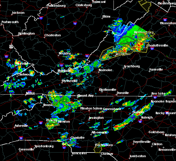 At 355 pm edt, a severe thunderstorm was located over state road, moving northeast at 15 mph (radar indicated). Hazards include 60 mph wind gusts and quarter size hail. Hail damage to vehicles is expected. Expect wind damage to roofs, siding, and trees. At 355 pm edt, a severe thunderstorm was located over state road, moving northeast at 15 mph (radar indicated). Hazards include 60 mph wind gusts and quarter size hail. Hail damage to vehicles is expected. Expect wind damage to roofs, siding, and trees.
|
| 7/6/2019 2:13 PM EDT |
 The severe thunderstorm warning for surry and central yadkin counties will expire at 215 pm edt, the storms which prompted the warning have weakened below severe limits and no longer pose an immediate threat to life or property. therefore, the warning will be allowed to expire. however gusty winds and heavy rain are still possible with these thunderstorms. when it is safe to do so, please send your reports of hail of any size, as well as reports of any wind damage, including downed trees or large limbs, to the national weather service by calling toll free at 1, 8 6 6, 2 1 5, 4 3 2 4. reports and pictures can also be shared on the national weather service blacksburg facebook page and on twitter. The severe thunderstorm warning for surry and central yadkin counties will expire at 215 pm edt, the storms which prompted the warning have weakened below severe limits and no longer pose an immediate threat to life or property. therefore, the warning will be allowed to expire. however gusty winds and heavy rain are still possible with these thunderstorms. when it is safe to do so, please send your reports of hail of any size, as well as reports of any wind damage, including downed trees or large limbs, to the national weather service by calling toll free at 1, 8 6 6, 2 1 5, 4 3 2 4. reports and pictures can also be shared on the national weather service blacksburg facebook page and on twitter.
|
| 7/6/2019 2:07 PM EDT |
 At 206 pm edt, severe thunderstorms were located along a line extending from toast to yadkinville, moving east at 25 mph (radar indicated). Hazards include 60 mph wind gusts. Expect damage to roofs, siding, and trees. Locations impacted include, mount airy, elkin, fairview, flat rock, and yadkinville. At 206 pm edt, severe thunderstorms were located along a line extending from toast to yadkinville, moving east at 25 mph (radar indicated). Hazards include 60 mph wind gusts. Expect damage to roofs, siding, and trees. Locations impacted include, mount airy, elkin, fairview, flat rock, and yadkinville.
|
| 7/6/2019 1:43 PM EDT |
 At 142 pm edt, severe thunderstorms were located along a line extending from near bottom to brooks crossroads, moving east at 20 mph (radar indicated). Hazards include 60 mph wind gusts and quarter size hail. Hail damage to vehicles is expected. expect wind damage to roofs, siding, and trees. Locations impacted include, mount airy, elkin, fairview, flat rock, and yadkinville. At 142 pm edt, severe thunderstorms were located along a line extending from near bottom to brooks crossroads, moving east at 20 mph (radar indicated). Hazards include 60 mph wind gusts and quarter size hail. Hail damage to vehicles is expected. expect wind damage to roofs, siding, and trees. Locations impacted include, mount airy, elkin, fairview, flat rock, and yadkinville.
|
| 7/6/2019 1:40 PM EDT | Tree down on cedar creek dr near us 2 in surry county NC, 2.5 miles SSE of Elkin, NC |
| 7/6/2019 1:17 PM EDT |
 At 117 pm edt, severe thunderstorms were located along a line extending from near barrett to near windy gap, moving east at 25 mph (radar indicated). Hazards include 60 mph wind gusts and quarter size hail. Hail damage to vehicles is expected. Expect wind damage to roofs, siding, and trees. At 117 pm edt, severe thunderstorms were located along a line extending from near barrett to near windy gap, moving east at 25 mph (radar indicated). Hazards include 60 mph wind gusts and quarter size hail. Hail damage to vehicles is expected. Expect wind damage to roofs, siding, and trees.
|
| 6/20/2019 1:22 PM EDT |
 At 121 pm edt, a severe thunderstorm was located near boonville, moving east at 40 mph (radar indicated). Hazards include 60 mph wind gusts. Expect damage to roofs, siding, and trees. Locations impacted include, fairview, yadkinville, jonesville, dobson, and pilot mountain. At 121 pm edt, a severe thunderstorm was located near boonville, moving east at 40 mph (radar indicated). Hazards include 60 mph wind gusts. Expect damage to roofs, siding, and trees. Locations impacted include, fairview, yadkinville, jonesville, dobson, and pilot mountain.
|
| 6/20/2019 1:05 PM EDT |
 At 104 pm edt, a severe thunderstorm was located over clingman, moving east at 40 mph (radar indicated). Hazards include 60 mph wind gusts. expect damage to roofs, siding, and trees At 104 pm edt, a severe thunderstorm was located over clingman, moving east at 40 mph (radar indicated). Hazards include 60 mph wind gusts. expect damage to roofs, siding, and trees
|
| 5/31/2019 5:24 PM EDT |
 The severe thunderstorm warning for southeastern surry, stokes and northern yadkin counties will expire at 530 pm edt, the storm which prompted the warning has weakened below severe limits, and no longer poses an immediate threat to life or property. therefore, the warning will be allowed to expire. however small hail, gusty winds and heavy rain are still possible with this thunderstorm. a severe thunderstorm watch remains in effect until 1100 pm edt for north central and northwestern north carolina, and south central, southwestern and west central virginia. when it is safe to do so, please send your reports of hail of any size, as well as reports of any wind damage, including downed trees or large limbs, to the national weather service by calling toll free at 1, 8 6 6, 2 1 5, 4 3 2 4. reports and pictures can also be shared on the national weather service blacksburg facebook page and on twitter. The severe thunderstorm warning for southeastern surry, stokes and northern yadkin counties will expire at 530 pm edt, the storm which prompted the warning has weakened below severe limits, and no longer poses an immediate threat to life or property. therefore, the warning will be allowed to expire. however small hail, gusty winds and heavy rain are still possible with this thunderstorm. a severe thunderstorm watch remains in effect until 1100 pm edt for north central and northwestern north carolina, and south central, southwestern and west central virginia. when it is safe to do so, please send your reports of hail of any size, as well as reports of any wind damage, including downed trees or large limbs, to the national weather service by calling toll free at 1, 8 6 6, 2 1 5, 4 3 2 4. reports and pictures can also be shared on the national weather service blacksburg facebook page and on twitter.
|
| 5/31/2019 5:07 PM EDT |
 At 507 pm edt, a severe thunderstorm was located near pilot mountain state park, moving east at 45 mph (radar indicated). Hazards include 60 mph wind gusts and quarter size hail. Hail damage to vehicles is expected. expect wind damage to roofs, siding, and trees. Locations impacted include, fairview, pilot mountain, walnut cove, boonville, and east bend. At 507 pm edt, a severe thunderstorm was located near pilot mountain state park, moving east at 45 mph (radar indicated). Hazards include 60 mph wind gusts and quarter size hail. Hail damage to vehicles is expected. expect wind damage to roofs, siding, and trees. Locations impacted include, fairview, pilot mountain, walnut cove, boonville, and east bend.
|
| 5/31/2019 4:45 PM EDT |
 At 444 pm edt, a severe thunderstorm was located over crutchfield, moving east at 50 mph (radar indicated). Hazards include 60 mph wind gusts and half dollar size hail. Hail damage to vehicles is expected. Expect wind damage to roofs, siding, and trees. At 444 pm edt, a severe thunderstorm was located over crutchfield, moving east at 50 mph (radar indicated). Hazards include 60 mph wind gusts and half dollar size hail. Hail damage to vehicles is expected. Expect wind damage to roofs, siding, and trees.
|
| 5/31/2019 4:38 PM EDT | Quarter sized hail reported 1.2 miles WSW of Elkin, NC, nickel to quarter hail at johnson ridge road near elkin. |
| 5/31/2019 4:03 PM EDT |
 At 402 pm edt, a severe thunderstorm was located over dockery, moving northeast at 35 mph (radar indicated). Hazards include 60 mph wind gusts. Expect damage to roofs, siding, and trees. Locations impacted include, north wilkesboro, elkin, wilkesboro, fairview, and sparta. At 402 pm edt, a severe thunderstorm was located over dockery, moving northeast at 35 mph (radar indicated). Hazards include 60 mph wind gusts. Expect damage to roofs, siding, and trees. Locations impacted include, north wilkesboro, elkin, wilkesboro, fairview, and sparta.
|
| 5/31/2019 3:49 PM EDT |
 The national weather service in blacksburg has issued a * severe thunderstorm warning for. eastern alleghany county in northwestern north carolina. western surry county in northwestern north carolina. central wilkes county in northwestern north carolina. Southeastern grayson county in southwestern virginia. The national weather service in blacksburg has issued a * severe thunderstorm warning for. eastern alleghany county in northwestern north carolina. western surry county in northwestern north carolina. central wilkes county in northwestern north carolina. Southeastern grayson county in southwestern virginia.
|
| 5/12/2019 6:15 PM EDT |
 At 614 pm edt, a severe thunderstorm capable of producing a tornado was located over level cross, moving east at 20 mph. note, this is a new storm and separate from the one along the eastern border of the county near pilot mountain (radar indicated rotation). Hazards include tornado and quarter size hail. Flying debris will be dangerous to those caught without shelter. mobile homes will be damaged or destroyed. damage to roofs, windows, and vehicles will occur. Tree damage is likely. At 614 pm edt, a severe thunderstorm capable of producing a tornado was located over level cross, moving east at 20 mph. note, this is a new storm and separate from the one along the eastern border of the county near pilot mountain (radar indicated rotation). Hazards include tornado and quarter size hail. Flying debris will be dangerous to those caught without shelter. mobile homes will be damaged or destroyed. damage to roofs, windows, and vehicles will occur. Tree damage is likely.
|
| 5/12/2019 5:10 PM EDT |
 At 509 pm edt, a severe thunderstorm was located over mountain park, moving east-northeast at 20 mph (radar indicated). Hazards include 60 mph wind gusts and quarter size hail. Hail damage to vehicles is expected. Expect wind damage to roofs, siding, and trees. At 509 pm edt, a severe thunderstorm was located over mountain park, moving east-northeast at 20 mph (radar indicated). Hazards include 60 mph wind gusts and quarter size hail. Hail damage to vehicles is expected. Expect wind damage to roofs, siding, and trees.
|
| 5/3/2019 7:51 PM EDT |
 The severe thunderstorm warning for western surry, eastern wilkes and northwestern yadkin counties will expire at 800 pm edt, the storm which prompted the warning has weakened below severe limits, and no longer poses an immediate threat to life or property. therefore the warning will be allowed to expire. when it is safe to do so, please send your reports of hail of any size, as well as any reports of wind damage, including downed trees or large limbs, to the national weather service by calling toll free at 1, 8 6 6, 2 1 5, 4 3 2 4. reports and pictures can also be shared on the national weather service blacksburg facebook page and on twitter. The severe thunderstorm warning for western surry, eastern wilkes and northwestern yadkin counties will expire at 800 pm edt, the storm which prompted the warning has weakened below severe limits, and no longer poses an immediate threat to life or property. therefore the warning will be allowed to expire. when it is safe to do so, please send your reports of hail of any size, as well as any reports of wind damage, including downed trees or large limbs, to the national weather service by calling toll free at 1, 8 6 6, 2 1 5, 4 3 2 4. reports and pictures can also be shared on the national weather service blacksburg facebook page and on twitter.
|
| 5/3/2019 7:33 PM EDT |
 At 732 pm edt, a severe thunderstorm was located over dobson, moving northeast at 35 mph (radar indicated). Hazards include 60 mph wind gusts and quarter size hail. Hail damage to vehicles is expected. expect wind damage to roofs, siding, and trees. Locations impacted include, elkin, fairview, jonesville, dobson, and boonville. At 732 pm edt, a severe thunderstorm was located over dobson, moving northeast at 35 mph (radar indicated). Hazards include 60 mph wind gusts and quarter size hail. Hail damage to vehicles is expected. expect wind damage to roofs, siding, and trees. Locations impacted include, elkin, fairview, jonesville, dobson, and boonville.
|
| 5/3/2019 7:12 PM EDT |
 At 712 pm edt, a severe thunderstorm was located over benham, moving northeast at 35 mph (radar indicated). Hazards include 60 mph wind gusts and quarter size hail. Hail damage to vehicles is expected. expect wind damage to roofs, siding, and trees. Locations impacted include, north wilkesboro, elkin, wilkesboro, fairview, and jonesville. At 712 pm edt, a severe thunderstorm was located over benham, moving northeast at 35 mph (radar indicated). Hazards include 60 mph wind gusts and quarter size hail. Hail damage to vehicles is expected. expect wind damage to roofs, siding, and trees. Locations impacted include, north wilkesboro, elkin, wilkesboro, fairview, and jonesville.
|
| 5/3/2019 6:54 PM EDT |
 At 653 pm edt, a severe thunderstorm was located over wilkes county airport, moving northeast at 35 mph (radar indicated). Hazards include 60 mph wind gusts and quarter size hail. Hail damage to vehicles is expected. Expect wind damage to roofs, siding, and trees. At 653 pm edt, a severe thunderstorm was located over wilkes county airport, moving northeast at 35 mph (radar indicated). Hazards include 60 mph wind gusts and quarter size hail. Hail damage to vehicles is expected. Expect wind damage to roofs, siding, and trees.
|
| 4/19/2019 5:05 PM EDT |
 The severe thunderstorm warning for central surry county will expire at 515 pm edt, the storms which prompted the warning have moved out of the area. therefore, the warning will be allowed to expire. a tornado watch remains in effect until 800 pm edt for north central and northwestern north carolina, and southwestern virginia. when it is safe to do so, please send your reports of hail of any size, as well as reports of any wind damage, including downed trees or large limbs, to the national weather service by calling toll free at 1, 8 6 6, 2 1 5, 4 3 2 4. reports and pictures can also be shared on the national weather service blacksburg facebook page and on twitter. The severe thunderstorm warning for central surry county will expire at 515 pm edt, the storms which prompted the warning have moved out of the area. therefore, the warning will be allowed to expire. a tornado watch remains in effect until 800 pm edt for north central and northwestern north carolina, and southwestern virginia. when it is safe to do so, please send your reports of hail of any size, as well as reports of any wind damage, including downed trees or large limbs, to the national weather service by calling toll free at 1, 8 6 6, 2 1 5, 4 3 2 4. reports and pictures can also be shared on the national weather service blacksburg facebook page and on twitter.
|
| 4/19/2019 4:45 PM EDT |
 At 444 pm edt, severe thunderstorms were located along a line extending from near low gap to state road, moving northeast at 45 mph (radar indicated). Hazards include 60 mph wind gusts and quarter size hail. Hail damage to vehicles is expected. expect wind damage to roofs, siding, and trees. locations impacted include, elkin, fairview, dobson, mountain park, and bottom. A tornado watch remains in effect until 800 pm edt for north central and northwestern north carolina, and southwestern virginia. At 444 pm edt, severe thunderstorms were located along a line extending from near low gap to state road, moving northeast at 45 mph (radar indicated). Hazards include 60 mph wind gusts and quarter size hail. Hail damage to vehicles is expected. expect wind damage to roofs, siding, and trees. locations impacted include, elkin, fairview, dobson, mountain park, and bottom. A tornado watch remains in effect until 800 pm edt for north central and northwestern north carolina, and southwestern virginia.
|
| 4/19/2019 4:29 PM EDT |
 At 428 pm edt, a severe thunderstorm was located over traphill, moving northeast at 60 mph (radar indicated). Hazards include 60 mph wind gusts and quarter size hail. Hail damage to vehicles is expected. expect wind damage to roofs, siding, and trees. locations impacted include, elkin, fairview, jonesville, dobson, and boonville. A tornado watch remains in effect until 500 pm edt for north central and northwestern north carolina, and southwestern virginia. At 428 pm edt, a severe thunderstorm was located over traphill, moving northeast at 60 mph (radar indicated). Hazards include 60 mph wind gusts and quarter size hail. Hail damage to vehicles is expected. expect wind damage to roofs, siding, and trees. locations impacted include, elkin, fairview, jonesville, dobson, and boonville. A tornado watch remains in effect until 500 pm edt for north central and northwestern north carolina, and southwestern virginia.
|
| 4/19/2019 4:11 PM EDT |
 At 411 pm edt, a severe thunderstorm was located near wilkesboro, moving northeast at 45 mph (radar indicated). Hazards include 60 mph wind gusts. expect damage to roofs, siding, and trees At 411 pm edt, a severe thunderstorm was located near wilkesboro, moving northeast at 45 mph (radar indicated). Hazards include 60 mph wind gusts. expect damage to roofs, siding, and trees
|
| 4/14/2019 11:39 PM EDT |
 At 1139 pm edt, severe thunderstorms were located along a line extending from near alum ridge to near buck shoals, moving east at 25 mph (radar indicated). Hazards include 60 mph wind gusts. expect damage to roofs, siding, and trees At 1139 pm edt, severe thunderstorms were located along a line extending from near alum ridge to near buck shoals, moving east at 25 mph (radar indicated). Hazards include 60 mph wind gusts. expect damage to roofs, siding, and trees
|
| 4/14/2019 11:19 PM EDT |
 At 1119 pm edt, severe thunderstorms were located along a line extending from near alum ridge to near windy gap, moving east at 25 mph (radar indicated). Hazards include 60 mph wind gusts. Expect damage to roofs, siding, and trees. locations impacted include, mount airy, elkin, fairview, flat rock, and yadkinville. A tornado watch remains in effect until 500 am edt for north central and northwestern north carolina, and south central, southwestern and west central virginia. At 1119 pm edt, severe thunderstorms were located along a line extending from near alum ridge to near windy gap, moving east at 25 mph (radar indicated). Hazards include 60 mph wind gusts. Expect damage to roofs, siding, and trees. locations impacted include, mount airy, elkin, fairview, flat rock, and yadkinville. A tornado watch remains in effect until 500 am edt for north central and northwestern north carolina, and south central, southwestern and west central virginia.
|
| 4/14/2019 10:48 PM EDT |
 At 1047 pm edt, severe thunderstorms were located along a line extending from near allisonia to near moravian falls, moving east at 45 mph (radar indicated). Hazards include 60 mph wind gusts. Expect damage to roofs, siding, and trees. locations impacted include, mount airy, galax, north wilkesboro, elkin, and wilkesboro. A tornado watch remains in effect until 500 am edt for north central and northwestern north carolina, and south central, southwestern and west central virginia. At 1047 pm edt, severe thunderstorms were located along a line extending from near allisonia to near moravian falls, moving east at 45 mph (radar indicated). Hazards include 60 mph wind gusts. Expect damage to roofs, siding, and trees. locations impacted include, mount airy, galax, north wilkesboro, elkin, and wilkesboro. A tornado watch remains in effect until 500 am edt for north central and northwestern north carolina, and south central, southwestern and west central virginia.
|
| 4/14/2019 10:29 PM EDT |
 At 1029 pm edt, severe thunderstorms were located along a line extending from near patterson to near elkville, moving east at 30 mph (radar indicated). Hazards include 60 mph wind gusts. expect damage to roofs, siding, and trees At 1029 pm edt, severe thunderstorms were located along a line extending from near patterson to near elkville, moving east at 30 mph (radar indicated). Hazards include 60 mph wind gusts. expect damage to roofs, siding, and trees
|
| 8/31/2018 7:41 PM EDT |
 At 741 pm edt, a severe thunderstorm was located over mountain park, moving southeast at 5 mph (radar indicated). Hazards include 60 mph wind gusts and quarter size hail. Hail damage to vehicles is expected. expect wind damage to roofs, siding, and trees. Locations impacted include, elkin, fairview, dobson, mountain park, and bottom. At 741 pm edt, a severe thunderstorm was located over mountain park, moving southeast at 5 mph (radar indicated). Hazards include 60 mph wind gusts and quarter size hail. Hail damage to vehicles is expected. expect wind damage to roofs, siding, and trees. Locations impacted include, elkin, fairview, dobson, mountain park, and bottom.
|
| 8/31/2018 7:12 PM EDT |
 At 711 pm edt, a severe thunderstorm was located between pine ridge and mountain park, or near bottom, moving southeast at 10 mph (radar indicated). Hazards include 60 mph wind gusts and quarter size hail. Hail damage to vehicles is expected. Expect wind damage to roofs, siding, and trees. At 711 pm edt, a severe thunderstorm was located between pine ridge and mountain park, or near bottom, moving southeast at 10 mph (radar indicated). Hazards include 60 mph wind gusts and quarter size hail. Hail damage to vehicles is expected. Expect wind damage to roofs, siding, and trees.
|
| 8/7/2018 8:54 PM EDT |
 At 854 pm edt, a severe thunderstorm was located over nebo, moving east at 10 mph (radar indicated). Hazards include 60 mph wind gusts and quarter size hail. Hail damage to vehicles is expected. expect wind damage to roofs, siding, and trees. Locations impacted include, elkin, yadkinville, jonesville, boonville, and east bend. At 854 pm edt, a severe thunderstorm was located over nebo, moving east at 10 mph (radar indicated). Hazards include 60 mph wind gusts and quarter size hail. Hail damage to vehicles is expected. expect wind damage to roofs, siding, and trees. Locations impacted include, elkin, yadkinville, jonesville, boonville, and east bend.
|
| 8/7/2018 8:33 PM EDT |
 At 833 pm edt, a severe thunderstorm was located near arlington, moving southeast at 10 mph (radar indicated). Hazards include 60 mph wind gusts and quarter size hail. Hail damage to vehicles is expected. Expect wind damage to roofs, siding, and trees. At 833 pm edt, a severe thunderstorm was located near arlington, moving southeast at 10 mph (radar indicated). Hazards include 60 mph wind gusts and quarter size hail. Hail damage to vehicles is expected. Expect wind damage to roofs, siding, and trees.
|
| 8/6/2018 2:01 PM EDT |
 At 200 pm edt, a severe thunderstorm was located over roaring gap, moving east at 10 mph (radar indicated). Hazards include 60 mph wind gusts and quarter size hail. Hail damage to vehicles is expected. expect wind damage to roofs, siding, and trees. Locations impacted include, mount airy, elkin, fairview, dobson, and traphill. At 200 pm edt, a severe thunderstorm was located over roaring gap, moving east at 10 mph (radar indicated). Hazards include 60 mph wind gusts and quarter size hail. Hail damage to vehicles is expected. expect wind damage to roofs, siding, and trees. Locations impacted include, mount airy, elkin, fairview, dobson, and traphill.
|
| 8/6/2018 1:24 PM EDT |
 At 124 pm edt, a severe thunderstorm was located over abshers, moving east at 10 mph (radar indicated). Hazards include 60 mph wind gusts and quarter size hail. Hail damage to vehicles is expected. Expect wind damage to roofs, siding, and trees. At 124 pm edt, a severe thunderstorm was located over abshers, moving east at 10 mph (radar indicated). Hazards include 60 mph wind gusts and quarter size hail. Hail damage to vehicles is expected. Expect wind damage to roofs, siding, and trees.
|
| 8/2/2018 7:10 PM EDT | Tree down on us route 21 near old highway 21 near elkin. time estimated from rada in surry county NC, 4.6 miles SSE of Elkin, NC |
| 8/2/2018 6:24 PM EDT |
 At 620 pm edt, several thunderstorms extended from near taylorsville through mocksville to near winston-salem. these storms are moving north at 25 mph. the storms are expected to merge and reach severe levels during the next hour (radar indicated). Hazards include 60 mph wind gusts. expect damage to roofs, siding, and trees At 620 pm edt, several thunderstorms extended from near taylorsville through mocksville to near winston-salem. these storms are moving north at 25 mph. the storms are expected to merge and reach severe levels during the next hour (radar indicated). Hazards include 60 mph wind gusts. expect damage to roofs, siding, and trees
|
| 7/31/2018 3:06 PM EDT |
 At 305 pm edt, a severe thunderstorm was located over boonville, moving northeast at 15 mph (radar indicated). Hazards include 60 mph wind gusts. Expect damage to roofs, siding, and trees. Locations impacted include, elkin, fairview, yadkinville, jonesville, and boonville. At 305 pm edt, a severe thunderstorm was located over boonville, moving northeast at 15 mph (radar indicated). Hazards include 60 mph wind gusts. Expect damage to roofs, siding, and trees. Locations impacted include, elkin, fairview, yadkinville, jonesville, and boonville.
|
| 7/31/2018 2:30 PM EDT |
 At 229 pm edt, a severe thunderstorm was located over brooks crossroads, moving northeast at 15 mph (radar indicated). Hazards include 60 mph wind gusts. expect damage to roofs, siding, and trees At 229 pm edt, a severe thunderstorm was located over brooks crossroads, moving northeast at 15 mph (radar indicated). Hazards include 60 mph wind gusts. expect damage to roofs, siding, and trees
|
| 6/25/2018 6:37 PM EDT |
 The severe thunderstorm warning for surry and northwestern stokes counties will expire at 645 pm edt, the storms which prompted the warning have moved out of the area. therefore, the warning will be allowed to expire. when it is safe to do so, please send your reports of hail of any size, as well as reports of any wind damage, including downed trees or large limbs, to the national weather service by calling toll free at 1, 8 6 6, 2 1 5, 4 3 2 4. reports and pictures can also be shared on the national weather service blacksburg facebook page and on twitter. The severe thunderstorm warning for surry and northwestern stokes counties will expire at 645 pm edt, the storms which prompted the warning have moved out of the area. therefore, the warning will be allowed to expire. when it is safe to do so, please send your reports of hail of any size, as well as reports of any wind damage, including downed trees or large limbs, to the national weather service by calling toll free at 1, 8 6 6, 2 1 5, 4 3 2 4. reports and pictures can also be shared on the national weather service blacksburg facebook page and on twitter.
|
| 6/25/2018 6:20 PM EDT |
 At 620 pm edt, severe thunderstorms were located along a line extending from near burch to near buck shoals, moving east at 20 mph (radar indicated). Hazards include 60 mph wind gusts and quarter size hail. Hail damage to vehicles is expected. expect wind damage to roofs, siding, and trees. Locations impacted include, elkin, yadkinville, jonesville, boonville, and east bend. At 620 pm edt, severe thunderstorms were located along a line extending from near burch to near buck shoals, moving east at 20 mph (radar indicated). Hazards include 60 mph wind gusts and quarter size hail. Hail damage to vehicles is expected. expect wind damage to roofs, siding, and trees. Locations impacted include, elkin, yadkinville, jonesville, boonville, and east bend.
|
| 6/25/2018 6:13 PM EDT |
 At 612 pm edt, severe thunderstorms were located along a line extending from francisco to near burch, moving east at 20 mph (radar indicated). Hazards include 60 mph wind gusts and quarter size hail. Hail damage to vehicles is expected. expect wind damage to roofs, siding, and trees. Locations impacted include, mount airy, elkin, fairview, flat rock, and dobson. At 612 pm edt, severe thunderstorms were located along a line extending from francisco to near burch, moving east at 20 mph (radar indicated). Hazards include 60 mph wind gusts and quarter size hail. Hail damage to vehicles is expected. expect wind damage to roofs, siding, and trees. Locations impacted include, mount airy, elkin, fairview, flat rock, and dobson.
|
| 6/25/2018 5:58 PM EDT |
 At 558 pm edt, severe thunderstorms were located along a line extending from near dockery to north wilkesboro, moving east at 20 mph (radar indicated). Hazards include 60 mph wind gusts and quarter size hail. Hail damage to vehicles is expected. Expect wind damage to roofs, siding, and trees. At 558 pm edt, severe thunderstorms were located along a line extending from near dockery to north wilkesboro, moving east at 20 mph (radar indicated). Hazards include 60 mph wind gusts and quarter size hail. Hail damage to vehicles is expected. Expect wind damage to roofs, siding, and trees.
|
| 6/25/2018 5:47 PM EDT |
 At 547 pm edt, severe thunderstorms were located along a line extending from near flat rock to near dockery, moving east at 25 mph (radar indicated). Hazards include 60 mph wind gusts and quarter size hail. Hail damage to vehicles is expected. Expect wind damage to roofs, siding, and trees. At 547 pm edt, severe thunderstorms were located along a line extending from near flat rock to near dockery, moving east at 25 mph (radar indicated). Hazards include 60 mph wind gusts and quarter size hail. Hail damage to vehicles is expected. Expect wind damage to roofs, siding, and trees.
|
| 6/25/2018 5:28 PM EDT |
 At 528 pm edt, severe thunderstorms were located along a line extending from fairplains to boomer, moving east at 20 mph (radar indicated). Hazards include 60 mph wind gusts and quarter size hail. Hail damage to vehicles is expected. expect wind damage to roofs, siding, and trees. Locations impacted include, north wilkesboro, wilkesboro, ronda, boomer, and wilbar. At 528 pm edt, severe thunderstorms were located along a line extending from fairplains to boomer, moving east at 20 mph (radar indicated). Hazards include 60 mph wind gusts and quarter size hail. Hail damage to vehicles is expected. expect wind damage to roofs, siding, and trees. Locations impacted include, north wilkesboro, wilkesboro, ronda, boomer, and wilbar.
|
| 6/25/2018 4:59 PM EDT |
 At 459 pm edt, severe thunderstorms were located along a line extending from summit to elkville, moving east at 25 mph (radar indicated). Hazards include 60 mph wind gusts and quarter size hail. Hail damage to vehicles is expected. Expect wind damage to roofs, siding, and trees. At 459 pm edt, severe thunderstorms were located along a line extending from summit to elkville, moving east at 25 mph (radar indicated). Hazards include 60 mph wind gusts and quarter size hail. Hail damage to vehicles is expected. Expect wind damage to roofs, siding, and trees.
|
| 6/1/2018 4:40 PM EDT |
 At 439 pm edt, a severe thunderstorm was located over pleasant hill, moving east at 20 mph (radar indicated). Hazards include 60 mph wind gusts. Expect damage to roofs, siding, and trees. Locations impacted include, elkin, fairview, jonesville, ronda, and mountain park. At 439 pm edt, a severe thunderstorm was located over pleasant hill, moving east at 20 mph (radar indicated). Hazards include 60 mph wind gusts. Expect damage to roofs, siding, and trees. Locations impacted include, elkin, fairview, jonesville, ronda, and mountain park.
|
| 6/1/2018 4:27 PM EDT |
 At 426 pm edt, a severe thunderstorm was located over fairview, moving northeast at 20 mph. this storm is weakening, but another storm near ronda moving northeast at 20 mph will become severe, so the warning continues (radar indicated). Hazards include 60 mph wind gusts and quarter size hail. Hail damage to vehicles is expected. expect wind damage to roofs, siding, and trees. Locations impacted include, elkin, fairview, jonesville, ronda, and mountain park. At 426 pm edt, a severe thunderstorm was located over fairview, moving northeast at 20 mph. this storm is weakening, but another storm near ronda moving northeast at 20 mph will become severe, so the warning continues (radar indicated). Hazards include 60 mph wind gusts and quarter size hail. Hail damage to vehicles is expected. expect wind damage to roofs, siding, and trees. Locations impacted include, elkin, fairview, jonesville, ronda, and mountain park.
|
| 6/1/2018 4:00 PM EDT | Multiple reports of trees dow in wilkes county NC, 1.7 miles E of Elkin, NC |
| 6/1/2018 3:55 PM EDT |
 At 354 pm edt, a severe thunderstorm was located over pleasant hill, moving east at 10 mph (radar indicated). Hazards include 60 mph wind gusts and quarter size hail. Hail damage to vehicles is expected. Expect wind damage to roofs, siding, and trees. At 354 pm edt, a severe thunderstorm was located over pleasant hill, moving east at 10 mph (radar indicated). Hazards include 60 mph wind gusts and quarter size hail. Hail damage to vehicles is expected. Expect wind damage to roofs, siding, and trees.
|
| 5/20/2018 4:22 PM EDT | One tree down on j a russell drive in wilkes county NC, 2.5 miles ENE of Elkin, NC |
| 5/20/2018 4:22 PM EDT |
 The national weather service in blacksburg has issued a * severe thunderstorm warning for. southwestern surry county in northwestern north carolina. southeastern wilkes county in northwestern north carolina. yadkin county in northwestern north carolina. Until 515 pm edt. The national weather service in blacksburg has issued a * severe thunderstorm warning for. southwestern surry county in northwestern north carolina. southeastern wilkes county in northwestern north carolina. yadkin county in northwestern north carolina. Until 515 pm edt.
|
| 5/20/2018 4:16 PM EDT | Tree down near the intersection of austin trap hill road and north wall street in wilkes county NC, 2.3 miles E of Elkin, NC |
| 5/20/2018 4:12 PM EDT | One tree down near the pleasant hill fire department in wilkes county NC, 2.3 miles E of Elkin, NC |
| 5/20/2018 4:07 PM EDT | One tree down near the intersection of west forest drive and pleasant ridge road in wilkes county NC, 3.6 miles SSE of Elkin, NC |
| 5/20/2018 4:01 PM EDT | Trees down in wilkes county NC, 5.9 miles SSE of Elkin, NC |
| 5/20/2018 4:01 PM EDT | Roof damage on south center church road in wilkes county NC, 7.7 miles SSE of Elkin, NC |
| 5/10/2018 3:33 PM EDT |
 At 332 pm edt, a severe thunderstorm was located over swancreek, moving east at 45 mph (radar indicated). Hazards include 60 mph wind gusts and quarter size hail. Hail damage to vehicles is expected. expect wind damage to roofs, siding, and trees. Locations impacted include, north wilkesboro, elkin, wilkesboro, yadkinville, and jonesville. At 332 pm edt, a severe thunderstorm was located over swancreek, moving east at 45 mph (radar indicated). Hazards include 60 mph wind gusts and quarter size hail. Hail damage to vehicles is expected. expect wind damage to roofs, siding, and trees. Locations impacted include, north wilkesboro, elkin, wilkesboro, yadkinville, and jonesville.
|
| 5/10/2018 2:58 PM EDT |
 The national weather service in blacksburg has issued a * severe thunderstorm warning for. southeastern surry county in northwestern north carolina. wilkes county in northwestern north carolina. yadkin county in northwestern north carolina. Until 400 pm edt. The national weather service in blacksburg has issued a * severe thunderstorm warning for. southeastern surry county in northwestern north carolina. wilkes county in northwestern north carolina. yadkin county in northwestern north carolina. Until 400 pm edt.
|
| 5/10/2018 2:35 PM EDT |
 At 234 pm edt, a severe thunderstorm was located over dobson, moving east at 40 mph (radar indicated). Hazards include 60 mph wind gusts and quarter size hail. Hail damage to vehicles is expected. Expect wind damage to roofs, siding, and trees. At 234 pm edt, a severe thunderstorm was located over dobson, moving east at 40 mph (radar indicated). Hazards include 60 mph wind gusts and quarter size hail. Hail damage to vehicles is expected. Expect wind damage to roofs, siding, and trees.
|
| 4/15/2018 3:03 PM EDT |
 At 303 pm edt, a severe thunderstorm was located over clingman, moving northeast at 50 mph (radar indicated). Hazards include 60 mph wind gusts and quarter size hail. Hail damage to vehicles is expected. Expect wind damage to roofs, siding, and trees. At 303 pm edt, a severe thunderstorm was located over clingman, moving northeast at 50 mph (radar indicated). Hazards include 60 mph wind gusts and quarter size hail. Hail damage to vehicles is expected. Expect wind damage to roofs, siding, and trees.
|
| 4/15/2018 2:12 PM EDT |
 At 211 pm edt, a severe thunderstorm was located over swancreek, moving north at 55 mph (radar indicated). Hazards include 60 mph wind gusts and quarter size hail. Hail damage to vehicles is expected. Expect wind damage to roofs, siding, and trees. At 211 pm edt, a severe thunderstorm was located over swancreek, moving north at 55 mph (radar indicated). Hazards include 60 mph wind gusts and quarter size hail. Hail damage to vehicles is expected. Expect wind damage to roofs, siding, and trees.
|
| 10/23/2017 6:21 PM EDT |
 The severe thunderstorm warning for central surry and yadkin counties will expire at 630 pm edt, the storm which prompted the warning has weakened below severe limits, and has exited the warned area. therefore, the warning will be allowed to expire. a tornado watch remains in effect until 900 pm edt for north central and northwestern north carolina. a tornado watch also remains in effect until 200 am edt for southwestern virginia. when it is safe to do so, please send your reports of hail of any size, as well as reports of any wind damage, including downed trees or large limbs, to the national weather service by calling toll free at 1, 8 6 6, 2 1 5, 4 3 2 4. reports and pictures can also be shared on the national weather service blacksburg facebook page and on twitter. The severe thunderstorm warning for central surry and yadkin counties will expire at 630 pm edt, the storm which prompted the warning has weakened below severe limits, and has exited the warned area. therefore, the warning will be allowed to expire. a tornado watch remains in effect until 900 pm edt for north central and northwestern north carolina. a tornado watch also remains in effect until 200 am edt for southwestern virginia. when it is safe to do so, please send your reports of hail of any size, as well as reports of any wind damage, including downed trees or large limbs, to the national weather service by calling toll free at 1, 8 6 6, 2 1 5, 4 3 2 4. reports and pictures can also be shared on the national weather service blacksburg facebook page and on twitter.
|
| 10/23/2017 6:01 PM EDT |
 At 600 pm edt, a severe thunderstorm was located over burch, moving north at 30 mph (radar indicated). Hazards include 60 mph wind gusts and quarter size hail. Hail damage to vehicles is expected. expect wind damage to roofs, siding, and trees. locations impacted include, elkin, fairview, yadkinville, jonesville, and dobson. a tornado watch remains in effect until 900 pm edt for north central and northwestern north carolina. A tornado watch also remains in effect until 200 am edt for southwestern virginia. At 600 pm edt, a severe thunderstorm was located over burch, moving north at 30 mph (radar indicated). Hazards include 60 mph wind gusts and quarter size hail. Hail damage to vehicles is expected. expect wind damage to roofs, siding, and trees. locations impacted include, elkin, fairview, yadkinville, jonesville, and dobson. a tornado watch remains in effect until 900 pm edt for north central and northwestern north carolina. A tornado watch also remains in effect until 200 am edt for southwestern virginia.
|
| 10/23/2017 5:23 PM EDT |
 At 523 pm edt, a severe thunderstorm was located near buck shoals, moving north at 30 mph (radar indicated). Hazards include 60 mph wind gusts and quarter size hail. Hail damage to vehicles is expected. Expect wind damage to roofs, siding, and trees. At 523 pm edt, a severe thunderstorm was located near buck shoals, moving north at 30 mph (radar indicated). Hazards include 60 mph wind gusts and quarter size hail. Hail damage to vehicles is expected. Expect wind damage to roofs, siding, and trees.
|
| 9/5/2017 4:51 PM EDT |
 The severe thunderstorm warning for southwestern surry, northeastern wilkes and western yadkin counties will expire at 500 pm edt, the storm which prompted the warning has weakened below severe limits, and no longer poses an immediate threat to life or property. therefore the warning will be allowed to expire. when it is safe to do so, please send your reports of hail of any size, as well as reports of any wind damage, including downed trees or large limbs, to the national weather service by calling toll free at 1, 8 6 6, 2 1 5, 4 3 2 4. reports and pictures can also be shared on the national weather service blacksburg facebook page and on twitter. The severe thunderstorm warning for southwestern surry, northeastern wilkes and western yadkin counties will expire at 500 pm edt, the storm which prompted the warning has weakened below severe limits, and no longer poses an immediate threat to life or property. therefore the warning will be allowed to expire. when it is safe to do so, please send your reports of hail of any size, as well as reports of any wind damage, including downed trees or large limbs, to the national weather service by calling toll free at 1, 8 6 6, 2 1 5, 4 3 2 4. reports and pictures can also be shared on the national weather service blacksburg facebook page and on twitter.
|
| 9/5/2017 4:18 PM EDT |
 At 418 pm edt, a severe thunderstorm was located over ronda, moving east at 25 mph (radar indicated). Hazards include 60 mph wind gusts and quarter size hail. Hail damage to vehicles is expected. expect wind damage to roofs, siding, and trees. Locations impacted include, north wilkesboro, elkin, wilkesboro, fairview, and jonesville. At 418 pm edt, a severe thunderstorm was located over ronda, moving east at 25 mph (radar indicated). Hazards include 60 mph wind gusts and quarter size hail. Hail damage to vehicles is expected. expect wind damage to roofs, siding, and trees. Locations impacted include, north wilkesboro, elkin, wilkesboro, fairview, and jonesville.
|
| 9/5/2017 3:55 PM EDT |
 At 354 pm edt, a severe thunderstorm was located over hays, moving east at 25 mph (radar indicated). Hazards include 60 mph wind gusts and quarter size hail. Hail damage to vehicles is expected. Expect wind damage to roofs, siding, and trees. At 354 pm edt, a severe thunderstorm was located over hays, moving east at 25 mph (radar indicated). Hazards include 60 mph wind gusts and quarter size hail. Hail damage to vehicles is expected. Expect wind damage to roofs, siding, and trees.
|
| 8/17/2017 8:24 PM EDT |
 The severe thunderstorm warning for southeastern wilkes county will expire at 830 pm edt, the storm which prompted the warning has weakened below severe limits, and no longer poses an immediate threat to life or property. therefore the warning will be allowed to expire. very heavy rainfall and occasional cloud-to-ground lightning can still be expected with this thunderstorm. when it is safe to do so, please send your reports of hail of any size, as well as reports of any wind damage, including downed trees or large limbs, to the national weather service by calling toll free at 1, 8 6 6, 2 1 5, 4 3 2 4. reports and pictures can also be shared on the national weather service blacksburg facebook page and on twitter. The severe thunderstorm warning for southeastern wilkes county will expire at 830 pm edt, the storm which prompted the warning has weakened below severe limits, and no longer poses an immediate threat to life or property. therefore the warning will be allowed to expire. very heavy rainfall and occasional cloud-to-ground lightning can still be expected with this thunderstorm. when it is safe to do so, please send your reports of hail of any size, as well as reports of any wind damage, including downed trees or large limbs, to the national weather service by calling toll free at 1, 8 6 6, 2 1 5, 4 3 2 4. reports and pictures can also be shared on the national weather service blacksburg facebook page and on twitter.
|
| 8/17/2017 7:53 PM EDT |
 At 752 pm edt, a severe thunderstorm was located over wilkesboro, moving east at 20 mph (radar indicated). Hazards include 60 mph wind gusts and quarter size hail. Hail damage to vehicles is expected. Expect wind damage to roofs, siding, and trees. At 752 pm edt, a severe thunderstorm was located over wilkesboro, moving east at 20 mph (radar indicated). Hazards include 60 mph wind gusts and quarter size hail. Hail damage to vehicles is expected. Expect wind damage to roofs, siding, and trees.
|
| 5/24/2017 5:22 PM EDT |
 The severe thunderstorm warning for southwestern surry and northwestern yadkin counties will expire at 530 pm edt, the storm which prompted the warning has weakened below severe limits, and has exited the warned area. therefore, the warning will be allowed to expire. a tornado watch remains in effect until midnight edt for north central and northwestern north carolina, and southwestern virginia. when it is safe to do so, please send your reports of hail of any size, as well as reports of any wind damage, including downed trees or large limbs, to the national weather service by calling toll free at 1, 8 6 6, 2 1 5, 4 3 2 4. reports and pictures can also be shared on the national weather service blacksburg facebook page and on twitter. The severe thunderstorm warning for southwestern surry and northwestern yadkin counties will expire at 530 pm edt, the storm which prompted the warning has weakened below severe limits, and has exited the warned area. therefore, the warning will be allowed to expire. a tornado watch remains in effect until midnight edt for north central and northwestern north carolina, and southwestern virginia. when it is safe to do so, please send your reports of hail of any size, as well as reports of any wind damage, including downed trees or large limbs, to the national weather service by calling toll free at 1, 8 6 6, 2 1 5, 4 3 2 4. reports and pictures can also be shared on the national weather service blacksburg facebook page and on twitter.
|
| 5/24/2017 4:58 PM EDT |
 At 457 pm edt, a severe thunderstorm was located over burch, moving northeast at 30 mph (radar indicated). Hazards include 60 mph wind gusts and quarter size hail. Hail damage to vehicles is expected. expect wind damage to roofs, siding, and trees. locations impacted include, elkin, fairview, jonesville, dobson, and boonville. A tornado watch remains in effect until midnight edt for north central and northwestern north carolina, and southwestern virginia. At 457 pm edt, a severe thunderstorm was located over burch, moving northeast at 30 mph (radar indicated). Hazards include 60 mph wind gusts and quarter size hail. Hail damage to vehicles is expected. expect wind damage to roofs, siding, and trees. locations impacted include, elkin, fairview, jonesville, dobson, and boonville. A tornado watch remains in effect until midnight edt for north central and northwestern north carolina, and southwestern virginia.
|
| 5/24/2017 4:45 PM EDT |
 At 445 pm edt, a severe thunderstorm was located near arlington, moving northeast at 35 mph (radar indicated). Hazards include 60 mph wind gusts and quarter size hail. Hail damage to vehicles is expected. expect wind damage to roofs, siding, and trees. locations impacted include, elkin, fairview, jonesville, dobson, and boonville. A tornado watch remains in effect until midnight edt for north central and northwestern north carolina, and southwestern virginia. At 445 pm edt, a severe thunderstorm was located near arlington, moving northeast at 35 mph (radar indicated). Hazards include 60 mph wind gusts and quarter size hail. Hail damage to vehicles is expected. expect wind damage to roofs, siding, and trees. locations impacted include, elkin, fairview, jonesville, dobson, and boonville. A tornado watch remains in effect until midnight edt for north central and northwestern north carolina, and southwestern virginia.
|
| 5/24/2017 4:32 PM EDT |
 At 431 pm edt, a severe thunderstorm was located over love valley, moving northeast at 20 mph (radar indicated). Hazards include 60 mph wind gusts and quarter size hail. Hail damage to vehicles is expected. Expect wind damage to roofs, siding, and trees. At 431 pm edt, a severe thunderstorm was located over love valley, moving northeast at 20 mph (radar indicated). Hazards include 60 mph wind gusts and quarter size hail. Hail damage to vehicles is expected. Expect wind damage to roofs, siding, and trees.
|
| 5/19/2017 2:39 PM EDT |
 At 239 pm edt, severe thunderstorms were located along a line extending from pipers gap to low gap to abshers, moving northeast at 30 mph (radar indicated). Hazards include 60 mph wind gusts and quarter size hail. Minor damage to vehicles is possible. expect wind damage to trees and power lines. Locations impacted include, mount airy, elkin, fairview, flat rock, and dobson. At 239 pm edt, severe thunderstorms were located along a line extending from pipers gap to low gap to abshers, moving northeast at 30 mph (radar indicated). Hazards include 60 mph wind gusts and quarter size hail. Minor damage to vehicles is possible. expect wind damage to trees and power lines. Locations impacted include, mount airy, elkin, fairview, flat rock, and dobson.
|
| 5/19/2017 2:20 PM EDT |
 At 220 pm edt, severe thunderstorms were located along a line extending from galax to near ennice to near mc grady, moving east at 10 mph (radar indicated). Hazards include 60 mph wind gusts and quarter size hail. Minor damage to vehicles is possible. Expect wind damage to trees and power lines. At 220 pm edt, severe thunderstorms were located along a line extending from galax to near ennice to near mc grady, moving east at 10 mph (radar indicated). Hazards include 60 mph wind gusts and quarter size hail. Minor damage to vehicles is possible. Expect wind damage to trees and power lines.
|
| 5/9/2017 10:43 PM EDT |
 The severe thunderstorm warning for surry and northeastern wilkes counties will expire at 1045 pm edt. the storms which prompted the warning have weakened below severe limits, and have exited the warned area. therefore the warning will be allowed to expire. When it is safe to do so, please send your reports of hail of any. The severe thunderstorm warning for surry and northeastern wilkes counties will expire at 1045 pm edt. the storms which prompted the warning have weakened below severe limits, and have exited the warned area. therefore the warning will be allowed to expire. When it is safe to do so, please send your reports of hail of any.
|
| 5/9/2017 10:23 PM EDT |
 At 1022 pm edt, severe thunderstorms were located along a line extending from mountain park to near pilot mountain, moving southeast at 45 mph (radar indicated). Hazards include 60 mph wind gusts and quarter size hail. Minor damage to vehicles is possible. expect wind damage to trees and power lines. Locations impacted include, mount airy, elkin, fairview, flat rock, and dobson. At 1022 pm edt, severe thunderstorms were located along a line extending from mountain park to near pilot mountain, moving southeast at 45 mph (radar indicated). Hazards include 60 mph wind gusts and quarter size hail. Minor damage to vehicles is possible. expect wind damage to trees and power lines. Locations impacted include, mount airy, elkin, fairview, flat rock, and dobson.
|
| 5/9/2017 10:06 PM EDT |
 At 1006 pm edt, severe thunderstorms were located along a line extending from barrett to near mount airy, moving southeast at 45 mph (radar indicated). Hazards include 60 mph wind gusts and quarter size hail. Minor damage to vehicles is possible. expect wind damage to trees and power lines. Locations impacted include, mount airy, elkin, fairview, flat rock, and dobson. At 1006 pm edt, severe thunderstorms were located along a line extending from barrett to near mount airy, moving southeast at 45 mph (radar indicated). Hazards include 60 mph wind gusts and quarter size hail. Minor damage to vehicles is possible. expect wind damage to trees and power lines. Locations impacted include, mount airy, elkin, fairview, flat rock, and dobson.
|
| 5/9/2017 9:53 PM EDT |
 At 953 pm edt, severe thunderstorms were located along a line extending from near baywood to near fancy gap, moving southeast at 45 mph (radar indicated). Hazards include 60 mph wind gusts and quarter size hail. Minor damage to vehicles is possible. Expect wind damage to trees and power lines. At 953 pm edt, severe thunderstorms were located along a line extending from near baywood to near fancy gap, moving southeast at 45 mph (radar indicated). Hazards include 60 mph wind gusts and quarter size hail. Minor damage to vehicles is possible. Expect wind damage to trees and power lines.
|
| 5/9/2017 7:25 PM EDT |
 The severe thunderstorm warning for southeastern alleghany, southwestern surry, northeastern wilkes and yadkin counties in northwestern north carolina will expire at 730 pm edt, the storm which prompted the warning has weakened below severe limits, and no longer poses an immediate threat to life or property. therefore the warning will be allowed to expire. however gusty winds are still possible with this thunderstorm. when it is safe to do so, please send your reports of hail of any size, as well as reports of any wind damage, including downed trees or large limbs, to the national weather service by calling toll free at 1, 8 6 6, 2 1 5, 4 3 2 4. reports and pictures can also be shared on the national weather service blacksburg facebook page and on twitter. The severe thunderstorm warning for southeastern alleghany, southwestern surry, northeastern wilkes and yadkin counties in northwestern north carolina will expire at 730 pm edt, the storm which prompted the warning has weakened below severe limits, and no longer poses an immediate threat to life or property. therefore the warning will be allowed to expire. however gusty winds are still possible with this thunderstorm. when it is safe to do so, please send your reports of hail of any size, as well as reports of any wind damage, including downed trees or large limbs, to the national weather service by calling toll free at 1, 8 6 6, 2 1 5, 4 3 2 4. reports and pictures can also be shared on the national weather service blacksburg facebook page and on twitter.
|
| 5/9/2017 6:53 PM EDT |
 At 652 pm edt, a severe thunderstorm was located over ronda, moving southeast at 35 mph (radar indicated). Hazards include 60 mph wind gusts and quarter size hail. Minor damage to vehicles is possible. expect wind damage to trees and power lines. Locations impacted include, elkin, yadkinville, jonesville, boonville, and ronda. At 652 pm edt, a severe thunderstorm was located over ronda, moving southeast at 35 mph (radar indicated). Hazards include 60 mph wind gusts and quarter size hail. Minor damage to vehicles is possible. expect wind damage to trees and power lines. Locations impacted include, elkin, yadkinville, jonesville, boonville, and ronda.
|
| 5/9/2017 6:36 PM EDT |
 At 635 pm edt, a severe thunderstorm was located over abshers, moving southeast at 35 mph (radar indicated). Hazards include 60 mph wind gusts and quarter size hail. Minor damage to vehicles is possible. Expect wind damage to trees and power lines. At 635 pm edt, a severe thunderstorm was located over abshers, moving southeast at 35 mph (radar indicated). Hazards include 60 mph wind gusts and quarter size hail. Minor damage to vehicles is possible. Expect wind damage to trees and power lines.
|
| 9/29/2016 7:04 PM EDT |
 At 704 pm edt, a severe thunderstorm was located near lone hickory, moving northeast at 20 mph (radar indicated). Hazards include 60 mph wind gusts and quarter size hail. Hail damage to vehicles is expected. Expect wind damage to roofs, siding, and trees. At 704 pm edt, a severe thunderstorm was located near lone hickory, moving northeast at 20 mph (radar indicated). Hazards include 60 mph wind gusts and quarter size hail. Hail damage to vehicles is expected. Expect wind damage to roofs, siding, and trees.
|
| 9/28/2016 5:40 PM EDT |
 At 539 pm edt, a severe thunderstorm was located over rockford, moving east at 25 mph (public). Hazards include 60 mph wind gusts and quarter size hail. Hail damage to vehicles is expected. Expect wind damage to roofs, siding, and trees. At 539 pm edt, a severe thunderstorm was located over rockford, moving east at 25 mph (public). Hazards include 60 mph wind gusts and quarter size hail. Hail damage to vehicles is expected. Expect wind damage to roofs, siding, and trees.
|
| 9/28/2016 4:40 PM EDT |
 At 440 pm edt, a severe thunderstorm was located over windy gap, moving east at 25 mph (radar indicated). Hazards include 60 mph wind gusts and half dollar size hail. Hail damage to vehicles is expected. expect wind damage to roofs, siding, and trees. Locations impacted include, north wilkesboro, wilkesboro, ronda, benham, and roaring river. At 440 pm edt, a severe thunderstorm was located over windy gap, moving east at 25 mph (radar indicated). Hazards include 60 mph wind gusts and half dollar size hail. Hail damage to vehicles is expected. expect wind damage to roofs, siding, and trees. Locations impacted include, north wilkesboro, wilkesboro, ronda, benham, and roaring river.
|
| 9/28/2016 3:56 PM EDT |
 At 356 pm edt, a severe thunderstorm was located near elkville, moving east at 20 mph (radar indicated). Hazards include 60 mph wind gusts and half dollar size hail. Hail damage to vehicles is expected. Expect wind damage to roofs, siding, and trees. At 356 pm edt, a severe thunderstorm was located near elkville, moving east at 20 mph (radar indicated). Hazards include 60 mph wind gusts and half dollar size hail. Hail damage to vehicles is expected. Expect wind damage to roofs, siding, and trees.
|
| 9/26/2016 4:39 PM EDT |
 The severe thunderstorm warning for western yadkin, southwestern surry and east central wilkes counties will expire at 445 pm edt, the severe thunderstorm which prompted the warning has weakened. therefore, the warning will be allowed to expire. when it is safe to do so, please send your reports of hail of any size, as well as reports of any wind damage, including downed trees or large limbs, to the national weather service by calling toll free at 1, 8 6 6, 2 1 5, 4 3 2 4. reports and pictures can also be shared on the national weather service blacksburg facebook page and on twitter. The severe thunderstorm warning for western yadkin, southwestern surry and east central wilkes counties will expire at 445 pm edt, the severe thunderstorm which prompted the warning has weakened. therefore, the warning will be allowed to expire. when it is safe to do so, please send your reports of hail of any size, as well as reports of any wind damage, including downed trees or large limbs, to the national weather service by calling toll free at 1, 8 6 6, 2 1 5, 4 3 2 4. reports and pictures can also be shared on the national weather service blacksburg facebook page and on twitter.
|
| 9/26/2016 4:25 PM EDT |
 At 425 pm edt, a severe thunderstorm was located over arlington, moving east at 25 mph (radar indicated). Hazards include 60 mph wind gusts. Expect damage to roofs. siding. and trees. Locations impacted include, elkin, fairview, jonesville, boonville, and ronda. At 425 pm edt, a severe thunderstorm was located over arlington, moving east at 25 mph (radar indicated). Hazards include 60 mph wind gusts. Expect damage to roofs. siding. and trees. Locations impacted include, elkin, fairview, jonesville, boonville, and ronda.
|
| 9/26/2016 4:03 PM EDT |
 At 425 pm edt, a severe thunderstorm was located over arlington, moving east at 25 mph (radar indicated). Hazards include 60 mph wind gusts. Expect damage to roofs. siding. and trees. Locations impacted include, elkin, fairview, jonesville, boonville, and ronda. At 425 pm edt, a severe thunderstorm was located over arlington, moving east at 25 mph (radar indicated). Hazards include 60 mph wind gusts. Expect damage to roofs. siding. and trees. Locations impacted include, elkin, fairview, jonesville, boonville, and ronda.
|
| 7/31/2016 3:14 PM EDT |
 At 314 pm edt, a severe thunderstorm was located over swancreek, moving east at 15 mph (radar indicated). Hazards include 60 mph wind gusts. Expect damage to roofs. siding. And trees. At 314 pm edt, a severe thunderstorm was located over swancreek, moving east at 15 mph (radar indicated). Hazards include 60 mph wind gusts. Expect damage to roofs. siding. And trees.
|
| 7/27/2016 7:20 PM EDT |
 At 719 pm edt, a severe thunderstorm was located over ronda, and is nearly stationary (radar indicated). Hazards include 60 mph wind gusts and penny size hail. Expect damage to roofs. siding. and trees. Locations impacted include, jonesville, ronda, benham, roaring river, and pleasant hill. At 719 pm edt, a severe thunderstorm was located over ronda, and is nearly stationary (radar indicated). Hazards include 60 mph wind gusts and penny size hail. Expect damage to roofs. siding. and trees. Locations impacted include, jonesville, ronda, benham, roaring river, and pleasant hill.
|
| 7/27/2016 7:09 PM EDT |
 At 709 pm edt, a severe thunderstorm was located over roaring river, and is nearly stationary (radar indicated). Hazards include 60 mph wind gusts and half dollar size hail. Hail damage to vehicles is expected. expect wind damage to roofs, siding, and trees. Locations impacted include, jonesville, boonville, ronda, benham, and roaring river. At 709 pm edt, a severe thunderstorm was located over roaring river, and is nearly stationary (radar indicated). Hazards include 60 mph wind gusts and half dollar size hail. Hail damage to vehicles is expected. expect wind damage to roofs, siding, and trees. Locations impacted include, jonesville, boonville, ronda, benham, and roaring river.
|
| 7/27/2016 6:59 PM EDT |
 At 659 pm edt, a severe thunderstorm was located over roaring river, and is nearly stationary (radar indicated). Hazards include 60 mph wind gusts and half dollar size hail. Hail damage to vehicles is expected. expect wind damage to roofs, siding, and trees. Locations impacted include, north wilkesboro, jonesville, boonville, ronda, and roaring river. At 659 pm edt, a severe thunderstorm was located over roaring river, and is nearly stationary (radar indicated). Hazards include 60 mph wind gusts and half dollar size hail. Hail damage to vehicles is expected. expect wind damage to roofs, siding, and trees. Locations impacted include, north wilkesboro, jonesville, boonville, ronda, and roaring river.
|
| 7/27/2016 6:31 PM EDT |
 At 631 pm edt, a severe thunderstorm was located over roaring river, and is nearly stationary (radar indicated). Hazards include 60 mph wind gusts and half dollar size hail. Hail damage to vehicles is expected. Expect wind damage to roofs, siding, and trees. At 631 pm edt, a severe thunderstorm was located over roaring river, and is nearly stationary (radar indicated). Hazards include 60 mph wind gusts and half dollar size hail. Hail damage to vehicles is expected. Expect wind damage to roofs, siding, and trees.
|
| 7/19/2016 7:20 PM EDT |
 At 709 pm edt, a severe thunderstorm was located over boonville, moving southeast at 30 mph (radar indicated). Hazards include 60 mph wind gusts. Expect damage to roofs. siding. And trees. At 709 pm edt, a severe thunderstorm was located over boonville, moving southeast at 30 mph (radar indicated). Hazards include 60 mph wind gusts. Expect damage to roofs. siding. And trees.
|
| 7/19/2016 7:09 PM EDT |
 At 709 pm edt, a severe thunderstorm was located over boonville, moving southeast at 30 mph (radar indicated). Hazards include 60 mph wind gusts. Expect damage to roofs. siding. And trees. At 709 pm edt, a severe thunderstorm was located over boonville, moving southeast at 30 mph (radar indicated). Hazards include 60 mph wind gusts. Expect damage to roofs. siding. And trees.
|
| 7/14/2016 3:15 PM EDT | 5-6 trees of 2-3 ft. diameter down in downtown elkin. several metal light poles broken and a wooden fence blown down. power outages in tow in surry county NC, 0.3 miles N of Elkin, NC |
| 7/14/2016 3:05 PM EDT | Thunderstorm wind damage resulted in a roof blown off a business within the city of elkin. unknown original structural integrity of the busines in surry county NC, 0.3 miles N of Elkin, NC |
| 7/8/2016 7:58 PM EDT |
 The severe thunderstorm warning for yadkin and surry counties will expire at 800 pm edt, the storms which prompted the warning have moved out of the area. therefore the warning will be allowed to expire. however heavy rain is still possible with these thunderstorms. a severe thunderstorm watch remains in effect until 1000 pm edt for north carolina and virginia. when it is safe to do so, please send your reports of hail of any size, as well as any reports of wind damage, including downed trees or large limbs, to the national weather service by calling toll free at 1, 8 6 6, 2 1 5, 4 3 2 4. reports and pictures can also be shared on the national weather service blacksburg facebook page and on twitter. The severe thunderstorm warning for yadkin and surry counties will expire at 800 pm edt, the storms which prompted the warning have moved out of the area. therefore the warning will be allowed to expire. however heavy rain is still possible with these thunderstorms. a severe thunderstorm watch remains in effect until 1000 pm edt for north carolina and virginia. when it is safe to do so, please send your reports of hail of any size, as well as any reports of wind damage, including downed trees or large limbs, to the national weather service by calling toll free at 1, 8 6 6, 2 1 5, 4 3 2 4. reports and pictures can also be shared on the national weather service blacksburg facebook page and on twitter.
|
| 7/8/2016 7:43 PM EDT |
 At 741 pm edt, severe thunderstorms were located along a line extending from near mountain park to near elkin to near brooks crossroads, moving east at 55 mph (trained weather spotters). Hazards include 70 mph wind gusts and quarter size hail. Hail damage to vehicles is expected. expect considerable tree damage. wind damage is also likely to mobile homes, roofs, and outbuildings. Locations impacted include, mount airy, elkin, fairview, flat rock, and yadkinville. At 741 pm edt, severe thunderstorms were located along a line extending from near mountain park to near elkin to near brooks crossroads, moving east at 55 mph (trained weather spotters). Hazards include 70 mph wind gusts and quarter size hail. Hail damage to vehicles is expected. expect considerable tree damage. wind damage is also likely to mobile homes, roofs, and outbuildings. Locations impacted include, mount airy, elkin, fairview, flat rock, and yadkinville.
|
| 7/8/2016 7:37 PM EDT | One tree down near the state road grocery store in wilkes county NC, 5.5 miles SSE of Elkin, NC |
| 7/8/2016 7:21 PM EDT |
 At 720 pm edt, severe thunderstorms were located along a line extending from near doughton park to hays to near moravian falls, moving east at 70 mph (trained weather spotters report excessive wind damage from this line of storms). Hazards include 70 mph wind gusts and quarter size hail. Hail damage to vehicles is expected. expect considerable tree damage. wind damage is also likely to mobile homes, roofs, and outbuildings. Locations impacted include, mount airy, north wilkesboro, elkin, wilkesboro, and fairview. At 720 pm edt, severe thunderstorms were located along a line extending from near doughton park to hays to near moravian falls, moving east at 70 mph (trained weather spotters report excessive wind damage from this line of storms). Hazards include 70 mph wind gusts and quarter size hail. Hail damage to vehicles is expected. expect considerable tree damage. wind damage is also likely to mobile homes, roofs, and outbuildings. Locations impacted include, mount airy, north wilkesboro, elkin, wilkesboro, and fairview.
|
| 7/8/2016 7:06 PM EDT |
 At 704 pm edt, severe thunderstorms were located along a line extending from near lansing to glendale springs to near maple springs, moving east at 70 mph. additional storms capable of hail are located near windy gap and dobson (radar indicated and trained spotter verified). Hazards include 70 mph wind gusts and half dollar size hail. Hail damage to vehicles is expected. expect considerable tree damage. Wind damage is also likely to mobile homes, roofs, and outbuildings. At 704 pm edt, severe thunderstorms were located along a line extending from near lansing to glendale springs to near maple springs, moving east at 70 mph. additional storms capable of hail are located near windy gap and dobson (radar indicated and trained spotter verified). Hazards include 70 mph wind gusts and half dollar size hail. Hail damage to vehicles is expected. expect considerable tree damage. Wind damage is also likely to mobile homes, roofs, and outbuildings.
|
| 6/27/2016 4:47 PM EDT |
 At 447 pm edt, severe thunderstorms were located along a line extending from yadkinville to near harmony, moving southeast at 20 mph (radar indicated). Hazards include 60 mph wind gusts. Expect damage to roofs. siding. and trees. Locations impacted include, yadkinville, jonesville, brooks crossroads, huntsville, and lone hickory. At 447 pm edt, severe thunderstorms were located along a line extending from yadkinville to near harmony, moving southeast at 20 mph (radar indicated). Hazards include 60 mph wind gusts. Expect damage to roofs. siding. and trees. Locations impacted include, yadkinville, jonesville, brooks crossroads, huntsville, and lone hickory.
|
| 6/27/2016 4:17 PM EDT |
 At 417 pm edt, severe thunderstorms were located along a line extending from arlington to near buck shoals, moving southeast at 20 mph (radar indicated). Hazards include 60 mph wind gusts and quarter size hail. Hail damage to vehicles is expected. Expect wind damage to roofs, siding, and trees. At 417 pm edt, severe thunderstorms were located along a line extending from arlington to near buck shoals, moving southeast at 20 mph (radar indicated). Hazards include 60 mph wind gusts and quarter size hail. Hail damage to vehicles is expected. Expect wind damage to roofs, siding, and trees.
|
| 6/23/2016 10:26 PM EDT |
 The severe thunderstorm warning for yadkin, surry, stokes, wilkes, watauga, alleghany, ashe, southwestern patrick, southeastern grayson and carroll counties and the city of galax will expire at 1030 pm edt, the storms which prompted the warning have weakened below severe limits, and no longer pose an immediate threat to life or property. therefore the warning will be allowed to expire. however gusty winds and heavy rain are still possible with these thunderstorms. a severe thunderstorm watch remains in effect until 1100 pm edt for north carolina and virginia. The severe thunderstorm warning for yadkin, surry, stokes, wilkes, watauga, alleghany, ashe, southwestern patrick, southeastern grayson and carroll counties and the city of galax will expire at 1030 pm edt, the storms which prompted the warning have weakened below severe limits, and no longer pose an immediate threat to life or property. therefore the warning will be allowed to expire. however gusty winds and heavy rain are still possible with these thunderstorms. a severe thunderstorm watch remains in effect until 1100 pm edt for north carolina and virginia.
|
| 6/23/2016 9:50 PM EDT |
 At 949 pm edt, severe thunderstorms were located along a line extending from near dugspur to stone mountain state park to 7 miles west of mountain city, moving southeast at 50 mph (radar indicated). Hazards include 60 mph wind gusts. Expect damage to roofs. siding. and trees. locations impacted include, boone, mount airy, galax, north wilkesboro, and elkin. This includes appalachian state university. At 949 pm edt, severe thunderstorms were located along a line extending from near dugspur to stone mountain state park to 7 miles west of mountain city, moving southeast at 50 mph (radar indicated). Hazards include 60 mph wind gusts. Expect damage to roofs. siding. and trees. locations impacted include, boone, mount airy, galax, north wilkesboro, and elkin. This includes appalachian state university.
|
| 6/23/2016 9:29 PM EDT |
 At 929 pm edt, severe thunderstorms were located along a line extending from gunton park to mouth of wilson to bristol va, moving southeast at 55 mph (radar indicated). Hazards include 60 mph wind gusts. Expect damage to roofs. siding. And trees. At 929 pm edt, severe thunderstorms were located along a line extending from gunton park to mouth of wilson to bristol va, moving southeast at 55 mph (radar indicated). Hazards include 60 mph wind gusts. Expect damage to roofs. siding. And trees.
|
| 6/16/2016 11:36 PM EDT |
 The severe thunderstorm warning for central yadkin, surry, northeastern wilkes and eastern alleghany counties will expire at 1145 pm edt, the storm which prompted the warning has weakened below severe limits, and no longer poses an immediate threat to life or property. therefore the warning will be allowed to expire. however gusty winds are still possible with this thunderstorm. when it is safe to do so, please send your reports of hail of any size, as well as any reports of wind damage, including downed trees or large limbs, to the national weather service by calling toll free at 1, 8 6 6, 2 1 5, 4 3 2 4. reports and pictures can also be shared on the national weather service blacksburg facebook page and on twitter. The severe thunderstorm warning for central yadkin, surry, northeastern wilkes and eastern alleghany counties will expire at 1145 pm edt, the storm which prompted the warning has weakened below severe limits, and no longer poses an immediate threat to life or property. therefore the warning will be allowed to expire. however gusty winds are still possible with this thunderstorm. when it is safe to do so, please send your reports of hail of any size, as well as any reports of wind damage, including downed trees or large limbs, to the national weather service by calling toll free at 1, 8 6 6, 2 1 5, 4 3 2 4. reports and pictures can also be shared on the national weather service blacksburg facebook page and on twitter.
|
| 6/16/2016 11:15 PM EDT |
 At 1114 pm edt, a cluster of severe thunderstorm was located near mountain park, moving southeast at 35 mph (radar indicated). Hazards include 60 mph wind gusts. Expect damage to roofs. siding. and trees. Locations impacted include, mount airy, north wilkesboro, elkin, fairview, and yadkinville. At 1114 pm edt, a cluster of severe thunderstorm was located near mountain park, moving southeast at 35 mph (radar indicated). Hazards include 60 mph wind gusts. Expect damage to roofs. siding. and trees. Locations impacted include, mount airy, north wilkesboro, elkin, fairview, and yadkinville.
|
| 6/16/2016 10:51 PM EDT |
 At 1049 pm edt, a severe thunderstorm was located over glade valley, moving southeast at 45 mph (radar indicated). Hazards include 60 mph wind gusts. Expect damage to roofs. siding. And trees. At 1049 pm edt, a severe thunderstorm was located over glade valley, moving southeast at 45 mph (radar indicated). Hazards include 60 mph wind gusts. Expect damage to roofs. siding. And trees.
|
| 5/12/2016 4:39 PM EDT |
 The severe thunderstorm warning for western yadkin, southwestern surry and east central wilkes counties will expire at 445 pm edt, the storm which prompted the warning has weakened below severe limits, and no longer poses an immediate threat to life or property. therefore the warning will be allowed to expire. when it is safe to do so, please send your reports of hail of any size, as well as any reports of wind damage, including downed trees or large limbs, to the national weather service by calling toll free at 1, 8 6 6, 2 1 5, 4 3 2 4. reports and pictures can also be shared on the national weather service blacksburg facebook page and on twitter. The severe thunderstorm warning for western yadkin, southwestern surry and east central wilkes counties will expire at 445 pm edt, the storm which prompted the warning has weakened below severe limits, and no longer poses an immediate threat to life or property. therefore the warning will be allowed to expire. when it is safe to do so, please send your reports of hail of any size, as well as any reports of wind damage, including downed trees or large limbs, to the national weather service by calling toll free at 1, 8 6 6, 2 1 5, 4 3 2 4. reports and pictures can also be shared on the national weather service blacksburg facebook page and on twitter.
|
| 5/12/2016 4:19 PM EDT |
 At 418 pm edt, a severe thunderstorm was located over swancreek, moving east at 15 mph (radar indicated). Hazards include 60 mph wind gusts and quarter size hail. Hail damage to vehicles is expected. expect wind damage to roofs, siding, and trees. Locations impacted include, north wilkesboro, elkin, wilkesboro, fairview, and jonesville. At 418 pm edt, a severe thunderstorm was located over swancreek, moving east at 15 mph (radar indicated). Hazards include 60 mph wind gusts and quarter size hail. Hail damage to vehicles is expected. expect wind damage to roofs, siding, and trees. Locations impacted include, north wilkesboro, elkin, wilkesboro, fairview, and jonesville.
|
| 5/12/2016 3:42 PM EDT |
 At 342 pm edt, a severe thunderstorm was located over roaring river, moving east at 15 mph (radar indicated). Hazards include 60 mph wind gusts and quarter size hail. Hail damage to vehicles is expected. Expect wind damage to roofs, siding, and trees. At 342 pm edt, a severe thunderstorm was located over roaring river, moving east at 15 mph (radar indicated). Hazards include 60 mph wind gusts and quarter size hail. Hail damage to vehicles is expected. Expect wind damage to roofs, siding, and trees.
|
| 2/24/2016 12:29 PM EST |
 At 1229 pm est, a severe thunderstorm was located over pine ridge, moving northeast at 75 mph (radar indicated). Hazards include 60 mph wind gusts and quarter size hail. Hail damage to vehicles is expected. expect wind damage to roofs, siding, and trees. Locations impacted include, mount airy, elkin, fairview, flat rock, and jonesville. At 1229 pm est, a severe thunderstorm was located over pine ridge, moving northeast at 75 mph (radar indicated). Hazards include 60 mph wind gusts and quarter size hail. Hail damage to vehicles is expected. expect wind damage to roofs, siding, and trees. Locations impacted include, mount airy, elkin, fairview, flat rock, and jonesville.
|
| 2/24/2016 12:20 PM EST |
 At 1220 pm est, a severe thunderstorm was located over elkin, moving northeast at 50 mph (radar indicated). Hazards include 60 mph wind gusts. Expect damage to roofs. siding. and trees. Locations impacted include, elkin, jonesville, boonville, ronda, and benham. At 1220 pm est, a severe thunderstorm was located over elkin, moving northeast at 50 mph (radar indicated). Hazards include 60 mph wind gusts. Expect damage to roofs. siding. and trees. Locations impacted include, elkin, jonesville, boonville, ronda, and benham.
|
| 2/24/2016 12:19 PM EST |
 At 1217 pm est, a severe thunderstorm was located over elkin, moving northeast at 40 mph (radar indicated). Hazards include 60 mph wind gusts. Expect damage to roofs. siding. And trees. At 1217 pm est, a severe thunderstorm was located over elkin, moving northeast at 40 mph (radar indicated). Hazards include 60 mph wind gusts. Expect damage to roofs. siding. And trees.
|
| 2/24/2016 12:18 PM EST | Quarter sized hail reported 2 miles ENE of Elkin, NC, trained spotter reports quarter inch hail and multiple tree limbs down. |
| 2/24/2016 12:02 PM EST |
 At 1159 am est, a severe thunderstorm was located near windy gap, moving northeast at 35 mph (radar indicated). Hazards include 60 mph wind gusts. Expect damage to roofs. siding. And trees. At 1159 am est, a severe thunderstorm was located near windy gap, moving northeast at 35 mph (radar indicated). Hazards include 60 mph wind gusts. Expect damage to roofs. siding. And trees.
|
| 9/4/2015 7:38 PM EDT |
 The severe thunderstorm warning for surry, northeastern yadkin, northwestern stokes, southwestern patrick, south central floyd and southeastern carroll counties will expire at 745 pm edt, the storm which prompted the warning has weakened below severe limits, and has exited the warned area. therefore the warning will be allowed to expire. when it is safe to do so, please send your reports of hail of any size, as well as any reports of wind damage, including downed trees or large limbs, to the national weather service by calling toll free at 1, 8 6 6, 2 1 5, 4 3 2 4. reports and pictures can also be shared on the national weather service blacksburg facebook page and on twitter. The severe thunderstorm warning for surry, northeastern yadkin, northwestern stokes, southwestern patrick, south central floyd and southeastern carroll counties will expire at 745 pm edt, the storm which prompted the warning has weakened below severe limits, and has exited the warned area. therefore the warning will be allowed to expire. when it is safe to do so, please send your reports of hail of any size, as well as any reports of wind damage, including downed trees or large limbs, to the national weather service by calling toll free at 1, 8 6 6, 2 1 5, 4 3 2 4. reports and pictures can also be shared on the national weather service blacksburg facebook page and on twitter.
|
| 9/4/2015 7:09 PM EDT |
 At 709 pm edt, a severe thunderstorm was located over ararat, moving southwest at 30 mph (radar indicated). Hazards include 60 mph wind gusts and quarter size hail. Hail damage to vehicles is expected. expect wind damage to roofs, siding and trees. Locations impacted include, mount airy, elkin, fairview, flat rock, and dobson. At 709 pm edt, a severe thunderstorm was located over ararat, moving southwest at 30 mph (radar indicated). Hazards include 60 mph wind gusts and quarter size hail. Hail damage to vehicles is expected. expect wind damage to roofs, siding and trees. Locations impacted include, mount airy, elkin, fairview, flat rock, and dobson.
|
| 9/4/2015 6:50 PM EDT |
 At 650 pm edt, a severe thunderstorm was located near meadows of dan, moving southwest at 25 mph (radar indicated). Hazards include 60 mph wind gusts and quarter size hail. Hail damage to vehicles is expected. Expect wind damage to roofs, siding and trees. At 650 pm edt, a severe thunderstorm was located near meadows of dan, moving southwest at 25 mph (radar indicated). Hazards include 60 mph wind gusts and quarter size hail. Hail damage to vehicles is expected. Expect wind damage to roofs, siding and trees.
|
| 9/4/2015 5:21 PM EDT |
 At 521 pm edt, a severe thunderstorm was located near collinstown, moving southwest at 15 mph (radar indicated). Hazards include 60 mph wind gusts and quarter size hail. Hail damage to vehicles is expected. expect wind damage to roofs, siding and trees. Locations impacted include, mount airy, fairview, flat rock, dobson, and pilot mountain. At 521 pm edt, a severe thunderstorm was located near collinstown, moving southwest at 15 mph (radar indicated). Hazards include 60 mph wind gusts and quarter size hail. Hail damage to vehicles is expected. expect wind damage to roofs, siding and trees. Locations impacted include, mount airy, fairview, flat rock, dobson, and pilot mountain.
|
| 9/4/2015 5:06 PM EDT |
 At 506 pm edt, a severe thunderstorm was located near collinstown, moving southwest at 25 mph (radar indicated). Hazards include 60 mph wind gusts and quarter size hail. Hail damage to vehicles is expected. expect wind damage to roofs, siding and trees. Locations impacted include, mount airy, fairview, flat rock, dobson, and pilot mountain. At 506 pm edt, a severe thunderstorm was located near collinstown, moving southwest at 25 mph (radar indicated). Hazards include 60 mph wind gusts and quarter size hail. Hail damage to vehicles is expected. expect wind damage to roofs, siding and trees. Locations impacted include, mount airy, fairview, flat rock, dobson, and pilot mountain.
|
| 9/4/2015 4:47 PM EDT |
 At 447 pm edt, a severe thunderstorm was located near stuart, moving southwest at 30 mph (radar indicated). Hazards include 60 mph wind gusts and quarter size hail. Hail damage to vehicles is expected. Expect wind damage to roofs, siding and trees. At 447 pm edt, a severe thunderstorm was located near stuart, moving southwest at 30 mph (radar indicated). Hazards include 60 mph wind gusts and quarter size hail. Hail damage to vehicles is expected. Expect wind damage to roofs, siding and trees.
|
| 8/5/2015 7:20 PM EDT |
 At 719 pm edt, a severe thunderstorm was located near arlington, moving east at 15 mph (radar indicated). Hazards include 60 mph wind gusts and quarter size hail. Hail damage to vehicles is expected. Expect wind damage to roofs, siding and trees. At 719 pm edt, a severe thunderstorm was located near arlington, moving east at 15 mph (radar indicated). Hazards include 60 mph wind gusts and quarter size hail. Hail damage to vehicles is expected. Expect wind damage to roofs, siding and trees.
|
| 6/17/2015 4:53 PM EDT |
 At 452 pm edt, a severe thunderstorm was located near burch, moving east at 30 mph (radar indicated). Hazards include 60 mph wind gusts and quarter size hail. Hail damage to vehicles is expected. Expect wind damage to roofs, siding and trees. At 452 pm edt, a severe thunderstorm was located near burch, moving east at 30 mph (radar indicated). Hazards include 60 mph wind gusts and quarter size hail. Hail damage to vehicles is expected. Expect wind damage to roofs, siding and trees.
|
| 7/8/2014 6:57 PM EDT | Tree down on mountain park road near us21 in surry county NC, 5.2 miles S of Elkin, NC |
| 6/19/2014 2:55 PM EDT | Quarter sized hail reported 6.8 miles SSW of Elkin, NC, nickel to quarter size hail |
| 6/19/2014 2:00 PM EDT | Quarter sized hail reported 7.8 miles SSW of Elkin, NC |
| 6/13/2013 3:18 PM EDT | Numerous trees and powerlines down in elkin area in surry county NC, 0.3 miles N of Elkin, NC |
| 9/3/2012 5:30 PM EDT | One tree down on us route 21 near the intersection of thurmond road in wilkes county NC, 6.5 miles SSE of Elkin, NC |
| 9/3/2012 5:26 PM EDT | One tree down on old us route 21 near the state road volunteer fire department in surry county NC, 4.8 miles SSE of Elkin, NC |
| 7/23/2012 2:20 PM EDT | Tree and powerlines down on mining ridge church r in wilkes county NC, 5.3 miles SSE of Elkin, NC |
| 7/5/2012 1:09 PM EDT | Quarter sized hail reported 0.3 miles N of Elkin, NC, church steeple and large trees down also. |
| 7/5/2012 1:00 PM EDT | Quarter sized hail reported 7.4 miles WSW of Elkin, NC, a.z. phillips road |
| 5/1/2012 4:11 PM EDT | Quarter sized hail reported 7.6 miles SW of Elkin, NC, a few quarter size hailstones were mixed in with dime to nickel size hail. |
| 1/1/0001 12:00 AM | The surry county sheriffs office reported about a dozen trees blown down across the community of elkin. power was also out across portions of the tow in surry county NC, 0.3 miles N of Elkin, NC |
| 1/1/0001 12:00 AM | Two portions of roofs of buildings on dobson rd near joe layne mill rd. at this time not sure if from homes or outbuilding in surry county NC, 5.3 miles WSW of Elkin, NC |
| 1/1/0001 12:00 AM | Surry county dispatch reported over 20 large trees uprooted along dobbins mill rd...as well as significant roof damage to a home and a busines in surry county NC, 6 miles SW of Elkin, NC |
| 1/1/0001 12:00 AM | Tree down near highway 268 and little bend t in surry county NC, 4.3 miles WSW of Elkin, NC |
| 1/1/0001 12:00 AM | One tree down at 9310 u.s. highway 60 in surry county NC, 7.6 miles WSW of Elkin, NC |
| 1/1/0001 12:00 AM | 3 trees down in surry county NC, 4.5 miles S of Elkin, NC |
| 1/1/0001 12:00 AM | Trees down on hwy 26 in surry county NC, 1 miles N of Elkin, NC |
| 1/1/0001 12:00 AM | Tree pierced the roof of a shed along carter mill road in surry county NC, 1.2 miles SSE of Elkin, NC |
| 1/1/0001 12:00 AM | Several large trees were blown down in the community of elki in surry county NC, 0.3 miles N of Elkin, NC |
| 1/1/0001 12:00 AM | Numerous trees down along mountain park road in surry county NC, 5.2 miles S of Elkin, NC |
| 1/1/0001 12:00 AM | Power lines were blown down at the intersection of pleasant ridge road and old highway 2 in wilkes county NC, 4.8 miles SSE of Elkin, NC |
| 1/1/0001 12:00 AM | Quarter sized hail reported 5.2 miles S of Elkin, NC, occurred along mountain park road |
| 1/1/0001 12:00 AM | Ping Pong Ball sized hail reported 3.2 miles S of Elkin, NC |
| 1/1/0001 12:00 AM | Half Dollar sized hail reported 8.5 miles SSE of Elkin, NC |
| 1/1/0001 12:00 AM | Tree down in surry county NC, 0.3 miles N of Elkin, NC |
| 1/1/0001 12:00 AM | One tree down in the town of state roa in surry county NC, 4.6 miles SSE of Elkin, NC |
Hail Maps for Elkin, NC
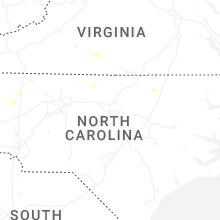


Connect with Interactive Hail Maps