

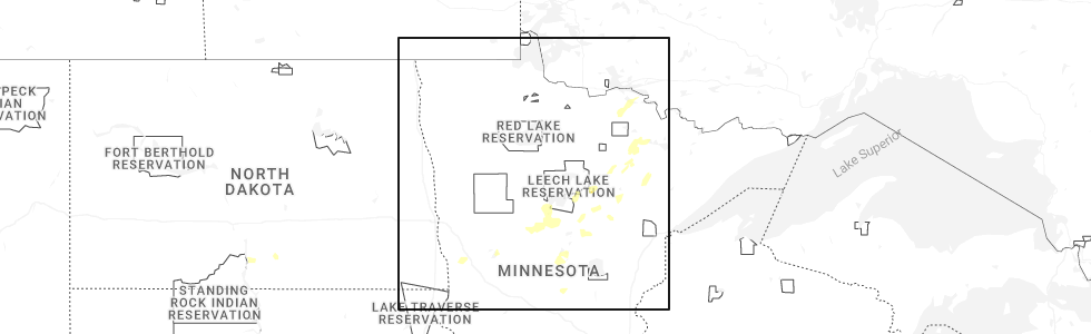
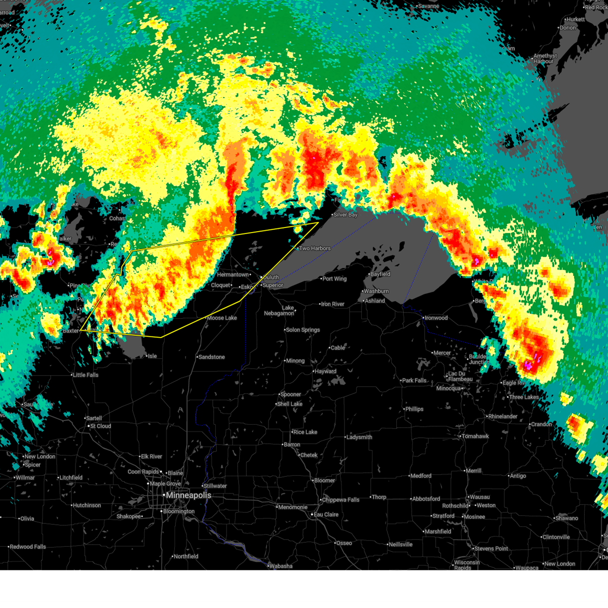
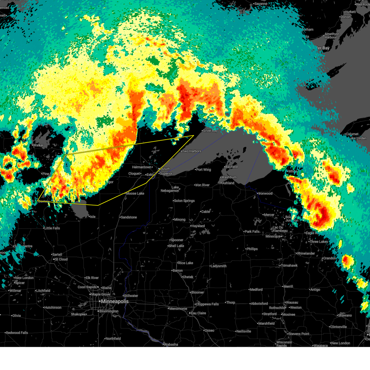
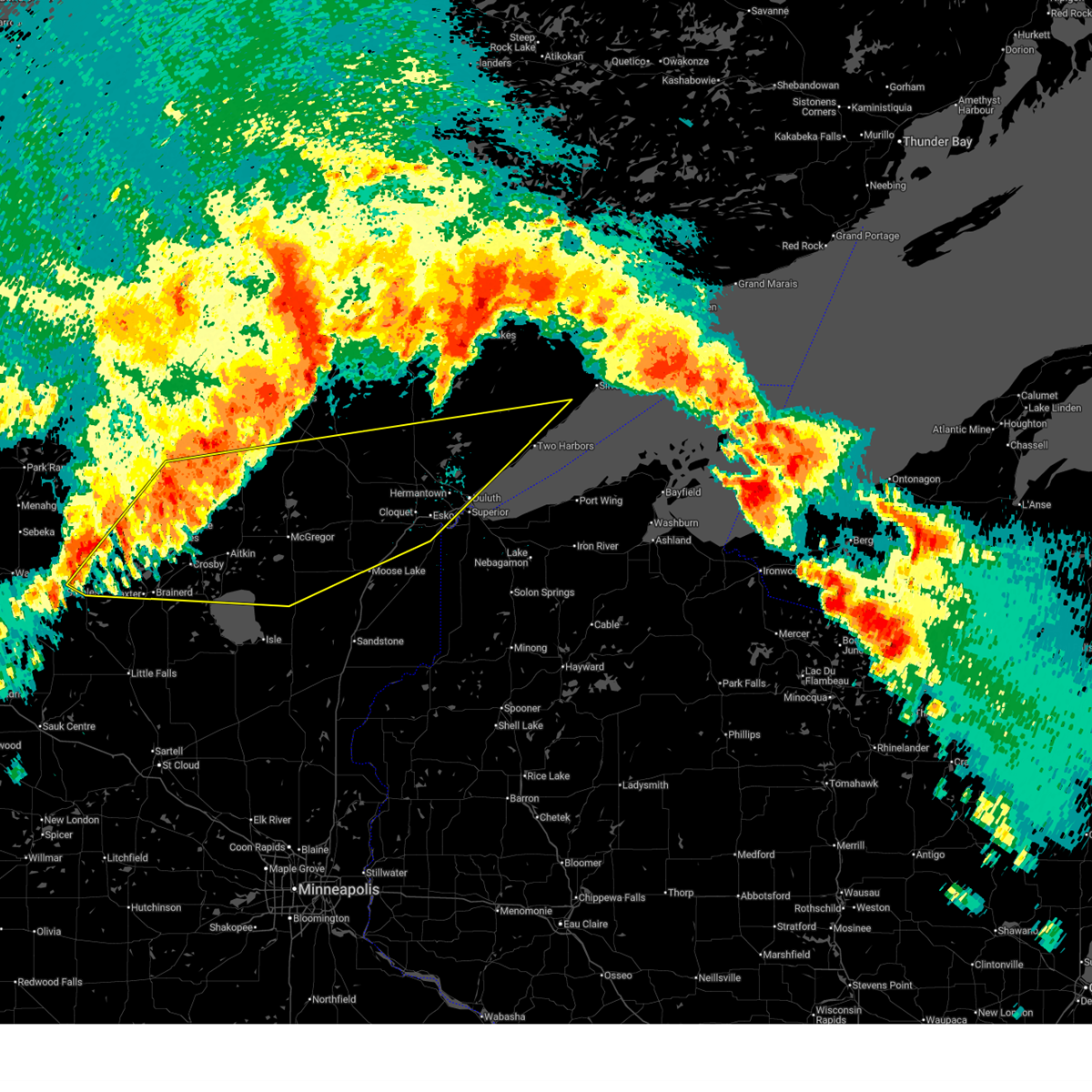
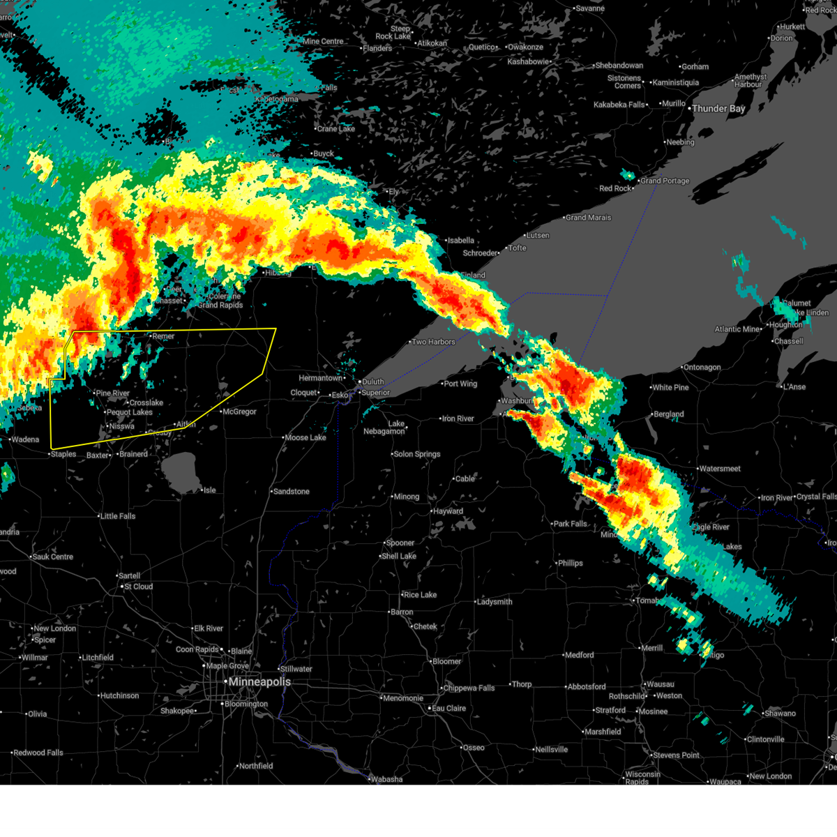
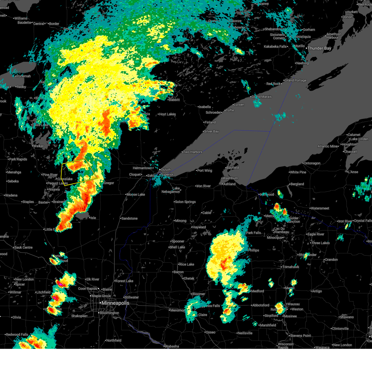
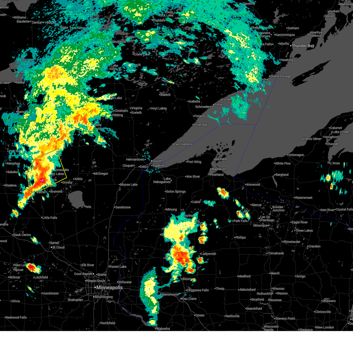
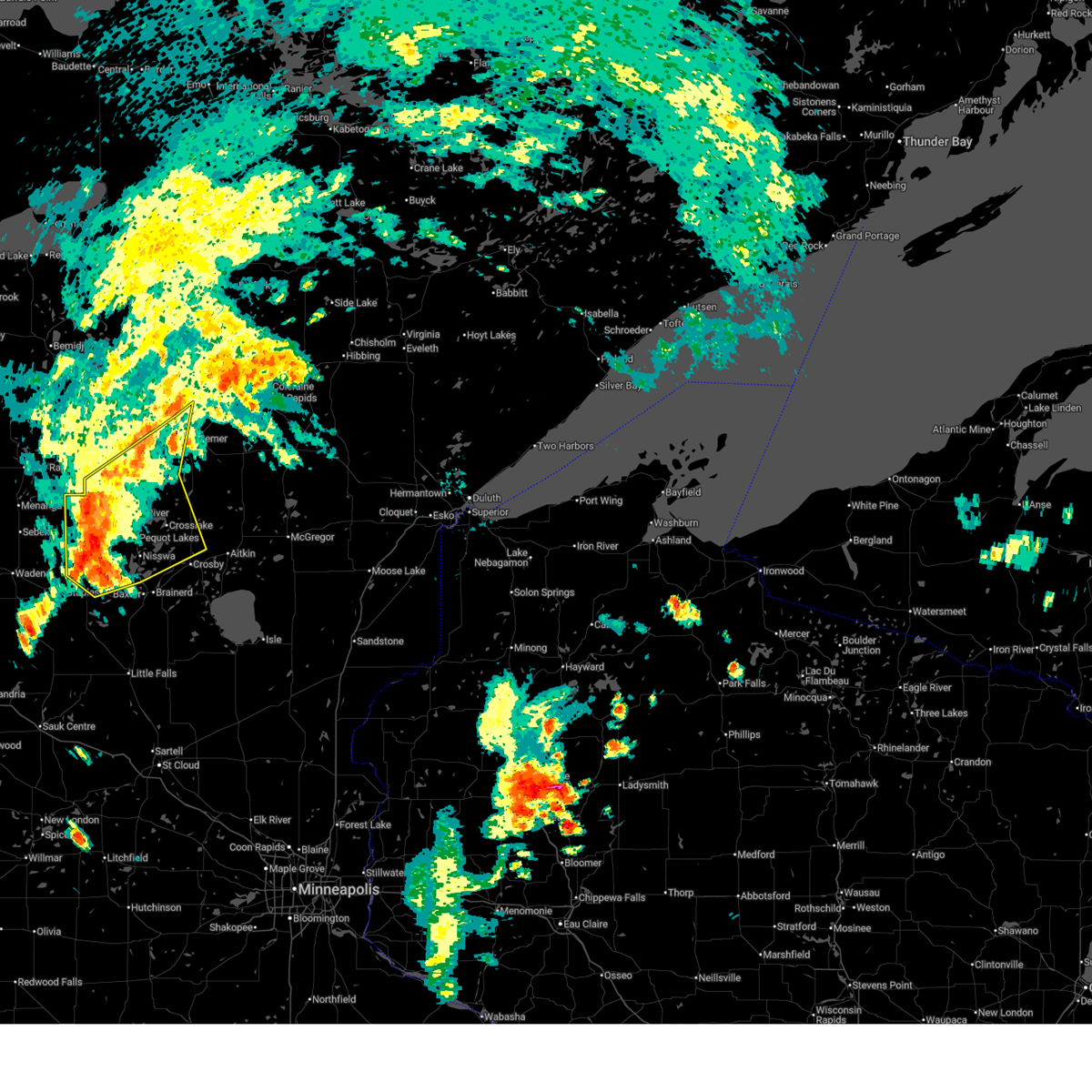
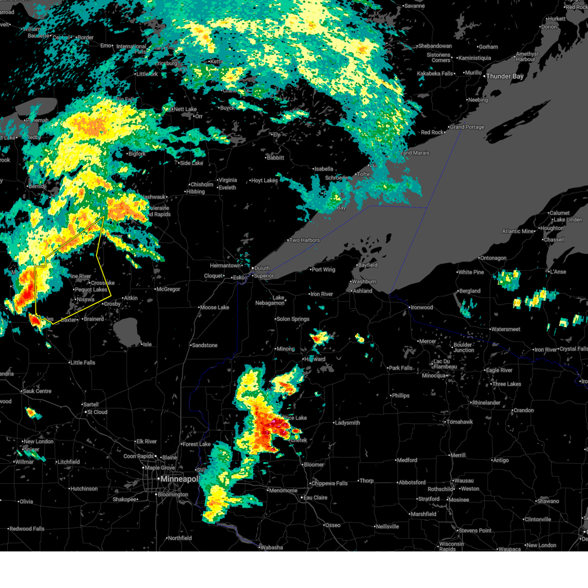
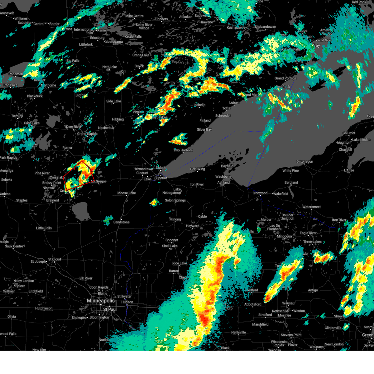
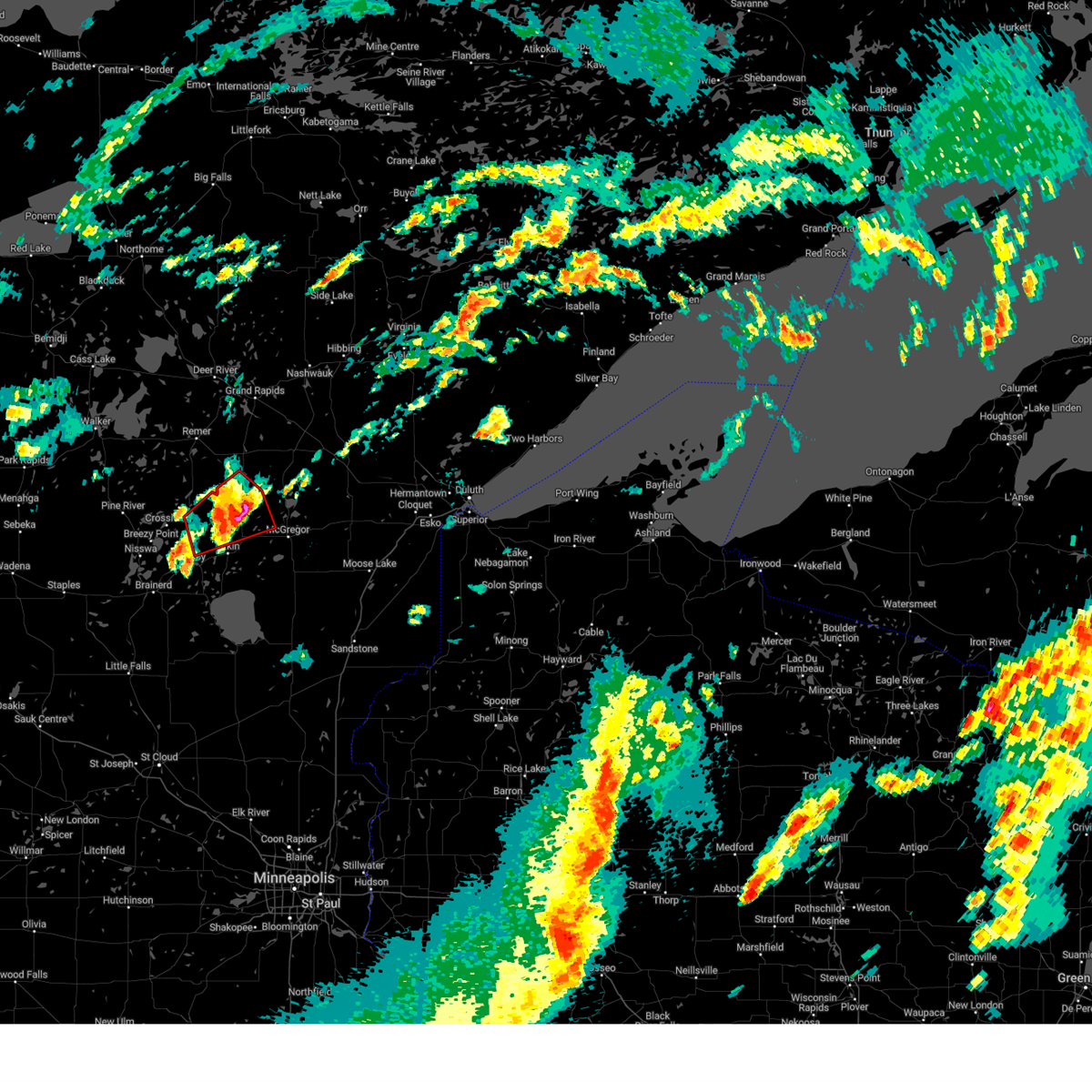
Hail Map for Emily, MN
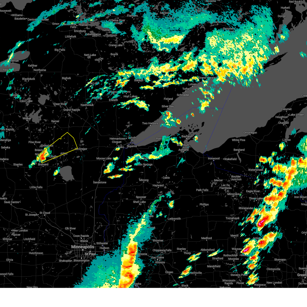
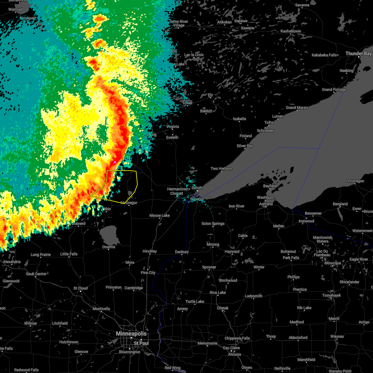
The Emily, MN area has had 7 reports of on-the-ground hail by trained spotters, and has been under severe weather warnings 36 times during the past 12 months. Doppler radar has detected hail at or near Emily, MN on 63 occasions, including 3 occasions during the past year.
| Name: | Emily, MN |
| Where Located: | 64.2 miles SE of Bemidji, MN |
| Map: | Google Map for Emily, MN |
| Population: | 813 |
| Housing Units: | 1055 |
| More Info: | Search Google for Emily, MN |
1
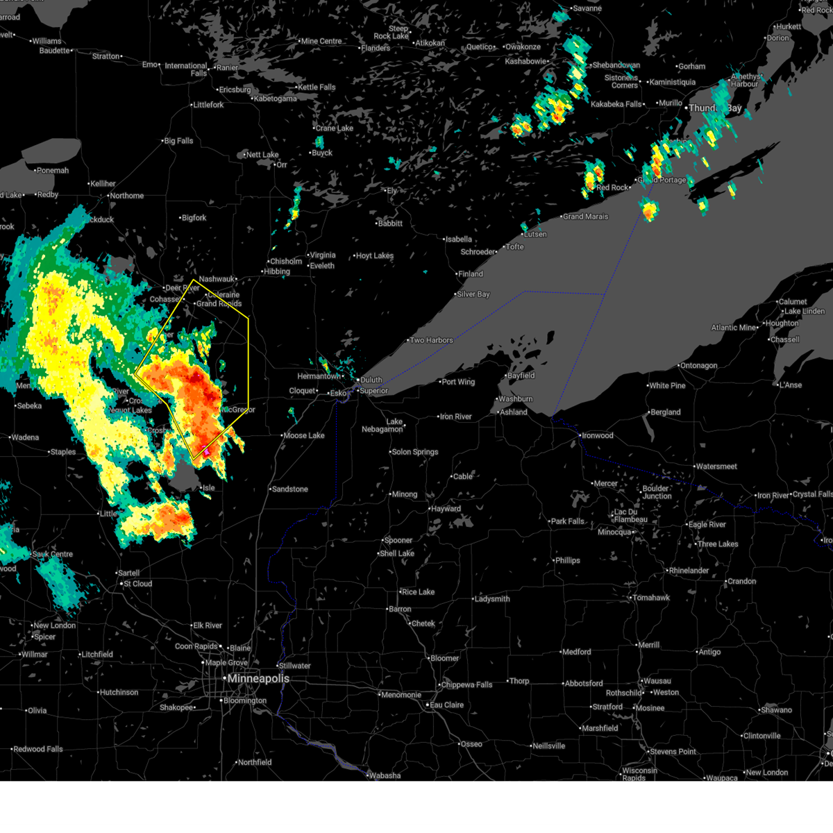
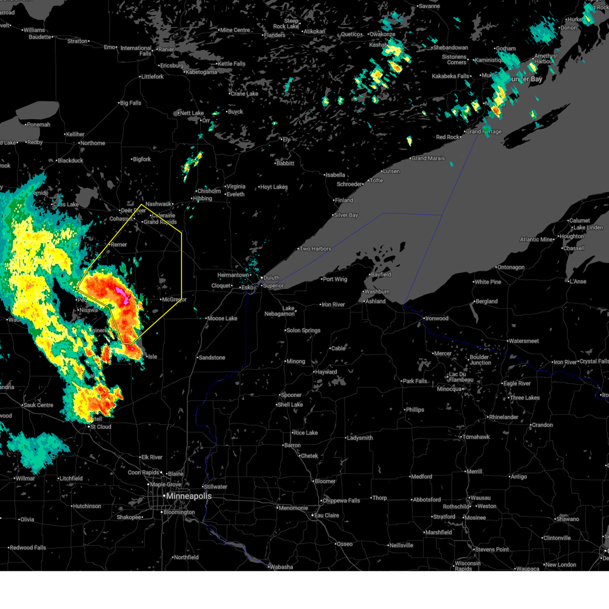
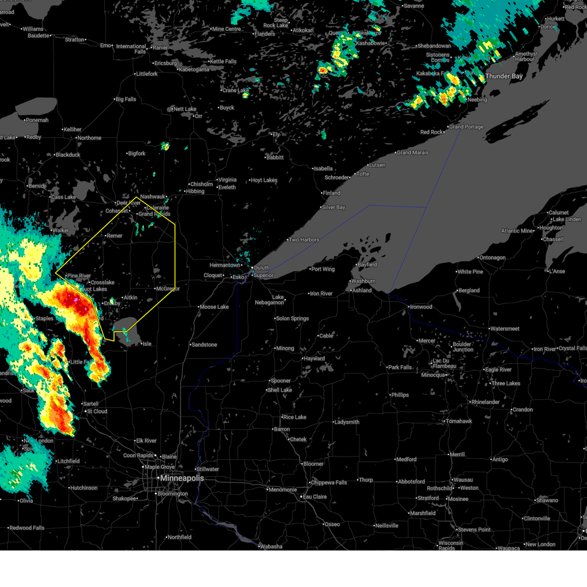
The Top Recent Hail Date for Emily, MN is Friday, July 11, 2025 (19th out of 63)
Hail and Wind Damage Spotted near Emily, MN
| Date / Time | Report Details |
|---|---|
| 6/23/2025 2:52 AM CDT |
 At 251 am cdt, severe thunderstorms were located along a line extending from near hill city to near libby to near tamarack, moving northeast at 55 mph (wind gusts to 62 mph in aitkin county have been observed on surface observation equipment). Hazards include 70 mph wind gusts and quarter size hail. Hail damage to vehicles is expected. expect considerable tree damage. wind damage is also likely to mobile homes, roofs, and outbuildings. Locations impacted include, grand rapids, big sandy lake, mille lacs lake, cohasset, aitkin, coleraine, emily, swan river, hill city, mcgregor, taconite, malmo, warba, palisade, tamarack, libby, outing, mille lacs band east lake area, savanna portage state park, and pokegama dam. At 251 am cdt, severe thunderstorms were located along a line extending from near hill city to near libby to near tamarack, moving northeast at 55 mph (wind gusts to 62 mph in aitkin county have been observed on surface observation equipment). Hazards include 70 mph wind gusts and quarter size hail. Hail damage to vehicles is expected. expect considerable tree damage. wind damage is also likely to mobile homes, roofs, and outbuildings. Locations impacted include, grand rapids, big sandy lake, mille lacs lake, cohasset, aitkin, coleraine, emily, swan river, hill city, mcgregor, taconite, malmo, warba, palisade, tamarack, libby, outing, mille lacs band east lake area, savanna portage state park, and pokegama dam.
|
| 6/23/2025 2:37 AM CDT |
 At 236 am cdt, severe thunderstorms were located along a line extending from near outing to 6 miles west of palisade to 10 miles east of aitkin, moving northeast at 55 mph (radar indicated. brainerd airport reported a 56 mph wind gust shortly after 2 am). Hazards include 60 mph wind gusts and quarter size hail. Hail damage to vehicles is expected. expect wind damage to roofs, siding, and trees. Locations impacted include, palisade, swatara, big sandy lake, mcgregor, mille lacs band east lake area, hill city, libby, savanna portage state park, tamarack, jacobson, swan river and warba. At 236 am cdt, severe thunderstorms were located along a line extending from near outing to 6 miles west of palisade to 10 miles east of aitkin, moving northeast at 55 mph (radar indicated. brainerd airport reported a 56 mph wind gust shortly after 2 am). Hazards include 60 mph wind gusts and quarter size hail. Hail damage to vehicles is expected. expect wind damage to roofs, siding, and trees. Locations impacted include, palisade, swatara, big sandy lake, mcgregor, mille lacs band east lake area, hill city, libby, savanna portage state park, tamarack, jacobson, swan river and warba.
|
| 6/23/2025 2:11 AM CDT |
 Svrdlh the national weather service in duluth mn has issued a * severe thunderstorm warning for, southeastern itasca county in north central minnesota, aitkin county in east central minnesota, east central cass county in north central minnesota, crow wing county in east central minnesota, * until 315 am cdt. * at 210 am cdt, severe thunderstorms were located along a line extending from near pine river to near cuyuna country state park to near garrison, moving northeast at 50 mph (brainerd airport reported a 56 mph wind gust). Hazards include 60 mph wind gusts and quarter size hail. Hail damage to vehicles is expected. expect wind damage to roofs, siding, and trees. severe thunderstorms will be near, mille lacs lake, crosby, crosslake, emily, deerwood, fifty lakes, cuyuna, and garrison around 215 am cdt. aitkin around 220 am cdt. outing around 225 am cdt. Other locations in the path of these severe thunderstorms include remer, palisade, swatara, hill city, mcgregor, big sandy lake, libby, savanna portage state park, grand rapids, cohasset, jacobson and pokegama lake. Svrdlh the national weather service in duluth mn has issued a * severe thunderstorm warning for, southeastern itasca county in north central minnesota, aitkin county in east central minnesota, east central cass county in north central minnesota, crow wing county in east central minnesota, * until 315 am cdt. * at 210 am cdt, severe thunderstorms were located along a line extending from near pine river to near cuyuna country state park to near garrison, moving northeast at 50 mph (brainerd airport reported a 56 mph wind gust). Hazards include 60 mph wind gusts and quarter size hail. Hail damage to vehicles is expected. expect wind damage to roofs, siding, and trees. severe thunderstorms will be near, mille lacs lake, crosby, crosslake, emily, deerwood, fifty lakes, cuyuna, and garrison around 215 am cdt. aitkin around 220 am cdt. outing around 225 am cdt. Other locations in the path of these severe thunderstorms include remer, palisade, swatara, hill city, mcgregor, big sandy lake, libby, savanna portage state park, grand rapids, cohasset, jacobson and pokegama lake.
|
| 6/21/2025 2:40 AM CDT |
 At 240 am cdt, severe thunderstorms were located along a line extending from cotton to near cromwell to near upper south long lake, moving east at 55 mph (radar indicated). Hazards include 70 mph wind gusts and penny size hail. Expect considerable tree damage. damage is likely to mobile homes, roofs, and outbuildings. Locations impacted include, duluth, superior, brainerd, cloquet, big sandy lake, mille lacs lake, hermantown, baxter, proctor, crosby, aitkin, scanlon, carlton, hill city, mahtowa, barnum, ironton, deerwood, floodwood, and wrenshall. At 240 am cdt, severe thunderstorms were located along a line extending from cotton to near cromwell to near upper south long lake, moving east at 55 mph (radar indicated). Hazards include 70 mph wind gusts and penny size hail. Expect considerable tree damage. damage is likely to mobile homes, roofs, and outbuildings. Locations impacted include, duluth, superior, brainerd, cloquet, big sandy lake, mille lacs lake, hermantown, baxter, proctor, crosby, aitkin, scanlon, carlton, hill city, mahtowa, barnum, ironton, deerwood, floodwood, and wrenshall.
|
| 6/21/2025 2:40 AM CDT |
 the severe thunderstorm warning has been cancelled and is no longer in effect the severe thunderstorm warning has been cancelled and is no longer in effect
|
| 6/21/2025 2:30 AM CDT |
 At 230 am cdt, severe thunderstorms were located along a line extending from 6 miles west of cotton to near tamarack to near brainerd, moving east at 55 mph (radar indicated). Hazards include 70 mph wind gusts and penny size hail. Expect considerable tree damage. damage is likely to mobile homes, roofs, and outbuildings. Locations impacted include, mille lacs lake, mcgregor, tamarack, mille lacs band east lake area, fond du lac band brookston area, cromwell, brookston, canyon, fond du lac band sawyer area, malmo, cloquet, saginaw, fond du lac band cloquet area, island lake, boulder lake, hermantown, mahtowa, kettle river, pike lake near duluth, duluth, scanlon, carlton, barnum, thomson, city of rice lake, jay cooke state park, proctor, moose lake, wrenshall and superior. At 230 am cdt, severe thunderstorms were located along a line extending from 6 miles west of cotton to near tamarack to near brainerd, moving east at 55 mph (radar indicated). Hazards include 70 mph wind gusts and penny size hail. Expect considerable tree damage. damage is likely to mobile homes, roofs, and outbuildings. Locations impacted include, mille lacs lake, mcgregor, tamarack, mille lacs band east lake area, fond du lac band brookston area, cromwell, brookston, canyon, fond du lac band sawyer area, malmo, cloquet, saginaw, fond du lac band cloquet area, island lake, boulder lake, hermantown, mahtowa, kettle river, pike lake near duluth, duluth, scanlon, carlton, barnum, thomson, city of rice lake, jay cooke state park, proctor, moose lake, wrenshall and superior.
|
| 6/21/2025 1:59 AM CDT |
 Svrdlh the national weather service in duluth mn has issued a * severe thunderstorm warning for, southeastern itasca county in north central minnesota, aitkin county in east central minnesota, southern cass county in north central minnesota, northern pine county in east central minnesota, southern st. louis county in northeastern minnesota, carlton county in northeastern minnesota, crow wing county in east central minnesota, southwestern lake county in northeastern minnesota, * until 300 am cdt. * at 159 am cdt, severe thunderstorms were located along a line extending from near pengilly to 6 miles south of swatara to near staples airport, moving east at 55 mph (radar indicated). Hazards include 70 mph wind gusts and penny size hail. Expect considerable tree damage. damage is likely to mobile homes, roofs, and outbuildings. severe thunderstorms will be near, breezy point, pequot lakes, crosslake, nisswa, gull lake, jacobson, and merrifield around 205 am cdt. brainerd, baxter, crosby, ironton, cuyuna, palisade, and cuyuna country state park around 210 am cdt. big sandy lake, deerwood, libby, and savanna portage state park around 215 am cdt. Other locations in the path of these severe thunderstorms include aitkin, floodwood, mcgregor, meadowlands, upper south long lake, tamarack, mille lacs lake, garrison, mille lacs band east lake area, fond du lac band brookston area, cromwell, brookston, canyon and fond du lac band sawyer area. Svrdlh the national weather service in duluth mn has issued a * severe thunderstorm warning for, southeastern itasca county in north central minnesota, aitkin county in east central minnesota, southern cass county in north central minnesota, northern pine county in east central minnesota, southern st. louis county in northeastern minnesota, carlton county in northeastern minnesota, crow wing county in east central minnesota, southwestern lake county in northeastern minnesota, * until 300 am cdt. * at 159 am cdt, severe thunderstorms were located along a line extending from near pengilly to 6 miles south of swatara to near staples airport, moving east at 55 mph (radar indicated). Hazards include 70 mph wind gusts and penny size hail. Expect considerable tree damage. damage is likely to mobile homes, roofs, and outbuildings. severe thunderstorms will be near, breezy point, pequot lakes, crosslake, nisswa, gull lake, jacobson, and merrifield around 205 am cdt. brainerd, baxter, crosby, ironton, cuyuna, palisade, and cuyuna country state park around 210 am cdt. big sandy lake, deerwood, libby, and savanna portage state park around 215 am cdt. Other locations in the path of these severe thunderstorms include aitkin, floodwood, mcgregor, meadowlands, upper south long lake, tamarack, mille lacs lake, garrison, mille lacs band east lake area, fond du lac band brookston area, cromwell, brookston, canyon and fond du lac band sawyer area.
|
| 6/21/2025 1:20 AM CDT |
 Svrdlh the national weather service in duluth mn has issued a * severe thunderstorm warning for, southeastern itasca county in north central minnesota, northern aitkin county in east central minnesota, central cass county in north central minnesota, southwestern st. louis county in northeastern minnesota, northern crow wing county in east central minnesota, * until 200 am cdt. * at 120 am cdt, severe thunderstorms were located along a line extending from near longville to backus to 7 miles south of huntersville, moving east at 75 mph (radar indicated). Hazards include 70 mph wind gusts and penny size hail. Expect considerable tree damage. damage is likely to mobile homes, roofs, and outbuildings. severe thunderstorms will be near, wabedo, backus, longville, and woman lake around 125 am cdt. pine river and remer around 130 am cdt. fifty lakes around 135 am cdt. crosslake, emily, and outing around 140 am cdt. Other locations in the path of these severe thunderstorms include hill city and swatara. Svrdlh the national weather service in duluth mn has issued a * severe thunderstorm warning for, southeastern itasca county in north central minnesota, northern aitkin county in east central minnesota, central cass county in north central minnesota, southwestern st. louis county in northeastern minnesota, northern crow wing county in east central minnesota, * until 200 am cdt. * at 120 am cdt, severe thunderstorms were located along a line extending from near longville to backus to 7 miles south of huntersville, moving east at 75 mph (radar indicated). Hazards include 70 mph wind gusts and penny size hail. Expect considerable tree damage. damage is likely to mobile homes, roofs, and outbuildings. severe thunderstorms will be near, wabedo, backus, longville, and woman lake around 125 am cdt. pine river and remer around 130 am cdt. fifty lakes around 135 am cdt. crosslake, emily, and outing around 140 am cdt. Other locations in the path of these severe thunderstorms include hill city and swatara.
|
| 6/16/2025 5:52 PM CDT |
 The storms which prompted the warning have weakened below severe limits, and no longer pose an immediate threat to life or property. therefore, the warning will be allowed to expire. however, gusty winds are still possible with these thunderstorms. a tornado watch remains in effect until 900 pm cdt for north central and east central minnesota. The storms which prompted the warning have weakened below severe limits, and no longer pose an immediate threat to life or property. therefore, the warning will be allowed to expire. however, gusty winds are still possible with these thunderstorms. a tornado watch remains in effect until 900 pm cdt for north central and east central minnesota.
|
| 6/16/2025 5:30 PM CDT |
 At 530 pm cdt, severe thunderstorms were located along a line extending from near emily to 8 miles northwest of aitkin, moving east at 40 mph (radar indicated). Hazards include 60 mph wind gusts and nickel size hail. Expect damage to roofs, siding, and trees. Locations impacted include, palisade. At 530 pm cdt, severe thunderstorms were located along a line extending from near emily to 8 miles northwest of aitkin, moving east at 40 mph (radar indicated). Hazards include 60 mph wind gusts and nickel size hail. Expect damage to roofs, siding, and trees. Locations impacted include, palisade.
|
| 6/16/2025 5:12 PM CDT |
 At 511 pm cdt, severe thunderstorms were located along a line extending from fifty lakes to near crosslake, moving east at 30 mph (radar indicated). Hazards include 60 mph wind gusts and quarter size hail. Hail damage to vehicles is expected. expect wind damage to roofs, siding, and trees. these severe storms will be near, crosslake, emily, and fifty lakes around 515 pm cdt. Other locations in the path of these severe thunderstorms include outing, swatara and palisade. At 511 pm cdt, severe thunderstorms were located along a line extending from fifty lakes to near crosslake, moving east at 30 mph (radar indicated). Hazards include 60 mph wind gusts and quarter size hail. Hail damage to vehicles is expected. expect wind damage to roofs, siding, and trees. these severe storms will be near, crosslake, emily, and fifty lakes around 515 pm cdt. Other locations in the path of these severe thunderstorms include outing, swatara and palisade.
|
| 6/16/2025 4:59 PM CDT |
 Svrdlh the national weather service in duluth mn has issued a * severe thunderstorm warning for, northwestern aitkin county in east central minnesota, east central cass county in north central minnesota, northern crow wing county in east central minnesota, * until 600 pm cdt. * at 458 pm cdt, severe thunderstorms were located along a line extending from near fifty lakes to near breezy point, moving east at 30 mph (radar indicated). Hazards include golf ball size hail and 60 mph wind gusts. People and animals outdoors will be injured. expect hail damage to roofs, siding, windows, and vehicles. expect wind damage to roofs, siding, and trees. severe thunderstorms will be near, crosslake, emily, and fifty lakes around 505 pm cdt. Other locations in the path of these severe thunderstorms include outing. Svrdlh the national weather service in duluth mn has issued a * severe thunderstorm warning for, northwestern aitkin county in east central minnesota, east central cass county in north central minnesota, northern crow wing county in east central minnesota, * until 600 pm cdt. * at 458 pm cdt, severe thunderstorms were located along a line extending from near fifty lakes to near breezy point, moving east at 30 mph (radar indicated). Hazards include golf ball size hail and 60 mph wind gusts. People and animals outdoors will be injured. expect hail damage to roofs, siding, windows, and vehicles. expect wind damage to roofs, siding, and trees. severe thunderstorms will be near, crosslake, emily, and fifty lakes around 505 pm cdt. Other locations in the path of these severe thunderstorms include outing.
|
| 6/16/2025 4:50 PM CDT |
 At 450 pm cdt, severe thunderstorms were located along a line extending from near wabedo to near fifty lakes to near breezy point, moving northeast at 35 mph (radar indicated). Hazards include golf ball size hail and 60 mph wind gusts. People and animals outdoors will be injured. expect hail damage to roofs, siding, windows, and vehicles. expect wind damage to roofs, siding, and trees. Locations impacted include, breezy point, pequot lakes, crosslake, nisswa, pine river, emily, fifty lakes, cuyuna, gull lake, merrifield, lake shore, east gull lake, mission, jenkins, wolford, chickamaw beach, trommald, manhattan beach, legionville, and lower hay lake. At 450 pm cdt, severe thunderstorms were located along a line extending from near wabedo to near fifty lakes to near breezy point, moving northeast at 35 mph (radar indicated). Hazards include golf ball size hail and 60 mph wind gusts. People and animals outdoors will be injured. expect hail damage to roofs, siding, windows, and vehicles. expect wind damage to roofs, siding, and trees. Locations impacted include, breezy point, pequot lakes, crosslake, nisswa, pine river, emily, fifty lakes, cuyuna, gull lake, merrifield, lake shore, east gull lake, mission, jenkins, wolford, chickamaw beach, trommald, manhattan beach, legionville, and lower hay lake.
|
| 6/16/2025 4:39 PM CDT |
 At 439 pm cdt, severe thunderstorms were located along a line extending from near wabedo to near breezy point to near nisswa, moving east at 40 mph (radar indicated). Hazards include golf ball size hail and 60 mph wind gusts. People and animals outdoors will be injured. expect hail damage to roofs, siding, windows, and vehicles. expect wind damage to roofs, siding, and trees. Locations impacted include, breezy point, pequot lakes, crosslake, nisswa, pine river, emily, fifty lakes, cuyuna, gull lake, merrifield, lake shore, east gull lake, mission, jenkins, wolford, chickamaw beach, trommald, manhattan beach, legionville, and lower hay lake. At 439 pm cdt, severe thunderstorms were located along a line extending from near wabedo to near breezy point to near nisswa, moving east at 40 mph (radar indicated). Hazards include golf ball size hail and 60 mph wind gusts. People and animals outdoors will be injured. expect hail damage to roofs, siding, windows, and vehicles. expect wind damage to roofs, siding, and trees. Locations impacted include, breezy point, pequot lakes, crosslake, nisswa, pine river, emily, fifty lakes, cuyuna, gull lake, merrifield, lake shore, east gull lake, mission, jenkins, wolford, chickamaw beach, trommald, manhattan beach, legionville, and lower hay lake.
|
| 6/16/2025 4:15 PM CDT |
 At 415 pm cdt, severe thunderstorms were located along a line extending from near backus to near poplar to near leader, moving northeast at 45 mph (radar indicated). Hazards include 60 mph wind gusts and quarter size hail. Hail damage to vehicles is expected. expect wind damage to roofs, siding, and trees. Locations impacted include, breezy point, pequot lakes, crosslake, nisswa, pine river, emily, fifty lakes, wabedo, cuyuna, hackensack, backus, poplar, longville, gull lake, leader, merrifield, woman lake, lake shore, east gull lake, and mission. At 415 pm cdt, severe thunderstorms were located along a line extending from near backus to near poplar to near leader, moving northeast at 45 mph (radar indicated). Hazards include 60 mph wind gusts and quarter size hail. Hail damage to vehicles is expected. expect wind damage to roofs, siding, and trees. Locations impacted include, breezy point, pequot lakes, crosslake, nisswa, pine river, emily, fifty lakes, wabedo, cuyuna, hackensack, backus, poplar, longville, gull lake, leader, merrifield, woman lake, lake shore, east gull lake, and mission.
|
| 6/16/2025 3:58 PM CDT |
 Svrdlh the national weather service in duluth mn has issued a * severe thunderstorm warning for, southern cass county in north central minnesota, northern crow wing county in east central minnesota, * until 500 pm cdt. * at 358 pm cdt, severe thunderstorms were located along a line extending from near huntersville to 6 miles west of poplar to near motley, moving northeast at 35 mph (radar indicated). Hazards include 60 mph wind gusts and quarter size hail. Hail damage to vehicles is expected. expect wind damage to roofs, siding, and trees. severe thunderstorms will be near, poplar and leader around 405 pm cdt. backus around 415 pm cdt. gull lake around 420 pm cdt. nisswa around 425 pm cdt. pequot lakes and pine river around 430 pm cdt. breezy point and woman lake around 435 pm cdt. crosslake, wabedo, and longville around 445 pm cdt. Other locations impacted by these severe thunderstorms include legionville, lower hay lake, pheasant lake, lake ada, north long lake, upper mission lake, trommald, lake shore, oshawa, and tobique. Svrdlh the national weather service in duluth mn has issued a * severe thunderstorm warning for, southern cass county in north central minnesota, northern crow wing county in east central minnesota, * until 500 pm cdt. * at 358 pm cdt, severe thunderstorms were located along a line extending from near huntersville to 6 miles west of poplar to near motley, moving northeast at 35 mph (radar indicated). Hazards include 60 mph wind gusts and quarter size hail. Hail damage to vehicles is expected. expect wind damage to roofs, siding, and trees. severe thunderstorms will be near, poplar and leader around 405 pm cdt. backus around 415 pm cdt. gull lake around 420 pm cdt. nisswa around 425 pm cdt. pequot lakes and pine river around 430 pm cdt. breezy point and woman lake around 435 pm cdt. crosslake, wabedo, and longville around 445 pm cdt. Other locations impacted by these severe thunderstorms include legionville, lower hay lake, pheasant lake, lake ada, north long lake, upper mission lake, trommald, lake shore, oshawa, and tobique.
|
| 4/28/2025 7:57 PM CDT |
 The storm which prompted the warning has weakened below severe limits, and no longer appears capable of producing a tornado. therefore, the warning will be allowed to expire. however, small hail and gusty winds are still possible with this thunderstorm. to report severe weather, contact your nearest law enforcement agency. they will relay your report to the national weather service duluth mn. The storm which prompted the warning has weakened below severe limits, and no longer appears capable of producing a tornado. therefore, the warning will be allowed to expire. however, small hail and gusty winds are still possible with this thunderstorm. to report severe weather, contact your nearest law enforcement agency. they will relay your report to the national weather service duluth mn.
|
| 4/28/2025 7:46 PM CDT |
 At 745 pm cdt, a severe thunderstorm capable of producing a tornado was located 9 miles east of emily, or 23 miles west of big sandy lake, moving northeast at 30 mph (radar indicated rotation). Hazards include tornado and half dollar size hail. Flying debris will be dangerous to those caught without shelter. mobile homes will be damaged or destroyed. damage to roofs, windows, and vehicles will occur. tree damage is likely. Locations impacted include, waukenabo, gun lake, little pine, esquagamah lake, white elk lake, waldeck, hassman, pine knoll, haypoint, bain, palisade, cuyuna, and emily. At 745 pm cdt, a severe thunderstorm capable of producing a tornado was located 9 miles east of emily, or 23 miles west of big sandy lake, moving northeast at 30 mph (radar indicated rotation). Hazards include tornado and half dollar size hail. Flying debris will be dangerous to those caught without shelter. mobile homes will be damaged or destroyed. damage to roofs, windows, and vehicles will occur. tree damage is likely. Locations impacted include, waukenabo, gun lake, little pine, esquagamah lake, white elk lake, waldeck, hassman, pine knoll, haypoint, bain, palisade, cuyuna, and emily.
|
| 4/28/2025 7:37 PM CDT |
 At 736 pm cdt, a severe thunderstorm capable of producing a tornado was located 8 miles southeast of emily, or 25 miles north of mille lacs lake, moving northeast at 30 mph (radar indicated rotation). Hazards include tornado and quarter size hail. Flying debris will be dangerous to those caught without shelter. mobile homes will be damaged or destroyed. damage to roofs, windows, and vehicles will occur. tree damage is likely. Locations impacted include, waukenabo, gun lake, little pine, esquagamah lake, white elk lake, waldeck, hassman, pine knoll, haypoint, bain, palisade, cuyuna, and emily. At 736 pm cdt, a severe thunderstorm capable of producing a tornado was located 8 miles southeast of emily, or 25 miles north of mille lacs lake, moving northeast at 30 mph (radar indicated rotation). Hazards include tornado and quarter size hail. Flying debris will be dangerous to those caught without shelter. mobile homes will be damaged or destroyed. damage to roofs, windows, and vehicles will occur. tree damage is likely. Locations impacted include, waukenabo, gun lake, little pine, esquagamah lake, white elk lake, waldeck, hassman, pine knoll, haypoint, bain, palisade, cuyuna, and emily.
|
| 4/28/2025 7:36 PM CDT |
 At 735 pm cdt, a severe thunderstorm was located 8 miles west of palisade, or 18 miles west of big sandy lake, moving northeast at 45 mph (radar indicated). Hazards include 60 mph wind gusts and quarter size hail. Hail damage to vehicles is expected. expect wind damage to roofs, siding, and trees. Locations impacted include, waukenabo, wolford, gun lake, little pine, upper mission lake, esquagamah lake, white elk lake, waldeck, trommald, hassman, edward lake, pine knoll, merrifield, haypoint, mission, bain, lower mission lake, palisade, cuyuna, and breezy point. At 735 pm cdt, a severe thunderstorm was located 8 miles west of palisade, or 18 miles west of big sandy lake, moving northeast at 45 mph (radar indicated). Hazards include 60 mph wind gusts and quarter size hail. Hail damage to vehicles is expected. expect wind damage to roofs, siding, and trees. Locations impacted include, waukenabo, wolford, gun lake, little pine, upper mission lake, esquagamah lake, white elk lake, waldeck, trommald, hassman, edward lake, pine knoll, merrifield, haypoint, mission, bain, lower mission lake, palisade, cuyuna, and breezy point.
|
| 4/28/2025 7:23 PM CDT |
 At 722 pm cdt, a severe thunderstorm capable of producing a tornado was located near cuyuna, or 19 miles northeast of brainerd, moving northeast at 30 mph (radar indicated rotation). Hazards include tornado and half dollar size hail. Flying debris will be dangerous to those caught without shelter. mobile homes will be damaged or destroyed. damage to roofs, windows, and vehicles will occur. tree damage is likely. Locations impacted include, waukenabo, wolford, gun lake, little pine, esquagamah lake, white elk lake, waldeck, trommald, hassman, pine knoll, haypoint, mission, bain, palisade, upper mission lake, cuyuna, emily, and crosslake. At 722 pm cdt, a severe thunderstorm capable of producing a tornado was located near cuyuna, or 19 miles northeast of brainerd, moving northeast at 30 mph (radar indicated rotation). Hazards include tornado and half dollar size hail. Flying debris will be dangerous to those caught without shelter. mobile homes will be damaged or destroyed. damage to roofs, windows, and vehicles will occur. tree damage is likely. Locations impacted include, waukenabo, wolford, gun lake, little pine, esquagamah lake, white elk lake, waldeck, trommald, hassman, pine knoll, haypoint, mission, bain, palisade, upper mission lake, cuyuna, emily, and crosslake.
|
| 4/28/2025 7:21 PM CDT |
 At 721 pm cdt, a severe thunderstorm was located 8 miles southeast of emily, or 24 miles north of mille lacs lake, moving northeast at 45 mph (radar indicated). Hazards include 60 mph wind gusts and half dollar size hail. Hail damage to vehicles is expected. expect wind damage to roofs, siding, and trees. Locations impacted include, waukenabo, wolford, gun lake, little pine, upper mission lake, esquagamah lake, white elk lake, waldeck, trommald, hassman, edward lake, pine knoll, merrifield, haypoint, mission, bain, lower mission lake, palisade, cuyuna, and breezy point. At 721 pm cdt, a severe thunderstorm was located 8 miles southeast of emily, or 24 miles north of mille lacs lake, moving northeast at 45 mph (radar indicated). Hazards include 60 mph wind gusts and half dollar size hail. Hail damage to vehicles is expected. expect wind damage to roofs, siding, and trees. Locations impacted include, waukenabo, wolford, gun lake, little pine, upper mission lake, esquagamah lake, white elk lake, waldeck, trommald, hassman, edward lake, pine knoll, merrifield, haypoint, mission, bain, lower mission lake, palisade, cuyuna, and breezy point.
|
| 4/28/2025 7:12 PM CDT |
 Tordlh the national weather service in duluth mn has issued a * tornado warning for, northwestern aitkin county in east central minnesota, northeastern crow wing county in east central minnesota, * until 800 pm cdt. * at 711 pm cdt, a severe thunderstorm capable of producing a tornado was located near cuyuna country state park, or 13 miles northeast of brainerd, moving northeast at 30 mph (radar indicated rotation). Hazards include tornado and ping pong ball size hail. Flying debris will be dangerous to those caught without shelter. mobile homes will be damaged or destroyed. damage to roofs, windows, and vehicles will occur. tree damage is likely. This tornadic thunderstorm will remain over mainly rural areas of northwestern aitkin and northeastern crow wing counties, including the following locations, waukenabo, wolford, gun lake, little pine, upper mission lake, esquagamah lake, white elk lake, waldeck, trommald, and hassman. Tordlh the national weather service in duluth mn has issued a * tornado warning for, northwestern aitkin county in east central minnesota, northeastern crow wing county in east central minnesota, * until 800 pm cdt. * at 711 pm cdt, a severe thunderstorm capable of producing a tornado was located near cuyuna country state park, or 13 miles northeast of brainerd, moving northeast at 30 mph (radar indicated rotation). Hazards include tornado and ping pong ball size hail. Flying debris will be dangerous to those caught without shelter. mobile homes will be damaged or destroyed. damage to roofs, windows, and vehicles will occur. tree damage is likely. This tornadic thunderstorm will remain over mainly rural areas of northwestern aitkin and northeastern crow wing counties, including the following locations, waukenabo, wolford, gun lake, little pine, upper mission lake, esquagamah lake, white elk lake, waldeck, trommald, and hassman.
|
| 4/28/2025 7:08 PM CDT |
 At 708 pm cdt, a severe thunderstorm was located near cuyuna country state park, or 17 miles northeast of brainerd, moving northeast at 45 mph (radar indicated). Hazards include ping pong ball size hail and 60 mph wind gusts. People and animals outdoors will be injured. expect hail damage to roofs, siding, windows, and vehicles. expect wind damage to roofs, siding, and trees. This severe thunderstorm will remain over mainly rural areas of northwestern aitkin and northeastern crow wing counties, including the following locations, waukenabo, wolford, gun lake, little pine, upper mission lake, esquagamah lake, white elk lake, waldeck, trommald, and hassman. At 708 pm cdt, a severe thunderstorm was located near cuyuna country state park, or 17 miles northeast of brainerd, moving northeast at 45 mph (radar indicated). Hazards include ping pong ball size hail and 60 mph wind gusts. People and animals outdoors will be injured. expect hail damage to roofs, siding, windows, and vehicles. expect wind damage to roofs, siding, and trees. This severe thunderstorm will remain over mainly rural areas of northwestern aitkin and northeastern crow wing counties, including the following locations, waukenabo, wolford, gun lake, little pine, upper mission lake, esquagamah lake, white elk lake, waldeck, trommald, and hassman.
|
| 4/28/2025 7:06 PM CDT |
 At 705 pm cdt, a severe thunderstorm was located near cuyuna country state park, or 15 miles northeast of brainerd, moving northeast at 45 mph (radar indicated). Hazards include ping pong ball size hail. People and animals outdoors will be injured. expect damage to roofs, siding, windows, and vehicles. This severe storm will be near, crosslake around 710 pm cdt. At 705 pm cdt, a severe thunderstorm was located near cuyuna country state park, or 15 miles northeast of brainerd, moving northeast at 45 mph (radar indicated). Hazards include ping pong ball size hail. People and animals outdoors will be injured. expect damage to roofs, siding, windows, and vehicles. This severe storm will be near, crosslake around 710 pm cdt.
|
| 4/28/2025 7:00 PM CDT |
 Svrdlh the national weather service in duluth mn has issued a * severe thunderstorm warning for, northwestern aitkin county in east central minnesota, northern crow wing county in east central minnesota, * until 745 pm cdt. * at 659 pm cdt, a severe thunderstorm was located near merrifield, or 11 miles north of brainerd, moving northeast at 45 mph (radar indicated). Hazards include half dollar size hail. Damage to vehicles is expected. This severe thunderstorm will be near, crosslake around 710 pm cdt. Svrdlh the national weather service in duluth mn has issued a * severe thunderstorm warning for, northwestern aitkin county in east central minnesota, northern crow wing county in east central minnesota, * until 745 pm cdt. * at 659 pm cdt, a severe thunderstorm was located near merrifield, or 11 miles north of brainerd, moving northeast at 45 mph (radar indicated). Hazards include half dollar size hail. Damage to vehicles is expected. This severe thunderstorm will be near, crosslake around 710 pm cdt.
|
| 8/3/2024 7:03 PM CDT |
 At 703 pm cdt, severe thunderstorms were located along a line extending from 7 miles east of outing to 7 miles north of cuyuna to near pillager, moving east at 35 mph (radar indicated). Hazards include 60 mph wind gusts and half dollar size hail. Hail damage to vehicles is expected. expect wind damage to roofs, siding, and trees. Locations impacted include, brainerd, baxter, crosby, ironton, deerwood, cuyuna, cuyuna country state park, crow wing state park, aitkin, saint mathias, south long lake, palisade, upper south long lake, garrison, big sandy lake and mille lacs lake. At 703 pm cdt, severe thunderstorms were located along a line extending from 7 miles east of outing to 7 miles north of cuyuna to near pillager, moving east at 35 mph (radar indicated). Hazards include 60 mph wind gusts and half dollar size hail. Hail damage to vehicles is expected. expect wind damage to roofs, siding, and trees. Locations impacted include, brainerd, baxter, crosby, ironton, deerwood, cuyuna, cuyuna country state park, crow wing state park, aitkin, saint mathias, south long lake, palisade, upper south long lake, garrison, big sandy lake and mille lacs lake.
|
| 8/3/2024 6:41 PM CDT |
 Svrdlh the national weather service in duluth mn has issued a * severe thunderstorm warning for, northwestern aitkin county in east central minnesota, southern cass county in north central minnesota, crow wing county in east central minnesota, * until 730 pm cdt. * at 641 pm cdt, severe thunderstorms were located along a line extending from near outing to near crosslake to near motley, moving east at 35 mph (radar indicated). Hazards include 60 mph wind gusts and half dollar size hail. Hail damage to vehicles is expected. expect wind damage to roofs, siding, and trees. severe thunderstorms will be near, breezy point, pequot lakes, crosslake, nisswa, emily, pillager, fifty lakes, gull lake, and outing around 645 pm cdt. brainerd, baxter, and merrifield around 655 pm cdt. ironton and crow wing state park around 700 pm cdt. Other locations in the path of these severe thunderstorms include crosby, cuyuna, cuyuna country state park, deerwood, saint mathias, aitkin, south long lake and upper south long lake. Svrdlh the national weather service in duluth mn has issued a * severe thunderstorm warning for, northwestern aitkin county in east central minnesota, southern cass county in north central minnesota, crow wing county in east central minnesota, * until 730 pm cdt. * at 641 pm cdt, severe thunderstorms were located along a line extending from near outing to near crosslake to near motley, moving east at 35 mph (radar indicated). Hazards include 60 mph wind gusts and half dollar size hail. Hail damage to vehicles is expected. expect wind damage to roofs, siding, and trees. severe thunderstorms will be near, breezy point, pequot lakes, crosslake, nisswa, emily, pillager, fifty lakes, gull lake, and outing around 645 pm cdt. brainerd, baxter, and merrifield around 655 pm cdt. ironton and crow wing state park around 700 pm cdt. Other locations in the path of these severe thunderstorms include crosby, cuyuna, cuyuna country state park, deerwood, saint mathias, aitkin, south long lake and upper south long lake.
|
| 8/3/2024 6:15 PM CDT |
 At 614 pm cdt, a severe thunderstorm was located near pine river, or 21 miles southeast of walker, moving east at 40 mph (trained weather spotter reports quarter size hail in backus). Hazards include 60 mph wind gusts and quarter size hail. Hail damage to vehicles is expected. expect wind damage to roofs, siding, and trees. Locations impacted include, crosslake, fifty lakes and emily. At 614 pm cdt, a severe thunderstorm was located near pine river, or 21 miles southeast of walker, moving east at 40 mph (trained weather spotter reports quarter size hail in backus). Hazards include 60 mph wind gusts and quarter size hail. Hail damage to vehicles is expected. expect wind damage to roofs, siding, and trees. Locations impacted include, crosslake, fifty lakes and emily.
|
| 8/3/2024 5:56 PM CDT | Svrdlh the national weather service in duluth mn has issued a * severe thunderstorm warning for, central cass county in north central minnesota, northern crow wing county in east central minnesota, * until 645 pm cdt. * at 555 pm cdt, a severe thunderstorm was located 7 miles southwest of hackensack, or 15 miles south of walker, moving east at 40 mph (radar indicated). Hazards include 60 mph wind gusts and quarter size hail. Hail damage to vehicles is expected. expect wind damage to roofs, siding, and trees. this severe thunderstorm will be near, backus around 600 pm cdt. Other locations in the path of this severe thunderstorm include crosslake, fifty lakes and emily. |
| 7/31/2024 4:03 PM CDT |
 At 402 pm cdt, severe thunderstorms were located along a line extending from near emily to near vineland, moving east at 25 mph (emergency management reported tree down on power lines near emily). Hazards include 60 mph wind gusts and penny size hail. Expect damage to roofs, siding, and trees. Locations impacted include, mille lacs lake, big sandy lake, crosby, aitkin, crosslake, emily, ironton, deerwood, mcgregor, fifty lakes, malmo, cuyuna, garrison, palisade, mcgrath, upper south long lake, mille lacs band east lake area, cuyuna country state park, cedar lake, and bay lake. At 402 pm cdt, severe thunderstorms were located along a line extending from near emily to near vineland, moving east at 25 mph (emergency management reported tree down on power lines near emily). Hazards include 60 mph wind gusts and penny size hail. Expect damage to roofs, siding, and trees. Locations impacted include, mille lacs lake, big sandy lake, crosby, aitkin, crosslake, emily, ironton, deerwood, mcgregor, fifty lakes, malmo, cuyuna, garrison, palisade, mcgrath, upper south long lake, mille lacs band east lake area, cuyuna country state park, cedar lake, and bay lake.
|
| 7/31/2024 3:58 PM CDT |
 At 358 pm cdt, severe thunderstorms were located along a line extending from near emily to near vineland, moving east at 25 mph (radar indicated). Hazards include 60 mph wind gusts and penny size hail. Expect damage to roofs, siding, and trees. Locations impacted include, mille lacs lake, aitkin, malmo, palisade, mcgrath, mcgregor and mille lacs band east lake area. At 358 pm cdt, severe thunderstorms were located along a line extending from near emily to near vineland, moving east at 25 mph (radar indicated). Hazards include 60 mph wind gusts and penny size hail. Expect damage to roofs, siding, and trees. Locations impacted include, mille lacs lake, aitkin, malmo, palisade, mcgrath, mcgregor and mille lacs band east lake area.
|
| 7/31/2024 3:58 PM CDT |
 the severe thunderstorm warning has been cancelled and is no longer in effect the severe thunderstorm warning has been cancelled and is no longer in effect
|
| 7/31/2024 3:48 PM CDT | Report of a tree down on power lines near pine ridge cemetery in emily. time estimated by rada in crow wing county MN, 2.2 miles NW of Emily, MN |
| 7/31/2024 3:40 PM CDT |
 Svrdlh the national weather service in duluth mn has issued a * severe thunderstorm warning for, aitkin county in east central minnesota, east central cass county in north central minnesota, crow wing county in east central minnesota, * until 445 pm cdt. * at 340 pm cdt, severe thunderstorms were located along a line extending from near fifty lakes to near vineland, moving east at 25 mph (radar indicated). Hazards include 60 mph wind gusts and quarter size hail. Hail damage to vehicles is expected. expect wind damage to roofs, siding, and trees. severe thunderstorms will be near, mille lacs lake, crosby, emily, deerwood, fifty lakes, cuyuna, and garrison around 345 pm cdt. outing around 350 pm cdt. aitkin around 355 pm cdt. Other locations in the path of these severe thunderstorms include malmo and palisade. Svrdlh the national weather service in duluth mn has issued a * severe thunderstorm warning for, aitkin county in east central minnesota, east central cass county in north central minnesota, crow wing county in east central minnesota, * until 445 pm cdt. * at 340 pm cdt, severe thunderstorms were located along a line extending from near fifty lakes to near vineland, moving east at 25 mph (radar indicated). Hazards include 60 mph wind gusts and quarter size hail. Hail damage to vehicles is expected. expect wind damage to roofs, siding, and trees. severe thunderstorms will be near, mille lacs lake, crosby, emily, deerwood, fifty lakes, cuyuna, and garrison around 345 pm cdt. outing around 350 pm cdt. aitkin around 355 pm cdt. Other locations in the path of these severe thunderstorms include malmo and palisade.
|
| 7/31/2024 3:33 PM CDT |
 At 332 pm cdt, severe thunderstorms were located along a line extending from 7 miles north of laporte to near emily to near upper south long lake, moving northeast at 50 mph (radar indicated). Hazards include 60 mph wind gusts and quarter size hail. Hail damage to vehicles is expected. expect wind damage to roofs, siding, and trees. Locations impacted include, crosby, emily, ironton, deerwood, cuyuna, longville, outing, leech lake, federal dam and boy river. At 332 pm cdt, severe thunderstorms were located along a line extending from 7 miles north of laporte to near emily to near upper south long lake, moving northeast at 50 mph (radar indicated). Hazards include 60 mph wind gusts and quarter size hail. Hail damage to vehicles is expected. expect wind damage to roofs, siding, and trees. Locations impacted include, crosby, emily, ironton, deerwood, cuyuna, longville, outing, leech lake, federal dam and boy river.
|
| 7/31/2024 2:45 PM CDT |
 Svrdlh the national weather service in duluth mn has issued a * severe thunderstorm warning for, cass county in north central minnesota, crow wing county in east central minnesota, * until 345 pm cdt. * at 245 pm cdt, severe thunderstorms were located along a line extending from near pine point to near motley to 6 miles northwest of flensburg, moving northeast at 50 mph (radar indicated). Hazards include 60 mph wind gusts. Expect damage to roofs, siding, and trees. severe thunderstorms will be near, pillager, poplar, gull lake, and leader around 250 pm cdt. baxter, pequot lakes, nisswa, fort ripley, and crow wing state park around 300 pm cdt. brainerd, breezy point, pine river, and saint mathias around 305 pm cdt. Other locations in the path of these severe thunderstorms include backus, merrifield, crosslake, hackensack, walker, fifty lakes, leech lake, south long lake, crosby, emily, ironton, cuyuna country state park, upper south long lake, woman lake, wabedo, cuyuna and longville. Svrdlh the national weather service in duluth mn has issued a * severe thunderstorm warning for, cass county in north central minnesota, crow wing county in east central minnesota, * until 345 pm cdt. * at 245 pm cdt, severe thunderstorms were located along a line extending from near pine point to near motley to 6 miles northwest of flensburg, moving northeast at 50 mph (radar indicated). Hazards include 60 mph wind gusts. Expect damage to roofs, siding, and trees. severe thunderstorms will be near, pillager, poplar, gull lake, and leader around 250 pm cdt. baxter, pequot lakes, nisswa, fort ripley, and crow wing state park around 300 pm cdt. brainerd, breezy point, pine river, and saint mathias around 305 pm cdt. Other locations in the path of these severe thunderstorms include backus, merrifield, crosslake, hackensack, walker, fifty lakes, leech lake, south long lake, crosby, emily, ironton, cuyuna country state park, upper south long lake, woman lake, wabedo, cuyuna and longville.
|
| 6/18/2024 5:31 PM CDT |
 the severe thunderstorm warning has been cancelled and is no longer in effect the severe thunderstorm warning has been cancelled and is no longer in effect
|
| 6/18/2024 5:15 PM CDT |
 At 515 pm cdt, a severe thunderstorm was located over breezy point, or 18 miles north of brainerd, moving northeast at 35 mph (radar indicated). Hazards include 60 mph wind gusts and quarter size hail. Hail damage to vehicles is expected. expect wind damage to roofs, siding, and trees. this severe storm will be near, breezy point and crosslake around 520 pm cdt. fifty lakes around 525 pm cdt. Other locations in the path of this severe thunderstorm include emily and outing. At 515 pm cdt, a severe thunderstorm was located over breezy point, or 18 miles north of brainerd, moving northeast at 35 mph (radar indicated). Hazards include 60 mph wind gusts and quarter size hail. Hail damage to vehicles is expected. expect wind damage to roofs, siding, and trees. this severe storm will be near, breezy point and crosslake around 520 pm cdt. fifty lakes around 525 pm cdt. Other locations in the path of this severe thunderstorm include emily and outing.
|
| 6/18/2024 5:05 PM CDT |
 Svrdlh the national weather service in duluth mn has issued a * severe thunderstorm warning for, southern cass county in north central minnesota, northern crow wing county in east central minnesota, * until 545 pm cdt. * at 505 pm cdt, a severe thunderstorm was located near pequot lakes, or 15 miles northwest of brainerd, moving northeast at 35 mph (radar indicated). Hazards include 60 mph wind gusts and quarter size hail. Hail damage to vehicles is expected. expect wind damage to roofs, siding, and trees. this severe thunderstorm will be near, breezy point, pequot lakes, and nisswa around 510 pm cdt. crosslake around 520 pm cdt. fifty lakes around 525 pm cdt. Other locations in the path of this severe thunderstorm include emily. Svrdlh the national weather service in duluth mn has issued a * severe thunderstorm warning for, southern cass county in north central minnesota, northern crow wing county in east central minnesota, * until 545 pm cdt. * at 505 pm cdt, a severe thunderstorm was located near pequot lakes, or 15 miles northwest of brainerd, moving northeast at 35 mph (radar indicated). Hazards include 60 mph wind gusts and quarter size hail. Hail damage to vehicles is expected. expect wind damage to roofs, siding, and trees. this severe thunderstorm will be near, breezy point, pequot lakes, and nisswa around 510 pm cdt. crosslake around 520 pm cdt. fifty lakes around 525 pm cdt. Other locations in the path of this severe thunderstorm include emily.
|
| 6/18/2024 3:37 AM CDT |
 At 336 am cdt, severe thunderstorms were located along a line extending from near swatara to 11 miles northwest of palisade to 8 miles southeast of emily, moving northeast at 45 mph (radar indicated). Hazards include 60 mph wind gusts and half dollar size hail. Hail damage to vehicles is expected. expect wind damage to roofs, siding, and trees. These severe storms will be near, hill city and swatara around 340 am cdt. At 336 am cdt, severe thunderstorms were located along a line extending from near swatara to 11 miles northwest of palisade to 8 miles southeast of emily, moving northeast at 45 mph (radar indicated). Hazards include 60 mph wind gusts and half dollar size hail. Hail damage to vehicles is expected. expect wind damage to roofs, siding, and trees. These severe storms will be near, hill city and swatara around 340 am cdt.
|
| 6/18/2024 3:23 AM CDT |
 Svrdlh the national weather service in duluth mn has issued a * severe thunderstorm warning for, south central itasca county in north central minnesota, northwestern aitkin county in east central minnesota, east central cass county in north central minnesota, northeastern crow wing county in east central minnesota, * until 400 am cdt. * at 323 am cdt, a severe thunderstorm was located near emily, or 28 miles west of big sandy lake, moving northeast at 40 mph (radar indicated). Hazards include 60 mph wind gusts and half dollar size hail. Hail damage to vehicles is expected. expect wind damage to roofs, siding, and trees. this severe thunderstorm will be near, swatara around 340 am cdt. Other locations in the path of this severe thunderstorm include hill city. Svrdlh the national weather service in duluth mn has issued a * severe thunderstorm warning for, south central itasca county in north central minnesota, northwestern aitkin county in east central minnesota, east central cass county in north central minnesota, northeastern crow wing county in east central minnesota, * until 400 am cdt. * at 323 am cdt, a severe thunderstorm was located near emily, or 28 miles west of big sandy lake, moving northeast at 40 mph (radar indicated). Hazards include 60 mph wind gusts and half dollar size hail. Hail damage to vehicles is expected. expect wind damage to roofs, siding, and trees. this severe thunderstorm will be near, swatara around 340 am cdt. Other locations in the path of this severe thunderstorm include hill city.
|
| 6/12/2024 7:17 PM CDT |
 At 717 pm cdt, severe thunderstorms were located along a line extending from 8 miles north of malmo to 7 miles north of cuyuna country state park, moving southeast at 30 mph (radar indicated). Hazards include golf ball size hail and 70 mph wind gusts. People and animals outdoors will be injured. expect hail damage to roofs, siding, windows, and vehicles. expect considerable tree damage. wind damage is also likely to mobile homes, roofs, and outbuildings. Locations impacted include, mission, crosby, aitkin, deerwood and cuyuna. At 717 pm cdt, severe thunderstorms were located along a line extending from 8 miles north of malmo to 7 miles north of cuyuna country state park, moving southeast at 30 mph (radar indicated). Hazards include golf ball size hail and 70 mph wind gusts. People and animals outdoors will be injured. expect hail damage to roofs, siding, windows, and vehicles. expect considerable tree damage. wind damage is also likely to mobile homes, roofs, and outbuildings. Locations impacted include, mission, crosby, aitkin, deerwood and cuyuna.
|
| 6/12/2024 6:50 PM CDT |
 At 649 pm cdt, a severe thunderstorm was located near cuyuna, or 19 miles northwest of mille lacs lake, moving southeast at 35 mph (radar indicated). Hazards include tennis ball size hail and 70 mph wind gusts. People and animals outdoors will be injured. expect hail damage to roofs, siding, windows, and vehicles. expect considerable tree damage. wind damage is also likely to mobile homes, roofs, and outbuildings. this severe storm will be near, deerwood and cuyuna around 655 pm cdt. Other locations in the path of this severe thunderstorm include aitkin, mille lacs lake and malmo. At 649 pm cdt, a severe thunderstorm was located near cuyuna, or 19 miles northwest of mille lacs lake, moving southeast at 35 mph (radar indicated). Hazards include tennis ball size hail and 70 mph wind gusts. People and animals outdoors will be injured. expect hail damage to roofs, siding, windows, and vehicles. expect considerable tree damage. wind damage is also likely to mobile homes, roofs, and outbuildings. this severe storm will be near, deerwood and cuyuna around 655 pm cdt. Other locations in the path of this severe thunderstorm include aitkin, mille lacs lake and malmo.
|
| 6/12/2024 6:39 PM CDT |
 Svrdlh the national weather service in duluth mn has issued a * severe thunderstorm warning for, southwestern aitkin county in east central minnesota, eastern crow wing county in east central minnesota, * until 730 pm cdt. * at 638 pm cdt, a severe thunderstorm was located near crosslake, or 19 miles northeast of brainerd, moving southeast at 35 mph (trained weather spotters). Hazards include tennis ball size hail and 70 mph wind gusts. People and animals outdoors will be injured. expect hail damage to roofs, siding, windows, and vehicles. expect considerable tree damage. wind damage is also likely to mobile homes, roofs, and outbuildings. this severe thunderstorm will be near, cuyuna around 645 pm cdt. deerwood around 655 pm cdt. Other locations in the path of this severe thunderstorm include aitkin and mille lacs lake. Svrdlh the national weather service in duluth mn has issued a * severe thunderstorm warning for, southwestern aitkin county in east central minnesota, eastern crow wing county in east central minnesota, * until 730 pm cdt. * at 638 pm cdt, a severe thunderstorm was located near crosslake, or 19 miles northeast of brainerd, moving southeast at 35 mph (trained weather spotters). Hazards include tennis ball size hail and 70 mph wind gusts. People and animals outdoors will be injured. expect hail damage to roofs, siding, windows, and vehicles. expect considerable tree damage. wind damage is also likely to mobile homes, roofs, and outbuildings. this severe thunderstorm will be near, cuyuna around 645 pm cdt. deerwood around 655 pm cdt. Other locations in the path of this severe thunderstorm include aitkin and mille lacs lake.
|
| 6/12/2024 6:05 PM CDT |
 At 605 pm cdt, a severe thunderstorm was located near fifty lakes, or 27 miles north of brainerd, moving east at 45 mph (radar indicated). Hazards include ping pong ball size hail and 60 mph wind gusts. People and animals outdoors will be injured. expect hail damage to roofs, siding, windows, and vehicles. expect wind damage to roofs, siding, and trees. Locations impacted include, crosslake, emily and fifty lakes. At 605 pm cdt, a severe thunderstorm was located near fifty lakes, or 27 miles north of brainerd, moving east at 45 mph (radar indicated). Hazards include ping pong ball size hail and 60 mph wind gusts. People and animals outdoors will be injured. expect hail damage to roofs, siding, windows, and vehicles. expect wind damage to roofs, siding, and trees. Locations impacted include, crosslake, emily and fifty lakes.
|
| 6/12/2024 5:39 PM CDT |
 Svrdlh the national weather service in duluth mn has issued a * severe thunderstorm warning for, central cass county in north central minnesota, northern crow wing county in east central minnesota, * until 630 pm cdt. * at 538 pm cdt, a severe thunderstorm was located near backus, or 15 miles south of walker, moving southeast at 45 mph (radar indicated). Hazards include ping pong ball size hail and 60 mph wind gusts. People and animals outdoors will be injured. expect hail damage to roofs, siding, windows, and vehicles. expect wind damage to roofs, siding, and trees. this severe thunderstorm will be near, backus around 545 pm cdt. Other locations in the path of this severe thunderstorm include crosslake, fifty lakes and emily. Svrdlh the national weather service in duluth mn has issued a * severe thunderstorm warning for, central cass county in north central minnesota, northern crow wing county in east central minnesota, * until 630 pm cdt. * at 538 pm cdt, a severe thunderstorm was located near backus, or 15 miles south of walker, moving southeast at 45 mph (radar indicated). Hazards include ping pong ball size hail and 60 mph wind gusts. People and animals outdoors will be injured. expect hail damage to roofs, siding, windows, and vehicles. expect wind damage to roofs, siding, and trees. this severe thunderstorm will be near, backus around 545 pm cdt. Other locations in the path of this severe thunderstorm include crosslake, fifty lakes and emily.
|
| 9/5/2023 4:45 PM CDT |
 At 445 pm cdt, a severe thunderstorm was located over merrifield, or near brainerd, moving northeast at 30 mph (radar indicated). Hazards include 60 mph wind gusts and half dollar size hail. Hail damage to vehicles is expected. expect wind damage to roofs, siding, and trees. this severe storm will be near, merrifield around 450 pm cdt. other locations in the path of this severe thunderstorm include nisswa, ironton, crosby, cuyuna, breezy point, fifty lakes and emily. hail threat, radar indicated max hail size, 1. 25 in wind threat, radar indicated max wind gust, 60 mph. At 445 pm cdt, a severe thunderstorm was located over merrifield, or near brainerd, moving northeast at 30 mph (radar indicated). Hazards include 60 mph wind gusts and half dollar size hail. Hail damage to vehicles is expected. expect wind damage to roofs, siding, and trees. this severe storm will be near, merrifield around 450 pm cdt. other locations in the path of this severe thunderstorm include nisswa, ironton, crosby, cuyuna, breezy point, fifty lakes and emily. hail threat, radar indicated max hail size, 1. 25 in wind threat, radar indicated max wind gust, 60 mph.
|
| 9/5/2023 4:34 PM CDT |
 At 434 pm cdt, a severe thunderstorm was located over brainerd, moving northeast at 25 mph (radar indicated). Hazards include 60 mph wind gusts and half dollar size hail. Hail damage to vehicles is expected. expect wind damage to roofs, siding, and trees. this severe thunderstorm will be near, merrifield around 450 pm cdt. other locations in the path of this severe thunderstorm include nisswa, ironton, crosby, cuyuna, breezy point and fifty lakes. hail threat, radar indicated max hail size, 1. 25 in wind threat, radar indicated max wind gust, 60 mph. At 434 pm cdt, a severe thunderstorm was located over brainerd, moving northeast at 25 mph (radar indicated). Hazards include 60 mph wind gusts and half dollar size hail. Hail damage to vehicles is expected. expect wind damage to roofs, siding, and trees. this severe thunderstorm will be near, merrifield around 450 pm cdt. other locations in the path of this severe thunderstorm include nisswa, ironton, crosby, cuyuna, breezy point and fifty lakes. hail threat, radar indicated max hail size, 1. 25 in wind threat, radar indicated max wind gust, 60 mph.
|
| 7/19/2023 3:08 PM CDT | Quarter sized hail reported 8.2 miles NW of Emily, MN, quarter size hail report from mping. |
| 7/10/2022 2:36 PM CDT |
 At 235 pm cdt, severe thunderstorms were located along a line extending from near pine river, to near poplar, moving east at 55 mph (radar indicated). Hazards include 60 mph wind gusts and quarter size hail. Hail damage to vehicles is expected. expect wind damage to roofs, siding, and trees. locations impacted include, pequot lakes, pine river, breezy point, crosslake and fifty lakes. hail threat, radar indicated max hail size, 1. 00 in wind threat, radar indicated max wind gust, 60 mph. At 235 pm cdt, severe thunderstorms were located along a line extending from near pine river, to near poplar, moving east at 55 mph (radar indicated). Hazards include 60 mph wind gusts and quarter size hail. Hail damage to vehicles is expected. expect wind damage to roofs, siding, and trees. locations impacted include, pequot lakes, pine river, breezy point, crosslake and fifty lakes. hail threat, radar indicated max hail size, 1. 00 in wind threat, radar indicated max wind gust, 60 mph.
|
| 7/10/2022 2:15 PM CDT |
 At 215 pm cdt, severe thunderstorms were located along a line extending from backus, to near huntersville, moving east at 50 mph (radar indicated). Hazards include ping pong ball size hail and 60 mph wind gusts. People and animals outdoors will be injured. expect hail damage to roofs, siding, windows, and vehicles. expect wind damage to roofs, siding, and trees. severe thunderstorms will be near, backus around 220 pm cdt. other locations in the path of these severe thunderstorms include pine river, emily, outing, pequot lakes, breezy point, crosslake and fifty lakes. hail threat, observed max hail size, 1. 50 in wind threat, radar indicated max wind gust, 60 mph. At 215 pm cdt, severe thunderstorms were located along a line extending from backus, to near huntersville, moving east at 50 mph (radar indicated). Hazards include ping pong ball size hail and 60 mph wind gusts. People and animals outdoors will be injured. expect hail damage to roofs, siding, windows, and vehicles. expect wind damage to roofs, siding, and trees. severe thunderstorms will be near, backus around 220 pm cdt. other locations in the path of these severe thunderstorms include pine river, emily, outing, pequot lakes, breezy point, crosslake and fifty lakes. hail threat, observed max hail size, 1. 50 in wind threat, radar indicated max wind gust, 60 mph.
|
| 7/10/2022 11:14 AM CDT |
 At 1114 am cdt, severe thunderstorms were located along a line extending from 7 miles southwest of grand rapids, to near hill city, to 8 miles northwest of aitkin, moving east at 60 mph (radar indicated). Hazards include 60 mph wind gusts and penny size hail. Expect damage to roofs, siding, and trees. locations impacted include, warba, palisade, jacobson, swan river, big sandy lake and mcgregor. hail threat, radar indicated max hail size, 0. 75 in wind threat, radar indicated max wind gust, 60 mph. At 1114 am cdt, severe thunderstorms were located along a line extending from 7 miles southwest of grand rapids, to near hill city, to 8 miles northwest of aitkin, moving east at 60 mph (radar indicated). Hazards include 60 mph wind gusts and penny size hail. Expect damage to roofs, siding, and trees. locations impacted include, warba, palisade, jacobson, swan river, big sandy lake and mcgregor. hail threat, radar indicated max hail size, 0. 75 in wind threat, radar indicated max wind gust, 60 mph.
|
| 7/10/2022 10:54 AM CDT |
 At 1051 am cdt, severe thunderstorms were located along a line extending from near bena, to near longville, to near pequot lakes, moving east at 55 mph (radar indicated). Hazards include 60 mph wind gusts and quarter size hail. Hail damage to vehicles is expected. expect wind damage to roofs, siding, and trees. severe thunderstorms will be near, crosslake around 1100 am cdt. fifty lakes, remer and ball club around 1105 am cdt. days high landing around 1110 am cdt. other locations in the path of these severe thunderstorms include deer river, zemple, hill city, pokegama dam, grand rapids, coleraine, taconite, palisade, gunn and jacobson. hail threat, radar indicated max hail size, 1. 00 in wind threat, radar indicated max wind gust, 60 mph. At 1051 am cdt, severe thunderstorms were located along a line extending from near bena, to near longville, to near pequot lakes, moving east at 55 mph (radar indicated). Hazards include 60 mph wind gusts and quarter size hail. Hail damage to vehicles is expected. expect wind damage to roofs, siding, and trees. severe thunderstorms will be near, crosslake around 1100 am cdt. fifty lakes, remer and ball club around 1105 am cdt. days high landing around 1110 am cdt. other locations in the path of these severe thunderstorms include deer river, zemple, hill city, pokegama dam, grand rapids, coleraine, taconite, palisade, gunn and jacobson. hail threat, radar indicated max hail size, 1. 00 in wind threat, radar indicated max wind gust, 60 mph.
|
| 7/10/2022 10:37 AM CDT |
 At 1036 am cdt, severe thunderstorms were located along a line extending from 8 miles southeast of turtle river, to 6 miles south of leech lake, to poplar, moving east at 55 mph (radar indicated). Hazards include 60 mph wind gusts and quarter size hail. Hail damage to vehicles is expected. expect wind damage to roofs, siding, and trees. locations impacted include, woman lake, longville, leech lake, boy river, gull lake, pequot lakes, nisswa, breezy point, crosslake, fifty lakes, remer and lake winnibigoshish. hail threat, radar indicated max hail size, 1. 00 in wind threat, radar indicated max wind gust, 60 mph. At 1036 am cdt, severe thunderstorms were located along a line extending from 8 miles southeast of turtle river, to 6 miles south of leech lake, to poplar, moving east at 55 mph (radar indicated). Hazards include 60 mph wind gusts and quarter size hail. Hail damage to vehicles is expected. expect wind damage to roofs, siding, and trees. locations impacted include, woman lake, longville, leech lake, boy river, gull lake, pequot lakes, nisswa, breezy point, crosslake, fifty lakes, remer and lake winnibigoshish. hail threat, radar indicated max hail size, 1. 00 in wind threat, radar indicated max wind gust, 60 mph.
|
| 7/10/2022 10:17 AM CDT |
 At 1017 am cdt, severe thunderstorms were located along a line extending from near bemidji, to near akeley, to near sebeka, moving east at 55 mph (radar indicated). Hazards include 60 mph wind gusts and quarter size hail. Hail damage to vehicles is expected. expect wind damage to roofs, siding, and trees. severe thunderstorms will be near, walker around 1025 am cdt. poplar around 1030 am cdt. leader around 1035 am cdt. other locations in the path of these severe thunderstorms include woman lake, longville, leech lake, boy river, gull lake, pequot lakes, nisswa, breezy point, remer and lake winnibigoshish. hail threat, radar indicated max hail size, 1. 00 in wind threat, radar indicated max wind gust, 60 mph. At 1017 am cdt, severe thunderstorms were located along a line extending from near bemidji, to near akeley, to near sebeka, moving east at 55 mph (radar indicated). Hazards include 60 mph wind gusts and quarter size hail. Hail damage to vehicles is expected. expect wind damage to roofs, siding, and trees. severe thunderstorms will be near, walker around 1025 am cdt. poplar around 1030 am cdt. leader around 1035 am cdt. other locations in the path of these severe thunderstorms include woman lake, longville, leech lake, boy river, gull lake, pequot lakes, nisswa, breezy point, remer and lake winnibigoshish. hail threat, radar indicated max hail size, 1. 00 in wind threat, radar indicated max wind gust, 60 mph.
|
| 6/25/2022 12:08 AM CDT |
 At 1208 am cdt, severe thunderstorms were located along a line extending from 6 miles west of jacobson, to 7 miles northwest of libby, to 6 miles northwest of palisade, moving east at 50 mph (radar indicated). Hazards include 70 mph wind gusts and quarter size hail. Hail damage to vehicles is expected. expect considerable tree damage. wind damage is also likely to mobile homes, roofs, and outbuildings. Locations impacted include, jacobson, big sandy lake and libby. At 1208 am cdt, severe thunderstorms were located along a line extending from 6 miles west of jacobson, to 7 miles northwest of libby, to 6 miles northwest of palisade, moving east at 50 mph (radar indicated). Hazards include 70 mph wind gusts and quarter size hail. Hail damage to vehicles is expected. expect considerable tree damage. wind damage is also likely to mobile homes, roofs, and outbuildings. Locations impacted include, jacobson, big sandy lake and libby.
|
| 6/24/2022 11:51 PM CDT |
 At 1150 pm cdt, severe thunderstorms were located along a line extending from 12 miles east of remer, to near hill city, to near swatara, to near emily, moving east at 50 mph (radar indicated). Hazards include 70 mph wind gusts and quarter size hail. Hail damage to vehicles is expected. expect considerable tree damage. wind damage is also likely to mobile homes, roofs, and outbuildings. these severe storms will be near, hill city and swatara around 1155 pm cdt. Other locations in the path of these severe thunderstorms include libby, jacobson, palisade and big sandy lake. At 1150 pm cdt, severe thunderstorms were located along a line extending from 12 miles east of remer, to near hill city, to near swatara, to near emily, moving east at 50 mph (radar indicated). Hazards include 70 mph wind gusts and quarter size hail. Hail damage to vehicles is expected. expect considerable tree damage. wind damage is also likely to mobile homes, roofs, and outbuildings. these severe storms will be near, hill city and swatara around 1155 pm cdt. Other locations in the path of these severe thunderstorms include libby, jacobson, palisade and big sandy lake.
|
| 6/24/2022 11:37 PM CDT |
 At 1137 pm cdt, severe thunderstorms were located along a line extending from remer, to 11 miles northwest of swatara, to near outing, to near pequot lakes, moving east at 50 mph (radar indicated). Hazards include 70 mph wind gusts and quarter size hail. Hail damage to vehicles is expected. expect considerable tree damage. wind damage is also likely to mobile homes, roofs, and outbuildings. these severe storms will be near, remer around 1145 pm cdt. hill city and swatara around 1155 pm cdt. libby and jacobson around 1215 am cdt. palisade around 1225 am cdt. big sandy lake around 1235 am cdt. Other locations impacted by these severe thunderstorms include lake roosevelt, waukenabo, lower hay lake, lake ada, waldeck, hassman, flowage lake, laura lake, mission and bain. At 1137 pm cdt, severe thunderstorms were located along a line extending from remer, to 11 miles northwest of swatara, to near outing, to near pequot lakes, moving east at 50 mph (radar indicated). Hazards include 70 mph wind gusts and quarter size hail. Hail damage to vehicles is expected. expect considerable tree damage. wind damage is also likely to mobile homes, roofs, and outbuildings. these severe storms will be near, remer around 1145 pm cdt. hill city and swatara around 1155 pm cdt. libby and jacobson around 1215 am cdt. palisade around 1225 am cdt. big sandy lake around 1235 am cdt. Other locations impacted by these severe thunderstorms include lake roosevelt, waukenabo, lower hay lake, lake ada, waldeck, hassman, flowage lake, laura lake, mission and bain.
|
| 6/24/2022 11:26 PM CDT |
 At 1126 pm cdt, severe thunderstorms were located along a line extending from 6 miles west of remer, to 7 miles east of longville, to near wabedo, to 6 miles west of pequot lakes, moving east at 45 mph (radar indicated). Hazards include 70 mph wind gusts and quarter size hail. Hail damage to vehicles is expected. expect considerable tree damage. wind damage is also likely to mobile homes, roofs, and outbuildings. severe thunderstorms will be near, emily, remer and outing around 1135 pm cdt. breezy point around 1140 pm cdt. swatara around 1150 pm cdt. hill city and ironton around 1155 pm cdt. crosby, deerwood and cuyuna around 1200 am cdt. palisade around 1205 am cdt. aitkin, libby and jacobson around 1215 am cdt. big sandy lake around 1220 am cdt. Other locations impacted by these severe thunderstorms include lake roosevelt, waukenabo, lower hay lake, pheasant lake, cedar lake, lake ada, ripple lake, cuyuna country state park, upper mission lake and waldeck. At 1126 pm cdt, severe thunderstorms were located along a line extending from 6 miles west of remer, to 7 miles east of longville, to near wabedo, to 6 miles west of pequot lakes, moving east at 45 mph (radar indicated). Hazards include 70 mph wind gusts and quarter size hail. Hail damage to vehicles is expected. expect considerable tree damage. wind damage is also likely to mobile homes, roofs, and outbuildings. severe thunderstorms will be near, emily, remer and outing around 1135 pm cdt. breezy point around 1140 pm cdt. swatara around 1150 pm cdt. hill city and ironton around 1155 pm cdt. crosby, deerwood and cuyuna around 1200 am cdt. palisade around 1205 am cdt. aitkin, libby and jacobson around 1215 am cdt. big sandy lake around 1220 am cdt. Other locations impacted by these severe thunderstorms include lake roosevelt, waukenabo, lower hay lake, pheasant lake, cedar lake, lake ada, ripple lake, cuyuna country state park, upper mission lake and waldeck.
|
| 6/24/2022 11:15 PM CDT |
 At 1115 pm cdt, severe thunderstorms were located along a line extending from 6 miles east of leech lake, to woman lake, to near pine river, to near poplar, moving east at 45 mph (radar indicated). Hazards include 70 mph wind gusts and quarter size hail. Hail damage to vehicles is expected. expect considerable tree damage. wind damage is also likely to mobile homes, roofs, and outbuildings. these severe storms will be near, longville and woman lake around 1120 pm cdt. wabedo around 1125 pm cdt. crosslake, fifty lakes and gull lake around 1135 pm cdt. pequot lakes and nisswa around 1140 pm cdt. breezy point, emily and merrifield around 1145 pm cdt. outing around 1150 pm cdt. swatara around 1155 pm cdt. crosby, hill city and ironton around 1200 am cdt. Other locations impacted by these severe thunderstorms include lake roosevelt, waukenabo, legionville, lower hay lake, pheasant lake, cedar lake, north long lake, lake ada, riverton and cuyuna country state park. At 1115 pm cdt, severe thunderstorms were located along a line extending from 6 miles east of leech lake, to woman lake, to near pine river, to near poplar, moving east at 45 mph (radar indicated). Hazards include 70 mph wind gusts and quarter size hail. Hail damage to vehicles is expected. expect considerable tree damage. wind damage is also likely to mobile homes, roofs, and outbuildings. these severe storms will be near, longville and woman lake around 1120 pm cdt. wabedo around 1125 pm cdt. crosslake, fifty lakes and gull lake around 1135 pm cdt. pequot lakes and nisswa around 1140 pm cdt. breezy point, emily and merrifield around 1145 pm cdt. outing around 1150 pm cdt. swatara around 1155 pm cdt. crosby, hill city and ironton around 1200 am cdt. Other locations impacted by these severe thunderstorms include lake roosevelt, waukenabo, legionville, lower hay lake, pheasant lake, cedar lake, north long lake, lake ada, riverton and cuyuna country state park.
|
| 6/24/2022 11:04 PM CDT |
 At 1104 pm cdt, severe thunderstorms were located along a line extending from near walker, to near hackensack, to 7 miles northeast of poplar, to 8 miles north of staples airport, moving east at 55 mph (radar indicated). Hazards include 70 mph wind gusts and quarter size hail. Hail damage to vehicles is expected. expect considerable tree damage. wind damage is also likely to mobile homes, roofs, and outbuildings. these severe storms will be near, pine river and woman lake around 1115 pm cdt. wabedo and longville around 1120 pm cdt. pequot lakes, crosslake and nisswa around 1125 pm cdt. breezy point, fifty lakes and gull lake around 1130 pm cdt. baxter, emily and outing around 1135 pm cdt. brainerd, crosby, cuyuna and merrifield around 1140 pm cdt. swatara and south long lake around 1145 pm cdt. hill city, ironton and upper south long lake around 1150 pm cdt. Other locations impacted by these severe thunderstorms include waukenabo, lower hay lake, pheasant lake, cedar lake, trommald, ten mile lake, lake shore, barrows, brevik and laura lake. At 1104 pm cdt, severe thunderstorms were located along a line extending from near walker, to near hackensack, to 7 miles northeast of poplar, to 8 miles north of staples airport, moving east at 55 mph (radar indicated). Hazards include 70 mph wind gusts and quarter size hail. Hail damage to vehicles is expected. expect considerable tree damage. wind damage is also likely to mobile homes, roofs, and outbuildings. these severe storms will be near, pine river and woman lake around 1115 pm cdt. wabedo and longville around 1120 pm cdt. pequot lakes, crosslake and nisswa around 1125 pm cdt. breezy point, fifty lakes and gull lake around 1130 pm cdt. baxter, emily and outing around 1135 pm cdt. brainerd, crosby, cuyuna and merrifield around 1140 pm cdt. swatara and south long lake around 1145 pm cdt. hill city, ironton and upper south long lake around 1150 pm cdt. Other locations impacted by these severe thunderstorms include waukenabo, lower hay lake, pheasant lake, cedar lake, trommald, ten mile lake, lake shore, barrows, brevik and laura lake.
|
| 6/24/2022 10:56 PM CDT |
 At 1056 pm cdt, severe thunderstorms were located along a line extending from walker, to 6 miles west of hackensack, to 7 miles northwest of poplar, to 6 miles northeast of wadena, moving east at 45 mph (radar indicated). Hazards include 70 mph wind gusts and quarter size hail. Hail damage to vehicles is expected. expect considerable tree damage. wind damage is also likely to mobile homes, roofs, and outbuildings. these severe storms will be near, walker and poplar around 1100 pm cdt. hackensack and backus around 1105 pm cdt. pine river and woman lake around 1115 pm cdt. longville and leader around 1120 pm cdt. pequot lakes, wabedo and gull lake around 1125 pm cdt. breezy point, crosslake, nisswa and fifty lakes around 1130 pm cdt. pillager and merrifield around 1135 pm cdt. emily and outing around 1140 pm cdt. Other locations impacted by these severe thunderstorms include waukenabo, lower hay lake, pheasant lake, cedar lake, trommald, ten mile lake, lake shore, barrows, brevik and laura lake. At 1056 pm cdt, severe thunderstorms were located along a line extending from walker, to 6 miles west of hackensack, to 7 miles northwest of poplar, to 6 miles northeast of wadena, moving east at 45 mph (radar indicated). Hazards include 70 mph wind gusts and quarter size hail. Hail damage to vehicles is expected. expect considerable tree damage. wind damage is also likely to mobile homes, roofs, and outbuildings. these severe storms will be near, walker and poplar around 1100 pm cdt. hackensack and backus around 1105 pm cdt. pine river and woman lake around 1115 pm cdt. longville and leader around 1120 pm cdt. pequot lakes, wabedo and gull lake around 1125 pm cdt. breezy point, crosslake, nisswa and fifty lakes around 1130 pm cdt. pillager and merrifield around 1135 pm cdt. emily and outing around 1140 pm cdt. Other locations impacted by these severe thunderstorms include waukenabo, lower hay lake, pheasant lake, cedar lake, trommald, ten mile lake, lake shore, barrows, brevik and laura lake.
|
| 6/24/2022 10:41 PM CDT |
 At 1039 pm cdt, severe thunderstorms were located along a line extending from 7 miles southwest of laporte, to near nevis, to near menahga, to near new york mills, moving east at 50 mph (radar indicated. a wind gust of 61 mph was reported in park rapids at 1032 pm). Hazards include 70 mph wind gusts and quarter size hail. Hail damage to vehicles is expected. expect considerable tree damage. wind damage is also likely to mobile homes, roofs, and outbuildings. these severe storms will be near, walker around 1055 pm cdt. hackensack and poplar around 1100 pm cdt. backus around 1105 pm cdt. pine river and woman lake around 1115 pm cdt. wabedo, longville, leader and gull lake around 1120 pm cdt. pequot lakes, crosslake and nisswa around 1125 pm cdt. breezy point and fifty lakes around 1130 pm cdt. emily, pillager, outing and merrifield around 1135 pm cdt. Other locations impacted by these severe thunderstorms include waukenabo, lower hay lake, pheasant lake, cedar lake, trommald, ten mile lake, lake shore, barrows, brevik and laura lake. At 1039 pm cdt, severe thunderstorms were located along a line extending from 7 miles southwest of laporte, to near nevis, to near menahga, to near new york mills, moving east at 50 mph (radar indicated. a wind gust of 61 mph was reported in park rapids at 1032 pm). Hazards include 70 mph wind gusts and quarter size hail. Hail damage to vehicles is expected. expect considerable tree damage. wind damage is also likely to mobile homes, roofs, and outbuildings. these severe storms will be near, walker around 1055 pm cdt. hackensack and poplar around 1100 pm cdt. backus around 1105 pm cdt. pine river and woman lake around 1115 pm cdt. wabedo, longville, leader and gull lake around 1120 pm cdt. pequot lakes, crosslake and nisswa around 1125 pm cdt. breezy point and fifty lakes around 1130 pm cdt. emily, pillager, outing and merrifield around 1135 pm cdt. Other locations impacted by these severe thunderstorms include waukenabo, lower hay lake, pheasant lake, cedar lake, trommald, ten mile lake, lake shore, barrows, brevik and laura lake.
|
| 6/24/2022 10:26 PM CDT |
 At 1025 pm cdt, severe thunderstorms were located along a line extending from near lake george, to near park rapids, to 6 miles west of menahga, to perham, moving east at 50 mph (radar indicated). Hazards include 70 mph wind gusts and quarter size hail. Hail damage to vehicles is expected. expect considerable tree damage. wind damage is also likely to mobile homes, roofs, and outbuildings. severe thunderstorms will be near, walker around 1050 pm cdt. hackensack around 1055 pm cdt. poplar around 1100 pm cdt. backus and leader around 1105 pm cdt. longville and woman lake around 1110 pm cdt. pine river and wabedo around 1115 pm cdt. pequot lakes and gull lake around 1120 pm cdt. breezy point, crosslake, nisswa and fifty lakes around 1125 pm cdt. Other locations impacted by these severe thunderstorms include waukenabo, lower hay lake, pheasant lake, cedar lake, trommald, ten mile lake, lake shore, barrows, brevik and laura lake. At 1025 pm cdt, severe thunderstorms were located along a line extending from near lake george, to near park rapids, to 6 miles west of menahga, to perham, moving east at 50 mph (radar indicated). Hazards include 70 mph wind gusts and quarter size hail. Hail damage to vehicles is expected. expect considerable tree damage. wind damage is also likely to mobile homes, roofs, and outbuildings. severe thunderstorms will be near, walker around 1050 pm cdt. hackensack around 1055 pm cdt. poplar around 1100 pm cdt. backus and leader around 1105 pm cdt. longville and woman lake around 1110 pm cdt. pine river and wabedo around 1115 pm cdt. pequot lakes and gull lake around 1120 pm cdt. breezy point, crosslake, nisswa and fifty lakes around 1125 pm cdt. Other locations impacted by these severe thunderstorms include waukenabo, lower hay lake, pheasant lake, cedar lake, trommald, ten mile lake, lake shore, barrows, brevik and laura lake.
|
| 6/20/2022 8:34 PM CDT |
 At 834 pm cdt, a severe thunderstorm was located 8 miles southwest of swatara, or 22 miles west of big sandy lake, moving northeast at 55 mph (radar indicated). Hazards include 60 mph wind gusts and penny size hail. Expect damage to roofs, siding, and trees. this severe storm will be near, swatara around 845 pm cdt. hill city around 850 pm cdt. other locations impacted by this severe thunderstorm include lake roosevelt, waukenabo, washburn lake, little pine, haypoint, bain, white elk lake, esquagamah lake and waldeck. hail threat, radar indicated max hail size, 0. 75 in wind threat, radar indicated max wind gust, 60 mph. At 834 pm cdt, a severe thunderstorm was located 8 miles southwest of swatara, or 22 miles west of big sandy lake, moving northeast at 55 mph (radar indicated). Hazards include 60 mph wind gusts and penny size hail. Expect damage to roofs, siding, and trees. this severe storm will be near, swatara around 845 pm cdt. hill city around 850 pm cdt. other locations impacted by this severe thunderstorm include lake roosevelt, waukenabo, washburn lake, little pine, haypoint, bain, white elk lake, esquagamah lake and waldeck. hail threat, radar indicated max hail size, 0. 75 in wind threat, radar indicated max wind gust, 60 mph.
|
| 6/20/2022 8:14 PM CDT |
 At 813 pm cdt, a severe thunderstorm was located over ironton, or 14 miles northeast of brainerd, moving northeast at 50 mph. trained spotters have reported widespread wind damage as the storm moved through brainerd (trained weather spotters). Hazards include 70 mph wind gusts and penny size hail. Expect considerable tree damage. damage is likely to mobile homes, roofs, and outbuildings. this severe thunderstorm will be near, swatara around 850 pm cdt. hill city around 855 pm cdt. other locations impacted by this severe thunderstorm include lake roosevelt, waukenabo, wolford, cedar lake, washburn lake, little pine, riverton, cuyuna country state park, upper mission lake and white elk lake. thunderstorm damage threat, considerable hail threat, radar indicated max hail size, 0. 75 in wind threat, radar indicated max wind gust, 70 mph. At 813 pm cdt, a severe thunderstorm was located over ironton, or 14 miles northeast of brainerd, moving northeast at 50 mph. trained spotters have reported widespread wind damage as the storm moved through brainerd (trained weather spotters). Hazards include 70 mph wind gusts and penny size hail. Expect considerable tree damage. damage is likely to mobile homes, roofs, and outbuildings. this severe thunderstorm will be near, swatara around 850 pm cdt. hill city around 855 pm cdt. other locations impacted by this severe thunderstorm include lake roosevelt, waukenabo, wolford, cedar lake, washburn lake, little pine, riverton, cuyuna country state park, upper mission lake and white elk lake. thunderstorm damage threat, considerable hail threat, radar indicated max hail size, 0. 75 in wind threat, radar indicated max wind gust, 70 mph.
|
| 5/30/2022 6:27 PM CDT |
 At 626 pm cdt, severe thunderstorms were located along a line extending from near boy river, to 9 miles east of emily, moving northeast at 65 mph. Hazards include 70 mph wind gusts and nickel size hail. Expect considerable tree damage. damage is likely to mobile homes, roofs, and outbuildings. severe thunderstorms will be near, swatara and ball club around 635 pm cdt. hill city and days high landing around 640 pm cdt. deer river and zemple around 645 pm cdt. Other locations in the path of these severe thunderstorms include jacobson, swan river and warba. At 626 pm cdt, severe thunderstorms were located along a line extending from near boy river, to 9 miles east of emily, moving northeast at 65 mph. Hazards include 70 mph wind gusts and nickel size hail. Expect considerable tree damage. damage is likely to mobile homes, roofs, and outbuildings. severe thunderstorms will be near, swatara and ball club around 635 pm cdt. hill city and days high landing around 640 pm cdt. deer river and zemple around 645 pm cdt. Other locations in the path of these severe thunderstorms include jacobson, swan river and warba.
|
| 5/30/2022 6:12 PM CDT |
 At 611 pm cdt, severe thunderstorms were located along a line extending from near woman lake, to near upper south long lake, moving northeast at 50 mph (radar indicated. at 602 pm several trees down near breezy point). Hazards include 70 mph wind gusts and quarter size hail. Hail damage to vehicles is expected. expect considerable tree damage. wind damage is also likely to mobile homes, roofs, and outbuildings. these severe storms will be near, woman lake around 615 pm cdt. wabedo and longville around 620 pm cdt. Other locations in the path of these severe thunderstorms include crosby, deerwood, cuyuna, boy river and aitkin. At 611 pm cdt, severe thunderstorms were located along a line extending from near woman lake, to near upper south long lake, moving northeast at 50 mph (radar indicated. at 602 pm several trees down near breezy point). Hazards include 70 mph wind gusts and quarter size hail. Hail damage to vehicles is expected. expect considerable tree damage. wind damage is also likely to mobile homes, roofs, and outbuildings. these severe storms will be near, woman lake around 615 pm cdt. wabedo and longville around 620 pm cdt. Other locations in the path of these severe thunderstorms include crosby, deerwood, cuyuna, boy river and aitkin.
|
| 5/30/2022 6:00 PM CDT |
 At 559 pm cdt, severe thunderstorms were located along a line extending from near backus, to near saint mathias, moving northeast at 50 mph (radar indicated. at 555 pm tree damage was reported in lake shore). Hazards include 70 mph wind gusts and quarter size hail. Hail damage to vehicles is expected. expect considerable tree damage. wind damage is also likely to mobile homes, roofs, and outbuildings. these severe storms will be near, wabedo and woman lake around 615 pm cdt. Other locations in the path of these severe thunderstorms include ironton, longville, crosby, deerwood, cuyuna, aitkin and boy river. At 559 pm cdt, severe thunderstorms were located along a line extending from near backus, to near saint mathias, moving northeast at 50 mph (radar indicated. at 555 pm tree damage was reported in lake shore). Hazards include 70 mph wind gusts and quarter size hail. Hail damage to vehicles is expected. expect considerable tree damage. wind damage is also likely to mobile homes, roofs, and outbuildings. these severe storms will be near, wabedo and woman lake around 615 pm cdt. Other locations in the path of these severe thunderstorms include ironton, longville, crosby, deerwood, cuyuna, aitkin and boy river.
|
| 5/30/2022 5:55 PM CDT |
 At 555 pm cdt, severe thunderstorms were located along a line extending from backus, to saint mathias, moving northeast at 50 mph (radar indicated). Hazards include 70 mph wind gusts and quarter size hail. Hail damage to vehicles is expected. expect considerable tree damage. wind damage is also likely to mobile homes, roofs, and outbuildings. severe thunderstorms will be near, backus around 600 pm cdt. upper south long lake around 610 pm cdt. wabedo, longville and woman lake around 615 pm cdt. Other locations in the path of these severe thunderstorms include crosby, ironton, deerwood, cuyuna, aitkin and boy river. At 555 pm cdt, severe thunderstorms were located along a line extending from backus, to saint mathias, moving northeast at 50 mph (radar indicated). Hazards include 70 mph wind gusts and quarter size hail. Hail damage to vehicles is expected. expect considerable tree damage. wind damage is also likely to mobile homes, roofs, and outbuildings. severe thunderstorms will be near, backus around 600 pm cdt. upper south long lake around 610 pm cdt. wabedo, longville and woman lake around 615 pm cdt. Other locations in the path of these severe thunderstorms include crosby, ironton, deerwood, cuyuna, aitkin and boy river.
|
| 5/30/2022 5:45 PM CDT |
 At 544 pm cdt, a severe thunderstorm was located 8 miles east of poplar, or 24 miles northwest of brainerd, moving northeast at 60 mph (radar indicated). Hazards include 60 mph wind gusts and quarter size hail. Hail damage to vehicles is expected. expect wind damage to roofs, siding, and trees. Locations impacted include, pine river. At 544 pm cdt, a severe thunderstorm was located 8 miles east of poplar, or 24 miles northwest of brainerd, moving northeast at 60 mph (radar indicated). Hazards include 60 mph wind gusts and quarter size hail. Hail damage to vehicles is expected. expect wind damage to roofs, siding, and trees. Locations impacted include, pine river.
|
| 5/30/2022 5:26 PM CDT |
 At 525 pm cdt, a severe thunderstorm was located over staples airport, or 27 miles west of brainerd, moving northeast at 60 mph (radar indicated). Hazards include 60 mph wind gusts and quarter size hail. Hail damage to vehicles is expected. expect wind damage to roofs, siding, and trees. this severe thunderstorm will be near, leader around 535 pm cdt. poplar around 540 pm cdt. Other locations in the path of this severe thunderstorm include pine river. At 525 pm cdt, a severe thunderstorm was located over staples airport, or 27 miles west of brainerd, moving northeast at 60 mph (radar indicated). Hazards include 60 mph wind gusts and quarter size hail. Hail damage to vehicles is expected. expect wind damage to roofs, siding, and trees. this severe thunderstorm will be near, leader around 535 pm cdt. poplar around 540 pm cdt. Other locations in the path of this severe thunderstorm include pine river.
|
| 5/30/2022 5:05 AM CDT |
 At 505 am cdt, severe thunderstorms were located along a line extending from near motley, to 7 miles southeast of south long lake, to near bock, moving northeast at 75 mph (radar indicated). Hazards include 70 mph wind gusts and quarter size hail. Hail damage to vehicles is expected. expect considerable tree damage. wind damage is also likely to mobile homes, roofs, and outbuildings. severe thunderstorms will be near, upper south long lake and south long lake around 510 am cdt. garrison around 515 am cdt. deerwood around 520 am cdt. pequot lakes and pine river around 525 am cdt. other locations in the path of these severe thunderstorms include aitkin, mcgrath, wabedo, palisade, woman lake and longville. thunderstorm damage threat, considerable hail threat, radar indicated max hail size, 1. 00 in wind threat, radar indicated max wind gust, 70 mph. At 505 am cdt, severe thunderstorms were located along a line extending from near motley, to 7 miles southeast of south long lake, to near bock, moving northeast at 75 mph (radar indicated). Hazards include 70 mph wind gusts and quarter size hail. Hail damage to vehicles is expected. expect considerable tree damage. wind damage is also likely to mobile homes, roofs, and outbuildings. severe thunderstorms will be near, upper south long lake and south long lake around 510 am cdt. garrison around 515 am cdt. deerwood around 520 am cdt. pequot lakes and pine river around 525 am cdt. other locations in the path of these severe thunderstorms include aitkin, mcgrath, wabedo, palisade, woman lake and longville. thunderstorm damage threat, considerable hail threat, radar indicated max hail size, 1. 00 in wind threat, radar indicated max wind gust, 70 mph.
|
| 5/12/2022 8:46 PM CDT |
 At 846 pm cdt, severe thunderstorms were located along a line extending from near longville, to 6 miles northeast of aitkin, to ogilvie, moving northeast at 65 mph (radar indicated). Hazards include 70 mph wind gusts and quarter size hail. Hail damage to vehicles is expected. expect considerable tree damage. wind damage is also likely to mobile homes, roofs, and outbuildings. Locations impacted include, grand rapids, big sandy lake, mille lacs lake, cohasset, crosby, aitkin, crosslake, deer river, emily, hill city, deerwood, mcgregor, fifty lakes, remer, wabedo, malmo, cuyuna, garrison, palisade, and longville. At 846 pm cdt, severe thunderstorms were located along a line extending from near longville, to 6 miles northeast of aitkin, to ogilvie, moving northeast at 65 mph (radar indicated). Hazards include 70 mph wind gusts and quarter size hail. Hail damage to vehicles is expected. expect considerable tree damage. wind damage is also likely to mobile homes, roofs, and outbuildings. Locations impacted include, grand rapids, big sandy lake, mille lacs lake, cohasset, crosby, aitkin, crosslake, deer river, emily, hill city, deerwood, mcgregor, fifty lakes, remer, wabedo, malmo, cuyuna, garrison, palisade, and longville.
|
| 5/12/2022 8:32 PM CDT |
 At 832 pm cdt, severe thunderstorms were located along a line extending from near backus, to near deerwood, to near milaca, moving northeast at 65 mph (radar indicated). Hazards include 70 mph wind gusts and quarter size hail. Hail damage to vehicles is expected. expect considerable tree damage. wind damage is also likely to mobile homes, roofs, and outbuildings. Locations impacted include, deerwood, aitkin, wabedo, woman lake, longville, palisade, boy river, leech lake, big sandy lake, libby, zemple, ball club, days high landing, deer river and jacobson. At 832 pm cdt, severe thunderstorms were located along a line extending from near backus, to near deerwood, to near milaca, moving northeast at 65 mph (radar indicated). Hazards include 70 mph wind gusts and quarter size hail. Hail damage to vehicles is expected. expect considerable tree damage. wind damage is also likely to mobile homes, roofs, and outbuildings. Locations impacted include, deerwood, aitkin, wabedo, woman lake, longville, palisade, boy river, leech lake, big sandy lake, libby, zemple, ball club, days high landing, deer river and jacobson.
|
| 5/12/2022 8:09 PM CDT |
 At 809 pm cdt, severe thunderstorms were located along a line extending from near poplar, to 7 miles southeast of saint mathias, to near clear lake, moving northeast at 65 mph (radar indicated). Hazards include 70 mph wind gusts and quarter size hail. Hail damage to vehicles is expected. expect considerable tree damage. wind damage is also likely to mobile homes, roofs, and outbuildings. severe thunderstorms will be near, south long lake around 815 pm cdt. upper south long lake around 820 pm cdt. garrison around 825 pm cdt. Other locations in the path of these severe thunderstorms include deerwood, backus, hackensack, aitkin, wabedo, woman lake, longville and leech lake. At 809 pm cdt, severe thunderstorms were located along a line extending from near poplar, to 7 miles southeast of saint mathias, to near clear lake, moving northeast at 65 mph (radar indicated). Hazards include 70 mph wind gusts and quarter size hail. Hail damage to vehicles is expected. expect considerable tree damage. wind damage is also likely to mobile homes, roofs, and outbuildings. severe thunderstorms will be near, south long lake around 815 pm cdt. upper south long lake around 820 pm cdt. garrison around 825 pm cdt. Other locations in the path of these severe thunderstorms include deerwood, backus, hackensack, aitkin, wabedo, woman lake, longville and leech lake.
|
| 5/12/2022 3:45 PM CDT |
 At 345 pm cdt, severe thunderstorms were located along a line extending from near cotton, to near crosslake, moving northeast at 40 mph (radar indicated). Hazards include 60 mph wind gusts and quarter size hail. Hail damage to vehicles is expected. expect wind damage to roofs, siding, and trees. locations impacted include, cotton, emily, outing, swatara and hill city. hail threat, radar indicated max hail size, 1. 00 in wind threat, radar indicated max wind gust, 60 mph. At 345 pm cdt, severe thunderstorms were located along a line extending from near cotton, to near crosslake, moving northeast at 40 mph (radar indicated). Hazards include 60 mph wind gusts and quarter size hail. Hail damage to vehicles is expected. expect wind damage to roofs, siding, and trees. locations impacted include, cotton, emily, outing, swatara and hill city. hail threat, radar indicated max hail size, 1. 00 in wind threat, radar indicated max wind gust, 60 mph.
|
| 5/12/2022 3:19 PM CDT |
 At 318 pm cdt, severe thunderstorms were located along a line extending from near meadowlands, to 7 miles northeast of leader, moving northeast at 40 mph (radar indicated). Hazards include 60 mph wind gusts and quarter size hail. Hail damage to vehicles is expected. expect wind damage to roofs, siding, and trees. severe thunderstorms will be near, meadowlands around 325 pm cdt. pequot lakes, nisswa and pine river around 335 pm cdt. other locations in the path of these severe thunderstorms include canyon, breezy point, crosslake, cotton, fifty lakes, emily and outing. hail threat, radar indicated max hail size, 1. 00 in wind threat, radar indicated max wind gust, 60 mph. At 318 pm cdt, severe thunderstorms were located along a line extending from near meadowlands, to 7 miles northeast of leader, moving northeast at 40 mph (radar indicated). Hazards include 60 mph wind gusts and quarter size hail. Hail damage to vehicles is expected. expect wind damage to roofs, siding, and trees. severe thunderstorms will be near, meadowlands around 325 pm cdt. pequot lakes, nisswa and pine river around 335 pm cdt. other locations in the path of these severe thunderstorms include canyon, breezy point, crosslake, cotton, fifty lakes, emily and outing. hail threat, radar indicated max hail size, 1. 00 in wind threat, radar indicated max wind gust, 60 mph.
|
| 5/12/2022 2:53 PM CDT |
 At 251 pm cdt, a severe thunderstorm was located near crosslake, or 23 miles northeast of brainerd, moving northeast at 35 mph (radar indicated). Hazards include 60 mph wind gusts and quarter size hail. Hail damage to vehicles is expected. expect wind damage to roofs, siding, and trees. this severe thunderstorm will remain over mainly rural areas of northwestern aitkin, southeastern cass and northeastern crow wing counties, including the following locations, waukenabo, wolford, pine knoll, little pine, haypoint, bain, white elk lake, esquagamah lake and waldeck. hail threat, radar indicated max hail size, 1. 00 in wind threat, radar indicated max wind gust, 60 mph. At 251 pm cdt, a severe thunderstorm was located near crosslake, or 23 miles northeast of brainerd, moving northeast at 35 mph (radar indicated). Hazards include 60 mph wind gusts and quarter size hail. Hail damage to vehicles is expected. expect wind damage to roofs, siding, and trees. this severe thunderstorm will remain over mainly rural areas of northwestern aitkin, southeastern cass and northeastern crow wing counties, including the following locations, waukenabo, wolford, pine knoll, little pine, haypoint, bain, white elk lake, esquagamah lake and waldeck. hail threat, radar indicated max hail size, 1. 00 in wind threat, radar indicated max wind gust, 60 mph.
|
| 8/14/2020 6:08 PM CDT |
 At 608 pm cdt, a severe thunderstorm capable of producing a tornado was located near outing, or 26 miles west of big sandy lake, moving northeast at 40 mph (radar indicated rotation). Hazards include tornado and quarter size hail. Flying debris will be dangerous to those caught without shelter. mobile homes will be damaged or destroyed. damage to roofs, windows, and vehicles will occur. tree damage is likely. this dangerous storm will be near, swatara around 625 pm cdt. hill city around 630 pm cdt. Other locations impacted by this tornadic thunderstorm include white elk lake and haypoint. At 608 pm cdt, a severe thunderstorm capable of producing a tornado was located near outing, or 26 miles west of big sandy lake, moving northeast at 40 mph (radar indicated rotation). Hazards include tornado and quarter size hail. Flying debris will be dangerous to those caught without shelter. mobile homes will be damaged or destroyed. damage to roofs, windows, and vehicles will occur. tree damage is likely. this dangerous storm will be near, swatara around 625 pm cdt. hill city around 630 pm cdt. Other locations impacted by this tornadic thunderstorm include white elk lake and haypoint.
|
| 8/14/2020 6:02 PM CDT |
 At 602 pm cdt, a severe thunderstorm capable of producing a tornado was located over emily, or 29 miles west of big sandy lake, moving northeast at 40 mph (radar indicated rotation. trained weather spotters reported rotation with the storm near emily). Hazards include tornado and quarter size hail. Flying debris will be dangerous to those caught without shelter. mobile homes will be damaged or destroyed. damage to roofs, windows, and vehicles will occur. tree damage is likely. this dangerous storm will be near, swatara around 625 pm cdt. hill city around 630 pm cdt. Other locations impacted by this tornadic thunderstorm include little pine, haypoint, lake roosevelt and white elk lake. At 602 pm cdt, a severe thunderstorm capable of producing a tornado was located over emily, or 29 miles west of big sandy lake, moving northeast at 40 mph (radar indicated rotation. trained weather spotters reported rotation with the storm near emily). Hazards include tornado and quarter size hail. Flying debris will be dangerous to those caught without shelter. mobile homes will be damaged or destroyed. damage to roofs, windows, and vehicles will occur. tree damage is likely. this dangerous storm will be near, swatara around 625 pm cdt. hill city around 630 pm cdt. Other locations impacted by this tornadic thunderstorm include little pine, haypoint, lake roosevelt and white elk lake.
|
| 8/14/2020 5:44 PM CDT |
 At 543 pm cdt, severe thunderstorms were located along a line extending from fifty lakes, to near crosslake, to 6 miles northwest of ironton, moving northeast at 40 mph (radar indicated). Hazards include 60 mph wind gusts. Expect damage to roofs, siding, and trees. Locations impacted include, big sandy lake, breezy point, crosslake, emily, hill city, fifty lakes, palisade, libby, outing, swatara, mission, wolford, waukenabo, little pine, manhattan beach, lake roosevelt, upper mission lake, waldeck, bain, and big trout lake. At 543 pm cdt, severe thunderstorms were located along a line extending from fifty lakes, to near crosslake, to 6 miles northwest of ironton, moving northeast at 40 mph (radar indicated). Hazards include 60 mph wind gusts. Expect damage to roofs, siding, and trees. Locations impacted include, big sandy lake, breezy point, crosslake, emily, hill city, fifty lakes, palisade, libby, outing, swatara, mission, wolford, waukenabo, little pine, manhattan beach, lake roosevelt, upper mission lake, waldeck, bain, and big trout lake.
|
| 8/14/2020 5:29 PM CDT |
 At 528 pm cdt, severe thunderstorms were located along a line extending from near pequot lakes, to breezy point, to near nisswa, to near merrifield, moving northeast at 45 mph (radar indicated). Hazards include 60 mph wind gusts. expect damage to roofs, siding, and trees At 528 pm cdt, severe thunderstorms were located along a line extending from near pequot lakes, to breezy point, to near nisswa, to near merrifield, moving northeast at 45 mph (radar indicated). Hazards include 60 mph wind gusts. expect damage to roofs, siding, and trees
|
| 8/14/2020 2:02 AM CDT |
 At 201 am cdt, severe thunderstorms were located along a line extending from near longville, to near breezy point, to near pillager, moving east at 45 mph (radar indicated). Hazards include 60 mph wind gusts and quarter size hail. Hail damage to vehicles is expected. expect wind damage to roofs, siding, and trees. Locations impacted include, brainerd, baxter, breezy point, pequot lakes, crosslake, nisswa, pine river, emily, pillager, fifty lakes, remer, wabedo, backus, poplar, longville, boy river, outing, gull lake, leader, and merrifield. At 201 am cdt, severe thunderstorms were located along a line extending from near longville, to near breezy point, to near pillager, moving east at 45 mph (radar indicated). Hazards include 60 mph wind gusts and quarter size hail. Hail damage to vehicles is expected. expect wind damage to roofs, siding, and trees. Locations impacted include, brainerd, baxter, breezy point, pequot lakes, crosslake, nisswa, pine river, emily, pillager, fifty lakes, remer, wabedo, backus, poplar, longville, boy river, outing, gull lake, leader, and merrifield.
|
| 8/14/2020 1:52 AM CDT |
 At 151 am cdt, severe thunderstorms were located along a line extending from near woman lake, to near pequot lakes, to near pillager, moving east at 45 mph (radar indicated). Hazards include 60 mph wind gusts and quarter size hail. Hail damage to vehicles is expected. expect wind damage to roofs, siding, and trees. Locations impacted include, brainerd, baxter, breezy point, pequot lakes, crosslake, nisswa, pine river, emily, pillager, fifty lakes, remer, wabedo, hackensack, backus, poplar, longville, boy river, outing, gull lake, and leader. At 151 am cdt, severe thunderstorms were located along a line extending from near woman lake, to near pequot lakes, to near pillager, moving east at 45 mph (radar indicated). Hazards include 60 mph wind gusts and quarter size hail. Hail damage to vehicles is expected. expect wind damage to roofs, siding, and trees. Locations impacted include, brainerd, baxter, breezy point, pequot lakes, crosslake, nisswa, pine river, emily, pillager, fifty lakes, remer, wabedo, hackensack, backus, poplar, longville, boy river, outing, gull lake, and leader.
|
| 8/14/2020 1:32 AM CDT |
 At 132 am cdt, severe thunderstorms were located along a line extending from near hackensack, to 6 miles northeast of poplar, to staples, moving east at 45 mph (radar indicated). Hazards include 60 mph wind gusts and half dollar size hail. Hail damage to vehicles is expected. expect wind damage to roofs, siding, and trees. Locations impacted include, brainerd, walker, baxter, breezy point, pequot lakes, crosslake, nisswa, pine river, emily, pillager, fifty lakes, remer, wabedo, hackensack, backus, poplar, longville, boy river, outing, and leech lake. At 132 am cdt, severe thunderstorms were located along a line extending from near hackensack, to 6 miles northeast of poplar, to staples, moving east at 45 mph (radar indicated). Hazards include 60 mph wind gusts and half dollar size hail. Hail damage to vehicles is expected. expect wind damage to roofs, siding, and trees. Locations impacted include, brainerd, walker, baxter, breezy point, pequot lakes, crosslake, nisswa, pine river, emily, pillager, fifty lakes, remer, wabedo, hackensack, backus, poplar, longville, boy river, outing, and leech lake.
|
| 8/14/2020 1:11 AM CDT |
 At 111 am cdt, severe thunderstorms were located along a line extending from near nevis, to 6 miles south of huntersville, to near hewitt, moving east at 45 mph (radar indicated). Hazards include 60 mph wind gusts and half dollar size hail. Hail damage to vehicles is expected. Expect wind damage to roofs, siding, and trees. At 111 am cdt, severe thunderstorms were located along a line extending from near nevis, to 6 miles south of huntersville, to near hewitt, moving east at 45 mph (radar indicated). Hazards include 60 mph wind gusts and half dollar size hail. Hail damage to vehicles is expected. Expect wind damage to roofs, siding, and trees.
|
| 7/18/2020 6:40 PM CDT | Quarter sized hail reported 4.8 miles SW of Emily, MN |
| 7/18/2020 6:39 PM CDT |
 At 638 pm cdt, a severe thunderstorm was located near fifty lakes, or 30 miles north of brainerd, moving northeast at 40 mph (radar indicated). Hazards include ping pong ball size hail and 60 mph wind gusts. People and animals outdoors will be injured. expect hail damage to roofs, siding, windows, and vehicles. Expect wind damage to roofs, siding, and trees. At 638 pm cdt, a severe thunderstorm was located near fifty lakes, or 30 miles north of brainerd, moving northeast at 40 mph (radar indicated). Hazards include ping pong ball size hail and 60 mph wind gusts. People and animals outdoors will be injured. expect hail damage to roofs, siding, windows, and vehicles. Expect wind damage to roofs, siding, and trees.
|
| 7/17/2020 10:35 PM CDT |
 At 1034 pm cdt, severe thunderstorms were located along a line extending from 7 miles northeast of remer, to near hill city, to near swatara, to 6 miles north of cuyuna, to near pillager, moving east at 30 mph. these are very dangerous storms (radar indicated). Hazards include 80 mph wind gusts and nickel size hail. Flying debris will be dangerous to those caught without shelter. mobile homes will be heavily damaged. expect considerable damage to roofs, windows, and vehicles. extensive tree damage and power outages are likely. Locations impacted include, brainerd, grand rapids, big sandy lake, mille lacs lake, baxter, cohasset, crosby, breezy point, aitkin, pequot lakes, crosslake, nisswa, coleraine, emily, swan river, hill city, ironton, deerwood, pillager, and fifty lakes. At 1034 pm cdt, severe thunderstorms were located along a line extending from 7 miles northeast of remer, to near hill city, to near swatara, to 6 miles north of cuyuna, to near pillager, moving east at 30 mph. these are very dangerous storms (radar indicated). Hazards include 80 mph wind gusts and nickel size hail. Flying debris will be dangerous to those caught without shelter. mobile homes will be heavily damaged. expect considerable damage to roofs, windows, and vehicles. extensive tree damage and power outages are likely. Locations impacted include, brainerd, grand rapids, big sandy lake, mille lacs lake, baxter, cohasset, crosby, breezy point, aitkin, pequot lakes, crosslake, nisswa, coleraine, emily, swan river, hill city, ironton, deerwood, pillager, and fifty lakes.
|
| 7/17/2020 10:09 PM CDT |
 At 1008 pm cdt, severe thunderstorms were located along a line extending from near boy river, to near remer, to near outing, to breezy point, to near staples, moving east at 30 mph. these are very dangerous storms (radar indicated). Hazards include 80 mph wind gusts and nickel size hail. Flying debris will be dangerous to those caught without shelter. mobile homes will be heavily damaged. expect considerable damage to roofs, windows, and vehicles. Extensive tree damage and power outages are likely. At 1008 pm cdt, severe thunderstorms were located along a line extending from near boy river, to near remer, to near outing, to breezy point, to near staples, moving east at 30 mph. these are very dangerous storms (radar indicated). Hazards include 80 mph wind gusts and nickel size hail. Flying debris will be dangerous to those caught without shelter. mobile homes will be heavily damaged. expect considerable damage to roofs, windows, and vehicles. Extensive tree damage and power outages are likely.
|
| 7/17/2020 9:52 PM CDT |
 At 952 pm cdt, severe thunderstorms were located along a line extending from 7 miles east of boy river, to near remer, to near outing, to near nisswa, moving east at 35 mph. some branches two miles west of jenkins were reported down. these are very dangerous storms (law enforcement). Hazards include 80 mph wind gusts and quarter size hail. Flying debris will be dangerous to those caught without shelter. mobile homes will be heavily damaged. expect considerable damage to roofs, windows, and vehicles. extensive tree damage and power outages are likely. Locations impacted include, grand rapids, big sandy lake, cohasset, crosby, breezy point, aitkin, pequot lakes, crosslake, nisswa, coleraine, pine river, emily, hill city, ironton, deerwood, fifty lakes, remer, wabedo, cuyuna, and hackensack. At 952 pm cdt, severe thunderstorms were located along a line extending from 7 miles east of boy river, to near remer, to near outing, to near nisswa, moving east at 35 mph. some branches two miles west of jenkins were reported down. these are very dangerous storms (law enforcement). Hazards include 80 mph wind gusts and quarter size hail. Flying debris will be dangerous to those caught without shelter. mobile homes will be heavily damaged. expect considerable damage to roofs, windows, and vehicles. extensive tree damage and power outages are likely. Locations impacted include, grand rapids, big sandy lake, cohasset, crosby, breezy point, aitkin, pequot lakes, crosslake, nisswa, coleraine, pine river, emily, hill city, ironton, deerwood, fifty lakes, remer, wabedo, cuyuna, and hackensack.
|
| 7/17/2020 9:50 PM CDT |
 At 949 pm cdt, severe thunderstorms were located along a line extending from 6 miles east of boy river, to near remer, to near outing, to near nisswa, moving east at 35 mph. some branches two miles west of jenkins were reported down (law enforcement). Hazards include 70 mph wind gusts and quarter size hail. Hail damage to vehicles is expected. expect considerable tree damage. wind damage is also likely to mobile homes, roofs, and outbuildings. Locations impacted include, grand rapids, big sandy lake, cohasset, crosby, breezy point, aitkin, pequot lakes, crosslake, nisswa, coleraine, pine river, emily, hill city, ironton, deerwood, fifty lakes, remer, wabedo, cuyuna, and hackensack. At 949 pm cdt, severe thunderstorms were located along a line extending from 6 miles east of boy river, to near remer, to near outing, to near nisswa, moving east at 35 mph. some branches two miles west of jenkins were reported down (law enforcement). Hazards include 70 mph wind gusts and quarter size hail. Hail damage to vehicles is expected. expect considerable tree damage. wind damage is also likely to mobile homes, roofs, and outbuildings. Locations impacted include, grand rapids, big sandy lake, cohasset, crosby, breezy point, aitkin, pequot lakes, crosslake, nisswa, coleraine, pine river, emily, hill city, ironton, deerwood, fifty lakes, remer, wabedo, cuyuna, and hackensack.
|
| 7/17/2020 9:21 PM CDT |
 The national weather service in duluth mn has issued a * severe thunderstorm warning for. south central itasca county in north central minnesota. northwestern aitkin county in east central minnesota. cass county in north central minnesota. Crow wing county in east central minnesota. The national weather service in duluth mn has issued a * severe thunderstorm warning for. south central itasca county in north central minnesota. northwestern aitkin county in east central minnesota. cass county in north central minnesota. Crow wing county in east central minnesota.
|
| 7/9/2020 1:35 AM CDT |
 At 134 am cdt, severe thunderstorms were located along a line extending from near woman lake, to near pequot lakes, moving northeast at 30 mph. another storm was southwest of backus, also moving northeast at 30 mph (radar indicated). Hazards include 60 mph wind gusts and quarter size hail. Hail damage to vehicles is expected. Expect wind damage to roofs, siding, and trees. At 134 am cdt, severe thunderstorms were located along a line extending from near woman lake, to near pequot lakes, moving northeast at 30 mph. another storm was southwest of backus, also moving northeast at 30 mph (radar indicated). Hazards include 60 mph wind gusts and quarter size hail. Hail damage to vehicles is expected. Expect wind damage to roofs, siding, and trees.
|
| 7/8/2020 10:49 PM CDT |
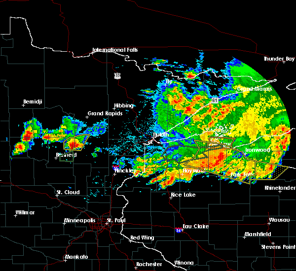 At 1048 pm cdt, severe thunderstorms were located along a line extending from 7 miles south of boy river, to 6 miles south of swatara, to cuyuna, moving east at 25 mph (radar indicated). Hazards include 70 mph wind gusts and quarter size hail. Hail damage to vehicles is expected. expect considerable tree damage. wind damage is also likely to mobile homes, roofs, and outbuildings. Locations impacted include, aitkin, emily, waukenabo, little pine, hassman, pine knoll, bain, esquagamah lake, white elk lake, and waldeck. At 1048 pm cdt, severe thunderstorms were located along a line extending from 7 miles south of boy river, to 6 miles south of swatara, to cuyuna, moving east at 25 mph (radar indicated). Hazards include 70 mph wind gusts and quarter size hail. Hail damage to vehicles is expected. expect considerable tree damage. wind damage is also likely to mobile homes, roofs, and outbuildings. Locations impacted include, aitkin, emily, waukenabo, little pine, hassman, pine knoll, bain, esquagamah lake, white elk lake, and waldeck.
|
| 7/8/2020 10:26 PM CDT |
 At 1026 pm cdt, severe thunderstorms were located along a line extending from near longville, to near emily, to near merrifield, moving east at 25 mph (radar indicated). Hazards include 70 mph wind gusts and quarter size hail. Hail damage to vehicles is expected. expect considerable tree damage. Wind damage is also likely to mobile homes, roofs, and outbuildings. At 1026 pm cdt, severe thunderstorms were located along a line extending from near longville, to near emily, to near merrifield, moving east at 25 mph (radar indicated). Hazards include 70 mph wind gusts and quarter size hail. Hail damage to vehicles is expected. expect considerable tree damage. Wind damage is also likely to mobile homes, roofs, and outbuildings.
|
| 7/8/2020 10:02 PM CDT |
 At 1001 pm cdt, a severe thunderstorm was located over pequot lakes, or 16 miles north of brainerd, moving northeast at 25 mph (radar indicated). Hazards include 70 mph wind gusts and half dollar size hail. this storm has produced one inch diameter hail. Hail damage to vehicles is expected. expect considerable tree damage. Wind damage is also likely to mobile homes, roofs, and outbuildings. At 1001 pm cdt, a severe thunderstorm was located over pequot lakes, or 16 miles north of brainerd, moving northeast at 25 mph (radar indicated). Hazards include 70 mph wind gusts and half dollar size hail. this storm has produced one inch diameter hail. Hail damage to vehicles is expected. expect considerable tree damage. Wind damage is also likely to mobile homes, roofs, and outbuildings.
|
| 7/8/2020 9:55 PM CDT |
 At 948 pm cdt, a severe thunderstorm was located over pequot lakes, or 17 miles north of brainerd, moving northeast at 35 mph (trained weather spotters). Hazards include 60 mph wind gusts and quarter size hail. Hail damage to vehicles is expected. expect wind damage to roofs, siding, and trees. trained spotters reported 1 inch diameter hail in lakeshore. Locations impacted include, breezy point, pequot lakes, crosslake, nisswa, pine river, fifty lakes, gull lake, lake shore, east gull lake, mission, jenkins, chickamaw beach, manhattan beach, lower hay lake, lake ada, upper mission lake, lake hubert, swanburg, lower whitefish lake, and edward lake. At 948 pm cdt, a severe thunderstorm was located over pequot lakes, or 17 miles north of brainerd, moving northeast at 35 mph (trained weather spotters). Hazards include 60 mph wind gusts and quarter size hail. Hail damage to vehicles is expected. expect wind damage to roofs, siding, and trees. trained spotters reported 1 inch diameter hail in lakeshore. Locations impacted include, breezy point, pequot lakes, crosslake, nisswa, pine river, fifty lakes, gull lake, lake shore, east gull lake, mission, jenkins, chickamaw beach, manhattan beach, lower hay lake, lake ada, upper mission lake, lake hubert, swanburg, lower whitefish lake, and edward lake.
|
| 7/8/2020 9:49 PM CDT |
 At 948 pm cdt, a severe thunderstorm was located over pequot lakes, or 17 miles north of brainerd, moving northeast at 35 mph (trained weather spotters). Hazards include 60 mph wind gusts and quarter size hail. Hail damage to vehicles is expected. expect wind damage to roofs, siding, and trees. trained spotters reported 1 inch diameter hail in lakeshore. Locations impacted include, breezy point, pequot lakes, crosslake, nisswa, pine river, fifty lakes, gull lake, lake shore, east gull lake, mission, jenkins, chickamaw beach, manhattan beach, lower hay lake, lake ada, upper mission lake, lake hubert, swanburg, lower whitefish lake, and edward lake. At 948 pm cdt, a severe thunderstorm was located over pequot lakes, or 17 miles north of brainerd, moving northeast at 35 mph (trained weather spotters). Hazards include 60 mph wind gusts and quarter size hail. Hail damage to vehicles is expected. expect wind damage to roofs, siding, and trees. trained spotters reported 1 inch diameter hail in lakeshore. Locations impacted include, breezy point, pequot lakes, crosslake, nisswa, pine river, fifty lakes, gull lake, lake shore, east gull lake, mission, jenkins, chickamaw beach, manhattan beach, lower hay lake, lake ada, upper mission lake, lake hubert, swanburg, lower whitefish lake, and edward lake.
|
| 7/8/2020 9:38 PM CDT |
 At 938 pm cdt, a severe thunderstorm was located near nisswa, or 15 miles northwest of brainerd, moving northeast at 35 mph (radar indicated). Hazards include 60 mph wind gusts and quarter size hail. Hail damage to vehicles is expected. Expect wind damage to roofs, siding, and trees. At 938 pm cdt, a severe thunderstorm was located near nisswa, or 15 miles northwest of brainerd, moving northeast at 35 mph (radar indicated). Hazards include 60 mph wind gusts and quarter size hail. Hail damage to vehicles is expected. Expect wind damage to roofs, siding, and trees.
|
| 9/5/2019 9:50 AM CDT |
 At 950 am cdt, a severe thunderstorm was located near emily, or 27 miles northeast of brainerd, moving southeast at 45 mph (radar indicated). Hazards include 60 mph wind gusts and quarter size hail. Hail damage to vehicles is expected. Expect wind damage to roofs, siding, and trees. At 950 am cdt, a severe thunderstorm was located near emily, or 27 miles northeast of brainerd, moving southeast at 45 mph (radar indicated). Hazards include 60 mph wind gusts and quarter size hail. Hail damage to vehicles is expected. Expect wind damage to roofs, siding, and trees.
|
| 9/5/2019 9:26 AM CDT |
 At 926 am cdt, a severe thunderstorm was located near outing, or 25 miles west of big sandy lake, moving east at 50 mph (radar indicated). Hazards include ping pong ball size hail and 60 mph wind gusts. People and animals outdoors will be injured. expect hail damage to roofs, siding, windows, and vehicles. expect wind damage to roofs, siding, and trees. Locations impacted include, big sandy lake, emily, mcgregor, palisade, libby, waukenabo, little pine, gun lake, sheshebee, esquagamah lake, white elk lake, waldeck, flowage lake, bain, and savanna portage state park. At 926 am cdt, a severe thunderstorm was located near outing, or 25 miles west of big sandy lake, moving east at 50 mph (radar indicated). Hazards include ping pong ball size hail and 60 mph wind gusts. People and animals outdoors will be injured. expect hail damage to roofs, siding, windows, and vehicles. expect wind damage to roofs, siding, and trees. Locations impacted include, big sandy lake, emily, mcgregor, palisade, libby, waukenabo, little pine, gun lake, sheshebee, esquagamah lake, white elk lake, waldeck, flowage lake, bain, and savanna portage state park.
|
| 9/5/2019 9:18 AM CDT |
 At 918 am cdt, a severe thunderstorm was located over outing, or 31 miles west of big sandy lake, moving east at 50 mph (radar indicated). Hazards include 60 mph wind gusts and half dollar size hail. Hail damage to vehicles is expected. expect wind damage to roofs, siding, and trees. Locations impacted include, big sandy lake, emily, mcgregor, fifty lakes, palisade, libby, outing, swatara, waukenabo, little pine, lake roosevelt, washburn lake, gun lake, sheshebee, esquagamah lake, white elk lake, waldeck, flowage lake, bain, and savanna portage state park. At 918 am cdt, a severe thunderstorm was located over outing, or 31 miles west of big sandy lake, moving east at 50 mph (radar indicated). Hazards include 60 mph wind gusts and half dollar size hail. Hail damage to vehicles is expected. expect wind damage to roofs, siding, and trees. Locations impacted include, big sandy lake, emily, mcgregor, fifty lakes, palisade, libby, outing, swatara, waukenabo, little pine, lake roosevelt, washburn lake, gun lake, sheshebee, esquagamah lake, white elk lake, waldeck, flowage lake, bain, and savanna portage state park.
|
| 9/5/2019 9:15 AM CDT |
 At 915 am cdt, a severe thunderstorm was located over outing, or 33 miles north of brainerd, moving east at 50 mph (radar indicated). Hazards include 60 mph wind gusts and half dollar size hail. Hail damage to vehicles is expected. Expect wind damage to roofs, siding, and trees. At 915 am cdt, a severe thunderstorm was located over outing, or 33 miles north of brainerd, moving east at 50 mph (radar indicated). Hazards include 60 mph wind gusts and half dollar size hail. Hail damage to vehicles is expected. Expect wind damage to roofs, siding, and trees.
|
| 9/5/2019 7:30 AM CDT |
 At 730 am cdt, a severe thunderstorm was located near breezy point, or 22 miles north of brainerd, moving east at 55 mph (radar indicated). Hazards include 60 mph wind gusts and half dollar size hail. Hail damage to vehicles is expected. expect wind damage to roofs, siding, and trees. Locations impacted include, breezy point, crosslake, emily, fifty lakes, cuyuna, mission, jenkins, wolford, little pine, manhattan beach, lower hay lake, swanburg, lower whitefish lake, big trout lake, and upper mission lake. At 730 am cdt, a severe thunderstorm was located near breezy point, or 22 miles north of brainerd, moving east at 55 mph (radar indicated). Hazards include 60 mph wind gusts and half dollar size hail. Hail damage to vehicles is expected. expect wind damage to roofs, siding, and trees. Locations impacted include, breezy point, crosslake, emily, fifty lakes, cuyuna, mission, jenkins, wolford, little pine, manhattan beach, lower hay lake, swanburg, lower whitefish lake, big trout lake, and upper mission lake.
|
| 9/5/2019 7:26 AM CDT |
 At 726 am cdt, a severe thunderstorm was located near pine river, or 24 miles north of brainerd, moving east at 55 mph (radar indicated). Hazards include 60 mph wind gusts and half dollar size hail. Hail damage to vehicles is expected. expect wind damage to roofs, siding, and trees. Locations impacted include, crosby, breezy point, pequot lakes, crosslake, pine river, emily, ironton, fifty lakes, cuyuna, mission, jenkins, wolford, chickamaw beach, trommald, little pine, manhattan beach, lower hay lake, cuyuna country state park, upper mission lake, and swanburg. At 726 am cdt, a severe thunderstorm was located near pine river, or 24 miles north of brainerd, moving east at 55 mph (radar indicated). Hazards include 60 mph wind gusts and half dollar size hail. Hail damage to vehicles is expected. expect wind damage to roofs, siding, and trees. Locations impacted include, crosby, breezy point, pequot lakes, crosslake, pine river, emily, ironton, fifty lakes, cuyuna, mission, jenkins, wolford, chickamaw beach, trommald, little pine, manhattan beach, lower hay lake, cuyuna country state park, upper mission lake, and swanburg.
|
| 9/5/2019 7:14 AM CDT |
 At 713 am cdt, a severe thunderstorm was located near backus, or 24 miles south of walker, moving east at 55 mph (radar indicated). Hazards include 60 mph wind gusts and half dollar size hail. Hail damage to vehicles is expected. Expect wind damage to roofs, siding, and trees. At 713 am cdt, a severe thunderstorm was located near backus, or 24 miles south of walker, moving east at 55 mph (radar indicated). Hazards include 60 mph wind gusts and half dollar size hail. Hail damage to vehicles is expected. Expect wind damage to roofs, siding, and trees.
|
| 8/5/2019 7:06 AM CDT |
 At 706 am cdt, severe thunderstorms were located along a line extending from 6 miles southwest of boy river, to longville, to near woman lake, to near backus, moving east at 50 mph. a second area of strong thunderstorms were located near walker and were moving east- northeast at 40 mph (radar indicated). Hazards include 70 mph wind gusts and quarter size hail. Hail damage to vehicles is expected. expect considerable tree damage. wind damage is also likely to mobile homes, roofs, and outbuildings. Locations impacted include, walker, emily, fifty lakes, remer, wabedo, hackensack, backus, longville, boy river, outing, woman lake, leech lake, thunder lake, boy lake, inguadona, ten mile lake, lake roosevelt, pheasant lake, lake ada, and tobique. At 706 am cdt, severe thunderstorms were located along a line extending from 6 miles southwest of boy river, to longville, to near woman lake, to near backus, moving east at 50 mph. a second area of strong thunderstorms were located near walker and were moving east- northeast at 40 mph (radar indicated). Hazards include 70 mph wind gusts and quarter size hail. Hail damage to vehicles is expected. expect considerable tree damage. wind damage is also likely to mobile homes, roofs, and outbuildings. Locations impacted include, walker, emily, fifty lakes, remer, wabedo, hackensack, backus, longville, boy river, outing, woman lake, leech lake, thunder lake, boy lake, inguadona, ten mile lake, lake roosevelt, pheasant lake, lake ada, and tobique.
|
| 8/5/2019 6:49 AM CDT |
 At 649 am cdt, severe thunderstorms were located along a line extending from near walker, to near hackensack, to backus, moving east at 40 mph (radar indicated). Hazards include 60 mph wind gusts and quarter size hail. Hail damage to vehicles is expected. Expect wind damage to roofs, siding, and trees. At 649 am cdt, severe thunderstorms were located along a line extending from near walker, to near hackensack, to backus, moving east at 40 mph (radar indicated). Hazards include 60 mph wind gusts and quarter size hail. Hail damage to vehicles is expected. Expect wind damage to roofs, siding, and trees.
|
| 6/30/2019 8:59 AM CDT |
 At 859 am cdt, a severe thunderstorm was located near crosslake, or 24 miles north of brainerd, moving east at 45 mph (radar indicated). Hazards include 60 mph wind gusts and quarter size hail. Hail damage to vehicles is expected. expect wind damage to roofs, siding, and trees. Locations impacted include, breezy point, pequot lakes, crosslake, pine river, emily, fifty lakes, outing, mission, jenkins, chickamaw beach, little pine, manhattan beach, lake roosevelt, lower hay lake, washburn lake, swanburg, lower whitefish lake, and big trout lake. At 859 am cdt, a severe thunderstorm was located near crosslake, or 24 miles north of brainerd, moving east at 45 mph (radar indicated). Hazards include 60 mph wind gusts and quarter size hail. Hail damage to vehicles is expected. expect wind damage to roofs, siding, and trees. Locations impacted include, breezy point, pequot lakes, crosslake, pine river, emily, fifty lakes, outing, mission, jenkins, chickamaw beach, little pine, manhattan beach, lake roosevelt, lower hay lake, washburn lake, swanburg, lower whitefish lake, and big trout lake.
|
| 6/30/2019 8:42 AM CDT |
 At 842 am cdt, a severe thunderstorm was located near pine river, or 25 miles northwest of brainerd, moving east at 45 mph (radar indicated). Hazards include 60 mph wind gusts and quarter size hail. Hail damage to vehicles is expected. Expect wind damage to roofs, siding, and trees. At 842 am cdt, a severe thunderstorm was located near pine river, or 25 miles northwest of brainerd, moving east at 45 mph (radar indicated). Hazards include 60 mph wind gusts and quarter size hail. Hail damage to vehicles is expected. Expect wind damage to roofs, siding, and trees.
|
| 9/2/2018 7:11 AM CDT |
 The severe thunderstorm warning for southwestern aitkin and crow wing counties will expire at 715 am cdt, the storms which prompted the warning have weakened below severe limits, and no longer pose an immediate threat to life or property. therefore, the warning will be allowed to expire. however gusty winds and small hail are still possible with these thunderstorms. The severe thunderstorm warning for southwestern aitkin and crow wing counties will expire at 715 am cdt, the storms which prompted the warning have weakened below severe limits, and no longer pose an immediate threat to life or property. therefore, the warning will be allowed to expire. however gusty winds and small hail are still possible with these thunderstorms.
|
| 9/2/2018 6:47 AM CDT |
 At 646 am cdt, severe thunderstorms were located along a line extending from near pine river, to near brainerd, moving east at 35 mph (radar indicated). Hazards include 60 mph wind gusts and quarter size hail. Hail damage to vehicles is expected. Expect wind damage to roofs, siding, and trees. At 646 am cdt, severe thunderstorms were located along a line extending from near pine river, to near brainerd, moving east at 35 mph (radar indicated). Hazards include 60 mph wind gusts and quarter size hail. Hail damage to vehicles is expected. Expect wind damage to roofs, siding, and trees.
|
| 8/31/2018 7:04 PM CDT |
 At 704 pm cdt, a large and dangerous severe thunderstorm was located 10 miles north of aitkin, or 21 miles west of big sandy lake, moving east at 55 mph. this is a very dangerous storm (radar indicated). Hazards include 80 mph wind gusts and quarter size hail. Flying debris will be dangerous to those caught without shelter. mobile homes will be heavily damaged. expect considerable damage to roofs, windows, and vehicles. extensive tree damage and power outages are likely. Locations impacted include, big sandy lake, crosby, aitkin, emily, ironton, mcgregor, cuyuna, palisade, libby, outing, swatara, cedar lake, wolford, waukenabo, ball bluff, kimberly, trommald, little pine, lake roosevelt, and sheshebee. At 704 pm cdt, a large and dangerous severe thunderstorm was located 10 miles north of aitkin, or 21 miles west of big sandy lake, moving east at 55 mph. this is a very dangerous storm (radar indicated). Hazards include 80 mph wind gusts and quarter size hail. Flying debris will be dangerous to those caught without shelter. mobile homes will be heavily damaged. expect considerable damage to roofs, windows, and vehicles. extensive tree damage and power outages are likely. Locations impacted include, big sandy lake, crosby, aitkin, emily, ironton, mcgregor, cuyuna, palisade, libby, outing, swatara, cedar lake, wolford, waukenabo, ball bluff, kimberly, trommald, little pine, lake roosevelt, and sheshebee.
|
| 8/31/2018 6:44 PM CDT |
 At 644 pm cdt, a large severe thunderstorm was located over crosslake, or 21 miles north of brainerd, moving east at 45 mph (radar indicated). Hazards include 70 mph wind gusts and half dollar size hail. Hail damage to vehicles is expected. expect considerable tree damage. Wind damage is also likely to mobile homes, roofs, and outbuildings. At 644 pm cdt, a large severe thunderstorm was located over crosslake, or 21 miles north of brainerd, moving east at 45 mph (radar indicated). Hazards include 70 mph wind gusts and half dollar size hail. Hail damage to vehicles is expected. expect considerable tree damage. Wind damage is also likely to mobile homes, roofs, and outbuildings.
|
| 7/12/2018 2:25 AM CDT |
 At 224 am cdt, severe thunderstorms were located along a line extending from near palisade, to near cuyuna, to leader, moving east at 20 mph (radar indicated). Hazards include 60 mph wind gusts and quarter size hail. Hail damage to vehicles is expected. expect wind damage to roofs, siding, and trees. Locations impacted include, crosby, breezy point, aitkin, pequot lakes, crosslake, nisswa, pine river, emily, ironton, deerwood, fifty lakes, cuyuna, poplar, palisade, outing, gull lake, leader, merrifield, cedar lake, and lake shore. At 224 am cdt, severe thunderstorms were located along a line extending from near palisade, to near cuyuna, to leader, moving east at 20 mph (radar indicated). Hazards include 60 mph wind gusts and quarter size hail. Hail damage to vehicles is expected. expect wind damage to roofs, siding, and trees. Locations impacted include, crosby, breezy point, aitkin, pequot lakes, crosslake, nisswa, pine river, emily, ironton, deerwood, fifty lakes, cuyuna, poplar, palisade, outing, gull lake, leader, merrifield, cedar lake, and lake shore.
|
| 7/12/2018 1:56 AM CDT |
 At 156 am cdt, severe thunderstorms were located along a line extending from outing, to near breezy point, to 7 miles southwest of poplar, moving east at 20 mph (radar indicated). Hazards include 60 mph wind gusts and quarter size hail. Hail damage to vehicles is expected. Expect wind damage to roofs, siding, and trees. At 156 am cdt, severe thunderstorms were located along a line extending from outing, to near breezy point, to 7 miles southwest of poplar, moving east at 20 mph (radar indicated). Hazards include 60 mph wind gusts and quarter size hail. Hail damage to vehicles is expected. Expect wind damage to roofs, siding, and trees.
|
| 7/12/2018 1:11 AM CDT |
 At 111 am cdt, severe thunderstorms were located along a line extending from near hill city, to swatara, to near outing, moving east at 40 mph (radar indicated). Hazards include 60 mph wind gusts. Expect damage to roofs, siding, and trees. Locations impacted include, big sandy lake, emily, hill city, fifty lakes, remer, palisade, libby, outing, swatara, jacobson, waukenabo, ball bluff, thunder lake, little pine, lake roosevelt, washburn lake, esquagamah lake, white elk lake, haypoint, and bain. At 111 am cdt, severe thunderstorms were located along a line extending from near hill city, to swatara, to near outing, moving east at 40 mph (radar indicated). Hazards include 60 mph wind gusts. Expect damage to roofs, siding, and trees. Locations impacted include, big sandy lake, emily, hill city, fifty lakes, remer, palisade, libby, outing, swatara, jacobson, waukenabo, ball bluff, thunder lake, little pine, lake roosevelt, washburn lake, esquagamah lake, white elk lake, haypoint, and bain.
|
| 7/12/2018 12:53 AM CDT |
 At 1253 am cdt, severe thunderstorms were located along a line extending from remer, to 7 miles north of outing, to near wabedo, moving east at 40 mph (radar indicated). Hazards include 60 mph wind gusts. expect damage to roofs, siding, and trees At 1253 am cdt, severe thunderstorms were located along a line extending from remer, to 7 miles north of outing, to near wabedo, moving east at 40 mph (radar indicated). Hazards include 60 mph wind gusts. expect damage to roofs, siding, and trees
|
| 7/12/2018 12:47 AM CDT |
 At 1247 am cdt, severe thunderstorms were located along a line extending from 6 miles south of boy river, to 7 miles east of longville, to near wabedo, moving east at 40 mph (radar indicated). Hazards include 60 mph wind gusts. Expect damage to roofs, siding, and trees. locations impacted include, emily, fifty lakes, wabedo, longville, outing, woman lake, thunder lake, inguadona, little pine, lake roosevelt, washburn lake, and laura lake. A tornado watch remains in effect until 100 am cdt for north central and east central minnesota. At 1247 am cdt, severe thunderstorms were located along a line extending from 6 miles south of boy river, to 7 miles east of longville, to near wabedo, moving east at 40 mph (radar indicated). Hazards include 60 mph wind gusts. Expect damage to roofs, siding, and trees. locations impacted include, emily, fifty lakes, wabedo, longville, outing, woman lake, thunder lake, inguadona, little pine, lake roosevelt, washburn lake, and laura lake. A tornado watch remains in effect until 100 am cdt for north central and east central minnesota.
|
| 7/12/2018 12:33 AM CDT |
 At 1233 am cdt, severe thunderstorms were located along a line extending from 7 miles southeast of leech lake, to woman lake, to 7 miles northeast of backus, moving east at 40 mph (radar indicated). Hazards include 60 mph wind gusts. Expect damage to roofs, siding, and trees. locations impacted include, crosslake, emily, fifty lakes, wabedo, hackensack, backus, longville, outing, woman lake, leech lake, thunder lake, inguadona, chickamaw beach, little pine, manhattan beach, lake roosevelt, pheasant lake, lake ada, brevik, and laura lake. A tornado watch remains in effect until 100 am cdt for north central and east central minnesota. At 1233 am cdt, severe thunderstorms were located along a line extending from 7 miles southeast of leech lake, to woman lake, to 7 miles northeast of backus, moving east at 40 mph (radar indicated). Hazards include 60 mph wind gusts. Expect damage to roofs, siding, and trees. locations impacted include, crosslake, emily, fifty lakes, wabedo, hackensack, backus, longville, outing, woman lake, leech lake, thunder lake, inguadona, chickamaw beach, little pine, manhattan beach, lake roosevelt, pheasant lake, lake ada, brevik, and laura lake. A tornado watch remains in effect until 100 am cdt for north central and east central minnesota.
|
| 7/12/2018 12:18 AM CDT |
 At 1218 am cdt, severe thunderstorms were located along a line extending from walker, to near hackensack, to 7 miles west of backus, moving east at 50 mph (radar indicated). Hazards include 60 mph wind gusts. expect damage to roofs, siding, and trees At 1218 am cdt, severe thunderstorms were located along a line extending from walker, to near hackensack, to 7 miles west of backus, moving east at 50 mph (radar indicated). Hazards include 60 mph wind gusts. expect damage to roofs, siding, and trees
|
| 7/8/2018 8:39 PM CDT |
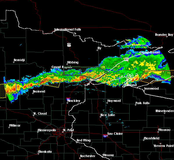 At 839 pm cdt, a severe thunderstorm was located 7 miles east of emily, or 24 miles west of big sandy lake, moving east at 30 mph (radar indicated). Hazards include 60 mph wind gusts and quarter size hail. Hail damage to vehicles is expected. Expect wind damage to roofs, siding, and trees. At 839 pm cdt, a severe thunderstorm was located 7 miles east of emily, or 24 miles west of big sandy lake, moving east at 30 mph (radar indicated). Hazards include 60 mph wind gusts and quarter size hail. Hail damage to vehicles is expected. Expect wind damage to roofs, siding, and trees.
|
| 7/4/2018 7:41 AM CDT |
 The severe thunderstorm warning for cass and crow wing counties will expire at 745 am cdt, the storms which prompted the warning have weakened below severe limits, and no longer pose an immediate threat to life or property. therefore, the warning will be allowed to expire. however gusty winds and heavy rain are still possible with these thunderstorms. The severe thunderstorm warning for cass and crow wing counties will expire at 745 am cdt, the storms which prompted the warning have weakened below severe limits, and no longer pose an immediate threat to life or property. therefore, the warning will be allowed to expire. however gusty winds and heavy rain are still possible with these thunderstorms.
|
| 7/4/2018 7:25 AM CDT |
 At 707 am cdt, severe thunderstorms were located along a line extending from leech lake, to 7 miles south of motley, moving east at 35 mph (radar indicated). Hazards include 60 mph wind gusts and quarter size hail. Hail damage to vehicles is expected. expect wind damage to roofs, siding, and trees. Locations impacted include, brainerd, walker, baxter, crosby, breezy point, pequot lakes, crosslake, nisswa, pine river, emily, ironton, deerwood, pillager, fifty lakes, remer, wabedo, cuyuna, hackensack, backus, and poplar. At 707 am cdt, severe thunderstorms were located along a line extending from leech lake, to 7 miles south of motley, moving east at 35 mph (radar indicated). Hazards include 60 mph wind gusts and quarter size hail. Hail damage to vehicles is expected. expect wind damage to roofs, siding, and trees. Locations impacted include, brainerd, walker, baxter, crosby, breezy point, pequot lakes, crosslake, nisswa, pine river, emily, ironton, deerwood, pillager, fifty lakes, remer, wabedo, cuyuna, hackensack, backus, and poplar.
|
| 7/4/2018 7:07 AM CDT |
 At 707 am cdt, severe thunderstorms were located along a line extending from leech lake, to 7 miles south of motley, moving east at 35 mph (radar indicated). Hazards include 60 mph wind gusts and quarter size hail. Hail damage to vehicles is expected. expect wind damage to roofs, siding, and trees. Locations impacted include, brainerd, walker, baxter, crosby, breezy point, pequot lakes, crosslake, nisswa, pine river, emily, ironton, deerwood, pillager, fifty lakes, remer, wabedo, cuyuna, hackensack, backus, and poplar. At 707 am cdt, severe thunderstorms were located along a line extending from leech lake, to 7 miles south of motley, moving east at 35 mph (radar indicated). Hazards include 60 mph wind gusts and quarter size hail. Hail damage to vehicles is expected. expect wind damage to roofs, siding, and trees. Locations impacted include, brainerd, walker, baxter, crosby, breezy point, pequot lakes, crosslake, nisswa, pine river, emily, ironton, deerwood, pillager, fifty lakes, remer, wabedo, cuyuna, hackensack, backus, and poplar.
|
| 7/4/2018 6:55 AM CDT |
 At 655 am cdt, severe thunderstorms were located along a line extending from near walker, to 8 miles southwest of motley, moving east at 35 mph (radar indicated). Hazards include 60 mph wind gusts and quarter size hail. Hail damage to vehicles is expected. Expect wind damage to roofs, siding, and trees. At 655 am cdt, severe thunderstorms were located along a line extending from near walker, to 8 miles southwest of motley, moving east at 35 mph (radar indicated). Hazards include 60 mph wind gusts and quarter size hail. Hail damage to vehicles is expected. Expect wind damage to roofs, siding, and trees.
|
| 6/30/2018 2:01 AM CDT |
 At 154 am cdt, severe thunderstorms were located along a line extending from 9 miles southeast of emily, to near vineland, moving east at 50 mph (radar indicated). Hazards include 60 mph wind gusts and quarter size hail. Hail damage to vehicles is expected. expect wind damage to roofs, siding, and trees. these severe storms will be near, palisade around 210 am cdt. big sandy lake, mcgregor and libby around 220 am cdt. mcgrath around 225 am cdt. tamarack around 230 am cdt. Other locations impacted by these severe thunderstorms include waukenabo, arthyde, cedar lake, camp lake, sheshebee, riverton, ripple lake, cuyuna country state park, dads corner, and glory. At 154 am cdt, severe thunderstorms were located along a line extending from 9 miles southeast of emily, to near vineland, moving east at 50 mph (radar indicated). Hazards include 60 mph wind gusts and quarter size hail. Hail damage to vehicles is expected. expect wind damage to roofs, siding, and trees. these severe storms will be near, palisade around 210 am cdt. big sandy lake, mcgregor and libby around 220 am cdt. mcgrath around 225 am cdt. tamarack around 230 am cdt. Other locations impacted by these severe thunderstorms include waukenabo, arthyde, cedar lake, camp lake, sheshebee, riverton, ripple lake, cuyuna country state park, dads corner, and glory.
|
| 6/30/2018 1:54 AM CDT |
 At 154 am cdt, severe thunderstorms were located along a line extending from 9 miles southeast of emily, to near vineland, moving east at 50 mph (radar indicated). Hazards include 60 mph wind gusts and quarter size hail. Hail damage to vehicles is expected. expect wind damage to roofs, siding, and trees. these severe storms will be near, palisade around 210 am cdt. big sandy lake, mcgregor and libby around 220 am cdt. mcgrath around 225 am cdt. tamarack around 230 am cdt. Other locations impacted by these severe thunderstorms include waukenabo, arthyde, cedar lake, camp lake, sheshebee, riverton, ripple lake, cuyuna country state park, dads corner, and glory. At 154 am cdt, severe thunderstorms were located along a line extending from 9 miles southeast of emily, to near vineland, moving east at 50 mph (radar indicated). Hazards include 60 mph wind gusts and quarter size hail. Hail damage to vehicles is expected. expect wind damage to roofs, siding, and trees. these severe storms will be near, palisade around 210 am cdt. big sandy lake, mcgregor and libby around 220 am cdt. mcgrath around 225 am cdt. tamarack around 230 am cdt. Other locations impacted by these severe thunderstorms include waukenabo, arthyde, cedar lake, camp lake, sheshebee, riverton, ripple lake, cuyuna country state park, dads corner, and glory.
|
| 6/30/2018 1:41 AM CDT |
 At 141 am cdt, severe thunderstorms were located along a line extending from near crosslake, to near lastrup, moving east at 50 mph (radar indicated). Hazards include 60 mph wind gusts and quarter size hail. Hail damage to vehicles is expected. expect wind damage to roofs, siding, and trees. severe thunderstorms will be near, cuyuna around 145 am cdt. aitkin around 200 am cdt. palisade around 210 am cdt. big sandy lake, mcgregor and libby around 220 am cdt. tamarack around 230 am cdt. Other locations impacted by these severe thunderstorms include waukenabo, arthyde, cedar lake, camp lake, sheshebee, riverton, ripple lake, cuyuna country state park, dads corner, and glory. At 141 am cdt, severe thunderstorms were located along a line extending from near crosslake, to near lastrup, moving east at 50 mph (radar indicated). Hazards include 60 mph wind gusts and quarter size hail. Hail damage to vehicles is expected. expect wind damage to roofs, siding, and trees. severe thunderstorms will be near, cuyuna around 145 am cdt. aitkin around 200 am cdt. palisade around 210 am cdt. big sandy lake, mcgregor and libby around 220 am cdt. tamarack around 230 am cdt. Other locations impacted by these severe thunderstorms include waukenabo, arthyde, cedar lake, camp lake, sheshebee, riverton, ripple lake, cuyuna country state park, dads corner, and glory.
|
| 5/24/2018 1:53 AM CDT |
 The severe thunderstorm warning for west central aitkin and northeastern crow wing counties will expire at 200 am cdt, the storm which prompted the warning has weakened below severe limits, and no longer poses an immediate threat to life or property. therefore, the warning will be allowed to expire. however small hail and gusty winds to 45 mph are still possible with this thunderstorm. The severe thunderstorm warning for west central aitkin and northeastern crow wing counties will expire at 200 am cdt, the storm which prompted the warning has weakened below severe limits, and no longer poses an immediate threat to life or property. therefore, the warning will be allowed to expire. however small hail and gusty winds to 45 mph are still possible with this thunderstorm.
|
| 5/24/2018 1:39 AM CDT |
 At 139 am cdt, a severe thunderstorm was located near cuyuna, or 19 miles northeast of brainerd, moving northeast at 10 mph (radar indicated). Hazards include 60 mph wind gusts and quarter size hail. Hail damage to vehicles is expected. expect wind damage to roofs, siding, and trees. Locations impacted include, crosslake, emily, cuyuna, mission, wolford, and pine knoll. At 139 am cdt, a severe thunderstorm was located near cuyuna, or 19 miles northeast of brainerd, moving northeast at 10 mph (radar indicated). Hazards include 60 mph wind gusts and quarter size hail. Hail damage to vehicles is expected. expect wind damage to roofs, siding, and trees. Locations impacted include, crosslake, emily, cuyuna, mission, wolford, and pine knoll.
|
| 5/24/2018 1:27 AM CDT |
 At 127 am cdt, a severe thunderstorm was located near cuyuna, or 16 miles northeast of brainerd, moving northeast at 10 mph (radar indicated). Hazards include 60 mph wind gusts and quarter size hail. Hail damage to vehicles is expected. Expect wind damage to roofs, siding, and trees. At 127 am cdt, a severe thunderstorm was located near cuyuna, or 16 miles northeast of brainerd, moving northeast at 10 mph (radar indicated). Hazards include 60 mph wind gusts and quarter size hail. Hail damage to vehicles is expected. Expect wind damage to roofs, siding, and trees.
|
| 9/24/2017 5:09 PM CDT |
 The severe thunderstorm warning for west central aitkin, east central cass and northeastern crow wing counties will expire at 515 pm cdt, the storms which prompted the warning have weakened below severe limits, and no longer pose an immediate threat to life or property. therefore, the warning will be allowed to expire. however gusty winds are still possible with these thunderstorms. The severe thunderstorm warning for west central aitkin, east central cass and northeastern crow wing counties will expire at 515 pm cdt, the storms which prompted the warning have weakened below severe limits, and no longer pose an immediate threat to life or property. therefore, the warning will be allowed to expire. however gusty winds are still possible with these thunderstorms.
|
| 9/24/2017 4:50 PM CDT |
 At 450 pm cdt, severe thunderstorms were located along a line extending from 6 miles south of emily, to near aitkin, moving northeast at 50 mph (radar indicated). Hazards include 60 mph wind gusts and quarter size hail. Hail damage to vehicles is expected. expect wind damage to roofs, siding, and trees. these severe storms will be near, emily around 500 pm cdt. palisade around 515 pm cdt. Other locations impacted by these severe thunderstorms include waukenabo, wolford, cedar lake, gun lake, little pine, ripple lake, cuyuna country state park, glory, upper mission lake, and white elk lake. At 450 pm cdt, severe thunderstorms were located along a line extending from 6 miles south of emily, to near aitkin, moving northeast at 50 mph (radar indicated). Hazards include 60 mph wind gusts and quarter size hail. Hail damage to vehicles is expected. expect wind damage to roofs, siding, and trees. these severe storms will be near, emily around 500 pm cdt. palisade around 515 pm cdt. Other locations impacted by these severe thunderstorms include waukenabo, wolford, cedar lake, gun lake, little pine, ripple lake, cuyuna country state park, glory, upper mission lake, and white elk lake.
|
| 9/24/2017 4:37 PM CDT |
 At 437 pm cdt, severe thunderstorms were located along a line extending from near cuyuna, to near garrison, moving northeast at 50 mph (radar indicated). Hazards include 60 mph wind gusts and quarter size hail. Hail damage to vehicles is expected. expect wind damage to roofs, siding, and trees. Locations impacted include, brainerd, mille lacs lake, crosby, aitkin, crosslake, emily, ironton, deerwood, mcgregor, cuyuna, garrison, palisade, merrifield, upper south long lake, cedar lake, bay lake, mission, glen, wolford, and waukenabo. At 437 pm cdt, severe thunderstorms were located along a line extending from near cuyuna, to near garrison, moving northeast at 50 mph (radar indicated). Hazards include 60 mph wind gusts and quarter size hail. Hail damage to vehicles is expected. expect wind damage to roofs, siding, and trees. Locations impacted include, brainerd, mille lacs lake, crosby, aitkin, crosslake, emily, ironton, deerwood, mcgregor, cuyuna, garrison, palisade, merrifield, upper south long lake, cedar lake, bay lake, mission, glen, wolford, and waukenabo.
|
| 9/24/2017 4:27 PM CDT |
 At 427 pm cdt, severe thunderstorms were located along a line extending from near merrifield, to 6 miles southwest of garrison, moving northeast at 50 mph (radar indicated). Hazards include 60 mph wind gusts and quarter size hail. Hail damage to vehicles is expected. Expect wind damage to roofs, siding, and trees. At 427 pm cdt, severe thunderstorms were located along a line extending from near merrifield, to 6 miles southwest of garrison, moving northeast at 50 mph (radar indicated). Hazards include 60 mph wind gusts and quarter size hail. Hail damage to vehicles is expected. Expect wind damage to roofs, siding, and trees.
|
| 9/22/2017 5:40 AM CDT |
 At 540 am cdt, severe thunderstorms were located along a line extending from hackensack, to near fifty lakes, to near aitkin, moving northeast at 60 mph (radar indicated). Hazards include 70 mph wind gusts and nickel size hail. Expect considerable tree damage. damage is likely to mobile homes, roofs, and outbuildings. Locations impacted include, big sandy lake, crosslake, emily, hill city, fifty lakes, remer, wabedo, hackensack, palisade, longville, libby, outing, woman lake, swatara, waukenabo, thunder lake, boy lake, inguadona, little pine, and manhattan beach. At 540 am cdt, severe thunderstorms were located along a line extending from hackensack, to near fifty lakes, to near aitkin, moving northeast at 60 mph (radar indicated). Hazards include 70 mph wind gusts and nickel size hail. Expect considerable tree damage. damage is likely to mobile homes, roofs, and outbuildings. Locations impacted include, big sandy lake, crosslake, emily, hill city, fifty lakes, remer, wabedo, hackensack, palisade, longville, libby, outing, woman lake, swatara, waukenabo, thunder lake, boy lake, inguadona, little pine, and manhattan beach.
|
| 9/22/2017 5:25 AM CDT |
 At 524 am cdt, severe thunderstorms were located along a line extending from 8 miles south of akeley, to near pine river, to near crosslake, to 8 miles northwest of cuyuna, moving northeast at 45 mph (radar indicated). Hazards include 70 mph wind gusts and quarter size hail. Hail damage to vehicles is expected. expect considerable tree damage. Wind damage is also likely to mobile homes, roofs, and outbuildings. At 524 am cdt, severe thunderstorms were located along a line extending from 8 miles south of akeley, to near pine river, to near crosslake, to 8 miles northwest of cuyuna, moving northeast at 45 mph (radar indicated). Hazards include 70 mph wind gusts and quarter size hail. Hail damage to vehicles is expected. expect considerable tree damage. Wind damage is also likely to mobile homes, roofs, and outbuildings.
|
| 9/22/2017 5:21 AM CDT |
 At 520 am cdt, severe thunderstorms were located along a line extending from pine river, to near cuyuna, to near deerwood, to mille lacs lake, moving northeast at 30 mph (radar indicated). Hazards include 70 mph wind gusts and half dollar size hail. Hail damage to vehicles is expected. expect considerable tree damage. wind damage is also likely to mobile homes, roofs, and outbuildings. Locations impacted include, mille lacs lake, crosby, breezy point, aitkin, pequot lakes, crosslake, nisswa, pine river, emily, ironton, deerwood, fifty lakes, malmo, cuyuna, garrison, cedar lake, bay lake, mission, glen, and jenkins. At 520 am cdt, severe thunderstorms were located along a line extending from pine river, to near cuyuna, to near deerwood, to mille lacs lake, moving northeast at 30 mph (radar indicated). Hazards include 70 mph wind gusts and half dollar size hail. Hail damage to vehicles is expected. expect considerable tree damage. wind damage is also likely to mobile homes, roofs, and outbuildings. Locations impacted include, mille lacs lake, crosby, breezy point, aitkin, pequot lakes, crosslake, nisswa, pine river, emily, ironton, deerwood, fifty lakes, malmo, cuyuna, garrison, cedar lake, bay lake, mission, glen, and jenkins.
|
| 9/22/2017 5:10 AM CDT |
 At 509 am cdt, severe thunderstorms were located along a line extending from 7 miles southwest of pine river, to near ironton, to 6 miles south of deerwood, to near vineland, moving northeast at 40 mph (radar indicated. a 53 mph wind gust was recorded at the brainerd airport associated with these thunderstorms). Hazards include 70 mph wind gusts and ping pong ball size hail. People and animals outdoors will be injured. expect hail damage to roofs, siding, windows, and vehicles. expect considerable tree damage. wind damage is also likely to mobile homes, roofs, and outbuildings. Locations impacted include, brainerd, mille lacs lake, crosby, breezy point, aitkin, pequot lakes, crosslake, nisswa, pine river, emily, ironton, deerwood, fifty lakes, malmo, cuyuna, garrison, upper south long lake, gull lake, merrifield, and south long lake. At 509 am cdt, severe thunderstorms were located along a line extending from 7 miles southwest of pine river, to near ironton, to 6 miles south of deerwood, to near vineland, moving northeast at 40 mph (radar indicated. a 53 mph wind gust was recorded at the brainerd airport associated with these thunderstorms). Hazards include 70 mph wind gusts and ping pong ball size hail. People and animals outdoors will be injured. expect hail damage to roofs, siding, windows, and vehicles. expect considerable tree damage. wind damage is also likely to mobile homes, roofs, and outbuildings. Locations impacted include, brainerd, mille lacs lake, crosby, breezy point, aitkin, pequot lakes, crosslake, nisswa, pine river, emily, ironton, deerwood, fifty lakes, malmo, cuyuna, garrison, upper south long lake, gull lake, merrifield, and south long lake.
|
| 9/22/2017 4:58 AM CDT |
 At 457 am cdt, severe thunderstorms were located along a line extending from 6 miles northeast of leader, to near merrifield, to near upper south long lake, to 7 miles west of vineland, moving northeast at 40 mph (radar indicated). Hazards include 70 mph wind gusts and ping pong ball size hail. People and animals outdoors will be injured. expect hail damage to roofs, siding, windows, and vehicles. expect considerable tree damage. wind damage is also likely to mobile homes, roofs, and outbuildings. Locations impacted include, brainerd, mille lacs lake, baxter, crosby, breezy point, aitkin, pequot lakes, crosslake, nisswa, pine river, emily, ironton, deerwood, fifty lakes, malmo, cuyuna, garrison, upper south long lake, gull lake, and leader. At 457 am cdt, severe thunderstorms were located along a line extending from 6 miles northeast of leader, to near merrifield, to near upper south long lake, to 7 miles west of vineland, moving northeast at 40 mph (radar indicated). Hazards include 70 mph wind gusts and ping pong ball size hail. People and animals outdoors will be injured. expect hail damage to roofs, siding, windows, and vehicles. expect considerable tree damage. wind damage is also likely to mobile homes, roofs, and outbuildings. Locations impacted include, brainerd, mille lacs lake, baxter, crosby, breezy point, aitkin, pequot lakes, crosslake, nisswa, pine river, emily, ironton, deerwood, fifty lakes, malmo, cuyuna, garrison, upper south long lake, gull lake, and leader.
|
| 9/22/2017 4:48 AM CDT |
 At 448 am cdt, severe thunderstorms were located along a line extending from near motley, to baxter, to 8 miles south of south long lake, moving northeast at 30 mph (radar indicated). Hazards include 70 mph wind gusts and ping pong ball size hail. People and animals outdoors will be injured. expect hail damage to roofs, siding, windows, and vehicles. expect considerable tree damage. Wind damage is also likely to mobile homes, roofs, and outbuildings. At 448 am cdt, severe thunderstorms were located along a line extending from near motley, to baxter, to 8 miles south of south long lake, moving northeast at 30 mph (radar indicated). Hazards include 70 mph wind gusts and ping pong ball size hail. People and animals outdoors will be injured. expect hail damage to roofs, siding, windows, and vehicles. expect considerable tree damage. Wind damage is also likely to mobile homes, roofs, and outbuildings.
|
| 9/20/2017 1:51 AM CDT |
 At 151 am cdt, severe thunderstorms were located along a line extending from wabedo, to near cuyuna, to 7 miles west of vineland, moving northeast at 70 mph (radar indicated). Hazards include 70 mph wind gusts and penny size hail. Expect considerable tree damage. damage is likely to mobile homes, roofs, and outbuildings. Locations impacted include, brainerd, mille lacs lake, baxter, crosby, breezy point, aitkin, pequot lakes, crosslake, nisswa, emily, ironton, deerwood, fifty lakes, malmo, cuyuna, garrison, mcgrath, outing, upper south long lake, and south long lake. At 151 am cdt, severe thunderstorms were located along a line extending from wabedo, to near cuyuna, to 7 miles west of vineland, moving northeast at 70 mph (radar indicated). Hazards include 70 mph wind gusts and penny size hail. Expect considerable tree damage. damage is likely to mobile homes, roofs, and outbuildings. Locations impacted include, brainerd, mille lacs lake, baxter, crosby, breezy point, aitkin, pequot lakes, crosslake, nisswa, emily, ironton, deerwood, fifty lakes, malmo, cuyuna, garrison, mcgrath, outing, upper south long lake, and south long lake.
|
| 9/20/2017 1:42 AM CDT |
 At 142 am cdt, severe thunderstorms were located along a line extending from 7 miles northeast of pine river, to near merrifield, to near lastrup, moving northeast at 70 mph (radar indicated). Hazards include 70 mph wind gusts and penny size hail. Expect considerable tree damage. damage is likely to mobile homes, roofs, and outbuildings. Locations impacted include, brainerd, mille lacs lake, baxter, crosby, breezy point, aitkin, pequot lakes, crosslake, nisswa, pine river, emily, ironton, deerwood, fifty lakes, malmo, cuyuna, backus, garrison, mcgrath, and fort ripley. At 142 am cdt, severe thunderstorms were located along a line extending from 7 miles northeast of pine river, to near merrifield, to near lastrup, moving northeast at 70 mph (radar indicated). Hazards include 70 mph wind gusts and penny size hail. Expect considerable tree damage. damage is likely to mobile homes, roofs, and outbuildings. Locations impacted include, brainerd, mille lacs lake, baxter, crosby, breezy point, aitkin, pequot lakes, crosslake, nisswa, pine river, emily, ironton, deerwood, fifty lakes, malmo, cuyuna, backus, garrison, mcgrath, and fort ripley.
|
| 9/20/2017 1:34 AM CDT |
 At 134 am cdt, severe thunderstorms were located along a line extending from near pine river, to brainerd, to near lastrup, moving northeast at 65 mph (radar indicated). Hazards include 70 mph wind gusts and penny size hail. Expect considerable tree damage. damage is likely to mobile homes, roofs, and outbuildings. Locations impacted include, brainerd, mille lacs lake, baxter, crosby, breezy point, aitkin, pequot lakes, crosslake, nisswa, pine river, emily, ironton, deerwood, pillager, fifty lakes, malmo, cuyuna, backus, garrison, and mcgrath. At 134 am cdt, severe thunderstorms were located along a line extending from near pine river, to brainerd, to near lastrup, moving northeast at 65 mph (radar indicated). Hazards include 70 mph wind gusts and penny size hail. Expect considerable tree damage. damage is likely to mobile homes, roofs, and outbuildings. Locations impacted include, brainerd, mille lacs lake, baxter, crosby, breezy point, aitkin, pequot lakes, crosslake, nisswa, pine river, emily, ironton, deerwood, pillager, fifty lakes, malmo, cuyuna, backus, garrison, and mcgrath.
|
| 9/20/2017 1:21 AM CDT |
 At 119 am cdt, severe thunderstorms were located along a line extending from near staples airport, to fort ripley, to 10 miles southeast of pierz, moving northeast at 70 mph. these are very dangerous storms (radar indicated. several reports of severe wind gusts from observation sites have also been reported with this line of storms). Hazards include 80 mph wind gusts and penny size hail. Flying debris will be dangerous to those caught without shelter. mobile homes will be heavily damaged. expect considerable damage to roofs, windows, and vehicles. Extensive tree damage and power outages are likely. At 119 am cdt, severe thunderstorms were located along a line extending from near staples airport, to fort ripley, to 10 miles southeast of pierz, moving northeast at 70 mph. these are very dangerous storms (radar indicated. several reports of severe wind gusts from observation sites have also been reported with this line of storms). Hazards include 80 mph wind gusts and penny size hail. Flying debris will be dangerous to those caught without shelter. mobile homes will be heavily damaged. expect considerable damage to roofs, windows, and vehicles. Extensive tree damage and power outages are likely.
|
| 7/21/2017 7:20 PM CDT |
 At 719 pm cdt, a severe thunderstorm was located over ironton, or 12 miles northeast of brainerd, moving southeast at 40 mph (radar indicated). Hazards include 60 mph wind gusts and quarter size hail. Hail damage to vehicles is expected. expect wind damage to roofs, siding, and trees. this severe storm will be near, deerwood around 730 pm cdt. Other locations impacted by this severe thunderstorm include legionville, lower hay lake, wolford, north long lake, little pine, riverton, cuyuna country state park, upper mission lake, lake hubert, and trommald. At 719 pm cdt, a severe thunderstorm was located over ironton, or 12 miles northeast of brainerd, moving southeast at 40 mph (radar indicated). Hazards include 60 mph wind gusts and quarter size hail. Hail damage to vehicles is expected. expect wind damage to roofs, siding, and trees. this severe storm will be near, deerwood around 730 pm cdt. Other locations impacted by this severe thunderstorm include legionville, lower hay lake, wolford, north long lake, little pine, riverton, cuyuna country state park, upper mission lake, lake hubert, and trommald.
|
| 7/21/2017 7:18 PM CDT |
 At 718 pm cdt, a severe thunderstorm was located over jacobson, or 14 miles north of big sandy lake, moving east at 40 mph (radar indicated). Hazards include 70 mph wind gusts and quarter size hail. Hail damage to vehicles is expected. expect considerable tree damage. wind damage is also likely to mobile homes, roofs, and outbuildings. This severe thunderstorm will remain over mainly rural areas of southeastern itasca, northwestern aitkin, east central cass and northeastern crow wing counties, including the following locations: lake roosevelt, split hand lake, waukenabo, blackberry, flowage lake, esquagomah lake, ball bluff, haypoint, bain and white elk lake. At 718 pm cdt, a severe thunderstorm was located over jacobson, or 14 miles north of big sandy lake, moving east at 40 mph (radar indicated). Hazards include 70 mph wind gusts and quarter size hail. Hail damage to vehicles is expected. expect considerable tree damage. wind damage is also likely to mobile homes, roofs, and outbuildings. This severe thunderstorm will remain over mainly rural areas of southeastern itasca, northwestern aitkin, east central cass and northeastern crow wing counties, including the following locations: lake roosevelt, split hand lake, waukenabo, blackberry, flowage lake, esquagomah lake, ball bluff, haypoint, bain and white elk lake.
|
| 7/21/2017 7:04 PM CDT |
 At 704 pm cdt, a severe thunderstorm was located over breezy point, or 16 miles north of brainerd, moving southeast at 35 mph (radar indicated). Hazards include 60 mph wind gusts and quarter size hail. Hail damage to vehicles is expected. expect wind damage to roofs, siding, and trees. this severe storm will be near, merrifield around 715 pm cdt. cuyuna around 720 pm cdt. crosby and ironton around 725 pm cdt. deerwood around 730 pm cdt. Other locations impacted by this severe thunderstorm include legionville, lower hay lake, wolford, north long lake, little pine, riverton, cuyuna country state park, upper mission lake, lake hubert, and trommald. At 704 pm cdt, a severe thunderstorm was located over breezy point, or 16 miles north of brainerd, moving southeast at 35 mph (radar indicated). Hazards include 60 mph wind gusts and quarter size hail. Hail damage to vehicles is expected. expect wind damage to roofs, siding, and trees. this severe storm will be near, merrifield around 715 pm cdt. cuyuna around 720 pm cdt. crosby and ironton around 725 pm cdt. deerwood around 730 pm cdt. Other locations impacted by this severe thunderstorm include legionville, lower hay lake, wolford, north long lake, little pine, riverton, cuyuna country state park, upper mission lake, lake hubert, and trommald.
|
| 7/21/2017 7:02 PM CDT |
 At 702 pm cdt, a severe thunderstorm was located near hill city, or 15 miles south of grand rapids, moving east at 40 mph (radar indicated). Hazards include 70 mph wind gusts, quarter size hail, and localized flooding is possible. Hail damage to vehicles is expected. expect considerable tree damage. wind damage is also likely to mobile homes, roofs, and outbuildings. this severe storm will be near, jacobson around 715 pm cdt. Other locations impacted by this severe thunderstorm include lake roosevelt, waukenabo, blackberry, calumet, bovey, mud lake, split hand lake, flowage lake, laura lake, and schoolcraft state park. At 702 pm cdt, a severe thunderstorm was located near hill city, or 15 miles south of grand rapids, moving east at 40 mph (radar indicated). Hazards include 70 mph wind gusts, quarter size hail, and localized flooding is possible. Hail damage to vehicles is expected. expect considerable tree damage. wind damage is also likely to mobile homes, roofs, and outbuildings. this severe storm will be near, jacobson around 715 pm cdt. Other locations impacted by this severe thunderstorm include lake roosevelt, waukenabo, blackberry, calumet, bovey, mud lake, split hand lake, flowage lake, laura lake, and schoolcraft state park.
|
| 7/21/2017 6:53 PM CDT |
 At 653 pm cdt, a severe thunderstorm was located near hill city, or 12 miles south of grand rapids, moving east at 40 mph (radar indicated). Hazards include 70 mph wind gusts, quarter size hail, and localized flooding is possible. Hail damage to vehicles is expected. expect considerable tree damage. wind damage is also likely to mobile homes, roofs, and outbuildings. this severe thunderstorm will be near, jacobson around 715 pm cdt. Other locations impacted by this severe thunderstorm include lake roosevelt, waukenabo, blackberry, calumet, bovey, mud lake, split hand lake, flowage lake, wabana lake, and laura lake. At 653 pm cdt, a severe thunderstorm was located near hill city, or 12 miles south of grand rapids, moving east at 40 mph (radar indicated). Hazards include 70 mph wind gusts, quarter size hail, and localized flooding is possible. Hail damage to vehicles is expected. expect considerable tree damage. wind damage is also likely to mobile homes, roofs, and outbuildings. this severe thunderstorm will be near, jacobson around 715 pm cdt. Other locations impacted by this severe thunderstorm include lake roosevelt, waukenabo, blackberry, calumet, bovey, mud lake, split hand lake, flowage lake, wabana lake, and laura lake.
|
| 7/21/2017 6:50 PM CDT |
 At 649 pm cdt, a severe thunderstorm was located near pequot lakes, or 23 miles north of brainerd, moving southeast at 40 mph (radar indicated). Hazards include 60 mph wind gusts, quarter size hail, and localized flooding is possible. Hail damage to vehicles is expected. expect wind damage to roofs, siding, and trees. this severe thunderstorm will be near, crosslake and fifty lakes around 655 pm cdt. breezy point and nisswa around 700 pm cdt. merrifield around 715 pm cdt. brainerd, crosby, ironton and cuyuna around 720 pm cdt. deerwood around 725 pm cdt. Other locations impacted by this severe thunderstorm include lake roosevelt, legionville, lower hay lake, north long lake, lake ada, riverton, cuyuna country state park, upper mission lake, trommald, and lake shore. At 649 pm cdt, a severe thunderstorm was located near pequot lakes, or 23 miles north of brainerd, moving southeast at 40 mph (radar indicated). Hazards include 60 mph wind gusts, quarter size hail, and localized flooding is possible. Hail damage to vehicles is expected. expect wind damage to roofs, siding, and trees. this severe thunderstorm will be near, crosslake and fifty lakes around 655 pm cdt. breezy point and nisswa around 700 pm cdt. merrifield around 715 pm cdt. brainerd, crosby, ironton and cuyuna around 720 pm cdt. deerwood around 725 pm cdt. Other locations impacted by this severe thunderstorm include lake roosevelt, legionville, lower hay lake, north long lake, lake ada, riverton, cuyuna country state park, upper mission lake, trommald, and lake shore.
|
| 7/21/2017 6:21 PM CDT |
 At 620 pm cdt, a severe thunderstorm was located near boy river, or 22 miles east of walker, moving east at 45 mph (radar indicated). Hazards include 70 mph wind gusts and quarter size hail. Hail damage to vehicles is expected. expect considerable tree damage. wind damage is also likely to mobile homes, roofs, and outbuildings. this severe thunderstorm will be near, remer around 635 pm cdt. swatara around 650 pm cdt. hill city around 655 pm cdt. Other locations impacted by this severe thunderstorm include lake roosevelt, waukenabo, blackberry, calumet, bovey, mud lake, split hand lake, flowage lake, wabana lake, and laura lake. At 620 pm cdt, a severe thunderstorm was located near boy river, or 22 miles east of walker, moving east at 45 mph (radar indicated). Hazards include 70 mph wind gusts and quarter size hail. Hail damage to vehicles is expected. expect considerable tree damage. wind damage is also likely to mobile homes, roofs, and outbuildings. this severe thunderstorm will be near, remer around 635 pm cdt. swatara around 650 pm cdt. hill city around 655 pm cdt. Other locations impacted by this severe thunderstorm include lake roosevelt, waukenabo, blackberry, calumet, bovey, mud lake, split hand lake, flowage lake, wabana lake, and laura lake.
|
| 7/17/2017 5:53 PM CDT |
 At 552 pm cdt, severe thunderstorms were located along a line extending from 6 miles southeast of emily, to near garrison, moving east at 35 mph (radar indicated). Hazards include 70 mph wind gusts and quarter size hail. Hail damage to vehicles is expected. expect considerable tree damage. wind damage is also likely to mobile homes, roofs, and outbuildings. These severe thunderstorms will remain over mainly rural areas of southeastern crow wing county, including the following locations: barrows, wolford, riverton, cuyuna country state park, mission, upper mission lake, bay lake, lower mission lake, woodrow and trommald. At 552 pm cdt, severe thunderstorms were located along a line extending from 6 miles southeast of emily, to near garrison, moving east at 35 mph (radar indicated). Hazards include 70 mph wind gusts and quarter size hail. Hail damage to vehicles is expected. expect considerable tree damage. wind damage is also likely to mobile homes, roofs, and outbuildings. These severe thunderstorms will remain over mainly rural areas of southeastern crow wing county, including the following locations: barrows, wolford, riverton, cuyuna country state park, mission, upper mission lake, bay lake, lower mission lake, woodrow and trommald.
|
| 7/17/2017 5:42 PM CDT |
 At 541 pm cdt, severe thunderstorms were located along a line extending from near emily, to near upper south long lake, moving east at 40 mph (radar indicated). Hazards include 70 mph wind gusts and quarter size hail. Hail damage to vehicles is expected. expect considerable tree damage. wind damage is also likely to mobile homes, roofs, and outbuildings. these severe storms will be near, deerwood around 545 pm cdt. garrison around 550 pm cdt. Other locations impacted by these severe thunderstorms include legionville, lower hay lake, wolford, north long lake, riverton, cuyuna country state park, upper mission lake, lake hubert, trommald, and barrows. At 541 pm cdt, severe thunderstorms were located along a line extending from near emily, to near upper south long lake, moving east at 40 mph (radar indicated). Hazards include 70 mph wind gusts and quarter size hail. Hail damage to vehicles is expected. expect considerable tree damage. wind damage is also likely to mobile homes, roofs, and outbuildings. these severe storms will be near, deerwood around 545 pm cdt. garrison around 550 pm cdt. Other locations impacted by these severe thunderstorms include legionville, lower hay lake, wolford, north long lake, riverton, cuyuna country state park, upper mission lake, lake hubert, trommald, and barrows.
|
| 7/17/2017 5:34 PM CDT |
 At 533 pm cdt, severe thunderstorms were located along a line extending from near crosslake, to upper south long lake, moving east at 40 mph (radar indicated). Hazards include 70 mph wind gusts and half dollar size hail. Hail damage to vehicles is expected. expect considerable tree damage. wind damage is also likely to mobile homes, roofs, and outbuildings. severe thunderstorms will be near, emily around 540 pm cdt. deerwood and garrison around 550 pm cdt. Other locations impacted by these severe thunderstorms include legionville, lower hay lake, wolford, north long lake, riverton, cuyuna country state park, upper mission lake, lake hubert, trommald, and barrows. At 533 pm cdt, severe thunderstorms were located along a line extending from near crosslake, to upper south long lake, moving east at 40 mph (radar indicated). Hazards include 70 mph wind gusts and half dollar size hail. Hail damage to vehicles is expected. expect considerable tree damage. wind damage is also likely to mobile homes, roofs, and outbuildings. severe thunderstorms will be near, emily around 540 pm cdt. deerwood and garrison around 550 pm cdt. Other locations impacted by these severe thunderstorms include legionville, lower hay lake, wolford, north long lake, riverton, cuyuna country state park, upper mission lake, lake hubert, trommald, and barrows.
|
| 7/17/2017 5:26 PM CDT |
 At 525 pm cdt, severe thunderstorms were located along a line extending from near crosslake, to near brainerd, moving east at 35 mph (radar indicated). Hazards include 70 mph wind gusts and half dollar size hail. Hail damage to vehicles is expected. expect considerable tree damage. wind damage is also likely to mobile homes, roofs, and outbuildings. these severe storms will be near, crosslake and fifty lakes around 530 pm cdt. south long lake around 535 pm cdt. upper south long lake around 540 pm cdt. emily, deerwood and garrison around 545 pm cdt. Other locations impacted by these severe thunderstorms include legionville, lower hay lake, wolford, north long lake, riverton, cuyuna country state park, upper mission lake, lake hubert, trommald, and jenkins. At 525 pm cdt, severe thunderstorms were located along a line extending from near crosslake, to near brainerd, moving east at 35 mph (radar indicated). Hazards include 70 mph wind gusts and half dollar size hail. Hail damage to vehicles is expected. expect considerable tree damage. wind damage is also likely to mobile homes, roofs, and outbuildings. these severe storms will be near, crosslake and fifty lakes around 530 pm cdt. south long lake around 535 pm cdt. upper south long lake around 540 pm cdt. emily, deerwood and garrison around 545 pm cdt. Other locations impacted by these severe thunderstorms include legionville, lower hay lake, wolford, north long lake, riverton, cuyuna country state park, upper mission lake, lake hubert, trommald, and jenkins.
|
| 7/17/2017 5:20 PM CDT |
 At 519 pm cdt, severe thunderstorms were located along a line extending from near pine river, to baxter, moving east at 35 mph (radar indicated). Hazards include 60 mph wind gusts and quarter size hail. Hail damage to vehicles is expected. expect wind damage to roofs, siding, and trees. these severe storms will be near, breezy point around 525 pm cdt. brainerd, crosslake, fifty lakes and merrifield around 530 pm cdt. upper south long lake and south long lake around 540 pm cdt. emily, ironton, deerwood and garrison around 545 pm cdt. a spotter had reported a tree snapped in half in nisswa with this line of thunderstorms. Other locations impacted by these severe thunderstorms include legionville, lower hay lake, wolford, north long lake, riverton, cuyuna country state park, upper mission lake, lake hubert, trommald, and jenkins. At 519 pm cdt, severe thunderstorms were located along a line extending from near pine river, to baxter, moving east at 35 mph (radar indicated). Hazards include 60 mph wind gusts and quarter size hail. Hail damage to vehicles is expected. expect wind damage to roofs, siding, and trees. these severe storms will be near, breezy point around 525 pm cdt. brainerd, crosslake, fifty lakes and merrifield around 530 pm cdt. upper south long lake and south long lake around 540 pm cdt. emily, ironton, deerwood and garrison around 545 pm cdt. a spotter had reported a tree snapped in half in nisswa with this line of thunderstorms. Other locations impacted by these severe thunderstorms include legionville, lower hay lake, wolford, north long lake, riverton, cuyuna country state park, upper mission lake, lake hubert, trommald, and jenkins.
|
| 7/17/2017 5:05 PM CDT |
 At 504 pm cdt, severe thunderstorms were located along a line extending from near pine river, to near pillager, moving east at 35 mph (radar indicated). Hazards include 60 mph wind gusts and quarter size hail. Hail damage to vehicles is expected. expect wind damage to roofs, siding, and trees. severe thunderstorms will be near, pequot lakes around 515 pm cdt. breezy point around 520 pm cdt. baxter and crosslake around 525 pm cdt. fifty lakes around 530 pm cdt. brainerd and merrifield around 535 pm cdt. south long lake around 540 pm cdt. emily, ironton, deerwood and upper south long lake around 545 pm cdt. Other locations impacted by these severe thunderstorms include legionville, lower hay lake, wolford, north long lake, riverton, cuyuna country state park, upper mission lake, lake hubert, trommald, and jenkins. At 504 pm cdt, severe thunderstorms were located along a line extending from near pine river, to near pillager, moving east at 35 mph (radar indicated). Hazards include 60 mph wind gusts and quarter size hail. Hail damage to vehicles is expected. expect wind damage to roofs, siding, and trees. severe thunderstorms will be near, pequot lakes around 515 pm cdt. breezy point around 520 pm cdt. baxter and crosslake around 525 pm cdt. fifty lakes around 530 pm cdt. brainerd and merrifield around 535 pm cdt. south long lake around 540 pm cdt. emily, ironton, deerwood and upper south long lake around 545 pm cdt. Other locations impacted by these severe thunderstorms include legionville, lower hay lake, wolford, north long lake, riverton, cuyuna country state park, upper mission lake, lake hubert, trommald, and jenkins.
|
| 7/6/2017 4:22 AM CDT |
 At 422 am cdt, severe thunderstorms were located along a line extending from 7 miles northeast of hill city, to near palisade, to near malmo, moving east at 55 mph (radar indicated). Hazards include 70 mph wind gusts and penny size hail. Expect considerable tree damage. damage is likely to mobile homes, roofs, and outbuildings. Locations impacted include, big sandy lake, mille lacs lake, crosby, aitkin, emily, hill city, deerwood, mcgregor, remer, malmo, cuyuna, garrison, palisade, tamarack, libby, swatara, jacobson, upper south long lake, cedar lake, and bay lake. At 422 am cdt, severe thunderstorms were located along a line extending from 7 miles northeast of hill city, to near palisade, to near malmo, moving east at 55 mph (radar indicated). Hazards include 70 mph wind gusts and penny size hail. Expect considerable tree damage. damage is likely to mobile homes, roofs, and outbuildings. Locations impacted include, big sandy lake, mille lacs lake, crosby, aitkin, emily, hill city, deerwood, mcgregor, remer, malmo, cuyuna, garrison, palisade, tamarack, libby, swatara, jacobson, upper south long lake, cedar lake, and bay lake.
|
| 7/6/2017 4:00 AM CDT |
 At 400 am cdt, severe thunderstorms were located along a line extending from near remer, to near emily, to near south long lake, moving east at 50 mph (radar indicated). Hazards include 60 mph wind gusts and penny size hail. expect damage to roofs, siding, and trees At 400 am cdt, severe thunderstorms were located along a line extending from near remer, to near emily, to near south long lake, moving east at 50 mph (radar indicated). Hazards include 60 mph wind gusts and penny size hail. expect damage to roofs, siding, and trees
|
| 7/4/2017 3:14 PM CDT |
 At 314 pm cdt, a severe thunderstorm was located near crosslake, or 18 miles north of brainerd, moving northeast at 15 mph (radar indicated). Hazards include 60 mph wind gusts and quarter size hail. Hail damage to vehicles is expected. expect wind damage to roofs, siding, and trees. Locations impacted include, breezy point, crosslake, emily, mission, wolford, upper mission lake, and lower mission lake. At 314 pm cdt, a severe thunderstorm was located near crosslake, or 18 miles north of brainerd, moving northeast at 15 mph (radar indicated). Hazards include 60 mph wind gusts and quarter size hail. Hail damage to vehicles is expected. expect wind damage to roofs, siding, and trees. Locations impacted include, breezy point, crosslake, emily, mission, wolford, upper mission lake, and lower mission lake.
|
| 7/4/2017 3:03 PM CDT |
 At 303 pm cdt, a severe thunderstorm was located near breezy point, or 14 miles north of brainerd, moving northeast at 15 mph (radar indicated). Hazards include 60 mph wind gusts and quarter size hail. Hail damage to vehicles is expected. Expect wind damage to roofs, siding, and trees. At 303 pm cdt, a severe thunderstorm was located near breezy point, or 14 miles north of brainerd, moving northeast at 15 mph (radar indicated). Hazards include 60 mph wind gusts and quarter size hail. Hail damage to vehicles is expected. Expect wind damage to roofs, siding, and trees.
|
| 8/4/2016 3:13 AM CDT |
 At 312 am cdt, severe thunderstorms were located along a line extending from near fifty lakes, to near saint mathias, moving east at 40 mph (radar indicated). Hazards include 70 mph wind gusts and penny size hail. Expect considerable tree damage. damage is likely to mobile homes, roofs, and outbuildings. Locations impacted include, brainerd, baxter, crosby, breezy point, aitkin, pequot lakes, crosslake, nisswa, emily, ironton, deerwood, fifty lakes, cuyuna, garrison, fort ripley, merrifield, south long lake, gull lake, saint mathias and upper south long lake. At 312 am cdt, severe thunderstorms were located along a line extending from near fifty lakes, to near saint mathias, moving east at 40 mph (radar indicated). Hazards include 70 mph wind gusts and penny size hail. Expect considerable tree damage. damage is likely to mobile homes, roofs, and outbuildings. Locations impacted include, brainerd, baxter, crosby, breezy point, aitkin, pequot lakes, crosslake, nisswa, emily, ironton, deerwood, fifty lakes, cuyuna, garrison, fort ripley, merrifield, south long lake, gull lake, saint mathias and upper south long lake.
|
| 8/4/2016 3:01 AM CDT |
 At 301 am cdt, severe thunderstorms were located along a line extending from near pine river, to near pillager, moving east at 40 mph (radar indicated). Hazards include 60 mph wind gusts and penny size hail. Expect damage to roofs. siding. And trees. At 301 am cdt, severe thunderstorms were located along a line extending from near pine river, to near pillager, moving east at 40 mph (radar indicated). Hazards include 60 mph wind gusts and penny size hail. Expect damage to roofs. siding. And trees.
|
| 8/4/2016 2:50 AM CDT |
 At 249 am cdt, severe thunderstorms were located along a line extending from 7 miles east of wabedo, to 6 miles northeast of leader, to near browerville, moving southeast at 25 mph (radar indicated). Hazards include 70 mph wind gusts and quarter size hail. Hail damage to vehicles is expected. expect considerable tree damage. wind damage is also likely to mobile homes, roofs, and outbuildings. Locations impacted include, baxter, breezy point, pequot lakes, crosslake, nisswa, pine river, emily, hill city, pillager, fifty lakes, gull lake, swatara, leader, outing, sylvan, east gull lake, lake shore, jenkins, thunder lake and chickamaw beach. At 249 am cdt, severe thunderstorms were located along a line extending from 7 miles east of wabedo, to 6 miles northeast of leader, to near browerville, moving southeast at 25 mph (radar indicated). Hazards include 70 mph wind gusts and quarter size hail. Hail damage to vehicles is expected. expect considerable tree damage. wind damage is also likely to mobile homes, roofs, and outbuildings. Locations impacted include, baxter, breezy point, pequot lakes, crosslake, nisswa, pine river, emily, hill city, pillager, fifty lakes, gull lake, swatara, leader, outing, sylvan, east gull lake, lake shore, jenkins, thunder lake and chickamaw beach.
|
| 8/4/2016 2:37 AM CDT |
 At 234 am cdt, severe thunderstorms were located along a line extending from near longville, to near poplar, to near browerville, moving southeast at 25 mph (radar indicated. at 210 am a roof was blown off a building near menagha in wadena county). Hazards include 70 mph wind gusts and quarter size hail. Hail damage to vehicles is expected. expect considerable tree damage. Wind damage is also likely to mobile homes, roofs, and outbuildings. At 234 am cdt, severe thunderstorms were located along a line extending from near longville, to near poplar, to near browerville, moving southeast at 25 mph (radar indicated. at 210 am a roof was blown off a building near menagha in wadena county). Hazards include 70 mph wind gusts and quarter size hail. Hail damage to vehicles is expected. expect considerable tree damage. Wind damage is also likely to mobile homes, roofs, and outbuildings.
|
| 7/21/2016 2:40 AM CDT |
 At 239 am cdt, severe thunderstorms were located along a line extending from near libby, to wahkon, moving east at 50 mph (trained weather spotters). Hazards include 70 mph wind gusts and quarter size hail. Hail damage to vehicles is expected. expect considerable tree damage. wind damage is also likely to mobile homes, roofs, and outbuildings. these severe storms will be near, big sandy lake and libby around 245 am cdt. mcgrath around 255 am cdt. sandstone and rutledge around 315 am cdt. Other locations impacted by these severe thunderstorms include glen, pine center, wealthwood, gun lake, mission, automba, arthyde, ripple lake, glory and lower mission lake. At 239 am cdt, severe thunderstorms were located along a line extending from near libby, to wahkon, moving east at 50 mph (trained weather spotters). Hazards include 70 mph wind gusts and quarter size hail. Hail damage to vehicles is expected. expect considerable tree damage. wind damage is also likely to mobile homes, roofs, and outbuildings. these severe storms will be near, big sandy lake and libby around 245 am cdt. mcgrath around 255 am cdt. sandstone and rutledge around 315 am cdt. Other locations impacted by these severe thunderstorms include glen, pine center, wealthwood, gun lake, mission, automba, arthyde, ripple lake, glory and lower mission lake.
|
| 7/21/2016 2:26 AM CDT |
 At 224 am cdt, severe thunderstorms were located along a line extending from 6 miles southeast of swatara, to near onamia, moving east at 45 mph (trained weather spotters reported damaging winds with numerous trees down in the pine river and emily areas). Hazards include 70 mph wind gusts and quarter size hail. Hail damage to vehicles is expected. expect considerable tree damage. wind damage is also likely to mobile homes, roofs, and outbuildings. these severe storms will be near, palisade and aitkin around 230 am cdt. libby around 240 am cdt. big sandy lake around 245 am cdt. mcgrath around 255 am cdt. sandstone and rutledge around 315 am cdt. Other locations impacted by these severe thunderstorms include glen, pine center, edward lake, wealthwood, gun lake, mission, automba, arthyde, swanburg and ripple lake. At 224 am cdt, severe thunderstorms were located along a line extending from 6 miles southeast of swatara, to near onamia, moving east at 45 mph (trained weather spotters reported damaging winds with numerous trees down in the pine river and emily areas). Hazards include 70 mph wind gusts and quarter size hail. Hail damage to vehicles is expected. expect considerable tree damage. wind damage is also likely to mobile homes, roofs, and outbuildings. these severe storms will be near, palisade and aitkin around 230 am cdt. libby around 240 am cdt. big sandy lake around 245 am cdt. mcgrath around 255 am cdt. sandstone and rutledge around 315 am cdt. Other locations impacted by these severe thunderstorms include glen, pine center, edward lake, wealthwood, gun lake, mission, automba, arthyde, swanburg and ripple lake.
|
| 7/21/2016 2:14 AM CDT |
 At 211 am cdt, severe thunderstorms were located along a line extending from 7 miles southwest of swatara, to 8 miles northeast of lastrup, moving east at 50 mph (trained weather spotters). Hazards include 70 mph wind gusts and quarter size hail. Hail damage to vehicles is expected. expect considerable tree damage. wind damage is also likely to mobile homes, roofs, and outbuildings. severe thunderstorms will be near, palisade and aitkin around 230 am cdt. big sandy lake and mcgregor around 240 am cdt. mcgrath around 250 am cdt. sandstone and rutledge around 315 am cdt. Other locations impacted by these severe thunderstorms include glen, pine center, edward lake, wealthwood, gun lake, mission, automba, arthyde, swanburg and ripple lake. At 211 am cdt, severe thunderstorms were located along a line extending from 7 miles southwest of swatara, to 8 miles northeast of lastrup, moving east at 50 mph (trained weather spotters). Hazards include 70 mph wind gusts and quarter size hail. Hail damage to vehicles is expected. expect considerable tree damage. wind damage is also likely to mobile homes, roofs, and outbuildings. severe thunderstorms will be near, palisade and aitkin around 230 am cdt. big sandy lake and mcgregor around 240 am cdt. mcgrath around 250 am cdt. sandstone and rutledge around 315 am cdt. Other locations impacted by these severe thunderstorms include glen, pine center, edward lake, wealthwood, gun lake, mission, automba, arthyde, swanburg and ripple lake.
|
| 7/21/2016 2:06 AM CDT |
 At 206 am cdt, severe thunderstorms were located along a line extending from near emily, to near lastrup, moving east at 55 mph (trained weather spotters). Hazards include 70 mph wind gusts and quarter size hail. Hail damage to vehicles is expected. expect considerable tree damage. wind damage is also likely to mobile homes, roofs, and outbuildings. These severe thunderstorms will remain over mainly rural areas of southern cass, southern aitkin and crow wing counties, including the following locations: glen, pine center, east gull lake, edward lake, wealthwood, gun lake, lennox, chickamaw beach, mission and swanburg. At 206 am cdt, severe thunderstorms were located along a line extending from near emily, to near lastrup, moving east at 55 mph (trained weather spotters). Hazards include 70 mph wind gusts and quarter size hail. Hail damage to vehicles is expected. expect considerable tree damage. wind damage is also likely to mobile homes, roofs, and outbuildings. These severe thunderstorms will remain over mainly rural areas of southern cass, southern aitkin and crow wing counties, including the following locations: glen, pine center, east gull lake, edward lake, wealthwood, gun lake, lennox, chickamaw beach, mission and swanburg.
|
| 7/21/2016 2:01 AM CDT |
 At 158 am cdt, severe thunderstorms were located along a line extending from 10 miles northeast of oslund, to near outing, moving east at 60 mph (emergency management. spotters reported winds up to 70 mph at moondance jam). Hazards include 70 mph wind gusts and quarter size hail. Hail damage to vehicles is expected. expect considerable tree damage. wind damage is also likely to mobile homes, roofs, and outbuildings. severe thunderstorms will be near, bigfork around 210 am cdt. effie and grand rapids around 215 am cdt. togo around 235 am cdt. floodwood around 250 am cdt. cook around 255 am cdt. mountain iron around 300 am cdt. Other locations impacted by these severe thunderstorms include savanna portage state park, perch lake, cut foot sioux lake, washburn lake, deer lake northern itasca county, scenic state park, wirt, hart lake, gowan and bowstring. At 158 am cdt, severe thunderstorms were located along a line extending from 10 miles northeast of oslund, to near outing, moving east at 60 mph (emergency management. spotters reported winds up to 70 mph at moondance jam). Hazards include 70 mph wind gusts and quarter size hail. Hail damage to vehicles is expected. expect considerable tree damage. wind damage is also likely to mobile homes, roofs, and outbuildings. severe thunderstorms will be near, bigfork around 210 am cdt. effie and grand rapids around 215 am cdt. togo around 235 am cdt. floodwood around 250 am cdt. cook around 255 am cdt. mountain iron around 300 am cdt. Other locations impacted by these severe thunderstorms include savanna portage state park, perch lake, cut foot sioux lake, washburn lake, deer lake northern itasca county, scenic state park, wirt, hart lake, gowan and bowstring.
|
| 7/21/2016 1:46 AM CDT |
 At 145 am cdt, severe thunderstorms were located along a line extending from 7 miles west of fifty lakes, to near pillager, moving east at 50 mph (emergency management). Hazards include 70 mph wind gusts and quarter size hail. Hail damage to vehicles is expected. expect considerable tree damage. wind damage is also likely to mobile homes, roofs, and outbuildings. these severe storms will be near, breezy point, crosslake and fifty lakes around 150 am cdt. saint mathias around 155 am cdt. brainerd and emily around 200 am cdt. south long lake and upper south long lake around 205 am cdt. garrison around 215 am cdt. Other locations impacted by these severe thunderstorms include glen, pine center, east gull lake, edward lake, wealthwood, gun lake, lennox, chickamaw beach, mission and swanburg. At 145 am cdt, severe thunderstorms were located along a line extending from 7 miles west of fifty lakes, to near pillager, moving east at 50 mph (emergency management). Hazards include 70 mph wind gusts and quarter size hail. Hail damage to vehicles is expected. expect considerable tree damage. wind damage is also likely to mobile homes, roofs, and outbuildings. these severe storms will be near, breezy point, crosslake and fifty lakes around 150 am cdt. saint mathias around 155 am cdt. brainerd and emily around 200 am cdt. south long lake and upper south long lake around 205 am cdt. garrison around 215 am cdt. Other locations impacted by these severe thunderstorms include glen, pine center, east gull lake, edward lake, wealthwood, gun lake, lennox, chickamaw beach, mission and swanburg.
|
| 7/21/2016 1:34 AM CDT |
 At 132 am cdt, severe thunderstorms were located along a line extending from backus, to near motley, moving east at 80 mph (emergency management). Hazards include 70 mph wind gusts and quarter size hail. Hail damage to vehicles is expected. expect considerable tree damage. wind damage is also likely to mobile homes, roofs, and outbuildings. severe thunderstorms will be near, baxter, breezy point, crosslake, fifty lakes, fort ripley and brainerd around 145 am cdt. emily and saint mathias around 150 am cdt. garrison around 205 am cdt. palisade around 210 am cdt. big sandy lake, mcgregor and libby around 215 am cdt. Other locations impacted by these severe thunderstorms include glen, pine center, east gull lake, edward lake, wealthwood, gun lake, lennox, chickamaw beach, mission and swanburg. At 132 am cdt, severe thunderstorms were located along a line extending from backus, to near motley, moving east at 80 mph (emergency management). Hazards include 70 mph wind gusts and quarter size hail. Hail damage to vehicles is expected. expect considerable tree damage. wind damage is also likely to mobile homes, roofs, and outbuildings. severe thunderstorms will be near, baxter, breezy point, crosslake, fifty lakes, fort ripley and brainerd around 145 am cdt. emily and saint mathias around 150 am cdt. garrison around 205 am cdt. palisade around 210 am cdt. big sandy lake, mcgregor and libby around 215 am cdt. Other locations impacted by these severe thunderstorms include glen, pine center, east gull lake, edward lake, wealthwood, gun lake, lennox, chickamaw beach, mission and swanburg.
|
| 7/11/2016 3:52 AM CDT |
 At 350 am cdt, severe thunderstorms were located along a line extending from 6 miles southeast of remer to near cuyuna to 7 miles south of south long lake, moving east at 40 mph. these are very dangerous storms. hail has been falling in brainerd with these storms. the largest has been ping pong ball size (trained weather spotters). Hazards include 80 mph wind gusts and ping pong ball size hail. Flying debris will be dangerous to those caught without shelter. mobile homes will be heavily damaged. expect considerable damage to roofs, windows, and vehicles. extensive tree damage and power outages are likely. these severe storms will be near, aitkin, hill city and swatara around 400 am cdt. Other locations impacted by these severe thunderstorms include glen, pine center, east gull lake, edward lake, wealthwood, gun lake, washburn lake, lennox, mission and swanburg. At 350 am cdt, severe thunderstorms were located along a line extending from 6 miles southeast of remer to near cuyuna to 7 miles south of south long lake, moving east at 40 mph. these are very dangerous storms. hail has been falling in brainerd with these storms. the largest has been ping pong ball size (trained weather spotters). Hazards include 80 mph wind gusts and ping pong ball size hail. Flying debris will be dangerous to those caught without shelter. mobile homes will be heavily damaged. expect considerable damage to roofs, windows, and vehicles. extensive tree damage and power outages are likely. these severe storms will be near, aitkin, hill city and swatara around 400 am cdt. Other locations impacted by these severe thunderstorms include glen, pine center, east gull lake, edward lake, wealthwood, gun lake, washburn lake, lennox, mission and swanburg.
|
| 7/11/2016 3:28 AM CDT |
 At 325 am cdt, severe thunderstorms were located along a line extending from 7 miles southwest of boy river to near breezy point to pillager, moving east at 45 mph. these are very dangerous storms (radar indicated). Hazards include 80 mph wind gusts and quarter size hail. Flying debris will be dangerous to those caught without shelter. mobile homes will be heavily damaged. expect considerable damage to roofs, windows, and vehicles. extensive tree damage and power outages are likely. these severe storms will be near, crosslake and longville around 330 am cdt. brainerd and crosby around 345 am cdt. remer and cuyuna around 350 am cdt. aitkin and garrison around 400 am cdt. Other locations impacted by these severe thunderstorms include glen, fifty lakes, pine center, east gull lake, edward lake, wealthwood, washburn lake, lennox, chickamaw beach and mission. At 325 am cdt, severe thunderstorms were located along a line extending from 7 miles southwest of boy river to near breezy point to pillager, moving east at 45 mph. these are very dangerous storms (radar indicated). Hazards include 80 mph wind gusts and quarter size hail. Flying debris will be dangerous to those caught without shelter. mobile homes will be heavily damaged. expect considerable damage to roofs, windows, and vehicles. extensive tree damage and power outages are likely. these severe storms will be near, crosslake and longville around 330 am cdt. brainerd and crosby around 345 am cdt. remer and cuyuna around 350 am cdt. aitkin and garrison around 400 am cdt. Other locations impacted by these severe thunderstorms include glen, fifty lakes, pine center, east gull lake, edward lake, wealthwood, washburn lake, lennox, chickamaw beach and mission.
|
| 7/11/2016 3:12 AM CDT |
 At 311 am cdt, severe thunderstorms were located along a line extending from near walker to near pine river to 7 miles southwest of motley, moving southeast at 55 mph. these are very dangerous storms (radar indicated). Hazards include 80 mph wind gusts and quarter size hail. Flying debris will be dangerous to those caught without shelter. mobile homes will be heavily damaged. expect considerable damage to roofs, windows, and vehicles. extensive tree damage and power outages are likely. these severe storms will be near, pine river around 315 am cdt. breezy point, pequot lakes, nisswa and gull lake around 320 am cdt. wabedo, longville, fort ripley and merrifield around 330 am cdt. ironton around 335 am cdt. crosby, deerwood, remer and cuyuna around 340 am cdt. emily and outing around 345 am cdt. garrison around 350 am cdt. Other locations impacted by these severe thunderstorms include glen, pine center, east gull lake, wealthwood, washburn lake, lennox, chickamaw beach and mission. At 311 am cdt, severe thunderstorms were located along a line extending from near walker to near pine river to 7 miles southwest of motley, moving southeast at 55 mph. these are very dangerous storms (radar indicated). Hazards include 80 mph wind gusts and quarter size hail. Flying debris will be dangerous to those caught without shelter. mobile homes will be heavily damaged. expect considerable damage to roofs, windows, and vehicles. extensive tree damage and power outages are likely. these severe storms will be near, pine river around 315 am cdt. breezy point, pequot lakes, nisswa and gull lake around 320 am cdt. wabedo, longville, fort ripley and merrifield around 330 am cdt. ironton around 335 am cdt. crosby, deerwood, remer and cuyuna around 340 am cdt. emily and outing around 345 am cdt. garrison around 350 am cdt. Other locations impacted by these severe thunderstorms include glen, pine center, east gull lake, wealthwood, washburn lake, lennox, chickamaw beach and mission.
|
| 7/11/2016 2:57 AM CDT |
 At 254 am cdt, severe thunderstorms were located along a line extending from near laporte to 6 miles east of poplar to 6 miles northeast of clarissa, moving southeast at 85 mph. these are very dangerous storms (radar indicated). Hazards include 80 mph wind gusts and quarter size hail. Flying debris will be dangerous to those caught without shelter. mobile homes will be heavily damaged. expect considerable damage to roofs, windows, and vehicles. extensive tree damage and power outages are likely. severe thunderstorms will be near, breezy point, pequot lakes, nisswa and gull lake around 305 am cdt. brainerd, baxter, longville, fort ripley and merrifield around 310 am cdt. crosby, ironton, deerwood, cuyuna at 315 am cdt. remer around 320 am cdt. emily, garrison and outing around 325 am cdt. mille lacs lake, hill city, malmo and swatara around 330 am cdt. palisade around 340 am cdt. other locations impacted by these severe thunderstorms include glen, pine center, east gull lake. Chickamaw beach and mission. At 254 am cdt, severe thunderstorms were located along a line extending from near laporte to 6 miles east of poplar to 6 miles northeast of clarissa, moving southeast at 85 mph. these are very dangerous storms (radar indicated). Hazards include 80 mph wind gusts and quarter size hail. Flying debris will be dangerous to those caught without shelter. mobile homes will be heavily damaged. expect considerable damage to roofs, windows, and vehicles. extensive tree damage and power outages are likely. severe thunderstorms will be near, breezy point, pequot lakes, nisswa and gull lake around 305 am cdt. brainerd, baxter, longville, fort ripley and merrifield around 310 am cdt. crosby, ironton, deerwood, cuyuna at 315 am cdt. remer around 320 am cdt. emily, garrison and outing around 325 am cdt. mille lacs lake, hill city, malmo and swatara around 330 am cdt. palisade around 340 am cdt. other locations impacted by these severe thunderstorms include glen, pine center, east gull lake. Chickamaw beach and mission.
|
| 7/7/2016 7:45 PM CDT |
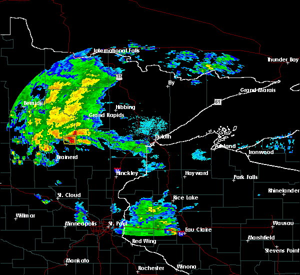 At 744 pm cdt, a severe thunderstorm was located near outing, or 26 miles west of big sandy lake, moving east at 15 mph (radar indicated). Hazards include 70 mph wind gusts and penny size hail. Expect considerable tree damage. Damage is likely to mobile homes, roofs, and outbuildings. At 744 pm cdt, a severe thunderstorm was located near outing, or 26 miles west of big sandy lake, moving east at 15 mph (radar indicated). Hazards include 70 mph wind gusts and penny size hail. Expect considerable tree damage. Damage is likely to mobile homes, roofs, and outbuildings.
|
| 7/7/2016 7:37 PM CDT |
 At 736 pm cdt, a severe thunderstorm was located near outing, or 28 miles west of big sandy lake, moving east at 15 mph (radar indicated). Hazards include 70 mph wind gusts and penny size hail. Expect considerable tree damage. damage is likely to mobile homes, roofs, and outbuildings. Locations impacted include, emily, outing, little pine and lake roosevelt. At 736 pm cdt, a severe thunderstorm was located near outing, or 28 miles west of big sandy lake, moving east at 15 mph (radar indicated). Hazards include 70 mph wind gusts and penny size hail. Expect considerable tree damage. damage is likely to mobile homes, roofs, and outbuildings. Locations impacted include, emily, outing, little pine and lake roosevelt.
|
| 7/7/2016 7:28 PM CDT |
 At 727 pm cdt, a severe thunderstorm was located over emily, or 31 miles west of big sandy lake, moving east at 15 mph (radar indicated). Hazards include 70 mph wind gusts and penny size hail. Expect considerable tree damage. damage is likely to mobile homes, roofs, and outbuildings. Locations impacted include, crosslake, emily, fifty lakes, outing, little pine and lake roosevelt. At 727 pm cdt, a severe thunderstorm was located over emily, or 31 miles west of big sandy lake, moving east at 15 mph (radar indicated). Hazards include 70 mph wind gusts and penny size hail. Expect considerable tree damage. damage is likely to mobile homes, roofs, and outbuildings. Locations impacted include, crosslake, emily, fifty lakes, outing, little pine and lake roosevelt.
|
| 7/7/2016 7:19 PM CDT |
 At 719 pm cdt, a severe thunderstorm was located over emily, or 30 miles north of brainerd, moving east at 15 mph (radar indicated). Hazards include 70 mph wind gusts and penny size hail. Expect considerable tree damage. damage is likely to mobile homes, roofs, and outbuildings. Locations impacted include, crosslake, emily, fifty lakes, outing, little pine, manhattan beach, lake roosevelt and big trout lake. At 719 pm cdt, a severe thunderstorm was located over emily, or 30 miles north of brainerd, moving east at 15 mph (radar indicated). Hazards include 70 mph wind gusts and penny size hail. Expect considerable tree damage. damage is likely to mobile homes, roofs, and outbuildings. Locations impacted include, crosslake, emily, fifty lakes, outing, little pine, manhattan beach, lake roosevelt and big trout lake.
|
| 7/7/2016 7:09 PM CDT |
 At 709 pm cdt, a severe thunderstorm was located over emily, or 28 miles north of brainerd, moving east at 20 mph (radar indicated). Hazards include 70 mph wind gusts and nickel size hail. Expect considerable tree damage. damage is likely to mobile homes, roofs, and outbuildings. Locations impacted include, crosslake, emily, fifty lakes, outing, little pine, manhattan beach, lake roosevelt and big trout lake. At 709 pm cdt, a severe thunderstorm was located over emily, or 28 miles north of brainerd, moving east at 20 mph (radar indicated). Hazards include 70 mph wind gusts and nickel size hail. Expect considerable tree damage. damage is likely to mobile homes, roofs, and outbuildings. Locations impacted include, crosslake, emily, fifty lakes, outing, little pine, manhattan beach, lake roosevelt and big trout lake.
|
| 7/7/2016 7:03 PM CDT |
 At 702 pm cdt, a severe thunderstorm was located over fifty lakes, or 27 miles north of brainerd, moving east at 15 mph (radar indicated). Hazards include 70 mph wind gusts. Expect considerable tree damage. Damage is likely to mobile homes, roofs, and outbuildings. At 702 pm cdt, a severe thunderstorm was located over fifty lakes, or 27 miles north of brainerd, moving east at 15 mph (radar indicated). Hazards include 70 mph wind gusts. Expect considerable tree damage. Damage is likely to mobile homes, roofs, and outbuildings.
|
| 7/7/2016 6:51 PM CDT |
 At 651 pm cdt, a severe thunderstorm was located near fifty lakes, or 26 miles southeast of walker, moving east at 20 mph (radar indicated). Hazards include 70 mph wind gusts. Expect considerable tree damage. damage is likely to mobile homes, roofs, and outbuildings. Locations impacted include, crosslake, pine river, emily, fifty lakes, wabedo, woman lake, chickamaw beach, manhattan beach, pontoria, swanburg, big trout lake, lake ada and big portage lake. At 651 pm cdt, a severe thunderstorm was located near fifty lakes, or 26 miles southeast of walker, moving east at 20 mph (radar indicated). Hazards include 70 mph wind gusts. Expect considerable tree damage. damage is likely to mobile homes, roofs, and outbuildings. Locations impacted include, crosslake, pine river, emily, fifty lakes, wabedo, woman lake, chickamaw beach, manhattan beach, pontoria, swanburg, big trout lake, lake ada and big portage lake.
|
| 7/7/2016 6:42 PM CDT |
 At 641 pm cdt, a severe thunderstorm was located 9 miles northeast of pine river, or 24 miles southeast of walker, moving east at 20 mph (radar indicated). Hazards include 70 mph wind gusts. Expect considerable tree damage. damage is likely to mobile homes, roofs, and outbuildings. Locations impacted include, crosslake, pine river, emily, fifty lakes, wabedo, woman lake, chickamaw beach, manhattan beach, pontoria, swanburg, big trout lake, lake ada and big portage lake. At 641 pm cdt, a severe thunderstorm was located 9 miles northeast of pine river, or 24 miles southeast of walker, moving east at 20 mph (radar indicated). Hazards include 70 mph wind gusts. Expect considerable tree damage. damage is likely to mobile homes, roofs, and outbuildings. Locations impacted include, crosslake, pine river, emily, fifty lakes, wabedo, woman lake, chickamaw beach, manhattan beach, pontoria, swanburg, big trout lake, lake ada and big portage lake.
|
| 7/7/2016 6:33 PM CDT |
 At 633 pm cdt, a severe thunderstorm was located 7 miles northeast of pine river, or 23 miles southeast of walker, moving east at 25 mph (radar indicated). Hazards include 70 mph wind gusts. Expect considerable tree damage. damage is likely to mobile homes, roofs, and outbuildings. Locations impacted include, crosslake, pine river, emily, fifty lakes, wabedo, backus, woman lake, jenkins, chickamaw beach, manhattan beach, pontoria, pheasant lake, swanburg, big trout lake, big portage lake, lower whitefish lake, lake ada and lower hay lake. At 633 pm cdt, a severe thunderstorm was located 7 miles northeast of pine river, or 23 miles southeast of walker, moving east at 25 mph (radar indicated). Hazards include 70 mph wind gusts. Expect considerable tree damage. damage is likely to mobile homes, roofs, and outbuildings. Locations impacted include, crosslake, pine river, emily, fifty lakes, wabedo, backus, woman lake, jenkins, chickamaw beach, manhattan beach, pontoria, pheasant lake, swanburg, big trout lake, big portage lake, lower whitefish lake, lake ada and lower hay lake.
|
| 7/7/2016 6:26 PM CDT |
 At 625 pm cdt, a severe thunderstorm was located near pine river, or 22 miles southeast of walker, moving east at 20 mph (radar indicated). Hazards include 70 mph wind gusts and quarter size hail. Hail damage to vehicles is expected. expect considerable tree damage. wind damage is also likely to mobile homes, roofs, and outbuildings. Locations impacted include, crosslake, pine river, emily, fifty lakes, wabedo, backus, woman lake, jenkins, chickamaw beach, manhattan beach, pontoria, swanburg, big trout lake, big portage lake, lower whitefish lake, lake ada and lower hay lake. At 625 pm cdt, a severe thunderstorm was located near pine river, or 22 miles southeast of walker, moving east at 20 mph (radar indicated). Hazards include 70 mph wind gusts and quarter size hail. Hail damage to vehicles is expected. expect considerable tree damage. wind damage is also likely to mobile homes, roofs, and outbuildings. Locations impacted include, crosslake, pine river, emily, fifty lakes, wabedo, backus, woman lake, jenkins, chickamaw beach, manhattan beach, pontoria, swanburg, big trout lake, big portage lake, lower whitefish lake, lake ada and lower hay lake.
|
| 7/7/2016 6:13 PM CDT |
 At 612 pm cdt, a severe thunderstorm was located over backus, or 21 miles south of walker, moving east at 25 mph (radar indicated). Hazards include 70 mph wind gusts and quarter size hail. Hail damage to vehicles is expected. expect considerable tree damage. Wind damage is also likely to mobile homes, roofs, and outbuildings. At 612 pm cdt, a severe thunderstorm was located over backus, or 21 miles south of walker, moving east at 25 mph (radar indicated). Hazards include 70 mph wind gusts and quarter size hail. Hail damage to vehicles is expected. expect considerable tree damage. Wind damage is also likely to mobile homes, roofs, and outbuildings.
|
| 6/19/2016 7:00 PM CDT |
 At 659 pm cdt, a severe thunderstorm was located near outing, or 30 miles southwest of grand rapids, moving east at 60 mph. this is a very dangerous storm (radar indicated). Hazards include baseball size hail and 70 mph wind gusts. People and animals outdoors will be severely injured. expect shattered windows, extensive damage to roofs, siding, and vehicles. this severe thunderstorm will be near, swatara around 710 pm cdt. hill city around 715 pm cdt. Other locations impacted by this severe thunderstorm include bain, thunder lake, split hand lake, washburn lake, lake roosevelt, laura lake, haypoint and white elk lake. At 659 pm cdt, a severe thunderstorm was located near outing, or 30 miles southwest of grand rapids, moving east at 60 mph. this is a very dangerous storm (radar indicated). Hazards include baseball size hail and 70 mph wind gusts. People and animals outdoors will be severely injured. expect shattered windows, extensive damage to roofs, siding, and vehicles. this severe thunderstorm will be near, swatara around 710 pm cdt. hill city around 715 pm cdt. Other locations impacted by this severe thunderstorm include bain, thunder lake, split hand lake, washburn lake, lake roosevelt, laura lake, haypoint and white elk lake.
|
| 9/6/2015 6:11 PM CDT |
 The severe thunderstorm warning for east central cass, northwestern aitkin and northeastern crow wing counties will expire at 615 pm cdt, the storm which prompted the warning has weakened below severe limits, and no longer pose an immediate threat to life or property. therefore the warning will be allowed to expire. however gusty winds and heavy rain are still possible with this thunderstorm. a severe thunderstorm watch remains in effect until 1000 pm cdt for northeastern minnesota. The severe thunderstorm warning for east central cass, northwestern aitkin and northeastern crow wing counties will expire at 615 pm cdt, the storm which prompted the warning has weakened below severe limits, and no longer pose an immediate threat to life or property. therefore the warning will be allowed to expire. however gusty winds and heavy rain are still possible with this thunderstorm. a severe thunderstorm watch remains in effect until 1000 pm cdt for northeastern minnesota.
|
| 9/6/2015 6:01 PM CDT |
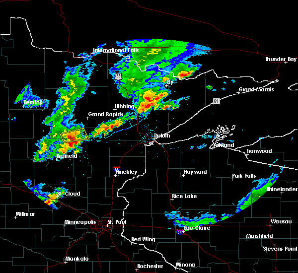 At 601 pm cdt, a severe thunderstorm was located near outing, or 25 miles north of cuyuna country state park, moving east at 40 mph (radar indicated). Hazards include 60 mph wind gusts and quarter size hail. Hail damage to vehicles is expected. expect wind damage to roofs, siding and trees. this severe storm will be near, hill city and swatara around 615 pm cdt. Other locations impacted by this severe thunderstorm include bain, little pine, haypoint, white elk lake and lake roosevelt. At 601 pm cdt, a severe thunderstorm was located near outing, or 25 miles north of cuyuna country state park, moving east at 40 mph (radar indicated). Hazards include 60 mph wind gusts and quarter size hail. Hail damage to vehicles is expected. expect wind damage to roofs, siding and trees. this severe storm will be near, hill city and swatara around 615 pm cdt. Other locations impacted by this severe thunderstorm include bain, little pine, haypoint, white elk lake and lake roosevelt.
|
| 9/6/2015 5:52 PM CDT |
 At 550 pm cdt, a severe thunderstorm was located over outing, or 24 miles north of cuyuna country state park, moving east at 45 mph (radar indicated). Hazards include quarter size hail. Damage to vehicles is expected. this severe thunderstorm will be near, swatara around 610 pm cdt. hill city around 615 pm cdt. Other locations impacted by this severe thunderstorm include bain, little pine, haypoint, white elk lake, washburn lake and lake roosevelt. At 550 pm cdt, a severe thunderstorm was located over outing, or 24 miles north of cuyuna country state park, moving east at 45 mph (radar indicated). Hazards include quarter size hail. Damage to vehicles is expected. this severe thunderstorm will be near, swatara around 610 pm cdt. hill city around 615 pm cdt. Other locations impacted by this severe thunderstorm include bain, little pine, haypoint, white elk lake, washburn lake and lake roosevelt.
|
| 9/6/2015 5:39 PM CDT | 18 inch diameter oak tree downed and blocking butterfield beach road approximately 0.8 miles north of county highway 1. time radar estimate in crow wing county MN, 1.9 miles NNE of Emily, MN |
| 8/16/2015 1:47 AM CDT |
 At 145 am cdt, severe thunderstorms were located along a line extending from swatara to near garrison, moving east at 45 mph (law enforcement reported a tree was blown down near pillager). Hazards include 60 mph wind gusts and quarter size hail. Hail damage to vehicles is expected. expect wind damage to roofs, siding and trees. these severe storms will be near, swatara around 150 am cdt. mille lacs lake, malmo and libby around 210 am cdt. savanna portage state park around 215 am cdt. Other locations impacted by these severe thunderstorms include bain, glen, woodrow, edward lake, sheshebee, wealthwood, gun lake, washburn lake, lake roosevelt and mission. At 145 am cdt, severe thunderstorms were located along a line extending from swatara to near garrison, moving east at 45 mph (law enforcement reported a tree was blown down near pillager). Hazards include 60 mph wind gusts and quarter size hail. Hail damage to vehicles is expected. expect wind damage to roofs, siding and trees. these severe storms will be near, swatara around 150 am cdt. mille lacs lake, malmo and libby around 210 am cdt. savanna portage state park around 215 am cdt. Other locations impacted by these severe thunderstorms include bain, glen, woodrow, edward lake, sheshebee, wealthwood, gun lake, washburn lake, lake roosevelt and mission.
|
| 8/16/2015 1:30 AM CDT |
 At 130 am cdt, severe thunderstorms were located along a line extending from 7 miles northeast of outing to south long lake, moving east at 45 mph (radar indicated). Hazards include 60 mph wind gusts and quarter size hail. Hail damage to vehicles is expected. expect wind damage to roofs, siding and trees. severe thunderstorms will be near, garrison and swatara around 145 am cdt. hill city around 150 am cdt. mille lacs lake, malmo and libby around 205 am cdt. savanna portage state park around 215 am cdt. Other locations impacted by these severe thunderstorms include glen, pine center, east gull lake, edward lake, wealthwood, gun lake, washburn lake, lennox, mission and swanburg. At 130 am cdt, severe thunderstorms were located along a line extending from 7 miles northeast of outing to south long lake, moving east at 45 mph (radar indicated). Hazards include 60 mph wind gusts and quarter size hail. Hail damage to vehicles is expected. expect wind damage to roofs, siding and trees. severe thunderstorms will be near, garrison and swatara around 145 am cdt. hill city around 150 am cdt. mille lacs lake, malmo and libby around 205 am cdt. savanna portage state park around 215 am cdt. Other locations impacted by these severe thunderstorms include glen, pine center, east gull lake, edward lake, wealthwood, gun lake, washburn lake, lennox, mission and swanburg.
|
| 8/16/2015 1:18 AM CDT |
 At 117 am cdt, severe thunderstorms were located along a line extending from near wabedo to near pillager, moving east at 35 mph (radar indicated). Hazards include 60 mph wind gusts and half dollar size hail. Hail damage to vehicles is expected. expect wind damage to roofs, siding and trees. these severe storms will be near, wabedo around 125 am cdt. brainerd, emily and outing around 130 am cdt. Other locations impacted by these severe thunderstorms include east gull lake, edward lake, pheasant lake, thunder lake, washburn lake, lennox, lake roosevelt, chickamaw beach, mission and swanburg. At 117 am cdt, severe thunderstorms were located along a line extending from near wabedo to near pillager, moving east at 35 mph (radar indicated). Hazards include 60 mph wind gusts and half dollar size hail. Hail damage to vehicles is expected. expect wind damage to roofs, siding and trees. these severe storms will be near, wabedo around 125 am cdt. brainerd, emily and outing around 130 am cdt. Other locations impacted by these severe thunderstorms include east gull lake, edward lake, pheasant lake, thunder lake, washburn lake, lennox, lake roosevelt, chickamaw beach, mission and swanburg.
|
| 8/16/2015 1:03 AM CDT |
 At 102 am cdt, severe thunderstorms were located along a line extending from 6 miles southwest of woman lake to near motley, moving east at 30 mph (radar indicated). Hazards include 60 mph wind gusts and half dollar size hail. Hail damage to vehicles is expected. expect wind damage to roofs, siding and trees. these severe storms will be near, woman lake around 110 am cdt. longville around 115 am cdt. crosslake and wabedo around 120 am cdt. fifty lakes around 125 am cdt. crow wing state park, baxter, emily, fort ripley, saint mathias and outing around 130 am cdt. Other locations impacted by these severe thunderstorms include east gull lake, edward lake, pheasant lake, thunder lake, washburn lake, lennox, lake roosevelt, chickamaw beach, mission and swanburg. At 102 am cdt, severe thunderstorms were located along a line extending from 6 miles southwest of woman lake to near motley, moving east at 30 mph (radar indicated). Hazards include 60 mph wind gusts and half dollar size hail. Hail damage to vehicles is expected. expect wind damage to roofs, siding and trees. these severe storms will be near, woman lake around 110 am cdt. longville around 115 am cdt. crosslake and wabedo around 120 am cdt. fifty lakes around 125 am cdt. crow wing state park, baxter, emily, fort ripley, saint mathias and outing around 130 am cdt. Other locations impacted by these severe thunderstorms include east gull lake, edward lake, pheasant lake, thunder lake, washburn lake, lennox, lake roosevelt, chickamaw beach, mission and swanburg.
|
| 8/16/2015 12:50 AM CDT |
 At 1249 am cdt, severe thunderstorms were located along a line extending from near hackensack to near staples, moving east at 30 mph (radar indicated). Hazards include 60 mph wind gusts and half dollar size hail. Hail damage to vehicles is expected. expect wind damage to roofs, siding and trees. severe thunderstorms will be near, hackensack and backus around 1255 am cdt. woman lake around 110 am cdt. pillager, wabedo and longville around 115 am cdt. crosslake around 120 am cdt. fifty lakes around 125 am cdt. crow wing state park, baxter, emily, fort ripley, saint mathias and outing around 130 am cdt. Other locations impacted by these severe thunderstorms include east gull lake, edward lake, pheasant lake, thunder lake, washburn lake, lennox, lake roosevelt, chickamaw beach, mission and swanburg. At 1249 am cdt, severe thunderstorms were located along a line extending from near hackensack to near staples, moving east at 30 mph (radar indicated). Hazards include 60 mph wind gusts and half dollar size hail. Hail damage to vehicles is expected. expect wind damage to roofs, siding and trees. severe thunderstorms will be near, hackensack and backus around 1255 am cdt. woman lake around 110 am cdt. pillager, wabedo and longville around 115 am cdt. crosslake around 120 am cdt. fifty lakes around 125 am cdt. crow wing state park, baxter, emily, fort ripley, saint mathias and outing around 130 am cdt. Other locations impacted by these severe thunderstorms include east gull lake, edward lake, pheasant lake, thunder lake, washburn lake, lennox, lake roosevelt, chickamaw beach, mission and swanburg.
|
| 8/12/2015 7:19 PM CDT |
 At 718 pm cdt, severe thunderstorms were located along a line extending from near hackensack to near backus to 8 miles north of poplar, moving southeast at 50 mph. these are very dangerous storms (radar indicated). Hazards include baseball size hail and 70 mph wind gusts. People and animals outdoors will be severely injured. expect shattered windows, extensive damage to roofs, siding and vehicles. Locations impacted include, walker, breezy point, pequot lakes, crosslake, nisswa, pine river, emily, fifty lakes, hackensack, backus, poplar, gull lake, woman lake, leader, leech lake, east gull lake, lake shore, oshawa, jenkins and ten mile lake. At 718 pm cdt, severe thunderstorms were located along a line extending from near hackensack to near backus to 8 miles north of poplar, moving southeast at 50 mph. these are very dangerous storms (radar indicated). Hazards include baseball size hail and 70 mph wind gusts. People and animals outdoors will be severely injured. expect shattered windows, extensive damage to roofs, siding and vehicles. Locations impacted include, walker, breezy point, pequot lakes, crosslake, nisswa, pine river, emily, fifty lakes, hackensack, backus, poplar, gull lake, woman lake, leader, leech lake, east gull lake, lake shore, oshawa, jenkins and ten mile lake.
|
| 8/12/2015 7:04 PM CDT |
 At 703 pm cdt, severe thunderstorms were located along a line extending from near walker to 6 miles west of hackensack to near huntersville, moving southeast at 50 mph. these are very dangerous storms (radar indicated. at half dollar sized hail was reported in nevis). Hazards include baseball size hail and 70 mph wind gusts. People and animals outdoors will be severely injured. expect shattered windows, extensive damage to roofs, siding and vehicles. these severe storms will be near, hackensack and backus around 715 pm cdt. woman lake around 720 pm cdt. pine river and poplar around 725 pm cdt. breezy point, pequot lakes, crosslake and leader around 730 pm cdt. Other locations impacted by these severe thunderstorms include pontoria, whipholt, east gull lake, pheasant lake, casino, chickamaw beach, lake shore, webb lake, manhattan beach and swanburg. At 703 pm cdt, severe thunderstorms were located along a line extending from near walker to 6 miles west of hackensack to near huntersville, moving southeast at 50 mph. these are very dangerous storms (radar indicated. at half dollar sized hail was reported in nevis). Hazards include baseball size hail and 70 mph wind gusts. People and animals outdoors will be severely injured. expect shattered windows, extensive damage to roofs, siding and vehicles. these severe storms will be near, hackensack and backus around 715 pm cdt. woman lake around 720 pm cdt. pine river and poplar around 725 pm cdt. breezy point, pequot lakes, crosslake and leader around 730 pm cdt. Other locations impacted by these severe thunderstorms include pontoria, whipholt, east gull lake, pheasant lake, casino, chickamaw beach, lake shore, webb lake, manhattan beach and swanburg.
|
| 8/12/2015 6:45 PM CDT |
 At 644 pm cdt, severe thunderstorms were located along a line extending from near laporte to nevis to near park rapids, moving southeast at 50 mph. these are very dangerous storms (radar indicated). Hazards include baseball size hail and 70 mph wind gusts. People and animals outdoors will be severely injured. expect shattered windows, extensive damage to roofs, siding and vehicles. severe thunderstorms will be near, walker around 655 pm cdt. backus around 705 pm cdt. hackensack around 710 pm cdt. woman lake around 715 pm cdt. pine river and poplar around 720 pm cdt. leader around 725 pm cdt. breezy point, pequot lakes, crosslake, nisswa, fifty lakes and gull lake around 730 pm cdt. Other locations impacted by these severe thunderstorms include pontoria, whipholt, east gull lake, pheasant lake, casino, chickamaw beach, lake shore, webb lake, manhattan beach and swanburg. At 644 pm cdt, severe thunderstorms were located along a line extending from near laporte to nevis to near park rapids, moving southeast at 50 mph. these are very dangerous storms (radar indicated). Hazards include baseball size hail and 70 mph wind gusts. People and animals outdoors will be severely injured. expect shattered windows, extensive damage to roofs, siding and vehicles. severe thunderstorms will be near, walker around 655 pm cdt. backus around 705 pm cdt. hackensack around 710 pm cdt. woman lake around 715 pm cdt. pine river and poplar around 720 pm cdt. leader around 725 pm cdt. breezy point, pequot lakes, crosslake, nisswa, fifty lakes and gull lake around 730 pm cdt. Other locations impacted by these severe thunderstorms include pontoria, whipholt, east gull lake, pheasant lake, casino, chickamaw beach, lake shore, webb lake, manhattan beach and swanburg.
|
| 8/8/2015 3:52 PM CDT |
 The severe thunderstorm warning for northeastern crow wing county will expire at 400 pm cdt, the storm which prompted the warning has moved out of the area. therefore the warning will be allowed to expire. a severe thunderstorm watch remains in effect until 1100 pm cdt for east central minnesota. The severe thunderstorm warning for northeastern crow wing county will expire at 400 pm cdt, the storm which prompted the warning has moved out of the area. therefore the warning will be allowed to expire. a severe thunderstorm watch remains in effect until 1100 pm cdt for east central minnesota.
|
| 8/8/2015 3:34 PM CDT |
 At 333 pm cdt, a severe thunderstorm was located over emily, or 16 miles north of cuyuna country state park, moving east at 20 mph (trained weather spotters). Hazards include 60 mph wind gusts and half dollar size hail. Hail damage to vehicles is expected. expect wind damage to roofs, siding and trees. this severe thunderstorm will be near, emily around 345 pm cdt. Other locations impacted by this severe thunderstorm include little pine and lake roosevelt. At 333 pm cdt, a severe thunderstorm was located over emily, or 16 miles north of cuyuna country state park, moving east at 20 mph (trained weather spotters). Hazards include 60 mph wind gusts and half dollar size hail. Hail damage to vehicles is expected. expect wind damage to roofs, siding and trees. this severe thunderstorm will be near, emily around 345 pm cdt. Other locations impacted by this severe thunderstorm include little pine and lake roosevelt.
|
| 8/8/2015 3:16 PM CDT |
 The national weather service in duluth mn has issued a * severe thunderstorm warning for. east central cass county in north central minnesota. northern aitkin county in east central minnesota. northeastern crow wing county in east central minnesota. Until 345 pm cdt. The national weather service in duluth mn has issued a * severe thunderstorm warning for. east central cass county in north central minnesota. northern aitkin county in east central minnesota. northeastern crow wing county in east central minnesota. Until 345 pm cdt.
|
| 8/8/2015 3:07 PM CDT |
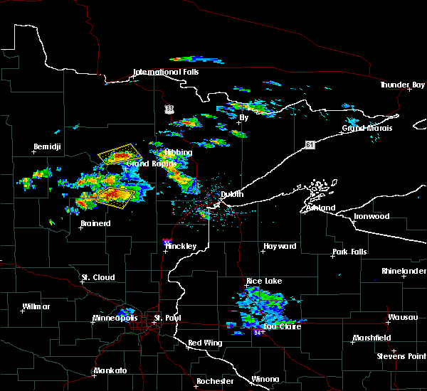 At 306 pm cdt, a severe thunderstorm was located near swatara, or 18 miles west of big sandy lake, moving southeast at 30 mph (radar indicated). Hazards include golf ball size hail and 60 mph wind gusts. People and animals outdoors will be injured. expect hail damage to roofs, siding, windows and vehicles. expect wind damage to roofs, siding and trees. this severe storm will be near, palisade around 315 pm cdt. Other locations impacted by this severe thunderstorm include bain, waldeck, little pine, waukenabo, haypoint, white elk lake and esquagomah lake. At 306 pm cdt, a severe thunderstorm was located near swatara, or 18 miles west of big sandy lake, moving southeast at 30 mph (radar indicated). Hazards include golf ball size hail and 60 mph wind gusts. People and animals outdoors will be injured. expect hail damage to roofs, siding, windows and vehicles. expect wind damage to roofs, siding and trees. this severe storm will be near, palisade around 315 pm cdt. Other locations impacted by this severe thunderstorm include bain, waldeck, little pine, waukenabo, haypoint, white elk lake and esquagomah lake.
|
| 8/8/2015 2:51 PM CDT |
 At 251 pm cdt, a severe thunderstorm was located near swatara, or 24 miles south of schoolcraft state park, moving southeast at 25 mph (radar indicated). Hazards include 60 mph wind gusts and quarter size hail. Hail damage to vehicles is expected. expect wind damage to roofs, siding and trees. this severe thunderstorm will be near, swatara around 300 pm cdt. palisade around 315 pm cdt. Other locations impacted by this severe thunderstorm include bain, waldeck, lake roosevelt, little pine, waukenabo, haypoint, white elk lake and esquagomah lake. At 251 pm cdt, a severe thunderstorm was located near swatara, or 24 miles south of schoolcraft state park, moving southeast at 25 mph (radar indicated). Hazards include 60 mph wind gusts and quarter size hail. Hail damage to vehicles is expected. expect wind damage to roofs, siding and trees. this severe thunderstorm will be near, swatara around 300 pm cdt. palisade around 315 pm cdt. Other locations impacted by this severe thunderstorm include bain, waldeck, lake roosevelt, little pine, waukenabo, haypoint, white elk lake and esquagomah lake.
|
| 7/24/2015 2:35 AM CDT |
 At 234 am cdt, severe thunderstorms were located along a line extending from near federal dam to near pillager, moving east at 40 mph (radar indicated). Hazards include 60 mph wind gusts and penny size hail. Expect damage to roofs. siding and trees. these severe storms will be near, crow wing state park and federal dam around 240 am cdt. brainerd and boy river around 245 am cdt. other locations impacted by these severe thunderstorms include east gull lake, edward lake, washburn lake, lennox, chickamaw beach, mission, swanburg, esterdy, lower mission lake and mud lake. This includes northern lights casino and white oak casino. At 234 am cdt, severe thunderstorms were located along a line extending from near federal dam to near pillager, moving east at 40 mph (radar indicated). Hazards include 60 mph wind gusts and penny size hail. Expect damage to roofs. siding and trees. these severe storms will be near, crow wing state park and federal dam around 240 am cdt. brainerd and boy river around 245 am cdt. other locations impacted by these severe thunderstorms include east gull lake, edward lake, washburn lake, lennox, chickamaw beach, mission, swanburg, esterdy, lower mission lake and mud lake. This includes northern lights casino and white oak casino.
|
| 7/24/2015 2:21 AM CDT |
 At 221 am cdt, severe thunderstorms were located along a line extending from near leech lake to near pillager, moving east at 40 mph (radar indicated). Hazards include 60 mph wind gusts and penny size hail. Expect damage to roofs. siding and trees. severe thunderstorms will be near, federal dam around 230 am cdt. crow wing state park and leech lake around 235 am cdt. baxter and boy river around 240 am cdt. brainerd and south long lake around 245 am cdt. other locations impacted by these severe thunderstorms include east gull lake, edward lake, washburn lake, lennox, chickamaw beach, mission, swanburg, esterdy, lower mission lake and mud lake. This includes northern lights casino and white oak casino. At 221 am cdt, severe thunderstorms were located along a line extending from near leech lake to near pillager, moving east at 40 mph (radar indicated). Hazards include 60 mph wind gusts and penny size hail. Expect damage to roofs. siding and trees. severe thunderstorms will be near, federal dam around 230 am cdt. crow wing state park and leech lake around 235 am cdt. baxter and boy river around 240 am cdt. brainerd and south long lake around 245 am cdt. other locations impacted by these severe thunderstorms include east gull lake, edward lake, washburn lake, lennox, chickamaw beach, mission, swanburg, esterdy, lower mission lake and mud lake. This includes northern lights casino and white oak casino.
|
| 7/24/2015 2:12 AM CDT |
 At 211 am cdt, severe thunderstorms were located along a line extending from near blackduck to hackensack, moving east at 35 mph (radar indicated). Hazards include 70 mph wind gusts and penny size hail. Expect considerable tree damage. damage is likely to mobile homes, roofs and outbuildings. these severe storms will be near, wabedo, longville and woman lake around 230 am cdt. other locations impacted by these severe thunderstorms include pontoria, inguadona, pheasant lake, thunder lake, washburn lake, lake roosevelt, tobique, portage lake, laura lake and webb lake. This includes palace casino and northern lights casino. At 211 am cdt, severe thunderstorms were located along a line extending from near blackduck to hackensack, moving east at 35 mph (radar indicated). Hazards include 70 mph wind gusts and penny size hail. Expect considerable tree damage. damage is likely to mobile homes, roofs and outbuildings. these severe storms will be near, wabedo, longville and woman lake around 230 am cdt. other locations impacted by these severe thunderstorms include pontoria, inguadona, pheasant lake, thunder lake, washburn lake, lake roosevelt, tobique, portage lake, laura lake and webb lake. This includes palace casino and northern lights casino.
|
| 7/24/2015 1:51 AM CDT |
 At 150 am cdt, severe thunderstorms were located along a line extending from 9 miles north of wilton to near hackensack, moving east at 50 mph (radar indicated). Hazards include 70 mph wind gusts and penny size hail. Expect considerable tree damage. damage is likely to mobile homes, roofs and outbuildings. severe thunderstorms will be near, hackensack and backus around 155 am cdt. wabedo, longville and woman lake around 210 am cdt. outing around 225 am cdt. alvwood around 230 am cdt. other locations impacted by these severe thunderstorms include pontoria, inguadona, pheasant lake, thunder lake, washburn lake, lake roosevelt, tobique, portage lake, laura lake and webb lake. This includes palace casino and northern lights casino. At 150 am cdt, severe thunderstorms were located along a line extending from 9 miles north of wilton to near hackensack, moving east at 50 mph (radar indicated). Hazards include 70 mph wind gusts and penny size hail. Expect considerable tree damage. damage is likely to mobile homes, roofs and outbuildings. severe thunderstorms will be near, hackensack and backus around 155 am cdt. wabedo, longville and woman lake around 210 am cdt. outing around 225 am cdt. alvwood around 230 am cdt. other locations impacted by these severe thunderstorms include pontoria, inguadona, pheasant lake, thunder lake, washburn lake, lake roosevelt, tobique, portage lake, laura lake and webb lake. This includes palace casino and northern lights casino.
|
| 9/20/2014 4:19 PM CDT | 3 to 4 inch tree branches down near emily. delayed report. time estimated by rada in crow wing county MN, 2 miles W of Emily, MN |
| 8/31/2013 5:37 PM CDT | Tree down blocking mn- in cass county MN, 5.8 miles SSW of Emily, MN |
| 1/1/0001 12:00 AM | Half Dollar sized hail reported 3.5 miles WSW of Emily, MN |
| 1/1/0001 12:00 AM | Half Dollar sized hail reported 2.6 miles SW of Emily, MN |
| 1/1/0001 12:00 AM | Golf Ball sized hail reported 2 miles WSW of Emily, MN, corrected time. |
| 1/1/0001 12:00 AM | Ping Pong Ball sized hail reported 2.6 miles SW of Emily, MN, time estimated based on radar. |
| 1/1/0001 12:00 AM | Golf Ball sized hail reported 2 miles WSW of Emily, MN |
Hail Maps for Emily, MN


Connect with Interactive Hail Maps