

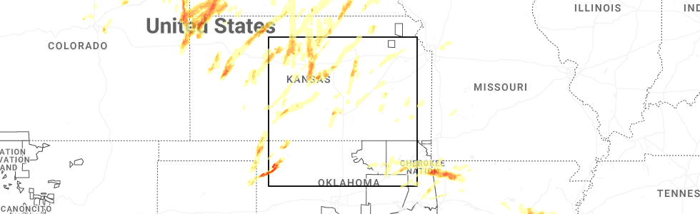
Hail Map for Emporia, KS
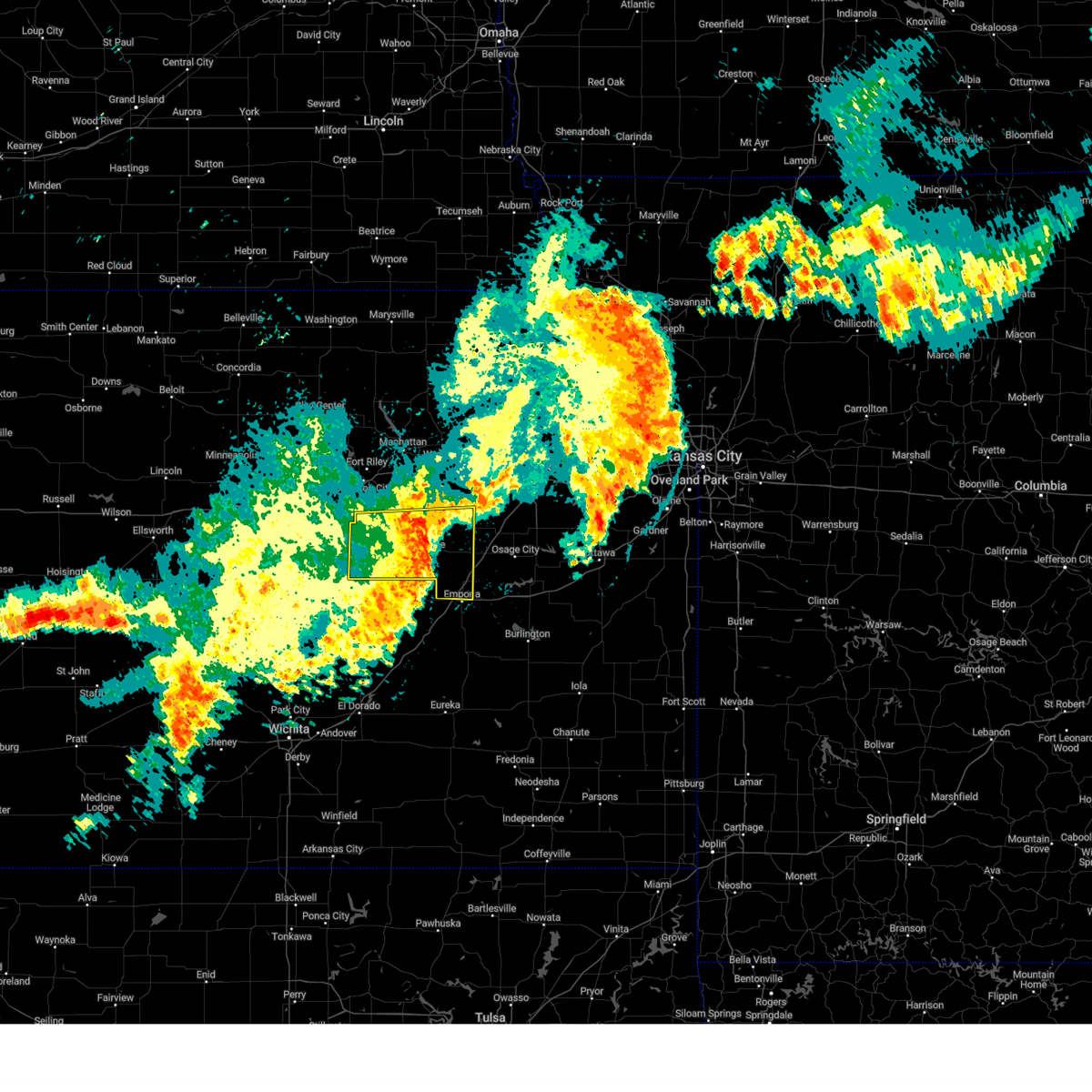
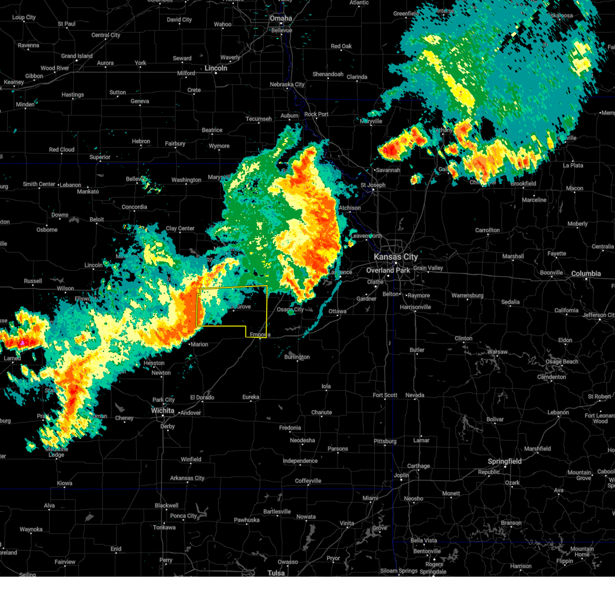
The Emporia, KS area has had 61 reports of on-the-ground hail by trained spotters, and has been under severe weather warnings 14 times during the past 12 months. Doppler radar has detected hail at or near Emporia, KS on 105 occasions, including 5 occasions during the past year.
| Name: | Emporia, KS |
| Where Located: | 57.6 miles SSE of Manhattan, KS |
| Map: | Google Map for Emporia, KS |
| Population: | 24916 |
| Housing Units: | 11352 |
| More Info: | Search Google for Emporia, KS |
1
The Top Recent Hail Date for Emporia, KS is Sunday, May 18, 2025 (25th out of 105)
Hail and Wind Damage Spotted near Emporia, KS
| Date / Time | Report Details |
|---|---|
| 5/19/2025 6:41 PM CDT | The storm which prompted the warning has weakened below severe limits, and no longer poses an immediate threat to life or property. therefore, the warning will be allowed to expire. a tornado watch remains in effect until 900 pm cdt for east central kansas. |
| 5/19/2025 6:16 PM CDT | At 615 pm cdt, a severe thunderstorm was located 4 miles southwest of olpe, moving northeast at 25 mph (radar indicated). Hazards include ping pong ball size hail and 60 mph wind gusts. People and animals outdoors will be injured. expect hail damage to roofs, siding, windows, and vehicles. expect wind damage to roofs, siding, and trees. locations impacted include, emporia and olpe. this includes the following highways, interstate 35 between mile markers 128 and 133. Kansas turnpike between mile markers 120 and 129. |
| 5/19/2025 6:04 PM CDT | Svrtop the national weather service in topeka has issued a * severe thunderstorm warning for, southern lyon county in east central kansas, * until 645 pm cdt. * at 604 pm cdt, a severe thunderstorm was located 7 miles southwest of olpe, moving north at 20 mph (radar indicated). Hazards include 60 mph wind gusts and half dollar size hail. Hail damage to vehicles is expected. Expect wind damage to roofs, siding, and trees. |
| 5/18/2025 7:43 PM CDT |
 The storm which prompted the warning has moved out of the area. therefore, the warning will be allowed to expire. a severe thunderstorm watch remains in effect until midnight cdt for east central kansas. remember, a severe thunderstorm warning still remains in effect for eastern lyon county until 815 pm cdt. The storm which prompted the warning has moved out of the area. therefore, the warning will be allowed to expire. a severe thunderstorm watch remains in effect until midnight cdt for east central kansas. remember, a severe thunderstorm warning still remains in effect for eastern lyon county until 815 pm cdt.
|
| 5/18/2025 7:38 PM CDT |
 Svrtop the national weather service in topeka has issued a * severe thunderstorm warning for, southwestern osage county in east central kansas, northwestern coffey county in east central kansas, east central lyon county in east central kansas, * until 815 pm cdt. * at 738 pm cdt, a severe thunderstorm was located 4 miles southeast of emporia, moving northeast at 30 mph (radar indicated). Hazards include 60 mph wind gusts and quarter size hail. Hail damage to vehicles is expected. Expect wind damage to roofs, siding, and trees. Svrtop the national weather service in topeka has issued a * severe thunderstorm warning for, southwestern osage county in east central kansas, northwestern coffey county in east central kansas, east central lyon county in east central kansas, * until 815 pm cdt. * at 738 pm cdt, a severe thunderstorm was located 4 miles southeast of emporia, moving northeast at 30 mph (radar indicated). Hazards include 60 mph wind gusts and quarter size hail. Hail damage to vehicles is expected. Expect wind damage to roofs, siding, and trees.
|
| 5/18/2025 7:26 PM CDT | At 726 pm cdt, a severe thunderstorm was located 4 miles northwest of olpe, moving northeast at 30 mph (radar indicated). Hazards include 60 mph wind gusts and half dollar size hail. Hail damage to vehicles is expected. expect wind damage to roofs, siding, and trees. locations impacted include, emporia. this includes the following highways, interstate 35 between mile markers 129 and 134. Kansas turnpike between mile markers 119 and 123. |
| 5/18/2025 7:14 PM CDT | Svrtop the national weather service in topeka has issued a * severe thunderstorm warning for, southern lyon county in east central kansas, * until 745 pm cdt. * at 714 pm cdt, a severe thunderstorm was located 7 miles west of olpe, moving northeast at 30 mph (radar indicated). Hazards include 60 mph wind gusts and quarter size hail. Hail damage to vehicles is expected. Expect wind damage to roofs, siding, and trees. |
| 4/2/2025 3:39 AM CDT |
 Svrtop the national weather service in topeka has issued a * severe thunderstorm warning for, southern lyon county in east central kansas, * until 415 am cdt. * at 339 am cdt, a severe thunderstorm was located 14 miles south of cottonwood falls, moving northeast at 60 mph (radar indicated). Hazards include 60 mph wind gusts and quarter size hail. Hail damage to vehicles is expected. Expect wind damage to roofs, siding, and trees. Svrtop the national weather service in topeka has issued a * severe thunderstorm warning for, southern lyon county in east central kansas, * until 415 am cdt. * at 339 am cdt, a severe thunderstorm was located 14 miles south of cottonwood falls, moving northeast at 60 mph (radar indicated). Hazards include 60 mph wind gusts and quarter size hail. Hail damage to vehicles is expected. Expect wind damage to roofs, siding, and trees.
|
| 3/27/2025 9:54 AM CDT | Quarter sized hail reported 6 miles SSW of Emporia, KS, relayed by kvoe radio. time estimated from radar data. |
| 3/27/2025 9:51 AM CDT |
 Svrtop the national weather service in topeka has issued a * severe thunderstorm warning for, southwestern osage county in east central kansas, east central lyon county in east central kansas, * until 1030 am cdt. * at 951 am cdt, a severe thunderstorm was located 5 miles northeast of emporia, moving east at 30 mph (radar indicated). Hazards include 60 mph wind gusts and half dollar size hail. Hail damage to vehicles is expected. Expect wind damage to roofs, siding, and trees. Svrtop the national weather service in topeka has issued a * severe thunderstorm warning for, southwestern osage county in east central kansas, east central lyon county in east central kansas, * until 1030 am cdt. * at 951 am cdt, a severe thunderstorm was located 5 miles northeast of emporia, moving east at 30 mph (radar indicated). Hazards include 60 mph wind gusts and half dollar size hail. Hail damage to vehicles is expected. Expect wind damage to roofs, siding, and trees.
|
| 3/27/2025 8:02 AM CDT | Kem in lyon county KS, 4.7 miles N of Emporia, KS |
| 10/24/2024 8:43 PM CDT | Kemp emporia municipal airpor in lyon county KS, 4.7 miles N of Emporia, KS |
| 7/31/2024 10:36 PM CDT |
 the severe thunderstorm warning has been cancelled and is no longer in effect the severe thunderstorm warning has been cancelled and is no longer in effect
|
| 7/31/2024 10:07 PM CDT |
 Svrtop the national weather service in topeka has issued a * severe thunderstorm warning for, morris county in east central kansas, southwestern wabaunsee county in east central kansas, northwestern lyon county in east central kansas, * until 1100 pm cdt. * at 1007 pm cdt, a severe thunderstorm was located 5 miles west of wilsey, moving east at 50 mph (radar indicated). Hazards include 60 mph wind gusts and penny size hail. expect damage to roofs, siding, and trees Svrtop the national weather service in topeka has issued a * severe thunderstorm warning for, morris county in east central kansas, southwestern wabaunsee county in east central kansas, northwestern lyon county in east central kansas, * until 1100 pm cdt. * at 1007 pm cdt, a severe thunderstorm was located 5 miles west of wilsey, moving east at 50 mph (radar indicated). Hazards include 60 mph wind gusts and penny size hail. expect damage to roofs, siding, and trees
|
| 7/31/2024 9:18 PM CDT |
 At 916 pm cdt, severe thunderstorms were located along a line extending from 4 miles southwest of circleville to 3 miles southwest of auburn to 3 miles west of olpe, moving east at 45 mph (trained weather spotters. wind gust of 70 mph were reported in dover at 913pm, and 68mph wind gusts were reported 2 miles nw of wamego at 854pm). Hazards include 70 mph wind gusts and nickel size hail. Expect considerable tree damage. damage is likely to mobile homes, roofs, and outbuildings. locations impacted include, topeka, emporia, holton, osage city, carbondale, valley falls, rossville, eskridge, tecumseh, st. marys, richland, dover, silver lake, auburn, overbrook, lyndon, lebo, burlingame, perry, and americus. this includes the following highways, interstate 35 between mile markers 128 and 162. interstate 70 between mile markers 337 and 355. Kansas turnpike between mile markers 117 and 195. At 916 pm cdt, severe thunderstorms were located along a line extending from 4 miles southwest of circleville to 3 miles southwest of auburn to 3 miles west of olpe, moving east at 45 mph (trained weather spotters. wind gust of 70 mph were reported in dover at 913pm, and 68mph wind gusts were reported 2 miles nw of wamego at 854pm). Hazards include 70 mph wind gusts and nickel size hail. Expect considerable tree damage. damage is likely to mobile homes, roofs, and outbuildings. locations impacted include, topeka, emporia, holton, osage city, carbondale, valley falls, rossville, eskridge, tecumseh, st. marys, richland, dover, silver lake, auburn, overbrook, lyndon, lebo, burlingame, perry, and americus. this includes the following highways, interstate 35 between mile markers 128 and 162. interstate 70 between mile markers 337 and 355. Kansas turnpike between mile markers 117 and 195.
|
| 7/31/2024 9:07 PM CDT |
 Svrtop the national weather service in topeka has issued a * severe thunderstorm warning for, northwestern franklin county in east central kansas, western jefferson county in northeastern kansas, shawnee county in east central kansas, eastern wabaunsee county in east central kansas, western douglas county in east central kansas, osage county in east central kansas, eastern pottawatomie county in northeastern kansas, southeastern nemaha county in northeastern kansas, jackson county in northeastern kansas, western coffey county in east central kansas, lyon county in east central kansas, * until 945 pm cdt. * at 906 pm cdt, severe thunderstorms were located along a line extending from 3 miles southeast of havensville to 6 miles north of harveyville to 10 miles west of olpe, moving east at 45 mph (radar indicated). Hazards include 60 mph wind gusts and nickel size hail. expect damage to roofs, siding, and trees Svrtop the national weather service in topeka has issued a * severe thunderstorm warning for, northwestern franklin county in east central kansas, western jefferson county in northeastern kansas, shawnee county in east central kansas, eastern wabaunsee county in east central kansas, western douglas county in east central kansas, osage county in east central kansas, eastern pottawatomie county in northeastern kansas, southeastern nemaha county in northeastern kansas, jackson county in northeastern kansas, western coffey county in east central kansas, lyon county in east central kansas, * until 945 pm cdt. * at 906 pm cdt, severe thunderstorms were located along a line extending from 3 miles southeast of havensville to 6 miles north of harveyville to 10 miles west of olpe, moving east at 45 mph (radar indicated). Hazards include 60 mph wind gusts and nickel size hail. expect damage to roofs, siding, and trees
|
| 7/2/2024 6:53 PM CDT |
 Svrtop the national weather service in topeka has issued a * severe thunderstorm warning for, southeastern morris county in east central kansas, northern lyon county in east central kansas, * until 730 pm cdt. * at 652 pm cdt, a severe thunderstorm was located 6 miles northeast of strong city, moving northeast at 45 mph (radar indicated). Hazards include 60 mph wind gusts. expect damage to roofs, siding, and trees Svrtop the national weather service in topeka has issued a * severe thunderstorm warning for, southeastern morris county in east central kansas, northern lyon county in east central kansas, * until 730 pm cdt. * at 652 pm cdt, a severe thunderstorm was located 6 miles northeast of strong city, moving northeast at 45 mph (radar indicated). Hazards include 60 mph wind gusts. expect damage to roofs, siding, and trees
|
| 6/26/2024 4:20 AM CDT |
 The storm which prompted the warning has weakened below severe limits, and no longer poses an immediate threat to life or property. therefore, the warning will be allowed to expire. however, gusty winds are still possible with this thunderstorm. a severe thunderstorm watch remains in effect until 700 am cdt for east central kansas. The storm which prompted the warning has weakened below severe limits, and no longer poses an immediate threat to life or property. therefore, the warning will be allowed to expire. however, gusty winds are still possible with this thunderstorm. a severe thunderstorm watch remains in effect until 700 am cdt for east central kansas.
|
| 6/26/2024 4:02 AM CDT | Personal weather statio in lyon county KS, 3.6 miles W of Emporia, KS |
| 6/26/2024 3:56 AM CDT | Personal weather statio in lyon county KS, 3 miles W of Emporia, KS |
| 6/26/2024 3:56 AM CDT |
 Svrtop the national weather service in topeka has issued a * severe thunderstorm warning for, southwestern lyon county in east central kansas, * until 430 am cdt. * at 356 am cdt, a severe thunderstorm was located near emporia, moving south at 50 mph (radar indicated). Hazards include 70 mph wind gusts. Expect considerable tree damage. Damage is likely to mobile homes, roofs, and outbuildings. Svrtop the national weather service in topeka has issued a * severe thunderstorm warning for, southwestern lyon county in east central kansas, * until 430 am cdt. * at 356 am cdt, a severe thunderstorm was located near emporia, moving south at 50 mph (radar indicated). Hazards include 70 mph wind gusts. Expect considerable tree damage. Damage is likely to mobile homes, roofs, and outbuildings.
|
| 6/13/2024 9:04 PM CDT |
 the severe thunderstorm warning has been cancelled and is no longer in effect the severe thunderstorm warning has been cancelled and is no longer in effect
|
| 6/13/2024 8:59 PM CDT |
 At 858 pm cdt, a severe thunderstorm was located 8 miles southwest of olpe, moving southeast at 20 mph (automated weather station reported a wind gust of 58 mph south of emporia). Hazards include 60 mph wind gusts and nickel size hail. Expect damage to roofs, siding, and trees. locations impacted include, olpe. This includes kansas turnpike between mile markers 116 and 124. At 858 pm cdt, a severe thunderstorm was located 8 miles southwest of olpe, moving southeast at 20 mph (automated weather station reported a wind gust of 58 mph south of emporia). Hazards include 60 mph wind gusts and nickel size hail. Expect damage to roofs, siding, and trees. locations impacted include, olpe. This includes kansas turnpike between mile markers 116 and 124.
|
| 6/13/2024 8:54 PM CDT | Delayed report. kem in lyon county KS, 4.7 miles N of Emporia, KS |
| 6/13/2024 8:49 PM CDT | Corrects previous non-tstm wnd gst report from 5 nnw olpe. kem in lyon county KS, 4.7 miles N of Emporia, KS |
| 6/13/2024 8:43 PM CDT |
 Svrtop the national weather service in topeka has issued a * severe thunderstorm warning for, southwestern lyon county in east central kansas, * until 930 pm cdt. * at 843 pm cdt, a severe thunderstorm was located 10 miles southeast of cottonwood falls, moving east at 20 mph (radar indicated). Hazards include 60 mph wind gusts and nickel size hail. expect damage to roofs, siding, and trees Svrtop the national weather service in topeka has issued a * severe thunderstorm warning for, southwestern lyon county in east central kansas, * until 930 pm cdt. * at 843 pm cdt, a severe thunderstorm was located 10 miles southeast of cottonwood falls, moving east at 20 mph (radar indicated). Hazards include 60 mph wind gusts and nickel size hail. expect damage to roofs, siding, and trees
|
| 6/8/2024 12:23 AM CDT |
 The storms which prompted the warning have weakened below severe limits, and no longer pose an immediate threat to life or property. therefore, the warning will be allowed to expire. however, gusty winds of 50 to 55 mph are still possible with these thunderstorms. a severe thunderstorm watch remains in effect until 100 am cdt for east central kansas. The storms which prompted the warning have weakened below severe limits, and no longer pose an immediate threat to life or property. therefore, the warning will be allowed to expire. however, gusty winds of 50 to 55 mph are still possible with these thunderstorms. a severe thunderstorm watch remains in effect until 100 am cdt for east central kansas.
|
| 6/8/2024 12:23 AM CDT |
 The storm which prompted the warning has weakened below severe limits, and no longer poses an immediate threat to life or property. therefore, the warning will be allowed to expire. however, gusty winds of 50 to 55 mph are still possible with this thunderstorm. a severe thunderstorm watch remains in effect until 100 am cdt for east central kansas. The storm which prompted the warning has weakened below severe limits, and no longer poses an immediate threat to life or property. therefore, the warning will be allowed to expire. however, gusty winds of 50 to 55 mph are still possible with this thunderstorm. a severe thunderstorm watch remains in effect until 100 am cdt for east central kansas.
|
| 6/8/2024 12:16 AM CDT |
 At 1216 am cdt, severe thunderstorms were located along a line extending from 6 miles west of eskridge to 5 miles north of admire to 4 miles east of emporia, moving east at 50 mph (radar indicated). Hazards include 60 mph wind gusts and penny size hail. Expect damage to roofs, siding, and trees. locations impacted include, emporia, eskridge, americus, allen, admire, and bushong. this includes the following highways, interstate 35 between mile markers 128 and 137. Kansas turnpike between mile markers 125 and 147. At 1216 am cdt, severe thunderstorms were located along a line extending from 6 miles west of eskridge to 5 miles north of admire to 4 miles east of emporia, moving east at 50 mph (radar indicated). Hazards include 60 mph wind gusts and penny size hail. Expect damage to roofs, siding, and trees. locations impacted include, emporia, eskridge, americus, allen, admire, and bushong. this includes the following highways, interstate 35 between mile markers 128 and 137. Kansas turnpike between mile markers 125 and 147.
|
| 6/8/2024 12:16 AM CDT |
 the severe thunderstorm warning has been cancelled and is no longer in effect the severe thunderstorm warning has been cancelled and is no longer in effect
|
| 6/8/2024 12:04 AM CDT |
 the severe thunderstorm warning has been cancelled and is no longer in effect the severe thunderstorm warning has been cancelled and is no longer in effect
|
| 6/8/2024 12:04 AM CDT |
 At 1204 am cdt, severe thunderstorms were located along a line extending from 3 miles south of volland to 6 miles north of bushong to 5 miles west of emporia, moving east at 50 mph (radar indicated). Hazards include 60 mph wind gusts and nickel size hail. Expect damage to roofs, siding, and trees. locations impacted include, emporia, council grove, eskridge, americus, alta vista, allen, admire, bushong, and dunlap. this includes the following highways, interstate 35 between mile markers 128 and 137. Kansas turnpike between mile markers 125 and 147. At 1204 am cdt, severe thunderstorms were located along a line extending from 3 miles south of volland to 6 miles north of bushong to 5 miles west of emporia, moving east at 50 mph (radar indicated). Hazards include 60 mph wind gusts and nickel size hail. Expect damage to roofs, siding, and trees. locations impacted include, emporia, council grove, eskridge, americus, alta vista, allen, admire, bushong, and dunlap. this includes the following highways, interstate 35 between mile markers 128 and 137. Kansas turnpike between mile markers 125 and 147.
|
| 6/7/2024 11:58 PM CDT |
 Svrtop the national weather service in topeka has issued a * severe thunderstorm warning for, southwestern lyon county in east central kansas, * until 1230 am cdt. * at 1158 pm cdt, a severe thunderstorm was located 6 miles southeast of cottonwood falls, moving east at 50 mph (radar indicated). Hazards include 60 mph wind gusts and nickel size hail. expect damage to roofs, siding, and trees Svrtop the national weather service in topeka has issued a * severe thunderstorm warning for, southwestern lyon county in east central kansas, * until 1230 am cdt. * at 1158 pm cdt, a severe thunderstorm was located 6 miles southeast of cottonwood falls, moving east at 50 mph (radar indicated). Hazards include 60 mph wind gusts and nickel size hail. expect damage to roofs, siding, and trees
|
| 6/7/2024 11:53 PM CDT |
 Svrtop the national weather service in topeka has issued a * severe thunderstorm warning for, southeastern geary county in east central kansas, eastern morris county in east central kansas, southern wabaunsee county in east central kansas, northern lyon county in east central kansas, * until 1230 am cdt. * at 1152 pm cdt, severe thunderstorms were located along a line extending from 7 miles north of dwight to 5 miles north of council grove lake to near strong city, moving east at 50 mph (radar indicated). Hazards include 60 mph wind gusts and nickel size hail. expect damage to roofs, siding, and trees Svrtop the national weather service in topeka has issued a * severe thunderstorm warning for, southeastern geary county in east central kansas, eastern morris county in east central kansas, southern wabaunsee county in east central kansas, northern lyon county in east central kansas, * until 1230 am cdt. * at 1152 pm cdt, severe thunderstorms were located along a line extending from 7 miles north of dwight to 5 miles north of council grove lake to near strong city, moving east at 50 mph (radar indicated). Hazards include 60 mph wind gusts and nickel size hail. expect damage to roofs, siding, and trees
|
| 6/4/2024 7:35 PM CDT |
 At 733 pm cdt, a severe thunderstorm was located 6 miles northwest of madison, moving east at 20 mph (trained weather spotters estimated winds to be around or above 75 mph 8 miles southwest of olpe at 7:20 pm cdt). Hazards include 70 mph wind gusts and half dollar size hail. Hail damage to vehicles is expected. expect considerable tree damage. wind damage is also likely to mobile homes, roofs, and outbuildings. locations impacted include, olpe and hartford. This includes kansas turnpike between mile markers 117 and 124. At 733 pm cdt, a severe thunderstorm was located 6 miles northwest of madison, moving east at 20 mph (trained weather spotters estimated winds to be around or above 75 mph 8 miles southwest of olpe at 7:20 pm cdt). Hazards include 70 mph wind gusts and half dollar size hail. Hail damage to vehicles is expected. expect considerable tree damage. wind damage is also likely to mobile homes, roofs, and outbuildings. locations impacted include, olpe and hartford. This includes kansas turnpike between mile markers 117 and 124.
|
| 6/4/2024 7:25 PM CDT |
 Svrtop the national weather service in topeka has issued a * severe thunderstorm warning for, southern lyon county in east central kansas, * until 815 pm cdt. * at 723 pm cdt, a severe thunderstorm was located 8 miles southwest of olpe, moving east at 20 mph (radar indicated). Hazards include 70 mph wind gusts and half dollar size hail. Hail damage to vehicles is expected. expect considerable tree damage. Wind damage is also likely to mobile homes, roofs, and outbuildings. Svrtop the national weather service in topeka has issued a * severe thunderstorm warning for, southern lyon county in east central kansas, * until 815 pm cdt. * at 723 pm cdt, a severe thunderstorm was located 8 miles southwest of olpe, moving east at 20 mph (radar indicated). Hazards include 70 mph wind gusts and half dollar size hail. Hail damage to vehicles is expected. expect considerable tree damage. Wind damage is also likely to mobile homes, roofs, and outbuildings.
|
| 6/4/2024 6:52 PM CDT |
 Svrtop the national weather service in topeka has issued a * severe thunderstorm warning for, southern lyon county in east central kansas, * until 730 pm cdt. * at 652 pm cdt, a severe thunderstorm was located 13 miles southeast of cottonwood falls, moving east at 25 mph (radar indicated). Hazards include 70 mph wind gusts and half dollar size hail. Hail damage to vehicles is expected. expect considerable tree damage. Wind damage is also likely to mobile homes, roofs, and outbuildings. Svrtop the national weather service in topeka has issued a * severe thunderstorm warning for, southern lyon county in east central kansas, * until 730 pm cdt. * at 652 pm cdt, a severe thunderstorm was located 13 miles southeast of cottonwood falls, moving east at 25 mph (radar indicated). Hazards include 70 mph wind gusts and half dollar size hail. Hail damage to vehicles is expected. expect considerable tree damage. Wind damage is also likely to mobile homes, roofs, and outbuildings.
|
| 5/19/2024 9:13 PM CDT | Storm damage reported in lyon county KS, 1.8 miles SSW of Emporia, KS |
| 5/19/2024 9:06 PM CDT | Measured by backyard weather statio in lyon county KS, 1.6 miles WSW of Emporia, KS |
| 5/19/2024 9:05 PM CDT |
 At 904 pm cdt, severe thunderstorms were located along a line extending from near americus to 5 miles northeast of olpe to 4 miles southeast of madison, moving east at 50 mph (automated weather station at emporia airport reported a 64mph wind gust at 8:58pm). Hazards include 70 mph wind gusts and quarter size hail. Hail damage to vehicles is expected. expect considerable tree damage. wind damage is also likely to mobile homes, roofs, and outbuildings. locations impacted include, emporia, lebo, americus, olpe, hartford, and neosho rapids. this includes the following highways, interstate 35 between mile markers 128 and 146. Kansas turnpike between mile markers 119 and 135. At 904 pm cdt, severe thunderstorms were located along a line extending from near americus to 5 miles northeast of olpe to 4 miles southeast of madison, moving east at 50 mph (automated weather station at emporia airport reported a 64mph wind gust at 8:58pm). Hazards include 70 mph wind gusts and quarter size hail. Hail damage to vehicles is expected. expect considerable tree damage. wind damage is also likely to mobile homes, roofs, and outbuildings. locations impacted include, emporia, lebo, americus, olpe, hartford, and neosho rapids. this includes the following highways, interstate 35 between mile markers 128 and 146. Kansas turnpike between mile markers 119 and 135.
|
| 5/19/2024 9:01 PM CDT | Reports of tree and power line damage in the city of empori in lyon county KS, 0.9 miles SSE of Emporia, KS |
| 5/19/2024 9:01 PM CDT |
 At 901 pm cdt, severe thunderstorms were located along a line extending from near emporia to near olpe to near hamilton, moving east at 60 mph (radar indicated). Hazards include 70 mph wind gusts and quarter size hail. Hail damage to vehicles is expected. expect considerable tree damage. wind damage is also likely to mobile homes, roofs, and outbuildings. locations impacted include, emporia, lebo, americus, olpe, hartford, and neosho rapids. this includes the following highways, interstate 35 between mile markers 128 and 146. Kansas turnpike between mile markers 119 and 135. At 901 pm cdt, severe thunderstorms were located along a line extending from near emporia to near olpe to near hamilton, moving east at 60 mph (radar indicated). Hazards include 70 mph wind gusts and quarter size hail. Hail damage to vehicles is expected. expect considerable tree damage. wind damage is also likely to mobile homes, roofs, and outbuildings. locations impacted include, emporia, lebo, americus, olpe, hartford, and neosho rapids. this includes the following highways, interstate 35 between mile markers 128 and 146. Kansas turnpike between mile markers 119 and 135.
|
| 5/19/2024 8:59 PM CDT | Storm damage reported in lyon county KS, 4.7 miles N of Emporia, KS |
| 5/19/2024 8:49 PM CDT |
 At 848 pm cdt, severe thunderstorms were located along a line extending from 8 miles southwest of americus to 10 miles west of olpe to 12 miles west of hamilton, moving east at 55 mph (radar indicated). Hazards include 70 mph wind gusts and quarter size hail. Hail damage to vehicles is expected. expect considerable tree damage. wind damage is also likely to mobile homes, roofs, and outbuildings. locations impacted include, emporia, lebo, americus, olpe, hartford, and neosho rapids. this includes the following highways, interstate 35 between mile markers 128 and 146. Kansas turnpike between mile markers 117 and 135. At 848 pm cdt, severe thunderstorms were located along a line extending from 8 miles southwest of americus to 10 miles west of olpe to 12 miles west of hamilton, moving east at 55 mph (radar indicated). Hazards include 70 mph wind gusts and quarter size hail. Hail damage to vehicles is expected. expect considerable tree damage. wind damage is also likely to mobile homes, roofs, and outbuildings. locations impacted include, emporia, lebo, americus, olpe, hartford, and neosho rapids. this includes the following highways, interstate 35 between mile markers 128 and 146. Kansas turnpike between mile markers 117 and 135.
|
| 5/19/2024 8:34 PM CDT |
 Svrtop the national weather service in topeka has issued a * severe thunderstorm warning for, southwestern osage county in east central kansas, northwestern coffey county in east central kansas, southern lyon county in east central kansas, * until 915 pm cdt. * at 834 pm cdt, severe thunderstorms were located along a line extending from 6 miles northeast of strong city to 4 miles south of cottonwood falls to 16 miles east of burns, moving east at 50 mph (radar indicated). Hazards include 70 mph wind gusts and quarter size hail. Hail damage to vehicles is expected. expect considerable tree damage. Wind damage is also likely to mobile homes, roofs, and outbuildings. Svrtop the national weather service in topeka has issued a * severe thunderstorm warning for, southwestern osage county in east central kansas, northwestern coffey county in east central kansas, southern lyon county in east central kansas, * until 915 pm cdt. * at 834 pm cdt, severe thunderstorms were located along a line extending from 6 miles northeast of strong city to 4 miles south of cottonwood falls to 16 miles east of burns, moving east at 50 mph (radar indicated). Hazards include 70 mph wind gusts and quarter size hail. Hail damage to vehicles is expected. expect considerable tree damage. Wind damage is also likely to mobile homes, roofs, and outbuildings.
|
| 4/27/2024 3:37 PM CDT |
 The storms which prompted the warning have weakened below severe limits, and no longer pose an immediate threat to life or property. therefore, the warning will be allowed to expire. however, gusty winds are still possible with these thunderstorms. a tornado watch remains in effect until 700 pm cdt for east central kansas. The storms which prompted the warning have weakened below severe limits, and no longer pose an immediate threat to life or property. therefore, the warning will be allowed to expire. however, gusty winds are still possible with these thunderstorms. a tornado watch remains in effect until 700 pm cdt for east central kansas.
|
| 4/27/2024 3:28 PM CDT |
 At 328 pm cdt, severe thunderstorms were located along a line extending from admire to 5 miles northeast of reading, moving northeast at 40 mph (radar indicated). Hazards include 60 mph wind gusts and penny size hail. Expect damage to roofs, siding, and trees. locations impacted include, emporia, lebo, hartford, neosho rapids, reading, allen, and admire. this includes the following highways, interstate 35 between mile markers 128 and 149. Kansas turnpike between mile markers 129 and 154. At 328 pm cdt, severe thunderstorms were located along a line extending from admire to 5 miles northeast of reading, moving northeast at 40 mph (radar indicated). Hazards include 60 mph wind gusts and penny size hail. Expect damage to roofs, siding, and trees. locations impacted include, emporia, lebo, hartford, neosho rapids, reading, allen, and admire. this includes the following highways, interstate 35 between mile markers 128 and 149. Kansas turnpike between mile markers 129 and 154.
|
| 4/27/2024 3:11 PM CDT |
 The storms which prompted the warning have moved out of the area. therefore, the warning will be allowed to expire. however, small hail and gusty winds are still possible with an additional thunderstorm moving north from greenwood county. a tornado watch remains in effect until 700 pm cdt for east central kansas. The storms which prompted the warning have moved out of the area. therefore, the warning will be allowed to expire. however, small hail and gusty winds are still possible with an additional thunderstorm moving north from greenwood county. a tornado watch remains in effect until 700 pm cdt for east central kansas.
|
| 4/27/2024 3:00 PM CDT |
 Svrtop the national weather service in topeka has issued a * severe thunderstorm warning for, southwestern osage county in east central kansas, northwestern coffey county in east central kansas, lyon county in east central kansas, * until 345 pm cdt. * at 259 pm cdt, severe thunderstorms were located along a line extending from 3 miles west of emporia to 4 miles southeast of olpe, moving northeast at 35 mph (radar indicated). Hazards include 60 mph wind gusts and penny size hail. expect damage to roofs, siding, and trees Svrtop the national weather service in topeka has issued a * severe thunderstorm warning for, southwestern osage county in east central kansas, northwestern coffey county in east central kansas, lyon county in east central kansas, * until 345 pm cdt. * at 259 pm cdt, severe thunderstorms were located along a line extending from 3 miles west of emporia to 4 miles southeast of olpe, moving northeast at 35 mph (radar indicated). Hazards include 60 mph wind gusts and penny size hail. expect damage to roofs, siding, and trees
|
| 4/27/2024 2:55 PM CDT |
 At 255 pm cdt, severe thunderstorms were located along a line extending from 4 miles west of emporia to 3 miles north of madison, moving northeast at 35 mph (radar indicated). Hazards include 60 mph wind gusts and nickel size hail. Expect damage to roofs, siding, and trees. locations impacted include, emporia, americus, olpe, and dunlap. this includes the following highways, interstate 35 between mile markers 128 and 131. Kansas turnpike between mile markers 117 and 130. At 255 pm cdt, severe thunderstorms were located along a line extending from 4 miles west of emporia to 3 miles north of madison, moving northeast at 35 mph (radar indicated). Hazards include 60 mph wind gusts and nickel size hail. Expect damage to roofs, siding, and trees. locations impacted include, emporia, americus, olpe, and dunlap. this includes the following highways, interstate 35 between mile markers 128 and 131. Kansas turnpike between mile markers 117 and 130.
|
| 4/27/2024 2:38 PM CDT |
 Svrtop the national weather service in topeka has issued a * severe thunderstorm warning for, southeastern morris county in east central kansas, southwestern lyon county in east central kansas, * until 315 pm cdt. * at 238 pm cdt, severe thunderstorms were located along a line extending from 8 miles southeast of cottonwood falls to 9 miles northwest of hamilton, moving north at 45 mph (radar indicated). Hazards include 60 mph wind gusts and nickel size hail. expect damage to roofs, siding, and trees Svrtop the national weather service in topeka has issued a * severe thunderstorm warning for, southeastern morris county in east central kansas, southwestern lyon county in east central kansas, * until 315 pm cdt. * at 238 pm cdt, severe thunderstorms were located along a line extending from 8 miles southeast of cottonwood falls to 9 miles northwest of hamilton, moving north at 45 mph (radar indicated). Hazards include 60 mph wind gusts and nickel size hail. expect damage to roofs, siding, and trees
|
| 4/16/2024 8:00 AM CDT |
 The storm which prompted the warning has moved out of the area. therefore, the warning will be allowed to expire. a tornado watch remains in effect until 900 am cdt for east central kansas. remember, a severe thunderstorm warning still remains in effect for northeast lyon county until 830 am cdt. The storm which prompted the warning has moved out of the area. therefore, the warning will be allowed to expire. a tornado watch remains in effect until 900 am cdt for east central kansas. remember, a severe thunderstorm warning still remains in effect for northeast lyon county until 830 am cdt.
|
| 4/16/2024 7:47 AM CDT |
 the severe thunderstorm warning has been cancelled and is no longer in effect the severe thunderstorm warning has been cancelled and is no longer in effect
|
| 4/16/2024 7:47 AM CDT |
 At 746 am cdt, a severe thunderstorm was located 4 miles northeast of emporia, moving northeast at 55 mph (radar indicated). Hazards include 60 mph wind gusts and nickel size hail. Expect damage to roofs, siding, and trees. locations impacted include, emporia and admire. This includes kansas turnpike between mile markers 130 and 144. At 746 am cdt, a severe thunderstorm was located 4 miles northeast of emporia, moving northeast at 55 mph (radar indicated). Hazards include 60 mph wind gusts and nickel size hail. Expect damage to roofs, siding, and trees. locations impacted include, emporia and admire. This includes kansas turnpike between mile markers 130 and 144.
|
| 4/16/2024 7:36 AM CDT |
 Svrtop the national weather service in topeka has issued a * severe thunderstorm warning for, southwestern osage county in east central kansas, central lyon county in east central kansas, * until 800 am cdt. * at 736 am cdt, a severe thunderstorm was located 5 miles south of emporia, moving northeast at 50 mph (radar indicated). Hazards include 60 mph wind gusts and nickel size hail. expect damage to roofs, siding, and trees Svrtop the national weather service in topeka has issued a * severe thunderstorm warning for, southwestern osage county in east central kansas, central lyon county in east central kansas, * until 800 am cdt. * at 736 am cdt, a severe thunderstorm was located 5 miles south of emporia, moving northeast at 50 mph (radar indicated). Hazards include 60 mph wind gusts and nickel size hail. expect damage to roofs, siding, and trees
|
| 4/16/2024 3:22 AM CDT | Asos station kemp empori in lyon county KS, 4.7 miles N of Emporia, KS |
| 9/21/2023 6:25 PM CDT | Quarter sized hail reported 10 miles E of Emporia, KS |
| 8/13/2023 6:32 PM CDT |
 At 632 pm cdt, a severe thunderstorm was located 4 miles northeast of olpe, moving southeast at 35 mph (radar indicated). Hazards include 70 mph wind gusts and half dollar size hail. Hail damage to vehicles is expected. expect considerable tree damage. wind damage is also likely to mobile homes, roofs, and outbuildings. locations impacted include, emporia, olpe, hartford and neosho rapids. this includes the following highways, interstate 35 between mile markers 128 and 143. kansas turnpike between mile markers 131 and 135. thunderstorm damage threat, considerable hail threat, radar indicated max hail size, 1. 25 in wind threat, radar indicated max wind gust, 70 mph. At 632 pm cdt, a severe thunderstorm was located 4 miles northeast of olpe, moving southeast at 35 mph (radar indicated). Hazards include 70 mph wind gusts and half dollar size hail. Hail damage to vehicles is expected. expect considerable tree damage. wind damage is also likely to mobile homes, roofs, and outbuildings. locations impacted include, emporia, olpe, hartford and neosho rapids. this includes the following highways, interstate 35 between mile markers 128 and 143. kansas turnpike between mile markers 131 and 135. thunderstorm damage threat, considerable hail threat, radar indicated max hail size, 1. 25 in wind threat, radar indicated max wind gust, 70 mph.
|
| 8/13/2023 6:17 PM CDT |
 At 617 pm cdt, a severe thunderstorm was located near emporia, moving east at 35 mph (radar indicated). Hazards include 70 mph wind gusts and half dollar size hail. Hail damage to vehicles is expected. expect considerable tree damage. wind damage is also likely to mobile homes, roofs, and outbuildings. locations impacted include, emporia, americus, olpe, hartford and neosho rapids. this includes the following highways, interstate 35 between mile markers 128 and 143. kansas turnpike between mile markers 118 and 135. thunderstorm damage threat, considerable hail threat, radar indicated max hail size, 1. 25 in wind threat, radar indicated max wind gust, 70 mph. At 617 pm cdt, a severe thunderstorm was located near emporia, moving east at 35 mph (radar indicated). Hazards include 70 mph wind gusts and half dollar size hail. Hail damage to vehicles is expected. expect considerable tree damage. wind damage is also likely to mobile homes, roofs, and outbuildings. locations impacted include, emporia, americus, olpe, hartford and neosho rapids. this includes the following highways, interstate 35 between mile markers 128 and 143. kansas turnpike between mile markers 118 and 135. thunderstorm damage threat, considerable hail threat, radar indicated max hail size, 1. 25 in wind threat, radar indicated max wind gust, 70 mph.
|
| 8/13/2023 5:58 PM CDT |
 At 557 pm cdt, a severe thunderstorm was located 5 miles northeast of strong city, moving east at 35 mph (radar indicated). Hazards include golf ball size hail and 70 mph wind gusts. People and animals outdoors will be injured. expect hail damage to roofs, siding, windows, and vehicles. expect considerable tree damage. Wind damage is also likely to mobile homes, roofs, and outbuildings. At 557 pm cdt, a severe thunderstorm was located 5 miles northeast of strong city, moving east at 35 mph (radar indicated). Hazards include golf ball size hail and 70 mph wind gusts. People and animals outdoors will be injured. expect hail damage to roofs, siding, windows, and vehicles. expect considerable tree damage. Wind damage is also likely to mobile homes, roofs, and outbuildings.
|
| 8/6/2023 12:57 AM CDT |
 At 1257 am cdt, a severe thunderstorm was located 4 miles north of olpe, moving east at 45 mph (radar indicated). Hazards include 60 mph wind gusts and penny size hail. expect damage to roofs, siding, and trees At 1257 am cdt, a severe thunderstorm was located 4 miles north of olpe, moving east at 45 mph (radar indicated). Hazards include 60 mph wind gusts and penny size hail. expect damage to roofs, siding, and trees
|
| 7/30/2023 8:36 PM CDT |
 At 836 pm cdt, a severe thunderstorm was located 5 miles southeast of admire, moving southeast at 20 mph (radar indicated). Hazards include 60 mph wind gusts and half dollar size hail. Hail damage to vehicles is expected. Expect wind damage to roofs, siding, and trees. At 836 pm cdt, a severe thunderstorm was located 5 miles southeast of admire, moving southeast at 20 mph (radar indicated). Hazards include 60 mph wind gusts and half dollar size hail. Hail damage to vehicles is expected. Expect wind damage to roofs, siding, and trees.
|
| 7/5/2023 12:20 AM CDT |
 At 1219 am cdt, severe thunderstorms were located along a line extending from 3 miles east of princeton to 6 miles west of harris to 7 miles east of madison, moving southeast at 35 mph (radar indicated). Hazards include 60 mph wind gusts and penny size hail. Expect damage to roofs, siding, and trees. locations impacted include, emporia, ottawa, garnett, burlington, centropolis, lebo, pomona, waverly, olpe, richmond, colony, williamsburg, new strawn, quenemo, melvern, hartford, gridley, greeley, princeton and neosho rapids. this includes the following highways, interstate 35 between mile markers 128 and 194. kansas turnpike between mile markers 117 and 130. hail threat, radar indicated max hail size, 0. 75 in wind threat, radar indicated max wind gust, 60 mph. At 1219 am cdt, severe thunderstorms were located along a line extending from 3 miles east of princeton to 6 miles west of harris to 7 miles east of madison, moving southeast at 35 mph (radar indicated). Hazards include 60 mph wind gusts and penny size hail. Expect damage to roofs, siding, and trees. locations impacted include, emporia, ottawa, garnett, burlington, centropolis, lebo, pomona, waverly, olpe, richmond, colony, williamsburg, new strawn, quenemo, melvern, hartford, gridley, greeley, princeton and neosho rapids. this includes the following highways, interstate 35 between mile markers 128 and 194. kansas turnpike between mile markers 117 and 130. hail threat, radar indicated max hail size, 0. 75 in wind threat, radar indicated max wind gust, 60 mph.
|
| 7/5/2023 12:11 AM CDT |
 At 1211 am cdt, severe thunderstorms were located along a line extending from 3 miles southeast of princeton to 6 miles west of harris to 7 miles east of madison, moving southeast at 45 mph (radar indicated). Hazards include 60 mph wind gusts and penny size hail. Expect damage to roofs, siding, and trees. locations impacted include, emporia, ottawa, garnett, burlington, centropolis, lebo, pomona, waverly, olpe, richmond, colony, williamsburg, new strawn, quenemo, melvern, hartford, gridley, greeley, princeton and neosho rapids. this includes the following highways, interstate 35 between mile markers 128 and 194. kansas turnpike between mile markers 117 and 130. hail threat, radar indicated max hail size, 0. 75 in wind threat, radar indicated max wind gust, 60 mph. At 1211 am cdt, severe thunderstorms were located along a line extending from 3 miles southeast of princeton to 6 miles west of harris to 7 miles east of madison, moving southeast at 45 mph (radar indicated). Hazards include 60 mph wind gusts and penny size hail. Expect damage to roofs, siding, and trees. locations impacted include, emporia, ottawa, garnett, burlington, centropolis, lebo, pomona, waverly, olpe, richmond, colony, williamsburg, new strawn, quenemo, melvern, hartford, gridley, greeley, princeton and neosho rapids. this includes the following highways, interstate 35 between mile markers 128 and 194. kansas turnpike between mile markers 117 and 130. hail threat, radar indicated max hail size, 0. 75 in wind threat, radar indicated max wind gust, 60 mph.
|
| 7/4/2023 11:53 PM CDT |
 At 1153 pm cdt, severe thunderstorms were located along a line extending from near overbrook to 3 miles southwest of lyndon to near emporia, moving east at 45 mph (radar indicated). Hazards include 70 mph wind gusts and penny size hail. Expect considerable tree damage. damage is likely to mobile homes, roofs, and outbuildings. locations impacted include, emporia, osage city, carbondale, overbrook, lyndon, burlingame, americus, scranton, reading, allen, admire and bushong. this includes the following highways, interstate 35 between mile markers 129 and 130, and between mile markers 138 and 143. kansas turnpike between mile markers 128 and 154. thunderstorm damage threat, considerable hail threat, radar indicated max hail size, 0. 75 in wind threat, radar indicated max wind gust, 70 mph. At 1153 pm cdt, severe thunderstorms were located along a line extending from near overbrook to 3 miles southwest of lyndon to near emporia, moving east at 45 mph (radar indicated). Hazards include 70 mph wind gusts and penny size hail. Expect considerable tree damage. damage is likely to mobile homes, roofs, and outbuildings. locations impacted include, emporia, osage city, carbondale, overbrook, lyndon, burlingame, americus, scranton, reading, allen, admire and bushong. this includes the following highways, interstate 35 between mile markers 129 and 130, and between mile markers 138 and 143. kansas turnpike between mile markers 128 and 154. thunderstorm damage threat, considerable hail threat, radar indicated max hail size, 0. 75 in wind threat, radar indicated max wind gust, 70 mph.
|
| 7/4/2023 11:44 PM CDT | Personal weather statio in lyon county KS, 3 miles W of Emporia, KS |
| 7/4/2023 11:43 PM CDT | Storm damage reported in lyon county KS, 4.7 miles N of Emporia, KS |
| 7/4/2023 11:38 PM CDT |
 At 1137 pm cdt, severe thunderstorms were located along a line extending from near pomona lake to near reading to 9 miles west of emporia, moving southeast at 45 mph (radar indicated). Hazards include 60 mph wind gusts. expect damage to roofs, siding, and trees At 1137 pm cdt, severe thunderstorms were located along a line extending from near pomona lake to near reading to 9 miles west of emporia, moving southeast at 45 mph (radar indicated). Hazards include 60 mph wind gusts. expect damage to roofs, siding, and trees
|
| 7/4/2023 11:31 PM CDT |
 At 1131 pm cdt, severe thunderstorms were located along a line extending from near auburn to 5 miles east of admire to 6 miles east of strong city, moving east at 45 mph (radar indicated). Hazards include 70 mph wind gusts and penny size hail. Expect considerable tree damage. damage is likely to mobile homes, roofs, and outbuildings. locations impacted include, emporia, osage city, carbondale, eskridge, overbrook, lyndon, burlingame, americus, scranton, harveyville, reading, allen, admire and bushong. this includes the following highways, interstate 35 near mile marker 129, and between mile markers 138 and 143. kansas turnpike between mile markers 128 and 165. thunderstorm damage threat, considerable hail threat, radar indicated max hail size, 0. 75 in wind threat, radar indicated max wind gust, 70 mph. At 1131 pm cdt, severe thunderstorms were located along a line extending from near auburn to 5 miles east of admire to 6 miles east of strong city, moving east at 45 mph (radar indicated). Hazards include 70 mph wind gusts and penny size hail. Expect considerable tree damage. damage is likely to mobile homes, roofs, and outbuildings. locations impacted include, emporia, osage city, carbondale, eskridge, overbrook, lyndon, burlingame, americus, scranton, harveyville, reading, allen, admire and bushong. this includes the following highways, interstate 35 near mile marker 129, and between mile markers 138 and 143. kansas turnpike between mile markers 128 and 165. thunderstorm damage threat, considerable hail threat, radar indicated max hail size, 0. 75 in wind threat, radar indicated max wind gust, 70 mph.
|
| 7/4/2023 11:20 PM CDT |
 At 1119 pm cdt, severe thunderstorms were located along a line extending from 4 miles southwest of dover to near allen to 5 miles northwest of strong city, moving east at 45 mph (radar indicated). Hazards include 60 mph wind gusts and penny size hail. Expect damage to roofs, siding, and trees. locations impacted include, emporia, osage city, council grove, carbondale, eskridge, overbrook, lyndon, burlingame, americus, scranton, alta vista, harveyville, reading, allen, admire, bushong, dunlap, council grove lake and volland. this includes the following highways, interstate 35 near mile marker 129, and between mile markers 138 and 143. kansas turnpike between mile markers 128 and 165. hail threat, radar indicated max hail size, 0. 75 in wind threat, radar indicated max wind gust, 60 mph. At 1119 pm cdt, severe thunderstorms were located along a line extending from 4 miles southwest of dover to near allen to 5 miles northwest of strong city, moving east at 45 mph (radar indicated). Hazards include 60 mph wind gusts and penny size hail. Expect damage to roofs, siding, and trees. locations impacted include, emporia, osage city, council grove, carbondale, eskridge, overbrook, lyndon, burlingame, americus, scranton, alta vista, harveyville, reading, allen, admire, bushong, dunlap, council grove lake and volland. this includes the following highways, interstate 35 near mile marker 129, and between mile markers 138 and 143. kansas turnpike between mile markers 128 and 165. hail threat, radar indicated max hail size, 0. 75 in wind threat, radar indicated max wind gust, 60 mph.
|
| 7/4/2023 10:57 PM CDT |
 At 1057 pm cdt, severe thunderstorms were located along a line extending from 4 miles southeast of alma to 5 miles northeast of council grove lake to near burdick, moving east at 40 mph (radar indicated). Hazards include 60 mph wind gusts and penny size hail. expect damage to roofs, siding, and trees At 1057 pm cdt, severe thunderstorms were located along a line extending from 4 miles southeast of alma to 5 miles northeast of council grove lake to near burdick, moving east at 40 mph (radar indicated). Hazards include 60 mph wind gusts and penny size hail. expect damage to roofs, siding, and trees
|
| 6/5/2023 6:09 PM CDT |
 At 608 pm cdt, a severe thunderstorm was located 4 miles east of emporia, moving west at 10 mph (public. this storm has a history of producing large hail). Hazards include 60 mph wind gusts and quarter size hail. Hail damage to vehicles is expected. Expect wind damage to roofs, siding, and trees. At 608 pm cdt, a severe thunderstorm was located 4 miles east of emporia, moving west at 10 mph (public. this storm has a history of producing large hail). Hazards include 60 mph wind gusts and quarter size hail. Hail damage to vehicles is expected. Expect wind damage to roofs, siding, and trees.
|
| 6/5/2023 6:00 PM CDT | Quarter sized hail reported 6.3 miles E of Emporia, KS |
| 6/5/2023 5:57 PM CDT |
 At 555 pm cdt, a severe thunderstorm was located 4 miles west of emporia, moving west at 20 mph (public. at 548 pm cdt, ping pong sized hail was reported at the intersection of interstate 35 and us highway 50). Hazards include 60 mph wind gusts and half dollar size hail. Hail damage to vehicles is expected. expect wind damage to roofs, siding, and trees. locations impacted include, emporia, olpe and hartford. this includes kansas turnpike between mile markers 117 and 127. hail threat, observed max hail size, 1. 25 in wind threat, observed max wind gust, 60 mph. At 555 pm cdt, a severe thunderstorm was located 4 miles west of emporia, moving west at 20 mph (public. at 548 pm cdt, ping pong sized hail was reported at the intersection of interstate 35 and us highway 50). Hazards include 60 mph wind gusts and half dollar size hail. Hail damage to vehicles is expected. expect wind damage to roofs, siding, and trees. locations impacted include, emporia, olpe and hartford. this includes kansas turnpike between mile markers 117 and 127. hail threat, observed max hail size, 1. 25 in wind threat, observed max wind gust, 60 mph.
|
| 6/5/2023 5:48 PM CDT | Ping Pong Ball sized hail reported 3.1 miles ESE of Emporia, KS |
| 6/5/2023 5:37 PM CDT |
 At 536 pm cdt, a severe thunderstorm was located 4 miles east of olpe, moving west at 10 mph (radar indicated. this storm has a history of producing hail up to the size of quarters). Hazards include 60 mph wind gusts and quarter size hail. Hail damage to vehicles is expected. Expect wind damage to roofs, siding, and trees. At 536 pm cdt, a severe thunderstorm was located 4 miles east of olpe, moving west at 10 mph (radar indicated. this storm has a history of producing hail up to the size of quarters). Hazards include 60 mph wind gusts and quarter size hail. Hail damage to vehicles is expected. Expect wind damage to roofs, siding, and trees.
|
| 6/5/2023 5:30 PM CDT | Quarter sized hail reported 4.7 miles N of Emporia, KS |
| 6/5/2023 5:30 PM CDT |
 At 530 pm cdt, a severe thunderstorm was located 5 miles east of olpe, moving west at 20 mph (radar indicated). Hazards include 60 mph wind gusts and quarter size hail. Hail damage to vehicles is expected. expect wind damage to roofs, siding, and trees. locations impacted include, emporia and olpe. this includes the following highways, interstate 35 between mile markers 128 and 136. kansas turnpike between mile markers 116 and 128. hail threat, radar indicated max hail size, 1. 00 in wind threat, radar indicated max wind gust, 60 mph. At 530 pm cdt, a severe thunderstorm was located 5 miles east of olpe, moving west at 20 mph (radar indicated). Hazards include 60 mph wind gusts and quarter size hail. Hail damage to vehicles is expected. expect wind damage to roofs, siding, and trees. locations impacted include, emporia and olpe. this includes the following highways, interstate 35 between mile markers 128 and 136. kansas turnpike between mile markers 116 and 128. hail threat, radar indicated max hail size, 1. 00 in wind threat, radar indicated max wind gust, 60 mph.
|
| 6/5/2023 5:17 PM CDT |
 At 516 pm cdt, a severe thunderstorm was located 4 miles north of olpe, moving west at 10 mph (radar indicated). Hazards include 60 mph wind gusts and quarter size hail. Hail damage to vehicles is expected. Expect wind damage to roofs, siding, and trees. At 516 pm cdt, a severe thunderstorm was located 4 miles north of olpe, moving west at 10 mph (radar indicated). Hazards include 60 mph wind gusts and quarter size hail. Hail damage to vehicles is expected. Expect wind damage to roofs, siding, and trees.
|
| 5/24/2023 4:17 PM CDT | Quarter sized hail reported 2 miles ESE of Emporia, KS, relayed via kvoe radio. |
| 5/9/2023 4:14 PM CDT |
 At 414 pm cdt, severe thunderstorms were located along a line extending from 4 miles west of overbrook to 4 miles north of new strawn to near hamilton, moving southeast at 40 mph (trained weather spotters). Hazards include 60 mph wind gusts and quarter size hail. Hail damage to vehicles is expected. Expect wind damage to roofs, siding, and trees. At 414 pm cdt, severe thunderstorms were located along a line extending from 4 miles west of overbrook to 4 miles north of new strawn to near hamilton, moving southeast at 40 mph (trained weather spotters). Hazards include 60 mph wind gusts and quarter size hail. Hail damage to vehicles is expected. Expect wind damage to roofs, siding, and trees.
|
| 5/9/2023 3:49 PM CDT |
 At 349 pm cdt, severe thunderstorms were located along a line extending from near auburn to 4 miles west of lebo to 12 miles west of madison, moving southeast at 40 mph (trained weather spotters). Hazards include 60 mph wind gusts and quarter size hail. Hail damage to vehicles is expected. Expect wind damage to roofs, siding, and trees. At 349 pm cdt, severe thunderstorms were located along a line extending from near auburn to 4 miles west of lebo to 12 miles west of madison, moving southeast at 40 mph (trained weather spotters). Hazards include 60 mph wind gusts and quarter size hail. Hail damage to vehicles is expected. Expect wind damage to roofs, siding, and trees.
|
| 5/9/2023 3:45 PM CDT |
 At 345 pm cdt, severe thunderstorms were located along a line extending from 3 miles northeast of st. marys to scranton to 8 miles west of olpe, moving southeast at 35 mph (trained weather spotters). Hazards include 60 mph wind gusts and quarter size hail. Hail damage to vehicles is expected. expect wind damage to roofs, siding, and trees. locations impacted include, emporia, osage city, council grove, carbondale, rossville, alma, eskridge, st. marys, dover, auburn, burlingame, americus, scranton, maple hill, mcfarland, harveyville, reading, paxico, allen and admire. this includes the following highways, interstate 35 between mile markers 128 and 137. interstate 70 between mile markers 326 and 352. kansas turnpike between mile markers 117 and 173. hail threat, observed max hail size, 1. 00 in wind threat, radar indicated max wind gust, 60 mph. At 345 pm cdt, severe thunderstorms were located along a line extending from 3 miles northeast of st. marys to scranton to 8 miles west of olpe, moving southeast at 35 mph (trained weather spotters). Hazards include 60 mph wind gusts and quarter size hail. Hail damage to vehicles is expected. expect wind damage to roofs, siding, and trees. locations impacted include, emporia, osage city, council grove, carbondale, rossville, alma, eskridge, st. marys, dover, auburn, burlingame, americus, scranton, maple hill, mcfarland, harveyville, reading, paxico, allen and admire. this includes the following highways, interstate 35 between mile markers 128 and 137. interstate 70 between mile markers 326 and 352. kansas turnpike between mile markers 117 and 173. hail threat, observed max hail size, 1. 00 in wind threat, radar indicated max wind gust, 60 mph.
|
| 5/9/2023 3:29 PM CDT |
 At 328 pm cdt, severe thunderstorms were located along a line extending from 6 miles northwest of emmett to near auburn to 5 miles east of cottonwood falls, moving east at 35 mph (radar indicated). Hazards include 60 mph wind gusts and quarter size hail. Hail damage to vehicles is expected. expect wind damage to roofs, siding, and trees. locations impacted include, emporia, wamego, osage city, council grove, carbondale, rossville, alma, eskridge, st. marys, dover, auburn, burlingame, americus, scranton, st. george, maple hill, alta vista, mcfarland, harveyville and reading. this includes the following highways, interstate 35 between mile markers 128 and 137. interstate 70 between mile markers 323 and 352. kansas turnpike between mile markers 117 and 173. hail threat, observed max hail size, 1. 00 in wind threat, radar indicated max wind gust, 60 mph. At 328 pm cdt, severe thunderstorms were located along a line extending from 6 miles northwest of emmett to near auburn to 5 miles east of cottonwood falls, moving east at 35 mph (radar indicated). Hazards include 60 mph wind gusts and quarter size hail. Hail damage to vehicles is expected. expect wind damage to roofs, siding, and trees. locations impacted include, emporia, wamego, osage city, council grove, carbondale, rossville, alma, eskridge, st. marys, dover, auburn, burlingame, americus, scranton, st. george, maple hill, alta vista, mcfarland, harveyville and reading. this includes the following highways, interstate 35 between mile markers 128 and 137. interstate 70 between mile markers 323 and 352. kansas turnpike between mile markers 117 and 173. hail threat, observed max hail size, 1. 00 in wind threat, radar indicated max wind gust, 60 mph.
|
| 5/9/2023 3:10 PM CDT |
 At 309 pm cdt, severe thunderstorms were located along a line extending from near westmoreland to near keene to 5 miles west of cottonwood falls, moving east at 35 mph (trained weather spotters). Hazards include 60 mph wind gusts and quarter size hail. Hail damage to vehicles is expected. Expect wind damage to roofs, siding, and trees. At 309 pm cdt, severe thunderstorms were located along a line extending from near westmoreland to near keene to 5 miles west of cottonwood falls, moving east at 35 mph (trained weather spotters). Hazards include 60 mph wind gusts and quarter size hail. Hail damage to vehicles is expected. Expect wind damage to roofs, siding, and trees.
|
| 4/20/2023 1:12 AM CDT |
 The severe thunderstorm warning for osage, coffey and lyon counties will expire at 115 am cdt, the storms which prompted the warning have weakened below severe limits, and no longer pose an immediate threat to life or property. therefore, the warning will be allowed to expire. however small hail and gusty winds are still possible with these thunderstorms. a severe thunderstorm watch remains in effect until 600 am cdt for east central kansas. The severe thunderstorm warning for osage, coffey and lyon counties will expire at 115 am cdt, the storms which prompted the warning have weakened below severe limits, and no longer pose an immediate threat to life or property. therefore, the warning will be allowed to expire. however small hail and gusty winds are still possible with these thunderstorms. a severe thunderstorm watch remains in effect until 600 am cdt for east central kansas.
|
| 4/20/2023 1:06 AM CDT |
 At 106 am cdt, severe thunderstorms were located along a line extending from 3 miles northeast of allen to near waverly, moving northeast at 60 mph (emergency management). Hazards include 60 mph wind gusts and penny size hail. Expect damage to roofs, siding, and trees. locations impacted include, emporia, osage city, burlington, lyndon, lebo, burlingame, americus, waverly, olpe, new strawn, quenemo, melvern, hartford, neosho rapids, reading, allen, admire, olivet, bushong and beto junction. this includes the following highways, interstate 35 between mile markers 128 and 167. kansas turnpike between mile markers 119 and 154. hail threat, radar indicated max hail size, 0. 75 in wind threat, radar indicated max wind gust, 60 mph. At 106 am cdt, severe thunderstorms were located along a line extending from 3 miles northeast of allen to near waverly, moving northeast at 60 mph (emergency management). Hazards include 60 mph wind gusts and penny size hail. Expect damage to roofs, siding, and trees. locations impacted include, emporia, osage city, burlington, lyndon, lebo, burlingame, americus, waverly, olpe, new strawn, quenemo, melvern, hartford, neosho rapids, reading, allen, admire, olivet, bushong and beto junction. this includes the following highways, interstate 35 between mile markers 128 and 167. kansas turnpike between mile markers 119 and 154. hail threat, radar indicated max hail size, 0. 75 in wind threat, radar indicated max wind gust, 60 mph.
|
| 4/20/2023 12:57 AM CDT |
 At 1257 am cdt, severe thunderstorms were located along a line extending from 3 miles southeast of bushong to 3 miles east of new strawn, moving northeast at 60 mph (emergency management). Hazards include 60 mph wind gusts and penny size hail. Expect damage to roofs, siding, and trees. locations impacted include, emporia, osage city, burlington, lyndon, lebo, burlingame, americus, waverly, olpe, new strawn, quenemo, melvern, hartford, gridley, neosho rapids, reading, allen, admire, olivet and bushong. this includes the following highways, interstate 35 between mile markers 128 and 167. kansas turnpike between mile markers 119 and 154. hail threat, radar indicated max hail size, 0. 75 in wind threat, radar indicated max wind gust, 60 mph. At 1257 am cdt, severe thunderstorms were located along a line extending from 3 miles southeast of bushong to 3 miles east of new strawn, moving northeast at 60 mph (emergency management). Hazards include 60 mph wind gusts and penny size hail. Expect damage to roofs, siding, and trees. locations impacted include, emporia, osage city, burlington, lyndon, lebo, burlingame, americus, waverly, olpe, new strawn, quenemo, melvern, hartford, gridley, neosho rapids, reading, allen, admire, olivet and bushong. this includes the following highways, interstate 35 between mile markers 128 and 167. kansas turnpike between mile markers 119 and 154. hail threat, radar indicated max hail size, 0. 75 in wind threat, radar indicated max wind gust, 60 mph.
|
| 4/20/2023 12:55 AM CDT | Storm damage reported in lyon county KS, 0.9 miles SSW of Emporia, KS |
| 4/20/2023 12:49 AM CDT |
 At 1249 am cdt, severe thunderstorms were located along a line extending from near americus to near burlington, moving northeast at 60 mph (radar indicated). Hazards include 60 mph wind gusts and nickel size hail. expect damage to roofs, siding, and trees At 1249 am cdt, severe thunderstorms were located along a line extending from near americus to near burlington, moving northeast at 60 mph (radar indicated). Hazards include 60 mph wind gusts and nickel size hail. expect damage to roofs, siding, and trees
|
| 4/20/2023 12:45 AM CDT | Asos station kem in lyon county KS, 4.7 miles N of Emporia, KS |
| 4/19/2023 8:56 PM CDT | Half Dollar sized hail reported 7.3 miles SE of Emporia, KS |
| 4/19/2023 8:50 PM CDT | Report from mping: 1-inch tree limbs broken; shingles blown off. radar estimated tim in lyon county KS, 0.3 miles SE of Emporia, KS |
| 4/19/2023 8:39 PM CDT |
 At 838 pm cdt, a confirmed tornado was located over strong city, moving east at 25 mph (law enforcement confirmed tornado. at 829 pm, a confirmed tornado was reported near elmdale). Hazards include damaging tornado and baseball size hail. Flying debris will be dangerous to those caught without shelter. mobile homes will be damaged or destroyed. damage to roofs, windows, and vehicles will occur. Tree damage is likely. At 838 pm cdt, a confirmed tornado was located over strong city, moving east at 25 mph (law enforcement confirmed tornado. at 829 pm, a confirmed tornado was reported near elmdale). Hazards include damaging tornado and baseball size hail. Flying debris will be dangerous to those caught without shelter. mobile homes will be damaged or destroyed. damage to roofs, windows, and vehicles will occur. Tree damage is likely.
|
| 4/15/2023 1:22 PM CDT |
 A severe thunderstorm warning remains in effect until 145 pm cdt for central lyon county. at 122 pm cdt, a severe thunderstorm was located over emporia, moving north at 45 mph. hazard. 60 mph wind gusts and quarter size hail. source. Radar indicated. A severe thunderstorm warning remains in effect until 145 pm cdt for central lyon county. at 122 pm cdt, a severe thunderstorm was located over emporia, moving north at 45 mph. hazard. 60 mph wind gusts and quarter size hail. source. Radar indicated.
|
| 4/15/2023 1:08 PM CDT |
 At 108 pm cdt, a severe thunderstorm was located 6 miles west of olpe, moving north at 45 mph (radar indicated). Hazards include 60 mph wind gusts and quarter size hail. Hail damage to vehicles is expected. Expect wind damage to roofs, siding, and trees. At 108 pm cdt, a severe thunderstorm was located 6 miles west of olpe, moving north at 45 mph (radar indicated). Hazards include 60 mph wind gusts and quarter size hail. Hail damage to vehicles is expected. Expect wind damage to roofs, siding, and trees.
|
| 4/14/2023 7:57 PM CDT |
 The severe thunderstorm warning for southeastern lyon county will expire at 800 pm cdt, the storm which prompted the warning has weakened below severe limits, and no longer poses an immediate threat to life or property. therefore, the warning will be allowed to expire. however gusty winds and heavy rain are still possible with this thunderstorm. a severe thunderstorm watch remains in effect until midnight cdt for east central kansas. The severe thunderstorm warning for southeastern lyon county will expire at 800 pm cdt, the storm which prompted the warning has weakened below severe limits, and no longer poses an immediate threat to life or property. therefore, the warning will be allowed to expire. however gusty winds and heavy rain are still possible with this thunderstorm. a severe thunderstorm watch remains in effect until midnight cdt for east central kansas.
|
| 4/14/2023 7:43 PM CDT |
 At 742 pm cdt, a severe thunderstorm was located 5 miles northeast of olpe, moving northeast at 35 mph (radar indicated). Hazards include 60 mph wind gusts and nickel size hail. Expect damage to roofs, siding, and trees. locations impacted include, olpe and neosho rapids. this includes interstate 35 between mile markers 133 and 143. hail threat, radar indicated max hail size, 0. 88 in wind threat, radar indicated max wind gust, 60 mph. At 742 pm cdt, a severe thunderstorm was located 5 miles northeast of olpe, moving northeast at 35 mph (radar indicated). Hazards include 60 mph wind gusts and nickel size hail. Expect damage to roofs, siding, and trees. locations impacted include, olpe and neosho rapids. this includes interstate 35 between mile markers 133 and 143. hail threat, radar indicated max hail size, 0. 88 in wind threat, radar indicated max wind gust, 60 mph.
|
| 4/14/2023 7:27 PM CDT |
 At 727 pm cdt, a severe thunderstorm was located near olpe, moving northeast at 40 mph (radar indicated). Hazards include 60 mph wind gusts and quarter size hail. Hail damage to vehicles is expected. Expect wind damage to roofs, siding, and trees. At 727 pm cdt, a severe thunderstorm was located near olpe, moving northeast at 40 mph (radar indicated). Hazards include 60 mph wind gusts and quarter size hail. Hail damage to vehicles is expected. Expect wind damage to roofs, siding, and trees.
|
| 4/14/2023 6:23 PM CDT |
 The severe thunderstorm warning for central lyon county will expire at 630 pm cdt, the storm which prompted the warning has weakened below severe limits, and no longer poses an immediate threat to life or property. therefore, the warning will be allowed to expire. however gusty winds are still possible with this thunderstorm. a severe thunderstorm watch remains in effect until midnight cdt for east central kansas. The severe thunderstorm warning for central lyon county will expire at 630 pm cdt, the storm which prompted the warning has weakened below severe limits, and no longer poses an immediate threat to life or property. therefore, the warning will be allowed to expire. however gusty winds are still possible with this thunderstorm. a severe thunderstorm watch remains in effect until midnight cdt for east central kansas.
|
| 4/14/2023 6:15 PM CDT |
 At 615 pm cdt, a severe thunderstorm was located over emporia, moving northeast at 30 mph (radar indicated). Hazards include 60 mph wind gusts and penny size hail. Expect damage to roofs, siding, and trees. locations impacted include, emporia, americus and olpe. this includes the following highways, interstate 35 between mile markers 128 and 141. kansas turnpike between mile markers 117 and 137. hail threat, radar indicated max hail size, 0. 75 in wind threat, radar indicated max wind gust, 60 mph. At 615 pm cdt, a severe thunderstorm was located over emporia, moving northeast at 30 mph (radar indicated). Hazards include 60 mph wind gusts and penny size hail. Expect damage to roofs, siding, and trees. locations impacted include, emporia, americus and olpe. this includes the following highways, interstate 35 between mile markers 128 and 141. kansas turnpike between mile markers 117 and 137. hail threat, radar indicated max hail size, 0. 75 in wind threat, radar indicated max wind gust, 60 mph.
|
| 4/14/2023 5:43 PM CDT |
 At 542 pm cdt, a severe thunderstorm was located 10 miles southeast of cottonwood falls, moving northeast at 45 mph (radar indicated). Hazards include 60 mph wind gusts and half dollar size hail. Hail damage to vehicles is expected. Expect wind damage to roofs, siding, and trees. At 542 pm cdt, a severe thunderstorm was located 10 miles southeast of cottonwood falls, moving northeast at 45 mph (radar indicated). Hazards include 60 mph wind gusts and half dollar size hail. Hail damage to vehicles is expected. Expect wind damage to roofs, siding, and trees.
|
| 9/17/2022 4:40 PM CDT | Quarter sized hail reported 10.1 miles W of Emporia, KS |
| 9/17/2022 4:40 PM CDT | Trees stripped of their leave in lyon county KS, 10.1 miles W of Emporia, KS |
| 9/17/2022 4:21 PM CDT | Golf Ball sized hail reported 8 miles W of Emporia, KS |
| 9/17/2022 4:14 PM CDT |
 At 414 pm cdt, a severe thunderstorm was located 6 miles northeast of emporia, moving east at 15 mph (radar indicated). Hazards include two inch hail and 70 mph wind gusts. People and animals outdoors will be injured. expect hail damage to roofs, siding, windows, and vehicles. expect considerable tree damage. wind damage is also likely to mobile homes, roofs, and outbuildings. locations impacted include, emporia. this includes the following highways, interstate 35 between mile markers 128 and 138. kansas turnpike between mile markers 130 and 142. thunderstorm damage threat, considerable hail threat, radar indicated max hail size, 2. 00 in wind threat, radar indicated max wind gust, 70 mph. At 414 pm cdt, a severe thunderstorm was located 6 miles northeast of emporia, moving east at 15 mph (radar indicated). Hazards include two inch hail and 70 mph wind gusts. People and animals outdoors will be injured. expect hail damage to roofs, siding, windows, and vehicles. expect considerable tree damage. wind damage is also likely to mobile homes, roofs, and outbuildings. locations impacted include, emporia. this includes the following highways, interstate 35 between mile markers 128 and 138. kansas turnpike between mile markers 130 and 142. thunderstorm damage threat, considerable hail threat, radar indicated max hail size, 2. 00 in wind threat, radar indicated max wind gust, 70 mph.
|
| 9/17/2022 4:13 PM CDT |
 At 412 pm cdt, a severe thunderstorm was located 4 miles northeast of emporia, moving east at 10 mph (radar indicated. at 4:05pm, a 59mph wind gusts was measured at the emporia airport). Hazards include 60 mph wind gusts and quarter size hail. Hail damage to vehicles is expected. expect wind damage to roofs, siding, and trees. this severe thunderstorm will remain over mainly rural areas of southeastern lyon county. hail threat, radar indicated max hail size, 1. 00 in wind threat, observed max wind gust, 60 mph. At 412 pm cdt, a severe thunderstorm was located 4 miles northeast of emporia, moving east at 10 mph (radar indicated. at 4:05pm, a 59mph wind gusts was measured at the emporia airport). Hazards include 60 mph wind gusts and quarter size hail. Hail damage to vehicles is expected. expect wind damage to roofs, siding, and trees. this severe thunderstorm will remain over mainly rural areas of southeastern lyon county. hail threat, radar indicated max hail size, 1. 00 in wind threat, observed max wind gust, 60 mph.
|
| 9/17/2022 4:07 PM CDT | Quarter sized hail reported 4.4 miles SW of Emporia, KS |
| 9/17/2022 4:05 PM CDT | Kem in lyon county KS, 4.7 miles N of Emporia, KS |
| 9/17/2022 4:03 PM CDT | Asos station kemp empori in lyon county KS, 4.7 miles N of Emporia, KS |
| 9/17/2022 4:02 PM CDT | Lot of tree limbs and power lines down. one house had tree fall onto roof. estimated wind gusts of 65 mp in lyon county KS, 0.9 miles SSW of Emporia, KS |
| 9/17/2022 3:56 PM CDT |
 At 355 pm cdt, a severe thunderstorm was located 4 miles southeast of americus, moving east at 10 mph (radar indicated). Hazards include two inch hail and 70 mph wind gusts. People and animals outdoors will be injured. expect hail damage to roofs, siding, windows, and vehicles. expect considerable tree damage. Wind damage is also likely to mobile homes, roofs, and outbuildings. At 355 pm cdt, a severe thunderstorm was located 4 miles southeast of americus, moving east at 10 mph (radar indicated). Hazards include two inch hail and 70 mph wind gusts. People and animals outdoors will be injured. expect hail damage to roofs, siding, windows, and vehicles. expect considerable tree damage. Wind damage is also likely to mobile homes, roofs, and outbuildings.
|
| 9/17/2022 3:50 PM CDT |
 At 348 pm cdt, a severe thunderstorm was located near emporia, moving east at 15 mph (trained weather spotters reported hen egg size hail in americus at 321 pm cdt). Hazards include 70 mph wind gusts and ping pong ball size hail. People and animals outdoors will be injured. expect hail damage to roofs, siding, windows, and vehicles. expect considerable tree damage. wind damage is also likely to mobile homes, roofs, and outbuildings. locations impacted include, emporia and americus. this includes the following highways, interstate 35 between mile markers 128 and 138. kansas turnpike between mile markers 124 and 141. thunderstorm damage threat, considerable hail threat, radar indicated max hail size, 1. 50 in wind threat, radar indicated max wind gust, 70 mph. At 348 pm cdt, a severe thunderstorm was located near emporia, moving east at 15 mph (trained weather spotters reported hen egg size hail in americus at 321 pm cdt). Hazards include 70 mph wind gusts and ping pong ball size hail. People and animals outdoors will be injured. expect hail damage to roofs, siding, windows, and vehicles. expect considerable tree damage. wind damage is also likely to mobile homes, roofs, and outbuildings. locations impacted include, emporia and americus. this includes the following highways, interstate 35 between mile markers 128 and 138. kansas turnpike between mile markers 124 and 141. thunderstorm damage threat, considerable hail threat, radar indicated max hail size, 1. 50 in wind threat, radar indicated max wind gust, 70 mph.
|
| 9/17/2022 3:43 PM CDT |
 At 343 pm cdt, a severe thunderstorm was located near emporia, moving east at 30 mph (radar indicated). Hazards include 60 mph wind gusts and quarter size hail. Hail damage to vehicles is expected. Expect wind damage to roofs, siding, and trees. At 343 pm cdt, a severe thunderstorm was located near emporia, moving east at 30 mph (radar indicated). Hazards include 60 mph wind gusts and quarter size hail. Hail damage to vehicles is expected. Expect wind damage to roofs, siding, and trees.
|
| 9/17/2022 3:37 PM CDT |
 At 337 pm cdt, a severe thunderstorm was located 4 miles northwest of emporia, moving northeast at 20 mph (radar indicated). Hazards include 70 mph wind gusts and ping pong ball size hail. People and animals outdoors will be injured. expect hail damage to roofs, siding, windows, and vehicles. expect considerable tree damage. wind damage is also likely to mobile homes, roofs, and outbuildings. locations impacted include, emporia and americus. this includes the following highways, interstate 35 between mile markers 128 and 138. kansas turnpike between mile markers 124 and 141. thunderstorm damage threat, considerable hail threat, radar indicated max hail size, 1. 50 in wind threat, radar indicated max wind gust, 70 mph. At 337 pm cdt, a severe thunderstorm was located 4 miles northwest of emporia, moving northeast at 20 mph (radar indicated). Hazards include 70 mph wind gusts and ping pong ball size hail. People and animals outdoors will be injured. expect hail damage to roofs, siding, windows, and vehicles. expect considerable tree damage. wind damage is also likely to mobile homes, roofs, and outbuildings. locations impacted include, emporia and americus. this includes the following highways, interstate 35 between mile markers 128 and 138. kansas turnpike between mile markers 124 and 141. thunderstorm damage threat, considerable hail threat, radar indicated max hail size, 1. 50 in wind threat, radar indicated max wind gust, 70 mph.
|
| 9/17/2022 3:33 PM CDT |
 At 331 pm cdt, a severe thunderstorm was located near americus, moving northeast at 25 mph (radar indicated). Hazards include 70 mph wind gusts and half dollar size hail. Hail damage to vehicles is expected. expect considerable tree damage. wind damage is also likely to mobile homes, roofs, and outbuildings. locations impacted include, emporia and americus. this includes the following highways, interstate 35 between mile markers 128 and 138. kansas turnpike between mile markers 124 and 141. at 3:15 pm cdt, a weather spotter 2 miles south-southwest of americus reported quarter size hail. thunderstorm damage threat, considerable hail threat, radar indicated max hail size, 1. 25 in wind threat, radar indicated max wind gust, 70 mph. At 331 pm cdt, a severe thunderstorm was located near americus, moving northeast at 25 mph (radar indicated). Hazards include 70 mph wind gusts and half dollar size hail. Hail damage to vehicles is expected. expect considerable tree damage. wind damage is also likely to mobile homes, roofs, and outbuildings. locations impacted include, emporia and americus. this includes the following highways, interstate 35 between mile markers 128 and 138. kansas turnpike between mile markers 124 and 141. at 3:15 pm cdt, a weather spotter 2 miles south-southwest of americus reported quarter size hail. thunderstorm damage threat, considerable hail threat, radar indicated max hail size, 1. 25 in wind threat, radar indicated max wind gust, 70 mph.
|
| 9/17/2022 3:25 PM CDT |
 At 324 pm cdt, a severe thunderstorm was located 4 miles south of americus, moving northeast at 25 mph (radar indicated). Hazards include 70 mph wind gusts and ping pong ball size hail. People and animals outdoors will be injured. expect hail damage to roofs, siding, windows, and vehicles. expect considerable tree damage. Wind damage is also likely to mobile homes, roofs, and outbuildings. At 324 pm cdt, a severe thunderstorm was located 4 miles south of americus, moving northeast at 25 mph (radar indicated). Hazards include 70 mph wind gusts and ping pong ball size hail. People and animals outdoors will be injured. expect hail damage to roofs, siding, windows, and vehicles. expect considerable tree damage. Wind damage is also likely to mobile homes, roofs, and outbuildings.
|
| 9/17/2022 3:22 PM CDT |
 At 322 pm cdt, a severe thunderstorm was located 5 miles south of americus, moving east at 10 mph (radar indicated). Hazards include 70 mph wind gusts and ping pong ball size hail. People and animals outdoors will be injured. expect hail damage to roofs, siding, windows, and vehicles. expect considerable tree damage. wind damage is also likely to mobile homes, roofs, and outbuildings. locations impacted include, americus. this includes kansas turnpike between mile markers 129 and 141. thunderstorm damage threat, considerable hail threat, radar indicated max hail size, 1. 50 in wind threat, radar indicated max wind gust, 70 mph. At 322 pm cdt, a severe thunderstorm was located 5 miles south of americus, moving east at 10 mph (radar indicated). Hazards include 70 mph wind gusts and ping pong ball size hail. People and animals outdoors will be injured. expect hail damage to roofs, siding, windows, and vehicles. expect considerable tree damage. wind damage is also likely to mobile homes, roofs, and outbuildings. locations impacted include, americus. this includes kansas turnpike between mile markers 129 and 141. thunderstorm damage threat, considerable hail threat, radar indicated max hail size, 1. 50 in wind threat, radar indicated max wind gust, 70 mph.
|
| 9/17/2022 3:16 PM CDT | Quarter sized hail reported 7.3 miles SE of Emporia, KS, hailed for the past 15 minutes and hail covers the deck. |
| 9/17/2022 3:14 PM CDT |
 At 313 pm cdt, a severe thunderstorm was located near americus, moving east at 30 mph (radar indicated). Hazards include 70 mph wind gusts and ping pong ball size hail. People and animals outdoors will be injured. expect hail damage to roofs, siding, windows, and vehicles. expect considerable tree damage. wind damage is also likely to mobile homes, roofs, and outbuildings. locations impacted include, americus, allen and admire. this includes kansas turnpike between mile markers 129 and 143. thunderstorm damage threat, considerable hail threat, radar indicated max hail size, 1. 50 in wind threat, radar indicated max wind gust, 70 mph. At 313 pm cdt, a severe thunderstorm was located near americus, moving east at 30 mph (radar indicated). Hazards include 70 mph wind gusts and ping pong ball size hail. People and animals outdoors will be injured. expect hail damage to roofs, siding, windows, and vehicles. expect considerable tree damage. wind damage is also likely to mobile homes, roofs, and outbuildings. locations impacted include, americus, allen and admire. this includes kansas turnpike between mile markers 129 and 143. thunderstorm damage threat, considerable hail threat, radar indicated max hail size, 1. 50 in wind threat, radar indicated max wind gust, 70 mph.
|
| 9/17/2022 3:09 PM CDT |
 At 308 pm cdt, a severe thunderstorm was located over americus, moving east at 25 mph (radar indicated). Hazards include 70 mph wind gusts and half dollar size hail. Hail damage to vehicles is expected. expect considerable tree damage. wind damage is also likely to mobile homes, roofs, and outbuildings. locations impacted include, americus, allen and admire. this includes kansas turnpike between mile markers 129 and 143. thunderstorm damage threat, considerable hail threat, radar indicated max hail size, 1. 25 in wind threat, radar indicated max wind gust, 70 mph. At 308 pm cdt, a severe thunderstorm was located over americus, moving east at 25 mph (radar indicated). Hazards include 70 mph wind gusts and half dollar size hail. Hail damage to vehicles is expected. expect considerable tree damage. wind damage is also likely to mobile homes, roofs, and outbuildings. locations impacted include, americus, allen and admire. this includes kansas turnpike between mile markers 129 and 143. thunderstorm damage threat, considerable hail threat, radar indicated max hail size, 1. 25 in wind threat, radar indicated max wind gust, 70 mph.
|
| 9/17/2022 2:56 PM CDT |
 At 255 pm cdt, a severe thunderstorm was located near americus, moving east at 35 mph (radar indicated). Hazards include 60 mph wind gusts and half dollar size hail. Hail damage to vehicles is expected. Expect wind damage to roofs, siding, and trees. At 255 pm cdt, a severe thunderstorm was located near americus, moving east at 35 mph (radar indicated). Hazards include 60 mph wind gusts and half dollar size hail. Hail damage to vehicles is expected. Expect wind damage to roofs, siding, and trees.
|
| 6/15/2022 7:29 PM CDT |
 At 729 pm cdt, a severe thunderstorm was located near olpe, moving east at 15 mph (radar indicated). Hazards include golf ball size hail and 60 mph wind gusts. People and animals outdoors will be injured. expect hail damage to roofs, siding, windows, and vehicles. expect wind damage to roofs, siding, and trees. locations impacted include, lebo, olpe, hartford, neosho rapids and john redmond reservoir. this includes interstate 35 near mile marker 152. thunderstorm damage threat, considerable hail threat, radar indicated max hail size, 1. 75 in wind threat, radar indicated max wind gust, 60 mph. At 729 pm cdt, a severe thunderstorm was located near olpe, moving east at 15 mph (radar indicated). Hazards include golf ball size hail and 60 mph wind gusts. People and animals outdoors will be injured. expect hail damage to roofs, siding, windows, and vehicles. expect wind damage to roofs, siding, and trees. locations impacted include, lebo, olpe, hartford, neosho rapids and john redmond reservoir. this includes interstate 35 near mile marker 152. thunderstorm damage threat, considerable hail threat, radar indicated max hail size, 1. 75 in wind threat, radar indicated max wind gust, 60 mph.
|
| 6/15/2022 7:25 PM CDT |
 At 724 pm cdt, a severe thunderstorm was located 4 miles northeast of olpe, moving east at 20 mph (radar indicated). Hazards include 60 mph wind gusts and half dollar size hail. Hail damage to vehicles is expected. expect wind damage to roofs, siding, and trees. locations impacted include, lebo, olpe, hartford, neosho rapids and john redmond reservoir. this includes interstate 35 near mile marker 152. hail threat, radar indicated max hail size, 1. 25 in wind threat, radar indicated max wind gust, 60 mph. At 724 pm cdt, a severe thunderstorm was located 4 miles northeast of olpe, moving east at 20 mph (radar indicated). Hazards include 60 mph wind gusts and half dollar size hail. Hail damage to vehicles is expected. expect wind damage to roofs, siding, and trees. locations impacted include, lebo, olpe, hartford, neosho rapids and john redmond reservoir. this includes interstate 35 near mile marker 152. hail threat, radar indicated max hail size, 1. 25 in wind threat, radar indicated max wind gust, 60 mph.
|
| 6/15/2022 7:09 PM CDT |
 At 709 pm cdt, a severe thunderstorm was located near olpe, moving east at 35 mph (radar indicated). Hazards include 60 mph wind gusts and half dollar size hail. Hail damage to vehicles is expected. Expect wind damage to roofs, siding, and trees. At 709 pm cdt, a severe thunderstorm was located near olpe, moving east at 35 mph (radar indicated). Hazards include 60 mph wind gusts and half dollar size hail. Hail damage to vehicles is expected. Expect wind damage to roofs, siding, and trees.
|
| 6/11/2022 9:05 PM CDT | Quarter sized hail reported 7.9 miles E of Emporia, KS, delayed report. time estimated from radar. |
| 5/31/2022 6:58 PM CDT | Quarter sized hail reported 4.8 miles NE of Emporia, KS, quarter sized hail measured. |
| 5/31/2022 6:48 PM CDT |
 At 648 pm cdt, a severe thunderstorm was located 10 miles west of olpe, moving northeast at 35 mph (radar indicated). Hazards include quarter size hail. Damage to vehicles is expected. locations impacted include, emporia, americus, olpe and reading. this includes the following highways, interstate 35 between mile markers 128 and 139. kansas turnpike between mile markers 117 and 145. hail threat, radar indicated max hail size, 1. 00 in wind threat, radar indicated max wind gust, <50 mph. At 648 pm cdt, a severe thunderstorm was located 10 miles west of olpe, moving northeast at 35 mph (radar indicated). Hazards include quarter size hail. Damage to vehicles is expected. locations impacted include, emporia, americus, olpe and reading. this includes the following highways, interstate 35 between mile markers 128 and 139. kansas turnpike between mile markers 117 and 145. hail threat, radar indicated max hail size, 1. 00 in wind threat, radar indicated max wind gust, <50 mph.
|
| 5/31/2022 6:33 PM CDT |
 At 633 pm cdt, a severe thunderstorm was located 13 miles south of cottonwood falls, moving northeast at 35 mph (radar indicated). Hazards include 60 mph wind gusts and half dollar size hail. Hail damage to vehicles is expected. Expect wind damage to roofs, siding, and trees. At 633 pm cdt, a severe thunderstorm was located 13 miles south of cottonwood falls, moving northeast at 35 mph (radar indicated). Hazards include 60 mph wind gusts and half dollar size hail. Hail damage to vehicles is expected. Expect wind damage to roofs, siding, and trees.
|
| 5/30/2022 8:06 PM CDT |
 At 806 pm cdt, a severe thunderstorm was located near neosho rapids, moving east at 45 mph (radar indicated). Hazards include 60 mph wind gusts and half dollar size hail. Hail damage to vehicles is expected. expect wind damage to roofs, siding, and trees. locations impacted include, emporia, olpe, hartford, neosho rapids and reading. this includes the following highways, interstate 35 between mile markers 128 and 143. kansas turnpike between mile markers 128 and 133. hail threat, radar indicated max hail size, 1. 25 in wind threat, radar indicated max wind gust, 60 mph. At 806 pm cdt, a severe thunderstorm was located near neosho rapids, moving east at 45 mph (radar indicated). Hazards include 60 mph wind gusts and half dollar size hail. Hail damage to vehicles is expected. expect wind damage to roofs, siding, and trees. locations impacted include, emporia, olpe, hartford, neosho rapids and reading. this includes the following highways, interstate 35 between mile markers 128 and 143. kansas turnpike between mile markers 128 and 133. hail threat, radar indicated max hail size, 1. 25 in wind threat, radar indicated max wind gust, 60 mph.
|
| 5/30/2022 8:05 PM CDT | Storm damage reported in lyon county KS, 10.2 miles W of Emporia, KS |
| 5/30/2022 8:00 PM CDT |
 At 757 pm cdt, a severe thunderstorm was located 5 miles east of emporia, moving northeast at 45 mph (trained weather spotters). Hazards include golf ball size hail and 60 mph wind gusts. People and animals outdoors will be injured. expect hail damage to roofs, siding, windows, and vehicles. expect wind damage to roofs, siding, and trees. at 751 pm, weather instrumentation at the emporia airport reported a 66 mph wind gust. at 755 pm, the public reported 1. 25 inch hail 2 miles south of emporia. locations impacted include, emporia, olpe, hartford, neosho rapids and reading. this includes the following highways, interstate 35 between mile markers 128 and 143. kansas turnpike between mile markers 121 and 135. thunderstorm damage threat, considerable hail threat, radar indicated max hail size, 1. 75 in wind threat, radar indicated max wind gust, 60 mph. At 757 pm cdt, a severe thunderstorm was located 5 miles east of emporia, moving northeast at 45 mph (trained weather spotters). Hazards include golf ball size hail and 60 mph wind gusts. People and animals outdoors will be injured. expect hail damage to roofs, siding, windows, and vehicles. expect wind damage to roofs, siding, and trees. at 751 pm, weather instrumentation at the emporia airport reported a 66 mph wind gust. at 755 pm, the public reported 1. 25 inch hail 2 miles south of emporia. locations impacted include, emporia, olpe, hartford, neosho rapids and reading. this includes the following highways, interstate 35 between mile markers 128 and 143. kansas turnpike between mile markers 121 and 135. thunderstorm damage threat, considerable hail threat, radar indicated max hail size, 1. 75 in wind threat, radar indicated max wind gust, 60 mph.
|
| 5/30/2022 7:57 PM CDT | Quarter sized hail reported 0.3 miles SE of Emporia, KS, report via mping. |
| 5/30/2022 7:55 PM CDT | Quarter sized hail reported 5.9 miles NNW of Emporia, KS |
| 5/30/2022 7:53 PM CDT | Asos station kemp empori in lyon county KS, 4.7 miles N of Emporia, KS |
| 5/30/2022 7:52 PM CDT |
 At 752 pm cdt, a severe thunderstorm was located near emporia, moving northeast at 45 mph (radar indicated). Hazards include golf ball size hail and 60 mph wind gusts. People and animals outdoors will be injured. expect hail damage to roofs, siding, windows, and vehicles. expect wind damage to roofs, siding, and trees. locations impacted include, emporia, olpe, hartford, neosho rapids and reading. this includes the following highways, interstate 35 between mile markers 128 and 143. kansas turnpike between mile markers 117 and 135. thunderstorm damage threat, considerable hail threat, radar indicated max hail size, 1. 75 in wind threat, radar indicated max wind gust, 60 mph. At 752 pm cdt, a severe thunderstorm was located near emporia, moving northeast at 45 mph (radar indicated). Hazards include golf ball size hail and 60 mph wind gusts. People and animals outdoors will be injured. expect hail damage to roofs, siding, windows, and vehicles. expect wind damage to roofs, siding, and trees. locations impacted include, emporia, olpe, hartford, neosho rapids and reading. this includes the following highways, interstate 35 between mile markers 128 and 143. kansas turnpike between mile markers 117 and 135. thunderstorm damage threat, considerable hail threat, radar indicated max hail size, 1. 75 in wind threat, radar indicated max wind gust, 60 mph.
|
| 5/30/2022 7:43 PM CDT |
 At 743 pm cdt, a severe thunderstorm was located 7 miles west of olpe, moving northeast at 45 mph (radar indicated). Hazards include golf ball size hail and 60 mph wind gusts. People and animals outdoors will be injured. expect hail damage to roofs, siding, windows, and vehicles. expect wind damage to roofs, siding, and trees. locations impacted include, emporia, olpe, hartford, neosho rapids and reading. this includes the following highways, interstate 35 between mile markers 128 and 143. kansas turnpike between mile markers 117 and 135. thunderstorm damage threat, considerable hail threat, radar indicated max hail size, 1. 75 in wind threat, radar indicated max wind gust, 60 mph. At 743 pm cdt, a severe thunderstorm was located 7 miles west of olpe, moving northeast at 45 mph (radar indicated). Hazards include golf ball size hail and 60 mph wind gusts. People and animals outdoors will be injured. expect hail damage to roofs, siding, windows, and vehicles. expect wind damage to roofs, siding, and trees. locations impacted include, emporia, olpe, hartford, neosho rapids and reading. this includes the following highways, interstate 35 between mile markers 128 and 143. kansas turnpike between mile markers 117 and 135. thunderstorm damage threat, considerable hail threat, radar indicated max hail size, 1. 75 in wind threat, radar indicated max wind gust, 60 mph.
|
| 5/30/2022 7:33 PM CDT |
 At 732 pm cdt, a severe thunderstorm was located 11 miles southeast of cottonwood falls, moving east at 45 mph (radar indicated). Hazards include 60 mph wind gusts and quarter size hail. Hail damage to vehicles is expected. Expect wind damage to roofs, siding, and trees. At 732 pm cdt, a severe thunderstorm was located 11 miles southeast of cottonwood falls, moving east at 45 mph (radar indicated). Hazards include 60 mph wind gusts and quarter size hail. Hail damage to vehicles is expected. Expect wind damage to roofs, siding, and trees.
|
| 5/30/2022 6:58 PM CDT |
 At 658 pm cdt, a severe thunderstorm was located 4 miles southwest of americus, moving northeast at 35 mph (radar indicated). Hazards include 60 mph wind gusts and quarter size hail. Hail damage to vehicles is expected. expect wind damage to roofs, siding, and trees. locations impacted include, emporia, americus, reading, allen, admire, bushong and dunlap. this includes the following highways, interstate 35 between mile markers 128 and 138. kansas turnpike between mile markers 122 and 147. hail threat, radar indicated max hail size, 1. 00 in wind threat, radar indicated max wind gust, 60 mph. At 658 pm cdt, a severe thunderstorm was located 4 miles southwest of americus, moving northeast at 35 mph (radar indicated). Hazards include 60 mph wind gusts and quarter size hail. Hail damage to vehicles is expected. expect wind damage to roofs, siding, and trees. locations impacted include, emporia, americus, reading, allen, admire, bushong and dunlap. this includes the following highways, interstate 35 between mile markers 128 and 138. kansas turnpike between mile markers 122 and 147. hail threat, radar indicated max hail size, 1. 00 in wind threat, radar indicated max wind gust, 60 mph.
|
| 5/30/2022 6:49 PM CDT |
 At 648 pm cdt, a severe thunderstorm was located 5 miles east of strong city, moving northeast at 35 mph (radar indicated). Hazards include ping pong ball size hail and 60 mph wind gusts. People and animals outdoors will be injured. expect hail damage to roofs, siding, windows, and vehicles. Expect wind damage to roofs, siding, and trees. At 648 pm cdt, a severe thunderstorm was located 5 miles east of strong city, moving northeast at 35 mph (radar indicated). Hazards include ping pong ball size hail and 60 mph wind gusts. People and animals outdoors will be injured. expect hail damage to roofs, siding, windows, and vehicles. Expect wind damage to roofs, siding, and trees.
|
| 5/15/2022 10:55 AM CDT |
 The severe thunderstorm warning for northern lyon county will expire at 1100 am cdt, the storms which prompted the warning have weakened below severe limits, and no longer pose an immediate threat to life or property. therefore, the warning will be allowed to expire. however gusty winds and small hail are still possible with these thunderstorms. a severe thunderstorm watch remains in effect until 100 pm cdt for east central kansas. The severe thunderstorm warning for northern lyon county will expire at 1100 am cdt, the storms which prompted the warning have weakened below severe limits, and no longer pose an immediate threat to life or property. therefore, the warning will be allowed to expire. however gusty winds and small hail are still possible with these thunderstorms. a severe thunderstorm watch remains in effect until 100 pm cdt for east central kansas.
|
| 5/15/2022 10:45 AM CDT |
 At 1044 am cdt, severe thunderstorms were located along a line extending from 7 miles west of osage city to 4 miles south of americus, moving southeast at 50 mph (radar indicated). Hazards include 60 mph wind gusts and quarter size hail. Hail damage to vehicles is expected. expect wind damage to roofs, siding, and trees. locations impacted include, emporia, americus, reading, allen, admire and bushong. this includes kansas turnpike between mile markers 128 and 153. hail threat, radar indicated max hail size, 1. 00 in wind threat, radar indicated max wind gust, 60 mph. At 1044 am cdt, severe thunderstorms were located along a line extending from 7 miles west of osage city to 4 miles south of americus, moving southeast at 50 mph (radar indicated). Hazards include 60 mph wind gusts and quarter size hail. Hail damage to vehicles is expected. expect wind damage to roofs, siding, and trees. locations impacted include, emporia, americus, reading, allen, admire and bushong. this includes kansas turnpike between mile markers 128 and 153. hail threat, radar indicated max hail size, 1. 00 in wind threat, radar indicated max wind gust, 60 mph.
|
| 5/15/2022 10:25 AM CDT |
 At 1024 am cdt, a severe thunderstorm was located 8 miles northwest of bushong, moving southeast at 45 mph (radar indicated). Hazards include 60 mph wind gusts and quarter size hail. Hail damage to vehicles is expected. Expect wind damage to roofs, siding, and trees. At 1024 am cdt, a severe thunderstorm was located 8 miles northwest of bushong, moving southeast at 45 mph (radar indicated). Hazards include 60 mph wind gusts and quarter size hail. Hail damage to vehicles is expected. Expect wind damage to roofs, siding, and trees.
|
| 4/23/2022 7:48 PM CDT |
 At 748 pm cdt, a severe thunderstorm was located 6 miles east of americus, moving northeast at 45 mph (radar indicated). Hazards include ping pong ball size hail and 60 mph wind gusts. People and animals outdoors will be injured. expect hail damage to roofs, siding, windows, and vehicles. expect wind damage to roofs, siding, and trees. locations impacted include, emporia and reading. this includes kansas turnpike between mile markers 129 and 148. hail threat, radar indicated max hail size, 1. 50 in wind threat, radar indicated max wind gust, 60 mph. At 748 pm cdt, a severe thunderstorm was located 6 miles east of americus, moving northeast at 45 mph (radar indicated). Hazards include ping pong ball size hail and 60 mph wind gusts. People and animals outdoors will be injured. expect hail damage to roofs, siding, windows, and vehicles. expect wind damage to roofs, siding, and trees. locations impacted include, emporia and reading. this includes kansas turnpike between mile markers 129 and 148. hail threat, radar indicated max hail size, 1. 50 in wind threat, radar indicated max wind gust, 60 mph.
|
| 4/23/2022 7:39 PM CDT |
 At 739 pm cdt, a severe thunderstorm was located near americus, moving northeast at 45 mph (radar indicated). Hazards include 60 mph wind gusts and quarter size hail. Hail damage to vehicles is expected. expect wind damage to roofs, siding, and trees. locations impacted include, emporia, americus and reading. this includes the following highways, interstate 35 between mile markers 128 and 140, and near mile marker 143. kansas turnpike between mile markers 126 and 148. hail threat, radar indicated max hail size, 1. 00 in wind threat, radar indicated max wind gust, 60 mph. At 739 pm cdt, a severe thunderstorm was located near americus, moving northeast at 45 mph (radar indicated). Hazards include 60 mph wind gusts and quarter size hail. Hail damage to vehicles is expected. expect wind damage to roofs, siding, and trees. locations impacted include, emporia, americus and reading. this includes the following highways, interstate 35 between mile markers 128 and 140, and near mile marker 143. kansas turnpike between mile markers 126 and 148. hail threat, radar indicated max hail size, 1. 00 in wind threat, radar indicated max wind gust, 60 mph.
|
| 4/23/2022 7:30 PM CDT |
 At 729 pm cdt, a severe thunderstorm was located 8 miles east of strong city, moving northeast at 45 mph (radar indicated). Hazards include 60 mph wind gusts and quarter size hail. Hail damage to vehicles is expected. Expect wind damage to roofs, siding, and trees. At 729 pm cdt, a severe thunderstorm was located 8 miles east of strong city, moving northeast at 45 mph (radar indicated). Hazards include 60 mph wind gusts and quarter size hail. Hail damage to vehicles is expected. Expect wind damage to roofs, siding, and trees.
|
| 3/29/2022 8:19 PM CDT |
 At 819 pm cdt, a severe thunderstorm was located 4 miles northwest of reading, moving northeast at 50 mph (radar indicated). Hazards include 60 mph wind gusts and nickel size hail. Expect damage to roofs, siding, and trees. locations impacted include, emporia, americus, reading and admire. this includes the following highways, interstate 35 between mile markers 128 and 137. kansas turnpike between mile markers 123 and 155. hail threat, radar indicated max hail size, 0. 88 in wind threat, radar indicated max wind gust, 60 mph. At 819 pm cdt, a severe thunderstorm was located 4 miles northwest of reading, moving northeast at 50 mph (radar indicated). Hazards include 60 mph wind gusts and nickel size hail. Expect damage to roofs, siding, and trees. locations impacted include, emporia, americus, reading and admire. this includes the following highways, interstate 35 between mile markers 128 and 137. kansas turnpike between mile markers 123 and 155. hail threat, radar indicated max hail size, 0. 88 in wind threat, radar indicated max wind gust, 60 mph.
|
| 3/29/2022 8:00 PM CDT |
 At 759 pm cdt, a severe thunderstorm was located 5 miles south of americus, moving northeast at 45 mph (radar indicated). Hazards include 60 mph wind gusts and nickel size hail. expect damage to roofs, siding, and trees At 759 pm cdt, a severe thunderstorm was located 5 miles south of americus, moving northeast at 45 mph (radar indicated). Hazards include 60 mph wind gusts and nickel size hail. expect damage to roofs, siding, and trees
|
| 3/29/2022 7:24 PM CDT |
 At 723 pm cdt, severe thunderstorms were located along a line extending from near holton to 3 miles south of auburn to 5 miles west of neosho rapids, moving east at 40 mph (trained weather spotters. at 6:17pm, trained spotter estimated 60mph wind gusts in rossville). Hazards include 60 mph wind gusts and nickel size hail. Expect damage to roofs, siding, and trees. locations impacted include, topeka, emporia, holton, osage city, carbondale, rossville, dover, silver lake, auburn, lebo, burlingame, scranton, hoyt, mayetta, neosho rapids, harveyville, reading, denison, delia and admire. this includes the following highways, interstate 35 between mile markers 128 and 150. interstate 70 between mile markers 343 and 355. kansas turnpike between mile markers 121 and 183. hail threat, radar indicated max hail size, 0. 88 in wind threat, observed max wind gust, 60 mph. At 723 pm cdt, severe thunderstorms were located along a line extending from near holton to 3 miles south of auburn to 5 miles west of neosho rapids, moving east at 40 mph (trained weather spotters. at 6:17pm, trained spotter estimated 60mph wind gusts in rossville). Hazards include 60 mph wind gusts and nickel size hail. Expect damage to roofs, siding, and trees. locations impacted include, topeka, emporia, holton, osage city, carbondale, rossville, dover, silver lake, auburn, lebo, burlingame, scranton, hoyt, mayetta, neosho rapids, harveyville, reading, denison, delia and admire. this includes the following highways, interstate 35 between mile markers 128 and 150. interstate 70 between mile markers 343 and 355. kansas turnpike between mile markers 121 and 183. hail threat, radar indicated max hail size, 0. 88 in wind threat, observed max wind gust, 60 mph.
|
| 3/29/2022 7:09 PM CDT |
 At 709 pm cdt, severe thunderstorms were located along a line extending from 6 miles northwest of potawatomi reservation to near harveyville to 6 miles northwest of olpe, moving northeast at 50 mph (radar indicated). Hazards include 60 mph wind gusts and nickel size hail. expect damage to roofs, siding, and trees At 709 pm cdt, severe thunderstorms were located along a line extending from 6 miles northwest of potawatomi reservation to near harveyville to 6 miles northwest of olpe, moving northeast at 50 mph (radar indicated). Hazards include 60 mph wind gusts and nickel size hail. expect damage to roofs, siding, and trees
|
| 12/15/2021 5:04 PM CST | Delayed report from mping: 3-inch tree limbs broken; power poles broke in lyon county KS, 2.4 miles SE of Emporia, KS |
| 12/15/2021 5:00 PM CST | Hen Egg sized hail reported 2.5 miles W of Emporia, KS, apricot-sized hail. |
| 12/15/2021 4:53 PM CST | Asos station kemp empori in lyon county KS, 4.7 miles N of Emporia, KS |
| 12/15/2021 4:53 PM CST | Golf Ball sized hail reported 1.3 miles NNW of Emporia, KS, golf ball sized hail reported at fanestil original plant on k-99. time estimated from radar. |
| 12/15/2021 4:52 PM CST | Quarter sized hail reported 0.3 miles SE of Emporia, KS, delayed report from mping: quarter (1.00 in.). |
| 12/15/2021 4:51 PM CST | Tennis Ball sized hail reported 3.7 miles WSW of Emporia, KS, tennis-ball size hail reported at i-35/r1 east of emporia. time estimated from radar. |
| 12/15/2021 4:49 PM CST | Quarter sized hail reported 0.9 miles SSW of Emporia, KS, quarter sized hail. |
| 12/15/2021 4:47 PM CST | Grapefruit sized hail reported 5.7 miles ENE of Emporia, KS, softball-sized hail reported at mile marker 137 off i-35. time estimated from radar. |
| 12/15/2021 4:41 PM CST | Delayed report from mping: 1-inch tree limbs broken; shingles blown of in lyon county KS, 0.3 miles SE of Emporia, KS |
| 9/2/2021 9:11 PM CDT |
 At 911 pm cdt, a severe thunderstorm was located 4 miles east of americus, moving east at 25 mph (radar indicated). Hazards include 60 mph wind gusts and quarter size hail. Hail damage to vehicles is expected. Expect wind damage to roofs, siding, and trees. At 911 pm cdt, a severe thunderstorm was located 4 miles east of americus, moving east at 25 mph (radar indicated). Hazards include 60 mph wind gusts and quarter size hail. Hail damage to vehicles is expected. Expect wind damage to roofs, siding, and trees.
|
| 9/2/2021 9:08 PM CDT |
 At 907 pm cdt, a severe thunderstorm was located near americus, moving east at 15 mph (radar indicated). Hazards include 60 mph wind gusts and quarter size hail. Hail damage to vehicles is expected. expect wind damage to roofs, siding, and trees. locations impacted include, emporia and americus. this includes the following highways, interstate 35 between mile markers 128 and 136. kansas turnpike between mile markers 128 and 142. hail threat, radar indicated max hail size, 1. 00 in wind threat, radar indicated max wind gust, 60 mph. At 907 pm cdt, a severe thunderstorm was located near americus, moving east at 15 mph (radar indicated). Hazards include 60 mph wind gusts and quarter size hail. Hail damage to vehicles is expected. expect wind damage to roofs, siding, and trees. locations impacted include, emporia and americus. this includes the following highways, interstate 35 between mile markers 128 and 136. kansas turnpike between mile markers 128 and 142. hail threat, radar indicated max hail size, 1. 00 in wind threat, radar indicated max wind gust, 60 mph.
|
| 9/2/2021 9:01 PM CDT |
 At 900 pm cdt, a severe thunderstorm was located near americus, moving east at 20 mph (radar indicated). Hazards include 60 mph wind gusts and quarter size hail. Hail damage to vehicles is expected. expect wind damage to roofs, siding, and trees. locations impacted include, emporia and americus. this includes the following highways, interstate 35 between mile markers 128 and 136. kansas turnpike between mile markers 126 and 142. hail threat, radar indicated max hail size, 1. 00 in wind threat, radar indicated max wind gust, 60 mph. At 900 pm cdt, a severe thunderstorm was located near americus, moving east at 20 mph (radar indicated). Hazards include 60 mph wind gusts and quarter size hail. Hail damage to vehicles is expected. expect wind damage to roofs, siding, and trees. locations impacted include, emporia and americus. this includes the following highways, interstate 35 between mile markers 128 and 136. kansas turnpike between mile markers 126 and 142. hail threat, radar indicated max hail size, 1. 00 in wind threat, radar indicated max wind gust, 60 mph.
|
| 9/2/2021 8:41 PM CDT |
 At 840 pm cdt, a severe thunderstorm was located near americus, moving east at 25 mph (radar indicated). Hazards include 60 mph wind gusts and quarter size hail. Hail damage to vehicles is expected. Expect wind damage to roofs, siding, and trees. At 840 pm cdt, a severe thunderstorm was located near americus, moving east at 25 mph (radar indicated). Hazards include 60 mph wind gusts and quarter size hail. Hail damage to vehicles is expected. Expect wind damage to roofs, siding, and trees.
|
| 8/13/2021 2:27 AM CDT |
 At 226 am cdt, a severe thunderstorm was located near olpe, moving southeast at 25 mph (radar indicated). Hazards include 60 mph wind gusts. Expect damage to roofs, siding, and trees. locations impacted include, emporia, olpe, hartford and neosho rapids. this includes the following highways, interstate 35 between mile markers 128 and 142. kansas turnpike between mile markers 123 and 132. hail threat, radar indicated max hail size, <. 75 in wind threat, radar indicated max wind gust, 60 mph. At 226 am cdt, a severe thunderstorm was located near olpe, moving southeast at 25 mph (radar indicated). Hazards include 60 mph wind gusts. Expect damage to roofs, siding, and trees. locations impacted include, emporia, olpe, hartford and neosho rapids. this includes the following highways, interstate 35 between mile markers 128 and 142. kansas turnpike between mile markers 123 and 132. hail threat, radar indicated max hail size, <. 75 in wind threat, radar indicated max wind gust, 60 mph.
|
| 8/13/2021 1:58 AM CDT | 62 mph gust reported at kem in lyon county KS, 4.7 miles N of Emporia, KS |
| 8/13/2021 1:40 AM CDT | 10 inch diameter tree blown down onto a vehicl in lyon county KS, 2.1 miles WSW of Emporia, KS |
| 8/10/2021 5:37 PM CDT |
 The severe thunderstorm warning for southern lyon county will expire at 545 pm cdt, the storm which prompted the warning has weakened below severe limits, and no longer poses an immediate threat to life or property. therefore, the warning will be allowed to expire. however gusty winds and heavy rain are still possible with this thunderstorm. The severe thunderstorm warning for southern lyon county will expire at 545 pm cdt, the storm which prompted the warning has weakened below severe limits, and no longer poses an immediate threat to life or property. therefore, the warning will be allowed to expire. however gusty winds and heavy rain are still possible with this thunderstorm.
|
| 8/10/2021 5:20 PM CDT |
 At 520 pm cdt, a severe thunderstorm was located 5 miles southeast of emporia, moving east at 15 mph (radar indicated). Hazards include 60 mph wind gusts and quarter size hail. Hail damage to vehicles is expected. expect wind damage to roofs, siding, and trees. locations impacted include, emporia, olpe, hartford and neosho rapids. this includes interstate 35 between mile markers 130 and 141. hail threat, radar indicated max hail size, 1. 00 in wind threat, radar indicated max wind gust, 60 mph. At 520 pm cdt, a severe thunderstorm was located 5 miles southeast of emporia, moving east at 15 mph (radar indicated). Hazards include 60 mph wind gusts and quarter size hail. Hail damage to vehicles is expected. expect wind damage to roofs, siding, and trees. locations impacted include, emporia, olpe, hartford and neosho rapids. this includes interstate 35 between mile markers 130 and 141. hail threat, radar indicated max hail size, 1. 00 in wind threat, radar indicated max wind gust, 60 mph.
|
| 8/10/2021 5:06 PM CDT |
 At 506 pm cdt, a severe thunderstorm was located 4 miles south of emporia, moving east at 15 mph (radar indicated). Hazards include 70 mph wind gusts and ping pong ball size hail. People and animals outdoors will be injured. expect hail damage to roofs, siding, windows, and vehicles. expect considerable tree damage. wind damage is also likely to mobile homes, roofs, and outbuildings. locations impacted include, emporia, olpe, hartford and neosho rapids. this includes the following highways, interstate 35 between mile markers 128 and 141. kansas turnpike between mile markers 120 and 127. thunderstorm damage threat, considerable hail threat, radar indicated max hail size, 1. 50 in wind threat, radar indicated max wind gust, 70 mph. At 506 pm cdt, a severe thunderstorm was located 4 miles south of emporia, moving east at 15 mph (radar indicated). Hazards include 70 mph wind gusts and ping pong ball size hail. People and animals outdoors will be injured. expect hail damage to roofs, siding, windows, and vehicles. expect considerable tree damage. wind damage is also likely to mobile homes, roofs, and outbuildings. locations impacted include, emporia, olpe, hartford and neosho rapids. this includes the following highways, interstate 35 between mile markers 128 and 141. kansas turnpike between mile markers 120 and 127. thunderstorm damage threat, considerable hail threat, radar indicated max hail size, 1. 50 in wind threat, radar indicated max wind gust, 70 mph.
|
| 8/10/2021 4:56 PM CDT |
 At 456 pm cdt, a severe thunderstorm was located 5 miles southwest of emporia, moving east at 15 mph (radar indicated). Hazards include 60 mph wind gusts and quarter size hail. Hail damage to vehicles is expected. Expect wind damage to roofs, siding, and trees. At 456 pm cdt, a severe thunderstorm was located 5 miles southwest of emporia, moving east at 15 mph (radar indicated). Hazards include 60 mph wind gusts and quarter size hail. Hail damage to vehicles is expected. Expect wind damage to roofs, siding, and trees.
|
| 7/10/2021 2:35 AM CDT |
 The severe thunderstorm warning for franklin, jefferson, eastern morris, eastern shawnee, southern wabaunsee, douglas, osage, northern coffey and northern lyon counties will expire at 245 am cdt, the storms which prompted the warning have weakened below severe limits, and no longer pose an immediate threat to life or property. therefore, the warning will be allowed to expire. however gusty winds are still possible with these thunderstorms. a severe thunderstorm watch remains in effect until 500 am cdt for northeastern and east central kansas. The severe thunderstorm warning for franklin, jefferson, eastern morris, eastern shawnee, southern wabaunsee, douglas, osage, northern coffey and northern lyon counties will expire at 245 am cdt, the storms which prompted the warning have weakened below severe limits, and no longer pose an immediate threat to life or property. therefore, the warning will be allowed to expire. however gusty winds are still possible with these thunderstorms. a severe thunderstorm watch remains in effect until 500 am cdt for northeastern and east central kansas.
|
| 7/10/2021 2:19 AM CDT |
 At 218 am cdt, severe thunderstorms were located along a line extending from 3 miles southwest of lawrence to near pomona lake to 5 miles east of admire to 4 miles east of council grove, moving southeast at 55 mph (60 mph winds were reported at 204 am at forbes field in topeka). Hazards include 60 mph wind gusts. Expect damage to roofs, siding, and trees. locations impacted include, topeka, lawrence, emporia, ottawa, baldwin city, osage city, council grove, carbondale, valley falls, oskaloosa, eskridge, tecumseh, eudora, richland, wellsville, auburn, overbrook, lyndon, centropolis and lebo. this includes the following highways, interstate 35 between mile markers 128 and 131, and between mile markers 145 and 198. Kansas turnpike between mile markers 127 and 205. At 218 am cdt, severe thunderstorms were located along a line extending from 3 miles southwest of lawrence to near pomona lake to 5 miles east of admire to 4 miles east of council grove, moving southeast at 55 mph (60 mph winds were reported at 204 am at forbes field in topeka). Hazards include 60 mph wind gusts. Expect damage to roofs, siding, and trees. locations impacted include, topeka, lawrence, emporia, ottawa, baldwin city, osage city, council grove, carbondale, valley falls, oskaloosa, eskridge, tecumseh, eudora, richland, wellsville, auburn, overbrook, lyndon, centropolis and lebo. this includes the following highways, interstate 35 between mile markers 128 and 131, and between mile markers 145 and 198. Kansas turnpike between mile markers 127 and 205.
|
| 7/10/2021 1:58 AM CDT |
 At 157 am cdt, severe thunderstorms were located along a line extending from 3 miles south of meriden to 4 miles southwest of auburn to 7 miles southwest of eskridge to near parkerville, moving southeast at 60 mph (56 mph wind gust was measured at 155 am at topeka billard airport). Hazards include 60 mph wind gusts. expect damage to roofs, siding, and trees At 157 am cdt, severe thunderstorms were located along a line extending from 3 miles south of meriden to 4 miles southwest of auburn to 7 miles southwest of eskridge to near parkerville, moving southeast at 60 mph (56 mph wind gust was measured at 155 am at topeka billard airport). Hazards include 60 mph wind gusts. expect damage to roofs, siding, and trees
|
| 6/25/2021 3:06 PM CDT |
 The severe thunderstorm warning for southeastern morris and northern lyon counties will expire at 315 pm cdt, the storm which prompted the warning has moved out of the area. therefore, the warning will be allowed to expire. however small hail, gusty winds and heavy rain are still possible with this thunderstorm. a severe thunderstorm watch remains in effect until 900 pm cdt for east central kansas. The severe thunderstorm warning for southeastern morris and northern lyon counties will expire at 315 pm cdt, the storm which prompted the warning has moved out of the area. therefore, the warning will be allowed to expire. however small hail, gusty winds and heavy rain are still possible with this thunderstorm. a severe thunderstorm watch remains in effect until 900 pm cdt for east central kansas.
|
| 6/25/2021 2:54 PM CDT |
 At 254 pm cdt, a severe thunderstorm was located near dunlap, moving northeast at 25 mph (radar indicated). Hazards include 60 mph wind gusts and nickel size hail. Expect damage to roofs, siding, and trees. locations impacted include, emporia, council grove, americus, bushong, dunlap and council grove lake. This includes kansas turnpike between mile markers 127 and 143. At 254 pm cdt, a severe thunderstorm was located near dunlap, moving northeast at 25 mph (radar indicated). Hazards include 60 mph wind gusts and nickel size hail. Expect damage to roofs, siding, and trees. locations impacted include, emporia, council grove, americus, bushong, dunlap and council grove lake. This includes kansas turnpike between mile markers 127 and 143.
|
| 6/25/2021 2:49 PM CDT |
 At 248 pm cdt, a severe thunderstorm was located near neosho rapids, moving northeast at 30 mph (radar indicated). Hazards include 60 mph wind gusts and quarter size hail. Hail damage to vehicles is expected. Expect wind damage to roofs, siding, and trees. At 248 pm cdt, a severe thunderstorm was located near neosho rapids, moving northeast at 30 mph (radar indicated). Hazards include 60 mph wind gusts and quarter size hail. Hail damage to vehicles is expected. Expect wind damage to roofs, siding, and trees.
|
| 6/25/2021 2:43 PM CDT |
 At 242 pm cdt, a severe thunderstorm was located 4 miles southwest of dunlap, moving northeast at 20 mph. a second severe thunderstorm was located 7 miles northwest of emporia, moving northeast at 20 mph (radar indicated). Hazards include 60 mph wind gusts and quarter size hail. Hail damage to vehicles is expected. Expect wind damage to roofs, siding, and trees. At 242 pm cdt, a severe thunderstorm was located 4 miles southwest of dunlap, moving northeast at 20 mph. a second severe thunderstorm was located 7 miles northwest of emporia, moving northeast at 20 mph (radar indicated). Hazards include 60 mph wind gusts and quarter size hail. Hail damage to vehicles is expected. Expect wind damage to roofs, siding, and trees.
|
| 5/27/2021 7:40 AM CDT | Shed blown down time estimate in lyon county KS, 0.4 miles WSW of Emporia, KS |
| 5/16/2021 1:32 PM CDT |
 At 131 pm cdt, a severe thunderstorm was located 5 miles northeast of emporia, moving northeast at 10 mph (radar indicated). Hazards include 60 mph wind gusts and quarter size hail. Hail damage to vehicles is expected. Expect wind damage to roofs, siding, and trees. At 131 pm cdt, a severe thunderstorm was located 5 miles northeast of emporia, moving northeast at 10 mph (radar indicated). Hazards include 60 mph wind gusts and quarter size hail. Hail damage to vehicles is expected. Expect wind damage to roofs, siding, and trees.
|
| 7/20/2020 9:22 PM CDT |
 At 922 pm cdt, a severe thunderstorm was located over emporia, moving north at 20 mph (radar indicated). Hazards include 60 mph wind gusts and nickel size hail. Expect damage to roofs, siding, and trees. locations impacted include, emporia, americus and reading. this includes the following highways, interstate 35 between mile markers 128 and 140. Kansas turnpike between mile markers 118 and 138. At 922 pm cdt, a severe thunderstorm was located over emporia, moving north at 20 mph (radar indicated). Hazards include 60 mph wind gusts and nickel size hail. Expect damage to roofs, siding, and trees. locations impacted include, emporia, americus and reading. this includes the following highways, interstate 35 between mile markers 128 and 140. Kansas turnpike between mile markers 118 and 138.
|
| 7/20/2020 9:07 PM CDT |
 At 907 pm cdt, a severe thunderstorm was located 4 miles north of olpe, moving north at 20 mph (airport observation station recorded a 61 mph wind gust 903 pm cdt). Hazards include 60 mph wind gusts and nickel size hail. expect damage to roofs, siding, and trees At 907 pm cdt, a severe thunderstorm was located 4 miles north of olpe, moving north at 20 mph (airport observation station recorded a 61 mph wind gust 903 pm cdt). Hazards include 60 mph wind gusts and nickel size hail. expect damage to roofs, siding, and trees
|
| 7/9/2020 3:51 AM CDT |
 A severe thunderstorm warning remains in effect until 415 am cdt for franklin. anderson. osage. coffey and lyon counties. at 349 am cdt, severe thunderstorms were located along a line extending from 5 miles southeast of overbrook to lebo to 9 miles west of olpe, moving southeast at 40 mph. hazard. 60 mph wind gusts. A severe thunderstorm warning remains in effect until 415 am cdt for franklin. anderson. osage. coffey and lyon counties. at 349 am cdt, severe thunderstorms were located along a line extending from 5 miles southeast of overbrook to lebo to 9 miles west of olpe, moving southeast at 40 mph. hazard. 60 mph wind gusts.
|
| 7/9/2020 3:45 AM CDT | Reported at kem in lyon county KS, 4.7 miles N of Emporia, KS |
| 7/9/2020 3:20 AM CDT |
 At 319 am cdt, severe thunderstorms were located along a line extending from 6 miles southeast of overbrook to olivet to 6 miles west of olpe, moving southeast at 45 mph (radar indicated). Hazards include 60 mph wind gusts. Expect damage to roofs, siding, and trees. locations impacted include, emporia, ottawa, garnett, osage city, burlington, wellsville, lyndon, centropolis, lebo, burlingame, americus, pomona, scranton, waverly, olpe, richmond, williamsburg, new strawn, quenemo and melvern. this includes the following highways, interstate 35 between mile markers 128 and 198. Kansas turnpike between mile markers 116 and 164. At 319 am cdt, severe thunderstorms were located along a line extending from 6 miles southeast of overbrook to olivet to 6 miles west of olpe, moving southeast at 45 mph (radar indicated). Hazards include 60 mph wind gusts. Expect damage to roofs, siding, and trees. locations impacted include, emporia, ottawa, garnett, osage city, burlington, wellsville, lyndon, centropolis, lebo, burlingame, americus, pomona, scranton, waverly, olpe, richmond, williamsburg, new strawn, quenemo and melvern. this includes the following highways, interstate 35 between mile markers 128 and 198. Kansas turnpike between mile markers 116 and 164.
|
| 7/9/2020 3:15 AM CDT |
 The national weather service in topeka has issued a * severe thunderstorm warning for. franklin county in east central kansas. southeastern wabaunsee county in east central kansas. anderson county in east central kansas. Osage county in east central kansas. The national weather service in topeka has issued a * severe thunderstorm warning for. franklin county in east central kansas. southeastern wabaunsee county in east central kansas. anderson county in east central kansas. Osage county in east central kansas.
|
| 6/4/2020 2:43 AM CDT |
 At 242 am cdt, a severe thunderstorm was located 3 miles east of emporia, moving southeast at 50 mph (radar indicated). Hazards include 60 mph wind gusts and nickel size hail. Expect damage to roofs, siding, and trees. locations impacted include, emporia, americus, olpe and admire. this includes the following highways, interstate 35 between mile markers 128 and 139. Kansas turnpike between mile markers 117 and 142. At 242 am cdt, a severe thunderstorm was located 3 miles east of emporia, moving southeast at 50 mph (radar indicated). Hazards include 60 mph wind gusts and nickel size hail. Expect damage to roofs, siding, and trees. locations impacted include, emporia, americus, olpe and admire. this includes the following highways, interstate 35 between mile markers 128 and 139. Kansas turnpike between mile markers 117 and 142.
|
| 6/4/2020 2:32 AM CDT |
 At 231 am cdt, a severe thunderstorm was located near americus, moving southeast at 50 mph (radar indicated). Hazards include 60 mph wind gusts and nickel size hail. expect damage to roofs, siding, and trees At 231 am cdt, a severe thunderstorm was located near americus, moving southeast at 50 mph (radar indicated). Hazards include 60 mph wind gusts and nickel size hail. expect damage to roofs, siding, and trees
|
| 5/14/2020 10:59 PM CDT |
 The national weather service in topeka has issued a * severe thunderstorm warning for. southern lyon county in east central kansas. until 1145 pm cdt. At 1059 pm cdt, a severe thunderstorm was located 9 miles west of olpe, moving southeast at 25 mph. The national weather service in topeka has issued a * severe thunderstorm warning for. southern lyon county in east central kansas. until 1145 pm cdt. At 1059 pm cdt, a severe thunderstorm was located 9 miles west of olpe, moving southeast at 25 mph.
|
| 5/14/2020 10:44 PM CDT |
 At 1043 pm cdt, severe thunderstorms were located along a line extending from near beto junction to near new strawn to 6 miles east of madison, moving east at 35 mph (trained weather spotters. tree and power line damage has been reported in lyon county). Hazards include 70 mph wind gusts and quarter size hail. Hail damage to vehicles is expected. expect considerable tree damage. wind damage is also likely to mobile homes, roofs, and outbuildings. locations impacted include, emporia, burlington, lyndon, lebo, waverly, olpe, new strawn, quenemo, melvern, hartford, gridley, neosho rapids, olivet, beto junction, john redmond reservoir, melvern lake and le roy. this includes the following highways, interstate 35 between mile markers 128 and 167. Kansas turnpike between mile markers 117 and 128. At 1043 pm cdt, severe thunderstorms were located along a line extending from near beto junction to near new strawn to 6 miles east of madison, moving east at 35 mph (trained weather spotters. tree and power line damage has been reported in lyon county). Hazards include 70 mph wind gusts and quarter size hail. Hail damage to vehicles is expected. expect considerable tree damage. wind damage is also likely to mobile homes, roofs, and outbuildings. locations impacted include, emporia, burlington, lyndon, lebo, waverly, olpe, new strawn, quenemo, melvern, hartford, gridley, neosho rapids, olivet, beto junction, john redmond reservoir, melvern lake and le roy. this includes the following highways, interstate 35 between mile markers 128 and 167. Kansas turnpike between mile markers 117 and 128.
|
| 5/14/2020 10:08 PM CDT |
 At 1008 pm cdt, severe thunderstorms were located along a line extending from 3 miles west of osage city to 4 miles northwest of lebo to 4 miles northwest of olpe, moving southeast at 35 mph (trained weather spotters). Hazards include 70 mph wind gusts and quarter size hail. Hail damage to vehicles is expected. expect considerable tree damage. Wind damage is also likely to mobile homes, roofs, and outbuildings. At 1008 pm cdt, severe thunderstorms were located along a line extending from 3 miles west of osage city to 4 miles northwest of lebo to 4 miles northwest of olpe, moving southeast at 35 mph (trained weather spotters). Hazards include 70 mph wind gusts and quarter size hail. Hail damage to vehicles is expected. expect considerable tree damage. Wind damage is also likely to mobile homes, roofs, and outbuildings.
|
| 5/14/2020 10:06 PM CDT |
 At 1006 pm cdt, severe thunderstorms were located along a line extending from 6 miles northwest of osage city to 3 miles southwest of emporia, moving southeast at 30 mph (trained weather spotters). Hazards include 70 mph wind gusts and half dollar size hail. Hail damage to vehicles is expected. expect considerable tree damage. wind damage is also likely to mobile homes, roofs, and outbuildings. locations impacted include, emporia, osage city, lebo, americus, olpe, hartford, neosho rapids, reading, allen and admire. this includes the following highways, interstate 35 between mile markers 128 and 149. Kansas turnpike between mile markers 117 and 153. At 1006 pm cdt, severe thunderstorms were located along a line extending from 6 miles northwest of osage city to 3 miles southwest of emporia, moving southeast at 30 mph (trained weather spotters). Hazards include 70 mph wind gusts and half dollar size hail. Hail damage to vehicles is expected. expect considerable tree damage. wind damage is also likely to mobile homes, roofs, and outbuildings. locations impacted include, emporia, osage city, lebo, americus, olpe, hartford, neosho rapids, reading, allen and admire. this includes the following highways, interstate 35 between mile markers 128 and 149. Kansas turnpike between mile markers 117 and 153.
|
| 5/14/2020 9:57 PM CDT |
 At 945 pm cdt, severe thunderstorms were located along a line extending from near harveyville to near americus, moving southeast at 30 mph (radar indicated). Hazards include 70 mph wind gusts and quarter size hail. Hail damage to vehicles is expected. expect considerable tree damage. wind damage is also likely to mobile homes, roofs, and outbuildings. locations impacted include, emporia, osage city, council grove, lebo, burlingame, americus, olpe, hartford, neosho rapids, harveyville, reading, allen, admire, bushong, dunlap and council grove lake. this includes the following highways, interstate 35 between mile markers 128 and 149. Kansas turnpike between mile markers 117 and 159. At 945 pm cdt, severe thunderstorms were located along a line extending from near harveyville to near americus, moving southeast at 30 mph (radar indicated). Hazards include 70 mph wind gusts and quarter size hail. Hail damage to vehicles is expected. expect considerable tree damage. wind damage is also likely to mobile homes, roofs, and outbuildings. locations impacted include, emporia, osage city, council grove, lebo, burlingame, americus, olpe, hartford, neosho rapids, harveyville, reading, allen, admire, bushong, dunlap and council grove lake. this includes the following highways, interstate 35 between mile markers 128 and 149. Kansas turnpike between mile markers 117 and 159.
|
| 5/14/2020 9:45 PM CDT |
 At 945 pm cdt, severe thunderstorms were located along a line extending from near harveyville to near americus, moving southeast at 30 mph (radar indicated). Hazards include 70 mph wind gusts and quarter size hail. Hail damage to vehicles is expected. expect considerable tree damage. wind damage is also likely to mobile homes, roofs, and outbuildings. locations impacted include, emporia, osage city, council grove, lebo, burlingame, americus, olpe, hartford, neosho rapids, harveyville, reading, allen, admire, bushong, dunlap and council grove lake. this includes the following highways, interstate 35 between mile markers 128 and 149. Kansas turnpike between mile markers 117 and 159. At 945 pm cdt, severe thunderstorms were located along a line extending from near harveyville to near americus, moving southeast at 30 mph (radar indicated). Hazards include 70 mph wind gusts and quarter size hail. Hail damage to vehicles is expected. expect considerable tree damage. wind damage is also likely to mobile homes, roofs, and outbuildings. locations impacted include, emporia, osage city, council grove, lebo, burlingame, americus, olpe, hartford, neosho rapids, harveyville, reading, allen, admire, bushong, dunlap and council grove lake. this includes the following highways, interstate 35 between mile markers 128 and 149. Kansas turnpike between mile markers 117 and 159.
|
| 5/14/2020 9:40 PM CDT |
 At 940 pm cdt, severe thunderstorms were located along a line extending from 3 miles west of harveyville to near dunlap, moving southeast at 30 mph (radar indicated). Hazards include 70 mph wind gusts and quarter size hail. Hail damage to vehicles is expected. expect considerable tree damage. wind damage is also likely to mobile homes, roofs, and outbuildings. locations impacted include, emporia, osage city, council grove, carbondale, eskridge, lebo, burlingame, americus, scranton, white city, olpe, hartford, dwight, neosho rapids, harveyville, reading, allen, admire, wilsey and parkerville. this includes the following highways, interstate 35 between mile markers 128 and 149. Kansas turnpike between mile markers 117 and 165. At 940 pm cdt, severe thunderstorms were located along a line extending from 3 miles west of harveyville to near dunlap, moving southeast at 30 mph (radar indicated). Hazards include 70 mph wind gusts and quarter size hail. Hail damage to vehicles is expected. expect considerable tree damage. wind damage is also likely to mobile homes, roofs, and outbuildings. locations impacted include, emporia, osage city, council grove, carbondale, eskridge, lebo, burlingame, americus, scranton, white city, olpe, hartford, dwight, neosho rapids, harveyville, reading, allen, admire, wilsey and parkerville. this includes the following highways, interstate 35 between mile markers 128 and 149. Kansas turnpike between mile markers 117 and 165.
|
| 5/14/2020 9:31 PM CDT |
 At 931 pm cdt, severe thunderstorms were located along a line extending from 3 miles southeast of eskridge to near burdick, moving southeast at 30 mph (radar indicated). Hazards include 60 mph wind gusts and quarter size hail. Hail damage to vehicles is expected. Expect wind damage to roofs, siding, and trees. At 931 pm cdt, severe thunderstorms were located along a line extending from 3 miles southeast of eskridge to near burdick, moving southeast at 30 mph (radar indicated). Hazards include 60 mph wind gusts and quarter size hail. Hail damage to vehicles is expected. Expect wind damage to roofs, siding, and trees.
|
| 5/14/2020 6:25 PM CDT |
 At 625 pm cdt, a severe thunderstorm was located near americus, moving northeast at 25 mph (radar indicated). Hazards include 60 mph wind gusts and quarter size hail. Hail damage to vehicles is expected. expect wind damage to roofs, siding, and trees. locations impacted include, emporia, americus, reading, allen and admire. this includes the following highways, interstate 35 between mile markers 128 and 129. Kansas turnpike between mile markers 127 and 145. At 625 pm cdt, a severe thunderstorm was located near americus, moving northeast at 25 mph (radar indicated). Hazards include 60 mph wind gusts and quarter size hail. Hail damage to vehicles is expected. expect wind damage to roofs, siding, and trees. locations impacted include, emporia, americus, reading, allen and admire. this includes the following highways, interstate 35 between mile markers 128 and 129. Kansas turnpike between mile markers 127 and 145.
|
| 5/14/2020 6:16 PM CDT |
 At 616 pm cdt, a severe thunderstorm was located 4 miles north of emporia, moving northeast at 20 mph (trained weather spotters). Hazards include 60 mph wind gusts and quarter size hail. Hail damage to vehicles is expected. expect wind damage to roofs, siding, and trees. locations impacted include, emporia, americus, reading, allen and admire. this includes the following highways, interstate 35 between mile markers 128 and 137. Kansas turnpike between mile markers 125 and 146. At 616 pm cdt, a severe thunderstorm was located 4 miles north of emporia, moving northeast at 20 mph (trained weather spotters). Hazards include 60 mph wind gusts and quarter size hail. Hail damage to vehicles is expected. expect wind damage to roofs, siding, and trees. locations impacted include, emporia, americus, reading, allen and admire. this includes the following highways, interstate 35 between mile markers 128 and 137. Kansas turnpike between mile markers 125 and 146.
|
| 5/14/2020 6:05 PM CDT | Quarter sized hail reported 1.7 miles SSE of Emporia, KS, relayed via kvoe radio. |
| 5/14/2020 5:57 PM CDT |
 The national weather service in topeka has issued a * severe thunderstorm warning for. southwestern osage county in east central kansas. central lyon county in east central kansas. until 645 pm cdt. At 556 pm cdt, a severe thunderstorm was located near emporia,. The national weather service in topeka has issued a * severe thunderstorm warning for. southwestern osage county in east central kansas. central lyon county in east central kansas. until 645 pm cdt. At 556 pm cdt, a severe thunderstorm was located near emporia,.
|
| 5/14/2020 5:56 PM CDT | Quarter sized hail reported 1.6 miles ESE of Emporia, KS, via kvoe radio. |
| 5/4/2020 10:40 AM CDT |
 At 1039 am cdt, a severe thunderstorm was located over neosho rapids, moving east at 50 mph (radar indicated). Hazards include ping pong ball size hail and 60 mph wind gusts. People and animals outdoors will be injured. expect hail damage to roofs, siding, windows, and vehicles. expect wind damage to roofs, siding, and trees. Locations impacted include, emporia, lebo, waverly, olpe, new strawn, hartford, neosho rapids, beto junction and john redmond reservoir. At 1039 am cdt, a severe thunderstorm was located over neosho rapids, moving east at 50 mph (radar indicated). Hazards include ping pong ball size hail and 60 mph wind gusts. People and animals outdoors will be injured. expect hail damage to roofs, siding, windows, and vehicles. expect wind damage to roofs, siding, and trees. Locations impacted include, emporia, lebo, waverly, olpe, new strawn, hartford, neosho rapids, beto junction and john redmond reservoir.
|
| 5/4/2020 10:20 AM CDT |
 At 1020 am cdt, a severe thunderstorm was located 8 miles southwest of americus, moving east at 50 mph (radar indicated). Hazards include ping pong ball size hail and 60 mph wind gusts. People and animals outdoors will be injured. expect hail damage to roofs, siding, windows, and vehicles. Expect wind damage to roofs, siding, and trees. At 1020 am cdt, a severe thunderstorm was located 8 miles southwest of americus, moving east at 50 mph (radar indicated). Hazards include ping pong ball size hail and 60 mph wind gusts. People and animals outdoors will be injured. expect hail damage to roofs, siding, windows, and vehicles. Expect wind damage to roofs, siding, and trees.
|
| 5/4/2020 8:28 AM CDT |
 At 827 am cdt, severe thunderstorms were located along a line extending from 5 miles southwest of reading to 3 miles northeast of waverly, moving northeast at 30 mph (trained weather spotters. at 823 am cdt, spotters reported hail up to the size of quarters in waverly. quarter sized hail was also reported in lebo). Hazards include ping pong ball size hail and 60 mph wind gusts. People and animals outdoors will be injured. expect hail damage to roofs, siding, windows, and vehicles. expect wind damage to roofs, siding, and trees. Locations impacted include, emporia, osage city, lyndon, lebo, waverly, quenemo, melvern, hartford, neosho rapids, reading, olivet, beto junction and melvern lake. At 827 am cdt, severe thunderstorms were located along a line extending from 5 miles southwest of reading to 3 miles northeast of waverly, moving northeast at 30 mph (trained weather spotters. at 823 am cdt, spotters reported hail up to the size of quarters in waverly. quarter sized hail was also reported in lebo). Hazards include ping pong ball size hail and 60 mph wind gusts. People and animals outdoors will be injured. expect hail damage to roofs, siding, windows, and vehicles. expect wind damage to roofs, siding, and trees. Locations impacted include, emporia, osage city, lyndon, lebo, waverly, quenemo, melvern, hartford, neosho rapids, reading, olivet, beto junction and melvern lake.
|
| 5/4/2020 8:17 AM CDT |
 At 815 am cdt, severe thunderstorms were located along a line extending from 5 miles west of reading to 6 miles south of waverly, moving northeast at 40 mph (public. at 808 am cdt, the public reported hail up to the size of quarters on the east side of emporia). Hazards include ping pong ball size hail and 60 mph wind gusts. People and animals outdoors will be injured. expect hail damage to roofs, siding, windows, and vehicles. expect wind damage to roofs, siding, and trees. Locations impacted include, emporia, osage city, lyndon, lebo, waverly, quenemo, melvern, hartford, neosho rapids, reading, olivet, beto junction and melvern lake. At 815 am cdt, severe thunderstorms were located along a line extending from 5 miles west of reading to 6 miles south of waverly, moving northeast at 40 mph (public. at 808 am cdt, the public reported hail up to the size of quarters on the east side of emporia). Hazards include ping pong ball size hail and 60 mph wind gusts. People and animals outdoors will be injured. expect hail damage to roofs, siding, windows, and vehicles. expect wind damage to roofs, siding, and trees. Locations impacted include, emporia, osage city, lyndon, lebo, waverly, quenemo, melvern, hartford, neosho rapids, reading, olivet, beto junction and melvern lake.
|
| 5/4/2020 8:08 AM CDT | Quarter sized hail reported 1.2 miles SW of Emporia, KS, social media post. |
| 5/4/2020 7:57 AM CDT |
 At 757 am cdt, severe thunderstorms were located along a line extending from 3 miles south of americus to near new strawn, moving northeast at 40 mph (radar indicated. hail up to penny size has been reported with these storms in the last 10 minutes). Hazards include quarter size hail. damage to vehicles is expected At 757 am cdt, severe thunderstorms were located along a line extending from 3 miles south of americus to near new strawn, moving northeast at 40 mph (radar indicated. hail up to penny size has been reported with these storms in the last 10 minutes). Hazards include quarter size hail. damage to vehicles is expected
|
| 5/3/2020 6:52 AM CDT |
 At 651 am cdt, a severe thunderstorm was located 5 miles south of americus, moving east at 20 mph (radar indicated). Hazards include 60 mph wind gusts and quarter size hail. Hail damage to vehicles is expected. expect wind damage to roofs, siding, and trees. Locations impacted include, emporia and americus. At 651 am cdt, a severe thunderstorm was located 5 miles south of americus, moving east at 20 mph (radar indicated). Hazards include 60 mph wind gusts and quarter size hail. Hail damage to vehicles is expected. expect wind damage to roofs, siding, and trees. Locations impacted include, emporia and americus.
|
| 5/3/2020 6:41 AM CDT |
 At 641 am cdt, a severe thunderstorm was located 8 miles southwest of americus, moving east at 20 mph (radar indicated). Hazards include 60 mph wind gusts and quarter size hail. Hail damage to vehicles is expected. Expect wind damage to roofs, siding, and trees. At 641 am cdt, a severe thunderstorm was located 8 miles southwest of americus, moving east at 20 mph (radar indicated). Hazards include 60 mph wind gusts and quarter size hail. Hail damage to vehicles is expected. Expect wind damage to roofs, siding, and trees.
|
| 9/27/2019 9:11 PM CDT |
 At 911 pm cdt, a severe thunderstorm was located near emporia, moving east at 20 mph (trained weather spotters reported quarter size hail in emporia at 905 pm). Hazards include half dollar size hail. Damage to vehicles is expected. locations impacted include, emporia, americus, neosho rapids and reading. this includes the following highways, interstate 35 between mile markers 128 and 143. Kansas turnpike between mile markers 125 and 144. At 911 pm cdt, a severe thunderstorm was located near emporia, moving east at 20 mph (trained weather spotters reported quarter size hail in emporia at 905 pm). Hazards include half dollar size hail. Damage to vehicles is expected. locations impacted include, emporia, americus, neosho rapids and reading. this includes the following highways, interstate 35 between mile markers 128 and 143. Kansas turnpike between mile markers 125 and 144.
|
| 9/27/2019 9:09 PM CDT | Quarter sized hail reported 3 miles SSE of Emporia, KS |
| 9/27/2019 9:02 PM CDT | Quarter sized hail reported 2.6 miles SSE of Emporia, KS, time estimated by radar. |
| 9/27/2019 8:56 PM CDT |
 At 856 pm cdt, a severe thunderstorm was located near emporia, moving east at 35 mph (radar indicated). Hazards include golf ball size hail and 60 mph wind gusts. People and animals outdoors will be injured. expect hail damage to roofs, siding, windows, and vehicles. expect wind damage to roofs, siding, and trees. locations impacted include, emporia, americus, neosho rapids and reading. this includes the following highways, interstate 35 between mile markers 128 and 143. Kansas turnpike between mile markers 123 and 144. At 856 pm cdt, a severe thunderstorm was located near emporia, moving east at 35 mph (radar indicated). Hazards include golf ball size hail and 60 mph wind gusts. People and animals outdoors will be injured. expect hail damage to roofs, siding, windows, and vehicles. expect wind damage to roofs, siding, and trees. locations impacted include, emporia, americus, neosho rapids and reading. this includes the following highways, interstate 35 between mile markers 128 and 143. Kansas turnpike between mile markers 123 and 144.
|
| 9/27/2019 8:43 PM CDT |
 At 843 pm cdt, a severe thunderstorm was located 7 miles southwest of americus, moving east at 35 mph (radar indicated). Hazards include golf ball size hail and 60 mph wind gusts. People and animals outdoors will be injured. expect hail damage to roofs, siding, windows, and vehicles. Expect wind damage to roofs, siding, and trees. At 843 pm cdt, a severe thunderstorm was located 7 miles southwest of americus, moving east at 35 mph (radar indicated). Hazards include golf ball size hail and 60 mph wind gusts. People and animals outdoors will be injured. expect hail damage to roofs, siding, windows, and vehicles. Expect wind damage to roofs, siding, and trees.
|
| 9/27/2019 8:31 PM CDT |
 At 831 pm cdt, a severe thunderstorm was located 6 miles southwest of americus, moving east at 25 mph (radar indicated). Hazards include golf ball size hail and 60 mph wind gusts. People and animals outdoors will be injured. expect hail damage to roofs, siding, windows, and vehicles. expect wind damage to roofs, siding, and trees. locations impacted include, emporia, americus and dunlap. this includes the following highways, interstate 35 between mile markers 128 and 133. Kansas turnpike between mile markers 117 and 132. At 831 pm cdt, a severe thunderstorm was located 6 miles southwest of americus, moving east at 25 mph (radar indicated). Hazards include golf ball size hail and 60 mph wind gusts. People and animals outdoors will be injured. expect hail damage to roofs, siding, windows, and vehicles. expect wind damage to roofs, siding, and trees. locations impacted include, emporia, americus and dunlap. this includes the following highways, interstate 35 between mile markers 128 and 133. Kansas turnpike between mile markers 117 and 132.
|
| 9/27/2019 8:18 PM CDT |
 At 818 pm cdt, a severe thunderstorm was located 4 miles east of strong city, moving east at 50 mph (radar indicated). Hazards include golf ball size hail and 60 mph wind gusts. People and animals outdoors will be injured. expect hail damage to roofs, siding, windows, and vehicles. expect wind damage to roofs, siding, and trees. locations impacted include, emporia, americus and dunlap. this includes the following highways, interstate 35 between mile markers 128 and 133. Kansas turnpike between mile markers 116 and 132. At 818 pm cdt, a severe thunderstorm was located 4 miles east of strong city, moving east at 50 mph (radar indicated). Hazards include golf ball size hail and 60 mph wind gusts. People and animals outdoors will be injured. expect hail damage to roofs, siding, windows, and vehicles. expect wind damage to roofs, siding, and trees. locations impacted include, emporia, americus and dunlap. this includes the following highways, interstate 35 between mile markers 128 and 133. Kansas turnpike between mile markers 116 and 132.
|
| 9/27/2019 7:47 PM CDT |
 At 747 pm cdt, a severe thunderstorm was located 5 miles west of strong city, moving east at 25 mph (radar indicated). Hazards include golf ball size hail and 60 mph wind gusts. People and animals outdoors will be injured. expect hail damage to roofs, siding, windows, and vehicles. Expect wind damage to roofs, siding, and trees. At 747 pm cdt, a severe thunderstorm was located 5 miles west of strong city, moving east at 25 mph (radar indicated). Hazards include golf ball size hail and 60 mph wind gusts. People and animals outdoors will be injured. expect hail damage to roofs, siding, windows, and vehicles. Expect wind damage to roofs, siding, and trees.
|
| 8/30/2019 1:54 AM CDT |
 At 154 am cdt, severe thunderstorms were located along a line extending from 4 miles north of new strawn to near hamilton, moving southeast at 50 mph. these are very dangerous storms (trained weather spotters. at 153 am cdt...trained spotters estimated 70 mph wind gusts in hartford). Hazards include 90 mph wind gusts. You are in a life-threatening situation. flying debris may be deadly to those caught without shelter. mobile homes will be heavily damaged or destroyed. homes and businesses will have substantial roof and window damage. expect extensive tree damage and power outages. locations impacted include, emporia, burlington, lebo, americus, olpe, new strawn, hartford, gridley, neosho rapids, reading and john redmond reservoir. this includes the following highways, interstate 35 between mile markers 128 and 151. Kansas turnpike between mile markers 116 and 146. At 154 am cdt, severe thunderstorms were located along a line extending from 4 miles north of new strawn to near hamilton, moving southeast at 50 mph. these are very dangerous storms (trained weather spotters. at 153 am cdt...trained spotters estimated 70 mph wind gusts in hartford). Hazards include 90 mph wind gusts. You are in a life-threatening situation. flying debris may be deadly to those caught without shelter. mobile homes will be heavily damaged or destroyed. homes and businesses will have substantial roof and window damage. expect extensive tree damage and power outages. locations impacted include, emporia, burlington, lebo, americus, olpe, new strawn, hartford, gridley, neosho rapids, reading and john redmond reservoir. this includes the following highways, interstate 35 between mile markers 128 and 151. Kansas turnpike between mile markers 116 and 146.
|
| 8/30/2019 1:33 AM CDT |
 At 132 am cdt, severe thunderstorms were located along a line extending from near reading to 7 miles southwest of olpe, moving southeast at 50 mph. these are very dangerous storms (trained weather spotters. at 128 am cdt...emporia asos reported a 89 mph wind gust). Hazards include 90 mph wind gusts. You are in a life-threatening situation. flying debris may be deadly to those caught without shelter. mobile homes will be heavily damaged or destroyed. homes and businesses will have substantial roof and window damage. expect extensive tree damage and power outages. locations impacted include, emporia, burlington, lebo, americus, olpe, new strawn, hartford, gridley, neosho rapids, reading and john redmond reservoir. this includes the following highways, interstate 35 between mile markers 128 and 151. Kansas turnpike between mile markers 116 and 146. At 132 am cdt, severe thunderstorms were located along a line extending from near reading to 7 miles southwest of olpe, moving southeast at 50 mph. these are very dangerous storms (trained weather spotters. at 128 am cdt...emporia asos reported a 89 mph wind gust). Hazards include 90 mph wind gusts. You are in a life-threatening situation. flying debris may be deadly to those caught without shelter. mobile homes will be heavily damaged or destroyed. homes and businesses will have substantial roof and window damage. expect extensive tree damage and power outages. locations impacted include, emporia, burlington, lebo, americus, olpe, new strawn, hartford, gridley, neosho rapids, reading and john redmond reservoir. this includes the following highways, interstate 35 between mile markers 128 and 151. Kansas turnpike between mile markers 116 and 146.
|
| 8/30/2019 1:30 AM CDT | Several large mature trees are down. estimated 90 mph wind gust. delayed repor in lyon county KS, 2.6 miles SSW of Emporia, KS |
| 8/30/2019 1:29 AM CDT | Emporia airport aso in lyon county KS, 4.7 miles N of Emporia, KS |
| 8/30/2019 1:28 AM CDT |
 At 127 am cdt, severe thunderstorms were located along a line extending from 3 miles north of reading to 8 miles west of olpe, moving southeast at 50 mph. these are very dangerous storms (trained weather spotters. at 126 am cdt...emporia official observation station reported a 80 mph wind gust). Hazards include 80 mph wind gusts. Flying debris will be dangerous to those caught without shelter. mobile homes will be heavily damaged. expect considerable damage to roofs, windows, and vehicles. Extensive tree damage and power outages are likely. At 127 am cdt, severe thunderstorms were located along a line extending from 3 miles north of reading to 8 miles west of olpe, moving southeast at 50 mph. these are very dangerous storms (trained weather spotters. at 126 am cdt...emporia official observation station reported a 80 mph wind gust). Hazards include 80 mph wind gusts. Flying debris will be dangerous to those caught without shelter. mobile homes will be heavily damaged. expect considerable damage to roofs, windows, and vehicles. Extensive tree damage and power outages are likely.
|
| 8/30/2019 1:26 AM CDT | Reports of a shed on burlingame roa in lyon county KS, 3.8 miles SW of Emporia, KS |
| 8/30/2019 1:24 AM CDT | Numerous trees and power lines damage in lyon county KS, 0.4 miles WSW of Emporia, KS |
| 8/30/2019 1:24 AM CDT | Measured by personal weather statio in lyon county KS, 2.9 miles SE of Emporia, KS |
| 8/30/2019 1:16 AM CDT |
 At 116 am cdt, a severe thunderstorm was located near emporia, moving south at 65 mph (radar indicated). Hazards include 70 mph wind gusts. Expect considerable tree damage. damage is likely to mobile homes, roofs, and outbuildings. locations impacted include, emporia, council grove, eskridge, americus, olpe, alta vista, allen, admire, bushong, dunlap and council grove lake. this includes the following highways, interstate 35 between mile markers 128 and 139. Kansas turnpike between mile markers 117 and 143. At 116 am cdt, a severe thunderstorm was located near emporia, moving south at 65 mph (radar indicated). Hazards include 70 mph wind gusts. Expect considerable tree damage. damage is likely to mobile homes, roofs, and outbuildings. locations impacted include, emporia, council grove, eskridge, americus, olpe, alta vista, allen, admire, bushong, dunlap and council grove lake. this includes the following highways, interstate 35 between mile markers 128 and 139. Kansas turnpike between mile markers 117 and 143.
|
| 8/30/2019 12:51 AM CDT |
 At 1251 am cdt, a severe thunderstorm was located 7 miles northwest of bushong, moving south at 40 mph (radar indicated). Hazards include 70 mph wind gusts. Expect considerable tree damage. Damage is likely to mobile homes, roofs, and outbuildings. At 1251 am cdt, a severe thunderstorm was located 7 miles northwest of bushong, moving south at 40 mph (radar indicated). Hazards include 70 mph wind gusts. Expect considerable tree damage. Damage is likely to mobile homes, roofs, and outbuildings.
|
| 8/15/2019 11:48 PM CDT |
 At 1148 pm cdt, a severe thunderstorm was located 4 miles northwest of neosho rapids, moving southeast at 30 mph (radar indicated). Hazards include 60 mph wind gusts and quarter size hail. Hail damage to vehicles is expected. expect wind damage to roofs, siding, and trees. locations impacted include, emporia. This includes interstate 35 between mile markers 131 and 135. At 1148 pm cdt, a severe thunderstorm was located 4 miles northwest of neosho rapids, moving southeast at 30 mph (radar indicated). Hazards include 60 mph wind gusts and quarter size hail. Hail damage to vehicles is expected. expect wind damage to roofs, siding, and trees. locations impacted include, emporia. This includes interstate 35 between mile markers 131 and 135.
|
| 8/15/2019 11:47 PM CDT |
 At 1147 pm cdt, a severe thunderstorm was located near neosho rapids, moving southeast at 40 mph (radar indicated). Hazards include 60 mph wind gusts and quarter size hail. Hail damage to vehicles is expected. expect wind damage to roofs, siding, and trees. locations impacted include, emporia, burlington, olpe, hartford, neosho rapids and john redmond reservoir. This includes interstate 35 between mile markers 130 and 145. At 1147 pm cdt, a severe thunderstorm was located near neosho rapids, moving southeast at 40 mph (radar indicated). Hazards include 60 mph wind gusts and quarter size hail. Hail damage to vehicles is expected. expect wind damage to roofs, siding, and trees. locations impacted include, emporia, burlington, olpe, hartford, neosho rapids and john redmond reservoir. This includes interstate 35 between mile markers 130 and 145.
|
| 8/15/2019 11:32 PM CDT |
 The national weather service in topeka has issued a * severe thunderstorm warning for. northwestern coffey county in east central kansas. lyon county in east central kansas. until 1215 am cdt. At 1132 pm cdt, a severe thunderstorm was located 5 miles north of. The national weather service in topeka has issued a * severe thunderstorm warning for. northwestern coffey county in east central kansas. lyon county in east central kansas. until 1215 am cdt. At 1132 pm cdt, a severe thunderstorm was located 5 miles north of.
|
| 8/15/2019 11:23 PM CDT |
 At 1122 pm cdt, a severe thunderstorm was located near americus, moving southeast at 40 mph (radar indicated). Hazards include 70 mph wind gusts and ping pong ball size hail. People and animals outdoors will be injured. expect hail damage to roofs, siding, windows, and vehicles. expect considerable tree damage. wind damage is also likely to mobile homes, roofs, and outbuildings. locations impacted include, emporia, americus and bushong. this includes the following highways, interstate 35 between mile markers 128 and 135. Kansas turnpike between mile markers 124 and 138. At 1122 pm cdt, a severe thunderstorm was located near americus, moving southeast at 40 mph (radar indicated). Hazards include 70 mph wind gusts and ping pong ball size hail. People and animals outdoors will be injured. expect hail damage to roofs, siding, windows, and vehicles. expect considerable tree damage. wind damage is also likely to mobile homes, roofs, and outbuildings. locations impacted include, emporia, americus and bushong. this includes the following highways, interstate 35 between mile markers 128 and 135. Kansas turnpike between mile markers 124 and 138.
|
| 8/15/2019 11:09 PM CDT |
 The national weather service in topeka has issued a * severe thunderstorm warning for. southeastern morris county in east central kansas. northern lyon county in east central kansas. until midnight cdt. At 1109 pm cdt, a severe thunderstorm was located 4 miles west of. The national weather service in topeka has issued a * severe thunderstorm warning for. southeastern morris county in east central kansas. northern lyon county in east central kansas. until midnight cdt. At 1109 pm cdt, a severe thunderstorm was located 4 miles west of.
|
| 8/7/2019 7:09 AM CDT |
 At 706 am cdt, severe thunderstorms were located along a line extending from 4 miles north of lawrence to near pomona lake to 5 miles northeast of emporia, moving southeast at 50 mph (the asos at forbes field measured a 61 mph wind gust at 700 am). Hazards include 60 mph wind gusts and penny size hail. Expect damage to roofs, siding, and trees. locations impacted include, topeka, lawrence, emporia, ottawa, baldwin city, garnett, osage city, burlington, carbondale, tecumseh, eudora, richland, wellsville, auburn, overbrook, lyndon, centropolis, lebo, burlingame and perry. this includes the following highways, interstate 35 between mile markers 129 and 198. Kansas turnpike between mile markers 129 and 205. At 706 am cdt, severe thunderstorms were located along a line extending from 4 miles north of lawrence to near pomona lake to 5 miles northeast of emporia, moving southeast at 50 mph (the asos at forbes field measured a 61 mph wind gust at 700 am). Hazards include 60 mph wind gusts and penny size hail. Expect damage to roofs, siding, and trees. locations impacted include, topeka, lawrence, emporia, ottawa, baldwin city, garnett, osage city, burlington, carbondale, tecumseh, eudora, richland, wellsville, auburn, overbrook, lyndon, centropolis, lebo, burlingame and perry. this includes the following highways, interstate 35 between mile markers 129 and 198. Kansas turnpike between mile markers 129 and 205.
|
| 8/7/2019 7:04 AM CDT |
 At 702 am cdt, severe thunderstorms were located along a line extending from near williamstown to 4 miles southeast of scranton to 5 miles east of americus, moving southeast at 50 mph (asos at forbes field, measured a wind gust of 59 mph at 653 am). Hazards include 60 mph wind gusts and penny size hail. Expect damage to roofs, siding, and trees. locations impacted include, topeka, lawrence, emporia, ottawa, baldwin city, garnett, osage city, burlington, carbondale, eskridge, tecumseh, eudora, richland, wellsville, auburn, overbrook, lyndon, centropolis, lebo and burlingame. this includes the following highways, interstate 35 between mile markers 128 and 198. Kansas turnpike between mile markers 128 and 205. At 702 am cdt, severe thunderstorms were located along a line extending from near williamstown to 4 miles southeast of scranton to 5 miles east of americus, moving southeast at 50 mph (asos at forbes field, measured a wind gust of 59 mph at 653 am). Hazards include 60 mph wind gusts and penny size hail. Expect damage to roofs, siding, and trees. locations impacted include, topeka, lawrence, emporia, ottawa, baldwin city, garnett, osage city, burlington, carbondale, eskridge, tecumseh, eudora, richland, wellsville, auburn, overbrook, lyndon, centropolis, lebo and burlingame. this includes the following highways, interstate 35 between mile markers 128 and 198. Kansas turnpike between mile markers 128 and 205.
|
| 8/7/2019 6:54 AM CDT |
 At 653 am cdt, severe thunderstorms were located along a line extending from 4 miles north of perry to near scranton to 4 miles northeast of americus, moving southeast at 50 mph (radar indicated). Hazards include 60 mph wind gusts and penny size hail. expect damage to roofs, siding, and trees At 653 am cdt, severe thunderstorms were located along a line extending from 4 miles north of perry to near scranton to 4 miles northeast of americus, moving southeast at 50 mph (radar indicated). Hazards include 60 mph wind gusts and penny size hail. expect damage to roofs, siding, and trees
|
| 8/7/2019 6:48 AM CDT |
 At 647 am cdt, severe thunderstorms were located along a line extending from 4 miles southwest of winchester to 4 miles south of auburn to near dunlap, moving southeast at 50 mph (trained weather spotter, 2 miles northwest of dover). Hazards include 60 mph wind gusts and penny size hail. Expect damage to roofs, siding, and trees. locations impacted include, topeka, emporia, osage city, council grove, carbondale, valley falls, rossville, oskaloosa, eskridge, tecumseh, richland, dover, silver lake, auburn, overbrook, burlingame, perry, americus, mclouth and meriden. this includes the following highways, interstate 35 between mile markers 128 and 132. interstate 70 between mile markers 336 and 355. Kansas turnpike between mile markers 125 and 198. At 647 am cdt, severe thunderstorms were located along a line extending from 4 miles southwest of winchester to 4 miles south of auburn to near dunlap, moving southeast at 50 mph (trained weather spotter, 2 miles northwest of dover). Hazards include 60 mph wind gusts and penny size hail. Expect damage to roofs, siding, and trees. locations impacted include, topeka, emporia, osage city, council grove, carbondale, valley falls, rossville, oskaloosa, eskridge, tecumseh, richland, dover, silver lake, auburn, overbrook, burlingame, perry, americus, mclouth and meriden. this includes the following highways, interstate 35 between mile markers 128 and 132. interstate 70 between mile markers 336 and 355. Kansas turnpike between mile markers 125 and 198.
|
| 8/7/2019 6:39 AM CDT |
 At 638 am cdt, severe thunderstorms were located along a line extending from near valley falls to 4 miles east of dover to near council grove, moving southeast at 50 mph (radar indicated). Hazards include 60 mph wind gusts and penny size hail. Expect damage to roofs, siding, and trees. locations impacted include, topeka, emporia, holton, osage city, council grove, carbondale, valley falls, rossville, oskaloosa, alma, eskridge, tecumseh, st. marys, richland, dover, silver lake, auburn, overbrook, burlingame and perry. this includes the following highways, interstate 35 between mile markers 128 and 132. interstate 70 between mile markers 325 and 355. Kansas turnpike between mile markers 125 and 198. At 638 am cdt, severe thunderstorms were located along a line extending from near valley falls to 4 miles east of dover to near council grove, moving southeast at 50 mph (radar indicated). Hazards include 60 mph wind gusts and penny size hail. Expect damage to roofs, siding, and trees. locations impacted include, topeka, emporia, holton, osage city, council grove, carbondale, valley falls, rossville, oskaloosa, alma, eskridge, tecumseh, st. marys, richland, dover, silver lake, auburn, overbrook, burlingame and perry. this includes the following highways, interstate 35 between mile markers 128 and 132. interstate 70 between mile markers 325 and 355. Kansas turnpike between mile markers 125 and 198.
|
| 8/7/2019 6:21 AM CDT |
 At 621 am cdt, severe thunderstorms were located along a line extending from 4 miles north of denison to near maple hill to near parkerville, moving southeast at 50 mph (radar indicated). Hazards include 60 mph wind gusts and penny size hail. expect damage to roofs, siding, and trees At 621 am cdt, severe thunderstorms were located along a line extending from 4 miles north of denison to near maple hill to near parkerville, moving southeast at 50 mph (radar indicated). Hazards include 60 mph wind gusts and penny size hail. expect damage to roofs, siding, and trees
|
| 6/23/2019 4:24 AM CDT |
 The severe thunderstorm warning for wabaunsee and lyon counties will expire at 430 am cdt, the storms which prompted the warning have weakened below severe limits, and no longer pose an immediate threat to life or property. therefore, the warning will be allowed to expire. however gusty winds and heavy rain are still possible with these thunderstorms. to report severe weather, contact your nearest law enforcement agency. they will relay your report to the national weather service topeka. The severe thunderstorm warning for wabaunsee and lyon counties will expire at 430 am cdt, the storms which prompted the warning have weakened below severe limits, and no longer pose an immediate threat to life or property. therefore, the warning will be allowed to expire. however gusty winds and heavy rain are still possible with these thunderstorms. to report severe weather, contact your nearest law enforcement agency. they will relay your report to the national weather service topeka.
|
| 6/23/2019 4:15 AM CDT |
 At 414 am cdt, severe thunderstorms were located along a line extending from 3 miles northwest of alma to 6 miles west of eskridge to near bushong to 10 miles west of olpe, moving east at 30 mph (radar indicated). Hazards include 60 mph wind gusts. Expect damage to roofs, siding, and trees. locations impacted include, emporia, alma, eskridge, americus, maple hill, olpe, mcfarland, paxico, allen, admire and bushong. this includes the following highways, interstate 35 between mile markers 128 and 136. interstate 70 between mile markers 323 and 342. Kansas turnpike between mile markers 117 and 142. At 414 am cdt, severe thunderstorms were located along a line extending from 3 miles northwest of alma to 6 miles west of eskridge to near bushong to 10 miles west of olpe, moving east at 30 mph (radar indicated). Hazards include 60 mph wind gusts. Expect damage to roofs, siding, and trees. locations impacted include, emporia, alma, eskridge, americus, maple hill, olpe, mcfarland, paxico, allen, admire and bushong. this includes the following highways, interstate 35 between mile markers 128 and 136. interstate 70 between mile markers 323 and 342. Kansas turnpike between mile markers 117 and 142.
|
| 6/23/2019 3:58 AM CDT |
 At 357 am cdt, severe thunderstorms were located along a line extending from 6 miles northwest of volland to 6 miles east of alta vista to near dunlap to 6 miles southeast of cottonwood falls, moving northeast at 35 mph (radar indicated). Hazards include 60 mph wind gusts. Expect damage to roofs, siding, and trees. locations impacted include, emporia, council grove, alma, eskridge, americus, maple hill, olpe, alta vista, mcfarland, paxico, allen, admire, bushong, dunlap and volland. this includes the following highways, interstate 35 between mile markers 128 and 136. interstate 70 between mile markers 316 and 342. Kansas turnpike between mile markers 117 and 142. At 357 am cdt, severe thunderstorms were located along a line extending from 6 miles northwest of volland to 6 miles east of alta vista to near dunlap to 6 miles southeast of cottonwood falls, moving northeast at 35 mph (radar indicated). Hazards include 60 mph wind gusts. Expect damage to roofs, siding, and trees. locations impacted include, emporia, council grove, alma, eskridge, americus, maple hill, olpe, alta vista, mcfarland, paxico, allen, admire, bushong, dunlap and volland. this includes the following highways, interstate 35 between mile markers 128 and 136. interstate 70 between mile markers 316 and 342. Kansas turnpike between mile markers 117 and 142.
|
| 6/23/2019 3:33 AM CDT |
 At 333 am cdt, severe thunderstorms were located along a line extending from 6 miles southeast of manhattan to dwight to near cottonwood falls to 12 miles southwest of strong city, moving east at 30 mph (emergency management). Hazards include 60 mph wind gusts. expect damage to roofs, siding, and trees At 333 am cdt, severe thunderstorms were located along a line extending from 6 miles southeast of manhattan to dwight to near cottonwood falls to 12 miles southwest of strong city, moving east at 30 mph (emergency management). Hazards include 60 mph wind gusts. expect damage to roofs, siding, and trees
|
| 6/21/2019 9:48 AM CDT |
 At 946 am cdt, severe thunderstorms were located along a line extending from near weston to 4 miles east of vinland to 5 miles north of new strawn, moving east at 55 mph (trained weather spotters 4 miles south-southwest of quenemo). Hazards include 60 mph wind gusts. Expect damage to roofs, siding, and trees. locations impacted include, lawrence, ottawa, baldwin city, osage city, oskaloosa, eudora, wellsville, overbrook, lyndon, centropolis, lebo, perry, mclouth, pomona, scranton, nortonville, lecompton, waverly, clinton and winchester. this includes the following highways, interstate 35 between mile markers 134 and 198. Kansas turnpike between mile markers 191 and 205. At 946 am cdt, severe thunderstorms were located along a line extending from near weston to 4 miles east of vinland to 5 miles north of new strawn, moving east at 55 mph (trained weather spotters 4 miles south-southwest of quenemo). Hazards include 60 mph wind gusts. Expect damage to roofs, siding, and trees. locations impacted include, lawrence, ottawa, baldwin city, osage city, oskaloosa, eudora, wellsville, overbrook, lyndon, centropolis, lebo, perry, mclouth, pomona, scranton, nortonville, lecompton, waverly, clinton and winchester. this includes the following highways, interstate 35 between mile markers 134 and 198. Kansas turnpike between mile markers 191 and 205.
|
| 6/21/2019 9:44 AM CDT |
 At 942 am cdt, severe thunderstorms were located along a line extending from 3 miles southwest of weston to near vinland to 4 miles south of lebo, moving east at 55 mph (trained weather spotters...1 mile east of lawrence at 938 am). Hazards include 60 mph wind gusts. Expect damage to roofs, siding, and trees. locations impacted include, lawrence, ottawa, baldwin city, osage city, carbondale, oskaloosa, eudora, richland, wellsville, overbrook, lyndon, centropolis, lebo, burlingame, perry, mclouth, pomona, scranton, nortonville and lecompton. this includes the following highways, interstate 35 between mile markers 134 and 198. Kansas turnpike between mile markers 189 and 205. At 942 am cdt, severe thunderstorms were located along a line extending from 3 miles southwest of weston to near vinland to 4 miles south of lebo, moving east at 55 mph (trained weather spotters...1 mile east of lawrence at 938 am). Hazards include 60 mph wind gusts. Expect damage to roofs, siding, and trees. locations impacted include, lawrence, ottawa, baldwin city, osage city, carbondale, oskaloosa, eudora, richland, wellsville, overbrook, lyndon, centropolis, lebo, burlingame, perry, mclouth, pomona, scranton, nortonville and lecompton. this includes the following highways, interstate 35 between mile markers 134 and 198. Kansas turnpike between mile markers 189 and 205.
|
| 6/21/2019 9:35 AM CDT |
 At 934 am cdt, severe thunderstorms were located along a line extending from 5 miles northeast of easton to near lawrence to near neosho rapids, moving east at 55 mph (radar indicated). Hazards include 60 mph wind gusts and penny size hail. Expect damage to roofs, siding, and trees. locations impacted include, southeastern topeka, lawrence, ottawa, baldwin city, osage city, carbondale, valley falls, oskaloosa, tecumseh, eudora, richland, wellsville, overbrook, lyndon, centropolis, lebo, burlingame, perry, mclouth and pomona. this includes the following highways, interstate 35 between mile markers 134 and 198. Kansas turnpike between mile markers 180 and 205. At 934 am cdt, severe thunderstorms were located along a line extending from 5 miles northeast of easton to near lawrence to near neosho rapids, moving east at 55 mph (radar indicated). Hazards include 60 mph wind gusts and penny size hail. Expect damage to roofs, siding, and trees. locations impacted include, southeastern topeka, lawrence, ottawa, baldwin city, osage city, carbondale, valley falls, oskaloosa, tecumseh, eudora, richland, wellsville, overbrook, lyndon, centropolis, lebo, burlingame, perry, mclouth and pomona. this includes the following highways, interstate 35 between mile markers 134 and 198. Kansas turnpike between mile markers 180 and 205.
|
| 6/21/2019 9:26 AM CDT |
 At 925 am cdt, severe thunderstorms were located along a line extending from 4 miles north of easton to near lone star to 3 miles west of lebo, moving east at 55 mph (radar indicated). Hazards include 60 mph wind gusts and penny size hail. expect damage to roofs, siding, and trees At 925 am cdt, severe thunderstorms were located along a line extending from 4 miles north of easton to near lone star to 3 miles west of lebo, moving east at 55 mph (radar indicated). Hazards include 60 mph wind gusts and penny size hail. expect damage to roofs, siding, and trees
|
| 6/21/2019 9:15 AM CDT |
 At 914 am cdt, severe thunderstorms were located along a line extending from 3 miles northeast of nortonville to 3 miles north of richland to 9 miles west of olpe, moving east at 55 mph (radar indicated). Hazards include 60 mph wind gusts and penny size hail. Expect damage to roofs, siding, and trees. locations impacted include, topeka, lawrence, emporia, osage city, burlington, carbondale, valley falls, oskaloosa, eskridge, tecumseh, eudora, richland, dover, silver lake, auburn, overbrook, lyndon, centropolis, lebo and burlingame. this includes the following highways, interstate 35 between mile markers 128 and 169. interstate 70 between mile markers 348 and 355. Kansas turnpike between mile markers 117 and 205. At 914 am cdt, severe thunderstorms were located along a line extending from 3 miles northeast of nortonville to 3 miles north of richland to 9 miles west of olpe, moving east at 55 mph (radar indicated). Hazards include 60 mph wind gusts and penny size hail. Expect damage to roofs, siding, and trees. locations impacted include, topeka, lawrence, emporia, osage city, burlington, carbondale, valley falls, oskaloosa, eskridge, tecumseh, eudora, richland, dover, silver lake, auburn, overbrook, lyndon, centropolis, lebo and burlingame. this includes the following highways, interstate 35 between mile markers 128 and 169. interstate 70 between mile markers 348 and 355. Kansas turnpike between mile markers 117 and 205.
|
| 6/21/2019 8:58 AM CDT |
 At 842 am cdt, severe thunderstorms were located along a line extending from everest to 4 miles west of cottonwood falls, moving east at 55 mph (radar indicated). Hazards include 60 mph wind gusts and penny size hail. expect damage to roofs, siding, and trees At 842 am cdt, severe thunderstorms were located along a line extending from everest to 4 miles west of cottonwood falls, moving east at 55 mph (radar indicated). Hazards include 60 mph wind gusts and penny size hail. expect damage to roofs, siding, and trees
|
| 6/21/2019 8:43 AM CDT |
 At 842 am cdt, severe thunderstorms were located along a line extending from everest to 4 miles west of cottonwood falls, moving east at 55 mph (radar indicated). Hazards include 60 mph wind gusts and penny size hail. expect damage to roofs, siding, and trees At 842 am cdt, severe thunderstorms were located along a line extending from everest to 4 miles west of cottonwood falls, moving east at 55 mph (radar indicated). Hazards include 60 mph wind gusts and penny size hail. expect damage to roofs, siding, and trees
|
| 5/28/2019 9:27 PM CDT |
 The severe thunderstorm warning for central lyon county will expire at 930 pm cdt, the storm which prompted the warning has weakened below severe limits, and no longer poses an immediate threat to life or property. therefore, the warning will be allowed to expire. however small hail and gusty winds are still possible with this thunderstorm. a tornado watch remains in effect until 1000 pm cdt for east central kansas. The severe thunderstorm warning for central lyon county will expire at 930 pm cdt, the storm which prompted the warning has weakened below severe limits, and no longer poses an immediate threat to life or property. therefore, the warning will be allowed to expire. however small hail and gusty winds are still possible with this thunderstorm. a tornado watch remains in effect until 1000 pm cdt for east central kansas.
|
| 5/28/2019 9:10 PM CDT |
 At 910 pm cdt, a severe thunderstorm was located 5 miles northeast of emporia, moving northeast at 35 mph (radar indicated). Hazards include 60 mph wind gusts and penny size hail. Expect damage to roofs, siding, and trees. locations impacted include, emporia, americus and reading. this includes the following highways, interstate 35 between mile markers 128 and 143. Kansas turnpike between mile markers 116 and 145. At 910 pm cdt, a severe thunderstorm was located 5 miles northeast of emporia, moving northeast at 35 mph (radar indicated). Hazards include 60 mph wind gusts and penny size hail. Expect damage to roofs, siding, and trees. locations impacted include, emporia, americus and reading. this includes the following highways, interstate 35 between mile markers 128 and 143. Kansas turnpike between mile markers 116 and 145.
|
| 5/28/2019 8:41 PM CDT |
 At 841 pm cdt, a severe thunderstorm was located 7 miles east of strong city, moving northeast at 45 mph (radar indicated). Hazards include 60 mph wind gusts and quarter size hail. Hail damage to vehicles is expected. Expect wind damage to roofs, siding, and trees. At 841 pm cdt, a severe thunderstorm was located 7 miles east of strong city, moving northeast at 45 mph (radar indicated). Hazards include 60 mph wind gusts and quarter size hail. Hail damage to vehicles is expected. Expect wind damage to roofs, siding, and trees.
|
| 5/28/2019 4:50 PM CDT |
 At 450 pm cdt, a severe thunderstorm was located near emporia, moving northeast at 45 mph (radar indicated). Hazards include 60 mph wind gusts and half dollar size hail. Hail damage to vehicles is expected. expect wind damage to roofs, siding, and trees. this severe storm will be near, reading around 505 pm cdt. this includes the following highways, interstate 35 between mile markers 128 and 143. Kansas turnpike between mile markers 123 and 143. At 450 pm cdt, a severe thunderstorm was located near emporia, moving northeast at 45 mph (radar indicated). Hazards include 60 mph wind gusts and half dollar size hail. Hail damage to vehicles is expected. expect wind damage to roofs, siding, and trees. this severe storm will be near, reading around 505 pm cdt. this includes the following highways, interstate 35 between mile markers 128 and 143. Kansas turnpike between mile markers 123 and 143.
|
| 5/28/2019 4:42 PM CDT |
 At 442 pm cdt, a severe thunderstorm was located near emporia, moving northeast at 50 mph (radar indicated). Hazards include ping pong ball size hail and 60 mph wind gusts. People and animals outdoors will be injured. expect hail damage to roofs, siding, windows, and vehicles. expect wind damage to roofs, siding, and trees. this severe storm will be near, reading around 505 pm cdt. this includes the following highways, interstate 35 between mile markers 128 and 143. Kansas turnpike between mile markers 117 and 143. At 442 pm cdt, a severe thunderstorm was located near emporia, moving northeast at 50 mph (radar indicated). Hazards include ping pong ball size hail and 60 mph wind gusts. People and animals outdoors will be injured. expect hail damage to roofs, siding, windows, and vehicles. expect wind damage to roofs, siding, and trees. this severe storm will be near, reading around 505 pm cdt. this includes the following highways, interstate 35 between mile markers 128 and 143. Kansas turnpike between mile markers 117 and 143.
|
| 5/28/2019 4:26 PM CDT |
 At 425 pm cdt, a severe thunderstorm was located 8 miles west of olpe, moving northeast at 45 mph (radar indicated). Hazards include 60 mph wind gusts and half dollar size hail. Hail damage to vehicles is expected. expect wind damage to roofs, siding, and trees. this severe thunderstorm will be near, olpe around 435 pm cdt. emporia around 440 pm cdt. neosho rapids around 450 pm cdt. reading around 500 pm cdt. this includes the following highways, interstate 35 between mile markers 128 and 143. Kansas turnpike between mile markers 116 and 143. At 425 pm cdt, a severe thunderstorm was located 8 miles west of olpe, moving northeast at 45 mph (radar indicated). Hazards include 60 mph wind gusts and half dollar size hail. Hail damage to vehicles is expected. expect wind damage to roofs, siding, and trees. this severe thunderstorm will be near, olpe around 435 pm cdt. emporia around 440 pm cdt. neosho rapids around 450 pm cdt. reading around 500 pm cdt. this includes the following highways, interstate 35 between mile markers 128 and 143. Kansas turnpike between mile markers 116 and 143.
|
| 5/27/2019 3:13 AM CDT |
 At 313 am cdt, severe thunderstorms were located along a line extending from 3 miles southeast of wamego to 3 miles east of admire to 3 miles northeast of hamilton, moving northeast at 50 mph (radar indicated). Hazards include 60 mph wind gusts. Expect damage to roofs, siding, and trees. locations impacted include, emporia, wamego, alma, eskridge, st. marys, americus, onaga, maple hill, olpe, hartford, neosho rapids, mcfarland, harveyville, reading, paxico, belvue, emmett, louisville, allen and admire. this includes the following highways, interstate 35 between mile markers 128 and 142. interstate 70 between mile markers 323 and 345. Kansas turnpike between mile markers 116 and 154. At 313 am cdt, severe thunderstorms were located along a line extending from 3 miles southeast of wamego to 3 miles east of admire to 3 miles northeast of hamilton, moving northeast at 50 mph (radar indicated). Hazards include 60 mph wind gusts. Expect damage to roofs, siding, and trees. locations impacted include, emporia, wamego, alma, eskridge, st. marys, americus, onaga, maple hill, olpe, hartford, neosho rapids, mcfarland, harveyville, reading, paxico, belvue, emmett, louisville, allen and admire. this includes the following highways, interstate 35 between mile markers 128 and 142. interstate 70 between mile markers 323 and 345. Kansas turnpike between mile markers 116 and 154.
|
| 5/27/2019 3:02 AM CDT |
 At 301 am cdt, severe thunderstorms were located along a line extending from 3 miles east of diller to wheaton to 5 miles west of hamilton, moving east at 50 mph (radar indicated). Hazards include 60 mph wind gusts and penny size hail. Expect damage to roofs, siding, and trees. locations impacted include, emporia, wamego, alma, eskridge, st. marys, americus, onaga, maple hill, olpe, hartford, neosho rapids, mcfarland, harveyville, reading, paxico, belvue, emmett, louisville, allen and admire. this includes the following highways, interstate 35 between mile markers 128 and 142. interstate 70 between mile markers 323 and 345. Kansas turnpike between mile markers 116 and 154. At 301 am cdt, severe thunderstorms were located along a line extending from 3 miles east of diller to wheaton to 5 miles west of hamilton, moving east at 50 mph (radar indicated). Hazards include 60 mph wind gusts and penny size hail. Expect damage to roofs, siding, and trees. locations impacted include, emporia, wamego, alma, eskridge, st. marys, americus, onaga, maple hill, olpe, hartford, neosho rapids, mcfarland, harveyville, reading, paxico, belvue, emmett, louisville, allen and admire. this includes the following highways, interstate 35 between mile markers 128 and 142. interstate 70 between mile markers 323 and 345. Kansas turnpike between mile markers 116 and 154.
|
| 5/27/2019 2:38 AM CDT |
 At 237 am cdt, severe thunderstorms were located along a line extending from 7 miles east of mahaska to near olsburg to 14 miles east of el dorado, moving east at 50 mph (at 228 am trained spotters reported 70 mph winds 5 miles west of junction city). Hazards include 70 mph wind gusts and penny size hail. Expect considerable tree damage. damage is likely to mobile homes, roofs, and outbuildings. locations impacted include, emporia, wamego, blue rapids, alma, eskridge, st. marys, americus, onaga, hanover, maple hill, olpe, hartford, neosho rapids, mcfarland, harveyville, reading, paxico, belvue, emmett and louisville. this includes the following highways, interstate 35 between mile markers 128 and 142. interstate 70 between mile markers 323 and 345. Kansas turnpike between mile markers 116 and 154. At 237 am cdt, severe thunderstorms were located along a line extending from 7 miles east of mahaska to near olsburg to 14 miles east of el dorado, moving east at 50 mph (at 228 am trained spotters reported 70 mph winds 5 miles west of junction city). Hazards include 70 mph wind gusts and penny size hail. Expect considerable tree damage. damage is likely to mobile homes, roofs, and outbuildings. locations impacted include, emporia, wamego, blue rapids, alma, eskridge, st. marys, americus, onaga, hanover, maple hill, olpe, hartford, neosho rapids, mcfarland, harveyville, reading, paxico, belvue, emmett and louisville. this includes the following highways, interstate 35 between mile markers 128 and 142. interstate 70 between mile markers 323 and 345. Kansas turnpike between mile markers 116 and 154.
|
| 5/27/2019 2:29 AM CDT |
 At 228 am cdt, severe thunderstorms were located along a line extending from near mahaska to near randolph to 8 miles east of el dorado, moving east at 50 mph (radar indicated). Hazards include 70 mph wind gusts and penny size hail. Expect considerable tree damage. Damage is likely to mobile homes, roofs, and outbuildings. At 228 am cdt, severe thunderstorms were located along a line extending from near mahaska to near randolph to 8 miles east of el dorado, moving east at 50 mph (radar indicated). Hazards include 70 mph wind gusts and penny size hail. Expect considerable tree damage. Damage is likely to mobile homes, roofs, and outbuildings.
|
| 5/24/2019 5:24 PM CDT |
 At 524 pm cdt, a severe thunderstorm capable of producing a tornado was located near neosho rapids, moving northeast at 30 mph (radar indicated rotation). Hazards include tornado. Flying debris will be dangerous to those caught without shelter. mobile homes will be damaged or destroyed. damage to roofs, windows, and vehicles will occur. tree damage is likely. this dangerous storm will be near, hartford around 530 pm cdt. neosho rapids around 535 pm cdt. lebo and melvern lake around 545 pm cdt. This includes interstate 35 between mile markers 131 and 156. At 524 pm cdt, a severe thunderstorm capable of producing a tornado was located near neosho rapids, moving northeast at 30 mph (radar indicated rotation). Hazards include tornado. Flying debris will be dangerous to those caught without shelter. mobile homes will be damaged or destroyed. damage to roofs, windows, and vehicles will occur. tree damage is likely. this dangerous storm will be near, hartford around 530 pm cdt. neosho rapids around 535 pm cdt. lebo and melvern lake around 545 pm cdt. This includes interstate 35 between mile markers 131 and 156.
|
| 5/24/2019 5:12 PM CDT |
 At 511 pm cdt, a severe thunderstorm capable of producing a tornado was located near olpe, moving northeast at 40 mph (radar indicated rotation). Hazards include tornado and quarter size hail. Flying debris will be dangerous to those caught without shelter. mobile homes will be damaged or destroyed. damage to roofs, windows, and vehicles will occur. tree damage is likely. this dangerous storm will be near, hartford and neosho rapids around 525 pm cdt. lebo around 535 pm cdt. reading around 540 pm cdt. olivet, melvern lake and beto junction around 545 pm cdt. This includes interstate 35 between mile markers 131 and 156. At 511 pm cdt, a severe thunderstorm capable of producing a tornado was located near olpe, moving northeast at 40 mph (radar indicated rotation). Hazards include tornado and quarter size hail. Flying debris will be dangerous to those caught without shelter. mobile homes will be damaged or destroyed. damage to roofs, windows, and vehicles will occur. tree damage is likely. this dangerous storm will be near, hartford and neosho rapids around 525 pm cdt. lebo around 535 pm cdt. reading around 540 pm cdt. olivet, melvern lake and beto junction around 545 pm cdt. This includes interstate 35 between mile markers 131 and 156.
|
| 5/24/2019 5:05 PM CDT |
 At 504 pm cdt, a severe thunderstorm capable of producing a tornado was located 4 miles southwest of olpe, moving northeast at 25 mph (radar indicated rotation. law enforcement reported low- level circulation 9 miles southwest of olpe). Hazards include tornado and quarter size hail. Flying debris will be dangerous to those caught without shelter. mobile homes will be damaged or destroyed. damage to roofs, windows, and vehicles will occur. tree damage is likely. this dangerous storm will be near, olpe around 515 pm cdt. this includes the following highways, interstate 35 between mile markers 128 and 129. Kansas turnpike between mile markers 116 and 129. At 504 pm cdt, a severe thunderstorm capable of producing a tornado was located 4 miles southwest of olpe, moving northeast at 25 mph (radar indicated rotation. law enforcement reported low- level circulation 9 miles southwest of olpe). Hazards include tornado and quarter size hail. Flying debris will be dangerous to those caught without shelter. mobile homes will be damaged or destroyed. damage to roofs, windows, and vehicles will occur. tree damage is likely. this dangerous storm will be near, olpe around 515 pm cdt. this includes the following highways, interstate 35 between mile markers 128 and 129. Kansas turnpike between mile markers 116 and 129.
|
| 5/24/2019 4:56 PM CDT |
 At 456 pm cdt, a severe thunderstorm capable of producing a tornado was located 7 miles west of olpe, moving northeast at 35 mph (radar indicated rotation). Hazards include tornado and quarter size hail. Flying debris will be dangerous to those caught without shelter. mobile homes will be damaged or destroyed. damage to roofs, windows, and vehicles will occur. tree damage is likely. this dangerous storm will be near, olpe around 505 pm cdt. emporia around 510 pm cdt. this includes the following highways, interstate 35 between mile markers 128 and 129. Kansas turnpike between mile markers 116 and 129. At 456 pm cdt, a severe thunderstorm capable of producing a tornado was located 7 miles west of olpe, moving northeast at 35 mph (radar indicated rotation). Hazards include tornado and quarter size hail. Flying debris will be dangerous to those caught without shelter. mobile homes will be damaged or destroyed. damage to roofs, windows, and vehicles will occur. tree damage is likely. this dangerous storm will be near, olpe around 505 pm cdt. emporia around 510 pm cdt. this includes the following highways, interstate 35 between mile markers 128 and 129. Kansas turnpike between mile markers 116 and 129.
|
| 5/24/2019 4:25 PM CDT |
 The national weather service in topeka has issued a * tornado warning for. southern lyon county in east central kansas. until 515 pm cdt. At 425 pm cdt, a severe thunderstorm capable of producing a tornado was located 17 miles south of cottonwood falls, moving northeast at. The national weather service in topeka has issued a * tornado warning for. southern lyon county in east central kansas. until 515 pm cdt. At 425 pm cdt, a severe thunderstorm capable of producing a tornado was located 17 miles south of cottonwood falls, moving northeast at.
|
| 5/24/2019 4:16 PM CDT |
 At 415 pm cdt, a severe thunderstorm was located 12 miles south of cottonwood falls, moving northeast at 40 mph (radar indicated). Hazards include 60 mph wind gusts and quarter size hail. Hail damage to vehicles is expected. Expect wind damage to roofs, siding, and trees. At 415 pm cdt, a severe thunderstorm was located 12 miles south of cottonwood falls, moving northeast at 40 mph (radar indicated). Hazards include 60 mph wind gusts and quarter size hail. Hail damage to vehicles is expected. Expect wind damage to roofs, siding, and trees.
|
| 5/18/2019 11:59 AM CDT |
 At 1149 am cdt, severe thunderstorms were located along a line extending from near cottonwood falls to 3 miles southwest of neosho rapids, moving north at 50 mph (radar indicated). Hazards include 60 mph wind gusts and nickel size hail. expect damage to roofs, siding, and trees At 1149 am cdt, severe thunderstorms were located along a line extending from near cottonwood falls to 3 miles southwest of neosho rapids, moving north at 50 mph (radar indicated). Hazards include 60 mph wind gusts and nickel size hail. expect damage to roofs, siding, and trees
|
| 5/18/2019 11:51 AM CDT | Asos measured 86 mph wind gus in lyon county KS, 0.9 miles SSW of Emporia, KS |
| 5/18/2019 11:49 AM CDT |
 At 1149 am cdt, severe thunderstorms were located along a line extending from near cottonwood falls to 3 miles southwest of neosho rapids, moving north at 50 mph (radar indicated). Hazards include 60 mph wind gusts and nickel size hail. expect damage to roofs, siding, and trees At 1149 am cdt, severe thunderstorms were located along a line extending from near cottonwood falls to 3 miles southwest of neosho rapids, moving north at 50 mph (radar indicated). Hazards include 60 mph wind gusts and nickel size hail. expect damage to roofs, siding, and trees
|
| 5/18/2019 11:37 AM CDT |
 At 1136 am cdt, severe thunderstorms were located along a line extending from 15 miles south of cottonwood falls to 7 miles east of madison, moving north at 50 mph (radar indicated). Hazards include 60 mph wind gusts and nickel size hail. expect damage to roofs, siding, and trees At 1136 am cdt, severe thunderstorms were located along a line extending from 15 miles south of cottonwood falls to 7 miles east of madison, moving north at 50 mph (radar indicated). Hazards include 60 mph wind gusts and nickel size hail. expect damage to roofs, siding, and trees
|
| 5/6/2019 8:33 PM CDT |
 At 833 pm cdt, severe thunderstorms were located along a line extending from 6 miles southwest of harris to 7 miles west of olpe, moving southeast at 25 mph (radar indicated). Hazards include 60 mph wind gusts and half dollar size hail. Hail damage to vehicles is expected. expect wind damage to roofs, siding, and trees. locations impacted include, burlington, olpe, new strawn, hartford, gridley, john redmond reservoir and le roy. This includes kansas turnpike between mile markers 117 and 121. At 833 pm cdt, severe thunderstorms were located along a line extending from 6 miles southwest of harris to 7 miles west of olpe, moving southeast at 25 mph (radar indicated). Hazards include 60 mph wind gusts and half dollar size hail. Hail damage to vehicles is expected. expect wind damage to roofs, siding, and trees. locations impacted include, burlington, olpe, new strawn, hartford, gridley, john redmond reservoir and le roy. This includes kansas turnpike between mile markers 117 and 121.
|
| 5/6/2019 8:22 PM CDT |
 At 759 pm cdt, severe thunderstorms were located along a line extending from 4 miles southwest of beto junction to near cottonwood falls, moving southeast at 25 mph (radar indicated. winds up to 50 mph and nickel size hail has been reported so far). Hazards include 60 mph wind gusts and quarter size hail. Hail damage to vehicles is expected. Expect wind damage to roofs, siding, and trees. At 759 pm cdt, severe thunderstorms were located along a line extending from 4 miles southwest of beto junction to near cottonwood falls, moving southeast at 25 mph (radar indicated. winds up to 50 mph and nickel size hail has been reported so far). Hazards include 60 mph wind gusts and quarter size hail. Hail damage to vehicles is expected. Expect wind damage to roofs, siding, and trees.
|
| 5/6/2019 8:00 PM CDT |
 At 759 pm cdt, severe thunderstorms were located along a line extending from 4 miles southwest of beto junction to near cottonwood falls, moving southeast at 25 mph (radar indicated. winds up to 50 mph and nickel size hail has been reported so far). Hazards include 60 mph wind gusts and quarter size hail. Hail damage to vehicles is expected. Expect wind damage to roofs, siding, and trees. At 759 pm cdt, severe thunderstorms were located along a line extending from 4 miles southwest of beto junction to near cottonwood falls, moving southeast at 25 mph (radar indicated. winds up to 50 mph and nickel size hail has been reported so far). Hazards include 60 mph wind gusts and quarter size hail. Hail damage to vehicles is expected. Expect wind damage to roofs, siding, and trees.
|
| 5/6/2019 7:54 PM CDT | Quarter sized hail reported 0.9 miles SSW of Emporia, KS |
| 5/6/2019 7:37 PM CDT |
 At 736 pm cdt, severe thunderstorms were located along a line extending from 3 miles southeast of reading to 8 miles west of emporia, moving southeast at 25 mph (radar indicated). Hazards include ping pong ball size hail and 60 mph wind gusts. People and animals outdoors will be injured. expect hail damage to roofs, siding, windows, and vehicles. expect wind damage to roofs, siding, and trees. locations impacted include, emporia, americus, olpe, new strawn, hartford and neosho rapids. this includes the following highways, interstate 35 between mile markers 128 and 144. Kansas turnpike between mile markers 116 and 140. At 736 pm cdt, severe thunderstorms were located along a line extending from 3 miles southeast of reading to 8 miles west of emporia, moving southeast at 25 mph (radar indicated). Hazards include ping pong ball size hail and 60 mph wind gusts. People and animals outdoors will be injured. expect hail damage to roofs, siding, windows, and vehicles. expect wind damage to roofs, siding, and trees. locations impacted include, emporia, americus, olpe, new strawn, hartford and neosho rapids. this includes the following highways, interstate 35 between mile markers 128 and 144. Kansas turnpike between mile markers 116 and 140.
|
| 5/6/2019 7:28 PM CDT | Quarter sized hail reported 11.1 miles E of Emporia, KS |
| 5/6/2019 7:15 PM CDT |
 At 715 pm cdt, severe thunderstorms were located along a line extending from 5 miles southeast of admire to 6 miles northeast of strong city, moving east at 20 mph (radar indicated). Hazards include ping pong ball size hail and 60 mph wind gusts. People and animals outdoors will be injured. expect hail damage to roofs, siding, windows, and vehicles. Expect wind damage to roofs, siding, and trees. At 715 pm cdt, severe thunderstorms were located along a line extending from 5 miles southeast of admire to 6 miles northeast of strong city, moving east at 20 mph (radar indicated). Hazards include ping pong ball size hail and 60 mph wind gusts. People and animals outdoors will be injured. expect hail damage to roofs, siding, windows, and vehicles. Expect wind damage to roofs, siding, and trees.
|
| 8/16/2018 9:43 PM CDT |
 At 942 pm cdt, a severe thunderstorm was located over emporia, moving southeast at 25 mph (trained weather spotters reported quarter size hail with this storm). Hazards include 60 mph wind gusts and quarter size hail. Hail damage to vehicles is expected. Expect wind damage to roofs, siding, and trees. At 942 pm cdt, a severe thunderstorm was located over emporia, moving southeast at 25 mph (trained weather spotters reported quarter size hail with this storm). Hazards include 60 mph wind gusts and quarter size hail. Hail damage to vehicles is expected. Expect wind damage to roofs, siding, and trees.
|
| 8/16/2018 9:24 PM CDT | Quarter sized hail reported 6 miles SSW of Emporia, KS |
| 8/16/2018 9:16 PM CDT |
 At 916 pm cdt, a severe thunderstorm was located 5 miles east of americus, moving southeast at 20 mph (radar indicated). Hazards include 60 mph wind gusts and quarter size hail. Hail damage to vehicles is expected. Expect wind damage to roofs, siding, and trees. At 916 pm cdt, a severe thunderstorm was located 5 miles east of americus, moving southeast at 20 mph (radar indicated). Hazards include 60 mph wind gusts and quarter size hail. Hail damage to vehicles is expected. Expect wind damage to roofs, siding, and trees.
|
| 8/16/2018 7:39 PM CDT |
 The severe thunderstorm warning for southern lyon county will expire at 745 pm cdt, the storms which prompted the warning have weakened below severe limits, and no longer pose an immediate threat to life or property. therefore, the warning will be allowed to expire. however small hail and gusty winds are still possible with these thunderstorms. a severe thunderstorm watch remains in effect until 1100 pm cdt for east central kansas. The severe thunderstorm warning for southern lyon county will expire at 745 pm cdt, the storms which prompted the warning have weakened below severe limits, and no longer pose an immediate threat to life or property. therefore, the warning will be allowed to expire. however small hail and gusty winds are still possible with these thunderstorms. a severe thunderstorm watch remains in effect until 1100 pm cdt for east central kansas.
|
| 8/16/2018 7:31 PM CDT |
 At 730 pm cdt, severe thunderstorms were located along a line extending from 4 miles north of americus to near emporia, moving east at 25 mph (radar indicated). Hazards include 60 mph wind gusts and quarter size hail. Hail damage to vehicles is expected. expect wind damage to roofs, siding, and trees. locations impacted include, emporia, americus and olpe. this includes the following highways, interstate 35 between mile markers 128 and 135. Kansas turnpike between mile markers 119 and 142. At 730 pm cdt, severe thunderstorms were located along a line extending from 4 miles north of americus to near emporia, moving east at 25 mph (radar indicated). Hazards include 60 mph wind gusts and quarter size hail. Hail damage to vehicles is expected. expect wind damage to roofs, siding, and trees. locations impacted include, emporia, americus and olpe. this includes the following highways, interstate 35 between mile markers 128 and 135. Kansas turnpike between mile markers 119 and 142.
|
| 8/16/2018 7:11 PM CDT |
 At 711 pm cdt, a severe thunderstorm was located 4 miles southwest of americus, moving east at 25 mph (radar indicated). Hazards include 60 mph wind gusts and quarter size hail. Hail damage to vehicles is expected. expect wind damage to roofs, siding, and trees. locations impacted include, emporia, americus, olpe and dunlap. this includes the following highways, interstate 35 between mile markers 128 and 135. Kansas turnpike between mile markers 116 and 142. At 711 pm cdt, a severe thunderstorm was located 4 miles southwest of americus, moving east at 25 mph (radar indicated). Hazards include 60 mph wind gusts and quarter size hail. Hail damage to vehicles is expected. expect wind damage to roofs, siding, and trees. locations impacted include, emporia, americus, olpe and dunlap. this includes the following highways, interstate 35 between mile markers 128 and 135. Kansas turnpike between mile markers 116 and 142.
|
| 8/16/2018 7:05 PM CDT |
 At 704 pm cdt, a severe thunderstorm was located 4 miles southwest of americus, moving east at 25 mph (radar indicated). Hazards include 60 mph wind gusts and quarter size hail. Hail damage to vehicles is expected. expect wind damage to roofs, siding, and trees. locations impacted include, emporia, americus, olpe and dunlap. this includes the following highways, interstate 35 between mile markers 128 and 135. Kansas turnpike between mile markers 116 and 142. At 704 pm cdt, a severe thunderstorm was located 4 miles southwest of americus, moving east at 25 mph (radar indicated). Hazards include 60 mph wind gusts and quarter size hail. Hail damage to vehicles is expected. expect wind damage to roofs, siding, and trees. locations impacted include, emporia, americus, olpe and dunlap. this includes the following highways, interstate 35 between mile markers 128 and 135. Kansas turnpike between mile markers 116 and 142.
|
| 8/16/2018 6:45 PM CDT |
 At 643 pm cdt, a severe thunderstorm was located 7 miles north of strong city, moving east at 25 mph. another potentially severe thunderstorm is developing west of emporia (radar indicated). Hazards include 60 mph wind gusts and quarter size hail. Hail damage to vehicles is expected. Expect wind damage to roofs, siding, and trees. At 643 pm cdt, a severe thunderstorm was located 7 miles north of strong city, moving east at 25 mph. another potentially severe thunderstorm is developing west of emporia (radar indicated). Hazards include 60 mph wind gusts and quarter size hail. Hail damage to vehicles is expected. Expect wind damage to roofs, siding, and trees.
|
| 8/16/2018 4:45 PM CDT |
 At 445 pm cdt, severe thunderstorms were located along a line extending from 6 miles east of americus to near olivet, moving southeast at 15 mph (radar indicated). Hazards include 60 mph wind gusts and quarter size hail. Hail damage to vehicles is expected. expect wind damage to roofs, siding, and trees. locations impacted include, emporia, reading, olivet and melvern lake. this includes the following highways, interstate 35 between mile markers 128 and 138. Kansas turnpike between mile markers 130 and 139. At 445 pm cdt, severe thunderstorms were located along a line extending from 6 miles east of americus to near olivet, moving southeast at 15 mph (radar indicated). Hazards include 60 mph wind gusts and quarter size hail. Hail damage to vehicles is expected. expect wind damage to roofs, siding, and trees. locations impacted include, emporia, reading, olivet and melvern lake. this includes the following highways, interstate 35 between mile markers 128 and 138. Kansas turnpike between mile markers 130 and 139.
|
| 8/16/2018 4:35 PM CDT |
 At 434 pm cdt, severe thunderstorms were located along a line extending from 3 miles west of reading to near melvern lake, moving east at 30 mph (trained weather spotters reported severe winds and severe hail in melvern lake area). Hazards include 60 mph wind gusts and half dollar size hail. Hail damage to vehicles is expected. expect wind damage to roofs, siding, and trees. locations impacted include, emporia, reading, olivet and melvern lake. this includes the following highways, interstate 35 between mile markers 128 and 138. Kansas turnpike between mile markers 130 and 139. At 434 pm cdt, severe thunderstorms were located along a line extending from 3 miles west of reading to near melvern lake, moving east at 30 mph (trained weather spotters reported severe winds and severe hail in melvern lake area). Hazards include 60 mph wind gusts and half dollar size hail. Hail damage to vehicles is expected. expect wind damage to roofs, siding, and trees. locations impacted include, emporia, reading, olivet and melvern lake. this includes the following highways, interstate 35 between mile markers 128 and 138. Kansas turnpike between mile markers 130 and 139.
|
| 8/16/2018 4:21 PM CDT |
 At 421 pm cdt, severe thunderstorms were located along a line extending from near americus to 4 miles northeast of reading, moving southeast at 20 mph (radar indicated). Hazards include 60 mph wind gusts and quarter size hail. Hail damage to vehicles is expected. expect wind damage to roofs, siding, and trees. locations impacted include, emporia, osage city, americus, reading, olivet and melvern lake. this includes the following highways, interstate 35 between mile markers 128 and 138. Kansas turnpike between mile markers 126 and 143. At 421 pm cdt, severe thunderstorms were located along a line extending from near americus to 4 miles northeast of reading, moving southeast at 20 mph (radar indicated). Hazards include 60 mph wind gusts and quarter size hail. Hail damage to vehicles is expected. expect wind damage to roofs, siding, and trees. locations impacted include, emporia, osage city, americus, reading, olivet and melvern lake. this includes the following highways, interstate 35 between mile markers 128 and 138. Kansas turnpike between mile markers 126 and 143.
|
| 8/16/2018 4:01 PM CDT |
 At 400 pm cdt, developing severe thunderstorms were located along a line extending from 3 miles east of dunlap to near admire, moving east at 25 mph (radar indicated). Hazards include 60 mph wind gusts and quarter size hail. Hail damage to vehicles is expected. Expect wind damage to roofs, siding, and trees. At 400 pm cdt, developing severe thunderstorms were located along a line extending from 3 miles east of dunlap to near admire, moving east at 25 mph (radar indicated). Hazards include 60 mph wind gusts and quarter size hail. Hail damage to vehicles is expected. Expect wind damage to roofs, siding, and trees.
|
| 8/6/2018 7:42 PM CDT | Shed destroyed. winds were estimated around 60 mp in lyon county KS, 1.6 miles ESE of Emporia, KS |
| 8/6/2018 7:40 PM CDT | Tree down - unknown size. two small fences were blown ove in lyon county KS, 2.4 miles SE of Emporia, KS |
| 7/29/2018 3:43 AM CDT |
 At 343 am cdt, severe thunderstorms were located along a line extending from 7 miles east of admire to 6 miles northwest of olpe to 13 miles south of cottonwood falls, moving southeast at 40 mph (radar indicated). Hazards include 60 mph wind gusts and penny size hail. expect damage to roofs, siding, and trees At 343 am cdt, severe thunderstorms were located along a line extending from 7 miles east of admire to 6 miles northwest of olpe to 13 miles south of cottonwood falls, moving southeast at 40 mph (radar indicated). Hazards include 60 mph wind gusts and penny size hail. expect damage to roofs, siding, and trees
|
| 7/19/2018 3:24 PM CDT |
 At 324 pm cdt, severe thunderstorms were located along a line extending from 6 miles south of harveyville to 3 miles west of reading to 10 miles west of madison, moving southeast at 30 mph. these are very dangerous storms (radar indicated). Hazards include 80 mph wind gusts and quarter size hail. Flying debris will be dangerous to those caught without shelter. mobile homes will be heavily damaged. expect considerable damage to roofs, windows, and vehicles. Extensive tree damage and power outages are likely. At 324 pm cdt, severe thunderstorms were located along a line extending from 6 miles south of harveyville to 3 miles west of reading to 10 miles west of madison, moving southeast at 30 mph. these are very dangerous storms (radar indicated). Hazards include 80 mph wind gusts and quarter size hail. Flying debris will be dangerous to those caught without shelter. mobile homes will be heavily damaged. expect considerable damage to roofs, windows, and vehicles. Extensive tree damage and power outages are likely.
|
| 7/5/2018 6:55 PM CDT |
 The severe thunderstorm warning for southwestern lyon county will expire at 700 pm cdt, the storm which prompted the warning has weakened below severe limits, and no longer poses an immediate threat to life or property. therefore, the warning will be allowed to expire. The severe thunderstorm warning for southwestern lyon county will expire at 700 pm cdt, the storm which prompted the warning has weakened below severe limits, and no longer poses an immediate threat to life or property. therefore, the warning will be allowed to expire.
|
| 7/5/2018 6:36 PM CDT |
 At 636 pm cdt, a severe thunderstorm was located 4 miles southwest of emporia, moving southwest at 15 mph (radar indicated). Hazards include 60 mph wind gusts. expect damage to roofs, siding, and trees At 636 pm cdt, a severe thunderstorm was located 4 miles southwest of emporia, moving southwest at 15 mph (radar indicated). Hazards include 60 mph wind gusts. expect damage to roofs, siding, and trees
|
| 6/12/2018 1:30 AM CDT |
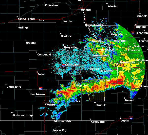 At 112 am cdt, severe thunderstorms were located along a line extending from 7 miles southwest of parker to 3 miles west of madison, moving south at 40 mph (law enforcement. damaging winds have been reported with these storms). Hazards include 60 mph wind gusts and quarter size hail. Hail damage to vehicles is expected. expect wind damage to roofs, siding, and trees. locations impacted include, emporia, ottawa, garnett, burlington, wellsville, lyndon, lebo, pomona, waverly, olpe, richmond, colony, williamsburg, new strawn, quenemo, melvern, hartford, gridley, greeley and princeton. this includes the following highways, interstate 35 between mile markers 128 and 198. Kansas turnpike between mile markers 116 and 126. At 112 am cdt, severe thunderstorms were located along a line extending from 7 miles southwest of parker to 3 miles west of madison, moving south at 40 mph (law enforcement. damaging winds have been reported with these storms). Hazards include 60 mph wind gusts and quarter size hail. Hail damage to vehicles is expected. expect wind damage to roofs, siding, and trees. locations impacted include, emporia, ottawa, garnett, burlington, wellsville, lyndon, lebo, pomona, waverly, olpe, richmond, colony, williamsburg, new strawn, quenemo, melvern, hartford, gridley, greeley and princeton. this includes the following highways, interstate 35 between mile markers 128 and 198. Kansas turnpike between mile markers 116 and 126.
|
| 6/12/2018 1:13 AM CDT |
 At 112 am cdt, severe thunderstorms were located along a line extending from 7 miles southwest of parker to 3 miles west of madison, moving south at 40 mph (law enforcement. damaging winds have been reported with these storms). Hazards include 60 mph wind gusts and quarter size hail. Hail damage to vehicles is expected. expect wind damage to roofs, siding, and trees. locations impacted include, emporia, ottawa, garnett, burlington, wellsville, lyndon, lebo, pomona, waverly, olpe, richmond, colony, williamsburg, new strawn, quenemo, melvern, hartford, gridley, greeley and princeton. this includes the following highways, interstate 35 between mile markers 128 and 198. Kansas turnpike between mile markers 116 and 126. At 112 am cdt, severe thunderstorms were located along a line extending from 7 miles southwest of parker to 3 miles west of madison, moving south at 40 mph (law enforcement. damaging winds have been reported with these storms). Hazards include 60 mph wind gusts and quarter size hail. Hail damage to vehicles is expected. expect wind damage to roofs, siding, and trees. locations impacted include, emporia, ottawa, garnett, burlington, wellsville, lyndon, lebo, pomona, waverly, olpe, richmond, colony, williamsburg, new strawn, quenemo, melvern, hartford, gridley, greeley and princeton. this includes the following highways, interstate 35 between mile markers 128 and 198. Kansas turnpike between mile markers 116 and 126.
|
| 6/12/2018 1:08 AM CDT |
 At 108 am cdt, severe thunderstorms were located along a line extending from 5 miles southwest of parker to 4 miles northwest of madison, moving south at 35 mph (radar indicated). Hazards include 60 mph wind gusts and quarter size hail. Hail damage to vehicles is expected. expect wind damage to roofs, siding, and trees. locations impacted include, emporia, ottawa, garnett, burlington, wellsville, lyndon, lebo, pomona, waverly, olpe, richmond, colony, williamsburg, new strawn, quenemo, melvern, hartford, gridley, greeley and princeton. this includes the following highways, interstate 35 between mile markers 128 and 198. Kansas turnpike between mile markers 116 and 126. At 108 am cdt, severe thunderstorms were located along a line extending from 5 miles southwest of parker to 4 miles northwest of madison, moving south at 35 mph (radar indicated). Hazards include 60 mph wind gusts and quarter size hail. Hail damage to vehicles is expected. expect wind damage to roofs, siding, and trees. locations impacted include, emporia, ottawa, garnett, burlington, wellsville, lyndon, lebo, pomona, waverly, olpe, richmond, colony, williamsburg, new strawn, quenemo, melvern, hartford, gridley, greeley and princeton. this includes the following highways, interstate 35 between mile markers 128 and 198. Kansas turnpike between mile markers 116 and 126.
|
| 6/12/2018 12:57 AM CDT |
 At 1256 am cdt, severe thunderstorms were located along a line extending from greeley to 9 miles west of olpe, moving south at 40 mph (trained weather spotters. measured severe winds have been reported with these storms). Hazards include 60 mph wind gusts and quarter size hail. Hail damage to vehicles is expected. expect wind damage to roofs, siding, and trees. locations impacted include, emporia, ottawa, garnett, burlington, wellsville, lyndon, lebo, pomona, waverly, olpe, richmond, colony, williamsburg, new strawn, quenemo, melvern, hartford, gridley, greeley and princeton. this includes the following highways, interstate 35 between mile markers 128 and 198. Kansas turnpike between mile markers 116 and 126. At 1256 am cdt, severe thunderstorms were located along a line extending from greeley to 9 miles west of olpe, moving south at 40 mph (trained weather spotters. measured severe winds have been reported with these storms). Hazards include 60 mph wind gusts and quarter size hail. Hail damage to vehicles is expected. expect wind damage to roofs, siding, and trees. locations impacted include, emporia, ottawa, garnett, burlington, wellsville, lyndon, lebo, pomona, waverly, olpe, richmond, colony, williamsburg, new strawn, quenemo, melvern, hartford, gridley, greeley and princeton. this includes the following highways, interstate 35 between mile markers 128 and 198. Kansas turnpike between mile markers 116 and 126.
|
| 6/12/2018 12:47 AM CDT |
 At 1246 am cdt, severe thunderstorms were located along a line extending from near lane to 7 miles west of olpe, moving south at 40 mph (radar indicated). Hazards include 60 mph wind gusts and quarter size hail. Hail damage to vehicles is expected. Expect wind damage to roofs, siding, and trees. At 1246 am cdt, severe thunderstorms were located along a line extending from near lane to 7 miles west of olpe, moving south at 40 mph (radar indicated). Hazards include 60 mph wind gusts and quarter size hail. Hail damage to vehicles is expected. Expect wind damage to roofs, siding, and trees.
|
| 6/12/2018 12:43 AM CDT |
 At 1241 am cdt, severe thunderstorms were located along a line extending from near paola to 3 miles northeast of harris to near neosho rapids, moving south at 40 mph (trained weather spotters. at 1245 am cdt...the ottawa asos site measured a 61 mph wind gust). Hazards include 70 mph wind gusts and half dollar size hail. Hail damage to vehicles is expected. expect considerable tree damage. wind damage is also likely to mobile homes, roofs, and outbuildings. locations impacted include, southern lawrence, emporia, ottawa, baldwin city, garnett, osage city, burlington, carbondale, eskridge, eudora, richland, wellsville, overbrook, lyndon, centropolis, lebo, burlingame, pomona, scranton and waverly. this includes the following highways, interstate 35 between mile markers 130 and 198. Kansas turnpike between mile markers 133 and 167. At 1241 am cdt, severe thunderstorms were located along a line extending from near paola to 3 miles northeast of harris to near neosho rapids, moving south at 40 mph (trained weather spotters. at 1245 am cdt...the ottawa asos site measured a 61 mph wind gust). Hazards include 70 mph wind gusts and half dollar size hail. Hail damage to vehicles is expected. expect considerable tree damage. wind damage is also likely to mobile homes, roofs, and outbuildings. locations impacted include, southern lawrence, emporia, ottawa, baldwin city, garnett, osage city, burlington, carbondale, eskridge, eudora, richland, wellsville, overbrook, lyndon, centropolis, lebo, burlingame, pomona, scranton and waverly. this includes the following highways, interstate 35 between mile markers 130 and 198. Kansas turnpike between mile markers 133 and 167.
|
| 6/12/2018 12:21 AM CDT |
 At 1221 am cdt, severe thunderstorms were located along a line extending from near edgerton to 3 miles southeast of quenemo to 5 miles west of reading, moving south at 40 mph (trained weather spotters. at 1208 am cdt...trained spotter reported ping pong ball size hail 2 miles northeast of pleasant grove). Hazards include 70 mph wind gusts and ping pong ball size hail. People and animals outdoors will be injured. expect hail damage to roofs, siding, windows, and vehicles. expect considerable tree damage. wind damage is also likely to mobile homes, roofs, and outbuildings. locations impacted include, southern lawrence, emporia, ottawa, baldwin city, garnett, osage city, burlington, carbondale, eskridge, eudora, richland, wellsville, overbrook, lyndon, centropolis, lebo, burlingame, pomona, scranton and waverly. this includes the following highways, interstate 35 between mile markers 130 and 198. Kansas turnpike between mile markers 133 and 167. At 1221 am cdt, severe thunderstorms were located along a line extending from near edgerton to 3 miles southeast of quenemo to 5 miles west of reading, moving south at 40 mph (trained weather spotters. at 1208 am cdt...trained spotter reported ping pong ball size hail 2 miles northeast of pleasant grove). Hazards include 70 mph wind gusts and ping pong ball size hail. People and animals outdoors will be injured. expect hail damage to roofs, siding, windows, and vehicles. expect considerable tree damage. wind damage is also likely to mobile homes, roofs, and outbuildings. locations impacted include, southern lawrence, emporia, ottawa, baldwin city, garnett, osage city, burlington, carbondale, eskridge, eudora, richland, wellsville, overbrook, lyndon, centropolis, lebo, burlingame, pomona, scranton and waverly. this includes the following highways, interstate 35 between mile markers 130 and 198. Kansas turnpike between mile markers 133 and 167.
|
| 6/12/2018 12:09 AM CDT |
 At 1208 am cdt, severe thunderstorms were located along a line extending from 6 miles southeast of eudora to near pomona lake to near admire, moving south at 40 mph (trained weather spotters. at 1202 am cdt...trained spotters reported quarter size hail and estimated 60 mph wind gusts in lawrence). Hazards include 70 mph wind gusts and half dollar size hail. Hail damage to vehicles is expected. expect considerable tree damage. wind damage is also likely to mobile homes, roofs, and outbuildings. locations impacted include, southern lawrence, emporia, ottawa, baldwin city, garnett, osage city, burlington, carbondale, eskridge, eudora, richland, wellsville, overbrook, lyndon, centropolis, lebo, burlingame, pomona, scranton and waverly. this includes the following highways, interstate 35 between mile markers 130 and 198. Kansas turnpike between mile markers 133 and 167. At 1208 am cdt, severe thunderstorms were located along a line extending from 6 miles southeast of eudora to near pomona lake to near admire, moving south at 40 mph (trained weather spotters. at 1202 am cdt...trained spotters reported quarter size hail and estimated 60 mph wind gusts in lawrence). Hazards include 70 mph wind gusts and half dollar size hail. Hail damage to vehicles is expected. expect considerable tree damage. wind damage is also likely to mobile homes, roofs, and outbuildings. locations impacted include, southern lawrence, emporia, ottawa, baldwin city, garnett, osage city, burlington, carbondale, eskridge, eudora, richland, wellsville, overbrook, lyndon, centropolis, lebo, burlingame, pomona, scranton and waverly. this includes the following highways, interstate 35 between mile markers 130 and 198. Kansas turnpike between mile markers 133 and 167.
|
| 6/12/2018 12:05 AM CDT |
 At 1204 am cdt, severe thunderstorms were located along a line extending from 3 miles southeast of eudora to near pomona lake to 3 miles northeast of allen, moving south at 40 mph (trained weather spotters). Hazards include 70 mph wind gusts and half dollar size hail. Hail damage to vehicles is expected. expect considerable tree damage. Wind damage is also likely to mobile homes, roofs, and outbuildings. At 1204 am cdt, severe thunderstorms were located along a line extending from 3 miles southeast of eudora to near pomona lake to 3 miles northeast of allen, moving south at 40 mph (trained weather spotters). Hazards include 70 mph wind gusts and half dollar size hail. Hail damage to vehicles is expected. expect considerable tree damage. Wind damage is also likely to mobile homes, roofs, and outbuildings.
|
| 6/2/2018 5:45 AM CDT |
 At 545 am cdt, a severe thunderstorm was located near emporia, moving east at 35 mph (radar indicated). Hazards include 60 mph wind gusts. Expect damage to roofs, siding, and trees. locations impacted include, emporia and olpe. this includes the following highways, interstate 35 between mile markers 128 and 138. Kansas turnpike between mile markers 121 and 134. At 545 am cdt, a severe thunderstorm was located near emporia, moving east at 35 mph (radar indicated). Hazards include 60 mph wind gusts. Expect damage to roofs, siding, and trees. locations impacted include, emporia and olpe. this includes the following highways, interstate 35 between mile markers 128 and 138. Kansas turnpike between mile markers 121 and 134.
|
| 6/2/2018 5:34 AM CDT |
 At 534 am cdt, a severe thunderstorm was located 6 miles west of emporia, moving east at 35 mph (radar indicated). Hazards include 60 mph wind gusts. expect damage to roofs, siding, and trees At 534 am cdt, a severe thunderstorm was located 6 miles west of emporia, moving east at 35 mph (radar indicated). Hazards include 60 mph wind gusts. expect damage to roofs, siding, and trees
|
| 6/2/2018 5:17 AM CDT | Storm damage reported in lyon county KS, 4 miles N of Emporia, KS |
| 5/19/2018 4:20 PM CDT | Half Dollar sized hail reported 2.4 miles SE of Emporia, KS, report via social media. |
| 5/19/2018 4:12 PM CDT |
 At 411 pm cdt, a severe thunderstorm was located near emporia, moving northeast at 20 mph (trained weather spotters reported golf ball sized hail west of emporia at 408 pm cdt). Hazards include two inch hail and 60 mph wind gusts. People and animals outdoors will be injured. expect hail damage to roofs, siding, windows, and vehicles. expect wind damage to roofs, siding, and trees. this severe storm will be near, emporia around 415 pm cdt. this includes the following highways, interstate 35 between mile markers 128 and 143. Kansas turnpike between mile markers 123 and 141. At 411 pm cdt, a severe thunderstorm was located near emporia, moving northeast at 20 mph (trained weather spotters reported golf ball sized hail west of emporia at 408 pm cdt). Hazards include two inch hail and 60 mph wind gusts. People and animals outdoors will be injured. expect hail damage to roofs, siding, windows, and vehicles. expect wind damage to roofs, siding, and trees. this severe storm will be near, emporia around 415 pm cdt. this includes the following highways, interstate 35 between mile markers 128 and 143. Kansas turnpike between mile markers 123 and 141.
|
| 5/19/2018 4:08 PM CDT |
 At 408 pm cdt, a severe thunderstorm was located 5 miles northeast of emporia, moving northeast at 40 mph (radar indicated). Hazards include two inch hail and 60 mph wind gusts. People and animals outdoors will be injured. expect hail damage to roofs, siding, windows, and vehicles. expect wind damage to roofs, siding, and trees. this severe storm will be near, reading around 425 pm cdt. this includes the following highways, interstate 35 between mile markers 128 and 143. Kansas turnpike between mile markers 123 and 141. At 408 pm cdt, a severe thunderstorm was located 5 miles northeast of emporia, moving northeast at 40 mph (radar indicated). Hazards include two inch hail and 60 mph wind gusts. People and animals outdoors will be injured. expect hail damage to roofs, siding, windows, and vehicles. expect wind damage to roofs, siding, and trees. this severe storm will be near, reading around 425 pm cdt. this includes the following highways, interstate 35 between mile markers 128 and 143. Kansas turnpike between mile markers 123 and 141.
|
| 5/19/2018 4:06 PM CDT | Ping Pong Ball sized hail reported 2.4 miles SE of Emporia, KS |
| 5/19/2018 4:04 PM CDT | Golf Ball sized hail reported 2.6 miles ESE of Emporia, KS |
| 5/19/2018 4:03 PM CDT |
 At 403 pm cdt, a severe thunderstorm was located near emporia, moving northeast at 40 mph (radar indicated). Hazards include 60 mph wind gusts and half dollar size hail. Hail damage to vehicles is expected. expect wind damage to roofs, siding, and trees. this severe storm will be near, reading around 425 pm cdt. this includes the following highways, interstate 35 between mile markers 128 and 143. Kansas turnpike between mile markers 123 and 141. At 403 pm cdt, a severe thunderstorm was located near emporia, moving northeast at 40 mph (radar indicated). Hazards include 60 mph wind gusts and half dollar size hail. Hail damage to vehicles is expected. expect wind damage to roofs, siding, and trees. this severe storm will be near, reading around 425 pm cdt. this includes the following highways, interstate 35 between mile markers 128 and 143. Kansas turnpike between mile markers 123 and 141.
|
| 5/19/2018 3:53 PM CDT |
 At 352 pm cdt, a severe thunderstorm was located 5 miles west of emporia, moving northeast at 40 mph (radar indicated). Hazards include 60 mph wind gusts and quarter size hail. Hail damage to vehicles is expected. expect wind damage to roofs, siding, and trees. this severe thunderstorm will be near, emporia around 400 pm cdt. reading around 425 pm cdt. this includes the following highways, interstate 35 between mile markers 128 and 143. Kansas turnpike between mile markers 118 and 141. At 352 pm cdt, a severe thunderstorm was located 5 miles west of emporia, moving northeast at 40 mph (radar indicated). Hazards include 60 mph wind gusts and quarter size hail. Hail damage to vehicles is expected. expect wind damage to roofs, siding, and trees. this severe thunderstorm will be near, emporia around 400 pm cdt. reading around 425 pm cdt. this includes the following highways, interstate 35 between mile markers 128 and 143. Kansas turnpike between mile markers 118 and 141.
|
| 5/14/2018 7:05 PM CDT |
 The national weather service in topeka has issued a * severe thunderstorm warning for. southern lyon county in east central kansas. Until 730 pm cdt * at 705 pm cdt, a severe thunderstorm was located 4 miles southwest of emporia, moving northeast at 30 mph. The national weather service in topeka has issued a * severe thunderstorm warning for. southern lyon county in east central kansas. Until 730 pm cdt * at 705 pm cdt, a severe thunderstorm was located 4 miles southwest of emporia, moving northeast at 30 mph.
|
| 5/14/2018 6:55 PM CDT | Half Dollar sized hail reported 4.3 miles S of Emporia, KS |
| 5/14/2018 6:51 PM CDT |
 The severe thunderstorm warning for southern lyon county will expire at 700 pm cdt, the storm which prompted the warning has weakened below severe limits, and no longer poses an immediate threat to life or property. therefore the warning will be allowed to expire. however small hail, gusty winds and heavy rain are still possible with this thunderstorm. a severe thunderstorm watch remains in effect until 1000 pm cdt for east central kansas. The severe thunderstorm warning for southern lyon county will expire at 700 pm cdt, the storm which prompted the warning has weakened below severe limits, and no longer poses an immediate threat to life or property. therefore the warning will be allowed to expire. however small hail, gusty winds and heavy rain are still possible with this thunderstorm. a severe thunderstorm watch remains in effect until 1000 pm cdt for east central kansas.
|
| 5/14/2018 6:49 PM CDT | Quarter sized hail reported 5 miles S of Emporia, KS |
| 5/14/2018 6:48 PM CDT |
 At 648 pm cdt, a severe thunderstorm was located near americus, moving northeast at 25 mph (radar indicated). Hazards include golf ball size hail and 60 mph wind gusts. People and animals outdoors will be injured. expect hail damage to roofs, siding, windows, and vehicles. expect wind damage to roofs, siding, and trees. this severe thunderstorm will be near, allen and admire around 710 pm cdt. this includes the following highways, interstate 35 between mile markers 129 and 132. Kansas turnpike between mile markers 129 and 155. At 648 pm cdt, a severe thunderstorm was located near americus, moving northeast at 25 mph (radar indicated). Hazards include golf ball size hail and 60 mph wind gusts. People and animals outdoors will be injured. expect hail damage to roofs, siding, windows, and vehicles. expect wind damage to roofs, siding, and trees. this severe thunderstorm will be near, allen and admire around 710 pm cdt. this includes the following highways, interstate 35 between mile markers 129 and 132. Kansas turnpike between mile markers 129 and 155.
|
| 5/14/2018 6:41 PM CDT |
 At 640 pm cdt, a severe thunderstorm was located 8 miles southwest of emporia, moving east at 25 mph (radar indicated). Hazards include 60 mph wind gusts and quarter size hail. Hail damage to vehicles is expected. expect wind damage to roofs, siding, and trees. Locations impacted include, emporia and olpe. At 640 pm cdt, a severe thunderstorm was located 8 miles southwest of emporia, moving east at 25 mph (radar indicated). Hazards include 60 mph wind gusts and quarter size hail. Hail damage to vehicles is expected. expect wind damage to roofs, siding, and trees. Locations impacted include, emporia and olpe.
|
| 5/14/2018 6:18 PM CDT |
 At 618 pm cdt, a severe thunderstorm was located 9 miles west of olpe, moving northeast at 20 mph (radar indicated). Hazards include 60 mph wind gusts and half dollar size hail. Hail damage to vehicles is expected. Expect wind damage to roofs, siding, and trees. At 618 pm cdt, a severe thunderstorm was located 9 miles west of olpe, moving northeast at 20 mph (radar indicated). Hazards include 60 mph wind gusts and half dollar size hail. Hail damage to vehicles is expected. Expect wind damage to roofs, siding, and trees.
|
| 5/14/2018 6:14 PM CDT |
 At 614 pm cdt, a severe thunderstorm was located 5 miles east of emporia, moving northeast at 25 mph (radar indicated). Hazards include golf ball size hail and 60 mph wind gusts. People and animals outdoors will be injured. expect hail damage to roofs, siding, windows, and vehicles. expect wind damage to roofs, siding, and trees. locations impacted include, emporia and neosho rapids. This includes interstate 35 between mile markers 130 and 143. At 614 pm cdt, a severe thunderstorm was located 5 miles east of emporia, moving northeast at 25 mph (radar indicated). Hazards include golf ball size hail and 60 mph wind gusts. People and animals outdoors will be injured. expect hail damage to roofs, siding, windows, and vehicles. expect wind damage to roofs, siding, and trees. locations impacted include, emporia and neosho rapids. This includes interstate 35 between mile markers 130 and 143.
|
| 5/14/2018 6:10 PM CDT |
 The national weather service in topeka has issued a * severe thunderstorm warning for. west central coffey county in east central kansas. southern lyon county in east central kansas. Until 700 pm cdt * at 609 pm cdt, a severe thunderstorm was located near olpe, moving. The national weather service in topeka has issued a * severe thunderstorm warning for. west central coffey county in east central kansas. southern lyon county in east central kansas. Until 700 pm cdt * at 609 pm cdt, a severe thunderstorm was located near olpe, moving.
|
| 5/14/2018 6:07 PM CDT | Quarter sized hail reported 3.4 miles WSW of Emporia, KS |
| 5/14/2018 5:58 PM CDT | Quarter sized hail reported 0.9 miles SSW of Emporia, KS, picture and report from social media. |
| 5/14/2018 5:44 PM CDT |
 At 544 pm cdt, a severe thunderstorm was located near olpe, moving northeast at 20 mph (radar indicated). Hazards include 60 mph wind gusts and quarter size hail. Hail damage to vehicles is expected. Expect wind damage to roofs, siding, and trees. At 544 pm cdt, a severe thunderstorm was located near olpe, moving northeast at 20 mph (radar indicated). Hazards include 60 mph wind gusts and quarter size hail. Hail damage to vehicles is expected. Expect wind damage to roofs, siding, and trees.
|
| 5/14/2018 5:27 PM CDT |
 At 526 pm cdt, a severe thunderstorm was located 5 miles west of hartford, moving northeast at 30 mph (trained weather spotters reported half dollar size hail south of olpe at 525 pm). Hazards include 60 mph wind gusts and half dollar size hail. Hail damage to vehicles is expected. expect wind damage to roofs, siding, and trees. locations impacted include, emporia, olpe, hartford and neosho rapids. this includes the following highways, interstate 35 between mile markers 128 and 137. Kansas turnpike between mile markers 117 and 131. At 526 pm cdt, a severe thunderstorm was located 5 miles west of hartford, moving northeast at 30 mph (trained weather spotters reported half dollar size hail south of olpe at 525 pm). Hazards include 60 mph wind gusts and half dollar size hail. Hail damage to vehicles is expected. expect wind damage to roofs, siding, and trees. locations impacted include, emporia, olpe, hartford and neosho rapids. this includes the following highways, interstate 35 between mile markers 128 and 137. Kansas turnpike between mile markers 117 and 131.
|
| 5/14/2018 5:00 PM CDT |
 The national weather service in topeka has issued a * severe thunderstorm warning for. southern lyon county in east central kansas. Until 545 pm cdt * at 459 pm cdt, a severe thunderstorm was located 4 miles west of madison, moving northeast at 30 mph. The national weather service in topeka has issued a * severe thunderstorm warning for. southern lyon county in east central kansas. Until 545 pm cdt * at 459 pm cdt, a severe thunderstorm was located 4 miles west of madison, moving northeast at 30 mph.
|
| 5/2/2018 7:23 PM CDT | Academia report in lyon county KS, 8.4 miles E of Emporia, KS |
| 5/2/2018 7:06 PM CDT |
 At 705 pm cdt, severe thunderstorms were located along a line extending from 10 miles northwest of strong city to 19 miles east of burns, moving east at 40 mph (radar indicated). Hazards include 60 mph wind gusts and quarter size hail. Hail damage to vehicles is expected. expect wind damage to roofs, siding, and trees. severe thunderstorms will be near, dunlap around 735 pm cdt. americus and olpe around 740 pm cdt. admire around 745 pm cdt. this includes the following highways, interstate 35 between mile markers 128 and 142. kansas turnpike between mile markers 117 and 147. A tornado watch remains in effect until 1000 pm cdt for east central kansas. At 705 pm cdt, severe thunderstorms were located along a line extending from 10 miles northwest of strong city to 19 miles east of burns, moving east at 40 mph (radar indicated). Hazards include 60 mph wind gusts and quarter size hail. Hail damage to vehicles is expected. expect wind damage to roofs, siding, and trees. severe thunderstorms will be near, dunlap around 735 pm cdt. americus and olpe around 740 pm cdt. admire around 745 pm cdt. this includes the following highways, interstate 35 between mile markers 128 and 142. kansas turnpike between mile markers 117 and 147. A tornado watch remains in effect until 1000 pm cdt for east central kansas.
|
| 4/13/2018 2:23 PM CDT |
 At 222 pm cdt, severe thunderstorms were located along a line extending from 13 miles northwest of hamilton to 7 miles southwest of eureka, moving northeast at 55 mph (radar indicated). Hazards include 60 mph wind gusts and half dollar size hail. Hail damage to vehicles is expected. Expect wind damage to roofs, siding, and trees. At 222 pm cdt, severe thunderstorms were located along a line extending from 13 miles northwest of hamilton to 7 miles southwest of eureka, moving northeast at 55 mph (radar indicated). Hazards include 60 mph wind gusts and half dollar size hail. Hail damage to vehicles is expected. Expect wind damage to roofs, siding, and trees.
|
| 3/26/2018 4:31 AM CDT | Ping Pong Ball sized hail reported 3.4 miles WSW of Emporia, KS |
| 10/21/2017 4:24 PM CDT |
 At 424 pm cdt, severe thunderstorms were located along a line extending from near admire to 3 miles southeast of americus, moving northeast at 45 mph (radar indicated). Hazards include 60 mph wind gusts and quarter size hail. Hail damage to vehicles is expected. expect wind damage to roofs, siding, and trees. locations impacted include, emporia, americus, harveyville, reading, allen, admire and bushong. this includes the following highways, interstate 35 between mile markers 128 and 130. Kansas turnpike between mile markers 128 and 154. At 424 pm cdt, severe thunderstorms were located along a line extending from near admire to 3 miles southeast of americus, moving northeast at 45 mph (radar indicated). Hazards include 60 mph wind gusts and quarter size hail. Hail damage to vehicles is expected. expect wind damage to roofs, siding, and trees. locations impacted include, emporia, americus, harveyville, reading, allen, admire and bushong. this includes the following highways, interstate 35 between mile markers 128 and 130. Kansas turnpike between mile markers 128 and 154.
|
| 10/21/2017 4:07 PM CDT |
 At 406 pm cdt, severe thunderstorms were located along a line extending from 4 miles south of allen to 9 miles northwest of olpe, moving east at 40 mph (radar indicated). Hazards include 60 mph wind gusts and quarter size hail. Hail damage to vehicles is expected. Expect wind damage to roofs, siding, and trees. At 406 pm cdt, severe thunderstorms were located along a line extending from 4 miles south of allen to 9 miles northwest of olpe, moving east at 40 mph (radar indicated). Hazards include 60 mph wind gusts and quarter size hail. Hail damage to vehicles is expected. Expect wind damage to roofs, siding, and trees.
|
| 10/14/2017 4:58 PM CDT |
 The severe thunderstorm warning for southern lyon county will expire at 500 pm cdt, the storm which prompted the warning will move out of the area. therefore the warning will be allowed to expire. a severe thunderstorm watch remains in effect until midnight cdt for east central kansas. The severe thunderstorm warning for southern lyon county will expire at 500 pm cdt, the storm which prompted the warning will move out of the area. therefore the warning will be allowed to expire. a severe thunderstorm watch remains in effect until midnight cdt for east central kansas.
|
| 10/14/2017 4:36 PM CDT |
 At 435 pm cdt, a severe thunderstorm was located 7 miles southwest of olpe, moving northeast at 55 mph (radar indicated). Hazards include 70 mph wind gusts and penny size hail. Expect considerable tree damage. damage is likely to mobile homes, roofs, and outbuildings. this severe storm will be near, olpe around 445 pm cdt. hartford and neosho rapids around 455 pm cdt. This severe thunderstorm will also impact interstate 35 and the kansas turnpike. At 435 pm cdt, a severe thunderstorm was located 7 miles southwest of olpe, moving northeast at 55 mph (radar indicated). Hazards include 70 mph wind gusts and penny size hail. Expect considerable tree damage. damage is likely to mobile homes, roofs, and outbuildings. this severe storm will be near, olpe around 445 pm cdt. hartford and neosho rapids around 455 pm cdt. This severe thunderstorm will also impact interstate 35 and the kansas turnpike.
|
| 10/14/2017 4:16 PM CDT |
 At 414 pm cdt, a severe thunderstorm was located 16 miles east of burns, moving northeast at 55 mph (trained weather spotters. at 355 pm, spotters reported down tree limbs with estimated 70 mph winds 2 miles southeast of burns). Hazards include 70 mph wind gusts and penny size hail. Expect considerable tree damage. damage is likely to mobile homes, roofs, and outbuildings. this severe thunderstorm will be near, olpe around 440 pm cdt. emporia around 445 pm cdt. Hartford and neosho rapids around 455 pm cdt. At 414 pm cdt, a severe thunderstorm was located 16 miles east of burns, moving northeast at 55 mph (trained weather spotters. at 355 pm, spotters reported down tree limbs with estimated 70 mph winds 2 miles southeast of burns). Hazards include 70 mph wind gusts and penny size hail. Expect considerable tree damage. damage is likely to mobile homes, roofs, and outbuildings. this severe thunderstorm will be near, olpe around 440 pm cdt. emporia around 445 pm cdt. Hartford and neosho rapids around 455 pm cdt.
|
| 10/9/2017 4:34 PM CDT |
 At 434 pm cdt, a severe thunderstorm was located 5 miles southwest of emporia, moving northeast at 20 mph (radar indicated). Hazards include 60 mph wind gusts and quarter size hail. Hail damage to vehicles is expected. expect wind damage to roofs, siding, and trees. Locations impacted include, emporia, americus and olpe. At 434 pm cdt, a severe thunderstorm was located 5 miles southwest of emporia, moving northeast at 20 mph (radar indicated). Hazards include 60 mph wind gusts and quarter size hail. Hail damage to vehicles is expected. expect wind damage to roofs, siding, and trees. Locations impacted include, emporia, americus and olpe.
|
| 10/9/2017 4:21 PM CDT |
 At 420 pm cdt, a severe thunderstorm was located 6 miles west of olpe, moving northeast at 20 mph (radar indicated). Hazards include 70 mph wind gusts and quarter size hail. Hail damage to vehicles is expected. expect considerable tree damage. wind damage is also likely to mobile homes, roofs, and outbuildings. Locations impacted include, emporia, americus and olpe. At 420 pm cdt, a severe thunderstorm was located 6 miles west of olpe, moving northeast at 20 mph (radar indicated). Hazards include 70 mph wind gusts and quarter size hail. Hail damage to vehicles is expected. expect considerable tree damage. wind damage is also likely to mobile homes, roofs, and outbuildings. Locations impacted include, emporia, americus and olpe.
|
| 10/9/2017 4:08 PM CDT |
 At 407 pm cdt, a severe thunderstorm was located 9 miles west of olpe, moving north at 35 mph (radar indicated). Hazards include 70 mph wind gusts and quarter size hail. Hail damage to vehicles is expected. expect considerable tree damage. Wind damage is also likely to mobile homes, roofs, and outbuildings. At 407 pm cdt, a severe thunderstorm was located 9 miles west of olpe, moving north at 35 mph (radar indicated). Hazards include 70 mph wind gusts and quarter size hail. Hail damage to vehicles is expected. expect considerable tree damage. Wind damage is also likely to mobile homes, roofs, and outbuildings.
|
| 8/21/2017 9:21 PM CDT | 6 inch limb dow in lyon county KS, 1.6 miles ESE of Emporia, KS |
| 8/21/2017 9:21 PM CDT | Reports of several limbs down in the neighborhood around 2 inche in lyon county KS, 0.9 miles W of Emporia, KS |
| 8/21/2017 9:21 PM CDT | Relayed via photos on social media. 10 inch tree branch split from the main trunk. radar estimated tim in lyon county KS, 0.4 miles WSW of Emporia, KS |
| 6/29/2017 1:16 AM CDT |
 At 615 am cdt, severe thunderstorms were located along a line extending from 3 miles southeast of osage city to 3 miles southwest of reading to 3 miles northwest of emporia, moving southeast at 40 mph (radar indicated). Hazards include 60 mph wind gusts and nickel size hail. Expect damage to roofs, siding, and trees. locations impacted include, emporia, osage city, lyndon, lebo, burlingame, americus, waverly, olpe, new strawn, melvern, hartford, neosho rapids, reading, olivet, beto junction, john redmond reservoir and melvern lake. this includes the following highways, interstate 35 between mile markers 128 and 165. Kansas turnpike between mile markers 123 and 146. At 615 am cdt, severe thunderstorms were located along a line extending from 3 miles southeast of osage city to 3 miles southwest of reading to 3 miles northwest of emporia, moving southeast at 40 mph (radar indicated). Hazards include 60 mph wind gusts and nickel size hail. Expect damage to roofs, siding, and trees. locations impacted include, emporia, osage city, lyndon, lebo, burlingame, americus, waverly, olpe, new strawn, melvern, hartford, neosho rapids, reading, olivet, beto junction, john redmond reservoir and melvern lake. this includes the following highways, interstate 35 between mile markers 128 and 165. Kansas turnpike between mile markers 123 and 146.
|
| 6/29/2017 12:41 AM CDT |
 At 540 am cdt, severe thunderstorms were located along a line extending from harveyville to near allen to near dunlap, moving southeast at 35 mph (radar indicated). Hazards include 60 mph wind gusts and nickel size hail. expect damage to roofs, siding, and trees At 540 am cdt, severe thunderstorms were located along a line extending from harveyville to near allen to near dunlap, moving southeast at 35 mph (radar indicated). Hazards include 60 mph wind gusts and nickel size hail. expect damage to roofs, siding, and trees
|
| 6/15/2017 7:20 PM CDT | 3-4 inch diameter limbs blown dow in lyon county KS, 3.3 miles N of Emporia, KS |
| 6/15/2017 7:13 PM CDT |
 At 712 pm cdt, a severe thunderstorm was located 6 miles northeast of madison, moving southeast at 45 mph (trained weather spotters reported a 60 mph wind gust 8 miles southwest of olpe at 700 pm). Hazards include 60 mph wind gusts and quarter size hail. Hail damage to vehicles is expected. Expect wind damage to roofs, siding, and trees. At 712 pm cdt, a severe thunderstorm was located 6 miles northeast of madison, moving southeast at 45 mph (trained weather spotters reported a 60 mph wind gust 8 miles southwest of olpe at 700 pm). Hazards include 60 mph wind gusts and quarter size hail. Hail damage to vehicles is expected. Expect wind damage to roofs, siding, and trees.
|
| 6/15/2017 7:00 PM CDT | Multiple trees dow in lyon county KS, 1.6 miles ESE of Emporia, KS |
| 6/15/2017 6:25 PM CDT |
 At 624 pm cdt, severe thunderstorms were located along a line extending from near alta vista to 6 miles south of council grove to 3 miles east of florence, moving east at 50 mph (radar indicated). Hazards include ping pong ball size hail and 60 mph wind gusts. People and animals outdoors will be injured. expect hail damage to roofs, siding, windows, and vehicles. Expect wind damage to roofs, siding, and trees. At 624 pm cdt, severe thunderstorms were located along a line extending from near alta vista to 6 miles south of council grove to 3 miles east of florence, moving east at 50 mph (radar indicated). Hazards include ping pong ball size hail and 60 mph wind gusts. People and animals outdoors will be injured. expect hail damage to roofs, siding, windows, and vehicles. Expect wind damage to roofs, siding, and trees.
|
| 5/27/2017 3:45 PM CDT |
 At 344 pm cdt, a severe thunderstorm was located near olpe, moving east at 40 mph (trained weather spotters reported 70 mph wind gusts 10 miles west northwest of olpe and golf ball sized hail 9 miles southwest of olpe at 340 pm). Hazards include two inch hail and 70 mph wind gusts. People and animals outdoors will be injured. expect hail damage to roofs, siding, windows, and vehicles. expect considerable tree damage. wind damage is also likely to mobile homes, roofs, and outbuildings. locations impacted include, olpe, hartford and neosho rapids. This includes kansas turnpike between mile markers 117 and 120. At 344 pm cdt, a severe thunderstorm was located near olpe, moving east at 40 mph (trained weather spotters reported 70 mph wind gusts 10 miles west northwest of olpe and golf ball sized hail 9 miles southwest of olpe at 340 pm). Hazards include two inch hail and 70 mph wind gusts. People and animals outdoors will be injured. expect hail damage to roofs, siding, windows, and vehicles. expect considerable tree damage. wind damage is also likely to mobile homes, roofs, and outbuildings. locations impacted include, olpe, hartford and neosho rapids. This includes kansas turnpike between mile markers 117 and 120.
|
| 5/27/2017 3:18 PM CDT |
 At 318 pm cdt, a severe thunderstorm was located 6 miles south of cottonwood falls, moving east at 40 mph (radar indicated). Hazards include quarter size hail. damage to vehicles is expected At 318 pm cdt, a severe thunderstorm was located 6 miles south of cottonwood falls, moving east at 40 mph (radar indicated). Hazards include quarter size hail. damage to vehicles is expected
|
| 5/27/2017 10:59 AM CDT |
 At 1058 am cdt, a severe thunderstorm was located near americus, moving east at 40 mph (radar indicated). Hazards include quarter size hail. Damage to vehicles is expected. locations impacted include, americus. this includes the following highways, interstate 35 between mile markers 129 and 130. Kansas turnpike between mile markers 128 and 140. At 1058 am cdt, a severe thunderstorm was located near americus, moving east at 40 mph (radar indicated). Hazards include quarter size hail. Damage to vehicles is expected. locations impacted include, americus. this includes the following highways, interstate 35 between mile markers 129 and 130. Kansas turnpike between mile markers 128 and 140.
|
| 5/27/2017 10:48 AM CDT |
 At 1048 am cdt, a severe thunderstorm was located 6 miles southwest of americus, moving east at 30 mph (radar indicated). Hazards include quarter size hail. damage to vehicles is expected At 1048 am cdt, a severe thunderstorm was located 6 miles southwest of americus, moving east at 30 mph (radar indicated). Hazards include quarter size hail. damage to vehicles is expected
|
| 5/26/2017 1:47 AM CDT |
 At 147 am cdt, a severe thunderstorm was located 7 miles west of reading, moving east at 45 mph (radar indicated). Hazards include 60 mph wind gusts and quarter size hail. Hail damage to vehicles is expected. expect wind damage to roofs, siding, and trees. locations impacted include, emporia and americus. this includes the following highways, interstate 35 between mile markers 128 and 142. Kansas turnpike between mile markers 126 and 143. At 147 am cdt, a severe thunderstorm was located 7 miles west of reading, moving east at 45 mph (radar indicated). Hazards include 60 mph wind gusts and quarter size hail. Hail damage to vehicles is expected. expect wind damage to roofs, siding, and trees. locations impacted include, emporia and americus. this includes the following highways, interstate 35 between mile markers 128 and 142. Kansas turnpike between mile markers 126 and 143.
|
| 5/26/2017 1:30 AM CDT |
 At 130 am cdt, a severe thunderstorm was located 4 miles southwest of americus, moving east at 45 mph (radar indicated). Hazards include 60 mph wind gusts and quarter size hail. Hail damage to vehicles is expected. Expect wind damage to roofs, siding, and trees. At 130 am cdt, a severe thunderstorm was located 4 miles southwest of americus, moving east at 45 mph (radar indicated). Hazards include 60 mph wind gusts and quarter size hail. Hail damage to vehicles is expected. Expect wind damage to roofs, siding, and trees.
|
| 5/18/2017 8:52 PM CDT |
 The severe thunderstorm warning for southwestern osage, northwestern coffey and lyon counties will expire at 900 pm cdt, the storms which prompted the warning have weakened below severe limits, and no longer pose an immediate threat to life or property. therefore the warning will be allowed to expire. however gusty winds up to 50 mph are still possible with these thunderstorms. a tornado watch remains in effect until 1000 pm cdt for east central kansas. The severe thunderstorm warning for southwestern osage, northwestern coffey and lyon counties will expire at 900 pm cdt, the storms which prompted the warning have weakened below severe limits, and no longer pose an immediate threat to life or property. therefore the warning will be allowed to expire. however gusty winds up to 50 mph are still possible with these thunderstorms. a tornado watch remains in effect until 1000 pm cdt for east central kansas.
|
| 5/18/2017 8:38 PM CDT |
 At 837 pm cdt, severe thunderstorms were located along a line extending from 4 miles east of americus to 3 miles west of john redmond reservoir, moving northeast at 45 mph (radar indicated). Hazards include 60 mph wind gusts. Expect damage to roofs, siding, and trees. locations impacted include, emporia, lebo, americus, olpe, hartford, neosho rapids and reading. this includes the following highways, interstate 35 between mile markers 128 and 155. kansas turnpike between mile markers 120 and 144. A tornado watch remains in effect until 1000 pm cdt for east central kansas. At 837 pm cdt, severe thunderstorms were located along a line extending from 4 miles east of americus to 3 miles west of john redmond reservoir, moving northeast at 45 mph (radar indicated). Hazards include 60 mph wind gusts. Expect damage to roofs, siding, and trees. locations impacted include, emporia, lebo, americus, olpe, hartford, neosho rapids and reading. this includes the following highways, interstate 35 between mile markers 128 and 155. kansas turnpike between mile markers 120 and 144. A tornado watch remains in effect until 1000 pm cdt for east central kansas.
|
| 5/18/2017 8:18 PM CDT |
 At 818 pm cdt, a severe thunderstorm was located 9 miles southwest of olpe, moving northeast at 45 mph (radar indicated). Hazards include 60 mph wind gusts and penny size hail. expect damage to roofs, siding, and trees At 818 pm cdt, a severe thunderstorm was located 9 miles southwest of olpe, moving northeast at 45 mph (radar indicated). Hazards include 60 mph wind gusts and penny size hail. expect damage to roofs, siding, and trees
|
| 5/17/2017 3:36 AM CDT |
 The severe thunderstorm warning for lyon county will expire at 345 am cdt, the storms which prompted the warning have weakened below severe limits, and will exited the warned area. therefore the warning will be allowed to expire. The severe thunderstorm warning for lyon county will expire at 345 am cdt, the storms which prompted the warning have weakened below severe limits, and will exited the warned area. therefore the warning will be allowed to expire.
|
| 5/17/2017 3:20 AM CDT |
 At 320 am cdt, severe thunderstorms were located along a line extending from 3 miles north of bushong to near emporia, moving northeast at 55 mph (radar indicated). Hazards include 60 mph wind gusts. Expect damage to roofs, siding, and trees. these severe storms will be near, allen around 325 am cdt. reading around 335 am cdt. admire around 340 am cdt. this includes the following highways, interstate 35 between mile markers 128 and 140. Kansas turnpike between mile markers 119 and 154. At 320 am cdt, severe thunderstorms were located along a line extending from 3 miles north of bushong to near emporia, moving northeast at 55 mph (radar indicated). Hazards include 60 mph wind gusts. Expect damage to roofs, siding, and trees. these severe storms will be near, allen around 325 am cdt. reading around 335 am cdt. admire around 340 am cdt. this includes the following highways, interstate 35 between mile markers 128 and 140. Kansas turnpike between mile markers 119 and 154.
|
| 5/17/2017 3:12 AM CDT |
 At 311 am cdt, severe thunderstorms were located along a line extending from near council grove to 5 miles west of olpe, moving northeast at 55 mph (radar indicated). Hazards include 60 mph wind gusts. Expect damage to roofs, siding, and trees. these severe storms will be near, council grove, dunlap and council grove lake around 315 am cdt. emporia around 320 am cdt. eskridge and reading around 335 am cdt. admire around 340 am cdt. mcfarland, paxico and keene around 345 am cdt. this includes the following highways, interstate 35 between mile markers 128 and 140. interstate 70 between mile markers 331 and 341. Kansas turnpike between mile markers 117 and 155. At 311 am cdt, severe thunderstorms were located along a line extending from near council grove to 5 miles west of olpe, moving northeast at 55 mph (radar indicated). Hazards include 60 mph wind gusts. Expect damage to roofs, siding, and trees. these severe storms will be near, council grove, dunlap and council grove lake around 315 am cdt. emporia around 320 am cdt. eskridge and reading around 335 am cdt. admire around 340 am cdt. mcfarland, paxico and keene around 345 am cdt. this includes the following highways, interstate 35 between mile markers 128 and 140. interstate 70 between mile markers 331 and 341. Kansas turnpike between mile markers 117 and 155.
|
| 5/17/2017 2:58 AM CDT |
 At 257 am cdt, severe thunderstorms were located along a line extending from 7 miles north of strong city to 14 miles west of madison, moving northeast at 55 mph (radar indicated). Hazards include 60 mph wind gusts. Expect damage to roofs, siding, and trees. severe thunderstorms will be near, council grove, dunlap and council grove lake around 310 am cdt. olpe around 315 am cdt. emporia around 320 am cdt. eskridge and reading around 335 am cdt. admire around 340 am cdt. mcfarland, paxico and keene around 345 am cdt. this includes the following highways, interstate 35 between mile markers 128 and 140. interstate 70 between mile markers 331 and 341. Kansas turnpike between mile markers 117 and 155. At 257 am cdt, severe thunderstorms were located along a line extending from 7 miles north of strong city to 14 miles west of madison, moving northeast at 55 mph (radar indicated). Hazards include 60 mph wind gusts. Expect damage to roofs, siding, and trees. severe thunderstorms will be near, council grove, dunlap and council grove lake around 310 am cdt. olpe around 315 am cdt. emporia around 320 am cdt. eskridge and reading around 335 am cdt. admire around 340 am cdt. mcfarland, paxico and keene around 345 am cdt. this includes the following highways, interstate 35 between mile markers 128 and 140. interstate 70 between mile markers 331 and 341. Kansas turnpike between mile markers 117 and 155.
|
| 3/6/2017 7:12 PM CST |
 At 711 pm cst, severe thunderstorms were located along a line extending from melvern lake to 3 miles northeast of madison, moving east at 45 mph (radar indicated). Hazards include 60 mph wind gusts and quarter size hail. Hail damage to vehicles is expected. expect wind damage to roofs, siding, and trees. locations impacted include, emporia, garnett, burlington, lebo, waverly, olpe, richmond, williamsburg, new strawn, melvern, hartford, gridley, greeley, princeton, neosho rapids, reading, lane, westphalia, olivet and beto junction. this includes the following highways, interstate 35 between mile markers 128 and 176. kansas turnpike between mile markers 116 and 135. A tornado watch remains in effect until 1000 pm cst for east central kansas. At 711 pm cst, severe thunderstorms were located along a line extending from melvern lake to 3 miles northeast of madison, moving east at 45 mph (radar indicated). Hazards include 60 mph wind gusts and quarter size hail. Hail damage to vehicles is expected. expect wind damage to roofs, siding, and trees. locations impacted include, emporia, garnett, burlington, lebo, waverly, olpe, richmond, williamsburg, new strawn, melvern, hartford, gridley, greeley, princeton, neosho rapids, reading, lane, westphalia, olivet and beto junction. this includes the following highways, interstate 35 between mile markers 128 and 176. kansas turnpike between mile markers 116 and 135. A tornado watch remains in effect until 1000 pm cst for east central kansas.
|
| 3/6/2017 6:56 PM CST |
 At 655 pm cst, severe thunderstorms were located along a line extending from near reading to 8 miles west of madison, moving east at 45 mph (radar indicated). Hazards include 60 mph wind gusts and quarter size hail. Hail damage to vehicles is expected. Expect wind damage to roofs, siding, and trees. At 655 pm cst, severe thunderstorms were located along a line extending from near reading to 8 miles west of madison, moving east at 45 mph (radar indicated). Hazards include 60 mph wind gusts and quarter size hail. Hail damage to vehicles is expected. Expect wind damage to roofs, siding, and trees.
|
| 3/6/2017 6:53 PM CST | 50 kt wind gust at emporia airpor in lyon county KS, 0.4 miles WSW of Emporia, KS |
| 3/6/2017 6:48 PM CST |
 At 648 pm cst, severe thunderstorms were located along a line extending from 7 miles northeast of emporia to 13 miles west of madison, moving east at 45 mph (radar indicated). Hazards include 60 mph wind gusts and quarter size hail. Hail damage to vehicles is expected. expect wind damage to roofs, siding, and trees. locations impacted include, emporia, lebo, americus, olpe, melvern, hartford, neosho rapids, reading, olivet, beto junction and melvern lake. this includes the following highways, interstate 35 between mile markers 128 and 158. kansas turnpike between mile markers 117 and 137. A tornado watch remains in effect until 1000 pm cst for east central kansas. At 648 pm cst, severe thunderstorms were located along a line extending from 7 miles northeast of emporia to 13 miles west of madison, moving east at 45 mph (radar indicated). Hazards include 60 mph wind gusts and quarter size hail. Hail damage to vehicles is expected. expect wind damage to roofs, siding, and trees. locations impacted include, emporia, lebo, americus, olpe, melvern, hartford, neosho rapids, reading, olivet, beto junction and melvern lake. this includes the following highways, interstate 35 between mile markers 128 and 158. kansas turnpike between mile markers 117 and 137. A tornado watch remains in effect until 1000 pm cst for east central kansas.
|
| 3/6/2017 6:35 PM CST |
 At 635 pm cst, severe thunderstorms were located along a line extending from near americus to 14 miles south of cottonwood falls, moving east at 45 mph (radar indicated). Hazards include 60 mph wind gusts and quarter size hail. Hail damage to vehicles is expected. Expect wind damage to roofs, siding, and trees. At 635 pm cst, severe thunderstorms were located along a line extending from near americus to 14 miles south of cottonwood falls, moving east at 45 mph (radar indicated). Hazards include 60 mph wind gusts and quarter size hail. Hail damage to vehicles is expected. Expect wind damage to roofs, siding, and trees.
|
| 10/6/2016 7:25 PM CDT |
 At 725 pm cdt, severe thunderstorms were located along a line extending from 4 miles southwest of overbrook to 5 miles southwest of hartford, moving east at 45 mph (radar indicated). Hazards include 60 mph wind gusts and quarter size hail. Hail damage to vehicles is expected. expect wind damage to roofs, siding, and trees. locations impacted include, emporia, ottawa, baldwin city, osage city, lyndon, centropolis, lebo, pomona, waverly, williamsburg, quenemo, melvern, neosho rapids, reading, olivet, melvern lake, globe, beto junction and pomona lake. this includes interstate 35 between mile markers 132 and 181. A tornado watch remains in effect until 900 pm cdt for east central kansas. At 725 pm cdt, severe thunderstorms were located along a line extending from 4 miles southwest of overbrook to 5 miles southwest of hartford, moving east at 45 mph (radar indicated). Hazards include 60 mph wind gusts and quarter size hail. Hail damage to vehicles is expected. expect wind damage to roofs, siding, and trees. locations impacted include, emporia, ottawa, baldwin city, osage city, lyndon, centropolis, lebo, pomona, waverly, williamsburg, quenemo, melvern, neosho rapids, reading, olivet, melvern lake, globe, beto junction and pomona lake. this includes interstate 35 between mile markers 132 and 181. A tornado watch remains in effect until 900 pm cdt for east central kansas.
|
| 10/6/2016 7:18 PM CDT |
 At 718 pm cdt, severe thunderstorms were located along a line extending from near scranton to 5 miles southeast of olpe, moving east at 45 mph (radar indicated). Hazards include 60 mph wind gusts and quarter size hail. Hail damage to vehicles is expected. Expect wind damage to roofs, siding, and trees. At 718 pm cdt, severe thunderstorms were located along a line extending from near scranton to 5 miles southeast of olpe, moving east at 45 mph (radar indicated). Hazards include 60 mph wind gusts and quarter size hail. Hail damage to vehicles is expected. Expect wind damage to roofs, siding, and trees.
|
| 10/6/2016 6:51 PM CDT |
 At 650 pm cdt, a severe thunderstorm was located near dunlap, moving east at 30 mph (radar indicated). Hazards include ping pong ball size hail and 60 mph wind gusts. People and animals outdoors will be injured. expect hail damage to roofs, siding, windows, and vehicles. Expect wind damage to roofs, siding, and trees. At 650 pm cdt, a severe thunderstorm was located near dunlap, moving east at 30 mph (radar indicated). Hazards include ping pong ball size hail and 60 mph wind gusts. People and animals outdoors will be injured. expect hail damage to roofs, siding, windows, and vehicles. Expect wind damage to roofs, siding, and trees.
|
| 9/9/2016 8:15 PM CDT |
 At 814 pm cdt, a severe thunderstorm was located near neosho rapids, moving east at 30 mph (radar indicated). Hazards include 60 mph wind gusts. Expect damage to roofs. siding. and trees. locations impacted include, emporia and olpe. this includes the following highways, interstate 35 between mile markers 128 and 138. Kansas turnpike near mile marker 128. At 814 pm cdt, a severe thunderstorm was located near neosho rapids, moving east at 30 mph (radar indicated). Hazards include 60 mph wind gusts. Expect damage to roofs. siding. and trees. locations impacted include, emporia and olpe. this includes the following highways, interstate 35 between mile markers 128 and 138. Kansas turnpike near mile marker 128.
|
| 9/9/2016 8:07 PM CDT |
 At 807 pm cdt, a severe thunderstorm was located 4 miles southeast of emporia, moving southeast at 30 mph (radar indicated). Hazards include 60 mph wind gusts. Expect damage to roofs. siding. and trees. locations impacted include, emporia and olpe. this includes the following highways, interstate 35 between mile markers 128 and 138. Kansas turnpike between mile markers 120 and 136. At 807 pm cdt, a severe thunderstorm was located 4 miles southeast of emporia, moving southeast at 30 mph (radar indicated). Hazards include 60 mph wind gusts. Expect damage to roofs. siding. and trees. locations impacted include, emporia and olpe. this includes the following highways, interstate 35 between mile markers 128 and 138. Kansas turnpike between mile markers 120 and 136.
|
| 9/9/2016 7:55 PM CDT |
 At 755 pm cdt, a severe thunderstorm was located near emporia, moving southeast at 30 mph (radar indicated). Hazards include 60 mph wind gusts and quarter size hail. Hail damage to vehicles is expected. Expect wind damage to roofs, siding, and trees. At 755 pm cdt, a severe thunderstorm was located near emporia, moving southeast at 30 mph (radar indicated). Hazards include 60 mph wind gusts and quarter size hail. Hail damage to vehicles is expected. Expect wind damage to roofs, siding, and trees.
|
| 8/28/2016 5:01 PM CDT | Quarter sized hail reported 4 miles N of Emporia, KS, a few quarter size stones fell...asos at the airport had gusted up to 50mph at 452pm also. |
| 8/28/2016 5:01 PM CDT |
 At 501 pm cdt, a severe thunderstorm was located 4 miles south of emporia, moving north at 20 mph (radar indicated). Hazards include 60 mph wind gusts and penny size hail. Expect damage to roofs. siding. and trees. locations impacted include, emporia, olpe and neosho rapids. this includes the following highways, interstate 35 between mile markers 128 and 136. Kansas turnpike between mile markers 129 and 131. At 501 pm cdt, a severe thunderstorm was located 4 miles south of emporia, moving north at 20 mph (radar indicated). Hazards include 60 mph wind gusts and penny size hail. Expect damage to roofs. siding. and trees. locations impacted include, emporia, olpe and neosho rapids. this includes the following highways, interstate 35 between mile markers 128 and 136. Kansas turnpike between mile markers 129 and 131.
|
| 8/28/2016 4:47 PM CDT |
 At 447 pm cdt, a severe thunderstorm was located over olpe, moving northeast at 25 mph (radar indicated). Hazards include 60 mph wind gusts and penny size hail. Expect damage to roofs. siding. And trees. At 447 pm cdt, a severe thunderstorm was located over olpe, moving northeast at 25 mph (radar indicated). Hazards include 60 mph wind gusts and penny size hail. Expect damage to roofs. siding. And trees.
|
| 8/24/2016 6:40 PM CDT |
 At 640 pm cdt, a severe thunderstorm was located 7 miles west of madison, moving northeast at 35 mph (radar indicated). Hazards include 60 mph wind gusts and quarter size hail. Hail damage to vehicles is expected. Expect wind damage to roofs, siding, and trees. At 640 pm cdt, a severe thunderstorm was located 7 miles west of madison, moving northeast at 35 mph (radar indicated). Hazards include 60 mph wind gusts and quarter size hail. Hail damage to vehicles is expected. Expect wind damage to roofs, siding, and trees.
|
| 5/26/2016 5:29 PM CDT |
 At 529 pm cdt, a severe thunderstorm was located near emporia, moving north at 25 mph (trained weather spotters reported quarter size hail in emporia at 527 pm). Hazards include golf ball size hail and 60 mph wind gusts. People and animals outdoors will be injured. expect hail damage to roofs, siding, windows, and vehicles. expect wind damage to roofs, siding, and trees. locations impacted include, americus, harveyville, allen, admire and bushong. this includes the following highways, interstate 35 between mile markers 128 and 139. kansas turnpike between mile markers 128 and 153. A tornado watch remains in effect until 1000 pm cdt for east central kansas. At 529 pm cdt, a severe thunderstorm was located near emporia, moving north at 25 mph (trained weather spotters reported quarter size hail in emporia at 527 pm). Hazards include golf ball size hail and 60 mph wind gusts. People and animals outdoors will be injured. expect hail damage to roofs, siding, windows, and vehicles. expect wind damage to roofs, siding, and trees. locations impacted include, americus, harveyville, allen, admire and bushong. this includes the following highways, interstate 35 between mile markers 128 and 139. kansas turnpike between mile markers 128 and 153. A tornado watch remains in effect until 1000 pm cdt for east central kansas.
|
| 5/26/2016 5:27 PM CDT | Quarter sized hail reported 0.4 miles WSW of Emporia, KS |
| 5/26/2016 5:22 PM CDT |
 At 521 pm cdt, a severe thunderstorm was located near emporia, moving northeast at 35 mph. another severe thunderstorm was just east of dunlop, also moving northeast at 35 mph (radar indicated). Hazards include golf ball size hail and 60 mph wind gusts. People and animals outdoors will be injured. expect hail damage to roofs, siding, windows, and vehicles. Expect wind damage to roofs, siding, and trees. At 521 pm cdt, a severe thunderstorm was located near emporia, moving northeast at 35 mph. another severe thunderstorm was just east of dunlop, also moving northeast at 35 mph (radar indicated). Hazards include golf ball size hail and 60 mph wind gusts. People and animals outdoors will be injured. expect hail damage to roofs, siding, windows, and vehicles. Expect wind damage to roofs, siding, and trees.
|
| 5/26/2016 3:51 PM CDT |
 At 351 pm cdt, severe thunderstorms were located along a line extending from 7 miles south of alma to 5 miles southwest of harveyville to near hartford, moving northeast at 40 mph (radar indicated). Hazards include 60 mph wind gusts and quarter size hail. Hail damage to vehicles is expected. expect wind damage to roofs, siding, and trees. locations impacted include, emporia, eskridge, americus, olpe, hartford, neosho rapids, reading, allen, admire and bushong. this includes the following highways, interstate 35 between mile markers 128 and 142. kansas turnpike between mile markers 121 and 153. A tornado watch remains in effect until 1000 pm cdt for east central kansas. At 351 pm cdt, severe thunderstorms were located along a line extending from 7 miles south of alma to 5 miles southwest of harveyville to near hartford, moving northeast at 40 mph (radar indicated). Hazards include 60 mph wind gusts and quarter size hail. Hail damage to vehicles is expected. expect wind damage to roofs, siding, and trees. locations impacted include, emporia, eskridge, americus, olpe, hartford, neosho rapids, reading, allen, admire and bushong. this includes the following highways, interstate 35 between mile markers 128 and 142. kansas turnpike between mile markers 121 and 153. A tornado watch remains in effect until 1000 pm cdt for east central kansas.
|
| 5/26/2016 3:34 PM CDT |
 At 333 pm cdt, severe thunderstorms were located along a line extending from near alta vista to near allen to olpe, moving northeast at 45 mph. radar indicates wind speeds northeast of council grove of near 80 mph (radar indicated). Hazards include 70 mph wind gusts and quarter size hail. Hail damage to vehicles is expected. expect considerable tree damage. wind damage is also likely to mobile homes, roofs, and outbuildings. locations impacted include, emporia, council grove, eskridge, americus, olpe, hartford, neosho rapids, reading, allen, admire, wilsey, bushong, dunlap and council grove lake. this includes the following highways, interstate 35 between mile markers 128 and 142. kansas turnpike between mile markers 117 and 153. A tornado watch remains in effect until 1000 pm cdt for east central kansas. At 333 pm cdt, severe thunderstorms were located along a line extending from near alta vista to near allen to olpe, moving northeast at 45 mph. radar indicates wind speeds northeast of council grove of near 80 mph (radar indicated). Hazards include 70 mph wind gusts and quarter size hail. Hail damage to vehicles is expected. expect considerable tree damage. wind damage is also likely to mobile homes, roofs, and outbuildings. locations impacted include, emporia, council grove, eskridge, americus, olpe, hartford, neosho rapids, reading, allen, admire, wilsey, bushong, dunlap and council grove lake. this includes the following highways, interstate 35 between mile markers 128 and 142. kansas turnpike between mile markers 117 and 153. A tornado watch remains in effect until 1000 pm cdt for east central kansas.
|
| 5/26/2016 3:21 PM CDT |
 At 321 pm cdt, severe thunderstorms were located along a line extending from near council grove lake to americus to near olpe, moving northeast at 35 mph (radar indicated). Hazards include 60 mph wind gusts and quarter size hail. Hail damage to vehicles is expected. expect wind damage to roofs, siding, and trees. locations impacted include, emporia, council grove, eskridge, americus, olpe, hartford, neosho rapids, reading, allen, admire, wilsey, bushong, dunlap and council grove lake. this includes the following highways, interstate 35 between mile markers 128 and 142. kansas turnpike between mile markers 117 and 153. A tornado watch remains in effect until 1000 pm cdt for east central kansas. At 321 pm cdt, severe thunderstorms were located along a line extending from near council grove lake to americus to near olpe, moving northeast at 35 mph (radar indicated). Hazards include 60 mph wind gusts and quarter size hail. Hail damage to vehicles is expected. expect wind damage to roofs, siding, and trees. locations impacted include, emporia, council grove, eskridge, americus, olpe, hartford, neosho rapids, reading, allen, admire, wilsey, bushong, dunlap and council grove lake. this includes the following highways, interstate 35 between mile markers 128 and 142. kansas turnpike between mile markers 117 and 153. A tornado watch remains in effect until 1000 pm cdt for east central kansas.
|
| 5/26/2016 3:08 PM CDT |
 At 307 pm cdt, severe thunderstorms were located along a line extending from near wilsey to 6 miles southwest of americus to near olpe, moving northeast at 40 mph (radar indicated). Hazards include 60 mph wind gusts and quarter size hail. Hail damage to vehicles is expected. Expect wind damage to roofs, siding, and trees. At 307 pm cdt, severe thunderstorms were located along a line extending from near wilsey to 6 miles southwest of americus to near olpe, moving northeast at 40 mph (radar indicated). Hazards include 60 mph wind gusts and quarter size hail. Hail damage to vehicles is expected. Expect wind damage to roofs, siding, and trees.
|
| 4/26/2016 8:41 PM CDT |
 The severe thunderstorm warning for central lyon county will expire at 845 pm cdt, the storm which prompted the warning has weakened below severe limits, and no longer pose an immediate threat to life or property. therefore the warning will be allowed to expire. however gusty winds and heavy rain are still possible with this thunderstorm. a tornado watch remains in effect until 900 pm cdt for east central kansas. The severe thunderstorm warning for central lyon county will expire at 845 pm cdt, the storm which prompted the warning has weakened below severe limits, and no longer pose an immediate threat to life or property. therefore the warning will be allowed to expire. however gusty winds and heavy rain are still possible with this thunderstorm. a tornado watch remains in effect until 900 pm cdt for east central kansas.
|
| 4/26/2016 8:29 PM CDT |
 At 829 pm cdt, a severe thunderstorm was located near emporia, moving north at 20 mph (radar indicated). Hazards include 60 mph wind gusts and quarter size hail. Hail damage to vehicles is expected. expect wind damage to roofs, siding, and trees. locations impacted include, emporia and olpe. this includes the following highways, interstate 35 between mile markers 128 and 138. kansas turnpike between mile markers 128 and 140. A tornado watch remains in effect until 900 pm cdt for east central kansas. At 829 pm cdt, a severe thunderstorm was located near emporia, moving north at 20 mph (radar indicated). Hazards include 60 mph wind gusts and quarter size hail. Hail damage to vehicles is expected. expect wind damage to roofs, siding, and trees. locations impacted include, emporia and olpe. this includes the following highways, interstate 35 between mile markers 128 and 138. kansas turnpike between mile markers 128 and 140. A tornado watch remains in effect until 900 pm cdt for east central kansas.
|
| 4/26/2016 8:11 PM CDT |
 At 810 pm cdt, a severe thunderstorm was located near olpe, moving north at 35 mph (trained weather spotters reported golfball size hail in olpe). Hazards include golf ball size hail and 60 mph wind gusts. People and animals outdoors will be injured. expect hail damage to roofs, siding, windows, and vehicles. expect wind damage to roofs, siding, and trees. locations impacted include, emporia. this includes the following highways, interstate 35 between mile markers 128 and 138. kansas turnpike between mile markers 128 and 140. A tornado watch remains in effect until 900 pm cdt for east central kansas. At 810 pm cdt, a severe thunderstorm was located near olpe, moving north at 35 mph (trained weather spotters reported golfball size hail in olpe). Hazards include golf ball size hail and 60 mph wind gusts. People and animals outdoors will be injured. expect hail damage to roofs, siding, windows, and vehicles. expect wind damage to roofs, siding, and trees. locations impacted include, emporia. this includes the following highways, interstate 35 between mile markers 128 and 138. kansas turnpike between mile markers 128 and 140. A tornado watch remains in effect until 900 pm cdt for east central kansas.
|
| 4/26/2016 8:07 PM CDT |
 At 806 pm cdt, a severe thunderstorm was located over olpe, moving north at 35 mph (radar indicated). Hazards include 60 mph wind gusts and quarter size hail. Hail damage to vehicles is expected. Expect wind damage to roofs, siding, and trees. At 806 pm cdt, a severe thunderstorm was located over olpe, moving north at 35 mph (radar indicated). Hazards include 60 mph wind gusts and quarter size hail. Hail damage to vehicles is expected. Expect wind damage to roofs, siding, and trees.
|
| 9/10/2015 9:37 PM CDT |
 At 936 pm cdt, severe thunderstorms were located along a line extending from near alma to admire to 10 miles southeast of cottonwood falls, moving east at 60 mph (radar indicated). Hazards include 60 mph wind gusts and penny size hail. Expect damage to roofs. Siding and trees. At 936 pm cdt, severe thunderstorms were located along a line extending from near alma to admire to 10 miles southeast of cottonwood falls, moving east at 60 mph (radar indicated). Hazards include 60 mph wind gusts and penny size hail. Expect damage to roofs. Siding and trees.
|
| 9/10/2015 9:08 PM CDT |
 At 907 pm cdt, severe thunderstorms were located along a line extending from near lyndon to lebo to near emporia, moving southeast at 50 mph (trained weather spotters reported 75 mph wind gusts and tree limb damage near allen at 855 pm). Hazards include 70 mph wind gusts. Expect considerable tree damage. Damage is likely to mobile homes, roofs and outbuildings. At 907 pm cdt, severe thunderstorms were located along a line extending from near lyndon to lebo to near emporia, moving southeast at 50 mph (trained weather spotters reported 75 mph wind gusts and tree limb damage near allen at 855 pm). Hazards include 70 mph wind gusts. Expect considerable tree damage. Damage is likely to mobile homes, roofs and outbuildings.
|
| 9/10/2015 8:55 PM CDT |
 At 854 pm cdt, severe thunderstorms were located along a line extending from near burlingame to near reading to 5 miles northeast of emporia, moving southeast at 50 mph (trained weather spotters reported 60 mph wind gusts near allen at 845 pm). Hazards include 70 mph wind gusts. Expect considerable tree damage. damage is likely to mobile homes, roofs and outbuildings. locations impacted include, emporia, osage city, lyndon, lebo, burlingame, americus, olpe, melvern, hartford, neosho rapids, reading, admire, olivet, melvern lake, beto junction and pomona lake. this includes the following highways, interstate 35 between mile markers 128 and 158. Kansas turnpike between mile markers 125 and 159. At 854 pm cdt, severe thunderstorms were located along a line extending from near burlingame to near reading to 5 miles northeast of emporia, moving southeast at 50 mph (trained weather spotters reported 60 mph wind gusts near allen at 845 pm). Hazards include 70 mph wind gusts. Expect considerable tree damage. damage is likely to mobile homes, roofs and outbuildings. locations impacted include, emporia, osage city, lyndon, lebo, burlingame, americus, olpe, melvern, hartford, neosho rapids, reading, admire, olivet, melvern lake, beto junction and pomona lake. this includes the following highways, interstate 35 between mile markers 128 and 158. Kansas turnpike between mile markers 125 and 159.
|
| 9/10/2015 8:43 PM CDT |
 At 842 pm cdt, severe thunderstorms were located along a line extending from near harveyville to admire to near dunlap, moving southeast at 50 mph (radar indicated). Hazards include 70 mph wind gusts and small hail. Expect considerable tree damage. Damage is likely to mobile homes, roofs and outbuildings. At 842 pm cdt, severe thunderstorms were located along a line extending from near harveyville to admire to near dunlap, moving southeast at 50 mph (radar indicated). Hazards include 70 mph wind gusts and small hail. Expect considerable tree damage. Damage is likely to mobile homes, roofs and outbuildings.
|
| 7/10/2015 4:29 PM CDT |
 At 429 pm cdt, a severe thunderstorm was located near olpe, moving east at 10 mph (radar indicated). Hazards include 60 mph wind gusts and quarter size hail. Hail damage to vehicles is expected. expect wind damage to roofs, siding and trees. locations impacted include, emporia and olpe. This includes kansas turnpike between mile markers 123 and 124. At 429 pm cdt, a severe thunderstorm was located near olpe, moving east at 10 mph (radar indicated). Hazards include 60 mph wind gusts and quarter size hail. Hail damage to vehicles is expected. expect wind damage to roofs, siding and trees. locations impacted include, emporia and olpe. This includes kansas turnpike between mile markers 123 and 124.
|
| 7/10/2015 4:22 PM CDT |
 At 422 pm cdt, a severe thunderstorm was located near olpe, moving east at 10 mph (radar indicated). Hazards include 60 mph wind gusts and quarter size hail. Hail damage to vehicles is expected. Expect wind damage to roofs, siding and trees. At 422 pm cdt, a severe thunderstorm was located near olpe, moving east at 10 mph (radar indicated). Hazards include 60 mph wind gusts and quarter size hail. Hail damage to vehicles is expected. Expect wind damage to roofs, siding and trees.
|
| 7/10/2015 4:01 PM CDT |
 At 401 pm cdt, a severe thunderstorm was located 6 miles west of olpe, moving east at 10 mph (radar indicated). Hazards include 60 mph wind gusts and quarter size hail. Hail damage to vehicles is expected. Expect wind damage to roofs, siding and trees. At 401 pm cdt, a severe thunderstorm was located 6 miles west of olpe, moving east at 10 mph (radar indicated). Hazards include 60 mph wind gusts and quarter size hail. Hail damage to vehicles is expected. Expect wind damage to roofs, siding and trees.
|
| 7/10/2015 3:14 PM CDT |
 At 313 pm cdt, a severe thunderstorm was located near emporia, moving east at 25 mph (radar indicated). Hazards include 60 mph wind gusts and penny size hail. Expect damage to roofs. siding and trees. locations impacted include, emporia, americus, olpe, hartford, neosho rapids and reading. this includes the following highways, interstate 35 between mile markers 128 and 143. Kansas turnpike between mile markers 116 and 135. At 313 pm cdt, a severe thunderstorm was located near emporia, moving east at 25 mph (radar indicated). Hazards include 60 mph wind gusts and penny size hail. Expect damage to roofs. siding and trees. locations impacted include, emporia, americus, olpe, hartford, neosho rapids and reading. this includes the following highways, interstate 35 between mile markers 128 and 143. Kansas turnpike between mile markers 116 and 135.
|
| 7/10/2015 2:48 PM CDT |
 At 246 pm cdt, a severe thunderstorm was located near cottonwood falls, moving east at 30 mph (radar indicated). Hazards include 60 mph wind gusts and quarter size hail. Hail damage to vehicles is expected. Expect wind damage to roofs, siding and trees. At 246 pm cdt, a severe thunderstorm was located near cottonwood falls, moving east at 30 mph (radar indicated). Hazards include 60 mph wind gusts and quarter size hail. Hail damage to vehicles is expected. Expect wind damage to roofs, siding and trees.
|
| 6/7/2015 9:34 PM CDT | At 931 pm cdt, a severe thunderstorm was located 9 miles southwest of emporia, and moving east-southeast at 25 mph (radar indicated). Hazards include 60 mph wind gusts and quarter size hail. Hail damage to vehicles is expected. expect wind damage to roofs, siding and trees. locations impacted include, emporia and olpe. this includes the kansas turnpike between mile markers 118 and 134. This includes interstate 35 between mile markers 128 and 136. |
| 6/7/2015 9:26 PM CDT | At 923 pm cdt, a severe thunderstorm was located 9 miles east of strong city, and moving east at 30 mph (radar indicated). Hazards include 60 mph wind gusts and half dollar size hail. Hail damage to vehicles is expected. expect wind damage to roofs, siding and trees. locations impacted include, emporia, americus and olpe. this includes the kansas turnpike between mile markers 117 and 134. This includes interstate 35 between mile markers 128 and 136. |
| 6/7/2015 9:10 PM CDT | At 907 pm cdt, a severe thunderstorm was located near strong city, and moving east-southeast at 35 mph (radar indicated). Hazards include golf ball size hail and 60 mph wind gusts. People and animals outdoors will be injured. expect hail damage to roofs, siding, windows and vehicles. Expect wind damage to roofs, siding and trees. |
| 5/16/2015 5:39 PM CDT | At 536 pm cdt, severe thunderstorms were located along a line extending from 6 miles south of admire to hartford to gridley, and moving northeast at 55 mph (trained weather spotters. winds to 60 mph were reported in emporia at about 535 pm). Hazards include 60 mph wind gusts and penny size hail. Expect damage to roofs. siding and trees. locations impacted include, burlington, gridley, reading, lebo, john redmond reservoir, new strawn, melvern lake, beto junction and olivet. this includes the kansas turnpike between mile markers 126 and 147. this includes interstate 35 between mile markers 128 and 157. 0. 75in. |
| 5/16/2015 5:30 PM CDT | Storm damage reported in lyon county KS, 1.6 miles ESE of Emporia, KS |
| 5/16/2015 5:13 PM CDT | At 509 pm cdt, severe thunderstorms were located along a line extending from 6 miles east of cottonwood falls to 7 miles northwest of hamilton to 11 miles southwest of hamilton, and moving northeast at 50 mph (radar indicated). Hazards include 60 mph wind gusts and penny size hail. Expect damage to roofs. Siding and trees. |
| 5/7/2015 9:18 AM CDT | At 917 am cdt, a severe thunderstorm was located near olpe, and moving northeast at 40 mph (radar indicated). Hazards include quarter size hail. damage to vehicles is expected |
| 9/1/2014 1:30 AM CDT | Storm damage reported in lyon county KS, 4 miles N of Emporia, KS |
| 8/6/2014 8:03 PM CDT | Storm damage reported in lyon county KS, 4 miles N of Emporia, KS |
| 5/10/2014 5:11 PM CDT | Golf Ball sized hail reported 6.4 miles S of Emporia, KS |
| 5/10/2014 5:02 PM CDT | Golf Ball sized hail reported 5.5 miles SE of Emporia, KS |
| 5/10/2014 5:00 PM CDT | Quarter sized hail reported 0.9 miles SSE of Emporia, KS |
| 5/10/2014 4:55 PM CDT | Tennis Ball sized hail reported 4.6 miles E of Emporia, KS, via social media photo. |
| 5/10/2014 4:55 PM CDT | Hen Egg sized hail reported 9.5 miles NE of Emporia, KS |
| 5/10/2014 4:55 PM CDT | Hen Egg sized hail reported 7.9 miles E of Emporia, KS |
| 5/10/2014 4:54 PM CDT | Half Dollar sized hail reported 8 miles ENE of Emporia, KS |
| 8/3/2013 12:20 AM CDT | Storm damage reported in lyon county KS, 4.1 miles ESE of Emporia, KS |
| 8/3/2013 12:20 AM CDT | Roof blown off barn. time estimated from radar dat in lyon county KS, 8.2 miles NNE of Emporia, KS |
| 6/27/2013 10:00 PM CDT | Storm damage reported in lyon county KS, 2.5 miles W of Emporia, KS |
| 6/27/2013 9:59 PM CDT | Small branches down in lyon county KS, 4.7 miles WSW of Emporia, KS |
| 9/7/2012 1:37 PM CDT | Delayed report - 60 mph estimated by driver on i-13 in lyon county KS, 0.4 miles WSW of Emporia, KS |
| 9/7/2012 1:36 PM CDT | Storm damage reported in lyon county KS, 4 miles N of Emporia, KS |
| 9/7/2012 1:34 PM CDT | Delayed report...8 inch tree limb downed near 12th and chestnut in lyon county KS, 0.4 miles WSW of Emporia, KS |
| 9/7/2012 1:34 PM CDT | Delayed report...large tree...up to 4 foot diameter trunk...downed in emporia near 11th and constitution in lyon county KS, 0.4 miles WSW of Emporia, KS |
| 7/29/2012 4:45 PM CDT | Tree limbs down blocking roadways in town in lyon county KS, 0.4 miles WSW of Emporia, KS |
| 7/7/2012 8:35 PM CDT | Numerous reports of downed trees on 6th street between constitution and sylvan streets. reports of home and car damage due to trees fallin in lyon county KS, 0.4 miles WSW of Emporia, KS |
| 3/28/2012 8:33 PM CDT | Golf Ball sized hail reported 11.9 miles S of Emporia, KS |
| 3/28/2012 7:11 PM CDT | Quarter sized hail reported 0.6 miles NNE of Emporia, KS |
| 3/28/2012 7:08 PM CDT | Quarter sized hail reported 0.4 miles WSW of Emporia, KS, commerical ave and kansas st. |
| 1/1/0001 12:00 AM | Quarter sized hail reported 11.9 miles S of Emporia, KS |
| 1/1/0001 12:00 AM | Quarter sized hail reported 5.2 miles W of Emporia, KS |
| 1/1/0001 12:00 AM | Quarter sized hail reported 3.3 miles N of Emporia, KS |
| 1/1/0001 12:00 AM | Storm damage reported in lyon county KS, 0.4 miles WSW of Emporia, KS |
| 1/1/0001 12:00 AM | Motorist on the kansas turnpike reported 70 mph wind in lyon county KS, 5.7 miles NE of Emporia, KS |
| 1/1/0001 12:00 AM | Quarter sized hail reported 8.7 miles SSW of Emporia, KS |
| 1/1/0001 12:00 AM | Golf Ball sized hail reported 10.5 miles S of Emporia, KS |
| 1/1/0001 12:00 AM | Golf Ball sized hail reported 0.9 miles SSE of Emporia, KS |
| 1/1/0001 12:00 AM | Quarter sized hail reported 0.9 miles W of Emporia, KS, estimated 50 mph winds |
| 1/1/0001 12:00 AM | Half Dollar sized hail reported 4.3 miles S of Emporia, KS |
| 1/1/0001 12:00 AM | Baseball sized hail reported 1.3 miles NNW of Emporia, KS |
| 1/1/0001 12:00 AM | Half Dollar sized hail reported 1.2 miles SE of Emporia, KS |
| 4/3/2011 8:40 PM CDT | Golf Ball sized hail reported 4.2 miles WSW of Emporia, KS |
| 1/1/0001 12:00 AM | Golf Ball sized hail reported 11.9 miles S of Emporia, KS |
Hail Maps for Emporia, KS


Connect with Interactive Hail Maps