

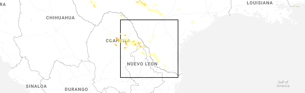
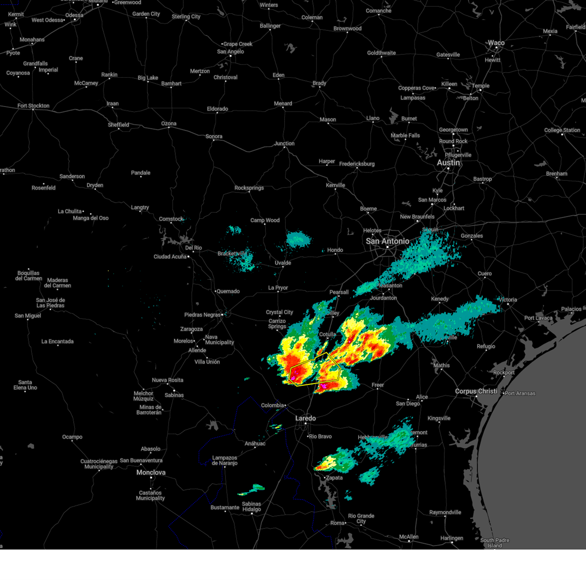
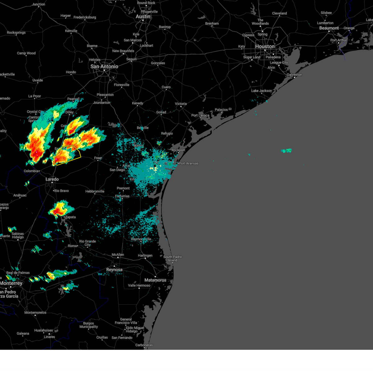
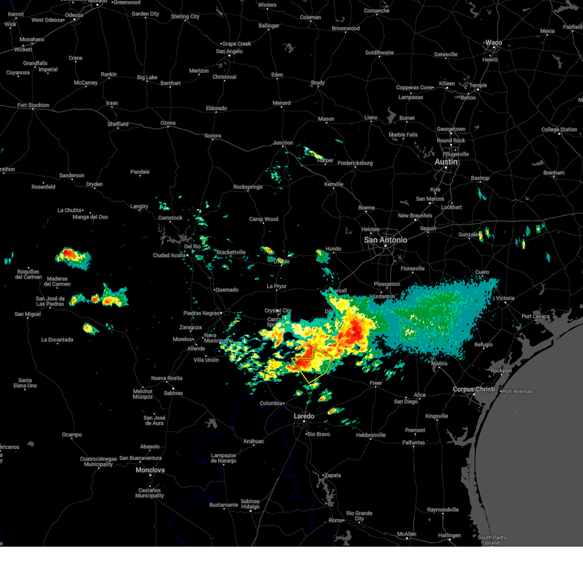
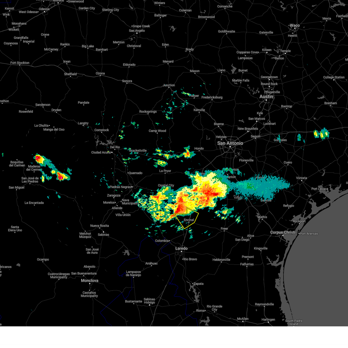
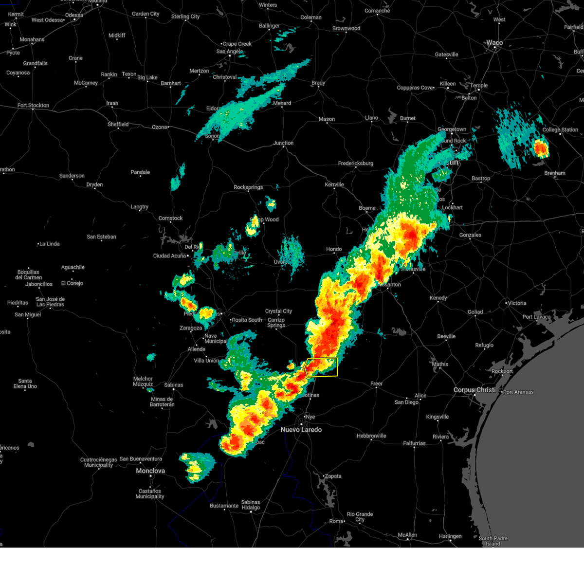
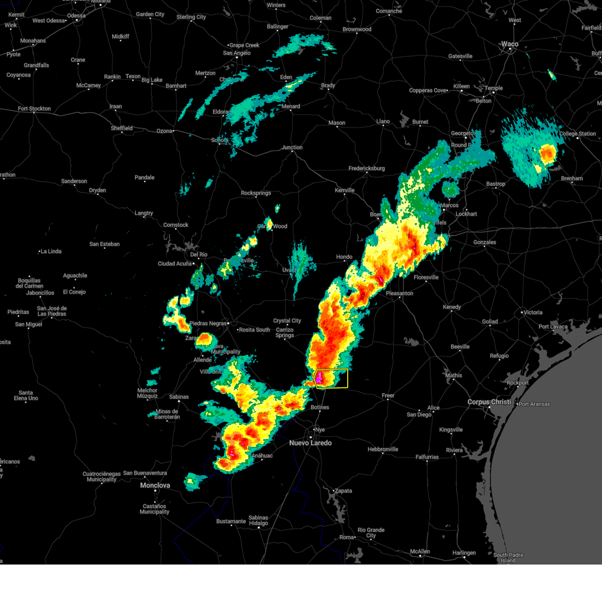
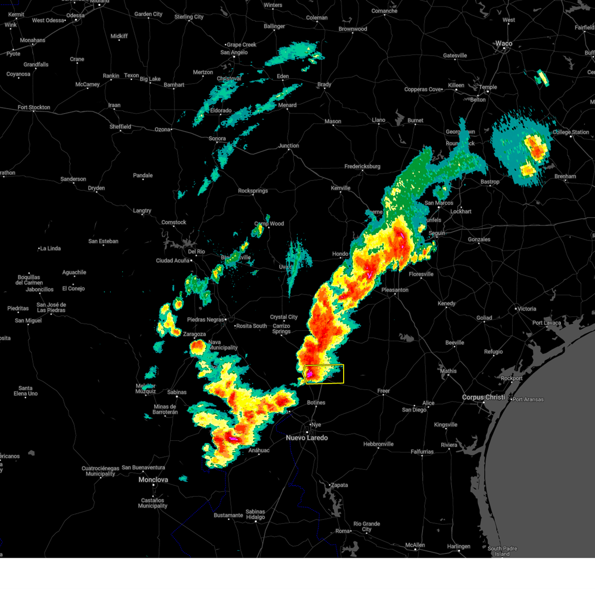
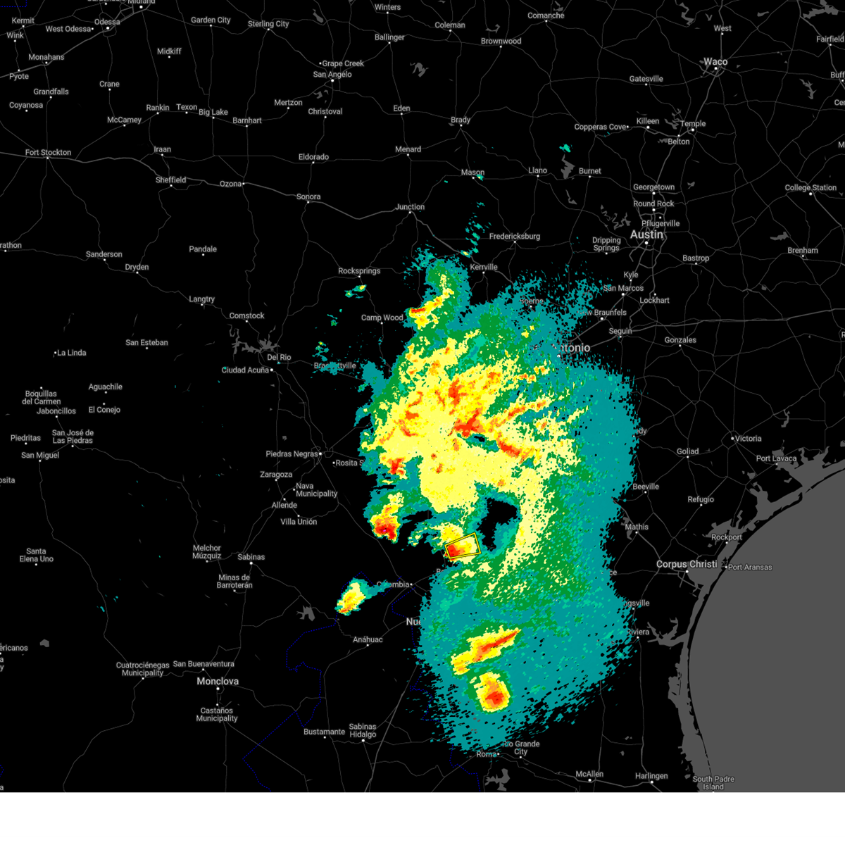
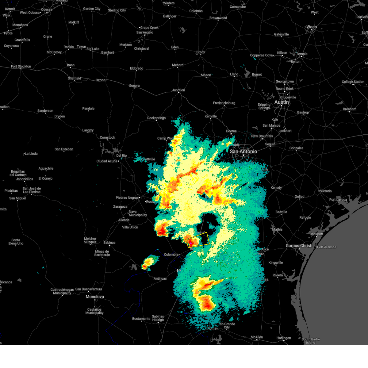
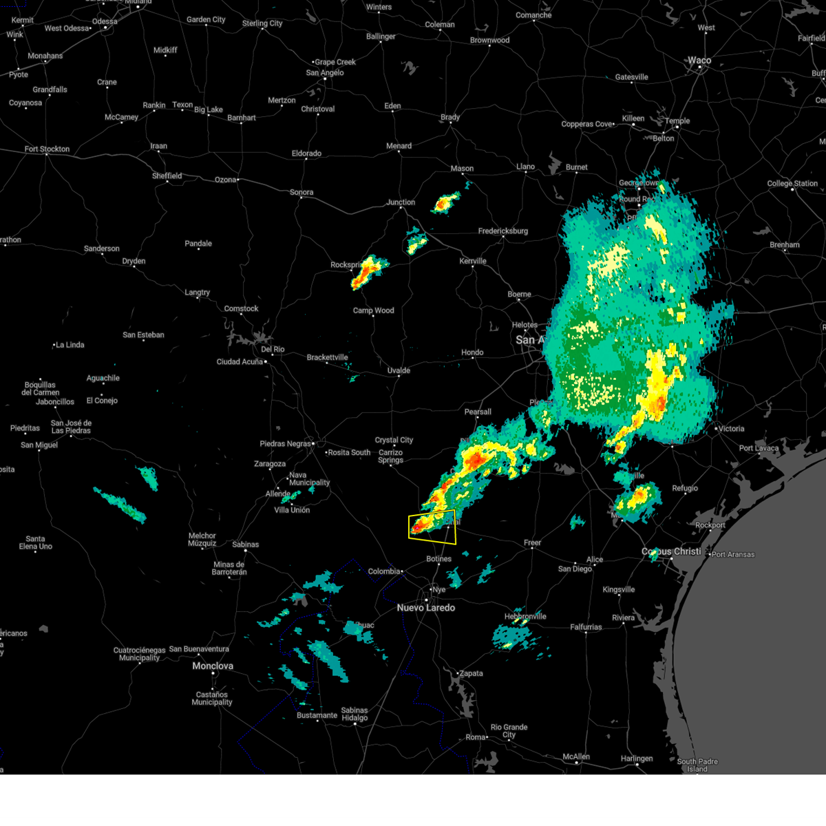
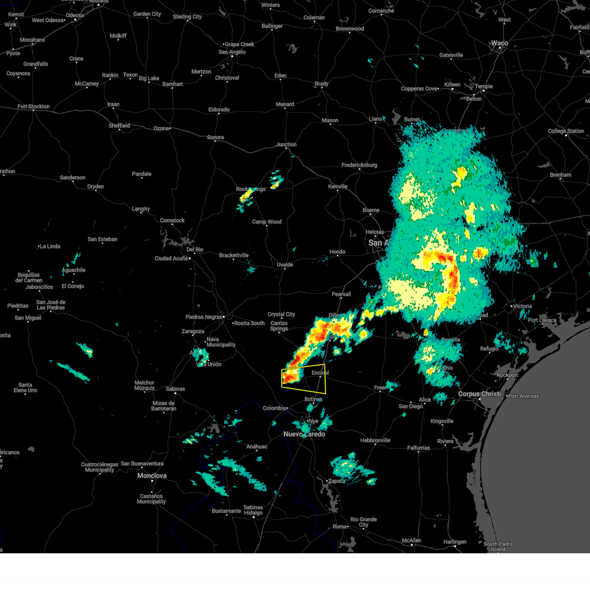
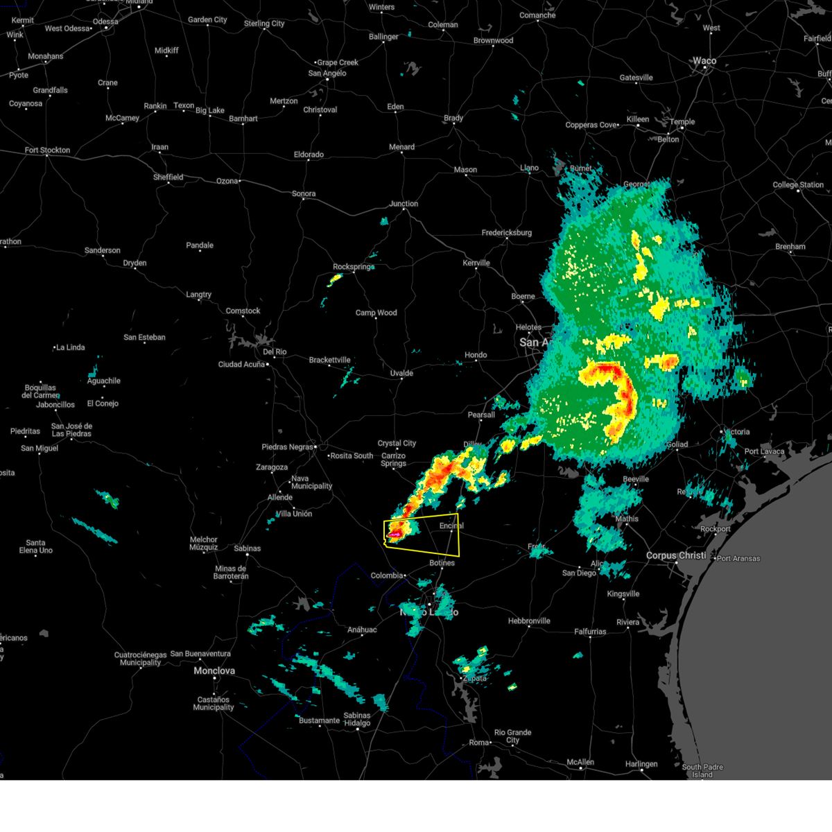
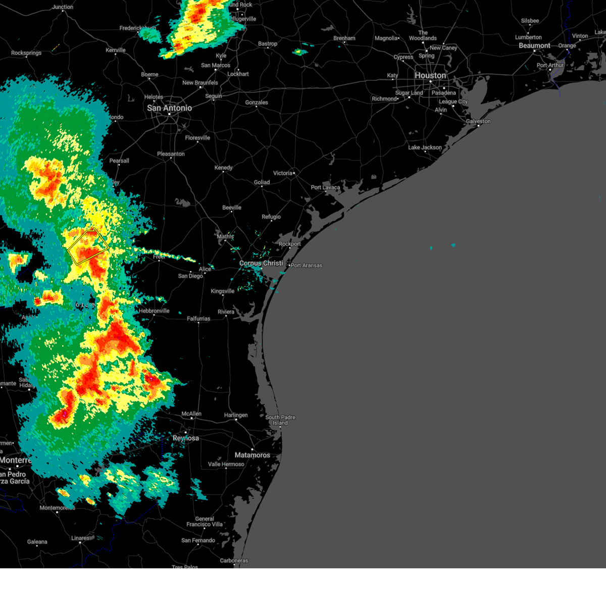
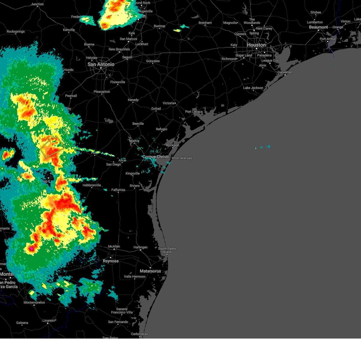
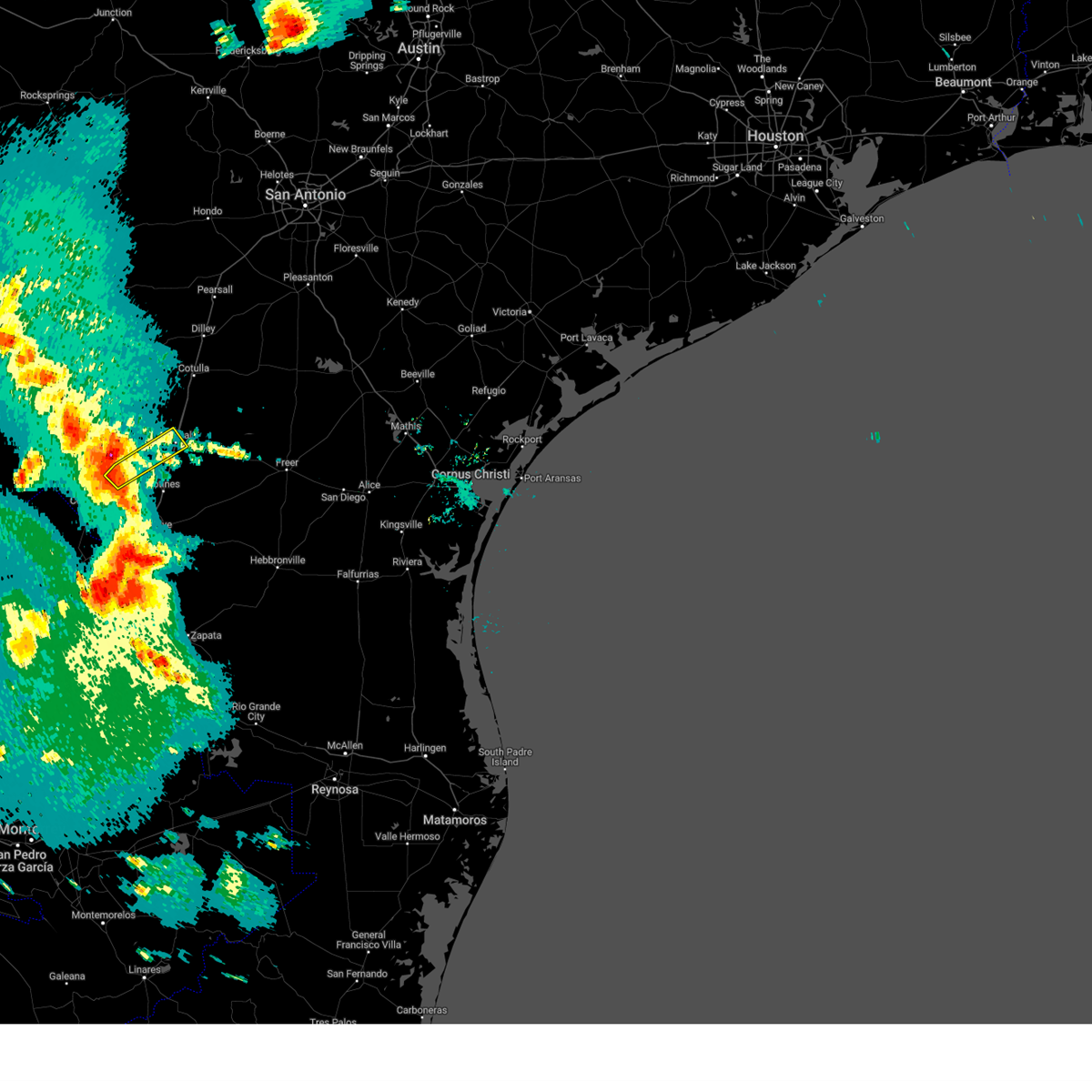
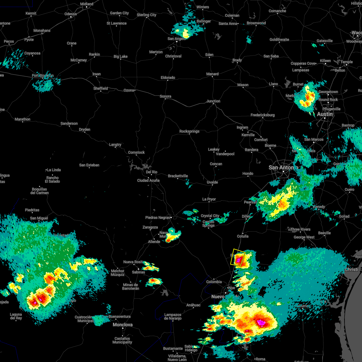
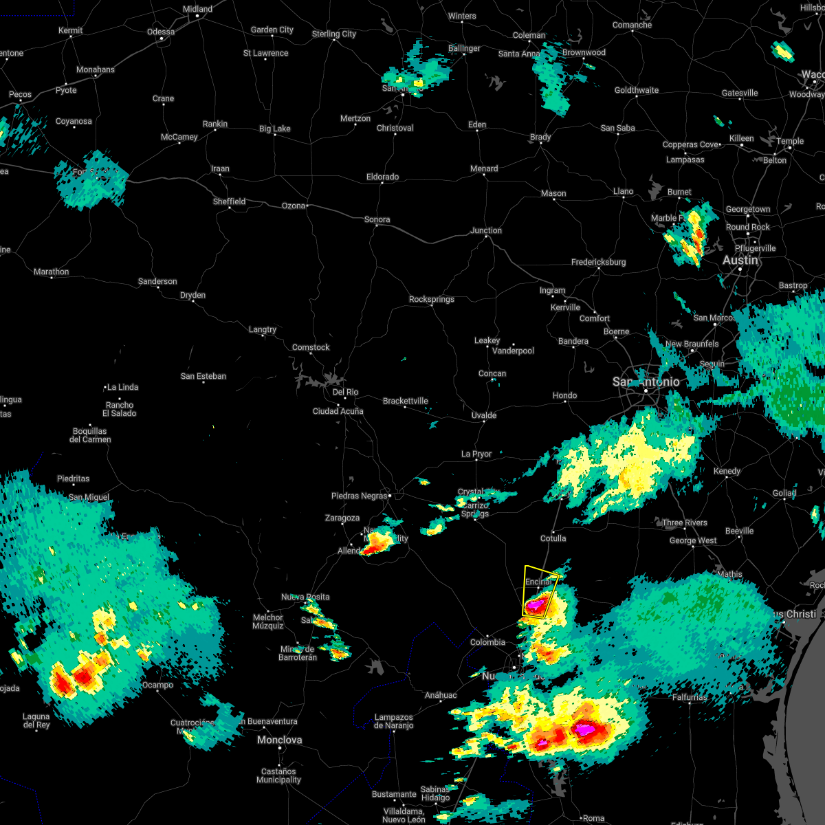
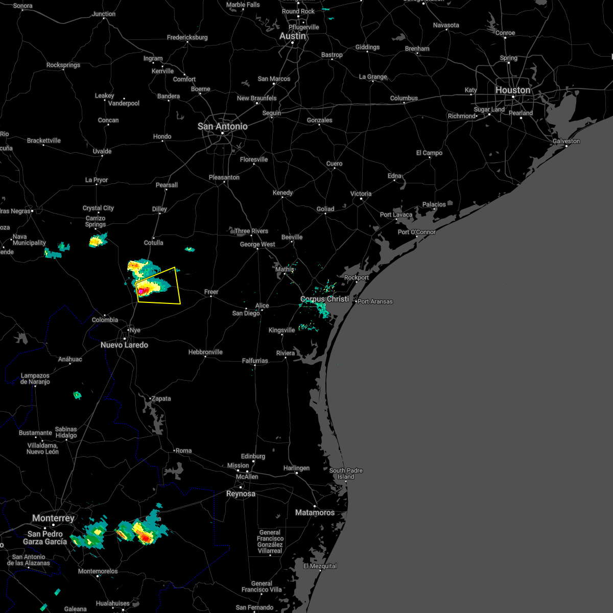
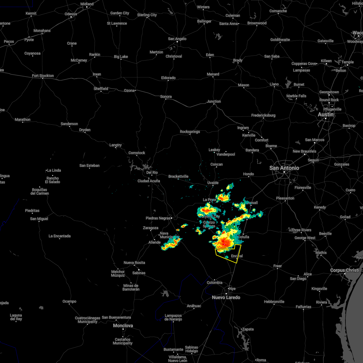
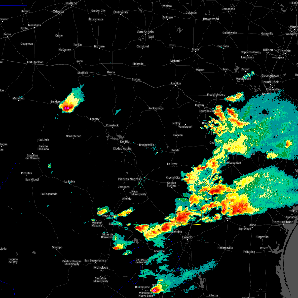
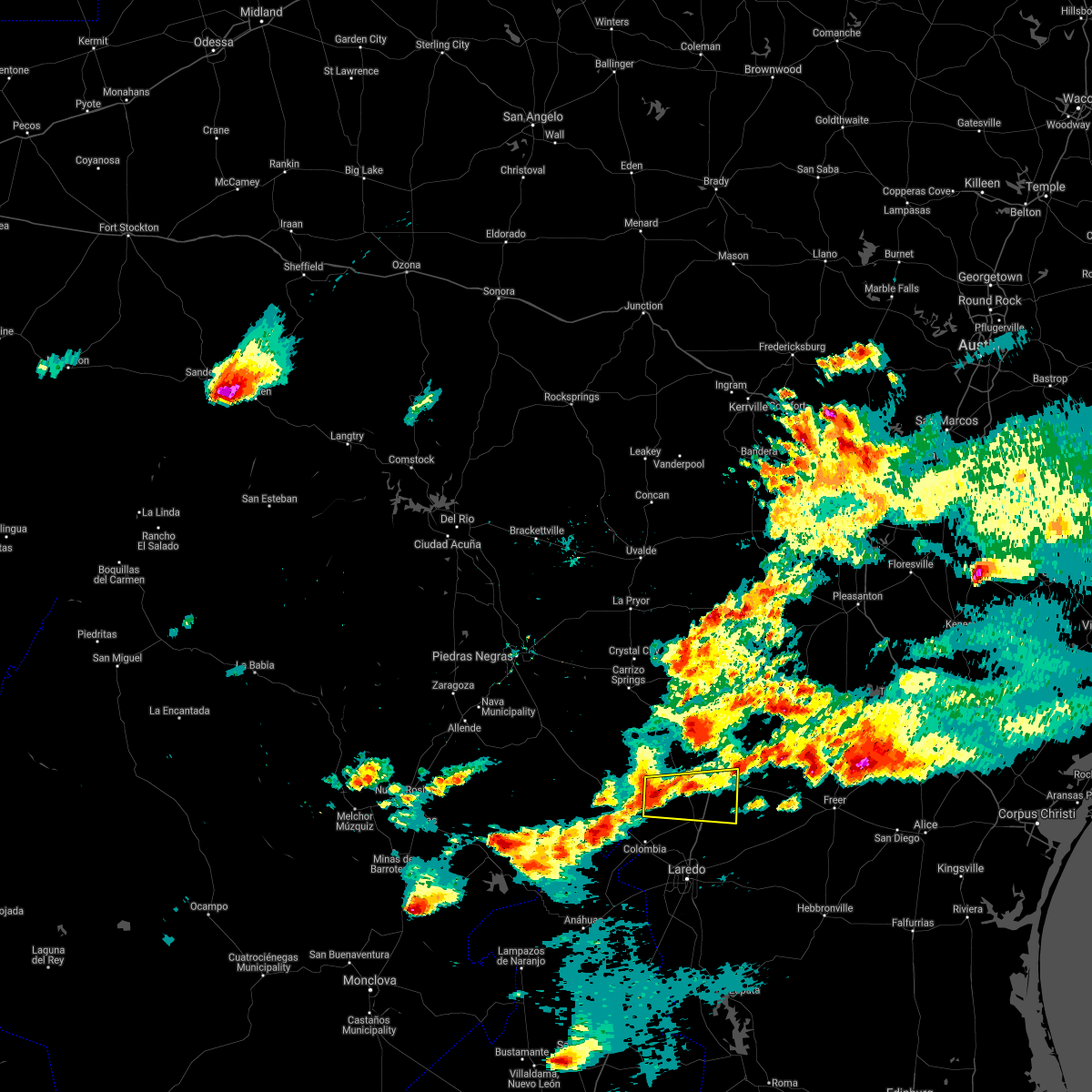
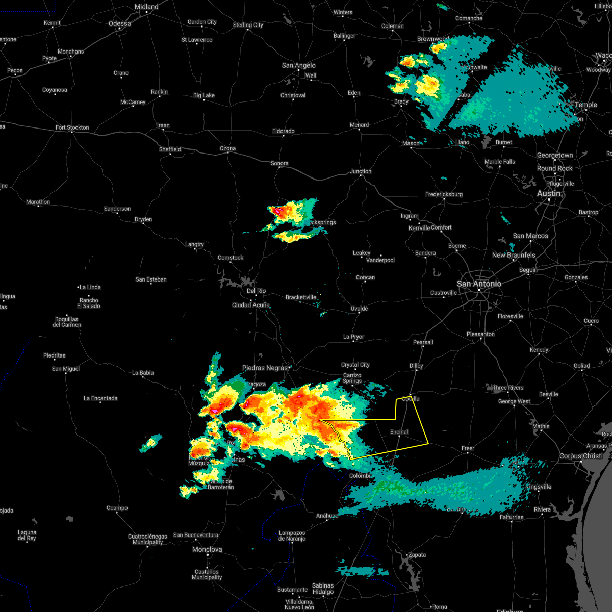
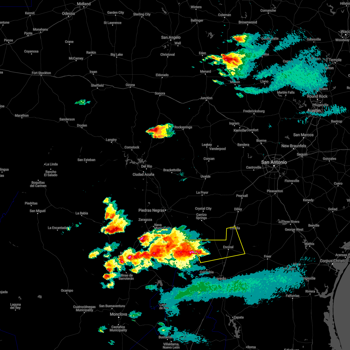
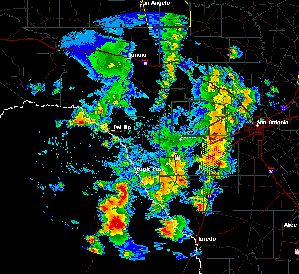
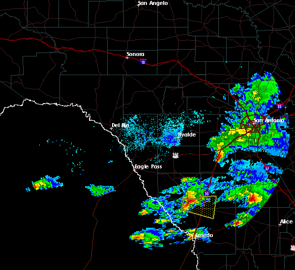
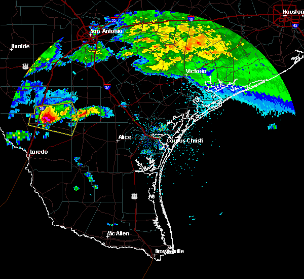
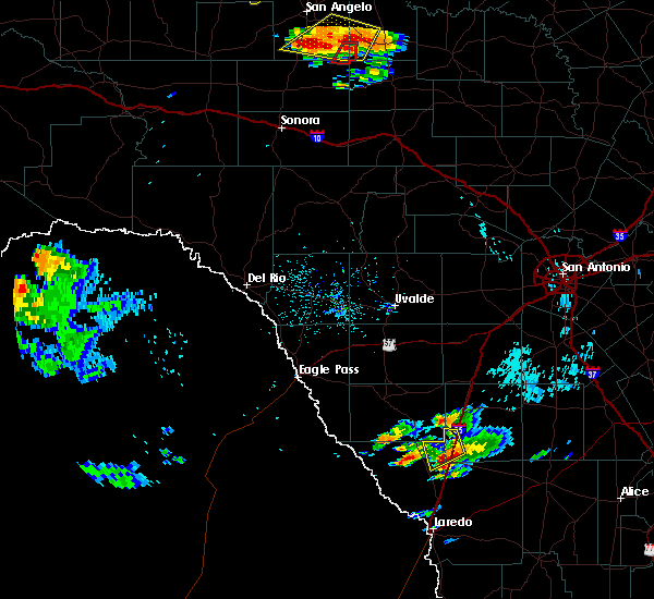
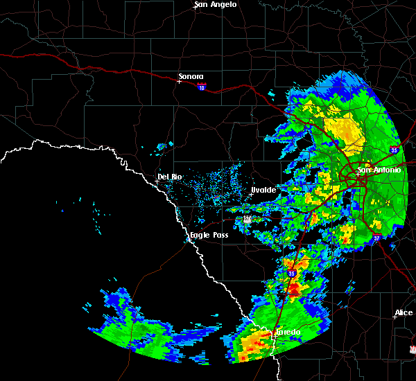
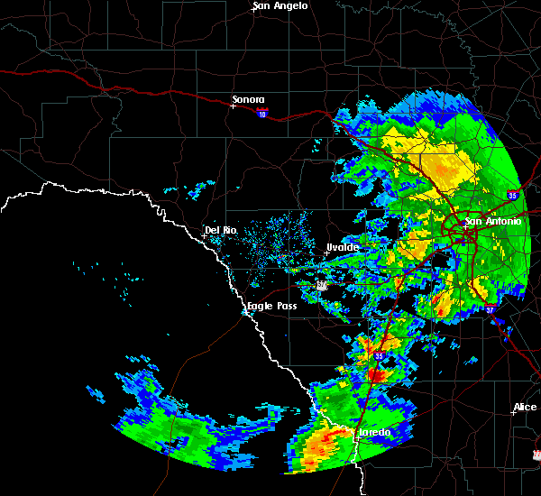
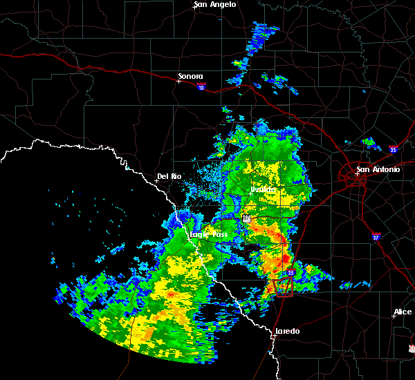
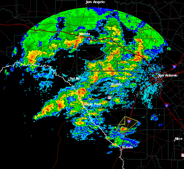
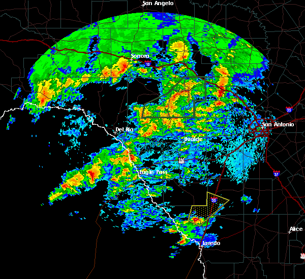
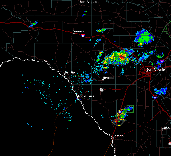
Hail Map for Encinal, TX
The Encinal, TX area has had 5 reports of on-the-ground hail by trained spotters, and has been under severe weather warnings 0 times during the past 12 months. Doppler radar has detected hail at or near Encinal, TX on 30 occasions, including 1 occasion during the past year.
| Name: | Encinal, TX |
| Where Located: | 36.3 miles NNE of Laredo, TX |
| Map: | Google Map for Encinal, TX |
| Population: | 559 |
| Housing Units: | 264 |
| More Info: | Search Google for Encinal, TX |
0
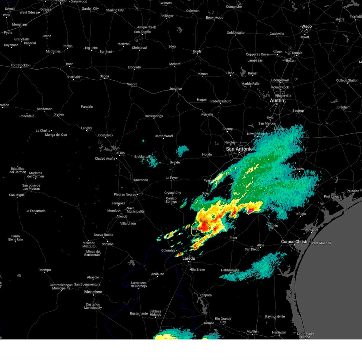
The Top Recent Hail Date for Encinal, TX is Tuesday, May 27, 2025 (22nd out of 30)
Hail and Wind Damage Spotted near Encinal, TX
| Date / Time | Report Details |
|---|---|
| 5/28/2024 9:29 PM CDT |
 At 928 pm cdt, severe thunderstorms were located along a line extending from 8 miles south of light to orvil to 23 miles southwest of el cenizo, moving east at 40 mph (radar indicated). Hazards include 60 mph wind gusts and penny size hail. Expect damage to roofs, siding, and trees. these severe storms will be near, laredo, encinal, st augustine high school south laredo, callaghan, unitec industrial park, laredo international airport, doctors hospital of laredo, texas a&m, laredo country club, and united south high school around 935 pm cdt. rio bravo and el cenizo around 940 pm cdt. ranchitos las lomas around 945 pm cdt. aguilares around 1010 pm cdt. mirando city around 1015 pm cdt. this includes the following highways, interstate 35 between mile markers 1 and 50. us highway 59 between mile markers 792 and 824. Us highway 83 between mile markers 668 and 734. At 928 pm cdt, severe thunderstorms were located along a line extending from 8 miles south of light to orvil to 23 miles southwest of el cenizo, moving east at 40 mph (radar indicated). Hazards include 60 mph wind gusts and penny size hail. Expect damage to roofs, siding, and trees. these severe storms will be near, laredo, encinal, st augustine high school south laredo, callaghan, unitec industrial park, laredo international airport, doctors hospital of laredo, texas a&m, laredo country club, and united south high school around 935 pm cdt. rio bravo and el cenizo around 940 pm cdt. ranchitos las lomas around 945 pm cdt. aguilares around 1010 pm cdt. mirando city around 1015 pm cdt. this includes the following highways, interstate 35 between mile markers 1 and 50. us highway 59 between mile markers 792 and 824. Us highway 83 between mile markers 668 and 734.
|
| 5/28/2024 9:11 PM CDT |
 Svrcrp the national weather service in corpus christi has issued a * severe thunderstorm warning for, webb county in south central texas, southern la salle county in south central texas, * until 1015 pm cdt. * at 910 pm cdt, severe thunderstorms were located along a line extending from 8 miles north of la esperanza ranch airport to near columbia bridge to 31 miles west of el cenizo, moving east at 40 mph (radar indicated). Hazards include 60 mph wind gusts. Expect damage to roofs, siding, and trees. severe thunderstorms will be near, la esperanza ranch airport, las tiendas, and ranchos penitas west around 915 pm cdt. laredo around 920 pm cdt. orvil, unitec industrial park, doctors hospital of laredo, and botines around 925 pm cdt. encinal, callaghan, laredo international airport, texas a&m, laredo country club, and laredo community college around 930 pm cdt. united south high school around 935 pm cdt. rio bravo and el cenizo around 940 pm cdt. ranchitos las lomas around 945 pm cdt. this includes the following highways, interstate 35 between mile markers 1 and 50. us highway 59 between mile markers 792 and 824. Us highway 83 between mile markers 668 and 734. Svrcrp the national weather service in corpus christi has issued a * severe thunderstorm warning for, webb county in south central texas, southern la salle county in south central texas, * until 1015 pm cdt. * at 910 pm cdt, severe thunderstorms were located along a line extending from 8 miles north of la esperanza ranch airport to near columbia bridge to 31 miles west of el cenizo, moving east at 40 mph (radar indicated). Hazards include 60 mph wind gusts. Expect damage to roofs, siding, and trees. severe thunderstorms will be near, la esperanza ranch airport, las tiendas, and ranchos penitas west around 915 pm cdt. laredo around 920 pm cdt. orvil, unitec industrial park, doctors hospital of laredo, and botines around 925 pm cdt. encinal, callaghan, laredo international airport, texas a&m, laredo country club, and laredo community college around 930 pm cdt. united south high school around 935 pm cdt. rio bravo and el cenizo around 940 pm cdt. ranchitos las lomas around 945 pm cdt. this includes the following highways, interstate 35 between mile markers 1 and 50. us highway 59 between mile markers 792 and 824. Us highway 83 between mile markers 668 and 734.
|
| 5/17/2024 5:39 AM CDT |
 The storm which prompted the warning has weakened below severe limits, and no longer poses an immediate threat to life or property. therefore, the warning will be allowed to expire. however, small hail and heavy rain are still possible with this thunderstorm. The storm which prompted the warning has weakened below severe limits, and no longer poses an immediate threat to life or property. therefore, the warning will be allowed to expire. however, small hail and heavy rain are still possible with this thunderstorm.
|
| 5/17/2024 5:27 AM CDT |
 At 527 am cdt, a severe thunderstorm was located over encinal, moving east at 40 mph (radar indicated). Hazards include half dollar size hail. Damage to vehicles is expected. locations impacted include, encinal. This includes interstate 35 between mile markers 34 and 51. At 527 am cdt, a severe thunderstorm was located over encinal, moving east at 40 mph (radar indicated). Hazards include half dollar size hail. Damage to vehicles is expected. locations impacted include, encinal. This includes interstate 35 between mile markers 34 and 51.
|
| 5/17/2024 5:17 AM CDT |
 At 516 am cdt, a severe thunderstorm was located near encinal, moving east at 40 mph (radar indicated). Hazards include half dollar size hail. Damage to vehicles is expected. locations impacted include, encinal and la esperanza ranch airport. this includes the following highways, interstate 35 between mile markers 35 and 54. Us highway 83 between mile markers 672 and 682. At 516 am cdt, a severe thunderstorm was located near encinal, moving east at 40 mph (radar indicated). Hazards include half dollar size hail. Damage to vehicles is expected. locations impacted include, encinal and la esperanza ranch airport. this includes the following highways, interstate 35 between mile markers 35 and 54. Us highway 83 between mile markers 672 and 682.
|
| 5/17/2024 5:05 AM CDT |
 Svrcrp the national weather service in corpus christi has issued a * severe thunderstorm warning for, northeastern webb county in south central texas, southwestern la salle county in south central texas, * until 545 am cdt. * at 505 am cdt, a severe thunderstorm was located near la esperanza ranch airport, or 14 miles west of encinal, moving east at 40 mph (radar indicated). Hazards include half dollar size hail. damage to vehicles is expected Svrcrp the national weather service in corpus christi has issued a * severe thunderstorm warning for, northeastern webb county in south central texas, southwestern la salle county in south central texas, * until 545 am cdt. * at 505 am cdt, a severe thunderstorm was located near la esperanza ranch airport, or 14 miles west of encinal, moving east at 40 mph (radar indicated). Hazards include half dollar size hail. damage to vehicles is expected
|
| 5/17/2024 4:52 AM CDT |
 Svrcrp the national weather service in corpus christi has issued a * severe thunderstorm warning for, northeastern webb county in south central texas, south central la salle county in south central texas, * until 530 am cdt. * at 452 am cdt, a severe thunderstorm was located over callaghan, or 11 miles south of encinal, moving northeast at 35 mph (radar indicated). Hazards include quarter size hail. damage to vehicles is expected Svrcrp the national weather service in corpus christi has issued a * severe thunderstorm warning for, northeastern webb county in south central texas, south central la salle county in south central texas, * until 530 am cdt. * at 452 am cdt, a severe thunderstorm was located over callaghan, or 11 miles south of encinal, moving northeast at 35 mph (radar indicated). Hazards include quarter size hail. damage to vehicles is expected
|
| 5/5/2024 3:10 PM CDT |
 At 310 pm cdt, a severe thunderstorm was located 9 miles northeast of la esperanza ranch airport, or 11 miles northwest of encinal, moving southeast at 15 mph (radar indicated). Hazards include 60 mph wind gusts and quarter size hail. Hail damage to vehicles is expected. expect wind damage to roofs, siding, and trees. locations impacted include, encinal and chaparral wildlife management area. this includes the following highways, interstate 35 between mile markers 34 and 54. Us highway 83 between mile markers 668 and 676. At 310 pm cdt, a severe thunderstorm was located 9 miles northeast of la esperanza ranch airport, or 11 miles northwest of encinal, moving southeast at 15 mph (radar indicated). Hazards include 60 mph wind gusts and quarter size hail. Hail damage to vehicles is expected. expect wind damage to roofs, siding, and trees. locations impacted include, encinal and chaparral wildlife management area. this includes the following highways, interstate 35 between mile markers 34 and 54. Us highway 83 between mile markers 668 and 676.
|
| 5/5/2024 2:42 PM CDT |
 Svrcrp the national weather service in corpus christi has issued a * severe thunderstorm warning for, north central webb county in south central texas, southwestern la salle county in south central texas, * until 330 pm cdt. * at 241 pm cdt, a severe thunderstorm was located 7 miles southwest of light, or 18 miles northwest of encinal, moving southeast at 15 mph (radar indicated). Hazards include 60 mph wind gusts and quarter size hail. Hail damage to vehicles is expected. Expect wind damage to roofs, siding, and trees. Svrcrp the national weather service in corpus christi has issued a * severe thunderstorm warning for, north central webb county in south central texas, southwestern la salle county in south central texas, * until 330 pm cdt. * at 241 pm cdt, a severe thunderstorm was located 7 miles southwest of light, or 18 miles northwest of encinal, moving southeast at 15 mph (radar indicated). Hazards include 60 mph wind gusts and quarter size hail. Hail damage to vehicles is expected. Expect wind damage to roofs, siding, and trees.
|
| 4/9/2024 11:04 PM CDT |
 the severe thunderstorm warning has been cancelled and is no longer in effect the severe thunderstorm warning has been cancelled and is no longer in effect
|
| 4/9/2024 10:55 PM CDT |
 At 1054 pm cdt, a severe thunderstorm was located over encinal, moving east at 30 mph (radar indicated). Hazards include two inch hail and 60 mph wind gusts. People and animals outdoors will be injured. expect hail damage to roofs, siding, windows, and vehicles. expect wind damage to roofs, siding, and trees. this severe storm will be near, encinal around 1100 pm cdt. This includes interstate 35 between mile markers 37 and 50. At 1054 pm cdt, a severe thunderstorm was located over encinal, moving east at 30 mph (radar indicated). Hazards include two inch hail and 60 mph wind gusts. People and animals outdoors will be injured. expect hail damage to roofs, siding, windows, and vehicles. expect wind damage to roofs, siding, and trees. this severe storm will be near, encinal around 1100 pm cdt. This includes interstate 35 between mile markers 37 and 50.
|
| 4/9/2024 10:42 PM CDT |
 Svrcrp the national weather service in corpus christi has issued a * severe thunderstorm warning for, northeastern webb county in south central texas, southwestern la salle county in south central texas, * until 1130 pm cdt. * at 1042 pm cdt, a severe thunderstorm was located near la esperanza ranch airport, or 7 miles west of encinal, moving east at 30 mph. this is a destructive storm for encinal (radar indicated). Hazards include three inch hail and 60 mph wind gusts. People and animals outdoors will be severely injured. expect shattered windows, extensive damage to roofs, siding, and vehicles. this severe thunderstorm will be near, encinal around 1050 pm cdt. this includes the following highways, interstate 35 between mile markers 37 and 50. Us highway 83 between mile markers 672 and 680. Svrcrp the national weather service in corpus christi has issued a * severe thunderstorm warning for, northeastern webb county in south central texas, southwestern la salle county in south central texas, * until 1130 pm cdt. * at 1042 pm cdt, a severe thunderstorm was located near la esperanza ranch airport, or 7 miles west of encinal, moving east at 30 mph. this is a destructive storm for encinal (radar indicated). Hazards include three inch hail and 60 mph wind gusts. People and animals outdoors will be severely injured. expect shattered windows, extensive damage to roofs, siding, and vehicles. this severe thunderstorm will be near, encinal around 1050 pm cdt. this includes the following highways, interstate 35 between mile markers 37 and 50. Us highway 83 between mile markers 672 and 680.
|
| 3/17/2024 12:27 AM CDT |
 At 1227 am cdt, a severe thunderstorm was located near callaghan, or near encinal, moving east at 35 mph (radar indicated). Hazards include 60 mph wind gusts and quarter size hail. Hail damage to vehicles is expected. expect wind damage to roofs, siding, and trees. locations impacted include, encinal. This includes interstate 35 between mile markers 30 and 39. At 1227 am cdt, a severe thunderstorm was located near callaghan, or near encinal, moving east at 35 mph (radar indicated). Hazards include 60 mph wind gusts and quarter size hail. Hail damage to vehicles is expected. expect wind damage to roofs, siding, and trees. locations impacted include, encinal. This includes interstate 35 between mile markers 30 and 39.
|
| 3/17/2024 12:11 AM CDT |
 Svrcrp the national weather service in corpus christi has issued a * severe thunderstorm warning for, north central webb county in south central texas, southern la salle county in south central texas, * until 1245 am cdt. * at 1211 am cdt, a severe thunderstorm was located near callaghan, or 13 miles southwest of encinal, moving east at 45 mph (radar indicated). Hazards include 60 mph wind gusts and quarter size hail. Hail damage to vehicles is expected. Expect wind damage to roofs, siding, and trees. Svrcrp the national weather service in corpus christi has issued a * severe thunderstorm warning for, north central webb county in south central texas, southern la salle county in south central texas, * until 1245 am cdt. * at 1211 am cdt, a severe thunderstorm was located near callaghan, or 13 miles southwest of encinal, moving east at 45 mph (radar indicated). Hazards include 60 mph wind gusts and quarter size hail. Hail damage to vehicles is expected. Expect wind damage to roofs, siding, and trees.
|
| 2/2/2024 10:40 PM CST |
 At 1039 pm cst, a severe thunderstorm was located near la esperanza ranch airport, or 12 miles west of encinal, moving east at 35 mph (radar indicated). Hazards include 60 mph wind gusts and quarter size hail. Hail damage to vehicles is expected. expect wind damage to roofs, siding, and trees. locations impacted include, encinal and la esperanza ranch airport. this includes the following highways, interstate 35 between mile markers 31 and 48. us highway 83 between mile markers 672 and 684. hail threat, radar indicated max hail size, 1. 00 in wind threat, radar indicated max wind gust, 60 mph. At 1039 pm cst, a severe thunderstorm was located near la esperanza ranch airport, or 12 miles west of encinal, moving east at 35 mph (radar indicated). Hazards include 60 mph wind gusts and quarter size hail. Hail damage to vehicles is expected. expect wind damage to roofs, siding, and trees. locations impacted include, encinal and la esperanza ranch airport. this includes the following highways, interstate 35 between mile markers 31 and 48. us highway 83 between mile markers 672 and 684. hail threat, radar indicated max hail size, 1. 00 in wind threat, radar indicated max wind gust, 60 mph.
|
| 2/2/2024 10:20 PM CST |
 At 1020 pm cst, a severe thunderstorm was located 11 miles northwest of las tiendas, or 24 miles west of encinal, moving east at 35 mph (radar indicated). Hazards include 60 mph wind gusts and quarter size hail. Hail damage to vehicles is expected. expect wind damage to roofs, siding, and trees. locations impacted include, encinal, la esperanza ranch airport, and callaghan. this includes the following highways, interstate 35 between mile markers 28 and 48. us highway 83 between mile markers 672 and 688. hail threat, radar indicated max hail size, 1. 00 in wind threat, radar indicated max wind gust, 60 mph. At 1020 pm cst, a severe thunderstorm was located 11 miles northwest of las tiendas, or 24 miles west of encinal, moving east at 35 mph (radar indicated). Hazards include 60 mph wind gusts and quarter size hail. Hail damage to vehicles is expected. expect wind damage to roofs, siding, and trees. locations impacted include, encinal, la esperanza ranch airport, and callaghan. this includes the following highways, interstate 35 between mile markers 28 and 48. us highway 83 between mile markers 672 and 688. hail threat, radar indicated max hail size, 1. 00 in wind threat, radar indicated max wind gust, 60 mph.
|
| 2/2/2024 10:10 PM CST |
 At 1008 pm cst, a severe thunderstorm was located 16 miles northwest of las tiendas, or 30 miles west of encinal, moving east at 35 mph (radar indicated). Hazards include 60 mph wind gusts and half dollar size hail. Hail damage to vehicles is expected. Expect wind damage to roofs, siding, and trees. At 1008 pm cst, a severe thunderstorm was located 16 miles northwest of las tiendas, or 30 miles west of encinal, moving east at 35 mph (radar indicated). Hazards include 60 mph wind gusts and half dollar size hail. Hail damage to vehicles is expected. Expect wind damage to roofs, siding, and trees.
|
| 6/3/2023 8:04 PM CDT |
 At 803 pm cdt, a severe thunderstorm was located near la esperanza ranch airport, or 11 miles west of encinal, moving northeast at 20 mph (radar indicated). Hazards include 70 mph wind gusts and penny size hail. Expect considerable tree damage. damage is likely to mobile homes, roofs, and outbuildings. locations impacted include, encinal, las tiendas and la esperanza ranch airport. this includes the following highways, interstate 35 between mile markers 32 and 46. us highway 83 between mile markers 674 and 688. thunderstorm damage threat, considerable hail threat, radar indicated max hail size, 0. 75 in wind threat, radar indicated max wind gust, 70 mph. At 803 pm cdt, a severe thunderstorm was located near la esperanza ranch airport, or 11 miles west of encinal, moving northeast at 20 mph (radar indicated). Hazards include 70 mph wind gusts and penny size hail. Expect considerable tree damage. damage is likely to mobile homes, roofs, and outbuildings. locations impacted include, encinal, las tiendas and la esperanza ranch airport. this includes the following highways, interstate 35 between mile markers 32 and 46. us highway 83 between mile markers 674 and 688. thunderstorm damage threat, considerable hail threat, radar indicated max hail size, 0. 75 in wind threat, radar indicated max wind gust, 70 mph.
|
| 6/3/2023 7:55 PM CDT |
 At 755 pm cdt, a severe thunderstorm was located near las tiendas, or 14 miles west of encinal, moving northeast at 20 mph (radar indicated). Hazards include 60 mph wind gusts. expect damage to roofs, siding, and trees At 755 pm cdt, a severe thunderstorm was located near las tiendas, or 14 miles west of encinal, moving northeast at 20 mph (radar indicated). Hazards include 60 mph wind gusts. expect damage to roofs, siding, and trees
|
| 6/3/2023 7:00 PM CDT |
 At 659 pm cdt, a severe thunderstorm was located near callaghan, or 10 miles southwest of encinal, moving northeast at 45 mph (radar indicated). Hazards include 60 mph wind gusts and nickel size hail. Expect damage to roofs, siding, and trees. locations impacted include, encinal and las tiendas. this includes the following highways, interstate 35 between mile markers 34 and 42. us highway 83 between mile markers 680 and 686. hail threat, radar indicated max hail size, 0. 88 in wind threat, radar indicated max wind gust, 60 mph. At 659 pm cdt, a severe thunderstorm was located near callaghan, or 10 miles southwest of encinal, moving northeast at 45 mph (radar indicated). Hazards include 60 mph wind gusts and nickel size hail. Expect damage to roofs, siding, and trees. locations impacted include, encinal and las tiendas. this includes the following highways, interstate 35 between mile markers 34 and 42. us highway 83 between mile markers 680 and 686. hail threat, radar indicated max hail size, 0. 88 in wind threat, radar indicated max wind gust, 60 mph.
|
| 6/3/2023 6:32 PM CDT |
 At 632 pm cdt, a severe thunderstorm was located near columbia bridge, or 24 miles northwest of laredo, moving northeast at 45 mph (radar indicated). Hazards include 60 mph wind gusts and half dollar size hail. Hail damage to vehicles is expected. Expect wind damage to roofs, siding, and trees. At 632 pm cdt, a severe thunderstorm was located near columbia bridge, or 24 miles northwest of laredo, moving northeast at 45 mph (radar indicated). Hazards include 60 mph wind gusts and half dollar size hail. Hail damage to vehicles is expected. Expect wind damage to roofs, siding, and trees.
|
| 5/23/2022 9:27 PM CDT |
 The severe thunderstorm warning for north central webb and southwestern la salle counties will expire at 930 pm cdt, the severe thunderstorm which prompted the warning has moved out of the area. therefore, the warning will be allowed to expire. a severe thunderstorm watch remains in effect until midnight cdt for south central texas. The severe thunderstorm warning for north central webb and southwestern la salle counties will expire at 930 pm cdt, the severe thunderstorm which prompted the warning has moved out of the area. therefore, the warning will be allowed to expire. a severe thunderstorm watch remains in effect until midnight cdt for south central texas.
|
| 5/23/2022 9:05 PM CDT | Ping Pong Ball sized hail reported 2.3 miles WNW of Encinal, TX, ping pong ball sized hail reported southeast of encinal. |
| 5/23/2022 8:56 PM CDT |
 At 856 pm cdt, a severe thunderstorm was located over encinal, moving northeast at 25 mph (radar indicated). Hazards include ping pong ball size hail and 60 mph wind gusts. People and animals outdoors will be injured. expect hail damage to roofs, siding, windows, and vehicles. expect wind damage to roofs, siding, and trees. locations impacted include, encinal. this includes interstate 35 between mile markers 31 and 47. hail threat, radar indicated max hail size, 1. 50 in wind threat, radar indicated max wind gust, 60 mph. At 856 pm cdt, a severe thunderstorm was located over encinal, moving northeast at 25 mph (radar indicated). Hazards include ping pong ball size hail and 60 mph wind gusts. People and animals outdoors will be injured. expect hail damage to roofs, siding, windows, and vehicles. expect wind damage to roofs, siding, and trees. locations impacted include, encinal. this includes interstate 35 between mile markers 31 and 47. hail threat, radar indicated max hail size, 1. 50 in wind threat, radar indicated max wind gust, 60 mph.
|
| 5/23/2022 8:39 PM CDT |
 At 839 pm cdt, a severe thunderstorm was located near callaghan, or 7 miles south of encinal, moving north at 20 mph (radar indicated). Hazards include ping pong ball size hail and 60 mph wind gusts. People and animals outdoors will be injured. expect hail damage to roofs, siding, windows, and vehicles. Expect wind damage to roofs, siding, and trees. At 839 pm cdt, a severe thunderstorm was located near callaghan, or 7 miles south of encinal, moving north at 20 mph (radar indicated). Hazards include ping pong ball size hail and 60 mph wind gusts. People and animals outdoors will be injured. expect hail damage to roofs, siding, windows, and vehicles. Expect wind damage to roofs, siding, and trees.
|
| 4/10/2022 7:08 PM CDT |
 At 707 pm cdt, a severe thunderstorm was located near callaghan, or near encinal, moving east at 25 mph (radar indicated). Hazards include 60 mph wind gusts and quarter size hail. Hail damage to vehicles is expected. Expect wind damage to roofs, siding, and trees. At 707 pm cdt, a severe thunderstorm was located near callaghan, or near encinal, moving east at 25 mph (radar indicated). Hazards include 60 mph wind gusts and quarter size hail. Hail damage to vehicles is expected. Expect wind damage to roofs, siding, and trees.
|
| 4/5/2022 4:40 PM CDT |
 At 440 pm cdt, a severe thunderstorm was located 7 miles north of la esperanza ranch airport, or 17 miles northwest of encinal, moving east at 30 mph (radar indicated). Hazards include quarter size hail. Damage to vehicles is expected. locations impacted include, encinal and la esperanza ranch airport. this includes the following highways, interstate 35 between mile markers 35 and 54. us highway 83 between mile markers 668 and 678. hail threat, radar indicated max hail size, 1. 00 in wind threat, radar indicated max wind gust, <50 mph. At 440 pm cdt, a severe thunderstorm was located 7 miles north of la esperanza ranch airport, or 17 miles northwest of encinal, moving east at 30 mph (radar indicated). Hazards include quarter size hail. Damage to vehicles is expected. locations impacted include, encinal and la esperanza ranch airport. this includes the following highways, interstate 35 between mile markers 35 and 54. us highway 83 between mile markers 668 and 678. hail threat, radar indicated max hail size, 1. 00 in wind threat, radar indicated max wind gust, <50 mph.
|
| 4/5/2022 4:16 PM CDT |
 At 415 pm cdt, a severe thunderstorm was located near gilson groves, or 21 miles south of carrizo springs, moving east at 30 mph (radar indicated). Hazards include quarter size hail. damage to vehicles is expected At 415 pm cdt, a severe thunderstorm was located near gilson groves, or 21 miles south of carrizo springs, moving east at 30 mph (radar indicated). Hazards include quarter size hail. damage to vehicles is expected
|
| 6/1/2021 2:59 AM CDT |
 At 258 am cdt, severe thunderstorms were located along a line extending from 6 miles west of zella to 11 miles south of fort ewell site to near botines, moving southeast at 40 mph (radar indicated). Hazards include 60 mph wind gusts and penny size hail. Expect damage to roofs, siding, and trees. locations impacted include, laredo, cotulla, encinal, las tiendas, botines, unitec industrial park, fowlerton, la esperanza ranch airport, ranchos penitas west, fort ewell site, artesia wells, gardendale, woodward, zella, doctors hospital of laredo, laredo country club, millett, orvil, los angeles and callaghan. this includes the following highways, interstate 35 between mile markers 4 and 82. Us highway 83 between mile markers 668 and 698. At 258 am cdt, severe thunderstorms were located along a line extending from 6 miles west of zella to 11 miles south of fort ewell site to near botines, moving southeast at 40 mph (radar indicated). Hazards include 60 mph wind gusts and penny size hail. Expect damage to roofs, siding, and trees. locations impacted include, laredo, cotulla, encinal, las tiendas, botines, unitec industrial park, fowlerton, la esperanza ranch airport, ranchos penitas west, fort ewell site, artesia wells, gardendale, woodward, zella, doctors hospital of laredo, laredo country club, millett, orvil, los angeles and callaghan. this includes the following highways, interstate 35 between mile markers 4 and 82. Us highway 83 between mile markers 668 and 698.
|
| 6/1/2021 2:33 AM CDT |
 At 231 am cdt, severe thunderstorms were located along a line extending from near dilley to 8 miles south of artesia wells to near las tiendas, moving east at 40 mph (radar indicated). Hazards include 60 mph wind gusts and penny size hail. expect damage to roofs, siding, and trees At 231 am cdt, severe thunderstorms were located along a line extending from near dilley to 8 miles south of artesia wells to near las tiendas, moving east at 40 mph (radar indicated). Hazards include 60 mph wind gusts and penny size hail. expect damage to roofs, siding, and trees
|
| 6/1/2021 2:24 AM CDT |
 At 224 am cdt, severe thunderstorms were located along a line extending from near millett to near artesia wells to 7 miles west of las tiendas, moving east at 30 mph (radar indicated). Hazards include 60 mph wind gusts and penny size hail. Expect damage to roofs, siding, and trees. locations impacted include, cotulla, encinal, las tiendas, gardendale, woodward, la esperanza ranch airport, millett, columbia bridge, los angeles, artesia wells, callaghan and chaparral wildlife management area. this includes the following highways, interstate 35 between mile markers 27 and 81. Us highway 83 between mile markers 668 and 694. At 224 am cdt, severe thunderstorms were located along a line extending from near millett to near artesia wells to 7 miles west of las tiendas, moving east at 30 mph (radar indicated). Hazards include 60 mph wind gusts and penny size hail. Expect damage to roofs, siding, and trees. locations impacted include, cotulla, encinal, las tiendas, gardendale, woodward, la esperanza ranch airport, millett, columbia bridge, los angeles, artesia wells, callaghan and chaparral wildlife management area. this includes the following highways, interstate 35 between mile markers 27 and 81. Us highway 83 between mile markers 668 and 694.
|
| 6/1/2021 2:05 AM CDT |
 At 205 am cdt, severe thunderstorms were located along a line extending from 7 miles northwest of woodward to chaparral wildlife management area to 15 miles west of las tiendas, moving east at 30 mph (radar indicated). Hazards include 60 mph wind gusts and penny size hail. expect damage to roofs, siding, and trees At 205 am cdt, severe thunderstorms were located along a line extending from 7 miles northwest of woodward to chaparral wildlife management area to 15 miles west of las tiendas, moving east at 30 mph (radar indicated). Hazards include 60 mph wind gusts and penny size hail. expect damage to roofs, siding, and trees
|
| 5/11/2021 7:28 PM CDT |
 At 728 pm cdt, a severe thunderstorm was located near las tiendas, or 13 miles southwest of encinal, moving east at 30 mph (radar indicated). Hazards include golf ball size hail. People and animals outdoors will be injured. expect damage to roofs, siding, windows, and vehicles. this severe storm will be near, callaghan around 745 pm cdt. encinal around 750 pm cdt. this includes the following highways, interstate 35 between mile markers 23 and 41. Us highway 83 between mile markers 678 and 694. At 728 pm cdt, a severe thunderstorm was located near las tiendas, or 13 miles southwest of encinal, moving east at 30 mph (radar indicated). Hazards include golf ball size hail. People and animals outdoors will be injured. expect damage to roofs, siding, windows, and vehicles. this severe storm will be near, callaghan around 745 pm cdt. encinal around 750 pm cdt. this includes the following highways, interstate 35 between mile markers 23 and 41. Us highway 83 between mile markers 678 and 694.
|
| 5/11/2021 7:15 PM CDT |
 At 715 pm cdt, a severe thunderstorm was located near las tiendas, or 20 miles west of encinal, moving east at 30 mph (radar indicated). Hazards include half dollar size hail. Damage to vehicles is expected. this severe thunderstorm will be near, las tiendas around 720 pm cdt. callaghan around 750 pm cdt. encinal around 755 pm cdt. this includes the following highways, interstate 35 between mile markers 23 and 41. Us highway 83 between mile markers 678 and 694. At 715 pm cdt, a severe thunderstorm was located near las tiendas, or 20 miles west of encinal, moving east at 30 mph (radar indicated). Hazards include half dollar size hail. Damage to vehicles is expected. this severe thunderstorm will be near, las tiendas around 720 pm cdt. callaghan around 750 pm cdt. encinal around 755 pm cdt. this includes the following highways, interstate 35 between mile markers 23 and 41. Us highway 83 between mile markers 678 and 694.
|
| 5/10/2021 6:58 PM CDT |
 At 657 pm cdt, a severe thunderstorm was located 8 miles south of gilson groves, or 25 miles west of encinal, moving east at 25 mph (radar indicated). Hazards include quarter size hail. Damage to vehicles is expected. this severe thunderstorm will remain over mainly rural areas of northern webb and southwestern la salle counties. this includes the following highways, interstate 35 between mile markers 30 and 65. Us highway 83 between mile markers 668 and 688. At 657 pm cdt, a severe thunderstorm was located 8 miles south of gilson groves, or 25 miles west of encinal, moving east at 25 mph (radar indicated). Hazards include quarter size hail. Damage to vehicles is expected. this severe thunderstorm will remain over mainly rural areas of northern webb and southwestern la salle counties. this includes the following highways, interstate 35 between mile markers 30 and 65. Us highway 83 between mile markers 668 and 688.
|
| 5/10/2021 6:23 PM CDT |
 At 623 pm cdt, a severe thunderstorm was located 16 miles southeast of chupadera ranch airport, or 35 miles west of encinal, moving east at 60 mph (radar indicated). Hazards include half dollar size hail. damage to vehicles is expected At 623 pm cdt, a severe thunderstorm was located 16 miles southeast of chupadera ranch airport, or 35 miles west of encinal, moving east at 60 mph (radar indicated). Hazards include half dollar size hail. damage to vehicles is expected
|
| 5/24/2020 9:48 PM CDT |
 At 947 pm cdt, severe thunderstorms were located along a line extending from near campbellton to 13 miles southeast of fort ewell site to near ranchos penitas west, moving east at 40 mph (radar indicated). Hazards include 60 mph wind gusts and quarter size hail. Hail damage to vehicles is expected. expect wind damage to roofs, siding, and trees. Locations impacted include, encinal, tilden, las tiendas, botines, cross, zella, fowlerton, columbia bridge, fort ewell site, crowther and callaghan. At 947 pm cdt, severe thunderstorms were located along a line extending from near campbellton to 13 miles southeast of fort ewell site to near ranchos penitas west, moving east at 40 mph (radar indicated). Hazards include 60 mph wind gusts and quarter size hail. Hail damage to vehicles is expected. expect wind damage to roofs, siding, and trees. Locations impacted include, encinal, tilden, las tiendas, botines, cross, zella, fowlerton, columbia bridge, fort ewell site, crowther and callaghan.
|
| 5/24/2020 9:28 PM CDT |
 At 927 pm cdt, severe thunderstorms were located along a line extending from near cross to 13 miles south of fort ewell site to columbia bridge, moving east at 35 mph (radar indicated). Hazards include 60 mph wind gusts and quarter size hail. Hail damage to vehicles is expected. expect wind damage to roofs, siding, and trees. Locations impacted include, cotulla, encinal, tilden, las tiendas, botines, cross, fowlerton, la esperanza ranch airport, columbia bridge, fort ewell site, artesia wells, gardendale, zella, millett, crowther, los angeles and callaghan. At 927 pm cdt, severe thunderstorms were located along a line extending from near cross to 13 miles south of fort ewell site to columbia bridge, moving east at 35 mph (radar indicated). Hazards include 60 mph wind gusts and quarter size hail. Hail damage to vehicles is expected. expect wind damage to roofs, siding, and trees. Locations impacted include, cotulla, encinal, tilden, las tiendas, botines, cross, fowlerton, la esperanza ranch airport, columbia bridge, fort ewell site, artesia wells, gardendale, zella, millett, crowther, los angeles and callaghan.
|
| 5/24/2020 8:53 PM CDT |
 At 853 pm cdt, severe thunderstorms were located along a line extending from 6 miles south of goldfinch to 7 miles west of fort ewell site to 20 miles northwest of columbia bridge, moving east at 30 mph (radar indicated). Hazards include 60 mph wind gusts and quarter size hail. Hail damage to vehicles is expected. Expect wind damage to roofs, siding, and trees. At 853 pm cdt, severe thunderstorms were located along a line extending from 6 miles south of goldfinch to 7 miles west of fort ewell site to 20 miles northwest of columbia bridge, moving east at 30 mph (radar indicated). Hazards include 60 mph wind gusts and quarter size hail. Hail damage to vehicles is expected. Expect wind damage to roofs, siding, and trees.
|
| 5/24/2020 8:21 PM CDT |
 At 820 pm cdt, severe thunderstorms were located along a line extending from near pearsall to near light to 20 miles southwest of chupadera ranch airport, moving southeast at 45 mph (radar indicated). Hazards include 60 mph wind gusts and quarter size hail. Hail damage to vehicles is expected. Expect wind damage to roofs, siding, and trees. At 820 pm cdt, severe thunderstorms were located along a line extending from near pearsall to near light to 20 miles southwest of chupadera ranch airport, moving southeast at 45 mph (radar indicated). Hazards include 60 mph wind gusts and quarter size hail. Hail damage to vehicles is expected. Expect wind damage to roofs, siding, and trees.
|
| 5/24/2020 8:09 PM CDT |
 At 809 pm cdt, a severe thunderstorm was located 9 miles south of chaparral wildlife management area, or 9 miles northwest of encinal, moving northeast at 10 mph (radar indicated). Hazards include 60 mph wind gusts and quarter size hail. Hail damage to vehicles is expected. expect wind damage to roofs, siding, and trees. Locations impacted include, encinal, artesia wells and chaparral wildlife management area. At 809 pm cdt, a severe thunderstorm was located 9 miles south of chaparral wildlife management area, or 9 miles northwest of encinal, moving northeast at 10 mph (radar indicated). Hazards include 60 mph wind gusts and quarter size hail. Hail damage to vehicles is expected. expect wind damage to roofs, siding, and trees. Locations impacted include, encinal, artesia wells and chaparral wildlife management area.
|
| 5/24/2020 7:49 PM CDT |
 At 749 pm cdt, a severe thunderstorm was located 8 miles northeast of la esperanza ranch airport, or 9 miles northwest of encinal, moving northeast at 20 mph (radar indicated). Hazards include 60 mph wind gusts and quarter size hail. Hail damage to vehicles is expected. Expect wind damage to roofs, siding, and trees. At 749 pm cdt, a severe thunderstorm was located 8 miles northeast of la esperanza ranch airport, or 9 miles northwest of encinal, moving northeast at 20 mph (radar indicated). Hazards include 60 mph wind gusts and quarter size hail. Hail damage to vehicles is expected. Expect wind damage to roofs, siding, and trees.
|
| 5/15/2020 11:31 PM CDT |
 At 1131 pm cdt, a severe thunderstorm was located over ranchos penitas west, or 8 miles northwest of laredo, moving northeast at 45 mph (radar indicated). Hazards include 60 mph wind gusts and penny size hail. expect damage to roofs, siding, and trees At 1131 pm cdt, a severe thunderstorm was located over ranchos penitas west, or 8 miles northwest of laredo, moving northeast at 45 mph (radar indicated). Hazards include 60 mph wind gusts and penny size hail. expect damage to roofs, siding, and trees
|
| 4/9/2020 8:00 PM CDT |
 At 800 pm cdt, severe thunderstorms were located along a line extending from near gardendale to near fort ewell site to 22 miles east of encinal, moving northeast at 30 mph (radar indicated). Hazards include 60 mph wind gusts and quarter size hail. Hail damage to vehicles is expected. Expect wind damage to roofs, siding, and trees. At 800 pm cdt, severe thunderstorms were located along a line extending from near gardendale to near fort ewell site to 22 miles east of encinal, moving northeast at 30 mph (radar indicated). Hazards include 60 mph wind gusts and quarter size hail. Hail damage to vehicles is expected. Expect wind damage to roofs, siding, and trees.
|
| 4/9/2020 7:43 PM CDT |
 At 743 pm cdt, severe thunderstorms were located along a line extending from near cotulla to 6 miles west of fort ewell site to 19 miles southeast of encinal, moving northeast at 30 mph (radar indicated). Hazards include ping pong ball size hail and 60 mph wind gusts. People and animals outdoors will be injured. expect hail damage to roofs, siding, windows, and vehicles. expect wind damage to roofs, siding, and trees. Locations impacted include, cotulla, encinal, las tiendas, la esperanza ranch airport, fort ewell site, artesia wells, gardendale, woodward, millett, los angeles, callaghan, chaparral wildlife management area and botines. At 743 pm cdt, severe thunderstorms were located along a line extending from near cotulla to 6 miles west of fort ewell site to 19 miles southeast of encinal, moving northeast at 30 mph (radar indicated). Hazards include ping pong ball size hail and 60 mph wind gusts. People and animals outdoors will be injured. expect hail damage to roofs, siding, windows, and vehicles. expect wind damage to roofs, siding, and trees. Locations impacted include, cotulla, encinal, las tiendas, la esperanza ranch airport, fort ewell site, artesia wells, gardendale, woodward, millett, los angeles, callaghan, chaparral wildlife management area and botines.
|
| 4/9/2020 7:16 PM CDT |
 At 715 pm cdt, severe thunderstorms were located along a line extending from chaparral wildlife management area to near encinal to 10 miles southeast of callaghan, moving northeast at 30 mph (radar indicated). Hazards include ping pong ball size hail and 60 mph wind gusts. People and animals outdoors will be injured. expect hail damage to roofs, siding, windows, and vehicles. Expect wind damage to roofs, siding, and trees. At 715 pm cdt, severe thunderstorms were located along a line extending from chaparral wildlife management area to near encinal to 10 miles southeast of callaghan, moving northeast at 30 mph (radar indicated). Hazards include ping pong ball size hail and 60 mph wind gusts. People and animals outdoors will be injured. expect hail damage to roofs, siding, windows, and vehicles. Expect wind damage to roofs, siding, and trees.
|
| 4/9/2020 6:51 PM CDT |
 At 651 pm cdt, severe thunderstorms were located along a line extending from 18 miles southeast of chupadera ranch airport to near las tiendas to near orvil, moving northeast at 30 mph (radar indicated). Hazards include ping pong ball size hail and 60 mph wind gusts. People and animals outdoors will be injured. expect hail damage to roofs, siding, windows, and vehicles. expect wind damage to roofs, siding, and trees. Locations impacted include, laredo, encinal, las tiendas, botines, unitec industrial park, la esperanza ranch airport, doctors hospital of laredo, ranchos penitas west, orvil, chupadera ranch airport, columbia bridge and callaghan. At 651 pm cdt, severe thunderstorms were located along a line extending from 18 miles southeast of chupadera ranch airport to near las tiendas to near orvil, moving northeast at 30 mph (radar indicated). Hazards include ping pong ball size hail and 60 mph wind gusts. People and animals outdoors will be injured. expect hail damage to roofs, siding, windows, and vehicles. expect wind damage to roofs, siding, and trees. Locations impacted include, laredo, encinal, las tiendas, botines, unitec industrial park, la esperanza ranch airport, doctors hospital of laredo, ranchos penitas west, orvil, chupadera ranch airport, columbia bridge and callaghan.
|
| 4/9/2020 6:33 PM CDT |
 At 632 pm cdt, severe thunderstorms were located along a line extending from 22 miles west of las tiendas to near columbia bridge to near laredo community college, moving northeast at 30 mph (radar indicated). Hazards include ping pong ball size hail and 60 mph wind gusts. People and animals outdoors will be injured. expect hail damage to roofs, siding, windows, and vehicles. Expect wind damage to roofs, siding, and trees. At 632 pm cdt, severe thunderstorms were located along a line extending from 22 miles west of las tiendas to near columbia bridge to near laredo community college, moving northeast at 30 mph (radar indicated). Hazards include ping pong ball size hail and 60 mph wind gusts. People and animals outdoors will be injured. expect hail damage to roofs, siding, windows, and vehicles. Expect wind damage to roofs, siding, and trees.
|
| 4/3/2020 9:29 PM CDT |
 At 928 pm cdt, a severe thunderstorm was located near encinal, moving southeast at 35 mph (radar indicated). Hazards include golf ball size hail and 60 mph wind gusts. People and animals outdoors will be injured. expect hail damage to roofs, siding, windows, and vehicles. Expect wind damage to roofs, siding, and trees. At 928 pm cdt, a severe thunderstorm was located near encinal, moving southeast at 35 mph (radar indicated). Hazards include golf ball size hail and 60 mph wind gusts. People and animals outdoors will be injured. expect hail damage to roofs, siding, windows, and vehicles. Expect wind damage to roofs, siding, and trees.
|
| 4/3/2020 9:09 PM CDT |
 At 908 pm cdt, a severe thunderstorm was located near encinal, moving southeast at 30 mph (radar indicated). Hazards include 60 mph wind gusts and quarter size hail. Hail damage to vehicles is expected. expect wind damage to roofs, siding, and trees. Locations impacted include, encinal. At 908 pm cdt, a severe thunderstorm was located near encinal, moving southeast at 30 mph (radar indicated). Hazards include 60 mph wind gusts and quarter size hail. Hail damage to vehicles is expected. expect wind damage to roofs, siding, and trees. Locations impacted include, encinal.
|
| 4/3/2020 8:48 PM CDT |
 At 848 pm cdt, a severe thunderstorm was located near la esperanza ranch airport, or 16 miles northwest of encinal, moving east at 25 mph (radar indicated). Hazards include 60 mph wind gusts and half dollar size hail. Hail damage to vehicles is expected. Expect wind damage to roofs, siding, and trees. At 848 pm cdt, a severe thunderstorm was located near la esperanza ranch airport, or 16 miles northwest of encinal, moving east at 25 mph (radar indicated). Hazards include 60 mph wind gusts and half dollar size hail. Hail damage to vehicles is expected. Expect wind damage to roofs, siding, and trees.
|
| 4/3/2020 8:06 PM CDT | Golf Ball sized hail reported 28 miles WNW of Encinal, TX, social media post reported at least golf ball size hail... 1.75 inches in diameter on hwy 44. provided video. |
| 4/3/2020 7:58 PM CDT | Half Dollar sized hail reported 22.9 miles WNW of Encinal, TX, public estimated larger than quarter size hail. car got dented and side window broke. |
| 4/3/2020 7:35 PM CDT |
 At 735 pm cdt, a severe thunderstorm was located 7 miles west of fort ewell site, or 14 miles northeast of encinal, moving east at 30 mph (radar indicated). Hazards include two inch hail and 60 mph wind gusts. People and animals outdoors will be injured. expect hail damage to roofs, siding, windows, and vehicles. expect wind damage to roofs, siding, and trees. Locations impacted include, encinal, fort ewell site and artesia wells. At 735 pm cdt, a severe thunderstorm was located 7 miles west of fort ewell site, or 14 miles northeast of encinal, moving east at 30 mph (radar indicated). Hazards include two inch hail and 60 mph wind gusts. People and animals outdoors will be injured. expect hail damage to roofs, siding, windows, and vehicles. expect wind damage to roofs, siding, and trees. Locations impacted include, encinal, fort ewell site and artesia wells.
|
| 4/3/2020 7:21 PM CDT |
 At 720 pm cdt, a severe thunderstorm was located 8 miles south of artesia wells, or 8 miles northeast of encinal, moving east at 30 mph (radar indicated). Hazards include 60 mph wind gusts and half dollar size hail. Hail damage to vehicles is expected. Expect wind damage to roofs, siding, and trees. At 720 pm cdt, a severe thunderstorm was located 8 miles south of artesia wells, or 8 miles northeast of encinal, moving east at 30 mph (radar indicated). Hazards include 60 mph wind gusts and half dollar size hail. Hail damage to vehicles is expected. Expect wind damage to roofs, siding, and trees.
|
| 10/24/2019 10:17 PM CDT |
 At 1017 pm cdt, severe thunderstorms were located along a line extending from 8 miles south of fort ewell site to 15 miles east of callaghan to 7 miles northwest of ranchitos las lomas, moving southeast at 30 mph (radar indicated). Hazards include 60 mph wind gusts and penny size hail. Expect damage to roofs, siding, and trees. Locations impacted include, encinal, botines, callaghan and ranchitos las lomas. At 1017 pm cdt, severe thunderstorms were located along a line extending from 8 miles south of fort ewell site to 15 miles east of callaghan to 7 miles northwest of ranchitos las lomas, moving southeast at 30 mph (radar indicated). Hazards include 60 mph wind gusts and penny size hail. Expect damage to roofs, siding, and trees. Locations impacted include, encinal, botines, callaghan and ranchitos las lomas.
|
| 10/24/2019 10:04 PM CDT |
 At 1003 pm cdt, severe thunderstorms were located along a line extending from 6 miles southwest of fort ewell site to 11 miles east of callaghan to near botines, moving southeast at 30 mph (radar indicated). Hazards include 60 mph wind gusts and penny size hail. expect damage to roofs, siding, and trees At 1003 pm cdt, severe thunderstorms were located along a line extending from 6 miles southwest of fort ewell site to 11 miles east of callaghan to near botines, moving southeast at 30 mph (radar indicated). Hazards include 60 mph wind gusts and penny size hail. expect damage to roofs, siding, and trees
|
| 10/24/2019 9:47 PM CDT |
 At 946 pm cdt, severe thunderstorms were located along a line extending from 6 miles east of dilley to 8 miles northwest of fort ewell site to 6 miles east of encinal, moving east at 30 mph (radar indicated). Hazards include 60 mph wind gusts and penny size hail. Expect damage to roofs, siding, and trees. These severe storms will be near, fort ewell site around 1015 pm cdt. At 946 pm cdt, severe thunderstorms were located along a line extending from 6 miles east of dilley to 8 miles northwest of fort ewell site to 6 miles east of encinal, moving east at 30 mph (radar indicated). Hazards include 60 mph wind gusts and penny size hail. Expect damage to roofs, siding, and trees. These severe storms will be near, fort ewell site around 1015 pm cdt.
|
| 10/24/2019 9:34 PM CDT |
 At 933 pm cdt, severe thunderstorms were located along a line extending from near dilley to near artesia wells to near encinal, moving east at 30 mph (radar indicated). Hazards include 60 mph wind gusts and penny size hail. Expect damage to roofs, siding, and trees. Severe thunderstorms will be near, fort ewell site around 1000 pm cdt. At 933 pm cdt, severe thunderstorms were located along a line extending from near dilley to near artesia wells to near encinal, moving east at 30 mph (radar indicated). Hazards include 60 mph wind gusts and penny size hail. Expect damage to roofs, siding, and trees. Severe thunderstorms will be near, fort ewell site around 1000 pm cdt.
|
| 6/24/2019 5:56 PM CDT |
 At 556 pm cdt, a severe thunderstorm was located over encinal, moving south at 15 mph (radar indicated). Hazards include 60 mph wind gusts and quarter size hail. Hail damage to vehicles is expected. Expect wind damage to roofs, siding, and trees. At 556 pm cdt, a severe thunderstorm was located over encinal, moving south at 15 mph (radar indicated). Hazards include 60 mph wind gusts and quarter size hail. Hail damage to vehicles is expected. Expect wind damage to roofs, siding, and trees.
|
| 4/25/2018 6:09 PM CDT |
 At 608 pm cdt, a severe thunderstorm was located 10 miles east of encinal, moving southeast at 15 mph (radar indicated). Hazards include golf ball size hail and 60 mph wind gusts. People and animals outdoors will be injured. expect hail damage to roofs, siding, windows, and vehicles. expect wind damage to roofs, siding, and trees. This severe thunderstorm will remain over mainly rural areas of northeastern webb county. At 608 pm cdt, a severe thunderstorm was located 10 miles east of encinal, moving southeast at 15 mph (radar indicated). Hazards include golf ball size hail and 60 mph wind gusts. People and animals outdoors will be injured. expect hail damage to roofs, siding, windows, and vehicles. expect wind damage to roofs, siding, and trees. This severe thunderstorm will remain over mainly rural areas of northeastern webb county.
|
| 4/25/2018 5:56 PM CDT | Quarter sized hail reported 7.1 miles W of Encinal, TX |
| 4/25/2018 5:54 PM CDT |
 At 553 pm cdt, a severe thunderstorm was located near encinal, moving southeast at 20 mph (radar indicated). Hazards include ping pong ball size hail and 60 mph wind gusts. People and animals outdoors will be injured. expect hail damage to roofs, siding, windows, and vehicles. expect wind damage to roofs, siding, and trees. Locations impacted include, encinal. At 553 pm cdt, a severe thunderstorm was located near encinal, moving southeast at 20 mph (radar indicated). Hazards include ping pong ball size hail and 60 mph wind gusts. People and animals outdoors will be injured. expect hail damage to roofs, siding, windows, and vehicles. expect wind damage to roofs, siding, and trees. Locations impacted include, encinal.
|
| 4/25/2018 5:39 PM CDT |
 At 539 pm cdt, a severe thunderstorm was located near encinal, moving east at 10 mph (radar indicated). Hazards include 60 mph wind gusts and half dollar size hail. Hail damage to vehicles is expected. Expect wind damage to roofs, siding, and trees. At 539 pm cdt, a severe thunderstorm was located near encinal, moving east at 10 mph (radar indicated). Hazards include 60 mph wind gusts and half dollar size hail. Hail damage to vehicles is expected. Expect wind damage to roofs, siding, and trees.
|
| 9/25/2017 8:06 PM CDT |
 The tornado warning for northern webb and southwestern la salle counties will expire at 815 pm cdt, the storm which prompted the warning has weakened below severe limits, and no longer appears capable of producing a tornado. therefore the warning will be allowed to expire. however heavy rain is still possible with this thunderstorm. The tornado warning for northern webb and southwestern la salle counties will expire at 815 pm cdt, the storm which prompted the warning has weakened below severe limits, and no longer appears capable of producing a tornado. therefore the warning will be allowed to expire. however heavy rain is still possible with this thunderstorm.
|
| 9/25/2017 7:50 PM CDT |
 At 749 pm cdt, a severe thunderstorm capable of producing a tornado was located over encinal, moving north at 15 mph (radar indicated rotation). Hazards include tornado. Flying debris will be dangerous to those caught without shelter. mobile homes will be damaged or destroyed. damage to roofs, windows, and vehicles will occur. tree damage is likely. This tornadic thunderstorm will remain over mainly rural areas of northern webb and southwestern la salle counties. At 749 pm cdt, a severe thunderstorm capable of producing a tornado was located over encinal, moving north at 15 mph (radar indicated rotation). Hazards include tornado. Flying debris will be dangerous to those caught without shelter. mobile homes will be damaged or destroyed. damage to roofs, windows, and vehicles will occur. tree damage is likely. This tornadic thunderstorm will remain over mainly rural areas of northern webb and southwestern la salle counties.
|
| 4/11/2017 5:31 PM CDT |
 At 531 pm cdt, a severe thunderstorm was located 7 miles north of encinal, moving southeast at 30 mph (radar indicated). Hazards include 60 mph wind gusts and quarter size hail. Hail damage to vehicles is expected. expect wind damage to roofs, siding, and trees. Locations impacted include, encinal, fort ewell site, artesia wells, callaghan and la esperanza ranch airport. At 531 pm cdt, a severe thunderstorm was located 7 miles north of encinal, moving southeast at 30 mph (radar indicated). Hazards include 60 mph wind gusts and quarter size hail. Hail damage to vehicles is expected. expect wind damage to roofs, siding, and trees. Locations impacted include, encinal, fort ewell site, artesia wells, callaghan and la esperanza ranch airport.
|
| 4/11/2017 5:13 PM CDT |
 At 512 pm cdt, a severe thunderstorm was located near light, or 15 miles northwest of encinal, moving southeast at 30 mph (radar indicated). Hazards include ping pong ball size hail and 60 mph wind gusts. People and animals outdoors will be injured. expect hail damage to roofs, siding, windows, and vehicles. Expect wind damage to roofs, siding, and trees. At 512 pm cdt, a severe thunderstorm was located near light, or 15 miles northwest of encinal, moving southeast at 30 mph (radar indicated). Hazards include ping pong ball size hail and 60 mph wind gusts. People and animals outdoors will be injured. expect hail damage to roofs, siding, windows, and vehicles. Expect wind damage to roofs, siding, and trees.
|
| 5/19/2016 5:21 AM CDT |
 At 521 am cdt, a severe thunderstorm was located 7 miles northwest of encinal, moving northeast at 45 mph (radar indicated). Hazards include quarter size hail. Damage to vehicles is expected. Locations impacted include, encinal, la esperanza ranch airport and artesia wells. At 521 am cdt, a severe thunderstorm was located 7 miles northwest of encinal, moving northeast at 45 mph (radar indicated). Hazards include quarter size hail. Damage to vehicles is expected. Locations impacted include, encinal, la esperanza ranch airport and artesia wells.
|
| 5/19/2016 5:07 AM CDT |
 At 506 am cdt, a severe thunderstorm was located near la esperanza ranch airport, or 11 miles west of encinal, moving northeast at 50 mph (radar indicated). Hazards include half dollar size hail. damage to vehicles is expected At 506 am cdt, a severe thunderstorm was located near la esperanza ranch airport, or 11 miles west of encinal, moving northeast at 50 mph (radar indicated). Hazards include half dollar size hail. damage to vehicles is expected
|
| 5/17/2016 6:16 PM CDT |
 At 616 pm cdt, a severe thunderstorm was located 7 miles east of encinal, moving southeast at 15 mph (radar indicated). Hazards include golf ball size hail and 60 mph wind gusts. People and animals outdoors will be injured. expect hail damage to roofs, siding, windows, and vehicles. expect wind damage to roofs, siding, and trees. Locations impacted include, encinal. At 616 pm cdt, a severe thunderstorm was located 7 miles east of encinal, moving southeast at 15 mph (radar indicated). Hazards include golf ball size hail and 60 mph wind gusts. People and animals outdoors will be injured. expect hail damage to roofs, siding, windows, and vehicles. expect wind damage to roofs, siding, and trees. Locations impacted include, encinal.
|
| 5/17/2016 5:54 PM CDT |
 At 553 pm cdt, a severe thunderstorm was located 4 miles northeast of encinal, moving northeast at 20 mph (radar indicated). Hazards include golf ball size hail and 70 mph wind gusts. People and animals outdoors will be injured. expect hail damage to roofs, siding, windows, and vehicles. expect considerable tree damage. wind damage is also likely to mobile homes, roofs, and outbuildings. Locations impacted include, encinal. At 553 pm cdt, a severe thunderstorm was located 4 miles northeast of encinal, moving northeast at 20 mph (radar indicated). Hazards include golf ball size hail and 70 mph wind gusts. People and animals outdoors will be injured. expect hail damage to roofs, siding, windows, and vehicles. expect considerable tree damage. wind damage is also likely to mobile homes, roofs, and outbuildings. Locations impacted include, encinal.
|
| 5/17/2016 5:41 PM CDT |
 At 540 pm cdt, a severe thunderstorm was located over encinal, moving northeast at 10 mph (radar indicated). Hazards include golf ball size hail and 70 mph wind gusts. People and animals outdoors will be injured. expect hail damage to roofs, siding, windows, and vehicles. expect considerable tree damage. Wind damage is also likely to mobile homes, roofs, and outbuildings. At 540 pm cdt, a severe thunderstorm was located over encinal, moving northeast at 10 mph (radar indicated). Hazards include golf ball size hail and 70 mph wind gusts. People and animals outdoors will be injured. expect hail damage to roofs, siding, windows, and vehicles. expect considerable tree damage. Wind damage is also likely to mobile homes, roofs, and outbuildings.
|
| 4/17/2016 8:21 PM CDT |
 At 821 pm cdt, a large and extremely dangerous tornado was located near encinal, moving northeast at 5 mph. this is a particularly dangerous situation. take cover now! (radar indicated rotation). Hazards include damaging tornado. You are in a life-threatening situation. flying debris may be deadly to those caught without shelter. mobile homes will be destroyed. considerable damage to homes, businesses, and vehicles is likely and complete destruction is possible. The tornado will be near, encinal around 845 pm cdt. At 821 pm cdt, a large and extremely dangerous tornado was located near encinal, moving northeast at 5 mph. this is a particularly dangerous situation. take cover now! (radar indicated rotation). Hazards include damaging tornado. You are in a life-threatening situation. flying debris may be deadly to those caught without shelter. mobile homes will be destroyed. considerable damage to homes, businesses, and vehicles is likely and complete destruction is possible. The tornado will be near, encinal around 845 pm cdt.
|
| 4/17/2016 8:13 PM CDT |
 At 813 pm cdt, a severe thunderstorm capable of producing a tornado was located near encinal, moving northeast at 5 mph (radar indicated rotation). Hazards include tornado. Flying debris will be dangerous to those caught without shelter. mobile homes will be damaged or destroyed. damage to roofs, windows, and vehicles will occur. tree damage is likely. This dangerous storm will be near, encinal around 845 pm cdt. At 813 pm cdt, a severe thunderstorm capable of producing a tornado was located near encinal, moving northeast at 5 mph (radar indicated rotation). Hazards include tornado. Flying debris will be dangerous to those caught without shelter. mobile homes will be damaged or destroyed. damage to roofs, windows, and vehicles will occur. tree damage is likely. This dangerous storm will be near, encinal around 845 pm cdt.
|
| 4/17/2016 8:04 PM CDT |
 At 803 pm cdt, a severe thunderstorm was located near encinal, moving southeast at 5 mph (radar indicated). Hazards include 60 mph wind gusts and quarter size hail. Hail damage to vehicles is expected. Expect wind damage to roofs, siding, and trees. At 803 pm cdt, a severe thunderstorm was located near encinal, moving southeast at 5 mph (radar indicated). Hazards include 60 mph wind gusts and quarter size hail. Hail damage to vehicles is expected. Expect wind damage to roofs, siding, and trees.
|
| 4/13/2016 12:03 AM CDT |
 At 1202 am cdt, a severe thunderstorm was located near light, or 17 miles south of big wells, moving east-southeast at 25 mph (radar indicated). Hazards include two inch hail. People and animals outdoors will be injured. Expect damage to roofs, siding, windows, and vehicles. At 1202 am cdt, a severe thunderstorm was located near light, or 17 miles south of big wells, moving east-southeast at 25 mph (radar indicated). Hazards include two inch hail. People and animals outdoors will be injured. Expect damage to roofs, siding, windows, and vehicles.
|
| 3/18/2016 10:14 PM CDT |
 At 1013 pm cdt, severe thunderstorms were located along a line extending from near millet to 6 miles southeast of encinal, moving east at 30 mph (radar indicated). Hazards include quarter size hail. damage to vehicles is expected At 1013 pm cdt, severe thunderstorms were located along a line extending from near millet to 6 miles southeast of encinal, moving east at 30 mph (radar indicated). Hazards include quarter size hail. damage to vehicles is expected
|
| 3/18/2016 9:45 PM CDT |
 At 944 pm cdt, severe thunderstorms were located along a line extending from near light to near encinal. the storms are nearly stationary, generally drifting east (radar indicated). Hazards include quarter size hail. damage to vehicles is expected At 944 pm cdt, severe thunderstorms were located along a line extending from near light to near encinal. the storms are nearly stationary, generally drifting east (radar indicated). Hazards include quarter size hail. damage to vehicles is expected
|
| 3/18/2016 9:20 PM CDT | At 918 pm cdt, a severe thunderstorm was located near light, or 11 miles southwest of cotulla, moving southwest at 5 mph (radar indicated). Hazards include quarter size hail. Damage to vehicles is expected. Locations impacted include, cotulla, encinal, gardendale, fort ewell site, los angeles, millett, millet, artesia wells and woodward. |
| 3/18/2016 8:53 PM CDT |
 At 852 pm cdt, a severe thunderstorms were located near cotulla, abd west of woodward, drifting east at 10 mph (radar indicated). Hazards include quarter size hail. damage to vehicles is expected At 852 pm cdt, a severe thunderstorms were located near cotulla, abd west of woodward, drifting east at 10 mph (radar indicated). Hazards include quarter size hail. damage to vehicles is expected
|
| 5/29/2015 1:59 AM CDT | At 158 am cdt, doppler radar indicated a line of severe thunderstorms capable of producing damaging winds in excess of 60 mph. these storms were located along a line extending from near goldfinch to near gardendale to near las vegas, moving southeast at 35 mph. penny size hail may also accompany the damaging winds. locations impacted include, cotulla, encinal, tilden, gardendale, loma alta, millet, millett, zella, woodward, fort ewell site, crowther, los angeles, cross, fowlerton and artesia wells. |
| 5/29/2015 1:34 AM CDT | At 132 am cdt, doppler radar indicated a line of severe thunderstorms capable of producing damaging winds in excess of 60 mph. these storms were located along a line extending from near schattel to near millett to near las vegas, and moving southeast at 45 mph. penny size hail may also accompany the damaging winds. |
| 5/15/2015 7:50 AM CDT | At 749 am cdt, doppler radar indicated a severe thunderstorm capable of producing half dollar size hail and damaging winds in excess of 60 mph. this storm was located over encinal, moving east at 15 mph. locations impacted include, encinal. |
| 5/15/2015 7:32 AM CDT | At 732 am cdt, doppler radar indicated a severe thunderstorm capable of producing half dollar size hail and damaging winds in excess of 60 mph. this storm was located near encinal, and moving east at 20 mph. |
| 4/24/2015 8:22 PM CDT | Quarter sized hail reported 12.4 miles S of Encinal, TX |
Hail Maps for Encinal, TX


Connect with Interactive Hail Maps