

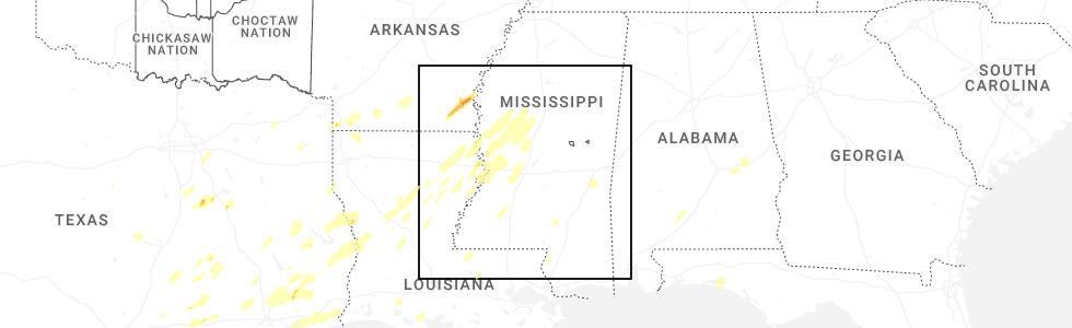
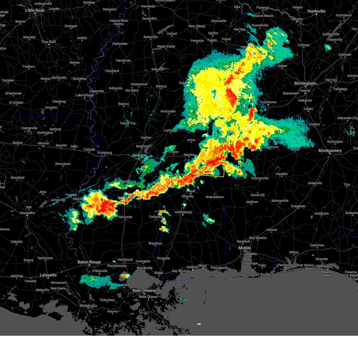
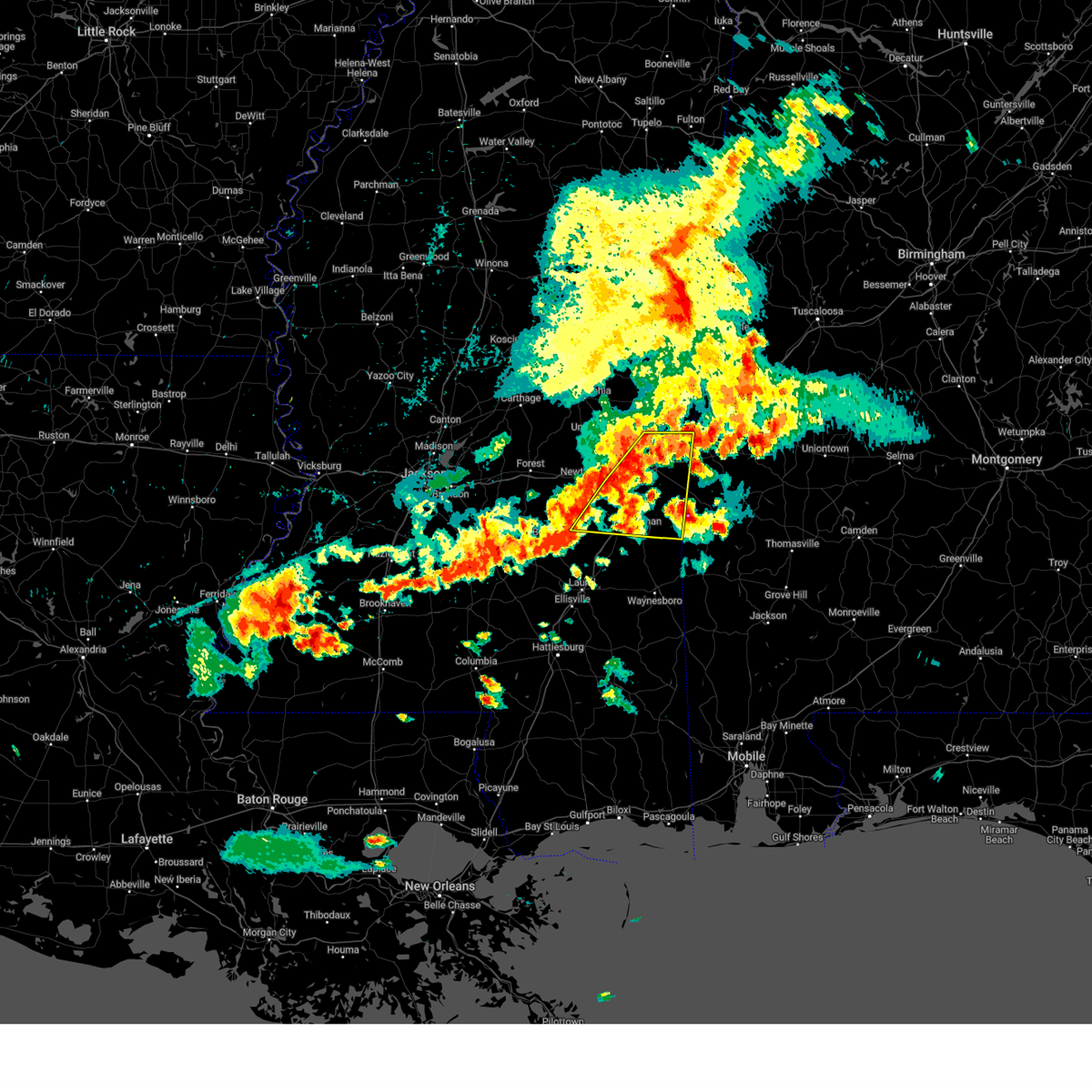
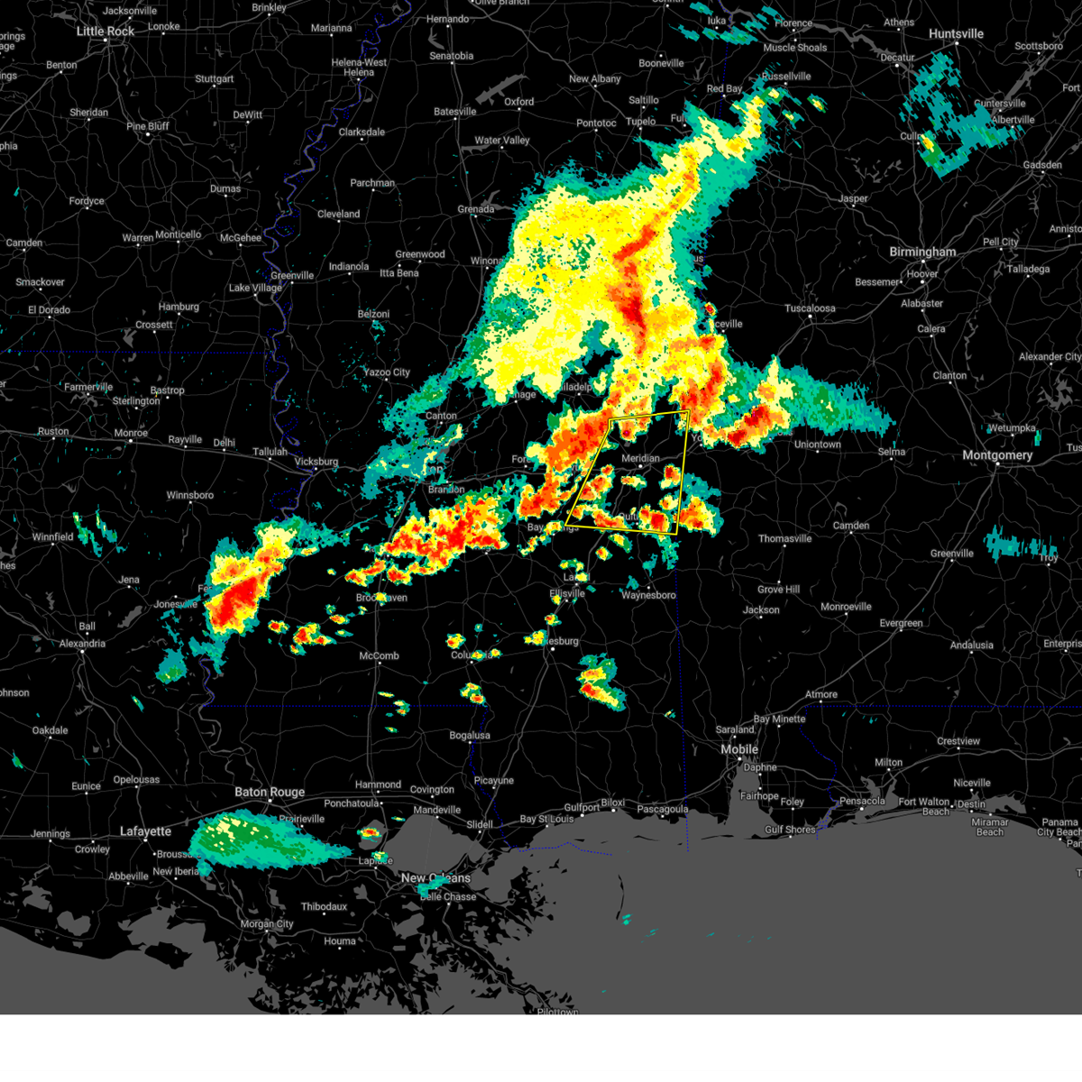
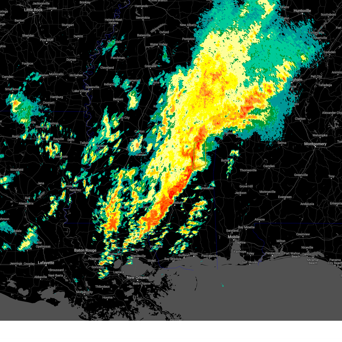
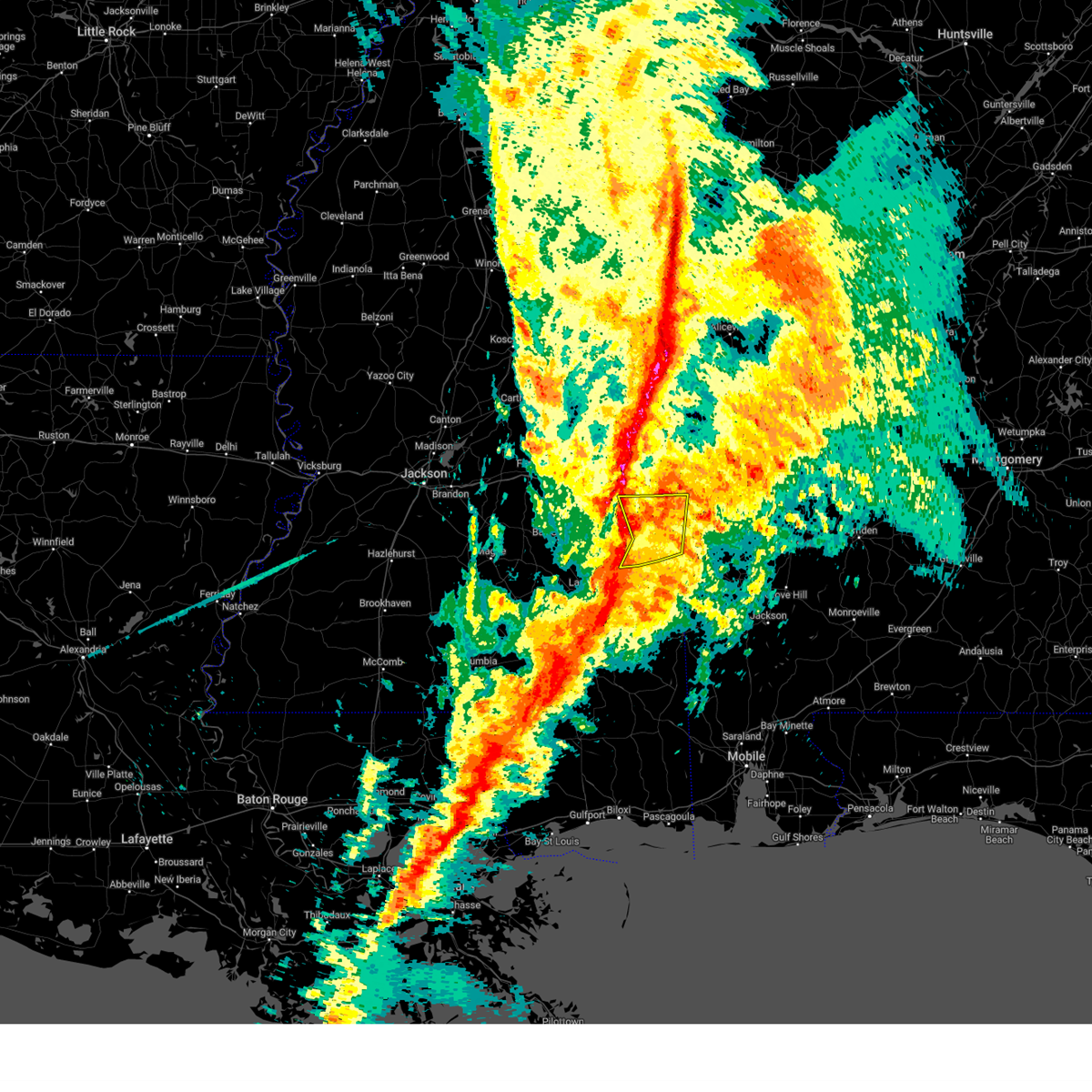
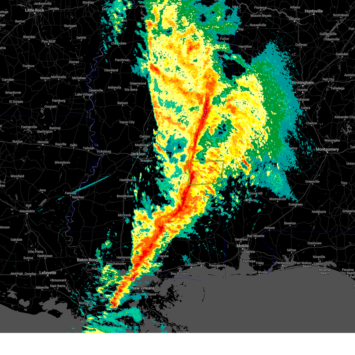
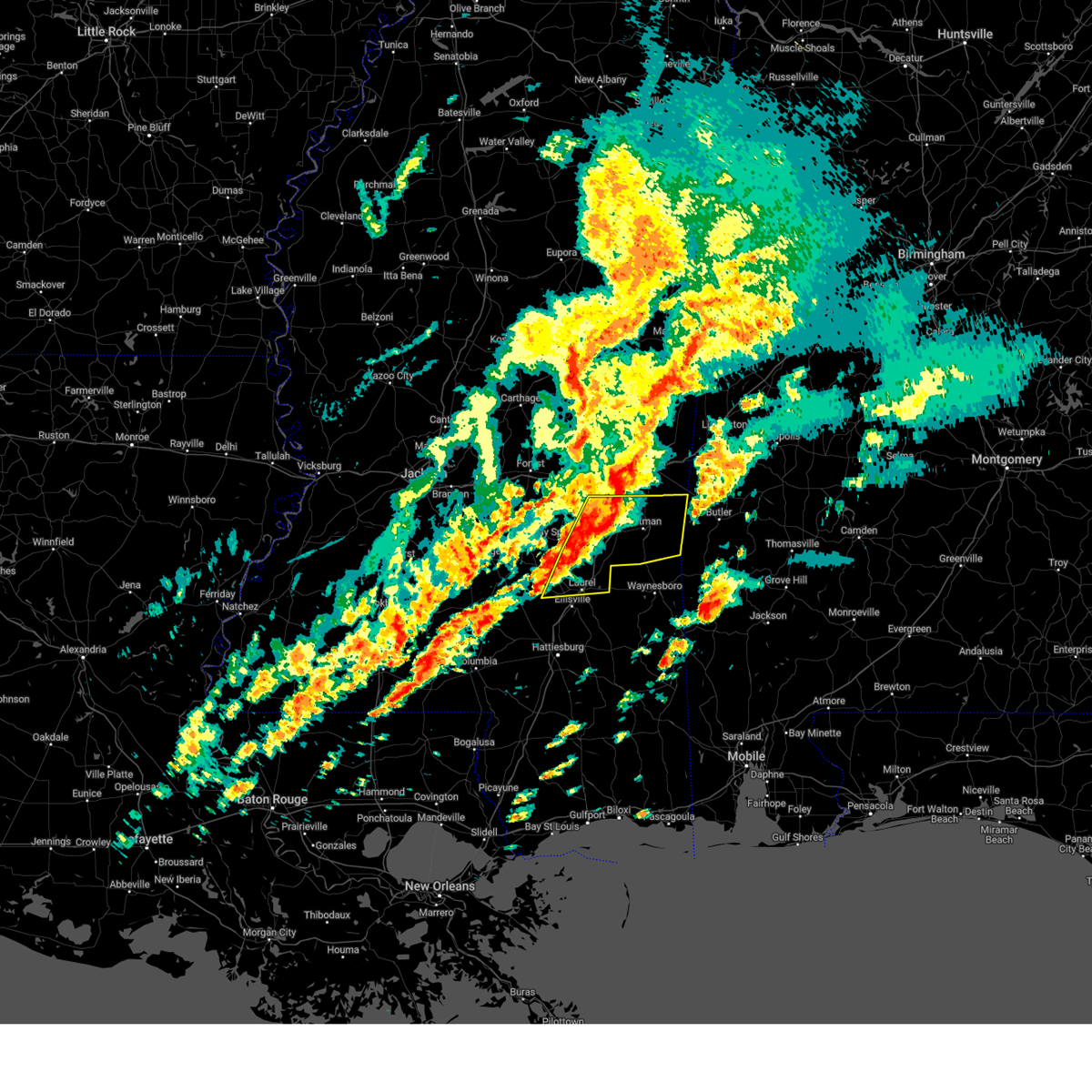
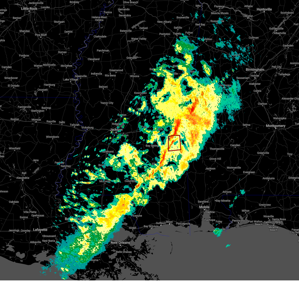
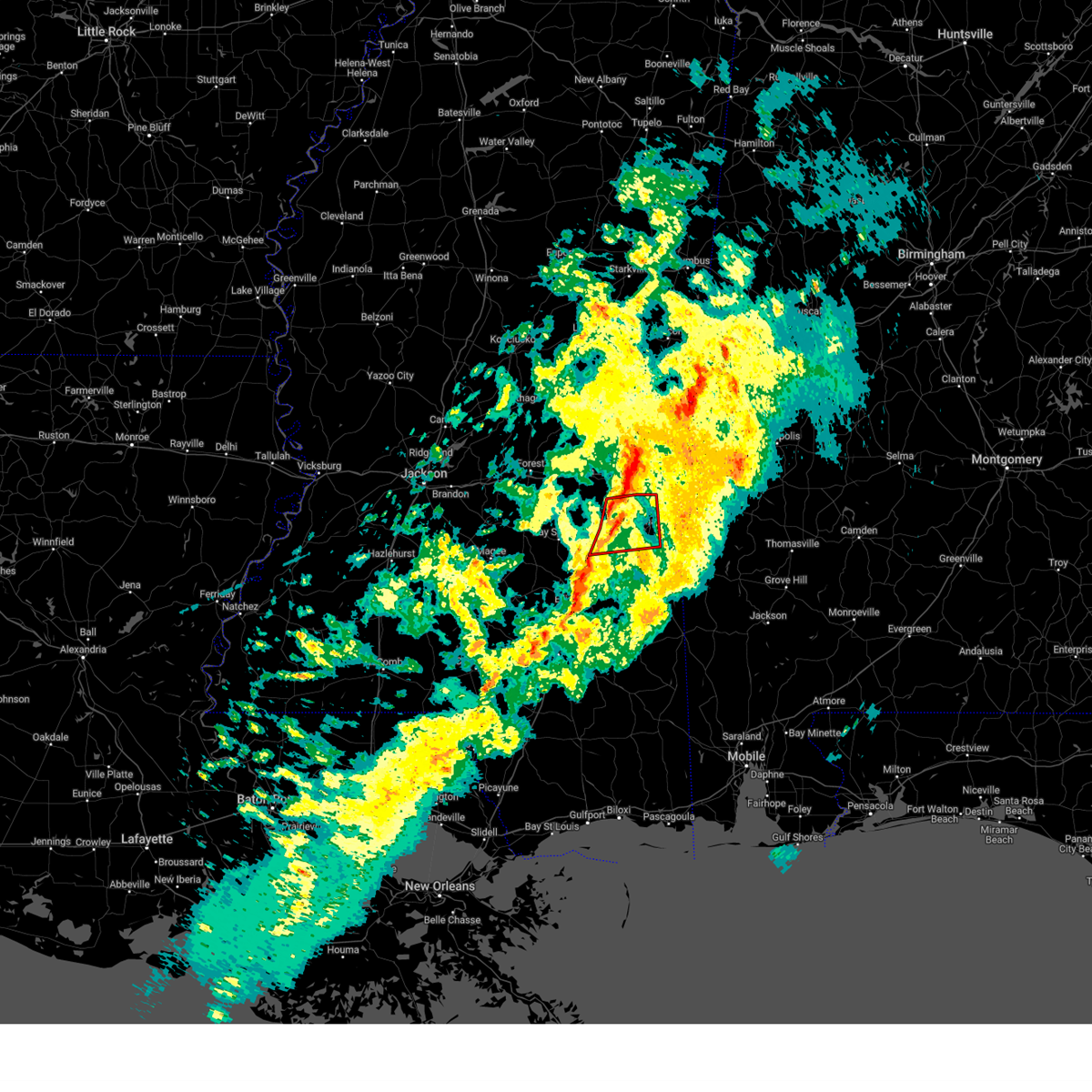
Hail Map for Enterprise, MS
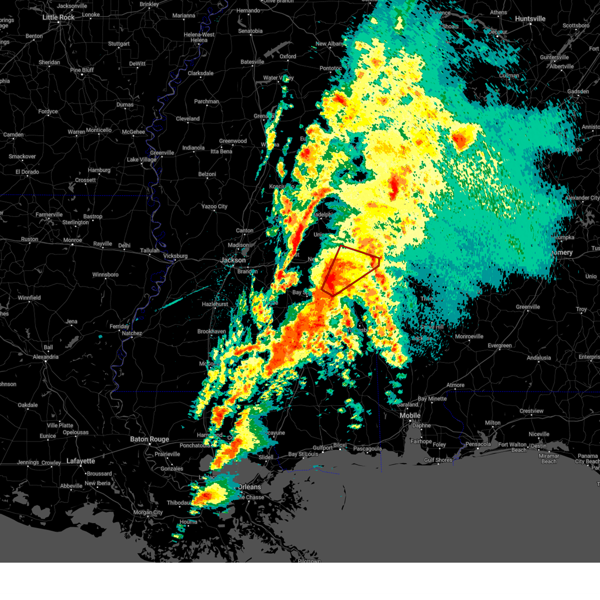
The Enterprise, MS area has had 4 reports of on-the-ground hail by trained spotters, and has been under severe weather warnings 45 times during the past 12 months. Doppler radar has detected hail at or near Enterprise, MS on 62 occasions, including 3 occasions during the past year.
| Name: | Enterprise, MS |
| Where Located: | 80.3 miles E of Jackson, MS |
| Map: | Google Map for Enterprise, MS |
| Population: | 526 |
| Housing Units: | 250 |
| More Info: | Search Google for Enterprise, MS |
3
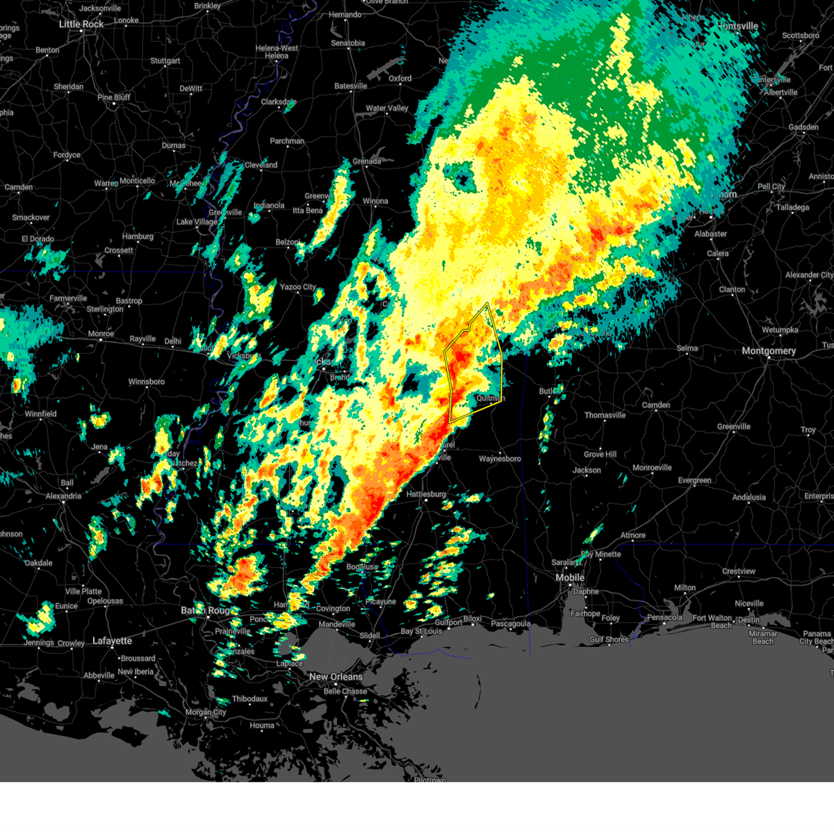
The Top Recent Hail Date for Enterprise, MS is Saturday, December 28, 2024 (5th out of 62)
Hail and Wind Damage Spotted near Enterprise, MS
| Date / Time | Report Details |
|---|---|
| 5/26/2025 4:06 PM CDT |
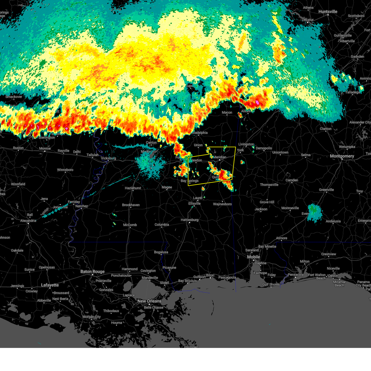
 Torjan the national weather service in jackson has issued a * tornado warning for, northern clarke county in east central mississippi, southern lauderdale county in east central mississippi, * until 445 pm cdt. * at 406 pm cdt, a severe thunderstorm capable of producing a tornado was located over enterprise, or 11 miles northwest of quitman, moving east at 45 mph (radar indicated rotation). Hazards include tornado. Flying debris will be dangerous to those caught without shelter. mobile homes will be damaged or destroyed. damage to roofs, windows, and vehicles will occur. tree damage is likely. this dangerous storm will be near, meridian, middleton, savoy, sable, and zero around 410 pm cdt. causeyville around 415 pm cdt. snell around 420 pm cdt. alamucha around 430 pm cdt. Other locations impacted by this tornadic thunderstorm include i 20 welcome center at cuba. Torjan the national weather service in jackson has issued a * tornado warning for, northern clarke county in east central mississippi, southern lauderdale county in east central mississippi, * until 445 pm cdt. * at 406 pm cdt, a severe thunderstorm capable of producing a tornado was located over enterprise, or 11 miles northwest of quitman, moving east at 45 mph (radar indicated rotation). Hazards include tornado. Flying debris will be dangerous to those caught without shelter. mobile homes will be damaged or destroyed. damage to roofs, windows, and vehicles will occur. tree damage is likely. this dangerous storm will be near, meridian, middleton, savoy, sable, and zero around 410 pm cdt. causeyville around 415 pm cdt. snell around 420 pm cdt. alamucha around 430 pm cdt. Other locations impacted by this tornadic thunderstorm include i 20 welcome center at cuba.
|
| 5/26/2025 4:04 PM CDT | Several trees down on point wanita lake rd... report via social medi in lauderdale county MS, 5.9 miles SE of Enterprise, MS |
| 5/26/2025 4:03 PM CDT | Multiple tree down along us 11 near cr 333 and cr 33 in clarke county MS, 1.3 miles E of Enterprise, MS |
| 5/26/2025 3:35 PM CDT |
 Svrjan the national weather service in jackson has issued a * severe thunderstorm warning for, northeastern jasper county in east central mississippi, southeastern newton county in east central mississippi, clarke county in east central mississippi, lauderdale county in east central mississippi, * until 430 pm cdt. * at 335 pm cdt, severe thunderstorms were located along a line extending from near newton to louin, moving east at 45 mph (radar indicated). Hazards include 60 mph wind gusts and nickel size hail. expect damage to roofs, siding, and trees Svrjan the national weather service in jackson has issued a * severe thunderstorm warning for, northeastern jasper county in east central mississippi, southeastern newton county in east central mississippi, clarke county in east central mississippi, lauderdale county in east central mississippi, * until 430 pm cdt. * at 335 pm cdt, severe thunderstorms were located along a line extending from near newton to louin, moving east at 45 mph (radar indicated). Hazards include 60 mph wind gusts and nickel size hail. expect damage to roofs, siding, and trees
|
| 5/25/2025 10:06 PM CDT | Tree and multiple branches downed on the side of i-5 in clarke county MS, 5.1 miles NE of Enterprise, MS |
| 5/25/2025 10:06 PM CDT | Svrjan the national weather service in jackson has issued a * severe thunderstorm warning for, jasper county in east central mississippi, clarke county in east central mississippi, jones county in southeastern mississippi, southeastern lauderdale county in east central mississippi, * until 1115 pm cdt. * at 1005 pm cdt, severe thunderstorms were located along a line extending from near toomsuba to near savoy to montrose, moving southeast at 40 mph (radar indicated). Hazards include 60 mph wind gusts. Expect damage to roofs, siding, and trees. severe thunderstorms will be near, stonewall, toomsuba, enterprise, turnerville, causeyville, orange, sable, zero, rose hill, and alamucha around 1010 pm cdt. pachuta, paulding, and middleton around 1015 pm cdt. snell around 1020 pm cdt. quitman, barnett, and sykes around 1025 pm cdt. heidelberg, de soto, and stafford springs around 1030 pm cdt. goodwater around 1035 pm cdt. crandall around 1040 pm cdt. Shubuta around 1045 pm cdt. |
| 5/25/2025 10:03 PM CDT | At 1003 pm cdt, severe thunderstorms were located along a line extending from meridian to near chunky to montrose, moving southeast at 35 mph (radar indicated). Hazards include 60 mph wind gusts. Expect damage to roofs, siding, and trees. Locations impacted include, meridian, newton, quitman, bay springs, marion, nellieburg, stonewall, toomsuba, meridian station, hickory, enterprise, lauderdale, chunky, louin, pachuta, montrose, paulding, rose hill, kewanee, and savoy. |
| 5/25/2025 9:47 PM CDT |
 At 947 pm cdt, severe thunderstorms were located along a line extending from daleville to near roberts, moving southeast at 40 mph (radar indicated). Hazards include 60 mph wind gusts. Expect damage to roofs, siding, and trees. Locations impacted include, meridian, newton, quitman, bay springs, collinsville, marion, nellieburg, stonewall, toomsuba, meridian station, hickory, enterprise, lauderdale, chunky, louin, pachuta, montrose, paulding, rose hill, and kewanee. At 947 pm cdt, severe thunderstorms were located along a line extending from daleville to near roberts, moving southeast at 40 mph (radar indicated). Hazards include 60 mph wind gusts. Expect damage to roofs, siding, and trees. Locations impacted include, meridian, newton, quitman, bay springs, collinsville, marion, nellieburg, stonewall, toomsuba, meridian station, hickory, enterprise, lauderdale, chunky, louin, pachuta, montrose, paulding, rose hill, and kewanee.
|
| 5/25/2025 9:35 PM CDT | At 934 pm cdt, severe thunderstorms were located along a line extending from prismatic to near homewood, moving southeast at 40 mph (radar indicated). Hazards include 60 mph wind gusts and quarter size hail. Hail damage to vehicles is expected. expect wind damage to roofs, siding, and trees. Locations impacted include, meridian, newton, quitman, bay springs, collinsville, marion, nellieburg, stonewall, toomsuba, meridian station, hickory, enterprise, lauderdale, chunky, louin, pachuta, montrose, paulding, rose hill, and kewanee. |
| 5/25/2025 9:06 PM CDT |
 Svrjan the national weather service in jackson has issued a * severe thunderstorm warning for, jasper county in east central mississippi, newton county in east central mississippi, northern clarke county in east central mississippi, lauderdale county in east central mississippi, * until 1015 pm cdt. * at 906 pm cdt, severe thunderstorms were located along a line extending from gholson to near walnut grove, moving southeast at 45 mph (radar indicated). Hazards include 60 mph wind gusts and quarter size hail. Hail damage to vehicles is expected. Expect wind damage to roofs, siding, and trees. Svrjan the national weather service in jackson has issued a * severe thunderstorm warning for, jasper county in east central mississippi, newton county in east central mississippi, northern clarke county in east central mississippi, lauderdale county in east central mississippi, * until 1015 pm cdt. * at 906 pm cdt, severe thunderstorms were located along a line extending from gholson to near walnut grove, moving southeast at 45 mph (radar indicated). Hazards include 60 mph wind gusts and quarter size hail. Hail damage to vehicles is expected. Expect wind damage to roofs, siding, and trees.
|
| 5/24/2025 6:25 PM CDT |
 At 625 pm cdt, severe thunderstorms were located along a line extending from near alamucha to near pachuta, moving southeast at 25 mph (radar indicated). Hazards include 60 mph wind gusts. Expect damage to roofs, siding, and trees. Locations impacted include, quitman, stonewall, enterprise, pachuta, sable, alamucha, middleton, sykes, causeyville, and snell. At 625 pm cdt, severe thunderstorms were located along a line extending from near alamucha to near pachuta, moving southeast at 25 mph (radar indicated). Hazards include 60 mph wind gusts. Expect damage to roofs, siding, and trees. Locations impacted include, quitman, stonewall, enterprise, pachuta, sable, alamucha, middleton, sykes, causeyville, and snell.
|
| 5/24/2025 6:25 PM CDT |
 the severe thunderstorm warning has been cancelled and is no longer in effect the severe thunderstorm warning has been cancelled and is no longer in effect
|
| 5/24/2025 6:13 PM CDT |
 the severe thunderstorm warning has been cancelled and is no longer in effect the severe thunderstorm warning has been cancelled and is no longer in effect
|
| 5/24/2025 6:13 PM CDT |
 At 612 pm cdt, severe thunderstorms were located along a line extending from near lauderdale to near zero to pachuta, moving east at 35 mph (radar indicated. at 556 pm, a 52 mph wind gust was reported at key field in meridian). Hazards include 60 mph wind gusts and penny size hail. Expect damage to roofs, siding, and trees. Locations impacted include, meridian, quitman, stonewall, toomsuba, enterprise, pachuta, zero, paulding, kewanee, orange, snell, sable, alamucha, middleton, sykes, and causeyville. At 612 pm cdt, severe thunderstorms were located along a line extending from near lauderdale to near zero to pachuta, moving east at 35 mph (radar indicated. at 556 pm, a 52 mph wind gust was reported at key field in meridian). Hazards include 60 mph wind gusts and penny size hail. Expect damage to roofs, siding, and trees. Locations impacted include, meridian, quitman, stonewall, toomsuba, enterprise, pachuta, zero, paulding, kewanee, orange, snell, sable, alamucha, middleton, sykes, and causeyville.
|
| 5/24/2025 6:02 PM CDT |
 At 602 pm cdt, severe thunderstorms were located along a line extending from near meridian station to near zero to near paulding, moving east at 50 mph (radar indicated). Hazards include 60 mph wind gusts and nickel size hail. Expect damage to roofs, siding, and trees. Locations impacted include, meridian, quitman, collinsville, marion, nellieburg, stonewall, toomsuba, meridian station, enterprise, lauderdale, chunky, pachuta, paulding, rose hill, kewanee, savoy, orange, suqualena, snell, and sable. At 602 pm cdt, severe thunderstorms were located along a line extending from near meridian station to near zero to near paulding, moving east at 50 mph (radar indicated). Hazards include 60 mph wind gusts and nickel size hail. Expect damage to roofs, siding, and trees. Locations impacted include, meridian, quitman, collinsville, marion, nellieburg, stonewall, toomsuba, meridian station, enterprise, lauderdale, chunky, pachuta, paulding, rose hill, kewanee, savoy, orange, suqualena, snell, and sable.
|
| 5/24/2025 6:02 PM CDT |
 the severe thunderstorm warning has been cancelled and is no longer in effect the severe thunderstorm warning has been cancelled and is no longer in effect
|
| 5/24/2025 5:33 PM CDT |
 Svrjan the national weather service in jackson has issued a * severe thunderstorm warning for, northeastern jasper county in east central mississippi, southeastern newton county in east central mississippi, southern kemper county in east central mississippi, clarke county in east central mississippi, lauderdale county in east central mississippi, * until 645 pm cdt. * at 533 pm cdt, severe thunderstorms were located along a line extending from near martin to near pineville, moving east at 30 mph (radar indicated). Hazards include ping pong ball size hail and 60 mph wind gusts. People and animals outdoors will be injured. expect hail damage to roofs, siding, windows, and vehicles. Expect wind damage to roofs, siding, and trees. Svrjan the national weather service in jackson has issued a * severe thunderstorm warning for, northeastern jasper county in east central mississippi, southeastern newton county in east central mississippi, southern kemper county in east central mississippi, clarke county in east central mississippi, lauderdale county in east central mississippi, * until 645 pm cdt. * at 533 pm cdt, severe thunderstorms were located along a line extending from near martin to near pineville, moving east at 30 mph (radar indicated). Hazards include ping pong ball size hail and 60 mph wind gusts. People and animals outdoors will be injured. expect hail damage to roofs, siding, windows, and vehicles. Expect wind damage to roofs, siding, and trees.
|
| 4/6/2025 6:06 AM CDT |
 At 606 am cdt, severe thunderstorms were located along a line extending from marion to near pachuta, moving northeast at 30 mph (radar indicated). Hazards include 60 mph wind gusts. Expect damage to roofs, siding, and trees. These severe storms will be near, meridian, marion, stonewall, sable, quitman, zero, and enterprise around 610 am cdt. At 606 am cdt, severe thunderstorms were located along a line extending from marion to near pachuta, moving northeast at 30 mph (radar indicated). Hazards include 60 mph wind gusts. Expect damage to roofs, siding, and trees. These severe storms will be near, meridian, marion, stonewall, sable, quitman, zero, and enterprise around 610 am cdt.
|
| 4/6/2025 6:05 AM CDT |
 At 604 am cdt, severe thunderstorms were located along a line extending from meridian to near pachuta, moving northeast at 30 mph (radar indicated). Hazards include 60 mph wind gusts. Expect damage to roofs, siding, and trees. These severe storms will be near, meridian, marion, stonewall, sable, quitman, and zero around 610 am cdt. At 604 am cdt, severe thunderstorms were located along a line extending from meridian to near pachuta, moving northeast at 30 mph (radar indicated). Hazards include 60 mph wind gusts. Expect damage to roofs, siding, and trees. These severe storms will be near, meridian, marion, stonewall, sable, quitman, and zero around 610 am cdt.
|
| 4/6/2025 6:05 AM CDT |
 the severe thunderstorm warning has been cancelled and is no longer in effect the severe thunderstorm warning has been cancelled and is no longer in effect
|
| 4/6/2025 5:27 AM CDT |
 Svrjan the national weather service in jackson has issued a * severe thunderstorm warning for, northeastern jasper county in east central mississippi, eastern newton county in east central mississippi, southwestern kemper county in east central mississippi, northwestern clarke county in east central mississippi, western lauderdale county in east central mississippi, * until 630 am cdt. * at 527 am cdt, severe thunderstorms were located along a line extending from near decatur to near rose hill to near heidelberg, moving northeast at 30 mph (radar indicated). Hazards include 60 mph wind gusts. Expect damage to roofs, siding, and trees. severe thunderstorms will be near, barnett, pachuta, orange, chunky, and rose hill around 535 am cdt. collinsville, meehan, duffee, and enterprise around 540 am cdt. suqualena around 545 am cdt. meridian, stonewall, savoy, martin, and nellieburg around 550 am cdt. sable and prismatic around 600 am cdt. Marion and zero around 605 am cdt. Svrjan the national weather service in jackson has issued a * severe thunderstorm warning for, northeastern jasper county in east central mississippi, eastern newton county in east central mississippi, southwestern kemper county in east central mississippi, northwestern clarke county in east central mississippi, western lauderdale county in east central mississippi, * until 630 am cdt. * at 527 am cdt, severe thunderstorms were located along a line extending from near decatur to near rose hill to near heidelberg, moving northeast at 30 mph (radar indicated). Hazards include 60 mph wind gusts. Expect damage to roofs, siding, and trees. severe thunderstorms will be near, barnett, pachuta, orange, chunky, and rose hill around 535 am cdt. collinsville, meehan, duffee, and enterprise around 540 am cdt. suqualena around 545 am cdt. meridian, stonewall, savoy, martin, and nellieburg around 550 am cdt. sable and prismatic around 600 am cdt. Marion and zero around 605 am cdt.
|
| 3/31/2025 7:22 AM CDT |
 the severe thunderstorm warning has been cancelled and is no longer in effect the severe thunderstorm warning has been cancelled and is no longer in effect
|
| 3/31/2025 7:22 AM CDT |
 At 721 am cdt, severe thunderstorms were located along a line extending from near martin to near savoy to de soto, moving northeast at 60 mph (radar indicated). Hazards include 60 mph wind gusts. Expect damage to roofs, siding, and trees. these severe storms will be near, meridian, marion, causeyville, middleton, meridian station, sykes, sable, crandall, and zero around 725 am cdt. toomsuba and snell around 730 am cdt. Alamucha, kewanee, and lauderdale around 735 am cdt. At 721 am cdt, severe thunderstorms were located along a line extending from near martin to near savoy to de soto, moving northeast at 60 mph (radar indicated). Hazards include 60 mph wind gusts. Expect damage to roofs, siding, and trees. these severe storms will be near, meridian, marion, causeyville, middleton, meridian station, sykes, sable, crandall, and zero around 725 am cdt. toomsuba and snell around 730 am cdt. Alamucha, kewanee, and lauderdale around 735 am cdt.
|
| 3/31/2025 7:05 AM CDT |
 At 705 am cdt, severe thunderstorms were located along a line extending from near decatur to rose hill to near stafford springs, moving east at 45 mph (radar indicated). Hazards include 60 mph wind gusts. Expect damage to roofs, siding, and trees. these severe storms will be near, collinsville, meehan, barnett, pachuta, duffee, orange, goodwater, chunky, and enterprise around 710 am cdt. meridian, stonewall, savoy, shubuta, suqualena, and nellieburg around 715 am cdt. sable, quitman, and de soto around 720 am cdt. zero around 725 am cdt. marion, middleton, sykes, and crandall around 730 am cdt. causeyville and snell around 735 am cdt. toomsuba and alamucha around 740 am cdt. Kewanee and lauderdale around 745 am cdt. At 705 am cdt, severe thunderstorms were located along a line extending from near decatur to rose hill to near stafford springs, moving east at 45 mph (radar indicated). Hazards include 60 mph wind gusts. Expect damage to roofs, siding, and trees. these severe storms will be near, collinsville, meehan, barnett, pachuta, duffee, orange, goodwater, chunky, and enterprise around 710 am cdt. meridian, stonewall, savoy, shubuta, suqualena, and nellieburg around 715 am cdt. sable, quitman, and de soto around 720 am cdt. zero around 725 am cdt. marion, middleton, sykes, and crandall around 730 am cdt. causeyville and snell around 735 am cdt. toomsuba and alamucha around 740 am cdt. Kewanee and lauderdale around 745 am cdt.
|
| 3/31/2025 7:05 AM CDT |
 the severe thunderstorm warning has been cancelled and is no longer in effect the severe thunderstorm warning has been cancelled and is no longer in effect
|
| 3/31/2025 6:36 AM CDT |
 Svrjan the national weather service in jackson has issued a * severe thunderstorm warning for, jasper county in east central mississippi, newton county in east central mississippi, eastern smith county in central mississippi, clarke county in east central mississippi, southeastern scott county in central mississippi, northern jones county in southeastern mississippi, lauderdale county in east central mississippi, * until 745 am cdt. * at 636 am cdt, severe thunderstorms were located along a line extending from near forest to near pineville to near taylorsville, moving northeast at 65 mph (radar indicated). Hazards include 60 mph wind gusts and quarter size hail. Hail damage to vehicles is expected. expect wind damage to roofs, siding, and trees. severe thunderstorms will be near, conehatta, turnerville, bay springs, montrose, lawrence, roberts, lake, stringer, and louin around 640 am cdt. garlandville, newton, and vernon around 645 am cdt. paulding and decatur around 650 am cdt. orange, heidelberg, rose hill, and hickory around 655 am cdt. meehan, barnett, pachuta, duffee, and chunky around 700 am cdt. collinsville, stonewall, savoy, suqualena, and enterprise around 705 am cdt. meridian, sable, quitman, and nellieburg around 710 am cdt. Marion, middleton, sykes, and zero around 715 am cdt. Svrjan the national weather service in jackson has issued a * severe thunderstorm warning for, jasper county in east central mississippi, newton county in east central mississippi, eastern smith county in central mississippi, clarke county in east central mississippi, southeastern scott county in central mississippi, northern jones county in southeastern mississippi, lauderdale county in east central mississippi, * until 745 am cdt. * at 636 am cdt, severe thunderstorms were located along a line extending from near forest to near pineville to near taylorsville, moving northeast at 65 mph (radar indicated). Hazards include 60 mph wind gusts and quarter size hail. Hail damage to vehicles is expected. expect wind damage to roofs, siding, and trees. severe thunderstorms will be near, conehatta, turnerville, bay springs, montrose, lawrence, roberts, lake, stringer, and louin around 640 am cdt. garlandville, newton, and vernon around 645 am cdt. paulding and decatur around 650 am cdt. orange, heidelberg, rose hill, and hickory around 655 am cdt. meehan, barnett, pachuta, duffee, and chunky around 700 am cdt. collinsville, stonewall, savoy, suqualena, and enterprise around 705 am cdt. meridian, sable, quitman, and nellieburg around 710 am cdt. Marion, middleton, sykes, and zero around 715 am cdt.
|
| 3/15/2025 4:37 PM CDT | Torjan the national weather service in jackson has issued a * tornado warning for, southeastern kemper county in east central mississippi, northwestern clarke county in east central mississippi, eastern lauderdale county in east central mississippi, * until 545 pm cdt. * at 437 pm cdt, a tornado producing storm was located near sable, or 11 miles north of quitman, moving northeast at 55 mph (radar confirmed tornado). Hazards include damaging tornado. Flying debris will be dangerous to those caught without shelter. mobile homes will be damaged or destroyed. damage to roofs, windows, and vehicles will occur. tree damage is likely. this tornadic storm will be near, meridian, causeyville, and zero around 445 pm cdt. marion, toomsuba, and alamucha around 450 pm cdt. kewanee and lauderdale around 455 pm cdt. Tamola around 505 pm cdt. |
| 3/15/2025 4:31 PM CDT | At 431 pm cdt, a confirmed large and extremely dangerous tornado was located near enterprise, or 13 miles southwest of meridian, moving northeast at 55 mph. this is a particularly dangerous situation. take cover now! (weather spotters confirmed tornado). Hazards include damaging tornado. You are in a life-threatening situation. flying debris may be deadly to those caught without shelter. mobile homes will be destroyed. considerable damage to homes, businesses, and vehicles is likely and complete destruction is possible. the tornado will be near, meehan, meridian, savoy, sable, zero, and nellieburg around 435 pm cdt. Marion around 440 pm cdt. |
| 3/15/2025 4:31 PM CDT | the tornado warning has been cancelled and is no longer in effect |
| 3/15/2025 4:18 PM CDT |
 At 418 pm cdt, a confirmed large and extremely dangerous tornado was located over orange, or 15 miles west of quitman, moving northeast at 55 mph. this is a particularly dangerous situation. take cover now! (weather spotters confirmed tornado). Hazards include damaging tornado. You are in a life-threatening situation. flying debris may be deadly to those caught without shelter. mobile homes will be destroyed. considerable damage to homes, businesses, and vehicles is likely and complete destruction is possible. the tornado will be near, stonewall and enterprise around 425 pm cdt. meehan, meridian, and savoy around 430 pm cdt. sable, zero, and nellieburg around 435 pm cdt. Marion around 440 pm cdt. At 418 pm cdt, a confirmed large and extremely dangerous tornado was located over orange, or 15 miles west of quitman, moving northeast at 55 mph. this is a particularly dangerous situation. take cover now! (weather spotters confirmed tornado). Hazards include damaging tornado. You are in a life-threatening situation. flying debris may be deadly to those caught without shelter. mobile homes will be destroyed. considerable damage to homes, businesses, and vehicles is likely and complete destruction is possible. the tornado will be near, stonewall and enterprise around 425 pm cdt. meehan, meridian, and savoy around 430 pm cdt. sable, zero, and nellieburg around 435 pm cdt. Marion around 440 pm cdt.
|
| 3/15/2025 4:17 PM CDT |
 At 416 pm cdt, a confirmed large and extremely dangerous tornado was located near paulding, or 15 miles west of quitman, moving northeast at 40 mph. this is a particularly dangerous situation. take cover now! (radar confirmed tornado). Hazards include damaging tornado. You are in a life-threatening situation. flying debris may be deadly to those caught without shelter. mobile homes will be destroyed. considerable damage to homes, businesses, and vehicles is likely and complete destruction is possible. the tornado will be near, pachuta, orange, rose hill, and enterprise around 420 pm cdt. stonewall around 425 pm cdt. savoy and sable around 435 pm cdt. meridian and zero around 440 pm cdt. causeyville around 450 pm cdt. marion around 455 pm cdt. Alamucha around 500 pm cdt. At 416 pm cdt, a confirmed large and extremely dangerous tornado was located near paulding, or 15 miles west of quitman, moving northeast at 40 mph. this is a particularly dangerous situation. take cover now! (radar confirmed tornado). Hazards include damaging tornado. You are in a life-threatening situation. flying debris may be deadly to those caught without shelter. mobile homes will be destroyed. considerable damage to homes, businesses, and vehicles is likely and complete destruction is possible. the tornado will be near, pachuta, orange, rose hill, and enterprise around 420 pm cdt. stonewall around 425 pm cdt. savoy and sable around 435 pm cdt. meridian and zero around 440 pm cdt. causeyville around 450 pm cdt. marion around 455 pm cdt. Alamucha around 500 pm cdt.
|
| 3/15/2025 4:04 PM CDT | the tornado warning has been cancelled and is no longer in effect |
| 3/15/2025 4:04 PM CDT | At 404 pm cdt, a severe thunderstorm capable of producing a tornado was located over paulding, or 13 miles northeast of bay springs, moving northeast at 55 mph (radar indicated rotation). Hazards include tornado. Flying debris will be dangerous to those caught without shelter. mobile homes will be damaged or destroyed. damage to roofs, windows, and vehicles will occur. tree damage is likely. this dangerous storm will be near, orange and rose hill around 410 pm cdt. enterprise around 415 pm cdt. meehan, savoy, and chunky around 420 pm cdt. meridian and nellieburg around 425 pm cdt. collinsville and suqualena around 430 pm cdt. Marion around 435 pm cdt. |
| 3/15/2025 3:45 PM CDT | Torjan the national weather service in jackson has issued a * tornado warning for, jasper county in east central mississippi, eastern newton county in east central mississippi, east central smith county in central mississippi, northwestern clarke county in east central mississippi, southern lauderdale county in east central mississippi, * until 445 pm cdt. * at 345 pm cdt, a confirmed large and extremely dangerous tornado was located over stringer, or 7 miles south of bay springs, moving northeast at 55 mph. this is a particularly dangerous situation. take cover now! (radar confirmed tornado). Hazards include damaging tornado. You are in a life-threatening situation. flying debris may be deadly to those caught without shelter. mobile homes will be destroyed. considerable damage to homes, businesses, and vehicles is likely and complete destruction is possible. the tornado will be near, turnerville, bay springs, and vernon around 350 pm cdt. paulding around 355 pm cdt. orange and rose hill around 405 pm cdt. enterprise around 415 pm cdt. meehan, savoy, and chunky around 420 pm cdt. meridian and nellieburg around 425 pm cdt. collinsville and suqualena around 430 pm cdt. Marion and zero around 435 pm cdt. |
| 3/15/2025 2:40 PM CDT |
 At 239 pm cdt, a confirmed tornado was located near montrose, or 10 miles northeast of bay springs, moving northeast at 35 mph (radar confirmed tornado). Hazards include damaging tornado. Flying debris will be dangerous to those caught without shelter. mobile homes will be damaged or destroyed. damage to roofs, windows, and vehicles will occur. tree damage is likely. This tornado will be near, garlandville and rose hill around 245 pm cdt. At 239 pm cdt, a confirmed tornado was located near montrose, or 10 miles northeast of bay springs, moving northeast at 35 mph (radar confirmed tornado). Hazards include damaging tornado. Flying debris will be dangerous to those caught without shelter. mobile homes will be damaged or destroyed. damage to roofs, windows, and vehicles will occur. tree damage is likely. This tornado will be near, garlandville and rose hill around 245 pm cdt.
|
| 3/15/2025 2:29 PM CDT |
 At 228 pm cdt, a confirmed tornado was located over turnerville, or near bay springs, moving northeast at 40 mph (radar confirmed tornado). Hazards include damaging tornado. Flying debris will be dangerous to those caught without shelter. mobile homes will be damaged or destroyed. damage to roofs, windows, and vehicles will occur. tree damage is likely. this tornado will be near, turnerville and montrose around 235 pm cdt. paulding and rose hill around 240 pm cdt. garlandville around 245 pm cdt. orange around 250 pm cdt. Enterprise around 300 pm cdt. At 228 pm cdt, a confirmed tornado was located over turnerville, or near bay springs, moving northeast at 40 mph (radar confirmed tornado). Hazards include damaging tornado. Flying debris will be dangerous to those caught without shelter. mobile homes will be damaged or destroyed. damage to roofs, windows, and vehicles will occur. tree damage is likely. this tornado will be near, turnerville and montrose around 235 pm cdt. paulding and rose hill around 240 pm cdt. garlandville around 245 pm cdt. orange around 250 pm cdt. Enterprise around 300 pm cdt.
|
| 3/15/2025 2:09 PM CDT |
 Torjan the national weather service in jackson has issued a * tornado warning for, jasper county in east central mississippi, northwestern clarke county in east central mississippi, * until 315 pm cdt. * at 208 pm cdt, a confirmed large and extremely dangerous tornado was located over taylorsville, or 11 miles southwest of bay springs, moving northeast at 45 mph. this is a particularly dangerous situation. take cover now! (radar confirmed tornado). Hazards include damaging tornado. You are in a life-threatening situation. flying debris may be deadly to those caught without shelter. mobile homes will be destroyed. considerable damage to homes, businesses, and vehicles is likely and complete destruction is possible. the tornado will be near, bay springs and stringer around 215 pm cdt. turnerville and vernon around 220 pm cdt. louin around 225 pm cdt. paulding around 230 pm cdt. rose hill around 240 pm cdt. orange around 245 pm cdt. enterprise around 250 pm cdt. Stonewall around 300 pm cdt. Torjan the national weather service in jackson has issued a * tornado warning for, jasper county in east central mississippi, northwestern clarke county in east central mississippi, * until 315 pm cdt. * at 208 pm cdt, a confirmed large and extremely dangerous tornado was located over taylorsville, or 11 miles southwest of bay springs, moving northeast at 45 mph. this is a particularly dangerous situation. take cover now! (radar confirmed tornado). Hazards include damaging tornado. You are in a life-threatening situation. flying debris may be deadly to those caught without shelter. mobile homes will be destroyed. considerable damage to homes, businesses, and vehicles is likely and complete destruction is possible. the tornado will be near, bay springs and stringer around 215 pm cdt. turnerville and vernon around 220 pm cdt. louin around 225 pm cdt. paulding around 230 pm cdt. rose hill around 240 pm cdt. orange around 245 pm cdt. enterprise around 250 pm cdt. Stonewall around 300 pm cdt.
|
| 3/4/2025 6:17 PM CST |
 At 617 pm cst, severe thunderstorms were located along a line extending from causeyville to near sykes to near shubuta, moving east at 60 mph (radar indicated). Hazards include 60 mph wind gusts. Expect damage to roofs, siding, and trees. These severe storms will be near, crandall and snell around 620 pm cst. At 617 pm cst, severe thunderstorms were located along a line extending from causeyville to near sykes to near shubuta, moving east at 60 mph (radar indicated). Hazards include 60 mph wind gusts. Expect damage to roofs, siding, and trees. These severe storms will be near, crandall and snell around 620 pm cst.
|
| 3/4/2025 6:17 PM CST |
 the severe thunderstorm warning has been cancelled and is no longer in effect the severe thunderstorm warning has been cancelled and is no longer in effect
|
| 3/4/2025 5:52 PM CST |
 Svrjan the national weather service in jackson has issued a * severe thunderstorm warning for, eastern jasper county in east central mississippi, clarke county in east central mississippi, * until 700 pm cst. * at 552 pm cst, severe thunderstorms were located along a line extending from near rose hill to barnett to near sandersville, moving east at 60 mph (radar indicated). Hazards include 60 mph wind gusts. Expect damage to roofs, siding, and trees. severe thunderstorms will be near, stafford springs, barnett, stonewall, pachuta, orange, heidelberg, goodwater, and enterprise around 555 pm cst. quitman and de soto around 600 pm cst. middleton, shubuta, and sable around 605 pm cst. sykes and crandall around 610 pm cst. Snell around 615 pm cst. Svrjan the national weather service in jackson has issued a * severe thunderstorm warning for, eastern jasper county in east central mississippi, clarke county in east central mississippi, * until 700 pm cst. * at 552 pm cst, severe thunderstorms were located along a line extending from near rose hill to barnett to near sandersville, moving east at 60 mph (radar indicated). Hazards include 60 mph wind gusts. Expect damage to roofs, siding, and trees. severe thunderstorms will be near, stafford springs, barnett, stonewall, pachuta, orange, heidelberg, goodwater, and enterprise around 555 pm cst. quitman and de soto around 600 pm cst. middleton, shubuta, and sable around 605 pm cst. sykes and crandall around 610 pm cst. Snell around 615 pm cst.
|
| 2/16/2025 12:11 AM CST | Svrjan the national weather service in jackson has issued a * severe thunderstorm warning for, clarke county in east central mississippi, * until 100 am cst. * at 1211 am cst, severe thunderstorms were located along a line extending from near sable to near stafford springs, moving east at 65 mph (radar indicated). Hazards include 60 mph wind gusts. Expect damage to roofs, siding, and trees. severe thunderstorms will be near, middleton, sable, quitman, goodwater, and de soto around 1215 am cst. shubuta, sykes, and snell around 1220 am cst. Crandall around 1225 am cst. |
| 2/12/2025 5:55 PM CST |
 Svrjan the national weather service in jackson has issued a * severe thunderstorm warning for, jasper county in east central mississippi, clarke county in east central mississippi, northern jones county in southeastern mississippi, * until 700 pm cst. * at 554 pm cst, severe thunderstorms were located along a line extending from near orange to near sandersville, moving east at 40 mph (radar indicated). Hazards include 60 mph wind gusts. Expect damage to roofs, siding, and trees. severe thunderstorms will be near, stafford springs, barnett, stonewall, pachuta, heidelberg, goodwater, sandersville, and enterprise around 600 pm cst. quitman around 605 pm cst. de soto around 610 pm cst. middleton, shubuta, and sykes around 615 pm cst. Crandall around 625 pm cst. Svrjan the national weather service in jackson has issued a * severe thunderstorm warning for, jasper county in east central mississippi, clarke county in east central mississippi, northern jones county in southeastern mississippi, * until 700 pm cst. * at 554 pm cst, severe thunderstorms were located along a line extending from near orange to near sandersville, moving east at 40 mph (radar indicated). Hazards include 60 mph wind gusts. Expect damage to roofs, siding, and trees. severe thunderstorms will be near, stafford springs, barnett, stonewall, pachuta, heidelberg, goodwater, sandersville, and enterprise around 600 pm cst. quitman around 605 pm cst. de soto around 610 pm cst. middleton, shubuta, and sykes around 615 pm cst. Crandall around 625 pm cst.
|
| 1/5/2025 9:56 PM CST |
 the tornado warning has been cancelled and is no longer in effect the tornado warning has been cancelled and is no longer in effect
|
| 1/5/2025 9:56 PM CST |
 At 956 pm cst, a severe thunderstorm capable of producing a tornado was located over stonewall, or near quitman, moving east at 45 mph (radar indicated rotation). Hazards include tornado. Flying debris will be dangerous to those caught without shelter. mobile homes will be damaged or destroyed. damage to roofs, windows, and vehicles will occur. tree damage is likely. This dangerous storm will be near, stonewall, sable, quitman, and enterprise around 1000 pm cst. At 956 pm cst, a severe thunderstorm capable of producing a tornado was located over stonewall, or near quitman, moving east at 45 mph (radar indicated rotation). Hazards include tornado. Flying debris will be dangerous to those caught without shelter. mobile homes will be damaged or destroyed. damage to roofs, windows, and vehicles will occur. tree damage is likely. This dangerous storm will be near, stonewall, sable, quitman, and enterprise around 1000 pm cst.
|
| 1/5/2025 9:50 PM CST |
 At 950 pm cst, a severe thunderstorm capable of producing a tornado was located over orange, or 10 miles west of quitman, moving east at 45 mph (radar indicated rotation). Hazards include tornado. Flying debris will be dangerous to those caught without shelter. mobile homes will be damaged or destroyed. damage to roofs, windows, and vehicles will occur. tree damage is likely. this dangerous storm will be near, stonewall, quitman, and enterprise around 955 pm cst. Sable around 1000 pm cst. At 950 pm cst, a severe thunderstorm capable of producing a tornado was located over orange, or 10 miles west of quitman, moving east at 45 mph (radar indicated rotation). Hazards include tornado. Flying debris will be dangerous to those caught without shelter. mobile homes will be damaged or destroyed. damage to roofs, windows, and vehicles will occur. tree damage is likely. this dangerous storm will be near, stonewall, quitman, and enterprise around 955 pm cst. Sable around 1000 pm cst.
|
| 1/5/2025 9:39 PM CST |
 At 939 pm cst, a severe thunderstorm capable of producing a tornado was located over paulding, or 14 miles east of bay springs, moving east at 45 mph (radar indicated rotation). Hazards include tornado. Flying debris will be dangerous to those caught without shelter. mobile homes will be damaged or destroyed. damage to roofs, windows, and vehicles will occur. tree damage is likely. this dangerous storm will be near, barnett, pachuta, orange, and rose hill around 945 pm cst. stonewall and enterprise around 950 pm cst. quitman around 955 pm cst. Sable around 1000 pm cst. At 939 pm cst, a severe thunderstorm capable of producing a tornado was located over paulding, or 14 miles east of bay springs, moving east at 45 mph (radar indicated rotation). Hazards include tornado. Flying debris will be dangerous to those caught without shelter. mobile homes will be damaged or destroyed. damage to roofs, windows, and vehicles will occur. tree damage is likely. this dangerous storm will be near, barnett, pachuta, orange, and rose hill around 945 pm cst. stonewall and enterprise around 950 pm cst. quitman around 955 pm cst. Sable around 1000 pm cst.
|
| 1/5/2025 9:21 PM CST |
 Torjan the national weather service in jackson has issued a * tornado warning for, central jasper county in east central mississippi, northwestern clarke county in east central mississippi, * until 1015 pm cst. * at 921 pm cst, a severe thunderstorm capable of producing a tornado was located over bay springs, moving east at 45 mph (radar indicated rotation). Hazards include tornado. Flying debris will be dangerous to those caught without shelter. mobile homes will be damaged or destroyed. damage to roofs, windows, and vehicles will occur. tree damage is likely. this dangerous storm will be near, turnerville and vernon around 925 pm cst. paulding around 930 pm cst. barnett, pachuta, orange, and rose hill around 940 pm cst. stonewall and enterprise around 950 pm cst. quitman around 955 pm cst. Sable around 1000 pm cst. Torjan the national weather service in jackson has issued a * tornado warning for, central jasper county in east central mississippi, northwestern clarke county in east central mississippi, * until 1015 pm cst. * at 921 pm cst, a severe thunderstorm capable of producing a tornado was located over bay springs, moving east at 45 mph (radar indicated rotation). Hazards include tornado. Flying debris will be dangerous to those caught without shelter. mobile homes will be damaged or destroyed. damage to roofs, windows, and vehicles will occur. tree damage is likely. this dangerous storm will be near, turnerville and vernon around 925 pm cst. paulding around 930 pm cst. barnett, pachuta, orange, and rose hill around 940 pm cst. stonewall and enterprise around 950 pm cst. quitman around 955 pm cst. Sable around 1000 pm cst.
|
| 12/28/2024 8:45 PM CST | Trees down around enterpris in clarke county MS, 0.2 miles NE of Enterprise, MS |
| 12/28/2024 8:31 PM CST |
 Torjan the national weather service in jackson has issued a * tornado warning for, kemper county in east central mississippi, clarke county in east central mississippi, northeastern neshoba county in east central mississippi, lauderdale county in east central mississippi, * until 930 pm cst. * at 831 pm cst, severe thunderstorms capable of producing a tornado were located along a line extending from betheden to near heidelberg, moving northeast at 45 mph (radar indicated rotation). Hazards include tornado. Flying debris will be dangerous to those caught without shelter. mobile homes will be damaged or destroyed. damage to roofs, windows, and vehicles will occur. tree damage is likely. these dangerous storms will be near, collinsville, meehan, barnett, pachuta, martin, damascus, preston, and bluff springs around 835 pm cst. meridian, stonewall, suqualena, nellieburg, and enterprise around 840 pm cst. savoy, liberty, and prismatic around 845 pm cst. daleville, sable, quitman, blackwater, and de kalb around 850 pm cst. marion, meridian station, and zero around 855 pm cst. causeyville, middleton, and sykes around 900 pm cst. tamola, toomsuba, snell, scooba, porterville, and lauderdale around 905 pm cst. Electric mills, alamucha, and kewanee around 910 pm cst. Torjan the national weather service in jackson has issued a * tornado warning for, kemper county in east central mississippi, clarke county in east central mississippi, northeastern neshoba county in east central mississippi, lauderdale county in east central mississippi, * until 930 pm cst. * at 831 pm cst, severe thunderstorms capable of producing a tornado were located along a line extending from betheden to near heidelberg, moving northeast at 45 mph (radar indicated rotation). Hazards include tornado. Flying debris will be dangerous to those caught without shelter. mobile homes will be damaged or destroyed. damage to roofs, windows, and vehicles will occur. tree damage is likely. these dangerous storms will be near, collinsville, meehan, barnett, pachuta, martin, damascus, preston, and bluff springs around 835 pm cst. meridian, stonewall, suqualena, nellieburg, and enterprise around 840 pm cst. savoy, liberty, and prismatic around 845 pm cst. daleville, sable, quitman, blackwater, and de kalb around 850 pm cst. marion, meridian station, and zero around 855 pm cst. causeyville, middleton, and sykes around 900 pm cst. tamola, toomsuba, snell, scooba, porterville, and lauderdale around 905 pm cst. Electric mills, alamucha, and kewanee around 910 pm cst.
|
| 6/26/2024 3:52 PM CDT |
 At 351 pm cdt, severe thunderstorms were located along a line extending from near orange to near goodwater to near mill creek, moving southeast at 25 mph (radar indicated). Hazards include 60 mph wind gusts. Expect damage to roofs, siding, and trees. these severe storms will be near, stonewall, enterprise, pachuta, barnett, orange, and goodwater around 355 pm cdt. Quitman, shubuta, and de soto around 410 pm cdt. At 351 pm cdt, severe thunderstorms were located along a line extending from near orange to near goodwater to near mill creek, moving southeast at 25 mph (radar indicated). Hazards include 60 mph wind gusts. Expect damage to roofs, siding, and trees. these severe storms will be near, stonewall, enterprise, pachuta, barnett, orange, and goodwater around 355 pm cdt. Quitman, shubuta, and de soto around 410 pm cdt.
|
| 6/26/2024 3:14 PM CDT |
 Svrjan the national weather service in jackson has issued a * severe thunderstorm warning for, jasper county in east central mississippi, western clarke county in east central mississippi, northeastern jones county in southeastern mississippi, * until 400 pm cdt. * at 314 pm cdt, severe thunderstorms were located along a line extending from garlandville to near paulding to near moss, moving southeast at 25 mph (radar indicated). Hazards include 60 mph wind gusts. Expect damage to roofs, siding, and trees. severe thunderstorms will be near, laurel, paulding, and rose hill around 320 pm cdt. sandersville and heidelberg around 325 pm cdt. stafford springs, barnett, and orange around 330 pm cdt. pachuta around 335 pm cdt. Mill creek and goodwater around 340 pm cdt. Svrjan the national weather service in jackson has issued a * severe thunderstorm warning for, jasper county in east central mississippi, western clarke county in east central mississippi, northeastern jones county in southeastern mississippi, * until 400 pm cdt. * at 314 pm cdt, severe thunderstorms were located along a line extending from garlandville to near paulding to near moss, moving southeast at 25 mph (radar indicated). Hazards include 60 mph wind gusts. Expect damage to roofs, siding, and trees. severe thunderstorms will be near, laurel, paulding, and rose hill around 320 pm cdt. sandersville and heidelberg around 325 pm cdt. stafford springs, barnett, and orange around 330 pm cdt. pachuta around 335 pm cdt. Mill creek and goodwater around 340 pm cdt.
|
| 6/5/2024 5:27 PM CDT |
 At 527 pm cdt, a severe thunderstorm was located near waynesboro, moving east at 45 mph (radar indicated). Hazards include 60 mph wind gusts. Expect damage to roofs, siding, and trees. This severe thunderstorm will remain over mainly rural areas of clarke and southern lauderdale counties. At 527 pm cdt, a severe thunderstorm was located near waynesboro, moving east at 45 mph (radar indicated). Hazards include 60 mph wind gusts. Expect damage to roofs, siding, and trees. This severe thunderstorm will remain over mainly rural areas of clarke and southern lauderdale counties.
|
| 6/5/2024 5:27 PM CDT |
 the severe thunderstorm warning has been cancelled and is no longer in effect the severe thunderstorm warning has been cancelled and is no longer in effect
|
| 6/5/2024 5:26 PM CDT | A tree was blown down on stuckeys bridge road near concord um in lauderdale county MS, 5.6 miles SSE of Enterprise, MS |
| 6/4/2024 7:18 PM CDT |
 At 717 pm cdt, a severe thunderstorm was located over paulding, or 13 miles east of bay springs, moving east at 50 mph (radar indicated). Hazards include 60 mph wind gusts and quarter size hail. Hail damage to vehicles is expected. expect wind damage to roofs, siding, and trees. this severe storm will be near, pachuta, stafford springs, barnett, orange, and goodwater around 725 pm cdt. Stonewall around 735 pm cdt. At 717 pm cdt, a severe thunderstorm was located over paulding, or 13 miles east of bay springs, moving east at 50 mph (radar indicated). Hazards include 60 mph wind gusts and quarter size hail. Hail damage to vehicles is expected. expect wind damage to roofs, siding, and trees. this severe storm will be near, pachuta, stafford springs, barnett, orange, and goodwater around 725 pm cdt. Stonewall around 735 pm cdt.
|
| 6/4/2024 7:18 PM CDT |
 the severe thunderstorm warning has been cancelled and is no longer in effect the severe thunderstorm warning has been cancelled and is no longer in effect
|
| 6/4/2024 6:46 PM CDT |
 Svrjan the national weather service in jackson has issued a * severe thunderstorm warning for, jasper county in east central mississippi, smith county in central mississippi, western clarke county in east central mississippi, * until 745 pm cdt. * at 645 pm cdt, a severe thunderstorm was located over center ridge, or near raleigh, moving east at 50 mph (radar indicated). Hazards include 60 mph wind gusts and quarter size hail. Hail damage to vehicles is expected. expect wind damage to roofs, siding, and trees. this severe thunderstorm will be near, bay springs and sylvarena around 650 pm cdt. stringer around 655 pm cdt. louin, turnerville, and vernon around 700 pm cdt. paulding around 710 pm cdt. heidelberg, pachuta, stafford springs, barnett, and orange around 720 pm cdt. goodwater around 725 pm cdt. Stonewall around 740 pm cdt. Svrjan the national weather service in jackson has issued a * severe thunderstorm warning for, jasper county in east central mississippi, smith county in central mississippi, western clarke county in east central mississippi, * until 745 pm cdt. * at 645 pm cdt, a severe thunderstorm was located over center ridge, or near raleigh, moving east at 50 mph (radar indicated). Hazards include 60 mph wind gusts and quarter size hail. Hail damage to vehicles is expected. expect wind damage to roofs, siding, and trees. this severe thunderstorm will be near, bay springs and sylvarena around 650 pm cdt. stringer around 655 pm cdt. louin, turnerville, and vernon around 700 pm cdt. paulding around 710 pm cdt. heidelberg, pachuta, stafford springs, barnett, and orange around 720 pm cdt. goodwater around 725 pm cdt. Stonewall around 740 pm cdt.
|
| 5/10/2024 12:26 AM CDT |
 the severe thunderstorm warning has been cancelled and is no longer in effect the severe thunderstorm warning has been cancelled and is no longer in effect
|
| 5/10/2024 12:26 AM CDT |
 At 1225 am cdt, severe thunderstorms were located along a line extending from near kinterbish to 9 miles west of butler to 6 miles south of crandall, moving east at 55 mph (radar indicated). Hazards include 70 mph wind gusts and quarter size hail. Hail damage to vehicles is expected. expect considerable tree damage. wind damage is also likely to mobile homes, roofs, and outbuildings. These severe thunderstorms will remain over mainly rural areas of southern jasper, clarke, northeastern jones and southeastern lauderdale counties. At 1225 am cdt, severe thunderstorms were located along a line extending from near kinterbish to 9 miles west of butler to 6 miles south of crandall, moving east at 55 mph (radar indicated). Hazards include 70 mph wind gusts and quarter size hail. Hail damage to vehicles is expected. expect considerable tree damage. wind damage is also likely to mobile homes, roofs, and outbuildings. These severe thunderstorms will remain over mainly rural areas of southern jasper, clarke, northeastern jones and southeastern lauderdale counties.
|
| 5/10/2024 12:15 AM CDT | A tree fell onto an 18-wheeler at the interstate 59 exit ramp 13 in clarke county MS, 2.3 miles SE of Enterprise, MS |
| 5/10/2024 12:09 AM CDT |
 At 1209 am cdt, severe thunderstorms were located along a line extending from kewanee to sykes to near shubuta, moving east at 55 mph (radar indicated). Hazards include 70 mph wind gusts and quarter size hail. Hail damage to vehicles is expected. expect considerable tree damage. wind damage is also likely to mobile homes, roofs, and outbuildings. These severe storms will be near, shubuta, crandall, and snell around 1215 am cdt. At 1209 am cdt, severe thunderstorms were located along a line extending from kewanee to sykes to near shubuta, moving east at 55 mph (radar indicated). Hazards include 70 mph wind gusts and quarter size hail. Hail damage to vehicles is expected. expect considerable tree damage. wind damage is also likely to mobile homes, roofs, and outbuildings. These severe storms will be near, shubuta, crandall, and snell around 1215 am cdt.
|
| 5/10/2024 12:06 AM CDT | Tree downed on highway 11 near the city of basic. time estimated based on rada in clarke county MS, 4 miles SW of Enterprise, MS |
| 5/9/2024 11:41 PM CDT |
 Svrjan the national weather service in jackson has issued a * severe thunderstorm warning for, jasper county in east central mississippi, southeastern newton county in east central mississippi, east central smith county in central mississippi, clarke county in east central mississippi, northeastern jones county in southeastern mississippi, lauderdale county in east central mississippi, * until 1245 am cdt. * at 1141 pm cdt, severe thunderstorms were located along a line extending from near collinsville to near rose hill to near vernon, moving east at 55 mph (radar indicated). Hazards include 70 mph wind gusts and quarter size hail. Hail damage to vehicles is expected. expect considerable tree damage. wind damage is also likely to mobile homes, roofs, and outbuildings. severe thunderstorms will be near, meridian, nellieburg, enterprise, pachuta, meehan, paulding, savoy, orange, and vernon around 1145 pm cdt. marion, stonewall, heidelberg, stafford springs, and barnett around 1150 pm cdt. quitman, sable, zero, and goodwater around 1155 pm cdt. toomsuba, de soto, causeyville, middleton, and sykes around 1200 am cdt. shubuta, snell, alamucha, and kewanee around 1205 am cdt. Crandall around 1210 am cdt. Svrjan the national weather service in jackson has issued a * severe thunderstorm warning for, jasper county in east central mississippi, southeastern newton county in east central mississippi, east central smith county in central mississippi, clarke county in east central mississippi, northeastern jones county in southeastern mississippi, lauderdale county in east central mississippi, * until 1245 am cdt. * at 1141 pm cdt, severe thunderstorms were located along a line extending from near collinsville to near rose hill to near vernon, moving east at 55 mph (radar indicated). Hazards include 70 mph wind gusts and quarter size hail. Hail damage to vehicles is expected. expect considerable tree damage. wind damage is also likely to mobile homes, roofs, and outbuildings. severe thunderstorms will be near, meridian, nellieburg, enterprise, pachuta, meehan, paulding, savoy, orange, and vernon around 1145 pm cdt. marion, stonewall, heidelberg, stafford springs, and barnett around 1150 pm cdt. quitman, sable, zero, and goodwater around 1155 pm cdt. toomsuba, de soto, causeyville, middleton, and sykes around 1200 am cdt. shubuta, snell, alamucha, and kewanee around 1205 am cdt. Crandall around 1210 am cdt.
|
| 3/8/2024 12:11 PM CST |
 At 1211 pm cst, severe thunderstorms were located along a line extending from meridian to near stonewall, moving east at 40 mph (radar indicated). Hazards include 60 mph wind gusts and quarter size hail. Hail damage to vehicles is expected. expect wind damage to roofs, siding, and trees. these severe storms will be near, meridian, causeyville, middleton, sykes, sable, and zero around 1215 pm cst. toomsuba and snell around 1220 pm cst. alamucha around 1225 pm cst. Kewanee around 1230 pm cst. At 1211 pm cst, severe thunderstorms were located along a line extending from meridian to near stonewall, moving east at 40 mph (radar indicated). Hazards include 60 mph wind gusts and quarter size hail. Hail damage to vehicles is expected. expect wind damage to roofs, siding, and trees. these severe storms will be near, meridian, causeyville, middleton, sykes, sable, and zero around 1215 pm cst. toomsuba and snell around 1220 pm cst. alamucha around 1225 pm cst. Kewanee around 1230 pm cst.
|
| 3/8/2024 12:02 PM CST |
 At 1201 pm cst, severe thunderstorms were located along a line extending from near nellieburg to near stonewall, moving east at 50 mph (radar indicated). Hazards include 60 mph wind gusts and quarter size hail. Hail damage to vehicles is expected. expect wind damage to roofs, siding, and trees. these severe storms will be near, meridian, stonewall, enterprise, savoy, sable, and zero around 1205 pm cst. marion and middleton around 1210 pm cst. causeyville and sykes around 1215 pm cst. toomsuba, snell, and alamucha around 1220 pm cst. Kewanee around 1225 pm cst. At 1201 pm cst, severe thunderstorms were located along a line extending from near nellieburg to near stonewall, moving east at 50 mph (radar indicated). Hazards include 60 mph wind gusts and quarter size hail. Hail damage to vehicles is expected. expect wind damage to roofs, siding, and trees. these severe storms will be near, meridian, stonewall, enterprise, savoy, sable, and zero around 1205 pm cst. marion and middleton around 1210 pm cst. causeyville and sykes around 1215 pm cst. toomsuba, snell, and alamucha around 1220 pm cst. Kewanee around 1225 pm cst.
|
| 3/8/2024 12:02 PM CST |
 the severe thunderstorm warning has been cancelled and is no longer in effect the severe thunderstorm warning has been cancelled and is no longer in effect
|
| 3/8/2024 11:50 AM CST |
 Svrjan the national weather service in jackson has issued a * severe thunderstorm warning for, northeastern jasper county in east central mississippi, southeastern newton county in east central mississippi, northern clarke county in east central mississippi, lauderdale county in east central mississippi, * until 1245 pm cst. * at 1149 am cst, severe thunderstorms were located along a line extending from near hickory to near rose hill, moving east at 40 mph (radar indicated). Hazards include 60 mph wind gusts and half dollar size hail. Hail damage to vehicles is expected. expect wind damage to roofs, siding, and trees. severe thunderstorms will be near, enterprise, chunky, meehan, and orange around 1155 am cst. meridian, nellieburg, stonewall, and savoy around 1200 pm cst. sable and zero around 1210 pm cst. marion and middleton around 1215 pm cst. causeyville around 1220 pm cst. toomsuba, sykes, and snell around 1225 pm cst. Alamucha and kewanee around 1230 pm cst. Svrjan the national weather service in jackson has issued a * severe thunderstorm warning for, northeastern jasper county in east central mississippi, southeastern newton county in east central mississippi, northern clarke county in east central mississippi, lauderdale county in east central mississippi, * until 1245 pm cst. * at 1149 am cst, severe thunderstorms were located along a line extending from near hickory to near rose hill, moving east at 40 mph (radar indicated). Hazards include 60 mph wind gusts and half dollar size hail. Hail damage to vehicles is expected. expect wind damage to roofs, siding, and trees. severe thunderstorms will be near, enterprise, chunky, meehan, and orange around 1155 am cst. meridian, nellieburg, stonewall, and savoy around 1200 pm cst. sable and zero around 1210 pm cst. marion and middleton around 1215 pm cst. causeyville around 1220 pm cst. toomsuba, sykes, and snell around 1225 pm cst. Alamucha and kewanee around 1230 pm cst.
|
| 2/12/2024 1:13 AM CST |
 A severe thunderstorm warning remains in effect until 200 am cst for clarke county. at 112 am cst, a severe thunderstorm was located over quitman, moving northeast at 65 mph. hazard. 60 mph wind gusts and quarter size hail. source. Radar indicated. A severe thunderstorm warning remains in effect until 200 am cst for clarke county. at 112 am cst, a severe thunderstorm was located over quitman, moving northeast at 65 mph. hazard. 60 mph wind gusts and quarter size hail. source. Radar indicated.
|
| 2/12/2024 12:57 AM CST |
 At 1257 am cst, a severe thunderstorm was located over stafford springs, or 16 miles southwest of quitman, moving northeast at 60 mph (radar indicated). Hazards include 60 mph wind gusts and quarter size hail. Hail damage to vehicles is expected. expect wind damage to roofs, siding, and trees. this severe storm will be near, stafford springs, barnett, and goodwater around 100 am cst. quitman, de soto, and pachuta around 105 am cst. sykes and crandall around 115 am cst. middleton around 120 am cst. snell around 125 am cst. hail threat, radar indicated max hail size, 1. 00 in wind threat, radar indicated max wind gust, 60 mph. At 1257 am cst, a severe thunderstorm was located over stafford springs, or 16 miles southwest of quitman, moving northeast at 60 mph (radar indicated). Hazards include 60 mph wind gusts and quarter size hail. Hail damage to vehicles is expected. expect wind damage to roofs, siding, and trees. this severe storm will be near, stafford springs, barnett, and goodwater around 100 am cst. quitman, de soto, and pachuta around 105 am cst. sykes and crandall around 115 am cst. middleton around 120 am cst. snell around 125 am cst. hail threat, radar indicated max hail size, 1. 00 in wind threat, radar indicated max wind gust, 60 mph.
|
| 2/12/2024 12:38 AM CST |
 At 1238 am cst, a severe thunderstorm was located near laurel, moving northeast at 65 mph (radar indicated). Hazards include 60 mph wind gusts and quarter size hail. Hail damage to vehicles is expected. expect wind damage to roofs, siding, and trees. this severe thunderstorm will be near, heidelberg and stafford springs around 1245 am cst. goodwater around 1250 am cst. barnett around 1255 am cst. quitman, shubuta, and de soto around 100 am cst. sykes and crandall around 110 am cst. middleton and snell around 115 am cst. hail threat, radar indicated max hail size, 1. 00 in wind threat, radar indicated max wind gust, 60 mph. At 1238 am cst, a severe thunderstorm was located near laurel, moving northeast at 65 mph (radar indicated). Hazards include 60 mph wind gusts and quarter size hail. Hail damage to vehicles is expected. expect wind damage to roofs, siding, and trees. this severe thunderstorm will be near, heidelberg and stafford springs around 1245 am cst. goodwater around 1250 am cst. barnett around 1255 am cst. quitman, shubuta, and de soto around 100 am cst. sykes and crandall around 110 am cst. middleton and snell around 115 am cst. hail threat, radar indicated max hail size, 1. 00 in wind threat, radar indicated max wind gust, 60 mph.
|
| 1/25/2024 10:41 AM CST |
 At 1041 am cst, a severe thunderstorm was located near heidelberg, or 13 miles east of bay springs, moving northeast at 50 mph (radar indicated). Hazards include 60 mph wind gusts. Expect damage to roofs, siding, and trees. this severe thunderstorm will be near, barnett and goodwater around 1045 am cst. pachuta around 1050 am cst. quitman and de soto around 1100 am cst. sykes around 1110 am cst. middleton around 1115 am cst. crandall and snell around 1120 am cst. hail threat, radar indicated max hail size, <. 75 in wind threat, radar indicated max wind gust, 60 mph. At 1041 am cst, a severe thunderstorm was located near heidelberg, or 13 miles east of bay springs, moving northeast at 50 mph (radar indicated). Hazards include 60 mph wind gusts. Expect damage to roofs, siding, and trees. this severe thunderstorm will be near, barnett and goodwater around 1045 am cst. pachuta around 1050 am cst. quitman and de soto around 1100 am cst. sykes around 1110 am cst. middleton around 1115 am cst. crandall and snell around 1120 am cst. hail threat, radar indicated max hail size, <. 75 in wind threat, radar indicated max wind gust, 60 mph.
|
| 1/12/2024 9:58 AM CST |
 At 958 am cst, severe thunderstorms were located along a line extending from suqualena to near pachuta, moving northeast at 70 mph (radar indicated). Hazards include 60 mph wind gusts. Expect damage to roofs, siding, and trees. these severe storms will be near, meridian, marion, nellieburg, stonewall, meridian station, enterprise, daleville, savoy, sable, and zero around 1005 am cst. lauderdale and middleton around 1010 am cst. toomsuba and causeyville around 1015 am cst. snell, alamucha, and kewanee around 1020 am cst. hail threat, radar indicated max hail size, <. 75 in wind threat, radar indicated max wind gust, 60 mph. At 958 am cst, severe thunderstorms were located along a line extending from suqualena to near pachuta, moving northeast at 70 mph (radar indicated). Hazards include 60 mph wind gusts. Expect damage to roofs, siding, and trees. these severe storms will be near, meridian, marion, nellieburg, stonewall, meridian station, enterprise, daleville, savoy, sable, and zero around 1005 am cst. lauderdale and middleton around 1010 am cst. toomsuba and causeyville around 1015 am cst. snell, alamucha, and kewanee around 1020 am cst. hail threat, radar indicated max hail size, <. 75 in wind threat, radar indicated max wind gust, 60 mph.
|
| 1/12/2024 9:45 AM CST |
 At 945 am cst, severe thunderstorms were located along a line extending from near hickory to near vernon, moving northeast at 55 mph (radar indicated). Hazards include 60 mph wind gusts. Expect damage to roofs, siding, and trees. these severe storms will be near, collinsville, hickory, chunky, meehan, paulding, duffee, orange, and rose hill around 950 am cst. meridian, nellieburg, enterprise, pachuta, barnett, and suqualena around 955 am cst. stonewall and savoy around 1000 am cst. marion and daleville around 1005 am cst. quitman, meridian station, sable, and zero around 1010 am cst. toomsuba, lauderdale, causeyville, and middleton around 1015 am cst. sykes, snell, alamucha, and kewanee around 1020 am cst. hail threat, radar indicated max hail size, <. 75 in wind threat, radar indicated max wind gust, 60 mph. At 945 am cst, severe thunderstorms were located along a line extending from near hickory to near vernon, moving northeast at 55 mph (radar indicated). Hazards include 60 mph wind gusts. Expect damage to roofs, siding, and trees. these severe storms will be near, collinsville, hickory, chunky, meehan, paulding, duffee, orange, and rose hill around 950 am cst. meridian, nellieburg, enterprise, pachuta, barnett, and suqualena around 955 am cst. stonewall and savoy around 1000 am cst. marion and daleville around 1005 am cst. quitman, meridian station, sable, and zero around 1010 am cst. toomsuba, lauderdale, causeyville, and middleton around 1015 am cst. sykes, snell, alamucha, and kewanee around 1020 am cst. hail threat, radar indicated max hail size, <. 75 in wind threat, radar indicated max wind gust, 60 mph.
|
| 1/12/2024 9:28 AM CST |
 At 928 am cst, severe thunderstorms were located along a line extending from near lawrence to near stringer, moving east at 60 mph (radar indicated). Hazards include 60 mph wind gusts. Expect damage to roofs, siding, and trees. severe thunderstorms will be near, newton, hickory, garlandville, turnerville, and vernon around 935 am cst. chunky, paulding, and rose hill around 940 am cst. meehan and orange around 945 am cst. meridian, collinsville, nellieburg, enterprise, pachuta, barnett, and suqualena around 950 am cst. stonewall and savoy around 955 am cst. quitman, marion, sable, and zero around 1000 am cst. meridian station and middleton around 1005 am cst. toomsuba, lauderdale, causeyville, and sykes around 1010 am cst. hail threat, radar indicated max hail size, <. 75 in wind threat, radar indicated max wind gust, 60 mph. At 928 am cst, severe thunderstorms were located along a line extending from near lawrence to near stringer, moving east at 60 mph (radar indicated). Hazards include 60 mph wind gusts. Expect damage to roofs, siding, and trees. severe thunderstorms will be near, newton, hickory, garlandville, turnerville, and vernon around 935 am cst. chunky, paulding, and rose hill around 940 am cst. meehan and orange around 945 am cst. meridian, collinsville, nellieburg, enterprise, pachuta, barnett, and suqualena around 950 am cst. stonewall and savoy around 955 am cst. quitman, marion, sable, and zero around 1000 am cst. meridian station and middleton around 1005 am cst. toomsuba, lauderdale, causeyville, and sykes around 1010 am cst. hail threat, radar indicated max hail size, <. 75 in wind threat, radar indicated max wind gust, 60 mph.
|
| 12/9/2023 11:36 PM CST |
 The severe thunderstorm warning for clarke and southeastern lauderdale counties will expire at 1145 pm cst, the storms which prompted the warning have weakened below severe limits, and have exited the warned area. therefore, the warning will be allowed to expire. a tornado watch remains in effect until midnight cst for east central mississippi. The severe thunderstorm warning for clarke and southeastern lauderdale counties will expire at 1145 pm cst, the storms which prompted the warning have weakened below severe limits, and have exited the warned area. therefore, the warning will be allowed to expire. a tornado watch remains in effect until midnight cst for east central mississippi.
|
| 12/9/2023 11:00 PM CST |
 At 1100 pm cst, severe thunderstorms were located along a line extending from near causeyville to near middleton to near barnett, moving east at 40 mph (radar indicated). Hazards include 60 mph wind gusts. Expect damage to roofs, siding, and trees. severe thunderstorms will be near, quitman, causeyville, middleton, sykes, and snell around 1105 pm cst. hail threat, radar indicated max hail size, <. 75 in wind threat, radar indicated max wind gust, 60 mph. At 1100 pm cst, severe thunderstorms were located along a line extending from near causeyville to near middleton to near barnett, moving east at 40 mph (radar indicated). Hazards include 60 mph wind gusts. Expect damage to roofs, siding, and trees. severe thunderstorms will be near, quitman, causeyville, middleton, sykes, and snell around 1105 pm cst. hail threat, radar indicated max hail size, <. 75 in wind threat, radar indicated max wind gust, 60 mph.
|
| 12/9/2023 10:54 PM CST |
 The tornado warning for northwestern clarke and southwestern lauderdale counties will expire at 1100 pm cst, the storm which prompted the warning has weakened below severe limits, and no longer appears capable of producing a tornado. therefore, the warning will be allowed to expire. however, gusty winds are still possible with this thunderstorm. a tornado watch remains in effect until midnight cst for east central mississippi. The tornado warning for northwestern clarke and southwestern lauderdale counties will expire at 1100 pm cst, the storm which prompted the warning has weakened below severe limits, and no longer appears capable of producing a tornado. therefore, the warning will be allowed to expire. however, gusty winds are still possible with this thunderstorm. a tornado watch remains in effect until midnight cst for east central mississippi.
|
| 12/9/2023 10:42 PM CST |
 At 1041 pm cst, a severe thunderstorm capable of producing a tornado was located over enterprise, or 12 miles northwest of quitman, moving east at 40 mph (radar indicated rotation). Hazards include tornado. Flying debris will be dangerous to those caught without shelter. mobile homes will be damaged or destroyed. damage to roofs, windows, and vehicles will occur. tree damage is likely. this dangerous storm will be near, stonewall, enterprise, middleton, savoy, and sable around 1045 pm cst. Zero around 1050 pm cst. At 1041 pm cst, a severe thunderstorm capable of producing a tornado was located over enterprise, or 12 miles northwest of quitman, moving east at 40 mph (radar indicated rotation). Hazards include tornado. Flying debris will be dangerous to those caught without shelter. mobile homes will be damaged or destroyed. damage to roofs, windows, and vehicles will occur. tree damage is likely. this dangerous storm will be near, stonewall, enterprise, middleton, savoy, and sable around 1045 pm cst. Zero around 1050 pm cst.
|
| 12/9/2023 10:41 PM CST | Emergency management reported several trees and power lines down on main street in enterpris in clarke county MS, 0.7 miles E of Enterprise, MS |
| 12/9/2023 10:31 PM CST | Large tree down on central road 24 near hwy 573 in rosehill are in jasper county MS, 6.6 miles E of Enterprise, MS |
| 12/9/2023 10:28 PM CST |
 At 1028 pm cst, a severe thunderstorm capable of producing a tornado was located near rose hill, or 14 miles southeast of newton, moving east at 50 mph (radar indicated rotation). Hazards include tornado. Flying debris will be dangerous to those caught without shelter. mobile homes will be damaged or destroyed. damage to roofs, windows, and vehicles will occur. tree damage is likely. this dangerous storm will be near, stonewall, enterprise, and savoy around 1035 pm cst. sable around 1040 pm cst. middleton and zero around 1045 pm cst. Causeyville and snell around 1050 pm cst. At 1028 pm cst, a severe thunderstorm capable of producing a tornado was located near rose hill, or 14 miles southeast of newton, moving east at 50 mph (radar indicated rotation). Hazards include tornado. Flying debris will be dangerous to those caught without shelter. mobile homes will be damaged or destroyed. damage to roofs, windows, and vehicles will occur. tree damage is likely. this dangerous storm will be near, stonewall, enterprise, and savoy around 1035 pm cst. sable around 1040 pm cst. middleton and zero around 1045 pm cst. Causeyville and snell around 1050 pm cst.
|
| 12/9/2023 10:07 PM CST |
 At 1007 pm cst, a severe thunderstorm capable of producing a tornado was located over roberts, or 8 miles southwest of newton, moving east at 50 mph (radar indicated rotation). Hazards include tornado. Flying debris will be dangerous to those caught without shelter. mobile homes will be damaged or destroyed. damage to roofs, windows, and vehicles will occur. tree damage is likely. this dangerous storm will be near, garlandville around 1010 pm cst. rose hill around 1015 pm cst. enterprise around 1025 pm cst. stonewall and savoy around 1030 pm cst. sable around 1035 pm cst. middleton around 1040 pm cst. causeyville and zero around 1045 pm cst. Snell around 1050 pm cst. At 1007 pm cst, a severe thunderstorm capable of producing a tornado was located over roberts, or 8 miles southwest of newton, moving east at 50 mph (radar indicated rotation). Hazards include tornado. Flying debris will be dangerous to those caught without shelter. mobile homes will be damaged or destroyed. damage to roofs, windows, and vehicles will occur. tree damage is likely. this dangerous storm will be near, garlandville around 1010 pm cst. rose hill around 1015 pm cst. enterprise around 1025 pm cst. stonewall and savoy around 1030 pm cst. sable around 1035 pm cst. middleton around 1040 pm cst. causeyville and zero around 1045 pm cst. Snell around 1050 pm cst.
|
| 11/20/2023 9:02 PM CST |
 At 902 pm cst, a severe thunderstorm was located over orange, or 12 miles west of quitman, moving northeast at 35 mph (radar indicated). Hazards include 60 mph wind gusts and nickel size hail. Expect damage to roofs, siding, and trees. this severe thunderstorm will be near, stonewall, enterprise, and pachuta around 905 pm cst. savoy and sable around 915 pm cst. middleton around 920 pm cst. zero around 925 pm cst. causeyville around 930 pm cst. snell around 935 pm cst. Alamucha around 945 pm cst. At 902 pm cst, a severe thunderstorm was located over orange, or 12 miles west of quitman, moving northeast at 35 mph (radar indicated). Hazards include 60 mph wind gusts and nickel size hail. Expect damage to roofs, siding, and trees. this severe thunderstorm will be near, stonewall, enterprise, and pachuta around 905 pm cst. savoy and sable around 915 pm cst. middleton around 920 pm cst. zero around 925 pm cst. causeyville around 930 pm cst. snell around 935 pm cst. Alamucha around 945 pm cst.
|
| 8/4/2023 3:01 PM CDT |
 At 301 pm cdt, a severe thunderstorm was located over rose hill, or 16 miles southeast of newton, moving east at 15 mph (radar indicated). Hazards include 60 mph wind gusts and quarter size hail. Hail damage to vehicles is expected. expect wind damage to roofs, siding, and trees. this severe thunderstorm will be near, orange around 325 pm cdt. enterprise, pachuta and barnett around 340 pm cdt. stonewall around 345 pm cdt. hail threat, radar indicated max hail size, 1. 00 in wind threat, radar indicated max wind gust, 60 mph. At 301 pm cdt, a severe thunderstorm was located over rose hill, or 16 miles southeast of newton, moving east at 15 mph (radar indicated). Hazards include 60 mph wind gusts and quarter size hail. Hail damage to vehicles is expected. expect wind damage to roofs, siding, and trees. this severe thunderstorm will be near, orange around 325 pm cdt. enterprise, pachuta and barnett around 340 pm cdt. stonewall around 345 pm cdt. hail threat, radar indicated max hail size, 1. 00 in wind threat, radar indicated max wind gust, 60 mph.
|
| 7/30/2023 4:56 PM CDT |
 At 456 pm cdt, severe thunderstorms were located along a line extending from barnett to near de soto to near crandall, moving south at 20 mph (radar indicated). Hazards include 60 mph wind gusts. Expect damage to roofs, siding, and trees. these severe storms will be near, crandall around 500 pm cdt. goodwater around 510 pm cdt. shubuta around 525 pm cdt. hail threat, radar indicated max hail size, <. 75 in wind threat, radar indicated max wind gust, 60 mph. At 456 pm cdt, severe thunderstorms were located along a line extending from barnett to near de soto to near crandall, moving south at 20 mph (radar indicated). Hazards include 60 mph wind gusts. Expect damage to roofs, siding, and trees. these severe storms will be near, crandall around 500 pm cdt. goodwater around 510 pm cdt. shubuta around 525 pm cdt. hail threat, radar indicated max hail size, <. 75 in wind threat, radar indicated max wind gust, 60 mph.
|
| 7/30/2023 4:25 PM CDT |
 At 425 pm cdt, severe thunderstorms were located along a line extending from near chunky to zero to near snell, moving south at 20 mph (radar indicated). Hazards include 60 mph wind gusts and quarter size hail. Hail damage to vehicles is expected. expect wind damage to roofs, siding, and trees. severe thunderstorms will be near, snell around 430 pm cdt. sable around 440 pm cdt. enterprise around 445 pm cdt. middleton around 450 pm cdt. stonewall around 455 pm cdt. sykes around 505 pm cdt. pachuta around 510 pm cdt. quitman around 515 pm cdt. hail threat, radar indicated max hail size, 1. 00 in wind threat, radar indicated max wind gust, 60 mph. At 425 pm cdt, severe thunderstorms were located along a line extending from near chunky to zero to near snell, moving south at 20 mph (radar indicated). Hazards include 60 mph wind gusts and quarter size hail. Hail damage to vehicles is expected. expect wind damage to roofs, siding, and trees. severe thunderstorms will be near, snell around 430 pm cdt. sable around 440 pm cdt. enterprise around 445 pm cdt. middleton around 450 pm cdt. stonewall around 455 pm cdt. sykes around 505 pm cdt. pachuta around 510 pm cdt. quitman around 515 pm cdt. hail threat, radar indicated max hail size, 1. 00 in wind threat, radar indicated max wind gust, 60 mph.
|
| 6/19/2023 1:08 AM CDT |
 At 108 am cdt, a severe thunderstorm was located near hickory, or near decatur, moving east at 45 mph (radar indicated). Hazards include 60 mph wind gusts and half dollar size hail. Hail damage to vehicles is expected. expect wind damage to roofs, siding, and trees. this severe thunderstorm will be near, chunky around 115 am cdt. meehan and suqualena around 120 am cdt. meridian and nellieburg around 125 am cdt. savoy around 130 am cdt. zero and sable around 140 am cdt. causeyville and middleton around 145 am cdt. snell around 155 am cdt. hail threat, radar indicated max hail size, 1. 25 in wind threat, radar indicated max wind gust, 60 mph. At 108 am cdt, a severe thunderstorm was located near hickory, or near decatur, moving east at 45 mph (radar indicated). Hazards include 60 mph wind gusts and half dollar size hail. Hail damage to vehicles is expected. expect wind damage to roofs, siding, and trees. this severe thunderstorm will be near, chunky around 115 am cdt. meehan and suqualena around 120 am cdt. meridian and nellieburg around 125 am cdt. savoy around 130 am cdt. zero and sable around 140 am cdt. causeyville and middleton around 145 am cdt. snell around 155 am cdt. hail threat, radar indicated max hail size, 1. 25 in wind threat, radar indicated max wind gust, 60 mph.
|
| 6/19/2023 12:51 AM CDT |
 At 1251 am cdt, a severe thunderstorm was located over middleton, or 9 miles northeast of quitman, moving east at 30 mph (radar indicated). Hazards include 60 mph wind gusts and quarter size hail. Hail damage to vehicles is expected. expect wind damage to roofs, siding, and trees. this severe thunderstorm will remain over mainly rural areas of northwestern clarke county. hail threat, radar indicated max hail size, 1. 00 in wind threat, radar indicated max wind gust, 60 mph. At 1251 am cdt, a severe thunderstorm was located over middleton, or 9 miles northeast of quitman, moving east at 30 mph (radar indicated). Hazards include 60 mph wind gusts and quarter size hail. Hail damage to vehicles is expected. expect wind damage to roofs, siding, and trees. this severe thunderstorm will remain over mainly rural areas of northwestern clarke county. hail threat, radar indicated max hail size, 1. 00 in wind threat, radar indicated max wind gust, 60 mph.
|
| 6/19/2023 12:28 AM CDT |
 At 1228 am cdt, a severe thunderstorm was located over stonewall, or near quitman, moving east at 30 mph (radar indicated). Hazards include 60 mph wind gusts and half dollar size hail. Hail damage to vehicles is expected. expect wind damage to roofs, siding, and trees. this severe storm will be near, quitman around 1235 am cdt. Sable around 1245 am cdt. At 1228 am cdt, a severe thunderstorm was located over stonewall, or near quitman, moving east at 30 mph (radar indicated). Hazards include 60 mph wind gusts and half dollar size hail. Hail damage to vehicles is expected. expect wind damage to roofs, siding, and trees. this severe storm will be near, quitman around 1235 am cdt. Sable around 1245 am cdt.
|
| 6/18/2023 11:58 PM CDT |
 At 1157 pm cdt, a severe thunderstorm was located near paulding, or 14 miles northeast of bay springs, moving east at 30 mph (radar indicated). Hazards include 60 mph wind gusts and half dollar size hail. Hail damage to vehicles is expected. expect wind damage to roofs, siding, and trees. this severe thunderstorm will be near, rose hill around 1205 am cdt. orange and barnett around 1215 am cdt. pachuta around 1220 am cdt. enterprise around 1225 am cdt. stonewall around 1230 am cdt. quitman around 1235 am cdt. Sable around 1245 am cdt. At 1157 pm cdt, a severe thunderstorm was located near paulding, or 14 miles northeast of bay springs, moving east at 30 mph (radar indicated). Hazards include 60 mph wind gusts and half dollar size hail. Hail damage to vehicles is expected. expect wind damage to roofs, siding, and trees. this severe thunderstorm will be near, rose hill around 1205 am cdt. orange and barnett around 1215 am cdt. pachuta around 1220 am cdt. enterprise around 1225 am cdt. stonewall around 1230 am cdt. quitman around 1235 am cdt. Sable around 1245 am cdt.
|
| 6/18/2023 10:33 AM CDT |
 At 1032 am cdt, a severe thunderstorm was located near orange, or 13 miles northwest of quitman, moving east at 55 mph (radar indicated). Hazards include 70 mph wind gusts and quarter size hail. Hail damage to vehicles is expected. expect considerable tree damage. wind damage is also likely to mobile homes, roofs, and outbuildings. this severe thunderstorm will be near, quitman and sable around 1045 am cdt. middleton around 1050 am cdt. sykes around 1055 am cdt. crandall around 1100 am cdt. thunderstorm damage threat, considerable hail threat, radar indicated max hail size, 1. 00 in wind threat, radar indicated max wind gust, 70 mph. At 1032 am cdt, a severe thunderstorm was located near orange, or 13 miles northwest of quitman, moving east at 55 mph (radar indicated). Hazards include 70 mph wind gusts and quarter size hail. Hail damage to vehicles is expected. expect considerable tree damage. wind damage is also likely to mobile homes, roofs, and outbuildings. this severe thunderstorm will be near, quitman and sable around 1045 am cdt. middleton around 1050 am cdt. sykes around 1055 am cdt. crandall around 1100 am cdt. thunderstorm damage threat, considerable hail threat, radar indicated max hail size, 1. 00 in wind threat, radar indicated max wind gust, 70 mph.
|
| 6/18/2023 10:31 AM CDT | Trees down along hwy 51 in jasper county MS, 7.8 miles E of Enterprise, MS |
| 6/16/2023 7:07 AM CDT |
 The severe thunderstorm warning for clarke and lauderdale counties will expire at 715 am cdt, the storms which prompted the warning have moved out of the area. therefore, the warning will be allowed to expire. a severe thunderstorm watch remains in effect until 1000 am cdt for east central mississippi. The severe thunderstorm warning for clarke and lauderdale counties will expire at 715 am cdt, the storms which prompted the warning have moved out of the area. therefore, the warning will be allowed to expire. a severe thunderstorm watch remains in effect until 1000 am cdt for east central mississippi.
|
| 6/16/2023 6:52 AM CDT |
 At 651 am cdt, severe thunderstorms were located along a line extending from near marion to near causeyville to near shubuta, moving east at 60 mph (radar indicated). Hazards include 70 mph wind gusts. Expect considerable tree damage. damage is likely to mobile homes, roofs, and outbuildings. these severe storms will be near, snell around 655 am cdt. toomsuba and lauderdale around 700 am cdt. kewanee around 705 am cdt. thunderstorm damage threat, considerable hail threat, radar indicated max hail size, <. 75 in wind threat, radar indicated max wind gust, 70 mph. At 651 am cdt, severe thunderstorms were located along a line extending from near marion to near causeyville to near shubuta, moving east at 60 mph (radar indicated). Hazards include 70 mph wind gusts. Expect considerable tree damage. damage is likely to mobile homes, roofs, and outbuildings. these severe storms will be near, snell around 655 am cdt. toomsuba and lauderdale around 700 am cdt. kewanee around 705 am cdt. thunderstorm damage threat, considerable hail threat, radar indicated max hail size, <. 75 in wind threat, radar indicated max wind gust, 70 mph.
|
| 6/16/2023 6:18 AM CDT |
 At 618 am cdt, severe thunderstorms were located along a line extending from prospect to near garlandville to near stringer, moving east at 60 mph (radar indicated). Hazards include 70 mph wind gusts and penny size hail. Expect considerable tree damage. damage is likely to mobile homes, roofs, and outbuildings. severe thunderstorms will be near, enterprise and meehan around 635 am cdt. collinsville, stonewall, martin, goodwater, savoy, damascus and barnett around 640 am cdt. prismatic, sable and liberty around 645 am cdt. shubuta, de soto, daleville, blackwater, zero and middleton around 650 am cdt. meridian station, causeyville and snell around 655 am cdt. lauderdale, tamola, crandall and alamucha around 700 am cdt. porterville around 705 am cdt. thunderstorm damage threat, considerable hail threat, radar indicated max hail size, 0. 75 in wind threat, radar indicated max wind gust, 70 mph. At 618 am cdt, severe thunderstorms were located along a line extending from prospect to near garlandville to near stringer, moving east at 60 mph (radar indicated). Hazards include 70 mph wind gusts and penny size hail. Expect considerable tree damage. damage is likely to mobile homes, roofs, and outbuildings. severe thunderstorms will be near, enterprise and meehan around 635 am cdt. collinsville, stonewall, martin, goodwater, savoy, damascus and barnett around 640 am cdt. prismatic, sable and liberty around 645 am cdt. shubuta, de soto, daleville, blackwater, zero and middleton around 650 am cdt. meridian station, causeyville and snell around 655 am cdt. lauderdale, tamola, crandall and alamucha around 700 am cdt. porterville around 705 am cdt. thunderstorm damage threat, considerable hail threat, radar indicated max hail size, 0. 75 in wind threat, radar indicated max wind gust, 70 mph.
|
| 6/14/2023 4:51 PM CDT |
 At 451 pm cdt, a severe thunderstorm was located near savoy, or 12 miles southwest of meridian, moving east at 25 mph (radar indicated). Hazards include 60 mph wind gusts and quarter size hail. Hail damage to vehicles is expected. expect wind damage to roofs, siding, and trees. this severe storm will be near, enterprise around 455 pm cdt. savoy around 500 pm cdt. sable around 515 pm cdt. zero around 520 pm cdt. middleton around 530 pm cdt. hail threat, radar indicated max hail size, 1. 00 in wind threat, radar indicated max wind gust, 60 mph. At 451 pm cdt, a severe thunderstorm was located near savoy, or 12 miles southwest of meridian, moving east at 25 mph (radar indicated). Hazards include 60 mph wind gusts and quarter size hail. Hail damage to vehicles is expected. expect wind damage to roofs, siding, and trees. this severe storm will be near, enterprise around 455 pm cdt. savoy around 500 pm cdt. sable around 515 pm cdt. zero around 520 pm cdt. middleton around 530 pm cdt. hail threat, radar indicated max hail size, 1. 00 in wind threat, radar indicated max wind gust, 60 mph.
|
| 6/14/2023 4:29 PM CDT |
 At 429 pm cdt, a severe thunderstorm was located near hickory, or 10 miles east of newton, moving east at 25 mph (radar indicated). Hazards include 60 mph wind gusts and half dollar size hail. Hail damage to vehicles is expected. expect wind damage to roofs, siding, and trees. this severe thunderstorm will be near, chunky around 440 pm cdt. meehan around 445 pm cdt. enterprise around 455 pm cdt. savoy around 505 pm cdt. sable around 515 pm cdt. zero around 520 pm cdt. middleton around 530 pm cdt. hail threat, radar indicated max hail size, 1. 25 in wind threat, radar indicated max wind gust, 60 mph. At 429 pm cdt, a severe thunderstorm was located near hickory, or 10 miles east of newton, moving east at 25 mph (radar indicated). Hazards include 60 mph wind gusts and half dollar size hail. Hail damage to vehicles is expected. expect wind damage to roofs, siding, and trees. this severe thunderstorm will be near, chunky around 440 pm cdt. meehan around 445 pm cdt. enterprise around 455 pm cdt. savoy around 505 pm cdt. sable around 515 pm cdt. zero around 520 pm cdt. middleton around 530 pm cdt. hail threat, radar indicated max hail size, 1. 25 in wind threat, radar indicated max wind gust, 60 mph.
|
| 5/16/2023 2:41 PM CDT |
 At 241 pm cdt, a severe thunderstorm was located over enterprise, or 12 miles northwest of quitman, moving east at 25 mph (radar indicated). Hazards include 60 mph wind gusts. Expect damage to roofs, siding, and trees. this severe storm will be near, stonewall around 245 pm cdt. savoy around 255 pm cdt. sable around 305 pm cdt. hail threat, radar indicated max hail size, <. 75 in wind threat, radar indicated max wind gust, 60 mph. At 241 pm cdt, a severe thunderstorm was located over enterprise, or 12 miles northwest of quitman, moving east at 25 mph (radar indicated). Hazards include 60 mph wind gusts. Expect damage to roofs, siding, and trees. this severe storm will be near, stonewall around 245 pm cdt. savoy around 255 pm cdt. sable around 305 pm cdt. hail threat, radar indicated max hail size, <. 75 in wind threat, radar indicated max wind gust, 60 mph.
|
| 5/16/2023 2:26 PM CDT |
 At 226 pm cdt, a severe thunderstorm was located near rose hill, or 15 miles northwest of quitman, moving east at 20 mph (radar indicated). Hazards include 60 mph wind gusts. Expect damage to roofs, siding, and trees. this severe storm will be near, enterprise around 240 pm cdt. stonewall around 245 pm cdt. savoy around 255 pm cdt. sable around 305 pm cdt. hail threat, radar indicated max hail size, <. 75 in wind threat, radar indicated max wind gust, 60 mph. At 226 pm cdt, a severe thunderstorm was located near rose hill, or 15 miles northwest of quitman, moving east at 20 mph (radar indicated). Hazards include 60 mph wind gusts. Expect damage to roofs, siding, and trees. this severe storm will be near, enterprise around 240 pm cdt. stonewall around 245 pm cdt. savoy around 255 pm cdt. sable around 305 pm cdt. hail threat, radar indicated max hail size, <. 75 in wind threat, radar indicated max wind gust, 60 mph.
|
| 5/16/2023 2:10 PM CDT |
 At 210 pm cdt, a severe thunderstorm was located near garlandville, or 10 miles southeast of newton, moving east at 25 mph (radar indicated). Hazards include 60 mph wind gusts and quarter size hail. Hail damage to vehicles is expected. expect wind damage to roofs, siding, and trees. this severe thunderstorm will be near, hickory around 220 pm cdt. enterprise and chunky around 235 pm cdt. meehan around 240 pm cdt. savoy around 250 pm cdt. nellieburg and sable around 255 pm cdt. meridian around 300 pm cdt. marion around 315 pm cdt. hail threat, radar indicated max hail size, 1. 00 in wind threat, radar indicated max wind gust, 60 mph. At 210 pm cdt, a severe thunderstorm was located near garlandville, or 10 miles southeast of newton, moving east at 25 mph (radar indicated). Hazards include 60 mph wind gusts and quarter size hail. Hail damage to vehicles is expected. expect wind damage to roofs, siding, and trees. this severe thunderstorm will be near, hickory around 220 pm cdt. enterprise and chunky around 235 pm cdt. meehan around 240 pm cdt. savoy around 250 pm cdt. nellieburg and sable around 255 pm cdt. meridian around 300 pm cdt. marion around 315 pm cdt. hail threat, radar indicated max hail size, 1. 00 in wind threat, radar indicated max wind gust, 60 mph.
|
| 3/26/2023 6:58 PM CDT |
 At 658 pm cdt, severe thunderstorms were located along a line extending from prismatic to nellieburg to 6 miles northwest of stonewall, moving east at 50 mph (emergency management). Hazards include two inch hail and 70 mph wind gusts. People and animals outdoors will be injured. expect hail damage to roofs, siding, windows, and vehicles. expect considerable tree damage. wind damage is also likely to mobile homes, roofs, and outbuildings. locations impacted include, lauderdale, meridian, meridian station, marion, stonewall, zero, blackwater, tamola, increase, martin, meehan, toomsuba, prismatic, savoy, suqualena, kewanee, snell, nellieburg, sable and alamucha. thunderstorm damage threat, considerable hail threat, radar indicated max hail size, 2. 00 in wind threat, observed max wind gust, 70 mph. At 658 pm cdt, severe thunderstorms were located along a line extending from prismatic to nellieburg to 6 miles northwest of stonewall, moving east at 50 mph (emergency management). Hazards include two inch hail and 70 mph wind gusts. People and animals outdoors will be injured. expect hail damage to roofs, siding, windows, and vehicles. expect considerable tree damage. wind damage is also likely to mobile homes, roofs, and outbuildings. locations impacted include, lauderdale, meridian, meridian station, marion, stonewall, zero, blackwater, tamola, increase, martin, meehan, toomsuba, prismatic, savoy, suqualena, kewanee, snell, nellieburg, sable and alamucha. thunderstorm damage threat, considerable hail threat, radar indicated max hail size, 2. 00 in wind threat, observed max wind gust, 70 mph.
|
| 3/26/2023 6:38 PM CDT | At 638 pm cdt, severe thunderstorms were located along a line extending from near little rock to 6 miles southeast of decatur to near garlandville, moving east at 50 mph (radar indicated). Hazards include two inch hail and 70 mph wind gusts. People and animals outdoors will be injured. expect hail damage to roofs, siding, windows, and vehicles. expect considerable tree damage. Wind damage is also likely to mobile homes, roofs, and outbuildings. |
| 12/14/2022 1:53 PM CST |
 At 153 pm cst, a severe thunderstorm capable of producing a tornado was located over stonewall, or 7 miles northwest of quitman, moving northeast at 30 mph (radar indicated rotation). Hazards include tornado. Flying debris will be dangerous to those caught without shelter. mobile homes will be damaged or destroyed. damage to roofs, windows, and vehicles will occur. tree damage is likely. this dangerous storm will be near, sable and savoy around 205 pm cst. middleton around 210 pm cst. Zero and increase around 220 pm cst. At 153 pm cst, a severe thunderstorm capable of producing a tornado was located over stonewall, or 7 miles northwest of quitman, moving northeast at 30 mph (radar indicated rotation). Hazards include tornado. Flying debris will be dangerous to those caught without shelter. mobile homes will be damaged or destroyed. damage to roofs, windows, and vehicles will occur. tree damage is likely. this dangerous storm will be near, sable and savoy around 205 pm cst. middleton around 210 pm cst. Zero and increase around 220 pm cst.
|
| 12/14/2022 1:41 PM CST |
 At 141 pm cst, a severe thunderstorm capable of producing a tornado was located near orange, or 8 miles west of quitman, moving northeast at 35 mph (radar indicated rotation). Hazards include tornado. Flying debris will be dangerous to those caught without shelter. mobile homes will be damaged or destroyed. damage to roofs, windows, and vehicles will occur. tree damage is likely. this dangerous storm will be near, quitman around 145 pm cst. stonewall around 150 pm cst. sable, savoy and middleton around 205 pm cst. zero and increase around 215 pm cst. Other locations impacted by this tornadic thunderstorm include pachuta. At 141 pm cst, a severe thunderstorm capable of producing a tornado was located near orange, or 8 miles west of quitman, moving northeast at 35 mph (radar indicated rotation). Hazards include tornado. Flying debris will be dangerous to those caught without shelter. mobile homes will be damaged or destroyed. damage to roofs, windows, and vehicles will occur. tree damage is likely. this dangerous storm will be near, quitman around 145 pm cst. stonewall around 150 pm cst. sable, savoy and middleton around 205 pm cst. zero and increase around 215 pm cst. Other locations impacted by this tornadic thunderstorm include pachuta.
|
| 12/14/2022 1:28 PM CST |
 At 128 pm cst, a severe thunderstorm capable of producing a tornado was located over heidelberg, or 17 miles east of stringer, moving northeast at 30 mph (radar indicated rotation). Hazards include tornado. Flying debris will be dangerous to those caught without shelter. mobile homes will be damaged or destroyed. damage to roofs, windows, and vehicles will occur. tree damage is likely. this dangerous storm will be near, barnett and goodwater around 140 pm cst. orange around 150 pm cst. quitman and stonewall around 205 pm cst. sable and savoy around 220 pm cst. middleton around 225 pm cst. increase and zero around 230 pm cst. Other locations impacted by this tornadic thunderstorm include pachuta. At 128 pm cst, a severe thunderstorm capable of producing a tornado was located over heidelberg, or 17 miles east of stringer, moving northeast at 30 mph (radar indicated rotation). Hazards include tornado. Flying debris will be dangerous to those caught without shelter. mobile homes will be damaged or destroyed. damage to roofs, windows, and vehicles will occur. tree damage is likely. this dangerous storm will be near, barnett and goodwater around 140 pm cst. orange around 150 pm cst. quitman and stonewall around 205 pm cst. sable and savoy around 220 pm cst. middleton around 225 pm cst. increase and zero around 230 pm cst. Other locations impacted by this tornadic thunderstorm include pachuta.
|
| 12/14/2022 1:13 PM CST |
 At 112 pm cst, a severe thunderstorm capable of producing a tornado was located near sandersville, or 11 miles northeast of laurel, moving northeast at 45 mph (radar indicated rotation). Hazards include tornado. Flying debris will be dangerous to those caught without shelter. mobile homes will be damaged or destroyed. damage to roofs, windows, and vehicles will occur. tree damage is likely. this dangerous storm will be near, heidelberg around 120 pm cst. stafford springs around 125 pm cst. barnett, paulding and goodwater around 130 pm cst. orange around 140 pm cst. stonewall around 150 pm cst. sable around 200 pm cst. Other locations impacted by this tornadic thunderstorm include pachuta. At 112 pm cst, a severe thunderstorm capable of producing a tornado was located near sandersville, or 11 miles northeast of laurel, moving northeast at 45 mph (radar indicated rotation). Hazards include tornado. Flying debris will be dangerous to those caught without shelter. mobile homes will be damaged or destroyed. damage to roofs, windows, and vehicles will occur. tree damage is likely. this dangerous storm will be near, heidelberg around 120 pm cst. stafford springs around 125 pm cst. barnett, paulding and goodwater around 130 pm cst. orange around 140 pm cst. stonewall around 150 pm cst. sable around 200 pm cst. Other locations impacted by this tornadic thunderstorm include pachuta.
|
| 12/14/2022 1:01 PM CST |
 At 100 pm cst, a severe thunderstorm capable of producing a tornado was located over barnett, or 13 miles west of quitman, moving northeast at 30 mph (radar indicated rotation). Hazards include tornado. Flying debris will be dangerous to those caught without shelter. mobile homes will be damaged or destroyed. damage to roofs, windows, and vehicles will occur. tree damage is likely. this dangerous storm will be near, orange around 115 pm cst. quitman around 125 pm cst. stonewall around 130 pm cst. sable around 140 pm cst. Other locations impacted by this tornadic thunderstorm include pachuta. At 100 pm cst, a severe thunderstorm capable of producing a tornado was located over barnett, or 13 miles west of quitman, moving northeast at 30 mph (radar indicated rotation). Hazards include tornado. Flying debris will be dangerous to those caught without shelter. mobile homes will be damaged or destroyed. damage to roofs, windows, and vehicles will occur. tree damage is likely. this dangerous storm will be near, orange around 115 pm cst. quitman around 125 pm cst. stonewall around 130 pm cst. sable around 140 pm cst. Other locations impacted by this tornadic thunderstorm include pachuta.
|
| 12/14/2022 12:41 PM CST |
 At 1241 pm cst, a severe thunderstorm capable of producing a tornado was located near sandersville, or 11 miles northeast of laurel, moving northeast at 35 mph (radar indicated rotation). Hazards include tornado. Flying debris will be dangerous to those caught without shelter. mobile homes will be damaged or destroyed. damage to roofs, windows, and vehicles will occur. tree damage is likely. this dangerous storm will be near, heidelberg around 1250 pm cst. stafford springs around 1255 pm cst. goodwater and paulding around 100 pm cst. barnett around 105 pm cst. orange around 115 pm cst. stonewall around 125 pm cst. sable around 140 pm cst. Other locations impacted by this tornadic thunderstorm include pachuta. At 1241 pm cst, a severe thunderstorm capable of producing a tornado was located near sandersville, or 11 miles northeast of laurel, moving northeast at 35 mph (radar indicated rotation). Hazards include tornado. Flying debris will be dangerous to those caught without shelter. mobile homes will be damaged or destroyed. damage to roofs, windows, and vehicles will occur. tree damage is likely. this dangerous storm will be near, heidelberg around 1250 pm cst. stafford springs around 1255 pm cst. goodwater and paulding around 100 pm cst. barnett around 105 pm cst. orange around 115 pm cst. stonewall around 125 pm cst. sable around 140 pm cst. Other locations impacted by this tornadic thunderstorm include pachuta.
|
| 12/14/2022 12:28 PM CST |
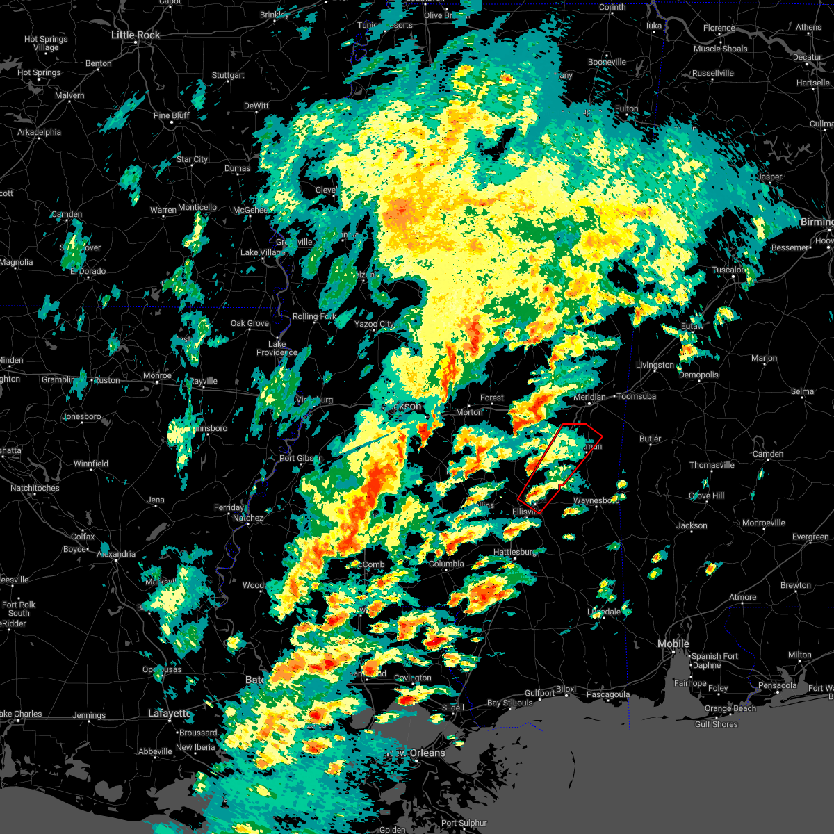 At 1228 pm cst, a severe thunderstorm capable of producing a tornado was located near laurel, moving northeast at 35 mph (radar indicated rotation). Hazards include tornado. Flying debris will be dangerous to those caught without shelter. mobile homes will be damaged or destroyed. damage to roofs, windows, and vehicles will occur. tree damage is likely. this dangerous storm will be near, sandersville around 1240 pm cst. heidelberg around 1250 pm cst. stafford springs around 1255 pm cst. goodwater around 100 pm cst. barnett and paulding around 105 pm cst. orange around 115 pm cst. stonewall around 125 pm cst. sable around 130 pm cst. Other locations impacted by this tornadic thunderstorm include pachuta. At 1228 pm cst, a severe thunderstorm capable of producing a tornado was located near laurel, moving northeast at 35 mph (radar indicated rotation). Hazards include tornado. Flying debris will be dangerous to those caught without shelter. mobile homes will be damaged or destroyed. damage to roofs, windows, and vehicles will occur. tree damage is likely. this dangerous storm will be near, sandersville around 1240 pm cst. heidelberg around 1250 pm cst. stafford springs around 1255 pm cst. goodwater around 100 pm cst. barnett and paulding around 105 pm cst. orange around 115 pm cst. stonewall around 125 pm cst. sable around 130 pm cst. Other locations impacted by this tornadic thunderstorm include pachuta.
|
| 11/29/2022 7:26 PM CST |
 At 726 pm cst, a severe thunderstorm capable of producing a tornado was located over stonewall, or 9 miles northwest of quitman, moving northeast at 30 mph (radar indicated rotation). Hazards include tornado. Flying debris will be dangerous to those caught without shelter. mobile homes will be damaged or destroyed. damage to roofs, windows, and vehicles will occur. tree damage is likely. this dangerous storm will be near, sable and savoy around 740 pm cst. Zero around 750 pm cst. At 726 pm cst, a severe thunderstorm capable of producing a tornado was located over stonewall, or 9 miles northwest of quitman, moving northeast at 30 mph (radar indicated rotation). Hazards include tornado. Flying debris will be dangerous to those caught without shelter. mobile homes will be damaged or destroyed. damage to roofs, windows, and vehicles will occur. tree damage is likely. this dangerous storm will be near, sable and savoy around 740 pm cst. Zero around 750 pm cst.
|
| 11/29/2022 6:59 PM CST |
 At 659 pm cst, a severe thunderstorm capable of producing a tornado was located near paulding, or 15 miles west of quitman, moving northeast at 35 mph (radar indicated rotation). Hazards include tornado. Flying debris will be dangerous to those caught without shelter. mobile homes will be damaged or destroyed. damage to roofs, windows, and vehicles will occur. tree damage is likely. this dangerous storm will be near, stonewall around 720 pm cst. sable, savoy and middleton around 735 pm cst. zero around 745 pm cst. Other locations impacted by this tornadic thunderstorm include pachuta. At 659 pm cst, a severe thunderstorm capable of producing a tornado was located near paulding, or 15 miles west of quitman, moving northeast at 35 mph (radar indicated rotation). Hazards include tornado. Flying debris will be dangerous to those caught without shelter. mobile homes will be damaged or destroyed. damage to roofs, windows, and vehicles will occur. tree damage is likely. this dangerous storm will be near, stonewall around 720 pm cst. sable, savoy and middleton around 735 pm cst. zero around 745 pm cst. Other locations impacted by this tornadic thunderstorm include pachuta.
|
| 7/21/2022 10:04 PM CDT |
 At 1004 pm cdt, severe thunderstorms were located along a line extending from near rose hill to near middleton, moving south at 25 mph (radar indicated). Hazards include 60 mph wind gusts. Expect damage to roofs, siding, and trees. severe thunderstorms will be near, rose hill around 1010 pm cdt. orange around 1015 pm cdt. quitman and crandall around 1025 pm cdt. paulding, de soto and barnett around 1035 pm cdt. stafford springs around 1050 pm cdt. heidelberg around 1055 pm cdt. vernon and moss around 1100 pm cdt. other locations impacted by these severe thunderstorms include pachuta, montrose, shubuta and louin. hail threat, radar indicated max hail size, <. 75 in wind threat, radar indicated max wind gust, 60 mph. At 1004 pm cdt, severe thunderstorms were located along a line extending from near rose hill to near middleton, moving south at 25 mph (radar indicated). Hazards include 60 mph wind gusts. Expect damage to roofs, siding, and trees. severe thunderstorms will be near, rose hill around 1010 pm cdt. orange around 1015 pm cdt. quitman and crandall around 1025 pm cdt. paulding, de soto and barnett around 1035 pm cdt. stafford springs around 1050 pm cdt. heidelberg around 1055 pm cdt. vernon and moss around 1100 pm cdt. other locations impacted by these severe thunderstorms include pachuta, montrose, shubuta and louin. hail threat, radar indicated max hail size, <. 75 in wind threat, radar indicated max wind gust, 60 mph.
|
| 7/21/2022 10:01 PM CDT |
 At 1001 pm cdt, severe thunderstorms were located along a line extending from near meehan to sykes, moving southwest at 25 mph (radar indicated). Hazards include 60 mph wind gusts. Expect damage to roofs, siding, and trees. locations impacted include, meridian, quitman, stonewall, crandall, zero, increase, rose hill, savoy, orange, snell, sable, middleton, sykes, hickory and chunky. hail threat, radar indicated max hail size, <. 75 in wind threat, radar indicated max wind gust, 60 mph. At 1001 pm cdt, severe thunderstorms were located along a line extending from near meehan to sykes, moving southwest at 25 mph (radar indicated). Hazards include 60 mph wind gusts. Expect damage to roofs, siding, and trees. locations impacted include, meridian, quitman, stonewall, crandall, zero, increase, rose hill, savoy, orange, snell, sable, middleton, sykes, hickory and chunky. hail threat, radar indicated max hail size, <. 75 in wind threat, radar indicated max wind gust, 60 mph.
|
| 7/21/2022 9:46 PM CDT |
 At 946 pm cdt, severe thunderstorms were located along a line extending from near meehan to near snell, moving southwest at 30 mph (radar indicated). Hazards include 60 mph wind gusts. Expect damage to roofs, siding, and trees. these severe storms will be near, meehan and savoy around 950 pm cdt. middleton around 955 pm cdt. sykes around 1000 pm cdt. crandall around 1010 pm cdt. quitman around 1015 pm cdt. rose hill and orange around 1025 pm cdt. other locations impacted by these severe thunderstorms include chunky and hickory. hail threat, radar indicated max hail size, <. 75 in wind threat, radar indicated max wind gust, 60 mph. At 946 pm cdt, severe thunderstorms were located along a line extending from near meehan to near snell, moving southwest at 30 mph (radar indicated). Hazards include 60 mph wind gusts. Expect damage to roofs, siding, and trees. these severe storms will be near, meehan and savoy around 950 pm cdt. middleton around 955 pm cdt. sykes around 1000 pm cdt. crandall around 1010 pm cdt. quitman around 1015 pm cdt. rose hill and orange around 1025 pm cdt. other locations impacted by these severe thunderstorms include chunky and hickory. hail threat, radar indicated max hail size, <. 75 in wind threat, radar indicated max wind gust, 60 mph.
|
| 7/21/2022 9:16 PM CDT |
 At 916 pm cdt, severe thunderstorms were located along a line extending from near marion to near kinterbish, moving southwest at 30 mph (radar indicated). Hazards include 60 mph wind gusts. Expect damage to roofs, siding, and trees. severe thunderstorms will be near, marion around 920 pm cdt. meridian and nellieburg around 935 pm cdt. snell and zero around 940 pm cdt. savoy, meehan and sable around 950 pm cdt. sykes around 955 pm cdt. stonewall and crandall around 1005 pm cdt. orange and rose hill around 1015 pm cdt. other locations impacted by these severe thunderstorms include chunky and hickory. hail threat, radar indicated max hail size, <. 75 in wind threat, radar indicated max wind gust, 60 mph. At 916 pm cdt, severe thunderstorms were located along a line extending from near marion to near kinterbish, moving southwest at 30 mph (radar indicated). Hazards include 60 mph wind gusts. Expect damage to roofs, siding, and trees. severe thunderstorms will be near, marion around 920 pm cdt. meridian and nellieburg around 935 pm cdt. snell and zero around 940 pm cdt. savoy, meehan and sable around 950 pm cdt. sykes around 955 pm cdt. stonewall and crandall around 1005 pm cdt. orange and rose hill around 1015 pm cdt. other locations impacted by these severe thunderstorms include chunky and hickory. hail threat, radar indicated max hail size, <. 75 in wind threat, radar indicated max wind gust, 60 mph.
|
| 6/10/2022 1:42 PM CDT |
 At 141 pm cdt, severe thunderstorms were located along a line extending from near duffee to near meehan to near rose hill, moving east at 35 mph (radar indicated). Hazards include 60 mph wind gusts. Expect damage to roofs, siding, and trees. severe thunderstorms will be near, meehan around 145 pm cdt. orange around 150 pm cdt. savoy and barnett around 155 pm cdt. nellieburg around 200 pm cdt. meridian, stonewall and sable around 205 pm cdt. zero around 210 pm cdt. quitman, marion, middleton and de soto around 215 pm cdt. increase around 220 pm cdt. other locations impacted by these severe thunderstorms include pachuta and shubuta. hail threat, radar indicated max hail size, <. 75 in wind threat, radar indicated max wind gust, 60 mph. At 141 pm cdt, severe thunderstorms were located along a line extending from near duffee to near meehan to near rose hill, moving east at 35 mph (radar indicated). Hazards include 60 mph wind gusts. Expect damage to roofs, siding, and trees. severe thunderstorms will be near, meehan around 145 pm cdt. orange around 150 pm cdt. savoy and barnett around 155 pm cdt. nellieburg around 200 pm cdt. meridian, stonewall and sable around 205 pm cdt. zero around 210 pm cdt. quitman, marion, middleton and de soto around 215 pm cdt. increase around 220 pm cdt. other locations impacted by these severe thunderstorms include pachuta and shubuta. hail threat, radar indicated max hail size, <. 75 in wind threat, radar indicated max wind gust, 60 mph.
|
| 5/25/2022 3:05 PM CDT |
 At 305 pm cdt, a severe thunderstorm was located over zero, or 8 miles south of meridian, moving northeast at 45 mph (radar indicated). Hazards include 60 mph wind gusts. Expect damage to roofs, siding, and trees. this severe storm will be near, increase around 310 pm cdt. marion around 315 pm cdt. toomsuba and alamucha around 320 pm cdt. kewanee around 325 pm cdt. lauderdale around 330 pm cdt. hail threat, radar indicated max hail size, <. 75 in wind threat, radar indicated max wind gust, 60 mph. At 305 pm cdt, a severe thunderstorm was located over zero, or 8 miles south of meridian, moving northeast at 45 mph (radar indicated). Hazards include 60 mph wind gusts. Expect damage to roofs, siding, and trees. this severe storm will be near, increase around 310 pm cdt. marion around 315 pm cdt. toomsuba and alamucha around 320 pm cdt. kewanee around 325 pm cdt. lauderdale around 330 pm cdt. hail threat, radar indicated max hail size, <. 75 in wind threat, radar indicated max wind gust, 60 mph.
|
| 5/25/2022 2:35 PM CDT |
 At 235 pm cdt, a severe thunderstorm was located over orange, or 12 miles west of quitman, moving northeast at 50 mph (radar indicated). Hazards include 60 mph wind gusts. Expect damage to roofs, siding, and trees. this severe thunderstorm will be near, stonewall around 245 pm cdt. savoy and sable around 255 pm cdt. zero around 300 pm cdt. increase around 305 pm cdt. marion around 310 pm cdt. toomsuba and alamucha around 315 pm cdt. kewanee around 320 pm cdt. lauderdale around 325 pm cdt. other locations impacted by this severe thunderstorm include pachuta. hail threat, radar indicated max hail size, <. 75 in wind threat, radar indicated max wind gust, 60 mph. At 235 pm cdt, a severe thunderstorm was located over orange, or 12 miles west of quitman, moving northeast at 50 mph (radar indicated). Hazards include 60 mph wind gusts. Expect damage to roofs, siding, and trees. this severe thunderstorm will be near, stonewall around 245 pm cdt. savoy and sable around 255 pm cdt. zero around 300 pm cdt. increase around 305 pm cdt. marion around 310 pm cdt. toomsuba and alamucha around 315 pm cdt. kewanee around 320 pm cdt. lauderdale around 325 pm cdt. other locations impacted by this severe thunderstorm include pachuta. hail threat, radar indicated max hail size, <. 75 in wind threat, radar indicated max wind gust, 60 mph.
|
| 1/1/0001 12:00 AM | Trees down along hwy 1 in clarke county MS, 3.8 miles NE of Enterprise, MS |
| 1/1/0001 12:00 AM | Multiple trees down in nw clarke co... hwy 513... 514... 11. power lines down as wel in clarke county MS, 0.9 miles SE of Enterprise, MS |
| 4/13/2022 8:55 PM CDT |
 At 855 pm cdt, a severe thunderstorm capable of producing a tornado was located over stonewall, or 10 miles northwest of quitman, moving east at 60 mph (radar indicated rotation). Hazards include tornado. Flying debris will be dangerous to those caught without shelter. mobile homes will be damaged or destroyed. damage to roofs, windows, and vehicles will occur. tree damage is likely. this dangerous storm will be near, sable around 900 pm cdt. middleton and sykes around 905 pm cdt. snell around 915 pm cdt. Other locations impacted by this tornadic thunderstorm include pachuta. At 855 pm cdt, a severe thunderstorm capable of producing a tornado was located over stonewall, or 10 miles northwest of quitman, moving east at 60 mph (radar indicated rotation). Hazards include tornado. Flying debris will be dangerous to those caught without shelter. mobile homes will be damaged or destroyed. damage to roofs, windows, and vehicles will occur. tree damage is likely. this dangerous storm will be near, sable around 900 pm cdt. middleton and sykes around 905 pm cdt. snell around 915 pm cdt. Other locations impacted by this tornadic thunderstorm include pachuta.
|
| 1/1/0001 12:00 AM | Trees downed at ms hwy 513 at cr 24. possible tornad in jasper county MS, 6.6 miles E of Enterprise, MS |
| 4/13/2022 8:39 PM CDT |
 At 839 pm cdt, a severe thunderstorm capable of producing a tornado was located near garlandville, or 12 miles south of newton, moving east at 55 mph (radar indicated rotation). Hazards include tornado. Flying debris will be dangerous to those caught without shelter. mobile homes will be damaged or destroyed. damage to roofs, windows, and vehicles will occur. tree damage is likely. this dangerous storm will be near, rose hill around 845 pm cdt. orange around 850 pm cdt. stonewall around 900 pm cdt. quitman and sable around 905 pm cdt. sykes and middleton around 910 pm cdt. snell around 915 pm cdt. Other locations impacted by this tornadic thunderstorm include pachuta. At 839 pm cdt, a severe thunderstorm capable of producing a tornado was located near garlandville, or 12 miles south of newton, moving east at 55 mph (radar indicated rotation). Hazards include tornado. Flying debris will be dangerous to those caught without shelter. mobile homes will be damaged or destroyed. damage to roofs, windows, and vehicles will occur. tree damage is likely. this dangerous storm will be near, rose hill around 845 pm cdt. orange around 850 pm cdt. stonewall around 900 pm cdt. quitman and sable around 905 pm cdt. sykes and middleton around 910 pm cdt. snell around 915 pm cdt. Other locations impacted by this tornadic thunderstorm include pachuta.
|
| 4/5/2022 7:50 AM CDT | A few trees down between enterprise and stonewal in clarke county MS, 0.9 miles NNW of Enterprise, MS |
| 4/5/2022 7:32 AM CDT |
 At 732 am cdt, severe thunderstorms were located along a line extending from near martin to near paulding, moving east at 45 mph (radar indicated). Hazards include 70 mph wind gusts. Expect considerable tree damage. damage is likely to mobile homes, roofs, and outbuildings. these severe storms will be near, marion and daleville around 740 am cdt. meridian station around 745 am cdt. stonewall around 750 am cdt. lauderdale and toomsuba around 755 am cdt. kewanee around 800 am cdt. sykes and middleton around 805 am cdt. Other locations impacted by these severe thunderstorms include chunky and hickory. At 732 am cdt, severe thunderstorms were located along a line extending from near martin to near paulding, moving east at 45 mph (radar indicated). Hazards include 70 mph wind gusts. Expect considerable tree damage. damage is likely to mobile homes, roofs, and outbuildings. these severe storms will be near, marion and daleville around 740 am cdt. meridian station around 745 am cdt. stonewall around 750 am cdt. lauderdale and toomsuba around 755 am cdt. kewanee around 800 am cdt. sykes and middleton around 805 am cdt. Other locations impacted by these severe thunderstorms include chunky and hickory.
|
| 4/5/2022 7:24 AM CDT |
 At 723 am cdt, severe thunderstorms were located along a line extending from near duffee to near turnerville, moving east at 50 mph (radar indicated). Hazards include 70 mph wind gusts. Expect considerable tree damage. damage is likely to mobile homes, roofs, and outbuildings. these severe storms will be near, martin, suqualena and duffee around 730 am cdt. marion, orange and daleville around 740 am cdt. meridian station around 745 am cdt. lauderdale, stonewall and toomsuba around 750 am cdt. kewanee around 755 am cdt. sykes and middleton around 805 am cdt. Other locations impacted by these severe thunderstorms include chunky and hickory. At 723 am cdt, severe thunderstorms were located along a line extending from near duffee to near turnerville, moving east at 50 mph (radar indicated). Hazards include 70 mph wind gusts. Expect considerable tree damage. damage is likely to mobile homes, roofs, and outbuildings. these severe storms will be near, martin, suqualena and duffee around 730 am cdt. marion, orange and daleville around 740 am cdt. meridian station around 745 am cdt. lauderdale, stonewall and toomsuba around 750 am cdt. kewanee around 755 am cdt. sykes and middleton around 805 am cdt. Other locations impacted by these severe thunderstorms include chunky and hickory.
|
| 4/5/2022 7:02 AM CDT | At 701 am cdt, severe thunderstorms were located along a line extending from near conehatta to near raleigh, moving east at 45 mph (radar indicated). Hazards include 70 mph wind gusts. Expect considerable tree damage. damage is likely to mobile homes, roofs, and outbuildings. these severe storms will be near, prospect and conehatta around 705 am cdt. stratton around 710 am cdt. decatur around 715 am cdt. little rock around 720 am cdt. duffee around 725 am cdt. martin, suqualena and nellieburg around 735 am cdt. meridian and rose hill around 740 am cdt. marion, orange and daleville around 745 am cdt. Other locations impacted by these severe thunderstorms include chunky, montrose, louin and hickory. |
| 3/30/2022 8:05 PM CDT |
 At 805 pm cdt, a severe thunderstorm capable of producing a tornado was located near savoy, or 11 miles south of meridian, moving northeast at 45 mph (radar indicated rotation). Hazards include tornado. Flying debris will be dangerous to those caught without shelter. mobile homes will be damaged or destroyed. damage to roofs, windows, and vehicles will occur. tree damage is likely. This dangerous storm will be near, sable around 810 pm cdt. At 805 pm cdt, a severe thunderstorm capable of producing a tornado was located near savoy, or 11 miles south of meridian, moving northeast at 45 mph (radar indicated rotation). Hazards include tornado. Flying debris will be dangerous to those caught without shelter. mobile homes will be damaged or destroyed. damage to roofs, windows, and vehicles will occur. tree damage is likely. This dangerous storm will be near, sable around 810 pm cdt.
|
| 3/30/2022 7:52 PM CDT |
 At 752 pm cdt, a severe thunderstorm capable of producing a tornado was located over orange, or 10 miles west of quitman, moving northeast at 45 mph (radar indicated rotation). Hazards include tornado. Flying debris will be dangerous to those caught without shelter. mobile homes will be damaged or destroyed. damage to roofs, windows, and vehicles will occur. tree damage is likely. this dangerous storm will be near, quitman and stonewall around 800 pm cdt. sable and sykes around 810 pm cdt. middleton around 815 pm cdt. snell around 820 pm cdt. Other locations impacted by this tornadic thunderstorm include pachuta. At 752 pm cdt, a severe thunderstorm capable of producing a tornado was located over orange, or 10 miles west of quitman, moving northeast at 45 mph (radar indicated rotation). Hazards include tornado. Flying debris will be dangerous to those caught without shelter. mobile homes will be damaged or destroyed. damage to roofs, windows, and vehicles will occur. tree damage is likely. this dangerous storm will be near, quitman and stonewall around 800 pm cdt. sable and sykes around 810 pm cdt. middleton around 815 pm cdt. snell around 820 pm cdt. Other locations impacted by this tornadic thunderstorm include pachuta.
|
| 3/30/2022 7:42 PM CDT |
 At 742 pm cdt, a severe thunderstorm capable of producing a tornado was located near paulding, or 15 miles west of quitman, moving northeast at 45 mph (radar indicated rotation). Hazards include tornado. Flying debris will be dangerous to those caught without shelter. mobile homes will be damaged or destroyed. damage to roofs, windows, and vehicles will occur. tree damage is likely. this dangerous storm will be near, quitman and stonewall around 800 pm cdt. sable and sykes around 810 pm cdt. middleton around 815 pm cdt. snell around 820 pm cdt. Other locations impacted by this tornadic thunderstorm include pachuta. At 742 pm cdt, a severe thunderstorm capable of producing a tornado was located near paulding, or 15 miles west of quitman, moving northeast at 45 mph (radar indicated rotation). Hazards include tornado. Flying debris will be dangerous to those caught without shelter. mobile homes will be damaged or destroyed. damage to roofs, windows, and vehicles will occur. tree damage is likely. this dangerous storm will be near, quitman and stonewall around 800 pm cdt. sable and sykes around 810 pm cdt. middleton around 815 pm cdt. snell around 820 pm cdt. Other locations impacted by this tornadic thunderstorm include pachuta.
|
| 3/30/2022 7:24 PM CDT |
 At 724 pm cdt, a severe thunderstorm capable of producing a tornado was located near turnerville, or near stringer, moving east at 50 mph (radar indicated rotation). Hazards include tornado. Flying debris will be dangerous to those caught without shelter. mobile homes will be damaged or destroyed. damage to roofs, windows, and vehicles will occur. tree damage is likely. this dangerous storm will be near, vernon around 730 pm cdt. heidelberg and paulding around 735 pm cdt. stafford springs around 740 pm cdt. barnett, orange and goodwater around 745 pm cdt. quitman, stonewall and de soto around 755 pm cdt. sykes and middleton around 805 pm cdt. snell around 815 pm cdt. Other locations impacted by this tornadic thunderstorm include pachuta. At 724 pm cdt, a severe thunderstorm capable of producing a tornado was located near turnerville, or near stringer, moving east at 50 mph (radar indicated rotation). Hazards include tornado. Flying debris will be dangerous to those caught without shelter. mobile homes will be damaged or destroyed. damage to roofs, windows, and vehicles will occur. tree damage is likely. this dangerous storm will be near, vernon around 730 pm cdt. heidelberg and paulding around 735 pm cdt. stafford springs around 740 pm cdt. barnett, orange and goodwater around 745 pm cdt. quitman, stonewall and de soto around 755 pm cdt. sykes and middleton around 805 pm cdt. snell around 815 pm cdt. Other locations impacted by this tornadic thunderstorm include pachuta.
|
| 3/18/2022 5:07 AM CDT |
 At 507 am cdt, severe thunderstorms were located along a line extending from near garlandville to 8 miles southwest of moss to near improve, moving east at 55 mph (radar indicated). Hazards include 60 mph wind gusts and nickel size hail. Expect damage to roofs, siding, and trees. severe thunderstorms will be near, moss around 515 am cdt. rose hill around 520 am cdt. sandersville around 525 am cdt. stonewall, heidelberg and moselle around 530 am cdt. goodwater and stafford springs around 535 am cdt. ellisville and sable around 540 am cdt. ovett and tuckers crossing around 545 am cdt. de soto around 550 am cdt. other locations impacted by these severe thunderstorms include pachuta and shubuta. hail threat, radar indicated max hail size, 0. 88 in wind threat, radar indicated max wind gust, 60 mph. At 507 am cdt, severe thunderstorms were located along a line extending from near garlandville to 8 miles southwest of moss to near improve, moving east at 55 mph (radar indicated). Hazards include 60 mph wind gusts and nickel size hail. Expect damage to roofs, siding, and trees. severe thunderstorms will be near, moss around 515 am cdt. rose hill around 520 am cdt. sandersville around 525 am cdt. stonewall, heidelberg and moselle around 530 am cdt. goodwater and stafford springs around 535 am cdt. ellisville and sable around 540 am cdt. ovett and tuckers crossing around 545 am cdt. de soto around 550 am cdt. other locations impacted by these severe thunderstorms include pachuta and shubuta. hail threat, radar indicated max hail size, 0. 88 in wind threat, radar indicated max wind gust, 60 mph.
|
| 2/17/2022 5:21 PM CST |
 At 521 pm cst, a severe thunderstorm was located over stonewall, or 10 miles northwest of quitman, moving northeast at 50 mph (radar indicated). Hazards include 60 mph wind gusts. Expect damage to roofs, siding, and trees. this severe storm will be near, sable around 530 pm cst. other locations impacted by this severe thunderstorm include pachuta. hail threat, radar indicated max hail size, <. 75 in wind threat, radar indicated max wind gust, 60 mph. At 521 pm cst, a severe thunderstorm was located over stonewall, or 10 miles northwest of quitman, moving northeast at 50 mph (radar indicated). Hazards include 60 mph wind gusts. Expect damage to roofs, siding, and trees. this severe storm will be near, sable around 530 pm cst. other locations impacted by this severe thunderstorm include pachuta. hail threat, radar indicated max hail size, <. 75 in wind threat, radar indicated max wind gust, 60 mph.
|
| 2/17/2022 5:10 PM CST |
 At 510 pm cst, a severe thunderstorm was located over orange, or 13 miles northwest of quitman, moving northeast at 55 mph (radar indicated). Hazards include 60 mph wind gusts. Expect damage to roofs, siding, and trees. this severe storm will be near, stonewall around 520 pm cst. sable around 530 pm cst. other locations impacted by this severe thunderstorm include pachuta. hail threat, radar indicated max hail size, <. 75 in wind threat, radar indicated max wind gust, 60 mph. At 510 pm cst, a severe thunderstorm was located over orange, or 13 miles northwest of quitman, moving northeast at 55 mph (radar indicated). Hazards include 60 mph wind gusts. Expect damage to roofs, siding, and trees. this severe storm will be near, stonewall around 520 pm cst. sable around 530 pm cst. other locations impacted by this severe thunderstorm include pachuta. hail threat, radar indicated max hail size, <. 75 in wind threat, radar indicated max wind gust, 60 mph.
|
| 2/17/2022 4:52 PM CST |
 At 452 pm cst, a severe thunderstorm was located near turnerville, or 11 miles northeast of stringer, moving northeast at 45 mph (radar indicated). Hazards include 60 mph wind gusts. Expect damage to roofs, siding, and trees. this severe thunderstorm will be near, paulding around 500 pm cst. orange and rose hill around 510 pm cst. stonewall around 520 pm cst. sable around 530 pm cst. other locations impacted by this severe thunderstorm include pachuta. hail threat, radar indicated max hail size, <. 75 in wind threat, radar indicated max wind gust, 60 mph. At 452 pm cst, a severe thunderstorm was located near turnerville, or 11 miles northeast of stringer, moving northeast at 45 mph (radar indicated). Hazards include 60 mph wind gusts. Expect damage to roofs, siding, and trees. this severe thunderstorm will be near, paulding around 500 pm cst. orange and rose hill around 510 pm cst. stonewall around 520 pm cst. sable around 530 pm cst. other locations impacted by this severe thunderstorm include pachuta. hail threat, radar indicated max hail size, <. 75 in wind threat, radar indicated max wind gust, 60 mph.
|
| 12/6/2021 12:21 PM CST |
 At 1220 pm cst, a severe thunderstorm was located over quitman, moving east at 35 mph (radar indicated). Hazards include 60 mph wind gusts. Expect damage to roofs, siding, and trees. this severe storm will be near, sykes and middleton around 1235 pm cst. crandall around 1240 pm cst. snell around 1245 pm cst. other locations impacted by this severe thunderstorm include pachuta. hail threat, radar indicated max hail size, <. 75 in wind threat, radar indicated max wind gust, 60 mph. At 1220 pm cst, a severe thunderstorm was located over quitman, moving east at 35 mph (radar indicated). Hazards include 60 mph wind gusts. Expect damage to roofs, siding, and trees. this severe storm will be near, sykes and middleton around 1235 pm cst. crandall around 1240 pm cst. snell around 1245 pm cst. other locations impacted by this severe thunderstorm include pachuta. hail threat, radar indicated max hail size, <. 75 in wind threat, radar indicated max wind gust, 60 mph.
|
| 12/6/2021 11:46 AM CST |
 At 1145 am cst, a severe thunderstorm was located near turnerville, or 16 miles northeast of stringer, moving east at 45 mph (radar indicated). Hazards include 60 mph wind gusts. Expect damage to roofs, siding, and trees. this severe thunderstorm will be near, paulding around 1150 am cst. rose hill around 1155 am cst. orange and barnett around 1200 pm cst. stonewall around 1210 pm cst. quitman around 1215 pm cst. sable around 1220 pm cst. sykes and middleton around 1225 pm cst. snell around 1235 pm cst. other locations impacted by this severe thunderstorm include pachuta and montrose. hail threat, radar indicated max hail size, <. 75 in wind threat, radar indicated max wind gust, 60 mph. At 1145 am cst, a severe thunderstorm was located near turnerville, or 16 miles northeast of stringer, moving east at 45 mph (radar indicated). Hazards include 60 mph wind gusts. Expect damage to roofs, siding, and trees. this severe thunderstorm will be near, paulding around 1150 am cst. rose hill around 1155 am cst. orange and barnett around 1200 pm cst. stonewall around 1210 pm cst. quitman around 1215 pm cst. sable around 1220 pm cst. sykes and middleton around 1225 pm cst. snell around 1235 pm cst. other locations impacted by this severe thunderstorm include pachuta and montrose. hail threat, radar indicated max hail size, <. 75 in wind threat, radar indicated max wind gust, 60 mph.
|
| 9/1/2021 7:10 PM CDT |
 The severe thunderstorm warning for northern jasper and northern clarke counties will expire at 715 pm cdt, the storms which prompted the warning have moved out of the area. therefore, the warning will be allowed to expire. a severe thunderstorm warning remains in effect for the southern portions of jasper and clarke counties. to report severe weather, contact your nearest law enforcement agency. they will relay your report to the national weather service jackson. The severe thunderstorm warning for northern jasper and northern clarke counties will expire at 715 pm cdt, the storms which prompted the warning have moved out of the area. therefore, the warning will be allowed to expire. a severe thunderstorm warning remains in effect for the southern portions of jasper and clarke counties. to report severe weather, contact your nearest law enforcement agency. they will relay your report to the national weather service jackson.
|
| 9/1/2021 6:50 PM CDT |
 At 649 pm cdt, severe thunderstorms were located along a line extending from 6 miles east of sykes to 6 miles east of pineville, moving south at 25 mph (emergency management. several trees were reported down and some structures were damaged along highway 80 between newton and hickory). Hazards include 60 mph wind gusts. Expect damage to roofs, siding, and trees. locations impacted include, stonewall, sable, middleton, sykes, garlandville, rose hill, orange, snell and montrose. hail threat, radar indicated max hail size, <. 75 in wind threat, observed max wind gust, 60 mph. At 649 pm cdt, severe thunderstorms were located along a line extending from 6 miles east of sykes to 6 miles east of pineville, moving south at 25 mph (emergency management. several trees were reported down and some structures were damaged along highway 80 between newton and hickory). Hazards include 60 mph wind gusts. Expect damage to roofs, siding, and trees. locations impacted include, stonewall, sable, middleton, sykes, garlandville, rose hill, orange, snell and montrose. hail threat, radar indicated max hail size, <. 75 in wind threat, observed max wind gust, 60 mph.
|
| 9/1/2021 6:39 PM CDT |
 At 639 pm cdt, severe thunderstorms were located along a line extending from 6 miles southeast of snell to lawrence, moving south at 15 mph (radar indicated). Hazards include 60 mph wind gusts and nickel size hail. Expect damage to roofs, siding, and trees. these severe storms will be near, snell around 645 pm cdt. garlandville around 720 pm cdt. other locations impacted by these severe thunderstorms include montrose, chunky and hickory. hail threat, radar indicated max hail size, 0. 88 in wind threat, radar indicated max wind gust, 60 mph. At 639 pm cdt, severe thunderstorms were located along a line extending from 6 miles southeast of snell to lawrence, moving south at 15 mph (radar indicated). Hazards include 60 mph wind gusts and nickel size hail. Expect damage to roofs, siding, and trees. these severe storms will be near, snell around 645 pm cdt. garlandville around 720 pm cdt. other locations impacted by these severe thunderstorms include montrose, chunky and hickory. hail threat, radar indicated max hail size, 0. 88 in wind threat, radar indicated max wind gust, 60 mph.
|
| 9/1/2021 6:15 PM CDT |
 At 614 pm cdt, severe thunderstorms were located along a line extending from near snell to near conehatta, moving south at 15 mph (radar indicated). Hazards include 60 mph wind gusts and nickel size hail. Expect damage to roofs, siding, and trees. severe thunderstorms will be near, snell and increase around 620 pm cdt. roberts around 705 pm cdt. garlandville around 715 pm cdt. other locations impacted by these severe thunderstorms include montrose, chunky and hickory. hail threat, radar indicated max hail size, 0. 88 in wind threat, radar indicated max wind gust, 60 mph. At 614 pm cdt, severe thunderstorms were located along a line extending from near snell to near conehatta, moving south at 15 mph (radar indicated). Hazards include 60 mph wind gusts and nickel size hail. Expect damage to roofs, siding, and trees. severe thunderstorms will be near, snell and increase around 620 pm cdt. roberts around 705 pm cdt. garlandville around 715 pm cdt. other locations impacted by these severe thunderstorms include montrose, chunky and hickory. hail threat, radar indicated max hail size, 0. 88 in wind threat, radar indicated max wind gust, 60 mph.
|
| 9/1/2021 5:19 PM CDT |
 At 519 pm cdt, severe thunderstorms were located along a line extending from near snell to near prospect, moving southeast at 35 mph (radar indicated). Hazards include 60 mph wind gusts and nickel size hail. Expect damage to roofs, siding, and trees. severe thunderstorms will be near, snell around 525 pm cdt. stratton around 540 pm cdt. decatur around 545 pm cdt. lawrence around 550 pm cdt. newton around 555 pm cdt. garlandville around 605 pm cdt. other locations impacted by these severe thunderstorms include chunky and hickory. hail threat, radar indicated max hail size, 0. 88 in wind threat, radar indicated max wind gust, 60 mph. At 519 pm cdt, severe thunderstorms were located along a line extending from near snell to near prospect, moving southeast at 35 mph (radar indicated). Hazards include 60 mph wind gusts and nickel size hail. Expect damage to roofs, siding, and trees. severe thunderstorms will be near, snell around 525 pm cdt. stratton around 540 pm cdt. decatur around 545 pm cdt. lawrence around 550 pm cdt. newton around 555 pm cdt. garlandville around 605 pm cdt. other locations impacted by these severe thunderstorms include chunky and hickory. hail threat, radar indicated max hail size, 0. 88 in wind threat, radar indicated max wind gust, 60 mph.
|
| 6/13/2021 3:58 PM CDT |
 At 357 pm cdt, severe thunderstorms were located along a line extending from near decatur to near garlandville to near stonewall, moving southwest at 30 mph (emergency management. at 350 pm, clarke county emergency management reported trees downed in enterprise. when this line of storms moved through meridian, winds gusted to 59 mph). Hazards include 60 mph wind gusts and penny size hail. Expect damage to roofs, siding, and trees. Locations impacted include, newton, quitman, prospect, lawrence, stonewall, heidelberg, paulding, goodwater, rose hill, turnerville, roberts, orange, stafford springs, barnett, sable, garlandville, conehatta, de soto, shubuta and pachuta. At 357 pm cdt, severe thunderstorms were located along a line extending from near decatur to near garlandville to near stonewall, moving southwest at 30 mph (emergency management. at 350 pm, clarke county emergency management reported trees downed in enterprise. when this line of storms moved through meridian, winds gusted to 59 mph). Hazards include 60 mph wind gusts and penny size hail. Expect damage to roofs, siding, and trees. Locations impacted include, newton, quitman, prospect, lawrence, stonewall, heidelberg, paulding, goodwater, rose hill, turnerville, roberts, orange, stafford springs, barnett, sable, garlandville, conehatta, de soto, shubuta and pachuta.
|
| 6/13/2021 3:44 PM CDT | Tree down blocking road at i-59 & hey 513. time estimated by rada in clarke county MS, 3.2 miles ENE of Enterprise, MS |
| 6/13/2021 3:44 PM CDT | Trees and power lines down along 500 block of cr513 in jasper county MS, 8.4 miles E of Enterprise, MS |
| 6/13/2021 3:42 PM CDT |
 At 342 pm cdt, severe thunderstorms were located along a line extending from near stratton to 7 miles west of meehan to sable, moving southwest at 30 mph (national weather service observations. at 334 pm, the meridian airport measured a 59 mph wind gust). Hazards include 60 mph wind gusts and quarter size hail. Hail damage to vehicles is expected. expect wind damage to roofs, siding, and trees. Locations impacted include, newton, quitman, prospect, lawrence, stonewall, heidelberg, paulding, stratton, goodwater, rose hill, turnerville, roberts, orange, stafford springs, barnett, sable, garlandville, conehatta, de soto and shubuta. At 342 pm cdt, severe thunderstorms were located along a line extending from near stratton to 7 miles west of meehan to sable, moving southwest at 30 mph (national weather service observations. at 334 pm, the meridian airport measured a 59 mph wind gust). Hazards include 60 mph wind gusts and quarter size hail. Hail damage to vehicles is expected. expect wind damage to roofs, siding, and trees. Locations impacted include, newton, quitman, prospect, lawrence, stonewall, heidelberg, paulding, stratton, goodwater, rose hill, turnerville, roberts, orange, stafford springs, barnett, sable, garlandville, conehatta, de soto and shubuta.
|
| 6/13/2021 3:41 PM CDT | Tree down on hwy 11 just south of hwy 51 in clarke county MS, 0.7 miles E of Enterprise, MS |
| 6/13/2021 3:38 PM CDT |
 At 338 pm cdt, severe thunderstorms were located along a line extending from near stratton to 6 miles west of meehan to sable, moving southwest at 30 mph (radar indicated). Hazards include 60 mph wind gusts and quarter size hail. Hail damage to vehicles is expected. Expect wind damage to roofs, siding, and trees. At 338 pm cdt, severe thunderstorms were located along a line extending from near stratton to 6 miles west of meehan to sable, moving southwest at 30 mph (radar indicated). Hazards include 60 mph wind gusts and quarter size hail. Hail damage to vehicles is expected. Expect wind damage to roofs, siding, and trees.
|
| 5/4/2021 4:00 PM CDT | Trees downed on houses at center st and pine st in enterprise. multiple trees downed in the enterprise and stonewall are in clarke county MS, 0.7 miles E of Enterprise, MS |
| 5/4/2021 3:50 PM CDT |
 At 350 pm cdt, severe thunderstorms were located along a line extending from meehan to near taylorsville, moving east at 75 mph (radar indicated). Hazards include 70 mph wind gusts and nickel size hail. Expect considerable tree damage. damage is likely to mobile homes, roofs, and outbuildings. severe thunderstorms will be near, sable around 400 pm cdt. snell around 410 pm cdt. goodwater around 415 pm cdt. other locations impacted by these severe thunderstorms include pachuta and shubuta. A tornado watch remains in effect until 1000 pm cdt for east central mississippi. At 350 pm cdt, severe thunderstorms were located along a line extending from meehan to near taylorsville, moving east at 75 mph (radar indicated). Hazards include 70 mph wind gusts and nickel size hail. Expect considerable tree damage. damage is likely to mobile homes, roofs, and outbuildings. severe thunderstorms will be near, sable around 400 pm cdt. snell around 410 pm cdt. goodwater around 415 pm cdt. other locations impacted by these severe thunderstorms include pachuta and shubuta. A tornado watch remains in effect until 1000 pm cdt for east central mississippi.
|
| 5/4/2021 3:49 PM CDT |
 At 349 pm cdt, a severe thunderstorm capable of producing a tornado was located over paulding, or 18 miles west of quitman, moving northeast at 40 mph (radar indicated rotation). Hazards include tornado. Flying debris will be dangerous to those caught without shelter. mobile homes will be damaged or destroyed. damage to roofs, windows, and vehicles will occur. tree damage is likely. this dangerous storm will be near, rose hill around 355 pm cdt. orange around 400 pm cdt. stonewall around 410 pm cdt. Sable around 425 pm cdt. At 349 pm cdt, a severe thunderstorm capable of producing a tornado was located over paulding, or 18 miles west of quitman, moving northeast at 40 mph (radar indicated rotation). Hazards include tornado. Flying debris will be dangerous to those caught without shelter. mobile homes will be damaged or destroyed. damage to roofs, windows, and vehicles will occur. tree damage is likely. this dangerous storm will be near, rose hill around 355 pm cdt. orange around 400 pm cdt. stonewall around 410 pm cdt. Sable around 425 pm cdt.
|
| 5/4/2021 3:32 PM CDT |
 At 332 pm cdt, a severe thunderstorm capable of producing a tornado was located over turnerville, or 8 miles north of stringer, moving northeast at 40 mph (radar indicated rotation). Hazards include tornado. Flying debris will be dangerous to those caught without shelter. mobile homes will be damaged or destroyed. damage to roofs, windows, and vehicles will occur. tree damage is likely. this dangerous storm will be near, paulding around 350 pm cdt. rose hill around 355 pm cdt. orange around 400 pm cdt. stonewall around 410 pm cdt. Sable around 425 pm cdt. At 332 pm cdt, a severe thunderstorm capable of producing a tornado was located over turnerville, or 8 miles north of stringer, moving northeast at 40 mph (radar indicated rotation). Hazards include tornado. Flying debris will be dangerous to those caught without shelter. mobile homes will be damaged or destroyed. damage to roofs, windows, and vehicles will occur. tree damage is likely. this dangerous storm will be near, paulding around 350 pm cdt. rose hill around 355 pm cdt. orange around 400 pm cdt. stonewall around 410 pm cdt. Sable around 425 pm cdt.
|
| 3/25/2021 2:59 PM CDT |
 A severe thunderstorm warning remains in effect until 315 pm cdt for northern clarke and eastern lauderdale counties. at 258 pm cdt, a severe thunderstorm was located near stonewall, or 10 miles northwest of quitman, moving northeast at 55 mph. hazard. 60 mph wind gusts. source. Radar indicated. A severe thunderstorm warning remains in effect until 315 pm cdt for northern clarke and eastern lauderdale counties. at 258 pm cdt, a severe thunderstorm was located near stonewall, or 10 miles northwest of quitman, moving northeast at 55 mph. hazard. 60 mph wind gusts. source. Radar indicated.
|
| 3/25/2021 2:48 PM CDT |
 At 248 pm cdt, a severe thunderstorm was located over paulding, or 16 miles west of quitman, moving east at 50 mph (radar indicated). Hazards include 60 mph wind gusts. Expect damage to roofs, siding, and trees. this severe storm will be near, orange around 255 pm cdt. stonewall around 305 pm cdt. sable and middleton around 315 pm cdt. zero around 320 pm cdt. snell and increase around 325 pm cdt. alamucha around 330 pm cdt. A tornado watch remains in effect until 800 pm cdt for east central mississippi. At 248 pm cdt, a severe thunderstorm was located over paulding, or 16 miles west of quitman, moving east at 50 mph (radar indicated). Hazards include 60 mph wind gusts. Expect damage to roofs, siding, and trees. this severe storm will be near, orange around 255 pm cdt. stonewall around 305 pm cdt. sable and middleton around 315 pm cdt. zero around 320 pm cdt. snell and increase around 325 pm cdt. alamucha around 330 pm cdt. A tornado watch remains in effect until 800 pm cdt for east central mississippi.
|
| 3/25/2021 2:37 PM CDT |
 At 236 pm cdt, a severe thunderstorm was located near turnerville, or 14 miles northeast of stringer, moving northeast at 40 mph (radar indicated). Hazards include 60 mph wind gusts. Expect damage to roofs, siding, and trees. this severe storm will be near, paulding around 245 pm cdt. rose hill around 250 pm cdt. orange around 255 pm cdt. stonewall around 305 pm cdt. savoy around 315 pm cdt. sable and middleton around 320 pm cdt. zero around 325 pm cdt. increase and snell around 330 pm cdt. A tornado watch remains in effect until 800 pm cdt for east central mississippi. At 236 pm cdt, a severe thunderstorm was located near turnerville, or 14 miles northeast of stringer, moving northeast at 40 mph (radar indicated). Hazards include 60 mph wind gusts. Expect damage to roofs, siding, and trees. this severe storm will be near, paulding around 245 pm cdt. rose hill around 250 pm cdt. orange around 255 pm cdt. stonewall around 305 pm cdt. savoy around 315 pm cdt. sable and middleton around 320 pm cdt. zero around 325 pm cdt. increase and snell around 330 pm cdt. A tornado watch remains in effect until 800 pm cdt for east central mississippi.
|
| 3/25/2021 2:26 PM CDT |
 At 226 pm cdt, a severe thunderstorm was located near meehan, or 11 miles east of newton, moving northeast at 45 mph (radar indicated). Hazards include 60 mph wind gusts. Expect damage to roofs, siding, and trees. this severe storm will be near, meehan around 235 pm cdt. nellieburg and suqualena around 240 pm cdt. meridian around 245 pm cdt. marion around 255 pm cdt. meridian station around 300 pm cdt. lauderdale and toomsuba around 305 pm cdt. kewanee around 310 pm cdt. other locations impacted by this severe thunderstorm include louin, chunky and hickory. A tornado watch remains in effect until 800 pm cdt for east central mississippi. At 226 pm cdt, a severe thunderstorm was located near meehan, or 11 miles east of newton, moving northeast at 45 mph (radar indicated). Hazards include 60 mph wind gusts. Expect damage to roofs, siding, and trees. this severe storm will be near, meehan around 235 pm cdt. nellieburg and suqualena around 240 pm cdt. meridian around 245 pm cdt. marion around 255 pm cdt. meridian station around 300 pm cdt. lauderdale and toomsuba around 305 pm cdt. kewanee around 310 pm cdt. other locations impacted by this severe thunderstorm include louin, chunky and hickory. A tornado watch remains in effect until 800 pm cdt for east central mississippi.
|
| 3/25/2021 2:17 PM CDT |
 At 217 pm cdt, a severe thunderstorm was located near newton, moving northeast at 55 mph (radar indicated). Hazards include 60 mph wind gusts. Expect damage to roofs, siding, and trees. this severe storm will be near, meehan and duffee around 230 pm cdt. meridian, suqualena and nellieburg around 235 pm cdt. marion around 245 pm cdt. meridian station and daleville around 250 pm cdt. lauderdale around 255 pm cdt. other locations impacted by this severe thunderstorm include louin, chunky and hickory. A tornado watch remains in effect until 800 pm cdt for east central mississippi. At 217 pm cdt, a severe thunderstorm was located near newton, moving northeast at 55 mph (radar indicated). Hazards include 60 mph wind gusts. Expect damage to roofs, siding, and trees. this severe storm will be near, meehan and duffee around 230 pm cdt. meridian, suqualena and nellieburg around 235 pm cdt. marion around 245 pm cdt. meridian station and daleville around 250 pm cdt. lauderdale around 255 pm cdt. other locations impacted by this severe thunderstorm include louin, chunky and hickory. A tornado watch remains in effect until 800 pm cdt for east central mississippi.
|
| 3/25/2021 1:54 PM CDT |
 At 154 pm cdt, a severe thunderstorm was located near pineville, or 14 miles southwest of newton, moving northeast at 55 mph (radar indicated). Hazards include 60 mph wind gusts. Expect damage to roofs, siding, and trees. this severe thunderstorm will be near, roberts around 200 pm cdt. garlandville around 205 pm cdt. newton around 210 pm cdt. meehan around 225 pm cdt. nellieburg and suqualena around 230 pm cdt. meridian around 235 pm cdt. marion around 240 pm cdt. meridian station and daleville around 245 pm cdt. other locations impacted by this severe thunderstorm include chunky, montrose, louin and hickory. A tornado watch remains in effect until 800 pm cdt for east central mississippi. At 154 pm cdt, a severe thunderstorm was located near pineville, or 14 miles southwest of newton, moving northeast at 55 mph (radar indicated). Hazards include 60 mph wind gusts. Expect damage to roofs, siding, and trees. this severe thunderstorm will be near, roberts around 200 pm cdt. garlandville around 205 pm cdt. newton around 210 pm cdt. meehan around 225 pm cdt. nellieburg and suqualena around 230 pm cdt. meridian around 235 pm cdt. marion around 240 pm cdt. meridian station and daleville around 245 pm cdt. other locations impacted by this severe thunderstorm include chunky, montrose, louin and hickory. A tornado watch remains in effect until 800 pm cdt for east central mississippi.
|
| 8/11/2020 8:11 PM CDT |
 At 811 pm cdt, a severe thunderstorm was located over sable, or 10 miles south of meridian, moving east at 15 mph (radar indicated). Hazards include 60 mph wind gusts and quarter size hail. Hail damage to vehicles is expected. expect wind damage to roofs, siding, and trees. this severe thunderstorm will be near, sable around 815 pm cdt. zero around 820 pm cdt. middleton around 840 pm cdt. increase around 845 pm cdt. Snell around 900 pm cdt. At 811 pm cdt, a severe thunderstorm was located over sable, or 10 miles south of meridian, moving east at 15 mph (radar indicated). Hazards include 60 mph wind gusts and quarter size hail. Hail damage to vehicles is expected. expect wind damage to roofs, siding, and trees. this severe thunderstorm will be near, sable around 815 pm cdt. zero around 820 pm cdt. middleton around 840 pm cdt. increase around 845 pm cdt. Snell around 900 pm cdt.
|
| 7/15/2020 3:59 PM CDT |
 At 358 pm cdt, a severe thunderstorm was located near barnett, or 10 miles west of quitman, moving west at 10 mph (radar indicated). Hazards include 60 mph wind gusts and quarter size hail. Hail damage to vehicles is expected. expect wind damage to roofs, siding, and trees. this severe thunderstorm will be near, barnett around 410 pm cdt. stafford springs around 430 pm cdt. heidelberg and paulding around 445 pm cdt. Other locations impacted by this severe thunderstorm include pachuta. At 358 pm cdt, a severe thunderstorm was located near barnett, or 10 miles west of quitman, moving west at 10 mph (radar indicated). Hazards include 60 mph wind gusts and quarter size hail. Hail damage to vehicles is expected. expect wind damage to roofs, siding, and trees. this severe thunderstorm will be near, barnett around 410 pm cdt. stafford springs around 430 pm cdt. heidelberg and paulding around 445 pm cdt. Other locations impacted by this severe thunderstorm include pachuta.
|
| 7/15/2020 3:36 PM CDT |
 At 336 pm cdt, a severe thunderstorm was located near orange, or 7 miles west of quitman, moving west at 10 mph (radar indicated). Hazards include 60 mph wind gusts and quarter size hail. Hail damage to vehicles is expected. expect wind damage to roofs, siding, and trees. this severe thunderstorm will be near, orange around 355 pm cdt. barnett and paulding around 400 pm cdt. Other locations impacted by this severe thunderstorm include pachuta. At 336 pm cdt, a severe thunderstorm was located near orange, or 7 miles west of quitman, moving west at 10 mph (radar indicated). Hazards include 60 mph wind gusts and quarter size hail. Hail damage to vehicles is expected. expect wind damage to roofs, siding, and trees. this severe thunderstorm will be near, orange around 355 pm cdt. barnett and paulding around 400 pm cdt. Other locations impacted by this severe thunderstorm include pachuta.
|
| 6/25/2020 7:17 PM CDT |
 At 717 pm cdt, severe thunderstorms were located along a line extending from near nanih waiya to near de kalb to near tamola to near cuba, moving northeast at 35 mph (radar indicated). Hazards include 60 mph wind gusts. Expect damage to roofs, siding, and trees. these severe storms will be near, porterville around 725 pm cdt. electric mills around 735 pm cdt. Other locations impacted by these severe thunderstorms include tucker and scooba. At 717 pm cdt, severe thunderstorms were located along a line extending from near nanih waiya to near de kalb to near tamola to near cuba, moving northeast at 35 mph (radar indicated). Hazards include 60 mph wind gusts. Expect damage to roofs, siding, and trees. these severe storms will be near, porterville around 725 pm cdt. electric mills around 735 pm cdt. Other locations impacted by these severe thunderstorms include tucker and scooba.
|
| 6/25/2020 6:58 PM CDT |
 At 637 pm cdt, severe thunderstorms were located along a line extending from near dowdville to near neshoba to near meehan to near sable to near quitman, moving northeast at 40 mph (radar indicated). Hazards include 60 mph wind gusts. Expect damage to roofs, siding, and trees. these severe storms will be near, sable and savoy around 640 pm cdt. meridian, philadelphia, bethsaida, suqualena, sykes, nellieburg, house, middleton and crandall around 645 pm cdt. zero around 650 pm cdt. marion, burnside, increase and forestdale around 655 pm cdt. daleville, snell, stallo and prismatic around 700 pm cdt. meridian station, bluff springs and blackwater around 705 pm cdt. lauderdale, preston, alamucha and toomsuba around 710 pm cdt. nanih waiya, de kalb and kewanee around 715 pm cdt. Other locations impacted by these severe thunderstorms include pachuta, tucker, shubuta and scooba. At 637 pm cdt, severe thunderstorms were located along a line extending from near dowdville to near neshoba to near meehan to near sable to near quitman, moving northeast at 40 mph (radar indicated). Hazards include 60 mph wind gusts. Expect damage to roofs, siding, and trees. these severe storms will be near, sable and savoy around 640 pm cdt. meridian, philadelphia, bethsaida, suqualena, sykes, nellieburg, house, middleton and crandall around 645 pm cdt. zero around 650 pm cdt. marion, burnside, increase and forestdale around 655 pm cdt. daleville, snell, stallo and prismatic around 700 pm cdt. meridian station, bluff springs and blackwater around 705 pm cdt. lauderdale, preston, alamucha and toomsuba around 710 pm cdt. nanih waiya, de kalb and kewanee around 715 pm cdt. Other locations impacted by these severe thunderstorms include pachuta, tucker, shubuta and scooba.
|
| 6/25/2020 6:40 PM CDT | Roof damage occurred on south street in enterpris in clarke county MS, 0.2 miles NE of Enterprise, MS |
| 6/25/2020 6:37 PM CDT |
 At 637 pm cdt, severe thunderstorms were located along a line extending from near dowdville to near neshoba to near meehan to near sable to near quitman, moving northeast at 40 mph (radar indicated). Hazards include 60 mph wind gusts. Expect damage to roofs, siding, and trees. these severe storms will be near, sable and savoy around 640 pm cdt. meridian, philadelphia, bethsaida, suqualena, sykes, nellieburg, house, middleton and crandall around 645 pm cdt. zero around 650 pm cdt. marion, burnside, increase and forestdale around 655 pm cdt. daleville, snell, stallo and prismatic around 700 pm cdt. meridian station, bluff springs and blackwater around 705 pm cdt. lauderdale, preston, alamucha and toomsuba around 710 pm cdt. nanih waiya, de kalb and kewanee around 715 pm cdt. Other locations impacted by these severe thunderstorms include pachuta, tucker, shubuta and scooba. At 637 pm cdt, severe thunderstorms were located along a line extending from near dowdville to near neshoba to near meehan to near sable to near quitman, moving northeast at 40 mph (radar indicated). Hazards include 60 mph wind gusts. Expect damage to roofs, siding, and trees. these severe storms will be near, sable and savoy around 640 pm cdt. meridian, philadelphia, bethsaida, suqualena, sykes, nellieburg, house, middleton and crandall around 645 pm cdt. zero around 650 pm cdt. marion, burnside, increase and forestdale around 655 pm cdt. daleville, snell, stallo and prismatic around 700 pm cdt. meridian station, bluff springs and blackwater around 705 pm cdt. lauderdale, preston, alamucha and toomsuba around 710 pm cdt. nanih waiya, de kalb and kewanee around 715 pm cdt. Other locations impacted by these severe thunderstorms include pachuta, tucker, shubuta and scooba.
|
| 6/25/2020 6:09 PM CDT |
 At 609 pm cdt, severe thunderstorms were located along a line extending from conehatta to stafford springs, moving northeast at 60 mph (radar indicated). Hazards include 60 mph wind gusts. Expect damage to roofs, siding, and trees. severe thunderstorms will be near, quitman and dixon around 620 pm cdt. neshoba, stonewall and house around 625 pm cdt. philadelphia, sable, bethsaida and middleton around 630 pm cdt. forestdale, savoy and burnside around 635 pm cdt. zero and increase around 640 pm cdt. nanih waiya, preston and marion around 645 pm cdt. toomsuba and alamucha around 650 pm cdt. lauderdale and kewanee around 655 pm cdt. Other locations impacted by these severe thunderstorms include pachuta, tucker, shubuta and scooba. At 609 pm cdt, severe thunderstorms were located along a line extending from conehatta to stafford springs, moving northeast at 60 mph (radar indicated). Hazards include 60 mph wind gusts. Expect damage to roofs, siding, and trees. severe thunderstorms will be near, quitman and dixon around 620 pm cdt. neshoba, stonewall and house around 625 pm cdt. philadelphia, sable, bethsaida and middleton around 630 pm cdt. forestdale, savoy and burnside around 635 pm cdt. zero and increase around 640 pm cdt. nanih waiya, preston and marion around 645 pm cdt. toomsuba and alamucha around 650 pm cdt. lauderdale and kewanee around 655 pm cdt. Other locations impacted by these severe thunderstorms include pachuta, tucker, shubuta and scooba.
|
| 6/5/2020 7:16 PM CDT | A large tree was blown down near cr 372 near enterpris in clarke county MS, 3.6 miles SE of Enterprise, MS |
| 6/5/2020 6:43 PM CDT |
 At 643 pm cdt, severe thunderstorms were located along a line extending from near york to near meridian to roberts to 6 miles southeast of brandon, moving south at 30 mph (radar indicated). Hazards include 60 mph wind gusts and penny size hail. Expect damage to roofs, siding, and trees. severe thunderstorms will be near, sable around 700 pm cdt. bay springs, stonewall, turnerville and middleton around 710 pm cdt. sykes around 715 pm cdt. quitman around 720 pm cdt. stringer and vernon around 725 pm cdt. de soto around 730 pm cdt. moss and crandall around 735 pm cdt. Other locations impacted by these severe thunderstorms include sylvarena, pachuta, mize and shubuta. At 643 pm cdt, severe thunderstorms were located along a line extending from near york to near meridian to roberts to 6 miles southeast of brandon, moving south at 30 mph (radar indicated). Hazards include 60 mph wind gusts and penny size hail. Expect damage to roofs, siding, and trees. severe thunderstorms will be near, sable around 700 pm cdt. bay springs, stonewall, turnerville and middleton around 710 pm cdt. sykes around 715 pm cdt. quitman around 720 pm cdt. stringer and vernon around 725 pm cdt. de soto around 730 pm cdt. moss and crandall around 735 pm cdt. Other locations impacted by these severe thunderstorms include sylvarena, pachuta, mize and shubuta.
|
| 5/26/2020 6:37 PM CDT | Tree down across a power lin in lauderdale county MS, 6.8 miles SE of Enterprise, MS |
| 5/26/2020 6:28 PM CDT |
 At 628 pm cdt, a severe thunderstorm was located near meehan, or 14 miles east of newton, moving northeast at 20 mph (radar indicated). Hazards include 60 mph wind gusts. Expect damage to roofs, siding, and trees. Locations impacted include, orange, hickory and chunky. At 628 pm cdt, a severe thunderstorm was located near meehan, or 14 miles east of newton, moving northeast at 20 mph (radar indicated). Hazards include 60 mph wind gusts. Expect damage to roofs, siding, and trees. Locations impacted include, orange, hickory and chunky.
|
| 5/26/2020 6:12 PM CDT |
 At 612 pm cdt, a severe thunderstorm was located near garlandville, or 9 miles southeast of newton, moving northeast at 20 mph (radar indicated). Hazards include 60 mph wind gusts. Expect damage to roofs, siding, and trees. This severe thunderstorm will remain over mainly rural areas of northeastern jasper, southeastern newton, northwestern clarke and southwestern lauderdale counties, including the following locations, chunky and hickory. At 612 pm cdt, a severe thunderstorm was located near garlandville, or 9 miles southeast of newton, moving northeast at 20 mph (radar indicated). Hazards include 60 mph wind gusts. Expect damage to roofs, siding, and trees. This severe thunderstorm will remain over mainly rural areas of northeastern jasper, southeastern newton, northwestern clarke and southwestern lauderdale counties, including the following locations, chunky and hickory.
|
| 5/25/2020 4:43 PM CDT |
 At 443 pm cdt, a severe thunderstorm was located near stonewall, or 12 miles northwest of quitman, moving northwest at 25 mph (radar indicated). Hazards include 60 mph wind gusts and nickel size hail. Expect damage to roofs, siding, and trees. this severe thunderstorm will be near, meehan around 500 pm cdt. Other locations impacted by this severe thunderstorm include chunky and hickory. At 443 pm cdt, a severe thunderstorm was located near stonewall, or 12 miles northwest of quitman, moving northwest at 25 mph (radar indicated). Hazards include 60 mph wind gusts and nickel size hail. Expect damage to roofs, siding, and trees. this severe thunderstorm will be near, meehan around 500 pm cdt. Other locations impacted by this severe thunderstorm include chunky and hickory.
|
| 4/23/2020 3:21 AM CDT |
 At 320 am cdt, a severe thunderstorm was located near zero, or near meridian, moving east at 60 mph (radar indicated). Hazards include 60 mph wind gusts and nickel size hail. Expect damage to roofs, siding, and trees. this severe storm will be near, increase around 330 am cdt. alamucha, kewanee and toomsuba around 335 am cdt. A tornado watch remains in effect until 700 am cdt for east central mississippi. At 320 am cdt, a severe thunderstorm was located near zero, or near meridian, moving east at 60 mph (radar indicated). Hazards include 60 mph wind gusts and nickel size hail. Expect damage to roofs, siding, and trees. this severe storm will be near, increase around 330 am cdt. alamucha, kewanee and toomsuba around 335 am cdt. A tornado watch remains in effect until 700 am cdt for east central mississippi.
|
| 4/23/2020 3:09 AM CDT |
 At 309 am cdt, a severe thunderstorm was located near meehan, or 13 miles southwest of meridian, moving east at 60 mph (radar indicated). Hazards include 60 mph wind gusts and nickel size hail. Expect damage to roofs, siding, and trees. this severe thunderstorm will be near, savoy around 315 am cdt. meridian and nellieburg around 320 am cdt. marion and zero around 325 am cdt. increase around 330 am cdt. alamucha and toomsuba around 335 am cdt. kewanee around 340 am cdt. Other locations impacted by this severe thunderstorm include chunky. At 309 am cdt, a severe thunderstorm was located near meehan, or 13 miles southwest of meridian, moving east at 60 mph (radar indicated). Hazards include 60 mph wind gusts and nickel size hail. Expect damage to roofs, siding, and trees. this severe thunderstorm will be near, savoy around 315 am cdt. meridian and nellieburg around 320 am cdt. marion and zero around 325 am cdt. increase around 330 am cdt. alamucha and toomsuba around 335 am cdt. kewanee around 340 am cdt. Other locations impacted by this severe thunderstorm include chunky.
|
| 4/23/2020 1:47 AM CDT |
 At 147 am cdt, severe thunderstorms were located along a line extending from near meehan to near paulding to 6 miles northeast of stringer, moving east at 45 mph (radar indicated). Hazards include 60 mph wind gusts. Expect damage to roofs, siding, and trees. these severe storms will be near, vernon and rose hill around 150 am cdt. orange around 155 am cdt. savoy around 200 am cdt. stonewall and stafford springs around 205 am cdt. quitman, zero, barnett and goodwater around 210 am cdt. middleton, increase, sable, sykes and de soto around 215 am cdt. Other locations impacted by these severe thunderstorms include pachuta. At 147 am cdt, severe thunderstorms were located along a line extending from near meehan to near paulding to 6 miles northeast of stringer, moving east at 45 mph (radar indicated). Hazards include 60 mph wind gusts. Expect damage to roofs, siding, and trees. these severe storms will be near, vernon and rose hill around 150 am cdt. orange around 155 am cdt. savoy around 200 am cdt. stonewall and stafford springs around 205 am cdt. quitman, zero, barnett and goodwater around 210 am cdt. middleton, increase, sable, sykes and de soto around 215 am cdt. Other locations impacted by these severe thunderstorms include pachuta.
|
| 4/23/2020 1:25 AM CDT |
 At 124 am cdt, severe thunderstorms were located along a line extending from near roberts to near bay springs to near taylorsville, moving east at 45 mph (radar indicated). Hazards include 60 mph wind gusts and penny size hail. Expect damage to roofs, siding, and trees. severe thunderstorms will be near, garlandville, turnerville and roberts around 130 am cdt. paulding around 145 am cdt. vernon and rose hill around 150 am cdt. orange and savoy around 155 am cdt. stonewall, zero and stafford springs around 205 am cdt. barnett and goodwater around 210 am cdt. sable and increase around 215 am cdt. middleton, de soto and sykes around 220 am cdt. Other locations impacted by these severe thunderstorms include pachuta, montrose and louin. At 124 am cdt, severe thunderstorms were located along a line extending from near roberts to near bay springs to near taylorsville, moving east at 45 mph (radar indicated). Hazards include 60 mph wind gusts and penny size hail. Expect damage to roofs, siding, and trees. severe thunderstorms will be near, garlandville, turnerville and roberts around 130 am cdt. paulding around 145 am cdt. vernon and rose hill around 150 am cdt. orange and savoy around 155 am cdt. stonewall, zero and stafford springs around 205 am cdt. barnett and goodwater around 210 am cdt. sable and increase around 215 am cdt. middleton, de soto and sykes around 220 am cdt. Other locations impacted by these severe thunderstorms include pachuta, montrose and louin.
|
| 4/19/2020 4:58 PM CDT | A tree was blown down across us highway 11 just north of enterprise. time estimated from rada in clarke county MS, 1.4 miles SSE of Enterprise, MS |
| 4/19/2020 4:55 PM CDT |
 At 455 pm cdt, severe thunderstorms were located along a line extending from meehan to near stonewall to 7 miles southeast of turnerville, moving east at 60 mph (radar indicated). Hazards include 60 mph wind gusts. Expect damage to roofs, siding, and trees. these severe storms will be near, meridian, stonewall, nellieburg, savoy and meehan around 500 pm cdt. marion, sable and zero around 505 pm cdt. middleton, goodwater, barnett and sykes around 510 pm cdt. snell, toomsuba and increase around 515 pm cdt. quitman, alamucha, de soto and kewanee around 520 pm cdt. crandall around 530 pm cdt. other locations impacted by these severe thunderstorms include pachuta. A tornado watch remains in effect until 700 pm cdt for east central mississippi. At 455 pm cdt, severe thunderstorms were located along a line extending from meehan to near stonewall to 7 miles southeast of turnerville, moving east at 60 mph (radar indicated). Hazards include 60 mph wind gusts. Expect damage to roofs, siding, and trees. these severe storms will be near, meridian, stonewall, nellieburg, savoy and meehan around 500 pm cdt. marion, sable and zero around 505 pm cdt. middleton, goodwater, barnett and sykes around 510 pm cdt. snell, toomsuba and increase around 515 pm cdt. quitman, alamucha, de soto and kewanee around 520 pm cdt. crandall around 530 pm cdt. other locations impacted by these severe thunderstorms include pachuta. A tornado watch remains in effect until 700 pm cdt for east central mississippi.
|
| 4/19/2020 4:49 PM CDT | Two trees were blown down near the area of county road 24 and county road 2422 in far northeast jasper count in jasper county MS, 8.5 miles ESE of Enterprise, MS |
| 4/19/2020 4:39 PM CDT |
 At 439 pm cdt, severe thunderstorms were located along a line extending from near newton to near garlandville to 7 miles north of taylorsville, moving east at 65 mph (radar indicated). Hazards include 60 mph wind gusts. Expect damage to roofs, siding, and trees. severe thunderstorms will be near, rose hill and garlandville around 445 pm cdt. turnerville and orange around 450 pm cdt. meehan and vernon around 455 pm cdt. meridian, stonewall, nellieburg, savoy and paulding around 500 pm cdt. marion, heidelberg, sable, stafford springs and zero around 505 pm cdt. barnett, increase, goodwater and middleton around 510 pm cdt. toomsuba, alamucha and snell around 515 pm cdt. quitman, de soto and kewanee around 520 pm cdt. other locations impacted by these severe thunderstorms include pachuta, chunky, shubuta and hickory. A tornado watch remains in effect until 700 pm cdt for southeastern and east central mississippi. At 439 pm cdt, severe thunderstorms were located along a line extending from near newton to near garlandville to 7 miles north of taylorsville, moving east at 65 mph (radar indicated). Hazards include 60 mph wind gusts. Expect damage to roofs, siding, and trees. severe thunderstorms will be near, rose hill and garlandville around 445 pm cdt. turnerville and orange around 450 pm cdt. meehan and vernon around 455 pm cdt. meridian, stonewall, nellieburg, savoy and paulding around 500 pm cdt. marion, heidelberg, sable, stafford springs and zero around 505 pm cdt. barnett, increase, goodwater and middleton around 510 pm cdt. toomsuba, alamucha and snell around 515 pm cdt. quitman, de soto and kewanee around 520 pm cdt. other locations impacted by these severe thunderstorms include pachuta, chunky, shubuta and hickory. A tornado watch remains in effect until 700 pm cdt for southeastern and east central mississippi.
|
| 4/12/2020 6:15 PM CDT |
 At 615 pm cdt, a severe thunderstorm capable of producing a tornado was located near stonewall, or 11 miles northwest of quitman, moving northeast at 55 mph (radar indicated rotation). Hazards include tornado. Flying debris will be dangerous to those caught without shelter. mobile homes will be damaged or destroyed. damage to roofs, windows, and vehicles will occur. tree damage is likely. This tornadic thunderstorm will remain over mainly rural areas of northwestern clarke county. At 615 pm cdt, a severe thunderstorm capable of producing a tornado was located near stonewall, or 11 miles northwest of quitman, moving northeast at 55 mph (radar indicated rotation). Hazards include tornado. Flying debris will be dangerous to those caught without shelter. mobile homes will be damaged or destroyed. damage to roofs, windows, and vehicles will occur. tree damage is likely. This tornadic thunderstorm will remain over mainly rural areas of northwestern clarke county.
|
| 4/12/2020 6:04 PM CDT |
 At 604 pm cdt, a severe thunderstorm capable of producing a tornado was located near paulding, or 17 miles west of quitman, moving northeast at 50 mph (radar indicated rotation). Hazards include tornado. Flying debris will be dangerous to those caught without shelter. mobile homes will be damaged or destroyed. damage to roofs, windows, and vehicles will occur. tree damage is likely. This tornadic thunderstorm will remain over mainly rural areas of east central jasper and northwestern clarke counties. At 604 pm cdt, a severe thunderstorm capable of producing a tornado was located near paulding, or 17 miles west of quitman, moving northeast at 50 mph (radar indicated rotation). Hazards include tornado. Flying debris will be dangerous to those caught without shelter. mobile homes will be damaged or destroyed. damage to roofs, windows, and vehicles will occur. tree damage is likely. This tornadic thunderstorm will remain over mainly rural areas of east central jasper and northwestern clarke counties.
|
| 4/12/2020 6:01 PM CDT |
 At 601 pm cdt, a severe thunderstorm capable of producing a tornado was located over paulding, or 17 miles west of quitman, moving northeast at 55 mph (radar indicated rotation). Hazards include tornado. Flying debris will be dangerous to those caught without shelter. mobile homes will be damaged or destroyed. damage to roofs, windows, and vehicles will occur. tree damage is likely. this dangerous storm will be near, orange around 610 pm cdt. stonewall around 620 pm cdt. Sable around 625 pm cdt. At 601 pm cdt, a severe thunderstorm capable of producing a tornado was located over paulding, or 17 miles west of quitman, moving northeast at 55 mph (radar indicated rotation). Hazards include tornado. Flying debris will be dangerous to those caught without shelter. mobile homes will be damaged or destroyed. damage to roofs, windows, and vehicles will occur. tree damage is likely. this dangerous storm will be near, orange around 610 pm cdt. stonewall around 620 pm cdt. Sable around 625 pm cdt.
|
| 4/12/2020 5:44 PM CDT |
 At 544 pm cdt, a severe thunderstorm capable of producing a tornado was located over stringer, moving northeast at 55 mph (radar indicated rotation). Hazards include tornado. Flying debris will be dangerous to those caught without shelter. mobile homes will be damaged or destroyed. damage to roofs, windows, and vehicles will occur. tree damage is likely. this dangerous storm will be near, paulding around 600 pm cdt. barnett around 605 pm cdt. orange around 610 pm cdt. stonewall around 620 pm cdt. sable around 625 pm cdt. middleton around 630 pm cdt. snell around 635 pm cdt. Other locations impacted by this tornadic thunderstorm include pachuta. At 544 pm cdt, a severe thunderstorm capable of producing a tornado was located over stringer, moving northeast at 55 mph (radar indicated rotation). Hazards include tornado. Flying debris will be dangerous to those caught without shelter. mobile homes will be damaged or destroyed. damage to roofs, windows, and vehicles will occur. tree damage is likely. this dangerous storm will be near, paulding around 600 pm cdt. barnett around 605 pm cdt. orange around 610 pm cdt. stonewall around 620 pm cdt. sable around 625 pm cdt. middleton around 630 pm cdt. snell around 635 pm cdt. Other locations impacted by this tornadic thunderstorm include pachuta.
|
| 4/12/2020 5:31 PM CDT |
 At 530 pm cdt, a severe thunderstorm capable of producing a tornado was located near stonewall, or near quitman moving northeast at 55 mph (radar indicated rotation). Hazards include tornado. Flying debris will be dangerous to those caught without shelter. mobile homes will be damaged or destroyed. damage to roofs, windows, and vehicles will occur. tree damage is likely. this dangerous storm will be near, sable and sykes around 535 pm cdt. middleton around 540 pm cdt. snell around 545 pm cdt. Other locations impacted by this tornadic thunderstorm include pachuta. At 530 pm cdt, a severe thunderstorm capable of producing a tornado was located near stonewall, or near quitman moving northeast at 55 mph (radar indicated rotation). Hazards include tornado. Flying debris will be dangerous to those caught without shelter. mobile homes will be damaged or destroyed. damage to roofs, windows, and vehicles will occur. tree damage is likely. this dangerous storm will be near, sable and sykes around 535 pm cdt. middleton around 540 pm cdt. snell around 545 pm cdt. Other locations impacted by this tornadic thunderstorm include pachuta.
|
| 4/12/2020 5:06 PM CDT |
 Tornado emergency for locations in the warned area, the national weather service in jackson has issued a * tornado warning for, southeastern jasper county in east central mississippi, clarke county in east central mississippi, * until 600 pm cdt. * at 506 pm cdt, a confirmed large and destructive tornado was observed near heidelberg, or 10 miles east of stringer, moving northeast at 55 mph. tornado emergency for locations in the warned area. this is a particularly dangerous situation. take cover now! (weather spotters confirmed tornado). Hazards include deadly tornado. You are in a life-threatening situation. flying debris may be deadly to those caught without shelter. mobile homes will be destroyed. considerable damage to homes, businesses, and vehicles is likely and complete destruction is possible. the tornado will be near, vernon around 510 pm cdt. paulding around 515 pm cdt. barnett and goodwater around 520 pm cdt. orange around 525 pm cdt. quitman and stonewall around 535 pm cdt. middleton, sable and sykes around 545 pm cdt. snell around 555 pm cdt. Other locations impacted by this tornadic thunderstorm include pachuta. Tornado emergency for locations in the warned area, the national weather service in jackson has issued a * tornado warning for, southeastern jasper county in east central mississippi, clarke county in east central mississippi, * until 600 pm cdt. * at 506 pm cdt, a confirmed large and destructive tornado was observed near heidelberg, or 10 miles east of stringer, moving northeast at 55 mph. tornado emergency for locations in the warned area. this is a particularly dangerous situation. take cover now! (weather spotters confirmed tornado). Hazards include deadly tornado. You are in a life-threatening situation. flying debris may be deadly to those caught without shelter. mobile homes will be destroyed. considerable damage to homes, businesses, and vehicles is likely and complete destruction is possible. the tornado will be near, vernon around 510 pm cdt. paulding around 515 pm cdt. barnett and goodwater around 520 pm cdt. orange around 525 pm cdt. quitman and stonewall around 535 pm cdt. middleton, sable and sykes around 545 pm cdt. snell around 555 pm cdt. Other locations impacted by this tornadic thunderstorm include pachuta.
|
| 2/5/2020 11:31 PM CST |
 A tornado warning remains in effect until midnight cst for northwestern clarke and southwestern lauderdale counties. at 1131 pm cst, a confirmed tornado was located over savoy, or 11 miles south of meridian, moving northeast at 55 mph. hazard. damaging tornado and quarter size hail. source. Law enforcement confirmed tornado. A tornado warning remains in effect until midnight cst for northwestern clarke and southwestern lauderdale counties. at 1131 pm cst, a confirmed tornado was located over savoy, or 11 miles south of meridian, moving northeast at 55 mph. hazard. damaging tornado and quarter size hail. source. Law enforcement confirmed tornado.
|
| 2/5/2020 11:23 PM CST |
 At 1123 pm cst, a severe thunderstorm capable of producing a tornado was located near rose hill, or 14 miles northwest of quitman, moving northeast at 55 mph (radar indicated rotation). Hazards include tornado and quarter size hail. Flying debris will be dangerous to those caught without shelter. mobile homes will be damaged or destroyed. damage to roofs, windows, and vehicles will occur. tree damage is likely. this dangerous storm will be near, meehan around 1130 pm cst. savoy and sable around 1135 pm cst. meridian, zero and nellieburg around 1140 pm cst. increase around 1145 pm cst. Other locations impacted by this tornadic thunderstorm include chunky. At 1123 pm cst, a severe thunderstorm capable of producing a tornado was located near rose hill, or 14 miles northwest of quitman, moving northeast at 55 mph (radar indicated rotation). Hazards include tornado and quarter size hail. Flying debris will be dangerous to those caught without shelter. mobile homes will be damaged or destroyed. damage to roofs, windows, and vehicles will occur. tree damage is likely. this dangerous storm will be near, meehan around 1130 pm cst. savoy and sable around 1135 pm cst. meridian, zero and nellieburg around 1140 pm cst. increase around 1145 pm cst. Other locations impacted by this tornadic thunderstorm include chunky.
|
| 2/5/2020 11:13 PM CST |
 At 1113 pm cst, a confirmed large and extremely dangerous tornado was located near rose hill, or 16 miles southeast of newton, moving northeast at 55 mph. this is a particularly dangerous situation. take cover now! (radar confirmed tornado). Hazards include damaging tornado. You are in a life-threatening situation. flying debris may be deadly to those caught without shelter. mobile homes will be destroyed. considerable damage to homes, businesses, and vehicles is likely and complete destruction is possible. the tornado will be near, stonewall around 1130 pm cst. savoy and sable around 1135 pm cst. zero and increase around 1145 pm cst. Other locations impacted by this tornadic thunderstorm include pachuta and chunky. At 1113 pm cst, a confirmed large and extremely dangerous tornado was located near rose hill, or 16 miles southeast of newton, moving northeast at 55 mph. this is a particularly dangerous situation. take cover now! (radar confirmed tornado). Hazards include damaging tornado. You are in a life-threatening situation. flying debris may be deadly to those caught without shelter. mobile homes will be destroyed. considerable damage to homes, businesses, and vehicles is likely and complete destruction is possible. the tornado will be near, stonewall around 1130 pm cst. savoy and sable around 1135 pm cst. zero and increase around 1145 pm cst. Other locations impacted by this tornadic thunderstorm include pachuta and chunky.
|
| 2/5/2020 11:04 PM CST |
 At 1103 pm cst, a confirmed large and extremely dangerous tornado was located near turnerville, or 14 miles northeast of stringer, moving northeast at 55 mph. this is a particularly dangerous situation. take cover now! (radar confirmed tornado). Hazards include damaging tornado. You are in a life-threatening situation. flying debris may be deadly to those caught without shelter. mobile homes will be destroyed. considerable damage to homes, businesses, and vehicles is likely and complete destruction is possible. the tornado will be near, rose hill around 1115 pm cst. orange around 1120 pm cst. stonewall around 1125 pm cst. savoy and meehan around 1130 pm cst. Other locations impacted by this tornadic thunderstorm include pachuta, chunky, montrose and louin. At 1103 pm cst, a confirmed large and extremely dangerous tornado was located near turnerville, or 14 miles northeast of stringer, moving northeast at 55 mph. this is a particularly dangerous situation. take cover now! (radar confirmed tornado). Hazards include damaging tornado. You are in a life-threatening situation. flying debris may be deadly to those caught without shelter. mobile homes will be destroyed. considerable damage to homes, businesses, and vehicles is likely and complete destruction is possible. the tornado will be near, rose hill around 1115 pm cst. orange around 1120 pm cst. stonewall around 1125 pm cst. savoy and meehan around 1130 pm cst. Other locations impacted by this tornadic thunderstorm include pachuta, chunky, montrose and louin.
|
| 2/5/2020 10:58 PM CST |
 At 1058 pm cst, a confirmed tornado was located over turnerville, or 9 miles north of stringer, moving northeast at 55 mph (radar confirmed tornado). Hazards include damaging tornado and quarter size hail. Flying debris will be dangerous to those caught without shelter. mobile homes will be damaged or destroyed. damage to roofs, windows, and vehicles will occur. tree damage is likely. this tornado will be near, paulding around 1110 pm cst. rose hill around 1115 pm cst. orange around 1120 pm cst. stonewall around 1125 pm cst. savoy and meehan around 1130 pm cst. Other locations impacted by this tornadic thunderstorm include pachuta, chunky, montrose and louin. At 1058 pm cst, a confirmed tornado was located over turnerville, or 9 miles north of stringer, moving northeast at 55 mph (radar confirmed tornado). Hazards include damaging tornado and quarter size hail. Flying debris will be dangerous to those caught without shelter. mobile homes will be damaged or destroyed. damage to roofs, windows, and vehicles will occur. tree damage is likely. this tornado will be near, paulding around 1110 pm cst. rose hill around 1115 pm cst. orange around 1120 pm cst. stonewall around 1125 pm cst. savoy and meehan around 1130 pm cst. Other locations impacted by this tornadic thunderstorm include pachuta, chunky, montrose and louin.
|
| 2/5/2020 10:56 PM CST |
 At 1056 pm cst, a severe thunderstorm capable of producing a tornado was located over bay springs, or 7 miles north of stringer, moving northeast at 55 mph (radar indicated rotation). Hazards include tornado and quarter size hail. Flying debris will be dangerous to those caught without shelter. mobile homes will be damaged or destroyed. damage to roofs, windows, and vehicles will occur. tree damage is likely. this dangerous storm will be near, turnerville and vernon around 1100 pm cst. paulding around 1110 pm cst. rose hill around 1115 pm cst. orange around 1120 pm cst. stonewall around 1125 pm cst. savoy, meehan and sable around 1135 pm cst. meridian and nellieburg around 1140 pm cst. zero around 1145 pm cst. Other locations impacted by this tornadic thunderstorm include pachuta, chunky, montrose and louin. At 1056 pm cst, a severe thunderstorm capable of producing a tornado was located over bay springs, or 7 miles north of stringer, moving northeast at 55 mph (radar indicated rotation). Hazards include tornado and quarter size hail. Flying debris will be dangerous to those caught without shelter. mobile homes will be damaged or destroyed. damage to roofs, windows, and vehicles will occur. tree damage is likely. this dangerous storm will be near, turnerville and vernon around 1100 pm cst. paulding around 1110 pm cst. rose hill around 1115 pm cst. orange around 1120 pm cst. stonewall around 1125 pm cst. savoy, meehan and sable around 1135 pm cst. meridian and nellieburg around 1140 pm cst. zero around 1145 pm cst. Other locations impacted by this tornadic thunderstorm include pachuta, chunky, montrose and louin.
|
| 1/11/2020 10:36 AM CST |
 At 1036 am cst, severe thunderstorms were located along a line extending from near meridian station to near stonewall, moving northeast at 60 mph (radar indicated). Hazards include 60 mph wind gusts. Expect damage to roofs, siding, and trees. these severe storms will be near, meridian station, marion and daleville around 1040 am cst. lauderdale around 1045 am cst. increase and snell around 1050 am cst. alamucha around 1100 am cst. other locations impacted by these severe thunderstorms include pachuta and shubuta. A tornado watch remains in effect until 400 pm cst for east central mississippi. At 1036 am cst, severe thunderstorms were located along a line extending from near meridian station to near stonewall, moving northeast at 60 mph (radar indicated). Hazards include 60 mph wind gusts. Expect damage to roofs, siding, and trees. these severe storms will be near, meridian station, marion and daleville around 1040 am cst. lauderdale around 1045 am cst. increase and snell around 1050 am cst. alamucha around 1100 am cst. other locations impacted by these severe thunderstorms include pachuta and shubuta. A tornado watch remains in effect until 400 pm cst for east central mississippi.
|
| 1/11/2020 10:33 AM CST | Tree across power line in clarke county MS, 6.8 miles NNE of Enterprise, MS |
| 1/11/2020 10:31 AM CST | Multiple trees down along i-59 between pachuta and enterpris in clarke county MS, 5.1 miles NE of Enterprise, MS |
| 1/11/2020 10:29 AM CST | Tree across i-5 in clarke county MS, 2.7 miles SE of Enterprise, MS |
| 1/11/2020 10:23 AM CST | Tree fell on a propane tank causing a ruptur in clarke county MS, 3.6 miles ESE of Enterprise, MS |
| 1/11/2020 10:06 AM CST |
 At 1006 am cst, severe thunderstorms were located along a line extending from near garlandville to near moss, moving northeast at 60 mph (radar indicated). Hazards include 60 mph wind gusts. Expect damage to roofs, siding, and trees. severe thunderstorms will be near, vernon around 1010 am cst. barnett, meehan, stafford springs and goodwater around 1020 am cst. meridian, nellieburg, suqualena and orange around 1025 am cst. quitman, marion and stonewall around 1035 am cst. meridian station, sable, daleville and sykes around 1040 am cst. lauderdale and middleton around 1045 am cst. snell and increase around 1050 am cst. alamucha around 1100 am cst. other locations impacted by these severe thunderstorms include pachuta, shubuta and chunky. A tornado watch remains in effect until 400 pm cst for east central mississippi. At 1006 am cst, severe thunderstorms were located along a line extending from near garlandville to near moss, moving northeast at 60 mph (radar indicated). Hazards include 60 mph wind gusts. Expect damage to roofs, siding, and trees. severe thunderstorms will be near, vernon around 1010 am cst. barnett, meehan, stafford springs and goodwater around 1020 am cst. meridian, nellieburg, suqualena and orange around 1025 am cst. quitman, marion and stonewall around 1035 am cst. meridian station, sable, daleville and sykes around 1040 am cst. lauderdale and middleton around 1045 am cst. snell and increase around 1050 am cst. alamucha around 1100 am cst. other locations impacted by these severe thunderstorms include pachuta, shubuta and chunky. A tornado watch remains in effect until 400 pm cst for east central mississippi.
|
| 12/16/2019 7:13 PM CST |
 At 713 pm cst, a severe thunderstorm was located over sable, or 9 miles north of quitman, moving northeast at 45 mph (radar indicated). Hazards include ping pong ball size hail and 60 mph wind gusts. People and animals outdoors will be injured. expect hail damage to roofs, siding, windows, and vehicles. expect wind damage to roofs, siding, and trees. this severe storm will be near, middleton around 720 pm cst. zero around 725 pm cst. increase and snell around 730 pm cst. alamucha around 740 pm cst. A tornado watch remains in effect until 900 pm cst for east central mississippi. At 713 pm cst, a severe thunderstorm was located over sable, or 9 miles north of quitman, moving northeast at 45 mph (radar indicated). Hazards include ping pong ball size hail and 60 mph wind gusts. People and animals outdoors will be injured. expect hail damage to roofs, siding, windows, and vehicles. expect wind damage to roofs, siding, and trees. this severe storm will be near, middleton around 720 pm cst. zero around 725 pm cst. increase and snell around 730 pm cst. alamucha around 740 pm cst. A tornado watch remains in effect until 900 pm cst for east central mississippi.
|
| 12/16/2019 7:09 PM CST |
 At 709 pm cst, a severe thunderstorm was located over stonewall, or 7 miles north of quitman, moving northeast at 45 mph (radar indicated). Hazards include 60 mph wind gusts and nickel size hail. Expect damage to roofs, siding, and trees. this severe thunderstorm will be near, sable around 715 pm cst. middleton around 720 pm cst. zero around 725 pm cst. increase and snell around 730 pm cst. alamucha around 740 pm cst. A tornado watch remains in effect until 900 pm cst for east central mississippi. At 709 pm cst, a severe thunderstorm was located over stonewall, or 7 miles north of quitman, moving northeast at 45 mph (radar indicated). Hazards include 60 mph wind gusts and nickel size hail. Expect damage to roofs, siding, and trees. this severe thunderstorm will be near, sable around 715 pm cst. middleton around 720 pm cst. zero around 725 pm cst. increase and snell around 730 pm cst. alamucha around 740 pm cst. A tornado watch remains in effect until 900 pm cst for east central mississippi.
|
| 7/14/2019 12:13 PM CDT |
 At 1212 pm cdt, a severe thunderstorm was located near stonewall, or 10 miles north of quitman, moving north at 25 mph (radar indicated). Hazards include 60 mph wind gusts. Expect damage to roofs, siding, and trees. this severe thunderstorm will be near, savoy around 1225 pm cdt. zero around 1230 pm cdt. meehan around 1235 pm cdt. meridian and nellieburg around 1245 pm cdt. marion around 1250 pm cdt. suqualena around 1255 pm cdt. meridian station and martin around 110 pm cdt. Daleville around 115 pm cdt. At 1212 pm cdt, a severe thunderstorm was located near stonewall, or 10 miles north of quitman, moving north at 25 mph (radar indicated). Hazards include 60 mph wind gusts. Expect damage to roofs, siding, and trees. this severe thunderstorm will be near, savoy around 1225 pm cdt. zero around 1230 pm cdt. meehan around 1235 pm cdt. meridian and nellieburg around 1245 pm cdt. marion around 1250 pm cdt. suqualena around 1255 pm cdt. meridian station and martin around 110 pm cdt. Daleville around 115 pm cdt.
|
| 7/14/2019 12:05 PM CDT |
 At 1205 pm cdt, a severe thunderstorm capable of producing a tornado was located over quitman, moving north at 25 mph (radar indicated rotation). Hazards include tornado. Flying debris will be dangerous to those caught without shelter. mobile homes will be damaged or destroyed. damage to roofs, windows, and vehicles will occur. tree damage is likely. this dangerous storm will be near, stonewall around 1215 pm cdt. middleton around 1225 pm cdt. Sable around 1230 pm cdt. At 1205 pm cdt, a severe thunderstorm capable of producing a tornado was located over quitman, moving north at 25 mph (radar indicated rotation). Hazards include tornado. Flying debris will be dangerous to those caught without shelter. mobile homes will be damaged or destroyed. damage to roofs, windows, and vehicles will occur. tree damage is likely. this dangerous storm will be near, stonewall around 1215 pm cdt. middleton around 1225 pm cdt. Sable around 1230 pm cdt.
|
| 7/14/2019 11:42 AM CDT |
 At 1142 am cdt, a severe thunderstorm capable of producing a tornado was located near goodwater, or 9 miles south of quitman, moving north at 25 mph (radar indicated rotation). Hazards include tornado. Flying debris will be dangerous to those caught without shelter. mobile homes will be damaged or destroyed. damage to roofs, windows, and vehicles will occur. tree damage is likely. this dangerous storm will be near, de soto around 1155 am cdt. quitman around 1205 pm cdt. stonewall around 1215 pm cdt. sykes around 1220 pm cdt. sable and middleton around 1230 pm cdt. Other locations impacted by this tornadic thunderstorm include shubuta. At 1142 am cdt, a severe thunderstorm capable of producing a tornado was located near goodwater, or 9 miles south of quitman, moving north at 25 mph (radar indicated rotation). Hazards include tornado. Flying debris will be dangerous to those caught without shelter. mobile homes will be damaged or destroyed. damage to roofs, windows, and vehicles will occur. tree damage is likely. this dangerous storm will be near, de soto around 1155 am cdt. quitman around 1205 pm cdt. stonewall around 1215 pm cdt. sykes around 1220 pm cdt. sable and middleton around 1230 pm cdt. Other locations impacted by this tornadic thunderstorm include shubuta.
|
| 6/7/2019 8:43 AM CDT |
 At 843 am cdt, severe thunderstorms were located along a line extending from near stratton to near garlandville to near sandersville, moving east at 50 mph (radar indicated). Hazards include 60 mph wind gusts. Expect damage to roofs, siding, and trees. severe thunderstorms will be near, little rock and meehan around 855 am cdt. savoy, goodwater, duffee and barnett around 900 am cdt. meridian, nellieburg, sable and suqualena around 905 am cdt. zero and martin around 910 am cdt. marion, de soto and increase around 915 am cdt. daleville around 920 am cdt. meridian station, alamucha, crandall and toomsuba around 925 am cdt. lauderdale and kewanee around 930 am cdt. Other locations impacted by these severe thunderstorms include pachuta, chunky, shubuta and hickory. At 843 am cdt, severe thunderstorms were located along a line extending from near stratton to near garlandville to near sandersville, moving east at 50 mph (radar indicated). Hazards include 60 mph wind gusts. Expect damage to roofs, siding, and trees. severe thunderstorms will be near, little rock and meehan around 855 am cdt. savoy, goodwater, duffee and barnett around 900 am cdt. meridian, nellieburg, sable and suqualena around 905 am cdt. zero and martin around 910 am cdt. marion, de soto and increase around 915 am cdt. daleville around 920 am cdt. meridian station, alamucha, crandall and toomsuba around 925 am cdt. lauderdale and kewanee around 930 am cdt. Other locations impacted by these severe thunderstorms include pachuta, chunky, shubuta and hickory.
|
| 5/9/2019 12:40 PM CDT | 4-5 trees down across county. one near enterprise on hwy 51 in clarke county MS, 0.7 miles E of Enterprise, MS |
| 5/9/2019 12:27 PM CDT |
 The national weather service in jackson has issued a * severe thunderstorm warning for. southeastern jasper county in east central mississippi. southeastern smith county in central mississippi. clarke county in east central mississippi. Northern jones county in southeastern mississippi. The national weather service in jackson has issued a * severe thunderstorm warning for. southeastern jasper county in east central mississippi. southeastern smith county in central mississippi. clarke county in east central mississippi. Northern jones county in southeastern mississippi.
|
| 4/18/2019 4:02 PM CDT |
 At 402 pm cdt, severe thunderstorms were located along a line extending from near stratton to 6 miles north of rose hill to stringer, moving east at 50 mph (radar indicated). Hazards include 60 mph wind gusts. Expect damage to roofs, siding, and trees. severe thunderstorms will be near, meehan around 415 pm cdt. savoy and martin around 420 pm cdt. zero and sable around 425 pm cdt. goodwater, daleville and barnett around 430 pm cdt. meridian station, increase and snell around 435 pm cdt. lauderdale, alamucha, de soto and toomsuba around 440 pm cdt. kewanee around 445 pm cdt. crandall around 455 pm cdt. other locations impacted by these severe thunderstorms include pachuta and shubuta. A tornado watch remains in effect until 900 pm cdt for east central mississippi. At 402 pm cdt, severe thunderstorms were located along a line extending from near stratton to 6 miles north of rose hill to stringer, moving east at 50 mph (radar indicated). Hazards include 60 mph wind gusts. Expect damage to roofs, siding, and trees. severe thunderstorms will be near, meehan around 415 pm cdt. savoy and martin around 420 pm cdt. zero and sable around 425 pm cdt. goodwater, daleville and barnett around 430 pm cdt. meridian station, increase and snell around 435 pm cdt. lauderdale, alamucha, de soto and toomsuba around 440 pm cdt. kewanee around 445 pm cdt. crandall around 455 pm cdt. other locations impacted by these severe thunderstorms include pachuta and shubuta. A tornado watch remains in effect until 900 pm cdt for east central mississippi.
|
| 4/13/2019 11:21 PM CDT |
 At 1121 pm cdt, a severe thunderstorm capable of producing a tornado was located near sandersville, or 7 miles east of laurel, moving northeast at 50 mph (radar indicated rotation). Hazards include tornado. Flying debris will be dangerous to those caught without shelter. mobile homes will be damaged or destroyed. damage to roofs, windows, and vehicles will occur. tree damage is likely. this dangerous storm will be near, heidelberg and stafford springs around 1135 pm cdt. goodwater around 1140 pm cdt. barnett around 1145 pm cdt. de soto around 1150 pm cdt. quitman and stonewall around 1155 pm cdt. sykes around 1200 am cdt. sable and middleton around 1205 am cdt. increase, zero and snell around 1215 am cdt. Other locations impacted by this tornadic thunderstorm include pachuta. At 1121 pm cdt, a severe thunderstorm capable of producing a tornado was located near sandersville, or 7 miles east of laurel, moving northeast at 50 mph (radar indicated rotation). Hazards include tornado. Flying debris will be dangerous to those caught without shelter. mobile homes will be damaged or destroyed. damage to roofs, windows, and vehicles will occur. tree damage is likely. this dangerous storm will be near, heidelberg and stafford springs around 1135 pm cdt. goodwater around 1140 pm cdt. barnett around 1145 pm cdt. de soto around 1150 pm cdt. quitman and stonewall around 1155 pm cdt. sykes around 1200 am cdt. sable and middleton around 1205 am cdt. increase, zero and snell around 1215 am cdt. Other locations impacted by this tornadic thunderstorm include pachuta.
|
| 4/13/2019 11:08 PM CDT |
 At 1107 pm cdt, a severe thunderstorm capable of producing a tornado was located over tuckers crossing, or near laurel, moving northeast at 65 mph (radar indicated rotation). Hazards include tornado. Flying debris will be dangerous to those caught without shelter. mobile homes will be damaged or destroyed. damage to roofs, windows, and vehicles will occur. tree damage is likely. this dangerous storm will be near, mill creek around 1115 pm cdt. sandersville around 1120 pm cdt. heidelberg and stafford springs around 1125 pm cdt. goodwater and barnett around 1130 pm cdt. de soto around 1135 pm cdt. quitman around 1140 pm cdt. stonewall and sykes around 1145 pm cdt. sable and middleton around 1150 pm cdt. Other locations impacted by this tornadic thunderstorm include pachuta. At 1107 pm cdt, a severe thunderstorm capable of producing a tornado was located over tuckers crossing, or near laurel, moving northeast at 65 mph (radar indicated rotation). Hazards include tornado. Flying debris will be dangerous to those caught without shelter. mobile homes will be damaged or destroyed. damage to roofs, windows, and vehicles will occur. tree damage is likely. this dangerous storm will be near, mill creek around 1115 pm cdt. sandersville around 1120 pm cdt. heidelberg and stafford springs around 1125 pm cdt. goodwater and barnett around 1130 pm cdt. de soto around 1135 pm cdt. quitman around 1140 pm cdt. stonewall and sykes around 1145 pm cdt. sable and middleton around 1150 pm cdt. Other locations impacted by this tornadic thunderstorm include pachuta.
|
| 4/13/2019 10:38 PM CDT |
 At 1036 pm cdt, a severe thunderstorm capable of producing a tornado was located near orange, or 12 miles northwest of quitman, moving northeast at 50 mph (radar indicated rotation). Hazards include tornado. Flying debris will be dangerous to those caught without shelter. mobile homes will be damaged or destroyed. damage to roofs, windows, and vehicles will occur. tree damage is likely. this dangerous storm will be near, savoy around 1050 pm cdt. nellieburg and zero around 1055 pm cdt. meridian around 1100 pm cdt. marion around 1105 pm cdt. Lauderdale, meridian station and daleville around 1115 pm cdt. At 1036 pm cdt, a severe thunderstorm capable of producing a tornado was located near orange, or 12 miles northwest of quitman, moving northeast at 50 mph (radar indicated rotation). Hazards include tornado. Flying debris will be dangerous to those caught without shelter. mobile homes will be damaged or destroyed. damage to roofs, windows, and vehicles will occur. tree damage is likely. this dangerous storm will be near, savoy around 1050 pm cdt. nellieburg and zero around 1055 pm cdt. meridian around 1100 pm cdt. marion around 1105 pm cdt. Lauderdale, meridian station and daleville around 1115 pm cdt.
|
| 4/13/2019 10:23 PM CDT |
 At 1023 pm cdt, a severe thunderstorm capable of producing a tornado was located near paulding, or 14 miles west of quitman, moving northeast at 50 mph (radar indicated rotation). Hazards include tornado. Flying debris will be dangerous to those caught without shelter. mobile homes will be damaged or destroyed. damage to roofs, windows, and vehicles will occur. tree damage is likely. this dangerous storm will be near, orange around 1030 pm cdt. stonewall around 1040 pm cdt. savoy and sable around 1050 pm cdt. zero and nellieburg around 1055 pm cdt. meridian around 1100 pm cdt. marion around 1105 pm cdt. toomsuba around 1110 pm cdt. lauderdale and meridian station around 1115 pm cdt. Other locations impacted by this tornadic thunderstorm include pachuta. At 1023 pm cdt, a severe thunderstorm capable of producing a tornado was located near paulding, or 14 miles west of quitman, moving northeast at 50 mph (radar indicated rotation). Hazards include tornado. Flying debris will be dangerous to those caught without shelter. mobile homes will be damaged or destroyed. damage to roofs, windows, and vehicles will occur. tree damage is likely. this dangerous storm will be near, orange around 1030 pm cdt. stonewall around 1040 pm cdt. savoy and sable around 1050 pm cdt. zero and nellieburg around 1055 pm cdt. meridian around 1100 pm cdt. marion around 1105 pm cdt. toomsuba around 1110 pm cdt. lauderdale and meridian station around 1115 pm cdt. Other locations impacted by this tornadic thunderstorm include pachuta.
|
| 11/1/2018 6:13 AM CDT |
 At 613 am cdt, severe thunderstorms were located along a line extending from near middleton to near de soto to 8 miles southeast of goodwater, moving east at 30 mph (radar indicated). Hazards include 60 mph wind gusts. Expect damage to roofs, siding, and trees. these severe storms will be near, middleton around 620 am cdt. snell and sykes around 625 am cdt. crandall around 630 am cdt. other locations impacted by these severe thunderstorms include pachuta and shubuta. A tornado watch remains in effect until 900 am cdt for east central mississippi. At 613 am cdt, severe thunderstorms were located along a line extending from near middleton to near de soto to 8 miles southeast of goodwater, moving east at 30 mph (radar indicated). Hazards include 60 mph wind gusts. Expect damage to roofs, siding, and trees. these severe storms will be near, middleton around 620 am cdt. snell and sykes around 625 am cdt. crandall around 630 am cdt. other locations impacted by these severe thunderstorms include pachuta and shubuta. A tornado watch remains in effect until 900 am cdt for east central mississippi.
|
| 11/1/2018 6:05 AM CDT |
 At 605 am cdt, severe thunderstorms were located along a line extending from sable to near de soto to near goodwater, moving east at 20 mph (radar indicated). Hazards include 60 mph wind gusts. Expect damage to roofs, siding, and trees. these severe storms will be near, de soto and sable around 610 am cdt. middleton around 620 am cdt. sykes around 630 am cdt. snell around 635 am cdt. crandall around 640 am cdt. other locations impacted by these severe thunderstorms include pachuta and shubuta. A tornado watch remains in effect until 900 am cdt for east central mississippi. At 605 am cdt, severe thunderstorms were located along a line extending from sable to near de soto to near goodwater, moving east at 20 mph (radar indicated). Hazards include 60 mph wind gusts. Expect damage to roofs, siding, and trees. these severe storms will be near, de soto and sable around 610 am cdt. middleton around 620 am cdt. sykes around 630 am cdt. snell around 635 am cdt. crandall around 640 am cdt. other locations impacted by these severe thunderstorms include pachuta and shubuta. A tornado watch remains in effect until 900 am cdt for east central mississippi.
|
| 11/1/2018 5:41 AM CDT |
 At 541 am cdt, severe thunderstorms were located along a line extending from near rose hill to near paulding to near sandersville, moving east at 40 mph (radar indicated). Hazards include 60 mph wind gusts. Expect damage to roofs, siding, and trees. severe thunderstorms will be near, stonewall and barnett around 550 am cdt. sable and goodwater around 600 am cdt. quitman, de soto and middleton around 605 am cdt. snell and sykes around 615 am cdt. crandall around 620 am cdt. other locations impacted by these severe thunderstorms include pachuta and shubuta. A tornado watch remains in effect until 900 am cdt for east central mississippi. At 541 am cdt, severe thunderstorms were located along a line extending from near rose hill to near paulding to near sandersville, moving east at 40 mph (radar indicated). Hazards include 60 mph wind gusts. Expect damage to roofs, siding, and trees. severe thunderstorms will be near, stonewall and barnett around 550 am cdt. sable and goodwater around 600 am cdt. quitman, de soto and middleton around 605 am cdt. snell and sykes around 615 am cdt. crandall around 620 am cdt. other locations impacted by these severe thunderstorms include pachuta and shubuta. A tornado watch remains in effect until 900 am cdt for east central mississippi.
|
| 8/18/2018 1:20 PM CDT | Tree downed on cr 373. estimated 40-50 mph gus in clarke county MS, 3.5 miles SSE of Enterprise, MS |
| 7/31/2018 1:46 PM CDT |
 At 146 pm cdt, a severe thunderstorm was located over orange, or 10 miles northwest of quitman, moving east at 20 mph (radar indicated). Hazards include 60 mph wind gusts and quarter size hail. Hail damage to vehicles is expected. expect wind damage to roofs, siding, and trees. this severe storm will be near, stonewall around 200 pm cdt. Other locations impacted by this severe thunderstorm include pachuta. At 146 pm cdt, a severe thunderstorm was located over orange, or 10 miles northwest of quitman, moving east at 20 mph (radar indicated). Hazards include 60 mph wind gusts and quarter size hail. Hail damage to vehicles is expected. expect wind damage to roofs, siding, and trees. this severe storm will be near, stonewall around 200 pm cdt. Other locations impacted by this severe thunderstorm include pachuta.
|
| 7/31/2018 1:28 PM CDT |
 At 128 pm cdt, a severe thunderstorm was located near rose hill, or 17 miles west of quitman, moving east at 10 mph (radar indicated). Hazards include 60 mph wind gusts and nickel size hail. Expect damage to roofs, siding, and trees. this severe thunderstorm will be near, orange around 155 pm cdt. barnett around 200 pm cdt. stonewall around 215 pm cdt. Other locations impacted by this severe thunderstorm include pachuta. At 128 pm cdt, a severe thunderstorm was located near rose hill, or 17 miles west of quitman, moving east at 10 mph (radar indicated). Hazards include 60 mph wind gusts and nickel size hail. Expect damage to roofs, siding, and trees. this severe thunderstorm will be near, orange around 155 pm cdt. barnett around 200 pm cdt. stonewall around 215 pm cdt. Other locations impacted by this severe thunderstorm include pachuta.
|
| 7/15/2018 12:54 PM CDT |
 At 1253 pm cdt, a severe thunderstorm was located near rose hill, or 12 miles southeast of newton, moving east at 10 mph (radar indicated). Hazards include 60 mph wind gusts and quarter size hail. Hail damage to vehicles is expected. expect wind damage to roofs, siding, and trees. this severe thunderstorm will be near, rose hill around 100 pm cdt. Orange around 125 pm cdt. At 1253 pm cdt, a severe thunderstorm was located near rose hill, or 12 miles southeast of newton, moving east at 10 mph (radar indicated). Hazards include 60 mph wind gusts and quarter size hail. Hail damage to vehicles is expected. expect wind damage to roofs, siding, and trees. this severe thunderstorm will be near, rose hill around 100 pm cdt. Orange around 125 pm cdt.
|
| 6/22/2018 7:01 PM CDT |
 At 700 pm cdt, severe thunderstorms were located along a line extending from near stonewall to near orange to near heidelberg, moving east at 40 mph (radar indicated). Hazards include 60 mph wind gusts. Expect damage to roofs, siding, and trees. these severe storms will be near, stonewall around 705 pm cdt. quitman, sable and goodwater around 715 pm cdt. middleton and de soto around 720 pm cdt. sykes around 725 pm cdt. crandall and snell around 730 pm cdt. Other locations impacted by these severe thunderstorms include pachuta and shubuta. At 700 pm cdt, severe thunderstorms were located along a line extending from near stonewall to near orange to near heidelberg, moving east at 40 mph (radar indicated). Hazards include 60 mph wind gusts. Expect damage to roofs, siding, and trees. these severe storms will be near, stonewall around 705 pm cdt. quitman, sable and goodwater around 715 pm cdt. middleton and de soto around 720 pm cdt. sykes around 725 pm cdt. crandall and snell around 730 pm cdt. Other locations impacted by these severe thunderstorms include pachuta and shubuta.
|
| 6/22/2018 6:32 PM CDT |
 At 632 pm cdt, severe thunderstorms were located along a line extending from near garlandville to near turnerville to near bay springs, moving east at 40 mph (radar indicated). Hazards include 60 mph wind gusts. Expect damage to roofs, siding, and trees. severe thunderstorms will be near, garlandville around 635 pm cdt. paulding and rose hill around 645 pm cdt. orange around 655 pm cdt. barnett around 700 pm cdt. stonewall, heidelberg and savoy around 705 pm cdt. stafford springs around 710 pm cdt. quitman, sable and goodwater around 715 pm cdt. middleton and de soto around 720 pm cdt. Other locations impacted by these severe thunderstorms include pachuta, shubuta, louin and hickory. At 632 pm cdt, severe thunderstorms were located along a line extending from near garlandville to near turnerville to near bay springs, moving east at 40 mph (radar indicated). Hazards include 60 mph wind gusts. Expect damage to roofs, siding, and trees. severe thunderstorms will be near, garlandville around 635 pm cdt. paulding and rose hill around 645 pm cdt. orange around 655 pm cdt. barnett around 700 pm cdt. stonewall, heidelberg and savoy around 705 pm cdt. stafford springs around 710 pm cdt. quitman, sable and goodwater around 715 pm cdt. middleton and de soto around 720 pm cdt. Other locations impacted by these severe thunderstorms include pachuta, shubuta, louin and hickory.
|
| 6/13/2018 3:20 PM CDT | Two trees blown down in enterprise. one on highway 513 on the south side of town and another on a car on old mill creek road. time estimated by rada in clarke county MS, 0.6 miles SSE of Enterprise, MS |
| 6/12/2018 4:36 PM CDT |
 At 435 pm cdt, a severe thunderstorm was located over meehan, or 8 miles southwest of meridian, moving southwest at 10 mph (radar indicated). Hazards include 60 mph wind gusts and quarter size hail. Hail damage to vehicles is expected. expect wind damage to roofs, siding, and trees. this severe thunderstorm will be near, meehan around 440 pm cdt. Other locations impacted by this severe thunderstorm include pachuta. At 435 pm cdt, a severe thunderstorm was located over meehan, or 8 miles southwest of meridian, moving southwest at 10 mph (radar indicated). Hazards include 60 mph wind gusts and quarter size hail. Hail damage to vehicles is expected. expect wind damage to roofs, siding, and trees. this severe thunderstorm will be near, meehan around 440 pm cdt. Other locations impacted by this severe thunderstorm include pachuta.
|
| 4/14/2018 11:22 AM CDT |
 At 1122 am cdt, a severe thunderstorm was located over goodwater, or 11 miles southwest of quitman, moving northeast at 40 mph (radar indicated). Hazards include 60 mph wind gusts. Expect damage to roofs, siding, and trees. this severe thunderstorm will be near, de soto around 1135 am cdt. quitman around 1140 am cdt. crandall around 1150 am cdt. sykes and middleton around 1155 am cdt. snell around 1205 pm cdt. other locations impacted by this severe thunderstorm include pachuta and shubuta. A tornado watch remains in effect until 200 pm cdt for east central mississippi. At 1122 am cdt, a severe thunderstorm was located over goodwater, or 11 miles southwest of quitman, moving northeast at 40 mph (radar indicated). Hazards include 60 mph wind gusts. Expect damage to roofs, siding, and trees. this severe thunderstorm will be near, de soto around 1135 am cdt. quitman around 1140 am cdt. crandall around 1150 am cdt. sykes and middleton around 1155 am cdt. snell around 1205 pm cdt. other locations impacted by this severe thunderstorm include pachuta and shubuta. A tornado watch remains in effect until 200 pm cdt for east central mississippi.
|
| 4/14/2018 10:47 AM CDT |
 At 1047 am cdt, a severe thunderstorm was located over stonewall, or near quitman, moving east at 30 mph (radar indicated). Hazards include 60 mph wind gusts. Expect damage to roofs, siding, and trees. this severe storm will be near, sable around 1055 am cdt. middleton and sykes around 1105 am cdt. snell around 1115 am cdt. other locations impacted by this severe thunderstorm include pachuta and shubuta. A tornado watch remains in effect until 200 pm cdt for southeastern and east central mississippi. At 1047 am cdt, a severe thunderstorm was located over stonewall, or near quitman, moving east at 30 mph (radar indicated). Hazards include 60 mph wind gusts. Expect damage to roofs, siding, and trees. this severe storm will be near, sable around 1055 am cdt. middleton and sykes around 1105 am cdt. snell around 1115 am cdt. other locations impacted by this severe thunderstorm include pachuta and shubuta. A tornado watch remains in effect until 200 pm cdt for southeastern and east central mississippi.
|
| 4/14/2018 10:43 AM CDT | Multiple reports of motor vehicle crashes on i-59 southbound around mile marker 134-136. trees are blown down in this are in clarke county MS, 2.5 miles ESE of Enterprise, MS |
| 4/14/2018 10:35 AM CDT | Trees down near the lauderdale/clarke county line along highway 1 in lauderdale county MS, 4.9 miles SW of Enterprise, MS |
| 4/14/2018 9:53 AM CDT |
 At 953 am cdt, a severe thunderstorm was located near turnerville, or 15 miles north of stringer, moving east at 30 mph (radar indicated). Hazards include 60 mph wind gusts. Expect damage to roofs, siding, and trees. this severe thunderstorm will be near, paulding around 1010 am cdt. rose hill around 1020 am cdt. orange around 1025 am cdt. stonewall around 1040 am cdt. quitman around 1050 am cdt. sable around 1055 am cdt. middleton around 1100 am cdt. sykes around 1105 am cdt. other locations impacted by this severe thunderstorm include pachuta, shubuta, montrose and louin. A tornado watch remains in effect until 200 pm cdt for southeastern and east central mississippi. At 953 am cdt, a severe thunderstorm was located near turnerville, or 15 miles north of stringer, moving east at 30 mph (radar indicated). Hazards include 60 mph wind gusts. Expect damage to roofs, siding, and trees. this severe thunderstorm will be near, paulding around 1010 am cdt. rose hill around 1020 am cdt. orange around 1025 am cdt. stonewall around 1040 am cdt. quitman around 1050 am cdt. sable around 1055 am cdt. middleton around 1100 am cdt. sykes around 1105 am cdt. other locations impacted by this severe thunderstorm include pachuta, shubuta, montrose and louin. A tornado watch remains in effect until 200 pm cdt for southeastern and east central mississippi.
|
| 4/6/2018 9:48 PM CDT |
 At 948 pm cdt, a severe thunderstorm was located near sable, or 9 miles south of meridian, moving east at 50 mph (radar indicated). Hazards include 60 mph wind gusts. Expect damage to roofs, siding, and trees. this severe storm will be near, middleton around 955 pm cdt. increase around 1000 pm cdt. snell around 1005 pm cdt. other locations impacted by this severe thunderstorm include i 20 welcome center at cuba. A tornado watch remains in effect until 1100 pm cdt for east central mississippi. At 948 pm cdt, a severe thunderstorm was located near sable, or 9 miles south of meridian, moving east at 50 mph (radar indicated). Hazards include 60 mph wind gusts. Expect damage to roofs, siding, and trees. this severe storm will be near, middleton around 955 pm cdt. increase around 1000 pm cdt. snell around 1005 pm cdt. other locations impacted by this severe thunderstorm include i 20 welcome center at cuba. A tornado watch remains in effect until 1100 pm cdt for east central mississippi.
|
| 4/6/2018 9:29 PM CDT |
 At 929 pm cdt, a severe thunderstorm was located near meehan, or 12 miles east of newton, moving east at 45 mph (radar indicated). Hazards include 60 mph wind gusts. Expect damage to roofs, siding, and trees. this severe thunderstorm will be near, meehan around 935 pm cdt. savoy around 945 pm cdt. sable and zero around 950 pm cdt. middleton around 955 pm cdt. increase around 1000 pm cdt. snell around 1005 pm cdt. other locations impacted by this severe thunderstorm include chunky, hickory and i 20 welcome center at cuba. A tornado watch remains in effect until 1100 pm cdt for east central mississippi. At 929 pm cdt, a severe thunderstorm was located near meehan, or 12 miles east of newton, moving east at 45 mph (radar indicated). Hazards include 60 mph wind gusts. Expect damage to roofs, siding, and trees. this severe thunderstorm will be near, meehan around 935 pm cdt. savoy around 945 pm cdt. sable and zero around 950 pm cdt. middleton around 955 pm cdt. increase around 1000 pm cdt. snell around 1005 pm cdt. other locations impacted by this severe thunderstorm include chunky, hickory and i 20 welcome center at cuba. A tornado watch remains in effect until 1100 pm cdt for east central mississippi.
|
| 4/3/2018 10:46 PM CDT |
 At 1046 pm cdt, severe thunderstorms were located along a line extending from orange to near sanford, moving east at 35 mph (radar indicated). Hazards include 60 mph wind gusts. Expect damage to roofs, siding, and trees. severe thunderstorms will be near, orange around 1050 pm cdt. stonewall around 1055 pm cdt. quitman, moselle and eastabuchie around 1105 pm cdt. ellisville around 1110 pm cdt. laurel, sykes and middleton around 1115 pm cdt. crandall around 1125 pm cdt. ovett around 1130 pm cdt. Other locations impacted by these severe thunderstorms include pachuta, shubuta and soso. At 1046 pm cdt, severe thunderstorms were located along a line extending from orange to near sanford, moving east at 35 mph (radar indicated). Hazards include 60 mph wind gusts. Expect damage to roofs, siding, and trees. severe thunderstorms will be near, orange around 1050 pm cdt. stonewall around 1055 pm cdt. quitman, moselle and eastabuchie around 1105 pm cdt. ellisville around 1110 pm cdt. laurel, sykes and middleton around 1115 pm cdt. crandall around 1125 pm cdt. ovett around 1130 pm cdt. Other locations impacted by these severe thunderstorms include pachuta, shubuta and soso.
|
| 3/11/2018 4:40 AM CDT |
 At 439 am cdt, severe thunderstorms were located along a line extending from near marion to near savoy to 6 miles northwest of stonewall, moving southeast at 40 mph (radar indicated). Hazards include 60 mph wind gusts. Expect damage to roofs, siding, and trees. these severe storms will be near, zero around 445 am cdt. increase, alamucha and sable around 455 am cdt. Snell, middleton and sykes around 500 am cdt. At 439 am cdt, severe thunderstorms were located along a line extending from near marion to near savoy to 6 miles northwest of stonewall, moving southeast at 40 mph (radar indicated). Hazards include 60 mph wind gusts. Expect damage to roofs, siding, and trees. these severe storms will be near, zero around 445 am cdt. increase, alamucha and sable around 455 am cdt. Snell, middleton and sykes around 500 am cdt.
|
| 3/11/2018 4:07 AM CDT |
 At 406 am cdt, severe thunderstorms were located along a line extending from near little rock to near decatur to near newton, moving southeast at 40 mph (radar indicated). Hazards include 60 mph wind gusts. Expect damage to roofs, siding, and trees. severe thunderstorms will be near, duffee around 415 am cdt. suqualena around 420 am cdt. meehan around 425 am cdt. meridian and nellieburg around 430 am cdt. marion and savoy around 435 am cdt. zero around 440 am cdt. stonewall around 445 am cdt. increase, sable and toomsuba around 450 am cdt. Other locations impacted by these severe thunderstorms include chunky and hickory. At 406 am cdt, severe thunderstorms were located along a line extending from near little rock to near decatur to near newton, moving southeast at 40 mph (radar indicated). Hazards include 60 mph wind gusts. Expect damage to roofs, siding, and trees. severe thunderstorms will be near, duffee around 415 am cdt. suqualena around 420 am cdt. meehan around 425 am cdt. meridian and nellieburg around 430 am cdt. marion and savoy around 435 am cdt. zero around 440 am cdt. stonewall around 445 am cdt. increase, sable and toomsuba around 450 am cdt. Other locations impacted by these severe thunderstorms include chunky and hickory.
|
| 1/22/2018 10:23 AM CST |
 At 1023 am cst, a severe thunderstorm capable of producing a tornado was located near quitman, moving northeast at 50 mph (radar indicated rotation). Hazards include tornado. Flying debris will be dangerous to those caught without shelter. mobile homes will be damaged or destroyed. damage to roofs, windows, and vehicles will occur. tree damage is likely. This tornadic thunderstorm will remain over mainly rural areas of northwestern clarke county. At 1023 am cst, a severe thunderstorm capable of producing a tornado was located near quitman, moving northeast at 50 mph (radar indicated rotation). Hazards include tornado. Flying debris will be dangerous to those caught without shelter. mobile homes will be damaged or destroyed. damage to roofs, windows, and vehicles will occur. tree damage is likely. This tornadic thunderstorm will remain over mainly rural areas of northwestern clarke county.
|
| 1/22/2018 10:12 AM CST |
 At 1012 am cst, a severe thunderstorm capable of producing a tornado was located over stafford springs, or 14 miles southwest of quitman, moving east at 40 mph (radar indicated rotation). Hazards include tornado. Flying debris will be dangerous to those caught without shelter. mobile homes will be damaged or destroyed. damage to roofs, windows, and vehicles will occur. tree damage is likely. this dangerous storm will be near, goodwater and barnett around 1015 am cst. de soto around 1030 am cst. quitman around 1035 am cst. Other locations impacted by this tornadic thunderstorm include pachuta and shubuta. At 1012 am cst, a severe thunderstorm capable of producing a tornado was located over stafford springs, or 14 miles southwest of quitman, moving east at 40 mph (radar indicated rotation). Hazards include tornado. Flying debris will be dangerous to those caught without shelter. mobile homes will be damaged or destroyed. damage to roofs, windows, and vehicles will occur. tree damage is likely. this dangerous storm will be near, goodwater and barnett around 1015 am cst. de soto around 1030 am cst. quitman around 1035 am cst. Other locations impacted by this tornadic thunderstorm include pachuta and shubuta.
|
| 1/22/2018 10:00 AM CST |
 At 959 am cst, a severe thunderstorm capable of producing a tornado was located near heidelberg, or 12 miles east of stringer, moving east at 40 mph (radar indicated rotation). Hazards include tornado. Flying debris will be dangerous to those caught without shelter. mobile homes will be damaged or destroyed. damage to roofs, windows, and vehicles will occur. tree damage is likely. this dangerous storm will be near, heidelberg around 1005 am cst. stafford springs around 1010 am cst. goodwater and barnett around 1015 am cst. de soto around 1030 am cst. quitman around 1035 am cst. Other locations impacted by this tornadic thunderstorm include pachuta and shubuta. At 959 am cst, a severe thunderstorm capable of producing a tornado was located near heidelberg, or 12 miles east of stringer, moving east at 40 mph (radar indicated rotation). Hazards include tornado. Flying debris will be dangerous to those caught without shelter. mobile homes will be damaged or destroyed. damage to roofs, windows, and vehicles will occur. tree damage is likely. this dangerous storm will be near, heidelberg around 1005 am cst. stafford springs around 1010 am cst. goodwater and barnett around 1015 am cst. de soto around 1030 am cst. quitman around 1035 am cst. Other locations impacted by this tornadic thunderstorm include pachuta and shubuta.
|
| 1/22/2018 9:50 AM CST |
 At 950 am cst, a severe thunderstorm capable of producing a tornado was located over moss, or near stringer, moving northeast at 35 mph (radar indicated rotation). Hazards include tornado. Flying debris will be dangerous to those caught without shelter. mobile homes will be damaged or destroyed. damage to roofs, windows, and vehicles will occur. tree damage is likely. this dangerous storm will be near, vernon around 955 am cst. heidelberg around 1005 am cst. stafford springs around 1015 am cst. barnett and goodwater around 1020 am cst. de soto around 1035 am cst. quitman around 1040 am cst. Other locations impacted by this tornadic thunderstorm include pachuta and shubuta. At 950 am cst, a severe thunderstorm capable of producing a tornado was located over moss, or near stringer, moving northeast at 35 mph (radar indicated rotation). Hazards include tornado. Flying debris will be dangerous to those caught without shelter. mobile homes will be damaged or destroyed. damage to roofs, windows, and vehicles will occur. tree damage is likely. this dangerous storm will be near, vernon around 955 am cst. heidelberg around 1005 am cst. stafford springs around 1015 am cst. barnett and goodwater around 1020 am cst. de soto around 1035 am cst. quitman around 1040 am cst. Other locations impacted by this tornadic thunderstorm include pachuta and shubuta.
|
| 8/9/2017 4:08 PM CDT | A tree was on a car on county road 363. estimated winds of 30-40 mp in clarke county MS, 3.2 miles ENE of Enterprise, MS |
| 6/23/2017 3:12 PM CDT | Tree downed on us 11 near souinlovie cree in clarke county MS, 7.9 miles NNE of Enterprise, MS |
| 6/23/2017 3:10 PM CDT |
 At 310 pm cdt, a severe thunderstorm was located over sable, or 10 miles north of quitman, moving east at 35 mph (radar indicated). Hazards include 60 mph wind gusts. Expect damage to roofs, siding, and trees. Locations impacted include, stonewall, zero, sable, alamucha, middleton, increase, savoy and snell. At 310 pm cdt, a severe thunderstorm was located over sable, or 10 miles north of quitman, moving east at 35 mph (radar indicated). Hazards include 60 mph wind gusts. Expect damage to roofs, siding, and trees. Locations impacted include, stonewall, zero, sable, alamucha, middleton, increase, savoy and snell.
|
| 6/23/2017 3:00 PM CDT |
 At 259 pm cdt, a severe thunderstorm was located over stonewall, or 10 miles northwest of quitman, moving east at 35 mph (radar indicated). Hazards include 60 mph wind gusts. Expect damage to roofs, siding, and trees. this severe thunderstorm will be near, savoy around 310 pm cdt. sable around 315 pm cdt. middleton and zero around 320 pm cdt. causeyville and snell around 330 pm cdt. Alamucha around 340 pm cdt. At 259 pm cdt, a severe thunderstorm was located over stonewall, or 10 miles northwest of quitman, moving east at 35 mph (radar indicated). Hazards include 60 mph wind gusts. Expect damage to roofs, siding, and trees. this severe thunderstorm will be near, savoy around 310 pm cdt. sable around 315 pm cdt. middleton and zero around 320 pm cdt. causeyville and snell around 330 pm cdt. Alamucha around 340 pm cdt.
|
| 6/16/2017 6:48 PM CDT |
 At 648 pm cdt, severe thunderstorms were located along a line extending from near zero to near quitman, moving east at 40 mph (radar indicated). Hazards include 60 mph wind gusts and quarter size hail. Hail damage to vehicles is expected. expect wind damage to roofs, siding, and trees. these severe storms will be near, alamucha and toomsuba around 700 pm cdt. kewanee around 705 pm cdt. snell around 710 pm cdt. Other locations impacted by these severe thunderstorms include pachuta. At 648 pm cdt, severe thunderstorms were located along a line extending from near zero to near quitman, moving east at 40 mph (radar indicated). Hazards include 60 mph wind gusts and quarter size hail. Hail damage to vehicles is expected. expect wind damage to roofs, siding, and trees. these severe storms will be near, alamucha and toomsuba around 700 pm cdt. kewanee around 705 pm cdt. snell around 710 pm cdt. Other locations impacted by these severe thunderstorms include pachuta.
|
| 6/16/2017 6:23 PM CDT |
 At 622 pm cdt, severe thunderstorms were located along a line extending from near meehan to near rose hill, moving east at 30 mph (radar indicated). Hazards include 60 mph wind gusts and quarter size hail. Hail damage to vehicles is expected. expect wind damage to roofs, siding, and trees. severe thunderstorms will be near, suqualena and meehan around 630 pm cdt. meridian and nellieburg around 635 pm cdt. stonewall and zero around 645 pm cdt. quitman and marion around 650 pm cdt. sable around 700 pm cdt. middleton, toomsuba and sykes around 705 pm cdt. alamucha around 710 pm cdt. kewanee and increase around 715 pm cdt. Other locations impacted by these severe thunderstorms include pachuta. At 622 pm cdt, severe thunderstorms were located along a line extending from near meehan to near rose hill, moving east at 30 mph (radar indicated). Hazards include 60 mph wind gusts and quarter size hail. Hail damage to vehicles is expected. expect wind damage to roofs, siding, and trees. severe thunderstorms will be near, suqualena and meehan around 630 pm cdt. meridian and nellieburg around 635 pm cdt. stonewall and zero around 645 pm cdt. quitman and marion around 650 pm cdt. sable around 700 pm cdt. middleton, toomsuba and sykes around 705 pm cdt. alamucha around 710 pm cdt. kewanee and increase around 715 pm cdt. Other locations impacted by these severe thunderstorms include pachuta.
|
| 4/27/2017 12:58 AM CDT |
 At 1258 am cdt, a severe thunderstorm was located over stonewall, or 7 miles north of quitman, moving east at 60 mph (radar indicated). Hazards include ping pong ball size hail and 60 mph wind gusts. People and animals outdoors will be injured. expect hail damage to roofs, siding, windows, and vehicles. expect wind damage to roofs, siding, and trees. this severe storm will be near, middleton and sykes around 105 am cdt. snell around 115 am cdt. Other locations impacted by this severe thunderstorm include pachuta. At 1258 am cdt, a severe thunderstorm was located over stonewall, or 7 miles north of quitman, moving east at 60 mph (radar indicated). Hazards include ping pong ball size hail and 60 mph wind gusts. People and animals outdoors will be injured. expect hail damage to roofs, siding, windows, and vehicles. expect wind damage to roofs, siding, and trees. this severe storm will be near, middleton and sykes around 105 am cdt. snell around 115 am cdt. Other locations impacted by this severe thunderstorm include pachuta.
|
| 4/27/2017 12:52 AM CDT |
 At 1252 am cdt, a severe thunderstorm was located near alamucha, or 10 miles east of meridian, moving east at 55 mph (radar indicated). Hazards include ping pong ball size hail and 60 mph wind gusts. People and animals outdoors will be injured. expect hail damage to roofs, siding, windows, and vehicles. expect wind damage to roofs, siding, and trees. this severe storm will be near, alamucha and toomsuba around 1255 am cdt. Kewanee around 100 am cdt. At 1252 am cdt, a severe thunderstorm was located near alamucha, or 10 miles east of meridian, moving east at 55 mph (radar indicated). Hazards include ping pong ball size hail and 60 mph wind gusts. People and animals outdoors will be injured. expect hail damage to roofs, siding, windows, and vehicles. expect wind damage to roofs, siding, and trees. this severe storm will be near, alamucha and toomsuba around 1255 am cdt. Kewanee around 100 am cdt.
|
| 4/27/2017 12:42 AM CDT |
 At 1241 am cdt, a severe thunderstorm was located over paulding, or 17 miles west of quitman, moving east at 60 mph (radar indicated). Hazards include 60 mph wind gusts and quarter size hail. Hail damage to vehicles is expected. expect wind damage to roofs, siding, and trees. this severe thunderstorm will be near, barnett around 1245 am cdt. orange around 1250 am cdt. stonewall around 1255 am cdt. quitman around 100 am cdt. sable, middleton and sykes around 105 am cdt. snell around 115 am cdt. Other locations impacted by this severe thunderstorm include pachuta. At 1241 am cdt, a severe thunderstorm was located over paulding, or 17 miles west of quitman, moving east at 60 mph (radar indicated). Hazards include 60 mph wind gusts and quarter size hail. Hail damage to vehicles is expected. expect wind damage to roofs, siding, and trees. this severe thunderstorm will be near, barnett around 1245 am cdt. orange around 1250 am cdt. stonewall around 1255 am cdt. quitman around 100 am cdt. sable, middleton and sykes around 105 am cdt. snell around 115 am cdt. Other locations impacted by this severe thunderstorm include pachuta.
|
| 4/27/2017 12:40 AM CDT |
 At 1239 am cdt, a severe thunderstorm was located near zero, or near meridian, moving northeast at 60 mph (radar indicated). Hazards include 60 mph wind gusts and half dollar size hail. Hail damage to vehicles is expected. expect wind damage to roofs, siding, and trees. this severe storm will be near, marion and increase around 1245 am cdt. Alamucha, kewanee and toomsuba around 1255 am cdt. At 1239 am cdt, a severe thunderstorm was located near zero, or near meridian, moving northeast at 60 mph (radar indicated). Hazards include 60 mph wind gusts and half dollar size hail. Hail damage to vehicles is expected. expect wind damage to roofs, siding, and trees. this severe storm will be near, marion and increase around 1245 am cdt. Alamucha, kewanee and toomsuba around 1255 am cdt.
|
| 4/27/2017 12:30 AM CDT |
 At 1230 am cdt, a severe thunderstorm was located near savoy, or 13 miles southwest of meridian, moving northeast at 60 mph (radar indicated). Hazards include 60 mph wind gusts and quarter size hail. Hail damage to vehicles is expected. expect wind damage to roofs, siding, and trees. this severe thunderstorm will be near, savoy around 1235 am cdt. sable around 1240 am cdt. marion and zero around 1245 am cdt. increase around 1250 am cdt. alamucha and toomsuba around 1255 am cdt. Kewanee around 100 am cdt. At 1230 am cdt, a severe thunderstorm was located near savoy, or 13 miles southwest of meridian, moving northeast at 60 mph (radar indicated). Hazards include 60 mph wind gusts and quarter size hail. Hail damage to vehicles is expected. expect wind damage to roofs, siding, and trees. this severe thunderstorm will be near, savoy around 1235 am cdt. sable around 1240 am cdt. marion and zero around 1245 am cdt. increase around 1250 am cdt. alamucha and toomsuba around 1255 am cdt. Kewanee around 100 am cdt.
|
| 4/3/2017 3:13 AM CDT |
 At 313 am cdt, a severe thunderstorm was located near stonewall, or near quitman, moving northeast at 35 mph (radar indicated). Hazards include 60 mph wind gusts and quarter size hail. Hail damage to vehicles is expected. expect wind damage to roofs, siding, and trees. this severe thunderstorm will be near, middleton around 320 am cdt. snell and increase around 325 am cdt. alamucha around 330 am cdt. other locations impacted by this severe thunderstorm include pachuta and shubuta. A tornado watch remains in effect until 900 am cdt for east central mississippi. At 313 am cdt, a severe thunderstorm was located near stonewall, or near quitman, moving northeast at 35 mph (radar indicated). Hazards include 60 mph wind gusts and quarter size hail. Hail damage to vehicles is expected. expect wind damage to roofs, siding, and trees. this severe thunderstorm will be near, middleton around 320 am cdt. snell and increase around 325 am cdt. alamucha around 330 am cdt. other locations impacted by this severe thunderstorm include pachuta and shubuta. A tornado watch remains in effect until 900 am cdt for east central mississippi.
|
| 3/27/2017 9:26 PM CDT |
 At 926 pm cdt, a severe thunderstorm was located near barnett, or 15 miles west of quitman, moving east at 15 mph (radar indicated). Hazards include 60 mph wind gusts and quarter size hail. Hail damage to vehicles is expected. expect wind damage to roofs, siding, and trees. this severe thunderstorm will be near, stafford springs around 930 pm cdt. barnett and orange around 940 pm cdt. goodwater around 950 pm cdt. Other locations impacted by this severe thunderstorm include pachuta. At 926 pm cdt, a severe thunderstorm was located near barnett, or 15 miles west of quitman, moving east at 15 mph (radar indicated). Hazards include 60 mph wind gusts and quarter size hail. Hail damage to vehicles is expected. expect wind damage to roofs, siding, and trees. this severe thunderstorm will be near, stafford springs around 930 pm cdt. barnett and orange around 940 pm cdt. goodwater around 950 pm cdt. Other locations impacted by this severe thunderstorm include pachuta.
|
| 3/7/2017 2:53 PM CST |
 At 253 pm cst, severe thunderstorms were located along a line extending from suqualena to near turnerville, moving east at 45 mph (radar indicated). Hazards include 60 mph wind gusts and penny size hail. Expect damage to roofs, siding, and trees. severe thunderstorms will be near, meridian and nellieburg around 300 pm cst. marion around 305 pm cst. orange around 315 pm cst. toomsuba and alamucha around 320 pm cst. stonewall and kewanee around 325 pm cst. sable around 335 pm cst. sykes and middleton around 340 pm cst. snell around 345 pm cst. Other locations impacted by these severe thunderstorms include chunky. At 253 pm cst, severe thunderstorms were located along a line extending from suqualena to near turnerville, moving east at 45 mph (radar indicated). Hazards include 60 mph wind gusts and penny size hail. Expect damage to roofs, siding, and trees. severe thunderstorms will be near, meridian and nellieburg around 300 pm cst. marion around 305 pm cst. orange around 315 pm cst. toomsuba and alamucha around 320 pm cst. stonewall and kewanee around 325 pm cst. sable around 335 pm cst. sykes and middleton around 340 pm cst. snell around 345 pm cst. Other locations impacted by these severe thunderstorms include chunky.
|
| 1/21/2017 11:14 PM CST | Trees down along i-59 and county road 333 just west of enterprise in clarke county MS, 2.5 miles ESE of Enterprise, MS |
| 1/21/2017 5:00 AM CST | Tree was down along meehan savoy road just west of us highway 11. time estimated from rada in lauderdale county MS, 7.3 miles SSW of Enterprise, MS |
| 1/21/2017 4:49 AM CST | Tree was down on interstate 59 at mile marker 134. time estimated from rada in clarke county MS, 3.1 miles E of Enterprise, MS |
| 1/2/2017 3:21 PM CST | Trees down on i-59...possible tornad in clarke county MS, 3.3 miles S of Enterprise, MS |
| 1/2/2017 3:15 PM CST | Trees down on hwy 513...possible tornado in clarke county MS, 2.5 miles E of Enterprise, MS |
| 1/2/2017 3:09 PM CST |
 At 308 pm cst, a severe thunderstorm capable of producing a tornado was located over stafford springs, or 16 miles southwest of quitman, moving northeast at 50 mph (radar indicated rotation). Hazards include tornado. Flying debris will be dangerous to those caught without shelter. mobile homes will be damaged or destroyed. damage to roofs, windows, and vehicles will occur. tree damage is likely. this dangerous storm will be near, goodwater around 315 pm cst. de soto around 325 pm cst. quitman around 330 pm cst. sykes and middleton around 340 pm cst. Snell around 350 pm cst. At 308 pm cst, a severe thunderstorm capable of producing a tornado was located over stafford springs, or 16 miles southwest of quitman, moving northeast at 50 mph (radar indicated rotation). Hazards include tornado. Flying debris will be dangerous to those caught without shelter. mobile homes will be damaged or destroyed. damage to roofs, windows, and vehicles will occur. tree damage is likely. this dangerous storm will be near, goodwater around 315 pm cst. de soto around 325 pm cst. quitman around 330 pm cst. sykes and middleton around 340 pm cst. Snell around 350 pm cst.
|
| 11/28/2016 10:02 PM CST |
 At 1001 pm cst, a severe thunderstorm was located near stonewall, or 9 miles north of quitman, moving east at 50 mph (radar indicated). Hazards include 60 mph wind gusts. Expect damage to roofs. siding. and trees. this severe storm will be near, sable around 1005 pm cst. middleton around 1010 pm cst. Other locations impacted by this severe thunderstorm include pachuta. At 1001 pm cst, a severe thunderstorm was located near stonewall, or 9 miles north of quitman, moving east at 50 mph (radar indicated). Hazards include 60 mph wind gusts. Expect damage to roofs. siding. and trees. this severe storm will be near, sable around 1005 pm cst. middleton around 1010 pm cst. Other locations impacted by this severe thunderstorm include pachuta.
|
| 11/28/2016 9:34 PM CST |
 At 933 pm cst, a severe thunderstorm was located near paulding, or 15 miles northeast of stringer, moving east at 50 mph (radar indicated). Hazards include 60 mph wind gusts. Expect damage to roofs. siding. and trees. this severe thunderstorm will be near, rose hill around 945 pm cst. orange around 950 pm cst. stonewall around 1000 pm cst. sable around 1005 pm cst. middleton around 1010 pm cst. Other locations impacted by this severe thunderstorm include pachuta. At 933 pm cst, a severe thunderstorm was located near paulding, or 15 miles northeast of stringer, moving east at 50 mph (radar indicated). Hazards include 60 mph wind gusts. Expect damage to roofs. siding. and trees. this severe thunderstorm will be near, rose hill around 945 pm cst. orange around 950 pm cst. stonewall around 1000 pm cst. sable around 1005 pm cst. middleton around 1010 pm cst. Other locations impacted by this severe thunderstorm include pachuta.
|
| 7/9/2016 4:09 PM CDT |
 At 409 pm cdt, a severe thunderstorm was located near savoy, or 12 miles north of quitman, moving south at 15 mph (radar indicated). Hazards include 60 mph wind gusts and quarter size hail. Hail damage to vehicles is expected. expect wind damage to roofs, siding, and trees. this severe thunderstorm will be near, sable around 415 pm cdt. stonewall around 425 pm cdt. Other locations impacted by this severe thunderstorm include pachuta. At 409 pm cdt, a severe thunderstorm was located near savoy, or 12 miles north of quitman, moving south at 15 mph (radar indicated). Hazards include 60 mph wind gusts and quarter size hail. Hail damage to vehicles is expected. expect wind damage to roofs, siding, and trees. this severe thunderstorm will be near, sable around 415 pm cdt. stonewall around 425 pm cdt. Other locations impacted by this severe thunderstorm include pachuta.
|
| 6/17/2016 4:38 PM CDT |
 At 437 pm cdt, severe thunderstorms were located along a line extending from near conehatta to near meehan to near snell, moving south at 35 mph (radar indicated). Hazards include 60 mph wind gusts and nickel size hail. Expect damage to roofs. siding. and trees. severe thunderstorms will be near, snell around 445 pm cdt. stonewall around 450 pm cdt. orange around 455 pm cdt. quitman, garlandville and barnett around 505 pm cdt. de soto around 510 pm cdt. goodwater around 515 pm cdt. turnerville and paulding around 525 pm cdt. vernon around 535 pm cdt. Other locations impacted by these severe thunderstorms include pachuta, louin, shubuta and montrose. At 437 pm cdt, severe thunderstorms were located along a line extending from near conehatta to near meehan to near snell, moving south at 35 mph (radar indicated). Hazards include 60 mph wind gusts and nickel size hail. Expect damage to roofs. siding. and trees. severe thunderstorms will be near, snell around 445 pm cdt. stonewall around 450 pm cdt. orange around 455 pm cdt. quitman, garlandville and barnett around 505 pm cdt. de soto around 510 pm cdt. goodwater around 515 pm cdt. turnerville and paulding around 525 pm cdt. vernon around 535 pm cdt. Other locations impacted by these severe thunderstorms include pachuta, louin, shubuta and montrose.
|
| 2/15/2016 3:20 PM CST | Trees downed in the enterprise area. a large tree was blocking an exit ramp along i-5 in clarke county MS, 0.5 miles WNW of Enterprise, MS |
| 2/15/2016 2:50 PM CST |
 At 250 pm cst, severe thunderstorms were located along a line extending from little rock to near paulding to moss, moving east at 50 mph (radar indicated). Hazards include 60 mph wind gusts. Expect damage to roofs. siding and trees. severe thunderstorms will be near, collinsville, martin, barnett and suqualena around 305 pm cst. stonewall around 310 pm cst. quitman and goodwater around 315 pm cst. meridian station, marion, daleville and de soto around 320 pm cst. sykes and middleton around 325 pm cst. lauderdale and crandall around 330 pm cst. other locations impacted by these severe thunderstorms include shubuta and pachuta. A tornado watch remains in effect until 600 pm cst for east central mississippi. At 250 pm cst, severe thunderstorms were located along a line extending from little rock to near paulding to moss, moving east at 50 mph (radar indicated). Hazards include 60 mph wind gusts. Expect damage to roofs. siding and trees. severe thunderstorms will be near, collinsville, martin, barnett and suqualena around 305 pm cst. stonewall around 310 pm cst. quitman and goodwater around 315 pm cst. meridian station, marion, daleville and de soto around 320 pm cst. sykes and middleton around 325 pm cst. lauderdale and crandall around 330 pm cst. other locations impacted by these severe thunderstorms include shubuta and pachuta. A tornado watch remains in effect until 600 pm cst for east central mississippi.
|
| 1/21/2016 7:27 PM CST | Multiple trees down around enterpris in clarke county MS, 0.5 miles WNW of Enterprise, MS |
| 1/21/2016 7:10 PM CST | At 710 pm cst, a severe thunderstorm was located near rose hill, or 14 miles northwest of quitman, moving northeast at 30 mph (radar indicated). Hazards include 60 mph wind gusts and quarter size hail. Hail damage to vehicles is expected. expect wind damage to roofs, siding and trees. this severe thunderstorm will be near, stonewall around 720 pm cst. meehan around 725 pm cst. savoy around 730 pm cst. sable around 735 pm cst. zero around 745 pm cst. increase around 750 pm cst. alamucha and toomsuba around 810 pm cst. kewanee around 815 pm cst. other locations impacted by this severe thunderstorm include pachuta. A tornado watch remains in effect until 1000 pm cst for east central mississippi. |
| 12/28/2015 7:33 AM CST |
 At 733 am cst, severe thunderstorms were located along a line extending from near duffee to 8 miles northwest of waynesboro, moving northeast at 40 mph (radar indicated). Hazards include 60 mph wind gusts. Expect damage to roofs. siding and trees. severe thunderstorms will be near, collinsville, martin and suqualena around 740 am cst. daleville around 750 am cst. meridian station around 755 am cst. crandall around 805 am cst. other locations impacted by these severe thunderstorms include shubuta. A tornado watch remains in effect until 800 am cst for east central mississippi. At 733 am cst, severe thunderstorms were located along a line extending from near duffee to 8 miles northwest of waynesboro, moving northeast at 40 mph (radar indicated). Hazards include 60 mph wind gusts. Expect damage to roofs. siding and trees. severe thunderstorms will be near, collinsville, martin and suqualena around 740 am cst. daleville around 750 am cst. meridian station around 755 am cst. crandall around 805 am cst. other locations impacted by these severe thunderstorms include shubuta. A tornado watch remains in effect until 800 am cst for east central mississippi.
|
| 12/25/2015 4:54 PM CST |
 At 453 pm cst, severe thunderstorms were located along a line extending from near prismatic to near suqualena to near meridian to near sable, moving east at 40 mph (radar indicated). Hazards include 60 mph wind gusts and penny size hail. Expect damage to roofs. siding and trees. these severe storms will be near, marion around 500 pm cst. Increase around 510 pm cst. At 453 pm cst, severe thunderstorms were located along a line extending from near prismatic to near suqualena to near meridian to near sable, moving east at 40 mph (radar indicated). Hazards include 60 mph wind gusts and penny size hail. Expect damage to roofs. siding and trees. these severe storms will be near, marion around 500 pm cst. Increase around 510 pm cst.
|
| 12/25/2015 4:44 PM CST |
 At 443 pm cst, severe thunderstorms were located along a line extending from near duffee to near suqualena to near savoy, moving northeast at 30 mph (radar indicated). Hazards include 60 mph wind gusts and penny size hail. Expect damage to roofs. siding and trees. these severe storms will be near, meridian, collinsville, martin, suqualena and nellieburg around 450 pm cst. zero around 505 pm cst. daleville around 510 pm cst. marion around 515 pm cst. Other locations impacted by these severe thunderstorms include chunky. At 443 pm cst, severe thunderstorms were located along a line extending from near duffee to near suqualena to near savoy, moving northeast at 30 mph (radar indicated). Hazards include 60 mph wind gusts and penny size hail. Expect damage to roofs. siding and trees. these severe storms will be near, meridian, collinsville, martin, suqualena and nellieburg around 450 pm cst. zero around 505 pm cst. daleville around 510 pm cst. marion around 515 pm cst. Other locations impacted by these severe thunderstorms include chunky.
|
| 12/25/2015 4:27 PM CST |
 At 427 pm cst, severe thunderstorms were located along a line extending from near newton to rose hill, moving northeast at 35 mph (radar indicated). Hazards include 60 mph wind gusts and penny size hail. Expect damage to roofs. siding and trees. severe thunderstorms will be near, duffee and meehan around 450 pm cst. savoy and suqualena around 455 pm cst. collinsville and nellieburg around 500 pm cst. meridian, martin and zero around 505 pm cst. marion and daleville around 515 pm cst. Other locations impacted by these severe thunderstorms include chunky and hickory. At 427 pm cst, severe thunderstorms were located along a line extending from near newton to rose hill, moving northeast at 35 mph (radar indicated). Hazards include 60 mph wind gusts and penny size hail. Expect damage to roofs. siding and trees. severe thunderstorms will be near, duffee and meehan around 450 pm cst. savoy and suqualena around 455 pm cst. collinsville and nellieburg around 500 pm cst. meridian, martin and zero around 505 pm cst. marion and daleville around 515 pm cst. Other locations impacted by these severe thunderstorms include chunky and hickory.
|
| 12/24/2015 7:23 PM CST |
 The severe thunderstorm warning for northwestern clarke county will expire at 730 pm cst, the storm which prompted the warning has weakened below severe limits, and no longer pose an immediate threat to life or property. therefore the warning will be allowed to expire. The severe thunderstorm warning for northwestern clarke county will expire at 730 pm cst, the storm which prompted the warning has weakened below severe limits, and no longer pose an immediate threat to life or property. therefore the warning will be allowed to expire.
|
| 12/24/2015 6:53 PM CST |
 At 653 pm cst, a severe thunderstorm was located near barnett, or 7 miles southwest of quitman, moving northeast at 35 mph (radar indicated). Hazards include 60 mph wind gusts and quarter size hail. Hail damage to vehicles is expected. expect wind damage to roofs, siding and trees. this severe storm will be near, de soto around 700 pm cst. quitman around 705 pm cst. stonewall around 710 pm cst. Other locations impacted by this severe thunderstorm include pachuta. At 653 pm cst, a severe thunderstorm was located near barnett, or 7 miles southwest of quitman, moving northeast at 35 mph (radar indicated). Hazards include 60 mph wind gusts and quarter size hail. Hail damage to vehicles is expected. expect wind damage to roofs, siding and trees. this severe storm will be near, de soto around 700 pm cst. quitman around 705 pm cst. stonewall around 710 pm cst. Other locations impacted by this severe thunderstorm include pachuta.
|
| 12/24/2015 6:32 PM CST |
 At 632 pm cst, a severe thunderstorm was located over heidelberg, or 14 miles northeast of laurel, moving northeast at 30 mph (radar indicated). Hazards include 60 mph wind gusts and quarter size hail. Hail damage to vehicles is expected. expect wind damage to roofs, siding and trees. this severe thunderstorm will be near, heidelberg around 635 pm cst. stafford springs around 640 pm cst. barnett and goodwater around 650 pm cst. de soto around 710 pm cst. quitman and stonewall around 715 pm cst. Other locations impacted by this severe thunderstorm include pachuta. At 632 pm cst, a severe thunderstorm was located over heidelberg, or 14 miles northeast of laurel, moving northeast at 30 mph (radar indicated). Hazards include 60 mph wind gusts and quarter size hail. Hail damage to vehicles is expected. expect wind damage to roofs, siding and trees. this severe thunderstorm will be near, heidelberg around 635 pm cst. stafford springs around 640 pm cst. barnett and goodwater around 650 pm cst. de soto around 710 pm cst. quitman and stonewall around 715 pm cst. Other locations impacted by this severe thunderstorm include pachuta.
|
| 12/24/2015 4:52 PM CST |
 At 452 pm cst, a severe thunderstorm was located near turnerville, or 15 miles south of newton, moving northeast at 40 mph (radar indicated). Hazards include 60 mph wind gusts and quarter size hail. Hail damage to vehicles is expected. expect wind damage to roofs, siding and trees. this severe storm will be near, roberts around 500 pm cst. garlandville and rose hill around 505 pm cst. newton around 520 pm cst. Other locations impacted by this severe thunderstorm include louin and montrose. At 452 pm cst, a severe thunderstorm was located near turnerville, or 15 miles south of newton, moving northeast at 40 mph (radar indicated). Hazards include 60 mph wind gusts and quarter size hail. Hail damage to vehicles is expected. expect wind damage to roofs, siding and trees. this severe storm will be near, roberts around 500 pm cst. garlandville and rose hill around 505 pm cst. newton around 520 pm cst. Other locations impacted by this severe thunderstorm include louin and montrose.
|
| 12/24/2015 4:39 PM CST |
 At 438 pm cst, a severe thunderstorm was located over bay springs, or 8 miles north of stringer, moving northeast at 40 mph (radar indicated). Hazards include 60 mph wind gusts and quarter size hail. Hail damage to vehicles is expected. expect wind damage to roofs, siding and trees. this severe thunderstorm will be near, turnerville around 445 pm cst. roberts around 500 pm cst. garlandville around 505 pm cst. rose hill around 510 pm cst. newton around 520 pm cst. Other locations impacted by this severe thunderstorm include louin, montrose and sylvarena. At 438 pm cst, a severe thunderstorm was located over bay springs, or 8 miles north of stringer, moving northeast at 40 mph (radar indicated). Hazards include 60 mph wind gusts and quarter size hail. Hail damage to vehicles is expected. expect wind damage to roofs, siding and trees. this severe thunderstorm will be near, turnerville around 445 pm cst. roberts around 500 pm cst. garlandville around 505 pm cst. rose hill around 510 pm cst. newton around 520 pm cst. Other locations impacted by this severe thunderstorm include louin, montrose and sylvarena.
|
| 7/4/2015 1:32 PM CDT |
 At 131 pm cdt, a severe thunderstorm was located near stonewall, or near quitman, moving east at 30 mph (radar indicated). Hazards include 60 mph wind gusts. Expect damage to roofs. siding and trees. Locations impacted include, quitman, stonewall, sable, sykes, middleton, barnett, de soto and pachuta. At 131 pm cdt, a severe thunderstorm was located near stonewall, or near quitman, moving east at 30 mph (radar indicated). Hazards include 60 mph wind gusts. Expect damage to roofs. siding and trees. Locations impacted include, quitman, stonewall, sable, sykes, middleton, barnett, de soto and pachuta.
|
| 7/4/2015 1:24 PM CDT |
 At 123 pm cdt, a severe thunderstorm was located near pachuta, or 10 miles west of quitman, moving east at 35 mph (radar indicated). Hazards include 60 mph wind gusts. Expect damage to roofs. siding and trees. Locations impacted include, quitman, stonewall, sable, sykes, middleton, barnett, orange, de soto and pachuta. At 123 pm cdt, a severe thunderstorm was located near pachuta, or 10 miles west of quitman, moving east at 35 mph (radar indicated). Hazards include 60 mph wind gusts. Expect damage to roofs. siding and trees. Locations impacted include, quitman, stonewall, sable, sykes, middleton, barnett, orange, de soto and pachuta.
|
| 7/4/2015 1:12 PM CDT |
 At 112 pm cdt, a severe thunderstorm was located over paulding, or 17 miles northeast of stringer, moving east at 30 mph (radar indicated). Hazards include 60 mph wind gusts. Expect damage to roofs. Siding and trees. At 112 pm cdt, a severe thunderstorm was located over paulding, or 17 miles northeast of stringer, moving east at 30 mph (radar indicated). Hazards include 60 mph wind gusts. Expect damage to roofs. Siding and trees.
|
| 6/10/2015 5:18 PM CDT |
 At 518 pm cdt, severe thunderstorms were located along a line extending from near snell to near savoy, moving south at 15 mph (radar indicated). Hazards include 60 mph wind gusts and quarter size hail. Hail damage to vehicles is expected. expect wind damage to roofs, siding and trees. these severe storms will be near, snell around 525 pm cdt. Sable around 545 pm cdt. At 518 pm cdt, severe thunderstorms were located along a line extending from near snell to near savoy, moving south at 15 mph (radar indicated). Hazards include 60 mph wind gusts and quarter size hail. Hail damage to vehicles is expected. expect wind damage to roofs, siding and trees. these severe storms will be near, snell around 525 pm cdt. Sable around 545 pm cdt.
|
| 6/10/2015 4:58 PM CDT |
 At 458 pm cdt, severe thunderstorms were located along a line extending from near alamucha to near meehan, moving south at 10 mph (radar indicated). Hazards include 60 mph wind gusts and quarter size hail. Hail damage to vehicles is expected. expect wind damage to roofs, siding and trees. severe thunderstorms will be near, increase around 505 pm cdt. snell around 545 pm cdt. Stonewall around 600 pm cdt. At 458 pm cdt, severe thunderstorms were located along a line extending from near alamucha to near meehan, moving south at 10 mph (radar indicated). Hazards include 60 mph wind gusts and quarter size hail. Hail damage to vehicles is expected. expect wind damage to roofs, siding and trees. severe thunderstorms will be near, increase around 505 pm cdt. snell around 545 pm cdt. Stonewall around 600 pm cdt.
|
| 5/27/2015 3:15 PM CDT | At 315 pm cdt, a severe thunderstorm was located near goodwater, or 8 miles southwest of quitman, moving northeast at 20 mph (radar indicated). Hazards include 60 mph wind gusts and penny size hail. Expect damage to roofs. siding and trees. this severe storm will be near, de soto around 330 pm cdt. quitman around 340 pm cdt. stonewall around 345 pm cdt. Other locations impacted by this severe thunderstorm include shubuta and pachuta. |
| 5/27/2015 3:06 PM CDT | At 305 pm cdt, a severe thunderstorm was located over goodwater, or 12 miles southwest of quitman, moving northeast at 20 mph (radar indicated). Hazards include 60 mph wind gusts. Expect damage to roofs. siding and trees. this severe thunderstorm will be near, barnett around 315 pm cdt. de soto around 330 pm cdt. quitman around 340 pm cdt. stonewall around 345 pm cdt. Other locations impacted by this severe thunderstorm include shubuta and pachuta. |
| 7/2/2014 4:20 PM CDT | Trees down on highway 513 and county road 513 in jasper county MS, 8.4 miles E of Enterprise, MS |
| 2/20/2014 11:50 PM CST | Trees downed blocking ms highway 513 near the clarke/jasper county line...resulting in a car accident in clarke county MS, 5.4 miles E of Enterprise, MS |
| 12/25/2012 4:27 PM CST | Reports of trees on county roa in clarke county MS, 0.5 miles WNW of Enterprise, MS |
| 12/25/2012 4:25 PM CST | Reports of tree across the road on south price street in enterpris in clarke county MS, 0.5 miles WNW of Enterprise, MS |
| 10/18/2012 1:55 AM CDT | Quarter sized hail reported 7.3 miles SSW of Enterprise, MS, reports of nickel and quarter sized hail |
| 4/5/2012 10:27 AM CDT | Quarter sized hail reported 9.1 miles N of Enterprise, MS |
| 1/1/0001 12:00 AM | One tree and large limbs down on county road 358 in clarke county MS, 4.3 miles SW of Enterprise, MS |
| 1/1/0001 12:00 AM | A tree was down in town and another down along hwy 11 just n of town in clarke county MS, 0.5 miles WNW of Enterprise, MS |
| 1/1/0001 12:00 AM | Power lines down due to falling tree in clarke county MS, 0.5 miles WNW of Enterprise, MS |
| 1/1/0001 12:00 AM | Hen Egg sized hail reported 9.1 miles N of Enterprise, MS, golf ball to hen egg sized hail |
| 1/1/0001 12:00 AM | Golf Ball sized hail reported 9.1 miles N of Enterprise, MS |
| 1/1/0001 12:00 AM | A couple trees were blown dow in clarke county MS, 0.5 miles WNW of Enterprise, MS |
Hail Maps for Enterprise, MS


Connect with Interactive Hail Maps