

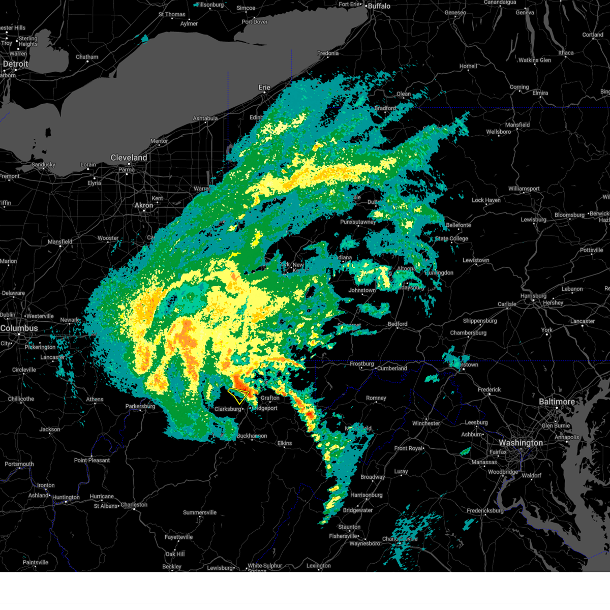
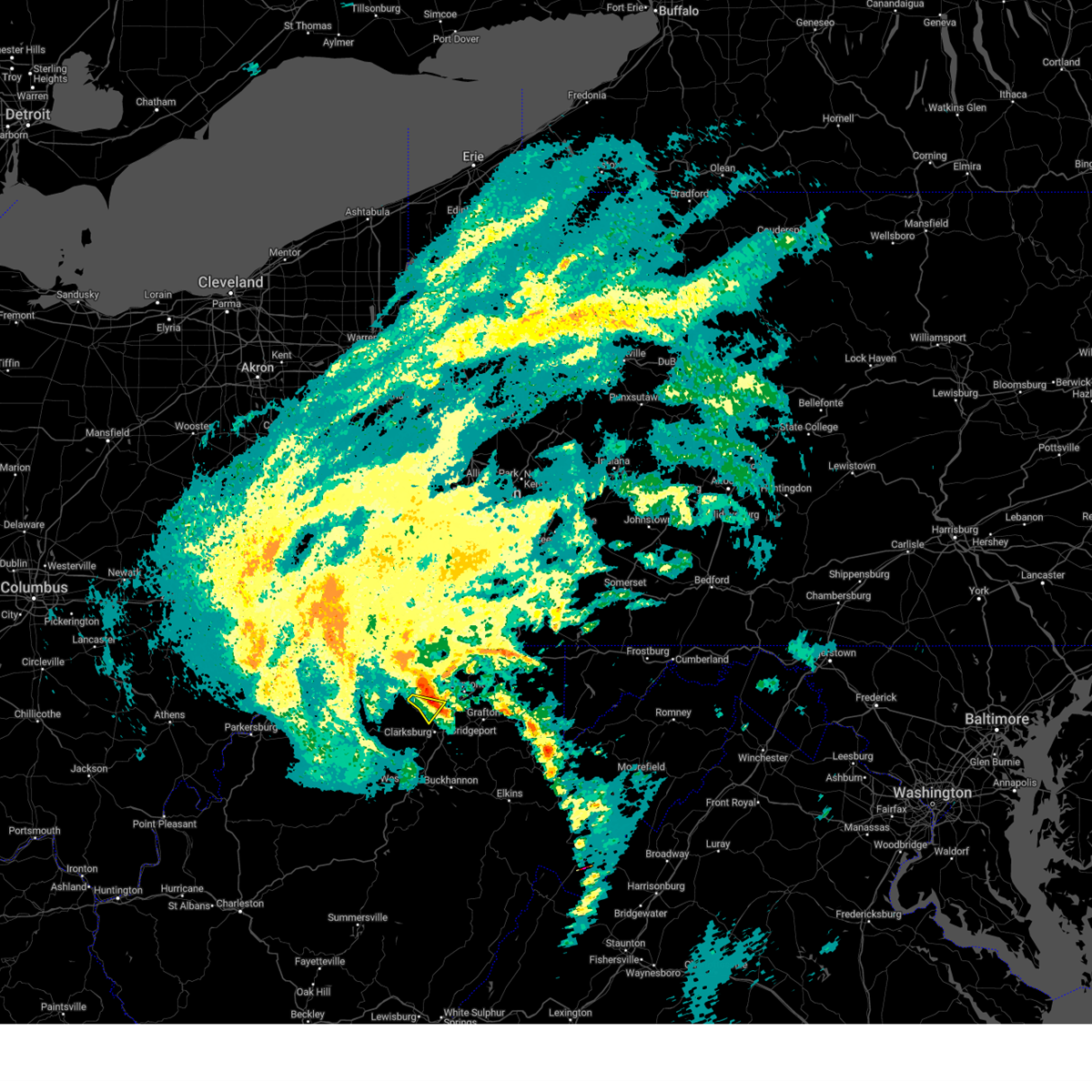
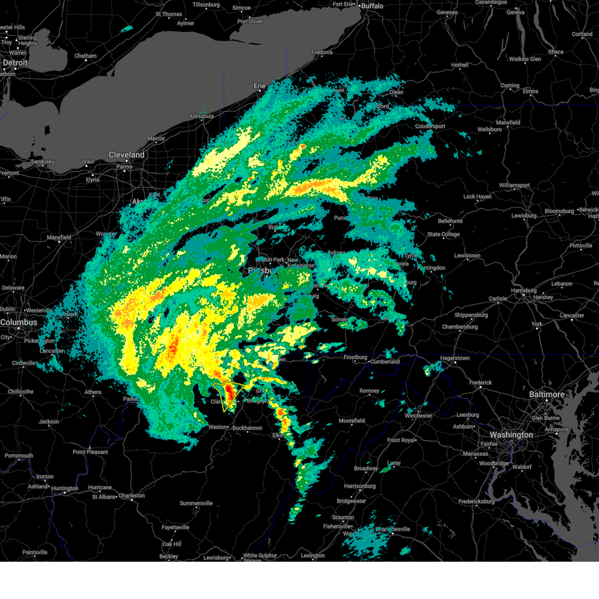
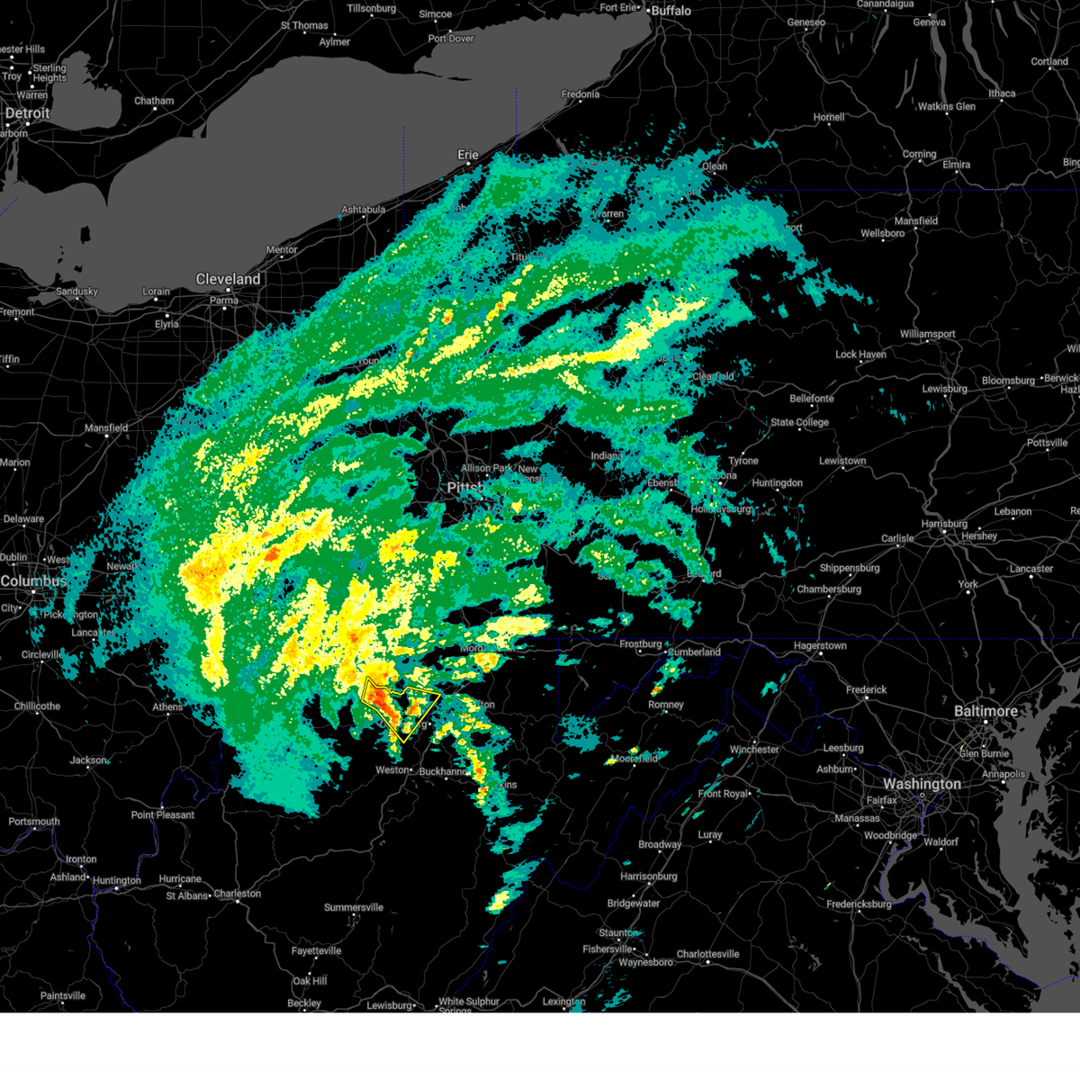
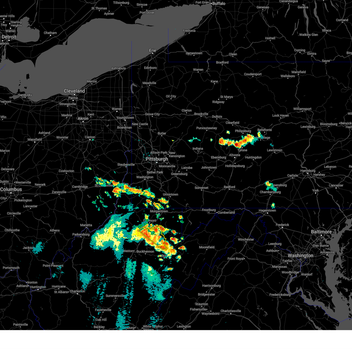
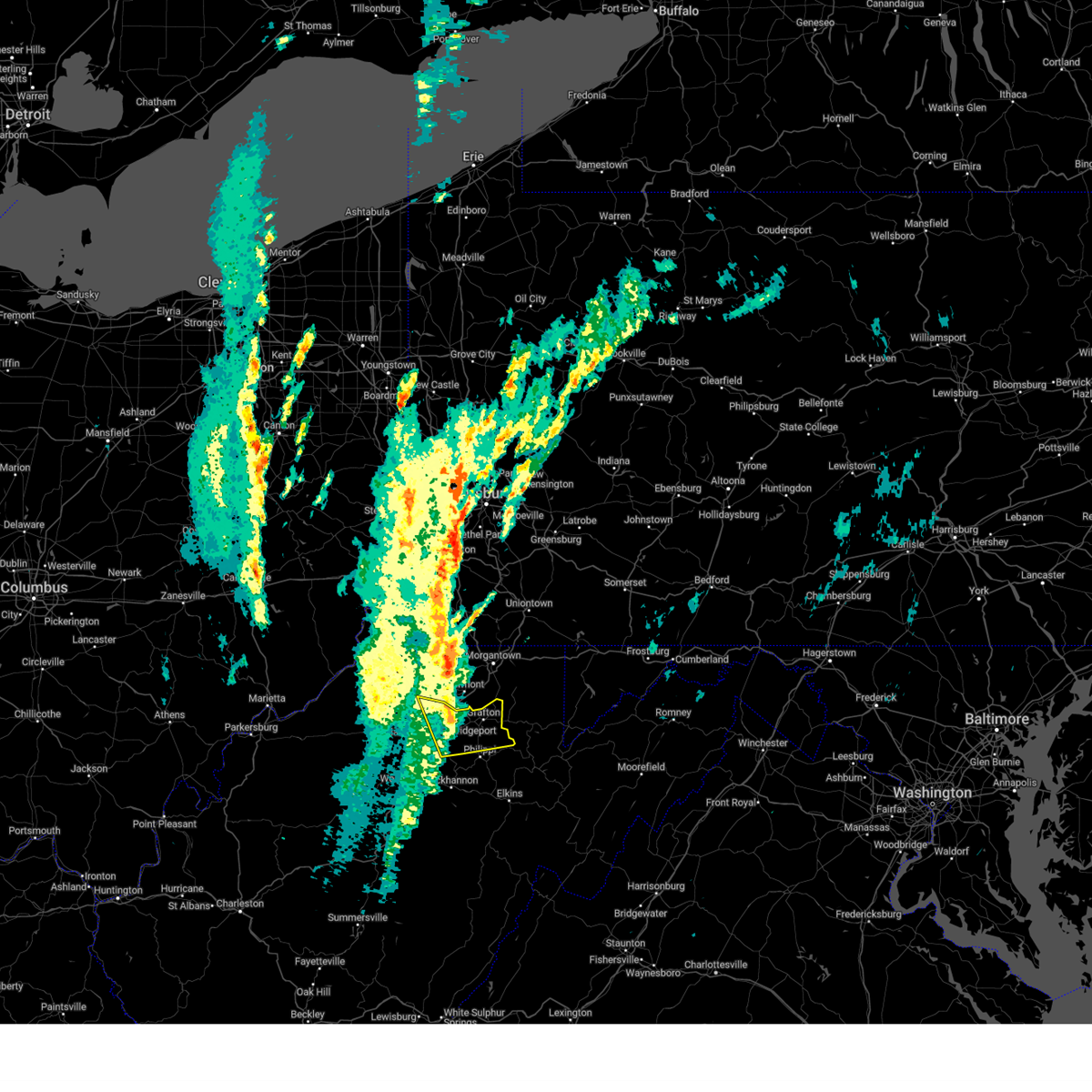
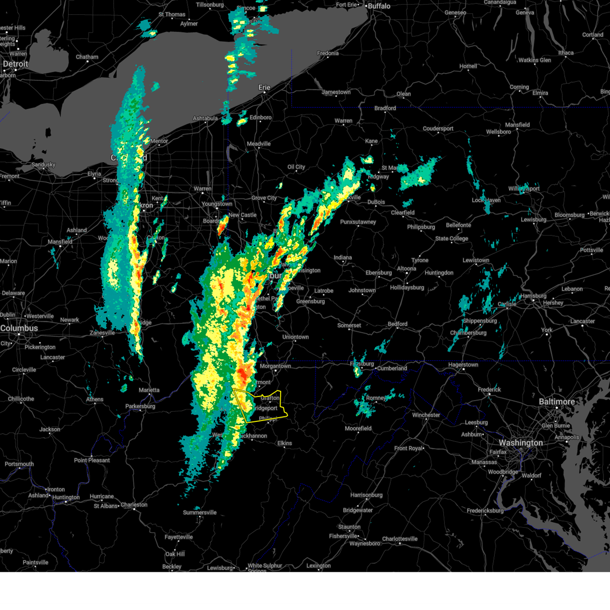
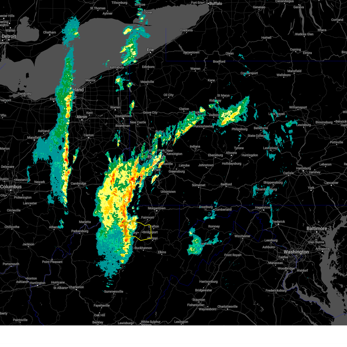
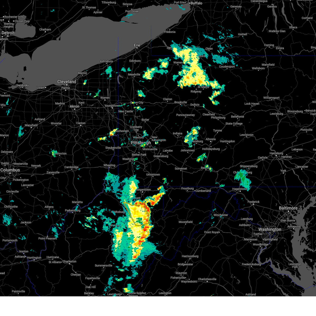
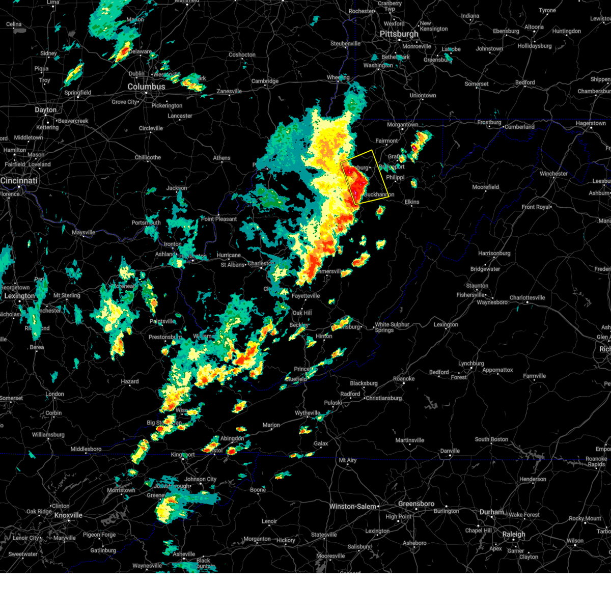
Hail Map for Enterprise, WV
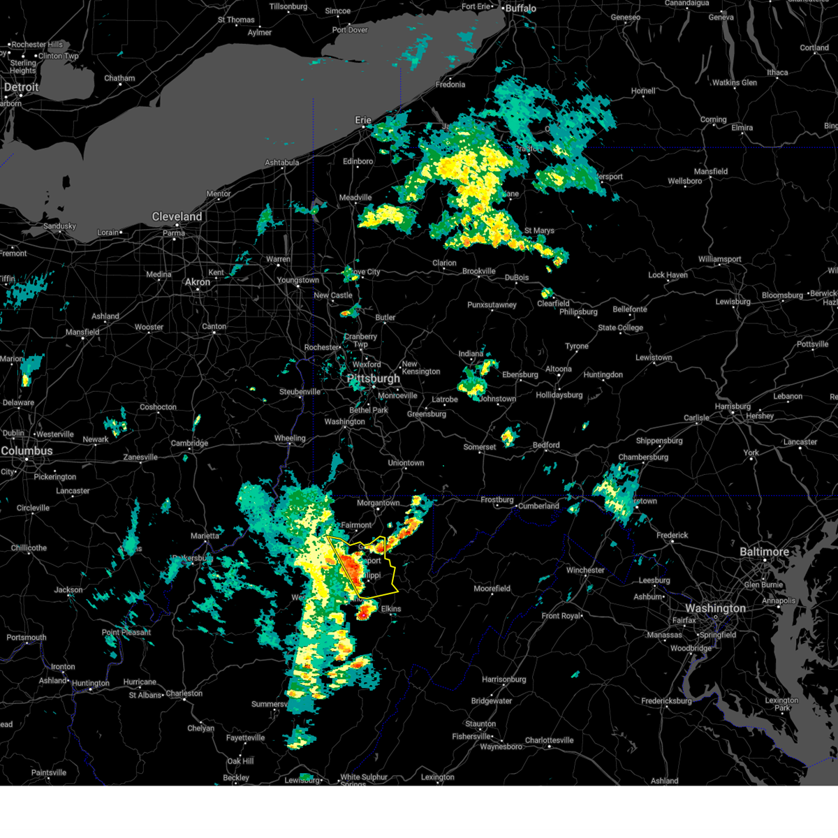
The Enterprise, WV area has had 0 reports of on-the-ground hail by trained spotters, and has been under severe weather warnings 36 times during the past 12 months. Doppler radar has detected hail at or near Enterprise, WV on 25 occasions, including 1 occasion during the past year.
| Name: | Enterprise, WV |
| Where Located: | 41.5 miles NW of Elkins, WV |
| Map: | Google Map for Enterprise, WV |
| Population: | 961 |
| Housing Units: | 402 |
| More Info: | Search Google for Enterprise, WV |
0
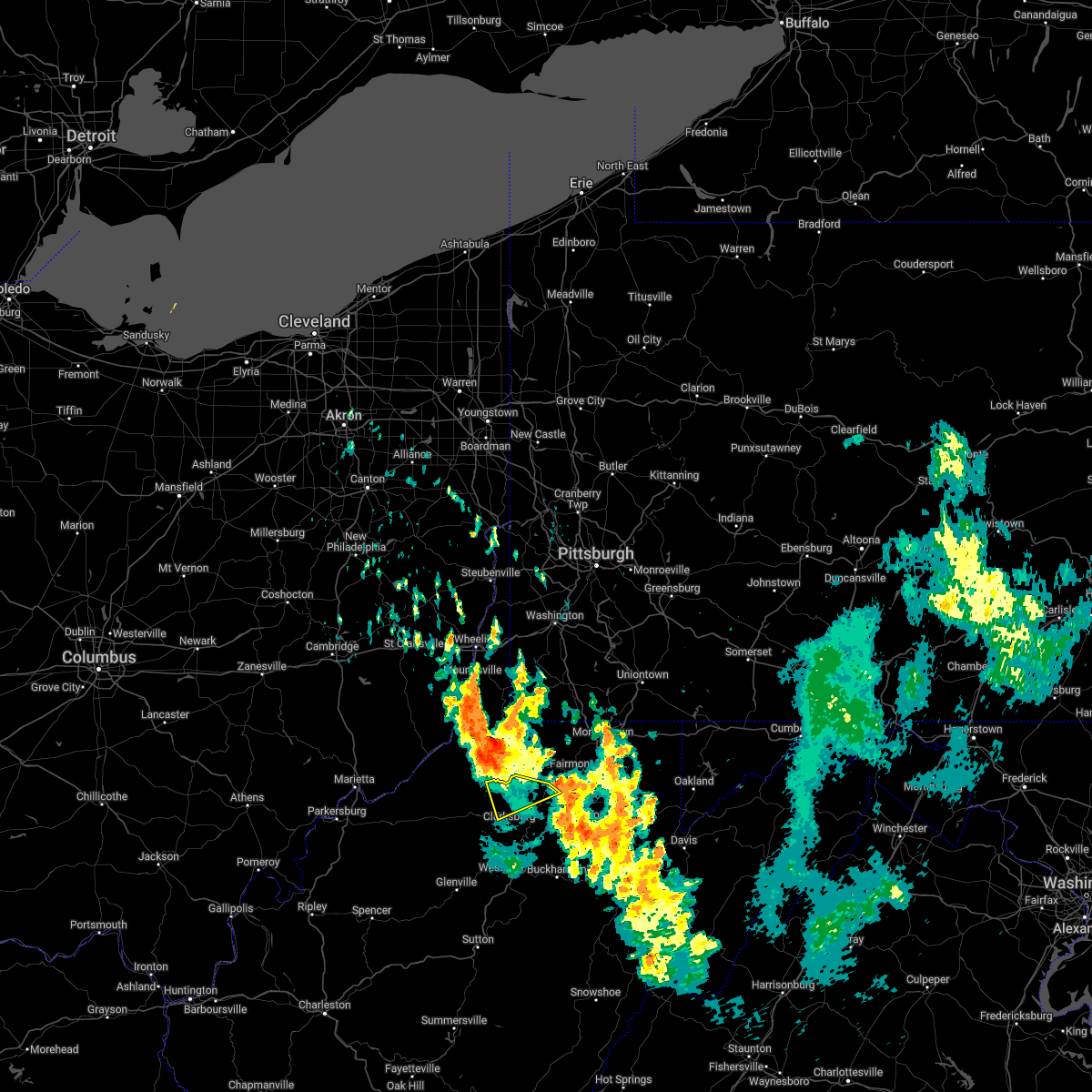
The Top Recent Hail Date for Enterprise, WV is Friday, June 6, 2025 (25th out of 25)

Hail and Wind Damage Spotted near Enterprise, WV
| Date / Time | Report Details |
|---|---|
| 5/30/2025 5:01 PM EDT |
 The storm which prompted the warning has moved out of the area. therefore, the warning has been allowed to expire. however, gusty winds are still possible with this thunderstorm. The storm which prompted the warning has moved out of the area. therefore, the warning has been allowed to expire. however, gusty winds are still possible with this thunderstorm.
|
| 5/30/2025 4:50 PM EDT |
 the severe thunderstorm warning has been cancelled and is no longer in effect the severe thunderstorm warning has been cancelled and is no longer in effect
|
| 5/30/2025 4:50 PM EDT |
 At 449 pm edt, a severe thunderstorm was located near lumberport, or near mannington, moving northeast at 25 mph (radar indicated). Hazards include 60 mph wind gusts and penny size hail. Expect damage to roofs, siding, and trees. Locations impacted include, shinnston and lumberport. At 449 pm edt, a severe thunderstorm was located near lumberport, or near mannington, moving northeast at 25 mph (radar indicated). Hazards include 60 mph wind gusts and penny size hail. Expect damage to roofs, siding, and trees. Locations impacted include, shinnston and lumberport.
|
| 5/30/2025 4:28 PM EDT |
 At 428 pm edt, a severe thunderstorm was located 7 miles west of lumberport, or 10 miles northwest of clarksburg, moving northeast at 25 mph (radar indicated). Hazards include 60 mph wind gusts and penny size hail. Expect damage to roofs, siding, and trees. Locations impacted include, shinnston, salem, lumberport, wallace, and wolf summit. At 428 pm edt, a severe thunderstorm was located 7 miles west of lumberport, or 10 miles northwest of clarksburg, moving northeast at 25 mph (radar indicated). Hazards include 60 mph wind gusts and penny size hail. Expect damage to roofs, siding, and trees. Locations impacted include, shinnston, salem, lumberport, wallace, and wolf summit.
|
| 5/30/2025 4:28 PM EDT |
 the severe thunderstorm warning has been cancelled and is no longer in effect the severe thunderstorm warning has been cancelled and is no longer in effect
|
| 5/30/2025 4:08 PM EDT |
 Svrrlx the national weather service in charleston west virginia has issued a * severe thunderstorm warning for, northeastern doddridge county in northern west virginia, east central tyler county in northern west virginia, northwestern harrison county in northern west virginia, * until 500 pm edt. * at 408 pm edt, a severe thunderstorm was located 7 miles northeast of west union, or 15 miles southeast of middlebourne, moving northeast at 25 mph (radar indicated). Hazards include 60 mph wind gusts and penny size hail. expect damage to roofs, siding, and trees Svrrlx the national weather service in charleston west virginia has issued a * severe thunderstorm warning for, northeastern doddridge county in northern west virginia, east central tyler county in northern west virginia, northwestern harrison county in northern west virginia, * until 500 pm edt. * at 408 pm edt, a severe thunderstorm was located 7 miles northeast of west union, or 15 miles southeast of middlebourne, moving northeast at 25 mph (radar indicated). Hazards include 60 mph wind gusts and penny size hail. expect damage to roofs, siding, and trees
|
| 5/16/2025 2:32 PM EDT |
 Svrrlx the national weather service in charleston west virginia has issued a * severe thunderstorm warning for, north central randolph county in northeastern west virginia, taylor county in northern west virginia, northern barbour county in northeastern west virginia, northeastern harrison county in northern west virginia, * until 315 pm edt. * at 232 pm edt, severe thunderstorms were located along a line extending from near bridgeport to 8 miles northeast of belington, moving east at 40 mph (radar indicated). Hazards include 60 mph wind gusts and penny size hail. expect damage to roofs, siding, and trees Svrrlx the national weather service in charleston west virginia has issued a * severe thunderstorm warning for, north central randolph county in northeastern west virginia, taylor county in northern west virginia, northern barbour county in northeastern west virginia, northeastern harrison county in northern west virginia, * until 315 pm edt. * at 232 pm edt, severe thunderstorms were located along a line extending from near bridgeport to 8 miles northeast of belington, moving east at 40 mph (radar indicated). Hazards include 60 mph wind gusts and penny size hail. expect damage to roofs, siding, and trees
|
| 4/29/2025 6:30 PM EDT | At 630 pm edt, severe thunderstorms were located along a line extending from near uniontown to near grafton, moving east at 60 mph (radar indicated). Hazards include 60 mph wind gusts. Expect damage to trees and power lines, resulting in some power outages. Locations impacted include, morgantown, fairmont, uniontown, westover, kingwood, star city, terra alta, rowlesburg, pleasant valley, winfield, farmington, barrackville, point marion, monongah, granville, newburg, brookhaven, fairchance, rivesville, and smithfield. |
| 4/29/2025 6:13 PM EDT | Svrpbz the national weather service in pittsburgh has issued a * severe thunderstorm warning for, southeastern greene county in southwestern pennsylvania, southern fayette county in southwestern pennsylvania, monongalia county in northern west virginia, preston county in northeastern west virginia, marion county in northern west virginia, * until 715 pm edt. * at 612 pm edt, severe thunderstorms were located along a line extending from near fairdale to near lumberport, moving east at 60 mph (radar indicated). Hazards include 60 mph wind gusts. expect damage to trees and power lines, resulting in some power outages |
| 4/3/2025 5:57 AM EDT | Svrrlx the national weather service in charleston west virginia has issued a * severe thunderstorm warning for, southeastern calhoun county in north central west virginia, northwestern randolph county in northeastern west virginia, northeastern kanawha county in central west virginia, upshur county in northeastern west virginia, southeastern roane county in central west virginia, northwestern webster county in northeastern west virginia, barbour county in northeastern west virginia, harrison county in northern west virginia, southeastern doddridge county in northern west virginia, taylor county in northern west virginia, north central nicholas county in southeastern west virginia, central gilmer county in north central west virginia, lewis county in northern west virginia, braxton county in north central west virginia, northern clay county in north central west virginia, * until 645 am edt. * at 557 am edt, severe thunderstorms were located along a line extending from near salem to 7 miles northwest of gassaway to near amma, moving east at 65 mph (radar indicated). Hazards include 60 mph wind gusts. expect damage to roofs, siding, and trees |
| 4/3/2025 5:23 AM EDT | The storms which prompted the warning have moved out of the warned area. therefore, the warning will be allowed to expire. a severe thunderstorm watch remains in effect until 700 am edt for northern west virginia. |
| 4/3/2025 5:18 AM EDT | At 518 am edt, severe thunderstorms were located along a line extending from near mannington to near clarksburg to 11 miles south of west union, moving east at 65 mph (radar indicated). Hazards include 60 mph wind gusts. Expect damage to roofs, siding, and trees. Locations impacted include, enterprise, shinnston, meadowbrook, lumberport, bridgeport, and clarksburg. |
| 4/3/2025 5:18 AM EDT | the severe thunderstorm warning has been cancelled and is no longer in effect |
| 4/3/2025 5:13 AM EDT | At 513 am edt, severe thunderstorms were located along a line from 7 miles northwest of latrobe to 6 miles north of cassville, or along a line from 7 miles northwest of latrobe to 7 miles northwest of star city, moving east at 60 mph (radar indicated). Hazards include 60 mph wind gusts. Expect damage to roofs, siding, and trees. Locations impacted include, morgantown, fairmont, uniontown, connellsville, westover, kingwood, mannington, star city, terra alta, rowlesburg, mount pleasant, scottdale, masontown, pleasant valley, winfield, south connellsville, farmington, ligonier, barrackville and point marion. |
| 4/3/2025 5:02 AM EDT |
 At 502 am edt, severe thunderstorms were located along a line from over jeannette to 7 miles north of fairview, or along a line from over jeannette to 12 miles north of mannington, moving east at 60 mph (radar indicated). Hazards include 60 mph wind gusts. Expect damage to roofs, siding, and trees. Locations impacted include, morgantown, fairmont, uniontown, connellsville, westover, kingwood, mannington, star city, terra alta, rowlesburg, california, mount pleasant, scottdale, masontown, pleasant valley, youngwood, brownsville, winfield, new stanton and south connellsville. At 502 am edt, severe thunderstorms were located along a line from over jeannette to 7 miles north of fairview, or along a line from over jeannette to 12 miles north of mannington, moving east at 60 mph (radar indicated). Hazards include 60 mph wind gusts. Expect damage to roofs, siding, and trees. Locations impacted include, morgantown, fairmont, uniontown, connellsville, westover, kingwood, mannington, star city, terra alta, rowlesburg, california, mount pleasant, scottdale, masontown, pleasant valley, youngwood, brownsville, winfield, new stanton and south connellsville.
|
| 4/3/2025 5:02 AM EDT |
 the severe thunderstorm warning has been cancelled and is no longer in effect the severe thunderstorm warning has been cancelled and is no longer in effect
|
| 4/3/2025 5:00 AM EDT |
 the severe thunderstorm warning has been cancelled and is no longer in effect the severe thunderstorm warning has been cancelled and is no longer in effect
|
| 4/3/2025 5:00 AM EDT |
 At 500 am edt, severe thunderstorms were located along a line extending from 7 miles south of jacksonburg to 6 miles southwest of salem to 8 miles north of grantsville, moving east at 60 mph (radar indicated). Hazards include 60 mph wind gusts. Expect damage to roofs, siding, and trees. Locations impacted include, shinnston, lumberport, anmoore, wolf summit, bridgeport, newberne, west milford, center point, sedalia, salem, despard, burnt house, clarksburg, blandville, auburn, avon, grove, leopold, new milton, and wallace. At 500 am edt, severe thunderstorms were located along a line extending from 7 miles south of jacksonburg to 6 miles southwest of salem to 8 miles north of grantsville, moving east at 60 mph (radar indicated). Hazards include 60 mph wind gusts. Expect damage to roofs, siding, and trees. Locations impacted include, shinnston, lumberport, anmoore, wolf summit, bridgeport, newberne, west milford, center point, sedalia, salem, despard, burnt house, clarksburg, blandville, auburn, avon, grove, leopold, new milton, and wallace.
|
| 4/3/2025 4:53 AM EDT | At 453 am edt, severe thunderstorms were located along a line from over white oak to near hundred, or along a line from near mckeesport to 10 miles northwest of mannington, moving east at 60 mph (radar indicated). Hazards include 60 mph wind gusts. Expect damage to roofs, siding, and trees. Locations impacted include, morgantown, fairmont, uniontown, connellsville, waynesburg, westover, kingwood, mannington, star city, terra alta, rowlesburg, monessen, california, donora, mount pleasant, scottdale, charleroi, masontown, pleasant valley and youngwood. |
| 4/3/2025 4:53 AM EDT | the severe thunderstorm warning has been cancelled and is no longer in effect |
| 4/3/2025 4:44 AM EDT | At 444 am edt, severe thunderstorms were located along a line from over jefferson hills to 6 miles northeast of jacksonburg, or along a line from over gastonville to 14 miles northwest of mannington, moving east at 60 mph (radar indicated). Hazards include 60 mph wind gusts. Expect damage to roofs, siding, and trees. Locations impacted include, morgantown, fairmont, uniontown, connellsville, waynesburg, westover, kingwood, mannington, star city, terra alta, rowlesburg, monessen, california, donora, mount pleasant, scottdale, monongahela, charleroi, masontown and pleasant valley. |
| 4/3/2025 4:43 AM EDT | Svrrlx the national weather service in charleston west virginia has issued a * severe thunderstorm warning for, southeastern pleasants county in northwestern west virginia, north central calhoun county in north central west virginia, ritchie county in northwestern west virginia, doddridge county in northern west virginia, northwestern taylor county in northern west virginia, northwestern gilmer county in north central west virginia, northwestern lewis county in northern west virginia, east central wirt county in northwestern west virginia, central tyler county in northern west virginia, harrison county in northern west virginia, * until 530 am edt. * at 442 am edt, severe thunderstorms were located along a line extending from near jacksonburg to near west union to 9 miles south of harrisville, moving east at 65 mph (radar indicated). Hazards include 60 mph wind gusts. expect damage to roofs, siding, and trees |
| 4/3/2025 4:28 AM EDT | Svrpbz the national weather service in pittsburgh has issued a * severe thunderstorm warning for, fayette county in southwestern pennsylvania, greene county in southwestern pennsylvania, southern washington county in southwestern pennsylvania, southwestern westmoreland county in southwestern pennsylvania, preston county in northeastern west virginia, marion county in northern west virginia, marshall county in northern west virginia, monongalia county in northern west virginia, wetzel county in northern west virginia, * until 530 am edt. * at 428 am edt, severe thunderstorms were located along a line from over washington to 10 miles south of new martinsville, moving east at 60 mph (radar indicated). Hazards include 60 mph wind gusts. expect damage to roofs, siding, and trees |
| 3/16/2025 12:41 PM EDT |
 The storm which prompted the warning has weakened below severe limits, and has exited the warned area. therefore, the warning will be allowed to expire. however, gusty winds are still possible with this thunderstorm. a tornado watch remains in effect until 400 pm edt for northern and northeastern west virginia. The storm which prompted the warning has weakened below severe limits, and has exited the warned area. therefore, the warning will be allowed to expire. however, gusty winds are still possible with this thunderstorm. a tornado watch remains in effect until 400 pm edt for northern and northeastern west virginia.
|
| 3/16/2025 12:20 PM EDT |
 At 1220 pm edt, a severe thunderstorm was located near bridgeport, or 7 miles west of grafton, moving east at 65 mph (radar indicated). Hazards include 70 mph wind gusts. Expect considerable tree damage. damage is likely to mobile homes, roofs, and outbuildings. Locations impacted include, moatsville, flemington, clarksburg, rosemont, shinnston, lumberport, knottsville, grafton, anmoore, meadland, bridgeport, tygart lake state park, thornton, enterprise, mcgee, stonewood, nutter fort, galloway, meadowbrook, and despard. At 1220 pm edt, a severe thunderstorm was located near bridgeport, or 7 miles west of grafton, moving east at 65 mph (radar indicated). Hazards include 70 mph wind gusts. Expect considerable tree damage. damage is likely to mobile homes, roofs, and outbuildings. Locations impacted include, moatsville, flemington, clarksburg, rosemont, shinnston, lumberport, knottsville, grafton, anmoore, meadland, bridgeport, tygart lake state park, thornton, enterprise, mcgee, stonewood, nutter fort, galloway, meadowbrook, and despard.
|
| 3/16/2025 12:14 PM EDT |
 Svrrlx the national weather service in charleston west virginia has issued a * severe thunderstorm warning for, taylor county in northern west virginia, northern barbour county in northeastern west virginia, eastern harrison county in northern west virginia, * until 1245 pm edt. * at 1214 pm edt, a severe thunderstorm was located over bridgeport, or near clarksburg, moving northeast at 65 mph (radar indicated). Hazards include 60 mph wind gusts. expect damage to roofs, siding, and trees Svrrlx the national weather service in charleston west virginia has issued a * severe thunderstorm warning for, taylor county in northern west virginia, northern barbour county in northeastern west virginia, eastern harrison county in northern west virginia, * until 1245 pm edt. * at 1214 pm edt, a severe thunderstorm was located over bridgeport, or near clarksburg, moving northeast at 65 mph (radar indicated). Hazards include 60 mph wind gusts. expect damage to roofs, siding, and trees
|
| 3/16/2025 12:03 PM EDT |
 At 1202 pm edt, severe thunderstorms were located along a line extending from 6 miles southeast of jacksonburg to near lumberport to 6 miles west of nutter fort, moving east at 55 mph (radar indicated). Hazards include 60 mph wind gusts. Expect damage to roofs, siding, and trees. Locations impacted include, flemington, clarksburg, rosemont, shinnston, lumberport, anmoore, wolf summit, meadland, bridgeport, wallace, enterprise, sedalia, salem, mcgee, stonewood, nutter fort, galloway, meadowbrook, and despard. At 1202 pm edt, severe thunderstorms were located along a line extending from 6 miles southeast of jacksonburg to near lumberport to 6 miles west of nutter fort, moving east at 55 mph (radar indicated). Hazards include 60 mph wind gusts. Expect damage to roofs, siding, and trees. Locations impacted include, flemington, clarksburg, rosemont, shinnston, lumberport, anmoore, wolf summit, meadland, bridgeport, wallace, enterprise, sedalia, salem, mcgee, stonewood, nutter fort, galloway, meadowbrook, and despard.
|
| 3/16/2025 12:03 PM EDT |
 the severe thunderstorm warning has been cancelled and is no longer in effect the severe thunderstorm warning has been cancelled and is no longer in effect
|
| 3/16/2025 11:51 AM EDT |
 Svrrlx the national weather service in charleston west virginia has issued a * severe thunderstorm warning for, northeastern doddridge county in northern west virginia, western taylor county in northern west virginia, east central tyler county in northern west virginia, northwestern barbour county in northeastern west virginia, harrison county in northern west virginia, * until 1215 pm edt. * at 1151 am edt, severe thunderstorms were located along a line extending from near jacksonburg to near salem to 10 miles northwest of jackson mill, moving east at 55 mph (radar indicated). Hazards include 60 mph wind gusts and quarter size hail. Hail damage to vehicles is expected. Expect wind damage to roofs, siding, and trees. Svrrlx the national weather service in charleston west virginia has issued a * severe thunderstorm warning for, northeastern doddridge county in northern west virginia, western taylor county in northern west virginia, east central tyler county in northern west virginia, northwestern barbour county in northeastern west virginia, harrison county in northern west virginia, * until 1215 pm edt. * at 1151 am edt, severe thunderstorms were located along a line extending from near jacksonburg to near salem to 10 miles northwest of jackson mill, moving east at 55 mph (radar indicated). Hazards include 60 mph wind gusts and quarter size hail. Hail damage to vehicles is expected. Expect wind damage to roofs, siding, and trees.
|
| 12/31/2024 1:25 PM EST | Roof damage to a home along down bridge road with nearby tree and power line damage as well. measured a 56 mph wind gust at the time of damag in harrison county WV, 1 miles WSW of Enterprise, WV |
| 9/24/2024 2:41 PM EDT |
 The storm which prompted the warning has moved out of the area. therefore, the warning will be allowed to expire. however, gusty winds are still possible with this thunderstorm. The storm which prompted the warning has moved out of the area. therefore, the warning will be allowed to expire. however, gusty winds are still possible with this thunderstorm.
|
| 9/24/2024 2:16 PM EDT |
 At 215 pm edt, a severe thunderstorm was located near bridgeport, or 8 miles southwest of grafton, moving northeast at 35 mph (radar indicated). Hazards include 60 mph wind gusts and quarter size hail. Hail damage to vehicles is expected. expect wind damage to roofs, siding, and trees. Locations impacted include, clarksburg, grafton, philippi, audra state park, bridgeport, shinnston, lumberport, anmoore, enterprise, flemington, montrose, moatsville, volga, rosemont, knottsville, nestorville, meadland, tygart lake state park, thornton, and mcgee. At 215 pm edt, a severe thunderstorm was located near bridgeport, or 8 miles southwest of grafton, moving northeast at 35 mph (radar indicated). Hazards include 60 mph wind gusts and quarter size hail. Hail damage to vehicles is expected. expect wind damage to roofs, siding, and trees. Locations impacted include, clarksburg, grafton, philippi, audra state park, bridgeport, shinnston, lumberport, anmoore, enterprise, flemington, montrose, moatsville, volga, rosemont, knottsville, nestorville, meadland, tygart lake state park, thornton, and mcgee.
|
| 9/24/2024 2:16 PM EDT |
 the severe thunderstorm warning has been cancelled and is no longer in effect the severe thunderstorm warning has been cancelled and is no longer in effect
|
| 9/24/2024 2:14 PM EDT |
 The storm which prompted the warning has moved out of the area. therefore, the warning will be allowed to expire. however, gusty winds are still possible with this thunderstorm. The storm which prompted the warning has moved out of the area. therefore, the warning will be allowed to expire. however, gusty winds are still possible with this thunderstorm.
|
| 9/24/2024 1:56 PM EDT |
 Svrrlx the national weather service in charleston west virginia has issued a * severe thunderstorm warning for, north central randolph county in northeastern west virginia, taylor county in northern west virginia, northeastern lewis county in northern west virginia, northern upshur county in northeastern west virginia, barbour county in northeastern west virginia, harrison county in northern west virginia, * until 245 pm edt. * at 156 pm edt, a severe thunderstorm was located near stonewood, or 8 miles south of clarksburg, moving northeast at 25 mph (radar indicated). Hazards include 60 mph wind gusts and quarter size hail. Hail damage to vehicles is expected. Expect wind damage to roofs, siding, and trees. Svrrlx the national weather service in charleston west virginia has issued a * severe thunderstorm warning for, north central randolph county in northeastern west virginia, taylor county in northern west virginia, northeastern lewis county in northern west virginia, northern upshur county in northeastern west virginia, barbour county in northeastern west virginia, harrison county in northern west virginia, * until 245 pm edt. * at 156 pm edt, a severe thunderstorm was located near stonewood, or 8 miles south of clarksburg, moving northeast at 25 mph (radar indicated). Hazards include 60 mph wind gusts and quarter size hail. Hail damage to vehicles is expected. Expect wind damage to roofs, siding, and trees.
|
| 9/24/2024 1:51 PM EDT |
 At 151 pm edt, a severe thunderstorm was located near jackson mill, or 8 miles northeast of weston, moving east at 30 mph (radar indicated). Hazards include 60 mph wind gusts and quarter size hail. Hail damage to vehicles is expected. expect wind damage to roofs, siding, and trees. Locations impacted include, clarksburg, buckhannon, weston, bridgeport, shinnston, stonewood, nutter fort, salem, lumberport, anmoore, stonewall jackson, jackson mill, west milford, lost creek, jane lew, camden, lorentz, century, wolf summit, and hodgesville. At 151 pm edt, a severe thunderstorm was located near jackson mill, or 8 miles northeast of weston, moving east at 30 mph (radar indicated). Hazards include 60 mph wind gusts and quarter size hail. Hail damage to vehicles is expected. expect wind damage to roofs, siding, and trees. Locations impacted include, clarksburg, buckhannon, weston, bridgeport, shinnston, stonewood, nutter fort, salem, lumberport, anmoore, stonewall jackson, jackson mill, west milford, lost creek, jane lew, camden, lorentz, century, wolf summit, and hodgesville.
|
| 9/24/2024 1:42 PM EDT |
 Svrrlx the national weather service in charleston west virginia has issued a * severe thunderstorm warning for, southeastern doddridge county in northern west virginia, northeastern lewis county in northern west virginia, northern upshur county in northeastern west virginia, west central barbour county in northeastern west virginia, harrison county in northern west virginia, * until 215 pm edt. * at 141 pm edt, a severe thunderstorm was located over jackson mill, or near weston, moving east at 30 mph (radar indicated). Hazards include 60 mph wind gusts. expect damage to roofs, siding, and trees Svrrlx the national weather service in charleston west virginia has issued a * severe thunderstorm warning for, southeastern doddridge county in northern west virginia, northeastern lewis county in northern west virginia, northern upshur county in northeastern west virginia, west central barbour county in northeastern west virginia, harrison county in northern west virginia, * until 215 pm edt. * at 141 pm edt, a severe thunderstorm was located over jackson mill, or near weston, moving east at 30 mph (radar indicated). Hazards include 60 mph wind gusts. expect damage to roofs, siding, and trees
|
| 5/26/2024 7:07 PM EDT |
 Svrpbz the national weather service in pittsburgh has issued a * severe thunderstorm warning for, monongalia county in northern west virginia, northeastern wetzel county in northern west virginia, tucker county in northeastern west virginia, preston county in northeastern west virginia, marion county in northern west virginia, * until 800 pm edt. * at 707 pm edt, severe thunderstorms were located along a line extending from near hundred to enterprise to near belington to near dailey, moving north at 55 mph (radar indicated). Hazards include 60 mph wind gusts. expect damage to trees and power lines, resulting in some power outages Svrpbz the national weather service in pittsburgh has issued a * severe thunderstorm warning for, monongalia county in northern west virginia, northeastern wetzel county in northern west virginia, tucker county in northeastern west virginia, preston county in northeastern west virginia, marion county in northern west virginia, * until 800 pm edt. * at 707 pm edt, severe thunderstorms were located along a line extending from near hundred to enterprise to near belington to near dailey, moving north at 55 mph (radar indicated). Hazards include 60 mph wind gusts. expect damage to trees and power lines, resulting in some power outages
|
| 4/17/2024 9:29 PM EDT |
 the severe thunderstorm warning has been cancelled and is no longer in effect the severe thunderstorm warning has been cancelled and is no longer in effect
|
| 4/17/2024 9:29 PM EDT |
 At 929 pm edt, severe thunderstorms were located along a line extending from 8 miles north of salem to 9 miles northeast of elizabeth, moving east at 30 mph (radar indicated). Hazards include 60 mph wind gusts and quarter size hail. Hail damage to vehicles is expected. expect wind damage to roofs, siding, and trees. Locations impacted include, harrisville, shinnston, salem, pennsboro, lumberport, west union, north bend state park, enterprise, ellenboro, cairo, pullman, auburn, wolf summit, pike, center point, sedalia, berea, highland, greenwood, and blandville. At 929 pm edt, severe thunderstorms were located along a line extending from 8 miles north of salem to 9 miles northeast of elizabeth, moving east at 30 mph (radar indicated). Hazards include 60 mph wind gusts and quarter size hail. Hail damage to vehicles is expected. expect wind damage to roofs, siding, and trees. Locations impacted include, harrisville, shinnston, salem, pennsboro, lumberport, west union, north bend state park, enterprise, ellenboro, cairo, pullman, auburn, wolf summit, pike, center point, sedalia, berea, highland, greenwood, and blandville.
|
| 4/17/2024 9:15 PM EDT |
 Svrrlx the national weather service in charleston west virginia has issued a * severe thunderstorm warning for, pleasants county in northwestern west virginia, ritchie county in northwestern west virginia, doddridge county in northern west virginia, central tyler county in northern west virginia, east central wood county in northwestern west virginia, northern harrison county in northern west virginia, * until 945 pm edt. * at 915 pm edt, severe thunderstorms were located along a line extending from 6 miles southwest of jacksonburg to near parkersburg, moving southeast at 20 mph (radar indicated). Hazards include 60 mph wind gusts and quarter size hail. Hail damage to vehicles is expected. Expect wind damage to roofs, siding, and trees. Svrrlx the national weather service in charleston west virginia has issued a * severe thunderstorm warning for, pleasants county in northwestern west virginia, ritchie county in northwestern west virginia, doddridge county in northern west virginia, central tyler county in northern west virginia, east central wood county in northwestern west virginia, northern harrison county in northern west virginia, * until 945 pm edt. * at 915 pm edt, severe thunderstorms were located along a line extending from 6 miles southwest of jacksonburg to near parkersburg, moving southeast at 20 mph (radar indicated). Hazards include 60 mph wind gusts and quarter size hail. Hail damage to vehicles is expected. Expect wind damage to roofs, siding, and trees.
|
| 4/15/2024 11:22 AM EDT |
 Svrpbz the national weather service in pittsburgh has issued a * severe thunderstorm warning for, south central monongalia county in northern west virginia, west central preston county in northeastern west virginia, southeastern marion county in northern west virginia, * until 1145 am edt. * at 1121 am edt, a severe thunderstorm was located over monongah, or near fairmont, moving east at 45 mph (radar indicated). Hazards include 60 mph wind gusts and quarter size hail. Minor hail damage to vehicles is possible. Expect wind damage to trees and power lines, resulting in some power outages. Svrpbz the national weather service in pittsburgh has issued a * severe thunderstorm warning for, south central monongalia county in northern west virginia, west central preston county in northeastern west virginia, southeastern marion county in northern west virginia, * until 1145 am edt. * at 1121 am edt, a severe thunderstorm was located over monongah, or near fairmont, moving east at 45 mph (radar indicated). Hazards include 60 mph wind gusts and quarter size hail. Minor hail damage to vehicles is possible. Expect wind damage to trees and power lines, resulting in some power outages.
|
| 8/25/2023 3:45 AM EDT |
 At 345 am edt, severe thunderstorms were located along a line extending from near winfield to 7 miles north of belmont, moving southeast at 45 mph (radar indicated). Hazards include 60 mph wind gusts and penny size hail. Expect damage to roofs, siding, and trees. locations impacted include, clarksburg, grafton, st. marys, middlebourne, bridgeport, shinnston, stonewood, nutter fort, salem, sistersville, lumberport, west union, anmoore, enterprise, matamoras, flemington, friendly, alma, knottsville, and wolf summit. hail threat, radar indicated max hail size, 0. 75 in wind threat, radar indicated max wind gust, 60 mph. At 345 am edt, severe thunderstorms were located along a line extending from near winfield to 7 miles north of belmont, moving southeast at 45 mph (radar indicated). Hazards include 60 mph wind gusts and penny size hail. Expect damage to roofs, siding, and trees. locations impacted include, clarksburg, grafton, st. marys, middlebourne, bridgeport, shinnston, stonewood, nutter fort, salem, sistersville, lumberport, west union, anmoore, enterprise, matamoras, flemington, friendly, alma, knottsville, and wolf summit. hail threat, radar indicated max hail size, 0. 75 in wind threat, radar indicated max wind gust, 60 mph.
|
| 8/25/2023 3:34 AM EDT |
 At 334 am edt, a severe thunderstorm was located near jacksonburg, or 12 miles west of mannington, moving southeast at 50 mph (radar indicated). Hazards include 60 mph wind gusts and quarter size hail. Minor hail damage to vehicles is possible. expect wind damage to trees and power lines, resulting in some power outages. locations impacted include, pine grove, jacksonburg, smithfield, grangeville, porters falls, reader, and folsom. hail threat, radar indicated max hail size, 1. 00 in wind threat, radar indicated max wind gust, 60 mph. At 334 am edt, a severe thunderstorm was located near jacksonburg, or 12 miles west of mannington, moving southeast at 50 mph (radar indicated). Hazards include 60 mph wind gusts and quarter size hail. Minor hail damage to vehicles is possible. expect wind damage to trees and power lines, resulting in some power outages. locations impacted include, pine grove, jacksonburg, smithfield, grangeville, porters falls, reader, and folsom. hail threat, radar indicated max hail size, 1. 00 in wind threat, radar indicated max wind gust, 60 mph.
|
| 8/25/2023 3:23 AM EDT |
 At 323 am edt, severe thunderstorms were located along a line extending from near mannington to near beverly, moving southeast at 60 mph (radar indicated). Hazards include 60 mph wind gusts and penny size hail. expect damage to roofs, siding, and trees At 323 am edt, severe thunderstorms were located along a line extending from near mannington to near beverly, moving southeast at 60 mph (radar indicated). Hazards include 60 mph wind gusts and penny size hail. expect damage to roofs, siding, and trees
|
| 8/25/2023 3:21 AM EDT |
 At 321 am edt, a severe thunderstorm was located over pine grove, or 8 miles southeast of new martinsville, moving southeast at 50 mph (radar indicated). Hazards include 60 mph wind gusts and quarter size hail. Minor hail damage to vehicles is possible. Expect wind damage to trees and power lines, resulting in some power outages. At 321 am edt, a severe thunderstorm was located over pine grove, or 8 miles southeast of new martinsville, moving southeast at 50 mph (radar indicated). Hazards include 60 mph wind gusts and quarter size hail. Minor hail damage to vehicles is possible. Expect wind damage to trees and power lines, resulting in some power outages.
|
| 8/7/2023 2:23 PM EDT |
 At 223 pm edt, a severe thunderstorm was located over barrackville, or near fairmont, moving northeast at 45 mph (radar indicated). Hazards include 60 mph wind gusts and quarter size hail. Minor hail damage to vehicles is possible. Expect wind damage to trees and power lines, resulting in some power outages. At 223 pm edt, a severe thunderstorm was located over barrackville, or near fairmont, moving northeast at 45 mph (radar indicated). Hazards include 60 mph wind gusts and quarter size hail. Minor hail damage to vehicles is possible. Expect wind damage to trees and power lines, resulting in some power outages.
|
| 8/7/2023 1:20 PM EDT |
 The severe thunderstorm warning for northeastern doddridge, east central tyler and northern harrison counties will expire at 130 pm edt, the storm which prompted the warning has weakened below severe limits, and has exited the warned area. therefore, the warning will be allowed to expire. a tornado watch remains in effect until 600 pm edt for northern west virginia. The severe thunderstorm warning for northeastern doddridge, east central tyler and northern harrison counties will expire at 130 pm edt, the storm which prompted the warning has weakened below severe limits, and has exited the warned area. therefore, the warning will be allowed to expire. a tornado watch remains in effect until 600 pm edt for northern west virginia.
|
| 8/7/2023 1:17 PM EDT | Tree down obstructing roadwa in harrison county WV, 0.5 miles WSW of Enterprise, WV |
| 8/7/2023 1:13 PM EDT |
 At 112 pm edt, a severe thunderstorm was located 7 miles north of salem, or 14 miles southwest of mannington, moving northeast at 30 mph (radar indicated). Hazards include 60 mph wind gusts and quarter size hail. Hail damage to vehicles is expected. expect wind damage to roofs, siding, and trees. Locations impacted include, shinnston, salem, lumberport, enterprise, wallace, center point, sedalia, meadowbrook, and wolf summit. At 112 pm edt, a severe thunderstorm was located 7 miles north of salem, or 14 miles southwest of mannington, moving northeast at 30 mph (radar indicated). Hazards include 60 mph wind gusts and quarter size hail. Hail damage to vehicles is expected. expect wind damage to roofs, siding, and trees. Locations impacted include, shinnston, salem, lumberport, enterprise, wallace, center point, sedalia, meadowbrook, and wolf summit.
|
| 8/7/2023 12:52 PM EDT |
 At 1252 pm edt, a severe thunderstorm was located near west union, or 16 miles southeast of middlebourne, moving northeast at 30 mph (radar indicated). Hazards include 60 mph wind gusts and quarter size hail. Hail damage to vehicles is expected. Expect wind damage to roofs, siding, and trees. At 1252 pm edt, a severe thunderstorm was located near west union, or 16 miles southeast of middlebourne, moving northeast at 30 mph (radar indicated). Hazards include 60 mph wind gusts and quarter size hail. Hail damage to vehicles is expected. Expect wind damage to roofs, siding, and trees.
|
| 7/28/2023 4:25 PM EDT |
 The severe thunderstorm warning for northeastern doddridge, northeastern lewis, northwestern upshur and harrison counties will expire at 430 pm edt, the storms which prompted the warning are moving out of the area. therefore, the warning will be allowed to expire. a severe thunderstorm watch remains in effect until 800 pm edt for northern and northeastern west virginia. The severe thunderstorm warning for northeastern doddridge, northeastern lewis, northwestern upshur and harrison counties will expire at 430 pm edt, the storms which prompted the warning are moving out of the area. therefore, the warning will be allowed to expire. a severe thunderstorm watch remains in effect until 800 pm edt for northern and northeastern west virginia.
|
| 7/28/2023 4:14 PM EDT |
 At 414 pm edt, severe thunderstorms were located along a line extending from 6 miles northwest of lumberport to near nutter fort to near weston, moving east at 40 mph (radar indicated). Hazards include 60 mph wind gusts and nickel size hail. expect damage to roofs, siding, and trees At 414 pm edt, severe thunderstorms were located along a line extending from 6 miles northwest of lumberport to near nutter fort to near weston, moving east at 40 mph (radar indicated). Hazards include 60 mph wind gusts and nickel size hail. expect damage to roofs, siding, and trees
|
| 7/28/2023 4:11 PM EDT |
 At 411 pm edt, severe thunderstorms were located along a line extending from 8 miles south of jacksonburg to near stonewall jackson, moving east at 25 mph (radar indicated). Hazards include 60 mph wind gusts and nickel size hail. Expect damage to roofs, siding, and trees. locations impacted include, clarksburg, weston, shinnston, stonewood, nutter fort, salem, lumberport, anmoore, stonewall jackson, jackson mill, west milford, lost creek, jane lew, wolf summit, wallace, sedalia, meadowbrook, horner, and despard. hail threat, radar indicated max hail size, 0. 88 in wind threat, radar indicated max wind gust, 60 mph. At 411 pm edt, severe thunderstorms were located along a line extending from 8 miles south of jacksonburg to near stonewall jackson, moving east at 25 mph (radar indicated). Hazards include 60 mph wind gusts and nickel size hail. Expect damage to roofs, siding, and trees. locations impacted include, clarksburg, weston, shinnston, stonewood, nutter fort, salem, lumberport, anmoore, stonewall jackson, jackson mill, west milford, lost creek, jane lew, wolf summit, wallace, sedalia, meadowbrook, horner, and despard. hail threat, radar indicated max hail size, 0. 88 in wind threat, radar indicated max wind gust, 60 mph.
|
| 7/28/2023 3:43 PM EDT |
 At 343 pm edt, severe thunderstorms were located along a line extending from near west union to near glenville, moving east at 25 mph (radar indicated). Hazards include 60 mph wind gusts and quarter size hail. Hail damage to vehicles is expected. Expect wind damage to roofs, siding, and trees. At 343 pm edt, severe thunderstorms were located along a line extending from near west union to near glenville, moving east at 25 mph (radar indicated). Hazards include 60 mph wind gusts and quarter size hail. Hail damage to vehicles is expected. Expect wind damage to roofs, siding, and trees.
|
| 7/23/2022 4:00 PM EDT |
 At 400 pm edt, a severe thunderstorm was located near weston, moving southeast at 30 mph (radar indicated). Hazards include 60 mph wind gusts and penny size hail. expect damage to roofs, siding, and trees At 400 pm edt, a severe thunderstorm was located near weston, moving southeast at 30 mph (radar indicated). Hazards include 60 mph wind gusts and penny size hail. expect damage to roofs, siding, and trees
|
| 7/23/2022 3:52 PM EDT |
 At 352 pm edt, a severe thunderstorm was located over buckhannon, moving southeast at 50 mph (radar indicated). Hazards include 60 mph wind gusts and penny size hail. Expect damage to roofs, siding, and trees. locations impacted include, clarksburg, weston, bridgeport, shinnston, stonewood, nutter fort, anmoore, stonewall jackson, jackson mill, enterprise, west milford, lost creek, jane lew, camden, meadowbrook, horner and despard. hail threat, radar indicated max hail size, 0. 75 in wind threat, radar indicated max wind gust, 60 mph. At 352 pm edt, a severe thunderstorm was located over buckhannon, moving southeast at 50 mph (radar indicated). Hazards include 60 mph wind gusts and penny size hail. Expect damage to roofs, siding, and trees. locations impacted include, clarksburg, weston, bridgeport, shinnston, stonewood, nutter fort, anmoore, stonewall jackson, jackson mill, enterprise, west milford, lost creek, jane lew, camden, meadowbrook, horner and despard. hail threat, radar indicated max hail size, 0. 75 in wind threat, radar indicated max wind gust, 60 mph.
|
| 7/23/2022 3:37 PM EDT |
 At 337 pm edt, a severe thunderstorm was located over morgantown, moving east at 50 mph (radar indicated). Hazards include 60 mph wind gusts and quarter size hail. Minor hail damage to vehicles is possible. Expect wind damage to trees and power lines, resulting in some power outages. At 337 pm edt, a severe thunderstorm was located over morgantown, moving east at 50 mph (radar indicated). Hazards include 60 mph wind gusts and quarter size hail. Minor hail damage to vehicles is possible. Expect wind damage to trees and power lines, resulting in some power outages.
|
| 7/23/2022 3:28 PM EDT |
 At 328 pm edt, a severe thunderstorm was located near jackson mill, or 8 miles northwest of weston, moving southeast at 50 mph (radar indicated). Hazards include 60 mph wind gusts and penny size hail. expect damage to roofs, siding, and trees At 328 pm edt, a severe thunderstorm was located near jackson mill, or 8 miles northwest of weston, moving southeast at 50 mph (radar indicated). Hazards include 60 mph wind gusts and penny size hail. expect damage to roofs, siding, and trees
|
| 7/12/2022 2:14 PM EDT |
 At 213 pm edt, a severe thunderstorm was located over terra alta, moving east at 60 mph (radar indicated). Hazards include 60 mph wind gusts and quarter size hail. Minor hail damage to vehicles is possible. expect wind damage to trees and power lines, resulting in some power outages. locations impacted include, fairmont, kingwood, terra alta, rowlesburg, pleasant valley, winfield, monongah, newburg, brookhaven, reedsville, masontown, and albright. hail threat, radar indicated max hail size, 1. 00 in wind threat, radar indicated max wind gust, 60 mph. At 213 pm edt, a severe thunderstorm was located over terra alta, moving east at 60 mph (radar indicated). Hazards include 60 mph wind gusts and quarter size hail. Minor hail damage to vehicles is possible. expect wind damage to trees and power lines, resulting in some power outages. locations impacted include, fairmont, kingwood, terra alta, rowlesburg, pleasant valley, winfield, monongah, newburg, brookhaven, reedsville, masontown, and albright. hail threat, radar indicated max hail size, 1. 00 in wind threat, radar indicated max wind gust, 60 mph.
|
| 7/12/2022 2:02 PM EDT |
 At 202 pm edt, a severe thunderstorm was located near shinnston, or 8 miles northeast of clarksburg, moving east at 35 mph (radar indicated). Hazards include 60 mph wind gusts and quarter size hail. Hail damage to vehicles is expected. Expect wind damage to roofs, siding, and trees. At 202 pm edt, a severe thunderstorm was located near shinnston, or 8 miles northeast of clarksburg, moving east at 35 mph (radar indicated). Hazards include 60 mph wind gusts and quarter size hail. Hail damage to vehicles is expected. Expect wind damage to roofs, siding, and trees.
|
| 7/12/2022 1:57 PM EDT |
 At 157 pm edt, a severe thunderstorm was located near newburg, or 9 miles west of kingwood, moving east at 60 mph (radar indicated). Hazards include 60 mph wind gusts and quarter size hail. Minor hail damage to vehicles is possible. Expect wind damage to trees and power lines, resulting in some power outages. At 157 pm edt, a severe thunderstorm was located near newburg, or 9 miles west of kingwood, moving east at 60 mph (radar indicated). Hazards include 60 mph wind gusts and quarter size hail. Minor hail damage to vehicles is possible. Expect wind damage to trees and power lines, resulting in some power outages.
|
| 6/22/2022 7:49 PM EDT |
 At 749 pm edt, a severe thunderstorm was located near grafton, moving south at 50 mph (radar indicated). Hazards include 60 mph wind gusts and quarter size hail. Hail damage to vehicles is expected. Expect wind damage to roofs, siding, and trees. At 749 pm edt, a severe thunderstorm was located near grafton, moving south at 50 mph (radar indicated). Hazards include 60 mph wind gusts and quarter size hail. Hail damage to vehicles is expected. Expect wind damage to roofs, siding, and trees.
|
| 6/14/2022 10:20 AM EDT |
 At 1020 am edt, a severe thunderstorm was located near nutter fort, or near clarksburg, moving south at 45 mph (radar indicated). Hazards include 60 mph wind gusts and quarter size hail. Hail damage to vehicles is expected. expect wind damage to roofs, siding, and trees. locations impacted include, clarksburg, bridgeport, shinnston, stonewood, nutter fort, salem, lumberport, anmoore, enterprise, west milford, wolf summit, wallace, sedalia, meadowbrook and despard. hail threat, radar indicated max hail size, 1. 00 in wind threat, radar indicated max wind gust, 60 mph. At 1020 am edt, a severe thunderstorm was located near nutter fort, or near clarksburg, moving south at 45 mph (radar indicated). Hazards include 60 mph wind gusts and quarter size hail. Hail damage to vehicles is expected. expect wind damage to roofs, siding, and trees. locations impacted include, clarksburg, bridgeport, shinnston, stonewood, nutter fort, salem, lumberport, anmoore, enterprise, west milford, wolf summit, wallace, sedalia, meadowbrook and despard. hail threat, radar indicated max hail size, 1. 00 in wind threat, radar indicated max wind gust, 60 mph.
|
| 6/14/2022 10:01 AM EDT |
 At 959 am edt, a severe thunderstorm was located near jacksonburg, or 10 miles west of mannington, moving southeast at 40 mph. this was a second thunderstorm that formed behind the original one, which had weakened (radar indicated). Hazards include 60 mph wind gusts and nickel size hail. expect damage to roofs, siding, and trees At 959 am edt, a severe thunderstorm was located near jacksonburg, or 10 miles west of mannington, moving southeast at 40 mph. this was a second thunderstorm that formed behind the original one, which had weakened (radar indicated). Hazards include 60 mph wind gusts and nickel size hail. expect damage to roofs, siding, and trees
|
| 6/14/2022 9:55 AM EDT |
 At 954 am edt, a severe thunderstorm was located near lumberport, or 8 miles northwest of clarksburg, and is nearly stationary (radar indicated). Hazards include 60 mph wind gusts and nickel size hail. Expect damage to roofs, siding, and trees. locations impacted include, shinnston, salem, lumberport, enterprise, wallace, center point and sedalia. hail threat, radar indicated max hail size, 0. 88 in wind threat, radar indicated max wind gust, 60 mph. At 954 am edt, a severe thunderstorm was located near lumberport, or 8 miles northwest of clarksburg, and is nearly stationary (radar indicated). Hazards include 60 mph wind gusts and nickel size hail. Expect damage to roofs, siding, and trees. locations impacted include, shinnston, salem, lumberport, enterprise, wallace, center point and sedalia. hail threat, radar indicated max hail size, 0. 88 in wind threat, radar indicated max wind gust, 60 mph.
|
| 6/14/2022 9:37 AM EDT |
 At 937 am edt, a severe thunderstorm was located near jacksonburg, or 11 miles west of mannington, moving southeast at 40 mph (radar indicated). Hazards include 60 mph wind gusts and nickel size hail. expect damage to roofs, siding, and trees At 937 am edt, a severe thunderstorm was located near jacksonburg, or 11 miles west of mannington, moving southeast at 40 mph (radar indicated). Hazards include 60 mph wind gusts and nickel size hail. expect damage to roofs, siding, and trees
|
| 6/8/2022 8:51 PM EDT |
 At 851 pm edt, a severe thunderstorm was located over mannington, moving east at 30 mph (radar indicated). Hazards include 60 mph wind gusts and quarter size hail. Minor hail damage to vehicles is possible. expect wind damage to trees and power lines, resulting in some power outages. Locations impacted include, morgantown, fairmont, westover, mannington, star city, pleasant valley, winfield, barrackville, monongah, granville, fairview, and cassville. At 851 pm edt, a severe thunderstorm was located over mannington, moving east at 30 mph (radar indicated). Hazards include 60 mph wind gusts and quarter size hail. Minor hail damage to vehicles is possible. expect wind damage to trees and power lines, resulting in some power outages. Locations impacted include, morgantown, fairmont, westover, mannington, star city, pleasant valley, winfield, barrackville, monongah, granville, fairview, and cassville.
|
| 6/8/2022 8:43 PM EDT |
 At 843 pm edt, a severe thunderstorm was located over mannington, moving east at 30 mph (radar indicated). Hazards include 60 mph wind gusts and quarter size hail. Minor hail damage to vehicles is possible. Expect wind damage to trees and power lines, resulting in some power outages. At 843 pm edt, a severe thunderstorm was located over mannington, moving east at 30 mph (radar indicated). Hazards include 60 mph wind gusts and quarter size hail. Minor hail damage to vehicles is possible. Expect wind damage to trees and power lines, resulting in some power outages.
|
| 6/21/2021 5:58 PM EDT |
 The severe thunderstorm warning for northeastern doddridge. southwestern taylor and harrison counties will expire at 600 pm edt. the storms which prompted the warning have weakened below severe limits, and no longer pose an immediate threat to life or property. therefore, the warning will be allowed to expire. However gusty. The severe thunderstorm warning for northeastern doddridge. southwestern taylor and harrison counties will expire at 600 pm edt. the storms which prompted the warning have weakened below severe limits, and no longer pose an immediate threat to life or property. therefore, the warning will be allowed to expire. However gusty.
|
| 6/21/2021 5:48 PM EDT |
 At 547 pm edt, severe thunderstorms were located along a line extending from near mannington to near lumberport to near nutter fort, moving east at 40 mph (radar indicated). Hazards include 60 mph wind gusts and penny size hail. Expect damage to roofs, siding, and trees. Locations impacted include, clarksburg, bridgeport, shinnston, stonewood, nutter fort, salem, lumberport, anmoore, enterprise, rosemont, wolf summit, meadland, wallace, center point, sedalia, mcgee, meadowbrook and despard. At 547 pm edt, severe thunderstorms were located along a line extending from near mannington to near lumberport to near nutter fort, moving east at 40 mph (radar indicated). Hazards include 60 mph wind gusts and penny size hail. Expect damage to roofs, siding, and trees. Locations impacted include, clarksburg, bridgeport, shinnston, stonewood, nutter fort, salem, lumberport, anmoore, enterprise, rosemont, wolf summit, meadland, wallace, center point, sedalia, mcgee, meadowbrook and despard.
|
| 6/21/2021 5:19 PM EDT | At 519 pm edt, severe thunderstorms were located along a line extending from near jacksonburg to near salem to near west union, moving east at 40 mph (radar indicated). Hazards include 60 mph wind gusts and penny size hail. expect damage to roofs, siding, and trees |
| 6/14/2021 7:10 PM EDT |
 At 710 pm edt, a severe thunderstorm was located over lumberport, or near clarksburg, moving southeast at 30 mph (radar indicated). Hazards include 60 mph wind gusts and quarter size hail. Hail damage to vehicles is expected. Expect wind damage to roofs, siding, and trees. At 710 pm edt, a severe thunderstorm was located over lumberport, or near clarksburg, moving southeast at 30 mph (radar indicated). Hazards include 60 mph wind gusts and quarter size hail. Hail damage to vehicles is expected. Expect wind damage to roofs, siding, and trees.
|
| 6/14/2021 7:00 PM EDT |
 At 659 pm edt, a severe thunderstorm was located near lumberport, or 9 miles southwest of mannington, moving southeast at 30 mph (radar indicated). Hazards include 60 mph wind gusts and quarter size hail. Hail damage to vehicles is expected. expect wind damage to roofs, siding, and trees. Locations impacted include, clarksburg, bridgeport, shinnston, stonewood, nutter fort, lumberport, anmoore, enterprise, wolf summit, meadland, wallace, mcgee, meadowbrook and despard. At 659 pm edt, a severe thunderstorm was located near lumberport, or 9 miles southwest of mannington, moving southeast at 30 mph (radar indicated). Hazards include 60 mph wind gusts and quarter size hail. Hail damage to vehicles is expected. expect wind damage to roofs, siding, and trees. Locations impacted include, clarksburg, bridgeport, shinnston, stonewood, nutter fort, lumberport, anmoore, enterprise, wolf summit, meadland, wallace, mcgee, meadowbrook and despard.
|
| 6/14/2021 6:39 PM EDT |
 At 639 pm edt, a severe thunderstorm was located near jacksonburg, or 13 miles west of mannington, moving southeast at 40 mph (radar indicated). Hazards include 60 mph wind gusts and quarter size hail. Hail damage to vehicles is expected. Expect wind damage to roofs, siding, and trees. At 639 pm edt, a severe thunderstorm was located near jacksonburg, or 13 miles west of mannington, moving southeast at 40 mph (radar indicated). Hazards include 60 mph wind gusts and quarter size hail. Hail damage to vehicles is expected. Expect wind damage to roofs, siding, and trees.
|
| 11/15/2020 3:16 PM EST |
 At 315 pm est, severe thunderstorms were located along a line extending from near masontown to near bridgeport, moving east at 55 mph (radar). Hazards include wind gusts to 60 mph. expect damage to trees and power lines, resulting in some power outages At 315 pm est, severe thunderstorms were located along a line extending from near masontown to near bridgeport, moving east at 55 mph (radar). Hazards include wind gusts to 60 mph. expect damage to trees and power lines, resulting in some power outages
|
| 8/25/2020 4:54 PM EDT |
 At 454 pm edt, a severe thunderstorm was located over lumberport, or near clarksburg, moving southeast at 15 mph (radar indicated). Hazards include 60 mph wind gusts and penny size hail. expect damage to roofs, siding, and trees At 454 pm edt, a severe thunderstorm was located over lumberport, or near clarksburg, moving southeast at 15 mph (radar indicated). Hazards include 60 mph wind gusts and penny size hail. expect damage to roofs, siding, and trees
|
| 8/1/2020 9:14 PM EDT | Three fire depts responded to trees down in enterprise in harrison county WV, 0.5 miles WSW of Enterprise, WV |
| 8/1/2020 9:12 PM EDT |
 The severe thunderstorm warning for northern harrison county will expire at 915 pm edt, the storm which prompted the warning will be exiting the county soon therefore, the warning will be allowed to expire. however gusty winds are still possible with this thunderstorm until it completely exits harrison county. a severe thunderstorm watch remains in effect until 1100 pm edt for northern west virginia. The severe thunderstorm warning for northern harrison county will expire at 915 pm edt, the storm which prompted the warning will be exiting the county soon therefore, the warning will be allowed to expire. however gusty winds are still possible with this thunderstorm until it completely exits harrison county. a severe thunderstorm watch remains in effect until 1100 pm edt for northern west virginia.
|
| 8/1/2020 9:02 PM EDT |
 At 902 pm edt, a severe thunderstorm was located over lumberport, or near clarksburg, moving northeast at 30 mph (radar indicated). Hazards include 60 mph wind gusts. Expect damage to roofs, siding, and trees. Locations impacted include, clarksburg, shinnston, lumberport, enterprise, wallace and meadowbrook. At 902 pm edt, a severe thunderstorm was located over lumberport, or near clarksburg, moving northeast at 30 mph (radar indicated). Hazards include 60 mph wind gusts. Expect damage to roofs, siding, and trees. Locations impacted include, clarksburg, shinnston, lumberport, enterprise, wallace and meadowbrook.
|
| 8/1/2020 8:47 PM EDT |
 At 847 pm edt, a severe thunderstorm was located near salem, or west of clarksburg, moving northeast at 30 mph (radar indicated). Hazards include 60 mph wind gusts. Expect damage to roofs, siding, and trees. Locations impacted include, clarksburg, shinnston, salem, lumberport, enterprise, wallace, center point, sedalia, meadowbrook and wolf summit. At 847 pm edt, a severe thunderstorm was located near salem, or west of clarksburg, moving northeast at 30 mph (radar indicated). Hazards include 60 mph wind gusts. Expect damage to roofs, siding, and trees. Locations impacted include, clarksburg, shinnston, salem, lumberport, enterprise, wallace, center point, sedalia, meadowbrook and wolf summit.
|
| 8/1/2020 8:21 PM EDT |
 At 820 pm edt, a severe thunderstorm was located 7 miles south of west union, or 17 miles east of harrisville, moving northeast at 30 mph (radar indicated). Hazards include 60 mph wind gusts and penny size hail. expect damage to roofs, siding, and trees At 820 pm edt, a severe thunderstorm was located 7 miles south of west union, or 17 miles east of harrisville, moving northeast at 30 mph (radar indicated). Hazards include 60 mph wind gusts and penny size hail. expect damage to roofs, siding, and trees
|
| 7/9/2020 7:48 PM EDT |
 At 748 pm edt, a severe thunderstorm was located near pleasant valley, or near fairmont, moving northwest at 5 mph (radar indicated). Hazards include 60 mph wind gusts and quarter size hail. Hail damage to vehicles is expected. Expect wind damage to roofs, siding, and trees. At 748 pm edt, a severe thunderstorm was located near pleasant valley, or near fairmont, moving northwest at 5 mph (radar indicated). Hazards include 60 mph wind gusts and quarter size hail. Hail damage to vehicles is expected. Expect wind damage to roofs, siding, and trees.
|
| 6/3/2020 5:01 PM EDT |
 At 501 pm edt, a severe thunderstorm was located near lumberport, or 9 miles northwest of clarksburg, moving southeast at 40 mph (radar indicated). Hazards include 60 mph wind gusts and quarter size hail. Hail damage to vehicles is expected. Expect wind damage to roofs, siding, and trees. At 501 pm edt, a severe thunderstorm was located near lumberport, or 9 miles northwest of clarksburg, moving southeast at 40 mph (radar indicated). Hazards include 60 mph wind gusts and quarter size hail. Hail damage to vehicles is expected. Expect wind damage to roofs, siding, and trees.
|
| 1/11/2020 5:36 PM EST |
 At 536 pm est, severe thunderstorms were located along a line extending from near hundred to near mannington to near clarksburg to 6 miles southwest of stonewood to near weston, moving east at 55 mph (radar indicated). Hazards include 60 mph wind gusts. Expect damage to roofs, siding, and trees. Locations impacted include, clarksburg, weston, bridgeport, shinnston, stonewood, nutter fort, salem, lumberport, anmoore, stonewall jackson, jackson mill, west milford, lost creek, jane lew, camden, wolf summit, wallace, meadowbrook, horner and despard. At 536 pm est, severe thunderstorms were located along a line extending from near hundred to near mannington to near clarksburg to 6 miles southwest of stonewood to near weston, moving east at 55 mph (radar indicated). Hazards include 60 mph wind gusts. Expect damage to roofs, siding, and trees. Locations impacted include, clarksburg, weston, bridgeport, shinnston, stonewood, nutter fort, salem, lumberport, anmoore, stonewall jackson, jackson mill, west milford, lost creek, jane lew, camden, wolf summit, wallace, meadowbrook, horner and despard.
|
| 1/11/2020 5:15 PM EST |
 At 515 pm est, severe thunderstorms were located along a line extending from near fairview to near jacksonburg to 8 miles south of west union to 11 miles west of jackson mill to glenville, moving east at 55 mph (radar indicated). Hazards include 60 mph wind gusts. Expect damage to roofs, siding, and trees. Locations impacted include, clarksburg, weston, glenville, bridgeport, shinnston, stonewood, nutter fort, salem, lumberport, west union, anmoore, jackson mill, stonewall jackson, west milford, lost creek, jane lew, wolf summit, alum bridge, center point and sedalia. At 515 pm est, severe thunderstorms were located along a line extending from near fairview to near jacksonburg to 8 miles south of west union to 11 miles west of jackson mill to glenville, moving east at 55 mph (radar indicated). Hazards include 60 mph wind gusts. Expect damage to roofs, siding, and trees. Locations impacted include, clarksburg, weston, glenville, bridgeport, shinnston, stonewood, nutter fort, salem, lumberport, west union, anmoore, jackson mill, stonewall jackson, west milford, lost creek, jane lew, wolf summit, alum bridge, center point and sedalia.
|
| 1/11/2020 5:00 PM EST |
 At 500 pm est, severe thunderstorms were located along a line extending from near paden city to 7 miles southeast of middlebourne to 8 miles southeast of harrisville to 6 miles northwest of glenville to near grantsville, moving east at 55 mph (radar indicated). Hazards include 70 mph wind gusts. Expect considerable tree damage. Damage is likely to mobile homes, roofs, and outbuildings. At 500 pm est, severe thunderstorms were located along a line extending from near paden city to 7 miles southeast of middlebourne to 8 miles southeast of harrisville to 6 miles northwest of glenville to near grantsville, moving east at 55 mph (radar indicated). Hazards include 70 mph wind gusts. Expect considerable tree damage. Damage is likely to mobile homes, roofs, and outbuildings.
|
| 10/31/2019 3:19 PM EDT |
 At 318 pm edt, severe thunderstorms were located along a line extending from fairmont to 8 miles east of addison (webster springs), moving northeast at 60 mph (radar indicated). Hazards include 60 mph wind gusts. Expect damage to roofs, siding, and trees. Locations impacted include, clarksburg, elkins, buckhannon, grafton, weston, philippi, richwood, audra state park, webster springs, cass scenic railroad, greenbank, bridgeport, shinnston, belington, stonewood, nutter fort, lumberport, addison (webster springs), anmoore and mill creek. At 318 pm edt, severe thunderstorms were located along a line extending from fairmont to 8 miles east of addison (webster springs), moving northeast at 60 mph (radar indicated). Hazards include 60 mph wind gusts. Expect damage to roofs, siding, and trees. Locations impacted include, clarksburg, elkins, buckhannon, grafton, weston, philippi, richwood, audra state park, webster springs, cass scenic railroad, greenbank, bridgeport, shinnston, belington, stonewood, nutter fort, lumberport, addison (webster springs), anmoore and mill creek.
|
| 10/31/2019 3:06 PM EDT |
 At 305 pm edt, severe thunderstorms were located along a line extending from lumberport to 8 miles northeast of richwood, moving northeast at 60 mph (radar indicated). Hazards include 60 mph wind gusts. Expect damage to roofs, siding, and trees. Locations impacted include, clarksburg, elkins, buckhannon, grafton, weston, philippi, richwood, audra state park, webster springs, cass scenic railroad, greenbank, bridgeport, shinnston, belington, stonewood, nutter fort, lumberport, addison (webster springs), anmoore and mill creek. At 305 pm edt, severe thunderstorms were located along a line extending from lumberport to 8 miles northeast of richwood, moving northeast at 60 mph (radar indicated). Hazards include 60 mph wind gusts. Expect damage to roofs, siding, and trees. Locations impacted include, clarksburg, elkins, buckhannon, grafton, weston, philippi, richwood, audra state park, webster springs, cass scenic railroad, greenbank, bridgeport, shinnston, belington, stonewood, nutter fort, lumberport, addison (webster springs), anmoore and mill creek.
|
| 10/31/2019 2:43 PM EDT |
 At 242 pm edt, severe thunderstorms were located along a line extending from 7 miles southwest of salem to 6 miles north of quinwood, moving northeast at 60 mph (radar indicated). Hazards include 60 mph wind gusts. expect damage to roofs, siding, and trees At 242 pm edt, severe thunderstorms were located along a line extending from 7 miles southwest of salem to 6 miles north of quinwood, moving northeast at 60 mph (radar indicated). Hazards include 60 mph wind gusts. expect damage to roofs, siding, and trees
|
| 9/28/2019 8:10 PM EDT |
 At 810 pm edt, a severe thunderstorm was located 9 miles northwest of lumberport, or 11 miles southwest of mannington, moving southeast at 35 mph (radar indicated). Hazards include 60 mph wind gusts and quarter size hail. Hail damage to vehicles is expected. Expect wind damage to roofs, siding, and trees. At 810 pm edt, a severe thunderstorm was located 9 miles northwest of lumberport, or 11 miles southwest of mannington, moving southeast at 35 mph (radar indicated). Hazards include 60 mph wind gusts and quarter size hail. Hail damage to vehicles is expected. Expect wind damage to roofs, siding, and trees.
|
| 9/28/2019 7:43 PM EDT |
 At 742 pm edt, a severe thunderstorm was located over pine grove, or 10 miles southeast of new martinsville, moving southeast at 25 mph (radar). Hazards include wind gusts to 60 mph and quarter-size hail. Minor hail damage to vehicles is possible. Expect wind damage to trees and power lines, resulting in some power outages. At 742 pm edt, a severe thunderstorm was located over pine grove, or 10 miles southeast of new martinsville, moving southeast at 25 mph (radar). Hazards include wind gusts to 60 mph and quarter-size hail. Minor hail damage to vehicles is possible. Expect wind damage to trees and power lines, resulting in some power outages.
|
| 8/20/2019 10:26 PM EDT |
 The severe thunderstorm warning for eastern doddridge, taylor, north central lewis and harrison counties will expire at 1030 pm edt, the storm which prompted the warning has weakened below severe limits, and no longer poses an immediate threat to life or property. therefore, the warning will be allowed to expire. The severe thunderstorm warning for eastern doddridge, taylor, north central lewis and harrison counties will expire at 1030 pm edt, the storm which prompted the warning has weakened below severe limits, and no longer poses an immediate threat to life or property. therefore, the warning will be allowed to expire.
|
| 8/20/2019 10:10 PM EDT |
 At 946 pm edt, a severe thunderstorm was located 8 miles south of salem, or 11 miles northwest of weston, moving northeast at 30 mph (radar indicated). Hazards include 60 mph wind gusts and quarter size hail. Hail damage to vehicles is expected. Expect wind damage to roofs, siding, and trees. At 946 pm edt, a severe thunderstorm was located 8 miles south of salem, or 11 miles northwest of weston, moving northeast at 30 mph (radar indicated). Hazards include 60 mph wind gusts and quarter size hail. Hail damage to vehicles is expected. Expect wind damage to roofs, siding, and trees.
|
| 8/20/2019 9:46 PM EDT |
 At 946 pm edt, a severe thunderstorm was located 8 miles south of salem, or 11 miles northwest of weston, moving northeast at 30 mph (radar indicated). Hazards include 60 mph wind gusts and quarter size hail. Hail damage to vehicles is expected. Expect wind damage to roofs, siding, and trees. At 946 pm edt, a severe thunderstorm was located 8 miles south of salem, or 11 miles northwest of weston, moving northeast at 30 mph (radar indicated). Hazards include 60 mph wind gusts and quarter size hail. Hail damage to vehicles is expected. Expect wind damage to roofs, siding, and trees.
|
| 7/6/2019 7:56 PM EDT |
 The severe thunderstorm warning for northeastern doddridge and harrison counties will expire at 800 pm edt, the storm which prompted the warning has weakened below severe limits, and no longer poses an immediate threat to life or property. therefore, the warning will be allowed to expire. however gusty winds and heavy rain are still possible with this thunderstorm, and a flash flood warning remains in effect. The severe thunderstorm warning for northeastern doddridge and harrison counties will expire at 800 pm edt, the storm which prompted the warning has weakened below severe limits, and no longer poses an immediate threat to life or property. therefore, the warning will be allowed to expire. however gusty winds and heavy rain are still possible with this thunderstorm, and a flash flood warning remains in effect.
|
| 7/6/2019 7:42 PM EDT |
 At 741 pm edt, a severe thunderstorm was located near lumberport, or 9 miles northwest of clarksburg, moving east at 35 mph (radar indicated). Hazards include 60 mph wind gusts and quarter size hail. Hail damage to vehicles is expected. expect wind damage to roofs, siding, and trees. Locations impacted include, clarksburg, bridgeport, shinnston, stonewood, nutter fort, salem, lumberport, anmoore, enterprise, blandville, wolf summit, wallace, smithburg, center point, sedalia, meadowbrook and despard. At 741 pm edt, a severe thunderstorm was located near lumberport, or 9 miles northwest of clarksburg, moving east at 35 mph (radar indicated). Hazards include 60 mph wind gusts and quarter size hail. Hail damage to vehicles is expected. expect wind damage to roofs, siding, and trees. Locations impacted include, clarksburg, bridgeport, shinnston, stonewood, nutter fort, salem, lumberport, anmoore, enterprise, blandville, wolf summit, wallace, smithburg, center point, sedalia, meadowbrook and despard.
|
| 7/6/2019 7:26 PM EDT |
 At 726 pm edt, a severe thunderstorm was located 8 miles northwest of salem, or 16 miles southeast of middlebourne, moving east at 35 mph (radar indicated). Hazards include 60 mph wind gusts and quarter size hail. Hail damage to vehicles is expected. Expect wind damage to roofs, siding, and trees. At 726 pm edt, a severe thunderstorm was located 8 miles northwest of salem, or 16 miles southeast of middlebourne, moving east at 35 mph (radar indicated). Hazards include 60 mph wind gusts and quarter size hail. Hail damage to vehicles is expected. Expect wind damage to roofs, siding, and trees.
|
| 5/25/2019 6:55 PM EDT |
 The severe thunderstorm warning for northeastern harrison county will expire at 700 pm edt, the storm which prompted the warning has moved out of the area. therefore, the warning will be allowed to expire. a severe thunderstorm warning remains in effect in southern harrison county. a severe thunderstorm watch remains in effect until 1000 pm edt for northern west virginia. The severe thunderstorm warning for northeastern harrison county will expire at 700 pm edt, the storm which prompted the warning has moved out of the area. therefore, the warning will be allowed to expire. a severe thunderstorm warning remains in effect in southern harrison county. a severe thunderstorm watch remains in effect until 1000 pm edt for northern west virginia.
|
| 5/25/2019 6:45 PM EDT |
 At 645 pm edt, a severe thunderstorm was located over shinnston, or 7 miles south of mannington, moving northeast at 45 mph (radar indicated). Hazards include 60 mph wind gusts and quarter size hail. Hail damage to vehicles is expected. expect wind damage to roofs, siding, and trees. Locations impacted include, shinnston, lumberport, enterprise and meadowbrook. At 645 pm edt, a severe thunderstorm was located over shinnston, or 7 miles south of mannington, moving northeast at 45 mph (radar indicated). Hazards include 60 mph wind gusts and quarter size hail. Hail damage to vehicles is expected. expect wind damage to roofs, siding, and trees. Locations impacted include, shinnston, lumberport, enterprise and meadowbrook.
|
| 5/25/2019 6:32 PM EDT |
 At 631 pm edt, a severe thunderstorm was located near salem, or 9 miles northwest of clarksburg, moving northeast at 40 mph (radar indicated). Hazards include 60 mph wind gusts and quarter size hail. Hail damage to vehicles is expected. Expect wind damage to roofs, siding, and trees. At 631 pm edt, a severe thunderstorm was located near salem, or 9 miles northwest of clarksburg, moving northeast at 40 mph (radar indicated). Hazards include 60 mph wind gusts and quarter size hail. Hail damage to vehicles is expected. Expect wind damage to roofs, siding, and trees.
|
| 5/25/2019 2:09 PM EDT |
 The severe thunderstorm warning for northeastern harrison county will expire at 215 pm edt, the storm which prompted the warning has moved out of the area. therefore, the warning will be allowed to expire. to report severe weather, contact your nearest law enforcement agency. they will relay your report to the national weather service charleston west virginia. remember, a severe thunderstorm warning still remains in effect for portions of eastern and northeastern harrison county and taylor county. The severe thunderstorm warning for northeastern harrison county will expire at 215 pm edt, the storm which prompted the warning has moved out of the area. therefore, the warning will be allowed to expire. to report severe weather, contact your nearest law enforcement agency. they will relay your report to the national weather service charleston west virginia. remember, a severe thunderstorm warning still remains in effect for portions of eastern and northeastern harrison county and taylor county.
|
| 5/25/2019 1:55 PM EDT |
 At 155 pm edt, a severe thunderstorm was located over enterprise, or near mannington, moving northeast at 35 mph (radar indicated). Hazards include 70 mph wind gusts and quarter size hail. Hail damage to vehicles is expected. expect considerable tree damage. wind damage is also likely to mobile homes, roofs, and outbuildings. Locations impacted include, shinnston, lumberport and enterprise. At 155 pm edt, a severe thunderstorm was located over enterprise, or near mannington, moving northeast at 35 mph (radar indicated). Hazards include 70 mph wind gusts and quarter size hail. Hail damage to vehicles is expected. expect considerable tree damage. wind damage is also likely to mobile homes, roofs, and outbuildings. Locations impacted include, shinnston, lumberport and enterprise.
|
| 5/25/2019 1:44 PM EDT |
 At 143 pm edt, a severe thunderstorm was located near lumberport, or 10 miles northwest of clarksburg, moving northeast at 35 mph (radar indicated). Hazards include 60 mph wind gusts and quarter size hail. Hail damage to vehicles is expected. Expect wind damage to roofs, siding, and trees. At 143 pm edt, a severe thunderstorm was located near lumberport, or 10 miles northwest of clarksburg, moving northeast at 35 mph (radar indicated). Hazards include 60 mph wind gusts and quarter size hail. Hail damage to vehicles is expected. Expect wind damage to roofs, siding, and trees.
|
| 5/23/2019 8:25 PM EDT |
 The severe thunderstorm warning for southeastern monongalia and marion counties will expire at 830 pm edt, the storm that prompted the warning has weakened and no longer pose an immediate threat to life and property. therefore, the warning will be allowed to expire. however gusty winds are still possible with this thunderstorm. a severe thunderstorm watch remains in effect until midnight edt for northern west virginia. The severe thunderstorm warning for southeastern monongalia and marion counties will expire at 830 pm edt, the storm that prompted the warning has weakened and no longer pose an immediate threat to life and property. therefore, the warning will be allowed to expire. however gusty winds are still possible with this thunderstorm. a severe thunderstorm watch remains in effect until midnight edt for northern west virginia.
|
| 5/23/2019 8:03 PM EDT |
 At 803 pm edt, a severe thunderstorm was located near mannington, moving east at 30 mph (radar). Hazards include wind gusts to 60 mph and quarter-size hail. Minor hail damage to vehicles is possible. expect wind damage to trees and power lines, resulting in some power outages. Locations impacted include, fairmont, mannington, pleasant valley, winfield, barrackville, monongah, rivesville, grant town, farmington, worthington, everettville, baxter, this includes interstate 79 in west virginia between mile markers 130 and 147. At 803 pm edt, a severe thunderstorm was located near mannington, moving east at 30 mph (radar). Hazards include wind gusts to 60 mph and quarter-size hail. Minor hail damage to vehicles is possible. expect wind damage to trees and power lines, resulting in some power outages. Locations impacted include, fairmont, mannington, pleasant valley, winfield, barrackville, monongah, rivesville, grant town, farmington, worthington, everettville, baxter, this includes interstate 79 in west virginia between mile markers 130 and 147.
|
| 5/23/2019 7:52 PM EDT |
 At 752 pm edt, a severe thunderstorm was located over mannington, moving east at 35 mph (radar). Hazards include wind gusts to 60 mph and quarter-size hail. Minor hail damage to vehicles is possible. Expect wind damage to trees and power lines, resulting in some power outages. At 752 pm edt, a severe thunderstorm was located over mannington, moving east at 35 mph (radar). Hazards include wind gusts to 60 mph and quarter-size hail. Minor hail damage to vehicles is possible. Expect wind damage to trees and power lines, resulting in some power outages.
|
| 4/14/2019 9:02 PM EDT |
 At 902 pm edt, severe thunderstorms were located along a line extending from near south connellsville to 6 miles north of belington, moving northeast at 70 mph (radar indicated). Hazards include 70 mph wind gusts. Expect considerable tree damage. damage is likely to mobile homes, roofs, and outbuildings. Locations impacted include, clarksburg, buckhannon, weston, philippi, bridgeport, shinnston, stonewood, nutter fort, lumberport, anmoore, jackson mill, stonewall jackson, rock cave, enterprise, west milford, lost creek, jane lew, flemington, meadland and ireland. At 902 pm edt, severe thunderstorms were located along a line extending from near south connellsville to 6 miles north of belington, moving northeast at 70 mph (radar indicated). Hazards include 70 mph wind gusts. Expect considerable tree damage. damage is likely to mobile homes, roofs, and outbuildings. Locations impacted include, clarksburg, buckhannon, weston, philippi, bridgeport, shinnston, stonewood, nutter fort, lumberport, anmoore, jackson mill, stonewall jackson, rock cave, enterprise, west milford, lost creek, jane lew, flemington, meadland and ireland.
|
| 4/14/2019 8:52 PM EDT |
 At 852 pm edt, a severe thunderstorm was located near buckhannon, moving northeast at 65 mph (radar indicated). Hazards include 70 mph wind gusts. Expect considerable tree damage. Damage is likely to mobile homes, roofs, and outbuildings. At 852 pm edt, a severe thunderstorm was located near buckhannon, moving northeast at 65 mph (radar indicated). Hazards include 70 mph wind gusts. Expect considerable tree damage. Damage is likely to mobile homes, roofs, and outbuildings.
|
| 4/14/2019 8:25 PM EDT |
 At 824 pm edt, severe thunderstorms were located along a line extending from 6 miles west of mannington to near gassaway, moving northeast at 60 mph (radar indicated). Hazards include 60 mph wind gusts. expect damage to roofs, siding, and trees At 824 pm edt, severe thunderstorms were located along a line extending from 6 miles west of mannington to near gassaway, moving northeast at 60 mph (radar indicated). Hazards include 60 mph wind gusts. expect damage to roofs, siding, and trees
|
| 4/14/2019 8:14 PM EDT |
 At 814 pm edt, severe thunderstorms were located along a line extending from 7 miles west of mannington to 9 miles northwest of gassaway, moving east at 35 mph (radar indicated). Hazards include 60 mph wind gusts. Expect damage to roofs, siding, and trees. Locations impacted include, clarksburg, weston, glenville, bridgeport, shinnston, stonewood, nutter fort, salem, lumberport, west union, anmoore, jackson mill, cedar creek state park, stonewall jackson, enterprise, west milford, burnsville, lost creek, jane lew and sand fork. At 814 pm edt, severe thunderstorms were located along a line extending from 7 miles west of mannington to 9 miles northwest of gassaway, moving east at 35 mph (radar indicated). Hazards include 60 mph wind gusts. Expect damage to roofs, siding, and trees. Locations impacted include, clarksburg, weston, glenville, bridgeport, shinnston, stonewood, nutter fort, salem, lumberport, west union, anmoore, jackson mill, cedar creek state park, stonewall jackson, enterprise, west milford, burnsville, lost creek, jane lew and sand fork.
|
| 4/14/2019 7:40 PM EDT |
 At 740 pm edt, severe thunderstorms were located along a line extending from near pine grove to near arnoldsburg, moving northeast at 50 mph (radar indicated). Hazards include 60 mph wind gusts. expect damage to roofs, siding, and trees At 740 pm edt, severe thunderstorms were located along a line extending from near pine grove to near arnoldsburg, moving northeast at 50 mph (radar indicated). Hazards include 60 mph wind gusts. expect damage to roofs, siding, and trees
|
| 12/1/2018 11:52 PM EST |
 The severe thunderstorm warning for northeastern doddridge and northern harrison counties will expire at midnight est, the storm which prompted the warning has weakened below severe limits, and no longer poses an immediate threat to life or property. therefore, the warning will be allowed to expire. however small hail, gusty winds and heavy rain are still possible with this thunderstorm. to report severe weather, contact your nearest law enforcement agency. they will relay your report to the national weather service charleston west virginia. The severe thunderstorm warning for northeastern doddridge and northern harrison counties will expire at midnight est, the storm which prompted the warning has weakened below severe limits, and no longer poses an immediate threat to life or property. therefore, the warning will be allowed to expire. however small hail, gusty winds and heavy rain are still possible with this thunderstorm. to report severe weather, contact your nearest law enforcement agency. they will relay your report to the national weather service charleston west virginia.
|
| 12/1/2018 11:46 PM EST |
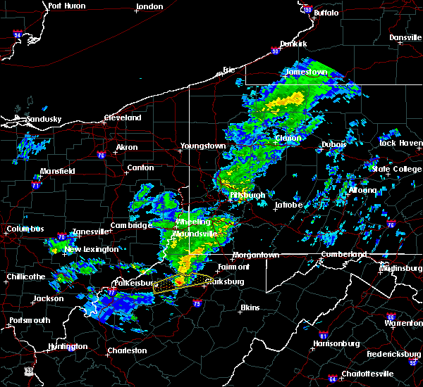 At 1145 pm est, a severe thunderstorm was located near salem, or 15 miles west of clarksburg, moving east northeast at 60 mph (radar indicated). Hazards include 60 mph wind gusts and quarter size hail. Hail damage to vehicles is expected. expect wind damage to roofs, siding, and trees. Locations impacted include, shinnston, salem, lumberport, enterprise, wallace, blandville, center point, sedalia and meadowbrook. At 1145 pm est, a severe thunderstorm was located near salem, or 15 miles west of clarksburg, moving east northeast at 60 mph (radar indicated). Hazards include 60 mph wind gusts and quarter size hail. Hail damage to vehicles is expected. expect wind damage to roofs, siding, and trees. Locations impacted include, shinnston, salem, lumberport, enterprise, wallace, blandville, center point, sedalia and meadowbrook.
|
| 12/1/2018 11:24 PM EST |
 At 1124 pm est, a severe thunderstorm was located over pennsboro, or 7 miles northeast of harrisville, moving east at 55 mph (radar indicated). Hazards include 60 mph wind gusts and quarter size hail. Hail damage to vehicles is expected. Expect wind damage to roofs, siding, and trees. At 1124 pm est, a severe thunderstorm was located over pennsboro, or 7 miles northeast of harrisville, moving east at 55 mph (radar indicated). Hazards include 60 mph wind gusts and quarter size hail. Hail damage to vehicles is expected. Expect wind damage to roofs, siding, and trees.
|
| 5/15/2018 8:11 PM EDT |
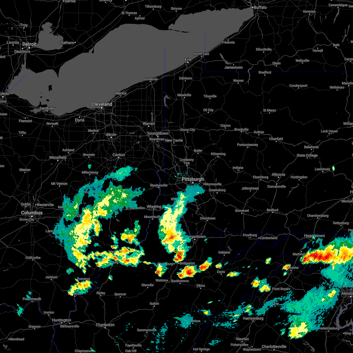 The severe thunderstorm warning for south central marion county will expire at 815 pm edt, the storm that prompted the warning has moved out of the area. therefore, the warning will be allowed to expire. however gusty winds are still possible with this thunderstorm. The severe thunderstorm warning for south central marion county will expire at 815 pm edt, the storm that prompted the warning has moved out of the area. therefore, the warning will be allowed to expire. however gusty winds are still possible with this thunderstorm.
|
| 5/15/2018 8:01 PM EDT |
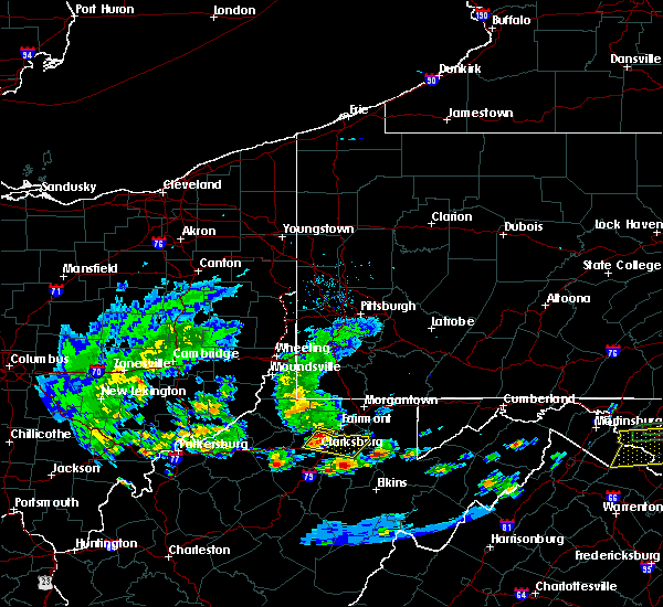 At 801 pm edt, a severe thunderstorm was located near monongah, or near mannington, moving east at 35 mph (radar). Hazards include wind gusts to 60 mph and quarter-size hail. Minor hail damage to vehicles is possible. expect wind damage to trees and power lines, resulting in some power outages. Locations impacted include, fairmont, worthington, white hall,. At 801 pm edt, a severe thunderstorm was located near monongah, or near mannington, moving east at 35 mph (radar). Hazards include wind gusts to 60 mph and quarter-size hail. Minor hail damage to vehicles is possible. expect wind damage to trees and power lines, resulting in some power outages. Locations impacted include, fairmont, worthington, white hall,.
|
| 5/15/2018 7:59 PM EDT |
 At 759 pm edt, severe thunderstorms were located along a line extending from enterprise to near lumberport, moving east at 35 mph (radar indicated). Hazards include 60 mph wind gusts and quarter size hail. Hail damage to vehicles is expected. Expect wind damage to roofs, siding, and trees. At 759 pm edt, severe thunderstorms were located along a line extending from enterprise to near lumberport, moving east at 35 mph (radar indicated). Hazards include 60 mph wind gusts and quarter size hail. Hail damage to vehicles is expected. Expect wind damage to roofs, siding, and trees.
|
| 5/15/2018 7:49 PM EDT |
 At 749 pm edt, a severe thunderstorm was located near mannington, moving east at 35 mph (radar). Hazards include wind gusts to 60 mph. Expect damage to trees and power lines, resulting in some power outages. Locations impacted include, fairmont, mannington, barrackville, monongah, farmington, worthington, rachel, carolina, curtisville, idamay, grangeville,. At 749 pm edt, a severe thunderstorm was located near mannington, moving east at 35 mph (radar). Hazards include wind gusts to 60 mph. Expect damage to trees and power lines, resulting in some power outages. Locations impacted include, fairmont, mannington, barrackville, monongah, farmington, worthington, rachel, carolina, curtisville, idamay, grangeville,.
|
| 4/3/2018 10:37 PM EDT |
 At 1036 pm edt, a severe thunderstorm was located near lumberport, or near clarksburg, moving east at 45 mph (radar indicated). Hazards include 60 mph wind gusts and quarter size hail. Hail damage to vehicles is expected. expect wind damage to roofs, siding, and trees. locations impacted include, clarksburg, bridgeport, shinnston, stonewood, nutter fort, lumberport, anmoore, enterprise, wallace, meadowbrook, wolf summit and despard. this includes the following highways, interstate 79 between mile markers 118 and 128. Route 50 in west virginia between mile markers 69 and 82. At 1036 pm edt, a severe thunderstorm was located near lumberport, or near clarksburg, moving east at 45 mph (radar indicated). Hazards include 60 mph wind gusts and quarter size hail. Hail damage to vehicles is expected. expect wind damage to roofs, siding, and trees. locations impacted include, clarksburg, bridgeport, shinnston, stonewood, nutter fort, lumberport, anmoore, enterprise, wallace, meadowbrook, wolf summit and despard. this includes the following highways, interstate 79 between mile markers 118 and 128. Route 50 in west virginia between mile markers 69 and 82.
|
| 4/3/2018 10:28 PM EDT |
 At 1028 pm edt, a severe thunderstorm was located near salem, or 8 miles west of clarksburg, moving east at 45 mph (radar indicated). Hazards include 60 mph wind gusts and quarter size hail. Hail damage to vehicles is expected. expect wind damage to roofs, siding, and trees. locations impacted include, clarksburg, bridgeport, shinnston, stonewood, nutter fort, salem, lumberport, anmoore, enterprise, west milford, wolf summit, wallace, sedalia, meadowbrook and despard. this includes the following highways, interstate 79 between mile markers 115 and 128. Route 50 in west virginia between mile markers 61 and 82. At 1028 pm edt, a severe thunderstorm was located near salem, or 8 miles west of clarksburg, moving east at 45 mph (radar indicated). Hazards include 60 mph wind gusts and quarter size hail. Hail damage to vehicles is expected. expect wind damage to roofs, siding, and trees. locations impacted include, clarksburg, bridgeport, shinnston, stonewood, nutter fort, salem, lumberport, anmoore, enterprise, west milford, wolf summit, wallace, sedalia, meadowbrook and despard. this includes the following highways, interstate 79 between mile markers 115 and 128. Route 50 in west virginia between mile markers 61 and 82.
|
| 4/3/2018 10:13 PM EDT |
 At 1013 pm edt, a severe thunderstorm was located near west union, or 17 miles northwest of weston, moving east at 45 mph (radar indicated). Hazards include 60 mph wind gusts and quarter size hail. Hail damage to vehicles is expected. Expect wind damage to roofs, siding, and trees. At 1013 pm edt, a severe thunderstorm was located near west union, or 17 miles northwest of weston, moving east at 45 mph (radar indicated). Hazards include 60 mph wind gusts and quarter size hail. Hail damage to vehicles is expected. Expect wind damage to roofs, siding, and trees.
|
| 7/10/2017 7:20 PM EDT |
 At 719 pm edt, a severe thunderstorm was located near pleasant valley, or near fairmont, moving east at 50 mph (radar indicated). Hazards include 60 mph wind gusts and quarter size hail. Hail damage to vehicles is expected. expect wind damage to roofs, siding, and trees. locations impacted include, clarksburg, bridgeport, shinnston, stonewood, nutter fort, lumberport, anmoore, enterprise, flemington, valley falls, grangeville, rosemont, meadland, mcgee, meadowbrook and despard. this includes the following highways, interstate 79 between mile markers 115 and 128. Route 50 in west virginia between mile markers 80 and 82. At 719 pm edt, a severe thunderstorm was located near pleasant valley, or near fairmont, moving east at 50 mph (radar indicated). Hazards include 60 mph wind gusts and quarter size hail. Hail damage to vehicles is expected. expect wind damage to roofs, siding, and trees. locations impacted include, clarksburg, bridgeport, shinnston, stonewood, nutter fort, lumberport, anmoore, enterprise, flemington, valley falls, grangeville, rosemont, meadland, mcgee, meadowbrook and despard. this includes the following highways, interstate 79 between mile markers 115 and 128. Route 50 in west virginia between mile markers 80 and 82.
|
| 7/10/2017 7:09 PM EDT |
 At 708 pm edt, a severe thunderstorm was located over shinnston, or 8 miles south of mannington, moving east at 50 mph (radar indicated). Hazards include 60 mph wind gusts and quarter size hail. Hail damage to vehicles is expected. expect wind damage to roofs, siding, and trees. locations impacted include, clarksburg, bridgeport, shinnston, stonewood, nutter fort, salem, lumberport, anmoore, enterprise, west milford, lost creek, flemington, valley falls, grangeville, rosemont, wolf summit, meadland, wallace, mcgee and meadowbrook. this includes the following highways, interstate 79 between mile markers 109 and 128. Route 50 in west virginia between mile markers 64 and 82. At 708 pm edt, a severe thunderstorm was located over shinnston, or 8 miles south of mannington, moving east at 50 mph (radar indicated). Hazards include 60 mph wind gusts and quarter size hail. Hail damage to vehicles is expected. expect wind damage to roofs, siding, and trees. locations impacted include, clarksburg, bridgeport, shinnston, stonewood, nutter fort, salem, lumberport, anmoore, enterprise, west milford, lost creek, flemington, valley falls, grangeville, rosemont, wolf summit, meadland, wallace, mcgee and meadowbrook. this includes the following highways, interstate 79 between mile markers 109 and 128. Route 50 in west virginia between mile markers 64 and 82.
|
| 7/10/2017 6:58 PM EDT |
 At 657 pm edt, a severe thunderstorm was located 7 miles west of lumberport, or 11 miles southwest of mannington, moving east at 50 mph (radar indicated). Hazards include 60 mph wind gusts and half dollar size hail. Hail damage to vehicles is expected. Expect wind damage to roofs, siding, and trees. At 657 pm edt, a severe thunderstorm was located 7 miles west of lumberport, or 11 miles southwest of mannington, moving east at 50 mph (radar indicated). Hazards include 60 mph wind gusts and half dollar size hail. Hail damage to vehicles is expected. Expect wind damage to roofs, siding, and trees.
|
| 7/7/2017 4:40 PM EDT | Viewer pictures show multiple trees uprooted in enterprise in harrison county WV, 0.5 miles WSW of Enterprise, WV |
| 6/23/2017 7:20 PM EDT |
 At 720 pm edt, a severe thunderstorm capable of producing a tornado was located over monongah, or near fairmont, moving east at 60 mph (radar indicated rotation). Hazards include tornado. Flying debris will be dangerous to those caught without shelter. mobile homes will be damaged or destroyed. damage to roofs, windows, and vehicles will occur. tree damage is likely. this dangerous storm will be near, fairmont around 725 pm edt. winfield around 730 pm edt. brookhaven around 740 pm edt. kingwood around 750 pm edt. other locations impacted by this tornadic thunderstorm include rivesville, valley point, booth, everettville, laurel run, brandonville, grant town, albright, baxter and reedsville. this includes the following highways, interstate 68 in west virginia between mile markers 1 and 6, and between mile markers 16 and 25. interstate 79 in west virginia between mile markers 130 and 151. Please report severe weather by calling 412-262-1988, posting to the nws pittsburgh facebook page, or using twitter @nwspittsburgh. At 720 pm edt, a severe thunderstorm capable of producing a tornado was located over monongah, or near fairmont, moving east at 60 mph (radar indicated rotation). Hazards include tornado. Flying debris will be dangerous to those caught without shelter. mobile homes will be damaged or destroyed. damage to roofs, windows, and vehicles will occur. tree damage is likely. this dangerous storm will be near, fairmont around 725 pm edt. winfield around 730 pm edt. brookhaven around 740 pm edt. kingwood around 750 pm edt. other locations impacted by this tornadic thunderstorm include rivesville, valley point, booth, everettville, laurel run, brandonville, grant town, albright, baxter and reedsville. this includes the following highways, interstate 68 in west virginia between mile markers 1 and 6, and between mile markers 16 and 25. interstate 79 in west virginia between mile markers 130 and 151. Please report severe weather by calling 412-262-1988, posting to the nws pittsburgh facebook page, or using twitter @nwspittsburgh.
|
| 5/1/2017 2:53 PM EDT |
 At 252 pm edt, a severe thunderstorm was located over lumberport, or near clarksburg, moving northeast at 65 mph (radar indicated). Hazards include 70 mph wind gusts. Expect considerable tree damage. damage is likely to mobile homes, roofs, and outbuildings. locations impacted include, clarksburg, bridgeport, shinnston, stonewood, nutter fort, lumberport, anmoore, enterprise, valley falls, meadland, wallace, mcgee, meadowbrook and despard. this includes the following highways, interstate 79 between mile markers 119 and 128. route 50 in west virginia between mile markers 75 and 82. A tornado watch remains in effect until 700 pm edt for northern west virginia. At 252 pm edt, a severe thunderstorm was located over lumberport, or near clarksburg, moving northeast at 65 mph (radar indicated). Hazards include 70 mph wind gusts. Expect considerable tree damage. damage is likely to mobile homes, roofs, and outbuildings. locations impacted include, clarksburg, bridgeport, shinnston, stonewood, nutter fort, lumberport, anmoore, enterprise, valley falls, meadland, wallace, mcgee, meadowbrook and despard. this includes the following highways, interstate 79 between mile markers 119 and 128. route 50 in west virginia between mile markers 75 and 82. A tornado watch remains in effect until 700 pm edt for northern west virginia.
|
| 5/1/2017 2:44 PM EDT |
 At 244 pm edt, a severe thunderstorm was located over salem, or 9 miles west of clarksburg, moving northeast at 65 mph (radar indicated). Hazards include 70 mph wind gusts. Expect considerable tree damage. Damage is likely to mobile homes, roofs, and outbuildings. At 244 pm edt, a severe thunderstorm was located over salem, or 9 miles west of clarksburg, moving northeast at 65 mph (radar indicated). Hazards include 70 mph wind gusts. Expect considerable tree damage. Damage is likely to mobile homes, roofs, and outbuildings.
|
| 2/12/2017 8:46 PM EST |
 At 846 pm est, severe thunderstorms were located along a line extending from 7 miles northwest of ursina to near mannington, moving east at 50 mph (radar). Hazards include 60 mph wind gusts. expect damage to trees and power lines, resulting in some power outages At 846 pm est, severe thunderstorms were located along a line extending from 7 miles northwest of ursina to near mannington, moving east at 50 mph (radar). Hazards include 60 mph wind gusts. expect damage to trees and power lines, resulting in some power outages
|
| 6/16/2016 4:43 PM EDT |
 At 442 pm edt, severe thunderstorms were located along a line extending from near perryopolis to cassville to near salem, moving east at 45 mph (radar indicated). Hazards include 60 mph wind gusts and quarter size hail. Hail damage to vehicles is expected. Expect wind damage to trees and power lines, resulting in some power outages. At 442 pm edt, severe thunderstorms were located along a line extending from near perryopolis to cassville to near salem, moving east at 45 mph (radar indicated). Hazards include 60 mph wind gusts and quarter size hail. Hail damage to vehicles is expected. Expect wind damage to trees and power lines, resulting in some power outages.
|
| 5/1/2016 6:26 PM EDT |
 At 626 pm edt, a severe thunderstorm was located near mannington, moving east at 35 mph (radar indicated). Hazards include 60 mph wind gusts and quarter size hail. Hail damage to vehicles is expected. expect wind damage to trees and power lines, resulting in some power outages. locations impacted include, morgantown, fairmont, westover, mannington, star city, pleasant valley, winfield, barrackville, monongah, granville, cassville, rivesville, grant town, farmington, worthington, daybrook, mccurdyville, white hall, baxter and carolina. this includes the following highways, interstate 68 in west virginia between mile markers 1 and 2, and near mile marker 4. interstate 79 in west virginia between mile markers 130 and 157. Please report severe weather by calling 4 1 2, 2 6 2, 1 9 8 8, posting to the nws pittsburgh facebook page, or using twitter @nwspittsburgh. At 626 pm edt, a severe thunderstorm was located near mannington, moving east at 35 mph (radar indicated). Hazards include 60 mph wind gusts and quarter size hail. Hail damage to vehicles is expected. expect wind damage to trees and power lines, resulting in some power outages. locations impacted include, morgantown, fairmont, westover, mannington, star city, pleasant valley, winfield, barrackville, monongah, granville, cassville, rivesville, grant town, farmington, worthington, daybrook, mccurdyville, white hall, baxter and carolina. this includes the following highways, interstate 68 in west virginia between mile markers 1 and 2, and near mile marker 4. interstate 79 in west virginia between mile markers 130 and 157. Please report severe weather by calling 4 1 2, 2 6 2, 1 9 8 8, posting to the nws pittsburgh facebook page, or using twitter @nwspittsburgh.
|
| 5/1/2016 6:17 PM EDT |
 At 617 pm edt, a severe thunderstorm was located near hundred, or 7 miles northwest of mannington, moving east at 35 mph (radar indicated). Hazards include 60 mph wind gusts and quarter size hail. Hail damage to vehicles is expected. Expect wind damage to trees and power lines, resulting in some power outages. At 617 pm edt, a severe thunderstorm was located near hundred, or 7 miles northwest of mannington, moving east at 35 mph (radar indicated). Hazards include 60 mph wind gusts and quarter size hail. Hail damage to vehicles is expected. Expect wind damage to trees and power lines, resulting in some power outages.
|
| 7/9/2015 1:44 PM EDT |
 At 143 pm edt, severe thunderstorms were located along a line extending from 6 miles west of fredericktown-millsboro to near fairdale to monongah to near salem, moving east at 45 mph (radar indicated). Hazards include 60 mph wind gusts. expect damage to trees and some power outages At 143 pm edt, severe thunderstorms were located along a line extending from 6 miles west of fredericktown-millsboro to near fairdale to monongah to near salem, moving east at 45 mph (radar indicated). Hazards include 60 mph wind gusts. expect damage to trees and some power outages
|
| 6/12/2015 7:41 PM EDT |
 The severe thunderstorm warning for central wetzel and western marion counties will expire at 745 pm edt, the storm which prompted the warning has weakened below severe limits, and no longer poses an immediate threat to life or property. therefore the warning will be allowed to expire. a severe thunderstorm watch remains in effect until 900 pm edt for northern west virginia. The severe thunderstorm warning for central wetzel and western marion counties will expire at 745 pm edt, the storm which prompted the warning has weakened below severe limits, and no longer poses an immediate threat to life or property. therefore the warning will be allowed to expire. a severe thunderstorm watch remains in effect until 900 pm edt for northern west virginia.
|
| 6/12/2015 7:17 PM EDT |
 At 717 pm edt, a severe thunderstorm was located over pine grove, or 11 miles southeast of new martinsville, moving east at 30 mph (radar indicated). Hazards include 60 mph wind gusts and penny size hail. Expect damage to roofs. Siding and trees. At 717 pm edt, a severe thunderstorm was located over pine grove, or 11 miles southeast of new martinsville, moving east at 30 mph (radar indicated). Hazards include 60 mph wind gusts and penny size hail. Expect damage to roofs. Siding and trees.
|
| 4/9/2015 4:58 PM EDT | A severe thunderstorm warning remains in effect until 530 pm edt for doddridge. harrison. northern lewis and northeastern gilmer counties. at 455 pm edt. national weather service doppler radar continued to indicate a severe thunderstorm capable of producing ping pong ball size hail. and damaging winds in excess of 60 mph. This storm was. |
| 4/9/2015 4:24 PM EDT | The national weather service in charleston has issued a * severe thunderstorm warning for. doddridge county in west virginia. north central gilmer county in west virginia. harrison county in west virginia. This includes the city of clarksburg. |
Hail Maps for Enterprise, WV


Connect with Interactive Hail Maps