

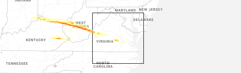
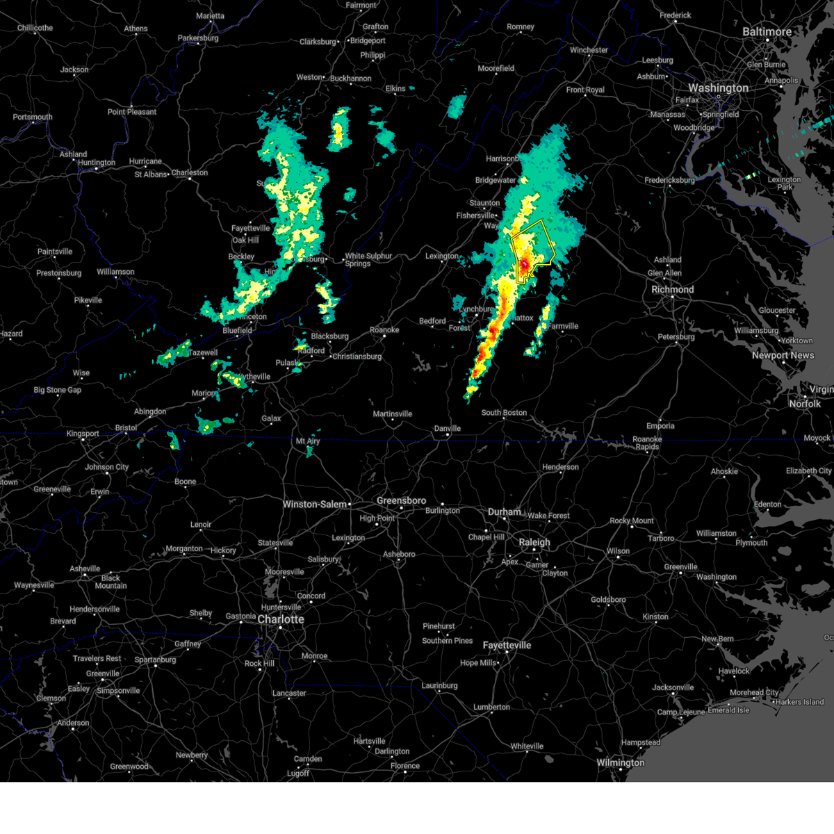
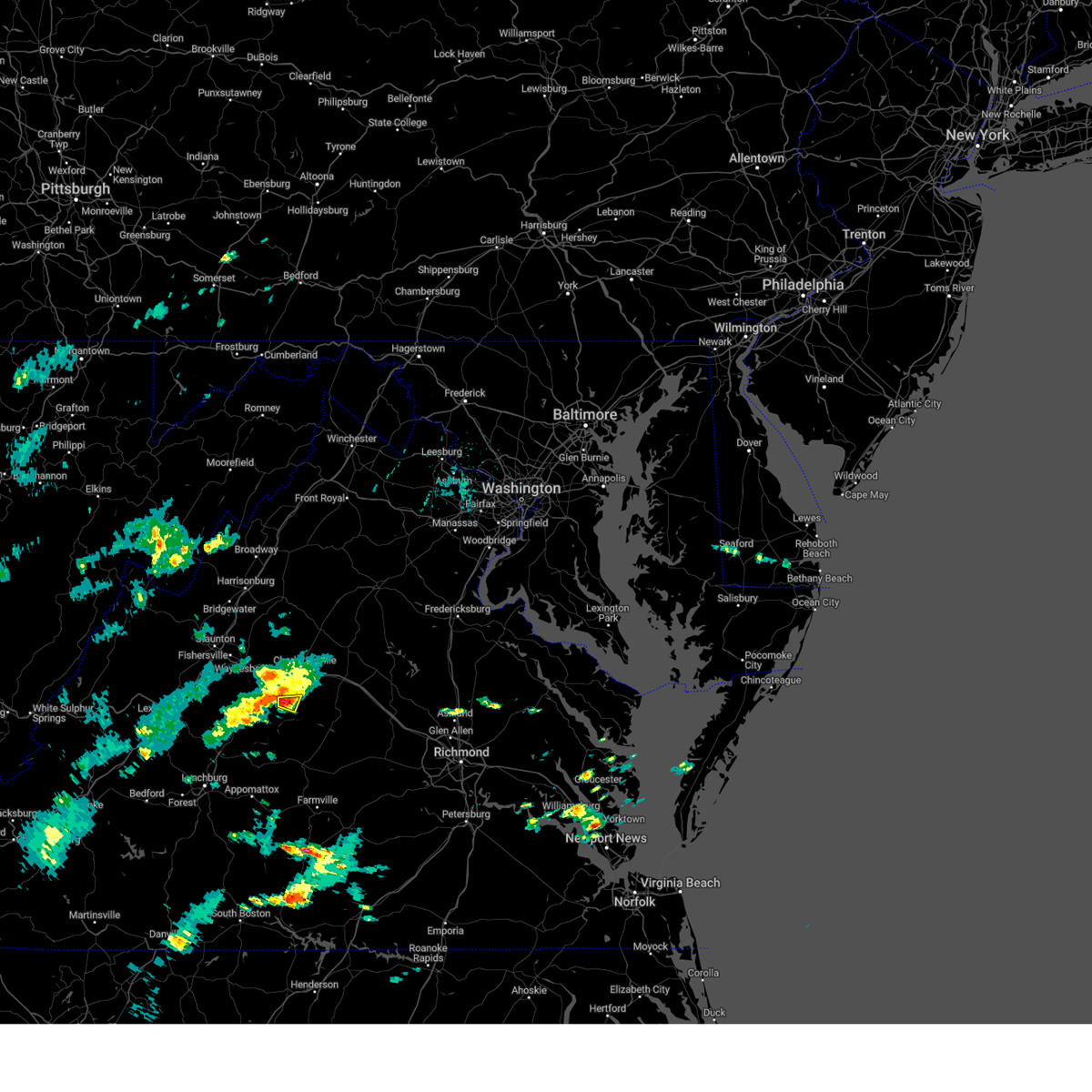
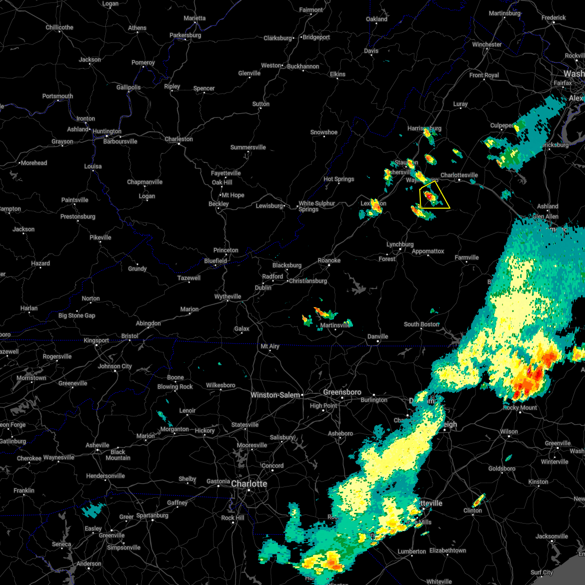
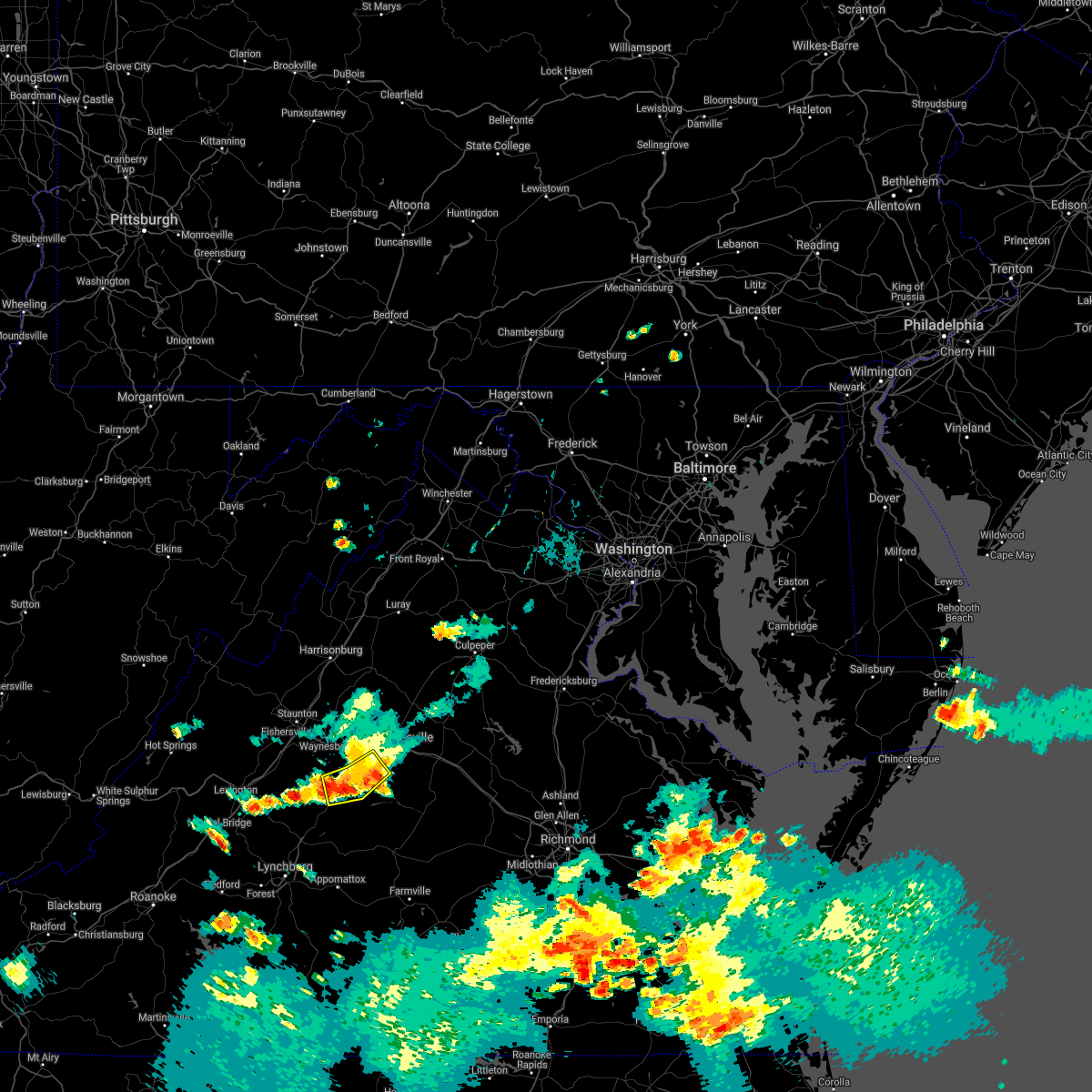
Hail Map for Esmont, VA
The Esmont, VA area has had 0 reports of on-the-ground hail by trained spotters, and has been under severe weather warnings 7 times during the past 12 months. Doppler radar has detected hail at or near Esmont, VA on 36 occasions, including 1 occasion during the past year.
| Name: | Esmont, VA |
| Where Located: | 56.3 miles WNW of Richmond, VA |
| Map: | Google Map for Esmont, VA |
| Population: | 528 |
| Housing Units: | 243 |
| More Info: | Search Google for Esmont, VA |
1
The Top Recent Hail Date for Esmont, VA is Monday, April 14, 2025 (8th out of 36)
Hail and Wind Damage Spotted near Esmont, VA
| Date / Time | Report Details |
|---|---|
| 6/8/2025 5:18 PM EDT | At 517 pm edt, severe thunderstorms were located along a line extending from near stanardsville to near charlottesville to 8 miles east of schuyler, moving east at 20 mph (radar indicated). Hazards include 60 mph wind gusts. Damaging winds will cause some trees and large branches to fall. this could injure those outdoors, as well as damage homes and vehicles. roadways may become blocked by downed trees. localized power outages are possible. unsecured light objects may become projectiles. Locations impacted include, hollymead, stony point, flordon, westmoreland, scott stadium, cobham, charlottesville, cismont, campbell, newcomb hall, boyd tavern, monticello, keswick, woodridge, carrsbrook, earlysville, shadwell, barracks, esmont, and keene. |
| 6/8/2025 5:06 PM EDT |
 Svrlwx the national weather service in sterling virginia has issued a * severe thunderstorm warning for, the city of charlottesville in central virginia, albemarle county in central virginia, * until 545 pm edt. * at 506 pm edt, severe thunderstorms were located along a line extending from near free union to near charlottesville to near schuyler, moving east at 20 mph (radar indicated). Hazards include 60 mph wind gusts. Damaging winds will cause some trees and large branches to fall. this could injure those outdoors, as well as damage homes and vehicles. roadways may become blocked by downed trees. localized power outages are possible. Unsecured light objects may become projectiles. Svrlwx the national weather service in sterling virginia has issued a * severe thunderstorm warning for, the city of charlottesville in central virginia, albemarle county in central virginia, * until 545 pm edt. * at 506 pm edt, severe thunderstorms were located along a line extending from near free union to near charlottesville to near schuyler, moving east at 20 mph (radar indicated). Hazards include 60 mph wind gusts. Damaging winds will cause some trees and large branches to fall. this could injure those outdoors, as well as damage homes and vehicles. roadways may become blocked by downed trees. localized power outages are possible. Unsecured light objects may become projectiles.
|
| 12/31/2024 3:43 PM EST |
 The storm which prompted the warning has moved out of the area. therefore, the warning will be allowed to expire. The storm which prompted the warning has moved out of the area. therefore, the warning will be allowed to expire.
|
| 12/31/2024 3:30 PM EST |
 At 329 pm est, a severe thunderstorm was located near schuyler, or 15 miles south of charlottesville, moving northeast at 40 mph (trained weather spotters reported quarter sized hail in shipman). Hazards include 60 mph wind gusts and quarter size hail. Damaging winds will cause some trees and large branches to fall. this could injure those outdoors, as well as damage homes and vehicles. roadways may become blocked by downed trees. localized power outages are possible. unsecured light objects may become projectiles. Locations impacted include, scottsville, esmont, glendower, keene, alberene, damon, and covesville. At 329 pm est, a severe thunderstorm was located near schuyler, or 15 miles south of charlottesville, moving northeast at 40 mph (trained weather spotters reported quarter sized hail in shipman). Hazards include 60 mph wind gusts and quarter size hail. Damaging winds will cause some trees and large branches to fall. this could injure those outdoors, as well as damage homes and vehicles. roadways may become blocked by downed trees. localized power outages are possible. unsecured light objects may become projectiles. Locations impacted include, scottsville, esmont, glendower, keene, alberene, damon, and covesville.
|
| 12/31/2024 3:20 PM EST |
 At 320 pm est, a severe thunderstorm was located over schuyler, or 18 miles northwest of buckingham, moving northeast at 40 mph (radar indicated). Hazards include 60 mph wind gusts and quarter size hail. Damaging winds will cause some trees and large branches to fall. this could injure those outdoors, as well as damage homes and vehicles. roadways may become blocked by downed trees. localized power outages are possible. unsecured light objects may become projectiles. Locations impacted include, schuyler, ivy, scottsville, esmont, damon, north garden, batesville, covesville, rockfish, glendower, keene, alberene, wingina, and faber. At 320 pm est, a severe thunderstorm was located over schuyler, or 18 miles northwest of buckingham, moving northeast at 40 mph (radar indicated). Hazards include 60 mph wind gusts and quarter size hail. Damaging winds will cause some trees and large branches to fall. this could injure those outdoors, as well as damage homes and vehicles. roadways may become blocked by downed trees. localized power outages are possible. unsecured light objects may become projectiles. Locations impacted include, schuyler, ivy, scottsville, esmont, damon, north garden, batesville, covesville, rockfish, glendower, keene, alberene, wingina, and faber.
|
| 12/31/2024 3:14 PM EST |
 At 314 pm est, a severe thunderstorm was located near schuyler, or 16 miles north of bent creek, moving northeast at 45 mph (radar indicated). Hazards include 60 mph wind gusts and quarter size hail. Damaging winds will cause some trees and large branches to fall. this could injure those outdoors, as well as damage homes and vehicles. roadways may become blocked by downed trees. localized power outages are possible. unsecured light objects may become projectiles. Locations impacted include, shipman, schuyler, nellysford, ivy, scottsville, esmont, lovingston, damon, north garden, batesville, covesville, rockfish, greenfield, norwood, glendower, keene, alberene, wingina, elma, and faber. At 314 pm est, a severe thunderstorm was located near schuyler, or 16 miles north of bent creek, moving northeast at 45 mph (radar indicated). Hazards include 60 mph wind gusts and quarter size hail. Damaging winds will cause some trees and large branches to fall. this could injure those outdoors, as well as damage homes and vehicles. roadways may become blocked by downed trees. localized power outages are possible. unsecured light objects may become projectiles. Locations impacted include, shipman, schuyler, nellysford, ivy, scottsville, esmont, lovingston, damon, north garden, batesville, covesville, rockfish, greenfield, norwood, glendower, keene, alberene, wingina, elma, and faber.
|
| 12/31/2024 2:58 PM EST |
 Svrlwx the national weather service in sterling virginia has issued a * severe thunderstorm warning for, nelson county in central virginia, southwestern albemarle county in central virginia, * until 345 pm est. * at 258 pm est, a severe thunderstorm was located over clifford, moving northeast at 40 mph (radar indicated). Hazards include 60 mph wind gusts and quarter size hail. Damaging winds will cause some trees and large branches to fall. this could injure those outdoors, as well as damage homes and vehicles. roadways may become blocked by downed trees. localized power outages are possible. Unsecured light objects may become projectiles. Svrlwx the national weather service in sterling virginia has issued a * severe thunderstorm warning for, nelson county in central virginia, southwestern albemarle county in central virginia, * until 345 pm est. * at 258 pm est, a severe thunderstorm was located over clifford, moving northeast at 40 mph (radar indicated). Hazards include 60 mph wind gusts and quarter size hail. Damaging winds will cause some trees and large branches to fall. this could injure those outdoors, as well as damage homes and vehicles. roadways may become blocked by downed trees. localized power outages are possible. Unsecured light objects may become projectiles.
|
| 5/26/2024 8:32 PM EDT |
 At 832 pm edt, severe thunderstorms were located along a line extending from near petersburg to 8 miles west of broadway to near crozet to near dillwyn, moving east at 40 mph (radar indicated). Hazards include 60 mph wind gusts and quarter size hail. Damaging winds will cause some trees and large branches to fall. this could injure those outdoors, as well as damage homes and vehicles. roadways may become blocked by downed trees. localized power outages are possible. unsecured light objects may become projectiles. Locations impacted include, harrisonburg, bridgewater, crozet, broadway, grottoes, timberville, massanutten, crimora, dale enterprise, elkton, weyers cave, dayton, ivy, scottsville, esmont, mount crawford, rocky bar, tunis, penn laird, and port republic. At 832 pm edt, severe thunderstorms were located along a line extending from near petersburg to 8 miles west of broadway to near crozet to near dillwyn, moving east at 40 mph (radar indicated). Hazards include 60 mph wind gusts and quarter size hail. Damaging winds will cause some trees and large branches to fall. this could injure those outdoors, as well as damage homes and vehicles. roadways may become blocked by downed trees. localized power outages are possible. unsecured light objects may become projectiles. Locations impacted include, harrisonburg, bridgewater, crozet, broadway, grottoes, timberville, massanutten, crimora, dale enterprise, elkton, weyers cave, dayton, ivy, scottsville, esmont, mount crawford, rocky bar, tunis, penn laird, and port republic.
|
| 5/26/2024 8:32 PM EDT |
 the severe thunderstorm warning has been cancelled and is no longer in effect the severe thunderstorm warning has been cancelled and is no longer in effect
|
| 5/26/2024 8:12 PM EDT |
 the severe thunderstorm warning has been cancelled and is no longer in effect the severe thunderstorm warning has been cancelled and is no longer in effect
|
| 5/26/2024 8:12 PM EDT |
 At 811 pm edt, severe thunderstorms were located along a line extending from 9 miles southwest of petersburg to 6 miles south of brandywine to near afton to near tower hill, moving east at 45 mph (radar indicated). Hazards include 60 mph wind gusts and quarter size hail. Damaging winds will cause some trees and large branches to fall. this could injure those outdoors, as well as damage homes and vehicles. roadways may become blocked by downed trees. localized power outages are possible. unsecured light objects may become projectiles. Locations impacted include, harrisonburg, staunton, waynesboro, franklin, stuarts draft, bridgewater, crozet, broadway, grottoes, timberville, massanutten, crimora, sherando, shipman, schuyler, wintergreen, afton, dale enterprise, fishersville, and verona. At 811 pm edt, severe thunderstorms were located along a line extending from 9 miles southwest of petersburg to 6 miles south of brandywine to near afton to near tower hill, moving east at 45 mph (radar indicated). Hazards include 60 mph wind gusts and quarter size hail. Damaging winds will cause some trees and large branches to fall. this could injure those outdoors, as well as damage homes and vehicles. roadways may become blocked by downed trees. localized power outages are possible. unsecured light objects may become projectiles. Locations impacted include, harrisonburg, staunton, waynesboro, franklin, stuarts draft, bridgewater, crozet, broadway, grottoes, timberville, massanutten, crimora, sherando, shipman, schuyler, wintergreen, afton, dale enterprise, fishersville, and verona.
|
| 5/26/2024 7:42 PM EDT |
 Svrlwx the national weather service in sterling virginia has issued a * severe thunderstorm warning for, nelson county in central virginia, rockingham county in western virginia, western albemarle county in central virginia, western greene county in central virginia, augusta county in western virginia, the city of staunton in western virginia, the city of harrisonburg in western virginia, the city of waynesboro in western virginia, eastern highland county in western virginia, pendleton county in eastern west virginia, southwestern hardy county in eastern west virginia, * until 845 pm edt. * at 742 pm edt, severe thunderstorms were located along a line extending from 13 miles southeast of elkins to monterey to near fairfield to near evington, moving east at 40 mph (radar indicated). Hazards include 60 mph wind gusts. Damaging winds will cause some trees and large branches to fall. this could injure those outdoors, as well as damage homes and vehicles. roadways may become blocked by downed trees. localized power outages are possible. Unsecured light objects may become projectiles. Svrlwx the national weather service in sterling virginia has issued a * severe thunderstorm warning for, nelson county in central virginia, rockingham county in western virginia, western albemarle county in central virginia, western greene county in central virginia, augusta county in western virginia, the city of staunton in western virginia, the city of harrisonburg in western virginia, the city of waynesboro in western virginia, eastern highland county in western virginia, pendleton county in eastern west virginia, southwestern hardy county in eastern west virginia, * until 845 pm edt. * at 742 pm edt, severe thunderstorms were located along a line extending from 13 miles southeast of elkins to monterey to near fairfield to near evington, moving east at 40 mph (radar indicated). Hazards include 60 mph wind gusts. Damaging winds will cause some trees and large branches to fall. this could injure those outdoors, as well as damage homes and vehicles. roadways may become blocked by downed trees. localized power outages are possible. Unsecured light objects may become projectiles.
|
| 5/6/2024 3:31 PM EDT |
 The storm which prompted the warning has weakened below severe limits, and no longer poses an immediate threat to life or property. therefore, the warning has been allowed to expire. however, small hail and gusty winds up to 40 mph are still possible with this thunderstorm. The storm which prompted the warning has weakened below severe limits, and no longer poses an immediate threat to life or property. therefore, the warning has been allowed to expire. however, small hail and gusty winds up to 40 mph are still possible with this thunderstorm.
|
| 5/6/2024 3:17 PM EDT |
 At 317 pm edt, a severe thunderstorm was located near schuyler, or 14 miles southwest of charlottesville, moving east at 15 mph (radar indicated). Hazards include 60 mph wind gusts and small hail. Damaging winds will cause some trees and large branches to fall. this could injure those outdoors, as well as damage homes and vehicles. roadways may become blocked by downed trees. localized power outages are possible. unsecured light objects may become projectiles. Locations impacted include, esmont, glendower, and keene. At 317 pm edt, a severe thunderstorm was located near schuyler, or 14 miles southwest of charlottesville, moving east at 15 mph (radar indicated). Hazards include 60 mph wind gusts and small hail. Damaging winds will cause some trees and large branches to fall. this could injure those outdoors, as well as damage homes and vehicles. roadways may become blocked by downed trees. localized power outages are possible. unsecured light objects may become projectiles. Locations impacted include, esmont, glendower, and keene.
|
| 5/6/2024 3:01 PM EDT |
 Svrlwx the national weather service in sterling virginia has issued a * severe thunderstorm warning for, southwestern albemarle county in central virginia, * until 330 pm edt. * at 301 pm edt, a severe thunderstorm was located near schuyler, or 16 miles southwest of charlottesville, moving east at 10 mph (radar indicated). Hazards include 60 mph wind gusts and quarter size hail. Damaging winds will cause some trees and large branches to fall. this could injure those outdoors, as well as damage homes and vehicles. roadways may become blocked by downed trees. localized power outages are possible. Unsecured light objects may become projectiles. Svrlwx the national weather service in sterling virginia has issued a * severe thunderstorm warning for, southwestern albemarle county in central virginia, * until 330 pm edt. * at 301 pm edt, a severe thunderstorm was located near schuyler, or 16 miles southwest of charlottesville, moving east at 10 mph (radar indicated). Hazards include 60 mph wind gusts and quarter size hail. Damaging winds will cause some trees and large branches to fall. this could injure those outdoors, as well as damage homes and vehicles. roadways may become blocked by downed trees. localized power outages are possible. Unsecured light objects may become projectiles.
|
| 9/8/2023 8:41 PM EDT |
 At 841 pm edt, severe thunderstorms were located along a line extending from near centenary to near lakeside village, moving north at 20 mph (radar indicated). Hazards include 60 mph wind gusts and quarter size hail. Damaging winds will cause some trees and large branches to fall. this could injure those outdoors, as well as damage homes and vehicles. roadways may become blocked by downed trees. localized power outages are possible. Unsecured light objects may become projectiles. At 841 pm edt, severe thunderstorms were located along a line extending from near centenary to near lakeside village, moving north at 20 mph (radar indicated). Hazards include 60 mph wind gusts and quarter size hail. Damaging winds will cause some trees and large branches to fall. this could injure those outdoors, as well as damage homes and vehicles. roadways may become blocked by downed trees. localized power outages are possible. Unsecured light objects may become projectiles.
|
| 7/28/2023 7:20 PM EDT |
 At 719 pm edt, severe thunderstorms were located along a line extending from 8 miles northwest of free union to near wintergreen, moving east at 35 mph (law enforcement). Hazards include 60 mph wind gusts. Damaging winds will cause some trees and large branches to fall. this could injure those outdoors, as well as damage homes and vehicles. roadways may become blocked by downed trees. localized power outages are possible. Unsecured light objects may become projectiles. At 719 pm edt, severe thunderstorms were located along a line extending from 8 miles northwest of free union to near wintergreen, moving east at 35 mph (law enforcement). Hazards include 60 mph wind gusts. Damaging winds will cause some trees and large branches to fall. this could injure those outdoors, as well as damage homes and vehicles. roadways may become blocked by downed trees. localized power outages are possible. Unsecured light objects may become projectiles.
|
| 7/3/2023 9:27 PM EDT |
 The severe thunderstorm warning for central albemarle county and the city of charlottesville will expire at 930 pm edt, the storm which prompted the warning has weakened below severe limits, and no longer poses an immediate threat to life or property. therefore, the warning will be allowed to expire. however gusty winds are still possible with this thunderstorm. a severe thunderstorm watch remains in effect until 1000 pm edt for central virginia. The severe thunderstorm warning for central albemarle county and the city of charlottesville will expire at 930 pm edt, the storm which prompted the warning has weakened below severe limits, and no longer poses an immediate threat to life or property. therefore, the warning will be allowed to expire. however gusty winds are still possible with this thunderstorm. a severe thunderstorm watch remains in effect until 1000 pm edt for central virginia.
|
| 7/3/2023 9:02 PM EDT |
 At 902 pm edt, a severe thunderstorm was located 7 miles southwest of charlottesville, moving northeast at 35 mph (radar indicated). Hazards include 60 mph wind gusts and quarter size hail. Damaging winds will cause some trees and large branches to fall. this could injure those outdoors, as well as damage homes and vehicles. roadways may become blocked by downed trees. localized power outages are possible. unsecured light objects may become projectiles. locations impacted include, charlottesville, free union, campbell, westmoreland, hollymead, ivy, scottsville, esmont, north garden, stony point, flordon, scott stadium, cismont, newcomb hall, boyd tavern, keswick, monticello, woodridge, carrsbrook and earlysville. hail threat, radar indicated max hail size, 1. 00 in wind threat, radar indicated max wind gust, 60 mph. At 902 pm edt, a severe thunderstorm was located 7 miles southwest of charlottesville, moving northeast at 35 mph (radar indicated). Hazards include 60 mph wind gusts and quarter size hail. Damaging winds will cause some trees and large branches to fall. this could injure those outdoors, as well as damage homes and vehicles. roadways may become blocked by downed trees. localized power outages are possible. unsecured light objects may become projectiles. locations impacted include, charlottesville, free union, campbell, westmoreland, hollymead, ivy, scottsville, esmont, north garden, stony point, flordon, scott stadium, cismont, newcomb hall, boyd tavern, keswick, monticello, woodridge, carrsbrook and earlysville. hail threat, radar indicated max hail size, 1. 00 in wind threat, radar indicated max wind gust, 60 mph.
|
| 7/3/2023 9:00 PM EDT | Several trees down due to thunderstorm winds in the north garden are in albemarle county VA, 8.3 miles SSE of Esmont, VA |
| 7/3/2023 8:42 PM EDT |
 At 841 pm edt, a severe thunderstorm was located near schuyler, or 18 miles southwest of charlottesville, moving northeast at 35 mph (radar indicated). Hazards include 60 mph wind gusts. Damaging winds will cause some trees and large branches to fall. this could injure those outdoors, as well as damage homes and vehicles. roadways may become blocked by downed trees. localized power outages are possible. Unsecured light objects may become projectiles. At 841 pm edt, a severe thunderstorm was located near schuyler, or 18 miles southwest of charlottesville, moving northeast at 35 mph (radar indicated). Hazards include 60 mph wind gusts. Damaging winds will cause some trees and large branches to fall. this could injure those outdoors, as well as damage homes and vehicles. roadways may become blocked by downed trees. localized power outages are possible. Unsecured light objects may become projectiles.
|
| 7/3/2023 4:08 PM EDT |
 The severe thunderstorm warning for northeastern nelson and central albemarle counties and the city of charlottesville will expire at 415 pm edt, the storms which prompted the warning have weakened below severe limits, and no longer pose an immediate threat to life or property. therefore, the warning will be allowed to expire. a severe thunderstorm watch remains in effect until 1000 pm edt for central virginia. The severe thunderstorm warning for northeastern nelson and central albemarle counties and the city of charlottesville will expire at 415 pm edt, the storms which prompted the warning have weakened below severe limits, and no longer pose an immediate threat to life or property. therefore, the warning will be allowed to expire. a severe thunderstorm watch remains in effect until 1000 pm edt for central virginia.
|
| 7/3/2023 3:39 PM EDT |
 At 339 pm edt, severe thunderstorms were located along a line extending from 7 miles south of wintergreen to 8 miles north of schuyler to 7 miles southwest of lake monticello, moving northeast at 30 mph (radar indicated). Hazards include 60 mph wind gusts. Damaging winds will cause some trees and large branches to fall. this could injure those outdoors, as well as damage homes and vehicles. roadways may become blocked by downed trees. localized power outages are possible. unsecured light objects may become projectiles. locations impacted include, charlottesville, crozet, shipman, schuyler, wintergreen, nellysford, ivy, scottsville, esmont, lovingston, north garden, covesville, yancey mills, tyro, flordon, jonesboro, scott stadium, faber, massies mill and bryant. hail threat, radar indicated max hail size, <. 75 in wind threat, radar indicated max wind gust, 60 mph. At 339 pm edt, severe thunderstorms were located along a line extending from 7 miles south of wintergreen to 8 miles north of schuyler to 7 miles southwest of lake monticello, moving northeast at 30 mph (radar indicated). Hazards include 60 mph wind gusts. Damaging winds will cause some trees and large branches to fall. this could injure those outdoors, as well as damage homes and vehicles. roadways may become blocked by downed trees. localized power outages are possible. unsecured light objects may become projectiles. locations impacted include, charlottesville, crozet, shipman, schuyler, wintergreen, nellysford, ivy, scottsville, esmont, lovingston, north garden, covesville, yancey mills, tyro, flordon, jonesboro, scott stadium, faber, massies mill and bryant. hail threat, radar indicated max hail size, <. 75 in wind threat, radar indicated max wind gust, 60 mph.
|
| 7/3/2023 3:27 PM EDT |
 At 327 pm edt, severe thunderstorms were located along a line extending from near lowesville to 8 miles northwest of schuyler to 8 miles north of centenary, moving northeast at 30 mph (radar indicated). Hazards include 60 mph wind gusts. Damaging winds will cause some trees and large branches to fall. this could injure those outdoors, as well as damage homes and vehicles. roadways may become blocked by downed trees. localized power outages are possible. Unsecured light objects may become projectiles. At 327 pm edt, severe thunderstorms were located along a line extending from near lowesville to 8 miles northwest of schuyler to 8 miles north of centenary, moving northeast at 30 mph (radar indicated). Hazards include 60 mph wind gusts. Damaging winds will cause some trees and large branches to fall. this could injure those outdoors, as well as damage homes and vehicles. roadways may become blocked by downed trees. localized power outages are possible. Unsecured light objects may become projectiles.
|
| 7/3/2023 3:05 PM EDT |
 At 305 pm edt, severe thunderstorms were located along a line extending from 6 miles northwest of shipman to near schuyler, moving northeast at 25 mph (radar indicated). Hazards include 60 mph wind gusts. Damaging winds will cause some trees and large branches to fall. this could injure those outdoors, as well as damage homes and vehicles. roadways may become blocked by downed trees. localized power outages are possible. Unsecured light objects may become projectiles. At 305 pm edt, severe thunderstorms were located along a line extending from 6 miles northwest of shipman to near schuyler, moving northeast at 25 mph (radar indicated). Hazards include 60 mph wind gusts. Damaging winds will cause some trees and large branches to fall. this could injure those outdoors, as well as damage homes and vehicles. roadways may become blocked by downed trees. localized power outages are possible. Unsecured light objects may become projectiles.
|
| 6/16/2023 2:20 PM EDT |
 At 220 pm edt, severe thunderstorms were located along a line extending from near wintergreen to lowesville, moving southeast at 30 mph (radar indicated). Hazards include 60 mph wind gusts and quarter size hail. Damaging winds will cause some trees and large branches to fall. this could injure those outdoors, as well as damage homes and vehicles. roadways may become blocked by downed trees. localized power outages are possible. unsecured light objects may become projectiles. locations impacted include, shipman, schuyler, nellysford, arrington, scottsville, esmont, lovingston, bryant, damon, covesville, roseland, rockfish, tyro, glendower, jonesboro, wingina, elma, faber and massies mill. hail threat, radar indicated max hail size, 1. 00 in wind threat, radar indicated max wind gust, 60 mph. At 220 pm edt, severe thunderstorms were located along a line extending from near wintergreen to lowesville, moving southeast at 30 mph (radar indicated). Hazards include 60 mph wind gusts and quarter size hail. Damaging winds will cause some trees and large branches to fall. this could injure those outdoors, as well as damage homes and vehicles. roadways may become blocked by downed trees. localized power outages are possible. unsecured light objects may become projectiles. locations impacted include, shipman, schuyler, nellysford, arrington, scottsville, esmont, lovingston, bryant, damon, covesville, roseland, rockfish, tyro, glendower, jonesboro, wingina, elma, faber and massies mill. hail threat, radar indicated max hail size, 1. 00 in wind threat, radar indicated max wind gust, 60 mph.
|
| 6/16/2023 2:09 PM EDT |
 At 208 pm edt, severe thunderstorms were located along a line extending from near wintergreen to near alto, moving southeast at 30 mph (radar indicated). Hazards include 60 mph wind gusts and quarter size hail. Damaging winds will cause some trees and large branches to fall. this could injure those outdoors, as well as damage homes and vehicles. roadways may become blocked by downed trees. localized power outages are possible. Unsecured light objects may become projectiles. At 208 pm edt, severe thunderstorms were located along a line extending from near wintergreen to near alto, moving southeast at 30 mph (radar indicated). Hazards include 60 mph wind gusts and quarter size hail. Damaging winds will cause some trees and large branches to fall. this could injure those outdoors, as well as damage homes and vehicles. roadways may become blocked by downed trees. localized power outages are possible. Unsecured light objects may become projectiles.
|
| 8/26/2022 5:30 PM EDT | At 530 pm edt, a severe thunderstorm was located over crozet, or 11 miles west of charlottesville, moving southeast at 10 mph (radar indicated). Hazards include 60 mph wind gusts and quarter size hail. Damaging winds will cause some trees and large branches to fall. this could injure those outdoors, as well as damage homes and vehicles. roadways may become blocked by downed trees. localized power outages are possible. Unsecured light objects may become projectiles. |
| 7/21/2022 5:45 PM EDT |
 At 545 pm edt, a severe thunderstorm was located near shipman, or 15 miles northeast of clifford, moving east at 20 mph (radar indicated). Hazards include 60 mph wind gusts. Damaging winds will cause some trees and large branches to fall. this could injure those outdoors, as well as damage homes and vehicles. roadways may become blocked by downed trees. localized power outages are possible. Unsecured light objects may become projectiles. At 545 pm edt, a severe thunderstorm was located near shipman, or 15 miles northeast of clifford, moving east at 20 mph (radar indicated). Hazards include 60 mph wind gusts. Damaging winds will cause some trees and large branches to fall. this could injure those outdoors, as well as damage homes and vehicles. roadways may become blocked by downed trees. localized power outages are possible. Unsecured light objects may become projectiles.
|
| 7/16/2022 6:52 PM EDT |
 At 652 pm edt, a severe thunderstorm was located 7 miles east of wintergreen, or 14 miles south of waynesboro, and is nearly stationary (radar indicated). Hazards include 60 mph wind gusts. Damaging winds will cause some trees and large branches to fall. this could injure those outdoors, as well as damage homes and vehicles. roadways may become blocked by downed trees. localized power outages are possible. unsecured light objects may become projectiles. locations impacted include, schuyler, wintergreen, nellysford, esmont, lovingston, greenfield, damon, covesville, rockfish and faber. hail threat, radar indicated max hail size, <. 75 in wind threat, radar indicated max wind gust, 60 mph. At 652 pm edt, a severe thunderstorm was located 7 miles east of wintergreen, or 14 miles south of waynesboro, and is nearly stationary (radar indicated). Hazards include 60 mph wind gusts. Damaging winds will cause some trees and large branches to fall. this could injure those outdoors, as well as damage homes and vehicles. roadways may become blocked by downed trees. localized power outages are possible. unsecured light objects may become projectiles. locations impacted include, schuyler, wintergreen, nellysford, esmont, lovingston, greenfield, damon, covesville, rockfish and faber. hail threat, radar indicated max hail size, <. 75 in wind threat, radar indicated max wind gust, 60 mph.
|
| 7/16/2022 6:37 PM EDT |
 At 637 pm edt, a severe thunderstorm was located near wintergreen, or 13 miles south of waynesboro, and is nearly stationary (radar indicated). Hazards include 70 mph wind gusts and quarter size hail. Damaging winds will cause some trees and large branches to fall. this could injure those outdoors, as well as damage homes and vehicles. roadways may become blocked by downed trees. localized power outages are possible. unsecured light objects may become projectiles. locations impacted include, schuyler, wintergreen, nellysford, esmont, lovingston, greenfield, damon, covesville, rockfish and faber. thunderstorm damage threat, considerable hail threat, radar indicated max hail size, 1. 00 in wind threat, radar indicated max wind gust, 70 mph. At 637 pm edt, a severe thunderstorm was located near wintergreen, or 13 miles south of waynesboro, and is nearly stationary (radar indicated). Hazards include 70 mph wind gusts and quarter size hail. Damaging winds will cause some trees and large branches to fall. this could injure those outdoors, as well as damage homes and vehicles. roadways may become blocked by downed trees. localized power outages are possible. unsecured light objects may become projectiles. locations impacted include, schuyler, wintergreen, nellysford, esmont, lovingston, greenfield, damon, covesville, rockfish and faber. thunderstorm damage threat, considerable hail threat, radar indicated max hail size, 1. 00 in wind threat, radar indicated max wind gust, 70 mph.
|
| 7/16/2022 6:32 PM EDT |
 At 632 pm edt, a severe thunderstorm was located near wintergreen, or 13 miles south of waynesboro, and is nearly stationary (radar indicated). Hazards include 60 mph wind gusts and quarter size hail. Damaging winds will cause some trees and large branches to fall. this could injure those outdoors, as well as damage homes and vehicles. roadways may become blocked by downed trees. localized power outages are possible. Unsecured light objects may become projectiles. At 632 pm edt, a severe thunderstorm was located near wintergreen, or 13 miles south of waynesboro, and is nearly stationary (radar indicated). Hazards include 60 mph wind gusts and quarter size hail. Damaging winds will cause some trees and large branches to fall. this could injure those outdoors, as well as damage homes and vehicles. roadways may become blocked by downed trees. localized power outages are possible. Unsecured light objects may become projectiles.
|
| 7/6/2022 5:01 PM EDT |
 At 500 pm edt, severe thunderstorms were located along a line extending from 6 miles north of schuyler to near shipman, moving southeast at 25 mph (radar indicated). Hazards include 60 mph wind gusts. Damaging winds will cause some trees and large branches to fall. this could injure those outdoors, as well as damage homes and vehicles. roadways may become blocked by downed trees. localized power outages are possible. Unsecured light objects may become projectiles. At 500 pm edt, severe thunderstorms were located along a line extending from 6 miles north of schuyler to near shipman, moving southeast at 25 mph (radar indicated). Hazards include 60 mph wind gusts. Damaging winds will cause some trees and large branches to fall. this could injure those outdoors, as well as damage homes and vehicles. roadways may become blocked by downed trees. localized power outages are possible. Unsecured light objects may become projectiles.
|
| 6/17/2022 5:32 PM EDT |
 At 532 pm edt, severe thunderstorms were located along a line extending from 7 miles east of schuyler to near hixburg, moving east at 50 mph (radar indicated). Hazards include 60 mph wind gusts. Damaging winds will cause some trees and large branches to fall. this could injure those outdoors, as well as damage homes and vehicles. roadways may become blocked by downed trees. localized power outages are possible. unsecured light objects may become projectiles. locations impacted include, schuyler, scottsville, esmont, glendower, keene and damon. hail threat, radar indicated max hail size, <. 75 in wind threat, radar indicated max wind gust, 60 mph. At 532 pm edt, severe thunderstorms were located along a line extending from 7 miles east of schuyler to near hixburg, moving east at 50 mph (radar indicated). Hazards include 60 mph wind gusts. Damaging winds will cause some trees and large branches to fall. this could injure those outdoors, as well as damage homes and vehicles. roadways may become blocked by downed trees. localized power outages are possible. unsecured light objects may become projectiles. locations impacted include, schuyler, scottsville, esmont, glendower, keene and damon. hail threat, radar indicated max hail size, <. 75 in wind threat, radar indicated max wind gust, 60 mph.
|
| 6/17/2022 5:12 PM EDT |
 At 512 pm edt, severe thunderstorms were located along a line extending from 6 miles southeast of wintergreen to oakville, moving east at 50 mph (radar indicated). Hazards include 60 mph wind gusts. Damaging winds will cause some trees and large branches to fall. this could injure those outdoors, as well as damage homes and vehicles. roadways may become blocked by downed trees. localized power outages are possible. Unsecured light objects may become projectiles. At 512 pm edt, severe thunderstorms were located along a line extending from 6 miles southeast of wintergreen to oakville, moving east at 50 mph (radar indicated). Hazards include 60 mph wind gusts. Damaging winds will cause some trees and large branches to fall. this could injure those outdoors, as well as damage homes and vehicles. roadways may become blocked by downed trees. localized power outages are possible. Unsecured light objects may become projectiles.
|
| 6/17/2022 5:01 PM EDT |
 At 459 pm edt, severe thunderstorms were located near montebello, moving east at 45 mph (radar indicated). Hazards include 60 mph wind gusts. Damaging winds will cause some trees and large branches to fall. this could injure those outdoors, as well as damage homes and vehicles. roadways may become blocked by downed trees. localized power outages are possible. unsecured light objects may become projectiles. these severe storms will be near, sherando, lovingston, greenfield, and wintergreen around 515 pm edt. other locations impacted by these severe thunderstorms include allens creek, lovingston, north garden, covesville, tyro, buffalo springs, norwood, nellysford, jonesboro and gladstone. hail threat, radar indicated max hail size, <. 75 in wind threat, radar indicated max wind gust, 60 mph. At 459 pm edt, severe thunderstorms were located near montebello, moving east at 45 mph (radar indicated). Hazards include 60 mph wind gusts. Damaging winds will cause some trees and large branches to fall. this could injure those outdoors, as well as damage homes and vehicles. roadways may become blocked by downed trees. localized power outages are possible. unsecured light objects may become projectiles. these severe storms will be near, sherando, lovingston, greenfield, and wintergreen around 515 pm edt. other locations impacted by these severe thunderstorms include allens creek, lovingston, north garden, covesville, tyro, buffalo springs, norwood, nellysford, jonesboro and gladstone. hail threat, radar indicated max hail size, <. 75 in wind threat, radar indicated max wind gust, 60 mph.
|
| 6/17/2022 4:24 PM EDT |
 At 424 pm edt, severe thunderstorms were located along a line extending from near bells valley to collierstown to near snowden, moving southeast at 45 mph (trained weather spotters). Hazards include 60 mph wind gusts. Damaging winds will cause some trees and large branches to fall. this could injure those outdoors, as well as damage homes and vehicles. roadways may become blocked by downed trees. localized power outages are possible. Unsecured light objects may become projectiles. At 424 pm edt, severe thunderstorms were located along a line extending from near bells valley to collierstown to near snowden, moving southeast at 45 mph (trained weather spotters). Hazards include 60 mph wind gusts. Damaging winds will cause some trees and large branches to fall. this could injure those outdoors, as well as damage homes and vehicles. roadways may become blocked by downed trees. localized power outages are possible. Unsecured light objects may become projectiles.
|
| 6/2/2022 4:52 PM EDT |
 The severe thunderstorm warning for southeastern nelson and southwestern albemarle counties will expire at 500 pm edt, the storms which prompted the warning have moved out of the area. therefore, the warning will be allowed to expire. a severe thunderstorm watch remains in effect until 900 pm edt for central virginia. to report severe weather, contact your nearest law enforcement agency. they will relay your report to the national weather service sterling virginia. The severe thunderstorm warning for southeastern nelson and southwestern albemarle counties will expire at 500 pm edt, the storms which prompted the warning have moved out of the area. therefore, the warning will be allowed to expire. a severe thunderstorm watch remains in effect until 900 pm edt for central virginia. to report severe weather, contact your nearest law enforcement agency. they will relay your report to the national weather service sterling virginia.
|
| 6/2/2022 4:28 PM EDT |
 At 428 pm edt, severe thunderstorms were located along a line extending from 6 miles northeast of schuyler to near shipman, moving east at 30 mph (radar indicated). Hazards include 60 mph wind gusts. Damaging winds will cause some trees and large branches to fall. this could injure those outdoors, as well as damage homes and vehicles. roadways may become blocked by downed trees. localized power outages are possible. Unsecured light objects may become projectiles. At 428 pm edt, severe thunderstorms were located along a line extending from 6 miles northeast of schuyler to near shipman, moving east at 30 mph (radar indicated). Hazards include 60 mph wind gusts. Damaging winds will cause some trees and large branches to fall. this could injure those outdoors, as well as damage homes and vehicles. roadways may become blocked by downed trees. localized power outages are possible. Unsecured light objects may become projectiles.
|
| 5/27/2022 7:11 PM EDT |
 The severe thunderstorm warning for southern albemarle county and the city of charlottesville will expire at 715 pm edt, the storm which prompted the warning has moved out of the area. therefore, the warning will be allowed to expire. however gusty winds are still possible with this thunderstorm. a severe thunderstorm watch remains in effect until 1000 pm edt for central virginia. to report severe weather, contact your nearest law enforcement agency. they will relay your report to the national weather service sterling virginia. The severe thunderstorm warning for southern albemarle county and the city of charlottesville will expire at 715 pm edt, the storm which prompted the warning has moved out of the area. therefore, the warning will be allowed to expire. however gusty winds are still possible with this thunderstorm. a severe thunderstorm watch remains in effect until 1000 pm edt for central virginia. to report severe weather, contact your nearest law enforcement agency. they will relay your report to the national weather service sterling virginia.
|
| 5/27/2022 6:49 PM EDT |
 At 649 pm edt, a severe thunderstorm was located 7 miles northeast of schuyler, or 13 miles south of charlottesville, moving northeast at 25 mph (radar indicated). Hazards include 60 mph wind gusts and quarter size hail. Damaging winds will cause some trees and large branches to fall. this could injure those outdoors, as well as damage homes and vehicles. roadways may become blocked by downed trees. localized power outages are possible. unsecured light objects may become projectiles. this severe storm will be near, charlottesville around 720 pm edt. Other locations impacted by this severe thunderstorm include damon, newcomb hall, monticello, woodridge, shadwell, esmont, glendower, keene, overton and alberene. At 649 pm edt, a severe thunderstorm was located 7 miles northeast of schuyler, or 13 miles south of charlottesville, moving northeast at 25 mph (radar indicated). Hazards include 60 mph wind gusts and quarter size hail. Damaging winds will cause some trees and large branches to fall. this could injure those outdoors, as well as damage homes and vehicles. roadways may become blocked by downed trees. localized power outages are possible. unsecured light objects may become projectiles. this severe storm will be near, charlottesville around 720 pm edt. Other locations impacted by this severe thunderstorm include damon, newcomb hall, monticello, woodridge, shadwell, esmont, glendower, keene, overton and alberene.
|
| 5/27/2022 6:24 PM EDT |
 At 623 pm edt, a severe thunderstorm was located near shipman, or 15 miles northeast of clifford, moving northeast at 30 mph (radar indicated). Hazards include 60 mph wind gusts and quarter size hail. Damaging winds will cause some trees and large branches to fall. this could injure those outdoors, as well as damage homes and vehicles. roadways may become blocked by downed trees. localized power outages are possible. unsecured light objects may become projectiles. this severe thunderstorm will be near, charlottesville around 715 pm edt. Other locations impacted by this severe thunderstorm include damon, north garden, newcomb hall, batesville, covesville, monticello, woodridge, flordon, ivy and shadwell. At 623 pm edt, a severe thunderstorm was located near shipman, or 15 miles northeast of clifford, moving northeast at 30 mph (radar indicated). Hazards include 60 mph wind gusts and quarter size hail. Damaging winds will cause some trees and large branches to fall. this could injure those outdoors, as well as damage homes and vehicles. roadways may become blocked by downed trees. localized power outages are possible. unsecured light objects may become projectiles. this severe thunderstorm will be near, charlottesville around 715 pm edt. Other locations impacted by this severe thunderstorm include damon, north garden, newcomb hall, batesville, covesville, monticello, woodridge, flordon, ivy and shadwell.
|
| 5/27/2022 9:27 AM EDT |
 At 926 am edt, severe thunderstorms were located along a line extending from near free union to near tower hill, moving east at 45 mph (radar indicated). Hazards include 60 mph wind gusts. Damaging winds will cause some trees and large branches to fall. this could injure those outdoors, as well as damage homes and vehicles. roadways may become blocked by downed trees. localized power outages are possible. unsecured light objects may become projectiles. locations impacted include, charlottesville, crozet, shipman, schuyler, free union, westmoreland, hollymead, ivy, arrington, scottsville, esmont, allens creek, north garden, covesville, yancey mills, stony point, buffalo springs, flordon, norwood and scott stadium. hail threat, radar indicated max hail size, <. 75 in wind threat, radar indicated max wind gust, 60 mph. At 926 am edt, severe thunderstorms were located along a line extending from near free union to near tower hill, moving east at 45 mph (radar indicated). Hazards include 60 mph wind gusts. Damaging winds will cause some trees and large branches to fall. this could injure those outdoors, as well as damage homes and vehicles. roadways may become blocked by downed trees. localized power outages are possible. unsecured light objects may become projectiles. locations impacted include, charlottesville, crozet, shipman, schuyler, free union, westmoreland, hollymead, ivy, arrington, scottsville, esmont, allens creek, north garden, covesville, yancey mills, stony point, buffalo springs, flordon, norwood and scott stadium. hail threat, radar indicated max hail size, <. 75 in wind threat, radar indicated max wind gust, 60 mph.
|
| 5/27/2022 9:06 AM EDT |
 At 905 am edt, severe thunderstorms were located along a line extending from 6 miles south of afton to near spout spring, moving northeast at 45 mph (radar indicated). Hazards include 60 mph wind gusts. Damaging winds will cause some trees and large branches to fall. this could injure those outdoors, as well as damage homes and vehicles. roadways may become blocked by downed trees. localized power outages are possible. Unsecured light objects may become projectiles. At 905 am edt, severe thunderstorms were located along a line extending from 6 miles south of afton to near spout spring, moving northeast at 45 mph (radar indicated). Hazards include 60 mph wind gusts. Damaging winds will cause some trees and large branches to fall. this could injure those outdoors, as well as damage homes and vehicles. roadways may become blocked by downed trees. localized power outages are possible. Unsecured light objects may become projectiles.
|
| 5/27/2022 8:34 AM EDT |
 At 833 am edt, a severe thunderstorm was located near lowesville, or 10 miles north of clifford, moving northeast at 40 mph (radar indicated). Hazards include 60 mph wind gusts and quarter size hail. Damaging winds will cause some trees and large branches to fall. this could injure those outdoors, as well as damage homes and vehicles. roadways may become blocked by downed trees. localized power outages are possible. unsecured light objects may become projectiles. Locations impacted include, waynesboro, stuarts draft, crimora, sherando, shipman, schuyler, wintergreen, afton, fishersville, lyndhurst, nellysford, arrington, esmont, lovingston, piney river, north garden, covesville, yancey mills, tyro and jonesboro. At 833 am edt, a severe thunderstorm was located near lowesville, or 10 miles north of clifford, moving northeast at 40 mph (radar indicated). Hazards include 60 mph wind gusts and quarter size hail. Damaging winds will cause some trees and large branches to fall. this could injure those outdoors, as well as damage homes and vehicles. roadways may become blocked by downed trees. localized power outages are possible. unsecured light objects may become projectiles. Locations impacted include, waynesboro, stuarts draft, crimora, sherando, shipman, schuyler, wintergreen, afton, fishersville, lyndhurst, nellysford, arrington, esmont, lovingston, piney river, north garden, covesville, yancey mills, tyro and jonesboro.
|
| 5/27/2022 8:10 AM EDT |
 At 810 am edt, a severe thunderstorm was located over lowesville, or near clifford, moving northeast at 40 mph (radar indicated). Hazards include 60 mph wind gusts. Damaging winds will cause some trees and large branches to fall. this could injure those outdoors, as well as damage homes and vehicles. roadways may become blocked by downed trees. localized power outages are possible. unsecured light objects may become projectiles. Locations impacted include, waynesboro, stuarts draft, crimora, sherando, shipman, schuyler, wintergreen, afton, fishersville, lyndhurst, nellysford, arrington, esmont, lovingston, piney river, north garden, covesville, yancey mills, tyro and jonesboro. At 810 am edt, a severe thunderstorm was located over lowesville, or near clifford, moving northeast at 40 mph (radar indicated). Hazards include 60 mph wind gusts. Damaging winds will cause some trees and large branches to fall. this could injure those outdoors, as well as damage homes and vehicles. roadways may become blocked by downed trees. localized power outages are possible. unsecured light objects may become projectiles. Locations impacted include, waynesboro, stuarts draft, crimora, sherando, shipman, schuyler, wintergreen, afton, fishersville, lyndhurst, nellysford, arrington, esmont, lovingston, piney river, north garden, covesville, yancey mills, tyro and jonesboro.
|
| 5/27/2022 7:54 AM EDT |
 At 753 am edt, a severe thunderstorm was located near pleasant view, or 7 miles south of forks of buffalo, moving northeast at 45 mph (radar indicated). Hazards include 60 mph wind gusts. Damaging winds will cause some trees and large branches to fall. this could injure those outdoors, as well as damage homes and vehicles. roadways may become blocked by downed trees. localized power outages are possible. Unsecured light objects may become projectiles. At 753 am edt, a severe thunderstorm was located near pleasant view, or 7 miles south of forks of buffalo, moving northeast at 45 mph (radar indicated). Hazards include 60 mph wind gusts. Damaging winds will cause some trees and large branches to fall. this could injure those outdoors, as well as damage homes and vehicles. roadways may become blocked by downed trees. localized power outages are possible. Unsecured light objects may become projectiles.
|
| 5/22/2022 5:20 PM EDT |
 At 520 pm edt, severe thunderstorms were located along a line extending from afton to near lowesville to near amherst, moving east at 30 mph (radar indicated). Hazards include 60 mph wind gusts and quarter size hail. Damaging winds will cause some trees and large branches to fall. this could injure those outdoors, as well as damage homes and vehicles. roadways may become blocked by downed trees. localized power outages are possible. unsecured light objects may become projectiles. locations impacted include, sherando, shipman, schuyler, wintergreen, nellysford, arrington, scottsville, esmont, lovingston, allens creek, north garden, covesville, tyro, buffalo springs, norwood, jonesboro, gladstone, faber, massies mill and bryant. hail threat, radar indicated max hail size, 1. 00 in wind threat, radar indicated max wind gust, 60 mph. At 520 pm edt, severe thunderstorms were located along a line extending from afton to near lowesville to near amherst, moving east at 30 mph (radar indicated). Hazards include 60 mph wind gusts and quarter size hail. Damaging winds will cause some trees and large branches to fall. this could injure those outdoors, as well as damage homes and vehicles. roadways may become blocked by downed trees. localized power outages are possible. unsecured light objects may become projectiles. locations impacted include, sherando, shipman, schuyler, wintergreen, nellysford, arrington, scottsville, esmont, lovingston, allens creek, north garden, covesville, tyro, buffalo springs, norwood, jonesboro, gladstone, faber, massies mill and bryant. hail threat, radar indicated max hail size, 1. 00 in wind threat, radar indicated max wind gust, 60 mph.
|
| 5/22/2022 5:03 PM EDT |
 At 503 pm edt, severe thunderstorms were located along a line extending from stuarts draft to near lowesville to near pleasant view, moving east at 40 mph (radar indicated). Hazards include 60 mph wind gusts and quarter size hail. Damaging winds will cause some trees and large branches to fall. this could injure those outdoors, as well as damage homes and vehicles. roadways may become blocked by downed trees. localized power outages are possible. Unsecured light objects may become projectiles. At 503 pm edt, severe thunderstorms were located along a line extending from stuarts draft to near lowesville to near pleasant view, moving east at 40 mph (radar indicated). Hazards include 60 mph wind gusts and quarter size hail. Damaging winds will cause some trees and large branches to fall. this could injure those outdoors, as well as damage homes and vehicles. roadways may become blocked by downed trees. localized power outages are possible. Unsecured light objects may become projectiles.
|
| 5/6/2022 9:53 PM EDT |
 At 953 pm edt, severe thunderstorms were located along a line extending from near grottoes to 9 miles north of centenary, moving northeast at 30 mph (radar indicated). Hazards include 60 mph wind gusts. Damaging winds will cause some trees and large branches to fall. this could injure those outdoors, as well as damage homes and vehicles. roadways may become blocked by downed trees. localized power outages are possible. Unsecured light objects may become projectiles. At 953 pm edt, severe thunderstorms were located along a line extending from near grottoes to 9 miles north of centenary, moving northeast at 30 mph (radar indicated). Hazards include 60 mph wind gusts. Damaging winds will cause some trees and large branches to fall. this could injure those outdoors, as well as damage homes and vehicles. roadways may become blocked by downed trees. localized power outages are possible. Unsecured light objects may become projectiles.
|
| 5/6/2022 9:42 PM EDT |
 At 942 pm edt, severe thunderstorms were located along a line extending from near free union to near charlottesville to near centenary, moving east at 45 mph (radar indicated). Hazards include 60 mph wind gusts. Damaging winds will cause some trees and large branches to fall. this could injure those outdoors, as well as damage homes and vehicles. roadways may become blocked by downed trees. localized power outages are possible. unsecured light objects may become projectiles. Locations impacted include, charlottesville, crozet, campbell, westmoreland, hollymead, ivy, scottsville, esmont, north garden, covesville, yancey mills, stony point, flordon, scott stadium, cobham, cismont, damon, greenwood, newcomb hall and batesville. At 942 pm edt, severe thunderstorms were located along a line extending from near free union to near charlottesville to near centenary, moving east at 45 mph (radar indicated). Hazards include 60 mph wind gusts. Damaging winds will cause some trees and large branches to fall. this could injure those outdoors, as well as damage homes and vehicles. roadways may become blocked by downed trees. localized power outages are possible. unsecured light objects may become projectiles. Locations impacted include, charlottesville, crozet, campbell, westmoreland, hollymead, ivy, scottsville, esmont, north garden, covesville, yancey mills, stony point, flordon, scott stadium, cobham, cismont, damon, greenwood, newcomb hall and batesville.
|
| 5/6/2022 9:28 PM EDT |
 At 928 pm edt, severe thunderstorms were located along a line extending from near crimora to 8 miles south of crozet to near shipman, moving east at 40 mph (radar indicated). Hazards include 60 mph wind gusts. Damaging winds will cause some trees and large branches to fall. this could injure those outdoors, as well as damage homes and vehicles. roadways may become blocked by downed trees. localized power outages are possible. unsecured light objects may become projectiles. Locations impacted include, charlottesville, crozet, shipman, schuyler, campbell, westmoreland, hollymead, ivy, arrington, scottsville, esmont, allens creek, north garden, covesville, yancey mills, stony point, buffalo springs, flordon, norwood and scott stadium. At 928 pm edt, severe thunderstorms were located along a line extending from near crimora to 8 miles south of crozet to near shipman, moving east at 40 mph (radar indicated). Hazards include 60 mph wind gusts. Damaging winds will cause some trees and large branches to fall. this could injure those outdoors, as well as damage homes and vehicles. roadways may become blocked by downed trees. localized power outages are possible. unsecured light objects may become projectiles. Locations impacted include, charlottesville, crozet, shipman, schuyler, campbell, westmoreland, hollymead, ivy, arrington, scottsville, esmont, allens creek, north garden, covesville, yancey mills, stony point, buffalo springs, flordon, norwood and scott stadium.
|
| 5/6/2022 9:17 PM EDT |
 At 917 pm edt, a severe thunderstorm capable of producing a tornado was located over shipman, or 10 miles east of clifford, moving east at 35 mph (radar indicated rotation). Hazards include tornado. For those in the direct path of a tornado touchdown, flying debris will be dangerous to those caught without shelter. damage to roofs, siding, and windows may occur. mobile homes may be damaged or destroyed. tree damage is likely. This tornadic thunderstorm will remain over mainly rural areas of east central nelson and south central albemarle counties, including the following locations, elma, arrington, scottsville and esmont. At 917 pm edt, a severe thunderstorm capable of producing a tornado was located over shipman, or 10 miles east of clifford, moving east at 35 mph (radar indicated rotation). Hazards include tornado. For those in the direct path of a tornado touchdown, flying debris will be dangerous to those caught without shelter. damage to roofs, siding, and windows may occur. mobile homes may be damaged or destroyed. tree damage is likely. This tornadic thunderstorm will remain over mainly rural areas of east central nelson and south central albemarle counties, including the following locations, elma, arrington, scottsville and esmont.
|
| 5/6/2022 9:07 PM EDT |
 At 907 pm edt, a severe thunderstorm capable of producing a tornado was located near new glasgow, or near clifford, moving east at 35 mph (radar indicated rotation). Hazards include tornado. For those in the direct path of a tornado touchdown, flying debris will be dangerous to those caught without shelter. damage to roofs, siding, and windows may occur. mobile homes may be damaged or destroyed. tree damage is likely. this dangerous storm will be near, shipman around 925 pm edt. schuyler around 930 pm edt. Other locations impacted by this tornadic thunderstorm include norwood, tye river, lovingston, wingina, roseland, elma, arrington, buffalo springs, scottsville and esmont. At 907 pm edt, a severe thunderstorm capable of producing a tornado was located near new glasgow, or near clifford, moving east at 35 mph (radar indicated rotation). Hazards include tornado. For those in the direct path of a tornado touchdown, flying debris will be dangerous to those caught without shelter. damage to roofs, siding, and windows may occur. mobile homes may be damaged or destroyed. tree damage is likely. this dangerous storm will be near, shipman around 925 pm edt. schuyler around 930 pm edt. Other locations impacted by this tornadic thunderstorm include norwood, tye river, lovingston, wingina, roseland, elma, arrington, buffalo springs, scottsville and esmont.
|
| 5/6/2022 9:06 PM EDT |
 At 906 pm edt, severe thunderstorms were located along a line extending from stuarts draft to near wintergreen to new glasgow, moving east at 45 mph (radar indicated). Hazards include 60 mph wind gusts. Damaging winds will cause some trees and large branches to fall. this could injure those outdoors, as well as damage homes and vehicles. roadways may become blocked by downed trees. localized power outages are possible. Unsecured light objects may become projectiles. At 906 pm edt, severe thunderstorms were located along a line extending from stuarts draft to near wintergreen to new glasgow, moving east at 45 mph (radar indicated). Hazards include 60 mph wind gusts. Damaging winds will cause some trees and large branches to fall. this could injure those outdoors, as well as damage homes and vehicles. roadways may become blocked by downed trees. localized power outages are possible. Unsecured light objects may become projectiles.
|
| 5/6/2022 9:02 PM EDT |
 At 902 pm edt, a severe thunderstorm capable of producing a tornado was located over clifford, moving east at 35 mph (radar indicated rotation). Hazards include tornado. For those in the direct path of a tornado touchdown, flying debris will be dangerous to those caught without shelter. damage to roofs, siding, and windows may occur. mobile homes may be damaged or destroyed. tree damage is likely. this dangerous storm will be near, shipman around 925 pm edt. schuyler around 930 pm edt. Other locations impacted by this tornadic thunderstorm include norwood, tye river, lovingston, wingina, roseland, elma, arrington, buffalo springs, scottsville and esmont. At 902 pm edt, a severe thunderstorm capable of producing a tornado was located over clifford, moving east at 35 mph (radar indicated rotation). Hazards include tornado. For those in the direct path of a tornado touchdown, flying debris will be dangerous to those caught without shelter. damage to roofs, siding, and windows may occur. mobile homes may be damaged or destroyed. tree damage is likely. this dangerous storm will be near, shipman around 925 pm edt. schuyler around 930 pm edt. Other locations impacted by this tornadic thunderstorm include norwood, tye river, lovingston, wingina, roseland, elma, arrington, buffalo springs, scottsville and esmont.
|
| 4/26/2022 2:25 PM EDT |
 The severe thunderstorm warning for east central nelson and southwestern albemarle counties will expire at 230 pm edt, the storm which prompted the warning has moved out of the area. therefore, the warning will be allowed to expire. The severe thunderstorm warning for east central nelson and southwestern albemarle counties will expire at 230 pm edt, the storm which prompted the warning has moved out of the area. therefore, the warning will be allowed to expire.
|
| 4/26/2022 2:16 PM EDT |
 At 216 pm edt, a severe thunderstorm was located near schuyler, or 15 miles southwest of charlottesville, moving northeast at 35 mph (radar indicated). Hazards include 60 mph wind gusts and quarter size hail. Damaging winds will cause some trees and large branches to fall. this could injure those outdoors, as well as damage homes and vehicles. roadways may become blocked by downed trees. localized power outages are possible. unsecured light objects may become projectiles. locations impacted include, schuyler, scottsville, esmont, glendower, keene, alberene, damon and faber. hail threat, radar indicated max hail size, 1. 00 in wind threat, radar indicated max wind gust, 60 mph. At 216 pm edt, a severe thunderstorm was located near schuyler, or 15 miles southwest of charlottesville, moving northeast at 35 mph (radar indicated). Hazards include 60 mph wind gusts and quarter size hail. Damaging winds will cause some trees and large branches to fall. this could injure those outdoors, as well as damage homes and vehicles. roadways may become blocked by downed trees. localized power outages are possible. unsecured light objects may become projectiles. locations impacted include, schuyler, scottsville, esmont, glendower, keene, alberene, damon and faber. hail threat, radar indicated max hail size, 1. 00 in wind threat, radar indicated max wind gust, 60 mph.
|
| 4/26/2022 1:57 PM EDT |
 At 157 pm edt, a severe thunderstorm was located near shipman, or 14 miles northeast of clifford, moving northeast at 35 mph (radar indicated). Hazards include 60 mph wind gusts and quarter size hail. Damaging winds will cause some trees and large branches to fall. this could injure those outdoors, as well as damage homes and vehicles. roadways may become blocked by downed trees. localized power outages are possible. Unsecured light objects may become projectiles. At 157 pm edt, a severe thunderstorm was located near shipman, or 14 miles northeast of clifford, moving northeast at 35 mph (radar indicated). Hazards include 60 mph wind gusts and quarter size hail. Damaging winds will cause some trees and large branches to fall. this could injure those outdoors, as well as damage homes and vehicles. roadways may become blocked by downed trees. localized power outages are possible. Unsecured light objects may become projectiles.
|
| 8/31/2021 11:17 PM EDT |
 At 1117 pm edt, a severe thunderstorm capable of producing a tornado was located 9 miles northeast of schuyler, or 11 miles south of charlottesville, moving northeast at 25 mph (radar indicated rotation). Hazards include tornado. For those in the direct path of a tornado touchdown, flying debris will be dangerous to those caught without shelter. damage to roofs, siding, and windows may occur. mobile homes may be damaged or destroyed. tree damage is likely. Locations impacted include, esmont, keene and alberene. At 1117 pm edt, a severe thunderstorm capable of producing a tornado was located 9 miles northeast of schuyler, or 11 miles south of charlottesville, moving northeast at 25 mph (radar indicated rotation). Hazards include tornado. For those in the direct path of a tornado touchdown, flying debris will be dangerous to those caught without shelter. damage to roofs, siding, and windows may occur. mobile homes may be damaged or destroyed. tree damage is likely. Locations impacted include, esmont, keene and alberene.
|
| 8/31/2021 11:10 PM EDT |
 At 1110 pm edt, a severe thunderstorm capable of producing a tornado was located near schuyler, or 14 miles southwest of charlottesville, moving northeast at 25 mph (radar indicated rotation). Hazards include tornado. For those in the direct path of a tornado touchdown, flying debris will be dangerous to those caught without shelter. damage to roofs, siding, and windows may occur. mobile homes may be damaged or destroyed. tree damage is likely. Locations impacted include, esmont, glendower, keene, alberene and damon. At 1110 pm edt, a severe thunderstorm capable of producing a tornado was located near schuyler, or 14 miles southwest of charlottesville, moving northeast at 25 mph (radar indicated rotation). Hazards include tornado. For those in the direct path of a tornado touchdown, flying debris will be dangerous to those caught without shelter. damage to roofs, siding, and windows may occur. mobile homes may be damaged or destroyed. tree damage is likely. Locations impacted include, esmont, glendower, keene, alberene and damon.
|
| 8/31/2021 10:58 PM EDT |
 At 1058 pm edt, a severe thunderstorm capable of producing a tornado was located over schuyler, or 18 miles southwest of charlottesville, moving northeast at 25 mph (radar indicated rotation). Hazards include tornado. For those in the direct path of a tornado touchdown, flying debris will be dangerous to those caught without shelter. damage to roofs, siding, and windows may occur. mobile homes may be damaged or destroyed. tree damage is likely. This tornadic thunderstorm will remain over mainly rural areas of east central nelson and southwestern albemarle counties, including the following locations, esmont, glendower, keene, overton, alberene, damon, woodridge and scottsville. At 1058 pm edt, a severe thunderstorm capable of producing a tornado was located over schuyler, or 18 miles southwest of charlottesville, moving northeast at 25 mph (radar indicated rotation). Hazards include tornado. For those in the direct path of a tornado touchdown, flying debris will be dangerous to those caught without shelter. damage to roofs, siding, and windows may occur. mobile homes may be damaged or destroyed. tree damage is likely. This tornadic thunderstorm will remain over mainly rural areas of east central nelson and southwestern albemarle counties, including the following locations, esmont, glendower, keene, overton, alberene, damon, woodridge and scottsville.
|
| 8/31/2021 10:29 PM EDT |
 At 1028 pm edt, a severe thunderstorm capable of producing a tornado was located 8 miles northeast of schuyler, or 12 miles southwest of charlottesville, moving north at 20 mph (radar indicated rotation). Hazards include tornado. For those in the direct path of a tornado touchdown, flying debris will be dangerous to those caught without shelter. damage to roofs, siding, and windows may occur. mobile homes may be damaged or destroyed. tree damage is likely. This tornadic thunderstorm will remain over mainly rural areas of south central albemarle county, including the following locations, esmont, glendower, keene, overton, alberene and north garden. At 1028 pm edt, a severe thunderstorm capable of producing a tornado was located 8 miles northeast of schuyler, or 12 miles southwest of charlottesville, moving north at 20 mph (radar indicated rotation). Hazards include tornado. For those in the direct path of a tornado touchdown, flying debris will be dangerous to those caught without shelter. damage to roofs, siding, and windows may occur. mobile homes may be damaged or destroyed. tree damage is likely. This tornadic thunderstorm will remain over mainly rural areas of south central albemarle county, including the following locations, esmont, glendower, keene, overton, alberene and north garden.
|
| 8/14/2021 7:32 PM EDT |
 At 731 pm edt, a severe thunderstorm with a history of producing wind damage was located 8 miles north of schuyler, or 13 miles southwest of charlottesville, moving southeast at 10 mph (emergency management). Hazards include 60 mph wind gusts. Damaging winds will cause some trees and large branches to fall. this could injure those outdoors, as well as damage homes and vehicles. roadways may become blocked by downed trees. localized power outages are possible. unsecured light objects may become projectiles. locations impacted include, schuyler, nellysford, esmont, lovingston, alberene, damon, north garden, covesville, rockfish and faber. hail threat, radar indicated max hail size, <. 75 in wind threat, observed max wind gust, 60 mph. At 731 pm edt, a severe thunderstorm with a history of producing wind damage was located 8 miles north of schuyler, or 13 miles southwest of charlottesville, moving southeast at 10 mph (emergency management). Hazards include 60 mph wind gusts. Damaging winds will cause some trees and large branches to fall. this could injure those outdoors, as well as damage homes and vehicles. roadways may become blocked by downed trees. localized power outages are possible. unsecured light objects may become projectiles. locations impacted include, schuyler, nellysford, esmont, lovingston, alberene, damon, north garden, covesville, rockfish and faber. hail threat, radar indicated max hail size, <. 75 in wind threat, observed max wind gust, 60 mph.
|
| 8/14/2021 7:13 PM EDT |
 At 712 pm edt, a severe thunderstorm with a history of producing wind damage and hail was located 7 miles south of crozet, or 13 miles southwest of charlottesville, moving southeast at 10 mph (emergency management. wind damage and hail were reported near crozet). Hazards include 60 mph wind gusts and quarter size hail. Damaging winds will cause some trees and large branches to fall. this could injure those outdoors, as well as damage homes and vehicles. roadways may become blocked by downed trees. localized power outages are possible. unsecured light objects may become projectiles. locations impacted include, crozet, schuyler, nellysford, esmont, lovingston, damon, north garden, batesville, covesville, yancey mills, rockfish, greenfield, alberene and faber. hail threat, radar indicated max hail size, 1. 00 in wind threat, observed max wind gust, 60 mph. At 712 pm edt, a severe thunderstorm with a history of producing wind damage and hail was located 7 miles south of crozet, or 13 miles southwest of charlottesville, moving southeast at 10 mph (emergency management. wind damage and hail were reported near crozet). Hazards include 60 mph wind gusts and quarter size hail. Damaging winds will cause some trees and large branches to fall. this could injure those outdoors, as well as damage homes and vehicles. roadways may become blocked by downed trees. localized power outages are possible. unsecured light objects may become projectiles. locations impacted include, crozet, schuyler, nellysford, esmont, lovingston, damon, north garden, batesville, covesville, yancey mills, rockfish, greenfield, alberene and faber. hail threat, radar indicated max hail size, 1. 00 in wind threat, observed max wind gust, 60 mph.
|
| 8/14/2021 7:08 PM EDT |
 At 707 pm edt, a severe thunderstorm was located 7 miles south of crozet, or 12 miles southeast of waynesboro, moving southeast at 10 mph (radar indicated). Hazards include 60 mph wind gusts and quarter size hail. Damaging winds will cause some trees and large branches to fall. this could injure those outdoors, as well as damage homes and vehicles. roadways may become blocked by downed trees. localized power outages are possible. unsecured light objects may become projectiles. locations impacted include, crozet, schuyler, nellysford, esmont, lovingston, damon, north garden, batesville, covesville, yancey mills, rockfish, greenfield, alberene and faber. hail threat, radar indicated max hail size, 1. 00 in wind threat, radar indicated max wind gust, 60 mph. At 707 pm edt, a severe thunderstorm was located 7 miles south of crozet, or 12 miles southeast of waynesboro, moving southeast at 10 mph (radar indicated). Hazards include 60 mph wind gusts and quarter size hail. Damaging winds will cause some trees and large branches to fall. this could injure those outdoors, as well as damage homes and vehicles. roadways may become blocked by downed trees. localized power outages are possible. unsecured light objects may become projectiles. locations impacted include, crozet, schuyler, nellysford, esmont, lovingston, damon, north garden, batesville, covesville, yancey mills, rockfish, greenfield, alberene and faber. hail threat, radar indicated max hail size, 1. 00 in wind threat, radar indicated max wind gust, 60 mph.
|
| 8/14/2021 7:05 PM EDT | Tree down in the 4300 block of us-29 monacan trail roa in albemarle county VA, 8.6 miles SSE of Esmont, VA |
| 8/14/2021 6:57 PM EDT | There were about 100 calls for downed trees and wires in the crozet to north garden area of albemarle county. some homes lost siding and shingles or had minor porch rai in albemarle county VA, 8.9 miles SE of Esmont, VA |
| 8/14/2021 6:57 PM EDT |
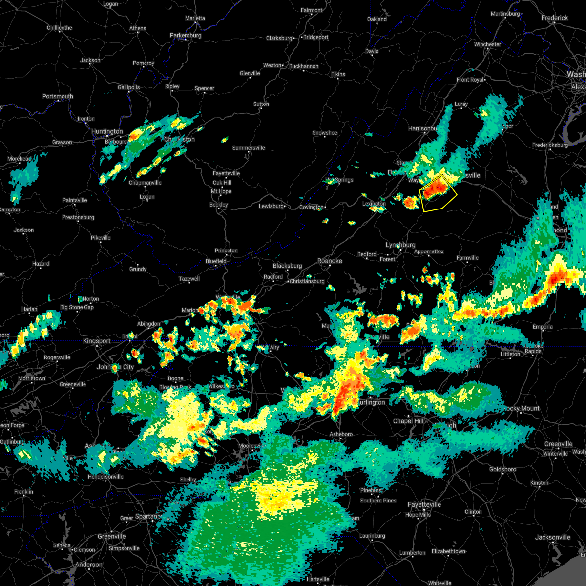 At 657 pm edt, a severe thunderstorm was located near crozet, or 11 miles southeast of waynesboro, moving southeast at 10 mph (radar indicated). Hazards include golf ball size hail and 70 mph wind gusts. Expect wind damage to trees and power lines. hail is large enough to dent and damage vehicles. Some hail damage to roofs, siding, and windows is possible. At 657 pm edt, a severe thunderstorm was located near crozet, or 11 miles southeast of waynesboro, moving southeast at 10 mph (radar indicated). Hazards include golf ball size hail and 70 mph wind gusts. Expect wind damage to trees and power lines. hail is large enough to dent and damage vehicles. Some hail damage to roofs, siding, and windows is possible.
|
| 8/14/2021 2:37 PM EDT |
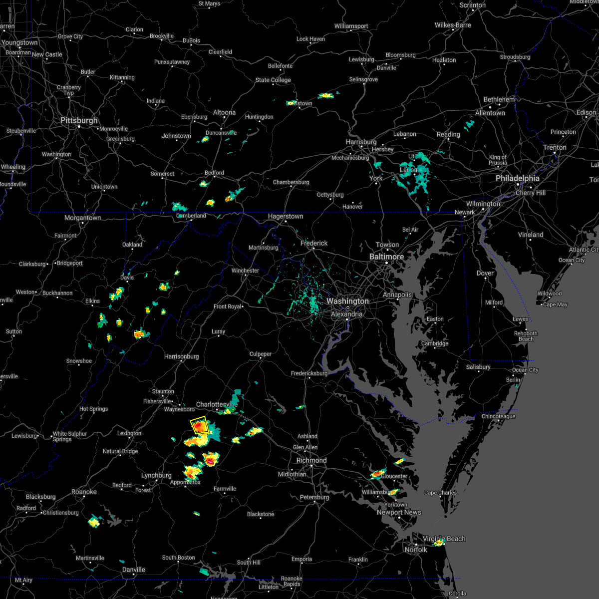 At 237 pm edt, a severe thunderstorm was located near schuyler, or 15 miles southwest of charlottesville, moving east at 5 mph (radar indicated). Hazards include 60 mph wind gusts. Damaging winds will cause some trees and large branches to fall. this could injure those outdoors, as well as damage homes and vehicles. roadways may become blocked by downed trees. localized power outages are possible. unsecured light objects may become projectiles. locations impacted include, esmont, covesville, alberene and north garden. hail threat, radar indicated max hail size, <. 75 in wind threat, radar indicated max wind gust, 60 mph. At 237 pm edt, a severe thunderstorm was located near schuyler, or 15 miles southwest of charlottesville, moving east at 5 mph (radar indicated). Hazards include 60 mph wind gusts. Damaging winds will cause some trees and large branches to fall. this could injure those outdoors, as well as damage homes and vehicles. roadways may become blocked by downed trees. localized power outages are possible. unsecured light objects may become projectiles. locations impacted include, esmont, covesville, alberene and north garden. hail threat, radar indicated max hail size, <. 75 in wind threat, radar indicated max wind gust, 60 mph.
|
| 8/14/2021 2:24 PM EDT |
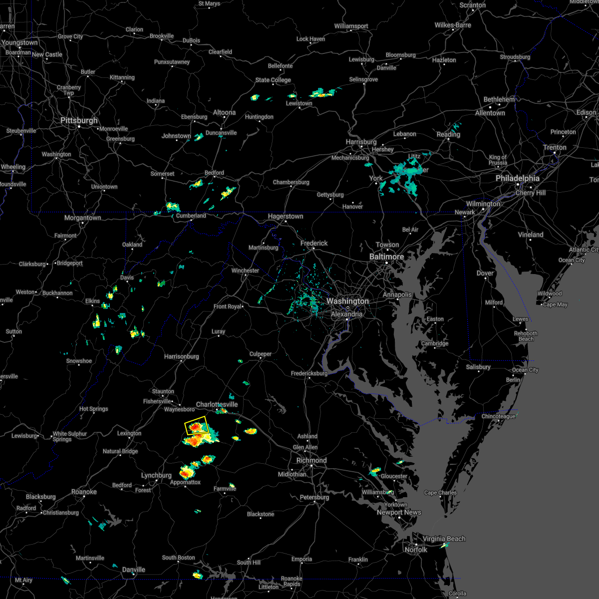 At 224 pm edt, a severe thunderstorm was located near covesville, or 16 miles southeast of waynesboro, and is nearly stationary (radar indicated). Hazards include 60 mph wind gusts. Damaging winds will cause some trees and large branches to fall. this could injure those outdoors, as well as damage homes and vehicles. roadways may become blocked by downed trees. localized power outages are possible. Unsecured light objects may become projectiles. At 224 pm edt, a severe thunderstorm was located near covesville, or 16 miles southeast of waynesboro, and is nearly stationary (radar indicated). Hazards include 60 mph wind gusts. Damaging winds will cause some trees and large branches to fall. this could injure those outdoors, as well as damage homes and vehicles. roadways may become blocked by downed trees. localized power outages are possible. Unsecured light objects may become projectiles.
|
| 8/14/2021 2:11 PM EDT |
 At 210 pm edt, a severe thunderstorm was located near schuyler, or 14 miles north of buckingham, moving east at 20 mph (radar indicated). Hazards include 60 mph wind gusts. Damaging winds will cause some trees and large branches to fall. this could injure those outdoors, as well as damage homes and vehicles. roadways may become blocked by downed trees. localized power outages are possible. unsecured light objects may become projectiles. locations impacted include, shipman, schuyler, scottsville, esmont, lovingston, glendower, damon, elma, rockfish and faber. hail threat, radar indicated max hail size, <. 75 in wind threat, radar indicated max wind gust, 60 mph. At 210 pm edt, a severe thunderstorm was located near schuyler, or 14 miles north of buckingham, moving east at 20 mph (radar indicated). Hazards include 60 mph wind gusts. Damaging winds will cause some trees and large branches to fall. this could injure those outdoors, as well as damage homes and vehicles. roadways may become blocked by downed trees. localized power outages are possible. unsecured light objects may become projectiles. locations impacted include, shipman, schuyler, scottsville, esmont, lovingston, glendower, damon, elma, rockfish and faber. hail threat, radar indicated max hail size, <. 75 in wind threat, radar indicated max wind gust, 60 mph.
|
| 8/14/2021 1:57 PM EDT |
 At 157 pm edt, a severe thunderstorm was located near schuyler, or 16 miles north of bent creek, moving east at 20 mph (radar indicated). Hazards include 60 mph wind gusts. Damaging winds will cause some trees and large branches to fall. this could injure those outdoors, as well as damage homes and vehicles. roadways may become blocked by downed trees. localized power outages are possible. Unsecured light objects may become projectiles. At 157 pm edt, a severe thunderstorm was located near schuyler, or 16 miles north of bent creek, moving east at 20 mph (radar indicated). Hazards include 60 mph wind gusts. Damaging winds will cause some trees and large branches to fall. this could injure those outdoors, as well as damage homes and vehicles. roadways may become blocked by downed trees. localized power outages are possible. Unsecured light objects may become projectiles.
|
| 7/28/2021 11:19 PM EDT |
 At 1118 pm edt, a severe thunderstorm was located near centenary, or 14 miles west of fork union, moving south at 15 mph (radar indicated). Hazards include tennis ball size hail and 75 mph wind gusts. Expect wind damage to trees and power lines. hail is large enough to dent and damage vehicles. some hail damage to roofs, siding, and windows is possible. Locations impacted include, scottsville, esmont and glendower. At 1118 pm edt, a severe thunderstorm was located near centenary, or 14 miles west of fork union, moving south at 15 mph (radar indicated). Hazards include tennis ball size hail and 75 mph wind gusts. Expect wind damage to trees and power lines. hail is large enough to dent and damage vehicles. some hail damage to roofs, siding, and windows is possible. Locations impacted include, scottsville, esmont and glendower.
|
| 7/28/2021 11:17 PM EDT |
 At 1117 pm edt, a severe thunderstorm was located near centenary, or 14 miles west of fork union, moving south at 15 mph (radar indicated). Hazards include tennis ball size hail and 60 mph wind gusts. Expect wind damage to trees and power lines. hail is large enough to dent and damage vehicles. some hail damage to roofs, siding, and windows is possible. Locations impacted include, scottsville, esmont and glendower. At 1117 pm edt, a severe thunderstorm was located near centenary, or 14 miles west of fork union, moving south at 15 mph (radar indicated). Hazards include tennis ball size hail and 60 mph wind gusts. Expect wind damage to trees and power lines. hail is large enough to dent and damage vehicles. some hail damage to roofs, siding, and windows is possible. Locations impacted include, scottsville, esmont and glendower.
|
| 7/28/2021 11:11 PM EDT |
 At 1111 pm edt, a severe thunderstorm was located 7 miles north of centenary, or 14 miles west of fork union, moving south at 15 mph (radar indicated). Hazards include golf ball size hail and 60 mph wind gusts. Expect wind damage to trees and power lines. hail is large enough to dent and damage vehicles. Some hail damage to roofs, siding, and windows is possible. At 1111 pm edt, a severe thunderstorm was located 7 miles north of centenary, or 14 miles west of fork union, moving south at 15 mph (radar indicated). Hazards include golf ball size hail and 60 mph wind gusts. Expect wind damage to trees and power lines. hail is large enough to dent and damage vehicles. Some hail damage to roofs, siding, and windows is possible.
|
| 7/28/2021 10:46 PM EDT |
 At 1045 pm edt, a severe thunderstorm was located 8 miles west of lake monticello, or 9 miles south of charlottesville, moving south at 15 mph (radar indicated). Hazards include 60 mph wind gusts. Damaging winds will cause some trees and large branches to fall. this could injure those outdoors, as well as damage homes and vehicles. roadways may become blocked by downed trees. localized power outages are possible. Unsecured light objects may become projectiles. At 1045 pm edt, a severe thunderstorm was located 8 miles west of lake monticello, or 9 miles south of charlottesville, moving south at 15 mph (radar indicated). Hazards include 60 mph wind gusts. Damaging winds will cause some trees and large branches to fall. this could injure those outdoors, as well as damage homes and vehicles. roadways may become blocked by downed trees. localized power outages are possible. Unsecured light objects may become projectiles.
|
| 7/28/2021 12:06 AM EDT |
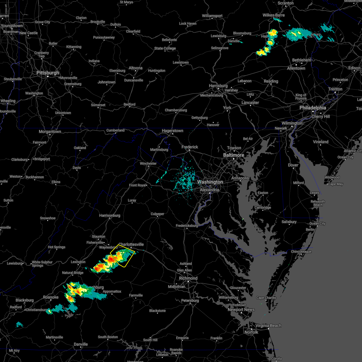 The severe thunderstorm warning for northeastern nelson and southwestern albemarle counties will expire at 1215 am edt, the storm which prompted the warning has weakened below severe limits, and no longer poses an immediate threat to life or property. therefore, the warning will be allowed to expire. however heavy rain is still possible with this thunderstorm. The severe thunderstorm warning for northeastern nelson and southwestern albemarle counties will expire at 1215 am edt, the storm which prompted the warning has weakened below severe limits, and no longer poses an immediate threat to life or property. therefore, the warning will be allowed to expire. however heavy rain is still possible with this thunderstorm.
|
| 7/27/2021 11:46 PM EDT |
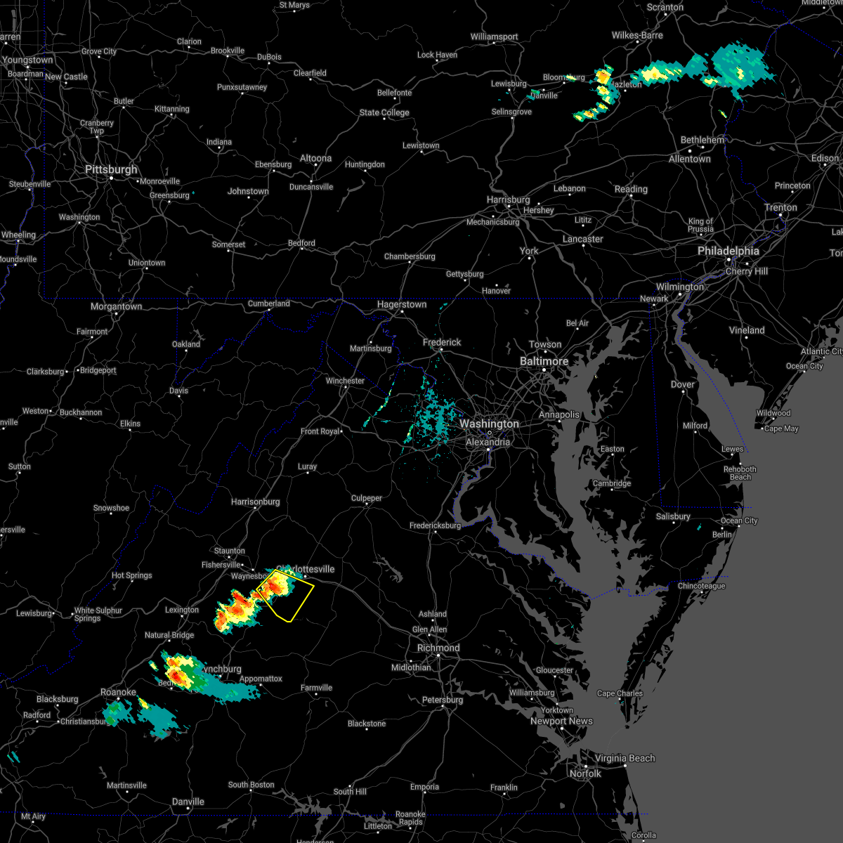 At 1146 pm edt, a severe thunderstorm was located 7 miles south of crozet, or 12 miles southwest of charlottesville, moving southeast at 15 mph (radar indicated). Hazards include 60 mph wind gusts and quarter size hail. Damaging winds will cause some trees and large branches to fall. this could injure those outdoors, as well as damage homes and vehicles. roadways may become blocked by downed trees. localized power outages are possible. unsecured light objects may become projectiles. Locations impacted include, crozet, schuyler, esmont, damon, north garden, batesville, covesville, yancey mills, glendower, keene, overton, alberene, faber and greenfield. At 1146 pm edt, a severe thunderstorm was located 7 miles south of crozet, or 12 miles southwest of charlottesville, moving southeast at 15 mph (radar indicated). Hazards include 60 mph wind gusts and quarter size hail. Damaging winds will cause some trees and large branches to fall. this could injure those outdoors, as well as damage homes and vehicles. roadways may become blocked by downed trees. localized power outages are possible. unsecured light objects may become projectiles. Locations impacted include, crozet, schuyler, esmont, damon, north garden, batesville, covesville, yancey mills, glendower, keene, overton, alberene, faber and greenfield.
|
| 7/27/2021 11:24 PM EDT |
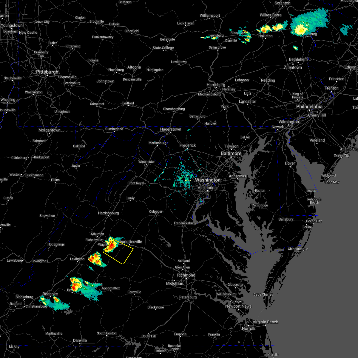 At 1124 pm edt, a severe thunderstorm was located near afton, or 7 miles southeast of waynesboro, moving southeast at 15 mph (radar indicated). Hazards include 60 mph wind gusts and quarter size hail. Damaging winds will cause some trees and large branches to fall. this could injure those outdoors, as well as damage homes and vehicles. roadways may become blocked by downed trees. localized power outages are possible. Unsecured light objects may become projectiles. At 1124 pm edt, a severe thunderstorm was located near afton, or 7 miles southeast of waynesboro, moving southeast at 15 mph (radar indicated). Hazards include 60 mph wind gusts and quarter size hail. Damaging winds will cause some trees and large branches to fall. this could injure those outdoors, as well as damage homes and vehicles. roadways may become blocked by downed trees. localized power outages are possible. Unsecured light objects may become projectiles.
|
| 7/14/2021 4:29 PM EDT |
 At 428 pm edt, a severe thunderstorm was located 7 miles northwest of schuyler, or 15 miles south of waynesboro, moving east at 15 mph (radar indicated). Hazards include 60 mph wind gusts and quarter size hail. Damaging winds will cause some trees and large branches to fall. this could injure those outdoors, as well as damage homes and vehicles. roadways may become blocked by downed trees. localized power outages are possible. Unsecured light objects may become projectiles. At 428 pm edt, a severe thunderstorm was located 7 miles northwest of schuyler, or 15 miles south of waynesboro, moving east at 15 mph (radar indicated). Hazards include 60 mph wind gusts and quarter size hail. Damaging winds will cause some trees and large branches to fall. this could injure those outdoors, as well as damage homes and vehicles. roadways may become blocked by downed trees. localized power outages are possible. Unsecured light objects may become projectiles.
|
| 5/4/2021 4:08 PM EDT |
 At 407 pm edt, severe thunderstorms were located along a line extending from near crozet to near wingina, moving northeast at 55 mph (law enforcement. numerous trees have been downed in nelson county). Hazards include 60 mph wind gusts. Damaging winds will cause some trees and large branches to fall. this could injure those outdoors, as well as damage homes and vehicles. roadways may become blocked by downed trees. localized power outages are possible. Unsecured light objects may become projectiles. At 407 pm edt, severe thunderstorms were located along a line extending from near crozet to near wingina, moving northeast at 55 mph (law enforcement. numerous trees have been downed in nelson county). Hazards include 60 mph wind gusts. Damaging winds will cause some trees and large branches to fall. this could injure those outdoors, as well as damage homes and vehicles. roadways may become blocked by downed trees. localized power outages are possible. Unsecured light objects may become projectiles.
|
| 5/4/2021 4:06 PM EDT | Large branches downed in albemarle county VA, 2.9 miles SW of Esmont, VA |
| 5/4/2021 4:02 PM EDT |
 At 401 pm edt, severe thunderstorms were located along a line extending from 6 miles south of afton to near wingina, moving northeast at 45 mph (law enforcement. numerous trees have been downed in nelson county). Hazards include 60 mph wind gusts. Damaging winds will cause some trees and large branches to fall. this could injure those outdoors, as well as damage homes and vehicles. roadways may become blocked by downed trees. localized power outages are possible. unsecured light objects may become projectiles. Locations impacted include, crozet, shipman, schuyler, wintergreen, afton, nellysford, arrington, scottsville, esmont, lovingston, allens creek, north garden, covesville, yancey mills, buffalo springs, norwood, gladstone, faber, damon and greenwood. At 401 pm edt, severe thunderstorms were located along a line extending from 6 miles south of afton to near wingina, moving northeast at 45 mph (law enforcement. numerous trees have been downed in nelson county). Hazards include 60 mph wind gusts. Damaging winds will cause some trees and large branches to fall. this could injure those outdoors, as well as damage homes and vehicles. roadways may become blocked by downed trees. localized power outages are possible. unsecured light objects may become projectiles. Locations impacted include, crozet, shipman, schuyler, wintergreen, afton, nellysford, arrington, scottsville, esmont, lovingston, allens creek, north garden, covesville, yancey mills, buffalo springs, norwood, gladstone, faber, damon and greenwood.
|
| 5/4/2021 3:36 PM EDT |
 At 336 pm edt, severe thunderstorms were located along a line extending from near montebello to near amherst, moving northeast at 45 mph (radar indicated). Hazards include 60 mph wind gusts. Damaging winds will cause some trees and large branches to fall. this could injure those outdoors, as well as damage homes and vehicles. roadways may become blocked by downed trees. localized power outages are possible. Unsecured light objects may become projectiles. At 336 pm edt, severe thunderstorms were located along a line extending from near montebello to near amherst, moving northeast at 45 mph (radar indicated). Hazards include 60 mph wind gusts. Damaging winds will cause some trees and large branches to fall. this could injure those outdoors, as well as damage homes and vehicles. roadways may become blocked by downed trees. localized power outages are possible. Unsecured light objects may become projectiles.
|
| 8/17/2020 4:59 PM EDT |
 At 459 pm edt, a severe thunderstorm was located near lake monticello, or 8 miles west of palmyra, moving east at 15 mph (radar indicated). Hazards include 60 mph wind gusts. Damaging winds will cause some trees and large branches to fall. this could injure those outdoors, as well as damage homes and vehicles. roadways may become blocked by downed trees. localized power outages are possible. unsecured light objects may become projectiles. Locations impacted include, scottsville, esmont, keene, glendower, overton, boyd tavern and woodridge. At 459 pm edt, a severe thunderstorm was located near lake monticello, or 8 miles west of palmyra, moving east at 15 mph (radar indicated). Hazards include 60 mph wind gusts. Damaging winds will cause some trees and large branches to fall. this could injure those outdoors, as well as damage homes and vehicles. roadways may become blocked by downed trees. localized power outages are possible. unsecured light objects may become projectiles. Locations impacted include, scottsville, esmont, keene, glendower, overton, boyd tavern and woodridge.
|
| 8/17/2020 4:50 PM EDT |
 At 450 pm edt, a severe thunderstorm was located near lake monticello, or 9 miles south of charlottesville, moving east at 15 mph (radar indicated). Hazards include 60 mph wind gusts. Damaging winds will cause some trees and large branches to fall. this could injure those outdoors, as well as damage homes and vehicles. roadways may become blocked by downed trees. localized power outages are possible. Unsecured light objects may become projectiles. At 450 pm edt, a severe thunderstorm was located near lake monticello, or 9 miles south of charlottesville, moving east at 15 mph (radar indicated). Hazards include 60 mph wind gusts. Damaging winds will cause some trees and large branches to fall. this could injure those outdoors, as well as damage homes and vehicles. roadways may become blocked by downed trees. localized power outages are possible. Unsecured light objects may become projectiles.
|
| 7/24/2020 6:24 PM EDT |
 The severe thunderstorm warning for northeastern nelson and southwestern albemarle counties will expire at 630 pm edt, the storms which prompted the warning have weakened below severe limits, and no longer pose an immediate threat to life or property. therefore, the warning will be allowed to expire. however heavy rain is still occuring with these thunderstorms. The severe thunderstorm warning for northeastern nelson and southwestern albemarle counties will expire at 630 pm edt, the storms which prompted the warning have weakened below severe limits, and no longer pose an immediate threat to life or property. therefore, the warning will be allowed to expire. however heavy rain is still occuring with these thunderstorms.
|
| 7/24/2020 6:11 PM EDT |
 At 611 pm edt, severe thunderstorms were located along a line extending from 6 miles southwest of lake monticello to near schuyler, moving south at 20 mph (radar indicated). Hazards include 60 mph wind gusts. Damaging winds will cause some trees and large branches to fall. this could injure those outdoors, as well as damage homes and vehicles. roadways may become blocked by downed trees. localized power outages are possible. unsecured light objects may become projectiles. Locations impacted include, schuyler, scottsville, esmont, damon, north garden, covesville, woodridge, rockfish, keene, glendower, overton, alberene and faber. At 611 pm edt, severe thunderstorms were located along a line extending from 6 miles southwest of lake monticello to near schuyler, moving south at 20 mph (radar indicated). Hazards include 60 mph wind gusts. Damaging winds will cause some trees and large branches to fall. this could injure those outdoors, as well as damage homes and vehicles. roadways may become blocked by downed trees. localized power outages are possible. unsecured light objects may become projectiles. Locations impacted include, schuyler, scottsville, esmont, damon, north garden, covesville, woodridge, rockfish, keene, glendower, overton, alberene and faber.
|
| 7/24/2020 5:42 PM EDT |
 At 542 pm edt, severe thunderstorms were located along a line extending from near charlottesville to 7 miles south of crozet, moving south at 20 mph (radar indicated). Hazards include 60 mph wind gusts and quarter size hail. Damaging winds will cause some trees and large branches to fall. this could injure those outdoors, as well as damage homes and vehicles. roadways may become blocked by downed trees. localized power outages are possible. Unsecured light objects may become projectiles. At 542 pm edt, severe thunderstorms were located along a line extending from near charlottesville to 7 miles south of crozet, moving south at 20 mph (radar indicated). Hazards include 60 mph wind gusts and quarter size hail. Damaging winds will cause some trees and large branches to fall. this could injure those outdoors, as well as damage homes and vehicles. roadways may become blocked by downed trees. localized power outages are possible. Unsecured light objects may become projectiles.
|
| 7/23/2020 6:39 PM EDT |
 At 639 pm edt, a severe thunderstorm was located near lake monticello, or near charlottesville, moving east at 10 mph (radar indicated). Hazards include isolated damaging wind gusts of up to 60 mph. Damaging winds will cause some trees and large branches to fall. this could injure those outdoors, as well as damage homes and vehicles. roadways may become blocked by downed trees. localized power outages are possible. unsecured light objects may become projectiles. Locations impacted include, scottsville, esmont, woodridge, keene, glendower and overton. At 639 pm edt, a severe thunderstorm was located near lake monticello, or near charlottesville, moving east at 10 mph (radar indicated). Hazards include isolated damaging wind gusts of up to 60 mph. Damaging winds will cause some trees and large branches to fall. this could injure those outdoors, as well as damage homes and vehicles. roadways may become blocked by downed trees. localized power outages are possible. unsecured light objects may become projectiles. Locations impacted include, scottsville, esmont, woodridge, keene, glendower and overton.
|
| 7/23/2020 6:24 PM EDT | Several trees blown down in the north garden are in albemarle county VA, 7.9 miles S of Esmont, VA |
| 7/10/2020 6:08 PM EDT |
 At 608 pm edt, a severe thunderstorm was located near schuyler, or 16 miles southeast of waynesboro, moving east at 20 mph (radar indicated). Hazards include 60 mph wind gusts and quarter size hail. Damaging winds will cause some trees and large branches to fall. this could injure those outdoors, as well as damage homes and vehicles. roadways may become blocked by downed trees. localized power outages are possible. unsecured light objects may become projectiles. Locations impacted include, shipman, schuyler, scottsville, esmont, lovingston, damon, north garden, covesville, rockfish, keene, glendower, alberene, elma and faber. At 608 pm edt, a severe thunderstorm was located near schuyler, or 16 miles southeast of waynesboro, moving east at 20 mph (radar indicated). Hazards include 60 mph wind gusts and quarter size hail. Damaging winds will cause some trees and large branches to fall. this could injure those outdoors, as well as damage homes and vehicles. roadways may become blocked by downed trees. localized power outages are possible. unsecured light objects may become projectiles. Locations impacted include, shipman, schuyler, scottsville, esmont, lovingston, damon, north garden, covesville, rockfish, keene, glendower, alberene, elma and faber.
|
| 7/10/2020 5:47 PM EDT |
 At 547 pm edt, a severe thunderstorm was located near wintergreen, or 14 miles south of waynesboro, moving east at 20 mph (radar indicated). Hazards include 60 mph wind gusts and quarter size hail. Damaging winds will cause some trees and large branches to fall. this could injure those outdoors, as well as damage homes and vehicles. roadways may become blocked by downed trees. localized power outages are possible. Unsecured light objects may become projectiles. At 547 pm edt, a severe thunderstorm was located near wintergreen, or 14 miles south of waynesboro, moving east at 20 mph (radar indicated). Hazards include 60 mph wind gusts and quarter size hail. Damaging winds will cause some trees and large branches to fall. this could injure those outdoors, as well as damage homes and vehicles. roadways may become blocked by downed trees. localized power outages are possible. Unsecured light objects may become projectiles.
|
| 7/5/2020 4:32 PM EDT |
 At 432 pm edt, a severe thunderstorm was located 10 miles west of lake monticello, or 11 miles south of charlottesville, moving southeast at 15 mph (radar indicated). Hazards include 60 mph wind gusts and quarter size hail. Damaging winds will cause some trees and large branches to fall. this could injure those outdoors, as well as damage homes and vehicles. roadways may become blocked by downed trees. localized power outages are possible. Unsecured light objects may become projectiles. At 432 pm edt, a severe thunderstorm was located 10 miles west of lake monticello, or 11 miles south of charlottesville, moving southeast at 15 mph (radar indicated). Hazards include 60 mph wind gusts and quarter size hail. Damaging winds will cause some trees and large branches to fall. this could injure those outdoors, as well as damage homes and vehicles. roadways may become blocked by downed trees. localized power outages are possible. Unsecured light objects may become projectiles.
|
| 7/1/2020 4:22 PM EDT |
 At 421 pm edt, a severe thunderstorm was located 7 miles northeast of schuyler, or 13 miles southwest of charlottesville, moving south at 15 mph (radar indicated). Hazards include 60 mph wind gusts and quarter size hail. Damaging winds will cause some trees and large branches to fall. this could injure those outdoors, as well as damage homes and vehicles. roadways may become blocked by downed trees. localized power outages are possible. unsecured light objects may become projectiles. Locations impacted include, scottsville, esmont, keene, glendower and alberene. At 421 pm edt, a severe thunderstorm was located 7 miles northeast of schuyler, or 13 miles southwest of charlottesville, moving south at 15 mph (radar indicated). Hazards include 60 mph wind gusts and quarter size hail. Damaging winds will cause some trees and large branches to fall. this could injure those outdoors, as well as damage homes and vehicles. roadways may become blocked by downed trees. localized power outages are possible. unsecured light objects may become projectiles. Locations impacted include, scottsville, esmont, keene, glendower and alberene.
|
| 7/1/2020 4:10 PM EDT |
 At 409 pm edt, a severe thunderstorm was located 8 miles northeast of schuyler, or 12 miles southwest of charlottesville, moving southeast at 15 mph (radar indicated). Hazards include 60 mph wind gusts and quarter size hail. Damaging winds will cause some trees and large branches to fall. this could injure those outdoors, as well as damage homes and vehicles. roadways may become blocked by downed trees. localized power outages are possible. Unsecured light objects may become projectiles. At 409 pm edt, a severe thunderstorm was located 8 miles northeast of schuyler, or 12 miles southwest of charlottesville, moving southeast at 15 mph (radar indicated). Hazards include 60 mph wind gusts and quarter size hail. Damaging winds will cause some trees and large branches to fall. this could injure those outdoors, as well as damage homes and vehicles. roadways may become blocked by downed trees. localized power outages are possible. Unsecured light objects may become projectiles.
|
| 6/4/2020 4:17 PM EDT |
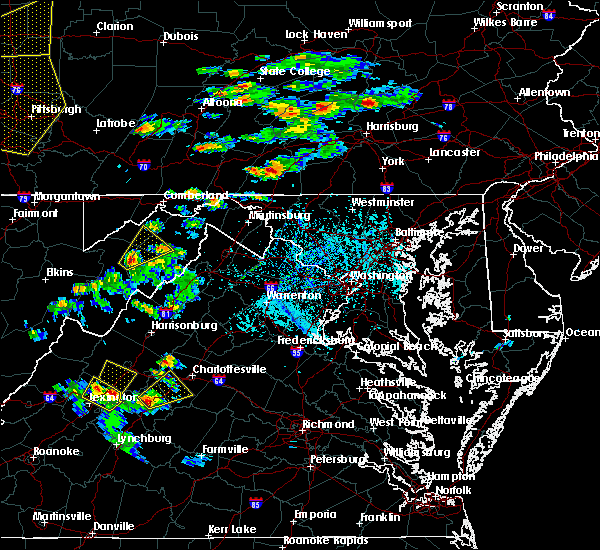 At 417 pm edt, a severe thunderstorm was located near wintergreen, or 14 miles northeast of clifford, moving northeast at 20 mph (radar indicated). Hazards include 60 mph wind gusts and quarter size hail. Damaging winds will cause some trees and large branches to fall. this could injure those outdoors, as well as damage homes and vehicles. roadways may become blocked by downed trees. localized power outages are possible. Unsecured light objects may become projectiles. At 417 pm edt, a severe thunderstorm was located near wintergreen, or 14 miles northeast of clifford, moving northeast at 20 mph (radar indicated). Hazards include 60 mph wind gusts and quarter size hail. Damaging winds will cause some trees and large branches to fall. this could injure those outdoors, as well as damage homes and vehicles. roadways may become blocked by downed trees. localized power outages are possible. Unsecured light objects may become projectiles.
|
| 4/8/2020 6:21 AM EDT |
 At 621 am edt, severe thunderstorms were located along a line extending from 7 miles southeast of crozet to 6 miles west of schuyler to lowesville, moving southeast at 65 mph (radar indicated). Hazards include 60 mph wind gusts. Damaging winds will cause some trees and large branches to fall. this could injure those outdoors, as well as damage homes and vehicles. roadways may become blocked by downed trees. localized power outages are possible. unsecured light objects may become projectiles. Locations impacted include, shipman, schuyler, arrington, scottsville, esmont, lovingston, piney river, allens creek, north garden, covesville, buffalo springs, norwood, jonesboro, gladstone, faber, massies mill, bryant, tye river, damon and roseland. At 621 am edt, severe thunderstorms were located along a line extending from 7 miles southeast of crozet to 6 miles west of schuyler to lowesville, moving southeast at 65 mph (radar indicated). Hazards include 60 mph wind gusts. Damaging winds will cause some trees and large branches to fall. this could injure those outdoors, as well as damage homes and vehicles. roadways may become blocked by downed trees. localized power outages are possible. unsecured light objects may become projectiles. Locations impacted include, shipman, schuyler, arrington, scottsville, esmont, lovingston, piney river, allens creek, north garden, covesville, buffalo springs, norwood, jonesboro, gladstone, faber, massies mill, bryant, tye river, damon and roseland.
|
| 4/8/2020 6:00 AM EDT |
 At 600 am edt, severe thunderstorms were located along a line extending from near staunton to near stuarts draft to near rockbridge baths, moving southeast at 55 mph (radar indicated). Hazards include 60 mph wind gusts and quarter size hail. Damaging winds will cause some trees and large branches to fall. this could injure those outdoors, as well as damage homes and vehicles. roadways may become blocked by downed trees. localized power outages are possible. Unsecured light objects may become projectiles. At 600 am edt, severe thunderstorms were located along a line extending from near staunton to near stuarts draft to near rockbridge baths, moving southeast at 55 mph (radar indicated). Hazards include 60 mph wind gusts and quarter size hail. Damaging winds will cause some trees and large branches to fall. this could injure those outdoors, as well as damage homes and vehicles. roadways may become blocked by downed trees. localized power outages are possible. Unsecured light objects may become projectiles.
|
| 9/11/2019 5:45 PM EDT |
 At 544 pm edt, severe thunderstorms were located along a line extending from 8 miles northwest of boswells tavern to 6 miles north of schuyler, moving southeast at 15 mph (radar indicated). Hazards include 60 mph wind gusts and quarter size hail. Damaging winds will cause some trees and large branches to fall. this could injure those outdoors, as well as damage homes and vehicles. roadways may become blocked by downed trees. localized power outages are possible. unsecured light objects may become projectiles. Locations impacted include, schuyler, campbell, scottsville, esmont, cobham, cismont, damon, covesville, boyd tavern, woodridge, monticello, keswick, stony point, shadwell, keene, glendower, overton, alberene and faber. At 544 pm edt, severe thunderstorms were located along a line extending from 8 miles northwest of boswells tavern to 6 miles north of schuyler, moving southeast at 15 mph (radar indicated). Hazards include 60 mph wind gusts and quarter size hail. Damaging winds will cause some trees and large branches to fall. this could injure those outdoors, as well as damage homes and vehicles. roadways may become blocked by downed trees. localized power outages are possible. unsecured light objects may become projectiles. Locations impacted include, schuyler, campbell, scottsville, esmont, cobham, cismont, damon, covesville, boyd tavern, woodridge, monticello, keswick, stony point, shadwell, keene, glendower, overton, alberene and faber.
|
| 9/11/2019 5:09 PM EDT |
 At 508 pm edt, severe thunderstorms were located along a line extending from free union to crozet to near afton, moving southeast at 20 mph (radar indicated). Hazards include 60 mph wind gusts and quarter size hail. Damaging winds will cause some trees and large branches to fall. this could injure those outdoors, as well as damage homes and vehicles. roadways may become blocked by downed trees. localized power outages are possible. unsecured light objects may become projectiles. Locations impacted include, charlottesville, crozet, schuyler, free union, campbell, westmoreland, hollymead, ivy, scottsville, esmont, north garden, covesville, yancey mills, stony point, flordon, scott stadium, faber, cobham, cismont and damon. At 508 pm edt, severe thunderstorms were located along a line extending from free union to crozet to near afton, moving southeast at 20 mph (radar indicated). Hazards include 60 mph wind gusts and quarter size hail. Damaging winds will cause some trees and large branches to fall. this could injure those outdoors, as well as damage homes and vehicles. roadways may become blocked by downed trees. localized power outages are possible. unsecured light objects may become projectiles. Locations impacted include, charlottesville, crozet, schuyler, free union, campbell, westmoreland, hollymead, ivy, scottsville, esmont, north garden, covesville, yancey mills, stony point, flordon, scott stadium, faber, cobham, cismont and damon.
|
| 9/11/2019 5:01 PM EDT |
 At 501 pm edt, severe thunderstorms were located along a line extending from free union to crozet to near afton, moving southeast at 20 mph (radar indicated). Hazards include 60 mph wind gusts and quarter size hail. Damaging winds will cause some trees and large branches to fall. this could injure those outdoors, as well as damage homes and vehicles. roadways may become blocked by downed trees. localized power outages are possible. Unsecured light objects may become projectiles. At 501 pm edt, severe thunderstorms were located along a line extending from free union to crozet to near afton, moving southeast at 20 mph (radar indicated). Hazards include 60 mph wind gusts and quarter size hail. Damaging winds will cause some trees and large branches to fall. this could injure those outdoors, as well as damage homes and vehicles. roadways may become blocked by downed trees. localized power outages are possible. Unsecured light objects may become projectiles.
|
| 8/22/2019 4:00 PM EDT |
 A severe thunderstorm warning remains in effect until 415 pm edt for south central albemarle county. at 400 pm edt, a severe thunderstorm was located near schuyler, or 16 miles north of buckingham, moving east at 25 mph. hazard. 60 mph wind gusts. source. Radar indicated. A severe thunderstorm warning remains in effect until 415 pm edt for south central albemarle county. at 400 pm edt, a severe thunderstorm was located near schuyler, or 16 miles north of buckingham, moving east at 25 mph. hazard. 60 mph wind gusts. source. Radar indicated.
|
| 8/22/2019 3:46 PM EDT |
 At 346 pm edt, severe thunderstorms were located along a line extending from near schuyler to near wingina, moving east at 25 mph (radar indicated). Hazards include 60 mph wind gusts. Damaging winds will cause some trees and large branches to fall. this could injure those outdoors, as well as damage homes and vehicles. roadways may become blocked by downed trees. localized power outages are possible. unsecured light objects may become projectiles. Locations impacted include, schuyler, scottsville, esmont, keene, glendower, alberene, damon, north garden, covesville, rockfish, faber and wingina. At 346 pm edt, severe thunderstorms were located along a line extending from near schuyler to near wingina, moving east at 25 mph (radar indicated). Hazards include 60 mph wind gusts. Damaging winds will cause some trees and large branches to fall. this could injure those outdoors, as well as damage homes and vehicles. roadways may become blocked by downed trees. localized power outages are possible. unsecured light objects may become projectiles. Locations impacted include, schuyler, scottsville, esmont, keene, glendower, alberene, damon, north garden, covesville, rockfish, faber and wingina.
|
| 8/22/2019 3:34 PM EDT |
 At 334 pm edt, severe thunderstorms were located along a line extending from 7 miles northwest of schuyler to near bent creek, moving east at 25 mph (radar indicated). Hazards include 60 mph wind gusts. Damaging winds will cause some trees and large branches to fall. this could injure those outdoors, as well as damage homes and vehicles. roadways may become blocked by downed trees. localized power outages are possible. Unsecured light objects may become projectiles. At 334 pm edt, severe thunderstorms were located along a line extending from 7 miles northwest of schuyler to near bent creek, moving east at 25 mph (radar indicated). Hazards include 60 mph wind gusts. Damaging winds will cause some trees and large branches to fall. this could injure those outdoors, as well as damage homes and vehicles. roadways may become blocked by downed trees. localized power outages are possible. Unsecured light objects may become projectiles.
|
| 7/22/2019 6:18 PM EDT |
 At 618 pm edt, severe thunderstorms were located along a line extending from near crozet to 6 miles south of charlottesville to 7 miles northwest of fork union, moving northeast at 35 mph (radar indicated). Hazards include 60 mph wind gusts. Damaging winds will cause some trees and large branches to fall. this could injure those outdoors, as well as damage homes and vehicles. roadways may become blocked by downed trees. localized power outages are possible. unsecured light objects may become projectiles. Locations impacted include, charlottesville, campbell, westmoreland, hollymead, ivy, scottsville, esmont, north garden, stony point, flordon, scott stadium, cobham, cismont, newcomb hall, boyd tavern, woodridge, monticello, keswick, carrsbrook and shadwell. At 618 pm edt, severe thunderstorms were located along a line extending from near crozet to 6 miles south of charlottesville to 7 miles northwest of fork union, moving northeast at 35 mph (radar indicated). Hazards include 60 mph wind gusts. Damaging winds will cause some trees and large branches to fall. this could injure those outdoors, as well as damage homes and vehicles. roadways may become blocked by downed trees. localized power outages are possible. unsecured light objects may become projectiles. Locations impacted include, charlottesville, campbell, westmoreland, hollymead, ivy, scottsville, esmont, north garden, stony point, flordon, scott stadium, cobham, cismont, newcomb hall, boyd tavern, woodridge, monticello, keswick, carrsbrook and shadwell.
|
| 7/22/2019 6:10 PM EDT | Tree down near plank rd and thomas diary ln in albemarle county VA, 8.3 miles SSE of Esmont, VA |
| 7/22/2019 6:00 PM EDT |
 At 600 pm edt, severe thunderstorms were located along a line extending from 6 miles east of wintergreen to near centenary, moving northeast at 35 mph (radar indicated. several downed trees were reported in nelson county). Hazards include 60 mph wind gusts. Damaging winds will cause some trees and large branches to fall. this could injure those outdoors, as well as damage homes and vehicles. roadways may become blocked by downed trees. localized power outages are possible. Unsecured light objects may become projectiles. At 600 pm edt, severe thunderstorms were located along a line extending from 6 miles east of wintergreen to near centenary, moving northeast at 35 mph (radar indicated. several downed trees were reported in nelson county). Hazards include 60 mph wind gusts. Damaging winds will cause some trees and large branches to fall. this could injure those outdoors, as well as damage homes and vehicles. roadways may become blocked by downed trees. localized power outages are possible. Unsecured light objects may become projectiles.
|
| 7/6/2019 10:48 PM EDT |
 At 1047 pm edt, severe thunderstorms were located along a line extending from 7 miles northeast of schuyler to near shipman to 6 miles northeast of lowesville, moving southeast at 15 mph (radar indicated). Hazards include 60 mph wind gusts. Damaging winds will cause some trees and large branches to fall. this could injure those outdoors, as well as damage homes and vehicles. roadways may become blocked by downed trees. localized power outages are possible. unsecured light objects may become projectiles. Locations impacted include, shipman, schuyler, arrington, scottsville, esmont, lovingston, bryant, tye river, damon, covesville, roseland, tyro, rockfish, keene, glendower, alberene, jonesboro, elma, faber and massies mill. At 1047 pm edt, severe thunderstorms were located along a line extending from 7 miles northeast of schuyler to near shipman to 6 miles northeast of lowesville, moving southeast at 15 mph (radar indicated). Hazards include 60 mph wind gusts. Damaging winds will cause some trees and large branches to fall. this could injure those outdoors, as well as damage homes and vehicles. roadways may become blocked by downed trees. localized power outages are possible. unsecured light objects may become projectiles. Locations impacted include, shipman, schuyler, arrington, scottsville, esmont, lovingston, bryant, tye river, damon, covesville, roseland, tyro, rockfish, keene, glendower, alberene, jonesboro, elma, faber and massies mill.
|
| 7/6/2019 10:30 PM EDT |
 At 1030 pm edt, severe thunderstorms were located along a line extending from 7 miles north of schuyler to near shipman to near lowesville, moving southeast at 15 mph (radar indicated). Hazards include 60 mph wind gusts. Damaging winds will cause some trees and large branches to fall. this could injure those outdoors, as well as damage homes and vehicles. roadways may become blocked by downed trees. localized power outages are possible. unsecured light objects may become projectiles. Locations impacted include, shipman, schuyler, arrington, scottsville, esmont, lovingston, bryant, tye river, damon, north garden, covesville, roseland, woodridge, tyro, rockfish, keene, glendower, alberene, jonesboro and elma. At 1030 pm edt, severe thunderstorms were located along a line extending from 7 miles north of schuyler to near shipman to near lowesville, moving southeast at 15 mph (radar indicated). Hazards include 60 mph wind gusts. Damaging winds will cause some trees and large branches to fall. this could injure those outdoors, as well as damage homes and vehicles. roadways may become blocked by downed trees. localized power outages are possible. unsecured light objects may become projectiles. Locations impacted include, shipman, schuyler, arrington, scottsville, esmont, lovingston, bryant, tye river, damon, north garden, covesville, roseland, woodridge, tyro, rockfish, keene, glendower, alberene, jonesboro and elma.
|
| 7/6/2019 10:07 PM EDT |
 At 1007 pm edt, severe thunderstorms were located along a line extending from 7 miles southeast of afton to 6 miles southeast of wintergreen to near montebello, moving southeast at 15 mph (radar indicated). Hazards include 60 mph wind gusts. Damaging winds will cause some trees and large branches to fall. this could injure those outdoors, as well as damage homes and vehicles. roadways may become blocked by downed trees. localized power outages are possible. Unsecured light objects may become projectiles. At 1007 pm edt, severe thunderstorms were located along a line extending from 7 miles southeast of afton to 6 miles southeast of wintergreen to near montebello, moving southeast at 15 mph (radar indicated). Hazards include 60 mph wind gusts. Damaging winds will cause some trees and large branches to fall. this could injure those outdoors, as well as damage homes and vehicles. roadways may become blocked by downed trees. localized power outages are possible. Unsecured light objects may become projectiles.
|
| 7/4/2019 4:06 PM EDT |
 The severe thunderstorm warning for southwestern albemarle county will expire at 415 pm edt, the storm which prompted the warning has weakened below severe limits, and no longer poses an immediate threat to life or property. therefore, the warning will be allowed to expire. however heavy rain is still possible with this thunderstorm. to report severe weather, contact your nearest law enforcement agency. they will relay your report to the national weather service sterling virginia. The severe thunderstorm warning for southwestern albemarle county will expire at 415 pm edt, the storm which prompted the warning has weakened below severe limits, and no longer poses an immediate threat to life or property. therefore, the warning will be allowed to expire. however heavy rain is still possible with this thunderstorm. to report severe weather, contact your nearest law enforcement agency. they will relay your report to the national weather service sterling virginia.
|
| 7/4/2019 3:45 PM EDT | Tree down at the intersection of james river rd. and porters r in albemarle county VA, 2.6 miles NNW of Esmont, VA |
| 7/4/2019 3:37 PM EDT |
 At 336 pm edt, a severe thunderstorm was located near centenary, or 14 miles north of buckingham, and is nearly stationary (radar indicated). Hazards include 60 mph wind gusts and quarter size hail. Damaging winds will cause some trees and large branches to fall. this could injure those outdoors, as well as damage homes and vehicles. roadways may become blocked by downed trees. localized power outages are possible. Unsecured light objects may become projectiles. At 336 pm edt, a severe thunderstorm was located near centenary, or 14 miles north of buckingham, and is nearly stationary (radar indicated). Hazards include 60 mph wind gusts and quarter size hail. Damaging winds will cause some trees and large branches to fall. this could injure those outdoors, as well as damage homes and vehicles. roadways may become blocked by downed trees. localized power outages are possible. Unsecured light objects may become projectiles.
|
| 6/28/2019 5:46 PM EDT |
 At 546 pm edt, a severe thunderstorm was located 9 miles north of centenary, or 11 miles west of palmyra, moving east at 10 mph (radar indicated). Hazards include 60 mph wind gusts and quarter size hail. Damaging winds will cause some trees and large branches to fall. this could injure those outdoors, as well as damage homes and vehicles. roadways may become blocked by downed trees. localized power outages are possible. unsecured light objects may become projectiles. Locations impacted include, schuyler, scottsville, esmont, keene, glendower, alberene, damon and woodridge. At 546 pm edt, a severe thunderstorm was located 9 miles north of centenary, or 11 miles west of palmyra, moving east at 10 mph (radar indicated). Hazards include 60 mph wind gusts and quarter size hail. Damaging winds will cause some trees and large branches to fall. this could injure those outdoors, as well as damage homes and vehicles. roadways may become blocked by downed trees. localized power outages are possible. unsecured light objects may become projectiles. Locations impacted include, schuyler, scottsville, esmont, keene, glendower, alberene, damon and woodridge.
|
| 6/28/2019 5:11 PM EDT |
 At 511 pm edt, a severe thunderstorm was located 7 miles northeast of schuyler, or 14 miles south of charlottesville, moving east at 10 mph (radar indicated). Hazards include 60 mph wind gusts and quarter size hail. Damaging winds will cause some trees and large branches to fall. this could injure those outdoors, as well as damage homes and vehicles. roadways may become blocked by downed trees. localized power outages are possible. Unsecured light objects may become projectiles. At 511 pm edt, a severe thunderstorm was located 7 miles northeast of schuyler, or 14 miles south of charlottesville, moving east at 10 mph (radar indicated). Hazards include 60 mph wind gusts and quarter size hail. Damaging winds will cause some trees and large branches to fall. this could injure those outdoors, as well as damage homes and vehicles. roadways may become blocked by downed trees. localized power outages are possible. Unsecured light objects may become projectiles.
|
| 5/26/2019 5:15 PM EDT |
 At 515 pm edt, a severe thunderstorm was located 10 miles northeast of schuyler, or 11 miles south of charlottesville, moving east at 20 mph (radar indicated). Hazards include 60 mph wind gusts and quarter size hail. Damaging winds will cause some trees and large branches to fall. this could injure those outdoors, as well as damage homes and vehicles. roadways may become blocked by downed trees. localized power outages are possible. Unsecured light objects may become projectiles. At 515 pm edt, a severe thunderstorm was located 10 miles northeast of schuyler, or 11 miles south of charlottesville, moving east at 20 mph (radar indicated). Hazards include 60 mph wind gusts and quarter size hail. Damaging winds will cause some trees and large branches to fall. this could injure those outdoors, as well as damage homes and vehicles. roadways may become blocked by downed trees. localized power outages are possible. Unsecured light objects may become projectiles.
|
| 4/26/2019 1:18 PM EDT | Tree down next to driveway of residenc in albemarle county VA, 3 miles NW of Esmont, VA |
| 4/26/2019 1:14 PM EDT |
 At 113 pm edt, severe thunderstorms were located along a line extending from crozet to 10 miles southwest of charlottesville, moving northeast at 45 mph (radar indicated). Hazards include 60 mph wind gusts. Damaging winds will cause some trees and large branches to fall. this could injure those outdoors, as well as damage homes and vehicles. roadways may become blocked by downed trees. localized power outages are possible. Unsecured light objects may become projectiles. At 113 pm edt, severe thunderstorms were located along a line extending from crozet to 10 miles southwest of charlottesville, moving northeast at 45 mph (radar indicated). Hazards include 60 mph wind gusts. Damaging winds will cause some trees and large branches to fall. this could injure those outdoors, as well as damage homes and vehicles. roadways may become blocked by downed trees. localized power outages are possible. Unsecured light objects may become projectiles.
|
| 4/19/2019 5:27 PM EDT |
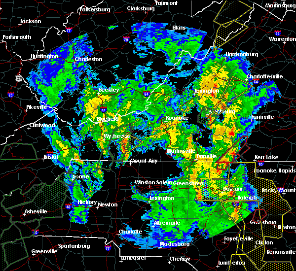 At 526 pm edt, a severe thunderstorm was located over shipman, or 12 miles north of bent creek, moving northeast at 50 mph (radar indicated). Hazards include 60 mph wind gusts. Damaging winds will cause some trees and large branches to fall. this could injure those outdoors, as well as damage homes and vehicles. roadways may become blocked by downed trees. localized power outages are possible. unsecured light objects may become projectiles. Locations impacted include, crozet, shipman, schuyler, nellysford, arrington, esmont, lovingston, damon, north garden, batesville, covesville, yancey mills, woodridge, rockfish, keene, glendower, overton, alberene, elma and faber. At 526 pm edt, a severe thunderstorm was located over shipman, or 12 miles north of bent creek, moving northeast at 50 mph (radar indicated). Hazards include 60 mph wind gusts. Damaging winds will cause some trees and large branches to fall. this could injure those outdoors, as well as damage homes and vehicles. roadways may become blocked by downed trees. localized power outages are possible. unsecured light objects may become projectiles. Locations impacted include, crozet, shipman, schuyler, nellysford, arrington, esmont, lovingston, damon, north garden, batesville, covesville, yancey mills, woodridge, rockfish, keene, glendower, overton, alberene, elma and faber.
|
| 4/19/2019 5:10 PM EDT |
 At 510 pm edt, a severe thunderstorm was located over riverville, or near bent creek, moving northeast at 55 mph (radar indicated). Hazards include 60 mph wind gusts. Damaging winds will cause some trees and large branches to fall. this could injure those outdoors, as well as damage homes and vehicles. roadways may become blocked by downed trees. localized power outages are possible. Unsecured light objects may become projectiles. At 510 pm edt, a severe thunderstorm was located over riverville, or near bent creek, moving northeast at 55 mph (radar indicated). Hazards include 60 mph wind gusts. Damaging winds will cause some trees and large branches to fall. this could injure those outdoors, as well as damage homes and vehicles. roadways may become blocked by downed trees. localized power outages are possible. Unsecured light objects may become projectiles.
|
| 4/8/2019 4:46 PM EDT |
 At 445 pm edt, a severe thunderstorm was located over new glasgow, or near clifford, moving east at 30 mph (trained weather spotters). Hazards include quarter to golf ball size hail and 60 mph wind gusts. Expect wind damage to trees and power lines. hail is large enough to dent and damage vehicles. some hail damage to roofs, siding, and windows is possible. Locations impacted include, shipman, schuyler, arrington, scottsville, esmont, lovingston, tye river, damon, allens creek, rockfish, buffalo springs, norwood, glendower, five forks, gladstone, elma, faber and wingina. At 445 pm edt, a severe thunderstorm was located over new glasgow, or near clifford, moving east at 30 mph (trained weather spotters). Hazards include quarter to golf ball size hail and 60 mph wind gusts. Expect wind damage to trees and power lines. hail is large enough to dent and damage vehicles. some hail damage to roofs, siding, and windows is possible. Locations impacted include, shipman, schuyler, arrington, scottsville, esmont, lovingston, tye river, damon, allens creek, rockfish, buffalo springs, norwood, glendower, five forks, gladstone, elma, faber and wingina.
|
| 4/8/2019 4:36 PM EDT |
 At 435 pm edt, a severe thunderstorm was located over clifford, moving east at 30 mph (trained weather spotters). Hazards include 60 mph wind gusts and quarter size hail. Damaging winds will cause some trees and large branches to fall. this could injure those outdoors, as well as damage homes and vehicles. roadways may become blocked by downed trees. localized power outages are possible. unsecured light objects may become projectiles. Locations impacted include, shipman, schuyler, arrington, scottsville, esmont, lovingston, tye river, damon, allens creek, roseland, rockfish, buffalo springs, norwood, keene, glendower, five forks, gladstone, elma, faber and wingina. At 435 pm edt, a severe thunderstorm was located over clifford, moving east at 30 mph (trained weather spotters). Hazards include 60 mph wind gusts and quarter size hail. Damaging winds will cause some trees and large branches to fall. this could injure those outdoors, as well as damage homes and vehicles. roadways may become blocked by downed trees. localized power outages are possible. unsecured light objects may become projectiles. Locations impacted include, shipman, schuyler, arrington, scottsville, esmont, lovingston, tye river, damon, allens creek, roseland, rockfish, buffalo springs, norwood, keene, glendower, five forks, gladstone, elma, faber and wingina.
|
| 4/8/2019 4:20 PM EDT |
 At 417 pm edt, a severe thunderstorm was located over pleasant view, or near forks of buffalo, moving east at 30 mph. additional thunderstorms were developing just west of wingina, and may produce gusty winds and hail (trained spotters and county 911 centers). Hazards include 60 mph wind gusts and quarter size hail. Damaging winds will cause some trees and large branches to fall. this could injure those outdoors, as well as damage homes and vehicles. roadways may become blocked by downed trees. localized power outages are possible. Unsecured light objects may become projectiles. At 417 pm edt, a severe thunderstorm was located over pleasant view, or near forks of buffalo, moving east at 30 mph. additional thunderstorms were developing just west of wingina, and may produce gusty winds and hail (trained spotters and county 911 centers). Hazards include 60 mph wind gusts and quarter size hail. Damaging winds will cause some trees and large branches to fall. this could injure those outdoors, as well as damage homes and vehicles. roadways may become blocked by downed trees. localized power outages are possible. Unsecured light objects may become projectiles.
|
| 8/12/2018 3:08 PM EDT |
 The severe thunderstorm warning for southeastern nelson and south central albemarle counties will expire at 315 pm edt, the storm which prompted the warning has moved out of the area. therefore the warning will be allowed to expire. to report severe weather, contact your nearest law enforcement agency. they will relay your report to the national weather service sterling virginia. The severe thunderstorm warning for southeastern nelson and south central albemarle counties will expire at 315 pm edt, the storm which prompted the warning has moved out of the area. therefore the warning will be allowed to expire. to report severe weather, contact your nearest law enforcement agency. they will relay your report to the national weather service sterling virginia.
|
| 8/12/2018 2:55 PM EDT |
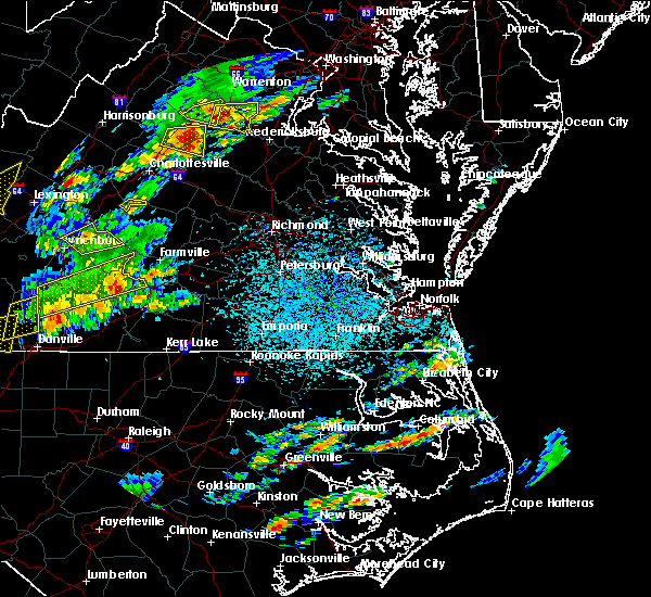 At 254 pm edt, a severe thunderstorm was located near centenary, or 13 miles north of buckingham, moving southeast at 15 mph (radar indicated). Hazards include 60 mph wind gusts. Damaging winds will cause some trees and large branches to fall. this could injure those outdoors, as well as damage homes and vehicles. roadways may become blocked by downed trees. localized power outages are possible. unsecured light objects may become projectiles. Locations impacted include, esmont. At 254 pm edt, a severe thunderstorm was located near centenary, or 13 miles north of buckingham, moving southeast at 15 mph (radar indicated). Hazards include 60 mph wind gusts. Damaging winds will cause some trees and large branches to fall. this could injure those outdoors, as well as damage homes and vehicles. roadways may become blocked by downed trees. localized power outages are possible. unsecured light objects may become projectiles. Locations impacted include, esmont.
|
| 8/12/2018 2:38 PM EDT |
 At 237 pm edt, a severe thunderstorm was located near schuyler, or 16 miles north of buckingham, moving southeast at 15 mph (radar indicated). Hazards include 60 mph wind gusts and quarter size hail. Damaging winds will cause some trees and large branches to fall. this could injure those outdoors, as well as damage homes and vehicles. roadways may become blocked by downed trees. localized power outages are possible. Unsecured light objects may become projectiles. At 237 pm edt, a severe thunderstorm was located near schuyler, or 16 miles north of buckingham, moving southeast at 15 mph (radar indicated). Hazards include 60 mph wind gusts and quarter size hail. Damaging winds will cause some trees and large branches to fall. this could injure those outdoors, as well as damage homes and vehicles. roadways may become blocked by downed trees. localized power outages are possible. Unsecured light objects may become projectiles.
|
| 8/8/2018 7:20 PM EDT |
 At 720 pm edt, severe thunderstorms were located along a line extending from near lake monticello to near schuyler to near new glasgow, moving east at 15 mph (radar indicated). Hazards include 60 mph wind gusts and quarter size hail. Damaging winds will cause some trees and large branches to fall. this could injure those outdoors, as well as damage homes and vehicles. roadways may become blocked by downed trees. localized power outages are possible. unsecured light objects may become projectiles. Locations impacted include, shipman, schuyler, arrington, scottsville, esmont, lovingston, piney river, allens creek, north garden, covesville, buffalo springs, norwood, gladstone, faber, tye river, damon, boyd tavern, roseland, woodridge and rockfish. At 720 pm edt, severe thunderstorms were located along a line extending from near lake monticello to near schuyler to near new glasgow, moving east at 15 mph (radar indicated). Hazards include 60 mph wind gusts and quarter size hail. Damaging winds will cause some trees and large branches to fall. this could injure those outdoors, as well as damage homes and vehicles. roadways may become blocked by downed trees. localized power outages are possible. unsecured light objects may become projectiles. Locations impacted include, shipman, schuyler, arrington, scottsville, esmont, lovingston, piney river, allens creek, north garden, covesville, buffalo springs, norwood, gladstone, faber, tye river, damon, boyd tavern, roseland, woodridge and rockfish.
|
| 8/8/2018 7:00 PM EDT |
 At 659 pm edt, severe thunderstorms were located along a line extending from 6 miles south of charlottesville to near shipman to clifford, moving east at 20 mph (radar indicated). Hazards include 60 mph wind gusts and quarter size hail. Damaging winds will cause some trees and large branches to fall. this could injure those outdoors, as well as damage homes and vehicles. roadways may become blocked by downed trees. localized power outages are possible. Unsecured light objects may become projectiles. At 659 pm edt, severe thunderstorms were located along a line extending from 6 miles south of charlottesville to near shipman to clifford, moving east at 20 mph (radar indicated). Hazards include 60 mph wind gusts and quarter size hail. Damaging winds will cause some trees and large branches to fall. this could injure those outdoors, as well as damage homes and vehicles. roadways may become blocked by downed trees. localized power outages are possible. Unsecured light objects may become projectiles.
|
| 7/22/2018 7:50 PM EDT |
 The severe thunderstorm warning for albemarle county and the city of charlottesville will expire at 800 pm edt, the storm which prompted the warning has weakened below severe limits, and no longer pose an immediate threat to life or property. therefore the warning will be allowed to expire. however heavy rain is still possible with this thunderstorm. The severe thunderstorm warning for albemarle county and the city of charlottesville will expire at 800 pm edt, the storm which prompted the warning has weakened below severe limits, and no longer pose an immediate threat to life or property. therefore the warning will be allowed to expire. however heavy rain is still possible with this thunderstorm.
|
| 7/22/2018 7:25 PM EDT |
 At 705 pm edt, a severe thunderstorm was located over lake monticello, or near palmyra, moving northwest at 25 mph (radar indicated). Hazards include 60 mph wind gusts. Damaging winds will cause some trees and large branches to fall. this could injure those outdoors, as well as damage homes and vehicles. roadways may become blocked by downed trees. localized power outages are possible. Unsecured light objects may become projectiles. At 705 pm edt, a severe thunderstorm was located over lake monticello, or near palmyra, moving northwest at 25 mph (radar indicated). Hazards include 60 mph wind gusts. Damaging winds will cause some trees and large branches to fall. this could injure those outdoors, as well as damage homes and vehicles. roadways may become blocked by downed trees. localized power outages are possible. Unsecured light objects may become projectiles.
|
| 7/22/2018 7:05 PM EDT |
 At 705 pm edt, a severe thunderstorm was located over lake monticello, or near palmyra, moving northwest at 25 mph (radar indicated). Hazards include 60 mph wind gusts. Damaging winds will cause some trees and large branches to fall. this could injure those outdoors, as well as damage homes and vehicles. roadways may become blocked by downed trees. localized power outages are possible. Unsecured light objects may become projectiles. At 705 pm edt, a severe thunderstorm was located over lake monticello, or near palmyra, moving northwest at 25 mph (radar indicated). Hazards include 60 mph wind gusts. Damaging winds will cause some trees and large branches to fall. this could injure those outdoors, as well as damage homes and vehicles. roadways may become blocked by downed trees. localized power outages are possible. Unsecured light objects may become projectiles.
|
| 6/10/2018 5:12 PM EDT |
 At 512 pm edt, a severe thunderstorm was located near scottsville, moving southeast at 20 mph (radar indicated). Hazards include 60 mph wind gusts and quarter size hail. Damaging winds will cause some trees and large branches to fall. this could injure those outdoors, as well as damage homes and vehicles. roadways may become blocked by downed trees. localized power outages are possible. unsecured light objects may become projectiles. Locations impacted include, campbell, scottsville, esmont, glendower, boyd tavern, woodridge and keswick. At 512 pm edt, a severe thunderstorm was located near scottsville, moving southeast at 20 mph (radar indicated). Hazards include 60 mph wind gusts and quarter size hail. Damaging winds will cause some trees and large branches to fall. this could injure those outdoors, as well as damage homes and vehicles. roadways may become blocked by downed trees. localized power outages are possible. unsecured light objects may become projectiles. Locations impacted include, campbell, scottsville, esmont, glendower, boyd tavern, woodridge and keswick.
|
| 6/10/2018 4:57 PM EDT |
 At 456 pm edt, a severe thunderstorm was located 8 miles northeast of schuyler, or 13 miles south of charlottesville, moving east at 20 mph (radar indicated). Hazards include ping pong ball size hail and 60 mph wind gusts. Damaging winds will cause some trees and large branches to fall. this could injure those outdoors, as well as damage homes and vehicles. roadways may become blocked by downed trees. localized power outages are possible. unsecured light objects may become projectiles. Locations impacted include, campbell, scottsville, esmont, damon, north garden, covesville, boyd tavern, woodridge, monticello, keswick, shadwell, glendower, keene, overton and alberene. At 456 pm edt, a severe thunderstorm was located 8 miles northeast of schuyler, or 13 miles south of charlottesville, moving east at 20 mph (radar indicated). Hazards include ping pong ball size hail and 60 mph wind gusts. Damaging winds will cause some trees and large branches to fall. this could injure those outdoors, as well as damage homes and vehicles. roadways may become blocked by downed trees. localized power outages are possible. unsecured light objects may become projectiles. Locations impacted include, campbell, scottsville, esmont, damon, north garden, covesville, boyd tavern, woodridge, monticello, keswick, shadwell, glendower, keene, overton and alberene.
|
| 6/10/2018 4:39 PM EDT |
 At 439 pm edt, severe thunderstorms were located along a line extending from 7 miles southeast of afton to near lake monticello, moving southeast at 20 mph (radar indicated). Hazards include 60 mph wind gusts and quarter size hail. Damaging winds will cause some trees and large branches to fall. this could injure those outdoors, as well as damage homes and vehicles. roadways may become blocked by downed trees. localized power outages are possible. unsecured light objects may become projectiles. Locations impacted include, charlottesville, campbell, scottsville, esmont, cobham, cismont, damon, north garden, newcomb hall, batesville, covesville, boyd tavern, woodridge, monticello, keswick, shadwell, glendower, keene, overton and alberene. At 439 pm edt, severe thunderstorms were located along a line extending from 7 miles southeast of afton to near lake monticello, moving southeast at 20 mph (radar indicated). Hazards include 60 mph wind gusts and quarter size hail. Damaging winds will cause some trees and large branches to fall. this could injure those outdoors, as well as damage homes and vehicles. roadways may become blocked by downed trees. localized power outages are possible. unsecured light objects may become projectiles. Locations impacted include, charlottesville, campbell, scottsville, esmont, cobham, cismont, damon, north garden, newcomb hall, batesville, covesville, boyd tavern, woodridge, monticello, keswick, shadwell, glendower, keene, overton and alberene.
|
| 5/14/2018 7:20 PM EDT |
 At 719 pm edt, severe thunderstorms were located along a line extending from near bumpass to near centenary, moving southeast at 40 mph (radar indicated). Hazards include 60 mph wind gusts and quarter size hail. Damaging winds will cause some trees and large branches to fall. this could injure those outdoors, as well as damage homes and vehicles. roadways may become blocked by downed trees. localized power outages are possible. unsecured light objects may become projectiles. Locations impacted include, shipman, schuyler, montebello, nellysford, arrington, scottsville, esmont, lovingston, allens creek, covesville, tyro, buffalo springs, norwood, jonesboro, gladstone, faber, massies mill, bryant, tye river and damon. At 719 pm edt, severe thunderstorms were located along a line extending from near bumpass to near centenary, moving southeast at 40 mph (radar indicated). Hazards include 60 mph wind gusts and quarter size hail. Damaging winds will cause some trees and large branches to fall. this could injure those outdoors, as well as damage homes and vehicles. roadways may become blocked by downed trees. localized power outages are possible. unsecured light objects may become projectiles. Locations impacted include, shipman, schuyler, montebello, nellysford, arrington, scottsville, esmont, lovingston, allens creek, covesville, tyro, buffalo springs, norwood, jonesboro, gladstone, faber, massies mill, bryant, tye river and damon.
|
| 5/14/2018 7:08 PM EDT |
 At 708 pm edt, severe thunderstorms with a history of producing damaging winds and hail were located along a line extending from near mineral to near centenary, moving southeast at 40 mph (radar indicated). Hazards include 60 mph wind gusts and quarter size hail. Damaging winds will cause some trees and large branches to fall. this could injure those outdoors, as well as damage homes and vehicles. roadways may become blocked by downed trees. localized power outages are possible. unsecured light objects may become projectiles. Locations impacted include, charlottesville, shipman, schuyler, wintergreen, montebello, campbell, westmoreland, hollymead, nellysford, ivy, arrington, scottsville, esmont, lovingston, allens creek, north garden, stony point, tyro, buffalo springs and gladstone. At 708 pm edt, severe thunderstorms with a history of producing damaging winds and hail were located along a line extending from near mineral to near centenary, moving southeast at 40 mph (radar indicated). Hazards include 60 mph wind gusts and quarter size hail. Damaging winds will cause some trees and large branches to fall. this could injure those outdoors, as well as damage homes and vehicles. roadways may become blocked by downed trees. localized power outages are possible. unsecured light objects may become projectiles. Locations impacted include, charlottesville, shipman, schuyler, wintergreen, montebello, campbell, westmoreland, hollymead, nellysford, ivy, arrington, scottsville, esmont, lovingston, allens creek, north garden, stony point, tyro, buffalo springs and gladstone.
|
| 5/14/2018 6:49 PM EDT |
 At 649 pm edt, severe thunderstorms with a history of producing damaging winds and hail were located along a line extending from near louisa to near shipman, moving southeast at 40 mph (radar indicated). Hazards include 60 mph wind gusts and quarter size hail. Damaging winds will cause some trees and large branches to fall. this could injure those outdoors, as well as damage homes and vehicles. roadways may become blocked by downed trees. localized power outages are possible. unsecured light objects may become projectiles. Locations impacted include, charlottesville, crozet, shipman, schuyler, free union, wintergreen, afton, montebello, campbell, westmoreland, hollymead, nellysford, ivy, arrington, scottsville, esmont, lovingston, allens creek, north garden and yancey mills. At 649 pm edt, severe thunderstorms with a history of producing damaging winds and hail were located along a line extending from near louisa to near shipman, moving southeast at 40 mph (radar indicated). Hazards include 60 mph wind gusts and quarter size hail. Damaging winds will cause some trees and large branches to fall. this could injure those outdoors, as well as damage homes and vehicles. roadways may become blocked by downed trees. localized power outages are possible. unsecured light objects may become projectiles. Locations impacted include, charlottesville, crozet, shipman, schuyler, free union, wintergreen, afton, montebello, campbell, westmoreland, hollymead, nellysford, ivy, arrington, scottsville, esmont, lovingston, allens creek, north garden and yancey mills.
|
| 5/14/2018 6:33 PM EDT |
 At 633 pm edt, severe thunderstorms were located along a line extending from near boswells tavern to near wintergreen, moving southeast at 40 mph (radar indicated). Hazards include 60 mph wind gusts and quarter size hail. Damaging winds will cause some trees and large branches to fall. this could injure those outdoors, as well as damage homes and vehicles. roadways may become blocked by downed trees. localized power outages are possible. unsecured light objects may become projectiles. Locations impacted include, charlottesville, crozet, shipman, schuyler, free union, wintergreen, afton, montebello, campbell, westmoreland, hollymead, nellysford, ivy, arrington, scottsville, esmont, lovingston, allens creek, north garden and yancey mills. At 633 pm edt, severe thunderstorms were located along a line extending from near boswells tavern to near wintergreen, moving southeast at 40 mph (radar indicated). Hazards include 60 mph wind gusts and quarter size hail. Damaging winds will cause some trees and large branches to fall. this could injure those outdoors, as well as damage homes and vehicles. roadways may become blocked by downed trees. localized power outages are possible. unsecured light objects may become projectiles. Locations impacted include, charlottesville, crozet, shipman, schuyler, free union, wintergreen, afton, montebello, campbell, westmoreland, hollymead, nellysford, ivy, arrington, scottsville, esmont, lovingston, allens creek, north garden and yancey mills.
|
| 5/14/2018 6:14 PM EDT |
 At 613 pm edt, severe thunderstorms were located along a line extending from 6 miles south of stanardsville to near vesuvius, moving southeast at 40 mph (radar indicated). Hazards include 60 mph wind gusts and quarter size hail. Damaging winds will cause some trees and large branches to fall. this could injure those outdoors, as well as damage homes and vehicles. roadways may become blocked by downed trees. localized power outages are possible. Unsecured light objects may become projectiles. At 613 pm edt, severe thunderstorms were located along a line extending from 6 miles south of stanardsville to near vesuvius, moving southeast at 40 mph (radar indicated). Hazards include 60 mph wind gusts and quarter size hail. Damaging winds will cause some trees and large branches to fall. this could injure those outdoors, as well as damage homes and vehicles. roadways may become blocked by downed trees. localized power outages are possible. Unsecured light objects may become projectiles.
|
| 5/14/2018 2:55 PM EDT |
 At 255 pm edt, a severe thunderstorm was located 7 miles northwest of schuyler, or 14 miles southeast of waynesboro, moving east at 10 mph (radar indicated). Hazards include 60 mph wind gusts and half dollar size hail. Damaging winds will cause some trees and large branches to fall. this could injure those outdoors, as well as damage homes and vehicles. roadways may become blocked by downed trees. localized power outages are possible. Unsecured light objects may become projectiles. At 255 pm edt, a severe thunderstorm was located 7 miles northwest of schuyler, or 14 miles southeast of waynesboro, moving east at 10 mph (radar indicated). Hazards include 60 mph wind gusts and half dollar size hail. Damaging winds will cause some trees and large branches to fall. this could injure those outdoors, as well as damage homes and vehicles. roadways may become blocked by downed trees. localized power outages are possible. Unsecured light objects may become projectiles.
|
| 5/10/2018 3:04 PM EDT |
 At 303 pm edt, severe thunderstorms were located along a line extending from 6 miles southwest of lake monticello to near riverville, moving east at 40 mph (radar indicated). Hazards include 60 mph wind gusts and quarter size hail. Damaging winds will cause some trees and large branches to fall. this could injure those outdoors, as well as damage homes and vehicles. roadways may become blocked by downed trees. localized power outages are possible. unsecured light objects may become projectiles. Locations impacted include, shipman, schuyler, arrington, scottsville, esmont, damon, allens creek, buffalo springs, norwood, glendower, keene, five forks, gladstone, elma, wingina and tye river. At 303 pm edt, severe thunderstorms were located along a line extending from 6 miles southwest of lake monticello to near riverville, moving east at 40 mph (radar indicated). Hazards include 60 mph wind gusts and quarter size hail. Damaging winds will cause some trees and large branches to fall. this could injure those outdoors, as well as damage homes and vehicles. roadways may become blocked by downed trees. localized power outages are possible. unsecured light objects may become projectiles. Locations impacted include, shipman, schuyler, arrington, scottsville, esmont, damon, allens creek, buffalo springs, norwood, glendower, keene, five forks, gladstone, elma, wingina and tye river.
|
| 5/10/2018 2:43 PM EDT |
 At 240 pm edt, severe thunderstorms were located along a line extending from near schuyler to near falconerville, moving east at 40 mph (radar indicated). Hazards include 60 mph wind gusts and quarter size hail. penny size hail was reported near greenfield. Damaging winds will cause some trees and large branches to fall. this could injure those outdoors, as well as damage homes and vehicles. roadways may become blocked by downed trees. localized power outages are possible. unsecured light objects may become projectiles. Locations impacted include, shipman, schuyler, arrington, scottsville, esmont, lovingston, tye river, damon, allens creek, covesville, rockfish, buffalo springs, norwood, glendower, keene, five forks, alberene, gladstone, elma and faber. At 240 pm edt, severe thunderstorms were located along a line extending from near schuyler to near falconerville, moving east at 40 mph (radar indicated). Hazards include 60 mph wind gusts and quarter size hail. penny size hail was reported near greenfield. Damaging winds will cause some trees and large branches to fall. this could injure those outdoors, as well as damage homes and vehicles. roadways may become blocked by downed trees. localized power outages are possible. unsecured light objects may become projectiles. Locations impacted include, shipman, schuyler, arrington, scottsville, esmont, lovingston, tye river, damon, allens creek, covesville, rockfish, buffalo springs, norwood, glendower, keene, five forks, alberene, gladstone, elma and faber.
|
| 5/10/2018 2:35 PM EDT |
 At 234 pm edt, severe thunderstorms were located along a line extending from 6 miles north of schuyler to near pleasant view, moving east at 40 mph (radar indicated). Hazards include 60 mph wind gusts. Damaging winds will cause some trees and large branches to fall. this could injure those outdoors, as well as damage homes and vehicles. roadways may become blocked by downed trees. localized power outages are possible. Unsecured light objects may become projectiles. At 234 pm edt, severe thunderstorms were located along a line extending from 6 miles north of schuyler to near pleasant view, moving east at 40 mph (radar indicated). Hazards include 60 mph wind gusts. Damaging winds will cause some trees and large branches to fall. this could injure those outdoors, as well as damage homes and vehicles. roadways may become blocked by downed trees. localized power outages are possible. Unsecured light objects may become projectiles.
|
| 5/10/2018 2:22 PM EDT |
 At 221 pm edt, severe thunderstorms were located along a line extending from 7 miles northwest of troy to 8 miles south of crozet, moving southeast at 25 mph (city of charlottesville 911 center has reported damaging winds within the city limits). Hazards include 60 mph wind gusts and quarter size hail. Damaging winds will cause some trees and large branches to fall. this could injure those outdoors, as well as damage homes and vehicles. roadways may become blocked by downed trees. localized power outages are possible. unsecured light objects may become projectiles. Locations impacted include, charlottesville, campbell, scottsville, esmont, cobham, cismont, north garden, covesville, boyd tavern, woodridge, monticello, keswick, shadwell, glendower, keene, overton and alberene. At 221 pm edt, severe thunderstorms were located along a line extending from 7 miles northwest of troy to 8 miles south of crozet, moving southeast at 25 mph (city of charlottesville 911 center has reported damaging winds within the city limits). Hazards include 60 mph wind gusts and quarter size hail. Damaging winds will cause some trees and large branches to fall. this could injure those outdoors, as well as damage homes and vehicles. roadways may become blocked by downed trees. localized power outages are possible. unsecured light objects may become projectiles. Locations impacted include, charlottesville, campbell, scottsville, esmont, cobham, cismont, north garden, covesville, boyd tavern, woodridge, monticello, keswick, shadwell, glendower, keene, overton and alberene.
|
| 5/10/2018 2:07 PM EDT |
 At 206 pm edt, severe thunderstorms were located along a line extending from near charlottesville to 8 miles southeast of afton, moving east at 40 mph (radar indicated). Hazards include 60 mph wind gusts and quarter size hail. Damaging winds will cause some trees and large branches to fall. this could injure those outdoors, as well as damage homes and vehicles. roadways may become blocked by downed trees. localized power outages are possible. Unsecured light objects may become projectiles. At 206 pm edt, severe thunderstorms were located along a line extending from near charlottesville to 8 miles southeast of afton, moving east at 40 mph (radar indicated). Hazards include 60 mph wind gusts and quarter size hail. Damaging winds will cause some trees and large branches to fall. this could injure those outdoors, as well as damage homes and vehicles. roadways may become blocked by downed trees. localized power outages are possible. Unsecured light objects may become projectiles.
|
| 4/15/2018 7:47 PM EDT |
 At 747 pm edt, severe thunderstorms were located along a line extending from schuyler to near buckingham to near sheppards, moving northeast at 50 mph (radar indicated). Hazards include 60 mph wind gusts and quarter size hail. Damaging winds will cause some trees and large branches to fall. this could injure those outdoors, as well as damage homes and vehicles. roadways may become blocked by downed trees. localized power outages are possible. Unsecured light objects may become projectiles. At 747 pm edt, severe thunderstorms were located along a line extending from schuyler to near buckingham to near sheppards, moving northeast at 50 mph (radar indicated). Hazards include 60 mph wind gusts and quarter size hail. Damaging winds will cause some trees and large branches to fall. this could injure those outdoors, as well as damage homes and vehicles. roadways may become blocked by downed trees. localized power outages are possible. Unsecured light objects may become projectiles.
|
| 9/5/2017 4:56 PM EDT |
 The severe thunderstorm warning for southeastern nelson, southeastern madison, southwestern orange, albemarle and southeastern greene counties and the city of charlottesville will expire at 500 pm edt, the storms which prompted the warning have weakened below severe limits, and no longer pose an immediate threat to life or property. therefore the warning will be allowed to expire. however gusty winds and heavy rain are still possible with these thunderstorms. to report severe weather, contact your nearest law enforcement agency. they will relay your report to the national weather service sterling virginia. The severe thunderstorm warning for southeastern nelson, southeastern madison, southwestern orange, albemarle and southeastern greene counties and the city of charlottesville will expire at 500 pm edt, the storms which prompted the warning have weakened below severe limits, and no longer pose an immediate threat to life or property. therefore the warning will be allowed to expire. however gusty winds and heavy rain are still possible with these thunderstorms. to report severe weather, contact your nearest law enforcement agency. they will relay your report to the national weather service sterling virginia.
|
| 9/5/2017 4:44 PM EDT |
 At 444 pm edt, severe thunderstorms were located along a line extending from 6 miles east of stanardsville to near schuyler, moving east at 35 mph (radar indicated). Hazards include 60 mph wind gusts. Damaging winds will cause some trees and large branches to fall. this could injure those outdoors, as well as damage homes and vehicles. roadways may become blocked by downed trees. localized power outages are possible. unsecured light objects may become projectiles. Locations impacted include, charlottesville, shipman, schuyler, free union, westmoreland, hollymead, ruckersville, ivy, arrington, scottsville, esmont, lovingston, quinque, north garden, eheart, covesville, barboursville, stony point, flordon and montpelier station. At 444 pm edt, severe thunderstorms were located along a line extending from 6 miles east of stanardsville to near schuyler, moving east at 35 mph (radar indicated). Hazards include 60 mph wind gusts. Damaging winds will cause some trees and large branches to fall. this could injure those outdoors, as well as damage homes and vehicles. roadways may become blocked by downed trees. localized power outages are possible. unsecured light objects may become projectiles. Locations impacted include, charlottesville, shipman, schuyler, free union, westmoreland, hollymead, ruckersville, ivy, arrington, scottsville, esmont, lovingston, quinque, north garden, eheart, covesville, barboursville, stony point, flordon and montpelier station.
|
| 9/5/2017 4:34 PM EDT |
 At 432 pm edt, severe thunderstorms were located along a line extending from near stanardsville to schuyler, moving east at 35 mph (radar indicated). Hazards include 60 mph wind gusts. Damaging winds will cause some trees and large branches to fall. this could injure those outdoors, as well as damage homes and vehicles. roadways may become blocked by downed trees. localized power outages are possible. unsecured light objects may become projectiles. Locations impacted include, charlottesville, orange, crozet, shipman, schuyler, free union, campbell, westmoreland, hollymead, ruckersville, nellysford, ivy, arrington, scottsville, esmont, lovingston, north garden, eheart, barboursville and yancey mills. At 432 pm edt, severe thunderstorms were located along a line extending from near stanardsville to schuyler, moving east at 35 mph (radar indicated). Hazards include 60 mph wind gusts. Damaging winds will cause some trees and large branches to fall. this could injure those outdoors, as well as damage homes and vehicles. roadways may become blocked by downed trees. localized power outages are possible. unsecured light objects may become projectiles. Locations impacted include, charlottesville, orange, crozet, shipman, schuyler, free union, campbell, westmoreland, hollymead, ruckersville, nellysford, ivy, arrington, scottsville, esmont, lovingston, north garden, eheart, barboursville and yancey mills.
|
| 9/5/2017 4:12 PM EDT |
 At 411 pm edt, severe thunderstorms were located along a line extending from near free union to near shipman, moving east at 35 mph (radar indicated). Hazards include 60 mph wind gusts. Damaging winds will cause some trees and large branches to fall. this could injure those outdoors, as well as damage homes and vehicles. roadways may become blocked by downed trees. localized power outages are possible. Unsecured light objects may become projectiles. At 411 pm edt, severe thunderstorms were located along a line extending from near free union to near shipman, moving east at 35 mph (radar indicated). Hazards include 60 mph wind gusts. Damaging winds will cause some trees and large branches to fall. this could injure those outdoors, as well as damage homes and vehicles. roadways may become blocked by downed trees. localized power outages are possible. Unsecured light objects may become projectiles.
|
| 8/17/2017 8:06 PM EDT |
 The severe thunderstorm warning for southeastern nelson and southwestern albemarle counties will expire at 815 pm edt, the storm which prompted the warning has weakened below severe limits, and no longer pose an immediate threat to life or property. therefore the warning will be allowed to expire. however gusty winds are still possible with this thunderstorm. The severe thunderstorm warning for southeastern nelson and southwestern albemarle counties will expire at 815 pm edt, the storm which prompted the warning has weakened below severe limits, and no longer pose an immediate threat to life or property. therefore the warning will be allowed to expire. however gusty winds are still possible with this thunderstorm.
|
| 8/17/2017 7:47 PM EDT |
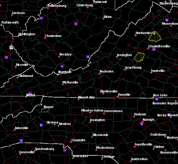 At 746 pm edt, a severe thunderstorm was located over shipman, or 13 miles north of bent creek, moving southeast at 20 mph (radar indicated). Hazards include 60 mph wind gusts and quarter size hail. Damaging winds will cause some trees and large branches to fall. this could injure those outdoors, as well as damage homes and vehicles. roadways may become blocked by downed trees. localized power outages are possible. unsecured light objects may become projectiles. Locations impacted include, shipman, schuyler, esmont, lovingston, damon, covesville, elma, rockfish, faber and wingina. At 746 pm edt, a severe thunderstorm was located over shipman, or 13 miles north of bent creek, moving southeast at 20 mph (radar indicated). Hazards include 60 mph wind gusts and quarter size hail. Damaging winds will cause some trees and large branches to fall. this could injure those outdoors, as well as damage homes and vehicles. roadways may become blocked by downed trees. localized power outages are possible. unsecured light objects may become projectiles. Locations impacted include, shipman, schuyler, esmont, lovingston, damon, covesville, elma, rockfish, faber and wingina.
|
| 8/17/2017 7:34 PM EDT |
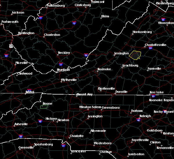 At 733 pm edt, a severe thunderstorm was located near shipman, or 12 miles northeast of clifford, moving east at 15 mph (radar indicated). Hazards include 60 mph wind gusts and quarter size hail. Damaging winds will cause some trees and large branches to fall. this could injure those outdoors, as well as damage homes and vehicles. roadways may become blocked by downed trees. localized power outages are possible. Unsecured light objects may become projectiles. At 733 pm edt, a severe thunderstorm was located near shipman, or 12 miles northeast of clifford, moving east at 15 mph (radar indicated). Hazards include 60 mph wind gusts and quarter size hail. Damaging winds will cause some trees and large branches to fall. this could injure those outdoors, as well as damage homes and vehicles. roadways may become blocked by downed trees. localized power outages are possible. Unsecured light objects may become projectiles.
|
| 6/19/2017 1:58 PM EDT |
 At 158 pm edt, a severe thunderstorm was located near schuyler, or 17 miles north of buckingham, moving northeast at 30 mph (radar indicated). Hazards include 60 mph wind gusts. Damaging winds will cause some trees and large branches to fall. this could injure those outdoors, as well as damage homes and vehicles. roadways may become blocked by downed trees. localized power outages are possible. unsecured light objects may become projectiles. Locations impacted include, scottsville, esmont, woodridge, keene, glendower and damon. At 158 pm edt, a severe thunderstorm was located near schuyler, or 17 miles north of buckingham, moving northeast at 30 mph (radar indicated). Hazards include 60 mph wind gusts. Damaging winds will cause some trees and large branches to fall. this could injure those outdoors, as well as damage homes and vehicles. roadways may become blocked by downed trees. localized power outages are possible. unsecured light objects may become projectiles. Locations impacted include, scottsville, esmont, woodridge, keene, glendower and damon.
|
| 6/19/2017 1:49 PM EDT |
 At 149 pm edt, a severe thunderstorm was located over schuyler, or 16 miles northwest of buckingham, moving northeast at 30 mph (radar indicated). Hazards include 60 mph wind gusts. Damaging winds will cause some trees and large branches to fall. this could injure those outdoors, as well as damage homes and vehicles. roadways may become blocked by downed trees. localized power outages are possible. Unsecured light objects may become projectiles. At 149 pm edt, a severe thunderstorm was located over schuyler, or 16 miles northwest of buckingham, moving northeast at 30 mph (radar indicated). Hazards include 60 mph wind gusts. Damaging winds will cause some trees and large branches to fall. this could injure those outdoors, as well as damage homes and vehicles. roadways may become blocked by downed trees. localized power outages are possible. Unsecured light objects may become projectiles.
|
| 5/5/2017 5:51 AM EDT |
 At 551 am edt, a severe thunderstorm was located near schuyler, or 15 miles southwest of charlottesville, moving northeast at 45 mph (radar indicated). Hazards include 60 mph wind gusts. Damaging winds will cause some trees and large branches to fall. this could injure those outdoors, as well as damage homes and vehicles. roadways may become blocked by downed trees. localized power outages are possible. unsecured light objects may become projectiles. Locations impacted include, charlottesville, schuyler, scottsville, esmont, damon, north garden, newcomb hall, covesville, woodridge, monticello, barracks, keene, glendower, overton, alberene and scott stadium. At 551 am edt, a severe thunderstorm was located near schuyler, or 15 miles southwest of charlottesville, moving northeast at 45 mph (radar indicated). Hazards include 60 mph wind gusts. Damaging winds will cause some trees and large branches to fall. this could injure those outdoors, as well as damage homes and vehicles. roadways may become blocked by downed trees. localized power outages are possible. unsecured light objects may become projectiles. Locations impacted include, charlottesville, schuyler, scottsville, esmont, damon, north garden, newcomb hall, covesville, woodridge, monticello, barracks, keene, glendower, overton, alberene and scott stadium.
|
| 5/5/2017 5:29 AM EDT |
 At 529 am edt, a severe thunderstorm was located near shipman, or 9 miles north of bent creek, moving northeast at 45 mph (radar indicated). Hazards include 60 mph wind gusts. Damaging winds will cause some trees and large branches to fall. this could injure those outdoors, as well as damage homes and vehicles. roadways may become blocked by downed trees. localized power outages are possible. Unsecured light objects may become projectiles. At 529 am edt, a severe thunderstorm was located near shipman, or 9 miles north of bent creek, moving northeast at 45 mph (radar indicated). Hazards include 60 mph wind gusts. Damaging winds will cause some trees and large branches to fall. this could injure those outdoors, as well as damage homes and vehicles. roadways may become blocked by downed trees. localized power outages are possible. Unsecured light objects may become projectiles.
|
| 3/1/2017 1:07 PM EST |
 At 107 pm est, severe thunderstorms were located along a line extending from orange to near centenary, moving east at 50 mph (radar indicated). Hazards include 60 mph wind gusts. Damaging winds will cause some trees and large branches to fall. this could injure those outdoors, as well as damage homes and vehicles. roadways may become blocked by downed trees. localized power outages are possible. unsecured light objects may become projectiles. Locations impacted include, orange, campbell, gordonsville, scottsville, esmont, mine run, allens creek, barboursville, verdiersville, montpelier station, norwood, thornhill, nasons, madison mills, montford, gladstone, old somerset, unionville, somerset and cobham. At 107 pm est, severe thunderstorms were located along a line extending from orange to near centenary, moving east at 50 mph (radar indicated). Hazards include 60 mph wind gusts. Damaging winds will cause some trees and large branches to fall. this could injure those outdoors, as well as damage homes and vehicles. roadways may become blocked by downed trees. localized power outages are possible. unsecured light objects may become projectiles. Locations impacted include, orange, campbell, gordonsville, scottsville, esmont, mine run, allens creek, barboursville, verdiersville, montpelier station, norwood, thornhill, nasons, madison mills, montford, gladstone, old somerset, unionville, somerset and cobham.
|
| 3/1/2017 12:56 PM EST |
 At 1255 pm est, severe thunderstorms were located along a line extending from 7 miles south of madison to near schuyler, moving east at 50 mph (radar indicated). Hazards include 60 mph wind gusts. Damaging winds will cause some trees and large branches to fall. this could injure those outdoors, as well as damage homes and vehicles. roadways may become blocked by downed trees. localized power outages are possible. unsecured light objects may become projectiles. Locations impacted include, charlottesville, orange, shipman, schuyler, campbell, westmoreland, hollymead, gordonsville, ruckersville, ivy, arrington, scottsville, esmont, lovingston, allens creek, eheart, north garden, barboursville, stony point and verdiersville. At 1255 pm est, severe thunderstorms were located along a line extending from 7 miles south of madison to near schuyler, moving east at 50 mph (radar indicated). Hazards include 60 mph wind gusts. Damaging winds will cause some trees and large branches to fall. this could injure those outdoors, as well as damage homes and vehicles. roadways may become blocked by downed trees. localized power outages are possible. unsecured light objects may become projectiles. Locations impacted include, charlottesville, orange, shipman, schuyler, campbell, westmoreland, hollymead, gordonsville, ruckersville, ivy, arrington, scottsville, esmont, lovingston, allens creek, eheart, north garden, barboursville, stony point and verdiersville.
|
| 3/1/2017 12:50 PM EST | Numerous trees down in southern half of county near alberene in albemarle county VA, 4.6 miles SSE of Esmont, VA |
| 3/1/2017 12:32 PM EST |
 At 1232 pm est, severe thunderstorms were located along a line extending from 10 miles southeast of massanutten to near lowesville, moving east at 50 mph (radar indicated). Hazards include 60 mph wind gusts. Damaging winds will cause some trees and large branches to fall. this could injure those outdoors, as well as damage homes and vehicles. roadways may become blocked by downed trees. localized power outages are possible. Unsecured light objects may become projectiles. At 1232 pm est, severe thunderstorms were located along a line extending from 10 miles southeast of massanutten to near lowesville, moving east at 50 mph (radar indicated). Hazards include 60 mph wind gusts. Damaging winds will cause some trees and large branches to fall. this could injure those outdoors, as well as damage homes and vehicles. roadways may become blocked by downed trees. localized power outages are possible. Unsecured light objects may become projectiles.
|
| 2/25/2017 1:09 PM EST |
 At 108 pm est, a severe thunderstorm was located 8 miles south of crozet, or 11 miles southwest of charlottesville, moving northeast at 35 mph (radar indicated). Hazards include 60 mph wind gusts and quarter size hail. Damaging winds will cause some trees and large branches to fall. this could injure those outdoors, as well as damage homes and vehicles. roadways may become blocked by downed trees. localized power outages are possible. Unsecured light objects may become projectiles. At 108 pm est, a severe thunderstorm was located 8 miles south of crozet, or 11 miles southwest of charlottesville, moving northeast at 35 mph (radar indicated). Hazards include 60 mph wind gusts and quarter size hail. Damaging winds will cause some trees and large branches to fall. this could injure those outdoors, as well as damage homes and vehicles. roadways may become blocked by downed trees. localized power outages are possible. Unsecured light objects may become projectiles.
|
| 2/25/2017 1:06 PM EST | Tree down onto power lines at 4734 cowan rd in albemarle county VA, 6.6 miles SE of Esmont, VA |
| 8/6/2016 5:00 PM EDT | Tree down blocking the 2500 block of irish roa in albemarle county VA, 0.5 miles NNW of Esmont, VA |
| 8/6/2016 4:46 PM EDT |
 At 446 pm edt, a severe thunderstorm was located 9 miles south of charlottesville, moving southeast at 30 mph (radar indicated). Hazards include 60 mph wind gusts. Damaging winds will cause some trees and large branches to fall. this could injure those outdoors, as well as damage homes and vehicles. roadways may become blocked by downed trees. localized power outages are possible. unsecured light objects may become projectiles. Locations impacted include, charlottesville, scottsville, esmont, north garden, keene, overton, batesville, woodridge, glendower and alberene. At 446 pm edt, a severe thunderstorm was located 9 miles south of charlottesville, moving southeast at 30 mph (radar indicated). Hazards include 60 mph wind gusts. Damaging winds will cause some trees and large branches to fall. this could injure those outdoors, as well as damage homes and vehicles. roadways may become blocked by downed trees. localized power outages are possible. unsecured light objects may become projectiles. Locations impacted include, charlottesville, scottsville, esmont, north garden, keene, overton, batesville, woodridge, glendower and alberene.
|
| 8/6/2016 4:40 PM EDT | Tree down near the intersection of red hill road and old lynchburg roa in albemarle county VA, 7.9 miles S of Esmont, VA |
| 8/6/2016 4:28 PM EDT |
 At 428 pm edt, a severe thunderstorm was located near charlottesville, moving southeast at 25 mph (radar indicated). Hazards include 60 mph wind gusts. Damaging winds will cause some trees and large branches to fall. this could injure those outdoors, as well as damage homes and vehicles. roadways may become blocked by downed trees. localized power outages are possible. unsecured light objects may become projectiles. Locations impacted include, charlottesville, crozet, free union, campbell, westmoreland, hollymead, ivy, scottsville, esmont, keene, keswick, flordon, white hall, woodridge, scott stadium, glendower, monticello, carrsbrook, greenwood and barracks. At 428 pm edt, a severe thunderstorm was located near charlottesville, moving southeast at 25 mph (radar indicated). Hazards include 60 mph wind gusts. Damaging winds will cause some trees and large branches to fall. this could injure those outdoors, as well as damage homes and vehicles. roadways may become blocked by downed trees. localized power outages are possible. unsecured light objects may become projectiles. Locations impacted include, charlottesville, crozet, free union, campbell, westmoreland, hollymead, ivy, scottsville, esmont, keene, keswick, flordon, white hall, woodridge, scott stadium, glendower, monticello, carrsbrook, greenwood and barracks.
|
| 8/6/2016 4:11 PM EDT |
 At 411 pm edt, a severe thunderstorm was located near charlottesville, moving southeast at 30 mph (radar indicated). Hazards include 60 mph wind gusts. Damaging winds will cause some trees and large branches to fall. this could injure those outdoors, as well as damage homes and vehicles. roadways may become blocked by downed trees. localized power outages are possible. Unsecured light objects may become projectiles. At 411 pm edt, a severe thunderstorm was located near charlottesville, moving southeast at 30 mph (radar indicated). Hazards include 60 mph wind gusts. Damaging winds will cause some trees and large branches to fall. this could injure those outdoors, as well as damage homes and vehicles. roadways may become blocked by downed trees. localized power outages are possible. Unsecured light objects may become projectiles.
|
| 6/28/2016 7:01 PM EDT |
 At 701 pm edt, a severe thunderstorm was located near schuyler, or 15 miles north of buckingham, moving southeast at 15 mph (radar indicated). Hazards include 60 mph wind gusts and quarter size hail. Damaging winds will cause some trees and large branches to fall. this could injure those outdoors, as well as damage homes and vehicles. roadways may become blocked by downed trees. Locations impacted include, schuyler and esmont. At 701 pm edt, a severe thunderstorm was located near schuyler, or 15 miles north of buckingham, moving southeast at 15 mph (radar indicated). Hazards include 60 mph wind gusts and quarter size hail. Damaging winds will cause some trees and large branches to fall. this could injure those outdoors, as well as damage homes and vehicles. roadways may become blocked by downed trees. Locations impacted include, schuyler and esmont.
|
| 6/28/2016 6:43 PM EDT |
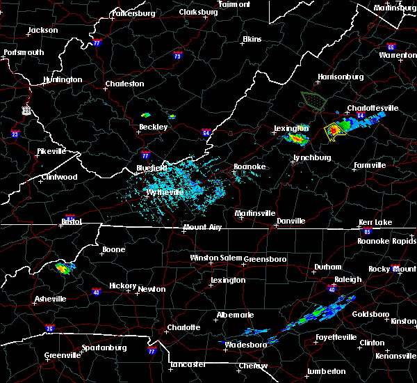 At 642 pm edt, a severe thunderstorm was located near schuyler, or 17 miles southwest of charlottesville, moving southeast at 10 mph (radar indicated). Hazards include 60 mph wind gusts and quarter size hail. Damaging winds will cause some trees and large branches to fall. this could injure those outdoors, as well as damage homes and vehicles. roadways may become blocked by downed trees. localized power outages are possible. Unsecured light objects may become projectiles. At 642 pm edt, a severe thunderstorm was located near schuyler, or 17 miles southwest of charlottesville, moving southeast at 10 mph (radar indicated). Hazards include 60 mph wind gusts and quarter size hail. Damaging winds will cause some trees and large branches to fall. this could injure those outdoors, as well as damage homes and vehicles. roadways may become blocked by downed trees. localized power outages are possible. Unsecured light objects may become projectiles.
|
| 6/16/2016 8:23 PM EDT |
 A severe thunderstorm warning remains in effect until 845 pm edt for southwestern orange. southeastern greene. southwestern culpeper. southeastern augusta. southern madison. albemarle and northeastern nelson counties and the city of charlottesville. at 823 pm edt. Severe thunderstorms were located along a line extending from near madison to near charlottesville to 10 miles. A severe thunderstorm warning remains in effect until 845 pm edt for southwestern orange. southeastern greene. southwestern culpeper. southeastern augusta. southern madison. albemarle and northeastern nelson counties and the city of charlottesville. at 823 pm edt. Severe thunderstorms were located along a line extending from near madison to near charlottesville to 10 miles.
|
| 6/16/2016 7:48 PM EDT |
 At 748 pm edt, severe thunderstorms were located along a line extending from near shenandoah to near crimora to near sherando, moving east at 50 mph (radar indicated). Hazards include 60 mph wind gusts and quarter size hail. Damaging winds will cause some trees and large branches to fall. this could injure those outdoors, as well as damage homes and vehicles. roadways may become blocked by downed trees. localized power outages are possible. Unsecured light objects may become projectiles. At 748 pm edt, severe thunderstorms were located along a line extending from near shenandoah to near crimora to near sherando, moving east at 50 mph (radar indicated). Hazards include 60 mph wind gusts and quarter size hail. Damaging winds will cause some trees and large branches to fall. this could injure those outdoors, as well as damage homes and vehicles. roadways may become blocked by downed trees. localized power outages are possible. Unsecured light objects may become projectiles.
|
| 6/5/2016 5:07 PM EDT |
 The severe thunderstorm warning for southwestern albemarle and east central nelson counties will expire at 515 pm edt, the storm which prompted the warning has weakened, and no longer pose an immediate threat to life or property. therefore the warning will be allowed to expire. a severe thunderstorm watch remains in effect until 1000 pm edt for central virginia. The severe thunderstorm warning for southwestern albemarle and east central nelson counties will expire at 515 pm edt, the storm which prompted the warning has weakened, and no longer pose an immediate threat to life or property. therefore the warning will be allowed to expire. a severe thunderstorm watch remains in effect until 1000 pm edt for central virginia.
|
| 6/5/2016 4:57 PM EDT |
 At 457 pm edt, a severe thunderstorm was located near shipman, or 13 miles north of bent creek, moving northeast at 45 mph (radar indicated). Hazards include 60 mph wind gusts. Damaging winds will cause some trees and large branches to fall. this could injure those outdoors, as well as damage homes and vehicles. roadways may become blocked by downed trees. localized power outages are possible. unsecured light objects may become projectiles. Locations impacted include, shipman, schuyler, scottsville, esmont, rockfish, keene, elma, damon, woodridge, glendower, alberene and wingina. At 457 pm edt, a severe thunderstorm was located near shipman, or 13 miles north of bent creek, moving northeast at 45 mph (radar indicated). Hazards include 60 mph wind gusts. Damaging winds will cause some trees and large branches to fall. this could injure those outdoors, as well as damage homes and vehicles. roadways may become blocked by downed trees. localized power outages are possible. unsecured light objects may become projectiles. Locations impacted include, shipman, schuyler, scottsville, esmont, rockfish, keene, elma, damon, woodridge, glendower, alberene and wingina.
|
| 6/5/2016 4:30 PM EDT |
 At 430 pm edt, a severe thunderstorm was located over amherst, moving northeast at 50 mph (radar indicated). Hazards include 60 mph wind gusts. Damaging winds will cause some trees and large branches to fall. this could injure those outdoors, as well as damage homes and vehicles. roadways may become blocked by downed trees. localized power outages are possible. Unsecured light objects may become projectiles. At 430 pm edt, a severe thunderstorm was located over amherst, moving northeast at 50 mph (radar indicated). Hazards include 60 mph wind gusts. Damaging winds will cause some trees and large branches to fall. this could injure those outdoors, as well as damage homes and vehicles. roadways may become blocked by downed trees. localized power outages are possible. Unsecured light objects may become projectiles.
|
| 6/4/2016 10:43 PM EDT |
 At 1043 pm edt, a severe thunderstorm was located near schuyler, or 14 miles southwest of charlottesville, moving northeast at 15 mph (radar indicated). Hazards include 60 mph wind gusts. Damaging winds will cause some trees and large branches to fall. this could injure those outdoors, as well as damage homes and vehicles. roadways may become blocked by downed trees. localized power outages are possible. unsecured light objects may become projectiles. Locations impacted include, charlottesville, shipman, schuyler, westmoreland, hollymead, nellysford, ivy, scottsville, esmont, lovingston, bryant, keene, keswick, faber, flordon, woodridge, scott stadium, glendower, monticello and covesville. At 1043 pm edt, a severe thunderstorm was located near schuyler, or 14 miles southwest of charlottesville, moving northeast at 15 mph (radar indicated). Hazards include 60 mph wind gusts. Damaging winds will cause some trees and large branches to fall. this could injure those outdoors, as well as damage homes and vehicles. roadways may become blocked by downed trees. localized power outages are possible. unsecured light objects may become projectiles. Locations impacted include, charlottesville, shipman, schuyler, westmoreland, hollymead, nellysford, ivy, scottsville, esmont, lovingston, bryant, keene, keswick, faber, flordon, woodridge, scott stadium, glendower, monticello and covesville.
|
| 6/4/2016 10:16 PM EDT |
 At 1014 pm edt, numerous showers and thunderstorms were affecting nelson and albermarle counties. the strongest storm was located over schuyler, or 19 miles north of bent creek, moving northeast at 15 mph. widespread wind damage and torrential downpours can be expected with these storms (radar indicated). Hazards include 60 mph wind gusts. Damaging winds will cause some trees and large branches to fall. this could injure those outdoors, as well as damage homes and vehicles. roadways may become blocked by downed trees. localized power outages are possible. Unsecured light objects may become projectiles. At 1014 pm edt, numerous showers and thunderstorms were affecting nelson and albermarle counties. the strongest storm was located over schuyler, or 19 miles north of bent creek, moving northeast at 15 mph. widespread wind damage and torrential downpours can be expected with these storms (radar indicated). Hazards include 60 mph wind gusts. Damaging winds will cause some trees and large branches to fall. this could injure those outdoors, as well as damage homes and vehicles. roadways may become blocked by downed trees. localized power outages are possible. Unsecured light objects may become projectiles.
|
| 4/1/2016 4:18 PM EDT |
 At 417 pm edt, doppler radar indicated a severe thunderstorm capable of producing quarter size hail and damaging winds in excess of 60 mph. this storm was located near schuyler, or 15 miles southwest of charlottesville, moving east at 30 mph. locations impacted include, charlottesville, schuyler, scottsville, esmont, keene, keswick, faber, woodridge, glendower, monticello, covesville, north garden, damon, overton, shadwell, boyd tavern and alberene. At 417 pm edt, doppler radar indicated a severe thunderstorm capable of producing quarter size hail and damaging winds in excess of 60 mph. this storm was located near schuyler, or 15 miles southwest of charlottesville, moving east at 30 mph. locations impacted include, charlottesville, schuyler, scottsville, esmont, keene, keswick, faber, woodridge, glendower, monticello, covesville, north garden, damon, overton, shadwell, boyd tavern and alberene.
|
| 4/1/2016 4:07 PM EDT |
 At 407 pm edt, doppler radar indicated a severe thunderstorm capable of producing quarter size hail and damaging winds in excess of 60 mph. this storm was located near schuyler, or 16 miles southeast of waynesboro, moving east at 30 mph. locations impacted include, charlottesville, shipman, schuyler, wintergreen, nellysford, scottsville, esmont, lovingston, keene, keswick, faber, woodridge, scott stadium, glendower, monticello, covesville, boyd tavern, elma, greenfield and newcomb hall. At 407 pm edt, doppler radar indicated a severe thunderstorm capable of producing quarter size hail and damaging winds in excess of 60 mph. this storm was located near schuyler, or 16 miles southeast of waynesboro, moving east at 30 mph. locations impacted include, charlottesville, shipman, schuyler, wintergreen, nellysford, scottsville, esmont, lovingston, keene, keswick, faber, woodridge, scott stadium, glendower, monticello, covesville, boyd tavern, elma, greenfield and newcomb hall.
|
| 4/1/2016 4:01 PM EDT |
 At 401 pm edt, doppler radar indicated a severe thunderstorm capable of producing damaging winds in excess of 60 mph. this storm was located near wintergreen, or 16 miles south of waynesboro, and moving east at 30 mph. At 401 pm edt, doppler radar indicated a severe thunderstorm capable of producing damaging winds in excess of 60 mph. this storm was located near wintergreen, or 16 miles south of waynesboro, and moving east at 30 mph.
|
| 8/4/2015 5:24 PM EDT |
 The severe thunderstorm warning for south central albemarle county will expire at 530 pm edt, the storm which prompted the warning has weakened below severe limits, and no longer poses an immediate threat to life or property. therefore the warning will be allowed to expire. The severe thunderstorm warning for south central albemarle county will expire at 530 pm edt, the storm which prompted the warning has weakened below severe limits, and no longer poses an immediate threat to life or property. therefore the warning will be allowed to expire.
|
| 8/4/2015 5:15 PM EDT |
 At 515 pm edt, doppler radar indicated a severe thunderstorm capable of producing damaging winds in excess of 60 mph. this storm was located near schuyler, or 16 miles north of buckingham, moving east at 30 mph. locations impacted include, scottsville, keene, glendower and esmont. At 515 pm edt, doppler radar indicated a severe thunderstorm capable of producing damaging winds in excess of 60 mph. this storm was located near schuyler, or 16 miles north of buckingham, moving east at 30 mph. locations impacted include, scottsville, keene, glendower and esmont.
|
| 8/4/2015 4:58 PM EDT |
 At 458 pm edt, doppler radar indicated a severe thunderstorm capable of producing half dollar size hail and damaging winds in excess of 60 mph. this storm was located near schuyler, or 15 miles north of bent creek, moving northeast at 35 mph. locations impacted include, schuyler, scottsville, rockfish, keene, elma, damon, faber, glendower, esmont and alberene. At 458 pm edt, doppler radar indicated a severe thunderstorm capable of producing half dollar size hail and damaging winds in excess of 60 mph. this storm was located near schuyler, or 15 miles north of bent creek, moving northeast at 35 mph. locations impacted include, schuyler, scottsville, rockfish, keene, elma, damon, faber, glendower, esmont and alberene.
|
| 8/4/2015 4:48 PM EDT |
 At 447 pm edt, doppler radar indicated a severe thunderstorm capable of producing quarter size hail and damaging winds in excess of 60 mph. this storm was located over shipman, or 12 miles northeast of clifford, and moving northeast at 35 mph. At 447 pm edt, doppler radar indicated a severe thunderstorm capable of producing quarter size hail and damaging winds in excess of 60 mph. this storm was located over shipman, or 12 miles northeast of clifford, and moving northeast at 35 mph.
|
| 6/30/2015 11:07 PM EDT |
 The severe thunderstorm warning for southern albemarle, east central nelson counties and the city of charlottesville will expire at 1115 pm edt, the storms which prompted the warning have weakened below severe limits, and no longer poses an immediate threat to life or property. therefore the warning will be allowed to expire. however gusty winds and heavy rain are still possible with these thunderstorms. to report severe weather, contact your nearest law enforcement agency. they will relay your report to the national weather service sterling virginia. The severe thunderstorm warning for southern albemarle, east central nelson counties and the city of charlottesville will expire at 1115 pm edt, the storms which prompted the warning have weakened below severe limits, and no longer poses an immediate threat to life or property. therefore the warning will be allowed to expire. however gusty winds and heavy rain are still possible with these thunderstorms. to report severe weather, contact your nearest law enforcement agency. they will relay your report to the national weather service sterling virginia.
|
| 6/30/2015 10:45 PM EDT |
 At 1045 pm edt, doppler radar indicated a line of severe thunderstorms capable of producing damaging winds in excess of 60 mph. these storms were located along a line extending from near schuyler to near centenary, moving northeast at 40 mph. locations impacted include, charlottesville, schuyler, westmoreland, scottsville, keene, woodridge, newcomb hall, scott stadium, glendower, monticello, carrsbrook, north garden, damon, overton, shadwell, barracks, boyd tavern, esmont and alberene. At 1045 pm edt, doppler radar indicated a line of severe thunderstorms capable of producing damaging winds in excess of 60 mph. these storms were located along a line extending from near schuyler to near centenary, moving northeast at 40 mph. locations impacted include, charlottesville, schuyler, westmoreland, scottsville, keene, woodridge, newcomb hall, scott stadium, glendower, monticello, carrsbrook, north garden, damon, overton, shadwell, barracks, boyd tavern, esmont and alberene.
|
| 6/30/2015 10:28 PM EDT |
 At 1028 pm edt, doppler radar indicated a line of severe thunderstorms capable of producing damaging winds in excess of 60 mph. these storms were located along a line extending from near schuyler to 6 miles east of wingina, and moving northeast at 40 mph. At 1028 pm edt, doppler radar indicated a line of severe thunderstorms capable of producing damaging winds in excess of 60 mph. these storms were located along a line extending from near schuyler to 6 miles east of wingina, and moving northeast at 40 mph.
|
| 6/25/2015 8:53 PM EDT |
 At 853 pm edt, doppler radar indicated a severe thunderstorm capable of producing quarter size hail and damaging winds in excess of 60 mph. this storm was located 7 miles east of schuyler, or 14 miles south of charlottesville, moving southeast at 35 mph. locations impacted include, scottsville, north garden, keene, damon, woodridge, glendower, esmont, covesville and alberene. At 853 pm edt, doppler radar indicated a severe thunderstorm capable of producing quarter size hail and damaging winds in excess of 60 mph. this storm was located 7 miles east of schuyler, or 14 miles south of charlottesville, moving southeast at 35 mph. locations impacted include, scottsville, north garden, keene, damon, woodridge, glendower, esmont, covesville and alberene.
|
| 6/25/2015 8:48 PM EDT |
 At 848 pm edt, doppler radar indicated a severe thunderstorm capable of producing damaging winds in excess of 60 mph. this storm was located 8 miles northeast of schuyler, or 13 miles south of charlottesville, and moving southeast at 35 mph. At 848 pm edt, doppler radar indicated a severe thunderstorm capable of producing damaging winds in excess of 60 mph. this storm was located 8 miles northeast of schuyler, or 13 miles south of charlottesville, and moving southeast at 35 mph.
|
| 8/31/2013 6:42 PM EDT | Tree down on powerlines and blocking road 5300 secretarys sand rd in albemarle county VA, 4.4 miles S of Esmont, VA |
| 7/20/2013 4:12 PM EDT | Two trees down on state hwy 20 near walton middle school in albemarle county VA, 6.9 miles SSW of Esmont, VA |
| 7/16/2012 6:25 PM EDT | Trees down on logan road in buckingham county VA, 6 miles N of Esmont, VA |
| 7/8/2012 5:18 PM EDT | Trees down on plank rd and edge valley rd in albemarle county VA, 8.3 miles SSE of Esmont, VA |
| 6/29/2012 9:48 PM EDT | *** 1 in albemarle county VA, 3.6 miles SSW of Esmont, VA |
| 6/29/2012 9:48 PM EDT | *** 1 in albemarle county VA, 3.6 miles SSW of Esmont, VA |
| 6/29/2012 9:48 PM EDT | *** 1 fatal *** driver struck by tree along scottsville rd in albemarle county VA, 3.6 miles SSW of Esmont, VA |
| 6/29/2012 9:40 PM EDT | Large...mature oak tree was blown into house on plank road. extensive roof and significant structural damag in albemarle county VA, 5.9 miles S of Esmont, VA |
| 1/1/0001 12:00 AM | Many 2 foot diameter trees uprooted. large branches snapped off a mature tree and blown a few hundred feet awa in albemarle county VA, 7.7 miles SSW of Esmont, VA |
| 1/1/0001 12:00 AM | Tree knocked down onto power lines along scottsville roa in albemarle county VA, 5.7 miles SSW of Esmont, VA |
| 1/1/0001 12:00 AM | Branches and a few trees damaged by thunderstorm wind in albemarle county VA, 0.9 miles ESE of Esmont, VA |
| 1/1/0001 12:00 AM | Tree down near intersection of esmont road and nydrie driv in albemarle county VA, 1.8 miles SSW of Esmont, VA |
Hail Maps for Esmont, VA


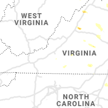


Connect with Interactive Hail Maps