

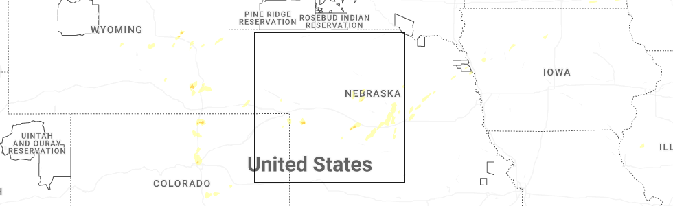
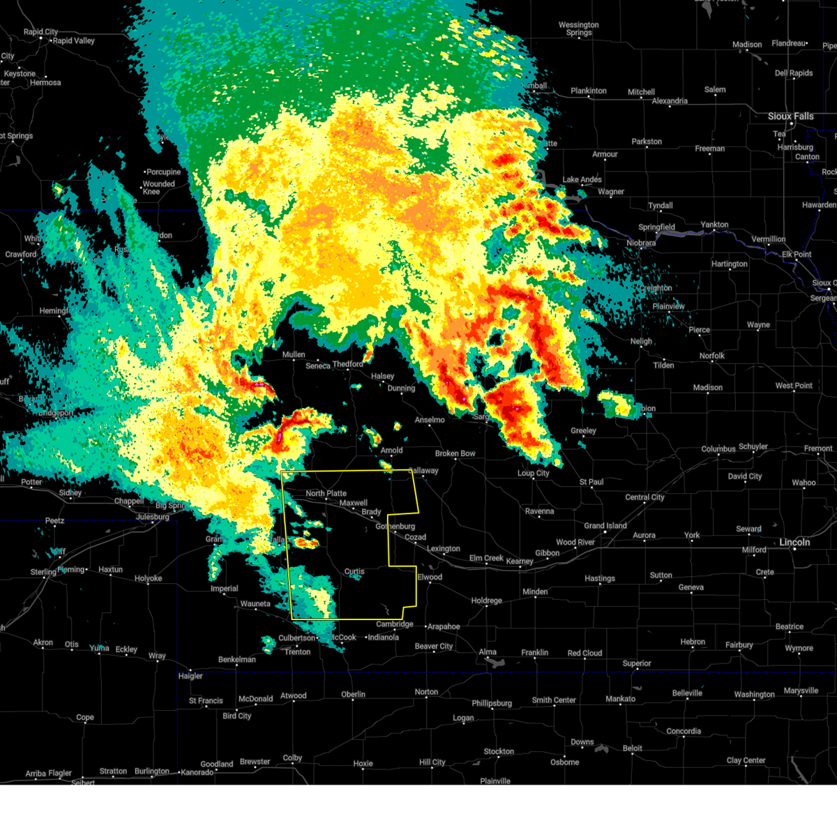
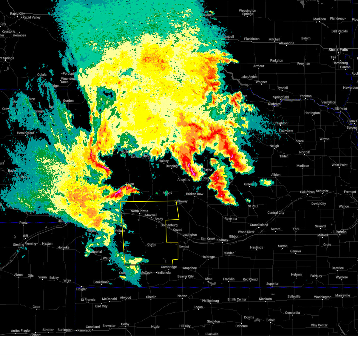
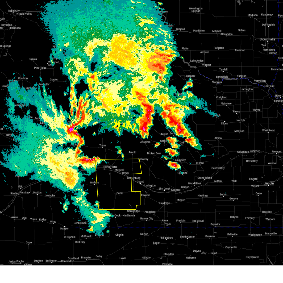
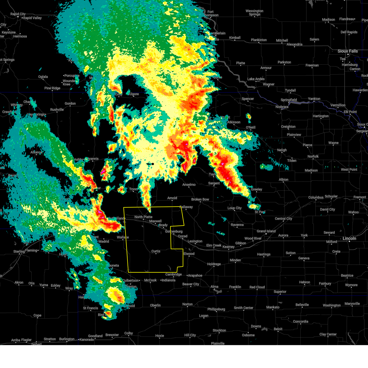
Hail Map for Eustis, NE
The Eustis, NE area has had 21 reports of on-the-ground hail by trained spotters, and has been under severe weather warnings 13 times during the past 12 months. Doppler radar has detected hail at or near Eustis, NE on 93 occasions, including 5 occasions during the past year.
| Name: | Eustis, NE |
| Where Located: | 50.3 miles SE of North Platte, NE |
| Map: | Google Map for Eustis, NE |
| Population: | 401 |
| Housing Units: | 205 |
| More Info: | Search Google for Eustis, NE |
1
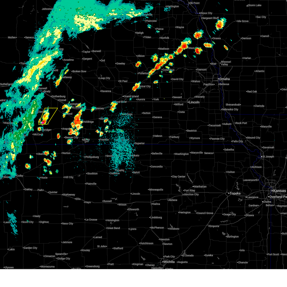
The Top Recent Hail Date for Eustis, NE is Wednesday, June 25, 2025 (11th out of 93)
Hail and Wind Damage Spotted near Eustis, NE
| Date / Time | Report Details |
|---|---|
| 7/6/2025 2:57 PM CDT |
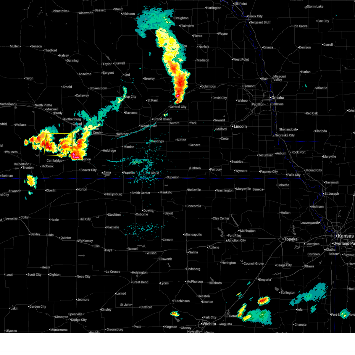 At 256 pm cdt, a severe thunderstorm was located near stockville, or 10 miles southeast of curtis, moving east at 20 mph (radar indicated). Hazards include 60 mph wind gusts and quarter size hail. Hail damage to vehicles is expected. expect wind damage to roofs, siding, and trees. Locations impacted include, curtis, eustis, moorefield, stockville, medicine creek reservoir state recreation area, orafino, freedom, and dancing leaf earth lodge. At 256 pm cdt, a severe thunderstorm was located near stockville, or 10 miles southeast of curtis, moving east at 20 mph (radar indicated). Hazards include 60 mph wind gusts and quarter size hail. Hail damage to vehicles is expected. expect wind damage to roofs, siding, and trees. Locations impacted include, curtis, eustis, moorefield, stockville, medicine creek reservoir state recreation area, orafino, freedom, and dancing leaf earth lodge.
|
| 7/6/2025 2:38 PM CDT |
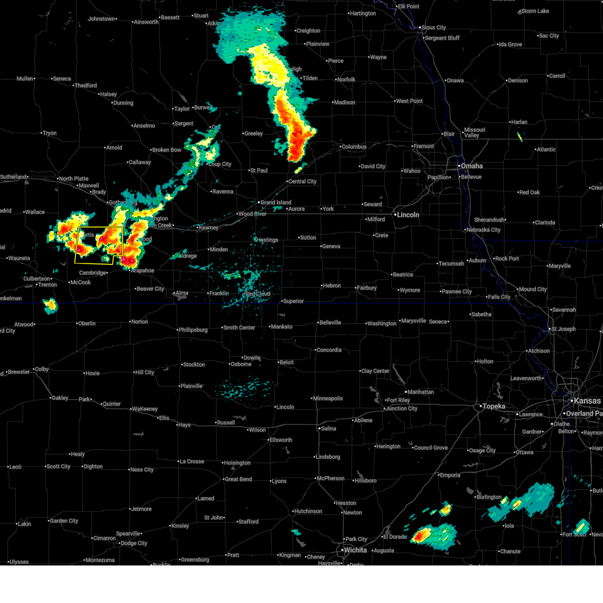 Svrlbf the national weather service in north platte has issued a * severe thunderstorm warning for, frontier county in southwestern nebraska, * until 345 pm cdt. * at 237 pm cdt, a severe thunderstorm was located near stockville, or 9 miles south of curtis, moving east at 20 mph. a second storm was located 7 miles northeast of stockville and was moving east at 20 mph (radar indicated). Hazards include 60 mph wind gusts and half dollar size hail. Hail damage to vehicles is expected. Expect wind damage to roofs, siding, and trees. Svrlbf the national weather service in north platte has issued a * severe thunderstorm warning for, frontier county in southwestern nebraska, * until 345 pm cdt. * at 237 pm cdt, a severe thunderstorm was located near stockville, or 9 miles south of curtis, moving east at 20 mph. a second storm was located 7 miles northeast of stockville and was moving east at 20 mph (radar indicated). Hazards include 60 mph wind gusts and half dollar size hail. Hail damage to vehicles is expected. Expect wind damage to roofs, siding, and trees.
|
| 6/25/2025 3:29 PM CDT | The storm which prompted the warning has moved out of the area. therefore, the warning will be allowed to expire. |
| 6/25/2025 3:08 PM CDT | At 308 pm cdt, a severe thunderstorm was located 10 miles east of stockville, or 17 miles east of curtis, moving northeast at 30 mph (radar indicated). Hazards include 60 mph wind gusts and penny size hail. Expect damage to roofs, siding, and trees. Locations impacted include, eustis. |
| 6/25/2025 2:55 PM CDT | At 255 pm cdt, a severe thunderstorm was located near stockville, or 14 miles southeast of curtis, moving northeast at 30 mph (radar indicated). Hazards include 60 mph wind gusts and penny size hail. Expect damage to roofs, siding, and trees. Locations impacted include, eustis, stockville, orafino, and dancing leaf earth lodge. |
| 6/25/2025 2:45 PM CDT |
 Svrlbf the national weather service in north platte has issued a * severe thunderstorm warning for, eastern frontier county in southwestern nebraska, * until 330 pm cdt. * at 245 pm cdt, a severe thunderstorm was located near medicine creek reservoir state recreation area, or 16 miles southeast of curtis, moving northeast at 30 mph (radar indicated). Hazards include 60 mph wind gusts and quarter size hail. Hail damage to vehicles is expected. Expect wind damage to roofs, siding, and trees. Svrlbf the national weather service in north platte has issued a * severe thunderstorm warning for, eastern frontier county in southwestern nebraska, * until 330 pm cdt. * at 245 pm cdt, a severe thunderstorm was located near medicine creek reservoir state recreation area, or 16 miles southeast of curtis, moving northeast at 30 mph (radar indicated). Hazards include 60 mph wind gusts and quarter size hail. Hail damage to vehicles is expected. Expect wind damage to roofs, siding, and trees.
|
| 5/14/2025 9:56 PM CDT |
 The storms which prompted the warning have weakened below severe limits, and no longer pose an immediate threat to life or property. therefore, the warning will be allowed to expire. however, gusty winds to around 50 mph are still possible. a severe thunderstorm watch remains in effect until 1100 pm cdt for central and southwestern nebraska. The storms which prompted the warning have weakened below severe limits, and no longer pose an immediate threat to life or property. therefore, the warning will be allowed to expire. however, gusty winds to around 50 mph are still possible. a severe thunderstorm watch remains in effect until 1100 pm cdt for central and southwestern nebraska.
|
| 5/14/2025 9:39 PM CDT |
 At 938 pm cdt, the leading edge of damaging winds were located along a line extending from 8 miles southwest of stapleton to 11 miles northeast of brady to 7 miles southwest of elwood, moving east at 60 mph (radar indicated). Hazards include 70 mph wind gusts. Expect considerable tree damage. damage is likely to mobile homes, roofs, and outbuildings. locations impacted include, north platte, curtis, hayes center, sutherland, hershey, brady, eustis, maxwell, wellfleet, moorefield, stockville, dickens, lake maloney state recreation area, medicine creek reservoir state recreation area, sutherland reservoir state recreation area, north platte airport. this includes the following highways, highway 97 between mile markers 1 and 11. interstate 80 in nebraska between mile markers 158 and 207. Highway 83 between mile markers 27 and 99. At 938 pm cdt, the leading edge of damaging winds were located along a line extending from 8 miles southwest of stapleton to 11 miles northeast of brady to 7 miles southwest of elwood, moving east at 60 mph (radar indicated). Hazards include 70 mph wind gusts. Expect considerable tree damage. damage is likely to mobile homes, roofs, and outbuildings. locations impacted include, north platte, curtis, hayes center, sutherland, hershey, brady, eustis, maxwell, wellfleet, moorefield, stockville, dickens, lake maloney state recreation area, medicine creek reservoir state recreation area, sutherland reservoir state recreation area, north platte airport. this includes the following highways, highway 97 between mile markers 1 and 11. interstate 80 in nebraska between mile markers 158 and 207. Highway 83 between mile markers 27 and 99.
|
| 5/14/2025 9:25 PM CDT |
 At 923 pm cdt, damaging winds were located along a line extending from 13 miles north of north platte to maxwell to near medicine creek reservoir state recreation area, moving east at 60 mph (radar indicated). Hazards include 80 mph wind gusts and blowing dust. Flying debris will be dangerous to those caught without shelter. mobile homes will be heavily damaged. expect considerable damage to roofs, windows, and vehicles. extensive tree damage and power outages are likely. locations impacted include, north platte, curtis, hayes center, sutherland, hershey, brady, eustis, maxwell, wellfleet, moorefield, stockville, dickens, lake maloney state recreation area, medicine creek reservoir state recreation area, sutherland reservoir state recreation area, north platte airport, keith, maywood, cottonwood canyon state wildlife management area, and o'fallons. this includes the following highways, highway 97 between mile markers 1 and 11. interstate 80 in nebraska between mile markers 158 and 207. Highway 83 between mile markers 27 and 99. At 923 pm cdt, damaging winds were located along a line extending from 13 miles north of north platte to maxwell to near medicine creek reservoir state recreation area, moving east at 60 mph (radar indicated). Hazards include 80 mph wind gusts and blowing dust. Flying debris will be dangerous to those caught without shelter. mobile homes will be heavily damaged. expect considerable damage to roofs, windows, and vehicles. extensive tree damage and power outages are likely. locations impacted include, north platte, curtis, hayes center, sutherland, hershey, brady, eustis, maxwell, wellfleet, moorefield, stockville, dickens, lake maloney state recreation area, medicine creek reservoir state recreation area, sutherland reservoir state recreation area, north platte airport, keith, maywood, cottonwood canyon state wildlife management area, and o'fallons. this includes the following highways, highway 97 between mile markers 1 and 11. interstate 80 in nebraska between mile markers 158 and 207. Highway 83 between mile markers 27 and 99.
|
| 5/14/2025 9:08 PM CDT |
 Svrlbf the national weather service in north platte has issued a * severe thunderstorm warning for, frontier county in southwestern nebraska, lincoln county in southwestern nebraska, southwestern custer county in central nebraska, eastern hayes county in southwestern nebraska, * until 1000 pm cdt. * at 906 pm cdt, severe thunderstorms were located along a line extending from 9 miles north of hershey to north platte to 14 miles southwest of stockville, moving east at 55 mph (radar indicated). Hazards include 80 mph wind gusts. Flying debris will be dangerous to those caught without shelter. mobile homes will be heavily damaged. expect considerable damage to roofs, windows, and vehicles. Extensive tree damage and power outages are likely. Svrlbf the national weather service in north platte has issued a * severe thunderstorm warning for, frontier county in southwestern nebraska, lincoln county in southwestern nebraska, southwestern custer county in central nebraska, eastern hayes county in southwestern nebraska, * until 1000 pm cdt. * at 906 pm cdt, severe thunderstorms were located along a line extending from 9 miles north of hershey to north platte to 14 miles southwest of stockville, moving east at 55 mph (radar indicated). Hazards include 80 mph wind gusts. Flying debris will be dangerous to those caught without shelter. mobile homes will be heavily damaged. expect considerable damage to roofs, windows, and vehicles. Extensive tree damage and power outages are likely.
|
| 8/13/2024 11:54 PM CDT |
 The storms which prompted the warning have moved out of the area. therefore, the warning will be allowed to expire. a severe thunderstorm watch remains in effect until 200 am cdt for southwestern nebraska. The storms which prompted the warning have moved out of the area. therefore, the warning will be allowed to expire. a severe thunderstorm watch remains in effect until 200 am cdt for southwestern nebraska.
|
| 8/13/2024 11:35 PM CDT |
 At 1134 pm cdt, severe thunderstorms were located along a line extending from 6 miles southeast of moorefield to 12 miles east of stockville to near medicine creek reservoir state recreation area, moving east at 55 mph (radar indicated). Hazards include 60 mph wind gusts and penny size hail. Expect damage to roofs, siding, and trees. Locations impacted include, eustis, moorefield, stockville, medicine creek reservoir state recreation area, orafino, freedom, and dancing leaf earth lodge. At 1134 pm cdt, severe thunderstorms were located along a line extending from 6 miles southeast of moorefield to 12 miles east of stockville to near medicine creek reservoir state recreation area, moving east at 55 mph (radar indicated). Hazards include 60 mph wind gusts and penny size hail. Expect damage to roofs, siding, and trees. Locations impacted include, eustis, moorefield, stockville, medicine creek reservoir state recreation area, orafino, freedom, and dancing leaf earth lodge.
|
| 8/13/2024 11:19 PM CDT |
 Svrlbf the national weather service in north platte has issued a * severe thunderstorm warning for, frontier county in southwestern nebraska, * until midnight cdt. * at 1119 pm cdt, severe thunderstorms were located along a line extending from near curtis to near stockville to near bartley, moving east at 60 mph (radar indicated). Hazards include 60 mph wind gusts and penny size hail. expect damage to roofs, siding, and trees Svrlbf the national weather service in north platte has issued a * severe thunderstorm warning for, frontier county in southwestern nebraska, * until midnight cdt. * at 1119 pm cdt, severe thunderstorms were located along a line extending from near curtis to near stockville to near bartley, moving east at 60 mph (radar indicated). Hazards include 60 mph wind gusts and penny size hail. expect damage to roofs, siding, and trees
|
| 7/6/2024 3:23 PM CDT |
 At 323 pm cdt, a severe thunderstorm was located 7 miles east of stockville, or 15 miles southeast of curtis, moving southeast at 25 mph (radar indicated). Hazards include ping pong ball size hail and 60 mph wind gusts. People and animals outdoors will be injured. expect hail damage to roofs, siding, windows, and vehicles. expect wind damage to roofs, siding, and trees. Locations impacted include, eustis, medicine creek reservoir state recreation area, orafino, and freedom. At 323 pm cdt, a severe thunderstorm was located 7 miles east of stockville, or 15 miles southeast of curtis, moving southeast at 25 mph (radar indicated). Hazards include ping pong ball size hail and 60 mph wind gusts. People and animals outdoors will be injured. expect hail damage to roofs, siding, windows, and vehicles. expect wind damage to roofs, siding, and trees. Locations impacted include, eustis, medicine creek reservoir state recreation area, orafino, and freedom.
|
| 7/6/2024 3:11 PM CDT |
 Svrlbf the national weather service in north platte has issued a * severe thunderstorm warning for, eastern frontier county in southwestern nebraska, * until 400 pm cdt. * at 310 pm cdt, a severe thunderstorm was located near stockville, or 9 miles east of curtis, moving east at 25 mph (radar indicated). Hazards include golf ball size hail and 60 mph wind gusts. People and animals outdoors will be injured. expect hail damage to roofs, siding, windows, and vehicles. Expect wind damage to roofs, siding, and trees. Svrlbf the national weather service in north platte has issued a * severe thunderstorm warning for, eastern frontier county in southwestern nebraska, * until 400 pm cdt. * at 310 pm cdt, a severe thunderstorm was located near stockville, or 9 miles east of curtis, moving east at 25 mph (radar indicated). Hazards include golf ball size hail and 60 mph wind gusts. People and animals outdoors will be injured. expect hail damage to roofs, siding, windows, and vehicles. Expect wind damage to roofs, siding, and trees.
|
| 7/3/2024 7:29 PM CDT |
 the severe thunderstorm warning has been cancelled and is no longer in effect the severe thunderstorm warning has been cancelled and is no longer in effect
|
| 7/3/2024 7:10 PM CDT |
 Svrlbf the national weather service in north platte has issued a * severe thunderstorm warning for, northeastern frontier county in southwestern nebraska, * until 800 pm cdt. * at 709 pm cdt, a severe thunderstorm was located over eustis, or 17 miles southwest of lexington, moving east at 20 mph (radar indicated). Hazards include half dollar size hail. damage to vehicles is expected Svrlbf the national weather service in north platte has issued a * severe thunderstorm warning for, northeastern frontier county in southwestern nebraska, * until 800 pm cdt. * at 709 pm cdt, a severe thunderstorm was located over eustis, or 17 miles southwest of lexington, moving east at 20 mph (radar indicated). Hazards include half dollar size hail. damage to vehicles is expected
|
| 7/3/2024 7:05 PM CDT | Quarter sized hail reported 2.3 miles SE of Eustis, NE |
| 7/3/2024 6:54 PM CDT |
 At 654 pm cdt, a severe thunderstorm was located near eustis, or 20 miles southwest of lexington, moving east at 20 mph (radar indicated). Hazards include ping pong ball size hail. People and animals outdoors will be injured. expect damage to roofs, siding, windows, and vehicles. Locations impacted include, eustis. At 654 pm cdt, a severe thunderstorm was located near eustis, or 20 miles southwest of lexington, moving east at 20 mph (radar indicated). Hazards include ping pong ball size hail. People and animals outdoors will be injured. expect damage to roofs, siding, windows, and vehicles. Locations impacted include, eustis.
|
| 7/3/2024 6:42 PM CDT |
 At 641 pm cdt, a severe thunderstorm was located 7 miles west of eustis, or 17 miles east of curtis, moving southeast at 20 mph (radar indicated). Hazards include two inch hail. People and animals outdoors will be injured. expect damage to roofs, siding, windows, and vehicles. Locations impacted include, eustis, moorefield, stockville, and dancing leaf earth lodge. At 641 pm cdt, a severe thunderstorm was located 7 miles west of eustis, or 17 miles east of curtis, moving southeast at 20 mph (radar indicated). Hazards include two inch hail. People and animals outdoors will be injured. expect damage to roofs, siding, windows, and vehicles. Locations impacted include, eustis, moorefield, stockville, and dancing leaf earth lodge.
|
| 7/3/2024 6:42 PM CDT |
 the severe thunderstorm warning has been cancelled and is no longer in effect the severe thunderstorm warning has been cancelled and is no longer in effect
|
| 7/3/2024 6:27 PM CDT |
 Svrlbf the national weather service in north platte has issued a * severe thunderstorm warning for, northeastern frontier county in southwestern nebraska, southeastern lincoln county in southwestern nebraska, * until 715 pm cdt. * at 627 pm cdt, a severe thunderstorm was located 7 miles east of moorefield, or 14 miles east of curtis, moving southeast at 20 mph (radar indicated). Hazards include two inch hail. People and animals outdoors will be injured. Expect damage to roofs, siding, windows, and vehicles. Svrlbf the national weather service in north platte has issued a * severe thunderstorm warning for, northeastern frontier county in southwestern nebraska, southeastern lincoln county in southwestern nebraska, * until 715 pm cdt. * at 627 pm cdt, a severe thunderstorm was located 7 miles east of moorefield, or 14 miles east of curtis, moving southeast at 20 mph (radar indicated). Hazards include two inch hail. People and animals outdoors will be injured. Expect damage to roofs, siding, windows, and vehicles.
|
| 7/3/2024 6:12 PM CDT |
 At 611 pm cdt, a severe thunderstorm was located near moorefield, or 12 miles northeast of curtis, moving northeast at 15 mph (radar indicated). Hazards include two inch hail. People and animals outdoors will be injured. expect damage to roofs, siding, windows, and vehicles. Locations impacted include, curtis, eustis, moorefield, and hansen memorial reserve state wildlife management area. At 611 pm cdt, a severe thunderstorm was located near moorefield, or 12 miles northeast of curtis, moving northeast at 15 mph (radar indicated). Hazards include two inch hail. People and animals outdoors will be injured. expect damage to roofs, siding, windows, and vehicles. Locations impacted include, curtis, eustis, moorefield, and hansen memorial reserve state wildlife management area.
|
| 7/3/2024 5:59 PM CDT | At 558 pm cdt, a severe thunderstorm was located over moorefield, or 9 miles northeast of curtis, moving northeast at 15 mph (radar indicated). Hazards include half dollar size hail. Damage to vehicles is expected. Locations impacted include, curtis, eustis, moorefield, and hansen memorial reserve state wildlife management area. |
| 7/3/2024 5:40 PM CDT |
 Svrlbf the national weather service in north platte has issued a * severe thunderstorm warning for, northeastern frontier county in southwestern nebraska, southeastern lincoln county in southwestern nebraska, * until 630 pm cdt. * at 539 pm cdt, a severe thunderstorm was located near moorefield, or near curtis, moving northeast at 15 mph (radar indicated). Hazards include half dollar size hail. damage to vehicles is expected Svrlbf the national weather service in north platte has issued a * severe thunderstorm warning for, northeastern frontier county in southwestern nebraska, southeastern lincoln county in southwestern nebraska, * until 630 pm cdt. * at 539 pm cdt, a severe thunderstorm was located near moorefield, or near curtis, moving northeast at 15 mph (radar indicated). Hazards include half dollar size hail. damage to vehicles is expected
|
| 6/2/2024 8:24 PM CDT |
 The storms which prompted the warning are moving out of the area. therefore, the warning will be allowed to expire. however, gusty winds are still possible with these thunderstorms. a severe thunderstorm watch remains in effect until 1100 pm cdt for southwestern nebraska. The storms which prompted the warning are moving out of the area. therefore, the warning will be allowed to expire. however, gusty winds are still possible with these thunderstorms. a severe thunderstorm watch remains in effect until 1100 pm cdt for southwestern nebraska.
|
| 6/2/2024 8:08 PM CDT |
 the severe thunderstorm warning has been cancelled and is no longer in effect the severe thunderstorm warning has been cancelled and is no longer in effect
|
| 6/2/2024 8:08 PM CDT |
 At 807 pm cdt, severe thunderstorms were located along a line extending from eustis to near medicine creek reservoir state recreation area, moving east at 45 mph (public). Hazards include 70 mph wind gusts and penny size hail. Expect considerable tree damage. damage is likely to mobile homes, roofs, and outbuildings. Locations impacted include, curtis, eustis, moorefield, stockville, medicine creek reservoir state recreation area, orafino, freedom, and dancing leaf earth lodge. At 807 pm cdt, severe thunderstorms were located along a line extending from eustis to near medicine creek reservoir state recreation area, moving east at 45 mph (public). Hazards include 70 mph wind gusts and penny size hail. Expect considerable tree damage. damage is likely to mobile homes, roofs, and outbuildings. Locations impacted include, curtis, eustis, moorefield, stockville, medicine creek reservoir state recreation area, orafino, freedom, and dancing leaf earth lodge.
|
| 6/2/2024 7:56 PM CDT |
 The storm which prompted the warning has moved out of the area. therefore, the warning will be allowed to expire. a severe thunderstorm watch remains in effect until 1100 pm cdt for southwestern nebraska. to report severe weather, contact your nearest law enforcement agency. they will relay your report to the national weather service north platte. remember, a severe thunderstorm warning still remains in effect for eastern lincoln and northern frontier counties. The storm which prompted the warning has moved out of the area. therefore, the warning will be allowed to expire. a severe thunderstorm watch remains in effect until 1100 pm cdt for southwestern nebraska. to report severe weather, contact your nearest law enforcement agency. they will relay your report to the national weather service north platte. remember, a severe thunderstorm warning still remains in effect for eastern lincoln and northern frontier counties.
|
| 6/2/2024 7:47 PM CDT |
 At 747 pm cdt, a severe thunderstorm capable of producing a tornado was located 9 miles northwest of eustis, or 19 miles northeast of curtis, moving east at 70 mph (radar indicated rotation). Hazards include tornado and quarter size hail. Flying debris will be dangerous to those caught without shelter. mobile homes will be damaged or destroyed. damage to roofs, windows, and vehicles will occur. tree damage is likely. This tornadic thunderstorm will remain over mainly rural areas of northeastern frontier and southeastern lincoln counties, including the following locations, hansen memorial reserve state wildlife management area. At 747 pm cdt, a severe thunderstorm capable of producing a tornado was located 9 miles northwest of eustis, or 19 miles northeast of curtis, moving east at 70 mph (radar indicated rotation). Hazards include tornado and quarter size hail. Flying debris will be dangerous to those caught without shelter. mobile homes will be damaged or destroyed. damage to roofs, windows, and vehicles will occur. tree damage is likely. This tornadic thunderstorm will remain over mainly rural areas of northeastern frontier and southeastern lincoln counties, including the following locations, hansen memorial reserve state wildlife management area.
|
| 6/2/2024 7:25 PM CDT |
 Svrlbf the national weather service in north platte has issued a * severe thunderstorm warning for, frontier county in southwestern nebraska, eastern hayes county in southwestern nebraska, * until 830 pm cdt. * at 724 pm cdt, severe thunderstorms were located along a line extending from near wellfleet to 11 miles north of culbertson, moving east at 45 mph (radar indicated). Hazards include 70 mph wind gusts and penny size hail. Expect considerable tree damage. Damage is likely to mobile homes, roofs, and outbuildings. Svrlbf the national weather service in north platte has issued a * severe thunderstorm warning for, frontier county in southwestern nebraska, eastern hayes county in southwestern nebraska, * until 830 pm cdt. * at 724 pm cdt, severe thunderstorms were located along a line extending from near wellfleet to 11 miles north of culbertson, moving east at 45 mph (radar indicated). Hazards include 70 mph wind gusts and penny size hail. Expect considerable tree damage. Damage is likely to mobile homes, roofs, and outbuildings.
|
| 6/2/2024 7:25 PM CDT |
 Torlbf the national weather service in north platte has issued a * tornado warning for, northern frontier county in southwestern nebraska, southeastern lincoln county in southwestern nebraska, * until 800 pm cdt. * at 724 pm cdt, a severe thunderstorm capable of producing a tornado was located near curtis, moving east at 70 mph (radar indicated rotation). Hazards include tornado and quarter size hail. Flying debris will be dangerous to those caught without shelter. mobile homes will be damaged or destroyed. damage to roofs, windows, and vehicles will occur. tree damage is likely. this dangerous storm will be near, curtis and moorefield around 730 pm cdt. other locations impacted by this tornadic thunderstorm include maywood and hansen memorial reserve state wildlife management area. This includes highway 83 between mile markers 43 and 55. Torlbf the national weather service in north platte has issued a * tornado warning for, northern frontier county in southwestern nebraska, southeastern lincoln county in southwestern nebraska, * until 800 pm cdt. * at 724 pm cdt, a severe thunderstorm capable of producing a tornado was located near curtis, moving east at 70 mph (radar indicated rotation). Hazards include tornado and quarter size hail. Flying debris will be dangerous to those caught without shelter. mobile homes will be damaged or destroyed. damage to roofs, windows, and vehicles will occur. tree damage is likely. this dangerous storm will be near, curtis and moorefield around 730 pm cdt. other locations impacted by this tornadic thunderstorm include maywood and hansen memorial reserve state wildlife management area. This includes highway 83 between mile markers 43 and 55.
|
| 5/21/2024 2:39 AM CDT | Quarter sized hail reported 0.4 miles N of Eustis, NE, report via social media. time estimated from radar. |
| 5/21/2024 2:37 AM CDT |
 At 237 am cdt, severe thunderstorms were located along a line extending from near eustis to 8 miles west of elwood to near holbrook, moving northeast at 45 mph (radar indicated). Hazards include 60 mph wind gusts and quarter size hail. Hail damage to vehicles is expected. expect wind damage to roofs, siding, and trees. Locations impacted include, eustis, medicine creek reservoir state recreation area, and orafino. At 237 am cdt, severe thunderstorms were located along a line extending from near eustis to 8 miles west of elwood to near holbrook, moving northeast at 45 mph (radar indicated). Hazards include 60 mph wind gusts and quarter size hail. Hail damage to vehicles is expected. expect wind damage to roofs, siding, and trees. Locations impacted include, eustis, medicine creek reservoir state recreation area, and orafino.
|
| 5/21/2024 2:37 AM CDT |
 the severe thunderstorm warning has been cancelled and is no longer in effect the severe thunderstorm warning has been cancelled and is no longer in effect
|
| 5/21/2024 2:05 AM CDT |
 Svrlbf the national weather service in north platte has issued a * severe thunderstorm warning for, frontier county in southwestern nebraska, southeastern lincoln county in southwestern nebraska, eastern hayes county in southwestern nebraska, * until 300 am cdt. * at 205 am cdt, severe thunderstorms were located along a line extending from 6 miles southwest of curtis to near stockville to 8 miles west of medicine creek reservoir state recreation area, moving east at 40 mph (radar indicated). Hazards include 60 mph wind gusts and quarter size hail. Hail damage to vehicles is expected. Expect wind damage to roofs, siding, and trees. Svrlbf the national weather service in north platte has issued a * severe thunderstorm warning for, frontier county in southwestern nebraska, southeastern lincoln county in southwestern nebraska, eastern hayes county in southwestern nebraska, * until 300 am cdt. * at 205 am cdt, severe thunderstorms were located along a line extending from 6 miles southwest of curtis to near stockville to 8 miles west of medicine creek reservoir state recreation area, moving east at 40 mph (radar indicated). Hazards include 60 mph wind gusts and quarter size hail. Hail damage to vehicles is expected. Expect wind damage to roofs, siding, and trees.
|
| 5/3/2024 8:44 PM CDT |
 The storms which prompted the warning have moved out of the area. therefore, the warning will be allowed to expire. a severe thunderstorm watch remains in effect until midnight cdt for southwestern nebraska. The storms which prompted the warning have moved out of the area. therefore, the warning will be allowed to expire. a severe thunderstorm watch remains in effect until midnight cdt for southwestern nebraska.
|
| 5/3/2024 8:29 PM CDT |
 At 829 pm cdt, severe thunderstorms were located along a line extending from near cozad to elwood to near medicine creek reservoir state recreation area, moving east at 25 mph (radar indicated). Hazards include ping pong ball size hail and 60 mph wind gusts. People and animals outdoors will be injured. expect hail damage to roofs, siding, windows, and vehicles. expect wind damage to roofs, siding, and trees. Locations impacted include, eustis, medicine creek reservoir state recreation area, and orafino. At 829 pm cdt, severe thunderstorms were located along a line extending from near cozad to elwood to near medicine creek reservoir state recreation area, moving east at 25 mph (radar indicated). Hazards include ping pong ball size hail and 60 mph wind gusts. People and animals outdoors will be injured. expect hail damage to roofs, siding, windows, and vehicles. expect wind damage to roofs, siding, and trees. Locations impacted include, eustis, medicine creek reservoir state recreation area, and orafino.
|
| 5/3/2024 8:13 PM CDT | Golf Ball sized hail reported 7.3 miles N of Eustis, NE |
| 5/3/2024 8:11 PM CDT |
 Svrlbf the national weather service in north platte has issued a * severe thunderstorm warning for, eastern frontier county in southwestern nebraska, * until 845 pm cdt. * at 811 pm cdt, severe thunderstorms were located along a line extending from near willow island to near eustis to near medicine creek reservoir state recreation area, moving east at 25 mph (radar indicated). Hazards include ping pong ball size hail and 60 mph wind gusts. People and animals outdoors will be injured. expect hail damage to roofs, siding, windows, and vehicles. Expect wind damage to roofs, siding, and trees. Svrlbf the national weather service in north platte has issued a * severe thunderstorm warning for, eastern frontier county in southwestern nebraska, * until 845 pm cdt. * at 811 pm cdt, severe thunderstorms were located along a line extending from near willow island to near eustis to near medicine creek reservoir state recreation area, moving east at 25 mph (radar indicated). Hazards include ping pong ball size hail and 60 mph wind gusts. People and animals outdoors will be injured. expect hail damage to roofs, siding, windows, and vehicles. Expect wind damage to roofs, siding, and trees.
|
| 5/3/2024 8:05 PM CDT | Ping Pong Ball sized hail reported 3.8 miles N of Eustis, NE |
| 5/3/2024 7:52 PM CDT |
 Svrlbf the national weather service in north platte has issued a * severe thunderstorm warning for, frontier county in southwestern nebraska, southeastern lincoln county in southwestern nebraska, * until 815 pm cdt. * at 751 pm cdt, severe thunderstorms were located along a line extending from 10 miles southwest of gothenburg to 8 miles southwest of eustis to 9 miles north of indianola, moving east at 25 mph (radar indicated). Hazards include 60 mph wind gusts and quarter size hail. Hail damage to vehicles is expected. Expect wind damage to roofs, siding, and trees. Svrlbf the national weather service in north platte has issued a * severe thunderstorm warning for, frontier county in southwestern nebraska, southeastern lincoln county in southwestern nebraska, * until 815 pm cdt. * at 751 pm cdt, severe thunderstorms were located along a line extending from 10 miles southwest of gothenburg to 8 miles southwest of eustis to 9 miles north of indianola, moving east at 25 mph (radar indicated). Hazards include 60 mph wind gusts and quarter size hail. Hail damage to vehicles is expected. Expect wind damage to roofs, siding, and trees.
|
| 5/3/2024 7:39 PM CDT |
 At 739 pm cdt, severe thunderstorms were located along a line extending from near brady to 9 miles east of moorefield to 10 miles northwest of indianola, moving east at 40 mph (radar indicated). Hazards include 60 mph wind gusts and quarter size hail. Hail damage to vehicles is expected. expect wind damage to roofs, siding, and trees. locations impacted include, curtis, brady, eustis, moorefield, stockville, medicine creek reservoir state recreation area, quick, hansen memorial reserve state wildlife management area, jeffrey canyon state wildlife management area, willow view campground, freedom, orafino, bluegill haven campground, vroman, red willow reservoir state recreation area, and dancing leaf earth lodge. this includes the following highways, interstate 80 in nebraska between mile markers 192 and 208. Highway 83 between mile markers 27 and 43. At 739 pm cdt, severe thunderstorms were located along a line extending from near brady to 9 miles east of moorefield to 10 miles northwest of indianola, moving east at 40 mph (radar indicated). Hazards include 60 mph wind gusts and quarter size hail. Hail damage to vehicles is expected. expect wind damage to roofs, siding, and trees. locations impacted include, curtis, brady, eustis, moorefield, stockville, medicine creek reservoir state recreation area, quick, hansen memorial reserve state wildlife management area, jeffrey canyon state wildlife management area, willow view campground, freedom, orafino, bluegill haven campground, vroman, red willow reservoir state recreation area, and dancing leaf earth lodge. this includes the following highways, interstate 80 in nebraska between mile markers 192 and 208. Highway 83 between mile markers 27 and 43.
|
| 5/3/2024 7:39 PM CDT |
 the severe thunderstorm warning has been cancelled and is no longer in effect the severe thunderstorm warning has been cancelled and is no longer in effect
|
| 5/3/2024 7:21 PM CDT |
 Svrlbf the national weather service in north platte has issued a * severe thunderstorm warning for, frontier county in southwestern nebraska, southeastern lincoln county in southwestern nebraska, southeastern hayes county in southwestern nebraska, * until 800 pm cdt. * at 721 pm cdt, severe thunderstorms were located along a line extending from near maxwell to near moorefield to 10 miles northeast of culbertson, moving east at 35 mph (radar indicated). Hazards include 60 mph wind gusts and quarter size hail. Hail damage to vehicles is expected. Expect wind damage to roofs, siding, and trees. Svrlbf the national weather service in north platte has issued a * severe thunderstorm warning for, frontier county in southwestern nebraska, southeastern lincoln county in southwestern nebraska, southeastern hayes county in southwestern nebraska, * until 800 pm cdt. * at 721 pm cdt, severe thunderstorms were located along a line extending from near maxwell to near moorefield to 10 miles northeast of culbertson, moving east at 35 mph (radar indicated). Hazards include 60 mph wind gusts and quarter size hail. Hail damage to vehicles is expected. Expect wind damage to roofs, siding, and trees.
|
| 10/12/2023 12:58 PM CDT |
 At 1257 pm cdt, a severe thunderstorm was located near eustis, or 20 miles west of lexington, moving north at 20 mph (radar indicated). Hazards include half dollar size hail. Damage to vehicles is expected. locations impacted include, eustis. hail threat, radar indicated max hail size, 1. 25 in wind threat, radar indicated max wind gust, <50 mph. At 1257 pm cdt, a severe thunderstorm was located near eustis, or 20 miles west of lexington, moving north at 20 mph (radar indicated). Hazards include half dollar size hail. Damage to vehicles is expected. locations impacted include, eustis. hail threat, radar indicated max hail size, 1. 25 in wind threat, radar indicated max wind gust, <50 mph.
|
| 10/12/2023 12:49 PM CDT |
 At 1249 pm cdt, a severe thunderstorm was located near eustis, or 20 miles east of curtis, moving north at 25 mph (radar indicated). Hazards include half dollar size hail. damage to vehicles is expected At 1249 pm cdt, a severe thunderstorm was located near eustis, or 20 miles east of curtis, moving north at 25 mph (radar indicated). Hazards include half dollar size hail. damage to vehicles is expected
|
| 8/4/2023 9:13 PM CDT |
 At 912 pm cdt, a severe thunderstorm was located 7 miles southwest of eustis, or 22 miles east of curtis, moving east at 40 mph (radar indicated). Hazards include 60 mph wind gusts and penny size hail. expect damage to roofs, siding, and trees At 912 pm cdt, a severe thunderstorm was located 7 miles southwest of eustis, or 22 miles east of curtis, moving east at 40 mph (radar indicated). Hazards include 60 mph wind gusts and penny size hail. expect damage to roofs, siding, and trees
|
| 8/4/2023 9:07 PM CDT |
 At 907 pm cdt, severe thunderstorms were located along a line extending from near eustis to 8 miles north of indianola, moving east at 40 mph (radar indicated). Hazards include 70 mph wind gusts and penny size hail. Expect considerable tree damage. damage is likely to mobile homes, roofs, and outbuildings. locations impacted include, curtis, eustis, moorefield, stockville, medicine creek reservoir state recreation area, quick, orafino, freedom, dancing leaf earth lodge and bluegill haven campground. this includes highway 83 between mile markers 29 and 37. thunderstorm damage threat, considerable hail threat, radar indicated max hail size, 0. 75 in wind threat, radar indicated max wind gust, 70 mph. At 907 pm cdt, severe thunderstorms were located along a line extending from near eustis to 8 miles north of indianola, moving east at 40 mph (radar indicated). Hazards include 70 mph wind gusts and penny size hail. Expect considerable tree damage. damage is likely to mobile homes, roofs, and outbuildings. locations impacted include, curtis, eustis, moorefield, stockville, medicine creek reservoir state recreation area, quick, orafino, freedom, dancing leaf earth lodge and bluegill haven campground. this includes highway 83 between mile markers 29 and 37. thunderstorm damage threat, considerable hail threat, radar indicated max hail size, 0. 75 in wind threat, radar indicated max wind gust, 70 mph.
|
| 8/4/2023 8:58 PM CDT |
 At 858 pm cdt, severe thunderstorms were located along a line extending from 7 miles northwest of gothenburg to 8 miles east of moorefield to 10 miles southwest of stockville, moving east at 45 mph (radar indicated). Hazards include 60 mph wind gusts and penny size hail. Expect damage to roofs, siding, and trees. locations impacted include, curtis, brady, eustis, moorefield, stockville, medicine creek reservoir state recreation area, quick, jeffrey canyon state wildlife management area, fre!** weakened. edom, orafino, vroman, dancing leaf earth lodge and bluegill haven campground. this includes the following highways, interstate 80 in nebraska between mile markers 196 and 207. highway 83 between mile markers 29 and 37. hail threat, radar indicated max hail size, 0. 75 in wind threat, radar indicated max wind gust, 60 mph. At 858 pm cdt, severe thunderstorms were located along a line extending from 7 miles northwest of gothenburg to 8 miles east of moorefield to 10 miles southwest of stockville, moving east at 45 mph (radar indicated). Hazards include 60 mph wind gusts and penny size hail. Expect damage to roofs, siding, and trees. locations impacted include, curtis, brady, eustis, moorefield, stockville, medicine creek reservoir state recreation area, quick, jeffrey canyon state wildlife management area, fre!** weakened. edom, orafino, vroman, dancing leaf earth lodge and bluegill haven campground. this includes the following highways, interstate 80 in nebraska between mile markers 196 and 207. highway 83 between mile markers 29 and 37. hail threat, radar indicated max hail size, 0. 75 in wind threat, radar indicated max wind gust, 60 mph.
|
| 8/4/2023 8:45 PM CDT |
 At 845 pm cdt, severe thunderstorms were located along a line extending from brady to moorefield to 16 miles east of hayes center, moving east at 45 mph (radar indicated). Hazards include 70 mph wind gusts and penny size hail. Expect considerable tree damage. damage is likely to mobile homes, roofs, and outbuildings. locations impacted include, curtis, brady, eustis, moorefield, stockville, medicine creek reservoir state recreation area, maywood, quick, cottonwood canyon state wildlife management area, hansen memorial reserve state wildlife management area, jeffrey canyon state wildlife management area, freedom, orafino, vroman, dancing leaf earth lodge and bluegill haven campground. this includes the following highways, interstate 80 in nebraska between mile markers 190 and 207. highway 83 between mile markers 29 and 49. thunderstorm damage threat, considerable hail threat, radar indicated max hail size, 0. 75 in wind threat, radar indicated max wind gust, 70 mph. At 845 pm cdt, severe thunderstorms were located along a line extending from brady to moorefield to 16 miles east of hayes center, moving east at 45 mph (radar indicated). Hazards include 70 mph wind gusts and penny size hail. Expect considerable tree damage. damage is likely to mobile homes, roofs, and outbuildings. locations impacted include, curtis, brady, eustis, moorefield, stockville, medicine creek reservoir state recreation area, maywood, quick, cottonwood canyon state wildlife management area, hansen memorial reserve state wildlife management area, jeffrey canyon state wildlife management area, freedom, orafino, vroman, dancing leaf earth lodge and bluegill haven campground. this includes the following highways, interstate 80 in nebraska between mile markers 190 and 207. highway 83 between mile markers 29 and 49. thunderstorm damage threat, considerable hail threat, radar indicated max hail size, 0. 75 in wind threat, radar indicated max wind gust, 70 mph.
|
| 8/4/2023 8:31 PM CDT |
 At 830 pm cdt, severe thunderstorms were located along a line extending from near maxwell to near curtis to 9 miles northeast of hayes center, moving east at 30 mph. at 826 pm cdt a 74 mph wind gust was reported by the public 10 miles south southeast of north platte (public). Hazards include 70 mph wind gusts and penny size hail. Expect considerable tree damage. damage is likely to mobile homes, roofs, and outbuildings. locations impacted include, curtis, brady, eustis, maxwell, moorefield, stockville, medicine creek reservoir state recreation area, keith, maywood, quick, cottonwood canyon state wildlife management area, hansen memorial reserve state wildlife management area, jeffrey canyon state wildlife management area, freedom, orafino, bluegill haven campground, vroman and dancing leaf earth lodge. this includes the following highways, interstate 80 in nebraska between mile markers 184 and 207. highway 83 between mile markers 29 and 51. thunderstorm damage threat, considerable hail threat, radar indicated max hail size, 0. 75 in wind threat, radar indicated max wind gust, 70 mph. At 830 pm cdt, severe thunderstorms were located along a line extending from near maxwell to near curtis to 9 miles northeast of hayes center, moving east at 30 mph. at 826 pm cdt a 74 mph wind gust was reported by the public 10 miles south southeast of north platte (public). Hazards include 70 mph wind gusts and penny size hail. Expect considerable tree damage. damage is likely to mobile homes, roofs, and outbuildings. locations impacted include, curtis, brady, eustis, maxwell, moorefield, stockville, medicine creek reservoir state recreation area, keith, maywood, quick, cottonwood canyon state wildlife management area, hansen memorial reserve state wildlife management area, jeffrey canyon state wildlife management area, freedom, orafino, bluegill haven campground, vroman and dancing leaf earth lodge. this includes the following highways, interstate 80 in nebraska between mile markers 184 and 207. highway 83 between mile markers 29 and 51. thunderstorm damage threat, considerable hail threat, radar indicated max hail size, 0. 75 in wind threat, radar indicated max wind gust, 70 mph.
|
| 8/4/2023 8:24 PM CDT |
 At 824 pm cdt, severe thunderstorms were located along a line extending from 6 miles east of lake maloney state recreation area to 7 miles northwest of curtis to 7 miles northeast of hayes center, moving east at 35 mph (radar indicated). Hazards include 60 mph wind gusts and penny size hail. expect damage to roofs, siding, and trees At 824 pm cdt, severe thunderstorms were located along a line extending from 6 miles east of lake maloney state recreation area to 7 miles northwest of curtis to 7 miles northeast of hayes center, moving east at 35 mph (radar indicated). Hazards include 60 mph wind gusts and penny size hail. expect damage to roofs, siding, and trees
|
| 7/10/2023 9:10 PM CDT |
 The severe thunderstorm warning for frontier county will expire at 915 pm cdt, the storms which prompted the warning have weakened below severe limits, and no longer pose an immediate threat to life or property. therefore, the warning will be allowed to expire. however small hail, gusty winds and heavy rain are still possible with these thunderstorms. a severe thunderstorm watch remains in effect until 1000 pm cdt for southwestern nebraska. The severe thunderstorm warning for frontier county will expire at 915 pm cdt, the storms which prompted the warning have weakened below severe limits, and no longer pose an immediate threat to life or property. therefore, the warning will be allowed to expire. however small hail, gusty winds and heavy rain are still possible with these thunderstorms. a severe thunderstorm watch remains in effect until 1000 pm cdt for southwestern nebraska.
|
| 7/10/2023 8:50 PM CDT |
 At 849 pm cdt, severe thunderstorms were located along a line extending from 7 miles west of elwood to 7 miles west of eustis to 6 miles southeast of wellfleet, moving southeast at 40 mph (radar indicated). Hazards include 60 mph wind gusts and quarter size hail. Hail damage to vehicles is expected. expect wind damage to roofs, siding, and trees. locations impacted include, curtis, eustis, moorefield, stockville, medicine creek reservoir state recreation area, maywood, orafino, freedom and dancing leaf earth lodge. this includes highway 83 between mile markers 43 and 51. hail threat, radar indicated max hail size, 1. 00 in wind threat, radar indicated max wind gust, 60 mph. At 849 pm cdt, severe thunderstorms were located along a line extending from 7 miles west of elwood to 7 miles west of eustis to 6 miles southeast of wellfleet, moving southeast at 40 mph (radar indicated). Hazards include 60 mph wind gusts and quarter size hail. Hail damage to vehicles is expected. expect wind damage to roofs, siding, and trees. locations impacted include, curtis, eustis, moorefield, stockville, medicine creek reservoir state recreation area, maywood, orafino, freedom and dancing leaf earth lodge. this includes highway 83 between mile markers 43 and 51. hail threat, radar indicated max hail size, 1. 00 in wind threat, radar indicated max wind gust, 60 mph.
|
| 7/10/2023 8:22 PM CDT |
 At 822 pm cdt, severe thunderstorms were located along a line extending from 8 miles southwest of gothenburg to moorefield to near curtis, moving southeast at 40 mph (radar indicated). Hazards include ping pong ball size hail and 60 mph wind gusts. People and animals outdoors will be injured. expect hail damage to roofs, siding, windows, and vehicles. Expect wind damage to roofs, siding, and trees. At 822 pm cdt, severe thunderstorms were located along a line extending from 8 miles southwest of gothenburg to moorefield to near curtis, moving southeast at 40 mph (radar indicated). Hazards include ping pong ball size hail and 60 mph wind gusts. People and animals outdoors will be injured. expect hail damage to roofs, siding, windows, and vehicles. Expect wind damage to roofs, siding, and trees.
|
| 5/5/2023 10:40 PM CDT |
 At 1040 pm cdt, severe thunderstorms were located along a line extending from near willow island to near eustis to 9 miles south of stockville, moving east at 45 mph (radar indicated). Hazards include 60 mph wind gusts and quarter size hail. Hail damage to vehicles is expected. expect wind damage to roofs, siding, and trees. locations impacted include, curtis, eustis, moorefield, stockville, medicine creek reservoir state recreation area, hansen memorial reserve state wildlife management area, orafino, freedom and dancing leaf earth lodge. hail threat, radar indicated max hail size, 1. 00 in wind threat, radar indicated max wind gust, 60 mph. At 1040 pm cdt, severe thunderstorms were located along a line extending from near willow island to near eustis to 9 miles south of stockville, moving east at 45 mph (radar indicated). Hazards include 60 mph wind gusts and quarter size hail. Hail damage to vehicles is expected. expect wind damage to roofs, siding, and trees. locations impacted include, curtis, eustis, moorefield, stockville, medicine creek reservoir state recreation area, hansen memorial reserve state wildlife management area, orafino, freedom and dancing leaf earth lodge. hail threat, radar indicated max hail size, 1. 00 in wind threat, radar indicated max wind gust, 60 mph.
|
| 5/5/2023 10:14 PM CDT |
 At 1014 pm cdt, severe thunderstorms were located along a line extending from 10 miles north of moorefield to near stockville to 9 miles northwest of mccook, moving east at 25 mph (radar indicated). Hazards include 60 mph wind gusts and half dollar size hail. Hail damage to vehicles is expected. Expect wind damage to roofs, siding, and trees. At 1014 pm cdt, severe thunderstorms were located along a line extending from 10 miles north of moorefield to near stockville to 9 miles northwest of mccook, moving east at 25 mph (radar indicated). Hazards include 60 mph wind gusts and half dollar size hail. Hail damage to vehicles is expected. Expect wind damage to roofs, siding, and trees.
|
| 7/28/2022 1:20 AM CDT |
 The severe thunderstorm warning for frontier county will expire at 130 am cdt, the storms which prompted the warning have weakened below severe limits, and no longer pose an immediate threat to life or property. therefore, the warning will be allowed to expire. a severe thunderstorm watch remains in effect until 200 am cdt for southwestern nebraska. The severe thunderstorm warning for frontier county will expire at 130 am cdt, the storms which prompted the warning have weakened below severe limits, and no longer pose an immediate threat to life or property. therefore, the warning will be allowed to expire. a severe thunderstorm watch remains in effect until 200 am cdt for southwestern nebraska.
|
| 7/28/2022 1:13 AM CDT |
 At 113 am cdt, severe thunderstorms were located along a line extending from 6 miles northeast of arapahoe to near bartley to 9 miles north of mccook, moving southeast at 40 mph (radar indicated). Hazards include 60 mph wind gusts. Expect damage to roofs, siding, and trees. locations impacted include, eustis, stockville, medicine creek reservoir state recreation area, quick, orafino, bluegill haven campground, willow view campground, freedom, red willow reservoir state recreation area and dancing leaf earth lodge. this includes highway 83 between mile markers 27 and 37. hail threat, radar indicated max hail size, <. 75 in wind threat, radar indicated max wind gust, 60 mph. At 113 am cdt, severe thunderstorms were located along a line extending from 6 miles northeast of arapahoe to near bartley to 9 miles north of mccook, moving southeast at 40 mph (radar indicated). Hazards include 60 mph wind gusts. Expect damage to roofs, siding, and trees. locations impacted include, eustis, stockville, medicine creek reservoir state recreation area, quick, orafino, bluegill haven campground, willow view campground, freedom, red willow reservoir state recreation area and dancing leaf earth lodge. this includes highway 83 between mile markers 27 and 37. hail threat, radar indicated max hail size, <. 75 in wind threat, radar indicated max wind gust, 60 mph.
|
| 7/28/2022 12:57 AM CDT |
 At 1257 am cdt, severe thunderstorms were located along a line extending from near elwood to near stockville to 15 miles north of culbertson, moving south at 30 mph (radar indicated). Hazards include 60 mph wind gusts and quarter size hail. Hail damage to vehicles is expected. expect wind damage to roofs, siding, and trees. locations impacted include, curtis, eustis, stockville, medicine creek reservoir state recreation area, quick, orafino, bluegill haven campground, willow view campground, freedom, red willow reservoir state recreation area and dancing leaf earth lodge. this includes highway 83 between mile markers 27 and 45. hail threat, radar indicated max hail size, 1. 00 in wind threat, radar indicated max wind gust, 60 mph. At 1257 am cdt, severe thunderstorms were located along a line extending from near elwood to near stockville to 15 miles north of culbertson, moving south at 30 mph (radar indicated). Hazards include 60 mph wind gusts and quarter size hail. Hail damage to vehicles is expected. expect wind damage to roofs, siding, and trees. locations impacted include, curtis, eustis, stockville, medicine creek reservoir state recreation area, quick, orafino, bluegill haven campground, willow view campground, freedom, red willow reservoir state recreation area and dancing leaf earth lodge. this includes highway 83 between mile markers 27 and 45. hail threat, radar indicated max hail size, 1. 00 in wind threat, radar indicated max wind gust, 60 mph.
|
| 7/28/2022 12:46 AM CDT |
 At 1245 am cdt, severe thunderstorms were located along a line extending from eustis to near stockville to 13 miles east of hayes center, moving south at 35 mph (radar indicated). Hazards include 60 mph wind gusts and quarter size hail. Hail damage to vehicles is expected. expect wind damage to roofs, siding, and trees. locations impacted include, curtis, eustis, moorefield, stockville, medicine creek reservoir state recreation area, maywood, quick, willow view campground, freedom, orafino, bluegill haven campground, red willow reservoir state recreation area and dancing leaf earth lodge. this includes highway 83 between mile markers 27 and 51. hail threat, radar indicated max hail size, 1. 00 in wind threat, radar indicated max wind gust, 60 mph. At 1245 am cdt, severe thunderstorms were located along a line extending from eustis to near stockville to 13 miles east of hayes center, moving south at 35 mph (radar indicated). Hazards include 60 mph wind gusts and quarter size hail. Hail damage to vehicles is expected. expect wind damage to roofs, siding, and trees. locations impacted include, curtis, eustis, moorefield, stockville, medicine creek reservoir state recreation area, maywood, quick, willow view campground, freedom, orafino, bluegill haven campground, red willow reservoir state recreation area and dancing leaf earth lodge. this includes highway 83 between mile markers 27 and 51. hail threat, radar indicated max hail size, 1. 00 in wind threat, radar indicated max wind gust, 60 mph.
|
| 7/28/2022 12:31 AM CDT |
 At 1231 am cdt, severe thunderstorms were located along a line extending from near willow island to near curtis to near wellfleet, moving south at 30 mph (radar indicated). Hazards include 60 mph wind gusts. Expect damage to roofs, siding, and trees. locations impacted include, curtis, eustis, wellfleet, moorefield, stockville, medicine creek reservoir state recreation area, maywood, quick, hansen memorial reserve state wildlife management area, willow view campground, freedom, orafino, bluegill haven campground, red willow reservoir state recreation area, somerset and dancing leaf earth lodge. this includes the following highways, interstate 80 in nebraska near mile marker 208. highway 83 between mile markers 27 and 66. hail threat, radar indicated max hail size, <. 75 in wind threat, radar indicated max wind gust, 60 mph. At 1231 am cdt, severe thunderstorms were located along a line extending from near willow island to near curtis to near wellfleet, moving south at 30 mph (radar indicated). Hazards include 60 mph wind gusts. Expect damage to roofs, siding, and trees. locations impacted include, curtis, eustis, wellfleet, moorefield, stockville, medicine creek reservoir state recreation area, maywood, quick, hansen memorial reserve state wildlife management area, willow view campground, freedom, orafino, bluegill haven campground, red willow reservoir state recreation area, somerset and dancing leaf earth lodge. this includes the following highways, interstate 80 in nebraska near mile marker 208. highway 83 between mile markers 27 and 66. hail threat, radar indicated max hail size, <. 75 in wind threat, radar indicated max wind gust, 60 mph.
|
| 7/28/2022 12:14 AM CDT |
 At 1214 am cdt, severe thunderstorms were located along a line extending from near gothenburg to 9 miles northwest of moorefield to 8 miles east of dickens, moving south at 30 mph (radar indicated). Hazards include 70 mph wind gusts and nickel size hail. Expect considerable tree damage. Damage is likely to mobile homes, roofs, and outbuildings. At 1214 am cdt, severe thunderstorms were located along a line extending from near gothenburg to 9 miles northwest of moorefield to 8 miles east of dickens, moving south at 30 mph (radar indicated). Hazards include 70 mph wind gusts and nickel size hail. Expect considerable tree damage. Damage is likely to mobile homes, roofs, and outbuildings.
|
| 7/23/2022 3:36 PM CDT | Thunderstorm wind gust of 60 to 70 mph estimated at this locatio in frontier county NE, 9.3 miles N of Eustis, NE |
| 7/3/2022 8:41 PM CDT |
 The severe thunderstorm warning for northeastern frontier and southeastern lincoln counties will expire at 845 pm cdt, the storm which prompted the warning has weakened below severe limits, and has exited the warned area. therefore, the warning will be allowed to expire. a severe thunderstorm watch remains in effect until 100 am cdt for southwestern nebraska. The severe thunderstorm warning for northeastern frontier and southeastern lincoln counties will expire at 845 pm cdt, the storm which prompted the warning has weakened below severe limits, and has exited the warned area. therefore, the warning will be allowed to expire. a severe thunderstorm watch remains in effect until 100 am cdt for southwestern nebraska.
|
| 7/3/2022 8:27 PM CDT |
 At 827 pm cdt, a severe thunderstorm was located 10 miles northwest of eustis, or 18 miles northeast of curtis, moving northeast at 20 mph (radar indicated). Hazards include 60 mph wind gusts and half dollar size hail. Hail damage to vehicles is expected. expect wind damage to roofs, siding, and trees. locations impacted include, eustis and moorefield. hail threat, radar indicated max hail size, 1. 25 in wind threat, radar indicated max wind gust, 60 mph. At 827 pm cdt, a severe thunderstorm was located 10 miles northwest of eustis, or 18 miles northeast of curtis, moving northeast at 20 mph (radar indicated). Hazards include 60 mph wind gusts and half dollar size hail. Hail damage to vehicles is expected. expect wind damage to roofs, siding, and trees. locations impacted include, eustis and moorefield. hail threat, radar indicated max hail size, 1. 25 in wind threat, radar indicated max wind gust, 60 mph.
|
| 7/3/2022 7:57 PM CDT |
 At 757 pm cdt, a severe thunderstorm was located over moorefield, or 8 miles northeast of curtis, moving northeast at 20 mph (radar indicated). Hazards include ping pong ball size hail and 60 mph wind gusts. People and animals outdoors will be injured. expect hail damage to roofs, siding, windows, and vehicles. Expect wind damage to roofs, siding, and trees. At 757 pm cdt, a severe thunderstorm was located over moorefield, or 8 miles northeast of curtis, moving northeast at 20 mph (radar indicated). Hazards include ping pong ball size hail and 60 mph wind gusts. People and animals outdoors will be injured. expect hail damage to roofs, siding, windows, and vehicles. Expect wind damage to roofs, siding, and trees.
|
| 6/24/2022 10:57 PM CDT |
 At 1057 pm cdt, severe thunderstorms were located along a line extending from near eustis to 9 miles southwest of elwood to near holbrook, moving east at 50 mph (radar indicated). Hazards include 60 mph wind gusts and penny size hail. expect damage to roofs, siding, and trees At 1057 pm cdt, severe thunderstorms were located along a line extending from near eustis to 9 miles southwest of elwood to near holbrook, moving east at 50 mph (radar indicated). Hazards include 60 mph wind gusts and penny size hail. expect damage to roofs, siding, and trees
|
| 6/24/2022 10:52 PM CDT |
 At 1052 pm cdt, severe thunderstorms were located along a line extending from near johnson lake to 9 miles south of elwood to near beaver city, moving east at 45 mph (radar indicated). Hazards include 60 mph wind gusts and penny size hail. Expect damage to roofs, siding, and trees. locations impacted include, eustis, medicine creek reservoir state recreation area and orafino. hail threat, radar indicated max hail size, 0. 75 in wind threat, radar indicated max wind gust, 60 mph. At 1052 pm cdt, severe thunderstorms were located along a line extending from near johnson lake to 9 miles south of elwood to near beaver city, moving east at 45 mph (radar indicated). Hazards include 60 mph wind gusts and penny size hail. Expect damage to roofs, siding, and trees. locations impacted include, eustis, medicine creek reservoir state recreation area and orafino. hail threat, radar indicated max hail size, 0. 75 in wind threat, radar indicated max wind gust, 60 mph.
|
| 6/24/2022 10:40 PM CDT | Report of 60 mph wind gust and electricity is blinking on and of in frontier county NE, 9.3 miles N of Eustis, NE |
| 6/24/2022 10:19 PM CDT |
 At 1019 pm cdt, severe thunderstorms were located along a line extending from moorefield to 6 miles northwest of medicine creek reservoir state recreation area to 6 miles north of danbury, moving east at 45 mph (radar indicated). Hazards include 60 mph wind gusts and penny size hail. expect damage to roofs, siding, and trees At 1019 pm cdt, severe thunderstorms were located along a line extending from moorefield to 6 miles northwest of medicine creek reservoir state recreation area to 6 miles north of danbury, moving east at 45 mph (radar indicated). Hazards include 60 mph wind gusts and penny size hail. expect damage to roofs, siding, and trees
|
| 6/15/2022 12:11 AM CDT |
 The severe thunderstorm warning for frontier county will expire at 1215 am cdt, the storms which prompted the warning are moving out of the area. therefore, the warning will be allowed to expire. however hail and gusty winds are still possible with these thunderstorms. The severe thunderstorm warning for frontier county will expire at 1215 am cdt, the storms which prompted the warning are moving out of the area. therefore, the warning will be allowed to expire. however hail and gusty winds are still possible with these thunderstorms.
|
| 6/14/2022 11:53 PM CDT | Quarter sized hail reported 9.3 miles N of Eustis, NE, quarter size hail reported south of eustis. |
| 6/14/2022 11:50 PM CDT |
 At 1150 pm cdt, severe thunderstorms were located along a line extending from 8 miles east of moorefield to 6 miles east of medicine creek reservoir state recreation area, moving northeast at 50 mph (radar indicated). Hazards include golf ball size hail and 60 mph wind gusts. People and animals outdoors will be injured. expect hail damage to roofs, siding, windows, and vehicles. expect wind damage to roofs, siding, and trees. locations impacted include, curtis, eustis, moorefield, stockville, medicine creek reservoir state recreation area, quick, orafino, bluegill haven campground, willow view campground, freedom, red willow reservoir state recreation area and dancing leaf earth lodge. this includes highway 83 between mile markers 27 and 37. thunderstorm damage threat, considerable hail threat, radar indicated max hail size, 1. 75 in wind threat, radar indicated max wind gust, 60 mph. At 1150 pm cdt, severe thunderstorms were located along a line extending from 8 miles east of moorefield to 6 miles east of medicine creek reservoir state recreation area, moving northeast at 50 mph (radar indicated). Hazards include golf ball size hail and 60 mph wind gusts. People and animals outdoors will be injured. expect hail damage to roofs, siding, windows, and vehicles. expect wind damage to roofs, siding, and trees. locations impacted include, curtis, eustis, moorefield, stockville, medicine creek reservoir state recreation area, quick, orafino, bluegill haven campground, willow view campground, freedom, red willow reservoir state recreation area and dancing leaf earth lodge. this includes highway 83 between mile markers 27 and 37. thunderstorm damage threat, considerable hail threat, radar indicated max hail size, 1. 75 in wind threat, radar indicated max wind gust, 60 mph.
|
| 6/14/2022 11:29 PM CDT |
 At 1129 pm cdt, severe thunderstorms were extending from 7 miles south of eustis to near stockville to 11 miles northwest of indianola, moving northeast at 40 mph (radar indicated). Hazards include golf ball size hail and 60 mph wind gusts. People and animals outdoors will be injured. expect hail damage to roofs, siding, windows, and vehicles. Expect wind damage to roofs, siding, and trees. At 1129 pm cdt, severe thunderstorms were extending from 7 miles south of eustis to near stockville to 11 miles northwest of indianola, moving northeast at 40 mph (radar indicated). Hazards include golf ball size hail and 60 mph wind gusts. People and animals outdoors will be injured. expect hail damage to roofs, siding, windows, and vehicles. Expect wind damage to roofs, siding, and trees.
|
| 6/14/2022 11:18 PM CDT |
 At 1118 pm cdt, a severe thunderstorm was located 9 miles northeast of medicine creek reservoir state recreation area, or 20 miles east of curtis, moving northeast at 40 mph (radar indicated). Hazards include 60 mph wind gusts and quarter size hail. Hail damage to vehicles is expected. expect wind damage to roofs, siding, and trees. locations impacted include, eustis and orafino. hail threat, radar indicated max hail size, 1. 00 in wind threat, radar indicated max wind gust, 60 mph. At 1118 pm cdt, a severe thunderstorm was located 9 miles northeast of medicine creek reservoir state recreation area, or 20 miles east of curtis, moving northeast at 40 mph (radar indicated). Hazards include 60 mph wind gusts and quarter size hail. Hail damage to vehicles is expected. expect wind damage to roofs, siding, and trees. locations impacted include, eustis and orafino. hail threat, radar indicated max hail size, 1. 00 in wind threat, radar indicated max wind gust, 60 mph.
|
| 6/14/2022 11:01 PM CDT |
 At 1101 pm cdt, severe thunderstorms were located along a line extending from 8 miles southwest of elwood to near medicine creek reservoir state recreation area, moving northeast at 50 mph (radar indicated). Hazards include ping pong ball size hail and 60 mph wind gusts. People and animals outdoors will be injured. expect hail damage to roofs, siding, windows, and vehicles. Expect wind damage to roofs, siding, and trees. At 1101 pm cdt, severe thunderstorms were located along a line extending from 8 miles southwest of elwood to near medicine creek reservoir state recreation area, moving northeast at 50 mph (radar indicated). Hazards include ping pong ball size hail and 60 mph wind gusts. People and animals outdoors will be injured. expect hail damage to roofs, siding, windows, and vehicles. Expect wind damage to roofs, siding, and trees.
|
| 6/9/2022 7:51 PM CDT |
 At 751 pm cdt, severe thunderstorms were located along a line extending from 12 miles north of brady to 8 miles south of maxwell to 8 miles northwest of wellfleet, moving east at 50 mph (radar indicated). Hazards include ping pong ball size hail and 60 mph wind gusts. People and animals outdoors will be injured. expect hail damage to roofs, siding, windows, and vehicles. expect wind damage to roofs, siding, and trees. locations impacted include, north platte, curtis, brady, eustis, wallace, maxwell, oconto, wellfleet, moorefield, stockville, dickens, lake maloney state recreation area, medicine creek reservoir state recreation area, north platte airport, keith, maywood, cottonwood canyon state wildlife management area, lodi, willow view campground and freedom. this includes the following highways, interstate 80 in nebraska between mile markers 177 and 207. highway 83 between mile markers 27 and 86, and between mile markers 88 and 93. hail threat, radar indicated max hail size, 1. 50 in wind threat, radar indicated max wind gust, 60 mph. At 751 pm cdt, severe thunderstorms were located along a line extending from 12 miles north of brady to 8 miles south of maxwell to 8 miles northwest of wellfleet, moving east at 50 mph (radar indicated). Hazards include ping pong ball size hail and 60 mph wind gusts. People and animals outdoors will be injured. expect hail damage to roofs, siding, windows, and vehicles. expect wind damage to roofs, siding, and trees. locations impacted include, north platte, curtis, brady, eustis, wallace, maxwell, oconto, wellfleet, moorefield, stockville, dickens, lake maloney state recreation area, medicine creek reservoir state recreation area, north platte airport, keith, maywood, cottonwood canyon state wildlife management area, lodi, willow view campground and freedom. this includes the following highways, interstate 80 in nebraska between mile markers 177 and 207. highway 83 between mile markers 27 and 86, and between mile markers 88 and 93. hail threat, radar indicated max hail size, 1. 50 in wind threat, radar indicated max wind gust, 60 mph.
|
| 6/9/2022 7:23 PM CDT |
 At 722 pm cdt, severe thunderstorms were located along a line extending from near north platte to 7 miles west of lake maloney state recreation area to near wallace, moving southeast at 35 mph (radar indicated). Hazards include ping pong ball size hail and 60 mph wind gusts. People and animals outdoors will be injured. expect hail damage to roofs, siding, windows, and vehicles. Expect wind damage to roofs, siding, and trees. At 722 pm cdt, severe thunderstorms were located along a line extending from near north platte to 7 miles west of lake maloney state recreation area to near wallace, moving southeast at 35 mph (radar indicated). Hazards include ping pong ball size hail and 60 mph wind gusts. People and animals outdoors will be injured. expect hail damage to roofs, siding, windows, and vehicles. Expect wind damage to roofs, siding, and trees.
|
| 6/5/2022 7:35 PM CDT |
 At 734 pm cdt, severe thunderstorms were located along a line extending from 7 miles north of medicine creek reservoir state recreation area to 8 miles north of indianola, moving south at 15 mph (radar indicated). Hazards include 60 mph wind gusts and quarter size hail. Hail damage to vehicles is expected. expect wind damage to roofs, siding, and trees. locations impacted include, eustis, medicine creek reservoir state recreation area, orafino and freedom. hail threat, radar indicated max hail size, 1. 00 in wind threat, radar indicated max wind gust, 60 mph. At 734 pm cdt, severe thunderstorms were located along a line extending from 7 miles north of medicine creek reservoir state recreation area to 8 miles north of indianola, moving south at 15 mph (radar indicated). Hazards include 60 mph wind gusts and quarter size hail. Hail damage to vehicles is expected. expect wind damage to roofs, siding, and trees. locations impacted include, eustis, medicine creek reservoir state recreation area, orafino and freedom. hail threat, radar indicated max hail size, 1. 00 in wind threat, radar indicated max wind gust, 60 mph.
|
| 6/5/2022 7:08 PM CDT |
 At 707 pm cdt, severe thunderstorms were located along a line extending from 9 miles southeast of moorefield to 9 miles southwest of stockville, moving southeast at 20 mph (radar indicated). Hazards include ping pong ball size hail and 60 mph wind gusts. People and animals outdoors will be injured. expect hail damage to roofs, siding, windows, and vehicles. expect wind damage to roofs, siding, and trees. locations impacted include, curtis, eustis, moorefield, stockville, medicine creek reservoir state recreation area, orafino, freedom and dancing leaf earth lodge. this includes highway 83 between mile markers 37 and 38. hail threat, radar indicated max hail size, 1. 50 in wind threat, radar indicated max wind gust, 60 mph. At 707 pm cdt, severe thunderstorms were located along a line extending from 9 miles southeast of moorefield to 9 miles southwest of stockville, moving southeast at 20 mph (radar indicated). Hazards include ping pong ball size hail and 60 mph wind gusts. People and animals outdoors will be injured. expect hail damage to roofs, siding, windows, and vehicles. expect wind damage to roofs, siding, and trees. locations impacted include, curtis, eustis, moorefield, stockville, medicine creek reservoir state recreation area, orafino, freedom and dancing leaf earth lodge. this includes highway 83 between mile markers 37 and 38. hail threat, radar indicated max hail size, 1. 50 in wind threat, radar indicated max wind gust, 60 mph.
|
| 6/5/2022 6:42 PM CDT |
 At 642 pm cdt, severe thunderstorms were located along a line extending from 9 miles northeast of moorefield to near curtis, moving southeast at 25 mph (radar indicated). Hazards include ping pong ball size hail and 60 mph wind gusts. People and animals outdoors will be injured. expect hail damage to roofs, siding, windows, and vehicles. Expect wind damage to roofs, siding, and trees. At 642 pm cdt, severe thunderstorms were located along a line extending from 9 miles northeast of moorefield to near curtis, moving southeast at 25 mph (radar indicated). Hazards include ping pong ball size hail and 60 mph wind gusts. People and animals outdoors will be injured. expect hail damage to roofs, siding, windows, and vehicles. Expect wind damage to roofs, siding, and trees.
|
| 6/4/2022 7:38 PM CDT |
 The severe thunderstorm warning for frontier county will expire at 745 pm cdt, the storms which prompted the warning remain severe and a new warning has been issued. a severe thunderstorm watch remains in effect until midnight cdt for southwestern nebraska. The severe thunderstorm warning for frontier county will expire at 745 pm cdt, the storms which prompted the warning remain severe and a new warning has been issued. a severe thunderstorm watch remains in effect until midnight cdt for southwestern nebraska.
|
| 6/4/2022 7:15 PM CDT |
 At 715 pm cdt, severe thunderstorms were located along a line extending from near moorefield to medicine creek reservoir state recreation area, moving south at 15 mph (radar indicated). Hazards include ping pong ball size hail and 60 mph wind gusts. People and animals outdoors will be injured. expect hail damage to roofs, siding, windows, and vehicles. expect wind damage to roofs, siding, and trees. locations impacted include, curtis, eustis, moorefield, stockville, medicine creek reservoir state recreation area, orafino, freedom and dancing leaf earth lodge. hail threat, radar indicated max hail size, 1. 50 in wind threat, radar indicated max wind gust, 60 mph. At 715 pm cdt, severe thunderstorms were located along a line extending from near moorefield to medicine creek reservoir state recreation area, moving south at 15 mph (radar indicated). Hazards include ping pong ball size hail and 60 mph wind gusts. People and animals outdoors will be injured. expect hail damage to roofs, siding, windows, and vehicles. expect wind damage to roofs, siding, and trees. locations impacted include, curtis, eustis, moorefield, stockville, medicine creek reservoir state recreation area, orafino, freedom and dancing leaf earth lodge. hail threat, radar indicated max hail size, 1. 50 in wind threat, radar indicated max wind gust, 60 mph.
|
| 6/4/2022 7:03 PM CDT |
 At 703 pm cdt, severe thunderstorms were located along a line extending from 6 miles north of moorefield to 8 miles northeast of medicine creek reservoir state recreation area to near bartley, moving southeast at 20 mph (radar indicated). Hazards include ping pong ball size hail and 60 mph wind gusts. People and animals outdoors will be injured. expect hail damage to roofs, siding, windows, and vehicles. expect wind damage to roofs, siding, and trees. locations impacted include, curtis, eustis, moorefield, stockville, medicine creek reservoir state recreation area, hansen memorial reserve state wildlife management area, orafino, freedom and dancing leaf earth lodge. hail threat, radar indicated max hail size, 1. 50 in wind threat, radar indicated max wind gust, 60 mph. At 703 pm cdt, severe thunderstorms were located along a line extending from 6 miles north of moorefield to 8 miles northeast of medicine creek reservoir state recreation area to near bartley, moving southeast at 20 mph (radar indicated). Hazards include ping pong ball size hail and 60 mph wind gusts. People and animals outdoors will be injured. expect hail damage to roofs, siding, windows, and vehicles. expect wind damage to roofs, siding, and trees. locations impacted include, curtis, eustis, moorefield, stockville, medicine creek reservoir state recreation area, hansen memorial reserve state wildlife management area, orafino, freedom and dancing leaf earth lodge. hail threat, radar indicated max hail size, 1. 50 in wind threat, radar indicated max wind gust, 60 mph.
|
| 6/4/2022 6:43 PM CDT |
 At 643 pm cdt, severe thunderstorms were located along a line extending from 10 miles north of moorefield to 7 miles east of stockville to 7 miles northwest of bartley, moving southeast at 20 mph (radar indicated). Hazards include ping pong ball size hail and 60 mph wind gusts. People and animals outdoors will be injured. expect hail damage to roofs, siding, windows, and vehicles. Expect wind damage to roofs, siding, and trees. At 643 pm cdt, severe thunderstorms were located along a line extending from 10 miles north of moorefield to 7 miles east of stockville to 7 miles northwest of bartley, moving southeast at 20 mph (radar indicated). Hazards include ping pong ball size hail and 60 mph wind gusts. People and animals outdoors will be injured. expect hail damage to roofs, siding, windows, and vehicles. Expect wind damage to roofs, siding, and trees.
|
| 4/29/2022 4:30 PM CDT | Quarter sized hail reported 7.4 miles NNW of Eustis, NE, delayed report. hail covered the ground with largest hailstones the size of a quarter. time estimated by radar. |
| 4/29/2022 4:28 PM CDT |
 At 427 pm cdt, a severe thunderstorm was located near eustis, or 20 miles southwest of lexington, moving northeast at 25 mph (radar indicated). Hazards include ping pong ball size hail and 60 mph wind gusts. People and animals outdoors will be injured. expect hail damage to roofs, siding, windows, and vehicles. Expect wind damage to roofs, siding, and trees. At 427 pm cdt, a severe thunderstorm was located near eustis, or 20 miles southwest of lexington, moving northeast at 25 mph (radar indicated). Hazards include ping pong ball size hail and 60 mph wind gusts. People and animals outdoors will be injured. expect hail damage to roofs, siding, windows, and vehicles. Expect wind damage to roofs, siding, and trees.
|
| 4/22/2022 9:12 PM CDT |
 The severe thunderstorm warning for eastern frontier and southeastern lincoln counties will expire at 915 pm cdt, the storm which prompted the warning has weakened below severe limits, and has exited the warned area. therefore, the warning will be allowed to expire. however gusty winds are still possible with this thunderstorm. The severe thunderstorm warning for eastern frontier and southeastern lincoln counties will expire at 915 pm cdt, the storm which prompted the warning has weakened below severe limits, and has exited the warned area. therefore, the warning will be allowed to expire. however gusty winds are still possible with this thunderstorm.
|
| 4/22/2022 8:53 PM CDT |
 At 852 pm cdt, a severe thunderstorm was located 7 miles northeast of medicine creek reservoir state recreation area, or 19 miles southeast of curtis, moving north at 65 mph (radar indicated). Hazards include 70 mph wind gusts and quarter size hail. Hail damage to vehicles is expected. expect considerable tree damage. wind damage is also likely to mobile homes, roofs, and outbuildings. locations impacted include, eustis, stockville, medicine creek reservoir state recreation area and orafino. thunderstorm damage threat, considerable hail threat, radar indicated max hail size, 1. 00 in wind threat, radar indicated max wind gust, 70 mph. At 852 pm cdt, a severe thunderstorm was located 7 miles northeast of medicine creek reservoir state recreation area, or 19 miles southeast of curtis, moving north at 65 mph (radar indicated). Hazards include 70 mph wind gusts and quarter size hail. Hail damage to vehicles is expected. expect considerable tree damage. wind damage is also likely to mobile homes, roofs, and outbuildings. locations impacted include, eustis, stockville, medicine creek reservoir state recreation area and orafino. thunderstorm damage threat, considerable hail threat, radar indicated max hail size, 1. 00 in wind threat, radar indicated max wind gust, 70 mph.
|
| 4/22/2022 8:30 PM CDT |
 At 829 pm cdt, a severe thunderstorm was located near indianola, or 12 miles east of mccook, moving north northeast at 70 mph (radar indicated). Hazards include 70 mph wind gusts and ping pong ball size hail. People and animals outdoors will be injured. expect hail damage to roofs, siding, windows, and vehicles. expect considerable tree damage. Wind damage is also likely to mobile homes, roofs, and outbuildings. At 829 pm cdt, a severe thunderstorm was located near indianola, or 12 miles east of mccook, moving north northeast at 70 mph (radar indicated). Hazards include 70 mph wind gusts and ping pong ball size hail. People and animals outdoors will be injured. expect hail damage to roofs, siding, windows, and vehicles. expect considerable tree damage. Wind damage is also likely to mobile homes, roofs, and outbuildings.
|
| 4/7/2022 6:45 PM CDT | 64 mph winds... report via social medi in frontier county NE, 0.4 miles N of Eustis, NE |
| 5/26/2021 5:40 PM CDT |
 At 540 pm cdt, a severe thunderstorm was located near moorefield, or 9 miles east of curtis, moving northeast at 30 mph (radar indicated). Hazards include 60 mph wind gusts and quarter size hail. Hail damage to vehicles is expected. expect wind damage to roofs, siding, and trees. Locations impacted include, curtis, eustis, moorefield, stockville and dancing leaf earth lodge. At 540 pm cdt, a severe thunderstorm was located near moorefield, or 9 miles east of curtis, moving northeast at 30 mph (radar indicated). Hazards include 60 mph wind gusts and quarter size hail. Hail damage to vehicles is expected. expect wind damage to roofs, siding, and trees. Locations impacted include, curtis, eustis, moorefield, stockville and dancing leaf earth lodge.
|
| 5/26/2021 5:24 PM CDT |
 At 524 pm cdt, a severe thunderstorm was located near curtis, moving northeast at 30 mph (radar indicated). Hazards include 60 mph wind gusts and quarter size hail. Hail damage to vehicles is expected. Expect wind damage to roofs, siding, and trees. At 524 pm cdt, a severe thunderstorm was located near curtis, moving northeast at 30 mph (radar indicated). Hazards include 60 mph wind gusts and quarter size hail. Hail damage to vehicles is expected. Expect wind damage to roofs, siding, and trees.
|
| 5/26/2021 3:05 PM CDT |
 The severe thunderstorm warning for northeastern frontier county will expire at 315 pm cdt, the storm which prompted the warning has weakened below severe limits, and no longer poses an immediate threat to life or property. therefore, the warning will be allowed to expire. however small hail is still possible with this thunderstorm. The severe thunderstorm warning for northeastern frontier county will expire at 315 pm cdt, the storm which prompted the warning has weakened below severe limits, and no longer poses an immediate threat to life or property. therefore, the warning will be allowed to expire. however small hail is still possible with this thunderstorm.
|
| 5/26/2021 2:56 PM CDT |
 At 256 pm cdt, a severe thunderstorm was located 7 miles west of eustis, or 18 miles east of curtis, moving northeast at 35 mph (radar indicated). Hazards include 60 mph wind gusts and quarter size hail. Hail damage to vehicles is expected. expect wind damage to roofs, siding, and trees. Locations impacted include, eustis and orafino. At 256 pm cdt, a severe thunderstorm was located 7 miles west of eustis, or 18 miles east of curtis, moving northeast at 35 mph (radar indicated). Hazards include 60 mph wind gusts and quarter size hail. Hail damage to vehicles is expected. expect wind damage to roofs, siding, and trees. Locations impacted include, eustis and orafino.
|
| 5/26/2021 2:31 PM CDT |
 At 231 pm cdt, a severe thunderstorm was located over stockville, or 8 miles southeast of curtis, moving northeast at 35 mph (radar indicated). Hazards include 60 mph wind gusts and quarter size hail. Hail damage to vehicles is expected. Expect wind damage to roofs, siding, and trees. At 231 pm cdt, a severe thunderstorm was located over stockville, or 8 miles southeast of curtis, moving northeast at 35 mph (radar indicated). Hazards include 60 mph wind gusts and quarter size hail. Hail damage to vehicles is expected. Expect wind damage to roofs, siding, and trees.
|
| 5/23/2021 10:57 PM CDT |
 At 1057 pm cdt, severe thunderstorms were located along a line extending from near brady to 13 miles southwest of stockville, moving east at 50 mph (radar indicated). Hazards include 60 mph wind gusts. Expect damage to roofs, siding, and trees. locations impacted include, curtis, brady, eustis, moorefield, stockville, medicine creek reservoir state recreation area, maywood, quick, hansen memorial reserve state wildlife management area, jeffrey canyon state wildlife management area, willow view campground, freedom, orafino, bluegill haven campground, vroman, red willow reservoir state recreation area and dancing leaf earth lodge. this includes the following highways, interstate 80 in nebraska between mile markers 197 and 207. Highway 83 between mile markers 27 and 45. At 1057 pm cdt, severe thunderstorms were located along a line extending from near brady to 13 miles southwest of stockville, moving east at 50 mph (radar indicated). Hazards include 60 mph wind gusts. Expect damage to roofs, siding, and trees. locations impacted include, curtis, brady, eustis, moorefield, stockville, medicine creek reservoir state recreation area, maywood, quick, hansen memorial reserve state wildlife management area, jeffrey canyon state wildlife management area, willow view campground, freedom, orafino, bluegill haven campground, vroman, red willow reservoir state recreation area and dancing leaf earth lodge. this includes the following highways, interstate 80 in nebraska between mile markers 197 and 207. Highway 83 between mile markers 27 and 45.
|
| 5/23/2021 10:30 PM CDT |
 At 1029 pm cdt, severe thunderstorms were extending from near wellfleet to 9 miles southwest of curtis, moving northeast at 45 mph (radar indicated). Hazards include 60 mph wind gusts and penny size hail. expect damage to roofs, siding, and trees At 1029 pm cdt, severe thunderstorms were extending from near wellfleet to 9 miles southwest of curtis, moving northeast at 45 mph (radar indicated). Hazards include 60 mph wind gusts and penny size hail. expect damage to roofs, siding, and trees
|
| 7/29/2020 10:59 PM CDT |
 At 1059 pm cdt, severe thunderstorms were located along a line extending from 7 miles southwest of overton to near stockville, moving southeast at 45 mph (radar indicated). Hazards include 60 mph wind gusts and penny size hail. Expect damage to roofs, siding, and trees. locations impacted include, eustis, stockville, medicine creek reservoir state recreation area, quick, orafino, freedom, dancing leaf earth lodge and bluegill haven campground. This includes highway 83 between mile markers 27 and 41. At 1059 pm cdt, severe thunderstorms were located along a line extending from 7 miles southwest of overton to near stockville, moving southeast at 45 mph (radar indicated). Hazards include 60 mph wind gusts and penny size hail. Expect damage to roofs, siding, and trees. locations impacted include, eustis, stockville, medicine creek reservoir state recreation area, quick, orafino, freedom, dancing leaf earth lodge and bluegill haven campground. This includes highway 83 between mile markers 27 and 41.
|
| 7/29/2020 10:23 PM CDT |
 At 1023 pm cdt, severe thunderstorms were located along a line extending from 6 miles north of cozad to near wellfleet, moving southeast at 40 mph (radar indicated). Hazards include 60 mph wind gusts and quarter size hail. Hail damage to vehicles is expected. Expect wind damage to roofs, siding, and trees. At 1023 pm cdt, severe thunderstorms were located along a line extending from 6 miles north of cozad to near wellfleet, moving southeast at 40 mph (radar indicated). Hazards include 60 mph wind gusts and quarter size hail. Hail damage to vehicles is expected. Expect wind damage to roofs, siding, and trees.
|
| 7/13/2020 10:11 PM CDT |
 The severe thunderstorm warning for frontier county will expire at 1015 pm cdt, the storms which prompted the warning have moved out of the area. therefore, the warning will be allowed to expire. however gusty winds are still possible with these thunderstorms. a severe thunderstorm watch remains in effect until midnight cdt for southwestern nebraska. The severe thunderstorm warning for frontier county will expire at 1015 pm cdt, the storms which prompted the warning have moved out of the area. therefore, the warning will be allowed to expire. however gusty winds are still possible with these thunderstorms. a severe thunderstorm watch remains in effect until midnight cdt for southwestern nebraska.
|
| 7/13/2020 9:45 PM CDT |
 At 945 pm cdt, severe thunderstorms were located along a line extending from near eustis to 9 miles southwest of stockville, moving east at 40 mph (radar indicated). Hazards include 60 mph wind gusts and nickel size hail. expect damage to roofs, siding, and trees At 945 pm cdt, severe thunderstorms were located along a line extending from near eustis to 9 miles southwest of stockville, moving east at 40 mph (radar indicated). Hazards include 60 mph wind gusts and nickel size hail. expect damage to roofs, siding, and trees
|
| 7/13/2020 9:40 PM CDT | Storm damage reported in frontier county NE, 0.4 miles N of Eustis, NE |
| 7/13/2020 9:30 PM CDT |
 At 929 pm cdt, severe thunderstorms were located along a line extending from 7 miles north of gothenburg to near willow island to 6 miles east of stockville, moving east at 35 mph (radar indicated). Hazards include 70 mph wind gusts and nickel size hail. Expect considerable tree damage. damage is likely to mobile homes, roofs, and outbuildings. locations impacted include, curtis, brady, eustis, maxwell, moorefield, stockville, medicine creek reservoir state recreation area, jeffrey canyon state wildlife management area, orafino, freedom and dancing leaf earth lodge. this includes the following highways, interstate 80 in nebraska between mile markers 191 and 207. Highway 83 between mile markers 28 and 29. At 929 pm cdt, severe thunderstorms were located along a line extending from 7 miles north of gothenburg to near willow island to 6 miles east of stockville, moving east at 35 mph (radar indicated). Hazards include 70 mph wind gusts and nickel size hail. Expect considerable tree damage. damage is likely to mobile homes, roofs, and outbuildings. locations impacted include, curtis, brady, eustis, maxwell, moorefield, stockville, medicine creek reservoir state recreation area, jeffrey canyon state wildlife management area, orafino, freedom and dancing leaf earth lodge. this includes the following highways, interstate 80 in nebraska between mile markers 191 and 207. Highway 83 between mile markers 28 and 29.
|
| 7/13/2020 9:05 PM CDT |
 At 905 pm cdt, severe thunderstorms were located along a line extending from near brady to 7 miles north of moorefield to 7 miles west of stockville, moving east at 35 mph (radar indicated). Hazards include 70 mph wind gusts and nickel size hail. Expect considerable tree damage. Damage is likely to mobile homes, roofs, and outbuildings. At 905 pm cdt, severe thunderstorms were located along a line extending from near brady to 7 miles north of moorefield to 7 miles west of stockville, moving east at 35 mph (radar indicated). Hazards include 70 mph wind gusts and nickel size hail. Expect considerable tree damage. Damage is likely to mobile homes, roofs, and outbuildings.
|
| 7/8/2020 9:16 PM CDT |
 At 915 pm cdt, severe thunderstorms were located along a line extending from 11 miles south of brady to near curtis to 8 miles north of culbertson, moving southeast at 40 mph (radar indicated). Hazards include 70 mph wind gusts. Expect considerable tree damage. damage is likely to mobile homes, roofs, and outbuildings. these severe storms will be near, curtis around 920 pm cdt. moorefield and stockville around 930 pm cdt. medicine creek reservoir state recreation area around 950 pm cdt. eustis around 955 pm cdt. other locations impacted by these severe thunderstorms include quick, cottonwood canyon state wildlife management area, hansen memorial reserve state wildlife management area, jeffrey canyon state wildlife management area, willow view campground, freedom, hayes center state wildlife management area, maywood, orafino and bluegill haven campground. this includes the following highways, interstate 80 in nebraska between mile markers 186 and 207. Highway 83 between mile markers 27 and 73. At 915 pm cdt, severe thunderstorms were located along a line extending from 11 miles south of brady to near curtis to 8 miles north of culbertson, moving southeast at 40 mph (radar indicated). Hazards include 70 mph wind gusts. Expect considerable tree damage. damage is likely to mobile homes, roofs, and outbuildings. these severe storms will be near, curtis around 920 pm cdt. moorefield and stockville around 930 pm cdt. medicine creek reservoir state recreation area around 950 pm cdt. eustis around 955 pm cdt. other locations impacted by these severe thunderstorms include quick, cottonwood canyon state wildlife management area, hansen memorial reserve state wildlife management area, jeffrey canyon state wildlife management area, willow view campground, freedom, hayes center state wildlife management area, maywood, orafino and bluegill haven campground. this includes the following highways, interstate 80 in nebraska between mile markers 186 and 207. Highway 83 between mile markers 27 and 73.
|
| 7/8/2020 8:54 PM CDT |
 At 854 pm cdt, severe thunderstorms were located along a line extending from 7 miles southeast of lake maloney state recreation area to near wellfleet to near hayes center, moving southeast at 40 mph (radar indicated). Hazards include 70 mph wind gusts and nickel size hail. Expect considerable tree damage. damage is likely to mobile homes, roofs, and outbuildings. severe thunderstorms will be near, curtis around 915 pm cdt. moorefield and stockville around 930 pm cdt. eustis and medicine creek reservoir state recreation area around 945 pm cdt. other locations impacted by these severe thunderstorms include quick, cottonwood canyon state wildlife management area, hansen memorial reserve state wildlife management area, jeffrey canyon state wildlife management area, willow view campground, freedom, hayes center state wildlife management area, maywood, orafino and bluegill haven campground. this includes the following highways, interstate 80 in nebraska between mile markers 186 and 207. Highway 83 between mile markers 27 and 73. At 854 pm cdt, severe thunderstorms were located along a line extending from 7 miles southeast of lake maloney state recreation area to near wellfleet to near hayes center, moving southeast at 40 mph (radar indicated). Hazards include 70 mph wind gusts and nickel size hail. Expect considerable tree damage. damage is likely to mobile homes, roofs, and outbuildings. severe thunderstorms will be near, curtis around 915 pm cdt. moorefield and stockville around 930 pm cdt. eustis and medicine creek reservoir state recreation area around 945 pm cdt. other locations impacted by these severe thunderstorms include quick, cottonwood canyon state wildlife management area, hansen memorial reserve state wildlife management area, jeffrey canyon state wildlife management area, willow view campground, freedom, hayes center state wildlife management area, maywood, orafino and bluegill haven campground. this includes the following highways, interstate 80 in nebraska between mile markers 186 and 207. Highway 83 between mile markers 27 and 73.
|
| 7/2/2020 7:55 PM CDT |
 The severe thunderstorm warning for frontier and southeastern lincoln counties will expire at 800 pm cdt, the storm which prompted the warning has weakened below severe limits, and no longer poses an immediate threat to life or property. therefore, the warning will be allowed to expire. however heavy rain is still possible with this thunderstorm. a severe thunderstorm watch remains in effect until 1000 pm cdt for southwestern nebraska. The severe thunderstorm warning for frontier and southeastern lincoln counties will expire at 800 pm cdt, the storm which prompted the warning has weakened below severe limits, and no longer poses an immediate threat to life or property. therefore, the warning will be allowed to expire. however heavy rain is still possible with this thunderstorm. a severe thunderstorm watch remains in effect until 1000 pm cdt for southwestern nebraska.
|
| 7/2/2020 7:21 PM CDT |
 At 721 pm cdt, a severe thunderstorm was located 8 miles south of curtis, moving east at 25 mph (radar indicated). Hazards include 70 mph wind gusts and quarter size hail. Hail damage to vehicles is expected. expect considerable tree damage. wind damage is also likely to mobile homes, roofs, and outbuildings. locations impacted include, curtis, eustis, wellfleet, moorefield, stockville, medicine creek reservoir state recreation area, maywood, quick, hansen memorial reserve state wildlife management area, willow view campground, freedom, orafino, bluegill haven campground, vroman, red willow reservoir state recreation area and dancing leaf earth lodge. this includes the following highways, interstate 80 in nebraska between mile markers 204 and 207. Highway 83 between mile markers 27 and 60. At 721 pm cdt, a severe thunderstorm was located 8 miles south of curtis, moving east at 25 mph (radar indicated). Hazards include 70 mph wind gusts and quarter size hail. Hail damage to vehicles is expected. expect considerable tree damage. wind damage is also likely to mobile homes, roofs, and outbuildings. locations impacted include, curtis, eustis, wellfleet, moorefield, stockville, medicine creek reservoir state recreation area, maywood, quick, hansen memorial reserve state wildlife management area, willow view campground, freedom, orafino, bluegill haven campground, vroman, red willow reservoir state recreation area and dancing leaf earth lodge. this includes the following highways, interstate 80 in nebraska between mile markers 204 and 207. Highway 83 between mile markers 27 and 60.
|
| 7/2/2020 6:55 PM CDT |
 At 654 pm cdt, a severe thunderstorm was located 14 miles southwest of curtis, moving east at 30 mph (radar indicated). Hazards include 70 mph wind gusts and quarter size hail. Hail damage to vehicles is expected. expect considerable tree damage. Wind damage is also likely to mobile homes, roofs, and outbuildings. At 654 pm cdt, a severe thunderstorm was located 14 miles southwest of curtis, moving east at 30 mph (radar indicated). Hazards include 70 mph wind gusts and quarter size hail. Hail damage to vehicles is expected. expect considerable tree damage. Wind damage is also likely to mobile homes, roofs, and outbuildings.
|
| 6/4/2020 7:22 PM CDT |
 The severe thunderstorm warning for frontier and southeastern lincoln counties will expire at 730 pm cdt, the storms which prompted the warning have weakened below severe limits, and have exited the warned area. therefore, the warning will be allowed to expire. however gusty winds are still possible with these thunderstorms. The severe thunderstorm warning for frontier and southeastern lincoln counties will expire at 730 pm cdt, the storms which prompted the warning have weakened below severe limits, and have exited the warned area. therefore, the warning will be allowed to expire. however gusty winds are still possible with these thunderstorms.
|
| 6/4/2020 6:57 PM CDT |
 At 656 pm cdt, severe thunderstorms were located along a line extending from moorefield to 8 miles northwest of mccook, moving east at 35 mph (radar indicated). Hazards include 70 mph wind gusts. Expect considerable tree damage. damage is likely to mobile homes, roofs, and outbuildings. locations impacted include, curtis, eustis, moorefield, stockville, medicine creek reservoir state recreation area, maywood, quick, hansen memorial reserve state wildlife management area, willow view campground, freedom, orafino, bluegill haven campground, red willow reservoir state recreation area and dancing leaf earth lodge. This includes highway 83 between mile markers 28 and 48. At 656 pm cdt, severe thunderstorms were located along a line extending from moorefield to 8 miles northwest of mccook, moving east at 35 mph (radar indicated). Hazards include 70 mph wind gusts. Expect considerable tree damage. damage is likely to mobile homes, roofs, and outbuildings. locations impacted include, curtis, eustis, moorefield, stockville, medicine creek reservoir state recreation area, maywood, quick, hansen memorial reserve state wildlife management area, willow view campground, freedom, orafino, bluegill haven campground, red willow reservoir state recreation area and dancing leaf earth lodge. This includes highway 83 between mile markers 28 and 48.
|
| 6/4/2020 6:23 PM CDT |
 At 623 pm cdt, severe thunderstorms were located along a line extending from wellfleet to near palisade, moving east at 35 mph (radar indicated). Hazards include 70 mph wind gusts and a blinding cloud of dust. Expect considerable tree damage. Damage is likely to mobile homes, roofs, and outbuildings. At 623 pm cdt, severe thunderstorms were located along a line extending from wellfleet to near palisade, moving east at 35 mph (radar indicated). Hazards include 70 mph wind gusts and a blinding cloud of dust. Expect considerable tree damage. Damage is likely to mobile homes, roofs, and outbuildings.
|
| 6/3/2020 7:45 PM CDT |
 At 744 pm cdt, a severe thunderstorm was located near stockville, or 15 miles southeast of curtis, moving east at 40 mph (trained weather spotters). Hazards include 70 mph wind gusts and quarter size hail. Hail damage to vehicles is expected. expect considerable tree damage. wind damage is also likely to mobile homes, roofs, and outbuildings. locations impacted include, curtis, eustis, moorefield, stockville, medicine creek reservoir state recreation area, maywood, quick, willow view campground, freedom, orafino, bluegill haven campground, red willow reservoir state recreation area and dancing leaf earth lodge. This includes highway 83 between mile markers 27 and 51. At 744 pm cdt, a severe thunderstorm was located near stockville, or 15 miles southeast of curtis, moving east at 40 mph (trained weather spotters). Hazards include 70 mph wind gusts and quarter size hail. Hail damage to vehicles is expected. expect considerable tree damage. wind damage is also likely to mobile homes, roofs, and outbuildings. locations impacted include, curtis, eustis, moorefield, stockville, medicine creek reservoir state recreation area, maywood, quick, willow view campground, freedom, orafino, bluegill haven campground, red willow reservoir state recreation area and dancing leaf earth lodge. This includes highway 83 between mile markers 27 and 51.
|
| 6/3/2020 7:41 PM CDT |
 At 740 pm cdt, a severe thunderstorm was located near stockville, or 12 miles southeast of curtis, moving east at 60 mph (radar indicated). Hazards include 60 mph wind gusts and half dollar size hail. Hail damage to vehicles is expected. expect wind damage to roofs, siding, and trees. locations impacted include, curtis, eustis, moorefield, stockville, medicine creek reservoir state recreation area, maywood, quick, willow view campground, freedom, orafino, bluegill haven campground, red willow reservoir state recreation area and dancing leaf earth lodge. This includes highway 83 between mile markers 27 and 51. At 740 pm cdt, a severe thunderstorm was located near stockville, or 12 miles southeast of curtis, moving east at 60 mph (radar indicated). Hazards include 60 mph wind gusts and half dollar size hail. Hail damage to vehicles is expected. expect wind damage to roofs, siding, and trees. locations impacted include, curtis, eustis, moorefield, stockville, medicine creek reservoir state recreation area, maywood, quick, willow view campground, freedom, orafino, bluegill haven campground, red willow reservoir state recreation area and dancing leaf earth lodge. This includes highway 83 between mile markers 27 and 51.
|
| 6/3/2020 7:21 PM CDT |
 At 720 pm cdt, a severe thunderstorm was located 13 miles southwest of curtis, moving east at 40 mph (radar indicated). Hazards include 60 mph wind gusts and half dollar size hail. Hail damage to vehicles is expected. Expect wind damage to roofs, siding, and trees. At 720 pm cdt, a severe thunderstorm was located 13 miles southwest of curtis, moving east at 40 mph (radar indicated). Hazards include 60 mph wind gusts and half dollar size hail. Hail damage to vehicles is expected. Expect wind damage to roofs, siding, and trees.
|
| 9/30/2019 6:45 PM CDT |
 At 644 pm cdt, a severe thunderstorm was located 9 miles southwest of elwood, or 24 miles southwest of lexington, moving north at 35 mph (radar indicated). Hazards include 60 mph wind gusts and quarter size hail. Hail damage to vehicles is expected. Expect wind damage to roofs, siding, and trees. At 644 pm cdt, a severe thunderstorm was located 9 miles southwest of elwood, or 24 miles southwest of lexington, moving north at 35 mph (radar indicated). Hazards include 60 mph wind gusts and quarter size hail. Hail damage to vehicles is expected. Expect wind damage to roofs, siding, and trees.
|
| 9/11/2019 11:32 PM CDT |
 At 1131 pm cdt, severe thunderstorms were located along a line extending from 9 miles south of callaway to 9 miles northeast of cozad to near johnson lake to near medicine creek reservoir state recreation area, moving east at 35 mph (radar indicated). Hazards include 70 mph wind gusts and penny size hail. Expect considerable tree damage. Damage is likely to mobile homes, roofs, and outbuildings. At 1131 pm cdt, severe thunderstorms were located along a line extending from 9 miles south of callaway to 9 miles northeast of cozad to near johnson lake to near medicine creek reservoir state recreation area, moving east at 35 mph (radar indicated). Hazards include 70 mph wind gusts and penny size hail. Expect considerable tree damage. Damage is likely to mobile homes, roofs, and outbuildings.
|
| 9/11/2019 10:36 PM CDT |
 At 1036 pm cdt, severe thunderstorms were located along a line extending from near north platte airport to 8 miles south of maxwell to near curtis to 11 miles north of culbertson, moving east at 55 mph (radar indicated). Hazards include 70 mph wind gusts and penny size hail. Expect considerable tree damage. Damage is likely to mobile homes, roofs, and outbuildings. At 1036 pm cdt, severe thunderstorms were located along a line extending from near north platte airport to 8 miles south of maxwell to near curtis to 11 miles north of culbertson, moving east at 55 mph (radar indicated). Hazards include 70 mph wind gusts and penny size hail. Expect considerable tree damage. Damage is likely to mobile homes, roofs, and outbuildings.
|
| 7/12/2019 10:54 PM CDT |
 At 1053 pm cdt, severe thunderstorms were located along a line extending from 7 miles southeast of ringgold to 9 miles south of gandy to brady to near moorefield, moving east at 45 mph (radar indicated). Hazards include 70 mph wind gusts and penny size hail. Expect considerable tree damage. damage is likely to mobile homes, roofs, and outbuildings. locations impacted include, north platte, sutherland, hershey, brady, eustis, maxwell, wellfleet, moorefield, dickens, lake maloney state recreation area, north platte airport, keith, cottonwood canyon state wildlife management area, etna, hansen memorial reserve state wildlife management area, jeffrey canyon state wildlife management area, o`fallons, birdwood, vroman and somerset. this includes the following highways, highway 92 between mile markers 233 and 236. highway 97 between mile markers 1 and 24. interstate 80 in nebraska between mile markers 161 and 207. Highway 83 between mile markers 51 and 110. At 1053 pm cdt, severe thunderstorms were located along a line extending from 7 miles southeast of ringgold to 9 miles south of gandy to brady to near moorefield, moving east at 45 mph (radar indicated). Hazards include 70 mph wind gusts and penny size hail. Expect considerable tree damage. damage is likely to mobile homes, roofs, and outbuildings. locations impacted include, north platte, sutherland, hershey, brady, eustis, maxwell, wellfleet, moorefield, dickens, lake maloney state recreation area, north platte airport, keith, cottonwood canyon state wildlife management area, etna, hansen memorial reserve state wildlife management area, jeffrey canyon state wildlife management area, o`fallons, birdwood, vroman and somerset. this includes the following highways, highway 92 between mile markers 233 and 236. highway 97 between mile markers 1 and 24. interstate 80 in nebraska between mile markers 161 and 207. Highway 83 between mile markers 51 and 110.
|
| 7/12/2019 10:34 PM CDT |
 At 1032 pm cdt, severe thunderstorms were located along a line extending from near tryon to 12 miles south of ringgold to near north platte airport to near wellfleet, moving east at 30 mph (radar indicated). Hazards include 70 mph wind gusts and penny size hail. Expect considerable tree damage. Damage is likely to mobile homes, roofs, and outbuildings. At 1032 pm cdt, severe thunderstorms were located along a line extending from near tryon to 12 miles south of ringgold to near north platte airport to near wellfleet, moving east at 30 mph (radar indicated). Hazards include 70 mph wind gusts and penny size hail. Expect considerable tree damage. Damage is likely to mobile homes, roofs, and outbuildings.
|
| 7/5/2019 1:41 AM CDT |
 The severe thunderstorm warning for northeastern frontier county will expire at 145 am cdt, the storm which prompted the warning has moved out of the area. therefore, the warning will be allowed to expire. a severe thunderstorm watch remains in effect until 500 am cdt for southwestern nebraska. The severe thunderstorm warning for northeastern frontier county will expire at 145 am cdt, the storm which prompted the warning has moved out of the area. therefore, the warning will be allowed to expire. a severe thunderstorm watch remains in effect until 500 am cdt for southwestern nebraska.
|
| 7/5/2019 1:18 AM CDT |
 At 117 am cdt, a severe thunderstorm was located 9 miles southwest of elwood, or 23 miles southwest of lexington, moving northeast at 10 mph (radar indicated). Hazards include 60 mph wind gusts and quarter size hail. Hail damage to vehicles is expected. expect wind damage to roofs, siding, and trees. Locations impacted include, eustis. At 117 am cdt, a severe thunderstorm was located 9 miles southwest of elwood, or 23 miles southwest of lexington, moving northeast at 10 mph (radar indicated). Hazards include 60 mph wind gusts and quarter size hail. Hail damage to vehicles is expected. expect wind damage to roofs, siding, and trees. Locations impacted include, eustis.
|
| 7/5/2019 12:57 AM CDT |
 At 1256 am cdt, a severe thunderstorm was located 10 miles south of eustis, or 23 miles southwest of lexington, moving northeast at 5 mph (radar indicated). Hazards include 60 mph wind gusts and quarter size hail. Hail damage to vehicles is expected. Expect wind damage to roofs, siding, and trees. At 1256 am cdt, a severe thunderstorm was located 10 miles south of eustis, or 23 miles southwest of lexington, moving northeast at 5 mph (radar indicated). Hazards include 60 mph wind gusts and quarter size hail. Hail damage to vehicles is expected. Expect wind damage to roofs, siding, and trees.
|
| 7/5/2019 12:39 AM CDT |
 At 1238 am cdt, a severe thunderstorm was located 9 miles south of eustis, or 23 miles southwest of lexington, and is nearly stationary (public). Hazards include 60 mph wind gusts and quarter size hail. Hail damage to vehicles is expected. expect wind damage to roofs, siding, and trees. Locations impacted include, eustis. At 1238 am cdt, a severe thunderstorm was located 9 miles south of eustis, or 23 miles southwest of lexington, and is nearly stationary (public). Hazards include 60 mph wind gusts and quarter size hail. Hail damage to vehicles is expected. expect wind damage to roofs, siding, and trees. Locations impacted include, eustis.
|
| 7/5/2019 12:26 AM CDT | Quarter sized hail reported 9 miles NNE of Eustis, NE |
| 7/5/2019 12:18 AM CDT |
 At 1218 am cdt, a severe thunderstorm was located near eustis, or 18 miles southwest of lexington, moving northeast at 20 mph (radar indicated). Hazards include 60 mph wind gusts and quarter size hail. Hail damage to vehicles is expected. Expect wind damage to roofs, siding, and trees. At 1218 am cdt, a severe thunderstorm was located near eustis, or 18 miles southwest of lexington, moving northeast at 20 mph (radar indicated). Hazards include 60 mph wind gusts and quarter size hail. Hail damage to vehicles is expected. Expect wind damage to roofs, siding, and trees.
|
| 6/8/2019 6:52 PM CDT |
 At 652 pm cdt, severe thunderstorms were located along a line extending from 7 miles northeast of cozad to near eustis to near stockville to 10 miles southeast of hayes center, moving southeast at 30 mph (radar indicated). Hazards include 60 mph wind gusts and half dollar size hail. Hail damage to vehicles is expected. expect wind damage to roofs, siding, and trees. locations impacted include, curtis, hayes center, brady, eustis, wellfleet, moorefield, stockville, maywood, quick, cottonwood canyon state wildlife management area, etna, hansen memorial reserve state wildlife management area, jeffrey canyon state wildlife management area, hayes center state wildlife management area, marengo, vroman, somerset and dancing leaf earth lodge. this includes the following highways, interstate 80 in nebraska between mile markers 193 and 207. Highway 83 between mile markers 30 and 66. At 652 pm cdt, severe thunderstorms were located along a line extending from 7 miles northeast of cozad to near eustis to near stockville to 10 miles southeast of hayes center, moving southeast at 30 mph (radar indicated). Hazards include 60 mph wind gusts and half dollar size hail. Hail damage to vehicles is expected. expect wind damage to roofs, siding, and trees. locations impacted include, curtis, hayes center, brady, eustis, wellfleet, moorefield, stockville, maywood, quick, cottonwood canyon state wildlife management area, etna, hansen memorial reserve state wildlife management area, jeffrey canyon state wildlife management area, hayes center state wildlife management area, marengo, vroman, somerset and dancing leaf earth lodge. this includes the following highways, interstate 80 in nebraska between mile markers 193 and 207. Highway 83 between mile markers 30 and 66.
|
| 6/8/2019 6:13 PM CDT |
 At 613 pm cdt, severe thunderstorms were located along a line extending from 12 miles southwest of callaway to near brady to near wellfleet to 10 miles south of dickens, moving southeast at 30 mph (radar indicated). Hazards include 60 mph wind gusts and half dollar size hail. Hail damage to vehicles is expected. Expect wind damage to roofs, siding, and trees. At 613 pm cdt, severe thunderstorms were located along a line extending from 12 miles southwest of callaway to near brady to near wellfleet to 10 miles south of dickens, moving southeast at 30 mph (radar indicated). Hazards include 60 mph wind gusts and half dollar size hail. Hail damage to vehicles is expected. Expect wind damage to roofs, siding, and trees.
|
| 6/3/2019 10:52 PM CDT |
 At 1033 pm cdt, severe thunderstorms were located along a line extending from near moorefield to near stockville to near medicine creek reservoir state recreation area, moving east at 60 mph (radar indicated). Hazards include 60 mph wind gusts. Expect damage to roofs, siding, and trees. locations impacted include, curtis, eustis, moorefield, stockville, medicine creek reservoir state recreation area, maywood, orafino, freedom and dancing leaf earth lodge. This includes highway 83 between mile markers 41 and 49. At 1033 pm cdt, severe thunderstorms were located along a line extending from near moorefield to near stockville to near medicine creek reservoir state recreation area, moving east at 60 mph (radar indicated). Hazards include 60 mph wind gusts. Expect damage to roofs, siding, and trees. locations impacted include, curtis, eustis, moorefield, stockville, medicine creek reservoir state recreation area, maywood, orafino, freedom and dancing leaf earth lodge. This includes highway 83 between mile markers 41 and 49.
|
| 6/3/2019 10:34 PM CDT |
 At 1033 pm cdt, severe thunderstorms were located along a line extending from near moorefield to near stockville to near medicine creek reservoir state recreation area, moving east at 60 mph (radar indicated). Hazards include 60 mph wind gusts. Expect damage to roofs, siding, and trees. locations impacted include, curtis, eustis, moorefield, stockville, medicine creek reservoir state recreation area, maywood, orafino, freedom and dancing leaf earth lodge. This includes highway 83 between mile markers 41 and 49. At 1033 pm cdt, severe thunderstorms were located along a line extending from near moorefield to near stockville to near medicine creek reservoir state recreation area, moving east at 60 mph (radar indicated). Hazards include 60 mph wind gusts. Expect damage to roofs, siding, and trees. locations impacted include, curtis, eustis, moorefield, stockville, medicine creek reservoir state recreation area, maywood, orafino, freedom and dancing leaf earth lodge. This includes highway 83 between mile markers 41 and 49.
|
| 6/3/2019 10:10 PM CDT |
 At 1010 pm cdt, severe thunderstorms were located along a line extending from 6 miles southwest of wellfleet to 13 miles southwest of curtis to 11 miles north of mccook, moving east at 40 mph (radar indicated). Hazards include 60 mph wind gusts and penny size hail. expect damage to roofs, siding, and trees At 1010 pm cdt, severe thunderstorms were located along a line extending from 6 miles southwest of wellfleet to 13 miles southwest of curtis to 11 miles north of mccook, moving east at 40 mph (radar indicated). Hazards include 60 mph wind gusts and penny size hail. expect damage to roofs, siding, and trees
|
| 5/27/2019 11:51 PM CDT |
 At 1151 pm cdt, a severe thunderstorm was located near moorefield, or 12 miles east of curtis, moving east at 50 mph (radar indicated). Hazards include ping pong ball size hail and 60 mph wind gusts. People and animals outdoors will be injured. expect hail damage to roofs, siding, windows, and vehicles. expect wind damage to roofs, siding, and trees. Locations impacted include, eustis and moorefield. At 1151 pm cdt, a severe thunderstorm was located near moorefield, or 12 miles east of curtis, moving east at 50 mph (radar indicated). Hazards include ping pong ball size hail and 60 mph wind gusts. People and animals outdoors will be injured. expect hail damage to roofs, siding, windows, and vehicles. expect wind damage to roofs, siding, and trees. Locations impacted include, eustis and moorefield.
|
| 5/27/2019 11:20 PM CDT |
 At 1120 pm cdt, a severe thunderstorm was located near curtis, moving east at 50 mph (radar indicated). Hazards include ping pong ball size hail and 60 mph wind gusts. People and animals outdoors will be injured. expect hail damage to roofs, siding, windows, and vehicles. Expect wind damage to roofs, siding, and trees. At 1120 pm cdt, a severe thunderstorm was located near curtis, moving east at 50 mph (radar indicated). Hazards include ping pong ball size hail and 60 mph wind gusts. People and animals outdoors will be injured. expect hail damage to roofs, siding, windows, and vehicles. Expect wind damage to roofs, siding, and trees.
|
| 5/17/2019 7:00 PM CDT |
 At 700 pm cdt, a confirmed tornado was located near stockville, or 10 miles east of curtis, moving northeast at 25 mph (radar confirmed tornado). Hazards include damaging tornado and two inch hail. Flying debris will be dangerous to those caught without shelter. mobile homes will be damaged or destroyed. damage to roofs, windows, and vehicles will occur. tree damage is likely. this tornadic thunderstorm will remain over mainly rural areas of central frontier county, including the following locations, quick, freedom and dancing leaf earth lodge. This includes highway 83 between mile markers 32 and 36. At 700 pm cdt, a confirmed tornado was located near stockville, or 10 miles east of curtis, moving northeast at 25 mph (radar confirmed tornado). Hazards include damaging tornado and two inch hail. Flying debris will be dangerous to those caught without shelter. mobile homes will be damaged or destroyed. damage to roofs, windows, and vehicles will occur. tree damage is likely. this tornadic thunderstorm will remain over mainly rural areas of central frontier county, including the following locations, quick, freedom and dancing leaf earth lodge. This includes highway 83 between mile markers 32 and 36.
|
| 5/17/2019 6:41 PM CDT |
 At 641 pm cdt, a severe thunderstorm capable of producing a tornado was located over stockville, or 9 miles southeast of curtis, moving northeast at 25 mph (radar indicated rotation). Hazards include tornado and hail up to two inches in diameter. Flying debris will be dangerous to those caught without shelter. mobile homes will be damaged or destroyed. damage to roofs, windows, and vehicles will occur. tree damage is likely. this dangerous storm will be near, moorefield around 705 pm cdt. other locations impacted by this tornadic thunderstorm include quick, freedom and dancing leaf earth lodge. This includes highway 83 between mile markers 32 and 36. At 641 pm cdt, a severe thunderstorm capable of producing a tornado was located over stockville, or 9 miles southeast of curtis, moving northeast at 25 mph (radar indicated rotation). Hazards include tornado and hail up to two inches in diameter. Flying debris will be dangerous to those caught without shelter. mobile homes will be damaged or destroyed. damage to roofs, windows, and vehicles will occur. tree damage is likely. this dangerous storm will be near, moorefield around 705 pm cdt. other locations impacted by this tornadic thunderstorm include quick, freedom and dancing leaf earth lodge. This includes highway 83 between mile markers 32 and 36.
|
| 6/19/2018 9:41 PM CDT |
 The severe thunderstorm warning for northeastern frontier county will expire at 945 pm cdt, the storm which prompted the warning has moved out of the area. therefore, the warning will be allowed to expire. however gusty winds and heavy rain are still possible with this thunderstorm. The severe thunderstorm warning for northeastern frontier county will expire at 945 pm cdt, the storm which prompted the warning has moved out of the area. therefore, the warning will be allowed to expire. however gusty winds and heavy rain are still possible with this thunderstorm.
|
| 6/19/2018 9:29 PM CDT |
 At 929 pm cdt, a severe thunderstorm was located over eustis, or 17 miles southwest of lexington, moving east at 30 mph (radar indicated). Hazards include 60 mph wind gusts. Expect damage to roofs, siding, and trees. Locations impacted include, eustis. At 929 pm cdt, a severe thunderstorm was located over eustis, or 17 miles southwest of lexington, moving east at 30 mph (radar indicated). Hazards include 60 mph wind gusts. Expect damage to roofs, siding, and trees. Locations impacted include, eustis.
|
| 6/19/2018 9:00 PM CDT |
 At 900 pm cdt, a severe thunderstorm was located near moorefield, or 11 miles east of curtis, moving east at 30 mph (radar indicated). Hazards include 60 mph wind gusts and penny size hail. expect damage to roofs, siding, and trees At 900 pm cdt, a severe thunderstorm was located near moorefield, or 11 miles east of curtis, moving east at 30 mph (radar indicated). Hazards include 60 mph wind gusts and penny size hail. expect damage to roofs, siding, and trees
|
| 5/11/2018 12:08 AM CDT |
 The severe thunderstorm warning for northeastern frontier county will expire at 1215 am cdt, the storms which prompted the warning have weakened below severe limits, and have exited the warned area. therefore the warning will be allowed to expire. however gusty winds are still possible with these thunderstorms. a severe thunderstorm watch remains in effect until 300 am cdt for southwestern nebraska. The severe thunderstorm warning for northeastern frontier county will expire at 1215 am cdt, the storms which prompted the warning have weakened below severe limits, and have exited the warned area. therefore the warning will be allowed to expire. however gusty winds are still possible with these thunderstorms. a severe thunderstorm watch remains in effect until 300 am cdt for southwestern nebraska.
|
| 5/10/2018 11:55 PM CDT |
 At 1154 pm cdt, severe thunderstorms were located along a line extending from near willow island to near eustis, moving east at 35 mph (radar indicated). Hazards include 60 mph wind gusts. Expect damage to roofs, siding, and trees. Locations impacted include, eustis. At 1154 pm cdt, severe thunderstorms were located along a line extending from near willow island to near eustis, moving east at 35 mph (radar indicated). Hazards include 60 mph wind gusts. Expect damage to roofs, siding, and trees. Locations impacted include, eustis.
|
| 5/10/2018 11:49 PM CDT |
 At 1149 pm cdt, severe thunderstorms were located along a line extending from 6 miles north of alda to near kearney, moving east at 45 mph (radar indicated). Hazards include 70 mph wind gusts. Expect considerable tree damage. damage is likely to mobile homes, roofs, and outbuildings. locations impacted include, eustis, moorefield, vroman and dancing leaf earth lodge. This includes interstate 80 in nebraska between mile markers 206 and 207. At 1149 pm cdt, severe thunderstorms were located along a line extending from 6 miles north of alda to near kearney, moving east at 45 mph (radar indicated). Hazards include 70 mph wind gusts. Expect considerable tree damage. damage is likely to mobile homes, roofs, and outbuildings. locations impacted include, eustis, moorefield, vroman and dancing leaf earth lodge. This includes interstate 80 in nebraska between mile markers 206 and 207.
|
| 5/10/2018 11:25 PM CDT |
 At 1124 pm cdt, severe thunderstorms were located along a line extending from 6 miles southeast of ravenna to near elm creek, moving east at 45 mph (radar indicated). Hazards include 70 mph wind gusts. Expect considerable tree damage. Damage is likely to mobile homes, roofs, and outbuildings. At 1124 pm cdt, severe thunderstorms were located along a line extending from 6 miles southeast of ravenna to near elm creek, moving east at 45 mph (radar indicated). Hazards include 70 mph wind gusts. Expect considerable tree damage. Damage is likely to mobile homes, roofs, and outbuildings.
|
| 10/1/2017 8:28 PM CDT |
 At 828 pm cdt, a severe thunderstorm was located 9 miles west of eustis, or 15 miles east of curtis, moving northeast at 50 mph (radar indicated). Hazards include quarter size hail. damage to vehicles is expected At 828 pm cdt, a severe thunderstorm was located 9 miles west of eustis, or 15 miles east of curtis, moving northeast at 50 mph (radar indicated). Hazards include quarter size hail. damage to vehicles is expected
|
| 10/1/2017 8:11 PM CDT |
 At 811 pm cdt, severe thunderstorms were located along a line extending from 9 miles east of moorefield to 7 miles southwest of curtis, moving east at 30 mph (trained weather spotters). Hazards include golf ball size hail and 60 mph wind gusts. People and animals outdoors will be injured. expect hail damage to roofs, siding, windows, and vehicles. expect wind damage to roofs, siding, and trees. locations impacted include, curtis, eustis, moorefield, stockville and dancing leaf earth lodge. A tornado watch remains in effect until 1100 pm cdt for southwestern nebraska. At 811 pm cdt, severe thunderstorms were located along a line extending from 9 miles east of moorefield to 7 miles southwest of curtis, moving east at 30 mph (trained weather spotters). Hazards include golf ball size hail and 60 mph wind gusts. People and animals outdoors will be injured. expect hail damage to roofs, siding, windows, and vehicles. expect wind damage to roofs, siding, and trees. locations impacted include, curtis, eustis, moorefield, stockville and dancing leaf earth lodge. A tornado watch remains in effect until 1100 pm cdt for southwestern nebraska.
|
| 10/1/2017 7:57 PM CDT |
 At 757 pm cdt, severe thunderstorms were located along a line extending from 10 miles southwest of gothenburg to near curtis, moving northeast at 40 mph (radar indicated). Hazards include ping pong ball size hail and 60 mph wind gusts. People and animals outdoors will be injured. expect hail damage to roofs, siding, windows, and vehicles. expect wind damage to roofs, siding, and trees. locations impacted include, curtis, eustis, moorefield, stockville, maywood, hansen memorial reserve state wildlife management area, vroman and dancing leaf earth lodge. this includes interstate 80 in nebraska between mile markers 204 and 207. A tornado watch remains in effect until 1100 pm cdt for southwestern nebraska. At 757 pm cdt, severe thunderstorms were located along a line extending from 10 miles southwest of gothenburg to near curtis, moving northeast at 40 mph (radar indicated). Hazards include ping pong ball size hail and 60 mph wind gusts. People and animals outdoors will be injured. expect hail damage to roofs, siding, windows, and vehicles. expect wind damage to roofs, siding, and trees. locations impacted include, curtis, eustis, moorefield, stockville, maywood, hansen memorial reserve state wildlife management area, vroman and dancing leaf earth lodge. this includes interstate 80 in nebraska between mile markers 204 and 207. A tornado watch remains in effect until 1100 pm cdt for southwestern nebraska.
|
| 10/1/2017 7:40 PM CDT |
 At 740 pm cdt, severe thunderstorms were located along a line extending from near maxwell to moorefield to 11 miles west of curtis, moving northeast at 30 mph (radar indicated). Hazards include ping pong ball size hail and 60 mph wind gusts. People and animals outdoors will be injured. expect hail damage to roofs, siding, windows, and vehicles. Expect wind damage to roofs, siding, and trees. At 740 pm cdt, severe thunderstorms were located along a line extending from near maxwell to moorefield to 11 miles west of curtis, moving northeast at 30 mph (radar indicated). Hazards include ping pong ball size hail and 60 mph wind gusts. People and animals outdoors will be injured. expect hail damage to roofs, siding, windows, and vehicles. Expect wind damage to roofs, siding, and trees.
|
| 8/13/2017 11:10 PM CDT |
 The severe thunderstorm warning for northeastern frontier county will expire at 1115 pm cdt, the storm which prompted the warning has moved out of the area. therefore the warning will be allowed to expire. however small hail and gusty winds are still possible with this thunderstorm. a severe thunderstorm watch remains in effect until midnight cdt for southwestern nebraska. The severe thunderstorm warning for northeastern frontier county will expire at 1115 pm cdt, the storm which prompted the warning has moved out of the area. therefore the warning will be allowed to expire. however small hail and gusty winds are still possible with this thunderstorm. a severe thunderstorm watch remains in effect until midnight cdt for southwestern nebraska.
|
| 8/13/2017 10:57 PM CDT | Quarter sized hail reported 1.9 miles ESE of Eustis, NE |
| 8/13/2017 10:48 PM CDT |
 At 1047 pm cdt, a severe thunderstorm was located near eustis, or 14 miles west of lexington, moving south at 20 mph (radar indicated). Hazards include ping pong ball size hail and 60 mph wind gusts. People and animals outdoors will be injured. expect hail damage to roofs, siding, windows, and vehicles. Expect wind damage to roofs, siding, and trees. At 1047 pm cdt, a severe thunderstorm was located near eustis, or 14 miles west of lexington, moving south at 20 mph (radar indicated). Hazards include ping pong ball size hail and 60 mph wind gusts. People and animals outdoors will be injured. expect hail damage to roofs, siding, windows, and vehicles. Expect wind damage to roofs, siding, and trees.
|
| 8/9/2017 5:09 PM CDT |
 The severe thunderstorm warning for northeastern frontier county will expire at 515 pm cdt, the storm which prompted the warning has weakened below severe limits, and no longer poses an immediate threat to life or property. therefore the warning will be allowed to expire. however small hail is still possible with this thunderstorm. to report severe weather, contact your nearest law enforcement agency. they will relay your report to the national weather service north platte. The severe thunderstorm warning for northeastern frontier county will expire at 515 pm cdt, the storm which prompted the warning has weakened below severe limits, and no longer poses an immediate threat to life or property. therefore the warning will be allowed to expire. however small hail is still possible with this thunderstorm. to report severe weather, contact your nearest law enforcement agency. they will relay your report to the national weather service north platte.
|
| 8/9/2017 4:47 PM CDT |
 At 446 pm cdt, a severe thunderstorm was located 10 miles southwest of eustis, moving southeast at 15 mph (public). Hazards include quarter size hail. Damage to vehicles is expected. Locations impacted include, eustis. At 446 pm cdt, a severe thunderstorm was located 10 miles southwest of eustis, moving southeast at 15 mph (public). Hazards include quarter size hail. Damage to vehicles is expected. Locations impacted include, eustis.
|
| 8/9/2017 4:12 PM CDT |
 At 412 pm cdt, a severe thunderstorm was located 8 miles west of eustis, or 17 miles east of curtis, moving southeast at 15 mph (radar indicated). Hazards include 60 mph wind gusts and quarter size hail. Hail damage to vehicles is expected. Expect wind damage to roofs, siding, and trees. At 412 pm cdt, a severe thunderstorm was located 8 miles west of eustis, or 17 miles east of curtis, moving southeast at 15 mph (radar indicated). Hazards include 60 mph wind gusts and quarter size hail. Hail damage to vehicles is expected. Expect wind damage to roofs, siding, and trees.
|
| 8/9/2017 4:04 PM CDT | Oberrver reported that texas instruments equipment was reporting sustained 40mph and gusts to 60mp in frontier county NE, 0.4 miles N of Eustis, NE |
| 8/9/2017 4:04 PM CDT | Quarter sized hail reported 10.2 miles ENE of Eustis, NE, 1 inch hail reported by public 10wsw eustis 430pm cdt. |
| 7/2/2017 9:22 PM CDT | Quarter sized hail reported 9.3 miles N of Eustis, NE |
| 7/2/2017 9:20 PM CDT |
 At 920 pm cdt, severe thunderstorms were located along a line extending from near medicine creek reservoir state recreation area to 12 miles north of holbrook to eustis, moving southeast at 35 mph (radar indicated). Hazards include ping pong ball size hail and 60 mph wind gusts. People and animals outdoors will be injured. expect hail damage to roofs, siding, windows, and vehicles. expect wind damage to roofs, siding, and trees. Locations impacted include, curtis, eustis, stockville, medicine creek reservoir state recreation area, quick, orafino, bluegill haven campground, willow view campground, freedom, red willow reservoir state recreation area and dancing leaf earth lodge. At 920 pm cdt, severe thunderstorms were located along a line extending from near medicine creek reservoir state recreation area to 12 miles north of holbrook to eustis, moving southeast at 35 mph (radar indicated). Hazards include ping pong ball size hail and 60 mph wind gusts. People and animals outdoors will be injured. expect hail damage to roofs, siding, windows, and vehicles. expect wind damage to roofs, siding, and trees. Locations impacted include, curtis, eustis, stockville, medicine creek reservoir state recreation area, quick, orafino, bluegill haven campground, willow view campground, freedom, red willow reservoir state recreation area and dancing leaf earth lodge.
|
| 7/2/2017 9:13 PM CDT | Storm damage reported in frontier county NE, 9.3 miles N of Eustis, NE |
| 7/2/2017 8:59 PM CDT |
 The national weather service in north platte has issued a * severe thunderstorm warning for. frontier county in southwestern nebraska. Until 945 pm cdt * at 859 pm cdt, severe thunderstorms were located along a line extending from 11 miles south of wellfleet to 6 miles southwest of. The national weather service in north platte has issued a * severe thunderstorm warning for. frontier county in southwestern nebraska. Until 945 pm cdt * at 859 pm cdt, severe thunderstorms were located along a line extending from 11 miles south of wellfleet to 6 miles southwest of.
|
| 7/2/2017 8:45 PM CDT |
 At 845 pm cdt, severe thunderstorms were located along a line extending from 7 miles south of wellfleet to near curtis to eustis, moving south at 30 mph (radar indicated). Hazards include 60 mph wind gusts and quarter size hail. Hail damage to vehicles is expected. expect wind damage to roofs, siding, and trees. Locations impacted include, curtis, eustis, moorefield, stockville, maywood, orafino and dancing leaf earth lodge. At 845 pm cdt, severe thunderstorms were located along a line extending from 7 miles south of wellfleet to near curtis to eustis, moving south at 30 mph (radar indicated). Hazards include 60 mph wind gusts and quarter size hail. Hail damage to vehicles is expected. expect wind damage to roofs, siding, and trees. Locations impacted include, curtis, eustis, moorefield, stockville, maywood, orafino and dancing leaf earth lodge.
|
| 7/2/2017 8:22 PM CDT |
 The national weather service in north platte has issued a * severe thunderstorm warning for. frontier county in southwestern nebraska. Until 900 pm cdt * at 822 pm cdt, severe thunderstorms were located along a line extending from near wellfleet to 6 miles northwest of moorefield to. The national weather service in north platte has issued a * severe thunderstorm warning for. frontier county in southwestern nebraska. Until 900 pm cdt * at 822 pm cdt, severe thunderstorms were located along a line extending from near wellfleet to 6 miles northwest of moorefield to.
|
| 6/27/2017 5:03 PM CDT |
 At 1003 pm cdt, severe thunderstorms were located along a line extending from eustis to 9 miles southwest of elwood to 6 miles northeast of cambridge, moving east at 45 mph (radar indicated). Hazards include 60 mph wind gusts and penny size hail. Expect damage to roofs, siding, and trees. Locations impacted include, eustis, medicine creek reservoir state recreation area and orafino. At 1003 pm cdt, severe thunderstorms were located along a line extending from eustis to 9 miles southwest of elwood to 6 miles northeast of cambridge, moving east at 45 mph (radar indicated). Hazards include 60 mph wind gusts and penny size hail. Expect damage to roofs, siding, and trees. Locations impacted include, eustis, medicine creek reservoir state recreation area and orafino.
|
| 6/27/2017 4:50 PM CDT |
 At 949 pm cdt, severe thunderstorms were located along a line extending from 8 miles west of eustis to near medicine creek reservoir state recreation area, moving east at 30 mph (radar indicated). Hazards include 60 mph wind gusts and penny size hail. expect damage to roofs, siding, and trees At 949 pm cdt, severe thunderstorms were located along a line extending from 8 miles west of eustis to near medicine creek reservoir state recreation area, moving east at 30 mph (radar indicated). Hazards include 60 mph wind gusts and penny size hail. expect damage to roofs, siding, and trees
|
| 4/9/2017 5:17 PM CDT |
 At 515 pm cdt, severe thunderstorms were located along a line extending from near eustis to 10 miles north of arapahoe, moving east at 35 mph (trained weather spotters). Hazards include 60 mph wind gusts. Expect damage to roofs, siding, and trees. Locations impacted include, eustis. At 515 pm cdt, severe thunderstorms were located along a line extending from near eustis to 10 miles north of arapahoe, moving east at 35 mph (trained weather spotters). Hazards include 60 mph wind gusts. Expect damage to roofs, siding, and trees. Locations impacted include, eustis.
|
| 4/9/2017 5:11 PM CDT | Trained spotter in eustis in frontier county NE, 0.4 miles N of Eustis, NE |
| 4/9/2017 5:01 PM CDT |
 At 500 pm cdt, severe thunderstorms were located along a line extending from 6 miles east of moorefield to 7 miles east of medicine creek reservoir state recreation area, moving east at 35 mph (radar indicated). Hazards include 60 mph wind gusts. expect damage to roofs, siding, and trees At 500 pm cdt, severe thunderstorms were located along a line extending from 6 miles east of moorefield to 7 miles east of medicine creek reservoir state recreation area, moving east at 35 mph (radar indicated). Hazards include 60 mph wind gusts. expect damage to roofs, siding, and trees
|
| 4/9/2017 4:48 PM CDT |
 At 447 pm cdt, severe thunderstorms were located along a line extending from near moorefield to near medicine creek reservoir state recreation area, moving east at 40 mph (trained weather spotters). Hazards include 60 mph wind gusts and penny size hail. Expect damage to roofs, siding, and trees. Locations impacted include, curtis, eustis, moorefield, stockville, medicine creek reservoir state recreation area, maywood, hansen memorial reserve state wildlife management area, orafino, freedom and dancing leaf earth lodge. At 447 pm cdt, severe thunderstorms were located along a line extending from near moorefield to near medicine creek reservoir state recreation area, moving east at 40 mph (trained weather spotters). Hazards include 60 mph wind gusts and penny size hail. Expect damage to roofs, siding, and trees. Locations impacted include, curtis, eustis, moorefield, stockville, medicine creek reservoir state recreation area, maywood, hansen memorial reserve state wildlife management area, orafino, freedom and dancing leaf earth lodge.
|
| 4/9/2017 4:32 PM CDT |
 At 431 pm cdt, severe thunderstorms were located along a line extending from 6 miles west of curtis to 8 miles west of medicine creek reservoir state recreation area, moving east at 75 mph (trained weather spotters). Hazards include 60 mph wind gusts and penny size hail. expect damage to roofs, siding, and trees At 431 pm cdt, severe thunderstorms were located along a line extending from 6 miles west of curtis to 8 miles west of medicine creek reservoir state recreation area, moving east at 75 mph (trained weather spotters). Hazards include 60 mph wind gusts and penny size hail. expect damage to roofs, siding, and trees
|
| 3/23/2017 6:42 PM CDT |
 The severe thunderstorm warning for northeastern frontier county will expire at 645 pm cdt. the storm which prompted the warning has moved out of the area. therefore the warning will be allowed to expire. to report severe weather, contact your nearest law enforcement agency. They will relay your report to the national weather service. The severe thunderstorm warning for northeastern frontier county will expire at 645 pm cdt. the storm which prompted the warning has moved out of the area. therefore the warning will be allowed to expire. to report severe weather, contact your nearest law enforcement agency. They will relay your report to the national weather service.
|
| 3/23/2017 6:34 PM CDT |
 At 634 pm cdt, a severe thunderstorm was located near eustis, or 20 miles east of curtis, moving northeast at 50 mph (radar indicated). Hazards include half dollar size hail. Damage to vehicles is expected. Locations impacted include, eustis, stockville and orafino. At 634 pm cdt, a severe thunderstorm was located near eustis, or 20 miles east of curtis, moving northeast at 50 mph (radar indicated). Hazards include half dollar size hail. Damage to vehicles is expected. Locations impacted include, eustis, stockville and orafino.
|
| 3/23/2017 6:24 PM CDT |
 At 624 pm cdt, a severe thunderstorm was located 9 miles east of moorefield, or 15 miles east of curtis, moving northeast at 50 mph (radar indicated). Hazards include half dollar size hail. Damage to vehicles is expected. Locations impacted include, eustis, stockville and orafino. At 624 pm cdt, a severe thunderstorm was located 9 miles east of moorefield, or 15 miles east of curtis, moving northeast at 50 mph (radar indicated). Hazards include half dollar size hail. Damage to vehicles is expected. Locations impacted include, eustis, stockville and orafino.
|
| 3/23/2017 6:15 PM CDT |
 At 614 pm cdt, a severe thunderstorm was located near stockville, or 13 miles southeast of curtis, moving northeast at 40 mph (radar indicated). Hazards include half dollar size hail. damage to vehicles is expected At 614 pm cdt, a severe thunderstorm was located near stockville, or 13 miles southeast of curtis, moving northeast at 40 mph (radar indicated). Hazards include half dollar size hail. damage to vehicles is expected
|
| 9/5/2016 9:19 PM CDT |
 At 919 pm cdt, a severe thunderstorm was located over eustis, or 18 miles southwest of lexington, moving east at 25 mph (radar indicated). Hazards include 60 mph wind gusts and half dollar size hail. Hail damage to vehicles is expected. expect wind damage to roofs, siding, and trees. Locations impacted include, eustis. At 919 pm cdt, a severe thunderstorm was located over eustis, or 18 miles southwest of lexington, moving east at 25 mph (radar indicated). Hazards include 60 mph wind gusts and half dollar size hail. Hail damage to vehicles is expected. expect wind damage to roofs, siding, and trees. Locations impacted include, eustis.
|
| 9/5/2016 9:18 PM CDT | Quarter sized hail reported 3.8 miles N of Eustis, NE, hail was mostly pea size in nature...but a few nickel and quarter size pieces were observed. |
| 9/5/2016 8:53 PM CDT |
 At 853 pm cdt, a severe thunderstorm was located 9 miles southwest of eustis, or 16 miles east of curtis, moving northeast at 25 mph (radar indicated). Hazards include 60 mph wind gusts and quarter size hail. Hail damage to vehicles is expected. Expect wind damage to roofs, siding, and trees. At 853 pm cdt, a severe thunderstorm was located 9 miles southwest of eustis, or 16 miles east of curtis, moving northeast at 25 mph (radar indicated). Hazards include 60 mph wind gusts and quarter size hail. Hail damage to vehicles is expected. Expect wind damage to roofs, siding, and trees.
|
| 9/5/2016 8:44 PM CDT | Quarter sized hail reported 9.3 miles N of Eustis, NE, wind gusts to 55 mph. |
| 6/28/2016 11:15 PM CDT |
 At 1114 pm cdt, severe thunderstorms were located along a line extending from near eustis to near bartley, moving southeast at 35 mph (radar indicated). Hazards include 60 mph wind gusts and penny size hail. Expect damage to roofs. siding. And trees. At 1114 pm cdt, severe thunderstorms were located along a line extending from near eustis to near bartley, moving southeast at 35 mph (radar indicated). Hazards include 60 mph wind gusts and penny size hail. Expect damage to roofs. siding. And trees.
|
| 6/28/2016 10:34 PM CDT |
 At 1034 pm cdt, severe thunderstorms were located along a line extending from near moorefield to near palisade, moving east at 65 mph (radar indicated). Hazards include 70 mph wind gusts and penny size hail. Expect considerable tree damage. Damage is likely to mobile homes, roofs, and outbuildings. At 1034 pm cdt, severe thunderstorms were located along a line extending from near moorefield to near palisade, moving east at 65 mph (radar indicated). Hazards include 70 mph wind gusts and penny size hail. Expect considerable tree damage. Damage is likely to mobile homes, roofs, and outbuildings.
|
| 5/30/2016 8:55 PM CDT |
 The severe thunderstorm warning for eastern frontier county will expire at 900 pm cdt, the storm which prompted the warning has moved out of the area. therefore the warning will be allowed to expire. a severe thunderstorm watch remains in effect until 1000 pm cdt for western and central nebraska. The severe thunderstorm warning for eastern frontier county will expire at 900 pm cdt, the storm which prompted the warning has moved out of the area. therefore the warning will be allowed to expire. a severe thunderstorm watch remains in effect until 1000 pm cdt for western and central nebraska.
|
| 5/30/2016 8:39 PM CDT |
 At 839 pm cdt, a severe thunderstorm was located 7 miles southwest of elwood, or 20 miles southwest of lexington, moving east at 45 mph (radar indicated). Hazards include 60 mph wind gusts. Expect damage to roofs. siding. and trees. Locations impacted include, eustis, medicine creek reservoir state recreation area and orafino. At 839 pm cdt, a severe thunderstorm was located 7 miles southwest of elwood, or 20 miles southwest of lexington, moving east at 45 mph (radar indicated). Hazards include 60 mph wind gusts. Expect damage to roofs. siding. and trees. Locations impacted include, eustis, medicine creek reservoir state recreation area and orafino.
|
| 5/30/2016 8:35 PM CDT | Winds gusted to at least 60 mph in frontier county NE, 7.3 miles N of Eustis, NE |
| 5/30/2016 8:25 PM CDT |
 At 825 pm cdt, a severe thunderstorm was located 9 miles southwest of eustis, or 22 miles east of curtis, moving east at 50 mph (radar indicated). Hazards include 60 mph wind gusts. Expect damage to roofs. siding. And trees. At 825 pm cdt, a severe thunderstorm was located 9 miles southwest of eustis, or 22 miles east of curtis, moving east at 50 mph (radar indicated). Hazards include 60 mph wind gusts. Expect damage to roofs. siding. And trees.
|
| 5/29/2016 6:46 PM CDT |
 At 646 pm cdt, severe thunderstorms were located along a line extending from 12 miles southwest of brady to near eustis, moving northeast at 20 mph (radar indicated). Hazards include quarter size hail. Damage to vehicles is expected. locations impacted include, brady, eustis, jeffrey canyon state wildlife management area, cottonwood canyon state wildlife management area and vroman. This includes interstate 80 in nebraska between mile markers 191 and 208. At 646 pm cdt, severe thunderstorms were located along a line extending from 12 miles southwest of brady to near eustis, moving northeast at 20 mph (radar indicated). Hazards include quarter size hail. Damage to vehicles is expected. locations impacted include, brady, eustis, jeffrey canyon state wildlife management area, cottonwood canyon state wildlife management area and vroman. This includes interstate 80 in nebraska between mile markers 191 and 208.
|
| 5/29/2016 6:40 PM CDT | Quarter sized hail reported 5.9 miles N of Eustis, NE |
| 5/29/2016 6:31 PM CDT |
 At 630 pm cdt, severe thunderstorms were located along a line extending from 10 miles northeast of wellfleet to near eustis, moving northeast at 20 mph (radar indicated). Hazards include ping pong ball size hail. People and animals outdoors will be injured. Expect damage to roofs, siding, windows, and vehicles. At 630 pm cdt, severe thunderstorms were located along a line extending from 10 miles northeast of wellfleet to near eustis, moving northeast at 20 mph (radar indicated). Hazards include ping pong ball size hail. People and animals outdoors will be injured. Expect damage to roofs, siding, windows, and vehicles.
|
| 5/29/2016 6:22 PM CDT | Ping Pong Ball sized hail reported 9.3 miles N of Eustis, NE |
| 5/29/2016 6:18 PM CDT | Quarter sized hail reported 0.4 miles N of Eustis, NE |
| 5/29/2016 6:17 PM CDT |
 At 616 pm cdt, a severe thunderstorm was located 8 miles south of eustis, or 23 miles east of curtis, moving northeast at 20 mph (radar indicated). Hazards include golf ball size hail. People and animals outdoors will be injured. expect damage to roofs, siding, windows, and vehicles. Locations impacted include, eustis, stockville, orafino and dancing leaf earth lodge. At 616 pm cdt, a severe thunderstorm was located 8 miles south of eustis, or 23 miles east of curtis, moving northeast at 20 mph (radar indicated). Hazards include golf ball size hail. People and animals outdoors will be injured. expect damage to roofs, siding, windows, and vehicles. Locations impacted include, eustis, stockville, orafino and dancing leaf earth lodge.
|
| 5/29/2016 6:11 PM CDT | Quarter sized hail reported 9.7 miles NNE of Eustis, NE |
| 5/29/2016 6:02 PM CDT |
 At 600 pm cdt, a severe thunderstorm was located near medicine creek reservoir state recreation area, or 17 miles southeast of curtis, moving north at 25 mph (radar indicated). Hazards include quarter size hail. damage to vehicles is expected At 600 pm cdt, a severe thunderstorm was located near medicine creek reservoir state recreation area, or 17 miles southeast of curtis, moving north at 25 mph (radar indicated). Hazards include quarter size hail. damage to vehicles is expected
|
| 5/25/2016 9:00 PM CDT |
 At 900 pm cdt, a severe thunderstorm was located 8 miles south of eustis, or 23 miles southwest of lexington, moving east at 35 mph (radar indicated). Hazards include 70 mph wind gusts. Expect considerable tree damage. damage is likely to mobile homes, roofs, and outbuildings. Locations impacted include, eustis, medicine creek reservoir state recreation area, freedom and orafino. At 900 pm cdt, a severe thunderstorm was located 8 miles south of eustis, or 23 miles southwest of lexington, moving east at 35 mph (radar indicated). Hazards include 70 mph wind gusts. Expect considerable tree damage. damage is likely to mobile homes, roofs, and outbuildings. Locations impacted include, eustis, medicine creek reservoir state recreation area, freedom and orafino.
|
| 5/25/2016 8:35 PM CDT | Pea size hail also reported in frontier county NE, 9.3 miles N of Eustis, NE |
| 5/25/2016 8:09 PM CDT |
 At 809 pm cdt, a severe thunderstorm was located 7 miles southwest of curtis, moving east at 30 mph (radar indicated). Hazards include 60 mph wind gusts and quarter size hail. Hail damage to vehicles is expected. Expect wind damage to roofs, siding, and trees. At 809 pm cdt, a severe thunderstorm was located 7 miles southwest of curtis, moving east at 30 mph (radar indicated). Hazards include 60 mph wind gusts and quarter size hail. Hail damage to vehicles is expected. Expect wind damage to roofs, siding, and trees.
|
| 5/8/2016 5:01 PM CDT |
 At 500 pm cdt, a severe thunderstorm was located 10 miles northeast of medicine creek reservoir state recreation area, or 21 miles east of curtis, moving north at 25 mph (trained weather spotters). Hazards include half dollar size hail. Damage to vehicles is expected. Locations impacted include, eustis. At 500 pm cdt, a severe thunderstorm was located 10 miles northeast of medicine creek reservoir state recreation area, or 21 miles east of curtis, moving north at 25 mph (trained weather spotters). Hazards include half dollar size hail. Damage to vehicles is expected. Locations impacted include, eustis.
|
| 5/8/2016 4:47 PM CDT |
 At 446 pm cdt, a severe thunderstorm was located near medicine creek reservoir state recreation area, or 22 miles southeast of curtis, moving north at 35 mph (radar indicated). Hazards include 60 mph wind gusts and half dollar size hail. Hail damage to vehicles is expected. Expect wind damage to roofs, siding, and trees. At 446 pm cdt, a severe thunderstorm was located near medicine creek reservoir state recreation area, or 22 miles southeast of curtis, moving north at 35 mph (radar indicated). Hazards include 60 mph wind gusts and half dollar size hail. Hail damage to vehicles is expected. Expect wind damage to roofs, siding, and trees.
|
| 11/16/2015 6:25 PM CST |
 The severe thunderstorm warning for eastern frontier county will expire at 630 pm cst, the storm which prompted the warning has weakened below severe limits and exited the warned area. therefore the warning will be allowed to expire. however heavy rain is still possible with this thunderstorm. a tornado watch remains in effect until 1000 pm cst for southwestern nebraska. to report severe weather, contact your nearest law enforcement agency. they will relay your report to the national weather service north platte. The severe thunderstorm warning for eastern frontier county will expire at 630 pm cst, the storm which prompted the warning has weakened below severe limits and exited the warned area. therefore the warning will be allowed to expire. however heavy rain is still possible with this thunderstorm. a tornado watch remains in effect until 1000 pm cst for southwestern nebraska. to report severe weather, contact your nearest law enforcement agency. they will relay your report to the national weather service north platte.
|
| 11/16/2015 6:02 PM CST |
 At 600 pm cst, a severe thunderstorm was located 7 miles northeast of medicine creek reservoir state recreation area, or 19 miles southeast of curtis, moving northeast at 30 mph (radar indicated. at 556 pm cst quarter size hail was reported 17 miles southwest of eustis). Hazards include 60 mph wind gusts and quarter size hail. Hail damage to vehicles is expected. expect wind damage to roofs, siding and trees. locations impacted include, eustis, orafino and medicine creek reservoir state recreation area. A tornado watch remains in effect until 1000 pm cst for southwestern nebraska. At 600 pm cst, a severe thunderstorm was located 7 miles northeast of medicine creek reservoir state recreation area, or 19 miles southeast of curtis, moving northeast at 30 mph (radar indicated. at 556 pm cst quarter size hail was reported 17 miles southwest of eustis). Hazards include 60 mph wind gusts and quarter size hail. Hail damage to vehicles is expected. expect wind damage to roofs, siding and trees. locations impacted include, eustis, orafino and medicine creek reservoir state recreation area. A tornado watch remains in effect until 1000 pm cst for southwestern nebraska.
|
| 11/16/2015 5:41 PM CST |
 At 540 pm cst, a severe thunderstorm was located near medicine creek reservoir state recreation area, or 19 miles southeast of curtis, moving northeast at 30 mph (radar indicated). Hazards include 60 mph wind gusts and quarter size hail. Hail damage to vehicles is expected. Expect wind damage to roofs, siding and trees. At 540 pm cst, a severe thunderstorm was located near medicine creek reservoir state recreation area, or 19 miles southeast of curtis, moving northeast at 30 mph (radar indicated). Hazards include 60 mph wind gusts and quarter size hail. Hail damage to vehicles is expected. Expect wind damage to roofs, siding and trees.
|
| 8/13/2015 10:01 PM CDT |
 At 959 pm cdt, severe thunderstorms were located along a line extending from 8 miles northwest of eustis to 9 miles east of stockville to 7 miles south of curtis, moving southeast at 45 mph (radar indicated). Hazards include 60 mph wind gusts and quarter size hail. Hail damage to vehicles is expected. expect wind damage to roofs, siding and trees. this includes highway 83 between mile markers 41 and 49. Locations impacted include, medicine creek reservoir state recreation area, curtis, maywood, dancing leaf earth lodge, eustis, freedom, orafino and stockville. At 959 pm cdt, severe thunderstorms were located along a line extending from 8 miles northwest of eustis to 9 miles east of stockville to 7 miles south of curtis, moving southeast at 45 mph (radar indicated). Hazards include 60 mph wind gusts and quarter size hail. Hail damage to vehicles is expected. expect wind damage to roofs, siding and trees. this includes highway 83 between mile markers 41 and 49. Locations impacted include, medicine creek reservoir state recreation area, curtis, maywood, dancing leaf earth lodge, eustis, freedom, orafino and stockville.
|
| 8/13/2015 9:44 PM CDT |
 At 943 pm cdt, severe thunderstorms were located along a line extending from near gothenburg to near moorefield to 7 miles west of curtis, moving southeast at 30 mph (radar indicated). Hazards include 60 mph wind gusts and quarter size hail. Hail damage to vehicles is expected. expect wind damage to roofs, siding and trees. this includes highway 83 between mile markers 41 and 55. Locations impacted include, curtis, medicine creek reservoir state recreation area, hansen memorial reserve state wildlife management area, eustis, dancing leaf earth lodge, maywood, freedom, orafino, stockville and moorefield. At 943 pm cdt, severe thunderstorms were located along a line extending from near gothenburg to near moorefield to 7 miles west of curtis, moving southeast at 30 mph (radar indicated). Hazards include 60 mph wind gusts and quarter size hail. Hail damage to vehicles is expected. expect wind damage to roofs, siding and trees. this includes highway 83 between mile markers 41 and 55. Locations impacted include, curtis, medicine creek reservoir state recreation area, hansen memorial reserve state wildlife management area, eustis, dancing leaf earth lodge, maywood, freedom, orafino, stockville and moorefield.
|
| 8/13/2015 9:20 PM CDT |
 At 919 pm cdt, severe thunderstorms were located along a line extending from near gothenburg to 7 miles north of moorefield to near wellfleet, moving southeast at 30 mph (radar indicated). Hazards include 60 mph wind gusts and quarter size hail. Hail damage to vehicles is expected. Expect wind damage to roofs, siding and trees. At 919 pm cdt, severe thunderstorms were located along a line extending from near gothenburg to 7 miles north of moorefield to near wellfleet, moving southeast at 30 mph (radar indicated). Hazards include 60 mph wind gusts and quarter size hail. Hail damage to vehicles is expected. Expect wind damage to roofs, siding and trees.
|
| 6/20/2014 8:43 PM CDT | Storm damage reported in frontier county NE, 9.3 miles N of Eustis, NE |
| 5/7/2014 7:25 PM CDT | Ping Pong Ball sized hail reported 1.9 miles ESE of Eustis, NE |
| 6/24/2013 2:52 AM CDT | Winds estimated from 65 to 70 mph in dawson county NE, 4.4 miles SW of Eustis, NE |
| 4/9/2013 12:50 AM CDT | Strong winds to 60 mph damaged two large outbuilding and large tree limbs dow in frontier county NE, 3.2 miles E of Eustis, NE |
| 4/9/2013 12:35 AM CDT | Strong winds to 80 mph damaged a home...six buildings and destroyed to large silos. several pivots were damaged or destroyed. home owner estimated winds lasted 15 minut in frontier county NE, 4.1 miles NE of Eustis, NE |
| 4/9/2013 12:33 AM CDT | Strong winds to 70 mph destroyed two livestock shelters and a metal wind brea in frontier county NE, 7.9 miles NNE of Eustis, NE |
| 4/9/2013 12:30 AM CDT | Strong winds to 80 mph took power lines down with 40 power poles snapped and 173 consumers impacted by power outag in frontier county NE, 10 miles NE of Eustis, NE |
| 4/9/2013 12:30 AM CDT | Multiple reports of wind damage to power poles...grain bins and overturned center pivots. damage occurred early this morning along and south of highway 23 between farna in frontier county NE, 4.2 miles E of Eustis, NE |
| 4/9/2013 12:30 AM CDT | Strong winds to 80 mph lasted around 15 minutes that destroyed a large pole barn and nine large grain bins. large tree limbs were down and windows blown out of pickup t in frontier county NE, 8.3 miles NE of Eustis, NE |
| 4/9/2013 12:25 AM CDT | Large metal building destroyed with tin debris from west through northeast of road 741...and tree line wind break damage in frontier county NE, 9.1 miles NE of Eustis, NE |
| 5/30/2012 10:32 AM CDT | 55 to 60 mph winds from the sout in dawson county NE, 4.4 miles SW of Eustis, NE |
| 5/30/2012 10:12 AM CDT | Quarter sized hail reported 5.9 miles S of Eustis, NE, quarter size hail covered the ground. |
| 1/1/0001 12:00 AM | Storm damage reported in frontier county NE, 2.1 miles W of Eustis, NE |
| 1/1/0001 12:00 AM | Storm damage reported in gosper county NE, 3.2 miles W of Eustis, NE |
| 1/1/0001 12:00 AM | Quarter sized hail reported 3.7 miles SW of Eustis, NE, hail covering the ground |
| 1/1/0001 12:00 AM | Ping Pong Ball sized hail reported 1.1 miles WNW of Eustis, NE |
| 1/1/0001 12:00 AM | Quarter sized hail reported 5.8 miles E of Eustis, NE |
Hail Maps for Eustis, NE
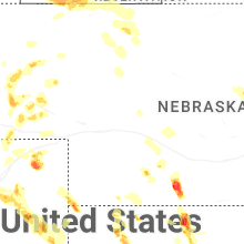


Connect with Interactive Hail Maps