

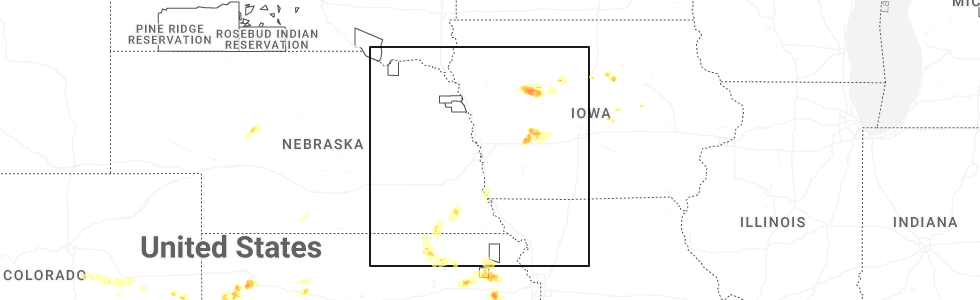
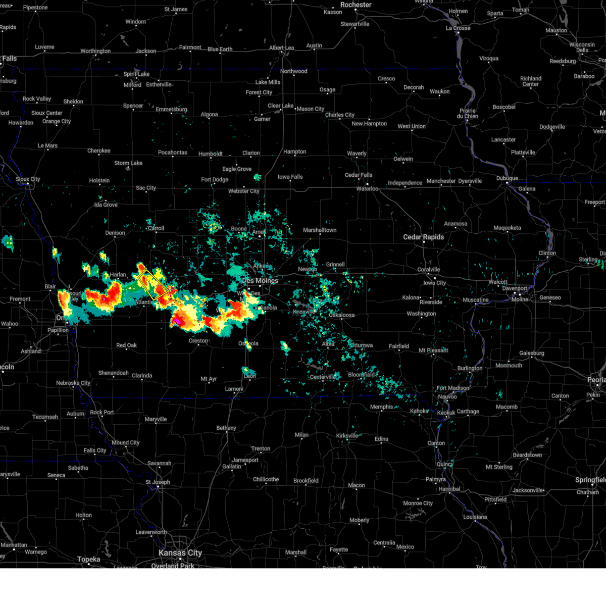
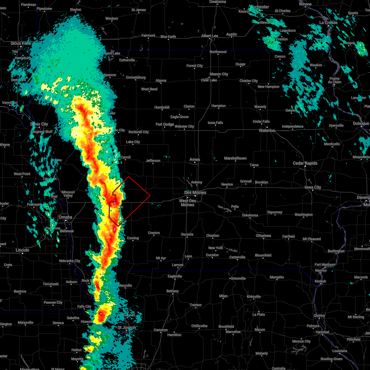
Hail Map for Exira, IA
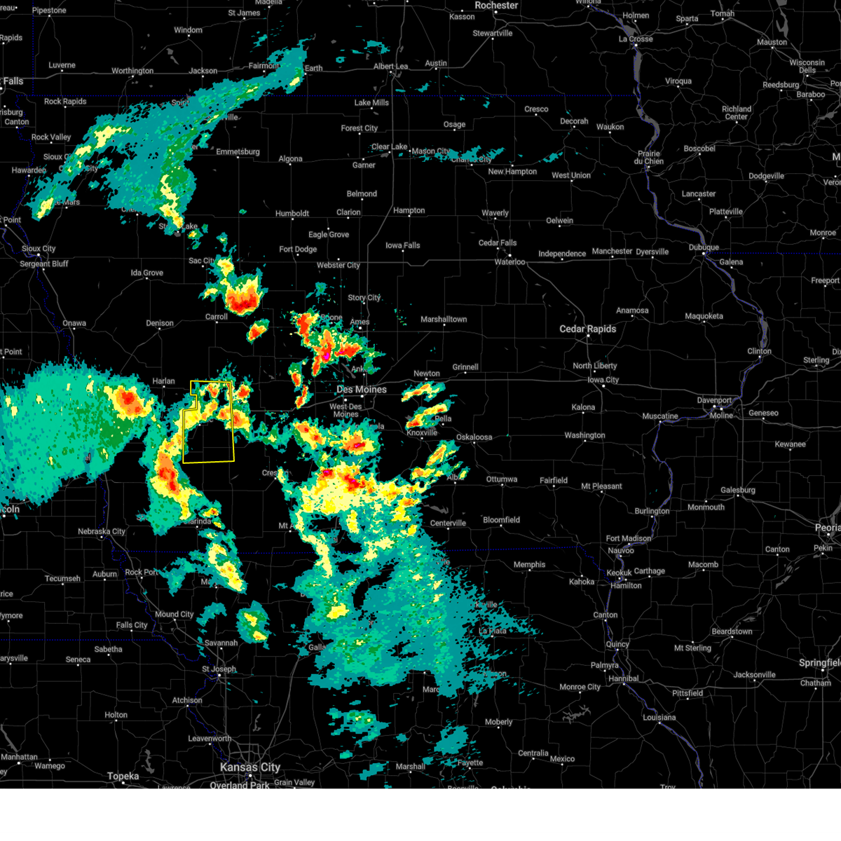
The Exira, IA area has had 0 reports of on-the-ground hail by trained spotters, and has been under severe weather warnings 28 times during the past 12 months. Doppler radar has detected hail at or near Exira, IA on 76 occasions, including 3 occasions during the past year.
| Name: | Exira, IA |
| Where Located: | 59.7 miles ENE of Omaha, NE |
| Map: | Google Map for Exira, IA |
| Population: | 840 |
| Housing Units: | 422 |
| More Info: | Search Google for Exira, IA |
3
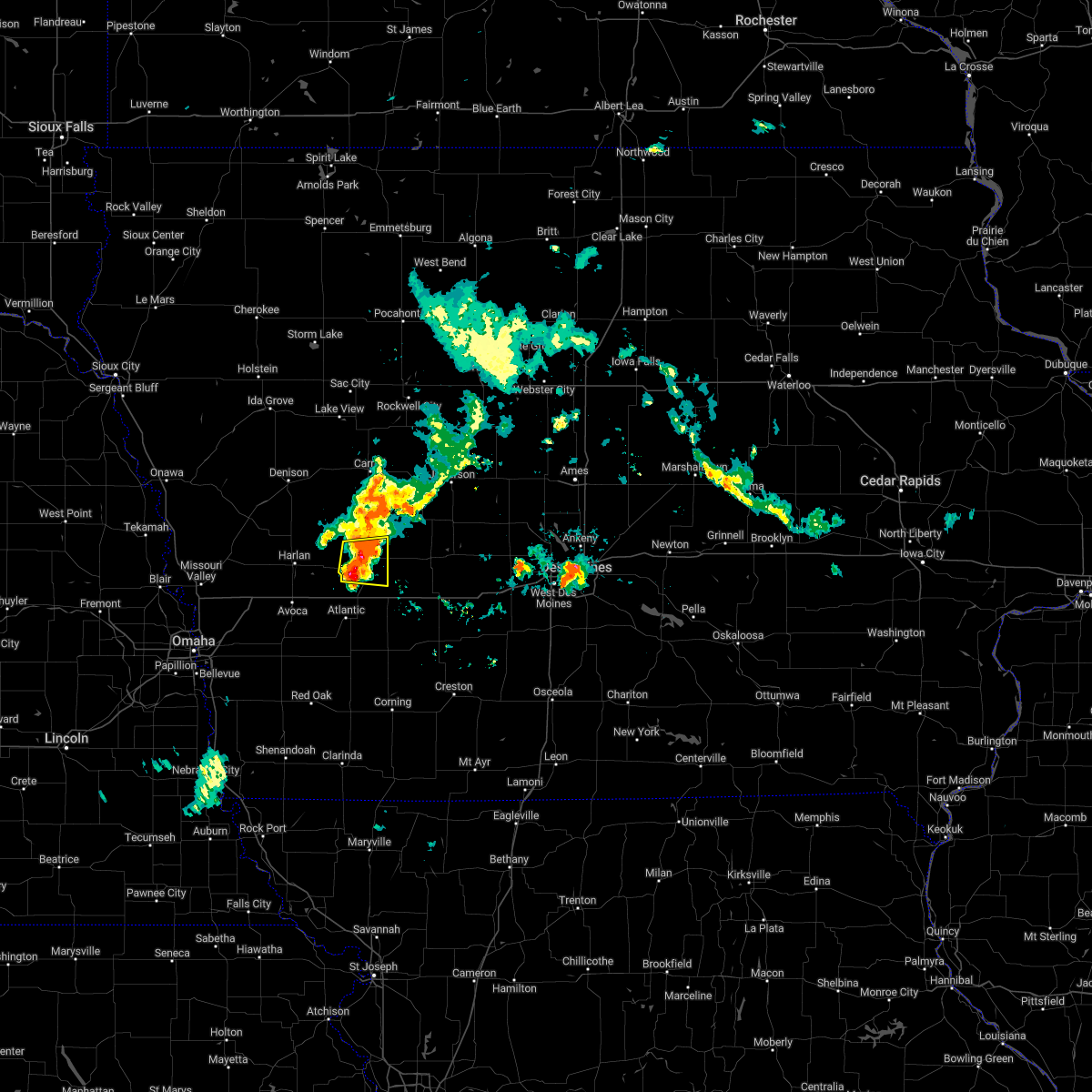
The Top Recent Hail Date for Exira, IA is Wednesday, April 23, 2025 (4th out of 76)
Hail and Wind Damage Spotted near Exira, IA
| Date / Time | Report Details |
|---|---|
| 1/1/0001 12:00 AM | Healthy... mature tree knocked over. numerous large 6+ diameter limbs snapped off als in audubon county IA, 0.1 miles NE of Exira, IA |
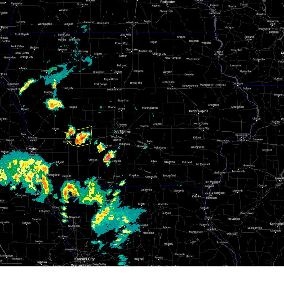
| 7/10/2025 11:22 PM CDT |
 At 1122 pm cdt, severe thunderstorms were located along a line extending from 10 miles east of audubon county airport to 4 miles southeast of exira to 5 miles southeast of wiota, moving east at 45 mph (radar indicated). Hazards include 60 mph wind gusts and penny size hail. Expect damage to roofs, siding, and trees. locations impacted include, atlantic, audubon, anita, exira, kimballton, brayton, marne, wiota, lake anita state park, audubon county airport, atlantic municipal airport, and anita municipal airport. This includes interstate 80 between mile markers 50 and 72. At 1122 pm cdt, severe thunderstorms were located along a line extending from 10 miles east of audubon county airport to 4 miles southeast of exira to 5 miles southeast of wiota, moving east at 45 mph (radar indicated). Hazards include 60 mph wind gusts and penny size hail. Expect damage to roofs, siding, and trees. locations impacted include, atlantic, audubon, anita, exira, kimballton, brayton, marne, wiota, lake anita state park, audubon county airport, atlantic municipal airport, and anita municipal airport. This includes interstate 80 between mile markers 50 and 72.
|
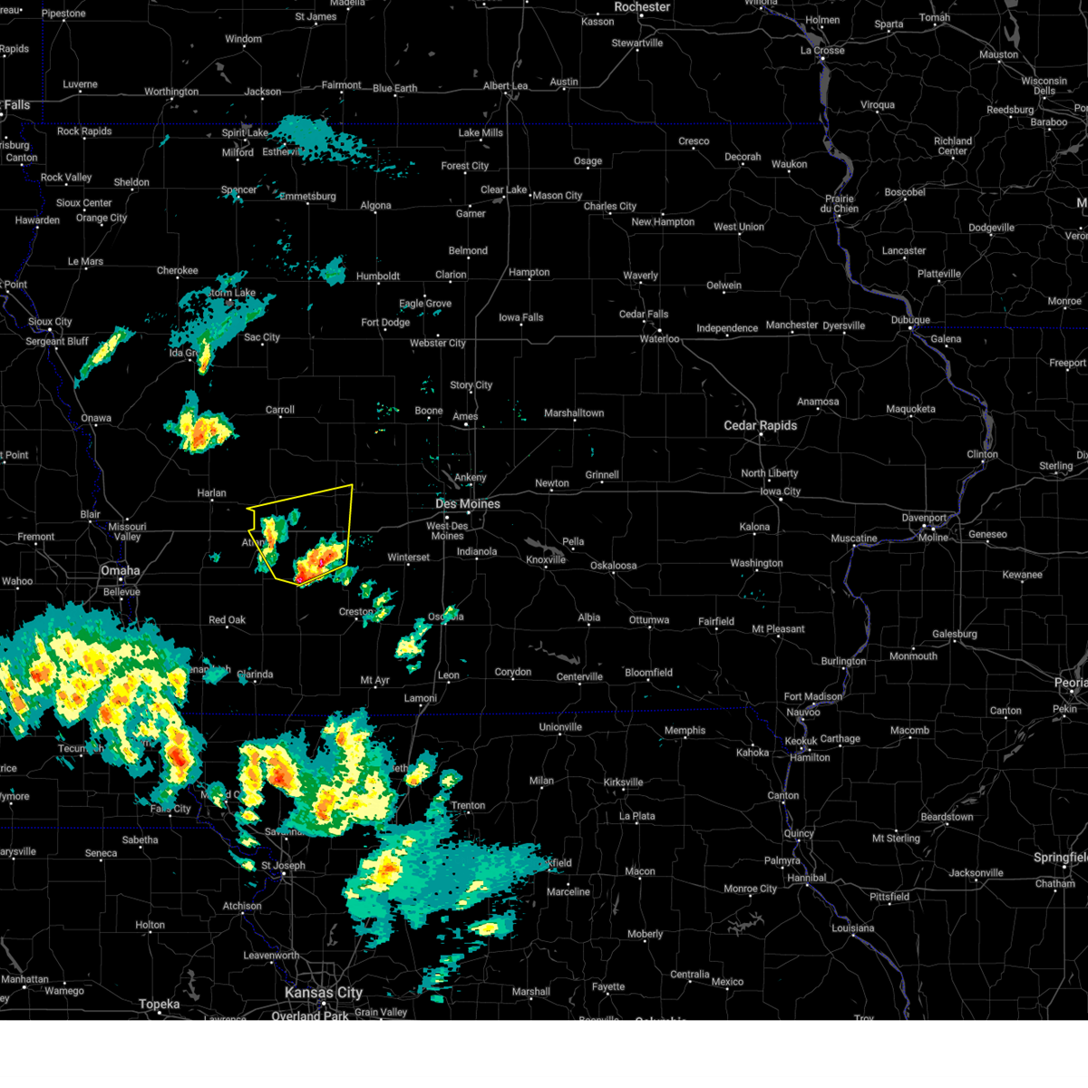
| 7/10/2025 11:20 PM CDT |
 Svrdmx the national weather service in des moines has issued a * severe thunderstorm warning for, western madison county in south central iowa, cass county in southwestern iowa, northwestern union county in south central iowa, guthrie county in west central iowa, eastern audubon county in west central iowa, northern adams county in southwestern iowa, adair county in southwestern iowa, western dallas county in central iowa, * until 1215 am cdt. * at 1119 pm cdt, severe thunderstorms were located along a line extending from 9 miles east of audubon county airport to near exira to near lake anita state park to near grant, moving east at 40 mph (radar indicated). Hazards include 60 mph wind gusts and penny size hail. expect damage to roofs, siding, and trees Svrdmx the national weather service in des moines has issued a * severe thunderstorm warning for, western madison county in south central iowa, cass county in southwestern iowa, northwestern union county in south central iowa, guthrie county in west central iowa, eastern audubon county in west central iowa, northern adams county in southwestern iowa, adair county in southwestern iowa, western dallas county in central iowa, * until 1215 am cdt. * at 1119 pm cdt, severe thunderstorms were located along a line extending from 9 miles east of audubon county airport to near exira to near lake anita state park to near grant, moving east at 40 mph (radar indicated). Hazards include 60 mph wind gusts and penny size hail. expect damage to roofs, siding, and trees
|
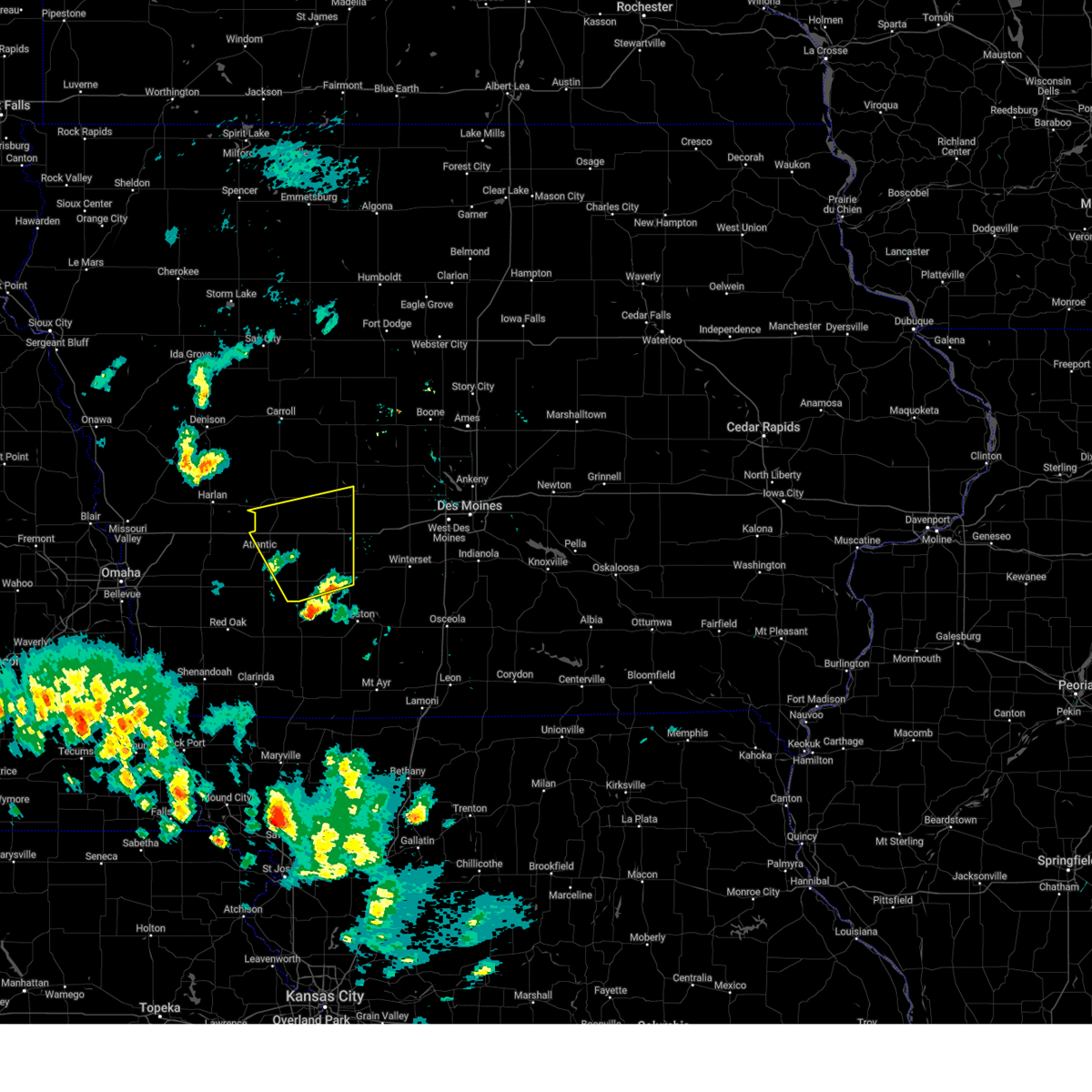
| 7/10/2025 10:53 PM CDT |
 At 1051 pm cdt, severe thunderstorms were located along a line extending from near irwin to near walnut to near hancock, moving east at 40 mph (observed data. at 1050pm, a wind gust of 68 mph was reported at the harlan airport). Hazards include 70 mph wind gusts and quarter size hail. Hail damage to vehicles is expected. expect considerable tree damage. wind damage is also likely to mobile homes, roofs, and outbuildings. locations impacted include, atlantic, audubon, anita, exira, elk horn, kimballton, brayton, marne, wiota, lake anita state park, audubon county airport, atlantic municipal airport, and anita municipal airport. This includes interstate 80 between mile markers 50 and 72. At 1051 pm cdt, severe thunderstorms were located along a line extending from near irwin to near walnut to near hancock, moving east at 40 mph (observed data. at 1050pm, a wind gust of 68 mph was reported at the harlan airport). Hazards include 70 mph wind gusts and quarter size hail. Hail damage to vehicles is expected. expect considerable tree damage. wind damage is also likely to mobile homes, roofs, and outbuildings. locations impacted include, atlantic, audubon, anita, exira, elk horn, kimballton, brayton, marne, wiota, lake anita state park, audubon county airport, atlantic municipal airport, and anita municipal airport. This includes interstate 80 between mile markers 50 and 72.
|
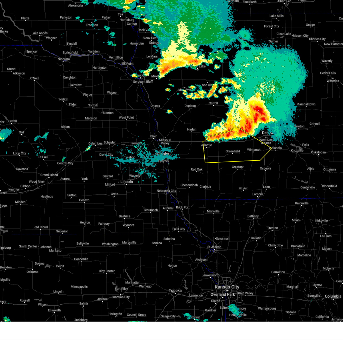
| 7/10/2025 10:47 PM CDT |
 Svrdmx the national weather service in des moines has issued a * severe thunderstorm warning for, northern cass county in southwestern iowa, northwestern guthrie county in west central iowa, audubon county in west central iowa, * until 1130 pm cdt. * at 1047 pm cdt, severe thunderstorms were located along a line extending from near kirkman to 4 miles northwest of walnut to near oakland, moving east at 40 mph (radar indicated). Hazards include 60 mph wind gusts and quarter size hail. Hail damage to vehicles is expected. Expect wind damage to roofs, siding, and trees. Svrdmx the national weather service in des moines has issued a * severe thunderstorm warning for, northern cass county in southwestern iowa, northwestern guthrie county in west central iowa, audubon county in west central iowa, * until 1130 pm cdt. * at 1047 pm cdt, severe thunderstorms were located along a line extending from near kirkman to 4 miles northwest of walnut to near oakland, moving east at 40 mph (radar indicated). Hazards include 60 mph wind gusts and quarter size hail. Hail damage to vehicles is expected. Expect wind damage to roofs, siding, and trees.
|
| 6/23/2025 5:41 PM CDT |
 The severe thunderstorm which prompted the warning has weakened. therefore, the warning will be allowed to expire. however, gusty winds are still possible with this thunderstorm. a severe thunderstorm watch remains in effect until 1000 pm cdt for southwestern iowa. The severe thunderstorm which prompted the warning has weakened. therefore, the warning will be allowed to expire. however, gusty winds are still possible with this thunderstorm. a severe thunderstorm watch remains in effect until 1000 pm cdt for southwestern iowa.
|
| 6/23/2025 5:21 PM CDT | At 518 pm cdt, a severe thunderstorm was located 5 miles northwest of wiota, or 6 miles northeast of atlantic, moving north at 25 mph (radar indicated). Hazards include 60 mph wind gusts and nickel size hail. Expect damage to roofs, siding, and trees. locations impacted include, atlantic, anita, exira, brayton, marne, wiota, lake anita state park, atlantic municipal airport, and anita municipal airport. This includes interstate 80 between mile markers 53 and 70. |
| 6/23/2025 4:58 PM CDT | Svrdmx the national weather service in des moines has issued a * severe thunderstorm warning for, northern cass county in southwestern iowa, southern audubon county in west central iowa, * until 545 pm cdt. * at 458 pm cdt, a severe thunderstorm was located near atlantic, moving north at 25 mph (radar indicated). Hazards include 60 mph wind gusts and nickel size hail. expect damage to roofs, siding, and trees |
| 4/23/2025 6:43 PM CDT |
 Svrdmx the national weather service in des moines has issued a * severe thunderstorm warning for, northeastern cass county in southwestern iowa, guthrie county in west central iowa, audubon county in west central iowa, northwestern adair county in southwestern iowa, * until 730 pm cdt. * at 643 pm cdt, severe thunderstorms were located along a line extending from near guthrie center to near exira, moving north and east at 20 mph (law enforcement). Hazards include ping pong ball size hail and 60 mph wind gusts. People and animals outdoors will be injured. expect hail damage to roofs, siding, windows, and vehicles. expect wind damage to roofs, siding, and trees. severe thunderstorms will be near, guthrie center around 650 pm cdt. Lake panorama and panora around 655 pm cdt. Svrdmx the national weather service in des moines has issued a * severe thunderstorm warning for, northeastern cass county in southwestern iowa, guthrie county in west central iowa, audubon county in west central iowa, northwestern adair county in southwestern iowa, * until 730 pm cdt. * at 643 pm cdt, severe thunderstorms were located along a line extending from near guthrie center to near exira, moving north and east at 20 mph (law enforcement). Hazards include ping pong ball size hail and 60 mph wind gusts. People and animals outdoors will be injured. expect hail damage to roofs, siding, windows, and vehicles. expect wind damage to roofs, siding, and trees. severe thunderstorms will be near, guthrie center around 650 pm cdt. Lake panorama and panora around 655 pm cdt.
|
| 4/23/2025 6:19 PM CDT |
 At 619 pm cdt, severe thunderstorms were located along a line extending from 5 miles west of guthrie center to near anita municipal airport, moving east at 20 mph (radar indicated). Hazards include ping pong ball size hail and 60 mph wind gusts. People and animals outdoors will be injured. expect hail damage to roofs, siding, windows, and vehicles. expect wind damage to roofs, siding, and trees. These severe storms will be near, adair, guthrie center, anita, lake anita state park and anita municipal airport around 625 pm cdt. At 619 pm cdt, severe thunderstorms were located along a line extending from 5 miles west of guthrie center to near anita municipal airport, moving east at 20 mph (radar indicated). Hazards include ping pong ball size hail and 60 mph wind gusts. People and animals outdoors will be injured. expect hail damage to roofs, siding, windows, and vehicles. expect wind damage to roofs, siding, and trees. These severe storms will be near, adair, guthrie center, anita, lake anita state park and anita municipal airport around 625 pm cdt.
|
| 4/23/2025 6:06 PM CDT |
 Svrdmx the national weather service in des moines has issued a * severe thunderstorm warning for, northern cass county in southwestern iowa, western guthrie county in west central iowa, eastern audubon county in west central iowa, northwestern adair county in southwestern iowa, * until 645 pm cdt. * at 605 pm cdt, severe thunderstorms were located along a line extending from 10 miles east of audubon county airport to 4 miles northwest of wiota, moving east at 15 mph (radar indicated). Hazards include 60 mph wind gusts and quarter size hail. Hail damage to vehicles is expected. expect wind damage to roofs, siding, and trees. severe thunderstorms will be near, exira, brayton and wiota around 610 pm cdt. anita around 620 pm cdt. Lake anita state park and anita municipal airport around 625 pm cdt. Svrdmx the national weather service in des moines has issued a * severe thunderstorm warning for, northern cass county in southwestern iowa, western guthrie county in west central iowa, eastern audubon county in west central iowa, northwestern adair county in southwestern iowa, * until 645 pm cdt. * at 605 pm cdt, severe thunderstorms were located along a line extending from 10 miles east of audubon county airport to 4 miles northwest of wiota, moving east at 15 mph (radar indicated). Hazards include 60 mph wind gusts and quarter size hail. Hail damage to vehicles is expected. expect wind damage to roofs, siding, and trees. severe thunderstorms will be near, exira, brayton and wiota around 610 pm cdt. anita around 620 pm cdt. Lake anita state park and anita municipal airport around 625 pm cdt.
|
| 3/14/2025 5:21 PM CDT |
 At 520 pm cdt, a severe thunderstorm was located 5 miles northeast of marne, or 7 miles north of atlantic, moving north at 55 mph (radar indicated). Hazards include 60 mph wind gusts and penny size hail. Expect damage to roofs, siding, and trees. locations impacted include, exira, lake anita state park, kimballton, cumberland, anita, wiota, elk horn, massena, lewis, griswold, brayton, griswold park, cold springs state park, atlantic, atlantic municipal airport, anita municipal airport, and marne. This includes interstate 80 between mile markers 50 and 71. At 520 pm cdt, a severe thunderstorm was located 5 miles northeast of marne, or 7 miles north of atlantic, moving north at 55 mph (radar indicated). Hazards include 60 mph wind gusts and penny size hail. Expect damage to roofs, siding, and trees. locations impacted include, exira, lake anita state park, kimballton, cumberland, anita, wiota, elk horn, massena, lewis, griswold, brayton, griswold park, cold springs state park, atlantic, atlantic municipal airport, anita municipal airport, and marne. This includes interstate 80 between mile markers 50 and 71.
|
| 3/14/2025 5:21 PM CDT |
 the severe thunderstorm warning has been cancelled and is no longer in effect the severe thunderstorm warning has been cancelled and is no longer in effect
|
| 3/14/2025 4:57 PM CDT |
 Svrdmx the national weather service in des moines has issued a * severe thunderstorm warning for, cass county in southwestern iowa, southern audubon county in west central iowa, northwestern adams county in southwestern iowa, * until 545 pm cdt. * at 457 pm cdt, a severe thunderstorm was located over grant, or 15 miles south of atlantic, moving north at 65 mph (radar indicated). Hazards include 60 mph wind gusts and quarter size hail. Hail damage to vehicles is expected. Expect wind damage to roofs, siding, and trees. Svrdmx the national weather service in des moines has issued a * severe thunderstorm warning for, cass county in southwestern iowa, southern audubon county in west central iowa, northwestern adams county in southwestern iowa, * until 545 pm cdt. * at 457 pm cdt, a severe thunderstorm was located over grant, or 15 miles south of atlantic, moving north at 65 mph (radar indicated). Hazards include 60 mph wind gusts and quarter size hail. Hail damage to vehicles is expected. Expect wind damage to roofs, siding, and trees.
|
| 3/14/2025 4:37 PM CDT |
 At 437 pm cdt, a severe thunderstorm was located near audubon county airport, or 5 miles southeast of audubon, moving northwest at 60 mph (radar indicated). Hazards include 70 mph wind gusts and quarter size hail. Hail damage to vehicles is expected. expect considerable tree damage. wind damage is also likely to mobile homes, roofs, and outbuildings. Locations impacted include, guthrie center, exira, and lake panorama. At 437 pm cdt, a severe thunderstorm was located near audubon county airport, or 5 miles southeast of audubon, moving northwest at 60 mph (radar indicated). Hazards include 70 mph wind gusts and quarter size hail. Hail damage to vehicles is expected. expect considerable tree damage. wind damage is also likely to mobile homes, roofs, and outbuildings. Locations impacted include, guthrie center, exira, and lake panorama.
|
| 3/14/2025 4:37 PM CDT |
 the severe thunderstorm warning has been cancelled and is no longer in effect the severe thunderstorm warning has been cancelled and is no longer in effect
|
| 3/14/2025 4:21 PM CDT |
 At 421 pm cdt, a severe thunderstorm was located over anita, or 14 miles east of atlantic, moving north at 50 mph (radar indicated). Hazards include 70 mph wind gusts and quarter size hail. Hail damage to vehicles is expected. expect considerable tree damage. wind damage is also likely to mobile homes, roofs, and outbuildings. locations impacted include, guthrie center, exira, wiota, lake panorama, lake anita state park, casey, adair, brayton, anita, anita municipal airport, and menlo. This includes interstate 80 between mile markers 55 and 87. At 421 pm cdt, a severe thunderstorm was located over anita, or 14 miles east of atlantic, moving north at 50 mph (radar indicated). Hazards include 70 mph wind gusts and quarter size hail. Hail damage to vehicles is expected. expect considerable tree damage. wind damage is also likely to mobile homes, roofs, and outbuildings. locations impacted include, guthrie center, exira, wiota, lake panorama, lake anita state park, casey, adair, brayton, anita, anita municipal airport, and menlo. This includes interstate 80 between mile markers 55 and 87.
|
| 3/14/2025 4:11 PM CDT |
 At 411 pm cdt, a severe thunderstorm was located 5 miles northeast of massena, or 13 miles west of greenfield, moving north at 55 mph (radar indicated). Hazards include 70 mph wind gusts and quarter size hail. Hail damage to vehicles is expected. expect considerable tree damage. wind damage is also likely to mobile homes, roofs, and outbuildings. locations impacted include, guthrie center, exira, lake anita state park, fontanelle, adair, greenfield municipal airport, cumberland, anita, wiota, lake panorama, casey, massena, brayton, anita municipal airport, menlo, bridgewater, and atlantic. This includes interstate 80 between mile markers 54 and 87. At 411 pm cdt, a severe thunderstorm was located 5 miles northeast of massena, or 13 miles west of greenfield, moving north at 55 mph (radar indicated). Hazards include 70 mph wind gusts and quarter size hail. Hail damage to vehicles is expected. expect considerable tree damage. wind damage is also likely to mobile homes, roofs, and outbuildings. locations impacted include, guthrie center, exira, lake anita state park, fontanelle, adair, greenfield municipal airport, cumberland, anita, wiota, lake panorama, casey, massena, brayton, anita municipal airport, menlo, bridgewater, and atlantic. This includes interstate 80 between mile markers 54 and 87.
|
| 3/14/2025 4:04 PM CDT |
 Svrdmx the national weather service in des moines has issued a * severe thunderstorm warning for, eastern cass county in southwestern iowa, southwestern guthrie county in west central iowa, southern audubon county in west central iowa, western adair county in southwestern iowa, * until 445 pm cdt. * at 403 pm cdt, a severe thunderstorm was located over bridgewater, or 13 miles west of greenfield, moving north at 50 mph (radar indicated). Hazards include 70 mph wind gusts and quarter size hail. Hail damage to vehicles is expected. expect considerable tree damage. Wind damage is also likely to mobile homes, roofs, and outbuildings. Svrdmx the national weather service in des moines has issued a * severe thunderstorm warning for, eastern cass county in southwestern iowa, southwestern guthrie county in west central iowa, southern audubon county in west central iowa, western adair county in southwestern iowa, * until 445 pm cdt. * at 403 pm cdt, a severe thunderstorm was located over bridgewater, or 13 miles west of greenfield, moving north at 50 mph (radar indicated). Hazards include 70 mph wind gusts and quarter size hail. Hail damage to vehicles is expected. expect considerable tree damage. Wind damage is also likely to mobile homes, roofs, and outbuildings.
|
| 7/31/2024 7:30 PM CDT | Svrdmx the national weather service in des moines has issued a * severe thunderstorm warning for, southern greene county in west central iowa, madison county in south central iowa, northeastern cass county in southwestern iowa, guthrie county in west central iowa, audubon county in west central iowa, adair county in southwestern iowa, dallas county in central iowa, * until 815 pm cdt. * at 730 pm cdt, severe thunderstorms were located along a line extending from 6 miles southwest of gray to 7 miles southwest of guthrie center to 5 miles northwest of macksburg, moving east at 50 mph (radar indicated). Hazards include 60 mph wind gusts and nickel size hail. expect damage to roofs, siding, and trees |
| 7/31/2024 7:13 PM CDT | At 711 pm cdt, severe thunderstorms were located along a line extending from near defiance to near audubon to 5 miles southeast of lake anita state park to near bridgewater, moving east at 40 mph (radar indicated). Hazards include 60 mph wind gusts and nickel size hail. at 705 pm cdt, a 59 mph wind gust was recorded at atlantic municipal airport. winds of this magnitude have lasted at least 10 minutes. Expect damage to roofs, siding, and trees. locations impacted include, atlantic, audubon, greenfield, guthrie center, stuart, manning, coon rapids, panora, griswold, lake panorama, anita, exira, adair, manilla, fontanelle, elk horn, bayard, lewis, casey, and orient. This includes interstate 80 between mile markers 50 and 96. |
| 7/31/2024 6:26 PM CDT | Svrdmx the national weather service in des moines has issued a * severe thunderstorm warning for, southwestern greene county in west central iowa, southwestern madison county in south central iowa, cass county in southwestern iowa, guthrie county in west central iowa, audubon county in west central iowa, northern adams county in southwestern iowa, southeastern crawford county in west central iowa, southern carroll county in west central iowa, adair county in southwestern iowa, * until 730 pm cdt. * at 623 pm cdt, severe thunderstorms were located along a line extending from near modale to persia to farm creek public wildlife area to 5 miles northwest of red oak, moving east at 50 mph. these are destructive storms for adair, cass, audubon, guthrie, adams, crawford, and carroll counties (a public wearher station recorded a 76 mph wind gust in northern mills county). Hazards include 80 mph wind gusts and nickel size hail. Flying debris will be dangerous to those caught without shelter. mobile homes will be heavily damaged. expect considerable damage to roofs, windows, and vehicles. Extensive tree damage and power outages are likely. |
| 7/30/2024 9:08 AM CDT |
 Svrdmx the national weather service in des moines has issued a * severe thunderstorm warning for, madison county in south central iowa, cass county in southwestern iowa, southern guthrie county in west central iowa, southern audubon county in west central iowa, adair county in southwestern iowa, southwestern dallas county in central iowa, west central warren county in south central iowa, * until 1015 am cdt. * at 908 am cdt, severe thunderstorms were located along a line extending from near linden to near menlo to 5 miles southeast of brayton, moving southeast at 40 mph (radar indicated). Hazards include 60 mph wind gusts. expect damage to roofs, siding, and trees Svrdmx the national weather service in des moines has issued a * severe thunderstorm warning for, madison county in south central iowa, cass county in southwestern iowa, southern guthrie county in west central iowa, southern audubon county in west central iowa, adair county in southwestern iowa, southwestern dallas county in central iowa, west central warren county in south central iowa, * until 1015 am cdt. * at 908 am cdt, severe thunderstorms were located along a line extending from near linden to near menlo to 5 miles southeast of brayton, moving southeast at 40 mph (radar indicated). Hazards include 60 mph wind gusts. expect damage to roofs, siding, and trees
|
| 7/30/2024 2:02 AM CDT | At 201 am cdt, severe thunderstorms were located along a line extending from perry municipal airport to 6 miles north of bridgewater, moving east at 50 mph (emergency management. at 150 am, emergency management reported wind gusts estimated between 55 to 60 mph in hamlin). Hazards include 60 mph wind gusts. Expect damage to roofs, siding, and trees. these severe storms will be near, stuart, diamondhead lake, menlo, linden and perry municipal airport around 205 am cdt. Other locations in the path of these severe thunderstorms include dexter. |
| 7/30/2024 2:02 AM CDT | the severe thunderstorm warning has been cancelled and is no longer in effect |
| 7/30/2024 1:48 AM CDT | At 148 am cdt, severe thunderstorms were located along a line extending from near bagley to near wiota, moving east at 50 mph (radar indicated). Hazards include 60 mph wind gusts. Expect damage to roofs, siding, and trees. Locations impacted include, guthrie center, panora, lake panorama, adair, casey, yale, jamaica, dawson, menlo, linden, stuart, diamondhead lake and dexter. |
| 7/30/2024 1:29 AM CDT | Svrdmx the national weather service in des moines has issued a * severe thunderstorm warning for, southern greene county in west central iowa, northern cass county in southwestern iowa, guthrie county in west central iowa, audubon county in west central iowa, southern carroll county in west central iowa, northern adair county in southwestern iowa, western dallas county in central iowa, * until 215 am cdt. * at 126 am cdt, severe thunderstorms were located along a line extending from coon rapids to 5 miles southwest of marne, moving east at 50 mph (radar indicated). Hazards include 60 mph wind gusts. Expect damage to roofs, siding, and trees. severe thunderstorms will be near, atlantic, coon rapids, exira, bayard, brayton, marne and atlantic municipal airport around 130 am cdt. bagley, wiota and springbrook state park around 135 am cdt. guthrie center, lake panorama, anita, lake anita state park and anita municipal airport around 140 am cdt. panora, adair, yale, jamaica and lakin slough game management area around 145 am cdt. Other locations in the path of these severe thunderstorms include casey, dawson, menlo, linden, perry municipal airport, stuart, diamondhead lake, dexter and greenfield municipal airport. |
| 7/15/2024 4:37 PM CDT |
 At 436 pm cdt, a severe thunderstorm was located near bayard, or 11 miles northwest of guthrie center, moving southeast at 35 mph (radar indicated). Hazards include 70 mph wind gusts and ping pong ball size hail. People and animals outdoors will be injured. expect hail damage to roofs, siding, windows, and vehicles. expect considerable tree damage. wind damage is also likely to mobile homes, roofs, and outbuildings. Locations impacted include, audubon, guthrie center, coon rapids, panora, lake panorama, exira, adair, bayard, casey, bagley, dedham, yale, jamaica, linden, dawson, perry municipal airport, lakin slough game management area, audubon county airport, and springbrook state park. At 436 pm cdt, a severe thunderstorm was located near bayard, or 11 miles northwest of guthrie center, moving southeast at 35 mph (radar indicated). Hazards include 70 mph wind gusts and ping pong ball size hail. People and animals outdoors will be injured. expect hail damage to roofs, siding, windows, and vehicles. expect considerable tree damage. wind damage is also likely to mobile homes, roofs, and outbuildings. Locations impacted include, audubon, guthrie center, coon rapids, panora, lake panorama, exira, adair, bayard, casey, bagley, dedham, yale, jamaica, linden, dawson, perry municipal airport, lakin slough game management area, audubon county airport, and springbrook state park.
|
| 7/15/2024 4:23 PM CDT |
 Svrdmx the national weather service in des moines has issued a * severe thunderstorm warning for, southern greene county in west central iowa, guthrie county in west central iowa, audubon county in west central iowa, southeastern carroll county in west central iowa, northwestern dallas county in central iowa, * until 515 pm cdt. * at 423 pm cdt, a severe thunderstorm was located near dedham, or 12 miles northeast of audubon, moving southeast at 35 mph (radar indicated). Hazards include 70 mph wind gusts and ping pong ball size hail. People and animals outdoors will be injured. expect hail damage to roofs, siding, windows, and vehicles. expect considerable tree damage. Wind damage is also likely to mobile homes, roofs, and outbuildings. Svrdmx the national weather service in des moines has issued a * severe thunderstorm warning for, southern greene county in west central iowa, guthrie county in west central iowa, audubon county in west central iowa, southeastern carroll county in west central iowa, northwestern dallas county in central iowa, * until 515 pm cdt. * at 423 pm cdt, a severe thunderstorm was located near dedham, or 12 miles northeast of audubon, moving southeast at 35 mph (radar indicated). Hazards include 70 mph wind gusts and ping pong ball size hail. People and animals outdoors will be injured. expect hail damage to roofs, siding, windows, and vehicles. expect considerable tree damage. Wind damage is also likely to mobile homes, roofs, and outbuildings.
|
| 7/7/2024 8:35 PM CDT |
 Svrdmx the national weather service in des moines has issued a * severe thunderstorm warning for, southwestern greene county in west central iowa, northeastern cass county in southwestern iowa, guthrie county in west central iowa, central audubon county in west central iowa, northern adair county in southwestern iowa, * until 915 pm cdt. * at 835 pm cdt, severe thunderstorms were located along a line extending from audubon to 4 miles northeast of exira to anita, moving east at 35 mph (radar indicated). Hazards include 60 mph wind gusts and penny size hail. expect damage to roofs, siding, and trees Svrdmx the national weather service in des moines has issued a * severe thunderstorm warning for, southwestern greene county in west central iowa, northeastern cass county in southwestern iowa, guthrie county in west central iowa, central audubon county in west central iowa, northern adair county in southwestern iowa, * until 915 pm cdt. * at 835 pm cdt, severe thunderstorms were located along a line extending from audubon to 4 miles northeast of exira to anita, moving east at 35 mph (radar indicated). Hazards include 60 mph wind gusts and penny size hail. expect damage to roofs, siding, and trees
|
| 6/25/2024 8:13 PM CDT |
 Svrdmx the national weather service in des moines has issued a * severe thunderstorm warning for, audubon county in west central iowa, * until 900 pm cdt. * at 813 pm cdt, a severe thunderstorm was located near prairie rose state park, or 5 miles east of harlan, moving east at 30 mph (radar indicated). Hazards include 60 mph wind gusts and quarter size hail. Hail damage to vehicles is expected. Expect wind damage to roofs, siding, and trees. Svrdmx the national weather service in des moines has issued a * severe thunderstorm warning for, audubon county in west central iowa, * until 900 pm cdt. * at 813 pm cdt, a severe thunderstorm was located near prairie rose state park, or 5 miles east of harlan, moving east at 30 mph (radar indicated). Hazards include 60 mph wind gusts and quarter size hail. Hail damage to vehicles is expected. Expect wind damage to roofs, siding, and trees.
|
| 5/24/2024 3:42 AM CDT |
 Tordmx the national weather service in des moines has issued a * tornado warning for, southern greene county in west central iowa, north central cass county in southwestern iowa, western guthrie county in west central iowa, audubon county in west central iowa, * until 430 am cdt. * at 342 am cdt, a severe thunderstorm capable of producing a tornado was located over exira, or 7 miles south of audubon, moving east at 40 mph (radar indicated rotation). Hazards include tornado. Flying debris will be dangerous to those caught without shelter. mobile homes will be damaged or destroyed. damage to roofs, windows, and vehicles will occur. tree damage is likely. this dangerous storm will be near, exira around 345 am cdt. guthrie center around 405 am cdt. lake panorama and springbrook state park around 415 am cdt. other locations impacted by this tornadic thunderstorm include brayton, exira, audubon county airport, springbrook state park, and bayard. This includes interstate 80 between mile markers 60 and 62. Tordmx the national weather service in des moines has issued a * tornado warning for, southern greene county in west central iowa, north central cass county in southwestern iowa, western guthrie county in west central iowa, audubon county in west central iowa, * until 430 am cdt. * at 342 am cdt, a severe thunderstorm capable of producing a tornado was located over exira, or 7 miles south of audubon, moving east at 40 mph (radar indicated rotation). Hazards include tornado. Flying debris will be dangerous to those caught without shelter. mobile homes will be damaged or destroyed. damage to roofs, windows, and vehicles will occur. tree damage is likely. this dangerous storm will be near, exira around 345 am cdt. guthrie center around 405 am cdt. lake panorama and springbrook state park around 415 am cdt. other locations impacted by this tornadic thunderstorm include brayton, exira, audubon county airport, springbrook state park, and bayard. This includes interstate 80 between mile markers 60 and 62.
|
| 5/24/2024 3:36 AM CDT |
 At 336 am cdt, severe thunderstorms were located along a line extending from 5 miles northwest of lake view to 4 miles northeast of aspinwall to 5 miles south of lake anita state park, moving east at 50 mph (radar indicated). Hazards include 70 mph wind gusts and quarter size hail. Hail damage to vehicles is expected. expect considerable tree damage. wind damage is also likely to mobile homes, roofs, and outbuildings. locations impacted include, carroll, denison, creston, atlantic, sac city, audubon, greenfield, rockwell city, corning, guthrie center, lake city, manning, lenox, coon rapids, glidden, lake view, griswold, odebolt, black hawk lake, and north twin lake. This includes interstate 80 between mile markers 50 and 87. At 336 am cdt, severe thunderstorms were located along a line extending from 5 miles northwest of lake view to 4 miles northeast of aspinwall to 5 miles south of lake anita state park, moving east at 50 mph (radar indicated). Hazards include 70 mph wind gusts and quarter size hail. Hail damage to vehicles is expected. expect considerable tree damage. wind damage is also likely to mobile homes, roofs, and outbuildings. locations impacted include, carroll, denison, creston, atlantic, sac city, audubon, greenfield, rockwell city, corning, guthrie center, lake city, manning, lenox, coon rapids, glidden, lake view, griswold, odebolt, black hawk lake, and north twin lake. This includes interstate 80 between mile markers 50 and 87.
|
| 5/24/2024 3:07 AM CDT |
 Svrdmx the national weather service in des moines has issued a * severe thunderstorm warning for, western greene county in west central iowa, cass county in southwestern iowa, western union county in south central iowa, guthrie county in west central iowa, audubon county in west central iowa, sac county in west central iowa, adams county in southwestern iowa, calhoun county in west central iowa, crawford county in west central iowa, northern taylor county in southwestern iowa, carroll county in west central iowa, adair county in southwestern iowa, * until 400 am cdt. * at 307 am cdt, severe thunderstorms were located along a line extending from 4 miles south of battle creek to dunlap to farm creek public wildlife area, moving east at 85 mph (radar indicated). Hazards include 70 mph wind gusts and quarter size hail. Hail damage to vehicles is expected. expect considerable tree damage. Wind damage is also likely to mobile homes, roofs, and outbuildings. Svrdmx the national weather service in des moines has issued a * severe thunderstorm warning for, western greene county in west central iowa, cass county in southwestern iowa, western union county in south central iowa, guthrie county in west central iowa, audubon county in west central iowa, sac county in west central iowa, adams county in southwestern iowa, calhoun county in west central iowa, crawford county in west central iowa, northern taylor county in southwestern iowa, carroll county in west central iowa, adair county in southwestern iowa, * until 400 am cdt. * at 307 am cdt, severe thunderstorms were located along a line extending from 4 miles south of battle creek to dunlap to farm creek public wildlife area, moving east at 85 mph (radar indicated). Hazards include 70 mph wind gusts and quarter size hail. Hail damage to vehicles is expected. expect considerable tree damage. Wind damage is also likely to mobile homes, roofs, and outbuildings.
|
| 5/21/2024 3:17 PM CDT |
 At 316 pm cdt, a confirmed tornado was located over exira, or 11 miles south of audubon, moving northeast at 25 mph (radar confirmed tornado). Hazards include damaging tornado and quarter size hail. Flying debris will be dangerous to those caught without shelter. mobile homes will be damaged or destroyed. damage to roofs, windows, and vehicles will occur. tree damage is likely. this tornado will be near, exira around 320 pm cdt. guthrie center around 355 pm cdt. other locations impacted by this tornadic thunderstorm include yale, brayton, exira, springbrook state park, bayard, and bagley. This includes interstate 80 between mile markers 63 and 67. At 316 pm cdt, a confirmed tornado was located over exira, or 11 miles south of audubon, moving northeast at 25 mph (radar confirmed tornado). Hazards include damaging tornado and quarter size hail. Flying debris will be dangerous to those caught without shelter. mobile homes will be damaged or destroyed. damage to roofs, windows, and vehicles will occur. tree damage is likely. this tornado will be near, exira around 320 pm cdt. guthrie center around 355 pm cdt. other locations impacted by this tornadic thunderstorm include yale, brayton, exira, springbrook state park, bayard, and bagley. This includes interstate 80 between mile markers 63 and 67.
|
| 5/21/2024 3:13 PM CDT |
 Tordmx the national weather service in des moines has issued a * tornado warning for, south central greene county in west central iowa, north central cass county in southwestern iowa, northwestern guthrie county in west central iowa, southeastern audubon county in west central iowa, * until 400 pm cdt. * at 313 pm cdt, a severe thunderstorm capable of producing a tornado was located over exira, or 11 miles south of audubon, moving northeast at 50 mph (radar indicated rotation). Hazards include tornado and quarter size hail. Flying debris will be dangerous to those caught without shelter. mobile homes will be damaged or destroyed. damage to roofs, windows, and vehicles will occur. tree damage is likely. this dangerous storm will be near, bayard and springbrook state park around 340 pm cdt. bagley around 345 pm cdt. other locations impacted by this tornadic thunderstorm include yale, brayton, exira, springbrook state park, bayard, and bagley. This includes interstate 80 between mile markers 63 and 67. Tordmx the national weather service in des moines has issued a * tornado warning for, south central greene county in west central iowa, north central cass county in southwestern iowa, northwestern guthrie county in west central iowa, southeastern audubon county in west central iowa, * until 400 pm cdt. * at 313 pm cdt, a severe thunderstorm capable of producing a tornado was located over exira, or 11 miles south of audubon, moving northeast at 50 mph (radar indicated rotation). Hazards include tornado and quarter size hail. Flying debris will be dangerous to those caught without shelter. mobile homes will be damaged or destroyed. damage to roofs, windows, and vehicles will occur. tree damage is likely. this dangerous storm will be near, bayard and springbrook state park around 340 pm cdt. bagley around 345 pm cdt. other locations impacted by this tornadic thunderstorm include yale, brayton, exira, springbrook state park, bayard, and bagley. This includes interstate 80 between mile markers 63 and 67.
|
| 5/21/2024 2:28 PM CDT |
 Svrdmx the national weather service in des moines has issued a * severe thunderstorm warning for, cass county in southwestern iowa, audubon county in west central iowa, northwestern adams county in southwestern iowa, * until 330 pm cdt. * at 228 pm cdt, severe thunderstorms were located along a line extending from near avoca to near stanton, moving northeast at 45 mph (radar indicated). Hazards include 60 mph wind gusts and half dollar size hail. Hail damage to vehicles is expected. Expect wind damage to roofs, siding, and trees. Svrdmx the national weather service in des moines has issued a * severe thunderstorm warning for, cass county in southwestern iowa, audubon county in west central iowa, northwestern adams county in southwestern iowa, * until 330 pm cdt. * at 228 pm cdt, severe thunderstorms were located along a line extending from near avoca to near stanton, moving northeast at 45 mph (radar indicated). Hazards include 60 mph wind gusts and half dollar size hail. Hail damage to vehicles is expected. Expect wind damage to roofs, siding, and trees.
|
| 5/21/2024 7:21 AM CDT |
 At 720 am cdt, severe thunderstorms were located along a line extending from near manning to brayton to 4 miles west of elliott, moving east at 30 mph (trained weather spotters). Hazards include ping pong ball size hail and 60 mph wind gusts. People and animals outdoors will be injured. expect hail damage to roofs, siding, windows, and vehicles. expect wind damage to roofs, siding, and trees. locations impacted include, carroll, atlantic, audubon, manning, coon rapids, griswold, anita, exira, adair, elk horn, lewis, templeton, kimballton, dedham, cumberland, halbur, brayton, marne, wiota, and willey. This includes interstate 80 between mile markers 50 and 73. At 720 am cdt, severe thunderstorms were located along a line extending from near manning to brayton to 4 miles west of elliott, moving east at 30 mph (trained weather spotters). Hazards include ping pong ball size hail and 60 mph wind gusts. People and animals outdoors will be injured. expect hail damage to roofs, siding, windows, and vehicles. expect wind damage to roofs, siding, and trees. locations impacted include, carroll, atlantic, audubon, manning, coon rapids, griswold, anita, exira, adair, elk horn, lewis, templeton, kimballton, dedham, cumberland, halbur, brayton, marne, wiota, and willey. This includes interstate 80 between mile markers 50 and 73.
|
| 5/21/2024 7:21 AM CDT |
 the severe thunderstorm warning has been cancelled and is no longer in effect the severe thunderstorm warning has been cancelled and is no longer in effect
|
| 5/21/2024 6:51 AM CDT |
 Svrdmx the national weather service in des moines has issued a * severe thunderstorm warning for, cass county in southwestern iowa, western guthrie county in west central iowa, audubon county in west central iowa, southeastern crawford county in west central iowa, southern carroll county in west central iowa, * until 745 am cdt. * at 651 am cdt, severe thunderstorms were located along a line extending from 4 miles west of manilla to near walnut to 5 miles northeast of silver city, moving east at 30 mph (radar indicated). Hazards include 60 mph wind gusts and quarter size hail. Hail damage to vehicles is expected. Expect wind damage to roofs, siding, and trees. Svrdmx the national weather service in des moines has issued a * severe thunderstorm warning for, cass county in southwestern iowa, western guthrie county in west central iowa, audubon county in west central iowa, southeastern crawford county in west central iowa, southern carroll county in west central iowa, * until 745 am cdt. * at 651 am cdt, severe thunderstorms were located along a line extending from 4 miles west of manilla to near walnut to 5 miles northeast of silver city, moving east at 30 mph (radar indicated). Hazards include 60 mph wind gusts and quarter size hail. Hail damage to vehicles is expected. Expect wind damage to roofs, siding, and trees.
|
| 5/21/2024 2:12 AM CDT |
 The storm which prompted the warning has weakened slightly below severe limits, and no longer poses an immediate threat to life or property. therefore, the warning will be allowed to expire. however, gusty winds and very heavy rain are still possible with this thunderstorm. expect considerable ponding and standing water on roads with low visibilities. The storm which prompted the warning has weakened slightly below severe limits, and no longer poses an immediate threat to life or property. therefore, the warning will be allowed to expire. however, gusty winds and very heavy rain are still possible with this thunderstorm. expect considerable ponding and standing water on roads with low visibilities.
|
| 5/21/2024 1:52 AM CDT |
 At 151 am cdt, a severe thunderstorm was located 7 miles northeast of audubon, moving east at 30 mph (radar indicated. at 138am emergency management reported several trees down in audubon). Hazards include 60 mph wind gusts and penny size hail. Expect damage to roofs, siding, and trees. Locations impacted include, audubon, exira, elk horn, templeton, kimballton, dedham, willey, gray, and audubon county airport. At 151 am cdt, a severe thunderstorm was located 7 miles northeast of audubon, moving east at 30 mph (radar indicated. at 138am emergency management reported several trees down in audubon). Hazards include 60 mph wind gusts and penny size hail. Expect damage to roofs, siding, and trees. Locations impacted include, audubon, exira, elk horn, templeton, kimballton, dedham, willey, gray, and audubon county airport.
|
| 5/21/2024 1:52 AM CDT |
 the severe thunderstorm warning has been cancelled and is no longer in effect the severe thunderstorm warning has been cancelled and is no longer in effect
|
| 5/21/2024 1:09 AM CDT |
 Svrdmx the national weather service in des moines has issued a * severe thunderstorm warning for, audubon county in west central iowa, southeastern crawford county in west central iowa, southwestern carroll county in west central iowa, * until 215 am cdt. * at 109 am cdt, a severe thunderstorm was located near jacksonville, or 7 miles east of harlan, moving northeast at 25 mph (radar indicated). Hazards include 60 mph wind gusts and penny size hail. expect damage to roofs, siding, and trees Svrdmx the national weather service in des moines has issued a * severe thunderstorm warning for, audubon county in west central iowa, southeastern crawford county in west central iowa, southwestern carroll county in west central iowa, * until 215 am cdt. * at 109 am cdt, a severe thunderstorm was located near jacksonville, or 7 miles east of harlan, moving northeast at 25 mph (radar indicated). Hazards include 60 mph wind gusts and penny size hail. expect damage to roofs, siding, and trees
|
| 5/19/2024 8:09 PM CDT |
 At 808 pm cdt, severe thunderstorms were located along a line extending from 4 miles west of brayton to 6 miles southeast of lake anita state park to 4 miles southeast of new market, moving northeast at 50 mph (radar indicated). Hazards include 60 mph wind gusts and quarter size hail. Hail damage to vehicles is expected. expect wind damage to roofs, siding, and trees. locations impacted include, creston, atlantic, greenfield, corning, guthrie center, bedford, stuart, lenox, griswold, green valley lake, lake icaria, anita, afton, exira, adair, fontanelle, dexter, lewis, casey, and new market. This includes interstate 80 between mile markers 50 and 98. At 808 pm cdt, severe thunderstorms were located along a line extending from 4 miles west of brayton to 6 miles southeast of lake anita state park to 4 miles southeast of new market, moving northeast at 50 mph (radar indicated). Hazards include 60 mph wind gusts and quarter size hail. Hail damage to vehicles is expected. expect wind damage to roofs, siding, and trees. locations impacted include, creston, atlantic, greenfield, corning, guthrie center, bedford, stuart, lenox, griswold, green valley lake, lake icaria, anita, afton, exira, adair, fontanelle, dexter, lewis, casey, and new market. This includes interstate 80 between mile markers 50 and 98.
|
| 5/19/2024 7:58 PM CDT |
 Svrdmx the national weather service in des moines has issued a * severe thunderstorm warning for, western madison county in south central iowa, cass county in southwestern iowa, western union county in south central iowa, southern guthrie county in west central iowa, southeastern audubon county in west central iowa, adams county in southwestern iowa, northwestern ringgold county in south central iowa, taylor county in southwestern iowa, adair county in southwestern iowa, * until 845 pm cdt. * at 758 pm cdt, severe thunderstorms were located along a line extending from 4 miles north of marne to 4 miles north of massena to 6 miles south of new market, moving east at 45 mph (radar indicated). Hazards include 60 mph wind gusts and quarter size hail. Hail damage to vehicles is expected. Expect wind damage to roofs, siding, and trees. Svrdmx the national weather service in des moines has issued a * severe thunderstorm warning for, western madison county in south central iowa, cass county in southwestern iowa, western union county in south central iowa, southern guthrie county in west central iowa, southeastern audubon county in west central iowa, adams county in southwestern iowa, northwestern ringgold county in south central iowa, taylor county in southwestern iowa, adair county in southwestern iowa, * until 845 pm cdt. * at 758 pm cdt, severe thunderstorms were located along a line extending from 4 miles north of marne to 4 miles north of massena to 6 miles south of new market, moving east at 45 mph (radar indicated). Hazards include 60 mph wind gusts and quarter size hail. Hail damage to vehicles is expected. Expect wind damage to roofs, siding, and trees.
|
| 5/6/2024 10:54 PM CDT |
 The storms which prompted the warning have weakened below severe limits, and no longer pose an immediate threat to life or property. therefore, the warning will be allowed to expire. however, gusty winds are still possible with these thunderstorms. a tornado watch remains in effect until 300 am cdt for central, south central, southwestern and west central iowa. The storms which prompted the warning have weakened below severe limits, and no longer pose an immediate threat to life or property. therefore, the warning will be allowed to expire. however, gusty winds are still possible with these thunderstorms. a tornado watch remains in effect until 300 am cdt for central, south central, southwestern and west central iowa.
|
| 5/6/2024 10:09 PM CDT |
 Svrdmx the national weather service in des moines has issued a * severe thunderstorm warning for, western madison county in south central iowa, eastern cass county in southwestern iowa, western union county in south central iowa, guthrie county in west central iowa, eastern audubon county in west central iowa, adams county in southwestern iowa, western dallas county in central iowa, adair county in southwestern iowa, * until 1100 pm cdt. * at 1009 pm cdt, severe thunderstorms were located along a line extending from 4 miles southwest of dedham to anita to 5 miles south of corning, moving northeast at 40 mph (radar indicated). Hazards include 70 mph wind gusts and penny size hail. Expect considerable tree damage. Damage is likely to mobile homes, roofs, and outbuildings. Svrdmx the national weather service in des moines has issued a * severe thunderstorm warning for, western madison county in south central iowa, eastern cass county in southwestern iowa, western union county in south central iowa, guthrie county in west central iowa, eastern audubon county in west central iowa, adams county in southwestern iowa, western dallas county in central iowa, adair county in southwestern iowa, * until 1100 pm cdt. * at 1009 pm cdt, severe thunderstorms were located along a line extending from 4 miles southwest of dedham to anita to 5 miles south of corning, moving northeast at 40 mph (radar indicated). Hazards include 70 mph wind gusts and penny size hail. Expect considerable tree damage. Damage is likely to mobile homes, roofs, and outbuildings.
|
| 5/6/2024 9:40 PM CDT |
 At 940 pm cdt, severe thunderstorms were located along a line extending from near kirkman to 4 miles west of grant to near blanchard, moving northeast at 70 mph (radar indicated). Hazards include 70 mph wind gusts and quarter size hail. Hail damage to vehicles is expected. expect considerable tree damage. wind damage is also likely to mobile homes, roofs, and outbuildings. locations impacted include, atlantic, audubon, corning, bedford, griswold, lake icaria, anita, exira, adair, fontanelle, elk horn, bayard, lewis, new market, massena, kimballton, cumberland, prescott, gravity, and bridgewater. This includes interstate 80 between mile markers 50 and 80. At 940 pm cdt, severe thunderstorms were located along a line extending from near kirkman to 4 miles west of grant to near blanchard, moving northeast at 70 mph (radar indicated). Hazards include 70 mph wind gusts and quarter size hail. Hail damage to vehicles is expected. expect considerable tree damage. wind damage is also likely to mobile homes, roofs, and outbuildings. locations impacted include, atlantic, audubon, corning, bedford, griswold, lake icaria, anita, exira, adair, fontanelle, elk horn, bayard, lewis, new market, massena, kimballton, cumberland, prescott, gravity, and bridgewater. This includes interstate 80 between mile markers 50 and 80.
|
| 5/6/2024 9:27 PM CDT |
 Svrdmx the national weather service in des moines has issued a * severe thunderstorm warning for, cass county in southwestern iowa, western guthrie county in west central iowa, audubon county in west central iowa, adams county in southwestern iowa, taylor county in southwestern iowa, western adair county in southwestern iowa, * until 1015 pm cdt. * at 927 pm cdt, severe thunderstorms were located along a line extending from nishna bend recreation area to near red oak to 4 miles northeast of fairfax, moving northeast at 75 mph (radar indicated). Hazards include 70 mph wind gusts and quarter size hail. Hail damage to vehicles is expected. expect considerable tree damage. Wind damage is also likely to mobile homes, roofs, and outbuildings. Svrdmx the national weather service in des moines has issued a * severe thunderstorm warning for, cass county in southwestern iowa, western guthrie county in west central iowa, audubon county in west central iowa, adams county in southwestern iowa, taylor county in southwestern iowa, western adair county in southwestern iowa, * until 1015 pm cdt. * at 927 pm cdt, severe thunderstorms were located along a line extending from nishna bend recreation area to near red oak to 4 miles northeast of fairfax, moving northeast at 75 mph (radar indicated). Hazards include 70 mph wind gusts and quarter size hail. Hail damage to vehicles is expected. expect considerable tree damage. Wind damage is also likely to mobile homes, roofs, and outbuildings.
|
| 8/5/2023 10:00 PM CDT |
 At 959 pm cdt, severe thunderstorms were located along a line extending from near churdan to near scranton to 4 miles south of dedham, moving east at 40 mph (radar indicated). Hazards include 60 mph wind gusts. Expect damage to roofs, siding, and trees. locations impacted include, carroll, perry, jefferson, audubon, guthrie center, lake city, manning, coon rapids, glidden, panora, lake panorama, exira, grand junction, adair, scranton, bayard, casey, churdan, templeton and auburn. hail threat, radar indicated max hail size, <. 75 in wind threat, radar indicated max wind gust, 60 mph. At 959 pm cdt, severe thunderstorms were located along a line extending from near churdan to near scranton to 4 miles south of dedham, moving east at 40 mph (radar indicated). Hazards include 60 mph wind gusts. Expect damage to roofs, siding, and trees. locations impacted include, carroll, perry, jefferson, audubon, guthrie center, lake city, manning, coon rapids, glidden, panora, lake panorama, exira, grand junction, adair, scranton, bayard, casey, churdan, templeton and auburn. hail threat, radar indicated max hail size, <. 75 in wind threat, radar indicated max wind gust, 60 mph.
|
| 8/5/2023 9:34 PM CDT |
 At 933 pm cdt, severe thunderstorms were located along a line extending from auburn to swan lake state park to manilla, moving southeast at 45 mph (radar indicated). Hazards include 60 mph wind gusts. Expect damage to roofs, siding, and trees. locations impacted include, carroll, denison, perry, jefferson, audubon, guthrie center, lake city, manning, coon rapids, glidden, lake view, panora, black hawk lake, lake panorama, exira, grand junction, wall lake, adair, manilla and scranton. hail threat, radar indicated max hail size, <. 75 in wind threat, radar indicated max wind gust, 60 mph. At 933 pm cdt, severe thunderstorms were located along a line extending from auburn to swan lake state park to manilla, moving southeast at 45 mph (radar indicated). Hazards include 60 mph wind gusts. Expect damage to roofs, siding, and trees. locations impacted include, carroll, denison, perry, jefferson, audubon, guthrie center, lake city, manning, coon rapids, glidden, lake view, panora, black hawk lake, lake panorama, exira, grand junction, wall lake, adair, manilla and scranton. hail threat, radar indicated max hail size, <. 75 in wind threat, radar indicated max wind gust, 60 mph.
|
| 8/5/2023 9:28 PM CDT |
 At 928 pm cdt, severe thunderstorms were located along a line extending from near lidderdale to halbur to near irwin, moving southeast at 60 mph (radar indicated). Hazards include 60 mph wind gusts. expect damage to roofs, siding, and trees At 928 pm cdt, severe thunderstorms were located along a line extending from near lidderdale to halbur to near irwin, moving southeast at 60 mph (radar indicated). Hazards include 60 mph wind gusts. expect damage to roofs, siding, and trees
|
| 7/17/2023 5:54 AM CDT |
 The severe thunderstorm warning for northern cass and southern audubon counties will expire at 600 am cdt, the storm which prompted the warning has weakened below severe limits, and no longer poses an immediate threat to life or property. therefore, the warning will be allowed to expire. however small hail is still possible with this thunderstorm. The severe thunderstorm warning for northern cass and southern audubon counties will expire at 600 am cdt, the storm which prompted the warning has weakened below severe limits, and no longer poses an immediate threat to life or property. therefore, the warning will be allowed to expire. however small hail is still possible with this thunderstorm.
|
| 7/17/2023 5:32 AM CDT |
 At 531 am cdt, a severe thunderstorm was located 5 miles southwest of audubon county airport, or 6 miles south of audubon, moving southeast at 25 mph (radar indicated). Hazards include 60 mph wind gusts and quarter size hail. Hail damage to vehicles is expected. Expect wind damage to roofs, siding, and trees. At 531 am cdt, a severe thunderstorm was located 5 miles southwest of audubon county airport, or 6 miles south of audubon, moving southeast at 25 mph (radar indicated). Hazards include 60 mph wind gusts and quarter size hail. Hail damage to vehicles is expected. Expect wind damage to roofs, siding, and trees.
|
| 7/17/2023 5:21 AM CDT |
 At 520 am cdt, a severe thunderstorm was located near exira, or 13 miles southeast of audubon, moving southeast at 35 mph (radar indicated). Hazards include golf ball size hail and 60 mph wind gusts. People and animals outdoors will be injured. expect hail damage to roofs, siding, windows, and vehicles. Expect wind damage to roofs, siding, and trees. At 520 am cdt, a severe thunderstorm was located near exira, or 13 miles southeast of audubon, moving southeast at 35 mph (radar indicated). Hazards include golf ball size hail and 60 mph wind gusts. People and animals outdoors will be injured. expect hail damage to roofs, siding, windows, and vehicles. Expect wind damage to roofs, siding, and trees.
|
| 7/17/2023 4:58 AM CDT |
 At 457 am cdt, a severe thunderstorm was located over audubon, moving southeast at 50 mph (radar indicated). Hazards include 60 mph wind gusts and quarter size hail. Hail damage to vehicles is expected. Expect wind damage to roofs, siding, and trees. At 457 am cdt, a severe thunderstorm was located over audubon, moving southeast at 50 mph (radar indicated). Hazards include 60 mph wind gusts and quarter size hail. Hail damage to vehicles is expected. Expect wind damage to roofs, siding, and trees.
|
| 7/17/2023 1:31 AM CDT |
 At 130 am cdt, a severe thunderstorm was located near anita, or 14 miles northeast of atlantic, moving southeast at 30 mph (radar indicated). Hazards include ping pong ball size hail and 60 mph wind gusts. People and animals outdoors will be injured. expect hail damage to roofs, siding, windows, and vehicles. expect wind damage to roofs, siding, and trees. locations impacted include, anita, exira, adair, casey, menlo, brayton, wiota, lake anita state park and anita municipal airport. this includes interstate 80 between mile markers 58 and 90. hail threat, radar indicated max hail size, 1. 50 in wind threat, radar indicated max wind gust, 60 mph. At 130 am cdt, a severe thunderstorm was located near anita, or 14 miles northeast of atlantic, moving southeast at 30 mph (radar indicated). Hazards include ping pong ball size hail and 60 mph wind gusts. People and animals outdoors will be injured. expect hail damage to roofs, siding, windows, and vehicles. expect wind damage to roofs, siding, and trees. locations impacted include, anita, exira, adair, casey, menlo, brayton, wiota, lake anita state park and anita municipal airport. this includes interstate 80 between mile markers 58 and 90. hail threat, radar indicated max hail size, 1. 50 in wind threat, radar indicated max wind gust, 60 mph.
|
| 7/17/2023 1:09 AM CDT |
 At 108 am cdt, a severe thunderstorm was located near brayton, or 10 miles south of audubon, moving southeast at 30 mph (radar indicated). Hazards include ping pong ball size hail and 60 mph wind gusts. People and animals outdoors will be injured. expect hail damage to roofs, siding, windows, and vehicles. Expect wind damage to roofs, siding, and trees. At 108 am cdt, a severe thunderstorm was located near brayton, or 10 miles south of audubon, moving southeast at 30 mph (radar indicated). Hazards include ping pong ball size hail and 60 mph wind gusts. People and animals outdoors will be injured. expect hail damage to roofs, siding, windows, and vehicles. Expect wind damage to roofs, siding, and trees.
|
| 7/12/2023 7:43 AM CDT |
 The severe thunderstorm warning for cass, western union, southwestern guthrie, audubon, adams, northwestern ringgold, taylor and adair counties will expire at 745 am cdt, the storms which prompted the warning have moved out of the area. therefore, the warning will be allowed to expire. a severe thunderstorm watch remains in effect until 1100 am cdt for south central, southwestern and west central iowa. gusty winds also remain possible behind these storms. The severe thunderstorm warning for cass, western union, southwestern guthrie, audubon, adams, northwestern ringgold, taylor and adair counties will expire at 745 am cdt, the storms which prompted the warning have moved out of the area. therefore, the warning will be allowed to expire. a severe thunderstorm watch remains in effect until 1100 am cdt for south central, southwestern and west central iowa. gusty winds also remain possible behind these storms.
|
| 7/12/2023 6:41 AM CDT |
 At 640 am cdt, severe thunderstorms were located along a line extending from 4 miles east of irwin to 4 miles west of atlantic municipal airport to henderson to near glenwood, moving southeast at 65 mph (radar indicated). Hazards include 70 mph wind gusts. Expect considerable tree damage. Damage is likely to mobile homes, roofs, and outbuildings. At 640 am cdt, severe thunderstorms were located along a line extending from 4 miles east of irwin to 4 miles west of atlantic municipal airport to henderson to near glenwood, moving southeast at 65 mph (radar indicated). Hazards include 70 mph wind gusts. Expect considerable tree damage. Damage is likely to mobile homes, roofs, and outbuildings.
|
| 7/12/2023 6:07 AM CDT |
 At 607 am cdt, severe thunderstorms were located along a line extending from near battle creek to near woodbine to omaha, moving southeast at 55 mph (radar indicated). Hazards include 70 mph wind gusts. Expect considerable tree damage. Damage is likely to mobile homes, roofs, and outbuildings. At 607 am cdt, severe thunderstorms were located along a line extending from near battle creek to near woodbine to omaha, moving southeast at 55 mph (radar indicated). Hazards include 70 mph wind gusts. Expect considerable tree damage. Damage is likely to mobile homes, roofs, and outbuildings.
|
| 6/24/2023 5:36 PM CDT |
 At 536 pm cdt, a severe thunderstorm was located near atlantic municipal airport, or near atlantic, moving east at 15 mph (radar indicated). Hazards include 60 mph wind gusts and half dollar size hail. Hail damage to vehicles is expected. expect wind damage to roofs, siding, and trees. locations impacted include, brayton and wiota. this includes interstate 80 between mile markers 56 and 63. hail threat, radar indicated max hail size, 1. 25 in wind threat, radar indicated max wind gust, 60 mph. At 536 pm cdt, a severe thunderstorm was located near atlantic municipal airport, or near atlantic, moving east at 15 mph (radar indicated). Hazards include 60 mph wind gusts and half dollar size hail. Hail damage to vehicles is expected. expect wind damage to roofs, siding, and trees. locations impacted include, brayton and wiota. this includes interstate 80 between mile markers 56 and 63. hail threat, radar indicated max hail size, 1. 25 in wind threat, radar indicated max wind gust, 60 mph.
|
| 6/24/2023 5:21 PM CDT |
 At 520 pm cdt, a severe thunderstorm was located over marne, or 6 miles northwest of atlantic, moving east at 15 mph (radar indicated). Hazards include 60 mph wind gusts and quarter size hail. Hail damage to vehicles is expected. expect wind damage to roofs, siding, and trees. this severe thunderstorm will be near, atlantic municipal airport around 530 pm cdt. atlantic around 540 pm cdt. other locations in the path of this severe thunderstorm include brayton and wiota. this includes interstate 80 between mile markers 50 and 63. hail threat, radar indicated max hail size, 1. 00 in wind threat, radar indicated max wind gust, 60 mph. At 520 pm cdt, a severe thunderstorm was located over marne, or 6 miles northwest of atlantic, moving east at 15 mph (radar indicated). Hazards include 60 mph wind gusts and quarter size hail. Hail damage to vehicles is expected. expect wind damage to roofs, siding, and trees. this severe thunderstorm will be near, atlantic municipal airport around 530 pm cdt. atlantic around 540 pm cdt. other locations in the path of this severe thunderstorm include brayton and wiota. this includes interstate 80 between mile markers 50 and 63. hail threat, radar indicated max hail size, 1. 00 in wind threat, radar indicated max wind gust, 60 mph.
|
| 4/19/2023 8:14 PM CDT |
 At 813 pm cdt, a severe thunderstorm was located over exira, or 9 miles south of audubon, moving northeast at 45 mph (radar indicated). Hazards include quarter size hail. Damage to vehicles is expected. this severe thunderstorm will be near, audubon and audubon county airport around 825 pm cdt. other locations in the path of this severe thunderstorm include dedham, coon rapids and bayard. hail threat, radar indicated max hail size, 1. 00 in wind threat, radar indicated max wind gust, <50 mph. At 813 pm cdt, a severe thunderstorm was located over exira, or 9 miles south of audubon, moving northeast at 45 mph (radar indicated). Hazards include quarter size hail. Damage to vehicles is expected. this severe thunderstorm will be near, audubon and audubon county airport around 825 pm cdt. other locations in the path of this severe thunderstorm include dedham, coon rapids and bayard. hail threat, radar indicated max hail size, 1. 00 in wind threat, radar indicated max wind gust, <50 mph.
|
| 8/7/2022 6:16 PM CDT |
 At 614 pm cdt, a severe thunderstorm was located near audubon, moving east at 25 mph (radar indicated). Hazards include 60 mph wind gusts and quarter size hail. Hail damage to vehicles is expected. expect wind damage to roofs, siding, and trees. locations impacted include, audubon, exira and audubon county airport. hail threat, radar indicated max hail size, 1. 00 in wind threat, radar indicated max wind gust, 60 mph. At 614 pm cdt, a severe thunderstorm was located near audubon, moving east at 25 mph (radar indicated). Hazards include 60 mph wind gusts and quarter size hail. Hail damage to vehicles is expected. expect wind damage to roofs, siding, and trees. locations impacted include, audubon, exira and audubon county airport. hail threat, radar indicated max hail size, 1. 00 in wind threat, radar indicated max wind gust, 60 mph.
|
| 8/7/2022 5:48 PM CDT |
 At 548 pm cdt, a severe thunderstorm was located 8 miles southwest of audubon, moving east at 25 mph (radar indicated). Hazards include 60 mph wind gusts and quarter size hail. Hail damage to vehicles is expected. Expect wind damage to roofs, siding, and trees. At 548 pm cdt, a severe thunderstorm was located 8 miles southwest of audubon, moving east at 25 mph (radar indicated). Hazards include 60 mph wind gusts and quarter size hail. Hail damage to vehicles is expected. Expect wind damage to roofs, siding, and trees.
|
| 7/23/2022 8:59 PM CDT |
 At 858 pm cdt, a severe thunderstorm was located near harlan, or 18 miles southwest of audubon, moving east at 40 mph (radar indicated). Hazards include 60 mph wind gusts and penny size hail. Expect damage to roofs, siding, and trees. this severe thunderstorm will be near, elk horn and kimballton around 915 pm cdt. other locations in the path of this severe thunderstorm include brayton, audubon, exira and audubon county airport. hail threat, radar indicated max hail size, 0. 75 in wind threat, radar indicated max wind gust, 60 mph. At 858 pm cdt, a severe thunderstorm was located near harlan, or 18 miles southwest of audubon, moving east at 40 mph (radar indicated). Hazards include 60 mph wind gusts and penny size hail. Expect damage to roofs, siding, and trees. this severe thunderstorm will be near, elk horn and kimballton around 915 pm cdt. other locations in the path of this severe thunderstorm include brayton, audubon, exira and audubon county airport. hail threat, radar indicated max hail size, 0. 75 in wind threat, radar indicated max wind gust, 60 mph.
|
| 6/15/2022 1:03 AM CDT |
 At 103 am cdt, severe thunderstorms were located along a line extending from 9 miles east of manning to audubon to 8 miles north of atlantic, moving northeast at 45 mph (radar indicated). Hazards include 60 mph wind gusts and nickel size hail. expect damage to roofs, siding, and trees At 103 am cdt, severe thunderstorms were located along a line extending from 9 miles east of manning to audubon to 8 miles north of atlantic, moving northeast at 45 mph (radar indicated). Hazards include 60 mph wind gusts and nickel size hail. expect damage to roofs, siding, and trees
|
| 4/23/2022 5:31 PM CDT |
 At 530 pm cdt, severe thunderstorms were located along a line extending from 8 miles northeast of glidden to 6 miles east of atlantic, moving northeast at 30 mph (radar indicated). Hazards include 60 mph wind gusts. Expect damage to roofs, siding, and trees. Locations impacted include, fort dodge, jefferson, audubon, guthrie center, coon rapids, glidden, gowrie, fort dodge regional airport, lake panorama, exira, adair, badger, scranton, bayard, casey, churdan, callender, farnhamville, lohrville and bagley. At 530 pm cdt, severe thunderstorms were located along a line extending from 8 miles northeast of glidden to 6 miles east of atlantic, moving northeast at 30 mph (radar indicated). Hazards include 60 mph wind gusts. Expect damage to roofs, siding, and trees. Locations impacted include, fort dodge, jefferson, audubon, guthrie center, coon rapids, glidden, gowrie, fort dodge regional airport, lake panorama, exira, adair, badger, scranton, bayard, casey, churdan, callender, farnhamville, lohrville and bagley.
|
| 4/23/2022 5:17 PM CDT |
 At 517 pm cdt, severe thunderstorms were located along a line extending from near glidden to 6 miles south of atlantic, moving northeast at 30 mph (radar indicated). Hazards include 60 mph wind gusts. expect damage to roofs, siding, and trees At 517 pm cdt, severe thunderstorms were located along a line extending from near glidden to 6 miles south of atlantic, moving northeast at 30 mph (radar indicated). Hazards include 60 mph wind gusts. expect damage to roofs, siding, and trees
|
| 4/12/2022 9:40 PM CDT |
 The severe thunderstorm warning for southwestern greene, northwestern cass, western guthrie, audubon and southern carroll counties will expire at 945 pm cdt, the storms which prompted the warning have weakened below severe limits, and no longer pose an immediate threat to life or property. therefore, the warning will be allowed to expire. however gusty winds are still possible with these thunderstorms. a tornado watch remains in effect until 1000 pm cdt for west central iowa. a severe thunderstorm watch remains in effect until 100 am cdt for southwestern and west central iowa. The severe thunderstorm warning for southwestern greene, northwestern cass, western guthrie, audubon and southern carroll counties will expire at 945 pm cdt, the storms which prompted the warning have weakened below severe limits, and no longer pose an immediate threat to life or property. therefore, the warning will be allowed to expire. however gusty winds are still possible with these thunderstorms. a tornado watch remains in effect until 1000 pm cdt for west central iowa. a severe thunderstorm watch remains in effect until 100 am cdt for southwestern and west central iowa.
|
| 4/12/2022 9:20 PM CDT |
 At 920 pm cdt, severe thunderstorms were located along a line extending from 7 miles north of audubon to near walnut, moving east at 50 mph (radar indicated). Hazards include 60 mph wind gusts. Expect damage to roofs, siding, and trees. severe thunderstorms will be near, audubon around 925 pm cdt. coon rapids around 940 pm cdt. This includes interstate 80 between mile markers 50 and 69. At 920 pm cdt, severe thunderstorms were located along a line extending from 7 miles north of audubon to near walnut, moving east at 50 mph (radar indicated). Hazards include 60 mph wind gusts. Expect damage to roofs, siding, and trees. severe thunderstorms will be near, audubon around 925 pm cdt. coon rapids around 940 pm cdt. This includes interstate 80 between mile markers 50 and 69.
|
| 12/15/2021 4:53 PM CST |
 At 452 pm cst, a severe thunderstorm capable of producing a tornado was located near atlantic, moving northeast at 75 mph (radar indicated rotation). Hazards include tornado. Flying debris will be dangerous to those caught without shelter. mobile homes will be damaged or destroyed. damage to roofs, windows, and vehicles will occur. tree damage is likely. this tornadic thunderstorm will remain over mainly rural areas of cass, southwestern guthrie, audubon and northwestern adair counties, including the following locations, exira, lake anita state park, adair, kimballton, anita, wiota, elk horn, lewis, brayton and audubon county airport. This includes interstate 80 between mile markers 50 and 80. At 452 pm cst, a severe thunderstorm capable of producing a tornado was located near atlantic, moving northeast at 75 mph (radar indicated rotation). Hazards include tornado. Flying debris will be dangerous to those caught without shelter. mobile homes will be damaged or destroyed. damage to roofs, windows, and vehicles will occur. tree damage is likely. this tornadic thunderstorm will remain over mainly rural areas of cass, southwestern guthrie, audubon and northwestern adair counties, including the following locations, exira, lake anita state park, adair, kimballton, anita, wiota, elk horn, lewis, brayton and audubon county airport. This includes interstate 80 between mile markers 50 and 80.
|
| 12/15/2021 4:13 PM CST |
 At 412 pm cst, severe thunderstorms were located along a line extending from near pisgah to near hamburg, moving northeast at 70 mph. these are destructive storms for southwest iowa! (radar indicated). Hazards include 80 mph wind gusts. Flying debris will be dangerous to those caught without shelter. mobile homes will be heavily damaged. expect considerable damage to roofs, windows, and vehicles. Extensive tree damage and power outages are likely. At 412 pm cst, severe thunderstorms were located along a line extending from near pisgah to near hamburg, moving northeast at 70 mph. these are destructive storms for southwest iowa! (radar indicated). Hazards include 80 mph wind gusts. Flying debris will be dangerous to those caught without shelter. mobile homes will be heavily damaged. expect considerable damage to roofs, windows, and vehicles. Extensive tree damage and power outages are likely.
|
| 6/16/2021 11:01 PM CDT |
 At 1043 pm cdt, a severe thunderstorm was located 9 miles southwest of guthrie center, moving southeast at 40 mph (radar indicated). Hazards include 60 mph wind gusts and quarter size hail. Hail damage to vehicles is expected. expect wind damage to roofs, siding, and trees. Locations impacted include, audubon, guthrie center, stuart, panora, lake panorama, exira, adair, elk horn, bayard, casey, diamondhead lake, menlo, kimballton, bagley, yale, brayton, gray, audubon county airport and springbrook state park. At 1043 pm cdt, a severe thunderstorm was located 9 miles southwest of guthrie center, moving southeast at 40 mph (radar indicated). Hazards include 60 mph wind gusts and quarter size hail. Hail damage to vehicles is expected. expect wind damage to roofs, siding, and trees. Locations impacted include, audubon, guthrie center, stuart, panora, lake panorama, exira, adair, elk horn, bayard, casey, diamondhead lake, menlo, kimballton, bagley, yale, brayton, gray, audubon county airport and springbrook state park.
|
| 6/16/2021 10:44 PM CDT |
 At 1043 pm cdt, a severe thunderstorm was located 9 miles southwest of guthrie center, moving southeast at 40 mph (radar indicated). Hazards include 60 mph wind gusts and quarter size hail. Hail damage to vehicles is expected. expect wind damage to roofs, siding, and trees. Locations impacted include, audubon, guthrie center, stuart, panora, lake panorama, exira, adair, elk horn, bayard, casey, diamondhead lake, menlo, kimballton, bagley, yale, brayton, gray, audubon county airport and springbrook state park. At 1043 pm cdt, a severe thunderstorm was located 9 miles southwest of guthrie center, moving southeast at 40 mph (radar indicated). Hazards include 60 mph wind gusts and quarter size hail. Hail damage to vehicles is expected. expect wind damage to roofs, siding, and trees. Locations impacted include, audubon, guthrie center, stuart, panora, lake panorama, exira, adair, elk horn, bayard, casey, diamondhead lake, menlo, kimballton, bagley, yale, brayton, gray, audubon county airport and springbrook state park.
|
| 6/16/2021 10:23 PM CDT |
 At 1023 pm cdt, a severe thunderstorm was located near coon rapids, or 10 miles northeast of audubon, moving southeast at 40 mph (radar indicated). Hazards include 60 mph wind gusts and quarter size hail. Hail damage to vehicles is expected. expect wind damage to roofs, siding, and trees. This severe thunderstorm will remain over mainly rural areas of southwestern greene, guthrie, audubon and southeastern carroll counties, including the following locations, exira, gray, kimballton, yale, elk horn, casey, menlo, bayard, dedham and brayton. At 1023 pm cdt, a severe thunderstorm was located near coon rapids, or 10 miles northeast of audubon, moving southeast at 40 mph (radar indicated). Hazards include 60 mph wind gusts and quarter size hail. Hail damage to vehicles is expected. expect wind damage to roofs, siding, and trees. This severe thunderstorm will remain over mainly rural areas of southwestern greene, guthrie, audubon and southeastern carroll counties, including the following locations, exira, gray, kimballton, yale, elk horn, casey, menlo, bayard, dedham and brayton.
|
| 8/10/2020 9:57 AM CDT |
 At 957 am cdt, severe thunderstorms were located along a line extending from 6 miles south of lake city to coon rapids to 12 miles southeast of audubon, moving east at 60 mph (radar indicated). Hazards include 70 mph wind gusts and quarter size hail. Hail damage to vehicles is expected. expect considerable tree damage. wind damage is also likely to mobile homes, roofs, and outbuildings. Locations impacted include, carroll, jefferson, audubon, guthrie center, manning, coon rapids, glidden, panora, lake panorama, exira, elk horn, scranton, arcadia, breda, bayard, casey, churdan, templeton, menlo and kimballton. At 957 am cdt, severe thunderstorms were located along a line extending from 6 miles south of lake city to coon rapids to 12 miles southeast of audubon, moving east at 60 mph (radar indicated). Hazards include 70 mph wind gusts and quarter size hail. Hail damage to vehicles is expected. expect considerable tree damage. wind damage is also likely to mobile homes, roofs, and outbuildings. Locations impacted include, carroll, jefferson, audubon, guthrie center, manning, coon rapids, glidden, panora, lake panorama, exira, elk horn, scranton, arcadia, breda, bayard, casey, churdan, templeton, menlo and kimballton.
|
| 8/10/2020 9:29 AM CDT |
 At 929 am cdt, a severe thunderstorm was located 7 miles northwest of manning, or 9 miles east of denison, moving east at 55 mph (radar indicated). Hazards include 70 mph wind gusts and quarter size hail. Hail damage to vehicles is expected. expect considerable tree damage. Wind damage is also likely to mobile homes, roofs, and outbuildings. At 929 am cdt, a severe thunderstorm was located 7 miles northwest of manning, or 9 miles east of denison, moving east at 55 mph (radar indicated). Hazards include 70 mph wind gusts and quarter size hail. Hail damage to vehicles is expected. expect considerable tree damage. Wind damage is also likely to mobile homes, roofs, and outbuildings.
|
| 9/14/2019 12:32 PM CDT |
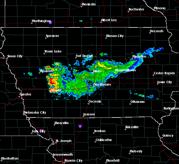 At 1231 pm cdt, a severe thunderstorm was located 10 miles northeast of atlantic, moving northeast at 30 mph (radar indicated). Hazards include quarter size hail. Damage to vehicles is expected. locations impacted include, atlantic, anita, exira, brayton, lake anita state park and anita municipal airport. This includes interstate 80 between mile markers 57 and 67. At 1231 pm cdt, a severe thunderstorm was located 10 miles northeast of atlantic, moving northeast at 30 mph (radar indicated). Hazards include quarter size hail. Damage to vehicles is expected. locations impacted include, atlantic, anita, exira, brayton, lake anita state park and anita municipal airport. This includes interstate 80 between mile markers 57 and 67.
|
| 9/14/2019 12:15 PM CDT |
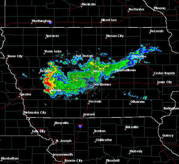 At 1214 pm cdt, a severe thunderstorm was located near atlantic, moving northeast at 25 mph (radar indicated). Hazards include quarter size hail. damage to vehicles is expected At 1214 pm cdt, a severe thunderstorm was located near atlantic, moving northeast at 25 mph (radar indicated). Hazards include quarter size hail. damage to vehicles is expected
|
| 7/17/2019 10:32 AM CDT |
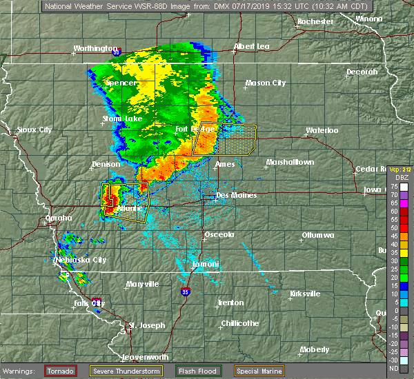 At 1031 am cdt, severe thunderstorms were located along a line extending from 7 miles north of audubon to 15 miles northeast of walnut to near atlantic, moving east at 35 mph (public. storm has a history of damaging winds, including reported trees down back in portsmouth in shelby county). Hazards include 60 mph wind gusts and quarter size hail. Hail damage to vehicles is expected. expect wind damage to roofs, siding, and trees. locations impacted include, atlantic, audubon, anita, exira, adair, elk horn, kimballton, brayton, marne, wiota, lake anita state park, audubon county airport, atlantic municipal airport and anita municipal airport. This includes interstate 80 between mile markers 50 and 81. At 1031 am cdt, severe thunderstorms were located along a line extending from 7 miles north of audubon to 15 miles northeast of walnut to near atlantic, moving east at 35 mph (public. storm has a history of damaging winds, including reported trees down back in portsmouth in shelby county). Hazards include 60 mph wind gusts and quarter size hail. Hail damage to vehicles is expected. expect wind damage to roofs, siding, and trees. locations impacted include, atlantic, audubon, anita, exira, adair, elk horn, kimballton, brayton, marne, wiota, lake anita state park, audubon county airport, atlantic municipal airport and anita municipal airport. This includes interstate 80 between mile markers 50 and 81.
|
| 7/17/2019 10:11 AM CDT |
 At 1010 am cdt, severe thunderstorms were located along a line extending from near irwin to 7 miles east of harlan to near walnut, moving east at 35 mph (public has reported wind gusts to 50 mph). Hazards include 60 mph wind gusts and quarter size hail. Hail damage to vehicles is expected. Expect wind damage to roofs, siding, and trees. At 1010 am cdt, severe thunderstorms were located along a line extending from near irwin to 7 miles east of harlan to near walnut, moving east at 35 mph (public has reported wind gusts to 50 mph). Hazards include 60 mph wind gusts and quarter size hail. Hail damage to vehicles is expected. Expect wind damage to roofs, siding, and trees.
|
| 7/3/2019 2:56 PM CDT |
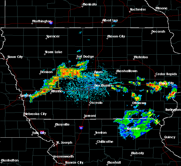 The severe thunderstorm warning for audubon county will expire at 300 pm cdt, the storm which prompted the warning has weakened below severe limits, and no longer poses an immediate threat to life or property. therefore, the warning will be allowed to expire. however gusty winds and heavy rain are still possible with this thunderstorm. The severe thunderstorm warning for audubon county will expire at 300 pm cdt, the storm which prompted the warning has weakened below severe limits, and no longer poses an immediate threat to life or property. therefore, the warning will be allowed to expire. however gusty winds and heavy rain are still possible with this thunderstorm.
|
| 7/3/2019 2:36 PM CDT |
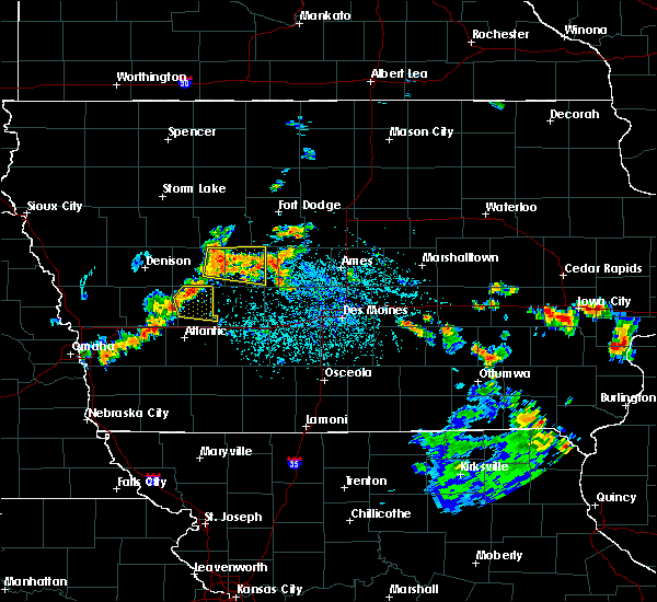 At 236 pm cdt, a severe thunderstorm was located near audubon, moving east at 20 mph (radar indicated). Hazards include 60 mph wind gusts and penny size hail. expect damage to roofs, siding, and trees At 236 pm cdt, a severe thunderstorm was located near audubon, moving east at 20 mph (radar indicated). Hazards include 60 mph wind gusts and penny size hail. expect damage to roofs, siding, and trees
|
| 4/10/2019 11:48 PM CDT |
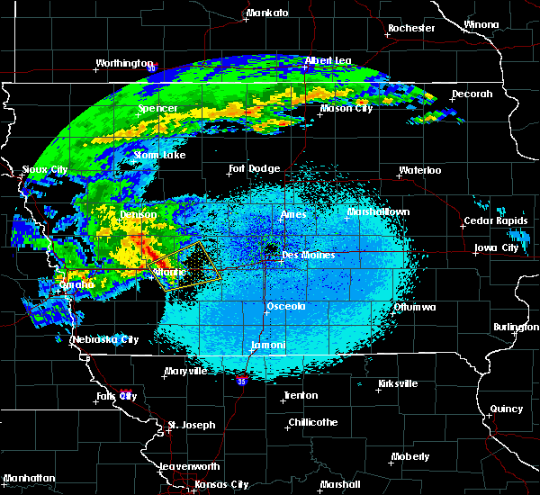 At 1147 pm cdt, a severe thunderstorm was located 14 miles northeast of atlantic, moving northeast at 60 mph (radar indicated). Hazards include 60 mph wind gusts and quarter size hail. Hail damage to vehicles is expected. expect wind damage to roofs, siding, and trees. locations impacted include, guthrie center, stuart, lake panorama, anita, exira, adair, casey, menlo, brayton, wiota, lake anita state park, anita municipal airport and springbrook state park. This includes interstate 80 between mile markers 58 and 93. At 1147 pm cdt, a severe thunderstorm was located 14 miles northeast of atlantic, moving northeast at 60 mph (radar indicated). Hazards include 60 mph wind gusts and quarter size hail. Hail damage to vehicles is expected. expect wind damage to roofs, siding, and trees. locations impacted include, guthrie center, stuart, lake panorama, anita, exira, adair, casey, menlo, brayton, wiota, lake anita state park, anita municipal airport and springbrook state park. This includes interstate 80 between mile markers 58 and 93.
|
| 4/10/2019 11:33 PM CDT |
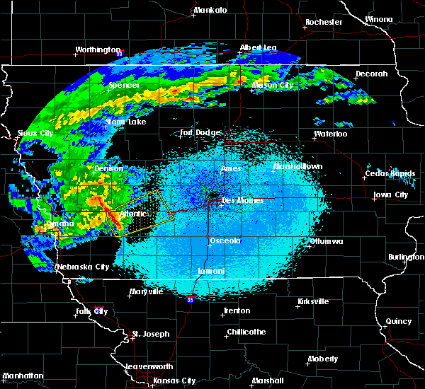 At 1132 pm cdt, a severe thunderstorm was located near atlantic, moving northeast at 55 mph (radar indicated). Hazards include 60 mph wind gusts and quarter size hail. Hail damage to vehicles is expected. Expect wind damage to roofs, siding, and trees. At 1132 pm cdt, a severe thunderstorm was located near atlantic, moving northeast at 55 mph (radar indicated). Hazards include 60 mph wind gusts and quarter size hail. Hail damage to vehicles is expected. Expect wind damage to roofs, siding, and trees.
|
| 9/18/2018 2:52 PM CDT |
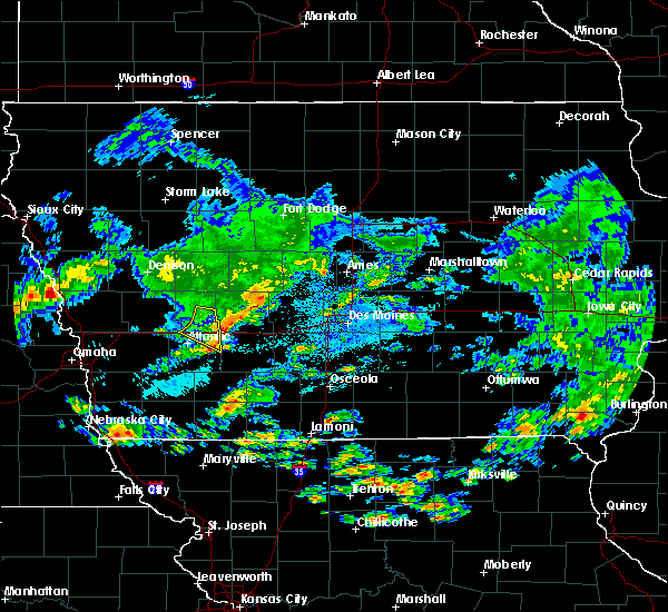 The severe thunderstorm warning for northeastern cass and southeastern audubon counties will expire at 300 pm cdt, the storm which prompted the warning has moved out of the area. therefore, the warning will be allowed to expire. however small hail and gusty winds are still briefly possible with this thunderstorm. The severe thunderstorm warning for northeastern cass and southeastern audubon counties will expire at 300 pm cdt, the storm which prompted the warning has moved out of the area. therefore, the warning will be allowed to expire. however small hail and gusty winds are still briefly possible with this thunderstorm.
|
| 9/18/2018 2:29 PM CDT |
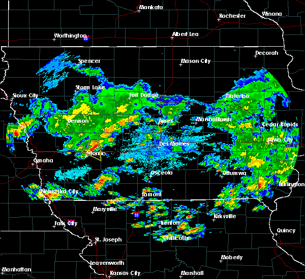 At 229 pm cdt, a severe thunderstorm was located 12 miles northeast of atlantic, moving southeast at 30 mph (radar indicated). Hazards include 60 mph wind gusts and nickel size hail. Expect damage to roofs, siding, and trees. locations impacted include, anita, exira, brayton, lake anita state park, anita municipal airport and audubon county airport. This includes interstate 80 between mile markers 56 and 72. At 229 pm cdt, a severe thunderstorm was located 12 miles northeast of atlantic, moving southeast at 30 mph (radar indicated). Hazards include 60 mph wind gusts and nickel size hail. Expect damage to roofs, siding, and trees. locations impacted include, anita, exira, brayton, lake anita state park, anita municipal airport and audubon county airport. This includes interstate 80 between mile markers 56 and 72.
|
| 9/18/2018 2:12 PM CDT |
 At 212 pm cdt, a severe thunderstorm was located 9 miles southwest of audubon, moving southeast at 25 mph (radar indicated). Hazards include 60 mph wind gusts and quarter size hail. Hail damage to vehicles is expected. Expect wind damage to roofs, siding, and trees. At 212 pm cdt, a severe thunderstorm was located 9 miles southwest of audubon, moving southeast at 25 mph (radar indicated). Hazards include 60 mph wind gusts and quarter size hail. Hail damage to vehicles is expected. Expect wind damage to roofs, siding, and trees.
|
| 8/31/2018 10:46 PM CDT |
 At 1045 pm cdt, a severe thunderstorm was located 10 miles northeast of atlantic, moving northeast at 15 mph (radar indicated. although the storm has weakened somewhat since then, at 1027 pm two inch diameter hail was reported near manre). Hazards include 60 mph wind gusts and quarter size hail. Hail damage to vehicles is expected. expect wind damage to roofs, siding, and trees. Locations impacted include, exira and brayton this includes interstate 80 between mile markers 53 and 69. At 1045 pm cdt, a severe thunderstorm was located 10 miles northeast of atlantic, moving northeast at 15 mph (radar indicated. although the storm has weakened somewhat since then, at 1027 pm two inch diameter hail was reported near manre). Hazards include 60 mph wind gusts and quarter size hail. Hail damage to vehicles is expected. expect wind damage to roofs, siding, and trees. Locations impacted include, exira and brayton this includes interstate 80 between mile markers 53 and 69.
|
| 8/31/2018 10:22 PM CDT |
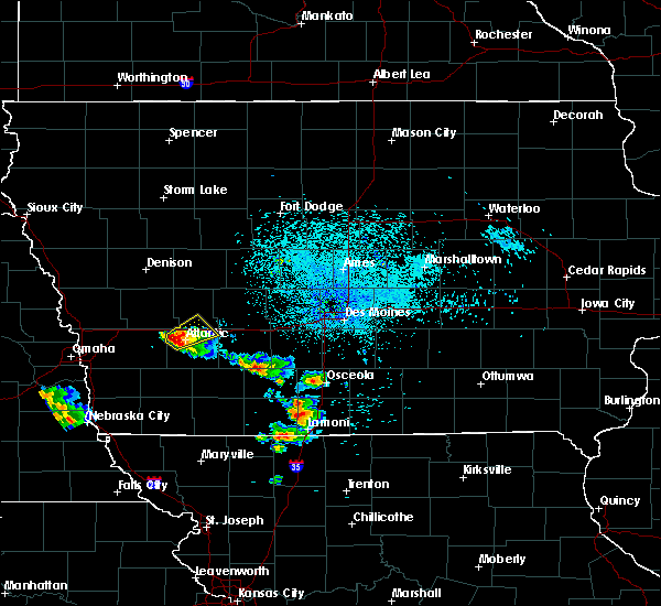 At 1021 pm cdt, a severe thunderstorm was located near atlantic, moving northeast at 25 mph (radar indicated). Hazards include 60 mph wind gusts and half dollar size hail. Hail damage to vehicles is expected. expect wind damage to roofs, siding, and trees. locations impacted include, atlantic, anita, exira, brayton, marne, wiota, lake anita state park, atlantic municipal airport and anita municipal airport. This includes interstate 80 between mile markers 53 and 70. At 1021 pm cdt, a severe thunderstorm was located near atlantic, moving northeast at 25 mph (radar indicated). Hazards include 60 mph wind gusts and half dollar size hail. Hail damage to vehicles is expected. expect wind damage to roofs, siding, and trees. locations impacted include, atlantic, anita, exira, brayton, marne, wiota, lake anita state park, atlantic municipal airport and anita municipal airport. This includes interstate 80 between mile markers 53 and 70.
|
| 8/31/2018 10:09 PM CDT |
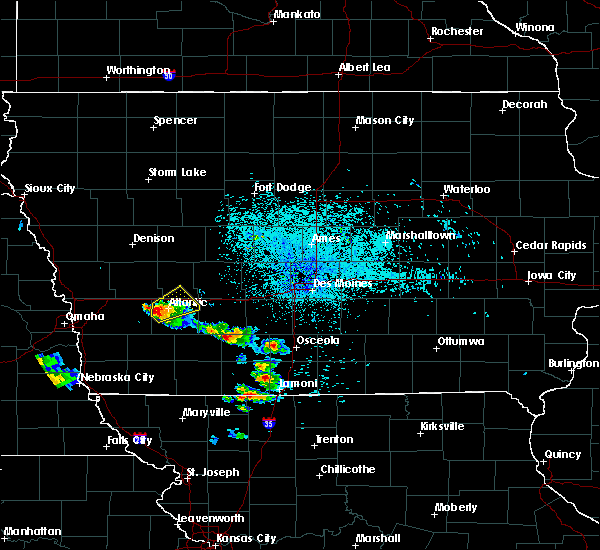 At 1009 pm cdt, a severe thunderstorm was located over atlantic, moving northeast at 25 mph (radar indicated). Hazards include 60 mph wind gusts and quarter size hail. Hail damage to vehicles is expected. Expect wind damage to roofs, siding, and trees. At 1009 pm cdt, a severe thunderstorm was located over atlantic, moving northeast at 25 mph (radar indicated). Hazards include 60 mph wind gusts and quarter size hail. Hail damage to vehicles is expected. Expect wind damage to roofs, siding, and trees.
|
| 6/30/2018 8:16 PM CDT |
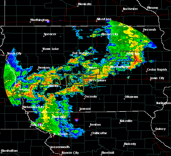 At 815 pm cdt, a severe thunderstorm was located 10 miles southeast of audubon, moving east at 35 mph (radar indicated). Hazards include 60 mph wind gusts. Expect damage to roofs, siding, and trees. Locations impacted include, audubon, exira, adair, elk horn, kimballton, brayton and audubon county airport. At 815 pm cdt, a severe thunderstorm was located 10 miles southeast of audubon, moving east at 35 mph (radar indicated). Hazards include 60 mph wind gusts. Expect damage to roofs, siding, and trees. Locations impacted include, audubon, exira, adair, elk horn, kimballton, brayton and audubon county airport.
|
| 6/30/2018 7:54 PM CDT |
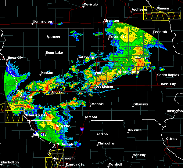 At 754 pm cdt, a severe thunderstorm was located 11 miles southwest of audubon, moving east at 35 mph (radar indicated). Hazards include 60 mph wind gusts. expect damage to roofs, siding, and trees At 754 pm cdt, a severe thunderstorm was located 11 miles southwest of audubon, moving east at 35 mph (radar indicated). Hazards include 60 mph wind gusts. expect damage to roofs, siding, and trees
|
| 6/28/2018 11:17 AM CDT |
 At 1115 am cdt, severe thunderstorms were located along a line extending from 8 miles south of coon rapids to 14 miles south of guthrie center to 8 miles north of lake icaria, moving east at 45 mph (trained weather spotters. an area of more intense wind damage may be occurring across portions of northern and central adiar county). Hazards include 70 mph wind gusts and quarter size hail. Hail damage to vehicles is expected. expect considerable tree damage. wind damage is also likely to mobile homes, roofs, and outbuildings. locations impacted include, atlantic, audubon, greenfield, guthrie center, stuart, panora, griswold, lake panorama, anita, exira, adair, fontanelle, dexter, lewis, casey, orient, diamondhead lake, massena, menlo and cumberland. This includes interstate 80 between mile markers 56 and 97. At 1115 am cdt, severe thunderstorms were located along a line extending from 8 miles south of coon rapids to 14 miles south of guthrie center to 8 miles north of lake icaria, moving east at 45 mph (trained weather spotters. an area of more intense wind damage may be occurring across portions of northern and central adiar county). Hazards include 70 mph wind gusts and quarter size hail. Hail damage to vehicles is expected. expect considerable tree damage. wind damage is also likely to mobile homes, roofs, and outbuildings. locations impacted include, atlantic, audubon, greenfield, guthrie center, stuart, panora, griswold, lake panorama, anita, exira, adair, fontanelle, dexter, lewis, casey, orient, diamondhead lake, massena, menlo and cumberland. This includes interstate 80 between mile markers 56 and 97.
|
| 6/28/2018 11:04 AM CDT |
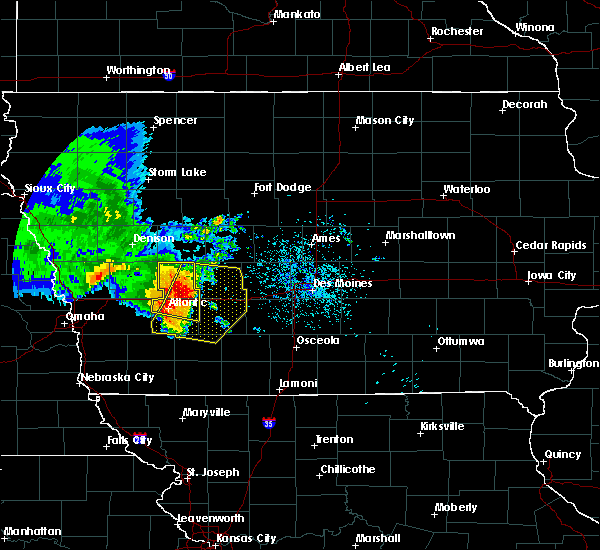 At 1103 am cdt, severe thunderstorms were located along a line extending from 8 miles northeast of audubon to 18 miles southwest of guthrie center to 9 miles southeast of atlantic, moving southeast at 45 mph (trained weather spotters. these storms have a history of producing wind damage across southwest iowa). Hazards include 70 mph wind gusts and quarter size hail. Hail damage to vehicles is expected. expect considerable tree damage. wind damage is also likely to mobile homes, roofs, and outbuildings. locations impacted include, atlantic, audubon, anita, exira, elk horn, kimballton, brayton, marne, wiota, gray, lake anita state park, audubon county airport, atlantic municipal airport and anita municipal airport. This includes interstate 80 between mile markers 50 and 73. At 1103 am cdt, severe thunderstorms were located along a line extending from 8 miles northeast of audubon to 18 miles southwest of guthrie center to 9 miles southeast of atlantic, moving southeast at 45 mph (trained weather spotters. these storms have a history of producing wind damage across southwest iowa). Hazards include 70 mph wind gusts and quarter size hail. Hail damage to vehicles is expected. expect considerable tree damage. wind damage is also likely to mobile homes, roofs, and outbuildings. locations impacted include, atlantic, audubon, anita, exira, elk horn, kimballton, brayton, marne, wiota, gray, lake anita state park, audubon county airport, atlantic municipal airport and anita municipal airport. This includes interstate 80 between mile markers 50 and 73.
|
| 6/28/2018 11:01 AM CDT |
 At 1100 am cdt, severe thunderstorms were located along a line extending from 7 miles north of audubon to 14 miles northeast of atlantic to 9 miles east of griswold, moving east at 45 mph (trained weather spotters. these storms have a history of producing wind damage across southwest iowa). Hazards include 70 mph wind gusts and quarter size hail. Hail damage to vehicles is expected. expect considerable tree damage. Wind damage is also likely to mobile homes, roofs, and outbuildings. At 1100 am cdt, severe thunderstorms were located along a line extending from 7 miles north of audubon to 14 miles northeast of atlantic to 9 miles east of griswold, moving east at 45 mph (trained weather spotters. these storms have a history of producing wind damage across southwest iowa). Hazards include 70 mph wind gusts and quarter size hail. Hail damage to vehicles is expected. expect considerable tree damage. Wind damage is also likely to mobile homes, roofs, and outbuildings.
|
| 6/28/2018 10:50 AM CDT |
 At 1049 am cdt, severe thunderstorms were located along a line extending from near manning to 6 miles southwest of audubon to near atlantic, moving east at 40 mph (trained weather spotters. these storms have a history of producing 60 to 70 mph winds with wind damage). Hazards include 70 mph wind gusts and quarter size hail. Hail damage to vehicles is expected. expect considerable tree damage. wind damage is also likely to mobile homes, roofs, and outbuildings. locations impacted include, atlantic, audubon, manning, anita, exira, manilla, elk horn, templeton, kimballton, dedham, brayton, marne, wiota, gray, aspinwall, lake anita state park, manning municipal airport, audubon county airport, atlantic municipal airport and anita municipal airport. This includes interstate 80 between mile markers 50 and 73. At 1049 am cdt, severe thunderstorms were located along a line extending from near manning to 6 miles southwest of audubon to near atlantic, moving east at 40 mph (trained weather spotters. these storms have a history of producing 60 to 70 mph winds with wind damage). Hazards include 70 mph wind gusts and quarter size hail. Hail damage to vehicles is expected. expect considerable tree damage. wind damage is also likely to mobile homes, roofs, and outbuildings. locations impacted include, atlantic, audubon, manning, anita, exira, manilla, elk horn, templeton, kimballton, dedham, brayton, marne, wiota, gray, aspinwall, lake anita state park, manning municipal airport, audubon county airport, atlantic municipal airport and anita municipal airport. This includes interstate 80 between mile markers 50 and 73.
|
| 6/28/2018 10:30 AM CDT |
 At 1029 am cdt, severe thunderstorms were located along a line extending from defiance to near harlan to near avoca, moving east at 40 mph (trained weather spotters. these storms have a history of producing 60 mph winds with tree damage). Hazards include 60 mph wind gusts and quarter size hail. Hail damage to vehicles is expected. Expect wind damage to roofs, siding, and trees. At 1029 am cdt, severe thunderstorms were located along a line extending from defiance to near harlan to near avoca, moving east at 40 mph (trained weather spotters. these storms have a history of producing 60 mph winds with tree damage). Hazards include 60 mph wind gusts and quarter size hail. Hail damage to vehicles is expected. Expect wind damage to roofs, siding, and trees.
|
| 6/6/2018 9:56 PM CDT |
 At 956 pm cdt, a severe thunderstorm was located 15 miles southwest of guthrie center, moving southeast at 15 mph (radar indicated). Hazards include 60 mph wind gusts and quarter size hail. Hail damage to vehicles is expected. Expect wind damage to roofs, siding, and trees. At 956 pm cdt, a severe thunderstorm was located 15 miles southwest of guthrie center, moving southeast at 15 mph (radar indicated). Hazards include 60 mph wind gusts and quarter size hail. Hail damage to vehicles is expected. Expect wind damage to roofs, siding, and trees.
|
| 6/6/2018 8:41 PM CDT |
 The severe thunderstorm warning for cass, southern guthrie, southern audubon and adair counties will expire at 845 pm cdt, the storms which prompted the warning have weakened below severe limits, and no longer pose an immediate threat to life or property. therefore, the warning will be allowed to expire. however gusty winds in excess of 50 mph and heavy rain are still possible with these thunderstorms. a severe thunderstorm watch remains in effect until 1000 pm cdt for central, south central, southwestern and west central iowa. The severe thunderstorm warning for cass, southern guthrie, southern audubon and adair counties will expire at 845 pm cdt, the storms which prompted the warning have weakened below severe limits, and no longer pose an immediate threat to life or property. therefore, the warning will be allowed to expire. however gusty winds in excess of 50 mph and heavy rain are still possible with these thunderstorms. a severe thunderstorm watch remains in effect until 1000 pm cdt for central, south central, southwestern and west central iowa.
|
| 6/6/2018 8:05 PM CDT |
 At 745 pm cdt, severe thunderstorms were located along a line extending from 11 miles northeast of walnut to near stuart, moving south at 20 mph (radar indicated). Hazards include 60 mph wind gusts and quarter size hail. Hail damage to vehicles is expected. Expect wind damage to roofs, siding, and trees. At 745 pm cdt, severe thunderstorms were located along a line extending from 11 miles northeast of walnut to near stuart, moving south at 20 mph (radar indicated). Hazards include 60 mph wind gusts and quarter size hail. Hail damage to vehicles is expected. Expect wind damage to roofs, siding, and trees.
|
| 6/6/2018 7:45 PM CDT |
 At 745 pm cdt, severe thunderstorms were located along a line extending from 11 miles northeast of walnut to near stuart, moving south at 20 mph (radar indicated). Hazards include 60 mph wind gusts and quarter size hail. Hail damage to vehicles is expected. Expect wind damage to roofs, siding, and trees. At 745 pm cdt, severe thunderstorms were located along a line extending from 11 miles northeast of walnut to near stuart, moving south at 20 mph (radar indicated). Hazards include 60 mph wind gusts and quarter size hail. Hail damage to vehicles is expected. Expect wind damage to roofs, siding, and trees.
|
| 5/1/2018 8:19 PM CDT |
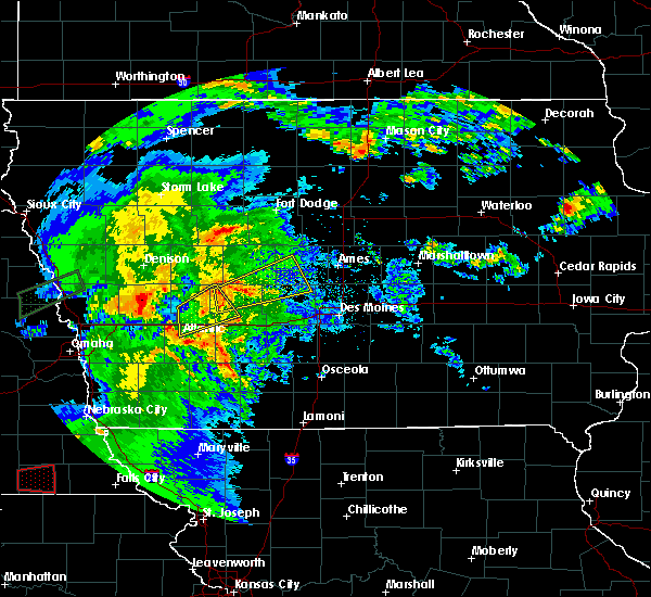 At 819 pm cdt, a severe thunderstorm was located 7 miles northwest of guthrie center, moving northeast at 55 mph (radar indicated). Hazards include 60 mph wind gusts and nickel size hail. Expect damage to roofs, siding, and trees. Locations impacted include, audubon, exira and audubon county airport. At 819 pm cdt, a severe thunderstorm was located 7 miles northwest of guthrie center, moving northeast at 55 mph (radar indicated). Hazards include 60 mph wind gusts and nickel size hail. Expect damage to roofs, siding, and trees. Locations impacted include, audubon, exira and audubon county airport.
|
| 5/1/2018 8:09 PM CDT |
 At 808 pm cdt, a severe thunderstorm was located 8 miles southeast of audubon, moving east at 60 mph (radar indicated). Hazards include 60 mph wind gusts and nickel size hail. Expect damage to roofs, siding, and trees. locations impacted include, atlantic, audubon, exira, brayton and audubon county airport. This includes interstate 80 between mile markers 57 and 70. At 808 pm cdt, a severe thunderstorm was located 8 miles southeast of audubon, moving east at 60 mph (radar indicated). Hazards include 60 mph wind gusts and nickel size hail. Expect damage to roofs, siding, and trees. locations impacted include, atlantic, audubon, exira, brayton and audubon county airport. This includes interstate 80 between mile markers 57 and 70.
|
| 5/1/2018 7:47 PM CDT |
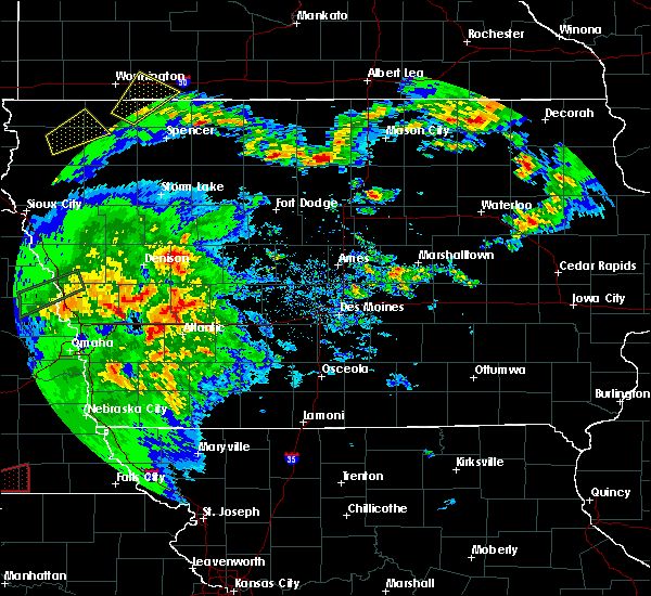 At 746 pm cdt, a severe thunderstorm was located near walnut, or 8 miles northwest of atlantic, moving northeast at 50 mph (radar indicated). Hazards include 60 mph wind gusts and nickel size hail. expect damage to roofs, siding, and trees At 746 pm cdt, a severe thunderstorm was located near walnut, or 8 miles northwest of atlantic, moving northeast at 50 mph (radar indicated). Hazards include 60 mph wind gusts and nickel size hail. expect damage to roofs, siding, and trees
|
| 4/13/2018 4:45 PM CDT |
 At 445 pm cdt, a severe thunderstorm was located 10 miles southeast of audubon, moving northeast at 35 mph (radar indicated). Hazards include 60 mph wind gusts and quarter size hail. Hail damage to vehicles is expected. expect wind damage to roofs, siding, and trees. locations impacted include, audubon, exira, elk horn, kimballton, brayton and audubon county airport. A tornado watch remains in effect until 900 pm cdt for southwestern iowa. At 445 pm cdt, a severe thunderstorm was located 10 miles southeast of audubon, moving northeast at 35 mph (radar indicated). Hazards include 60 mph wind gusts and quarter size hail. Hail damage to vehicles is expected. expect wind damage to roofs, siding, and trees. locations impacted include, audubon, exira, elk horn, kimballton, brayton and audubon county airport. A tornado watch remains in effect until 900 pm cdt for southwestern iowa.
|
| 4/13/2018 4:34 PM CDT |
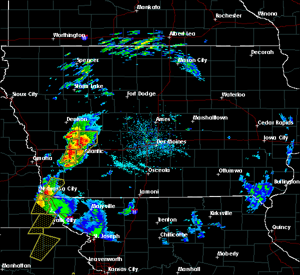 At 433 pm cdt, a severe thunderstorm was located 10 miles south of audubon, moving northeast at 45 mph (automated weather report from atlantic airport had a 61 mph wind gust at 430 pm). Hazards include 60 mph wind gusts and quarter size hail. Hail damage to vehicles is expected. expect wind damage to roofs, siding, and trees. locations impacted include, atlantic, audubon, exira, elk horn, kimballton, brayton, marne, gray, audubon county airport and atlantic municipal airport. this includes interstate 80 between mile markers 50 and 61. A tornado watch remains in effect until 900 pm cdt for southwestern iowa. At 433 pm cdt, a severe thunderstorm was located 10 miles south of audubon, moving northeast at 45 mph (automated weather report from atlantic airport had a 61 mph wind gust at 430 pm). Hazards include 60 mph wind gusts and quarter size hail. Hail damage to vehicles is expected. expect wind damage to roofs, siding, and trees. locations impacted include, atlantic, audubon, exira, elk horn, kimballton, brayton, marne, gray, audubon county airport and atlantic municipal airport. this includes interstate 80 between mile markers 50 and 61. A tornado watch remains in effect until 900 pm cdt for southwestern iowa.
|
| 4/13/2018 4:18 PM CDT |
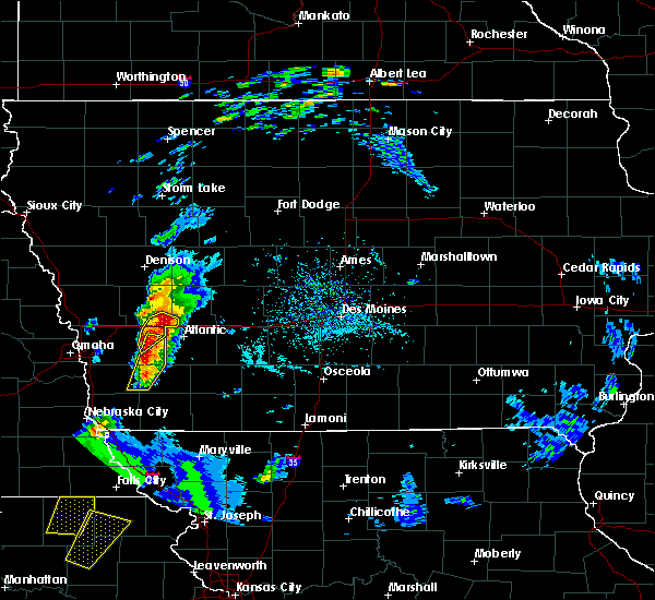 The national weather service in des moines has issued a * severe thunderstorm warning for. northwestern cass county in southwestern iowa. audubon county in west central iowa. until 515 pm cdt. At 418 pm cdt, a severe thunderstorm was located near walnut, or 9. The national weather service in des moines has issued a * severe thunderstorm warning for. northwestern cass county in southwestern iowa. audubon county in west central iowa. until 515 pm cdt. At 418 pm cdt, a severe thunderstorm was located near walnut, or 9.
|
| 8/21/2017 2:07 AM CDT |
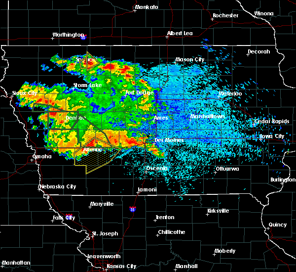 At 207 am cdt, a severe thunderstorm was located 8 miles northeast of atlantic, moving southeast at 35 mph (radar indicated). Hazards include 60 mph wind gusts and penny size hail. expect damage to roofs, siding, and trees At 207 am cdt, a severe thunderstorm was located 8 miles northeast of atlantic, moving southeast at 35 mph (radar indicated). Hazards include 60 mph wind gusts and penny size hail. expect damage to roofs, siding, and trees
|
| 5/27/2017 9:04 AM CDT |
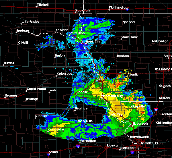 At 903 am cdt, a severe thunderstorm was located near griswold, or 7 miles southwest of atlantic, moving north at 35 mph (radar indicated). Hazards include quarter size hail. damage to vehicles is expected At 903 am cdt, a severe thunderstorm was located near griswold, or 7 miles southwest of atlantic, moving north at 35 mph (radar indicated). Hazards include quarter size hail. damage to vehicles is expected
|
| 5/27/2017 9:04 AM CDT |
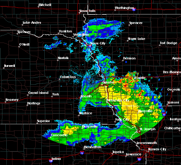 At 927 am cdt, severe thunderstorms were located along a line extending from near walnut to near atlantic, moving north at 25 mph (radar indicated). Hazards include quarter size hail. Damage to vehicles is expected. locations impacted include, atlantic, lewis, marne, cold springs state park, griswold park and atlantic municipal airport. This includes interstate 80 between mile markers 50 and 63. At 927 am cdt, severe thunderstorms were located along a line extending from near walnut to near atlantic, moving north at 25 mph (radar indicated). Hazards include quarter size hail. Damage to vehicles is expected. locations impacted include, atlantic, lewis, marne, cold springs state park, griswold park and atlantic municipal airport. This includes interstate 80 between mile markers 50 and 63.
|
| 5/17/2017 3:46 PM CDT |
 At 345 pm cdt, severe thunderstorms were located along a line extending from 11 miles north of atlantic to 6 miles southeast of stuart to near lakeside casino, moving north at 50 mph (radar indicated). Hazards include 60 mph wind gusts and penny size hail. expect damage to roofs, siding, and trees At 345 pm cdt, severe thunderstorms were located along a line extending from 11 miles north of atlantic to 6 miles southeast of stuart to near lakeside casino, moving north at 50 mph (radar indicated). Hazards include 60 mph wind gusts and penny size hail. expect damage to roofs, siding, and trees
|
| 5/16/2017 9:18 PM CDT |
 At 917 pm cdt, a severe thunderstorm was located near audubon, moving northeast at 45 mph (radar indicated). Hazards include 60 mph wind gusts. expect damage to roofs, siding, and trees At 917 pm cdt, a severe thunderstorm was located near audubon, moving northeast at 45 mph (radar indicated). Hazards include 60 mph wind gusts. expect damage to roofs, siding, and trees
|
| 5/16/2017 8:58 PM CDT |
 The severe thunderstorm warning for greene, northeastern cass, guthrie, eastern audubon, southeastern carroll, northern adair and western dallas counties will expire at 900 pm cdt, new severe thunderstorm warnings have been issued for portions of the area where a threat remains. a severe thunderstorm watch remains in effect until midnight cdt for southwestern and west central iowa. a severe thunderstorm watch also remains in effect until 300 am cdt for central and south central iowa. remember, a severe thunderstorm warning still remains in effect for 930 pm cdt. The severe thunderstorm warning for greene, northeastern cass, guthrie, eastern audubon, southeastern carroll, northern adair and western dallas counties will expire at 900 pm cdt, new severe thunderstorm warnings have been issued for portions of the area where a threat remains. a severe thunderstorm watch remains in effect until midnight cdt for southwestern and west central iowa. a severe thunderstorm watch also remains in effect until 300 am cdt for central and south central iowa. remember, a severe thunderstorm warning still remains in effect for 930 pm cdt.
|
| 5/16/2017 8:36 PM CDT |
 At 836 pm cdt, severe thunderstorms were located along a line extending from 9 miles southeast of glidden to near guthrie center to 15 miles northwest of greenfield, moving northeast at 45 mph (radar indicated). Hazards include 60 mph wind gusts and quarter size hail. Hail damage to vehicles is expected. expect wind damage to roofs, siding, and trees. locations impacted include, jefferson, guthrie center, stuart, coon rapids, panora, lake panorama, anita, exira, redfield, grand junction, adair, dexter, scranton, bayard, casey, diamondhead lake, menlo, bagley, rippey and yale. This includes interstate 80 between mile markers 64 and 97. At 836 pm cdt, severe thunderstorms were located along a line extending from 9 miles southeast of glidden to near guthrie center to 15 miles northwest of greenfield, moving northeast at 45 mph (radar indicated). Hazards include 60 mph wind gusts and quarter size hail. Hail damage to vehicles is expected. expect wind damage to roofs, siding, and trees. locations impacted include, jefferson, guthrie center, stuart, coon rapids, panora, lake panorama, anita, exira, redfield, grand junction, adair, dexter, scranton, bayard, casey, diamondhead lake, menlo, bagley, rippey and yale. This includes interstate 80 between mile markers 64 and 97.
|
| 5/16/2017 8:27 PM CDT |
 The severe thunderstorm warning for audubon, sac, crawford and carroll counties will expire at 830 pm cdt, new severe thunderstorm warnings have been issued for portions of the area where a threat remains. a severe thunderstorm watch remains in effect until midnight cdt for west central iowa. to report severe weather, contact your nearest law enforcement agency. they will relay your report to the national weather service des moines . remember, a severe thunderstorm warning still remains in effect for 9 pm cdt. The severe thunderstorm warning for audubon, sac, crawford and carroll counties will expire at 830 pm cdt, new severe thunderstorm warnings have been issued for portions of the area where a threat remains. a severe thunderstorm watch remains in effect until midnight cdt for west central iowa. to report severe weather, contact your nearest law enforcement agency. they will relay your report to the national weather service des moines . remember, a severe thunderstorm warning still remains in effect for 9 pm cdt.
|
| 5/16/2017 8:22 PM CDT |
 At 822 pm cdt, severe thunderstorms were located along a line extending from near coon rapids to 9 miles west of guthrie center to 7 miles southeast of atlantic, moving northeast at 50 mph (radar indicated). Hazards include 60 mph wind gusts and quarter size hail. Hail damage to vehicles is expected. Expect wind damage to roofs, siding, and trees. At 822 pm cdt, severe thunderstorms were located along a line extending from near coon rapids to 9 miles west of guthrie center to 7 miles southeast of atlantic, moving northeast at 50 mph (radar indicated). Hazards include 60 mph wind gusts and quarter size hail. Hail damage to vehicles is expected. Expect wind damage to roofs, siding, and trees.
|
| 5/16/2017 7:56 PM CDT |
 At 755 pm cdt, severe thunderstorms were located along a line extending from near odebolt to near manning to 11 miles southwest of audubon, moving northeast at 45 mph (emergency management reported 70 mph wind gusts between buck grove and manila). Hazards include 60 mph wind gusts and quarter size hail. there will be swaths of higher wind gusts in a few areas. Hail damage to vehicles is expected. expect wind damage to roofs, siding, and trees. Locations impacted include, carroll, denison, audubon, manning, glidden, lake view, odebolt, black hawk lake, schleswig, exira, wall lake, manilla, schaller, elk horn, early, dow city, charter oak, arcadia, breda and vail. At 755 pm cdt, severe thunderstorms were located along a line extending from near odebolt to near manning to 11 miles southwest of audubon, moving northeast at 45 mph (emergency management reported 70 mph wind gusts between buck grove and manila). Hazards include 60 mph wind gusts and quarter size hail. there will be swaths of higher wind gusts in a few areas. Hail damage to vehicles is expected. expect wind damage to roofs, siding, and trees. Locations impacted include, carroll, denison, audubon, manning, glidden, lake view, odebolt, black hawk lake, schleswig, exira, wall lake, manilla, schaller, elk horn, early, dow city, charter oak, arcadia, breda and vail.
|
| 5/16/2017 7:41 PM CDT |
 At 741 pm cdt, severe thunderstorms were located along a line extending from 11 miles northwest of denison to near irwin to near walnut, moving northeast at 45 mph (radar indicated). Hazards include 60 mph wind gusts and quarter size hail. Hail damage to vehicles is expected. Expect wind damage to roofs, siding, and trees. At 741 pm cdt, severe thunderstorms were located along a line extending from 11 miles northwest of denison to near irwin to near walnut, moving northeast at 45 mph (radar indicated). Hazards include 60 mph wind gusts and quarter size hail. Hail damage to vehicles is expected. Expect wind damage to roofs, siding, and trees.
|
| 4/19/2017 8:14 PM CDT |
 At 814 pm cdt, a severe thunderstorm was located 7 miles north of audubon, moving east at 45 mph (radar indicated). Hazards include 60 mph wind gusts and quarter size hail. Hail damage to vehicles is expected. Expect wind damage to roofs, siding, and trees. At 814 pm cdt, a severe thunderstorm was located 7 miles north of audubon, moving east at 45 mph (radar indicated). Hazards include 60 mph wind gusts and quarter size hail. Hail damage to vehicles is expected. Expect wind damage to roofs, siding, and trees.
|
| 3/6/2017 5:48 PM CST |
 At 548 pm cst, severe thunderstorms were located along a line extending from 9 miles east of coon rapids to 7 miles southwest of guthrie center to 9 miles northwest of lake icaria, moving east at 45 mph (radar indicated). Hazards include 60 mph wind gusts and quarter size hail. Hail damage to vehicles is expected. expect wind damage to roofs, siding, and trees. locations impacted include, atlantic, guthrie center, lake panorama, anita, exira, adair, bayard, lewis, casey, massena, bagley, cumberland, yale, jamaica, bridgewater, wiota, lake anita state park, springbrook state park, anita municipal airport and cold springs state park. this includes interstate 80 between mile markers 61 and 83. A tornado watch remains in effect until 1000 pm cst for southwestern and west central iowa. At 548 pm cst, severe thunderstorms were located along a line extending from 9 miles east of coon rapids to 7 miles southwest of guthrie center to 9 miles northwest of lake icaria, moving east at 45 mph (radar indicated). Hazards include 60 mph wind gusts and quarter size hail. Hail damage to vehicles is expected. expect wind damage to roofs, siding, and trees. locations impacted include, atlantic, guthrie center, lake panorama, anita, exira, adair, bayard, lewis, casey, massena, bagley, cumberland, yale, jamaica, bridgewater, wiota, lake anita state park, springbrook state park, anita municipal airport and cold springs state park. this includes interstate 80 between mile markers 61 and 83. A tornado watch remains in effect until 1000 pm cst for southwestern and west central iowa.
|
| 3/6/2017 5:07 PM CST |
 At 507 pm cst, severe thunderstorms were located along a line extending from 8 miles north of audubon to near macedonia, moving northeast at 35 mph (radar indicated). Hazards include 60 mph wind gusts and quarter size hail. Hail damage to vehicles is expected. Expect wind damage to roofs, siding, and trees. At 507 pm cst, severe thunderstorms were located along a line extending from 8 miles north of audubon to near macedonia, moving northeast at 35 mph (radar indicated). Hazards include 60 mph wind gusts and quarter size hail. Hail damage to vehicles is expected. Expect wind damage to roofs, siding, and trees.
|
| 8/11/2016 8:51 PM CDT |
 The severe thunderstorm warning for southwestern guthrie, cass, northwestern adair, southeastern audubon and northwestern adams counties will expire at 900 pm cdt, the storms which prompted the warning have moved out of the area. therefore the warning will be allowed to expire. however heavy rain is still possible with these thunderstorms. a severe thunderstorm watch remains in effect until 1100 pm cdt for west central and southwestern iowa. The severe thunderstorm warning for southwestern guthrie, cass, northwestern adair, southeastern audubon and northwestern adams counties will expire at 900 pm cdt, the storms which prompted the warning have moved out of the area. therefore the warning will be allowed to expire. however heavy rain is still possible with these thunderstorms. a severe thunderstorm watch remains in effect until 1100 pm cdt for west central and southwestern iowa.
|
| 8/11/2016 8:26 PM CDT |
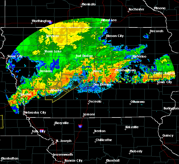 The severe thunderstorm warning for southwestern guthrie and central audubon counties will expire at 830 pm cdt, the storm which prompted the warning has moved out of the area. therefore the warning will be allowed to expire. however heavy rain is still possible with this thunderstorm. a severe thunderstorm watch remains in effect until 1100 pm cdt for west central iowa. remember, a severe thunderstorm warning still remains in effect for portions of guthrie and audobon until 9pm. The severe thunderstorm warning for southwestern guthrie and central audubon counties will expire at 830 pm cdt, the storm which prompted the warning has moved out of the area. therefore the warning will be allowed to expire. however heavy rain is still possible with this thunderstorm. a severe thunderstorm watch remains in effect until 1100 pm cdt for west central iowa. remember, a severe thunderstorm warning still remains in effect for portions of guthrie and audobon until 9pm.
|
| 8/11/2016 8:20 PM CDT |
 At 818 pm cdt, severe thunderstorms were located along a line extending from 16 miles southeast of audubon to near atlantic to near griswold, moving southeast at 35 mph (law enforcement. at 810 pm...trees and power lines were reported down in atlantic). Hazards include 60 mph wind gusts. Expect damage to roofs. siding. And trees. At 818 pm cdt, severe thunderstorms were located along a line extending from 16 miles southeast of audubon to near atlantic to near griswold, moving southeast at 35 mph (law enforcement. at 810 pm...trees and power lines were reported down in atlantic). Hazards include 60 mph wind gusts. Expect damage to roofs. siding. And trees.
|
| 8/11/2016 7:59 PM CDT |
 At 758 pm cdt, a severe thunderstorm was located over audubon, moving east at 30 mph (radar indicated. at 755pm...a 69 mph wind gust was reported at an automated weather station in audobon). Hazards include 70 mph wind gusts and quarter size hail. Hail damage to vehicles is expected. expect considerable tree damage. wind damage is also likely to mobile homes, roofs, and outbuildings. Locations impacted include, audubon, exira, elk horn, kimballton and audubon county airport. At 758 pm cdt, a severe thunderstorm was located over audubon, moving east at 30 mph (radar indicated. at 755pm...a 69 mph wind gust was reported at an automated weather station in audobon). Hazards include 70 mph wind gusts and quarter size hail. Hail damage to vehicles is expected. expect considerable tree damage. wind damage is also likely to mobile homes, roofs, and outbuildings. Locations impacted include, audubon, exira, elk horn, kimballton and audubon county airport.
|
| 8/11/2016 7:45 PM CDT |
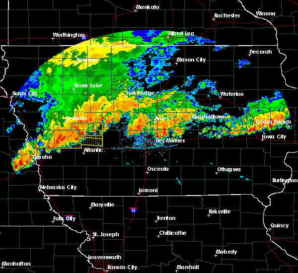 At 744 pm cdt, a severe thunderstorm was located 9 miles southeast of irwin, or 9 miles west of audubon, moving east at 30 mph (radar indicated). Hazards include 60 mph wind gusts and quarter size hail. Hail damage to vehicles is expected. Expect wind damage to roofs, siding, and trees. At 744 pm cdt, a severe thunderstorm was located 9 miles southeast of irwin, or 9 miles west of audubon, moving east at 30 mph (radar indicated). Hazards include 60 mph wind gusts and quarter size hail. Hail damage to vehicles is expected. Expect wind damage to roofs, siding, and trees.
|
| 7/19/2016 12:24 PM CDT |
 The severe thunderstorm warning for northern cass and southern audubon counties will expire at 1230 pm cdt, the storm which prompted the warning has moved out of the area. therefore the warning will be allowed to expire. however heavy rain is still possible with this thunderstorm. remember, a new severe thunderstorm warning remains in effect for northern cass and far southern audobon counties. The severe thunderstorm warning for northern cass and southern audubon counties will expire at 1230 pm cdt, the storm which prompted the warning has moved out of the area. therefore the warning will be allowed to expire. however heavy rain is still possible with this thunderstorm. remember, a new severe thunderstorm warning remains in effect for northern cass and far southern audobon counties.
|
| 7/19/2016 12:09 PM CDT |
 At 1208 pm cdt, a severe thunderstorm was located 12 miles northeast of atlantic, moving southeast at 35 mph (radar indicated). Hazards include 60 mph wind gusts and nickel size hail. Expect damage to roofs. siding. and trees. Locations impacted include, atlantic, anita, exira, brayton, wiota, anita municipal airport, lake anita state park and atlantic municipal airport. At 1208 pm cdt, a severe thunderstorm was located 12 miles northeast of atlantic, moving southeast at 35 mph (radar indicated). Hazards include 60 mph wind gusts and nickel size hail. Expect damage to roofs. siding. and trees. Locations impacted include, atlantic, anita, exira, brayton, wiota, anita municipal airport, lake anita state park and atlantic municipal airport.
|
| 7/19/2016 11:59 AM CDT |
 At 1159 am cdt, a severe thunderstorm was located 11 miles north of atlantic, moving east at 30 mph (radar indicated). Hazards include 60 mph wind gusts and nickel size hail. Expect damage to roofs. siding. and trees. Locations impacted include, atlantic, audubon, anita, exira, elk horn, kimballton, brayton, marne, wiota, lake anita state park, anita municipal airport, audubon county airport and atlantic municipal airport. At 1159 am cdt, a severe thunderstorm was located 11 miles north of atlantic, moving east at 30 mph (radar indicated). Hazards include 60 mph wind gusts and nickel size hail. Expect damage to roofs. siding. and trees. Locations impacted include, atlantic, audubon, anita, exira, elk horn, kimballton, brayton, marne, wiota, lake anita state park, anita municipal airport, audubon county airport and atlantic municipal airport.
|
| 7/19/2016 11:39 AM CDT |
 At 1138 am cdt, a severe thunderstorm was located 8 miles northeast of walnut, or 13 miles southwest of audubon, moving east at 30 mph (radar indicated. a 58 mph wind gust was reported at harlan at 1135am cdt). Hazards include 60 mph wind gusts and nickel size hail. Expect damage to roofs. siding. And trees. At 1138 am cdt, a severe thunderstorm was located 8 miles northeast of walnut, or 13 miles southwest of audubon, moving east at 30 mph (radar indicated. a 58 mph wind gust was reported at harlan at 1135am cdt). Hazards include 60 mph wind gusts and nickel size hail. Expect damage to roofs. siding. And trees.
|
| 7/17/2016 8:49 AM CDT |
 At 849 am cdt, a severe thunderstorm was located over audubon, moving east at 50 mph (radar indicated). Hazards include 60 mph wind gusts and penny size hail. Expect damage to roofs. siding. And trees. At 849 am cdt, a severe thunderstorm was located over audubon, moving east at 50 mph (radar indicated). Hazards include 60 mph wind gusts and penny size hail. Expect damage to roofs. siding. And trees.
|
| 5/26/2016 2:35 AM CDT |
 At 234 am cdt, severe thunderstorms were located along a line extending from 8 miles south of black hawk lake to 14 miles west of greenfield, moving east at 50 mph (radar indicated. there was wind damage reported in manning). Hazards include 70 mph wind gusts and penny size hail. Expect considerable tree damage. damage is likely to mobile homes, roofs, and outbuildings. locations impacted include, carroll, atlantic, audubon, guthrie center, manning, coon rapids, glidden, anita, exira, adair, scranton, arcadia, breda, bayard, vail, casey, templeton, menlo, westside and dedham. This includes interstate 80 between mile markers 50 and 89. At 234 am cdt, severe thunderstorms were located along a line extending from 8 miles south of black hawk lake to 14 miles west of greenfield, moving east at 50 mph (radar indicated. there was wind damage reported in manning). Hazards include 70 mph wind gusts and penny size hail. Expect considerable tree damage. damage is likely to mobile homes, roofs, and outbuildings. locations impacted include, carroll, atlantic, audubon, guthrie center, manning, coon rapids, glidden, anita, exira, adair, scranton, arcadia, breda, bayard, vail, casey, templeton, menlo, westside and dedham. This includes interstate 80 between mile markers 50 and 89.
|
| 5/26/2016 2:27 AM CDT |
 At 225 am cdt, severe thunderstorms were located along a line extending from 11 miles southeast of odebolt to 8 miles east of atlantic, moving east at 50 mph (radar indicated. at 214am cdt...the denison asos reported a wind gust of 87 mph). Hazards include 70 mph wind gusts and penny size hail. Expect considerable tree damage. damage is likely to mobile homes, roofs, and outbuildings. locations impacted include, carroll, denison, atlantic, audubon, guthrie center, manning, coon rapids, glidden, anita, exira, adair, manilla, elk horn, scranton, arcadia, breda, bayard, vail, casey and templeton. This includes interstate 80 between mile markers 50 and 89. At 225 am cdt, severe thunderstorms were located along a line extending from 11 miles southeast of odebolt to 8 miles east of atlantic, moving east at 50 mph (radar indicated. at 214am cdt...the denison asos reported a wind gust of 87 mph). Hazards include 70 mph wind gusts and penny size hail. Expect considerable tree damage. damage is likely to mobile homes, roofs, and outbuildings. locations impacted include, carroll, denison, atlantic, audubon, guthrie center, manning, coon rapids, glidden, anita, exira, adair, manilla, elk horn, scranton, arcadia, breda, bayard, vail, casey and templeton. This includes interstate 80 between mile markers 50 and 89.
|
| 5/26/2016 2:10 AM CDT |
 At 210 am cdt, severe thunderstorms were located along a line extending from 5 miles northwest of denison to 3 miles south of atlantic, moving east at 50 mph (radar indicated). Hazards include 60 mph wind gusts and penny size hail. Expect damage to roofs. siding. And trees. At 210 am cdt, severe thunderstorms were located along a line extending from 5 miles northwest of denison to 3 miles south of atlantic, moving east at 50 mph (radar indicated). Hazards include 60 mph wind gusts and penny size hail. Expect damage to roofs. siding. And trees.
|
| 11/11/2015 2:12 PM CST |
 At 212 pm cst, a severe thunderstorm was located 10 miles northeast of atlantic, moving northeast at 50 mph (radar indicated). Hazards include 60 mph wind gusts and quarter size hail. Hail damage to vehicles is expected. Expect wind damage to roofs, siding and trees. At 212 pm cst, a severe thunderstorm was located 10 miles northeast of atlantic, moving northeast at 50 mph (radar indicated). Hazards include 60 mph wind gusts and quarter size hail. Hail damage to vehicles is expected. Expect wind damage to roofs, siding and trees.
|
| 9/22/2015 3:54 PM CDT |
 The severe thunderstorm warning for north central cass and southern audubon counties will expire at 400 pm cdt, the storm which prompted the warning has weakened below severe limits. therefore the warning will be allowed to expire. however heavy rain is still possible with this thunderstorm. The severe thunderstorm warning for north central cass and southern audubon counties will expire at 400 pm cdt, the storm which prompted the warning has weakened below severe limits. therefore the warning will be allowed to expire. however heavy rain is still possible with this thunderstorm.
|
| 9/22/2015 3:43 PM CDT |
 At 342 pm cdt, a severe thunderstorm was located 10 miles south of audubon, moving southeast at 20 mph (radar indicated). Hazards include 60 mph wind gusts and quarter size hail. Hail damage to vehicles is expected. expect wind damage to roofs, siding and trees. locations impacted include, audubon, exira, elk horn, kimballton, brayton and audubon county airport. This includes interstate 80 between mile markers 54 and 63. At 342 pm cdt, a severe thunderstorm was located 10 miles south of audubon, moving southeast at 20 mph (radar indicated). Hazards include 60 mph wind gusts and quarter size hail. Hail damage to vehicles is expected. expect wind damage to roofs, siding and trees. locations impacted include, audubon, exira, elk horn, kimballton, brayton and audubon county airport. This includes interstate 80 between mile markers 54 and 63.
|
| 9/22/2015 3:24 PM CDT |
 At 323 pm cdt, a severe thunderstorm was located 8 miles southwest of audubon, moving southeast at 20 mph (radar indicated). Hazards include 60 mph wind gusts and quarter size hail. Hail damage to vehicles is expected. Expect wind damage to roofs, siding and trees. At 323 pm cdt, a severe thunderstorm was located 8 miles southwest of audubon, moving southeast at 20 mph (radar indicated). Hazards include 60 mph wind gusts and quarter size hail. Hail damage to vehicles is expected. Expect wind damage to roofs, siding and trees.
|
| 8/2/2015 5:01 AM CDT |
 At 501 am cdt, a severe thunderstorm was located 5 miles southeast of audubon, moving east at 40 mph (radar indicated). Hazards include 60 mph wind gusts and penny size hail. Expect damage to roofs. siding and trees. Locations impacted include, audubon, exira, elk horn, kimballton, brayton and audubon county airport. At 501 am cdt, a severe thunderstorm was located 5 miles southeast of audubon, moving east at 40 mph (radar indicated). Hazards include 60 mph wind gusts and penny size hail. Expect damage to roofs. siding and trees. Locations impacted include, audubon, exira, elk horn, kimballton, brayton and audubon county airport.
|
| 8/2/2015 4:37 AM CDT |
 At 437 am cdt, a severe thunderstorm was located 6 miles south of irwin, or 13 miles west of audubon, moving east at 40 mph (radar indicated). Hazards include 60 mph wind gusts and penny size hail. Expect damage to roofs. Siding and trees. At 437 am cdt, a severe thunderstorm was located 6 miles south of irwin, or 13 miles west of audubon, moving east at 40 mph (radar indicated). Hazards include 60 mph wind gusts and penny size hail. Expect damage to roofs. Siding and trees.
|
| 7/27/2015 10:35 AM CDT |
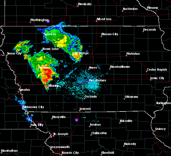 At 1035 am cdt, a severe thunderstorm was located 7 miles northeast of audubon, moving east at 30 mph (radar indicated). Hazards include 60 mph wind gusts and quarter size hail. Hail damage to vehicles is expected. Expect wind damage to roofs, siding and trees. At 1035 am cdt, a severe thunderstorm was located 7 miles northeast of audubon, moving east at 30 mph (radar indicated). Hazards include 60 mph wind gusts and quarter size hail. Hail damage to vehicles is expected. Expect wind damage to roofs, siding and trees.
|
| 6/24/2015 7:47 PM CDT |
 At 747 pm cdt, a severe thunderstorm was located near audubon, moving southeast at 30 mph (radar indicated). Hazards include 60 mph wind gusts and quarter size hail. Hail damage to vehicles is expected. expect wind damage to roofs, siding and trees. this severe thunderstorm will be near, audubon around 750 pm cdt. other locations impacted by this severe thunderstorm include audubon county airport and casey. A tornado watch remains in effect until 200 am cdt for west central iowa. At 747 pm cdt, a severe thunderstorm was located near audubon, moving southeast at 30 mph (radar indicated). Hazards include 60 mph wind gusts and quarter size hail. Hail damage to vehicles is expected. expect wind damage to roofs, siding and trees. this severe thunderstorm will be near, audubon around 750 pm cdt. other locations impacted by this severe thunderstorm include audubon county airport and casey. A tornado watch remains in effect until 200 am cdt for west central iowa.
|
| 6/24/2015 7:45 PM CDT |
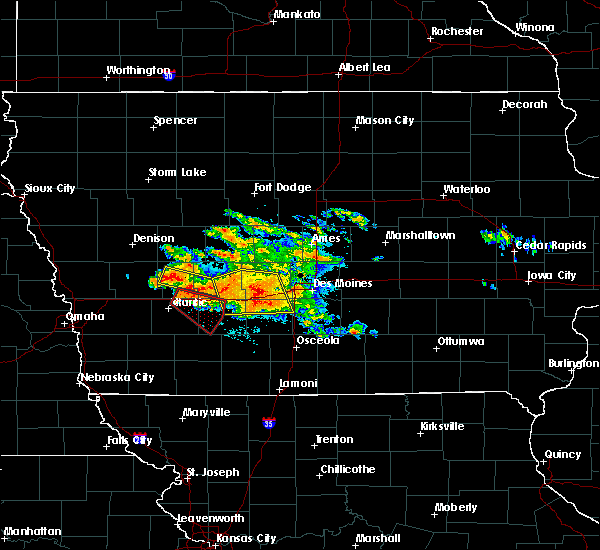 At 745 pm cdt, a severe thunderstorm capable of producing a tornado was located 10 miles northeast of atlantic, moving southeast at 30 mph (radar indicated rotation). Hazards include tornado. Flying debris will be dangerous to those caught without shelter. mobile homes will be damaged or destroyed. damage to roofs, windows and vehicles will occur. tree damage is likely. this tornadic thunderstorm will remain over mainly rural areas of northeastern cass, southeastern audubon, southwestern guthrie and western adair counties, including the following locations, bridgewater, anita, wiota, adair, exira, casey, fontanelle, anita municipal airport, nodaway park and lake anita state park. This includes interstate 80 between mile markers 60 and 86. At 745 pm cdt, a severe thunderstorm capable of producing a tornado was located 10 miles northeast of atlantic, moving southeast at 30 mph (radar indicated rotation). Hazards include tornado. Flying debris will be dangerous to those caught without shelter. mobile homes will be damaged or destroyed. damage to roofs, windows and vehicles will occur. tree damage is likely. this tornadic thunderstorm will remain over mainly rural areas of northeastern cass, southeastern audubon, southwestern guthrie and western adair counties, including the following locations, bridgewater, anita, wiota, adair, exira, casey, fontanelle, anita municipal airport, nodaway park and lake anita state park. This includes interstate 80 between mile markers 60 and 86.
|
| 6/24/2015 7:39 PM CDT |
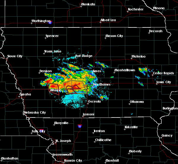 At 739 pm cdt, a severe thunderstorm capable of producing a tornado was located 10 miles northeast of atlantic, moving southeast at 25 mph (radar indicated rotation). Hazards include tornado. Flying debris will be dangerous to those caught without shelter. mobile homes will be damaged or destroyed. damage to roofs, windows and vehicles will occur. tree damage is likely. locations impacted include, anita, exira, brayton, anita municipal airport and lake anita state park. This includes interstate 80 between mile markers 58 and 71. At 739 pm cdt, a severe thunderstorm capable of producing a tornado was located 10 miles northeast of atlantic, moving southeast at 25 mph (radar indicated rotation). Hazards include tornado. Flying debris will be dangerous to those caught without shelter. mobile homes will be damaged or destroyed. damage to roofs, windows and vehicles will occur. tree damage is likely. locations impacted include, anita, exira, brayton, anita municipal airport and lake anita state park. This includes interstate 80 between mile markers 58 and 71.
|
| 6/24/2015 7:33 PM CDT |
 At 732 pm cdt, a severe thunderstorm capable of producing a tornado was located 11 miles north of atlantic, moving east at 30 mph (radar indicated rotation). Hazards include tornado. Flying debris will be dangerous to those caught without shelter. mobile homes will be damaged or destroyed. damage to roofs, windows and vehicles will occur. tree damage is likely. locations impacted include, anita, exira, elk horn, kimballton, brayton, wiota, anita municipal airport and lake anita state park. This includes interstate 80 between mile markers 56 and 72. At 732 pm cdt, a severe thunderstorm capable of producing a tornado was located 11 miles north of atlantic, moving east at 30 mph (radar indicated rotation). Hazards include tornado. Flying debris will be dangerous to those caught without shelter. mobile homes will be damaged or destroyed. damage to roofs, windows and vehicles will occur. tree damage is likely. locations impacted include, anita, exira, elk horn, kimballton, brayton, wiota, anita municipal airport and lake anita state park. This includes interstate 80 between mile markers 56 and 72.
|
| 6/24/2015 7:21 PM CDT |
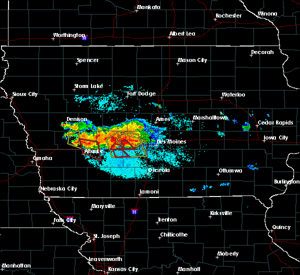 At 721 pm cdt, a severe thunderstorm capable of producing a tornado was located 10 miles southwest of audubon, moving east at 30 mph (radar indicated rotation). Hazards include tornado. Flying debris will be dangerous to those caught without shelter. mobile homes will be damaged or destroyed. damage to roofs, windows and vehicles will occur. tree damage is likely. this tornadic thunderstorm will remain over mainly rural areas of northeastern cass, southern audubon and west central adair counties, including the following locations, brayton, anita, wiota, exira, elk horn, anita municipal airport, lake anita state park and kimballton. This includes interstate 80 between mile markers 56 and 72. At 721 pm cdt, a severe thunderstorm capable of producing a tornado was located 10 miles southwest of audubon, moving east at 30 mph (radar indicated rotation). Hazards include tornado. Flying debris will be dangerous to those caught without shelter. mobile homes will be damaged or destroyed. damage to roofs, windows and vehicles will occur. tree damage is likely. this tornadic thunderstorm will remain over mainly rural areas of northeastern cass, southern audubon and west central adair counties, including the following locations, brayton, anita, wiota, exira, elk horn, anita municipal airport, lake anita state park and kimballton. This includes interstate 80 between mile markers 56 and 72.
|
| 6/7/2015 12:48 AM CDT | At 1247 am cdt, severe thunderstorms were located along a line extending from 4 miles west of coon rapids to 6 miles southwest of audubon, moving east at 50 mph (radar indicated). Hazards include 60 mph wind gusts. Expect damage to roofs. Siding and trees. |
| 6/30/2014 12:05 PM CDT | Second hand report of wind damage at littlefield recreation area. time estimated via rada in audubon county IA, 5.5 miles WNW of Exira, IA |
Hail Maps for Exira, IA
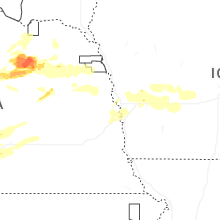
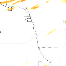
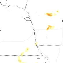


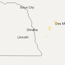


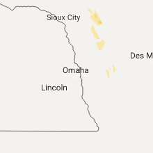


Connect with Interactive Hail Maps