

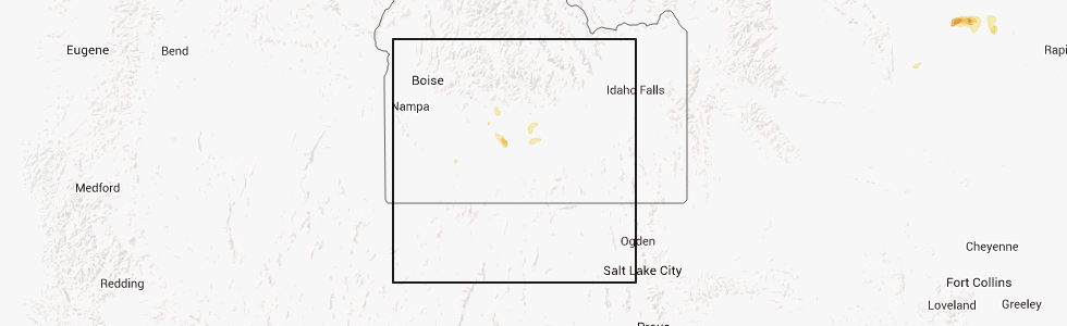
Hail Map for Fairfield, ID
The Fairfield, ID area has had 2 reports of on-the-ground hail by trained spotters, and has been under severe weather warnings 0 times during the past 12 months. Doppler radar has detected hail at or near Fairfield, ID on 4 occasions.
| Name: | Fairfield, ID |
| Where Located: | 57.1 miles NNW of Twin Falls, ID |
| Map: | Google Map for Fairfield, ID |
| Population: | 416 |
| Housing Units: | 244 |
| More Info: | Search Google for Fairfield, ID |
5
The Top Recent Hail Date for Fairfield, ID is Friday, August 22, 2014 (1st out of 4)
Hail and Wind Damage Spotted near Fairfield, ID
| Date / Time | Report Details |
|---|---|
| 7/4/2025 4:00 PM MDT | Mesonet station fafi 3.1 sw fairfield (agrimet in camas county ID, 3.2 miles NNE of Fairfield, ID |
| 7/4/2025 4:00 PM MDT | Mesonet station sldmt 9.8 nw soldier (uunet in camas county ID, 10.7 miles SSE of Fairfield, ID |
| 5/11/2025 3:00 PM MDT | Mesonet station sldmt 9.8 nw soldier (uunet in camas county ID, 10.7 miles SSE of Fairfield, ID |
| 9/11/2024 5:00 PM MDT | Upper vienna vinmt at 9600 feet. temp was 35 degree in camas county ID, 30.6 miles S of Fairfield, ID |
| 5/13/2024 5:00 PM MDT | Mesonet station sldmt 9.8 nw soldier (uunet in camas county ID, 10.7 miles SSE of Fairfield, ID |
| 8/4/2023 4:23 PM MDT | Quarter sized hail reported 8.4 miles W of Fairfield, ID, corrects previous hail report from 8 e fairfield. largest hailstones reported were estimated quarter-sized... half-inch hail preceded. reported under core of storm. |
| 4/30/2020 3:12 PM MDT |
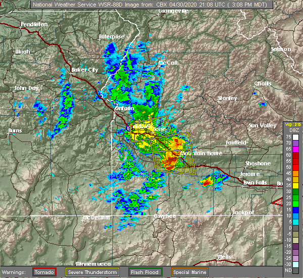 At 312 pm mdt, severe thunderstorms were located along a line extending from near trinity lakes to near hot spring, moving east at 60 mph (trained weather spotters). Hazards include 60 mph wind gusts and quarter size hail. Hail damage to vehicles is expected. expect wind damage to roofs, siding, and trees. severe thunderstorms will be near, pine, anderson dam, rocky bar and featherville around 320 pm mdt. gunsight peak, baumgartner campground and hill city around 330 pm mdt. glenns ferry, corral, deadman flat and twentymile butte around 340 pm mdt. fairfield, big peak, paradise peak and dollarhide summit around 350 pm mdt. Bliss, white arrow hot spring and davis mountain around 400 pm mdt. At 312 pm mdt, severe thunderstorms were located along a line extending from near trinity lakes to near hot spring, moving east at 60 mph (trained weather spotters). Hazards include 60 mph wind gusts and quarter size hail. Hail damage to vehicles is expected. expect wind damage to roofs, siding, and trees. severe thunderstorms will be near, pine, anderson dam, rocky bar and featherville around 320 pm mdt. gunsight peak, baumgartner campground and hill city around 330 pm mdt. glenns ferry, corral, deadman flat and twentymile butte around 340 pm mdt. fairfield, big peak, paradise peak and dollarhide summit around 350 pm mdt. Bliss, white arrow hot spring and davis mountain around 400 pm mdt.
|
| 8/12/2014 4:45 PM MDT | Quarter sized hail reported 3.3 miles W of Fairfield, ID, the fmo from the fairfield ranger station reported quarter size hail and o.58 inches of rain. |
| 1/1/0001 12:00 AM | Shingles were pealed from the roof of a house and two trees within a grove of aspens were blown down. time estimated from rada in elmore county ID, 16 miles ENE of Fairfield, ID |
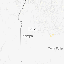
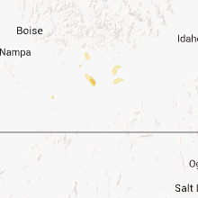
Hail Maps for Fairfield, ID


Connect with Interactive Hail Maps