

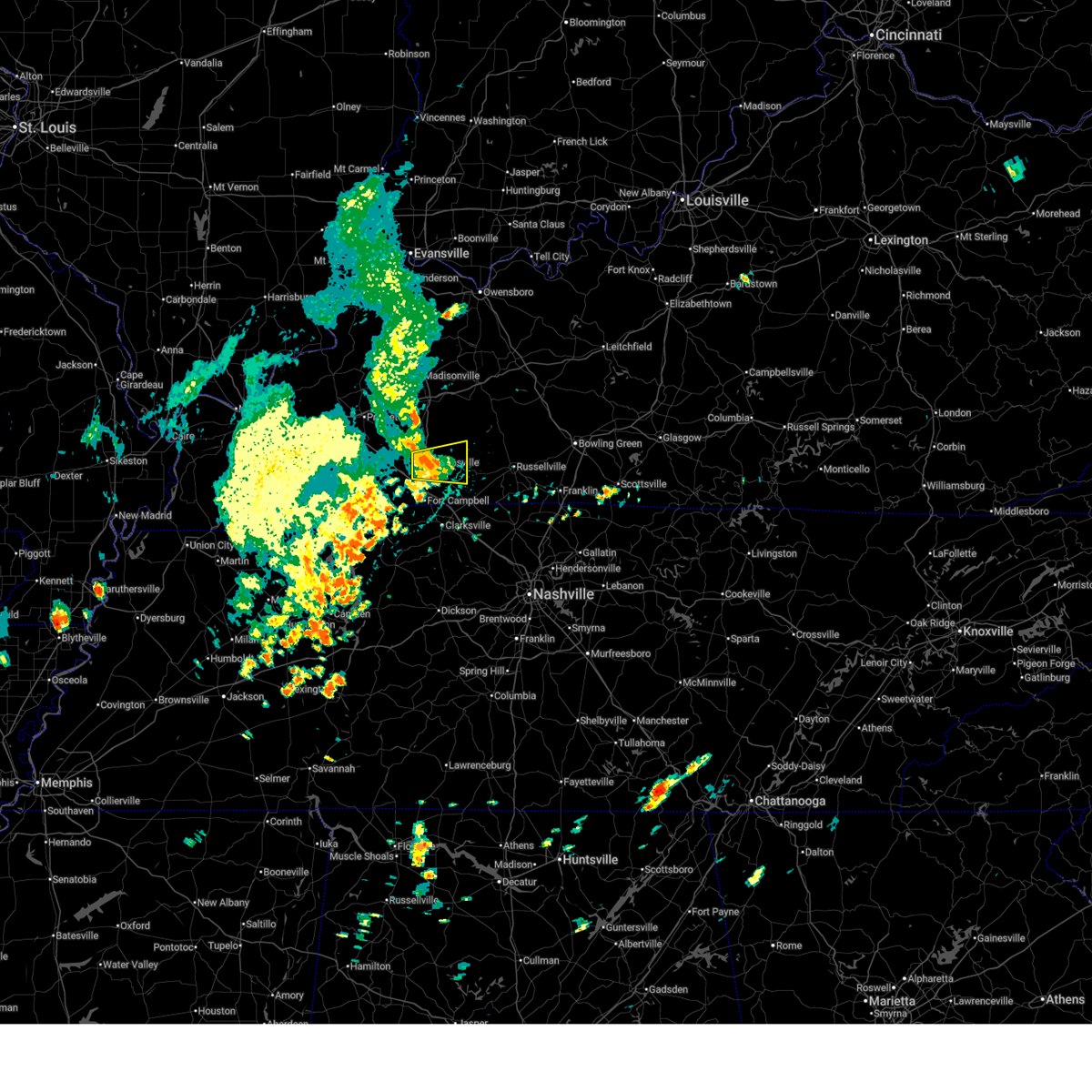
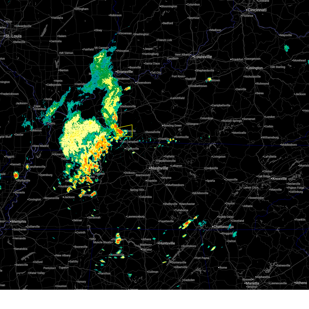
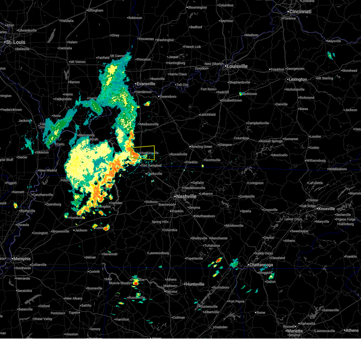
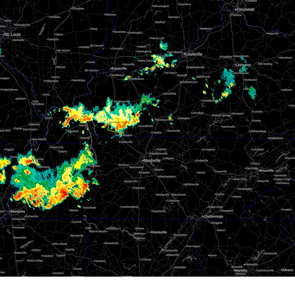
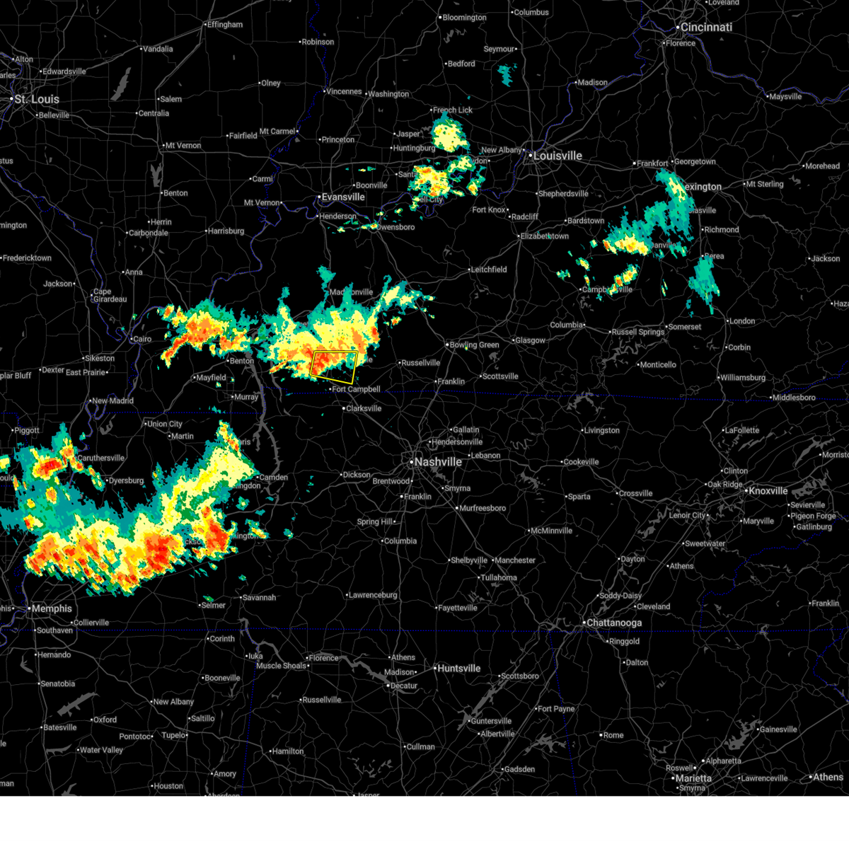
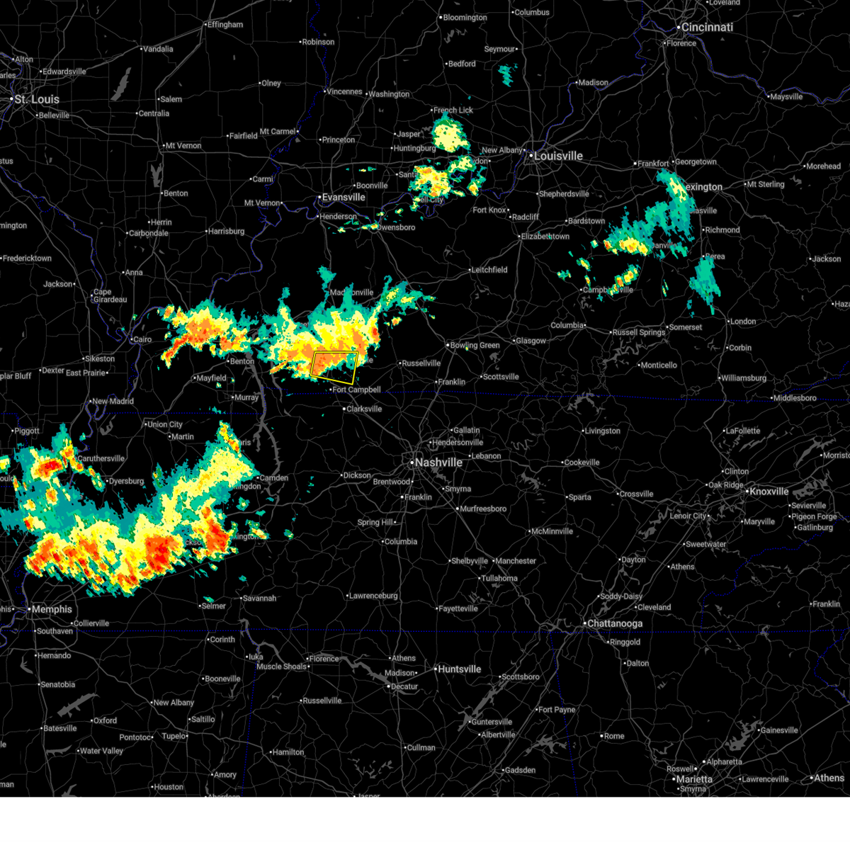
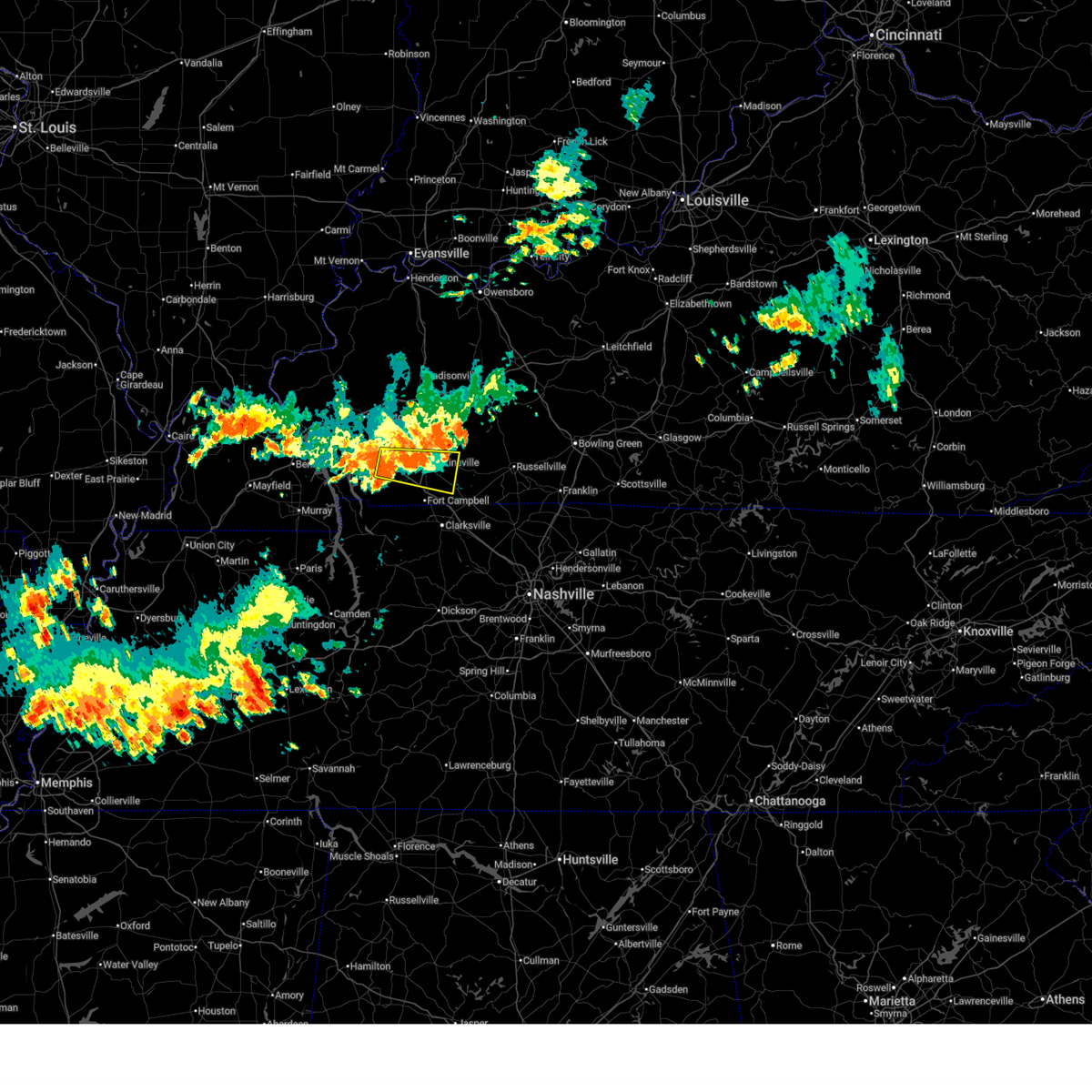
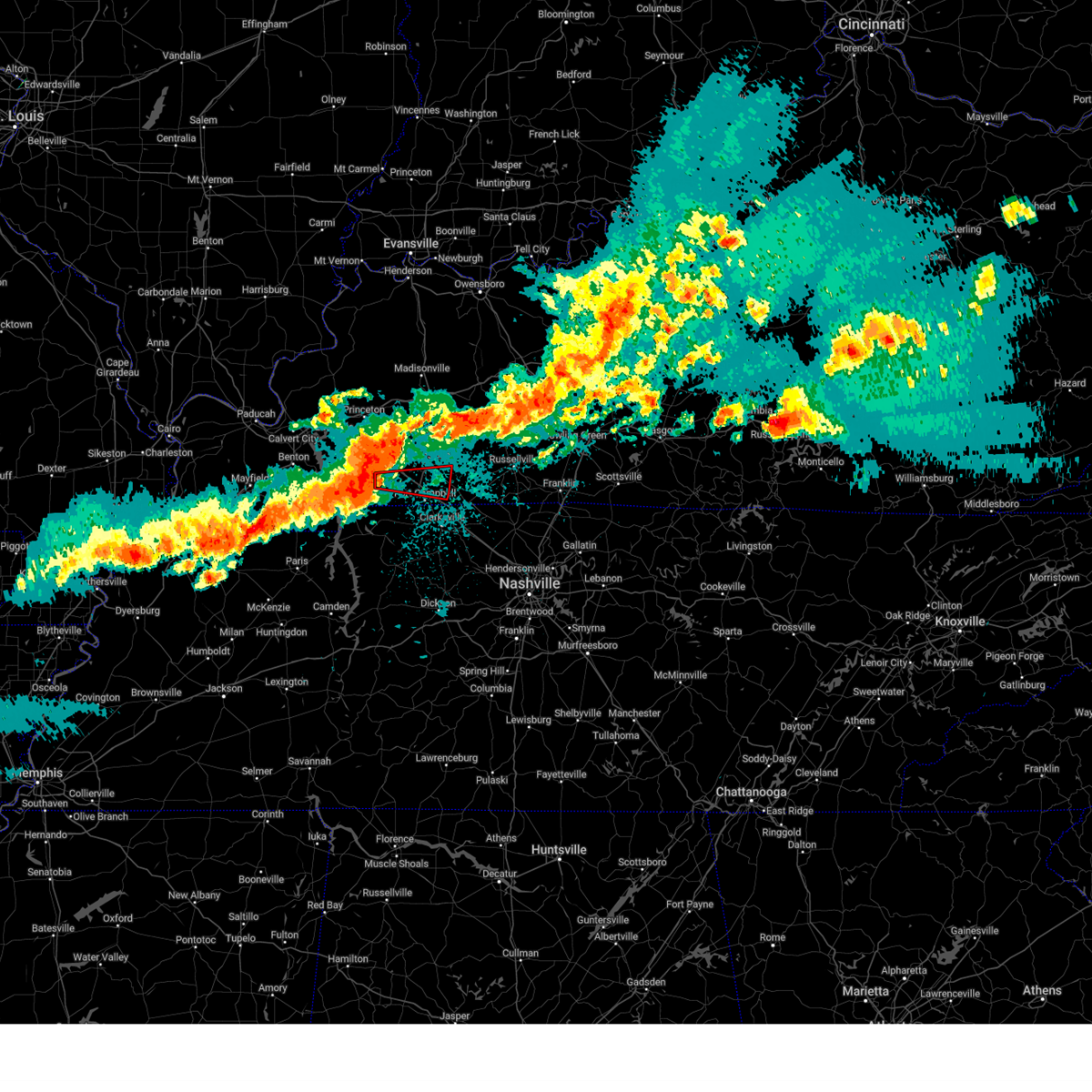
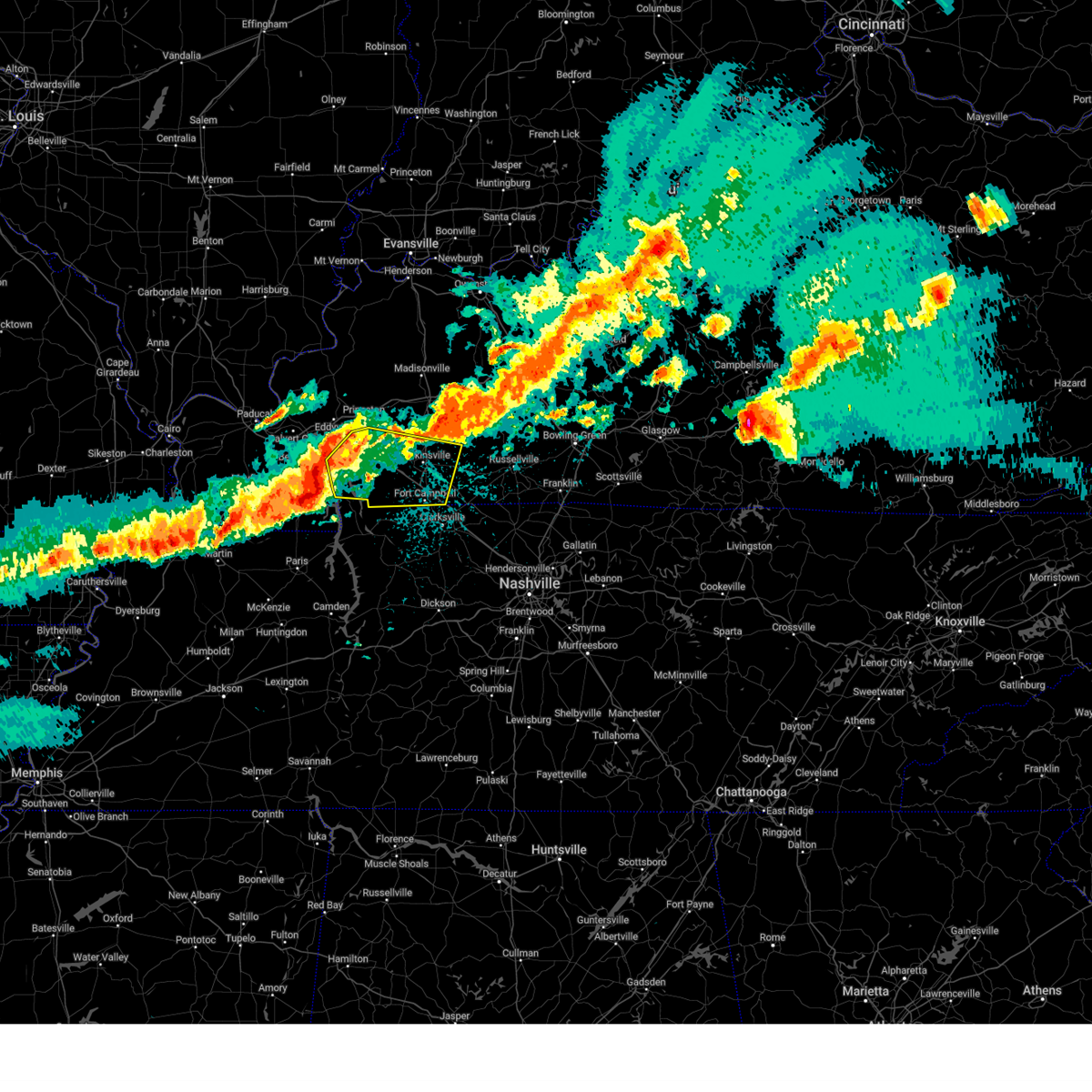
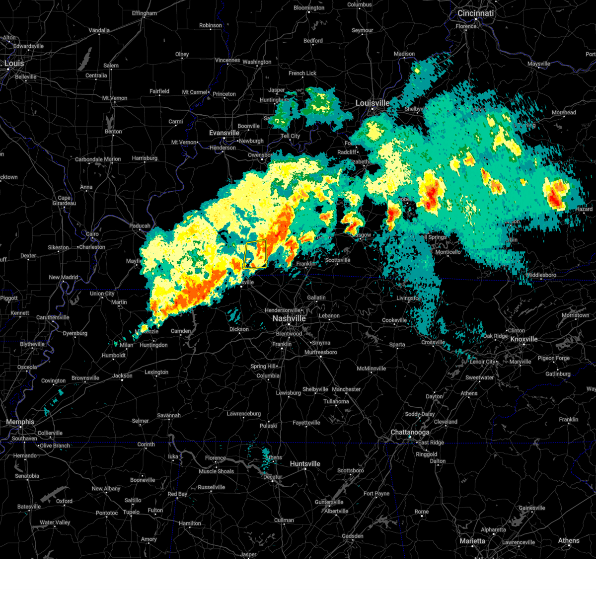
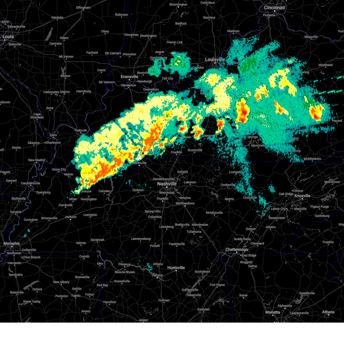
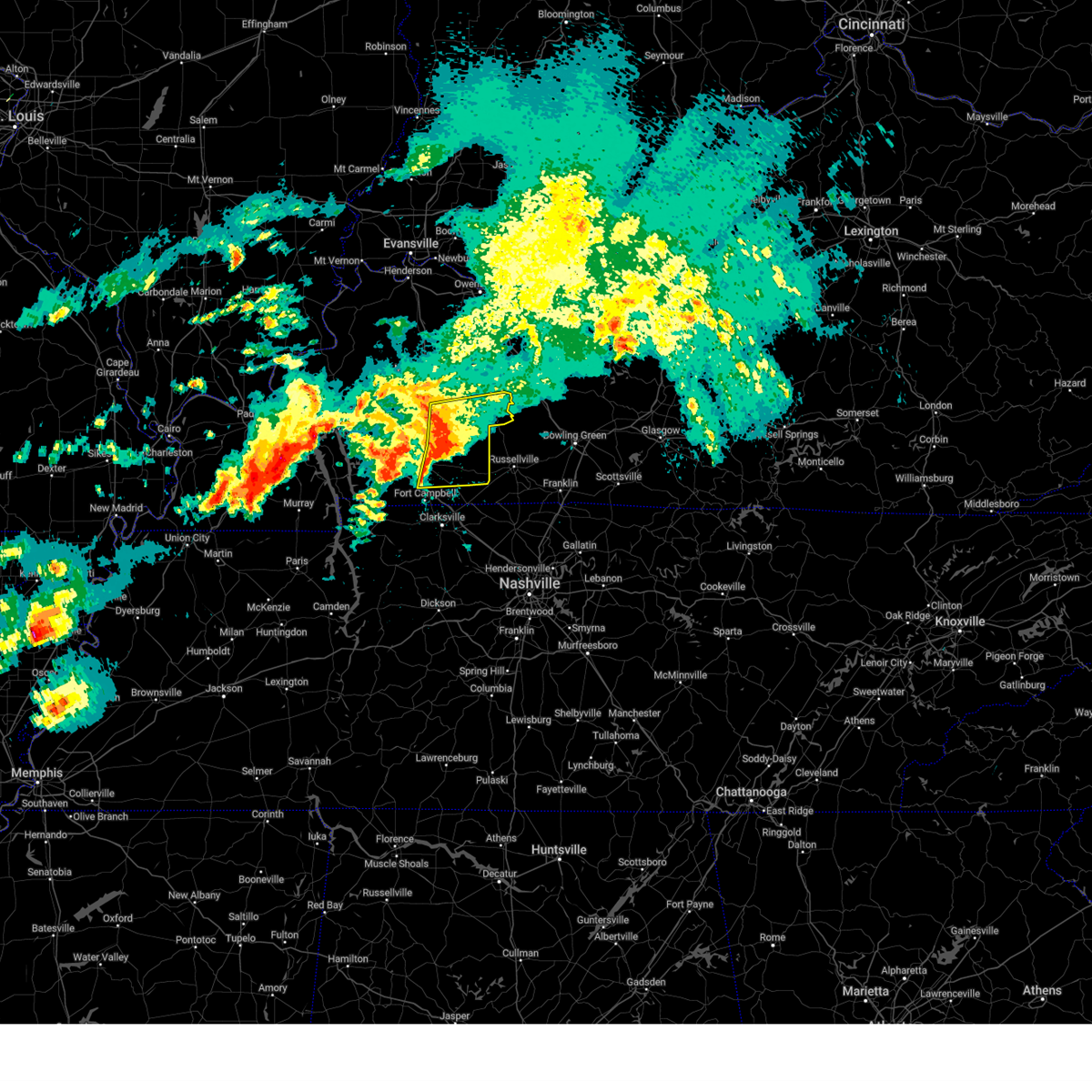
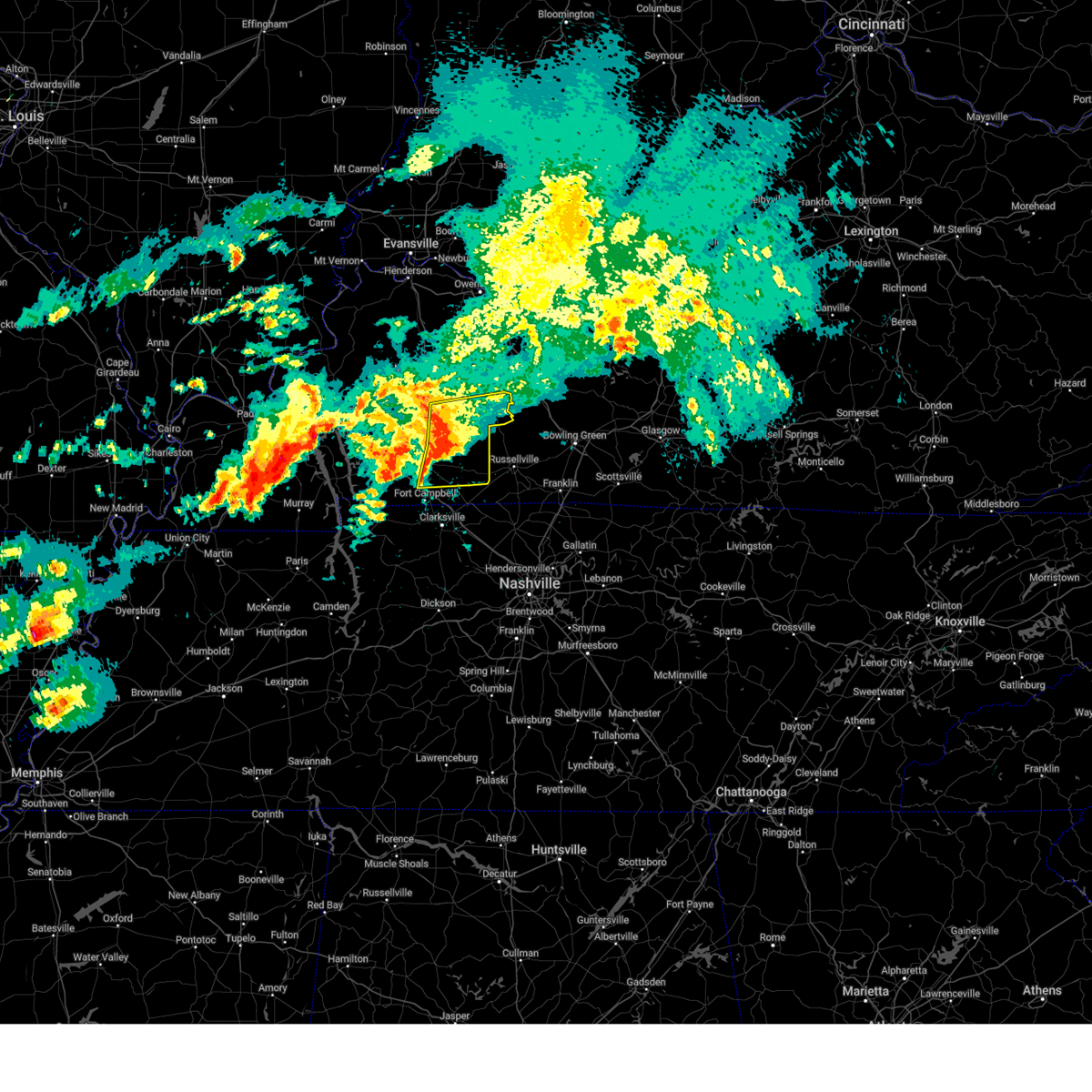
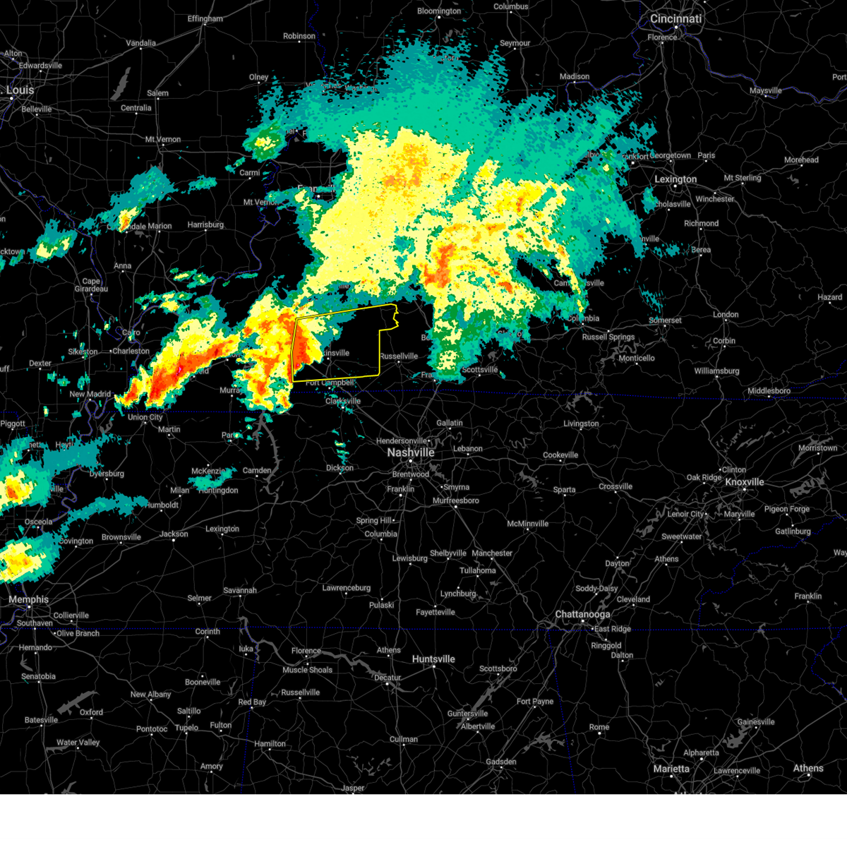
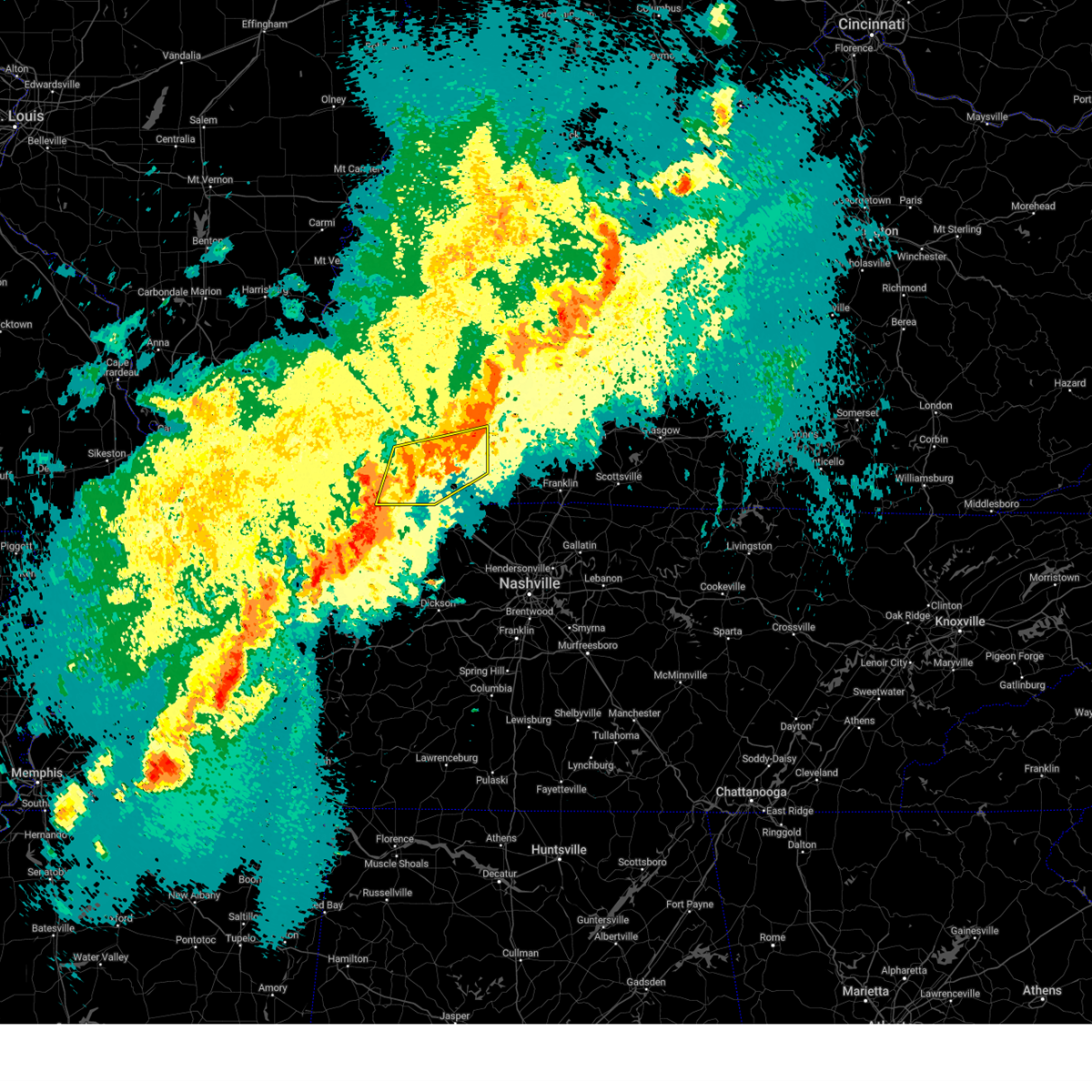
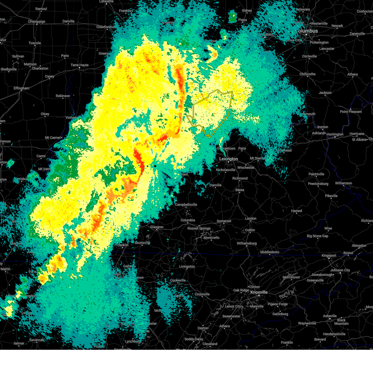
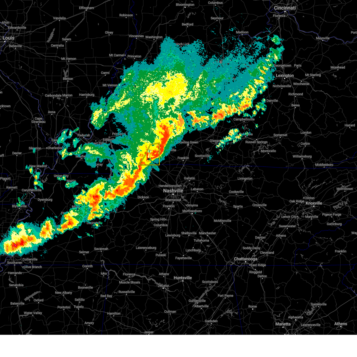
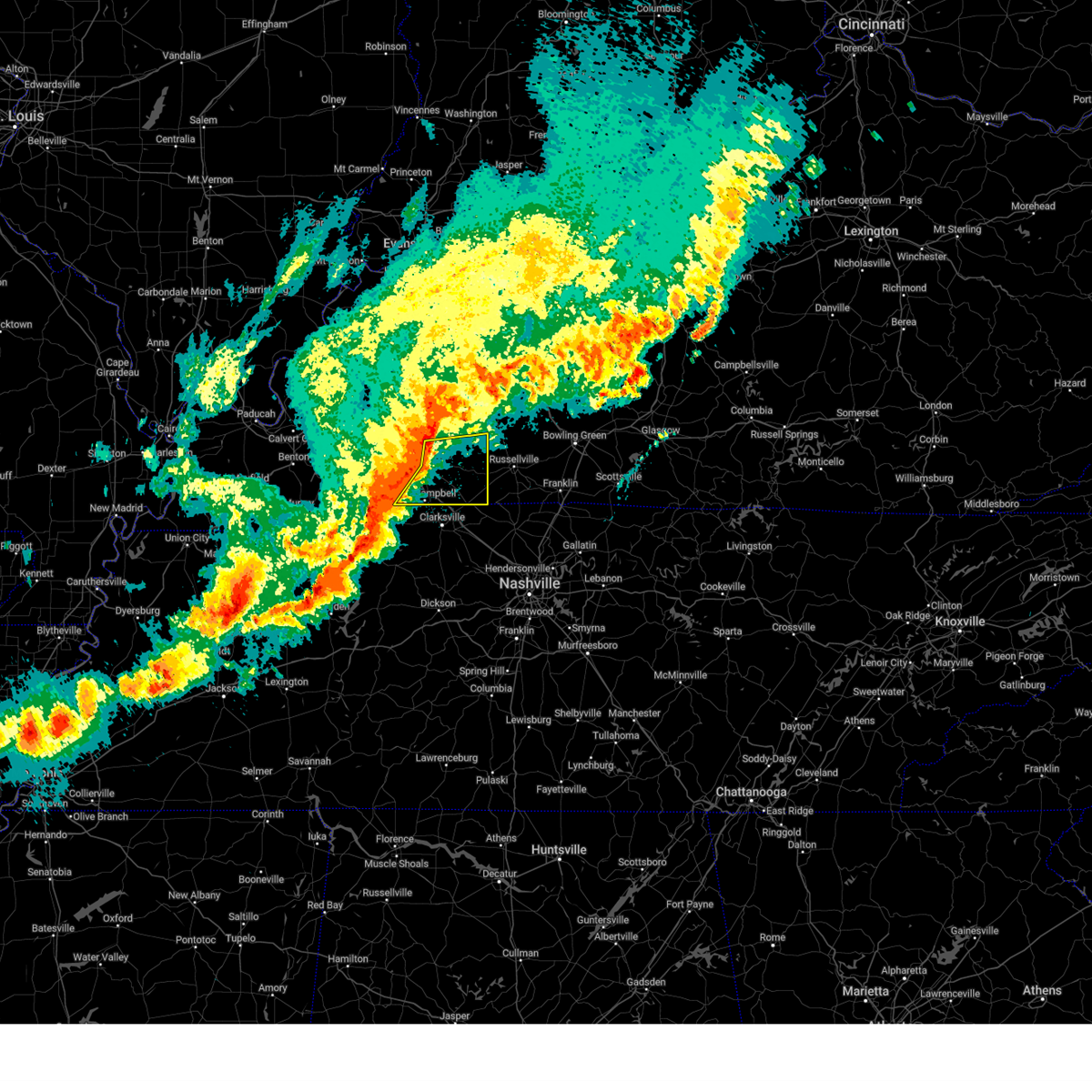
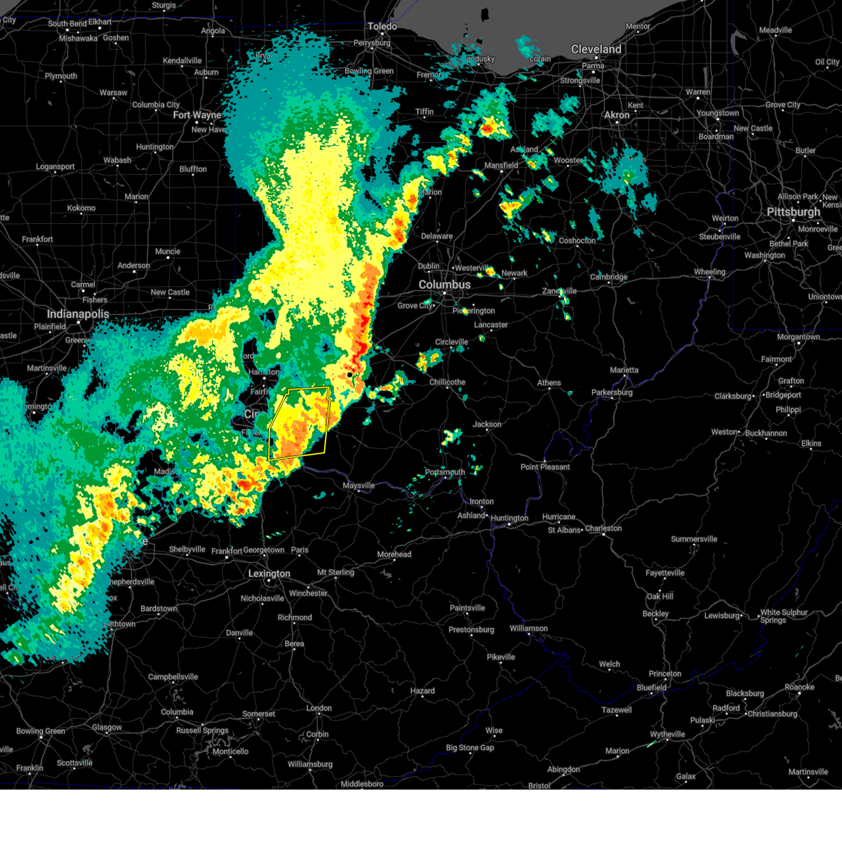
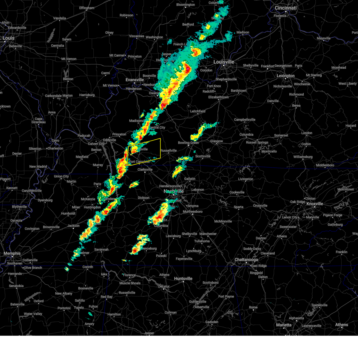
Hail Map for Fairview, KY
The Fairview, KY area has had 0 reports of on-the-ground hail by trained spotters, and has been under severe weather warnings 100 times during the past 12 months. Doppler radar has detected hail at or near Fairview, KY on 124 occasions, including 11 occasions during the past year.
| Name: | Fairview, KY |
| Where Located: | 54.8 miles NNW of Nashville, TN |
| Map: | Google Map for Fairview, KY |
| Population: | 286 |
| Housing Units: | 127 |
| More Info: | Search Google for Fairview, KY |
2
The Top Recent Hail Date for Fairview, KY is Thursday, February 6, 2025 (15th out of 124)

Hail and Wind Damage Spotted near Fairview, KY
| Date / Time | Report Details |
|---|---|
| 7/8/2025 1:36 PM CDT |
 the severe thunderstorm warning has been cancelled and is no longer in effect the severe thunderstorm warning has been cancelled and is no longer in effect
|
| 7/8/2025 1:28 PM CDT |
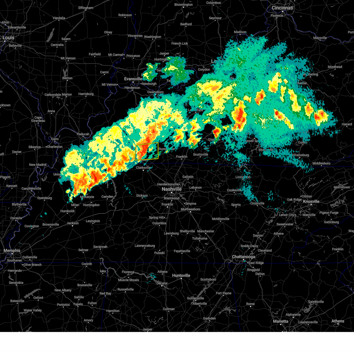
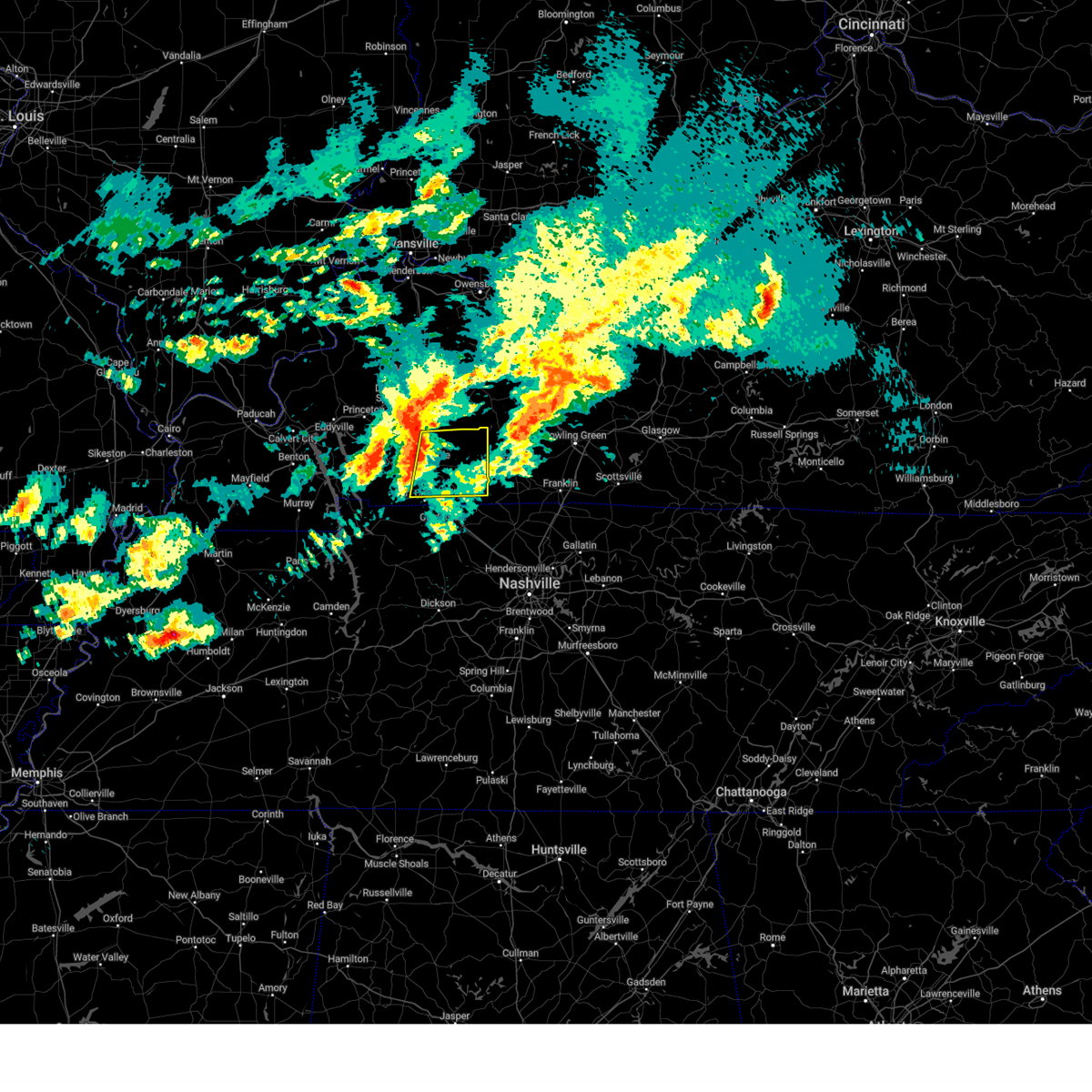
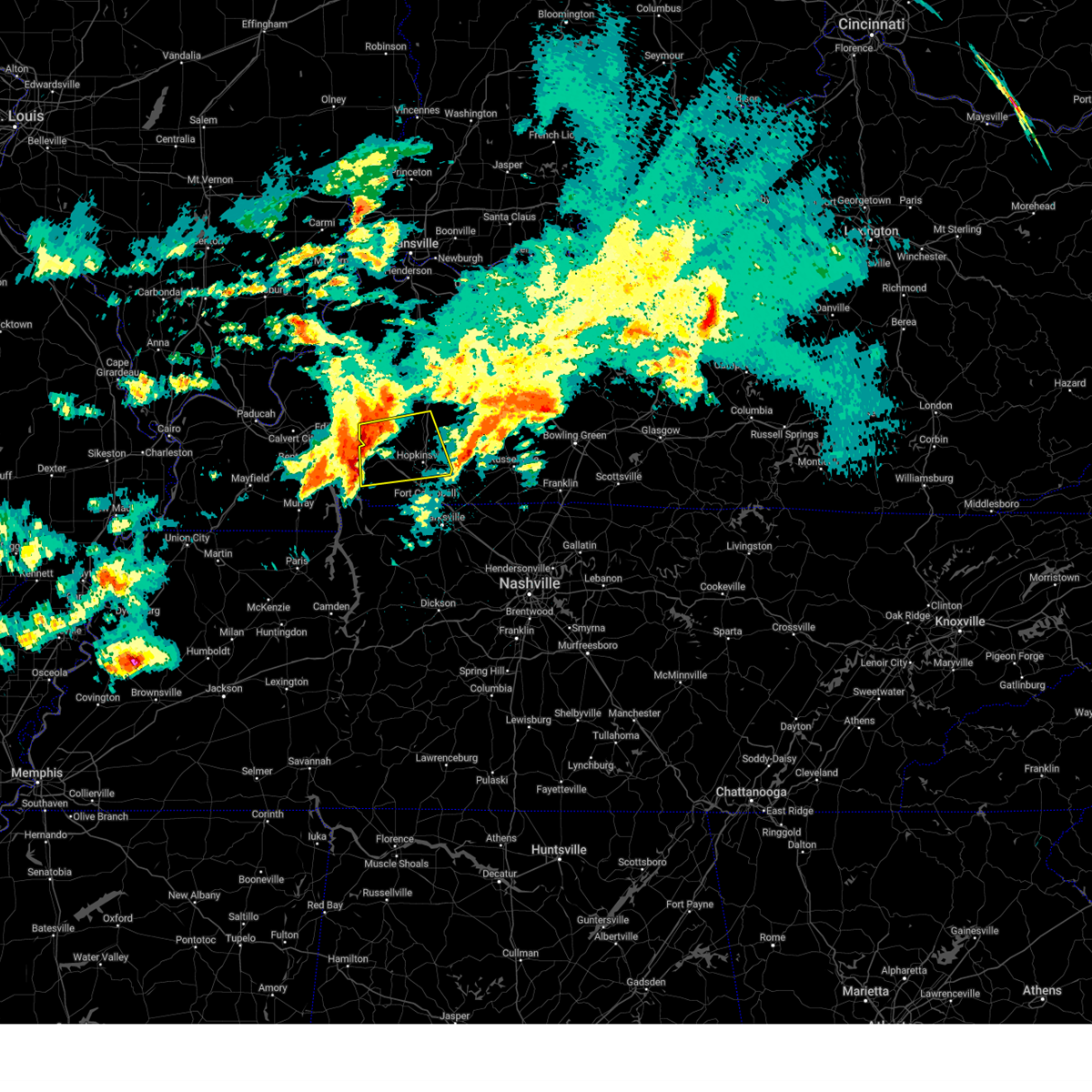
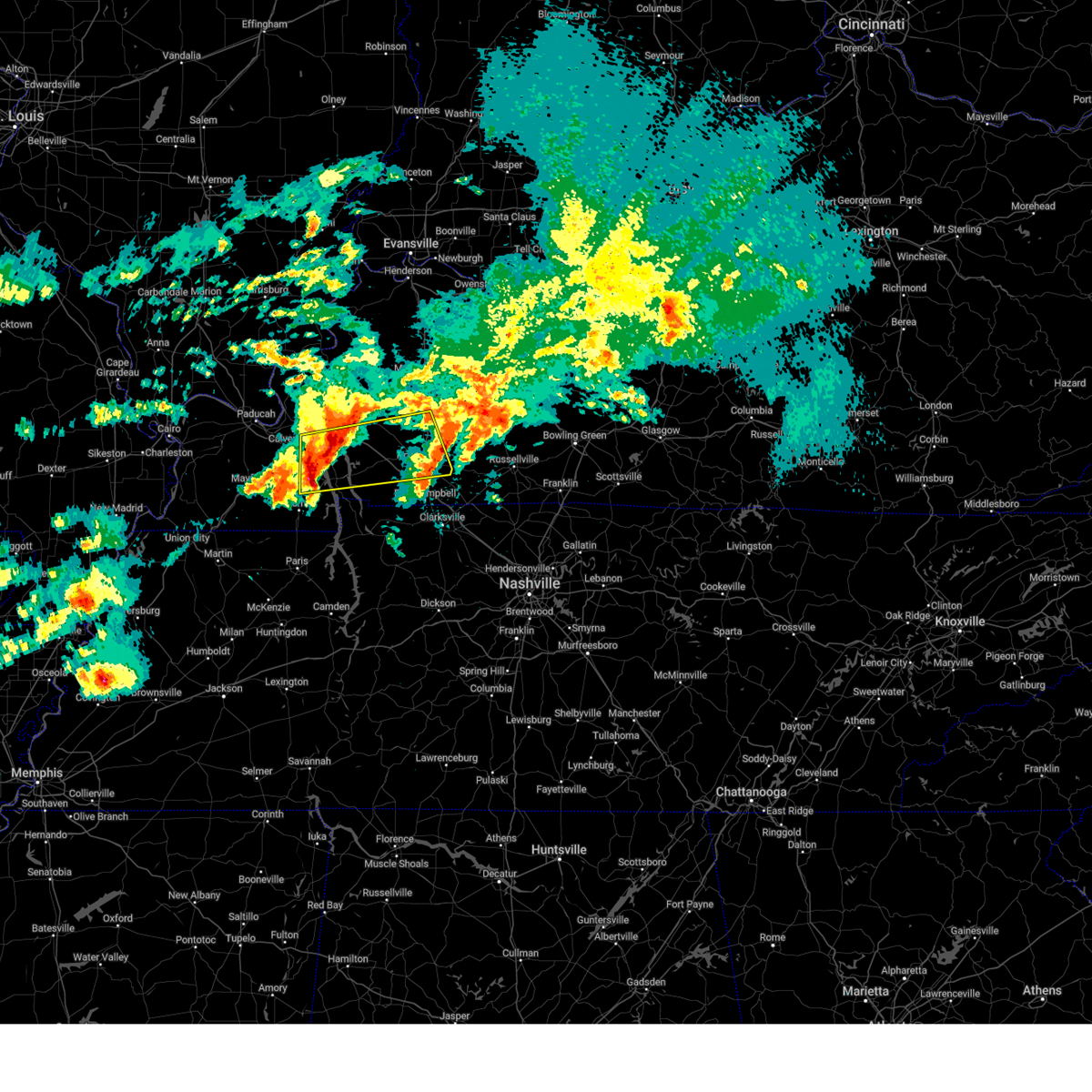
 At 128 pm cdt, a severe thunderstorm was located over hopkinsville, moving east at 25 mph (radar indicated). Hazards include 60 mph wind gusts. Expect damage to roofs, siding, and trees. locations impacted include, hopkinsville, pembroke, and allegre. This includes pennyrile parkway between mile markers 3 and 14. At 128 pm cdt, a severe thunderstorm was located over hopkinsville, moving east at 25 mph (radar indicated). Hazards include 60 mph wind gusts. Expect damage to roofs, siding, and trees. locations impacted include, hopkinsville, pembroke, and allegre. This includes pennyrile parkway between mile markers 3 and 14.
|
| 7/8/2025 1:15 PM CDT |
 Svrpah the national weather service in paducah has issued a * severe thunderstorm warning for, central christian county in south central kentucky, northwestern todd county in south central kentucky, * until 200 pm cdt. * at 114 pm cdt, a severe thunderstorm was located near hopkinsville, moving east at 25 mph (radar indicated). Hazards include 60 mph wind gusts. expect damage to roofs, siding, and trees Svrpah the national weather service in paducah has issued a * severe thunderstorm warning for, central christian county in south central kentucky, northwestern todd county in south central kentucky, * until 200 pm cdt. * at 114 pm cdt, a severe thunderstorm was located near hopkinsville, moving east at 25 mph (radar indicated). Hazards include 60 mph wind gusts. expect damage to roofs, siding, and trees
|
| 6/19/2025 2:00 AM CDT |
 the severe thunderstorm warning has been cancelled and is no longer in effect the severe thunderstorm warning has been cancelled and is no longer in effect
|
| 6/19/2025 1:40 AM CDT |
 At 139 am cdt, a severe thunderstorm was located near hopkinsville, moving east at 40 mph (radar indicated). Hazards include 60 mph wind gusts and nickel size hail. Expect damage to roofs, siding, and trees. locations impacted include, hopkinsville and pembroke. this includes the following highways, interstate 24 in kentucky between mile markers 73 and 82. Pennyrile parkway between mile markers 1 and 13. At 139 am cdt, a severe thunderstorm was located near hopkinsville, moving east at 40 mph (radar indicated). Hazards include 60 mph wind gusts and nickel size hail. Expect damage to roofs, siding, and trees. locations impacted include, hopkinsville and pembroke. this includes the following highways, interstate 24 in kentucky between mile markers 73 and 82. Pennyrile parkway between mile markers 1 and 13.
|
| 6/19/2025 1:40 AM CDT |
 the severe thunderstorm warning has been cancelled and is no longer in effect the severe thunderstorm warning has been cancelled and is no longer in effect
|
| 6/19/2025 1:29 AM CDT |
 Svrpah the national weather service in paducah has issued a * severe thunderstorm warning for, southern christian county in south central kentucky, northeastern trigg county in western kentucky, southwestern todd county in south central kentucky, * until 215 am cdt. * at 128 am cdt, a severe thunderstorm was located near cadiz, moving east at 40 mph (radar indicated). Hazards include 60 mph wind gusts and nickel size hail. expect damage to roofs, siding, and trees Svrpah the national weather service in paducah has issued a * severe thunderstorm warning for, southern christian county in south central kentucky, northeastern trigg county in western kentucky, southwestern todd county in south central kentucky, * until 215 am cdt. * at 128 am cdt, a severe thunderstorm was located near cadiz, moving east at 40 mph (radar indicated). Hazards include 60 mph wind gusts and nickel size hail. expect damage to roofs, siding, and trees
|
| 6/18/2025 7:49 PM EDT |
 the severe thunderstorm warning has been cancelled and is no longer in effect the severe thunderstorm warning has been cancelled and is no longer in effect
|
| 6/18/2025 7:49 PM EDT |
 At 748 pm edt, severe thunderstorms were located along a line extending from independence to owenton, moving east at 20 mph (radar indicated). Hazards include 60 mph wind gusts. Expect damage to trees and power lines. locations impacted include, covington, florence, independence, erlanger, edgewood, alexandria, elsmere, highland heights, taylor mill, fort wright, williamstown, walton, claryville, union, amelia, crittenden, wilder, bethel, new richmond, and williamsburg. this includes the following interstates, i-71 in kentucky between mile markers 55 and 77. I-75 in kentucky between mile markers 157 and 178. At 748 pm edt, severe thunderstorms were located along a line extending from independence to owenton, moving east at 20 mph (radar indicated). Hazards include 60 mph wind gusts. Expect damage to trees and power lines. locations impacted include, covington, florence, independence, erlanger, edgewood, alexandria, elsmere, highland heights, taylor mill, fort wright, williamstown, walton, claryville, union, amelia, crittenden, wilder, bethel, new richmond, and williamsburg. this includes the following interstates, i-71 in kentucky between mile markers 55 and 77. I-75 in kentucky between mile markers 157 and 178.
|
| 6/18/2025 7:22 PM EDT | Svriln the national weather service in wilmington has issued a * severe thunderstorm warning for, northeastern switzerland county in southeastern indiana, eastern carroll county in northern kentucky, northwestern bracken county in northern kentucky, kenton county in northern kentucky, campbell county in northern kentucky, boone county in northern kentucky, northern grant county in northern kentucky, northwestern owen county in northern kentucky, northern pendleton county in northern kentucky, gallatin county in northern kentucky, southern clermont county in southwestern ohio, * until 815 pm edt. * at 721 pm edt, severe thunderstorms were located along a line extending from near villa hills to 8 miles southeast of carrollton, moving east at 30 mph (radar indicated). Hazards include 60 mph wind gusts. expect damage to trees and power lines |
| 6/18/2025 6:53 PM EDT | At 652 pm edt, severe thunderstorms were located along a line extending from harrison to vevay, moving east at 35 mph (radar indicated). Hazards include 60 mph wind gusts and quarter size hail. Minor hail damage to vehicles is possible. expect wind damage to trees and power lines. locations impacted include, cincinnati, covington, florence, independence, norwood, forest park, erlanger, newport, sharonville, blue ash, springdale, reading, harrison, north college hill, edgewood, elsmere, wyoming, cheviot, fort mitchell, and villa hills. this includes the following interstates, i-71 in kentucky between mile markers 39 and 77. i-71 in ohio between mile markers 0 and 5. i-74 in indiana near mile marker 171. i-74 in ohio between mile markers 0 and 19. i-75 in kentucky between mile markers 167 and 191. I-75 in ohio between mile markers 0 and 17. |
| 6/18/2025 6:32 PM EDT |
 Svriln the national weather service in wilmington has issued a * severe thunderstorm warning for, ohio county in southeastern indiana, dearborn county in southeastern indiana, switzerland county in southeastern indiana, carroll county in northern kentucky, kenton county in northern kentucky, campbell county in northern kentucky, boone county in northern kentucky, gallatin county in northern kentucky, hamilton county in southwestern ohio, * until 730 pm edt. * at 631 pm edt, severe thunderstorms were located along a line extending from 6 miles west of bright to 9 miles southwest of dillsboro, moving east at 40 mph (radar indicated). Hazards include 60 mph wind gusts and quarter size hail. Minor hail damage to vehicles is possible. Expect wind damage to trees and power lines. Svriln the national weather service in wilmington has issued a * severe thunderstorm warning for, ohio county in southeastern indiana, dearborn county in southeastern indiana, switzerland county in southeastern indiana, carroll county in northern kentucky, kenton county in northern kentucky, campbell county in northern kentucky, boone county in northern kentucky, gallatin county in northern kentucky, hamilton county in southwestern ohio, * until 730 pm edt. * at 631 pm edt, severe thunderstorms were located along a line extending from 6 miles west of bright to 9 miles southwest of dillsboro, moving east at 40 mph (radar indicated). Hazards include 60 mph wind gusts and quarter size hail. Minor hail damage to vehicles is possible. Expect wind damage to trees and power lines.
|
| 5/20/2025 5:00 PM CDT | the severe thunderstorm warning has been cancelled and is no longer in effect |
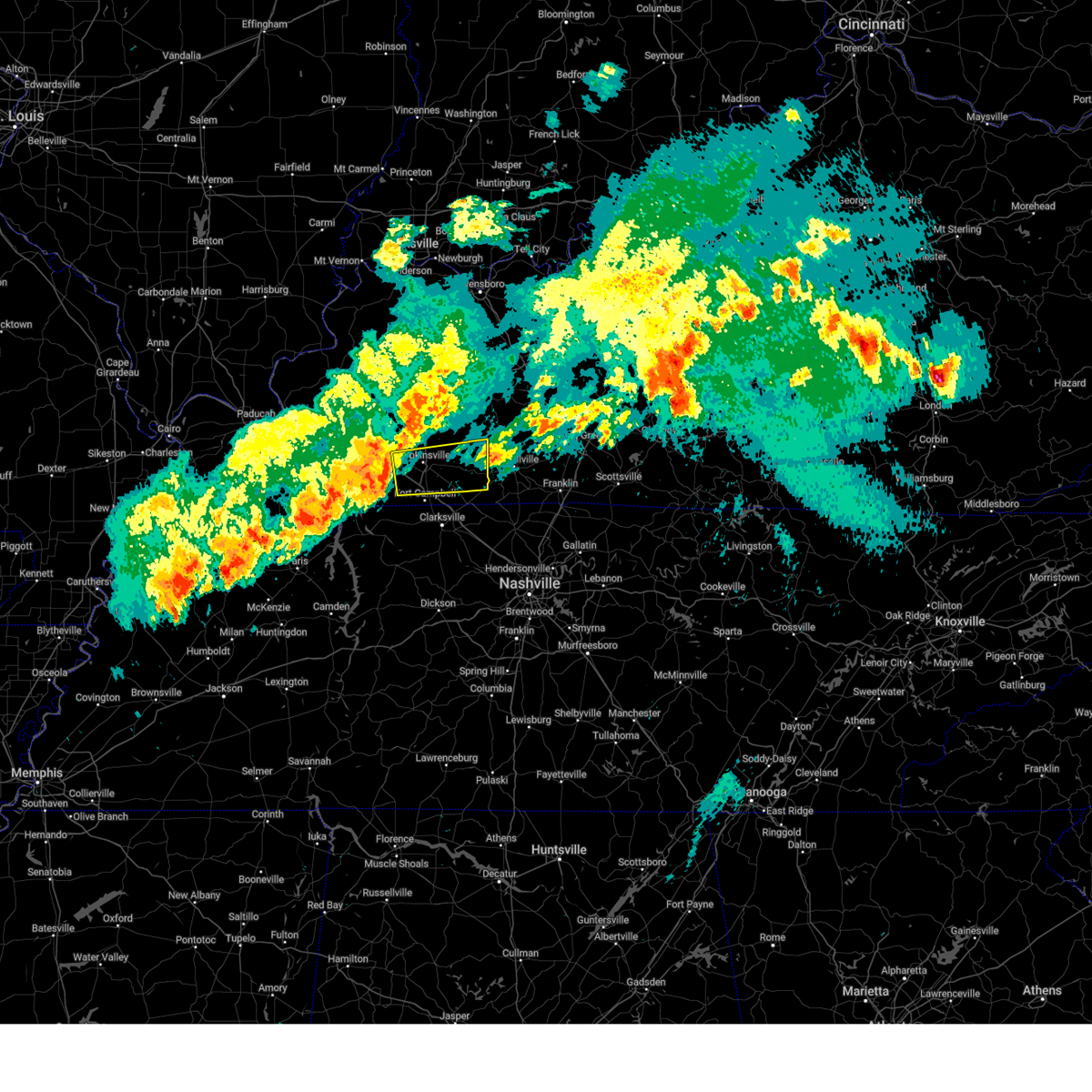
| 5/20/2025 5:00 PM CDT | At 500 pm cdt, severe thunderstorms were located along a line extending from 7 miles southwest of crofton to near hopkinsville to 8 miles west of fort campbell, moving east at 60 mph (radar indicated). Hazards include 70 mph wind gusts and penny size hail. Expect considerable tree damage. damage is likely to mobile homes, roofs, and outbuildings. locations impacted include, hopkinsville, oak grove, fort campbell, clarksville, pembroke, trenton, lafayette, herndon, and allegre. this includes the following highways, interstate 24 in kentucky between mile markers 71 and 92. Pennyrile parkway between mile markers 1 and 20. |
| 5/20/2025 4:42 PM CDT | Svrpah the national weather service in paducah has issued a * severe thunderstorm warning for, christian county in south central kentucky, trigg county in western kentucky, western todd county in south central kentucky, * until 530 pm cdt. * at 442 pm cdt, severe thunderstorms were located along a line extending from 6 miles northwest of cadiz to near canton to 6 miles southeast of wranglers campground, moving east at 55 mph (radar indicated). Hazards include 70 mph wind gusts and penny size hail. Expect considerable tree damage. Damage is likely to mobile homes, roofs, and outbuildings. |
| 5/16/2025 9:59 PM CDT | The storms which prompted the warning have moved out of the area. therefore, the warning will be allowed to expire. |
| 5/16/2025 9:59 PM CDT | the severe thunderstorm warning has been cancelled and is no longer in effect |
| 5/16/2025 9:49 PM CDT |
 the severe thunderstorm warning has been cancelled and is no longer in effect the severe thunderstorm warning has been cancelled and is no longer in effect
|
| 5/16/2025 9:49 PM CDT |
 At 948 pm cdt, severe thunderstorms were located along a line extending from 6 miles southwest of dunmor to elkton to near oak grove, moving east at 55 mph (emergency management. at 944 pm, downed trees and powerlines were reported near hopkinsville). Hazards include 70 mph wind gusts and nickel size hail. Expect considerable tree damage. damage is likely to mobile homes, roofs, and outbuildings. these severe storms will be near, guthrie around 955 pm cdt. Other locations impacted by these severe thunderstorms include trenton, allensville, clifty, and allegre. At 948 pm cdt, severe thunderstorms were located along a line extending from 6 miles southwest of dunmor to elkton to near oak grove, moving east at 55 mph (emergency management. at 944 pm, downed trees and powerlines were reported near hopkinsville). Hazards include 70 mph wind gusts and nickel size hail. Expect considerable tree damage. damage is likely to mobile homes, roofs, and outbuildings. these severe storms will be near, guthrie around 955 pm cdt. Other locations impacted by these severe thunderstorms include trenton, allensville, clifty, and allegre.
|
| 5/16/2025 9:36 PM CDT |
 the severe thunderstorm warning has been cancelled and is no longer in effect the severe thunderstorm warning has been cancelled and is no longer in effect
|
| 5/16/2025 9:36 PM CDT |
 At 935 pm cdt, severe thunderstorms were located along a line extending from 8 miles south of weir to near hopkinsville to 6 miles west of pembroke to big rock, moving east at 65 mph (radar indicated). Hazards include 70 mph wind gusts and quarter size hail. Hail damage to vehicles is expected. expect considerable tree damage. wind damage is also likely to mobile homes, roofs, and outbuildings. locations impacted include, hopkinsville, oak grove, fort campbell, clarksville, pembroke, lafayette, and herndon. this includes the following highways, interstate 24 in kentucky between mile markers 72 and 92. Pennyrile parkway between mile markers 1 and 18. At 935 pm cdt, severe thunderstorms were located along a line extending from 8 miles south of weir to near hopkinsville to 6 miles west of pembroke to big rock, moving east at 65 mph (radar indicated). Hazards include 70 mph wind gusts and quarter size hail. Hail damage to vehicles is expected. expect considerable tree damage. wind damage is also likely to mobile homes, roofs, and outbuildings. locations impacted include, hopkinsville, oak grove, fort campbell, clarksville, pembroke, lafayette, and herndon. this includes the following highways, interstate 24 in kentucky between mile markers 72 and 92. Pennyrile parkway between mile markers 1 and 18.
|
| 5/16/2025 9:35 PM CDT |
 Svrpah the national weather service in paducah has issued a * severe thunderstorm warning for, southeastern christian county in south central kentucky, todd county in south central kentucky, * until 1015 pm cdt. * at 934 pm cdt, severe thunderstorms were located along a line extending from 8 miles southeast of crofton to 7 miles northeast of big rock, moving east at 55 mph. these are destructive storms for eastern christian and todd county! (radar indicated). Hazards include 90 mph wind gusts and nickel size hail. You are in a life-threatening situation. flying debris may be deadly to those caught without shelter. mobile homes will be heavily damaged or destroyed. homes and businesses will have substantial roof and window damage. expect extensive tree damage and power outages. severe thunderstorms will be near, oak grove, fort campbell, clarksville, and pembroke around 940 pm cdt. elkton around 945 pm cdt. guthrie around 955 pm cdt. other locations impacted by these severe thunderstorms include trenton, lafayette, allensville, clifty, herndon, and allegre. this includes the following highways, interstate 24 in kentucky between mile markers 77 and 92. Pennyrile parkway between mile markers 1 and 15. Svrpah the national weather service in paducah has issued a * severe thunderstorm warning for, southeastern christian county in south central kentucky, todd county in south central kentucky, * until 1015 pm cdt. * at 934 pm cdt, severe thunderstorms were located along a line extending from 8 miles southeast of crofton to 7 miles northeast of big rock, moving east at 55 mph. these are destructive storms for eastern christian and todd county! (radar indicated). Hazards include 90 mph wind gusts and nickel size hail. You are in a life-threatening situation. flying debris may be deadly to those caught without shelter. mobile homes will be heavily damaged or destroyed. homes and businesses will have substantial roof and window damage. expect extensive tree damage and power outages. severe thunderstorms will be near, oak grove, fort campbell, clarksville, and pembroke around 940 pm cdt. elkton around 945 pm cdt. guthrie around 955 pm cdt. other locations impacted by these severe thunderstorms include trenton, lafayette, allensville, clifty, herndon, and allegre. this includes the following highways, interstate 24 in kentucky between mile markers 77 and 92. Pennyrile parkway between mile markers 1 and 15.
|
| 5/16/2025 9:32 PM CDT |
 At 932 pm cdt, a severe thunderstorm capable of producing a tornado was located near fort campbell, moving east at 75 mph (radar indicated rotation). Hazards include tornado. Flying debris will be dangerous to those caught without shelter. mobile homes will be damaged or destroyed. damage to roofs, windows, and vehicles will occur. tree damage is likely. this dangerous storm will be near, hopkinsville, oak grove, and pembroke around 935 pm cdt. other locations impacted by this tornadic thunderstorm include herndon. this includes the following highways, interstate 24 in kentucky between mile markers 76 and 88. Pennyrile parkway between mile markers 1 and 6. At 932 pm cdt, a severe thunderstorm capable of producing a tornado was located near fort campbell, moving east at 75 mph (radar indicated rotation). Hazards include tornado. Flying debris will be dangerous to those caught without shelter. mobile homes will be damaged or destroyed. damage to roofs, windows, and vehicles will occur. tree damage is likely. this dangerous storm will be near, hopkinsville, oak grove, and pembroke around 935 pm cdt. other locations impacted by this tornadic thunderstorm include herndon. this includes the following highways, interstate 24 in kentucky between mile markers 76 and 88. Pennyrile parkway between mile markers 1 and 6.
|
| 5/16/2025 9:32 PM CDT |
 the tornado warning has been cancelled and is no longer in effect the tornado warning has been cancelled and is no longer in effect
|
| 5/16/2025 9:20 PM CDT |
 Torpah the national weather service in paducah has issued a * tornado warning for, southern christian county in south central kentucky, east central trigg county in western kentucky, * until 945 pm cdt. * at 920 pm cdt, a severe thunderstorm capable of producing a tornado was located 7 miles south of cadiz, moving east at 75 mph (radar indicated rotation). Hazards include tornado. Flying debris will be dangerous to those caught without shelter. mobile homes will be damaged or destroyed. damage to roofs, windows, and vehicles will occur. tree damage is likely. this dangerous storm will be near, hopkinsville around 925 pm cdt. oak grove and pembroke around 930 pm cdt. other locations impacted by this tornadic thunderstorm include herndon. this includes the following highways, interstate 24 in kentucky between mile markers 72 and 89. Pennyrile parkway between mile markers 1 and 7. Torpah the national weather service in paducah has issued a * tornado warning for, southern christian county in south central kentucky, east central trigg county in western kentucky, * until 945 pm cdt. * at 920 pm cdt, a severe thunderstorm capable of producing a tornado was located 7 miles south of cadiz, moving east at 75 mph (radar indicated rotation). Hazards include tornado. Flying debris will be dangerous to those caught without shelter. mobile homes will be damaged or destroyed. damage to roofs, windows, and vehicles will occur. tree damage is likely. this dangerous storm will be near, hopkinsville around 925 pm cdt. oak grove and pembroke around 930 pm cdt. other locations impacted by this tornadic thunderstorm include herndon. this includes the following highways, interstate 24 in kentucky between mile markers 72 and 89. Pennyrile parkway between mile markers 1 and 7.
|
| 5/16/2025 9:04 PM CDT |
 Svrpah the national weather service in paducah has issued a * severe thunderstorm warning for, christian county in south central kentucky, southeastern caldwell county in western kentucky, trigg county in western kentucky, west central todd county in south central kentucky, southeastern lyon county in western kentucky, * until 1000 pm cdt. * at 904 pm cdt, severe thunderstorms were located along a line extending from near cobb to near canton to golden pond visitors center to near murray, moving east at 65 mph (radar indicated). Hazards include 70 mph wind gusts and quarter size hail. Hail damage to vehicles is expected. expect considerable tree damage. Wind damage is also likely to mobile homes, roofs, and outbuildings. Svrpah the national weather service in paducah has issued a * severe thunderstorm warning for, christian county in south central kentucky, southeastern caldwell county in western kentucky, trigg county in western kentucky, west central todd county in south central kentucky, southeastern lyon county in western kentucky, * until 1000 pm cdt. * at 904 pm cdt, severe thunderstorms were located along a line extending from near cobb to near canton to golden pond visitors center to near murray, moving east at 65 mph (radar indicated). Hazards include 70 mph wind gusts and quarter size hail. Hail damage to vehicles is expected. expect considerable tree damage. Wind damage is also likely to mobile homes, roofs, and outbuildings.
|
| 5/16/2025 6:08 PM CDT | Torpah the national weather service in paducah has issued a * tornado warning for, central christian county in south central kentucky, south central caldwell county in western kentucky, northeastern trigg county in western kentucky, northwestern todd county in south central kentucky, * until 700 pm cdt. * at 608 pm cdt, a severe thunderstorm capable of producing a tornado was located near cobb, or near cadiz, moving east at 55 mph (radar indicated rotation). Hazards include tornado. Flying debris will be dangerous to those caught without shelter. mobile homes will be damaged or destroyed. damage to roofs, windows, and vehicles will occur. tree damage is likely. this dangerous storm will be near, hopkinsville around 625 pm cdt. other locations impacted by this tornadic thunderstorm include clifty and allegre. this includes the following highways, interstate 24 in kentucky between mile markers 56 and 63. Pennyrile parkway between mile markers 10 and 19. |
| 5/16/2025 9:42 AM CDT |
 The storm which prompted the warning has weakened below severe limits, and no longer poses an immediate threat to life or property. therefore, the warning will be allowed to expire. however, gusty winds are still possible with this thunderstorm. a severe thunderstorm watch remains in effect until 1100 am cdt for south central kentucky. The storm which prompted the warning has weakened below severe limits, and no longer poses an immediate threat to life or property. therefore, the warning will be allowed to expire. however, gusty winds are still possible with this thunderstorm. a severe thunderstorm watch remains in effect until 1100 am cdt for south central kentucky.
|
| 5/16/2025 9:32 AM CDT |
 At 932 am cdt, a severe thunderstorm was located near elkton, moving east at 50 mph (radar indicated). Hazards include 60 mph wind gusts. Expect damage to roofs, siding, and trees. Locations impacted include, elkton, trenton, allegre, and allensville. At 932 am cdt, a severe thunderstorm was located near elkton, moving east at 50 mph (radar indicated). Hazards include 60 mph wind gusts. Expect damage to roofs, siding, and trees. Locations impacted include, elkton, trenton, allegre, and allensville.
|
| 5/16/2025 9:17 AM CDT |
 the severe thunderstorm warning has been cancelled and is no longer in effect the severe thunderstorm warning has been cancelled and is no longer in effect
|
| 5/16/2025 9:17 AM CDT |
 At 916 am cdt, a severe thunderstorm was located near pembroke, or 7 miles east of hopkinsville, moving east at 55 mph (radar indicated). Hazards include 60 mph wind gusts and nickel size hail. Expect damage to roofs, siding, and trees. locations impacted include, hopkinsville, elkton, pembroke, trenton, allegre, and allensville. this includes the following highways, interstate 24 in kentucky between mile markers 80 and 85. Pennyrile parkway between mile markers 1 and 15. At 916 am cdt, a severe thunderstorm was located near pembroke, or 7 miles east of hopkinsville, moving east at 55 mph (radar indicated). Hazards include 60 mph wind gusts and nickel size hail. Expect damage to roofs, siding, and trees. locations impacted include, hopkinsville, elkton, pembroke, trenton, allegre, and allensville. this includes the following highways, interstate 24 in kentucky between mile markers 80 and 85. Pennyrile parkway between mile markers 1 and 15.
|
| 5/16/2025 9:04 AM CDT |
 Svrpah the national weather service in paducah has issued a * severe thunderstorm warning for, southern christian county in south central kentucky, east central trigg county in western kentucky, todd county in south central kentucky, * until 945 am cdt. * at 904 am cdt, a severe thunderstorm was located near hopkinsville, moving east at 50 mph (radar indicated). Hazards include 70 mph wind gusts and quarter size hail. Hail damage to vehicles is expected. expect considerable tree damage. Wind damage is also likely to mobile homes, roofs, and outbuildings. Svrpah the national weather service in paducah has issued a * severe thunderstorm warning for, southern christian county in south central kentucky, east central trigg county in western kentucky, todd county in south central kentucky, * until 945 am cdt. * at 904 am cdt, a severe thunderstorm was located near hopkinsville, moving east at 50 mph (radar indicated). Hazards include 70 mph wind gusts and quarter size hail. Hail damage to vehicles is expected. expect considerable tree damage. Wind damage is also likely to mobile homes, roofs, and outbuildings.
|
| 5/2/2025 12:26 PM CDT | At 1226 pm cdt, severe thunderstorms were located along a line extending from near nortonville to near elkton to near guthrie, moving northeast at 35 mph (radar indicated). Hazards include 60 mph wind gusts and nickel size hail. Expect damage to roofs, siding, and trees. locations impacted include, central city, elkton, guthrie, nortonville, powderly, greenville, weir, dunmor, white plains, drakesboro, trenton, rockport, justice, everett, allensville, allegre, and clifty. this includes the following highways, western kentucky parkway between mile markers 46 and 65. Pennyrile parkway between mile markers 25 and 32. |
| 5/2/2025 12:13 PM CDT | Svrpah the national weather service in paducah has issued a * severe thunderstorm warning for, muhlenberg county in south central kentucky, eastern christian county in south central kentucky, southeastern hopkins county in northwestern kentucky, todd county in south central kentucky, * until 100 pm cdt. * at 1213 pm cdt, severe thunderstorms were located along a line extending from near crofton to near pembroke to near guthrie, moving northeast at 35 mph (radar indicated). Hazards include 60 mph wind gusts and nickel size hail. expect damage to roofs, siding, and trees |
| 4/30/2025 10:58 PM EDT |
 At 1058 pm edt, a severe thunderstorm was located over alexandria, moving east at 25 mph (radar indicated). Hazards include ping pong ball size hail and 60 mph wind gusts. People and animals outdoors will be injured. expect hail damage to roofs, siding, windows, and vehicles. expect wind damage to trees and power lines. Locations impacted include, taylor mill, visalia, crestview, aspen grove, claryville, ryland heights, gubser mill, fairview, campbell county lake, cold spring, alexandria, latonia lakes, california, mentor, melbourne, new richmond, highland heights, covington, wilder, and independence. At 1058 pm edt, a severe thunderstorm was located over alexandria, moving east at 25 mph (radar indicated). Hazards include ping pong ball size hail and 60 mph wind gusts. People and animals outdoors will be injured. expect hail damage to roofs, siding, windows, and vehicles. expect wind damage to trees and power lines. Locations impacted include, taylor mill, visalia, crestview, aspen grove, claryville, ryland heights, gubser mill, fairview, campbell county lake, cold spring, alexandria, latonia lakes, california, mentor, melbourne, new richmond, highland heights, covington, wilder, and independence.
|
| 4/30/2025 10:41 PM EDT |
 Svriln the national weather service in wilmington has issued a * severe thunderstorm warning for, central kenton county in northern kentucky, campbell county in northern kentucky, * until 1130 pm edt. * at 1041 pm edt, a severe thunderstorm was located over independence, moving east at 25 mph (radar indicated). Hazards include 60 mph wind gusts and quarter size hail. Minor hail damage to vehicles is possible. Expect wind damage to trees and power lines. Svriln the national weather service in wilmington has issued a * severe thunderstorm warning for, central kenton county in northern kentucky, campbell county in northern kentucky, * until 1130 pm edt. * at 1041 pm edt, a severe thunderstorm was located over independence, moving east at 25 mph (radar indicated). Hazards include 60 mph wind gusts and quarter size hail. Minor hail damage to vehicles is possible. Expect wind damage to trees and power lines.
|
| 4/29/2025 7:41 PM EDT | The storm which prompted the warning has moved out of the area. therefore, the warning will be allowed to expire. a severe thunderstorm watch remains in effect until midnight edt for northern kentucky, and southwestern ohio. please report previous wind damage or hail to the national weather service by going to our website at weather.gov/iln and submitting your report via social media. |
| 4/29/2025 7:25 PM EDT | the severe thunderstorm warning has been cancelled and is no longer in effect |
| 4/29/2025 7:25 PM EDT | At 724 pm edt, a severe thunderstorm was located over mariemont, moving east at 40 mph (radar indicated). Hazards include 60 mph wind gusts and quarter size hail. Minor hail damage to vehicles is possible. expect wind damage to trees and power lines. locations impacted include, taylor mill, lockland, camp dennison, dillonvale, covington, melbourne, highland heights, fairview, riverbend and coney island, ricedale, lunken airport, evendale, deer park, turpin hills, fort thomas, cold spring, remington, mariemont, southgate, and latonia lakes. this includes the following interstates, i-71 in ohio between mile markers 0 and 17. i-75 in kentucky between mile markers 189 and 191. I-75 in ohio near mile marker 0, and between mile markers 10 and 13. |
| 4/29/2025 7:12 PM EDT |
 At 712 pm edt, a severe thunderstorm was located over edgewood, moving east at 45 mph (radar indicated). Hazards include 60 mph wind gusts and quarter size hail. Minor hail damage to vehicles is possible. expect wind damage to trees and power lines. locations impacted include, lockland, florence, cincinnati, big bone lick, covington, highland heights, villa hills, crescent park, ricedale, lincoln heights, crestview hills, fort thomas, mount healthy, remington, southgate, plainville, edgewood, bromley, erlanger, and montgomery. this includes the following interstates, i-71 in ohio between mile markers 0 and 17. i-74 in ohio between mile markers 14 and 19. i-75 in kentucky between mile markers 176 and 191. I-75 in ohio between mile markers 0 and 14. At 712 pm edt, a severe thunderstorm was located over edgewood, moving east at 45 mph (radar indicated). Hazards include 60 mph wind gusts and quarter size hail. Minor hail damage to vehicles is possible. expect wind damage to trees and power lines. locations impacted include, lockland, florence, cincinnati, big bone lick, covington, highland heights, villa hills, crescent park, ricedale, lincoln heights, crestview hills, fort thomas, mount healthy, remington, southgate, plainville, edgewood, bromley, erlanger, and montgomery. this includes the following interstates, i-71 in ohio between mile markers 0 and 17. i-74 in ohio between mile markers 14 and 19. i-75 in kentucky between mile markers 176 and 191. I-75 in ohio between mile markers 0 and 14.
|
| 4/29/2025 7:12 PM EDT |
 the severe thunderstorm warning has been cancelled and is no longer in effect the severe thunderstorm warning has been cancelled and is no longer in effect
|
| 4/29/2025 7:05 PM EDT | At 704 pm edt, a severe thunderstorm was located near rising sun, moving east at 40 mph (radar indicated). Hazards include 60 mph wind gusts and quarter size hail. Minor hail damage to vehicles is possible. expect wind damage to trees and power lines. locations impacted include, lockland, florence, dent, cincinnati, big bone lick, covington, highland heights, villa hills, aurora, crescent park, ricedale, lincoln heights, crestview hills, miami heights, fort thomas, mount healthy, quercus grove, hidden valley, remington, and southgate. this includes the following interstates, i-71 in ohio between mile markers 0 and 17. i-74 in ohio between mile markers 8 and 19. i-75 in kentucky between mile markers 176 and 191. I-75 in ohio between mile markers 0 and 14. |
| 4/29/2025 6:49 PM EDT |
 Svriln the national weather service in wilmington has issued a * severe thunderstorm warning for, ohio county in southeastern indiana, southern dearborn county in southeastern indiana, switzerland county in southeastern indiana, northern kenton county in northern kentucky, northern campbell county in northern kentucky, boone county in northern kentucky, hamilton county in southwestern ohio, * until 745 pm edt. * at 649 pm edt, a severe thunderstorm was located near dillsboro, moving east at 40 mph (radar indicated). Hazards include 60 mph wind gusts and quarter size hail. Minor hail damage to vehicles is possible. Expect wind damage to trees and power lines. Svriln the national weather service in wilmington has issued a * severe thunderstorm warning for, ohio county in southeastern indiana, southern dearborn county in southeastern indiana, switzerland county in southeastern indiana, northern kenton county in northern kentucky, northern campbell county in northern kentucky, boone county in northern kentucky, hamilton county in southwestern ohio, * until 745 pm edt. * at 649 pm edt, a severe thunderstorm was located near dillsboro, moving east at 40 mph (radar indicated). Hazards include 60 mph wind gusts and quarter size hail. Minor hail damage to vehicles is possible. Expect wind damage to trees and power lines.
|
| 4/29/2025 1:17 PM EDT |
 At 117 pm edt, a severe thunderstorm was located over moores hill, moving east at 55 mph (radar indicated). Hazards include 60 mph wind gusts and quarter size hail. Minor hail damage to vehicles is possible. expect wind damage to trees and power lines. locations impacted include, dillsboro, lockland, florence, dent, beckett ridge, cincinnati, cold springs, bright, covington, glendale, highland heights, villa hills, aurora, crescent park, lincoln heights, crestview hills, miami heights, guilford, fort thomas, and mount healthy. this includes the following interstates, i-71 in ohio between mile markers 0 and 19. i-74 in indiana between mile markers 166 and 171. i-74 in ohio between mile markers 0 and 19. i-75 in kentucky between mile markers 180 and 191. I-75 in ohio between mile markers 0 and 28. At 117 pm edt, a severe thunderstorm was located over moores hill, moving east at 55 mph (radar indicated). Hazards include 60 mph wind gusts and quarter size hail. Minor hail damage to vehicles is possible. expect wind damage to trees and power lines. locations impacted include, dillsboro, lockland, florence, dent, beckett ridge, cincinnati, cold springs, bright, covington, glendale, highland heights, villa hills, aurora, crescent park, lincoln heights, crestview hills, miami heights, guilford, fort thomas, and mount healthy. this includes the following interstates, i-71 in ohio between mile markers 0 and 19. i-74 in indiana between mile markers 166 and 171. i-74 in ohio between mile markers 0 and 19. i-75 in kentucky between mile markers 180 and 191. I-75 in ohio between mile markers 0 and 28.
|
| 4/29/2025 1:03 PM EDT |
 Svriln the national weather service in wilmington has issued a * severe thunderstorm warning for, ohio county in southeastern indiana, dearborn county in southeastern indiana, northern kenton county in northern kentucky, northern campbell county in northern kentucky, northern boone county in northern kentucky, hamilton county in southwestern ohio, southern butler county in southwestern ohio, * until 200 pm edt. * at 103 pm edt, a severe thunderstorm was located near versailles, moving east at 55 mph (radar indicated). Hazards include 60 mph wind gusts and quarter size hail. Minor hail damage to vehicles is possible. Expect wind damage to trees and power lines. Svriln the national weather service in wilmington has issued a * severe thunderstorm warning for, ohio county in southeastern indiana, dearborn county in southeastern indiana, northern kenton county in northern kentucky, northern campbell county in northern kentucky, northern boone county in northern kentucky, hamilton county in southwestern ohio, southern butler county in southwestern ohio, * until 200 pm edt. * at 103 pm edt, a severe thunderstorm was located near versailles, moving east at 55 mph (radar indicated). Hazards include 60 mph wind gusts and quarter size hail. Minor hail damage to vehicles is possible. Expect wind damage to trees and power lines.
|
| 4/14/2025 4:10 PM EDT |
 The storm which prompted the warning has weakened below severe limits and no longer poses an immediate threat to life or property. therefore, the warning will be allowed to expire. a severe thunderstorm watch remains in effect until 1100 pm edt for northern kentucky, and southwestern ohio. please report previous wind damage or hail to the national weather service by going to our website at weather.gov/iln and submitting your report via social media. remember, a severe thunderstorm warning still remains in effect for the southern half of brown county. The storm which prompted the warning has weakened below severe limits and no longer poses an immediate threat to life or property. therefore, the warning will be allowed to expire. a severe thunderstorm watch remains in effect until 1100 pm edt for northern kentucky, and southwestern ohio. please report previous wind damage or hail to the national weather service by going to our website at weather.gov/iln and submitting your report via social media. remember, a severe thunderstorm warning still remains in effect for the southern half of brown county.
|
| 4/14/2025 4:08 PM EDT |
 At 407 pm edt, a severe thunderstorm was located near williamsburg, moving east at 65 mph (radar indicated). Hazards include 60 mph wind gusts and quarter size hail. Minor hail damage to vehicles is possible. expect wind damage to trees and power lines. Locations impacted include, chasetown, silver grove, new richmond, visalia, saltair, new palestine, melbourne, nicholsville, state route 32 at us route 68, amelia, withamsville, cold spring, williamsburg, owensville, bethel, alexandria, edenton, mount orab, clermont county airport, and lindale. At 407 pm edt, a severe thunderstorm was located near williamsburg, moving east at 65 mph (radar indicated). Hazards include 60 mph wind gusts and quarter size hail. Minor hail damage to vehicles is possible. expect wind damage to trees and power lines. Locations impacted include, chasetown, silver grove, new richmond, visalia, saltair, new palestine, melbourne, nicholsville, state route 32 at us route 68, amelia, withamsville, cold spring, williamsburg, owensville, bethel, alexandria, edenton, mount orab, clermont county airport, and lindale.
|
| 4/14/2025 4:08 PM EDT |
 the severe thunderstorm warning has been cancelled and is no longer in effect the severe thunderstorm warning has been cancelled and is no longer in effect
|
| 4/14/2025 3:59 PM EDT |
 At 358 pm edt, a severe thunderstorm was located over withamsville, moving east at 65 mph (radar indicated). Hazards include 60 mph wind gusts and quarter size hail. Minor hail damage to vehicles is possible. expect wind damage to trees and power lines. locations impacted include, new richmond, florence, new palestine, covington, highland heights, villa hills, crescent park, ricedale, crestview hills, fort thomas, southgate, plainville, edgewood, bromley, clermont county airport, erlanger, california, coldstream, fairfax, and woodlawn. this includes the following interstates, i-71 in ohio between mile markers 0 and 3. i-75 in kentucky between mile markers 173 and 191. I-75 in ohio between mile markers 0 and 2. At 358 pm edt, a severe thunderstorm was located over withamsville, moving east at 65 mph (radar indicated). Hazards include 60 mph wind gusts and quarter size hail. Minor hail damage to vehicles is possible. expect wind damage to trees and power lines. locations impacted include, new richmond, florence, new palestine, covington, highland heights, villa hills, crescent park, ricedale, crestview hills, fort thomas, southgate, plainville, edgewood, bromley, clermont county airport, erlanger, california, coldstream, fairfax, and woodlawn. this includes the following interstates, i-71 in ohio between mile markers 0 and 3. i-75 in kentucky between mile markers 173 and 191. I-75 in ohio between mile markers 0 and 2.
|
| 4/14/2025 3:59 PM EDT |
 the severe thunderstorm warning has been cancelled and is no longer in effect the severe thunderstorm warning has been cancelled and is no longer in effect
|
| 4/14/2025 3:30 PM EDT |
 Svriln the national weather service in wilmington has issued a * severe thunderstorm warning for, ohio county in southeastern indiana, southeastern dearborn county in southeastern indiana, northeastern switzerland county in southeastern indiana, kenton county in northern kentucky, campbell county in northern kentucky, boone county in northern kentucky, eastern gallatin county in northern kentucky, central hamilton county in southwestern ohio, clermont county in southwestern ohio, northwestern brown county in southwestern ohio, * until 415 pm edt. * at 330 pm edt, a severe thunderstorm was located near burlington, moving east at 55 mph (radar indicated). Hazards include 60 mph wind gusts and quarter size hail. Minor hail damage to vehicles is possible. Expect wind damage to trees and power lines. Svriln the national weather service in wilmington has issued a * severe thunderstorm warning for, ohio county in southeastern indiana, southeastern dearborn county in southeastern indiana, northeastern switzerland county in southeastern indiana, kenton county in northern kentucky, campbell county in northern kentucky, boone county in northern kentucky, eastern gallatin county in northern kentucky, central hamilton county in southwestern ohio, clermont county in southwestern ohio, northwestern brown county in southwestern ohio, * until 415 pm edt. * at 330 pm edt, a severe thunderstorm was located near burlington, moving east at 55 mph (radar indicated). Hazards include 60 mph wind gusts and quarter size hail. Minor hail damage to vehicles is possible. Expect wind damage to trees and power lines.
|
| 4/4/2025 12:18 AM CDT |
 Svrpah the national weather service in paducah has issued a * severe thunderstorm warning for, southeastern christian county in south central kentucky, todd county in south central kentucky, * until 1245 am cdt. * at 1218 am cdt, a severe thunderstorm was located near hopkinsville, moving east at 65 mph (radar indicated). Hazards include 60 mph wind gusts and nickel size hail. expect damage to roofs, siding, and trees Svrpah the national weather service in paducah has issued a * severe thunderstorm warning for, southeastern christian county in south central kentucky, todd county in south central kentucky, * until 1245 am cdt. * at 1218 am cdt, a severe thunderstorm was located near hopkinsville, moving east at 65 mph (radar indicated). Hazards include 60 mph wind gusts and nickel size hail. expect damage to roofs, siding, and trees
|
| 4/4/2025 12:01 AM CDT |
 At 1201 am cdt, a severe thunderstorm was located near cadiz, moving east at 65 mph (radar indicated). Hazards include 60 mph wind gusts and quarter size hail. Hail damage to vehicles is expected. expect wind damage to roofs, siding, and trees. locations impacted include, cadiz, crofton, cobb, hopkinsville, and hawkins. this includes the following highways, interstate 24 in kentucky between mile markers 55 and 77. Pennyrile parkway between mile markers 4 and 28. At 1201 am cdt, a severe thunderstorm was located near cadiz, moving east at 65 mph (radar indicated). Hazards include 60 mph wind gusts and quarter size hail. Hail damage to vehicles is expected. expect wind damage to roofs, siding, and trees. locations impacted include, cadiz, crofton, cobb, hopkinsville, and hawkins. this includes the following highways, interstate 24 in kentucky between mile markers 55 and 77. Pennyrile parkway between mile markers 4 and 28.
|
| 4/4/2025 12:01 AM CDT |
 the severe thunderstorm warning has been cancelled and is no longer in effect the severe thunderstorm warning has been cancelled and is no longer in effect
|
| 4/3/2025 11:39 PM CDT |
 Svrpah the national weather service in paducah has issued a * severe thunderstorm warning for, north central calloway county in western kentucky, southeastern livingston county in western kentucky, central christian county in south central kentucky, southeastern caldwell county in western kentucky, eastern marshall county in western kentucky, trigg county in western kentucky, southern hopkins county in northwestern kentucky, lyon county in western kentucky, * until 1230 am cdt. * at 1139 pm cdt, a severe thunderstorm was located near birmingham ferry recreation area, moving east at 65 mph (radar indicated). Hazards include quarter size hail. damage to vehicles is expected Svrpah the national weather service in paducah has issued a * severe thunderstorm warning for, north central calloway county in western kentucky, southeastern livingston county in western kentucky, central christian county in south central kentucky, southeastern caldwell county in western kentucky, eastern marshall county in western kentucky, trigg county in western kentucky, southern hopkins county in northwestern kentucky, lyon county in western kentucky, * until 1230 am cdt. * at 1139 pm cdt, a severe thunderstorm was located near birmingham ferry recreation area, moving east at 65 mph (radar indicated). Hazards include quarter size hail. damage to vehicles is expected
|
| 4/3/2025 11:22 PM CDT |
 the severe thunderstorm warning has been cancelled and is no longer in effect the severe thunderstorm warning has been cancelled and is no longer in effect
|
| 4/3/2025 11:22 PM CDT |
 At 1122 pm cdt, severe thunderstorms were located along a line extending from weir to 9 miles southwest of dunmor to near elkton, moving east at 65 mph (radar indicated). Hazards include 60 mph wind gusts and nickel size hail. Expect damage to roofs, siding, and trees. locations impacted include, justice, drakesboro, greenville, allegre, everett, white plains, clifty, elkton, dunmor, weir, pembroke, and hopkinsville. this includes the following highways, interstate 24 in kentucky between mile markers 81 and 82. Pennyrile parkway between mile markers 1 and 13. At 1122 pm cdt, severe thunderstorms were located along a line extending from weir to 9 miles southwest of dunmor to near elkton, moving east at 65 mph (radar indicated). Hazards include 60 mph wind gusts and nickel size hail. Expect damage to roofs, siding, and trees. locations impacted include, justice, drakesboro, greenville, allegre, everett, white plains, clifty, elkton, dunmor, weir, pembroke, and hopkinsville. this includes the following highways, interstate 24 in kentucky between mile markers 81 and 82. Pennyrile parkway between mile markers 1 and 13.
|
| 4/3/2025 10:57 PM CDT |
 Svrpah the national weather service in paducah has issued a * severe thunderstorm warning for, southern muhlenberg county in south central kentucky, christian county in south central kentucky, southeastern caldwell county in western kentucky, eastern trigg county in western kentucky, southeastern hopkins county in northwestern kentucky, todd county in south central kentucky, * until 1145 pm cdt. * at 1057 pm cdt, severe thunderstorms were located along a line extending from 6 miles north of cobb to 10 miles northwest of hopkinsville to 8 miles southeast of cadiz, moving east at 60 mph (radar indicated). Hazards include 60 mph wind gusts and nickel size hail. expect damage to roofs, siding, and trees Svrpah the national weather service in paducah has issued a * severe thunderstorm warning for, southern muhlenberg county in south central kentucky, christian county in south central kentucky, southeastern caldwell county in western kentucky, eastern trigg county in western kentucky, southeastern hopkins county in northwestern kentucky, todd county in south central kentucky, * until 1145 pm cdt. * at 1057 pm cdt, severe thunderstorms were located along a line extending from 6 miles north of cobb to 10 miles northwest of hopkinsville to 8 miles southeast of cadiz, moving east at 60 mph (radar indicated). Hazards include 60 mph wind gusts and nickel size hail. expect damage to roofs, siding, and trees
|
| 4/3/2025 1:22 AM EDT |
 At 121 am edt, a severe thunderstorm was located over lynchburg, moving east at 75 mph (radar indicated). Hazards include 70 mph wind gusts and penny size hail. Expect considerable tree damage. damage is likely to mobile homes, roofs, and outbuildings. locations impacted include, new richmond, atwood, bradford, lumberton, new palestine, bracht, morrisville, cowan lake state park, mulberry, woolcutt, clermont county airport, harmony, long ridge, california, lenoxburg, knoxville, russell, keefer, midland, and reesville. this includes the following interstates, i-71 in kentucky near mile marker 65. i-71 in ohio between mile markers 35 and 65. I-75 in kentucky between mile markers 143 and 167. At 121 am edt, a severe thunderstorm was located over lynchburg, moving east at 75 mph (radar indicated). Hazards include 70 mph wind gusts and penny size hail. Expect considerable tree damage. damage is likely to mobile homes, roofs, and outbuildings. locations impacted include, new richmond, atwood, bradford, lumberton, new palestine, bracht, morrisville, cowan lake state park, mulberry, woolcutt, clermont county airport, harmony, long ridge, california, lenoxburg, knoxville, russell, keefer, midland, and reesville. this includes the following interstates, i-71 in kentucky near mile marker 65. i-71 in ohio between mile markers 35 and 65. I-75 in kentucky between mile markers 143 and 167.
|
| 4/3/2025 1:22 AM EDT |
 the severe thunderstorm warning has been cancelled and is no longer in effect the severe thunderstorm warning has been cancelled and is no longer in effect
|
| 4/3/2025 1:09 AM EDT |
 the severe thunderstorm warning has been cancelled and is no longer in effect the severe thunderstorm warning has been cancelled and is no longer in effect
|
| 4/3/2025 1:09 AM EDT |
 At 108 am edt, a severe thunderstorm was located 7 miles north of williamsburg, moving northeast at 70 mph (radar indicated). Hazards include 70 mph wind gusts and penny size hail. Expect considerable tree damage. damage is likely to mobile homes, roofs, and outbuildings. locations impacted include, new richmond, atwood, bradford, lumberton, new palestine, bracht, pekin, corwin, morrisville, cowan lake state park, mulberry, woolcutt, clermont county airport, harmony, long ridge, california, lenoxburg, knoxville, russell, and keefer. this includes the following interstates, i-71 in kentucky near mile marker 65. i-71 in ohio between mile markers 27 and 65. i-75 in kentucky between mile markers 143 and 167. I-75 in ohio between mile markers 40 and 43. At 108 am edt, a severe thunderstorm was located 7 miles north of williamsburg, moving northeast at 70 mph (radar indicated). Hazards include 70 mph wind gusts and penny size hail. Expect considerable tree damage. damage is likely to mobile homes, roofs, and outbuildings. locations impacted include, new richmond, atwood, bradford, lumberton, new palestine, bracht, pekin, corwin, morrisville, cowan lake state park, mulberry, woolcutt, clermont county airport, harmony, long ridge, california, lenoxburg, knoxville, russell, and keefer. this includes the following interstates, i-71 in kentucky near mile marker 65. i-71 in ohio between mile markers 27 and 65. i-75 in kentucky between mile markers 143 and 167. I-75 in ohio between mile markers 40 and 43.
|
| 4/3/2025 12:57 AM EDT |
 The storm which prompted the warning has moved out of the area. therefore, the warning will be allowed to expire. however, gusty winds and heavy rain are still possible with this thunderstorm. a tornado watch remains in effect until 400 am edt for southeastern indiana, northern kentucky, and southwestern ohio. please report previous wind damage or hail to the national weather service by going to our website at weather.gov/iln and submitting your report via social media. The storm which prompted the warning has moved out of the area. therefore, the warning will be allowed to expire. however, gusty winds and heavy rain are still possible with this thunderstorm. a tornado watch remains in effect until 400 am edt for southeastern indiana, northern kentucky, and southwestern ohio. please report previous wind damage or hail to the national weather service by going to our website at weather.gov/iln and submitting your report via social media.
|
| 4/3/2025 12:53 AM EDT | At 1253 am edt, a severe thunderstorm was located over coldstream, moving northeast at 75 mph (radar indicated). Hazards include 70 mph wind gusts and penny size hail. Expect considerable tree damage. damage is likely to mobile homes, roofs, and outbuildings. locations impacted include, franklin, new richmond, atwood, bradford, lumberton, new palestine, bracht, pekin, corwin, morrisville, cowan lake state park, mulberry, hunter, woolcutt, clermont county airport, harmony, long ridge, california, lenoxburg, and knoxville. this includes the following interstates, i-71 in kentucky near mile marker 65. i-71 in ohio between mile markers 20 and 65. i-75 in kentucky between mile markers 143 and 167. I-75 in ohio between mile markers 27 and 44. |
| 4/3/2025 12:49 AM EDT | the severe thunderstorm warning has been cancelled and is no longer in effect |
| 4/3/2025 12:49 AM EDT | At 1249 am edt, a severe thunderstorm was located over patriot, moving northeast at 75 mph (radar indicated). Hazards include 60 mph wind gusts and penny size hail. Expect damage to trees and power lines. locations impacted include, atwood, florence, ryle, northcutt, big bone lick, wheatley, bracht, covington, highland heights, villa hills, crescent park, ricedale, crestview hills, fort thomas, quercus grove, southgate, edgewood, ethridge, bromley, and dry ridge. this includes the following interstates, i-71 in kentucky between mile markers 47 and 77. I-75 in kentucky between mile markers 158 and 191. |
| 4/3/2025 12:47 AM EDT | Svriln the national weather service in wilmington has issued a * severe thunderstorm warning for, southern kenton county in northern kentucky, western bracken county in northern kentucky, campbell county in northern kentucky, grant county in northern kentucky, owen county in northern kentucky, pendleton county in northern kentucky, eastern gallatin county in northern kentucky, northeastern butler county in southwestern ohio, clermont county in southwestern ohio, western fayette county in central ohio, eastern hamilton county in southwestern ohio, northern brown county in southwestern ohio, warren county in southwestern ohio, clinton county in southwestern ohio, greene county in west central ohio, western highland county in south central ohio, southeastern montgomery county in west central ohio, * until 130 am edt. * at 1247 am edt, a severe thunderstorm was located over mariemont, moving east at 75 mph (radar indicated). Hazards include 60 mph wind gusts and penny size hail. expect damage to trees and power lines |
| 4/2/2025 11:30 PM CDT | At 1130 pm cdt, severe thunderstorms were located along a line extending from 8 miles southwest of dunmor to near elkton to near oak grove, moving northeast at 45 mph (radar indicated). Hazards include 60 mph wind gusts. Expect damage to roofs, siding, and trees. locations impacted include, oak grove, trenton, fort campbell, elkton, and pembroke. This includes interstate 24 in kentucky between mile markers 83 and 91. |
| 4/3/2025 12:27 AM EDT | At 1226 am edt, a severe thunderstorm was located over rising sun, moving northeast at 70 mph (radar indicated). Hazards include 70 mph wind gusts and penny size hail. Expect considerable tree damage. damage is likely to mobile homes, roofs, and outbuildings. locations impacted include, carrollton, atwood, florence, ryle, northcutt, big bone lick, wheatley, bracht, covington, moorefield, villa hills, crescent park, ricedale, vevay, crestview hills, fort thomas, quercus grove, southgate, edgewood, and ethridge. this includes the following interstates, i-71 in kentucky between mile markers 39 and 77. I-75 in kentucky between mile markers 158 and 191. |
| 4/2/2025 11:19 PM CDT | the severe thunderstorm warning has been cancelled and is no longer in effect |
| 4/2/2025 11:19 PM CDT | At 1119 pm cdt, severe thunderstorms were located along a line extending from 10 miles south of weir to pembroke to near fort campbell, moving northeast at 45 mph (radar indicated). Hazards include 60 mph wind gusts. Expect damage to roofs, siding, and trees. locations impacted include, fort campbell, hopkinsville, allegre, oak grove, trenton, clifty, elkton, herndon, and pembroke. this includes the following highways, interstate 24 in kentucky between mile markers 77 and 91. Pennyrile parkway between mile markers 1 and 17. |
| 4/2/2025 11:04 PM CDT |
 Svrpah the national weather service in paducah has issued a * severe thunderstorm warning for, christian county in south central kentucky, southeastern trigg county in western kentucky, todd county in south central kentucky, * until 1145 pm cdt. * at 1104 pm cdt, severe thunderstorms were located along a line extending from 7 miles northeast of hopkinsville to near fort campbell to near big rock, moving northeast at 45 mph (radar indicated). Hazards include 60 mph wind gusts. expect damage to roofs, siding, and trees Svrpah the national weather service in paducah has issued a * severe thunderstorm warning for, christian county in south central kentucky, southeastern trigg county in western kentucky, todd county in south central kentucky, * until 1145 pm cdt. * at 1104 pm cdt, severe thunderstorms were located along a line extending from 7 miles northeast of hopkinsville to near fort campbell to near big rock, moving northeast at 45 mph (radar indicated). Hazards include 60 mph wind gusts. expect damage to roofs, siding, and trees
|
| 4/3/2025 12:01 AM EDT |
 Svriln the national weather service in wilmington has issued a * severe thunderstorm warning for, ohio county in southeastern indiana, southeastern dearborn county in southeastern indiana, switzerland county in southeastern indiana, carroll county in northern kentucky, kenton county in northern kentucky, northern campbell county in northern kentucky, boone county in northern kentucky, northern grant county in northern kentucky, central owen county in northern kentucky, gallatin county in northern kentucky, * until 100 am edt. * at 1200 am edt, a severe thunderstorm was located over madison, moving east at 70 mph (radar indicated). Hazards include 70 mph wind gusts and penny size hail. Expect considerable tree damage. Damage is likely to mobile homes, roofs, and outbuildings. Svriln the national weather service in wilmington has issued a * severe thunderstorm warning for, ohio county in southeastern indiana, southeastern dearborn county in southeastern indiana, switzerland county in southeastern indiana, carroll county in northern kentucky, kenton county in northern kentucky, northern campbell county in northern kentucky, boone county in northern kentucky, northern grant county in northern kentucky, central owen county in northern kentucky, gallatin county in northern kentucky, * until 100 am edt. * at 1200 am edt, a severe thunderstorm was located over madison, moving east at 70 mph (radar indicated). Hazards include 70 mph wind gusts and penny size hail. Expect considerable tree damage. Damage is likely to mobile homes, roofs, and outbuildings.
|
| 4/2/2025 10:51 PM CDT | At 1051 pm cdt, severe thunderstorms were located along a line extending from near weir to 6 miles east of hopkinsville to near big rock, moving east at 45 mph (radar indicated). Hazards include 60 mph wind gusts. Expect damage to roofs, siding, and trees. locations impacted include, fort campbell, lafayette, hopkinsville, allegre, oak grove, clifty, herndon, pembroke, linton, and cadiz. this includes the following highways, interstate 24 in kentucky between mile markers 65 and 88. Pennyrile parkway between mile markers 1 and 21. |
| 4/2/2025 10:42 PM CDT | At 1042 pm cdt, severe thunderstorms were located along a line extending from 6 miles northeast of crofton to hopkinsville to big rock, moving east at 45 mph (radar indicated). Hazards include 70 mph wind gusts. Expect considerable tree damage. damage is likely to mobile homes, roofs, and outbuildings. locations impacted include, fort campbell, lafayette, hopkinsville, allegre, oak grove, linton, clifty, herndon, pembroke, and cadiz. this includes the following highways, interstate 24 in kentucky between mile markers 63 and 88. Pennyrile parkway between mile markers 1 and 21. |
| 4/2/2025 10:16 PM CDT | Svrpah the national weather service in paducah has issued a * severe thunderstorm warning for, southeastern muhlenberg county in south central kentucky, christian county in south central kentucky, eastern trigg county in western kentucky, northern todd county in south central kentucky, * until 1100 pm cdt. * at 1016 pm cdt, severe thunderstorms were located along a line extending from 7 miles east of cobb to 7 miles southeast of cadiz to 6 miles northeast of paris landing state park, moving east at 45 mph (radar indicated). Hazards include 60 mph wind gusts. expect damage to roofs, siding, and trees |
| 4/2/2025 7:12 PM CDT | At 712 pm cdt, a severe thunderstorm was located near pembroke, or near oak grove, moving northeast at 50 mph (radar indicated). Hazards include 60 mph wind gusts and half dollar size hail. Hail damage to vehicles is expected. expect wind damage to roofs, siding, and trees. locations impacted include, justice, allegre, oak grove, everett, trenton, clifty, elkton, pembroke, and fort campbell. This includes interstate 24 in kentucky between mile markers 84 and 91. |
| 4/2/2025 6:55 PM CDT | Svrpah the national weather service in paducah has issued a * severe thunderstorm warning for, southeastern christian county in south central kentucky, todd county in south central kentucky, * until 745 pm cdt. * at 655 pm cdt, a severe thunderstorm was located 7 miles southwest of fort campbell, moving northeast at 50 mph (radar indicated). Hazards include 60 mph wind gusts and quarter size hail. Hail damage to vehicles is expected. Expect wind damage to roofs, siding, and trees. |
| 3/30/2025 9:47 PM CDT |
 At 947 pm cdt, severe thunderstorms were located along a line extending from 10 miles south of weir to near pembroke to near fort campbell, moving east at 35 mph (radar indicated). Hazards include 60 mph wind gusts and penny size hail. Expect damage to roofs, siding, and trees. locations impacted include, allensville, allegre, oak grove, guthrie, trenton, elkton, pembroke, fort campbell, and clarksville. This includes interstate 24 in kentucky between mile markers 87 and 92. At 947 pm cdt, severe thunderstorms were located along a line extending from 10 miles south of weir to near pembroke to near fort campbell, moving east at 35 mph (radar indicated). Hazards include 60 mph wind gusts and penny size hail. Expect damage to roofs, siding, and trees. locations impacted include, allensville, allegre, oak grove, guthrie, trenton, elkton, pembroke, fort campbell, and clarksville. This includes interstate 24 in kentucky between mile markers 87 and 92.
|
| 3/30/2025 9:14 PM CDT |
 Svrpah the national weather service in paducah has issued a * severe thunderstorm warning for, southeastern christian county in south central kentucky, todd county in south central kentucky, * until 1000 pm cdt. * at 913 pm cdt, severe thunderstorms were located along a line extending from near crofton to near hopkinsville to near big rock, moving east at 60 mph (radar indicated). Hazards include 60 mph wind gusts and penny size hail. expect damage to roofs, siding, and trees Svrpah the national weather service in paducah has issued a * severe thunderstorm warning for, southeastern christian county in south central kentucky, todd county in south central kentucky, * until 1000 pm cdt. * at 913 pm cdt, severe thunderstorms were located along a line extending from near crofton to near hopkinsville to near big rock, moving east at 60 mph (radar indicated). Hazards include 60 mph wind gusts and penny size hail. expect damage to roofs, siding, and trees
|
| 3/30/2025 9:36 PM EDT |
 The storms which prompted the warning have weakened below severe limits and no longer pose an immediate threat to life or property. therefore, the warning will be allowed to expire. however, gusty winds are still possible with these thunderstorms. a tornado watch remains in effect until 100 am edt for northern kentucky, and southwestern ohio. please report previous wind damage or hail to the national weather service by going to our website at weather.gov/iln and submitting your report via social media. The storms which prompted the warning have weakened below severe limits and no longer pose an immediate threat to life or property. therefore, the warning will be allowed to expire. however, gusty winds are still possible with these thunderstorms. a tornado watch remains in effect until 100 am edt for northern kentucky, and southwestern ohio. please report previous wind damage or hail to the national weather service by going to our website at weather.gov/iln and submitting your report via social media.
|
| 3/30/2025 9:15 PM EDT |
 At 914 pm edt, severe thunderstorms were located along a line extending from near loveland to near independence, moving east at 50 mph (radar indicated). Hazards include 60 mph wind gusts and penny size hail. Expect damage to trees and power lines. locations impacted include, new richmond, new palestine, highland heights, fort thomas, highpoint, springvale, remington, southgate, plainville, mulberry, clermont county airport, montgomery, california, coldstream, fairfax, woodlawn, miamiville, loveland park, concorde hills, and dry run. This includes i-71 in ohio between mile markers 6 and 22. At 914 pm edt, severe thunderstorms were located along a line extending from near loveland to near independence, moving east at 50 mph (radar indicated). Hazards include 60 mph wind gusts and penny size hail. Expect damage to trees and power lines. locations impacted include, new richmond, new palestine, highland heights, fort thomas, highpoint, springvale, remington, southgate, plainville, mulberry, clermont county airport, montgomery, california, coldstream, fairfax, woodlawn, miamiville, loveland park, concorde hills, and dry run. This includes i-71 in ohio between mile markers 6 and 22.
|
| 3/30/2025 9:15 PM EDT |
 the severe thunderstorm warning has been cancelled and is no longer in effect the severe thunderstorm warning has been cancelled and is no longer in effect
|
| 3/30/2025 8:40 PM EDT |
 Svriln the national weather service in wilmington has issued a * severe thunderstorm warning for, kenton county in northern kentucky, campbell county in northern kentucky, eastern hamilton county in southwestern ohio, southeastern butler county in southwestern ohio, clermont county in southwestern ohio, southern warren county in southwestern ohio, * until 945 pm edt. * at 839 pm edt, severe thunderstorms were located along a line extending from taylor creek to near florence, moving east at 50 mph (radar indicated). Hazards include 60 mph wind gusts and penny size hail. expect damage to trees and power lines Svriln the national weather service in wilmington has issued a * severe thunderstorm warning for, kenton county in northern kentucky, campbell county in northern kentucky, eastern hamilton county in southwestern ohio, southeastern butler county in southwestern ohio, clermont county in southwestern ohio, southern warren county in southwestern ohio, * until 945 pm edt. * at 839 pm edt, severe thunderstorms were located along a line extending from taylor creek to near florence, moving east at 50 mph (radar indicated). Hazards include 60 mph wind gusts and penny size hail. expect damage to trees and power lines
|
| 3/19/2025 11:01 PM EDT |
 the severe thunderstorm warning has been cancelled and is no longer in effect the severe thunderstorm warning has been cancelled and is no longer in effect
|
| 3/19/2025 11:01 PM EDT |
 At 1101 pm edt, a severe thunderstorm was located over newport, moving northeast at 50 mph (radar indicated). Hazards include 60 mph wind gusts. Expect damage to trees and power lines. locations impacted include, taylor mill, cincinnati, camp dennison, new palestine, covington, melbourne, highland heights, fairview, villa hills, crescent park, riverbend and coney island, lunken airport, crestview hills, deer park, turpin hills, fort thomas, cold spring, remington, mariemont, and southgate. this includes the following interstates, i-71 in ohio between mile markers 0 and 14. i-74 in ohio near mile marker 19. i-75 in kentucky between mile markers 184 and 191. I-75 in ohio between mile markers 0 and 8. At 1101 pm edt, a severe thunderstorm was located over newport, moving northeast at 50 mph (radar indicated). Hazards include 60 mph wind gusts. Expect damage to trees and power lines. locations impacted include, taylor mill, cincinnati, camp dennison, new palestine, covington, melbourne, highland heights, fairview, villa hills, crescent park, riverbend and coney island, lunken airport, crestview hills, deer park, turpin hills, fort thomas, cold spring, remington, mariemont, and southgate. this includes the following interstates, i-71 in ohio between mile markers 0 and 14. i-74 in ohio near mile marker 19. i-75 in kentucky between mile markers 184 and 191. I-75 in ohio between mile markers 0 and 8.
|
| 3/19/2025 10:55 PM EDT |
 Svriln the national weather service in wilmington has issued a * severe thunderstorm warning for, northern kenton county in northern kentucky, northern campbell county in northern kentucky, northern boone county in northern kentucky, southern hamilton county in southwestern ohio, northwestern clermont county in southwestern ohio, * until 1130 pm edt. * at 1055 pm edt, a severe thunderstorm was located over villa hills, moving northeast at 50 mph (radar indicated). Hazards include 60 mph wind gusts. expect damage to trees and power lines Svriln the national weather service in wilmington has issued a * severe thunderstorm warning for, northern kenton county in northern kentucky, northern campbell county in northern kentucky, northern boone county in northern kentucky, southern hamilton county in southwestern ohio, northwestern clermont county in southwestern ohio, * until 1130 pm edt. * at 1055 pm edt, a severe thunderstorm was located over villa hills, moving northeast at 50 mph (radar indicated). Hazards include 60 mph wind gusts. expect damage to trees and power lines
|
| 3/19/2025 8:31 PM CDT |
 At 831 pm cdt, severe thunderstorms were located along a line extending from 7 miles southwest of weir to 8 miles northeast of pembroke to near oak grove, moving northeast at 50 mph (trained weather spotters). Hazards include 70 mph wind gusts and quarter size hail. Hail damage to vehicles is expected. expect considerable tree damage. wind damage is also likely to mobile homes, roofs, and outbuildings. Locations impacted include, justice, allegre, everett, trenton, clifty, elkton, and pembroke. At 831 pm cdt, severe thunderstorms were located along a line extending from 7 miles southwest of weir to 8 miles northeast of pembroke to near oak grove, moving northeast at 50 mph (trained weather spotters). Hazards include 70 mph wind gusts and quarter size hail. Hail damage to vehicles is expected. expect considerable tree damage. wind damage is also likely to mobile homes, roofs, and outbuildings. Locations impacted include, justice, allegre, everett, trenton, clifty, elkton, and pembroke.
|
| 3/19/2025 8:18 PM CDT |
 the severe thunderstorm warning has been cancelled and is no longer in effect the severe thunderstorm warning has been cancelled and is no longer in effect
|
| 3/19/2025 8:18 PM CDT |
 At 818 pm cdt, severe thunderstorms were located along a line extending from near crofton to near hopkinsville to near fort campbell, moving east at 45 mph (trained weather spotters). Hazards include 70 mph wind gusts and quarter size hail. Hail damage to vehicles is expected. expect considerable tree damage. wind damage is also likely to mobile homes, roofs, and outbuildings. locations impacted include, justice, hopkinsville, allegre, everett, trenton, clifty, elkton, pembroke, fort campbell, and oak grove. this includes the following highways, interstate 24 in kentucky between mile markers 80 and 87. Pennyrile parkway between mile markers 1 and 18. At 818 pm cdt, severe thunderstorms were located along a line extending from near crofton to near hopkinsville to near fort campbell, moving east at 45 mph (trained weather spotters). Hazards include 70 mph wind gusts and quarter size hail. Hail damage to vehicles is expected. expect considerable tree damage. wind damage is also likely to mobile homes, roofs, and outbuildings. locations impacted include, justice, hopkinsville, allegre, everett, trenton, clifty, elkton, pembroke, fort campbell, and oak grove. this includes the following highways, interstate 24 in kentucky between mile markers 80 and 87. Pennyrile parkway between mile markers 1 and 18.
|
| 3/19/2025 8:04 PM CDT |
 Svrpah the national weather service in paducah has issued a * severe thunderstorm warning for, south central muhlenberg county in south central kentucky, christian county in south central kentucky, southeastern trigg county in western kentucky, todd county in south central kentucky, * until 845 pm cdt. * at 804 pm cdt, severe thunderstorms were located along a line extending from 8 miles southwest of crofton to 7 miles southwest of hopkinsville to 9 miles west of fort campbell, moving northeast at 50 mph (radar indicated). Hazards include 60 mph wind gusts. expect damage to roofs, siding, and trees Svrpah the national weather service in paducah has issued a * severe thunderstorm warning for, south central muhlenberg county in south central kentucky, christian county in south central kentucky, southeastern trigg county in western kentucky, todd county in south central kentucky, * until 845 pm cdt. * at 804 pm cdt, severe thunderstorms were located along a line extending from 8 miles southwest of crofton to 7 miles southwest of hopkinsville to 9 miles west of fort campbell, moving northeast at 50 mph (radar indicated). Hazards include 60 mph wind gusts. expect damage to roofs, siding, and trees
|
| 2/15/2025 8:49 PM CST |
 At 849 pm cst, a severe thunderstorm was located over oak grove, moving northeast at 65 mph (radar indicated). Hazards include 60 mph wind gusts and penny size hail. Expect damage to roofs, siding, and trees. locations impacted include, hopkinsville, oak grove, elkton, fort campbell, clarksville, guthrie, pembroke, trenton, allensville, and allegre. this includes the following highways, interstate 24 in kentucky between mile markers 83 and 92. Pennyrile parkway near mile marker 8. At 849 pm cst, a severe thunderstorm was located over oak grove, moving northeast at 65 mph (radar indicated). Hazards include 60 mph wind gusts and penny size hail. Expect damage to roofs, siding, and trees. locations impacted include, hopkinsville, oak grove, elkton, fort campbell, clarksville, guthrie, pembroke, trenton, allensville, and allegre. this includes the following highways, interstate 24 in kentucky between mile markers 83 and 92. Pennyrile parkway near mile marker 8.
|
| 2/15/2025 8:24 PM CST |
 Svrpah the national weather service in paducah has issued a * severe thunderstorm warning for, southeastern christian county in south central kentucky, todd county in south central kentucky, * until 900 pm cst. * at 824 pm cst, severe thunderstorms were located along a line extending from near hopkinsville to fort campbell, moving east at 60 mph (radar indicated). Hazards include 60 mph wind gusts and penny size hail. expect damage to roofs, siding, and trees Svrpah the national weather service in paducah has issued a * severe thunderstorm warning for, southeastern christian county in south central kentucky, todd county in south central kentucky, * until 900 pm cst. * at 824 pm cst, severe thunderstorms were located along a line extending from near hopkinsville to fort campbell, moving east at 60 mph (radar indicated). Hazards include 60 mph wind gusts and penny size hail. expect damage to roofs, siding, and trees
|
| 2/15/2025 8:08 PM CST |
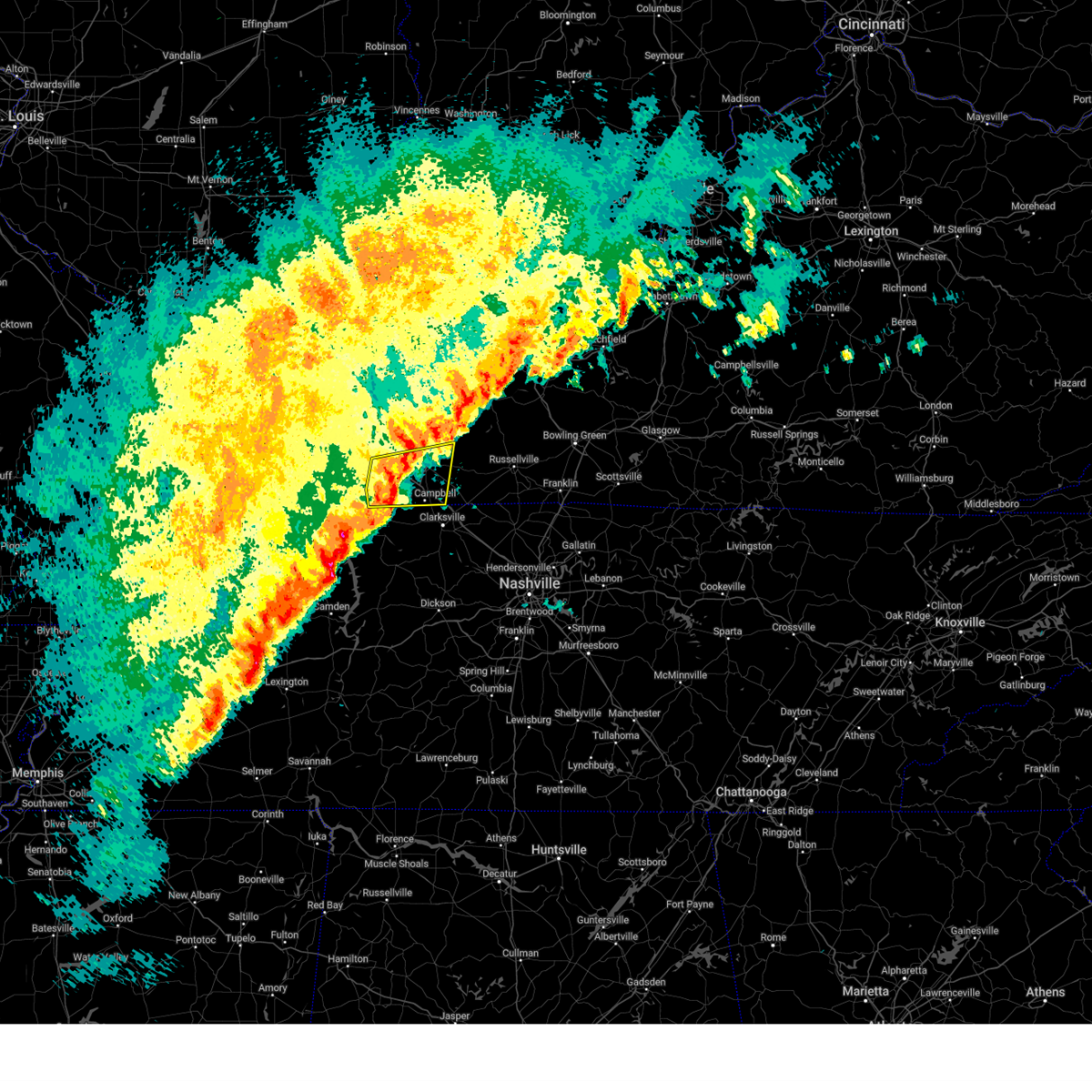 At 808 pm cst, severe thunderstorms were located along a line extending from 7 miles west of hopkinsville to 9 miles northeast of big rock, moving east at 50 mph (radar indicated). Hazards include 60 mph wind gusts and quarter size hail. Hail damage to vehicles is expected. expect wind damage to roofs, siding, and trees. locations impacted include, hopkinsville, oak grove, cadiz, fort campbell, clarksville, pembroke, lafayette, and herndon. this includes the following highways, interstate 24 in kentucky between mile markers 64 and 92. Pennyrile parkway between mile markers 1 and 15. At 808 pm cst, severe thunderstorms were located along a line extending from 7 miles west of hopkinsville to 9 miles northeast of big rock, moving east at 50 mph (radar indicated). Hazards include 60 mph wind gusts and quarter size hail. Hail damage to vehicles is expected. expect wind damage to roofs, siding, and trees. locations impacted include, hopkinsville, oak grove, cadiz, fort campbell, clarksville, pembroke, lafayette, and herndon. this includes the following highways, interstate 24 in kentucky between mile markers 64 and 92. Pennyrile parkway between mile markers 1 and 15.
|
| 2/15/2025 7:42 PM CST |
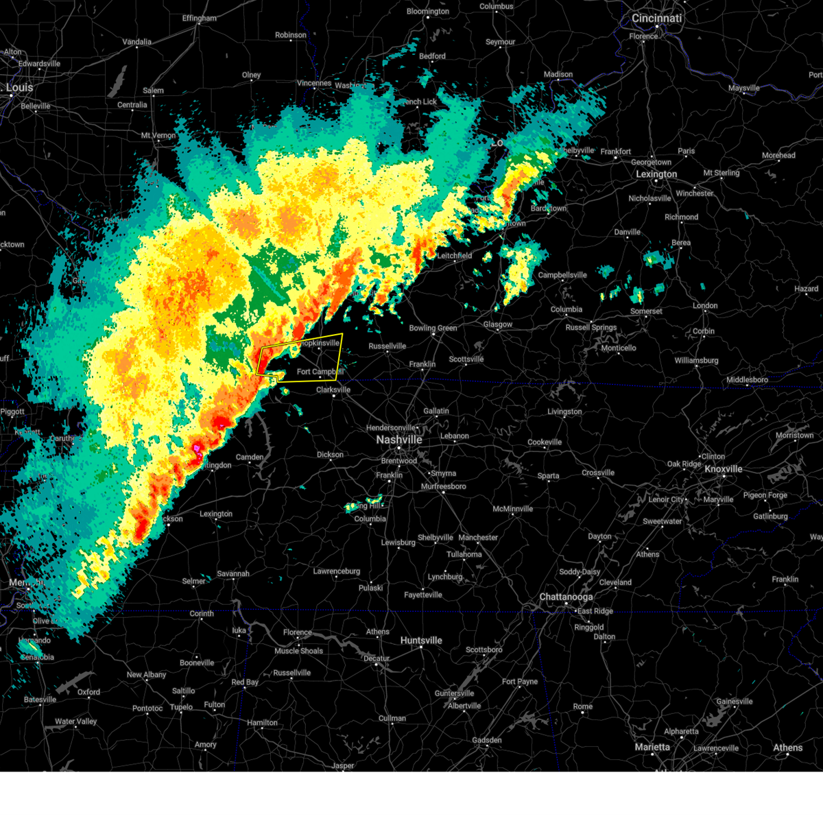 Svrpah the national weather service in paducah has issued a * severe thunderstorm warning for, southern christian county in south central kentucky, trigg county in western kentucky, * until 830 pm cst. * at 741 pm cst, severe thunderstorms were located along a line extending from canton to near wranglers campground, moving east at 55 mph (radar indicated). Hazards include 60 mph wind gusts and quarter size hail. Hail damage to vehicles is expected. Expect wind damage to roofs, siding, and trees. Svrpah the national weather service in paducah has issued a * severe thunderstorm warning for, southern christian county in south central kentucky, trigg county in western kentucky, * until 830 pm cst. * at 741 pm cst, severe thunderstorms were located along a line extending from canton to near wranglers campground, moving east at 55 mph (radar indicated). Hazards include 60 mph wind gusts and quarter size hail. Hail damage to vehicles is expected. Expect wind damage to roofs, siding, and trees.
|
| 2/6/2025 2:36 PM CST |
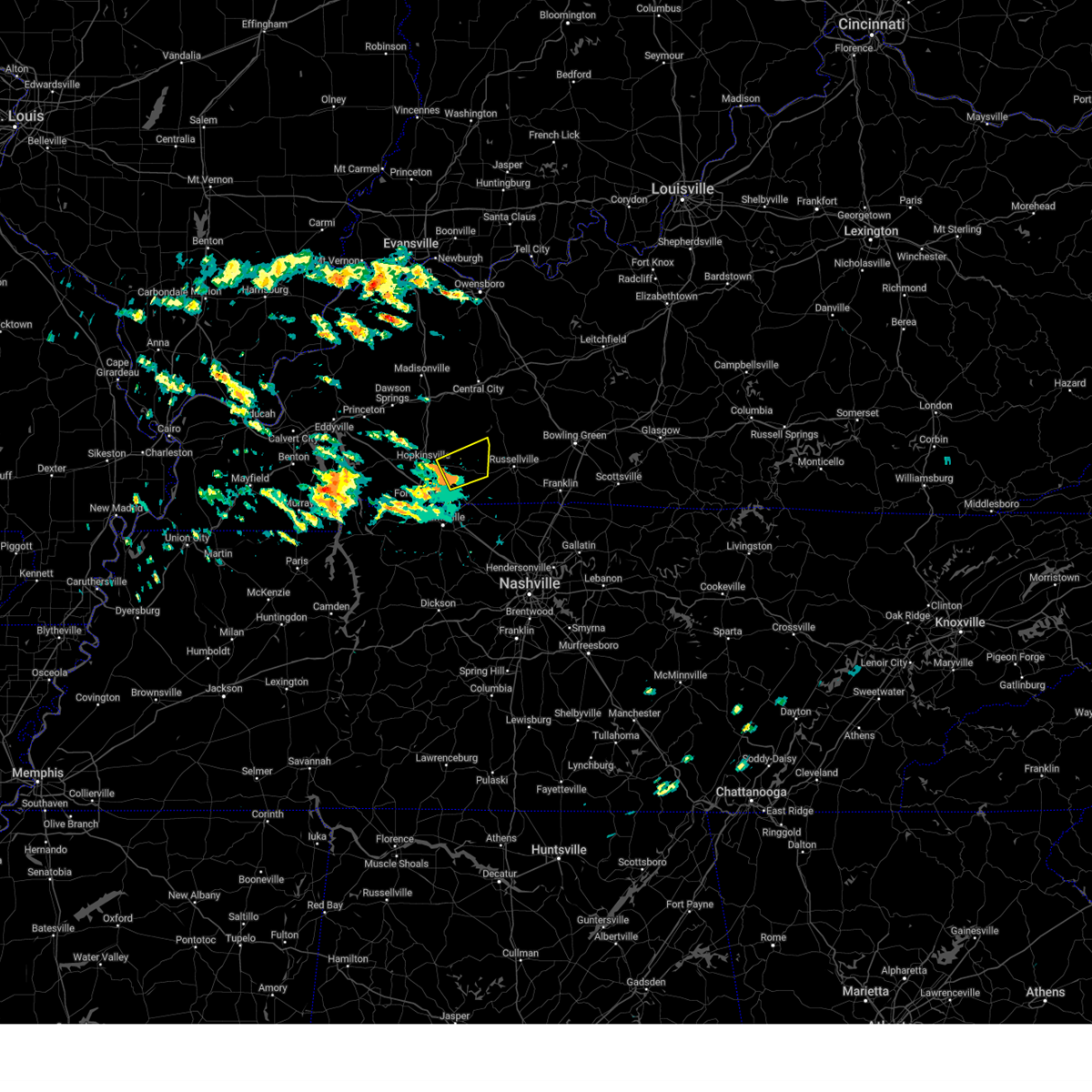 Svrpah the national weather service in paducah has issued a * severe thunderstorm warning for, east central christian county in south central kentucky, central todd county in south central kentucky, * until 300 pm cst. * at 235 pm cst, a severe thunderstorm was located near pembroke, or near elkton, moving northeast at 50 mph (radar indicated). Hazards include quarter size hail. damage to vehicles is expected Svrpah the national weather service in paducah has issued a * severe thunderstorm warning for, east central christian county in south central kentucky, central todd county in south central kentucky, * until 300 pm cst. * at 235 pm cst, a severe thunderstorm was located near pembroke, or near elkton, moving northeast at 50 mph (radar indicated). Hazards include quarter size hail. damage to vehicles is expected
|
| 9/6/2024 4:54 PM EDT |
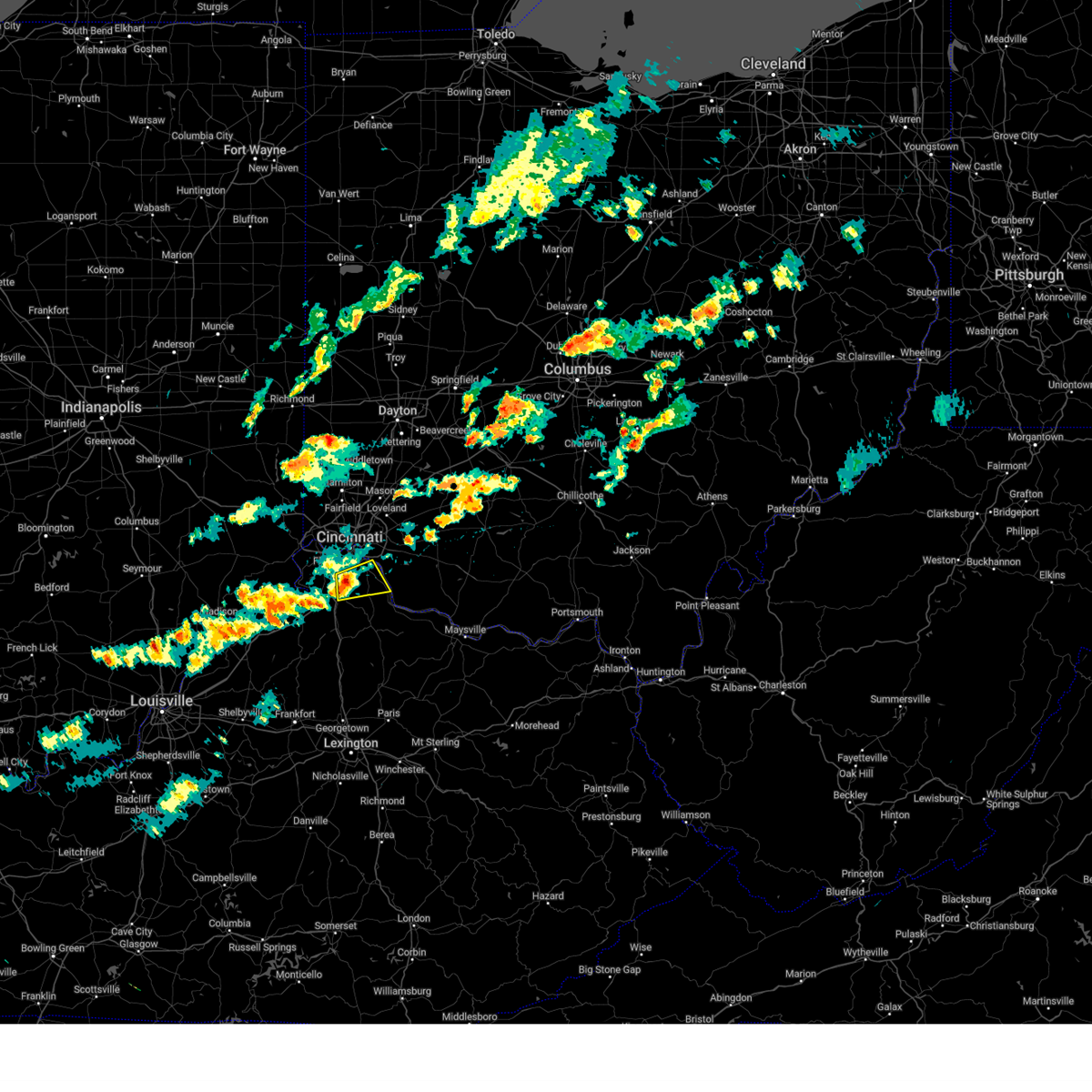 Svriln the national weather service in wilmington has issued a * severe thunderstorm warning for, central kenton county in northern kentucky, campbell county in northern kentucky, * until 530 pm edt. * at 454 pm edt, a severe thunderstorm was located near independence, moving east at 45 mph (radar indicated). Hazards include 60 mph wind gusts and penny size hail. expect damage to trees and power lines Svriln the national weather service in wilmington has issued a * severe thunderstorm warning for, central kenton county in northern kentucky, campbell county in northern kentucky, * until 530 pm edt. * at 454 pm edt, a severe thunderstorm was located near independence, moving east at 45 mph (radar indicated). Hazards include 60 mph wind gusts and penny size hail. expect damage to trees and power lines
|
| 7/30/2024 9:13 PM CDT |
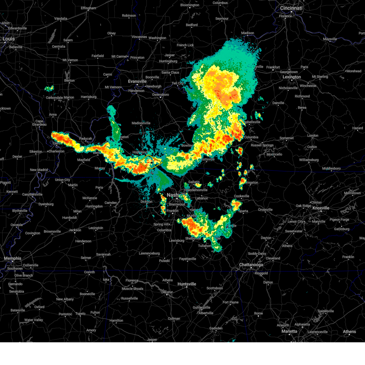 the severe thunderstorm warning has been cancelled and is no longer in effect the severe thunderstorm warning has been cancelled and is no longer in effect
|
| 7/30/2024 8:52 PM CDT |
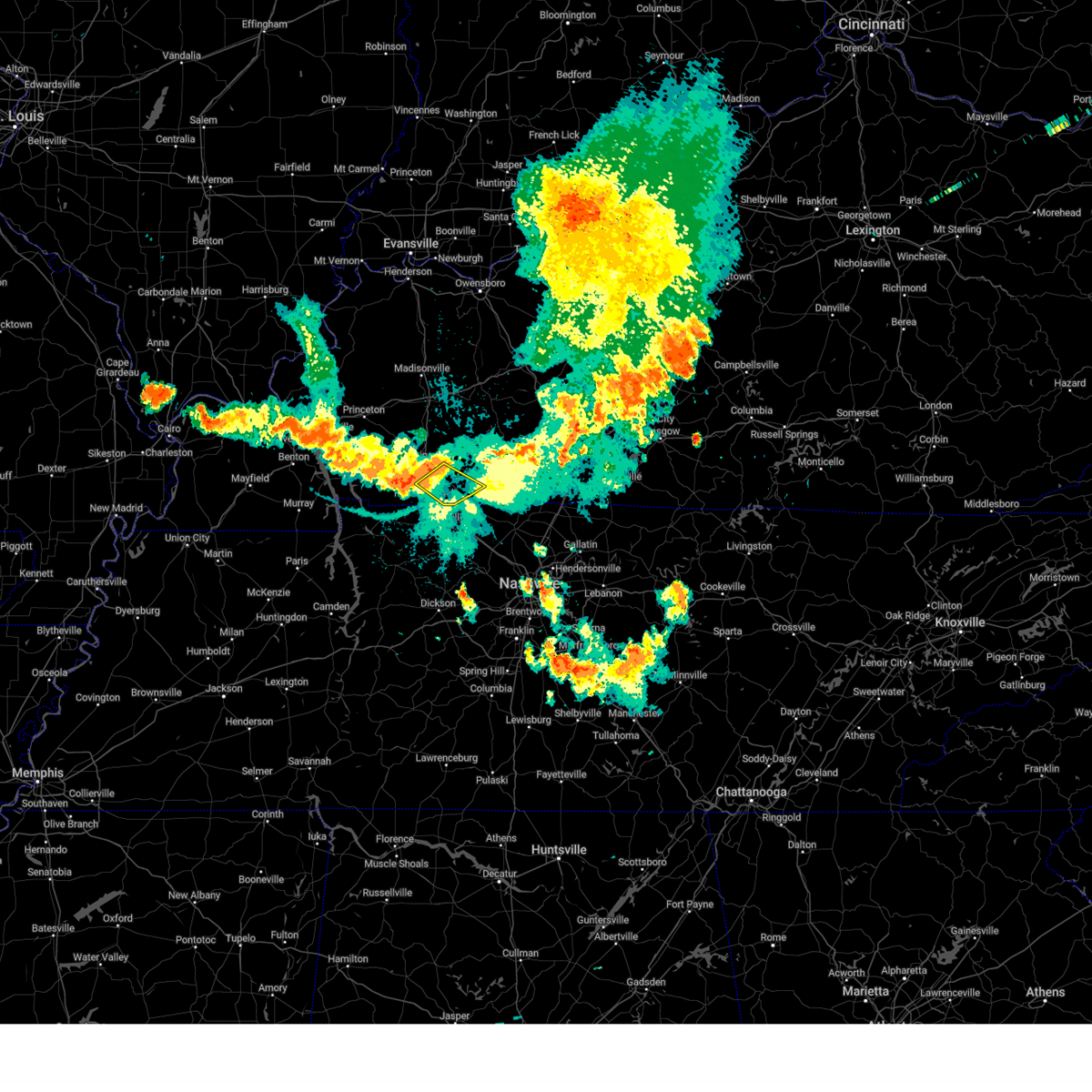 At 852 pm cdt, severe thunderstorms were located along a line extending from near pembroke to near fort campbell, moving southeast at 25 mph (public). Hazards include 60 mph wind gusts. Expect damage to roofs, siding, and trees. locations impacted include, oak grove, pembroke, and trenton. this includes the following highways, interstate 24 in kentucky between mile markers 80 and 83, and between mile markers 86 and 92. Pennyrile parkway between mile markers 1 and 2. At 852 pm cdt, severe thunderstorms were located along a line extending from near pembroke to near fort campbell, moving southeast at 25 mph (public). Hazards include 60 mph wind gusts. Expect damage to roofs, siding, and trees. locations impacted include, oak grove, pembroke, and trenton. this includes the following highways, interstate 24 in kentucky between mile markers 80 and 83, and between mile markers 86 and 92. Pennyrile parkway between mile markers 1 and 2.
|
| 7/30/2024 8:38 PM CDT |
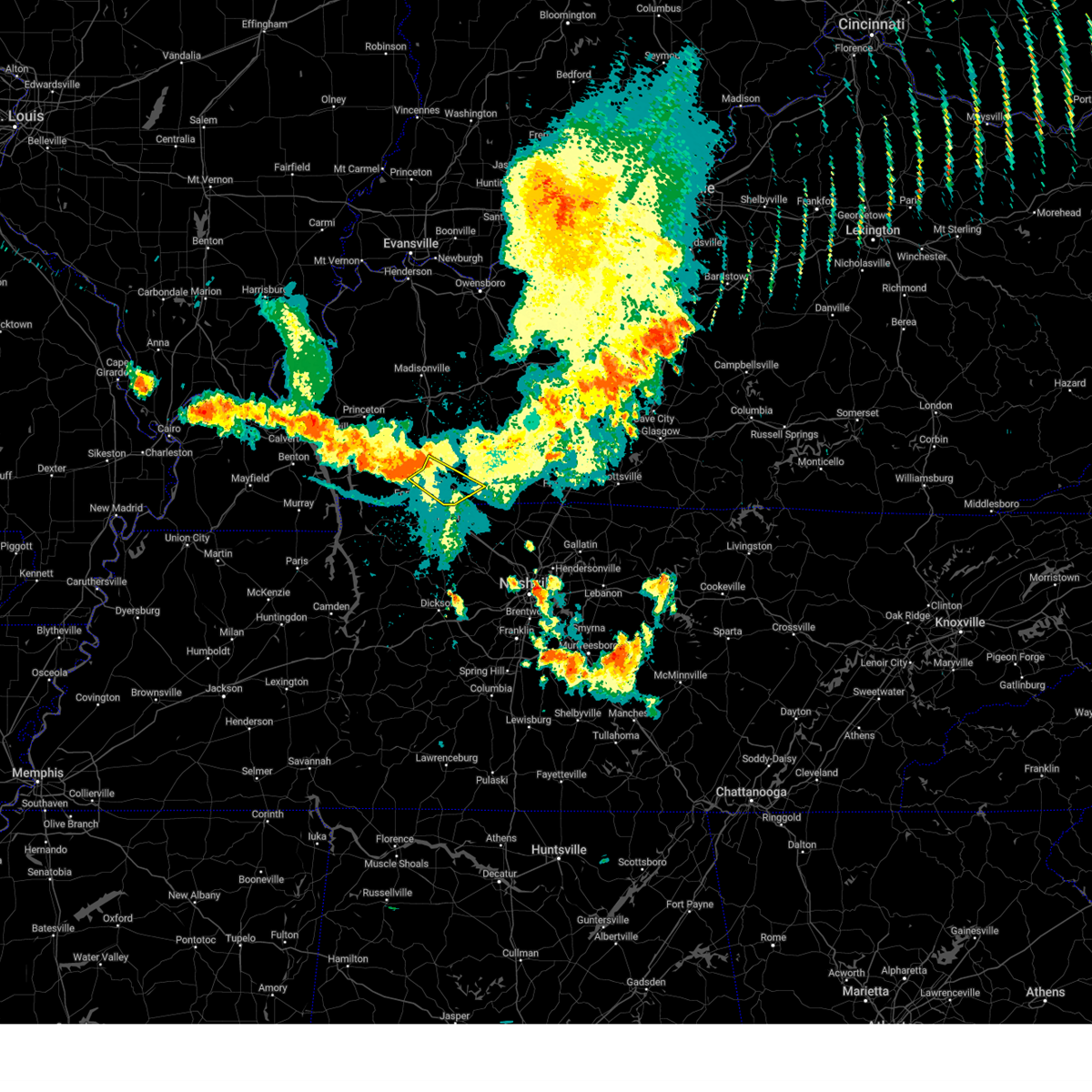 Svrpah the national weather service in paducah has issued a * severe thunderstorm warning for, southeastern christian county in south central kentucky, southern todd county in south central kentucky, * until 930 pm cdt. * at 838 pm cdt, severe thunderstorms were located along a line extending from near hopkinsville to 10 miles northwest of fort campbell, moving southeast at 25 mph (public). Hazards include 60 mph wind gusts. expect damage to roofs, siding, and trees Svrpah the national weather service in paducah has issued a * severe thunderstorm warning for, southeastern christian county in south central kentucky, southern todd county in south central kentucky, * until 930 pm cdt. * at 838 pm cdt, severe thunderstorms were located along a line extending from near hopkinsville to 10 miles northwest of fort campbell, moving southeast at 25 mph (public). Hazards include 60 mph wind gusts. expect damage to roofs, siding, and trees
|
| 7/5/2024 5:23 AM CDT |
 The storm which prompted the warning has weakened below severe limits, and no longer poses an immediate threat to life or property. therefore, the warning will be allowed to expire. however, gusty winds and heavy rain are still possible with this thunderstorm. The storm which prompted the warning has weakened below severe limits, and no longer poses an immediate threat to life or property. therefore, the warning will be allowed to expire. however, gusty winds and heavy rain are still possible with this thunderstorm.
|
| 7/5/2024 5:02 AM CDT |
 At 502 am cdt, a severe thunderstorm was located 7 miles southwest of hopkinsville, moving east at 25 mph (radar indicated). Hazards include 60 mph wind gusts. Expect damage to roofs, siding, and trees. locations impacted include, hopkinsville, pembroke, and herndon. this includes the following highways, interstate 24 in kentucky between mile markers 69 and 82. Pennyrile parkway between mile markers 1 and 17. At 502 am cdt, a severe thunderstorm was located 7 miles southwest of hopkinsville, moving east at 25 mph (radar indicated). Hazards include 60 mph wind gusts. Expect damage to roofs, siding, and trees. locations impacted include, hopkinsville, pembroke, and herndon. this includes the following highways, interstate 24 in kentucky between mile markers 69 and 82. Pennyrile parkway between mile markers 1 and 17.
|
| 7/5/2024 4:42 AM CDT |
 Svrpah the national weather service in paducah has issued a * severe thunderstorm warning for, central christian county in south central kentucky, southeastern trigg county in western kentucky, * until 530 am cdt. * at 442 am cdt, a severe thunderstorm was located near cadiz, moving east at 30 mph (radar indicated). Hazards include downburst wind gusts to 60 mph. expect damage to roofs, siding, and trees Svrpah the national weather service in paducah has issued a * severe thunderstorm warning for, central christian county in south central kentucky, southeastern trigg county in western kentucky, * until 530 am cdt. * at 442 am cdt, a severe thunderstorm was located near cadiz, moving east at 30 mph (radar indicated). Hazards include downburst wind gusts to 60 mph. expect damage to roofs, siding, and trees
|
| 6/26/2024 6:06 PM CDT |
 The storms which prompted the warning have weakened below severe limits, and no longer pose an immediate threat to life or property. therefore, the warning will be allowed to expire. The storms which prompted the warning have weakened below severe limits, and no longer pose an immediate threat to life or property. therefore, the warning will be allowed to expire.
|
| 6/26/2024 5:35 PM CDT |
 the severe thunderstorm warning has been cancelled and is no longer in effect the severe thunderstorm warning has been cancelled and is no longer in effect
|
| 6/26/2024 5:35 PM CDT |
 At 534 pm cdt, severe thunderstorms were located along a line extending from 12 miles east of cadiz to hopkinsville to pembroke, moving northeast at 35 mph (radar indicated). Hazards include 60 mph wind gusts. Expect damage to roofs, siding, and trees. locations impacted include, hopkinsville, oak grove, fort campbell, pembroke, and herndon. this includes the following highways, interstate 24 in kentucky between mile markers 71 and 92. Pennyrile parkway between mile markers 1 and 16. At 534 pm cdt, severe thunderstorms were located along a line extending from 12 miles east of cadiz to hopkinsville to pembroke, moving northeast at 35 mph (radar indicated). Hazards include 60 mph wind gusts. Expect damage to roofs, siding, and trees. locations impacted include, hopkinsville, oak grove, fort campbell, pembroke, and herndon. this includes the following highways, interstate 24 in kentucky between mile markers 71 and 92. Pennyrile parkway between mile markers 1 and 16.
|
| 6/26/2024 5:08 PM CDT |
 Svrpah the national weather service in paducah has issued a * severe thunderstorm warning for, christian county in south central kentucky, eastern trigg county in western kentucky, * until 615 pm cdt. * at 508 pm cdt, severe thunderstorms were located along a line extending from near wranglers campground to 10 miles north of big rock to near fort campbell, moving northeast at 35 mph (radar indicated). Hazards include 60 mph wind gusts and penny size hail. expect damage to roofs, siding, and trees Svrpah the national weather service in paducah has issued a * severe thunderstorm warning for, christian county in south central kentucky, eastern trigg county in western kentucky, * until 615 pm cdt. * at 508 pm cdt, severe thunderstorms were located along a line extending from near wranglers campground to 10 miles north of big rock to near fort campbell, moving northeast at 35 mph (radar indicated). Hazards include 60 mph wind gusts and penny size hail. expect damage to roofs, siding, and trees
|
| 5/27/2024 12:48 AM EDT |
 Svriln the national weather service in wilmington has issued a * severe thunderstorm warning for, central kenton county in northern kentucky, campbell county in northern kentucky, southeastern hamilton county in southwestern ohio, clermont county in southwestern ohio, northwestern brown county in southwestern ohio, * until 130 am edt. * at 1248 am edt, a severe thunderstorm was located near alexandria, moving northeast at 50 mph (radar indicated). Hazards include 60 mph wind gusts. expect damage to trees and power lines Svriln the national weather service in wilmington has issued a * severe thunderstorm warning for, central kenton county in northern kentucky, campbell county in northern kentucky, southeastern hamilton county in southwestern ohio, clermont county in southwestern ohio, northwestern brown county in southwestern ohio, * until 130 am edt. * at 1248 am edt, a severe thunderstorm was located near alexandria, moving northeast at 50 mph (radar indicated). Hazards include 60 mph wind gusts. expect damage to trees and power lines
|
| 5/26/2024 10:15 PM CDT |
 the severe thunderstorm warning has been cancelled and is no longer in effect the severe thunderstorm warning has been cancelled and is no longer in effect
|
| 5/26/2024 10:15 PM CDT |
 At 1015 pm cdt, severe thunderstorms were located along a line extending from 11 miles southeast of crofton to 9 miles southwest of hopkinsville to 8 miles east of murray, moving southeast at 50 mph (radar indicated). Hazards include 60 mph wind gusts and quarter size hail. Hail damage to vehicles is expected. expect wind damage to roofs, siding, and trees. locations impacted include, hopkinsville, murray, oak grove, cadiz, elkton, wranglers campground, energy lake campground, turkey bay, golden pond visitors center, fort campbell, land between the lakes area, clarksville, guthrie, pembroke, canton, dunmor, hazel, trenton, lafayette, and justice. this includes the following highways, interstate 24 in kentucky between mile markers 58 and 92. Pennyrile parkway between mile markers 1 and 21. At 1015 pm cdt, severe thunderstorms were located along a line extending from 11 miles southeast of crofton to 9 miles southwest of hopkinsville to 8 miles east of murray, moving southeast at 50 mph (radar indicated). Hazards include 60 mph wind gusts and quarter size hail. Hail damage to vehicles is expected. expect wind damage to roofs, siding, and trees. locations impacted include, hopkinsville, murray, oak grove, cadiz, elkton, wranglers campground, energy lake campground, turkey bay, golden pond visitors center, fort campbell, land between the lakes area, clarksville, guthrie, pembroke, canton, dunmor, hazel, trenton, lafayette, and justice. this includes the following highways, interstate 24 in kentucky between mile markers 58 and 92. Pennyrile parkway between mile markers 1 and 21.
|
| 5/26/2024 9:37 PM CDT |
 Svrpah the national weather service in paducah has issued a * severe thunderstorm warning for, calloway county in western kentucky, southern muhlenberg county in south central kentucky, christian county in south central kentucky, southern caldwell county in western kentucky, trigg county in western kentucky, todd county in south central kentucky, southeastern graves county in western kentucky, southeastern lyon county in western kentucky, * until 1030 pm cdt. * at 936 pm cdt, severe thunderstorms were located along a line extending from near dawson springs to near cravens bay campground to near mayfield, moving east at 85 mph (radar indicated). Hazards include 60 mph wind gusts and quarter size hail. Hail damage to vehicles is expected. Expect wind damage to roofs, siding, and trees. Svrpah the national weather service in paducah has issued a * severe thunderstorm warning for, calloway county in western kentucky, southern muhlenberg county in south central kentucky, christian county in south central kentucky, southern caldwell county in western kentucky, trigg county in western kentucky, todd county in south central kentucky, southeastern graves county in western kentucky, southeastern lyon county in western kentucky, * until 1030 pm cdt. * at 936 pm cdt, severe thunderstorms were located along a line extending from near dawson springs to near cravens bay campground to near mayfield, moving east at 85 mph (radar indicated). Hazards include 60 mph wind gusts and quarter size hail. Hail damage to vehicles is expected. Expect wind damage to roofs, siding, and trees.
|
| 5/26/2024 2:10 PM EDT |
 The storms which prompted the warning have moved out of the area. therefore, the warning will be allowed to expire. a severe thunderstorm watch remains in effect until 800 pm edt for northern and northeastern kentucky, and south central and southwestern ohio. please report previous wind damage or hail to the national weather service by going to our website at weather.gov/iln and submitting your report via social media. remember, a severe thunderstorm warning still remains in effect for northeast hamilton, northern clermont, brown, and adams county!. The storms which prompted the warning have moved out of the area. therefore, the warning will be allowed to expire. a severe thunderstorm watch remains in effect until 800 pm edt for northern and northeastern kentucky, and south central and southwestern ohio. please report previous wind damage or hail to the national weather service by going to our website at weather.gov/iln and submitting your report via social media. remember, a severe thunderstorm warning still remains in effect for northeast hamilton, northern clermont, brown, and adams county!.
|
| 5/26/2024 1:59 PM EDT |
 the severe thunderstorm warning has been cancelled and is no longer in effect the severe thunderstorm warning has been cancelled and is no longer in effect
|
| 5/26/2024 1:59 PM EDT |
 At 159 pm edt, severe thunderstorms were located along a line extending from near ross to near felicity, moving northeast at 50 mph (radar indicated). Hazards include 60 mph wind gusts and penny size hail. Expect damage to trees and power lines. locations impacted include, cincinnati, fairfield, covington, norwood, forest park, fort thomas, newport, sharonville, blue ash, springdale, reading, montgomery, north college hill, maysville, madeira, edgewood, alexandria, wyoming, cheviot, and fort mitchell. this includes the following interstates, i-71 in ohio between mile markers 0 and 15. i-74 in ohio between mile markers 8 and 19. i-75 in kentucky between mile markers 186 and 191. I-75 in ohio between mile markers 0 and 16. At 159 pm edt, severe thunderstorms were located along a line extending from near ross to near felicity, moving northeast at 50 mph (radar indicated). Hazards include 60 mph wind gusts and penny size hail. Expect damage to trees and power lines. locations impacted include, cincinnati, fairfield, covington, norwood, forest park, fort thomas, newport, sharonville, blue ash, springdale, reading, montgomery, north college hill, maysville, madeira, edgewood, alexandria, wyoming, cheviot, and fort mitchell. this includes the following interstates, i-71 in ohio between mile markers 0 and 15. i-74 in ohio between mile markers 8 and 19. i-75 in kentucky between mile markers 186 and 191. I-75 in ohio between mile markers 0 and 16.
|
| 5/26/2024 1:44 PM EDT |
 the severe thunderstorm warning has been cancelled and is no longer in effect the severe thunderstorm warning has been cancelled and is no longer in effect
|
| 5/26/2024 1:44 PM EDT |
 At 144 pm edt, severe thunderstorms were located along a line extending from bright to near neville, moving northeast at 50 mph (radar indicated). Hazards include 60 mph wind gusts and penny size hail. Expect damage to trees and power lines. locations impacted include, cincinnati, fairfield, covington, florence, independence, norwood, forest park, erlanger, fort thomas, newport, sharonville, blue ash, springdale, reading, montgomery, north college hill, maysville, madeira, edgewood, and alexandria. this includes the following interstates, i-71 in ohio between mile markers 0 and 15. i-74 in ohio between mile markers 7 and 19. i-75 in kentucky between mile markers 174 and 191. I-75 in ohio between mile markers 0 and 16. At 144 pm edt, severe thunderstorms were located along a line extending from bright to near neville, moving northeast at 50 mph (radar indicated). Hazards include 60 mph wind gusts and penny size hail. Expect damage to trees and power lines. locations impacted include, cincinnati, fairfield, covington, florence, independence, norwood, forest park, erlanger, fort thomas, newport, sharonville, blue ash, springdale, reading, montgomery, north college hill, maysville, madeira, edgewood, and alexandria. this includes the following interstates, i-71 in ohio between mile markers 0 and 15. i-74 in ohio between mile markers 7 and 19. i-75 in kentucky between mile markers 174 and 191. I-75 in ohio between mile markers 0 and 16.
|
| 5/26/2024 1:16 PM EDT |
 At 116 pm edt, severe thunderstorms were located along a line extending from near dillsboro to 10 miles northwest of cynthiana, moving northeast at 50 mph (radar indicated). Hazards include 60 mph wind gusts and penny size hail. Expect damage to trees and power lines. locations impacted include, cincinnati, fairfield, covington, florence, independence, norwood, forest park, erlanger, fort thomas, newport, sharonville, blue ash, springdale, reading, montgomery, harrison, north college hill, maysville, madeira, and edgewood. this includes the following interstates, i-71 in kentucky between mile markers 70 and 77. i-71 in ohio between mile markers 0 and 15. i-74 in ohio between mile markers 1 and 19. i-75 in kentucky between mile markers 160 and 191. I-75 in ohio between mile markers 0 and 16. At 116 pm edt, severe thunderstorms were located along a line extending from near dillsboro to 10 miles northwest of cynthiana, moving northeast at 50 mph (radar indicated). Hazards include 60 mph wind gusts and penny size hail. Expect damage to trees and power lines. locations impacted include, cincinnati, fairfield, covington, florence, independence, norwood, forest park, erlanger, fort thomas, newport, sharonville, blue ash, springdale, reading, montgomery, harrison, north college hill, maysville, madeira, and edgewood. this includes the following interstates, i-71 in kentucky between mile markers 70 and 77. i-71 in ohio between mile markers 0 and 15. i-74 in ohio between mile markers 1 and 19. i-75 in kentucky between mile markers 160 and 191. I-75 in ohio between mile markers 0 and 16.
|
| 5/26/2024 1:01 PM EDT |
 Svriln the national weather service in wilmington has issued a * severe thunderstorm warning for, mason county in northern kentucky, robertson county in northern kentucky, kenton county in northern kentucky, boone county in northern kentucky, bracken county in northern kentucky, campbell county in northern kentucky, northeastern grant county in northern kentucky, pendleton county in northern kentucky, eastern gallatin county in northern kentucky, southwestern butler county in southwestern ohio, clermont county in southwestern ohio, hamilton county in southwestern ohio, brown county in southwestern ohio, southwestern adams county in south central ohio, * until 215 pm edt. * at 100 pm edt, severe thunderstorms were located along a line extending from 8 miles northeast of madison to 8 miles north of georgetown, moving northeast at 50 mph (radar indicated). Hazards include 70 mph wind gusts and penny size hail. Expect considerable tree damage. Damage is likely to mobile homes, roofs, and outbuildings. Svriln the national weather service in wilmington has issued a * severe thunderstorm warning for, mason county in northern kentucky, robertson county in northern kentucky, kenton county in northern kentucky, boone county in northern kentucky, bracken county in northern kentucky, campbell county in northern kentucky, northeastern grant county in northern kentucky, pendleton county in northern kentucky, eastern gallatin county in northern kentucky, southwestern butler county in southwestern ohio, clermont county in southwestern ohio, hamilton county in southwestern ohio, brown county in southwestern ohio, southwestern adams county in south central ohio, * until 215 pm edt. * at 100 pm edt, severe thunderstorms were located along a line extending from 8 miles northeast of madison to 8 miles north of georgetown, moving northeast at 50 mph (radar indicated). Hazards include 70 mph wind gusts and penny size hail. Expect considerable tree damage. Damage is likely to mobile homes, roofs, and outbuildings.
|
| 5/26/2024 9:55 AM CDT |
 The storms which prompted the warning have moved out of the area. therefore, the warning will be allowed to expire. a tornado watch remains in effect until 300 pm cdt for southwestern indiana, and south central and northwestern kentucky. The storms which prompted the warning have moved out of the area. therefore, the warning will be allowed to expire. a tornado watch remains in effect until 300 pm cdt for southwestern indiana, and south central and northwestern kentucky.
|
| 5/26/2024 9:33 AM CDT |
 the severe thunderstorm warning has been cancelled and is no longer in effect the severe thunderstorm warning has been cancelled and is no longer in effect
|
| 5/26/2024 9:33 AM CDT |
 At 933 am cdt, severe thunderstorms were located along a line extending from near st. joseph to livermore to near guthrie, moving east at 60 mph (radar indicated). Hazards include 70 mph wind gusts and quarter size hail. Hail damage to vehicles is expected. expect considerable tree damage. wind damage is also likely to mobile homes, roofs, and outbuildings. locations impacted include, owensboro, oak grove, central city, elkton, calhoun, guthrie, livermore, pembroke, powderly, whitesville, graham, knottsville, st. joseph, masonville, beech grove, greenville, weir, dunmor, drakesboro, and sacramento. this includes the following highways, interstate 24 in kentucky between mile markers 87 and 91. interstate 165 between mile markers 60 and 70. western kentucky parkway between mile markers 46 and 65. Audubon parkway between mile markers 20 and 23. At 933 am cdt, severe thunderstorms were located along a line extending from near st. joseph to livermore to near guthrie, moving east at 60 mph (radar indicated). Hazards include 70 mph wind gusts and quarter size hail. Hail damage to vehicles is expected. expect considerable tree damage. wind damage is also likely to mobile homes, roofs, and outbuildings. locations impacted include, owensboro, oak grove, central city, elkton, calhoun, guthrie, livermore, pembroke, powderly, whitesville, graham, knottsville, st. joseph, masonville, beech grove, greenville, weir, dunmor, drakesboro, and sacramento. this includes the following highways, interstate 24 in kentucky between mile markers 87 and 91. interstate 165 between mile markers 60 and 70. western kentucky parkway between mile markers 46 and 65. Audubon parkway between mile markers 20 and 23.
|
| 5/26/2024 9:26 AM CDT |
 the tornado warning has been cancelled and is no longer in effect the tornado warning has been cancelled and is no longer in effect
|
| 5/26/2024 9:23 AM CDT |
 Svrpah the national weather service in paducah has issued a * severe thunderstorm warning for, daviess county in northwestern kentucky, southeastern henderson county in northwestern kentucky, muhlenberg county in south central kentucky, christian county in south central kentucky, mclean county in northwestern kentucky, eastern hopkins county in northwestern kentucky, todd county in south central kentucky, northeastern webster county in northwestern kentucky, * until 1000 am cdt. * at 922 am cdt, severe thunderstorms were located along a line extending from near sebree to 8 miles south of calhoun to near oak grove, moving northeast at 60 mph (radar indicated). Hazards include 70 mph wind gusts and penny size hail. Expect considerable tree damage. Damage is likely to mobile homes, roofs, and outbuildings. Svrpah the national weather service in paducah has issued a * severe thunderstorm warning for, daviess county in northwestern kentucky, southeastern henderson county in northwestern kentucky, muhlenberg county in south central kentucky, christian county in south central kentucky, mclean county in northwestern kentucky, eastern hopkins county in northwestern kentucky, todd county in south central kentucky, northeastern webster county in northwestern kentucky, * until 1000 am cdt. * at 922 am cdt, severe thunderstorms were located along a line extending from near sebree to 8 miles south of calhoun to near oak grove, moving northeast at 60 mph (radar indicated). Hazards include 70 mph wind gusts and penny size hail. Expect considerable tree damage. Damage is likely to mobile homes, roofs, and outbuildings.
|
| 5/26/2024 9:22 AM CDT |
 At 921 am cdt, a large and extremely dangerous tornado was located near pembroke, moving east at 65 mph. this is a particularly dangerous situation. take cover now! (radar indicated rotation). Hazards include damaging tornado. You are in a life-threatening situation. flying debris may be deadly to those caught without shelter. mobile homes will be destroyed. considerable damage to homes, businesses, and vehicles is likely and complete destruction is possible. This tornadic thunderstorm will remain over mainly rural areas of southeastern christian county. At 921 am cdt, a large and extremely dangerous tornado was located near pembroke, moving east at 65 mph. this is a particularly dangerous situation. take cover now! (radar indicated rotation). Hazards include damaging tornado. You are in a life-threatening situation. flying debris may be deadly to those caught without shelter. mobile homes will be destroyed. considerable damage to homes, businesses, and vehicles is likely and complete destruction is possible. This tornadic thunderstorm will remain over mainly rural areas of southeastern christian county.
|
| 5/26/2024 9:15 AM CDT |
 the severe thunderstorm warning has been cancelled and is no longer in effect the severe thunderstorm warning has been cancelled and is no longer in effect
|
| 5/26/2024 9:15 AM CDT |
 At 915 am cdt, severe thunderstorms were located along a line extending from near sebree to near madisonville to near fort campbell, moving northeast at 60 mph (trained weather spotters). Hazards include 70 mph wind gusts and penny size hail. Expect considerable tree damage. damage is likely to mobile homes, roofs, and outbuildings. locations impacted include, owensboro, hopkinsville, madisonville, oak grove, central city, dawson springs, elkton, calhoun, fort campbell, sebree, guthrie, earlington, livermore, nortonville, pembroke, mortons gap, dixon, crofton, powderly, and whitesville. this includes the following highways, interstate 24 in kentucky between mile markers 65 and 92. interstate 165 between mile markers 60 and 70. interstate 69 in kentucky between mile markers 94 and 137. western kentucky parkway between mile markers 39 and 65. pennyrile parkway between mile markers 1 and 34. Audubon parkway near mile marker 23. At 915 am cdt, severe thunderstorms were located along a line extending from near sebree to near madisonville to near fort campbell, moving northeast at 60 mph (trained weather spotters). Hazards include 70 mph wind gusts and penny size hail. Expect considerable tree damage. damage is likely to mobile homes, roofs, and outbuildings. locations impacted include, owensboro, hopkinsville, madisonville, oak grove, central city, dawson springs, elkton, calhoun, fort campbell, sebree, guthrie, earlington, livermore, nortonville, pembroke, mortons gap, dixon, crofton, powderly, and whitesville. this includes the following highways, interstate 24 in kentucky between mile markers 65 and 92. interstate 165 between mile markers 60 and 70. interstate 69 in kentucky between mile markers 94 and 137. western kentucky parkway between mile markers 39 and 65. pennyrile parkway between mile markers 1 and 34. Audubon parkway near mile marker 23.
|
| 5/26/2024 9:13 AM CDT |
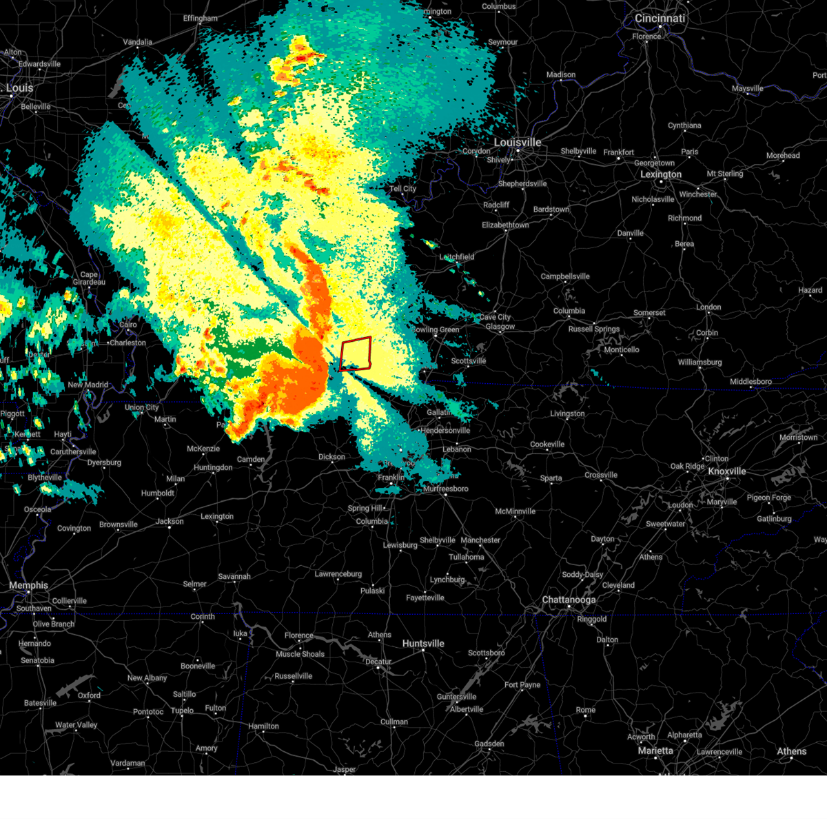 Torpah the national weather service in paducah has issued a * tornado warning for, central todd county in south central kentucky, * until 1000 am cdt. * at 913 am cdt, a confirmed large and extremely dangerous tornado was located just south of hopkinsville, moving east at 65 mph. this is a particularly dangerous situation. take cover now! (radar confirmed tornado). Hazards include damaging tornado. You are in a life-threatening situation. flying debris may be deadly to those caught without shelter. mobile homes will be destroyed. considerable damage to homes, businesses, and vehicles is likely and complete destruction is possible. the tornado will be near, elkton around 920 am cdt. Other locations impacted by this tornadic thunderstorm include justice, everett, allegre, and trenton. Torpah the national weather service in paducah has issued a * tornado warning for, central todd county in south central kentucky, * until 1000 am cdt. * at 913 am cdt, a confirmed large and extremely dangerous tornado was located just south of hopkinsville, moving east at 65 mph. this is a particularly dangerous situation. take cover now! (radar confirmed tornado). Hazards include damaging tornado. You are in a life-threatening situation. flying debris may be deadly to those caught without shelter. mobile homes will be destroyed. considerable damage to homes, businesses, and vehicles is likely and complete destruction is possible. the tornado will be near, elkton around 920 am cdt. Other locations impacted by this tornadic thunderstorm include justice, everett, allegre, and trenton.
|
| 5/26/2024 9:10 AM CDT |
 At 909 am cdt, a confirmed large and extremely dangerous tornado was located just south of hopkinsville, moving east at 65 mph. this is a particularly dangerous situation. if you live in pembroke, take cover now! (radar confirmed tornado). Hazards include damaging tornado. You are in a life-threatening situation. flying debris may be deadly to those caught without shelter. mobile homes will be destroyed. considerable damage to homes, businesses, and vehicles is likely and complete destruction is possible. the tornado will be near, just south of hopkinsville and pembroke around 915 am cdt. other locations impacted by this tornadic thunderstorm include herndon. this includes the following highways, interstate 24 in kentucky between mile markers 71 and 84. Pennyrile parkway between mile markers 1 and 11. At 909 am cdt, a confirmed large and extremely dangerous tornado was located just south of hopkinsville, moving east at 65 mph. this is a particularly dangerous situation. if you live in pembroke, take cover now! (radar confirmed tornado). Hazards include damaging tornado. You are in a life-threatening situation. flying debris may be deadly to those caught without shelter. mobile homes will be destroyed. considerable damage to homes, businesses, and vehicles is likely and complete destruction is possible. the tornado will be near, just south of hopkinsville and pembroke around 915 am cdt. other locations impacted by this tornadic thunderstorm include herndon. this includes the following highways, interstate 24 in kentucky between mile markers 71 and 84. Pennyrile parkway between mile markers 1 and 11.
|
| 5/26/2024 9:03 AM CDT |
 At 903 am cdt, a large and extremely dangerous tornado was located 9 miles southwest of hopkinsville, moving east at 70 mph. this is a particularly dangerous situation. take cover now! (radar indicated rotation). Hazards include damaging tornado. You are in a life-threatening situation. flying debris may be deadly to those caught without shelter. mobile homes will be destroyed. considerable damage to homes, businesses, and vehicles is likely and complete destruction is possible. the tornado will be near, hopkinsville and pembroke around 910 am cdt. other locations impacted by this tornadic thunderstorm include herndon. this includes the following highways, interstate 24 in kentucky between mile markers 71 and 84. Pennyrile parkway between mile markers 1 and 11. At 903 am cdt, a large and extremely dangerous tornado was located 9 miles southwest of hopkinsville, moving east at 70 mph. this is a particularly dangerous situation. take cover now! (radar indicated rotation). Hazards include damaging tornado. You are in a life-threatening situation. flying debris may be deadly to those caught without shelter. mobile homes will be destroyed. considerable damage to homes, businesses, and vehicles is likely and complete destruction is possible. the tornado will be near, hopkinsville and pembroke around 910 am cdt. other locations impacted by this tornadic thunderstorm include herndon. this includes the following highways, interstate 24 in kentucky between mile markers 71 and 84. Pennyrile parkway between mile markers 1 and 11.
|
| 5/26/2024 9:00 AM CDT |
 Torpah the national weather service in paducah has issued a * tornado warning for, southern christian county in south central kentucky, * until 945 am cdt. * at 859 am cdt, a severe thunderstorm capable of producing a tornado was located 8 miles southeast of cadiz, moving east at 70 mph (radar indicated rotation). Hazards include tornado. Flying debris will be dangerous to those caught without shelter. mobile homes will be damaged or destroyed. damage to roofs, windows, and vehicles will occur. tree damage is likely. this dangerous storm will be near, hopkinsville around 905 am cdt. pembroke around 910 am cdt. other locations impacted by this tornadic thunderstorm include herndon. this includes the following highways, interstate 24 in kentucky between mile markers 71 and 84. Pennyrile parkway between mile markers 1 and 11. Torpah the national weather service in paducah has issued a * tornado warning for, southern christian county in south central kentucky, * until 945 am cdt. * at 859 am cdt, a severe thunderstorm capable of producing a tornado was located 8 miles southeast of cadiz, moving east at 70 mph (radar indicated rotation). Hazards include tornado. Flying debris will be dangerous to those caught without shelter. mobile homes will be damaged or destroyed. damage to roofs, windows, and vehicles will occur. tree damage is likely. this dangerous storm will be near, hopkinsville around 905 am cdt. pembroke around 910 am cdt. other locations impacted by this tornadic thunderstorm include herndon. this includes the following highways, interstate 24 in kentucky between mile markers 71 and 84. Pennyrile parkway between mile markers 1 and 11.
|
| 5/26/2024 8:59 AM CDT |
 At 856 am cdt, severe thunderstorms were located along a line extending from clay to near olney to 7 miles north of big rock, moving east at 70 mph. these are destructive storms for all of caldwell, trigg, hopkins, and christian counties (trained weather spotters). Hazards include 80 mph wind gusts. Flying debris will be dangerous to those caught without shelter. mobile homes will be heavily damaged. expect considerable damage to roofs, windows, and vehicles. extensive tree damage and power outages are likely. locations impacted include, owensboro, hopkinsville, madisonville, oak grove, princeton, central city, providence, dawson springs, cadiz, elkton, calhoun, fort campbell, wranglers campground, land between the lakes area, sebree, guthrie, earlington, livermore, nortonville, and clay. this includes the following highways, interstate 24 in kentucky between mile markers 50 and 92. interstate 165 between mile markers 60 and 70. interstate 69 in kentucky between mile markers 76 and 137. western kentucky parkway between mile markers 39 and 65. pennyrile parkway between mile markers 1 and 34. Audubon parkway near mile marker 23. At 856 am cdt, severe thunderstorms were located along a line extending from clay to near olney to 7 miles north of big rock, moving east at 70 mph. these are destructive storms for all of caldwell, trigg, hopkins, and christian counties (trained weather spotters). Hazards include 80 mph wind gusts. Flying debris will be dangerous to those caught without shelter. mobile homes will be heavily damaged. expect considerable damage to roofs, windows, and vehicles. extensive tree damage and power outages are likely. locations impacted include, owensboro, hopkinsville, madisonville, oak grove, princeton, central city, providence, dawson springs, cadiz, elkton, calhoun, fort campbell, wranglers campground, land between the lakes area, sebree, guthrie, earlington, livermore, nortonville, and clay. this includes the following highways, interstate 24 in kentucky between mile markers 50 and 92. interstate 165 between mile markers 60 and 70. interstate 69 in kentucky between mile markers 76 and 137. western kentucky parkway between mile markers 39 and 65. pennyrile parkway between mile markers 1 and 34. Audubon parkway near mile marker 23.
|
| 5/26/2024 8:59 AM CDT |
 the severe thunderstorm warning has been cancelled and is no longer in effect the severe thunderstorm warning has been cancelled and is no longer in effect
|
| 5/26/2024 8:51 AM CDT |
 Svrpah the national weather service in paducah has issued a * severe thunderstorm warning for, southeastern henderson county in northwestern kentucky, caldwell county in western kentucky, trigg county in western kentucky, hopkins county in northwestern kentucky, southeastern lyon county in western kentucky, daviess county in northwestern kentucky, muhlenberg county in south central kentucky, northeastern crittenden county in western kentucky, christian county in south central kentucky, mclean county in northwestern kentucky, todd county in south central kentucky, south central union county in northwestern kentucky, webster county in northwestern kentucky, * until 930 am cdt. * at 850 am cdt, severe thunderstorms were located along a line extending from 6 miles northeast of marion to farmersville to 7 miles south of wranglers campground, moving east at 65 mph (radar indicated). Hazards include 70 mph wind gusts. Expect considerable tree damage. Damage is likely to mobile homes, roofs, and outbuildings. Svrpah the national weather service in paducah has issued a * severe thunderstorm warning for, southeastern henderson county in northwestern kentucky, caldwell county in western kentucky, trigg county in western kentucky, hopkins county in northwestern kentucky, southeastern lyon county in western kentucky, daviess county in northwestern kentucky, muhlenberg county in south central kentucky, northeastern crittenden county in western kentucky, christian county in south central kentucky, mclean county in northwestern kentucky, todd county in south central kentucky, south central union county in northwestern kentucky, webster county in northwestern kentucky, * until 930 am cdt. * at 850 am cdt, severe thunderstorms were located along a line extending from 6 miles northeast of marion to farmersville to 7 miles south of wranglers campground, moving east at 65 mph (radar indicated). Hazards include 70 mph wind gusts. Expect considerable tree damage. Damage is likely to mobile homes, roofs, and outbuildings.
|
| 5/9/2024 12:26 AM CDT |
 At 1226 am cdt, severe thunderstorms were located along a line extending from 9 miles northwest of elkton to near pembroke to 9 miles northeast of big rock, moving east at 40 mph (radar indicated). Hazards include 60 mph wind gusts and quarter size hail. Hail damage to vehicles is expected. expect wind damage to roofs, siding, and trees. locations impacted include, oak grove, elkton, fort campbell, clarksville, guthrie, pembroke, trenton, lafayette, justice, allensville, allegre, clifty, and herndon. this includes the following highways, interstate 24 in kentucky between mile markers 76 and 92. Pennyrile parkway between mile markers 1 and 5. At 1226 am cdt, severe thunderstorms were located along a line extending from 9 miles northwest of elkton to near pembroke to 9 miles northeast of big rock, moving east at 40 mph (radar indicated). Hazards include 60 mph wind gusts and quarter size hail. Hail damage to vehicles is expected. expect wind damage to roofs, siding, and trees. locations impacted include, oak grove, elkton, fort campbell, clarksville, guthrie, pembroke, trenton, lafayette, justice, allensville, allegre, clifty, and herndon. this includes the following highways, interstate 24 in kentucky between mile markers 76 and 92. Pennyrile parkway between mile markers 1 and 5.
|
| 5/8/2024 11:54 PM CDT |
 Svrpah the national weather service in paducah has issued a * severe thunderstorm warning for, christian county in south central kentucky, todd county in south central kentucky, * until 100 am cdt. * at 1153 pm cdt, severe thunderstorms were located along a line extending from 8 miles northwest of hopkinsville to 6 miles southeast of cadiz to 7 miles southeast of wranglers campground, moving east at 40 mph (radar indicated). Hazards include 60 mph wind gusts and quarter size hail. Hail damage to vehicles is expected. Expect wind damage to roofs, siding, and trees. Svrpah the national weather service in paducah has issued a * severe thunderstorm warning for, christian county in south central kentucky, todd county in south central kentucky, * until 100 am cdt. * at 1153 pm cdt, severe thunderstorms were located along a line extending from 8 miles northwest of hopkinsville to 6 miles southeast of cadiz to 7 miles southeast of wranglers campground, moving east at 40 mph (radar indicated). Hazards include 60 mph wind gusts and quarter size hail. Hail damage to vehicles is expected. Expect wind damage to roofs, siding, and trees.
|
| 5/8/2024 4:08 PM CDT |
 Svrpah the national weather service in paducah has issued a * severe thunderstorm warning for, central christian county in south central kentucky, northeastern trigg county in western kentucky, * until 500 pm cdt. * at 408 pm cdt, a severe thunderstorm was located over cadiz, moving east at 50 mph (radar indicated). Hazards include 60 mph wind gusts and half dollar size hail. Hail damage to vehicles is expected. Expect wind damage to roofs, siding, and trees. Svrpah the national weather service in paducah has issued a * severe thunderstorm warning for, central christian county in south central kentucky, northeastern trigg county in western kentucky, * until 500 pm cdt. * at 408 pm cdt, a severe thunderstorm was located over cadiz, moving east at 50 mph (radar indicated). Hazards include 60 mph wind gusts and half dollar size hail. Hail damage to vehicles is expected. Expect wind damage to roofs, siding, and trees.
|
| 5/8/2024 3:10 PM CDT |
 Svrpah the national weather service in paducah has issued a * severe thunderstorm warning for, southern christian county in south central kentucky, southeastern trigg county in western kentucky, * until 400 pm cdt. * at 309 pm cdt, a severe thunderstorm was located 8 miles northwest of dover, moving east at 30 mph (radar indicated). Hazards include 60 mph wind gusts and half dollar size hail. Hail damage to vehicles is expected. Expect wind damage to roofs, siding, and trees. Svrpah the national weather service in paducah has issued a * severe thunderstorm warning for, southern christian county in south central kentucky, southeastern trigg county in western kentucky, * until 400 pm cdt. * at 309 pm cdt, a severe thunderstorm was located 8 miles northwest of dover, moving east at 30 mph (radar indicated). Hazards include 60 mph wind gusts and half dollar size hail. Hail damage to vehicles is expected. Expect wind damage to roofs, siding, and trees.
|
| 5/8/2024 12:43 PM CDT |
 The storm which prompted the warning has moved out of the area. therefore, the warning will be allowed to expire. a tornado watch remains in effect until 500 pm cdt for south central kentucky. The storm which prompted the warning has moved out of the area. therefore, the warning will be allowed to expire. a tornado watch remains in effect until 500 pm cdt for south central kentucky.
|
| 5/8/2024 12:43 PM CDT |
 At 1243 pm cdt, a severe thunderstorm was located 9 miles south of weir, or 12 miles north of elkton, moving northeast at 35 mph (radar indicated). Hazards include ping pong ball size hail and 60 mph wind gusts. People and animals outdoors will be injured. expect hail damage to roofs, siding, windows, and vehicles. expect wind damage to roofs, siding, and trees. Locations impacted include, dunmor, clifty, and allegre. At 1243 pm cdt, a severe thunderstorm was located 9 miles south of weir, or 12 miles north of elkton, moving northeast at 35 mph (radar indicated). Hazards include ping pong ball size hail and 60 mph wind gusts. People and animals outdoors will be injured. expect hail damage to roofs, siding, windows, and vehicles. expect wind damage to roofs, siding, and trees. Locations impacted include, dunmor, clifty, and allegre.
|
| 5/8/2024 12:43 PM CDT |
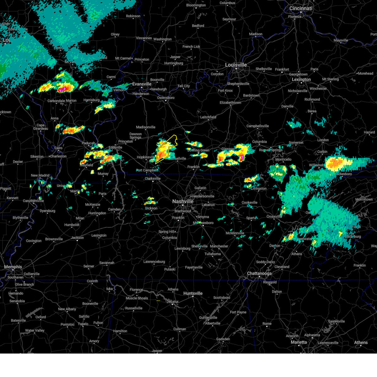 the severe thunderstorm warning has been cancelled and is no longer in effect the severe thunderstorm warning has been cancelled and is no longer in effect
|
| 5/8/2024 12:34 PM CDT |
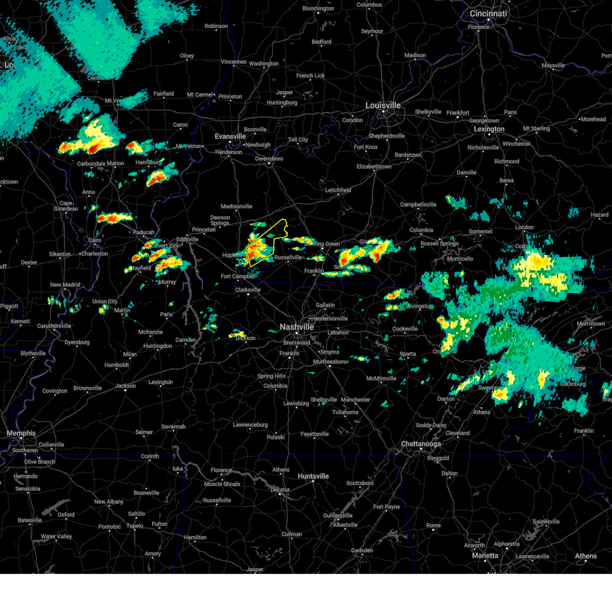 At 1234 pm cdt, a severe thunderstorm was located 11 miles northwest of elkton, moving northeast at 35 mph (radar indicated). Hazards include ping pong ball size hail and 60 mph wind gusts. People and animals outdoors will be injured. expect hail damage to roofs, siding, windows, and vehicles. expect wind damage to roofs, siding, and trees. Locations impacted include, dunmor, clifty, and allegre. At 1234 pm cdt, a severe thunderstorm was located 11 miles northwest of elkton, moving northeast at 35 mph (radar indicated). Hazards include ping pong ball size hail and 60 mph wind gusts. People and animals outdoors will be injured. expect hail damage to roofs, siding, windows, and vehicles. expect wind damage to roofs, siding, and trees. Locations impacted include, dunmor, clifty, and allegre.
|
| 5/8/2024 12:28 PM CDT |
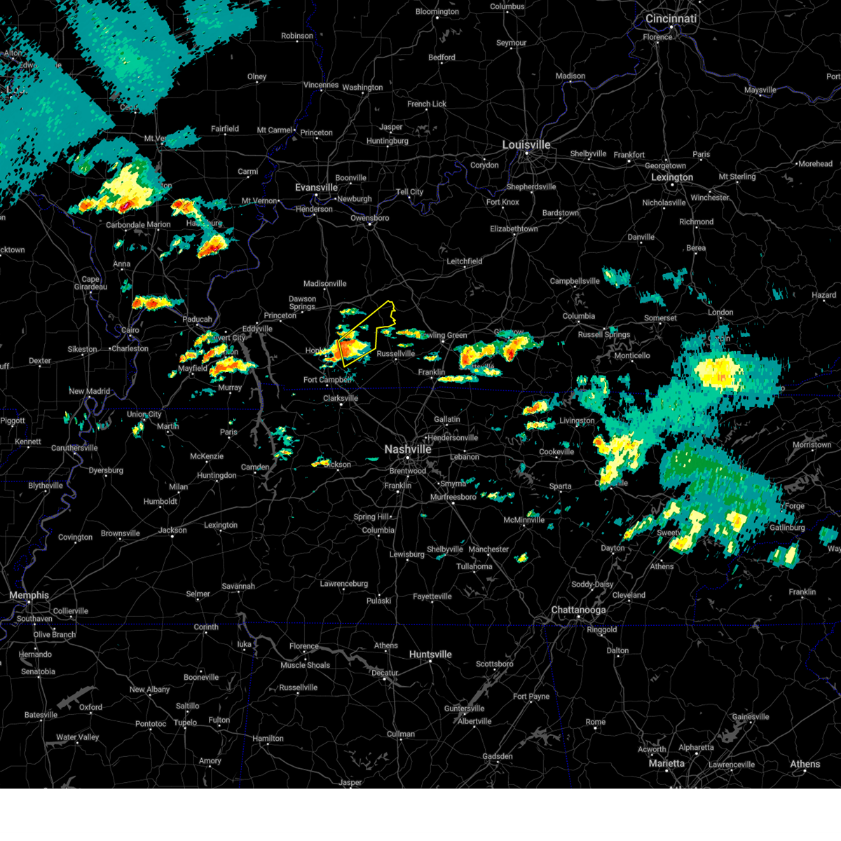 Svrpah the national weather service in paducah has issued a * severe thunderstorm warning for, southeastern muhlenberg county in south central kentucky, east central christian county in south central kentucky, northern todd county in south central kentucky, * until 115 pm cdt. * at 1228 pm cdt, a severe thunderstorm was located 10 miles north of pembroke, or 10 miles east of hopkinsville, moving northeast at 35 mph (radar indicated). Hazards include 60 mph wind gusts and quarter size hail. Hail damage to vehicles is expected. Expect wind damage to roofs, siding, and trees. Svrpah the national weather service in paducah has issued a * severe thunderstorm warning for, southeastern muhlenberg county in south central kentucky, east central christian county in south central kentucky, northern todd county in south central kentucky, * until 115 pm cdt. * at 1228 pm cdt, a severe thunderstorm was located 10 miles north of pembroke, or 10 miles east of hopkinsville, moving northeast at 35 mph (radar indicated). Hazards include 60 mph wind gusts and quarter size hail. Hail damage to vehicles is expected. Expect wind damage to roofs, siding, and trees.
|
| 5/8/2024 12:23 PM CDT |
 At 1222 pm cdt, a severe thunderstorm was located over hopkinsville, moving northeast at 30 mph (radar indicated). Hazards include 60 mph wind gusts and quarter size hail. Hail damage to vehicles is expected. expect wind damage to roofs, siding, and trees. locations impacted include, hopkinsville and pembroke. This includes pennyrile parkway between mile markers 3 and 15. At 1222 pm cdt, a severe thunderstorm was located over hopkinsville, moving northeast at 30 mph (radar indicated). Hazards include 60 mph wind gusts and quarter size hail. Hail damage to vehicles is expected. expect wind damage to roofs, siding, and trees. locations impacted include, hopkinsville and pembroke. This includes pennyrile parkway between mile markers 3 and 15.
|
| 5/8/2024 11:57 AM CDT |
 Svrpah the national weather service in paducah has issued a * severe thunderstorm warning for, central christian county in south central kentucky, * until 1245 pm cdt. * at 1157 am cdt, a severe thunderstorm was located 10 miles northwest of fort campbell, moving northeast at 35 mph (radar indicated). Hazards include 60 mph wind gusts and quarter size hail. Hail damage to vehicles is expected. Expect wind damage to roofs, siding, and trees. Svrpah the national weather service in paducah has issued a * severe thunderstorm warning for, central christian county in south central kentucky, * until 1245 pm cdt. * at 1157 am cdt, a severe thunderstorm was located 10 miles northwest of fort campbell, moving northeast at 35 mph (radar indicated). Hazards include 60 mph wind gusts and quarter size hail. Hail damage to vehicles is expected. Expect wind damage to roofs, siding, and trees.
|
| 4/2/2024 6:33 PM EDT |
 At 633 pm edt, a severe thunderstorm was located over fort wright, moving east at 45 mph (radar indicated). Hazards include 60 mph wind gusts and quarter size hail. Minor hail damage to vehicles is possible. expect wind damage to trees and power lines. locations impacted include, cincinnati, covington, independence, norwood, erlanger, fort thomas, newport, madeira, edgewood, alexandria, elsmere, fort mitchell, villa hills, highland heights, taylor mill, bellevue, fort wright, dayton, ludlow, and southgate. this includes the following interstates, i-71 in ohio between mile markers 0 and 10. i-75 in kentucky between mile markers 184 and 191. I-75 in ohio between mile markers 0 and 4. At 633 pm edt, a severe thunderstorm was located over fort wright, moving east at 45 mph (radar indicated). Hazards include 60 mph wind gusts and quarter size hail. Minor hail damage to vehicles is possible. expect wind damage to trees and power lines. locations impacted include, cincinnati, covington, independence, norwood, erlanger, fort thomas, newport, madeira, edgewood, alexandria, elsmere, fort mitchell, villa hills, highland heights, taylor mill, bellevue, fort wright, dayton, ludlow, and southgate. this includes the following interstates, i-71 in ohio between mile markers 0 and 10. i-75 in kentucky between mile markers 184 and 191. I-75 in ohio between mile markers 0 and 4.
|
| 4/2/2024 6:33 PM EDT |
 the severe thunderstorm warning has been cancelled and is no longer in effect the severe thunderstorm warning has been cancelled and is no longer in effect
|
| 4/2/2024 6:31 PM EDT |
 the tornado warning has been cancelled and is no longer in effect the tornado warning has been cancelled and is no longer in effect
|
| 4/2/2024 6:21 PM EDT |
 At 621 pm edt, a severe thunderstorm capable of producing a tornado was located over oakbrook, moving east at 55 mph (radar indicated rotation). Hazards include tornado and half dollar size hail. Flying debris will be dangerous to those caught without shelter. mobile homes will be damaged or destroyed. damage to roofs, windows, and vehicles will occur. tree damage is likely. locations impacted include, covington, florence, independence, erlanger, edgewood, alexandria, elsmere, highland heights, taylor mill, fort wright, crestview hills, oakbrook, burlington, union, wilder, silver grove, cold spring, ryland heights, crestview, and fairview. This includes i-75 in kentucky between mile markers 178 and 182. At 621 pm edt, a severe thunderstorm capable of producing a tornado was located over oakbrook, moving east at 55 mph (radar indicated rotation). Hazards include tornado and half dollar size hail. Flying debris will be dangerous to those caught without shelter. mobile homes will be damaged or destroyed. damage to roofs, windows, and vehicles will occur. tree damage is likely. locations impacted include, covington, florence, independence, erlanger, edgewood, alexandria, elsmere, highland heights, taylor mill, fort wright, crestview hills, oakbrook, burlington, union, wilder, silver grove, cold spring, ryland heights, crestview, and fairview. This includes i-75 in kentucky between mile markers 178 and 182.
|
| 4/2/2024 6:19 PM EDT |
 At 619 pm edt, a severe thunderstorm was located over oakbrook, moving east at 55 mph (radar indicated). Hazards include 60 mph wind gusts and half dollar size hail. Minor hail damage to vehicles is possible. expect wind damage to trees and power lines. locations impacted include, cincinnati, covington, florence, independence, norwood, erlanger, fort thomas, newport, madeira, edgewood, alexandria, elsmere, fort mitchell, villa hills, highland heights, taylor mill, bellevue, fort wright, dayton, and ludlow. this includes the following interstates, i-71 in ohio between mile markers 0 and 10. i-75 in kentucky between mile markers 177 and 191. I-75 in ohio between mile markers 0 and 4. At 619 pm edt, a severe thunderstorm was located over oakbrook, moving east at 55 mph (radar indicated). Hazards include 60 mph wind gusts and half dollar size hail. Minor hail damage to vehicles is possible. expect wind damage to trees and power lines. locations impacted include, cincinnati, covington, florence, independence, norwood, erlanger, fort thomas, newport, madeira, edgewood, alexandria, elsmere, fort mitchell, villa hills, highland heights, taylor mill, bellevue, fort wright, dayton, and ludlow. this includes the following interstates, i-71 in ohio between mile markers 0 and 10. i-75 in kentucky between mile markers 177 and 191. I-75 in ohio between mile markers 0 and 4.
|
| 4/2/2024 6:19 PM EDT |
 the severe thunderstorm warning has been cancelled and is no longer in effect the severe thunderstorm warning has been cancelled and is no longer in effect
|
| 4/2/2024 6:15 PM EDT |
 Toriln the national weather service in wilmington has issued a * tornado warning for, central kenton county in northern kentucky, central campbell county in northern kentucky, central boone county in northern kentucky, * until 645 pm edt. * at 614 pm edt, a severe thunderstorm capable of producing a tornado was located over rising sun, moving east at 60 mph (radar indicated rotation). Hazards include tornado and half dollar size hail. Flying debris will be dangerous to those caught without shelter. mobile homes will be damaged or destroyed. damage to roofs, windows, and vehicles will occur. Tree damage is likely. Toriln the national weather service in wilmington has issued a * tornado warning for, central kenton county in northern kentucky, central campbell county in northern kentucky, central boone county in northern kentucky, * until 645 pm edt. * at 614 pm edt, a severe thunderstorm capable of producing a tornado was located over rising sun, moving east at 60 mph (radar indicated rotation). Hazards include tornado and half dollar size hail. Flying debris will be dangerous to those caught without shelter. mobile homes will be damaged or destroyed. damage to roofs, windows, and vehicles will occur. Tree damage is likely.
|
| 4/2/2024 6:09 PM EDT |
 At 609 pm edt, a severe thunderstorm was located over rising sun, moving east at 55 mph (radar indicated). Hazards include 60 mph wind gusts and half dollar size hail. Minor hail damage to vehicles is possible. expect wind damage to trees and power lines. locations impacted include, cincinnati, covington, florence, independence, norwood, erlanger, fort thomas, newport, madeira, edgewood, alexandria, elsmere, fort mitchell, villa hills, highland heights, taylor mill, bellevue, fort wright, dayton, and lawrenceburg. this includes the following interstates, i-71 in kentucky between mile markers 74 and 77. i-71 in ohio between mile markers 0 and 11. i-75 in kentucky between mile markers 171 and 191. I-75 in ohio between mile markers 0 and 4. At 609 pm edt, a severe thunderstorm was located over rising sun, moving east at 55 mph (radar indicated). Hazards include 60 mph wind gusts and half dollar size hail. Minor hail damage to vehicles is possible. expect wind damage to trees and power lines. locations impacted include, cincinnati, covington, florence, independence, norwood, erlanger, fort thomas, newport, madeira, edgewood, alexandria, elsmere, fort mitchell, villa hills, highland heights, taylor mill, bellevue, fort wright, dayton, and lawrenceburg. this includes the following interstates, i-71 in kentucky between mile markers 74 and 77. i-71 in ohio between mile markers 0 and 11. i-75 in kentucky between mile markers 171 and 191. I-75 in ohio between mile markers 0 and 4.
|
| 4/2/2024 6:00 PM EDT |
 At 559 pm edt, a severe thunderstorm was located near dillsboro, moving east at 45 mph (public). Hazards include golf ball size hail and 60 mph wind gusts. People and animals outdoors will be injured. expect hail damage to roofs, siding, windows, and vehicles. expect wind damage to trees and power lines. locations impacted include, cincinnati, covington, florence, independence, norwood, erlanger, fort thomas, newport, madeira, edgewood, alexandria, elsmere, fort mitchell, villa hills, highland heights, taylor mill, bellevue, fort wright, dayton, and lawrenceburg. this includes the following interstates, i-71 in kentucky between mile markers 74 and 77. i-71 in ohio between mile markers 0 and 11. i-74 in ohio near mile marker 19. i-75 in kentucky between mile markers 171 and 191. I-75 in ohio between mile markers 0 and 5. At 559 pm edt, a severe thunderstorm was located near dillsboro, moving east at 45 mph (public). Hazards include golf ball size hail and 60 mph wind gusts. People and animals outdoors will be injured. expect hail damage to roofs, siding, windows, and vehicles. expect wind damage to trees and power lines. locations impacted include, cincinnati, covington, florence, independence, norwood, erlanger, fort thomas, newport, madeira, edgewood, alexandria, elsmere, fort mitchell, villa hills, highland heights, taylor mill, bellevue, fort wright, dayton, and lawrenceburg. this includes the following interstates, i-71 in kentucky between mile markers 74 and 77. i-71 in ohio between mile markers 0 and 11. i-74 in ohio near mile marker 19. i-75 in kentucky between mile markers 171 and 191. I-75 in ohio between mile markers 0 and 5.
|
| 4/2/2024 5:54 PM EDT |
 Svriln the national weather service in wilmington has issued a * severe thunderstorm warning for, ohio county in southeastern indiana, southern dearborn county in southeastern indiana, northeastern switzerland county in southeastern indiana, kenton county in northern kentucky, campbell county in northern kentucky, boone county in northern kentucky, southern hamilton county in southwestern ohio, west central clermont county in southwestern ohio, * until 645 pm edt. * at 553 pm edt, a severe thunderstorm was located near dillsboro, moving east at 50 mph (radar indicated). Hazards include 60 mph wind gusts and quarter size hail. Minor hail damage to vehicles is possible. Expect wind damage to trees and power lines. Svriln the national weather service in wilmington has issued a * severe thunderstorm warning for, ohio county in southeastern indiana, southern dearborn county in southeastern indiana, northeastern switzerland county in southeastern indiana, kenton county in northern kentucky, campbell county in northern kentucky, boone county in northern kentucky, southern hamilton county in southwestern ohio, west central clermont county in southwestern ohio, * until 645 pm edt. * at 553 pm edt, a severe thunderstorm was located near dillsboro, moving east at 50 mph (radar indicated). Hazards include 60 mph wind gusts and quarter size hail. Minor hail damage to vehicles is possible. Expect wind damage to trees and power lines.
|
| 4/2/2024 6:01 AM EDT |
 the severe thunderstorm warning has been cancelled and is no longer in effect the severe thunderstorm warning has been cancelled and is no longer in effect
|
| 4/2/2024 5:55 AM EDT |
 At 554 am edt, a severe thunderstorm was located near lawrenceburg, moving east at 55 mph (radar indicated). Hazards include 60 mph wind gusts. Expect damage to trees and power lines. locations impacted include, cincinnati, covington, florence, independence, norwood, erlanger, fort thomas, newport, reading, madeira, edgewood, alexandria, elsmere, cheviot, fort mitchell, villa hills, highland heights, taylor mill, bellevue, and deer park. this includes the following interstates, i-71 in ohio between mile markers 0 and 13. i-74 in ohio between mile markers 11 and 19. i-75 in kentucky between mile markers 176 and 191. I-75 in ohio between mile markers 0 and 11. At 554 am edt, a severe thunderstorm was located near lawrenceburg, moving east at 55 mph (radar indicated). Hazards include 60 mph wind gusts. Expect damage to trees and power lines. locations impacted include, cincinnati, covington, florence, independence, norwood, erlanger, fort thomas, newport, reading, madeira, edgewood, alexandria, elsmere, cheviot, fort mitchell, villa hills, highland heights, taylor mill, bellevue, and deer park. this includes the following interstates, i-71 in ohio between mile markers 0 and 13. i-74 in ohio between mile markers 11 and 19. i-75 in kentucky between mile markers 176 and 191. I-75 in ohio between mile markers 0 and 11.
|
| 4/2/2024 5:55 AM EDT |
 the severe thunderstorm warning has been cancelled and is no longer in effect the severe thunderstorm warning has been cancelled and is no longer in effect
|
| 4/2/2024 5:42 AM EDT |
 At 542 am edt, a severe thunderstorm was located near dillsboro, moving east at 55 mph (radar indicated). Hazards include 60 mph wind gusts and penny size hail. Expect damage to trees and power lines. locations impacted include, cincinnati, covington, florence, independence, norwood, erlanger, fort thomas, newport, reading, madeira, edgewood, alexandria, elsmere, cheviot, fort mitchell, villa hills, highland heights, taylor mill, bellevue, and deer park. this includes the following interstates, i-71 in ohio between mile markers 0 and 13. i-74 in ohio between mile markers 11 and 19. i-75 in kentucky between mile markers 176 and 191. I-75 in ohio between mile markers 0 and 11. At 542 am edt, a severe thunderstorm was located near dillsboro, moving east at 55 mph (radar indicated). Hazards include 60 mph wind gusts and penny size hail. Expect damage to trees and power lines. locations impacted include, cincinnati, covington, florence, independence, norwood, erlanger, fort thomas, newport, reading, madeira, edgewood, alexandria, elsmere, cheviot, fort mitchell, villa hills, highland heights, taylor mill, bellevue, and deer park. this includes the following interstates, i-71 in ohio between mile markers 0 and 13. i-74 in ohio between mile markers 11 and 19. i-75 in kentucky between mile markers 176 and 191. I-75 in ohio between mile markers 0 and 11.
|
| 4/2/2024 5:31 AM EDT |
 Svriln the national weather service in wilmington has issued a * severe thunderstorm warning for, ohio county in southeastern indiana, central ripley county in southeastern indiana, dearborn county in southeastern indiana, northern kenton county in northern kentucky, northern campbell county in northern kentucky, boone county in northern kentucky, central hamilton county in southwestern ohio, * until 615 am edt. * at 531 am edt, a severe thunderstorm was located over versailles, moving east at 55 mph (radar indicated). Hazards include 60 mph wind gusts and penny size hail. expect damage to trees and power lines Svriln the national weather service in wilmington has issued a * severe thunderstorm warning for, ohio county in southeastern indiana, central ripley county in southeastern indiana, dearborn county in southeastern indiana, northern kenton county in northern kentucky, northern campbell county in northern kentucky, boone county in northern kentucky, central hamilton county in southwestern ohio, * until 615 am edt. * at 531 am edt, a severe thunderstorm was located over versailles, moving east at 55 mph (radar indicated). Hazards include 60 mph wind gusts and penny size hail. expect damage to trees and power lines
|
| 4/1/2024 5:06 PM EDT |
 the severe thunderstorm warning has been cancelled and is no longer in effect the severe thunderstorm warning has been cancelled and is no longer in effect
|
| 4/1/2024 4:58 PM EDT |
 the severe thunderstorm warning has been cancelled and is no longer in effect the severe thunderstorm warning has been cancelled and is no longer in effect
|
| 4/1/2024 4:58 PM EDT |
 At 457 pm edt, a severe thunderstorm was located over florence, moving east at 25 mph (radar indicated). Hazards include 60 mph wind gusts and quarter size hail. Minor hail damage to vehicles is possible. expect wind damage to trees and power lines. locations impacted include, covington, florence, independence, erlanger, edgewood, alexandria, elsmere, fort mitchell, highland heights, taylor mill, fort wright, crescent springs, walton, crestview hills, lakeside park, oakbrook, burlington, claryville, union, and wilder. this includes the following interstates, i-71 in kentucky near mile marker 77. I-75 in kentucky between mile markers 173 and 186. At 457 pm edt, a severe thunderstorm was located over florence, moving east at 25 mph (radar indicated). Hazards include 60 mph wind gusts and quarter size hail. Minor hail damage to vehicles is possible. expect wind damage to trees and power lines. locations impacted include, covington, florence, independence, erlanger, edgewood, alexandria, elsmere, fort mitchell, highland heights, taylor mill, fort wright, crescent springs, walton, crestview hills, lakeside park, oakbrook, burlington, claryville, union, and wilder. this includes the following interstates, i-71 in kentucky near mile marker 77. I-75 in kentucky between mile markers 173 and 186.
|
| 4/1/2024 4:40 PM EDT |
 Svriln the national weather service in wilmington has issued a * severe thunderstorm warning for, ohio county in southeastern indiana, kenton county in northern kentucky, southern campbell county in northern kentucky, central boone county in northern kentucky, * until 530 pm edt. * at 440 pm edt, a severe thunderstorm was located near burlington, moving east at 30 mph (radar indicated). Hazards include 60 mph wind gusts and quarter size hail. Minor hail damage to vehicles is possible. Expect wind damage to trees and power lines. Svriln the national weather service in wilmington has issued a * severe thunderstorm warning for, ohio county in southeastern indiana, kenton county in northern kentucky, southern campbell county in northern kentucky, central boone county in northern kentucky, * until 530 pm edt. * at 440 pm edt, a severe thunderstorm was located near burlington, moving east at 30 mph (radar indicated). Hazards include 60 mph wind gusts and quarter size hail. Minor hail damage to vehicles is possible. Expect wind damage to trees and power lines.
|
| 3/14/2024 10:54 PM CDT |
 The storm which prompted the warning has weakened below severe limits, and no longer poses an immediate threat to life or property. therefore, the warning will be allowed to expire. however, gusty winds are still possible with this thunderstorm. a tornado watch remains in effect until midnight cdt for south central kentucky. remember, a severe thunderstorm warning still remains in effect for southern todd county untill 1100 pm cdt. The storm which prompted the warning has weakened below severe limits, and no longer poses an immediate threat to life or property. therefore, the warning will be allowed to expire. however, gusty winds are still possible with this thunderstorm. a tornado watch remains in effect until midnight cdt for south central kentucky. remember, a severe thunderstorm warning still remains in effect for southern todd county untill 1100 pm cdt.
|
| 3/14/2024 10:40 PM CDT |
 At 1039 pm cdt, a severe thunderstorm was located near pembroke, or 7 miles east of hopkinsville, moving east at 40 mph (trained weather spotters). Hazards include 60 mph wind gusts. Expect damage to roofs, siding, and trees. locations impacted include, hopkinsville, elkton, pembroke, clifty, allegre, and everett. This includes pennyrile parkway between mile markers 15 and 17. At 1039 pm cdt, a severe thunderstorm was located near pembroke, or 7 miles east of hopkinsville, moving east at 40 mph (trained weather spotters). Hazards include 60 mph wind gusts. Expect damage to roofs, siding, and trees. locations impacted include, hopkinsville, elkton, pembroke, clifty, allegre, and everett. This includes pennyrile parkway between mile markers 15 and 17.
|
| 3/14/2024 10:29 PM CDT |
 Svrpah the national weather service in paducah has issued a * severe thunderstorm warning for, east central christian county in south central kentucky, central todd county in south central kentucky, * until 1100 pm cdt. * at 1029 pm cdt, a severe thunderstorm was located near hopkinsville, moving northeast at 40 mph (trained weather spotters). Hazards include 70 mph wind gusts and penny size hail. Expect considerable tree damage. Damage is likely to mobile homes, roofs, and outbuildings. Svrpah the national weather service in paducah has issued a * severe thunderstorm warning for, east central christian county in south central kentucky, central todd county in south central kentucky, * until 1100 pm cdt. * at 1029 pm cdt, a severe thunderstorm was located near hopkinsville, moving northeast at 40 mph (trained weather spotters). Hazards include 70 mph wind gusts and penny size hail. Expect considerable tree damage. Damage is likely to mobile homes, roofs, and outbuildings.
|
| 3/6/2024 9:05 AM CST |
 Torpah the national weather service in paducah has issued a * this is a test message. tornado warning for, henderson county in northwestern kentucky, caldwell county in western kentucky, marshall county in western kentucky, trigg county in western kentucky, ballard county in western kentucky, mccracken county in western kentucky, hopkins county in northwestern kentucky, lyon county in western kentucky, fulton county in western kentucky, calloway county in western kentucky, daviess county in northwestern kentucky, muhlenberg county in south central kentucky, crittenden county in western kentucky, livingston county in western kentucky, christian county in south central kentucky, carlisle county in western kentucky, hickman county in western kentucky, mclean county in northwestern kentucky, todd county in south central kentucky, union county in northwestern kentucky, webster county in northwestern kentucky, graves county in western kentucky, * this is a test message. until 915 am cst. * this is a test message. this is a test tornado warning message. there is no severe weather occurring at this time. this test warning message is part of the annual kentucky tornado drill. if this were an actual severe weather event, you would be given information about the hazard. the national weather service, kentucky emergency management agency and the kentucky weather preparedness committee encourages the use of this time to activate and review your severe weather safety plans. repeating, this has been a test tornado warning message for the 2024 kentucky tornado drill. this concludes the test (test radar indicated rotation). Hazards include test tornado. There are no impacts. this is a test tornado warning. this is a test message. Locations include, all counties in western kentucky. Torpah the national weather service in paducah has issued a * this is a test message. tornado warning for, henderson county in northwestern kentucky, caldwell county in western kentucky, marshall county in western kentucky, trigg county in western kentucky, ballard county in western kentucky, mccracken county in western kentucky, hopkins county in northwestern kentucky, lyon county in western kentucky, fulton county in western kentucky, calloway county in western kentucky, daviess county in northwestern kentucky, muhlenberg county in south central kentucky, crittenden county in western kentucky, livingston county in western kentucky, christian county in south central kentucky, carlisle county in western kentucky, hickman county in western kentucky, mclean county in northwestern kentucky, todd county in south central kentucky, union county in northwestern kentucky, webster county in northwestern kentucky, graves county in western kentucky, * this is a test message. until 915 am cst. * this is a test message. this is a test tornado warning message. there is no severe weather occurring at this time. this test warning message is part of the annual kentucky tornado drill. if this were an actual severe weather event, you would be given information about the hazard. the national weather service, kentucky emergency management agency and the kentucky weather preparedness committee encourages the use of this time to activate and review your severe weather safety plans. repeating, this has been a test tornado warning message for the 2024 kentucky tornado drill. this concludes the test (test radar indicated rotation). Hazards include test tornado. There are no impacts. this is a test tornado warning. this is a test message. Locations include, all counties in western kentucky.
|
| 12/9/2023 1:36 PM CST |
 At 136 pm cst, severe thunderstorms were located along a line extending from 6 miles south of hopkinsville to 8 miles southwest of fort campbell, moving northeast at 50 mph (radar indicated). Hazards include 60 mph wind gusts and quarter size hail. Hail damage to vehicles is expected. Expect wind damage to roofs, siding, and trees. At 136 pm cst, severe thunderstorms were located along a line extending from 6 miles south of hopkinsville to 8 miles southwest of fort campbell, moving northeast at 50 mph (radar indicated). Hazards include 60 mph wind gusts and quarter size hail. Hail damage to vehicles is expected. Expect wind damage to roofs, siding, and trees.
|
| 12/9/2023 1:27 PM CST |
 At 127 pm cst, severe thunderstorms were located along a line extending from 9 miles west of fort campbell to near dover, moving east at 40 mph (radar indicated). Hazards include 60 mph wind gusts and half dollar size hail. Hail damage to vehicles is expected. expect wind damage to roofs, siding, and trees. locations impacted include, hopkinsville, oak grove, fort campbell, pembroke, lafayette, and herndon. this includes the following highways, interstate 24 in kentucky between mile markers 74 and 92. Pennyrile parkway between mile markers 1 and 7. At 127 pm cst, severe thunderstorms were located along a line extending from 9 miles west of fort campbell to near dover, moving east at 40 mph (radar indicated). Hazards include 60 mph wind gusts and half dollar size hail. Hail damage to vehicles is expected. expect wind damage to roofs, siding, and trees. locations impacted include, hopkinsville, oak grove, fort campbell, pembroke, lafayette, and herndon. this includes the following highways, interstate 24 in kentucky between mile markers 74 and 92. Pennyrile parkway between mile markers 1 and 7.
|
| 12/9/2023 1:13 PM CST |
 At 113 pm cst, severe thunderstorms were located along a line extending from 6 miles northwest of big rock to 6 miles southwest of dover, moving east at 35 mph (radar indicated). Hazards include 60 mph wind gusts and half dollar size hail. Hail damage to vehicles is expected. Expect wind damage to roofs, siding, and trees. At 113 pm cst, severe thunderstorms were located along a line extending from 6 miles northwest of big rock to 6 miles southwest of dover, moving east at 35 mph (radar indicated). Hazards include 60 mph wind gusts and half dollar size hail. Hail damage to vehicles is expected. Expect wind damage to roofs, siding, and trees.
|
| 9/17/2023 6:12 PM CDT |
 At 611 pm cdt, a severe thunderstorm was located over pembroke, or 7 miles southeast of hopkinsville, moving southeast at 25 mph (trained weather spotters). Hazards include 60 mph wind gusts and quarter size hail. Hail damage to vehicles is expected. expect wind damage to roofs, siding, and trees. this severe storm will be near, oak grove, fort campbell, and pembroke around 615 pm cdt. other locations in the path of this severe thunderstorm include guthrie. this includes the following highways, interstate 24 in kentucky between mile markers 79 and 92. pennyrile parkway between mile markers 1 and 6. hail threat, observed max hail size, 1. 00 in wind threat, radar indicated max wind gust, 60 mph. At 611 pm cdt, a severe thunderstorm was located over pembroke, or 7 miles southeast of hopkinsville, moving southeast at 25 mph (trained weather spotters). Hazards include 60 mph wind gusts and quarter size hail. Hail damage to vehicles is expected. expect wind damage to roofs, siding, and trees. this severe storm will be near, oak grove, fort campbell, and pembroke around 615 pm cdt. other locations in the path of this severe thunderstorm include guthrie. this includes the following highways, interstate 24 in kentucky between mile markers 79 and 92. pennyrile parkway between mile markers 1 and 6. hail threat, observed max hail size, 1. 00 in wind threat, radar indicated max wind gust, 60 mph.
|
| 9/17/2023 5:57 PM CDT |
 At 556 pm cdt, a severe thunderstorm was located over hopkinsville, moving southeast at 25 mph (trained weather spotters reported quarter size hail). Hazards include 60 mph wind gusts and quarter size hail. Hail damage to vehicles is expected. expect wind damage to roofs, siding, and trees. this severe thunderstorm will be near, hopkinsville and pembroke around 600 pm cdt. oak grove around 605 pm cdt. fort campbell around 615 pm cdt. this includes the following highways, interstate 24 in kentucky between mile markers 80 and 92. pennyrile parkway between mile markers 1 and 16. hail threat, observed max hail size, 1. 00 in wind threat, radar indicated max wind gust, 60 mph. At 556 pm cdt, a severe thunderstorm was located over hopkinsville, moving southeast at 25 mph (trained weather spotters reported quarter size hail). Hazards include 60 mph wind gusts and quarter size hail. Hail damage to vehicles is expected. expect wind damage to roofs, siding, and trees. this severe thunderstorm will be near, hopkinsville and pembroke around 600 pm cdt. oak grove around 605 pm cdt. fort campbell around 615 pm cdt. this includes the following highways, interstate 24 in kentucky between mile markers 80 and 92. pennyrile parkway between mile markers 1 and 16. hail threat, observed max hail size, 1. 00 in wind threat, radar indicated max wind gust, 60 mph.
|
| 7/29/2023 8:36 PM CDT |
 At 835 pm cdt, severe thunderstorms were located along a line extending from near greenville to 8 miles northwest of elkton to near fort campbell, moving east at 40 mph (trained weather spotters). Hazards include 60 mph wind gusts and penny size hail. Expect damage to roofs, siding, and trees. locations impacted include, hopkinsville, oak grove, elkton, fort campbell, clarksville, guthrie, pembroke, powderly, greenville, weir, dunmor, drakesboro, trenton, justice, everett, allensville, allegre, clifty and herndon. this includes the following highways, interstate 24 in kentucky between mile markers 79 and 92. pennyrile parkway between mile markers 1 and 9. hail threat, radar indicated max hail size, 0. 75 in wind threat, observed max wind gust, 60 mph. At 835 pm cdt, severe thunderstorms were located along a line extending from near greenville to 8 miles northwest of elkton to near fort campbell, moving east at 40 mph (trained weather spotters). Hazards include 60 mph wind gusts and penny size hail. Expect damage to roofs, siding, and trees. locations impacted include, hopkinsville, oak grove, elkton, fort campbell, clarksville, guthrie, pembroke, powderly, greenville, weir, dunmor, drakesboro, trenton, justice, everett, allensville, allegre, clifty and herndon. this includes the following highways, interstate 24 in kentucky between mile markers 79 and 92. pennyrile parkway between mile markers 1 and 9. hail threat, radar indicated max hail size, 0. 75 in wind threat, observed max wind gust, 60 mph.
|
| 7/29/2023 8:22 PM CDT |
 At 822 pm cdt, severe thunderstorms were located along a line extending from near weir to near hopkinsville, moving east at 50 mph (trained weather spotters). Hazards include 60 mph wind gusts and penny size hail. Expect damage to roofs, siding, and trees. locations impacted include, hopkinsville, crofton and white plains. this includes the following highways, western kentucky parkway near mile marker 40. pennyrile parkway between mile markers 9 and 29. hail threat, radar indicated max hail size, 0. 75 in wind threat, observed max wind gust, 60 mph. At 822 pm cdt, severe thunderstorms were located along a line extending from near weir to near hopkinsville, moving east at 50 mph (trained weather spotters). Hazards include 60 mph wind gusts and penny size hail. Expect damage to roofs, siding, and trees. locations impacted include, hopkinsville, crofton and white plains. this includes the following highways, western kentucky parkway near mile marker 40. pennyrile parkway between mile markers 9 and 29. hail threat, radar indicated max hail size, 0. 75 in wind threat, observed max wind gust, 60 mph.
|
| 7/29/2023 8:14 PM CDT |
 At 814 pm cdt, severe thunderstorms were located along a line extending from near weir to 6 miles northeast of hopkinsville to 7 miles northeast of big rock, moving east at 45 mph (trained weather spotters). Hazards include 60 mph wind gusts and nickel size hail. expect damage to roofs, siding, and trees At 814 pm cdt, severe thunderstorms were located along a line extending from near weir to 6 miles northeast of hopkinsville to 7 miles northeast of big rock, moving east at 45 mph (trained weather spotters). Hazards include 60 mph wind gusts and nickel size hail. expect damage to roofs, siding, and trees
|
| 7/29/2023 8:08 PM CDT |
 At 807 pm cdt, a severe thunderstorm was located near crofton, or 8 miles north of hopkinsville, moving east at 40 mph (trained weather spotters). Hazards include 60 mph wind gusts and quarter size hail. Hail damage to vehicles is expected. expect wind damage to roofs, siding, and trees. locations impacted include, hopkinsville, dawson springs, nortonville, crofton, white plains, st. charles and hawkins. this includes pennyrile parkway between mile markers 9 and 33. hail threat, radar indicated max hail size, 1. 00 in wind threat, observed max wind gust, 60 mph. At 807 pm cdt, a severe thunderstorm was located near crofton, or 8 miles north of hopkinsville, moving east at 40 mph (trained weather spotters). Hazards include 60 mph wind gusts and quarter size hail. Hail damage to vehicles is expected. expect wind damage to roofs, siding, and trees. locations impacted include, hopkinsville, dawson springs, nortonville, crofton, white plains, st. charles and hawkins. this includes pennyrile parkway between mile markers 9 and 33. hail threat, radar indicated max hail size, 1. 00 in wind threat, observed max wind gust, 60 mph.
|
| 7/29/2023 7:51 PM CDT |
 At 751 pm cdt, a severe thunderstorm was located near cobb, or 7 miles south of dawson springs, moving east at 30 mph (radar indicated). Hazards include 60 mph wind gusts and quarter size hail. Hail damage to vehicles is expected. Expect wind damage to roofs, siding, and trees. At 751 pm cdt, a severe thunderstorm was located near cobb, or 7 miles south of dawson springs, moving east at 30 mph (radar indicated). Hazards include 60 mph wind gusts and quarter size hail. Hail damage to vehicles is expected. Expect wind damage to roofs, siding, and trees.
|
| 7/29/2023 4:55 AM EDT |
 At 455 am edt, a severe thunderstorm was located over bridgetown, moving southeast at 45 mph (radar indicated). Hazards include 60 mph wind gusts and penny size hail. expect damage to trees and power lines At 455 am edt, a severe thunderstorm was located over bridgetown, moving southeast at 45 mph (radar indicated). Hazards include 60 mph wind gusts and penny size hail. expect damage to trees and power lines
|
| 7/27/2023 10:26 PM EDT |
 The severe thunderstorm warning for kenton, northern campbell, northern boone and southern hamilton counties will expire at 1030 pm edt, the storm which prompted the warning has weakened below severe limits, and no longer poses an immediate threat to life or property. therefore, the warning will be allowed to expire. however gusty winds are still possible with this thunderstorm. please report previous wind damage or hail to the national weather service by going to our website at weather.gov/iln and submitting your report via social media. The severe thunderstorm warning for kenton, northern campbell, northern boone and southern hamilton counties will expire at 1030 pm edt, the storm which prompted the warning has weakened below severe limits, and no longer poses an immediate threat to life or property. therefore, the warning will be allowed to expire. however gusty winds are still possible with this thunderstorm. please report previous wind damage or hail to the national weather service by going to our website at weather.gov/iln and submitting your report via social media.
|
| 7/27/2023 10:20 PM EDT |
 At 1019 pm edt, a severe thunderstorm was located near independence, moving southeast at 15 mph (radar indicated). Hazards include 60 mph wind gusts. expect damage to trees and power lines At 1019 pm edt, a severe thunderstorm was located near independence, moving southeast at 15 mph (radar indicated). Hazards include 60 mph wind gusts. expect damage to trees and power lines
|
| 7/27/2023 10:11 PM EDT |
 At 1011 pm edt, a severe thunderstorm was located over crestview hills, moving southeast at 20 mph (radar indicated). Hazards include 60 mph wind gusts and penny size hail. Expect damage to trees and power lines. locations impacted include, cincinnati, covington, florence, independence, erlanger, fort thomas, newport, edgewood, alexandria, elsmere, cheviot, fort mitchell, villa hills, highland heights, taylor mill, bellevue, fort wright, dayton, ludlow and southgate. this includes the following interstates, i-71 in kentucky near mile marker 77. i-71 in ohio between mile markers 0 and 2. i-75 in kentucky between mile markers 172 and 191. i-75 in ohio between mile markers 0 and 3. hail threat, radar indicated max hail size, 0. 75 in wind threat, radar indicated max wind gust, 60 mph. At 1011 pm edt, a severe thunderstorm was located over crestview hills, moving southeast at 20 mph (radar indicated). Hazards include 60 mph wind gusts and penny size hail. Expect damage to trees and power lines. locations impacted include, cincinnati, covington, florence, independence, erlanger, fort thomas, newport, edgewood, alexandria, elsmere, cheviot, fort mitchell, villa hills, highland heights, taylor mill, bellevue, fort wright, dayton, ludlow and southgate. this includes the following interstates, i-71 in kentucky near mile marker 77. i-71 in ohio between mile markers 0 and 2. i-75 in kentucky between mile markers 172 and 191. i-75 in ohio between mile markers 0 and 3. hail threat, radar indicated max hail size, 0. 75 in wind threat, radar indicated max wind gust, 60 mph.
|
| 7/27/2023 9:57 PM EDT |
 At 956 pm edt, a severe thunderstorm was located over villa hills, moving southeast at 20 mph (radar indicated). Hazards include 60 mph wind gusts and penny size hail. Expect damage to trees and power lines. locations impacted include, cincinnati, covington, florence, independence, norwood, erlanger, fort thomas, newport, north college hill, edgewood, alexandria, elsmere, cheviot, fort mitchell, villa hills, highland heights, taylor mill, bellevue, fort wright and dayton. this includes the following interstates, i-71 in kentucky near mile marker 77. i-71 in ohio between mile markers 0 and 7. i-74 in ohio between mile markers 7 and 19. i-75 in kentucky between mile markers 172 and 191. i-75 in ohio between mile markers 0 and 8. hail threat, radar indicated max hail size, 0. 75 in wind threat, radar indicated max wind gust, 60 mph. At 956 pm edt, a severe thunderstorm was located over villa hills, moving southeast at 20 mph (radar indicated). Hazards include 60 mph wind gusts and penny size hail. Expect damage to trees and power lines. locations impacted include, cincinnati, covington, florence, independence, norwood, erlanger, fort thomas, newport, north college hill, edgewood, alexandria, elsmere, cheviot, fort mitchell, villa hills, highland heights, taylor mill, bellevue, fort wright and dayton. this includes the following interstates, i-71 in kentucky near mile marker 77. i-71 in ohio between mile markers 0 and 7. i-74 in ohio between mile markers 7 and 19. i-75 in kentucky between mile markers 172 and 191. i-75 in ohio between mile markers 0 and 8. hail threat, radar indicated max hail size, 0. 75 in wind threat, radar indicated max wind gust, 60 mph.
|
| 7/27/2023 9:40 PM EDT |
 At 940 pm edt, a severe thunderstorm was located over bridgetown, moving southeast at 25 mph (radar indicated). Hazards include 60 mph wind gusts and penny size hail. expect damage to trees and power lines At 940 pm edt, a severe thunderstorm was located over bridgetown, moving southeast at 25 mph (radar indicated). Hazards include 60 mph wind gusts and penny size hail. expect damage to trees and power lines
|
| 7/24/2023 4:42 PM CDT |
 At 441 pm cdt, a severe thunderstorm was located over hopkinsville, moving east at 30 mph (radar indicated). Hazards include 60 mph wind gusts and penny size hail. expect damage to roofs, siding, and trees At 441 pm cdt, a severe thunderstorm was located over hopkinsville, moving east at 30 mph (radar indicated). Hazards include 60 mph wind gusts and penny size hail. expect damage to roofs, siding, and trees
|
| 7/24/2023 4:35 PM CDT |
 At 434 pm cdt, a severe thunderstorm was located near hopkinsville, moving east at 45 mph (radar indicated). Hazards include 60 mph wind gusts and nickel size hail. Expect damage to roofs, siding, and trees. locations impacted include, hopkinsville and pembroke. this includes the following highways, interstate 24 in kentucky between mile markers 70 and 77. pennyrile parkway between mile markers 2 and 18. hail threat, radar indicated max hail size, 0. 88 in wind threat, radar indicated max wind gust, 60 mph. At 434 pm cdt, a severe thunderstorm was located near hopkinsville, moving east at 45 mph (radar indicated). Hazards include 60 mph wind gusts and nickel size hail. Expect damage to roofs, siding, and trees. locations impacted include, hopkinsville and pembroke. this includes the following highways, interstate 24 in kentucky between mile markers 70 and 77. pennyrile parkway between mile markers 2 and 18. hail threat, radar indicated max hail size, 0. 88 in wind threat, radar indicated max wind gust, 60 mph.
|
| 7/24/2023 4:10 PM CDT |
 At 409 pm cdt, a severe thunderstorm was located over cobb, or 8 miles north of cadiz, moving east at 45 mph (radar indicated). Hazards include 70 mph wind gusts and quarter size hail. Hail damage to vehicles is expected. expect considerable tree damage. Wind damage is also likely to mobile homes, roofs, and outbuildings. At 409 pm cdt, a severe thunderstorm was located over cobb, or 8 miles north of cadiz, moving east at 45 mph (radar indicated). Hazards include 70 mph wind gusts and quarter size hail. Hail damage to vehicles is expected. expect considerable tree damage. Wind damage is also likely to mobile homes, roofs, and outbuildings.
|
| 7/20/2023 12:00 PM CDT |
 At 1200 pm cdt, severe thunderstorms were located along a line extending from near nortonville to 6 miles northwest of elkton to near pembroke, moving east at 65 mph (radar indicated). Hazards include 60 mph wind gusts. Expect damage to roofs, siding, and trees. locations impacted include, elkton, nortonville, pembroke, weir, dunmor, white plains, justice, allegre, everett and clifty. this includes pennyrile parkway between mile markers 27 and 31. hail threat, radar indicated max hail size, <. 75 in wind threat, radar indicated max wind gust, 60 mph. At 1200 pm cdt, severe thunderstorms were located along a line extending from near nortonville to 6 miles northwest of elkton to near pembroke, moving east at 65 mph (radar indicated). Hazards include 60 mph wind gusts. Expect damage to roofs, siding, and trees. locations impacted include, elkton, nortonville, pembroke, weir, dunmor, white plains, justice, allegre, everett and clifty. this includes pennyrile parkway between mile markers 27 and 31. hail threat, radar indicated max hail size, <. 75 in wind threat, radar indicated max wind gust, 60 mph.
|
| 7/20/2023 11:40 AM CDT |
 At 1139 am cdt, severe thunderstorms were located along a line extending from near dawson springs to 8 miles northwest of hopkinsville to 8 miles east of wranglers campground, moving east at 55 mph (radar indicated). Hazards include 70 mph wind gusts. Expect considerable tree damage. Damage is likely to mobile homes, roofs, and outbuildings. At 1139 am cdt, severe thunderstorms were located along a line extending from near dawson springs to 8 miles northwest of hopkinsville to 8 miles east of wranglers campground, moving east at 55 mph (radar indicated). Hazards include 70 mph wind gusts. Expect considerable tree damage. Damage is likely to mobile homes, roofs, and outbuildings.
|
| 7/18/2023 2:33 PM CDT |
 At 232 pm cdt, severe thunderstorms were located along a line extending from 7 miles northeast of olney to near crofton to near fort campbell to 6 miles northwest of tennessee ridge, moving east at 55 mph (trained weather spotters). Hazards include 70 mph wind gusts. Expect considerable tree damage. damage is likely to mobile homes, roofs, and outbuildings. locations impacted include, hopkinsville, oak grove, dawson springs, fort campbell, earlington, nortonville, pembroke, mortons gap, crofton, olney, st. charles, lafayette, hawkins and herndon. this includes the following highways, interstate 24 in kentucky between mile markers 70 and 92. interstate 69 in kentucky between mile markers 90 and 105. pennyrile parkway between mile markers 1 and 32. thunderstorm damage threat, considerable hail threat, radar indicated max hail size, <. 75 in wind threat, radar indicated max wind gust, 70 mph. At 232 pm cdt, severe thunderstorms were located along a line extending from 7 miles northeast of olney to near crofton to near fort campbell to 6 miles northwest of tennessee ridge, moving east at 55 mph (trained weather spotters). Hazards include 70 mph wind gusts. Expect considerable tree damage. damage is likely to mobile homes, roofs, and outbuildings. locations impacted include, hopkinsville, oak grove, dawson springs, fort campbell, earlington, nortonville, pembroke, mortons gap, crofton, olney, st. charles, lafayette, hawkins and herndon. this includes the following highways, interstate 24 in kentucky between mile markers 70 and 92. interstate 69 in kentucky between mile markers 90 and 105. pennyrile parkway between mile markers 1 and 32. thunderstorm damage threat, considerable hail threat, radar indicated max hail size, <. 75 in wind threat, radar indicated max wind gust, 70 mph.
|
| 7/18/2023 2:22 PM CDT |
 At 222 pm cdt, severe thunderstorms were located along a line extending from near olney to 6 miles northwest of hopkinsville to 6 miles northeast of big rock, moving east at 45 mph (radar indicated). Hazards include 60 mph wind gusts. expect damage to roofs, siding, and trees At 222 pm cdt, severe thunderstorms were located along a line extending from near olney to 6 miles northwest of hopkinsville to 6 miles northeast of big rock, moving east at 45 mph (radar indicated). Hazards include 60 mph wind gusts. expect damage to roofs, siding, and trees
|
| 7/18/2023 2:19 PM CDT |
 At 219 pm cdt, severe thunderstorms were located along a line extending from near creswell to near cobb to 6 miles north of big rock to near paris landing state park, moving east at 55 mph (radar indicated). Hazards include 60 mph wind gusts. Expect damage to roofs, siding, and trees. locations impacted include, hopkinsville, oak grove, princeton, dawson springs, cadiz, wranglers campground, fort campbell, land between the lakes area, clarksville, earlington, nortonville, pembroke, mortons gap, crofton, olney, creswell, farmersville, cobb, canton and fredonia. this includes the following highways, interstate 24 in kentucky between mile markers 48 and 92. interstate 69 in kentucky between mile markers 74 and 105. pennyrile parkway between mile markers 1 and 32. hail threat, radar indicated max hail size, <. 75 in wind threat, radar indicated max wind gust, 60 mph. At 219 pm cdt, severe thunderstorms were located along a line extending from near creswell to near cobb to 6 miles north of big rock to near paris landing state park, moving east at 55 mph (radar indicated). Hazards include 60 mph wind gusts. Expect damage to roofs, siding, and trees. locations impacted include, hopkinsville, oak grove, princeton, dawson springs, cadiz, wranglers campground, fort campbell, land between the lakes area, clarksville, earlington, nortonville, pembroke, mortons gap, crofton, olney, creswell, farmersville, cobb, canton and fredonia. this includes the following highways, interstate 24 in kentucky between mile markers 48 and 92. interstate 69 in kentucky between mile markers 74 and 105. pennyrile parkway between mile markers 1 and 32. hail threat, radar indicated max hail size, <. 75 in wind threat, radar indicated max wind gust, 60 mph.
|
| 7/18/2023 2:07 PM CDT |
 At 207 pm cdt, severe thunderstorms were located along a line extending from near marion to near cobb to 8 miles southeast of wranglers campground to near paris landing state park, moving east at 45 mph (radar indicated). Hazards include 60 mph wind gusts. Expect damage to roofs, siding, and trees. locations impacted include, hopkinsville, madisonville, oak grove, princeton, providence, dawson springs, cadiz, wranglers campground, fort campbell, land between the lakes area, clarksville, earlington, nortonville, clay, pembroke, mortons gap, crofton, olney, creswell and farmersville. this includes the following highways, interstate 24 in kentucky between mile markers 48 and 92. interstate 69 in kentucky between mile markers 74 and 110. western kentucky parkway near mile marker 39. pennyrile parkway between mile markers 1 and 34. hail threat, radar indicated max hail size, <. 75 in wind threat, radar indicated max wind gust, 60 mph. At 207 pm cdt, severe thunderstorms were located along a line extending from near marion to near cobb to 8 miles southeast of wranglers campground to near paris landing state park, moving east at 45 mph (radar indicated). Hazards include 60 mph wind gusts. Expect damage to roofs, siding, and trees. locations impacted include, hopkinsville, madisonville, oak grove, princeton, providence, dawson springs, cadiz, wranglers campground, fort campbell, land between the lakes area, clarksville, earlington, nortonville, clay, pembroke, mortons gap, crofton, olney, creswell and farmersville. this includes the following highways, interstate 24 in kentucky between mile markers 48 and 92. interstate 69 in kentucky between mile markers 74 and 110. western kentucky parkway near mile marker 39. pennyrile parkway between mile markers 1 and 34. hail threat, radar indicated max hail size, <. 75 in wind threat, radar indicated max wind gust, 60 mph.
|
| 7/18/2023 1:45 PM CDT |
 At 144 pm cdt, severe thunderstorms were located along a line extending from near rosiclare to eddyville to near turkey bay to 6 miles north of cottage grove, moving east at 55 mph (radar indicated). Hazards include 60 mph wind gusts. expect damage to roofs, siding, and trees At 144 pm cdt, severe thunderstorms were located along a line extending from near rosiclare to eddyville to near turkey bay to 6 miles north of cottage grove, moving east at 55 mph (radar indicated). Hazards include 60 mph wind gusts. expect damage to roofs, siding, and trees
|
| 7/17/2023 9:38 PM CDT |
 At 938 pm cdt, severe thunderstorms were located along a line extending from near olney to cadiz, moving east at 35 mph (radar indicated). Hazards include 60 mph wind gusts and quarter size hail. Hail damage to vehicles is expected. expect wind damage to roofs, siding, and trees. locations impacted include, hopkinsville, madisonville, dawson springs, cadiz, earlington, nortonville, mortons gap, crofton, olney, cobb, white plains, st. charles and hawkins. this includes the following highways, interstate 24 in kentucky between mile markers 59 and 74. interstate 69 in kentucky between mile markers 86 and 113. western kentucky parkway between mile markers 39 and 43. pennyrile parkway between mile markers 5 and 34. hail threat, radar indicated max hail size, 1. 00 in wind threat, radar indicated max wind gust, 60 mph. At 938 pm cdt, severe thunderstorms were located along a line extending from near olney to cadiz, moving east at 35 mph (radar indicated). Hazards include 60 mph wind gusts and quarter size hail. Hail damage to vehicles is expected. expect wind damage to roofs, siding, and trees. locations impacted include, hopkinsville, madisonville, dawson springs, cadiz, earlington, nortonville, mortons gap, crofton, olney, cobb, white plains, st. charles and hawkins. this includes the following highways, interstate 24 in kentucky between mile markers 59 and 74. interstate 69 in kentucky between mile markers 86 and 113. western kentucky parkway between mile markers 39 and 43. pennyrile parkway between mile markers 5 and 34. hail threat, radar indicated max hail size, 1. 00 in wind threat, radar indicated max wind gust, 60 mph.
|
| 7/17/2023 9:12 PM CDT |
 At 911 pm cdt, severe thunderstorms were located along a line extending from 5 miles north of princeton to canton, moving east at 35 mph (radar indicated). Hazards include 60 mph wind gusts and quarter size hail. Hail damage to vehicles is expected. Expect wind damage to roofs, siding, and trees. At 911 pm cdt, severe thunderstorms were located along a line extending from 5 miles north of princeton to canton, moving east at 35 mph (radar indicated). Hazards include 60 mph wind gusts and quarter size hail. Hail damage to vehicles is expected. Expect wind damage to roofs, siding, and trees.
|
| 7/8/2023 1:50 PM CDT |
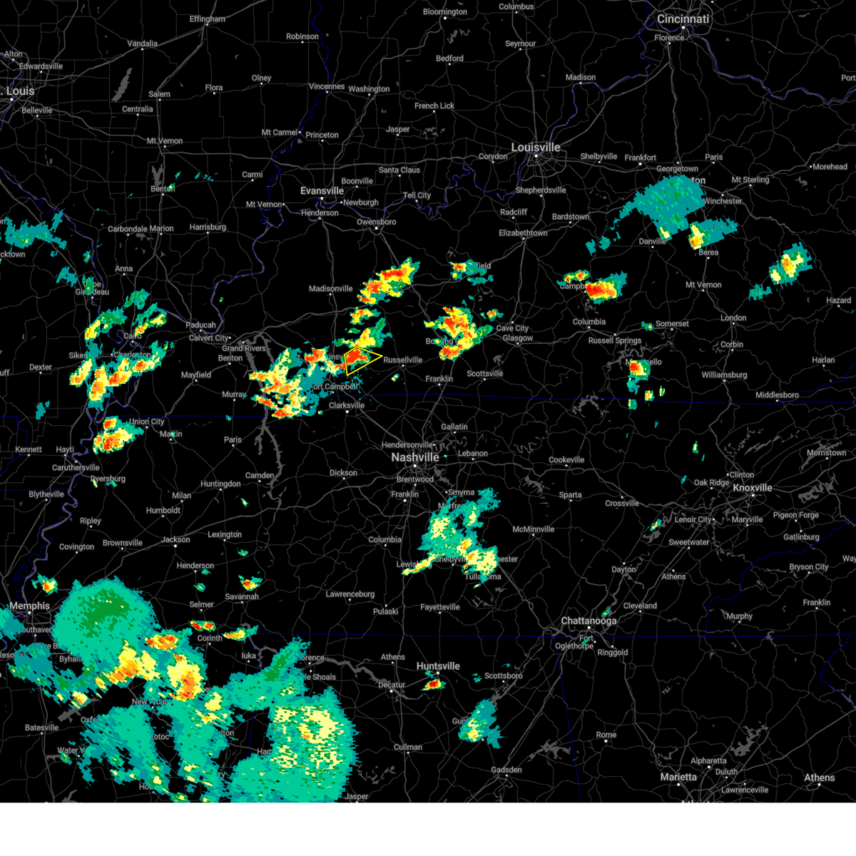 At 150 pm cdt, a severe thunderstorm was located 8 miles northeast of pembroke, or 8 miles northwest of elkton, moving southeast at 25 mph (radar indicated). Hazards include 60 mph wind gusts and penny size hail. Expect damage to roofs, siding, and trees. locations impacted include, pembroke and allegre. hail threat, radar indicated max hail size, 0. 75 in wind threat, radar indicated max wind gust, 60 mph. At 150 pm cdt, a severe thunderstorm was located 8 miles northeast of pembroke, or 8 miles northwest of elkton, moving southeast at 25 mph (radar indicated). Hazards include 60 mph wind gusts and penny size hail. Expect damage to roofs, siding, and trees. locations impacted include, pembroke and allegre. hail threat, radar indicated max hail size, 0. 75 in wind threat, radar indicated max wind gust, 60 mph.
|
| 7/8/2023 1:36 PM CDT |
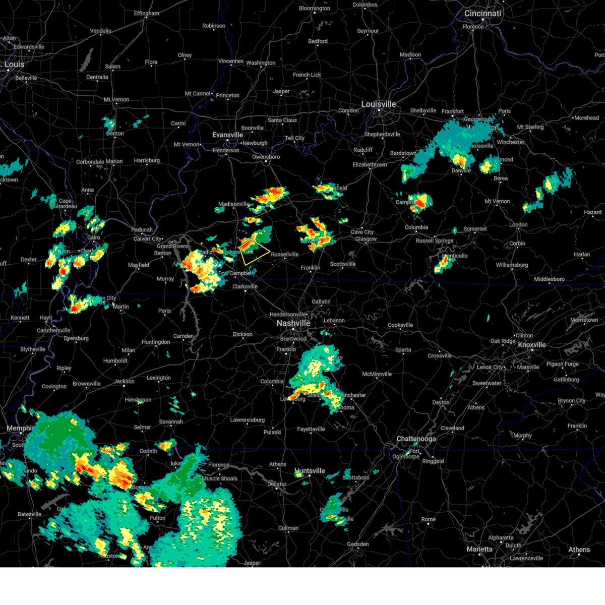 At 136 pm cdt, a severe thunderstorm was located 10 miles southeast of crofton, or 11 miles northeast of hopkinsville, moving southeast at 15 mph (radar indicated). Hazards include 60 mph wind gusts and quarter size hail. Hail damage to vehicles is expected. Expect wind damage to roofs, siding, and trees. At 136 pm cdt, a severe thunderstorm was located 10 miles southeast of crofton, or 11 miles northeast of hopkinsville, moving southeast at 15 mph (radar indicated). Hazards include 60 mph wind gusts and quarter size hail. Hail damage to vehicles is expected. Expect wind damage to roofs, siding, and trees.
|
| 6/29/2023 11:55 AM CDT |
 At 1155 am cdt, severe thunderstorms were located along a line extending from near pembroke to 8 miles southeast of elkton, moving south at 20 mph (radar indicated). Hazards include 60 mph wind gusts and quarter size hail. Hail damage to vehicles is expected. Expect wind damage to roofs, siding, and trees. At 1155 am cdt, severe thunderstorms were located along a line extending from near pembroke to 8 miles southeast of elkton, moving south at 20 mph (radar indicated). Hazards include 60 mph wind gusts and quarter size hail. Hail damage to vehicles is expected. Expect wind damage to roofs, siding, and trees.
|
| 6/29/2023 11:41 AM CDT |
 At 1141 am cdt, severe thunderstorms were located along a line extending from pembroke to 7 miles southeast of elkton, moving south at 20 mph (radar indicated). Hazards include 60 mph wind gusts and penny size hail. Expect damage to roofs, siding, and trees. locations impacted include, oak grove, elkton, guthrie, pembroke, trenton, justice and allensville. this includes interstate 24 in kentucky between mile markers 90 and 92. hail threat, radar indicated max hail size, 0. 75 in wind threat, radar indicated max wind gust, 60 mph. At 1141 am cdt, severe thunderstorms were located along a line extending from pembroke to 7 miles southeast of elkton, moving south at 20 mph (radar indicated). Hazards include 60 mph wind gusts and penny size hail. Expect damage to roofs, siding, and trees. locations impacted include, oak grove, elkton, guthrie, pembroke, trenton, justice and allensville. this includes interstate 24 in kentucky between mile markers 90 and 92. hail threat, radar indicated max hail size, 0. 75 in wind threat, radar indicated max wind gust, 60 mph.
|
| 6/29/2023 11:16 AM CDT |
 At 1115 am cdt, severe thunderstorms were located along a line extending from 11 miles north of pembroke to 9 miles northeast of elkton, moving south at 25 mph (radar indicated). Hazards include 60 mph wind gusts and penny size hail. expect damage to roofs, siding, and trees At 1115 am cdt, severe thunderstorms were located along a line extending from 11 miles north of pembroke to 9 miles northeast of elkton, moving south at 25 mph (radar indicated). Hazards include 60 mph wind gusts and penny size hail. expect damage to roofs, siding, and trees
|
| 5/9/2023 1:04 AM CDT |
 At 104 am cdt, a severe thunderstorm was located 9 miles northwest of elkton, moving east at 45 mph (radar indicated). Hazards include 60 mph wind gusts and quarter size hail. Hail damage to vehicles is expected. expect wind damage to roofs, siding, and trees. locations impacted include, elkton, pembroke, clifty and allegre. hail threat, radar indicated max hail size, 1. 00 in wind threat, radar indicated max wind gust, 60 mph. At 104 am cdt, a severe thunderstorm was located 9 miles northwest of elkton, moving east at 45 mph (radar indicated). Hazards include 60 mph wind gusts and quarter size hail. Hail damage to vehicles is expected. expect wind damage to roofs, siding, and trees. locations impacted include, elkton, pembroke, clifty and allegre. hail threat, radar indicated max hail size, 1. 00 in wind threat, radar indicated max wind gust, 60 mph.
|
| 5/9/2023 12:44 AM CDT |
 At 1243 am cdt, a severe thunderstorm was located near hopkinsville, moving east at 45 mph (radar indicated). Hazards include 60 mph wind gusts and penny size hail. expect damage to roofs, siding, and trees At 1243 am cdt, a severe thunderstorm was located near hopkinsville, moving east at 45 mph (radar indicated). Hazards include 60 mph wind gusts and penny size hail. expect damage to roofs, siding, and trees
|
| 5/7/2023 6:25 PM CDT |
 At 624 pm cdt, a severe thunderstorm was located near pembroke, or 9 miles east of hopkinsville, moving east at 30 mph (radar indicated). Hazards include quarter size hail. Damage to vehicles is expected. locations impacted include, elkton, pembroke, allegre and allensville. hail threat, radar indicated max hail size, 1. 00 in wind threat, radar indicated max wind gust, <50 mph. At 624 pm cdt, a severe thunderstorm was located near pembroke, or 9 miles east of hopkinsville, moving east at 30 mph (radar indicated). Hazards include quarter size hail. Damage to vehicles is expected. locations impacted include, elkton, pembroke, allegre and allensville. hail threat, radar indicated max hail size, 1. 00 in wind threat, radar indicated max wind gust, <50 mph.
|
| 5/7/2023 6:11 PM CDT |
 At 611 pm cdt, a severe thunderstorm was located over hopkinsville, moving east at 30 mph (radar indicated). Hazards include quarter size hail. damage to vehicles is expected At 611 pm cdt, a severe thunderstorm was located over hopkinsville, moving east at 30 mph (radar indicated). Hazards include quarter size hail. damage to vehicles is expected
|
| 5/7/2023 4:03 PM CDT |
 At 402 pm cdt, a severe thunderstorm was located 8 miles southwest of hopkinsville, moving northeast at 30 mph (radar indicated). Hazards include two inch hail and 60 mph wind gusts. large hail may accumulate as it crosses interstate 24 between mile markers 73 and 78. People and animals outdoors will be injured. expect hail damage to roofs, siding, windows, and vehicles. expect wind damage to roofs, siding, and trees. locations impacted include, hopkinsville, oak grove, elkton, fort campbell, pembroke, trenton, lafayette, allegre and herndon. this includes the following highways, interstate 24 in kentucky between mile markers 71 and 88. pennyrile parkway between mile markers 1 and 12. thunderstorm damage threat, considerable hail threat, radar indicated max hail size, 2. 00 in wind threat, radar indicated max wind gust, 60 mph. At 402 pm cdt, a severe thunderstorm was located 8 miles southwest of hopkinsville, moving northeast at 30 mph (radar indicated). Hazards include two inch hail and 60 mph wind gusts. large hail may accumulate as it crosses interstate 24 between mile markers 73 and 78. People and animals outdoors will be injured. expect hail damage to roofs, siding, windows, and vehicles. expect wind damage to roofs, siding, and trees. locations impacted include, hopkinsville, oak grove, elkton, fort campbell, pembroke, trenton, lafayette, allegre and herndon. this includes the following highways, interstate 24 in kentucky between mile markers 71 and 88. pennyrile parkway between mile markers 1 and 12. thunderstorm damage threat, considerable hail threat, radar indicated max hail size, 2. 00 in wind threat, radar indicated max wind gust, 60 mph.
|
| 5/7/2023 3:55 PM CDT |
 At 355 pm cdt, a severe thunderstorm was located 10 miles northwest of fort campbell, moving northeast at 30 mph (radar indicated). Hazards include two inch hail and 60 mph wind gusts. People and animals outdoors will be injured. expect hail damage to roofs, siding, windows, and vehicles. expect wind damage to roofs, siding, and trees. locations impacted include, hopkinsville, oak grove, elkton, fort campbell, pembroke, trenton, lafayette, allegre and herndon. this includes the following highways, interstate 24 in kentucky between mile markers 71 and 88. pennyrile parkway between mile markers 1 and 12. thunderstorm damage threat, considerable hail threat, radar indicated max hail size, 2. 00 in wind threat, radar indicated max wind gust, 60 mph. At 355 pm cdt, a severe thunderstorm was located 10 miles northwest of fort campbell, moving northeast at 30 mph (radar indicated). Hazards include two inch hail and 60 mph wind gusts. People and animals outdoors will be injured. expect hail damage to roofs, siding, windows, and vehicles. expect wind damage to roofs, siding, and trees. locations impacted include, hopkinsville, oak grove, elkton, fort campbell, pembroke, trenton, lafayette, allegre and herndon. this includes the following highways, interstate 24 in kentucky between mile markers 71 and 88. pennyrile parkway between mile markers 1 and 12. thunderstorm damage threat, considerable hail threat, radar indicated max hail size, 2. 00 in wind threat, radar indicated max wind gust, 60 mph.
|
| 5/7/2023 3:53 PM CDT |
 At 353 pm cdt, a severe thunderstorm was located 10 miles northwest of fort campbell, moving northeast at 30 mph (radar indicated). Hazards include 60 mph wind gusts and half dollar size hail. Hail damage to vehicles is expected. Expect wind damage to roofs, siding, and trees. At 353 pm cdt, a severe thunderstorm was located 10 miles northwest of fort campbell, moving northeast at 30 mph (radar indicated). Hazards include 60 mph wind gusts and half dollar size hail. Hail damage to vehicles is expected. Expect wind damage to roofs, siding, and trees.
|
| 5/7/2023 3:36 PM CDT |
 At 335 pm cdt, a severe thunderstorm was located near fort campbell, moving northeast at 20 mph (trained weather spotters. quarter sized hail was reported in pembroke at 334 pm). Hazards include 60 mph wind gusts and quarter size hail. Hail damage to vehicles is expected. expect wind damage to roofs, siding, and trees. locations impacted include, oak grove, elkton, fort campbell, clarksville, guthrie, pembroke, trenton, lafayette and herndon. this includes the following highways, interstate 24 in kentucky between mile markers 80 and 92. pennyrile parkway between mile markers 1 and 3. hail threat, radar indicated max hail size, 1. 00 in wind threat, radar indicated max wind gust, 60 mph. At 335 pm cdt, a severe thunderstorm was located near fort campbell, moving northeast at 20 mph (trained weather spotters. quarter sized hail was reported in pembroke at 334 pm). Hazards include 60 mph wind gusts and quarter size hail. Hail damage to vehicles is expected. expect wind damage to roofs, siding, and trees. locations impacted include, oak grove, elkton, fort campbell, clarksville, guthrie, pembroke, trenton, lafayette and herndon. this includes the following highways, interstate 24 in kentucky between mile markers 80 and 92. pennyrile parkway between mile markers 1 and 3. hail threat, radar indicated max hail size, 1. 00 in wind threat, radar indicated max wind gust, 60 mph.
|
| 5/7/2023 3:21 PM CDT |
 At 320 pm cdt, a severe thunderstorm was located 8 miles northeast of big rock, or 8 miles west of fort campbell, moving northeast at 20 mph (radar indicated). Hazards include 60 mph wind gusts and quarter size hail. Hail damage to vehicles is expected. Expect wind damage to roofs, siding, and trees. At 320 pm cdt, a severe thunderstorm was located 8 miles northeast of big rock, or 8 miles west of fort campbell, moving northeast at 20 mph (radar indicated). Hazards include 60 mph wind gusts and quarter size hail. Hail damage to vehicles is expected. Expect wind damage to roofs, siding, and trees.
|
| 4/5/2023 4:27 PM EDT |
 At 426 pm edt, a severe thunderstorm was located near batavia, moving east at 50 mph (radar indicated). Hazards include 60 mph wind gusts. Expect damage to trees and power lines. locations impacted include, cincinnati, covington, independence, fort thomas, blue ash, loveland, montgomery, madeira, alexandria, highland heights, milford, taylor mill, deer park, dayton, southgate, claryville, forestville, amelia, mariemont and wilder. this includes the following interstates, i-71 in ohio between mile markers 9 and 18. i-75 in kentucky near mile marker 168. hail threat, radar indicated max hail size, <. 75 in wind threat, radar indicated max wind gust, 60 mph. At 426 pm edt, a severe thunderstorm was located near batavia, moving east at 50 mph (radar indicated). Hazards include 60 mph wind gusts. Expect damage to trees and power lines. locations impacted include, cincinnati, covington, independence, fort thomas, blue ash, loveland, montgomery, madeira, alexandria, highland heights, milford, taylor mill, deer park, dayton, southgate, claryville, forestville, amelia, mariemont and wilder. this includes the following interstates, i-71 in ohio between mile markers 9 and 18. i-75 in kentucky near mile marker 168. hail threat, radar indicated max hail size, <. 75 in wind threat, radar indicated max wind gust, 60 mph.
|
| 4/5/2023 4:14 PM EDT |
 At 414 pm edt, a severe thunderstorm was located over terrace park, moving east at 50 mph (radar indicated). Hazards include 60 mph wind gusts. expect damage to trees and power lines At 414 pm edt, a severe thunderstorm was located over terrace park, moving east at 50 mph (radar indicated). Hazards include 60 mph wind gusts. expect damage to trees and power lines
|
| 4/5/2023 3:07 PM CDT |
 At 307 pm cdt, severe thunderstorms were located along a line extending from near central city to near weir to near oak grove, moving east at 40 mph (radar indicated). Hazards include 60 mph wind gusts. expect damage to roofs, siding, and trees At 307 pm cdt, severe thunderstorms were located along a line extending from near central city to near weir to near oak grove, moving east at 40 mph (radar indicated). Hazards include 60 mph wind gusts. expect damage to roofs, siding, and trees
|
| 4/5/2023 3:01 PM CDT |
 At 300 pm cdt, severe thunderstorms were located along a line extending from 10 miles north of graham to 10 miles southeast of crofton to fort campbell, moving east at 60 mph (radar indicated). Hazards include 60 mph wind gusts. Expect damage to roofs, siding, and trees. locations impacted include, hopkinsville, madisonville, oak grove, central city, elkton, calhoun, fort campbell, earlington, livermore, nortonville, pembroke, mortons gap, crofton, powderly, graham, greenville, weir, white plains, hanson and sacramento. this includes the following highways, interstate 24 in kentucky between mile markers 70 and 92. interstate 69 in kentucky between mile markers 98 and 125. western kentucky parkway between mile markers 39 and 59. Pennyrile parkway between mile markers 1 and 34. At 300 pm cdt, severe thunderstorms were located along a line extending from 10 miles north of graham to 10 miles southeast of crofton to fort campbell, moving east at 60 mph (radar indicated). Hazards include 60 mph wind gusts. Expect damage to roofs, siding, and trees. locations impacted include, hopkinsville, madisonville, oak grove, central city, elkton, calhoun, fort campbell, earlington, livermore, nortonville, pembroke, mortons gap, crofton, powderly, graham, greenville, weir, white plains, hanson and sacramento. this includes the following highways, interstate 24 in kentucky between mile markers 70 and 92. interstate 69 in kentucky between mile markers 98 and 125. western kentucky parkway between mile markers 39 and 59. Pennyrile parkway between mile markers 1 and 34.
|
| 4/5/2023 2:43 PM CDT |
 At 242 pm cdt, severe thunderstorms were located along a line extending from 7 miles northwest of madisonville to 8 miles southwest of crofton to 6 miles north of big rock, moving east at 60 mph (radar indicated). Hazards include 60 mph wind gusts. Expect damage to roofs, siding, and trees. locations impacted include, hopkinsville, madisonville, oak grove, central city, dawson springs, cadiz, elkton, calhoun, fort campbell, sebree, earlington, livermore, nortonville, pembroke, mortons gap, crofton, powderly, graham, beech grove and greenville. this includes the following highways, interstate 24 in kentucky between mile markers 61 and 92. interstate 69 in kentucky between mile markers 89 and 136. western kentucky parkway between mile markers 39 and 59. Pennyrile parkway between mile markers 1 and 34. At 242 pm cdt, severe thunderstorms were located along a line extending from 7 miles northwest of madisonville to 8 miles southwest of crofton to 6 miles north of big rock, moving east at 60 mph (radar indicated). Hazards include 60 mph wind gusts. Expect damage to roofs, siding, and trees. locations impacted include, hopkinsville, madisonville, oak grove, central city, dawson springs, cadiz, elkton, calhoun, fort campbell, sebree, earlington, livermore, nortonville, pembroke, mortons gap, crofton, powderly, graham, beech grove and greenville. this includes the following highways, interstate 24 in kentucky between mile markers 61 and 92. interstate 69 in kentucky between mile markers 89 and 136. western kentucky parkway between mile markers 39 and 59. Pennyrile parkway between mile markers 1 and 34.
|
| 4/5/2023 2:27 PM CDT |
 At 226 pm cdt, severe thunderstorms were located along a line extending from near providence to near cobb to near wranglers campground, moving east at 60 mph (radar indicated). Hazards include 60 mph wind gusts. expect damage to roofs, siding, and trees At 226 pm cdt, severe thunderstorms were located along a line extending from near providence to near cobb to near wranglers campground, moving east at 60 mph (radar indicated). Hazards include 60 mph wind gusts. expect damage to roofs, siding, and trees
|
| 3/24/2023 10:09 PM CDT |
 At 1009 pm cdt, severe thunderstorms were located along a line extending from 7 miles southwest of crofton to near hopkinsville to near fort campbell, moving east at 35 mph (radar indicated). Hazards include 60 mph wind gusts. Expect damage to roofs, siding, and trees. severe thunderstorms will be near, oak grove and pembroke around 1020 pm cdt. other locations in the path of these severe thunderstorms include elkton and guthrie. this includes the following highways, interstate 24 in kentucky between mile markers 77 and 92. pennyrile parkway between mile markers 1 and 19. hail threat, radar indicated max hail size, <. 75 in wind threat, radar indicated max wind gust, 60 mph. At 1009 pm cdt, severe thunderstorms were located along a line extending from 7 miles southwest of crofton to near hopkinsville to near fort campbell, moving east at 35 mph (radar indicated). Hazards include 60 mph wind gusts. Expect damage to roofs, siding, and trees. severe thunderstorms will be near, oak grove and pembroke around 1020 pm cdt. other locations in the path of these severe thunderstorms include elkton and guthrie. this includes the following highways, interstate 24 in kentucky between mile markers 77 and 92. pennyrile parkway between mile markers 1 and 19. hail threat, radar indicated max hail size, <. 75 in wind threat, radar indicated max wind gust, 60 mph.
|
| 3/3/2023 5:06 PM EST |
 The severe thunderstorm warning for kenton, southern boone, eastern grant and western pendleton counties will expire at 515 pm est, the storm which prompted the warning has moved out of the area. therefore, the warning will be allowed to expire. however gusty winds are still likely after the storms pass. a tornado watch remains in effect until 700 pm est for northern kentucky. please report previous wind damage or hail to the national weather service by going to our website at weather.gov/iln and submitting your report via social media. The severe thunderstorm warning for kenton, southern boone, eastern grant and western pendleton counties will expire at 515 pm est, the storm which prompted the warning has moved out of the area. therefore, the warning will be allowed to expire. however gusty winds are still likely after the storms pass. a tornado watch remains in effect until 700 pm est for northern kentucky. please report previous wind damage or hail to the national weather service by going to our website at weather.gov/iln and submitting your report via social media.
|
| 3/3/2023 4:56 PM EST |
 At 456 pm est, a severe thunderstorm was located near independence, moving northeast at 40 mph (radar indicated). Hazards include 70 mph wind gusts. Expect considerable tree damage. damage is likely to mobile homes, roofs, and outbuildings. locations impacted include, covington, florence, independence, erlanger, edgewood, elsmere, fort mitchell, villa hills, highland heights, taylor mill, fort wright, williamstown, crescent springs, walton, crestview hills, park hills, lakeside park, oakbrook, burlington and union. this includes the following interstates, i-71 in kentucky between mile markers 73 and 77. i-75 in kentucky between mile markers 152 and 190. thunderstorm damage threat, considerable hail threat, radar indicated max hail size, <. 75 in wind threat, radar indicated max wind gust, 70 mph. At 456 pm est, a severe thunderstorm was located near independence, moving northeast at 40 mph (radar indicated). Hazards include 70 mph wind gusts. Expect considerable tree damage. damage is likely to mobile homes, roofs, and outbuildings. locations impacted include, covington, florence, independence, erlanger, edgewood, elsmere, fort mitchell, villa hills, highland heights, taylor mill, fort wright, williamstown, crescent springs, walton, crestview hills, park hills, lakeside park, oakbrook, burlington and union. this includes the following interstates, i-71 in kentucky between mile markers 73 and 77. i-75 in kentucky between mile markers 152 and 190. thunderstorm damage threat, considerable hail threat, radar indicated max hail size, <. 75 in wind threat, radar indicated max wind gust, 70 mph.
|
| 3/3/2023 4:44 PM EST |
 At 444 pm est, severe thunderstorms were located along a line extending from near villa hills to near williamstown, moving east at 45 mph (radar indicated). Hazards include 70 mph wind gusts. Expect considerable tree damage. Damage is likely to mobile homes, roofs, and outbuildings. At 444 pm est, severe thunderstorms were located along a line extending from near villa hills to near williamstown, moving east at 45 mph (radar indicated). Hazards include 70 mph wind gusts. Expect considerable tree damage. Damage is likely to mobile homes, roofs, and outbuildings.
|
| 3/3/2023 4:35 PM EST |
 At 435 pm est, severe thunderstorms were located along a line extending from ludlow to near williamstown, moving northeast at 65 mph (radar indicated). Hazards include 70 mph wind gusts. Expect considerable tree damage. damage is likely to mobile homes, roofs, and outbuildings. locations impacted include, covington, florence, independence, erlanger, edgewood, elsmere, fort mitchell, villa hills, taylor mill, fort wright, ludlow, williamstown, crescent springs, walton, crestview hills, park hills, lakeside park, falmouth, oakbrook and burlington. this includes the following interstates, i-71 in kentucky between mile markers 70 and 77. i-75 in kentucky between mile markers 144 and 191. thunderstorm damage threat, considerable hail threat, radar indicated max hail size, <. 75 in wind threat, radar indicated max wind gust, 70 mph. At 435 pm est, severe thunderstorms were located along a line extending from ludlow to near williamstown, moving northeast at 65 mph (radar indicated). Hazards include 70 mph wind gusts. Expect considerable tree damage. damage is likely to mobile homes, roofs, and outbuildings. locations impacted include, covington, florence, independence, erlanger, edgewood, elsmere, fort mitchell, villa hills, taylor mill, fort wright, ludlow, williamstown, crescent springs, walton, crestview hills, park hills, lakeside park, falmouth, oakbrook and burlington. this includes the following interstates, i-71 in kentucky between mile markers 70 and 77. i-75 in kentucky between mile markers 144 and 191. thunderstorm damage threat, considerable hail threat, radar indicated max hail size, <. 75 in wind threat, radar indicated max wind gust, 70 mph.
|
| 3/3/2023 4:31 PM EST |
 At 430 pm est, severe thunderstorms were located along a line extending from near erlanger to 8 miles southwest of williamstown, moving northeast at 55 mph (radar indicated). Hazards include 60 mph wind gusts. Expect damage to trees and power lines. locations impacted include, covington, florence, independence, erlanger, edgewood, elsmere, fort mitchell, villa hills, taylor mill, fort wright, ludlow, williamstown, crescent springs, walton, crestview hills, park hills, lakeside park, rising sun, falmouth and oakbrook. this includes the following interstates, i-71 in kentucky between mile markers 65 and 77. i-75 in kentucky between mile markers 144 and 191. hail threat, radar indicated max hail size, <. 75 in wind threat, radar indicated max wind gust, 60 mph. At 430 pm est, severe thunderstorms were located along a line extending from near erlanger to 8 miles southwest of williamstown, moving northeast at 55 mph (radar indicated). Hazards include 60 mph wind gusts. Expect damage to trees and power lines. locations impacted include, covington, florence, independence, erlanger, edgewood, elsmere, fort mitchell, villa hills, taylor mill, fort wright, ludlow, williamstown, crescent springs, walton, crestview hills, park hills, lakeside park, rising sun, falmouth and oakbrook. this includes the following interstates, i-71 in kentucky between mile markers 65 and 77. i-75 in kentucky between mile markers 144 and 191. hail threat, radar indicated max hail size, <. 75 in wind threat, radar indicated max wind gust, 60 mph.
|
| 3/3/2023 4:19 PM EST |
 At 419 pm est, severe thunderstorms were located along a line extending from oakbrook to 8 miles south of owenton, moving northeast at 65 mph (radar indicated). Hazards include 60 mph wind gusts. Expect damage to trees and power lines. locations impacted include, covington, florence, independence, erlanger, edgewood, elsmere, fort mitchell, villa hills, taylor mill, fort wright, ludlow, williamstown, crescent springs, walton, crestview hills, park hills, lakeside park, rising sun, falmouth and oakbrook. this includes the following interstates, i-71 in kentucky between mile markers 61 and 77. i-75 in kentucky between mile markers 144 and 191. hail threat, radar indicated max hail size, <. 75 in wind threat, radar indicated max wind gust, 60 mph. At 419 pm est, severe thunderstorms were located along a line extending from oakbrook to 8 miles south of owenton, moving northeast at 65 mph (radar indicated). Hazards include 60 mph wind gusts. Expect damage to trees and power lines. locations impacted include, covington, florence, independence, erlanger, edgewood, elsmere, fort mitchell, villa hills, taylor mill, fort wright, ludlow, williamstown, crescent springs, walton, crestview hills, park hills, lakeside park, rising sun, falmouth and oakbrook. this includes the following interstates, i-71 in kentucky between mile markers 61 and 77. i-75 in kentucky between mile markers 144 and 191. hail threat, radar indicated max hail size, <. 75 in wind threat, radar indicated max wind gust, 60 mph.
|
| 3/3/2023 4:06 PM EST |
 At 406 pm est, severe thunderstorms were located along a line extending from near patriot to 8 miles northwest of frankfort, moving northeast at 65 mph (radar indicated). Hazards include 60 mph wind gusts. expect damage to trees and power lines At 406 pm est, severe thunderstorms were located along a line extending from near patriot to 8 miles northwest of frankfort, moving northeast at 65 mph (radar indicated). Hazards include 60 mph wind gusts. expect damage to trees and power lines
|
| 3/3/2023 12:23 PM CST |
 At 1222 pm cst, severe thunderstorms were located along a line extending from beech grove to 7 miles north of elkton, moving northeast at 70 mph (trained weather spotters). Hazards include 70 mph wind gusts. Expect considerable tree damage. damage is likely to mobile homes, roofs, and outbuildings. locations impacted include, hopkinsville, madisonville, oak grove, providence, dawson springs, fort campbell, sebree, earlington, nortonville, clay, pembroke, mortons gap, dixon, crofton, white plains, hanson, st. charles, nebo, slaughters and lafayette. this includes the following highways, interstate 24 in kentucky between mile markers 70 and 92. interstate 69 in kentucky between mile markers 90 and 137. western kentucky parkway between mile markers 39 and 42. pennyrile parkway between mile markers 1 and 34. thunderstorm damage threat, considerable hail threat, radar indicated max hail size, <. 75 in wind threat, radar indicated max wind gust, 70 mph. At 1222 pm cst, severe thunderstorms were located along a line extending from beech grove to 7 miles north of elkton, moving northeast at 70 mph (trained weather spotters). Hazards include 70 mph wind gusts. Expect considerable tree damage. damage is likely to mobile homes, roofs, and outbuildings. locations impacted include, hopkinsville, madisonville, oak grove, providence, dawson springs, fort campbell, sebree, earlington, nortonville, clay, pembroke, mortons gap, dixon, crofton, white plains, hanson, st. charles, nebo, slaughters and lafayette. this includes the following highways, interstate 24 in kentucky between mile markers 70 and 92. interstate 69 in kentucky between mile markers 90 and 137. western kentucky parkway between mile markers 39 and 42. pennyrile parkway between mile markers 1 and 34. thunderstorm damage threat, considerable hail threat, radar indicated max hail size, <. 75 in wind threat, radar indicated max wind gust, 70 mph.
|
| 3/3/2023 12:09 PM CST |
 At 1209 pm cst, severe thunderstorms were located along a line extending from near providence to oak grove, moving northeast at 65 mph (trained weather spotters). Hazards include 70 mph wind gusts. Expect considerable tree damage. Damage is likely to mobile homes, roofs, and outbuildings. At 1209 pm cst, severe thunderstorms were located along a line extending from near providence to oak grove, moving northeast at 65 mph (trained weather spotters). Hazards include 70 mph wind gusts. Expect considerable tree damage. Damage is likely to mobile homes, roofs, and outbuildings.
|
| 3/3/2023 11:42 AM CST |
 At 1141 am cst, severe thunderstorms were located along a line from about 10 miles southwest of cadiz to near marion. moving northeast at 70 mph. these are dangerous storms with a history of high winds and wind damage (radar indicated). Hazards include 70 mph wind gusts. Expect considerable tree damage. Damage is likely to mobile homes, roofs, and outbuildings. At 1141 am cst, severe thunderstorms were located along a line from about 10 miles southwest of cadiz to near marion. moving northeast at 70 mph. these are dangerous storms with a history of high winds and wind damage (radar indicated). Hazards include 70 mph wind gusts. Expect considerable tree damage. Damage is likely to mobile homes, roofs, and outbuildings.
|
| 3/3/2023 11:25 AM CST |
 The severe thunderstorm warning for southeastern christian and todd counties will expire at 1130 am cst, the storms which prompted the warning have moved out of the area. therefore, the warning will be allowed to expire. a tornado watch remains in effect until 100 pm cst for south central kentucky. The severe thunderstorm warning for southeastern christian and todd counties will expire at 1130 am cst, the storms which prompted the warning have moved out of the area. therefore, the warning will be allowed to expire. a tornado watch remains in effect until 100 pm cst for south central kentucky.
|
| 3/3/2023 11:05 AM CST |
 At 1105 am cst, severe thunderstorms were located along a line extending from 6 miles northwest of elkton to near guthrie, moving northeast at 60 mph (radar indicated). Hazards include 70 mph wind gusts. Expect considerable tree damage. damage is likely to mobile homes, roofs, and outbuildings. locations impacted include, oak grove, elkton, guthrie, pembroke, trenton, justice, allensville, allegre and clifty. this includes interstate 24 in kentucky between mile markers 90 and 92. thunderstorm damage threat, considerable hail threat, radar indicated max hail size, <. 75 in wind threat, radar indicated max wind gust, 70 mph. At 1105 am cst, severe thunderstorms were located along a line extending from 6 miles northwest of elkton to near guthrie, moving northeast at 60 mph (radar indicated). Hazards include 70 mph wind gusts. Expect considerable tree damage. damage is likely to mobile homes, roofs, and outbuildings. locations impacted include, oak grove, elkton, guthrie, pembroke, trenton, justice, allensville, allegre and clifty. this includes interstate 24 in kentucky between mile markers 90 and 92. thunderstorm damage threat, considerable hail threat, radar indicated max hail size, <. 75 in wind threat, radar indicated max wind gust, 70 mph.
|
| 3/3/2023 10:41 AM CST |
 At 1040 am cst, severe thunderstorms were located along a line extending from near fort campbell to 11 miles northeast of erin, moving northeast at 60 mph (radar indicated). Hazards include 70 mph wind gusts. Expect considerable tree damage. damage is likely to mobile homes, roofs, and outbuildings. locations impacted include, oak grove, elkton, fort campbell, clarksville, guthrie, pembroke, trenton, justice, allensville, allegre and clifty. this includes the following highways, interstate 24 in kentucky between mile markers 81 and 92. pennyrile parkway between mile markers 1 and 2. thunderstorm damage threat, considerable hail threat, radar indicated max hail size, <. 75 in wind threat, radar indicated max wind gust, 70 mph. At 1040 am cst, severe thunderstorms were located along a line extending from near fort campbell to 11 miles northeast of erin, moving northeast at 60 mph (radar indicated). Hazards include 70 mph wind gusts. Expect considerable tree damage. damage is likely to mobile homes, roofs, and outbuildings. locations impacted include, oak grove, elkton, fort campbell, clarksville, guthrie, pembroke, trenton, justice, allensville, allegre and clifty. this includes the following highways, interstate 24 in kentucky between mile markers 81 and 92. pennyrile parkway between mile markers 1 and 2. thunderstorm damage threat, considerable hail threat, radar indicated max hail size, <. 75 in wind threat, radar indicated max wind gust, 70 mph.
|
| 3/3/2023 10:38 AM CST |
 At 1038 am cst, severe thunderstorms were located along a line extending from near fort campbell to 10 miles northeast of erin, moving northeast at 60 mph (radar indicated). Hazards include 60 mph wind gusts. expect damage to roofs, siding, and trees At 1038 am cst, severe thunderstorms were located along a line extending from near fort campbell to 10 miles northeast of erin, moving northeast at 60 mph (radar indicated). Hazards include 60 mph wind gusts. expect damage to roofs, siding, and trees
|
| 3/1/2023 6:02 PM CST |
 At 602 pm cst, a severe thunderstorm was located 8 miles west of hopkinsville, moving east at 40 mph (radar indicated). Hazards include 60 mph wind gusts. Expect damage to roofs, siding, and trees. locations impacted include, hopkinsville. this includes the following highways, interstate 24 in kentucky between mile markers 66 and 76. pennyrile parkway between mile markers 5 and 20. hail threat, radar indicated max hail size, <. 75 in wind threat, radar indicated max wind gust, 60 mph. At 602 pm cst, a severe thunderstorm was located 8 miles west of hopkinsville, moving east at 40 mph (radar indicated). Hazards include 60 mph wind gusts. Expect damage to roofs, siding, and trees. locations impacted include, hopkinsville. this includes the following highways, interstate 24 in kentucky between mile markers 66 and 76. pennyrile parkway between mile markers 5 and 20. hail threat, radar indicated max hail size, <. 75 in wind threat, radar indicated max wind gust, 60 mph.
|
| 3/1/2023 5:51 PM CST |
 At 551 pm cst, a severe thunderstorm was located near cadiz, moving east at 45 mph (radar indicated). Hazards include 60 mph wind gusts. Expect damage to roofs, siding, and trees. locations impacted include, hopkinsville and cadiz. this includes the following highways, interstate 24 in kentucky between mile markers 60 and 76. pennyrile parkway between mile markers 5 and 21. hail threat, radar indicated max hail size, <. 75 in wind threat, radar indicated max wind gust, 60 mph. At 551 pm cst, a severe thunderstorm was located near cadiz, moving east at 45 mph (radar indicated). Hazards include 60 mph wind gusts. Expect damage to roofs, siding, and trees. locations impacted include, hopkinsville and cadiz. this includes the following highways, interstate 24 in kentucky between mile markers 60 and 76. pennyrile parkway between mile markers 5 and 21. hail threat, radar indicated max hail size, <. 75 in wind threat, radar indicated max wind gust, 60 mph.
|
| 3/1/2023 5:41 PM CST |
 At 541 pm cst, a severe thunderstorm was located near canton, or near cadiz, moving east at 45 mph (radar indicated). Hazards include 60 mph wind gusts. expect damage to roofs, siding, and trees At 541 pm cst, a severe thunderstorm was located near canton, or near cadiz, moving east at 45 mph (radar indicated). Hazards include 60 mph wind gusts. expect damage to roofs, siding, and trees
|
| 1/3/2023 4:50 AM CST |
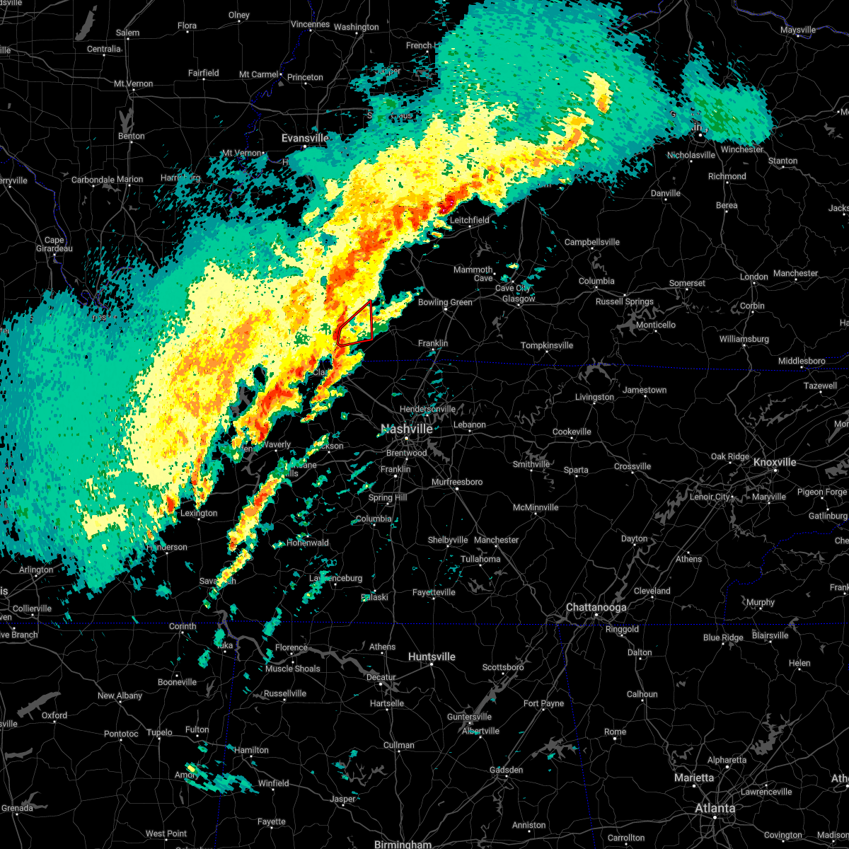 At 450 am cst, a severe thunderstorm capable of producing a tornado was located near pembroke, or near elkton, moving northeast at 50 mph (radar indicated rotation). Hazards include tornado. Flying debris will be dangerous to those caught without shelter. mobile homes will be damaged or destroyed. damage to roofs, windows, and vehicles will occur. tree damage is likely. This dangerous storm will be near, elkton around 455 am cst. At 450 am cst, a severe thunderstorm capable of producing a tornado was located near pembroke, or near elkton, moving northeast at 50 mph (radar indicated rotation). Hazards include tornado. Flying debris will be dangerous to those caught without shelter. mobile homes will be damaged or destroyed. damage to roofs, windows, and vehicles will occur. tree damage is likely. This dangerous storm will be near, elkton around 455 am cst.
|
| 1/3/2023 1:16 AM CST |
 At 116 am cst, a severe thunderstorm capable of producing a tornado was located about 3 miles southwest of elkton, moving northeast at 50 mph (radar indicated rotation). Hazards include tornado. Flying debris will be dangerous to those caught without shelter. mobile homes will be damaged or destroyed. damage to roofs, windows, and vehicles will occur. tree damage is likely. This dangerous storm will be near, elkton around 120 am cst. At 116 am cst, a severe thunderstorm capable of producing a tornado was located about 3 miles southwest of elkton, moving northeast at 50 mph (radar indicated rotation). Hazards include tornado. Flying debris will be dangerous to those caught without shelter. mobile homes will be damaged or destroyed. damage to roofs, windows, and vehicles will occur. tree damage is likely. This dangerous storm will be near, elkton around 120 am cst.
|
| 1/3/2023 1:11 AM CST |
 At 111 am cst, a severe thunderstorm capable of producing a tornado was located over oak grove, moving northeast at 40 mph (radar indicated rotation). Hazards include tornado. Flying debris will be dangerous to those caught without shelter. mobile homes will be damaged or destroyed. damage to roofs, windows, and vehicles will occur. tree damage is likely. this dangerous storm will be near, pembroke around 125 am cst. other locations in the path of this tornadic thunderstorm include elkton. This includes interstate 24 in kentucky between mile markers 85 and 92. At 111 am cst, a severe thunderstorm capable of producing a tornado was located over oak grove, moving northeast at 40 mph (radar indicated rotation). Hazards include tornado. Flying debris will be dangerous to those caught without shelter. mobile homes will be damaged or destroyed. damage to roofs, windows, and vehicles will occur. tree damage is likely. this dangerous storm will be near, pembroke around 125 am cst. other locations in the path of this tornadic thunderstorm include elkton. This includes interstate 24 in kentucky between mile markers 85 and 92.
|
| 1/3/2023 1:06 AM CST |
 At 106 am cst, a severe thunderstorm capable of producing a tornado was located over pembroke, or near oak grove, moving northeast at 50 mph (radar indicated rotation). Hazards include tornado. Flying debris will be dangerous to those caught without shelter. mobile homes will be damaged or destroyed. damage to roofs, windows, and vehicles will occur. tree damage is likely. This dangerous storm will be near, elkton around 120 am cst. At 106 am cst, a severe thunderstorm capable of producing a tornado was located over pembroke, or near oak grove, moving northeast at 50 mph (radar indicated rotation). Hazards include tornado. Flying debris will be dangerous to those caught without shelter. mobile homes will be damaged or destroyed. damage to roofs, windows, and vehicles will occur. tree damage is likely. This dangerous storm will be near, elkton around 120 am cst.
|
| 8/3/2022 5:36 PM EDT |
 The severe thunderstorm warning for northern kenton and southern boone counties will expire at 545 pm edt, the storm which prompted the warning has weakened below severe limits, and no longer poses an immediate threat to life or property. therefore, the warning will be allowed to expire. however gusty winds are still possible with this thunderstorm. please report previous wind damage or hail to the national weather service by going to our website at weather.gov/iln and submitting your report via social media. The severe thunderstorm warning for northern kenton and southern boone counties will expire at 545 pm edt, the storm which prompted the warning has weakened below severe limits, and no longer poses an immediate threat to life or property. therefore, the warning will be allowed to expire. however gusty winds are still possible with this thunderstorm. please report previous wind damage or hail to the national weather service by going to our website at weather.gov/iln and submitting your report via social media.
|
| 8/3/2022 5:24 PM EDT |
 At 524 pm edt, a severe thunderstorm was located near union, moving northeast at 40 mph (radar indicated). Hazards include 60 mph wind gusts. expect damage to trees and power lines At 524 pm edt, a severe thunderstorm was located near union, moving northeast at 40 mph (radar indicated). Hazards include 60 mph wind gusts. expect damage to trees and power lines
|
| 8/2/2022 2:16 AM CDT |
 At 216 am cdt, severe thunderstorms were located along a line extending from near crofton to near hopkinsville to 7 miles northwest of oak grove, moving east at 20 mph (radar indicated). Hazards include 60 mph wind gusts and quarter size hail. Hail damage to vehicles is expected. expect wind damage to roofs, siding, and trees. locations impacted include, hopkinsville, oak grove, fort campbell, pembroke, crofton, lafayette and herndon. this includes the following highways, interstate 24 in kentucky between mile markers 74 and 92. pennyrile parkway between mile markers 1 and 25. hail threat, radar indicated max hail size, 1. 00 in wind threat, radar indicated max wind gust, 60 mph. At 216 am cdt, severe thunderstorms were located along a line extending from near crofton to near hopkinsville to 7 miles northwest of oak grove, moving east at 20 mph (radar indicated). Hazards include 60 mph wind gusts and quarter size hail. Hail damage to vehicles is expected. expect wind damage to roofs, siding, and trees. locations impacted include, hopkinsville, oak grove, fort campbell, pembroke, crofton, lafayette and herndon. this includes the following highways, interstate 24 in kentucky between mile markers 74 and 92. pennyrile parkway between mile markers 1 and 25. hail threat, radar indicated max hail size, 1. 00 in wind threat, radar indicated max wind gust, 60 mph.
|
| 8/2/2022 1:56 AM CDT |
 At 155 am cdt, severe thunderstorms were located along a line extending from near crofton to near hopkinsville to 12 miles northwest of fort campbell, moving east at 20 mph (radar indicated). Hazards include 60 mph wind gusts and quarter size hail. Hail damage to vehicles is expected. expect wind damage to roofs, siding, and trees. locations impacted include, hopkinsville, oak grove, fort campbell, pembroke, crofton, lafayette, hawkins and herndon. this includes the following highways, interstate 24 in kentucky between mile markers 71 and 92. pennyrile parkway between mile markers 1 and 28. hail threat, radar indicated max hail size, 1. 00 in wind threat, radar indicated max wind gust, 60 mph. At 155 am cdt, severe thunderstorms were located along a line extending from near crofton to near hopkinsville to 12 miles northwest of fort campbell, moving east at 20 mph (radar indicated). Hazards include 60 mph wind gusts and quarter size hail. Hail damage to vehicles is expected. expect wind damage to roofs, siding, and trees. locations impacted include, hopkinsville, oak grove, fort campbell, pembroke, crofton, lafayette, hawkins and herndon. this includes the following highways, interstate 24 in kentucky between mile markers 71 and 92. pennyrile parkway between mile markers 1 and 28. hail threat, radar indicated max hail size, 1. 00 in wind threat, radar indicated max wind gust, 60 mph.
|
| 8/2/2022 1:49 AM CDT |
 At 148 am cdt, severe thunderstorms were located along a line extending from near crofton to hopkinsville to 10 miles northwest of fort campbell, moving east at 20 mph. the initial speed of movement was incorrect (radar indicated). Hazards include 60 mph wind gusts and quarter size hail. Hail damage to vehicles is expected. Expect wind damage to roofs, siding, and trees. At 148 am cdt, severe thunderstorms were located along a line extending from near crofton to hopkinsville to 10 miles northwest of fort campbell, moving east at 20 mph. the initial speed of movement was incorrect (radar indicated). Hazards include 60 mph wind gusts and quarter size hail. Hail damage to vehicles is expected. Expect wind damage to roofs, siding, and trees.
|
| 8/2/2022 1:43 AM CDT |
 At 143 am cdt, severe thunderstorms were located along a line extending from near hopkinsville to 6 miles west of pembroke to near fort campbell, moving southeast at 105 mph (radar indicated). Hazards include 60 mph wind gusts and quarter size hail. Hail damage to vehicles is expected. expect wind damage to roofs, siding, and trees. these severe thunderstorms will remain over mainly rural areas of christian and eastern trigg counties, including the following locations, lafayette, hawkins and herndon. this includes the following highways, interstate 24 in kentucky between mile markers 64 and 92. pennyrile parkway between mile markers 1 and 28. hail threat, radar indicated max hail size, 1. 00 in wind threat, radar indicated max wind gust, 60 mph. At 143 am cdt, severe thunderstorms were located along a line extending from near hopkinsville to 6 miles west of pembroke to near fort campbell, moving southeast at 105 mph (radar indicated). Hazards include 60 mph wind gusts and quarter size hail. Hail damage to vehicles is expected. expect wind damage to roofs, siding, and trees. these severe thunderstorms will remain over mainly rural areas of christian and eastern trigg counties, including the following locations, lafayette, hawkins and herndon. this includes the following highways, interstate 24 in kentucky between mile markers 64 and 92. pennyrile parkway between mile markers 1 and 28. hail threat, radar indicated max hail size, 1. 00 in wind threat, radar indicated max wind gust, 60 mph.
|
| 7/6/2022 2:56 PM EDT |
 At 254 pm edt, severe thunderstorms were located along a line extending from camp dennison to near independence to near kentucky speedway, moving east at 40 mph (observed via automated observations. 58 mph gust was measured at cincinnati northern kentucky airport. 67 mph measured at lunken airport). Hazards include 70 mph wind gusts. Expect considerable tree damage. damage is likely to mobile homes, roofs, and outbuildings. locations impacted include, cincinnati, covington, florence, independence, norwood, forest park, erlanger, fort thomas, newport, sharonville, blue ash, loveland, springdale, reading, montgomery, north college hill, madeira, edgewood, alexandria and elsmere. this includes the following interstates, i-71 in kentucky between mile markers 56 and 77. i-71 in ohio between mile markers 0 and 19. i-74 in ohio between mile markers 17 and 19. i-75 in kentucky between mile markers 151 and 191. i-75 in ohio between mile markers 0 and 17. thunderstorm damage threat, considerable hail threat, radar indicated max hail size, <. 75 in wind threat, radar indicated max wind gust, 70 mph. At 254 pm edt, severe thunderstorms were located along a line extending from camp dennison to near independence to near kentucky speedway, moving east at 40 mph (observed via automated observations. 58 mph gust was measured at cincinnati northern kentucky airport. 67 mph measured at lunken airport). Hazards include 70 mph wind gusts. Expect considerable tree damage. damage is likely to mobile homes, roofs, and outbuildings. locations impacted include, cincinnati, covington, florence, independence, norwood, forest park, erlanger, fort thomas, newport, sharonville, blue ash, loveland, springdale, reading, montgomery, north college hill, madeira, edgewood, alexandria and elsmere. this includes the following interstates, i-71 in kentucky between mile markers 56 and 77. i-71 in ohio between mile markers 0 and 19. i-74 in ohio between mile markers 17 and 19. i-75 in kentucky between mile markers 151 and 191. i-75 in ohio between mile markers 0 and 17. thunderstorm damage threat, considerable hail threat, radar indicated max hail size, <. 75 in wind threat, radar indicated max wind gust, 70 mph.
|
| 7/6/2022 2:27 PM EDT |
 At 226 pm edt, severe thunderstorms were located along a line extending from colerain township to near rising sun to near vevay, moving east at 40 mph (radar indicated). Hazards include 70 mph wind gusts possible. Expect considerable tree damage. Damage is likely to mobile homes, roofs, and outbuildings. At 226 pm edt, severe thunderstorms were located along a line extending from colerain township to near rising sun to near vevay, moving east at 40 mph (radar indicated). Hazards include 70 mph wind gusts possible. Expect considerable tree damage. Damage is likely to mobile homes, roofs, and outbuildings.
|
| 6/22/2022 5:07 PM EDT |
 The severe thunderstorm warning for northeastern switzerland, kenton, southern campbell, southern boone, northwestern grant and eastern gallatin counties will expire at 515 pm edt, the storms which prompted the warning have weakened below severe limits, and no longer pose an immediate threat to life or property. therefore, the warning will be allowed to expire. however gusty winds and heavy rain are still possible with these thunderstorms. a severe thunderstorm watch remains in effect until 800 pm edt for southeastern indiana, and northern kentucky. please report previous wind damage or hail to the national weather service by going to our website at weather.gov/iln and submitting your report via social media. The severe thunderstorm warning for northeastern switzerland, kenton, southern campbell, southern boone, northwestern grant and eastern gallatin counties will expire at 515 pm edt, the storms which prompted the warning have weakened below severe limits, and no longer pose an immediate threat to life or property. therefore, the warning will be allowed to expire. however gusty winds and heavy rain are still possible with these thunderstorms. a severe thunderstorm watch remains in effect until 800 pm edt for southeastern indiana, and northern kentucky. please report previous wind damage or hail to the national weather service by going to our website at weather.gov/iln and submitting your report via social media.
|
| 6/22/2022 4:55 PM EDT |
 At 454 pm edt, severe thunderstorms were located from edgewood to near walton to patriot, moving southeast at 35 mph (radar indicated). Hazards include 60 mph wind gusts. Expect damage to trees and power lines. locations impacted include, covington, florence, independence, erlanger, edgewood, elsmere, fort mitchell, villa hills, taylor mill, fort wright, crescent springs, walton, crestview hills, lakeside park, oakbrook, claryville, burlington, union, crittenden and ryland heights. this includes the following interstates, i-71 in kentucky between mile markers 62 and 77. i-75 in kentucky between mile markers 165 and 186. hail threat, radar indicated max hail size, <. 75 in wind threat, radar indicated max wind gust, 60 mph. At 454 pm edt, severe thunderstorms were located from edgewood to near walton to patriot, moving southeast at 35 mph (radar indicated). Hazards include 60 mph wind gusts. Expect damage to trees and power lines. locations impacted include, covington, florence, independence, erlanger, edgewood, elsmere, fort mitchell, villa hills, taylor mill, fort wright, crescent springs, walton, crestview hills, lakeside park, oakbrook, claryville, burlington, union, crittenden and ryland heights. this includes the following interstates, i-71 in kentucky between mile markers 62 and 77. i-75 in kentucky between mile markers 165 and 186. hail threat, radar indicated max hail size, <. 75 in wind threat, radar indicated max wind gust, 60 mph.
|
| 6/22/2022 4:42 PM EDT |
 At 442 pm edt, severe thunderstorms were located from delhi hills to near rising sun, moving southeast at 20 mph (radar indicated). Hazards include 60 mph wind gusts. Expect damage to trees and power lines. locations impacted include, cincinnati, covington, florence, independence, erlanger, edgewood, elsmere, fort mitchell, villa hills, taylor mill, fort wright, crescent springs, walton, crestview hills, lakeside park, rising sun, oakbrook, burlington, claryville and union. this includes the following interstates, i-71 in kentucky between mile markers 62 and 77. i-75 in kentucky between mile markers 165 and 186. hail threat, radar indicated max hail size, <. 75 in wind threat, radar indicated max wind gust, 60 mph. At 442 pm edt, severe thunderstorms were located from delhi hills to near rising sun, moving southeast at 20 mph (radar indicated). Hazards include 60 mph wind gusts. Expect damage to trees and power lines. locations impacted include, cincinnati, covington, florence, independence, erlanger, edgewood, elsmere, fort mitchell, villa hills, taylor mill, fort wright, crescent springs, walton, crestview hills, lakeside park, rising sun, oakbrook, burlington, claryville and union. this includes the following interstates, i-71 in kentucky between mile markers 62 and 77. i-75 in kentucky between mile markers 165 and 186. hail threat, radar indicated max hail size, <. 75 in wind threat, radar indicated max wind gust, 60 mph.
|
| 6/22/2022 4:27 PM EDT |
 At 427 pm edt, severe thunderstorms were located from near delhi township to near rising sun, moving southeast at 25 mph (radar indicated). Hazards include 60 mph wind gusts. expect damage to trees and power lines At 427 pm edt, severe thunderstorms were located from near delhi township to near rising sun, moving southeast at 25 mph (radar indicated). Hazards include 60 mph wind gusts. expect damage to trees and power lines
|
| 6/17/2022 8:47 AM CDT |
 At 847 am cdt, severe thunderstorms were located along a line extending from 6 miles east of nortonville to 7 miles southeast of cobb to near land between the lakes area, moving southeast at 40 mph (radar indicated). Hazards include 60 mph wind gusts. expect damage to roofs, siding, and trees At 847 am cdt, severe thunderstorms were located along a line extending from 6 miles east of nortonville to 7 miles southeast of cobb to near land between the lakes area, moving southeast at 40 mph (radar indicated). Hazards include 60 mph wind gusts. expect damage to roofs, siding, and trees
|
| 6/13/2022 6:18 PM EDT |
 At 618 pm edt, a severe thunderstorm was located over batavia, moving southeast at 40 mph (radar indicated). Hazards include 60 mph wind gusts. Expect damage to trees and power lines. locations impacted include, cincinnati, covington, independence, norwood, erlanger, fort thomas, newport, blue ash, loveland, montgomery, madeira, edgewood, alexandria, elsmere, fort mitchell, villa hills, highland heights, milford, taylor mill and bellevue. this includes the following interstates, i-71 in ohio between mile markers 0 and 14. i-75 in kentucky between mile markers 184 and 191. i-75 in ohio between mile markers 0 and 2. hail threat, radar indicated max hail size, <. 75 in wind threat, radar indicated max wind gust, 60 mph. At 618 pm edt, a severe thunderstorm was located over batavia, moving southeast at 40 mph (radar indicated). Hazards include 60 mph wind gusts. Expect damage to trees and power lines. locations impacted include, cincinnati, covington, independence, norwood, erlanger, fort thomas, newport, blue ash, loveland, montgomery, madeira, edgewood, alexandria, elsmere, fort mitchell, villa hills, highland heights, milford, taylor mill and bellevue. this includes the following interstates, i-71 in ohio between mile markers 0 and 14. i-75 in kentucky between mile markers 184 and 191. i-75 in ohio between mile markers 0 and 2. hail threat, radar indicated max hail size, <. 75 in wind threat, radar indicated max wind gust, 60 mph.
|
| 6/13/2022 6:13 PM EDT |
 At 613 pm edt, a severe thunderstorm was located over alexandria, moving southeast at 35 mph (radar indicated). Hazards include 60 mph wind gusts. Expect damage to trees and power lines. locations impacted include, covington, florence, independence, erlanger, edgewood, alexandria, elsmere, fort mitchell, villa hills, taylor mill, fort wright, crescent springs, walton, crestview hills, lakeside park, oakbrook, claryville, union, amelia and wilder. this includes the following interstates, i-71 in kentucky between mile markers 74 and 77. i-75 in kentucky between mile markers 167 and 186. hail threat, radar indicated max hail size, <. 75 in wind threat, radar indicated max wind gust, 60 mph. At 613 pm edt, a severe thunderstorm was located over alexandria, moving southeast at 35 mph (radar indicated). Hazards include 60 mph wind gusts. Expect damage to trees and power lines. locations impacted include, covington, florence, independence, erlanger, edgewood, alexandria, elsmere, fort mitchell, villa hills, taylor mill, fort wright, crescent springs, walton, crestview hills, lakeside park, oakbrook, claryville, union, amelia and wilder. this includes the following interstates, i-71 in kentucky between mile markers 74 and 77. i-75 in kentucky between mile markers 167 and 186. hail threat, radar indicated max hail size, <. 75 in wind threat, radar indicated max wind gust, 60 mph.
|
| 6/13/2022 6:05 PM EDT |
 At 605 pm edt, a severe thunderstorm was located near forestville, moving southeast at 45 mph (radar indicated). Hazards include 60 mph wind gusts. Expect damage to trees and power lines. locations impacted include, cincinnati, covington, independence, norwood, forest park, erlanger, fort thomas, newport, sharonville, blue ash, loveland, springdale, reading, montgomery, north college hill, madeira, edgewood, alexandria, elsmere and wyoming. this includes the following interstates, i-71 in ohio between mile markers 0 and 19. i-74 in ohio between mile markers 14 and 19. i-75 in kentucky between mile markers 184 and 191. i-75 in ohio between mile markers 0 and 17. hail threat, radar indicated max hail size, <. 75 in wind threat, radar indicated max wind gust, 60 mph. At 605 pm edt, a severe thunderstorm was located near forestville, moving southeast at 45 mph (radar indicated). Hazards include 60 mph wind gusts. Expect damage to trees and power lines. locations impacted include, cincinnati, covington, independence, norwood, forest park, erlanger, fort thomas, newport, sharonville, blue ash, loveland, springdale, reading, montgomery, north college hill, madeira, edgewood, alexandria, elsmere and wyoming. this includes the following interstates, i-71 in ohio between mile markers 0 and 19. i-74 in ohio between mile markers 14 and 19. i-75 in kentucky between mile markers 184 and 191. i-75 in ohio between mile markers 0 and 17. hail threat, radar indicated max hail size, <. 75 in wind threat, radar indicated max wind gust, 60 mph.
|
| 6/13/2022 6:02 PM EDT |
 At 601 pm edt, a severe thunderstorm was located over park hills, moving southeast at 40 mph (radar indicated). Hazards include 60 mph wind gusts. Expect damage to trees and power lines. locations impacted include, covington, florence, independence, erlanger, edgewood, alexandria, elsmere, fort mitchell, villa hills, taylor mill, fort wright, crescent springs, walton, crestview hills, lakeside park, oakbrook, burlington, claryville, union and amelia. this includes the following interstates, i-71 in kentucky between mile markers 71 and 77. i-75 in kentucky between mile markers 162 and 186. hail threat, radar indicated max hail size, <. 75 in wind threat, radar indicated max wind gust, 60 mph. At 601 pm edt, a severe thunderstorm was located over park hills, moving southeast at 40 mph (radar indicated). Hazards include 60 mph wind gusts. Expect damage to trees and power lines. locations impacted include, covington, florence, independence, erlanger, edgewood, alexandria, elsmere, fort mitchell, villa hills, taylor mill, fort wright, crescent springs, walton, crestview hills, lakeside park, oakbrook, burlington, claryville, union and amelia. this includes the following interstates, i-71 in kentucky between mile markers 71 and 77. i-75 in kentucky between mile markers 162 and 186. hail threat, radar indicated max hail size, <. 75 in wind threat, radar indicated max wind gust, 60 mph.
|
| 6/13/2022 5:44 PM EDT |
 At 544 pm edt, a severe thunderstorm was located over monfort heights, moving southeast at 40 mph (radar indicated). Hazards include 70 mph wind gusts. Expect considerable tree damage. Damage is likely to mobile homes, roofs, and outbuildings. At 544 pm edt, a severe thunderstorm was located over monfort heights, moving southeast at 40 mph (radar indicated). Hazards include 70 mph wind gusts. Expect considerable tree damage. Damage is likely to mobile homes, roofs, and outbuildings.
|
| 6/13/2022 5:40 PM EDT |
 At 540 pm edt, a severe thunderstorm was located over forest park, moving southeast at 45 mph (radar indicated). Hazards include 70 mph wind gusts and penny size hail. Expect considerable tree damage. damage is likely to mobile homes, roofs, and outbuildings. locations impacted include, cincinnati, covington, independence, norwood, forest park, erlanger, fort thomas, newport, sharonville, blue ash, loveland, springdale, reading, montgomery, north college hill, madeira, edgewood, alexandria, elsmere and wyoming. this includes the following interstates, i-71 in ohio between mile markers 0 and 19. i-74 in ohio between mile markers 14 and 19. i-75 in kentucky between mile markers 184 and 191. i-75 in ohio between mile markers 0 and 17. thunderstorm damage threat, considerable hail threat, radar indicated max hail size, 0. 75 in wind threat, radar indicated max wind gust, 70 mph. At 540 pm edt, a severe thunderstorm was located over forest park, moving southeast at 45 mph (radar indicated). Hazards include 70 mph wind gusts and penny size hail. Expect considerable tree damage. damage is likely to mobile homes, roofs, and outbuildings. locations impacted include, cincinnati, covington, independence, norwood, forest park, erlanger, fort thomas, newport, sharonville, blue ash, loveland, springdale, reading, montgomery, north college hill, madeira, edgewood, alexandria, elsmere and wyoming. this includes the following interstates, i-71 in ohio between mile markers 0 and 19. i-74 in ohio between mile markers 14 and 19. i-75 in kentucky between mile markers 184 and 191. i-75 in ohio between mile markers 0 and 17. thunderstorm damage threat, considerable hail threat, radar indicated max hail size, 0. 75 in wind threat, radar indicated max wind gust, 70 mph.
|
| 6/13/2022 5:27 PM EDT |
 At 527 pm edt, a severe thunderstorm was located near harrison, moving southeast at 45 mph (radar indicated). Hazards include 70 mph wind gusts and penny size hail. Expect considerable tree damage. Damage is likely to mobile homes, roofs, and outbuildings. At 527 pm edt, a severe thunderstorm was located near harrison, moving southeast at 45 mph (radar indicated). Hazards include 70 mph wind gusts and penny size hail. Expect considerable tree damage. Damage is likely to mobile homes, roofs, and outbuildings.
|
| 6/8/2022 7:16 PM EDT |
 At 716 pm edt, a severe thunderstorm was located over claryville, moving east at 45 mph (radar indicated). Hazards include 60 mph wind gusts. expect damage to trees and power lines At 716 pm edt, a severe thunderstorm was located over claryville, moving east at 45 mph (radar indicated). Hazards include 60 mph wind gusts. expect damage to trees and power lines
|
| 6/8/2022 6:37 PM EDT |
 At 637 pm edt, a severe thunderstorm was located near independence, moving east at 35 mph (radar indicated). Hazards include 60 mph wind gusts and quarter size hail. Minor hail damage to vehicles is possible. Expect wind damage to trees and power lines. At 637 pm edt, a severe thunderstorm was located near independence, moving east at 35 mph (radar indicated). Hazards include 60 mph wind gusts and quarter size hail. Minor hail damage to vehicles is possible. Expect wind damage to trees and power lines.
|
| 6/8/2022 6:25 PM EDT |
 At 624 pm edt, a severe thunderstorm was located over union, moving east at 40 mph (radar indicated). Hazards include 70 mph wind gusts and quarter size hail. 69 mph wind gusts were observed at cincinnati northern kentucky international airport. Minor hail damage to vehicles is possible. expect considerable tree damage. wind damage is also likely to mobile homes, roofs, and outbuildings. locations impacted include, covington, florence, independence, erlanger, edgewood, elsmere, fort mitchell, villa hills, taylor mill, fort wright, crescent springs, walton, crestview hills, lakeside park, oakbrook, burlington, union, ryland heights, fairview and kenton vale. this includes the following interstates, i-71 in kentucky between mile markers 74 and 77. i-75 in kentucky between mile markers 169 and 188. thunderstorm damage threat, considerable hail threat, radar indicated max hail size, 1. 00 in wind threat, observed max wind gust, 70 mph. At 624 pm edt, a severe thunderstorm was located over union, moving east at 40 mph (radar indicated). Hazards include 70 mph wind gusts and quarter size hail. 69 mph wind gusts were observed at cincinnati northern kentucky international airport. Minor hail damage to vehicles is possible. expect considerable tree damage. wind damage is also likely to mobile homes, roofs, and outbuildings. locations impacted include, covington, florence, independence, erlanger, edgewood, elsmere, fort mitchell, villa hills, taylor mill, fort wright, crescent springs, walton, crestview hills, lakeside park, oakbrook, burlington, union, ryland heights, fairview and kenton vale. this includes the following interstates, i-71 in kentucky between mile markers 74 and 77. i-75 in kentucky between mile markers 169 and 188. thunderstorm damage threat, considerable hail threat, radar indicated max hail size, 1. 00 in wind threat, observed max wind gust, 70 mph.
|
| 6/8/2022 6:16 PM EDT |
 At 615 pm edt, a severe thunderstorm was located near oakbrook, moving east at 40 mph. 69 mph winds observed at cincinnati northern kentucky international airport (radar indicated). Hazards include 70 mph wind gusts and quarter size hail. Minor hail damage to vehicles is possible. expect considerable tree damage. wind damage is also likely to mobile homes, roofs, and outbuildings. locations impacted include, covington, florence, independence, erlanger, edgewood, elsmere, fort mitchell, villa hills, taylor mill, fort wright, lawrenceburg, crescent springs, aurora, walton, crestview hills, park hills, lakeside park, rising sun, oakbrook and burlington. this includes the following interstates, i-71 in kentucky between mile markers 74 and 77. i-75 in kentucky between mile markers 169 and 189. thunderstorm damage threat, considerable hail threat, radar indicated max hail size, 1. 00 in wind threat, observed max wind gust, 70 mph. At 615 pm edt, a severe thunderstorm was located near oakbrook, moving east at 40 mph. 69 mph winds observed at cincinnati northern kentucky international airport (radar indicated). Hazards include 70 mph wind gusts and quarter size hail. Minor hail damage to vehicles is possible. expect considerable tree damage. wind damage is also likely to mobile homes, roofs, and outbuildings. locations impacted include, covington, florence, independence, erlanger, edgewood, elsmere, fort mitchell, villa hills, taylor mill, fort wright, lawrenceburg, crescent springs, aurora, walton, crestview hills, park hills, lakeside park, rising sun, oakbrook and burlington. this includes the following interstates, i-71 in kentucky between mile markers 74 and 77. i-75 in kentucky between mile markers 169 and 189. thunderstorm damage threat, considerable hail threat, radar indicated max hail size, 1. 00 in wind threat, observed max wind gust, 70 mph.
|
| 6/8/2022 6:03 PM EDT |
 At 603 pm edt, a severe thunderstorm was located near dillsboro, moving east at 40 mph (radar indicated). Hazards include 60 mph wind gusts and quarter size hail. Minor hail damage to vehicles is possible. Expect wind damage to trees and power lines. At 603 pm edt, a severe thunderstorm was located near dillsboro, moving east at 40 mph (radar indicated). Hazards include 60 mph wind gusts and quarter size hail. Minor hail damage to vehicles is possible. Expect wind damage to trees and power lines.
|
| 6/8/2022 4:53 PM EDT |
 At 453 pm edt, a severe thunderstorm capable of producing a tornado was located near highland heights, moving east at 35 mph (radar indicated rotation). Hazards include tornado. Flying debris will be dangerous to those caught without shelter. mobile homes will be damaged or destroyed. damage to roofs, windows, and vehicles will occur. tree damage is likely. Locations impacted include, fort thomas, alexandria, highland heights, taylor mill, southgate, wilder, silver grove, melbourne, cold spring, ryland heights, crestview and fairview. At 453 pm edt, a severe thunderstorm capable of producing a tornado was located near highland heights, moving east at 35 mph (radar indicated rotation). Hazards include tornado. Flying debris will be dangerous to those caught without shelter. mobile homes will be damaged or destroyed. damage to roofs, windows, and vehicles will occur. tree damage is likely. Locations impacted include, fort thomas, alexandria, highland heights, taylor mill, southgate, wilder, silver grove, melbourne, cold spring, ryland heights, crestview and fairview.
|
| 6/8/2022 4:47 PM EDT |
 At 447 pm edt, a severe thunderstorm capable of producing a tornado was located over taylor mill, moving east at 35 mph (radar indicated rotation). Hazards include tornado. Flying debris will be dangerous to those caught without shelter. mobile homes will be damaged or destroyed. damage to roofs, windows, and vehicles will occur. Tree damage is likely. At 447 pm edt, a severe thunderstorm capable of producing a tornado was located over taylor mill, moving east at 35 mph (radar indicated rotation). Hazards include tornado. Flying debris will be dangerous to those caught without shelter. mobile homes will be damaged or destroyed. damage to roofs, windows, and vehicles will occur. Tree damage is likely.
|
| 6/8/2022 4:42 PM EDT |
 At 442 pm edt, a severe thunderstorm was located over taylor mill, moving east at 35 mph (radar indicated). Hazards include 60 mph wind gusts and quarter size hail. Minor hail damage to vehicles is possible. expect wind damage to trees and power lines. locations impacted include, cincinnati, covington, independence, erlanger, fort thomas, newport, edgewood, alexandria, elsmere, fort mitchell, highland heights, milford, taylor mill, fort wright, southgate, crescent springs, crestview hills, park hills, lakeside park and claryville. This includes i-75 in kentucky between mile markers 184 and 190. At 442 pm edt, a severe thunderstorm was located over taylor mill, moving east at 35 mph (radar indicated). Hazards include 60 mph wind gusts and quarter size hail. Minor hail damage to vehicles is possible. expect wind damage to trees and power lines. locations impacted include, cincinnati, covington, independence, erlanger, fort thomas, newport, edgewood, alexandria, elsmere, fort mitchell, highland heights, milford, taylor mill, fort wright, southgate, crescent springs, crestview hills, park hills, lakeside park and claryville. This includes i-75 in kentucky between mile markers 184 and 190.
|
| 6/8/2022 4:31 PM EDT |
 At 431 pm edt, a severe thunderstorm was located over elsmere, moving east at 35 mph (radar indicated). Hazards include 60 mph wind gusts and quarter size hail. Minor hail damage to vehicles is possible. Expect wind damage to trees and power lines. At 431 pm edt, a severe thunderstorm was located over elsmere, moving east at 35 mph (radar indicated). Hazards include 60 mph wind gusts and quarter size hail. Minor hail damage to vehicles is possible. Expect wind damage to trees and power lines.
|
| 6/6/2022 4:12 PM EDT |
 The severe thunderstorm warning for northeastern dearborn, northern kenton, northern campbell, northern boone, hamilton, southwestern butler and northwestern clermont counties will expire at 415 pm edt, the storm which prompted the warning has moved out of the area. therefore, the warning will be allowed to expire. however gusty winds and heavy rain are still possible with this thunderstorm. please report previous wind damage or hail to the national weather service by going to our website at weather.gov/iln and submitting your report via social media. The severe thunderstorm warning for northeastern dearborn, northern kenton, northern campbell, northern boone, hamilton, southwestern butler and northwestern clermont counties will expire at 415 pm edt, the storm which prompted the warning has moved out of the area. therefore, the warning will be allowed to expire. however gusty winds and heavy rain are still possible with this thunderstorm. please report previous wind damage or hail to the national weather service by going to our website at weather.gov/iln and submitting your report via social media.
|
| 6/6/2022 4:02 PM EDT |
 At 401 pm edt, a severe thunderstorm was located over wyoming, moving northeast at 50 mph (radar indicated). Hazards include 60 mph wind gusts. Expect damage to trees and power lines. locations impacted include, cincinnati, hamilton, fairfield, covington, florence, independence, norwood, forest park, erlanger, fort thomas, newport, sharonville, blue ash, springdale, reading, montgomery, harrison, north college hill, madeira and edgewood. this includes the following interstates, i-71 in ohio between mile markers 0 and 18. i-74 in indiana between mile markers 165 and 171. i-74 in ohio between mile markers 0 and 19. i-75 in kentucky between mile markers 179 and 191. i-75 in ohio between mile markers 0 and 20. hail threat, radar indicated max hail size, <. 75 in wind threat, radar indicated max wind gust, 60 mph. At 401 pm edt, a severe thunderstorm was located over wyoming, moving northeast at 50 mph (radar indicated). Hazards include 60 mph wind gusts. Expect damage to trees and power lines. locations impacted include, cincinnati, hamilton, fairfield, covington, florence, independence, norwood, forest park, erlanger, fort thomas, newport, sharonville, blue ash, springdale, reading, montgomery, harrison, north college hill, madeira and edgewood. this includes the following interstates, i-71 in ohio between mile markers 0 and 18. i-74 in indiana between mile markers 165 and 171. i-74 in ohio between mile markers 0 and 19. i-75 in kentucky between mile markers 179 and 191. i-75 in ohio between mile markers 0 and 20. hail threat, radar indicated max hail size, <. 75 in wind threat, radar indicated max wind gust, 60 mph.
|
| 6/6/2022 3:52 PM EDT |
 At 351 pm edt, a severe thunderstorm was located over monfort heights, moving northeast at 50 mph (radar indicated). Hazards include 60 mph wind gusts. Expect damage to trees and power lines. locations impacted include, cincinnati, hamilton, fairfield, covington, florence, independence, norwood, forest park, erlanger, fort thomas, newport, sharonville, blue ash, springdale, reading, montgomery, harrison, north college hill, madeira and edgewood. this includes the following interstates, i-71 in ohio between mile markers 0 and 18. i-74 in indiana between mile markers 165 and 171. i-74 in ohio between mile markers 0 and 19. i-75 in kentucky between mile markers 174 and 191. i-75 in ohio between mile markers 0 and 20. hail threat, radar indicated max hail size, <. 75 in wind threat, radar indicated max wind gust, 60 mph. At 351 pm edt, a severe thunderstorm was located over monfort heights, moving northeast at 50 mph (radar indicated). Hazards include 60 mph wind gusts. Expect damage to trees and power lines. locations impacted include, cincinnati, hamilton, fairfield, covington, florence, independence, norwood, forest park, erlanger, fort thomas, newport, sharonville, blue ash, springdale, reading, montgomery, harrison, north college hill, madeira and edgewood. this includes the following interstates, i-71 in ohio between mile markers 0 and 18. i-74 in indiana between mile markers 165 and 171. i-74 in ohio between mile markers 0 and 19. i-75 in kentucky between mile markers 174 and 191. i-75 in ohio between mile markers 0 and 20. hail threat, radar indicated max hail size, <. 75 in wind threat, radar indicated max wind gust, 60 mph.
|
| 6/6/2022 3:40 PM EDT |
 At 339 pm edt, a severe thunderstorm was located near shawnee, moving northeast at 50 mph (radar indicated). Hazards include 60 mph wind gusts. Expect damage to trees and power lines. locations impacted include, cincinnati, hamilton, fairfield, covington, florence, independence, norwood, forest park, erlanger, fort thomas, newport, sharonville, blue ash, springdale, reading, montgomery, harrison, north college hill, madeira and edgewood. this includes the following interstates, i-71 in ohio between mile markers 0 and 18. i-74 in indiana between mile markers 165 and 171. i-74 in ohio between mile markers 0 and 19. i-75 in kentucky between mile markers 174 and 191. i-75 in ohio between mile markers 0 and 20. hail threat, radar indicated max hail size, <. 75 in wind threat, radar indicated max wind gust, 60 mph. At 339 pm edt, a severe thunderstorm was located near shawnee, moving northeast at 50 mph (radar indicated). Hazards include 60 mph wind gusts. Expect damage to trees and power lines. locations impacted include, cincinnati, hamilton, fairfield, covington, florence, independence, norwood, forest park, erlanger, fort thomas, newport, sharonville, blue ash, springdale, reading, montgomery, harrison, north college hill, madeira and edgewood. this includes the following interstates, i-71 in ohio between mile markers 0 and 18. i-74 in indiana between mile markers 165 and 171. i-74 in ohio between mile markers 0 and 19. i-75 in kentucky between mile markers 174 and 191. i-75 in ohio between mile markers 0 and 20. hail threat, radar indicated max hail size, <. 75 in wind threat, radar indicated max wind gust, 60 mph.
|
| 6/6/2022 3:22 PM EDT |
 At 322 pm edt, a severe thunderstorm was located near rising sun, moving northeast at 50 mph (radar indicated). Hazards include 60 mph wind gusts. expect damage to trees and power lines At 322 pm edt, a severe thunderstorm was located near rising sun, moving northeast at 50 mph (radar indicated). Hazards include 60 mph wind gusts. expect damage to trees and power lines
|
| 5/20/2022 4:25 AM EDT |
 At 424 am edt, a severe thunderstorm was located over claryville, moving east at 50 mph (radar indicated). Hazards include 60 mph wind gusts. Expect damage to trees and power lines. locations impacted include, covington, florence, independence, erlanger, edgewood, alexandria, elsmere, highland heights, taylor mill, fort wright, crestview hills, claryville, wilder, dry ridge, silver grove, butler, cold spring, ryland heights, crestview and fairview. this includes i-75 in kentucky between mile markers 159 and 161. hail threat, radar indicated max hail size, <. 75 in wind threat, radar indicated max wind gust, 60 mph. At 424 am edt, a severe thunderstorm was located over claryville, moving east at 50 mph (radar indicated). Hazards include 60 mph wind gusts. Expect damage to trees and power lines. locations impacted include, covington, florence, independence, erlanger, edgewood, alexandria, elsmere, highland heights, taylor mill, fort wright, crestview hills, claryville, wilder, dry ridge, silver grove, butler, cold spring, ryland heights, crestview and fairview. this includes i-75 in kentucky between mile markers 159 and 161. hail threat, radar indicated max hail size, <. 75 in wind threat, radar indicated max wind gust, 60 mph.
|
| 5/20/2022 4:20 AM EDT |
 At 420 am edt, a severe thunderstorm was located near walton, moving east at 45 mph (radar indicated). Hazards include 60 mph wind gusts. Expect damage to trees and power lines. locations impacted include, covington, florence, independence, erlanger, edgewood, alexandria, elsmere, highland heights, taylor mill, fort wright, walton, crestview hills, claryville, oakbrook, union, crittenden, wilder, dry ridge, silver grove and butler. this includes the following interstates, i-71 in kentucky between mile markers 75 and 77. i-75 in kentucky between mile markers 159 and 182. hail threat, radar indicated max hail size, <. 75 in wind threat, radar indicated max wind gust, 60 mph. At 420 am edt, a severe thunderstorm was located near walton, moving east at 45 mph (radar indicated). Hazards include 60 mph wind gusts. Expect damage to trees and power lines. locations impacted include, covington, florence, independence, erlanger, edgewood, alexandria, elsmere, highland heights, taylor mill, fort wright, walton, crestview hills, claryville, oakbrook, union, crittenden, wilder, dry ridge, silver grove and butler. this includes the following interstates, i-71 in kentucky between mile markers 75 and 77. i-75 in kentucky between mile markers 159 and 182. hail threat, radar indicated max hail size, <. 75 in wind threat, radar indicated max wind gust, 60 mph.
|
| 5/20/2022 4:13 AM EDT |
 At 413 am edt, a severe thunderstorm was located over walton, moving east at 45 mph (radar indicated). Hazards include 60 mph wind gusts. Expect damage to trees and power lines. locations impacted include, covington, florence, independence, erlanger, edgewood, alexandria, elsmere, highland heights, taylor mill, fort wright, walton, crestview hills, oakbrook, claryville, burlington, union, crittenden, wilder, dry ridge and silver grove. this includes the following interstates, i-71 in kentucky between mile markers 56 and 77. i-75 in kentucky between mile markers 159 and 182. hail threat, radar indicated max hail size, <. 75 in wind threat, radar indicated max wind gust, 60 mph. At 413 am edt, a severe thunderstorm was located over walton, moving east at 45 mph (radar indicated). Hazards include 60 mph wind gusts. Expect damage to trees and power lines. locations impacted include, covington, florence, independence, erlanger, edgewood, alexandria, elsmere, highland heights, taylor mill, fort wright, walton, crestview hills, oakbrook, claryville, burlington, union, crittenden, wilder, dry ridge and silver grove. this includes the following interstates, i-71 in kentucky between mile markers 56 and 77. i-75 in kentucky between mile markers 159 and 182. hail threat, radar indicated max hail size, <. 75 in wind threat, radar indicated max wind gust, 60 mph.
|
| 5/20/2022 4:04 AM EDT |
 At 404 am edt, a severe thunderstorm was located over patriot, moving east at 45 mph (radar indicated). Hazards include 60 mph wind gusts. expect damage to trees and power lines At 404 am edt, a severe thunderstorm was located over patriot, moving east at 45 mph (radar indicated). Hazards include 60 mph wind gusts. expect damage to trees and power lines
|
| 5/19/2022 9:10 PM EDT |
 At 909 pm edt, severe thunderstorms were located from mariemont to claryville to near crittenden, moving east at 65 mph (radar indicated). Hazards include 60 mph wind gusts. Expect damage to trees and power lines. locations impacted include, cincinnati, covington, independence, norwood, fort thomas, newport, alexandria, highland heights, milford, taylor mill, bellevue, fort wright, dayton, southgate, park hills, claryville, forestville, amelia, mariemont and wilder. this includes the following interstates, i-71 in ohio between mile markers 0 and 6. i-75 in kentucky near mile marker 167, and between mile markers 189 and 191. i-75 in ohio between mile markers 0 and 4. hail threat, radar indicated max hail size, <. 75 in wind threat, radar indicated max wind gust, 60 mph. At 909 pm edt, severe thunderstorms were located from mariemont to claryville to near crittenden, moving east at 65 mph (radar indicated). Hazards include 60 mph wind gusts. Expect damage to trees and power lines. locations impacted include, cincinnati, covington, independence, norwood, fort thomas, newport, alexandria, highland heights, milford, taylor mill, bellevue, fort wright, dayton, southgate, park hills, claryville, forestville, amelia, mariemont and wilder. this includes the following interstates, i-71 in ohio between mile markers 0 and 6. i-75 in kentucky near mile marker 167, and between mile markers 189 and 191. i-75 in ohio between mile markers 0 and 4. hail threat, radar indicated max hail size, <. 75 in wind threat, radar indicated max wind gust, 60 mph.
|
| 5/19/2022 8:56 PM EDT |
 At 855 pm edt, severe thunderstorms were located from delhi hills to near union to near patriot, moving east at 45 mph (radar indicated). Hazards include 60 mph wind gusts. Expect damage to trees and power lines. locations impacted include, cincinnati, covington, florence, independence, norwood, erlanger, fort thomas, newport, edgewood, alexandria, elsmere, cheviot, fort mitchell, villa hills, highland heights, milford, taylor mill, bellevue, fort wright and dayton. this includes the following interstates, i-71 in kentucky between mile markers 68 and 77. i-71 in ohio between mile markers 0 and 7. i-75 in kentucky between mile markers 165 and 191. i-75 in ohio between mile markers 0 and 4. hail threat, radar indicated max hail size, <. 75 in wind threat, radar indicated max wind gust, 60 mph. At 855 pm edt, severe thunderstorms were located from delhi hills to near union to near patriot, moving east at 45 mph (radar indicated). Hazards include 60 mph wind gusts. Expect damage to trees and power lines. locations impacted include, cincinnati, covington, florence, independence, norwood, erlanger, fort thomas, newport, edgewood, alexandria, elsmere, cheviot, fort mitchell, villa hills, highland heights, milford, taylor mill, bellevue, fort wright and dayton. this includes the following interstates, i-71 in kentucky between mile markers 68 and 77. i-71 in ohio between mile markers 0 and 7. i-75 in kentucky between mile markers 165 and 191. i-75 in ohio between mile markers 0 and 4. hail threat, radar indicated max hail size, <. 75 in wind threat, radar indicated max wind gust, 60 mph.
|
| 5/19/2022 8:49 PM EDT |
 At 848 pm edt, severe thunderstorms were located from near mack to near rising sun to patriot, moving east at 45 mph (radar indicated). Hazards include 60 mph wind gusts. expect damage to trees and power lines At 848 pm edt, severe thunderstorms were located from near mack to near rising sun to patriot, moving east at 45 mph (radar indicated). Hazards include 60 mph wind gusts. expect damage to trees and power lines
|
| 5/19/2022 7:11 PM EDT |
 At 711 pm edt, a severe thunderstorm was located near aurora, moving east at 30 mph (radar indicated). Hazards include 60 mph wind gusts and half dollar size hail. Minor hail damage to vehicles is possible. Expect wind damage to trees and power lines. At 711 pm edt, a severe thunderstorm was located near aurora, moving east at 30 mph (radar indicated). Hazards include 60 mph wind gusts and half dollar size hail. Minor hail damage to vehicles is possible. Expect wind damage to trees and power lines.
|
| 4/13/2022 5:50 PM CDT |
 At 549 pm cdt, severe thunderstorms were located along a line extending from near livermore to central city to 7 miles south of weir, moving northeast at 65 mph (radar indicated). Hazards include 70 mph wind gusts and nickel size hail. Expect considerable tree damage. damage is likely to mobile homes, roofs, and outbuildings. locations impacted include, oak grove, central city, elkton, calhoun, fort campbell, guthrie, livermore, pembroke, powderly, graham, greenville, weir, dunmor, white plains, drakesboro, sacramento, island, trenton, bremen and south carrollton. this includes the following highways, interstate 24 in kentucky between mile markers 86 and 92. Western kentucky parkway between mile markers 42 and 65. At 549 pm cdt, severe thunderstorms were located along a line extending from near livermore to central city to 7 miles south of weir, moving northeast at 65 mph (radar indicated). Hazards include 70 mph wind gusts and nickel size hail. Expect considerable tree damage. damage is likely to mobile homes, roofs, and outbuildings. locations impacted include, oak grove, central city, elkton, calhoun, fort campbell, guthrie, livermore, pembroke, powderly, graham, greenville, weir, dunmor, white plains, drakesboro, sacramento, island, trenton, bremen and south carrollton. this includes the following highways, interstate 24 in kentucky between mile markers 86 and 92. Western kentucky parkway between mile markers 42 and 65.
|
| 4/13/2022 5:32 PM CDT |
 At 532 pm cdt, severe thunderstorms were located along a line extending from near madisonville to near nortonville to near hopkinsville, moving northeast at 65 mph (radar indicated). Hazards include 70 mph wind gusts and nickel size hail. Expect considerable tree damage. damage is likely to mobile homes, roofs, and outbuildings. locations impacted include, graham, weir, calhoun, powderly, greenville, central city, livermore and dunmor. this includes the following highways, interstate 24 in kentucky between mile markers 74 and 92. interstate 69 in kentucky between mile markers 95 and 133. western kentucky parkway between mile markers 39 and 65. Pennyrile parkway between mile markers 1 and 34. At 532 pm cdt, severe thunderstorms were located along a line extending from near madisonville to near nortonville to near hopkinsville, moving northeast at 65 mph (radar indicated). Hazards include 70 mph wind gusts and nickel size hail. Expect considerable tree damage. damage is likely to mobile homes, roofs, and outbuildings. locations impacted include, graham, weir, calhoun, powderly, greenville, central city, livermore and dunmor. this includes the following highways, interstate 24 in kentucky between mile markers 74 and 92. interstate 69 in kentucky between mile markers 95 and 133. western kentucky parkway between mile markers 39 and 65. Pennyrile parkway between mile markers 1 and 34.
|
| 4/13/2022 5:04 PM CDT |
 At 503 pm cdt, severe thunderstorms were located along a line extending from farmersville to 7 miles northwest of cadiz to near canton, moving northeast at 65 mph (radar indicated). Hazards include 70 mph wind gusts and nickel size hail. Expect considerable tree damage. damage is likely to mobile homes, roofs, and outbuildings. severe thunderstorms will be near, cobb, olney and creswell around 510 pm cdt. providence around 520 pm cdt. other locations in the path of these severe thunderstorms include hopkinsville, madisonville, earlington, crofton, nortonville, mortons gap, graham, weir, central city, calhoun, powderly, greenville, livermore and dunmor. this includes the following highways, interstate 24 in kentucky between mile markers 46 and 92. interstate 69 in kentucky between mile markers 73 and 138. western kentucky parkway between mile markers 39 and 65. Pennyrile parkway between mile markers 1 and 34. At 503 pm cdt, severe thunderstorms were located along a line extending from farmersville to 7 miles northwest of cadiz to near canton, moving northeast at 65 mph (radar indicated). Hazards include 70 mph wind gusts and nickel size hail. Expect considerable tree damage. damage is likely to mobile homes, roofs, and outbuildings. severe thunderstorms will be near, cobb, olney and creswell around 510 pm cdt. providence around 520 pm cdt. other locations in the path of these severe thunderstorms include hopkinsville, madisonville, earlington, crofton, nortonville, mortons gap, graham, weir, central city, calhoun, powderly, greenville, livermore and dunmor. this includes the following highways, interstate 24 in kentucky between mile markers 46 and 92. interstate 69 in kentucky between mile markers 73 and 138. western kentucky parkway between mile markers 39 and 65. Pennyrile parkway between mile markers 1 and 34.
|
| 3/30/2022 8:19 PM CDT |
 At 819 pm cdt, severe thunderstorms were located along a line extending from 9 miles north of elkton to 9 miles south of guthrie, moving northeast at 60 mph (radar indicated). Hazards include 60 mph wind gusts. Expect damage to roofs, siding, and trees. these severe thunderstorms will remain over mainly rural areas of todd county, including the following locations, trenton, clifty, allensville and allegre. hail threat, radar indicated max hail size, <. 75 in wind threat, radar indicated max wind gust, 60 mph. At 819 pm cdt, severe thunderstorms were located along a line extending from 9 miles north of elkton to 9 miles south of guthrie, moving northeast at 60 mph (radar indicated). Hazards include 60 mph wind gusts. Expect damage to roofs, siding, and trees. these severe thunderstorms will remain over mainly rural areas of todd county, including the following locations, trenton, clifty, allensville and allegre. hail threat, radar indicated max hail size, <. 75 in wind threat, radar indicated max wind gust, 60 mph.
|
| 3/30/2022 7:50 PM CDT |
 At 749 pm cdt, severe thunderstorms were located along a line extending from near fort campbell to 9 miles northeast of mcewen, moving northeast at 60 mph (radar indicated). Hazards include 60 mph wind gusts. Expect damage to roofs, siding, and trees. severe thunderstorms will be near, oak grove and fort campbell around 755 pm cdt. pembroke around 805 pm cdt. other locations in the path of these severe thunderstorms include elkton, clarksville and guthrie. this includes the following highways, interstate 24 in kentucky between mile markers 81 and 92. pennyrile parkway between mile markers 1 and 2. hail threat, radar indicated max hail size, <. 75 in wind threat, radar indicated max wind gust, 60 mph. At 749 pm cdt, severe thunderstorms were located along a line extending from near fort campbell to 9 miles northeast of mcewen, moving northeast at 60 mph (radar indicated). Hazards include 60 mph wind gusts. Expect damage to roofs, siding, and trees. severe thunderstorms will be near, oak grove and fort campbell around 755 pm cdt. pembroke around 805 pm cdt. other locations in the path of these severe thunderstorms include elkton, clarksville and guthrie. this includes the following highways, interstate 24 in kentucky between mile markers 81 and 92. pennyrile parkway between mile markers 1 and 2. hail threat, radar indicated max hail size, <. 75 in wind threat, radar indicated max wind gust, 60 mph.
|
| 3/23/2022 2:26 PM EDT |
 The severe thunderstorm warning for kenton, boone and north central grant counties will expire at 230 pm edt, the storm which prompted the warning has weakened below severe limits, and no longer poses an immediate threat to life or property. therefore, the warning will be allowed to expire. however small hail and gusty winds are still possible with this thunderstorm. a severe thunderstorm watch remains in effect until 900 pm edt for southwestern ohio. please report previous wind damage or hail to the national weather service by going to our website at weather.gov/iln and submitting your report via social media. The severe thunderstorm warning for kenton, boone and north central grant counties will expire at 230 pm edt, the storm which prompted the warning has weakened below severe limits, and no longer poses an immediate threat to life or property. therefore, the warning will be allowed to expire. however small hail and gusty winds are still possible with this thunderstorm. a severe thunderstorm watch remains in effect until 900 pm edt for southwestern ohio. please report previous wind damage or hail to the national weather service by going to our website at weather.gov/iln and submitting your report via social media.
|
| 3/23/2022 2:20 PM EDT |
 At 220 pm edt, a severe thunderstorm was located over burlington, moving north at 55 mph (radar indicated). Hazards include 60 mph wind gusts and quarter size hail. Minor hail damage to vehicles is possible. expect wind damage to trees and power lines. locations impacted include, cincinnati, covington, florence, independence, erlanger, edgewood, elsmere, fort mitchell, villa hills, taylor mill, fort wright, ludlow, crescent springs, walton, crestview hills, park hills, lakeside park, oakbrook, burlington and union. this includes the following interstates, i-71 in kentucky between mile markers 71 and 77. i-71 in ohio near mile marker 0. i-75 in kentucky between mile markers 165 and 191. i-75 in ohio near mile marker 0. hail threat, radar indicated max hail size, 1. 00 in wind threat, radar indicated max wind gust, 60 mph. At 220 pm edt, a severe thunderstorm was located over burlington, moving north at 55 mph (radar indicated). Hazards include 60 mph wind gusts and quarter size hail. Minor hail damage to vehicles is possible. expect wind damage to trees and power lines. locations impacted include, cincinnati, covington, florence, independence, erlanger, edgewood, elsmere, fort mitchell, villa hills, taylor mill, fort wright, ludlow, crescent springs, walton, crestview hills, park hills, lakeside park, oakbrook, burlington and union. this includes the following interstates, i-71 in kentucky between mile markers 71 and 77. i-71 in ohio near mile marker 0. i-75 in kentucky between mile markers 165 and 191. i-75 in ohio near mile marker 0. hail threat, radar indicated max hail size, 1. 00 in wind threat, radar indicated max wind gust, 60 mph.
|
| 3/23/2022 2:10 PM EDT |
 At 210 pm edt, a severe thunderstorm was located near patriot, moving north at 55 mph (radar indicated). Hazards include 60 mph wind gusts and quarter size hail. Minor hail damage to vehicles is possible. expect wind damage to trees and power lines. locations impacted include, cincinnati, covington, florence, independence, erlanger, edgewood, elsmere, fort mitchell, villa hills, taylor mill, fort wright, ludlow, crescent springs, walton, crestview hills, park hills, lakeside park, oakbrook, burlington and union. this includes the following interstates, i-71 in kentucky between mile markers 62 and 77. i-71 in ohio near mile marker 0. i-75 in kentucky between mile markers 165 and 191. i-75 in ohio near mile marker 0. hail threat, radar indicated max hail size, 1. 00 in wind threat, radar indicated max wind gust, 60 mph. At 210 pm edt, a severe thunderstorm was located near patriot, moving north at 55 mph (radar indicated). Hazards include 60 mph wind gusts and quarter size hail. Minor hail damage to vehicles is possible. expect wind damage to trees and power lines. locations impacted include, cincinnati, covington, florence, independence, erlanger, edgewood, elsmere, fort mitchell, villa hills, taylor mill, fort wright, ludlow, crescent springs, walton, crestview hills, park hills, lakeside park, oakbrook, burlington and union. this includes the following interstates, i-71 in kentucky between mile markers 62 and 77. i-71 in ohio near mile marker 0. i-75 in kentucky between mile markers 165 and 191. i-75 in ohio near mile marker 0. hail threat, radar indicated max hail size, 1. 00 in wind threat, radar indicated max wind gust, 60 mph.
|
| 3/23/2022 2:03 PM EDT |
 At 202 pm edt, a severe thunderstorm was located over warsaw, moving northeast at 55 mph (radar indicated). Hazards include 60 mph wind gusts and nickel size hail. expect damage to trees and power lines At 202 pm edt, a severe thunderstorm was located over warsaw, moving northeast at 55 mph (radar indicated). Hazards include 60 mph wind gusts and nickel size hail. expect damage to trees and power lines
|
| 3/7/2022 5:13 AM EST |
 The severe thunderstorm warning for northern kenton, northern campbell, central boone and southeastern hamilton counties will expire at 515 am est, the storm which prompted the warning has weakened below severe limits, and has exited the warned area. therefore, the warning will be allowed to expire. however heavy rain is still possible with this thunderstorm. please report previous wind damage or hail to the national weather service by going to our website at weather.gov/iln and submitting your report via social media. The severe thunderstorm warning for northern kenton, northern campbell, central boone and southeastern hamilton counties will expire at 515 am est, the storm which prompted the warning has weakened below severe limits, and has exited the warned area. therefore, the warning will be allowed to expire. however heavy rain is still possible with this thunderstorm. please report previous wind damage or hail to the national weather service by going to our website at weather.gov/iln and submitting your report via social media.
|
| 3/7/2022 5:05 AM EST |
 At 505 am est, a severe thunderstorm was located over covington, moving east at 65 mph (radar indicated). Hazards include 60 mph wind gusts. Expect damage to trees and power lines. locations impacted include, cincinnati, covington, florence, independence, norwood, erlanger, fort thomas, newport, edgewood, alexandria, elsmere, fort mitchell, villa hills, highland heights, milford, taylor mill, bellevue, fort wright, dayton and ludlow. this includes the following interstates, i-71 in ohio between mile markers 0 and 7. i-75 in kentucky between mile markers 176 and 191. i-75 in ohio between mile markers 0 and 3. hail threat, radar indicated max hail size, <. 75 in wind threat, radar indicated max wind gust, 60 mph. At 505 am est, a severe thunderstorm was located over covington, moving east at 65 mph (radar indicated). Hazards include 60 mph wind gusts. Expect damage to trees and power lines. locations impacted include, cincinnati, covington, florence, independence, norwood, erlanger, fort thomas, newport, edgewood, alexandria, elsmere, fort mitchell, villa hills, highland heights, milford, taylor mill, bellevue, fort wright, dayton and ludlow. this includes the following interstates, i-71 in ohio between mile markers 0 and 7. i-75 in kentucky between mile markers 176 and 191. i-75 in ohio between mile markers 0 and 3. hail threat, radar indicated max hail size, <. 75 in wind threat, radar indicated max wind gust, 60 mph.
|
| 3/7/2022 4:58 AM EST |
 At 458 am est, a severe thunderstorm was located over florence, moving east at 65 mph (radar indicated). Hazards include 60 mph wind gusts. Expect damage to trees and power lines. locations impacted include, cincinnati, covington, florence, independence, norwood, erlanger, fort thomas, newport, madeira, edgewood, alexandria, elsmere, fort mitchell, villa hills, highland heights, milford, taylor mill, bellevue, fort wright and dayton. this includes the following interstates, i-71 in ohio between mile markers 0 and 7. i-75 in kentucky between mile markers 176 and 191. i-75 in ohio between mile markers 0 and 3. hail threat, radar indicated max hail size, <. 75 in wind threat, radar indicated max wind gust, 60 mph. At 458 am est, a severe thunderstorm was located over florence, moving east at 65 mph (radar indicated). Hazards include 60 mph wind gusts. Expect damage to trees and power lines. locations impacted include, cincinnati, covington, florence, independence, norwood, erlanger, fort thomas, newport, madeira, edgewood, alexandria, elsmere, fort mitchell, villa hills, highland heights, milford, taylor mill, bellevue, fort wright and dayton. this includes the following interstates, i-71 in ohio between mile markers 0 and 7. i-75 in kentucky between mile markers 176 and 191. i-75 in ohio between mile markers 0 and 3. hail threat, radar indicated max hail size, <. 75 in wind threat, radar indicated max wind gust, 60 mph.
|
| 3/7/2022 4:47 AM EST |
 At 447 am est, a severe thunderstorm was located over rising sun, moving east at 65 mph (radar indicated). Hazards include 60 mph wind gusts. expect damage to trees and power lines At 447 am est, a severe thunderstorm was located over rising sun, moving east at 65 mph (radar indicated). Hazards include 60 mph wind gusts. expect damage to trees and power lines
|
| 1/1/2022 10:13 AM CST |
 At 1012 am cst, a severe thunderstorm was located over pembroke, or 7 miles southeast of hopkinsville, moving east at 35 mph (radar indicated). Hazards include 60 mph wind gusts. Expect damage to roofs, siding, and trees. Locations impacted include, elkton, pembroke and allegre. At 1012 am cst, a severe thunderstorm was located over pembroke, or 7 miles southeast of hopkinsville, moving east at 35 mph (radar indicated). Hazards include 60 mph wind gusts. Expect damage to roofs, siding, and trees. Locations impacted include, elkton, pembroke and allegre.
|
| 1/1/2022 10:03 AM CST |
 At 1002 am cst, a severe thunderstorm was located near hopkinsville, moving east at 35 mph (radar indicated). Hazards include 60 mph wind gusts. expect damage to roofs, siding, and trees At 1002 am cst, a severe thunderstorm was located near hopkinsville, moving east at 35 mph (radar indicated). Hazards include 60 mph wind gusts. expect damage to roofs, siding, and trees
|
| 1/1/2022 3:15 AM CST |
 At 315 am cst, severe thunderstorms were located along a line extending from 9 miles northeast of hopkinsville to pembroke to near fort campbell, moving northeast at 55 mph (radar indicated). Hazards include 60 mph wind gusts. expect damage to roofs, siding, and trees At 315 am cst, severe thunderstorms were located along a line extending from 9 miles northeast of hopkinsville to pembroke to near fort campbell, moving northeast at 55 mph (radar indicated). Hazards include 60 mph wind gusts. expect damage to roofs, siding, and trees
|
| 10/15/2021 11:52 PM EDT |
 The tornado warning for central kenton county will expire at midnight edt, the storm which prompted the warning has weakened below severe limits, and has exited the warned area. therefore, the warning will be allowed to expire. please report previous tornadoes, wind damage or hail to the national weather service by going to our website at weather.gov/iln and submitting your report via social media. The tornado warning for central kenton county will expire at midnight edt, the storm which prompted the warning has weakened below severe limits, and has exited the warned area. therefore, the warning will be allowed to expire. please report previous tornadoes, wind damage or hail to the national weather service by going to our website at weather.gov/iln and submitting your report via social media.
|
| 10/15/2021 11:48 PM EDT |
 At 1148 pm edt, a severe thunderstorm capable of producing a tornado was located over alexandria, moving east at 45 mph (radar indicated rotation). Hazards include tornado. Flying debris will be dangerous to those caught without shelter. mobile homes will be damaged or destroyed. damage to roofs, windows, and vehicles will occur. tree damage is likely. Locations impacted include, covington, independence, taylor mill, ryland heights, fairview and latonia lakes. At 1148 pm edt, a severe thunderstorm capable of producing a tornado was located over alexandria, moving east at 45 mph (radar indicated rotation). Hazards include tornado. Flying debris will be dangerous to those caught without shelter. mobile homes will be damaged or destroyed. damage to roofs, windows, and vehicles will occur. tree damage is likely. Locations impacted include, covington, independence, taylor mill, ryland heights, fairview and latonia lakes.
|
| 10/15/2021 11:40 PM EDT |
 At 1139 pm edt, a severe thunderstorm capable of producing a tornado was located over independence, moving east at 45 mph (radar indicated rotation). Hazards include tornado. Flying debris will be dangerous to those caught without shelter. mobile homes will be damaged or destroyed. damage to roofs, windows, and vehicles will occur. tree damage is likely. Locations impacted include, covington, independence, taylor mill, ryland heights, fairview, ricedale, visalia, bank lick, white tower and latonia lakes. At 1139 pm edt, a severe thunderstorm capable of producing a tornado was located over independence, moving east at 45 mph (radar indicated rotation). Hazards include tornado. Flying debris will be dangerous to those caught without shelter. mobile homes will be damaged or destroyed. damage to roofs, windows, and vehicles will occur. tree damage is likely. Locations impacted include, covington, independence, taylor mill, ryland heights, fairview, ricedale, visalia, bank lick, white tower and latonia lakes.
|
| 10/15/2021 11:34 PM EDT |
 At 1134 pm edt, a severe thunderstorm capable of producing a tornado was located near union, moving east at 45 mph (radar indicated rotation). Hazards include tornado. Flying debris will be dangerous to those caught without shelter. mobile homes will be damaged or destroyed. damage to roofs, windows, and vehicles will occur. Tree damage is likely. At 1134 pm edt, a severe thunderstorm capable of producing a tornado was located near union, moving east at 45 mph (radar indicated rotation). Hazards include tornado. Flying debris will be dangerous to those caught without shelter. mobile homes will be damaged or destroyed. damage to roofs, windows, and vehicles will occur. Tree damage is likely.
|
| 10/15/2021 4:25 PM CDT |
 The severe thunderstorm warning for central christian county will expire at 430 pm cdt, the storm which prompted the warning has weakened below severe limits, and no longer poses an immediate threat to life or property. therefore, the warning will be allowed to expire. however gusty winds and heavy rain are still possible with this thunderstorm. to report severe weather, contact your nearest law enforcement agency. they will relay your report to the national weather service paducah. The severe thunderstorm warning for central christian county will expire at 430 pm cdt, the storm which prompted the warning has weakened below severe limits, and no longer poses an immediate threat to life or property. therefore, the warning will be allowed to expire. however gusty winds and heavy rain are still possible with this thunderstorm. to report severe weather, contact your nearest law enforcement agency. they will relay your report to the national weather service paducah.
|
| 10/15/2021 4:14 PM CDT |
 At 414 pm cdt, a severe thunderstorm was located over hopkinsville, moving east at 35 mph (radar indicated). Hazards include 60 mph wind gusts. Expect damage to roofs, siding, and trees. locations impacted include, hopkinsville. this includes pennyrile parkway between mile markers 6 and 18. hail threat, radar indicated max hail size, <. 75 in wind threat, radar indicated max wind gust, 60 mph. At 414 pm cdt, a severe thunderstorm was located over hopkinsville, moving east at 35 mph (radar indicated). Hazards include 60 mph wind gusts. Expect damage to roofs, siding, and trees. locations impacted include, hopkinsville. this includes pennyrile parkway between mile markers 6 and 18. hail threat, radar indicated max hail size, <. 75 in wind threat, radar indicated max wind gust, 60 mph.
|
| 10/15/2021 4:01 PM CDT |
 At 401 pm cdt, a severe thunderstorm was located near hopkinsville, moving east at 35 mph (radar indicated). Hazards include 60 mph wind gusts and penny size hail. Expect damage to roofs, siding, and trees. locations impacted include, hopkinsville. this includes the following highways, interstate 24 in kentucky between mile markers 64 and 74. pennyrile parkway between mile markers 5 and 20. hail threat, radar indicated max hail size, 0. 75 in wind threat, radar indicated max wind gust, 60 mph. At 401 pm cdt, a severe thunderstorm was located near hopkinsville, moving east at 35 mph (radar indicated). Hazards include 60 mph wind gusts and penny size hail. Expect damage to roofs, siding, and trees. locations impacted include, hopkinsville. this includes the following highways, interstate 24 in kentucky between mile markers 64 and 74. pennyrile parkway between mile markers 5 and 20. hail threat, radar indicated max hail size, 0. 75 in wind threat, radar indicated max wind gust, 60 mph.
|
| 10/15/2021 3:47 PM CDT |
 At 347 pm cdt, a severe thunderstorm was located over cadiz, moving east at 35 mph (radar indicated). Hazards include 60 mph wind gusts and penny size hail. Expect damage to roofs, siding, and trees. this severe thunderstorm will remain over mainly rural areas of central christian and northeastern trigg counties. this includes the following highways, interstate 24 in kentucky between mile markers 60 and 74. pennyrile parkway between mile markers 5 and 21. hail threat, radar indicated max hail size, 0. 75 in wind threat, radar indicated max wind gust, 60 mph. At 347 pm cdt, a severe thunderstorm was located over cadiz, moving east at 35 mph (radar indicated). Hazards include 60 mph wind gusts and penny size hail. Expect damage to roofs, siding, and trees. this severe thunderstorm will remain over mainly rural areas of central christian and northeastern trigg counties. this includes the following highways, interstate 24 in kentucky between mile markers 60 and 74. pennyrile parkway between mile markers 5 and 21. hail threat, radar indicated max hail size, 0. 75 in wind threat, radar indicated max wind gust, 60 mph.
|
| 7/16/2021 3:11 PM EDT |
 The severe thunderstorm warning for northern kenton, northern campbell, southeastern hamilton and northwestern clermont counties will expire at 315 pm edt, the storm which prompted the warning has moved out of the area. therefore, the warning will be allowed to expire. please report previous wind damage or hail to the national weather service by going to our website at weather.gov/iln and submitting your report via social media. remember, a severe thunderstorm warning still remains in effect for far eastern campbell and southeast hamilton counties, as well as northern clermont until 345 pm. The severe thunderstorm warning for northern kenton, northern campbell, southeastern hamilton and northwestern clermont counties will expire at 315 pm edt, the storm which prompted the warning has moved out of the area. therefore, the warning will be allowed to expire. please report previous wind damage or hail to the national weather service by going to our website at weather.gov/iln and submitting your report via social media. remember, a severe thunderstorm warning still remains in effect for far eastern campbell and southeast hamilton counties, as well as northern clermont until 345 pm.
|
| 7/16/2021 3:02 PM EDT |
 At 301 pm edt, a severe thunderstorm was located over coldstream, moving northeast at 45 mph (radar indicated). Hazards include 70 mph wind gusts. Expect considerable tree damage. damage is likely to mobile homes, roofs, and outbuildings. locations impacted include, cincinnati, covington, norwood, fort thomas, newport, blue ash, loveland, montgomery, madeira, alexandria, highland heights, milford, taylor mill, bellevue, deer park, fort wright, dayton, ludlow, southgate and park hills. this includes the following interstates, i-71 in ohio between mile markers 0 and 14. i-75 in kentucky between mile markers 189 and 191. I-75 in ohio between mile markers 0 and 1. At 301 pm edt, a severe thunderstorm was located over coldstream, moving northeast at 45 mph (radar indicated). Hazards include 70 mph wind gusts. Expect considerable tree damage. damage is likely to mobile homes, roofs, and outbuildings. locations impacted include, cincinnati, covington, norwood, fort thomas, newport, blue ash, loveland, montgomery, madeira, alexandria, highland heights, milford, taylor mill, bellevue, deer park, fort wright, dayton, ludlow, southgate and park hills. this includes the following interstates, i-71 in ohio between mile markers 0 and 14. i-75 in kentucky between mile markers 189 and 191. I-75 in ohio between mile markers 0 and 1.
|
| 7/16/2021 2:55 PM EDT |
 At 255 pm edt, a severe thunderstorm was located over dayton, moving northeast at 45 mph (radar indicated). Hazards include 60 mph wind gusts. Expect damage to trees and power lines. locations impacted include, cincinnati, covington, florence, independence, norwood, erlanger, fort thomas, newport, sharonville, blue ash, loveland, reading, montgomery, madeira, edgewood, alexandria, elsmere, wyoming, cheviot and fort mitchell. this includes the following interstates, i-71 in ohio between mile markers 0 and 19. i-74 in ohio between mile markers 16 and 19. i-75 in kentucky between mile markers 184 and 191. I-75 in ohio between mile markers 0 and 13. At 255 pm edt, a severe thunderstorm was located over dayton, moving northeast at 45 mph (radar indicated). Hazards include 60 mph wind gusts. Expect damage to trees and power lines. locations impacted include, cincinnati, covington, florence, independence, norwood, erlanger, fort thomas, newport, sharonville, blue ash, loveland, reading, montgomery, madeira, edgewood, alexandria, elsmere, wyoming, cheviot and fort mitchell. this includes the following interstates, i-71 in ohio between mile markers 0 and 19. i-74 in ohio between mile markers 16 and 19. i-75 in kentucky between mile markers 184 and 191. I-75 in ohio between mile markers 0 and 13.
|
| 7/16/2021 2:55 PM EDT |
 A severe thunderstorm warning remains in effect until 315 pm edt for northern kenton. northern campbell. southeastern hamilton and northwestern clermont counties. at 255 pm edt, a severe thunderstorm was located over dayton, moving northeast at 45 mph. hazard. 60 mph wind gusts. A severe thunderstorm warning remains in effect until 315 pm edt for northern kenton. northern campbell. southeastern hamilton and northwestern clermont counties. at 255 pm edt, a severe thunderstorm was located over dayton, moving northeast at 45 mph. hazard. 60 mph wind gusts.
|
| 7/16/2021 2:36 PM EDT |
 At 235 pm edt, a severe thunderstorm was located over oakbrook, moving northeast at 45 mph (radar indicated). Hazards include 60 mph wind gusts. expect damage to trees and power lines At 235 pm edt, a severe thunderstorm was located over oakbrook, moving northeast at 45 mph (radar indicated). Hazards include 60 mph wind gusts. expect damage to trees and power lines
|
| 7/11/2021 3:07 AM CDT |
 The tornado warning for central todd county will expire at 315 am cdt, the storm which prompted the warning has moved out of the area. therefore, the warning will be allowed to expire. however gusty winds and heavy rain are still possible with this thunderstorm. to report severe weather, contact your nearest law enforcement agency. they will relay your report to the national weather service paducah. The tornado warning for central todd county will expire at 315 am cdt, the storm which prompted the warning has moved out of the area. therefore, the warning will be allowed to expire. however gusty winds and heavy rain are still possible with this thunderstorm. to report severe weather, contact your nearest law enforcement agency. they will relay your report to the national weather service paducah.
|
| 7/11/2021 2:51 AM CDT |
 At 251 am cdt, a severe thunderstorm capable of producing a tornado was located near elkton, moving east at 30 mph (radar indicated rotation). Hazards include tornado. Flying debris will be dangerous to those caught without shelter. mobile homes will be damaged or destroyed. damage to roofs, windows, and vehicles will occur. tree damage is likely. This dangerous storm will be near, elkton around 300 am cdt. At 251 am cdt, a severe thunderstorm capable of producing a tornado was located near elkton, moving east at 30 mph (radar indicated rotation). Hazards include tornado. Flying debris will be dangerous to those caught without shelter. mobile homes will be damaged or destroyed. damage to roofs, windows, and vehicles will occur. tree damage is likely. This dangerous storm will be near, elkton around 300 am cdt.
|
| 7/11/2021 2:40 AM CDT | At 240 am cdt, a severe thunderstorm capable of producing a tornado was located over pembroke, moving east at 25 mph (radar indicated rotation). Hazards include tornado. Flying debris will be dangerous to those caught without shelter. mobile homes will be damaged or destroyed. damage to roofs, windows, and vehicles will occur. tree damage is likely. This dangerous storm will be near, elkton around 300 am cdt. |
| 7/11/2021 2:37 AM CDT | At 237 am cdt, a severe thunderstorm was located over pembroke, moving east at 25 mph (radar indicated). Hazards include 70 mph wind gusts. Expect considerable tree damage. Damage is likely to mobile homes, roofs, and outbuildings. |
| 6/29/2021 6:31 PM EDT |
 At 630 pm edt, a severe thunderstorm was located over delhi township, moving northeast at 15 mph (radar indicated). Hazards include 60 mph wind gusts and penny size hail. expect damage to trees and power lines At 630 pm edt, a severe thunderstorm was located over delhi township, moving northeast at 15 mph (radar indicated). Hazards include 60 mph wind gusts and penny size hail. expect damage to trees and power lines
|
| 6/18/2021 9:11 PM EDT |
 At 910 pm edt, a severe thunderstorm capable of producing a tornado was located over shawnee, moving east at 35 mph (radar indicated rotation). Hazards include tornado. Flying debris will be dangerous to those caught without shelter. mobile homes will be damaged or destroyed. damage to roofs, windows, and vehicles will occur. Tree damage is likely. At 910 pm edt, a severe thunderstorm capable of producing a tornado was located over shawnee, moving east at 35 mph (radar indicated rotation). Hazards include tornado. Flying debris will be dangerous to those caught without shelter. mobile homes will be damaged or destroyed. damage to roofs, windows, and vehicles will occur. Tree damage is likely.
|
| 5/6/2021 4:42 PM CDT |
 The severe thunderstorm warning for todd county will expire at 445 pm cdt, the storms which prompted the warning have moved out of the area. therefore, the warning will be allowed to expire. The severe thunderstorm warning for todd county will expire at 445 pm cdt, the storms which prompted the warning have moved out of the area. therefore, the warning will be allowed to expire.
|
| 5/6/2021 4:29 PM CDT |
 At 427 pm cdt, severe thunderstorms were located along a line extending from clifty to guthrie, moving east at 35 mph (law enforcement. trees were reported down at scattered locations around christian county between 3 and 315 pm). Hazards include 60 mph wind gusts. Expect damage to roofs, siding, and trees. Locations impacted include, elkton, guthrie, trenton, justice, allensville, allegre and clifty. At 427 pm cdt, severe thunderstorms were located along a line extending from clifty to guthrie, moving east at 35 mph (law enforcement. trees were reported down at scattered locations around christian county between 3 and 315 pm). Hazards include 60 mph wind gusts. Expect damage to roofs, siding, and trees. Locations impacted include, elkton, guthrie, trenton, justice, allensville, allegre and clifty.
|
| 5/6/2021 4:15 PM CDT |
 At 413 pm cdt, severe thunderstorms were located along a line extending from 8 miles north of elkton to near clarksville, moving east at 40 mph (law enforcement reported scattered trees blown down in christian county). Hazards include 60 mph wind gusts. Expect damage to roofs, siding, and trees. Locations impacted include, hopkinsville, oak grove, elkton, and fort campbell. At 413 pm cdt, severe thunderstorms were located along a line extending from 8 miles north of elkton to near clarksville, moving east at 40 mph (law enforcement reported scattered trees blown down in christian county). Hazards include 60 mph wind gusts. Expect damage to roofs, siding, and trees. Locations impacted include, hopkinsville, oak grove, elkton, and fort campbell.
|
| 5/6/2021 3:53 PM CDT |
 At 352 pm cdt, severe thunderstorms were located along a line extending from 7 miles east of crofton to hopkinsville, moving east at 40 mph (radar indicated). Hazards include 60 mph wind gusts and penny size hail. expect damage to roofs, siding, and trees At 352 pm cdt, severe thunderstorms were located along a line extending from 7 miles east of crofton to hopkinsville, moving east at 40 mph (radar indicated). Hazards include 60 mph wind gusts and penny size hail. expect damage to roofs, siding, and trees
|
| 5/4/2021 5:06 AM CDT |
 At 505 am cdt, severe thunderstorms were located along a line extending from 6 miles northwest of crofton to near fort campbell, moving east at 50 mph (radar indicated). Hazards include 60 mph wind gusts and penny size hail. expect damage to roofs, siding, and trees At 505 am cdt, severe thunderstorms were located along a line extending from 6 miles northwest of crofton to near fort campbell, moving east at 50 mph (radar indicated). Hazards include 60 mph wind gusts and penny size hail. expect damage to roofs, siding, and trees
|
| 8/29/2020 3:35 PM CDT |
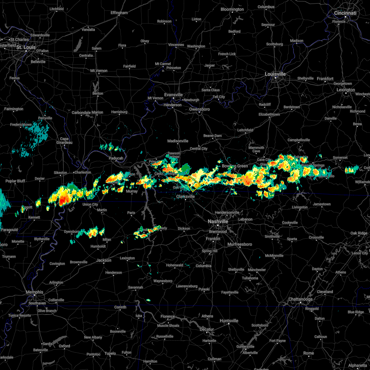 At 334 pm cdt, a severe thunderstorm was located near elkton, moving southeast at 20 mph (radar indicated). Hazards include 60 mph wind gusts. Expect damage to roofs, siding, and trees. Locations impacted include, trenton. At 334 pm cdt, a severe thunderstorm was located near elkton, moving southeast at 20 mph (radar indicated). Hazards include 60 mph wind gusts. Expect damage to roofs, siding, and trees. Locations impacted include, trenton.
|
| 8/29/2020 3:21 PM CDT |
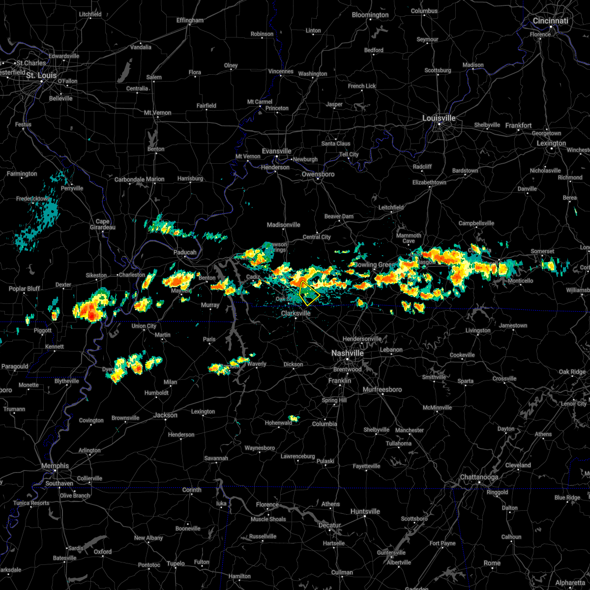 At 320 pm cdt, a severe thunderstorm was located near pembroke, or 7 miles west of elkton, moving southeast at 20 mph (radar indicated). Hazards include 60 mph wind gusts. expect damage to roofs, siding, and trees At 320 pm cdt, a severe thunderstorm was located near pembroke, or 7 miles west of elkton, moving southeast at 20 mph (radar indicated). Hazards include 60 mph wind gusts. expect damage to roofs, siding, and trees
|
| 7/19/2020 5:56 PM EDT |
 The severe thunderstorm warning for ohio, northern kenton, northern campbell, northern boone and hamilton counties will expire at 600 pm edt, the storm which prompted the warning has weakened below severe limits, and no longer poses an immediate threat to life or property. therefore, the warning will be allowed to expire. however gusty winds and heavy rain are still possible with this thunderstorm. please report previous wind damage or hail to the national weather service by going to our website at weather.gov/iln and submitting your report via social media. The severe thunderstorm warning for ohio, northern kenton, northern campbell, northern boone and hamilton counties will expire at 600 pm edt, the storm which prompted the warning has weakened below severe limits, and no longer poses an immediate threat to life or property. therefore, the warning will be allowed to expire. however gusty winds and heavy rain are still possible with this thunderstorm. please report previous wind damage or hail to the national weather service by going to our website at weather.gov/iln and submitting your report via social media.
|
| 7/19/2020 5:43 PM EDT |
 At 542 pm edt, a severe thunderstorm was located over fort thomas, moving southeast at 30 mph (radar indicated). Hazards include 60 mph wind gusts. Expect damage to trees and power lines. locations impacted include, cincinnati, covington, florence, independence, norwood, erlanger, fort thomas, newport, sharonville, blue ash, loveland, reading, montgomery, north college hill, madeira, edgewood, elsmere, wyoming, cheviot and fort mitchell. this includes the following interstates, i-71 in ohio between mile markers 0 and 16. i-74 in ohio between mile markers 5 and 19. i-75 in kentucky between mile markers 179 and 191. I-75 in ohio between mile markers 0 and 14. At 542 pm edt, a severe thunderstorm was located over fort thomas, moving southeast at 30 mph (radar indicated). Hazards include 60 mph wind gusts. Expect damage to trees and power lines. locations impacted include, cincinnati, covington, florence, independence, norwood, erlanger, fort thomas, newport, sharonville, blue ash, loveland, reading, montgomery, north college hill, madeira, edgewood, elsmere, wyoming, cheviot and fort mitchell. this includes the following interstates, i-71 in ohio between mile markers 0 and 16. i-74 in ohio between mile markers 5 and 19. i-75 in kentucky between mile markers 179 and 191. I-75 in ohio between mile markers 0 and 14.
|
| 7/19/2020 5:16 PM EDT |
 At 516 pm edt, a severe thunderstorm was located over bridgetown, moving southeast at 30 mph (radar indicated). Hazards include 60 mph wind gusts. expect damage to trees and power lines At 516 pm edt, a severe thunderstorm was located over bridgetown, moving southeast at 30 mph (radar indicated). Hazards include 60 mph wind gusts. expect damage to trees and power lines
|
| 7/5/2020 3:21 PM CDT |
 At 319 pm cdt, a severe thunderstorm was located near dunmor, or 14 miles northeast of elkton, moving north at 10 mph (radar indicated). Hazards include quarter size hail. damage to vehicles is expected At 319 pm cdt, a severe thunderstorm was located near dunmor, or 14 miles northeast of elkton, moving north at 10 mph (radar indicated). Hazards include quarter size hail. damage to vehicles is expected
|
| 6/22/2020 3:39 PM CDT |
 The severe thunderstorm warning for southeastern christian and southern todd counties will expire at 345 pm cdt, the storm which prompted the warning will move out of the warned area. therefore, the warning will be allowed to expire. The severe thunderstorm warning for southeastern christian and southern todd counties will expire at 345 pm cdt, the storm which prompted the warning will move out of the warned area. therefore, the warning will be allowed to expire.
|
| 6/22/2020 3:19 PM CDT |
 At 319 pm cdt, a severe thunderstorm was located near oak grove, moving north at 35 mph (radar indicated). Hazards include 60 mph wind gusts. expect damage to roofs, siding, and trees At 319 pm cdt, a severe thunderstorm was located near oak grove, moving north at 35 mph (radar indicated). Hazards include 60 mph wind gusts. expect damage to roofs, siding, and trees
|
| 6/10/2020 4:07 PM EDT |
 At 407 pm edt, a severe thunderstorm was located over fort wright, moving northeast at 35 mph (radar indicated). Hazards include 60 mph wind gusts. expect damage to trees and power lines At 407 pm edt, a severe thunderstorm was located over fort wright, moving northeast at 35 mph (radar indicated). Hazards include 60 mph wind gusts. expect damage to trees and power lines
|
| 6/10/2020 3:58 PM EDT |
 At 358 pm edt, a severe thunderstorm was located near independence, moving northeast at 35 mph (radar indicated). Hazards include 60 mph wind gusts. Expect damage to trees and power lines. locations impacted include, covington, florence, independence, erlanger, edgewood, alexandria, elsmere, fort mitchell, villa hills, highland heights, taylor mill, fort wright, crescent springs, crestview hills, lakeside park, oakbrook, burlington, union, wilder and melbourne. This includes i-75 in kentucky between mile markers 176 and 188. At 358 pm edt, a severe thunderstorm was located near independence, moving northeast at 35 mph (radar indicated). Hazards include 60 mph wind gusts. Expect damage to trees and power lines. locations impacted include, covington, florence, independence, erlanger, edgewood, alexandria, elsmere, fort mitchell, villa hills, highland heights, taylor mill, fort wright, crescent springs, crestview hills, lakeside park, oakbrook, burlington, union, wilder and melbourne. This includes i-75 in kentucky between mile markers 176 and 188.
|
| 6/10/2020 3:49 PM EDT |
 At 349 pm edt, a severe thunderstorm was located over walton, moving northeast at 35 mph (radar indicated). Hazards include 60 mph wind gusts. expect damage to trees and power lines At 349 pm edt, a severe thunderstorm was located over walton, moving northeast at 35 mph (radar indicated). Hazards include 60 mph wind gusts. expect damage to trees and power lines
|
| 5/25/2020 5:44 PM CDT |
 At 543 pm cdt, severe thunderstorms were located along a line extending from 6 miles north of elkton to pembroke to near clarksville, moving north at 25 mph (radar indicated). Hazards include 60 mph wind gusts and nickel size hail. expect damage to roofs, siding, and trees At 543 pm cdt, severe thunderstorms were located along a line extending from 6 miles north of elkton to pembroke to near clarksville, moving north at 25 mph (radar indicated). Hazards include 60 mph wind gusts and nickel size hail. expect damage to roofs, siding, and trees
|
| 5/24/2020 4:42 PM EDT |
 At 442 pm edt, a severe thunderstorm was located over taylor mill, and is nearly stationary (radar indicated). Hazards include 60 mph wind gusts and quarter size hail. Minor hail damage to vehicles is possible. Expect wind damage to trees and power lines. At 442 pm edt, a severe thunderstorm was located over taylor mill, and is nearly stationary (radar indicated). Hazards include 60 mph wind gusts and quarter size hail. Minor hail damage to vehicles is possible. Expect wind damage to trees and power lines.
|
| 5/10/2020 3:42 PM EDT |
 At 342 pm edt, severe thunderstorms were located along a line extending from near finneytown to near walton, moving northeast at 65 mph (radar indicated). Hazards include 60 mph wind gusts. Expect damage to trees and power lines. locations impacted include, cincinnati, covington, florence, independence, erlanger, fort thomas, newport, edgewood, alexandria, elsmere, fort mitchell, villa hills, highland heights, taylor mill, bellevue, fort wright, southgate, crescent springs, walton and crestview hills. this includes the following interstates, i-71 in kentucky between mile markers 74 and 77. I-75 in kentucky between mile markers 159 and 179, and between mile markers 183 and 191. At 342 pm edt, severe thunderstorms were located along a line extending from near finneytown to near walton, moving northeast at 65 mph (radar indicated). Hazards include 60 mph wind gusts. Expect damage to trees and power lines. locations impacted include, cincinnati, covington, florence, independence, erlanger, fort thomas, newport, edgewood, alexandria, elsmere, fort mitchell, villa hills, highland heights, taylor mill, bellevue, fort wright, southgate, crescent springs, walton and crestview hills. this includes the following interstates, i-71 in kentucky between mile markers 74 and 77. I-75 in kentucky between mile markers 159 and 179, and between mile markers 183 and 191.
|
| 5/10/2020 3:27 PM EDT |
 At 327 pm edt, severe thunderstorms were located along a line extending from burlington to 7 miles southeast of kentucky speedway, moving northeast at 65 mph (radar indicated). Hazards include 60 mph wind gusts. expect damage to trees and power lines At 327 pm edt, severe thunderstorms were located along a line extending from burlington to 7 miles southeast of kentucky speedway, moving northeast at 65 mph (radar indicated). Hazards include 60 mph wind gusts. expect damage to trees and power lines
|
| 4/8/2020 10:34 PM EDT |
 At 1034 pm edt, a severe thunderstorm capable of producing a tornado was located over crestview hills, moving east at 50 mph (radar indicated rotation). Hazards include tornado and quarter size hail. Flying debris will be dangerous to those caught without shelter. mobile homes will be damaged or destroyed. damage to roofs, windows, and vehicles will occur. Tree damage is likely. At 1034 pm edt, a severe thunderstorm capable of producing a tornado was located over crestview hills, moving east at 50 mph (radar indicated rotation). Hazards include tornado and quarter size hail. Flying debris will be dangerous to those caught without shelter. mobile homes will be damaged or destroyed. damage to roofs, windows, and vehicles will occur. Tree damage is likely.
|
| 4/8/2020 10:15 PM EDT |
 At 1014 pm edt, a severe thunderstorm was located over reading, moving east at 45 mph (radar indicated). Hazards include 70 mph wind gusts and quarter size hail. Minor hail damage to vehicles is possible. expect considerable tree damage. Wind damage is also likely to mobile homes, roofs, and outbuildings. At 1014 pm edt, a severe thunderstorm was located over reading, moving east at 45 mph (radar indicated). Hazards include 70 mph wind gusts and quarter size hail. Minor hail damage to vehicles is possible. expect considerable tree damage. Wind damage is also likely to mobile homes, roofs, and outbuildings.
|
| 4/8/2020 8:55 PM CDT |
 At 854 pm cdt, severe thunderstorms were located along a line extending from near weir to 7 miles southeast of big rock, moving east at 50 mph (radar indicated. quarter size hail and power outages were reported in hopkinsville). Hazards include 60 mph wind gusts and half dollar size hail. Hail damage to vehicles is expected. expect wind damage to roofs, siding, and trees. Locations impacted include, hopkinsville, oak grove, elkton, fort campbell, clarksville, guthrie, pembroke, trenton, lafayette, justice, everett, allensville, allegre, clifty and herndon. At 854 pm cdt, severe thunderstorms were located along a line extending from near weir to 7 miles southeast of big rock, moving east at 50 mph (radar indicated. quarter size hail and power outages were reported in hopkinsville). Hazards include 60 mph wind gusts and half dollar size hail. Hail damage to vehicles is expected. expect wind damage to roofs, siding, and trees. Locations impacted include, hopkinsville, oak grove, elkton, fort campbell, clarksville, guthrie, pembroke, trenton, lafayette, justice, everett, allensville, allegre, clifty and herndon.
|
| 4/8/2020 8:24 PM CDT |
 At 824 pm cdt, severe thunderstorms were located along a line extending from near cobb to near paris landing state park, moving east at 50 mph (radar indicated). Hazards include 60 mph wind gusts and half dollar size hail. Hail damage to vehicles is expected. Expect wind damage to roofs, siding, and trees. At 824 pm cdt, severe thunderstorms were located along a line extending from near cobb to near paris landing state park, moving east at 50 mph (radar indicated). Hazards include 60 mph wind gusts and half dollar size hail. Hail damage to vehicles is expected. Expect wind damage to roofs, siding, and trees.
|
| 3/29/2020 12:27 AM EDT |
 The severe thunderstorm warning for kenton and campbell counties will expire at 1230 am edt, the storm which prompted the warning has weakened below severe limits, and no longer poses an immediate threat to life or property. therefore, the warning will be allowed to expire. please report previous wind damage or hail to the national weather service by going to our website at weather.gov/iln and submitting your report via social media. The severe thunderstorm warning for kenton and campbell counties will expire at 1230 am edt, the storm which prompted the warning has weakened below severe limits, and no longer poses an immediate threat to life or property. therefore, the warning will be allowed to expire. please report previous wind damage or hail to the national weather service by going to our website at weather.gov/iln and submitting your report via social media.
|
| 3/29/2020 12:20 AM EDT |
 At 1220 am edt, a severe thunderstorm was located over taylor mill, moving east at 50 mph (radar indicated). Hazards include 60 mph wind gusts. Expect damage to trees and power lines. locations impacted include, covington, independence, erlanger, fort thomas, newport, edgewood, alexandria, elsmere, fort mitchell, villa hills, highland heights, taylor mill, fort wright, southgate, crescent springs, walton, crestview hills, park hills, lakeside park and claryville. This includes i-75 in kentucky between mile markers 167 and 169, and between mile markers 184 and 190. At 1220 am edt, a severe thunderstorm was located over taylor mill, moving east at 50 mph (radar indicated). Hazards include 60 mph wind gusts. Expect damage to trees and power lines. locations impacted include, covington, independence, erlanger, fort thomas, newport, edgewood, alexandria, elsmere, fort mitchell, villa hills, highland heights, taylor mill, fort wright, southgate, crescent springs, walton, crestview hills, park hills, lakeside park and claryville. This includes i-75 in kentucky between mile markers 167 and 169, and between mile markers 184 and 190.
|
| 3/29/2020 12:13 AM EDT |
 At 1213 am edt, a severe thunderstorm was located near union, moving east at 45 mph (radar indicated). Hazards include 60 mph wind gusts. Expect damage to trees and power lines. locations impacted include, covington, florence, independence, erlanger, fort thomas, newport, edgewood, alexandria, elsmere, fort mitchell, villa hills, highland heights, taylor mill, fort wright, southgate, crescent springs, walton, crestview hills, park hills and lakeside park. this includes the following interstates, i-71 in kentucky between mile markers 73 and 77. I-75 in kentucky between mile markers 167 and 190. At 1213 am edt, a severe thunderstorm was located near union, moving east at 45 mph (radar indicated). Hazards include 60 mph wind gusts. Expect damage to trees and power lines. locations impacted include, covington, florence, independence, erlanger, fort thomas, newport, edgewood, alexandria, elsmere, fort mitchell, villa hills, highland heights, taylor mill, fort wright, southgate, crescent springs, walton, crestview hills, park hills and lakeside park. this includes the following interstates, i-71 in kentucky between mile markers 73 and 77. I-75 in kentucky between mile markers 167 and 190.
|
| 3/29/2020 12:04 AM EDT |
 At 1203 am edt, a severe thunderstorm was located over patriot, moving east at 40 mph (radar indicated). Hazards include 60 mph wind gusts. expect damage to trees and power lines At 1203 am edt, a severe thunderstorm was located over patriot, moving east at 40 mph (radar indicated). Hazards include 60 mph wind gusts. expect damage to trees and power lines
|
| 3/28/2020 10:45 PM CDT |
 At 1044 pm cdt, severe thunderstorms were located along a line extending from near dunmor to 9 miles southeast of clarksville, moving northeast at 65 mph (trained weather spotters reported 60 mph wind gusts on the north side of hopkinsville around 1020 pm). Hazards include 60 mph wind gusts. Expect damage to roofs, siding, and trees. Locations impacted include, elkton, guthrie, trenton, clifty, allensville and allegre. At 1044 pm cdt, severe thunderstorms were located along a line extending from near dunmor to 9 miles southeast of clarksville, moving northeast at 65 mph (trained weather spotters reported 60 mph wind gusts on the north side of hopkinsville around 1020 pm). Hazards include 60 mph wind gusts. Expect damage to roofs, siding, and trees. Locations impacted include, elkton, guthrie, trenton, clifty, allensville and allegre.
|
| 3/28/2020 10:34 PM CDT |
 At 1032 pm cdt, severe thunderstorms were located along a line extending from 9 miles northeast of hopkinsville to 12 miles southwest of clarksville, moving east at 40 mph (radar indicated). Hazards include 60 mph wind gusts. Expect damage to roofs, siding, and trees. Locations impacted include, hopkinsville, oak grove, elkton, fort campbell, clarksville, guthrie, pembroke, trenton, clifty. At 1032 pm cdt, severe thunderstorms were located along a line extending from 9 miles northeast of hopkinsville to 12 miles southwest of clarksville, moving east at 40 mph (radar indicated). Hazards include 60 mph wind gusts. Expect damage to roofs, siding, and trees. Locations impacted include, hopkinsville, oak grove, elkton, fort campbell, clarksville, guthrie, pembroke, trenton, clifty.
|
| 3/28/2020 10:12 PM CDT |
 At 1011 pm cdt, severe thunderstorms were located along a line extending from 6 miles south of crofton to 6 miles north of erin, moving northeast at 80 mph (radar indicated). Hazards include 60 mph wind gusts and penny size hail. expect damage to roofs, siding, and trees At 1011 pm cdt, severe thunderstorms were located along a line extending from 6 miles south of crofton to 6 miles north of erin, moving northeast at 80 mph (radar indicated). Hazards include 60 mph wind gusts and penny size hail. expect damage to roofs, siding, and trees
|
| 3/28/2020 8:24 PM CDT |
 The severe thunderstorm warning for todd county will expire at 830 pm cdt, the storm which prompted the warning has weakened below severe limits, and no longer poses an immediate threat to life or property. therefore, the warning will be allowed to expire. a tornado watch remains in effect until 200 am cdt for south central kentucky. The severe thunderstorm warning for todd county will expire at 830 pm cdt, the storm which prompted the warning has weakened below severe limits, and no longer poses an immediate threat to life or property. therefore, the warning will be allowed to expire. a tornado watch remains in effect until 200 am cdt for south central kentucky.
|
| 3/28/2020 8:12 PM CDT |
 At 811 pm cdt, a severe thunderstorm was located near elkton, moving northeast at 40 mph (radar indicated). Hazards include 60 mph wind gusts and penny size hail. Expect damage to roofs, siding, and trees. Locations impacted include, elkton, guthrie, trenton, justice and allensville. At 811 pm cdt, a severe thunderstorm was located near elkton, moving northeast at 40 mph (radar indicated). Hazards include 60 mph wind gusts and penny size hail. Expect damage to roofs, siding, and trees. Locations impacted include, elkton, guthrie, trenton, justice and allensville.
|
| 3/28/2020 7:56 PM CDT |
 At 755 pm cdt, a severe thunderstorm was located over oak grove, moving northeast at 35 mph (radar indicated). Hazards include 60 mph wind gusts and quarter size hail. Hail damage to vehicles is expected. Expect wind damage to roofs, siding, and trees. At 755 pm cdt, a severe thunderstorm was located over oak grove, moving northeast at 35 mph (radar indicated). Hazards include 60 mph wind gusts and quarter size hail. Hail damage to vehicles is expected. Expect wind damage to roofs, siding, and trees.
|
| 3/28/2020 7:39 PM CDT |
 At 739 pm cdt, a severe thunderstorm was located near fort campbell, moving northeast at 50 mph (radar indicated). Hazards include 70 mph wind gusts and half dollar size hail. Hail damage to vehicles is expected. expect considerable tree damage. wind damage is also likely to mobile homes, roofs, and outbuildings. Locations impacted include, hopkinsville, oak grove, elkton, fort campbell, pembroke, trenton, lafayette, allegre and herndon. At 739 pm cdt, a severe thunderstorm was located near fort campbell, moving northeast at 50 mph (radar indicated). Hazards include 70 mph wind gusts and half dollar size hail. Hail damage to vehicles is expected. expect considerable tree damage. wind damage is also likely to mobile homes, roofs, and outbuildings. Locations impacted include, hopkinsville, oak grove, elkton, fort campbell, pembroke, trenton, lafayette, allegre and herndon.
|
| 3/28/2020 7:22 PM CDT |
 At 721 pm cdt, a severe thunderstorm was located near big rock, or near dover, moving northeast at 50 mph (radar indicated). Hazards include golf ball size hail and 70 mph wind gusts. People and animals outdoors will be injured. expect hail damage to roofs, siding, windows, and vehicles. expect considerable tree damage. Wind damage is also likely to mobile homes, roofs, and outbuildings. At 721 pm cdt, a severe thunderstorm was located near big rock, or near dover, moving northeast at 50 mph (radar indicated). Hazards include golf ball size hail and 70 mph wind gusts. People and animals outdoors will be injured. expect hail damage to roofs, siding, windows, and vehicles. expect considerable tree damage. Wind damage is also likely to mobile homes, roofs, and outbuildings.
|
| 3/20/2020 4:49 AM CDT |
 At 448 am cdt, a severe thunderstorm was located over fort campbell, moving east at 55 mph (radar indicated). Hazards include 60 mph wind gusts and quarter size hail. Hail damage to vehicles is expected. Expect wind damage to roofs, siding, and trees. At 448 am cdt, a severe thunderstorm was located over fort campbell, moving east at 55 mph (radar indicated). Hazards include 60 mph wind gusts and quarter size hail. Hail damage to vehicles is expected. Expect wind damage to roofs, siding, and trees.
|
| 1/11/2020 9:28 PM EST |
 At 927 pm est, a severe thunderstorm was located over florence, moving northeast at 55 mph (radar indicated). Hazards include 70 mph wind gusts. Expect considerable tree damage. damage is likely to mobile homes, roofs, and outbuildings. locations impacted include, cincinnati, covington, florence, independence, norwood, erlanger, fort thomas, newport, blue ash, reading, madeira, edgewood, alexandria, elsmere, wyoming, fort mitchell, villa hills, highland heights, taylor mill and bellevue. this includes the following interstates, i-71 in ohio between mile markers 0 and 13. i-74 in ohio between mile markers 18 and 19. i-75 in kentucky between mile markers 177 and 191. I-75 in ohio between mile markers 0 and 12. At 927 pm est, a severe thunderstorm was located over florence, moving northeast at 55 mph (radar indicated). Hazards include 70 mph wind gusts. Expect considerable tree damage. damage is likely to mobile homes, roofs, and outbuildings. locations impacted include, cincinnati, covington, florence, independence, norwood, erlanger, fort thomas, newport, blue ash, reading, madeira, edgewood, alexandria, elsmere, wyoming, fort mitchell, villa hills, highland heights, taylor mill and bellevue. this includes the following interstates, i-71 in ohio between mile markers 0 and 13. i-74 in ohio between mile markers 18 and 19. i-75 in kentucky between mile markers 177 and 191. I-75 in ohio between mile markers 0 and 12.
|
| 1/11/2020 9:18 PM EST |
 At 917 pm est, a severe thunderstorm was located over rising sun, moving northeast at 55 mph (radar indicated). Hazards include 70 mph wind gusts. Expect considerable tree damage. Damage is likely to mobile homes, roofs, and outbuildings. At 917 pm est, a severe thunderstorm was located over rising sun, moving northeast at 55 mph (radar indicated). Hazards include 70 mph wind gusts. Expect considerable tree damage. Damage is likely to mobile homes, roofs, and outbuildings.
|
| 1/11/2020 7:37 AM CST |
 At 737 am cst, a severe thunderstorm capable of producing a tornado was located near oak grove, moving northeast at 55 mph (radar indicated rotation). Hazards include tornado. Flying debris will be dangerous to those caught without shelter. mobile homes will be damaged or destroyed. damage to roofs, windows, and vehicles will occur. tree damage is likely. this dangerous storm will be near, pembroke around 745 am cst. Other locations impacted by this tornadic thunderstorm include lafayette and herndon. At 737 am cst, a severe thunderstorm capable of producing a tornado was located near oak grove, moving northeast at 55 mph (radar indicated rotation). Hazards include tornado. Flying debris will be dangerous to those caught without shelter. mobile homes will be damaged or destroyed. damage to roofs, windows, and vehicles will occur. tree damage is likely. this dangerous storm will be near, pembroke around 745 am cst. Other locations impacted by this tornadic thunderstorm include lafayette and herndon.
|
| 1/11/2020 7:31 AM CST |
 At 731 am cst, severe thunderstorms were located along a line extending from near madisonville to crofton to 6 miles west of fort campbell, moving northeast at 55 mph (radar indicated). Hazards include 60 mph wind gusts. expect damage to roofs, siding, and trees At 731 am cst, severe thunderstorms were located along a line extending from near madisonville to crofton to 6 miles west of fort campbell, moving northeast at 55 mph (radar indicated). Hazards include 60 mph wind gusts. expect damage to roofs, siding, and trees
|
| 1/11/2020 7:23 AM CST |
 At 722 am cst, a severe thunderstorm capable of producing a tornado was located near big rock, or 14 miles west of fort campbell, moving northeast at 55 mph (radar indicated rotation). Hazards include tornado. Flying debris will be dangerous to those caught without shelter. mobile homes will be damaged or destroyed. damage to roofs, windows, and vehicles will occur. tree damage is likely. this dangerous storm will be near, fort campbell around 735 am cst. hopkinsville around 740 am cst. pembroke around 745 am cst. other locations impacted by this tornadic thunderstorm include lafayette and herndon. this includes the following highways, interstate 24 in kentucky between mile markers 72 and 92. Pennyrile parkway between mile markers 1 and 10. At 722 am cst, a severe thunderstorm capable of producing a tornado was located near big rock, or 14 miles west of fort campbell, moving northeast at 55 mph (radar indicated rotation). Hazards include tornado. Flying debris will be dangerous to those caught without shelter. mobile homes will be damaged or destroyed. damage to roofs, windows, and vehicles will occur. tree damage is likely. this dangerous storm will be near, fort campbell around 735 am cst. hopkinsville around 740 am cst. pembroke around 745 am cst. other locations impacted by this tornadic thunderstorm include lafayette and herndon. this includes the following highways, interstate 24 in kentucky between mile markers 72 and 92. Pennyrile parkway between mile markers 1 and 10.
|
| 1/11/2020 6:54 AM CST |
 At 654 am cst, severe thunderstorms were located along a line extending from near land between the lakes area to 6 miles north of paris landing state park, moving northeast at 70 mph (radar indicated). Hazards include 60 mph wind gusts. expect damage to roofs, siding, and trees At 654 am cst, severe thunderstorms were located along a line extending from near land between the lakes area to 6 miles north of paris landing state park, moving northeast at 70 mph (radar indicated). Hazards include 60 mph wind gusts. expect damage to roofs, siding, and trees
|
| 10/26/2019 3:23 PM CDT |
 At 320 pm cdt, a severe thunderstorm was located near pembroke, or near elkton, moving northeast at 65 mph (radar indicated. at 315 pm...the todd county mesonet reported a wind gust to 63 mph near elkton). Hazards include 60 mph wind gusts. Expect damage to roofs, siding, and trees. Locations impacted include, elkton, guthrie, pembroke, trenton, clifty and allegre. At 320 pm cdt, a severe thunderstorm was located near pembroke, or near elkton, moving northeast at 65 mph (radar indicated. at 315 pm...the todd county mesonet reported a wind gust to 63 mph near elkton). Hazards include 60 mph wind gusts. Expect damage to roofs, siding, and trees. Locations impacted include, elkton, guthrie, pembroke, trenton, clifty and allegre.
|
| 10/26/2019 3:05 PM CDT |
 At 305 pm cdt, a severe thunderstorm was located near clarksville, moving northeast at 65 mph (radar indicated). Hazards include 60 mph wind gusts. expect damage to roofs, siding, and trees At 305 pm cdt, a severe thunderstorm was located near clarksville, moving northeast at 65 mph (radar indicated). Hazards include 60 mph wind gusts. expect damage to roofs, siding, and trees
|
| 8/22/2019 5:32 AM EDT |
 At 532 am edt, a severe thunderstorm was located near claryville, moving east at 35 mph (radar indicated). Hazards include 60 mph wind gusts. Expect damage to trees and power lines. locations impacted include, covington, florence, independence, erlanger, alexandria, taylor mill, walton, claryville, union, wilder, silver grove, melbourne, coldstream, cold spring, ryland heights, crestview, fairview, california, visalia and atwood. this includes the following interstates, i-71 in kentucky between mile markers 69 and 77. I-75 in kentucky between mile markers 168 and 178. At 532 am edt, a severe thunderstorm was located near claryville, moving east at 35 mph (radar indicated). Hazards include 60 mph wind gusts. Expect damage to trees and power lines. locations impacted include, covington, florence, independence, erlanger, alexandria, taylor mill, walton, claryville, union, wilder, silver grove, melbourne, coldstream, cold spring, ryland heights, crestview, fairview, california, visalia and atwood. this includes the following interstates, i-71 in kentucky between mile markers 69 and 77. I-75 in kentucky between mile markers 168 and 178.
|
| 8/22/2019 5:15 AM EDT |
 At 515 am edt, a severe thunderstorm was located over walton, moving east at 35 mph (radar indicated). Hazards include 60 mph wind gusts. expect damage to trees and power lines At 515 am edt, a severe thunderstorm was located over walton, moving east at 35 mph (radar indicated). Hazards include 60 mph wind gusts. expect damage to trees and power lines
|
| 8/6/2019 7:30 PM CDT |
 At 728 pm cdt, severe thunderstorms were located along a line extending from 6 miles southwest of russellville to fort campbell north, moving southeast at 20 mph (trained weather spotter reported trees on a mobile home just north of pembroke). Hazards include 60 mph wind gusts and nickel size hail. Expect damage to roofs, siding, and trees. Locations impacted include, hopkinsville, elkton, clarksville, guthrie, pembroke, trenton, justice, allensville and everett. At 728 pm cdt, severe thunderstorms were located along a line extending from 6 miles southwest of russellville to fort campbell north, moving southeast at 20 mph (trained weather spotter reported trees on a mobile home just north of pembroke). Hazards include 60 mph wind gusts and nickel size hail. Expect damage to roofs, siding, and trees. Locations impacted include, hopkinsville, elkton, clarksville, guthrie, pembroke, trenton, justice, allensville and everett.
|
| 8/6/2019 7:13 PM CDT |
 At 712 pm cdt, severe thunderstorms were located along a line extending from 7 miles west of russellville to 6 miles northwest of fort campbell north, moving southeast at 20 mph (radar indicated). Hazards include 60 mph wind gusts and nickel size hail. expect damage to roofs, siding, and trees At 712 pm cdt, severe thunderstorms were located along a line extending from 7 miles west of russellville to 6 miles northwest of fort campbell north, moving southeast at 20 mph (radar indicated). Hazards include 60 mph wind gusts and nickel size hail. expect damage to roofs, siding, and trees
|
| 8/6/2019 6:52 PM CDT |
 At 652 pm cdt, a severe thunderstorm was located near pembroke, or 7 miles east of hopkinsville, moving south at 50 mph (radar indicated). Hazards include 60 mph wind gusts and nickel size hail. Expect damage to roofs, siding, and trees. Locations impacted include, hopkinsville, elkton, pembroke, crofton, justice, hawkins, allegre and clifty. At 652 pm cdt, a severe thunderstorm was located near pembroke, or 7 miles east of hopkinsville, moving south at 50 mph (radar indicated). Hazards include 60 mph wind gusts and nickel size hail. Expect damage to roofs, siding, and trees. Locations impacted include, hopkinsville, elkton, pembroke, crofton, justice, hawkins, allegre and clifty.
|
| 8/6/2019 6:35 PM CDT |
 The national weather service in paducah has issued a * severe thunderstorm warning for. southwestern muhlenberg county in south central kentucky. christian county in south central kentucky. southeastern hopkins county in northwestern kentucky. Central todd county in south central kentucky. The national weather service in paducah has issued a * severe thunderstorm warning for. southwestern muhlenberg county in south central kentucky. christian county in south central kentucky. southeastern hopkins county in northwestern kentucky. Central todd county in south central kentucky.
|
| 7/30/2019 4:11 PM EDT |
 At 411 pm edt, a severe thunderstorm was located over taylor mill, moving southeast at 15 mph (radar indicated). Hazards include 60 mph wind gusts and quarter size hail. Minor hail damage to vehicles is possible. Expect wind damage to trees and power lines. At 411 pm edt, a severe thunderstorm was located over taylor mill, moving southeast at 15 mph (radar indicated). Hazards include 60 mph wind gusts and quarter size hail. Minor hail damage to vehicles is possible. Expect wind damage to trees and power lines.
|
| 7/2/2019 4:13 PM EDT |
 At 413 pm edt, a severe thunderstorm was located near alexandria, moving east at 20 mph (radar indicated). Hazards include 60 mph wind gusts. expect damage to trees and power lines At 413 pm edt, a severe thunderstorm was located near alexandria, moving east at 20 mph (radar indicated). Hazards include 60 mph wind gusts. expect damage to trees and power lines
|
| 6/23/2019 6:56 PM CDT |
 At 655 pm cdt, a severe thunderstorm capable of producing a tornado was located near pembroke, or near hopkinsville, moving northeast at 35 mph (radar indicated rotation). Hazards include tornado and quarter size hail. Flying debris will be dangerous to those caught without shelter. mobile homes will be damaged or destroyed. damage to roofs, windows, and vehicles will occur. tree damage is likely. This tornadic thunderstorm will remain over mainly rural areas of east central christian and central todd counties, including the following locations, clifty and allegre. At 655 pm cdt, a severe thunderstorm capable of producing a tornado was located near pembroke, or near hopkinsville, moving northeast at 35 mph (radar indicated rotation). Hazards include tornado and quarter size hail. Flying debris will be dangerous to those caught without shelter. mobile homes will be damaged or destroyed. damage to roofs, windows, and vehicles will occur. tree damage is likely. This tornadic thunderstorm will remain over mainly rural areas of east central christian and central todd counties, including the following locations, clifty and allegre.
|
| 6/23/2019 6:49 PM CDT |
 At 649 pm cdt, severe thunderstorms were located along a line extending from near weir to 11 miles east of crofton to near hopkinsville to 8 miles west of fort campbell north, moving east at 25 mph (radar indicated). Hazards include 60 mph wind gusts and penny size hail. Expect damage to roofs, siding, and trees. Locations impacted include, hopkinsville, oak grove, elkton, fort campbell north, clarksville, guthrie, pembroke, trenton, lafayette, allensville, allegre, clifty and herndon. At 649 pm cdt, severe thunderstorms were located along a line extending from near weir to 11 miles east of crofton to near hopkinsville to 8 miles west of fort campbell north, moving east at 25 mph (radar indicated). Hazards include 60 mph wind gusts and penny size hail. Expect damage to roofs, siding, and trees. Locations impacted include, hopkinsville, oak grove, elkton, fort campbell north, clarksville, guthrie, pembroke, trenton, lafayette, allensville, allegre, clifty and herndon.
|
| 6/23/2019 6:11 PM CDT |
 At 611 pm cdt, severe thunderstorms were located along a line extending from 6 miles east of madisonville to near graham to near crofton to near big rock, moving east at 50 mph (radar indicated). Hazards include 60 mph wind gusts and penny size hail. expect damage to roofs, siding, and trees At 611 pm cdt, severe thunderstorms were located along a line extending from 6 miles east of madisonville to near graham to near crofton to near big rock, moving east at 50 mph (radar indicated). Hazards include 60 mph wind gusts and penny size hail. expect damage to roofs, siding, and trees
|
| 6/23/2019 6:03 PM CDT |
 At 602 pm cdt, severe thunderstorms were located along a line extending from near breckinridge center to near sebree to 10 miles southwest of calhoun to near madisonville to near mortons gap to near dawson springs to 6 miles west of crofton to 8 miles southeast of cobb to cadiz to 6 miles south of canton, moving east at 60 mph (radar indicated). Hazards include 70 mph wind gusts and quarter size hail. Hail damage to vehicles is expected. expect considerable tree damage. wind damage is also likely to mobile homes, roofs, and outbuildings. locations impacted include, hopkinsville, madisonville, oak grove, providence, sturgis, clarksville, sebree, earlington, nortonville, clay, pembroke, mortons gap, dixon, crofton, white plains, hanson, st. Charles, nebo, slaughters and wheatcroft. At 602 pm cdt, severe thunderstorms were located along a line extending from near breckinridge center to near sebree to 10 miles southwest of calhoun to near madisonville to near mortons gap to near dawson springs to 6 miles west of crofton to 8 miles southeast of cobb to cadiz to 6 miles south of canton, moving east at 60 mph (radar indicated). Hazards include 70 mph wind gusts and quarter size hail. Hail damage to vehicles is expected. expect considerable tree damage. wind damage is also likely to mobile homes, roofs, and outbuildings. locations impacted include, hopkinsville, madisonville, oak grove, providence, sturgis, clarksville, sebree, earlington, nortonville, clay, pembroke, mortons gap, dixon, crofton, white plains, hanson, st. Charles, nebo, slaughters and wheatcroft.
|
| 6/23/2019 5:14 PM CDT |
 At 513 pm cdt, severe thunderstorms were located along a line extending from 10 miles northeast of dixon springs to joy to burna to 8 miles southwest of salem to near calvert city to near benton to 9 miles northeast of cottage grove to near dresden, moving east at 60 mph (radar indicated). Hazards include 70 mph wind gusts and quarter size hail. Hail damage to vehicles is expected. expect considerable tree damage. Wind damage is also likely to mobile homes, roofs, and outbuildings. At 513 pm cdt, severe thunderstorms were located along a line extending from 10 miles northeast of dixon springs to joy to burna to 8 miles southwest of salem to near calvert city to near benton to 9 miles northeast of cottage grove to near dresden, moving east at 60 mph (radar indicated). Hazards include 70 mph wind gusts and quarter size hail. Hail damage to vehicles is expected. expect considerable tree damage. Wind damage is also likely to mobile homes, roofs, and outbuildings.
|
| 6/22/2019 3:54 PM CDT |
 At 352 pm cdt, a severe thunderstorm was located near guthrie, or 11 miles southeast of elkton, moving east at 50 mph. wind gusts up to 50 mph may still exist for up to 15 minutes after the warning expires at 4 pm (radar indicated). Hazards include 60 mph wind gusts and quarter size hail. Hail damage to vehicles is expected. expect wind damage to roofs, siding, and trees. Locations impacted include, elkton, guthrie, trenton, justice, allensville, allegre and everett. At 352 pm cdt, a severe thunderstorm was located near guthrie, or 11 miles southeast of elkton, moving east at 50 mph. wind gusts up to 50 mph may still exist for up to 15 minutes after the warning expires at 4 pm (radar indicated). Hazards include 60 mph wind gusts and quarter size hail. Hail damage to vehicles is expected. expect wind damage to roofs, siding, and trees. Locations impacted include, elkton, guthrie, trenton, justice, allensville, allegre and everett.
|
| 6/22/2019 3:44 PM CDT |
 At 343 pm cdt, a severe thunderstorm was located over guthrie, or 10 miles south of elkton, moving east at 40 mph (radar indicated). Hazards include 60 mph wind gusts and quarter size hail. Hail damage to vehicles is expected. expect wind damage to roofs, siding, and trees. Locations impacted include, elkton, guthrie, trenton, justice, allensville, allegre and everett. At 343 pm cdt, a severe thunderstorm was located over guthrie, or 10 miles south of elkton, moving east at 40 mph (radar indicated). Hazards include 60 mph wind gusts and quarter size hail. Hail damage to vehicles is expected. expect wind damage to roofs, siding, and trees. Locations impacted include, elkton, guthrie, trenton, justice, allensville, allegre and everett.
|
| 6/22/2019 3:12 PM CDT |
 At 312 pm cdt, severe thunderstorms were located along a line extending from near hopkinsville to 8 miles west of fort campbell north, moving east at 50 mph (radar indicated). Hazards include 60 mph wind gusts and quarter size hail. Hail damage to vehicles is expected. Expect wind damage to roofs, siding, and trees. At 312 pm cdt, severe thunderstorms were located along a line extending from near hopkinsville to 8 miles west of fort campbell north, moving east at 50 mph (radar indicated). Hazards include 60 mph wind gusts and quarter size hail. Hail damage to vehicles is expected. Expect wind damage to roofs, siding, and trees.
|
| 6/21/2019 7:13 PM CDT |
 At 710 pm cdt, severe storms were located along a line extending from 9 miles south of morgantown to 8 miles north of russellville to 6 miles east of elkton to near guthrie to 8 miles southeast of clarksville, moving east at 50 mph (radar, storm spotters, and automated weather observation platforms have still indicated 60 to 70 mph winds, extensive tree damage, and torrential rainfall. an isolate tornado may still be possible along the leading edge of the line of thunderstorms). Hazards include 70 mph wind gusts and half dollar size hail. Hail damage to vehicles is expected. expect considerable tree damage. wind damage is also likely to mobile homes, roofs, and outbuildings. Locations impacted include, elkton, clarksville, guthrie, pembroke, trenton, allensville, allegre and clifty. At 710 pm cdt, severe storms were located along a line extending from 9 miles south of morgantown to 8 miles north of russellville to 6 miles east of elkton to near guthrie to 8 miles southeast of clarksville, moving east at 50 mph (radar, storm spotters, and automated weather observation platforms have still indicated 60 to 70 mph winds, extensive tree damage, and torrential rainfall. an isolate tornado may still be possible along the leading edge of the line of thunderstorms). Hazards include 70 mph wind gusts and half dollar size hail. Hail damage to vehicles is expected. expect considerable tree damage. wind damage is also likely to mobile homes, roofs, and outbuildings. Locations impacted include, elkton, clarksville, guthrie, pembroke, trenton, allensville, allegre and clifty.
|
| 6/21/2019 6:59 PM CDT |
 At 648 pm cdt, a severe thunderstorm capable of producing a tornado was located near hopkinsville, moving east at 30 mph (trained spotter indicated a possible tornado south of hopkinsville). Hazards include tornado. Flying debris will be dangerous to those caught without shelter. mobile homes will be damaged or destroyed. damage to roofs, windows, and vehicles will occur. tree damage is likely. This dangerous storm will be near, pembroke around 700 pm cdt. At 648 pm cdt, a severe thunderstorm capable of producing a tornado was located near hopkinsville, moving east at 30 mph (trained spotter indicated a possible tornado south of hopkinsville). Hazards include tornado. Flying debris will be dangerous to those caught without shelter. mobile homes will be damaged or destroyed. damage to roofs, windows, and vehicles will occur. tree damage is likely. This dangerous storm will be near, pembroke around 700 pm cdt.
|
| 6/21/2019 6:56 PM CDT |
 At 655 pm cdt, a severe thunderstorm capable of producing a tornado was located near pembroke, or near oak grove, moving east at 30 mph (radar indicated rotation). Hazards include tornado. Flying debris will be dangerous to those caught without shelter. mobile homes will be damaged or destroyed. damage to roofs, windows, and vehicles will occur. tree damage is likely. this dangerous storm will be near, guthrie around 715 pm cdt. Other locations impacted by this tornadic thunderstorm include justice, everett, trenton and allensville. At 655 pm cdt, a severe thunderstorm capable of producing a tornado was located near pembroke, or near oak grove, moving east at 30 mph (radar indicated rotation). Hazards include tornado. Flying debris will be dangerous to those caught without shelter. mobile homes will be damaged or destroyed. damage to roofs, windows, and vehicles will occur. tree damage is likely. this dangerous storm will be near, guthrie around 715 pm cdt. Other locations impacted by this tornadic thunderstorm include justice, everett, trenton and allensville.
|
| 6/21/2019 6:49 PM CDT |
 At 648 pm cdt, a severe thunderstorm capable of producing a tornado was located near hopkinsville, moving east at 30 mph (trained spotter indicated a possible tornado south of hopkinsville). Hazards include tornado. Flying debris will be dangerous to those caught without shelter. mobile homes will be damaged or destroyed. damage to roofs, windows, and vehicles will occur. tree damage is likely. This dangerous storm will be near, pembroke around 700 pm cdt. At 648 pm cdt, a severe thunderstorm capable of producing a tornado was located near hopkinsville, moving east at 30 mph (trained spotter indicated a possible tornado south of hopkinsville). Hazards include tornado. Flying debris will be dangerous to those caught without shelter. mobile homes will be damaged or destroyed. damage to roofs, windows, and vehicles will occur. tree damage is likely. This dangerous storm will be near, pembroke around 700 pm cdt.
|
| 6/21/2019 6:41 PM CDT |
 At 641 pm cdt, a severe thunderstorm capable of producing a tornado was located over hopkinsville, moving east at 35 mph (radar indicated rotation). Hazards include tornado. Flying debris will be dangerous to those caught without shelter. mobile homes will be damaged or destroyed. damage to roofs, windows, and vehicles will occur. tree damage is likely. this dangerous storm will be near, hopkinsville around 645 pm cdt. pembroke around 700 pm cdt. Other locations impacted by this tornadic thunderstorm include herndon. At 641 pm cdt, a severe thunderstorm capable of producing a tornado was located over hopkinsville, moving east at 35 mph (radar indicated rotation). Hazards include tornado. Flying debris will be dangerous to those caught without shelter. mobile homes will be damaged or destroyed. damage to roofs, windows, and vehicles will occur. tree damage is likely. this dangerous storm will be near, hopkinsville around 645 pm cdt. pembroke around 700 pm cdt. Other locations impacted by this tornadic thunderstorm include herndon.
|
| 6/21/2019 6:33 PM CDT |
 The national weather service in paducah has issued a * severe thunderstorm warning for. christian county in south central kentucky. todd county in south central kentucky. until 730 pm cdt. At 631 pm cdt, severe thunderstorms were located along a line. The national weather service in paducah has issued a * severe thunderstorm warning for. christian county in south central kentucky. todd county in south central kentucky. until 730 pm cdt. At 631 pm cdt, severe thunderstorms were located along a line.
|
| 6/21/2019 5:43 PM CDT |
 At 541 pm cdt, severe thunderstorms were located along a line extending from near marion to near mayfield to near troy, moving east at 55 mph (law enforcement, emergency managers, and spotters have reported 60 to 70 mph winds, extensive tree damage, torrential rainfall, and power outages over southeast missouri, southern illinois, and parts of west kentucky). Hazards include 70 mph wind gusts and nickel size hail. Expect considerable tree damage. Damage is likely to mobile homes, roofs, and outbuildings. At 541 pm cdt, severe thunderstorms were located along a line extending from near marion to near mayfield to near troy, moving east at 55 mph (law enforcement, emergency managers, and spotters have reported 60 to 70 mph winds, extensive tree damage, torrential rainfall, and power outages over southeast missouri, southern illinois, and parts of west kentucky). Hazards include 70 mph wind gusts and nickel size hail. Expect considerable tree damage. Damage is likely to mobile homes, roofs, and outbuildings.
|
| 6/19/2019 5:36 PM CDT |
 At 535 pm cdt, severe thunderstorms were located along a line extending from 7 miles southeast of crofton to fort campbell north, moving east at 35 mph (radar indicated). Hazards include 60 mph wind gusts. Expect damage to roofs, siding, and trees. Locations impacted include, hopkinsville, oak grove, fort campbell north, clarksville and pembroke. At 535 pm cdt, severe thunderstorms were located along a line extending from 7 miles southeast of crofton to fort campbell north, moving east at 35 mph (radar indicated). Hazards include 60 mph wind gusts. Expect damage to roofs, siding, and trees. Locations impacted include, hopkinsville, oak grove, fort campbell north, clarksville and pembroke.
|
| 6/19/2019 5:14 PM CDT |
 At 514 pm cdt, severe thunderstorms were located along a line extending from 6 miles southeast of cobb to near big rock, moving east at 40 mph (radar indicated). Hazards include 60 mph wind gusts. expect damage to roofs, siding, and trees At 514 pm cdt, severe thunderstorms were located along a line extending from 6 miles southeast of cobb to near big rock, moving east at 40 mph (radar indicated). Hazards include 60 mph wind gusts. expect damage to roofs, siding, and trees
|
| 6/5/2019 7:06 PM EDT |
 At 706 pm edt, a severe thunderstorm was located over alexandria, moving southeast at 35 mph (trained weather spotters). Hazards include 70 mph wind gusts and quarter size hail. Minor hail damage to vehicles is possible. expect considerable tree damage. wind damage is also likely to mobile homes, roofs, and outbuildings. locations impacted include, cincinnati, covington, independence, erlanger, fort thomas, newport, edgewood, alexandria, elsmere, fort mitchell, villa hills, highland heights, milford, taylor mill, bellevue, fort wright, dayton, ludlow, southgate and crescent springs. this includes the following interstates, i-71 in ohio near mile marker 0. i-75 in kentucky between mile markers 184 and 191. I-75 in ohio near mile marker 0. At 706 pm edt, a severe thunderstorm was located over alexandria, moving southeast at 35 mph (trained weather spotters). Hazards include 70 mph wind gusts and quarter size hail. Minor hail damage to vehicles is possible. expect considerable tree damage. wind damage is also likely to mobile homes, roofs, and outbuildings. locations impacted include, cincinnati, covington, independence, erlanger, fort thomas, newport, edgewood, alexandria, elsmere, fort mitchell, villa hills, highland heights, milford, taylor mill, bellevue, fort wright, dayton, ludlow, southgate and crescent springs. this includes the following interstates, i-71 in ohio near mile marker 0. i-75 in kentucky between mile markers 184 and 191. I-75 in ohio near mile marker 0.
|
| 6/5/2019 6:55 PM EDT |
 At 655 pm edt, a severe thunderstorm was located over taylor mill, moving southeast at 35 mph (radar indicated). Hazards include 70 mph wind gusts. Expect considerable tree damage. Damage is likely to mobile homes, roofs, and outbuildings. At 655 pm edt, a severe thunderstorm was located over taylor mill, moving southeast at 35 mph (radar indicated). Hazards include 70 mph wind gusts. Expect considerable tree damage. Damage is likely to mobile homes, roofs, and outbuildings.
|
| 5/29/2019 2:22 PM CDT |
 At 222 pm cdt, a severe thunderstorm was located 7 miles southwest of hopkinsville, moving east at 25 mph (radar indicated). Hazards include 60 mph wind gusts and quarter size hail. Hail damage to vehicles is expected. Expect wind damage to roofs, siding, and trees. At 222 pm cdt, a severe thunderstorm was located 7 miles southwest of hopkinsville, moving east at 25 mph (radar indicated). Hazards include 60 mph wind gusts and quarter size hail. Hail damage to vehicles is expected. Expect wind damage to roofs, siding, and trees.
|
| 5/23/2019 6:05 PM EDT |
 At 605 pm edt, a severe thunderstorm was located over taylor mill, moving east at 30 mph (radar indicated). Hazards include 60 mph wind gusts and quarter size hail. Minor hail damage to vehicles is possible. Expect wind damage to trees and power lines. At 605 pm edt, a severe thunderstorm was located over taylor mill, moving east at 30 mph (radar indicated). Hazards include 60 mph wind gusts and quarter size hail. Minor hail damage to vehicles is possible. Expect wind damage to trees and power lines.
|
| 4/14/2019 4:44 PM EDT |
 At 443 pm edt, a severe thunderstorm was located over silver grove, moving northeast at 60 mph (radar indicated). Hazards include 70 mph wind gusts. Expect considerable tree damage. damage is likely to mobile homes, roofs, and outbuildings. locations impacted include, cincinnati, covington, mason, fort thomas, newport, blue ash, loveland, montgomery, madeira, alexandria, highland heights, milford, taylor mill, deer park, dayton, southgate, forestville, claryville, amelia and mariemont. this includes i-71 in ohio between mile markers 10 and 15, and between mile markers 18 and 24. A tornado watch remains in effect until 900 pm edt for northern kentucky, and southwestern ohio. At 443 pm edt, a severe thunderstorm was located over silver grove, moving northeast at 60 mph (radar indicated). Hazards include 70 mph wind gusts. Expect considerable tree damage. damage is likely to mobile homes, roofs, and outbuildings. locations impacted include, cincinnati, covington, mason, fort thomas, newport, blue ash, loveland, montgomery, madeira, alexandria, highland heights, milford, taylor mill, deer park, dayton, southgate, forestville, claryville, amelia and mariemont. this includes i-71 in ohio between mile markers 10 and 15, and between mile markers 18 and 24. A tornado watch remains in effect until 900 pm edt for northern kentucky, and southwestern ohio.
|
| 4/14/2019 4:38 PM EDT |
 At 438 pm edt, a severe thunderstorm was located near independence, moving northeast at 60 mph (radar indicated). Hazards include 60 mph wind gusts. expect damage to trees and power lines At 438 pm edt, a severe thunderstorm was located near independence, moving northeast at 60 mph (radar indicated). Hazards include 60 mph wind gusts. expect damage to trees and power lines
|
| 4/14/2019 4:33 PM EDT |
 At 433 pm edt, a severe thunderstorm was located over independence, moving northeast at 60 mph (radar indicated). Hazards include 60 mph wind gusts. Expect damage to trees and power lines. locations impacted include, covington, florence, independence, erlanger, edgewood, elsmere, taylor mill, fort wright, walton, crestview hills, lakeside park, claryville, union, ryland heights, fairview, visalia, atwood, richwood, bank lick and ricedale. this includes the following interstates, i-71 in kentucky between mile markers 76 and 77. i-75 in kentucky between mile markers 172 and 180, and near mile marker 185. A tornado watch remains in effect until 900 pm edt for northern kentucky. At 433 pm edt, a severe thunderstorm was located over independence, moving northeast at 60 mph (radar indicated). Hazards include 60 mph wind gusts. Expect damage to trees and power lines. locations impacted include, covington, florence, independence, erlanger, edgewood, elsmere, taylor mill, fort wright, walton, crestview hills, lakeside park, claryville, union, ryland heights, fairview, visalia, atwood, richwood, bank lick and ricedale. this includes the following interstates, i-71 in kentucky between mile markers 76 and 77. i-75 in kentucky between mile markers 172 and 180, and near mile marker 185. A tornado watch remains in effect until 900 pm edt for northern kentucky.
|
| 4/14/2019 4:27 PM EDT |
 At 426 pm edt, a severe thunderstorm was located over walton, moving northeast at 55 mph (radar indicated). Hazards include 60 mph wind gusts. Expect damage to trees and power lines. locations impacted include, covington, florence, independence, erlanger, edgewood, elsmere, taylor mill, fort wright, walton, crestview hills, lakeside park, claryville, union, crittenden, ryland heights, fairview, visalia, atwood, richwood and bracht. this includes the following interstates, i-71 in kentucky between mile markers 71 and 77. i-75 in kentucky between mile markers 167 and 180, and near mile marker 185. A tornado watch remains in effect until 900 pm edt for northern kentucky. At 426 pm edt, a severe thunderstorm was located over walton, moving northeast at 55 mph (radar indicated). Hazards include 60 mph wind gusts. Expect damage to trees and power lines. locations impacted include, covington, florence, independence, erlanger, edgewood, elsmere, taylor mill, fort wright, walton, crestview hills, lakeside park, claryville, union, crittenden, ryland heights, fairview, visalia, atwood, richwood and bracht. this includes the following interstates, i-71 in kentucky between mile markers 71 and 77. i-75 in kentucky between mile markers 167 and 180, and near mile marker 185. A tornado watch remains in effect until 900 pm edt for northern kentucky.
|
| 4/14/2019 4:23 PM EDT |
 At 422 pm edt, a severe thunderstorm was located near crittenden, moving northeast at 60 mph (radar indicated). Hazards include 60 mph wind gusts. Expect damage to trees and power lines. locations impacted include, covington, florence, independence, erlanger, edgewood, elsmere, taylor mill, fort wright, walton, crestview hills, lakeside park, claryville, union, crittenden, ryland heights, fairview, visalia, atwood, richwood and ryle. this includes the following interstates, i-71 in kentucky between mile markers 66 and 77. i-75 in kentucky between mile markers 166 and 179, and near mile marker 185. A tornado watch remains in effect until 900 pm edt for northern kentucky. At 422 pm edt, a severe thunderstorm was located near crittenden, moving northeast at 60 mph (radar indicated). Hazards include 60 mph wind gusts. Expect damage to trees and power lines. locations impacted include, covington, florence, independence, erlanger, edgewood, elsmere, taylor mill, fort wright, walton, crestview hills, lakeside park, claryville, union, crittenden, ryland heights, fairview, visalia, atwood, richwood and ryle. this includes the following interstates, i-71 in kentucky between mile markers 66 and 77. i-75 in kentucky between mile markers 166 and 179, and near mile marker 185. A tornado watch remains in effect until 900 pm edt for northern kentucky.
|
| 4/14/2019 4:14 PM EDT |
 At 414 pm edt, a severe thunderstorm was located 8 miles west of dry ridge, moving northeast at 55 mph (radar indicated). Hazards include 70 mph wind gusts. Expect considerable tree damage. damage is likely to mobile homes, roofs, and outbuildings. locations impacted include, covington, florence, independence, erlanger, edgewood, elsmere, taylor mill, fort wright, walton, crestview hills, lakeside park, claryville, union, crittenden, dry ridge, ryland heights, glencoe, fairview, visalia and atwood. this includes the following interstates, i-71 in kentucky between mile markers 63 and 77. i-75 in kentucky between mile markers 160 and 179, and near mile marker 185. A tornado watch remains in effect until 900 pm edt for northern kentucky. At 414 pm edt, a severe thunderstorm was located 8 miles west of dry ridge, moving northeast at 55 mph (radar indicated). Hazards include 70 mph wind gusts. Expect considerable tree damage. damage is likely to mobile homes, roofs, and outbuildings. locations impacted include, covington, florence, independence, erlanger, edgewood, elsmere, taylor mill, fort wright, walton, crestview hills, lakeside park, claryville, union, crittenden, dry ridge, ryland heights, glencoe, fairview, visalia and atwood. this includes the following interstates, i-71 in kentucky between mile markers 63 and 77. i-75 in kentucky between mile markers 160 and 179, and near mile marker 185. A tornado watch remains in effect until 900 pm edt for northern kentucky.
|
| 4/14/2019 4:09 PM EDT |
 At 414 pm edt, a severe thunderstorm was located 8 miles west of dry ridge, moving northeast at 55 mph (radar indicated). Hazards include 70 mph wind gusts. Expect considerable tree damage. damage is likely to mobile homes, roofs, and outbuildings. locations impacted include, covington, florence, independence, erlanger, edgewood, elsmere, taylor mill, fort wright, walton, crestview hills, lakeside park, claryville, union, crittenden, dry ridge, ryland heights, glencoe, fairview, visalia and atwood. this includes the following interstates, i-71 in kentucky between mile markers 63 and 77. i-75 in kentucky between mile markers 160 and 179, and near mile marker 185. A tornado watch remains in effect until 900 pm edt for northern kentucky. At 414 pm edt, a severe thunderstorm was located 8 miles west of dry ridge, moving northeast at 55 mph (radar indicated). Hazards include 70 mph wind gusts. Expect considerable tree damage. damage is likely to mobile homes, roofs, and outbuildings. locations impacted include, covington, florence, independence, erlanger, edgewood, elsmere, taylor mill, fort wright, walton, crestview hills, lakeside park, claryville, union, crittenden, dry ridge, ryland heights, glencoe, fairview, visalia and atwood. this includes the following interstates, i-71 in kentucky between mile markers 63 and 77. i-75 in kentucky between mile markers 160 and 179, and near mile marker 185. A tornado watch remains in effect until 900 pm edt for northern kentucky.
|
| 4/12/2019 7:56 AM EDT |
 At 755 am edt, a severe thunderstorm capable of producing a tornado was located over taylor mill, moving northeast at 55 mph (radar indicated rotation). Hazards include tornado and quarter size hail. Flying debris will be dangerous to those caught without shelter. mobile homes will be damaged or destroyed. damage to roofs, windows, and vehicles will occur. Tree damage is likely. At 755 am edt, a severe thunderstorm capable of producing a tornado was located over taylor mill, moving northeast at 55 mph (radar indicated rotation). Hazards include tornado and quarter size hail. Flying debris will be dangerous to those caught without shelter. mobile homes will be damaged or destroyed. damage to roofs, windows, and vehicles will occur. Tree damage is likely.
|
| 4/12/2019 7:54 AM EDT |
 At 754 am edt, a severe thunderstorm was located over edgewood, moving northeast at 55 mph (radar indicated). Hazards include 70 mph wind gusts and quarter size hail. Minor hail damage to vehicles is possible. expect considerable tree damage. wind damage is also likely to mobile homes, roofs, and outbuildings. locations impacted include, covington, florence, independence, erlanger, fort thomas, newport, edgewood, alexandria, elsmere, fort mitchell, villa hills, highland heights, taylor mill, fort wright, southgate, crescent springs, crestview hills, park hills, lakeside park and claryville. This includes i-75 in kentucky between mile markers 180 and 190. At 754 am edt, a severe thunderstorm was located over edgewood, moving northeast at 55 mph (radar indicated). Hazards include 70 mph wind gusts and quarter size hail. Minor hail damage to vehicles is possible. expect considerable tree damage. wind damage is also likely to mobile homes, roofs, and outbuildings. locations impacted include, covington, florence, independence, erlanger, fort thomas, newport, edgewood, alexandria, elsmere, fort mitchell, villa hills, highland heights, taylor mill, fort wright, southgate, crescent springs, crestview hills, park hills, lakeside park and claryville. This includes i-75 in kentucky between mile markers 180 and 190.
|
| 4/12/2019 7:44 AM EDT |
 At 743 am edt, a severe thunderstorm was located near union, moving northeast at 55 mph (radar indicated). Hazards include 70 mph wind gusts and quarter size hail. Minor hail damage to vehicles is possible. expect considerable tree damage. Wind damage is also likely to mobile homes, roofs, and outbuildings. At 743 am edt, a severe thunderstorm was located near union, moving northeast at 55 mph (radar indicated). Hazards include 70 mph wind gusts and quarter size hail. Minor hail damage to vehicles is possible. expect considerable tree damage. Wind damage is also likely to mobile homes, roofs, and outbuildings.
|
| 3/14/2019 6:42 PM EDT |
 At 642 pm edt, a severe thunderstorm was located over riverbend and coney island, moving northeast at 55 mph (radar indicated). Hazards include 60 mph wind gusts and penny size hail. Expect damage to trees and power lines. locations impacted include, cincinnati, covington, florence, independence, erlanger, fort thomas, edgewood, alexandria, elsmere, fort mitchell, highland heights, taylor mill, fort wright, southgate, walton, crestview hills, lakeside park, claryville, forestville and union. this includes the following interstates, i-71 in kentucky between mile markers 50 and 77. I-75 in kentucky between mile markers 160 and 180. At 642 pm edt, a severe thunderstorm was located over riverbend and coney island, moving northeast at 55 mph (radar indicated). Hazards include 60 mph wind gusts and penny size hail. Expect damage to trees and power lines. locations impacted include, cincinnati, covington, florence, independence, erlanger, fort thomas, edgewood, alexandria, elsmere, fort mitchell, highland heights, taylor mill, fort wright, southgate, walton, crestview hills, lakeside park, claryville, forestville and union. this includes the following interstates, i-71 in kentucky between mile markers 50 and 77. I-75 in kentucky between mile markers 160 and 180.
|
| 3/14/2019 6:19 PM EDT |
 At 618 pm edt, a severe thunderstorm was located near union, moving northeast at 55 mph (radar indicated). Hazards include 60 mph wind gusts and penny size hail. expect damage to trees and power lines At 618 pm edt, a severe thunderstorm was located near union, moving northeast at 55 mph (radar indicated). Hazards include 60 mph wind gusts and penny size hail. expect damage to trees and power lines
|
| 3/14/2019 5:09 PM EDT |
 At 508 pm edt, a severe thunderstorm capable of producing a tornado was located over covington, moving northeast at 55 mph (radar indicated rotation). Hazards include tornado and quarter size hail. Flying debris will be dangerous to those caught without shelter. mobile homes will be damaged or destroyed. damage to roofs, windows, and vehicles will occur. tree damage is likely. locations impacted include, cincinnati, covington, norwood, erlanger, fort thomas, newport, blue ash, loveland, montgomery, madeira, edgewood, fort mitchell, villa hills, highland heights, milford, taylor mill, bellevue, deer park, fort wright and dayton. this includes the following interstates, i-71 in ohio between mile markers 0 and 14. i-74 in ohio near mile marker 19. i-75 in kentucky between mile markers 186 and 191. I-75 in ohio between mile markers 0 and 8. At 508 pm edt, a severe thunderstorm capable of producing a tornado was located over covington, moving northeast at 55 mph (radar indicated rotation). Hazards include tornado and quarter size hail. Flying debris will be dangerous to those caught without shelter. mobile homes will be damaged or destroyed. damage to roofs, windows, and vehicles will occur. tree damage is likely. locations impacted include, cincinnati, covington, norwood, erlanger, fort thomas, newport, blue ash, loveland, montgomery, madeira, edgewood, fort mitchell, villa hills, highland heights, milford, taylor mill, bellevue, deer park, fort wright and dayton. this includes the following interstates, i-71 in ohio between mile markers 0 and 14. i-74 in ohio near mile marker 19. i-75 in kentucky between mile markers 186 and 191. I-75 in ohio between mile markers 0 and 8.
|
| 3/14/2019 4:59 PM EDT |
 At 459 pm edt, a severe thunderstorm capable of producing a tornado was located over florence, moving northeast at 55 mph (radar indicated rotation). Hazards include tornado and quarter size hail. Flying debris will be dangerous to those caught without shelter. mobile homes will be damaged or destroyed. damage to roofs, windows, and vehicles will occur. Tree damage is likely. At 459 pm edt, a severe thunderstorm capable of producing a tornado was located over florence, moving northeast at 55 mph (radar indicated rotation). Hazards include tornado and quarter size hail. Flying debris will be dangerous to those caught without shelter. mobile homes will be damaged or destroyed. damage to roofs, windows, and vehicles will occur. Tree damage is likely.
|
| 12/31/2018 1:18 PM CST |
 At 118 pm cst, severe thunderstorms were located along a line extending from 7 miles south of weir to near oak grove, moving east at 50 mph (trained weather spotters). Hazards include 70 mph wind gusts. Expect considerable tree damage. damage is likely to mobile homes, roofs, and outbuildings. Locations impacted include, hopkinsville, oak grove, elkton, fort campbell north, clarksville, guthrie, pembroke, trenton, allensville, allegre and clifty. At 118 pm cst, severe thunderstorms were located along a line extending from 7 miles south of weir to near oak grove, moving east at 50 mph (trained weather spotters). Hazards include 70 mph wind gusts. Expect considerable tree damage. damage is likely to mobile homes, roofs, and outbuildings. Locations impacted include, hopkinsville, oak grove, elkton, fort campbell north, clarksville, guthrie, pembroke, trenton, allensville, allegre and clifty.
|
| 12/31/2018 12:49 PM CST |
 At 1248 pm cst, severe winds with showers and isolated thunder were located along a line extending from 6 miles southeast of cobb to near big rock, moving east at 55 mph (radar indicated). Hazards include 60 mph wind gusts. expect damage to roofs, siding, and trees At 1248 pm cst, severe winds with showers and isolated thunder were located along a line extending from 6 miles southeast of cobb to near big rock, moving east at 55 mph (radar indicated). Hazards include 60 mph wind gusts. expect damage to roofs, siding, and trees
|
| 7/20/2018 3:13 PM EDT |
 The severe thunderstorm warning for northern kenton, northern campbell, northern boone and southeastern hamilton counties will expire at 315 pm edt, the storm which prompted the warning has moved out of the area. therefore, the warning will be allowed to expire. however heavy rain is still possible with this thunderstorm. a tornado watch remains in effect until 900 pm edt for northern kentucky, and southwestern ohio. please report previous wind damage or hail to the national weather service by going to our website at weather.gov/iln and submitting your report via social media. The severe thunderstorm warning for northern kenton, northern campbell, northern boone and southeastern hamilton counties will expire at 315 pm edt, the storm which prompted the warning has moved out of the area. therefore, the warning will be allowed to expire. however heavy rain is still possible with this thunderstorm. a tornado watch remains in effect until 900 pm edt for northern kentucky, and southwestern ohio. please report previous wind damage or hail to the national weather service by going to our website at weather.gov/iln and submitting your report via social media.
|
| 7/20/2018 2:56 PM EDT |
 At 256 pm edt, a severe thunderstorm was located near cincinnati, moving east at 25 mph (radar indicated). Hazards include 60 mph wind gusts and penny size hail. Expect damage to trees and power lines. locations impacted include, cincinnati, covington, florence, independence, erlanger, fort thomas, newport, edgewood, alexandria, elsmere, fort mitchell, villa hills, highland heights, taylor mill, bellevue, fort wright, dayton, ludlow, southgate and crescent springs. this includes the following interstates, i-71 in ohio between mile markers 0 and 1. i-75 in kentucky between mile markers 181 and 191. i-75 in ohio between mile markers 0 and 1. A tornado watch remains in effect until 900 pm edt for northern kentucky, and southwestern ohio. At 256 pm edt, a severe thunderstorm was located near cincinnati, moving east at 25 mph (radar indicated). Hazards include 60 mph wind gusts and penny size hail. Expect damage to trees and power lines. locations impacted include, cincinnati, covington, florence, independence, erlanger, fort thomas, newport, edgewood, alexandria, elsmere, fort mitchell, villa hills, highland heights, taylor mill, bellevue, fort wright, dayton, ludlow, southgate and crescent springs. this includes the following interstates, i-71 in ohio between mile markers 0 and 1. i-75 in kentucky between mile markers 181 and 191. i-75 in ohio between mile markers 0 and 1. A tornado watch remains in effect until 900 pm edt for northern kentucky, and southwestern ohio.
|
| 7/20/2018 2:36 PM EDT |
 At 235 pm edt, a severe thunderstorm was located over mack, moving east at 25 mph (radar indicated). Hazards include 60 mph wind gusts and penny size hail. expect damage to trees and power lines At 235 pm edt, a severe thunderstorm was located over mack, moving east at 25 mph (radar indicated). Hazards include 60 mph wind gusts and penny size hail. expect damage to trees and power lines
|
| 6/28/2018 9:39 PM CDT |
 The severe thunderstorm warning for southwestern muhlenberg, christian, southeastern trigg, southeastern hopkins and todd counties will expire at 945 pm cdt, the storms which prompted the warning have weakened below severe limits, and no longer pose an immediate threat to life or property. therefore, the warning will be allowed to expire. a severe thunderstorm watch remains in effect until 100 am cdt for south central, western and northwestern kentucky. The severe thunderstorm warning for southwestern muhlenberg, christian, southeastern trigg, southeastern hopkins and todd counties will expire at 945 pm cdt, the storms which prompted the warning have weakened below severe limits, and no longer pose an immediate threat to life or property. therefore, the warning will be allowed to expire. a severe thunderstorm watch remains in effect until 100 am cdt for south central, western and northwestern kentucky.
|
| 6/28/2018 9:16 PM CDT |
 At 915 pm cdt, severe thunderstorms were located along a line extending from near graham to near pembroke to 6 miles south of big rock, moving southeast at 40 mph. these are very dangerous storms (emergency management. 80 mph winds were measured 4 miles northwest of hopkinsville). Hazards include 80 mph wind gusts. Flying debris will be dangerous to those caught without shelter. mobile homes will be heavily damaged. expect considerable damage to roofs, windows, and vehicles. extensive tree damage and power outages are likely. Locations impacted include, hopkinsville, madisonville, oak grove, elkton, fort campbell north, clarksville, guthrie, pembroke, crofton, weir, white plains, trenton, lafayette, justice, everett, allensville, allegre, clifty and herndon. At 915 pm cdt, severe thunderstorms were located along a line extending from near graham to near pembroke to 6 miles south of big rock, moving southeast at 40 mph. these are very dangerous storms (emergency management. 80 mph winds were measured 4 miles northwest of hopkinsville). Hazards include 80 mph wind gusts. Flying debris will be dangerous to those caught without shelter. mobile homes will be heavily damaged. expect considerable damage to roofs, windows, and vehicles. extensive tree damage and power outages are likely. Locations impacted include, hopkinsville, madisonville, oak grove, elkton, fort campbell north, clarksville, guthrie, pembroke, crofton, weir, white plains, trenton, lafayette, justice, everett, allensville, allegre, clifty and herndon.
|
| 6/28/2018 9:10 PM CDT |
 At 910 pm cdt, severe thunderstorms were located along a line extending from near graham to near pembroke to near big rock, moving southeast at 40 mph (radar indicated). Hazards include 60 mph wind gusts. Expect damage to roofs, siding, and trees. Locations impacted include, hopkinsville, madisonville, oak grove, elkton, fort campbell north, clarksville, guthrie, pembroke, crofton, weir, white plains, trenton, lafayette, justice, everett, allensville, allegre, clifty and herndon. At 910 pm cdt, severe thunderstorms were located along a line extending from near graham to near pembroke to near big rock, moving southeast at 40 mph (radar indicated). Hazards include 60 mph wind gusts. Expect damage to roofs, siding, and trees. Locations impacted include, hopkinsville, madisonville, oak grove, elkton, fort campbell north, clarksville, guthrie, pembroke, crofton, weir, white plains, trenton, lafayette, justice, everett, allensville, allegre, clifty and herndon.
|
| 6/28/2018 8:39 PM CDT |
 At 839 pm cdt, severe thunderstorms were located along a line extending from near dixon to 6 miles northeast of cobb to near land between the lakes area, moving southeast at 55 mph (radar indicated). Hazards include 60 mph wind gusts. expect damage to roofs, siding, and trees At 839 pm cdt, severe thunderstorms were located along a line extending from near dixon to 6 miles northeast of cobb to near land between the lakes area, moving southeast at 55 mph (radar indicated). Hazards include 60 mph wind gusts. expect damage to roofs, siding, and trees
|
| 6/26/2018 8:15 PM CDT |
 At 815 pm cdt, severe thunderstorms were located along a line extending from 8 miles south of weir to 8 miles southwest of hopkinsville, moving east at 35 mph (radar indicated). Hazards include 60 mph wind gusts and nickel size hail. expect damage to roofs, siding, and trees At 815 pm cdt, severe thunderstorms were located along a line extending from 8 miles south of weir to 8 miles southwest of hopkinsville, moving east at 35 mph (radar indicated). Hazards include 60 mph wind gusts and nickel size hail. expect damage to roofs, siding, and trees
|
| 6/26/2018 8:05 PM CDT |
 At 804 pm cdt, severe thunderstorms were located along a line extending from dunmor to 8 miles east of crofton to 9 miles southwest of hopkinsville, moving east at 30 mph (radar indicated). Hazards include 60 mph wind gusts and nickel size hail. Expect damage to roofs, siding, and trees. Locations impacted include, hopkinsville, elkton, pembroke, crofton, dunmor, trenton, justice, allensville, allegre, everett and clifty. At 804 pm cdt, severe thunderstorms were located along a line extending from dunmor to 8 miles east of crofton to 9 miles southwest of hopkinsville, moving east at 30 mph (radar indicated). Hazards include 60 mph wind gusts and nickel size hail. Expect damage to roofs, siding, and trees. Locations impacted include, hopkinsville, elkton, pembroke, crofton, dunmor, trenton, justice, allensville, allegre, everett and clifty.
|
| 6/26/2018 7:34 PM CDT |
 At 733 pm cdt, severe thunderstorms were located along a line extending from 8 miles south of hartford to near weir to near cadiz, moving east at 40 mph (radar indicated). Hazards include 60 mph wind gusts and nickel size hail. expect damage to roofs, siding, and trees At 733 pm cdt, severe thunderstorms were located along a line extending from 8 miles south of hartford to near weir to near cadiz, moving east at 40 mph (radar indicated). Hazards include 60 mph wind gusts and nickel size hail. expect damage to roofs, siding, and trees
|
| 6/21/2018 6:46 PM CDT |
 At 645 pm cdt, a severe thunderstorm was located near elkton, moving east at 40 mph (trained weather spotters reported a wind gust of 65 mph in hopkinsville at 627 pm). Hazards include 60 mph wind gusts and penny size hail. expect damage to roofs, siding, and trees At 645 pm cdt, a severe thunderstorm was located near elkton, moving east at 40 mph (trained weather spotters reported a wind gust of 65 mph in hopkinsville at 627 pm). Hazards include 60 mph wind gusts and penny size hail. expect damage to roofs, siding, and trees
|
| 6/21/2018 6:18 PM CDT |
 At 617 pm cdt, a severe thunderstorm was located near hopkinsville, moving east at 40 mph. a trained spotter reported a billboard blown over east of cadiz at 607 pm (radar indicated). Hazards include 60 mph wind gusts and penny size hail. expect damage to roofs, siding, and trees At 617 pm cdt, a severe thunderstorm was located near hopkinsville, moving east at 40 mph. a trained spotter reported a billboard blown over east of cadiz at 607 pm (radar indicated). Hazards include 60 mph wind gusts and penny size hail. expect damage to roofs, siding, and trees
|
| 5/31/2018 5:03 PM CDT |
 At 502 pm cdt, a severe thunderstorm was located 9 miles northeast of pembroke, or 9 miles northwest of elkton, moving east at 20 mph (radar indicated). Hazards include 60 mph wind gusts and quarter size hail. Hail damage to vehicles is expected. Expect wind damage to roofs, siding, and trees. At 502 pm cdt, a severe thunderstorm was located 9 miles northeast of pembroke, or 9 miles northwest of elkton, moving east at 20 mph (radar indicated). Hazards include 60 mph wind gusts and quarter size hail. Hail damage to vehicles is expected. Expect wind damage to roofs, siding, and trees.
|
| 5/31/2018 4:30 PM CDT |
 At 430 pm cdt, a severe thunderstorm was located 8 miles southeast of cobb, or 10 miles northwest of hopkinsville, moving east at 30 mph (radar indicated). Hazards include 60 mph wind gusts and quarter size hail. Hail damage to vehicles is expected. Expect wind damage to roofs, siding, and trees. At 430 pm cdt, a severe thunderstorm was located 8 miles southeast of cobb, or 10 miles northwest of hopkinsville, moving east at 30 mph (radar indicated). Hazards include 60 mph wind gusts and quarter size hail. Hail damage to vehicles is expected. Expect wind damage to roofs, siding, and trees.
|
| 5/31/2018 3:36 PM EDT |
 A severe thunderstorm warning remains in effect until 400 pm edt for ohio. eastern franklin. dearborn. northeastern switzerland. kenton. campbell. boone. gallatin. hamilton and butler counties. At 335 pm edt, severe thunderstorms were located along a line extending from near brookville to near lawrenceburg to near patriot,. A severe thunderstorm warning remains in effect until 400 pm edt for ohio. eastern franklin. dearborn. northeastern switzerland. kenton. campbell. boone. gallatin. hamilton and butler counties. At 335 pm edt, severe thunderstorms were located along a line extending from near brookville to near lawrenceburg to near patriot,.
|
| 5/31/2018 3:36 PM EDT |
 At 335 pm edt, severe thunderstorms were located along a line extending from near brookville to near lawrenceburg to near patriot, moving northeast at 45 mph (radar indicated). Hazards include 70 mph wind gusts. Expect considerable tree damage. damage is likely to mobile homes, roofs, and outbuildings. locations impacted include, cincinnati, hamilton, fairfield, covington, florence, independence, oxford, norwood, forest park, erlanger, fort thomas, newport, sharonville, blue ash, springdale, reading, harrison, north college hill, madeira and edgewood. this includes the following interstates, i-71 in kentucky between mile markers 55 and 77. i-71 in ohio between mile markers 0 and 12. i-74 in indiana between mile markers 158 and 171. i-74 in ohio between mile markers 0 and 19. i-75 in kentucky between mile markers 167 and 191. I-75 in ohio between mile markers 0 and 18. At 335 pm edt, severe thunderstorms were located along a line extending from near brookville to near lawrenceburg to near patriot, moving northeast at 45 mph (radar indicated). Hazards include 70 mph wind gusts. Expect considerable tree damage. damage is likely to mobile homes, roofs, and outbuildings. locations impacted include, cincinnati, hamilton, fairfield, covington, florence, independence, oxford, norwood, forest park, erlanger, fort thomas, newport, sharonville, blue ash, springdale, reading, harrison, north college hill, madeira and edgewood. this includes the following interstates, i-71 in kentucky between mile markers 55 and 77. i-71 in ohio between mile markers 0 and 12. i-74 in indiana between mile markers 158 and 171. i-74 in ohio between mile markers 0 and 19. i-75 in kentucky between mile markers 167 and 191. I-75 in ohio between mile markers 0 and 18.
|
| 5/31/2018 3:13 PM EDT |
 At 313 pm edt, severe thunderstorms were located along a line extending from near batesville to near dillsboro to near vevay, moving northeast at 45 mph (radar indicated). Hazards include 70 mph wind gusts. Expect considerable tree damage. Damage is likely to mobile homes, roofs, and outbuildings. At 313 pm edt, severe thunderstorms were located along a line extending from near batesville to near dillsboro to near vevay, moving northeast at 45 mph (radar indicated). Hazards include 70 mph wind gusts. Expect considerable tree damage. Damage is likely to mobile homes, roofs, and outbuildings.
|
| 5/31/2018 3:13 PM EDT |
 The national weather service in wilmington has issued a * severe thunderstorm warning for. ohio county in southeastern indiana. franklin county in southeastern indiana. ripley county in southeastern indiana. Dearborn county in southeastern indiana. The national weather service in wilmington has issued a * severe thunderstorm warning for. ohio county in southeastern indiana. franklin county in southeastern indiana. ripley county in southeastern indiana. Dearborn county in southeastern indiana.
|
| 5/31/2018 3:13 PM EDT |
 At 313 pm edt, severe thunderstorms were located along a line extending from near batesville to near dillsboro to near vevay, moving northeast at 45 mph (radar indicated). Hazards include 70 mph wind gusts. Expect considerable tree damage. Damage is likely to mobile homes, roofs, and outbuildings. At 313 pm edt, severe thunderstorms were located along a line extending from near batesville to near dillsboro to near vevay, moving northeast at 45 mph (radar indicated). Hazards include 70 mph wind gusts. Expect considerable tree damage. Damage is likely to mobile homes, roofs, and outbuildings.
|
| 5/6/2018 5:43 PM EDT |
 At 529 pm edt, a severe thunderstorm was located near oakbrook, moving southeast at 15 mph (radar indicated). Hazards include 60 mph wind gusts and penny size hail. expect damage to trees and power lines At 529 pm edt, a severe thunderstorm was located near oakbrook, moving southeast at 15 mph (radar indicated). Hazards include 60 mph wind gusts and penny size hail. expect damage to trees and power lines
|
| 5/6/2018 5:29 PM EDT |
 At 529 pm edt, a severe thunderstorm was located near oakbrook, moving southeast at 15 mph (radar indicated). Hazards include 60 mph wind gusts and penny size hail. expect damage to trees and power lines At 529 pm edt, a severe thunderstorm was located near oakbrook, moving southeast at 15 mph (radar indicated). Hazards include 60 mph wind gusts and penny size hail. expect damage to trees and power lines
|
| 5/6/2018 3:05 PM CDT |
 At 304 pm cdt, a severe thunderstorm was located over pembroke, or 8 miles east of hopkinsville, moving southeast at 25 mph (radar indicated). Hazards include 60 mph wind gusts. Expect damage to roofs, siding, and trees. Locations impacted include, pembroke. At 304 pm cdt, a severe thunderstorm was located over pembroke, or 8 miles east of hopkinsville, moving southeast at 25 mph (radar indicated). Hazards include 60 mph wind gusts. Expect damage to roofs, siding, and trees. Locations impacted include, pembroke.
|
| 5/6/2018 2:58 PM CDT |
 At 258 pm cdt, a severe thunderstorm was located near pembroke, or 7 miles west of elkton, moving southeast at 30 mph (radar indicated). Hazards include 60 mph wind gusts and quarter size hail. Hail damage to vehicles is expected. Expect wind damage to roofs, siding, and trees. At 258 pm cdt, a severe thunderstorm was located near pembroke, or 7 miles west of elkton, moving southeast at 30 mph (radar indicated). Hazards include 60 mph wind gusts and quarter size hail. Hail damage to vehicles is expected. Expect wind damage to roofs, siding, and trees.
|
| 5/6/2018 2:44 PM CDT |
 At 243 pm cdt, a severe thunderstorm was located near hopkinsville, moving southeast at 25 mph (radar indicated. dime to nickel size hail was reported by a trained spotter at 240 pm north of hopkinsville). Hazards include 60 mph wind gusts and quarter size hail. Hail damage to vehicles is expected. expect wind damage to roofs, siding, and trees. Locations impacted include, hopkinsville and pembroke. At 243 pm cdt, a severe thunderstorm was located near hopkinsville, moving southeast at 25 mph (radar indicated. dime to nickel size hail was reported by a trained spotter at 240 pm north of hopkinsville). Hazards include 60 mph wind gusts and quarter size hail. Hail damage to vehicles is expected. expect wind damage to roofs, siding, and trees. Locations impacted include, hopkinsville and pembroke.
|
| 5/6/2018 2:27 PM CDT |
 At 227 pm cdt, a severe thunderstorm was located 7 miles northwest of hopkinsville, moving southeast at 25 mph (radar indicated). Hazards include 60 mph wind gusts and quarter size hail. Hail damage to vehicles is expected. Expect wind damage to roofs, siding, and trees. At 227 pm cdt, a severe thunderstorm was located 7 miles northwest of hopkinsville, moving southeast at 25 mph (radar indicated). Hazards include 60 mph wind gusts and quarter size hail. Hail damage to vehicles is expected. Expect wind damage to roofs, siding, and trees.
|
| 4/3/2018 8:07 PM CDT |
 At 807 pm cdt, a severe thunderstorm was located over hopkinsville, moving east at 65 mph (radar indicated). Hazards include 60 mph wind gusts and quarter size hail. Hail damage to vehicles is expected. Expect wind damage to roofs, siding, and trees. At 807 pm cdt, a severe thunderstorm was located over hopkinsville, moving east at 65 mph (radar indicated). Hazards include 60 mph wind gusts and quarter size hail. Hail damage to vehicles is expected. Expect wind damage to roofs, siding, and trees.
|
| 4/3/2018 8:28 PM EDT |
 The severe thunderstorm warning for northern kenton. northern campbell. central boone. southeastern hamilton and central clermont counties will expire at 830 pm edt. the storm which prompted the warning has weakened below severe limits, and no longer poses an immediate threat to life or property. Therefore, the warning will be allowed to expire. The severe thunderstorm warning for northern kenton. northern campbell. central boone. southeastern hamilton and central clermont counties will expire at 830 pm edt. the storm which prompted the warning has weakened below severe limits, and no longer poses an immediate threat to life or property. Therefore, the warning will be allowed to expire.
|
| 4/3/2018 8:06 PM EDT |
 At 805 pm edt, a severe thunderstorm was located over crestview hills, moving northeast at 55 mph (radar indicated). Hazards include quarter size hail. minor damage to vehicles is possible At 805 pm edt, a severe thunderstorm was located over crestview hills, moving northeast at 55 mph (radar indicated). Hazards include quarter size hail. minor damage to vehicles is possible
|
| 4/3/2018 5:44 PM EDT |
 At 543 pm edt, severe thunderstorms were located along a line extending from alexandria to near williamstown to 8 miles southwest of owenton, moving east at 45 mph (radar indicated). Hazards include 60 mph wind gusts and quarter size hail. Minor hail damage to vehicles is possible. Expect wind damage to trees and power lines. At 543 pm edt, severe thunderstorms were located along a line extending from alexandria to near williamstown to 8 miles southwest of owenton, moving east at 45 mph (radar indicated). Hazards include 60 mph wind gusts and quarter size hail. Minor hail damage to vehicles is possible. Expect wind damage to trees and power lines.
|
| 2/24/2018 8:49 PM CST |
 At 848 pm cst, severe thunderstorms were located along a line extending from crofton to near hopkinsville to oak grove, moving east at 65 mph (radar indicated). Hazards include 60 mph wind gusts. expect damage to roofs, siding, and trees At 848 pm cst, severe thunderstorms were located along a line extending from crofton to near hopkinsville to oak grove, moving east at 65 mph (radar indicated). Hazards include 60 mph wind gusts. expect damage to roofs, siding, and trees
|
| 2/24/2018 8:31 PM CST |
 At 831 pm cst, severe thunderstorms were located along a line extending from near cobb to 8 miles east of cadiz to 8 miles northeast of big rock, moving east at 50 mph (radar indicated). Hazards include 60 mph wind gusts. expect damage to roofs, siding, and trees At 831 pm cst, severe thunderstorms were located along a line extending from near cobb to 8 miles east of cadiz to 8 miles northeast of big rock, moving east at 50 mph (radar indicated). Hazards include 60 mph wind gusts. expect damage to roofs, siding, and trees
|
| 11/18/2017 3:29 PM CST |
 At 329 pm cst, severe thunderstorms were located along a line extending from near pembroke to 6 miles west of fort campbell north, moving east at 60 mph (radar indicated). Hazards include 60 mph wind gusts. expect damage to roofs, siding, and trees At 329 pm cst, severe thunderstorms were located along a line extending from near pembroke to 6 miles west of fort campbell north, moving east at 60 mph (radar indicated). Hazards include 60 mph wind gusts. expect damage to roofs, siding, and trees
|
| 7/11/2017 3:02 PM EDT |
 At 301 pm edt, a severe thunderstorm was located near claryville, moving southeast at 45 mph (radar indicated). Hazards include 60 mph wind gusts. Expect damage to trees and power lines. locations impacted include, covington, independence, erlanger, edgewood, alexandria, elsmere, fort mitchell, villa hills, highland heights, taylor mill, fort wright, crescent springs, walton, crestview hills, lakeside park, falmouth, claryville, crittenden, wilder and butler. This includes i-75 in kentucky between mile markers 166 and 169, and between mile markers 184 and 188. At 301 pm edt, a severe thunderstorm was located near claryville, moving southeast at 45 mph (radar indicated). Hazards include 60 mph wind gusts. Expect damage to trees and power lines. locations impacted include, covington, independence, erlanger, edgewood, alexandria, elsmere, fort mitchell, villa hills, highland heights, taylor mill, fort wright, crescent springs, walton, crestview hills, lakeside park, falmouth, claryville, crittenden, wilder and butler. This includes i-75 in kentucky between mile markers 166 and 169, and between mile markers 184 and 188.
|
| 7/11/2017 2:45 PM EDT |
 At 244 pm edt, a severe thunderstorm was located over union, moving southeast at 45 mph (radar indicated). Hazards include 60 mph wind gusts. expect damage to trees and power lines At 244 pm edt, a severe thunderstorm was located over union, moving southeast at 45 mph (radar indicated). Hazards include 60 mph wind gusts. expect damage to trees and power lines
|
| 6/13/2017 12:50 PM EDT |
 The severe thunderstorm warning for central kenton, southern campbell and southern boone counties will expire at 100 pm edt, the storm which prompted the warning has weakened below severe limits, and no longer poses an immediate threat to life or property. therefore, the warning will be allowed to expire. however gusty winds are still possible with this thunderstorm. please report previous wind damage or hail to the national weather service by going to our website at weather.gov/iln and submitting your report via social media. The severe thunderstorm warning for central kenton, southern campbell and southern boone counties will expire at 100 pm edt, the storm which prompted the warning has weakened below severe limits, and no longer poses an immediate threat to life or property. therefore, the warning will be allowed to expire. however gusty winds are still possible with this thunderstorm. please report previous wind damage or hail to the national weather service by going to our website at weather.gov/iln and submitting your report via social media.
|
| 6/13/2017 12:32 PM EDT |
 At 1232 pm edt, a severe thunderstorm was located over union, moving east at 25 mph (radar indicated). Hazards include 60 mph wind gusts and penny size hail. expect damage to roofs, siding, and trees At 1232 pm edt, a severe thunderstorm was located over union, moving east at 25 mph (radar indicated). Hazards include 60 mph wind gusts and penny size hail. expect damage to roofs, siding, and trees
|
| 5/27/2017 7:32 PM CDT |
 At 732 pm cdt, severe thunderstorms were located along a line extending from near weir to 11 miles south of greenville to 7 miles northeast of pembroke to 6 miles west of fort campbell north, moving east at 75 mph (radar indicated). Hazards include 60 mph wind gusts. Expect damage to roofs, siding, and trees. Locations impacted include, hopkinsville, oak grove, elkton, fort campbell north, guthrie, pembroke, crofton, trenton, lafayette, allensville, allegre, clifty and herndon. At 732 pm cdt, severe thunderstorms were located along a line extending from near weir to 11 miles south of greenville to 7 miles northeast of pembroke to 6 miles west of fort campbell north, moving east at 75 mph (radar indicated). Hazards include 60 mph wind gusts. Expect damage to roofs, siding, and trees. Locations impacted include, hopkinsville, oak grove, elkton, fort campbell north, guthrie, pembroke, crofton, trenton, lafayette, allensville, allegre, clifty and herndon.
|
| 5/27/2017 7:17 PM CDT |
 At 717 pm cdt, severe thunderstorms were located along a line extending from near providence to near earlington to 8 miles southwest of crofton to 6 miles southeast of canton, moving east at 70 mph (radar indicated). Hazards include 60 mph wind gusts. Expect damage to roofs, siding, and trees. Locations impacted include, hopkinsville, oak grove, cadiz, elkton, fort campbell north, guthrie, pembroke, crofton, canton, trenton, lafayette, linton, allensville, allegre, clifty and herndon. At 717 pm cdt, severe thunderstorms were located along a line extending from near providence to near earlington to 8 miles southwest of crofton to 6 miles southeast of canton, moving east at 70 mph (radar indicated). Hazards include 60 mph wind gusts. Expect damage to roofs, siding, and trees. Locations impacted include, hopkinsville, oak grove, cadiz, elkton, fort campbell north, guthrie, pembroke, crofton, canton, trenton, lafayette, linton, allensville, allegre, clifty and herndon.
|
| 5/27/2017 7:09 PM CDT |
 At 709 pm cdt, severe thunderstorms were located along a line extending from near clay to 6 miles southeast of providence to near cobb to near canton, moving east at 70 mph (radar indicated). Hazards include 70 mph wind gusts. Expect considerable tree damage. damage is likely to mobile homes, roofs, and outbuildings. Locations impacted include, hopkinsville, madisonville, oak grove, princeton, central city, greenville, dawson springs, cadiz, elkton, fort campbell north, land between the lakes area, guthrie, earlington, nortonville, pembroke, mortons gap, crofton, powderly, graham and olney. At 709 pm cdt, severe thunderstorms were located along a line extending from near clay to 6 miles southeast of providence to near cobb to near canton, moving east at 70 mph (radar indicated). Hazards include 70 mph wind gusts. Expect considerable tree damage. damage is likely to mobile homes, roofs, and outbuildings. Locations impacted include, hopkinsville, madisonville, oak grove, princeton, central city, greenville, dawson springs, cadiz, elkton, fort campbell north, land between the lakes area, guthrie, earlington, nortonville, pembroke, mortons gap, crofton, powderly, graham and olney.
|
| 5/27/2017 7:02 PM CDT |
 At 701 pm cdt, severe thunderstorms were located along a line extending from near sturgis to near providence to near cobb to near land between the lakes area, moving east at 75 mph (radar indicated). Hazards include 70 mph wind gusts. Expect considerable tree damage. damage is likely to mobile homes, roofs, and outbuildings. Locations impacted include, hopkinsville, madisonville, oak grove, princeton, central city, greenville, marion, dawson springs, cadiz, eddyville, elkton, fort campbell north, land between the lakes area, guthrie, earlington, nortonville, pembroke, mortons gap, salem and crofton. At 701 pm cdt, severe thunderstorms were located along a line extending from near sturgis to near providence to near cobb to near land between the lakes area, moving east at 75 mph (radar indicated). Hazards include 70 mph wind gusts. Expect considerable tree damage. damage is likely to mobile homes, roofs, and outbuildings. Locations impacted include, hopkinsville, madisonville, oak grove, princeton, central city, greenville, marion, dawson springs, cadiz, eddyville, elkton, fort campbell north, land between the lakes area, guthrie, earlington, nortonville, pembroke, mortons gap, salem and crofton.
|
| 5/27/2017 6:40 PM CDT |
 At 638 pm cdt, severe thunderstorms were located along a line extending from 9 miles north of golconda to joy to near calvert city to near mayfield, moving east at 70 mph (radar indicated. these storms downed trees in mccracken county). Hazards include 70 mph wind gusts. Expect considerable tree damage. Damage is likely to mobile homes, roofs, and outbuildings. At 638 pm cdt, severe thunderstorms were located along a line extending from 9 miles north of golconda to joy to near calvert city to near mayfield, moving east at 70 mph (radar indicated. these storms downed trees in mccracken county). Hazards include 70 mph wind gusts. Expect considerable tree damage. Damage is likely to mobile homes, roofs, and outbuildings.
|
| 5/27/2017 5:45 PM CDT |
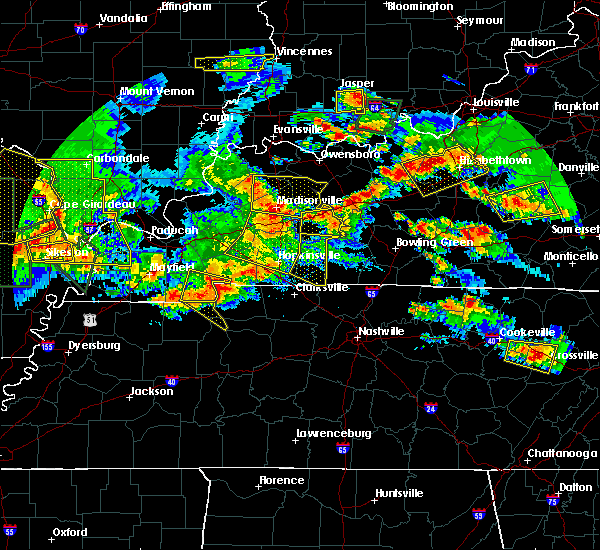 At 545 pm cdt, severe thunderstorms were located along a line extending from near nortonville to 6 miles south of hopkinsville, moving southeast at 65 mph (radar indicated). Hazards include 60 mph wind gusts and nickel size hail. expect damage to roofs, siding, and trees At 545 pm cdt, severe thunderstorms were located along a line extending from near nortonville to 6 miles south of hopkinsville, moving southeast at 65 mph (radar indicated). Hazards include 60 mph wind gusts and nickel size hail. expect damage to roofs, siding, and trees
|
| 5/20/2017 3:40 PM CDT |
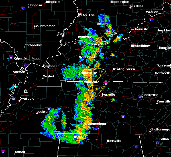 At 339 pm cdt, a severe thunderstorm was located near pembroke, or 7 miles east of hopkinsville, moving northeast at 35 mph (radar indicated). Hazards include 60 mph wind gusts and quarter size hail. this storm has produced some isolated wind damage with measured winds to 55 mph in christian county and nickel size hail near elkton in todd county. Hail damage to vehicles is expected. expect wind damage to roofs, siding, and trees. Locations impacted include, elkton, trenton, clifty and allegre. At 339 pm cdt, a severe thunderstorm was located near pembroke, or 7 miles east of hopkinsville, moving northeast at 35 mph (radar indicated). Hazards include 60 mph wind gusts and quarter size hail. this storm has produced some isolated wind damage with measured winds to 55 mph in christian county and nickel size hail near elkton in todd county. Hail damage to vehicles is expected. expect wind damage to roofs, siding, and trees. Locations impacted include, elkton, trenton, clifty and allegre.
|
| 5/20/2017 3:29 PM CDT |
 At 328 pm cdt, a severe thunderstorm was located near pembroke, or near hopkinsville, moving northeast at 35 mph (radar indicated). Hazards include 60 mph wind gusts and quarter size hail. Hail damage to vehicles is expected. expect wind damage to roofs, siding, and trees. Locations impacted include, hopkinsville, elkton, pembroke, trenton, clifty and allegre. At 328 pm cdt, a severe thunderstorm was located near pembroke, or near hopkinsville, moving northeast at 35 mph (radar indicated). Hazards include 60 mph wind gusts and quarter size hail. Hail damage to vehicles is expected. expect wind damage to roofs, siding, and trees. Locations impacted include, hopkinsville, elkton, pembroke, trenton, clifty and allegre.
|
| 5/20/2017 3:12 PM CDT |
 At 311 pm cdt, a severe thunderstorm was located over fort campbell north, moving northeast at 35 mph (radar indicated). Hazards include 60 mph wind gusts and quarter size hail. Hail damage to vehicles is expected. Expect wind damage to roofs, siding, and trees. At 311 pm cdt, a severe thunderstorm was located over fort campbell north, moving northeast at 35 mph (radar indicated). Hazards include 60 mph wind gusts and quarter size hail. Hail damage to vehicles is expected. Expect wind damage to roofs, siding, and trees.
|
| 5/20/2017 3:09 PM EDT |
 At 309 pm edt, a severe thunderstorm was located near claryville, moving northeast at 20 mph (radar indicated). Hazards include 60 mph wind gusts and quarter size hail. Hail damage to vehicles is expected. expect wind damage to roofs, siding, and trees. locations impacted include, cincinnati, covington, independence, erlanger, fort thomas, newport, montgomery, madeira, edgewood, alexandria, highland heights, milford, taylor mill, bellevue, fort wright, dayton, southgate, walton, claryville and forestville. this includes the following interstates, i-71 in ohio between mile markers 10 and 13. I-75 in kentucky between mile markers 174 and 175. At 309 pm edt, a severe thunderstorm was located near claryville, moving northeast at 20 mph (radar indicated). Hazards include 60 mph wind gusts and quarter size hail. Hail damage to vehicles is expected. expect wind damage to roofs, siding, and trees. locations impacted include, cincinnati, covington, independence, erlanger, fort thomas, newport, montgomery, madeira, edgewood, alexandria, highland heights, milford, taylor mill, bellevue, fort wright, dayton, southgate, walton, claryville and forestville. this includes the following interstates, i-71 in ohio between mile markers 10 and 13. I-75 in kentucky between mile markers 174 and 175.
|
| 5/20/2017 2:56 PM EDT |
 At 255 pm edt, a severe thunderstorm was located near independence, moving northeast at 20 mph (radar indicated). Hazards include 60 mph wind gusts and quarter size hail. Hail damage to vehicles is expected. Expect wind damage to roofs, siding, and trees. At 255 pm edt, a severe thunderstorm was located near independence, moving northeast at 20 mph (radar indicated). Hazards include 60 mph wind gusts and quarter size hail. Hail damage to vehicles is expected. Expect wind damage to roofs, siding, and trees.
|
| 5/19/2017 4:14 PM EDT |
 At 414 pm edt, severe thunderstorms were located along a line extending from union to 7 miles southeast of patriot, moving east at 30 mph (radar indicated). Hazards include 60 mph wind gusts and quarter size hail. Hail damage to vehicles is expected. expect wind damage to roofs, siding, and trees. locations impacted include, covington, florence, independence, erlanger, edgewood, elsmere, fort mitchell, taylor mill, fort wright, walton, crestview hills, lakeside park, oakbrook, burlington, union, crittenden, wilder, ryland heights, glencoe and fairview. this includes the following interstates, i-71 in kentucky between mile markers 63 and 77. I-75 in kentucky between mile markers 161 and 183. At 414 pm edt, severe thunderstorms were located along a line extending from union to 7 miles southeast of patriot, moving east at 30 mph (radar indicated). Hazards include 60 mph wind gusts and quarter size hail. Hail damage to vehicles is expected. expect wind damage to roofs, siding, and trees. locations impacted include, covington, florence, independence, erlanger, edgewood, elsmere, fort mitchell, taylor mill, fort wright, walton, crestview hills, lakeside park, oakbrook, burlington, union, crittenden, wilder, ryland heights, glencoe and fairview. this includes the following interstates, i-71 in kentucky between mile markers 63 and 77. I-75 in kentucky between mile markers 161 and 183.
|
| 5/19/2017 3:55 PM EDT |
 At 355 pm edt, severe thunderstorms were located along a line extending from near rising sun to kentucky speedway, moving east at 30 mph (radar indicated). Hazards include 60 mph wind gusts and quarter size hail. Hail damage to vehicles is expected. Expect wind damage to roofs, siding, and trees. At 355 pm edt, severe thunderstorms were located along a line extending from near rising sun to kentucky speedway, moving east at 30 mph (radar indicated). Hazards include 60 mph wind gusts and quarter size hail. Hail damage to vehicles is expected. Expect wind damage to roofs, siding, and trees.
|
| 4/29/2017 8:53 AM EDT |
 The severe thunderstorm warning for northern kenton, northern campbell, boone and southeastern hamilton counties will expire at 900 am edt, the storm which prompted the warning has weakened below severe limits, and has exited the warned area. therefore, the warning will be allowed to expire. however gusty winds and heavy rain are still possible with this thunderstorm. please report previous wind damage or hail to the national weather service by going to our website at weather.gov/iln and submitting your report via social media. The severe thunderstorm warning for northern kenton, northern campbell, boone and southeastern hamilton counties will expire at 900 am edt, the storm which prompted the warning has weakened below severe limits, and has exited the warned area. therefore, the warning will be allowed to expire. however gusty winds and heavy rain are still possible with this thunderstorm. please report previous wind damage or hail to the national weather service by going to our website at weather.gov/iln and submitting your report via social media.
|
| 4/29/2017 8:43 AM EDT |
 At 843 am edt, a severe thunderstorm was located over villa hills, moving east at 50 mph (radar indicated). Hazards include 60 mph wind gusts and quarter size hail. Hail damage to vehicles is expected. expect wind damage to roofs, siding, and trees. locations impacted include, cincinnati, covington, florence, independence, norwood, erlanger, fort thomas, newport, blue ash, loveland, reading, montgomery, madeira, edgewood, alexandria, elsmere, wyoming, cheviot, fort mitchell and villa hills. this includes the following interstates, i-71 in ohio between mile markers 0 and 17. i-74 in ohio between mile markers 15 and 19. i-75 in kentucky between mile markers 175 and 191. I-75 in ohio between mile markers 0 and 12. At 843 am edt, a severe thunderstorm was located over villa hills, moving east at 50 mph (radar indicated). Hazards include 60 mph wind gusts and quarter size hail. Hail damage to vehicles is expected. expect wind damage to roofs, siding, and trees. locations impacted include, cincinnati, covington, florence, independence, norwood, erlanger, fort thomas, newport, blue ash, loveland, reading, montgomery, madeira, edgewood, alexandria, elsmere, wyoming, cheviot, fort mitchell and villa hills. this includes the following interstates, i-71 in ohio between mile markers 0 and 17. i-74 in ohio between mile markers 15 and 19. i-75 in kentucky between mile markers 175 and 191. I-75 in ohio between mile markers 0 and 12.
|
| 4/29/2017 8:22 AM EDT |
 At 821 am edt, a severe thunderstorm was located near rising sun, moving east at 50 mph (radar indicated). Hazards include 60 mph wind gusts and quarter size hail. Hail damage to vehicles is expected. Expect wind damage to roofs, siding, and trees. At 821 am edt, a severe thunderstorm was located near rising sun, moving east at 50 mph (radar indicated). Hazards include 60 mph wind gusts and quarter size hail. Hail damage to vehicles is expected. Expect wind damage to roofs, siding, and trees.
|
| 4/16/2017 6:40 PM EDT |
 At 639 pm edt, a severe thunderstorm was located near burlington, moving east at 40 mph (radar indicated). Hazards include 60 mph wind gusts and penny size hail. expect damage to roofs, siding, and trees At 639 pm edt, a severe thunderstorm was located near burlington, moving east at 40 mph (radar indicated). Hazards include 60 mph wind gusts and penny size hail. expect damage to roofs, siding, and trees
|
| 4/5/2017 6:16 PM EDT |
 At 615 pm edt, a severe thunderstorm was located near claryville, moving northeast at 30 mph (radar indicated). Hazards include 60 mph wind gusts and quarter size hail. Hail damage to vehicles is expected. Expect wind damage to roofs, siding, and trees. At 615 pm edt, a severe thunderstorm was located near claryville, moving northeast at 30 mph (radar indicated). Hazards include 60 mph wind gusts and quarter size hail. Hail damage to vehicles is expected. Expect wind damage to roofs, siding, and trees.
|
| 3/30/2017 6:54 PM CDT |
 At 654 pm cdt, a severe thunderstorm was located 8 miles southwest of hopkinsville, moving northeast at 50 mph (radar indicated). Hazards include 60 mph wind gusts. Expect damage to roofs, siding, and trees. Locations impacted include, hopkinsville, pembroke and herndon. At 654 pm cdt, a severe thunderstorm was located 8 miles southwest of hopkinsville, moving northeast at 50 mph (radar indicated). Hazards include 60 mph wind gusts. Expect damage to roofs, siding, and trees. Locations impacted include, hopkinsville, pembroke and herndon.
|
| 3/30/2017 6:40 PM CDT |
 At 639 pm cdt, a severe thunderstorm was located 7 miles southwest of hopkinsville, moving northeast at 45 mph (radar indicated). Hazards include 60 mph wind gusts. expect damage to roofs, siding, and trees At 639 pm cdt, a severe thunderstorm was located 7 miles southwest of hopkinsville, moving northeast at 45 mph (radar indicated). Hazards include 60 mph wind gusts. expect damage to roofs, siding, and trees
|
| 3/27/2017 2:48 PM CDT |
 At 247 pm cdt, severe thunderstorms were located along a line extending from near mortons gap to near crofton to near hopkinsville, moving northeast at 65 mph (radar indicated). Hazards include 60 mph wind gusts and half dollar size hail. Hail damage to vehicles is expected. expect wind damage to roofs, siding, and trees. locations impacted include, hopkinsville, madisonville, oak grove, fort campbell north, earlington, nortonville, pembroke, mortons gap, crofton, white plains, st. Charles, hawkins and herndon. At 247 pm cdt, severe thunderstorms were located along a line extending from near mortons gap to near crofton to near hopkinsville, moving northeast at 65 mph (radar indicated). Hazards include 60 mph wind gusts and half dollar size hail. Hail damage to vehicles is expected. expect wind damage to roofs, siding, and trees. locations impacted include, hopkinsville, madisonville, oak grove, fort campbell north, earlington, nortonville, pembroke, mortons gap, crofton, white plains, st. Charles, hawkins and herndon.
|
| 3/27/2017 2:36 PM CDT |
 At 236 pm cdt, severe thunderstorms were located along a line extending from dawson springs to 6 miles northwest of hopkinsville to 9 miles northwest of fort campbell north, moving northeast at 55 mph (radar indicated). Hazards include 60 mph wind gusts and half dollar size hail. Hail damage to vehicles is expected. expect wind damage to roofs, siding, and trees. locations impacted include, hopkinsville, madisonville, oak grove, dawson springs, fort campbell north, earlington, nortonville, pembroke, mortons gap, crofton, cobb, white plains, st. Charles, lafayette, hawkins and herndon. At 236 pm cdt, severe thunderstorms were located along a line extending from dawson springs to 6 miles northwest of hopkinsville to 9 miles northwest of fort campbell north, moving northeast at 55 mph (radar indicated). Hazards include 60 mph wind gusts and half dollar size hail. Hail damage to vehicles is expected. expect wind damage to roofs, siding, and trees. locations impacted include, hopkinsville, madisonville, oak grove, dawson springs, fort campbell north, earlington, nortonville, pembroke, mortons gap, crofton, cobb, white plains, st. Charles, lafayette, hawkins and herndon.
|
| 3/27/2017 2:23 PM CDT |
 At 223 pm cdt, severe thunderstorms were located along a line extending from near princeton to near cadiz to near big rock, moving northeast at 65 mph (radar indicated). Hazards include 60 mph wind gusts and half dollar size hail. Hail damage to vehicles is expected. Expect wind damage to roofs, siding, and trees. At 223 pm cdt, severe thunderstorms were located along a line extending from near princeton to near cadiz to near big rock, moving northeast at 65 mph (radar indicated). Hazards include 60 mph wind gusts and half dollar size hail. Hail damage to vehicles is expected. Expect wind damage to roofs, siding, and trees.
|
| 3/20/2017 6:36 PM EDT |
 At 635 pm edt, a severe thunderstorm was located over salem heights, moving southeast at 50 mph (radar indicated). Hazards include quarter size hail. Damage to vehicles is expected. locations impacted include, cincinnati, covington, norwood, fort thomas, newport, madeira, edgewood, fort mitchell, villa hills, highland heights, taylor mill, bellevue, fort wright, dayton, ludlow, southgate, crescent springs, crestview hills, park hills and lakeside park. this includes the following interstates, i-71 in ohio between mile markers 0 and 10. i-75 in kentucky between mile markers 187 and 191. I-75 in ohio between mile markers 0 and 2. At 635 pm edt, a severe thunderstorm was located over salem heights, moving southeast at 50 mph (radar indicated). Hazards include quarter size hail. Damage to vehicles is expected. locations impacted include, cincinnati, covington, norwood, fort thomas, newport, madeira, edgewood, fort mitchell, villa hills, highland heights, taylor mill, bellevue, fort wright, dayton, ludlow, southgate, crescent springs, crestview hills, park hills and lakeside park. this includes the following interstates, i-71 in ohio between mile markers 0 and 10. i-75 in kentucky between mile markers 187 and 191. I-75 in ohio between mile markers 0 and 2.
|
| 3/20/2017 6:27 PM EDT |
 At 627 pm edt, a severe thunderstorm was located over university of cincinnati, moving southeast at 50 mph (radar indicated). Hazards include quarter size hail. Damage to vehicles is expected. locations impacted include, cincinnati, covington, norwood, fort thomas, newport, north college hill, madeira, edgewood, cheviot, fort mitchell, villa hills, highland heights, taylor mill, bellevue, fort wright, dayton, ludlow, southgate, crescent springs and crestview hills. this includes the following interstates, i-71 in ohio between mile markers 0 and 11. i-74 in ohio between mile markers 15 and 19. i-75 in kentucky between mile markers 187 and 191. I-75 in ohio between mile markers 0 and 10. At 627 pm edt, a severe thunderstorm was located over university of cincinnati, moving southeast at 50 mph (radar indicated). Hazards include quarter size hail. Damage to vehicles is expected. locations impacted include, cincinnati, covington, norwood, fort thomas, newport, north college hill, madeira, edgewood, cheviot, fort mitchell, villa hills, highland heights, taylor mill, bellevue, fort wright, dayton, ludlow, southgate, crescent springs and crestview hills. this includes the following interstates, i-71 in ohio between mile markers 0 and 11. i-74 in ohio between mile markers 15 and 19. i-75 in kentucky between mile markers 187 and 191. I-75 in ohio between mile markers 0 and 10.
|
| 3/20/2017 6:18 PM EDT |
 At 618 pm edt, a severe thunderstorm was located over monfort heights, moving southeast at 50 mph (radar indicated). Hazards include quarter size hail. Damage to vehicles is expected. locations impacted include, cincinnati, covington, norwood, fort thomas, newport, reading, north college hill, madeira, edgewood, wyoming, cheviot, fort mitchell, villa hills, highland heights, taylor mill, mount healthy, bellevue, deer park, fort wright and dayton. this includes the following interstates, i-71 in ohio between mile markers 0 and 12. i-74 in ohio between mile markers 7 and 19. i-75 in kentucky between mile markers 187 and 191. I-75 in ohio between mile markers 0 and 11. At 618 pm edt, a severe thunderstorm was located over monfort heights, moving southeast at 50 mph (radar indicated). Hazards include quarter size hail. Damage to vehicles is expected. locations impacted include, cincinnati, covington, norwood, fort thomas, newport, reading, north college hill, madeira, edgewood, wyoming, cheviot, fort mitchell, villa hills, highland heights, taylor mill, mount healthy, bellevue, deer park, fort wright and dayton. this includes the following interstates, i-71 in ohio between mile markers 0 and 12. i-74 in ohio between mile markers 7 and 19. i-75 in kentucky between mile markers 187 and 191. I-75 in ohio between mile markers 0 and 11.
|
| 3/20/2017 6:09 PM EDT |
 At 609 pm edt, a severe thunderstorm was located over blue jay, moving southeast at 50 mph (radar indicated). Hazards include quarter size hail. damage to vehicles is expected At 609 pm edt, a severe thunderstorm was located over blue jay, moving southeast at 50 mph (radar indicated). Hazards include quarter size hail. damage to vehicles is expected
|
| 3/1/2017 6:35 AM CST |
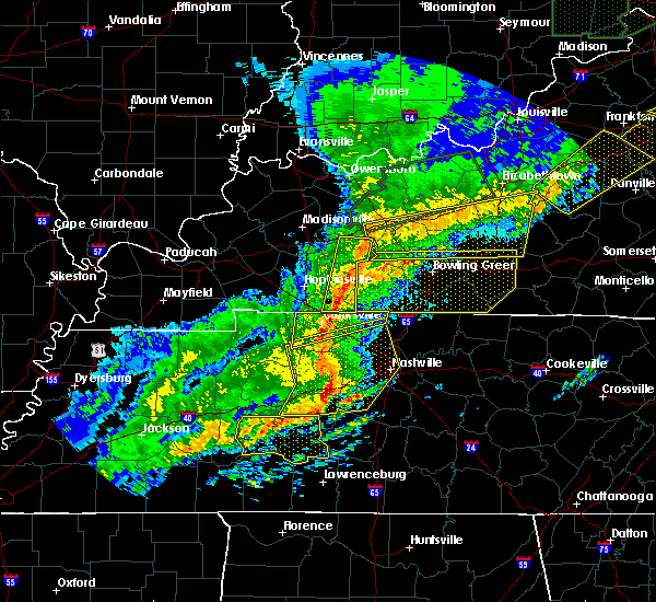 At 633 am cst, severe thunderstorms were located along a line extending from central city to 6 miles southeast of pembroke, moving east at 65 mph. these are very dangerous storms (radar indicated). Hazards include 80 mph wind gusts and quarter size hail. Flying debris will be dangerous to those caught without shelter. mobile homes will be heavily damaged. expect considerable damage to roofs, windows, and vehicles. extensive tree damage and power outages are likely. locations impacted include, greenville, elkton, guthrie, powderly, dunmor, weir, drakesboro, trenton, allensville, allegre, everett and clifty. a tornado watch remains in effect until 800 am cst for south central kentucky. A tornado watch also remains in effect until 800 am cst for south central kentucky. At 633 am cst, severe thunderstorms were located along a line extending from central city to 6 miles southeast of pembroke, moving east at 65 mph. these are very dangerous storms (radar indicated). Hazards include 80 mph wind gusts and quarter size hail. Flying debris will be dangerous to those caught without shelter. mobile homes will be heavily damaged. expect considerable damage to roofs, windows, and vehicles. extensive tree damage and power outages are likely. locations impacted include, greenville, elkton, guthrie, powderly, dunmor, weir, drakesboro, trenton, allensville, allegre, everett and clifty. a tornado watch remains in effect until 800 am cst for south central kentucky. A tornado watch also remains in effect until 800 am cst for south central kentucky.
|
| 3/1/2017 6:20 AM CST |
 At 619 am cst, severe thunderstorms were located along a line extending from near graham to near fort campbell north, moving east at 70 mph. these are very dangerous storms (radar indicated). Hazards include 80 mph wind gusts and penny size hail. Flying debris will be dangerous to those caught without shelter. mobile homes will be heavily damaged. expect considerable damage to roofs, windows, and vehicles. extensive tree damage and power outages are likely. locations impacted include, hopkinsville, oak grove, greenville, elkton, fort campbell north, guthrie, earlington, nortonville, pembroke, mortons gap, crofton, powderly, graham, dunmor, weir, white plains, drakesboro, trenton, allensville and allegre. a tornado watch remains in effect until 800 am cst for south central and northwestern kentucky. A tornado watch also remains in effect until 800 am cst for south central and northwestern kentucky. At 619 am cst, severe thunderstorms were located along a line extending from near graham to near fort campbell north, moving east at 70 mph. these are very dangerous storms (radar indicated). Hazards include 80 mph wind gusts and penny size hail. Flying debris will be dangerous to those caught without shelter. mobile homes will be heavily damaged. expect considerable damage to roofs, windows, and vehicles. extensive tree damage and power outages are likely. locations impacted include, hopkinsville, oak grove, greenville, elkton, fort campbell north, guthrie, earlington, nortonville, pembroke, mortons gap, crofton, powderly, graham, dunmor, weir, white plains, drakesboro, trenton, allensville and allegre. a tornado watch remains in effect until 800 am cst for south central and northwestern kentucky. A tornado watch also remains in effect until 800 am cst for south central and northwestern kentucky.
|
| 3/1/2017 6:11 AM CST |
 At 611 am cst, severe thunderstorms were located along a line extending from near earlington to near big rock, moving east at 65 mph. these are very dangerous storms (radar indicated). Hazards include 80 mph wind gusts and penny size hail. Flying debris will be dangerous to those caught without shelter. mobile homes will be heavily damaged. expect considerable damage to roofs, windows, and vehicles. Extensive tree damage and power outages are likely. At 611 am cst, severe thunderstorms were located along a line extending from near earlington to near big rock, moving east at 65 mph. these are very dangerous storms (radar indicated). Hazards include 80 mph wind gusts and penny size hail. Flying debris will be dangerous to those caught without shelter. mobile homes will be heavily damaged. expect considerable damage to roofs, windows, and vehicles. Extensive tree damage and power outages are likely.
|
| 3/1/2017 7:04 AM EST |
 At 703 am est, a severe thunderstorm capable of producing a tornado was located near claryville, moving east at 55 mph (radar indicated rotation). Hazards include tornado. Flying debris will be dangerous to those caught without shelter. mobile homes will be damaged or destroyed. damage to roofs, windows, and vehicles will occur. tree damage is likely. Locations impacted include, covington, independence, erlanger, edgewood, alexandria, taylor mill, claryville, wilder, new richmond, cold spring, ryland heights, mentor, fairview, california, visalia, aspen grove, gubser mill, campbell county lake, white tower and latonia lakes. At 703 am est, a severe thunderstorm capable of producing a tornado was located near claryville, moving east at 55 mph (radar indicated rotation). Hazards include tornado. Flying debris will be dangerous to those caught without shelter. mobile homes will be damaged or destroyed. damage to roofs, windows, and vehicles will occur. tree damage is likely. Locations impacted include, covington, independence, erlanger, edgewood, alexandria, taylor mill, claryville, wilder, new richmond, cold spring, ryland heights, mentor, fairview, california, visalia, aspen grove, gubser mill, campbell county lake, white tower and latonia lakes.
|
| 3/1/2017 6:55 AM EST |
 At 654 am est, severe thunderstorms were located along a line extending from elsmere to owenton, moving east at 55 mph (radar and observation indicated. a 79 mph wind gust was measured at carrolton). Hazards include 70 mph wind gusts and penny size hail. Expect considerable tree damage. damage is likely to mobile homes, roofs, and outbuildings. locations impacted include, cincinnati, covington, florence, independence, erlanger, fort thomas, newport, edgewood, alexandria, elsmere, fort mitchell, villa hills, highland heights, taylor mill, bellevue, fort wright, dayton, ludlow, williamstown and southgate. this includes the following interstates, i-71 in kentucky between mile markers 58 and 77. i-71 in ohio between mile markers 0 and 1. i-75 in kentucky between mile markers 144 and 191. i-75 in ohio near mile marker 0. A tornado watch remains in effect until 1100 am est for southeastern indiana, northern kentucky, and southwestern ohio. At 654 am est, severe thunderstorms were located along a line extending from elsmere to owenton, moving east at 55 mph (radar and observation indicated. a 79 mph wind gust was measured at carrolton). Hazards include 70 mph wind gusts and penny size hail. Expect considerable tree damage. damage is likely to mobile homes, roofs, and outbuildings. locations impacted include, cincinnati, covington, florence, independence, erlanger, fort thomas, newport, edgewood, alexandria, elsmere, fort mitchell, villa hills, highland heights, taylor mill, bellevue, fort wright, dayton, ludlow, williamstown and southgate. this includes the following interstates, i-71 in kentucky between mile markers 58 and 77. i-71 in ohio between mile markers 0 and 1. i-75 in kentucky between mile markers 144 and 191. i-75 in ohio near mile marker 0. A tornado watch remains in effect until 1100 am est for southeastern indiana, northern kentucky, and southwestern ohio.
|
| 3/1/2017 6:49 AM EST |
 At 649 am est, severe thunderstorms were located along a line extending from near burlington to near kentucky speedway, moving east at 70 mph (radar indicated). Hazards include 60 mph wind gusts and penny size hail. Expect damage to roofs, siding, and trees. locations impacted include, cincinnati, covington, independence, erlanger, fort thomas, newport, edgewood, alexandria, elsmere, fort mitchell, villa hills, highland heights, taylor mill, bellevue, fort wright, dayton, ludlow, williamstown, southgate and crescent springs. this includes the following interstates, i-71 in kentucky between mile markers 48 and 77. i-71 in ohio between mile markers 0 and 1. i-75 in kentucky between mile markers 144 and 191. i-75 in ohio near mile marker 0. A tornado watch remains in effect until 1100 am est for southeastern indiana, northern kentucky, and southwestern ohio. At 649 am est, severe thunderstorms were located along a line extending from near burlington to near kentucky speedway, moving east at 70 mph (radar indicated). Hazards include 60 mph wind gusts and penny size hail. Expect damage to roofs, siding, and trees. locations impacted include, cincinnati, covington, independence, erlanger, fort thomas, newport, edgewood, alexandria, elsmere, fort mitchell, villa hills, highland heights, taylor mill, bellevue, fort wright, dayton, ludlow, williamstown, southgate and crescent springs. this includes the following interstates, i-71 in kentucky between mile markers 48 and 77. i-71 in ohio between mile markers 0 and 1. i-75 in kentucky between mile markers 144 and 191. i-75 in ohio near mile marker 0. A tornado watch remains in effect until 1100 am est for southeastern indiana, northern kentucky, and southwestern ohio.
|
| 3/1/2017 6:39 AM EST |
 At 639 am est, severe thunderstorms were located along a line extending from hidden valley to near carrollton, moving east at 55 mph (radar indicated). Hazards include 60 mph wind gusts and penny size hail. expect damage to roofs, siding, and trees At 639 am est, severe thunderstorms were located along a line extending from hidden valley to near carrollton, moving east at 55 mph (radar indicated). Hazards include 60 mph wind gusts and penny size hail. expect damage to roofs, siding, and trees
|
| 3/1/2017 3:26 AM EST |
 At 326 am est, a severe thunderstorm was located over taylor mill, moving east at 60 mph (radar indicated). Hazards include 60 mph wind gusts. Expect damage to roofs, siding, and trees. locations impacted include, cincinnati, covington, florence, independence, erlanger, fort thomas, newport, edgewood, alexandria, elsmere, fort mitchell, villa hills, highland heights, taylor mill, bellevue, fort wright, ludlow, southgate, crescent springs and crestview hills. this includes the following interstates, i-71 in ohio near mile marker 0. i-75 in kentucky between mile markers 176 and 191. i-75 in ohio near mile marker 0. A tornado watch remains in effect until 700 am est for northern kentucky, and southwestern ohio. At 326 am est, a severe thunderstorm was located over taylor mill, moving east at 60 mph (radar indicated). Hazards include 60 mph wind gusts. Expect damage to roofs, siding, and trees. locations impacted include, cincinnati, covington, florence, independence, erlanger, fort thomas, newport, edgewood, alexandria, elsmere, fort mitchell, villa hills, highland heights, taylor mill, bellevue, fort wright, ludlow, southgate, crescent springs and crestview hills. this includes the following interstates, i-71 in ohio near mile marker 0. i-75 in kentucky between mile markers 176 and 191. i-75 in ohio near mile marker 0. A tornado watch remains in effect until 700 am est for northern kentucky, and southwestern ohio.
|
| 3/1/2017 3:15 AM EST |
 At 314 am est, a severe thunderstorm was located near union, moving east at 50 mph (radar indicated). Hazards include 60 mph wind gusts. Expect damage to roofs, siding, and trees. locations impacted include, cincinnati, covington, florence, independence, erlanger, fort thomas, newport, edgewood, alexandria, elsmere, fort mitchell, villa hills, highland heights, taylor mill, bellevue, fort wright, ludlow, southgate, crescent springs and walton. this includes the following interstates, i-71 in kentucky between mile markers 75 and 77. i-71 in ohio near mile marker 0. i-75 in kentucky between mile markers 171 and 191. i-75 in ohio near mile marker 0. A tornado watch remains in effect until 700 am est for southeastern indiana, northern kentucky, and southwestern ohio. At 314 am est, a severe thunderstorm was located near union, moving east at 50 mph (radar indicated). Hazards include 60 mph wind gusts. Expect damage to roofs, siding, and trees. locations impacted include, cincinnati, covington, florence, independence, erlanger, fort thomas, newport, edgewood, alexandria, elsmere, fort mitchell, villa hills, highland heights, taylor mill, bellevue, fort wright, ludlow, southgate, crescent springs and walton. this includes the following interstates, i-71 in kentucky between mile markers 75 and 77. i-71 in ohio near mile marker 0. i-75 in kentucky between mile markers 171 and 191. i-75 in ohio near mile marker 0. A tornado watch remains in effect until 700 am est for southeastern indiana, northern kentucky, and southwestern ohio.
|
| 3/1/2017 3:04 AM EST |
 At 304 am est, a severe thunderstorm was located over rising sun, moving east at 50 mph (radar indicated). Hazards include 60 mph wind gusts. expect damage to roofs, siding, and trees At 304 am est, a severe thunderstorm was located over rising sun, moving east at 50 mph (radar indicated). Hazards include 60 mph wind gusts. expect damage to roofs, siding, and trees
|
| 2/28/2017 11:54 PM CST |
 At 1153 pm cst, a severe thunderstorm capable of producing a tornado was located over hopkinsville, moving east at 45 mph. this circulation has consolidated in and near hopkinsville, so intensifcation of this storm may occur very shortly (radar indicated rotation). Hazards include tornado and golf ball size hail. Flying debris will be dangerous to those caught without shelter. mobile homes will be damaged or destroyed. damage to roofs, windows, and vehicles will occur. tree damage is likely. This tornadic thunderstorm will remain over mainly rural areas of east central christian county. At 1153 pm cst, a severe thunderstorm capable of producing a tornado was located over hopkinsville, moving east at 45 mph. this circulation has consolidated in and near hopkinsville, so intensifcation of this storm may occur very shortly (radar indicated rotation). Hazards include tornado and golf ball size hail. Flying debris will be dangerous to those caught without shelter. mobile homes will be damaged or destroyed. damage to roofs, windows, and vehicles will occur. tree damage is likely. This tornadic thunderstorm will remain over mainly rural areas of east central christian county.
|
| 2/28/2017 11:43 PM CST |
 At 1140 pm cst, a severe thunderstorm capable of producing a tornado was located 7 miles southeast of cadiz, moving northeast at 45 mph. a second tornadic circulation was noted near the trigg, christian county line northwest of herndon. this circulation may intensify and move south of hopkinsville. so persons should be prepared to take cover (radar indicated rotation). Hazards include tornado and golf ball size hail. Flying debris will be dangerous to those caught without shelter. mobile homes will be damaged or destroyed. damage to roofs, windows, and vehicles will occur. tree damage is likely. This dangerous storm will be near, hopkinsville around 1200 am cst. At 1140 pm cst, a severe thunderstorm capable of producing a tornado was located 7 miles southeast of cadiz, moving northeast at 45 mph. a second tornadic circulation was noted near the trigg, christian county line northwest of herndon. this circulation may intensify and move south of hopkinsville. so persons should be prepared to take cover (radar indicated rotation). Hazards include tornado and golf ball size hail. Flying debris will be dangerous to those caught without shelter. mobile homes will be damaged or destroyed. damage to roofs, windows, and vehicles will occur. tree damage is likely. This dangerous storm will be near, hopkinsville around 1200 am cst.
|
| 12/17/2016 6:52 PM CST |
 At 651 pm cst, a severe thunderstorm was located 7 miles northwest of hopkinsville, moving northeast at 55 mph (radar indicated). Hazards include 60 mph wind gusts and quarter size hail. this storm has a history of 50 mph and nickel size hail. Hail damage to vehicles is expected. Expect wind damage to roofs, siding, and trees. At 651 pm cst, a severe thunderstorm was located 7 miles northwest of hopkinsville, moving northeast at 55 mph (radar indicated). Hazards include 60 mph wind gusts and quarter size hail. this storm has a history of 50 mph and nickel size hail. Hail damage to vehicles is expected. Expect wind damage to roofs, siding, and trees.
|
| 10/19/2016 7:53 PM EDT |
 The severe thunderstorm warning for southern kenton, northeastern pendleton, campbell and southwestern clermont counties will expire at 800 pm edt, the severe thunderstorm which prompted the warning has moved out of the warned area. therefore, the warning will be allowed to expire. there is another warning in effect downstream. please report previous wind damage or hail to the national weather service by going to our website at weather.gov/iln and submitting your report via social media. The severe thunderstorm warning for southern kenton, northeastern pendleton, campbell and southwestern clermont counties will expire at 800 pm edt, the severe thunderstorm which prompted the warning has moved out of the warned area. therefore, the warning will be allowed to expire. there is another warning in effect downstream. please report previous wind damage or hail to the national weather service by going to our website at weather.gov/iln and submitting your report via social media.
|
| 10/19/2016 7:43 PM EDT |
 At 743 pm edt, a severe thunderstorm was located over claryville, moving east at 25 mph (radar indicated). Hazards include tennis ball size hail and 70 mph wind gusts. People and animals outdoors will be injured. expect hail damage to roofs, siding, windows, and vehicles. expect considerable tree damage. wind damage is also likely to mobile homes, roofs, and outbuildings. Locations impacted include, covington, independence, alexandria, taylor mill, claryville, new richmond, cold spring, ryland heights, mentor, fairview, california, peach grove, white tower, campbell county lake, morning view, mount auburn, gubser mill, visalia, grants lick and white villa. At 743 pm edt, a severe thunderstorm was located over claryville, moving east at 25 mph (radar indicated). Hazards include tennis ball size hail and 70 mph wind gusts. People and animals outdoors will be injured. expect hail damage to roofs, siding, windows, and vehicles. expect considerable tree damage. wind damage is also likely to mobile homes, roofs, and outbuildings. Locations impacted include, covington, independence, alexandria, taylor mill, claryville, new richmond, cold spring, ryland heights, mentor, fairview, california, peach grove, white tower, campbell county lake, morning view, mount auburn, gubser mill, visalia, grants lick and white villa.
|
| 10/19/2016 7:42 PM EDT |
 The tornado warning for central kenton, north central pendleton and campbell counties will expire at 745 pm edt, the tornado threat has diminished and the tornado warning has been cancelled. however, large hail and damaging winds remain likely and a severe thunderstorm warning remains in effect for the area. please report previous tornadoes, wind damage or hail to the national weather service by going to our website at weather.gov/iln and submitting your report via social media. remember, a severe thunderstorm warning still remains in effect. The tornado warning for central kenton, north central pendleton and campbell counties will expire at 745 pm edt, the tornado threat has diminished and the tornado warning has been cancelled. however, large hail and damaging winds remain likely and a severe thunderstorm warning remains in effect for the area. please report previous tornadoes, wind damage or hail to the national weather service by going to our website at weather.gov/iln and submitting your report via social media. remember, a severe thunderstorm warning still remains in effect.
|
| 10/19/2016 7:28 PM EDT |
 The national weather service in wilmington has issued a * severe thunderstorm warning for. kenton county in northern kentucky. northeastern pendleton county in northern kentucky. campbell county in northern kentucky. West central clermont county in southwestern ohio. The national weather service in wilmington has issued a * severe thunderstorm warning for. kenton county in northern kentucky. northeastern pendleton county in northern kentucky. campbell county in northern kentucky. West central clermont county in southwestern ohio.
|
| 10/19/2016 7:28 PM EDT |
 At 727 pm edt, a severe thunderstorm was located over independence, moving east at 25 mph (radar indicated). Hazards include golf ball size hail and 70 mph wind gusts. trained spotter has reported one inch hail union kentucky. People and animals outdoors will be injured. expect hail damage to roofs, siding, windows, and vehicles. expect considerable tree damage. Wind damage is also likely to mobile homes, roofs, and outbuildings. At 727 pm edt, a severe thunderstorm was located over independence, moving east at 25 mph (radar indicated). Hazards include golf ball size hail and 70 mph wind gusts. trained spotter has reported one inch hail union kentucky. People and animals outdoors will be injured. expect hail damage to roofs, siding, windows, and vehicles. expect considerable tree damage. Wind damage is also likely to mobile homes, roofs, and outbuildings.
|
| 10/19/2016 7:27 PM EDT |
 At 726 pm edt, a severe thunderstorm capable of producing a tornado was located near claryville, moving east at 25 mph (radar indicated rotation). Hazards include tornado and golf ball size hail. Flying debris will be dangerous to those caught without shelter. mobile homes will be damaged or destroyed. damage to roofs, windows, and vehicles will occur. tree damage is likely. Locations impacted include, covington, independence, erlanger, alexandria, elsmere, taylor mill, walton, claryville, wilder, silver grove, melbourne, cold spring, ryland heights, crestview, fairview, ricedale, white tower, atwood, campbell county lake and bank lick. At 726 pm edt, a severe thunderstorm capable of producing a tornado was located near claryville, moving east at 25 mph (radar indicated rotation). Hazards include tornado and golf ball size hail. Flying debris will be dangerous to those caught without shelter. mobile homes will be damaged or destroyed. damage to roofs, windows, and vehicles will occur. tree damage is likely. Locations impacted include, covington, independence, erlanger, alexandria, elsmere, taylor mill, walton, claryville, wilder, silver grove, melbourne, cold spring, ryland heights, crestview, fairview, ricedale, white tower, atwood, campbell county lake and bank lick.
|
| 10/19/2016 7:18 PM EDT |
 At 716 pm edt, a severe thunderstorm was located over independence, moving east at 30 mph (radar indicated. trained spotter has reported one inch hail at union kentucky). Hazards include golf ball size hail and 70 mph wind gusts. People and animals outdoors will be injured. expect hail damage to roofs, siding, windows, and vehicles. expect considerable tree damage. wind damage is also likely to mobile homes, roofs, and outbuildings. locations impacted include, cincinnati, covington, florence, independence, erlanger, fort thomas, edgewood, alexandria, elsmere, fort mitchell, highland heights, taylor mill, fort wright, southgate, walton, crestview hills, lakeside park, forestville, oakbrook and claryville. this includes the following interstates, i-71 in kentucky between mile markers 72 and 77. I-75 in kentucky between mile markers 167 and 183. At 716 pm edt, a severe thunderstorm was located over independence, moving east at 30 mph (radar indicated. trained spotter has reported one inch hail at union kentucky). Hazards include golf ball size hail and 70 mph wind gusts. People and animals outdoors will be injured. expect hail damage to roofs, siding, windows, and vehicles. expect considerable tree damage. wind damage is also likely to mobile homes, roofs, and outbuildings. locations impacted include, cincinnati, covington, florence, independence, erlanger, fort thomas, edgewood, alexandria, elsmere, fort mitchell, highland heights, taylor mill, fort wright, southgate, walton, crestview hills, lakeside park, forestville, oakbrook and claryville. this includes the following interstates, i-71 in kentucky between mile markers 72 and 77. I-75 in kentucky between mile markers 167 and 183.
|
| 10/19/2016 7:10 PM EDT |
 At 709 pm edt, a severe thunderstorm capable of producing a tornado was located over walton, moving east at 25 mph (radar indicated rotation). Hazards include tornado and baseball size hail. Flying debris will be dangerous to those caught without shelter. mobile homes will be damaged or destroyed. damage to roofs, windows, and vehicles will occur. Tree damage is likely. At 709 pm edt, a severe thunderstorm capable of producing a tornado was located over walton, moving east at 25 mph (radar indicated rotation). Hazards include tornado and baseball size hail. Flying debris will be dangerous to those caught without shelter. mobile homes will be damaged or destroyed. damage to roofs, windows, and vehicles will occur. Tree damage is likely.
|
| 10/19/2016 6:58 PM EDT |
 At 656 pm edt, a severe thunderstorm was located over union, moving east at 30 mph. this is a very dangerous storm (radar indicated. large hail has been reported by law enforcement earlier from this storm). Hazards include three inch hail and 70 mph wind gusts. People and animals outdoors will be severely injured. Expect shattered windows, extensive damage to roofs, siding, and vehicles. At 656 pm edt, a severe thunderstorm was located over union, moving east at 30 mph. this is a very dangerous storm (radar indicated. large hail has been reported by law enforcement earlier from this storm). Hazards include three inch hail and 70 mph wind gusts. People and animals outdoors will be severely injured. Expect shattered windows, extensive damage to roofs, siding, and vehicles.
|
| 9/10/2016 4:25 PM EDT |
 The severe thunderstorm warning for northern kenton, northern campbell, boone and southwestern hamilton counties will expire at 430 pm edt, the storm which prompted the warning has weakened below severe limits, and is exiting the warned area. therefore the warning will be allowed to expire. a severe thunderstorm watch remains in effect until 900 pm edt for southeastern indiana, northern kentucky, and southwestern ohio. please report previous wind damage or hail to the national weather service by going to our website at weather.gov/iln and submitting your report via social media. The severe thunderstorm warning for northern kenton, northern campbell, boone and southwestern hamilton counties will expire at 430 pm edt, the storm which prompted the warning has weakened below severe limits, and is exiting the warned area. therefore the warning will be allowed to expire. a severe thunderstorm watch remains in effect until 900 pm edt for southeastern indiana, northern kentucky, and southwestern ohio. please report previous wind damage or hail to the national weather service by going to our website at weather.gov/iln and submitting your report via social media.
|
| 9/10/2016 4:14 PM EDT |
 At 414 pm edt, a severe thunderstorm was located over lakeside park, moving east at 45 mph (radar indicated). Hazards include 60 mph wind gusts. Expect damage to roofs. siding. and trees. Locations impacted include, cincinnati, covington, florence, independence, norwood, erlanger, fort thomas, newport, edgewood, elsmere, fort mitchell, villa hills, highland heights, taylor mill, bellevue, fort wright, dayton, ludlow, southgate and crescent springs. At 414 pm edt, a severe thunderstorm was located over lakeside park, moving east at 45 mph (radar indicated). Hazards include 60 mph wind gusts. Expect damage to roofs. siding. and trees. Locations impacted include, cincinnati, covington, florence, independence, norwood, erlanger, fort thomas, newport, edgewood, elsmere, fort mitchell, villa hills, highland heights, taylor mill, bellevue, fort wright, dayton, ludlow, southgate and crescent springs.
|
| 9/10/2016 3:54 PM EDT |
 At 354 pm edt, a severe thunderstorm was located near aurora, moving east at 45 mph (radar indicated). Hazards include 60 mph wind gusts and penny size hail. Expect damage to roofs. siding. And trees. At 354 pm edt, a severe thunderstorm was located near aurora, moving east at 45 mph (radar indicated). Hazards include 60 mph wind gusts and penny size hail. Expect damage to roofs. siding. And trees.
|
| 9/10/2016 3:54 PM EDT |
 The national weather service in wilmington has issued a * severe thunderstorm warning for. ohio county in southeastern indiana. southeastern dearborn county in southeastern indiana. northern kenton county in northern kentucky. Northern campbell county in northern kentucky. The national weather service in wilmington has issued a * severe thunderstorm warning for. ohio county in southeastern indiana. southeastern dearborn county in southeastern indiana. northern kenton county in northern kentucky. Northern campbell county in northern kentucky.
|
| 8/3/2016 1:44 PM CDT |
 At 144 pm cdt, severe thunderstorms were located along a line extending from 7 miles northeast of hopkinsville to near oak grove, moving east at 35 mph (radar indicated). Hazards include 60 mph wind gusts. Expect damage to roofs. siding. And trees. At 144 pm cdt, severe thunderstorms were located along a line extending from 7 miles northeast of hopkinsville to near oak grove, moving east at 35 mph (radar indicated). Hazards include 60 mph wind gusts. Expect damage to roofs. siding. And trees.
|
| 7/15/2016 5:05 PM EDT |
 The severe thunderstorm warning for northern kenton, central campbell, northwestern clermont and southeastern hamilton counties will expire at 515 pm edt, the storm which prompted the warning has weakened below severe limits, and no longer poses an immediate threat to life or property. therefore the warning will be allowed to expire. however gusty winds and heavy rain are still possible with this thunderstorm. please report previous wind damage or hail to the national weather service by going to our website at weather.gov/iln and submitting your report via social media. The severe thunderstorm warning for northern kenton, central campbell, northwestern clermont and southeastern hamilton counties will expire at 515 pm edt, the storm which prompted the warning has weakened below severe limits, and no longer poses an immediate threat to life or property. therefore the warning will be allowed to expire. however gusty winds and heavy rain are still possible with this thunderstorm. please report previous wind damage or hail to the national weather service by going to our website at weather.gov/iln and submitting your report via social media.
|
| 7/15/2016 4:42 PM EDT |
 At 441 pm edt, a severe thunderstorm was located over taylor mill, moving northeast at 25 mph (radar indicated). Hazards include 70 mph wind gusts. Expect considerable tree damage. damage is likely to mobile homes, roofs, and outbuildings. Locations impacted include, cincinnati, covington, independence, fort thomas, alexandria, highland heights, milford, taylor mill, fort wright, southgate, forestville, claryville, amelia, wilder, new richmond, terrace park, batavia, silver grove, melbourne and riverbend and coney island. At 441 pm edt, a severe thunderstorm was located over taylor mill, moving northeast at 25 mph (radar indicated). Hazards include 70 mph wind gusts. Expect considerable tree damage. damage is likely to mobile homes, roofs, and outbuildings. Locations impacted include, cincinnati, covington, independence, fort thomas, alexandria, highland heights, milford, taylor mill, fort wright, southgate, forestville, claryville, amelia, wilder, new richmond, terrace park, batavia, silver grove, melbourne and riverbend and coney island.
|
| 7/15/2016 4:37 PM EDT |
 At 437 pm edt, a severe thunderstorm was located over independence, moving northeast at 20 mph (radar indicated). Hazards include 60 mph wind gusts. Expect damage to roofs. siding. And trees. At 437 pm edt, a severe thunderstorm was located over independence, moving northeast at 20 mph (radar indicated). Hazards include 60 mph wind gusts. Expect damage to roofs. siding. And trees.
|
| 7/8/2016 7:56 PM CDT |
 At 756 pm cdt, severe thunderstorms were located along a line extending from 12 miles south of weir to near elkton to near guthrie, moving east at 65 mph (radar indicated). Hazards include 60 mph wind gusts. Expect damage to roofs. siding. And trees. At 756 pm cdt, severe thunderstorms were located along a line extending from 12 miles south of weir to near elkton to near guthrie, moving east at 65 mph (radar indicated). Hazards include 60 mph wind gusts. Expect damage to roofs. siding. And trees.
|
| 7/8/2016 7:38 PM CDT |
 At 737 pm cdt, severe thunderstorms were located along a line extending from near hopkinsville to 9 miles northwest of fort campbell north to near big rock, moving east at 50 mph (radar indicated). Hazards include 60 mph wind gusts. Expect damage to roofs. siding. And trees. At 737 pm cdt, severe thunderstorms were located along a line extending from near hopkinsville to 9 miles northwest of fort campbell north to near big rock, moving east at 50 mph (radar indicated). Hazards include 60 mph wind gusts. Expect damage to roofs. siding. And trees.
|
| 7/8/2016 7:37 PM CDT |
 The severe thunderstorm warning for central todd and east central christian counties will expire at 745 pm cdt, the storm which prompted the warning has moved out of the area. therefore, the warning will be allowed to expire. The severe thunderstorm warning for central todd and east central christian counties will expire at 745 pm cdt, the storm which prompted the warning has moved out of the area. therefore, the warning will be allowed to expire.
|
| 7/8/2016 7:11 PM CDT |
 At 710 pm cdt, a severe thunderstorm was located 7 miles northeast of hopkinsville, moving east at 40 mph (radar indicated). Hazards include 60 to 70 mph wind gusts and quarter size hail. Hail damage to vehicles is expected. expect considerable tree damage. Wind damage is also likely to mobile homes, roofs, and outbuildings. At 710 pm cdt, a severe thunderstorm was located 7 miles northeast of hopkinsville, moving east at 40 mph (radar indicated). Hazards include 60 to 70 mph wind gusts and quarter size hail. Hail damage to vehicles is expected. expect considerable tree damage. Wind damage is also likely to mobile homes, roofs, and outbuildings.
|
| 7/7/2016 1:49 PM CDT |
 At 148 pm cdt, severe thunderstorms were located along a line extending from 9 miles east of crofton to fort campbell north, moving east at 40 mph (radar indicated). Hazards include 60 mph wind gusts. Expect damage to roofs. siding. And trees. At 148 pm cdt, severe thunderstorms were located along a line extending from 9 miles east of crofton to fort campbell north, moving east at 40 mph (radar indicated). Hazards include 60 mph wind gusts. Expect damage to roofs. siding. And trees.
|
| 7/6/2016 2:44 PM CDT |
 At 243 pm cdt, severe thunderstorms were located along a line extending from near earlington to near crofton to 6 miles northeast of big rock, moving east at 60 mph (radar indicated). Hazards include 70 mph wind gusts. Expect considerable tree damage. Damage is likely to mobile homes, roofs, and outbuildings. At 243 pm cdt, severe thunderstorms were located along a line extending from near earlington to near crofton to 6 miles northeast of big rock, moving east at 60 mph (radar indicated). Hazards include 70 mph wind gusts. Expect considerable tree damage. Damage is likely to mobile homes, roofs, and outbuildings.
|
| 7/6/2016 2:18 PM CDT |
 At 217 pm cdt, severe thunderstorms were located along a line extending from marion to near energy to 8 miles southeast of murray, moving east at 60 mph (radar indicated). Hazards include 70 mph wind gusts and penny size hail. Expect considerable tree damage. Damage is likely to mobile homes, roofs, and outbuildings. At 217 pm cdt, severe thunderstorms were located along a line extending from marion to near energy to 8 miles southeast of murray, moving east at 60 mph (radar indicated). Hazards include 70 mph wind gusts and penny size hail. Expect considerable tree damage. Damage is likely to mobile homes, roofs, and outbuildings.
|
| 6/23/2016 5:08 AM EDT |
 At 507 am edt, a severe thunderstorm was located over new richmond, moving southeast at 55 mph (radar indicated). Hazards include 60 mph wind gusts and nickel size hail. Expect damage to roofs. siding. and trees. locations impacted include, cincinnati, covington, florence, independence, erlanger, fort thomas, newport, edgewood, alexandria, elsmere, fort mitchell, villa hills, highland heights, milford, taylor mill, bellevue, fort wright, dayton, southgate and crescent springs. A tornado watch remains in effect until 700 am edt for northern kentucky, and southwestern ohio. At 507 am edt, a severe thunderstorm was located over new richmond, moving southeast at 55 mph (radar indicated). Hazards include 60 mph wind gusts and nickel size hail. Expect damage to roofs. siding. and trees. locations impacted include, cincinnati, covington, florence, independence, erlanger, fort thomas, newport, edgewood, alexandria, elsmere, fort mitchell, villa hills, highland heights, milford, taylor mill, bellevue, fort wright, dayton, southgate and crescent springs. A tornado watch remains in effect until 700 am edt for northern kentucky, and southwestern ohio.
|
| 6/23/2016 4:48 AM EDT |
 At 448 am edt, a severe thunderstorm was located over ludlow, moving southeast at 55 mph (radar indicated). Hazards include 60 mph wind gusts and quarter size hail. Hail damage to vehicles is expected. Expect wind damage to roofs, siding, and trees. At 448 am edt, a severe thunderstorm was located over ludlow, moving southeast at 55 mph (radar indicated). Hazards include 60 mph wind gusts and quarter size hail. Hail damage to vehicles is expected. Expect wind damage to roofs, siding, and trees.
|
| 6/15/2016 3:33 PM CDT |
 At 333 pm cdt, a severe thunderstorm was located near elkton, moving east at 30 mph (trained weather spotters). Hazards include 60 mph wind gusts. Expect damage to roofs. siding. and trees. Locations impacted include, elkton, guthrie, trenton, allensville, clifty and allegre. At 333 pm cdt, a severe thunderstorm was located near elkton, moving east at 30 mph (trained weather spotters). Hazards include 60 mph wind gusts. Expect damage to roofs. siding. and trees. Locations impacted include, elkton, guthrie, trenton, allensville, clifty and allegre.
|
| 6/15/2016 3:00 PM CDT |
 At 259 pm cdt, a severe thunderstorm was located near pembroke, and near hopkinsville, moving southeast at 30 mph (trained weather spotters). Hazards include 60 mph wind gusts. Expect damage to roofs. siding. And trees. At 259 pm cdt, a severe thunderstorm was located near pembroke, and near hopkinsville, moving southeast at 30 mph (trained weather spotters). Hazards include 60 mph wind gusts. Expect damage to roofs. siding. And trees.
|
| 6/15/2016 2:32 PM CDT |
 At 232 pm cdt, severe thunderstorms were located along a line extending from 9 miles northwest of hopkinsville to near big rock, moving east at 45 mph (radar indicated). Hazards include 60 mph wind gusts. Expect damage to roofs. siding. And trees. At 232 pm cdt, severe thunderstorms were located along a line extending from 9 miles northwest of hopkinsville to near big rock, moving east at 45 mph (radar indicated). Hazards include 60 mph wind gusts. Expect damage to roofs. siding. And trees.
|
| 6/4/2016 6:41 PM EDT |
 The severe thunderstorm warning for east central switzerland, kenton, northwestern grant, eastern gallatin, campbell, southern boone and south central hamilton counties will expire at 645 pm edt, the severe thunderstorm which prompted the warning has weakened. therefore the warning will be allowed to expire. however gusty winds and heavy rain are still possible with this thunderstorm. please report previous wind damage or hail to the national weather service by going to our website at weather.gov/iln and submitting your report via social media. The severe thunderstorm warning for east central switzerland, kenton, northwestern grant, eastern gallatin, campbell, southern boone and south central hamilton counties will expire at 645 pm edt, the severe thunderstorm which prompted the warning has weakened. therefore the warning will be allowed to expire. however gusty winds and heavy rain are still possible with this thunderstorm. please report previous wind damage or hail to the national weather service by going to our website at weather.gov/iln and submitting your report via social media.
|
| 6/4/2016 6:32 PM EDT |
 At 631 pm edt, a severe thunderstorm was located near independence, moving northeast at 50 mph (radar indicated). Hazards include 60 mph wind gusts. Expect damage to roofs. siding. and trees. Locations impacted include, cincinnati, covington, florence, independence, erlanger, fort thomas, edgewood, alexandria, elsmere, fort mitchell, highland heights, taylor mill, fort wright, southgate, walton, crestview hills, lakeside park, claryville, union and crittenden. At 631 pm edt, a severe thunderstorm was located near independence, moving northeast at 50 mph (radar indicated). Hazards include 60 mph wind gusts. Expect damage to roofs. siding. and trees. Locations impacted include, cincinnati, covington, florence, independence, erlanger, fort thomas, edgewood, alexandria, elsmere, fort mitchell, highland heights, taylor mill, fort wright, southgate, walton, crestview hills, lakeside park, claryville, union and crittenden.
|
| 6/4/2016 6:09 PM EDT |
 At 609 pm edt, a severe thunderstorm was located over warsaw, moving northeast at 50 mph (radar indicated). Hazards include 60 mph wind gusts. Expect damage to roofs. siding. And trees. At 609 pm edt, a severe thunderstorm was located over warsaw, moving northeast at 50 mph (radar indicated). Hazards include 60 mph wind gusts. Expect damage to roofs. siding. And trees.
|
| 5/10/2016 9:12 PM CDT |
 At 911 pm cdt, a severe thunderstorm was located near elkton, moving east at 25 mph (radar indicated). Hazards include quarter size hail. Damage to vehicles is expected. locations impacted include, elkton, allegre and everett. A tornado watch remains in effect until 1100 pm cdt for south central kentucky. At 911 pm cdt, a severe thunderstorm was located near elkton, moving east at 25 mph (radar indicated). Hazards include quarter size hail. Damage to vehicles is expected. locations impacted include, elkton, allegre and everett. A tornado watch remains in effect until 1100 pm cdt for south central kentucky.
|
| 5/10/2016 9:10 PM CDT |
 The tornado warning for east central christian county will expire at 915 pm cdt, the storm which prompted the warning has weakened below severe limits, and have exited the warned area. therefore the warning will be allowed to expire. a tornado watch remains in effect until 1100 pm cdt for south central kentucky. The tornado warning for east central christian county will expire at 915 pm cdt, the storm which prompted the warning has weakened below severe limits, and have exited the warned area. therefore the warning will be allowed to expire. a tornado watch remains in effect until 1100 pm cdt for south central kentucky.
|
| 5/10/2016 9:02 PM CDT |
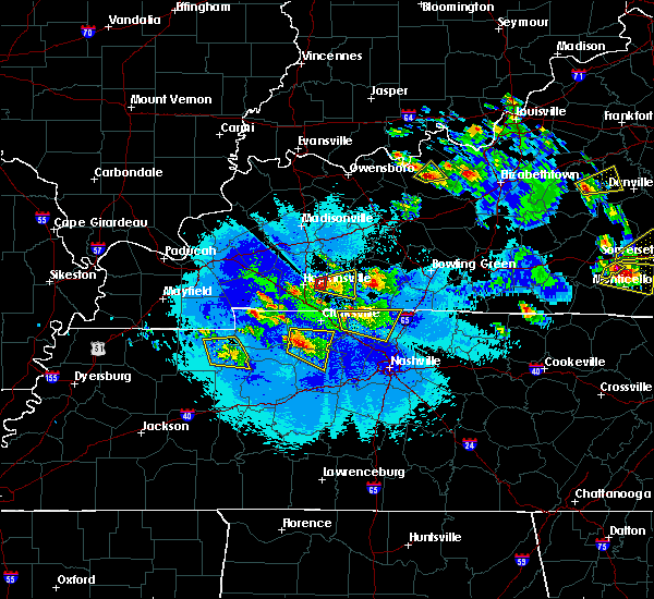 At 902 pm cdt, a severe thunderstorm capable of producing a tornado was located near pembroke, or 9 miles west of elkton, moving east at 25 mph (radar indicated rotation). Hazards include tornado and quarter size hail. Flying debris will be dangerous to those caught without shelter. mobile homes will be damaged or destroyed. damage to roofs, windows, and vehicles will occur. tree damage is likely. This tornadic thunderstorm will remain over mainly rural areas of east central christian county. At 902 pm cdt, a severe thunderstorm capable of producing a tornado was located near pembroke, or 9 miles west of elkton, moving east at 25 mph (radar indicated rotation). Hazards include tornado and quarter size hail. Flying debris will be dangerous to those caught without shelter. mobile homes will be damaged or destroyed. damage to roofs, windows, and vehicles will occur. tree damage is likely. This tornadic thunderstorm will remain over mainly rural areas of east central christian county.
|
| 5/10/2016 8:59 PM CDT |
 At 859 pm cdt, a severe thunderstorm was located near pembroke, or 8 miles east of hopkinsville, moving east at 25 mph (radar indicated). Hazards include quarter size hail. damage to vehicles is expected At 859 pm cdt, a severe thunderstorm was located near pembroke, or 8 miles east of hopkinsville, moving east at 25 mph (radar indicated). Hazards include quarter size hail. damage to vehicles is expected
|
| 5/10/2016 8:51 PM CDT |
 At 851 pm cdt, a severe thunderstorm was located near hopkinsville, moving east at 25 mph (radar indicated). Hazards include quarter size hail. Damage to vehicles is expected. locations impacted include, hopkinsville. A tornado watch remains in effect until 1100 pm cdt for south central kentucky. At 851 pm cdt, a severe thunderstorm was located near hopkinsville, moving east at 25 mph (radar indicated). Hazards include quarter size hail. Damage to vehicles is expected. locations impacted include, hopkinsville. A tornado watch remains in effect until 1100 pm cdt for south central kentucky.
|
| 5/10/2016 8:49 PM CDT |
 At 848 pm cdt, a severe thunderstorm capable of producing a tornado was located just east of hopkinsville, moving east at 25 mph (radar indicated rotation). Hazards include tornado and quarter size hail. Flying debris will be dangerous to those caught without shelter. mobile homes will be damaged or destroyed. damage to roofs, windows, and vehicles will occur. tree damage is likely. Locations impacted include, hopkinsville. At 848 pm cdt, a severe thunderstorm capable of producing a tornado was located just east of hopkinsville, moving east at 25 mph (radar indicated rotation). Hazards include tornado and quarter size hail. Flying debris will be dangerous to those caught without shelter. mobile homes will be damaged or destroyed. damage to roofs, windows, and vehicles will occur. tree damage is likely. Locations impacted include, hopkinsville.
|
| 5/10/2016 8:44 PM CDT |
 At 843 pm cdt, a severe thunderstorm capable of producing a tornado was located over hopkinsville, moving east at 25 mph (radar indicated rotation). Hazards include tornado and quarter size hail. Flying debris will be dangerous to those caught without shelter. mobile homes will be damaged or destroyed. damage to roofs, windows, and vehicles will occur. tree damage is likely. This tornadic thunderstorm will remain over mainly rural areas of east central christian county. At 843 pm cdt, a severe thunderstorm capable of producing a tornado was located over hopkinsville, moving east at 25 mph (radar indicated rotation). Hazards include tornado and quarter size hail. Flying debris will be dangerous to those caught without shelter. mobile homes will be damaged or destroyed. damage to roofs, windows, and vehicles will occur. tree damage is likely. This tornadic thunderstorm will remain over mainly rural areas of east central christian county.
|
| 5/10/2016 8:34 PM CDT |
 At 834 pm cdt, a severe thunderstorm was located over hopkinsville, moving east at 25 mph (radar indicated). Hazards include quarter size hail. damage to vehicles is expected At 834 pm cdt, a severe thunderstorm was located over hopkinsville, moving east at 25 mph (radar indicated). Hazards include quarter size hail. damage to vehicles is expected
|
| 5/10/2016 7:52 PM CDT |
 At 751 pm cdt, a confirmed tornado was located over hopkinsville, moving east at 15 mph (weather spotters confirmed tornado). Hazards include damaging tornado. Flying debris will be dangerous to those caught without shelter. mobile homes will be damaged or destroyed. damage to roofs, windows, and vehicles will occur. tree damage is likely. This tornadic thunderstorm will remain over mainly rural areas of east central christian county. At 751 pm cdt, a confirmed tornado was located over hopkinsville, moving east at 15 mph (weather spotters confirmed tornado). Hazards include damaging tornado. Flying debris will be dangerous to those caught without shelter. mobile homes will be damaged or destroyed. damage to roofs, windows, and vehicles will occur. tree damage is likely. This tornadic thunderstorm will remain over mainly rural areas of east central christian county.
|
| 4/26/2016 7:23 PM EDT |
 At 723 pm edt, a severe thunderstorm was located over edgewood, and is nearly stationary (radar indicated). Hazards include 60 mph wind gusts and quarter size hail. Hail damage to vehicles is expected. expect wind damage to roofs, siding, and trees. Locations impacted include, cincinnati, covington, florence, independence, erlanger, fort thomas, newport, edgewood, alexandria, elsmere, fort mitchell, villa hills, highland heights, taylor mill, bellevue, fort wright, dayton, ludlow, southgate and crescent springs. At 723 pm edt, a severe thunderstorm was located over edgewood, and is nearly stationary (radar indicated). Hazards include 60 mph wind gusts and quarter size hail. Hail damage to vehicles is expected. expect wind damage to roofs, siding, and trees. Locations impacted include, cincinnati, covington, florence, independence, erlanger, fort thomas, newport, edgewood, alexandria, elsmere, fort mitchell, villa hills, highland heights, taylor mill, bellevue, fort wright, dayton, ludlow, southgate and crescent springs.
|
| 4/26/2016 7:08 PM EDT |
 At 708 pm edt, radar indicated a severe thunderstorm located over burlington, moving east at 40 mph. storm hazards include, winds to 60 mph, quarter size hail,. At 708 pm edt, radar indicated a severe thunderstorm located over burlington, moving east at 40 mph. storm hazards include, winds to 60 mph, quarter size hail,.
|
| 4/26/2016 6:54 PM EDT |
 The severe thunderstorm warning for northern kenton, central campbell, central clermont and southeastern hamilton counties will expire at 700 pm edt, the severe thunderstorm which prompted the warning has weakened. therefore the warning will be allowed to expire. a severe thunderstorm watch remains in effect until 200 am edt for northern kentucky, and southwestern ohio. please report previous wind damage or hail to the national weather service by going to our website at weather.gov/iln and submitting your report via social media. The severe thunderstorm warning for northern kenton, central campbell, central clermont and southeastern hamilton counties will expire at 700 pm edt, the severe thunderstorm which prompted the warning has weakened. therefore the warning will be allowed to expire. a severe thunderstorm watch remains in effect until 200 am edt for northern kentucky, and southwestern ohio. please report previous wind damage or hail to the national weather service by going to our website at weather.gov/iln and submitting your report via social media.
|
| 4/26/2016 6:37 PM EDT |
 At 636 pm edt, radar indicated a severe thunderstorm located over silver grove, moving east at 25 mph. storm hazards include, winds to 60 mph, quarter size hail,. At 636 pm edt, radar indicated a severe thunderstorm located over silver grove, moving east at 25 mph. storm hazards include, winds to 60 mph, quarter size hail,.
|
| 2/2/2016 4:11 PM CST |
 At 411 pm cst, a severe thunderstorm was located near elkton, moving northeast at 50 mph (radar indicated). Hazards include 60 mph wind gusts and penny size hail. Expect damage to roofs. siding and trees. locations impacted include, elkton, trenton, clifty and allegre. A tornado watch remains in effect until 700 pm cst for south central kentucky. At 411 pm cst, a severe thunderstorm was located near elkton, moving northeast at 50 mph (radar indicated). Hazards include 60 mph wind gusts and penny size hail. Expect damage to roofs. siding and trees. locations impacted include, elkton, trenton, clifty and allegre. A tornado watch remains in effect until 700 pm cst for south central kentucky.
|
| 2/2/2016 3:57 PM CST |
 At 357 pm cst, a severe thunderstorm was located near pembroke, or near oak grove, moving northeast at 50 mph (radar indicated). Hazards include 60 mph wind gusts and penny size hail. Expect damage to roofs. Siding and trees. At 357 pm cst, a severe thunderstorm was located near pembroke, or near oak grove, moving northeast at 50 mph (radar indicated). Hazards include 60 mph wind gusts and penny size hail. Expect damage to roofs. Siding and trees.
|
| 12/23/2015 8:06 PM EST | At 805 pm est, radar indicated a severe thunderstorm located near butler, moving northeast at 70 mph. storm hazards include, damaging winds to 70 mph, quarter size hail, locations impacted include, covington, independence, erlanger, fort thomas, edgewood, alexandria, highland heights, taylor mill, fort wright, williamstown, falmouth, claryville, wilder, new richmond, silver grove, butler, melbourne, cold spring, ryland heights and crestview. |
| 12/23/2015 8:00 PM EST | At 759 pm est, radar indicated a severe thunderstorm located over crittenden, moving northeast at 70 mph. at 751 pm, the kentucky mesonet site 5 miles east of owenton recorded a 75 mph wind gust. storm hazards include, damaging winds to 70 mph, penny size hail, locations impacted include, covington, independence, erlanger, fort thomas, edgewood, alexandria, elsmere, highland heights, taylor mill, fort wright, williamstown, walton, falmouth, claryville, crittenden, wilder, new richmond, dry ridge, silver grove and butler. this includes the following interstates, i-71 in kentucky between mile markers 70 and 77. i-75 in kentucky between mile markers 149 and 176. |
| 12/23/2015 7:53 PM EST | At 753 pm est, radar indicated a severe thunderstorm located near dry ridge, moving northeast at 70 mph. storm hazards include, winds to 60 mph, penny size hail,. |
| 12/23/2015 6:10 PM CST | At 609 pm cst, severe thunderstorms were located along a line extending from 10 miles west of morgantown to near oak grove. storms were moving northeast at 50 mph (radar indicated). Hazards include 60 mph wind gusts and penny size hail. Expect damage to roofs. siding and trees. locations impacted include, hopkinsville, central city, greenville, elkton, guthrie, powderly, weir, dunmor, drakesboro, trenton, allegre, clifty, everett and allensville. A tornado watch remains in effect until 800 pm cst for south central kentucky. |
| 12/23/2015 5:55 PM CST | At 553 pm cst, a severe thunderstorm was located hopkinsville, moving east at 65 mph (spotters continue to report 60 mph winds in and around hopkinsville). Hazards include 60 mph wind gusts and penny size hail. Expect damage to roofs. Siding and trees. |
| 12/23/2015 5:46 PM CST | At 546 pm cst, severe thunderstorms were located along a line extending from 8 miles west of morgantown to 8 miles northeast of big rock, moving east at 65 mph (radar indicated). Hazards include 60 mph wind gusts and penny size hail. Expect damage to roofs. Siding and trees. |
| 12/23/2015 5:28 PM CST | The national weather service in paducah has issued a * severe thunderstorm warning for. southern christian county in south central kentucky. until 600 pm cst * at 528 pm cst. a severe thunderstorm was located 7 miles northeast of big rock. or 12 miles west of fort campbell north. Moving. |
| 12/23/2015 5:34 PM EST | At 502 pm est, radar indicated severe thunderstorms located along a line extending from near hidden valley to 7 miles southeast of dillsboro, moving east at 45 mph. storm hazards include, winds to 60 mph,. |
| 12/23/2015 5:34 PM EST | At 502 pm est, radar indicated severe thunderstorms located along a line extending from near hidden valley to 7 miles southeast of dillsboro, moving east at 45 mph. storm hazards include, winds to 60 mph,. |
| 12/23/2015 5:03 PM EST | At 502 pm est, radar indicated severe thunderstorms located along a line extending from near hidden valley to 7 miles southeast of dillsboro, moving east at 45 mph. storm hazards include, winds to 60 mph,. |
| 12/23/2015 5:03 PM EST | At 502 pm est, radar indicated severe thunderstorms located along a line extending from near hidden valley to 7 miles southeast of dillsboro, moving east at 45 mph. storm hazards include, winds to 60 mph,. |
| 12/23/2015 5:03 PM EST | At 502 pm est, radar indicated severe thunderstorms located along a line extending from near hidden valley to 7 miles southeast of dillsboro, moving east at 45 mph. storm hazards include, winds to 60 mph,. |
| 9/4/2015 7:43 PM EDT | The severe thunderstorm warning for central kenton and southern campbell counties will expire at 745 pm edt, the storm which prompted the warning has weakened below severe limits. therefore the warning will be allowed to expire. small hail, .gusty winds and heavy rain are still possible with this storm. please report previous wind damage or hail to the national weather service by going to our website at weather.gov/iln and submit your report via social media. |
| 9/4/2015 7:22 PM EDT |
 At 721 pm edt, radar indicated a severe thunderstorm located over taylor mill, moving south at 5 mph. storm hazards include, damaging winds to 70 mph, quarter size hail, locations impacted include, covington, independence, erlanger, edgewood, alexandria, elsmere, fort mitchell, highland heights, taylor mill, fort wright, southgate, crestview hills, park hills, lakeside park, claryville, wilder, silver grove, cold spring, ryland heights and crestview. this includes i-75 in kentucky between mile markers 188 and 189. At 721 pm edt, radar indicated a severe thunderstorm located over taylor mill, moving south at 5 mph. storm hazards include, damaging winds to 70 mph, quarter size hail, locations impacted include, covington, independence, erlanger, edgewood, alexandria, elsmere, fort mitchell, highland heights, taylor mill, fort wright, southgate, crestview hills, park hills, lakeside park, claryville, wilder, silver grove, cold spring, ryland heights and crestview. this includes i-75 in kentucky between mile markers 188 and 189.
|
| 9/4/2015 7:01 PM EDT |
 At 701 pm edt, radar indicated a severe thunderstorm located over southgate, moving southwest at 20 mph. storm hazards include, damaging winds to 70 mph, quarter size hail,. At 701 pm edt, radar indicated a severe thunderstorm located over southgate, moving southwest at 20 mph. storm hazards include, damaging winds to 70 mph, quarter size hail,.
|
| 8/3/2015 7:23 PM EDT |
 At 722 pm edt, the public reported quarter size hail near alexandria kentucky. radar indicated that this storm was located near new richmond, moving southeast at 35 mph. storm hazards include, winds to 60 mph, quarter size hail, very heavy rain which may cause minor flooding, locations impacted include, alexandria, taylor mill, claryville, wilder, new richmond, silver grove, felicity, melbourne, cold spring, ryland heights, crestview, mentor, moscow, fairview, neville, california, chilo, foster, mount auburn and blairsville. At 722 pm edt, the public reported quarter size hail near alexandria kentucky. radar indicated that this storm was located near new richmond, moving southeast at 35 mph. storm hazards include, winds to 60 mph, quarter size hail, very heavy rain which may cause minor flooding, locations impacted include, alexandria, taylor mill, claryville, wilder, new richmond, silver grove, felicity, melbourne, cold spring, ryland heights, crestview, mentor, moscow, fairview, neville, california, chilo, foster, mount auburn and blairsville.
|
| 8/3/2015 7:14 PM EDT |
 At 714 pm edt, the public reported golf ball size hail south of covington near taylor mill. radar indicated that this storm was located over claryville, moving southeast at 35 mph. storm hazards include, winds to 60 mph, damaging hail up to golf ball size, very heavy rain which may cause minor flooding, locations impacted include, cincinnati, covington, independence, erlanger, fort thomas, newport, edgewood, alexandria, fort mitchell, highland heights, taylor mill, bellevue, fort wright, dayton, southgate, crescent springs, crestview hills, park hills, lakeside park and claryville. this includes i-75 in kentucky between mile markers 186 and 190. At 714 pm edt, the public reported golf ball size hail south of covington near taylor mill. radar indicated that this storm was located over claryville, moving southeast at 35 mph. storm hazards include, winds to 60 mph, damaging hail up to golf ball size, very heavy rain which may cause minor flooding, locations impacted include, cincinnati, covington, independence, erlanger, fort thomas, newport, edgewood, alexandria, fort mitchell, highland heights, taylor mill, bellevue, fort wright, dayton, southgate, crescent springs, crestview hills, park hills, lakeside park and claryville. this includes i-75 in kentucky between mile markers 186 and 190.
|
| 8/3/2015 7:01 PM EDT |
 At 701 pm edt, radar indicated a severe thunderstorm located over taylor mill, moving southeast at 35 mph. storm hazards include, winds to 60 mph, quarter size hail,. At 701 pm edt, radar indicated a severe thunderstorm located over taylor mill, moving southeast at 35 mph. storm hazards include, winds to 60 mph, quarter size hail,.
|
| 7/17/2015 8:11 PM EDT |
 At 810 pm edt, radar indicated a severe thunderstorm located 5 miles south of independence, moving east at 20 mph. storm hazards include, winds to 60 mph, quarter size hail, very heavy rain which may cause minor flooding, locations impacted include, covington, florence, independence, erlanger, edgewood, alexandria, elsmere, highland heights, taylor mill, fort wright, walton, claryville, union, crittenden, wilder, new richmond, cold spring, ryland heights, crestview and mentor. At 810 pm edt, radar indicated a severe thunderstorm located 5 miles south of independence, moving east at 20 mph. storm hazards include, winds to 60 mph, quarter size hail, very heavy rain which may cause minor flooding, locations impacted include, covington, florence, independence, erlanger, edgewood, alexandria, elsmere, highland heights, taylor mill, fort wright, walton, claryville, union, crittenden, wilder, new richmond, cold spring, ryland heights, crestview and mentor.
|
| 7/17/2015 7:58 PM EDT |
 At 758 pm edt, radar indicated a severe thunderstorm located over walton, moving east at 30 mph. storm hazards include, winds to 60 mph, quarter size hail, very heavy rain which may cause minor flooding, locations impacted include, covington, florence, independence, erlanger, edgewood, alexandria, elsmere, highland heights, taylor mill, fort wright, walton, claryville, oakbrook, union, crittenden, wilder, new richmond, silver grove, melbourne and cold spring. At 758 pm edt, radar indicated a severe thunderstorm located over walton, moving east at 30 mph. storm hazards include, winds to 60 mph, quarter size hail, very heavy rain which may cause minor flooding, locations impacted include, covington, florence, independence, erlanger, edgewood, alexandria, elsmere, highland heights, taylor mill, fort wright, walton, claryville, oakbrook, union, crittenden, wilder, new richmond, silver grove, melbourne and cold spring.
|
| 7/17/2015 7:48 PM EDT |
 At 748 pm edt, radar indicated a severe thunderstorm located near walton, moving east at 25 mph. storm hazards include, winds to 60 mph, quarter size hail, very heavy rain which may cause minor flooding,. At 748 pm edt, radar indicated a severe thunderstorm located near walton, moving east at 25 mph. storm hazards include, winds to 60 mph, quarter size hail, very heavy rain which may cause minor flooding,.
|
| 7/13/2015 1:34 PM EDT |
 At 132 pm edt, radar indicated severe thunderstorms located along a line extending from montgomery to 11 miles east of vernon, moving south at 40 mph. storm hazards include, winds to 60 mph, penny size hail, frequent cloud to ground lightning, very heavy rain which may cause minor flooding,. At 132 pm edt, radar indicated severe thunderstorms located along a line extending from montgomery to 11 miles east of vernon, moving south at 40 mph. storm hazards include, winds to 60 mph, penny size hail, frequent cloud to ground lightning, very heavy rain which may cause minor flooding,.
|
| 6/30/2015 2:34 PM EDT |
 At 233 pm edt, radar indicated that the severe thunderstorm had weakened. this storm was located near oakbrook, moving east at 25 mph. storm hazards include, winds to 60 mph, quarter size hail, locations impacted include, florence, taylor mill, independence and erlanger. in addition, richwood, white tower, ricedale, ryland heights, latonia lakes, fairview, elsmere and edgewood are near the path of this storm. this includes the following interstate, i-75 between mile markers 176 and 183,. At 233 pm edt, radar indicated that the severe thunderstorm had weakened. this storm was located near oakbrook, moving east at 25 mph. storm hazards include, winds to 60 mph, quarter size hail, locations impacted include, florence, taylor mill, independence and erlanger. in addition, richwood, white tower, ricedale, ryland heights, latonia lakes, fairview, elsmere and edgewood are near the path of this storm. this includes the following interstate, i-75 between mile markers 176 and 183,.
|
| 6/30/2015 2:23 PM EDT |
 At 222 pm edt, radar continued to indicate a severe thunderstorm located near waterloo, moving east at 25 mph. storm hazards include, winds to 60 mph, quarter size hail, locations impacted include, union, florence, taylor mill, independence, fort mitchell, erlanger and covington. in addition, hueys corners, oakbrook, richwood, white tower, ricedale, ryland heights, park hills and latonia lakes are near the path of this storm. this includes the following interstate, i-75 between mile markers 176 and 191 in kentucky,. At 222 pm edt, radar continued to indicate a severe thunderstorm located near waterloo, moving east at 25 mph. storm hazards include, winds to 60 mph, quarter size hail, locations impacted include, union, florence, taylor mill, independence, fort mitchell, erlanger and covington. in addition, hueys corners, oakbrook, richwood, white tower, ricedale, ryland heights, park hills and latonia lakes are near the path of this storm. this includes the following interstate, i-75 between mile markers 176 and 191 in kentucky,.
|
| 6/30/2015 2:08 PM EDT |
 At 205 pm edt, radar indicated a severe thunderstorm located near rising sun, moving east at 25 mph. storm hazards include, winds to 60 mph, quarter size hail,. At 205 pm edt, radar indicated a severe thunderstorm located near rising sun, moving east at 25 mph. storm hazards include, winds to 60 mph, quarter size hail,.
|
| 6/30/2015 1:55 PM EDT |
 At 154 pm edt, radar indicated a severe thunderstorm located near burlington, moving east at 20 mph. storm hazards include, winds to 60 mph, quarter size hail,. At 154 pm edt, radar indicated a severe thunderstorm located near burlington, moving east at 20 mph. storm hazards include, winds to 60 mph, quarter size hail,.
|
| 6/26/2015 3:28 PM CDT | At 327 pm cdt, a severe thunderstorm was located 7 miles northeast of big rock, or 11 miles west of fort campbell north, moving east at 25 mph (radar indicated). Hazards include 60 mph wind gusts and quarter size hail. Hail damage to vehicles is expected. expect wind damage to roofs, siding and trees. Locations impacted include, hopkinsville, oak grove, fort campbell north, pembroke, lafayette and herndon. |
| 6/26/2015 3:11 PM CDT | At 311 pm cdt, a severe thunderstorm was located near big rock, or 12 miles north of dover, moving east at 25 mph (radar indicated). Hazards include 60 mph wind gusts and quarter size hail. Hail damage to vehicles is expected. Expect wind damage to roofs, siding and trees. |
| 5/15/2015 6:05 PM EDT | At 604 pm edt, radar indicated a severe thunderstorm located near rabbit hash, moving east at 20 mph. storm hazards include, winds to 60 mph,. |
| 5/15/2015 6:05 PM EDT | At 604 pm edt, radar indicated a severe thunderstorm located near rabbit hash, moving east at 20 mph. storm hazards include, winds to 60 mph,. |
| 5/11/2015 2:50 PM EDT | At 248 pm edt, radar indicated a severe thunderstorm located near white tower, moving northeast at 35 mph. storm hazards include, winds to 60 mph,. |
| 5/11/2015 2:50 PM EDT | At 248 pm edt, radar indicated a severe thunderstorm located near white tower, moving northeast at 35 mph. storm hazards include, winds to 60 mph,. |
| 4/10/2015 3:16 AM EDT | A severe thunderstorm warning remains in effect until 345 am edt for northwestern clermont. western warren. eastern hamilton. eastern butler. campbell and kenton counties. at 314 am edt. radar continued to indicate severe thunderstorms located along a line extending from middletown to crestview. Moving east at 60 mph. |
| 4/10/2015 3:16 AM EDT | A severe thunderstorm warning remains in effect until 345 am edt for northwestern clermont. western warren. eastern hamilton. eastern butler. campbell and kenton counties. at 314 am edt. radar continued to indicate severe thunderstorms located along a line extending from middletown to crestview. Moving east at 60 mph. |
| 4/10/2015 2:59 AM EDT | The national weather service in wilmington has issued a * severe thunderstorm warning for. northwestern clermont county in southwest ohio. western warren county in southwest ohio. hamilton county in southwest ohio. Butler county in southwest ohio. |
| 4/10/2015 2:59 AM EDT | The national weather service in wilmington has issued a * severe thunderstorm warning for. northwestern clermont county in southwest ohio. western warren county in southwest ohio. hamilton county in southwest ohio. Butler county in southwest ohio. |
| 4/9/2015 6:27 PM EDT | The severe thunderstorm warning for hamilton. butler. campbell. boone and kenton counties will expire at 630 pm edt. additional severe thunderstorm warnings have been issued for parts of hamilton. campbell. and butler counties. please report previous wind damage or hail to the national weather service by going to our website at weather. Gov/iln and submitting. |
| 4/9/2015 6:27 PM EDT | The severe thunderstorm warning for hamilton. butler. campbell. boone and kenton counties will expire at 630 pm edt. additional severe thunderstorm warnings have been issued for parts of hamilton. campbell. and butler counties. please report previous wind damage or hail to the national weather service by going to our website at weather. Gov/iln and submitting. |
| 4/9/2015 6:13 PM EDT | A severe thunderstorm warning remains in effect until 630 pm edt for hamilton. butler. campbell. boone and kenton counties. at 608 pm edt. radar continued to indicate a severe thunderstorm located 2 miles northeast of hebron. this storm remains capable of producing golf ball size hail and winds to 60 mph. this storm will affect southern hamilton county. Including downtown. |
| 4/9/2015 6:13 PM EDT | A severe thunderstorm warning remains in effect until 630 pm edt for hamilton. butler. campbell. boone and kenton counties. at 608 pm edt. radar continued to indicate a severe thunderstorm located 2 miles northeast of hebron. this storm remains capable of producing golf ball size hail and winds to 60 mph. this storm will affect southern hamilton county. Including downtown. |
| 4/9/2015 6:07 PM EDT | A severe thunderstorm warning remains in effect until 630 pm edt for hamilton. butler. campbell. boone and kenton counties. at 603 pm edt. radar continued to indicate a severe thunderstorm located near hebron. this storm has strengthened. and is now capable of producing golf ball size hail and 60 mph winds. another severe thunderstorm is located 6 miles west of hamilton. Capable of. |
| 4/9/2015 6:07 PM EDT | A severe thunderstorm warning remains in effect until 630 pm edt for hamilton. butler. campbell. boone and kenton counties. at 603 pm edt. radar continued to indicate a severe thunderstorm located near hebron. this storm has strengthened. and is now capable of producing golf ball size hail and 60 mph winds. another severe thunderstorm is located 6 miles west of hamilton. Capable of. |
| 4/9/2015 5:57 PM EDT | The national weather service in wilmington has issued a * severe thunderstorm warning for. hamilton county in southwest ohio. butler county in southwest ohio. campbell county in northern kentucky. Boone county in northern kentucky. |
| 4/9/2015 5:57 PM EDT | The national weather service in wilmington has issued a * severe thunderstorm warning for. hamilton county in southwest ohio. butler county in southwest ohio. campbell county in northern kentucky. Boone county in northern kentucky. |
| 4/9/2015 5:57 PM EDT | The national weather service in wilmington has issued a * severe thunderstorm warning for. hamilton county in southwest ohio. butler county in southwest ohio. campbell county in northern kentucky. Boone county in northern kentucky. |
| 4/9/2015 1:54 PM EDT | The severe thunderstorm warning for grant. eastern gallatin. campbell. boone. pendleton. northern owen and kenton counties will expire at 200 pm edt. the storms have weakened below severe limits. therefore the severe thunderstorm warning will be allowed to expire. Small hail and gusty winds are still possible with these storms. |
| 4/9/2015 1:38 PM EDT | A severe thunderstorm warning remains in effect until 200 pm edt for grant. eastern gallatin. campbell. boone. pendleton. northern owen and kenton counties. at 136 pm edt. radar continued to indicate severe thunderstorms located along a line extending from independence to twin bridges. Moving northeast at 55 mph. |
| 4/9/2015 1:38 PM EDT | A severe thunderstorm warning remains in effect until 200 pm edt for grant. eastern gallatin. campbell. boone. pendleton. northern owen and kenton counties. at 136 pm edt. radar continued to indicate severe thunderstorms located along a line extending from independence to twin bridges. Moving northeast at 55 mph. |
| 4/9/2015 1:28 PM EDT | The national weather service in wilmington has issued a * severe thunderstorm warning for. grant county in northern kentucky. eastern gallatin county in northern kentucky. campbell county in northern kentucky. Boone county in northern kentucky. |
| 4/9/2015 1:28 PM EDT | The national weather service in wilmington has issued a * severe thunderstorm warning for. grant county in northern kentucky. eastern gallatin county in northern kentucky. campbell county in northern kentucky. Boone county in northern kentucky. |
| 4/8/2015 11:15 AM EDT | The national weather service in wilmington has issued a * severe thunderstorm warning for. southwestern clermont county in southwest ohio. northern grant county in northern kentucky. northeastern gallatin county in northern kentucky. Campbell county in northern kentucky. |
| 4/8/2015 11:15 AM EDT | The national weather service in wilmington has issued a * severe thunderstorm warning for. southwestern clermont county in southwest ohio. northern grant county in northern kentucky. northeastern gallatin county in northern kentucky. Campbell county in northern kentucky. |
| 2/20/2014 5:15 PM CST | Tree blown down and landed on parked vehicle. no passengers. roof damage reported to a hom in todd county KY, 7.7 miles SW of Fairview, KY |
| 1/30/2013 1:52 AM CST | A path of damage averaging 1/3 mile wide extended from 3 miles northwest of allegre to 1 mile northeast of penrod. peak winds were estimated at 110 mph. a few thousand in todd county KY, 8.6 miles SSW of Fairview, KY |
| 1/30/2013 1:40 AM CST | Silo and 3 greenhouses blown in christian county KY, 4.2 miles SE of Fairview, KY |
| 7/27/2012 5:25 PM EDT | Shingles torn off a roof near kentucky route 16 in taylor mill. numerous trees down in the are in kenton county KY, 0.3 miles SE of Fairview, KY |
Hail Maps for Fairview, KY


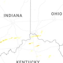
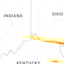


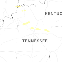


Connect with Interactive Hail Maps