

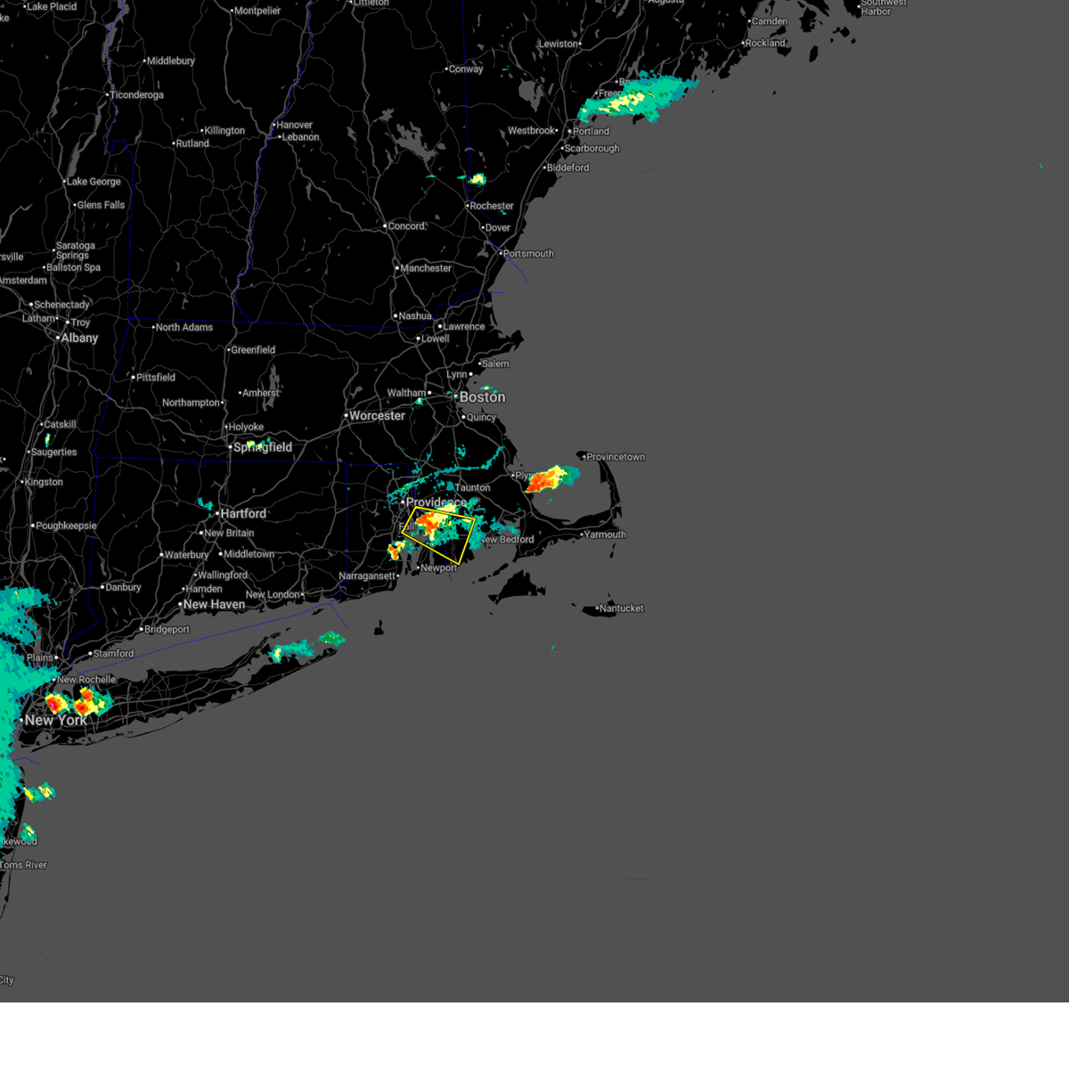
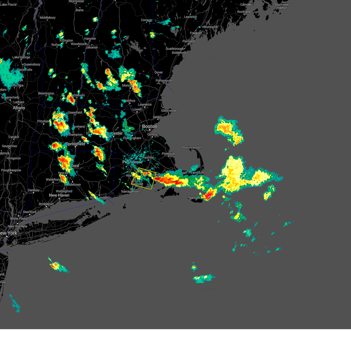
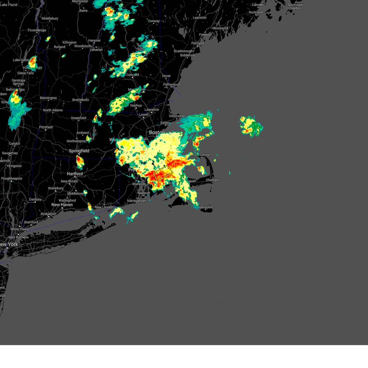
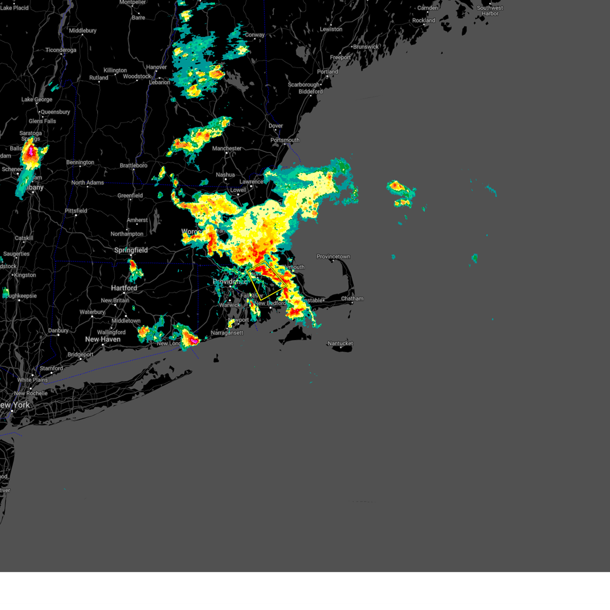
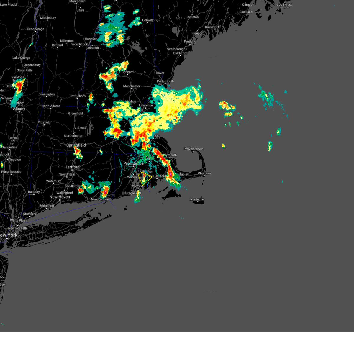
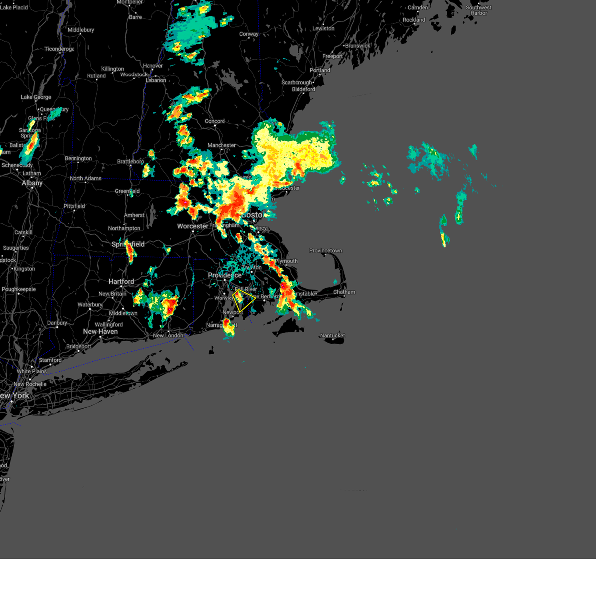
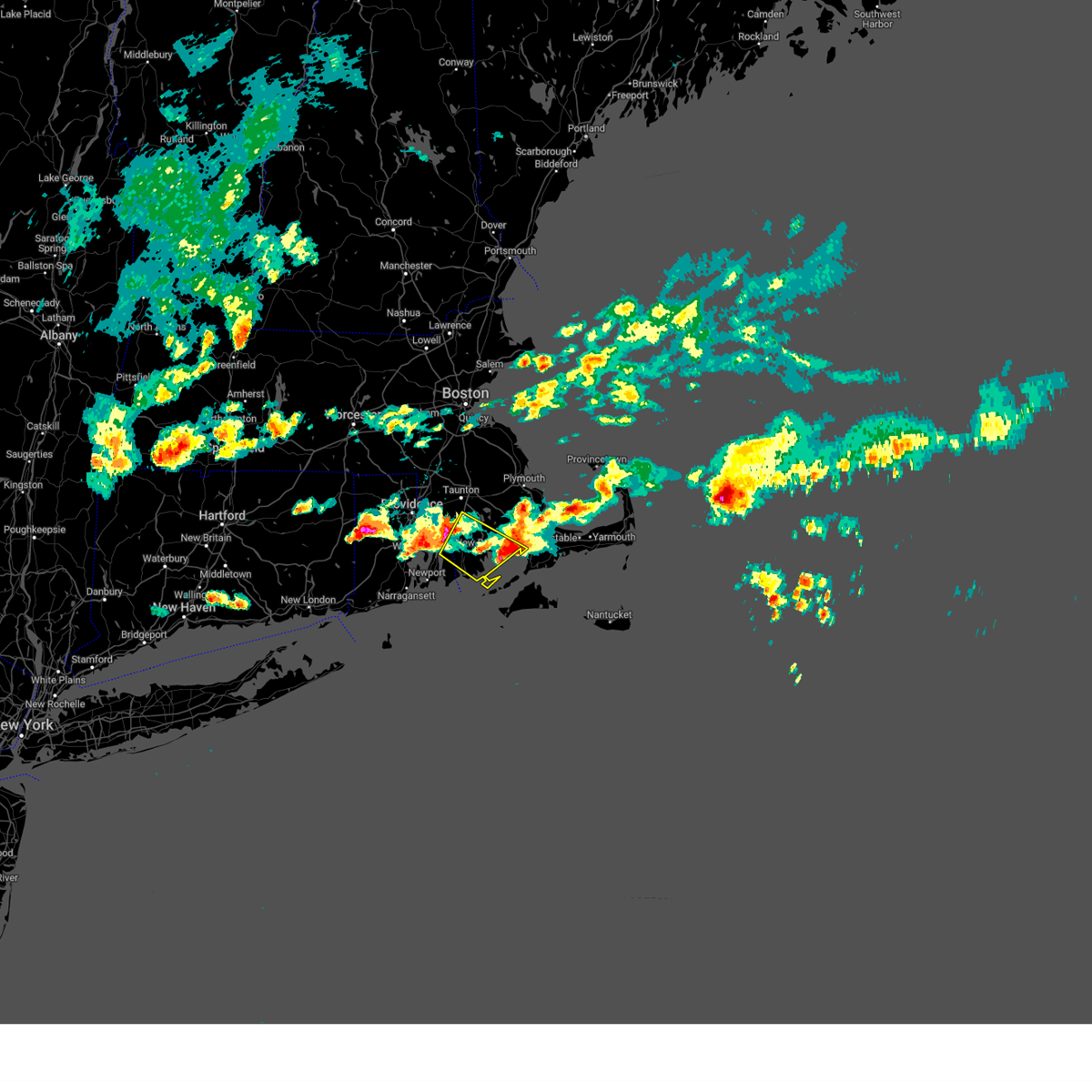
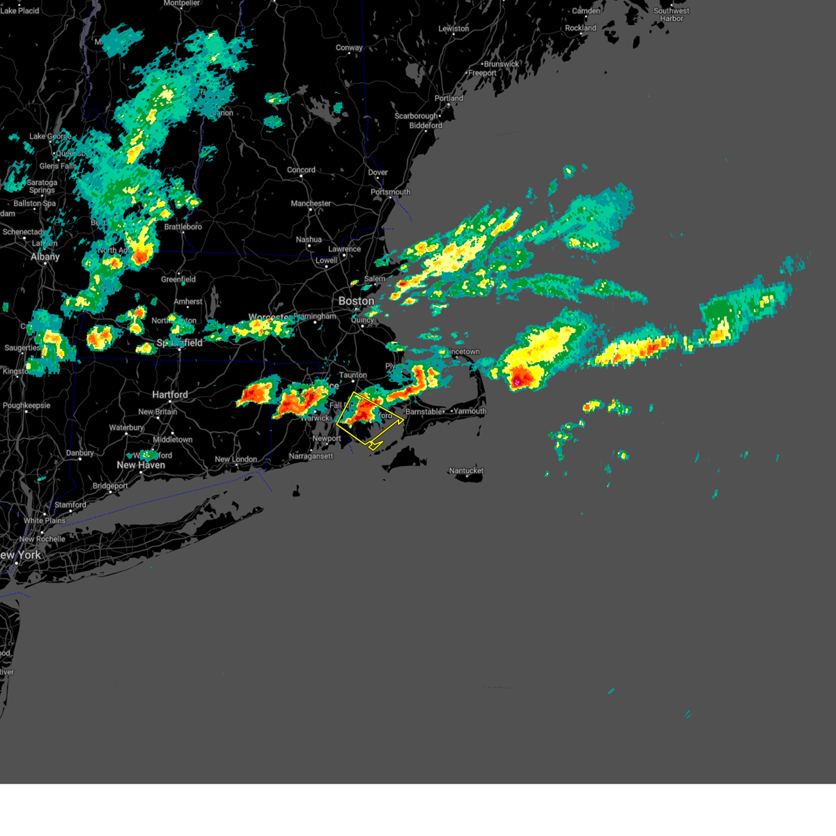
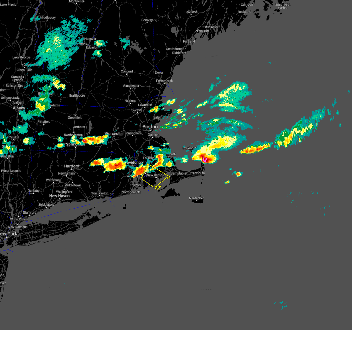
Hail Map for Fall River, MA
The Fall River, MA area has had 0 reports of on-the-ground hail by trained spotters, and has been under severe weather warnings 18 times during the past 12 months. Doppler radar has detected hail at or near Fall River, MA on 15 occasions, including 4 occasions during the past year.
| Name: | Fall River, MA |
| Where Located: | 17.5 miles SE of Providence, RI |
| Map: | Google Map for Fall River, MA |
| Population: | 88857 |
| Housing Units: | 42750 |
| More Info: | Search Google for Fall River, MA |
5
The Top Recent Hail Date for Fall River, MA is Thursday, July 3, 2025 (2nd out of 15)

Hail and Wind Damage Spotted near Fall River, MA
| Date / Time | Report Details |
|---|---|
| 7/8/2025 6:52 PM EDT |
 The storm which prompted the warning has weakened below severe limits, and no longer poses an immediate threat to life or property. therefore, the warning will be allowed to expire. however gusty winds and heavy rain are still possible with this thunderstorm. The storm which prompted the warning has weakened below severe limits, and no longer poses an immediate threat to life or property. therefore, the warning will be allowed to expire. however gusty winds and heavy rain are still possible with this thunderstorm.
|
| 7/8/2025 6:28 PM EDT |
 At 627 pm edt, a severe thunderstorm was located over bristol, moving east at 15 mph (radar indicated). Hazards include 60 mph wind gusts and nickel size hail. Expect damage to trees and power lines. Locations impacted include, new bedford, fall river, warwick, east providence, dartmouth, bristol, somerset, portsmouth, barrington, swansea, tiverton, westport, seekonk, rehoboth, warren, acushnet, freetown, little compton, and prudence island. At 627 pm edt, a severe thunderstorm was located over bristol, moving east at 15 mph (radar indicated). Hazards include 60 mph wind gusts and nickel size hail. Expect damage to trees and power lines. Locations impacted include, new bedford, fall river, warwick, east providence, dartmouth, bristol, somerset, portsmouth, barrington, swansea, tiverton, westport, seekonk, rehoboth, warren, acushnet, freetown, little compton, and prudence island.
|
| 7/8/2025 6:28 PM EDT |
 the severe thunderstorm warning has been cancelled and is no longer in effect the severe thunderstorm warning has been cancelled and is no longer in effect
|
| 7/8/2025 6:00 PM EDT |
 Svrbox the national weather service in boston/norton has issued a * severe thunderstorm warning for, southern bristol county in southeastern massachusetts, northeastern washington county in rhode island, northeastern newport county in rhode island, northeastern kent county in rhode island, southeastern providence county in rhode island, bristol county in rhode island, * until 700 pm edt. * at 600 pm edt, a severe thunderstorm was located over barrington, or near warwick, moving east at 15 mph (radar indicated). Hazards include 60 mph wind gusts and penny size hail. expect damage to trees and power lines Svrbox the national weather service in boston/norton has issued a * severe thunderstorm warning for, southern bristol county in southeastern massachusetts, northeastern washington county in rhode island, northeastern newport county in rhode island, northeastern kent county in rhode island, southeastern providence county in rhode island, bristol county in rhode island, * until 700 pm edt. * at 600 pm edt, a severe thunderstorm was located over barrington, or near warwick, moving east at 15 mph (radar indicated). Hazards include 60 mph wind gusts and penny size hail. expect damage to trees and power lines
|
| 7/3/2025 8:27 PM EDT |
 The storm which prompted the warning has moved out of the area. therefore, the warning will be allowed to expire. however gusty winds are still possible with this thunderstorm as it moves over the waters. a severe thunderstorm watch remains in effect until 1000 pm edt for southeastern massachusetts. The storm which prompted the warning has moved out of the area. therefore, the warning will be allowed to expire. however gusty winds are still possible with this thunderstorm as it moves over the waters. a severe thunderstorm watch remains in effect until 1000 pm edt for southeastern massachusetts.
|
| 7/3/2025 7:41 PM EDT | Svrbox the national weather service in boston/norton has issued a * severe thunderstorm warning for, southwestern barnstable county in southeastern massachusetts, southeastern bristol county in southeastern massachusetts, southern plymouth county in southeastern massachusetts, * until 830 pm edt. * at 741 pm edt, a severe thunderstorm was located near fall river, moving east at 35 mph (radar indicated). Hazards include 60 mph wind gusts and penny size hail. expect damage to trees and power lines |
| 7/3/2025 7:30 PM EDT | Numerous trees... branches and power lines down across the city. at least one car damaged due to fallen branc in bristol county MA, 3.8 miles S of Fall River, MA |
| 7/3/2025 7:30 PM EDT | In fall river... a building that was under renovation has a portion of the facade of the building collaps in bristol county MA, 2.1 miles SE of Fall River, MA |
| 7/3/2025 7:30 PM EDT | In fall river... several trees and large branches were down including one tree on a ca in bristol county MA, 1.8 miles SSE of Fall River, MA |
| 7/3/2025 7:30 PM EDT | At 728 pm edt, a severe thunderstorm was located near rehoboth, or near east providence, moving east at 35 mph (asos reported. at 721 pm edt, 64 mph gust was reported at t.f. green international airport). Hazards include 60 mph wind gusts and penny size hail. Expect damage to trees and power lines. Locations impacted include, providence, fall river, warwick, cranston, pawtucket, taunton, east providence, dartmouth, cumberland, north providence, west warwick, johnston, north attleborough, bristol, attleboro, smithfield, lincoln, central falls, norton, and somerset. |
| 7/3/2025 7:01 PM EDT | Svrbox the national weather service in boston/norton has issued a * severe thunderstorm warning for, west central bristol county in southeastern massachusetts, northern kent county in rhode island, providence county in rhode island, bristol county in rhode island, * until 745 pm edt. * at 701 pm edt, a severe thunderstorm was located over scituate, or near johnston, moving east at 35 mph (radar indicated). Hazards include 60 mph wind gusts and quarter size hail. Hail damage to vehicles is expected. Expect wind damage to trees and power lines. |
| 8/26/2024 3:47 PM EDT |
 the severe thunderstorm warning has been cancelled and is no longer in effect the severe thunderstorm warning has been cancelled and is no longer in effect
|
| 8/26/2024 3:17 PM EDT |
 Svrbox the national weather service in boston/norton has issued a * severe thunderstorm warning for, south central bristol county in southeastern massachusetts, northeastern washington county in rhode island, newport county in rhode island, eastern kent county in rhode island, southeastern providence county in rhode island, bristol county in rhode island, * until 400 pm edt. * at 317 pm edt, a severe thunderstorm was located over warwick, moving southeast at 20 mph (radar indicated). Hazards include golf ball size hail and 60 mph wind gusts. People and animals outdoors will be injured. expect hail damage to roofs, siding, windows, and vehicles. Expect wind damage to trees and power lines. Svrbox the national weather service in boston/norton has issued a * severe thunderstorm warning for, south central bristol county in southeastern massachusetts, northeastern washington county in rhode island, newport county in rhode island, eastern kent county in rhode island, southeastern providence county in rhode island, bristol county in rhode island, * until 400 pm edt. * at 317 pm edt, a severe thunderstorm was located over warwick, moving southeast at 20 mph (radar indicated). Hazards include golf ball size hail and 60 mph wind gusts. People and animals outdoors will be injured. expect hail damage to roofs, siding, windows, and vehicles. Expect wind damage to trees and power lines.
|
| 8/26/2024 3:14 PM EDT |
 Svrbox the national weather service in boston/norton has issued a * severe thunderstorm warning for, south central bristol county in southeastern massachusetts, northeastern washington county in rhode island, newport county in rhode island, eastern kent county in rhode island, southeastern providence county in rhode island, bristol county in rhode island, * until 400 pm edt. * at 314 pm edt, a severe thunderstorm was located over warwick, moving southeast at 20 mph (radar indicated). Hazards include 60 mph wind gusts and quarter size hail. Hail damage to vehicles is expected. Expect wind damage to trees and power lines. Svrbox the national weather service in boston/norton has issued a * severe thunderstorm warning for, south central bristol county in southeastern massachusetts, northeastern washington county in rhode island, newport county in rhode island, eastern kent county in rhode island, southeastern providence county in rhode island, bristol county in rhode island, * until 400 pm edt. * at 314 pm edt, a severe thunderstorm was located over warwick, moving southeast at 20 mph (radar indicated). Hazards include 60 mph wind gusts and quarter size hail. Hail damage to vehicles is expected. Expect wind damage to trees and power lines.
|
| 8/26/2024 2:15 PM EDT |
 Svrbox the national weather service in boston/norton has issued a * severe thunderstorm warning for, southern bristol county in southeastern massachusetts, northeastern washington county in rhode island, newport county in rhode island, bristol county in rhode island, * until 300 pm edt. * at 215 pm edt, a severe thunderstorm was located over fall river, moving south at 15 mph (radar indicated). Hazards include 60 mph wind gusts and quarter size hail. Hail damage to vehicles is expected. Expect wind damage to trees and power lines. Svrbox the national weather service in boston/norton has issued a * severe thunderstorm warning for, southern bristol county in southeastern massachusetts, northeastern washington county in rhode island, newport county in rhode island, bristol county in rhode island, * until 300 pm edt. * at 215 pm edt, a severe thunderstorm was located over fall river, moving south at 15 mph (radar indicated). Hazards include 60 mph wind gusts and quarter size hail. Hail damage to vehicles is expected. Expect wind damage to trees and power lines.
|
| 8/15/2024 5:25 PM EDT |
 At 525 pm edt, a severe thunderstorm was located near tiverton, or near bristol, moving south at 30 mph (radar indicated). Hazards include 60 mph wind gusts and penny size hail. Expect damage to trees and power lines. Locations impacted include, fall river, east providence, dartmouth, newport, bristol, somerset, portsmouth, barrington, middletown, swansea, tiverton, westport, seekonk, rehoboth, warren, freetown, dighton, berkley, little compton, and prudence island. At 525 pm edt, a severe thunderstorm was located near tiverton, or near bristol, moving south at 30 mph (radar indicated). Hazards include 60 mph wind gusts and penny size hail. Expect damage to trees and power lines. Locations impacted include, fall river, east providence, dartmouth, newport, bristol, somerset, portsmouth, barrington, middletown, swansea, tiverton, westport, seekonk, rehoboth, warren, freetown, dighton, berkley, little compton, and prudence island.
|
| 8/15/2024 5:24 PM EDT |
 At 524 pm edt, a severe thunderstorm was located over lakeville, or 7 miles south of bridgewater, moving southeast at 15 mph (radar indicated). Hazards include 60 mph wind gusts and penny size hail. Expect damage to trees and power lines. Locations impacted include, fall river, taunton, middleborough, carver, lakeville, acushnet, freetown, berkley, and rochester. At 524 pm edt, a severe thunderstorm was located over lakeville, or 7 miles south of bridgewater, moving southeast at 15 mph (radar indicated). Hazards include 60 mph wind gusts and penny size hail. Expect damage to trees and power lines. Locations impacted include, fall river, taunton, middleborough, carver, lakeville, acushnet, freetown, berkley, and rochester.
|
| 8/15/2024 5:06 PM EDT |
 Svrbox the national weather service in boston/norton has issued a * severe thunderstorm warning for, central bristol county in southeastern massachusetts, newport county in rhode island, east central providence county in rhode island, bristol county in rhode island, * until 545 pm edt. * at 505 pm edt, a severe thunderstorm was located over dighton, or 8 miles east of east providence, moving south at 35 mph (radar indicated). Hazards include 60 mph wind gusts and penny size hail. expect damage to trees and power lines Svrbox the national weather service in boston/norton has issued a * severe thunderstorm warning for, central bristol county in southeastern massachusetts, newport county in rhode island, east central providence county in rhode island, bristol county in rhode island, * until 545 pm edt. * at 505 pm edt, a severe thunderstorm was located over dighton, or 8 miles east of east providence, moving south at 35 mph (radar indicated). Hazards include 60 mph wind gusts and penny size hail. expect damage to trees and power lines
|
| 8/15/2024 4:44 PM EDT |
 Svrbox the national weather service in boston/norton has issued a * severe thunderstorm warning for, southwestern plymouth county in southeastern massachusetts, central bristol county in southeastern massachusetts, * until 545 pm edt. * at 444 pm edt, a severe thunderstorm was located over raynham, or near bridgewater, moving southeast at 15 mph (radar indicated). Hazards include 60 mph wind gusts and quarter size hail. Hail damage to vehicles is expected. Expect wind damage to trees and power lines. Svrbox the national weather service in boston/norton has issued a * severe thunderstorm warning for, southwestern plymouth county in southeastern massachusetts, central bristol county in southeastern massachusetts, * until 545 pm edt. * at 444 pm edt, a severe thunderstorm was located over raynham, or near bridgewater, moving southeast at 15 mph (radar indicated). Hazards include 60 mph wind gusts and quarter size hail. Hail damage to vehicles is expected. Expect wind damage to trees and power lines.
|
| 8/15/2024 4:23 PM EDT |
 The severe thunderstorm which prompted the warning has weakened. therefore, the warning will be allowed to expire. The severe thunderstorm which prompted the warning has weakened. therefore, the warning will be allowed to expire.
|
| 8/15/2024 4:03 PM EDT |
 Svrbox the national weather service in boston/norton has issued a * severe thunderstorm warning for, south central bristol county in southeastern massachusetts, northeastern newport county in rhode island, southeastern bristol county in rhode island, * until 430 pm edt. * at 402 pm edt, a severe thunderstorm was located over bristol, moving southeast at 5 mph (radar indicated). Hazards include 60 mph wind gusts and penny size hail. expect damage to trees and power lines Svrbox the national weather service in boston/norton has issued a * severe thunderstorm warning for, south central bristol county in southeastern massachusetts, northeastern newport county in rhode island, southeastern bristol county in rhode island, * until 430 pm edt. * at 402 pm edt, a severe thunderstorm was located over bristol, moving southeast at 5 mph (radar indicated). Hazards include 60 mph wind gusts and penny size hail. expect damage to trees and power lines
|
| 6/30/2024 4:05 PM EDT |
 The storms which prompted the warning have weakened below severe limits, and have exited the warned area. therefore, the warning will be allowed to expire. however gusty winds and heavy rain are still possible with these thunderstorms. a severe thunderstorm watch remains in effect until 700 pm edt for southeastern massachusetts, and rhode island. The storms which prompted the warning have weakened below severe limits, and have exited the warned area. therefore, the warning will be allowed to expire. however gusty winds and heavy rain are still possible with these thunderstorms. a severe thunderstorm watch remains in effect until 700 pm edt for southeastern massachusetts, and rhode island.
|
| 6/30/2024 3:50 PM EDT |
 At 350 pm edt, severe thunderstorms were located along a line extending from near swansea to near tiverton to newport, moving east at 40 mph (radar indicated). Hazards include 60 mph wind gusts. Expect damage to roofs, siding, and trees. Locations impacted include, fall river, dartmouth, newport, somerset, portsmouth, middletown, swansea, tiverton, westport, rehoboth, freetown, dighton, berkley, and little compton. At 350 pm edt, severe thunderstorms were located along a line extending from near swansea to near tiverton to newport, moving east at 40 mph (radar indicated). Hazards include 60 mph wind gusts. Expect damage to roofs, siding, and trees. Locations impacted include, fall river, dartmouth, newport, somerset, portsmouth, middletown, swansea, tiverton, westport, rehoboth, freetown, dighton, berkley, and little compton.
|
| 6/30/2024 3:50 PM EDT |
 the severe thunderstorm warning has been cancelled and is no longer in effect the severe thunderstorm warning has been cancelled and is no longer in effect
|
| 6/30/2024 3:43 PM EDT |
 At 342 pm edt, severe thunderstorms were located along a line extending from east providence to bristol to near jamestown, moving east at 40 mph (radar indicated). Hazards include 60 mph wind gusts. Expect damage to roofs, siding, and trees. Locations impacted include, fall river, east providence, dartmouth, newport, bristol, somerset, portsmouth, barrington, middletown, swansea, tiverton, westport, seekonk, rehoboth, warren, freetown, dighton, berkley, jamestown, and little compton. At 342 pm edt, severe thunderstorms were located along a line extending from east providence to bristol to near jamestown, moving east at 40 mph (radar indicated). Hazards include 60 mph wind gusts. Expect damage to roofs, siding, and trees. Locations impacted include, fall river, east providence, dartmouth, newport, bristol, somerset, portsmouth, barrington, middletown, swansea, tiverton, westport, seekonk, rehoboth, warren, freetown, dighton, berkley, jamestown, and little compton.
|
| 6/30/2024 3:43 PM EDT |
 the severe thunderstorm warning has been cancelled and is no longer in effect the severe thunderstorm warning has been cancelled and is no longer in effect
|
| 6/30/2024 3:22 PM EDT |
 Svrbox the national weather service in boston/norton has issued a * severe thunderstorm warning for, southwestern bristol county in southeastern massachusetts, northeastern washington county in rhode island, newport county in rhode island, eastern kent county in rhode island, southern providence county in rhode island, bristol county in rhode island, * until 415 pm edt. * at 321 pm edt, severe thunderstorms were located along a line extending from scituate to west warwick to richmond, moving east at 40 mph (radar indicated). Hazards include 60 mph wind gusts. expect damage to roofs, siding, and trees Svrbox the national weather service in boston/norton has issued a * severe thunderstorm warning for, southwestern bristol county in southeastern massachusetts, northeastern washington county in rhode island, newport county in rhode island, eastern kent county in rhode island, southern providence county in rhode island, bristol county in rhode island, * until 415 pm edt. * at 321 pm edt, severe thunderstorms were located along a line extending from scituate to west warwick to richmond, moving east at 40 mph (radar indicated). Hazards include 60 mph wind gusts. expect damage to roofs, siding, and trees
|
| 6/26/2024 11:44 PM EDT |
 At 1143 pm edt, severe thunderstorms were located along a line extending from newton to raynham to near little compton, moving east at 55 mph (radar indicated). Hazards include 60 mph wind gusts. Expect damage to roofs, siding, and trees. Locations impacted include, boston, cambridge, new bedford, brockton, quincy, fall river, newton, brookline, plymouth, taunton, weymouth, braintree, dartmouth, randolph, needham, norwood, wellesley, milton, stoughton, and bridgewater. At 1143 pm edt, severe thunderstorms were located along a line extending from newton to raynham to near little compton, moving east at 55 mph (radar indicated). Hazards include 60 mph wind gusts. Expect damage to roofs, siding, and trees. Locations impacted include, boston, cambridge, new bedford, brockton, quincy, fall river, newton, brookline, plymouth, taunton, weymouth, braintree, dartmouth, randolph, needham, norwood, wellesley, milton, stoughton, and bridgewater.
|
| 6/26/2024 11:44 PM EDT |
 the severe thunderstorm warning has been cancelled and is no longer in effect the severe thunderstorm warning has been cancelled and is no longer in effect
|
| 6/26/2024 11:36 PM EDT |
 At 1136 pm edt, severe thunderstorms were located along a line extending from natick to near taunton to near little compton, moving east at 55 mph (radar indicated). Hazards include 60 mph wind gusts. Expect damage to roofs, siding, and trees. Locations impacted include, boston, cambridge, new bedford, brockton, quincy, fall river, newton, framingham, brookline, plymouth, taunton, weymouth, braintree, dartmouth, natick, randolph, needham, north attleborough, norwood, and wellesley. At 1136 pm edt, severe thunderstorms were located along a line extending from natick to near taunton to near little compton, moving east at 55 mph (radar indicated). Hazards include 60 mph wind gusts. Expect damage to roofs, siding, and trees. Locations impacted include, boston, cambridge, new bedford, brockton, quincy, fall river, newton, framingham, brookline, plymouth, taunton, weymouth, braintree, dartmouth, natick, randolph, needham, north attleborough, norwood, and wellesley.
|
| 6/26/2024 11:36 PM EDT |
 the severe thunderstorm warning has been cancelled and is no longer in effect the severe thunderstorm warning has been cancelled and is no longer in effect
|
| 6/26/2024 11:16 PM EDT |
 Svrbox the national weather service in boston/norton has issued a * severe thunderstorm warning for, norfolk county in eastern massachusetts, suffolk county in eastern massachusetts, southeastern middlesex county in northeastern massachusetts, plymouth county in southeastern massachusetts, bristol county in southeastern massachusetts, northeastern washington county in rhode island, newport county in rhode island, northeastern kent county in rhode island, eastern providence county in rhode island, bristol county in rhode island, * until 1215 am edt. * at 1115 pm edt, severe thunderstorms were located along a line extending from near millbury to johnston to south kingstown, moving east at 55 mph (radar indicated). Hazards include 60 mph wind gusts. expect damage to roofs, siding, and trees Svrbox the national weather service in boston/norton has issued a * severe thunderstorm warning for, norfolk county in eastern massachusetts, suffolk county in eastern massachusetts, southeastern middlesex county in northeastern massachusetts, plymouth county in southeastern massachusetts, bristol county in southeastern massachusetts, northeastern washington county in rhode island, newport county in rhode island, northeastern kent county in rhode island, eastern providence county in rhode island, bristol county in rhode island, * until 1215 am edt. * at 1115 pm edt, severe thunderstorms were located along a line extending from near millbury to johnston to south kingstown, moving east at 55 mph (radar indicated). Hazards include 60 mph wind gusts. expect damage to roofs, siding, and trees
|
| 5/8/2024 8:16 PM EDT |
 At 815 pm edt, a severe thunderstorm was located near gosnold, or 9 miles northwest of tisbury, moving southeast at 40 mph (radar indicated). Hazards include quarter size hail. Damage to vehicles is expected. Locations impacted include, new bedford, fall river, dartmouth, newport, bristol, marion, wareham, somerset, portsmouth, middletown, fairhaven, tiverton, westport, acushnet, freetown, mattapoisett, jamestown, rochester, little compton, and gosnold. At 815 pm edt, a severe thunderstorm was located near gosnold, or 9 miles northwest of tisbury, moving southeast at 40 mph (radar indicated). Hazards include quarter size hail. Damage to vehicles is expected. Locations impacted include, new bedford, fall river, dartmouth, newport, bristol, marion, wareham, somerset, portsmouth, middletown, fairhaven, tiverton, westport, acushnet, freetown, mattapoisett, jamestown, rochester, little compton, and gosnold.
|
| 5/8/2024 8:16 PM EDT |
 the severe thunderstorm warning has been cancelled and is no longer in effect the severe thunderstorm warning has been cancelled and is no longer in effect
|
| 5/8/2024 8:00 PM EDT |
 At 800 pm edt, a severe thunderstorm was located over dartmouth, moving east at 40 mph (radar indicated). Hazards include ping pong ball size hail. People and animals outdoors will be injured. expect damage to roofs, siding, windows, and vehicles. Locations impacted include, providence, new bedford, fall river, warwick, cranston, east providence, dartmouth, west warwick, north kingstown, newport, bristol, marion, wareham, somerset, portsmouth, barrington, middletown, fairhaven, swansea, and tiverton. At 800 pm edt, a severe thunderstorm was located over dartmouth, moving east at 40 mph (radar indicated). Hazards include ping pong ball size hail. People and animals outdoors will be injured. expect damage to roofs, siding, windows, and vehicles. Locations impacted include, providence, new bedford, fall river, warwick, cranston, east providence, dartmouth, west warwick, north kingstown, newport, bristol, marion, wareham, somerset, portsmouth, barrington, middletown, fairhaven, swansea, and tiverton.
|
| 5/8/2024 7:51 PM EDT |
 Svrbox the national weather service in boston/norton has issued a * severe thunderstorm warning for, south central plymouth county in southeastern massachusetts, southern bristol county in southeastern massachusetts, newport county in rhode island, eastern kent county in rhode island, southeastern providence county in rhode island, bristol county in rhode island, * until 830 pm edt. * at 751 pm edt, a severe thunderstorm was located over west warwick, moving southeast at 40 mph (radar indicated). Hazards include quarter size hail. damage to vehicles is expected Svrbox the national weather service in boston/norton has issued a * severe thunderstorm warning for, south central plymouth county in southeastern massachusetts, southern bristol county in southeastern massachusetts, newport county in rhode island, eastern kent county in rhode island, southeastern providence county in rhode island, bristol county in rhode island, * until 830 pm edt. * at 751 pm edt, a severe thunderstorm was located over west warwick, moving southeast at 40 mph (radar indicated). Hazards include quarter size hail. damage to vehicles is expected
|
| 5/8/2024 7:42 PM EDT |
 At 742 pm edt, a severe thunderstorm was located near west warwick, moving east at 45 mph (radar indicated). Hazards include quarter size hail. Damage to vehicles is expected. Locations impacted include, providence, fall river, warwick, cranston, east providence, coventry, north providence, west warwick, johnston, north kingstown, bristol, plainfield, somerset, portsmouth, killingly, barrington, middletown, swansea, seekonk, and east greenwich. At 742 pm edt, a severe thunderstorm was located near west warwick, moving east at 45 mph (radar indicated). Hazards include quarter size hail. Damage to vehicles is expected. Locations impacted include, providence, fall river, warwick, cranston, east providence, coventry, north providence, west warwick, johnston, north kingstown, bristol, plainfield, somerset, portsmouth, killingly, barrington, middletown, swansea, seekonk, and east greenwich.
|
| 5/8/2024 7:41 PM EDT |
 At 741 pm edt, a severe thunderstorm was located over fall river, moving southeast at 45 mph (radar indicated). Hazards include quarter size hail. Damage to vehicles is expected. Locations impacted include, new bedford, fall river, dartmouth, marion, fairhaven, tiverton, westport, lakeville, acushnet, freetown, berkley, mattapoisett, and rochester. At 741 pm edt, a severe thunderstorm was located over fall river, moving southeast at 45 mph (radar indicated). Hazards include quarter size hail. Damage to vehicles is expected. Locations impacted include, new bedford, fall river, dartmouth, marion, fairhaven, tiverton, westport, lakeville, acushnet, freetown, berkley, mattapoisett, and rochester.
|
| 5/8/2024 7:25 PM EDT |
 Svrbox the national weather service in boston/norton has issued a * severe thunderstorm warning for, eastern windham county in northern connecticut, west central bristol county in southeastern massachusetts, northeastern washington county in rhode island, northwestern newport county in rhode island, kent county in rhode island, providence county in rhode island, bristol county in rhode island, * until 800 pm edt. * at 725 pm edt, a severe thunderstorm was located near killingly, or 8 miles northeast of plainfield, moving east at 40 mph (radar indicated). Hazards include quarter size hail. damage to vehicles is expected Svrbox the national weather service in boston/norton has issued a * severe thunderstorm warning for, eastern windham county in northern connecticut, west central bristol county in southeastern massachusetts, northeastern washington county in rhode island, northwestern newport county in rhode island, kent county in rhode island, providence county in rhode island, bristol county in rhode island, * until 800 pm edt. * at 725 pm edt, a severe thunderstorm was located near killingly, or 8 miles northeast of plainfield, moving east at 40 mph (radar indicated). Hazards include quarter size hail. damage to vehicles is expected
|
| 5/8/2024 7:19 PM EDT |
 At 718 pm edt, a severe thunderstorm was located near dartmouth, moving east at 30 mph (radar indicated). Hazards include quarter size hail. Damage to vehicles is expected. Locations impacted include, new bedford, fall river, dartmouth, marion, fairhaven, tiverton, westport, lakeville, acushnet, freetown, berkley, mattapoisett, and rochester. At 718 pm edt, a severe thunderstorm was located near dartmouth, moving east at 30 mph (radar indicated). Hazards include quarter size hail. Damage to vehicles is expected. Locations impacted include, new bedford, fall river, dartmouth, marion, fairhaven, tiverton, westport, lakeville, acushnet, freetown, berkley, mattapoisett, and rochester.
|
| 5/8/2024 7:10 PM EDT |
 Svrbox the national weather service in boston/norton has issued a * severe thunderstorm warning for, southwestern plymouth county in southeastern massachusetts, southeastern bristol county in southeastern massachusetts, northeastern newport county in rhode island, * until 800 pm edt. * at 710 pm edt, a severe thunderstorm was located near fall river, moving east at 30 mph (radar indicated). Hazards include quarter size hail. damage to vehicles is expected Svrbox the national weather service in boston/norton has issued a * severe thunderstorm warning for, southwestern plymouth county in southeastern massachusetts, southeastern bristol county in southeastern massachusetts, northeastern newport county in rhode island, * until 800 pm edt. * at 710 pm edt, a severe thunderstorm was located near fall river, moving east at 30 mph (radar indicated). Hazards include quarter size hail. damage to vehicles is expected
|
| 5/8/2024 5:27 PM EDT |
 the severe thunderstorm warning has been cancelled and is no longer in effect the severe thunderstorm warning has been cancelled and is no longer in effect
|
| 5/8/2024 5:15 PM EDT |
 At 513 pm edt, severe thunderstorms were located along a line extending from woonsocket to near canterbury, moving southeast at 35 mph (trained weather spotters and doppler radar. these storms have a history of hail up to golf ball size in pomfret, ct and putnam, ct). Hazards include quarter size hail. Damage to vehicles is expected. Locations impacted include, providence, fall river, warwick, cranston, pawtucket, east providence, woonsocket, coventry, cumberland, north providence, franklin, west warwick, johnston, north attleborough, north kingstown, bristol, attleboro, smithfield, lincoln, and central falls. At 513 pm edt, severe thunderstorms were located along a line extending from woonsocket to near canterbury, moving southeast at 35 mph (trained weather spotters and doppler radar. these storms have a history of hail up to golf ball size in pomfret, ct and putnam, ct). Hazards include quarter size hail. Damage to vehicles is expected. Locations impacted include, providence, fall river, warwick, cranston, pawtucket, east providence, woonsocket, coventry, cumberland, north providence, franklin, west warwick, johnston, north attleborough, north kingstown, bristol, attleboro, smithfield, lincoln, and central falls.
|
| 5/8/2024 4:56 PM EDT |
 Svrbox the national weather service in boston/norton has issued a * severe thunderstorm warning for, southeastern windham county in northern connecticut, southeastern worcester county in central massachusetts, southwestern norfolk county in eastern massachusetts, west central bristol county in southeastern massachusetts, northern washington county in rhode island, northwestern newport county in rhode island, kent county in rhode island, providence county in rhode island, bristol county in rhode island, * until 600 pm edt. * at 455 pm edt, severe thunderstorms were located along a line extending from millville to hampton, moving southeast at 35 mph (trained weather spotters and doppler radar. at 451 pm, a spotter in pomfret reported hail up to golf ball size). Hazards include ping pong ball size hail and 60 mph wind gusts. People and animals outdoors will be injured. expect hail damage to roofs, siding, windows, and vehicles. Expect wind damage to roofs, siding, and trees. Svrbox the national weather service in boston/norton has issued a * severe thunderstorm warning for, southeastern windham county in northern connecticut, southeastern worcester county in central massachusetts, southwestern norfolk county in eastern massachusetts, west central bristol county in southeastern massachusetts, northern washington county in rhode island, northwestern newport county in rhode island, kent county in rhode island, providence county in rhode island, bristol county in rhode island, * until 600 pm edt. * at 455 pm edt, severe thunderstorms were located along a line extending from millville to hampton, moving southeast at 35 mph (trained weather spotters and doppler radar. at 451 pm, a spotter in pomfret reported hail up to golf ball size). Hazards include ping pong ball size hail and 60 mph wind gusts. People and animals outdoors will be injured. expect hail damage to roofs, siding, windows, and vehicles. Expect wind damage to roofs, siding, and trees.
|
| 8/18/2023 8:50 AM EDT |
 At 850 am edt, severe thunderstorms were located along a line extending from west warwick to exeter to near westerly, moving northeast at 30 mph (radar indicated). Hazards include 60 mph wind gusts and nickel size hail. expect damage to roofs, siding, and trees At 850 am edt, severe thunderstorms were located along a line extending from west warwick to exeter to near westerly, moving northeast at 30 mph (radar indicated). Hazards include 60 mph wind gusts and nickel size hail. expect damage to roofs, siding, and trees
|
| 8/8/2023 11:15 AM EDT |
 At 1114 am edt, severe thunderstorms were located along a line extending from near lakeville to fairhaven to near gosnold to 8 miles west of aquinnah, moving northeast at 45 mph (radar indicated). Hazards include 60 mph wind gusts. Expect damage to roofs, siding, and trees. Locations impacted include, new bedford, fall river, plymouth, taunton, dartmouth, falmouth, marion, middleborough, wareham, sandwich, bourne, somerset, fairhaven, duxbury, mashpee, kingston, carver, lakeville, acushnet, and freetown. At 1114 am edt, severe thunderstorms were located along a line extending from near lakeville to fairhaven to near gosnold to 8 miles west of aquinnah, moving northeast at 45 mph (radar indicated). Hazards include 60 mph wind gusts. Expect damage to roofs, siding, and trees. Locations impacted include, new bedford, fall river, plymouth, taunton, dartmouth, falmouth, marion, middleborough, wareham, sandwich, bourne, somerset, fairhaven, duxbury, mashpee, kingston, carver, lakeville, acushnet, and freetown.
|
| 8/8/2023 10:48 AM EDT |
 At 1048 am edt, severe thunderstorms were located along a line extending from near tiverton to 6 miles southeast of little compton to 12 miles west of gosnold to 14 miles southeast of newport, moving northeast at 30 mph (radar indicated). Hazards include 60 mph wind gusts. expect damage to roofs, siding, and trees At 1048 am edt, severe thunderstorms were located along a line extending from near tiverton to 6 miles southeast of little compton to 12 miles west of gosnold to 14 miles southeast of newport, moving northeast at 30 mph (radar indicated). Hazards include 60 mph wind gusts. expect damage to roofs, siding, and trees
|
| 8/8/2023 10:37 AM EDT |
 At 1036 am edt, severe thunderstorms were located along a line extending from fall river to near little compton to 8 miles east of block island, moving northeast at 30 mph (radar indicated). Hazards include 60 mph wind gusts. Expect damage to roofs, siding, and trees. locations impacted include, new bedford, fall river, warwick, dartmouth, newport, bristol, marion, middleborough, somerset, portsmouth, barrington, middletown, fairhaven, swansea, tiverton, westport, warren, lakeville, acushnet, and freetown. hail threat, radar indicated max hail size, <. 75 in wind threat, observed max wind gust, 60 mph. At 1036 am edt, severe thunderstorms were located along a line extending from fall river to near little compton to 8 miles east of block island, moving northeast at 30 mph (radar indicated). Hazards include 60 mph wind gusts. Expect damage to roofs, siding, and trees. locations impacted include, new bedford, fall river, warwick, dartmouth, newport, bristol, marion, middleborough, somerset, portsmouth, barrington, middletown, fairhaven, swansea, tiverton, westport, warren, lakeville, acushnet, and freetown. hail threat, radar indicated max hail size, <. 75 in wind threat, observed max wind gust, 60 mph.
|
| 8/8/2023 10:07 AM EDT |
 At 1007 am edt, severe thunderstorms were located along a line extending from near bristol to near newport to block island, moving northeast at 15 mph (radar indicated. at 930 am conimicut light reported a gust of 60 mph). Hazards include 60 mph wind gusts. expect damage to roofs, siding, and trees At 1007 am edt, severe thunderstorms were located along a line extending from near bristol to near newport to block island, moving northeast at 15 mph (radar indicated. at 930 am conimicut light reported a gust of 60 mph). Hazards include 60 mph wind gusts. expect damage to roofs, siding, and trees
|
| 8/8/2023 9:54 AM EDT |
 At 953 am edt, a severe thunderstorm was located near portsmouth, or near newport, moving northeast at 30 mph (radar indicated). Hazards include 60 mph wind gusts. Expect damage to roofs, siding, and trees. locations impacted include, new bedford, fall river, warwick, taunton, dartmouth, north kingstown, newport, bristol, somerset, portsmouth, barrington, middletown, fairhaven, narragansett, swansea, tiverton, westport, seekonk, rehoboth, and warren. hail threat, radar indicated max hail size, <. 75 in wind threat, radar indicated max wind gust, 60 mph. At 953 am edt, a severe thunderstorm was located near portsmouth, or near newport, moving northeast at 30 mph (radar indicated). Hazards include 60 mph wind gusts. Expect damage to roofs, siding, and trees. locations impacted include, new bedford, fall river, warwick, taunton, dartmouth, north kingstown, newport, bristol, somerset, portsmouth, barrington, middletown, fairhaven, narragansett, swansea, tiverton, westport, seekonk, rehoboth, and warren. hail threat, radar indicated max hail size, <. 75 in wind threat, radar indicated max wind gust, 60 mph.
|
| 8/8/2023 9:33 AM EDT |
 At 933 am edt, a severe thunderstorm was located over north kingstown, moving northeast at 35 mph (radar indicated). Hazards include 60 mph wind gusts. Expect damage to roofs, siding, and trees. locations impacted include, new bedford, fall river, warwick, cranston, taunton, east providence, coventry, dartmouth, south kingstown, west warwick, north kingstown, newport, bristol, somerset, portsmouth, barrington, middletown, fairhaven, narragansett, and swansea. hail threat, radar indicated max hail size, <. 75 in wind threat, radar indicated max wind gust, 60 mph. At 933 am edt, a severe thunderstorm was located over north kingstown, moving northeast at 35 mph (radar indicated). Hazards include 60 mph wind gusts. Expect damage to roofs, siding, and trees. locations impacted include, new bedford, fall river, warwick, cranston, taunton, east providence, coventry, dartmouth, south kingstown, west warwick, north kingstown, newport, bristol, somerset, portsmouth, barrington, middletown, fairhaven, narragansett, and swansea. hail threat, radar indicated max hail size, <. 75 in wind threat, radar indicated max wind gust, 60 mph.
|
| 8/8/2023 9:17 AM EDT |
 At 917 am edt, a severe thunderstorm was located near south kingstown, moving northeast at 35 mph (radar indicated). Hazards include 60 mph wind gusts. expect damage to roofs, siding, and trees At 917 am edt, a severe thunderstorm was located near south kingstown, moving northeast at 35 mph (radar indicated). Hazards include 60 mph wind gusts. expect damage to roofs, siding, and trees
|
| 7/29/2023 9:43 PM EDT |
 The severe thunderstorm warning for central dukes, barnstable, southern plymouth, southeastern bristol, northeastern newport and east central bristol counties will expire at 945 pm edt, the storms which prompted the warning have weakened below severe limits, and no longer pose an immediate threat to life or property. therefore, the warning will be allowed to expire. however gusty winds are still possible with these thunderstorms. The severe thunderstorm warning for central dukes, barnstable, southern plymouth, southeastern bristol, northeastern newport and east central bristol counties will expire at 945 pm edt, the storms which prompted the warning have weakened below severe limits, and no longer pose an immediate threat to life or property. therefore, the warning will be allowed to expire. however gusty winds are still possible with these thunderstorms.
|
| 7/29/2023 9:12 PM EDT |
 At 912 pm edt, severe thunderstorms were located along a line extending from 6 miles northeast of plymouth to near westport, moving southeast at 30 mph (radar indicated). Hazards include 60 mph wind gusts. Expect damage to trees and power lines. locations impacted include, new bedford, fall river, plymouth, barnstable, dartmouth, falmouth, marion, oak bluffs, edgartown, tisbury, aquinnah, yarmouth, middleborough, wareham, sandwich, bourne, somerset, fairhaven, swansea and tiverton. hail threat, radar indicated max hail size, <. 75 in wind threat, radar indicated max wind gust, 60 mph. At 912 pm edt, severe thunderstorms were located along a line extending from 6 miles northeast of plymouth to near westport, moving southeast at 30 mph (radar indicated). Hazards include 60 mph wind gusts. Expect damage to trees and power lines. locations impacted include, new bedford, fall river, plymouth, barnstable, dartmouth, falmouth, marion, oak bluffs, edgartown, tisbury, aquinnah, yarmouth, middleborough, wareham, sandwich, bourne, somerset, fairhaven, swansea and tiverton. hail threat, radar indicated max hail size, <. 75 in wind threat, radar indicated max wind gust, 60 mph.
|
| 7/29/2023 8:44 PM EDT |
 At 843 pm edt, a severe thunderstorm was located over barrington, or near warwick, moving east at 40 mph (radar indicated). Hazards include 60 mph wind gusts. Expect damage to trees and power lines. locations impacted include, providence, fall river, warwick, cranston, east providence, bristol, somerset, portsmouth, barrington, swansea, tiverton, westport, seekonk, rehoboth, warren, freetown, dighton and berkley. hail threat, radar indicated max hail size, <. 75 in wind threat, radar indicated max wind gust, 60 mph. At 843 pm edt, a severe thunderstorm was located over barrington, or near warwick, moving east at 40 mph (radar indicated). Hazards include 60 mph wind gusts. Expect damage to trees and power lines. locations impacted include, providence, fall river, warwick, cranston, east providence, bristol, somerset, portsmouth, barrington, swansea, tiverton, westport, seekonk, rehoboth, warren, freetown, dighton and berkley. hail threat, radar indicated max hail size, <. 75 in wind threat, radar indicated max wind gust, 60 mph.
|
| 7/29/2023 8:39 PM EDT |
 At 839 pm edt, severe thunderstorms were located along a line extending from near duxbury to near seekonk, moving southeast at 30 mph (radar indicated). Hazards include 60 mph wind gusts. expect damage to trees and power lines At 839 pm edt, severe thunderstorms were located along a line extending from near duxbury to near seekonk, moving southeast at 30 mph (radar indicated). Hazards include 60 mph wind gusts. expect damage to trees and power lines
|
| 7/29/2023 8:32 PM EDT |
 At 832 pm edt, a severe thunderstorm was located over cranston, moving east at 35 mph (radar indicated). Hazards include 60 mph wind gusts. Expect damage to trees and power lines. locations impacted include, providence, fall river, warwick, cranston, east providence, coventry, west warwick, johnston, north kingstown, bristol, somerset, portsmouth, barrington, swansea, tiverton, westport, seekonk, east greenwich, rehoboth and warren. hail threat, radar indicated max hail size, <. 75 in wind threat, radar indicated max wind gust, 60 mph. At 832 pm edt, a severe thunderstorm was located over cranston, moving east at 35 mph (radar indicated). Hazards include 60 mph wind gusts. Expect damage to trees and power lines. locations impacted include, providence, fall river, warwick, cranston, east providence, coventry, west warwick, johnston, north kingstown, bristol, somerset, portsmouth, barrington, swansea, tiverton, westport, seekonk, east greenwich, rehoboth and warren. hail threat, radar indicated max hail size, <. 75 in wind threat, radar indicated max wind gust, 60 mph.
|
| 7/29/2023 8:21 PM EDT |
 At 821 pm edt, a severe thunderstorm was located near scituate, or near coventry, moving east at 40 mph (radar indicated). Hazards include 60 mph wind gusts. expect damage to trees and power lines At 821 pm edt, a severe thunderstorm was located near scituate, or near coventry, moving east at 40 mph (radar indicated). Hazards include 60 mph wind gusts. expect damage to trees and power lines
|
| 7/27/2023 6:17 PM EDT |
 At 617 pm edt, a severe thunderstorm was located over smithfield, or near north providence, moving east at 30 mph (radar indicated). Hazards include 60 mph wind gusts. Expect damage to trees and power lines. locations impacted include, providence, fall river, warwick, cranston, pawtucket, taunton, east providence, woonsocket, coventry, cumberland, north providence, west warwick, johnston, north attleborough, north kingstown, windham, bristol, plainfield, attleboro and mansfield. hail threat, radar indicated max hail size, <. 75 in wind threat, observed max wind gust, 60 mph. At 617 pm edt, a severe thunderstorm was located over smithfield, or near north providence, moving east at 30 mph (radar indicated). Hazards include 60 mph wind gusts. Expect damage to trees and power lines. locations impacted include, providence, fall river, warwick, cranston, pawtucket, taunton, east providence, woonsocket, coventry, cumberland, north providence, west warwick, johnston, north attleborough, north kingstown, windham, bristol, plainfield, attleboro and mansfield. hail threat, radar indicated max hail size, <. 75 in wind threat, observed max wind gust, 60 mph.
|
| 7/27/2023 5:50 PM EDT |
 At 550 pm edt, a severe thunderstorm was located near pomfret, or 13 miles north of plainfield, moving east at 40 mph (radar indicated). Hazards include 60 mph wind gusts and penny size hail. expect damage to trees and power lines At 550 pm edt, a severe thunderstorm was located near pomfret, or 13 miles north of plainfield, moving east at 40 mph (radar indicated). Hazards include 60 mph wind gusts and penny size hail. expect damage to trees and power lines
|
| 6/6/2023 4:20 PM EDT |
 At 420 pm edt, a severe thunderstorm was located over attleboro, or near pawtucket, moving southeast at 20 mph (radar indicated). Hazards include quarter size hail. minor hail damage to vehicles is possible At 420 pm edt, a severe thunderstorm was located over attleboro, or near pawtucket, moving southeast at 20 mph (radar indicated). Hazards include quarter size hail. minor hail damage to vehicles is possible
|
| 6/17/2022 3:16 PM EDT |
 At 315 pm edt, a severe thunderstorm was located near bristol, moving east at 35 mph (radar indicated). Hazards include 60 mph wind gusts, penny size hail and brief torrential rain. Expect damage to trees and power lines. locations impacted include, new bedford, fall river, warwick, dartmouth, south kingstown, west warwick, north kingstown, newport, bristol, portsmouth, barrington, middletown, narragansett, tiverton, westport, east greenwich, warren, hopkinton, richmond and exeter. hail threat, radar indicated max hail size, 0. 75 in wind threat, radar indicated max wind gust, 60 mph. At 315 pm edt, a severe thunderstorm was located near bristol, moving east at 35 mph (radar indicated). Hazards include 60 mph wind gusts, penny size hail and brief torrential rain. Expect damage to trees and power lines. locations impacted include, new bedford, fall river, warwick, dartmouth, south kingstown, west warwick, north kingstown, newport, bristol, portsmouth, barrington, middletown, narragansett, tiverton, westport, east greenwich, warren, hopkinton, richmond and exeter. hail threat, radar indicated max hail size, 0. 75 in wind threat, radar indicated max wind gust, 60 mph.
|
| 6/17/2022 3:02 PM EDT |
 At 302 pm edt, a severe thunderstorm was located over east greenwich, or over west warwick, moving east at 45 mph (radar indicated). Hazards include 60 mph wind gusts and penny size hail. Expect damage to trees and power lines. locations impacted include, new bedford, fall river, warwick, cranston, coventry, dartmouth, south kingstown, west warwick, north kingstown, newport, bristol, portsmouth, barrington, middletown, narragansett, tiverton, westport, east greenwich, warren and scituate. hail threat, radar indicated max hail size, 0. 75 in wind threat, radar indicated max wind gust, 60 mph. At 302 pm edt, a severe thunderstorm was located over east greenwich, or over west warwick, moving east at 45 mph (radar indicated). Hazards include 60 mph wind gusts and penny size hail. Expect damage to trees and power lines. locations impacted include, new bedford, fall river, warwick, cranston, coventry, dartmouth, south kingstown, west warwick, north kingstown, newport, bristol, portsmouth, barrington, middletown, narragansett, tiverton, westport, east greenwich, warren and scituate. hail threat, radar indicated max hail size, 0. 75 in wind threat, radar indicated max wind gust, 60 mph.
|
| 6/17/2022 2:51 PM EDT |
 At 250 pm edt, a severe thunderstorm was located over coventry, moving east at 45 mph (radar indicated). Hazards include 60 mph wind gusts and penny size hail. expect damage to trees and power lines At 250 pm edt, a severe thunderstorm was located over coventry, moving east at 45 mph (radar indicated). Hazards include 60 mph wind gusts and penny size hail. expect damage to trees and power lines
|
| 11/13/2021 5:55 PM EST |
 At 555 pm est, severe thunderstorms were located along a line extending from boston to duxbury to rochester, moving east at 50 mph (radar indicated). Hazards include 60 mph wind gusts. expect damage to trees and power lines At 555 pm est, severe thunderstorms were located along a line extending from boston to duxbury to rochester, moving east at 50 mph (radar indicated). Hazards include 60 mph wind gusts. expect damage to trees and power lines
|
| 11/13/2021 5:33 PM EST |
 At 532 pm est, severe thunderstorms were located along a line extending from norfolk to attleboro to warren, moving northeast at 50 mph (radar indicated). Hazards include 60 mph wind gusts and penny size hail. Expect damage to trees and power lines. Locations impacted include, providence, new bedford, fall river, pawtucket, taunton, east providence, dartmouth, bristol, attleboro, easton, norton, somerset, portsmouth, barrington, middletown, fairhaven, swansea, tiverton, westport and seekonk. At 532 pm est, severe thunderstorms were located along a line extending from norfolk to attleboro to warren, moving northeast at 50 mph (radar indicated). Hazards include 60 mph wind gusts and penny size hail. Expect damage to trees and power lines. Locations impacted include, providence, new bedford, fall river, pawtucket, taunton, east providence, dartmouth, bristol, attleboro, easton, norton, somerset, portsmouth, barrington, middletown, fairhaven, swansea, tiverton, westport and seekonk.
|
| 11/13/2021 5:12 PM EST |
 At 512 pm est, severe thunderstorms were located along a line extending from near coventry to near exeter to near south kingstown, moving northeast at 50 mph (radar indicated). Hazards include 60 mph wind gusts and penny size hail. expect damage to trees and power lines At 512 pm est, severe thunderstorms were located along a line extending from near coventry to near exeter to near south kingstown, moving northeast at 50 mph (radar indicated). Hazards include 60 mph wind gusts and penny size hail. expect damage to trees and power lines
|
| 9/28/2021 2:23 PM EDT |
 At 222 pm edt, a severe thunderstorm was located near westport, or near dartmouth, moving northeast at 45 mph (radar indicated). Hazards include 60 mph wind gusts and penny size hail. Expect damage to trees and power lines. locations impacted include, new bedford, fall river, plymouth, barnstable, dartmouth, falmouth, marion, wareham, sandwich, bourne, fairhaven, tiverton, westport, mashpee, carver, acushnet, freetown, mattapoisett, rochester and little compton. hail threat, radar indicated max hail size, 0. 75 in wind threat, radar indicated max wind gust, 60 mph. At 222 pm edt, a severe thunderstorm was located near westport, or near dartmouth, moving northeast at 45 mph (radar indicated). Hazards include 60 mph wind gusts and penny size hail. Expect damage to trees and power lines. locations impacted include, new bedford, fall river, plymouth, barnstable, dartmouth, falmouth, marion, wareham, sandwich, bourne, fairhaven, tiverton, westport, mashpee, carver, acushnet, freetown, mattapoisett, rochester and little compton. hail threat, radar indicated max hail size, 0. 75 in wind threat, radar indicated max wind gust, 60 mph.
|
| 9/28/2021 2:07 PM EDT |
 At 207 pm edt, a severe thunderstorm was located over newport, moving northeast at 40 mph (radar indicated). Hazards include 60 mph wind gusts. expect damage to trees and power lines At 207 pm edt, a severe thunderstorm was located over newport, moving northeast at 40 mph (radar indicated). Hazards include 60 mph wind gusts. expect damage to trees and power lines
|
| 9/16/2021 7:03 AM EDT |
 At 703 am edt, a severe thunderstorm was located near dartmouth, moving east at 25 mph (radar indicated). Hazards include 60 mph wind gusts and penny size hail. Expect damage to trees and power lines. locations impacted include, new bedford, fall river, dartmouth, marion, middleborough, wareham, fairhaven, tiverton, westport, carver, acushnet, freetown, mattapoisett, rochester and little compton. hail threat, radar indicated max hail size, 0. 75 in wind threat, radar indicated max wind gust, 60 mph. At 703 am edt, a severe thunderstorm was located near dartmouth, moving east at 25 mph (radar indicated). Hazards include 60 mph wind gusts and penny size hail. Expect damage to trees and power lines. locations impacted include, new bedford, fall river, dartmouth, marion, middleborough, wareham, fairhaven, tiverton, westport, carver, acushnet, freetown, mattapoisett, rochester and little compton. hail threat, radar indicated max hail size, 0. 75 in wind threat, radar indicated max wind gust, 60 mph.
|
| 9/16/2021 6:38 AM EDT |
 At 638 am edt, a severe thunderstorm was located over tiverton, or near bristol, moving northeast at 20 mph (radar indicated). Hazards include 60 mph wind gusts and penny size hail. expect damage to trees and power lines At 638 am edt, a severe thunderstorm was located over tiverton, or near bristol, moving northeast at 20 mph (radar indicated). Hazards include 60 mph wind gusts and penny size hail. expect damage to trees and power lines
|
| 7/23/2021 6:09 PM EDT |
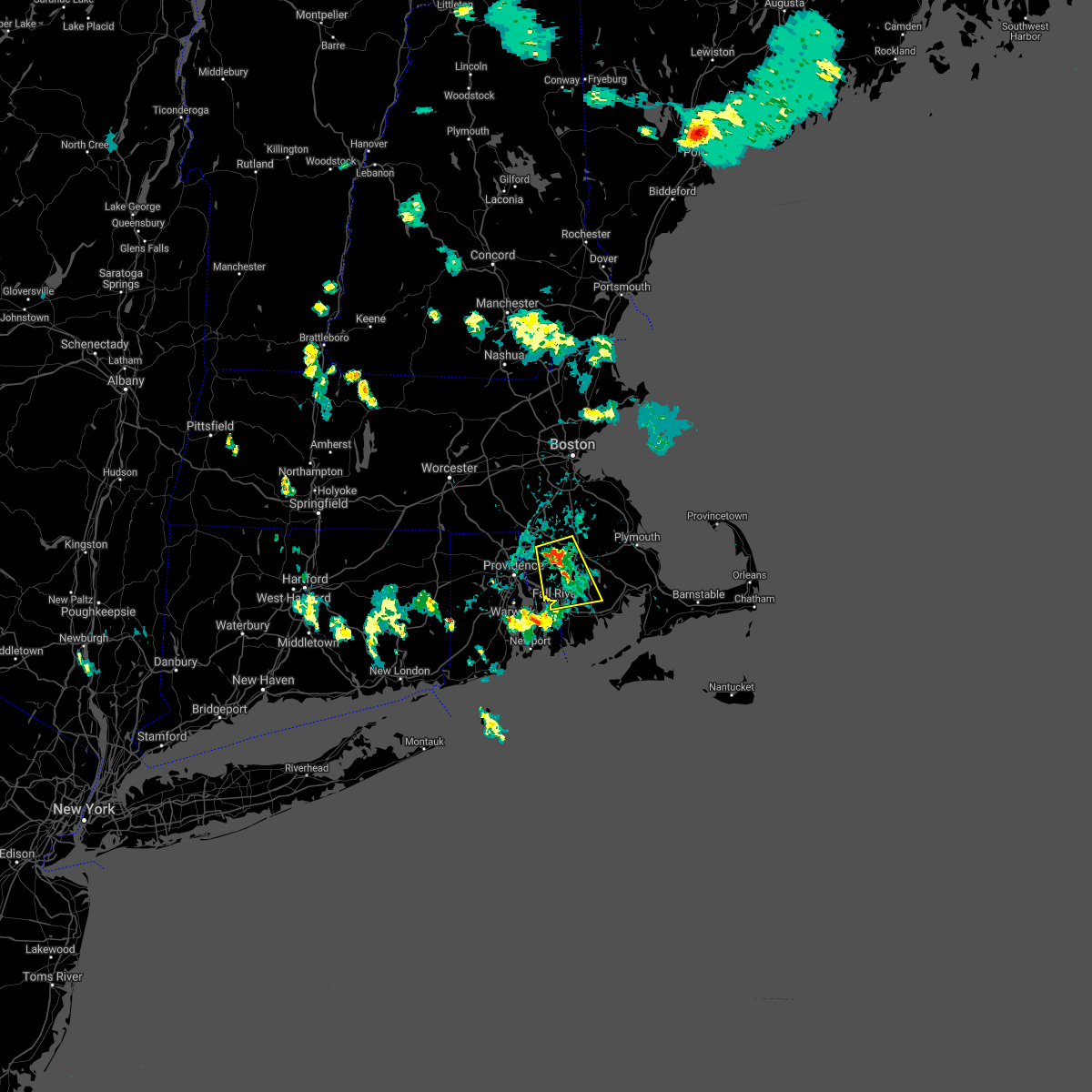 At 608 pm edt, a severe thunderstorm was located over dighton, or near taunton, moving south at 15 mph (radar indicated). Hazards include 60 mph wind gusts and quarter size hail. Expect wind damage to trees and power lines. Minor hail damage to vehicles is possible. At 608 pm edt, a severe thunderstorm was located over dighton, or near taunton, moving south at 15 mph (radar indicated). Hazards include 60 mph wind gusts and quarter size hail. Expect wind damage to trees and power lines. Minor hail damage to vehicles is possible.
|
| 7/17/2021 6:05 PM EDT |
 At 604 pm edt, a severe thunderstorm was located over east providence, moving east at 15 mph (radar indicated). Hazards include 60 mph wind gusts and quarter size hail. Expect wind damage to trees and power lines. Minor hail damage to vehicles is possible. At 604 pm edt, a severe thunderstorm was located over east providence, moving east at 15 mph (radar indicated). Hazards include 60 mph wind gusts and quarter size hail. Expect wind damage to trees and power lines. Minor hail damage to vehicles is possible.
|
| 7/6/2021 6:41 PM EDT |
 The severe thunderstorm warning for south central norfolk, northwestern bristol, washington, west central newport, kent, southeastern providence and bristol counties will expire at 645 pm edt, the storms which prompted the warning have weakened below severe limits, and no longer pose an immediate threat to life or property. therefore, the warning will be allowed to expire. however gusty winds and heavy rain are still possible with these thunderstorms. a severe thunderstorm watch remains in effect until 800 pm edt for eastern and southeastern massachusetts, and rhode island. The severe thunderstorm warning for south central norfolk, northwestern bristol, washington, west central newport, kent, southeastern providence and bristol counties will expire at 645 pm edt, the storms which prompted the warning have weakened below severe limits, and no longer pose an immediate threat to life or property. therefore, the warning will be allowed to expire. however gusty winds and heavy rain are still possible with these thunderstorms. a severe thunderstorm watch remains in effect until 800 pm edt for eastern and southeastern massachusetts, and rhode island.
|
| 7/6/2021 6:35 PM EDT |
 At 635 pm edt, severe thunderstorms were located along a line extending from near wrentham to near norwich, moving southeast at 25 mph (radar indicated). Hazards include 60 mph wind gusts. Expect damage to trees and power lines. Locations impacted include, providence, fall river, warwick, cranston, pawtucket, taunton, east providence, coventry, cumberland, north providence, south kingstown, west warwick, johnston, north attleborough, north kingstown, bristol, attleboro, mansfield, westerly and smithfield. At 635 pm edt, severe thunderstorms were located along a line extending from near wrentham to near norwich, moving southeast at 25 mph (radar indicated). Hazards include 60 mph wind gusts. Expect damage to trees and power lines. Locations impacted include, providence, fall river, warwick, cranston, pawtucket, taunton, east providence, coventry, cumberland, north providence, south kingstown, west warwick, johnston, north attleborough, north kingstown, bristol, attleboro, mansfield, westerly and smithfield.
|
| 7/6/2021 6:21 PM EDT |
 At 620 pm edt, severe thunderstorms were located along a line extending from franklin to near jewett city connecticut, moving southeast at 25 mph (radar indicated). Hazards include 60 mph wind gusts. Expect damage to trees and power lines. Locations impacted include, providence, fall river, warwick, cranston, pawtucket, taunton, east providence, woonsocket, coventry, cumberland, north providence, franklin, south kingstown, west warwick, johnston, north attleborough, north kingstown, windham, bristol and plainfield. At 620 pm edt, severe thunderstorms were located along a line extending from franklin to near jewett city connecticut, moving southeast at 25 mph (radar indicated). Hazards include 60 mph wind gusts. Expect damage to trees and power lines. Locations impacted include, providence, fall river, warwick, cranston, pawtucket, taunton, east providence, woonsocket, coventry, cumberland, north providence, franklin, south kingstown, west warwick, johnston, north attleborough, north kingstown, windham, bristol and plainfield.
|
| 7/6/2021 5:52 PM EDT |
 At 552 pm edt, severe thunderstorms were located along a line extending from near holliston to willimantic, moving southeast at 25 mph (radar indicated). Hazards include 60 mph wind gusts and penny size hail. expect damage to trees and power lines At 552 pm edt, severe thunderstorms were located along a line extending from near holliston to willimantic, moving southeast at 25 mph (radar indicated). Hazards include 60 mph wind gusts and penny size hail. expect damage to trees and power lines
|
| 6/30/2021 8:31 PM EDT |
 At 831 pm edt, severe thunderstorms were located along a line extending from walpole to rehoboth, moving east at 35 mph (radar indicated). Hazards include 60 mph wind gusts. expect damage to trees and power lines At 831 pm edt, severe thunderstorms were located along a line extending from walpole to rehoboth, moving east at 35 mph (radar indicated). Hazards include 60 mph wind gusts. expect damage to trees and power lines
|
| 6/19/2021 4:35 PM EDT |
 At 435 pm edt, a severe thunderstorm was located near west warwick, moving east at 35 mph (radar indicated). Hazards include 60 mph wind gusts. expect damage to trees and power lines At 435 pm edt, a severe thunderstorm was located near west warwick, moving east at 35 mph (radar indicated). Hazards include 60 mph wind gusts. expect damage to trees and power lines
|
| 11/15/2020 10:51 PM EST |
 At 1050 pm est, severe thunderstorms were located along a line extending from near burrillville to near richmond to 7 miles southeast of montauk point, moving east at 45 mph (radar indicated). Hazards include 60 mph wind gusts. Expect damage to trees and power lines. Locations impacted include, providence, new bedford, brockton, fall river, warwick, cranston, pawtucket, taunton, east providence, woonsocket, coventry, dartmouth, cumberland, north providence, franklin, south kingstown, west warwick, johnston, north attleborough and stoughton. At 1050 pm est, severe thunderstorms were located along a line extending from near burrillville to near richmond to 7 miles southeast of montauk point, moving east at 45 mph (radar indicated). Hazards include 60 mph wind gusts. Expect damage to trees and power lines. Locations impacted include, providence, new bedford, brockton, fall river, warwick, cranston, pawtucket, taunton, east providence, woonsocket, coventry, dartmouth, cumberland, north providence, franklin, south kingstown, west warwick, johnston, north attleborough and stoughton.
|
| 11/15/2020 10:24 PM EST |
 At 1024 pm est, severe thunderstorms were located along a line extending from near southbridge to preston to gardner`s island, moving east at 45 mph (radar indicated). Hazards include 60 mph wind gusts. expect damage to trees and power lines At 1024 pm est, severe thunderstorms were located along a line extending from near southbridge to preston to gardner`s island, moving east at 45 mph (radar indicated). Hazards include 60 mph wind gusts. expect damage to trees and power lines
|
| 10/7/2020 6:40 PM EDT |
 The severe thunderstorm warning for southeastern windham, central norfolk, southeastern worcester, plymouth, bristol, northeastern washington, northern newport, kent, providence and bristol counties will expire at 645 pm edt, the storms which prompted the warning have moved out of the area. therefore, the warning will be allowed to expire. The severe thunderstorm warning for southeastern windham, central norfolk, southeastern worcester, plymouth, bristol, northeastern washington, northern newport, kent, providence and bristol counties will expire at 645 pm edt, the storms which prompted the warning have moved out of the area. therefore, the warning will be allowed to expire.
|
| 10/7/2020 6:36 PM EDT |
 At 635 pm edt, severe thunderstorms were located along a line extending from 18 miles north of provincetown to near plymouth to near somerset, moving east at 60 mph (radar indicated). Hazards include 60 mph wind gusts. expect damage to trees and power lines At 635 pm edt, severe thunderstorms were located along a line extending from 18 miles north of provincetown to near plymouth to near somerset, moving east at 60 mph (radar indicated). Hazards include 60 mph wind gusts. expect damage to trees and power lines
|
| 10/7/2020 6:03 PM EDT |
 At 602 pm edt, severe thunderstorms were located along a line extending from canton to near killingly, moving southeast at 55 mph (radar indicated). Hazards include 60 mph wind gusts. expect damage to trees and power lines At 602 pm edt, severe thunderstorms were located along a line extending from canton to near killingly, moving southeast at 55 mph (radar indicated). Hazards include 60 mph wind gusts. expect damage to trees and power lines
|
| 8/27/2020 2:30 PM EDT |
 At 229 pm edt, severe thunderstorms were located along a line extending from blackstone to thompson, moving southeast at 60 mph (radar indicated). Hazards include 60 mph wind gusts. Expect damage to trees and power lines. Locations impacted include, providence, new bedford, fall river, warwick, cranston, pawtucket, plymouth, taunton, east providence, woonsocket, dartmouth, cumberland, north providence, franklin, west warwick, johnston, north attleborough, milford, bristol and marion. At 229 pm edt, severe thunderstorms were located along a line extending from blackstone to thompson, moving southeast at 60 mph (radar indicated). Hazards include 60 mph wind gusts. Expect damage to trees and power lines. Locations impacted include, providence, new bedford, fall river, warwick, cranston, pawtucket, plymouth, taunton, east providence, woonsocket, dartmouth, cumberland, north providence, franklin, west warwick, johnston, north attleborough, milford, bristol and marion.
|
| 8/27/2020 2:24 PM EDT |
 At 224 pm edt, severe thunderstorms were located along a line extending from near uxbridge to near dudley, moving southeast at 60 mph (radar indicated). Hazards include 60 mph wind gusts. expect damage to trees and power lines At 224 pm edt, severe thunderstorms were located along a line extending from near uxbridge to near dudley, moving southeast at 60 mph (radar indicated). Hazards include 60 mph wind gusts. expect damage to trees and power lines
|
| 8/22/2020 5:43 PM EDT |
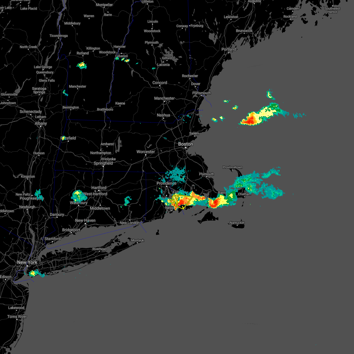 At 542 pm edt, a severe thunderstorm was located over westport, or 9 miles west of dartmouth, moving southeast at 25 mph (radar indicated). Hazards include 60 mph wind gusts and quarter size hail. Expect wind damage to trees and power lines. minor hail damage to vehicles is possible. Locations impacted include, new bedford, fall river, dartmouth, bristol, portsmouth, tiverton, westport, little compton and prudence island. At 542 pm edt, a severe thunderstorm was located over westport, or 9 miles west of dartmouth, moving southeast at 25 mph (radar indicated). Hazards include 60 mph wind gusts and quarter size hail. Expect wind damage to trees and power lines. minor hail damage to vehicles is possible. Locations impacted include, new bedford, fall river, dartmouth, bristol, portsmouth, tiverton, westport, little compton and prudence island.
|
| 8/22/2020 5:31 PM EDT |
 At 531 pm edt, a severe thunderstorm was located over tiverton, or near bristol, moving southeast at 30 mph (radar indicated). Hazards include 60 mph wind gusts and quarter size hail. Expect wind damage to trees and power lines. minor hail damage to vehicles is possible. Locations impacted include, new bedford, fall river, warwick, east providence, dartmouth, north kingstown, bristol, somerset, portsmouth, barrington, swansea, tiverton, westport, warren, acushnet, little compton and prudence island. At 531 pm edt, a severe thunderstorm was located over tiverton, or near bristol, moving southeast at 30 mph (radar indicated). Hazards include 60 mph wind gusts and quarter size hail. Expect wind damage to trees and power lines. minor hail damage to vehicles is possible. Locations impacted include, new bedford, fall river, warwick, east providence, dartmouth, north kingstown, bristol, somerset, portsmouth, barrington, swansea, tiverton, westport, warren, acushnet, little compton and prudence island.
|
| 8/22/2020 5:09 PM EDT |
 At 509 pm edt, a severe thunderstorm was located over warwick, moving southeast at 30 mph (radar indicated). Hazards include 60 mph wind gusts and quarter size hail. Expect wind damage to trees and power lines. Minor hail damage to vehicles is possible. At 509 pm edt, a severe thunderstorm was located over warwick, moving southeast at 30 mph (radar indicated). Hazards include 60 mph wind gusts and quarter size hail. Expect wind damage to trees and power lines. Minor hail damage to vehicles is possible.
|
| 7/14/2020 3:00 PM EDT |
 At 259 pm edt, severe thunderstorms were located along a line extending from warwick to narragansett, moving east at 5 mph (radar indicated). Hazards include 60 mph wind gusts and half dollar size hail. torrential rainfall is also occurring resulting in possible localized flooding. Expect wind damage to trees and power lines. minor hail damage to vehicles is possible. Locations impacted include, providence, fall river, warwick, cranston, east providence, coventry, south kingstown, west warwick, north kingstown, newport, bristol, somerset, portsmouth, barrington, middletown, narragansett, swansea, tiverton, seekonk and east greenwich. At 259 pm edt, severe thunderstorms were located along a line extending from warwick to narragansett, moving east at 5 mph (radar indicated). Hazards include 60 mph wind gusts and half dollar size hail. torrential rainfall is also occurring resulting in possible localized flooding. Expect wind damage to trees and power lines. minor hail damage to vehicles is possible. Locations impacted include, providence, fall river, warwick, cranston, east providence, coventry, south kingstown, west warwick, north kingstown, newport, bristol, somerset, portsmouth, barrington, middletown, narragansett, swansea, tiverton, seekonk and east greenwich.
|
| 7/14/2020 2:37 PM EDT |
 At 237 pm edt, severe thunderstorms were located along a line extending from near west warwick to narragansett, moving east at 5 mph (radar indicated). Hazards include 60 mph wind gusts and quarter size hail. Expect wind damage to trees and power lines. Minor hail damage to vehicles is possible. At 237 pm edt, severe thunderstorms were located along a line extending from near west warwick to narragansett, moving east at 5 mph (radar indicated). Hazards include 60 mph wind gusts and quarter size hail. Expect wind damage to trees and power lines. Minor hail damage to vehicles is possible.
|
| 7/14/2020 2:18 PM EDT |
 At 218 pm edt, severe thunderstorms were located along a line extending from near north smithfield to west warwick, moving southeast at 15 mph (radar indicated). Hazards include 60 mph wind gusts and quarter size hail. Expect wind damage to trees and power lines. minor hail damage to vehicles is possible. Locations impacted include, providence, fall river, warwick, cranston, pawtucket, east providence, woonsocket, coventry, cumberland, north providence, west warwick, johnston, north kingstown, bristol, attleboro, smithfield, lincoln, central falls, somerset and barrington. At 218 pm edt, severe thunderstorms were located along a line extending from near north smithfield to west warwick, moving southeast at 15 mph (radar indicated). Hazards include 60 mph wind gusts and quarter size hail. Expect wind damage to trees and power lines. minor hail damage to vehicles is possible. Locations impacted include, providence, fall river, warwick, cranston, pawtucket, east providence, woonsocket, coventry, cumberland, north providence, west warwick, johnston, north kingstown, bristol, attleboro, smithfield, lincoln, central falls, somerset and barrington.
|
| 7/14/2020 1:46 PM EDT |
 At 146 pm edt, a severe thunderstorm was located over smithfield, or near johnston, moving southeast at 15 mph (radar indicated). Hazards include 60 mph wind gusts and quarter size hail. Expect wind damage to trees and power lines. Minor hail damage to vehicles is possible. At 146 pm edt, a severe thunderstorm was located over smithfield, or near johnston, moving southeast at 15 mph (radar indicated). Hazards include 60 mph wind gusts and quarter size hail. Expect wind damage to trees and power lines. Minor hail damage to vehicles is possible.
|
| 4/9/2020 3:32 PM EDT |
 At 331 pm edt, severe thunderstorms were located along a line extending from near exeter to hither hills state park, moving east at 60 mph (radar indicated). Hazards include 60 mph wind gusts. expect damage to trees and power lines At 331 pm edt, severe thunderstorms were located along a line extending from near exeter to hither hills state park, moving east at 60 mph (radar indicated). Hazards include 60 mph wind gusts. expect damage to trees and power lines
|
| 3/29/2020 10:08 PM EDT |
 At 1007 pm edt, a severe thunderstorm was located over rochester, or near marion, moving northeast at 55 mph (radar indicated). Hazards include quarter size hail. Minor hail damage to vehicles is possible. Locations impacted include, new bedford, fall river, plymouth, dartmouth, marion, middleborough, wareham, fairhaven, carver, lakeville, acushnet, freetown, mattapoisett and rochester. At 1007 pm edt, a severe thunderstorm was located over rochester, or near marion, moving northeast at 55 mph (radar indicated). Hazards include quarter size hail. Minor hail damage to vehicles is possible. Locations impacted include, new bedford, fall river, plymouth, dartmouth, marion, middleborough, wareham, fairhaven, carver, lakeville, acushnet, freetown, mattapoisett and rochester.
|
| 3/29/2020 9:54 PM EDT |
 At 954 pm edt, a severe thunderstorm was located near westport, or near fall river, moving northeast at 55 mph (radar indicated). Hazards include half dollar size hail. Minor hail damage to vehicles is possible. Locations impacted include, new bedford, fall river, plymouth, dartmouth, marion, middleborough, wareham, portsmouth, fairhaven, tiverton, westport, carver, lakeville, acushnet, freetown, mattapoisett, rochester and little compton. At 954 pm edt, a severe thunderstorm was located near westport, or near fall river, moving northeast at 55 mph (radar indicated). Hazards include half dollar size hail. Minor hail damage to vehicles is possible. Locations impacted include, new bedford, fall river, plymouth, dartmouth, marion, middleborough, wareham, portsmouth, fairhaven, tiverton, westport, carver, lakeville, acushnet, freetown, mattapoisett, rochester and little compton.
|
| 3/29/2020 9:52 PM EDT |
 At 952 pm edt, a severe thunderstorm was located over westport, or 7 miles south of fall river, moving northeast at 55 mph (radar indicated). Hazards include quarter size hail. minor hail damage to vehicles is possible At 952 pm edt, a severe thunderstorm was located over westport, or 7 miles south of fall river, moving northeast at 55 mph (radar indicated). Hazards include quarter size hail. minor hail damage to vehicles is possible
|
| 8/8/2019 1:39 AM EDT |
 At 139 am edt, a severe thunderstorm was located near fall river, moving northeast at 30 mph (radar indicated). Hazards include 60 mph wind gusts. Expect damage to trees and power lines. Locations impacted include, new bedford, fall river, dartmouth, fairhaven, tiverton, westport, acushnet, freetown, berkley and little compton. At 139 am edt, a severe thunderstorm was located near fall river, moving northeast at 30 mph (radar indicated). Hazards include 60 mph wind gusts. Expect damage to trees and power lines. Locations impacted include, new bedford, fall river, dartmouth, fairhaven, tiverton, westport, acushnet, freetown, berkley and little compton.
|
| 8/8/2019 1:39 AM EDT |
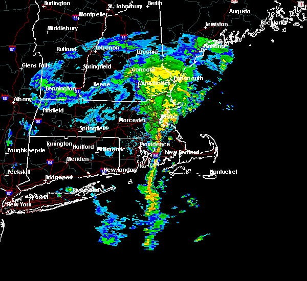 At 139 am edt, a severe thunderstorm was located near fall river, moving northeast at 30 mph (radar indicated). Hazards include 60 mph wind gusts. Expect damage to trees and power lines. Locations impacted include, new bedford, fall river, dartmouth, fairhaven, tiverton, westport, acushnet, freetown, berkley and little compton. At 139 am edt, a severe thunderstorm was located near fall river, moving northeast at 30 mph (radar indicated). Hazards include 60 mph wind gusts. Expect damage to trees and power lines. Locations impacted include, new bedford, fall river, dartmouth, fairhaven, tiverton, westport, acushnet, freetown, berkley and little compton.
|
| 8/8/2019 1:21 AM EDT |
 At 121 am edt, a severe thunderstorm was located near tiverton, or 8 miles southeast of bristol, moving northeast at 30 mph (radar indicated). Hazards include 60 mph wind gusts. Expect damage to trees and power lines. Locations impacted include, new bedford, fall river, taunton, dartmouth, bristol, norton, somerset, portsmouth, middletown, fairhaven, swansea, tiverton, westport, rehoboth, warren, acushnet, freetown, dighton, berkley and little compton. At 121 am edt, a severe thunderstorm was located near tiverton, or 8 miles southeast of bristol, moving northeast at 30 mph (radar indicated). Hazards include 60 mph wind gusts. Expect damage to trees and power lines. Locations impacted include, new bedford, fall river, taunton, dartmouth, bristol, norton, somerset, portsmouth, middletown, fairhaven, swansea, tiverton, westport, rehoboth, warren, acushnet, freetown, dighton, berkley and little compton.
|
| 8/8/2019 1:21 AM EDT |
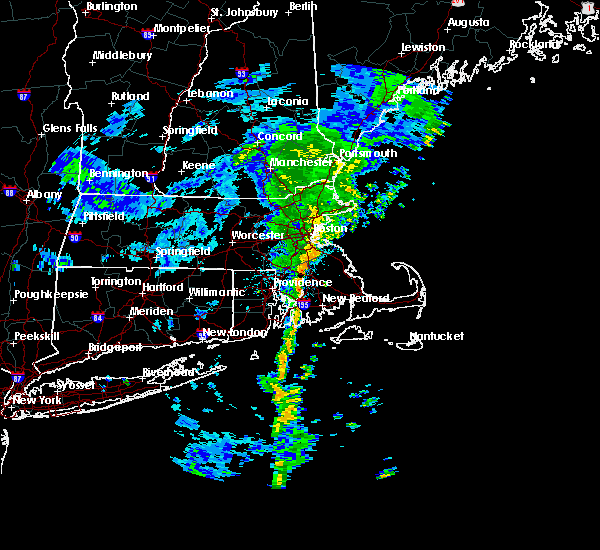 At 121 am edt, a severe thunderstorm was located near tiverton, or 8 miles southeast of bristol, moving northeast at 30 mph (radar indicated). Hazards include 60 mph wind gusts. Expect damage to trees and power lines. Locations impacted include, new bedford, fall river, taunton, dartmouth, bristol, norton, somerset, portsmouth, middletown, fairhaven, swansea, tiverton, westport, rehoboth, warren, acushnet, freetown, dighton, berkley and little compton. At 121 am edt, a severe thunderstorm was located near tiverton, or 8 miles southeast of bristol, moving northeast at 30 mph (radar indicated). Hazards include 60 mph wind gusts. Expect damage to trees and power lines. Locations impacted include, new bedford, fall river, taunton, dartmouth, bristol, norton, somerset, portsmouth, middletown, fairhaven, swansea, tiverton, westport, rehoboth, warren, acushnet, freetown, dighton, berkley and little compton.
|
| 8/8/2019 1:00 AM EDT |
 At 100 am edt, a severe thunderstorm was located near newport, moving northeast at 30 mph (radar indicated). Hazards include 60 mph wind gusts. expect damage to trees and power lines At 100 am edt, a severe thunderstorm was located near newport, moving northeast at 30 mph (radar indicated). Hazards include 60 mph wind gusts. expect damage to trees and power lines
|
| 8/4/2019 5:55 PM EDT |
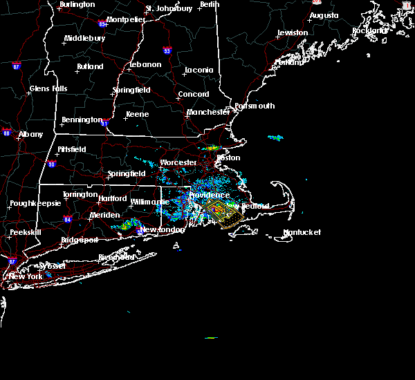 At 553 pm edt, a severe thunderstorm was located over new bedford, moving southeast at 15 mph (trained weather spotters have reported wind damage with several trees knocked down in the attleboro, dighton and rehoboth areas as the storms moved through earlier). Hazards include 60 mph wind gusts and quarter size hail. Hail damage to vehicles is possible. expect damage to trees and power lines. Locations impacted include, new bedford, fall river, dartmouth, fairhaven, westport, acushnet, freetown, mattapoisett and rochester. At 553 pm edt, a severe thunderstorm was located over new bedford, moving southeast at 15 mph (trained weather spotters have reported wind damage with several trees knocked down in the attleboro, dighton and rehoboth areas as the storms moved through earlier). Hazards include 60 mph wind gusts and quarter size hail. Hail damage to vehicles is possible. expect damage to trees and power lines. Locations impacted include, new bedford, fall river, dartmouth, fairhaven, westport, acushnet, freetown, mattapoisett and rochester.
|
| 8/4/2019 5:42 PM EDT |
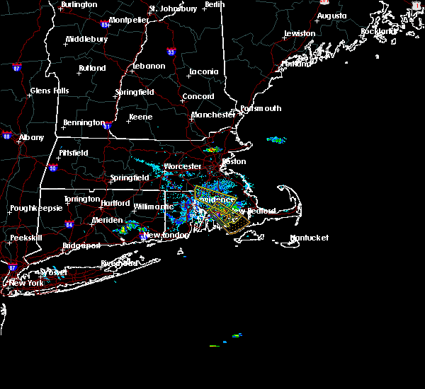 At 542 pm edt, a severe thunderstorm was located near fall river, moving southeast at 15 mph (radar indicated). Hazards include 60 mph wind gusts and quarter size hail. Hail damage to vehicles is possible. expect damage to trees and power lines. Locations impacted include, new bedford, fall river, dartmouth, fairhaven, westport, lakeville, acushnet, freetown, mattapoisett and rochester. At 542 pm edt, a severe thunderstorm was located near fall river, moving southeast at 15 mph (radar indicated). Hazards include 60 mph wind gusts and quarter size hail. Hail damage to vehicles is possible. expect damage to trees and power lines. Locations impacted include, new bedford, fall river, dartmouth, fairhaven, westport, lakeville, acushnet, freetown, mattapoisett and rochester.
|
| 8/4/2019 5:27 PM EDT |
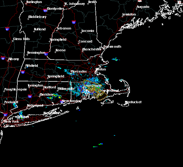 At 517 pm edt, a severe thunderstorm was located over dighton, or near taunton, moving southeast at 20 mph (radar indicated). Hazards include 60 mph wind gusts and quarter size hail. Hail damage to vehicles is possible. Expect damage to trees and power lines. At 517 pm edt, a severe thunderstorm was located over dighton, or near taunton, moving southeast at 20 mph (radar indicated). Hazards include 60 mph wind gusts and quarter size hail. Hail damage to vehicles is possible. Expect damage to trees and power lines.
|
| 8/4/2019 5:24 PM EDT |
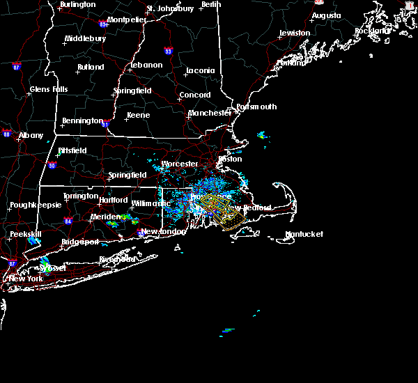 At 523 pm edt, a severe thunderstorm was located over freetown, or near fall river, moving southeast at 20 mph (trained weather spotters reported trees and wires down over the attleboro area as the storm moved through earlier). Hazards include 60 mph wind gusts and quarter size hail. Hail damage to vehicles is possible. expect damage to trees and power lines. Locations impacted include, new bedford, fall river, taunton, dartmouth, lakeville, acushnet, freetown, dighton, berkley and rochester. At 523 pm edt, a severe thunderstorm was located over freetown, or near fall river, moving southeast at 20 mph (trained weather spotters reported trees and wires down over the attleboro area as the storm moved through earlier). Hazards include 60 mph wind gusts and quarter size hail. Hail damage to vehicles is possible. expect damage to trees and power lines. Locations impacted include, new bedford, fall river, taunton, dartmouth, lakeville, acushnet, freetown, dighton, berkley and rochester.
|
| 8/4/2019 5:17 PM EDT |
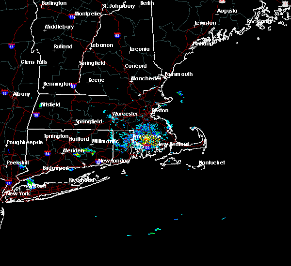 The national weather service in boston/norton has issued a * severe thunderstorm warning for. central bristol county in southeastern massachusetts. southwestern plymouth county in southeastern massachusetts. until 615 pm edt. At 517 pm edt, a severe thunderstorm was located over dighton, or. The national weather service in boston/norton has issued a * severe thunderstorm warning for. central bristol county in southeastern massachusetts. southwestern plymouth county in southeastern massachusetts. until 615 pm edt. At 517 pm edt, a severe thunderstorm was located over dighton, or.
|
| 8/4/2019 5:12 PM EDT |
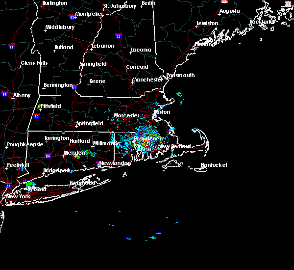 At 510 pm edt, a severe thunderstorm was located over berkley, or near taunton, moving southeast at 20 mph (trained weather spotters reported several downed trees in the attleboro and north attleboro areas as the storms went through the region earlier). Hazards include 60 mph wind gusts and quarter size hail. Hail damage to vehicles is possible. expect damage to trees and power lines. Locations impacted include, new bedford, fall river, taunton, dartmouth, middleborough, swansea, rehoboth, lakeville, acushnet, freetown, dighton, berkley and rochester. At 510 pm edt, a severe thunderstorm was located over berkley, or near taunton, moving southeast at 20 mph (trained weather spotters reported several downed trees in the attleboro and north attleboro areas as the storms went through the region earlier). Hazards include 60 mph wind gusts and quarter size hail. Hail damage to vehicles is possible. expect damage to trees and power lines. Locations impacted include, new bedford, fall river, taunton, dartmouth, middleborough, swansea, rehoboth, lakeville, acushnet, freetown, dighton, berkley and rochester.
|
| 8/4/2019 5:02 PM EDT |
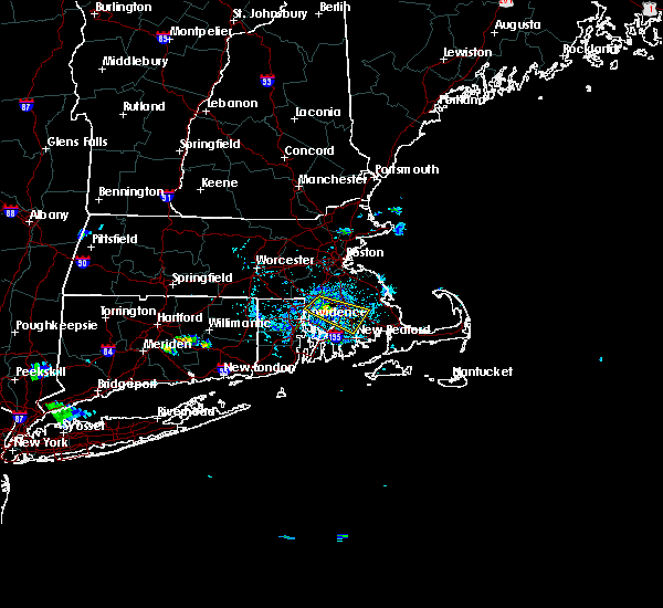 At 501 pm edt, a severe thunderstorm was located over taunton, moving southeast at 30 mph (trained weather spotters reported several trees down in the attleboro area from strong wind gusts). Hazards include 60 mph wind gusts and quarter size hail. Hail damage to vehicles is possible. expect damage to trees and power lines. Locations impacted include, new bedford, fall river, taunton, dartmouth, bridgewater, attleboro, middleborough, norton, swansea, seekonk, raynham, rehoboth, lakeville, acushnet, freetown, dighton, berkley and rochester. At 501 pm edt, a severe thunderstorm was located over taunton, moving southeast at 30 mph (trained weather spotters reported several trees down in the attleboro area from strong wind gusts). Hazards include 60 mph wind gusts and quarter size hail. Hail damage to vehicles is possible. expect damage to trees and power lines. Locations impacted include, new bedford, fall river, taunton, dartmouth, bridgewater, attleboro, middleborough, norton, swansea, seekonk, raynham, rehoboth, lakeville, acushnet, freetown, dighton, berkley and rochester.
|
| 8/4/2019 4:52 PM EDT |
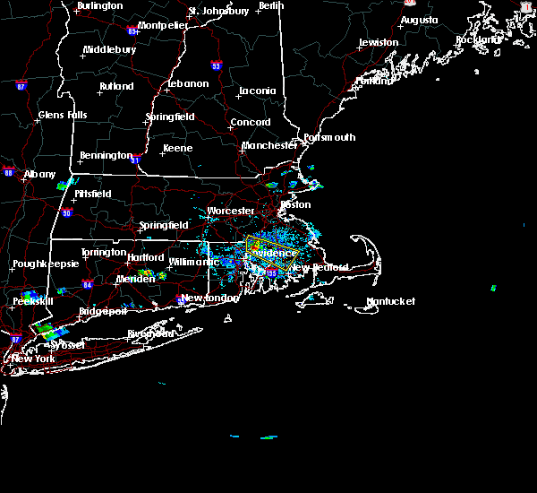 At 451 pm edt, a severe thunderstorm was located near attleboro, or near north attleborough, moving southeast at 30 mph (trained weather spotters reported at least 3 trees down in north attleboro from strong winds). Hazards include 60 mph wind gusts and quarter size hail. Hail damage to vehicles is possible. expect damage to trees and power lines. Locations impacted include, new bedford, fall river, taunton, dartmouth, north attleborough, bridgewater, attleboro, mansfield, middleborough, norton, seekonk, raynham, rehoboth, lakeville, acushnet, freetown, dighton, berkley and rochester. At 451 pm edt, a severe thunderstorm was located near attleboro, or near north attleborough, moving southeast at 30 mph (trained weather spotters reported at least 3 trees down in north attleboro from strong winds). Hazards include 60 mph wind gusts and quarter size hail. Hail damage to vehicles is possible. expect damage to trees and power lines. Locations impacted include, new bedford, fall river, taunton, dartmouth, north attleborough, bridgewater, attleboro, mansfield, middleborough, norton, seekonk, raynham, rehoboth, lakeville, acushnet, freetown, dighton, berkley and rochester.
|
| 8/4/2019 4:39 PM EDT |
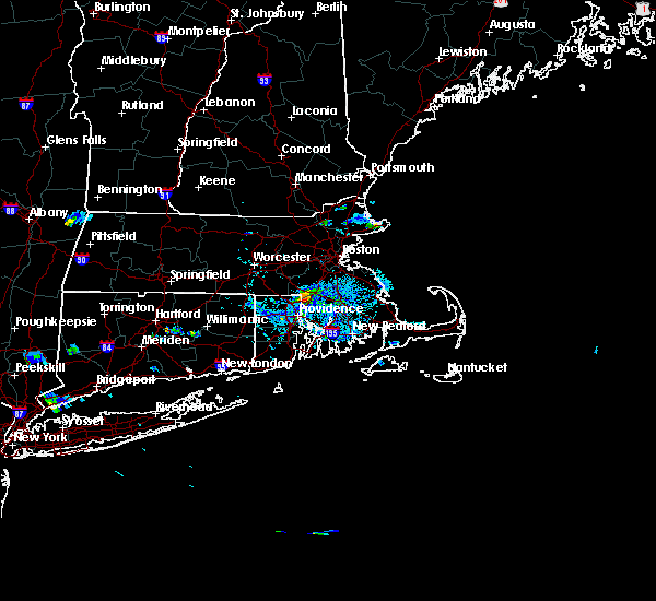 At 439 pm edt, a severe thunderstorm was located over north attleborough, moving southeast at 30 mph (radar indicated). Hazards include 60 mph wind gusts and quarter size hail. Hail damage to vehicles is possible. Expect damage to trees and power lines. At 439 pm edt, a severe thunderstorm was located over north attleborough, moving southeast at 30 mph (radar indicated). Hazards include 60 mph wind gusts and quarter size hail. Hail damage to vehicles is possible. Expect damage to trees and power lines.
|
| 7/22/2019 9:38 PM EDT |
 The severe thunderstorm warning for southeastern bristol and eastern newport counties will expire at 945 pm edt, the storm which prompted the warning has moved out of the area. therefore, the warning will be allowed to expire. however heavy rain is still possible with this thunderstorm. a severe thunderstorm watch remains in effect until 1000 pm edt for rhode island. The severe thunderstorm warning for southeastern bristol and eastern newport counties will expire at 945 pm edt, the storm which prompted the warning has moved out of the area. therefore, the warning will be allowed to expire. however heavy rain is still possible with this thunderstorm. a severe thunderstorm watch remains in effect until 1000 pm edt for rhode island.
|
| 7/22/2019 9:38 PM EDT |
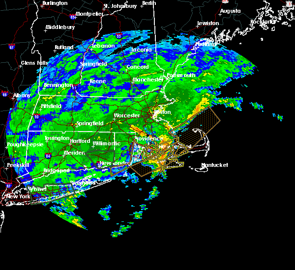 The severe thunderstorm warning for southeastern bristol and eastern newport counties will expire at 945 pm edt, the storm which prompted the warning has moved out of the area. therefore, the warning will be allowed to expire. however heavy rain is still possible with this thunderstorm. a severe thunderstorm watch remains in effect until 1000 pm edt for rhode island. The severe thunderstorm warning for southeastern bristol and eastern newport counties will expire at 945 pm edt, the storm which prompted the warning has moved out of the area. therefore, the warning will be allowed to expire. however heavy rain is still possible with this thunderstorm. a severe thunderstorm watch remains in effect until 1000 pm edt for rhode island.
|
| 7/22/2019 9:31 PM EDT |
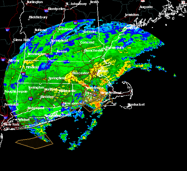 At 930 pm edt, a severe thunderstorm was located over new bedford, moving northeast at 30 mph (radar indicated). Hazards include 60 mph wind gusts. Expect damage to trees and power lines. Locations impacted include, new bedford, fall river, dartmouth, fairhaven, tiverton, westport, acushnet, freetown and little compton. At 930 pm edt, a severe thunderstorm was located over new bedford, moving northeast at 30 mph (radar indicated). Hazards include 60 mph wind gusts. Expect damage to trees and power lines. Locations impacted include, new bedford, fall river, dartmouth, fairhaven, tiverton, westport, acushnet, freetown and little compton.
|
| 7/22/2019 9:24 PM EDT |
 At 924 pm edt, a severe thunderstorm was located near new bedford, moving northeast at 30 mph (radar indicated). Hazards include 60 mph wind gusts. Expect damage to trees and power lines. Locations impacted include, new bedford, fall river, dartmouth, north kingstown, newport, bristol, portsmouth, middletown, fairhaven, tiverton, westport, acushnet, freetown, jamestown, little compton and prudence island. At 924 pm edt, a severe thunderstorm was located near new bedford, moving northeast at 30 mph (radar indicated). Hazards include 60 mph wind gusts. Expect damage to trees and power lines. Locations impacted include, new bedford, fall river, dartmouth, north kingstown, newport, bristol, portsmouth, middletown, fairhaven, tiverton, westport, acushnet, freetown, jamestown, little compton and prudence island.
|
| 7/22/2019 9:04 PM EDT |
 At 903 pm edt, a severe thunderstorm was located over little compton, or 9 miles northeast of newport, moving northeast at 30 mph (radar indicated). Hazards include 60 mph wind gusts. Expect damage to trees and power lines. Locations impacted include, new bedford, fall river, dartmouth, north kingstown, newport, bristol, portsmouth, middletown, fairhaven, tiverton, westport, acushnet, freetown, jamestown, little compton and prudence island. At 903 pm edt, a severe thunderstorm was located over little compton, or 9 miles northeast of newport, moving northeast at 30 mph (radar indicated). Hazards include 60 mph wind gusts. Expect damage to trees and power lines. Locations impacted include, new bedford, fall river, dartmouth, north kingstown, newport, bristol, portsmouth, middletown, fairhaven, tiverton, westport, acushnet, freetown, jamestown, little compton and prudence island.
|
| 7/22/2019 8:40 PM EDT |
 At 839 pm edt, a severe thunderstorm was located near newport, moving northeast at 30 mph (radar indicated). Hazards include 60 mph wind gusts. expect damage to trees and power lines At 839 pm edt, a severe thunderstorm was located near newport, moving northeast at 30 mph (radar indicated). Hazards include 60 mph wind gusts. expect damage to trees and power lines
|
| 6/29/2019 5:05 PM EDT |
 The severe thunderstorm warning for southeastern bristol, newport and southeastern bristol counties will expire at 515 pm edt, the storm which prompted the warning has weakened below severe limits, and no longer poses an immediate threat to life or property. therefore, the warning will be allowed to expire. however heavy rain is still possible with this thunderstorm. The severe thunderstorm warning for southeastern bristol, newport and southeastern bristol counties will expire at 515 pm edt, the storm which prompted the warning has weakened below severe limits, and no longer poses an immediate threat to life or property. therefore, the warning will be allowed to expire. however heavy rain is still possible with this thunderstorm.
|
| 6/29/2019 4:43 PM EDT |
 At 442 pm edt, a severe thunderstorm was located over tiverton, or near bristol, moving southeast at 30 mph (radar indicated). Hazards include 60 mph wind gusts and penny size hail. Expect damage to trees and power lines. Locations impacted include, new bedford, fall river, dartmouth, bristol, portsmouth, middletown, tiverton, westport and little compton. At 442 pm edt, a severe thunderstorm was located over tiverton, or near bristol, moving southeast at 30 mph (radar indicated). Hazards include 60 mph wind gusts and penny size hail. Expect damage to trees and power lines. Locations impacted include, new bedford, fall river, dartmouth, bristol, portsmouth, middletown, tiverton, westport and little compton.
|
| 6/29/2019 4:14 PM EDT |
 At 413 pm edt, a severe thunderstorm was located near warwick, moving southeast at 20 mph (radar indicated). Hazards include 60 mph wind gusts and quarter size hail. Hail damage to vehicles is possible. Expect damage to trees and power lines. At 413 pm edt, a severe thunderstorm was located near warwick, moving southeast at 20 mph (radar indicated). Hazards include 60 mph wind gusts and quarter size hail. Hail damage to vehicles is possible. Expect damage to trees and power lines.
|
| 6/29/2019 3:43 PM EDT |
 At 342 pm edt, a severe thunderstorm was located near coventry, moving east at 25 mph (radar indicated). Hazards include 60 mph wind gusts and penny size hail. Expect damage to trees and power lines. Locations impacted include, providence, fall river, warwick, cranston, east providence, coventry, dartmouth, north providence, west warwick, johnston, north kingstown, bristol, smithfield, somerset, portsmouth, barrington, swansea, tiverton, westport and seekonk. At 342 pm edt, a severe thunderstorm was located near coventry, moving east at 25 mph (radar indicated). Hazards include 60 mph wind gusts and penny size hail. Expect damage to trees and power lines. Locations impacted include, providence, fall river, warwick, cranston, east providence, coventry, dartmouth, north providence, west warwick, johnston, north kingstown, bristol, smithfield, somerset, portsmouth, barrington, swansea, tiverton, westport and seekonk.
|
| 6/29/2019 3:21 PM EDT |
 At 320 pm edt, a severe thunderstorm was located over foster, or near coventry, moving east at 25 mph (radar indicated). Hazards include 60 mph wind gusts and penny size hail. expect damage to trees and power lines At 320 pm edt, a severe thunderstorm was located over foster, or near coventry, moving east at 25 mph (radar indicated). Hazards include 60 mph wind gusts and penny size hail. expect damage to trees and power lines
|
| 6/29/2019 3:21 PM EDT |
 The national weather service in boston/norton has issued a * severe thunderstorm warning for. eastern windham county in northern connecticut. central bristol county in southeastern massachusetts. southwestern plymouth county in southeastern massachusetts. Northeastern washington county in rhode island. The national weather service in boston/norton has issued a * severe thunderstorm warning for. eastern windham county in northern connecticut. central bristol county in southeastern massachusetts. southwestern plymouth county in southeastern massachusetts. Northeastern washington county in rhode island.
|
| 6/29/2019 3:21 PM EDT |
 At 320 pm edt, a severe thunderstorm was located over foster, or near coventry, moving east at 25 mph (radar indicated). Hazards include 60 mph wind gusts and penny size hail. expect damage to trees and power lines At 320 pm edt, a severe thunderstorm was located over foster, or near coventry, moving east at 25 mph (radar indicated). Hazards include 60 mph wind gusts and penny size hail. expect damage to trees and power lines
|
| 9/6/2017 11:00 AM EDT | Tree down on car on tuttle street in bristol county MA, 2.8 miles SSW of Fall River, MA |
| 9/6/2017 10:42 AM EDT |
 At 1041 am edt, severe thunderstorms were located along a line extending from woonsocket to dartmouth, moving northeast at 45 mph (radar indicated). Hazards include 60 mph wind gusts and penny size hail. expect damage to trees and power lines At 1041 am edt, severe thunderstorms were located along a line extending from woonsocket to dartmouth, moving northeast at 45 mph (radar indicated). Hazards include 60 mph wind gusts and penny size hail. expect damage to trees and power lines
|
| 9/6/2017 10:04 AM EDT |
 At 1003 am edt, severe thunderstorms were located along a line extending from sprague to block island, moving northeast at 55 mph (radar indicated). Hazards include 60 mph wind gusts and penny size hail. expect damage to trees and power lines At 1003 am edt, severe thunderstorms were located along a line extending from sprague to block island, moving northeast at 55 mph (radar indicated). Hazards include 60 mph wind gusts and penny size hail. expect damage to trees and power lines
|
| 7/12/2017 3:53 PM EDT |
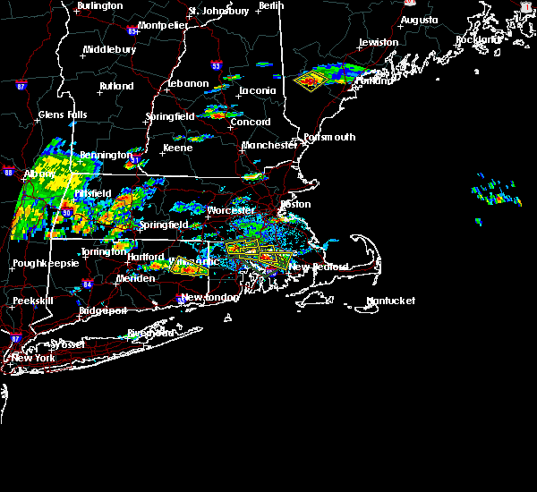 At 353 pm edt, a severe thunderstorm was located over dighton, or near taunton, moving east at 20 mph (radar indicated). Hazards include 60 mph wind gusts and quarter size hail. Hail damage to vehicles is possible. Expect damage to trees and power lines. At 353 pm edt, a severe thunderstorm was located over dighton, or near taunton, moving east at 20 mph (radar indicated). Hazards include 60 mph wind gusts and quarter size hail. Hail damage to vehicles is possible. Expect damage to trees and power lines.
|
| 7/11/2017 9:49 AM EDT |
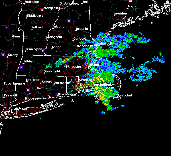 At 948 am edt, a severe thunderstorm was located near somerset, or near bristol, moving northeast at 25 mph (radar indicated). Hazards include 60 mph wind gusts. expect damage to trees and power lines At 948 am edt, a severe thunderstorm was located near somerset, or near bristol, moving northeast at 25 mph (radar indicated). Hazards include 60 mph wind gusts. expect damage to trees and power lines
|
| 7/11/2017 9:49 AM EDT |
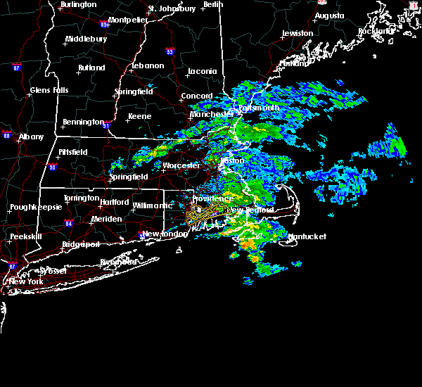 At 948 am edt, a severe thunderstorm was located near somerset, or near bristol, moving northeast at 25 mph (radar indicated). Hazards include 60 mph wind gusts. expect damage to trees and power lines At 948 am edt, a severe thunderstorm was located near somerset, or near bristol, moving northeast at 25 mph (radar indicated). Hazards include 60 mph wind gusts. expect damage to trees and power lines
|
| 7/11/2017 9:46 AM EDT |
 At 945 am edt, a severe thunderstorm was located over bristol, moving northeast at 25 mph (radar indicated). Hazards include 60 mph wind gusts. Expect damage to trees and power lines. Locations impacted include, fall river, warwick, bristol, somerset, swansea and prudence island. At 945 am edt, a severe thunderstorm was located over bristol, moving northeast at 25 mph (radar indicated). Hazards include 60 mph wind gusts. Expect damage to trees and power lines. Locations impacted include, fall river, warwick, bristol, somerset, swansea and prudence island.
|
| 7/11/2017 9:23 AM EDT |
 At 923 am edt, a severe thunderstorm was located near warwick, moving northeast at 25 mph (radar indicated). Hazards include 60 mph wind gusts. expect damage to trees and power lines At 923 am edt, a severe thunderstorm was located near warwick, moving northeast at 25 mph (radar indicated). Hazards include 60 mph wind gusts. expect damage to trees and power lines
|
| 7/11/2017 9:23 AM EDT |
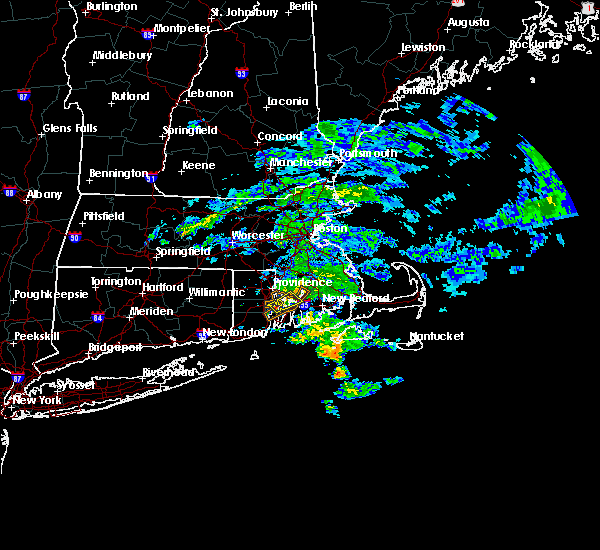 At 923 am edt, a severe thunderstorm was located near warwick, moving northeast at 25 mph (radar indicated). Hazards include 60 mph wind gusts. expect damage to trees and power lines At 923 am edt, a severe thunderstorm was located near warwick, moving northeast at 25 mph (radar indicated). Hazards include 60 mph wind gusts. expect damage to trees and power lines
|
| 8/12/2016 5:18 PM EDT |
 At 518 pm edt, severe thunderstorms were located along a line extending from pomfret to near killingly to near smithfield to central falls, moving southeast at 25 mph (radar indicated). Hazards include 60 mph wind gusts. Expect damage to roofs. siding. And trees. At 518 pm edt, severe thunderstorms were located along a line extending from pomfret to near killingly to near smithfield to central falls, moving southeast at 25 mph (radar indicated). Hazards include 60 mph wind gusts. Expect damage to roofs. siding. And trees.
|
| 7/23/2016 8:33 PM EDT |
 At 832 pm edt, a severe thunderstorm was located over new bedford, moving east at 40 mph (radar indicated). Hazards include 60 mph wind gusts and penny size hail. Expect damage to roofs. siding. And trees. At 832 pm edt, a severe thunderstorm was located over new bedford, moving east at 40 mph (radar indicated). Hazards include 60 mph wind gusts and penny size hail. Expect damage to roofs. siding. And trees.
|
| 7/23/2016 12:39 AM EDT |
 At 1235 am edt, a severe thunderstorm was located just northwest of tisbury, moving to the east-southeast at 45 mph. this storm has a history of downing trees and wires in dartmouth (trained weather spotters). Hazards include 60 mph wind gusts and penny size hail. Expect damage to roofs. siding. and trees. Locations impacted include, oak bluffs, edgartown, tisbury, aquinnah. At 1235 am edt, a severe thunderstorm was located just northwest of tisbury, moving to the east-southeast at 45 mph. this storm has a history of downing trees and wires in dartmouth (trained weather spotters). Hazards include 60 mph wind gusts and penny size hail. Expect damage to roofs. siding. and trees. Locations impacted include, oak bluffs, edgartown, tisbury, aquinnah.
|
| 7/22/2016 11:55 PM EDT |
 At 1154 pm edt, a severe thunderstorm was located over portsmouth, or near bristol, moving east at 40 mph (trained weather spotters have reported pockets of significant wind damage with this activity). Hazards include 60 mph wind gusts and penny size hail. Expect damage to roofs. siding. And trees. At 1154 pm edt, a severe thunderstorm was located over portsmouth, or near bristol, moving east at 40 mph (trained weather spotters have reported pockets of significant wind damage with this activity). Hazards include 60 mph wind gusts and penny size hail. Expect damage to roofs. siding. And trees.
|
| 7/22/2016 11:21 PM EDT |
 At 1120 pm edt, a severe thunderstorm was located over cranston, moving east at 35 mph (radar indicated). Hazards include 60 mph wind gusts and penny size hail. Expect damage to roofs. siding. and trees. Locations impacted include, providence, new bedford, fall river, warwick, cranston, east providence, coventry, dartmouth, north providence, west warwick, johnston, north kingstown, newport, bristol, somerset, portsmouth, barrington, middletown, fairhaven and narragansett. At 1120 pm edt, a severe thunderstorm was located over cranston, moving east at 35 mph (radar indicated). Hazards include 60 mph wind gusts and penny size hail. Expect damage to roofs. siding. and trees. Locations impacted include, providence, new bedford, fall river, warwick, cranston, east providence, coventry, dartmouth, north providence, west warwick, johnston, north kingstown, newport, bristol, somerset, portsmouth, barrington, middletown, fairhaven and narragansett.
|
| 7/22/2016 11:06 PM EDT |
 At 1104 pm edt, a severe thunderstorm was located over foster, or 7 miles northwest of coventry, moving east at 40 mph (radar indicated). Hazards include 70 mph wind gusts and penny size hail. Expect considerable tree damage. Damage is likely to mobile homes, roofs, and outbuildings. At 1104 pm edt, a severe thunderstorm was located over foster, or 7 miles northwest of coventry, moving east at 40 mph (radar indicated). Hazards include 70 mph wind gusts and penny size hail. Expect considerable tree damage. Damage is likely to mobile homes, roofs, and outbuildings.
|
| 7/22/2016 10:25 PM EDT |
 At 1024 pm edt, a severe thunderstorm was located over west warwick, moving east at 40 mph (radar indicated). Hazards include 60 mph wind gusts. Expect damage to roofs. siding. And trees. At 1024 pm edt, a severe thunderstorm was located over west warwick, moving east at 40 mph (radar indicated). Hazards include 60 mph wind gusts. Expect damage to roofs. siding. And trees.
|
| 7/22/2016 9:21 PM EDT |
 The severe thunderstorm warning for northwestern bristol and southern providence counties will expire at 930 pm edt, the severe thunderstorm which prompted the warning has moved south of the region. however, portions of southern providence county remain under a separate severe thunderstorm warning. The severe thunderstorm warning for northwestern bristol and southern providence counties will expire at 930 pm edt, the severe thunderstorm which prompted the warning has moved south of the region. however, portions of southern providence county remain under a separate severe thunderstorm warning.
|
| 7/22/2016 8:46 PM EDT |
 At 846 pm edt, a severe thunderstorm was located over norton, or near taunton, moving east at 25 mph (radar indicated). Hazards include 60 mph wind gusts and penny size hail. Expect damage to roofs. siding. and trees. Locations impacted include, providence, fall river, warwick, cranston, pawtucket, taunton, east providence, north providence, johnston, bridgewater, attleboro, mansfield, easton, norton, somerset, sharon, swansea, seekonk, raynham and rehoboth. At 846 pm edt, a severe thunderstorm was located over norton, or near taunton, moving east at 25 mph (radar indicated). Hazards include 60 mph wind gusts and penny size hail. Expect damage to roofs. siding. and trees. Locations impacted include, providence, fall river, warwick, cranston, pawtucket, taunton, east providence, north providence, johnston, bridgewater, attleboro, mansfield, easton, norton, somerset, sharon, swansea, seekonk, raynham and rehoboth.
|
| 7/22/2016 8:44 PM EDT |
 At 843 pm edt, a severe thunderstorm was located over scituate, or near coventry, moving east at 35 mph (radar indicated). Hazards include 60 mph wind gusts and penny size hail. Expect damage to roofs. siding. And trees. At 843 pm edt, a severe thunderstorm was located over scituate, or near coventry, moving east at 35 mph (radar indicated). Hazards include 60 mph wind gusts and penny size hail. Expect damage to roofs. siding. And trees.
|
| 7/22/2016 8:37 PM EDT |
 At 836 pm edt, a severe thunderstorm was located over mansfield, or near north attleborough, moving east at 35 mph (radar indicated). Hazards include 60 mph wind gusts and penny size hail. Expect damage to roofs. siding. and trees. Locations impacted include, providence, fall river, warwick, cranston, pawtucket, taunton, east providence, cumberland, north providence, johnston, north attleborough, bridgewater, attleboro, mansfield, easton, smithfield, lincoln, central falls, norton and somerset. At 836 pm edt, a severe thunderstorm was located over mansfield, or near north attleborough, moving east at 35 mph (radar indicated). Hazards include 60 mph wind gusts and penny size hail. Expect damage to roofs. siding. and trees. Locations impacted include, providence, fall river, warwick, cranston, pawtucket, taunton, east providence, cumberland, north providence, johnston, north attleborough, bridgewater, attleboro, mansfield, easton, smithfield, lincoln, central falls, norton and somerset.
|
| 7/22/2016 8:25 PM EDT |
 At 824 pm edt, a severe thunderstorm was located over smithfield, or near north providence, moving east at 25 mph (radar indicated). Hazards include 60 mph wind gusts and penny size hail. Expect damage to roofs. siding. And trees. At 824 pm edt, a severe thunderstorm was located over smithfield, or near north providence, moving east at 25 mph (radar indicated). Hazards include 60 mph wind gusts and penny size hail. Expect damage to roofs. siding. And trees.
|
| 7/17/2016 6:55 PM EDT |
 The severe thunderstorm warning for central bristol county will expire at 700 pm edt, the storm which prompted the warning has weakened below severe limits, and has exited the warned area. therefore, the warning will be allowed to expire. however heavy rain is still possible with this thunderstorm. The severe thunderstorm warning for central bristol county will expire at 700 pm edt, the storm which prompted the warning has weakened below severe limits, and has exited the warned area. therefore, the warning will be allowed to expire. however heavy rain is still possible with this thunderstorm.
|
| 7/17/2016 6:52 PM EDT |
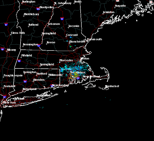 At 651 pm edt, a severe thunderstorm was located just west of dighton, moving east at 20 mph (radar indicated). Hazards include 60 mph wind gusts. Expect damage to roofs. siding. and trees. Locations impacted include, somerset, swansea, rehoboth and dighton. At 651 pm edt, a severe thunderstorm was located just west of dighton, moving east at 20 mph (radar indicated). Hazards include 60 mph wind gusts. Expect damage to roofs. siding. and trees. Locations impacted include, somerset, swansea, rehoboth and dighton.
|
| 7/17/2016 6:45 PM EDT |
 At 645 pm edt, a severe thunderstorm was located over rehoboth, or 7 miles east of east providence, moving east at 35 mph (radar indicated). Hazards include 60 mph wind gusts. Expect damage to roofs. siding. and trees. Locations impacted include, fall river, east providence, somerset, swansea, seekonk, rehoboth, warren and dighton. At 645 pm edt, a severe thunderstorm was located over rehoboth, or 7 miles east of east providence, moving east at 35 mph (radar indicated). Hazards include 60 mph wind gusts. Expect damage to roofs. siding. and trees. Locations impacted include, fall river, east providence, somerset, swansea, seekonk, rehoboth, warren and dighton.
|
| 7/17/2016 6:34 PM EDT |
 At 633 pm edt, a severe thunderstorm was located over east providence, moving east at 20 mph (radar indicated). Hazards include 60 mph wind gusts and quarter size hail. Hail damage to vehicles is expected. expect wind damage to roofs, siding, and trees. Locations impacted include, providence, fall river, warwick, cranston, pawtucket, east providence, north providence, johnston, bristol, attleboro, lincoln, central falls, somerset, barrington, swansea, seekonk, rehoboth, warren and dighton. At 633 pm edt, a severe thunderstorm was located over east providence, moving east at 20 mph (radar indicated). Hazards include 60 mph wind gusts and quarter size hail. Hail damage to vehicles is expected. expect wind damage to roofs, siding, and trees. Locations impacted include, providence, fall river, warwick, cranston, pawtucket, east providence, north providence, johnston, bristol, attleboro, lincoln, central falls, somerset, barrington, swansea, seekonk, rehoboth, warren and dighton.
|
| 7/17/2016 6:17 PM EDT |
 At 617 pm edt, a severe thunderstorm was located over cranston, moving east at 20 mph (radar indicated). Hazards include 60 mph wind gusts and penny size hail. Expect damage to roofs. siding. And trees. At 617 pm edt, a severe thunderstorm was located over cranston, moving east at 20 mph (radar indicated). Hazards include 60 mph wind gusts and penny size hail. Expect damage to roofs. siding. And trees.
|
| 7/15/2016 2:58 PM EDT |
 At 257 pm edt, a severe thunderstorm was located over bristol, moving east at 15 mph (radar indicated). Hazards include 60 mph wind gusts and quarter size hail. Hail damage to vehicles is expected. Expect wind damage to roofs, siding, and trees. At 257 pm edt, a severe thunderstorm was located over bristol, moving east at 15 mph (radar indicated). Hazards include 60 mph wind gusts and quarter size hail. Hail damage to vehicles is expected. Expect wind damage to roofs, siding, and trees.
|
| 7/15/2016 2:58 PM EDT |
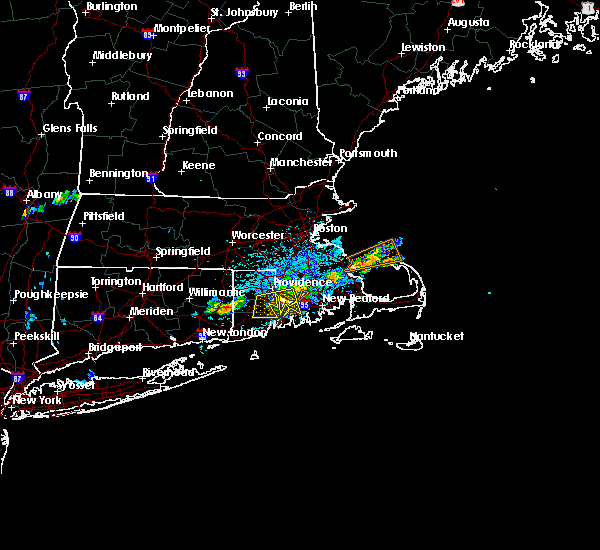 At 257 pm edt, a severe thunderstorm was located over bristol, moving east at 15 mph (radar indicated). Hazards include 60 mph wind gusts and quarter size hail. Hail damage to vehicles is expected. Expect wind damage to roofs, siding, and trees. At 257 pm edt, a severe thunderstorm was located over bristol, moving east at 15 mph (radar indicated). Hazards include 60 mph wind gusts and quarter size hail. Hail damage to vehicles is expected. Expect wind damage to roofs, siding, and trees.
|
| 7/15/2016 2:46 PM EDT |
 At 246 pm edt, a severe thunderstorm was located over warwick, moving east at 25 mph (radar indicated). Hazards include 60 mph wind gusts. Expect damage to roofs. siding. and trees. Locations impacted include, providence, fall river, warwick, cranston, east providence, coventry, west warwick, north kingstown, bristol, somerset, portsmouth, barrington, swansea, tiverton, seekonk, east greenwich, rehoboth, warren, scituate and exeter. At 246 pm edt, a severe thunderstorm was located over warwick, moving east at 25 mph (radar indicated). Hazards include 60 mph wind gusts. Expect damage to roofs. siding. and trees. Locations impacted include, providence, fall river, warwick, cranston, east providence, coventry, west warwick, north kingstown, bristol, somerset, portsmouth, barrington, swansea, tiverton, seekonk, east greenwich, rehoboth, warren, scituate and exeter.
|
| 7/15/2016 2:21 PM EDT |
 At 220 pm edt, a severe thunderstorm was located near portsmouth, or near bristol, moving east at 30 mph (radar indicated). Hazards include 60 mph wind gusts and quarter size hail. Hail damage to vehicles is possible. expect wind damage to roofs, siding, and trees. Locations impacted include, providence, fall river, warwick, cranston, east providence, coventry, west warwick, north kingstown, bristol, somerset, portsmouth, barrington, swansea, tiverton, seekonk, east greenwich, rehoboth, warren, scituate and hopkinton. At 220 pm edt, a severe thunderstorm was located near portsmouth, or near bristol, moving east at 30 mph (radar indicated). Hazards include 60 mph wind gusts and quarter size hail. Hail damage to vehicles is possible. expect wind damage to roofs, siding, and trees. Locations impacted include, providence, fall river, warwick, cranston, east providence, coventry, west warwick, north kingstown, bristol, somerset, portsmouth, barrington, swansea, tiverton, seekonk, east greenwich, rehoboth, warren, scituate and hopkinton.
|
| 7/15/2016 2:11 PM EDT |
 At 210 pm edt, a severe thunderstorm was located over north kingstown, moving east at 30 mph (radar indicated). Hazards include 60 mph wind gusts. Expect damage to roofs. siding. And trees. At 210 pm edt, a severe thunderstorm was located over north kingstown, moving east at 30 mph (radar indicated). Hazards include 60 mph wind gusts. Expect damage to roofs. siding. And trees.
|
| 6/21/2016 5:12 AM EDT |
 At 511 am edt, a severe thunderstorm was located near barrington and warwick, moving southeast at 40 mph (radar indicated). Hazards include 60 mph wind gusts. Expect damage to roofs. siding. And trees. At 511 am edt, a severe thunderstorm was located near barrington and warwick, moving southeast at 40 mph (radar indicated). Hazards include 60 mph wind gusts. Expect damage to roofs. siding. And trees.
|
| 3/17/2016 5:45 PM EDT |
 At 544 pm edt, doppler radar indicated a severe thunderstorm capable of producing damaging winds in excess of 60 mph. this storm was located over johnston, and was moving east at 65 mph. At 544 pm edt, doppler radar indicated a severe thunderstorm capable of producing damaging winds in excess of 60 mph. this storm was located over johnston, and was moving east at 65 mph.
|
| 2/25/2016 4:51 AM EST |
 The severe thunderstorm warning for central bristol, west central barnstable and plymouth counties will expire at 500 am est, the storm which prompted the warning has moved out of the area. therefore the warning will be allowed to expire. however gusty winds are still possible as showers and storms move out. time, mot, loc 0949z 204deg 121kt 4376 7040. The severe thunderstorm warning for central bristol, west central barnstable and plymouth counties will expire at 500 am est, the storm which prompted the warning has moved out of the area. therefore the warning will be allowed to expire. however gusty winds are still possible as showers and storms move out. time, mot, loc 0949z 204deg 121kt 4376 7040.
|
| 2/25/2016 4:11 AM EST |
 At 410 am est, doppler radar indicated a severe thunderstorm capable of producing destructive winds in excess of 70 mph. this storm was located over south windham, or near north windham, and was moving northeast at 50 mph. At 410 am est, doppler radar indicated a severe thunderstorm capable of producing destructive winds in excess of 70 mph. this storm was located over south windham, or near north windham, and was moving northeast at 50 mph.
|
| 2/25/2016 3:11 AM EST |
 At 310 am est, doppler radar indicated a severe thunderstorm capable of producing destructive winds in excess of 70 mph. this storm was located over smithfield, or near johnston, and was moving northeast at 140 mph. At 310 am est, doppler radar indicated a severe thunderstorm capable of producing destructive winds in excess of 70 mph. this storm was located over smithfield, or near johnston, and was moving northeast at 140 mph.
|
| 8/4/2015 7:37 AM EDT |
 The severe thunderstorm warning for southeastern bristol and southern plymouth counties will expire at 745 am edt, the storm which prompted the warning has moved out of the area. therefore the warning will be allowed to expire. The severe thunderstorm warning for southeastern bristol and southern plymouth counties will expire at 745 am edt, the storm which prompted the warning has moved out of the area. therefore the warning will be allowed to expire.
|
| 8/4/2015 7:17 AM EDT |
 At 717 am edt, doppler radar indicated a severe thunderstorm capable of producing damaging winds in excess of 60 mph. this storm was located over acushnet, or near new bedford, moving northeast at 55 mph. locations impacted include, new bedford, fall river, plymouth, dartmouth, marion, middleborough, wareham, bourne, fairhaven, carver, lakeville, acushnet, freetown, mattapoisett and rochester. At 717 am edt, doppler radar indicated a severe thunderstorm capable of producing damaging winds in excess of 60 mph. this storm was located over acushnet, or near new bedford, moving northeast at 55 mph. locations impacted include, new bedford, fall river, plymouth, dartmouth, marion, middleborough, wareham, bourne, fairhaven, carver, lakeville, acushnet, freetown, mattapoisett and rochester.
|
| 8/4/2015 7:11 AM EDT |
 The severe thunderstorm warning for bristol, southwestern plymouth, southeastern norfolk, bristol, northern newport, kent, northeastern washington and providence counties will expire at 715 am edt, the line of storms which prompted the warning have moved out of the area. therefore the warning will be allowed to expire. however heavy rain is still possible with these thunderstorms. The severe thunderstorm warning for bristol, southwestern plymouth, southeastern norfolk, bristol, northern newport, kent, northeastern washington and providence counties will expire at 715 am edt, the line of storms which prompted the warning have moved out of the area. therefore the warning will be allowed to expire. however heavy rain is still possible with these thunderstorms.
|
| 8/4/2015 7:02 AM EDT | Tree down on roebeson street blocking half the road in bristol county MA, 2.1 miles SE of Fall River, MA |
| 8/4/2015 6:54 AM EDT |
 At 653 am edt, doppler radar indicated a severe thunderstorm capable of producing quarter size hail and damaging winds in excess of 60 mph. this storm was located over portsmouth, or near bristol, and was moving northeast at 50 mph. * some locations impacted include, new bedford, fall river, plymouth, dartmouth, newport, bristol, marion, middleborough, wareham, bourne, somerset, portsmouth, middletown, fairhaven, swansea, tiverton, westport, carver, warren and lakeville. At 653 am edt, doppler radar indicated a severe thunderstorm capable of producing quarter size hail and damaging winds in excess of 60 mph. this storm was located over portsmouth, or near bristol, and was moving northeast at 50 mph. * some locations impacted include, new bedford, fall river, plymouth, dartmouth, newport, bristol, marion, middleborough, wareham, bourne, somerset, portsmouth, middletown, fairhaven, swansea, tiverton, westport, carver, warren and lakeville.
|
| 8/4/2015 6:29 AM EDT |
 At 628 am edt, a severe thunderstorm producing widespread damage was moving into the cranston and providence metro area. this is a very dangerous situation. quarter size hail and destructive winds in excess of 80 mph are possible. these storms were located along a line extending from near cumberland to near cranston to near bristol, moving northeast at 45 mph. locations impacted include, providence, new bedford, brockton, fall river, warwick, cranston, pawtucket, taunton, east providence, woonsocket, coventry, dartmouth, cumberland, randolph, north providence, south kingstown, west warwick, johnston, north attleborough and stoughton. At 628 am edt, a severe thunderstorm producing widespread damage was moving into the cranston and providence metro area. this is a very dangerous situation. quarter size hail and destructive winds in excess of 80 mph are possible. these storms were located along a line extending from near cumberland to near cranston to near bristol, moving northeast at 45 mph. locations impacted include, providence, new bedford, brockton, fall river, warwick, cranston, pawtucket, taunton, east providence, woonsocket, coventry, dartmouth, cumberland, randolph, north providence, south kingstown, west warwick, johnston, north attleborough and stoughton.
|
| 8/4/2015 6:23 AM EDT |
 At 622 am edt, trained weather spotters confirmed a line of severe thunderstorms producing quarter size hail and destructive winds in excess of 70 mph. these storms were located along a line extending from north smithfield to cranston to portsmouth, moving northeast at 45 mph. this is a dangerous situation, damage has arleady been reported with this storm. locations impacted include, providence, new bedford, brockton, fall river, warwick, cranston, pawtucket, taunton, east providence, woonsocket, coventry, dartmouth, cumberland, randolph, north providence, franklin, south kingstown, west warwick, johnston and north attleborough. At 622 am edt, trained weather spotters confirmed a line of severe thunderstorms producing quarter size hail and destructive winds in excess of 70 mph. these storms were located along a line extending from north smithfield to cranston to portsmouth, moving northeast at 45 mph. this is a dangerous situation, damage has arleady been reported with this storm. locations impacted include, providence, new bedford, brockton, fall river, warwick, cranston, pawtucket, taunton, east providence, woonsocket, coventry, dartmouth, cumberland, randolph, north providence, franklin, south kingstown, west warwick, johnston and north attleborough.
|
| 8/4/2015 6:14 AM EDT |
 At 614 am edt, doppler radar indicated a line of severe thunderstorms capable of producing quarter size hail and damaging winds in excess of 60 mph. these storms were located along a line extending from near glocester to near coventry to north kingstown, moving northeast at 45 mph. locations impacted include, providence, new bedford, brockton, fall river, warwick, cranston, pawtucket, taunton, east providence, woonsocket, coventry, dartmouth, cumberland, randolph, north providence, franklin, south kingstown, west warwick, johnston and north attleborough. At 614 am edt, doppler radar indicated a line of severe thunderstorms capable of producing quarter size hail and damaging winds in excess of 60 mph. these storms were located along a line extending from near glocester to near coventry to north kingstown, moving northeast at 45 mph. locations impacted include, providence, new bedford, brockton, fall river, warwick, cranston, pawtucket, taunton, east providence, woonsocket, coventry, dartmouth, cumberland, randolph, north providence, franklin, south kingstown, west warwick, johnston and north attleborough.
|
| 8/4/2015 6:09 AM EDT |
 At 609 am edt, doppler radar indicated a line of severe thunderstorms capable of producing damaging winds in excess of 60 mph. these storms were located along a line extending from glocester to coventry to north kingstown, and was moving northeast at 45 mph. * some locations impacted include, providence, new bedford, brockton, fall river, warwick, cranston, pawtucket, taunton, east providence, woonsocket, coventry, dartmouth, cumberland, randolph, north providence, franklin, south kingstown, west warwick, johnston and north attleborough. At 609 am edt, doppler radar indicated a line of severe thunderstorms capable of producing damaging winds in excess of 60 mph. these storms were located along a line extending from glocester to coventry to north kingstown, and was moving northeast at 45 mph. * some locations impacted include, providence, new bedford, brockton, fall river, warwick, cranston, pawtucket, taunton, east providence, woonsocket, coventry, dartmouth, cumberland, randolph, north providence, franklin, south kingstown, west warwick, johnston and north attleborough.
|
| 7/28/2015 5:01 PM EDT |
 At 500 pm edt, doppler radar indicated a line of severe thunderstorms capable of producing destructive winds in excess of 70 mph. these storms were located along a line extending from near westport to portsmouth, moving south at 25 mph. the strongest winds, possibly near 70 mph, will move through portsmouth, little compton and newport before 530 pm. locations impacted include, newport, bristol, portsmouth, middletown, tiverton, westport, jamestown, little compton and prudence island. At 500 pm edt, doppler radar indicated a line of severe thunderstorms capable of producing destructive winds in excess of 70 mph. these storms were located along a line extending from near westport to portsmouth, moving south at 25 mph. the strongest winds, possibly near 70 mph, will move through portsmouth, little compton and newport before 530 pm. locations impacted include, newport, bristol, portsmouth, middletown, tiverton, westport, jamestown, little compton and prudence island.
|
| 7/28/2015 4:55 PM EDT |
 At 455 pm edt, doppler radar indicated a line of severe thunderstorms capable of producing damaging winds in excess of 60 mph. these storms were located along a line extending from near westport to portsmouth, and was moving south at 25 mph. * some locations impacted include, dartmouth, newport, bristol, portsmouth, middletown, tiverton, westport, jamestown, little compton and prudence island. At 455 pm edt, doppler radar indicated a line of severe thunderstorms capable of producing damaging winds in excess of 60 mph. these storms were located along a line extending from near westport to portsmouth, and was moving south at 25 mph. * some locations impacted include, dartmouth, newport, bristol, portsmouth, middletown, tiverton, westport, jamestown, little compton and prudence island.
|
| 7/28/2015 3:56 PM EDT |
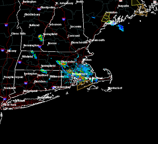 At 355 pm edt, doppler radar indicated a severe thunderstorm capable of producing quarter size hail and damaging winds in excess of 60 mph. this storm was located over fall river, moving south at 15 mph. locations impacted include, new bedford, fall river, dartmouth, westport and freetown. At 355 pm edt, doppler radar indicated a severe thunderstorm capable of producing quarter size hail and damaging winds in excess of 60 mph. this storm was located over fall river, moving south at 15 mph. locations impacted include, new bedford, fall river, dartmouth, westport and freetown.
|
| 7/28/2015 3:44 PM EDT |
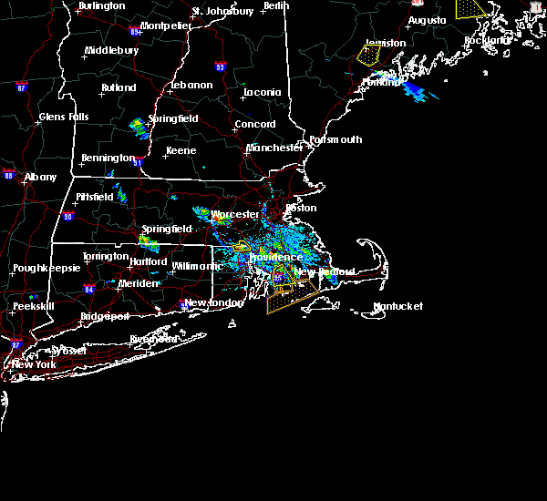 At 344 pm edt, doppler radar indicated a severe thunderstorm capable of producing quarter size hail and damaging winds in excess of 60 mph. this storm was located near freetown, and was moving south at 15 mph. * some locations impacted include, new bedford, fall river, dartmouth, tiverton, westport, freetown and berkley. At 344 pm edt, doppler radar indicated a severe thunderstorm capable of producing quarter size hail and damaging winds in excess of 60 mph. this storm was located near freetown, and was moving south at 15 mph. * some locations impacted include, new bedford, fall river, dartmouth, tiverton, westport, freetown and berkley.
|
| 7/1/2015 8:25 AM EDT |
 The severe thunderstorm warning for bristol, plymouth, southern norfolk and eastern newport counties will expire at 830 am edt, the line of storms which prompted the warning will continue to move out of the area therefore the warning will be allowed to expire. The severe thunderstorm warning for bristol, plymouth, southern norfolk and eastern newport counties will expire at 830 am edt, the line of storms which prompted the warning will continue to move out of the area therefore the warning will be allowed to expire.
|
| 7/1/2015 7:51 AM EDT |
 At 751 am edt, doppler radar indicated a line of severe thunderstorms capable of producing damaging winds in excess of 60 mph. these storms were located along a line extending from north smithfield to somerset to 8 miles southeast of block island, moving northeast at 35 mph. locations impacted include, new bedford, brockton, fall river, pawtucket, plymouth, taunton, weymouth, east providence, braintree, dartmouth, randolph, franklin, north attleborough, stoughton, bridgewater, newport, marion, attleboro, walpole and mansfield. At 751 am edt, doppler radar indicated a line of severe thunderstorms capable of producing damaging winds in excess of 60 mph. these storms were located along a line extending from north smithfield to somerset to 8 miles southeast of block island, moving northeast at 35 mph. locations impacted include, new bedford, brockton, fall river, pawtucket, plymouth, taunton, weymouth, east providence, braintree, dartmouth, randolph, franklin, north attleborough, stoughton, bridgewater, newport, marion, attleboro, walpole and mansfield.
|
| 7/1/2015 7:28 AM EDT |
 At 727 am edt, doppler radar indicated a line of severe thunderstorms capable of producing damaging winds in excess of 60 mph. these storms were located along a line extending from near foster to portsmouth to 16 miles south of block island, and was moving northeast at 35 mph. * some locations impacted include, providence, new bedford, brockton, fall river, warwick, cranston, pawtucket, plymouth, taunton, weymouth, east providence, woonsocket, braintree, coventry, dartmouth, cumberland, randolph, north providence, franklin and johnston. At 727 am edt, doppler radar indicated a line of severe thunderstorms capable of producing damaging winds in excess of 60 mph. these storms were located along a line extending from near foster to portsmouth to 16 miles south of block island, and was moving northeast at 35 mph. * some locations impacted include, providence, new bedford, brockton, fall river, warwick, cranston, pawtucket, plymouth, taunton, weymouth, east providence, woonsocket, braintree, coventry, dartmouth, cumberland, randolph, north providence, franklin and johnston.
|
| 6/23/2015 6:24 PM EDT |
 The severe thunderstorm warning for central bristol, bristol, newport, eastern kent, northeastern washington and southeastern providence counties will expire at 630 pm edt, the line of storms which prompted the warning have weakened below severe limits, and exited the warned area. therefore the warning will be allowed to expire. &&. The severe thunderstorm warning for central bristol, bristol, newport, eastern kent, northeastern washington and southeastern providence counties will expire at 630 pm edt, the line of storms which prompted the warning have weakened below severe limits, and exited the warned area. therefore the warning will be allowed to expire. &&.
|
| 6/23/2015 5:42 PM EDT |
 At 541 pm edt, doppler radar indicated a line of severe thunderstorms capable of producing damaging winds in excess of 60 mph. these storms were located along a line extending from near warwick to near jamestown, and was moving east at 55 mph. * some locations impacted include, providence, fall river, warwick, cranston, pawtucket, taunton, east providence, dartmouth, north providence, south kingstown, north kingstown, newport, bristol, lincoln, central falls, somerset, portsmouth, barrington, middletown and narragansett. At 541 pm edt, doppler radar indicated a line of severe thunderstorms capable of producing damaging winds in excess of 60 mph. these storms were located along a line extending from near warwick to near jamestown, and was moving east at 55 mph. * some locations impacted include, providence, fall river, warwick, cranston, pawtucket, taunton, east providence, dartmouth, north providence, south kingstown, north kingstown, newport, bristol, lincoln, central falls, somerset, portsmouth, barrington, middletown and narragansett.
|
| 1/1/0001 12:00 AM | Tree down in area of madison street blocking the roadway in bristol county MA, 2.8 miles SSW of Fall River, MA |
Hail Maps for Fall River, MA
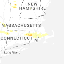


Connect with Interactive Hail Maps