

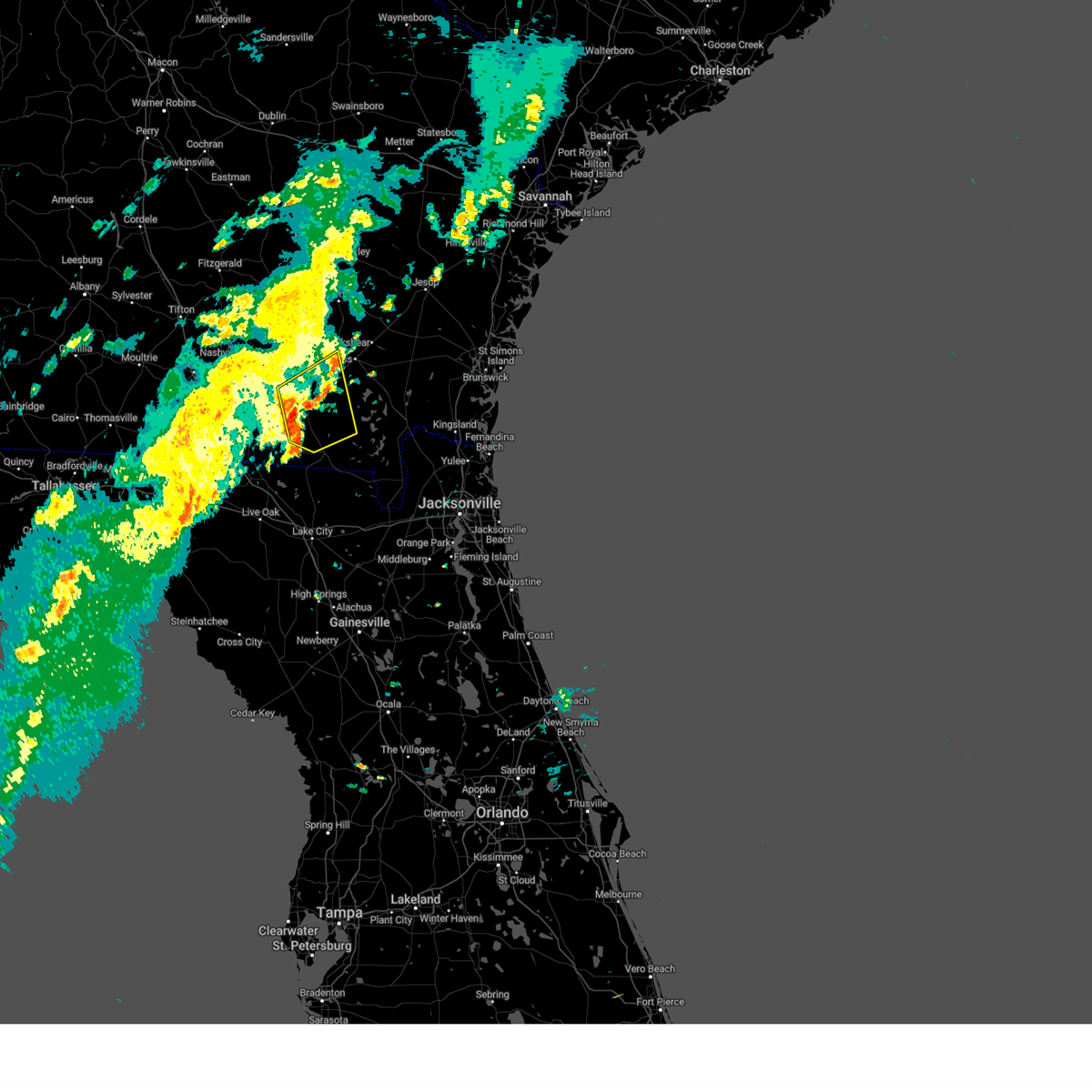
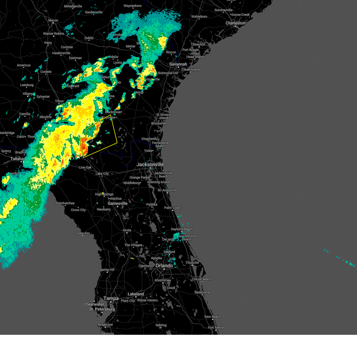
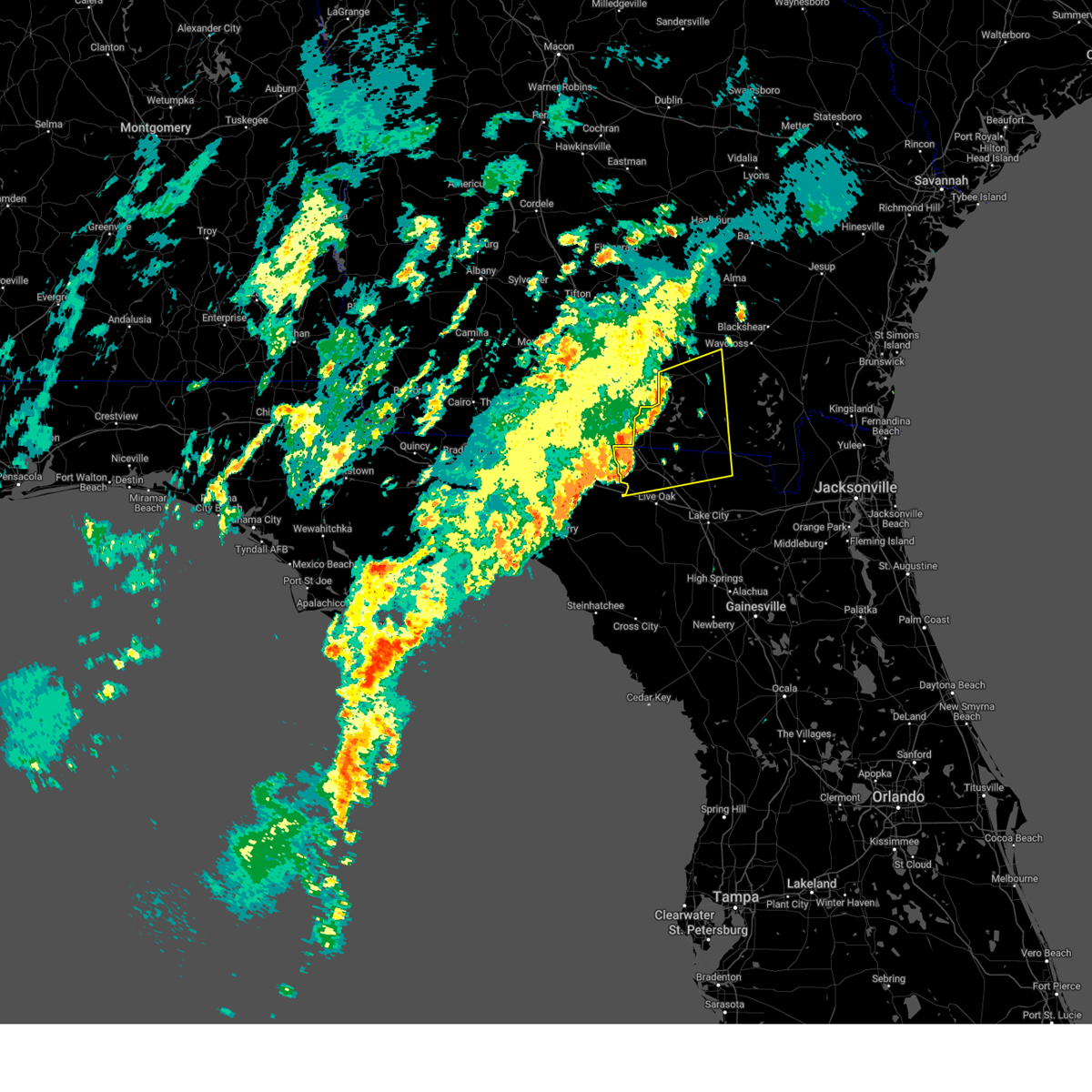
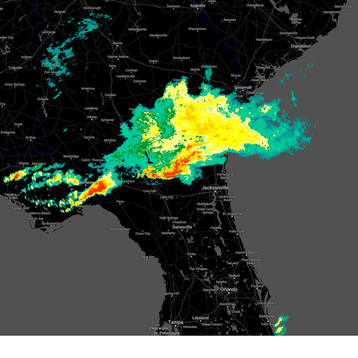
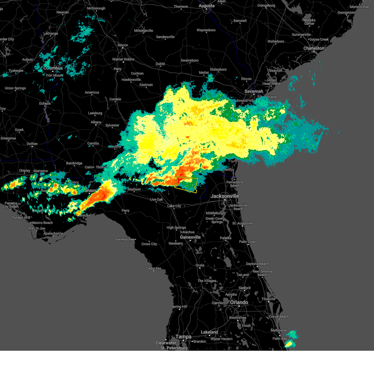
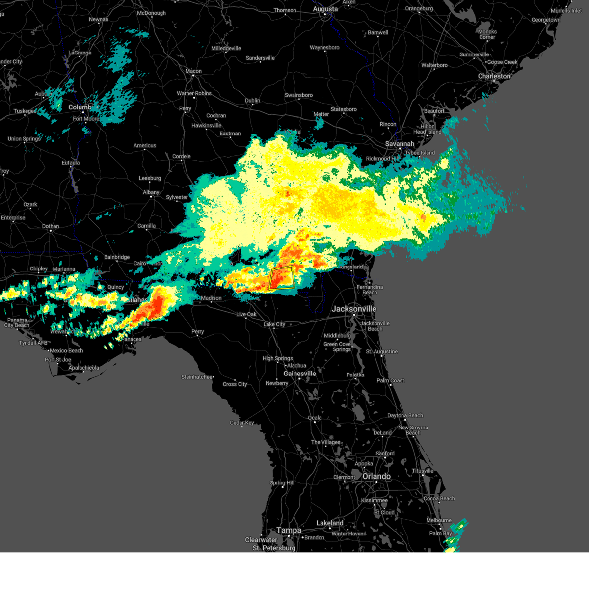
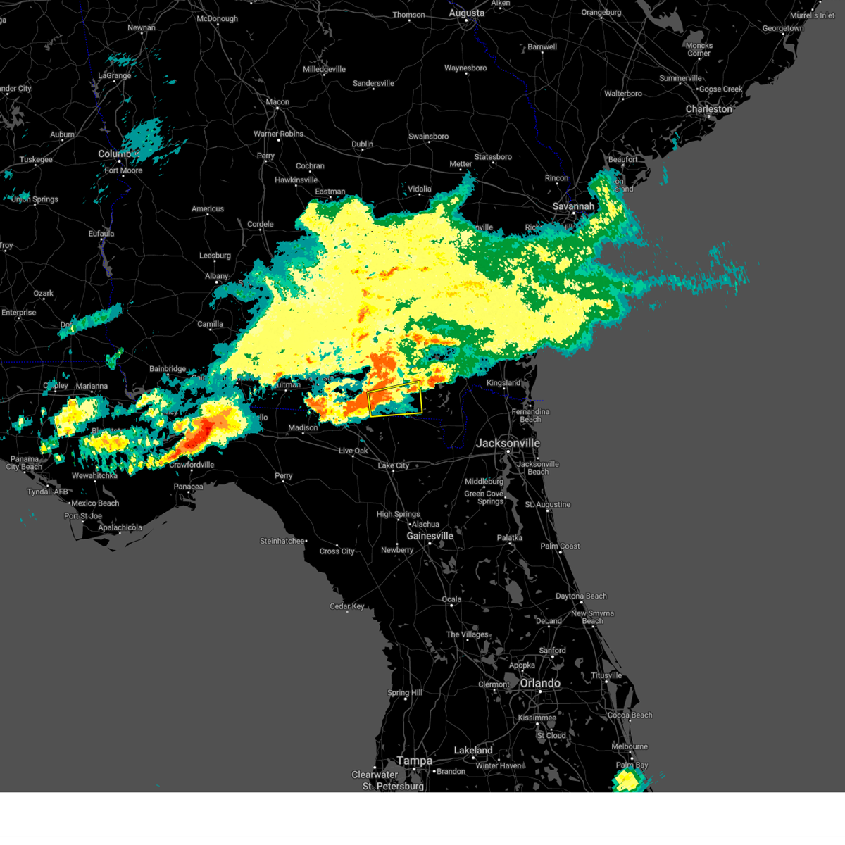
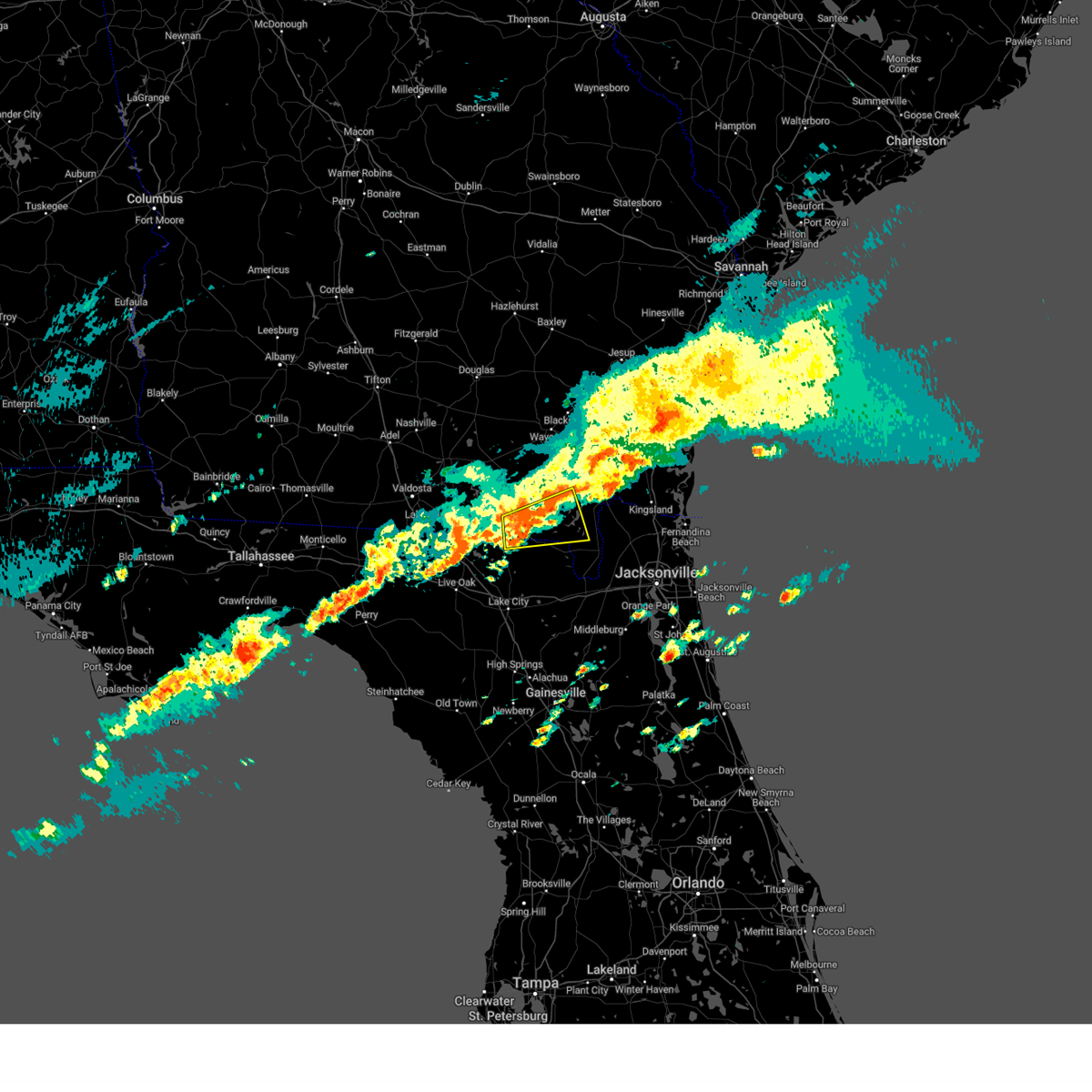
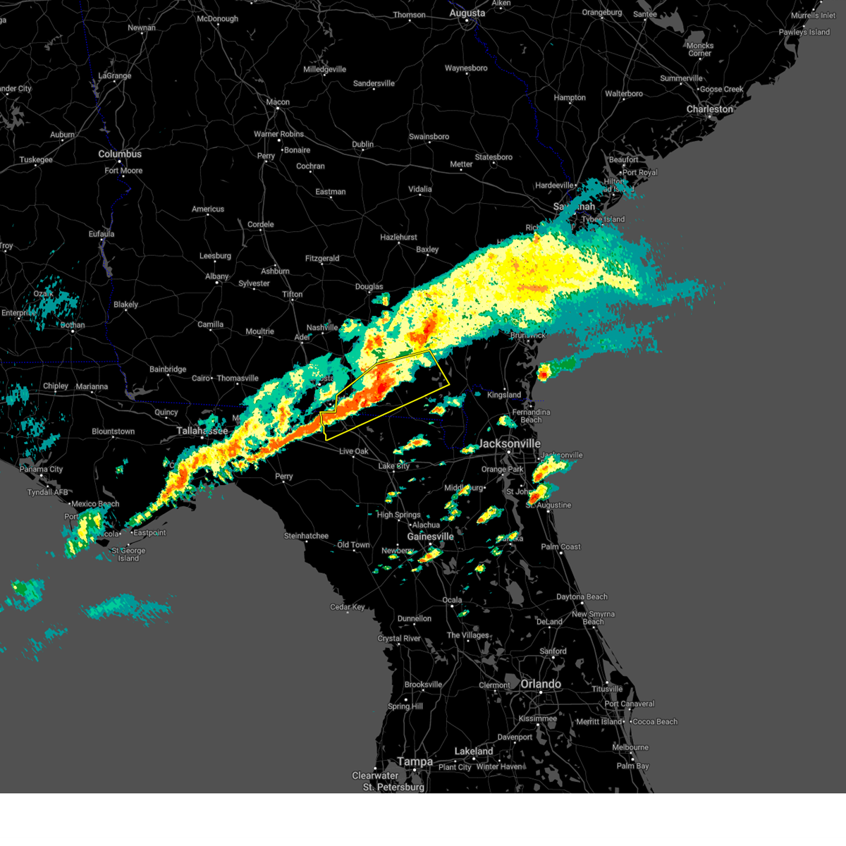
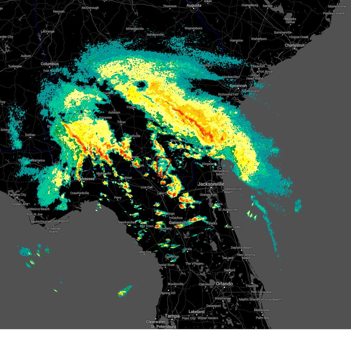
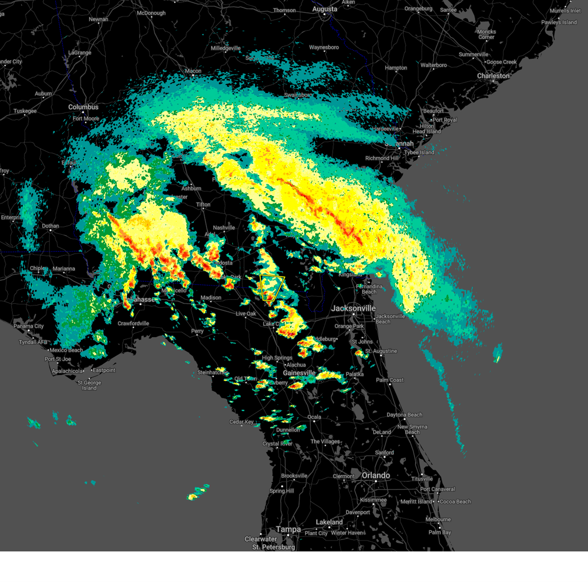
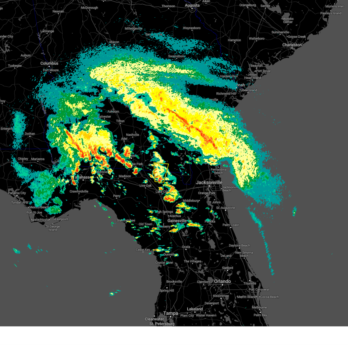
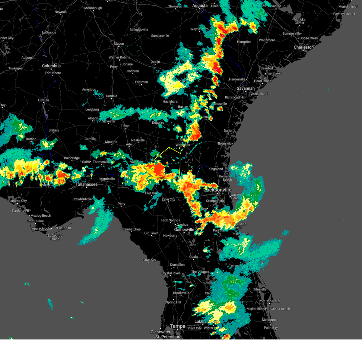
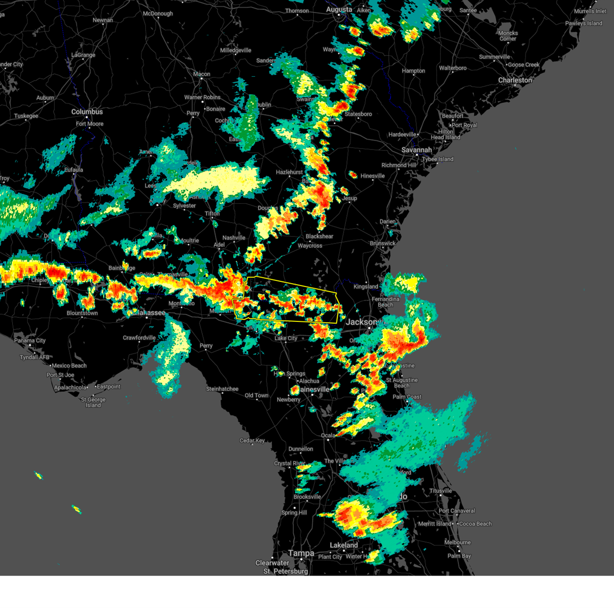
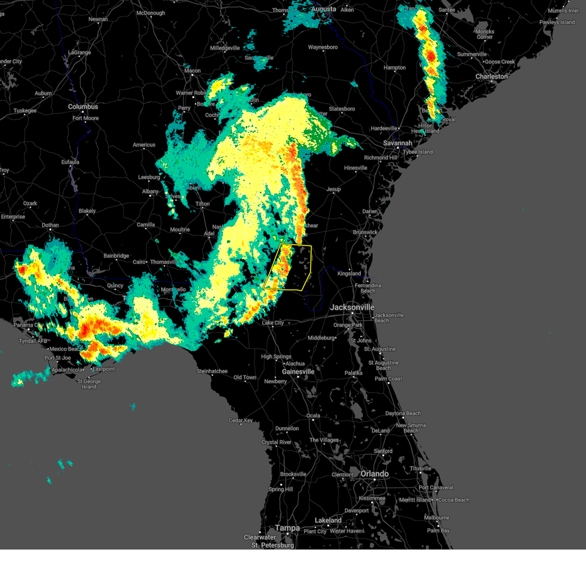
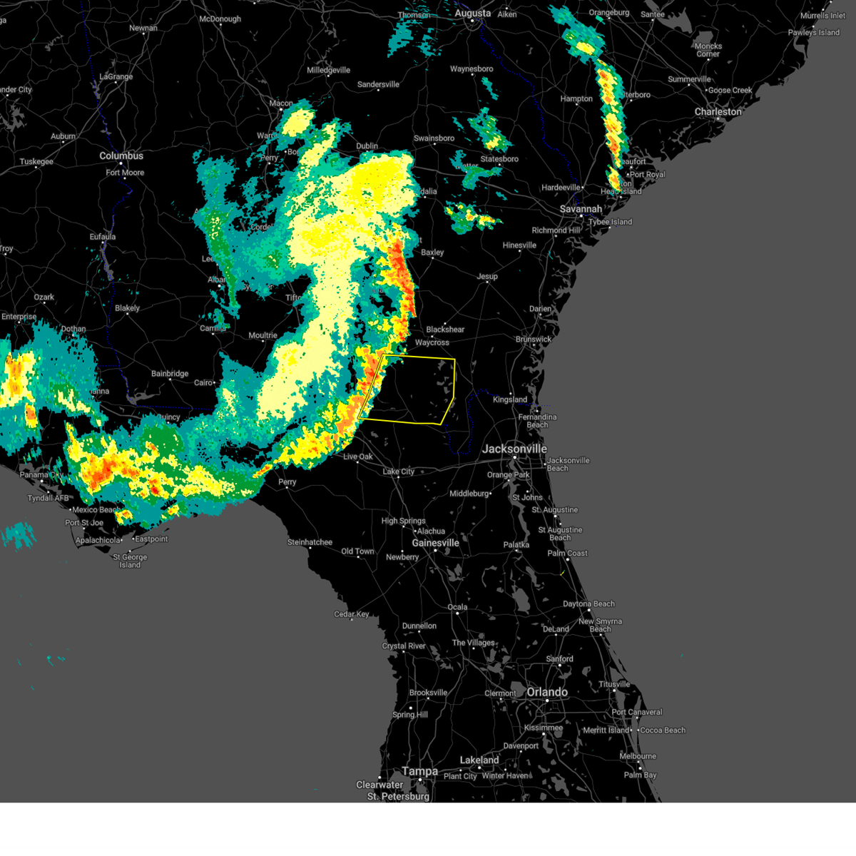
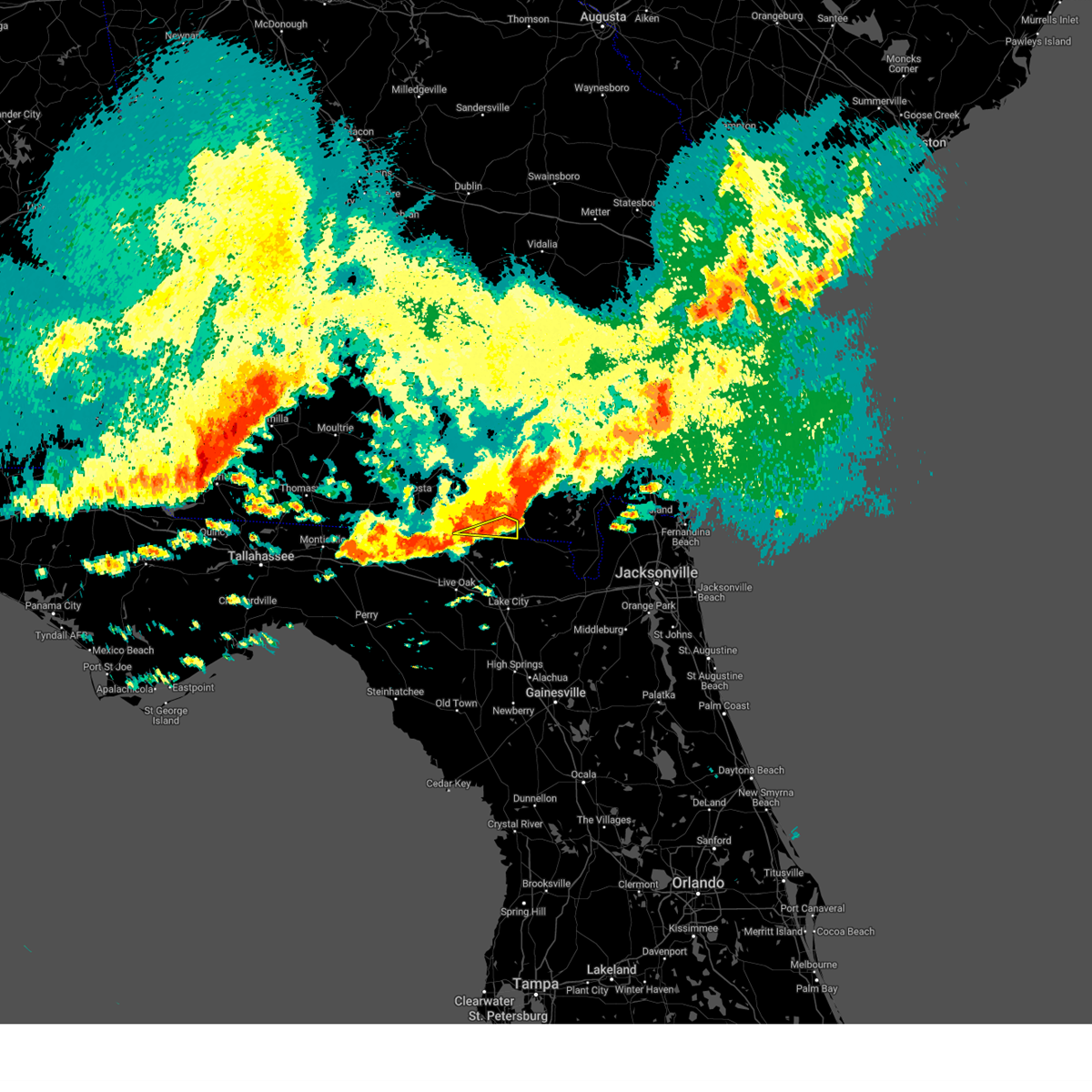
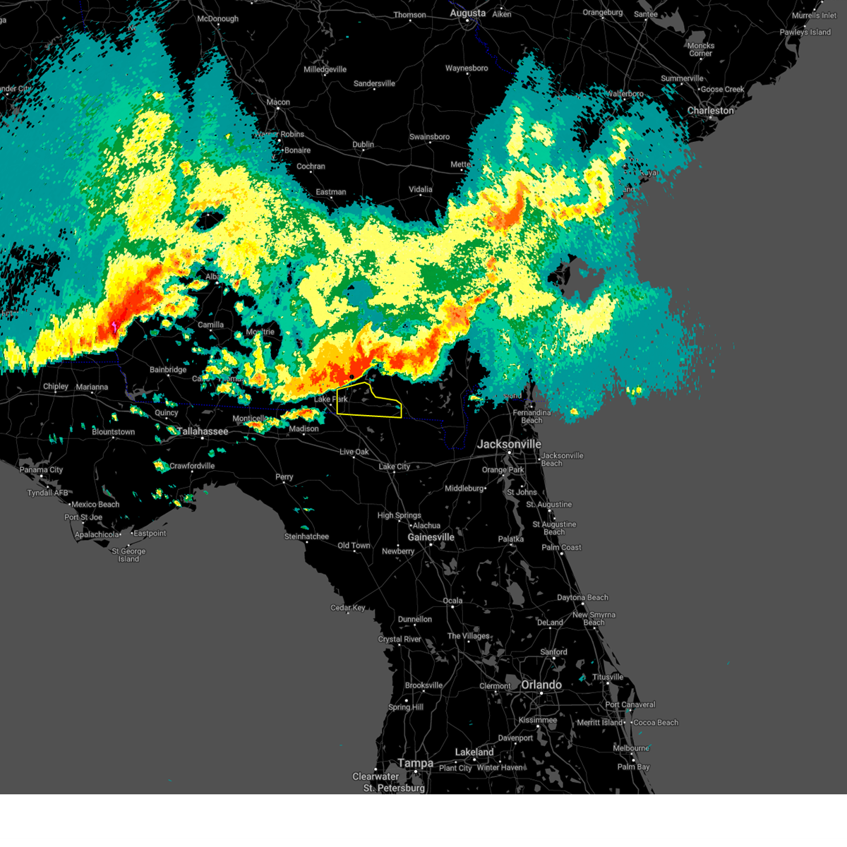
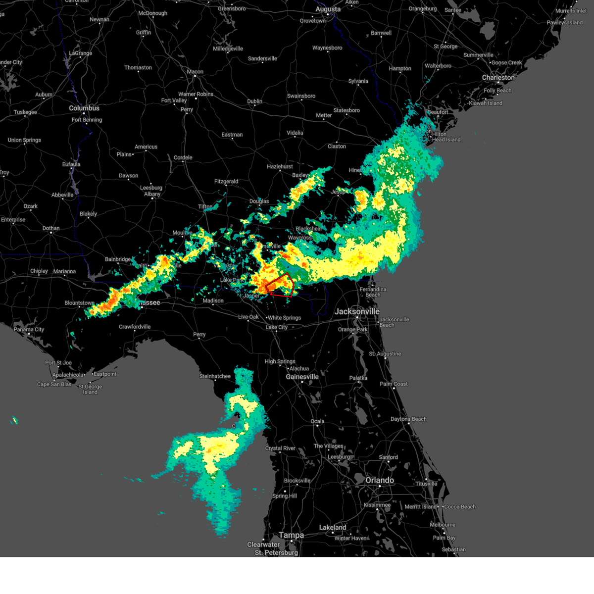
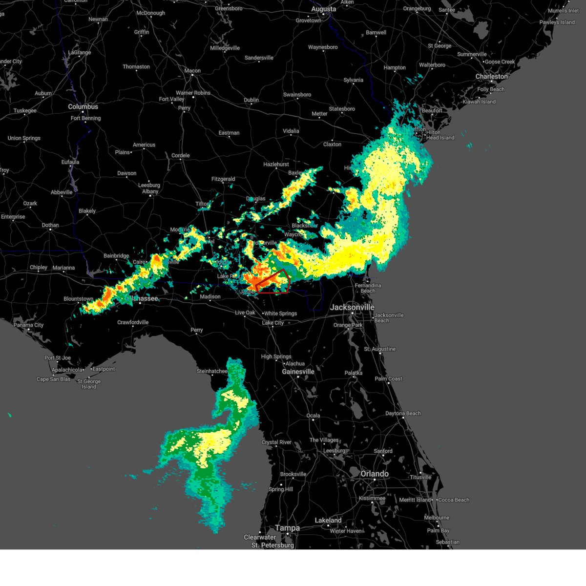
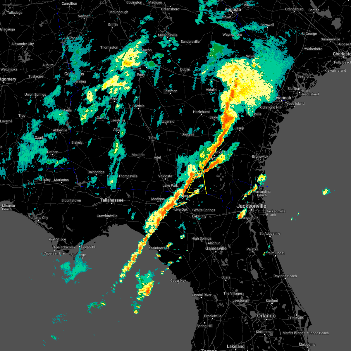
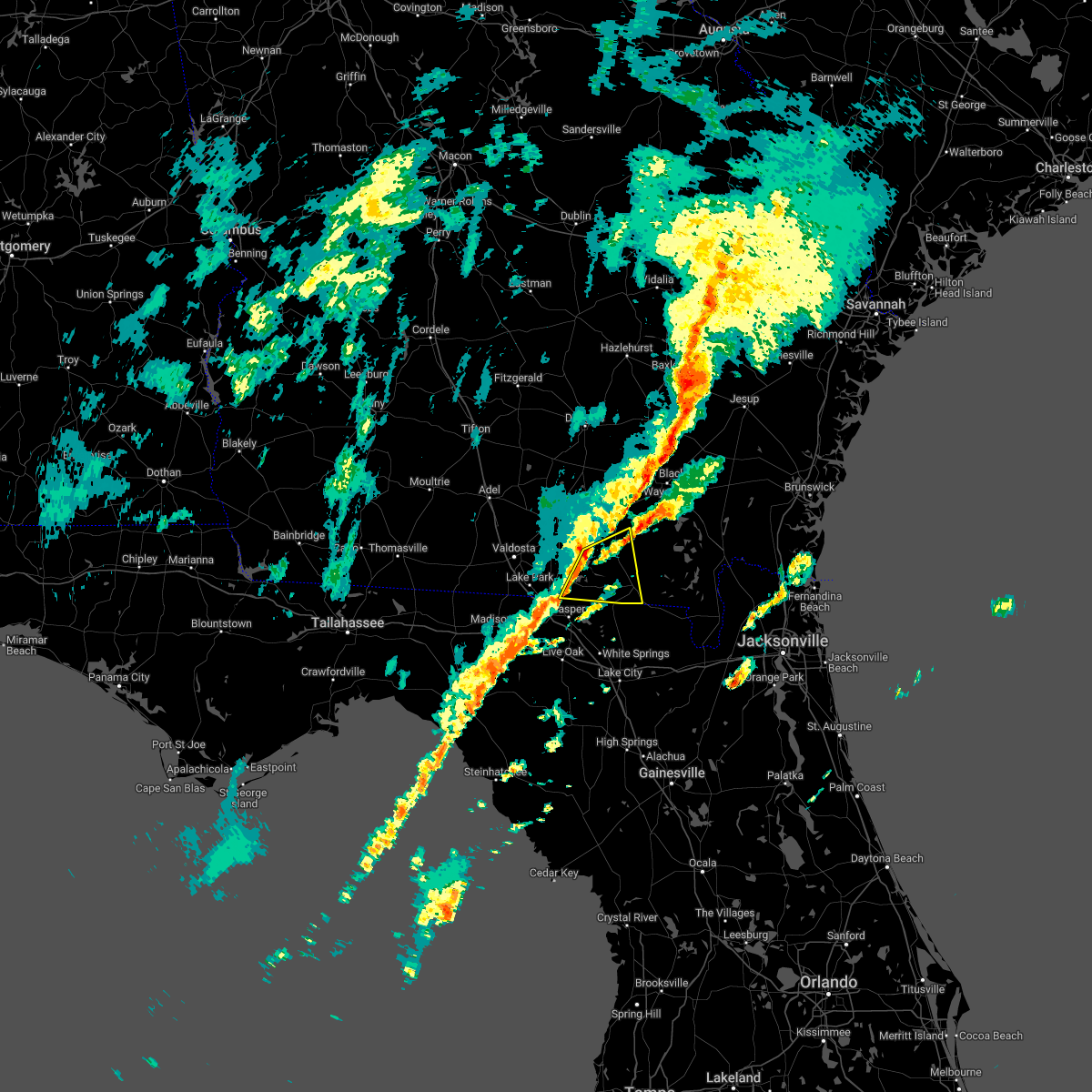
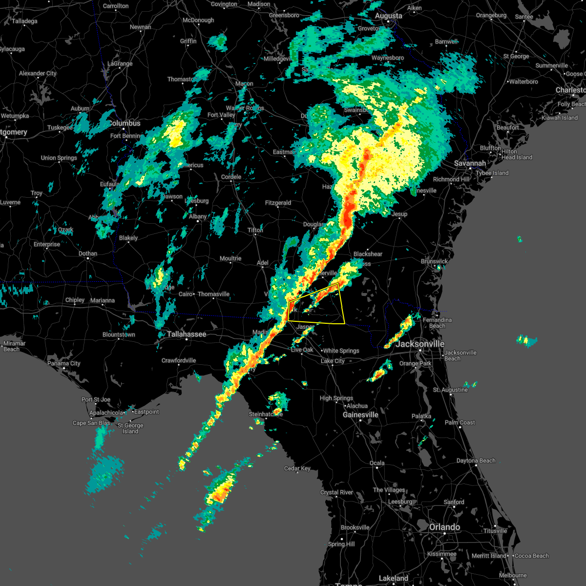
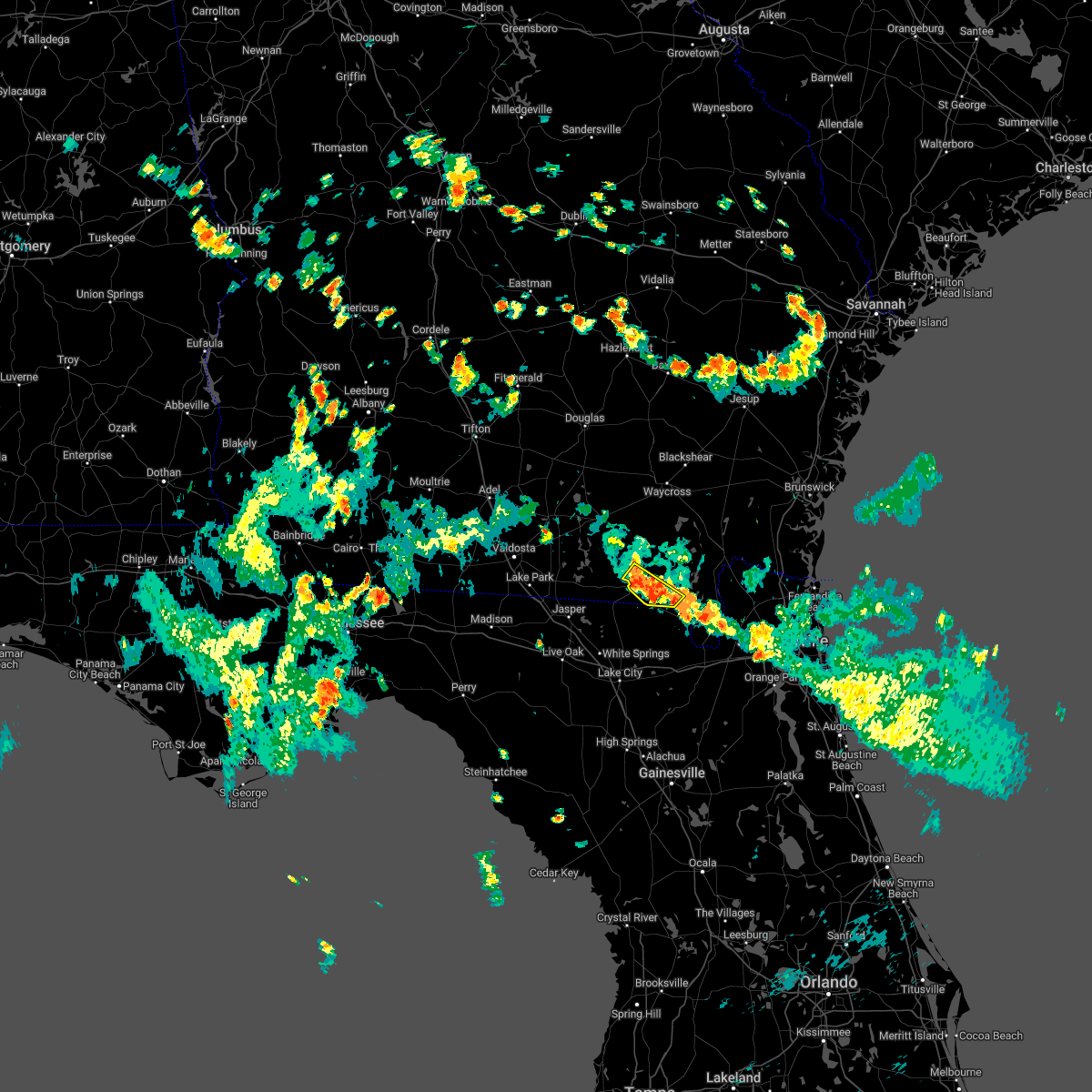
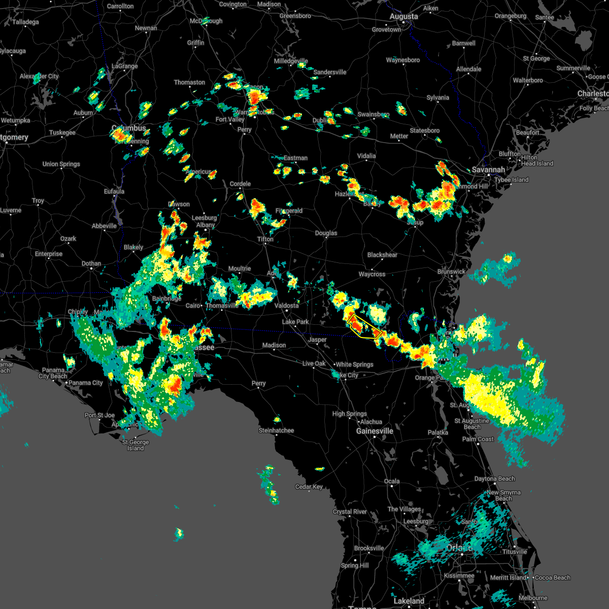
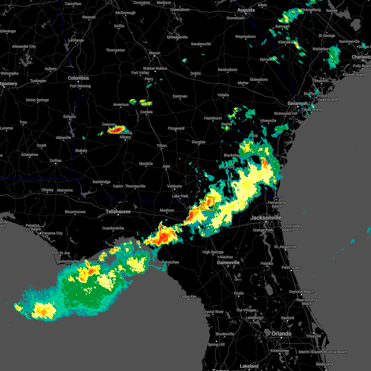
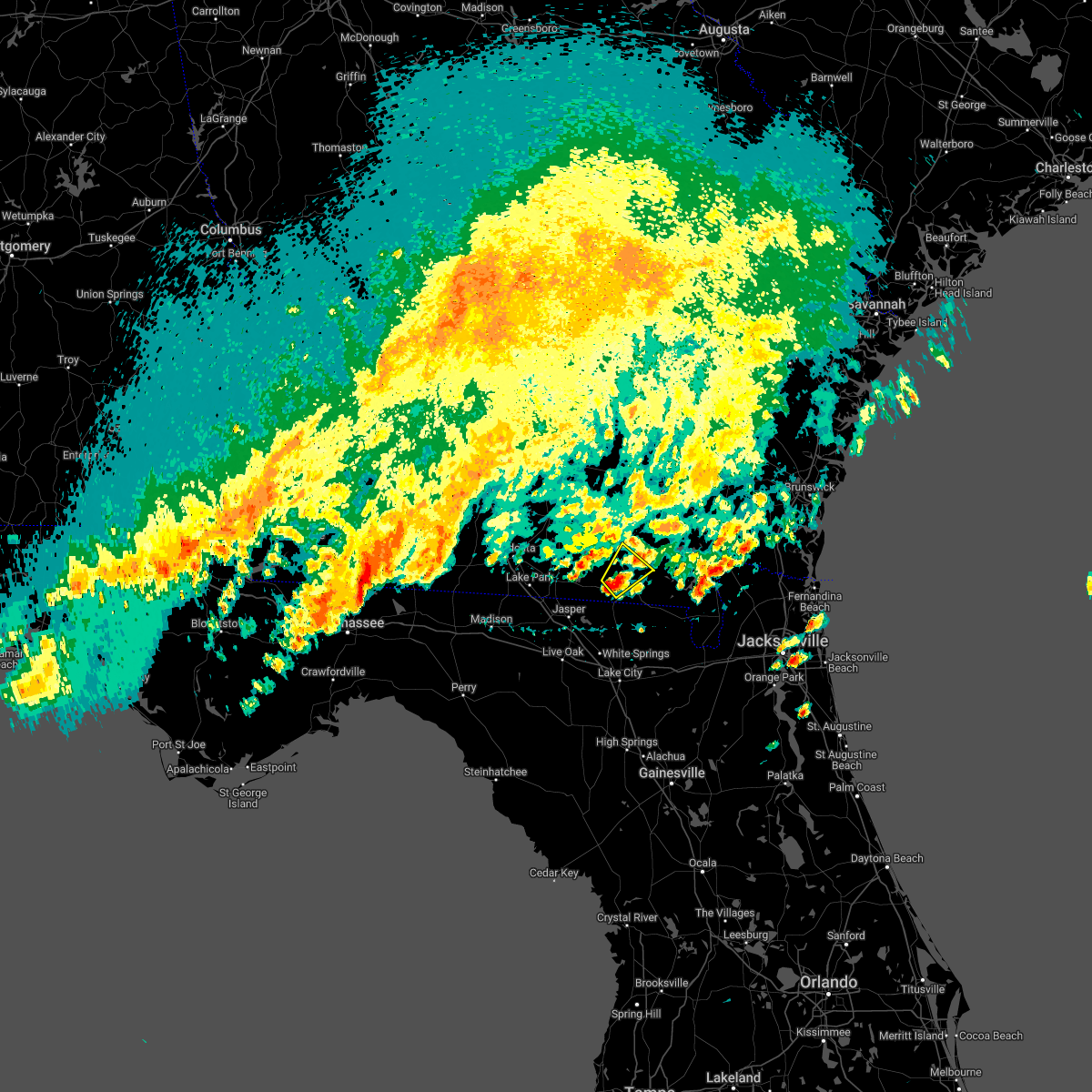
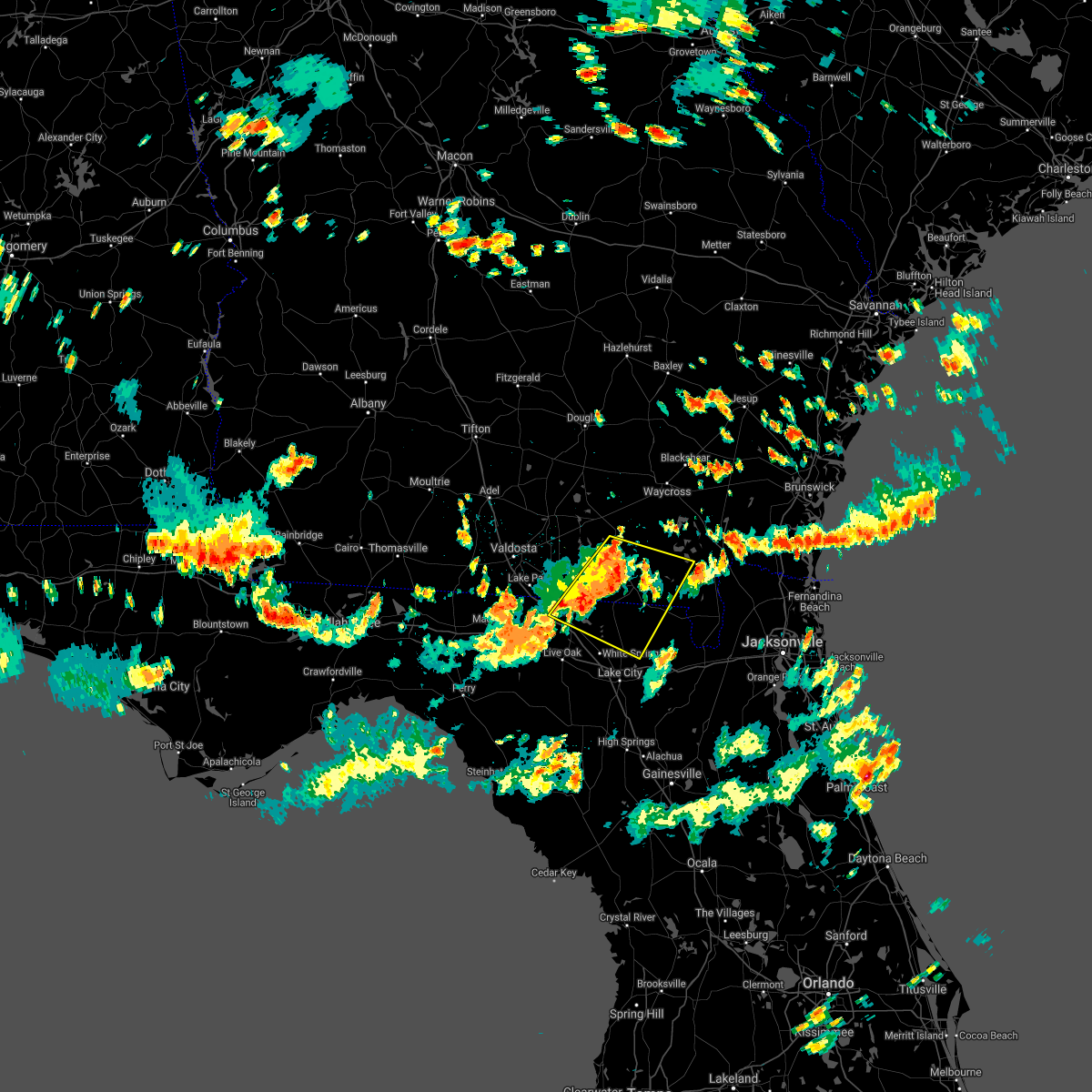
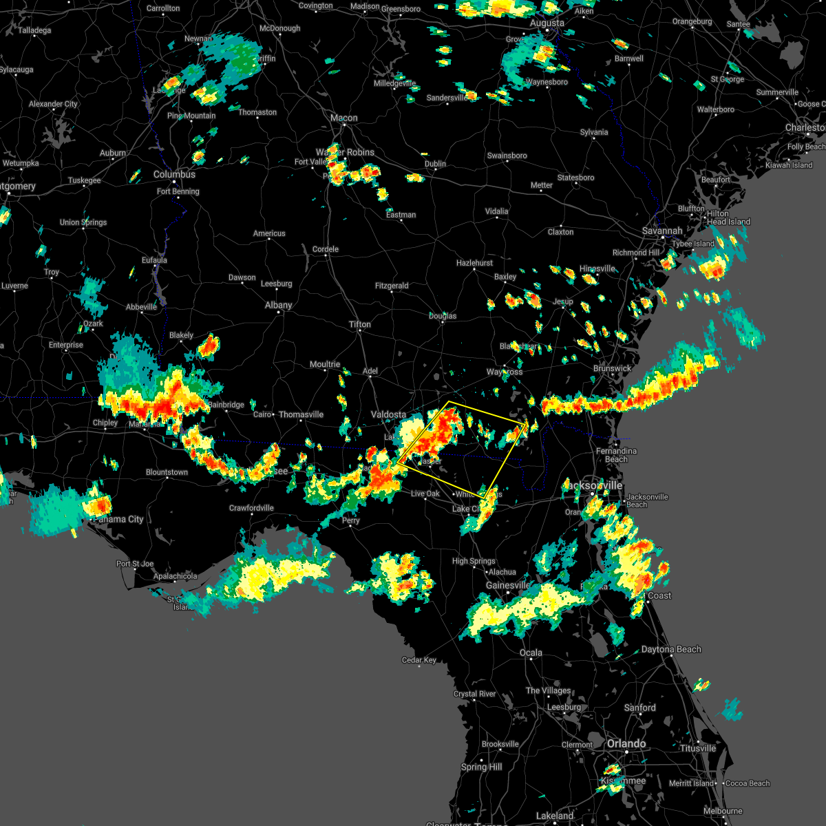
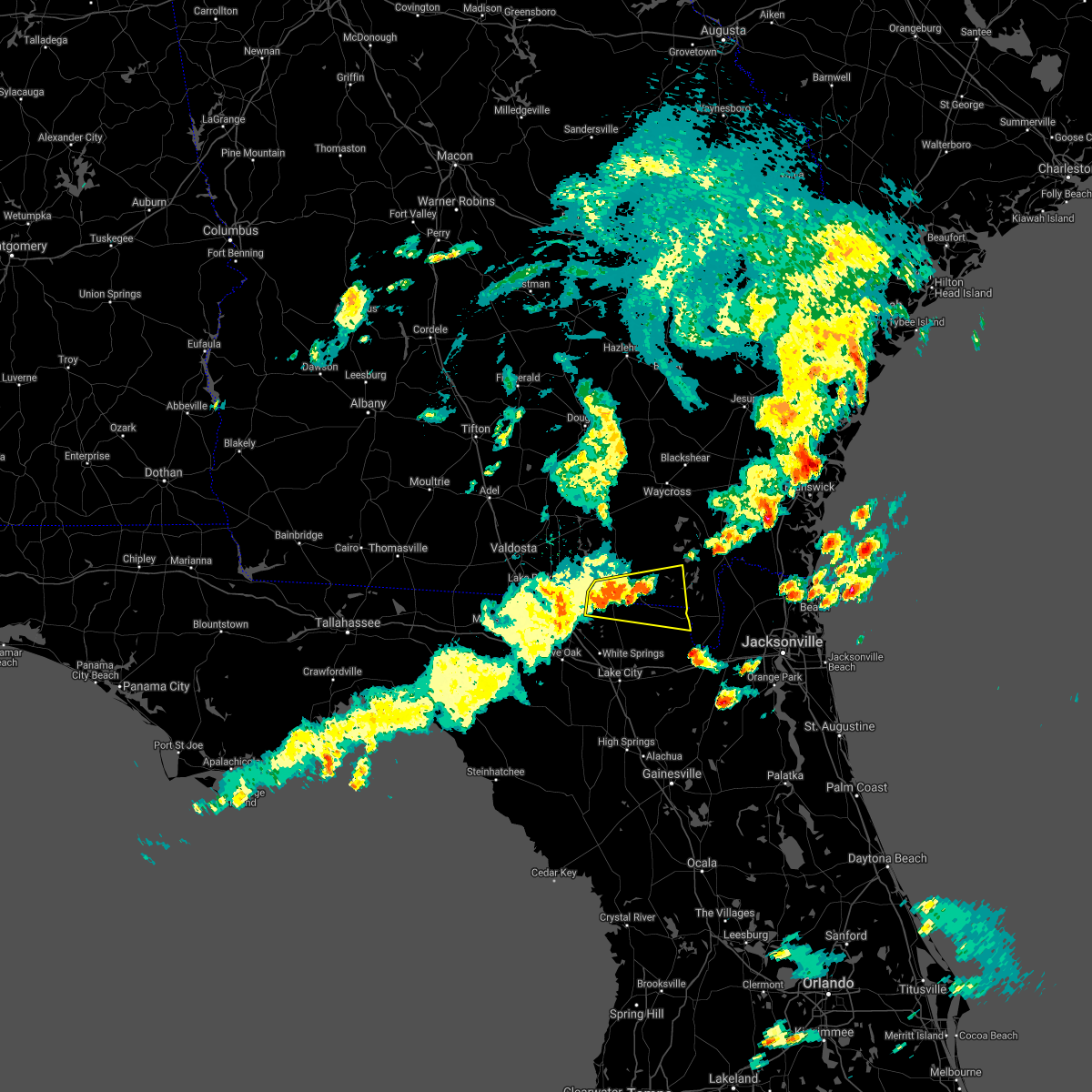
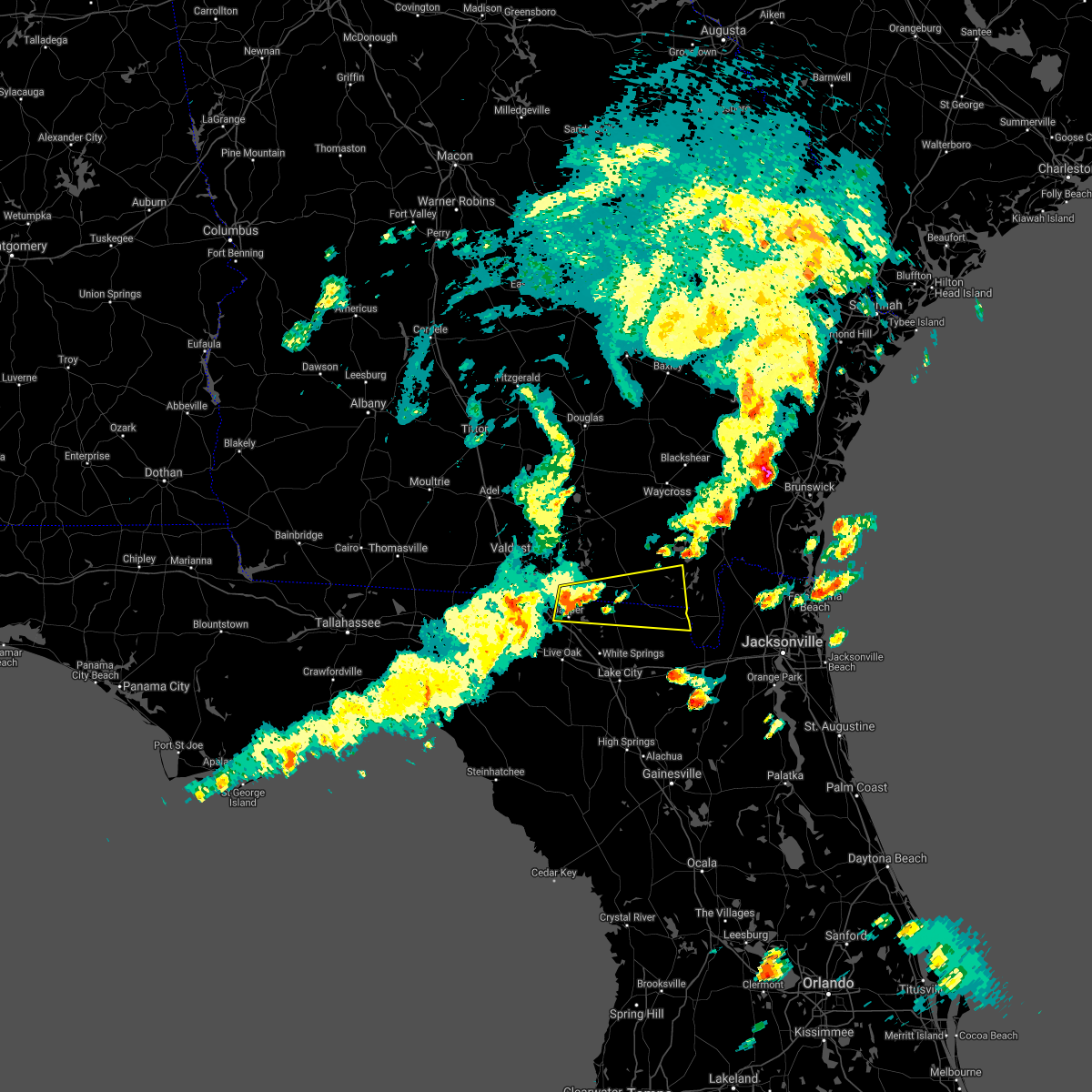
Hail Map for Fargo, GA
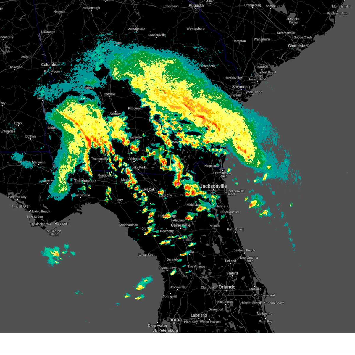
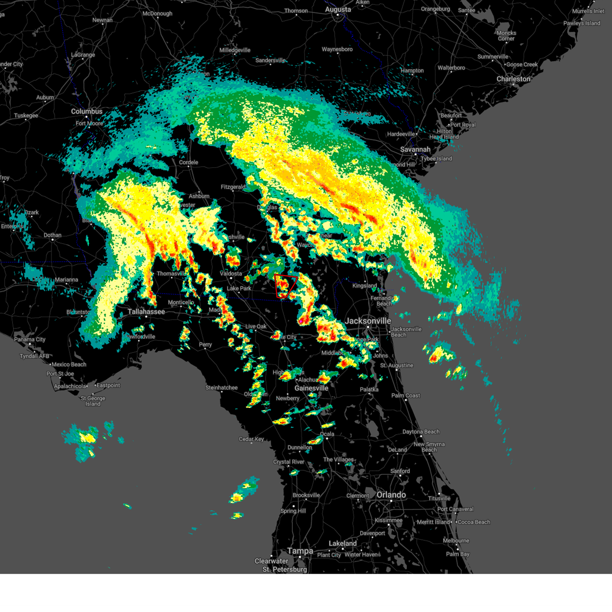
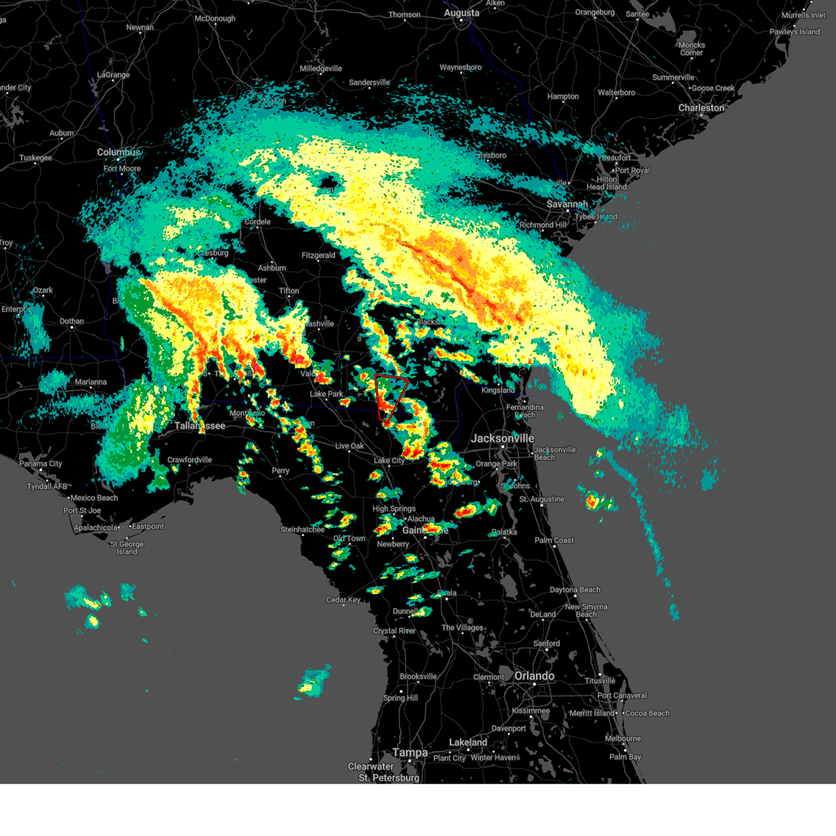
The Fargo, GA area has had 0 reports of on-the-ground hail by trained spotters, and has been under severe weather warnings 4 times during the past 12 months. Doppler radar has detected hail at or near Fargo, GA on 51 occasions.
| Name: | Fargo, GA |
| Where Located: | 58.6 miles SSE of Douglas, GA |
| Map: | Google Map for Fargo, GA |
| Population: | 321 |
| Housing Units: | 161 |
| More Info: | Search Google for Fargo, GA |
0
The Top Recent Hail Date for Fargo, GA is Monday, September 11, 2023 (47th out of 51)

Hail and Wind Damage Spotted near Fargo, GA
| Date / Time | Report Details |
|---|---|
| 4/7/2025 3:20 PM EDT |
 At 320 pm edt, a severe thunderstorm was located 13 miles north of needmore, or 13 miles north of fargo, moving northeast at 45 mph (radar indicated). Hazards include 60 mph wind gusts. Expect damage to roofs, siding, and trees. Locations impacted include, homerville, argyle, and manor. At 320 pm edt, a severe thunderstorm was located 13 miles north of needmore, or 13 miles north of fargo, moving northeast at 45 mph (radar indicated). Hazards include 60 mph wind gusts. Expect damage to roofs, siding, and trees. Locations impacted include, homerville, argyle, and manor.
|
| 4/7/2025 3:20 PM EDT |
 the severe thunderstorm warning has been cancelled and is no longer in effect the severe thunderstorm warning has been cancelled and is no longer in effect
|
| 4/7/2025 2:56 PM EDT |
 Svrjax the national weather service in jacksonville has issued a * severe thunderstorm warning for, north central hamilton county in northern florida, echols county in southeastern georgia, southwestern ware county in southeastern georgia, clinch county in southeastern georgia, west central charlton county in southeastern georgia, * until 330 pm edt. * at 256 pm edt, a severe thunderstorm was located near statenville, moving northeast at 45 mph (radar indicated). Hazards include 60 mph wind gusts. expect damage to roofs, siding, and trees Svrjax the national weather service in jacksonville has issued a * severe thunderstorm warning for, north central hamilton county in northern florida, echols county in southeastern georgia, southwestern ware county in southeastern georgia, clinch county in southeastern georgia, west central charlton county in southeastern georgia, * until 330 pm edt. * at 256 pm edt, a severe thunderstorm was located near statenville, moving northeast at 45 mph (radar indicated). Hazards include 60 mph wind gusts. expect damage to roofs, siding, and trees
|
| 4/7/2025 2:31 PM EDT |
 Svrjax the national weather service in jacksonville has issued a * severe thunderstorm warning for, northwestern suwannee county in northern florida, northeastern columbia county in northern florida, hamilton county in northern florida, echols county in southeastern georgia, west central ware county in southeastern georgia, clinch county in southeastern georgia, * until 300 pm edt. * at 231 pm edt, a severe thunderstorm was located over crossroads, or near jennings, moving northeast at 45 mph (radar indicated). Hazards include 60 mph wind gusts. expect damage to roofs, siding, and trees Svrjax the national weather service in jacksonville has issued a * severe thunderstorm warning for, northwestern suwannee county in northern florida, northeastern columbia county in northern florida, hamilton county in northern florida, echols county in southeastern georgia, west central ware county in southeastern georgia, clinch county in southeastern georgia, * until 300 pm edt. * at 231 pm edt, a severe thunderstorm was located over crossroads, or near jennings, moving northeast at 45 mph (radar indicated). Hazards include 60 mph wind gusts. expect damage to roofs, siding, and trees
|
| 5/17/2024 10:42 PM EDT |
 The storm which prompted the warning has moved out of the area. therefore, the warning will be allowed to expire. however, heavy rain is still possible with this thunderstorm. a tornado watch remains in effect until 100 am edt for southeastern georgia. The storm which prompted the warning has moved out of the area. therefore, the warning will be allowed to expire. however, heavy rain is still possible with this thunderstorm. a tornado watch remains in effect until 100 am edt for southeastern georgia.
|
| 5/17/2024 10:36 PM EDT |
 Svrjax the national weather service in jacksonville has issued a * severe thunderstorm warning for, northwestern baker county in northeastern florida, northeastern columbia county in northern florida, southeastern ware county in southeastern georgia, southeastern clinch county in southeastern georgia, * until 1100 pm edt. * at 1036 pm edt, a severe thunderstorm was located near fargo, moving east at 25 mph (radar indicated). Hazards include 60 mph wind gusts and nickel size hail. expect damage to roofs, siding, and trees Svrjax the national weather service in jacksonville has issued a * severe thunderstorm warning for, northwestern baker county in northeastern florida, northeastern columbia county in northern florida, southeastern ware county in southeastern georgia, southeastern clinch county in southeastern georgia, * until 1100 pm edt. * at 1036 pm edt, a severe thunderstorm was located near fargo, moving east at 25 mph (radar indicated). Hazards include 60 mph wind gusts and nickel size hail. expect damage to roofs, siding, and trees
|
| 5/17/2024 10:27 PM EDT |
 the severe thunderstorm warning has been cancelled and is no longer in effect the severe thunderstorm warning has been cancelled and is no longer in effect
|
| 5/17/2024 10:27 PM EDT |
 At 1026 pm edt, a severe thunderstorm was located near fargo, moving east at 30 mph (radar indicated). Hazards include 60 mph wind gusts and nickel size hail. Expect damage to roofs, siding, and trees. Locations impacted include, fargo and needmore. At 1026 pm edt, a severe thunderstorm was located near fargo, moving east at 30 mph (radar indicated). Hazards include 60 mph wind gusts and nickel size hail. Expect damage to roofs, siding, and trees. Locations impacted include, fargo and needmore.
|
| 5/17/2024 10:02 PM EDT |
 Svrjax the national weather service in jacksonville has issued a * severe thunderstorm warning for, northeastern hamilton county in northern florida, southeastern echols county in southeastern georgia, south central ware county in southeastern georgia, southeastern clinch county in southeastern georgia, * until 1045 pm edt. * at 1002 pm edt, a severe thunderstorm was located over needmore, or 9 miles west of fargo, moving east at 30 mph (radar indicated). Hazards include 60 mph wind gusts and penny size hail. expect damage to roofs, siding, and trees Svrjax the national weather service in jacksonville has issued a * severe thunderstorm warning for, northeastern hamilton county in northern florida, southeastern echols county in southeastern georgia, south central ware county in southeastern georgia, southeastern clinch county in southeastern georgia, * until 1045 pm edt. * at 1002 pm edt, a severe thunderstorm was located over needmore, or 9 miles west of fargo, moving east at 30 mph (radar indicated). Hazards include 60 mph wind gusts and penny size hail. expect damage to roofs, siding, and trees
|
| 5/14/2024 6:55 AM EDT |
 The storm which prompted the warning has weakened below severe limits, and no longer poses an immediate threat to life or property. therefore, the warning will be allowed to expire. however, gusty winds are still possible with this thunderstorm. a tornado watch remains in effect until 100 pm edt for northern florida, and southeastern georgia. The storm which prompted the warning has weakened below severe limits, and no longer poses an immediate threat to life or property. therefore, the warning will be allowed to expire. however, gusty winds are still possible with this thunderstorm. a tornado watch remains in effect until 100 pm edt for northern florida, and southeastern georgia.
|
| 5/14/2024 6:32 AM EDT |
 Svrjax the national weather service in jacksonville has issued a * severe thunderstorm warning for, north central suwannee county in northern florida, north central columbia county in northern florida, hamilton county in northern florida, echols county in southeastern georgia, central clinch county in southeastern georgia, * until 700 am edt. * at 632 am edt, a severe thunderstorm was located near jasper, moving northeast at 45 mph (radar indicated). Hazards include 60 mph wind gusts and penny size hail. expect damage to roofs, siding, and trees Svrjax the national weather service in jacksonville has issued a * severe thunderstorm warning for, north central suwannee county in northern florida, north central columbia county in northern florida, hamilton county in northern florida, echols county in southeastern georgia, central clinch county in southeastern georgia, * until 700 am edt. * at 632 am edt, a severe thunderstorm was located near jasper, moving northeast at 45 mph (radar indicated). Hazards include 60 mph wind gusts and penny size hail. expect damage to roofs, siding, and trees
|
| 5/10/2024 8:18 AM EDT |
 Svrjax the national weather service in jacksonville has issued a * severe thunderstorm warning for, gilchrist county in northern florida, western alachua county in northern florida, baker county in northeastern florida, union county in northern florida, southeastern suwannee county in northern florida, columbia county in northern florida, eastern hamilton county in northern florida, southeastern echols county in southeastern georgia, southern ware county in southeastern georgia, southeastern clinch county in southeastern georgia, central charlton county in southeastern georgia, * until 900 am edt. * at 818 am edt, severe thunderstorms were located along a line extending from 6 miles south of homerville to near white springs to near cross city, moving east at 60 mph (radar indicated). Hazards include 70 mph wind gusts and quarter size hail. Hail damage to vehicles is expected. expect considerable tree damage. Wind damage is also likely to mobile homes, roofs, and outbuildings. Svrjax the national weather service in jacksonville has issued a * severe thunderstorm warning for, gilchrist county in northern florida, western alachua county in northern florida, baker county in northeastern florida, union county in northern florida, southeastern suwannee county in northern florida, columbia county in northern florida, eastern hamilton county in northern florida, southeastern echols county in southeastern georgia, southern ware county in southeastern georgia, southeastern clinch county in southeastern georgia, central charlton county in southeastern georgia, * until 900 am edt. * at 818 am edt, severe thunderstorms were located along a line extending from 6 miles south of homerville to near white springs to near cross city, moving east at 60 mph (radar indicated). Hazards include 70 mph wind gusts and quarter size hail. Hail damage to vehicles is expected. expect considerable tree damage. Wind damage is also likely to mobile homes, roofs, and outbuildings.
|
| 5/10/2024 8:00 AM EDT |
 At 800 am edt, severe thunderstorms were located along a line extending from moody air force base to 7 miles southwest of dowling park to near steinhatchee, moving east at 45 mph (radar indicated). Hazards include 70 mph wind gusts and quarter size hail. possible tornadoes. Hail damage to vehicles is expected. expect considerable tree damage. wind damage is also likely to mobile homes, roofs, and outbuildings. Locations impacted include, lake city, live oak, jasper, homerville, trenton, jennings, white springs, bell, fargo, and statenville. At 800 am edt, severe thunderstorms were located along a line extending from moody air force base to 7 miles southwest of dowling park to near steinhatchee, moving east at 45 mph (radar indicated). Hazards include 70 mph wind gusts and quarter size hail. possible tornadoes. Hail damage to vehicles is expected. expect considerable tree damage. wind damage is also likely to mobile homes, roofs, and outbuildings. Locations impacted include, lake city, live oak, jasper, homerville, trenton, jennings, white springs, bell, fargo, and statenville.
|
| 5/10/2024 7:50 AM EDT |
 Svrjax the national weather service in jacksonville has issued a * severe thunderstorm warning for, gilchrist county in northern florida, suwannee county in northern florida, western columbia county in northern florida, hamilton county in northern florida, echols county in southeastern georgia, west central ware county in southeastern georgia, clinch county in southeastern georgia, * until 830 am edt. * at 750 am edt, severe thunderstorms were located along a line extending from near hahira to 7 miles west of dowling park to 18 miles northwest of steinhatchee, moving east at 55 mph (radar indicated). Hazards include 70 mph wind gusts and quarter size hail. Hail damage to vehicles is expected. expect considerable tree damage. Wind damage is also likely to mobile homes, roofs, and outbuildings. Svrjax the national weather service in jacksonville has issued a * severe thunderstorm warning for, gilchrist county in northern florida, suwannee county in northern florida, western columbia county in northern florida, hamilton county in northern florida, echols county in southeastern georgia, west central ware county in southeastern georgia, clinch county in southeastern georgia, * until 830 am edt. * at 750 am edt, severe thunderstorms were located along a line extending from near hahira to 7 miles west of dowling park to 18 miles northwest of steinhatchee, moving east at 55 mph (radar indicated). Hazards include 70 mph wind gusts and quarter size hail. Hail damage to vehicles is expected. expect considerable tree damage. Wind damage is also likely to mobile homes, roofs, and outbuildings.
|
| 3/9/2024 2:15 PM EST |
 Svrjax the national weather service in jacksonville has issued a * severe thunderstorm warning for, northwestern baker county in northeastern florida, northeastern columbia county in northern florida, southeastern echols county in southeastern georgia, southeastern ware county in southeastern georgia, southeastern clinch county in southeastern georgia, west central charlton county in southeastern georgia, * until 300 pm est. * at 214 pm est, a severe thunderstorm was located near fargo, moving east at 35 mph (radar indicated). Hazards include 60 mph wind gusts and penny size hail. expect damage to roofs, siding, and trees Svrjax the national weather service in jacksonville has issued a * severe thunderstorm warning for, northwestern baker county in northeastern florida, northeastern columbia county in northern florida, southeastern echols county in southeastern georgia, southeastern ware county in southeastern georgia, southeastern clinch county in southeastern georgia, west central charlton county in southeastern georgia, * until 300 pm est. * at 214 pm est, a severe thunderstorm was located near fargo, moving east at 35 mph (radar indicated). Hazards include 60 mph wind gusts and penny size hail. expect damage to roofs, siding, and trees
|
| 3/9/2024 1:45 PM EST |
 Svrjax the national weather service in jacksonville has issued a * severe thunderstorm warning for, northwestern baker county in northeastern florida, north central suwannee county in northern florida, northeastern columbia county in northern florida, hamilton county in northern florida, southern echols county in southeastern georgia, southeastern ware county in southeastern georgia, southeastern clinch county in southeastern georgia, northern charlton county in southeastern georgia, * until 215 pm est. * at 145 pm est, severe thunderstorms were located along a line extending from 8 miles northeast of stephen foster state park to 8 miles east of fargo to suwannee river state park, moving southeast at 15 mph (radar indicated). Hazards include 60 mph wind gusts and penny size hail. expect damage to roofs, siding, and trees Svrjax the national weather service in jacksonville has issued a * severe thunderstorm warning for, northwestern baker county in northeastern florida, north central suwannee county in northern florida, northeastern columbia county in northern florida, hamilton county in northern florida, southern echols county in southeastern georgia, southeastern ware county in southeastern georgia, southeastern clinch county in southeastern georgia, northern charlton county in southeastern georgia, * until 215 pm est. * at 145 pm est, severe thunderstorms were located along a line extending from 8 miles northeast of stephen foster state park to 8 miles east of fargo to suwannee river state park, moving southeast at 15 mph (radar indicated). Hazards include 60 mph wind gusts and penny size hail. expect damage to roofs, siding, and trees
|
| 3/9/2024 12:58 PM EST |
 Svrjax the national weather service in jacksonville has issued a * severe thunderstorm warning for, northwestern hamilton county in northern florida, echols county in southeastern georgia, central ware county in southeastern georgia, central clinch county in southeastern georgia, northwestern charlton county in southeastern georgia, * until 145 pm est. * at 1258 pm est, a severe thunderstorm was located 9 miles north of needmore, or 9 miles northwest of fargo, moving northeast at 45 mph (radar indicated). Hazards include 60 mph wind gusts and penny size hail. expect damage to roofs, siding, and trees Svrjax the national weather service in jacksonville has issued a * severe thunderstorm warning for, northwestern hamilton county in northern florida, echols county in southeastern georgia, central ware county in southeastern georgia, central clinch county in southeastern georgia, northwestern charlton county in southeastern georgia, * until 145 pm est. * at 1258 pm est, a severe thunderstorm was located 9 miles north of needmore, or 9 miles northwest of fargo, moving northeast at 45 mph (radar indicated). Hazards include 60 mph wind gusts and penny size hail. expect damage to roofs, siding, and trees
|
| 2/4/2024 3:30 PM EST |
 At 330 pm est, a severe thunderstorm was located 7 miles north of needmore, or 7 miles northwest of fargo, moving north at 25 mph (radar indicated). Hazards include 60 mph wind gusts and quarter size hail. Hail damage to vehicles is expected. Expect wind damage to roofs, siding, and trees. At 330 pm est, a severe thunderstorm was located 7 miles north of needmore, or 7 miles northwest of fargo, moving north at 25 mph (radar indicated). Hazards include 60 mph wind gusts and quarter size hail. Hail damage to vehicles is expected. Expect wind damage to roofs, siding, and trees.
|
| 2/4/2024 3:24 PM EST |
 At 323 pm est, a severe thunderstorm capable of producing a tornado was located near needmore, or near fargo, moving north at 25 mph (radar indicated rotation). Hazards include tornado. Flying debris will be dangerous to those caught without shelter. mobile homes will be damaged or destroyed. damage to roofs, windows, and vehicles will occur. tree damage is likely. Locations impacted include, needmore. At 323 pm est, a severe thunderstorm capable of producing a tornado was located near needmore, or near fargo, moving north at 25 mph (radar indicated rotation). Hazards include tornado. Flying debris will be dangerous to those caught without shelter. mobile homes will be damaged or destroyed. damage to roofs, windows, and vehicles will occur. tree damage is likely. Locations impacted include, needmore.
|
| 2/4/2024 3:11 PM EST |
 At 309 pm est, a severe thunderstorm capable of producing a tornado was located over needmore, or near fargo, moving north at 20 mph. another thunderstorm was about 5 miles northeast of belmont moving north at 20 mph (radar indicated rotation). Hazards include tornado and quarter size hail. Flying debris will be dangerous to those caught without shelter. mobile homes will be damaged or destroyed. damage to roofs, windows, and vehicles will occur. tree damage is likely. This tornadic thunderstorm will remain over mainly rural areas of north central columbia, eastern hamilton, southeastern echols and southeastern clinch counties. At 309 pm est, a severe thunderstorm capable of producing a tornado was located over needmore, or near fargo, moving north at 20 mph. another thunderstorm was about 5 miles northeast of belmont moving north at 20 mph (radar indicated rotation). Hazards include tornado and quarter size hail. Flying debris will be dangerous to those caught without shelter. mobile homes will be damaged or destroyed. damage to roofs, windows, and vehicles will occur. tree damage is likely. This tornadic thunderstorm will remain over mainly rural areas of north central columbia, eastern hamilton, southeastern echols and southeastern clinch counties.
|
| 2/4/2024 2:56 PM EST |
 At 255 pm est, a severe thunderstorm capable of producing a tornado was located near needmore, or 9 miles southwest of fargo, moving north at 25 mph (radar indicated rotation). Hazards include tornado. Flying debris will be dangerous to those caught without shelter. mobile homes will be damaged or destroyed. damage to roofs, windows, and vehicles will occur. tree damage is likely. This dangerous storm will be near, needmore around 300 pm est. At 255 pm est, a severe thunderstorm capable of producing a tornado was located near needmore, or 9 miles southwest of fargo, moving north at 25 mph (radar indicated rotation). Hazards include tornado. Flying debris will be dangerous to those caught without shelter. mobile homes will be damaged or destroyed. damage to roofs, windows, and vehicles will occur. tree damage is likely. This dangerous storm will be near, needmore around 300 pm est.
|
| 2/4/2024 2:46 PM EST |
 At 246 pm est, a severe thunderstorm was located over belmont, or 13 miles north of white springs, moving north at 25 mph (radar indicated). Hazards include 60 mph wind gusts and penny size hail. Expect damage to roofs, siding, and trees. locations impacted include, fargo, belmont, and needmore. hail threat, radar indicated max hail size, 0. 75 in wind threat, radar indicated max wind gust, 60 mph. At 246 pm est, a severe thunderstorm was located over belmont, or 13 miles north of white springs, moving north at 25 mph (radar indicated). Hazards include 60 mph wind gusts and penny size hail. Expect damage to roofs, siding, and trees. locations impacted include, fargo, belmont, and needmore. hail threat, radar indicated max hail size, 0. 75 in wind threat, radar indicated max wind gust, 60 mph.
|
| 2/4/2024 2:38 PM EST |
 At 238 pm est, a severe thunderstorm was located over belmont, or 9 miles northeast of white springs, moving north at 25 mph (radar indicated). Hazards include 60 mph wind gusts and penny size hail. expect damage to roofs, siding, and trees At 238 pm est, a severe thunderstorm was located over belmont, or 9 miles northeast of white springs, moving north at 25 mph (radar indicated). Hazards include 60 mph wind gusts and penny size hail. expect damage to roofs, siding, and trees
|
| 1/9/2024 1:33 PM EST |
 At 133 pm est, severe thunderstorms were located along a line extending from near dixie union to near needmore, moving northeast at 60 mph (radar indicated). Hazards include 70 mph wind gusts and penny size hail. Expect considerable tree damage. Damage is likely to mobile homes, roofs, and outbuildings. At 133 pm est, severe thunderstorms were located along a line extending from near dixie union to near needmore, moving northeast at 60 mph (radar indicated). Hazards include 70 mph wind gusts and penny size hail. Expect considerable tree damage. Damage is likely to mobile homes, roofs, and outbuildings.
|
| 8/8/2023 7:47 PM EDT |
 At 746 pm edt, severe thunderstorms were located along a line extending from near glennville to near lake park, moving east at 15 mph (radar indicated). Hazards include 60 mph wind gusts and quarter size hail. Hail damage to vehicles is expected. expect wind damage to roofs, siding, and trees. locations impacted include, waycross, jesup, blackshear, homerville, patterson, fargo, argyle, statenville, screven, and odum. hail threat, radar indicated max hail size, 1. 00 in wind threat, radar indicated max wind gust, 60 mph. At 746 pm edt, severe thunderstorms were located along a line extending from near glennville to near lake park, moving east at 15 mph (radar indicated). Hazards include 60 mph wind gusts and quarter size hail. Hail damage to vehicles is expected. expect wind damage to roofs, siding, and trees. locations impacted include, waycross, jesup, blackshear, homerville, patterson, fargo, argyle, statenville, screven, and odum. hail threat, radar indicated max hail size, 1. 00 in wind threat, radar indicated max wind gust, 60 mph.
|
| 8/8/2023 7:21 PM EDT |
 At 720 pm edt, severe thunderstorms were located along a line extending from 10 miles southwest of glennville to near lake park, moving east at 15 mph (radar indicated). Hazards include 60 mph wind gusts and quarter size hail. Hail damage to vehicles is expected. expect wind damage to roofs, siding, and trees. locations impacted include, waycross, jesup, baxley, alma, blackshear, homerville, pearson, patterson, fargo, and argyle. hail threat, radar indicated max hail size, 1. 00 in wind threat, radar indicated max wind gust, 60 mph. At 720 pm edt, severe thunderstorms were located along a line extending from 10 miles southwest of glennville to near lake park, moving east at 15 mph (radar indicated). Hazards include 60 mph wind gusts and quarter size hail. Hail damage to vehicles is expected. expect wind damage to roofs, siding, and trees. locations impacted include, waycross, jesup, baxley, alma, blackshear, homerville, pearson, patterson, fargo, and argyle. hail threat, radar indicated max hail size, 1. 00 in wind threat, radar indicated max wind gust, 60 mph.
|
| 8/8/2023 7:08 PM EDT |
 At 708 pm edt, severe thunderstorms were located along a line extending from 10 miles northeast of surrency to 6 miles southwest of lake park, moving east at 15 mph (radar indicated). Hazards include 60 mph wind gusts and quarter size hail. Hail damage to vehicles is expected. Expect wind damage to roofs, siding, and trees. At 708 pm edt, severe thunderstorms were located along a line extending from 10 miles northeast of surrency to 6 miles southwest of lake park, moving east at 15 mph (radar indicated). Hazards include 60 mph wind gusts and quarter size hail. Hail damage to vehicles is expected. Expect wind damage to roofs, siding, and trees.
|
| 7/30/2023 7:38 PM EDT |
 At 737 pm edt, a severe thunderstorm was located 9 miles southeast of mayday, or 10 miles northeast of statenville, moving east at 20 mph (radar indicated). Hazards include 60 mph wind gusts and penny size hail. expect damage to roofs, siding, and trees At 737 pm edt, a severe thunderstorm was located 9 miles southeast of mayday, or 10 miles northeast of statenville, moving east at 20 mph (radar indicated). Hazards include 60 mph wind gusts and penny size hail. expect damage to roofs, siding, and trees
|
| 7/30/2023 7:04 PM EDT |
 At 704 pm edt, severe thunderstorms were located along a line extending from near jennings to near st. george, moving south at 15 mph (radar indicated). Hazards include 60 mph wind gusts and penny size hail. expect damage to roofs, siding, and trees At 704 pm edt, severe thunderstorms were located along a line extending from near jennings to near st. george, moving south at 15 mph (radar indicated). Hazards include 60 mph wind gusts and penny size hail. expect damage to roofs, siding, and trees
|
| 6/19/2023 11:18 AM EDT |
 At 1118 am edt, severe thunderstorms were located along a line extending from 9 miles northwest of stephen foster state park to fargo, moving east at 40 mph (radar indicated). Hazards include 60 mph wind gusts and penny size hail. Expect damage to roofs, siding, and trees. locations impacted include, fargo, stephen foster state park and needmore. hail threat, radar indicated max hail size, 0. 75 in wind threat, radar indicated max wind gust, 60 mph. At 1118 am edt, severe thunderstorms were located along a line extending from 9 miles northwest of stephen foster state park to fargo, moving east at 40 mph (radar indicated). Hazards include 60 mph wind gusts and penny size hail. Expect damage to roofs, siding, and trees. locations impacted include, fargo, stephen foster state park and needmore. hail threat, radar indicated max hail size, 0. 75 in wind threat, radar indicated max wind gust, 60 mph.
|
| 6/19/2023 10:49 AM EDT |
 At 1049 am edt, severe thunderstorms were located along a line extending from 6 miles south of homerville to 10 miles northwest of needmore to 10 miles east of statenville, moving east at 40 mph (radar indicated). Hazards include 60 mph wind gusts and penny size hail. expect damage to roofs, siding, and trees At 1049 am edt, severe thunderstorms were located along a line extending from 6 miles south of homerville to 10 miles northwest of needmore to 10 miles east of statenville, moving east at 40 mph (radar indicated). Hazards include 60 mph wind gusts and penny size hail. expect damage to roofs, siding, and trees
|
| 6/14/2023 8:36 PM EDT |
 At 835 pm edt, severe thunderstorms were located along a line extending from fargo to near jennings, moving southeast at 40 mph (radar indicated). Hazards include 60 mph wind gusts and quarter size hail. Hail damage to vehicles is expected. expect wind damage to roofs, siding, and trees. locations impacted include, fargo and needmore. hail threat, radar indicated max hail size, 1. 00 in wind threat, radar indicated max wind gust, 60 mph. At 835 pm edt, severe thunderstorms were located along a line extending from fargo to near jennings, moving southeast at 40 mph (radar indicated). Hazards include 60 mph wind gusts and quarter size hail. Hail damage to vehicles is expected. expect wind damage to roofs, siding, and trees. locations impacted include, fargo and needmore. hail threat, radar indicated max hail size, 1. 00 in wind threat, radar indicated max wind gust, 60 mph.
|
| 6/14/2023 8:13 PM EDT |
 At 813 pm edt, severe thunderstorms were located along a line extending from 13 miles north of needmore to near lake park, moving southeast at 35 mph (radar indicated). Hazards include 60 mph wind gusts and quarter size hail. Hail damage to vehicles is expected. Expect wind damage to roofs, siding, and trees. At 813 pm edt, severe thunderstorms were located along a line extending from 13 miles north of needmore to near lake park, moving southeast at 35 mph (radar indicated). Hazards include 60 mph wind gusts and quarter size hail. Hail damage to vehicles is expected. Expect wind damage to roofs, siding, and trees.
|
| 6/13/2023 6:28 PM EDT |
 At 628 pm edt, severe thunderstorms were located along a line extending from near blackshear to 8 miles west of stephen foster state park to 8 miles northeast of jasper, moving east at 45 mph (radar indicated). Hazards include 60 mph wind gusts. Expect damage to roofs, siding, and trees. locations impacted include, jasper, blackshear, jennings, fargo, stephen foster state park, boggy bay, needmore, braganza, race pond and fort mudge. hail threat, radar indicated max hail size, <. 75 in wind threat, radar indicated max wind gust, 60 mph. At 628 pm edt, severe thunderstorms were located along a line extending from near blackshear to 8 miles west of stephen foster state park to 8 miles northeast of jasper, moving east at 45 mph (radar indicated). Hazards include 60 mph wind gusts. Expect damage to roofs, siding, and trees. locations impacted include, jasper, blackshear, jennings, fargo, stephen foster state park, boggy bay, needmore, braganza, race pond and fort mudge. hail threat, radar indicated max hail size, <. 75 in wind threat, radar indicated max wind gust, 60 mph.
|
| 6/13/2023 6:19 PM EDT |
 At 619 pm edt, severe thunderstorms were located along a line extending from near boggy bay to 8 miles north of fargo to near jennings, moving east at 40 mph (radar indicated). Hazards include 60 mph wind gusts. expect damage to roofs, siding, and trees At 619 pm edt, severe thunderstorms were located along a line extending from near boggy bay to 8 miles north of fargo to near jennings, moving east at 40 mph (radar indicated). Hazards include 60 mph wind gusts. expect damage to roofs, siding, and trees
|
| 3/18/2023 1:18 AM EDT |
 At 117 am edt, a severe thunderstorm capable of producing a tornado was located near needmore, or 11 miles west of fargo, moving east at 30 mph (radar indicated rotation). Hazards include tornado. Flying debris will be dangerous to those caught without shelter. mobile homes will be damaged or destroyed. damage to roofs, windows, and vehicles will occur. tree damage is likely. this dangerous storm will be near, needmore around 130 am edt. Fargo around 140 am edt. At 117 am edt, a severe thunderstorm capable of producing a tornado was located near needmore, or 11 miles west of fargo, moving east at 30 mph (radar indicated rotation). Hazards include tornado. Flying debris will be dangerous to those caught without shelter. mobile homes will be damaged or destroyed. damage to roofs, windows, and vehicles will occur. tree damage is likely. this dangerous storm will be near, needmore around 130 am edt. Fargo around 140 am edt.
|
| 3/18/2023 1:09 AM EDT |
 At 109 am edt, a severe thunderstorm capable of producing a tornado was located 9 miles southwest of needmore, or 10 miles northeast of jasper, moving east at 30 mph (radar indicated rotation). Hazards include tornado. Flying debris will be dangerous to those caught without shelter. mobile homes will be damaged or destroyed. damage to roofs, windows, and vehicles will occur. tree damage is likely. this dangerous storm will be near, needmore around 125 am edt. Fargo around 140 am edt. At 109 am edt, a severe thunderstorm capable of producing a tornado was located 9 miles southwest of needmore, or 10 miles northeast of jasper, moving east at 30 mph (radar indicated rotation). Hazards include tornado. Flying debris will be dangerous to those caught without shelter. mobile homes will be damaged or destroyed. damage to roofs, windows, and vehicles will occur. tree damage is likely. this dangerous storm will be near, needmore around 125 am edt. Fargo around 140 am edt.
|
| 1/22/2023 7:05 PM EST |
 At 705 pm est, a severe thunderstorm was located 10 miles north of fargo, moving east at 60 mph (radar indicated). Hazards include 60 mph wind gusts. Expect damage to roofs, siding, and trees. Locations impacted include, fargo and needmore. At 705 pm est, a severe thunderstorm was located 10 miles north of fargo, moving east at 60 mph (radar indicated). Hazards include 60 mph wind gusts. Expect damage to roofs, siding, and trees. Locations impacted include, fargo and needmore.
|
| 1/22/2023 6:55 PM EST |
 At 655 pm est, a severe thunderstorm was located 8 miles northwest of needmore, or 12 miles northwest of fargo, moving east at 60 mph (radar indicated). Hazards include 60 mph wind gusts. Expect damage to roofs, siding, and trees. Locations impacted include, fargo and needmore. At 655 pm est, a severe thunderstorm was located 8 miles northwest of needmore, or 12 miles northwest of fargo, moving east at 60 mph (radar indicated). Hazards include 60 mph wind gusts. Expect damage to roofs, siding, and trees. Locations impacted include, fargo and needmore.
|
| 1/22/2023 6:34 PM EST |
 At 634 pm est, a severe thunderstorm was located near statenville, moving east at 60 mph (radar indicated). Hazards include 60 mph wind gusts. expect damage to roofs, siding, and trees At 634 pm est, a severe thunderstorm was located near statenville, moving east at 60 mph (radar indicated). Hazards include 60 mph wind gusts. expect damage to roofs, siding, and trees
|
| 1/4/2023 12:53 PM EST |
 At 1252 pm est, severe thunderstorms were located along a line extending from 6 miles southwest of bristol to 10 miles southeast of manor to near fargo to 9 miles northeast of jasper, moving northeast at 45 mph (radar indicated). Hazards include 60 mph wind gusts and quarter size hail. Hail damage to vehicles is expected. expect wind damage to roofs, siding, and trees. Locations impacted include, white springs, fargo, suwannee springs, suwannee river state park, needmore, suwannee valley, belmont and blue springs. At 1252 pm est, severe thunderstorms were located along a line extending from 6 miles southwest of bristol to 10 miles southeast of manor to near fargo to 9 miles northeast of jasper, moving northeast at 45 mph (radar indicated). Hazards include 60 mph wind gusts and quarter size hail. Hail damage to vehicles is expected. expect wind damage to roofs, siding, and trees. Locations impacted include, white springs, fargo, suwannee springs, suwannee river state park, needmore, suwannee valley, belmont and blue springs.
|
| 1/4/2023 12:32 PM EST |
 At 1232 pm est, severe thunderstorms were located along a line extending from near dixie union to 12 miles northwest of fargo to 7 miles southwest of needmore to near crossroads, moving northeast at 45 mph (radar indicated). Hazards include 60 mph wind gusts and quarter size hail. Hail damage to vehicles is expected. expect wind damage to roofs, siding, and trees. Locations impacted include, jasper, homerville, white springs, fargo, argyle, suwannee river state park, suwannee springs, suwannee valley, belmont and crossroads. At 1232 pm est, severe thunderstorms were located along a line extending from near dixie union to 12 miles northwest of fargo to 7 miles southwest of needmore to near crossroads, moving northeast at 45 mph (radar indicated). Hazards include 60 mph wind gusts and quarter size hail. Hail damage to vehicles is expected. expect wind damage to roofs, siding, and trees. Locations impacted include, jasper, homerville, white springs, fargo, argyle, suwannee river state park, suwannee springs, suwannee valley, belmont and crossroads.
|
| 1/4/2023 12:24 PM EST |
 At 1224 pm est, severe thunderstorms were located along a line extending from 9 miles north of manor to 9 miles northwest of needmore to 7 miles northeast of jasper to near crossroads, moving northeast at 45 mph (radar indicated). Hazards include 60 mph wind gusts and quarter size hail. Hail damage to vehicles is expected. expect wind damage to roofs, siding, and trees. Locations impacted include, jasper, homerville, white springs, fargo, argyle, suwannee river state park, suwannee springs, suwannee valley, belmont and crossroads. At 1224 pm est, severe thunderstorms were located along a line extending from 9 miles north of manor to 9 miles northwest of needmore to 7 miles northeast of jasper to near crossroads, moving northeast at 45 mph (radar indicated). Hazards include 60 mph wind gusts and quarter size hail. Hail damage to vehicles is expected. expect wind damage to roofs, siding, and trees. Locations impacted include, jasper, homerville, white springs, fargo, argyle, suwannee river state park, suwannee springs, suwannee valley, belmont and crossroads.
|
| 1/4/2023 12:20 PM EST |
 At 1220 pm est, severe thunderstorms were located along a line extending from 7 miles northeast of cogdell to 10 miles northwest of needmore to near jasper to near suwannee river state park, moving east at 45 mph (radar indicated). Hazards include 60 mph wind gusts and quarter size hail. Hail damage to vehicles is expected. expect wind damage to roofs, siding, and trees. Locations impacted include, jasper, homerville, jennings, white springs, fargo, argyle, suwannee river state park, suwannee springs, du pont and suwannee valley. At 1220 pm est, severe thunderstorms were located along a line extending from 7 miles northeast of cogdell to 10 miles northwest of needmore to near jasper to near suwannee river state park, moving east at 45 mph (radar indicated). Hazards include 60 mph wind gusts and quarter size hail. Hail damage to vehicles is expected. expect wind damage to roofs, siding, and trees. Locations impacted include, jasper, homerville, jennings, white springs, fargo, argyle, suwannee river state park, suwannee springs, du pont and suwannee valley.
|
| 1/4/2023 12:14 PM EST |
 At 1214 pm est, severe thunderstorms were located along a line extending from 6 miles north of cogdell to 7 miles east of mayday to 6 miles east of jennings to near blue springs, moving northeast at 45 mph (radar indicated). Hazards include 60 mph wind gusts and quarter size hail. Hail damage to vehicles is expected. Expect wind damage to roofs, siding, and trees. At 1214 pm est, severe thunderstorms were located along a line extending from 6 miles north of cogdell to 7 miles east of mayday to 6 miles east of jennings to near blue springs, moving northeast at 45 mph (radar indicated). Hazards include 60 mph wind gusts and quarter size hail. Hail damage to vehicles is expected. Expect wind damage to roofs, siding, and trees.
|
| 1/4/2023 11:39 AM EST |
 At 1139 am est, severe thunderstorms were located along a line extending from 6 miles south of lakeland to 6 miles southwest of madison, moving east at 40 mph (radar indicated). Hazards include 60 mph wind gusts and quarter size hail. Hail damage to vehicles is expected. Expect wind damage to roofs, siding, and trees. At 1139 am est, severe thunderstorms were located along a line extending from 6 miles south of lakeland to 6 miles southwest of madison, moving east at 40 mph (radar indicated). Hazards include 60 mph wind gusts and quarter size hail. Hail damage to vehicles is expected. Expect wind damage to roofs, siding, and trees.
|
| 7/2/2022 6:51 PM EDT |
 The severe thunderstorm warning for south central ware and southeastern clinch counties will expire at 700 pm edt, the storm which prompted the warning has weakened below severe limits, and no longer poses an immediate threat to life or property. therefore, the warning will be allowed to expire. however gusty winds and heavy rain are still possible with this thunderstorm. The severe thunderstorm warning for south central ware and southeastern clinch counties will expire at 700 pm edt, the storm which prompted the warning has weakened below severe limits, and no longer poses an immediate threat to life or property. therefore, the warning will be allowed to expire. however gusty winds and heavy rain are still possible with this thunderstorm.
|
| 7/2/2022 6:34 PM EDT |
 At 634 pm edt, a severe thunderstorm was located over fargo, moving southeast at 10 mph (radar indicated). Hazards include 60 mph wind gusts. expect damage to roofs, siding, and trees At 634 pm edt, a severe thunderstorm was located over fargo, moving southeast at 10 mph (radar indicated). Hazards include 60 mph wind gusts. expect damage to roofs, siding, and trees
|
| 5/6/2022 7:14 PM EDT |
 At 714 pm edt, a severe thunderstorm was located over needmore, or 8 miles west of fargo, moving east at 30 mph (radar indicated). Hazards include 60 mph wind gusts and penny size hail. Expect damage to roofs, siding, and trees. Locations impacted include, needmore. At 714 pm edt, a severe thunderstorm was located over needmore, or 8 miles west of fargo, moving east at 30 mph (radar indicated). Hazards include 60 mph wind gusts and penny size hail. Expect damage to roofs, siding, and trees. Locations impacted include, needmore.
|
| 5/6/2022 6:58 PM EDT |
 At 657 pm edt, a severe thunderstorm was located 10 miles northeast of jasper, moving east at 30 mph (radar indicated). Hazards include 60 mph wind gusts and penny size hail. expect damage to roofs, siding, and trees At 657 pm edt, a severe thunderstorm was located 10 miles northeast of jasper, moving east at 30 mph (radar indicated). Hazards include 60 mph wind gusts and penny size hail. expect damage to roofs, siding, and trees
|
| 4/7/2022 2:09 AM EDT |
 The severe thunderstorm warning for northwestern baker, northeastern columbia, northeastern hamilton, southeastern echols, south central ware, southeastern clinch and west central charlton counties will expire at 215 am edt, the storms which prompted the warning have moved out of the area. therefore, the warning will be allowed to expire. however gusty winds and heavy rain are still possible with these thunderstorms. The severe thunderstorm warning for northwestern baker, northeastern columbia, northeastern hamilton, southeastern echols, south central ware, southeastern clinch and west central charlton counties will expire at 215 am edt, the storms which prompted the warning have moved out of the area. therefore, the warning will be allowed to expire. however gusty winds and heavy rain are still possible with these thunderstorms.
|
| 4/7/2022 1:48 AM EDT |
 At 148 am edt, severe thunderstorms were located along a line extending from 7 miles north of fargo to near needmore to 6 miles northwest of belmont, moving east at 35 mph (radar indicated). Hazards include 60 mph wind gusts. Expect damage to roofs, siding, and trees. locations impacted include, fargo, stephen foster state park and needmore. hail threat, radar indicated max hail size, <. 75 in wind threat, radar indicated max wind gust, 60 mph. At 148 am edt, severe thunderstorms were located along a line extending from 7 miles north of fargo to near needmore to 6 miles northwest of belmont, moving east at 35 mph (radar indicated). Hazards include 60 mph wind gusts. Expect damage to roofs, siding, and trees. locations impacted include, fargo, stephen foster state park and needmore. hail threat, radar indicated max hail size, <. 75 in wind threat, radar indicated max wind gust, 60 mph.
|
| 4/7/2022 1:37 AM EDT |
 At 137 am edt, severe thunderstorms were located along a line extending from 7 miles northwest of fargo to near needmore to near jasper, moving east at 35 mph (radar indicated). Hazards include 60 mph wind gusts. expect damage to roofs, siding, and trees At 137 am edt, severe thunderstorms were located along a line extending from 7 miles northwest of fargo to near needmore to near jasper, moving east at 35 mph (radar indicated). Hazards include 60 mph wind gusts. expect damage to roofs, siding, and trees
|
| 3/18/2022 5:25 PM EDT |
 At 524 pm edt, a severe thunderstorm was located near needmore, or near fargo, moving northeast at 40 mph (radar indicated). Hazards include 60 mph wind gusts and quarter size hail. Hail damage to vehicles is expected. Expect wind damage to roofs, siding, and trees. At 524 pm edt, a severe thunderstorm was located near needmore, or near fargo, moving northeast at 40 mph (radar indicated). Hazards include 60 mph wind gusts and quarter size hail. Hail damage to vehicles is expected. Expect wind damage to roofs, siding, and trees.
|
| 6/12/2021 4:10 PM EDT |
 At 410 pm edt, severe thunderstorms were located along a line extending from 8 miles northwest of stephen foster state park to near white springs, moving east at 25 mph (radar indicated). Hazards include 60 mph wind gusts. expect damage to roofs, siding, and trees At 410 pm edt, severe thunderstorms were located along a line extending from 8 miles northwest of stephen foster state park to near white springs, moving east at 25 mph (radar indicated). Hazards include 60 mph wind gusts. expect damage to roofs, siding, and trees
|
| 6/12/2021 3:53 PM EDT |
 At 353 pm edt, severe thunderstorms were located along a line extending from 9 miles north of needmore to 6 miles northeast of jasper, moving east at 30 mph (radar indicated). Hazards include 60 mph wind gusts and penny size hail. Expect damage to roofs, siding, and trees. Locations impacted include, jasper, fargo, stephen foster state park, belmont and needmore. At 353 pm edt, severe thunderstorms were located along a line extending from 9 miles north of needmore to 6 miles northeast of jasper, moving east at 30 mph (radar indicated). Hazards include 60 mph wind gusts and penny size hail. Expect damage to roofs, siding, and trees. Locations impacted include, jasper, fargo, stephen foster state park, belmont and needmore.
|
| 6/12/2021 3:35 PM EDT |
 At 335 pm edt, severe thunderstorms were located along a line extending from 11 miles north of needmore to near statenville, moving east at 30 mph (radar indicated). Hazards include 60 mph wind gusts and penny size hail. Expect damage to roofs, siding, and trees. Locations impacted include, jasper, fargo, stephen foster state park, belmont and needmore. At 335 pm edt, severe thunderstorms were located along a line extending from 11 miles north of needmore to near statenville, moving east at 30 mph (radar indicated). Hazards include 60 mph wind gusts and penny size hail. Expect damage to roofs, siding, and trees. Locations impacted include, jasper, fargo, stephen foster state park, belmont and needmore.
|
| 6/12/2021 3:22 PM EDT |
 At 322 pm edt, severe thunderstorms were located along a line extending from 10 miles southeast of du pont to near jennings, moving east at 25 mph (radar indicated). Hazards include 60 mph wind gusts and penny size hail. expect damage to roofs, siding, and trees At 322 pm edt, severe thunderstorms were located along a line extending from 10 miles southeast of du pont to near jennings, moving east at 25 mph (radar indicated). Hazards include 60 mph wind gusts and penny size hail. expect damage to roofs, siding, and trees
|
| 5/12/2021 3:43 PM EDT |
 At 327 pm edt, a severe thunderstorm was located near fargo, moving east at 40 mph (radar indicated). Hazards include 60 mph wind gusts and penny size hail. Expect damage to roofs, siding, and trees. Locations impacted include, fargo. At 327 pm edt, a severe thunderstorm was located near fargo, moving east at 40 mph (radar indicated). Hazards include 60 mph wind gusts and penny size hail. Expect damage to roofs, siding, and trees. Locations impacted include, fargo.
|
| 5/12/2021 3:43 PM EDT |
 The severe thunderstorm warning for northwestern baker, northeastern columbia, southeastern ware and southeastern clinch counties will expire at 345 pm edt, the storm which prompted the warning has weakened below severe limits, and no longer poses an immediate threat to life or property. therefore, the warning will be allowed to expire. however small hail and gusty winds are still possible with this thunderstorm. The severe thunderstorm warning for northwestern baker, northeastern columbia, southeastern ware and southeastern clinch counties will expire at 345 pm edt, the storm which prompted the warning has weakened below severe limits, and no longer poses an immediate threat to life or property. therefore, the warning will be allowed to expire. however small hail and gusty winds are still possible with this thunderstorm.
|
| 5/12/2021 3:27 PM EDT |
 At 327 pm edt, a severe thunderstorm was located near fargo, moving east at 40 mph (radar indicated). Hazards include 60 mph wind gusts and penny size hail. Expect damage to roofs, siding, and trees. Locations impacted include, fargo. At 327 pm edt, a severe thunderstorm was located near fargo, moving east at 40 mph (radar indicated). Hazards include 60 mph wind gusts and penny size hail. Expect damage to roofs, siding, and trees. Locations impacted include, fargo.
|
| 5/12/2021 3:15 PM EDT |
 At 315 pm edt, a severe thunderstorm was located near fargo, moving east at 45 mph (radar indicated). Hazards include 60 mph wind gusts and penny size hail. Expect damage to roofs, siding, and trees. Locations impacted include, fargo and needmore. At 315 pm edt, a severe thunderstorm was located near fargo, moving east at 45 mph (radar indicated). Hazards include 60 mph wind gusts and penny size hail. Expect damage to roofs, siding, and trees. Locations impacted include, fargo and needmore.
|
| 5/12/2021 2:50 PM EDT |
 At 250 pm edt, a severe thunderstorm was located 7 miles northeast of jasper, moving east at 40 mph (radar indicated). Hazards include 60 mph wind gusts and penny size hail. expect damage to roofs, siding, and trees At 250 pm edt, a severe thunderstorm was located 7 miles northeast of jasper, moving east at 40 mph (radar indicated). Hazards include 60 mph wind gusts and penny size hail. expect damage to roofs, siding, and trees
|
| 4/25/2021 1:00 AM EDT |
 At 1247 am edt, a severe thunderstorm was located over needmore, or 8 miles west of fargo, moving east at 60 mph (radar indicated). Hazards include 60 mph wind gusts and quarter size hail. possible tornado. Hail damage to vehicles is expected. expect wind damage to roofs, siding, and trees. Locations impacted include, fargo and needmore. At 1247 am edt, a severe thunderstorm was located over needmore, or 8 miles west of fargo, moving east at 60 mph (radar indicated). Hazards include 60 mph wind gusts and quarter size hail. possible tornado. Hail damage to vehicles is expected. expect wind damage to roofs, siding, and trees. Locations impacted include, fargo and needmore.
|
| 4/25/2021 12:47 AM EDT |
 At 1247 am edt, a severe thunderstorm was located over needmore, or 8 miles west of fargo, moving east at 60 mph (radar indicated). Hazards include 60 mph wind gusts and quarter size hail. possible tornado. Hail damage to vehicles is expected. expect wind damage to roofs, siding, and trees. Locations impacted include, fargo and needmore. At 1247 am edt, a severe thunderstorm was located over needmore, or 8 miles west of fargo, moving east at 60 mph (radar indicated). Hazards include 60 mph wind gusts and quarter size hail. possible tornado. Hail damage to vehicles is expected. expect wind damage to roofs, siding, and trees. Locations impacted include, fargo and needmore.
|
| 4/25/2021 12:36 AM EDT |
 At 1236 am edt, a severe thunderstorm was located 10 miles northeast of jasper, moving east at 45 mph (radar indicated). Hazards include 60 mph wind gusts and quarter size hail. possible tornado. Hail damage to vehicles is expected. Expect wind damage to roofs, siding, and trees. At 1236 am edt, a severe thunderstorm was located 10 miles northeast of jasper, moving east at 45 mph (radar indicated). Hazards include 60 mph wind gusts and quarter size hail. possible tornado. Hail damage to vehicles is expected. Expect wind damage to roofs, siding, and trees.
|
| 4/24/2021 3:37 PM EDT |
 At 332 pm edt, a severe thunderstorm was located near needmore, or near fargo, moving east at 40 mph (radar indicated). Hazards include tennis ball size hail and 60 mph wind gusts. People and animals outdoors will be injured. expect hail damage to roofs, siding, windows, and vehicles. expect wind damage to roofs, siding, and trees. Locations impacted include, fargo and needmore. At 332 pm edt, a severe thunderstorm was located near needmore, or near fargo, moving east at 40 mph (radar indicated). Hazards include tennis ball size hail and 60 mph wind gusts. People and animals outdoors will be injured. expect hail damage to roofs, siding, windows, and vehicles. expect wind damage to roofs, siding, and trees. Locations impacted include, fargo and needmore.
|
| 4/24/2021 3:32 PM EDT |
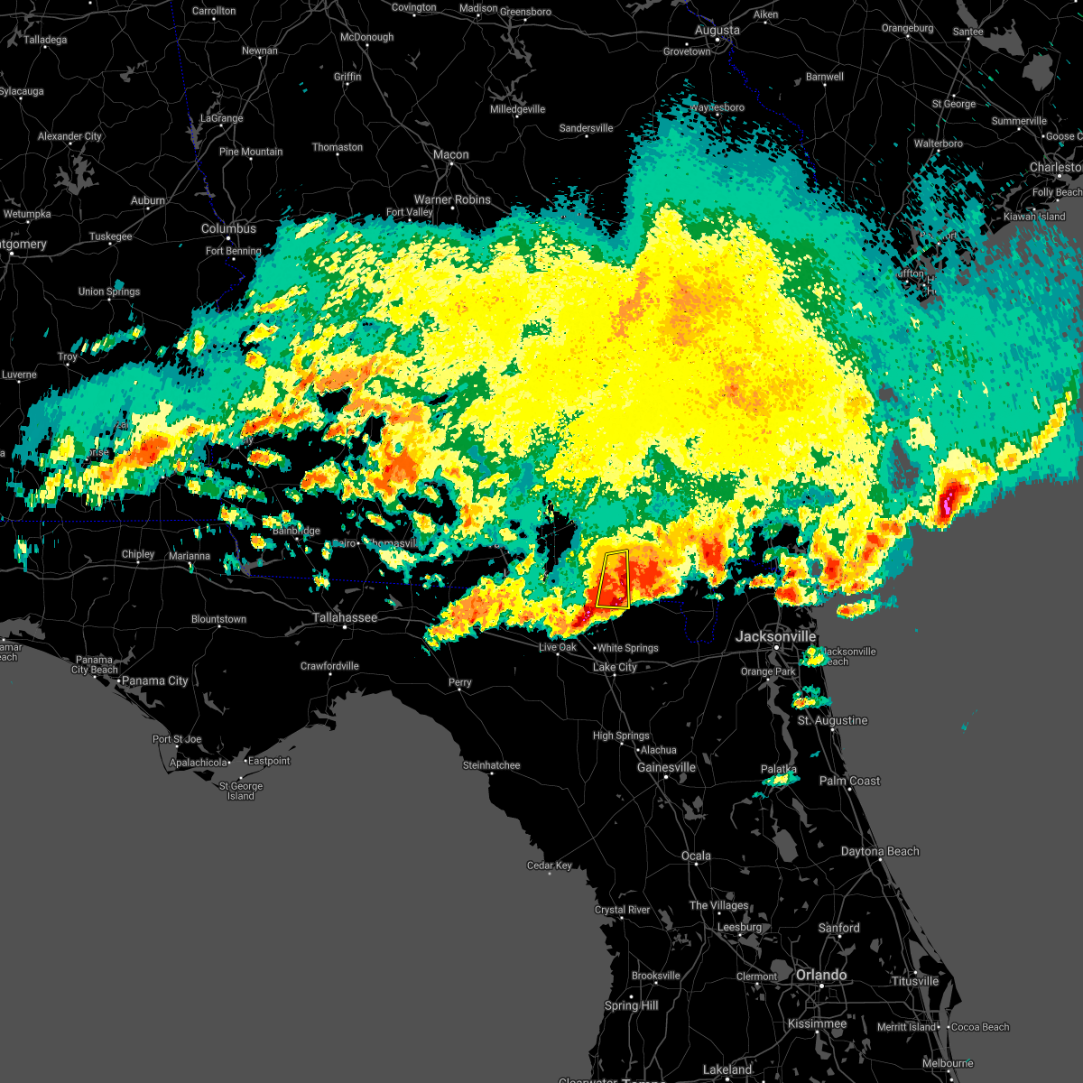 At 332 pm edt, a severe thunderstorm was located near needmore, or near fargo, moving east at 40 mph (radar indicated). Hazards include tennis ball size hail and 60 mph wind gusts. People and animals outdoors will be injured. expect hail damage to roofs, siding, windows, and vehicles. expect wind damage to roofs, siding, and trees. Locations impacted include, fargo and needmore. At 332 pm edt, a severe thunderstorm was located near needmore, or near fargo, moving east at 40 mph (radar indicated). Hazards include tennis ball size hail and 60 mph wind gusts. People and animals outdoors will be injured. expect hail damage to roofs, siding, windows, and vehicles. expect wind damage to roofs, siding, and trees. Locations impacted include, fargo and needmore.
|
| 4/24/2021 3:30 PM EDT |
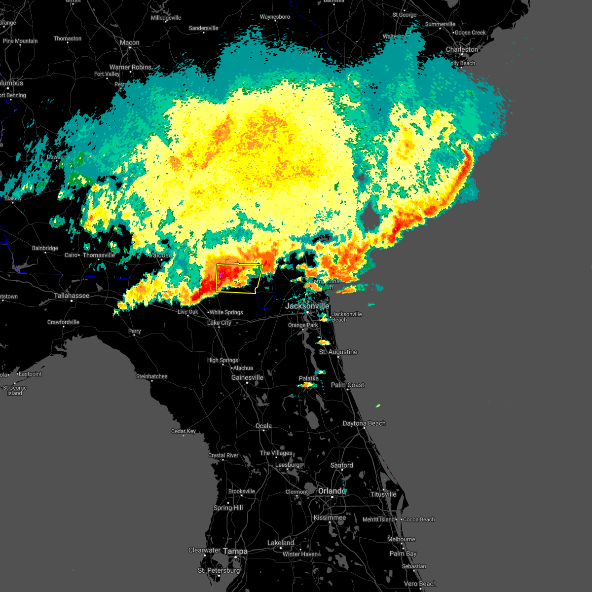 At 329 pm edt, a severe thunderstorm was located over fargo, moving east at 45 mph (doppler radar indicated and past emergency management reports). Hazards include tennis ball size hail and 60 mph wind gusts. People and animals outdoors will be injured. expect hail damage to roofs, siding, windows, and vehicles. Expect wind damage to roofs, siding, and trees. At 329 pm edt, a severe thunderstorm was located over fargo, moving east at 45 mph (doppler radar indicated and past emergency management reports). Hazards include tennis ball size hail and 60 mph wind gusts. People and animals outdoors will be injured. expect hail damage to roofs, siding, windows, and vehicles. Expect wind damage to roofs, siding, and trees.
|
| 4/24/2021 3:18 PM EDT |
 At 317 pm edt, a severe thunderstorm capable of producing a tornado was located near needmore, or 8 miles southwest of fargo, moving east at 45 mph (radar indicated rotation). Hazards include tornado and two inch hail. Flying debris will be dangerous to those caught without shelter. mobile homes will be damaged or destroyed. damage to roofs, windows, and vehicles will occur. tree damage is likely. This dangerous storm will be near, fargo around 330 pm edt. At 317 pm edt, a severe thunderstorm capable of producing a tornado was located near needmore, or 8 miles southwest of fargo, moving east at 45 mph (radar indicated rotation). Hazards include tornado and two inch hail. Flying debris will be dangerous to those caught without shelter. mobile homes will be damaged or destroyed. damage to roofs, windows, and vehicles will occur. tree damage is likely. This dangerous storm will be near, fargo around 330 pm edt.
|
| 4/24/2021 3:16 PM EDT |
 At 315 pm edt, a severe thunderstorm was located 9 miles west of needmore, or 12 miles east of statenville, moving east at 40 mph (radar indicated). Hazards include two inch hail and 60 mph wind gusts. People and animals outdoors will be injured. expect hail damage to roofs, siding, windows, and vehicles. expect wind damage to roofs, siding, and trees. Locations impacted include, fargo and needmore. At 315 pm edt, a severe thunderstorm was located 9 miles west of needmore, or 12 miles east of statenville, moving east at 40 mph (radar indicated). Hazards include two inch hail and 60 mph wind gusts. People and animals outdoors will be injured. expect hail damage to roofs, siding, windows, and vehicles. expect wind damage to roofs, siding, and trees. Locations impacted include, fargo and needmore.
|
| 4/24/2021 3:03 PM EDT |
 At 302 pm edt, a severe thunderstorm capable of producing a tornado was located 8 miles northeast of jasper, moving east at 45 mph (radar indicated rotation). Hazards include tornado and hail up to two inches in diameter. Flying debris will be dangerous to those caught without shelter. mobile homes will be damaged or destroyed. damage to roofs, windows, and vehicles will occur. tree damage is likely. this dangerous storm will be near, needmore around 320 pm edt. Fargo around 330 pm edt. At 302 pm edt, a severe thunderstorm capable of producing a tornado was located 8 miles northeast of jasper, moving east at 45 mph (radar indicated rotation). Hazards include tornado and hail up to two inches in diameter. Flying debris will be dangerous to those caught without shelter. mobile homes will be damaged or destroyed. damage to roofs, windows, and vehicles will occur. tree damage is likely. this dangerous storm will be near, needmore around 320 pm edt. Fargo around 330 pm edt.
|
| 4/24/2021 2:56 PM EDT |
 At 256 pm edt, a severe thunderstorm was located over statenville, moving east at 40 mph (radar indicated). Hazards include two inch hail and 60 mph wind gusts. People and animals outdoors will be injured. expect hail damage to roofs, siding, windows, and vehicles. Expect wind damage to roofs, siding, and trees. At 256 pm edt, a severe thunderstorm was located over statenville, moving east at 40 mph (radar indicated). Hazards include two inch hail and 60 mph wind gusts. People and animals outdoors will be injured. expect hail damage to roofs, siding, windows, and vehicles. Expect wind damage to roofs, siding, and trees.
|
| 4/24/2021 2:56 PM EDT |
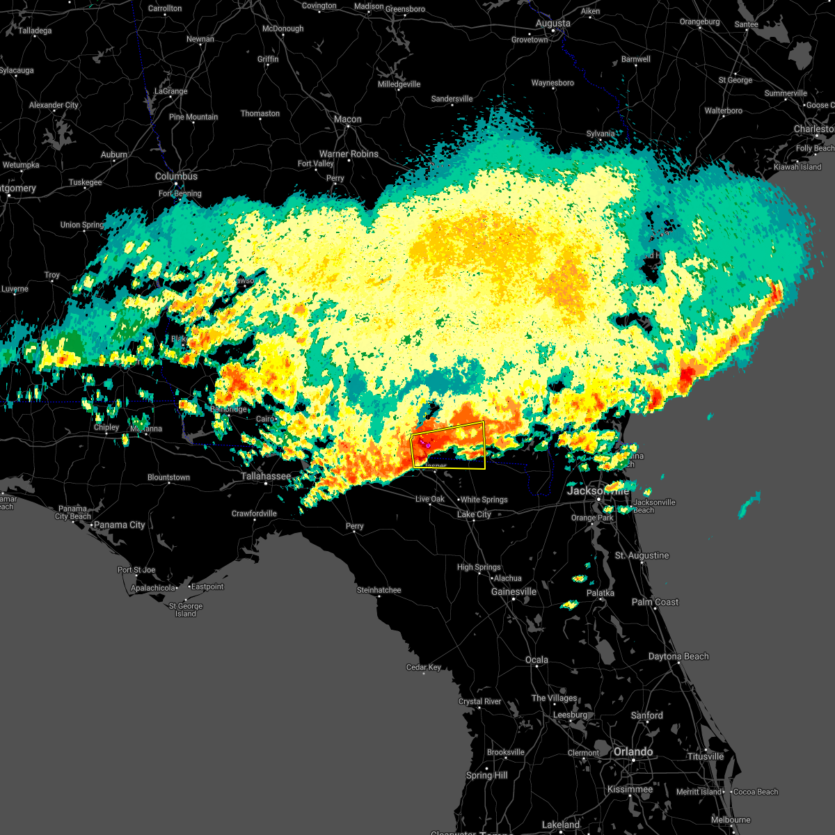 At 256 pm edt, a severe thunderstorm was located over statenville, moving east at 40 mph (radar indicated). Hazards include two inch hail and 60 mph wind gusts. People and animals outdoors will be injured. expect hail damage to roofs, siding, windows, and vehicles. Expect wind damage to roofs, siding, and trees. At 256 pm edt, a severe thunderstorm was located over statenville, moving east at 40 mph (radar indicated). Hazards include two inch hail and 60 mph wind gusts. People and animals outdoors will be injured. expect hail damage to roofs, siding, windows, and vehicles. Expect wind damage to roofs, siding, and trees.
|
| 4/24/2021 1:46 PM EDT |
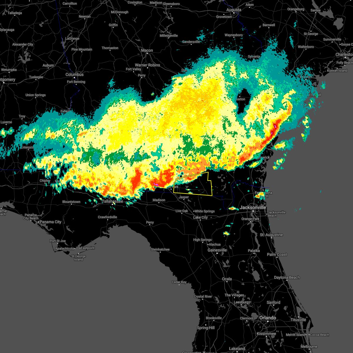 At 145 pm edt, a severe thunderstorm was located 7 miles southwest of i-75 at exit 16, or 9 miles west of lake park, moving east at 45 mph (radar indicated). Hazards include 70 mph wind gusts and quarter size hail. Hail damage to vehicles is expected. expect considerable tree damage. Wind damage is also likely to mobile homes, roofs, and outbuildings. At 145 pm edt, a severe thunderstorm was located 7 miles southwest of i-75 at exit 16, or 9 miles west of lake park, moving east at 45 mph (radar indicated). Hazards include 70 mph wind gusts and quarter size hail. Hail damage to vehicles is expected. expect considerable tree damage. Wind damage is also likely to mobile homes, roofs, and outbuildings.
|
| 4/10/2021 3:43 PM EDT |
 At 325 pm edt, severe thunderstorms were located along a line extending from 11 miles south of manor to 8 miles south of fargo, moving northeast at 35 mph (radar indicated). Hazards include 60 mph wind gusts and penny size hail. Expect damage to roofs, siding, and trees. Locations impacted include, fargo. At 325 pm edt, severe thunderstorms were located along a line extending from 11 miles south of manor to 8 miles south of fargo, moving northeast at 35 mph (radar indicated). Hazards include 60 mph wind gusts and penny size hail. Expect damage to roofs, siding, and trees. Locations impacted include, fargo.
|
| 4/10/2021 3:43 PM EDT |
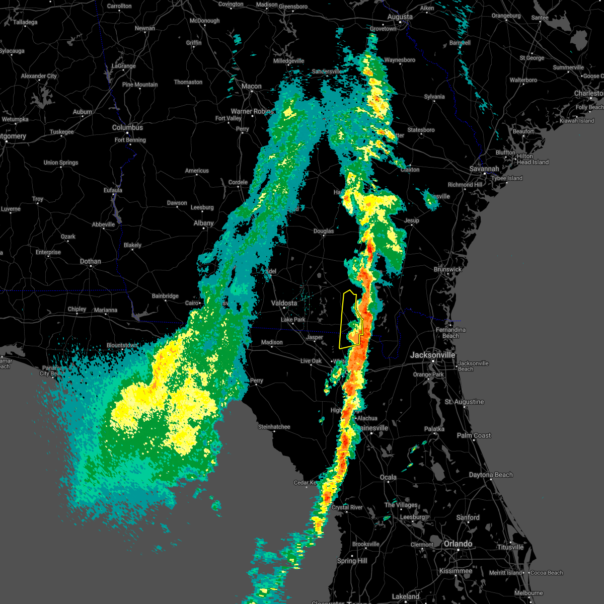 The severe thunderstorm warning for northeastern columbia, southeastern echols and southeastern clinch counties will expire at 345 pm edt, the storms which prompted the warning have weakened below severe limits, and have exited the warned area. therefore, the warning will be allowed to expire. The severe thunderstorm warning for northeastern columbia, southeastern echols and southeastern clinch counties will expire at 345 pm edt, the storms which prompted the warning have weakened below severe limits, and have exited the warned area. therefore, the warning will be allowed to expire.
|
| 4/10/2021 3:25 PM EDT |
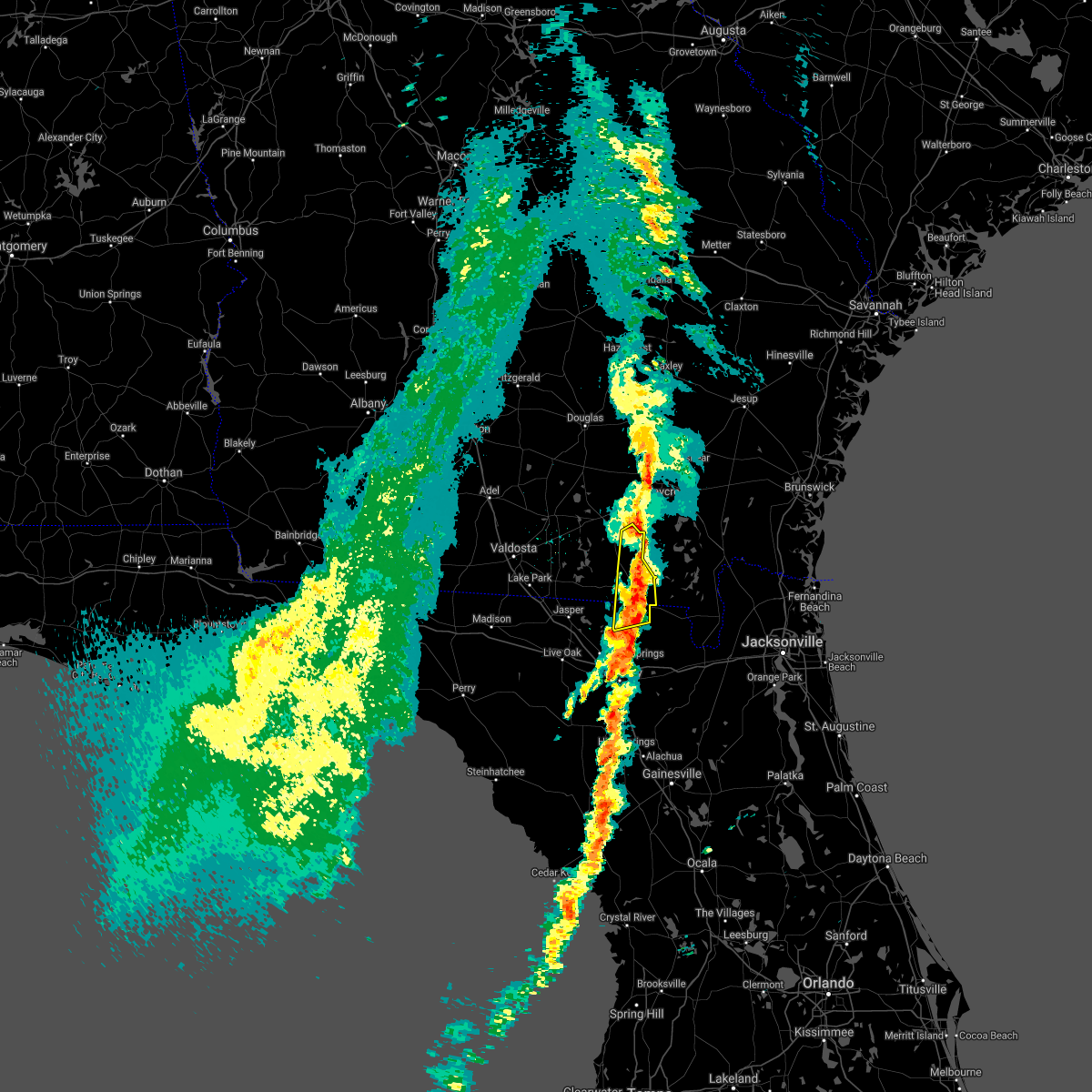 At 325 pm edt, severe thunderstorms were located along a line extending from 11 miles south of manor to 8 miles south of fargo, moving northeast at 35 mph (radar indicated). Hazards include 60 mph wind gusts and penny size hail. Expect damage to roofs, siding, and trees. Locations impacted include, fargo. At 325 pm edt, severe thunderstorms were located along a line extending from 11 miles south of manor to 8 miles south of fargo, moving northeast at 35 mph (radar indicated). Hazards include 60 mph wind gusts and penny size hail. Expect damage to roofs, siding, and trees. Locations impacted include, fargo.
|
| 4/10/2021 3:14 PM EDT | Trees down on us-441 north bound... blocking the road... near mile marker 4. time estimated based on radar dat in echols county GA, 3.5 miles NNE of Fargo, GA |
| 4/10/2021 2:59 PM EDT |
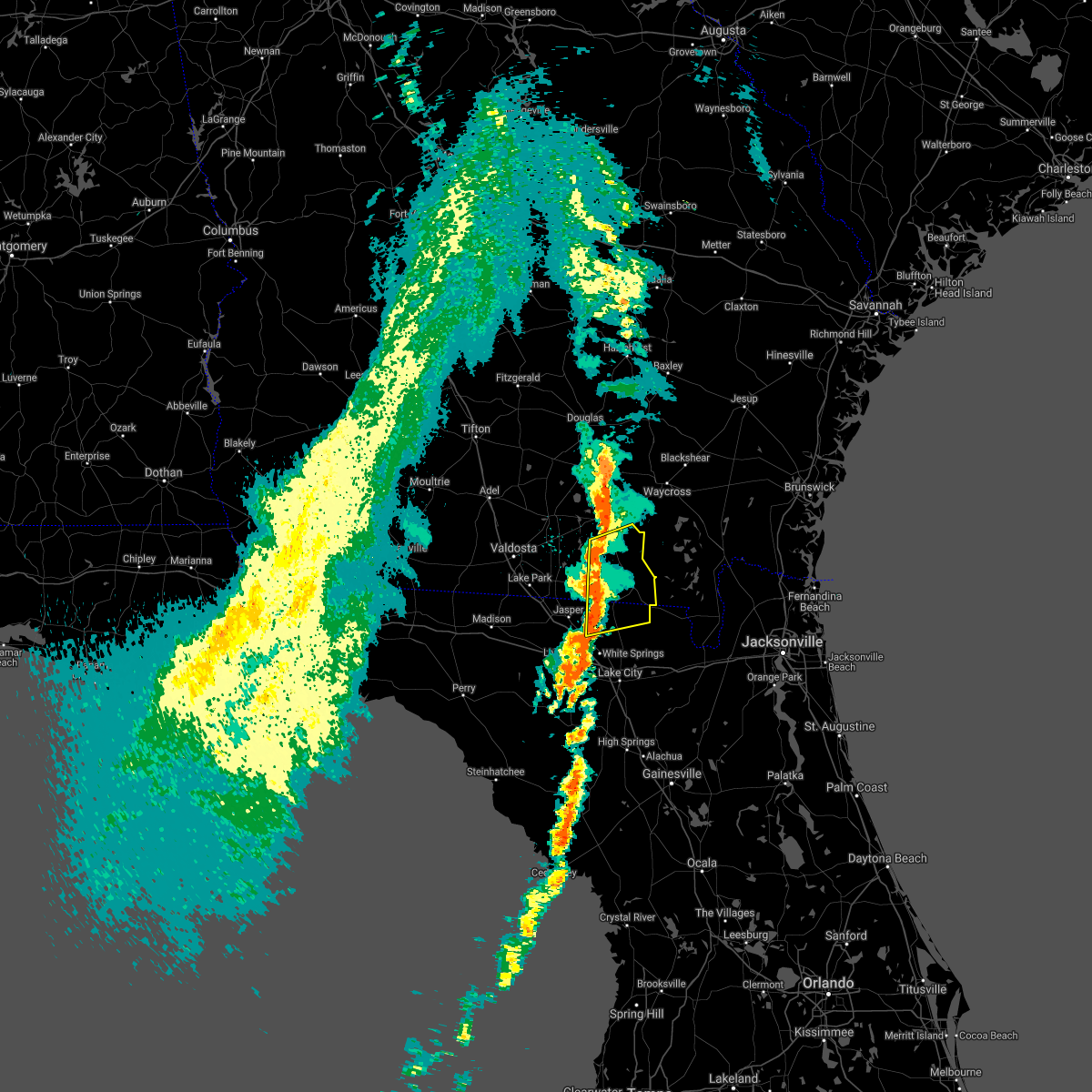 The national weather service in jacksonville has issued a * severe thunderstorm warning for. northeastern columbia county in northern florida. northeastern hamilton county in northern florida. southeastern echols county in southeastern georgia. Southeastern clinch county in southeastern georgia. The national weather service in jacksonville has issued a * severe thunderstorm warning for. northeastern columbia county in northern florida. northeastern hamilton county in northern florida. southeastern echols county in southeastern georgia. Southeastern clinch county in southeastern georgia.
|
| 4/10/2021 2:59 PM EDT |
 At 259 pm edt, severe thunderstorms were located along a line extending from 12 miles north of needmore to belmont, moving northeast at 35 mph (radar indicated). Hazards include 60 mph wind gusts and penny size hail. expect damage to roofs, siding, and trees At 259 pm edt, severe thunderstorms were located along a line extending from 12 miles north of needmore to belmont, moving northeast at 35 mph (radar indicated). Hazards include 60 mph wind gusts and penny size hail. expect damage to roofs, siding, and trees
|
| 12/24/2020 5:26 PM EST |
 At 526 pm est, severe thunderstorms were located along a line extending from near waycross to 7 miles west of stephen foster state park to near mcalpin, moving east at 45 mph (radar indicated). Hazards include 60 mph wind gusts. Expect damage to roofs, siding, and trees. Locations impacted include, waycross, lake city, live oak, white springs, fargo, ichetucknee spring, suwannee springs, stephen foster state park, columbia and boggy bay. At 526 pm est, severe thunderstorms were located along a line extending from near waycross to 7 miles west of stephen foster state park to near mcalpin, moving east at 45 mph (radar indicated). Hazards include 60 mph wind gusts. Expect damage to roofs, siding, and trees. Locations impacted include, waycross, lake city, live oak, white springs, fargo, ichetucknee spring, suwannee springs, stephen foster state park, columbia and boggy bay.
|
| 12/24/2020 5:01 PM EST |
 At 501 pm est, severe thunderstorms were located along a line extending from 7 miles northeast of manor to 6 miles north of needmore to near mayo, moving east at 45 mph (radar indicated). Hazards include 60 mph wind gusts. Expect damage to roofs, siding, and trees. Locations impacted include, waycross, lake city, live oak, jasper, homerville, white springs, fargo, argyle, stephen foster state park and ichetucknee spring. At 501 pm est, severe thunderstorms were located along a line extending from 7 miles northeast of manor to 6 miles north of needmore to near mayo, moving east at 45 mph (radar indicated). Hazards include 60 mph wind gusts. Expect damage to roofs, siding, and trees. Locations impacted include, waycross, lake city, live oak, jasper, homerville, white springs, fargo, argyle, stephen foster state park and ichetucknee spring.
|
| 12/24/2020 4:39 PM EST |
 At 439 pm est, severe thunderstorms were located along a line extending from near homerville to 7 miles east of statenville to 13 miles southeast of perry, moving east at 45 mph (radar indicated). Hazards include 60 mph wind gusts. expect damage to roofs, siding, and trees At 439 pm est, severe thunderstorms were located along a line extending from near homerville to 7 miles east of statenville to 13 miles southeast of perry, moving east at 45 mph (radar indicated). Hazards include 60 mph wind gusts. expect damage to roofs, siding, and trees
|
| 11/30/2020 3:55 AM EST |
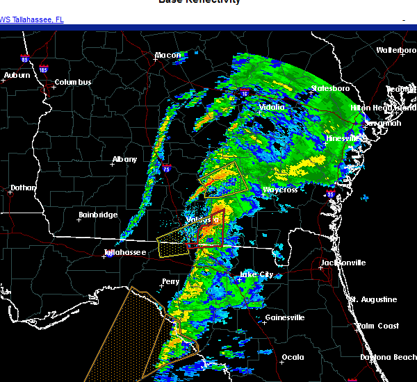 At 355 am est, a severe thunderstorm was located over statenville, moving northeast at 60 mph (radar indicated). Hazards include 60 mph wind gusts. expect damage to roofs, siding, and trees At 355 am est, a severe thunderstorm was located over statenville, moving northeast at 60 mph (radar indicated). Hazards include 60 mph wind gusts. expect damage to roofs, siding, and trees
|
| 9/16/2020 5:44 PM EDT |
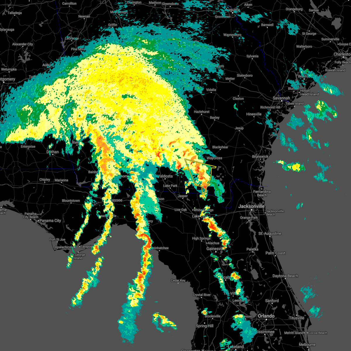 At 543 pm edt, a severe thunderstorm was located 9 miles southeast of homerville, moving north at 20 mph (radar indicated). Hazards include 60 mph wind gusts. possible tornado. Expect damage to roofs, siding, and trees. Locations impacted include, homerville, fargo and argyle. At 543 pm edt, a severe thunderstorm was located 9 miles southeast of homerville, moving north at 20 mph (radar indicated). Hazards include 60 mph wind gusts. possible tornado. Expect damage to roofs, siding, and trees. Locations impacted include, homerville, fargo and argyle.
|
| 9/16/2020 5:31 PM EDT |
 At 531 pm edt, a severe thunderstorm was located near fargo, moving north at 25 mph (radar indicated). Hazards include 60 mph wind gusts. possible tornado. expect damage to roofs, siding, and trees At 531 pm edt, a severe thunderstorm was located near fargo, moving north at 25 mph (radar indicated). Hazards include 60 mph wind gusts. possible tornado. expect damage to roofs, siding, and trees
|
| 9/16/2020 5:08 PM EDT | At 508 pm edt, a severe thunderstorm was located over needmore, or 7 miles southwest of fargo, moving north at 35 mph (radar indicated). Hazards include 60 mph wind gusts. possible tornado. Expect damage to roofs, siding, and trees. Locations impacted include, du pont and needmore. |
| 9/16/2020 4:48 PM EDT | At 447 pm edt, a severe thunderstorm was located near needmore, or 12 miles west of fargo, moving north at 25 mph (radar indicated). Hazards include 60 mph wind gusts. possible tornado. expect damage to roofs, siding, and trees |
| 6/24/2020 5:20 PM EDT |
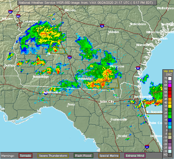 At 519 pm edt, a severe thunderstorm was located 7 miles northeast of fargo, moving east at 35 mph (radar indicated). Hazards include 60 mph wind gusts and quarter size hail. Hail damage to vehicles is expected. Expect wind damage to roofs, siding, and trees. At 519 pm edt, a severe thunderstorm was located 7 miles northeast of fargo, moving east at 35 mph (radar indicated). Hazards include 60 mph wind gusts and quarter size hail. Hail damage to vehicles is expected. Expect wind damage to roofs, siding, and trees.
|
| 4/23/2020 8:54 PM EDT |
 At 854 pm edt, severe thunderstorms were located along a line extending from 8 miles north of stephen foster state park to near fargo to near luraville, moving east at 35 mph (radar indicated). Hazards include 60 mph wind gusts and penny size hail. Expect damage to roofs, siding, and trees. Locations impacted include, lake city, live oak, folkston, white springs, fargo, suwannee springs, stephen foster state park, columbia, taylor and homeland. At 854 pm edt, severe thunderstorms were located along a line extending from 8 miles north of stephen foster state park to near fargo to near luraville, moving east at 35 mph (radar indicated). Hazards include 60 mph wind gusts and penny size hail. Expect damage to roofs, siding, and trees. Locations impacted include, lake city, live oak, folkston, white springs, fargo, suwannee springs, stephen foster state park, columbia, taylor and homeland.
|
| 4/23/2020 8:26 PM EDT |
 At 826 pm edt, severe thunderstorms were located along a line extending from 10 miles southeast of homerville to 6 miles north of belmont to 6 miles west of luraville, moving east at 35 mph (radar indicated). Hazards include 60 mph wind gusts and penny size hail. expect damage to roofs, siding, and trees At 826 pm edt, severe thunderstorms were located along a line extending from 10 miles southeast of homerville to 6 miles north of belmont to 6 miles west of luraville, moving east at 35 mph (radar indicated). Hazards include 60 mph wind gusts and penny size hail. expect damage to roofs, siding, and trees
|
| 4/23/2020 2:41 PM EDT |
 At 240 pm edt, severe thunderstorms were located along a line extending from 6 miles south of boggy bay to near needmore, moving east at 50 mph (radar indicated). Hazards include 60 mph wind gusts and quarter size hail. Hail damage to vehicles is expected. Expect wind damage to roofs, siding, and trees. At 240 pm edt, severe thunderstorms were located along a line extending from 6 miles south of boggy bay to near needmore, moving east at 50 mph (radar indicated). Hazards include 60 mph wind gusts and quarter size hail. Hail damage to vehicles is expected. Expect wind damage to roofs, siding, and trees.
|
| 4/13/2020 9:29 AM EDT |
 At 929 am edt, severe thunderstorms were located along a line extending from near jekyll island to 9 miles east of fargo, moving east at 60 mph (radar indicated). Hazards include 70 mph wind gusts and quarter size hail. Hail damage to vehicles is expected. expect considerable tree damage. wind damage is also likely to mobile homes, roofs, and outbuildings. locations impacted include, st. marys, kingsland, brunswick, st. Simons island, hilliard, folkston, woodbine, fargo, statenville and dock junction. At 929 am edt, severe thunderstorms were located along a line extending from near jekyll island to 9 miles east of fargo, moving east at 60 mph (radar indicated). Hazards include 70 mph wind gusts and quarter size hail. Hail damage to vehicles is expected. expect considerable tree damage. wind damage is also likely to mobile homes, roofs, and outbuildings. locations impacted include, st. marys, kingsland, brunswick, st. Simons island, hilliard, folkston, woodbine, fargo, statenville and dock junction.
|
| 4/13/2020 9:11 AM EDT |
 The severe thunderstorm warning for northern hamilton, echols, brantley, central ware, southern clinch and northern charlton counties will expire at 915 am edt, the storms which prompted the warning have moved out of the area. remember, a severe thunderstorm warning still remains in effect for echols, southern clinch, ware, charlton, and parts of brantley counties. The severe thunderstorm warning for northern hamilton, echols, brantley, central ware, southern clinch and northern charlton counties will expire at 915 am edt, the storms which prompted the warning have moved out of the area. remember, a severe thunderstorm warning still remains in effect for echols, southern clinch, ware, charlton, and parts of brantley counties.
|
| 4/13/2020 9:08 AM EDT |
 At 908 am edt, severe thunderstorms were located along a line extending from 6 miles west of woodbine to near needmore, moving east at 60 mph (radar indicated). Hazards include 70 mph wind gusts and quarter size hail. Hail damage to vehicles is expected. expect considerable tree damage. Wind damage is also likely to mobile homes, roofs, and outbuildings. At 908 am edt, severe thunderstorms were located along a line extending from 6 miles west of woodbine to near needmore, moving east at 60 mph (radar indicated). Hazards include 70 mph wind gusts and quarter size hail. Hail damage to vehicles is expected. expect considerable tree damage. Wind damage is also likely to mobile homes, roofs, and outbuildings.
|
| 4/13/2020 8:54 AM EDT |
 At 854 am edt, severe thunderstorms were located along a line extending from near gardi to near fort mudge to du pont, moving northeast at 40 mph (radar indicated). Hazards include 70 mph wind gusts and quarter size hail. Hail damage to vehicles is expected. expect considerable tree damage. wind damage is also likely to mobile homes, roofs, and outbuildings. Locations impacted include, folkston, nahunta, fargo, statenville, stephen foster state park, homeland, hickox, mayday, raybon and race pond. At 854 am edt, severe thunderstorms were located along a line extending from near gardi to near fort mudge to du pont, moving northeast at 40 mph (radar indicated). Hazards include 70 mph wind gusts and quarter size hail. Hail damage to vehicles is expected. expect considerable tree damage. wind damage is also likely to mobile homes, roofs, and outbuildings. Locations impacted include, folkston, nahunta, fargo, statenville, stephen foster state park, homeland, hickox, mayday, raybon and race pond.
|
| 4/13/2020 8:28 AM EDT |
 At 828 am edt, severe thunderstorms were located along a line extending from near patterson to 9 miles south of boggy bay to near mayday, moving northeast at 40 mph (radar indicated). Hazards include 70 mph wind gusts and quarter size hail. Hail damage to vehicles is expected. expect considerable tree damage. wind damage is also likely to mobile homes, roofs, and outbuildings. Locations impacted include, waycross, folkston, homerville, nahunta, fargo, argyle, statenville, stephen foster state park, homeland and du pont. At 828 am edt, severe thunderstorms were located along a line extending from near patterson to 9 miles south of boggy bay to near mayday, moving northeast at 40 mph (radar indicated). Hazards include 70 mph wind gusts and quarter size hail. Hail damage to vehicles is expected. expect considerable tree damage. wind damage is also likely to mobile homes, roofs, and outbuildings. Locations impacted include, waycross, folkston, homerville, nahunta, fargo, argyle, statenville, stephen foster state park, homeland and du pont.
|
| 4/13/2020 8:12 AM EDT |
 At 812 am edt, severe thunderstorms were located along a line extending from near blackshear to 9 miles south of manor to near lake park, moving northeast at 40 mph (radar indicated). Hazards include 60 mph wind gusts. expect damage to roofs, siding, and trees At 812 am edt, severe thunderstorms were located along a line extending from near blackshear to 9 miles south of manor to near lake park, moving northeast at 40 mph (radar indicated). Hazards include 60 mph wind gusts. expect damage to roofs, siding, and trees
|
| 2/6/2020 9:10 PM EST |
 At 910 pm est, a severe thunderstorm was located near hickox, or near nahunta, moving northeast at 65 mph (radar indicated). Hazards include 60 mph wind gusts. Expect damage to roofs, siding, and trees. Locations impacted include, fargo, stephen foster state park, homeland, braganza, race pond, fort mudge and winokur. At 910 pm est, a severe thunderstorm was located near hickox, or near nahunta, moving northeast at 65 mph (radar indicated). Hazards include 60 mph wind gusts. Expect damage to roofs, siding, and trees. Locations impacted include, fargo, stephen foster state park, homeland, braganza, race pond, fort mudge and winokur.
|
| 2/6/2020 8:45 PM EST |
 At 845 pm est, a severe thunderstorm was located 11 miles north of stephen foster state park, moving northeast at 65 mph (radar indicated). Hazards include 60 mph wind gusts. expect damage to roofs, siding, and trees At 845 pm est, a severe thunderstorm was located 11 miles north of stephen foster state park, moving northeast at 65 mph (radar indicated). Hazards include 60 mph wind gusts. expect damage to roofs, siding, and trees
|
| 2/6/2020 7:55 PM EST |
 At 754 pm est, severe thunderstorms were located along a line extending from near argyle to 7 miles north of needmore to 6 miles northeast of dowling park, moving northeast at 65 mph. the strongest storm winds are in clinch and moving into ware county. these are very dangerous storms (radar indicated). Hazards include 60 to 80 mph wind gusts. Flying debris will be dangerous to those caught without shelter. mobile homes will be heavily damaged. expect considerable damage to roofs, windows, and vehicles. extensive tree damage and power outages are likely. Locations impacted include, live oak, jasper, homerville, white springs, fargo, argyle, suwannee springs, stephen foster state park, homeland and belmont. At 754 pm est, severe thunderstorms were located along a line extending from near argyle to 7 miles north of needmore to 6 miles northeast of dowling park, moving northeast at 65 mph. the strongest storm winds are in clinch and moving into ware county. these are very dangerous storms (radar indicated). Hazards include 60 to 80 mph wind gusts. Flying debris will be dangerous to those caught without shelter. mobile homes will be heavily damaged. expect considerable damage to roofs, windows, and vehicles. extensive tree damage and power outages are likely. Locations impacted include, live oak, jasper, homerville, white springs, fargo, argyle, suwannee springs, stephen foster state park, homeland and belmont.
|
| 2/6/2020 7:42 PM EST |
 At 742 pm est, severe thunderstorms were located along a line extending from 6 miles northeast of mayday to 8 miles northeast of jasper to near dowling park, moving east at 60 mph (radar indicated). Hazards include 70 mph wind gusts. Expect considerable tree damage. Damage is likely to mobile homes, roofs, and outbuildings. At 742 pm est, severe thunderstorms were located along a line extending from 6 miles northeast of mayday to 8 miles northeast of jasper to near dowling park, moving east at 60 mph (radar indicated). Hazards include 70 mph wind gusts. Expect considerable tree damage. Damage is likely to mobile homes, roofs, and outbuildings.
|
| 12/17/2019 3:43 PM EST |
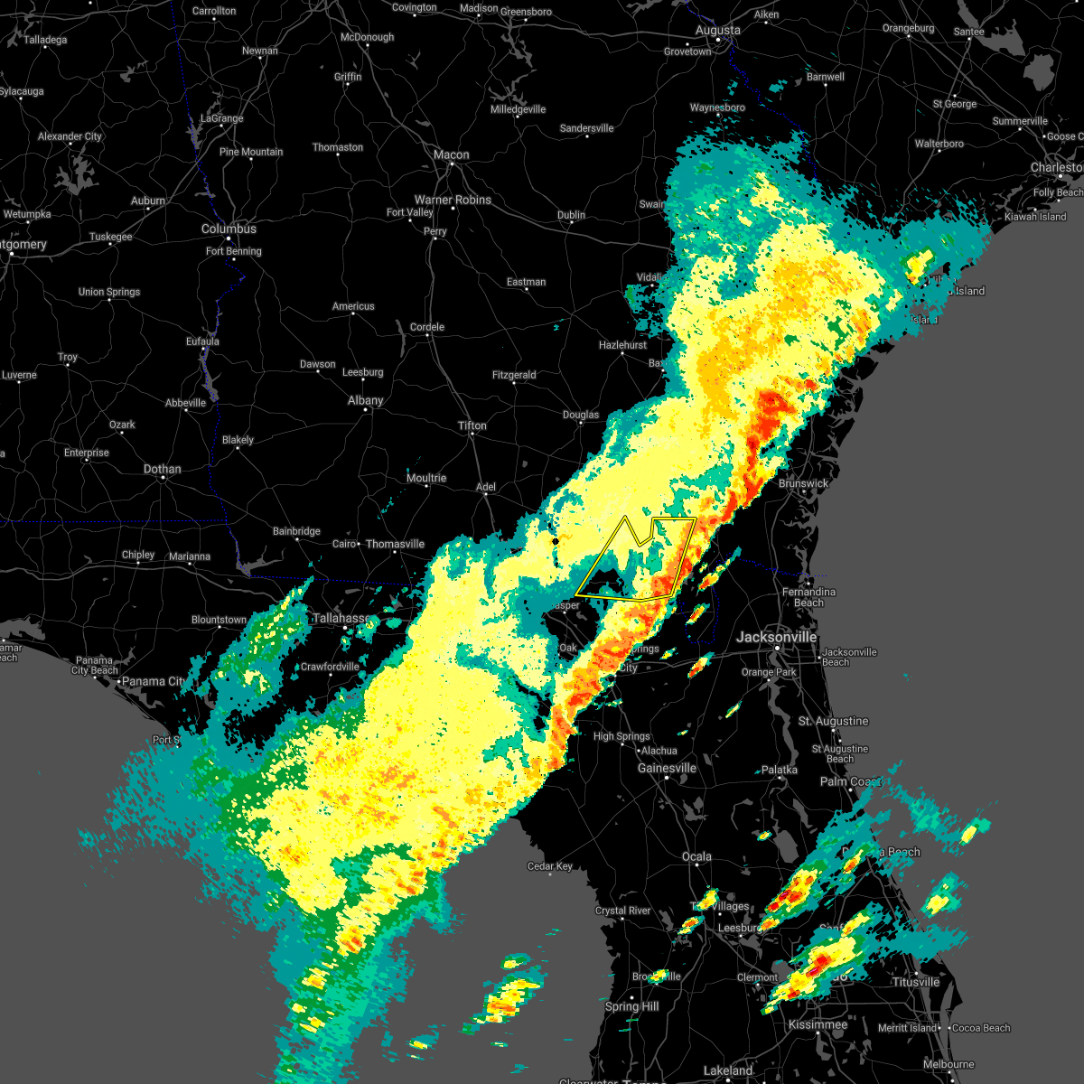 The severe thunderstorm warning for southeastern echols, southern ware, southeastern clinch and northwestern charlton counties will expire at 345 pm est, the storms which prompted the warning have moved out of the area. therefore, the warning will be allowed to expire. however gusty winds are still possible with these thunderstorms. a tornado watch remains in effect until 700 pm est for northern and northeastern florida, and southeastern georgia. to report severe weather, contact your nearest law enforcement agency. they will relay your report to the national weather service jacksonville. remember, a severe thunderstorm warning still remains in effect for southern ware county until 430 pm est. The severe thunderstorm warning for southeastern echols, southern ware, southeastern clinch and northwestern charlton counties will expire at 345 pm est, the storms which prompted the warning have moved out of the area. therefore, the warning will be allowed to expire. however gusty winds are still possible with these thunderstorms. a tornado watch remains in effect until 700 pm est for northern and northeastern florida, and southeastern georgia. to report severe weather, contact your nearest law enforcement agency. they will relay your report to the national weather service jacksonville. remember, a severe thunderstorm warning still remains in effect for southern ware county until 430 pm est.
|
| 12/17/2019 3:00 PM EST |
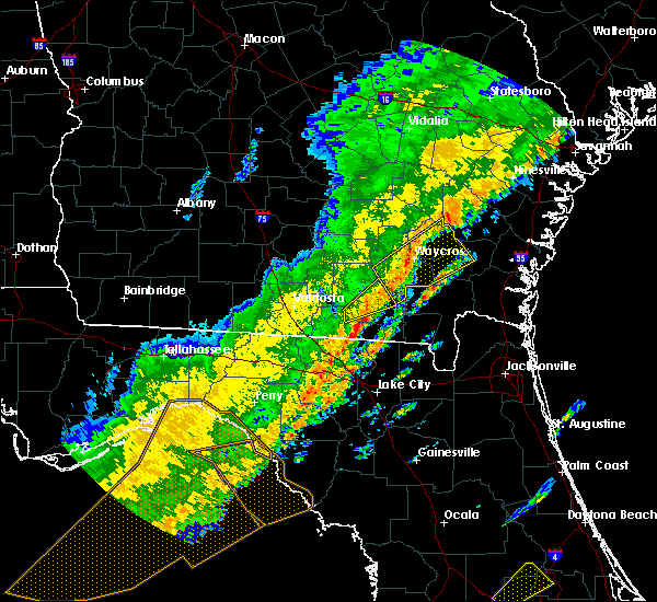 At 300 pm est, severe thunderstorms were located along a line extending from 12 miles northwest of stephen foster state park to 7 miles northwest of belmont, moving east at 45 mph (radar indicated). Hazards include 60 mph wind gusts. expect damage to roofs, siding, and trees At 300 pm est, severe thunderstorms were located along a line extending from 12 miles northwest of stephen foster state park to 7 miles northwest of belmont, moving east at 45 mph (radar indicated). Hazards include 60 mph wind gusts. expect damage to roofs, siding, and trees
|
| 4/19/2019 11:00 AM EDT |
 At 1100 am edt, severe thunderstorms were located along a line extending from 8 miles west of stephen foster state park to 7 miles north of bronson, moving northeast at 55 mph (radar indicated). Hazards include 70 mph wind gusts. Expect considerable tree damage. Damage is likely to mobile homes, roofs, and outbuildings. At 1100 am edt, severe thunderstorms were located along a line extending from 8 miles west of stephen foster state park to 7 miles north of bronson, moving northeast at 55 mph (radar indicated). Hazards include 70 mph wind gusts. Expect considerable tree damage. Damage is likely to mobile homes, roofs, and outbuildings.
|
| 4/19/2019 10:15 AM EDT |
 At 1014 am edt, severe thunderstorms were located along a line extending from 8 miles east of mayday to near jasper, moving northeast at 55 mph (radar indicated). Hazards include 70 mph wind gusts. Expect considerable tree damage. Damage is likely to mobile homes, roofs, and outbuildings. At 1014 am edt, severe thunderstorms were located along a line extending from 8 miles east of mayday to near jasper, moving northeast at 55 mph (radar indicated). Hazards include 70 mph wind gusts. Expect considerable tree damage. Damage is likely to mobile homes, roofs, and outbuildings.
|
| 3/11/2019 7:56 PM EDT |
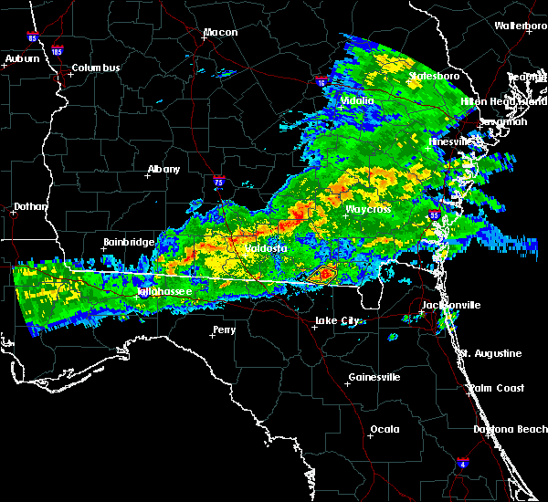 At 756 pm edt, a severe thunderstorm was located near fargo, moving east at 35 mph (radar indicated). Hazards include 60 mph wind gusts and quarter size hail. Hail damage to vehicles is expected. expect wind damage to roofs, siding, and trees. Locations impacted include, fargo. At 756 pm edt, a severe thunderstorm was located near fargo, moving east at 35 mph (radar indicated). Hazards include 60 mph wind gusts and quarter size hail. Hail damage to vehicles is expected. expect wind damage to roofs, siding, and trees. Locations impacted include, fargo.
|
| 3/11/2019 7:45 PM EDT |
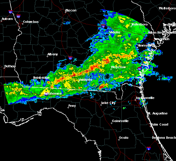 At 745 pm edt, a severe thunderstorm was located over needmore, or near fargo, moving southeast at 30 mph (radar indicated). Hazards include 60 mph wind gusts and quarter size hail. Hail damage to vehicles is expected. Expect wind damage to roofs, siding, and trees. At 745 pm edt, a severe thunderstorm was located over needmore, or near fargo, moving southeast at 30 mph (radar indicated). Hazards include 60 mph wind gusts and quarter size hail. Hail damage to vehicles is expected. Expect wind damage to roofs, siding, and trees.
|
| 6/9/2018 3:00 PM EDT |
 At 300 pm edt, a severe thunderstorm was located over needmore, or near fargo, moving southeast at 5 mph (radar indicated). Hazards include 60 mph wind gusts and penny size hail. Expect damage to roofs, siding, and trees. Locations impacted include, fargo, belmont and needmore. At 300 pm edt, a severe thunderstorm was located over needmore, or near fargo, moving southeast at 5 mph (radar indicated). Hazards include 60 mph wind gusts and penny size hail. Expect damage to roofs, siding, and trees. Locations impacted include, fargo, belmont and needmore.
|
| 6/9/2018 2:54 PM EDT |
 At 253 pm edt, a severe thunderstorm was located near needmore, or 9 miles west of fargo, moving southeast at 10 mph (radar indicated). Hazards include 60 mph wind gusts and penny size hail. Expect damage to roofs, siding, and trees. Locations impacted include, fargo, belmont and needmore. At 253 pm edt, a severe thunderstorm was located near needmore, or 9 miles west of fargo, moving southeast at 10 mph (radar indicated). Hazards include 60 mph wind gusts and penny size hail. Expect damage to roofs, siding, and trees. Locations impacted include, fargo, belmont and needmore.
|
| 6/9/2018 2:54 PM EDT |
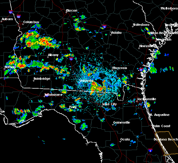 At 253 pm edt, a severe thunderstorm was located near needmore, or 9 miles west of fargo, moving southeast at 10 mph (radar indicated). Hazards include 60 mph wind gusts and penny size hail. Expect damage to roofs, siding, and trees. Locations impacted include, fargo, belmont and needmore. At 253 pm edt, a severe thunderstorm was located near needmore, or 9 miles west of fargo, moving southeast at 10 mph (radar indicated). Hazards include 60 mph wind gusts and penny size hail. Expect damage to roofs, siding, and trees. Locations impacted include, fargo, belmont and needmore.
|
| 6/9/2018 2:40 PM EDT |
 At 240 pm edt, a severe thunderstorm was located near needmore, or 11 miles west of fargo, moving southeast at 10 mph (radar indicated). Hazards include 60 mph wind gusts and quarter size hail. Hail damage to vehicles is expected. Expect wind damage to roofs, siding, and trees. At 240 pm edt, a severe thunderstorm was located near needmore, or 11 miles west of fargo, moving southeast at 10 mph (radar indicated). Hazards include 60 mph wind gusts and quarter size hail. Hail damage to vehicles is expected. Expect wind damage to roofs, siding, and trees.
|
| 6/9/2018 2:40 PM EDT |
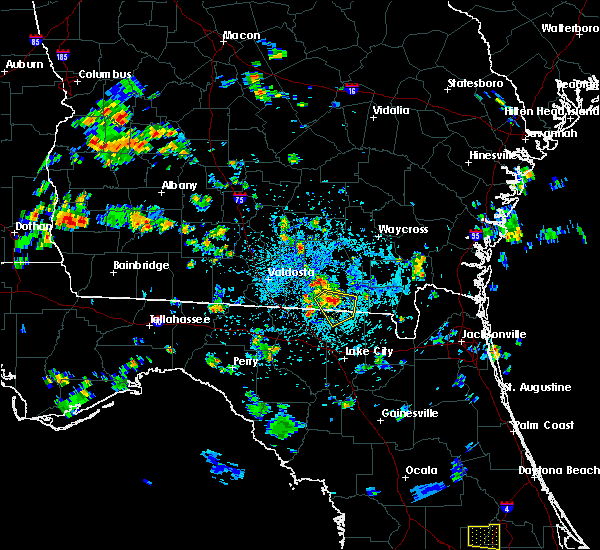 At 240 pm edt, a severe thunderstorm was located near needmore, or 11 miles west of fargo, moving southeast at 10 mph (radar indicated). Hazards include 60 mph wind gusts and quarter size hail. Hail damage to vehicles is expected. Expect wind damage to roofs, siding, and trees. At 240 pm edt, a severe thunderstorm was located near needmore, or 11 miles west of fargo, moving southeast at 10 mph (radar indicated). Hazards include 60 mph wind gusts and quarter size hail. Hail damage to vehicles is expected. Expect wind damage to roofs, siding, and trees.
|
| 4/15/2018 12:39 PM EDT |
 The severe thunderstorm warning for western baker, columbia, eastern suwannee, southeastern hamilton, western brantley, ware, southeastern clinch and northwestern charlton counties will expire at 1245 pm edt, the storms which prompted the warning have weakened below severe limits, and no longer pose an immediate threat to life or property. therefore, the warning will be allowed to expire. however gusty winds and heavy rain are still possible with these thunderstorms. a tornado watch remains in effect until 600 pm edt for northern and northeastern florida, and southeastern georgia. The severe thunderstorm warning for western baker, columbia, eastern suwannee, southeastern hamilton, western brantley, ware, southeastern clinch and northwestern charlton counties will expire at 1245 pm edt, the storms which prompted the warning have weakened below severe limits, and no longer pose an immediate threat to life or property. therefore, the warning will be allowed to expire. however gusty winds and heavy rain are still possible with these thunderstorms. a tornado watch remains in effect until 600 pm edt for northern and northeastern florida, and southeastern georgia.
|
| 4/15/2018 12:01 PM EDT |
 At 1201 pm edt, severe thunderstorms were located along a line extending from near waycross to near fargo to 12 miles south of mayo, moving northeast at 45 mph (radar indicated). Hazards include 60 mph wind gusts. expect damage to roofs, siding, and trees At 1201 pm edt, severe thunderstorms were located along a line extending from near waycross to near fargo to 12 miles south of mayo, moving northeast at 45 mph (radar indicated). Hazards include 60 mph wind gusts. expect damage to roofs, siding, and trees
|
| 4/15/2018 11:43 AM EDT |
 At 1142 am edt, severe thunderstorms were located along a line extending from near manor to 13 miles south of argyle to near belmont to near obrien, moving northeast at 55 mph (radar indicated). Hazards include 60 mph wind gusts. Expect damage to roofs, siding, and trees. locations impacted include, white springs, fargo, argyle, ichetucknee spring, pebble hill, winfield, suwannee valley, belmont, mcalpin and wellborn. A tornado watch remains in effect until 600 pm edt for northern florida, and southeastern georgia. At 1142 am edt, severe thunderstorms were located along a line extending from near manor to 13 miles south of argyle to near belmont to near obrien, moving northeast at 55 mph (radar indicated). Hazards include 60 mph wind gusts. Expect damage to roofs, siding, and trees. locations impacted include, white springs, fargo, argyle, ichetucknee spring, pebble hill, winfield, suwannee valley, belmont, mcalpin and wellborn. A tornado watch remains in effect until 600 pm edt for northern florida, and southeastern georgia.
|
| 4/15/2018 11:13 AM EDT |
 At 1112 am edt, severe thunderstorms were located along a line extending from near homerville to near jasper to 13 miles south of mayo, moving northeast at 40 mph (radar indicated). Hazards include 60 mph wind gusts. expect damage to roofs, siding, and trees At 1112 am edt, severe thunderstorms were located along a line extending from near homerville to near jasper to 13 miles south of mayo, moving northeast at 40 mph (radar indicated). Hazards include 60 mph wind gusts. expect damage to roofs, siding, and trees
|
| 6/7/2017 4:35 AM EDT |
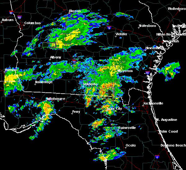 At 435 am edt, a severe thunderstorm was located near needmore, or 8 miles west of fargo, moving east at 25 mph (radar indicated). Hazards include 60 mph wind gusts. Expect damage to roofs, siding, and trees. Locations impacted include, fargo and needmore. At 435 am edt, a severe thunderstorm was located near needmore, or 8 miles west of fargo, moving east at 25 mph (radar indicated). Hazards include 60 mph wind gusts. Expect damage to roofs, siding, and trees. Locations impacted include, fargo and needmore.
|
| 6/7/2017 4:12 AM EDT |
 At 411 am edt, a severe thunderstorm was located 10 miles northeast of jasper, moving east at 25 mph (radar indicated). Hazards include 60 mph wind gusts. expect damage to roofs, siding, and trees At 411 am edt, a severe thunderstorm was located 10 miles northeast of jasper, moving east at 25 mph (radar indicated). Hazards include 60 mph wind gusts. expect damage to roofs, siding, and trees
|
| 5/23/2017 3:28 PM EDT |
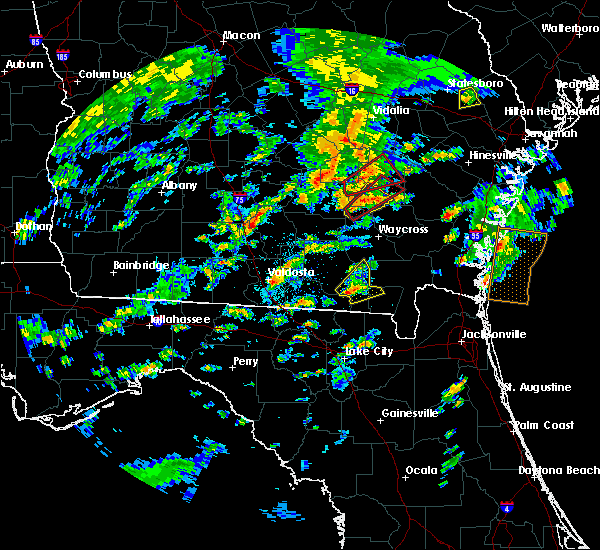 At 327 pm edt, a severe thunderstorm was located near fargo, moving northeast at 35 mph (radar indicated). Hazards include 60 mph wind gusts. possible tornado. Expect damage to roofs, siding, and trees. locations impacted include, fargo. A tornado watch remains in effect until 1100 pm edt for southeastern georgia. At 327 pm edt, a severe thunderstorm was located near fargo, moving northeast at 35 mph (radar indicated). Hazards include 60 mph wind gusts. possible tornado. Expect damage to roofs, siding, and trees. locations impacted include, fargo. A tornado watch remains in effect until 1100 pm edt for southeastern georgia.
|
| 5/23/2017 3:07 PM EDT |
 At 307 pm edt, a severe thunderstorm was located near needmore, or 12 miles west of fargo, moving northeast at 40 mph (radar indicated). Hazards include 60 mph wind gusts. possible tornado. expect damage to roofs, siding, and trees At 307 pm edt, a severe thunderstorm was located near needmore, or 12 miles west of fargo, moving northeast at 40 mph (radar indicated). Hazards include 60 mph wind gusts. possible tornado. expect damage to roofs, siding, and trees
|
| 4/6/2017 12:49 AM EDT |
 At 1249 am edt, a severe thunderstorm was located near belmont, or 13 miles north of white springs, moving east at 55 mph (radar indicated). Hazards include 60 mph wind gusts and quarter size hail. Hail damage to vehicles is expected. Expect wind damage to roofs, siding, and trees. At 1249 am edt, a severe thunderstorm was located near belmont, or 13 miles north of white springs, moving east at 55 mph (radar indicated). Hazards include 60 mph wind gusts and quarter size hail. Hail damage to vehicles is expected. Expect wind damage to roofs, siding, and trees.
|
| 2/15/2017 1:08 PM EST |
 At 107 pm est, a severe thunderstorm was located over mayday, or near statenville, moving east at 45 mph (radar indicated). Hazards include 60 mph wind gusts and quarter size hail. Hail damage to vehicles is expected. Expect wind damage to roofs, siding, and trees. At 107 pm est, a severe thunderstorm was located over mayday, or near statenville, moving east at 45 mph (radar indicated). Hazards include 60 mph wind gusts and quarter size hail. Hail damage to vehicles is expected. Expect wind damage to roofs, siding, and trees.
|
| 1/22/2017 5:50 PM EST |
 At 550 pm est, severe thunderstorms were located along a line extending from 8 miles west of race pond to 6 miles northwest of olustee, moving northeast at 85 mph (radar indicated). Hazards include 60 mph wind gusts and quarter size hail. Hail damage to vehicles is expected. Expect wind damage to roofs, siding, and trees. At 550 pm est, severe thunderstorms were located along a line extending from 8 miles west of race pond to 6 miles northwest of olustee, moving northeast at 85 mph (radar indicated). Hazards include 60 mph wind gusts and quarter size hail. Hail damage to vehicles is expected. Expect wind damage to roofs, siding, and trees.
|
| 1/22/2017 5:45 PM EST |
 At 545 pm est, severe thunderstorms were located along a line extending from near manor to 8 miles southeast of fargo to near live oak, moving northeast at 55 mph (radar indicated). Hazards include 60 mph wind gusts and quarter size hail. Hail damage to vehicles is expected. expect wind damage to roofs, siding, and trees. locations impacted include, white springs, fargo, wellborn, five points, belmont, winfield, suwannee valley and houston. A tornado watch remains in effect until 800 pm est for northern and northeastern florida, and southeastern georgia. At 545 pm est, severe thunderstorms were located along a line extending from near manor to 8 miles southeast of fargo to near live oak, moving northeast at 55 mph (radar indicated). Hazards include 60 mph wind gusts and quarter size hail. Hail damage to vehicles is expected. expect wind damage to roofs, siding, and trees. locations impacted include, white springs, fargo, wellborn, five points, belmont, winfield, suwannee valley and houston. A tornado watch remains in effect until 800 pm est for northern and northeastern florida, and southeastern georgia.
|
| 1/22/2017 5:39 PM EST |
 At 539 pm est, severe thunderstorms were located along a line extending from 6 miles southeast of argyle to 8 miles south of fargo to near live oak, moving northeast at 55 mph (radar indicated). Hazards include 60 mph wind gusts and quarter size hail. Hail damage to vehicles is expected. expect wind damage to roofs, siding, and trees. locations impacted include, lake city, live oak, white springs, fargo, wellborn, obrien, belmont, winfield, suwannee valley and five points. A tornado watch remains in effect until 800 pm est for northern and northeastern florida, and southeastern georgia. At 539 pm est, severe thunderstorms were located along a line extending from 6 miles southeast of argyle to 8 miles south of fargo to near live oak, moving northeast at 55 mph (radar indicated). Hazards include 60 mph wind gusts and quarter size hail. Hail damage to vehicles is expected. expect wind damage to roofs, siding, and trees. locations impacted include, lake city, live oak, white springs, fargo, wellborn, obrien, belmont, winfield, suwannee valley and five points. A tornado watch remains in effect until 800 pm est for northern and northeastern florida, and southeastern georgia.
|
| 1/22/2017 5:31 PM EST |
 At 530 pm est, severe thunderstorms were located along a line extending from 7 miles southeast of homerville to 6 miles east of belmont to near live oak, moving northeast at 55 mph (radar indicated). Hazards include 60 mph wind gusts and quarter size hail. Hail damage to vehicles is expected. expect wind damage to roofs, siding, and trees. locations impacted include, lake city, live oak, white springs, fargo, suwannee springs, wellborn, obrien, belmont, winfield and suwannee valley. A tornado watch remains in effect until 800 pm est for northern and northeastern florida, and southeastern georgia. At 530 pm est, severe thunderstorms were located along a line extending from 7 miles southeast of homerville to 6 miles east of belmont to near live oak, moving northeast at 55 mph (radar indicated). Hazards include 60 mph wind gusts and quarter size hail. Hail damage to vehicles is expected. expect wind damage to roofs, siding, and trees. locations impacted include, lake city, live oak, white springs, fargo, suwannee springs, wellborn, obrien, belmont, winfield and suwannee valley. A tornado watch remains in effect until 800 pm est for northern and northeastern florida, and southeastern georgia.
|
| 1/22/2017 5:19 PM EST |
 At 519 pm est, severe thunderstorms were located along a line extending from 9 miles south of du pont to near belmont to luraville, moving northeast at 55 mph (radar indicated). Hazards include 60 mph wind gusts and quarter size hail. Hail damage to vehicles is expected. expect wind damage to roofs, siding, and trees. locations impacted include, lake city, live oak, jasper, white springs, fargo, suwannee springs, columbia, wellborn, obrien and belmont. A tornado watch remains in effect until 800 pm est for northern and northeastern florida, and southeastern georgia. At 519 pm est, severe thunderstorms were located along a line extending from 9 miles south of du pont to near belmont to luraville, moving northeast at 55 mph (radar indicated). Hazards include 60 mph wind gusts and quarter size hail. Hail damage to vehicles is expected. expect wind damage to roofs, siding, and trees. locations impacted include, lake city, live oak, jasper, white springs, fargo, suwannee springs, columbia, wellborn, obrien and belmont. A tornado watch remains in effect until 800 pm est for northern and northeastern florida, and southeastern georgia.
|
| 1/22/2017 5:09 PM EST |
 At 509 pm est, severe thunderstorms were located along a line extending from near mayday to near suwannee springs to 6 miles west of mayo, moving northeast at 55 mph (radar indicated). Hazards include 60 mph wind gusts and quarter size hail. Hail damage to vehicles is expected. Expect wind damage to roofs, siding, and trees. At 509 pm est, severe thunderstorms were located along a line extending from near mayday to near suwannee springs to 6 miles west of mayo, moving northeast at 55 mph (radar indicated). Hazards include 60 mph wind gusts and quarter size hail. Hail damage to vehicles is expected. Expect wind damage to roofs, siding, and trees.
|
| 1/22/2017 1:03 PM EST |
 At 103 pm est, a severe thunderstorm was located near fargo, moving northeast at 60 mph (radar indicated). Hazards include 60 mph wind gusts and quarter size hail. Hail damage to vehicles is expected. Expect wind damage to roofs, siding, and trees. At 103 pm est, a severe thunderstorm was located near fargo, moving northeast at 60 mph (radar indicated). Hazards include 60 mph wind gusts and quarter size hail. Hail damage to vehicles is expected. Expect wind damage to roofs, siding, and trees.
|
| 1/22/2017 10:32 AM EST |
 At 1032 am est, a severe thunderstorm was located near mayday, or 7 miles northeast of statenville, moving northeast at 60 mph (radar indicated). Hazards include 60 mph wind gusts. Expect damage to roofs, siding, and trees. locations impacted include, fargo, statenville, needmore and mayday. A tornado watch remains in effect until 100 pm est for southeastern georgia. At 1032 am est, a severe thunderstorm was located near mayday, or 7 miles northeast of statenville, moving northeast at 60 mph (radar indicated). Hazards include 60 mph wind gusts. Expect damage to roofs, siding, and trees. locations impacted include, fargo, statenville, needmore and mayday. A tornado watch remains in effect until 100 pm est for southeastern georgia.
|
| 1/22/2017 9:59 AM EST |
 At 958 am est, severe thunderstorms were located along a line extending from near jennings to 8 miles north of needmore, moving northeast at 40 mph (radar indicated). Hazards include 60 mph wind gusts. expect damage to roofs, siding, and trees At 958 am est, severe thunderstorms were located along a line extending from near jennings to 8 miles north of needmore, moving northeast at 40 mph (radar indicated). Hazards include 60 mph wind gusts. expect damage to roofs, siding, and trees
|
| 1/22/2017 9:32 AM EST |
 At 932 am est, a severe squall line capable of producing both tornadoes and extensive straight line wind damage was located along a line extending from near race pond to 7 miles northeast of fargo, moving east at 50 mph (radar indicated rotation). Hazards include tornado. Flying debris will be dangerous to those caught without shelter. mobile homes will be damaged or destroyed. damage to roofs, windows, and vehicles will occur. tree damage is likely. these dangerous storms will be near, homeland around 940 am est. Folkston around 945 am est. At 932 am est, a severe squall line capable of producing both tornadoes and extensive straight line wind damage was located along a line extending from near race pond to 7 miles northeast of fargo, moving east at 50 mph (radar indicated rotation). Hazards include tornado. Flying debris will be dangerous to those caught without shelter. mobile homes will be damaged or destroyed. damage to roofs, windows, and vehicles will occur. tree damage is likely. these dangerous storms will be near, homeland around 940 am est. Folkston around 945 am est.
|
| 1/22/2017 9:27 AM EST |
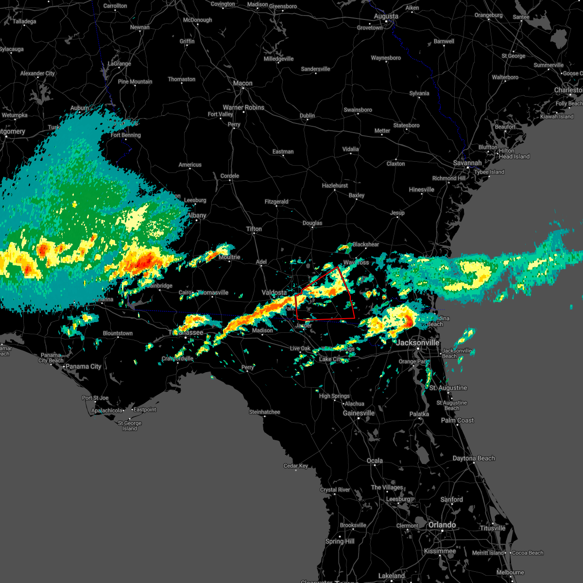 The tornado warning for echols, clinch and southwestern ware counties will expire at 930 am est, the storm which prompted the warning has moved out of the area. therefore the warning will be allowed to expire. however gusty winds are still possible with this thunderstorm. a tornado watch remains in effect until 1100 am est for northern florida, southeastern georgia, and until 1000 am est for southeastern georgia. The tornado warning for echols, clinch and southwestern ware counties will expire at 930 am est, the storm which prompted the warning has moved out of the area. therefore the warning will be allowed to expire. however gusty winds are still possible with this thunderstorm. a tornado watch remains in effect until 1100 am est for northern florida, southeastern georgia, and until 1000 am est for southeastern georgia.
|
| 1/22/2017 9:16 AM EST |
 At 916 am est, a severe thunderstorm capable of producing a tornado was located 8 miles northeast of fargo, moving east at 50 mph (radar indicated rotation). Hazards include tornado. Flying debris will be dangerous to those caught without shelter. mobile homes will be damaged or destroyed. damage to roofs, windows, and vehicles will occur. tree damage is likely. this dangerous storm will be near, stephen foster state park around 930 am est. Folkston and homeland around 945 am est. At 916 am est, a severe thunderstorm capable of producing a tornado was located 8 miles northeast of fargo, moving east at 50 mph (radar indicated rotation). Hazards include tornado. Flying debris will be dangerous to those caught without shelter. mobile homes will be damaged or destroyed. damage to roofs, windows, and vehicles will occur. tree damage is likely. this dangerous storm will be near, stephen foster state park around 930 am est. Folkston and homeland around 945 am est.
|
| 1/22/2017 8:57 AM EST |
 At 857 am est, a severe thunderstorm capable of producing a tornado was located 7 miles east of statenville, moving east at 40 mph (radar indicated rotation). Hazards include tornado. Flying debris will be dangerous to those caught without shelter. mobile homes will be damaged or destroyed. damage to roofs, windows, and vehicles will occur. tree damage is likely. this dangerous storm will be near, needmore around 915 am est. Fargo around 925 am est. At 857 am est, a severe thunderstorm capable of producing a tornado was located 7 miles east of statenville, moving east at 40 mph (radar indicated rotation). Hazards include tornado. Flying debris will be dangerous to those caught without shelter. mobile homes will be damaged or destroyed. damage to roofs, windows, and vehicles will occur. tree damage is likely. this dangerous storm will be near, needmore around 915 am est. Fargo around 925 am est.
|
| 8/13/2016 8:30 PM EDT | Power liens and trees were blown down along alfred griffis road and mlk drive in farg in clinch county GA, 0.7 miles NNW of Fargo, GA |
| 8/13/2016 8:20 PM EDT |
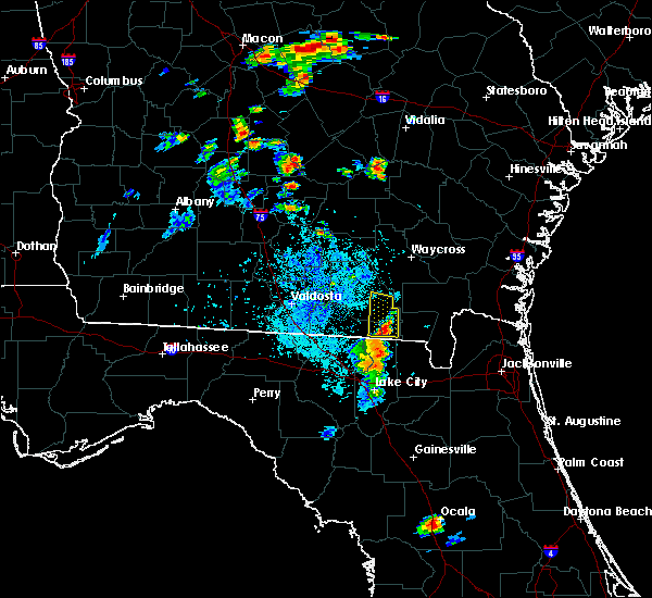 At 819 pm edt, a severe thunderstorm was located over fargo, moving north at 20 mph (radar indicated). Hazards include 60 mph wind gusts and quarter size hail. Hail damage to vehicles is expected. Expect wind damage to roofs, siding, and trees. At 819 pm edt, a severe thunderstorm was located over fargo, moving north at 20 mph (radar indicated). Hazards include 60 mph wind gusts and quarter size hail. Hail damage to vehicles is expected. Expect wind damage to roofs, siding, and trees.
|
| 7/15/2016 3:34 PM EDT |
 At 333 pm edt, a severe thunderstorm was located near needmore, or near fargo, moving northeast at 10 mph (radar indicated). Hazards include 60 mph wind gusts. Expect damage to roofs. siding. and trees. Locations impacted include, fargo and needmore. At 333 pm edt, a severe thunderstorm was located near needmore, or near fargo, moving northeast at 10 mph (radar indicated). Hazards include 60 mph wind gusts. Expect damage to roofs. siding. and trees. Locations impacted include, fargo and needmore.
|
| 7/15/2016 3:15 PM EDT |
 At 315 pm edt, a severe thunderstorm was located near belmont, or 12 miles southwest of fargo, moving northeast at 10 mph (radar indicated). Hazards include 60 mph wind gusts and penny size hail. Expect damage to roofs. siding. And trees. At 315 pm edt, a severe thunderstorm was located near belmont, or 12 miles southwest of fargo, moving northeast at 10 mph (radar indicated). Hazards include 60 mph wind gusts and penny size hail. Expect damage to roofs. siding. And trees.
|
| 3/24/2016 9:55 PM EDT | Emergency manager reported damage to a restaurant in fargo. time is approximate and based on rada in clinch county GA, 0.8 miles W of Fargo, GA |
| 3/24/2016 9:52 PM EDT |
 At 952 pm edt, severe thunderstorms were located along a line extending from near fargo to 11 miles east of belmont, moving east at 40 mph (radar indicated). Hazards include 60 to 70 mph wind gusts. Expect considerable tree damage. Damage is likely to mobile homes, roofs, and outbuildings. At 952 pm edt, severe thunderstorms were located along a line extending from near fargo to 11 miles east of belmont, moving east at 40 mph (radar indicated). Hazards include 60 to 70 mph wind gusts. Expect considerable tree damage. Damage is likely to mobile homes, roofs, and outbuildings.
|
| 2/24/2016 5:56 AM EST |
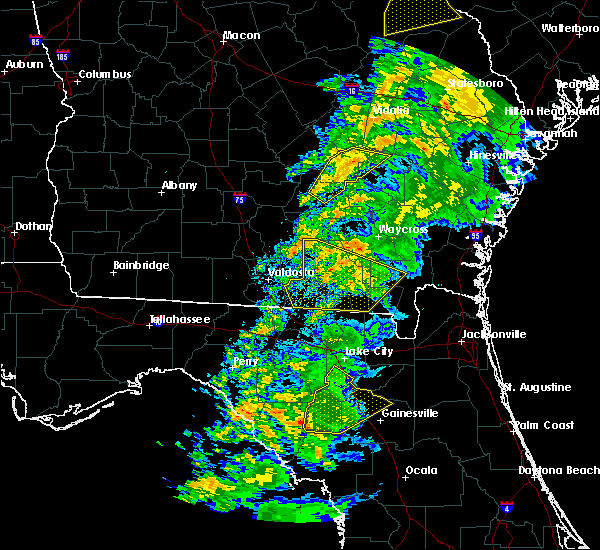 The severe thunderstorm warning for southern ware, northwestern charlton, clinch and echols counties will expire at 600 am est, the storms which prompted the warning have weakened. therefore the warning will be allowed to expire. however gusty winds of 45 to 55 mph are still possible with these thunderstorms. a tornado watch remains in effect until 1000 am est for northeastern florida and southeastern georgia. The severe thunderstorm warning for southern ware, northwestern charlton, clinch and echols counties will expire at 600 am est, the storms which prompted the warning have weakened. therefore the warning will be allowed to expire. however gusty winds of 45 to 55 mph are still possible with these thunderstorms. a tornado watch remains in effect until 1000 am est for northeastern florida and southeastern georgia.
|
| 2/24/2016 5:44 AM EST |
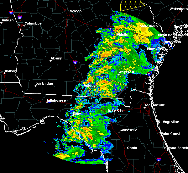 At 544 am est, severe thunderstorms were located along a line extending from near mayday to 6 miles southeast of needmore, moving northeast at 65 mph (radar indicated). Hazards include 60 mph wind gusts. Expect damage to roofs. siding and trees. locations impacted include, homerville, fargo, argyle, stephen foster state park, statenville, du pont, needmore and mayday. A tornado watch remains in effect until 1000 am est for northeastern florida and southeastern georgia. At 544 am est, severe thunderstorms were located along a line extending from near mayday to 6 miles southeast of needmore, moving northeast at 65 mph (radar indicated). Hazards include 60 mph wind gusts. Expect damage to roofs. siding and trees. locations impacted include, homerville, fargo, argyle, stephen foster state park, statenville, du pont, needmore and mayday. A tornado watch remains in effect until 1000 am est for northeastern florida and southeastern georgia.
|
| 2/24/2016 5:30 AM EST |
 At 530 am est, severe thunderstorms were located along a line extending from near mayday to near belmont, moving northeast at 85 mph (radar indicated). Hazards include 60 mph wind gusts. Expect damage to roofs. siding and trees. locations impacted include, jasper, homerville, white springs, fargo, argyle, stephen foster state park, statenville, du pont, belmont, needmore and mayday. A tornado watch remains in effect until 1000 am est for northeastern florida and southeastern georgia. At 530 am est, severe thunderstorms were located along a line extending from near mayday to near belmont, moving northeast at 85 mph (radar indicated). Hazards include 60 mph wind gusts. Expect damage to roofs. siding and trees. locations impacted include, jasper, homerville, white springs, fargo, argyle, stephen foster state park, statenville, du pont, belmont, needmore and mayday. A tornado watch remains in effect until 1000 am est for northeastern florida and southeastern georgia.
|
| 2/24/2016 5:30 AM EST |
 A severe thunderstorm warning remains in effect until 600 am est for eastern hamilton. northern columbia. southern ware. northwestern charlton. clinch and echols counties. at 530 am est. severe thunderstorms were located along a line extending from near mayday to near belmont. Moving northeast at 85 mph. A severe thunderstorm warning remains in effect until 600 am est for eastern hamilton. northern columbia. southern ware. northwestern charlton. clinch and echols counties. at 530 am est. severe thunderstorms were located along a line extending from near mayday to near belmont. Moving northeast at 85 mph.
|
| 2/24/2016 5:20 AM EST |
 At 520 am est, severe thunderstorms were located along a line extending from near statenville to white springs, moving northeast at 85 mph (radar indicated). Hazards include 60 mph wind gusts. Expect damage to roofs. Siding and trees. At 520 am est, severe thunderstorms were located along a line extending from near statenville to white springs, moving northeast at 85 mph (radar indicated). Hazards include 60 mph wind gusts. Expect damage to roofs. Siding and trees.
|
| 8/23/2015 4:50 PM EDT |
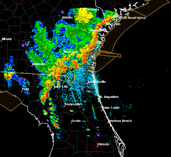 At 449 pm edt, doppler radar indicated a severe thunderstorm capable of producing damaging winds in excess of 60 mph. this storm was located 7 miles southeast of fargo, and moving east at 40 mph. At 449 pm edt, doppler radar indicated a severe thunderstorm capable of producing damaging winds in excess of 60 mph. this storm was located 7 miles southeast of fargo, and moving east at 40 mph.
|
| 8/23/2015 4:35 PM EDT | Tree and power line down on swamp road. time estimated by rada in clinch county GA, 1.5 miles WNW of Fargo, GA |
| 8/7/2015 1:50 PM EDT |
 At 150 pm edt, doppler radar indicated a line of severe thunderstorms capable of producing damaging winds in excess of 60 mph. these storms were located along a line extending from near homeland to near belmont, and moving southeast at 30 mph. At 150 pm edt, doppler radar indicated a line of severe thunderstorms capable of producing damaging winds in excess of 60 mph. these storms were located along a line extending from near homeland to near belmont, and moving southeast at 30 mph.
|
| 7/23/2015 7:02 PM EDT |
 At 702 pm edt, doppler radar indicated a severe thunderstorm capable of producing damaging winds in excess of 60 mph. this storm was located near du pont, or near homerville, and moving southeast at 30 mph. At 702 pm edt, doppler radar indicated a severe thunderstorm capable of producing damaging winds in excess of 60 mph. this storm was located near du pont, or near homerville, and moving southeast at 30 mph.
|
| 7/14/2015 4:38 PM EDT |
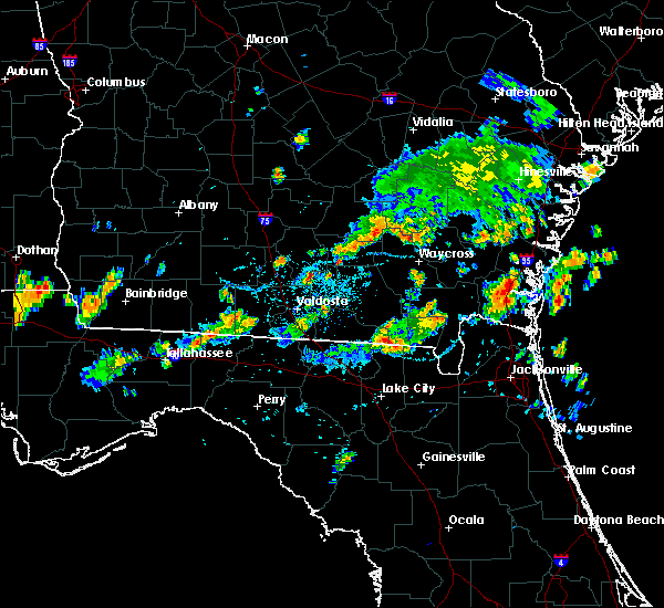 The severe thunderstorm warning for south central ware, southeastern clinch and west central charlton counties will expire at 445 pm edt, the storm which prompted the warning has weakened below severe limits, and no longer poses an immediate threat to life or property. therefore the warning will be allowed to expire. however gusty winds are still possible with this thunderstorm. The severe thunderstorm warning for south central ware, southeastern clinch and west central charlton counties will expire at 445 pm edt, the storm which prompted the warning has weakened below severe limits, and no longer poses an immediate threat to life or property. therefore the warning will be allowed to expire. however gusty winds are still possible with this thunderstorm.
|
| 7/14/2015 3:57 PM EDT |
 At 357 pm edt, doppler radar indicated a severe thunderstorm capable of producing quarter size hail and damaging winds in excess of 60 mph. this storm was located 7 miles west of stephen foster state park, and moving east at 15 mph. At 357 pm edt, doppler radar indicated a severe thunderstorm capable of producing quarter size hail and damaging winds in excess of 60 mph. this storm was located 7 miles west of stephen foster state park, and moving east at 15 mph.
|
| 7/4/2015 5:12 PM EDT |
 At 511 pm edt, doppler radar indicated a severe thunderstorm capable of producing damaging winds in excess of 60 mph. this storm was located 7 miles north of fargo, moving northeast at 25 mph. penny size hail may also accompany the damaging winds. locations impacted include, fargo and needmore. At 511 pm edt, doppler radar indicated a severe thunderstorm capable of producing damaging winds in excess of 60 mph. this storm was located 7 miles north of fargo, moving northeast at 25 mph. penny size hail may also accompany the damaging winds. locations impacted include, fargo and needmore.
|
| 7/4/2015 5:10 PM EDT | Tree reported down near church street and highway 94. power outage reported in fargo. time estimated by rada in clinch county GA, 0.2 miles WSW of Fargo, GA |
| 7/4/2015 4:51 PM EDT |
 At 451 pm edt, doppler radar indicated a severe thunderstorm capable of producing damaging winds in excess of 60 mph. this storm was located near needmore, or 8 miles northwest of fargo, and moving northeast at 20 mph. penny size hail may also accompany the damaging winds. At 451 pm edt, doppler radar indicated a severe thunderstorm capable of producing damaging winds in excess of 60 mph. this storm was located near needmore, or 8 miles northwest of fargo, and moving northeast at 20 mph. penny size hail may also accompany the damaging winds.
|
| 7/1/2015 7:23 PM EDT |
 At 723 pm edt, doppler radar indicated a severe thunderstorm capable of producing quarter size hail and destructive winds in excess of 70 mph. this storm was located 9 miles east of mayday, or 12 miles northeast of statenville near chauncy road, moving northeast at 25 mph. locations impacted include, needmore and mayday. At 723 pm edt, doppler radar indicated a severe thunderstorm capable of producing quarter size hail and destructive winds in excess of 70 mph. this storm was located 9 miles east of mayday, or 12 miles northeast of statenville near chauncy road, moving northeast at 25 mph. locations impacted include, needmore and mayday.
|
| 7/1/2015 7:12 PM EDT |
 At 711 pm edt, doppler radar indicated a severe thunderstorm capable of producing quarter size hail and destructive winds in excess of 70 mph. this storm was located near statenville along gaddis road and west boundary road, moving east at 25 mph. locations impacted include, statenville, needmore and mayday. At 711 pm edt, doppler radar indicated a severe thunderstorm capable of producing quarter size hail and destructive winds in excess of 70 mph. this storm was located near statenville along gaddis road and west boundary road, moving east at 25 mph. locations impacted include, statenville, needmore and mayday.
|
| 7/1/2015 7:04 PM EDT |
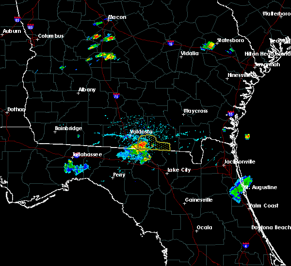 At 703 pm edt, doppler radar indicated a severe thunderstorm capable of producing damaging winds in excess of 60 mph. this storm was located near statenville along u.s. highway 129 and state route 94, moving east at 30 mph. locations impacted include, statenville, needmore and mayday. At 703 pm edt, doppler radar indicated a severe thunderstorm capable of producing damaging winds in excess of 60 mph. this storm was located near statenville along u.s. highway 129 and state route 94, moving east at 30 mph. locations impacted include, statenville, needmore and mayday.
|
| 7/1/2015 6:55 PM EDT |
 At 654 pm edt, doppler radar indicated a severe thunderstorm capable of producing damaging winds in excess of 60 mph. this storm was located over statenville, and moving east at 25 mph. At 654 pm edt, doppler radar indicated a severe thunderstorm capable of producing damaging winds in excess of 60 mph. this storm was located over statenville, and moving east at 25 mph.
|
| 6/30/2015 2:29 PM EDT |
 At 228 pm edt, doppler radar indicated a line of severe thunderstorms capable of producing damaging winds in excess of 60 mph. these storms were located along a line extending from fargo to near white springs to near luraville, and moving east at 35 mph. At 228 pm edt, doppler radar indicated a line of severe thunderstorms capable of producing damaging winds in excess of 60 mph. these storms were located along a line extending from fargo to near white springs to near luraville, and moving east at 35 mph.
|
| 6/30/2015 1:59 PM EDT |
 At 159 pm edt, doppler radar indicated a line of severe thunderstorms capable of producing damaging winds in excess of 60 mph. these storms were located along a line extending from 11 miles north of needmore to 10 miles southwest of dowling park, and moving east at 35 mph. At 159 pm edt, doppler radar indicated a line of severe thunderstorms capable of producing damaging winds in excess of 60 mph. these storms were located along a line extending from 11 miles north of needmore to 10 miles southwest of dowling park, and moving east at 35 mph.
|
| 6/30/2015 1:29 PM EDT |
 At 129 pm edt, doppler radar indicated a line of severe thunderstorms capable of producing damaging winds in excess of 60 mph. these storms were located along a line extending from near emerson park to near columbia, and moving east at 45 mph. At 129 pm edt, doppler radar indicated a line of severe thunderstorms capable of producing damaging winds in excess of 60 mph. these storms were located along a line extending from near emerson park to near columbia, and moving east at 45 mph.
|
| 6/28/2015 3:51 PM EDT |
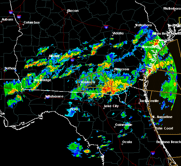 At 351 pm edt, doppler radar indicated a severe thunderstorm capable of producing damaging winds in excess of 60 mph. this storm was located 10 miles south of stephen foster state park, moving east at 30 mph. locations impacted include, fargo and stephen foster state park. At 351 pm edt, doppler radar indicated a severe thunderstorm capable of producing damaging winds in excess of 60 mph. this storm was located 10 miles south of stephen foster state park, moving east at 30 mph. locations impacted include, fargo and stephen foster state park.
|
| 6/28/2015 3:39 PM EDT |
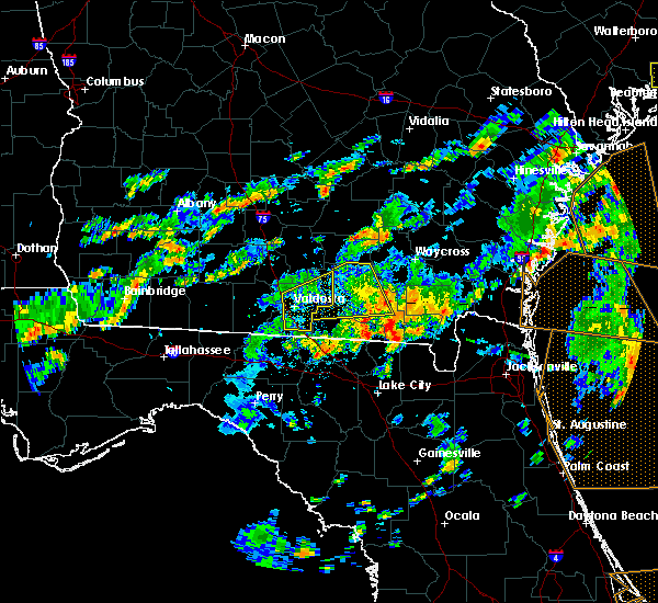 At 339 pm edt, doppler radar indicated a severe thunderstorm capable of producing damaging winds in excess of 60 mph. this storm was located near fargo, and moving east at 30 mph. At 339 pm edt, doppler radar indicated a severe thunderstorm capable of producing damaging winds in excess of 60 mph. this storm was located near fargo, and moving east at 30 mph.
|
| 6/28/2015 1:55 PM EDT |
 At 155 pm edt, doppler radar indicated a line of severe thunderstorms capable of producing damaging winds in excess of 60 mph. these storms were located along a line extending from near pebble hill to 10 miles northwest of needmore, moving east at 20 mph. locations impacted include, argyle, pebble hill, dixie union, braganza, manor, deenwood, emerson park, hebardville, boggy bay, sunnyside, needham and waresboro. At 155 pm edt, doppler radar indicated a line of severe thunderstorms capable of producing damaging winds in excess of 60 mph. these storms were located along a line extending from near pebble hill to 10 miles northwest of needmore, moving east at 20 mph. locations impacted include, argyle, pebble hill, dixie union, braganza, manor, deenwood, emerson park, hebardville, boggy bay, sunnyside, needham and waresboro.
|
| 6/28/2015 1:50 PM EDT |
 At 150 pm edt, doppler radar indicated a line of severe thunderstorms capable of producing damaging winds in excess of 60 mph. these storms were located along a line extending from near pebble hill to 9 miles north of needmore, moving east at 20 mph. locations impacted include, homerville, fargo, argyle, deenwood, hebardville, sunnyside, pebble hill, dixie union, braganza, manor, emerson park, boggy bay, waresboro and needham. At 150 pm edt, doppler radar indicated a line of severe thunderstorms capable of producing damaging winds in excess of 60 mph. these storms were located along a line extending from near pebble hill to 9 miles north of needmore, moving east at 20 mph. locations impacted include, homerville, fargo, argyle, deenwood, hebardville, sunnyside, pebble hill, dixie union, braganza, manor, emerson park, boggy bay, waresboro and needham.
|
| 6/28/2015 1:39 PM EDT |
 At 139 pm edt, doppler radar indicated a line of severe thunderstorms capable of producing damaging winds in excess of 60 mph. these storms were located along a line extending from near dixie union to 11 miles northwest of needmore, moving east at 30 mph. locations impacted include, homerville, fargo, argyle, deenwood, hebardville, sunnyside, pebble hill, dixie union, braganza, manor, emerson park, needmore, boggy bay, cogdell, waresboro and needham. At 139 pm edt, doppler radar indicated a line of severe thunderstorms capable of producing damaging winds in excess of 60 mph. these storms were located along a line extending from near dixie union to 11 miles northwest of needmore, moving east at 30 mph. locations impacted include, homerville, fargo, argyle, deenwood, hebardville, sunnyside, pebble hill, dixie union, braganza, manor, emerson park, needmore, boggy bay, cogdell, waresboro and needham.
|
| 6/28/2015 1:34 PM EDT |
 At 134 pm edt, doppler radar indicated a line of severe thunderstorms capable of producing damaging winds in excess of 60 mph. these storms were located along a line extending from 10 miles west of dixie union to near mayday, moving east at 20 mph. locations impacted include, homerville, fargo, argyle, du pont, deenwood, hebardville, sunnyside, pebble hill, dixie union, braganza, manor, emerson park, needmore, boggy bay, cogdell, waresboro, bickley, axson, needham and millwood. At 134 pm edt, doppler radar indicated a line of severe thunderstorms capable of producing damaging winds in excess of 60 mph. these storms were located along a line extending from 10 miles west of dixie union to near mayday, moving east at 20 mph. locations impacted include, homerville, fargo, argyle, du pont, deenwood, hebardville, sunnyside, pebble hill, dixie union, braganza, manor, emerson park, needmore, boggy bay, cogdell, waresboro, bickley, axson, needham and millwood.
|
| 6/28/2015 1:28 PM EDT |
 At 128 pm edt, doppler radar indicated a line of severe thunderstorms capable of producing damaging winds in excess of 60 mph. these storms were located along a line extending from 9 miles west of dixie union to near mayday, and moving east at 20 mph. At 128 pm edt, doppler radar indicated a line of severe thunderstorms capable of producing damaging winds in excess of 60 mph. these storms were located along a line extending from 9 miles west of dixie union to near mayday, and moving east at 20 mph.
|
| 6/22/2015 5:38 PM EDT |
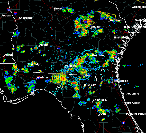 The severe thunderstorm warning for southeastern echols and south central clinch counties will expire at 545 pm edt, the storm which prompted the warning has weakened below severe limits, and no longer poses an immediate threat to life or property. therefore the warning will be allowed to expire. however heavy rain is still possible with this thunderstorm. The severe thunderstorm warning for southeastern echols and south central clinch counties will expire at 545 pm edt, the storm which prompted the warning has weakened below severe limits, and no longer poses an immediate threat to life or property. therefore the warning will be allowed to expire. however heavy rain is still possible with this thunderstorm.
|
| 6/22/2015 5:19 PM EDT |
 At 518 pm edt, doppler radar indicated a severe thunderstorm capable of producing quarter size hail and damaging winds in excess of 60 mph. this storm was located over needmore, or near fargo, and moving southeast at 10 mph. At 518 pm edt, doppler radar indicated a severe thunderstorm capable of producing quarter size hail and damaging winds in excess of 60 mph. this storm was located over needmore, or near fargo, and moving southeast at 10 mph.
|
| 6/3/2015 9:22 PM EDT | At 922 pm edt, doppler radar indicated a severe thunderstorm capable of producing large hail up to ping pong ball size and destructive winds in excess of 70 mph. this storm was located 8 miles southwest of needmore, or 11 miles northeast of jasper, and moving southeast at 20 mph. |
| 6/3/2015 9:22 PM EDT | At 922 pm edt, doppler radar indicated a severe thunderstorm capable of producing large hail up to ping pong ball size and destructive winds in excess of 70 mph. this storm was located 8 miles southwest of needmore, or 11 miles northeast of jasper, and moving southeast at 20 mph. |
| 6/3/2015 8:58 PM EDT | At 858 pm edt, doppler radar indicated a severe thunderstorm capable of producing large hail up to ping pong ball size and destructive winds in excess of 70 mph. this storm was located 9 miles southeast of mayday, or 11 miles northeast of statenville, moving southeast at 20 mph. locations impacted include, fargo and needmore. |
| 6/3/2015 8:49 PM EDT | At 849 pm edt, doppler radar indicated a severe thunderstorm capable of producing large hail up to ping pong ball size and destructive winds in excess of 70 mph. this storm was located 7 miles east of mayday, or 12 miles northeast of statenville, moving southeast at 20 mph. locations impacted include, jennings, fargo, statenville, needmore and mayday. |
| 6/3/2015 8:40 PM EDT | At 840 pm edt, doppler radar indicated a severe thunderstorm capable of producing half dollar size hail and damaging winds in excess of 60 mph. this storm was located near mayday, or 12 miles northeast of statenville, and moving southeast at 20 mph. |
| 5/19/2015 9:28 PM EDT | At 926 pm edt, doppler radar indicated a line of severe thunderstorms capable of producing damaging winds in excess of 60 mph. these storms were located along a line extending from mayday to near suwannee springs, and moving west at 5 mph. nickel size hail may also accompany the damaging winds. the hamilton county sheriffs office has reported hails with numerous trees down around the county. |
| 5/19/2015 9:28 PM EDT | At 926 pm edt, doppler radar indicated a line of severe thunderstorms capable of producing damaging winds in excess of 60 mph. these storms were located along a line extending from mayday to near suwannee springs, and moving west at 5 mph. nickel size hail may also accompany the damaging winds. the hamilton county sheriffs office has reported hails with numerous trees down around the county. |
| 4/19/2015 4:20 PM EDT | At 419 pm edt, doppler radar indicated a line of severe thunderstorms capable of producing damaging winds in excess of 60 mph. these storms were located along a line extending from 9 miles northeast of jasper to near white springs to near columbia. storms tracking northeast around 40 mph. locations impacted include, fargo, stephen foster state park, needmore and belmont. a tornado watch remains in effect until 800 pm edt for northeastern florida and southeastern georgia. |
| 4/19/2015 4:20 PM EDT | At 419 pm edt, doppler radar indicated a line of severe thunderstorms capable of producing damaging winds in excess of 60 mph. these storms were located along a line extending from 9 miles northeast of jasper to near white springs to near columbia. storms tracking northeast around 40 mph. locations impacted include, fargo, stephen foster state park, needmore and belmont. a tornado watch remains in effect until 800 pm edt for northeastern florida and southeastern georgia. |
| 4/19/2015 4:00 PM EDT | At 359 pm edt, doppler radar indicated a line of severe thunderstorms capable of producing damaging winds in excess of 60 mph. these storms were located along a line extending from 9 miles northeast of jasper to near white springs to near columbia, and moving northeast at 55 mph. |
| 4/19/2015 4:00 PM EDT | At 359 pm edt, doppler radar indicated a line of severe thunderstorms capable of producing damaging winds in excess of 60 mph. these storms were located along a line extending from 9 miles northeast of jasper to near white springs to near columbia, and moving northeast at 55 mph. |
| 5/15/2014 11:00 AM EDT | Public reported multiple trees downed near the east entrance of the okefenokee swam in ware county GA, 10.1 miles SW of Fargo, GA |
| 2/21/2014 10:30 AM EST | Trees down in the park. a tour boat was caught out and had to be brought i in charlton county GA, 16.5 miles WSW of Fargo, GA |
| 1/30/2013 9:30 PM EST | Trees were down in stephen foster state park. time is based on rada in charlton county GA, 16.4 miles SW of Fargo, GA |
| 1/30/2013 9:30 AM EST | Trees were down in stepeh foster state park. time is based on rada in charlton county GA, 16.5 miles WSW of Fargo, GA |
| 9/18/2012 10:40 AM EDT | A couple of trees were reported down in steven foster state par in charlton county GA, 16.5 miles WSW of Fargo, GA |
| 8/15/2012 3:40 PM EDT | Trees reported down in the cabin area at the stephen foster par in charlton county GA, 16.5 miles WSW of Fargo, GA |
| 6/12/2012 1:20 PM EDT | Numerous trees down or damaged in strong thunders in charlton county GA, 16.5 miles WSW of Fargo, GA |
| 1/1/0001 12:00 AM | Nws employee reported an awning tipped over at a gas station and a railroad track gate was snapped in fargo. plenty of branches and large limbs down in fargo as wel in clinch county GA, 0.8 miles W of Fargo, GA |
Hail Maps for Fargo, GA


Connect with Interactive Hail Maps