

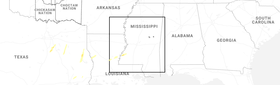
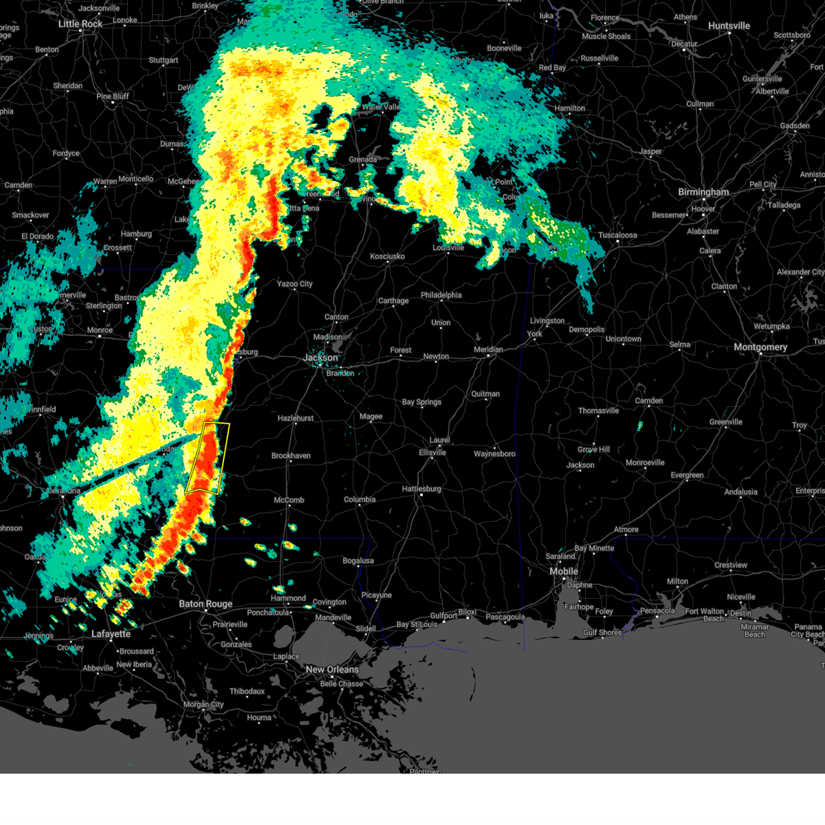
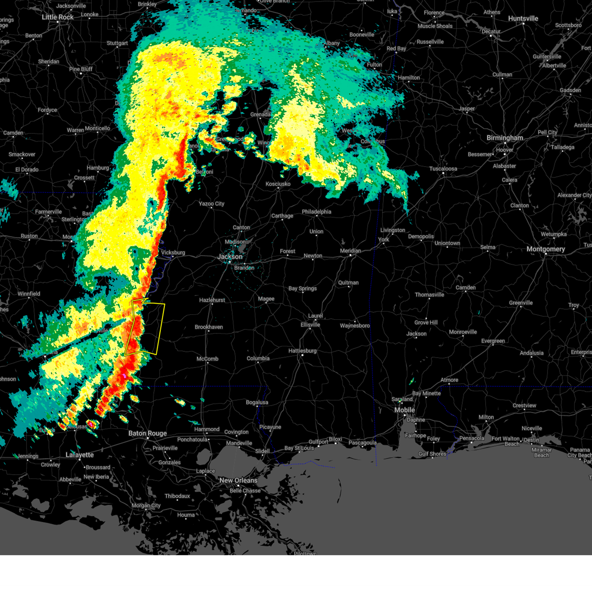
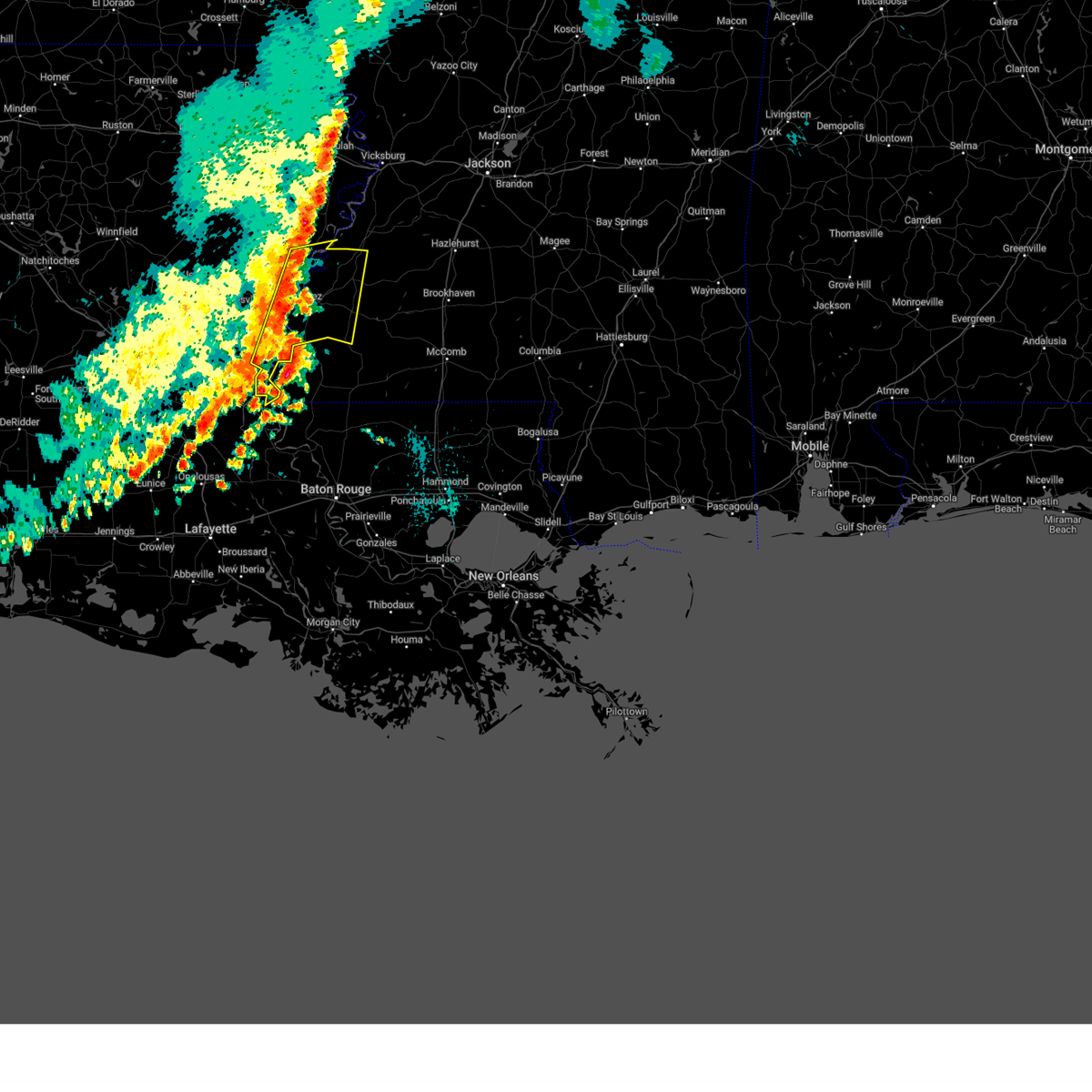
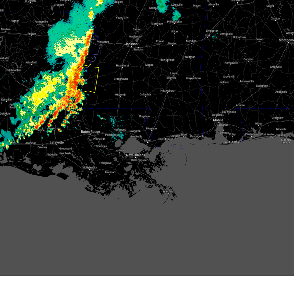
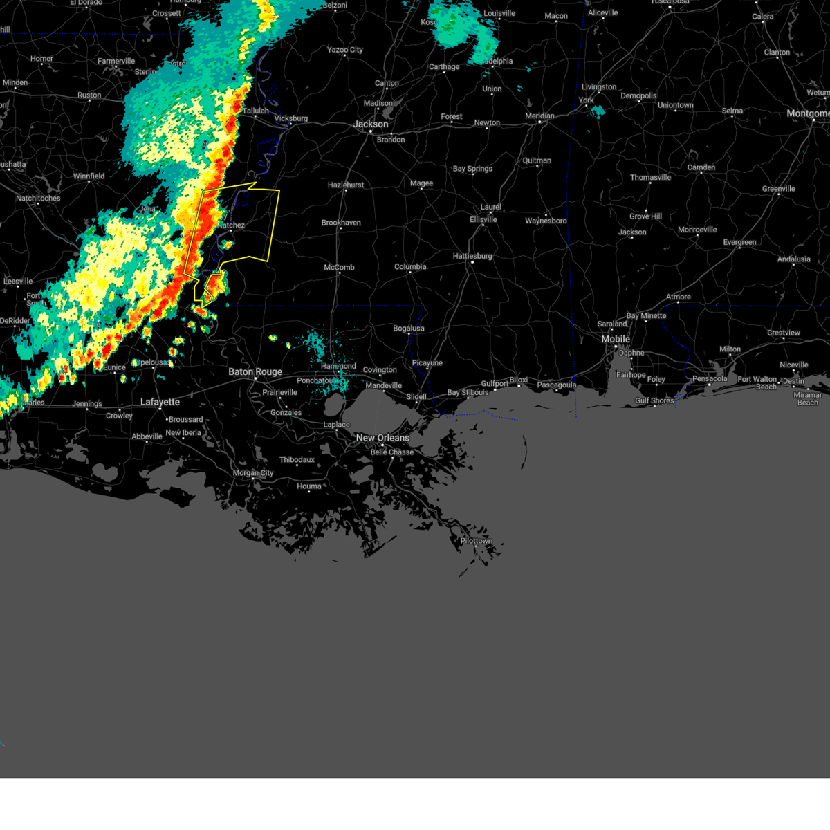
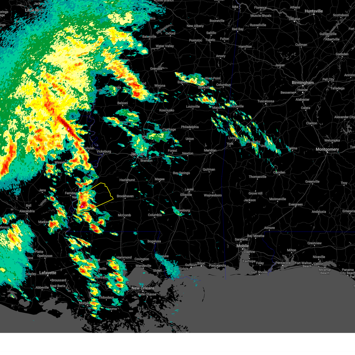
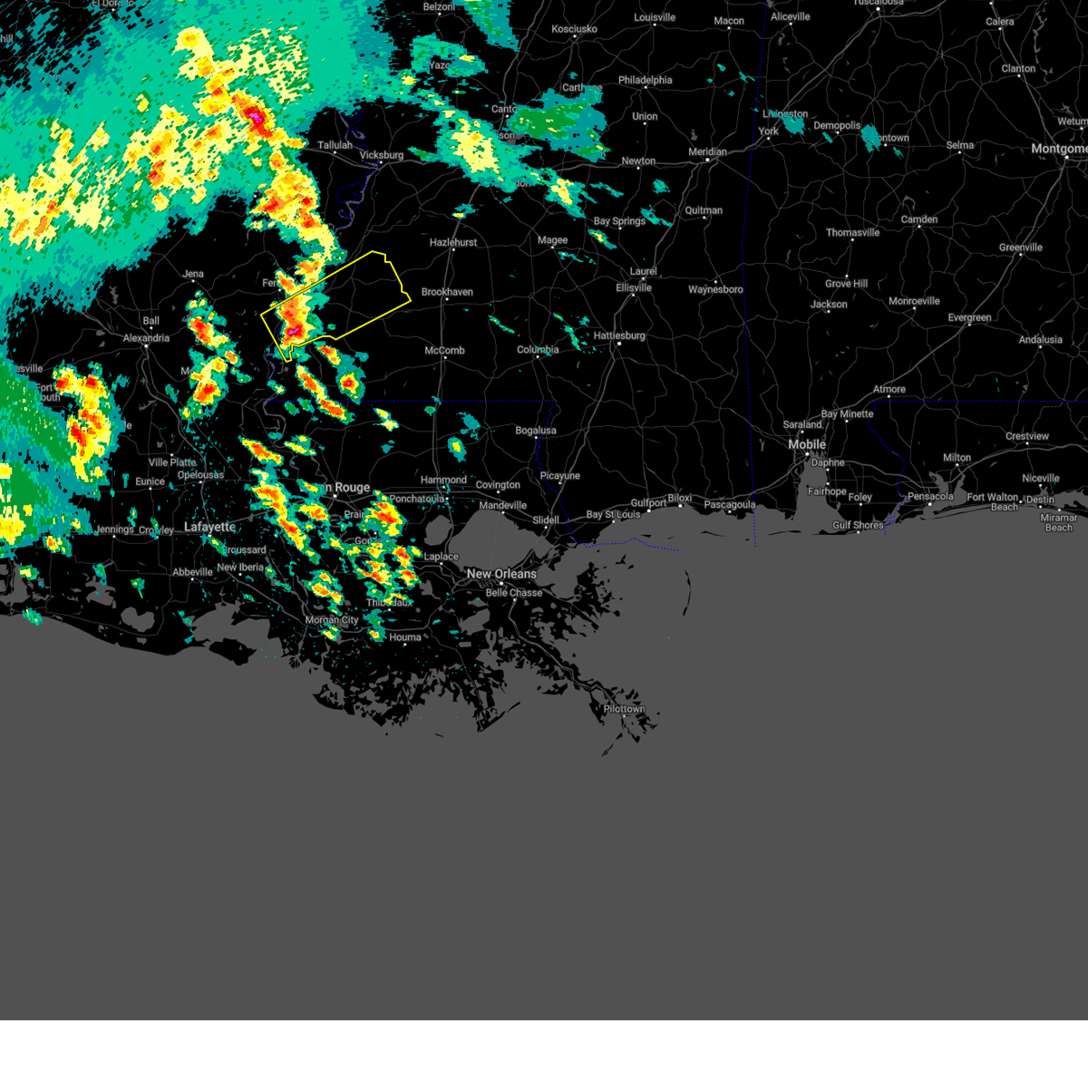
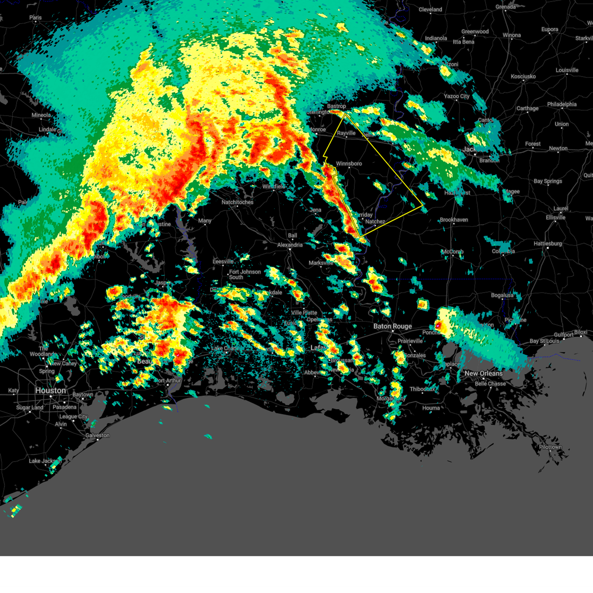
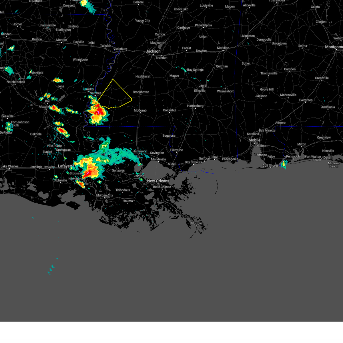
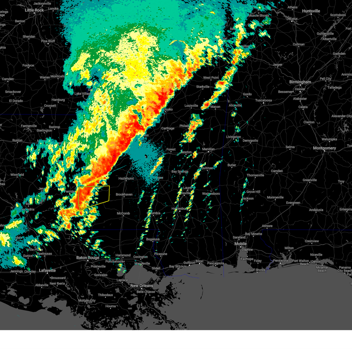
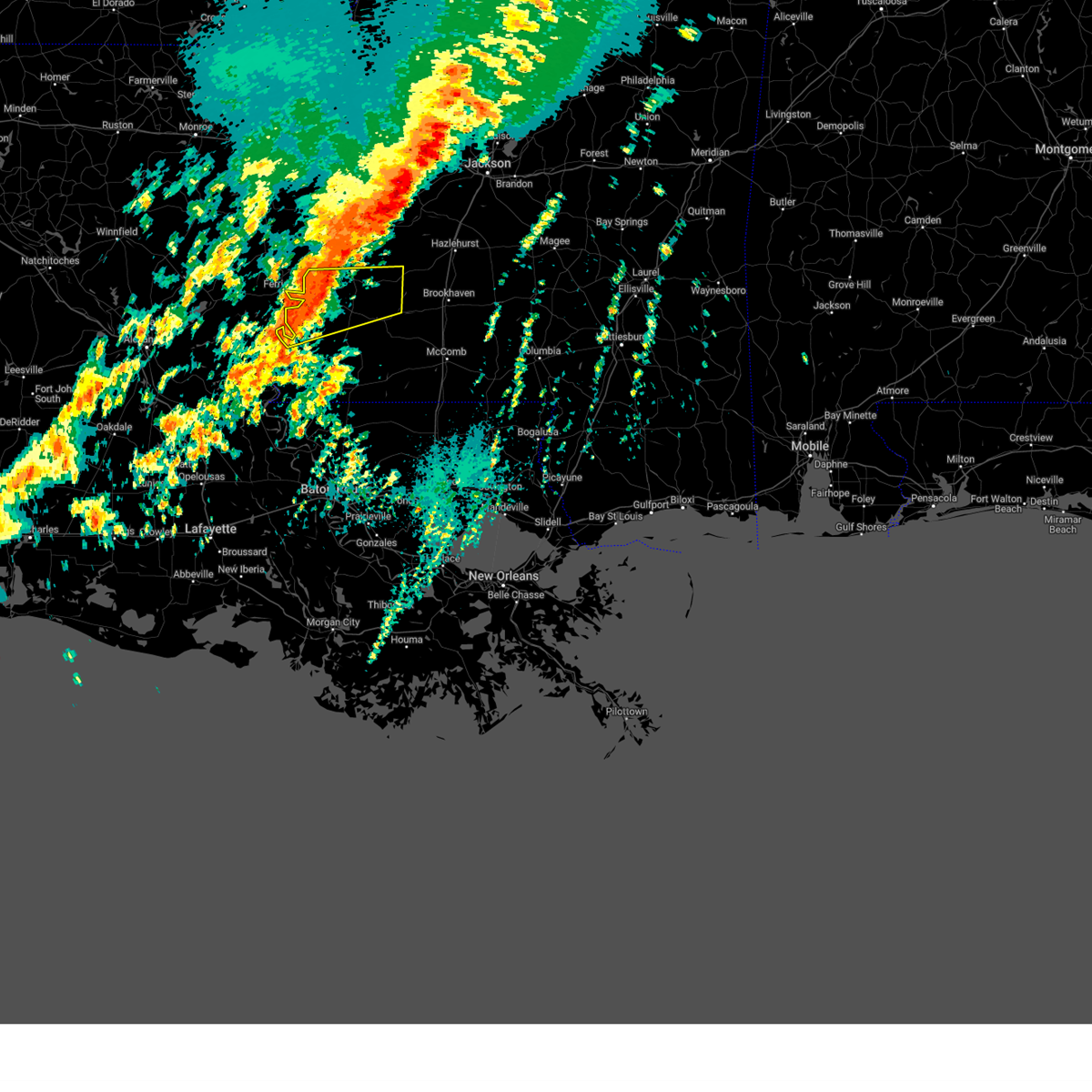
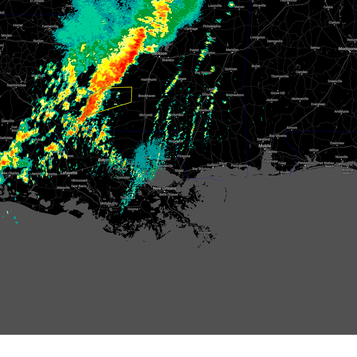
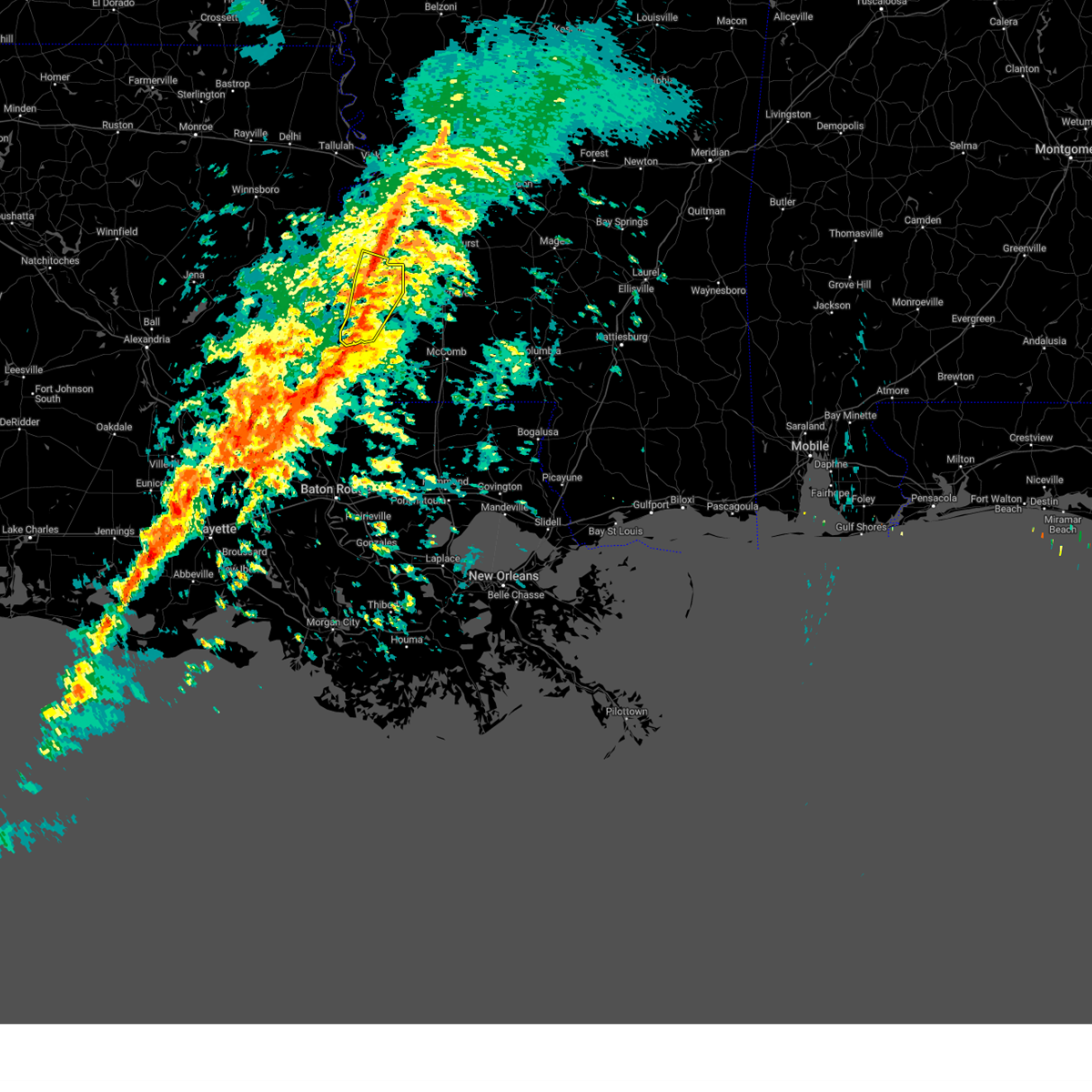
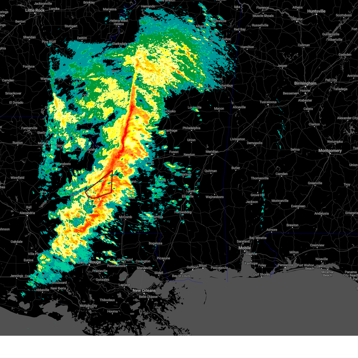
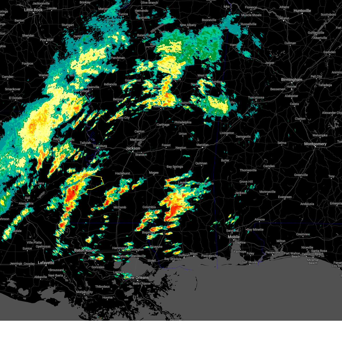
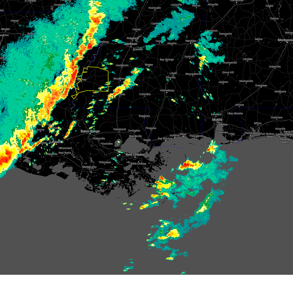
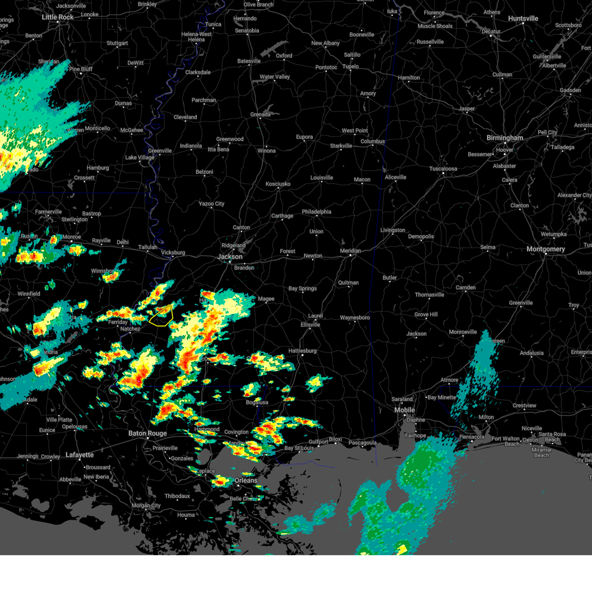
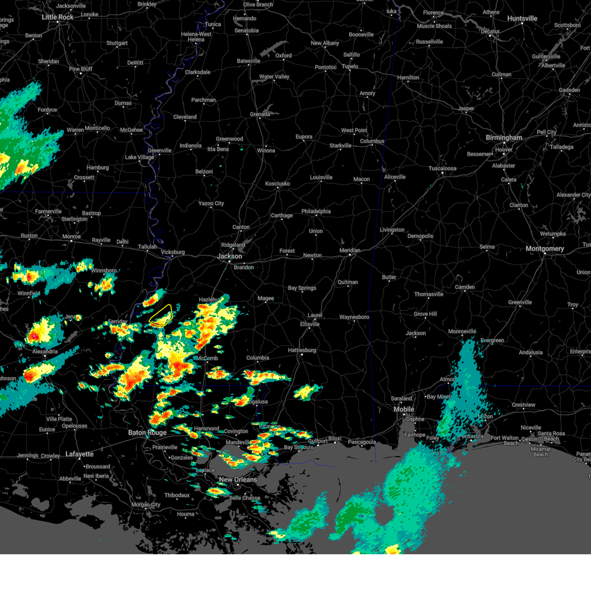
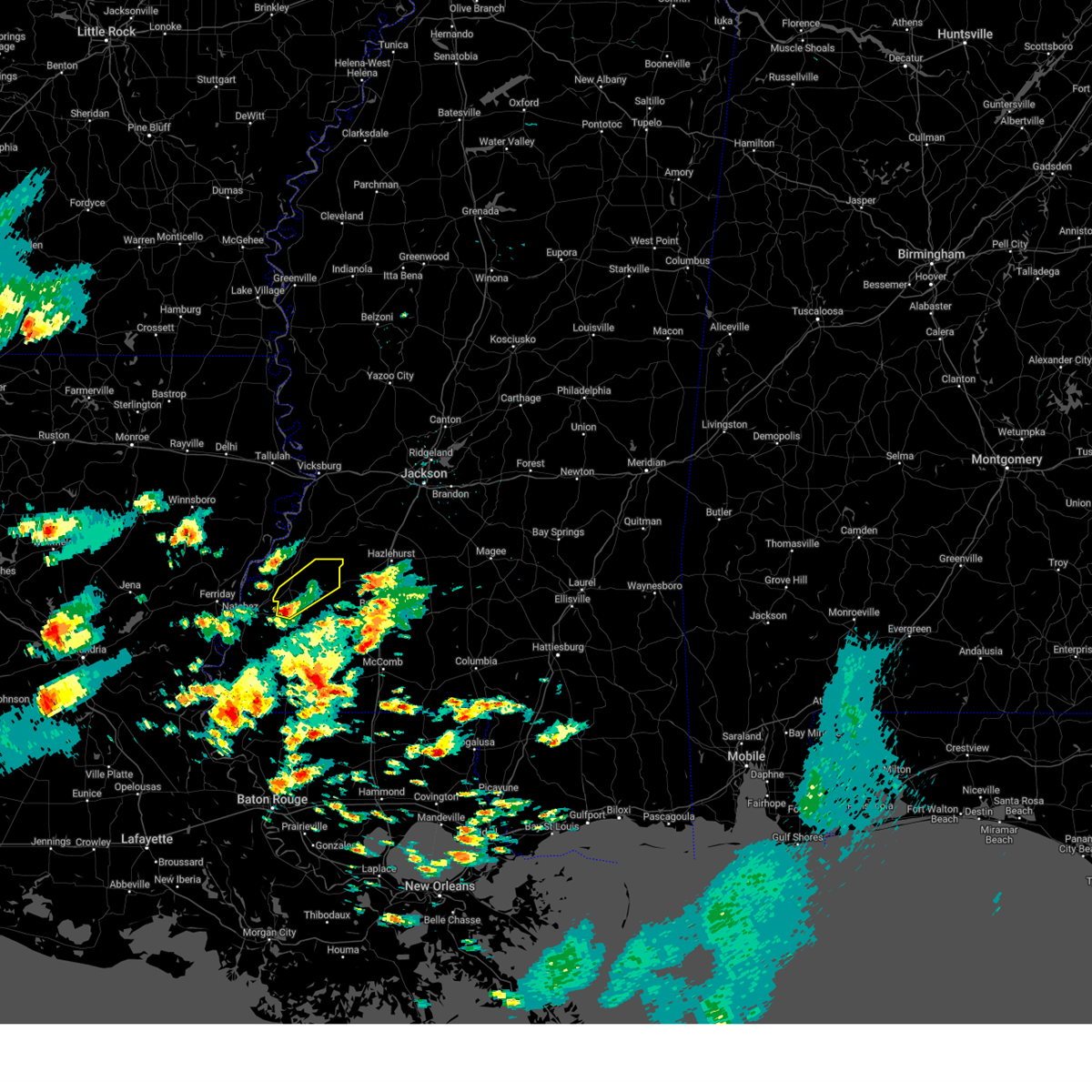
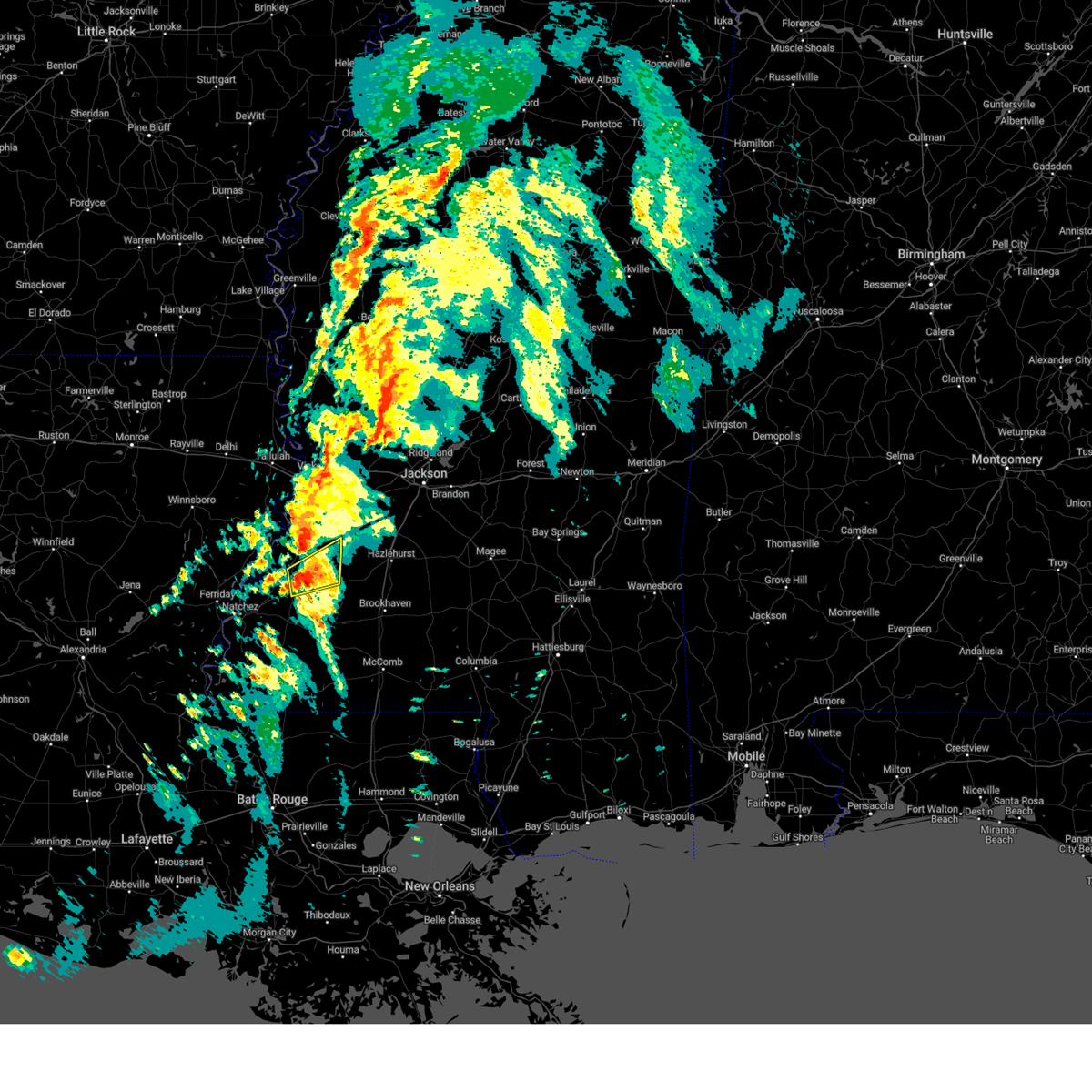
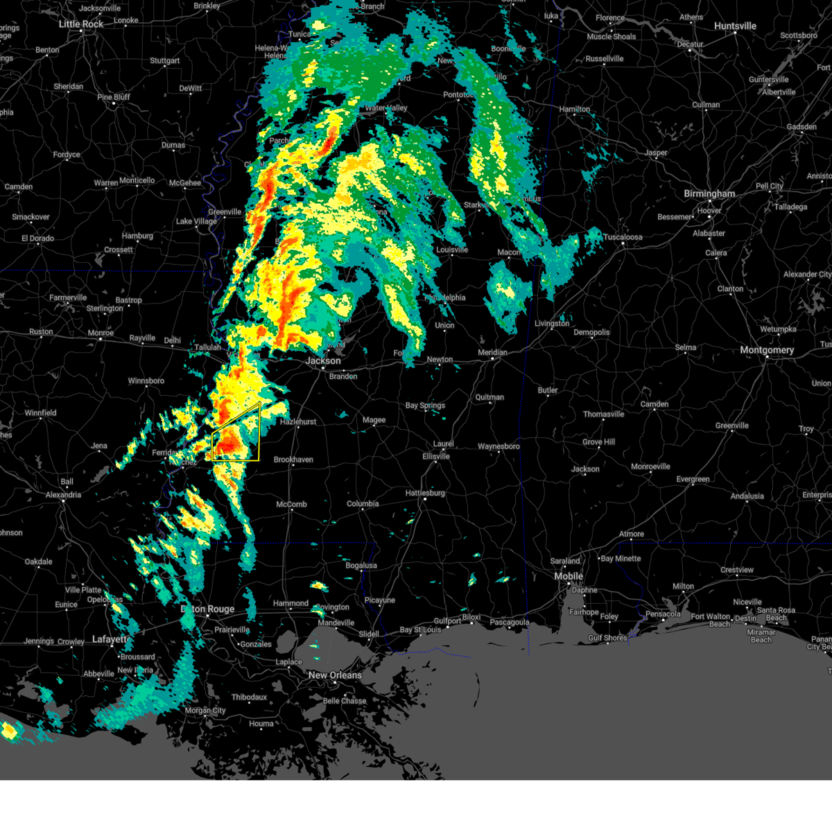
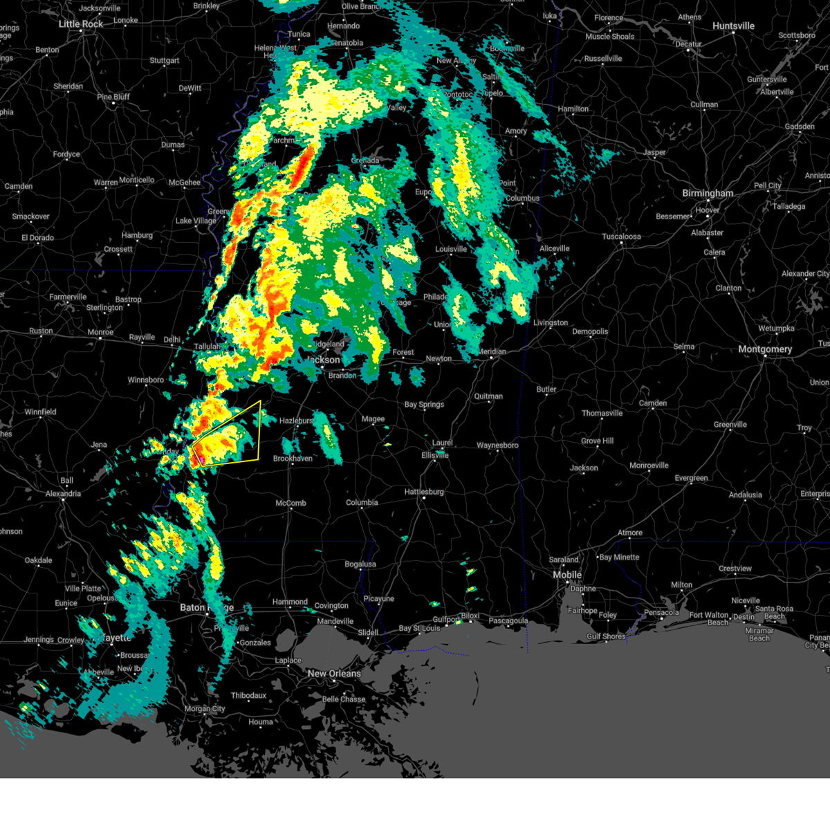
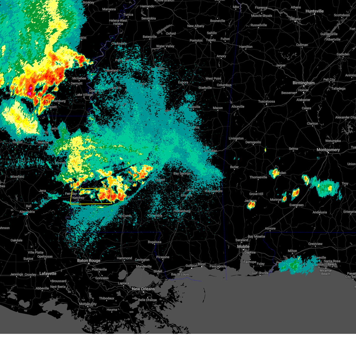
Hail Map for Fayette, MS
The Fayette, MS area has had 10 reports of on-the-ground hail by trained spotters, and has been under severe weather warnings 54 times during the past 12 months. Doppler radar has detected hail at or near Fayette, MS on 44 occasions, including 5 occasions during the past year.
| Name: | Fayette, MS |
| Where Located: | 65.6 miles SW of Jackson, MS |
| Map: | Google Map for Fayette, MS |
| Population: | 1614 |
| Housing Units: | 750 |
| More Info: | Search Google for Fayette, MS |
1
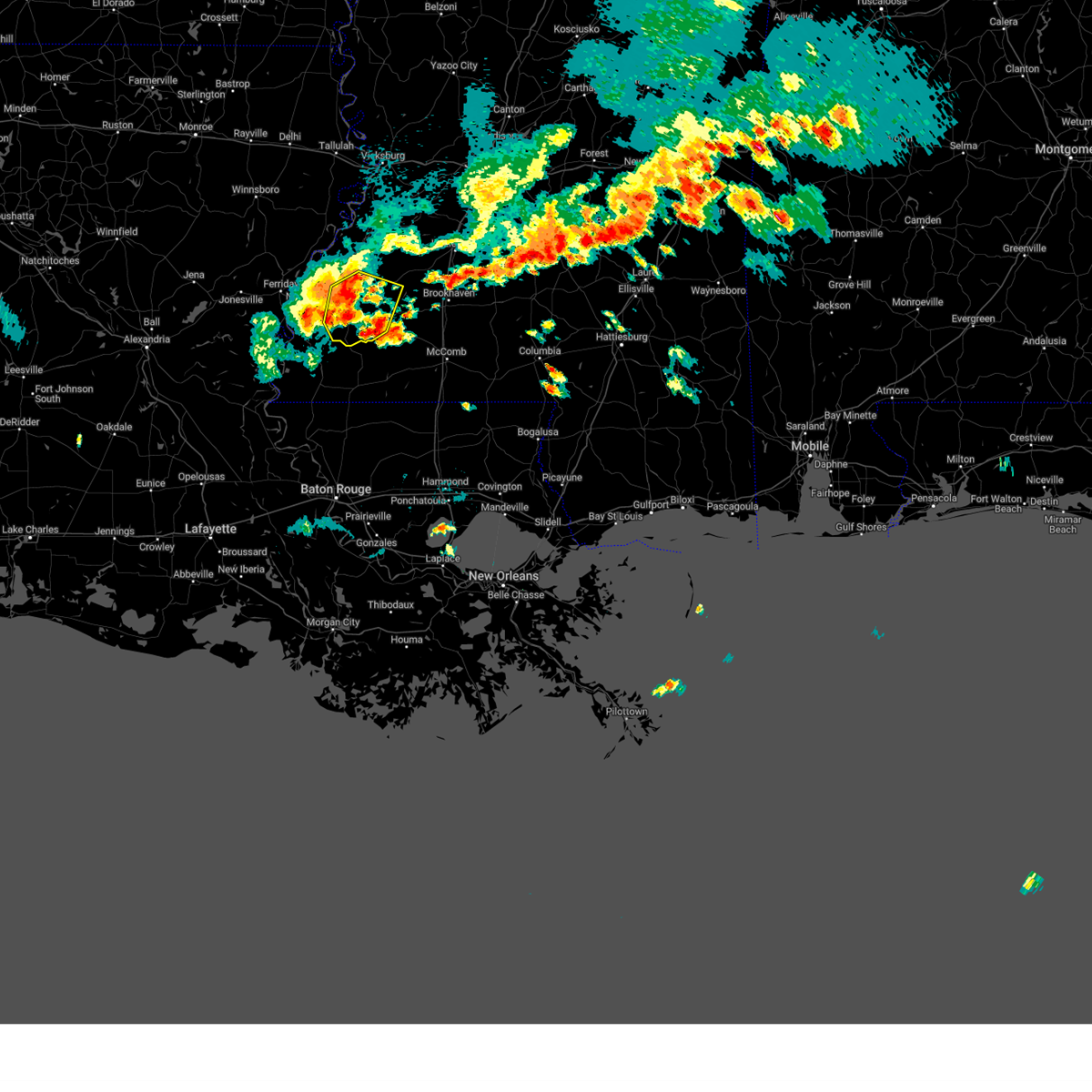
The Top Recent Hail Date for Fayette, MS is Thursday, December 26, 2024 (10th out of 44)
Hail and Wind Damage Spotted near Fayette, MS
| Date / Time | Report Details |
|---|---|
| 6/14/2025 3:01 PM CDT |
 Svrjan the national weather service in jackson has issued a * severe thunderstorm warning for, southeastern tensas parish in northeastern louisiana, southern claiborne county in southwestern mississippi, jefferson county in southwestern mississippi, * until 400 pm cdt. * at 301 pm cdt, severe thunderstorms were located along a line extending from near st. joseph to near stampley, moving northeast at 30 mph (radar indicated). Hazards include 60 mph wind gusts and penny size hail. expect damage to roofs, siding, and trees Svrjan the national weather service in jackson has issued a * severe thunderstorm warning for, southeastern tensas parish in northeastern louisiana, southern claiborne county in southwestern mississippi, jefferson county in southwestern mississippi, * until 400 pm cdt. * at 301 pm cdt, severe thunderstorms were located along a line extending from near st. joseph to near stampley, moving northeast at 30 mph (radar indicated). Hazards include 60 mph wind gusts and penny size hail. expect damage to roofs, siding, and trees
|
| 5/27/2025 7:12 AM CDT | Trees down and across roads in the ne part of the count in jefferson county MS, 14.5 miles W of Fayette, MS |
| 5/27/2025 6:33 AM CDT |
 Svrjan the national weather service in jackson has issued a * severe thunderstorm warning for, central tensas parish in northeastern louisiana, southeastern madison parish in northeastern louisiana, southwestern warren county in west central mississippi, claiborne county in southwestern mississippi, jefferson county in southwestern mississippi, franklin county in southwestern mississippi, * until 730 am cdt. * at 633 am cdt, severe thunderstorms were located along a line extending from near helena to church hill to garden city, moving northeast at 50 mph (radar indicated). Hazards include 60 mph wind gusts and penny size hail. Expect damage to roofs, siding, and trees. severe thunderstorms will be near, fayette, st. joseph, alcorn state, roxie, lake bruin, kirby, lorman, hamburg, stampley, and mcnair around 640 am cdt. newellton around 645 am cdt. meadville and red lick around 650 am cdt. port gibson and new hope around 655 am cdt. pattison, union church, and blue hill around 700 am cdt. hermanville, yokena, peyton, and mcbride around 705 am cdt. vicksburg, mound, rocky springs, and le tourneau around 710 am cdt. reganton around 715 am cdt. Other locations impacted by these severe thunderstorms include delta. Svrjan the national weather service in jackson has issued a * severe thunderstorm warning for, central tensas parish in northeastern louisiana, southeastern madison parish in northeastern louisiana, southwestern warren county in west central mississippi, claiborne county in southwestern mississippi, jefferson county in southwestern mississippi, franklin county in southwestern mississippi, * until 730 am cdt. * at 633 am cdt, severe thunderstorms were located along a line extending from near helena to church hill to garden city, moving northeast at 50 mph (radar indicated). Hazards include 60 mph wind gusts and penny size hail. Expect damage to roofs, siding, and trees. severe thunderstorms will be near, fayette, st. joseph, alcorn state, roxie, lake bruin, kirby, lorman, hamburg, stampley, and mcnair around 640 am cdt. newellton around 645 am cdt. meadville and red lick around 650 am cdt. port gibson and new hope around 655 am cdt. pattison, union church, and blue hill around 700 am cdt. hermanville, yokena, peyton, and mcbride around 705 am cdt. vicksburg, mound, rocky springs, and le tourneau around 710 am cdt. reganton around 715 am cdt. Other locations impacted by these severe thunderstorms include delta.
|
| 5/26/2025 1:29 PM CDT |
 The storms which prompted the warning have moved out of the area. therefore, the warning will be allowed to expire. a severe thunderstorm watch remains in effect until 700 pm cdt for southwestern mississippi. to report severe weather, contact your nearest law enforcement agency. they will relay your report to the national weather service jackson. The storms which prompted the warning have moved out of the area. therefore, the warning will be allowed to expire. a severe thunderstorm watch remains in effect until 700 pm cdt for southwestern mississippi. to report severe weather, contact your nearest law enforcement agency. they will relay your report to the national weather service jackson.
|
| 5/26/2025 1:09 PM CDT |
 At 108 pm cdt, severe thunderstorms were located along a line extending from near alcorn state to near garden city to woodville, moving east at 45 mph (radar indicated). Hazards include 60 mph wind gusts and penny size hail. Expect damage to roofs, siding, and trees. Locations impacted include, fayette, roxie, cranfield, stampley, stanton, hamburg, mcnair, kingston, lorman, and garden city. At 108 pm cdt, severe thunderstorms were located along a line extending from near alcorn state to near garden city to woodville, moving east at 45 mph (radar indicated). Hazards include 60 mph wind gusts and penny size hail. Expect damage to roofs, siding, and trees. Locations impacted include, fayette, roxie, cranfield, stampley, stanton, hamburg, mcnair, kingston, lorman, and garden city.
|
| 5/26/2025 1:09 PM CDT |
 the severe thunderstorm warning has been cancelled and is no longer in effect the severe thunderstorm warning has been cancelled and is no longer in effect
|
| 5/26/2025 12:58 PM CDT |
 the severe thunderstorm warning has been cancelled and is no longer in effect the severe thunderstorm warning has been cancelled and is no longer in effect
|
| 5/26/2025 12:58 PM CDT |
 At 1257 pm cdt, severe thunderstorms were located along a line extending from near alcorn state to near dolorosa to 7 miles east of fort adams, moving east at 45 mph (radar indicated). Hazards include 60 mph wind gusts and nickel size hail. Expect damage to roofs, siding, and trees. Locations impacted include, natchez, fayette, roxie, stanton, hamburg, kingston, lorman, garden city, sibley, cranfield, stampley, church hill, and mcnair. At 1257 pm cdt, severe thunderstorms were located along a line extending from near alcorn state to near dolorosa to 7 miles east of fort adams, moving east at 45 mph (radar indicated). Hazards include 60 mph wind gusts and nickel size hail. Expect damage to roofs, siding, and trees. Locations impacted include, natchez, fayette, roxie, stanton, hamburg, kingston, lorman, garden city, sibley, cranfield, stampley, church hill, and mcnair.
|
| 5/26/2025 12:38 PM CDT |
 the severe thunderstorm warning has been cancelled and is no longer in effect the severe thunderstorm warning has been cancelled and is no longer in effect
|
| 5/26/2025 12:38 PM CDT |
 At 1238 pm cdt, severe thunderstorms were located along a line extending from near helena to 7 miles east of slocum to near black hawk, moving east at 45 mph (radar indicated). Hazards include 60 mph wind gusts and nickel size hail. Expect damage to roofs, siding, and trees. Locations impacted include, natchez, vidalia, ferriday, fayette, clayton, ridgecrest, waterproof, roxie, spokane, stanton, hamburg, kingston, black hawk, lorman, garden city, sibley, slocum, cranfield, stampley, and deer park. At 1238 pm cdt, severe thunderstorms were located along a line extending from near helena to 7 miles east of slocum to near black hawk, moving east at 45 mph (radar indicated). Hazards include 60 mph wind gusts and nickel size hail. Expect damage to roofs, siding, and trees. Locations impacted include, natchez, vidalia, ferriday, fayette, clayton, ridgecrest, waterproof, roxie, spokane, stanton, hamburg, kingston, black hawk, lorman, garden city, sibley, slocum, cranfield, stampley, and deer park.
|
| 5/26/2025 12:25 PM CDT |
 Svrjan the national weather service in jackson has issued a * severe thunderstorm warning for, southwestern tensas parish in northeastern louisiana, concordia parish in northeastern louisiana, northeastern catahoula parish in northeastern louisiana, western jefferson county in southwestern mississippi, western franklin county in southwestern mississippi, adams county in southwestern mississippi, * until 130 pm cdt. * at 1225 pm cdt, severe thunderstorms were located along a line extending from near lee bayou to slocum to near big bend, moving east at 40 mph (radar indicated). Hazards include 60 mph wind gusts and nickel size hail. expect damage to roofs, siding, and trees Svrjan the national weather service in jackson has issued a * severe thunderstorm warning for, southwestern tensas parish in northeastern louisiana, concordia parish in northeastern louisiana, northeastern catahoula parish in northeastern louisiana, western jefferson county in southwestern mississippi, western franklin county in southwestern mississippi, adams county in southwestern mississippi, * until 130 pm cdt. * at 1225 pm cdt, severe thunderstorms were located along a line extending from near lee bayou to slocum to near big bend, moving east at 40 mph (radar indicated). Hazards include 60 mph wind gusts and nickel size hail. expect damage to roofs, siding, and trees
|
| 5/26/2025 8:20 AM CDT | Tree downed on residence as well as multiple trees downed around the are in jefferson county MS, 2 miles SSW of Fayette, MS |
| 5/24/2025 6:05 PM CDT |
 At 605 pm cdt, severe thunderstorms were located along a line extending from union church to meadville to 7 miles southwest of garden city, moving southeast at 40 mph (radar indicated). Hazards include 60 mph wind gusts and quarter size hail. Hail damage to vehicles is expected. expect wind damage to roofs, siding, and trees. Locations impacted include, fayette, meadville, bude, roxie, cranfield, stampley, kirby, hamburg, mcnair, garden city, and new hope. At 605 pm cdt, severe thunderstorms were located along a line extending from union church to meadville to 7 miles southwest of garden city, moving southeast at 40 mph (radar indicated). Hazards include 60 mph wind gusts and quarter size hail. Hail damage to vehicles is expected. expect wind damage to roofs, siding, and trees. Locations impacted include, fayette, meadville, bude, roxie, cranfield, stampley, kirby, hamburg, mcnair, garden city, and new hope.
|
| 5/24/2025 5:52 PM CDT | Trees downed near fayett in jefferson county MS, 0.5 miles SSW of Fayette, MS |
| 5/24/2025 5:40 PM CDT |
 Svrjan the national weather service in jackson has issued a * severe thunderstorm warning for, jefferson county in southwestern mississippi, franklin county in southwestern mississippi, northeastern adams county in southwestern mississippi, * until 645 pm cdt. * at 539 pm cdt, severe thunderstorms were located along a line extending from lorman to stampley to near sibley, moving southeast at 25 mph (radar indicated). Hazards include 60 mph wind gusts and nickel size hail. expect damage to roofs, siding, and trees Svrjan the national weather service in jackson has issued a * severe thunderstorm warning for, jefferson county in southwestern mississippi, franklin county in southwestern mississippi, northeastern adams county in southwestern mississippi, * until 645 pm cdt. * at 539 pm cdt, severe thunderstorms were located along a line extending from lorman to stampley to near sibley, moving southeast at 25 mph (radar indicated). Hazards include 60 mph wind gusts and nickel size hail. expect damage to roofs, siding, and trees
|
| 5/6/2025 5:08 PM CDT | The storm which prompted the warning has weakened below severe limits, and no longer poses an immediate threat to life or property. therefore, the warning will be allowed to expire. however, gusty winds are still possible with this thunderstorm. |
| 5/6/2025 5:01 PM CDT | At 500 pm cdt, a severe thunderstorm was located over mcnair, or near fayette, moving northeast at 50 mph (radar indicated). Hazards include 60 mph wind gusts and quarter size hail. Hail damage to vehicles is expected. expect wind damage to roofs, siding, and trees. this severe storm will be near, fayette and red lick around 505 pm cdt. Union church and blue hill around 510 pm cdt. |
| 5/6/2025 4:52 PM CDT |
 At 452 pm cdt, a severe thunderstorm was located near stampley, or 10 miles southwest of fayette, moving northeast at 50 mph (radar indicated). Hazards include 60 mph wind gusts and quarter size hail. Hail damage to vehicles is expected. expect wind damage to roofs, siding, and trees. this severe storm will be near, fayette, roxie, hamburg, stampley, and mcnair around 455 pm cdt. red lick around 505 pm cdt. Union church and blue hill around 510 pm cdt. At 452 pm cdt, a severe thunderstorm was located near stampley, or 10 miles southwest of fayette, moving northeast at 50 mph (radar indicated). Hazards include 60 mph wind gusts and quarter size hail. Hail damage to vehicles is expected. expect wind damage to roofs, siding, and trees. this severe storm will be near, fayette, roxie, hamburg, stampley, and mcnair around 455 pm cdt. red lick around 505 pm cdt. Union church and blue hill around 510 pm cdt.
|
| 5/6/2025 4:47 PM CDT |
 At 446 pm cdt, a severe thunderstorm was located over cranfield, or 11 miles east of natchez, moving northeast at 50 mph (radar indicated). Hazards include 60 mph wind gusts and quarter size hail. Hail damage to vehicles is expected. expect wind damage to roofs, siding, and trees. this severe storm will be near, roxie, hamburg, stanton, stampley, and mcnair around 450 pm cdt. fayette around 455 pm cdt. red lick around 505 pm cdt. Union church and blue hill around 510 pm cdt. At 446 pm cdt, a severe thunderstorm was located over cranfield, or 11 miles east of natchez, moving northeast at 50 mph (radar indicated). Hazards include 60 mph wind gusts and quarter size hail. Hail damage to vehicles is expected. expect wind damage to roofs, siding, and trees. this severe storm will be near, roxie, hamburg, stanton, stampley, and mcnair around 450 pm cdt. fayette around 455 pm cdt. red lick around 505 pm cdt. Union church and blue hill around 510 pm cdt.
|
| 5/6/2025 4:47 PM CDT |
 the severe thunderstorm warning has been cancelled and is no longer in effect the severe thunderstorm warning has been cancelled and is no longer in effect
|
| 5/6/2025 4:34 PM CDT | At 434 pm cdt, a severe thunderstorm was located near kingston, or 8 miles south of natchez, moving northeast at 50 mph (radar indicated). Hazards include ping pong ball size hail and 60 mph wind gusts. People and animals outdoors will be injured. expect hail damage to roofs, siding, windows, and vehicles. expect wind damage to roofs, siding, and trees. this severe storm will be near, natchez, cranfield, and stanton around 440 pm cdt. roxie and stampley around 445 pm cdt. hamburg and mcnair around 450 pm cdt. fayette around 455 pm cdt. Red lick around 510 pm cdt. |
| 5/6/2025 4:30 PM CDT |
 Svrjan the national weather service in jackson has issued a * severe thunderstorm warning for, east central concordia parish in northeastern louisiana, jefferson county in southwestern mississippi, northern franklin county in southwestern mississippi, adams county in southwestern mississippi, * until 515 pm cdt. * at 429 pm cdt, a severe thunderstorm was located over sibley, or 10 miles south of natchez, moving northeast at 50 mph (radar indicated). Hazards include 60 mph wind gusts and quarter size hail. Hail damage to vehicles is expected. expect wind damage to roofs, siding, and trees. this severe thunderstorm will be near, kingston and natchez around 435 pm cdt. cranfield around 440 pm cdt. stanton around 445 pm cdt. roxie, hamburg, stampley, and mcnair around 450 pm cdt. fayette around 455 pm cdt. Red lick around 510 pm cdt. Svrjan the national weather service in jackson has issued a * severe thunderstorm warning for, east central concordia parish in northeastern louisiana, jefferson county in southwestern mississippi, northern franklin county in southwestern mississippi, adams county in southwestern mississippi, * until 515 pm cdt. * at 429 pm cdt, a severe thunderstorm was located over sibley, or 10 miles south of natchez, moving northeast at 50 mph (radar indicated). Hazards include 60 mph wind gusts and quarter size hail. Hail damage to vehicles is expected. expect wind damage to roofs, siding, and trees. this severe thunderstorm will be near, kingston and natchez around 435 pm cdt. cranfield around 440 pm cdt. stanton around 445 pm cdt. roxie, hamburg, stampley, and mcnair around 450 pm cdt. fayette around 455 pm cdt. Red lick around 510 pm cdt.
|
| 5/6/2025 4:14 PM CDT | At 414 pm cdt, severe thunderstorms were located along a line extending from near buckner to near vidalia, moving northeast at 55 mph (radar indicated). Hazards include ping pong ball size hail and 60 mph wind gusts. People and animals outdoors will be injured. expect hail damage to roofs, siding, windows, and vehicles. expect wind damage to roofs, siding, and trees. these severe storms will be near, natchez, spokane, cooter point, wisner, gilbert, mangham, winnsboro, archibald, waterproof, and baskin around 420 pm cdt. helena and crowville around 425 pm cdt. bakers, church hill, holly ridge, and newlight around 430 pm cdt. lake bruin, delhi, and st. joseph around 435 pm cdt. newellton and alcorn state around 440 pm cdt. Somerset and lorman around 445 pm cdt. |
| 5/6/2025 4:03 PM CDT |
 Svrjan the national weather service in jackson has issued a * severe thunderstorm warning for, south central morehouse parish in northeastern louisiana, tensas parish in northeastern louisiana, southwestern madison parish in northeastern louisiana, northeastern concordia parish in northeastern louisiana, northeastern catahoula parish in northeastern louisiana, richland parish in northeastern louisiana, franklin parish in northeastern louisiana, southwestern claiborne county in southwestern mississippi, jefferson county in southwestern mississippi, northeastern adams county in southwestern mississippi, * until 445 pm cdt. * at 402 pm cdt, severe thunderstorms were located along a line extending from 6 miles northeast of columbia to near deer park, moving northeast at 55 mph (radar indicated). Hazards include 60 mph wind gusts and quarter size hail. Hail damage to vehicles is expected. expect wind damage to roofs, siding, and trees. severe thunderstorms will be near, jigger, vidalia, natchez, sicily island, clayton, buckner, lee bayou, ridgecrest, ferriday, and wisner around 410 pm cdt. spokane, alto, gilbert, mangham, archibald, and baskin around 415 pm cdt. cooter point and waterproof around 420 pm cdt. helena and crowville around 425 pm cdt. bakers, church hill, holly ridge, and newlight around 430 pm cdt. st. Joseph around 435 pm cdt. Svrjan the national weather service in jackson has issued a * severe thunderstorm warning for, south central morehouse parish in northeastern louisiana, tensas parish in northeastern louisiana, southwestern madison parish in northeastern louisiana, northeastern concordia parish in northeastern louisiana, northeastern catahoula parish in northeastern louisiana, richland parish in northeastern louisiana, franklin parish in northeastern louisiana, southwestern claiborne county in southwestern mississippi, jefferson county in southwestern mississippi, northeastern adams county in southwestern mississippi, * until 445 pm cdt. * at 402 pm cdt, severe thunderstorms were located along a line extending from 6 miles northeast of columbia to near deer park, moving northeast at 55 mph (radar indicated). Hazards include 60 mph wind gusts and quarter size hail. Hail damage to vehicles is expected. expect wind damage to roofs, siding, and trees. severe thunderstorms will be near, jigger, vidalia, natchez, sicily island, clayton, buckner, lee bayou, ridgecrest, ferriday, and wisner around 410 pm cdt. spokane, alto, gilbert, mangham, archibald, and baskin around 415 pm cdt. cooter point and waterproof around 420 pm cdt. helena and crowville around 425 pm cdt. bakers, church hill, holly ridge, and newlight around 430 pm cdt. st. Joseph around 435 pm cdt.
|
| 5/6/2025 1:52 PM CDT | The storm which prompted the warning has moved out of the area and weakened. therefore, the warning will be allowed to expire. |
| 5/6/2025 1:30 PM CDT | the severe thunderstorm warning has been cancelled and is no longer in effect |
| 5/6/2025 1:30 PM CDT | At 129 pm cdt, a severe thunderstorm was located near kirby, or near meadville, moving northeast at 40 mph (radar indicated). Hazards include 60 mph wind gusts and quarter size hail. Hail damage to vehicles is expected. expect wind damage to roofs, siding, and trees. This severe storm will be near, meadville, kirby, bude, and new hope around 135 pm cdt. |
| 5/6/2025 12:57 PM CDT |
 Svrjan the national weather service in jackson has issued a * severe thunderstorm warning for, eastern jefferson county in southwestern mississippi, franklin county in southwestern mississippi, southeastern adams county in southwestern mississippi, * until 200 pm cdt. * at 1256 pm cdt, a severe thunderstorm was located near dolorosa, or 19 miles south of natchez, moving northeast at 40 mph (radar indicated). Hazards include 60 mph wind gusts and quarter size hail. Hail damage to vehicles is expected. expect wind damage to roofs, siding, and trees. this severe thunderstorm will be near, kingston and garden city around 100 pm cdt. roxie around 120 pm cdt. kirby around 125 pm cdt. meadville and bude around 130 pm cdt. new hope around 135 pm cdt. Mccall creek around 150 pm cdt. Svrjan the national weather service in jackson has issued a * severe thunderstorm warning for, eastern jefferson county in southwestern mississippi, franklin county in southwestern mississippi, southeastern adams county in southwestern mississippi, * until 200 pm cdt. * at 1256 pm cdt, a severe thunderstorm was located near dolorosa, or 19 miles south of natchez, moving northeast at 40 mph (radar indicated). Hazards include 60 mph wind gusts and quarter size hail. Hail damage to vehicles is expected. expect wind damage to roofs, siding, and trees. this severe thunderstorm will be near, kingston and garden city around 100 pm cdt. roxie around 120 pm cdt. kirby around 125 pm cdt. meadville and bude around 130 pm cdt. new hope around 135 pm cdt. Mccall creek around 150 pm cdt.
|
| 4/5/2025 11:57 PM CDT |
 At 1157 pm cdt, a severe thunderstorm was located over stampley, or 7 miles southwest of fayette, moving northeast at 45 mph (radar indicated). Hazards include 60 mph wind gusts. Expect damage to roofs, siding, and trees. Locations impacted include, roxie, union church, stanton, hamburg, kingston, fayette, mcbride, cranfield, stampley, church hill, kirby, mcnair, new hope, blue hill, meadville, and natchez. At 1157 pm cdt, a severe thunderstorm was located over stampley, or 7 miles southwest of fayette, moving northeast at 45 mph (radar indicated). Hazards include 60 mph wind gusts. Expect damage to roofs, siding, and trees. Locations impacted include, roxie, union church, stanton, hamburg, kingston, fayette, mcbride, cranfield, stampley, church hill, kirby, mcnair, new hope, blue hill, meadville, and natchez.
|
| 4/5/2025 11:43 PM CDT |
 the severe thunderstorm warning has been cancelled and is no longer in effect the severe thunderstorm warning has been cancelled and is no longer in effect
|
| 4/5/2025 11:43 PM CDT |
 At 1142 pm cdt, a severe thunderstorm was located near church hill, or 7 miles northwest of fayette, moving northeast at 75 mph (radar indicated). Hazards include 60 mph wind gusts. Expect damage to roofs, siding, and trees. This severe thunderstorm will remain over mainly rural areas of jefferson, northern franklin and adams counties. At 1142 pm cdt, a severe thunderstorm was located near church hill, or 7 miles northwest of fayette, moving northeast at 75 mph (radar indicated). Hazards include 60 mph wind gusts. Expect damage to roofs, siding, and trees. This severe thunderstorm will remain over mainly rural areas of jefferson, northern franklin and adams counties.
|
| 4/5/2025 11:22 PM CDT |
 Svrjan the national weather service in jackson has issued a * severe thunderstorm warning for, northeastern concordia parish in northeastern louisiana, jefferson county in southwestern mississippi, northern franklin county in southwestern mississippi, adams county in southwestern mississippi, * until 1215 am cdt. * at 1122 pm cdt, a severe thunderstorm was located near vidalia, moving northeast at 75 mph (radar indicated). Hazards include 60 mph wind gusts. Expect damage to roofs, siding, and trees. this severe thunderstorm will be near, vidalia, natchez, ridgecrest, and ferriday around 1125 pm cdt. church hill and stanton around 1130 pm cdt. Fayette around 1140 pm cdt. Svrjan the national weather service in jackson has issued a * severe thunderstorm warning for, northeastern concordia parish in northeastern louisiana, jefferson county in southwestern mississippi, northern franklin county in southwestern mississippi, adams county in southwestern mississippi, * until 1215 am cdt. * at 1122 pm cdt, a severe thunderstorm was located near vidalia, moving northeast at 75 mph (radar indicated). Hazards include 60 mph wind gusts. Expect damage to roofs, siding, and trees. this severe thunderstorm will be near, vidalia, natchez, ridgecrest, and ferriday around 1125 pm cdt. church hill and stanton around 1130 pm cdt. Fayette around 1140 pm cdt.
|
| 3/4/2025 2:19 PM CST |
 the severe thunderstorm warning has been cancelled and is no longer in effect the severe thunderstorm warning has been cancelled and is no longer in effect
|
| 3/4/2025 2:19 PM CST |
 At 219 pm cst, severe thunderstorms were located along a line extending from near blue hill to 8 miles southeast of dolorosa, moving east at 35 mph (radar indicated). Hazards include 60 mph wind gusts. Expect damage to roofs, siding, and trees. these severe storms will be near, union church, kirby, garden city, blue hill, and mcbride around 225 pm cst. Meadville and new hope around 230 pm cst. At 219 pm cst, severe thunderstorms were located along a line extending from near blue hill to 8 miles southeast of dolorosa, moving east at 35 mph (radar indicated). Hazards include 60 mph wind gusts. Expect damage to roofs, siding, and trees. these severe storms will be near, union church, kirby, garden city, blue hill, and mcbride around 225 pm cst. Meadville and new hope around 230 pm cst.
|
| 3/4/2025 2:19 PM CST |
 the tornado warning has been cancelled and is no longer in effect the tornado warning has been cancelled and is no longer in effect
|
| 3/4/2025 2:04 PM CST | Tree down in tow in jefferson county MS, 0.3 miles NNW of Fayette, MS |
| 3/4/2025 2:00 PM CST |
 Torjan the national weather service in jackson has issued a * tornado warning for, southeastern claiborne county in southwestern mississippi, jefferson county in southwestern mississippi, * until 245 pm cst. * at 159 pm cst, a severe thunderstorm capable of producing a tornado was located over fayette, moving northeast at 55 mph (radar indicated rotation). Hazards include tornado. Flying debris will be dangerous to those caught without shelter. mobile homes will be damaged or destroyed. damage to roofs, windows, and vehicles will occur. tree damage is likely. this dangerous storm will be near, blue hill, lorman, and red lick around 205 pm cst. pattison and peyton around 210 pm cst. mcbride around 215 pm cst. Hermanville around 220 pm cst. Torjan the national weather service in jackson has issued a * tornado warning for, southeastern claiborne county in southwestern mississippi, jefferson county in southwestern mississippi, * until 245 pm cst. * at 159 pm cst, a severe thunderstorm capable of producing a tornado was located over fayette, moving northeast at 55 mph (radar indicated rotation). Hazards include tornado. Flying debris will be dangerous to those caught without shelter. mobile homes will be damaged or destroyed. damage to roofs, windows, and vehicles will occur. tree damage is likely. this dangerous storm will be near, blue hill, lorman, and red lick around 205 pm cst. pattison and peyton around 210 pm cst. mcbride around 215 pm cst. Hermanville around 220 pm cst.
|
| 3/4/2025 1:59 PM CST |
 At 159 pm cst, severe thunderstorms were located along a line extending from near red lick to near dolorosa, moving east at 40 mph (radar indicated). Hazards include 60 mph wind gusts. Expect damage to roofs, siding, and trees. these severe storms will be near, garden city, blue hill, roxie, hamburg, red lick, and mcnair around 205 pm cst. kirby around 210 pm cst. mcbride around 215 pm cst. Union church, meadville, and new hope around 220 pm cst. At 159 pm cst, severe thunderstorms were located along a line extending from near red lick to near dolorosa, moving east at 40 mph (radar indicated). Hazards include 60 mph wind gusts. Expect damage to roofs, siding, and trees. these severe storms will be near, garden city, blue hill, roxie, hamburg, red lick, and mcnair around 205 pm cst. kirby around 210 pm cst. mcbride around 215 pm cst. Union church, meadville, and new hope around 220 pm cst.
|
| 3/4/2025 1:24 PM CST |
 Svrjan the national weather service in jackson has issued a * severe thunderstorm warning for, jefferson county in southwestern mississippi, franklin county in southwestern mississippi, adams county in southwestern mississippi, * until 245 pm cst. * at 124 pm cst, severe thunderstorms were located along a line extending from waterproof to near acme, moving east at 35 mph (radar indicated). Hazards include 60 mph wind gusts. Expect damage to roofs, siding, and trees. severe thunderstorms will be near, natchez around 130 pm cst. church hill around 135 pm cst. sibley and stanton around 140 pm cst. kingston, fayette, cranfield, lorman, and stampley around 150 pm cst. red lick around 155 pm cst. hamburg and mcnair around 200 pm cst. roxie around 205 pm cst. Garden city and blue hill around 210 pm cst. Svrjan the national weather service in jackson has issued a * severe thunderstorm warning for, jefferson county in southwestern mississippi, franklin county in southwestern mississippi, adams county in southwestern mississippi, * until 245 pm cst. * at 124 pm cst, severe thunderstorms were located along a line extending from waterproof to near acme, moving east at 35 mph (radar indicated). Hazards include 60 mph wind gusts. Expect damage to roofs, siding, and trees. severe thunderstorms will be near, natchez around 130 pm cst. church hill around 135 pm cst. sibley and stanton around 140 pm cst. kingston, fayette, cranfield, lorman, and stampley around 150 pm cst. red lick around 155 pm cst. hamburg and mcnair around 200 pm cst. roxie around 205 pm cst. Garden city and blue hill around 210 pm cst.
|
| 2/15/2025 8:58 PM CST |
 Svrjan the national weather service in jackson has issued a * severe thunderstorm warning for, warren county in west central mississippi, claiborne county in southwestern mississippi, jefferson county in southwestern mississippi, issaquena county in west central mississippi, southwestern humphreys county in central mississippi, sharkey county in west central mississippi, * until 945 pm cst. * at 857 pm cst, severe thunderstorms were located along a line extending from near rolling fork to 6 miles southeast of mansford to ferriday, moving northeast at 35 mph (radar indicated). Hazards include 60 mph wind gusts. Expect damage to roofs, siding, and trees. severe thunderstorms will be near, onward, anguilla, rolling fork, cary, and nitta yuma around 900 pm cst. valley park around 905 pm cst. delta city around 910 pm cst. vicksburg around 915 pm cst. murphy around 920 pm cst. redwood around 925 pm cst. le tourneau around 930 pm cst. alcorn state around 935 pm cst. Other locations impacted by these severe thunderstorms include delta. Svrjan the national weather service in jackson has issued a * severe thunderstorm warning for, warren county in west central mississippi, claiborne county in southwestern mississippi, jefferson county in southwestern mississippi, issaquena county in west central mississippi, southwestern humphreys county in central mississippi, sharkey county in west central mississippi, * until 945 pm cst. * at 857 pm cst, severe thunderstorms were located along a line extending from near rolling fork to 6 miles southeast of mansford to ferriday, moving northeast at 35 mph (radar indicated). Hazards include 60 mph wind gusts. Expect damage to roofs, siding, and trees. severe thunderstorms will be near, onward, anguilla, rolling fork, cary, and nitta yuma around 900 pm cst. valley park around 905 pm cst. delta city around 910 pm cst. vicksburg around 915 pm cst. murphy around 920 pm cst. redwood around 925 pm cst. le tourneau around 930 pm cst. alcorn state around 935 pm cst. Other locations impacted by these severe thunderstorms include delta.
|
| 2/12/2025 2:27 PM CST |
 At 227 pm cst, a severe thunderstorm was located over church hill, or 8 miles west of fayette, moving northeast at 45 mph (radar indicated). Hazards include 60 mph wind gusts and quarter size hail. Hail damage to vehicles is expected. expect wind damage to roofs, siding, and trees. this severe storm will be near, fayette and stampley around 230 pm cst. Lorman and red lick around 235 pm cst. At 227 pm cst, a severe thunderstorm was located over church hill, or 8 miles west of fayette, moving northeast at 45 mph (radar indicated). Hazards include 60 mph wind gusts and quarter size hail. Hail damage to vehicles is expected. expect wind damage to roofs, siding, and trees. this severe storm will be near, fayette and stampley around 230 pm cst. Lorman and red lick around 235 pm cst.
|
| 2/12/2025 2:13 PM CST |
 Svrjan the national weather service in jackson has issued a * severe thunderstorm warning for, jefferson county in southwestern mississippi, northeastern adams county in southwestern mississippi, * until 300 pm cst. * at 213 pm cst, a severe thunderstorm was located near natchez, moving northeast at 45 mph (radar indicated). Hazards include 60 mph wind gusts and quarter size hail. Hail damage to vehicles is expected. expect wind damage to roofs, siding, and trees. this severe thunderstorm will be near, church hill, stanton, and stampley around 220 pm cst. fayette around 230 pm cst. Lorman and red lick around 235 pm cst. Svrjan the national weather service in jackson has issued a * severe thunderstorm warning for, jefferson county in southwestern mississippi, northeastern adams county in southwestern mississippi, * until 300 pm cst. * at 213 pm cst, a severe thunderstorm was located near natchez, moving northeast at 45 mph (radar indicated). Hazards include 60 mph wind gusts and quarter size hail. Hail damage to vehicles is expected. expect wind damage to roofs, siding, and trees. this severe thunderstorm will be near, church hill, stanton, and stampley around 220 pm cst. fayette around 230 pm cst. Lorman and red lick around 235 pm cst.
|
| 1/31/2025 12:07 AM CST |
 At 1206 am cst, a severe thunderstorm was located over cranfield, or 10 miles east of natchez, moving northeast at 55 mph (radar indicated). Hazards include 60 mph wind gusts. Expect damage to roofs, siding, and trees. this severe storm will be near, hamburg, stanton, stampley, and mcnair around 1210 am cst. fayette around 1215 am cst. lorman and red lick around 1220 am cst. Blue hill around 1225 am cst. At 1206 am cst, a severe thunderstorm was located over cranfield, or 10 miles east of natchez, moving northeast at 55 mph (radar indicated). Hazards include 60 mph wind gusts. Expect damage to roofs, siding, and trees. this severe storm will be near, hamburg, stanton, stampley, and mcnair around 1210 am cst. fayette around 1215 am cst. lorman and red lick around 1220 am cst. Blue hill around 1225 am cst.
|
| 1/30/2025 11:38 PM CST |
 Svrjan the national weather service in jackson has issued a * severe thunderstorm warning for, south central tensas parish in northeastern louisiana, northern concordia parish in northeastern louisiana, jefferson county in southwestern mississippi, northwestern franklin county in southwestern mississippi, adams county in southwestern mississippi, * until 1245 am cst. * at 1138 pm cst, a severe thunderstorm was located near deer park, or 15 miles southwest of vidalia, moving northeast at 55 mph (radar indicated). Hazards include 60 mph wind gusts. Expect damage to roofs, siding, and trees. this severe thunderstorm will be near, natchez and sibley around 1145 pm cst. kingston and vidalia around 1150 pm cst. cranfield and stanton around 1155 pm cst. hamburg and stampley around 1205 am cst. fayette and mcnair around 1210 am cst. lorman and red lick around 1220 am cst. Blue hill around 1225 am cst. Svrjan the national weather service in jackson has issued a * severe thunderstorm warning for, south central tensas parish in northeastern louisiana, northern concordia parish in northeastern louisiana, jefferson county in southwestern mississippi, northwestern franklin county in southwestern mississippi, adams county in southwestern mississippi, * until 1245 am cst. * at 1138 pm cst, a severe thunderstorm was located near deer park, or 15 miles southwest of vidalia, moving northeast at 55 mph (radar indicated). Hazards include 60 mph wind gusts. Expect damage to roofs, siding, and trees. this severe thunderstorm will be near, natchez and sibley around 1145 pm cst. kingston and vidalia around 1150 pm cst. cranfield and stanton around 1155 pm cst. hamburg and stampley around 1205 am cst. fayette and mcnair around 1210 am cst. lorman and red lick around 1220 am cst. Blue hill around 1225 am cst.
|
| 1/30/2025 10:03 PM CST |
 Svrjan the national weather service in jackson has issued a * severe thunderstorm warning for, southern claiborne county in southwestern mississippi, northwestern jefferson county in southwestern mississippi, north central adams county in southwestern mississippi, * until 1045 pm cst. * at 1003 pm cst, a severe thunderstorm was located near church hill, or 12 miles south of st. joseph, moving northeast at 55 mph (radar indicated). Hazards include 60 mph wind gusts. Expect damage to roofs, siding, and trees. this severe thunderstorm will be near, alcorn state around 1010 pm cst. lorman around 1015 pm cst. red lick and port gibson around 1020 pm cst. pattison around 1025 pm cst. Hermanville around 1030 pm cst. Svrjan the national weather service in jackson has issued a * severe thunderstorm warning for, southern claiborne county in southwestern mississippi, northwestern jefferson county in southwestern mississippi, north central adams county in southwestern mississippi, * until 1045 pm cst. * at 1003 pm cst, a severe thunderstorm was located near church hill, or 12 miles south of st. joseph, moving northeast at 55 mph (radar indicated). Hazards include 60 mph wind gusts. Expect damage to roofs, siding, and trees. this severe thunderstorm will be near, alcorn state around 1010 pm cst. lorman around 1015 pm cst. red lick and port gibson around 1020 pm cst. pattison around 1025 pm cst. Hermanville around 1030 pm cst.
|
| 12/28/2024 5:13 PM CST |
 Svrjan the national weather service in jackson has issued a * severe thunderstorm warning for, jefferson county in southwestern mississippi, franklin county in southwestern mississippi, adams county in southwestern mississippi, * until 630 pm cst. * at 512 pm cst, severe thunderstorms were located along a line extending from clayton to 6 miles south of ridgecrest to near acme, moving east at 50 mph (radar indicated). Hazards include 60 mph wind gusts and quarter size hail. Hail damage to vehicles is expected. expect wind damage to roofs, siding, and trees. severe thunderstorms will be near, natchez around 520 pm cst. sibley around 525 pm cst. church hill and stanton around 530 pm cst. kingston, cranfield, and stampley around 535 pm cst. fayette around 540 pm cst. garden city, roxie, lorman, hamburg, red lick, and mcnair around 545 pm cst. kirby around 550 pm cst. Blue hill around 555 pm cst. Svrjan the national weather service in jackson has issued a * severe thunderstorm warning for, jefferson county in southwestern mississippi, franklin county in southwestern mississippi, adams county in southwestern mississippi, * until 630 pm cst. * at 512 pm cst, severe thunderstorms were located along a line extending from clayton to 6 miles south of ridgecrest to near acme, moving east at 50 mph (radar indicated). Hazards include 60 mph wind gusts and quarter size hail. Hail damage to vehicles is expected. expect wind damage to roofs, siding, and trees. severe thunderstorms will be near, natchez around 520 pm cst. sibley around 525 pm cst. church hill and stanton around 530 pm cst. kingston, cranfield, and stampley around 535 pm cst. fayette around 540 pm cst. garden city, roxie, lorman, hamburg, red lick, and mcnair around 545 pm cst. kirby around 550 pm cst. Blue hill around 555 pm cst.
|
| 12/28/2024 8:21 AM CST |
 The severe thunderstorm which prompted the warning has moved out of the warned area. therefore, the warning will be allowed to expire. a tornado watch remains in effect until 300 pm cst for southwestern mississippi. The severe thunderstorm which prompted the warning has moved out of the warned area. therefore, the warning will be allowed to expire. a tornado watch remains in effect until 300 pm cst for southwestern mississippi.
|
| 12/28/2024 8:05 AM CST |
 the severe thunderstorm warning has been cancelled and is no longer in effect the severe thunderstorm warning has been cancelled and is no longer in effect
|
| 12/28/2024 8:05 AM CST |
 At 803 am cst, a severe thunderstorm was located over fayette, moving north at 30 mph (radar indicated). Hazards include 60 mph wind gusts and nickel size hail. Expect damage to roofs, siding, and trees. This severe storm will be near, red lick around 810 am cst. At 803 am cst, a severe thunderstorm was located over fayette, moving north at 30 mph (radar indicated). Hazards include 60 mph wind gusts and nickel size hail. Expect damage to roofs, siding, and trees. This severe storm will be near, red lick around 810 am cst.
|
| 12/28/2024 7:49 AM CST |
 Svrjan the national weather service in jackson has issued a * severe thunderstorm warning for, southeastern claiborne county in southwestern mississippi, eastern jefferson county in southwestern mississippi, northwestern franklin county in southwestern mississippi, * until 830 am cst. * at 749 am cst, a severe thunderstorm was located over hamburg, or 8 miles south of fayette, moving northeast at 30 mph (radar indicated). Hazards include 60 mph wind gusts and nickel size hail. Expect damage to roofs, siding, and trees. this severe thunderstorm will be near, fayette and mcnair around 755 am cst. red lick around 805 am cst. blue hill around 810 am cst. Union church around 820 am cst. Svrjan the national weather service in jackson has issued a * severe thunderstorm warning for, southeastern claiborne county in southwestern mississippi, eastern jefferson county in southwestern mississippi, northwestern franklin county in southwestern mississippi, * until 830 am cst. * at 749 am cst, a severe thunderstorm was located over hamburg, or 8 miles south of fayette, moving northeast at 30 mph (radar indicated). Hazards include 60 mph wind gusts and nickel size hail. Expect damage to roofs, siding, and trees. this severe thunderstorm will be near, fayette and mcnair around 755 am cst. red lick around 805 am cst. blue hill around 810 am cst. Union church around 820 am cst.
|
| 12/27/2024 1:45 AM CST |
 At 145 am cst, a severe thunderstorm was located over red lick, or near fayette, moving northeast at 40 mph (radar indicated). Hazards include 60 mph wind gusts and half dollar size hail. Hail damage to vehicles is expected. expect wind damage to roofs, siding, and trees. this severe storm will be near, blue hill, pattison, red lick, and peyton around 150 am cst. Mcbride around 155 am cst. At 145 am cst, a severe thunderstorm was located over red lick, or near fayette, moving northeast at 40 mph (radar indicated). Hazards include 60 mph wind gusts and half dollar size hail. Hail damage to vehicles is expected. expect wind damage to roofs, siding, and trees. this severe storm will be near, blue hill, pattison, red lick, and peyton around 150 am cst. Mcbride around 155 am cst.
|
| 12/27/2024 1:40 AM CST |
 the severe thunderstorm warning has been cancelled and is no longer in effect the severe thunderstorm warning has been cancelled and is no longer in effect
|
| 12/27/2024 1:40 AM CST |
 At 139 am cst, a severe thunderstorm was located near blue hill, or 7 miles east of fayette, moving east at 50 mph (radar indicated). Hazards include 60 mph wind gusts and half dollar size hail. Hail damage to vehicles is expected. expect wind damage to roofs, siding, and trees. This severe storm will be near, pleasant hill, union church, blue hill, and mcbride around 145 am cst. At 139 am cst, a severe thunderstorm was located near blue hill, or 7 miles east of fayette, moving east at 50 mph (radar indicated). Hazards include 60 mph wind gusts and half dollar size hail. Hail damage to vehicles is expected. expect wind damage to roofs, siding, and trees. This severe storm will be near, pleasant hill, union church, blue hill, and mcbride around 145 am cst.
|
| 12/27/2024 1:21 AM CST |
 Svrjan the national weather service in jackson has issued a * severe thunderstorm warning for, southeastern claiborne county in southwestern mississippi, jefferson county in southwestern mississippi, northwestern franklin county in southwestern mississippi, northeastern adams county in southwestern mississippi, * until 215 am cst. * at 120 am cst, a severe thunderstorm was located over stanton, or 9 miles southwest of fayette, moving northeast at 50 mph (radar indicated). Hazards include 60 mph wind gusts and half dollar size hail. Hail damage to vehicles is expected. expect wind damage to roofs, siding, and trees. this severe thunderstorm will be near, fayette, hamburg, stampley, and mcnair around 125 am cst. red lick around 135 am cst. blue hill around 140 am cst. Pleasant hill, union church, peyton, and mcbride around 145 am cst. Svrjan the national weather service in jackson has issued a * severe thunderstorm warning for, southeastern claiborne county in southwestern mississippi, jefferson county in southwestern mississippi, northwestern franklin county in southwestern mississippi, northeastern adams county in southwestern mississippi, * until 215 am cst. * at 120 am cst, a severe thunderstorm was located over stanton, or 9 miles southwest of fayette, moving northeast at 50 mph (radar indicated). Hazards include 60 mph wind gusts and half dollar size hail. Hail damage to vehicles is expected. expect wind damage to roofs, siding, and trees. this severe thunderstorm will be near, fayette, hamburg, stampley, and mcnair around 125 am cst. red lick around 135 am cst. blue hill around 140 am cst. Pleasant hill, union church, peyton, and mcbride around 145 am cst.
|
| 8/18/2024 10:24 PM CDT |
 The storms which prompted the warning have weakened below severe limits, and have exited the warned area. therefore, the warning will be allowed to expire. a severe thunderstorm watch remains in effect until midnight cdt for northeastern louisiana, and southwestern mississippi. to report severe weather, contact your nearest law enforcement agency. they will relay your report to the national weather service jackson. The storms which prompted the warning have weakened below severe limits, and have exited the warned area. therefore, the warning will be allowed to expire. a severe thunderstorm watch remains in effect until midnight cdt for northeastern louisiana, and southwestern mississippi. to report severe weather, contact your nearest law enforcement agency. they will relay your report to the national weather service jackson.
|
| 8/18/2024 10:12 PM CDT |
 the severe thunderstorm warning has been cancelled and is no longer in effect the severe thunderstorm warning has been cancelled and is no longer in effect
|
| 8/18/2024 10:12 PM CDT |
 At 1012 pm cdt, severe thunderstorms were located along a line extending from near vidalia to near caseyville, moving south at 45 mph (emergency management). Hazards include 60 mph wind gusts. Expect damage to roofs, siding, and trees. Locations impacted include, natchez, vidalia, fayette, ridgecrest, roxie, spokane, union church, stanton, hamburg, mcbride, cranfield, stampley, church hill, kirby, mcnair, new hope, and blue hill. At 1012 pm cdt, severe thunderstorms were located along a line extending from near vidalia to near caseyville, moving south at 45 mph (emergency management). Hazards include 60 mph wind gusts. Expect damage to roofs, siding, and trees. Locations impacted include, natchez, vidalia, fayette, ridgecrest, roxie, spokane, union church, stanton, hamburg, mcbride, cranfield, stampley, church hill, kirby, mcnair, new hope, and blue hill.
|
| 8/18/2024 9:49 PM CDT |
 Svrjan the national weather service in jackson has issued a * severe thunderstorm warning for, southwestern tensas parish in northeastern louisiana, northeastern concordia parish in northeastern louisiana, southern claiborne county in southwestern mississippi, jefferson county in southwestern mississippi, northern franklin county in southwestern mississippi, northeastern adams county in southwestern mississippi, * until 1030 pm cdt. * at 948 pm cdt, severe thunderstorms were located along a line extending from near waterproof to near dentville, moving south at 45 mph (emergency management. numerous trees were downed across warren county). Hazards include 60 mph wind gusts. expect damage to roofs, siding, and trees Svrjan the national weather service in jackson has issued a * severe thunderstorm warning for, southwestern tensas parish in northeastern louisiana, northeastern concordia parish in northeastern louisiana, southern claiborne county in southwestern mississippi, jefferson county in southwestern mississippi, northern franklin county in southwestern mississippi, northeastern adams county in southwestern mississippi, * until 1030 pm cdt. * at 948 pm cdt, severe thunderstorms were located along a line extending from near waterproof to near dentville, moving south at 45 mph (emergency management. numerous trees were downed across warren county). Hazards include 60 mph wind gusts. expect damage to roofs, siding, and trees
|
| 6/4/2024 4:06 PM CDT |
 At 406 pm cdt, a severe thunderstorm was located over peyton, or 16 miles southeast of port gibson, moving east at 35 mph (radar indicated). Hazards include 60 mph wind gusts and quarter size hail. Hail damage to vehicles is expected. expect wind damage to roofs, siding, and trees. This severe thunderstorm will remain over mainly rural areas of southeastern claiborne, jefferson, franklin and adams counties. At 406 pm cdt, a severe thunderstorm was located over peyton, or 16 miles southeast of port gibson, moving east at 35 mph (radar indicated). Hazards include 60 mph wind gusts and quarter size hail. Hail damage to vehicles is expected. expect wind damage to roofs, siding, and trees. This severe thunderstorm will remain over mainly rural areas of southeastern claiborne, jefferson, franklin and adams counties.
|
| 6/4/2024 4:06 PM CDT |
 the severe thunderstorm warning has been cancelled and is no longer in effect the severe thunderstorm warning has been cancelled and is no longer in effect
|
| 6/4/2024 3:12 PM CDT |
 Svrjan the national weather service in jackson has issued a * severe thunderstorm warning for, south central tensas parish in northeastern louisiana, northeastern concordia parish in northeastern louisiana, southern claiborne county in southwestern mississippi, jefferson county in southwestern mississippi, franklin county in southwestern mississippi, adams county in southwestern mississippi, * until 415 pm cdt. * at 312 pm cdt, a severe thunderstorm was located over church hill, or 12 miles west of fayette, moving east at 35 mph (radar indicated). Hazards include 60 mph wind gusts and quarter size hail. Hail damage to vehicles is expected. expect wind damage to roofs, siding, and trees. this severe thunderstorm will be near, church hill, stanton, and stampley around 315 pm cdt. fayette around 320 pm cdt. lorman and mcnair around 325 pm cdt. red lick around 330 pm cdt. blue hill around 340 pm cdt. pattison, peyton, and mcbride around 350 pm cdt. Pleasant hill around 355 pm cdt. Svrjan the national weather service in jackson has issued a * severe thunderstorm warning for, south central tensas parish in northeastern louisiana, northeastern concordia parish in northeastern louisiana, southern claiborne county in southwestern mississippi, jefferson county in southwestern mississippi, franklin county in southwestern mississippi, adams county in southwestern mississippi, * until 415 pm cdt. * at 312 pm cdt, a severe thunderstorm was located over church hill, or 12 miles west of fayette, moving east at 35 mph (radar indicated). Hazards include 60 mph wind gusts and quarter size hail. Hail damage to vehicles is expected. expect wind damage to roofs, siding, and trees. this severe thunderstorm will be near, church hill, stanton, and stampley around 315 pm cdt. fayette around 320 pm cdt. lorman and mcnair around 325 pm cdt. red lick around 330 pm cdt. blue hill around 340 pm cdt. pattison, peyton, and mcbride around 350 pm cdt. Pleasant hill around 355 pm cdt.
|
| 6/3/2024 10:22 PM CDT |
 At 1022 pm cdt, severe thunderstorms were located along a line extending from 7 miles south of carpenter to stampley, moving southeast at 35 mph (radar indicated). Hazards include 60 mph wind gusts and penny size hail. Expect damage to roofs, siding, and trees. these severe storms will be near, blue hill, peyton, mcbride, and mcnair around 1025 pm cdt. Union church around 1030 pm cdt. At 1022 pm cdt, severe thunderstorms were located along a line extending from 7 miles south of carpenter to stampley, moving southeast at 35 mph (radar indicated). Hazards include 60 mph wind gusts and penny size hail. Expect damage to roofs, siding, and trees. these severe storms will be near, blue hill, peyton, mcbride, and mcnair around 1025 pm cdt. Union church around 1030 pm cdt.
|
| 6/3/2024 10:22 PM CDT |
 the severe thunderstorm warning has been cancelled and is no longer in effect the severe thunderstorm warning has been cancelled and is no longer in effect
|
| 6/3/2024 9:33 PM CDT |
 Svrjan the national weather service in jackson has issued a * severe thunderstorm warning for, southern warren county in west central mississippi, claiborne county in southwestern mississippi, jefferson county in southwestern mississippi, * until 1045 pm cdt. * at 933 pm cdt, severe thunderstorms were located along a line extending from near mound to 7 miles west of yokena to near cooter point, moving east at 45 mph (radar indicated). Hazards include 60 mph wind gusts and penny size hail. Expect damage to roofs, siding, and trees. severe thunderstorms will be near, vicksburg, yokena, and le tourneau around 940 pm cdt. alcorn state and bovina around 945 pm cdt. port gibson, reganton, and rocky springs around 950 pm cdt. lorman around 955 pm cdt. hermanville and pattison around 1000 pm cdt. red lick around 1005 pm cdt. peyton around 1010 pm cdt. Blue hill around 1015 pm cdt. Svrjan the national weather service in jackson has issued a * severe thunderstorm warning for, southern warren county in west central mississippi, claiborne county in southwestern mississippi, jefferson county in southwestern mississippi, * until 1045 pm cdt. * at 933 pm cdt, severe thunderstorms were located along a line extending from near mound to 7 miles west of yokena to near cooter point, moving east at 45 mph (radar indicated). Hazards include 60 mph wind gusts and penny size hail. Expect damage to roofs, siding, and trees. severe thunderstorms will be near, vicksburg, yokena, and le tourneau around 940 pm cdt. alcorn state and bovina around 945 pm cdt. port gibson, reganton, and rocky springs around 950 pm cdt. lorman around 955 pm cdt. hermanville and pattison around 1000 pm cdt. red lick around 1005 pm cdt. peyton around 1010 pm cdt. Blue hill around 1015 pm cdt.
|
| 5/27/2024 3:06 AM CDT |
 The storm which prompted the warning has weakened below severe limits, and no longer poses an immediate threat to life or property. therefore, the warning will be allowed to expire. a tornado watch remains in effect until 800 am cdt for northeastern louisiana, and central and southwestern mississippi. The storm which prompted the warning has weakened below severe limits, and no longer poses an immediate threat to life or property. therefore, the warning will be allowed to expire. a tornado watch remains in effect until 800 am cdt for northeastern louisiana, and central and southwestern mississippi.
|
| 5/27/2024 2:28 AM CDT |
 Svrjan the national weather service in jackson has issued a * severe thunderstorm warning for, claiborne county in southwestern mississippi, central jefferson county in southwestern mississippi, * until 315 am cdt. * at 228 am cdt, a severe thunderstorm was located over alcorn state, or near st. joseph, moving east at 40 mph (radar indicated). Hazards include 60 mph wind gusts and quarter size hail. Hail damage to vehicles is expected. expect wind damage to roofs, siding, and trees. this severe thunderstorm will be near, port gibson, lorman, and red lick around 235 am cdt. pattison around 240 am cdt. hermanville, blue hill, and peyton around 250 am cdt. Mcbride around 255 am cdt. Svrjan the national weather service in jackson has issued a * severe thunderstorm warning for, claiborne county in southwestern mississippi, central jefferson county in southwestern mississippi, * until 315 am cdt. * at 228 am cdt, a severe thunderstorm was located over alcorn state, or near st. joseph, moving east at 40 mph (radar indicated). Hazards include 60 mph wind gusts and quarter size hail. Hail damage to vehicles is expected. expect wind damage to roofs, siding, and trees. this severe thunderstorm will be near, port gibson, lorman, and red lick around 235 am cdt. pattison around 240 am cdt. hermanville, blue hill, and peyton around 250 am cdt. Mcbride around 255 am cdt.
|
| 5/10/2024 12:00 AM CDT |
 At 1159 pm cdt, severe thunderstorms were located along a line extending from near oma to near west lincoln to cranfield, moving east at 30 mph (radar indicated). Hazards include 60 mph wind gusts and quarter size hail. Hail damage to vehicles is expected. expect wind damage to roofs, siding, and trees. Locations impacted include, natchez, brookhaven, meadville, wesson, bude, roxie, bogue chitto, beauregard, topeka, union church, caseyville, mccall creek, stanton, hamburg, kingston, west lincoln, little springs, cranfield, stampley, and jayess. At 1159 pm cdt, severe thunderstorms were located along a line extending from near oma to near west lincoln to cranfield, moving east at 30 mph (radar indicated). Hazards include 60 mph wind gusts and quarter size hail. Hail damage to vehicles is expected. expect wind damage to roofs, siding, and trees. Locations impacted include, natchez, brookhaven, meadville, wesson, bude, roxie, bogue chitto, beauregard, topeka, union church, caseyville, mccall creek, stanton, hamburg, kingston, west lincoln, little springs, cranfield, stampley, and jayess.
|
| 5/9/2024 11:39 PM CDT |
 Svrjan the national weather service in jackson has issued a * severe thunderstorm warning for, lincoln county in south central mississippi, southwestern lawrence county in south central mississippi, jefferson county in southwestern mississippi, franklin county in southwestern mississippi, northeastern adams county in southwestern mississippi, southern copiah county in central mississippi, * until 100 am cdt. * at 1138 pm cdt, severe thunderstorms were located along a line extending from near beauregard to near new hope to near natchez, moving east at 30 mph (radar indicated). Hazards include 60 mph wind gusts and quarter size hail. Hail damage to vehicles is expected. expect wind damage to roofs, siding, and trees. severe thunderstorms will be near, brookhaven, meadville, wesson, roxie, mccall creek, cranfield, kirby, west lincoln, new hope, and vaughn around 1145 pm cdt. Enterprise around 1210 am cdt. Svrjan the national weather service in jackson has issued a * severe thunderstorm warning for, lincoln county in south central mississippi, southwestern lawrence county in south central mississippi, jefferson county in southwestern mississippi, franklin county in southwestern mississippi, northeastern adams county in southwestern mississippi, southern copiah county in central mississippi, * until 100 am cdt. * at 1138 pm cdt, severe thunderstorms were located along a line extending from near beauregard to near new hope to near natchez, moving east at 30 mph (radar indicated). Hazards include 60 mph wind gusts and quarter size hail. Hail damage to vehicles is expected. expect wind damage to roofs, siding, and trees. severe thunderstorms will be near, brookhaven, meadville, wesson, roxie, mccall creek, cranfield, kirby, west lincoln, new hope, and vaughn around 1145 pm cdt. Enterprise around 1210 am cdt.
|
| 4/2/2024 3:43 PM CDT |
 the severe thunderstorm warning has been cancelled and is no longer in effect the severe thunderstorm warning has been cancelled and is no longer in effect
|
| 4/2/2024 3:34 PM CDT |
 At 334 pm cdt, a severe thunderstorm was located over blue hill, or 13 miles east of fayette, moving northeast at 75 mph (radar indicated). Hazards include 60 mph wind gusts and quarter size hail. Hail damage to vehicles is expected. expect wind damage to roofs, siding, and trees. This severe thunderstorm will remain over mainly rural areas of eastern jefferson county. At 334 pm cdt, a severe thunderstorm was located over blue hill, or 13 miles east of fayette, moving northeast at 75 mph (radar indicated). Hazards include 60 mph wind gusts and quarter size hail. Hail damage to vehicles is expected. expect wind damage to roofs, siding, and trees. This severe thunderstorm will remain over mainly rural areas of eastern jefferson county.
|
| 4/2/2024 3:27 PM CDT | Quarter sized hail reported 7.1 miles WNW of Fayette, MS |
| 4/2/2024 3:26 PM CDT |
 At 325 pm cdt, a severe thunderstorm was located near mcnair, or near fayette, moving northeast at 75 mph (radar indicated). Hazards include 60 mph wind gusts and quarter size hail. Hail damage to vehicles is expected. expect wind damage to roofs, siding, and trees. This severe storm will be near, union church, blue hill, and mcbride around 330 pm cdt. At 325 pm cdt, a severe thunderstorm was located near mcnair, or near fayette, moving northeast at 75 mph (radar indicated). Hazards include 60 mph wind gusts and quarter size hail. Hail damage to vehicles is expected. expect wind damage to roofs, siding, and trees. This severe storm will be near, union church, blue hill, and mcbride around 330 pm cdt.
|
| 4/2/2024 3:26 PM CDT |
 the severe thunderstorm warning has been cancelled and is no longer in effect the severe thunderstorm warning has been cancelled and is no longer in effect
|
| 4/2/2024 3:15 PM CDT |
 Svrjan the national weather service in jackson has issued a * severe thunderstorm warning for, eastern jefferson county in southwestern mississippi, northwestern franklin county in southwestern mississippi, * until 415 pm cdt. * at 314 pm cdt, a severe thunderstorm was located near stampley, or 10 miles southwest of fayette, moving northeast at 80 mph (radar indicated). Hazards include 60 mph wind gusts and quarter size hail. Hail damage to vehicles is expected. expect wind damage to roofs, siding, and trees. this severe thunderstorm will be near, fayette, hamburg, stampley, and mcnair around 320 pm cdt. union church and blue hill around 325 pm cdt. Mcbride around 330 pm cdt. Svrjan the national weather service in jackson has issued a * severe thunderstorm warning for, eastern jefferson county in southwestern mississippi, northwestern franklin county in southwestern mississippi, * until 415 pm cdt. * at 314 pm cdt, a severe thunderstorm was located near stampley, or 10 miles southwest of fayette, moving northeast at 80 mph (radar indicated). Hazards include 60 mph wind gusts and quarter size hail. Hail damage to vehicles is expected. expect wind damage to roofs, siding, and trees. this severe thunderstorm will be near, fayette, hamburg, stampley, and mcnair around 320 pm cdt. union church and blue hill around 325 pm cdt. Mcbride around 330 pm cdt.
|
| 4/2/2024 1:40 PM CDT |
 the severe thunderstorm warning has been cancelled and is no longer in effect the severe thunderstorm warning has been cancelled and is no longer in effect
|
| 4/2/2024 1:27 PM CDT |
 the severe thunderstorm warning has been cancelled and is no longer in effect the severe thunderstorm warning has been cancelled and is no longer in effect
|
| 4/2/2024 1:27 PM CDT |
 At 126 pm cdt, a severe thunderstorm was located over fayette, moving northeast at 80 mph (radar indicated). Hazards include 60 mph wind gusts and quarter size hail. Hail damage to vehicles is expected. expect wind damage to roofs, siding, and trees. this severe storm will be near, fayette, blue hill, and red lick around 130 pm cdt. Peyton and mcbride around 135 pm cdt. At 126 pm cdt, a severe thunderstorm was located over fayette, moving northeast at 80 mph (radar indicated). Hazards include 60 mph wind gusts and quarter size hail. Hail damage to vehicles is expected. expect wind damage to roofs, siding, and trees. this severe storm will be near, fayette, blue hill, and red lick around 130 pm cdt. Peyton and mcbride around 135 pm cdt.
|
| 4/2/2024 1:19 PM CDT |
 Svrjan the national weather service in jackson has issued a * severe thunderstorm warning for, southeastern claiborne county in southwestern mississippi, jefferson county in southwestern mississippi, northeastern adams county in southwestern mississippi, * until 215 pm cdt. * at 119 pm cdt, a severe thunderstorm was located over stanton, or 11 miles southwest of fayette, moving northeast at 75 mph (radar indicated). Hazards include 60 mph wind gusts and quarter size hail. Hail damage to vehicles is expected. expect wind damage to roofs, siding, and trees. this severe thunderstorm will be near, fayette, lorman, stampley, and mcnair around 125 pm cdt. blue hill and red lick around 130 pm cdt. pattison, peyton, and mcbride around 135 pm cdt. Hermanville around 140 pm cdt. Svrjan the national weather service in jackson has issued a * severe thunderstorm warning for, southeastern claiborne county in southwestern mississippi, jefferson county in southwestern mississippi, northeastern adams county in southwestern mississippi, * until 215 pm cdt. * at 119 pm cdt, a severe thunderstorm was located over stanton, or 11 miles southwest of fayette, moving northeast at 75 mph (radar indicated). Hazards include 60 mph wind gusts and quarter size hail. Hail damage to vehicles is expected. expect wind damage to roofs, siding, and trees. this severe thunderstorm will be near, fayette, lorman, stampley, and mcnair around 125 pm cdt. blue hill and red lick around 130 pm cdt. pattison, peyton, and mcbride around 135 pm cdt. Hermanville around 140 pm cdt.
|
| 3/5/2024 9:00 AM CST |
 Svrjan the national weather service in jackson has issued a * severe thunderstorm warning for, southern claiborne county in southwestern mississippi, northern lincoln county in south central mississippi, jefferson county in southwestern mississippi, franklin county in southwestern mississippi, northeastern adams county in southwestern mississippi, copiah county in central mississippi, * until 1000 am cst. * at 859 am cst, severe thunderstorms were located along a line extending from near alcorn state to fayette to near roxie, moving east at 60 mph (radar indicated). Hazards include 60 mph wind gusts and quarter size hail. Hail damage to vehicles is expected. expect wind damage to roofs, siding, and trees. severe thunderstorms will be near, roxie, kirby, lorman, hamburg, red lick, and mcnair around 905 am cst. meadville and blue hill around 910 am cst. pattison, pleasant hill, union church, new hope, peyton, and mcbride around 915 am cst. allen and barlow around 920 am cst. mccall creek and caseyville around 925 am cst. glancy, vaughn, and loyd star around 930 am cst. brookhaven, hazlehurst, martinsville, and dentville around 935 am cst. Wesson, beauregard, and gallman around 940 am cst. Svrjan the national weather service in jackson has issued a * severe thunderstorm warning for, southern claiborne county in southwestern mississippi, northern lincoln county in south central mississippi, jefferson county in southwestern mississippi, franklin county in southwestern mississippi, northeastern adams county in southwestern mississippi, copiah county in central mississippi, * until 1000 am cst. * at 859 am cst, severe thunderstorms were located along a line extending from near alcorn state to fayette to near roxie, moving east at 60 mph (radar indicated). Hazards include 60 mph wind gusts and quarter size hail. Hail damage to vehicles is expected. expect wind damage to roofs, siding, and trees. severe thunderstorms will be near, roxie, kirby, lorman, hamburg, red lick, and mcnair around 905 am cst. meadville and blue hill around 910 am cst. pattison, pleasant hill, union church, new hope, peyton, and mcbride around 915 am cst. allen and barlow around 920 am cst. mccall creek and caseyville around 925 am cst. glancy, vaughn, and loyd star around 930 am cst. brookhaven, hazlehurst, martinsville, and dentville around 935 am cst. Wesson, beauregard, and gallman around 940 am cst.
|
| 11/20/2023 5:30 PM CST |
 At 529 pm cst, a severe thunderstorm capable of producing a tornado was located near mcbride, or 14 miles east of fayette, moving east at 45 mph (radar indicated rotation). Hazards include tornado and half dollar size hail. Flying debris will be dangerous to those caught without shelter. mobile homes will be damaged or destroyed. damage to roofs, windows, and vehicles will occur. tree damage is likely. this dangerous storm will be near, pleasant hill, caseyville, allen, barlow, and mcbride around 535 pm cst. glancy around 545 pm cst. martinsville around 550 pm cst. Hazlehurst, wesson, and beauregard around 555 pm cst. At 529 pm cst, a severe thunderstorm capable of producing a tornado was located near mcbride, or 14 miles east of fayette, moving east at 45 mph (radar indicated rotation). Hazards include tornado and half dollar size hail. Flying debris will be dangerous to those caught without shelter. mobile homes will be damaged or destroyed. damage to roofs, windows, and vehicles will occur. tree damage is likely. this dangerous storm will be near, pleasant hill, caseyville, allen, barlow, and mcbride around 535 pm cst. glancy around 545 pm cst. martinsville around 550 pm cst. Hazlehurst, wesson, and beauregard around 555 pm cst.
|
| 11/20/2023 5:10 PM CST |
 At 509 pm cst, a severe thunderstorm capable of producing a tornado was located over red lick, or 8 miles northeast of fayette, moving east at 45 mph (radar indicated rotation). Hazards include tornado and golf ball size hail. Flying debris will be dangerous to those caught without shelter. mobile homes will be damaged or destroyed. damage to roofs, windows, and vehicles will occur. tree damage is likely. This dangerous storm will be near, pattison and blue hill around 515 pm cst. At 509 pm cst, a severe thunderstorm capable of producing a tornado was located over red lick, or 8 miles northeast of fayette, moving east at 45 mph (radar indicated rotation). Hazards include tornado and golf ball size hail. Flying debris will be dangerous to those caught without shelter. mobile homes will be damaged or destroyed. damage to roofs, windows, and vehicles will occur. tree damage is likely. This dangerous storm will be near, pattison and blue hill around 515 pm cst.
|
| 11/20/2023 4:26 PM CST |
 At 426 pm cst, a severe thunderstorm capable of producing a tornado was located over clayton, or near ferriday, moving east at 45 mph (radar indicated rotation). Hazards include tornado and golf ball size hail. Flying debris will be dangerous to those caught without shelter. mobile homes will be damaged or destroyed. damage to roofs, windows, and vehicles will occur. tree damage is likely. this dangerous storm will be near, waterproof and spokane around 430 pm cst. church hill around 440 pm cst. fayette, alcorn state, and lorman around 455 pm cst. red lick around 500 pm cst. Pattison and blue hill around 510 pm cst. At 426 pm cst, a severe thunderstorm capable of producing a tornado was located over clayton, or near ferriday, moving east at 45 mph (radar indicated rotation). Hazards include tornado and golf ball size hail. Flying debris will be dangerous to those caught without shelter. mobile homes will be damaged or destroyed. damage to roofs, windows, and vehicles will occur. tree damage is likely. this dangerous storm will be near, waterproof and spokane around 430 pm cst. church hill around 440 pm cst. fayette, alcorn state, and lorman around 455 pm cst. red lick around 500 pm cst. Pattison and blue hill around 510 pm cst.
|
| 9/7/2023 5:40 PM CDT |
 At 540 pm cdt, a severe thunderstorm was located over stampley, or 7 miles southwest of fayette, moving southeast at 25 mph (radar indicated). Hazards include 60 mph wind gusts and quarter size hail. Hail damage to vehicles is expected. expect wind damage to roofs, siding, and trees. this severe thunderstorm will be near, roxie, kirby, hamburg, and mcnair around 545 pm cdt. hail threat, radar indicated max hail size, 1. 00 in wind threat, radar indicated max wind gust, 60 mph. At 540 pm cdt, a severe thunderstorm was located over stampley, or 7 miles southwest of fayette, moving southeast at 25 mph (radar indicated). Hazards include 60 mph wind gusts and quarter size hail. Hail damage to vehicles is expected. expect wind damage to roofs, siding, and trees. this severe thunderstorm will be near, roxie, kirby, hamburg, and mcnair around 545 pm cdt. hail threat, radar indicated max hail size, 1. 00 in wind threat, radar indicated max wind gust, 60 mph.
|
| 7/22/2023 4:54 PM CDT |
 The severe thunderstorm warning for eastern jefferson county will expire at 500 pm cdt, the storm which prompted the warning has weakened below severe limits, and no longer poses an immediate threat to life or property. therefore, the warning will be allowed to expire. however gusty winds are still possible with this thunderstorm. The severe thunderstorm warning for eastern jefferson county will expire at 500 pm cdt, the storm which prompted the warning has weakened below severe limits, and no longer poses an immediate threat to life or property. therefore, the warning will be allowed to expire. however gusty winds are still possible with this thunderstorm.
|
| 7/22/2023 4:48 PM CDT |
 At 447 pm cdt, a severe thunderstorm was located over red lick, or near fayette, moving southeast at 25 mph (radar indicated). Hazards include 60 mph wind gusts and penny size hail. Expect damage to roofs, siding, and trees. this severe storm will be near, blue hill around 500 pm cdt. hail threat, radar indicated max hail size, 0. 75 in wind threat, radar indicated max wind gust, 60 mph. At 447 pm cdt, a severe thunderstorm was located over red lick, or near fayette, moving southeast at 25 mph (radar indicated). Hazards include 60 mph wind gusts and penny size hail. Expect damage to roofs, siding, and trees. this severe storm will be near, blue hill around 500 pm cdt. hail threat, radar indicated max hail size, 0. 75 in wind threat, radar indicated max wind gust, 60 mph.
|
| 7/22/2023 4:33 PM CDT |
 At 433 pm cdt, a severe thunderstorm was located over lorman, or 9 miles north of fayette, moving southeast at 25 mph (radar indicated). Hazards include 60 mph wind gusts and penny size hail. Expect damage to roofs, siding, and trees. this severe storm will be near, fayette and red lick around 450 pm cdt. blue hill around 505 pm cdt. hail threat, radar indicated max hail size, 0. 75 in wind threat, radar indicated max wind gust, 60 mph. At 433 pm cdt, a severe thunderstorm was located over lorman, or 9 miles north of fayette, moving southeast at 25 mph (radar indicated). Hazards include 60 mph wind gusts and penny size hail. Expect damage to roofs, siding, and trees. this severe storm will be near, fayette and red lick around 450 pm cdt. blue hill around 505 pm cdt. hail threat, radar indicated max hail size, 0. 75 in wind threat, radar indicated max wind gust, 60 mph.
|
| 7/22/2023 4:06 PM CDT |
 At 405 pm cdt, a severe thunderstorm was located over lake bruin, or near st. joseph, moving southeast at 25 mph (radar indicated). Hazards include 60 mph wind gusts and penny size hail. Expect damage to roofs, siding, and trees. this severe thunderstorm will be near, st. joseph around 410 pm cdt. alcorn state around 425 pm cdt. lorman around 440 pm cdt. fayette and red lick around 450 pm cdt. blue hill around 500 pm cdt. hail threat, radar indicated max hail size, 0. 75 in wind threat, radar indicated max wind gust, 60 mph. At 405 pm cdt, a severe thunderstorm was located over lake bruin, or near st. joseph, moving southeast at 25 mph (radar indicated). Hazards include 60 mph wind gusts and penny size hail. Expect damage to roofs, siding, and trees. this severe thunderstorm will be near, st. joseph around 410 pm cdt. alcorn state around 425 pm cdt. lorman around 440 pm cdt. fayette and red lick around 450 pm cdt. blue hill around 500 pm cdt. hail threat, radar indicated max hail size, 0. 75 in wind threat, radar indicated max wind gust, 60 mph.
|
| 7/16/2023 6:55 PM CDT |
 The severe thunderstorm warning for tensas parish, southern claiborne, jefferson and franklin counties will expire at 700 pm cdt, the storms which prompted the warning have moved out of the area. therefore, the warning will be allowed to expire. a severe thunderstorm watch remains in effect until 1000 pm cdt for northeastern louisiana, and central, south central, southwestern and west central mississippi. The severe thunderstorm warning for tensas parish, southern claiborne, jefferson and franklin counties will expire at 700 pm cdt, the storms which prompted the warning have moved out of the area. therefore, the warning will be allowed to expire. a severe thunderstorm watch remains in effect until 1000 pm cdt for northeastern louisiana, and central, south central, southwestern and west central mississippi.
|
| 7/16/2023 6:10 PM CDT | Numerous trees were blown down across the count in jefferson county MS, 0.5 miles SSW of Fayette, MS |
| 7/16/2023 5:29 PM CDT |
 At 528 pm cdt, severe thunderstorms were located along a line extending from near winnsboro to near kingston, moving east at 25 mph (radar indicated). Hazards include 60 mph wind gusts and quarter size hail. Hail damage to vehicles is expected. expect wind damage to roofs, siding, and trees. severe thunderstorms will be near, garden city around 555 pm cdt. newlight around 600 pm cdt. meadville, newellton and somerset around 630 pm cdt. bude around 635 pm cdt. little springs around 655 pm cdt. hail threat, radar indicated max hail size, 1. 00 in wind threat, radar indicated max wind gust, 60 mph. At 528 pm cdt, severe thunderstorms were located along a line extending from near winnsboro to near kingston, moving east at 25 mph (radar indicated). Hazards include 60 mph wind gusts and quarter size hail. Hail damage to vehicles is expected. expect wind damage to roofs, siding, and trees. severe thunderstorms will be near, garden city around 555 pm cdt. newlight around 600 pm cdt. meadville, newellton and somerset around 630 pm cdt. bude around 635 pm cdt. little springs around 655 pm cdt. hail threat, radar indicated max hail size, 1. 00 in wind threat, radar indicated max wind gust, 60 mph.
|
| 6/16/2023 4:33 AM CDT |
 At 432 am cdt, severe thunderstorms were located along a line extending from near port gibson to near red lick to near garden city, moving east at 60 mph (radar indicated). Hazards include 70 mph wind gusts. Expect considerable tree damage. damage is likely to mobile homes, roofs, and outbuildings. these severe storms will be near, pattison and blue hill around 435 am cdt. hermanville, mcbride, peyton and union church around 440 am cdt. meadville and pleasant hill around 445 am cdt. bude, barlow, carpenter and allen around 450 am cdt. little springs, dentville and mccall creek around 455 am cdt. glancy and center point around 500 am cdt. thunderstorm damage threat, considerable hail threat, radar indicated max hail size, <. 75 in wind threat, radar indicated max wind gust, 70 mph. At 432 am cdt, severe thunderstorms were located along a line extending from near port gibson to near red lick to near garden city, moving east at 60 mph (radar indicated). Hazards include 70 mph wind gusts. Expect considerable tree damage. damage is likely to mobile homes, roofs, and outbuildings. these severe storms will be near, pattison and blue hill around 435 am cdt. hermanville, mcbride, peyton and union church around 440 am cdt. meadville and pleasant hill around 445 am cdt. bude, barlow, carpenter and allen around 450 am cdt. little springs, dentville and mccall creek around 455 am cdt. glancy and center point around 500 am cdt. thunderstorm damage threat, considerable hail threat, radar indicated max hail size, <. 75 in wind threat, radar indicated max wind gust, 70 mph.
|
| 6/16/2023 4:04 AM CDT |
 At 403 am cdt, severe thunderstorms were located along a line extending from near newlight to near waterproof to near deer park, moving east at 50 mph. these are destructive storms for southwest mississippi (radar indicated). Hazards include 80 mph wind gusts and penny size hail. Flying debris will be dangerous to those caught without shelter. mobile homes will be heavily damaged. expect considerable damage to roofs, windows, and vehicles. extensive tree damage and power outages are likely. severe thunderstorms will be near, alcorn state around 420 am cdt. fayette and lorman around 430 am cdt. port gibson and red lick around 435 am cdt. pattison, blue hill and garden city around 440 am cdt. hermanville, roxie and peyton around 445 am cdt. kirby, mcbride and pleasant hill around 450 am cdt. meadville, barlow and allen around 455 am cdt. bude, carpenter and new hope around 500 am cdt. thunderstorm damage threat, destructive hail threat, radar indicated max hail size, 0. 75 in wind threat, radar indicated max wind gust, 80 mph. At 403 am cdt, severe thunderstorms were located along a line extending from near newlight to near waterproof to near deer park, moving east at 50 mph. these are destructive storms for southwest mississippi (radar indicated). Hazards include 80 mph wind gusts and penny size hail. Flying debris will be dangerous to those caught without shelter. mobile homes will be heavily damaged. expect considerable damage to roofs, windows, and vehicles. extensive tree damage and power outages are likely. severe thunderstorms will be near, alcorn state around 420 am cdt. fayette and lorman around 430 am cdt. port gibson and red lick around 435 am cdt. pattison, blue hill and garden city around 440 am cdt. hermanville, roxie and peyton around 445 am cdt. kirby, mcbride and pleasant hill around 450 am cdt. meadville, barlow and allen around 455 am cdt. bude, carpenter and new hope around 500 am cdt. thunderstorm damage threat, destructive hail threat, radar indicated max hail size, 0. 75 in wind threat, radar indicated max wind gust, 80 mph.
|
| 6/14/2023 5:52 PM CDT |
 The severe thunderstorm warning for southeastern claiborne, jefferson and franklin counties will expire at 600 pm cdt, the storm which prompted the warning has moved out of the area. therefore, the warning will be allowed to expire. however gusty winds are still possible with this thunderstorm. a severe thunderstorm watch remains in effect until 800 pm cdt for central, south central and southwestern mississippi. The severe thunderstorm warning for southeastern claiborne, jefferson and franklin counties will expire at 600 pm cdt, the storm which prompted the warning has moved out of the area. therefore, the warning will be allowed to expire. however gusty winds are still possible with this thunderstorm. a severe thunderstorm watch remains in effect until 800 pm cdt for central, south central and southwestern mississippi.
|
| 6/14/2023 5:29 PM CDT |
 At 529 pm cdt, a severe thunderstorm was located near union church, or 13 miles north of meadville, moving east at 45 mph (radar indicated). Hazards include ping pong ball size hail and 60 mph wind gusts. People and animals outdoors will be injured. expect hail damage to roofs, siding, windows, and vehicles. expect wind damage to roofs, siding, and trees. this severe storm will be near, mccall creek around 545 pm cdt. hail threat, radar indicated max hail size, 1. 50 in wind threat, radar indicated max wind gust, 60 mph. At 529 pm cdt, a severe thunderstorm was located near union church, or 13 miles north of meadville, moving east at 45 mph (radar indicated). Hazards include ping pong ball size hail and 60 mph wind gusts. People and animals outdoors will be injured. expect hail damage to roofs, siding, windows, and vehicles. expect wind damage to roofs, siding, and trees. this severe storm will be near, mccall creek around 545 pm cdt. hail threat, radar indicated max hail size, 1. 50 in wind threat, radar indicated max wind gust, 60 mph.
|
| 6/14/2023 5:20 PM CDT |
 At 519 pm cdt, a severe thunderstorm was located near new hope, or 10 miles north of meadville, moving east at 55 mph (radar indicated). Hazards include golf ball size hail and 60 mph wind gusts. People and animals outdoors will be injured. expect hail damage to roofs, siding, windows, and vehicles. expect wind damage to roofs, siding, and trees. this severe storm will be near, new hope and union church around 525 pm cdt. mccall creek around 535 pm cdt. thunderstorm damage threat, considerable hail threat, radar indicated max hail size, 1. 75 in wind threat, radar indicated max wind gust, 60 mph. At 519 pm cdt, a severe thunderstorm was located near new hope, or 10 miles north of meadville, moving east at 55 mph (radar indicated). Hazards include golf ball size hail and 60 mph wind gusts. People and animals outdoors will be injured. expect hail damage to roofs, siding, windows, and vehicles. expect wind damage to roofs, siding, and trees. this severe storm will be near, new hope and union church around 525 pm cdt. mccall creek around 535 pm cdt. thunderstorm damage threat, considerable hail threat, radar indicated max hail size, 1. 75 in wind threat, radar indicated max wind gust, 60 mph.
|
| 6/14/2023 5:15 PM CDT |
 At 515 pm cdt, a severe thunderstorm was located near mcnair, or 7 miles southeast of fayette, moving southeast at 55 mph (radar indicated). Hazards include 60 mph wind gusts and half dollar size hail. Hail damage to vehicles is expected. expect wind damage to roofs, siding, and trees. this severe storm will be near, new hope and union church around 525 pm cdt. bude around 530 pm cdt. mccall creek around 535 pm cdt. hail threat, radar indicated max hail size, 1. 25 in wind threat, radar indicated max wind gust, 60 mph. At 515 pm cdt, a severe thunderstorm was located near mcnair, or 7 miles southeast of fayette, moving southeast at 55 mph (radar indicated). Hazards include 60 mph wind gusts and half dollar size hail. Hail damage to vehicles is expected. expect wind damage to roofs, siding, and trees. this severe storm will be near, new hope and union church around 525 pm cdt. bude around 530 pm cdt. mccall creek around 535 pm cdt. hail threat, radar indicated max hail size, 1. 25 in wind threat, radar indicated max wind gust, 60 mph.
|
| 6/14/2023 5:10 PM CDT | Trees were blown down along ms highway 3 in jefferson county MS, 1.9 miles NNE of Fayette, MS |
| 6/14/2023 5:05 PM CDT |
 At 505 pm cdt, a severe thunderstorm was located over fayette, moving east at 55 mph (radar indicated). Hazards include 60 mph wind gusts and half dollar size hail. Hail damage to vehicles is expected. expect wind damage to roofs, siding, and trees. this severe storm will be near, red lick and mcnair around 510 pm cdt. blue hill around 520 pm cdt. union church, pleasant hill, mcbride and new hope around 525 pm cdt. mccall creek around 535 pm cdt. hail threat, radar indicated max hail size, 1. 25 in wind threat, radar indicated max wind gust, 60 mph. At 505 pm cdt, a severe thunderstorm was located over fayette, moving east at 55 mph (radar indicated). Hazards include 60 mph wind gusts and half dollar size hail. Hail damage to vehicles is expected. expect wind damage to roofs, siding, and trees. this severe storm will be near, red lick and mcnair around 510 pm cdt. blue hill around 520 pm cdt. union church, pleasant hill, mcbride and new hope around 525 pm cdt. mccall creek around 535 pm cdt. hail threat, radar indicated max hail size, 1. 25 in wind threat, radar indicated max wind gust, 60 mph.
|
| 6/14/2023 4:45 PM CDT |
 At 445 pm cdt, a severe thunderstorm was located over helena, or 9 miles southwest of st. joseph, moving east at 55 mph (radar indicated). Hazards include ping pong ball size hail and 60 mph wind gusts. People and animals outdoors will be injured. expect hail damage to roofs, siding, windows, and vehicles. expect wind damage to roofs, siding, and trees. this severe thunderstorm will be near, church hill around 455 pm cdt. alcorn state around 500 pm cdt. lorman around 505 pm cdt. fayette, red lick and mcnair around 510 pm cdt. blue hill around 520 pm cdt. union church, pleasant hill, mcbride and new hope around 525 pm cdt. mccall creek around 535 pm cdt. hail threat, radar indicated max hail size, 1. 50 in wind threat, radar indicated max wind gust, 60 mph. At 445 pm cdt, a severe thunderstorm was located over helena, or 9 miles southwest of st. joseph, moving east at 55 mph (radar indicated). Hazards include ping pong ball size hail and 60 mph wind gusts. People and animals outdoors will be injured. expect hail damage to roofs, siding, windows, and vehicles. expect wind damage to roofs, siding, and trees. this severe thunderstorm will be near, church hill around 455 pm cdt. alcorn state around 500 pm cdt. lorman around 505 pm cdt. fayette, red lick and mcnair around 510 pm cdt. blue hill around 520 pm cdt. union church, pleasant hill, mcbride and new hope around 525 pm cdt. mccall creek around 535 pm cdt. hail threat, radar indicated max hail size, 1. 50 in wind threat, radar indicated max wind gust, 60 mph.
|
| 6/12/2023 3:27 PM CDT |
 At 327 pm cdt, a severe thunderstorm was located over lake bruin, or near st. joseph, moving east at 45 mph (radar indicated). Hazards include 60 mph wind gusts and quarter size hail. Hail damage to vehicles is expected. expect wind damage to roofs, siding, and trees. this severe thunderstorm will be near, st. joseph around 335 pm cdt. alcorn state around 340 pm cdt. port gibson and lorman around 350 pm cdt. red lick around 355 pm cdt. pattison around 400 pm cdt. blue hill around 405 pm cdt. peyton and mcbride around 410 pm cdt. hail threat, radar indicated max hail size, 1. 00 in wind threat, radar indicated max wind gust, 60 mph. At 327 pm cdt, a severe thunderstorm was located over lake bruin, or near st. joseph, moving east at 45 mph (radar indicated). Hazards include 60 mph wind gusts and quarter size hail. Hail damage to vehicles is expected. expect wind damage to roofs, siding, and trees. this severe thunderstorm will be near, st. joseph around 335 pm cdt. alcorn state around 340 pm cdt. port gibson and lorman around 350 pm cdt. red lick around 355 pm cdt. pattison around 400 pm cdt. blue hill around 405 pm cdt. peyton and mcbride around 410 pm cdt. hail threat, radar indicated max hail size, 1. 00 in wind threat, radar indicated max wind gust, 60 mph.
|
| 5/11/2023 5:41 PM CDT |
 At 541 pm cdt, a severe thunderstorm was located over fayette, moving northeast at 35 mph (radar indicated). Hazards include quarter size hail. damage to vehicles is expected At 541 pm cdt, a severe thunderstorm was located over fayette, moving northeast at 35 mph (radar indicated). Hazards include quarter size hail. damage to vehicles is expected
|
| 5/11/2023 1:44 PM CDT |
 At 144 pm cdt, severe thunderstorms were located along a line extending from near pattison to near lorman to near stampley, moving east at 35 mph (radar indicated). Hazards include 60 mph wind gusts. Expect damage to roofs, siding, and trees. these severe storms will be near, pattison and peyton around 150 pm cdt. blue hill around 205 pm cdt. mcbride around 210 pm cdt. pleasant hill around 215 pm cdt. union church around 220 pm cdt. hail threat, radar indicated max hail size, <. 75 in wind threat, radar indicated max wind gust, 60 mph. At 144 pm cdt, severe thunderstorms were located along a line extending from near pattison to near lorman to near stampley, moving east at 35 mph (radar indicated). Hazards include 60 mph wind gusts. Expect damage to roofs, siding, and trees. these severe storms will be near, pattison and peyton around 150 pm cdt. blue hill around 205 pm cdt. mcbride around 210 pm cdt. pleasant hill around 215 pm cdt. union church around 220 pm cdt. hail threat, radar indicated max hail size, <. 75 in wind threat, radar indicated max wind gust, 60 mph.
|
| 5/11/2023 1:28 PM CDT |
 At 128 pm cdt, severe thunderstorms were located along a line extending from port gibson to near alcorn state to near waterproof, moving east at 30 mph (radar indicated). Hazards include 60 mph wind gusts. Expect damage to roofs, siding, and trees. these severe storms will be near, pattison around 140 pm cdt. lorman around 145 pm cdt. red lick around 155 pm cdt. fayette around 210 pm cdt. peyton around 215 pm cdt. blue hill around 235 pm cdt. mcbride and union church around 245 pm cdt. hail threat, radar indicated max hail size, <. 75 in wind threat, radar indicated max wind gust, 60 mph. At 128 pm cdt, severe thunderstorms were located along a line extending from port gibson to near alcorn state to near waterproof, moving east at 30 mph (radar indicated). Hazards include 60 mph wind gusts. Expect damage to roofs, siding, and trees. these severe storms will be near, pattison around 140 pm cdt. lorman around 145 pm cdt. red lick around 155 pm cdt. fayette around 210 pm cdt. peyton around 215 pm cdt. blue hill around 235 pm cdt. mcbride and union church around 245 pm cdt. hail threat, radar indicated max hail size, <. 75 in wind threat, radar indicated max wind gust, 60 mph.
|
| 5/11/2023 1:10 PM CDT |
 At 110 pm cdt, severe thunderstorms were located along a line extending from near alcorn state to 6 miles north of church hill to clayton, moving east at 35 mph (radar indicated). Hazards include 60 mph wind gusts. Expect damage to roofs, siding, and trees. these severe storms will be near, st. joseph around 115 pm cdt. alcorn state and waterproof around 125 pm cdt. pattison and lorman around 130 pm cdt. red lick and church hill around 140 pm cdt. stampley around 150 pm cdt. blue hill and peyton around 155 pm cdt. fayette, mcbride and mcnair around 200 pm cdt. union church around 225 pm cdt. hail threat, radar indicated max hail size, <. 75 in wind threat, radar indicated max wind gust, 60 mph. At 110 pm cdt, severe thunderstorms were located along a line extending from near alcorn state to 6 miles north of church hill to clayton, moving east at 35 mph (radar indicated). Hazards include 60 mph wind gusts. Expect damage to roofs, siding, and trees. these severe storms will be near, st. joseph around 115 pm cdt. alcorn state and waterproof around 125 pm cdt. pattison and lorman around 130 pm cdt. red lick and church hill around 140 pm cdt. stampley around 150 pm cdt. blue hill and peyton around 155 pm cdt. fayette, mcbride and mcnair around 200 pm cdt. union church around 225 pm cdt. hail threat, radar indicated max hail size, <. 75 in wind threat, radar indicated max wind gust, 60 mph.
|
| 5/11/2023 12:42 PM CDT |
 At 1242 pm cdt, severe thunderstorms were located along a line extending from near lake bruin to near lee bayou to near frogmore, moving east at 20 mph (radar indicated). Hazards include 60 mph wind gusts. Expect damage to roofs, siding, and trees. these severe storms will be near, cooter point around 1250 pm cdt. st. joseph around 100 pm cdt. clayton and helena around 105 pm cdt. ridgecrest and waterproof around 110 pm cdt. spokane around 120 pm cdt. vidalia around 125 pm cdt. natchez around 130 pm cdt. church hill around 135 pm cdt. hail threat, radar indicated max hail size, <. 75 in wind threat, radar indicated max wind gust, 60 mph. At 1242 pm cdt, severe thunderstorms were located along a line extending from near lake bruin to near lee bayou to near frogmore, moving east at 20 mph (radar indicated). Hazards include 60 mph wind gusts. Expect damage to roofs, siding, and trees. these severe storms will be near, cooter point around 1250 pm cdt. st. joseph around 100 pm cdt. clayton and helena around 105 pm cdt. ridgecrest and waterproof around 110 pm cdt. spokane around 120 pm cdt. vidalia around 125 pm cdt. natchez around 130 pm cdt. church hill around 135 pm cdt. hail threat, radar indicated max hail size, <. 75 in wind threat, radar indicated max wind gust, 60 mph.
|
| 5/11/2023 12:23 PM CDT |
 At 1222 pm cdt, severe thunderstorms were located along a line extending from near wisner to sicily island to manifest, moving east at 35 mph (radar indicated). Hazards include 60 mph wind gusts. Expect damage to roofs, siding, and trees. severe thunderstorms will be near, cooter point around 1230 pm cdt. ferriday, st. joseph and clayton around 100 pm cdt. alcorn state and spokane around 110 pm cdt. natchez and vidalia around 115 pm cdt. fayette and lorman around 125 pm cdt. hail threat, radar indicated max hail size, <. 75 in wind threat, radar indicated max wind gust, 60 mph. At 1222 pm cdt, severe thunderstorms were located along a line extending from near wisner to sicily island to manifest, moving east at 35 mph (radar indicated). Hazards include 60 mph wind gusts. Expect damage to roofs, siding, and trees. severe thunderstorms will be near, cooter point around 1230 pm cdt. ferriday, st. joseph and clayton around 100 pm cdt. alcorn state and spokane around 110 pm cdt. natchez and vidalia around 115 pm cdt. fayette and lorman around 125 pm cdt. hail threat, radar indicated max hail size, <. 75 in wind threat, radar indicated max wind gust, 60 mph.
|
| 3/12/2023 7:58 AM CDT |
 The severe thunderstorm warning for southeastern claiborne, central jefferson and northeastern adams counties will expire at 800 am cdt, the storms which prompted the warning have moved out of the area. therefore, the warning will be allowed to expire. to report severe weather, contact your nearest law enforcement agency. they will relay your report to the national weather service jackson. The severe thunderstorm warning for southeastern claiborne, central jefferson and northeastern adams counties will expire at 800 am cdt, the storms which prompted the warning have moved out of the area. therefore, the warning will be allowed to expire. to report severe weather, contact your nearest law enforcement agency. they will relay your report to the national weather service jackson.
|
| 3/12/2023 7:39 AM CDT |
 At 739 am cdt, severe thunderstorms were located along a line extending from 6 miles northwest of barlow to near blue hill to stanton, moving east at 45 mph (radar indicated). Hazards include 60 mph wind gusts and quarter size hail. Hail damage to vehicles is expected. expect wind damage to roofs, siding, and trees. these severe thunderstorms will remain over mainly rural areas of southeastern claiborne, central jefferson and northeastern adams counties. hail threat, radar indicated max hail size, 1. 00 in wind threat, radar indicated max wind gust, 60 mph. At 739 am cdt, severe thunderstorms were located along a line extending from 6 miles northwest of barlow to near blue hill to stanton, moving east at 45 mph (radar indicated). Hazards include 60 mph wind gusts and quarter size hail. Hail damage to vehicles is expected. expect wind damage to roofs, siding, and trees. these severe thunderstorms will remain over mainly rural areas of southeastern claiborne, central jefferson and northeastern adams counties. hail threat, radar indicated max hail size, 1. 00 in wind threat, radar indicated max wind gust, 60 mph.
|
| 3/12/2023 7:24 AM CDT | Large tree across hwy 55 in jefferson county MS, 3.3 miles ESE of Fayette, MS |
| 3/12/2023 7:15 AM CDT |
 At 715 am cdt, severe thunderstorms were located along a line extending from near port gibson to 6 miles south of st. joseph to clayton, moving east at 40 mph (radar indicated). Hazards include 60 mph wind gusts and quarter size hail. Hail damage to vehicles is expected. expect wind damage to roofs, siding, and trees. these severe storms will be near, alcorn and port gibson around 720 am cdt. waterproof around 725 am cdt. hermanville, lorman and pattison around 730 am cdt. fayette around 735 am cdt. red lick and church hill around 740 am cdt. stanton around 745 am cdt. other locations impacted by these severe thunderstorms include ridgecrest. hail threat, radar indicated max hail size, 1. 00 in wind threat, radar indicated max wind gust, 60 mph. At 715 am cdt, severe thunderstorms were located along a line extending from near port gibson to 6 miles south of st. joseph to clayton, moving east at 40 mph (radar indicated). Hazards include 60 mph wind gusts and quarter size hail. Hail damage to vehicles is expected. expect wind damage to roofs, siding, and trees. these severe storms will be near, alcorn and port gibson around 720 am cdt. waterproof around 725 am cdt. hermanville, lorman and pattison around 730 am cdt. fayette around 735 am cdt. red lick and church hill around 740 am cdt. stanton around 745 am cdt. other locations impacted by these severe thunderstorms include ridgecrest. hail threat, radar indicated max hail size, 1. 00 in wind threat, radar indicated max wind gust, 60 mph.
|
| 3/12/2023 6:53 AM CDT |
 At 652 am cdt, severe thunderstorms were located along a line extending from near newellton to 10 miles northwest of lee bayou, moving southeast at 45 mph (radar indicated). Hazards include 60 mph wind gusts and quarter size hail. Hail damage to vehicles is expected. expect wind damage to roofs, siding, and trees. severe thunderstorms will be near, newellton and lake bruin around 700 am cdt. st. joseph around 705 am cdt. clayton around 710 am cdt. alcorn around 715 am cdt. waterproof and spokane around 720 am cdt. port gibson around 725 am cdt. pattison, church hill and hermanville around 735 am cdt. stanton around 740 am cdt. other locations impacted by these severe thunderstorms include sicily island and ridgecrest. hail threat, radar indicated max hail size, 1. 00 in wind threat, radar indicated max wind gust, 60 mph. At 652 am cdt, severe thunderstorms were located along a line extending from near newellton to 10 miles northwest of lee bayou, moving southeast at 45 mph (radar indicated). Hazards include 60 mph wind gusts and quarter size hail. Hail damage to vehicles is expected. expect wind damage to roofs, siding, and trees. severe thunderstorms will be near, newellton and lake bruin around 700 am cdt. st. joseph around 705 am cdt. clayton around 710 am cdt. alcorn around 715 am cdt. waterproof and spokane around 720 am cdt. port gibson around 725 am cdt. pattison, church hill and hermanville around 735 am cdt. stanton around 740 am cdt. other locations impacted by these severe thunderstorms include sicily island and ridgecrest. hail threat, radar indicated max hail size, 1. 00 in wind threat, radar indicated max wind gust, 60 mph.
|
| 2/8/2023 8:55 PM CST |
 The severe thunderstorm warning for southeastern claiborne, northwestern lincoln, eastern jefferson, franklin and western copiah counties will expire at 900 pm cst, the severe thunderstorm which prompted the warning has moved out of the warned area. therefore, the warning will be allowed to expire. a tornado watch remains in effect until 1100 pm cst for central, south central and southwestern mississippi. The severe thunderstorm warning for southeastern claiborne, northwestern lincoln, eastern jefferson, franklin and western copiah counties will expire at 900 pm cst, the severe thunderstorm which prompted the warning has moved out of the warned area. therefore, the warning will be allowed to expire. a tornado watch remains in effect until 1100 pm cst for central, south central and southwestern mississippi.
|
| 2/8/2023 7:59 PM CST |
 At 759 pm cst, a severe thunderstorm was located over cranfield, or 13 miles east of natchez, moving northeast at 60 mph (radar indicated). Hazards include 60 mph wind gusts. Expect damage to roofs, siding, and trees. this severe thunderstorm will be near, stampley around 805 pm cst. hamburg, mcnair and kirby around 810 pm cst. fayette around 815 pm cst. union church and blue hill around 825 pm cst. mcbride, pleasant hill and peyton around 830 pm cst. allen around 835 pm cst. barlow around 840 pm cst. glancy around 845 pm cst. other locations impacted by this severe thunderstorm include roxie and meadville. hail threat, radar indicated max hail size, <. 75 in wind threat, radar indicated max wind gust, 60 mph. At 759 pm cst, a severe thunderstorm was located over cranfield, or 13 miles east of natchez, moving northeast at 60 mph (radar indicated). Hazards include 60 mph wind gusts. Expect damage to roofs, siding, and trees. this severe thunderstorm will be near, stampley around 805 pm cst. hamburg, mcnair and kirby around 810 pm cst. fayette around 815 pm cst. union church and blue hill around 825 pm cst. mcbride, pleasant hill and peyton around 830 pm cst. allen around 835 pm cst. barlow around 840 pm cst. glancy around 845 pm cst. other locations impacted by this severe thunderstorm include roxie and meadville. hail threat, radar indicated max hail size, <. 75 in wind threat, radar indicated max wind gust, 60 mph.
|
| 1/18/2023 8:17 PM CST |
 At 817 pm cst, a severe thunderstorm was located over fayette, or 20 miles northeast of natchez, moving east at 40 mph (radar indicated). Hazards include 60 mph wind gusts. Expect damage to roofs, siding, and trees. locations impacted include, fayette, stampley, red lick, hamburg, mcnair, lorman and blue hill. hail threat, radar indicated max hail size, <. 75 in wind threat, radar indicated max wind gust, 60 mph. At 817 pm cst, a severe thunderstorm was located over fayette, or 20 miles northeast of natchez, moving east at 40 mph (radar indicated). Hazards include 60 mph wind gusts. Expect damage to roofs, siding, and trees. locations impacted include, fayette, stampley, red lick, hamburg, mcnair, lorman and blue hill. hail threat, radar indicated max hail size, <. 75 in wind threat, radar indicated max wind gust, 60 mph.
|
| 1/18/2023 8:02 PM CST |
 At 802 pm cst, a severe thunderstorm was located near stanton, or 13 miles northeast of natchez, moving northeast at 40 mph (radar indicated). Hazards include 60 mph wind gusts. Expect damage to roofs, siding, and trees. locations impacted include, fayette, stampley, red lick, stanton, church hill, hamburg, mcnair, lorman and blue hill. hail threat, radar indicated max hail size, <. 75 in wind threat, radar indicated max wind gust, 60 mph. At 802 pm cst, a severe thunderstorm was located near stanton, or 13 miles northeast of natchez, moving northeast at 40 mph (radar indicated). Hazards include 60 mph wind gusts. Expect damage to roofs, siding, and trees. locations impacted include, fayette, stampley, red lick, stanton, church hill, hamburg, mcnair, lorman and blue hill. hail threat, radar indicated max hail size, <. 75 in wind threat, radar indicated max wind gust, 60 mph.
|
| 1/18/2023 7:50 PM CST |
 At 750 pm cst, a severe thunderstorm was located near stanton, or 8 miles northeast of natchez, moving northeast at 50 mph (radar indicated). Hazards include 60 mph wind gusts. Expect damage to roofs, siding, and trees. this severe storm will be near, church hill around 755 pm cst. stampley around 800 pm cst. mcnair around 805 pm cst. fayette and lorman around 810 pm cst. red lick around 815 pm cst. blue hill around 820 pm cst. hail threat, radar indicated max hail size, <. 75 in wind threat, radar indicated max wind gust, 60 mph. At 750 pm cst, a severe thunderstorm was located near stanton, or 8 miles northeast of natchez, moving northeast at 50 mph (radar indicated). Hazards include 60 mph wind gusts. Expect damage to roofs, siding, and trees. this severe storm will be near, church hill around 755 pm cst. stampley around 800 pm cst. mcnair around 805 pm cst. fayette and lorman around 810 pm cst. red lick around 815 pm cst. blue hill around 820 pm cst. hail threat, radar indicated max hail size, <. 75 in wind threat, radar indicated max wind gust, 60 mph.
|
| 1/18/2023 7:32 PM CST |
 At 732 pm cst, a severe thunderstorm was located near vidalia, moving east at 50 mph (radar indicated). Hazards include 60 mph wind gusts. Expect damage to roofs, siding, and trees. this severe thunderstorm will be near, stanton around 750 pm cst. church hill around 755 pm cst. stampley and hamburg around 800 pm cst. fayette and mcnair around 805 pm cst. lorman around 810 pm cst. red lick around 815 pm cst. blue hill around 820 pm cst. other locations impacted by this severe thunderstorm include ridgecrest. hail threat, radar indicated max hail size, <. 75 in wind threat, radar indicated max wind gust, 60 mph. At 732 pm cst, a severe thunderstorm was located near vidalia, moving east at 50 mph (radar indicated). Hazards include 60 mph wind gusts. Expect damage to roofs, siding, and trees. this severe thunderstorm will be near, stanton around 750 pm cst. church hill around 755 pm cst. stampley and hamburg around 800 pm cst. fayette and mcnair around 805 pm cst. lorman around 810 pm cst. red lick around 815 pm cst. blue hill around 820 pm cst. other locations impacted by this severe thunderstorm include ridgecrest. hail threat, radar indicated max hail size, <. 75 in wind threat, radar indicated max wind gust, 60 mph.
|
| 1/3/2023 7:46 PM CST |
 At 745 pm cst, a severe thunderstorm was located near cranfield, or 14 miles east of natchez, moving northeast at 55 mph (radar indicated). Hazards include 60 mph wind gusts and half dollar size hail. Hail damage to vehicles is expected. expect wind damage to roofs, siding, and trees. this severe thunderstorm will be near, hamburg, mcnair, kirby and stampley around 755 pm cst. new hope around 805 pm cst. blue hill around 810 pm cst. pleasant hill, union church and mcbride around 815 pm cst. allen and caseyville around 820 pm cst. barlow around 825 pm cst. glancy and martinsville around 835 pm cst. other locations impacted by this severe thunderstorm include roxie and beauregard. hail threat, radar indicated max hail size, 1. 25 in wind threat, radar indicated max wind gust, 60 mph. At 745 pm cst, a severe thunderstorm was located near cranfield, or 14 miles east of natchez, moving northeast at 55 mph (radar indicated). Hazards include 60 mph wind gusts and half dollar size hail. Hail damage to vehicles is expected. expect wind damage to roofs, siding, and trees. this severe thunderstorm will be near, hamburg, mcnair, kirby and stampley around 755 pm cst. new hope around 805 pm cst. blue hill around 810 pm cst. pleasant hill, union church and mcbride around 815 pm cst. allen and caseyville around 820 pm cst. barlow around 825 pm cst. glancy and martinsville around 835 pm cst. other locations impacted by this severe thunderstorm include roxie and beauregard. hail threat, radar indicated max hail size, 1. 25 in wind threat, radar indicated max wind gust, 60 mph.
|
| 1/3/2023 8:52 AM CST |
 At 852 am cst, a severe thunderstorm was located over red lick, or 30 miles northeast of natchez, moving northeast at 55 mph (radar indicated). Hazards include 60 mph wind gusts and quarter size hail. Hail damage to vehicles is expected. expect wind damage to roofs, siding, and trees. this severe thunderstorm will be near, pattison and mcbride around 900 am cst. peyton and hermanville around 905 am cst. barlow around 910 am cst. dentville and carpenter around 920 am cst. hail threat, radar indicated max hail size, 1. 00 in wind threat, radar indicated max wind gust, 60 mph. At 852 am cst, a severe thunderstorm was located over red lick, or 30 miles northeast of natchez, moving northeast at 55 mph (radar indicated). Hazards include 60 mph wind gusts and quarter size hail. Hail damage to vehicles is expected. expect wind damage to roofs, siding, and trees. this severe thunderstorm will be near, pattison and mcbride around 900 am cst. peyton and hermanville around 905 am cst. barlow around 910 am cst. dentville and carpenter around 920 am cst. hail threat, radar indicated max hail size, 1. 00 in wind threat, radar indicated max wind gust, 60 mph.
|
| 12/14/2022 3:34 AM CST |
 At 334 am cst, a severe thunderstorm capable of producing a tornado was located near mcnair, or 24 miles east of natchez, moving northeast at 30 mph (radar indicated rotation). Hazards include tornado. Flying debris will be dangerous to those caught without shelter. mobile homes will be damaged or destroyed. damage to roofs, windows, and vehicles will occur. tree damage is likely. This dangerous storm will be near, red lick around 350 am cst. At 334 am cst, a severe thunderstorm capable of producing a tornado was located near mcnair, or 24 miles east of natchez, moving northeast at 30 mph (radar indicated rotation). Hazards include tornado. Flying debris will be dangerous to those caught without shelter. mobile homes will be damaged or destroyed. damage to roofs, windows, and vehicles will occur. tree damage is likely. This dangerous storm will be near, red lick around 350 am cst.
|
| 12/14/2022 3:33 AM CST |
 At 333 am cst, a severe thunderstorm capable of producing a tornado was located near mcnair, or 25 miles east of natchez, moving northeast at 30 mph (radar indicated rotation). Hazards include tornado. Flying debris will be dangerous to those caught without shelter. mobile homes will be damaged or destroyed. damage to roofs, windows, and vehicles will occur. tree damage is likely. this dangerous storm will be near, blue hill around 355 am cst. mcbride and pleasant hill around 400 am cst. peyton around 405 am cst. allen around 410 am cst. Barlow around 420 am cst. At 333 am cst, a severe thunderstorm capable of producing a tornado was located near mcnair, or 25 miles east of natchez, moving northeast at 30 mph (radar indicated rotation). Hazards include tornado. Flying debris will be dangerous to those caught without shelter. mobile homes will be damaged or destroyed. damage to roofs, windows, and vehicles will occur. tree damage is likely. this dangerous storm will be near, blue hill around 355 am cst. mcbride and pleasant hill around 400 am cst. peyton around 405 am cst. allen around 410 am cst. Barlow around 420 am cst.
|
| 12/14/2022 3:21 AM CST |
 At 321 am cst, a severe thunderstorm capable of producing a tornado was located over mcnair, or 20 miles east of natchez, moving northeast at 30 mph (radar indicated rotation). Hazards include tornado. Flying debris will be dangerous to those caught without shelter. mobile homes will be damaged or destroyed. damage to roofs, windows, and vehicles will occur. tree damage is likely. Locations impacted include, fayette, mcnair, stampley and red lick. At 321 am cst, a severe thunderstorm capable of producing a tornado was located over mcnair, or 20 miles east of natchez, moving northeast at 30 mph (radar indicated rotation). Hazards include tornado. Flying debris will be dangerous to those caught without shelter. mobile homes will be damaged or destroyed. damage to roofs, windows, and vehicles will occur. tree damage is likely. Locations impacted include, fayette, mcnair, stampley and red lick.
|
| 12/14/2022 3:06 AM CST |
 At 306 am cst, a severe thunderstorm capable of producing a tornado was located near cranfield, or 13 miles east of natchez, moving northeast at 30 mph (radar indicated rotation). Hazards include tornado. Flying debris will be dangerous to those caught without shelter. mobile homes will be damaged or destroyed. damage to roofs, windows, and vehicles will occur. tree damage is likely. Locations impacted include, fayette, mcnair, lorman, stampley and red lick. At 306 am cst, a severe thunderstorm capable of producing a tornado was located near cranfield, or 13 miles east of natchez, moving northeast at 30 mph (radar indicated rotation). Hazards include tornado. Flying debris will be dangerous to those caught without shelter. mobile homes will be damaged or destroyed. damage to roofs, windows, and vehicles will occur. tree damage is likely. Locations impacted include, fayette, mcnair, lorman, stampley and red lick.
|
| 12/14/2022 2:51 AM CST |
 At 251 am cst, a severe thunderstorm capable of producing a tornado was located near cranfield, or near natchez, moving northeast at 30 mph (radar indicated rotation). Hazards include tornado. Flying debris will be dangerous to those caught without shelter. mobile homes will be damaged or destroyed. damage to roofs, windows, and vehicles will occur. Tree damage is likely. At 251 am cst, a severe thunderstorm capable of producing a tornado was located near cranfield, or near natchez, moving northeast at 30 mph (radar indicated rotation). Hazards include tornado. Flying debris will be dangerous to those caught without shelter. mobile homes will be damaged or destroyed. damage to roofs, windows, and vehicles will occur. Tree damage is likely.
|
| 12/14/2022 2:36 AM CST |
 At 236 am cst, severe thunderstorms were located along a line extending from near fayette to near natchez to 6 miles north of big bend, moving northeast at 35 mph (radar indicated). Hazards include 60 mph wind gusts and penny size hail. expect damage to roofs, siding, and trees At 236 am cst, severe thunderstorms were located along a line extending from near fayette to near natchez to 6 miles north of big bend, moving northeast at 35 mph (radar indicated). Hazards include 60 mph wind gusts and penny size hail. expect damage to roofs, siding, and trees
|
| 12/14/2022 2:30 AM CST |
 At 230 am cst, a severe thunderstorm capable of producing a tornado was located over stanton, or 12 miles east of natchez, moving northeast at 35 mph (radar indicated rotation). Hazards include tornado. Flying debris will be dangerous to those caught without shelter. mobile homes will be damaged or destroyed. damage to roofs, windows, and vehicles will occur. tree damage is likely. this dangerous storm will be near, stampley around 235 am cst. Fayette around 250 am cst. At 230 am cst, a severe thunderstorm capable of producing a tornado was located over stanton, or 12 miles east of natchez, moving northeast at 35 mph (radar indicated rotation). Hazards include tornado. Flying debris will be dangerous to those caught without shelter. mobile homes will be damaged or destroyed. damage to roofs, windows, and vehicles will occur. tree damage is likely. this dangerous storm will be near, stampley around 235 am cst. Fayette around 250 am cst.
|
| 12/14/2022 2:14 AM CST |
 At 214 am cst, a severe thunderstorm capable of producing a tornado was located near natchez, moving northeast at 30 mph (radar indicated rotation). Hazards include tornado and quarter size hail. Flying debris will be dangerous to those caught without shelter. mobile homes will be damaged or destroyed. damage to roofs, windows, and vehicles will occur. tree damage is likely. this dangerous storm will be near, cranfield around 230 am cst. stanton around 235 am cst. stampley and church hill around 245 am cst. Fayette around 255 am cst. At 214 am cst, a severe thunderstorm capable of producing a tornado was located near natchez, moving northeast at 30 mph (radar indicated rotation). Hazards include tornado and quarter size hail. Flying debris will be dangerous to those caught without shelter. mobile homes will be damaged or destroyed. damage to roofs, windows, and vehicles will occur. tree damage is likely. this dangerous storm will be near, cranfield around 230 am cst. stanton around 235 am cst. stampley and church hill around 245 am cst. Fayette around 255 am cst.
|
| 12/14/2022 2:06 AM CST |
 At 206 am cst, a severe thunderstorm capable of producing a tornado was located near sibley, or 7 miles south of natchez, moving northeast at 35 mph (radar indicated rotation). Hazards include tornado and quarter size hail. Flying debris will be dangerous to those caught without shelter. mobile homes will be damaged or destroyed. damage to roofs, windows, and vehicles will occur. tree damage is likely. this dangerous storm will be near, natchez and vidalia around 215 am cst. cranfield around 230 am cst. stanton around 235 am cst. stampley and church hill around 245 am cst. fayette around 255 am cst. Other locations impacted by this tornadic thunderstorm include ridgecrest. At 206 am cst, a severe thunderstorm capable of producing a tornado was located near sibley, or 7 miles south of natchez, moving northeast at 35 mph (radar indicated rotation). Hazards include tornado and quarter size hail. Flying debris will be dangerous to those caught without shelter. mobile homes will be damaged or destroyed. damage to roofs, windows, and vehicles will occur. tree damage is likely. this dangerous storm will be near, natchez and vidalia around 215 am cst. cranfield around 230 am cst. stanton around 235 am cst. stampley and church hill around 245 am cst. fayette around 255 am cst. Other locations impacted by this tornadic thunderstorm include ridgecrest.
|
| 12/14/2022 1:50 AM CST |
 At 150 am cst, a severe thunderstorm capable of producing a tornado was located near deer park, or 14 miles southeast of monterey, moving northeast at 30 mph (radar indicated rotation). Hazards include tornado. Flying debris will be dangerous to those caught without shelter. mobile homes will be damaged or destroyed. damage to roofs, windows, and vehicles will occur. tree damage is likely. this dangerous storm will be near, sibley around 200 am cst. natchez and vidalia around 220 am cst. cranfield around 230 am cst. stanton around 235 am cst. church hill and stampley around 245 am cst. Other locations impacted by this tornadic thunderstorm include ridgecrest. At 150 am cst, a severe thunderstorm capable of producing a tornado was located near deer park, or 14 miles southeast of monterey, moving northeast at 30 mph (radar indicated rotation). Hazards include tornado. Flying debris will be dangerous to those caught without shelter. mobile homes will be damaged or destroyed. damage to roofs, windows, and vehicles will occur. tree damage is likely. this dangerous storm will be near, sibley around 200 am cst. natchez and vidalia around 220 am cst. cranfield around 230 am cst. stanton around 235 am cst. church hill and stampley around 245 am cst. Other locations impacted by this tornadic thunderstorm include ridgecrest.
|
| 6/11/2022 1:04 PM CDT |
 At 104 pm cdt, severe thunderstorms were located along a line extending from near pleasant hill to near stampley, moving southeast at 50 mph (radar indicated). Hazards include 60 mph wind gusts and penny size hail. Expect damage to roofs, siding, and trees. these severe storms will be near, union church around 110 pm cdt. hail threat, radar indicated max hail size, 0. 75 in wind threat, radar indicated max wind gust, 60 mph. At 104 pm cdt, severe thunderstorms were located along a line extending from near pleasant hill to near stampley, moving southeast at 50 mph (radar indicated). Hazards include 60 mph wind gusts and penny size hail. Expect damage to roofs, siding, and trees. these severe storms will be near, union church around 110 pm cdt. hail threat, radar indicated max hail size, 0. 75 in wind threat, radar indicated max wind gust, 60 mph.
|
| 6/11/2022 12:23 PM CDT |
 At 1223 pm cdt, severe thunderstorms were located along a line extending from near newellton to near cooter point, moving southeast at 50 mph (radar indicated). Hazards include 60 mph wind gusts and penny size hail. Expect damage to roofs, siding, and trees. severe thunderstorms will be near, alcorn around 1230 pm cdt. port gibson around 1235 pm cdt. lorman around 1240 pm cdt. pattison and red lick around 1245 pm cdt. church hill around 1250 pm cdt. mcbride, blue hill and peyton around 1255 pm cdt. fayette, stampley and union church around 100 pm cdt. mcnair around 105 pm cdt. hail threat, radar indicated max hail size, 0. 75 in wind threat, radar indicated max wind gust, 60 mph. At 1223 pm cdt, severe thunderstorms were located along a line extending from near newellton to near cooter point, moving southeast at 50 mph (radar indicated). Hazards include 60 mph wind gusts and penny size hail. Expect damage to roofs, siding, and trees. severe thunderstorms will be near, alcorn around 1230 pm cdt. port gibson around 1235 pm cdt. lorman around 1240 pm cdt. pattison and red lick around 1245 pm cdt. church hill around 1250 pm cdt. mcbride, blue hill and peyton around 1255 pm cdt. fayette, stampley and union church around 100 pm cdt. mcnair around 105 pm cdt. hail threat, radar indicated max hail size, 0. 75 in wind threat, radar indicated max wind gust, 60 mph.
|
| 6/10/2022 11:37 AM CDT |
 At 1136 am cdt, severe thunderstorms were located along a line extending from carpenter to near fayette to near natchez, moving southeast at 35 mph (radar indicated). Hazards include 60 mph wind gusts. Expect damage to roofs, siding, and trees. these severe storms will be near, mcnair around 1140 am cdt. other locations impacted by these severe thunderstorms include learned. hail threat, radar indicated max hail size, <. 75 in wind threat, radar indicated max wind gust, 60 mph. At 1136 am cdt, severe thunderstorms were located along a line extending from carpenter to near fayette to near natchez, moving southeast at 35 mph (radar indicated). Hazards include 60 mph wind gusts. Expect damage to roofs, siding, and trees. these severe storms will be near, mcnair around 1140 am cdt. other locations impacted by these severe thunderstorms include learned. hail threat, radar indicated max hail size, <. 75 in wind threat, radar indicated max wind gust, 60 mph.
|
| 6/10/2022 11:21 AM CDT |
 At 1120 am cdt, severe thunderstorms were located along a line extending from near newman to near alcorn to near spokane, moving southeast at 35 mph (radar indicated). Hazards include 60 mph wind gusts. Expect damage to roofs, siding, and trees. these severe storms will be near, lorman around 1125 am cdt. fayette, utica and red lick around 1135 am cdt. mcnair around 1145 am cdt. other locations impacted by these severe thunderstorms include learned. hail threat, radar indicated max hail size, <. 75 in wind threat, radar indicated max wind gust, 60 mph. At 1120 am cdt, severe thunderstorms were located along a line extending from near newman to near alcorn to near spokane, moving southeast at 35 mph (radar indicated). Hazards include 60 mph wind gusts. Expect damage to roofs, siding, and trees. these severe storms will be near, lorman around 1125 am cdt. fayette, utica and red lick around 1135 am cdt. mcnair around 1145 am cdt. other locations impacted by these severe thunderstorms include learned. hail threat, radar indicated max hail size, <. 75 in wind threat, radar indicated max wind gust, 60 mph.
|
| 6/10/2022 10:50 AM CDT |
 At 1049 am cdt, severe thunderstorms were located along a line extending from near oak ridge to near newellton to near wisner, moving southeast at 50 mph (radar indicated). Hazards include 60 mph wind gusts. Expect damage to roofs, siding, and trees. severe thunderstorms will be near, lake bruin, flowers and bovina around 1055 am cdt. edwards around 1100 am cdt. st. joseph, lee bayou and newman around 1105 am cdt. alcorn around 1110 am cdt. utica, lorman and red lick around 1120 am cdt. fayette around 1125 am cdt. mcnair and stampley around 1130 am cdt. other locations impacted by these severe thunderstorms include mound, learned and delta. hail threat, radar indicated max hail size, <. 75 in wind threat, radar indicated max wind gust, 60 mph. At 1049 am cdt, severe thunderstorms were located along a line extending from near oak ridge to near newellton to near wisner, moving southeast at 50 mph (radar indicated). Hazards include 60 mph wind gusts. Expect damage to roofs, siding, and trees. severe thunderstorms will be near, lake bruin, flowers and bovina around 1055 am cdt. edwards around 1100 am cdt. st. joseph, lee bayou and newman around 1105 am cdt. alcorn around 1110 am cdt. utica, lorman and red lick around 1120 am cdt. fayette around 1125 am cdt. mcnair and stampley around 1130 am cdt. other locations impacted by these severe thunderstorms include mound, learned and delta. hail threat, radar indicated max hail size, <. 75 in wind threat, radar indicated max wind gust, 60 mph.
|
| 5/15/2022 9:23 PM CDT |
 At 923 pm cdt, severe thunderstorms were located along a line extending from brookhaven to near bude to near cranfield, moving south at 45 mph (radar indicated). Hazards include 60 mph wind gusts and quarter size hail. Hail damage to vehicles is expected. expect wind damage to roofs, siding, and trees. these severe thunderstorms will remain over mainly rural areas of southern jefferson, northern franklin and northeastern adams counties, including the following locations, roxie and meadville. hail threat, radar indicated max hail size, 1. 00 in wind threat, radar indicated max wind gust, 60 mph. At 923 pm cdt, severe thunderstorms were located along a line extending from brookhaven to near bude to near cranfield, moving south at 45 mph (radar indicated). Hazards include 60 mph wind gusts and quarter size hail. Hail damage to vehicles is expected. expect wind damage to roofs, siding, and trees. these severe thunderstorms will remain over mainly rural areas of southern jefferson, northern franklin and northeastern adams counties, including the following locations, roxie and meadville. hail threat, radar indicated max hail size, 1. 00 in wind threat, radar indicated max wind gust, 60 mph.
|
| 5/15/2022 8:46 PM CDT |
 At 845 pm cdt, severe thunderstorms were located along a line extending from near dentville to near pattison to near helena, moving south at 45 mph (radar indicated). Hazards include 60 mph wind gusts and quarter size hail. Hail damage to vehicles is expected. expect wind damage to roofs, siding, and trees. severe thunderstorms will be near, red lick and lorman around 850 pm cdt. blue hill around 855 pm cdt. church hill, union church and mcnair around 905 pm cdt. new hope and stanton around 915 pm cdt. natchez, cranfield and kirby around 920 pm cdt. bude around 925 pm cdt. other locations impacted by these severe thunderstorms include roxie and meadville. hail threat, radar indicated max hail size, 1. 00 in wind threat, radar indicated max wind gust, 60 mph. At 845 pm cdt, severe thunderstorms were located along a line extending from near dentville to near pattison to near helena, moving south at 45 mph (radar indicated). Hazards include 60 mph wind gusts and quarter size hail. Hail damage to vehicles is expected. expect wind damage to roofs, siding, and trees. severe thunderstorms will be near, red lick and lorman around 850 pm cdt. blue hill around 855 pm cdt. church hill, union church and mcnair around 905 pm cdt. new hope and stanton around 915 pm cdt. natchez, cranfield and kirby around 920 pm cdt. bude around 925 pm cdt. other locations impacted by these severe thunderstorms include roxie and meadville. hail threat, radar indicated max hail size, 1. 00 in wind threat, radar indicated max wind gust, 60 mph.
|
| 5/13/2022 2:26 PM CDT |
 The severe thunderstorm warning for western lincoln, jefferson, franklin, northeastern adams and southwestern copiah counties will expire at 230 pm cdt, the storms which prompted the warning have moved out of the area. The severe thunderstorm warning for western lincoln, jefferson, franklin, northeastern adams and southwestern copiah counties will expire at 230 pm cdt, the storms which prompted the warning have moved out of the area.
|
| 5/13/2022 1:21 PM CDT |
 At 121 pm cdt, severe thunderstorms were located along a line extending from near glancy to new hope to near alcorn, moving south at 20 mph (radar indicated). Hazards include 60 mph wind gusts and quarter size hail. Hail damage to vehicles is expected. expect wind damage to roofs, siding, and trees. severe thunderstorms will be near, new hope around 125 pm cdt. fayette and kirby around 135 pm cdt. bude and church hill around 140 pm cdt. loyd star and stampley around 155 pm cdt. stanton around 200 pm cdt. vaughn around 205 pm cdt. cranfield around 215 pm cdt. west lincoln around 220 pm cdt. other locations impacted by these severe thunderstorms include roxie and meadville. hail threat, radar indicated max hail size, 1. 00 in wind threat, radar indicated max wind gust, 60 mph. At 121 pm cdt, severe thunderstorms were located along a line extending from near glancy to new hope to near alcorn, moving south at 20 mph (radar indicated). Hazards include 60 mph wind gusts and quarter size hail. Hail damage to vehicles is expected. expect wind damage to roofs, siding, and trees. severe thunderstorms will be near, new hope around 125 pm cdt. fayette and kirby around 135 pm cdt. bude and church hill around 140 pm cdt. loyd star and stampley around 155 pm cdt. stanton around 200 pm cdt. vaughn around 205 pm cdt. cranfield around 215 pm cdt. west lincoln around 220 pm cdt. other locations impacted by these severe thunderstorms include roxie and meadville. hail threat, radar indicated max hail size, 1. 00 in wind threat, radar indicated max wind gust, 60 mph.
|
| 4/17/2022 6:36 PM CDT |
 At 636 pm cdt, severe thunderstorms were located along a line extending from 8 miles southwest of yokena to near church hill to 6 miles southwest of vidalia, moving southeast at 45 mph (radar indicated). Hazards include 60 mph wind gusts and quarter size hail. Hail damage to vehicles is expected. expect wind damage to roofs, siding, and trees. severe thunderstorms will be near, church hill around 640 pm cdt. fayette, sibley and stampley around 650 pm cdt. kingston, mcnair and hamburg around 655 pm cdt. hermanville around 700 pm cdt. garden city and union church around 710 pm cdt. new hope around 715 pm cdt. other locations impacted by these severe thunderstorms include roxie and meadville. hail threat, radar indicated max hail size, 1. 00 in wind threat, radar indicated max wind gust, 60 mph. At 636 pm cdt, severe thunderstorms were located along a line extending from 8 miles southwest of yokena to near church hill to 6 miles southwest of vidalia, moving southeast at 45 mph (radar indicated). Hazards include 60 mph wind gusts and quarter size hail. Hail damage to vehicles is expected. expect wind damage to roofs, siding, and trees. severe thunderstorms will be near, church hill around 640 pm cdt. fayette, sibley and stampley around 650 pm cdt. kingston, mcnair and hamburg around 655 pm cdt. hermanville around 700 pm cdt. garden city and union church around 710 pm cdt. new hope around 715 pm cdt. other locations impacted by these severe thunderstorms include roxie and meadville. hail threat, radar indicated max hail size, 1. 00 in wind threat, radar indicated max wind gust, 60 mph.
|
| 4/13/2022 7:18 PM CDT |
 At 718 pm cdt, a severe thunderstorm was located near kirby, or 25 miles east of natchez, moving east at 60 mph (radar indicated). Hazards include 60 mph wind gusts. Expect damage to roofs, siding, and trees. this severe storm will be near, new hope around 725 pm cdt. union church around 730 pm cdt. other locations impacted by this severe thunderstorm include roxie. hail threat, radar indicated max hail size, <. 75 in wind threat, radar indicated max wind gust, 60 mph. At 718 pm cdt, a severe thunderstorm was located near kirby, or 25 miles east of natchez, moving east at 60 mph (radar indicated). Hazards include 60 mph wind gusts. Expect damage to roofs, siding, and trees. this severe storm will be near, new hope around 725 pm cdt. union church around 730 pm cdt. other locations impacted by this severe thunderstorm include roxie. hail threat, radar indicated max hail size, <. 75 in wind threat, radar indicated max wind gust, 60 mph.
|
| 4/13/2022 7:04 PM CDT |
 At 704 pm cdt, a severe thunderstorm was located over stanton, or 10 miles east of natchez, moving east at 50 mph (radar indicated). Hazards include 60 mph wind gusts. Expect damage to roofs, siding, and trees. this severe storm will be near, stampley around 710 pm cdt. hamburg around 715 pm cdt. mcnair and kirby around 720 pm cdt. new hope around 730 pm cdt. union church around 735 pm cdt. other locations impacted by this severe thunderstorm include roxie. hail threat, radar indicated max hail size, <. 75 in wind threat, radar indicated max wind gust, 60 mph. At 704 pm cdt, a severe thunderstorm was located over stanton, or 10 miles east of natchez, moving east at 50 mph (radar indicated). Hazards include 60 mph wind gusts. Expect damage to roofs, siding, and trees. this severe storm will be near, stampley around 710 pm cdt. hamburg around 715 pm cdt. mcnair and kirby around 720 pm cdt. new hope around 730 pm cdt. union church around 735 pm cdt. other locations impacted by this severe thunderstorm include roxie. hail threat, radar indicated max hail size, <. 75 in wind threat, radar indicated max wind gust, 60 mph.
|
| 4/13/2022 6:45 PM CDT |
 At 645 pm cdt, a severe thunderstorm was located near vidalia, moving east at 55 mph (radar indicated). Hazards include 60 mph wind gusts. Expect damage to roofs, siding, and trees. this severe thunderstorm will be near, stanton, church hill and cranfield around 700 pm cdt. stampley around 705 pm cdt. fayette, mcnair and hamburg around 710 pm cdt. union church around 730 pm cdt. other locations impacted by this severe thunderstorm include roxie and ridgecrest. hail threat, radar indicated max hail size, <. 75 in wind threat, radar indicated max wind gust, 60 mph. At 645 pm cdt, a severe thunderstorm was located near vidalia, moving east at 55 mph (radar indicated). Hazards include 60 mph wind gusts. Expect damage to roofs, siding, and trees. this severe thunderstorm will be near, stanton, church hill and cranfield around 700 pm cdt. stampley around 705 pm cdt. fayette, mcnair and hamburg around 710 pm cdt. union church around 730 pm cdt. other locations impacted by this severe thunderstorm include roxie and ridgecrest. hail threat, radar indicated max hail size, <. 75 in wind threat, radar indicated max wind gust, 60 mph.
|
| 4/5/2022 6:06 AM CDT |
 At 606 am cdt, severe thunderstorms were located along a line extending from near carpenter to near mcnair, moving east at 60 mph (radar indicated). Hazards include 60 mph wind gusts. expect damage to roofs, siding, and trees At 606 am cdt, severe thunderstorms were located along a line extending from near carpenter to near mcnair, moving east at 60 mph (radar indicated). Hazards include 60 mph wind gusts. expect damage to roofs, siding, and trees
|
| 4/5/2022 5:50 AM CDT |
 At 550 am cdt, severe thunderstorms were located along a line extending from 6 miles southwest of rocky springs to church hill, moving east at 55 mph (radar indicated). Hazards include 60 mph wind gusts. Expect damage to roofs, siding, and trees. these severe storms will be near, rocky springs and hermanville around 555 am cdt. reganton around 600 am cdt. blue hill around 615 am cdt. hail threat, radar indicated max hail size, <. 75 in wind threat, radar indicated max wind gust, 60 mph. At 550 am cdt, severe thunderstorms were located along a line extending from 6 miles southwest of rocky springs to church hill, moving east at 55 mph (radar indicated). Hazards include 60 mph wind gusts. Expect damage to roofs, siding, and trees. these severe storms will be near, rocky springs and hermanville around 555 am cdt. reganton around 600 am cdt. blue hill around 615 am cdt. hail threat, radar indicated max hail size, <. 75 in wind threat, radar indicated max wind gust, 60 mph.
|
| 4/5/2022 5:38 AM CDT |
 At 538 am cdt, severe thunderstorms were located along a line extending from 8 miles east of newellton to near spokane, moving east at 55 mph (radar indicated). Hazards include 60 mph wind gusts. Expect damage to roofs, siding, and trees. these severe storms will be near, rocky springs and stampley around 555 am cdt. fayette, reganton, mcnair and lorman around 600 am cdt. red lick around 605 am cdt. blue hill around 615 am cdt. mcbride around 620 am cdt. other locations impacted by these severe thunderstorms include ridgecrest. hail threat, radar indicated max hail size, <. 75 in wind threat, radar indicated max wind gust, 60 mph. At 538 am cdt, severe thunderstorms were located along a line extending from 8 miles east of newellton to near spokane, moving east at 55 mph (radar indicated). Hazards include 60 mph wind gusts. Expect damage to roofs, siding, and trees. these severe storms will be near, rocky springs and stampley around 555 am cdt. fayette, reganton, mcnair and lorman around 600 am cdt. red lick around 605 am cdt. blue hill around 615 am cdt. mcbride around 620 am cdt. other locations impacted by these severe thunderstorms include ridgecrest. hail threat, radar indicated max hail size, <. 75 in wind threat, radar indicated max wind gust, 60 mph.
|
| 4/5/2022 5:14 AM CDT |
 At 514 am cdt, severe thunderstorms were located along a line extending from newlight to near wallace ridge, moving east at 55 mph (radar indicated). Hazards include 60 mph wind gusts. Expect damage to roofs, siding, and trees. severe thunderstorms will be near, newellton, somerset, west ferriday and lake bruin around 525 am cdt. ferriday around 530 am cdt. waterproof and spokane around 535 am cdt. port gibson and church hill around 545 am cdt. stanton around 550 am cdt. stampley, rocky springs and hermanville around 555 am cdt. fayette, mcnair and reganton around 600 am cdt. other locations impacted by these severe thunderstorms include sicily island and ridgecrest. hail threat, radar indicated max hail size, <. 75 in wind threat, radar indicated max wind gust, 60 mph. At 514 am cdt, severe thunderstorms were located along a line extending from newlight to near wallace ridge, moving east at 55 mph (radar indicated). Hazards include 60 mph wind gusts. Expect damage to roofs, siding, and trees. severe thunderstorms will be near, newellton, somerset, west ferriday and lake bruin around 525 am cdt. ferriday around 530 am cdt. waterproof and spokane around 535 am cdt. port gibson and church hill around 545 am cdt. stanton around 550 am cdt. stampley, rocky springs and hermanville around 555 am cdt. fayette, mcnair and reganton around 600 am cdt. other locations impacted by these severe thunderstorms include sicily island and ridgecrest. hail threat, radar indicated max hail size, <. 75 in wind threat, radar indicated max wind gust, 60 mph.
|
| 3/30/2022 3:31 PM CDT |
 At 331 pm cdt, severe thunderstorms were located along a line extending from near red lick to sibley, moving east at 40 mph (radar indicated). Hazards include 60 mph wind gusts. Expect damage to roofs, siding, and trees. severe thunderstorms will be near, fayette, red lick and lorman around 335 pm cdt. pattison and blue hill around 345 pm cdt. peyton, mcbride and cranfield around 350 pm cdt. garden city around 355 pm cdt. hamburg around 405 pm cdt. kirby around 410 pm cdt. bude and new hope around 415 pm cdt. Other locations impacted by these severe thunderstorms include roxie and meadville. At 331 pm cdt, severe thunderstorms were located along a line extending from near red lick to sibley, moving east at 40 mph (radar indicated). Hazards include 60 mph wind gusts. Expect damage to roofs, siding, and trees. severe thunderstorms will be near, fayette, red lick and lorman around 335 pm cdt. pattison and blue hill around 345 pm cdt. peyton, mcbride and cranfield around 350 pm cdt. garden city around 355 pm cdt. hamburg around 405 pm cdt. kirby around 410 pm cdt. bude and new hope around 415 pm cdt. Other locations impacted by these severe thunderstorms include roxie and meadville.
|
| 10/27/2021 4:05 PM CDT |
 At 404 pm cdt, severe thunderstorms were located along a line extending from near church hill to 8 miles southwest of bude, moving northeast at 40 mph (radar indicated). Hazards include 60 mph wind gusts. Expect damage to roofs, siding, and trees. these severe storms will be near, bude around 415 pm cdt. little springs around 420 pm cdt. new hope around 425 pm cdt. mccall creek around 430 pm cdt. other locations impacted by these severe thunderstorms include roxie and meadville. hail threat, radar indicated max hail size, <. 75 in wind threat, radar indicated max wind gust, 60 mph. At 404 pm cdt, severe thunderstorms were located along a line extending from near church hill to 8 miles southwest of bude, moving northeast at 40 mph (radar indicated). Hazards include 60 mph wind gusts. Expect damage to roofs, siding, and trees. these severe storms will be near, bude around 415 pm cdt. little springs around 420 pm cdt. new hope around 425 pm cdt. mccall creek around 430 pm cdt. other locations impacted by these severe thunderstorms include roxie and meadville. hail threat, radar indicated max hail size, <. 75 in wind threat, radar indicated max wind gust, 60 mph.
|
| 10/27/2021 3:38 PM CDT |
 At 338 pm cdt, severe thunderstorms were located along a line extending from clayton to near gloster, moving northeast at 40 mph (radar indicated). Hazards include 60 mph wind gusts. Expect damage to roofs, siding, and trees. severe thunderstorms will be near, bude around 415 pm cdt. little springs around 420 pm cdt. new hope around 425 pm cdt. mccall creek around 430 pm cdt. other locations impacted by these severe thunderstorms include roxie and meadville. hail threat, radar indicated max hail size, <. 75 in wind threat, radar indicated max wind gust, 60 mph. At 338 pm cdt, severe thunderstorms were located along a line extending from clayton to near gloster, moving northeast at 40 mph (radar indicated). Hazards include 60 mph wind gusts. Expect damage to roofs, siding, and trees. severe thunderstorms will be near, bude around 415 pm cdt. little springs around 420 pm cdt. new hope around 425 pm cdt. mccall creek around 430 pm cdt. other locations impacted by these severe thunderstorms include roxie and meadville. hail threat, radar indicated max hail size, <. 75 in wind threat, radar indicated max wind gust, 60 mph.
|
| 5/4/2021 2:18 PM CDT |
 At 218 pm cdt, severe thunderstorms were located along a line extending from 7 miles west of yokena to 7 miles southwest of dolorosa, moving east at 45 mph (radar indicated). Hazards include 70 mph wind gusts and nickel size hail. Expect considerable tree damage. damage is likely to mobile homes, roofs, and outbuildings. these severe storms will be near, yokena around 230 pm cdt. rocky springs around 235 pm cdt. reganton around 240 pm cdt. utica around 250 pm cdt. other locations impacted by these severe thunderstorms include roxie and meadville. a tornado watch remains in effect until 400 pm cdt for central mississippi. A tornado watch also remains in effect until 600 pm cdt for northeastern louisiana, and southwestern and west central mississippi. At 218 pm cdt, severe thunderstorms were located along a line extending from 7 miles west of yokena to 7 miles southwest of dolorosa, moving east at 45 mph (radar indicated). Hazards include 70 mph wind gusts and nickel size hail. Expect considerable tree damage. damage is likely to mobile homes, roofs, and outbuildings. these severe storms will be near, yokena around 230 pm cdt. rocky springs around 235 pm cdt. reganton around 240 pm cdt. utica around 250 pm cdt. other locations impacted by these severe thunderstorms include roxie and meadville. a tornado watch remains in effect until 400 pm cdt for central mississippi. A tornado watch also remains in effect until 600 pm cdt for northeastern louisiana, and southwestern and west central mississippi.
|
| 5/4/2021 1:57 PM CDT |
 At 157 pm cdt, severe thunderstorms were located along a line extending from near somerset to 6 miles northwest of black hawk, moving east at 45 mph (radar indicated). Hazards include 70 mph wind gusts and nickel size hail. Expect considerable tree damage. damage is likely to mobile homes, roofs, and outbuildings. severe thunderstorms will be near, newellton and somerset around 205 pm cdt. yokena around 225 pm cdt. rocky springs around 235 pm cdt. reganton around 240 pm cdt. utica around 250 pm cdt. other locations impacted by these severe thunderstorms include roxie and meadville. a tornado watch remains in effect until 400 pm cdt for central mississippi. A tornado watch also remains in effect until 600 pm cdt for northeastern louisiana, and southwestern and west central mississippi. At 157 pm cdt, severe thunderstorms were located along a line extending from near somerset to 6 miles northwest of black hawk, moving east at 45 mph (radar indicated). Hazards include 70 mph wind gusts and nickel size hail. Expect considerable tree damage. damage is likely to mobile homes, roofs, and outbuildings. severe thunderstorms will be near, newellton and somerset around 205 pm cdt. yokena around 225 pm cdt. rocky springs around 235 pm cdt. reganton around 240 pm cdt. utica around 250 pm cdt. other locations impacted by these severe thunderstorms include roxie and meadville. a tornado watch remains in effect until 400 pm cdt for central mississippi. A tornado watch also remains in effect until 600 pm cdt for northeastern louisiana, and southwestern and west central mississippi.
|
| 3/17/2021 4:34 PM CDT |
 At 434 pm cdt, severe thunderstorms were located along a line extending from tallulah to 7 miles southeast of somerset to 6 miles northeast of church hill, moving east at 50 mph (radar indicated). Hazards include 60 mph wind gusts. Expect damage to roofs, siding, and trees. severe thunderstorms will be near, yokena around 445 pm cdt. vicksburg, red lick and le tourneau around 450 pm cdt. pattison, blue hill and rocky springs around 455 pm cdt. peyton, reganton and mcbride around 500 pm cdt. newman around 505 pm cdt. utica, barlow and allen around 510 pm cdt. youngton around 515 pm cdt. glancy, dentville and dry grove around 520 pm cdt. other locations impacted by these severe thunderstorms include mound, learned, delta and richmond. a tornado watch remains in effect until 700 pm cdt for central and south central mississippi. A tornado watch also remains in effect until 700 pm cdt for northeastern louisiana, and southwestern and west central mississippi. At 434 pm cdt, severe thunderstorms were located along a line extending from tallulah to 7 miles southeast of somerset to 6 miles northeast of church hill, moving east at 50 mph (radar indicated). Hazards include 60 mph wind gusts. Expect damage to roofs, siding, and trees. severe thunderstorms will be near, yokena around 445 pm cdt. vicksburg, red lick and le tourneau around 450 pm cdt. pattison, blue hill and rocky springs around 455 pm cdt. peyton, reganton and mcbride around 500 pm cdt. newman around 505 pm cdt. utica, barlow and allen around 510 pm cdt. youngton around 515 pm cdt. glancy, dentville and dry grove around 520 pm cdt. other locations impacted by these severe thunderstorms include mound, learned, delta and richmond. a tornado watch remains in effect until 700 pm cdt for central and south central mississippi. A tornado watch also remains in effect until 700 pm cdt for northeastern louisiana, and southwestern and west central mississippi.
|
| 12/23/2020 11:21 PM CST |
 The severe thunderstorm warning for western lincoln, southeastern jefferson, franklin, east central adams and southwestern copiah counties will expire at 1130 pm cst, the storm which prompted the warning has weakened below severe limits, and no longer poses an immediate threat to life or property. therefore, the warning will be allowed to expire. a tornado watch remains in effect until 200 am cst for south central and southwestern mississippi. The severe thunderstorm warning for western lincoln, southeastern jefferson, franklin, east central adams and southwestern copiah counties will expire at 1130 pm cst, the storm which prompted the warning has weakened below severe limits, and no longer poses an immediate threat to life or property. therefore, the warning will be allowed to expire. a tornado watch remains in effect until 200 am cst for south central and southwestern mississippi.
|
| 12/23/2020 10:43 PM CST |
 At 1043 pm cst, a severe thunderstorm was located over hamburg, or 19 miles east of natchez, moving east at 40 mph (radar indicated). Hazards include 60 mph wind gusts. Expect damage to roofs, siding, and trees. this severe storm will be near, kirby around 1050 pm cst. bude and new hope around 1105 pm cst. union church around 1110 pm cst. mccall creek around 1115 pm cst. caseyville around 1120 pm cst. vaughn and west lincoln around 1130 pm cst. other locations impacted by this severe thunderstorm include roxie and meadville. A tornado watch remains in effect until 200 am cst for south central and southwestern mississippi. At 1043 pm cst, a severe thunderstorm was located over hamburg, or 19 miles east of natchez, moving east at 40 mph (radar indicated). Hazards include 60 mph wind gusts. Expect damage to roofs, siding, and trees. this severe storm will be near, kirby around 1050 pm cst. bude and new hope around 1105 pm cst. union church around 1110 pm cst. mccall creek around 1115 pm cst. caseyville around 1120 pm cst. vaughn and west lincoln around 1130 pm cst. other locations impacted by this severe thunderstorm include roxie and meadville. A tornado watch remains in effect until 200 am cst for south central and southwestern mississippi.
|
| 12/23/2020 10:37 PM CST |
 At 1036 pm cst, a severe thunderstorm was located near stampley, or 14 miles east of natchez, moving east at 40 mph (radar indicated). Hazards include 60 mph wind gusts. Expect damage to roofs, siding, and trees. this severe thunderstorm will be near, hamburg and mcnair around 1045 pm cst. kirby around 1050 pm cst. bude and new hope around 1105 pm cst. mccall creek around 1115 pm cst. caseyville around 1120 pm cst. vaughn and west lincoln around 1130 pm cst. other locations impacted by this severe thunderstorm include roxie and meadville. A tornado watch remains in effect until 200 am cst for south central and southwestern mississippi. At 1036 pm cst, a severe thunderstorm was located near stampley, or 14 miles east of natchez, moving east at 40 mph (radar indicated). Hazards include 60 mph wind gusts. Expect damage to roofs, siding, and trees. this severe thunderstorm will be near, hamburg and mcnair around 1045 pm cst. kirby around 1050 pm cst. bude and new hope around 1105 pm cst. mccall creek around 1115 pm cst. caseyville around 1120 pm cst. vaughn and west lincoln around 1130 pm cst. other locations impacted by this severe thunderstorm include roxie and meadville. A tornado watch remains in effect until 200 am cst for south central and southwestern mississippi.
|
| 12/13/2020 7:42 PM CST |
 The severe thunderstorm warning for claiborne, central jefferson, western franklin and east central adams counties will expire at 745 pm cst, the storms which prompted the warning have weakened below severe limits, and are exiting the warned area. therefore, the warning will be allowed to expire. strong wind gusts of up to 40 mph will continue to be possible as the storms move farther east. The severe thunderstorm warning for claiborne, central jefferson, western franklin and east central adams counties will expire at 745 pm cst, the storms which prompted the warning have weakened below severe limits, and are exiting the warned area. therefore, the warning will be allowed to expire. strong wind gusts of up to 40 mph will continue to be possible as the storms move farther east.
|
| 12/13/2020 7:28 PM CST |
 At 727 pm cst, severe thunderstorms were located along a line extending from near rocky springs to near red lick to near garden city, moving northeast at 55 mph (radar indicated). Hazards include 60 mph wind gusts. Expect damage to roofs, siding, and trees. these severe storms will be near, pattison, reganton, peyton and hermanville around 735 pm cst. kirby around 745 pm cst. Other locations impacted by these severe thunderstorms include roxie. At 727 pm cst, severe thunderstorms were located along a line extending from near rocky springs to near red lick to near garden city, moving northeast at 55 mph (radar indicated). Hazards include 60 mph wind gusts. Expect damage to roofs, siding, and trees. these severe storms will be near, pattison, reganton, peyton and hermanville around 735 pm cst. kirby around 745 pm cst. Other locations impacted by these severe thunderstorms include roxie.
|
| 12/13/2020 7:27 PM CST | A tree was blown down at highway 28 and dennis cross roa in jefferson county MS, 8.2 miles WNW of Fayette, MS |
| 12/13/2020 7:10 PM CST |
 At 709 pm cst, severe thunderstorms were located along a line extending from 7 miles west of yokena to near church hill to near dolorosa, moving northeast at 55 mph (radar indicated). Hazards include 60 mph wind gusts. Expect damage to roofs, siding, and trees. these severe storms will be near, alcorn and fayette around 715 pm cst. lorman and red lick around 720 pm cst. blue hill around 725 pm cst. pattison, garden city and peyton around 730 pm cst. hermanville around 735 pm cst. kirby around 740 pm cst. Other locations impacted by these severe thunderstorms include roxie. At 709 pm cst, severe thunderstorms were located along a line extending from 7 miles west of yokena to near church hill to near dolorosa, moving northeast at 55 mph (radar indicated). Hazards include 60 mph wind gusts. Expect damage to roofs, siding, and trees. these severe storms will be near, alcorn and fayette around 715 pm cst. lorman and red lick around 720 pm cst. blue hill around 725 pm cst. pattison, garden city and peyton around 730 pm cst. hermanville around 735 pm cst. kirby around 740 pm cst. Other locations impacted by these severe thunderstorms include roxie.
|
| 12/13/2020 7:01 PM CST |
 At 700 pm cst, severe thunderstorms were located along a line extending from near newellton to near church hill to 7 miles southeast of slocum, moving east at 50 mph (radar indicated). Hazards include 60 mph wind gusts. Expect damage to roofs, siding, and trees. these severe storms will be near, church hill and stanton around 705 pm cst. stampley around 710 pm cst. fayette, mcnair and lorman around 720 pm cst. red lick around 725 pm cst. rocky springs around 730 pm cst. reganton, blue hill and garden city around 735 pm cst. Mcbride and peyton around 740 pm cst. At 700 pm cst, severe thunderstorms were located along a line extending from near newellton to near church hill to 7 miles southeast of slocum, moving east at 50 mph (radar indicated). Hazards include 60 mph wind gusts. Expect damage to roofs, siding, and trees. these severe storms will be near, church hill and stanton around 705 pm cst. stampley around 710 pm cst. fayette, mcnair and lorman around 720 pm cst. red lick around 725 pm cst. rocky springs around 730 pm cst. reganton, blue hill and garden city around 735 pm cst. Mcbride and peyton around 740 pm cst.
|
| 12/13/2020 6:40 PM CST |
 At 639 pm cst, severe thunderstorms were located along a line extending from 7 miles south of newlight to near ferriday to near big bend, moving northeast at 55 mph (radar indicated). Hazards include 60 mph wind gusts. Expect damage to roofs, siding, and trees. severe thunderstorms will be near, natchez, vidalia, spokane and lake bruin around 645 pm cst. newellton around 650 pm cst. church hill and stanton around 655 pm cst. stampley around 700 pm cst. alcorn, fayette and sibley around 705 pm cst. lorman, red lick and kingston around 710 pm cst. reganton around 715 pm cst. pattison, garden city and blue hill around 720 pm cst. Other locations impacted by these severe thunderstorms include roxie and ridgecrest. At 639 pm cst, severe thunderstorms were located along a line extending from 7 miles south of newlight to near ferriday to near big bend, moving northeast at 55 mph (radar indicated). Hazards include 60 mph wind gusts. Expect damage to roofs, siding, and trees. severe thunderstorms will be near, natchez, vidalia, spokane and lake bruin around 645 pm cst. newellton around 650 pm cst. church hill and stanton around 655 pm cst. stampley around 700 pm cst. alcorn, fayette and sibley around 705 pm cst. lorman, red lick and kingston around 710 pm cst. reganton around 715 pm cst. pattison, garden city and blue hill around 720 pm cst. Other locations impacted by these severe thunderstorms include roxie and ridgecrest.
|
| 1/1/0001 12:00 AM | Tree down across hwy 3 in jefferson county MS, 5.8 miles N of Fayette, MS |
| 8/27/2020 6:29 AM CDT |
 At 629 am cdt, severe thunderstorms were located along a line extending from near vidalia to near clinton, moving north at 65 mph (radar indicated). Hazards include 60 mph wind gusts. Expect damage to roofs, siding, and trees. severe thunderstorms will be near, natchez around 635 am cdt. bude and kirby around 715 am cdt. new hope around 720 am cdt. blue hill, union church, mcbride and red lick around 730 am cdt. other locations impacted by these severe thunderstorms include roxie and meadville. A tornado watch remains in effect until 800 am cdt for northeastern louisiana, and southwestern mississippi. At 629 am cdt, severe thunderstorms were located along a line extending from near vidalia to near clinton, moving north at 65 mph (radar indicated). Hazards include 60 mph wind gusts. Expect damage to roofs, siding, and trees. severe thunderstorms will be near, natchez around 635 am cdt. bude and kirby around 715 am cdt. new hope around 720 am cdt. blue hill, union church, mcbride and red lick around 730 am cdt. other locations impacted by these severe thunderstorms include roxie and meadville. A tornado watch remains in effect until 800 am cdt for northeastern louisiana, and southwestern mississippi.
|
| 6/25/2020 4:28 PM CDT |
 At 428 pm cdt, severe thunderstorms were located along a line extending from near deer park to near mcbride, moving north at 30 mph (radar indicated). Hazards include 60 mph wind gusts. Expect damage to roofs, siding, and trees. these severe storms will be near, mcbride and blue hill around 435 pm cdt. Other locations impacted by these severe thunderstorms include roxie and meadville. At 428 pm cdt, severe thunderstorms were located along a line extending from near deer park to near mcbride, moving north at 30 mph (radar indicated). Hazards include 60 mph wind gusts. Expect damage to roofs, siding, and trees. these severe storms will be near, mcbride and blue hill around 435 pm cdt. Other locations impacted by these severe thunderstorms include roxie and meadville.
|
| 6/25/2020 3:48 PM CDT |
 At 348 pm cdt, severe thunderstorms were located along a line extending from 7 miles southwest of dolorosa to near bude to 6 miles west of magnolia, moving northeast at 45 mph (radar indicated). Hazards include 60 mph wind gusts. Expect damage to roofs, siding, and trees. these severe storms will be near, bude and kirby around 355 pm cdt. new hope around 405 pm cdt. kingston around 410 pm cdt. union church around 415 pm cdt. blue hill around 420 pm cdt. mcbride and cranfield around 425 pm cdt. stanton around 430 pm cdt. stampley around 435 pm cdt. Other locations impacted by these severe thunderstorms include roxie and meadville. At 348 pm cdt, severe thunderstorms were located along a line extending from 7 miles southwest of dolorosa to near bude to 6 miles west of magnolia, moving northeast at 45 mph (radar indicated). Hazards include 60 mph wind gusts. Expect damage to roofs, siding, and trees. these severe storms will be near, bude and kirby around 355 pm cdt. new hope around 405 pm cdt. kingston around 410 pm cdt. union church around 415 pm cdt. blue hill around 420 pm cdt. mcbride and cranfield around 425 pm cdt. stanton around 430 pm cdt. stampley around 435 pm cdt. Other locations impacted by these severe thunderstorms include roxie and meadville.
|
| 6/25/2020 3:27 PM CDT |
 At 327 pm cdt, severe thunderstorms were located along a line extending from near sibley to near garden city to 7 miles west of gillsberg, moving north at 40 mph (radar indicated). Hazards include 60 mph wind gusts. Expect damage to roofs, siding, and trees. severe thunderstorms will be near, garden city around 330 pm cdt. sibley around 335 pm cdt. kirby around 340 pm cdt. hamburg around 345 pm cdt. natchez and stampley around 350 pm cdt. mcnair around 355 pm cdt. fayette around 400 pm cdt. little springs around 405 pm cdt. Other locations impacted by these severe thunderstorms include roxie and meadville. At 327 pm cdt, severe thunderstorms were located along a line extending from near sibley to near garden city to 7 miles west of gillsberg, moving north at 40 mph (radar indicated). Hazards include 60 mph wind gusts. Expect damage to roofs, siding, and trees. severe thunderstorms will be near, garden city around 330 pm cdt. sibley around 335 pm cdt. kirby around 340 pm cdt. hamburg around 345 pm cdt. natchez and stampley around 350 pm cdt. mcnair around 355 pm cdt. fayette around 400 pm cdt. little springs around 405 pm cdt. Other locations impacted by these severe thunderstorms include roxie and meadville.
|
| 6/5/2020 8:19 PM CDT |
 At 819 pm cdt, severe thunderstorms were located along a line extending from near helena to near fayette, moving southwest at 35 mph (radar indicated). Hazards include 60 mph wind gusts. Expect damage to roofs, siding, and trees. these severe storms will be near, helena and mcnair around 825 pm cdt. Stampley around 835 pm cdt. At 819 pm cdt, severe thunderstorms were located along a line extending from near helena to near fayette, moving southwest at 35 mph (radar indicated). Hazards include 60 mph wind gusts. Expect damage to roofs, siding, and trees. these severe storms will be near, helena and mcnair around 825 pm cdt. Stampley around 835 pm cdt.
|
| 6/5/2020 8:08 PM CDT |
 At 808 pm cdt, severe thunderstorms were located along a line extending from lake bruin to near red lick, moving southwest at 35 mph (radar indicated). Hazards include 60 mph wind gusts. Expect damage to roofs, siding, and trees. these severe storms will be near, st. joseph around 815 pm cdt. helena and mcnair around 825 pm cdt. Stampley around 835 pm cdt. At 808 pm cdt, severe thunderstorms were located along a line extending from lake bruin to near red lick, moving southwest at 35 mph (radar indicated). Hazards include 60 mph wind gusts. Expect damage to roofs, siding, and trees. these severe storms will be near, st. joseph around 815 pm cdt. helena and mcnair around 825 pm cdt. Stampley around 835 pm cdt.
|
| 6/5/2020 7:46 PM CDT |
 At 745 pm cdt, severe thunderstorms were located along a line extending from near somerset to near hermanville, moving southwest at 35 mph (radar indicated). Hazards include 60 mph wind gusts. Expect damage to roofs, siding, and trees. these severe storms will be near, somerset around 750 pm cdt. newellton around 755 pm cdt. red lick, lake bruin and newlight around 805 pm cdt. lorman around 810 pm cdt. fayette around 820 pm cdt. helena and mcnair around 825 pm cdt. Stampley and church hill around 830 pm cdt. At 745 pm cdt, severe thunderstorms were located along a line extending from near somerset to near hermanville, moving southwest at 35 mph (radar indicated). Hazards include 60 mph wind gusts. Expect damage to roofs, siding, and trees. these severe storms will be near, somerset around 750 pm cdt. newellton around 755 pm cdt. red lick, lake bruin and newlight around 805 pm cdt. lorman around 810 pm cdt. fayette around 820 pm cdt. helena and mcnair around 825 pm cdt. Stampley and church hill around 830 pm cdt.
|
| 6/5/2020 7:13 PM CDT |
 At 713 pm cdt, severe thunderstorms were located along a line extending from near vicksburg to near utica, moving southwest at 35 mph (radar indicated). Hazards include 60 mph wind gusts. Expect damage to roofs, siding, and trees. severe thunderstorms will be near, le tourneau and yokena around 725 pm cdt. hermanville around 745 pm cdt. peyton and somerset around 750 pm cdt. newellton, pattison and mcbride around 755 pm cdt. blue hill around 800 pm cdt. lake bruin around 805 pm cdt. st. joseph, red lick and lorman around 810 pm cdt. Fayette around 820 pm cdt. At 713 pm cdt, severe thunderstorms were located along a line extending from near vicksburg to near utica, moving southwest at 35 mph (radar indicated). Hazards include 60 mph wind gusts. Expect damage to roofs, siding, and trees. severe thunderstorms will be near, le tourneau and yokena around 725 pm cdt. hermanville around 745 pm cdt. peyton and somerset around 750 pm cdt. newellton, pattison and mcbride around 755 pm cdt. blue hill around 800 pm cdt. lake bruin around 805 pm cdt. st. joseph, red lick and lorman around 810 pm cdt. Fayette around 820 pm cdt.
|
| 5/8/2020 9:06 AM CDT |
 At 905 am cdt, severe thunderstorms were located along a line extending from near barlow to 7 miles west of union church to near kingston, moving east at 50 mph (radar indicated). Hazards include 60 mph wind gusts. Expect damage to roofs, siding, and trees. these severe storms will be near, union church, new hope and pleasant hill around 915 am cdt. garden city around 920 am cdt. Other locations impacted by these severe thunderstorms include roxie, ridgecrest and meadville. At 905 am cdt, severe thunderstorms were located along a line extending from near barlow to 7 miles west of union church to near kingston, moving east at 50 mph (radar indicated). Hazards include 60 mph wind gusts. Expect damage to roofs, siding, and trees. these severe storms will be near, union church, new hope and pleasant hill around 915 am cdt. garden city around 920 am cdt. Other locations impacted by these severe thunderstorms include roxie, ridgecrest and meadville.
|
| 5/8/2020 8:53 AM CDT |
 At 853 am cdt, severe thunderstorms were located along a line extending from near hermanville to fayette to 6 miles southwest of vidalia, moving southeast at 50 mph (radar indicated). Hazards include 60 mph wind gusts and penny size hail. Expect damage to roofs, siding, and trees. these severe storms will be near, fayette, mcnair, hermanville, peyton, pattison and red lick around 900 am cdt. kingston around 910 am cdt. new hope and union church around 915 am cdt. garden city around 925 am cdt. Other locations impacted by these severe thunderstorms include roxie, ridgecrest and meadville. At 853 am cdt, severe thunderstorms were located along a line extending from near hermanville to fayette to 6 miles southwest of vidalia, moving southeast at 50 mph (radar indicated). Hazards include 60 mph wind gusts and penny size hail. Expect damage to roofs, siding, and trees. these severe storms will be near, fayette, mcnair, hermanville, peyton, pattison and red lick around 900 am cdt. kingston around 910 am cdt. new hope and union church around 915 am cdt. garden city around 925 am cdt. Other locations impacted by these severe thunderstorms include roxie, ridgecrest and meadville.
|
| 5/8/2020 8:30 AM CDT |
 At 830 am cdt, severe thunderstorms were located along a line extending from near newellton to waterproof to wildsville, moving east at 45 mph (radar indicated). Hazards include 60 mph wind gusts and penny size hail. Expect damage to roofs, siding, and trees. severe thunderstorms will be near, port gibson, church hill and west ferriday around 845 am cdt. ferriday around 850 am cdt. fayette, hermanville, pattison, stampley and lorman around 855 am cdt. natchez, vidalia, mcnair and red lick around 900 am cdt. peyton around 905 am cdt. sibley and blue hill around 910 am cdt. kingston around 915 am cdt. union church, new hope and pleasant hill around 920 am cdt. Other locations impacted by these severe thunderstorms include roxie, ridgecrest and meadville. At 830 am cdt, severe thunderstorms were located along a line extending from near newellton to waterproof to wildsville, moving east at 45 mph (radar indicated). Hazards include 60 mph wind gusts and penny size hail. Expect damage to roofs, siding, and trees. severe thunderstorms will be near, port gibson, church hill and west ferriday around 845 am cdt. ferriday around 850 am cdt. fayette, hermanville, pattison, stampley and lorman around 855 am cdt. natchez, vidalia, mcnair and red lick around 900 am cdt. peyton around 905 am cdt. sibley and blue hill around 910 am cdt. kingston around 915 am cdt. union church, new hope and pleasant hill around 920 am cdt. Other locations impacted by these severe thunderstorms include roxie, ridgecrest and meadville.
|
| 4/28/2020 2:57 PM CDT |
 At 256 pm cdt, a severe thunderstorm was located over fayette, or 23 miles northeast of natchez, moving east at 30 mph (radar indicated). Hazards include 60 mph wind gusts and nickel size hail. Expect damage to roofs, siding, and trees. this severe storm will be near, red lick around 305 pm cdt. Blue hill around 320 pm cdt. At 256 pm cdt, a severe thunderstorm was located over fayette, or 23 miles northeast of natchez, moving east at 30 mph (radar indicated). Hazards include 60 mph wind gusts and nickel size hail. Expect damage to roofs, siding, and trees. this severe storm will be near, red lick around 305 pm cdt. Blue hill around 320 pm cdt.
|
| 4/28/2020 2:55 PM CDT | Corrects previous tstm wnd dmg report from 1 se fayette. tree downed on gravel hill road. time estimated based on rada in jefferson county MS, 1.2 miles NW of Fayette, MS |
| 4/28/2020 2:55 PM CDT | Tree downed on wesson tenner road. time estimated based on rada in jefferson county MS, 5.2 miles N of Fayette, MS |
| 4/28/2020 2:55 PM CDT | Corrects previous tstm wnd dmg report from 1 se fayette. tree downed on gravel hill road. time estimated based on rada in jefferson county MS, 1.2 miles NW of Fayette, MS |
| 4/28/2020 2:45 PM CDT | Corrects previous tstm wnd dmg report from 5 ene church hill. tree downed on benit lane. time estimated based on rada in jefferson county MS, 6.2 miles ESE of Fayette, MS |
| 4/28/2020 2:45 PM CDT |
 At 245 pm cdt, a severe thunderstorm was located near church hill, or 19 miles northeast of natchez, moving east at 30 mph (radar indicated). Hazards include 60 mph wind gusts and quarter size hail. Hail damage to vehicles is expected. expect wind damage to roofs, siding, and trees. this severe storm will be near, fayette and lorman around 300 pm cdt. red lick around 310 pm cdt. Blue hill around 315 pm cdt. At 245 pm cdt, a severe thunderstorm was located near church hill, or 19 miles northeast of natchez, moving east at 30 mph (radar indicated). Hazards include 60 mph wind gusts and quarter size hail. Hail damage to vehicles is expected. expect wind damage to roofs, siding, and trees. this severe storm will be near, fayette and lorman around 300 pm cdt. red lick around 310 pm cdt. Blue hill around 315 pm cdt.
|
| 4/28/2020 2:30 PM CDT |
 At 229 pm cdt, a severe thunderstorm was located near church hill, or 14 miles northeast of natchez, moving east at 30 mph (radar indicated). Hazards include 60 mph wind gusts and quarter size hail. Hail damage to vehicles is expected. expect wind damage to roofs, siding, and trees. this severe thunderstorm will be near, church hill around 235 pm cdt. stampley around 250 pm cdt. fayette, lorman and mcnair around 300 pm cdt. red lick around 310 pm cdt. Blue hill around 325 pm cdt. At 229 pm cdt, a severe thunderstorm was located near church hill, or 14 miles northeast of natchez, moving east at 30 mph (radar indicated). Hazards include 60 mph wind gusts and quarter size hail. Hail damage to vehicles is expected. expect wind damage to roofs, siding, and trees. this severe thunderstorm will be near, church hill around 235 pm cdt. stampley around 250 pm cdt. fayette, lorman and mcnair around 300 pm cdt. red lick around 310 pm cdt. Blue hill around 325 pm cdt.
|
| 4/23/2020 2:19 AM CDT |
 At 219 am cdt, a severe thunderstorm was located near red lick, or 26 miles northeast of natchez, moving northeast at 40 mph (radar indicated). Hazards include 60 mph wind gusts. Expect damage to roofs, siding, and trees. this severe storm will be near, blue hill around 230 am cdt. pattison and mcbride around 235 am cdt. peyton around 240 am cdt. A tornado watch remains in effect until 500 am cdt for central and southwestern mississippi. At 219 am cdt, a severe thunderstorm was located near red lick, or 26 miles northeast of natchez, moving northeast at 40 mph (radar indicated). Hazards include 60 mph wind gusts. Expect damage to roofs, siding, and trees. this severe storm will be near, blue hill around 230 am cdt. pattison and mcbride around 235 am cdt. peyton around 240 am cdt. A tornado watch remains in effect until 500 am cdt for central and southwestern mississippi.
|
| 4/23/2020 2:12 AM CDT |
 At 212 am cdt, a severe thunderstorm was located over fayette, or 21 miles northeast of natchez, moving northeast at 40 mph (radar indicated). Hazards include 60 mph wind gusts. Expect damage to roofs, siding, and trees. this severe thunderstorm will be near, lorman around 220 am cdt. red lick around 225 am cdt. blue hill around 230 am cdt. mcbride and pattison around 235 am cdt. peyton around 240 am cdt. A tornado watch remains in effect until 500 am cdt for central and southwestern mississippi. At 212 am cdt, a severe thunderstorm was located over fayette, or 21 miles northeast of natchez, moving northeast at 40 mph (radar indicated). Hazards include 60 mph wind gusts. Expect damage to roofs, siding, and trees. this severe thunderstorm will be near, lorman around 220 am cdt. red lick around 225 am cdt. blue hill around 230 am cdt. mcbride and pattison around 235 am cdt. peyton around 240 am cdt. A tornado watch remains in effect until 500 am cdt for central and southwestern mississippi.
|
| 4/22/2020 10:06 PM CDT |
 The severe thunderstorm warning for southeastern claiborne and jefferson counties will expire at 1015 pm cdt, the storm which prompted the warning has moved out of the area. therefore, the warning will be allowed to expire. a tornado watch remains in effect until 500 am cdt for central, south central and southwestern mississippi. The severe thunderstorm warning for southeastern claiborne and jefferson counties will expire at 1015 pm cdt, the storm which prompted the warning has moved out of the area. therefore, the warning will be allowed to expire. a tornado watch remains in effect until 500 am cdt for central, south central and southwestern mississippi.
|
| 4/22/2020 9:46 PM CDT |
 At 945 pm cdt, a severe thunderstorm was located near red lick, or 29 miles northeast of natchez, moving east at 55 mph (radar indicated). Hazards include 60 mph wind gusts and penny size hail. Expect damage to roofs, siding, and trees. this severe storm will be near, blue hill around 950 pm cdt. mcbride, peyton and union church around 955 pm cdt. pleasant hill around 1000 pm cdt. A tornado watch remains in effect until 500 am cdt for central, south central and southwestern mississippi. At 945 pm cdt, a severe thunderstorm was located near red lick, or 29 miles northeast of natchez, moving east at 55 mph (radar indicated). Hazards include 60 mph wind gusts and penny size hail. Expect damage to roofs, siding, and trees. this severe storm will be near, blue hill around 950 pm cdt. mcbride, peyton and union church around 955 pm cdt. pleasant hill around 1000 pm cdt. A tornado watch remains in effect until 500 am cdt for central, south central and southwestern mississippi.
|
| 4/22/2020 9:30 PM CDT |
 At 930 pm cdt, a severe thunderstorm was located over church hill, or 15 miles northeast of natchez, moving east at 45 mph (radar indicated). Hazards include 60 mph wind gusts and penny size hail. Expect damage to roofs, siding, and trees. this severe thunderstorm will be near, stampley around 935 pm cdt. fayette and mcnair around 940 pm cdt. lorman around 945 pm cdt. red lick around 950 pm cdt. blue hill and union church around 1000 pm cdt. Mcbride, pleasant hill and peyton around 1005 pm cdt. At 930 pm cdt, a severe thunderstorm was located over church hill, or 15 miles northeast of natchez, moving east at 45 mph (radar indicated). Hazards include 60 mph wind gusts and penny size hail. Expect damage to roofs, siding, and trees. this severe thunderstorm will be near, stampley around 935 pm cdt. fayette and mcnair around 940 pm cdt. lorman around 945 pm cdt. red lick around 950 pm cdt. blue hill and union church around 1000 pm cdt. Mcbride, pleasant hill and peyton around 1005 pm cdt.
|
| 4/22/2020 8:49 PM CDT |
 At 849 pm cdt, a severe thunderstorm was located over lorman, or 29 miles northeast of natchez, moving east at 50 mph (radar indicated). Hazards include ping pong ball size hail and 60 mph wind gusts. People and animals outdoors will be injured. expect hail damage to roofs, siding, windows, and vehicles. expect wind damage to roofs, siding, and trees. this severe storm will be near, blue hill and pattison around 900 pm cdt. Peyton and mcbride around 905 pm cdt. At 849 pm cdt, a severe thunderstorm was located over lorman, or 29 miles northeast of natchez, moving east at 50 mph (radar indicated). Hazards include ping pong ball size hail and 60 mph wind gusts. People and animals outdoors will be injured. expect hail damage to roofs, siding, windows, and vehicles. expect wind damage to roofs, siding, and trees. this severe storm will be near, blue hill and pattison around 900 pm cdt. Peyton and mcbride around 905 pm cdt.
|
| 4/22/2020 8:43 PM CDT |
 At 843 pm cdt, severe thunderstorms were located along a line extending from near port gibson to near fayette, moving east at 50 mph (radar indicated). Hazards include 60 mph wind gusts and half dollar size hail. Hail damage to vehicles is expected. expect wind damage to roofs, siding, and trees. these severe storms will be near, port gibson around 850 pm cdt. red lick and pattison around 855 pm cdt. hermanville around 900 pm cdt. blue hill around 905 pm cdt. mcbride, union church and peyton around 910 pm cdt. Pleasant hill around 915 pm cdt. At 843 pm cdt, severe thunderstorms were located along a line extending from near port gibson to near fayette, moving east at 50 mph (radar indicated). Hazards include 60 mph wind gusts and half dollar size hail. Hail damage to vehicles is expected. expect wind damage to roofs, siding, and trees. these severe storms will be near, port gibson around 850 pm cdt. red lick and pattison around 855 pm cdt. hermanville around 900 pm cdt. blue hill around 905 pm cdt. mcbride, union church and peyton around 910 pm cdt. Pleasant hill around 915 pm cdt.
|
| 4/22/2020 8:38 PM CDT |
 At 838 pm cdt, severe thunderstorms were located along a line extending from 7 miles west of port gibson to near church hill, moving east at 50 mph (radar indicated). Hazards include 60 mph wind gusts and quarter size hail. Hail damage to vehicles is expected. expect wind damage to roofs, siding, and trees. these severe storms will be near, port gibson around 845 pm cdt. red lick around 850 pm cdt. hermanville and pattison around 855 pm cdt. blue hill around 900 pm cdt. Pleasant hill, mcbride, union church and peyton around 905 pm cdt. At 838 pm cdt, severe thunderstorms were located along a line extending from 7 miles west of port gibson to near church hill, moving east at 50 mph (radar indicated). Hazards include 60 mph wind gusts and quarter size hail. Hail damage to vehicles is expected. expect wind damage to roofs, siding, and trees. these severe storms will be near, port gibson around 845 pm cdt. red lick around 850 pm cdt. hermanville and pattison around 855 pm cdt. blue hill around 900 pm cdt. Pleasant hill, mcbride, union church and peyton around 905 pm cdt.
|
| 4/22/2020 8:23 PM CDT |
 At 823 pm cdt, severe thunderstorms were located along a line extending from near lake bruin to near spokane, moving east at 45 mph (radar indicated). Hazards include 60 mph wind gusts and penny size hail. Expect damage to roofs, siding, and trees. these severe storms will be near, st. joseph and lake bruin around 830 pm cdt. alcorn, church hill and stanton around 840 pm cdt. fayette, port gibson and stampley around 850 pm cdt. mcnair and pattison around 855 pm cdt. Hermanville and peyton around 900 pm cdt. At 823 pm cdt, severe thunderstorms were located along a line extending from near lake bruin to near spokane, moving east at 45 mph (radar indicated). Hazards include 60 mph wind gusts and penny size hail. Expect damage to roofs, siding, and trees. these severe storms will be near, st. joseph and lake bruin around 830 pm cdt. alcorn, church hill and stanton around 840 pm cdt. fayette, port gibson and stampley around 850 pm cdt. mcnair and pattison around 855 pm cdt. Hermanville and peyton around 900 pm cdt.
|
| 4/22/2020 8:10 PM CDT |
 At 810 pm cdt, severe thunderstorms were located along a line extending from near newlight to lee bayou, moving east at 50 mph (radar indicated). Hazards include 60 mph wind gusts and quarter size hail. Hail damage to vehicles is expected. expect wind damage to roofs, siding, and trees. severe thunderstorms will be near, waterproof and helena around 820 pm cdt. newellton around 825 pm cdt. church hill around 830 pm cdt. fayette, yokena, lorman and mcnair around 845 pm cdt. red lick around 850 pm cdt. rocky springs around 855 pm cdt. blue hill and reganton around 900 pm cdt. Mcbride, union church and peyton around 905 pm cdt. At 810 pm cdt, severe thunderstorms were located along a line extending from near newlight to lee bayou, moving east at 50 mph (radar indicated). Hazards include 60 mph wind gusts and quarter size hail. Hail damage to vehicles is expected. expect wind damage to roofs, siding, and trees. severe thunderstorms will be near, waterproof and helena around 820 pm cdt. newellton around 825 pm cdt. church hill around 830 pm cdt. fayette, yokena, lorman and mcnair around 845 pm cdt. red lick around 850 pm cdt. rocky springs around 855 pm cdt. blue hill and reganton around 900 pm cdt. Mcbride, union church and peyton around 905 pm cdt.
|
| 4/22/2020 8:10 PM CDT |
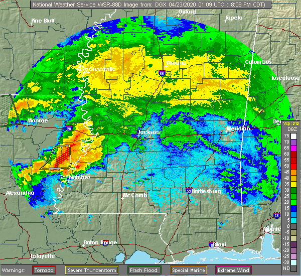 At 810 pm cdt, severe thunderstorms were located along a line extending from near newlight to lee bayou, moving east at 50 mph (radar indicated). Hazards include 60 mph wind gusts and quarter size hail. Hail damage to vehicles is expected. expect wind damage to roofs, siding, and trees. severe thunderstorms will be near, waterproof and helena around 820 pm cdt. newellton around 825 pm cdt. church hill around 830 pm cdt. fayette, yokena, lorman and mcnair around 845 pm cdt. red lick around 850 pm cdt. rocky springs around 855 pm cdt. blue hill and reganton around 900 pm cdt. Mcbride, union church and peyton around 905 pm cdt. At 810 pm cdt, severe thunderstorms were located along a line extending from near newlight to lee bayou, moving east at 50 mph (radar indicated). Hazards include 60 mph wind gusts and quarter size hail. Hail damage to vehicles is expected. expect wind damage to roofs, siding, and trees. severe thunderstorms will be near, waterproof and helena around 820 pm cdt. newellton around 825 pm cdt. church hill around 830 pm cdt. fayette, yokena, lorman and mcnair around 845 pm cdt. red lick around 850 pm cdt. rocky springs around 855 pm cdt. blue hill and reganton around 900 pm cdt. Mcbride, union church and peyton around 905 pm cdt.
|
| 1/11/2020 7:00 AM CST |
 At 700 am cst, severe thunderstorms were located along a line extending from near peyton to 6 miles southeast of cranfield, moving northeast at 65 mph (radar indicated). Hazards include 60 mph wind gusts. Expect damage to roofs, siding, and trees. these severe storms will be near, peyton around 705 am cst. mcnair and barlow around 710 am cst. new hope around 715 am cst. union church, pleasant hill and mcbride around 725 am cst. caseyville and allen around 730 am cst. other locations impacted by these severe thunderstorms include roxie and meadville. A tornado watch remains in effect until 900 am cst for central, south central and southwestern mississippi. At 700 am cst, severe thunderstorms were located along a line extending from near peyton to 6 miles southeast of cranfield, moving northeast at 65 mph (radar indicated). Hazards include 60 mph wind gusts. Expect damage to roofs, siding, and trees. these severe storms will be near, peyton around 705 am cst. mcnair and barlow around 710 am cst. new hope around 715 am cst. union church, pleasant hill and mcbride around 725 am cst. caseyville and allen around 730 am cst. other locations impacted by these severe thunderstorms include roxie and meadville. A tornado watch remains in effect until 900 am cst for central, south central and southwestern mississippi.
|
| 1/11/2020 6:58 AM CST | Tree dow in jefferson county MS, 5.1 miles N of Fayette, MS |
| 1/11/2020 6:56 AM CST | Tree dow in jefferson county MS, 7 miles NE of Fayette, MS |
| 1/11/2020 6:26 AM CST |
 At 626 am cst, severe thunderstorms were located along a line extending from near lorman to near natchez, moving east at 50 mph (radar indicated). Hazards include 60 mph wind gusts. Expect damage to roofs, siding, and trees. severe thunderstorms will be near, alcorn, lorman and red lick around 630 am cst. stanton around 640 am cst. stampley and peyton around 645 am cst. hamburg and mcnair around 650 am cst. kirby around 655 am cst. new hope around 705 am cst. union church around 710 am cst. pleasant hill around 715 am cst. other locations impacted by these severe thunderstorms include roxie and meadville. A tornado watch remains in effect until 900 am cst for central, south central and southwestern mississippi. At 626 am cst, severe thunderstorms were located along a line extending from near lorman to near natchez, moving east at 50 mph (radar indicated). Hazards include 60 mph wind gusts. Expect damage to roofs, siding, and trees. severe thunderstorms will be near, alcorn, lorman and red lick around 630 am cst. stanton around 640 am cst. stampley and peyton around 645 am cst. hamburg and mcnair around 650 am cst. kirby around 655 am cst. new hope around 705 am cst. union church around 710 am cst. pleasant hill around 715 am cst. other locations impacted by these severe thunderstorms include roxie and meadville. A tornado watch remains in effect until 900 am cst for central, south central and southwestern mississippi.
|
| 1/2/2020 2:41 PM CST |
 The national weather service in jackson has issued a * severe thunderstorm warning for. jefferson county in southwestern mississippi. northwestern franklin county in southwestern mississippi. northeastern adams county in southwestern mississippi. Until 330 pm cst. The national weather service in jackson has issued a * severe thunderstorm warning for. jefferson county in southwestern mississippi. northwestern franklin county in southwestern mississippi. northeastern adams county in southwestern mississippi. Until 330 pm cst.
|
| 12/29/2019 3:03 PM CST |
 At 303 pm cst, a severe thunderstorm was located near red lick, or 31 miles northeast of natchez, moving northeast at 60 mph (radar indicated). Hazards include 60 mph wind gusts and quarter size hail. Hail damage to vehicles is expected. expect wind damage to roofs, siding, and trees. this severe thunderstorm will be near, peyton around 310 pm cst. hermanville around 315 pm cst. carpenter around 325 pm cst. utica and dentville around 330 pm cst. A tornado watch remains in effect until 900 pm cst for central and southwestern mississippi. At 303 pm cst, a severe thunderstorm was located near red lick, or 31 miles northeast of natchez, moving northeast at 60 mph (radar indicated). Hazards include 60 mph wind gusts and quarter size hail. Hail damage to vehicles is expected. expect wind damage to roofs, siding, and trees. this severe thunderstorm will be near, peyton around 310 pm cst. hermanville around 315 pm cst. carpenter around 325 pm cst. utica and dentville around 330 pm cst. A tornado watch remains in effect until 900 pm cst for central and southwestern mississippi.
|
| 12/16/2019 5:12 PM CST |
 At 511 pm cst, a severe thunderstorm was located near red lick, or 26 miles northeast of natchez, moving northeast at 45 mph (radar indicated). Hazards include 60 mph wind gusts and penny size hail. Expect damage to roofs, siding, and trees. this severe storm will be near, blue hill around 520 pm cst. mcbride and pattison around 525 pm cst. peyton around 530 pm cst. A tornado watch remains in effect until 600 pm cst for central and southwestern mississippi. At 511 pm cst, a severe thunderstorm was located near red lick, or 26 miles northeast of natchez, moving northeast at 45 mph (radar indicated). Hazards include 60 mph wind gusts and penny size hail. Expect damage to roofs, siding, and trees. this severe storm will be near, blue hill around 520 pm cst. mcbride and pattison around 525 pm cst. peyton around 530 pm cst. A tornado watch remains in effect until 600 pm cst for central and southwestern mississippi.
|
| 12/16/2019 4:57 PM CST |
 At 457 pm cst, a severe thunderstorm was located over stampley, or 16 miles northeast of natchez, moving northeast at 45 mph (radar indicated). Hazards include 60 mph wind gusts and penny size hail. Expect damage to roofs, siding, and trees. this severe thunderstorm will be near, fayette around 505 pm cst. lorman around 510 pm cst. red lick around 515 pm cst. blue hill and pattison around 525 pm cst. peyton and mcbride around 530 pm cst. A tornado watch remains in effect until 600 pm cst for central and southwestern mississippi. At 457 pm cst, a severe thunderstorm was located over stampley, or 16 miles northeast of natchez, moving northeast at 45 mph (radar indicated). Hazards include 60 mph wind gusts and penny size hail. Expect damage to roofs, siding, and trees. this severe thunderstorm will be near, fayette around 505 pm cst. lorman around 510 pm cst. red lick around 515 pm cst. blue hill and pattison around 525 pm cst. peyton and mcbride around 530 pm cst. A tornado watch remains in effect until 600 pm cst for central and southwestern mississippi.
|
| 6/28/2019 2:18 PM CDT |
 At 217 pm cdt, a severe thunderstorm was located over fayette, or 20 miles northeast of natchez, moving southeast at 20 mph (radar indicated). Hazards include 60 mph wind gusts and penny size hail. expect damage to roofs, siding, and trees At 217 pm cdt, a severe thunderstorm was located over fayette, or 20 miles northeast of natchez, moving southeast at 20 mph (radar indicated). Hazards include 60 mph wind gusts and penny size hail. expect damage to roofs, siding, and trees
|
| 6/27/2019 7:28 PM CDT |
 The severe thunderstorm warning for southern tensas parish, claiborne and northern jefferson counties will expire at 730 pm cdt, the storms which prompted the warning have weakened below severe limits, and no longer pose an immediate threat to life or property. therefore, the warning will be allowed to expire. however heavy rain is still possible with these thunderstorms. The severe thunderstorm warning for southern tensas parish, claiborne and northern jefferson counties will expire at 730 pm cdt, the storms which prompted the warning have weakened below severe limits, and no longer pose an immediate threat to life or property. therefore, the warning will be allowed to expire. however heavy rain is still possible with these thunderstorms.
|
| 6/27/2019 7:23 PM CDT |
 At 722 pm cdt, severe thunderstorms were located along a line extending from near st. joseph to near pattison, moving south at 5 mph (radar indicated). Hazards include 60 mph wind gusts and nickel size hail. Expect damage to roofs, siding, and trees. locations impacted include, alcorn, port gibson, st. Joseph, waterproof, peyton, hermanville, lorman, mcbride, pleasant hill, red lick, helena, lake bruin, pattison and blue hill. At 722 pm cdt, severe thunderstorms were located along a line extending from near st. joseph to near pattison, moving south at 5 mph (radar indicated). Hazards include 60 mph wind gusts and nickel size hail. Expect damage to roofs, siding, and trees. locations impacted include, alcorn, port gibson, st. Joseph, waterproof, peyton, hermanville, lorman, mcbride, pleasant hill, red lick, helena, lake bruin, pattison and blue hill.
|
| 6/27/2019 7:05 PM CDT |
 At 704 pm cdt, severe thunderstorms were located along a line extending from st. joseph to pattison, moving south at 5 mph (radar indicated). Hazards include 60 mph wind gusts and quarter size hail. Hail damage to vehicles is expected. expect wind damage to roofs, siding, and trees. locations impacted include, alcorn, fayette, port gibson, st. Joseph, waterproof, union church, peyton, hermanville, lorman, mcbride, stampley, pleasant hill, red lick, helena, lake bruin, church hill, pattison, blue hill and mcnair. At 704 pm cdt, severe thunderstorms were located along a line extending from st. joseph to pattison, moving south at 5 mph (radar indicated). Hazards include 60 mph wind gusts and quarter size hail. Hail damage to vehicles is expected. expect wind damage to roofs, siding, and trees. locations impacted include, alcorn, fayette, port gibson, st. Joseph, waterproof, union church, peyton, hermanville, lorman, mcbride, stampley, pleasant hill, red lick, helena, lake bruin, church hill, pattison, blue hill and mcnair.
|
| 6/27/2019 6:48 PM CDT |
 At 648 pm cdt, severe thunderstorms were located along a line extending from near st. joseph to near peyton, and are nearly stationary (radar indicated). Hazards include 60 mph wind gusts and quarter size hail. Hail damage to vehicles is expected. Expect wind damage to roofs, siding, and trees. At 648 pm cdt, severe thunderstorms were located along a line extending from near st. joseph to near peyton, and are nearly stationary (radar indicated). Hazards include 60 mph wind gusts and quarter size hail. Hail damage to vehicles is expected. Expect wind damage to roofs, siding, and trees.
|
| 6/17/2019 12:44 PM CDT | Corrects previous tornado report from 4 w union church. tree down across hwy 28 at barnes l in jefferson county MS, 12.1 miles W of Fayette, MS |
| 5/19/2019 4:24 AM CDT |
 At 424 am cdt, severe thunderstorms were located along a line extending from 6 miles west of rocky springs to near pattison to near stampley, moving east at 45 mph (radar indicated). Hazards include 60 mph wind gusts. Expect damage to roofs, siding, and trees. these severe storms will be near, pattison around 430 am cdt. rocky springs, peyton, hermanville and red lick around 435 am cdt. reganton around 440 am cdt. union church, blue hill, mcbride and pleasant hill around 445 am cdt. A tornado watch remains in effect until 1000 am cdt for northeastern louisiana, and central, south central, southwestern and west central mississippi. At 424 am cdt, severe thunderstorms were located along a line extending from 6 miles west of rocky springs to near pattison to near stampley, moving east at 45 mph (radar indicated). Hazards include 60 mph wind gusts. Expect damage to roofs, siding, and trees. these severe storms will be near, pattison around 430 am cdt. rocky springs, peyton, hermanville and red lick around 435 am cdt. reganton around 440 am cdt. union church, blue hill, mcbride and pleasant hill around 445 am cdt. A tornado watch remains in effect until 1000 am cdt for northeastern louisiana, and central, south central, southwestern and west central mississippi.
|
| 5/19/2019 3:46 AM CDT |
 At 346 am cdt, severe thunderstorms were located along a line extending from 6 miles west of lake bruin to waterproof to near clayton, moving east at 45 mph (radar indicated). Hazards include 60 mph wind gusts. Expect damage to roofs, siding, and trees. severe thunderstorms will be near, newellton and lake bruin around 355 am cdt. st. joseph around 400 am cdt. alcorn and stanton around 405 am cdt. church hill around 410 am cdt. lorman and stampley around 415 am cdt. fayette, port gibson and yokena around 420 am cdt. pattison and mcnair around 425 am cdt. rocky springs, red lick, peyton and hermanville around 430 am cdt. other locations impacted by these severe thunderstorms include ridgecrest. A tornado watch remains in effect until 1000 am cdt for northeastern louisiana, and southwestern and west central mississippi. At 346 am cdt, severe thunderstorms were located along a line extending from 6 miles west of lake bruin to waterproof to near clayton, moving east at 45 mph (radar indicated). Hazards include 60 mph wind gusts. Expect damage to roofs, siding, and trees. severe thunderstorms will be near, newellton and lake bruin around 355 am cdt. st. joseph around 400 am cdt. alcorn and stanton around 405 am cdt. church hill around 410 am cdt. lorman and stampley around 415 am cdt. fayette, port gibson and yokena around 420 am cdt. pattison and mcnair around 425 am cdt. rocky springs, red lick, peyton and hermanville around 430 am cdt. other locations impacted by these severe thunderstorms include ridgecrest. A tornado watch remains in effect until 1000 am cdt for northeastern louisiana, and southwestern and west central mississippi.
|
| 5/9/2019 9:21 AM CDT |
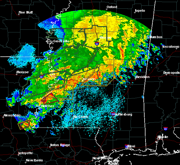 At 921 am cdt, a severe thunderstorm capable of producing a tornado was located near lorman, or 23 miles northeast of natchez, moving northeast at 50 mph (radar indicated rotation). Hazards include tornado. Flying debris will be dangerous to those caught without shelter. mobile homes will be damaged or destroyed. damage to roofs, windows, and vehicles will occur. tree damage is likely. this dangerous storm will be near, lorman around 925 am cdt. Red lick around 930 am cdt. At 921 am cdt, a severe thunderstorm capable of producing a tornado was located near lorman, or 23 miles northeast of natchez, moving northeast at 50 mph (radar indicated rotation). Hazards include tornado. Flying debris will be dangerous to those caught without shelter. mobile homes will be damaged or destroyed. damage to roofs, windows, and vehicles will occur. tree damage is likely. this dangerous storm will be near, lorman around 925 am cdt. Red lick around 930 am cdt.
|
| 5/9/2019 9:10 AM CDT |
 At 909 am cdt, a severe thunderstorm capable of producing a tornado was located over church hill, or 14 miles northeast of natchez, moving northeast at 50 mph (radar indicated rotation). Hazards include tornado. Flying debris will be dangerous to those caught without shelter. mobile homes will be damaged or destroyed. damage to roofs, windows, and vehicles will occur. tree damage is likely. this dangerous storm will be near, alcorn and lorman around 925 am cdt. Red lick around 930 am cdt. At 909 am cdt, a severe thunderstorm capable of producing a tornado was located over church hill, or 14 miles northeast of natchez, moving northeast at 50 mph (radar indicated rotation). Hazards include tornado. Flying debris will be dangerous to those caught without shelter. mobile homes will be damaged or destroyed. damage to roofs, windows, and vehicles will occur. tree damage is likely. this dangerous storm will be near, alcorn and lorman around 925 am cdt. Red lick around 930 am cdt.
|
| 5/9/2019 8:56 AM CDT |
 At 856 am cdt, a severe thunderstorm capable of producing a tornado was located over spokane, or near ferriday, moving northeast at 50 mph (radar indicated rotation). Hazards include tornado. Flying debris will be dangerous to those caught without shelter. mobile homes will be damaged or destroyed. damage to roofs, windows, and vehicles will occur. tree damage is likely. this dangerous storm will be near, church hill around 910 am cdt. alcorn and fayette around 925 am cdt. Lorman and red lick around 930 am cdt. At 856 am cdt, a severe thunderstorm capable of producing a tornado was located over spokane, or near ferriday, moving northeast at 50 mph (radar indicated rotation). Hazards include tornado. Flying debris will be dangerous to those caught without shelter. mobile homes will be damaged or destroyed. damage to roofs, windows, and vehicles will occur. tree damage is likely. this dangerous storm will be near, church hill around 910 am cdt. alcorn and fayette around 925 am cdt. Lorman and red lick around 930 am cdt.
|
| 5/8/2019 8:34 PM CDT |
 At 758 pm cdt, severe thunderstorms were located along a line extending from near alcorn to near stanton to 6 miles southwest of sibley, moving east northeast at 50 mph (radar indicated). Hazards include 60 mph wind gusts. Expect damage to roofs, siding, and trees. these severe storms will be near, church hill around 805 pm cdt. fayette and kingston around 815 pm cdt. red lick, cranfield and lorman around 825 pm cdt. blue hill around 830 pm cdt. pattison, hamburg and stampley around 835 pm cdt. mcnair and peyton around 840 pm cdt. other locations impacted by these severe thunderstorms include roxie and meadville. a tornado watch remains in effect until 1100 pm cdt for northeastern louisiana. A tornado watch also remains in effect until midnight cdt for central, south central and southwestern mississippi. At 758 pm cdt, severe thunderstorms were located along a line extending from near alcorn to near stanton to 6 miles southwest of sibley, moving east northeast at 50 mph (radar indicated). Hazards include 60 mph wind gusts. Expect damage to roofs, siding, and trees. these severe storms will be near, church hill around 805 pm cdt. fayette and kingston around 815 pm cdt. red lick, cranfield and lorman around 825 pm cdt. blue hill around 830 pm cdt. pattison, hamburg and stampley around 835 pm cdt. mcnair and peyton around 840 pm cdt. other locations impacted by these severe thunderstorms include roxie and meadville. a tornado watch remains in effect until 1100 pm cdt for northeastern louisiana. A tornado watch also remains in effect until midnight cdt for central, south central and southwestern mississippi.
|
| 5/8/2019 8:11 PM CDT | Several trees down countywid in jefferson county MS, 0.3 miles NNW of Fayette, MS |
| 5/8/2019 7:58 PM CDT |
 At 758 pm cdt, severe thunderstorms were located along a line extending from near alcorn to near stanton to 6 miles southwest of sibley, moving east northeast at 50 mph (radar indicated). Hazards include 60 mph wind gusts. Expect damage to roofs, siding, and trees. these severe storms will be near, church hill around 805 pm cdt. fayette and kingston around 815 pm cdt. red lick, cranfield and lorman around 825 pm cdt. blue hill around 830 pm cdt. pattison, hamburg and stampley around 835 pm cdt. mcnair and peyton around 840 pm cdt. other locations impacted by these severe thunderstorms include roxie and meadville. a tornado watch remains in effect until 1100 pm cdt for northeastern louisiana. A tornado watch also remains in effect until midnight cdt for central, south central and southwestern mississippi. At 758 pm cdt, severe thunderstorms were located along a line extending from near alcorn to near stanton to 6 miles southwest of sibley, moving east northeast at 50 mph (radar indicated). Hazards include 60 mph wind gusts. Expect damage to roofs, siding, and trees. these severe storms will be near, church hill around 805 pm cdt. fayette and kingston around 815 pm cdt. red lick, cranfield and lorman around 825 pm cdt. blue hill around 830 pm cdt. pattison, hamburg and stampley around 835 pm cdt. mcnair and peyton around 840 pm cdt. other locations impacted by these severe thunderstorms include roxie and meadville. a tornado watch remains in effect until 1100 pm cdt for northeastern louisiana. A tornado watch also remains in effect until midnight cdt for central, south central and southwestern mississippi.
|
| 5/8/2019 7:34 PM CDT |
 At 734 pm cdt, severe thunderstorms were located along a line extending from near waterproof to near vidalia to near monterey, moving east at 45 mph (radar indicated). Hazards include 60 mph wind gusts. Expect damage to roofs, siding, and trees. severe thunderstorms will be near, natchez around 740 pm cdt. alcorn around 750 pm cdt. stanton and lorman around 755 pm cdt. sibley, cranfield and red lick around 800 pm cdt. stampley around 805 pm cdt. fayette, kingston, hamburg, pattison, mcnair and blue hill around 810 pm cdt. peyton and mcbride around 815 pm cdt. garden city around 820 pm cdt. other locations impacted by these severe thunderstorms include roxie and meadville. a tornado watch remains in effect until 1100 pm cdt for northeastern louisiana. A tornado watch also remains in effect until midnight cdt for central, south central and southwestern mississippi. At 734 pm cdt, severe thunderstorms were located along a line extending from near waterproof to near vidalia to near monterey, moving east at 45 mph (radar indicated). Hazards include 60 mph wind gusts. Expect damage to roofs, siding, and trees. severe thunderstorms will be near, natchez around 740 pm cdt. alcorn around 750 pm cdt. stanton and lorman around 755 pm cdt. sibley, cranfield and red lick around 800 pm cdt. stampley around 805 pm cdt. fayette, kingston, hamburg, pattison, mcnair and blue hill around 810 pm cdt. peyton and mcbride around 815 pm cdt. garden city around 820 pm cdt. other locations impacted by these severe thunderstorms include roxie and meadville. a tornado watch remains in effect until 1100 pm cdt for northeastern louisiana. A tornado watch also remains in effect until midnight cdt for central, south central and southwestern mississippi.
|
| 4/25/2019 7:49 AM CDT |
 At 749 am cdt, severe thunderstorms were located along a line extending from reganton to near pattison to near mcnair, moving northeast at 50 mph (radar indicated). Hazards include 60 mph wind gusts. Expect damage to roofs, siding, and trees. these severe storms will be near, reganton around 755 am cdt. Mcbride around 805 am cdt. At 749 am cdt, severe thunderstorms were located along a line extending from reganton to near pattison to near mcnair, moving northeast at 50 mph (radar indicated). Hazards include 60 mph wind gusts. Expect damage to roofs, siding, and trees. these severe storms will be near, reganton around 755 am cdt. Mcbride around 805 am cdt.
|
| 4/25/2019 7:41 AM CDT |
 At 740 am cdt, severe thunderstorms were located along a line extending from near rocky springs to near red lick to near hamburg, moving northeast at 40 mph (radar indicated). Hazards include 60 mph wind gusts. Expect damage to roofs, siding, and trees. these severe storms will be near, port gibson, rocky springs and blue hill around 745 am cdt. pattison around 750 am cdt. reganton, peyton and hermanville around 755 am cdt. new hope around 800 am cdt. union church around 810 am cdt. mcbride around 815 am cdt. Other locations impacted by these severe thunderstorms include roxie. At 740 am cdt, severe thunderstorms were located along a line extending from near rocky springs to near red lick to near hamburg, moving northeast at 40 mph (radar indicated). Hazards include 60 mph wind gusts. Expect damage to roofs, siding, and trees. these severe storms will be near, port gibson, rocky springs and blue hill around 745 am cdt. pattison around 750 am cdt. reganton, peyton and hermanville around 755 am cdt. new hope around 800 am cdt. union church around 810 am cdt. mcbride around 815 am cdt. Other locations impacted by these severe thunderstorms include roxie.
|
| 4/25/2019 7:23 AM CDT |
 At 723 am cdt, severe thunderstorms were located along a line extending from near church hill to near kingston, moving northeast at 45 mph (radar indicated). Hazards include 60 mph wind gusts. Expect damage to roofs, siding, and trees. severe thunderstorms will be near, alcorn and hamburg around 740 am cdt. lorman, kirby, mcnair and red lick around 745 am cdt. port gibson and new hope around 755 am cdt. pattison around 800 am cdt. hermanville, union church and blue hill around 805 am cdt. mcbride around 810 am cdt. rocky springs around 815 am cdt. reganton around 820 am cdt. Other locations impacted by these severe thunderstorms include roxie and meadville. At 723 am cdt, severe thunderstorms were located along a line extending from near church hill to near kingston, moving northeast at 45 mph (radar indicated). Hazards include 60 mph wind gusts. Expect damage to roofs, siding, and trees. severe thunderstorms will be near, alcorn and hamburg around 740 am cdt. lorman, kirby, mcnair and red lick around 745 am cdt. port gibson and new hope around 755 am cdt. pattison around 800 am cdt. hermanville, union church and blue hill around 805 am cdt. mcbride around 810 am cdt. rocky springs around 815 am cdt. reganton around 820 am cdt. Other locations impacted by these severe thunderstorms include roxie and meadville.
|
| 4/18/2019 1:18 PM CDT | Tree limbs down on roa in jefferson county MS, 3.4 miles NW of Fayette, MS |
| 4/18/2019 1:17 PM CDT |
 At 116 pm cdt, a severe thunderstorm capable of producing a tornado was located over lorman, or 27 miles northeast of natchez, moving northeast at 60 mph (radar indicated rotation). Hazards include tornado. Flying debris will be dangerous to those caught without shelter. mobile homes will be damaged or destroyed. damage to roofs, windows, and vehicles will occur. tree damage is likely. this dangerous storm will be near, red lick around 120 pm cdt. port gibson around 125 pm cdt. pattison around 130 pm cdt. hermanville around 135 pm cdt. rocky springs around 140 pm cdt. Reganton around 145 pm cdt. At 116 pm cdt, a severe thunderstorm capable of producing a tornado was located over lorman, or 27 miles northeast of natchez, moving northeast at 60 mph (radar indicated rotation). Hazards include tornado. Flying debris will be dangerous to those caught without shelter. mobile homes will be damaged or destroyed. damage to roofs, windows, and vehicles will occur. tree damage is likely. this dangerous storm will be near, red lick around 120 pm cdt. port gibson around 125 pm cdt. pattison around 130 pm cdt. hermanville around 135 pm cdt. rocky springs around 140 pm cdt. Reganton around 145 pm cdt.
|
| 4/18/2019 1:13 PM CDT |
 At 113 pm cdt, a severe thunderstorm capable of producing a tornado was located near alcorn, or 22 miles northeast of natchez, moving northeast at 35 mph (radar indicated rotation). Hazards include tornado. Flying debris will be dangerous to those caught without shelter. mobile homes will be damaged or destroyed. damage to roofs, windows, and vehicles will occur. tree damage is likely. this dangerous storm will be near, lorman and red lick around 125 pm cdt. port gibson around 135 pm cdt. pattison around 140 pm cdt. hermanville around 150 pm cdt. rocky springs around 200 pm cdt. Reganton around 210 pm cdt. At 113 pm cdt, a severe thunderstorm capable of producing a tornado was located near alcorn, or 22 miles northeast of natchez, moving northeast at 35 mph (radar indicated rotation). Hazards include tornado. Flying debris will be dangerous to those caught without shelter. mobile homes will be damaged or destroyed. damage to roofs, windows, and vehicles will occur. tree damage is likely. this dangerous storm will be near, lorman and red lick around 125 pm cdt. port gibson around 135 pm cdt. pattison around 140 pm cdt. hermanville around 150 pm cdt. rocky springs around 200 pm cdt. Reganton around 210 pm cdt.
|
| 4/18/2019 1:01 PM CDT |
 At 101 pm cdt, severe thunderstorms were located along a line extending from 7 miles southeast of newlight to near church hill to kingston, moving east at 40 mph (radar indicated). Hazards include 60 mph wind gusts. Expect damage to roofs, siding, and trees. severe thunderstorms will be near, garden city around 110 pm cdt. fayette and lorman around 115 pm cdt. red lick around 120 pm cdt. kirby around 125 pm cdt. blue hill and pattison around 130 pm cdt. bude, peyton and mcbride around 135 pm cdt. new hope, yokena and pleasant hill around 140 pm cdt. little springs around 145 pm cdt. other locations impacted by these severe thunderstorms include roxie, delta and meadville. A tornado watch remains in effect until 700 pm cdt for northeastern louisiana, and central, south central, southwestern and west central mississippi. At 101 pm cdt, severe thunderstorms were located along a line extending from 7 miles southeast of newlight to near church hill to kingston, moving east at 40 mph (radar indicated). Hazards include 60 mph wind gusts. Expect damage to roofs, siding, and trees. severe thunderstorms will be near, garden city around 110 pm cdt. fayette and lorman around 115 pm cdt. red lick around 120 pm cdt. kirby around 125 pm cdt. blue hill and pattison around 130 pm cdt. bude, peyton and mcbride around 135 pm cdt. new hope, yokena and pleasant hill around 140 pm cdt. little springs around 145 pm cdt. other locations impacted by these severe thunderstorms include roxie, delta and meadville. A tornado watch remains in effect until 700 pm cdt for northeastern louisiana, and central, south central, southwestern and west central mississippi.
|
| 4/12/2019 11:01 PM CDT |
 At 1101 pm cdt, a severe thunderstorm was located near new hope, or 27 miles west of brookhaven, moving northeast at 45 mph (radar indicated). Hazards include half dollar size hail. Damage to vehicles is expected. this severe storm will be near, union church and blue hill around 1110 pm cdt. pleasant hill and mcbride around 1115 pm cdt. Allen and barlow around 1125 pm cdt. At 1101 pm cdt, a severe thunderstorm was located near new hope, or 27 miles west of brookhaven, moving northeast at 45 mph (radar indicated). Hazards include half dollar size hail. Damage to vehicles is expected. this severe storm will be near, union church and blue hill around 1110 pm cdt. pleasant hill and mcbride around 1115 pm cdt. Allen and barlow around 1125 pm cdt.
|
| 4/12/2019 10:51 PM CDT |
 At 1051 pm cdt, a severe thunderstorm was located near hamburg, or 21 miles east of natchez, moving northeast at 45 mph (radar indicated). Hazards include half dollar size hail. Damage to vehicles is expected. this severe thunderstorm will be near, union church and blue hill around 1110 pm cdt. mcbride around 1115 pm cdt. pleasant hill around 1120 pm cdt. allen around 1125 pm cdt. Other locations impacted by this severe thunderstorm include roxie. At 1051 pm cdt, a severe thunderstorm was located near hamburg, or 21 miles east of natchez, moving northeast at 45 mph (radar indicated). Hazards include half dollar size hail. Damage to vehicles is expected. this severe thunderstorm will be near, union church and blue hill around 1110 pm cdt. mcbride around 1115 pm cdt. pleasant hill around 1120 pm cdt. allen around 1125 pm cdt. Other locations impacted by this severe thunderstorm include roxie.
|
| 4/7/2019 7:47 PM CDT |
 At 747 pm cdt, severe thunderstorms were located along a line extending from near somerset to near lorman, moving northeast at 45 mph (radar indicated). Hazards include 60 mph wind gusts. Expect damage to roofs, siding, and trees. these severe storms will be near, newellton and somerset around 750 pm cdt. port gibson around 800 pm cdt. Yokena around 815 pm cdt. At 747 pm cdt, severe thunderstorms were located along a line extending from near somerset to near lorman, moving northeast at 45 mph (radar indicated). Hazards include 60 mph wind gusts. Expect damage to roofs, siding, and trees. these severe storms will be near, newellton and somerset around 750 pm cdt. port gibson around 800 pm cdt. Yokena around 815 pm cdt.
|
| 4/7/2019 7:39 PM CDT |
 At 739 pm cdt, severe thunderstorms were located along a line extending from near newellton to 6 miles northeast of church hill, moving northeast at 25 mph (radar indicated). Hazards include 60 mph wind gusts. Expect damage to roofs, siding, and trees. these severe storms will be near, newellton and lake bruin around 745 pm cdt. red lick around 755 pm cdt. somerset around 800 pm cdt. Port gibson around 815 pm cdt. At 739 pm cdt, severe thunderstorms were located along a line extending from near newellton to 6 miles northeast of church hill, moving northeast at 25 mph (radar indicated). Hazards include 60 mph wind gusts. Expect damage to roofs, siding, and trees. these severe storms will be near, newellton and lake bruin around 745 pm cdt. red lick around 755 pm cdt. somerset around 800 pm cdt. Port gibson around 815 pm cdt.
|
| 4/7/2019 7:25 PM CDT |
 At 725 pm cdt, severe thunderstorms were located along a line extending from near lake bruin to church hill, moving north at 45 mph (radar indicated). Hazards include 60 mph wind gusts. Expect damage to roofs, siding, and trees. severe thunderstorms will be near, lake bruin around 730 pm cdt. alcorn, newellton and st. joseph around 740 pm cdt. somerset around 745 pm cdt. Yokena around 815 pm cdt. At 725 pm cdt, severe thunderstorms were located along a line extending from near lake bruin to church hill, moving north at 45 mph (radar indicated). Hazards include 60 mph wind gusts. Expect damage to roofs, siding, and trees. severe thunderstorms will be near, lake bruin around 730 pm cdt. alcorn, newellton and st. joseph around 740 pm cdt. somerset around 745 pm cdt. Yokena around 815 pm cdt.
|
| 2/23/2019 3:35 PM CST |
 The severe thunderstorm warning for central jefferson and northeastern adams counties will expire at 345 pm cst, the storm which prompted the warning has weakened below severe limits, and has exited the warned area. therefore, the warning will be allowed to expire. a tornado watch remains in effect until 800 pm cst for northeastern louisiana, and southwestern mississippi. The severe thunderstorm warning for central jefferson and northeastern adams counties will expire at 345 pm cst, the storm which prompted the warning has weakened below severe limits, and has exited the warned area. therefore, the warning will be allowed to expire. a tornado watch remains in effect until 800 pm cst for northeastern louisiana, and southwestern mississippi.
|
| 2/23/2019 3:26 PM CST |
 At 325 pm cst, a severe thunderstorm was located near lorman, or 25 miles northeast of natchez, moving northeast at 30 mph (radar indicated). Hazards include 60 mph wind gusts and quarter size hail. Hail damage to vehicles is expected. expect wind damage to roofs, siding, and trees. this severe storm will be near, lorman around 330 pm cst. red lick around 335 pm cst. A tornado watch remains in effect until 800 pm cst for northeastern louisiana, and southwestern mississippi. At 325 pm cst, a severe thunderstorm was located near lorman, or 25 miles northeast of natchez, moving northeast at 30 mph (radar indicated). Hazards include 60 mph wind gusts and quarter size hail. Hail damage to vehicles is expected. expect wind damage to roofs, siding, and trees. this severe storm will be near, lorman around 330 pm cst. red lick around 335 pm cst. A tornado watch remains in effect until 800 pm cst for northeastern louisiana, and southwestern mississippi.
|
| 2/23/2019 2:50 PM CST |
 At 249 pm cst, a severe thunderstorm was located over vidalia, moving northeast at 50 mph (radar indicated). Hazards include 60 mph wind gusts and quarter size hail. Hail damage to vehicles is expected. expect wind damage to roofs, siding, and trees. this severe storm will be near, stanton around 300 pm cst. church hill around 305 pm cst. lorman around 320 pm cst. red lick around 325 pm cst. other locations impacted by this severe thunderstorm include ridgecrest. A tornado watch remains in effect until 800 pm cst for northeastern louisiana, and southwestern mississippi. At 249 pm cst, a severe thunderstorm was located over vidalia, moving northeast at 50 mph (radar indicated). Hazards include 60 mph wind gusts and quarter size hail. Hail damage to vehicles is expected. expect wind damage to roofs, siding, and trees. this severe storm will be near, stanton around 300 pm cst. church hill around 305 pm cst. lorman around 320 pm cst. red lick around 325 pm cst. other locations impacted by this severe thunderstorm include ridgecrest. A tornado watch remains in effect until 800 pm cst for northeastern louisiana, and southwestern mississippi.
|
| 2/23/2019 2:41 PM CST |
 At 240 pm cst, a severe thunderstorm was located near vidalia, moving northeast at 50 mph (radar indicated). Hazards include 60 mph wind gusts and quarter size hail. Hail damage to vehicles is expected. expect wind damage to roofs, siding, and trees. this severe thunderstorm will be near, natchez and vidalia around 250 pm cst. spokane around 255 pm cst. stanton around 300 pm cst. church hill around 305 pm cst. lorman around 320 pm cst. red lick around 325 pm cst. other locations impacted by this severe thunderstorm include ridgecrest. A tornado watch remains in effect until 800 pm cst for northeastern louisiana, and southwestern mississippi. At 240 pm cst, a severe thunderstorm was located near vidalia, moving northeast at 50 mph (radar indicated). Hazards include 60 mph wind gusts and quarter size hail. Hail damage to vehicles is expected. expect wind damage to roofs, siding, and trees. this severe thunderstorm will be near, natchez and vidalia around 250 pm cst. spokane around 255 pm cst. stanton around 300 pm cst. church hill around 305 pm cst. lorman around 320 pm cst. red lick around 325 pm cst. other locations impacted by this severe thunderstorm include ridgecrest. A tornado watch remains in effect until 800 pm cst for northeastern louisiana, and southwestern mississippi.
|
| 1/19/2019 6:20 AM CST |
 At 620 am cst, severe thunderstorms were located along a line extending from 6 miles north of port gibson to near stanton to near slocum, moving east at 35 mph (radar indicated). Hazards include 60 mph wind gusts. Expect damage to roofs, siding, and trees. these severe storms will be near, cranfield and hermanville around 625 am cst. church hill around 630 am cst. rocky springs and stampley around 635 am cst. fayette, reganton and sibley around 645 am cst. A tornado watch remains in effect until 100 pm cst for southwestern and west central mississippi. At 620 am cst, severe thunderstorms were located along a line extending from 6 miles north of port gibson to near stanton to near slocum, moving east at 35 mph (radar indicated). Hazards include 60 mph wind gusts. Expect damage to roofs, siding, and trees. these severe storms will be near, cranfield and hermanville around 625 am cst. church hill around 630 am cst. rocky springs and stampley around 635 am cst. fayette, reganton and sibley around 645 am cst. A tornado watch remains in effect until 100 pm cst for southwestern and west central mississippi.
|
| 1/19/2019 6:05 AM CST |
 At 604 am cst, severe thunderstorms were located along a line extending from 6 miles northwest of port gibson to vidalia to 7 miles south of acme, moving east at 35 mph (radar indicated). Hazards include 60 mph wind gusts. Expect damage to roofs, siding, and trees. severe thunderstorms will be near, port gibson around 615 am cst. stanton and cranfield around 625 am cst. church hill and hermanville around 630 am cst. rocky springs and stampley around 635 am cst. fayette, mcnair, reganton and sibley around 645 am cst. A tornado watch remains in effect until 100 pm cst for southwestern and west central mississippi. At 604 am cst, severe thunderstorms were located along a line extending from 6 miles northwest of port gibson to vidalia to 7 miles south of acme, moving east at 35 mph (radar indicated). Hazards include 60 mph wind gusts. Expect damage to roofs, siding, and trees. severe thunderstorms will be near, port gibson around 615 am cst. stanton and cranfield around 625 am cst. church hill and hermanville around 630 am cst. rocky springs and stampley around 635 am cst. fayette, mcnair, reganton and sibley around 645 am cst. A tornado watch remains in effect until 100 pm cst for southwestern and west central mississippi.
|
| 11/1/2018 2:51 AM CDT |
 The severe thunderstorm warning for tensas and northeastern concordia parishes, southwestern claiborne, western jefferson and adams counties will expire at 300 am cdt, the storms which prompted the warning have moved out of the area. therefore, the warning will be allowed to expire. to report severe weather, contact your nearest law enforcement agency. they will relay your report to the national weather service jackson. The severe thunderstorm warning for tensas and northeastern concordia parishes, southwestern claiborne, western jefferson and adams counties will expire at 300 am cdt, the storms which prompted the warning have moved out of the area. therefore, the warning will be allowed to expire. to report severe weather, contact your nearest law enforcement agency. they will relay your report to the national weather service jackson.
|
| 11/1/2018 2:22 AM CDT |
 At 222 am cdt, a tornado producing storm was located over cranfield, or 10 miles east of natchez, moving northeast at 50 mph (radar confirmed tornado). Hazards include damaging tornado. Flying debris will be dangerous to those caught without shelter. mobile homes will be damaged or destroyed. damage to roofs, windows, and vehicles will occur. tree damage is likely. this tornadic storm will be near, stampley and hamburg around 230 am cdt. mcnair around 235 am cdt. fayette around 240 am cdt. red lick around 245 am cdt. blue hill and union church around 255 am cdt. mcbride around 300 am cdt. Other locations impacted by this tornadic thunderstorm include roxie. At 222 am cdt, a tornado producing storm was located over cranfield, or 10 miles east of natchez, moving northeast at 50 mph (radar confirmed tornado). Hazards include damaging tornado. Flying debris will be dangerous to those caught without shelter. mobile homes will be damaged or destroyed. damage to roofs, windows, and vehicles will occur. tree damage is likely. this tornadic storm will be near, stampley and hamburg around 230 am cdt. mcnair around 235 am cdt. fayette around 240 am cdt. red lick around 245 am cdt. blue hill and union church around 255 am cdt. mcbride around 300 am cdt. Other locations impacted by this tornadic thunderstorm include roxie.
|
| 11/1/2018 1:30 AM CDT |
 At 129 am cdt, severe thunderstorms were located along a line extending from near crowville to jonesville, moving east at 30 mph (radar indicated). Hazards include 60 mph wind gusts. expect damage to roofs, siding, and trees At 129 am cdt, severe thunderstorms were located along a line extending from near crowville to jonesville, moving east at 30 mph (radar indicated). Hazards include 60 mph wind gusts. expect damage to roofs, siding, and trees
|
| 8/18/2018 7:56 PM CDT |
 The severe thunderstorm warning for south central jefferson and northwestern franklin counties will expire at 800 pm cdt, the storm which prompted the warning has weakened below severe limits, and no longer poses an immediate threat to life or property. therefore, the warning will be allowed to expire. to report severe weather, contact your nearest law enforcement agency. they will relay your report to the national weather service jackson. The severe thunderstorm warning for south central jefferson and northwestern franklin counties will expire at 800 pm cdt, the storm which prompted the warning has weakened below severe limits, and no longer poses an immediate threat to life or property. therefore, the warning will be allowed to expire. to report severe weather, contact your nearest law enforcement agency. they will relay your report to the national weather service jackson.
|
| 8/18/2018 7:41 PM CDT |
 At 741 pm cdt, a severe thunderstorm was located over mcnair, or 20 miles east of natchez, and is nearly stationary (radar indicated). Hazards include 60 mph wind gusts and quarter size hail. Hail damage to vehicles is possible. expect wind damage to roofs, siding, and trees. Locations impacted include, fayette, hamburg, mcnair and stampley. At 741 pm cdt, a severe thunderstorm was located over mcnair, or 20 miles east of natchez, and is nearly stationary (radar indicated). Hazards include 60 mph wind gusts and quarter size hail. Hail damage to vehicles is possible. expect wind damage to roofs, siding, and trees. Locations impacted include, fayette, hamburg, mcnair and stampley.
|
| 8/18/2018 7:17 PM CDT |
 At 716 pm cdt, a severe thunderstorm was located over mcnair, or 20 miles east of natchez, moving west at 10 mph (radar indicated). Hazards include 60 mph wind gusts and quarter size hail. Hail damage to vehicles is possible. Expect wind damage to roofs, siding, and trees. At 716 pm cdt, a severe thunderstorm was located over mcnair, or 20 miles east of natchez, moving west at 10 mph (radar indicated). Hazards include 60 mph wind gusts and quarter size hail. Hail damage to vehicles is possible. Expect wind damage to roofs, siding, and trees.
|
| 8/12/2018 6:05 PM CDT |
 At 604 pm cdt, severe thunderstorms were located along a line extending from newellton to near lorman to near mcnair, moving east at 30 mph (radar indicated). Hazards include 60 mph wind gusts. Expect damage to roofs, siding, and trees. severe thunderstorms will be near, red lick around 610 pm cdt. port gibson around 615 pm cdt. pattison around 620 pm cdt. hermanville and peyton around 630 pm cdt. blue hill around 635 pm cdt. mcbride and union church around 640 pm cdt. pleasant hill around 645 pm cdt. Allen, caseyville and rocky springs around 655 pm cdt. At 604 pm cdt, severe thunderstorms were located along a line extending from newellton to near lorman to near mcnair, moving east at 30 mph (radar indicated). Hazards include 60 mph wind gusts. Expect damage to roofs, siding, and trees. severe thunderstorms will be near, red lick around 610 pm cdt. port gibson around 615 pm cdt. pattison around 620 pm cdt. hermanville and peyton around 630 pm cdt. blue hill around 635 pm cdt. mcbride and union church around 640 pm cdt. pleasant hill around 645 pm cdt. Allen, caseyville and rocky springs around 655 pm cdt.
|
| 4/14/2018 6:57 AM CDT |
 At 657 am cdt, a severe thunderstorm was located near kingston, or 12 miles southeast of natchez, moving northeast at 50 mph (radar indicated). Hazards include 60 mph wind gusts. Expect damage to roofs, siding, and trees. this severe storm will be near, cranfield around 705 am cdt. hamburg and kirby around 715 am cdt. mcnair around 720 am cdt. blue hill and union church around 735 am cdt. mcbride around 740 am cdt. other locations impacted by this severe thunderstorm include roxie and meadville. a tornado watch remains in effect until 800 am cdt for southwestern mississippi. A tornado watch also remains in effect until 200 pm cdt for south central and southwestern mississippi. At 657 am cdt, a severe thunderstorm was located near kingston, or 12 miles southeast of natchez, moving northeast at 50 mph (radar indicated). Hazards include 60 mph wind gusts. Expect damage to roofs, siding, and trees. this severe storm will be near, cranfield around 705 am cdt. hamburg and kirby around 715 am cdt. mcnair around 720 am cdt. blue hill and union church around 735 am cdt. mcbride around 740 am cdt. other locations impacted by this severe thunderstorm include roxie and meadville. a tornado watch remains in effect until 800 am cdt for southwestern mississippi. A tornado watch also remains in effect until 200 pm cdt for south central and southwestern mississippi.
|
| 4/14/2018 6:44 AM CDT |
 At 644 am cdt, a severe thunderstorm was located over dolorosa, or 15 miles south of natchez, moving northeast at 50 mph (radar indicated). Hazards include 60 mph wind gusts. Expect damage to roofs, siding, and trees. this severe thunderstorm will be near, kingston around 655 am cdt. garden city around 700 am cdt. cranfield around 705 am cdt. hamburg, kirby and stampley around 715 am cdt. mcnair around 720 am cdt. union church and blue hill around 735 am cdt. mcbride around 740 am cdt. other locations impacted by this severe thunderstorm include roxie and meadville. A tornado watch remains in effect until 800 am cdt for northeastern louisiana, and southwestern mississippi. At 644 am cdt, a severe thunderstorm was located over dolorosa, or 15 miles south of natchez, moving northeast at 50 mph (radar indicated). Hazards include 60 mph wind gusts. Expect damage to roofs, siding, and trees. this severe thunderstorm will be near, kingston around 655 am cdt. garden city around 700 am cdt. cranfield around 705 am cdt. hamburg, kirby and stampley around 715 am cdt. mcnair around 720 am cdt. union church and blue hill around 735 am cdt. mcbride around 740 am cdt. other locations impacted by this severe thunderstorm include roxie and meadville. A tornado watch remains in effect until 800 am cdt for northeastern louisiana, and southwestern mississippi.
|
| 4/6/2018 10:51 PM CDT |
 At 1050 pm cdt, severe thunderstorms were located along a line extending from 6 miles southwest of blue hill to 6 miles north of garden city to near new era, moving southeast at 20 mph (radar indicated). Hazards include 60 mph wind gusts. Expect damage to roofs, siding, and trees. severe thunderstorms will be near, blue hill, mcnair and kingston around 1055 pm cdt. garden city and union church around 1110 pm cdt. slocum around 1120 pm cdt. bude, new hope, black hawk and mccall creek around 1130 pm cdt. other locations impacted by these severe thunderstorms include roxie and meadville. A tornado watch remains in effect until 1100 pm cdt for northeastern louisiana, and south central and southwestern mississippi. At 1050 pm cdt, severe thunderstorms were located along a line extending from 6 miles southwest of blue hill to 6 miles north of garden city to near new era, moving southeast at 20 mph (radar indicated). Hazards include 60 mph wind gusts. Expect damage to roofs, siding, and trees. severe thunderstorms will be near, blue hill, mcnair and kingston around 1055 pm cdt. garden city and union church around 1110 pm cdt. slocum around 1120 pm cdt. bude, new hope, black hawk and mccall creek around 1130 pm cdt. other locations impacted by these severe thunderstorms include roxie and meadville. A tornado watch remains in effect until 1100 pm cdt for northeastern louisiana, and south central and southwestern mississippi.
|
| 4/3/2018 8:09 PM CDT |
 At 808 pm cdt, severe thunderstorms were located along a line extending from near le tourneau to near alcorn to near frogmore, moving east at 40 mph (radar indicated). Hazards include 60 mph wind gusts and penny size hail. Expect damage to roofs, siding, and trees. these severe storms will be near, alcorn, lorman and reganton around 815 pm cdt. port gibson and red lick around 820 pm cdt. natchez, vidalia, pattison and hermanville around 830 pm cdt. peyton around 835 pm cdt. cranfield and stanton around 845 pm cdt. Other locations impacted by these severe thunderstorms include mound, delta and ridgecrest. At 808 pm cdt, severe thunderstorms were located along a line extending from near le tourneau to near alcorn to near frogmore, moving east at 40 mph (radar indicated). Hazards include 60 mph wind gusts and penny size hail. Expect damage to roofs, siding, and trees. these severe storms will be near, alcorn, lorman and reganton around 815 pm cdt. port gibson and red lick around 820 pm cdt. natchez, vidalia, pattison and hermanville around 830 pm cdt. peyton around 835 pm cdt. cranfield and stanton around 845 pm cdt. Other locations impacted by these severe thunderstorms include mound, delta and ridgecrest.
|
| 4/3/2018 7:40 PM CDT |
 At 740 pm cdt, severe thunderstorms were located along a line extending from near tallulah to 7 miles north of helena to near jonesville, moving southeast at 30 mph (radar indicated). Hazards include 60 mph wind gusts and nickel size hail. Expect damage to roofs, siding, and trees. severe thunderstorms will be near, helena around 745 pm cdt. lake bruin around 750 pm cdt. st. joseph around 800 pm cdt. frogmore around 805 pm cdt. alcorn around 810 pm cdt. vicksburg, ferriday and monterey around 815 pm cdt. lorman around 825 pm cdt. fayette and deer park around 830 pm cdt. Other locations impacted by these severe thunderstorms include mound, harrisonburg, sicily island, delta, ridgecrest and richmond. At 740 pm cdt, severe thunderstorms were located along a line extending from near tallulah to 7 miles north of helena to near jonesville, moving southeast at 30 mph (radar indicated). Hazards include 60 mph wind gusts and nickel size hail. Expect damage to roofs, siding, and trees. severe thunderstorms will be near, helena around 745 pm cdt. lake bruin around 750 pm cdt. st. joseph around 800 pm cdt. frogmore around 805 pm cdt. alcorn around 810 pm cdt. vicksburg, ferriday and monterey around 815 pm cdt. lorman around 825 pm cdt. fayette and deer park around 830 pm cdt. Other locations impacted by these severe thunderstorms include mound, harrisonburg, sicily island, delta, ridgecrest and richmond.
|
| 6/22/2017 2:58 PM CDT |
 At 256 pm cdt, severe thunderstorms were located along a line extending from near somerset to 8 miles east of newellton to near stampley, moving northeast at 40 mph (radar indicated). Hazards include 60 mph wind gusts. Expect damage to roofs, siding, and trees. severe thunderstorms will be near, somerset around 300 pm cdt. afton around 305 pm cdt. tallulah, lorman, red lick, le tourneau and yokena around 315 pm cdt. vicksburg around 320 pm cdt. port gibson, mansford and pattison around 325 pm cdt. omega and hermanville around 330 pm cdt. rocky springs and reganton around 345 pm cdt. other locations impacted by these severe thunderstorms include mound, delta and richmond. A tornado watch remains in effect until 1000 pm cdt for northeastern louisiana, and central, southwestern and west central mississippi. At 256 pm cdt, severe thunderstorms were located along a line extending from near somerset to 8 miles east of newellton to near stampley, moving northeast at 40 mph (radar indicated). Hazards include 60 mph wind gusts. Expect damage to roofs, siding, and trees. severe thunderstorms will be near, somerset around 300 pm cdt. afton around 305 pm cdt. tallulah, lorman, red lick, le tourneau and yokena around 315 pm cdt. vicksburg around 320 pm cdt. port gibson, mansford and pattison around 325 pm cdt. omega and hermanville around 330 pm cdt. rocky springs and reganton around 345 pm cdt. other locations impacted by these severe thunderstorms include mound, delta and richmond. A tornado watch remains in effect until 1000 pm cdt for northeastern louisiana, and central, southwestern and west central mississippi.
|
| 6/16/2017 9:43 PM CDT |
 At 943 pm cdt, a severe thunderstorm was located near new hope, or 24 miles west of brookhaven, moving south at 30 mph (radar indicated). Hazards include 60 mph wind gusts. Expect damage to roofs, siding, and trees. Locations impacted include, fayette, union church, stampley, peyton, red lick, mcnair, hermanville, pattison, lorman, blue hill and mcbride. At 943 pm cdt, a severe thunderstorm was located near new hope, or 24 miles west of brookhaven, moving south at 30 mph (radar indicated). Hazards include 60 mph wind gusts. Expect damage to roofs, siding, and trees. Locations impacted include, fayette, union church, stampley, peyton, red lick, mcnair, hermanville, pattison, lorman, blue hill and mcbride.
|
| 6/16/2017 9:26 PM CDT |
 At 926 pm cdt, a severe thunderstorm was located over blue hill, or 27 miles northwest of brookhaven, moving south at 35 mph (radar indicated). Hazards include 60 mph wind gusts. Expect damage to roofs, siding, and trees. This severe storm will be near, union church around 935 pm cdt. At 926 pm cdt, a severe thunderstorm was located over blue hill, or 27 miles northwest of brookhaven, moving south at 35 mph (radar indicated). Hazards include 60 mph wind gusts. Expect damage to roofs, siding, and trees. This severe storm will be near, union church around 935 pm cdt.
|
| 6/16/2017 9:00 PM CDT |
 At 900 pm cdt, a severe thunderstorm was located near hermanville, or 21 miles south of vicksburg, moving south at 35 mph (radar indicated). Hazards include 60 mph wind gusts. Expect damage to roofs, siding, and trees. this severe thunderstorm will be near, port gibson and hermanville around 905 pm cdt. pattison around 915 pm cdt. peyton around 920 pm cdt. red lick around 925 pm cdt. blue hill and mcbride around 930 pm cdt. Union church around 935 pm cdt. At 900 pm cdt, a severe thunderstorm was located near hermanville, or 21 miles south of vicksburg, moving south at 35 mph (radar indicated). Hazards include 60 mph wind gusts. Expect damage to roofs, siding, and trees. this severe thunderstorm will be near, port gibson and hermanville around 905 pm cdt. pattison around 915 pm cdt. peyton around 920 pm cdt. red lick around 925 pm cdt. blue hill and mcbride around 930 pm cdt. Union church around 935 pm cdt.
|
| 5/28/2017 10:42 PM CDT |
 The severe thunderstorm warning for tensas parish, claiborne and jefferson counties will expire at 1045 pm cdt, the storm which prompted the warning has weakened below severe limits, and no longer poses an immediate threat to life or property. therefore the warning will be allowed to expire. however gusty winds and heavy rain are still possible with this thunderstorm. a severe thunderstorm watch remains in effect until 100 am cdt for northeastern louisiana, and central and southwestern mississippi. The severe thunderstorm warning for tensas parish, claiborne and jefferson counties will expire at 1045 pm cdt, the storm which prompted the warning has weakened below severe limits, and no longer poses an immediate threat to life or property. therefore the warning will be allowed to expire. however gusty winds and heavy rain are still possible with this thunderstorm. a severe thunderstorm watch remains in effect until 100 am cdt for northeastern louisiana, and central and southwestern mississippi.
|
| 5/28/2017 10:20 PM CDT | Jefferson county so reports multiple trees and power lines down on highways 553 and 55 in jefferson county MS, 1.4 miles SW of Fayette, MS |
| 5/28/2017 9:37 PM CDT |
 At 937 pm cdt, a severe thunderstorm was located over cooter point, or 19 miles north of ferriday, moving east at 50 mph (radar indicated). Hazards include 60 mph wind gusts and nickel size hail. Expect damage to roofs, siding, and trees. this severe thunderstorm will be near, cooter point around 940 pm cdt. waterproof and helena around 950 pm cdt. lake bruin around 955 pm cdt. st. joseph around 1000 pm cdt. alcorn around 1005 pm cdt. port gibson and lorman around 1015 pm cdt. red lick around 1020 pm cdt. Pattison and blue hill around 1025 pm cdt. At 937 pm cdt, a severe thunderstorm was located over cooter point, or 19 miles north of ferriday, moving east at 50 mph (radar indicated). Hazards include 60 mph wind gusts and nickel size hail. Expect damage to roofs, siding, and trees. this severe thunderstorm will be near, cooter point around 940 pm cdt. waterproof and helena around 950 pm cdt. lake bruin around 955 pm cdt. st. joseph around 1000 pm cdt. alcorn around 1005 pm cdt. port gibson and lorman around 1015 pm cdt. red lick around 1020 pm cdt. Pattison and blue hill around 1025 pm cdt.
|
| 5/21/2017 3:34 PM CDT |
 At 334 pm cdt, severe thunderstorms were located along a line extending from sontag to near magnolia, moving southeast at 85 mph (radar indicated). Hazards include 60 mph wind gusts and quarter size hail. Hail damage to vehicles is expected. Expect wind damage to roofs, siding, and trees. At 334 pm cdt, severe thunderstorms were located along a line extending from sontag to near magnolia, moving southeast at 85 mph (radar indicated). Hazards include 60 mph wind gusts and quarter size hail. Hail damage to vehicles is expected. Expect wind damage to roofs, siding, and trees.
|
| 5/21/2017 2:55 PM CDT |
 At 254 pm cdt, severe thunderstorms were located along a line extending from 6 miles northwest of reganton to fayette, moving southeast at 35 mph (radar indicated). Hazards include 60 mph wind gusts and quarter size hail. Hail damage to vehicles is expected. expect wind damage to roofs, siding, and trees. severe thunderstorms will be near, utica and carpenter around 305 pm cdt. dentville around 310 pm cdt. glancy around 320 pm cdt. Other locations impacted by these severe thunderstorms include learned. At 254 pm cdt, severe thunderstorms were located along a line extending from 6 miles northwest of reganton to fayette, moving southeast at 35 mph (radar indicated). Hazards include 60 mph wind gusts and quarter size hail. Hail damage to vehicles is expected. expect wind damage to roofs, siding, and trees. severe thunderstorms will be near, utica and carpenter around 305 pm cdt. dentville around 310 pm cdt. glancy around 320 pm cdt. Other locations impacted by these severe thunderstorms include learned.
|
| 4/30/2017 7:20 AM CDT | Lots of trees and power lines down across the county with numerous power outage in jefferson county MS, 3.9 miles S of Fayette, MS |
| 4/30/2017 7:17 AM CDT |
 At 716 am cdt, a severe thunderstorm was located near hamburg, or 22 miles east of natchez, moving northeast at 40 mph (radar indicated). Hazards include 60 mph wind gusts. Expect damage to roofs, siding, and trees. locations impacted include, bude, union church, stampley, kirby, hamburg, mcnair, garden city, new hope, blue hill, mcbride, roxie and meadville. A tornado watch remains in effect until 900 am cdt for southwestern mississippi. At 716 am cdt, a severe thunderstorm was located near hamburg, or 22 miles east of natchez, moving northeast at 40 mph (radar indicated). Hazards include 60 mph wind gusts. Expect damage to roofs, siding, and trees. locations impacted include, bude, union church, stampley, kirby, hamburg, mcnair, garden city, new hope, blue hill, mcbride, roxie and meadville. A tornado watch remains in effect until 900 am cdt for southwestern mississippi.
|
| 4/30/2017 7:05 AM CDT |
 At 705 am cdt, a severe thunderstorm was located from near stanton to near garden city, or 21 miles east of natchez, moving northeast at 40 mph (radar indicated). Hazards include 60 mph wind gusts. Expect damage to roofs, siding, and trees. locations impacted include, natchez, bude, union church, stanton, hamburg, garden city, mcbride, cranfield, stampley, kirby, mcnair, new hope, blue hill, roxie and meadville. A tornado watch remains in effect until 900 am cdt for northeastern louisiana, and southwestern mississippi. At 705 am cdt, a severe thunderstorm was located from near stanton to near garden city, or 21 miles east of natchez, moving northeast at 40 mph (radar indicated). Hazards include 60 mph wind gusts. Expect damage to roofs, siding, and trees. locations impacted include, natchez, bude, union church, stanton, hamburg, garden city, mcbride, cranfield, stampley, kirby, mcnair, new hope, blue hill, roxie and meadville. A tornado watch remains in effect until 900 am cdt for northeastern louisiana, and southwestern mississippi.
|
| 4/30/2017 7:04 AM CDT |
 At 703 am cdt, a severe thunderstorm was located near alcorn, or 29 miles northeast of natchez, moving northeast at 35 mph (radar indicated). Hazards include 60 mph wind gusts. Expect damage to roofs, siding, and trees. locations impacted include, alcorn, fayette, port gibson, red lick, church hill, hermanville, pattison and lorman. A tornado watch remains in effect until 900 am cdt for northeastern louisiana, and southwestern and west central mississippi. At 703 am cdt, a severe thunderstorm was located near alcorn, or 29 miles northeast of natchez, moving northeast at 35 mph (radar indicated). Hazards include 60 mph wind gusts. Expect damage to roofs, siding, and trees. locations impacted include, alcorn, fayette, port gibson, red lick, church hill, hermanville, pattison and lorman. A tornado watch remains in effect until 900 am cdt for northeastern louisiana, and southwestern and west central mississippi.
|
| 4/30/2017 6:50 AM CDT |
 At 649 am cdt, a severe thunderstorm was located over cranfield, or 11 miles east of natchez, moving northeast at 40 mph (radar indicated). Hazards include 60 mph wind gusts. expect damage to roofs, siding, and trees At 649 am cdt, a severe thunderstorm was located over cranfield, or 11 miles east of natchez, moving northeast at 40 mph (radar indicated). Hazards include 60 mph wind gusts. expect damage to roofs, siding, and trees
|
| 4/30/2017 6:41 AM CDT |
 At 641 am cdt, a severe thunderstorm was located over church hill, or 17 miles northeast of natchez, moving northeast at 40 mph (radar indicated). Hazards include 60 mph wind gusts. expect damage to roofs, siding, and trees At 641 am cdt, a severe thunderstorm was located over church hill, or 17 miles northeast of natchez, moving northeast at 40 mph (radar indicated). Hazards include 60 mph wind gusts. expect damage to roofs, siding, and trees
|
| 4/2/2017 11:44 PM CDT |
 At 1144 pm cdt, severe thunderstorms were located along a line extending from rocky springs to near kirby, moving east at 40 mph (radar indicated). Hazards include 60 mph wind gusts and quarter size hail. Hail damage to vehicles is expected. expect wind damage to roofs, siding, and trees. severe thunderstorms will be near, rocky springs around 1150 pm cdt. carpenter around 1200 am cdt. loyd star around 1235 am cdt. brookhaven around 1245 am cdt. other locations impacted by these severe thunderstorms include beauregard. A tornado watch remains in effect until 200 am cdt for central, south central and southwestern mississippi. At 1144 pm cdt, severe thunderstorms were located along a line extending from rocky springs to near kirby, moving east at 40 mph (radar indicated). Hazards include 60 mph wind gusts and quarter size hail. Hail damage to vehicles is expected. expect wind damage to roofs, siding, and trees. severe thunderstorms will be near, rocky springs around 1150 pm cdt. carpenter around 1200 am cdt. loyd star around 1235 am cdt. brookhaven around 1245 am cdt. other locations impacted by these severe thunderstorms include beauregard. A tornado watch remains in effect until 200 am cdt for central, south central and southwestern mississippi.
|
| 4/2/2017 11:25 PM CDT |
 At 1125 pm cdt, severe thunderstorms were located along a line extending from 6 miles southwest of lorman to near cranfield to sibley, moving northeast at 45 mph (radar indicated). Hazards include 60 mph wind gusts and penny size hail. Expect damage to roofs, siding, and trees. these severe storms will be near, stampley and hamburg around 1130 pm cdt. lorman, mcnair and red lick around 1135 pm cdt. fayette around 1140 pm cdt. blue hill around 1145 pm cdt. other locations impacted by these severe thunderstorms include roxie and meadville. A tornado watch remains in effect until 200 am cdt for northeastern louisiana, and southwestern mississippi. At 1125 pm cdt, severe thunderstorms were located along a line extending from 6 miles southwest of lorman to near cranfield to sibley, moving northeast at 45 mph (radar indicated). Hazards include 60 mph wind gusts and penny size hail. Expect damage to roofs, siding, and trees. these severe storms will be near, stampley and hamburg around 1130 pm cdt. lorman, mcnair and red lick around 1135 pm cdt. fayette around 1140 pm cdt. blue hill around 1145 pm cdt. other locations impacted by these severe thunderstorms include roxie and meadville. A tornado watch remains in effect until 200 am cdt for northeastern louisiana, and southwestern mississippi.
|
| 4/2/2017 10:59 PM CDT |
 At 1059 pm cdt, severe thunderstorms were located along a line extending from near spokane to natchez to near slocum, moving northeast at 60 mph (radar indicated). Hazards include 60 mph wind gusts. Expect damage to roofs, siding, and trees. severe thunderstorms will be near, church hill around 1105 pm cdt. stanton around 1110 pm cdt. stampley around 1115 pm cdt. lorman and kingston around 1120 pm cdt. fayette and cranfield around 1125 pm cdt. red lick around 1130 pm cdt. hamburg, mcnair and blue hill around 1135 pm cdt. mcbride around 1140 pm cdt. other locations impacted by these severe thunderstorms include roxie and meadville. A tornado watch remains in effect until 200 am cdt for northeastern louisiana, and southwestern mississippi. At 1059 pm cdt, severe thunderstorms were located along a line extending from near spokane to natchez to near slocum, moving northeast at 60 mph (radar indicated). Hazards include 60 mph wind gusts. Expect damage to roofs, siding, and trees. severe thunderstorms will be near, church hill around 1105 pm cdt. stanton around 1110 pm cdt. stampley around 1115 pm cdt. lorman and kingston around 1120 pm cdt. fayette and cranfield around 1125 pm cdt. red lick around 1130 pm cdt. hamburg, mcnair and blue hill around 1135 pm cdt. mcbride around 1140 pm cdt. other locations impacted by these severe thunderstorms include roxie and meadville. A tornado watch remains in effect until 200 am cdt for northeastern louisiana, and southwestern mississippi.
|
| 3/29/2017 11:40 PM CDT |
 The tornado warning for northwestern jefferson county will expire at 1145 pm cdt, the storm which prompted the warning has weakened below severe limits, and no longer appears capable of producing a tornado. therefore the warning will be allowed to expire. however gusty winds are still possible with this thunderstorm. a tornado watch remains in effect until 300 am cdt for southwestern mississippi. The tornado warning for northwestern jefferson county will expire at 1145 pm cdt, the storm which prompted the warning has weakened below severe limits, and no longer appears capable of producing a tornado. therefore the warning will be allowed to expire. however gusty winds are still possible with this thunderstorm. a tornado watch remains in effect until 300 am cdt for southwestern mississippi.
|
| 3/29/2017 11:30 PM CDT |
 At 1130 pm cdt, a severe thunderstorm capable of producing a tornado was located near lorman, or 23 miles northeast of natchez, moving northeast at 35 mph (radar indicated rotation). Hazards include tornado. Flying debris will be dangerous to those caught without shelter. mobile homes will be damaged or destroyed. damage to roofs, windows, and vehicles will occur. tree damage is likely. this dangerous storm will be near, lorman around 1135 pm cdt. Red lick around 1140 pm cdt. At 1130 pm cdt, a severe thunderstorm capable of producing a tornado was located near lorman, or 23 miles northeast of natchez, moving northeast at 35 mph (radar indicated rotation). Hazards include tornado. Flying debris will be dangerous to those caught without shelter. mobile homes will be damaged or destroyed. damage to roofs, windows, and vehicles will occur. tree damage is likely. this dangerous storm will be near, lorman around 1135 pm cdt. Red lick around 1140 pm cdt.
|
| 3/29/2017 11:13 PM CDT |
 At 1112 pm cdt, a severe thunderstorm capable of producing a tornado was located over church hill, or 13 miles northeast of natchez, moving northeast at 35 mph (radar indicated rotation). Hazards include tornado. Flying debris will be dangerous to those caught without shelter. mobile homes will be damaged or destroyed. damage to roofs, windows, and vehicles will occur. tree damage is likely. this dangerous storm will be near, stampley around 1115 pm cdt. fayette around 1125 pm cdt. lorman around 1135 pm cdt. Red lick around 1140 pm cdt. At 1112 pm cdt, a severe thunderstorm capable of producing a tornado was located over church hill, or 13 miles northeast of natchez, moving northeast at 35 mph (radar indicated rotation). Hazards include tornado. Flying debris will be dangerous to those caught without shelter. mobile homes will be damaged or destroyed. damage to roofs, windows, and vehicles will occur. tree damage is likely. this dangerous storm will be near, stampley around 1115 pm cdt. fayette around 1125 pm cdt. lorman around 1135 pm cdt. Red lick around 1140 pm cdt.
|
| 3/29/2017 11:04 PM CDT |
 At 1104 pm cdt, a severe thunderstorm capable of producing a tornado was located near stanton, or 9 miles northeast of natchez, moving northeast at 35 mph (radar indicated rotation). Hazards include tornado. Flying debris will be dangerous to those caught without shelter. mobile homes will be damaged or destroyed. damage to roofs, windows, and vehicles will occur. tree damage is likely. this dangerous storm will be near, church hill and stampley around 1115 pm cdt. fayette around 1125 pm cdt. lorman around 1135 pm cdt. Red lick around 1140 pm cdt. At 1104 pm cdt, a severe thunderstorm capable of producing a tornado was located near stanton, or 9 miles northeast of natchez, moving northeast at 35 mph (radar indicated rotation). Hazards include tornado. Flying debris will be dangerous to those caught without shelter. mobile homes will be damaged or destroyed. damage to roofs, windows, and vehicles will occur. tree damage is likely. this dangerous storm will be near, church hill and stampley around 1115 pm cdt. fayette around 1125 pm cdt. lorman around 1135 pm cdt. Red lick around 1140 pm cdt.
|
| 1/21/2017 9:04 PM CST |
 At 904 pm cst, a severe thunderstorm capable of producing a tornado was located near stanton, or 13 miles northeast of natchez, moving east at 35 mph (radar indicated rotation). Hazards include tornado and quarter size hail. Flying debris will be dangerous to those caught without shelter. mobile homes will be damaged or destroyed. damage to roofs, windows, and vehicles will occur. tree damage is likely. this dangerous storm will be near, stampley around 910 pm cst. Fayette and mcnair around 920 pm cst. At 904 pm cst, a severe thunderstorm capable of producing a tornado was located near stanton, or 13 miles northeast of natchez, moving east at 35 mph (radar indicated rotation). Hazards include tornado and quarter size hail. Flying debris will be dangerous to those caught without shelter. mobile homes will be damaged or destroyed. damage to roofs, windows, and vehicles will occur. tree damage is likely. this dangerous storm will be near, stampley around 910 pm cst. Fayette and mcnair around 920 pm cst.
|
| 1/21/2017 8:31 PM CST |
 At 831 pm cst, a severe thunderstorm capable of producing a tornado was located near vidalia, moving northeast at 30 mph (radar indicated rotation). Hazards include tornado and golf ball size hail. Flying debris will be dangerous to those caught without shelter. mobile homes will be damaged or destroyed. damage to roofs, windows, and vehicles will occur. tree damage is likely. this dangerous storm will be near, stanton around 850 pm cst. church hill around 855 pm cst. fayette around 915 pm cst. Lorman around 925 pm cst. At 831 pm cst, a severe thunderstorm capable of producing a tornado was located near vidalia, moving northeast at 30 mph (radar indicated rotation). Hazards include tornado and golf ball size hail. Flying debris will be dangerous to those caught without shelter. mobile homes will be damaged or destroyed. damage to roofs, windows, and vehicles will occur. tree damage is likely. this dangerous storm will be near, stanton around 850 pm cst. church hill around 855 pm cst. fayette around 915 pm cst. Lorman around 925 pm cst.
|
| 1/21/2017 8:09 PM CST |
 At 809 pm cst, a severe thunderstorm was located over stampley, or 18 miles northeast of natchez, moving northeast at 35 mph (radar indicated). Hazards include 60 mph wind gusts and quarter size hail. Hail damage to vehicles is expected. expect wind damage to roofs, siding, and trees. this severe thunderstorm will be near, fayette around 815 pm cst. lorman around 825 pm cst. red lick around 830 pm cst. blue hill around 835 pm cst. A tornado watch remains in effect until 300 am cst for southwestern mississippi. At 809 pm cst, a severe thunderstorm was located over stampley, or 18 miles northeast of natchez, moving northeast at 35 mph (radar indicated). Hazards include 60 mph wind gusts and quarter size hail. Hail damage to vehicles is expected. expect wind damage to roofs, siding, and trees. this severe thunderstorm will be near, fayette around 815 pm cst. lorman around 825 pm cst. red lick around 830 pm cst. blue hill around 835 pm cst. A tornado watch remains in effect until 300 am cst for southwestern mississippi.
|
| 1/2/2017 12:55 PM CST |
 At 1255 pm cst, a severe thunderstorm capable of producing a tornado was located over lorman, or 27 miles northeast of natchez, moving northeast at 50 mph (radar indicated rotation). Hazards include tornado. Flying debris will be dangerous to those caught without shelter. mobile homes will be damaged or destroyed. damage to roofs, windows, and vehicles will occur. tree damage is likely. This tornadic thunderstorm will remain over mainly rural areas of central jefferson county. At 1255 pm cst, a severe thunderstorm capable of producing a tornado was located over lorman, or 27 miles northeast of natchez, moving northeast at 50 mph (radar indicated rotation). Hazards include tornado. Flying debris will be dangerous to those caught without shelter. mobile homes will be damaged or destroyed. damage to roofs, windows, and vehicles will occur. tree damage is likely. This tornadic thunderstorm will remain over mainly rural areas of central jefferson county.
|
| 1/2/2017 12:53 PM CST | A large tree was uprooted in jefferson county MS, 5.3 miles NNW of Fayette, MS |
| 1/2/2017 12:45 PM CST | Numerous trees down across the county in jefferson county MS, 0.3 miles NNW of Fayette, MS |
| 1/2/2017 12:44 PM CST |
 At 1243 pm cst, a severe thunderstorm capable of producing a tornado was located near church hill, or 17 miles northeast of natchez, moving northeast at 55 mph (radar indicated rotation). Hazards include tornado. Flying debris will be dangerous to those caught without shelter. mobile homes will be damaged or destroyed. damage to roofs, windows, and vehicles will occur. tree damage is likely. This dangerous storm will be near, lorman and red lick around 1255 pm cst. At 1243 pm cst, a severe thunderstorm capable of producing a tornado was located near church hill, or 17 miles northeast of natchez, moving northeast at 55 mph (radar indicated rotation). Hazards include tornado. Flying debris will be dangerous to those caught without shelter. mobile homes will be damaged or destroyed. damage to roofs, windows, and vehicles will occur. tree damage is likely. This dangerous storm will be near, lorman and red lick around 1255 pm cst.
|
| 1/2/2017 12:35 PM CST |
 At 1235 pm cst, a severe thunderstorm capable of producing a tornado was located near church hill, or 11 miles northeast of natchez, moving northeast at 50 mph (radar indicated rotation). Hazards include tornado. Flying debris will be dangerous to those caught without shelter. mobile homes will be damaged or destroyed. damage to roofs, windows, and vehicles will occur. tree damage is likely. this dangerous storm will be near, stampley around 1240 pm cst. fayette around 1250 pm cst. Lorman and red lick around 1255 pm cst. At 1235 pm cst, a severe thunderstorm capable of producing a tornado was located near church hill, or 11 miles northeast of natchez, moving northeast at 50 mph (radar indicated rotation). Hazards include tornado. Flying debris will be dangerous to those caught without shelter. mobile homes will be damaged or destroyed. damage to roofs, windows, and vehicles will occur. tree damage is likely. this dangerous storm will be near, stampley around 1240 pm cst. fayette around 1250 pm cst. Lorman and red lick around 1255 pm cst.
|
| 1/2/2017 12:19 PM CST |
 At 1219 pm cst, a severe thunderstorm capable of producing a tornado was located over vidalia, moving northeast at 50 mph (radar indicated rotation). Hazards include tornado. Flying debris will be dangerous to those caught without shelter. mobile homes will be damaged or destroyed. damage to roofs, windows, and vehicles will occur. tree damage is likely. this dangerous storm will be near, stanton around 1235 pm cst. church hill and stampley around 1240 pm cst. fayette around 1250 pm cst. lorman and red lick around 1255 pm cst. Other locations impacted by this tornadic thunderstorm include ridgecrest. At 1219 pm cst, a severe thunderstorm capable of producing a tornado was located over vidalia, moving northeast at 50 mph (radar indicated rotation). Hazards include tornado. Flying debris will be dangerous to those caught without shelter. mobile homes will be damaged or destroyed. damage to roofs, windows, and vehicles will occur. tree damage is likely. this dangerous storm will be near, stanton around 1235 pm cst. church hill and stampley around 1240 pm cst. fayette around 1250 pm cst. lorman and red lick around 1255 pm cst. Other locations impacted by this tornadic thunderstorm include ridgecrest.
|
| 11/28/2016 3:20 PM CST |
 At 319 pm cst, a severe thunderstorm was located near slocum, or 9 miles south of monterey, moving northeast at 50 mph (radar indicated). Hazards include 60 mph wind gusts and penny size hail. Expect damage to roofs. siding. and trees. this severe thunderstorm will be near, deer park around 330 pm cst. sibley around 340 pm cst. natchez, vidalia and kingston around 345 pm cst. cranfield and stanton around 355 pm cst. stampley and hamburg around 405 pm cst. fayette and mcnair around 410 pm cst. other locations impacted by this severe thunderstorm include roxie. A tornado watch remains in effect until 900 pm cst for northeastern louisiana, and southwestern mississippi. At 319 pm cst, a severe thunderstorm was located near slocum, or 9 miles south of monterey, moving northeast at 50 mph (radar indicated). Hazards include 60 mph wind gusts and penny size hail. Expect damage to roofs. siding. and trees. this severe thunderstorm will be near, deer park around 330 pm cst. sibley around 340 pm cst. natchez, vidalia and kingston around 345 pm cst. cranfield and stanton around 355 pm cst. stampley and hamburg around 405 pm cst. fayette and mcnair around 410 pm cst. other locations impacted by this severe thunderstorm include roxie. A tornado watch remains in effect until 900 pm cst for northeastern louisiana, and southwestern mississippi.
|
| 7/14/2016 10:15 PM CDT |
 At 1013 pm cdt, severe thunderstorms were located along a line extending from near dentville to near brouillette, moving southeast at 40 mph (radar indicated). Hazards include 70 mph wind gusts. Expect considerable tree damage. damage is likely to mobile homes, roofs, and outbuildings. severe thunderstorms will be near, hazlehurst and glancy around 1020 pm cdt. martinsville around 1025 pm cdt. wesson around 1030 pm cdt. Other locations impacted by these severe thunderstorms include meadville, beauregard, ridgecrest and roxie. At 1013 pm cdt, severe thunderstorms were located along a line extending from near dentville to near brouillette, moving southeast at 40 mph (radar indicated). Hazards include 70 mph wind gusts. Expect considerable tree damage. damage is likely to mobile homes, roofs, and outbuildings. severe thunderstorms will be near, hazlehurst and glancy around 1020 pm cdt. martinsville around 1025 pm cdt. wesson around 1030 pm cdt. Other locations impacted by these severe thunderstorms include meadville, beauregard, ridgecrest and roxie.
|
| 3/17/2016 3:54 PM CDT |
 At 354 pm cdt, a severe thunderstorm was located over church hill, or 14 miles northeast of natchez, moving northeast at 40 mph (radar indicated). Hazards include 60 mph wind gusts and quarter size hail. Hail damage to vehicles is expected. expect wind damage to roofs, siding and trees. This severe storm will be near, fayette around 405 pm cdt. At 354 pm cdt, a severe thunderstorm was located over church hill, or 14 miles northeast of natchez, moving northeast at 40 mph (radar indicated). Hazards include 60 mph wind gusts and quarter size hail. Hail damage to vehicles is expected. expect wind damage to roofs, siding and trees. This severe storm will be near, fayette around 405 pm cdt.
|
| 3/17/2016 3:31 PM CDT |
 At 330 pm cdt, a severe thunderstorm was located over fayette, or 24 miles northeast of natchez, moving east at 40 mph (radar indicated). Hazards include two inch hail and 60 mph wind gusts. People and animals outdoors will be injured. expect hail damage to roofs, siding, windows and vehicles. expect wind damage to roofs, siding and trees. this severe storm will be near, red lick around 335 pm cdt. blue hill around 345 pm cdt. Mcbride, union church and peyton around 350 pm cdt. At 330 pm cdt, a severe thunderstorm was located over fayette, or 24 miles northeast of natchez, moving east at 40 mph (radar indicated). Hazards include two inch hail and 60 mph wind gusts. People and animals outdoors will be injured. expect hail damage to roofs, siding, windows and vehicles. expect wind damage to roofs, siding and trees. this severe storm will be near, red lick around 335 pm cdt. blue hill around 345 pm cdt. Mcbride, union church and peyton around 350 pm cdt.
|
| 3/17/2016 3:30 PM CDT | Quarter sized hail reported 0.3 miles NNW of Fayette, MS, quarter size hail covering the ground in fayette. |
| 3/17/2016 3:24 PM CDT |
 At 323 pm cdt, a severe thunderstorm was located over spokane, or near ferriday, moving east at 40 mph (radar indicated). Hazards include 60 mph wind gusts and half dollar size hail. Hail damage to vehicles is expected. expect wind damage to roofs, siding and trees. this severe thunderstorm will be near, waterproof around 335 pm cdt. Church hill around 345 pm cdt. At 323 pm cdt, a severe thunderstorm was located over spokane, or near ferriday, moving east at 40 mph (radar indicated). Hazards include 60 mph wind gusts and half dollar size hail. Hail damage to vehicles is expected. expect wind damage to roofs, siding and trees. this severe thunderstorm will be near, waterproof around 335 pm cdt. Church hill around 345 pm cdt.
|
| 3/17/2016 3:17 PM CDT |
 At 316 pm cdt, a severe thunderstorm was located near church hill, or 17 miles northeast of natchez, moving east at 30 mph (radar indicated). Hazards include ping pong ball size hail and 60 mph wind gusts. People and animals outdoors will be injured. expect hail damage to roofs, siding, windows and vehicles. expect wind damage to roofs, siding and trees. this severe storm will be near, stampley around 320 pm cdt. fayette around 330 pm cdt. lorman around 335 pm cdt. red lick around 340 pm cdt. blue hill and pattison around 355 pm cdt. Mcbride, peyton and union church around 400 pm cdt. At 316 pm cdt, a severe thunderstorm was located near church hill, or 17 miles northeast of natchez, moving east at 30 mph (radar indicated). Hazards include ping pong ball size hail and 60 mph wind gusts. People and animals outdoors will be injured. expect hail damage to roofs, siding, windows and vehicles. expect wind damage to roofs, siding and trees. this severe storm will be near, stampley around 320 pm cdt. fayette around 330 pm cdt. lorman around 335 pm cdt. red lick around 340 pm cdt. blue hill and pattison around 355 pm cdt. Mcbride, peyton and union church around 400 pm cdt.
|
| 3/17/2016 3:07 PM CDT |
 At 306 pm cdt, a severe thunderstorm was located over church hill, or 15 miles northeast of natchez, moving east at 30 mph (radar indicated). Hazards include 60 mph wind gusts and half dollar size hail. Hail damage to vehicles is expected. expect wind damage to roofs, siding and trees. this severe thunderstorm will be near, fayette around 330 pm cdt. lorman around 335 pm cdt. red lick around 340 pm cdt. blue hill and pattison around 350 pm cdt. Peyton and mcbride around 400 pm cdt. At 306 pm cdt, a severe thunderstorm was located over church hill, or 15 miles northeast of natchez, moving east at 30 mph (radar indicated). Hazards include 60 mph wind gusts and half dollar size hail. Hail damage to vehicles is expected. expect wind damage to roofs, siding and trees. this severe thunderstorm will be near, fayette around 330 pm cdt. lorman around 335 pm cdt. red lick around 340 pm cdt. blue hill and pattison around 350 pm cdt. Peyton and mcbride around 400 pm cdt.
|
| 3/17/2016 1:34 PM CDT |
 A severe thunderstorm warning remains in effect until 145 pm cdt for southeastern claiborne and southeastern jefferson counties. at 133 pm cdt. a severe thunderstorm was located just southeast of fayette. or 24 miles northeast of natchez. moving east at 20 mph. hazard. 60 mph wind gusts and quarter size hail. source. radar indicated. at 125 pm. Hail of unknown size was. A severe thunderstorm warning remains in effect until 145 pm cdt for southeastern claiborne and southeastern jefferson counties. at 133 pm cdt. a severe thunderstorm was located just southeast of fayette. or 24 miles northeast of natchez. moving east at 20 mph. hazard. 60 mph wind gusts and quarter size hail. source. radar indicated. at 125 pm. Hail of unknown size was.
|
| 3/17/2016 1:20 PM CDT | Quarter sized hail reported 1 miles N of Fayette, MS, report of nickel to quarter size hail. picture relayed to em via social media. |
| 3/17/2016 1:20 PM CDT | Quarter sized hail reported 0.3 miles NNW of Fayette, MS, report of nickel to quarter size hail on 1267 main street. picture relayed to em via social media. |
| 3/17/2016 1:20 PM CDT |
 At 120 pm cdt, a severe thunderstorm was located over fayette, or 21 miles northeast of natchez, moving east at 25 mph (radar indicated). Hazards include 60 mph wind gusts and quarter size hail. Hail damage to vehicles is expected. expect wind damage to roofs, siding and trees. Locations impacted include, fayette, mcbride, peyton, union church, blue hill and mcnair. At 120 pm cdt, a severe thunderstorm was located over fayette, or 21 miles northeast of natchez, moving east at 25 mph (radar indicated). Hazards include 60 mph wind gusts and quarter size hail. Hail damage to vehicles is expected. expect wind damage to roofs, siding and trees. Locations impacted include, fayette, mcbride, peyton, union church, blue hill and mcnair.
|
| 3/17/2016 1:05 PM CDT |
 At 105 pm cdt, a severe thunderstorm was located over stampley, or 18 miles northeast of natchez, moving east at 35 mph (radar indicated). Hazards include 60 mph wind gusts and quarter size hail. Hail damage to vehicles is expected. Expect wind damage to roofs, siding and trees. At 105 pm cdt, a severe thunderstorm was located over stampley, or 18 miles northeast of natchez, moving east at 35 mph (radar indicated). Hazards include 60 mph wind gusts and quarter size hail. Hail damage to vehicles is expected. Expect wind damage to roofs, siding and trees.
|
| 3/10/2016 10:06 AM CST |
 At 1005 am cst, severe thunderstorms were located along a line extending from near alcorn to 6 miles north of garden city, moving east at 40 mph (radar indicated). Hazards include 60 mph wind gusts. Expect damage to roofs. siding and trees. severe thunderstorms will be near, alcorn around 1010 am cst. lorman around 1015 am cst. kirby and red lick around 1020 am cst. port gibson around 1025 am cst. bude, pattison and new hope around 1030 am cst. peyton around 1035 am cst. hermanville around 1040 am cst. mccall creek around 1045 am cst. Other locations impacted by these severe thunderstorms include roxie and meadville. At 1005 am cst, severe thunderstorms were located along a line extending from near alcorn to 6 miles north of garden city, moving east at 40 mph (radar indicated). Hazards include 60 mph wind gusts. Expect damage to roofs. siding and trees. severe thunderstorms will be near, alcorn around 1010 am cst. lorman around 1015 am cst. kirby and red lick around 1020 am cst. port gibson around 1025 am cst. bude, pattison and new hope around 1030 am cst. peyton around 1035 am cst. hermanville around 1040 am cst. mccall creek around 1045 am cst. Other locations impacted by these severe thunderstorms include roxie and meadville.
|
| 2/23/2016 8:44 PM CST |
 At 843 pm cst, severe thunderstorms were located along a line extending from near port gibson to near pattison to lorman to red lick to near stampley, moving east at 40 mph (radar indicated). Hazards include 60 mph wind gusts and quarter size hail. Hail damage to vehicles is expected. expect wind damage to roofs, siding and trees. these severe storms will be near, port gibson around 850 pm cst. hermanville and pattison around 855 pm cst. peyton around 900 pm cst. union church and blue hill around 910 pm cst. Pleasant hill and mcbride around 915 pm cst. At 843 pm cst, severe thunderstorms were located along a line extending from near port gibson to near pattison to lorman to red lick to near stampley, moving east at 40 mph (radar indicated). Hazards include 60 mph wind gusts and quarter size hail. Hail damage to vehicles is expected. expect wind damage to roofs, siding and trees. these severe storms will be near, port gibson around 850 pm cst. hermanville and pattison around 855 pm cst. peyton around 900 pm cst. union church and blue hill around 910 pm cst. Pleasant hill and mcbride around 915 pm cst.
|
| 2/23/2016 8:33 PM CST |
 At 832 pm cst, severe thunderstorms were located along a line extending from near port gibson to near lorman to cranfield, moving east at 40 mph (radar indicated). Hazards include 60 mph wind gusts and half dollar size hail. Hail damage to vehicles is expected. expect wind damage to roofs, siding and trees. these severe storms will be near, port gibson and lorman around 840 pm cst. red lick around 845 pm cst. hermanville around 850 pm cst. pattison and blue hill around 855 pm cst. peyton around 900 pm cst. union church around 915 pm cst. Pleasant hill and mcbride around 920 pm cst. At 832 pm cst, severe thunderstorms were located along a line extending from near port gibson to near lorman to cranfield, moving east at 40 mph (radar indicated). Hazards include 60 mph wind gusts and half dollar size hail. Hail damage to vehicles is expected. expect wind damage to roofs, siding and trees. these severe storms will be near, port gibson and lorman around 840 pm cst. red lick around 845 pm cst. hermanville around 850 pm cst. pattison and blue hill around 855 pm cst. peyton around 900 pm cst. union church around 915 pm cst. Pleasant hill and mcbride around 920 pm cst.
|
| 2/23/2016 8:12 PM CST |
 At 812 pm cst, severe thunderstorms were located along a line extending from near waterproof to 6 miles east of spokane to near natchez, moving east at 30 mph (radar indicated). Hazards include 60 mph wind gusts and half dollar size hail. Hail damage to vehicles is expected. expect wind damage to roofs, siding and trees. severe thunderstorms will be near, church hill, cranfield and stanton around 825 pm cst. alcorn and stampley around 835 pm cst. hamburg around 840 pm cst. fayette and mcnair around 845 pm cst. lorman around 850 pm cst. port gibson and red lick around 855 pm cst. hermanville, pattison and blue hill around 910 pm cst. Union church and peyton around 915 pm cst. At 812 pm cst, severe thunderstorms were located along a line extending from near waterproof to 6 miles east of spokane to near natchez, moving east at 30 mph (radar indicated). Hazards include 60 mph wind gusts and half dollar size hail. Hail damage to vehicles is expected. expect wind damage to roofs, siding and trees. severe thunderstorms will be near, church hill, cranfield and stanton around 825 pm cst. alcorn and stampley around 835 pm cst. hamburg around 840 pm cst. fayette and mcnair around 845 pm cst. lorman around 850 pm cst. port gibson and red lick around 855 pm cst. hermanville, pattison and blue hill around 910 pm cst. Union church and peyton around 915 pm cst.
|
| 2/15/2016 11:10 AM CST | Tree down on norton r in jefferson county MS, 6.5 miles N of Fayette, MS |
| 2/15/2016 11:10 AM CST |
 At 1109 am cst, a severe thunderstorm capable of producing a tornado was located over mcnair, or 20 miles east of natchez, moving northeast at 30 mph (radar indicated rotation). Hazards include tornado. Flying debris will be dangerous to those caught without shelter. mobile homes will be damaged or destroyed. damage to roofs, windows and vehicles will occur. tree damage is likely. this dangerous storm will be near, blue hill around 1135 am cst. union church around 1140 am cst. mcbride, pleasant hill and peyton around 1145 am cst. caseyville around 1150 am cst. allen around 1155 am cst. Barlow around 1200 pm cst. At 1109 am cst, a severe thunderstorm capable of producing a tornado was located over mcnair, or 20 miles east of natchez, moving northeast at 30 mph (radar indicated rotation). Hazards include tornado. Flying debris will be dangerous to those caught without shelter. mobile homes will be damaged or destroyed. damage to roofs, windows and vehicles will occur. tree damage is likely. this dangerous storm will be near, blue hill around 1135 am cst. union church around 1140 am cst. mcbride, pleasant hill and peyton around 1145 am cst. caseyville around 1150 am cst. allen around 1155 am cst. Barlow around 1200 pm cst.
|
| 2/15/2016 11:05 AM CST | Tree down on stampley roa in jefferson county MS, 6.2 miles NNE of Fayette, MS |
| 2/15/2016 11:04 AM CST |
 At 1103 am cst, a severe thunderstorm was located over mcnair, or 21 miles east of natchez, moving northeast at 40 mph (radar indicated). Hazards include 60 mph wind gusts and quarter size hail. Hail damage to vehicles is expected. expect wind damage to roofs, siding and trees. this severe storm will be near, blue hill and union church around 1125 am cst. mcbride and peyton around 1130 am cst. A tornado watch remains in effect until 600 pm cst for southwestern mississippi. At 1103 am cst, a severe thunderstorm was located over mcnair, or 21 miles east of natchez, moving northeast at 40 mph (radar indicated). Hazards include 60 mph wind gusts and quarter size hail. Hail damage to vehicles is expected. expect wind damage to roofs, siding and trees. this severe storm will be near, blue hill and union church around 1125 am cst. mcbride and peyton around 1130 am cst. A tornado watch remains in effect until 600 pm cst for southwestern mississippi.
|
| 2/15/2016 10:56 AM CST |
 At 1056 am cst, a severe thunderstorm was located over stampley, or 16 miles east of natchez, moving northeast at 40 mph (radar indicated). Hazards include 60 mph wind gusts and quarter size hail. Hail damage to vehicles is expected. expect wind damage to roofs, siding and trees. this severe thunderstorm will be near, fayette and mcnair around 1105 am cst. blue hill and union church around 1125 am cst. mcbride and peyton around 1130 am cst. A tornado watch remains in effect until 600 pm cst for southwestern mississippi. At 1056 am cst, a severe thunderstorm was located over stampley, or 16 miles east of natchez, moving northeast at 40 mph (radar indicated). Hazards include 60 mph wind gusts and quarter size hail. Hail damage to vehicles is expected. expect wind damage to roofs, siding and trees. this severe thunderstorm will be near, fayette and mcnair around 1105 am cst. blue hill and union church around 1125 am cst. mcbride and peyton around 1130 am cst. A tornado watch remains in effect until 600 pm cst for southwestern mississippi.
|
| 1/21/2016 8:18 AM CST |
 At 817 am cst, a severe thunderstorm was located over red lick, or 28 miles northeast of natchez, moving northeast at 40 mph (radar indicated). Hazards include 60 mph wind gusts and quarter size hail. Hail damage to vehicles is expected. expect wind damage to roofs, siding and trees. this severe storm will be near, blue hill around 825 am cst. pattison around 830 am cst. Peyton around 835 am cst. At 817 am cst, a severe thunderstorm was located over red lick, or 28 miles northeast of natchez, moving northeast at 40 mph (radar indicated). Hazards include 60 mph wind gusts and quarter size hail. Hail damage to vehicles is expected. expect wind damage to roofs, siding and trees. this severe storm will be near, blue hill around 825 am cst. pattison around 830 am cst. Peyton around 835 am cst.
|
| 1/21/2016 8:11 AM CST | Quarter sized hail reported 0.3 miles NNW of Fayette, MS, hail up to quarter size along hwy 553 covering the ground. |
| 1/21/2016 8:11 AM CST | Quarter sized hail reported 0.6 miles SE of Fayette, MS, hail up to quarter size along hwy 553 covering the ground. |
| 1/21/2016 8:11 AM CST |
 At 811 am cst, a severe thunderstorm was located over fayette, or 22 miles northeast of natchez, moving northeast at 40 mph (radar indicated). Hazards include quarter size hail. Damage to vehicles is expected. this severe thunderstorm will be near, red lick around 820 am cst. blue hill around 830 am cst. mcbride and pattison around 835 am cst. Peyton around 840 am cst. At 811 am cst, a severe thunderstorm was located over fayette, or 22 miles northeast of natchez, moving northeast at 40 mph (radar indicated). Hazards include quarter size hail. Damage to vehicles is expected. this severe thunderstorm will be near, red lick around 820 am cst. blue hill around 830 am cst. mcbride and pattison around 835 am cst. Peyton around 840 am cst.
|
| 12/28/2015 3:03 AM CST |
 At 303 am cst, a severe thunderstorm capable of producing a tornado was located near new hope, or 26 miles west of brookhaven, moving northeast at 45 mph (radar indicated rotation). Hazards include tornado. Flying debris will be dangerous to those caught without shelter. mobile homes will be damaged or destroyed. damage to roofs, windows and vehicles will occur. tree damage is likely. this dangerous storm will be near, union church, mcbride and blue hill around 315 am cst. Other locations impacted by this tornadic thunderstorm include meadville. At 303 am cst, a severe thunderstorm capable of producing a tornado was located near new hope, or 26 miles west of brookhaven, moving northeast at 45 mph (radar indicated rotation). Hazards include tornado. Flying debris will be dangerous to those caught without shelter. mobile homes will be damaged or destroyed. damage to roofs, windows and vehicles will occur. tree damage is likely. this dangerous storm will be near, union church, mcbride and blue hill around 315 am cst. Other locations impacted by this tornadic thunderstorm include meadville.
|
| 12/28/2015 2:50 AM CST |
 At 249 am cst, a severe thunderstorm capable of producing a tornado was located near fayette, or 19 miles northeast of natchez, moving north at 55 mph (radar indicated rotation). Hazards include tornado. Flying debris will be dangerous to those caught without shelter. mobile homes will be damaged or destroyed. damage to roofs, windows and vehicles will occur. tree damage is likely. this dangerous storm will be near, lorman and red lick around 300 am cst. Other locations impacted by this tornadic thunderstorm include roxie and meadville. At 249 am cst, a severe thunderstorm capable of producing a tornado was located near fayette, or 19 miles northeast of natchez, moving north at 55 mph (radar indicated rotation). Hazards include tornado. Flying debris will be dangerous to those caught without shelter. mobile homes will be damaged or destroyed. damage to roofs, windows and vehicles will occur. tree damage is likely. this dangerous storm will be near, lorman and red lick around 300 am cst. Other locations impacted by this tornadic thunderstorm include roxie and meadville.
|
| 12/28/2015 2:35 AM CST |
 At 234 am cst, a severe thunderstorm capable of producing a tornado was located over cranfield, or 12 miles east of natchez, moving northeast at 60 mph (radar indicated rotation). Hazards include tornado. Flying debris will be dangerous to those caught without shelter. mobile homes will be damaged or destroyed. damage to roofs, windows and vehicles will occur. tree damage is likely. this dangerous storm will be near, hamburg around 240 am cst. stampley and mcnair around 245 am cst. fayette around 250 am cst. red lick around 255 am cst. lorman around 300 am cst. Other locations impacted by this tornadic thunderstorm include roxie and meadville. At 234 am cst, a severe thunderstorm capable of producing a tornado was located over cranfield, or 12 miles east of natchez, moving northeast at 60 mph (radar indicated rotation). Hazards include tornado. Flying debris will be dangerous to those caught without shelter. mobile homes will be damaged or destroyed. damage to roofs, windows and vehicles will occur. tree damage is likely. this dangerous storm will be near, hamburg around 240 am cst. stampley and mcnair around 245 am cst. fayette around 250 am cst. red lick around 255 am cst. lorman around 300 am cst. Other locations impacted by this tornadic thunderstorm include roxie and meadville.
|
| 12/28/2015 2:21 AM CST |
 At 220 am cst, a severe thunderstorm capable of producing a tornado was located near kingston, or 16 miles southeast of natchez, moving northeast at 55 mph (radar indicated rotation). Hazards include tornado. Flying debris will be dangerous to those caught without shelter. mobile homes will be damaged or destroyed. damage to roofs, windows and vehicles will occur. tree damage is likely. this dangerous storm will be near, kingston around 225 am cst. garden city around 230 am cst. cranfield around 235 am cst. hamburg and stampley around 245 am cst. mcnair around 250 am cst. fayette around 255 am cst. red lick, lorman and blue hill around 300 am cst. Other locations impacted by this tornadic thunderstorm include roxie and meadville. At 220 am cst, a severe thunderstorm capable of producing a tornado was located near kingston, or 16 miles southeast of natchez, moving northeast at 55 mph (radar indicated rotation). Hazards include tornado. Flying debris will be dangerous to those caught without shelter. mobile homes will be damaged or destroyed. damage to roofs, windows and vehicles will occur. tree damage is likely. this dangerous storm will be near, kingston around 225 am cst. garden city around 230 am cst. cranfield around 235 am cst. hamburg and stampley around 245 am cst. mcnair around 250 am cst. fayette around 255 am cst. red lick, lorman and blue hill around 300 am cst. Other locations impacted by this tornadic thunderstorm include roxie and meadville.
|
| 11/17/2015 8:35 PM CST |
 At 835 pm cst, a severe thunderstorm was located over lorman, or 26 miles northeast of natchez, moving northeast at 30 mph (radar indicated). Hazards include 60 mph wind gusts. Expect damage to roofs. siding and trees. this severe storm will be near, red lick around 840 pm cst. port gibson around 855 pm cst. pattison, hermanville and peyton around 900 pm cst. A tornado watch remains in effect until 300 am cst for southwestern mississippi. At 835 pm cst, a severe thunderstorm was located over lorman, or 26 miles northeast of natchez, moving northeast at 30 mph (radar indicated). Hazards include 60 mph wind gusts. Expect damage to roofs. siding and trees. this severe storm will be near, red lick around 840 pm cst. port gibson around 855 pm cst. pattison, hermanville and peyton around 900 pm cst. A tornado watch remains in effect until 300 am cst for southwestern mississippi.
|
| 11/17/2015 8:08 PM CST |
 At 808 pm cst, severe thunderstorms were located along a line extending from near church hill to near cranfield, moving northeast at 45 mph (radar indicated). Hazards include 70 mph wind gusts. Expect considerable tree damage. damage is likely to mobile homes, roofs and outbuildings. severe thunderstorms will be near, stampley around 815 pm cst. alcorn and mcnair around 820 pm cst. fayette and lorman around 825 pm cst. red lick around 830 pm cst. port gibson around 835 pm cst. pattison, blue hill and union church around 840 pm cst. mcbride, hermanville and peyton around 845 pm cst. A tornado watch remains in effect until 300 am cst for northeastern louisiana and southwestern mississippi. At 808 pm cst, severe thunderstorms were located along a line extending from near church hill to near cranfield, moving northeast at 45 mph (radar indicated). Hazards include 70 mph wind gusts. Expect considerable tree damage. damage is likely to mobile homes, roofs and outbuildings. severe thunderstorms will be near, stampley around 815 pm cst. alcorn and mcnair around 820 pm cst. fayette and lorman around 825 pm cst. red lick around 830 pm cst. port gibson around 835 pm cst. pattison, blue hill and union church around 840 pm cst. mcbride, hermanville and peyton around 845 pm cst. A tornado watch remains in effect until 300 am cst for northeastern louisiana and southwestern mississippi.
|
| 7/5/2015 4:54 PM CDT |
 At 454 pm cdt, severe thunderstorms were located along a line extending from near church hill to near mcnair, moving northeast at 20 mph (radar indicated). Hazards include 60 mph wind gusts. Expect damage to roofs. siding and trees. Locations impacted include, fayette, church hill, hamburg, stampley and mcnair. At 454 pm cdt, severe thunderstorms were located along a line extending from near church hill to near mcnair, moving northeast at 20 mph (radar indicated). Hazards include 60 mph wind gusts. Expect damage to roofs. siding and trees. Locations impacted include, fayette, church hill, hamburg, stampley and mcnair.
|
| 7/5/2015 4:32 PM CDT |
 At 431 pm cdt, severe thunderstorms were located along a line extending from near spokane to near hamburg, moving northeast at 25 mph (radar indicated). Hazards include 60 mph wind gusts. Expect damage to roofs. siding and trees. Locations impacted include, fayette, waterproof, church hill, cranfield, mcnair, hamburg, stampley, stanton and helena. At 431 pm cdt, severe thunderstorms were located along a line extending from near spokane to near hamburg, moving northeast at 25 mph (radar indicated). Hazards include 60 mph wind gusts. Expect damage to roofs. siding and trees. Locations impacted include, fayette, waterproof, church hill, cranfield, mcnair, hamburg, stampley, stanton and helena.
|
| 7/5/2015 4:15 PM CDT |
 At 415 pm cdt, severe thunderstorms were located along a line extending from near spokane to cranfield, moving northeast at 25 mph (radar indicated). Hazards include 60 mph wind gusts. Expect damage to roofs. Siding and trees. At 415 pm cdt, severe thunderstorms were located along a line extending from near spokane to cranfield, moving northeast at 25 mph (radar indicated). Hazards include 60 mph wind gusts. Expect damage to roofs. Siding and trees.
|
| 6/25/2015 6:42 PM CDT |
 At 641 pm cdt, a severe thunderstorm was located over fayette, or 20 miles northeast of natchez, moving northwest at 5 mph (radar indicated). Hazards include 60 mph wind gusts. Expect damage to roofs. Siding and trees. At 641 pm cdt, a severe thunderstorm was located over fayette, or 20 miles northeast of natchez, moving northwest at 5 mph (radar indicated). Hazards include 60 mph wind gusts. Expect damage to roofs. Siding and trees.
|
| 5/30/2015 4:35 PM CDT | A few trees were reported dow in jefferson county MS, 5.3 miles NNW of Fayette, MS |
| 5/26/2015 1:09 AM CDT | The severe thunderstorm warning for western franklin, adams and jefferson counties will expire at 115 am cdt, the storms which prompted the warning have weakened below severe limits, and no longer pose an immediate threat to life or property. therefore the warning will be allowed to expire. however heavy rain is still possible with these thunderstorms. a tornado watch remains in effect until 500 am cdt for southwestern mississippi. |
| 5/26/2015 12:45 AM CDT | Tree downed on main street in fayett in jefferson county MS, 0.3 miles NNW of Fayette, MS |
| 5/26/2015 12:16 AM CDT | At 1215 am cdt, severe thunderstorms were located along a line extending from near helena to simmesport, moving east at 35 mph (radar indicated). Hazards include 60 mph wind gusts and nickel size hail. Expect damage to roofs. siding and trees. severe thunderstorms will be near, lorman around 1250 am cdt. red lick around 100 am cdt. other locations impacted by these severe thunderstorms include roxie. A tornado watch remains in effect until 500 am cdt for northeastern louisiana and southwestern mississippi. |
| 5/24/2015 7:45 PM CDT | At 744 pm cdt, a severe thunderstorm was located near fayette, or 19 miles northeast of natchez, moving north at 40 mph (radar indicated). Hazards include 60 mph wind gusts. Expect damage to roofs. siding and trees. this severe storm will be near, lorman and red lick around 755 pm cdt. A tornado watch remains in effect until 800 pm cdt for northeastern louisiana and southwestern mississippi. |
| 5/24/2015 7:10 PM CDT | At 710 pm cdt, a severe thunderstorm was located near natchez, moving north at 40 mph (radar indicated). Hazards include 60 mph wind gusts. Expect damage to roofs. siding and trees. this severe thunderstorm will be near, cranfield around 720 pm cdt. stanton around 725 pm cdt. stampley around 730 pm cdt. church hill around 735 pm cdt. lorman around 750 pm cdt. other locations impacted by this severe thunderstorm include roxie. A tornado watch remains in effect until 800 pm cdt for northeastern louisiana and southwestern mississippi. |
| 5/17/2015 11:45 PM CDT | Trees and power lines down across jefferson county in jefferson county MS, 4.7 miles WSW of Fayette, MS |
| 5/17/2015 11:30 PM CDT | The roof was blown off a bank in jefferson county MS, 0.5 miles SSW of Fayette, MS |
| 5/17/2015 11:20 PM CDT | At 1120 pm cdt, a severe thunderstorm was located over church hill, or 16 miles northeast of natchez, moving east at 50 mph (radar indicated). Hazards include 60 mph wind gusts. Expect damage to roofs. siding and trees. this severe storm will be near, fayette and lorman around 1130 pm cdt. 75in. |
| 5/17/2015 11:20 PM CDT | At 1120 pm cdt, a severe thunderstorm was located over church hill, or 16 miles northeast of natchez, moving east at 50 mph (radar indicated). Hazards include 60 mph wind gusts. Expect damage to roofs. siding and trees. this severe storm will be near, fayette and lorman around 1130 pm cdt. 75in. |
| 5/17/2015 10:58 PM CDT | At 1057 pm cdt, a severe thunderstorm was located near spokane, or near ferriday, moving east at 35 mph (radar indicated). Hazards include 60 mph wind gusts. Expect damage to roofs. siding and trees. this severe thunderstorm will be near, waterproof around 1115 pm cdt. stanton around 1120 pm cdt. church hill around 1125 pm cdt. alcorn and fayette around 1140 pm cdt. lorman around 1150 pm cdt. other locations impacted by this severe thunderstorm include ridgecrest. 75in. |
| 5/17/2015 10:58 PM CDT | At 1057 pm cdt, a severe thunderstorm was located near spokane, or near ferriday, moving east at 35 mph (radar indicated). Hazards include 60 mph wind gusts. Expect damage to roofs. siding and trees. this severe thunderstorm will be near, waterproof around 1115 pm cdt. stanton around 1120 pm cdt. church hill around 1125 pm cdt. alcorn and fayette around 1140 pm cdt. lorman around 1150 pm cdt. other locations impacted by this severe thunderstorm include ridgecrest. 75in. |
| 10/13/2014 3:00 PM CDT | Quarter sized hail reported 7.5 miles NW of Fayette, MS |
| 3/28/2014 10:50 PM CDT | Trees and power lines downed in the stampley area in jefferson county MS, 6.4 miles NE of Fayette, MS |
| 3/27/2014 11:15 PM CDT | Quarter sized hail reported 5.3 miles NNW of Fayette, MS |
| 3/18/2013 6:30 PM CDT | Golf Ball sized hail reported 6.9 miles E of Fayette, MS |
| 1/10/2013 7:55 AM CST | Trees down county wid in jefferson county MS, 0.3 miles NNW of Fayette, MS |
| 4/21/2012 12:46 AM CDT | A few trees were blown down across hwy 28 outside of union churc in jefferson county MS, 13.3 miles W of Fayette, MS |
| 4/3/2012 6:50 PM CDT | Quarter sized hail reported 16.2 miles W of Fayette, MS, hail lasted for approximately 10 to 15 minutes |
| 4/2/2012 3:00 PM CDT | Trees down across state highway 28 and us highway 61 in jefferson county in jefferson county MS, 0.3 miles NNW of Fayette, MS |
| 3/21/2012 10:30 AM CDT | Numerous trees down...one tree fell on a mobile home in jefferson county MS, 0.3 miles NNW of Fayette, MS |
| 3/21/2012 10:24 AM CDT | Numerous trees down along hwy 33 between fayette and the franklin county line in jefferson county MS, 5.3 miles NNW of Fayette, MS |
| 1/1/0001 12:00 AM | Some trees were down around the city of mcnai in jefferson county MS, 5.3 miles NNW of Fayette, MS |
| 1/1/0001 12:00 AM | Powerlines down on main s in jefferson county MS, 0.3 miles NNW of Fayette, MS |
| 1/1/0001 12:00 AM | A few trees down off hwy 2 in jefferson county MS, 3 miles NW of Fayette, MS |
| 1/1/0001 12:00 AM | A tree and a power line down along hwy 55 in jefferson county MS, 1.9 miles SE of Fayette, MS |
Hail Maps for Fayette, MS
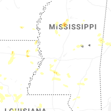
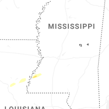


Connect with Interactive Hail Maps