

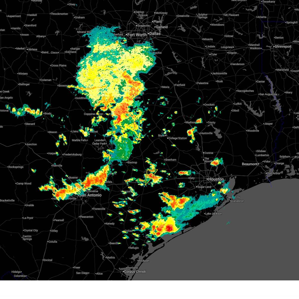
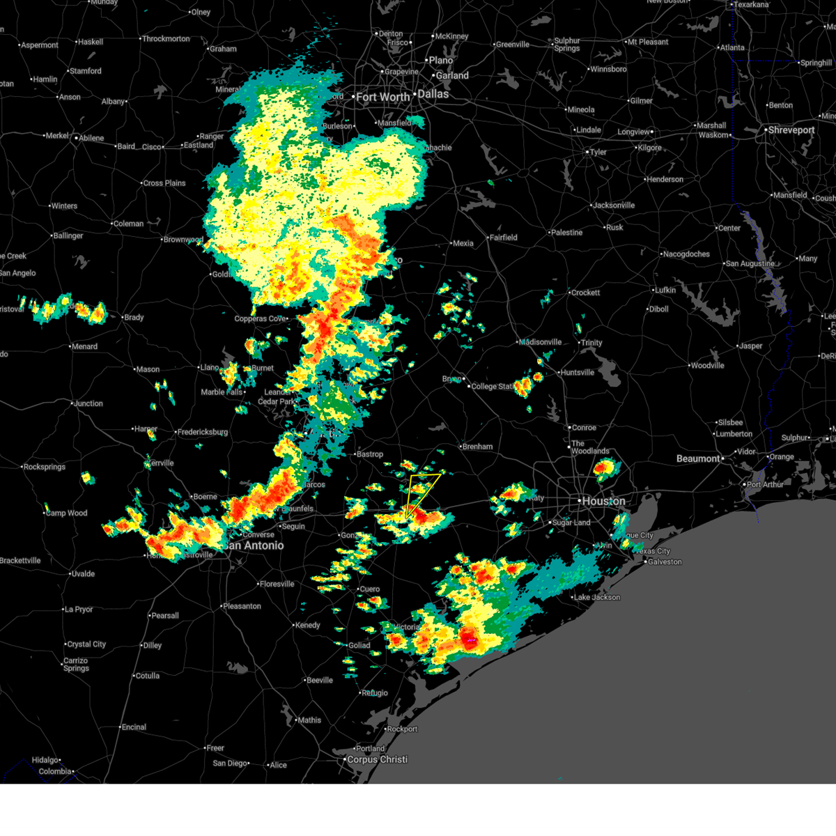
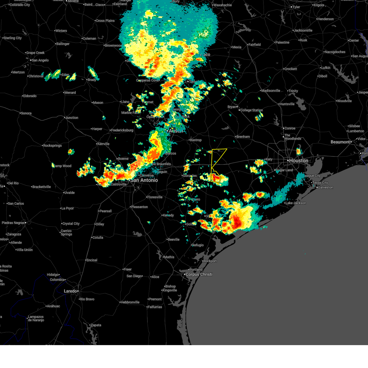
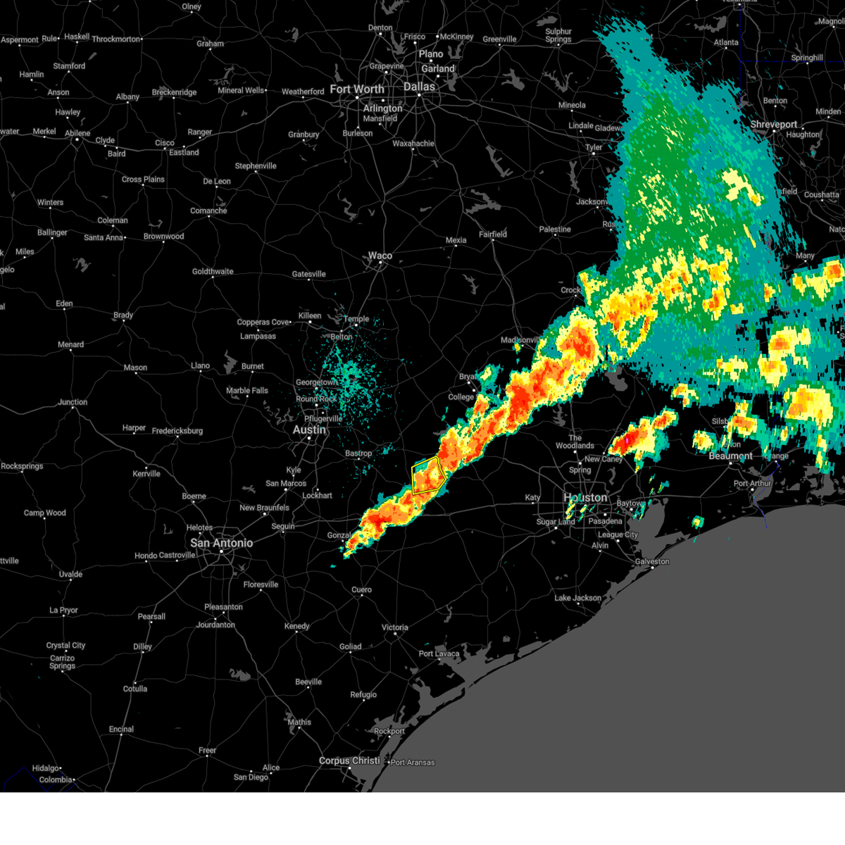
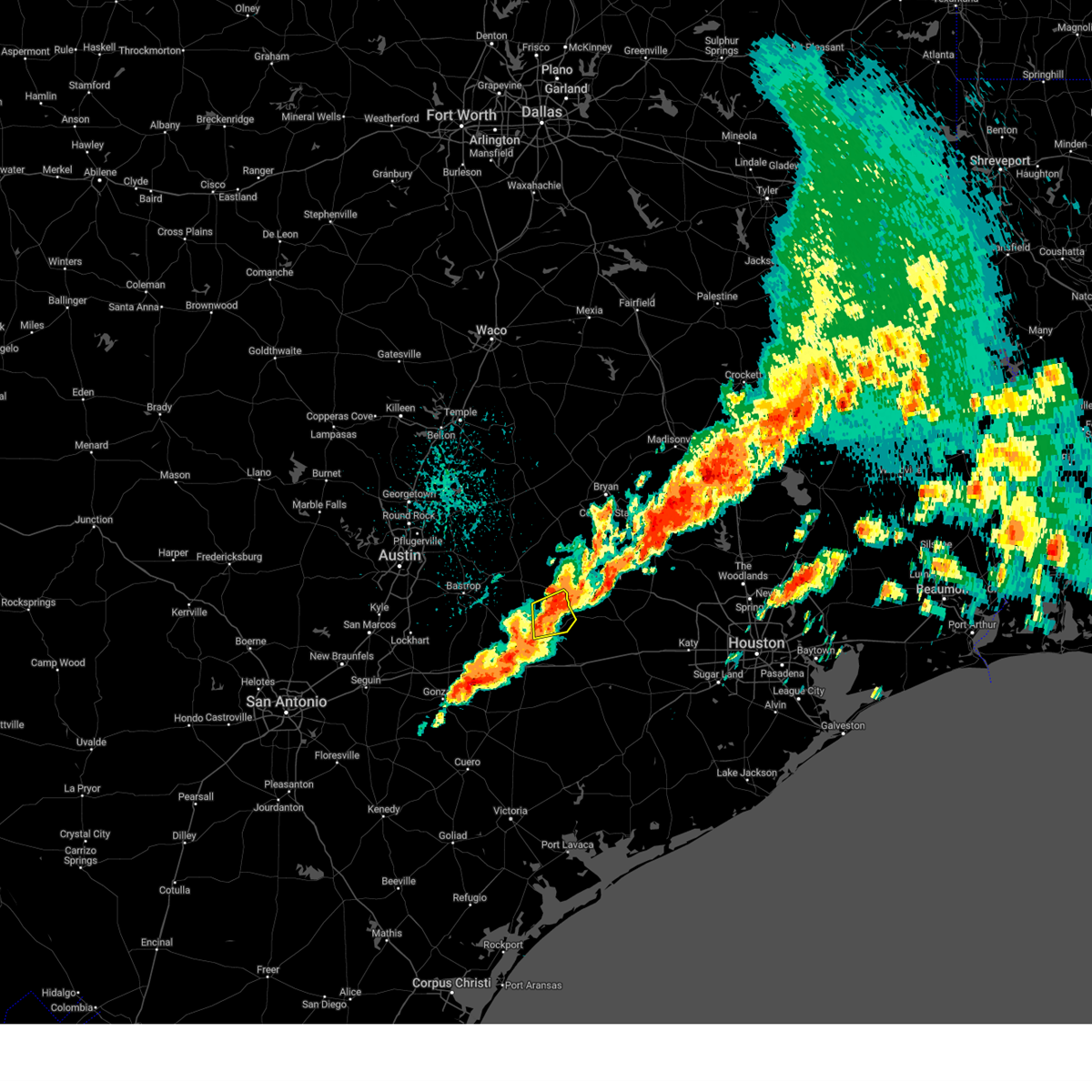
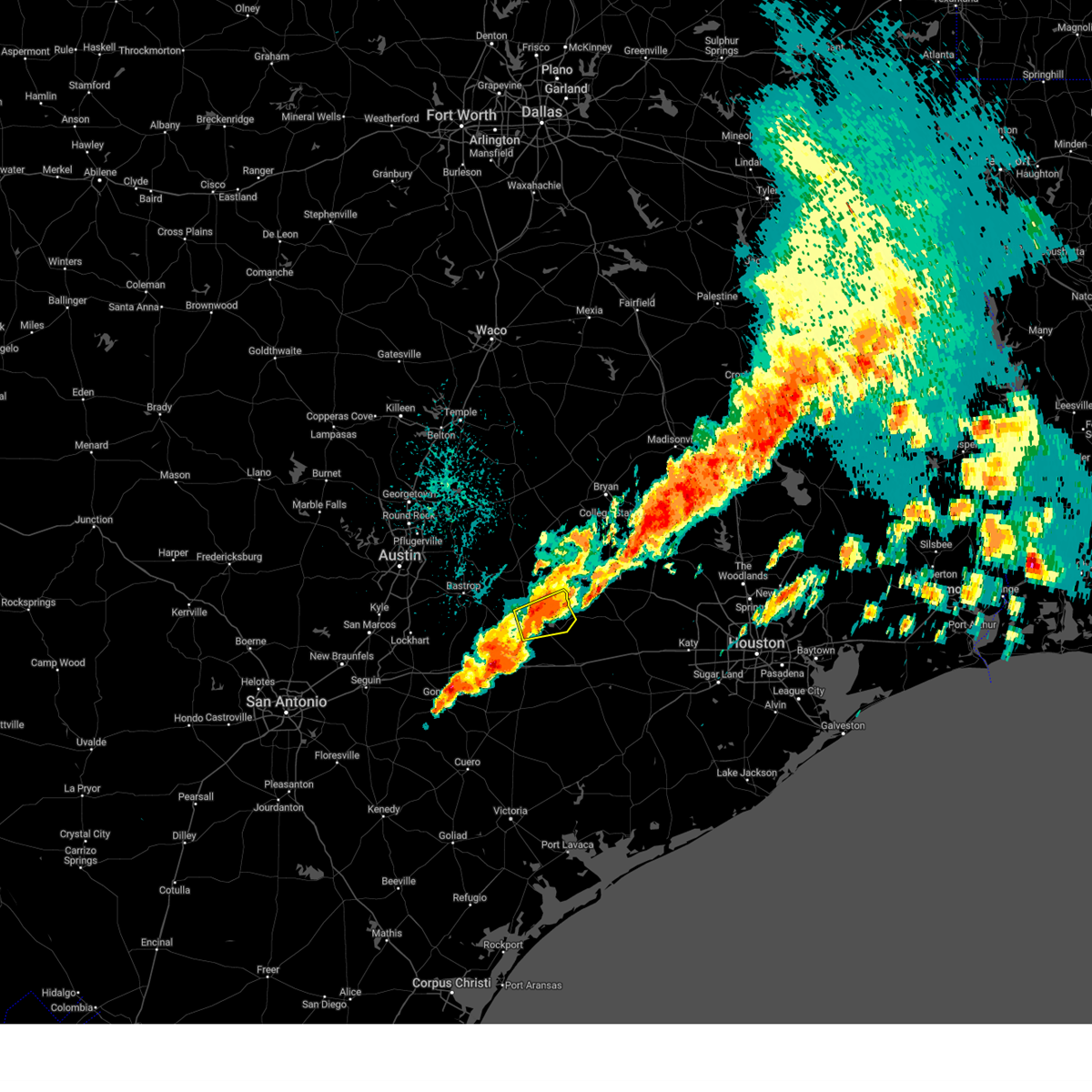
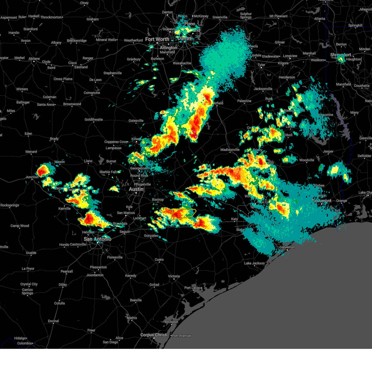
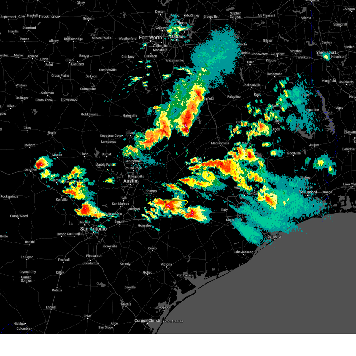
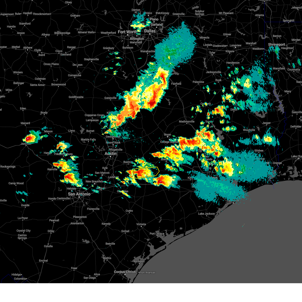
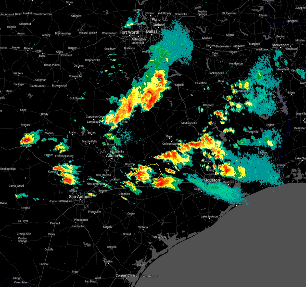
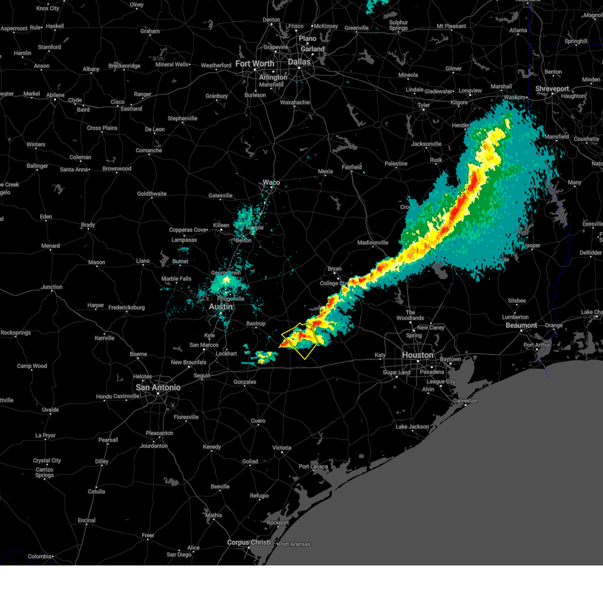
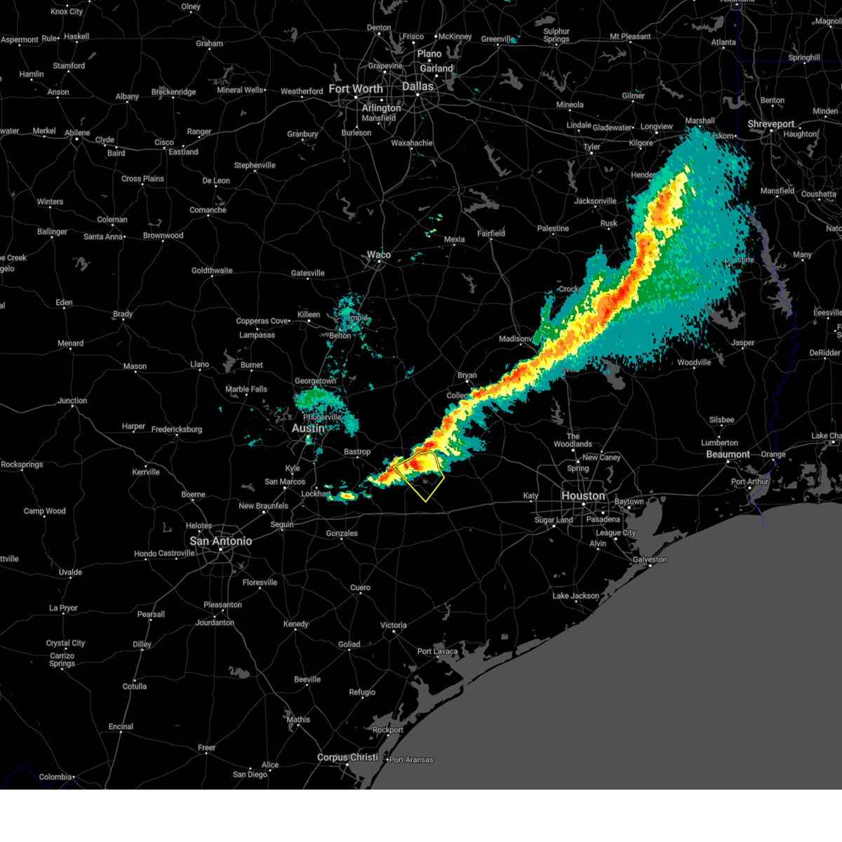
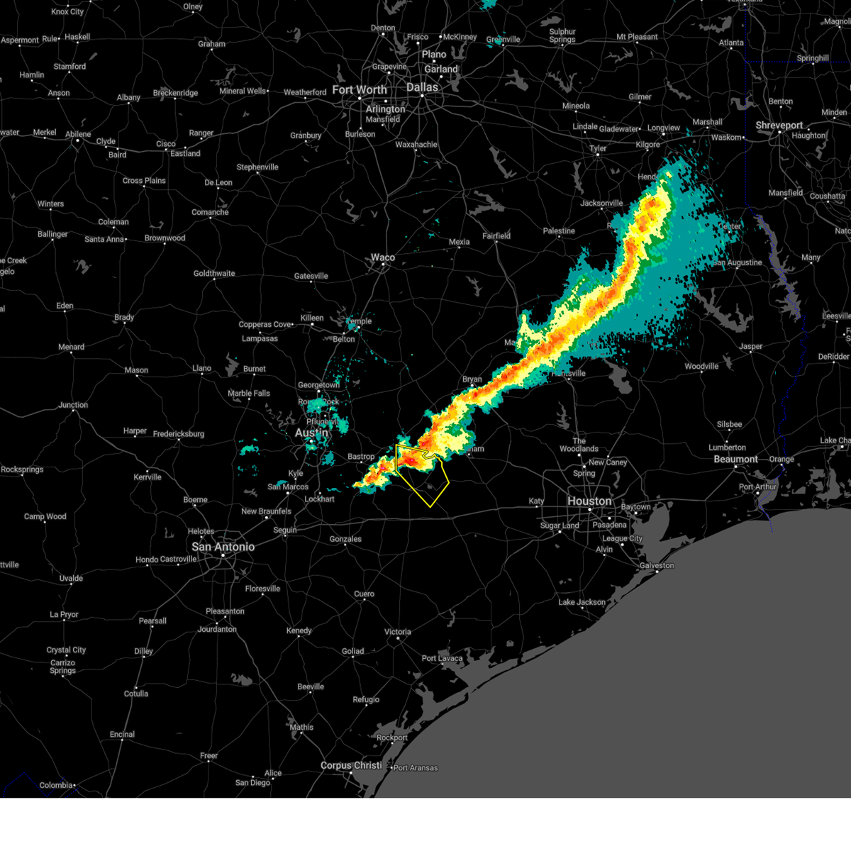
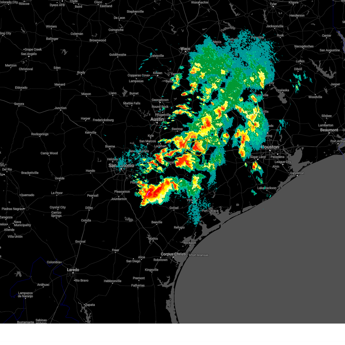
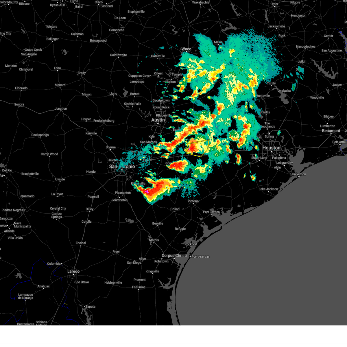
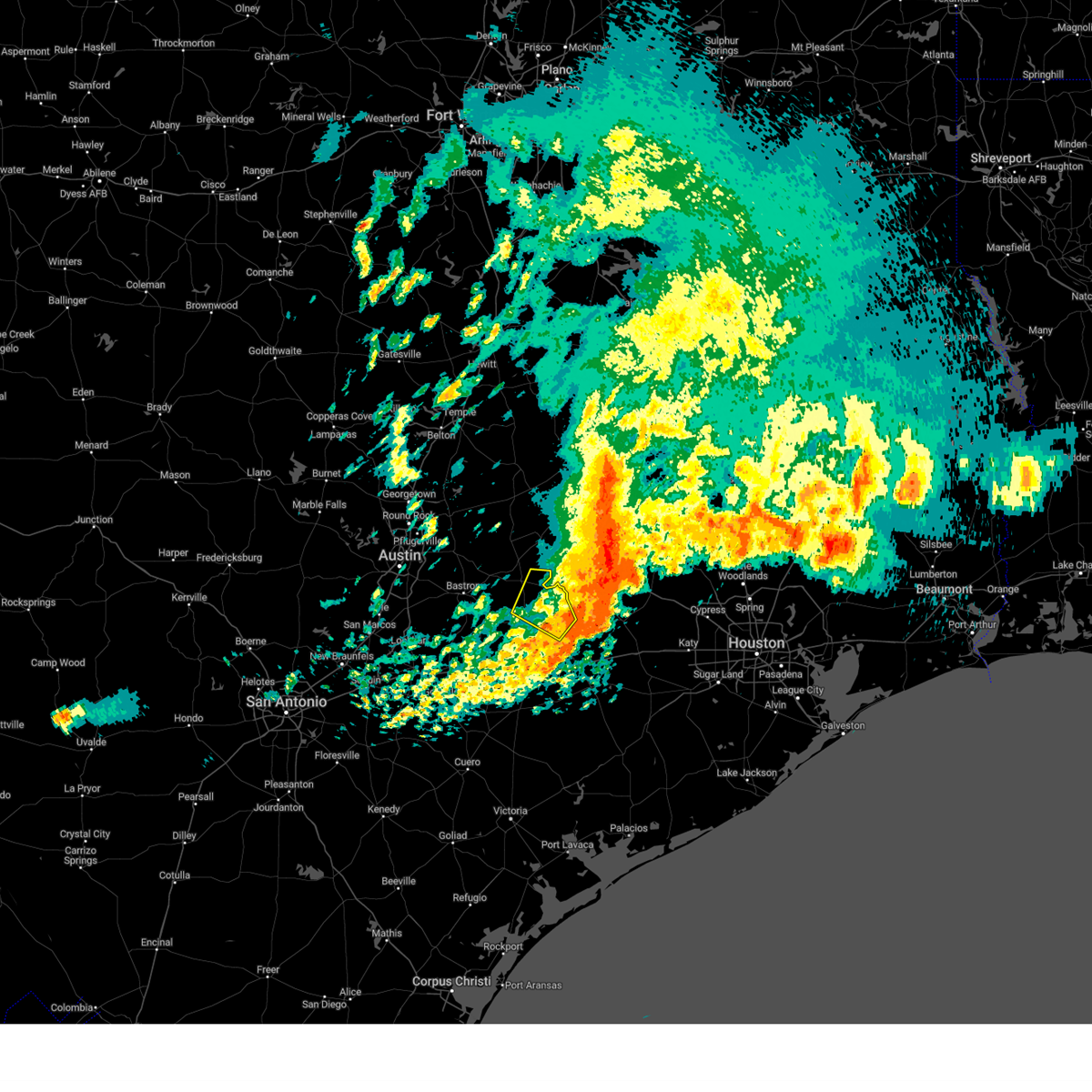
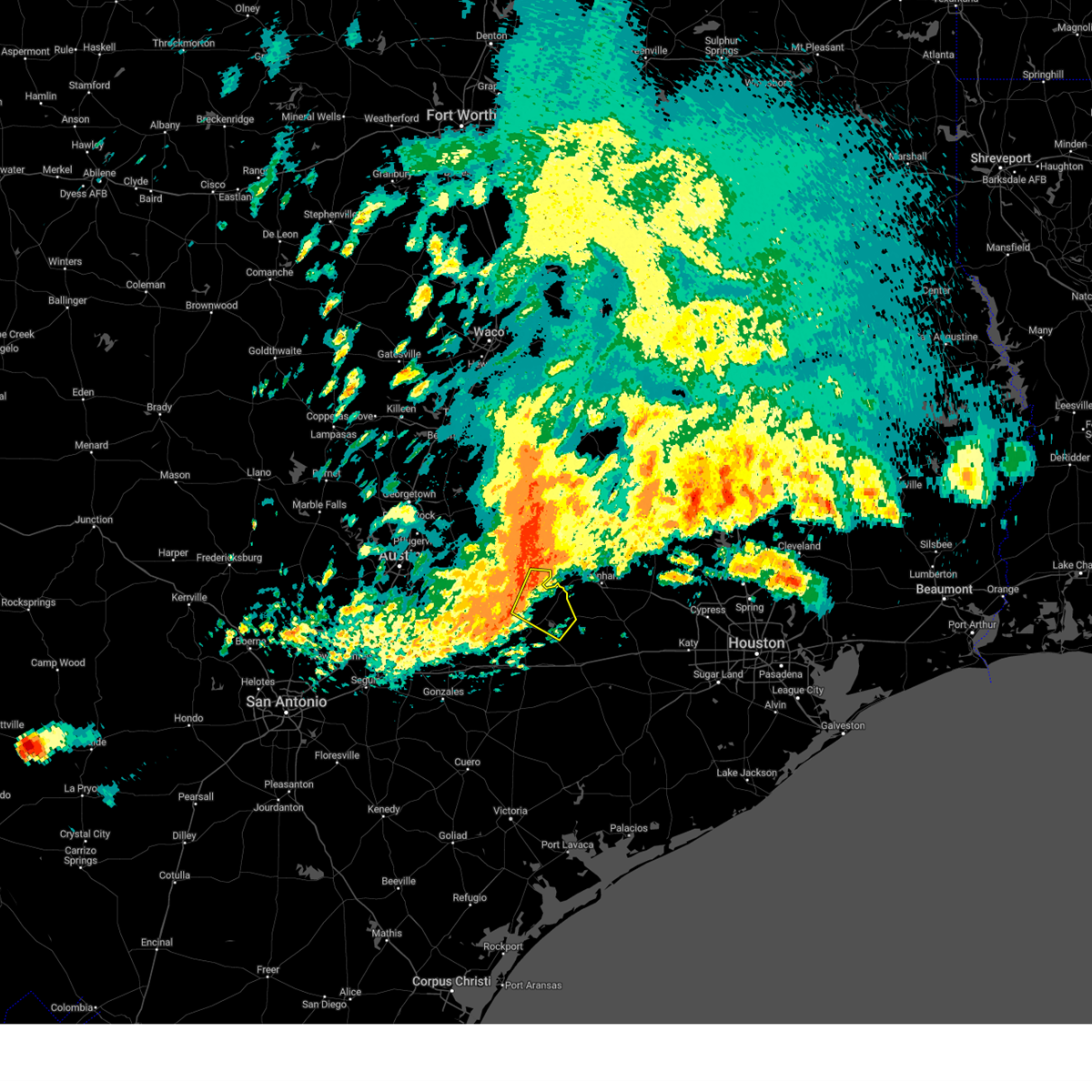
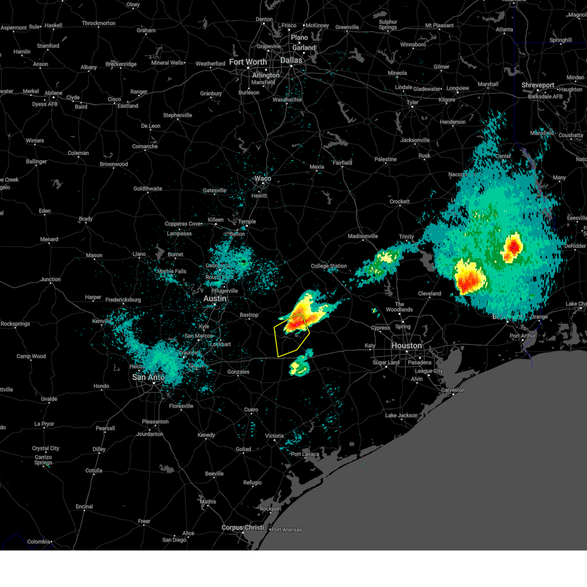
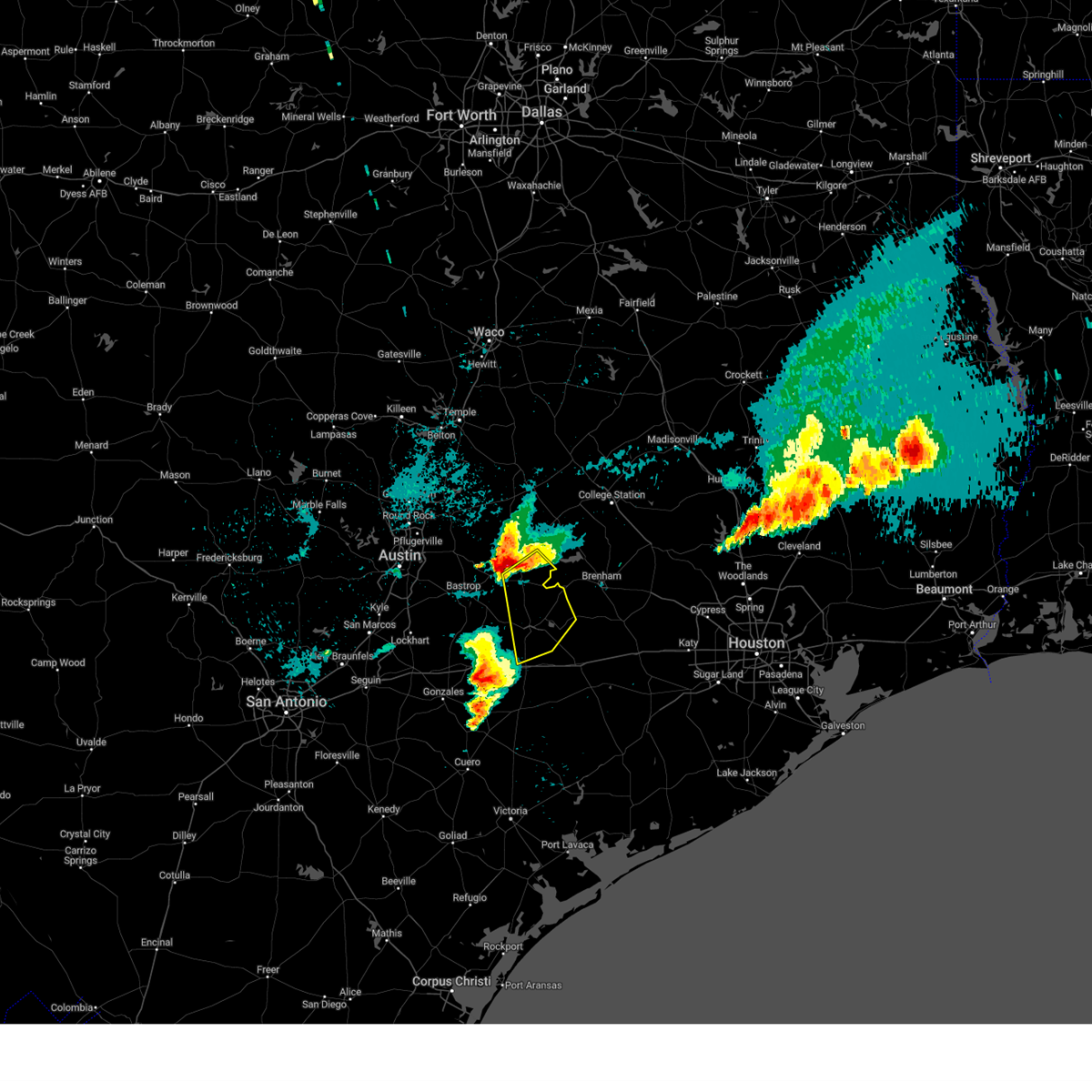
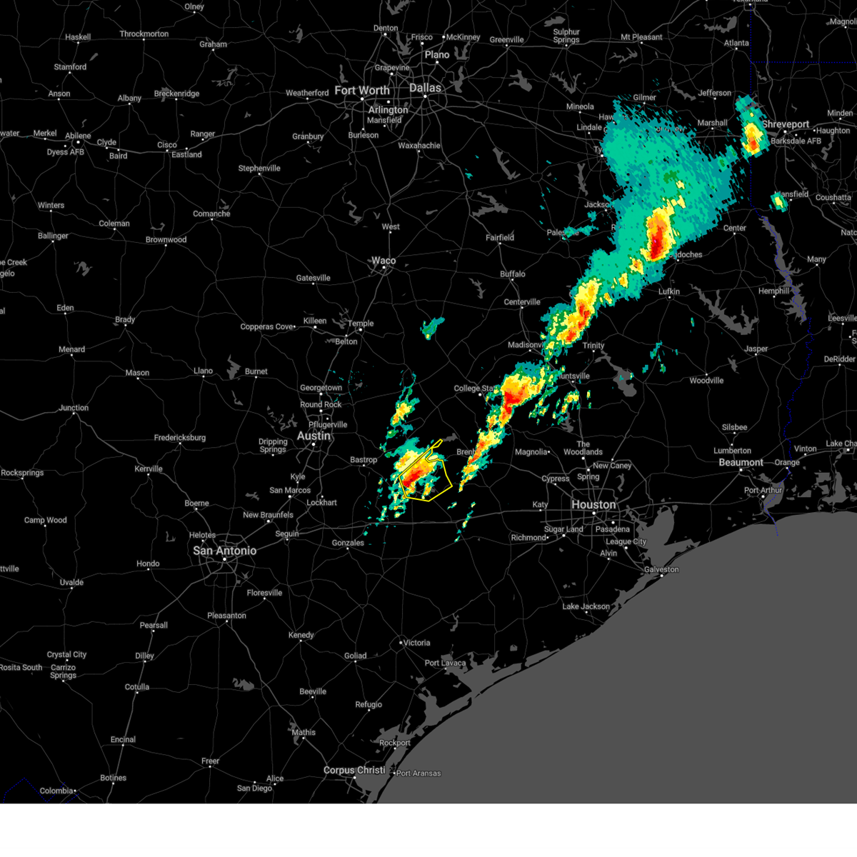
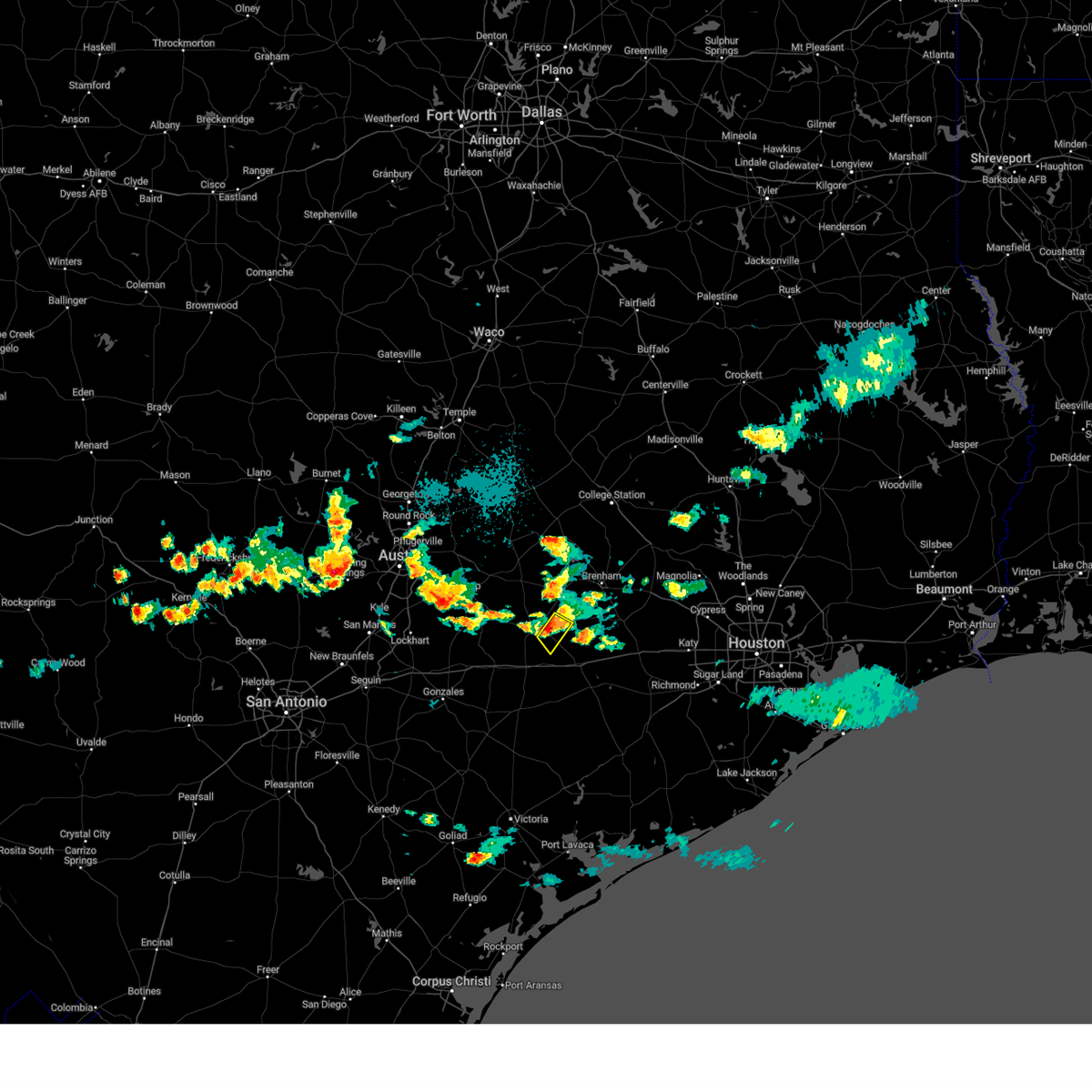
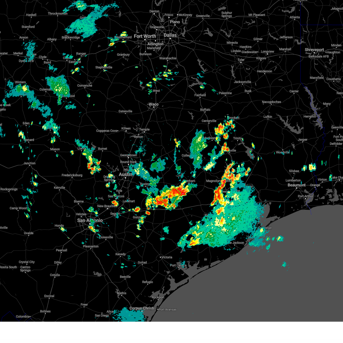
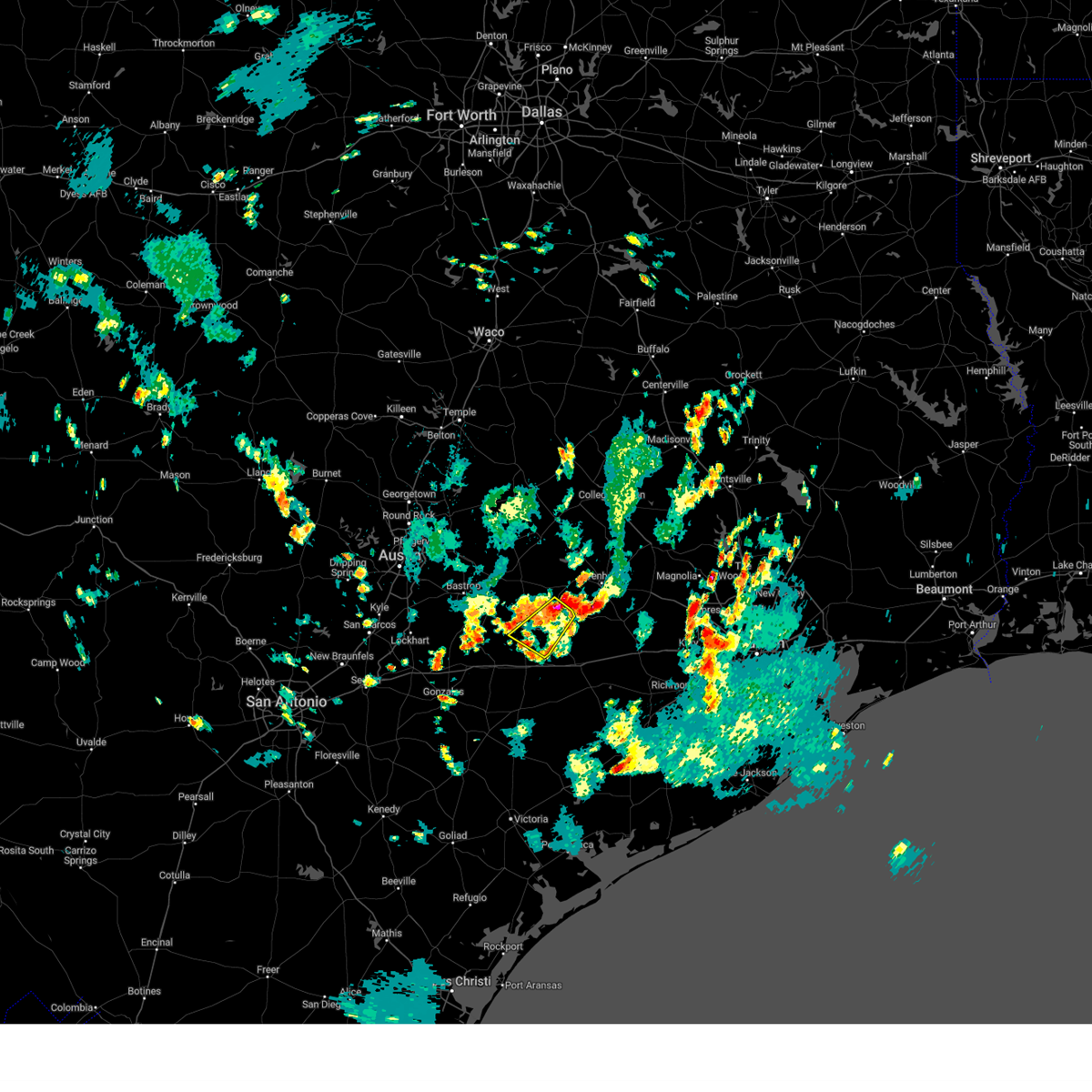
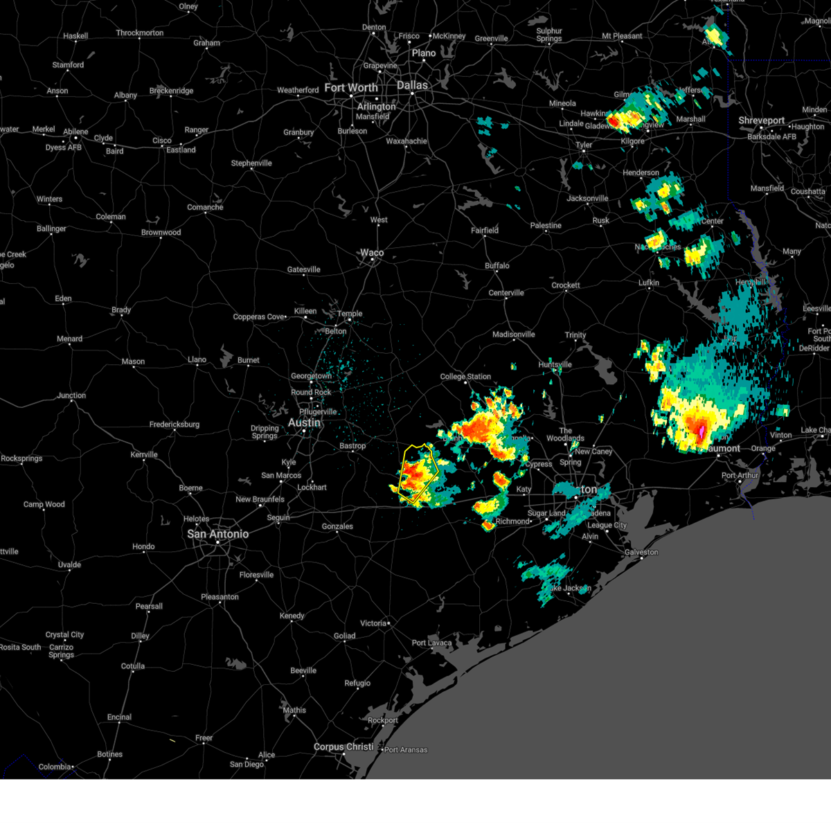
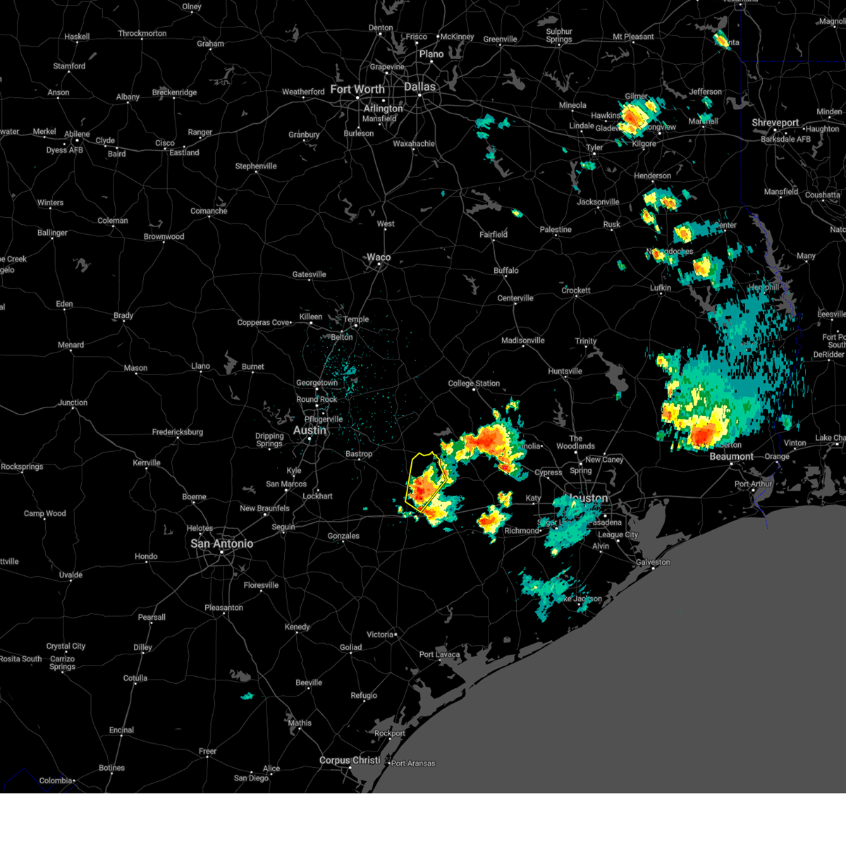
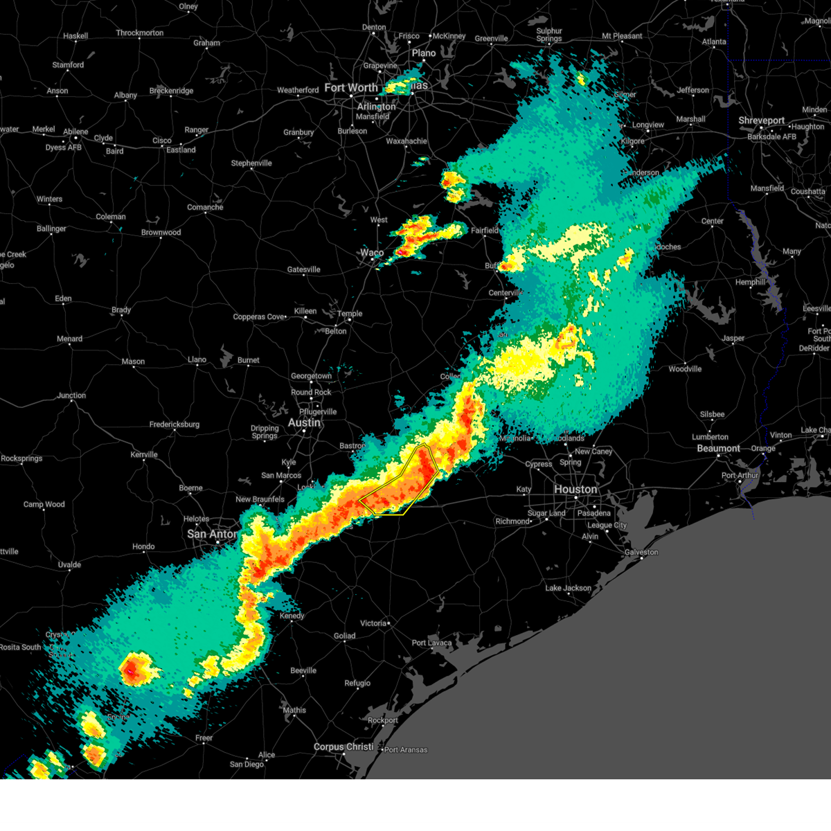
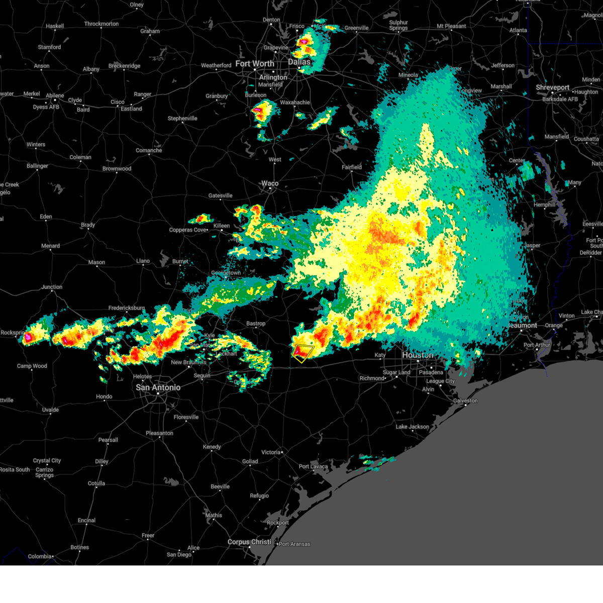
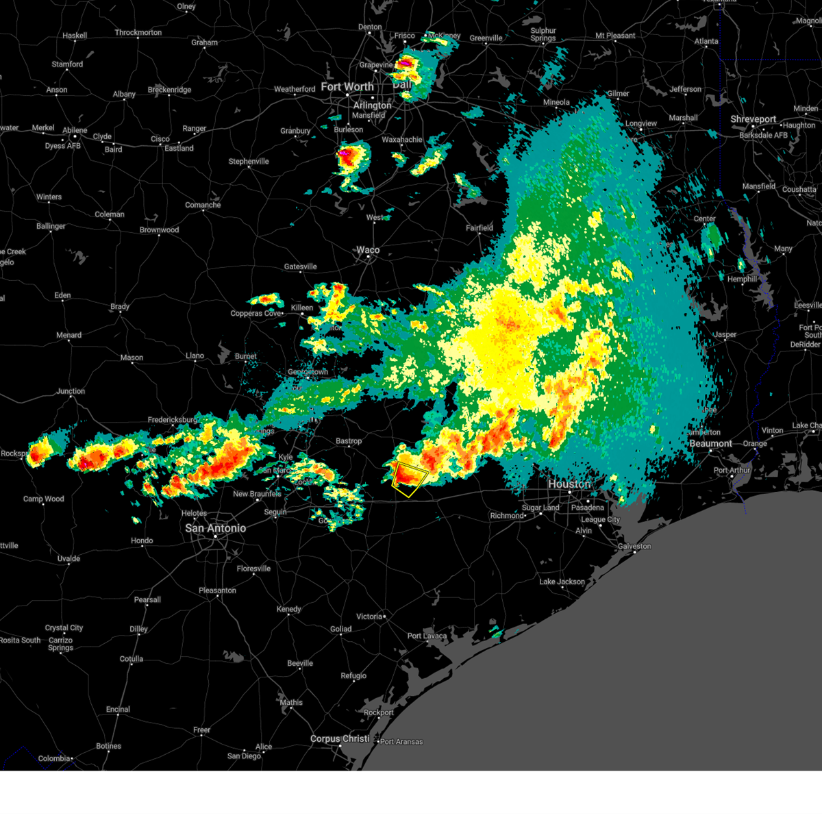
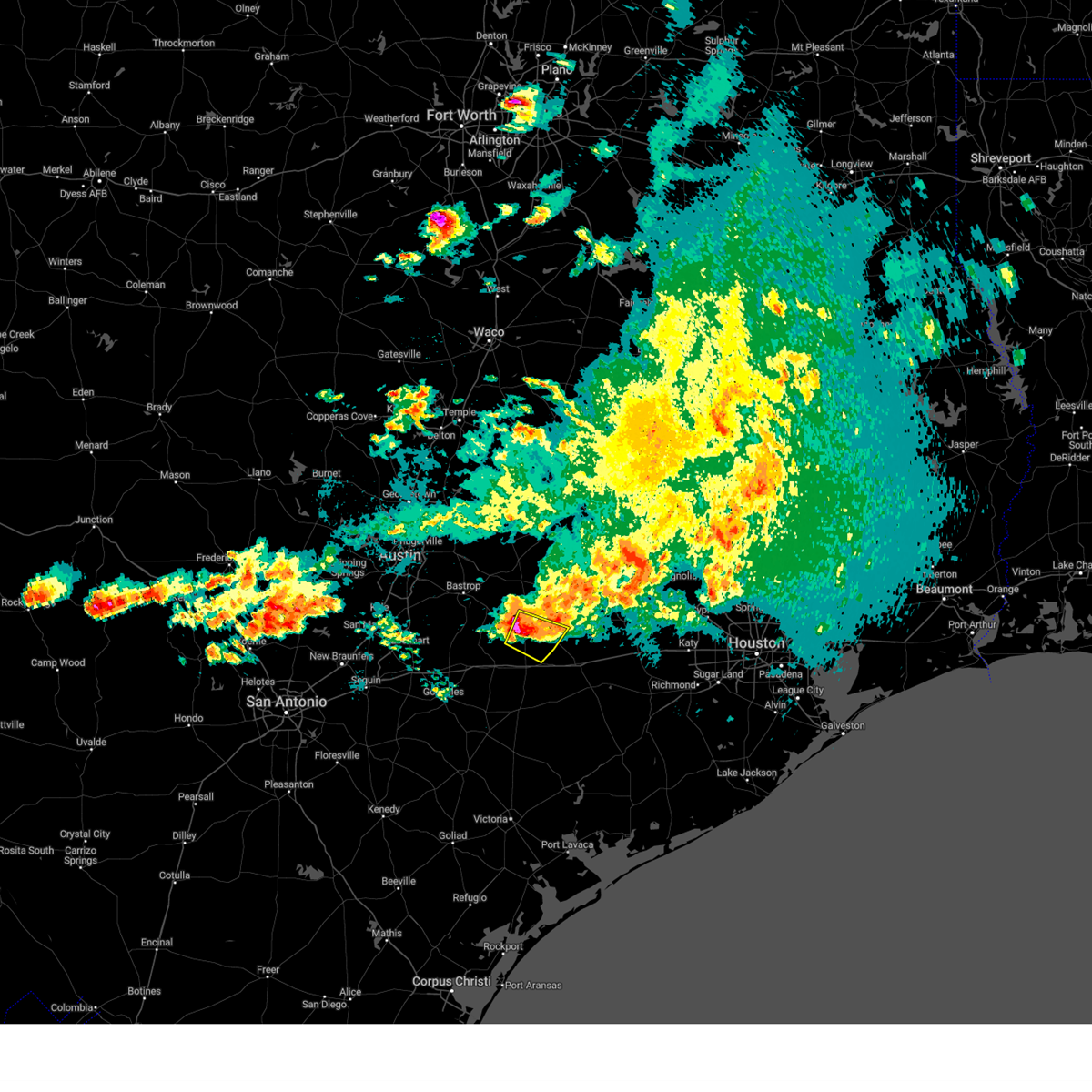
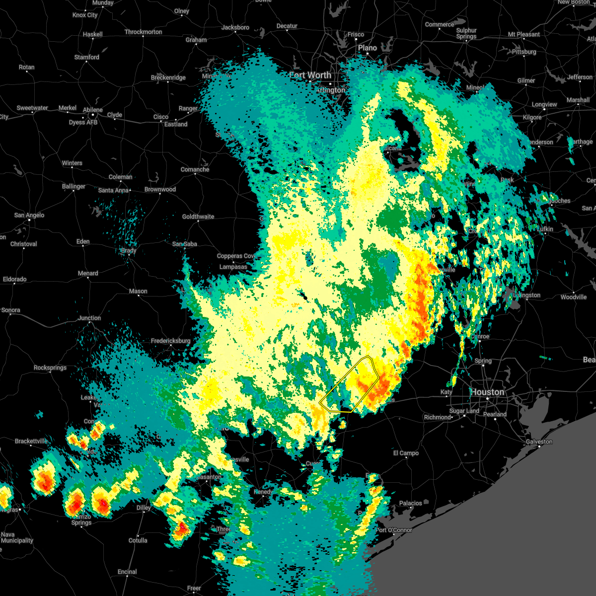
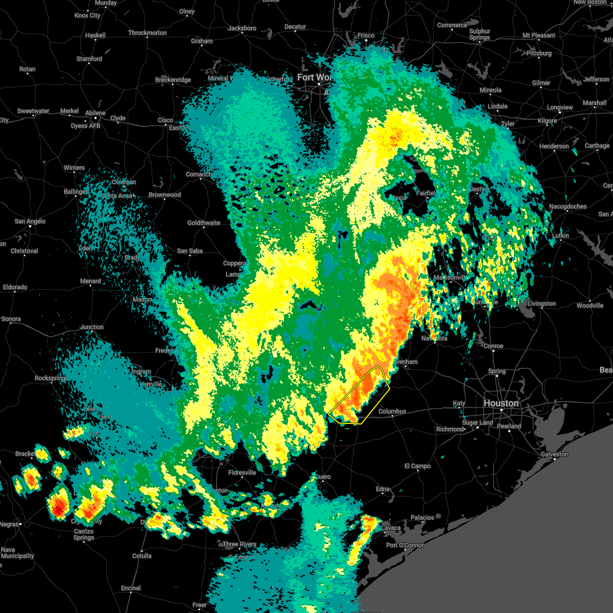
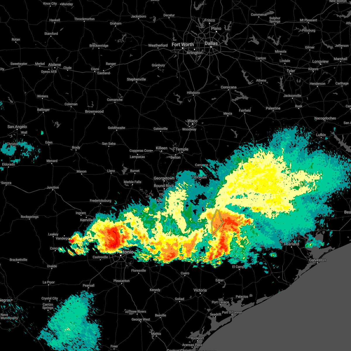
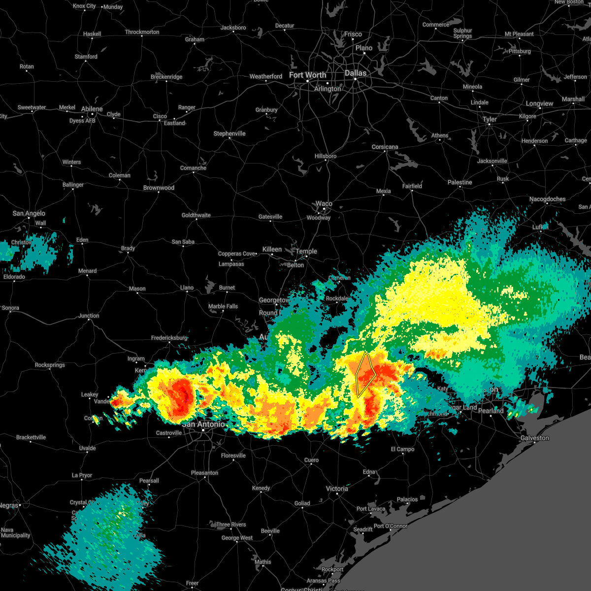
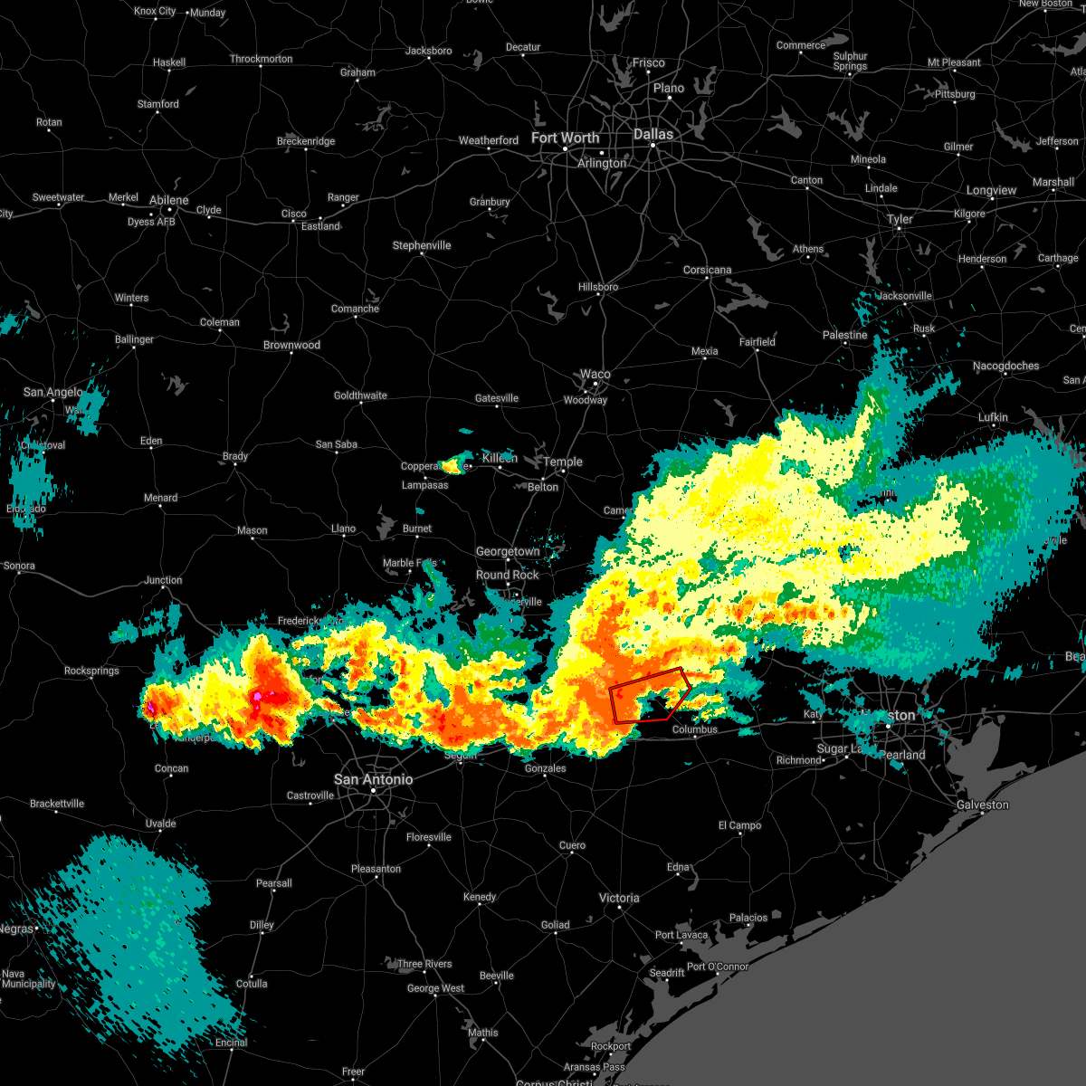
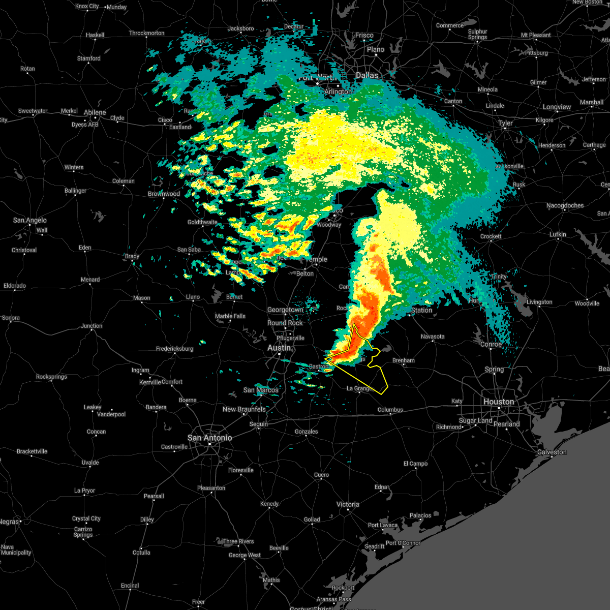
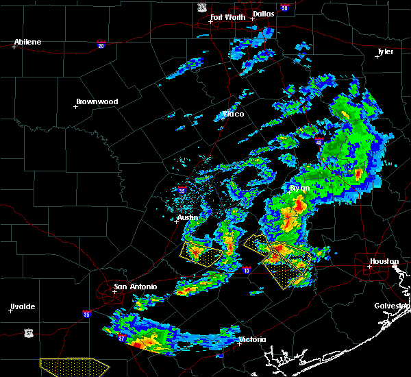
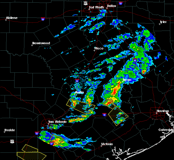
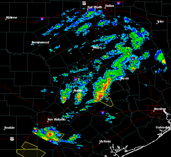
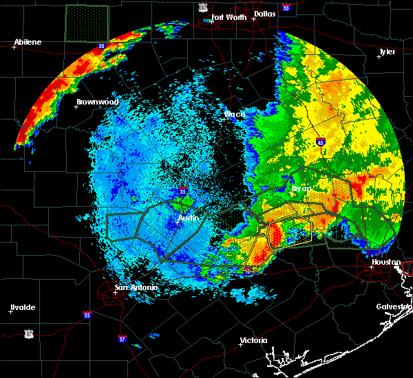
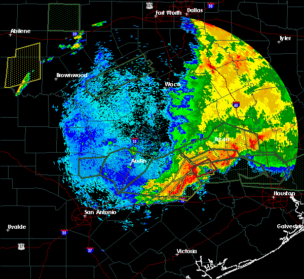
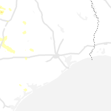
Hail Map for Fayetteville, TX
The Fayetteville, TX area has had 1 report of on-the-ground hail by trained spotters, and has been under severe weather warnings 21 times during the past 12 months. Doppler radar has detected hail at or near Fayetteville, TX on 31 occasions, including 2 occasions during the past year.
| Name: | Fayetteville, TX |
| Where Located: | 79.1 miles W of Houston, TX |
| Map: | Google Map for Fayetteville, TX |
| Population: | 258 |
| Housing Units: | 232 |
| More Info: | Search Google for Fayetteville, TX |
2
The Top Recent Hail Date for Fayetteville, TX is Friday, August 9, 2024 (7th out of 31)

Hail and Wind Damage Spotted near Fayetteville, TX
| Date / Time | Report Details |
|---|---|
| 6/12/2025 2:15 AM CDT |
 the severe thunderstorm warning has been cancelled and is no longer in effect the severe thunderstorm warning has been cancelled and is no longer in effect
|
| 6/12/2025 1:56 AM CDT |
 the severe thunderstorm warning has been cancelled and is no longer in effect the severe thunderstorm warning has been cancelled and is no longer in effect
|
| 6/12/2025 1:56 AM CDT |
 At 156 am cdt, a severe thunderstorm was located near weimar, or 8 miles east of schulenburg, moving north at 45 mph (radar indicated). Hazards include 60 mph wind gusts and half dollar size hail. Hail damage to vehicles is expected. expect wind damage to roofs, siding, and trees. Locations impacted include, fayetteville, ellinger, dubina, rutersville, rek hill, mullins prairie, and holman. At 156 am cdt, a severe thunderstorm was located near weimar, or 8 miles east of schulenburg, moving north at 45 mph (radar indicated). Hazards include 60 mph wind gusts and half dollar size hail. Hail damage to vehicles is expected. expect wind damage to roofs, siding, and trees. Locations impacted include, fayetteville, ellinger, dubina, rutersville, rek hill, mullins prairie, and holman.
|
| 6/12/2025 1:41 AM CDT |
 Svrewx the national weather service in austin san antonio has issued a * severe thunderstorm warning for, southeastern fayette county in south central texas, northeastern lavaca county in south central texas, * until 230 am cdt. * at 141 am cdt, a severe thunderstorm was located over sublime, or 8 miles east of hallettsville, moving north at 40 mph (radar indicated). Hazards include 60 mph wind gusts and half dollar size hail. Hail damage to vehicles is expected. Expect wind damage to roofs, siding, and trees. Svrewx the national weather service in austin san antonio has issued a * severe thunderstorm warning for, southeastern fayette county in south central texas, northeastern lavaca county in south central texas, * until 230 am cdt. * at 141 am cdt, a severe thunderstorm was located over sublime, or 8 miles east of hallettsville, moving north at 40 mph (radar indicated). Hazards include 60 mph wind gusts and half dollar size hail. Hail damage to vehicles is expected. Expect wind damage to roofs, siding, and trees.
|
| 5/6/2025 4:55 PM CDT |
 The storm which prompted the warning has weakened below severe limits, and has exited the warned area. therefore, the warning will be allowed to expire. however small hail, gusty winds and heavy rain are still possible with this thunderstorm. a tornado watch remains in effect until 600 pm cdt for south central texas. The storm which prompted the warning has weakened below severe limits, and has exited the warned area. therefore, the warning will be allowed to expire. however small hail, gusty winds and heavy rain are still possible with this thunderstorm. a tornado watch remains in effect until 600 pm cdt for south central texas.
|
| 5/6/2025 4:40 PM CDT |
 At 439 pm cdt, a severe thunderstorm was located over round top, or 13 miles northeast of la grange, moving northeast at 35 mph (radar indicated). Hazards include 60 mph wind gusts and quarter size hail. Hail damage to vehicles is expected. expect wind damage to roofs, siding, and trees. Locations impacted include, fayetteville, round top, walhalla, willow springs, rutersville, warrenton, winedale, rek hill, nechanitz, and waldeck. At 439 pm cdt, a severe thunderstorm was located over round top, or 13 miles northeast of la grange, moving northeast at 35 mph (radar indicated). Hazards include 60 mph wind gusts and quarter size hail. Hail damage to vehicles is expected. expect wind damage to roofs, siding, and trees. Locations impacted include, fayetteville, round top, walhalla, willow springs, rutersville, warrenton, winedale, rek hill, nechanitz, and waldeck.
|
| 5/6/2025 4:21 PM CDT |
 At 421 pm cdt, a severe thunderstorm was located over la grange, moving east at 25 mph (radar indicated). Hazards include 60 mph wind gusts and quarter size hail. Hail damage to vehicles is expected. expect wind damage to roofs, siding, and trees. Locations impacted include, la grange, fayetteville, round top, rabbs prairie, walhalla, willow springs, rutersville, warrenton, winedale, rek hill, nechanitz, and waldeck. At 421 pm cdt, a severe thunderstorm was located over la grange, moving east at 25 mph (radar indicated). Hazards include 60 mph wind gusts and quarter size hail. Hail damage to vehicles is expected. expect wind damage to roofs, siding, and trees. Locations impacted include, la grange, fayetteville, round top, rabbs prairie, walhalla, willow springs, rutersville, warrenton, winedale, rek hill, nechanitz, and waldeck.
|
| 5/6/2025 4:01 PM CDT | Svrewx the national weather service in austin san antonio has issued a * severe thunderstorm warning for, northeastern fayette county in south central texas, * until 500 pm cdt. * at 401 pm cdt, a severe thunderstorm was located 7 miles northeast of muldoon, or 8 miles west of la grange, moving east at 25 mph (radar indicated). Hazards include 60 mph wind gusts and quarter size hail. Hail damage to vehicles is expected. Expect wind damage to roofs, siding, and trees. |
| 5/2/2025 4:11 PM CDT | the severe thunderstorm warning has been cancelled and is no longer in effect |
| 5/2/2025 4:04 PM CDT | At 404 pm cdt, a severe thunderstorm was located over la grange, moving east at 20 mph (public). Hazards include 60 mph wind gusts and quarter size hail. Hail damage to vehicles is expected. expect wind damage to roofs, siding, and trees. Locations impacted include, la grange, fayetteville, rabbs prairie, plum, willow springs, rutersville, rek hill, and mullins prairie. |
| 5/2/2025 3:57 PM CDT |
 At 356 pm cdt, a severe thunderstorm was located over la grange, moving east at 20 mph (radar indicated). Hazards include golf ball size hail and 60 mph wind gusts. People and animals outdoors will be injured. expect hail damage to roofs, siding, windows, and vehicles. expect wind damage to roofs, siding, and trees. Locations impacted include, la grange, fayetteville, muldoon, rabbs prairie, plum, willow springs, rutersville, rek hill, west point, and mullins prairie. At 356 pm cdt, a severe thunderstorm was located over la grange, moving east at 20 mph (radar indicated). Hazards include golf ball size hail and 60 mph wind gusts. People and animals outdoors will be injured. expect hail damage to roofs, siding, windows, and vehicles. expect wind damage to roofs, siding, and trees. Locations impacted include, la grange, fayetteville, muldoon, rabbs prairie, plum, willow springs, rutersville, rek hill, west point, and mullins prairie.
|
| 5/2/2025 3:57 PM CDT |
 the severe thunderstorm warning has been cancelled and is no longer in effect the severe thunderstorm warning has been cancelled and is no longer in effect
|
| 5/2/2025 3:41 PM CDT |
 At 340 pm cdt, a severe thunderstorm was located 7 miles northeast of muldoon, or 8 miles west of la grange, moving east at 15 mph (radar indicated). Hazards include two inch hail and 60 mph wind gusts. People and animals outdoors will be injured. expect hail damage to roofs, siding, windows, and vehicles. expect wind damage to roofs, siding, and trees. Locations impacted include, la grange, smithville, fayetteville, muldoon, rutersville, warrenton, rabbs prairie, plum, walhalla, willow springs, rek hill, west point, winchester, mullins prairie, and kirtley. At 340 pm cdt, a severe thunderstorm was located 7 miles northeast of muldoon, or 8 miles west of la grange, moving east at 15 mph (radar indicated). Hazards include two inch hail and 60 mph wind gusts. People and animals outdoors will be injured. expect hail damage to roofs, siding, windows, and vehicles. expect wind damage to roofs, siding, and trees. Locations impacted include, la grange, smithville, fayetteville, muldoon, rutersville, warrenton, rabbs prairie, plum, walhalla, willow springs, rek hill, west point, winchester, mullins prairie, and kirtley.
|
| 5/2/2025 3:41 PM CDT |
 the severe thunderstorm warning has been cancelled and is no longer in effect the severe thunderstorm warning has been cancelled and is no longer in effect
|
| 5/2/2025 3:25 PM CDT |
 Svrewx the national weather service in austin san antonio has issued a * severe thunderstorm warning for, southeastern bastrop county in south central texas, south central lee county in south central texas, central fayette county in south central texas, * until 430 pm cdt. * at 325 pm cdt, a severe thunderstorm was located near smithville, moving east at 20 mph (radar indicated). Hazards include 60 mph wind gusts and quarter size hail. Hail damage to vehicles is expected. Expect wind damage to roofs, siding, and trees. Svrewx the national weather service in austin san antonio has issued a * severe thunderstorm warning for, southeastern bastrop county in south central texas, south central lee county in south central texas, central fayette county in south central texas, * until 430 pm cdt. * at 325 pm cdt, a severe thunderstorm was located near smithville, moving east at 20 mph (radar indicated). Hazards include 60 mph wind gusts and quarter size hail. Hail damage to vehicles is expected. Expect wind damage to roofs, siding, and trees.
|
| 3/12/2025 8:20 PM CDT |
 the severe thunderstorm warning has been cancelled and is no longer in effect the severe thunderstorm warning has been cancelled and is no longer in effect
|
| 3/12/2025 8:07 PM CDT |
 At 806 pm cdt, a severe thunderstorm was located near round top, or 9 miles northeast of la grange, moving southeast at 30 mph (radar indicated). Hazards include 60 mph wind gusts and quarter size hail. Hail damage to vehicles is expected. expect wind damage to roofs, siding, and trees. Locations impacted include, la grange, fayetteville, round top, carmine, rutersville, warrenton, ledbetter, waldeck, rabbs prairie, ellinger, warda, walhalla, willow springs, winedale, rek hill, and nechanitz. At 806 pm cdt, a severe thunderstorm was located near round top, or 9 miles northeast of la grange, moving southeast at 30 mph (radar indicated). Hazards include 60 mph wind gusts and quarter size hail. Hail damage to vehicles is expected. expect wind damage to roofs, siding, and trees. Locations impacted include, la grange, fayetteville, round top, carmine, rutersville, warrenton, ledbetter, waldeck, rabbs prairie, ellinger, warda, walhalla, willow springs, winedale, rek hill, and nechanitz.
|
| 3/12/2025 8:07 PM CDT |
 the severe thunderstorm warning has been cancelled and is no longer in effect the severe thunderstorm warning has been cancelled and is no longer in effect
|
| 3/12/2025 7:50 PM CDT |
 Svrewx the national weather service in austin san antonio has issued a * severe thunderstorm warning for, southeastern lee county in south central texas, northeastern fayette county in south central texas, * until 830 pm cdt. * at 750 pm cdt, a severe thunderstorm was located near giddings, moving southeast at 40 mph (radar indicated). Hazards include 60 mph wind gusts and quarter size hail. Hail damage to vehicles is expected. Expect wind damage to roofs, siding, and trees. Svrewx the national weather service in austin san antonio has issued a * severe thunderstorm warning for, southeastern lee county in south central texas, northeastern fayette county in south central texas, * until 830 pm cdt. * at 750 pm cdt, a severe thunderstorm was located near giddings, moving southeast at 40 mph (radar indicated). Hazards include 60 mph wind gusts and quarter size hail. Hail damage to vehicles is expected. Expect wind damage to roofs, siding, and trees.
|
| 12/24/2024 11:02 PM CST |
 At 1102 pm cst, a severe thunderstorm was located 7 miles north of schulenburg, moving east at 15 mph (radar indicated). Hazards include 60 mph wind gusts and quarter size hail. Hail damage to vehicles is expected. expect wind damage to roofs, siding, and trees. Locations impacted include, la grange, schulenburg, fayetteville, muldoon, swiss alp, freyburg, dubina, rutersville, high hill, o'quinn, floy, ellinger, ammannsville, mullins prairie, and holman. At 1102 pm cst, a severe thunderstorm was located 7 miles north of schulenburg, moving east at 15 mph (radar indicated). Hazards include 60 mph wind gusts and quarter size hail. Hail damage to vehicles is expected. expect wind damage to roofs, siding, and trees. Locations impacted include, la grange, schulenburg, fayetteville, muldoon, swiss alp, freyburg, dubina, rutersville, high hill, o'quinn, floy, ellinger, ammannsville, mullins prairie, and holman.
|
| 12/24/2024 10:27 PM CST |
 Svrewx the national weather service in austin san antonio has issued a * severe thunderstorm warning for, southern fayette county in south central texas, * until 1130 pm cst. * at 1026 pm cst, a severe thunderstorm was located over muldoon, or 8 miles north of flatonia, moving east at 15 mph (radar indicated). Hazards include 60 mph wind gusts and half dollar size hail. Hail damage to vehicles is expected. Expect wind damage to roofs, siding, and trees. Svrewx the national weather service in austin san antonio has issued a * severe thunderstorm warning for, southern fayette county in south central texas, * until 1130 pm cst. * at 1026 pm cst, a severe thunderstorm was located over muldoon, or 8 miles north of flatonia, moving east at 15 mph (radar indicated). Hazards include 60 mph wind gusts and half dollar size hail. Hail damage to vehicles is expected. Expect wind damage to roofs, siding, and trees.
|
| 5/16/2024 5:23 PM CDT |
 The storm which prompted the warning has weakened below severe limits, and has exited the warned area. therefore, the warning will be allowed to expire. however gusty winds remain possible behind this thunderstorm. The storm which prompted the warning has weakened below severe limits, and has exited the warned area. therefore, the warning will be allowed to expire. however gusty winds remain possible behind this thunderstorm.
|
| 5/16/2024 4:52 PM CDT |
 At 451 pm cdt, a severe thunderstorm was located 7 miles southeast of giddings, moving east at 50 mph (radar indicated). Hazards include 60 mph wind gusts. Expect damage to roofs, siding, and trees. Locations impacted include, giddings, la grange, fayetteville, round top, carmine, rutersville, warrenton, ledbetter, waldeck, rabbs prairie, warda, walhalla, willow springs, winedale, rek hill, and nechanitz. At 451 pm cdt, a severe thunderstorm was located 7 miles southeast of giddings, moving east at 50 mph (radar indicated). Hazards include 60 mph wind gusts. Expect damage to roofs, siding, and trees. Locations impacted include, giddings, la grange, fayetteville, round top, carmine, rutersville, warrenton, ledbetter, waldeck, rabbs prairie, warda, walhalla, willow springs, winedale, rek hill, and nechanitz.
|
| 5/16/2024 4:52 PM CDT |
 the severe thunderstorm warning has been cancelled and is no longer in effect the severe thunderstorm warning has been cancelled and is no longer in effect
|
| 5/16/2024 4:35 PM CDT |
 Svrewx the national weather service in austin san antonio has issued a * severe thunderstorm warning for, east central bastrop county in south central texas, southeastern lee county in south central texas, northeastern fayette county in south central texas, * until 530 pm cdt. * at 435 pm cdt, a severe thunderstorm was located near paige, or 9 miles west of giddings, moving east at 50 mph (radar indicated). Hazards include 60 mph wind gusts. expect damage to roofs, siding, and trees Svrewx the national weather service in austin san antonio has issued a * severe thunderstorm warning for, east central bastrop county in south central texas, southeastern lee county in south central texas, northeastern fayette county in south central texas, * until 530 pm cdt. * at 435 pm cdt, a severe thunderstorm was located near paige, or 9 miles west of giddings, moving east at 50 mph (radar indicated). Hazards include 60 mph wind gusts. expect damage to roofs, siding, and trees
|
| 5/9/2024 10:38 PM CDT |
 At 1036 pm cdt, a severe thunderstorm was located over round top, or 14 miles northeast of la grange, moving southeast at 30 mph (radar indicated). Hazards include two inch hail and 60 mph wind gusts. People and animals outdoors will be injured. expect hail damage to roofs, siding, windows, and vehicles. expect wind damage to roofs, siding, and trees. Locations impacted include, la grange, fayetteville, round top, carmine, swiss alp, freyburg, rutersville, warrenton, high hill, waldeck, rabbs prairie, ellinger, warda, plum, walhalla, willow springs, ammannsville, winedale, rek hill, and mullins prairie. At 1036 pm cdt, a severe thunderstorm was located over round top, or 14 miles northeast of la grange, moving southeast at 30 mph (radar indicated). Hazards include two inch hail and 60 mph wind gusts. People and animals outdoors will be injured. expect hail damage to roofs, siding, windows, and vehicles. expect wind damage to roofs, siding, and trees. Locations impacted include, la grange, fayetteville, round top, carmine, swiss alp, freyburg, rutersville, warrenton, high hill, waldeck, rabbs prairie, ellinger, warda, plum, walhalla, willow springs, ammannsville, winedale, rek hill, and mullins prairie.
|
| 5/9/2024 10:38 PM CDT |
 the severe thunderstorm warning has been cancelled and is no longer in effect the severe thunderstorm warning has been cancelled and is no longer in effect
|
| 5/9/2024 10:04 PM CDT |
 Svrewx the national weather service in austin san antonio has issued a * severe thunderstorm warning for, southeastern lee county in south central texas, eastern fayette county in south central texas, * until 1100 pm cdt. * at 1003 pm cdt, a severe thunderstorm was located over giddings, moving southeast at 35 mph (radar indicated). Hazards include two inch hail and 60 mph wind gusts. People and animals outdoors will be injured. expect hail damage to roofs, siding, windows, and vehicles. Expect wind damage to roofs, siding, and trees. Svrewx the national weather service in austin san antonio has issued a * severe thunderstorm warning for, southeastern lee county in south central texas, eastern fayette county in south central texas, * until 1100 pm cdt. * at 1003 pm cdt, a severe thunderstorm was located over giddings, moving southeast at 35 mph (radar indicated). Hazards include two inch hail and 60 mph wind gusts. People and animals outdoors will be injured. expect hail damage to roofs, siding, windows, and vehicles. Expect wind damage to roofs, siding, and trees.
|
| 2/11/2024 8:59 AM CST | Half Dollar sized hail reported 8.5 miles SE of Fayetteville, TX, report from mping half dollar (1.25 in.). |
| 2/11/2024 8:43 AM CST |
 At 842 am cst, a severe thunderstorm was located 7 miles north of la grange, moving east at 40 mph (radar indicated). Hazards include ping pong ball size hail. People and animals outdoors will be injured. expect damage to roofs, siding, windows, and vehicles. Locations impacted include, la grange, fayetteville, round top, lake somerville state park & trailway, carmine, rutersville, warrenton, ledbetter, waldeck, rabbs prairie, warda, plum, walhalla, willow springs, winedale, rek hill, and nechanitz. At 842 am cst, a severe thunderstorm was located 7 miles north of la grange, moving east at 40 mph (radar indicated). Hazards include ping pong ball size hail. People and animals outdoors will be injured. expect damage to roofs, siding, windows, and vehicles. Locations impacted include, la grange, fayetteville, round top, lake somerville state park & trailway, carmine, rutersville, warrenton, ledbetter, waldeck, rabbs prairie, warda, plum, walhalla, willow springs, winedale, rek hill, and nechanitz.
|
| 2/11/2024 8:30 AM CST |
 At 830 am cst, a severe thunderstorm was located 8 miles east of smithville, moving east at 40 mph (radar indicated). Hazards include ping pong ball size hail. People and animals outdoors will be injured. expect damage to roofs, siding, windows, and vehicles. Locations impacted include, giddings, la grange, smithville, fayetteville, round top, muldoon, lake somerville state park & trailway, carmine, swiss alp, northrup, rutersville, warrenton, ledbetter, waldeck, plum, ammannsville, mullins prairie, nechanitz, serbin, and o`quinn. At 830 am cst, a severe thunderstorm was located 8 miles east of smithville, moving east at 40 mph (radar indicated). Hazards include ping pong ball size hail. People and animals outdoors will be injured. expect damage to roofs, siding, windows, and vehicles. Locations impacted include, giddings, la grange, smithville, fayetteville, round top, muldoon, lake somerville state park & trailway, carmine, swiss alp, northrup, rutersville, warrenton, ledbetter, waldeck, plum, ammannsville, mullins prairie, nechanitz, serbin, and o`quinn.
|
| 2/11/2024 8:19 AM CST |
 At 819 am cst, a severe thunderstorm was located near smithville, moving east at 40 mph (radar indicated). Hazards include half dollar size hail. Damage to vehicles is expected. locations impacted include, giddings, la grange, smithville, fayetteville, round top, muldoon, cistern, lake somerville state park & trailway, carmine, swiss alp, northrup, rutersville, warrenton, ledbetter, waldeck, plum, ammannsville, mullins prairie, nechanitz, and serbin. hail threat, radar indicated max hail size, 1. 25 in wind threat, radar indicated max wind gust, <50 mph. At 819 am cst, a severe thunderstorm was located near smithville, moving east at 40 mph (radar indicated). Hazards include half dollar size hail. Damage to vehicles is expected. locations impacted include, giddings, la grange, smithville, fayetteville, round top, muldoon, cistern, lake somerville state park & trailway, carmine, swiss alp, northrup, rutersville, warrenton, ledbetter, waldeck, plum, ammannsville, mullins prairie, nechanitz, and serbin. hail threat, radar indicated max hail size, 1. 25 in wind threat, radar indicated max wind gust, <50 mph.
|
| 2/11/2024 8:09 AM CST |
 At 809 am cst, a severe thunderstorm was located near rosanky, or 9 miles southwest of smithville, moving east at 40 mph (radar indicated). Hazards include quarter size hail. damage to vehicles is expected At 809 am cst, a severe thunderstorm was located near rosanky, or 9 miles southwest of smithville, moving east at 40 mph (radar indicated). Hazards include quarter size hail. damage to vehicles is expected
|
| 9/14/2023 5:44 PM CDT |
 At 544 pm cdt, a severe thunderstorm was located over fayetteville, or 10 miles east of la grange, moving southeast at 15 mph (radar indicated). Hazards include 60 mph wind gusts and quarter size hail. Hail damage to vehicles is expected. Expect wind damage to roofs, siding, and trees. At 544 pm cdt, a severe thunderstorm was located over fayetteville, or 10 miles east of la grange, moving southeast at 15 mph (radar indicated). Hazards include 60 mph wind gusts and quarter size hail. Hail damage to vehicles is expected. Expect wind damage to roofs, siding, and trees.
|
| 6/5/2023 4:45 PM CDT |
 At 445 pm cdt, a severe thunderstorm was located near fayetteville, or near la grange, moving southwest at 15 mph (radar indicated). Hazards include 60 mph wind gusts and quarter size hail. Hail damage to vehicles is expected. expect wind damage to roofs, siding, and trees. locations impacted include, la grange, fayetteville, round top, rutersville, warrenton, ellinger, walhalla, willow springs, ammannsville, rek hill, mullins prairie, holman and rabbs prairie. hail threat, radar indicated max hail size, 1. 00 in wind threat, radar indicated max wind gust, 60 mph. At 445 pm cdt, a severe thunderstorm was located near fayetteville, or near la grange, moving southwest at 15 mph (radar indicated). Hazards include 60 mph wind gusts and quarter size hail. Hail damage to vehicles is expected. expect wind damage to roofs, siding, and trees. locations impacted include, la grange, fayetteville, round top, rutersville, warrenton, ellinger, walhalla, willow springs, ammannsville, rek hill, mullins prairie, holman and rabbs prairie. hail threat, radar indicated max hail size, 1. 00 in wind threat, radar indicated max wind gust, 60 mph.
|
| 6/5/2023 4:29 PM CDT |
 At 429 pm cdt, a severe thunderstorm was located near round top, or 11 miles northeast of la grange, moving southwest at 15 mph (radar indicated). Hazards include ping pong ball size hail and 60 mph wind gusts. People and animals outdoors will be injured. expect hail damage to roofs, siding, windows, and vehicles. Expect wind damage to roofs, siding, and trees. At 429 pm cdt, a severe thunderstorm was located near round top, or 11 miles northeast of la grange, moving southwest at 15 mph (radar indicated). Hazards include ping pong ball size hail and 60 mph wind gusts. People and animals outdoors will be injured. expect hail damage to roofs, siding, windows, and vehicles. Expect wind damage to roofs, siding, and trees.
|
| 6/3/2023 10:56 PM CDT |
 The severe thunderstorm warning for southeastern bastrop, northeastern gonzales, south central lee, fayette and northwestern lavaca counties will expire at 1100 pm cdt, the storms which prompted the warning have weakened below severe limits, and no longer pose an immediate threat to life or property. therefore, the warning will be allowed to expire. however small hail, gusty winds and heavy rain are still possible with these thunderstorms. The severe thunderstorm warning for southeastern bastrop, northeastern gonzales, south central lee, fayette and northwestern lavaca counties will expire at 1100 pm cdt, the storms which prompted the warning have weakened below severe limits, and no longer pose an immediate threat to life or property. therefore, the warning will be allowed to expire. however small hail, gusty winds and heavy rain are still possible with these thunderstorms.
|
| 6/3/2023 10:41 PM CDT |
 At 1040 pm cdt, severe thunderstorms were located along a line extending from 9 miles north of la grange to 6 miles southeast of muldoon to near flatonia, moving southeast at 40 mph (radar indicated). Hazards include 60 mph wind gusts and penny size hail. Expect damage to roofs, siding, and trees. locations impacted include, la grange, smithville, schulenburg, flatonia, moulton, waelder, fayetteville, muldoon, cistern, komensky, swiss alp, henkhaus, dubina, rutersville, engle, plum, buescher state park, ammannsville, mullins prairie and freyburg. hail threat, radar indicated max hail size, 0. 75 in wind threat, radar indicated max wind gust, 60 mph. At 1040 pm cdt, severe thunderstorms were located along a line extending from 9 miles north of la grange to 6 miles southeast of muldoon to near flatonia, moving southeast at 40 mph (radar indicated). Hazards include 60 mph wind gusts and penny size hail. Expect damage to roofs, siding, and trees. locations impacted include, la grange, smithville, schulenburg, flatonia, moulton, waelder, fayetteville, muldoon, cistern, komensky, swiss alp, henkhaus, dubina, rutersville, engle, plum, buescher state park, ammannsville, mullins prairie and freyburg. hail threat, radar indicated max hail size, 0. 75 in wind threat, radar indicated max wind gust, 60 mph.
|
| 6/3/2023 10:14 PM CDT |
 At 1013 pm cdt, severe thunderstorms were located along a line extending from near paige to near cistern to near waelder, moving southeast at 20 mph. the severe thunderstorm near smithville has been absorbed by the line of thunderstorms (radar indicated). Hazards include two inch hail and 60 mph wind gusts. People and animals outdoors will be injured. expect hail damage to roofs, siding, windows, and vehicles. expect wind damage to roofs, siding, and trees. locations impacted include, bastrop, la grange, smithville, schulenburg, flatonia, moulton, waelder, fayetteville, camp swift, circle d-kc estates, rosanky, muldoon, cistern, wyldwood, upton, komensky, swiss alp, henkhaus, hills prairie and rutersville. thunderstorm damage threat, considerable hail threat, radar indicated max hail size, 2. 00 in wind threat, radar indicated max wind gust, 60 mph. At 1013 pm cdt, severe thunderstorms were located along a line extending from near paige to near cistern to near waelder, moving southeast at 20 mph. the severe thunderstorm near smithville has been absorbed by the line of thunderstorms (radar indicated). Hazards include two inch hail and 60 mph wind gusts. People and animals outdoors will be injured. expect hail damage to roofs, siding, windows, and vehicles. expect wind damage to roofs, siding, and trees. locations impacted include, bastrop, la grange, smithville, schulenburg, flatonia, moulton, waelder, fayetteville, camp swift, circle d-kc estates, rosanky, muldoon, cistern, wyldwood, upton, komensky, swiss alp, henkhaus, hills prairie and rutersville. thunderstorm damage threat, considerable hail threat, radar indicated max hail size, 2. 00 in wind threat, radar indicated max wind gust, 60 mph.
|
| 6/3/2023 10:02 PM CDT |
 At 1002 pm cdt, severe thunderstorms were located along a line extending from near bastrop to rosanky to 10 miles east of lockhart, moving southeast at 40 mph. an isolated severe thunderstorm was near smithville, and nearly stationary (radar indicated). Hazards include ping pong ball size hail and 60 mph wind gusts. People and animals outdoors will be injured. expect hail damage to roofs, siding, windows, and vehicles. Expect wind damage to roofs, siding, and trees. At 1002 pm cdt, severe thunderstorms were located along a line extending from near bastrop to rosanky to 10 miles east of lockhart, moving southeast at 40 mph. an isolated severe thunderstorm was near smithville, and nearly stationary (radar indicated). Hazards include ping pong ball size hail and 60 mph wind gusts. People and animals outdoors will be injured. expect hail damage to roofs, siding, windows, and vehicles. Expect wind damage to roofs, siding, and trees.
|
| 5/8/2023 3:13 PM CDT |
 At 313 pm cdt, a severe thunderstorm was located near fayetteville, or near la grange, moving north at 20 mph (radar indicated). Hazards include 60 mph wind gusts and quarter size hail. Hail damage to vehicles is expected. expect wind damage to roofs, siding, and trees. locations impacted include, la grange, fayetteville, round top, carmine, rutersville, warrenton, ledbetter, waldeck, ellinger, walhalla, willow springs, ammannsville, winedale, rek hill, mullins prairie, nechanitz and holman. hail threat, radar indicated max hail size, 1. 00 in wind threat, radar indicated max wind gust, 60 mph. At 313 pm cdt, a severe thunderstorm was located near fayetteville, or near la grange, moving north at 20 mph (radar indicated). Hazards include 60 mph wind gusts and quarter size hail. Hail damage to vehicles is expected. expect wind damage to roofs, siding, and trees. locations impacted include, la grange, fayetteville, round top, carmine, rutersville, warrenton, ledbetter, waldeck, ellinger, walhalla, willow springs, ammannsville, winedale, rek hill, mullins prairie, nechanitz and holman. hail threat, radar indicated max hail size, 1. 00 in wind threat, radar indicated max wind gust, 60 mph.
|
| 5/8/2023 2:59 PM CDT |
 At 259 pm cdt, a severe thunderstorm was located near la grange, moving north at 20 mph (radar indicated). Hazards include 60 mph wind gusts and quarter size hail. Hail damage to vehicles is expected. Expect wind damage to roofs, siding, and trees. At 259 pm cdt, a severe thunderstorm was located near la grange, moving north at 20 mph (radar indicated). Hazards include 60 mph wind gusts and quarter size hail. Hail damage to vehicles is expected. Expect wind damage to roofs, siding, and trees.
|
| 4/28/2023 7:25 PM CDT |
 At 725 pm cdt, a severe thunderstorm was located near fayetteville, or 11 miles north of columbus, moving east at 40 mph (radar indicated). Hazards include 60 mph wind gusts and quarter size hail. Hail damage to vehicles is expected. expect wind damage to roofs, siding, and trees. locations impacted include, la grange, schulenburg, flatonia, fayetteville, round top, muldoon, carmine, swiss alp, dubina, rutersville, warrenton, engle, waldeck, ammannsville, mullins prairie, freyburg, high hill, elm grove, o`quinn and floy. hail threat, radar indicated max hail size, 1. 00 in wind threat, radar indicated max wind gust, 60 mph. At 725 pm cdt, a severe thunderstorm was located near fayetteville, or 11 miles north of columbus, moving east at 40 mph (radar indicated). Hazards include 60 mph wind gusts and quarter size hail. Hail damage to vehicles is expected. expect wind damage to roofs, siding, and trees. locations impacted include, la grange, schulenburg, flatonia, fayetteville, round top, muldoon, carmine, swiss alp, dubina, rutersville, warrenton, engle, waldeck, ammannsville, mullins prairie, freyburg, high hill, elm grove, o`quinn and floy. hail threat, radar indicated max hail size, 1. 00 in wind threat, radar indicated max wind gust, 60 mph.
|
| 4/28/2023 7:08 PM CDT |
 At 708 pm cdt, a severe thunderstorm was located near la grange, moving east at 40 mph (radar indicated). Hazards include 60 mph wind gusts and quarter size hail. Hail damage to vehicles is expected. Expect wind damage to roofs, siding, and trees. At 708 pm cdt, a severe thunderstorm was located near la grange, moving east at 40 mph (radar indicated). Hazards include 60 mph wind gusts and quarter size hail. Hail damage to vehicles is expected. Expect wind damage to roofs, siding, and trees.
|
| 4/28/2023 6:58 PM CDT |
 At 657 pm cdt, severe thunderstorms were located along a line extending from near lake somerville dam to near muldoon, moving east at 35 mph (radar indicated). Hazards include 60 mph wind gusts and quarter size hail. Hail damage to vehicles is expected. expect wind damage to roofs, siding, and trees. locations impacted include, giddings, la grange, smithville, schulenburg, flatonia, fayetteville, dime box, round top, rosanky, muldoon, cistern, lake somerville state park & trailway, upton, carmine, swiss alp, northrup, rutersville, ledbetter, waldeck and plum. hail threat, radar indicated max hail size, 1. 00 in wind threat, radar indicated max wind gust, 60 mph. At 657 pm cdt, severe thunderstorms were located along a line extending from near lake somerville dam to near muldoon, moving east at 35 mph (radar indicated). Hazards include 60 mph wind gusts and quarter size hail. Hail damage to vehicles is expected. expect wind damage to roofs, siding, and trees. locations impacted include, giddings, la grange, smithville, schulenburg, flatonia, fayetteville, dime box, round top, rosanky, muldoon, cistern, lake somerville state park & trailway, upton, carmine, swiss alp, northrup, rutersville, ledbetter, waldeck and plum. hail threat, radar indicated max hail size, 1. 00 in wind threat, radar indicated max wind gust, 60 mph.
|
| 4/28/2023 6:36 PM CDT |
 At 636 pm cdt, severe thunderstorms were located along a line extending from near lake somerville state park & trailway to near rosanky, moving east at 35 mph (radar indicated). Hazards include 60 mph wind gusts and quarter size hail. Hail damage to vehicles is expected. expect wind damage to roofs, siding, and trees. locations impacted include, bastrop, giddings, la grange, smithville, schulenburg, flatonia, lexington, shelby, fayetteville, dime box, round top, fedor, camp swift, circle d-kc estates, cedar creek, rosanky, paige, muldoon, cistern and lake somerville state park & trailway. hail threat, radar indicated max hail size, 1. 00 in wind threat, radar indicated max wind gust, 60 mph. At 636 pm cdt, severe thunderstorms were located along a line extending from near lake somerville state park & trailway to near rosanky, moving east at 35 mph (radar indicated). Hazards include 60 mph wind gusts and quarter size hail. Hail damage to vehicles is expected. expect wind damage to roofs, siding, and trees. locations impacted include, bastrop, giddings, la grange, smithville, schulenburg, flatonia, lexington, shelby, fayetteville, dime box, round top, fedor, camp swift, circle d-kc estates, cedar creek, rosanky, paige, muldoon, cistern and lake somerville state park & trailway. hail threat, radar indicated max hail size, 1. 00 in wind threat, radar indicated max wind gust, 60 mph.
|
| 4/28/2023 6:25 PM CDT |
 At 624 pm cdt, severe thunderstorms were located along a line extending from near lake somerville state park & trailway to near rosanky, moving east at 35 mph (radar indicated). Hazards include 60 mph wind gusts and quarter size hail. Hail damage to vehicles is expected. Expect wind damage to roofs, siding, and trees. At 624 pm cdt, severe thunderstorms were located along a line extending from near lake somerville state park & trailway to near rosanky, moving east at 35 mph (radar indicated). Hazards include 60 mph wind gusts and quarter size hail. Hail damage to vehicles is expected. Expect wind damage to roofs, siding, and trees.
|
| 4/20/2023 10:31 PM CDT |
 At 1031 pm cdt, a severe thunderstorm was located 7 miles southeast of la grange, moving east at 25 mph (radar indicated). Hazards include 60 mph wind gusts and quarter size hail. Hail damage to vehicles is expected. expect wind damage to roofs, siding, and trees. locations impacted include, fayetteville, ellinger, mullins prairie and holman. hail threat, radar indicated max hail size, 1. 00 in wind threat, radar indicated max wind gust, 60 mph. At 1031 pm cdt, a severe thunderstorm was located 7 miles southeast of la grange, moving east at 25 mph (radar indicated). Hazards include 60 mph wind gusts and quarter size hail. Hail damage to vehicles is expected. expect wind damage to roofs, siding, and trees. locations impacted include, fayetteville, ellinger, mullins prairie and holman. hail threat, radar indicated max hail size, 1. 00 in wind threat, radar indicated max wind gust, 60 mph.
|
| 4/20/2023 10:22 PM CDT |
 At 1022 pm cdt, a severe thunderstorm was located near la grange, moving east at 25 mph (radar indicated). Hazards include 60 mph wind gusts and quarter size hail. Hail damage to vehicles is expected. expect wind damage to roofs, siding, and trees. locations impacted include, la grange, fayetteville, ellinger, rutersville, ammannsville, mullins prairie and holman. hail threat, radar indicated max hail size, 1. 00 in wind threat, radar indicated max wind gust, 60 mph. At 1022 pm cdt, a severe thunderstorm was located near la grange, moving east at 25 mph (radar indicated). Hazards include 60 mph wind gusts and quarter size hail. Hail damage to vehicles is expected. expect wind damage to roofs, siding, and trees. locations impacted include, la grange, fayetteville, ellinger, rutersville, ammannsville, mullins prairie and holman. hail threat, radar indicated max hail size, 1. 00 in wind threat, radar indicated max wind gust, 60 mph.
|
| 4/20/2023 10:08 PM CDT |
 At 1008 pm cdt, a severe thunderstorm was located near la grange, moving east at 25 mph (radar indicated). Hazards include golf ball size hail and 60 mph wind gusts. People and animals outdoors will be injured. expect hail damage to roofs, siding, windows, and vehicles. Expect wind damage to roofs, siding, and trees. At 1008 pm cdt, a severe thunderstorm was located near la grange, moving east at 25 mph (radar indicated). Hazards include golf ball size hail and 60 mph wind gusts. People and animals outdoors will be injured. expect hail damage to roofs, siding, windows, and vehicles. Expect wind damage to roofs, siding, and trees.
|
| 4/15/2023 7:30 PM CDT |
 At 730 pm cdt, severe thunderstorms were located along a line extending from near fayetteville to near flatonia to near gonzales, moving southeast at 20 mph (radar indicated). Hazards include 60 mph wind gusts and quarter size hail. Hail damage to vehicles is expected. expect wind damage to roofs, siding, and trees. severe thunderstorms will be near, moulton around 740 pm cdt. hallettsville around 815 pm cdt. hochheim around 820 pm cdt. yoakum and ezzell around 830 pm cdt. other locations impacted by these severe thunderstorms include komensky, worthing, swiss alp, henkhaus, edgar, dubina, terryville, engle, dilworth and ammannsville. hail threat, observed max hail size, 1. 00 in wind threat, radar indicated max wind gust, 60 mph. At 730 pm cdt, severe thunderstorms were located along a line extending from near fayetteville to near flatonia to near gonzales, moving southeast at 20 mph (radar indicated). Hazards include 60 mph wind gusts and quarter size hail. Hail damage to vehicles is expected. expect wind damage to roofs, siding, and trees. severe thunderstorms will be near, moulton around 740 pm cdt. hallettsville around 815 pm cdt. hochheim around 820 pm cdt. yoakum and ezzell around 830 pm cdt. other locations impacted by these severe thunderstorms include komensky, worthing, swiss alp, henkhaus, edgar, dubina, terryville, engle, dilworth and ammannsville. hail threat, observed max hail size, 1. 00 in wind threat, radar indicated max wind gust, 60 mph.
|
| 5/25/2022 1:28 AM CDT |
 The severe thunderstorm warning for fayette county will expire at 130 am cdt, the storms which prompted the warning have weakened below severe limits, and have exited the warned area. therefore, the warning will be allowed to expire. however gusty winds and heavy rain are still possible with these thunderstorms. a severe thunderstorm watch remains in effect until 500 am cdt for south central texas. The severe thunderstorm warning for fayette county will expire at 130 am cdt, the storms which prompted the warning have weakened below severe limits, and have exited the warned area. therefore, the warning will be allowed to expire. however gusty winds and heavy rain are still possible with these thunderstorms. a severe thunderstorm watch remains in effect until 500 am cdt for south central texas.
|
| 5/25/2022 1:06 AM CDT |
 At 106 am cdt, severe thunderstorms were located along a line extending from near burton to 6 miles northeast of la grange to near schulenburg, moving southeast at 35 mph (radar indicated). Hazards include 60 mph wind gusts and penny size hail. Expect damage to roofs, siding, and trees. locations impacted include, la grange, schulenburg, flatonia, fayetteville, round top, muldoon, carmine, swiss alp, dubina, rutersville, warrenton, engle, waldeck, plum, ammannsville, mullins prairie, nechanitz, freyburg, high hill and o`quinn. hail threat, radar indicated max hail size, 0. 75 in wind threat, radar indicated max wind gust, 60 mph. At 106 am cdt, severe thunderstorms were located along a line extending from near burton to 6 miles northeast of la grange to near schulenburg, moving southeast at 35 mph (radar indicated). Hazards include 60 mph wind gusts and penny size hail. Expect damage to roofs, siding, and trees. locations impacted include, la grange, schulenburg, flatonia, fayetteville, round top, muldoon, carmine, swiss alp, dubina, rutersville, warrenton, engle, waldeck, plum, ammannsville, mullins prairie, nechanitz, freyburg, high hill and o`quinn. hail threat, radar indicated max hail size, 0. 75 in wind threat, radar indicated max wind gust, 60 mph.
|
| 5/25/2022 12:39 AM CDT |
 At 1239 am cdt, severe thunderstorms were located along a line extending from near caldwell to near giddings to near muldoon, moving east at 45 mph (radar indicated). Hazards include 60 mph wind gusts and penny size hail. Expect damage to roofs, siding, and trees. locations impacted include, bastrop, giddings, la grange, smithville, schulenburg, flatonia, lexington, fayetteville, dime box, round top, fedor, camp swift, circle d-kc estates, rosanky, paige, muldoon, tanglewood, cistern, lake somerville state park & trailway and upton. hail threat, radar indicated max hail size, 0. 75 in wind threat, radar indicated max wind gust, 60 mph. At 1239 am cdt, severe thunderstorms were located along a line extending from near caldwell to near giddings to near muldoon, moving east at 45 mph (radar indicated). Hazards include 60 mph wind gusts and penny size hail. Expect damage to roofs, siding, and trees. locations impacted include, bastrop, giddings, la grange, smithville, schulenburg, flatonia, lexington, fayetteville, dime box, round top, fedor, camp swift, circle d-kc estates, rosanky, paige, muldoon, tanglewood, cistern, lake somerville state park & trailway and upton. hail threat, radar indicated max hail size, 0. 75 in wind threat, radar indicated max wind gust, 60 mph.
|
| 5/25/2022 12:26 AM CDT |
 At 1226 am cdt, severe thunderstorms were located along a line extending from 7 miles east of tanglewood to near giddings to cistern, moving east at 45 mph (radar indicated). Hazards include 60 mph wind gusts and penny size hail. expect damage to roofs, siding, and trees At 1226 am cdt, severe thunderstorms were located along a line extending from 7 miles east of tanglewood to near giddings to cistern, moving east at 45 mph (radar indicated). Hazards include 60 mph wind gusts and penny size hail. expect damage to roofs, siding, and trees
|
| 5/28/2021 9:27 PM CDT |
 The severe thunderstorm warning for eastern fayette county will expire at 930 pm cdt, the storms which prompted the warning have weakened below severe limits, and have exited the warned area. therefore, the warning will be allowed to expire. however gusty winds and heavy rain are still possible with these thunderstorms. a severe thunderstorm watch remains in effect until 200 am cdt for south central texas. The severe thunderstorm warning for eastern fayette county will expire at 930 pm cdt, the storms which prompted the warning have weakened below severe limits, and have exited the warned area. therefore, the warning will be allowed to expire. however gusty winds and heavy rain are still possible with these thunderstorms. a severe thunderstorm watch remains in effect until 200 am cdt for south central texas.
|
| 5/28/2021 9:15 PM CDT |
 At 914 pm cdt, severe thunderstorms were located along a line extending from near burton to 11 miles south of columbus, moving southeast at 30 mph (radar indicated). Hazards include 60 mph wind gusts and penny size hail. Expect damage to roofs, siding, and trees. Locations impacted include, fayetteville, round top, carmine, ellinger, walhalla, willow springs, warrenton, winedale and rek hill. At 914 pm cdt, severe thunderstorms were located along a line extending from near burton to 11 miles south of columbus, moving southeast at 30 mph (radar indicated). Hazards include 60 mph wind gusts and penny size hail. Expect damage to roofs, siding, and trees. Locations impacted include, fayetteville, round top, carmine, ellinger, walhalla, willow springs, warrenton, winedale and rek hill.
|
| 5/28/2021 8:38 PM CDT |
 At 838 pm cdt, severe thunderstorms were located along a line extending from near lake somerville state park & trailway to near schulenburg, moving east at 40 mph (radar indicated). Hazards include 60 mph wind gusts and quarter size hail. Hail damage to vehicles is expected. Expect wind damage to roofs, siding, and trees. At 838 pm cdt, severe thunderstorms were located along a line extending from near lake somerville state park & trailway to near schulenburg, moving east at 40 mph (radar indicated). Hazards include 60 mph wind gusts and quarter size hail. Hail damage to vehicles is expected. Expect wind damage to roofs, siding, and trees.
|
| 5/28/2021 8:28 PM CDT |
 At 828 pm cdt, severe thunderstorms capable of producing both tornadoes and extensive straight line wind damage were located near la grange, moving east at 35 mph (radar indicated rotation). Hazards include tornado and quarter size hail. Flying debris will be dangerous to those caught without shelter. mobile homes will be damaged or destroyed. damage to roofs, windows, and vehicles will occur. Tree damage is likely. At 828 pm cdt, severe thunderstorms capable of producing both tornadoes and extensive straight line wind damage were located near la grange, moving east at 35 mph (radar indicated rotation). Hazards include tornado and quarter size hail. Flying debris will be dangerous to those caught without shelter. mobile homes will be damaged or destroyed. damage to roofs, windows, and vehicles will occur. Tree damage is likely.
|
| 4/15/2021 5:33 PM CDT |
 At 532 pm cdt, severe thunderstorms were located along a line extending from dime box to near giddings, moving southeast at 40 mph (radar indicated). Hazards include quarter size hail. Damage to vehicles is expected. Locations impacted include, giddings, fayetteville, dime box, round top, lake somerville state park & trailway, carmine, serbin, northrup, warrenton, old dime box, ledbetter, waldeck, loebau, warda, walhalla, willow springs, winedale, rek hill, lincoln and nechanitz. At 532 pm cdt, severe thunderstorms were located along a line extending from dime box to near giddings, moving southeast at 40 mph (radar indicated). Hazards include quarter size hail. Damage to vehicles is expected. Locations impacted include, giddings, fayetteville, dime box, round top, lake somerville state park & trailway, carmine, serbin, northrup, warrenton, old dime box, ledbetter, waldeck, loebau, warda, walhalla, willow springs, winedale, rek hill, lincoln and nechanitz.
|
| 4/15/2021 5:22 PM CDT |
 At 522 pm cdt, severe thunderstorms were located along a line extending from near dime box to 6 miles east of fedor to paige, moving southeast at 40 mph (radar indicated). Hazards include quarter size hail. damage to vehicles is expected At 522 pm cdt, severe thunderstorms were located along a line extending from near dime box to 6 miles east of fedor to paige, moving southeast at 40 mph (radar indicated). Hazards include quarter size hail. damage to vehicles is expected
|
| 3/23/2021 3:03 AM CDT |
 At 303 am cdt, severe thunderstorms were located along a line extending from near la grange to near schulenburg to near shiner, moving east at 40 mph (radar indicated). Hazards include 60 mph wind gusts and quarter size hail. Hail damage to vehicles is expected. Expect wind damage to roofs, siding, and trees. At 303 am cdt, severe thunderstorms were located along a line extending from near la grange to near schulenburg to near shiner, moving east at 40 mph (radar indicated). Hazards include 60 mph wind gusts and quarter size hail. Hail damage to vehicles is expected. Expect wind damage to roofs, siding, and trees.
|
| 4/29/2020 4:25 AM CDT |
 At 425 am cdt, a severe thunderstorm was located 7 miles north of la grange, moving southeast at 35 mph (radar indicated). Hazards include ping pong ball size hail. People and animals outdoors will be injured. expect damage to roofs, siding, windows, and vehicles. Locations impacted include, la grange, schulenburg, fayetteville, swiss alp, dubina, rutersville, warrenton, high hill, ledbetter, waldeck, rabbs prairie, ellinger, warda, plum, walhalla, ammannsville, rek hill, mullins prairie, nechanitz and holman. At 425 am cdt, a severe thunderstorm was located 7 miles north of la grange, moving southeast at 35 mph (radar indicated). Hazards include ping pong ball size hail. People and animals outdoors will be injured. expect damage to roofs, siding, windows, and vehicles. Locations impacted include, la grange, schulenburg, fayetteville, swiss alp, dubina, rutersville, warrenton, high hill, ledbetter, waldeck, rabbs prairie, ellinger, warda, plum, walhalla, ammannsville, rek hill, mullins prairie, nechanitz and holman.
|
| 4/29/2020 4:16 AM CDT |
 At 415 am cdt, a severe thunderstorm was located near giddings, moving southeast at 40 mph (radar indicated). Hazards include ping pong ball size hail. People and animals outdoors will be injured. expect damage to roofs, siding, windows, and vehicles. Locations impacted include, la grange, schulenburg, fayetteville, serbin, swiss alp, dubina, rutersville, northrup, warrenton, high hill, ledbetter, waldeck, rabbs prairie, ellinger, warda, plum, walhalla, ammannsville, rek hill and mullins prairie. At 415 am cdt, a severe thunderstorm was located near giddings, moving southeast at 40 mph (radar indicated). Hazards include ping pong ball size hail. People and animals outdoors will be injured. expect damage to roofs, siding, windows, and vehicles. Locations impacted include, la grange, schulenburg, fayetteville, serbin, swiss alp, dubina, rutersville, northrup, warrenton, high hill, ledbetter, waldeck, rabbs prairie, ellinger, warda, plum, walhalla, ammannsville, rek hill and mullins prairie.
|
| 4/29/2020 3:56 AM CDT |
 At 355 am cdt, a severe thunderstorm was located near fedor, or near giddings, moving southeast at 35 mph (radar indicated). Hazards include quarter size hail. damage to vehicles is expected At 355 am cdt, a severe thunderstorm was located near fedor, or near giddings, moving southeast at 35 mph (radar indicated). Hazards include quarter size hail. damage to vehicles is expected
|
| 1/10/2020 9:01 PM CST |
 At 900 pm cst, severe thunderstorms were located along a line extending from near rockdale to near westhoff, moving east at 50 mph (radar indicated). Hazards include 60 mph wind gusts. expect damage to roofs, siding, and trees At 900 pm cst, severe thunderstorms were located along a line extending from near rockdale to near westhoff, moving east at 50 mph (radar indicated). Hazards include 60 mph wind gusts. expect damage to roofs, siding, and trees
|
| 6/6/2019 5:11 PM CDT |
 The national weather service in austin san antonio has issued a * severe thunderstorm warning for. east central fayette county in south central texas. until 530 pm cdt. At 511 pm cdt, a severe thunderstorm was located over fayetteville, or 11 miles east of la grange, moving east at 10 mph. The national weather service in austin san antonio has issued a * severe thunderstorm warning for. east central fayette county in south central texas. until 530 pm cdt. At 511 pm cdt, a severe thunderstorm was located over fayetteville, or 11 miles east of la grange, moving east at 10 mph.
|
| 6/6/2019 4:38 PM CDT |
 At 436 pm cdt, a severe thunderstorm was located near smithville, moving east at 25 mph. this storm has produced golf ball sized hail in smithville and continues to threat the area as it moves to the east (radar indicated). Hazards include golf ball size hail and 60 mph wind gusts. People and animals outdoors will be injured. expect hail damage to roofs, siding, windows, and vehicles. expect wind damage to roofs, siding, and trees. Locations impacted include, la grange, smithville, fayetteville, round top, rutersville, warrenton, waldeck, rabbs prairie, ellinger, plum, warda, walhalla, willow springs, winedale, rek hill, west point, winchester, mullins prairie, kirtley and nechanitz. At 436 pm cdt, a severe thunderstorm was located near smithville, moving east at 25 mph. this storm has produced golf ball sized hail in smithville and continues to threat the area as it moves to the east (radar indicated). Hazards include golf ball size hail and 60 mph wind gusts. People and animals outdoors will be injured. expect hail damage to roofs, siding, windows, and vehicles. expect wind damage to roofs, siding, and trees. Locations impacted include, la grange, smithville, fayetteville, round top, rutersville, warrenton, waldeck, rabbs prairie, ellinger, plum, warda, walhalla, willow springs, winedale, rek hill, west point, winchester, mullins prairie, kirtley and nechanitz.
|
| 6/6/2019 4:23 PM CDT |
 At 423 pm cdt, a severe thunderstorm was located over smithville, moving east at 15 mph (radar indicated). Hazards include golf ball size hail and 60 mph wind gusts. People and animals outdoors will be injured. expect hail damage to roofs, siding, windows, and vehicles. expect wind damage to roofs, siding, and trees. Locations impacted include, bastrop, la grange, smithville, fayetteville, round top, upton, carmine, bastrop state park, hills prairie, rutersville, northrup, warrenton, ledbetter, waldeck, plum, buescher state park, mullins prairie, nechanitz, serbin and togo. At 423 pm cdt, a severe thunderstorm was located over smithville, moving east at 15 mph (radar indicated). Hazards include golf ball size hail and 60 mph wind gusts. People and animals outdoors will be injured. expect hail damage to roofs, siding, windows, and vehicles. expect wind damage to roofs, siding, and trees. Locations impacted include, bastrop, la grange, smithville, fayetteville, round top, upton, carmine, bastrop state park, hills prairie, rutersville, northrup, warrenton, ledbetter, waldeck, plum, buescher state park, mullins prairie, nechanitz, serbin and togo.
|
| 6/6/2019 4:11 PM CDT |
 At 411 pm cdt, a severe thunderstorm was located near smithville, moving east at 15 mph (radar indicated). Hazards include 60 mph wind gusts and quarter size hail. Hail damage to vehicles is expected. Expect wind damage to roofs, siding, and trees. At 411 pm cdt, a severe thunderstorm was located near smithville, moving east at 15 mph (radar indicated). Hazards include 60 mph wind gusts and quarter size hail. Hail damage to vehicles is expected. Expect wind damage to roofs, siding, and trees.
|
| 5/23/2017 6:38 PM CDT |
 The severe thunderstorm warning for northeastern fayette county will expire at 645 pm cdt, the storm which prompted the warning has moved out of the area. therefore the warning will be allowed to expire. a severe thunderstorm watch remains in effect until 1100 pm cdt for south central texas. The severe thunderstorm warning for northeastern fayette county will expire at 645 pm cdt, the storm which prompted the warning has moved out of the area. therefore the warning will be allowed to expire. a severe thunderstorm watch remains in effect until 1100 pm cdt for south central texas.
|
| 5/23/2017 6:21 PM CDT |
 At 620 pm cdt, a severe thunderstorm was located near round top, or 11 miles northeast of la grange, moving southeast at 50 mph (radar indicated). Hazards include 70 mph wind gusts and quarter size hail. Hail damage to vehicles is expected. expect considerable tree damage. wind damage is also likely to mobile homes, roofs, and outbuildings. Locations impacted include, fayetteville, round top, carmine, walhalla, willow springs, warrenton, winedale, rek hill, ledbetter, nechanitz and waldeck. At 620 pm cdt, a severe thunderstorm was located near round top, or 11 miles northeast of la grange, moving southeast at 50 mph (radar indicated). Hazards include 70 mph wind gusts and quarter size hail. Hail damage to vehicles is expected. expect considerable tree damage. wind damage is also likely to mobile homes, roofs, and outbuildings. Locations impacted include, fayetteville, round top, carmine, walhalla, willow springs, warrenton, winedale, rek hill, ledbetter, nechanitz and waldeck.
|
| 5/23/2017 6:09 PM CDT |
 At 609 pm cdt, a severe thunderstorm was located 8 miles west of round top, or 8 miles southeast of giddings, moving southeast at 60 mph (radar indicated). Hazards include 70 mph wind gusts and quarter size hail. Hail damage to vehicles is expected. expect considerable tree damage. wind damage is also likely to mobile homes, roofs, and outbuildings. Locations impacted include, giddings, fayetteville, round top, carmine, serbin, northrup, warrenton, ledbetter, waldeck, warda, walhalla, willow springs, winedale, rek hill, nechanitz and loebau. At 609 pm cdt, a severe thunderstorm was located 8 miles west of round top, or 8 miles southeast of giddings, moving southeast at 60 mph (radar indicated). Hazards include 70 mph wind gusts and quarter size hail. Hail damage to vehicles is expected. expect considerable tree damage. wind damage is also likely to mobile homes, roofs, and outbuildings. Locations impacted include, giddings, fayetteville, round top, carmine, serbin, northrup, warrenton, ledbetter, waldeck, warda, walhalla, willow springs, winedale, rek hill, nechanitz and loebau.
|
| 5/23/2017 6:00 PM CDT |
 At 600 pm cdt, a severe thunderstorm was located over giddings, moving southeast at 60 mph (radar indicated). Hazards include 70 mph wind gusts and quarter size hail. Hail damage to vehicles is expected. expect considerable tree damage. wind damage is also likely to mobile homes, roofs, and outbuildings. Locations impacted include, giddings, fayetteville, round top, fedor, carmine, serbin, northrup, warrenton, ledbetter, waldeck, loebau, warda, walhalla, willow springs, hills, winedale, rek hill, lincoln, nechanitz and manheim. At 600 pm cdt, a severe thunderstorm was located over giddings, moving southeast at 60 mph (radar indicated). Hazards include 70 mph wind gusts and quarter size hail. Hail damage to vehicles is expected. expect considerable tree damage. wind damage is also likely to mobile homes, roofs, and outbuildings. Locations impacted include, giddings, fayetteville, round top, fedor, carmine, serbin, northrup, warrenton, ledbetter, waldeck, loebau, warda, walhalla, willow springs, hills, winedale, rek hill, lincoln, nechanitz and manheim.
|
| 5/23/2017 5:52 PM CDT |
 At 551 pm cdt, a severe thunderstorm was located near paige, or 8 miles northwest of giddings, moving southeast at 65 mph (radar indicated). Hazards include golf ball size hail and 70 mph wind gusts. People and animals outdoors will be injured. expect hail damage to roofs, siding, windows, and vehicles. expect considerable tree damage. Wind damage is also likely to mobile homes, roofs, and outbuildings. At 551 pm cdt, a severe thunderstorm was located near paige, or 8 miles northwest of giddings, moving southeast at 65 mph (radar indicated). Hazards include golf ball size hail and 70 mph wind gusts. People and animals outdoors will be injured. expect hail damage to roofs, siding, windows, and vehicles. expect considerable tree damage. Wind damage is also likely to mobile homes, roofs, and outbuildings.
|
| 4/2/2017 11:32 AM CDT | At 1132 am cdt, a severe thunderstorm was located over la grange, moving northeast at 40 mph (radar indicated). Hazards include 60 mph wind gusts and quarter size hail. Hail damage to vehicles is expected. Expect wind damage to roofs, siding, and trees. |
| 5/27/2016 3:08 AM CDT |
 At 308 am cdt, severe thunderstorms were located along a line extending from near burton to 7 miles north of weimar, moving east at 35 mph (radar indicated). Hazards include 60 mph wind gusts and nickel size hail. Expect damage to roofs. siding. and trees. Locations impacted include, la grange, fayetteville, round top, carmine, holman, walhalla, swiss alp, warrenton, winedale, dubina, ellinger, rek hill, waldeck, ammannsville, willow springs, rutersville and mullins prairie. At 308 am cdt, severe thunderstorms were located along a line extending from near burton to 7 miles north of weimar, moving east at 35 mph (radar indicated). Hazards include 60 mph wind gusts and nickel size hail. Expect damage to roofs. siding. and trees. Locations impacted include, la grange, fayetteville, round top, carmine, holman, walhalla, swiss alp, warrenton, winedale, dubina, ellinger, rek hill, waldeck, ammannsville, willow springs, rutersville and mullins prairie.
|
| 5/27/2016 2:42 AM CDT |
 At 242 am cdt, severe thunderstorms were located along a line extending from 7 miles northwest of round top to near muldoon, moving northeast at 40 mph (radar indicated). Hazards include 60 mph wind gusts and nickel size hail. Expect damage to roofs. siding. And trees. At 242 am cdt, severe thunderstorms were located along a line extending from 7 miles northwest of round top to near muldoon, moving northeast at 40 mph (radar indicated). Hazards include 60 mph wind gusts and nickel size hail. Expect damage to roofs. siding. And trees.
|
| 4/30/2016 5:36 AM CDT |
 At 535 am cdt, severe thunderstorms were located along a line extending from 8 miles west of lexington to giddings to near muldoon, moving east at 45 mph (law enforcement). Hazards include 70 mph wind gusts and nickel size hail. Expect considerable tree damage. Damage is likely to mobile homes, roofs, and outbuildings. At 535 am cdt, severe thunderstorms were located along a line extending from 8 miles west of lexington to giddings to near muldoon, moving east at 45 mph (law enforcement). Hazards include 70 mph wind gusts and nickel size hail. Expect considerable tree damage. Damage is likely to mobile homes, roofs, and outbuildings.
|
| 4/13/2016 12:21 AM CDT |
 At 1220 am cdt, severe thunderstorms were located along a line extending from near fedor to 7 miles east of giddings to near fayetteville, moving northeast at 60 mph (radar indicated). Hazards include 60 mph wind gusts and penny size hail. Expect damage to roofs. siding. and trees. Locations impacted include, giddings, la grange, schulenburg, lexington, shelby, fayetteville, round top, fedor, dime box, carmine, manheim, dubina, ellinger, rek hill, warda, waldeck, ammannsville, lincoln, willow springs and rabbs prairie. At 1220 am cdt, severe thunderstorms were located along a line extending from near fedor to 7 miles east of giddings to near fayetteville, moving northeast at 60 mph (radar indicated). Hazards include 60 mph wind gusts and penny size hail. Expect damage to roofs. siding. and trees. Locations impacted include, giddings, la grange, schulenburg, lexington, shelby, fayetteville, round top, fedor, dime box, carmine, manheim, dubina, ellinger, rek hill, warda, waldeck, ammannsville, lincoln, willow springs and rabbs prairie.
|
| 4/13/2016 12:06 AM CDT |
 At 1205 am cdt, severe thunderstorms were located along a line extending from near fedor to 8 miles west of round top to 6 miles southeast of la grange to near weimar to near sublime, moving east at 40 mph (radar indicated). Hazards include 60 mph wind gusts and nickel size hail. Expect damage to roofs. siding. and trees. Locations impacted include, bastrop, giddings, la grange, smithville, schulenburg, lexington, shelby, fayetteville, round top, sublime, fedor, paige, circle d-kc estate, circle d-kc estates, camp swift, dime box, carmine, ellinger, rek hill and willow springs. At 1205 am cdt, severe thunderstorms were located along a line extending from near fedor to 8 miles west of round top to 6 miles southeast of la grange to near weimar to near sublime, moving east at 40 mph (radar indicated). Hazards include 60 mph wind gusts and nickel size hail. Expect damage to roofs. siding. and trees. Locations impacted include, bastrop, giddings, la grange, smithville, schulenburg, lexington, shelby, fayetteville, round top, sublime, fedor, paige, circle d-kc estate, circle d-kc estates, camp swift, dime box, carmine, ellinger, rek hill and willow springs.
|
| 4/12/2016 11:45 PM CDT |
 At 1145 pm cdt, severe thunderstorms were located along a line extending from 7 miles north of camp swift to 8 miles east of smithville to near muldoon to 6 miles northwest of schulenburg to near shiner, moving east at 65 mph (radar indicated). Hazards include 70 mph wind gusts and quarter size hail. Hail damage to vehicles is expected. expect considerable tree damage. Wind damage is also likely to mobile homes, roofs, and outbuildings. At 1145 pm cdt, severe thunderstorms were located along a line extending from 7 miles north of camp swift to 8 miles east of smithville to near muldoon to 6 miles northwest of schulenburg to near shiner, moving east at 65 mph (radar indicated). Hazards include 70 mph wind gusts and quarter size hail. Hail damage to vehicles is expected. expect considerable tree damage. Wind damage is also likely to mobile homes, roofs, and outbuildings.
|
| 5/25/2015 7:30 PM CDT | At 729 pm cdt, severe thunderstorms were located along a line extending from near fayetteville to near nixon, moving east at 10 mph (radar indicated). Hazards include 60 mph wind gusts and penny size hail. Expect damage to roofs. Siding and trees. |
| 5/25/2015 7:14 PM CDT | At 713 pm cdt, a severe thunderstorm capable of producing a tornado was located over fayetteville, or 12 miles east of la grange, moving northeast at 25 mph (radar indicated rotation). Hazards include tornado. Flying debris will be dangerous to those caught without shelter. mobile homes will be damaged or destroyed. damage to roofs, windows and vehicles will occur. tree damage is likely. This tornadic thunderstorm will remain over mainly rural areas of east central fayette county, including the following locations, fayetteville, willow springs and rek hill. |
| 5/25/2015 6:47 PM CDT | At 647 pm cdt, a severe thunderstorm capable of producing a tornado was located near fayetteville, or 10 miles east of la grange, moving northeast at 20 mph (radar indicated rotation). Hazards include tornado. Flying debris will be dangerous to those caught without shelter. mobile homes will be damaged or destroyed. damage to roofs, windows and vehicles will occur. tree damage is likely. this dangerous storm will be near, fayetteville around 655 pm cdt. round top around 715 pm cdt. Other locations impacted by this tornadic thunderstorm include willow springs, rek hill, winedale, warrenton and carmine. |
| 5/25/2015 6:38 PM CDT | At 636 pm cdt, a severe thunderstorm capable of producing a tornado was located near la grange, moving northeast at 30 mph. radar indicated a second tornado just west of elinger also moving northeast at 30 mph (radar indicated rotation). Hazards include tornado. Flying debris will be dangerous to those caught without shelter. mobile homes will be damaged or destroyed. damage to roofs, windows and vehicles will occur. tree damage is likely. This tornadic thunderstorm will remain over mainly rural areas of northeastern fayette county, including the following locations, fayetteville, holman, nechanitz, walhalla, rek hill, waldeck, willow springs, rutersville, mullins prairie, rabbs prairie and warrenton. |
| 5/25/2015 6:32 PM CDT | At 631 pm cdt, a confirmed tornado was located just south of la grange, moving northeast at 30 mph (law enforcement confirmed a tornado earlier five miles south of la grange). Hazards include damaging tornado. Flying debris will be dangerous to those caught without shelter. mobile homes will be damaged or destroyed. damage to roofs, windows and vehicles will occur. tree damage is likely. this tornado will be near, fayetteville around 645 pm cdt. Other locations impacted by this tornadic thunderstorm include holman, nechanitz, walhalla, rek hill, waldeck, ammannsville, willow springs, rutersville, mullins prairie and rabbs prairie. |
| 5/25/2015 6:22 PM CDT | At 622 pm cdt, a confirmed tornado was located near la grange, moving northeast at 30 mph (law enforcement confirmed tornado five miles south of la grange). Hazards include damaging tornado. Flying debris will be dangerous to those caught without shelter. mobile homes will be damaged or destroyed. damage to roofs, windows and vehicles will occur. tree damage is likely. the tornado will be near, la grange around 635 pm cdt. fayetteville around 645 pm cdt. Other locations impacted by this tornadic thunderstorm include holman, nechanitz, walhalla, rek hill, waldeck, ammannsville, o quinn, swiss alp, willow springs and rutersville. |
| 4/27/2015 3:04 AM CDT | At 303 am cdt, severe thunderstorms were located along a line extending from near dime box to near la grange to near schulenburg, moving east at 50 mph (radar indicated). Hazards include 60 mph wind gusts. Expect damage to roofs. siding and trees. locations impacted include, giddings, la grange, smithville, schulenburg, flatonia, lexington, shelby, fayetteville, round top, fedor, paige, muldoon, circle d-kc estate, tanglewood, dime box, circle d-kc estates, carmine, wicchester, blue and ellinger. a tornado watch remains in effect until 900 am cdt for south central texas. 75in. |
| 4/27/2015 2:43 AM CDT | At 242 am cdt, severe thunderstorms were located along a line extending from lexington to near smithville to near shiner, moving east at 60 mph (radar indicated). Hazards include 60 mph wind gusts. Expect damage to roofs. siding and trees. locations impacted include, elgin, bastrop, giddings, la grange, smithville, schulenburg, flatonia, lexington, moulton, shelby, waelder, fayetteville, round top, fedor, rosanky, paige, cedar creek, muldoon, circle d-kc estate and wyldwood. a tornado watch remains in effect until 900 am cdt for south central texas. 75in. |
| 4/27/2015 2:30 AM CDT | At 230 am cdt, severe thunderstorms were located along a line extending from 8 miles northwest of fedor to rosanky to 8 miles east of gonzales, moving east at 50 mph (radar indicated). Hazards include 60 mph wind gusts. Expect damage to roofs. Siding and trees. |
| 4/19/2015 6:12 PM CDT | At 612 pm cdt, a severe thunderstorm was located near fayetteville, or 9 miles east of la grange, moving east at 40 mph (radar indicated). Hazards include quarter size hail. Damage to vehicles is expected. locations impacted include, la grange, fayetteville, rutersville, ellinger, mullins prairie and rek hill. 1. 00in. |
| 4/19/2015 5:50 PM CDT | At 550 pm cdt, severe thunderstorms were located along a line extending from near fayetteville to near la grange, moving east at 30 mph (radar indicated). Hazards include quarter size hail. damage to vehicles is expected |
| 4/16/2015 6:53 PM CDT | At 652 pm cdt, a severe thunderstorm was located over muldoon, or near flatonia, moving northeast at 30 mph (radar indicated). Hazards include 60 mph wind gusts and quarter size hail. Hail damage to vehicles is expected. Expect wind damage to roofs, siding and trees. |
Hail Maps for Fayetteville, TX


Connect with Interactive Hail Maps