

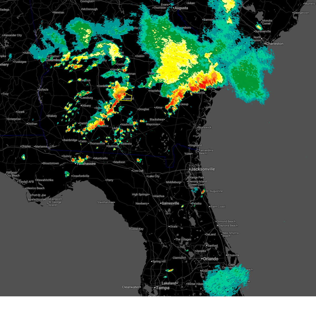
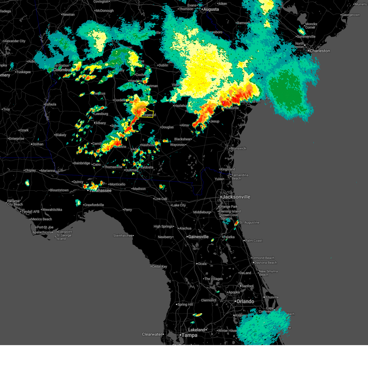
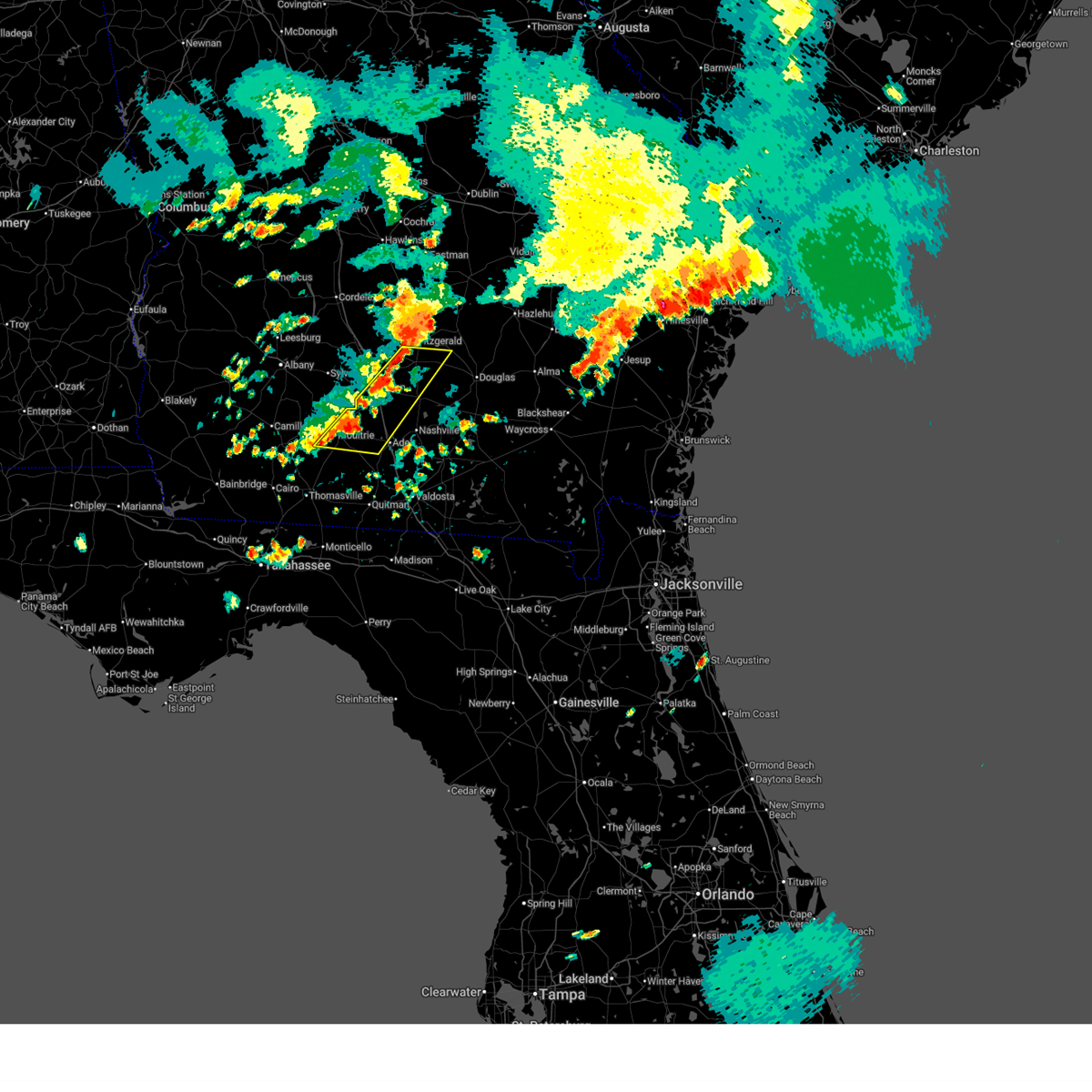
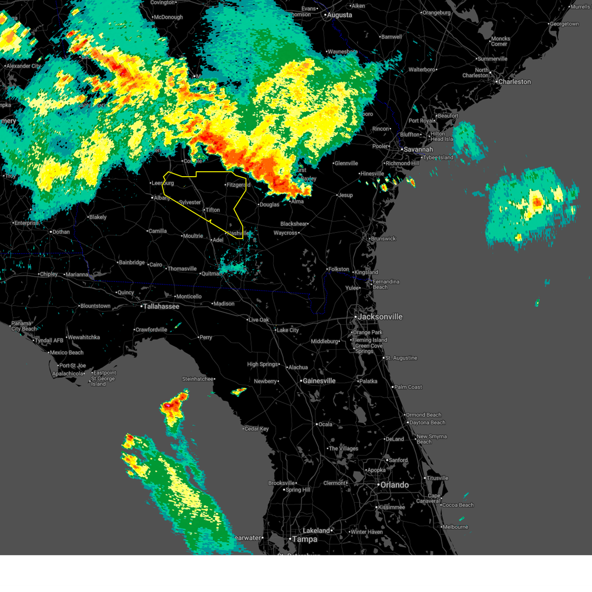
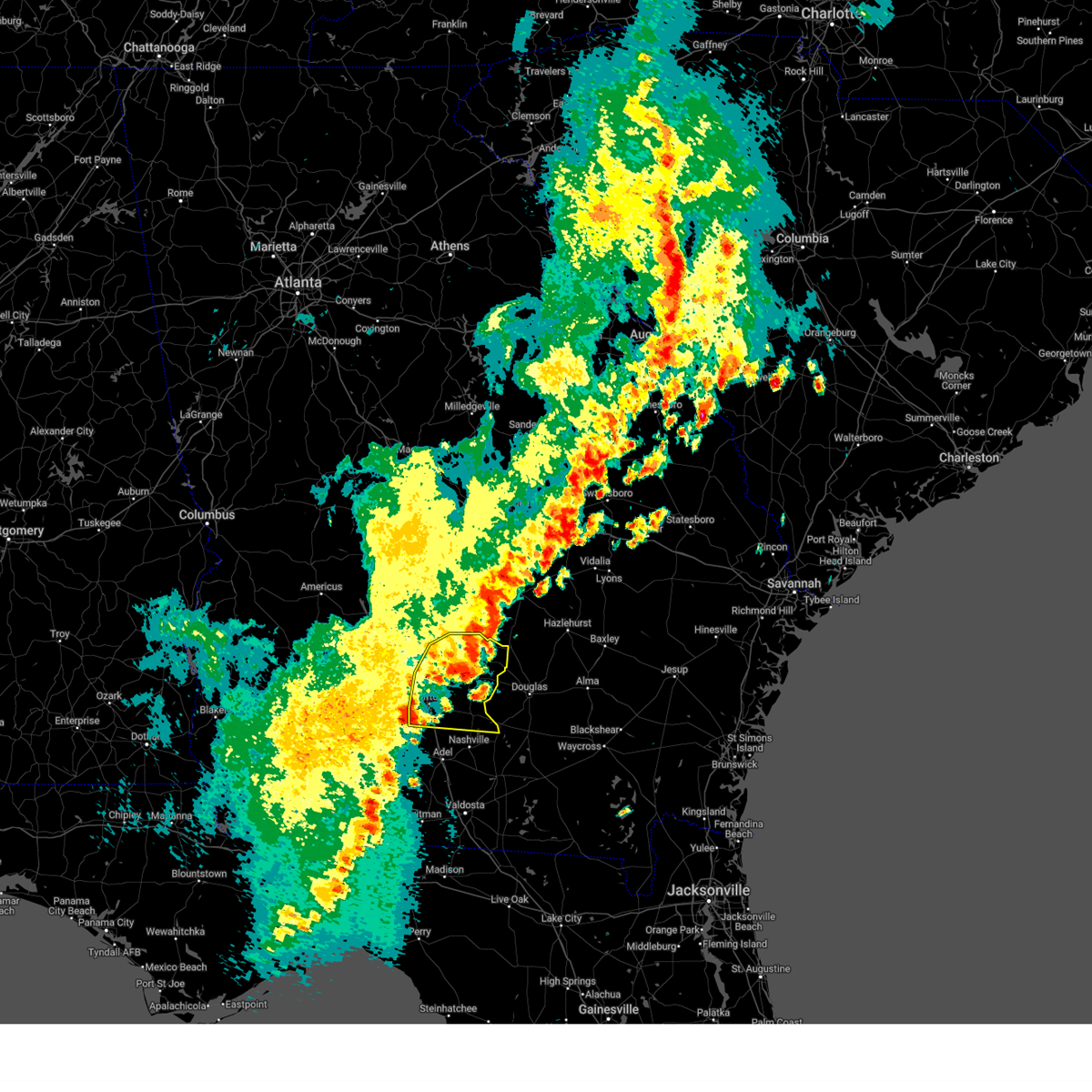
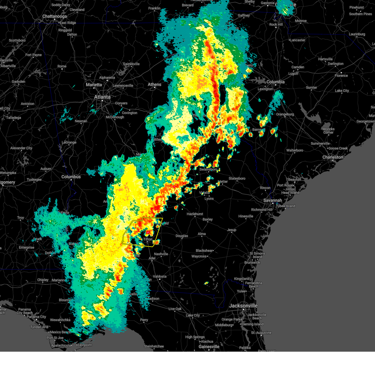
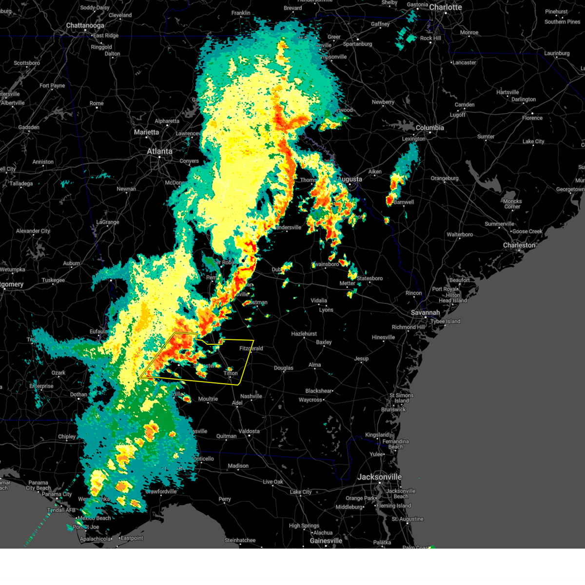
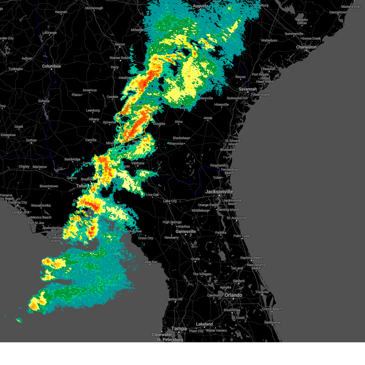
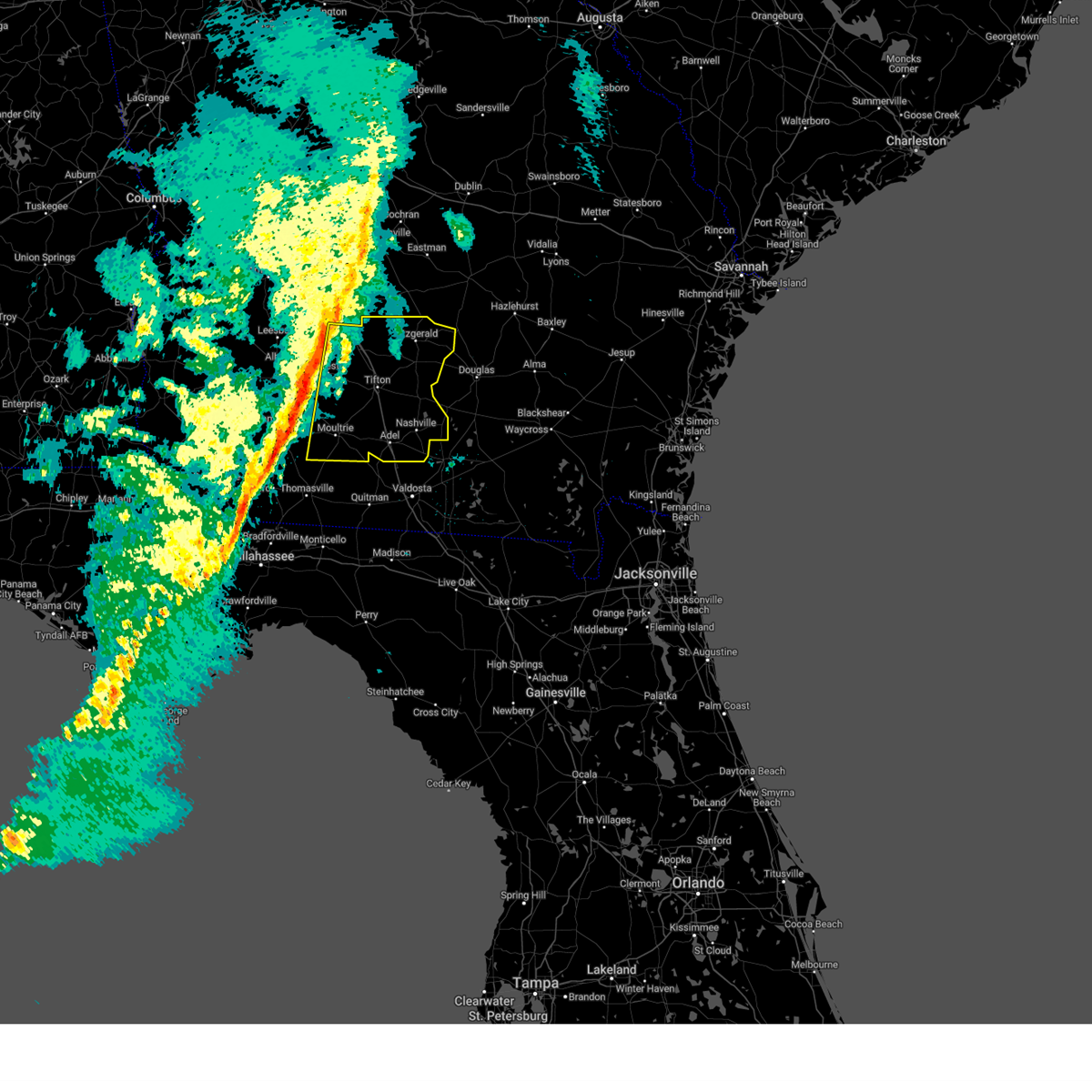
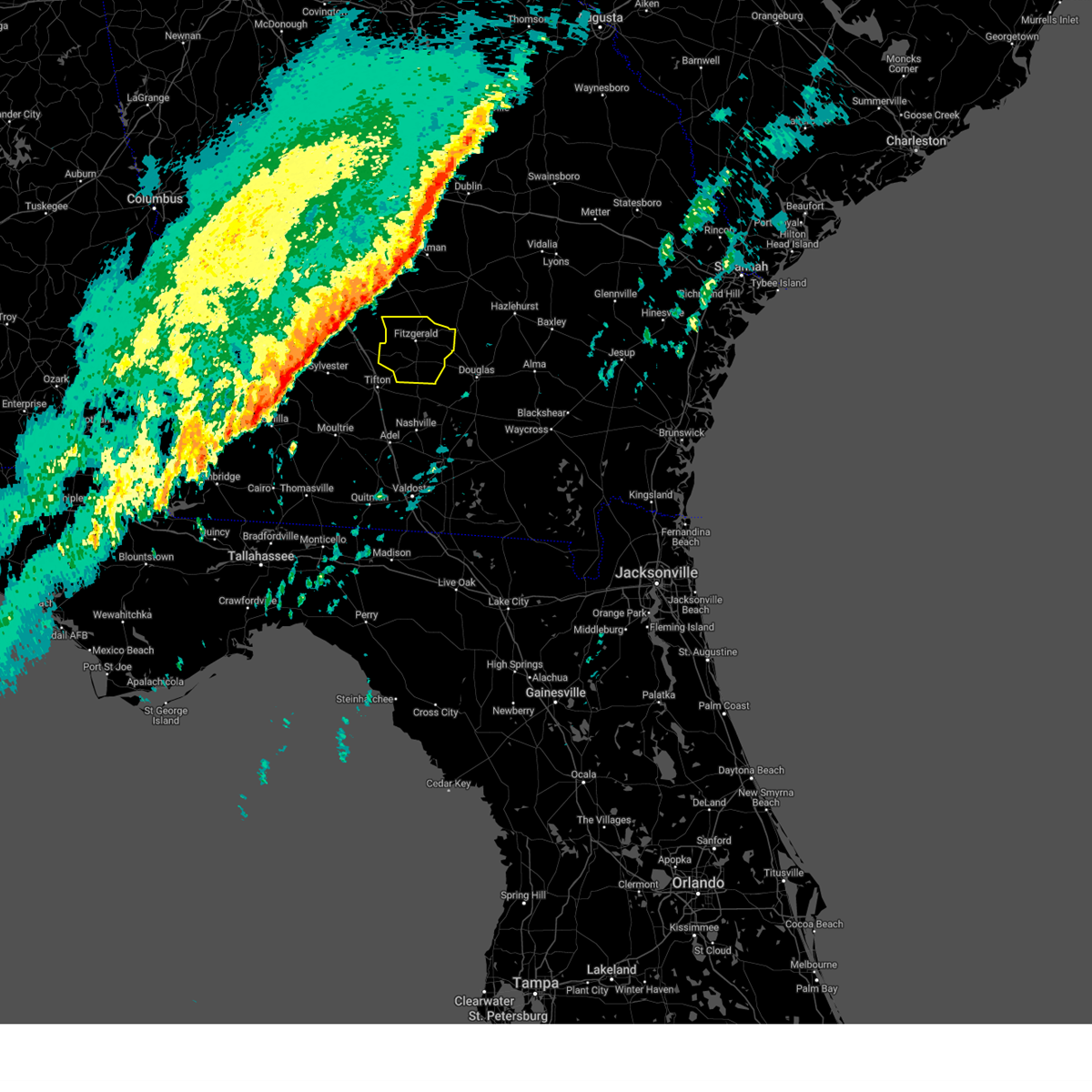
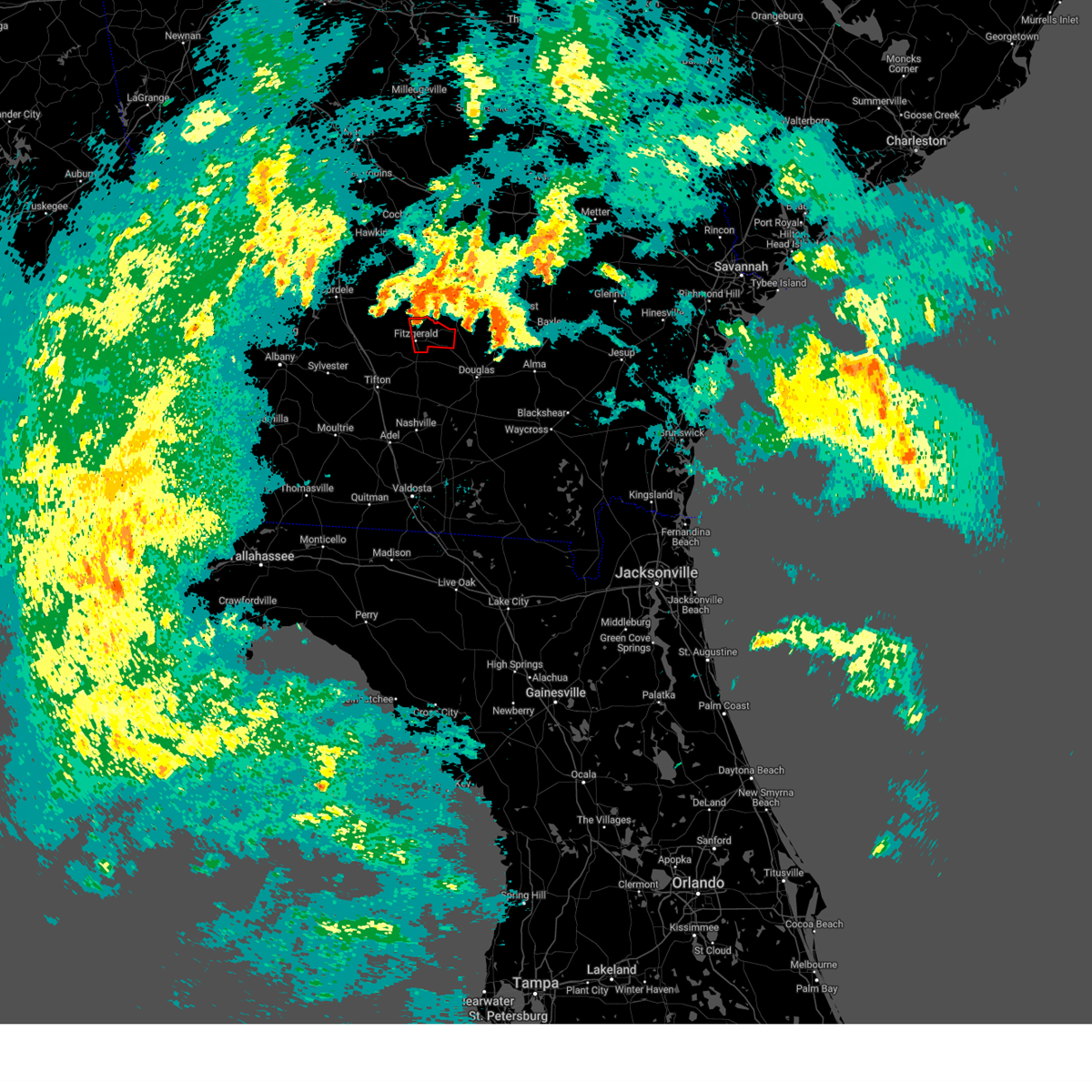
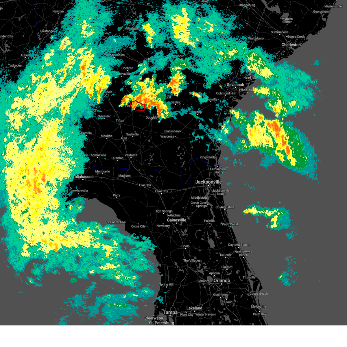
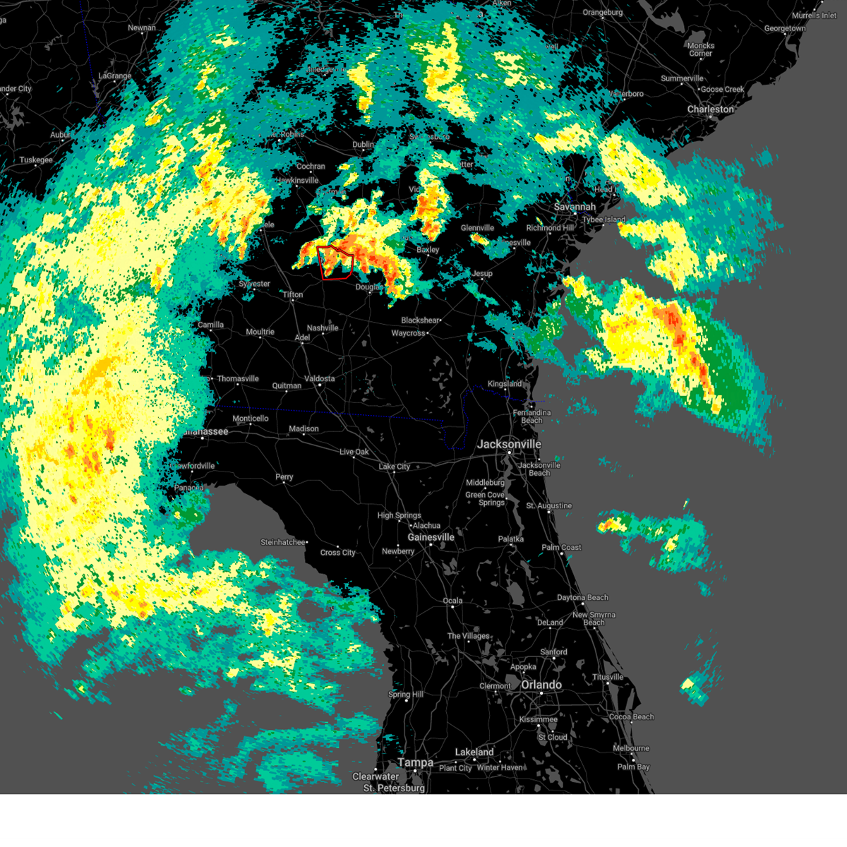
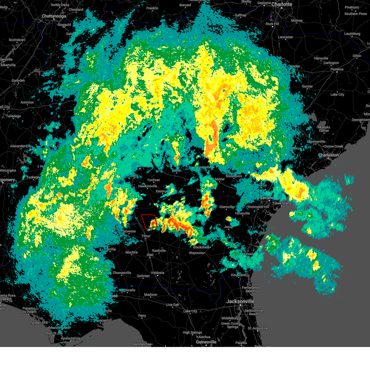
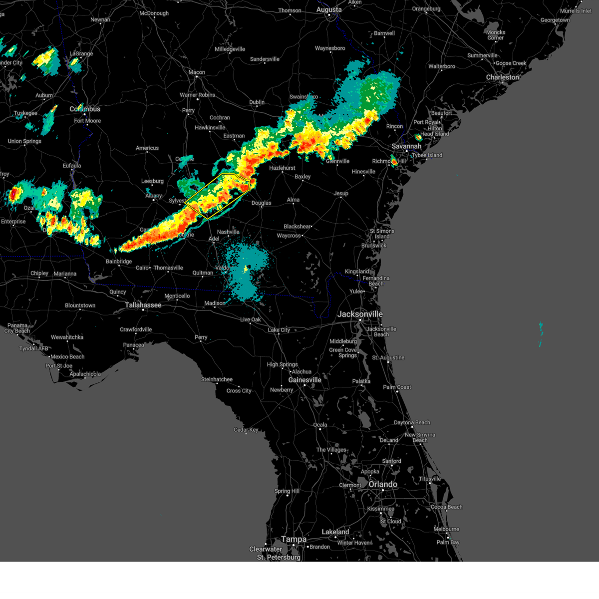
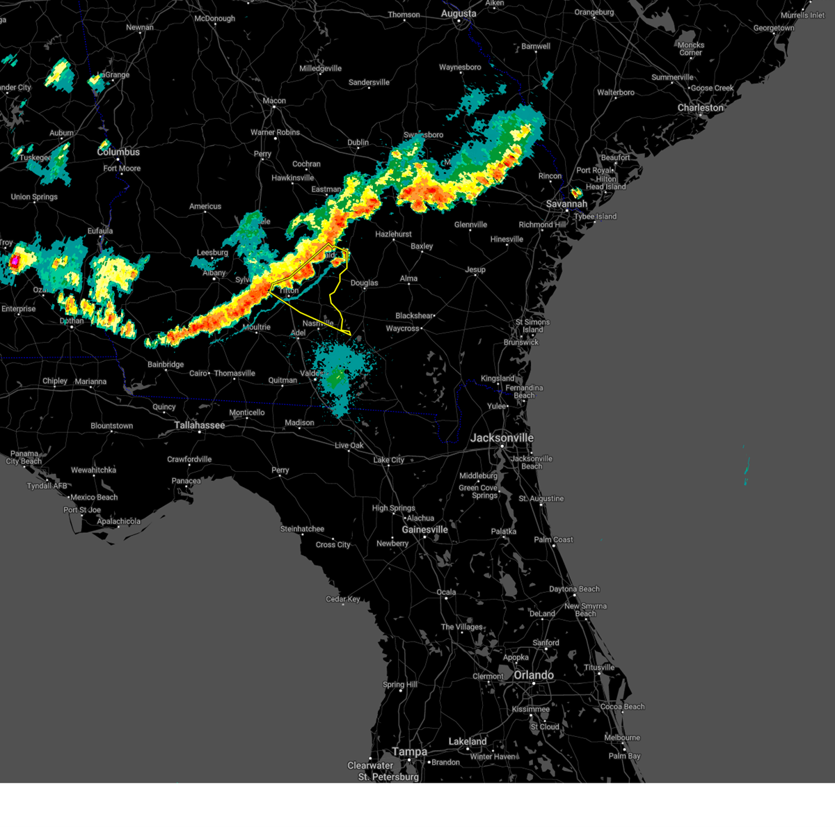
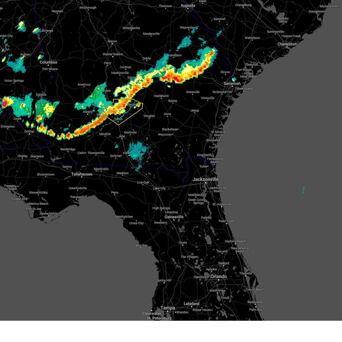
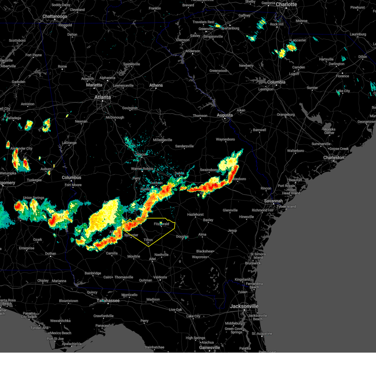
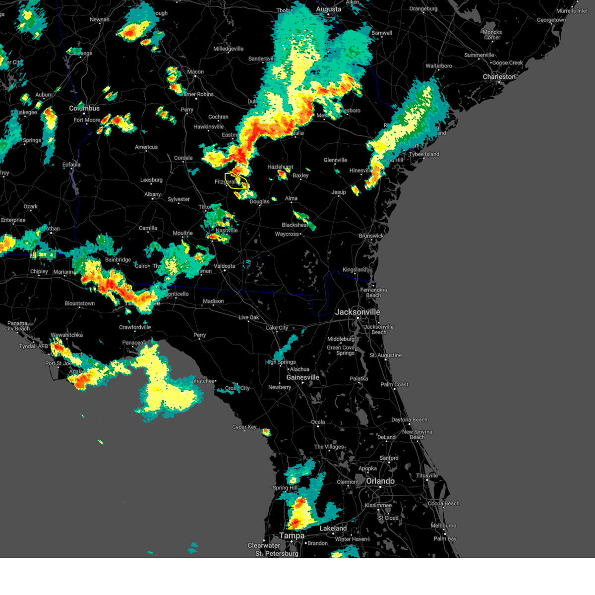
Hail Map for Fitzgerald, GA
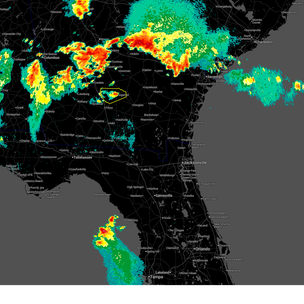
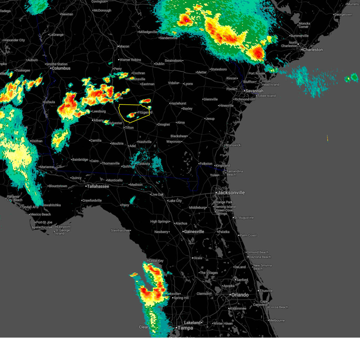
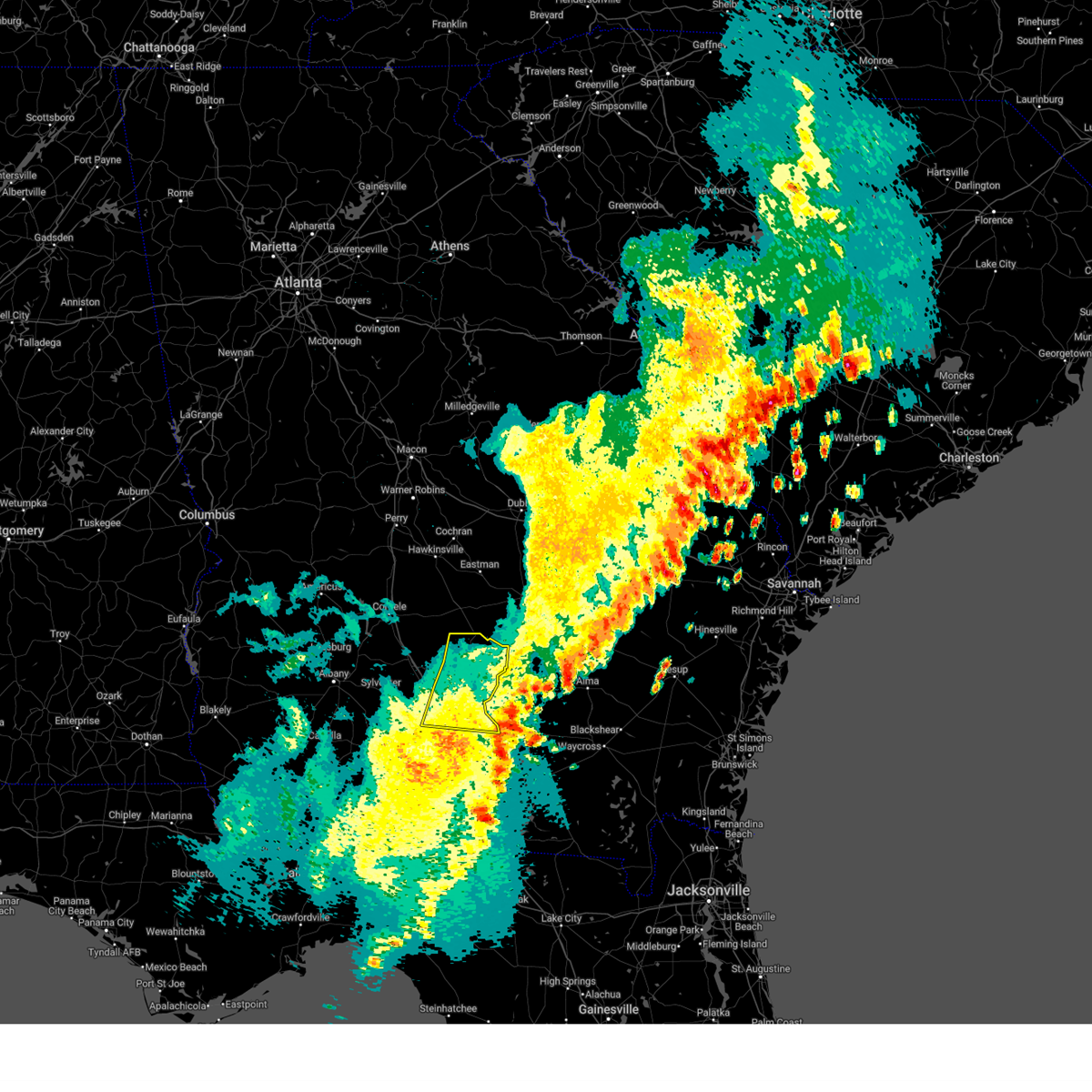
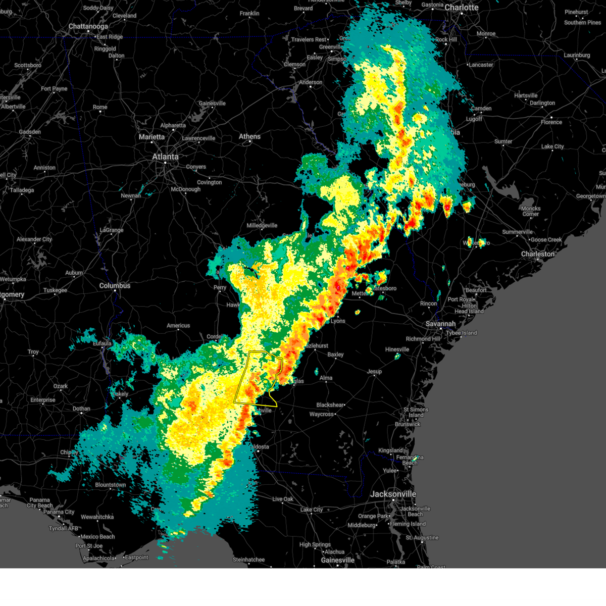
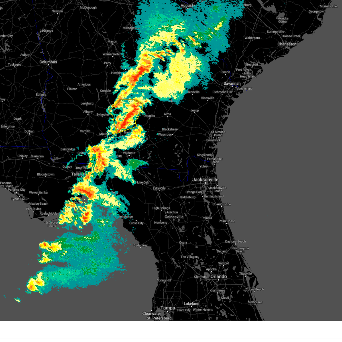
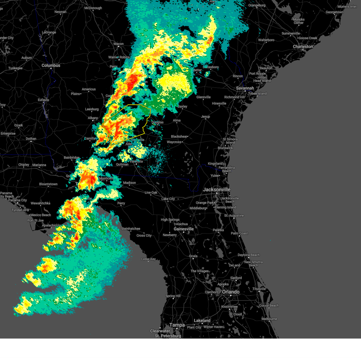
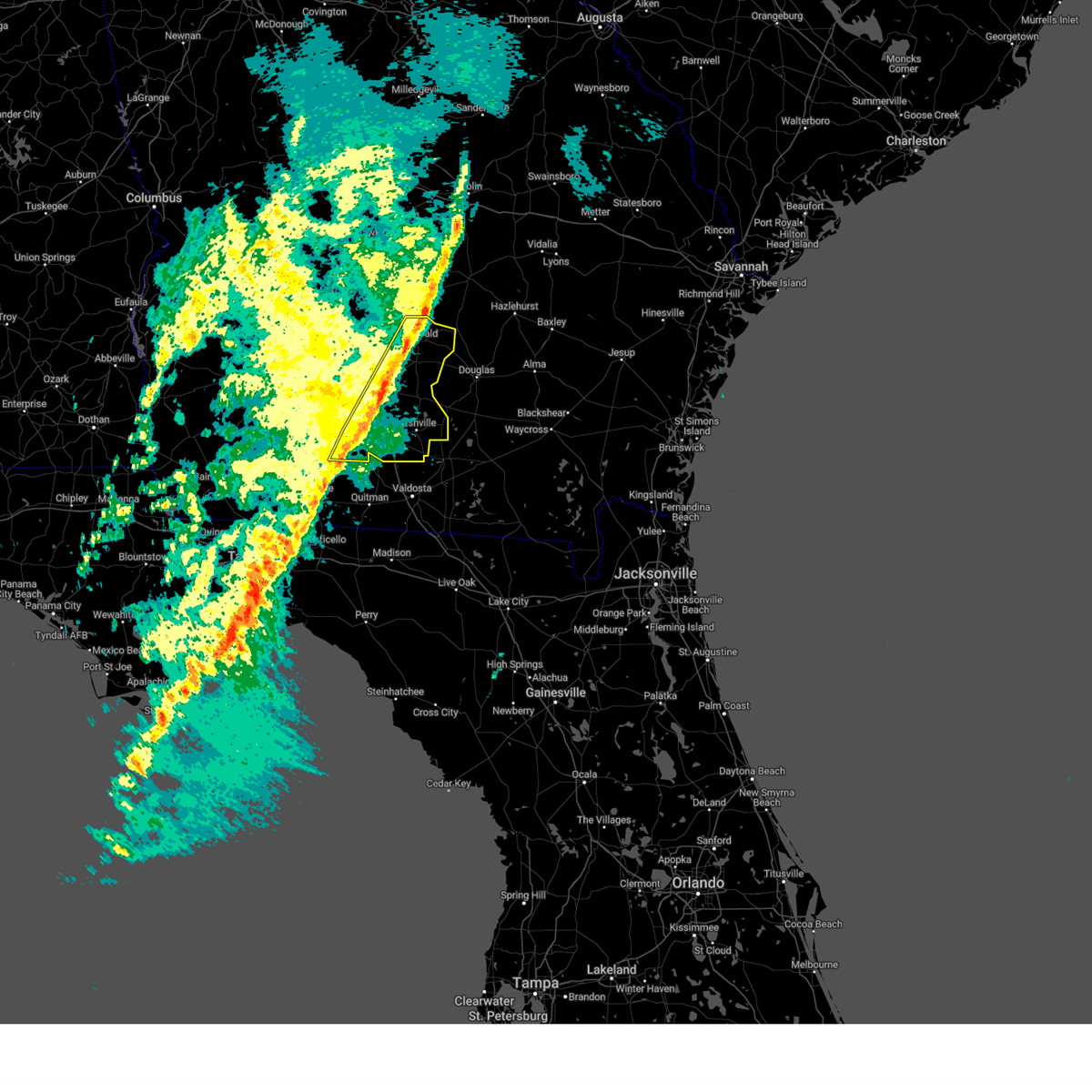
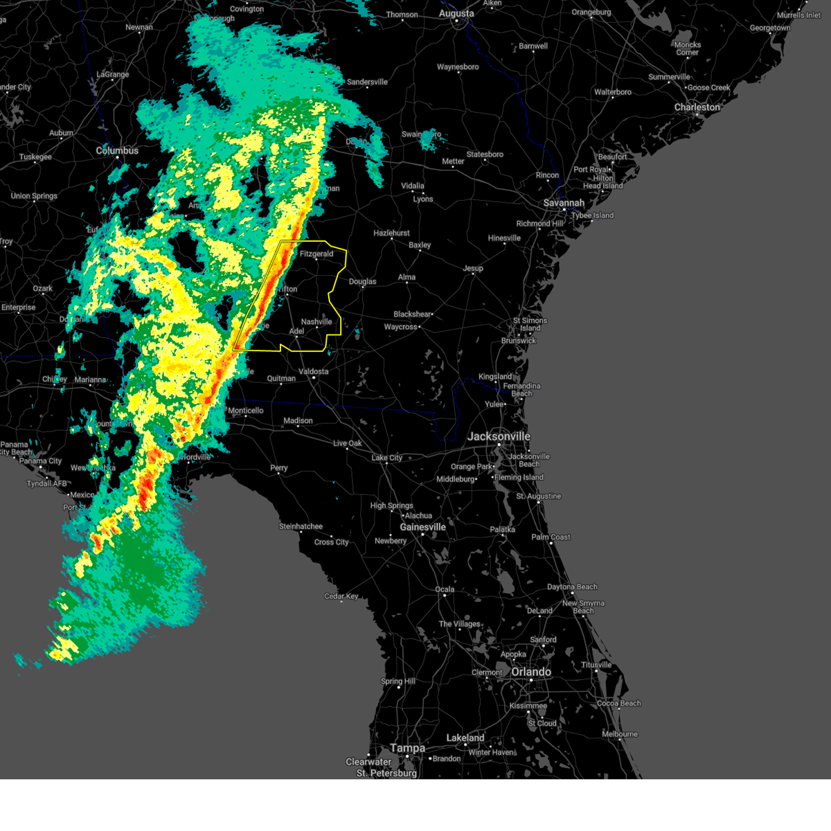
The Fitzgerald, GA area has had 7 reports of on-the-ground hail by trained spotters, and has been under severe weather warnings 34 times during the past 12 months. Doppler radar has detected hail at or near Fitzgerald, GA on 74 occasions, including 3 occasions during the past year.
| Name: | Fitzgerald, GA |
| Where Located: | 28 miles WNW of Douglas, GA |
| Map: | Google Map for Fitzgerald, GA |
| Population: | 9053 |
| Housing Units: | 4083 |
| More Info: | Search Google for Fitzgerald, GA |
1
The Top Recent Hail Date for Fitzgerald, GA is Sunday, April 27, 2025 (21st out of 74)

Hail and Wind Damage Spotted near Fitzgerald, GA
| Date / Time | Report Details |
|---|---|
| 7/10/2025 6:35 PM EDT | The storms which prompted the warning have weakened below severe limits, and have exited the warned area. therefore, the warning will be allowed to expire. however, gusty winds are still possible with these thunderstorms. |
| 7/10/2025 6:20 PM EDT | The storm which prompted the warning has weakened below severe limits, and has exited the warned area. therefore, the warning will be allowed to expire. however, gusty winds are still possible with this thunderstorm. |
| 7/10/2025 5:58 PM EDT |
 At 557 pm edt, a severe thunderstorm was located near fitzgerald, moving east at 25 mph. at 550 pm edt, the ben hill emergency management weatherstem reported a gust of 48 mph (radar indicated). Hazards include 60 mph wind gusts and quarter size hail. Hail damage to vehicles is expected. expect wind damage to roofs, siding, and trees. Locations impacted include, fitzgerald, lulaville, fitzgerald municipal a/p, bowens mill, red bluff, ashton, and queensland. At 557 pm edt, a severe thunderstorm was located near fitzgerald, moving east at 25 mph. at 550 pm edt, the ben hill emergency management weatherstem reported a gust of 48 mph (radar indicated). Hazards include 60 mph wind gusts and quarter size hail. Hail damage to vehicles is expected. expect wind damage to roofs, siding, and trees. Locations impacted include, fitzgerald, lulaville, fitzgerald municipal a/p, bowens mill, red bluff, ashton, and queensland.
|
| 7/10/2025 5:58 PM EDT |
 the severe thunderstorm warning has been cancelled and is no longer in effect the severe thunderstorm warning has been cancelled and is no longer in effect
|
| 7/10/2025 5:55 PM EDT |
 Svrtae the national weather service in tallahassee has issued a * severe thunderstorm warning for, western cook county in south central georgia, irwin county in south central georgia, northwestern berrien county in south central georgia, colquitt county in south central georgia, tift county in south central georgia, south central ben hill county in south central georgia, * until 645 pm edt. * at 555 pm edt, severe thunderstorms were located along a line extending from near mystic to near riverside, moving east at 15 mph (radar indicated). Hazards include 60 mph wind gusts and quarter size hail. Hail damage to vehicles is expected. Expect wind damage to roofs, siding, and trees. Svrtae the national weather service in tallahassee has issued a * severe thunderstorm warning for, western cook county in south central georgia, irwin county in south central georgia, northwestern berrien county in south central georgia, colquitt county in south central georgia, tift county in south central georgia, south central ben hill county in south central georgia, * until 645 pm edt. * at 555 pm edt, severe thunderstorms were located along a line extending from near mystic to near riverside, moving east at 15 mph (radar indicated). Hazards include 60 mph wind gusts and quarter size hail. Hail damage to vehicles is expected. Expect wind damage to roofs, siding, and trees.
|
| 7/10/2025 5:49 PM EDT | Trees dow in ben hill county GA, 0.5 miles SW of Fitzgerald, GA |
| 7/10/2025 5:37 PM EDT | Svrtae the national weather service in tallahassee has issued a * severe thunderstorm warning for, northern irwin county in south central georgia, ben hill county in south central georgia, * until 630 pm edt. * at 536 pm edt, a severe thunderstorm was located 7 miles northwest of fitzgerald, moving east at 25 mph (radar indicated). Hazards include 60 mph wind gusts and quarter size hail. Hail damage to vehicles is expected. Expect wind damage to roofs, siding, and trees. |
| 6/26/2025 1:36 AM EDT |
 Svrtae the national weather service in tallahassee has issued a * severe thunderstorm warning for, irwin county in south central georgia, berrien county in south central georgia, turner county in south central georgia, tift county in south central georgia, ben hill county in south central georgia, central worth county in south central georgia, * until 245 am edt. * at 136 am edt, severe thunderstorms were located along a line extending from 6 miles east of pinehurst to 8 miles northwest of alma, moving southwest at 35 mph (radar indicated). Hazards include 60 mph wind gusts and penny size hail. expect damage to roofs, siding, and trees Svrtae the national weather service in tallahassee has issued a * severe thunderstorm warning for, irwin county in south central georgia, berrien county in south central georgia, turner county in south central georgia, tift county in south central georgia, ben hill county in south central georgia, central worth county in south central georgia, * until 245 am edt. * at 136 am edt, severe thunderstorms were located along a line extending from 6 miles east of pinehurst to 8 miles northwest of alma, moving southwest at 35 mph (radar indicated). Hazards include 60 mph wind gusts and penny size hail. expect damage to roofs, siding, and trees
|
| 6/26/2025 12:18 AM EDT |
 the severe thunderstorm warning has been cancelled and is no longer in effect the severe thunderstorm warning has been cancelled and is no longer in effect
|
| 6/25/2025 11:03 PM EDT |
 Svrtae the national weather service in tallahassee has issued a * severe thunderstorm warning for, northwestern irwin county in south central georgia, eastern turner county in south central georgia, ben hill county in south central georgia, * until 1230 am edt. * at 1103 pm edt, a severe thunderstorm was located 9 miles southeast of rhine, or 13 miles northeast of fitzgerald, moving southwest at 15 mph (radar indicated). Hazards include 60 mph wind gusts and quarter size hail. Hail damage to vehicles is expected. Expect wind damage to roofs, siding, and trees. Svrtae the national weather service in tallahassee has issued a * severe thunderstorm warning for, northwestern irwin county in south central georgia, eastern turner county in south central georgia, ben hill county in south central georgia, * until 1230 am edt. * at 1103 pm edt, a severe thunderstorm was located 9 miles southeast of rhine, or 13 miles northeast of fitzgerald, moving southwest at 15 mph (radar indicated). Hazards include 60 mph wind gusts and quarter size hail. Hail damage to vehicles is expected. Expect wind damage to roofs, siding, and trees.
|
| 3/31/2025 4:56 PM EDT |
 The storms which prompted the warning have moved out of the area. therefore, the warning will be allowed to expire. a severe thunderstorm watch remains in effect until 600 pm edt for south central georgia. a severe thunderstorm watch also remains in effect until 900 pm edt for south central georgia. remember, a severe thunderstorm warning still remains in effect for eastern berrien county. The storms which prompted the warning have moved out of the area. therefore, the warning will be allowed to expire. a severe thunderstorm watch remains in effect until 600 pm edt for south central georgia. a severe thunderstorm watch also remains in effect until 900 pm edt for south central georgia. remember, a severe thunderstorm warning still remains in effect for eastern berrien county.
|
| 3/31/2025 4:21 PM EDT |
 At 421 pm edt, severe thunderstorms were located along a line extending from near lumber city to near enigma, moving east at 45 mph (radar indicated). Hazards include 60 mph wind gusts. Expect damage to roofs, siding, and trees. Locations impacted include, fitzgerald, mystic, eldorado, gladys, enigma, osierfield, glory, harding, pinetta, tifton, ashton, irwinville, wray, bowens mill, unionville, abba, vanceville, lulaville, alapaha, and tift airport. At 421 pm edt, severe thunderstorms were located along a line extending from near lumber city to near enigma, moving east at 45 mph (radar indicated). Hazards include 60 mph wind gusts. Expect damage to roofs, siding, and trees. Locations impacted include, fitzgerald, mystic, eldorado, gladys, enigma, osierfield, glory, harding, pinetta, tifton, ashton, irwinville, wray, bowens mill, unionville, abba, vanceville, lulaville, alapaha, and tift airport.
|
| 3/31/2025 4:21 PM EDT |
 the severe thunderstorm warning has been cancelled and is no longer in effect the severe thunderstorm warning has been cancelled and is no longer in effect
|
| 3/31/2025 4:09 PM EDT | There was a report of one tree down in ben hill county. the exact location was not specifie in ben hill county GA, 0.5 miles SW of Fitzgerald, GA |
| 3/31/2025 3:52 PM EDT |
 Svrtae the national weather service in tallahassee has issued a * severe thunderstorm warning for, northern cook county in south central georgia, irwin county in south central georgia, northern berrien county in south central georgia, southeastern turner county in south central georgia, tift county in south central georgia, ben hill county in south central georgia, * until 500 pm edt. * at 352 pm edt, severe thunderstorms were located along a line extending from near milan to near omega, moving east at 45 mph (radar indicated). Hazards include 60 mph wind gusts and quarter size hail. Hail damage to vehicles is expected. Expect wind damage to roofs, siding, and trees. Svrtae the national weather service in tallahassee has issued a * severe thunderstorm warning for, northern cook county in south central georgia, irwin county in south central georgia, northern berrien county in south central georgia, southeastern turner county in south central georgia, tift county in south central georgia, ben hill county in south central georgia, * until 500 pm edt. * at 352 pm edt, severe thunderstorms were located along a line extending from near milan to near omega, moving east at 45 mph (radar indicated). Hazards include 60 mph wind gusts and quarter size hail. Hail damage to vehicles is expected. Expect wind damage to roofs, siding, and trees.
|
| 3/31/2025 3:35 PM EDT |
 At 335 pm edt, severe thunderstorms were located along a line extending from 7 miles south of pitts to near ashburn to near poulan, moving east at 55 mph (radar indicated). Hazards include 60 mph wind gusts and quarter size hail. Hail damage to vehicles is expected. expect wind damage to roofs, siding, and trees. Locations impacted include, mystic, sylvester, amboy, rebecca, sylvester airport, tempy, parkerville, harding, waterloo, pinetta, tifton, inaha, worth, red rock, terrell, irwinville, sumner, ty ty, crestwood, and hobby. At 335 pm edt, severe thunderstorms were located along a line extending from 7 miles south of pitts to near ashburn to near poulan, moving east at 55 mph (radar indicated). Hazards include 60 mph wind gusts and quarter size hail. Hail damage to vehicles is expected. expect wind damage to roofs, siding, and trees. Locations impacted include, mystic, sylvester, amboy, rebecca, sylvester airport, tempy, parkerville, harding, waterloo, pinetta, tifton, inaha, worth, red rock, terrell, irwinville, sumner, ty ty, crestwood, and hobby.
|
| 3/31/2025 3:35 PM EDT |
 the severe thunderstorm warning has been cancelled and is no longer in effect the severe thunderstorm warning has been cancelled and is no longer in effect
|
| 3/31/2025 2:54 PM EDT |
 Svrtae the national weather service in tallahassee has issued a * severe thunderstorm warning for, western irwin county in south central georgia, turner county in south central georgia, dougherty county in southwestern georgia, northeastern mitchell county in southwestern georgia, lee county in southwestern georgia, northeastern baker county in southwestern georgia, eastern calhoun county in southwestern georgia, tift county in south central georgia, southeastern terrell county in southwestern georgia, western ben hill county in south central georgia, worth county in south central georgia, * until 400 pm edt. * at 254 pm edt, severe thunderstorms were located along a line extending from 6 miles southeast of smithville to 9 miles west of albany to near leary, moving east at 45 mph (radar indicated). Hazards include 60 mph wind gusts. expect damage to roofs, siding, and trees Svrtae the national weather service in tallahassee has issued a * severe thunderstorm warning for, western irwin county in south central georgia, turner county in south central georgia, dougherty county in southwestern georgia, northeastern mitchell county in southwestern georgia, lee county in southwestern georgia, northeastern baker county in southwestern georgia, eastern calhoun county in southwestern georgia, tift county in south central georgia, southeastern terrell county in southwestern georgia, western ben hill county in south central georgia, worth county in south central georgia, * until 400 pm edt. * at 254 pm edt, severe thunderstorms were located along a line extending from 6 miles southeast of smithville to 9 miles west of albany to near leary, moving east at 45 mph (radar indicated). Hazards include 60 mph wind gusts. expect damage to roofs, siding, and trees
|
| 3/16/2025 7:26 AM EDT |
 the severe thunderstorm warning has been cancelled and is no longer in effect the severe thunderstorm warning has been cancelled and is no longer in effect
|
| 3/16/2025 7:26 AM EDT |
 At 725 am edt, severe thunderstorms were located along a line extending from near mystic to 6 miles southwest of ocilla to near enigma, moving northeast at 50 mph (radar indicated). Hazards include 60 mph wind gusts and quarter size hail. Hail damage to vehicles is expected. expect wind damage to roofs, siding, and trees. Locations impacted include, lenox, fitzgerald, mystic, eldorado, gladys, enigma, osierfield, rebecca, glory, harding, waterloo, pinetta, tifton, inaha, ashton, irwinville, turner co airport, irwinville airport, wray, and bowens mill. At 725 am edt, severe thunderstorms were located along a line extending from near mystic to 6 miles southwest of ocilla to near enigma, moving northeast at 50 mph (radar indicated). Hazards include 60 mph wind gusts and quarter size hail. Hail damage to vehicles is expected. expect wind damage to roofs, siding, and trees. Locations impacted include, lenox, fitzgerald, mystic, eldorado, gladys, enigma, osierfield, rebecca, glory, harding, waterloo, pinetta, tifton, inaha, ashton, irwinville, turner co airport, irwinville airport, wray, and bowens mill.
|
| 3/16/2025 7:01 AM EDT |
 Svrtae the national weather service in tallahassee has issued a * severe thunderstorm warning for, northwestern cook county in south central georgia, irwin county in south central georgia, northern berrien county in south central georgia, central turner county in south central georgia, northeastern colquitt county in south central georgia, tift county in south central georgia, ben hill county in south central georgia, southern worth county in south central georgia, * until 800 am edt. * at 701 am edt, severe thunderstorms were located along a line extending from near ty ty to near omega to near norman park, moving northeast at 55 mph (radar indicated). Hazards include 60 mph wind gusts and quarter size hail. Hail damage to vehicles is expected. Expect wind damage to roofs, siding, and trees. Svrtae the national weather service in tallahassee has issued a * severe thunderstorm warning for, northwestern cook county in south central georgia, irwin county in south central georgia, northern berrien county in south central georgia, central turner county in south central georgia, northeastern colquitt county in south central georgia, tift county in south central georgia, ben hill county in south central georgia, southern worth county in south central georgia, * until 800 am edt. * at 701 am edt, severe thunderstorms were located along a line extending from near ty ty to near omega to near norman park, moving northeast at 55 mph (radar indicated). Hazards include 60 mph wind gusts and quarter size hail. Hail damage to vehicles is expected. Expect wind damage to roofs, siding, and trees.
|
| 3/5/2025 5:04 AM EST |
 At 504 am est, severe thunderstorms were located along a line extending from 9 miles north of fitzgerald to near pavo, moving east at 35 mph (radar indicated). Hazards include 60 mph wind gusts. Expect damage to roofs, siding, and trees. Locations impacted include, reed bingham state park, enigma, osierfield, greggs, waterloo, pinetta, tifton, moultrie municipal a/p, allenville, weber, vanceville, cottle, lulaville, berlin, nashville, sparks, tift airport, adel, fitzgerald municipal a/p, and phillipsburg. At 504 am est, severe thunderstorms were located along a line extending from 9 miles north of fitzgerald to near pavo, moving east at 35 mph (radar indicated). Hazards include 60 mph wind gusts. Expect damage to roofs, siding, and trees. Locations impacted include, reed bingham state park, enigma, osierfield, greggs, waterloo, pinetta, tifton, moultrie municipal a/p, allenville, weber, vanceville, cottle, lulaville, berlin, nashville, sparks, tift airport, adel, fitzgerald municipal a/p, and phillipsburg.
|
| 3/5/2025 5:04 AM EST |
 the severe thunderstorm warning has been cancelled and is no longer in effect the severe thunderstorm warning has been cancelled and is no longer in effect
|
| 3/5/2025 4:38 AM EST |
 At 438 am est, severe thunderstorms were located along a line extending from 8 miles south of rochelle to near coolidge, moving east at 35 mph (radar indicated). Hazards include 60 mph wind gusts. Expect damage to roofs, siding, and trees. Locations impacted include, funston, reed bingham state park, minton, scooterville, enigma, osierfield, greggs, waterloo, pinetta, tifton, inaha, moultrie municipal a/p, allenville, weber, turner co airport, irwinville airport, murphy, vanceville, cottle, and lulaville. At 438 am est, severe thunderstorms were located along a line extending from 8 miles south of rochelle to near coolidge, moving east at 35 mph (radar indicated). Hazards include 60 mph wind gusts. Expect damage to roofs, siding, and trees. Locations impacted include, funston, reed bingham state park, minton, scooterville, enigma, osierfield, greggs, waterloo, pinetta, tifton, inaha, moultrie municipal a/p, allenville, weber, turner co airport, irwinville airport, murphy, vanceville, cottle, and lulaville.
|
| 3/5/2025 4:03 AM EST |
 Svrtae the national weather service in tallahassee has issued a * severe thunderstorm warning for, cook county in south central georgia, irwin county in south central georgia, berrien county in south central georgia, turner county in south central georgia, colquitt county in south central georgia, tift county in south central georgia, ben hill county in south central georgia, eastern worth county in south central georgia, * until 530 am est. * at 403 am est, severe thunderstorms were located along a line extending from 7 miles west of arabi to pelham, moving east at 35 mph (radar indicated). Hazards include 60 mph wind gusts. expect damage to roofs, siding, and trees Svrtae the national weather service in tallahassee has issued a * severe thunderstorm warning for, cook county in south central georgia, irwin county in south central georgia, berrien county in south central georgia, turner county in south central georgia, colquitt county in south central georgia, tift county in south central georgia, ben hill county in south central georgia, eastern worth county in south central georgia, * until 530 am est. * at 403 am est, severe thunderstorms were located along a line extending from 7 miles west of arabi to pelham, moving east at 35 mph (radar indicated). Hazards include 60 mph wind gusts. expect damage to roofs, siding, and trees
|
| 2/16/2025 6:53 AM EST |
 Svrtae the national weather service in tallahassee has issued a * severe thunderstorm warning for, irwin county in south central georgia, ben hill county in south central georgia, * until 830 am est. * at 652 am est, severe thunderstorms were located along a line extending from 6 miles east of pineview to putney, moving east at 55 mph (radar indicated). Hazards include 60 mph wind gusts. expect damage to roofs, siding, and trees Svrtae the national weather service in tallahassee has issued a * severe thunderstorm warning for, irwin county in south central georgia, ben hill county in south central georgia, * until 830 am est. * at 652 am est, severe thunderstorms were located along a line extending from 6 miles east of pineview to putney, moving east at 55 mph (radar indicated). Hazards include 60 mph wind gusts. expect damage to roofs, siding, and trees
|
| 9/26/2024 2:53 PM EDT |
 The storm which prompted the warning has moved out of the area. therefore, the warning will be allowed to expire. a tornado watch remains in effect until 1000 pm edt for south central georgia. The storm which prompted the warning has moved out of the area. therefore, the warning will be allowed to expire. a tornado watch remains in effect until 1000 pm edt for south central georgia.
|
| 9/26/2024 2:41 PM EDT |
 the tornado warning has been cancelled and is no longer in effect the tornado warning has been cancelled and is no longer in effect
|
| 9/26/2024 2:41 PM EDT |
 At 240 pm edt, a severe thunderstorm capable of producing a tornado was located near fitzgerald, moving north at 45 mph (radar indicated rotation). Hazards include tornado. Flying debris will be dangerous to those caught without shelter. mobile homes will be damaged or destroyed. damage to roofs, windows, and vehicles will occur. tree damage is likely. This tornadic thunderstorm will remain over mainly rural areas of ben hill county, including the following locations, bowens mill, red bluff, ashton, lulaville, and queensland. At 240 pm edt, a severe thunderstorm capable of producing a tornado was located near fitzgerald, moving north at 45 mph (radar indicated rotation). Hazards include tornado. Flying debris will be dangerous to those caught without shelter. mobile homes will be damaged or destroyed. damage to roofs, windows, and vehicles will occur. tree damage is likely. This tornadic thunderstorm will remain over mainly rural areas of ben hill county, including the following locations, bowens mill, red bluff, ashton, lulaville, and queensland.
|
| 9/26/2024 2:28 PM EDT |
 Tortae the national weather service in tallahassee has issued a * tornado warning for, east central irwin county in south central georgia, ben hill county in south central georgia, * until 300 pm edt. * at 228 pm edt, a severe thunderstorm capable of producing a tornado was located near fitzgerald, moving north at 45 mph (radar indicated rotation). Hazards include tornado. Flying debris will be dangerous to those caught without shelter. mobile homes will be damaged or destroyed. damage to roofs, windows, and vehicles will occur. tree damage is likely. this dangerous storm will be near, fitzgerald around 235 pm edt. Other locations impacted by this tornadic thunderstorm include lulaville, osierfield, wray, bowens mill, red bluff, ashton, and queensland. Tortae the national weather service in tallahassee has issued a * tornado warning for, east central irwin county in south central georgia, ben hill county in south central georgia, * until 300 pm edt. * at 228 pm edt, a severe thunderstorm capable of producing a tornado was located near fitzgerald, moving north at 45 mph (radar indicated rotation). Hazards include tornado. Flying debris will be dangerous to those caught without shelter. mobile homes will be damaged or destroyed. damage to roofs, windows, and vehicles will occur. tree damage is likely. this dangerous storm will be near, fitzgerald around 235 pm edt. Other locations impacted by this tornadic thunderstorm include lulaville, osierfield, wray, bowens mill, red bluff, ashton, and queensland.
|
| 9/26/2024 2:26 PM EDT |
 Tortae the national weather service in tallahassee has issued a * tornado warning for, northwestern irwin county in south central georgia, northeastern turner county in south central georgia, western ben hill county in south central georgia, * until 300 pm edt. * at 226 pm edt, a severe thunderstorm capable of producing a tornado was located 7 miles northwest of mystic, or 9 miles west of fitzgerald, moving north at 40 mph (radar indicated rotation). Hazards include tornado. Flying debris will be dangerous to those caught without shelter. mobile homes will be damaged or destroyed. damage to roofs, windows, and vehicles will occur. tree damage is likely. This tornadic thunderstorm will remain over mainly rural areas of northwestern irwin, northeastern turner and western ben hill counties, including the following locations, irwinville airport, irwinville, arp, abba, and rebecca. Tortae the national weather service in tallahassee has issued a * tornado warning for, northwestern irwin county in south central georgia, northeastern turner county in south central georgia, western ben hill county in south central georgia, * until 300 pm edt. * at 226 pm edt, a severe thunderstorm capable of producing a tornado was located 7 miles northwest of mystic, or 9 miles west of fitzgerald, moving north at 40 mph (radar indicated rotation). Hazards include tornado. Flying debris will be dangerous to those caught without shelter. mobile homes will be damaged or destroyed. damage to roofs, windows, and vehicles will occur. tree damage is likely. This tornadic thunderstorm will remain over mainly rural areas of northwestern irwin, northeastern turner and western ben hill counties, including the following locations, irwinville airport, irwinville, arp, abba, and rebecca.
|
| 8/18/2024 9:13 PM EDT |
 At 913 pm edt, severe thunderstorms were located along a line extending from 7 miles east of fitzgerald to near tifton, moving east at 35 mph (radar indicated). Hazards include 60 mph wind gusts. Expect damage to roofs, siding, and trees. Locations impacted include, fitzgerald, tifton, ocilla, ty ty, mystic, unionville, phillipsburg, osierfield, harding, waterloo, pinetta, inaha, ashton, irwinville, irwinville airport, bowens mill, abba, vanceville, hillsdale, and chula. At 913 pm edt, severe thunderstorms were located along a line extending from 7 miles east of fitzgerald to near tifton, moving east at 35 mph (radar indicated). Hazards include 60 mph wind gusts. Expect damage to roofs, siding, and trees. Locations impacted include, fitzgerald, tifton, ocilla, ty ty, mystic, unionville, phillipsburg, osierfield, harding, waterloo, pinetta, inaha, ashton, irwinville, irwinville airport, bowens mill, abba, vanceville, hillsdale, and chula.
|
| 8/18/2024 9:10 PM EDT |
 Svrtae the national weather service in tallahassee has issued a * severe thunderstorm warning for, irwin county in south central georgia, northern berrien county in south central georgia, northeastern lanier county in south central georgia, tift county in south central georgia, ben hill county in south central georgia, * until 1000 pm edt. * at 909 pm edt, severe thunderstorms were located along a line extending from near jacksonville to 7 miles northwest of ambrose to near ocilla to near phillipsburg, moving east at 45 mph (radar indicated). Hazards include 60 mph wind gusts and penny size hail. expect damage to roofs, siding, and trees Svrtae the national weather service in tallahassee has issued a * severe thunderstorm warning for, irwin county in south central georgia, northern berrien county in south central georgia, northeastern lanier county in south central georgia, tift county in south central georgia, ben hill county in south central georgia, * until 1000 pm edt. * at 909 pm edt, severe thunderstorms were located along a line extending from near jacksonville to 7 miles northwest of ambrose to near ocilla to near phillipsburg, moving east at 45 mph (radar indicated). Hazards include 60 mph wind gusts and penny size hail. expect damage to roofs, siding, and trees
|
| 8/18/2024 8:58 PM EDT |
 At 858 pm edt, severe thunderstorms were located along a line extending from near fitzgerald to 6 miles north of ty ty, moving east at 35 mph (radar indicated). Hazards include 60 mph wind gusts. Expect damage to roofs, siding, and trees. Locations impacted include, fitzgerald, tifton, ashburn, ocilla, ty ty, mystic, unionville, phillipsburg, worth, terrell, sycamore, rebecca, amboy, osierfield, harding, waterloo, pinetta, inaha, ashton, and irwinville. At 858 pm edt, severe thunderstorms were located along a line extending from near fitzgerald to 6 miles north of ty ty, moving east at 35 mph (radar indicated). Hazards include 60 mph wind gusts. Expect damage to roofs, siding, and trees. Locations impacted include, fitzgerald, tifton, ashburn, ocilla, ty ty, mystic, unionville, phillipsburg, worth, terrell, sycamore, rebecca, amboy, osierfield, harding, waterloo, pinetta, inaha, ashton, and irwinville.
|
| 8/18/2024 8:26 PM EDT |
 Svrtae the national weather service in tallahassee has issued a * severe thunderstorm warning for, irwin county in south central georgia, turner county in south central georgia, tift county in south central georgia, ben hill county in south central georgia, central worth county in south central georgia, * until 930 pm edt. * at 826 pm edt, severe thunderstorms were located along a line extending from 6 miles south of pitts to 10 miles northwest of sylvester, moving southeast at 35 mph (radar indicated). Hazards include 60 mph wind gusts and quarter size hail. Hail damage to vehicles is expected. Expect wind damage to roofs, siding, and trees. Svrtae the national weather service in tallahassee has issued a * severe thunderstorm warning for, irwin county in south central georgia, turner county in south central georgia, tift county in south central georgia, ben hill county in south central georgia, central worth county in south central georgia, * until 930 pm edt. * at 826 pm edt, severe thunderstorms were located along a line extending from 6 miles south of pitts to 10 miles northwest of sylvester, moving southeast at 35 mph (radar indicated). Hazards include 60 mph wind gusts and quarter size hail. Hail damage to vehicles is expected. Expect wind damage to roofs, siding, and trees.
|
| 7/29/2024 6:45 PM EDT |
 Svrtae the national weather service in tallahassee has issued a * severe thunderstorm warning for, eastern ben hill county in south central georgia, * until 730 pm edt. * at 645 pm edt, a severe thunderstorm was located 8 miles northeast of fitzgerald, moving southeast at 10 mph (radar indicated). Hazards include 60 mph wind gusts and quarter size hail. Hail damage to vehicles is expected. Expect wind damage to roofs, siding, and trees. Svrtae the national weather service in tallahassee has issued a * severe thunderstorm warning for, eastern ben hill county in south central georgia, * until 730 pm edt. * at 645 pm edt, a severe thunderstorm was located 8 miles northeast of fitzgerald, moving southeast at 10 mph (radar indicated). Hazards include 60 mph wind gusts and quarter size hail. Hail damage to vehicles is expected. Expect wind damage to roofs, siding, and trees.
|
| 5/27/2024 6:30 PM EDT | The ben hill 911 dispatch reported several trees and powerlines down across the count in ben hill county GA, 1.1 miles WNW of Fitzgerald, GA |
| 5/27/2024 6:30 PM EDT | Quarter sized hail reported 1.8 miles NE of Fitzgerald, GA, member of the public reported lots of hail the size of at least quarters near w roanoke dr and jeff david hwy on the southwest side of fitzgerald. |
| 5/27/2024 6:20 PM EDT | Numerous trees and power lines down throughout ben hill county... west of town... in town... east of tow in ben hill county GA, 0.6 miles NW of Fitzgerald, GA |
| 5/27/2024 6:19 PM EDT |
 the severe thunderstorm warning has been cancelled and is no longer in effect the severe thunderstorm warning has been cancelled and is no longer in effect
|
| 5/27/2024 6:19 PM EDT |
 At 619 pm edt, a severe thunderstorm was located over fitzgerald, moving east at 40 mph (radar indicated). Hazards include 70 mph wind gusts and ping pong ball size hail. People and animals outdoors will be injured. expect hail damage to roofs, siding, windows, and vehicles. expect considerable tree damage. wind damage is also likely to mobile homes, roofs, and outbuildings. Locations impacted include, fitzgerald, ocilla, mystic, lulaville, osierfield, ashton, irwinville, fitzgerald municipal a/p, irwinville airport, wray, bowens mill, red bluff, arp, abba, and queensland. At 619 pm edt, a severe thunderstorm was located over fitzgerald, moving east at 40 mph (radar indicated). Hazards include 70 mph wind gusts and ping pong ball size hail. People and animals outdoors will be injured. expect hail damage to roofs, siding, windows, and vehicles. expect considerable tree damage. wind damage is also likely to mobile homes, roofs, and outbuildings. Locations impacted include, fitzgerald, ocilla, mystic, lulaville, osierfield, ashton, irwinville, fitzgerald municipal a/p, irwinville airport, wray, bowens mill, red bluff, arp, abba, and queensland.
|
| 5/27/2024 5:48 PM EDT |
 At 547 pm edt, a severe thunderstorm was located near ashburn, moving east at 25 mph (radar indicated). Hazards include two inch hail and 70 mph wind gusts. People and animals outdoors will be injured. expect hail damage to roofs, siding, windows, and vehicles. expect considerable tree damage. wind damage is also likely to mobile homes, roofs, and outbuildings. Locations impacted include, fitzgerald, ocilla, ashburn, mystic, worth, rebecca, lulaville, amboy, osierfield, ashton, irwinville, fitzgerald municipal a/p, irwinville airport, wray, bowens mill, red bluff, arp, abba, and queensland. At 547 pm edt, a severe thunderstorm was located near ashburn, moving east at 25 mph (radar indicated). Hazards include two inch hail and 70 mph wind gusts. People and animals outdoors will be injured. expect hail damage to roofs, siding, windows, and vehicles. expect considerable tree damage. wind damage is also likely to mobile homes, roofs, and outbuildings. Locations impacted include, fitzgerald, ocilla, ashburn, mystic, worth, rebecca, lulaville, amboy, osierfield, ashton, irwinville, fitzgerald municipal a/p, irwinville airport, wray, bowens mill, red bluff, arp, abba, and queensland.
|
| 5/27/2024 5:38 PM EDT |
 At 538 pm edt, a severe thunderstorm was located near pitts, or 11 miles northeast of ashburn, moving east at 35 mph (radar indicated). Hazards include two inch hail and 60 mph wind gusts. People and animals outdoors will be injured. expect hail damage to roofs, siding, windows, and vehicles. expect wind damage to roofs, siding, and trees. Locations impacted include, fitzgerald, ashburn, ocilla, mystic, worth, sycamore, rebecca, lulaville, amboy, osierfield, sibley, ashton, irwinville, fitzgerald municipal a/p, turner co airport, irwinville airport, wray, bowens mill, dakota, and red bluff. At 538 pm edt, a severe thunderstorm was located near pitts, or 11 miles northeast of ashburn, moving east at 35 mph (radar indicated). Hazards include two inch hail and 60 mph wind gusts. People and animals outdoors will be injured. expect hail damage to roofs, siding, windows, and vehicles. expect wind damage to roofs, siding, and trees. Locations impacted include, fitzgerald, ashburn, ocilla, mystic, worth, sycamore, rebecca, lulaville, amboy, osierfield, sibley, ashton, irwinville, fitzgerald municipal a/p, turner co airport, irwinville airport, wray, bowens mill, dakota, and red bluff.
|
| 5/27/2024 5:38 PM EDT |
 the severe thunderstorm warning has been cancelled and is no longer in effect the severe thunderstorm warning has been cancelled and is no longer in effect
|
| 5/27/2024 5:31 PM EDT |
 At 531 pm edt, a severe thunderstorm was located 7 miles east of arabi, or 9 miles north of ashburn, moving east at 35 mph (radar indicated). Hazards include ping pong ball size hail and 60 mph wind gusts. People and animals outdoors will be injured. expect hail damage to roofs, siding, windows, and vehicles. expect wind damage to roofs, siding, and trees. Locations impacted include, fitzgerald, ashburn, ocilla, mystic, worth, sycamore, rebecca, lulaville, amboy, osierfield, pinetta, sibley, ashton, irwinville, fitzgerald municipal a/p, turner co airport, irwinville airport, wray, bowens mill, and dakota. At 531 pm edt, a severe thunderstorm was located 7 miles east of arabi, or 9 miles north of ashburn, moving east at 35 mph (radar indicated). Hazards include ping pong ball size hail and 60 mph wind gusts. People and animals outdoors will be injured. expect hail damage to roofs, siding, windows, and vehicles. expect wind damage to roofs, siding, and trees. Locations impacted include, fitzgerald, ashburn, ocilla, mystic, worth, sycamore, rebecca, lulaville, amboy, osierfield, pinetta, sibley, ashton, irwinville, fitzgerald municipal a/p, turner co airport, irwinville airport, wray, bowens mill, and dakota.
|
| 5/27/2024 5:28 PM EDT |
 Svrtae the national weather service in tallahassee has issued a * severe thunderstorm warning for, irwin county in south central georgia, turner county in south central georgia, ben hill county in south central georgia, north central worth county in south central georgia, * until 700 pm edt. * at 528 pm edt, a severe thunderstorm was located near arabi, or 8 miles north of ashburn, moving east at 35 mph (radar indicated). Hazards include 60 mph wind gusts and quarter size hail. Hail damage to vehicles is expected. Expect wind damage to roofs, siding, and trees. Svrtae the national weather service in tallahassee has issued a * severe thunderstorm warning for, irwin county in south central georgia, turner county in south central georgia, ben hill county in south central georgia, north central worth county in south central georgia, * until 700 pm edt. * at 528 pm edt, a severe thunderstorm was located near arabi, or 8 miles north of ashburn, moving east at 35 mph (radar indicated). Hazards include 60 mph wind gusts and quarter size hail. Hail damage to vehicles is expected. Expect wind damage to roofs, siding, and trees.
|
| 5/25/2024 3:55 PM EDT |
 the severe thunderstorm warning has been cancelled and is no longer in effect the severe thunderstorm warning has been cancelled and is no longer in effect
|
| 5/25/2024 3:55 PM EDT |
 At 355 pm edt, severe thunderstorms were located along a line extending from 9 miles north of fitzgerald to 6 miles north of alapaha, moving east at 25 mph (radar indicated). Hazards include 60 mph wind gusts. Expect damage to roofs, siding, and trees. Locations impacted include, fitzgerald, ocilla, mystic, lulaville, osierfield, pinetta, ashton, irwinville, fitzgerald municipal a/p, wray, bowens mill, abba, queensland, and red bluff. At 355 pm edt, severe thunderstorms were located along a line extending from 9 miles north of fitzgerald to 6 miles north of alapaha, moving east at 25 mph (radar indicated). Hazards include 60 mph wind gusts. Expect damage to roofs, siding, and trees. Locations impacted include, fitzgerald, ocilla, mystic, lulaville, osierfield, pinetta, ashton, irwinville, fitzgerald municipal a/p, wray, bowens mill, abba, queensland, and red bluff.
|
| 5/25/2024 3:34 PM EDT |
 Svrtae the national weather service in tallahassee has issued a * severe thunderstorm warning for, irwin county in south central georgia, northeastern turner county in south central georgia, ben hill county in south central georgia, * until 430 pm edt. * at 334 pm edt, severe thunderstorms were located along a line extending from 8 miles south of pitts to near mystic, moving east at 20 mph (radar indicated). Hazards include 60 mph wind gusts. expect damage to roofs, siding, and trees Svrtae the national weather service in tallahassee has issued a * severe thunderstorm warning for, irwin county in south central georgia, northeastern turner county in south central georgia, ben hill county in south central georgia, * until 430 pm edt. * at 334 pm edt, severe thunderstorms were located along a line extending from 8 miles south of pitts to near mystic, moving east at 20 mph (radar indicated). Hazards include 60 mph wind gusts. expect damage to roofs, siding, and trees
|
| 5/9/2024 2:39 PM EDT |
 At 239 pm edt, a severe thunderstorm was located near ambrose, moving east at 35 mph (radar indicated). Hazards include 60 mph wind gusts. Expect damage to roofs, siding, and trees. Locations impacted include, fitzgerald, ocilla, wray, ashton, osierfield, and fitzgerald municipal a/p. At 239 pm edt, a severe thunderstorm was located near ambrose, moving east at 35 mph (radar indicated). Hazards include 60 mph wind gusts. Expect damage to roofs, siding, and trees. Locations impacted include, fitzgerald, ocilla, wray, ashton, osierfield, and fitzgerald municipal a/p.
|
| 5/9/2024 2:20 PM EDT | Lots of downed trees and a few power lines down throughout ben hill count in ben hill county GA, 3.8 miles SSW of Fitzgerald, GA |
| 5/9/2024 2:12 PM EDT |
 Svrtae the national weather service in tallahassee has issued a * severe thunderstorm warning for, irwin county in south central georgia, southern ben hill county in south central georgia, * until 300 pm edt. * at 211 pm edt, a severe thunderstorm was located 7 miles northwest of mystic, or 8 miles west of fitzgerald, moving east at 55 mph (radar indicated). Hazards include 60 mph wind gusts and penny size hail. expect damage to roofs, siding, and trees Svrtae the national weather service in tallahassee has issued a * severe thunderstorm warning for, irwin county in south central georgia, southern ben hill county in south central georgia, * until 300 pm edt. * at 211 pm edt, a severe thunderstorm was located 7 miles northwest of mystic, or 8 miles west of fitzgerald, moving east at 55 mph (radar indicated). Hazards include 60 mph wind gusts and penny size hail. expect damage to roofs, siding, and trees
|
| 5/9/2024 1:50 PM EDT |
 Svrtae the national weather service in tallahassee has issued a * severe thunderstorm warning for, northeastern turner county in south central georgia, ben hill county in south central georgia, * until 230 pm edt. * at 149 pm edt, a severe thunderstorm was located near pitts, or 12 miles southeast of cordele, moving east at 60 mph (radar indicated). Hazards include 60 mph wind gusts. expect damage to roofs, siding, and trees Svrtae the national weather service in tallahassee has issued a * severe thunderstorm warning for, northeastern turner county in south central georgia, ben hill county in south central georgia, * until 230 pm edt. * at 149 pm edt, a severe thunderstorm was located near pitts, or 12 miles southeast of cordele, moving east at 60 mph (radar indicated). Hazards include 60 mph wind gusts. expect damage to roofs, siding, and trees
|
| 4/20/2024 5:58 PM EDT |
 the severe thunderstorm warning has been cancelled and is no longer in effect the severe thunderstorm warning has been cancelled and is no longer in effect
|
| 4/20/2024 5:48 PM EDT |
 At 548 pm edt, a severe thunderstorm was located over fitzgerald, moving southeast at 20 mph (radar indicated). Hazards include 60 mph wind gusts. Expect damage to roofs, siding, and trees. Locations impacted include, fitzgerald, ocilla, mystic, lulaville, osierfield, fitzgerald municipal a/p, wray, and ashton. At 548 pm edt, a severe thunderstorm was located over fitzgerald, moving southeast at 20 mph (radar indicated). Hazards include 60 mph wind gusts. Expect damage to roofs, siding, and trees. Locations impacted include, fitzgerald, ocilla, mystic, lulaville, osierfield, fitzgerald municipal a/p, wray, and ashton.
|
| 4/20/2024 5:36 PM EDT |
 At 535 pm edt, a severe thunderstorm was located over fitzgerald, moving southeast at 20 mph (radar indicated). Hazards include 60 mph wind gusts and quarter size hail. Hail damage to vehicles is expected. expect wind damage to roofs, siding, and trees. Locations impacted include, fitzgerald, ocilla, mystic, irwinville, lulaville, osierfield, fitzgerald municipal a/p, wray, ashton, arp, abba, and queensland. At 535 pm edt, a severe thunderstorm was located over fitzgerald, moving southeast at 20 mph (radar indicated). Hazards include 60 mph wind gusts and quarter size hail. Hail damage to vehicles is expected. expect wind damage to roofs, siding, and trees. Locations impacted include, fitzgerald, ocilla, mystic, irwinville, lulaville, osierfield, fitzgerald municipal a/p, wray, ashton, arp, abba, and queensland.
|
| 4/20/2024 5:17 PM EDT |
 Svrtae the national weather service in tallahassee has issued a * severe thunderstorm warning for, irwin county in south central georgia, ben hill county in south central georgia, * until 630 pm edt. * at 517 pm edt, a severe thunderstorm was located 7 miles west of fitzgerald, moving southeast at 20 mph (radar indicated). Hazards include 60 mph wind gusts and quarter size hail. Hail damage to vehicles is expected. Expect wind damage to roofs, siding, and trees. Svrtae the national weather service in tallahassee has issued a * severe thunderstorm warning for, irwin county in south central georgia, ben hill county in south central georgia, * until 630 pm edt. * at 517 pm edt, a severe thunderstorm was located 7 miles west of fitzgerald, moving southeast at 20 mph (radar indicated). Hazards include 60 mph wind gusts and quarter size hail. Hail damage to vehicles is expected. Expect wind damage to roofs, siding, and trees.
|
| 4/3/2024 6:45 AM EDT |
 Svrtae the national weather service in tallahassee has issued a * severe thunderstorm warning for, cook county in south central georgia, irwin county in south central georgia, berrien county in south central georgia, southern ben hill county in south central georgia, * until 815 am edt. * at 645 am edt, severe thunderstorms were located along a line extending from 8 miles northeast of ty ty to pelham, moving east at 40 mph (radar indicated). Hazards include 60 mph wind gusts. expect damage to roofs, siding, and trees Svrtae the national weather service in tallahassee has issued a * severe thunderstorm warning for, cook county in south central georgia, irwin county in south central georgia, berrien county in south central georgia, southern ben hill county in south central georgia, * until 815 am edt. * at 645 am edt, severe thunderstorms were located along a line extending from 8 miles northeast of ty ty to pelham, moving east at 40 mph (radar indicated). Hazards include 60 mph wind gusts. expect damage to roofs, siding, and trees
|
| 1/12/2024 5:59 PM EST |
 At 558 pm est, a severe thunderstorm was located near fitzgerald, moving northeast at 70 mph (radar indicated). Hazards include 60 mph wind gusts and penny size hail. Expect damage to roofs, siding, and trees. locations impacted include, fitzgerald, ocilla, mystic, lulaville, osierfield, waterloo, pinetta, ashton, irwinville, fitzgerald municipal a/p, irwinville airport, bowens mill, arp, abba, and queensland. hail threat, radar indicated max hail size, 0. 75 in wind threat, radar indicated max wind gust, 60 mph. At 558 pm est, a severe thunderstorm was located near fitzgerald, moving northeast at 70 mph (radar indicated). Hazards include 60 mph wind gusts and penny size hail. Expect damage to roofs, siding, and trees. locations impacted include, fitzgerald, ocilla, mystic, lulaville, osierfield, waterloo, pinetta, ashton, irwinville, fitzgerald municipal a/p, irwinville airport, bowens mill, arp, abba, and queensland. hail threat, radar indicated max hail size, 0. 75 in wind threat, radar indicated max wind gust, 60 mph.
|
| 1/12/2024 5:31 PM EST |
 At 530 pm est, a severe thunderstorm was located near ty ty, or 9 miles east of sylvester, moving northeast at 70 mph (radar indicated). Hazards include 60 mph wind gusts and penny size hail. expect damage to roofs, siding, and trees At 530 pm est, a severe thunderstorm was located near ty ty, or 9 miles east of sylvester, moving northeast at 70 mph (radar indicated). Hazards include 60 mph wind gusts and penny size hail. expect damage to roofs, siding, and trees
|
| 1/9/2024 12:19 PM EST |
 At 1219 pm est, severe thunderstorms were located along a line extending from near jacksonville to near ray city, moving east at 45 mph (radar indicated). Hazards include 70 mph wind gusts. Expect considerable tree damage. damage is likely to mobile homes, roofs, and outbuildings. Locations impacted include, nashville, lakeland, ray city, alapaha, meigs, courthouse, berrien co a/p, new lois, gladys, osierfield, glory, hansell, ashton, bannockburn, allenville, weber, wray, red bluff, and teeterville. At 1219 pm est, severe thunderstorms were located along a line extending from near jacksonville to near ray city, moving east at 45 mph (radar indicated). Hazards include 70 mph wind gusts. Expect considerable tree damage. damage is likely to mobile homes, roofs, and outbuildings. Locations impacted include, nashville, lakeland, ray city, alapaha, meigs, courthouse, berrien co a/p, new lois, gladys, osierfield, glory, hansell, ashton, bannockburn, allenville, weber, wray, red bluff, and teeterville.
|
| 1/9/2024 12:00 PM EST |
 At 1200 pm est, severe thunderstorms were located along a line extending from 8 miles south of rhine to near adel, moving east at 45 mph (radar indicated). Hazards include 70 mph wind gusts. Expect considerable tree damage. damage is likely to mobile homes, roofs, and outbuildings. Locations impacted include, nashville, adel, ocilla, fitzgerald, lakeland, tifton, sparks, enigma, ray city, lenox, alapaha, mystic, meigs, cecil, reed bingham state park, osierfield, greggs, pinetta, allenville, and weber. At 1200 pm est, severe thunderstorms were located along a line extending from 8 miles south of rhine to near adel, moving east at 45 mph (radar indicated). Hazards include 70 mph wind gusts. Expect considerable tree damage. damage is likely to mobile homes, roofs, and outbuildings. Locations impacted include, nashville, adel, ocilla, fitzgerald, lakeland, tifton, sparks, enigma, ray city, lenox, alapaha, mystic, meigs, cecil, reed bingham state park, osierfield, greggs, pinetta, allenville, and weber.
|
| 1/9/2024 11:38 AM EST |
 At 1138 am est, severe thunderstorms were located along a line extending from 9 miles south of rochelle to 6 miles north of pavo, moving east at 35 mph (radar indicated). Hazards include 70 mph wind gusts. Expect considerable tree damage. damage is likely to mobile homes, roofs, and outbuildings. Locations impacted include, tifton, nashville, moultrie, adel, ocilla, fitzgerald, lakeland, sparks, enigma, omega, ray city, norman park, lenox, ty ty, alapaha, phillipsburg, mystic, unionville, riverside, and meigs. At 1138 am est, severe thunderstorms were located along a line extending from 9 miles south of rochelle to 6 miles north of pavo, moving east at 35 mph (radar indicated). Hazards include 70 mph wind gusts. Expect considerable tree damage. damage is likely to mobile homes, roofs, and outbuildings. Locations impacted include, tifton, nashville, moultrie, adel, ocilla, fitzgerald, lakeland, sparks, enigma, omega, ray city, norman park, lenox, ty ty, alapaha, phillipsburg, mystic, unionville, riverside, and meigs.
|
| 1/9/2024 11:05 AM EST |
 At 1105 am est, severe thunderstorms were located along a line extending from near arabi to 8 miles northeast of ochlocknee, moving east at 45 mph (radar indicated). Hazards include 70 mph wind gusts. Expect considerable tree damage. Damage is likely to mobile homes, roofs, and outbuildings. At 1105 am est, severe thunderstorms were located along a line extending from near arabi to 8 miles northeast of ochlocknee, moving east at 45 mph (radar indicated). Hazards include 70 mph wind gusts. Expect considerable tree damage. Damage is likely to mobile homes, roofs, and outbuildings.
|
| 9/7/2023 10:16 PM EDT |
 At 1016 pm edt, severe thunderstorms were located along a line extending from 6 miles west of jacksonville to near ocilla to 7 miles northeast of tifton, moving east at 20 mph (radar indicated). Hazards include 60 mph wind gusts. Expect damage to roofs, siding, and trees. locations impacted include, ocilla, fitzgerald, enigma, gladys, osierfield, wray, red bluff, and ashton. hail threat, radar indicated max hail size, <. 75 in wind threat, radar indicated max wind gust, 60 mph. At 1016 pm edt, severe thunderstorms were located along a line extending from 6 miles west of jacksonville to near ocilla to 7 miles northeast of tifton, moving east at 20 mph (radar indicated). Hazards include 60 mph wind gusts. Expect damage to roofs, siding, and trees. locations impacted include, ocilla, fitzgerald, enigma, gladys, osierfield, wray, red bluff, and ashton. hail threat, radar indicated max hail size, <. 75 in wind threat, radar indicated max wind gust, 60 mph.
|
| 9/7/2023 9:47 PM EDT |
 At 947 pm edt, severe thunderstorms were located along a line extending from 9 miles south of rhine to near mystic to 8 miles northeast of ty ty, moving east at 20 mph (radar indicated). Hazards include 60 mph wind gusts and penny size hail. expect damage to roofs, siding, and trees At 947 pm edt, severe thunderstorms were located along a line extending from 9 miles south of rhine to near mystic to 8 miles northeast of ty ty, moving east at 20 mph (radar indicated). Hazards include 60 mph wind gusts and penny size hail. expect damage to roofs, siding, and trees
|
| 9/7/2023 8:58 PM EDT |
 At 857 pm edt, severe thunderstorms were located along a line extending from near eastman to 6 miles northwest of abbeville to near arabi, moving south at 10 mph (radar indicated). Hazards include 60 mph wind gusts and penny size hail. expect damage to roofs, siding, and trees At 857 pm edt, severe thunderstorms were located along a line extending from near eastman to 6 miles northwest of abbeville to near arabi, moving south at 10 mph (radar indicated). Hazards include 60 mph wind gusts and penny size hail. expect damage to roofs, siding, and trees
|
| 8/8/2023 6:34 PM EDT |
 At 634 pm edt, severe thunderstorms were located along a line extending from near jacksonville to 7 miles west of adel, moving east at 35 mph. numerous trees have been blown down in ben hill and irwin counties with these storms (radar indicated). Hazards include 70 mph wind gusts. Expect considerable tree damage. damage is likely to mobile homes, roofs, and outbuildings. locations impacted include, fitzgerald, ocilla, enigma, alapaha, gladys, osierfield, fitzgerald municipal a/p, glory, wray and ashton. thunderstorm damage threat, considerable hail threat, radar indicated max hail size, <. 75 in wind threat, radar indicated max wind gust, 70 mph. At 634 pm edt, severe thunderstorms were located along a line extending from near jacksonville to 7 miles west of adel, moving east at 35 mph. numerous trees have been blown down in ben hill and irwin counties with these storms (radar indicated). Hazards include 70 mph wind gusts. Expect considerable tree damage. damage is likely to mobile homes, roofs, and outbuildings. locations impacted include, fitzgerald, ocilla, enigma, alapaha, gladys, osierfield, fitzgerald municipal a/p, glory, wray and ashton. thunderstorm damage threat, considerable hail threat, radar indicated max hail size, <. 75 in wind threat, radar indicated max wind gust, 70 mph.
|
| 8/8/2023 6:20 PM EDT | Numerous trees down countywid in ben hill county GA, 0.5 miles SW of Fitzgerald, GA |
| 8/8/2023 6:15 PM EDT | A pecan tree and power lines were blown down on west roanoke driv in ben hill county GA, 0.5 miles NNE of Fitzgerald, GA |
| 8/8/2023 6:12 PM EDT | Trees were blown down along walker ave on the west side of fitzgeral in ben hill county GA, 1.5 miles ENE of Fitzgerald, GA |
| 8/8/2023 6:04 PM EDT |
 At 603 pm edt, severe thunderstorms were located along a line extending from 6 miles southeast of rochelle to near riverside, moving southeast at 40 mph (trained weather spotters. a spotter measured a wind gust of 70 mph just north of tifton). Hazards include 70 mph wind gusts. Expect considerable tree damage. damage is likely to mobile homes, roofs, and outbuildings. locations impacted include, fitzgerald, ocilla, enigma, alapaha, mystic, lulaville, gladys, osierfield, glory, waterloo, pinetta, ashton, irwinville, fitzgerald municipal a/p, irwinville airport, wray, bowens mill, arp, abba and queensland. thunderstorm damage threat, considerable hail threat, radar indicated max hail size, <. 75 in wind threat, radar indicated max wind gust, 70 mph. At 603 pm edt, severe thunderstorms were located along a line extending from 6 miles southeast of rochelle to near riverside, moving southeast at 40 mph (trained weather spotters. a spotter measured a wind gust of 70 mph just north of tifton). Hazards include 70 mph wind gusts. Expect considerable tree damage. damage is likely to mobile homes, roofs, and outbuildings. locations impacted include, fitzgerald, ocilla, enigma, alapaha, mystic, lulaville, gladys, osierfield, glory, waterloo, pinetta, ashton, irwinville, fitzgerald municipal a/p, irwinville airport, wray, bowens mill, arp, abba and queensland. thunderstorm damage threat, considerable hail threat, radar indicated max hail size, <. 75 in wind threat, radar indicated max wind gust, 70 mph.
|
| 8/8/2023 5:38 PM EDT |
 At 538 pm edt, severe thunderstorms were located along a line extending from near pitts to near albany, moving east at 30 mph (radar indicated). Hazards include 60 mph wind gusts. expect damage to roofs, siding, and trees At 538 pm edt, severe thunderstorms were located along a line extending from near pitts to near albany, moving east at 30 mph (radar indicated). Hazards include 60 mph wind gusts. expect damage to roofs, siding, and trees
|
| 8/6/2023 7:49 PM EDT |
 At 749 pm edt, severe thunderstorms were located along a line extending from 6 miles south of rhine to near alapaha, moving east at 25 mph (radar indicated). Hazards include 60 mph wind gusts. Expect damage to roofs, siding, and trees. locations impacted include, fitzgerald, ocilla, enigma, alapaha, lulaville, gladys, osierfield, glory, ashton, fitzgerald municipal a/p, wray, bowens mill, red bluff and queensland. hail threat, radar indicated max hail size, <. 75 in wind threat, radar indicated max wind gust, 60 mph. At 749 pm edt, severe thunderstorms were located along a line extending from 6 miles south of rhine to near alapaha, moving east at 25 mph (radar indicated). Hazards include 60 mph wind gusts. Expect damage to roofs, siding, and trees. locations impacted include, fitzgerald, ocilla, enigma, alapaha, lulaville, gladys, osierfield, glory, ashton, fitzgerald municipal a/p, wray, bowens mill, red bluff and queensland. hail threat, radar indicated max hail size, <. 75 in wind threat, radar indicated max wind gust, 60 mph.
|
| 8/6/2023 7:30 PM EDT | Tree down at the intersection of ivemeyer rd. and lower rebecca r in ben hill county GA, 2.6 miles SE of Fitzgerald, GA |
| 8/6/2023 7:11 PM EDT |
 At 711 pm edt, severe thunderstorms were located along a line extending from 7 miles south of rochelle to tifton, moving east at 25 mph (radar indicated). Hazards include 60 mph wind gusts. expect damage to roofs, siding, and trees At 711 pm edt, severe thunderstorms were located along a line extending from 7 miles south of rochelle to tifton, moving east at 25 mph (radar indicated). Hazards include 60 mph wind gusts. expect damage to roofs, siding, and trees
|
| 7/22/2023 1:35 PM EDT | 911 call center reported a tree down on taylor r in irwin county GA, 6.9 miles ENE of Fitzgerald, GA |
| 7/22/2023 1:18 PM EDT |
 At 118 pm edt, severe thunderstorms were located along a line extending from mystic to near baconton, moving east at 35 mph (radar indicated). Hazards include 60 mph wind gusts and penny size hail. expect damage to roofs, siding, and trees At 118 pm edt, severe thunderstorms were located along a line extending from mystic to near baconton, moving east at 35 mph (radar indicated). Hazards include 60 mph wind gusts and penny size hail. expect damage to roofs, siding, and trees
|
| 7/22/2023 12:10 AM EDT |
 The severe thunderstorm warning for irwin and ben hill counties will expire at 1215 am edt, the storm which prompted the warning has weakened below severe limits, and has exited the warned area. therefore, the warning will be allowed to expire. The severe thunderstorm warning for irwin and ben hill counties will expire at 1215 am edt, the storm which prompted the warning has weakened below severe limits, and has exited the warned area. therefore, the warning will be allowed to expire.
|
| 7/21/2023 11:22 PM EDT |
 At 1122 pm edt, a severe thunderstorm was located over mystic, or near ocilla, moving east at 45 mph (radar indicated). Hazards include 60 mph wind gusts. expect damage to roofs, siding, and trees At 1122 pm edt, a severe thunderstorm was located over mystic, or near ocilla, moving east at 45 mph (radar indicated). Hazards include 60 mph wind gusts. expect damage to roofs, siding, and trees
|
| 7/21/2023 11:00 PM EDT | From 911 call center reports of quite a few trees down across east and northeast portions of the county fro in ben hill county GA, 8.2 miles WSW of Fitzgerald, GA |
| 6/14/2023 4:29 PM EDT |
 At 429 pm edt, a severe thunderstorm capable of producing a tornado was located near fitzgerald, moving east at 35 mph (radar indicated rotation). Hazards include tornado and quarter size hail. Flying debris will be dangerous to those caught without shelter. mobile homes will be damaged or destroyed. damage to roofs, windows, and vehicles will occur. tree damage is likely. This tornadic thunderstorm will remain over mainly rural areas of ben hill county, including the following locations, bowens mill, ashton, lulaville and queensland. At 429 pm edt, a severe thunderstorm capable of producing a tornado was located near fitzgerald, moving east at 35 mph (radar indicated rotation). Hazards include tornado and quarter size hail. Flying debris will be dangerous to those caught without shelter. mobile homes will be damaged or destroyed. damage to roofs, windows, and vehicles will occur. tree damage is likely. This tornadic thunderstorm will remain over mainly rural areas of ben hill county, including the following locations, bowens mill, ashton, lulaville and queensland.
|
| 6/14/2023 4:25 PM EDT |
 At 424 pm edt, a severe thunderstorm was located 9 miles southeast of ashburn, moving east at 35 mph (radar indicated). Hazards include 60 mph wind gusts and quarter size hail. Hail damage to vehicles is expected. expect wind damage to roofs, siding, and trees. Locations impacted include, fitzgerald, ocilla, mystic, chula, irwinville, fitzgerald municipal a/p, irwinville airport, harding, waterloo, pinetta, inaha and sunsweet. At 424 pm edt, a severe thunderstorm was located 9 miles southeast of ashburn, moving east at 35 mph (radar indicated). Hazards include 60 mph wind gusts and quarter size hail. Hail damage to vehicles is expected. expect wind damage to roofs, siding, and trees. Locations impacted include, fitzgerald, ocilla, mystic, chula, irwinville, fitzgerald municipal a/p, irwinville airport, harding, waterloo, pinetta, inaha and sunsweet.
|
| 6/14/2023 4:12 PM EDT |
 At 411 pm edt, a severe thunderstorm was located 7 miles north of ty ty, or 9 miles east of sylvester, moving east at 35 mph (radar indicated). Hazards include 60 mph wind gusts and half dollar size hail. Hail damage to vehicles is expected. Expect wind damage to roofs, siding, and trees. At 411 pm edt, a severe thunderstorm was located 7 miles north of ty ty, or 9 miles east of sylvester, moving east at 35 mph (radar indicated). Hazards include 60 mph wind gusts and half dollar size hail. Hail damage to vehicles is expected. Expect wind damage to roofs, siding, and trees.
|
| 6/14/2023 4:11 PM EDT |
 At 410 pm edt, a severe thunderstorm capable of producing a tornado was located 10 miles northwest of fitzgerald, moving east at 40 mph (radar indicated rotation). Hazards include tornado and quarter size hail. Flying debris will be dangerous to those caught without shelter. mobile homes will be damaged or destroyed. damage to roofs, windows, and vehicles will occur. tree damage is likely. this dangerous storm will be near, fitzgerald around 425 pm edt. Other locations impacted by this tornadic thunderstorm include lulaville, rebecca, bowens mill, red bluff, ashton, arp, abba and queensland. At 410 pm edt, a severe thunderstorm capable of producing a tornado was located 10 miles northwest of fitzgerald, moving east at 40 mph (radar indicated rotation). Hazards include tornado and quarter size hail. Flying debris will be dangerous to those caught without shelter. mobile homes will be damaged or destroyed. damage to roofs, windows, and vehicles will occur. tree damage is likely. this dangerous storm will be near, fitzgerald around 425 pm edt. Other locations impacted by this tornadic thunderstorm include lulaville, rebecca, bowens mill, red bluff, ashton, arp, abba and queensland.
|
| 6/14/2023 3:48 PM EDT |
 At 347 pm edt, a confirmed tornado was located near ashburn, moving east at 40 mph (weather spotters confirmed tornado. at 345 pm et a tornado was reported west of highway 41 west of northwest of ashburn). Hazards include damaging tornado. Flying debris will be dangerous to those caught without shelter. mobile homes will be damaged or destroyed. damage to roofs, windows, and vehicles will occur. tree damage is likely. This tornadic thunderstorm will remain over mainly rural areas of northwestern irwin, northern turner and northwestern ben hill counties, including the following locations, worth, lulaville, amboy, rebecca, turner co airport, dakota, sibley, arp, abba and queensland. At 347 pm edt, a confirmed tornado was located near ashburn, moving east at 40 mph (weather spotters confirmed tornado. at 345 pm et a tornado was reported west of highway 41 west of northwest of ashburn). Hazards include damaging tornado. Flying debris will be dangerous to those caught without shelter. mobile homes will be damaged or destroyed. damage to roofs, windows, and vehicles will occur. tree damage is likely. This tornadic thunderstorm will remain over mainly rural areas of northwestern irwin, northern turner and northwestern ben hill counties, including the following locations, worth, lulaville, amboy, rebecca, turner co airport, dakota, sibley, arp, abba and queensland.
|
| 6/14/2023 3:35 PM EDT |
 At 335 pm edt, a severe thunderstorm capable of producing a tornado was located near ashburn, moving east at 40 mph (radar indicated rotation). Hazards include tornado. Flying debris will be dangerous to those caught without shelter. mobile homes will be damaged or destroyed. damage to roofs, windows, and vehicles will occur. tree damage is likely. this dangerous storm will be near, ashburn around 345 pm edt. Other locations impacted by this tornadic thunderstorm include worth, lulaville, amboy, rebecca, turner co airport, dakota, sibley, arp, abba and queensland. At 335 pm edt, a severe thunderstorm capable of producing a tornado was located near ashburn, moving east at 40 mph (radar indicated rotation). Hazards include tornado. Flying debris will be dangerous to those caught without shelter. mobile homes will be damaged or destroyed. damage to roofs, windows, and vehicles will occur. tree damage is likely. this dangerous storm will be near, ashburn around 345 pm edt. Other locations impacted by this tornadic thunderstorm include worth, lulaville, amboy, rebecca, turner co airport, dakota, sibley, arp, abba and queensland.
|
| 6/13/2023 5:25 PM EDT |
 At 525 pm edt, severe thunderstorms were located along a line extending from 9 miles southeast of rochelle to near enigma, moving east at 45 mph (radar indicated). Hazards include 60 mph wind gusts. Expect damage to roofs, siding, and trees. locations impacted include, fitzgerald, ocilla, mystic, lulaville, osierfield, waterloo, pinetta, ashton, irwinville, fitzgerald municipal a/p, irwinville airport, wray, bowens mill, red bluff, arp, abba and queensland. hail threat, radar indicated max hail size, <. 75 in wind threat, radar indicated max wind gust, 60 mph. At 525 pm edt, severe thunderstorms were located along a line extending from 9 miles southeast of rochelle to near enigma, moving east at 45 mph (radar indicated). Hazards include 60 mph wind gusts. Expect damage to roofs, siding, and trees. locations impacted include, fitzgerald, ocilla, mystic, lulaville, osierfield, waterloo, pinetta, ashton, irwinville, fitzgerald municipal a/p, irwinville airport, wray, bowens mill, red bluff, arp, abba and queensland. hail threat, radar indicated max hail size, <. 75 in wind threat, radar indicated max wind gust, 60 mph.
|
| 6/13/2023 4:55 PM EDT |
 At 455 pm edt, severe thunderstorms were located along a line extending from near arabi to near sylvester, moving east at 35 mph (radar indicated). Hazards include 60 mph wind gusts. expect damage to roofs, siding, and trees At 455 pm edt, severe thunderstorms were located along a line extending from near arabi to near sylvester, moving east at 35 mph (radar indicated). Hazards include 60 mph wind gusts. expect damage to roofs, siding, and trees
|
| 6/13/2023 4:21 PM EDT |
 At 421 pm edt, a severe thunderstorm was located near leesburg, moving east at 45 mph (law enforcement. numerous trees have been blown down in randolph county). Hazards include 70 mph wind gusts and quarter size hail. Hail damage to vehicles is expected. expect considerable tree damage. wind damage is also likely to mobile homes, roofs, and outbuildings. locations impacted include, fitzgerald, sylvester, ashburn, ocilla, tifton, poulan, mystic, worth, terrell, sycamore, sumner, warwick, rebecca, amboy, osierfield, sylvester airport, harding, waterloo, pinetta and inaha. thunderstorm damage threat, considerable hail threat, radar indicated max hail size, 1. 00 in wind threat, observed max wind gust, 70 mph. At 421 pm edt, a severe thunderstorm was located near leesburg, moving east at 45 mph (law enforcement. numerous trees have been blown down in randolph county). Hazards include 70 mph wind gusts and quarter size hail. Hail damage to vehicles is expected. expect considerable tree damage. wind damage is also likely to mobile homes, roofs, and outbuildings. locations impacted include, fitzgerald, sylvester, ashburn, ocilla, tifton, poulan, mystic, worth, terrell, sycamore, sumner, warwick, rebecca, amboy, osierfield, sylvester airport, harding, waterloo, pinetta and inaha. thunderstorm damage threat, considerable hail threat, radar indicated max hail size, 1. 00 in wind threat, observed max wind gust, 70 mph.
|
| 6/13/2023 3:30 PM EDT |
 At 329 pm edt, a severe thunderstorm was located near marine corps logistics base, or 8 miles east of albany, moving east at 30 mph (radar indicated). Hazards include 60 mph wind gusts and quarter size hail. Hail damage to vehicles is expected. Expect wind damage to roofs, siding, and trees. At 329 pm edt, a severe thunderstorm was located near marine corps logistics base, or 8 miles east of albany, moving east at 30 mph (radar indicated). Hazards include 60 mph wind gusts and quarter size hail. Hail damage to vehicles is expected. Expect wind damage to roofs, siding, and trees.
|
| 6/12/2023 6:08 AM EDT |
 At 608 am edt, severe thunderstorms were located along a line extending from near fitzgerald to near mystic to near phillipsburg to near norman park, moving east at 30 mph (radar indicated). Hazards include 60 mph wind gusts. Expect damage to roofs, siding, and trees. locations impacted include, fitzgerald, tifton, ocilla, omega, norman park, ty ty, mystic, unionville, phillipsburg, eldorado, scooterville, harding, waterloo, pinetta, ashton, irwinville, irwinville airport, bowens mill, abba and vanceville. hail threat, radar indicated max hail size, <. 75 in wind threat, radar indicated max wind gust, 60 mph. At 608 am edt, severe thunderstorms were located along a line extending from near fitzgerald to near mystic to near phillipsburg to near norman park, moving east at 30 mph (radar indicated). Hazards include 60 mph wind gusts. Expect damage to roofs, siding, and trees. locations impacted include, fitzgerald, tifton, ocilla, omega, norman park, ty ty, mystic, unionville, phillipsburg, eldorado, scooterville, harding, waterloo, pinetta, ashton, irwinville, irwinville airport, bowens mill, abba and vanceville. hail threat, radar indicated max hail size, <. 75 in wind threat, radar indicated max wind gust, 60 mph.
|
| 6/12/2023 5:43 AM EDT |
 At 542 am edt, severe thunderstorms were located along a line extending from 8 miles south of rochelle to near ashburn to near poulan to 6 miles north of doerun, moving southeast at 35 mph (radar indicated). Hazards include 60 mph wind gusts. expect damage to roofs, siding, and trees At 542 am edt, severe thunderstorms were located along a line extending from 8 miles south of rochelle to near ashburn to near poulan to 6 miles north of doerun, moving southeast at 35 mph (radar indicated). Hazards include 60 mph wind gusts. expect damage to roofs, siding, and trees
|
| 4/1/2023 2:59 PM EDT |
 At 259 pm edt, a severe thunderstorm was located near ocilla, moving east at 35 mph (radar indicated). Hazards include 60 mph wind gusts. Expect damage to roofs, siding, and trees. locations impacted include, fitzgerald, ocilla, mystic, irwinville, osierfield, fitzgerald municipal a/p, wray, red bluff and ashton. hail threat, radar indicated max hail size, <. 75 in wind threat, radar indicated max wind gust, 60 mph. At 259 pm edt, a severe thunderstorm was located near ocilla, moving east at 35 mph (radar indicated). Hazards include 60 mph wind gusts. Expect damage to roofs, siding, and trees. locations impacted include, fitzgerald, ocilla, mystic, irwinville, osierfield, fitzgerald municipal a/p, wray, red bluff and ashton. hail threat, radar indicated max hail size, <. 75 in wind threat, radar indicated max wind gust, 60 mph.
|
| 4/1/2023 2:43 PM EDT |
 At 242 pm edt, a severe thunderstorm was located near fitzgerald, moving east at 45 mph (radar indicated). Hazards include 60 mph wind gusts. Expect damage to roofs, siding, and trees. locations impacted include, fitzgerald, ocilla, mystic, lulaville, osierfield, ashton, irwinville, fitzgerald municipal a/p, irwinville airport, wray, bowens mill, red bluff, arp, abba and queensland. hail threat, radar indicated max hail size, <. 75 in wind threat, radar indicated max wind gust, 60 mph. At 242 pm edt, a severe thunderstorm was located near fitzgerald, moving east at 45 mph (radar indicated). Hazards include 60 mph wind gusts. Expect damage to roofs, siding, and trees. locations impacted include, fitzgerald, ocilla, mystic, lulaville, osierfield, ashton, irwinville, fitzgerald municipal a/p, irwinville airport, wray, bowens mill, red bluff, arp, abba and queensland. hail threat, radar indicated max hail size, <. 75 in wind threat, radar indicated max wind gust, 60 mph.
|
| 4/1/2023 2:10 PM EDT |
 At 210 pm edt, a severe thunderstorm was located 9 miles northeast of ashburn, moving east at 55 mph (radar indicated). Hazards include 60 mph wind gusts. expect damage to roofs, siding, and trees At 210 pm edt, a severe thunderstorm was located 9 miles northeast of ashburn, moving east at 55 mph (radar indicated). Hazards include 60 mph wind gusts. expect damage to roofs, siding, and trees
|
| 1/22/2023 5:13 PM EST |
 At 513 pm est, a severe thunderstorm capable of producing a tornado was located over fitzgerald, moving northeast at 50 mph (radar indicated rotation). Hazards include tornado. Flying debris will be dangerous to those caught without shelter. mobile homes will be damaged or destroyed. damage to roofs, windows, and vehicles will occur. tree damage is likely. This tornadic thunderstorm will remain over mainly rural areas of central irwin and ben hill counties, including the following locations, red bluff, ashton, lulaville, osierfield and fitzgerald municipal a/p. At 513 pm est, a severe thunderstorm capable of producing a tornado was located over fitzgerald, moving northeast at 50 mph (radar indicated rotation). Hazards include tornado. Flying debris will be dangerous to those caught without shelter. mobile homes will be damaged or destroyed. damage to roofs, windows, and vehicles will occur. tree damage is likely. This tornadic thunderstorm will remain over mainly rural areas of central irwin and ben hill counties, including the following locations, red bluff, ashton, lulaville, osierfield and fitzgerald municipal a/p.
|
| 1/12/2023 8:29 PM EST |
 At 829 pm est, severe thunderstorms were located along a line extending from near fitzgerald to near norman park to 11 miles northwest of whigham, moving east at 35 mph (radar indicated). Hazards include 60 mph wind gusts and quarter size hail. Hail damage to vehicles is expected. Expect wind damage to roofs, siding, and trees. At 829 pm est, severe thunderstorms were located along a line extending from near fitzgerald to near norman park to 11 miles northwest of whigham, moving east at 35 mph (radar indicated). Hazards include 60 mph wind gusts and quarter size hail. Hail damage to vehicles is expected. Expect wind damage to roofs, siding, and trees.
|
| 7/8/2022 6:21 PM EDT |
 The severe thunderstorm warning for northwestern irwin, turner, ben hill and northeastern worth counties will expire at 630 pm edt, the storms which prompted the warning have weakened below severe limits, and have exited the warned area. therefore, the warning will be allowed to expire. however gusty winds and heavy rain are still possible with these thunderstorms. The severe thunderstorm warning for northwestern irwin, turner, ben hill and northeastern worth counties will expire at 630 pm edt, the storms which prompted the warning have weakened below severe limits, and have exited the warned area. therefore, the warning will be allowed to expire. however gusty winds and heavy rain are still possible with these thunderstorms.
|
| 7/8/2022 5:43 PM EDT |
 At 543 pm edt, severe thunderstorms were located along a line extending from near arabi to 9 miles southeast of rochelle, moving southeast at 10 mph (radar indicated). Hazards include 60 mph wind gusts and penny size hail. expect damage to roofs, siding, and trees At 543 pm edt, severe thunderstorms were located along a line extending from near arabi to 9 miles southeast of rochelle, moving southeast at 10 mph (radar indicated). Hazards include 60 mph wind gusts and penny size hail. expect damage to roofs, siding, and trees
|
| 6/17/2022 9:37 PM EDT |
 At 937 pm edt, a severe thunderstorm was located near fitzgerald, moving southeast at 30 mph (radar indicated). Hazards include 60 mph wind gusts. Expect damage to roofs, siding, and trees. locations impacted include, fitzgerald, lulaville, osierfield, fitzgerald municipal a/p, wray, bowens mill, red bluff, ashton and queensland. hail threat, radar indicated max hail size, <. 75 in wind threat, radar indicated max wind gust, 60 mph. At 937 pm edt, a severe thunderstorm was located near fitzgerald, moving southeast at 30 mph (radar indicated). Hazards include 60 mph wind gusts. Expect damage to roofs, siding, and trees. locations impacted include, fitzgerald, lulaville, osierfield, fitzgerald municipal a/p, wray, bowens mill, red bluff, ashton and queensland. hail threat, radar indicated max hail size, <. 75 in wind threat, radar indicated max wind gust, 60 mph.
|
| 6/17/2022 9:18 PM EDT |
 At 918 pm edt, a severe thunderstorm was located near abbeville, moving southeast at 25 mph (radar indicated). Hazards include 60 mph wind gusts. expect damage to roofs, siding, and trees At 918 pm edt, a severe thunderstorm was located near abbeville, moving southeast at 25 mph (radar indicated). Hazards include 60 mph wind gusts. expect damage to roofs, siding, and trees
|
| 6/3/2022 3:59 PM EDT |
 At 358 pm edt, a severe thunderstorm was located over mystic, or 7 miles west of ocilla, moving north at 25 mph (radar indicated). Hazards include 60 mph wind gusts and penny size hail. expect damage to roofs, siding, and trees At 358 pm edt, a severe thunderstorm was located over mystic, or 7 miles west of ocilla, moving north at 25 mph (radar indicated). Hazards include 60 mph wind gusts and penny size hail. expect damage to roofs, siding, and trees
|
| 4/5/2022 5:21 PM EDT |
 At 521 pm edt, severe thunderstorms were located along a line extending from near lumber city to near ambrose to near alapaha to near sparks, moving east at 60 mph (radar indicated). Hazards include 70 mph wind gusts and penny size hail. Expect considerable tree damage. damage is likely to mobile homes, roofs, and outbuildings. Locations impacted include, nashville, adel, ocilla, fitzgerald, lakeland, tifton, moultrie, sparks, enigma, omega, ray city, norman park, lenox, alapaha, phillipsburg, mystic, unionville, meigs, berlin and cecil. At 521 pm edt, severe thunderstorms were located along a line extending from near lumber city to near ambrose to near alapaha to near sparks, moving east at 60 mph (radar indicated). Hazards include 70 mph wind gusts and penny size hail. Expect considerable tree damage. damage is likely to mobile homes, roofs, and outbuildings. Locations impacted include, nashville, adel, ocilla, fitzgerald, lakeland, tifton, moultrie, sparks, enigma, omega, ray city, norman park, lenox, alapaha, phillipsburg, mystic, unionville, meigs, berlin and cecil.
|
| 4/5/2022 4:39 PM EDT |
 At 438 pm edt, severe thunderstorms were located along a line extending from 6 miles southeast of rochelle to near tifton to near norman park to 8 miles north of ochlocknee, moving east at 55 mph (radar indicated). Hazards include 70 mph wind gusts and penny size hail. Expect considerable tree damage. Damage is likely to mobile homes, roofs, and outbuildings. At 438 pm edt, severe thunderstorms were located along a line extending from 6 miles southeast of rochelle to near tifton to near norman park to 8 miles north of ochlocknee, moving east at 55 mph (radar indicated). Hazards include 70 mph wind gusts and penny size hail. Expect considerable tree damage. Damage is likely to mobile homes, roofs, and outbuildings.
|
| 4/5/2022 4:31 PM EDT |
 At 431 pm edt, severe thunderstorms were located along a line extending from near abbeville to near ty ty, moving east at 50 mph (radar indicated). Hazards include 70 mph wind gusts. Expect considerable tree damage. damage is likely to mobile homes, roofs, and outbuildings. Locations impacted include, sylvester, ashburn, fitzgerald, poulan, ty ty, marine corps logistics base, worth, terrell, sycamore, sumner, rebecca, amboy, sylvester airport, tempy, parkerville, waterloo, inaha, red rock, acree and crestwood. At 431 pm edt, severe thunderstorms were located along a line extending from near abbeville to near ty ty, moving east at 50 mph (radar indicated). Hazards include 70 mph wind gusts. Expect considerable tree damage. damage is likely to mobile homes, roofs, and outbuildings. Locations impacted include, sylvester, ashburn, fitzgerald, poulan, ty ty, marine corps logistics base, worth, terrell, sycamore, sumner, rebecca, amboy, sylvester airport, tempy, parkerville, waterloo, inaha, red rock, acree and crestwood.
|
| 4/5/2022 3:46 PM EDT |
 At 346 pm edt, severe thunderstorms were located along a line extending from 7 miles southwest of cordele to 8 miles northwest of baconton, moving east at 50 mph (radar indicated). Hazards include 70 mph wind gusts. Expect considerable tree damage. Damage is likely to mobile homes, roofs, and outbuildings. At 346 pm edt, severe thunderstorms were located along a line extending from 7 miles southwest of cordele to 8 miles northwest of baconton, moving east at 50 mph (radar indicated). Hazards include 70 mph wind gusts. Expect considerable tree damage. Damage is likely to mobile homes, roofs, and outbuildings.
|
| 1/2/2022 4:43 PM EST |
 At 443 pm est, severe thunderstorms were located along a line extending from 6 miles southwest of cordele to 7 miles southeast of marine corps logistics base, moving east at 45 mph (radar indicated). Hazards include 60 mph wind gusts. Expect damage to roofs, siding, and trees. locations impacted include, fitzgerald, sylvester, putney, ashburn, poulan, marine corps logistics base, worth, terrell, sycamore, sumner, warwick, rebecca, amboy, sylvester airport, waterloo, inaha, red rock, acree, irwinville and crestwood. hail threat, radar indicated max hail size, <. 75 in wind threat, radar indicated max wind gust, 60 mph. At 443 pm est, severe thunderstorms were located along a line extending from 6 miles southwest of cordele to 7 miles southeast of marine corps logistics base, moving east at 45 mph (radar indicated). Hazards include 60 mph wind gusts. Expect damage to roofs, siding, and trees. locations impacted include, fitzgerald, sylvester, putney, ashburn, poulan, marine corps logistics base, worth, terrell, sycamore, sumner, warwick, rebecca, amboy, sylvester airport, waterloo, inaha, red rock, acree, irwinville and crestwood. hail threat, radar indicated max hail size, <. 75 in wind threat, radar indicated max wind gust, 60 mph.
|
| 1/2/2022 4:27 PM EST |
 At 427 pm est, severe thunderstorms were located along a line extending from 6 miles southeast of desoto to putney, moving northeast at 55 mph (radar indicated). Hazards include 60 mph wind gusts. expect damage to roofs, siding, and trees At 427 pm est, severe thunderstorms were located along a line extending from 6 miles southeast of desoto to putney, moving northeast at 55 mph (radar indicated). Hazards include 60 mph wind gusts. expect damage to roofs, siding, and trees
|
| 6/29/2021 5:54 PM EDT |
 At 554 pm edt, severe thunderstorms were located along a line extending from 9 miles north of fitzgerald to 8 miles northwest of norman park, moving north at 45 mph (radar indicated). Hazards include 60 mph wind gusts. expect damage to roofs, siding, and trees At 554 pm edt, severe thunderstorms were located along a line extending from 9 miles north of fitzgerald to 8 miles northwest of norman park, moving north at 45 mph (radar indicated). Hazards include 60 mph wind gusts. expect damage to roofs, siding, and trees
|
| 6/12/2021 7:04 PM EDT |
 At 704 pm edt, severe thunderstorms were located along a line extending from 7 miles northwest of ambrose to 10 miles northwest of sylvester, moving southeast at 25 mph (radar indicated). Hazards include 60 mph wind gusts and penny size hail. Expect damage to roofs, siding, and trees. Locations impacted include, tifton, ashburn, ocilla, fitzgerald, sylvester, enigma, omega, poulan, ty ty, alapaha, phillipsburg, mystic, unionville, worth, terrell, sycamore, sumner, minton, scooterville and osierfield. At 704 pm edt, severe thunderstorms were located along a line extending from 7 miles northwest of ambrose to 10 miles northwest of sylvester, moving southeast at 25 mph (radar indicated). Hazards include 60 mph wind gusts and penny size hail. Expect damage to roofs, siding, and trees. Locations impacted include, tifton, ashburn, ocilla, fitzgerald, sylvester, enigma, omega, poulan, ty ty, alapaha, phillipsburg, mystic, unionville, worth, terrell, sycamore, sumner, minton, scooterville and osierfield.
|
| 6/12/2021 6:50 PM EDT |
 At 650 pm edt, severe thunderstorms were located along a line extending from 6 miles northeast of fitzgerald to 6 miles northeast of marine corps logistics base, moving southeast at 30 mph (radar indicated). Hazards include 60 mph wind gusts and penny size hail. expect damage to roofs, siding, and trees At 650 pm edt, severe thunderstorms were located along a line extending from 6 miles northeast of fitzgerald to 6 miles northeast of marine corps logistics base, moving southeast at 30 mph (radar indicated). Hazards include 60 mph wind gusts and penny size hail. expect damage to roofs, siding, and trees
|
| 6/12/2021 6:42 PM EDT |
 The severe thunderstorm warning for eastern irwin and ben hill counties will expire at 645 pm edt, the storm which prompted the warning has weakened below severe limits, and no longer poses an immediate threat to life or property. therefore, the warning will be allowed to expire. however small hail and gusty winds are still possible with this thunderstorm. The severe thunderstorm warning for eastern irwin and ben hill counties will expire at 645 pm edt, the storm which prompted the warning has weakened below severe limits, and no longer poses an immediate threat to life or property. therefore, the warning will be allowed to expire. however small hail and gusty winds are still possible with this thunderstorm.
|
| 6/12/2021 6:35 PM EDT | Tree down along 10 mile roa in ben hill county GA, 2 miles E of Fitzgerald, GA |
| 6/12/2021 6:28 PM EDT | Tree down along kathleen d in ben hill county GA, 6.5 miles S of Fitzgerald, GA |
| 6/12/2021 6:21 PM EDT |
 At 621 pm edt, a severe thunderstorm was located near fitzgerald, moving southeast at 35 mph (radar indicated). Hazards include 60 mph wind gusts and quarter size hail. Hail damage to vehicles is expected. Expect wind damage to roofs, siding, and trees. At 621 pm edt, a severe thunderstorm was located near fitzgerald, moving southeast at 35 mph (radar indicated). Hazards include 60 mph wind gusts and quarter size hail. Hail damage to vehicles is expected. Expect wind damage to roofs, siding, and trees.
|
| 5/4/2021 10:55 PM EDT | Multiple county roads and state routes closed due to downed trees and power lines. local road dept and gdot working now to clear. 1 mobile home major damage... 1 house in ben hill county GA, 0.5 miles SW of Fitzgerald, GA |
| 5/4/2021 10:46 PM EDT |
 At 1046 pm edt, severe thunderstorms were located along a line extending from 6 miles south of abbeville to near pelham, moving east at 55 mph (radar indicated). Hazards include 60 mph wind gusts. Expect damage to roofs, siding, and trees. Locations impacted include, tifton, ashburn, ocilla, fitzgerald, sylvester, enigma, omega, poulan, ty ty, alapaha, phillipsburg, mystic, unionville, terrell, sycamore, sumner, rebecca, minton, scooterville and osierfield. At 1046 pm edt, severe thunderstorms were located along a line extending from 6 miles south of abbeville to near pelham, moving east at 55 mph (radar indicated). Hazards include 60 mph wind gusts. Expect damage to roofs, siding, and trees. Locations impacted include, tifton, ashburn, ocilla, fitzgerald, sylvester, enigma, omega, poulan, ty ty, alapaha, phillipsburg, mystic, unionville, terrell, sycamore, sumner, rebecca, minton, scooterville and osierfield.
|
| 5/4/2021 10:07 PM EDT |
 At 1007 pm edt, severe thunderstorms were located along a line extending from 8 miles east of desoto to 10 miles east of leary, moving east at 65 mph (radar indicated). Hazards include 60 mph wind gusts. expect damage to roofs, siding, and trees At 1007 pm edt, severe thunderstorms were located along a line extending from 8 miles east of desoto to 10 miles east of leary, moving east at 65 mph (radar indicated). Hazards include 60 mph wind gusts. expect damage to roofs, siding, and trees
|
| 5/4/2021 9:05 PM EDT |
 At 905 pm edt, a severe thunderstorm was located over fitzgerald, moving northeast at 25 mph (radar indicated). Hazards include 60 mph wind gusts. expect damage to roofs, siding, and trees At 905 pm edt, a severe thunderstorm was located over fitzgerald, moving northeast at 25 mph (radar indicated). Hazards include 60 mph wind gusts. expect damage to roofs, siding, and trees
|
| 4/24/2021 8:37 PM EDT |
 At 837 pm edt, severe thunderstorms were located along a line extending from near ocilla to near doerun, moving east at 40 mph (radar indicated). Hazards include ping pong ball size hail and 60 mph wind gusts. People and animals outdoors will be injured. expect hail damage to roofs, siding, windows, and vehicles. Expect wind damage to roofs, siding, and trees. At 837 pm edt, severe thunderstorms were located along a line extending from near ocilla to near doerun, moving east at 40 mph (radar indicated). Hazards include ping pong ball size hail and 60 mph wind gusts. People and animals outdoors will be injured. expect hail damage to roofs, siding, windows, and vehicles. Expect wind damage to roofs, siding, and trees.
|
| 4/24/2021 8:05 PM EDT |
 At 805 pm edt, a severe thunderstorm was located near ty ty, or 9 miles southeast of sylvester, moving east at 55 mph (radar indicated). Hazards include 60 mph wind gusts and half dollar size hail. Hail damage to vehicles is expected. Expect wind damage to roofs, siding, and trees. At 805 pm edt, a severe thunderstorm was located near ty ty, or 9 miles southeast of sylvester, moving east at 55 mph (radar indicated). Hazards include 60 mph wind gusts and half dollar size hail. Hail damage to vehicles is expected. Expect wind damage to roofs, siding, and trees.
|
| 4/24/2021 7:57 PM EDT |
 At 756 pm edt, a severe thunderstorm was located near ocilla, moving east at 50 mph (radar indicated). Hazards include 60 mph wind gusts. expect damage to roofs, siding, and trees At 756 pm edt, a severe thunderstorm was located near ocilla, moving east at 50 mph (radar indicated). Hazards include 60 mph wind gusts. expect damage to roofs, siding, and trees
|
| 4/24/2021 7:41 PM EDT |
 At 740 pm edt, a severe thunderstorm was located near ocilla, moving northeast at 40 mph (radar indicated). Hazards include 60 mph wind gusts. expect damage to roofs, siding, and trees At 740 pm edt, a severe thunderstorm was located near ocilla, moving northeast at 40 mph (radar indicated). Hazards include 60 mph wind gusts. expect damage to roofs, siding, and trees
|
| 4/24/2021 5:31 PM EDT |
 At 530 pm edt, severe thunderstorms were located along a line extending from ashburn to 8 miles south of poulan to near newton, moving east at 70 mph (radar indicated). Hazards include 60 mph wind gusts and quarter size hail. Hail damage to vehicles is expected. Expect wind damage to roofs, siding, and trees. At 530 pm edt, severe thunderstorms were located along a line extending from ashburn to 8 miles south of poulan to near newton, moving east at 70 mph (radar indicated). Hazards include 60 mph wind gusts and quarter size hail. Hail damage to vehicles is expected. Expect wind damage to roofs, siding, and trees.
|
| 4/24/2021 10:38 AM EDT |
 At 1037 am edt, severe thunderstorms were located along a line extending from 8 miles north of fitzgerald to 6 miles northwest of enigma to near lenox to 7 miles west of sparks, moving east at 45 mph (radar indicated). Hazards include 70 mph wind gusts and half dollar size hail. Hail damage to vehicles is expected. expect considerable tree damage. wind damage is also likely to mobile homes, roofs, and outbuildings. Locations impacted include, tifton, nashville, adel, ocilla, fitzgerald, lakeland, sparks, enigma, omega, ray city, lenox, ty ty, alapaha, phillipsburg, mystic, unionville, meigs, berlin, cecil and ellenton. At 1037 am edt, severe thunderstorms were located along a line extending from 8 miles north of fitzgerald to 6 miles northwest of enigma to near lenox to 7 miles west of sparks, moving east at 45 mph (radar indicated). Hazards include 70 mph wind gusts and half dollar size hail. Hail damage to vehicles is expected. expect considerable tree damage. wind damage is also likely to mobile homes, roofs, and outbuildings. Locations impacted include, tifton, nashville, adel, ocilla, fitzgerald, lakeland, sparks, enigma, omega, ray city, lenox, ty ty, alapaha, phillipsburg, mystic, unionville, meigs, berlin, cecil and ellenton.
|
| 4/24/2021 10:10 AM EDT |
 At 1009 am edt, severe thunderstorms were located along a line extending from 6 miles east of arabi to near ty ty to near moultrie to 8 miles northwest of coolidge, moving east at 60 mph (radar indicated). Hazards include 70 mph wind gusts and half dollar size hail. Hail damage to vehicles is expected. expect considerable tree damage. Wind damage is also likely to mobile homes, roofs, and outbuildings. At 1009 am edt, severe thunderstorms were located along a line extending from 6 miles east of arabi to near ty ty to near moultrie to 8 miles northwest of coolidge, moving east at 60 mph (radar indicated). Hazards include 70 mph wind gusts and half dollar size hail. Hail damage to vehicles is expected. expect considerable tree damage. Wind damage is also likely to mobile homes, roofs, and outbuildings.
|
| 5/22/2020 5:51 PM EDT |
 At 551 pm edt, a severe thunderstorm was located near mystic, or near ocilla, moving northeast at 20 mph (radar indicated). Hazards include 60 mph wind gusts and quarter size hail. Hail damage to vehicles is expected. Expect wind damage to roofs, siding, and trees. At 551 pm edt, a severe thunderstorm was located near mystic, or near ocilla, moving northeast at 20 mph (radar indicated). Hazards include 60 mph wind gusts and quarter size hail. Hail damage to vehicles is expected. Expect wind damage to roofs, siding, and trees.
|
| 4/20/2020 3:10 AM EDT |
 At 310 am edt, severe thunderstorms were located along a line extending from 8 miles south of abbeville to near enigma to near lenox to 6 miles west of adel, moving east at 30 mph (radar indicated). Hazards include 70 mph wind gusts. Expect considerable tree damage. damage is likely to mobile homes, roofs, and outbuildings. Locations impacted include, fitzgerald, nashville, adel, ocilla, sparks, enigma, lenox, alapaha, mystic, ellenton, reed bingham state park, eldorado, gladys, massee, osierfield, glory, flat ford, wagon wheel, ashton and allenville. At 310 am edt, severe thunderstorms were located along a line extending from 8 miles south of abbeville to near enigma to near lenox to 6 miles west of adel, moving east at 30 mph (radar indicated). Hazards include 70 mph wind gusts. Expect considerable tree damage. damage is likely to mobile homes, roofs, and outbuildings. Locations impacted include, fitzgerald, nashville, adel, ocilla, sparks, enigma, lenox, alapaha, mystic, ellenton, reed bingham state park, eldorado, gladys, massee, osierfield, glory, flat ford, wagon wheel, ashton and allenville.
|
| 4/20/2020 3:00 AM EDT |
 At 259 am edt, severe thunderstorms were located along a line extending from 8 miles southeast of rochelle to near enigma to near lenox to 9 miles west of sparks, moving east at 35 mph (radar indicated). Hazards include 70 mph wind gusts and quarter size hail. Hail damage to vehicles is expected. expect considerable tree damage. wind damage is also likely to mobile homes, roofs, and outbuildings. Locations impacted include, tifton, nashville, moultrie, adel, ocilla, fitzgerald, sparks, enigma, omega, norman park, lenox, alapaha, phillipsburg, mystic, unionville, ellenton, rebecca, reed bingham state park, osierfield and waterloo. At 259 am edt, severe thunderstorms were located along a line extending from 8 miles southeast of rochelle to near enigma to near lenox to 9 miles west of sparks, moving east at 35 mph (radar indicated). Hazards include 70 mph wind gusts and quarter size hail. Hail damage to vehicles is expected. expect considerable tree damage. wind damage is also likely to mobile homes, roofs, and outbuildings. Locations impacted include, tifton, nashville, moultrie, adel, ocilla, fitzgerald, sparks, enigma, omega, norman park, lenox, alapaha, phillipsburg, mystic, unionville, ellenton, rebecca, reed bingham state park, osierfield and waterloo.
|
| 4/20/2020 2:38 AM EDT |
 At 238 am edt, severe thunderstorms were located along a line extending from near pitts to near omega to norman park to near riverside, moving east at 30 mph (radar indicated). Hazards include 70 mph wind gusts and quarter size hail. Hail damage to vehicles is expected. expect considerable tree damage. Wind damage is also likely to mobile homes, roofs, and outbuildings. At 238 am edt, severe thunderstorms were located along a line extending from near pitts to near omega to norman park to near riverside, moving east at 30 mph (radar indicated). Hazards include 70 mph wind gusts and quarter size hail. Hail damage to vehicles is expected. expect considerable tree damage. Wind damage is also likely to mobile homes, roofs, and outbuildings.
|
| 4/13/2020 5:21 AM EDT |
 At 521 am edt, severe thunderstorms were located along a line extending from near arabi to near pelham, moving east at 45 mph (radar indicated). Hazards include 70 mph wind gusts. Expect considerable tree damage. Damage is likely to mobile homes, roofs, and outbuildings. At 521 am edt, severe thunderstorms were located along a line extending from near arabi to near pelham, moving east at 45 mph (radar indicated). Hazards include 70 mph wind gusts. Expect considerable tree damage. Damage is likely to mobile homes, roofs, and outbuildings.
|
| 4/8/2020 5:15 PM EDT |
 At 514 pm edt, a severe thunderstorm was located near mystic, or near ocilla, moving east at 45 mph (radar indicated). Hazards include 60 mph wind gusts and quarter size hail. Hail damage to vehicles is expected. expect wind damage to roofs, siding, and trees. Locations impacted include, fitzgerald, ocilla, mystic, irwinville, osierfield, fitzgerald municipal a/p, irwinville airport, wray, pinetta and ashton. At 514 pm edt, a severe thunderstorm was located near mystic, or near ocilla, moving east at 45 mph (radar indicated). Hazards include 60 mph wind gusts and quarter size hail. Hail damage to vehicles is expected. expect wind damage to roofs, siding, and trees. Locations impacted include, fitzgerald, ocilla, mystic, irwinville, osierfield, fitzgerald municipal a/p, irwinville airport, wray, pinetta and ashton.
|
| 4/8/2020 4:56 PM EDT |
 At 456 pm edt, a severe thunderstorm was located 8 miles east of ashburn, moving east at 45 mph (radar indicated). Hazards include ping pong ball size hail and 60 mph wind gusts. People and animals outdoors will be injured. expect hail damage to roofs, siding, windows, and vehicles. Expect wind damage to roofs, siding, and trees. At 456 pm edt, a severe thunderstorm was located 8 miles east of ashburn, moving east at 45 mph (radar indicated). Hazards include ping pong ball size hail and 60 mph wind gusts. People and animals outdoors will be injured. expect hail damage to roofs, siding, windows, and vehicles. Expect wind damage to roofs, siding, and trees.
|
| 2/6/2020 6:36 PM EST |
 At 636 pm est, a severe thunderstorm was located near enigma, or 7 miles south of ocilla, moving northeast at 85 mph (radar indicated). Hazards include 60 mph wind gusts. Expect damage to roofs, siding, and trees. Locations impacted include, ocilla, mystic, pinetta and irwinville. At 636 pm est, a severe thunderstorm was located near enigma, or 7 miles south of ocilla, moving northeast at 85 mph (radar indicated). Hazards include 60 mph wind gusts. Expect damage to roofs, siding, and trees. Locations impacted include, ocilla, mystic, pinetta and irwinville.
|
| 2/6/2020 6:18 PM EST |
 At 618 pm est, a severe thunderstorm was located 7 miles southeast of norman park, or 10 miles northwest of adel, moving northeast at 55 mph (radar indicated). Hazards include 60 mph wind gusts. expect damage to roofs, siding, and trees At 618 pm est, a severe thunderstorm was located 7 miles southeast of norman park, or 10 miles northwest of adel, moving northeast at 55 mph (radar indicated). Hazards include 60 mph wind gusts. expect damage to roofs, siding, and trees
|
| 12/17/2019 12:20 PM EST |
 The tornado warning for east central irwin and southeastern ben hill counties will expire at 1230 pm est, the storm which prompted the warning has weakened below severe limits, and has exited the warned area. therefore, the warning will be allowed to expire. a tornado watch remains in effect until 200 pm est for south central georgia. The tornado warning for east central irwin and southeastern ben hill counties will expire at 1230 pm est, the storm which prompted the warning has weakened below severe limits, and has exited the warned area. therefore, the warning will be allowed to expire. a tornado watch remains in effect until 200 pm est for south central georgia.
|
| 12/17/2019 12:06 PM EST | Some structural damage reported in the southern part of ben hill county. possible continuation of tornado from irwin county and will be surveyed on wednesda in ben hill county GA, 5.8 miles W of Fitzgerald, GA |
| 12/17/2019 12:06 PM EST |
 At 1206 pm est, a tornado producing storm was located 7 miles east of fitzgerald, moving northeast at 40 mph (radar confirmed tornado). Hazards include damaging tornado. Flying debris will be dangerous to those caught without shelter. mobile homes will be damaged or destroyed. damage to roofs, windows, and vehicles will occur. tree damage is likely. This tornadic thunderstorm will remain over mainly rural areas of east central irwin and southeastern ben hill counties, including the following locations, red bluff, ashton and osierfield. At 1206 pm est, a tornado producing storm was located 7 miles east of fitzgerald, moving northeast at 40 mph (radar confirmed tornado). Hazards include damaging tornado. Flying debris will be dangerous to those caught without shelter. mobile homes will be damaged or destroyed. damage to roofs, windows, and vehicles will occur. tree damage is likely. This tornadic thunderstorm will remain over mainly rural areas of east central irwin and southeastern ben hill counties, including the following locations, red bluff, ashton and osierfield.
|
| 12/17/2019 11:52 AM EST |
 At 1151 am est, a confirmed large and extremely dangerous tornado was located near ocilla, moving east at 40 mph. this is a particularly dangerous situation. take cover now! (radar confirmed tornado). Hazards include damaging tornado. You are in a life-threatening situation. flying debris may be deadly to those caught without shelter. mobile homes will be destroyed. considerable damage to homes, businesses, and vehicles is likely and complete destruction is possible. This tornadic thunderstorm will remain over mainly rural areas of irwin and ben hill counties, including the following locations, irwinville, lulaville, osierfield, fitzgerald municipal a/p, irwinville airport, wray, pinetta, red bluff, ashton and queensland. At 1151 am est, a confirmed large and extremely dangerous tornado was located near ocilla, moving east at 40 mph. this is a particularly dangerous situation. take cover now! (radar confirmed tornado). Hazards include damaging tornado. You are in a life-threatening situation. flying debris may be deadly to those caught without shelter. mobile homes will be destroyed. considerable damage to homes, businesses, and vehicles is likely and complete destruction is possible. This tornadic thunderstorm will remain over mainly rural areas of irwin and ben hill counties, including the following locations, irwinville, lulaville, osierfield, fitzgerald municipal a/p, irwinville airport, wray, pinetta, red bluff, ashton and queensland.
|
| 12/17/2019 11:45 AM EST |
 At 1145 am est, a confirmed tornado was located over mystic, or near ocilla, moving east at 40 mph (radar confirmed tornado). Hazards include damaging tornado. Flying debris will be dangerous to those caught without shelter. mobile homes will be damaged or destroyed. damage to roofs, windows, and vehicles will occur. tree damage is likely. this tornado will be near, ocilla and fitzgerald around 1155 am est. Other locations impacted by this tornadic thunderstorm include irwinville, lulaville, osierfield, fitzgerald municipal a/p, irwinville airport, wray, pinetta, red bluff, ashton and queensland. At 1145 am est, a confirmed tornado was located over mystic, or near ocilla, moving east at 40 mph (radar confirmed tornado). Hazards include damaging tornado. Flying debris will be dangerous to those caught without shelter. mobile homes will be damaged or destroyed. damage to roofs, windows, and vehicles will occur. tree damage is likely. this tornado will be near, ocilla and fitzgerald around 1155 am est. Other locations impacted by this tornadic thunderstorm include irwinville, lulaville, osierfield, fitzgerald municipal a/p, irwinville airport, wray, pinetta, red bluff, ashton and queensland.
|
| 12/17/2019 11:40 AM EST |
 At 1140 am est, a severe thunderstorm capable of producing a tornado was located near mystic, or 8 miles west of ocilla, moving east at 40 mph (radar indicated rotation). Hazards include tornado. Flying debris will be dangerous to those caught without shelter. mobile homes will be damaged or destroyed. damage to roofs, windows, and vehicles will occur. tree damage is likely. this dangerous storm will be near, mystic around 1145 am est. ocilla and fitzgerald around 1155 am est. Other locations impacted by this tornadic thunderstorm include irwinville, lulaville, osierfield, fitzgerald municipal a/p, irwinville airport, wray, pinetta, red bluff, ashton and queensland. At 1140 am est, a severe thunderstorm capable of producing a tornado was located near mystic, or 8 miles west of ocilla, moving east at 40 mph (radar indicated rotation). Hazards include tornado. Flying debris will be dangerous to those caught without shelter. mobile homes will be damaged or destroyed. damage to roofs, windows, and vehicles will occur. tree damage is likely. this dangerous storm will be near, mystic around 1145 am est. ocilla and fitzgerald around 1155 am est. Other locations impacted by this tornadic thunderstorm include irwinville, lulaville, osierfield, fitzgerald municipal a/p, irwinville airport, wray, pinetta, red bluff, ashton and queensland.
|
| 12/17/2019 11:33 AM EST |
 At 1133 am est, a severe thunderstorm was located 8 miles west of mystic, or 11 miles north of tifton, moving east at 35 mph (radar indicated). Hazards include 60 mph wind gusts. expect damage to roofs, siding, and trees At 1133 am est, a severe thunderstorm was located 8 miles west of mystic, or 11 miles north of tifton, moving east at 35 mph (radar indicated). Hazards include 60 mph wind gusts. expect damage to roofs, siding, and trees
|
| 9/9/2019 3:46 PM EDT | A tree was reported down on 215 south near sibbie roa in wilcox county GA, 9.1 miles SSE of Fitzgerald, GA |
| 7/19/2019 5:54 PM EDT |
 The severe thunderstorm warning for irwin, turner, northern tift, ben hill and central worth counties will expire at 600 pm edt, the storms which prompted the warning have weakened below severe limits, and no longer pose an immediate threat to life or property. therefore, the warning will be allowed to expire. however heavy rain and flooding are still possible with these thunderstorms. to report severe weather, contact your nearest law enforcement agency. they will relay your report to the national weather service tallahassee. The severe thunderstorm warning for irwin, turner, northern tift, ben hill and central worth counties will expire at 600 pm edt, the storms which prompted the warning have weakened below severe limits, and no longer pose an immediate threat to life or property. therefore, the warning will be allowed to expire. however heavy rain and flooding are still possible with these thunderstorms. to report severe weather, contact your nearest law enforcement agency. they will relay your report to the national weather service tallahassee.
|
| 7/19/2019 5:06 PM EDT |
 The national weather service in tallahassee has issued a * severe thunderstorm warning for. irwin county in south central georgia. turner county in south central georgia. northern tift county in south central georgia. Ben hill county in south central georgia. The national weather service in tallahassee has issued a * severe thunderstorm warning for. irwin county in south central georgia. turner county in south central georgia. northern tift county in south central georgia. Ben hill county in south central georgia.
|
| 7/19/2019 5:00 PM EDT | Couple of trees down in ben hill county near fitzgeral in ben hill county GA, 1.4 miles E of Fitzgerald, GA |
| 6/20/2019 6:50 PM EDT |
 At 650 pm edt, severe thunderstorms were located along a line extending from near ambrose to 7 miles north of doerun, moving southeast at 25 mph (radar indicated). Hazards include 60 mph wind gusts. Expect damage to roofs, siding, and trees. Locations impacted include, tifton, nashville, ocilla, sylvester, moultrie, fitzgerald, adel, sparks, enigma, omega, norman park, lenox, poulan, doerun, ty ty, alapaha, phillipsburg, mystic, unionville and riverside. At 650 pm edt, severe thunderstorms were located along a line extending from near ambrose to 7 miles north of doerun, moving southeast at 25 mph (radar indicated). Hazards include 60 mph wind gusts. Expect damage to roofs, siding, and trees. Locations impacted include, tifton, nashville, ocilla, sylvester, moultrie, fitzgerald, adel, sparks, enigma, omega, norman park, lenox, poulan, doerun, ty ty, alapaha, phillipsburg, mystic, unionville and riverside.
|
| 6/20/2019 6:30 PM EDT | Tree down on highway 107 between lands crossing and prospect church r in irwin county GA, 6.7 miles E of Fitzgerald, GA |
| 6/20/2019 6:20 PM EDT |
 At 619 pm edt, severe thunderstorms were located along a line extending from 8 miles northeast of fitzgerald to 6 miles east of marine corps logistics base, moving east at 35 mph (radar indicated). Hazards include 60 mph wind gusts. expect damage to roofs, siding, and trees At 619 pm edt, severe thunderstorms were located along a line extending from 8 miles northeast of fitzgerald to 6 miles east of marine corps logistics base, moving east at 35 mph (radar indicated). Hazards include 60 mph wind gusts. expect damage to roofs, siding, and trees
|
| 6/20/2019 6:06 PM EDT |
 At 606 pm edt, severe thunderstorms were located along a line extending from 9 miles south of abbeville to 10 miles west of arabi, moving east at 45 mph (radar indicated). Hazards include 60 mph wind gusts and penny size hail. Expect damage to roofs, siding, and trees. Locations impacted include, fitzgerald, sylvester, ashburn, ocilla, poulan, ty ty, mystic, worth, terrell, sycamore, sumner, rebecca, amboy, osierfield, sylvester airport, tempy, harding, waterloo, pinetta and inaha. At 606 pm edt, severe thunderstorms were located along a line extending from 9 miles south of abbeville to 10 miles west of arabi, moving east at 45 mph (radar indicated). Hazards include 60 mph wind gusts and penny size hail. Expect damage to roofs, siding, and trees. Locations impacted include, fitzgerald, sylvester, ashburn, ocilla, poulan, ty ty, mystic, worth, terrell, sycamore, sumner, rebecca, amboy, osierfield, sylvester airport, tempy, harding, waterloo, pinetta and inaha.
|
| 6/20/2019 5:45 PM EDT |
 At 545 pm edt, severe thunderstorms were located along a line extending from pitts to near leslie, moving east at 40 mph (radar indicated). Hazards include 60 mph wind gusts and penny size hail. expect damage to roofs, siding, and trees At 545 pm edt, severe thunderstorms were located along a line extending from pitts to near leslie, moving east at 40 mph (radar indicated). Hazards include 60 mph wind gusts and penny size hail. expect damage to roofs, siding, and trees
|
| 5/12/2019 2:00 PM EDT |
 At 159 pm edt, severe thunderstorms were located along a line extending from near ashburn to ty ty, moving east at 40 mph (radar indicated). Hazards include 60 mph wind gusts. expect damage to roofs, siding, and trees At 159 pm edt, severe thunderstorms were located along a line extending from near ashburn to ty ty, moving east at 40 mph (radar indicated). Hazards include 60 mph wind gusts. expect damage to roofs, siding, and trees
|
| 5/11/2019 4:36 PM EDT | Tree down on a powerlin in ben hill county GA, 0.6 miles NW of Fitzgerald, GA |
| 5/11/2019 4:26 PM EDT |
 At 425 pm edt, severe thunderstorms were located along a line extending from 9 miles south of abbeville to near ocilla to near lenox, moving east at 30 mph (radar indicated). Hazards include 60 mph wind gusts and penny size hail. expect damage to roofs, siding, and trees At 425 pm edt, severe thunderstorms were located along a line extending from 9 miles south of abbeville to near ocilla to near lenox, moving east at 30 mph (radar indicated). Hazards include 60 mph wind gusts and penny size hail. expect damage to roofs, siding, and trees
|
| 5/11/2019 4:01 PM EDT |
 The national weather service in tallahassee has issued a * severe thunderstorm warning for. western irwin county in south central georgia. turner county in south central georgia. tift county in south central georgia. South central ben hill county in south central georgia. The national weather service in tallahassee has issued a * severe thunderstorm warning for. western irwin county in south central georgia. turner county in south central georgia. tift county in south central georgia. South central ben hill county in south central georgia.
|
| 4/19/2019 10:53 AM EDT |
 The severe thunderstorm warning for northwestern irwin and northwestern ben hill counties will expire at 1100 am edt, the storm which prompted the warning has moved out of the area. therefore, the warning will be allowed to expire. however gusty winds are still possible with this thunderstorm. a tornado watch remains in effect until 1100 am edt for south central georgia. The severe thunderstorm warning for northwestern irwin and northwestern ben hill counties will expire at 1100 am edt, the storm which prompted the warning has moved out of the area. therefore, the warning will be allowed to expire. however gusty winds are still possible with this thunderstorm. a tornado watch remains in effect until 1100 am edt for south central georgia.
|
| 4/19/2019 10:44 AM EDT |
 At 1044 am edt, a severe thunderstorm was located near abbeville, moving northeast at 65 mph (radar indicated). Hazards include 60 mph wind gusts. Expect damage to roofs, siding, and trees. locations impacted include, bowens mill, arp, abba and queensland. A tornado watch remains in effect until 1100 am edt for south central georgia. At 1044 am edt, a severe thunderstorm was located near abbeville, moving northeast at 65 mph (radar indicated). Hazards include 60 mph wind gusts. Expect damage to roofs, siding, and trees. locations impacted include, bowens mill, arp, abba and queensland. A tornado watch remains in effect until 1100 am edt for south central georgia.
|
| 4/19/2019 10:32 AM EDT |
 At 1032 am edt, a severe thunderstorm was located 10 miles northeast of ashburn, moving northeast at 65 mph (radar indicated). Hazards include 60 mph wind gusts. Expect damage to roofs, siding, and trees. locations impacted include, fitzgerald, rebecca, amboy, irwinville airport, bowens mill, waterloo, inaha, arp, abba and queensland. A tornado watch remains in effect until 1100 am edt for south central georgia. At 1032 am edt, a severe thunderstorm was located 10 miles northeast of ashburn, moving northeast at 65 mph (radar indicated). Hazards include 60 mph wind gusts. Expect damage to roofs, siding, and trees. locations impacted include, fitzgerald, rebecca, amboy, irwinville airport, bowens mill, waterloo, inaha, arp, abba and queensland. A tornado watch remains in effect until 1100 am edt for south central georgia.
|
| 4/19/2019 10:24 AM EDT |
 At 1024 am edt, a severe thunderstorm was located near ashburn, moving northeast at 65 mph (radar indicated). Hazards include 60 mph wind gusts. Expect damage to roofs, siding, and trees. locations impacted include, ashburn, fitzgerald, tifton, ty ty, sycamore, rebecca, hillsdale, chula, amboy, waterloo, inaha, coverdale, hobby, turner co airport, irwinville airport, bowens mill, arp, abba, queensland and sunsweet. A tornado watch remains in effect until 1100 am edt for south central georgia. At 1024 am edt, a severe thunderstorm was located near ashburn, moving northeast at 65 mph (radar indicated). Hazards include 60 mph wind gusts. Expect damage to roofs, siding, and trees. locations impacted include, ashburn, fitzgerald, tifton, ty ty, sycamore, rebecca, hillsdale, chula, amboy, waterloo, inaha, coverdale, hobby, turner co airport, irwinville airport, bowens mill, arp, abba, queensland and sunsweet. A tornado watch remains in effect until 1100 am edt for south central georgia.
|
| 4/19/2019 10:10 AM EDT |
 At 1010 am edt, a severe thunderstorm was located over poulan, or near sylvester, moving northeast at 65 mph (radar indicated). Hazards include 60 mph wind gusts. expect damage to roofs, siding, and trees At 1010 am edt, a severe thunderstorm was located over poulan, or near sylvester, moving northeast at 65 mph (radar indicated). Hazards include 60 mph wind gusts. expect damage to roofs, siding, and trees
|
| 4/14/2019 2:17 PM EDT |
 At 217 pm edt, a severe thunderstorm capable of producing a tornado was located 7 miles north of fitzgerald, moving northeast at 40 mph (radar indicated rotation). Hazards include tornado. Flying debris will be dangerous to those caught without shelter. mobile homes will be damaged or destroyed. damage to roofs, windows, and vehicles will occur. tree damage is likely. This tornadic thunderstorm will remain over mainly rural areas of northwestern ben hill county, including the following locations, lulaville, bowens mill and queensland. At 217 pm edt, a severe thunderstorm capable of producing a tornado was located 7 miles north of fitzgerald, moving northeast at 40 mph (radar indicated rotation). Hazards include tornado. Flying debris will be dangerous to those caught without shelter. mobile homes will be damaged or destroyed. damage to roofs, windows, and vehicles will occur. tree damage is likely. This tornadic thunderstorm will remain over mainly rural areas of northwestern ben hill county, including the following locations, lulaville, bowens mill and queensland.
|
| 4/14/2019 2:03 PM EDT |
 At 203 pm edt, a severe thunderstorm capable of producing a tornado was located near mystic, or 8 miles west of fitzgerald, moving northeast at 40 mph (radar indicated rotation). Hazards include tornado. Flying debris will be dangerous to those caught without shelter. mobile homes will be damaged or destroyed. damage to roofs, windows, and vehicles will occur. tree damage is likely. this dangerous storm will be near, fitzgerald around 215 pm edt. Other locations impacted by this tornadic thunderstorm include irwinville, lulaville, fitzgerald municipal a/p, irwinville airport, bowens mill, arp, abba and queensland. At 203 pm edt, a severe thunderstorm capable of producing a tornado was located near mystic, or 8 miles west of fitzgerald, moving northeast at 40 mph (radar indicated rotation). Hazards include tornado. Flying debris will be dangerous to those caught without shelter. mobile homes will be damaged or destroyed. damage to roofs, windows, and vehicles will occur. tree damage is likely. this dangerous storm will be near, fitzgerald around 215 pm edt. Other locations impacted by this tornadic thunderstorm include irwinville, lulaville, fitzgerald municipal a/p, irwinville airport, bowens mill, arp, abba and queensland.
|
| 3/11/2019 6:10 PM EDT |
 At 609 pm edt, a severe thunderstorm was located near ocilla, moving east at 25 mph (radar indicated). Hazards include golf ball size hail and 60 mph wind gusts. People and animals outdoors will be injured. expect hail damage to roofs, siding, windows, and vehicles. expect wind damage to roofs, siding, and trees. Locations impacted include, ocilla, mystic, irwinville, osierfield, fitzgerald municipal a/p, irwinville airport, wray, waterloo and pinetta. At 609 pm edt, a severe thunderstorm was located near ocilla, moving east at 25 mph (radar indicated). Hazards include golf ball size hail and 60 mph wind gusts. People and animals outdoors will be injured. expect hail damage to roofs, siding, windows, and vehicles. expect wind damage to roofs, siding, and trees. Locations impacted include, ocilla, mystic, irwinville, osierfield, fitzgerald municipal a/p, irwinville airport, wray, waterloo and pinetta.
|
| 3/11/2019 6:03 PM EDT | Half Dollar sized hail reported 7.7 miles ENE of Fitzgerald, GA |
| 3/11/2019 5:48 PM EDT |
 At 548 pm edt, a severe thunderstorm was located near mystic, or 10 miles west of fitzgerald, moving east at 25 mph (radar indicated). Hazards include 60 mph wind gusts and quarter size hail. Hail damage to vehicles is expected. Expect wind damage to roofs, siding, and trees. At 548 pm edt, a severe thunderstorm was located near mystic, or 10 miles west of fitzgerald, moving east at 25 mph (radar indicated). Hazards include 60 mph wind gusts and quarter size hail. Hail damage to vehicles is expected. Expect wind damage to roofs, siding, and trees.
|
| 3/3/2019 5:53 PM EST |
 The tornado warning for east central irwin and ben hill counties will expire at 600 pm est, the storm which prompted the warning has moved out of the area. therefore, the warning will be allowed to expire. a tornado watch remains in effect until 800 pm est for south central georgia. to report severe weather, contact your nearest law enforcement agency. they will relay your report to the national weather service tallahassee. &&. The tornado warning for east central irwin and ben hill counties will expire at 600 pm est, the storm which prompted the warning has moved out of the area. therefore, the warning will be allowed to expire. a tornado watch remains in effect until 800 pm est for south central georgia. to report severe weather, contact your nearest law enforcement agency. they will relay your report to the national weather service tallahassee. &&.
|
| 3/3/2019 5:31 PM EST |
 At 530 pm est, a severe thunderstorm capable of producing a tornado was located near fitzgerald, moving east at 45 mph (radar indicated rotation). Hazards include tornado and two inch hail. Flying debris will be dangerous to those caught without shelter. mobile homes will be damaged or destroyed. damage to roofs, windows, and vehicles will occur. tree damage is likely. This tornadic thunderstorm will remain over mainly rural areas of east central irwin and ben hill counties, including the following locations, lulaville, osierfield, fitzgerald municipal a/p, bowens mill, red bluff, ashton and queensland. At 530 pm est, a severe thunderstorm capable of producing a tornado was located near fitzgerald, moving east at 45 mph (radar indicated rotation). Hazards include tornado and two inch hail. Flying debris will be dangerous to those caught without shelter. mobile homes will be damaged or destroyed. damage to roofs, windows, and vehicles will occur. tree damage is likely. This tornadic thunderstorm will remain over mainly rural areas of east central irwin and ben hill counties, including the following locations, lulaville, osierfield, fitzgerald municipal a/p, bowens mill, red bluff, ashton and queensland.
|
| 3/3/2019 5:30 PM EST | Tree down in ben hill county. exact location not availabl in ben hill county GA, 3.8 miles SSW of Fitzgerald, GA |
| 3/3/2019 5:18 PM EST |
 At 518 pm est, a severe thunderstorm capable of producing a tornado was located near fitzgerald, moving east at 45 mph (radar indicated rotation). Hazards include tornado and golf ball size hail. Flying debris will be dangerous to those caught without shelter. mobile homes will be damaged or destroyed. damage to roofs, windows, and vehicles will occur. tree damage is likely. this dangerous storm will be near, fitzgerald around 525 pm est. Other locations impacted by this tornadic thunderstorm include irwinville, lulaville, osierfield, fitzgerald municipal a/p, bowens mill, red bluff, ashton, arp, abba and queensland. At 518 pm est, a severe thunderstorm capable of producing a tornado was located near fitzgerald, moving east at 45 mph (radar indicated rotation). Hazards include tornado and golf ball size hail. Flying debris will be dangerous to those caught without shelter. mobile homes will be damaged or destroyed. damage to roofs, windows, and vehicles will occur. tree damage is likely. this dangerous storm will be near, fitzgerald around 525 pm est. Other locations impacted by this tornadic thunderstorm include irwinville, lulaville, osierfield, fitzgerald municipal a/p, bowens mill, red bluff, ashton, arp, abba and queensland.
|
| 3/3/2019 5:04 PM EST |
 At 504 pm est, a severe thunderstorm capable of producing a tornado was located 8 miles east of ashburn, moving east at 45 mph (radar indicated rotation). Hazards include tornado and ping pong ball size hail. Flying debris will be dangerous to those caught without shelter. mobile homes will be damaged or destroyed. damage to roofs, windows, and vehicles will occur. tree damage is likely. this dangerous storm will be near, mystic around 520 pm est. fitzgerald and ocilla around 525 pm est. Other locations impacted by this tornadic thunderstorm include lulaville, osierfield, waterloo, ashton, irwinville, fitzgerald municipal a/p, irwinville airport, bowens mill, red bluff and arp. At 504 pm est, a severe thunderstorm capable of producing a tornado was located 8 miles east of ashburn, moving east at 45 mph (radar indicated rotation). Hazards include tornado and ping pong ball size hail. Flying debris will be dangerous to those caught without shelter. mobile homes will be damaged or destroyed. damage to roofs, windows, and vehicles will occur. tree damage is likely. this dangerous storm will be near, mystic around 520 pm est. fitzgerald and ocilla around 525 pm est. Other locations impacted by this tornadic thunderstorm include lulaville, osierfield, waterloo, ashton, irwinville, fitzgerald municipal a/p, irwinville airport, bowens mill, red bluff and arp.
|
| 3/3/2019 4:20 PM EST |
 At 420 pm est, a severe thunderstorm capable of producing a tornado was located over ocilla, moving east at 50 mph (radar indicated rotation). Hazards include tornado and hail up to two inches in diameter. Flying debris will be dangerous to those caught without shelter. mobile homes will be damaged or destroyed. damage to roofs, windows, and vehicles will occur. tree damage is likely. This tornadic thunderstorm will remain over mainly rural areas of central irwin and southeastern ben hill counties, including the following locations, wray, pinetta, ashton and osierfield. At 420 pm est, a severe thunderstorm capable of producing a tornado was located over ocilla, moving east at 50 mph (radar indicated rotation). Hazards include tornado and hail up to two inches in diameter. Flying debris will be dangerous to those caught without shelter. mobile homes will be damaged or destroyed. damage to roofs, windows, and vehicles will occur. tree damage is likely. This tornadic thunderstorm will remain over mainly rural areas of central irwin and southeastern ben hill counties, including the following locations, wray, pinetta, ashton and osierfield.
|
| 3/3/2019 4:06 PM EST |
 At 405 pm est, a severe thunderstorm capable of producing a tornado was located 7 miles northwest of fitzgerald, moving northeast at 55 mph (radar indicated rotation). Hazards include tornado and two inch hail. Flying debris will be dangerous to those caught without shelter. mobile homes will be damaged or destroyed. damage to roofs, windows, and vehicles will occur. tree damage is likely. This tornadic thunderstorm will remain over mainly rural areas of northwestern irwin and northwestern ben hill counties, including the following locations, irwinville airport, bowens mill, lulaville, arp, abba and queensland. At 405 pm est, a severe thunderstorm capable of producing a tornado was located 7 miles northwest of fitzgerald, moving northeast at 55 mph (radar indicated rotation). Hazards include tornado and two inch hail. Flying debris will be dangerous to those caught without shelter. mobile homes will be damaged or destroyed. damage to roofs, windows, and vehicles will occur. tree damage is likely. This tornadic thunderstorm will remain over mainly rural areas of northwestern irwin and northwestern ben hill counties, including the following locations, irwinville airport, bowens mill, lulaville, arp, abba and queensland.
|
| 3/3/2019 4:04 PM EST | Golf Ball sized hail reported 7.3 miles E of Fitzgerald, GA, golf ball sized hail reported. |
| 3/3/2019 3:56 PM EST |
 At 356 pm est, a severe thunderstorm was located near tifton, moving northeast at 45 mph (radar indicated). Hazards include golf ball size hail and 60 mph wind gusts. People and animals outdoors will be injured. expect hail damage to roofs, siding, windows, and vehicles. Expect wind damage to roofs, siding, and trees. At 356 pm est, a severe thunderstorm was located near tifton, moving northeast at 45 mph (radar indicated). Hazards include golf ball size hail and 60 mph wind gusts. People and animals outdoors will be injured. expect hail damage to roofs, siding, windows, and vehicles. Expect wind damage to roofs, siding, and trees.
|
| 3/3/2019 3:45 PM EST |
 At 345 pm est, a severe thunderstorm capable of producing a tornado was located near ashburn, moving northeast at 55 mph (radar indicated rotation). Hazards include tornado and ping pong ball size hail. Flying debris will be dangerous to those caught without shelter. mobile homes will be damaged or destroyed. damage to roofs, windows, and vehicles will occur. tree damage is likely. this dangerous storm will be near, fitzgerald around 410 pm est. Other locations impacted by this tornadic thunderstorm include lulaville, amboy, rebecca, inaha, worth, sycamore, turner co airport, irwinville airport, bowens mill and dakota. At 345 pm est, a severe thunderstorm capable of producing a tornado was located near ashburn, moving northeast at 55 mph (radar indicated rotation). Hazards include tornado and ping pong ball size hail. Flying debris will be dangerous to those caught without shelter. mobile homes will be damaged or destroyed. damage to roofs, windows, and vehicles will occur. tree damage is likely. this dangerous storm will be near, fitzgerald around 410 pm est. Other locations impacted by this tornadic thunderstorm include lulaville, amboy, rebecca, inaha, worth, sycamore, turner co airport, irwinville airport, bowens mill and dakota.
|
| 3/3/2019 3:30 PM EST |
 At 329 pm est, a severe thunderstorm capable of producing a tornado was located near fitzgerald, moving east at 35 mph (radar indicated rotation). Hazards include tornado and golf ball size hail. Flying debris will be dangerous to those caught without shelter. mobile homes will be damaged or destroyed. damage to roofs, windows, and vehicles will occur. tree damage is likely. This tornadic thunderstorm will remain over mainly rural areas of northeastern ben hill county, including the following locations, lulaville, bowens mill and queensland. At 329 pm est, a severe thunderstorm capable of producing a tornado was located near fitzgerald, moving east at 35 mph (radar indicated rotation). Hazards include tornado and golf ball size hail. Flying debris will be dangerous to those caught without shelter. mobile homes will be damaged or destroyed. damage to roofs, windows, and vehicles will occur. tree damage is likely. This tornadic thunderstorm will remain over mainly rural areas of northeastern ben hill county, including the following locations, lulaville, bowens mill and queensland.
|
| 12/2/2018 4:50 AM EST |
 At 449 am est, a severe thunderstorm was located 10 miles southwest of arabi, or 10 miles west of ashburn, moving east at 45 mph (radar indicated). Hazards include 60 mph wind gusts. expect damage to roofs, siding, and trees At 449 am est, a severe thunderstorm was located 10 miles southwest of arabi, or 10 miles west of ashburn, moving east at 45 mph (radar indicated). Hazards include 60 mph wind gusts. expect damage to roofs, siding, and trees
|
| 9/29/2018 6:28 PM EDT |
 The severe thunderstorm warning for central ben hill county will expire at 630 pm edt, the storm which prompted the warning has weakened below severe limits, therefore, the warning will be allowed to expire. however gusty winds are still possible with this thunderstorm. to report severe weather, contact your nearest law enforcement agency. they will relay your report to the national weather service tallahassee. &&. The severe thunderstorm warning for central ben hill county will expire at 630 pm edt, the storm which prompted the warning has weakened below severe limits, therefore, the warning will be allowed to expire. however gusty winds are still possible with this thunderstorm. to report severe weather, contact your nearest law enforcement agency. they will relay your report to the national weather service tallahassee. &&.
|
| 9/29/2018 6:10 PM EDT |
 At 609 pm edt, a severe thunderstorm was located near fitzgerald, moving southeast at 10 mph (radar indicated). Hazards include 60 mph wind gusts and nickel size hail. Expect damage to roofs, siding, and trees. Locations impacted include, fitzgerald, bowens mill, lulaville and queensland. At 609 pm edt, a severe thunderstorm was located near fitzgerald, moving southeast at 10 mph (radar indicated). Hazards include 60 mph wind gusts and nickel size hail. Expect damage to roofs, siding, and trees. Locations impacted include, fitzgerald, bowens mill, lulaville and queensland.
|
| 9/29/2018 5:54 PM EDT |
 At 554 pm edt, a severe thunderstorm was located 8 miles north of fitzgerald, moving east at 10 mph (radar indicated). Hazards include 60 mph wind gusts and penny size hail. expect damage to roofs, siding, and trees At 554 pm edt, a severe thunderstorm was located 8 miles north of fitzgerald, moving east at 10 mph (radar indicated). Hazards include 60 mph wind gusts and penny size hail. expect damage to roofs, siding, and trees
|
| 8/10/2018 8:32 PM EDT |
 A severe thunderstorm warning remains in effect until 915 pm edt for irwin. northern berrien. tift and southeastern worth counties. At 832 pm edt, severe thunderstorms were located along a line extending from near ocilla to 6 miles east of doerun, moving east at 20 mph. A severe thunderstorm warning remains in effect until 915 pm edt for irwin. northern berrien. tift and southeastern worth counties. At 832 pm edt, severe thunderstorms were located along a line extending from near ocilla to 6 miles east of doerun, moving east at 20 mph.
|
| 8/10/2018 8:20 PM EDT |
 A severe thunderstorm warning remains in effect until 830 pm edt for western irwin. tift. central ben hill and southeastern worth counties. at 820 pm edt, severe thunderstorms were located along a line extending from near fitzgerald to near ty ty, moving east at 25 mph. hazard. 60 mph wind gusts. A severe thunderstorm warning remains in effect until 830 pm edt for western irwin. tift. central ben hill and southeastern worth counties. at 820 pm edt, severe thunderstorms were located along a line extending from near fitzgerald to near ty ty, moving east at 25 mph. hazard. 60 mph wind gusts.
|
| 8/10/2018 8:02 PM EDT |
 At 802 pm edt, severe thunderstorms were located along a line extending from 9 miles northwest of fitzgerald to 6 miles northeast of doerun, moving east at 25 mph (radar indicated). Hazards include 60 mph wind gusts. expect damage to roofs, siding, and trees At 802 pm edt, severe thunderstorms were located along a line extending from 9 miles northwest of fitzgerald to 6 miles northeast of doerun, moving east at 25 mph (radar indicated). Hazards include 60 mph wind gusts. expect damage to roofs, siding, and trees
|
| 8/10/2018 7:55 PM EDT |
 At 755 pm edt, severe thunderstorms were located along a line extending from 9 miles south of rochelle to near poulan, moving east at 25 mph (radar indicated). Hazards include 60 mph wind gusts. Expect damage to roofs, siding, and trees. Locations impacted include, fitzgerald, sylvester, tifton, ashburn, poulan, ty ty, mystic, unionville, phillipsburg, terrell, sycamore, sumner, rebecca, amboy, sylvester airport, tempy, parkerville, harding, waterloo and pinetta. At 755 pm edt, severe thunderstorms were located along a line extending from 9 miles south of rochelle to near poulan, moving east at 25 mph (radar indicated). Hazards include 60 mph wind gusts. Expect damage to roofs, siding, and trees. Locations impacted include, fitzgerald, sylvester, tifton, ashburn, poulan, ty ty, mystic, unionville, phillipsburg, terrell, sycamore, sumner, rebecca, amboy, sylvester airport, tempy, parkerville, harding, waterloo and pinetta.
|
| 8/10/2018 7:23 PM EDT |
 At 723 pm edt, severe thunderstorms were located along a line extending from near arabi to near marine corps logistics base, moving east at 25 mph (radar indicated). Hazards include 60 mph wind gusts. expect damage to roofs, siding, and trees At 723 pm edt, severe thunderstorms were located along a line extending from near arabi to near marine corps logistics base, moving east at 25 mph (radar indicated). Hazards include 60 mph wind gusts. expect damage to roofs, siding, and trees
|
| 8/6/2018 5:48 PM EDT |
 At 548 pm edt, severe thunderstorms were located along a line extending from near ambrose to near ashburn, moving southwest at 30 mph (radar indicated). Hazards include 60 mph wind gusts. Expect damage to roofs, siding, and trees. Locations impacted include, fitzgerald, tifton, ocilla, ashburn, enigma, alapaha, mystic, unionville, phillipsburg, sycamore, rebecca, gladys, amboy, osierfield, glory, harding, waterloo, pinetta, inaha and ashton. At 548 pm edt, severe thunderstorms were located along a line extending from near ambrose to near ashburn, moving southwest at 30 mph (radar indicated). Hazards include 60 mph wind gusts. Expect damage to roofs, siding, and trees. Locations impacted include, fitzgerald, tifton, ocilla, ashburn, enigma, alapaha, mystic, unionville, phillipsburg, sycamore, rebecca, gladys, amboy, osierfield, glory, harding, waterloo, pinetta, inaha and ashton.
|
| 8/6/2018 5:20 PM EDT |
 At 520 pm edt, a severe thunderstorm was located near fitzgerald, moving south at 10 mph (radar indicated). Hazards include 60 mph wind gusts. expect damage to roofs, siding, and trees At 520 pm edt, a severe thunderstorm was located near fitzgerald, moving south at 10 mph (radar indicated). Hazards include 60 mph wind gusts. expect damage to roofs, siding, and trees
|
| 7/22/2018 8:26 PM EDT |
 At 826 pm edt, a severe thunderstorm capable of producing a tornado was located near ambrose, moving east at 25 mph (radar indicated rotation). Hazards include tornado and half dollar size hail. Flying debris will be dangerous to those caught without shelter. mobile homes will be damaged or destroyed. damage to roofs, windows, and vehicles will occur. tree damage is likely. Locations impacted include, ocilla, wray and osierfield. At 826 pm edt, a severe thunderstorm capable of producing a tornado was located near ambrose, moving east at 25 mph (radar indicated rotation). Hazards include tornado and half dollar size hail. Flying debris will be dangerous to those caught without shelter. mobile homes will be damaged or destroyed. damage to roofs, windows, and vehicles will occur. tree damage is likely. Locations impacted include, ocilla, wray and osierfield.
|
| 7/22/2018 8:19 PM EDT |
 At 819 pm edt, a severe thunderstorm was located near fitzgerald, moving southeast at 20 mph (radar indicated). Hazards include 60 mph wind gusts and half dollar size hail. Hail damage to vehicles is expected. expect wind damage to roofs, siding, and trees. Locations impacted include, fitzgerald, ocilla, mystic, lulaville, osierfield, fitzgerald municipal a/p, wray and ashton. At 819 pm edt, a severe thunderstorm was located near fitzgerald, moving southeast at 20 mph (radar indicated). Hazards include 60 mph wind gusts and half dollar size hail. Hail damage to vehicles is expected. expect wind damage to roofs, siding, and trees. Locations impacted include, fitzgerald, ocilla, mystic, lulaville, osierfield, fitzgerald municipal a/p, wray and ashton.
|
| 7/22/2018 8:09 PM EDT | Quarter sized hail reported 0.5 miles SW of Fitzgerald, GA, report of quarter size hail near the first baptist church. |
| 7/22/2018 8:09 PM EDT |
 At 809 pm edt, a severe thunderstorm capable of producing a tornado was located over ocilla, moving east at 25 mph (radar indicated rotation). Hazards include tornado. Flying debris will be dangerous to those caught without shelter. mobile homes will be damaged or destroyed. damage to roofs, windows, and vehicles will occur. tree damage is likely. This tornadic thunderstorm will remain over mainly rural areas of southeastern irwin and south central ben hill counties, including the following locations, wray and osierfield. At 809 pm edt, a severe thunderstorm capable of producing a tornado was located over ocilla, moving east at 25 mph (radar indicated rotation). Hazards include tornado. Flying debris will be dangerous to those caught without shelter. mobile homes will be damaged or destroyed. damage to roofs, windows, and vehicles will occur. tree damage is likely. This tornadic thunderstorm will remain over mainly rural areas of southeastern irwin and south central ben hill counties, including the following locations, wray and osierfield.
|
| 7/22/2018 7:54 PM EDT |
 At 753 pm edt, a severe thunderstorm was located near fitzgerald, moving southeast at 20 mph (radar indicated). Hazards include ping pong ball size hail and 60 mph wind gusts. People and animals outdoors will be injured. expect hail damage to roofs, siding, windows, and vehicles. expect wind damage to roofs, siding, and trees. Locations impacted include, fitzgerald, ocilla, mystic, lulaville, osierfield, pinetta, ashton, irwinville, fitzgerald municipal a/p, wray, bowens mill, red bluff, arp, abba and queensland. At 753 pm edt, a severe thunderstorm was located near fitzgerald, moving southeast at 20 mph (radar indicated). Hazards include ping pong ball size hail and 60 mph wind gusts. People and animals outdoors will be injured. expect hail damage to roofs, siding, windows, and vehicles. expect wind damage to roofs, siding, and trees. Locations impacted include, fitzgerald, ocilla, mystic, lulaville, osierfield, pinetta, ashton, irwinville, fitzgerald municipal a/p, wray, bowens mill, red bluff, arp, abba and queensland.
|
| 7/22/2018 7:44 PM EDT |
 At 744 pm edt, a severe thunderstorm was located 7 miles west of fitzgerald, moving southeast at 20 mph (radar indicated). Hazards include 60 mph wind gusts and quarter size hail. Hail damage to vehicles is expected. Expect wind damage to roofs, siding, and trees. At 744 pm edt, a severe thunderstorm was located 7 miles west of fitzgerald, moving southeast at 20 mph (radar indicated). Hazards include 60 mph wind gusts and quarter size hail. Hail damage to vehicles is expected. Expect wind damage to roofs, siding, and trees.
|
| 6/25/2018 8:15 PM EDT | Tree and powerline down at the intersection of lee st and sultana d in ben hill county GA, 0.3 miles SE of Fitzgerald, GA |
| 6/25/2018 8:14 PM EDT |
 At 813 pm edt, severe thunderstorms were located along a line extending from 7 miles northeast of fitzgerald to ocilla, moving east at 10 mph (radar indicated). Hazards include 60 mph wind gusts. expect damage to roofs, siding, and trees At 813 pm edt, severe thunderstorms were located along a line extending from 7 miles northeast of fitzgerald to ocilla, moving east at 10 mph (radar indicated). Hazards include 60 mph wind gusts. expect damage to roofs, siding, and trees
|
| 6/3/2018 11:22 PM EDT |
 At 1122 pm edt, a severe thunderstorm was located near fitzgerald, moving southeast at 25 mph (radar indicated). Hazards include 60 mph wind gusts. Expect damage to roofs, siding, and trees. Locations impacted include, fitzgerald, ocilla, mystic, lulaville, osierfield, waterloo, pinetta, ashton, irwinville, fitzgerald municipal a/p, irwinville airport, wray, bowens mill, red bluff, arp, abba and queensland. At 1122 pm edt, a severe thunderstorm was located near fitzgerald, moving southeast at 25 mph (radar indicated). Hazards include 60 mph wind gusts. Expect damage to roofs, siding, and trees. Locations impacted include, fitzgerald, ocilla, mystic, lulaville, osierfield, waterloo, pinetta, ashton, irwinville, fitzgerald municipal a/p, irwinville airport, wray, bowens mill, red bluff, arp, abba and queensland.
|
| 6/3/2018 10:59 PM EDT |
 The national weather service in tallahassee has issued a * severe thunderstorm warning for. irwin county in south central georgia. eastern turner county in south central georgia. ben hill county in south central georgia. Until midnight edt. The national weather service in tallahassee has issued a * severe thunderstorm warning for. irwin county in south central georgia. eastern turner county in south central georgia. ben hill county in south central georgia. Until midnight edt.
|
| 4/15/2018 10:25 AM EDT | Tree down blocking a road in ben hill count in ben hill county GA, 0.5 miles SW of Fitzgerald, GA |
| 4/15/2018 10:20 AM EDT |
 At 1020 am edt, a severe thunderstorm was located over ocilla, moving northeast at 60 mph (radar indicated). Hazards include 60 mph wind gusts. Expect damage to roofs, siding, and trees. Locations impacted include, fitzgerald, ocilla, alapaha, mystic, lulaville, gladys, osierfield, fitzgerald municipal a/p, wray, red bluff, ashton and queensland. At 1020 am edt, a severe thunderstorm was located over ocilla, moving northeast at 60 mph (radar indicated). Hazards include 60 mph wind gusts. Expect damage to roofs, siding, and trees. Locations impacted include, fitzgerald, ocilla, alapaha, mystic, lulaville, gladys, osierfield, fitzgerald municipal a/p, wray, red bluff, ashton and queensland.
|
| 4/15/2018 10:03 AM EDT |
 At 1003 am edt, a severe thunderstorm was located near unionville, or near tifton, moving northeast at 60 mph (radar indicated). Hazards include 60 mph wind gusts. expect damage to roofs, siding, and trees At 1003 am edt, a severe thunderstorm was located near unionville, or near tifton, moving northeast at 60 mph (radar indicated). Hazards include 60 mph wind gusts. expect damage to roofs, siding, and trees
|
| 8/30/2017 5:10 PM EDT | Tree downed on primrose road in ben hill county GA, 0.8 miles ESE of Fitzgerald, GA |
| 8/30/2017 5:02 PM EDT |
 At 501 pm edt, a severe thunderstorm was located over fitzgerald, moving east at 30 mph (radar indicated). Hazards include 60 mph wind gusts. expect damage to roofs, siding, and trees At 501 pm edt, a severe thunderstorm was located over fitzgerald, moving east at 30 mph (radar indicated). Hazards include 60 mph wind gusts. expect damage to roofs, siding, and trees
|
| 7/10/2017 3:39 PM EDT |
 At 338 pm edt, a severe thunderstorm was located over ocilla, moving northeast at 10 mph (radar indicated). Hazards include 60 mph wind gusts. Expect damage to roofs, siding, and trees. Locations impacted include, ocilla, mystic, wray, pinetta, irwinville and osierfield. At 338 pm edt, a severe thunderstorm was located over ocilla, moving northeast at 10 mph (radar indicated). Hazards include 60 mph wind gusts. Expect damage to roofs, siding, and trees. Locations impacted include, ocilla, mystic, wray, pinetta, irwinville and osierfield.
|
| 7/10/2017 3:26 PM EDT |
 At 326 pm edt, a severe thunderstorm was located near ocilla, moving north at 10 mph (radar indicated). Hazards include 60 mph wind gusts and penny size hail. expect damage to roofs, siding, and trees At 326 pm edt, a severe thunderstorm was located near ocilla, moving north at 10 mph (radar indicated). Hazards include 60 mph wind gusts and penny size hail. expect damage to roofs, siding, and trees
|
| 5/13/2017 11:52 AM EDT |
 At 1152 am edt, a severe thunderstorm was located 7 miles northwest of fitzgerald, moving east at 35 mph (radar indicated). Hazards include 60 mph wind gusts and quarter size hail. Hail damage to vehicles is expected. Expect wind damage to roofs, siding, and trees. At 1152 am edt, a severe thunderstorm was located 7 miles northwest of fitzgerald, moving east at 35 mph (radar indicated). Hazards include 60 mph wind gusts and quarter size hail. Hail damage to vehicles is expected. Expect wind damage to roofs, siding, and trees.
|
| 4/5/2017 9:11 PM EDT |
 At 911 pm edt, a severe thunderstorm was located over jacksonville, or 12 miles north of broxton, moving northeast at 55 mph (radar indicated). Hazards include 60 mph wind gusts and quarter size hail. Hail damage to vehicles is expected. expect wind damage to roofs, siding, and trees. locations impacted include, fitzgerald, lulaville, osierfield, fitzgerald municipal a/p, wray, bowens mill, red bluff, ashton and queensland. A tornado watch remains in effect until 1100 pm edt for south central georgia. At 911 pm edt, a severe thunderstorm was located over jacksonville, or 12 miles north of broxton, moving northeast at 55 mph (radar indicated). Hazards include 60 mph wind gusts and quarter size hail. Hail damage to vehicles is expected. expect wind damage to roofs, siding, and trees. locations impacted include, fitzgerald, lulaville, osierfield, fitzgerald municipal a/p, wray, bowens mill, red bluff, ashton and queensland. A tornado watch remains in effect until 1100 pm edt for south central georgia.
|
| 4/5/2017 8:42 PM EDT |
 At 842 pm edt, a severe thunderstorm was located over mystic, or near ocilla, moving northeast at 45 mph (radar indicated). Hazards include 60 mph wind gusts and quarter size hail. Hail damage to vehicles is expected. Expect wind damage to roofs, siding, and trees. At 842 pm edt, a severe thunderstorm was located over mystic, or near ocilla, moving northeast at 45 mph (radar indicated). Hazards include 60 mph wind gusts and quarter size hail. Hail damage to vehicles is expected. Expect wind damage to roofs, siding, and trees.
|
| 4/5/2017 4:01 PM EDT | Golf Ball sized hail reported 5.9 miles S of Fitzgerald, GA, report of golf ball sized hail in ben hill county |
| 4/5/2017 3:41 PM EDT |
 At 341 pm edt, a severe thunderstorm was located 11 miles south of rochelle, or 12 miles northeast of ashburn, moving northeast at 65 mph (radar indicated). Hazards include 60 mph wind gusts and half dollar size hail. Hail damage to vehicles is expected. Expect wind damage to roofs, siding, and trees. At 341 pm edt, a severe thunderstorm was located 11 miles south of rochelle, or 12 miles northeast of ashburn, moving northeast at 65 mph (radar indicated). Hazards include 60 mph wind gusts and half dollar size hail. Hail damage to vehicles is expected. Expect wind damage to roofs, siding, and trees.
|
| 4/5/2017 3:35 PM EDT |
 At 334 pm edt, a severe thunderstorm was located 10 miles south of rochelle, or 12 miles northeast of ashburn, moving east at 55 mph (trained weather spotters). Hazards include quarter size hail. Damage to vehicles is expected. locations impacted include, fitzgerald, ashburn, ocilla, mystic, worth, terrell, sycamore, rebecca, lulaville, amboy, sibley, inaha, coverdale, irwinville, fitzgerald municipal a/p, hobby, turner co airport, irwinville airport, dakota and arp. A tornado watch remains in effect until 800 pm edt for south central georgia. At 334 pm edt, a severe thunderstorm was located 10 miles south of rochelle, or 12 miles northeast of ashburn, moving east at 55 mph (trained weather spotters). Hazards include quarter size hail. Damage to vehicles is expected. locations impacted include, fitzgerald, ashburn, ocilla, mystic, worth, terrell, sycamore, rebecca, lulaville, amboy, sibley, inaha, coverdale, irwinville, fitzgerald municipal a/p, hobby, turner co airport, irwinville airport, dakota and arp. A tornado watch remains in effect until 800 pm edt for south central georgia.
|
| 4/5/2017 3:16 PM EDT |
 At 315 pm edt, a severe thunderstorm was located 7 miles west of ashburn, moving east at 55 mph (radar indicated). Hazards include 60 mph wind gusts and half dollar size hail. Hail damage to vehicles is expected. Expect wind damage to roofs, siding, and trees. At 315 pm edt, a severe thunderstorm was located 7 miles west of ashburn, moving east at 55 mph (radar indicated). Hazards include 60 mph wind gusts and half dollar size hail. Hail damage to vehicles is expected. Expect wind damage to roofs, siding, and trees.
|
| 4/3/2017 3:00 PM EDT | Large tree limbs down over roads in fitzgerald in ben hill county GA, 1.9 miles NW of Fitzgerald, GA |
| 4/3/2017 2:28 PM EDT |
 At 227 pm edt, doppler radar indicated a severe thunderstorm capable of producing damaging winds in excess of 60 mph. this storm was located over ashburn, and moving east at 50 mph. penny size hail may also accompany the damaging winds. At 227 pm edt, doppler radar indicated a severe thunderstorm capable of producing damaging winds in excess of 60 mph. this storm was located over ashburn, and moving east at 50 mph. penny size hail may also accompany the damaging winds.
|
| 1/22/2017 5:24 AM EST |
 The tornado warning for southeastern ben hill and east central irwin counties will expire at 530 am est, the storm which prompted the warning has moved out of the area. therefore the warning will be allowed to expire. a tornado watch remains in effect until 1000 am est for south central georgia. The tornado warning for southeastern ben hill and east central irwin counties will expire at 530 am est, the storm which prompted the warning has moved out of the area. therefore the warning will be allowed to expire. a tornado watch remains in effect until 1000 am est for south central georgia.
|
| 1/22/2017 5:23 AM EST |
 The severe thunderstorm warning for ben hill and irwin counties will expire at 530 am est, the storm which prompted the warning has moved out of the area. therefore the warning will be allowed to expire. a tornado watch remains in effect until 1000 am est for south central georgia. The severe thunderstorm warning for ben hill and irwin counties will expire at 530 am est, the storm which prompted the warning has moved out of the area. therefore the warning will be allowed to expire. a tornado watch remains in effect until 1000 am est for south central georgia.
|
| 1/22/2017 5:14 AM EST |
 At 514 am est, a severe thunderstorm capable of producing a tornado was located near ambrose, moving east at 55 mph (radar indicated rotation). Hazards include tornado and quarter size hail. Flying debris will be dangerous to those caught without shelter. mobile homes will be damaged or destroyed. damage to roofs, windows, and vehicles will occur. tree damage is likely. Locations impacted include, fitzgerald, red bluff, ashton, osierfield and wray. At 514 am est, a severe thunderstorm capable of producing a tornado was located near ambrose, moving east at 55 mph (radar indicated rotation). Hazards include tornado and quarter size hail. Flying debris will be dangerous to those caught without shelter. mobile homes will be damaged or destroyed. damage to roofs, windows, and vehicles will occur. tree damage is likely. Locations impacted include, fitzgerald, red bluff, ashton, osierfield and wray.
|
| 1/22/2017 5:08 AM EST |
 At 508 am est, a severe thunderstorm capable of producing a tornado was located near ocilla, moving east at 55 mph (radar indicated rotation). Hazards include tornado and quarter size hail. Flying debris will be dangerous to those caught without shelter. mobile homes will be damaged or destroyed. damage to roofs, windows, and vehicles will occur. tree damage is likely. Locations impacted include, ocilla, fitzgerald, fitzgerald municipal a/p, osierfield, wray, red bluff and ashton. At 508 am est, a severe thunderstorm capable of producing a tornado was located near ocilla, moving east at 55 mph (radar indicated rotation). Hazards include tornado and quarter size hail. Flying debris will be dangerous to those caught without shelter. mobile homes will be damaged or destroyed. damage to roofs, windows, and vehicles will occur. tree damage is likely. Locations impacted include, ocilla, fitzgerald, fitzgerald municipal a/p, osierfield, wray, red bluff and ashton.
|
| 1/22/2017 5:01 AM EST |
 At 501 am est, a severe thunderstorm was located over ocilla, moving east at 60 mph (radar indicated). Hazards include 60 mph wind gusts and quarter size hail. Hail damage to vehicles is expected. expect wind damage to roofs, siding, and trees. locations impacted include, fitzgerald, ocilla, mystic, irwinville airport, irwinville, queensland, wray, lulaville, pinetta, arp, fitzgerald municipal a/p, osierfield, abba, ashton, waterloo and red bluff. A tornado watch remains in effect until 1000 am est for south central georgia. At 501 am est, a severe thunderstorm was located over ocilla, moving east at 60 mph (radar indicated). Hazards include 60 mph wind gusts and quarter size hail. Hail damage to vehicles is expected. expect wind damage to roofs, siding, and trees. locations impacted include, fitzgerald, ocilla, mystic, irwinville airport, irwinville, queensland, wray, lulaville, pinetta, arp, fitzgerald municipal a/p, osierfield, abba, ashton, waterloo and red bluff. A tornado watch remains in effect until 1000 am est for south central georgia.
|
| 1/22/2017 5:00 AM EST |
 At 500 am est, a severe thunderstorm capable of producing a tornado was located over ocilla, moving east at 55 mph (radar indicated rotation). Hazards include tornado and quarter size hail. Flying debris will be dangerous to those caught without shelter. mobile homes will be damaged or destroyed. damage to roofs, windows, and vehicles will occur. tree damage is likely. This tornadic thunderstorm will remain over mainly rural areas of southeastern ben hill and central irwin counties, including the following locations: fitzgerald municipal a/p, osierfield, irwinville, wray, pinetta, red bluff and ashton. At 500 am est, a severe thunderstorm capable of producing a tornado was located over ocilla, moving east at 55 mph (radar indicated rotation). Hazards include tornado and quarter size hail. Flying debris will be dangerous to those caught without shelter. mobile homes will be damaged or destroyed. damage to roofs, windows, and vehicles will occur. tree damage is likely. This tornadic thunderstorm will remain over mainly rural areas of southeastern ben hill and central irwin counties, including the following locations: fitzgerald municipal a/p, osierfield, irwinville, wray, pinetta, red bluff and ashton.
|
| 1/22/2017 4:47 AM EST |
 At 447 am est, a severe thunderstorm was located near tifton, moving east at 60 mph (radar indicated). Hazards include 60 mph wind gusts and quarter size hail. Hail damage to vehicles is expected. expect wind damage to roofs, siding, and trees. locations impacted include, fitzgerald, ocilla, tifton, ty ty, mystic, sycamore, irwinville airport, queensland, wray, pinetta, arp, inaha, fitzgerald municipal a/p, osierfield, coverdale, ashton, harding, irwinville, lulaville and hillsdale. A tornado watch remains in effect until 1000 am est for south central georgia. At 447 am est, a severe thunderstorm was located near tifton, moving east at 60 mph (radar indicated). Hazards include 60 mph wind gusts and quarter size hail. Hail damage to vehicles is expected. expect wind damage to roofs, siding, and trees. locations impacted include, fitzgerald, ocilla, tifton, ty ty, mystic, sycamore, irwinville airport, queensland, wray, pinetta, arp, inaha, fitzgerald municipal a/p, osierfield, coverdale, ashton, harding, irwinville, lulaville and hillsdale. A tornado watch remains in effect until 1000 am est for south central georgia.
|
| 1/22/2017 4:24 AM EST |
 At 424 am est, doppler radar indicated a severe thunderstorm capable of producing quarter size hail and destructive winds in excess of 70 mph. this storm was located near sylvester, and moving east at 60 mph. At 424 am est, doppler radar indicated a severe thunderstorm capable of producing quarter size hail and destructive winds in excess of 70 mph. this storm was located near sylvester, and moving east at 60 mph.
|
| 1/22/2017 1:04 AM EST |
 At 103 am est, a severe thunderstorm was located near ashburn, moving east at 45 mph (radar indicated). Hazards include 60 mph wind gusts and quarter size hail. Hail damage to vehicles is expected. Expect wind damage to roofs, siding, and trees. At 103 am est, a severe thunderstorm was located near ashburn, moving east at 45 mph (radar indicated). Hazards include 60 mph wind gusts and quarter size hail. Hail damage to vehicles is expected. Expect wind damage to roofs, siding, and trees.
|
| 1/22/2017 12:09 AM EST |
 The severe thunderstorm warning for western irwin county will expire at 1215 am est, the storm which prompted the warning has weakened below severe limits, and is exiting the warned area. therefore, the warning will be allowed to expire. a tornado watch remains in effect until 400 am est for south central georgia. to report severe weather, contact your nearest law enforcement agency. they will relay your report to the national weather service tallahassee. The severe thunderstorm warning for western irwin county will expire at 1215 am est, the storm which prompted the warning has weakened below severe limits, and is exiting the warned area. therefore, the warning will be allowed to expire. a tornado watch remains in effect until 400 am est for south central georgia. to report severe weather, contact your nearest law enforcement agency. they will relay your report to the national weather service tallahassee.
|
| 1/22/2017 12:02 AM EST |
 At 1201 am est, a severe thunderstorm was located near fitzgerald, moving northeast at 45 mph (radar indicated). Hazards include two inch hail and 60 mph wind gusts. People and animals outdoors will be injured. expect hail damage to roofs, siding, windows, and vehicles. expect wind damage to roofs, siding, and trees. locations impacted include, mystic, irwinville airport, irwinville, pinetta, arp, abba and waterloo. A tornado watch remains in effect until 400 am est for south central georgia. At 1201 am est, a severe thunderstorm was located near fitzgerald, moving northeast at 45 mph (radar indicated). Hazards include two inch hail and 60 mph wind gusts. People and animals outdoors will be injured. expect hail damage to roofs, siding, windows, and vehicles. expect wind damage to roofs, siding, and trees. locations impacted include, mystic, irwinville airport, irwinville, pinetta, arp, abba and waterloo. A tornado watch remains in effect until 400 am est for south central georgia.
|
| 1/21/2017 11:51 PM EST |
 At 1150 pm est, a severe thunderstorm was located 9 miles west of mystic, or 10 miles southeast of ashburn, moving northeast at 45 mph (radar indicated). Hazards include two inch hail and 60 mph wind gusts. People and animals outdoors will be injured. expect hail damage to roofs, siding, windows, and vehicles. expect wind damage to roofs, siding, and trees. locations impacted include, mystic, sycamore, irwinville airport, chula, harding, irwinville, pinetta, arp, abba, sunsweet, inaha and waterloo. A tornado watch remains in effect until 400 am est for south central georgia. At 1150 pm est, a severe thunderstorm was located 9 miles west of mystic, or 10 miles southeast of ashburn, moving northeast at 45 mph (radar indicated). Hazards include two inch hail and 60 mph wind gusts. People and animals outdoors will be injured. expect hail damage to roofs, siding, windows, and vehicles. expect wind damage to roofs, siding, and trees. locations impacted include, mystic, sycamore, irwinville airport, chula, harding, irwinville, pinetta, arp, abba, sunsweet, inaha and waterloo. A tornado watch remains in effect until 400 am est for south central georgia.
|
| 1/21/2017 11:42 PM EST |
 At 1142 pm est, a severe thunderstorm was located 8 miles southeast of ashburn, moving northeast at 45 mph (radar indicated). Hazards include two inch hail and 60 mph wind gusts. People and animals outdoors will be injured. expect hail damage to roofs, siding, windows, and vehicles. expect wind damage to roofs, siding, and trees. locations impacted include, tifton, ty ty, mystic, sycamore, irwinville airport, harding, irwinville, pinetta, hillsdale, arp, inaha, chula, abba, sunsweet and waterloo. A tornado watch remains in effect until 400 am est for south central georgia. At 1142 pm est, a severe thunderstorm was located 8 miles southeast of ashburn, moving northeast at 45 mph (radar indicated). Hazards include two inch hail and 60 mph wind gusts. People and animals outdoors will be injured. expect hail damage to roofs, siding, windows, and vehicles. expect wind damage to roofs, siding, and trees. locations impacted include, tifton, ty ty, mystic, sycamore, irwinville airport, harding, irwinville, pinetta, hillsdale, arp, inaha, chula, abba, sunsweet and waterloo. A tornado watch remains in effect until 400 am est for south central georgia.
|
| 1/21/2017 11:28 PM EST |
 At 1127 pm est, a severe thunderstorm was located over poulan, or near sylvester, moving northeast at 45 mph (radar indicated). Hazards include ping pong ball size hail and 60 mph wind gusts. People and animals outdoors will be injured. expect hail damage to roofs, siding, windows, and vehicles. Expect wind damage to roofs, siding, and trees. At 1127 pm est, a severe thunderstorm was located over poulan, or near sylvester, moving northeast at 45 mph (radar indicated). Hazards include ping pong ball size hail and 60 mph wind gusts. People and animals outdoors will be injured. expect hail damage to roofs, siding, windows, and vehicles. Expect wind damage to roofs, siding, and trees.
|
| 1/21/2017 1:30 PM EST | Multiple trees down and an irrigation system toppled in ben hill county GA, 0.6 miles NW of Fitzgerald, GA |
| 1/2/2017 11:13 PM EST | 1 tree reported down in ben hill county in ben hill county GA, 3.8 miles SSW of Fitzgerald, GA |
| 1/2/2017 10:54 PM EST |
 At 1054 pm est, severe thunderstorms were located along a line extending from 7 miles south of pitts to 9 miles west of adel, moving northeast at 55 mph (radar indicated). Hazards include 70 mph wind gusts. Expect considerable tree damage. Damage is likely to mobile homes, roofs, and outbuildings. At 1054 pm est, severe thunderstorms were located along a line extending from 7 miles south of pitts to 9 miles west of adel, moving northeast at 55 mph (radar indicated). Hazards include 70 mph wind gusts. Expect considerable tree damage. Damage is likely to mobile homes, roofs, and outbuildings.
|
| 7/19/2016 4:55 PM EDT |
 At 454 pm edt, a severe thunderstorm was located near ocilla, moving south at 25 mph (radar indicated). Hazards include 60 mph wind gusts. Expect damage to roofs. siding. and trees. Locations impacted include, ocilla, mystic, pinetta, osierfield, irwinville and wray. At 454 pm edt, a severe thunderstorm was located near ocilla, moving south at 25 mph (radar indicated). Hazards include 60 mph wind gusts. Expect damage to roofs. siding. and trees. Locations impacted include, ocilla, mystic, pinetta, osierfield, irwinville and wray.
|
| 7/19/2016 4:39 PM EDT |
 At 439 pm edt, a severe thunderstorm was located near fitzgerald, moving south at 25 mph (radar indicated). Hazards include 60 mph wind gusts. Expect damage to roofs. siding. and trees. Locations impacted include, fitzgerald, ocilla, mystic, fitzgerald municipal a/p, osierfield, irwinville, wray, lulaville, pinetta and ashton. At 439 pm edt, a severe thunderstorm was located near fitzgerald, moving south at 25 mph (radar indicated). Hazards include 60 mph wind gusts. Expect damage to roofs. siding. and trees. Locations impacted include, fitzgerald, ocilla, mystic, fitzgerald municipal a/p, osierfield, irwinville, wray, lulaville, pinetta and ashton.
|
| 7/19/2016 4:35 PM EDT | 1 tree down in ben hill county GA, 7.5 miles W of Fitzgerald, GA |
| 7/19/2016 4:25 PM EDT |
 At 425 pm edt, a severe thunderstorm was located near fitzgerald, moving southwest at 30 mph (radar indicated). Hazards include 60 mph wind gusts. Expect damage to roofs. siding. And trees. At 425 pm edt, a severe thunderstorm was located near fitzgerald, moving southwest at 30 mph (radar indicated). Hazards include 60 mph wind gusts. Expect damage to roofs. siding. And trees.
|
| 6/17/2016 9:45 PM EDT |
 At 944 pm edt, severe thunderstorms were located along a line extending from west green to 6 miles northeast of poulan, moving southeast at 30 mph (radar indicated). Hazards include 60 mph wind gusts and nickel size hail. Expect damage to roofs. siding. and trees. Locations impacted include, tifton, fitzgerald, ocilla, ashburn, enigma, ty ty, alapaha, unionville, mystic, phillipsburg, sycamore, irwinville airport, wray, pinetta, arp, inaha, fitzgerald municipal a/p, osierfield, ashton and harding. At 944 pm edt, severe thunderstorms were located along a line extending from west green to 6 miles northeast of poulan, moving southeast at 30 mph (radar indicated). Hazards include 60 mph wind gusts and nickel size hail. Expect damage to roofs. siding. and trees. Locations impacted include, tifton, fitzgerald, ocilla, ashburn, enigma, ty ty, alapaha, unionville, mystic, phillipsburg, sycamore, irwinville airport, wray, pinetta, arp, inaha, fitzgerald municipal a/p, osierfield, ashton and harding.
|
| 6/17/2016 9:40 PM EDT | Numerous trees and powerlines down in and around the area in ben hill county GA, 0.6 miles NW of Fitzgerald, GA |
| 6/17/2016 9:31 PM EDT |
 At 930 pm edt, severe thunderstorms were located along a line extending from near west green to 6 miles southwest of ashburn, moving southeast at 30 mph (radar indicated). Hazards include 60 mph wind gusts and nickel size hail. Expect damage to roofs. siding. and trees. Locations impacted include, tifton, fitzgerald, ocilla, ashburn, enigma, ty ty, alapaha, unionville, mystic, phillipsburg, worth, terrell, sycamore, sumner, rebecca, irwinville airport, queensland, wray, pinetta and arp. At 930 pm edt, severe thunderstorms were located along a line extending from near west green to 6 miles southwest of ashburn, moving southeast at 30 mph (radar indicated). Hazards include 60 mph wind gusts and nickel size hail. Expect damage to roofs. siding. and trees. Locations impacted include, tifton, fitzgerald, ocilla, ashburn, enigma, ty ty, alapaha, unionville, mystic, phillipsburg, worth, terrell, sycamore, sumner, rebecca, irwinville airport, queensland, wray, pinetta and arp.
|
| 6/17/2016 8:56 PM EDT |
 At 855 pm edt, severe thunderstorms were located along a line extending from 7 miles northeast of jacksonville to 6 miles west of arabi, moving southeast at 30 mph (radar indicated). Hazards include 60 mph wind gusts and nickel size hail. Expect damage to roofs. siding. And trees. At 855 pm edt, severe thunderstorms were located along a line extending from 7 miles northeast of jacksonville to 6 miles west of arabi, moving southeast at 30 mph (radar indicated). Hazards include 60 mph wind gusts and nickel size hail. Expect damage to roofs. siding. And trees.
|
| 6/17/2016 7:31 PM EDT | Several trees and power lines down in ben hill county GA, 0.6 miles NW of Fitzgerald, GA |
| 6/17/2016 7:18 PM EDT |
 At 718 pm edt, a severe thunderstorm was located near fitzgerald, moving east at 35 mph (radar indicated). Hazards include 60 mph wind gusts and quarter size hail. Hail damage to vehicles is expected. Expect wind damage to roofs, siding, and trees. At 718 pm edt, a severe thunderstorm was located near fitzgerald, moving east at 35 mph (radar indicated). Hazards include 60 mph wind gusts and quarter size hail. Hail damage to vehicles is expected. Expect wind damage to roofs, siding, and trees.
|
| 5/3/2016 6:06 PM EDT | A couple trees and power lines blown down in northeast ben hill count in ben hill county GA, 9.7 miles WSW of Fitzgerald, GA |
| 5/3/2016 5:45 PM EDT | Trees damaged an suv and a mobile home. report via wal in ben hill county GA, 0.6 miles NW of Fitzgerald, GA |
| 5/3/2016 5:34 PM EDT |
 At 534 pm edt, a severe thunderstorm was located near mystic, or near fitzgerald, moving northeast at 40 mph (radar indicated). Hazards include ping pong ball size hail and 60 mph wind gusts. People and animals outdoors will be injured. expect hail damage to roofs, siding, windows, and vehicles. expect wind damage to roofs, siding, and trees. Locations impacted include, fitzgerald, ocilla, mystic, fitzgerald municipal a/p, osierfield, irwinville, wray, pinetta and ashton. At 534 pm edt, a severe thunderstorm was located near mystic, or near fitzgerald, moving northeast at 40 mph (radar indicated). Hazards include ping pong ball size hail and 60 mph wind gusts. People and animals outdoors will be injured. expect hail damage to roofs, siding, windows, and vehicles. expect wind damage to roofs, siding, and trees. Locations impacted include, fitzgerald, ocilla, mystic, fitzgerald municipal a/p, osierfield, irwinville, wray, pinetta and ashton.
|
| 5/3/2016 5:27 PM EDT |
 At 527 pm edt, a severe thunderstorm was located over mystic, or 7 miles west of ocilla, moving northeast at 40 mph (radar indicated). Hazards include ping pong ball size hail and 60 mph wind gusts. People and animals outdoors will be injured. expect hail damage to roofs, siding, windows, and vehicles. expect wind damage to roofs, siding, and trees. Locations impacted include, fitzgerald, ocilla, tifton, mystic, irwinville airport, harding, irwinville, queensland, wray, lulaville, pinetta, arp, westwood, chula, fitzgerald municipal a/p, osierfield, bowens mill, abba, sunsweet and ashton. At 527 pm edt, a severe thunderstorm was located over mystic, or 7 miles west of ocilla, moving northeast at 40 mph (radar indicated). Hazards include ping pong ball size hail and 60 mph wind gusts. People and animals outdoors will be injured. expect hail damage to roofs, siding, windows, and vehicles. expect wind damage to roofs, siding, and trees. Locations impacted include, fitzgerald, ocilla, tifton, mystic, irwinville airport, harding, irwinville, queensland, wray, lulaville, pinetta, arp, westwood, chula, fitzgerald municipal a/p, osierfield, bowens mill, abba, sunsweet and ashton.
|
| 5/3/2016 5:18 PM EDT |
 At 518 pm edt, a severe thunderstorm was located 7 miles southwest of mystic, or 9 miles north of tifton, moving northeast at 40 mph (radar indicated). Hazards include 60 mph wind gusts and quarter size hail. Hail damage to vehicles is expected. Expect wind damage to roofs, siding, and trees. At 518 pm edt, a severe thunderstorm was located 7 miles southwest of mystic, or 9 miles north of tifton, moving northeast at 40 mph (radar indicated). Hazards include 60 mph wind gusts and quarter size hail. Hail damage to vehicles is expected. Expect wind damage to roofs, siding, and trees.
|
| 2/24/2016 2:12 AM EST |
 At 212 am est, severe thunderstorms were located along a line extending from near arabi to near newton, moving east at 50 mph (radar indicated). Hazards include 60 mph wind gusts. Expect damage to roofs. Siding and trees. At 212 am est, severe thunderstorms were located along a line extending from near arabi to near newton, moving east at 50 mph (radar indicated). Hazards include 60 mph wind gusts. Expect damage to roofs. Siding and trees.
|
| 7/23/2015 5:57 PM EDT | The severe thunderstorm warning for ben hill county will expire at 600 pm edt, the storm which prompted the warning has weakened below severe limits and exited the warned area. therefore the warning will be allowed to expire. |
| 7/23/2015 5:22 PM EDT |
 At 522 pm edt, the national weather service has detected a severe thunderstorm capable of producing quarter size hail and damaging winds in excess of 60 mph. this storm was located near fitzgerald, and moving east at 25 mph. At 522 pm edt, the national weather service has detected a severe thunderstorm capable of producing quarter size hail and damaging winds in excess of 60 mph. this storm was located near fitzgerald, and moving east at 25 mph.
|
| 7/19/2015 7:08 PM EDT |
 At 708 pm edt, the national weather service has detected a severe thunderstorm capable of producing damaging winds in excess of 60 mph. this storm was located near rochelle, or 8 miles southwest of abbeville, and moving southeast at 30 mph. At 708 pm edt, the national weather service has detected a severe thunderstorm capable of producing damaging winds in excess of 60 mph. this storm was located near rochelle, or 8 miles southwest of abbeville, and moving southeast at 30 mph.
|
| 7/17/2015 8:38 PM EDT |
 At 838 pm edt, the national weather service has detected a severe thunderstorm capable of producing damaging winds in excess of 60 mph. this storm was located 8 miles northeast of fitzgerald, and moving west at 10 mph. At 838 pm edt, the national weather service has detected a severe thunderstorm capable of producing damaging winds in excess of 60 mph. this storm was located 8 miles northeast of fitzgerald, and moving west at 10 mph.
|
| 7/15/2015 5:40 PM EDT |
 At 540 pm edt, doppler radar indicated a line of severe thunderstorms capable of producing quarter size hail and damaging winds in excess of 60 mph. these storms were located along a line extending from 9 miles northwest of mystic to near ambrose, moving south at 15 mph. locations impacted include, ocilla, mystic, irwinville airport, osierfield, irwinville, wray, pinetta, arp, abba and waterloo. At 540 pm edt, doppler radar indicated a line of severe thunderstorms capable of producing quarter size hail and damaging winds in excess of 60 mph. these storms were located along a line extending from 9 miles northwest of mystic to near ambrose, moving south at 15 mph. locations impacted include, ocilla, mystic, irwinville airport, osierfield, irwinville, wray, pinetta, arp, abba and waterloo.
|
| 7/15/2015 5:25 PM EDT |
 At 525 pm edt, doppler radar indicated a line of severe thunderstorms capable of producing quarter size hail and damaging winds in excess of 60 mph. these storms were located along a line extending from 11 miles south of rochelle to 6 miles northwest of ambrose, moving south at 15 mph. locations impacted include, fitzgerald, ocilla, mystic, irwinville airport, irwinville, queensland, wray, lulaville, pinetta, arp, westwood, fitzgerald municipal a/p, osierfield, abba, ashton and waterloo. At 525 pm edt, doppler radar indicated a line of severe thunderstorms capable of producing quarter size hail and damaging winds in excess of 60 mph. these storms were located along a line extending from 11 miles south of rochelle to 6 miles northwest of ambrose, moving south at 15 mph. locations impacted include, fitzgerald, ocilla, mystic, irwinville airport, irwinville, queensland, wray, lulaville, pinetta, arp, westwood, fitzgerald municipal a/p, osierfield, abba, ashton and waterloo.
|
| 7/15/2015 5:13 PM EDT | Tree down on highway 90 salem church r in ben hill county GA, 9.6 miles SE of Fitzgerald, GA |
| 7/15/2015 5:09 PM EDT | Tree down on highway 18 in ben hill county GA, 9.4 miles SW of Fitzgerald, GA |
| 7/15/2015 5:09 PM EDT |
 At 509 pm edt, the national weather service has detected a line of severe thunderstorms capable of producing damaging winds in excess of 60 mph. these storms were located along a line extending from 8 miles south of rochelle to 7 miles southwest of jacksonville, and moving south at 15 mph. At 509 pm edt, the national weather service has detected a line of severe thunderstorms capable of producing damaging winds in excess of 60 mph. these storms were located along a line extending from 8 miles south of rochelle to 7 miles southwest of jacksonville, and moving south at 15 mph.
|
| 7/2/2015 5:05 PM EDT |
 The severe thunderstorm warning for ben hill and southeastern irwin counties will expire at 515 pm edt, the storms which prompted the warning have moved out of the area. therefore the warning will be allowed to expire. to report severe weather, contact your nearest law enforcement agency. they will relay your report to the national weather service tallahassee. The severe thunderstorm warning for ben hill and southeastern irwin counties will expire at 515 pm edt, the storms which prompted the warning have moved out of the area. therefore the warning will be allowed to expire. to report severe weather, contact your nearest law enforcement agency. they will relay your report to the national weather service tallahassee.
|
| 7/2/2015 4:47 PM EDT |
 At 447 pm edt, doppler radar indicated a line of severe thunderstorms capable of producing damaging winds in excess of 60 mph. these storms were located along a line extending from 9 miles northeast of fitzgerald to 7 miles southeast of ocilla, moving east at 35 mph. locations impacted include, fitzgerald, ocilla, fitzgerald municipal a/p, osierfield, queensland, wray, bowens mill, lulaville, red bluff and ashton. At 447 pm edt, doppler radar indicated a line of severe thunderstorms capable of producing damaging winds in excess of 60 mph. these storms were located along a line extending from 9 miles northeast of fitzgerald to 7 miles southeast of ocilla, moving east at 35 mph. locations impacted include, fitzgerald, ocilla, fitzgerald municipal a/p, osierfield, queensland, wray, bowens mill, lulaville, red bluff and ashton.
|
| 7/2/2015 4:09 PM EDT |
 At 409 pm edt, the national weather service has detected a line of severe thunderstorms capable of producing damaging winds in excess of 60 mph. these storms were located along a line extending from 10 miles south of pitts to tifton, and moving east at 35 mph. At 409 pm edt, the national weather service has detected a line of severe thunderstorms capable of producing damaging winds in excess of 60 mph. these storms were located along a line extending from 10 miles south of pitts to tifton, and moving east at 35 mph.
|
| 6/30/2015 5:23 PM EDT |
 At 523 pm edt, the national weather service has detected a line of severe thunderstorms capable of producing damaging winds in excess of 60 mph. these storms were located along a line extending from 6 miles northwest of mystic to near ty ty, and moving east at 35 mph. At 523 pm edt, the national weather service has detected a line of severe thunderstorms capable of producing damaging winds in excess of 60 mph. these storms were located along a line extending from 6 miles northwest of mystic to near ty ty, and moving east at 35 mph.
|
| 6/17/2015 5:35 PM EDT |
 At 535 pm edt, the national weather service has detected a severe thunderstorm capable of producing damaging winds in excess of 60 mph. this storm was located near ocilla, and moving northwest at 20 mph. At 535 pm edt, the national weather service has detected a severe thunderstorm capable of producing damaging winds in excess of 60 mph. this storm was located near ocilla, and moving northwest at 20 mph.
|
| 4/25/2015 7:57 PM EDT | At 756 pm edt, national weather service doppler radar indicated a line of severe thunderstorms capable of producing destructive winds in excess of 70 mph. these storms were located along a line extending from near fitzgerald to near doerun, moving east at 50 mph. locations impacted include, fitzgerald, ocilla, moultrie, tifton, sylvester, omega, norman park, poulan, doerun, ty ty, riverside, phillipsburg, unionville, mystic, schley, sycamore, funston, sumner, ellenton and south moultrie. |
| 4/25/2015 7:52 PM EDT | A 50 ft antenna pole fell down on...and crushed...a carport near fitzgerald. reported by walb-t in ben hill county GA, 0.6 miles NW of Fitzgerald, GA |
| 4/25/2015 7:42 PM EDT | At 741 pm edt, national weather service doppler radar indicated a line of severe thunderstorms capable of producing destructive winds in excess of 70 mph. these storms were located along a line extending from 7 miles west of fitzgerald to 8 miles southeast of baconton, moving east at 50 mph. locations impacted include, newton, ocilla, tifton, ashburn, sylvester, fitzgerald, putney, moultrie, camilla, albany, omega, norman park, baconton, poulan, doerun, ty ty, phillipsburg, mystic, marine corps logistics base and riverside. |
| 4/25/2015 7:14 PM EDT | At 714 pm edt, the national weather service has detected a line of severe thunderstorms capable of producing destructive winds in excess of 70 mph. these storms were located along a line extending from near arabi to near newton, and moving east at 50 mph. |
| 3/31/2015 5:33 PM EDT | A severe thunderstorm warning remains in effect until 600 pm edt for north central irwin and ben hill counties. at 531 pm edt. national weather service doppler radar indicated a severe thunderstorm capable of producing quarter size hail and damaging winds in excess of 60 mph. this storm was 7 miles northwest of fitzgerald. Moving southeast at 20 mph. |
| 3/31/2015 5:13 PM EDT | The national weather service in tallahassee has issued a * severe thunderstorm warning for. northwestern irwin county in south central georgia. ben hill county in south central georgia. until 600 pm edt * at 512 pm edt. National weather service doppler radar indicated a. |
| 8/20/2014 7:00 PM EDT | Tree down on pear road in ben hill county GA, 6.6 miles SE of Fitzgerald, GA |
| 2/21/2014 8:45 AM EST | Small trees down in the southeastern part of irwin count in irwin county GA, 11.3 miles ENE of Fitzgerald, GA |
| 7/26/2013 7:10 PM EDT | One power line down on hwy 319 mile marker 50 in ben hill county GA, 5.8 miles SW of Fitzgerald, GA |
| 5/19/2013 4:50 PM EDT | 911 reported a couple of trees down with passing storms but storm not severe in ben hill county GA, 0.6 miles NW of Fitzgerald, GA |
| 1/30/2013 7:30 PM EST | Trees and power lines down on 10 mile rd in fitzgeral in ben hill county GA, 0.6 miles NW of Fitzgerald, GA |
| 7/17/2012 12:30 PM EDT | Tree down on highway 107 one mile into irwin count in irwin county GA, 5.4 miles NE of Fitzgerald, GA |
| 7/3/2012 8:10 PM EDT | Several trees down around the city of fitzgeral in ben hill county GA, 0.6 miles NW of Fitzgerald, GA |
| 7/1/2012 9:30 PM EDT | Many trees and power lines down...mainly north of fitzgerla in ben hill county GA, 3 miles S of Fitzgerald, GA |
| 6/4/2012 1:23 PM EDT | Tree down near mile marker in ben hill county GA, 8.8 miles WNW of Fitzgerald, GA |
| 6/4/2012 1:13 PM EDT | Tree down at intersection of altamaha st. and sherman s in ben hill county GA, 0.5 miles SW of Fitzgerald, GA |
| 3/16/2012 7:44 PM EDT | Quarter sized hail reported 9.2 miles W of Fitzgerald, GA, quarter size hail in eastern ben hill county. strong winds also reported. |
| 1/1/0001 12:00 AM | Several trees uprooted. a trampoline was blown onto a ca in ben hill county GA, 0.6 miles NW of Fitzgerald, GA |
| 1/1/0001 12:00 AM | Quarter sized hail reported 0.6 miles NW of Fitzgerald, GA |
| 1/1/0001 12:00 AM | Trees down in fitzgeral in ben hill county GA, 0.6 miles NW of Fitzgerald, GA |
Hail Maps for Fitzgerald, GA
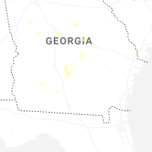


Connect with Interactive Hail Maps