

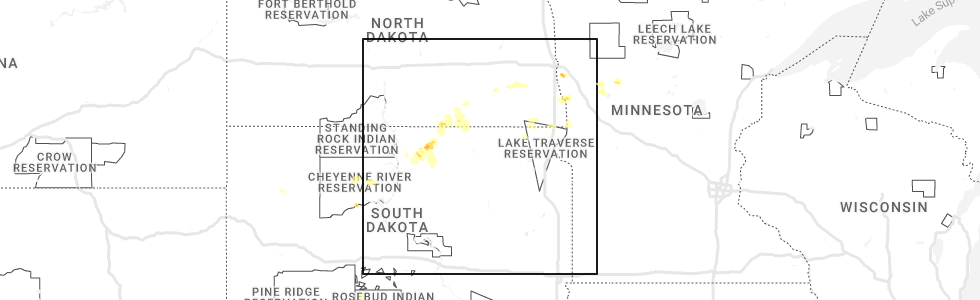
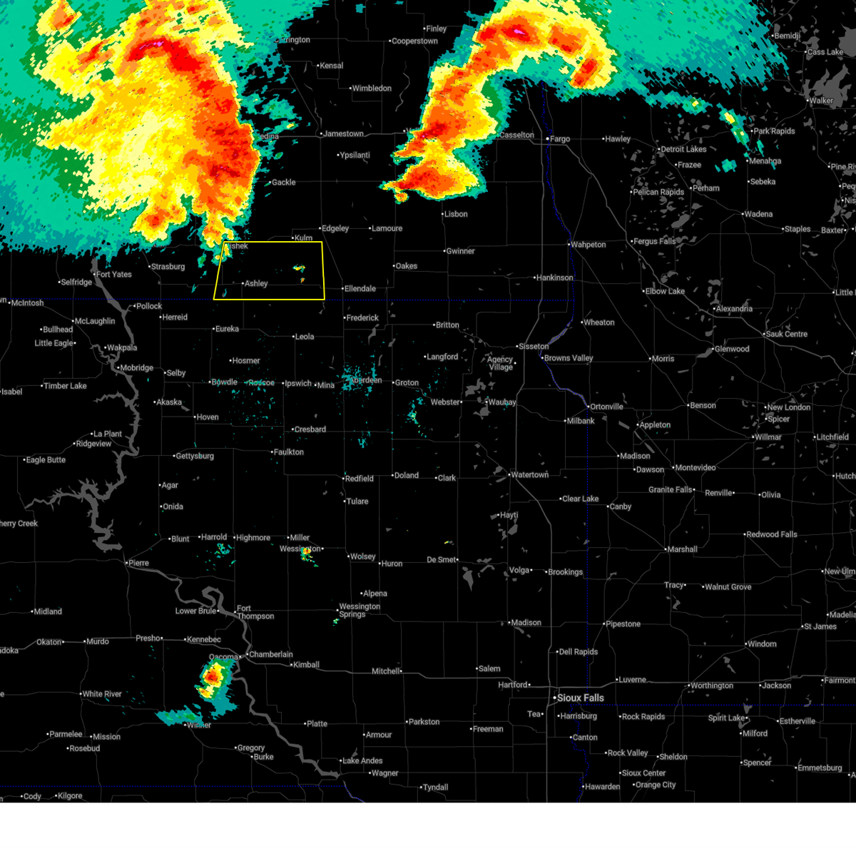
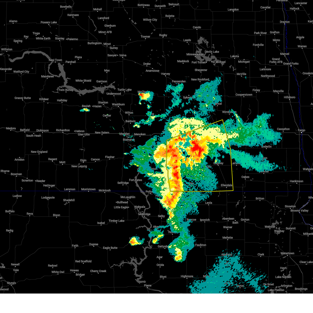
Hail Map for Forbes, ND
The Forbes, ND area has had 6 reports of on-the-ground hail by trained spotters, and has been under severe weather warnings 13 times during the past 12 months. Doppler radar has detected hail at or near Forbes, ND on 51 occasions.
| Name: | Forbes, ND |
| Where Located: | 36.3 miles NNW of Aberdeen, SD |
| Map: | Google Map for Forbes, ND |
| Population: | 53 |
| Housing Units: | 41 |
| More Info: | Search Google for Forbes, ND |
1
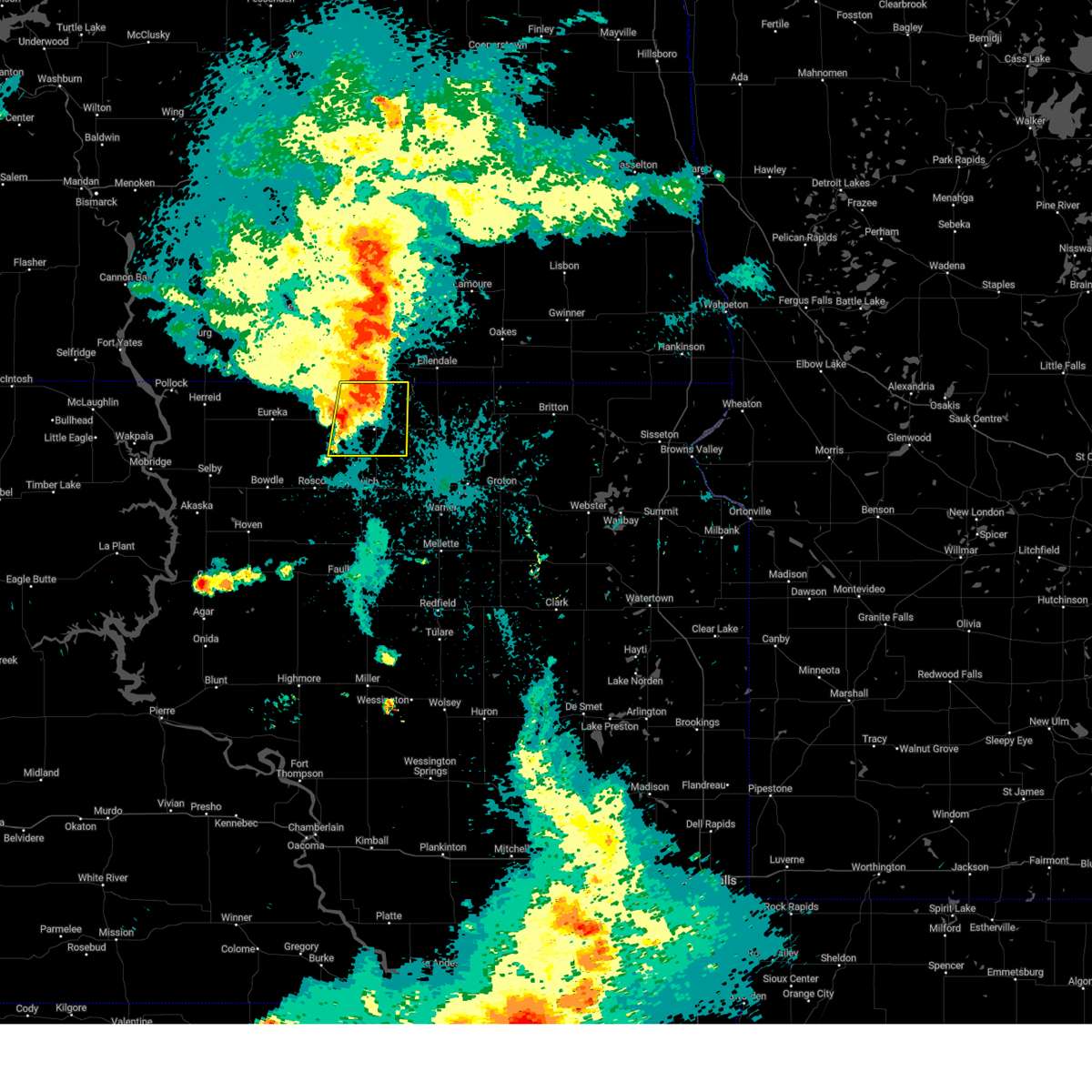
The Top Recent Hail Date for Forbes, ND is Friday, July 7, 2023 (16th out of 51)
Hail and Wind Damage Spotted near Forbes, ND
| Date / Time | Report Details |
|---|---|
| 6/20/2025 11:03 PM CDT |
 Svrabr the national weather service in aberdeen has issued a * severe thunderstorm warning for, northern edmunds county in north central south dakota, northern brown county in northeastern south dakota, mcpherson county in north central south dakota, * until 1145 pm cdt. * at 1103 pm cdt, outflow from severe thunderstorms were located along a line extending from fullerton to near loyalton, moving east at 50 mph (radar indicated). Hazards include 60 mph wind gusts. Expect damage to roofs, siding, and trees. severe thunderstorms will be near, frederick, deerfield colony, grassland colony, long lake colony, and wetonka around 1110 pm cdt. richmond lake rec area and barnard around 1115 pm cdt. westport around 1120 pm cdt. Other locations in the path of these severe thunderstorms include hecla, sand lake wildlife refuge, columbia and houghton. Svrabr the national weather service in aberdeen has issued a * severe thunderstorm warning for, northern edmunds county in north central south dakota, northern brown county in northeastern south dakota, mcpherson county in north central south dakota, * until 1145 pm cdt. * at 1103 pm cdt, outflow from severe thunderstorms were located along a line extending from fullerton to near loyalton, moving east at 50 mph (radar indicated). Hazards include 60 mph wind gusts. Expect damage to roofs, siding, and trees. severe thunderstorms will be near, frederick, deerfield colony, grassland colony, long lake colony, and wetonka around 1110 pm cdt. richmond lake rec area and barnard around 1115 pm cdt. westport around 1120 pm cdt. Other locations in the path of these severe thunderstorms include hecla, sand lake wildlife refuge, columbia and houghton.
|
| 6/20/2025 10:42 PM CDT |
 At 1041 pm cdt, outflow from severe thunderstorms in nd were located along a line extending from 11 miles southeast of lehr to bowdle, moving east at 65 mph (radar indicated). Hazards include 60 mph wind gusts. Expect damage to roofs, siding, and trees. Locations impacted include, bowdle, hosmer, long lake, new town corner, roscoe, spring creek colony, leola and forbes. At 1041 pm cdt, outflow from severe thunderstorms in nd were located along a line extending from 11 miles southeast of lehr to bowdle, moving east at 65 mph (radar indicated). Hazards include 60 mph wind gusts. Expect damage to roofs, siding, and trees. Locations impacted include, bowdle, hosmer, long lake, new town corner, roscoe, spring creek colony, leola and forbes.
|
| 6/20/2025 10:42 PM CDT |
 the severe thunderstorm warning has been cancelled and is no longer in effect the severe thunderstorm warning has been cancelled and is no longer in effect
|
| 6/20/2025 10:16 PM CDT |
 Svrabr the national weather service in aberdeen has issued a * severe thunderstorm warning for, northwestern edmunds county in north central south dakota, eastern campbell county in north central south dakota, mcpherson county in north central south dakota, northeastern walworth county in north central south dakota, * until 1100 pm cdt. * at 1016 pm cdt, outflow winds from severe thunderstorms in nd were located along a line extending from 6 miles south of wishek to near akaska, moving east at 65 mph (radar indicated). Hazards include 60 mph wind gusts. Expect damage to roofs, siding, and trees. severe thunderstorms will be near, eureka, selby, java, greenway, and lake hiddenwood rec area around 1020 pm cdt. bowdle and hillsview around 1030 pm cdt. hosmer and new town corner around 1035 pm cdt. Other locations in the path of these severe thunderstorms include long lake, roscoe and spring creek colony. Svrabr the national weather service in aberdeen has issued a * severe thunderstorm warning for, northwestern edmunds county in north central south dakota, eastern campbell county in north central south dakota, mcpherson county in north central south dakota, northeastern walworth county in north central south dakota, * until 1100 pm cdt. * at 1016 pm cdt, outflow winds from severe thunderstorms in nd were located along a line extending from 6 miles south of wishek to near akaska, moving east at 65 mph (radar indicated). Hazards include 60 mph wind gusts. Expect damage to roofs, siding, and trees. severe thunderstorms will be near, eureka, selby, java, greenway, and lake hiddenwood rec area around 1020 pm cdt. bowdle and hillsview around 1030 pm cdt. hosmer and new town corner around 1035 pm cdt. Other locations in the path of these severe thunderstorms include long lake, roscoe and spring creek colony.
|
| 6/20/2025 10:12 PM CDT |
 Svrbis the national weather service in bismarck has issued a * severe thunderstorm warning for, western dickey county in southeastern north dakota, mcintosh county in southeastern north dakota, * until 1045 pm cdt. * at 1012 pm cdt, severe thunderstorms were located along a line extending from 5 miles northwest of lehr to near ashley, moving east at 75 mph (radar indicated). Hazards include 70 mph wind gusts. Expect considerable tree damage. Damage is likely to mobile homes, roofs, and outbuildings. Svrbis the national weather service in bismarck has issued a * severe thunderstorm warning for, western dickey county in southeastern north dakota, mcintosh county in southeastern north dakota, * until 1045 pm cdt. * at 1012 pm cdt, severe thunderstorms were located along a line extending from 5 miles northwest of lehr to near ashley, moving east at 75 mph (radar indicated). Hazards include 70 mph wind gusts. Expect considerable tree damage. Damage is likely to mobile homes, roofs, and outbuildings.
|
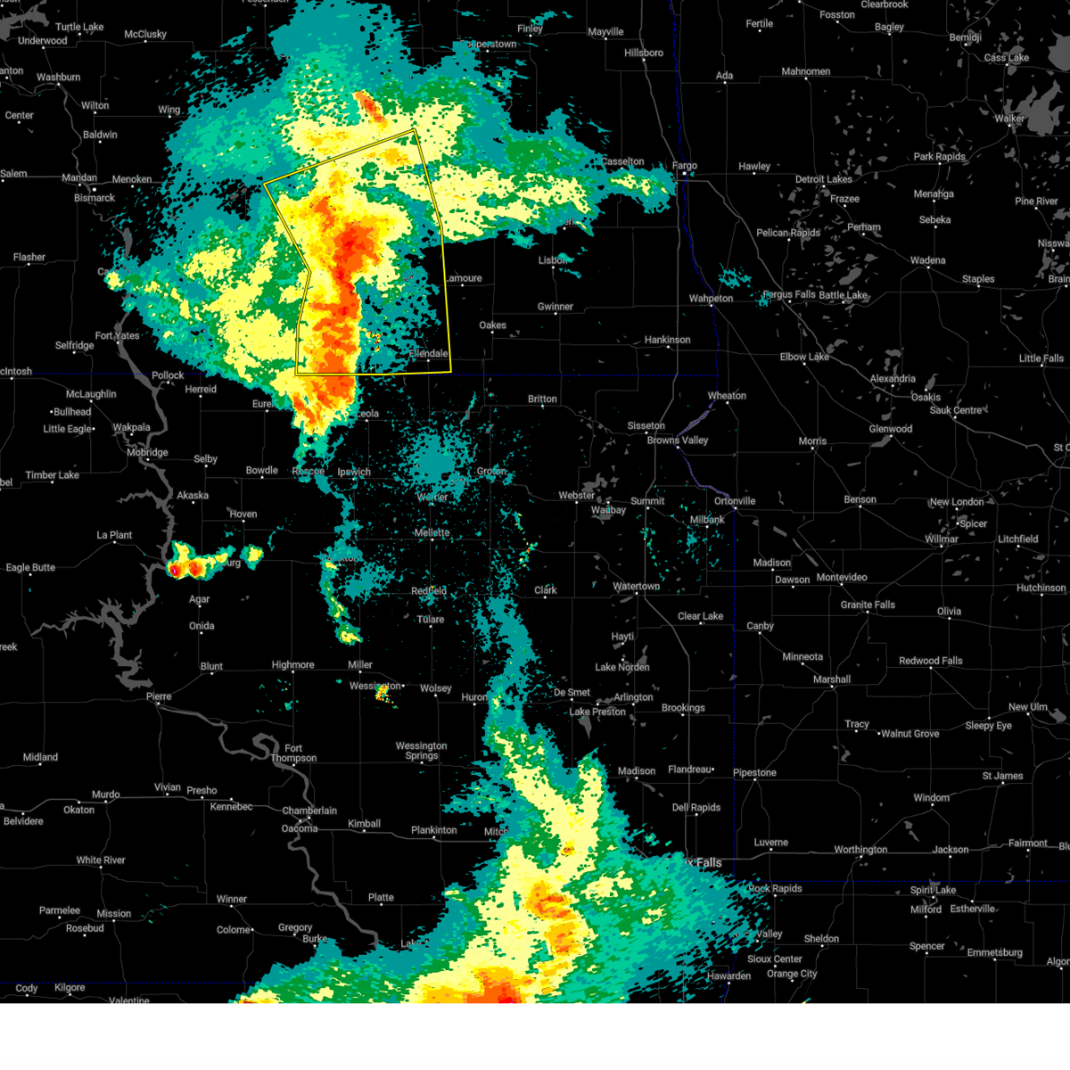
| 7/29/2024 10:27 PM CDT |
 Svrbis the national weather service in bismarck has issued a * severe thunderstorm warning for, lamoure county in southeastern north dakota, dickey county in southeastern north dakota, southeastern stutsman county in southeastern north dakota, * until 1130 pm cdt. * at 1027 pm cdt, severe thunderstorms were located along a line extending from near adrian to 9 miles northwest of fullerton to 5 miles southwest of ellendale, moving east at 40 mph (radar indicated). Hazards include 60 mph wind gusts. expect damage to roofs, siding, and trees Svrbis the national weather service in bismarck has issued a * severe thunderstorm warning for, lamoure county in southeastern north dakota, dickey county in southeastern north dakota, southeastern stutsman county in southeastern north dakota, * until 1130 pm cdt. * at 1027 pm cdt, severe thunderstorms were located along a line extending from near adrian to 9 miles northwest of fullerton to 5 miles southwest of ellendale, moving east at 40 mph (radar indicated). Hazards include 60 mph wind gusts. expect damage to roofs, siding, and trees
|
| 7/29/2024 10:18 PM CDT |
 At 1018 pm cdt, severe thunderstorms were located along a line extending from 8 miles west of jamestown to 6 miles southwest of adrian to 7 miles west of ellendale, moving east at 55 mph (radar indicated). Hazards include 60 mph wind gusts. Expect damage to roofs, siding, and trees. these severe storms will be near, ellendale, ypsilanti, adrian, montpelier, fullerton, and dickey around 1025 pm cdt. Other locations impacted by these severe thunderstorms include nortonville, monango, berlin, alfred, merricourt, sydney, and millarton. At 1018 pm cdt, severe thunderstorms were located along a line extending from 8 miles west of jamestown to 6 miles southwest of adrian to 7 miles west of ellendale, moving east at 55 mph (radar indicated). Hazards include 60 mph wind gusts. Expect damage to roofs, siding, and trees. these severe storms will be near, ellendale, ypsilanti, adrian, montpelier, fullerton, and dickey around 1025 pm cdt. Other locations impacted by these severe thunderstorms include nortonville, monango, berlin, alfred, merricourt, sydney, and millarton.
|
| 7/29/2024 10:18 PM CDT |
 the severe thunderstorm warning has been cancelled and is no longer in effect the severe thunderstorm warning has been cancelled and is no longer in effect
|
| 7/29/2024 10:08 PM CDT |
 At 1008 pm cdt, a severe thunderstorm was located near leola, moving east at 25 mph (trained weather spotters). Hazards include 60 mph wind gusts and penny size hail. Expect damage to roofs, siding, and trees. Locations impacted include, leola and elm lake. At 1008 pm cdt, a severe thunderstorm was located near leola, moving east at 25 mph (trained weather spotters). Hazards include 60 mph wind gusts and penny size hail. Expect damage to roofs, siding, and trees. Locations impacted include, leola and elm lake.
|
| 7/29/2024 10:01 PM CDT |
 At 959 pm cdt, severe thunderstorms were located along a line extending from 4 miles southwest of cleveland to near jud to 6 miles northwest of spring creek colony, moving east at 55 mph (public. at 955 pm at 66 mph gust was reported 7 miles northwest of wirch). Hazards include 60 mph wind gusts. Expect damage to roofs, siding, and trees. these severe storms will be near, edgeley, jud, forbes, and merricourt city around 1005 pm cdt. jamestown, ellendale, adrian, montpelier, and dickey around 1020 pm cdt. ypsilanti and fullerton around 1025 pm cdt. Other locations impacted by these severe thunderstorms include eldridge, nortonville, monango, fredonia, berlin, windsor, alfred, streeter memorial, merricourt, and sydney. At 959 pm cdt, severe thunderstorms were located along a line extending from 4 miles southwest of cleveland to near jud to 6 miles northwest of spring creek colony, moving east at 55 mph (public. at 955 pm at 66 mph gust was reported 7 miles northwest of wirch). Hazards include 60 mph wind gusts. Expect damage to roofs, siding, and trees. these severe storms will be near, edgeley, jud, forbes, and merricourt city around 1005 pm cdt. jamestown, ellendale, adrian, montpelier, and dickey around 1020 pm cdt. ypsilanti and fullerton around 1025 pm cdt. Other locations impacted by these severe thunderstorms include eldridge, nortonville, monango, fredonia, berlin, windsor, alfred, streeter memorial, merricourt, and sydney.
|
| 7/29/2024 9:47 PM CDT |
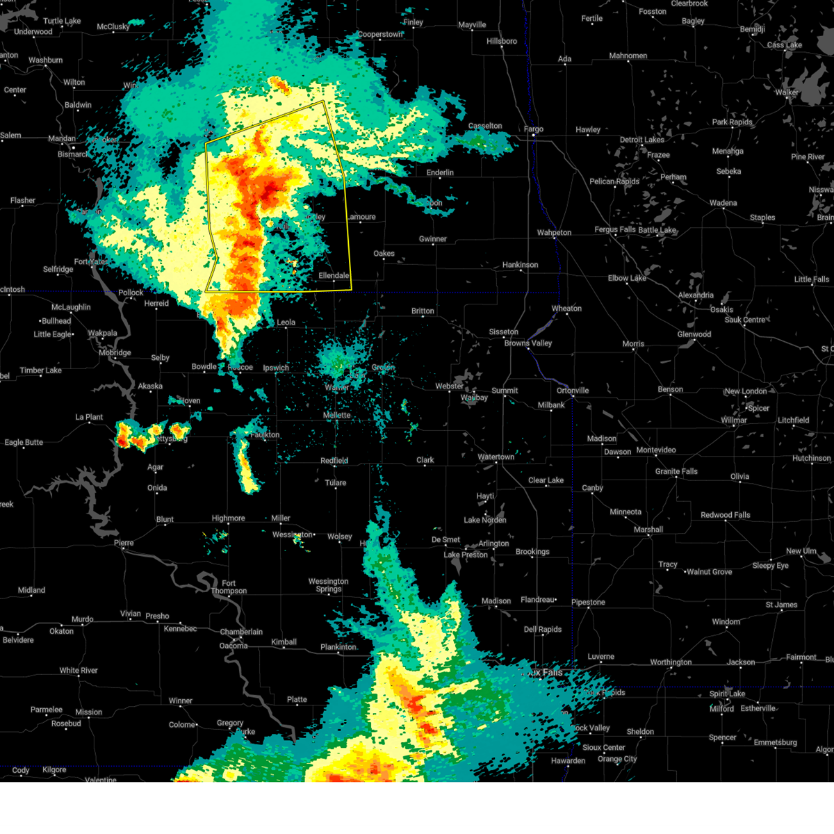 At 946 pm cdt, severe thunderstorms were located along a line extending from 7 miles southwest of medina to 12 miles south of gackle to 5 miles north of long lake, moving east at 50 mph (radar indicated). Hazards include 60 mph wind gusts. Expect damage to roofs, siding, and trees. these severe storms will be near, gackle around 950 pm cdt. kulm and jud around 955 pm cdt. cleveland around 1000 pm cdt. edgeley, forbes, and merricourt city around 1005 pm cdt. jamestown, ellendale, adrian, montpelier, and dickey around 1020 pm cdt. ypsilanti and fullerton around 1025 pm cdt. Other locations impacted by these severe thunderstorms include eldridge, monango, fredonia, berlin, windsor, merricourt, millarton, nortonville, green lake, and danzig. At 946 pm cdt, severe thunderstorms were located along a line extending from 7 miles southwest of medina to 12 miles south of gackle to 5 miles north of long lake, moving east at 50 mph (radar indicated). Hazards include 60 mph wind gusts. Expect damage to roofs, siding, and trees. these severe storms will be near, gackle around 950 pm cdt. kulm and jud around 955 pm cdt. cleveland around 1000 pm cdt. edgeley, forbes, and merricourt city around 1005 pm cdt. jamestown, ellendale, adrian, montpelier, and dickey around 1020 pm cdt. ypsilanti and fullerton around 1025 pm cdt. Other locations impacted by these severe thunderstorms include eldridge, monango, fredonia, berlin, windsor, merricourt, millarton, nortonville, green lake, and danzig.
|
| 7/29/2024 9:32 PM CDT |
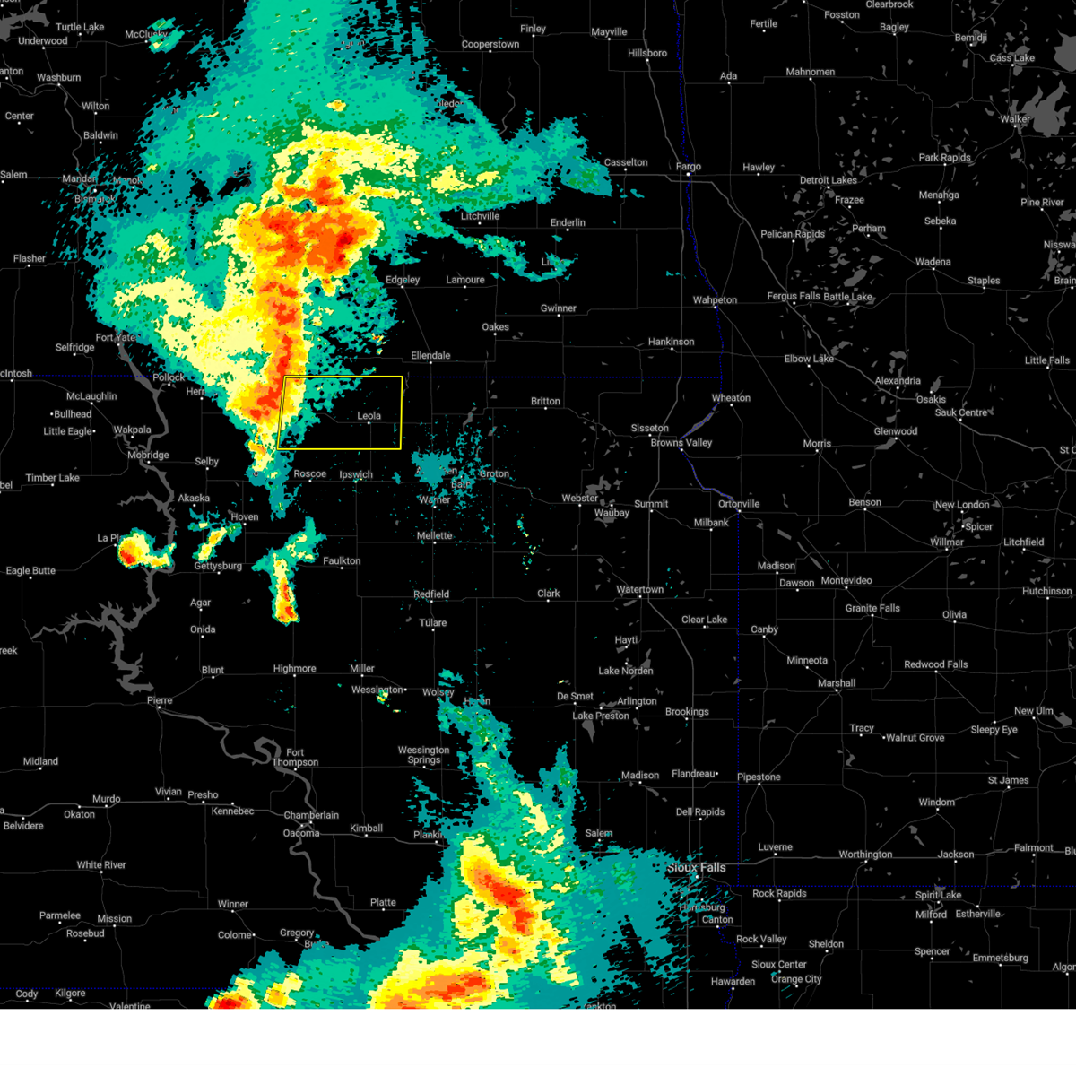 Svrabr the national weather service in aberdeen has issued a * severe thunderstorm warning for, mcpherson county in north central south dakota, * until 1015 pm cdt. * at 932 pm cdt, a severe thunderstorm was located near new town corner, or 11 miles east of eureka, moving east at 40 mph (trained weather spotters). Hazards include 60 mph wind gusts and penny size hail. Expect damage to roofs, siding, and trees. this severe thunderstorm will be near, new town corner around 935 pm cdt. long lake around 940 pm cdt. Other locations in the path of this severe thunderstorm include leola. Svrabr the national weather service in aberdeen has issued a * severe thunderstorm warning for, mcpherson county in north central south dakota, * until 1015 pm cdt. * at 932 pm cdt, a severe thunderstorm was located near new town corner, or 11 miles east of eureka, moving east at 40 mph (trained weather spotters). Hazards include 60 mph wind gusts and penny size hail. Expect damage to roofs, siding, and trees. this severe thunderstorm will be near, new town corner around 935 pm cdt. long lake around 940 pm cdt. Other locations in the path of this severe thunderstorm include leola.
|
| 7/29/2024 9:23 PM CDT |
 Svrbis the national weather service in bismarck has issued a * severe thunderstorm warning for, lamoure county in southeastern north dakota, dickey county in southeastern north dakota, southeastern kidder county in south central north dakota, logan county in southeastern north dakota, mcintosh county in southeastern north dakota, southern stutsman county in southeastern north dakota, * until 1030 pm cdt. * at 922 pm cdt, severe thunderstorms were located along a line extending from 4 miles southeast of lake isabel to 13 miles southwest of streeter to 7 miles southeast of venturia, moving east at 50 mph (public. at 858 pm a 59 mph wind gust was reported in napoleon). Hazards include 60 mph wind gusts. expect damage to roofs, siding, and trees Svrbis the national weather service in bismarck has issued a * severe thunderstorm warning for, lamoure county in southeastern north dakota, dickey county in southeastern north dakota, southeastern kidder county in south central north dakota, logan county in southeastern north dakota, mcintosh county in southeastern north dakota, southern stutsman county in southeastern north dakota, * until 1030 pm cdt. * at 922 pm cdt, severe thunderstorms were located along a line extending from 4 miles southeast of lake isabel to 13 miles southwest of streeter to 7 miles southeast of venturia, moving east at 50 mph (public. at 858 pm a 59 mph wind gust was reported in napoleon). Hazards include 60 mph wind gusts. expect damage to roofs, siding, and trees
|
| 6/18/2024 2:38 AM CDT |
 The storms which prompted the warning have weakened below severe limits. therefore, the warning will be allowed to expire. however, gusty winds are still possible with these thunderstorms. a severe thunderstorm watch remains in effect until 600 am cdt for southeastern north dakota. The storms which prompted the warning have weakened below severe limits. therefore, the warning will be allowed to expire. however, gusty winds are still possible with these thunderstorms. a severe thunderstorm watch remains in effect until 600 am cdt for southeastern north dakota.
|
| 6/18/2024 2:12 AM CDT |
 At 212 am cdt, severe thunderstorms were located along a line extending from 5 miles southeast of litchville to 5 miles south of la moure city to 6 miles southwest of ellendale, moving east at 40 mph (radar indicated). Hazards include 60 mph wind gusts and penny size hail. Expect damage to roofs, siding, and trees. Locations impacted include, ellendale, oakes, lamoure, ashley, edgeley, kulm, marion, la moure, adrian, verona, jud, fullerton, forbes, dickey, ludden, venturia, la moure city, merricourt city, grand rapids, and fredonia. At 212 am cdt, severe thunderstorms were located along a line extending from 5 miles southeast of litchville to 5 miles south of la moure city to 6 miles southwest of ellendale, moving east at 40 mph (radar indicated). Hazards include 60 mph wind gusts and penny size hail. Expect damage to roofs, siding, and trees. Locations impacted include, ellendale, oakes, lamoure, ashley, edgeley, kulm, marion, la moure, adrian, verona, jud, fullerton, forbes, dickey, ludden, venturia, la moure city, merricourt city, grand rapids, and fredonia.
|
| 6/18/2024 1:59 AM CDT |
 At 158 am cdt, severe thunderstorms were located along a line extending from near marion to 8 miles north of fullerton to forbes, moving east at 35 mph (radar indicated). Hazards include 60 mph wind gusts and penny size hail. Expect damage to roofs, siding, and trees. Locations impacted include, ellendale, oakes, wishek, lamoure, ashley, edgeley, kulm, gackle, marion, la moure, adrian, zeeland, verona, lehr, jud, fullerton, forbes, dickey, ludden, and venturia. At 158 am cdt, severe thunderstorms were located along a line extending from near marion to 8 miles north of fullerton to forbes, moving east at 35 mph (radar indicated). Hazards include 60 mph wind gusts and penny size hail. Expect damage to roofs, siding, and trees. Locations impacted include, ellendale, oakes, wishek, lamoure, ashley, edgeley, kulm, gackle, marion, la moure, adrian, zeeland, verona, lehr, jud, fullerton, forbes, dickey, ludden, and venturia.
|
| 6/18/2024 1:39 AM CDT |
 Svrbis the national weather service in bismarck has issued a * severe thunderstorm warning for, lamoure county in southeastern north dakota, dickey county in southeastern north dakota, eastern logan county in southeastern north dakota, mcintosh county in southeastern north dakota, * until 245 am cdt. * at 138 am cdt, severe thunderstorms were located along a line extending from near adrian to 5 miles northeast of merricourt city to 6 miles northwest of spring creek colony, moving east at 40 mph (radar indicated). Hazards include 70 mph wind gusts and penny size hail. Expect considerable tree damage. Damage is likely to mobile homes, roofs, and outbuildings. Svrbis the national weather service in bismarck has issued a * severe thunderstorm warning for, lamoure county in southeastern north dakota, dickey county in southeastern north dakota, eastern logan county in southeastern north dakota, mcintosh county in southeastern north dakota, * until 245 am cdt. * at 138 am cdt, severe thunderstorms were located along a line extending from near adrian to 5 miles northeast of merricourt city to 6 miles northwest of spring creek colony, moving east at 40 mph (radar indicated). Hazards include 70 mph wind gusts and penny size hail. Expect considerable tree damage. Damage is likely to mobile homes, roofs, and outbuildings.
|
| 5/23/2024 4:05 PM CDT | Quarter sized hail reported 4 miles S of Forbes, ND, relayed via social media. |
| 5/23/2024 3:50 PM CDT |
 Svrbis the national weather service in bismarck has issued a * severe thunderstorm warning for, western dickey county in southeastern north dakota, * until 445 pm cdt. * at 350 pm cdt, a severe thunderstorm was located 5 miles northwest of forbes, or 16 miles west of ellendale, moving northeast at 25 mph (radar indicated). Hazards include ping pong ball size hail and 60 mph wind gusts. People and animals outdoors will be injured. expect hail damage to roofs, siding, windows, and vehicles. Expect wind damage to roofs, siding, and trees. Svrbis the national weather service in bismarck has issued a * severe thunderstorm warning for, western dickey county in southeastern north dakota, * until 445 pm cdt. * at 350 pm cdt, a severe thunderstorm was located 5 miles northwest of forbes, or 16 miles west of ellendale, moving northeast at 25 mph (radar indicated). Hazards include ping pong ball size hail and 60 mph wind gusts. People and animals outdoors will be injured. expect hail damage to roofs, siding, windows, and vehicles. Expect wind damage to roofs, siding, and trees.
|
| 5/17/2024 9:58 PM CDT |
 The storms which prompted the warning have moved out of the area. therefore, the warning will be allowed to expire. however, gusty winds are still possible with these thunderstorms. a severe thunderstorm watch remains in effect until midnight cdt for north central and northeastern south dakota. The storms which prompted the warning have moved out of the area. therefore, the warning will be allowed to expire. however, gusty winds are still possible with these thunderstorms. a severe thunderstorm watch remains in effect until midnight cdt for north central and northeastern south dakota.
|
| 5/17/2024 9:11 PM CDT | Storm damage reported in mcpherson county SD, 10.1 miles NE of Forbes, ND |
| 5/17/2024 9:08 PM CDT |
 Svrabr the national weather service in aberdeen has issued a * severe thunderstorm warning for, edmunds county in north central south dakota, northwestern brown county in northeastern south dakota, eastern mcpherson county in north central south dakota, * until 1000 pm cdt. * at 908 pm cdt, severe thunderstorms were located along a line extending from 6 miles west of spring creek colony to 8 miles north of onaka, moving east at 45 mph (radar indicated). Hazards include 60 mph wind gusts. Expect damage to roofs, siding, and trees. severe thunderstorms will be near, leola, roscoe, spring creek colony, plainview colony, and forbes around 915 pm cdt. ipswich and elm lake around 920 pm cdt. deerfield colony, grassland colony, and long lake colony around 925 pm cdt. Other locations in the path of these severe thunderstorms include pembrook colony, wetonka, cravens corner, frederick, mina lake rec area, mina, richmond lake rec area and barnard. Svrabr the national weather service in aberdeen has issued a * severe thunderstorm warning for, edmunds county in north central south dakota, northwestern brown county in northeastern south dakota, eastern mcpherson county in north central south dakota, * until 1000 pm cdt. * at 908 pm cdt, severe thunderstorms were located along a line extending from 6 miles west of spring creek colony to 8 miles north of onaka, moving east at 45 mph (radar indicated). Hazards include 60 mph wind gusts. Expect damage to roofs, siding, and trees. severe thunderstorms will be near, leola, roscoe, spring creek colony, plainview colony, and forbes around 915 pm cdt. ipswich and elm lake around 920 pm cdt. deerfield colony, grassland colony, and long lake colony around 925 pm cdt. Other locations in the path of these severe thunderstorms include pembrook colony, wetonka, cravens corner, frederick, mina lake rec area, mina, richmond lake rec area and barnard.
|
| 7/7/2023 3:11 PM CDT |
 The severe thunderstorm warning for southwestern dickey and southeastern mcintosh counties will expire at 315 pm cdt, the storms which prompted the warning have moved out of the area. therefore, the warning will be allowed to expire. The severe thunderstorm warning for southwestern dickey and southeastern mcintosh counties will expire at 315 pm cdt, the storms which prompted the warning have moved out of the area. therefore, the warning will be allowed to expire.
|
| 7/7/2023 2:55 PM CDT |
 At 254 pm cdt, severe thunderstorms were located along a line extending from 4 miles northeast of elm lake to 5 miles northeast of long lake to 8 miles south of venturia, moving south at 10 mph (radar indicated). Hazards include 60 mph wind gusts and quarter size hail. Hail damage to vehicles is expected. expect wind damage to roofs, siding, and trees. Locations impacted include, forbes. At 254 pm cdt, severe thunderstorms were located along a line extending from 4 miles northeast of elm lake to 5 miles northeast of long lake to 8 miles south of venturia, moving south at 10 mph (radar indicated). Hazards include 60 mph wind gusts and quarter size hail. Hail damage to vehicles is expected. expect wind damage to roofs, siding, and trees. Locations impacted include, forbes.
|
| 7/7/2023 2:41 PM CDT |
 At 241 pm cdt, severe thunderstorms were located along a line extending from 6 miles northeast of forbes to 7 miles northeast of long lake to 5 miles south of venturia, moving south at 5 mph (radar indicated). Hazards include 60 mph wind gusts and quarter size hail. Hail damage to vehicles is expected. expect wind damage to roofs, siding, and trees. Locations impacted include, forbes. At 241 pm cdt, severe thunderstorms were located along a line extending from 6 miles northeast of forbes to 7 miles northeast of long lake to 5 miles south of venturia, moving south at 5 mph (radar indicated). Hazards include 60 mph wind gusts and quarter size hail. Hail damage to vehicles is expected. expect wind damage to roofs, siding, and trees. Locations impacted include, forbes.
|
| 7/7/2023 2:29 PM CDT |
 At 229 pm cdt, severe thunderstorms were located along a line extending from 6 miles northeast of forbes to 8 miles northeast of long lake to 4 miles south of venturia, moving south at 5 mph (radar indicated). Hazards include 60 mph wind gusts and quarter size hail. Hail damage to vehicles is expected. expect wind damage to roofs, siding, and trees. Severe thunderstorms will be near, forbes around 305 pm cdt. At 229 pm cdt, severe thunderstorms were located along a line extending from 6 miles northeast of forbes to 8 miles northeast of long lake to 4 miles south of venturia, moving south at 5 mph (radar indicated). Hazards include 60 mph wind gusts and quarter size hail. Hail damage to vehicles is expected. expect wind damage to roofs, siding, and trees. Severe thunderstorms will be near, forbes around 305 pm cdt.
|
| 7/23/2022 6:42 AM CDT |
 At 642 am cdt, a severe thunderstorm was located 7 miles south of elm lake, or 18 miles southwest of ellendale, moving east at 45 mph (radar indicated). Hazards include 60 mph wind gusts and quarter size hail. Hail damage to vehicles is expected. expect wind damage to roofs, siding, and trees. locations impacted include, frederick and barnard. hail threat, radar indicated max hail size, 1. 00 in wind threat, radar indicated max wind gust, 60 mph. At 642 am cdt, a severe thunderstorm was located 7 miles south of elm lake, or 18 miles southwest of ellendale, moving east at 45 mph (radar indicated). Hazards include 60 mph wind gusts and quarter size hail. Hail damage to vehicles is expected. expect wind damage to roofs, siding, and trees. locations impacted include, frederick and barnard. hail threat, radar indicated max hail size, 1. 00 in wind threat, radar indicated max wind gust, 60 mph.
|
| 7/23/2022 6:14 AM CDT |
 At 614 am cdt, a severe thunderstorm was located near long lake, or 20 miles southeast of ashley, moving east at 45 mph (radar indicated). Hazards include 60 mph wind gusts and quarter size hail. Hail damage to vehicles is expected. expect wind damage to roofs, siding, and trees. this severe thunderstorm will be near, leola around 630 am cdt. other locations in the path of this severe thunderstorm include grassland colony, elm lake, frederick and barnard. hail threat, radar indicated max hail size, 1. 00 in wind threat, radar indicated max wind gust, 60 mph. At 614 am cdt, a severe thunderstorm was located near long lake, or 20 miles southeast of ashley, moving east at 45 mph (radar indicated). Hazards include 60 mph wind gusts and quarter size hail. Hail damage to vehicles is expected. expect wind damage to roofs, siding, and trees. this severe thunderstorm will be near, leola around 630 am cdt. other locations in the path of this severe thunderstorm include grassland colony, elm lake, frederick and barnard. hail threat, radar indicated max hail size, 1. 00 in wind threat, radar indicated max wind gust, 60 mph.
|
| 7/21/2022 6:54 PM CDT |
 At 654 pm cdt, a severe thunderstorm was located near forbes, or 16 miles west of ellendale, moving southeast at 35 mph (radar indicated). Hazards include 60 mph wind gusts and quarter size hail. Hail damage to vehicles is expected. expect wind damage to roofs, siding, and trees. this severe thunderstorm will be near, forbes around 705 pm cdt. other locations in the path of this severe thunderstorm include elm lake, frederick and barnard. hail threat, radar indicated max hail size, 1. 00 in wind threat, radar indicated max wind gust, 60 mph. At 654 pm cdt, a severe thunderstorm was located near forbes, or 16 miles west of ellendale, moving southeast at 35 mph (radar indicated). Hazards include 60 mph wind gusts and quarter size hail. Hail damage to vehicles is expected. expect wind damage to roofs, siding, and trees. this severe thunderstorm will be near, forbes around 705 pm cdt. other locations in the path of this severe thunderstorm include elm lake, frederick and barnard. hail threat, radar indicated max hail size, 1. 00 in wind threat, radar indicated max wind gust, 60 mph.
|
| 7/21/2022 6:30 PM CDT |
 At 630 pm cdt, a severe thunderstorm was located 12 miles south of kulm, or 17 miles east of ashley, moving southeast at 40 mph (radar indicated). Hazards include ping pong ball size hail and 60 mph wind gusts. People and animals outdoors will be injured. expect hail damage to roofs, siding, windows, and vehicles. Expect wind damage to roofs, siding, and trees. At 630 pm cdt, a severe thunderstorm was located 12 miles south of kulm, or 17 miles east of ashley, moving southeast at 40 mph (radar indicated). Hazards include ping pong ball size hail and 60 mph wind gusts. People and animals outdoors will be injured. expect hail damage to roofs, siding, windows, and vehicles. Expect wind damage to roofs, siding, and trees.
|
| 6/24/2022 9:57 PM CDT |
 The severe thunderstorm warning for southeastern lamoure and dickey counties will expire at 1000 pm cdt, the storms which prompted the warning have weakened below severe limits, and no longer pose an immediate threat to life or property. therefore, the warning will be allowed to expire. a severe thunderstorm watch remains in effect until 1100 pm cdt for southeastern north dakota. The severe thunderstorm warning for southeastern lamoure and dickey counties will expire at 1000 pm cdt, the storms which prompted the warning have weakened below severe limits, and no longer pose an immediate threat to life or property. therefore, the warning will be allowed to expire. a severe thunderstorm watch remains in effect until 1100 pm cdt for southeastern north dakota.
|
| 6/24/2022 9:49 PM CDT |
 At 948 pm cdt, severe thunderstorms were located along a line extending from near lisbon to 8 miles west of gwinner to near ludden, moving east at 45 mph (radar indicated). Hazards include 60 mph wind gusts and penny size hail. Expect damage to roofs, siding, and trees. locations impacted include, oakes, ellendale, lamoure, verona, fullerton, forbes, ludden, monango, guelph and glover. hail threat, radar indicated max hail size, 0. 75 in wind threat, radar indicated max wind gust, 60 mph. At 948 pm cdt, severe thunderstorms were located along a line extending from near lisbon to 8 miles west of gwinner to near ludden, moving east at 45 mph (radar indicated). Hazards include 60 mph wind gusts and penny size hail. Expect damage to roofs, siding, and trees. locations impacted include, oakes, ellendale, lamoure, verona, fullerton, forbes, ludden, monango, guelph and glover. hail threat, radar indicated max hail size, 0. 75 in wind threat, radar indicated max wind gust, 60 mph.
|
| 6/24/2022 9:35 PM CDT |
 At 935 pm cdt, severe thunderstorms were located along a line extending from 7 miles northeast of verona to near oakes to 7 miles southwest of ludden, moving east at 50 mph (radar indicated). Hazards include 60 mph wind gusts and quarter size hail. Hail damage to vehicles is expected. expect wind damage to roofs, siding, and trees. these severe thunderstorms will remain over mainly rural areas of southeastern lamoure and dickey counties, including the following locations, monango, guelph, berlin, grand rapids and glover. hail threat, radar indicated max hail size, 1. 00 in wind threat, radar indicated max wind gust, 60 mph. At 935 pm cdt, severe thunderstorms were located along a line extending from 7 miles northeast of verona to near oakes to 7 miles southwest of ludden, moving east at 50 mph (radar indicated). Hazards include 60 mph wind gusts and quarter size hail. Hail damage to vehicles is expected. expect wind damage to roofs, siding, and trees. these severe thunderstorms will remain over mainly rural areas of southeastern lamoure and dickey counties, including the following locations, monango, guelph, berlin, grand rapids and glover. hail threat, radar indicated max hail size, 1. 00 in wind threat, radar indicated max wind gust, 60 mph.
|
| 6/24/2022 9:20 PM CDT |
 At 919 pm cdt, severe thunderstorms were located along a line extending from 5 miles west of verona to 8 miles west of oakes to 5 miles north of frederick, moving east at 45 mph (radar indicated). Hazards include 60 mph wind gusts and quarter size hail. Hail damage to vehicles is expected. expect wind damage to roofs, siding, and trees. severe thunderstorms will be near, verona around 925 pm cdt. oakes around 930 pm cdt. other locations in the path of these severe thunderstorms include ludden. hail threat, radar indicated max hail size, 1. 00 in wind threat, radar indicated max wind gust, 60 mph. At 919 pm cdt, severe thunderstorms were located along a line extending from 5 miles west of verona to 8 miles west of oakes to 5 miles north of frederick, moving east at 45 mph (radar indicated). Hazards include 60 mph wind gusts and quarter size hail. Hail damage to vehicles is expected. expect wind damage to roofs, siding, and trees. severe thunderstorms will be near, verona around 925 pm cdt. oakes around 930 pm cdt. other locations in the path of these severe thunderstorms include ludden. hail threat, radar indicated max hail size, 1. 00 in wind threat, radar indicated max wind gust, 60 mph.
|
| 6/20/2022 4:51 PM CDT |
 At 451 pm cdt, a severe thunderstorm was located 6 miles northeast of forbes, or 9 miles west of ellendale, moving northeast at 30 mph (radar indicated). Hazards include two inch hail and 60 mph wind gusts. People and animals outdoors will be injured. expect hail damage to roofs, siding, windows, and vehicles. expect wind damage to roofs, siding, and trees. locations impacted include, ellendale, fullerton, forbes, monango and merricourt. thunderstorm damage threat, considerable hail threat, radar indicated max hail size, 2. 00 in wind threat, radar indicated max wind gust, 60 mph. At 451 pm cdt, a severe thunderstorm was located 6 miles northeast of forbes, or 9 miles west of ellendale, moving northeast at 30 mph (radar indicated). Hazards include two inch hail and 60 mph wind gusts. People and animals outdoors will be injured. expect hail damage to roofs, siding, windows, and vehicles. expect wind damage to roofs, siding, and trees. locations impacted include, ellendale, fullerton, forbes, monango and merricourt. thunderstorm damage threat, considerable hail threat, radar indicated max hail size, 2. 00 in wind threat, radar indicated max wind gust, 60 mph.
|
| 6/20/2022 4:45 PM CDT | At least 60 mph gusts... blowing dirt around. dime size hai in dickey county ND, 2.6 miles S of Forbes, ND |
| 6/20/2022 4:38 PM CDT |
 At 438 pm cdt, a severe thunderstorm was located near spring creek colony, or 17 miles west of ellendale, moving northeast at 30 mph (radar indicated). Hazards include golf ball size hail and 60 mph wind gusts. People and animals outdoors will be injured. expect hail damage to roofs, siding, windows, and vehicles. expect wind damage to roofs, siding, and trees. this severe thunderstorm will be near, forbes around 445 pm cdt. other locations in the path of this severe thunderstorm include fullerton. thunderstorm damage threat, considerable hail threat, radar indicated max hail size, 1. 75 in wind threat, radar indicated max wind gust, 60 mph. At 438 pm cdt, a severe thunderstorm was located near spring creek colony, or 17 miles west of ellendale, moving northeast at 30 mph (radar indicated). Hazards include golf ball size hail and 60 mph wind gusts. People and animals outdoors will be injured. expect hail damage to roofs, siding, windows, and vehicles. expect wind damage to roofs, siding, and trees. this severe thunderstorm will be near, forbes around 445 pm cdt. other locations in the path of this severe thunderstorm include fullerton. thunderstorm damage threat, considerable hail threat, radar indicated max hail size, 1. 75 in wind threat, radar indicated max wind gust, 60 mph.
|
| 6/20/2022 4:26 PM CDT |
 At 426 pm cdt, a severe thunderstorm capable of producing a tornado was located near spring creek colony, or 21 miles east of ashley, moving northeast at 40 mph (radar indicated rotation). Hazards include tornado. Flying debris will be dangerous to those caught without shelter. mobile homes will be damaged or destroyed. damage to roofs, windows, and vehicles will occur. tree damage is likely. this dangerous storm will be near, spring creek colony around 430 pm cdt. Forbes around 440 pm cdt. At 426 pm cdt, a severe thunderstorm capable of producing a tornado was located near spring creek colony, or 21 miles east of ashley, moving northeast at 40 mph (radar indicated rotation). Hazards include tornado. Flying debris will be dangerous to those caught without shelter. mobile homes will be damaged or destroyed. damage to roofs, windows, and vehicles will occur. tree damage is likely. this dangerous storm will be near, spring creek colony around 430 pm cdt. Forbes around 440 pm cdt.
|
| 6/14/2022 5:14 AM CDT |
 At 513 am cdt, severe thunderstorms were located along a line extending from 13 miles northwest of ellendale to 8 miles southeast of fullerton to near hecla, moving northeast at 55 mph. these are destructive storms for central and eastern dickey county (trained weather spotters). Hazards include 80 mph wind gusts and two inch hail. Flying debris will be dangerous to those caught without shelter. mobile homes will be heavily damaged. expect considerable damage to roofs, windows, and vehicles. extensive tree damage and power outages are likely. locations impacted include, oakes, ellendale, fullerton, forbes, ludden, monango, guelph and glover. thunderstorm damage threat, destructive hail threat, radar indicated max hail size, 2. 00 in wind threat, observed max wind gust, 80 mph. At 513 am cdt, severe thunderstorms were located along a line extending from 13 miles northwest of ellendale to 8 miles southeast of fullerton to near hecla, moving northeast at 55 mph. these are destructive storms for central and eastern dickey county (trained weather spotters). Hazards include 80 mph wind gusts and two inch hail. Flying debris will be dangerous to those caught without shelter. mobile homes will be heavily damaged. expect considerable damage to roofs, windows, and vehicles. extensive tree damage and power outages are likely. locations impacted include, oakes, ellendale, fullerton, forbes, ludden, monango, guelph and glover. thunderstorm damage threat, destructive hail threat, radar indicated max hail size, 2. 00 in wind threat, observed max wind gust, 80 mph.
|
| 6/14/2022 5:00 AM CDT | Tea Cup sized hail reported 0.2 miles N of Forbes, ND, facebook photo of a hailstone measured to be about 3 inches in diameter. relayed by broadcast media. the reporter says that cars have dents and expects to find damage t |
| 6/14/2022 5:00 AM CDT |
 At 459 am cdt, severe thunderstorms were located along a line extending from near ellendale to 7 miles east of frederick to near columbia, moving northeast at 55 mph. these are destructive storms for dickey county (trained weather spotters). Hazards include 80 mph wind gusts and golf ball size hail. Flying debris will be dangerous to those caught without shelter. mobile homes will be heavily damaged. expect considerable damage to roofs, windows, and vehicles. extensive tree damage and power outages are likely. locations impacted include, oakes, ellendale, fullerton, forbes, ludden, monango, guelph, glover, and merricourt. thunderstorm damage threat, destructive hail threat, observed max hail size, 1. 75 in wind threat, observed max wind gust, 80 mph. At 459 am cdt, severe thunderstorms were located along a line extending from near ellendale to 7 miles east of frederick to near columbia, moving northeast at 55 mph. these are destructive storms for dickey county (trained weather spotters). Hazards include 80 mph wind gusts and golf ball size hail. Flying debris will be dangerous to those caught without shelter. mobile homes will be heavily damaged. expect considerable damage to roofs, windows, and vehicles. extensive tree damage and power outages are likely. locations impacted include, oakes, ellendale, fullerton, forbes, ludden, monango, guelph, glover, and merricourt. thunderstorm damage threat, destructive hail threat, observed max hail size, 1. 75 in wind threat, observed max wind gust, 80 mph.
|
| 6/14/2022 4:56 AM CDT |
 At 455 am cdt, severe thunderstorms were located along a line extending from 6 miles west of ellendale to near frederick to near columbia, moving northeast at 90 mph. these are destructive storms for dickey county (trained weather spotters). Hazards include 80 mph wind gusts and golf ball size hail. Flying debris will be dangerous to those caught without shelter. mobile homes will be heavily damaged. expect considerable damage to roofs, windows, and vehicles. extensive tree damage and power outages are likely. locations impacted include, ellendale, fullerton, forbes, guelph, ludden, and oakes. thunderstorm damage threat, destructive hail threat, radar indicated max hail size, 1. 75 in wind threat, radar indicated max wind gust, 80 mph. At 455 am cdt, severe thunderstorms were located along a line extending from 6 miles west of ellendale to near frederick to near columbia, moving northeast at 90 mph. these are destructive storms for dickey county (trained weather spotters). Hazards include 80 mph wind gusts and golf ball size hail. Flying debris will be dangerous to those caught without shelter. mobile homes will be heavily damaged. expect considerable damage to roofs, windows, and vehicles. extensive tree damage and power outages are likely. locations impacted include, ellendale, fullerton, forbes, guelph, ludden, and oakes. thunderstorm damage threat, destructive hail threat, radar indicated max hail size, 1. 75 in wind threat, radar indicated max wind gust, 80 mph.
|
| 6/14/2022 4:43 AM CDT |
 At 442 am cdt, severe thunderstorms were located along a line extending from near forbes to 6 miles west of barnard to near richmond lake rec area, moving northeast at 55 mph (trained weather spotters). Hazards include 70 mph wind gusts and ping pong ball size hail. People and animals outdoors will be injured. expect hail damage to roofs, siding, windows, and vehicles. expect considerable tree damage. wind damage is also likely to mobile homes, roofs, and outbuildings. severe thunderstorms will be near, ellendale around 500 am cdt. other locations in the path of these severe thunderstorms include fullerton, ludden and oakes. thunderstorm damage threat, considerable hail threat, radar indicated max hail size, 1. 50 in wind threat, radar indicated max wind gust, 70 mph. At 442 am cdt, severe thunderstorms were located along a line extending from near forbes to 6 miles west of barnard to near richmond lake rec area, moving northeast at 55 mph (trained weather spotters). Hazards include 70 mph wind gusts and ping pong ball size hail. People and animals outdoors will be injured. expect hail damage to roofs, siding, windows, and vehicles. expect considerable tree damage. wind damage is also likely to mobile homes, roofs, and outbuildings. severe thunderstorms will be near, ellendale around 500 am cdt. other locations in the path of these severe thunderstorms include fullerton, ludden and oakes. thunderstorm damage threat, considerable hail threat, radar indicated max hail size, 1. 50 in wind threat, radar indicated max wind gust, 70 mph.
|
| 6/14/2022 4:41 AM CDT |
 At 439 am cdt, a severe thunderstorm was located over grassland colony, or 20 miles northeast of ipswich, moving northeast at 55 mph. this is a potentially destructive storm for eastern mcpherson and northern brown counties (radar indicated). Hazards include 80 mph wind gusts and quarter size hail. Flying debris will be dangerous to those caught without shelter. mobile homes will be heavily damaged. expect considerable damage to roofs, windows, and vehicles. extensive tree damage and power outages are likely. this severe thunderstorm will be near, elm lake around 450 am cdt. barnard around 455 am cdt. other locations in the path of this severe thunderstorm include frederick, sand lake wildlife refuge and hecla. thunderstorm damage threat, destructive hail threat, radar indicated max hail size, 1. 00 in wind threat, radar indicated max wind gust, 80 mph. At 439 am cdt, a severe thunderstorm was located over grassland colony, or 20 miles northeast of ipswich, moving northeast at 55 mph. this is a potentially destructive storm for eastern mcpherson and northern brown counties (radar indicated). Hazards include 80 mph wind gusts and quarter size hail. Flying debris will be dangerous to those caught without shelter. mobile homes will be heavily damaged. expect considerable damage to roofs, windows, and vehicles. extensive tree damage and power outages are likely. this severe thunderstorm will be near, elm lake around 450 am cdt. barnard around 455 am cdt. other locations in the path of this severe thunderstorm include frederick, sand lake wildlife refuge and hecla. thunderstorm damage threat, destructive hail threat, radar indicated max hail size, 1. 00 in wind threat, radar indicated max wind gust, 80 mph.
|
| 8/24/2021 12:01 AM CDT |
 At 1201 am cdt, a severe thunderstorm was located near leola, or 21 miles northeast of ipswich, moving east at 50 mph (radar indicated). Hazards include 60 mph wind gusts. Expect damage to roofs, siding, and trees. this severe thunderstorm will be near, wetonka and grassland colony around 1205 am cdt. frederick, westport and barnard around 1220 am cdt. other locations in the path of this severe thunderstorm include sand lake wildlife refuge, houghton and claremont. hail threat, radar indicated max hail size, <. 75 in wind threat, radar indicated max wind gust, 60 mph. At 1201 am cdt, a severe thunderstorm was located near leola, or 21 miles northeast of ipswich, moving east at 50 mph (radar indicated). Hazards include 60 mph wind gusts. Expect damage to roofs, siding, and trees. this severe thunderstorm will be near, wetonka and grassland colony around 1205 am cdt. frederick, westport and barnard around 1220 am cdt. other locations in the path of this severe thunderstorm include sand lake wildlife refuge, houghton and claremont. hail threat, radar indicated max hail size, <. 75 in wind threat, radar indicated max wind gust, 60 mph.
|
| 8/22/2021 5:13 PM CDT |
 At 512 pm cdt, a severe thunderstorm was located 5 miles northwest of forbes, or 16 miles west of ellendale, moving northeast at 45 mph (radar indicated). Hazards include ping pong ball size hail and 60 mph wind gusts. People and animals outdoors will be injured. expect hail damage to roofs, siding, windows, and vehicles. expect wind damage to roofs, siding, and trees. this severe thunderstorm will remain over mainly rural areas of western dickey county, including the following locations, monango and merricourt. hail threat, radar indicated max hail size, 1. 50 in wind threat, radar indicated max wind gust, 60 mph. At 512 pm cdt, a severe thunderstorm was located 5 miles northwest of forbes, or 16 miles west of ellendale, moving northeast at 45 mph (radar indicated). Hazards include ping pong ball size hail and 60 mph wind gusts. People and animals outdoors will be injured. expect hail damage to roofs, siding, windows, and vehicles. expect wind damage to roofs, siding, and trees. this severe thunderstorm will remain over mainly rural areas of western dickey county, including the following locations, monango and merricourt. hail threat, radar indicated max hail size, 1. 50 in wind threat, radar indicated max wind gust, 60 mph.
|
| 8/22/2021 5:03 PM CDT |
 At 503 pm cdt, a severe thunderstorm was located near spring creek colony, or 22 miles southwest of ellendale, moving northeast at 45 mph (radar indicated). Hazards include 60 mph wind gusts and half dollar size hail. Hail damage to vehicles is expected. expect wind damage to roofs, siding, and trees. this severe thunderstorm will be near, forbes around 515 pm cdt. hail threat, radar indicated max hail size, 1. 25 in wind threat, radar indicated max wind gust, 60 mph. At 503 pm cdt, a severe thunderstorm was located near spring creek colony, or 22 miles southwest of ellendale, moving northeast at 45 mph (radar indicated). Hazards include 60 mph wind gusts and half dollar size hail. Hail damage to vehicles is expected. expect wind damage to roofs, siding, and trees. this severe thunderstorm will be near, forbes around 515 pm cdt. hail threat, radar indicated max hail size, 1. 25 in wind threat, radar indicated max wind gust, 60 mph.
|
| 8/7/2021 6:46 PM CDT |
 At 646 pm cdt, a severe thunderstorm was located over elm lake, or 9 miles southwest of ellendale, moving northeast at 10 mph (radar indicated). Hazards include ping pong ball size hail and 60 mph wind gusts. People and animals outdoors will be injured. expect hail damage to roofs, siding, windows, and vehicles. expect wind damage to roofs, siding, and trees. locations impacted include, forbes and elm lake. hail threat, radar indicated max hail size, 1. 50 in wind threat, radar indicated max wind gust, 60 mph. At 646 pm cdt, a severe thunderstorm was located over elm lake, or 9 miles southwest of ellendale, moving northeast at 10 mph (radar indicated). Hazards include ping pong ball size hail and 60 mph wind gusts. People and animals outdoors will be injured. expect hail damage to roofs, siding, windows, and vehicles. expect wind damage to roofs, siding, and trees. locations impacted include, forbes and elm lake. hail threat, radar indicated max hail size, 1. 50 in wind threat, radar indicated max wind gust, 60 mph.
|
| 8/7/2021 6:39 PM CDT |
 At 639 pm cdt, a severe thunderstorm was located over elm lake, or 10 miles southwest of ellendale, moving northeast at 10 mph (radar indicated). Hazards include 60 mph wind gusts and quarter size hail. Hail damage to vehicles is expected. expect wind damage to roofs, siding, and trees. this severe thunderstorm will remain over mainly rural areas of northwestern brown and northeastern mcpherson counties. hail threat, radar indicated max hail size, 1. 00 in wind threat, radar indicated max wind gust, 60 mph. At 639 pm cdt, a severe thunderstorm was located over elm lake, or 10 miles southwest of ellendale, moving northeast at 10 mph (radar indicated). Hazards include 60 mph wind gusts and quarter size hail. Hail damage to vehicles is expected. expect wind damage to roofs, siding, and trees. this severe thunderstorm will remain over mainly rural areas of northwestern brown and northeastern mcpherson counties. hail threat, radar indicated max hail size, 1. 00 in wind threat, radar indicated max wind gust, 60 mph.
|
| 7/23/2021 11:01 PM CDT |
 At 1101 pm cdt, a severe thunderstorm was located 7 miles west of hecla, or 13 miles southeast of ellendale, moving east at 50 mph (radar indicated). Hazards include 60 mph wind gusts and nickel size hail. Expect damage to roofs, siding, and trees. Locations impacted include, oakes, ellendale, fullerton, forbes, ludden, monango, guelph, glover and merricourt. At 1101 pm cdt, a severe thunderstorm was located 7 miles west of hecla, or 13 miles southeast of ellendale, moving east at 50 mph (radar indicated). Hazards include 60 mph wind gusts and nickel size hail. Expect damage to roofs, siding, and trees. Locations impacted include, oakes, ellendale, fullerton, forbes, ludden, monango, guelph, glover and merricourt.
|
| 7/23/2021 10:59 PM CDT |
 At 1059 pm cdt, a severe thunderstorm was located near barnard, or 18 miles south of ellendale, moving east at 45 mph (radar indicated). Hazards include 70 mph wind gusts and penny size hail. Expect considerable tree damage. damage is likely to mobile homes, roofs, and outbuildings. Locations impacted include, houghton and sand lake wildlife refuge. At 1059 pm cdt, a severe thunderstorm was located near barnard, or 18 miles south of ellendale, moving east at 45 mph (radar indicated). Hazards include 70 mph wind gusts and penny size hail. Expect considerable tree damage. damage is likely to mobile homes, roofs, and outbuildings. Locations impacted include, houghton and sand lake wildlife refuge.
|
| 7/23/2021 10:09 PM CDT |
 At 1008 pm cdt, a severe thunderstorm was located 9 miles east of ashley, moving east at 50 mph (radar indicated). Hazards include 60 mph wind gusts and nickel size hail. expect damage to roofs, siding, and trees At 1008 pm cdt, a severe thunderstorm was located 9 miles east of ashley, moving east at 50 mph (radar indicated). Hazards include 60 mph wind gusts and nickel size hail. expect damage to roofs, siding, and trees
|
| 7/23/2021 10:08 PM CDT |
 At 1008 pm cdt, severe thunderstorms were located along a line extending from 7 miles northeast of long lake to near hillsview, moving east at 55 mph (radar indicated). Hazards include 60 mph wind gusts and nickel size hail. Expect damage to roofs, siding, and trees. Locations impacted include, forbes and spring creek colony. At 1008 pm cdt, severe thunderstorms were located along a line extending from 7 miles northeast of long lake to near hillsview, moving east at 55 mph (radar indicated). Hazards include 60 mph wind gusts and nickel size hail. Expect damage to roofs, siding, and trees. Locations impacted include, forbes and spring creek colony.
|
| 7/23/2021 9:47 PM CDT |
 At 946 pm cdt, severe thunderstorms were located along a line extending from 6 miles southwest of ashley to 8 miles south of artas, moving southeast at 55 mph (radar indicated). Hazards include 60 mph wind gusts and nickel size hail. Expect damage to roofs, siding, and trees. severe thunderstorms will be near, eureka around 955 pm cdt. long lake around 1000 pm cdt. hillsview around 1005 pm cdt. Other locations in the path of these severe thunderstorms include hosmer. At 946 pm cdt, severe thunderstorms were located along a line extending from 6 miles southwest of ashley to 8 miles south of artas, moving southeast at 55 mph (radar indicated). Hazards include 60 mph wind gusts and nickel size hail. Expect damage to roofs, siding, and trees. severe thunderstorms will be near, eureka around 955 pm cdt. long lake around 1000 pm cdt. hillsview around 1005 pm cdt. Other locations in the path of these severe thunderstorms include hosmer.
|
| 6/11/2021 3:56 AM CDT |
 The severe thunderstorm warning for edmunds, western faulk, eastern campbell, potter, mcpherson and eastern walworth counties will expire at 400 am cdt, the storm which prompted the warning has weakened below severe limits, and no longer poses an immediate threat to life or property. therefore, the warning will be allowed to expire. a severe thunderstorm watch remains in effect until 700 am cdt for north central south dakota. The severe thunderstorm warning for edmunds, western faulk, eastern campbell, potter, mcpherson and eastern walworth counties will expire at 400 am cdt, the storm which prompted the warning has weakened below severe limits, and no longer poses an immediate threat to life or property. therefore, the warning will be allowed to expire. a severe thunderstorm watch remains in effect until 700 am cdt for north central south dakota.
|
| 6/11/2021 3:43 AM CDT |
 At 343 am cdt, severe thunderstorms were located along a line extending from 5 miles southeast of new rockford to 8 miles east of cathay to 7 miles south of gackle to 5 miles west of spring creek colony to near frederick, moving east at 30 mph (radar indicated). Hazards include 60 mph wind gusts and penny size hail. Expect damage to roofs, siding, and trees. severe thunderstorms will be near, carrington around 350 am cdt. jud around 400 am cdt. Other locations in the path of these severe thunderstorms include forbes, grace city, mchenry, ludden, ellendale, adrian and montpelier. At 343 am cdt, severe thunderstorms were located along a line extending from 5 miles southeast of new rockford to 8 miles east of cathay to 7 miles south of gackle to 5 miles west of spring creek colony to near frederick, moving east at 30 mph (radar indicated). Hazards include 60 mph wind gusts and penny size hail. Expect damage to roofs, siding, and trees. severe thunderstorms will be near, carrington around 350 am cdt. jud around 400 am cdt. Other locations in the path of these severe thunderstorms include forbes, grace city, mchenry, ludden, ellendale, adrian and montpelier.
|
| 6/11/2021 3:16 AM CDT |
 At 316 am cdt, a severe thunderstorm was located near roscoe, or 17 miles west of ipswich, moving northeast at 15 mph (radar indicated). Hazards include 70 mph wind gusts and quarter size hail. Hail damage to vehicles is expected. expect considerable tree damage. wind damage is also likely to mobile homes, roofs, and outbuildings. This severe thunderstorm will remain over mainly rural areas of edmunds, western faulk, eastern campbell, potter, mcpherson and eastern walworth counties. At 316 am cdt, a severe thunderstorm was located near roscoe, or 17 miles west of ipswich, moving northeast at 15 mph (radar indicated). Hazards include 70 mph wind gusts and quarter size hail. Hail damage to vehicles is expected. expect considerable tree damage. wind damage is also likely to mobile homes, roofs, and outbuildings. This severe thunderstorm will remain over mainly rural areas of edmunds, western faulk, eastern campbell, potter, mcpherson and eastern walworth counties.
|
| 5/24/2021 12:11 AM CDT |
 At 1210 am cdt, severe thunderstorms were located along a line extending from near leola to near aberdeen to near stratford, moving northeast at 40 mph (trained weather spotters. at 1210 am cdt, a 58 mph wind gust was reported the aberdeen airport). Hazards include 60 mph wind gusts. Expect damage to roofs, siding, and trees. severe thunderstorms will be near, bath and verdon around 1215 am cdt. ferney and tacoma park around 1220 am cdt. columbia, putney, forbes and elm lake around 1225 am cdt. groton around 1230 am cdt. Other locations in the path of these severe thunderstorms include andover, houghton, sand lake wildlife refuge, pierpont, claremont, amherst and langford. At 1210 am cdt, severe thunderstorms were located along a line extending from near leola to near aberdeen to near stratford, moving northeast at 40 mph (trained weather spotters. at 1210 am cdt, a 58 mph wind gust was reported the aberdeen airport). Hazards include 60 mph wind gusts. Expect damage to roofs, siding, and trees. severe thunderstorms will be near, bath and verdon around 1215 am cdt. ferney and tacoma park around 1220 am cdt. columbia, putney, forbes and elm lake around 1225 am cdt. groton around 1230 am cdt. Other locations in the path of these severe thunderstorms include andover, houghton, sand lake wildlife refuge, pierpont, claremont, amherst and langford.
|
| 8/23/2020 5:45 PM CDT |
 At 544 pm cdt, a severe thunderstorm was located near ellendale, moving east at 15 mph (emergency management reported golf ball size hail along the north dakota and south dakota border just south of ellendale, north dakota). Hazards include golf ball size hail and 60 mph wind gusts. People and animals outdoors will be injured. expect hail damage to roofs, siding, windows, and vehicles. expect wind damage to roofs, siding, and trees. Locations impacted include, hecla, forbes, elm lake and sand lake wildlife refuge. At 544 pm cdt, a severe thunderstorm was located near ellendale, moving east at 15 mph (emergency management reported golf ball size hail along the north dakota and south dakota border just south of ellendale, north dakota). Hazards include golf ball size hail and 60 mph wind gusts. People and animals outdoors will be injured. expect hail damage to roofs, siding, windows, and vehicles. expect wind damage to roofs, siding, and trees. Locations impacted include, hecla, forbes, elm lake and sand lake wildlife refuge.
|
| 8/23/2020 5:27 PM CDT |
 At 527 pm cdt, a severe thunderstorm was located near ellendale, moving east at 20 mph (radar indicated). Hazards include two inch hail and 60 mph wind gusts. People and animals outdoors will be injured. expect hail damage to roofs, siding, windows, and vehicles. expect wind damage to roofs, siding, and trees. Locations impacted include, ellendale, forbes, ludden and guelph. At 527 pm cdt, a severe thunderstorm was located near ellendale, moving east at 20 mph (radar indicated). Hazards include two inch hail and 60 mph wind gusts. People and animals outdoors will be injured. expect hail damage to roofs, siding, windows, and vehicles. expect wind damage to roofs, siding, and trees. Locations impacted include, ellendale, forbes, ludden and guelph.
|
| 8/23/2020 5:18 PM CDT |
 At 518 pm cdt, a severe thunderstorm was located 5 miles southwest of ellendale, moving east at 15 mph (radar indicated). Hazards include golf ball size hail. People and animals outdoors will be injured. expect damage to roofs, siding, windows, and vehicles. this severe storm will be near, ellendale around 530 pm cdt. Other locations impacted by this severe thunderstorm include guelph. At 518 pm cdt, a severe thunderstorm was located 5 miles southwest of ellendale, moving east at 15 mph (radar indicated). Hazards include golf ball size hail. People and animals outdoors will be injured. expect damage to roofs, siding, windows, and vehicles. this severe storm will be near, ellendale around 530 pm cdt. Other locations impacted by this severe thunderstorm include guelph.
|
| 8/23/2020 5:13 PM CDT |
 At 512 pm cdt, a severe thunderstorm was located near forbes, or 9 miles west of ellendale, moving east at 15 mph (public reported golf ball sized hail in forbes, north dakota at around 505 pm cdt). Hazards include ping pong ball size hail and 60 mph wind gusts. People and animals outdoors will be injured. expect hail damage to roofs, siding, windows, and vehicles. Expect wind damage to roofs, siding, and trees. At 512 pm cdt, a severe thunderstorm was located near forbes, or 9 miles west of ellendale, moving east at 15 mph (public reported golf ball sized hail in forbes, north dakota at around 505 pm cdt). Hazards include ping pong ball size hail and 60 mph wind gusts. People and animals outdoors will be injured. expect hail damage to roofs, siding, windows, and vehicles. Expect wind damage to roofs, siding, and trees.
|
| 8/23/2020 5:07 PM CDT |
 At 507 pm cdt, a severe thunderstorm was located 5 miles southwest of ellendale, moving east at 20 mph (radar indicated). Hazards include half dollar size hail. Damage to vehicles is expected. this severe thunderstorm will be near, ellendale around 520 pm cdt. ludden around 600 pm cdt. Other locations impacted by this severe thunderstorm include guelph. At 507 pm cdt, a severe thunderstorm was located 5 miles southwest of ellendale, moving east at 20 mph (radar indicated). Hazards include half dollar size hail. Damage to vehicles is expected. this severe thunderstorm will be near, ellendale around 520 pm cdt. ludden around 600 pm cdt. Other locations impacted by this severe thunderstorm include guelph.
|
| 8/23/2020 5:05 PM CDT | Tennis Ball sized hail reported 2 miles SSW of Forbes, ND, hail started about 505 pm and ended around 515 pm. the largest stones were measured at 2.50 inches diameter. rain total was measured 0.33 inches. very little wind with |
| 8/23/2020 5:00 PM CDT | Ping Pong Ball sized hail reported 3.4 miles E of Forbes, ND, the largest hail ranged in size from quarter to just under golf ball size. edges of the hail were very jagged. hail lasted from 500 pm to 505 pm. very little wind with |
| 8/8/2020 8:58 AM CDT |
 At 857 am cdt, a severe thunderstorm was located near grassland colony, or 20 miles south of ellendale, moving east at 50 mph (radar indicated). Hazards include 60 mph wind gusts. expect damage to roofs, siding, and trees At 857 am cdt, a severe thunderstorm was located near grassland colony, or 20 miles south of ellendale, moving east at 50 mph (radar indicated). Hazards include 60 mph wind gusts. expect damage to roofs, siding, and trees
|
| 8/8/2020 8:58 AM CDT |
 The severe thunderstorm warning for northern edmunds and mcpherson counties will expire at 900 am cdt, the storm which prompted the warning has moved out of the area. therefore, the warning will be allowed to expire. however gusty winds are still possible with this thunderstorm. The severe thunderstorm warning for northern edmunds and mcpherson counties will expire at 900 am cdt, the storm which prompted the warning has moved out of the area. therefore, the warning will be allowed to expire. however gusty winds are still possible with this thunderstorm.
|
| 8/8/2020 8:25 AM CDT |
 At 825 am cdt, a severe thunderstorm was located 10 miles southeast of new town corner, or 18 miles north of ipswich, moving east at 50 mph (radar indicated). Hazards include 60 mph wind gusts. expect damage to roofs, siding, and trees At 825 am cdt, a severe thunderstorm was located 10 miles southeast of new town corner, or 18 miles north of ipswich, moving east at 50 mph (radar indicated). Hazards include 60 mph wind gusts. expect damage to roofs, siding, and trees
|
| 7/24/2020 10:04 PM CDT |
 At 1004 pm cdt, a severe thunderstorm was located near elm lake, or 16 miles southwest of ellendale, moving east at 20 mph (radar indicated). Hazards include 60 mph wind gusts and penny size hail. expect damage to roofs, siding, and trees At 1004 pm cdt, a severe thunderstorm was located near elm lake, or 16 miles southwest of ellendale, moving east at 20 mph (radar indicated). Hazards include 60 mph wind gusts and penny size hail. expect damage to roofs, siding, and trees
|
| 7/4/2020 6:23 PM CDT |
 At 622 pm cdt, a severe thunderstorm was located near spring creek colony, or 19 miles southwest of ellendale, moving south at 40 mph. this is a very dangerous storm (radar indicated). Hazards include 80 mph wind gusts and quarter size hail. Flying debris will be dangerous to those caught without shelter. mobile homes will be heavily damaged. expect considerable damage to roofs, windows, and vehicles. extensive tree damage and power outages are likely. This severe storm will be near, grassland colony around 640 pm cdt. At 622 pm cdt, a severe thunderstorm was located near spring creek colony, or 19 miles southwest of ellendale, moving south at 40 mph. this is a very dangerous storm (radar indicated). Hazards include 80 mph wind gusts and quarter size hail. Flying debris will be dangerous to those caught without shelter. mobile homes will be heavily damaged. expect considerable damage to roofs, windows, and vehicles. extensive tree damage and power outages are likely. This severe storm will be near, grassland colony around 640 pm cdt.
|
| 7/4/2020 6:19 PM CDT |
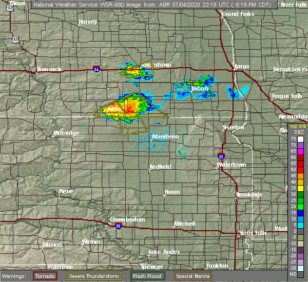 At 619 pm cdt, a severe thunderstorm was located near spring creek colony, or 19 miles southwest of ellendale, moving south at 35 mph. this is a very dangerous storm (radar indicated). Hazards include 80 mph wind gusts and quarter size hail. Flying debris will be dangerous to those caught without shelter. mobile homes will be heavily damaged. expect considerable damage to roofs, windows, and vehicles. extensive tree damage and power outages are likely. this severe storm will be near, leola around 630 pm cdt. Grassland colony around 640 pm cdt. At 619 pm cdt, a severe thunderstorm was located near spring creek colony, or 19 miles southwest of ellendale, moving south at 35 mph. this is a very dangerous storm (radar indicated). Hazards include 80 mph wind gusts and quarter size hail. Flying debris will be dangerous to those caught without shelter. mobile homes will be heavily damaged. expect considerable damage to roofs, windows, and vehicles. extensive tree damage and power outages are likely. this severe storm will be near, leola around 630 pm cdt. Grassland colony around 640 pm cdt.
|
| 7/4/2020 6:18 PM CDT | Time estimated by radar. strong winds lasted for 45 minute in mcpherson county SD, 3.7 miles NE of Forbes, ND |
| 7/4/2020 6:18 PM CDT | Two decent sized trees blown over. numerous smaller branches and limbs also blown down. time estimated from rada in dickey county ND, 0.2 miles N of Forbes, ND |
| 7/4/2020 6:13 PM CDT |
 At 612 pm cdt, severe thunderstorms were located along a line extending from 7 miles southeast of edgeley to 11 miles northwest of ellendale to near spring creek colony to 6 miles southeast of venturia, moving southeast at 20 mph (radar indicated). Hazards include 70 mph wind gusts and ping pong ball size hail. People and animals outdoors will be injured. expect hail damage to roofs, siding, windows, and vehicles. expect considerable tree damage. wind damage is also likely to mobile homes, roofs, and outbuildings. Locations impacted include, ellendale, ashley, edgeley, kulm, fullerton, forbes, monango and merricourt. At 612 pm cdt, severe thunderstorms were located along a line extending from 7 miles southeast of edgeley to 11 miles northwest of ellendale to near spring creek colony to 6 miles southeast of venturia, moving southeast at 20 mph (radar indicated). Hazards include 70 mph wind gusts and ping pong ball size hail. People and animals outdoors will be injured. expect hail damage to roofs, siding, windows, and vehicles. expect considerable tree damage. wind damage is also likely to mobile homes, roofs, and outbuildings. Locations impacted include, ellendale, ashley, edgeley, kulm, fullerton, forbes, monango and merricourt.
|
| 7/4/2020 6:05 PM CDT |
 At 605 pm cdt, a severe thunderstorm was located near spring creek colony, or 20 miles west of ellendale, moving south at 40 mph (radar indicated). Hazards include 70 mph wind gusts and quarter size hail. Hail damage to vehicles is expected. expect considerable tree damage. wind damage is also likely to mobile homes, roofs, and outbuildings. this severe thunderstorm will be near, spring creek colony around 610 pm cdt. leola around 625 pm cdt. Grassland colony around 635 pm cdt. At 605 pm cdt, a severe thunderstorm was located near spring creek colony, or 20 miles west of ellendale, moving south at 40 mph (radar indicated). Hazards include 70 mph wind gusts and quarter size hail. Hail damage to vehicles is expected. expect considerable tree damage. wind damage is also likely to mobile homes, roofs, and outbuildings. this severe thunderstorm will be near, spring creek colony around 610 pm cdt. leola around 625 pm cdt. Grassland colony around 635 pm cdt.
|
| 7/4/2020 5:57 PM CDT |
 At 557 pm cdt, severe thunderstorms were located along a line extending from 7 miles east of edgeley to 10 miles northwest of fullerton to 9 miles north of forbes to 7 miles southeast of ashley, moving east at 35 mph (radar indicated). Hazards include 70 mph wind gusts and ping pong ball size hail. People and animals outdoors will be injured. expect hail damage to roofs, siding, windows, and vehicles. expect considerable tree damage. Wind damage is also likely to mobile homes, roofs, and outbuildings. At 557 pm cdt, severe thunderstorms were located along a line extending from 7 miles east of edgeley to 10 miles northwest of fullerton to 9 miles north of forbes to 7 miles southeast of ashley, moving east at 35 mph (radar indicated). Hazards include 70 mph wind gusts and ping pong ball size hail. People and animals outdoors will be injured. expect hail damage to roofs, siding, windows, and vehicles. expect considerable tree damage. Wind damage is also likely to mobile homes, roofs, and outbuildings.
|
| 6/7/2020 8:57 PM CDT |
 At 856 pm cdt, severe thunderstorms were located along a line extending from 8 miles southeast of edgeley to near hecla, moving northeast at 45 mph (radar indicated. at 855 pm cdt, the dickey county emergency manager reported trees down in ellendale from these storms). Hazards include 70 mph wind gusts. Expect considerable tree damage. damage is likely to mobile homes, roofs, and outbuildings. Locations impacted include, oakes, ellendale, fullerton, forbes, ludden, monango, guelph and glover. At 856 pm cdt, severe thunderstorms were located along a line extending from 8 miles southeast of edgeley to near hecla, moving northeast at 45 mph (radar indicated. at 855 pm cdt, the dickey county emergency manager reported trees down in ellendale from these storms). Hazards include 70 mph wind gusts. Expect considerable tree damage. damage is likely to mobile homes, roofs, and outbuildings. Locations impacted include, oakes, ellendale, fullerton, forbes, ludden, monango, guelph and glover.
|
| 6/7/2020 8:44 PM CDT |
 At 844 pm cdt, severe thunderstorms were located along a line extending from 12 miles north of forbes to near columbia, moving northeast at 45 mph (radar indicated). Hazards include 70 mph wind gusts. Expect considerable tree damage. damage is likely to mobile homes, roofs, and outbuildings. These severe thunderstorms will remain over mainly rural areas of dickey county, including the following locations, monango, merricourt, guelph and glover. At 844 pm cdt, severe thunderstorms were located along a line extending from 12 miles north of forbes to near columbia, moving northeast at 45 mph (radar indicated). Hazards include 70 mph wind gusts. Expect considerable tree damage. damage is likely to mobile homes, roofs, and outbuildings. These severe thunderstorms will remain over mainly rural areas of dickey county, including the following locations, monango, merricourt, guelph and glover.
|
| 6/7/2020 8:30 PM CDT |
 At 829 pm cdt, severe thunderstorms were located along a line extending from 7 miles north of spring creek colony to 5 miles west of westport to 4 miles west of mansfield, moving east at 45 mph (radar indicated). Hazards include 70 mph wind gusts. Expect considerable tree damage. damage is likely to mobile homes, roofs, and outbuildings. severe thunderstorms will be near, ellendale around 855 pm cdt. fullerton around 905 pm cdt. oakes around 925 pm cdt. Other locations impacted by these severe thunderstorms include monango, merricourt, guelph and glover. At 829 pm cdt, severe thunderstorms were located along a line extending from 7 miles north of spring creek colony to 5 miles west of westport to 4 miles west of mansfield, moving east at 45 mph (radar indicated). Hazards include 70 mph wind gusts. Expect considerable tree damage. damage is likely to mobile homes, roofs, and outbuildings. severe thunderstorms will be near, ellendale around 855 pm cdt. fullerton around 905 pm cdt. oakes around 925 pm cdt. Other locations impacted by these severe thunderstorms include monango, merricourt, guelph and glover.
|
| 7/4/2018 3:41 AM CDT |
 The severe thunderstorm warning for northwestern brown and northeastern mcpherson counties will expire at 345 am cdt, the storm which prompted the warning has weakened below severe limits, and has exited the warned area. therefore, the warning will be allowed to expire. however gusty winds are still possible with this thunderstorm. a severe thunderstorm watch remains in effect until 500 am cdt for north central and northeastern south dakota. The severe thunderstorm warning for northwestern brown and northeastern mcpherson counties will expire at 345 am cdt, the storm which prompted the warning has weakened below severe limits, and has exited the warned area. therefore, the warning will be allowed to expire. however gusty winds are still possible with this thunderstorm. a severe thunderstorm watch remains in effect until 500 am cdt for north central and northeastern south dakota.
|
| 7/4/2018 3:39 AM CDT |
 At 320 am cdt, severe thunderstorms were located along a line extending from 5 miles southeast of lamoure to 4 miles south of ellendale, moving east at 20 mph (radar indicated). Hazards include 60 mph wind gusts and quarter size hail. Hail damage to vehicles is expected. expect wind damage to roofs, siding, and trees. severe thunderstorms will be near, lamoure around 325 am cdt. verona around 345 am cdt. ludden around 415 am cdt. Other locations impacted by these severe thunderstorms include monango, guelph and glover. At 320 am cdt, severe thunderstorms were located along a line extending from 5 miles southeast of lamoure to 4 miles south of ellendale, moving east at 20 mph (radar indicated). Hazards include 60 mph wind gusts and quarter size hail. Hail damage to vehicles is expected. expect wind damage to roofs, siding, and trees. severe thunderstorms will be near, lamoure around 325 am cdt. verona around 345 am cdt. ludden around 415 am cdt. Other locations impacted by these severe thunderstorms include monango, guelph and glover.
|
| 7/4/2018 3:20 AM CDT |
 At 320 am cdt, severe thunderstorms were located along a line extending from 5 miles southeast of lamoure to 4 miles south of ellendale, moving east at 20 mph (radar indicated). Hazards include 60 mph wind gusts and quarter size hail. Hail damage to vehicles is expected. expect wind damage to roofs, siding, and trees. severe thunderstorms will be near, lamoure around 325 am cdt. verona around 345 am cdt. ludden around 415 am cdt. Other locations impacted by these severe thunderstorms include monango, guelph and glover. At 320 am cdt, severe thunderstorms were located along a line extending from 5 miles southeast of lamoure to 4 miles south of ellendale, moving east at 20 mph (radar indicated). Hazards include 60 mph wind gusts and quarter size hail. Hail damage to vehicles is expected. expect wind damage to roofs, siding, and trees. severe thunderstorms will be near, lamoure around 325 am cdt. verona around 345 am cdt. ludden around 415 am cdt. Other locations impacted by these severe thunderstorms include monango, guelph and glover.
|
| 7/4/2018 3:19 AM CDT |
 At 319 am cdt, severe thunderstorms were located along a line extending from 8 miles northwest of fullerton to near spring creek colony to 7 miles northeast of leola, moving northeast at 60 mph (trained weather spotters). Hazards include 70 mph wind gusts. Expect considerable tree damage. damage is likely to mobile homes, roofs, and outbuildings. Locations impacted include, leola, forbes, spring creek colony, plainview colony, long lake colony, deerfield colony and grassland colony. At 319 am cdt, severe thunderstorms were located along a line extending from 8 miles northwest of fullerton to near spring creek colony to 7 miles northeast of leola, moving northeast at 60 mph (trained weather spotters). Hazards include 70 mph wind gusts. Expect considerable tree damage. damage is likely to mobile homes, roofs, and outbuildings. Locations impacted include, leola, forbes, spring creek colony, plainview colony, long lake colony, deerfield colony and grassland colony.
|
| 7/4/2018 3:15 AM CDT |
 At 315 am cdt, a severe thunderstorm was located near leola, or 21 miles southwest of ellendale, moving northeast at 50 mph (radar indicated). Hazards include 70 mph wind gusts. Expect considerable tree damage. Damage is likely to mobile homes, roofs, and outbuildings. At 315 am cdt, a severe thunderstorm was located near leola, or 21 miles southwest of ellendale, moving northeast at 50 mph (radar indicated). Hazards include 70 mph wind gusts. Expect considerable tree damage. Damage is likely to mobile homes, roofs, and outbuildings.
|
| 7/4/2018 3:04 AM CDT |
 At 303 am cdt, severe thunderstorms were located along a line extending from 7 miles north of forbes to near leola to near cresbard, moving northeast at 50 mph (trained weather spotters). Hazards include 60 mph wind gusts. Expect damage to roofs, siding, and trees. Locations impacted include, ipswich, leola, forbes, pembrook colony, spring creek colony, plainview colony, long lake colony, deerfield colony, cravens corner and grassland colony. At 303 am cdt, severe thunderstorms were located along a line extending from 7 miles north of forbes to near leola to near cresbard, moving northeast at 50 mph (trained weather spotters). Hazards include 60 mph wind gusts. Expect damage to roofs, siding, and trees. Locations impacted include, ipswich, leola, forbes, pembrook colony, spring creek colony, plainview colony, long lake colony, deerfield colony, cravens corner and grassland colony.
|
| 7/4/2018 2:43 AM CDT |
 At 242 am cdt, severe thunderstorms were located along a line extending from 6 miles southeast of venturia to near brentwood colony, moving northeast at 60 mph (trained weather spotters). Hazards include 70 mph wind gusts. Expect considerable tree damage. Damage is likely to mobile homes, roofs, and outbuildings. At 242 am cdt, severe thunderstorms were located along a line extending from 6 miles southeast of venturia to near brentwood colony, moving northeast at 60 mph (trained weather spotters). Hazards include 70 mph wind gusts. Expect considerable tree damage. Damage is likely to mobile homes, roofs, and outbuildings.
|
| 7/3/2018 6:39 AM CDT |
 At 638 am cdt, severe thunderstorms were located along a line extending from 5 miles northwest of spiritwood lake to 4 miles west of dickey to 7 miles west of spring creek colony, moving east at 60 mph (radar indicated). Hazards include 70 mph wind gusts and quarter size hail. Hail damage to vehicles is expected. expect considerable tree damage. wind damage is also likely to mobile homes, roofs, and outbuildings. Locations impacted include, jamestown, oakes, ellendale, ashley, edgeley, medina, lamoure, kulm, gackle, marion, ypsilanti, adrian, buchanan, spiritwood lake, montpelier, verona, cleveland, lehr, spiritwood and jud. At 638 am cdt, severe thunderstorms were located along a line extending from 5 miles northwest of spiritwood lake to 4 miles west of dickey to 7 miles west of spring creek colony, moving east at 60 mph (radar indicated). Hazards include 70 mph wind gusts and quarter size hail. Hail damage to vehicles is expected. expect considerable tree damage. wind damage is also likely to mobile homes, roofs, and outbuildings. Locations impacted include, jamestown, oakes, ellendale, ashley, edgeley, medina, lamoure, kulm, gackle, marion, ypsilanti, adrian, buchanan, spiritwood lake, montpelier, verona, cleveland, lehr, spiritwood and jud.
|
| 7/3/2018 6:13 AM CDT |
 At 612 am cdt, severe thunderstorms were located along a line extending from 6 miles east of woodworth to 7 miles west of jud to near venturia, moving east at 60 mph (radar indicated). Hazards include 70 mph wind gusts and quarter size hail. Hail damage to vehicles is expected. expect considerable tree damage. Wind damage is also likely to mobile homes, roofs, and outbuildings. At 612 am cdt, severe thunderstorms were located along a line extending from 6 miles east of woodworth to 7 miles west of jud to near venturia, moving east at 60 mph (radar indicated). Hazards include 70 mph wind gusts and quarter size hail. Hail damage to vehicles is expected. expect considerable tree damage. Wind damage is also likely to mobile homes, roofs, and outbuildings.
|
| 6/29/2018 3:30 AM CDT |
 At 330 am cdt, severe thunderstorms were located along a line extending from 5 miles southeast of litchville to near lamoure to forbes, moving east at 45 mph (radar indicated). Hazards include 60 mph wind gusts and quarter size hail. Hail damage to vehicles is expected. expect wind damage to roofs, siding, and trees. these severe storms will be near, lamoure around 335 am cdt. ellendale and verona around 345 am cdt. ludden around 410 am cdt. Other locations impacted by these severe thunderstorms include monango, merricourt, guelph, berlin, grand rapids and glover. At 330 am cdt, severe thunderstorms were located along a line extending from 5 miles southeast of litchville to near lamoure to forbes, moving east at 45 mph (radar indicated). Hazards include 60 mph wind gusts and quarter size hail. Hail damage to vehicles is expected. expect wind damage to roofs, siding, and trees. these severe storms will be near, lamoure around 335 am cdt. ellendale and verona around 345 am cdt. ludden around 410 am cdt. Other locations impacted by these severe thunderstorms include monango, merricourt, guelph, berlin, grand rapids and glover.
|
| 6/29/2018 3:17 AM CDT |
 At 317 am cdt, severe thunderstorms were located along a line extending from near marion to 9 miles northeast of long lake, moving east at 45 mph (radar indicated). Hazards include 60 mph wind gusts and quarter size hail. Hail damage to vehicles is expected. expect wind damage to roofs, siding, and trees. severe thunderstorms will be near, marion and dickey around 320 am cdt. forbes around 335 am cdt. ellendale around 355 am cdt. ludden around 415 am cdt. Other locations impacted by these severe thunderstorms include monango, merricourt, guelph, berlin, grand rapids and glover. At 317 am cdt, severe thunderstorms were located along a line extending from near marion to 9 miles northeast of long lake, moving east at 45 mph (radar indicated). Hazards include 60 mph wind gusts and quarter size hail. Hail damage to vehicles is expected. expect wind damage to roofs, siding, and trees. severe thunderstorms will be near, marion and dickey around 320 am cdt. forbes around 335 am cdt. ellendale around 355 am cdt. ludden around 415 am cdt. Other locations impacted by these severe thunderstorms include monango, merricourt, guelph, berlin, grand rapids and glover.
|
| 6/29/2018 2:52 AM CDT |
 At 251 am cdt, severe thunderstorms were located along a line extending from 6 miles south of buchanan to 7 miles northwest of kulm to venturia, moving east at 45 mph (radar indicated). Hazards include 70 mph wind gusts. Expect considerable tree damage. damage is likely to mobile homes, roofs, and outbuildings. these severe storms will be near, kulm around 255 am cdt. jamestown around 300 am cdt. ashley around 305 am cdt. edgeley around 310 am cdt. Other locations impacted by these severe thunderstorms include eldridge, nortonville, danzig, green lake, fredonia, windsor, alfred, merricourt, sydney and millarton. At 251 am cdt, severe thunderstorms were located along a line extending from 6 miles south of buchanan to 7 miles northwest of kulm to venturia, moving east at 45 mph (radar indicated). Hazards include 70 mph wind gusts. Expect considerable tree damage. damage is likely to mobile homes, roofs, and outbuildings. these severe storms will be near, kulm around 255 am cdt. jamestown around 300 am cdt. ashley around 305 am cdt. edgeley around 310 am cdt. Other locations impacted by these severe thunderstorms include eldridge, nortonville, danzig, green lake, fredonia, windsor, alfred, merricourt, sydney and millarton.
|
| 6/29/2018 2:35 AM CDT |
 At 234 am cdt, severe thunderstorms were located along a line extending from 6 miles northeast of medina to 10 miles north of lehr to near zeeland, moving east at 65 mph. these are very dangerous storms (radar indicated). Hazards include 80 mph wind gusts and penny size hail. Flying debris will be dangerous to those caught without shelter. mobile homes will be heavily damaged. expect considerable damage to roofs, windows, and vehicles. extensive tree damage and power outages are likely. these severe storms will be near, cleveland around 240 am cdt. kulm around 250 am cdt. ashley around 255 am cdt. jamestown and edgeley around 300 am cdt. forbes around 315 am cdt. Other locations impacted by these severe thunderstorms include eldridge, burnstad, fredonia, windsor, kintyre, merricourt, hull, millarton, nortonville and danzig. At 234 am cdt, severe thunderstorms were located along a line extending from 6 miles northeast of medina to 10 miles north of lehr to near zeeland, moving east at 65 mph. these are very dangerous storms (radar indicated). Hazards include 80 mph wind gusts and penny size hail. Flying debris will be dangerous to those caught without shelter. mobile homes will be heavily damaged. expect considerable damage to roofs, windows, and vehicles. extensive tree damage and power outages are likely. these severe storms will be near, cleveland around 240 am cdt. kulm around 250 am cdt. ashley around 255 am cdt. jamestown and edgeley around 300 am cdt. forbes around 315 am cdt. Other locations impacted by these severe thunderstorms include eldridge, burnstad, fredonia, windsor, kintyre, merricourt, hull, millarton, nortonville and danzig.
|
| 6/29/2018 2:12 AM CDT |
 At 211 am cdt, severe thunderstorms were located along a line extending from 5 miles north of dawson to napoleon to near westfield, moving southeast at 40 mph. these are very dangerous storms (radar indicated). Hazards include 80 mph wind gusts and penny size hail. Flying debris will be dangerous to those caught without shelter. mobile homes will be heavily damaged. expect considerable damage to roofs, windows, and vehicles. extensive tree damage and power outages are likely. severe thunderstorms will be near, napoleon around 215 am cdt. medina around 240 am cdt. streeter and lehr around 250 am cdt. gackle around 305 am cdt. jud around 315 am cdt. Other locations impacted by these severe thunderstorms include eldridge, burnstad, fredonia, windsor, kintyre, merricourt, hull, millarton, nortonville and danzig. At 211 am cdt, severe thunderstorms were located along a line extending from 5 miles north of dawson to napoleon to near westfield, moving southeast at 40 mph. these are very dangerous storms (radar indicated). Hazards include 80 mph wind gusts and penny size hail. Flying debris will be dangerous to those caught without shelter. mobile homes will be heavily damaged. expect considerable damage to roofs, windows, and vehicles. extensive tree damage and power outages are likely. severe thunderstorms will be near, napoleon around 215 am cdt. medina around 240 am cdt. streeter and lehr around 250 am cdt. gackle around 305 am cdt. jud around 315 am cdt. Other locations impacted by these severe thunderstorms include eldridge, burnstad, fredonia, windsor, kintyre, merricourt, hull, millarton, nortonville and danzig.
|
| 5/17/2018 4:25 PM CDT |
 The severe thunderstorm warning for western dickey, southeastern logan and eastern mcintosh counties will expire at 430 pm cdt, the storm which prompted the warning has weakened below severe limits, and no longer poses an immediate threat to life or property. therefore, the warning will be allowed to expire. a severe thunderstorm watch remains in effect until 1000 pm cdt for southeastern north dakota. The severe thunderstorm warning for western dickey, southeastern logan and eastern mcintosh counties will expire at 430 pm cdt, the storm which prompted the warning has weakened below severe limits, and no longer poses an immediate threat to life or property. therefore, the warning will be allowed to expire. a severe thunderstorm watch remains in effect until 1000 pm cdt for southeastern north dakota.
|
| 5/17/2018 4:09 PM CDT |
 At 408 pm cdt, a severe thunderstorm was located near ashley, moving northeast at 40 mph (radar indicated). Hazards include 60 mph wind gusts and quarter size hail. Hail damage to vehicles is expected. expect wind damage to roofs, siding, and trees. Locations impacted include, ashley, lehr, forbes and fredonia. At 408 pm cdt, a severe thunderstorm was located near ashley, moving northeast at 40 mph (radar indicated). Hazards include 60 mph wind gusts and quarter size hail. Hail damage to vehicles is expected. expect wind damage to roofs, siding, and trees. Locations impacted include, ashley, lehr, forbes and fredonia.
|
| 5/17/2018 3:52 PM CDT |
 At 352 pm cdt, a severe thunderstorm was located 5 miles northeast of ashley, moving northeast at 30 mph (trained weather spotters). Hazards include golf ball size hail and 60 mph wind gusts. People and animals outdoors will be injured. expect hail damage to roofs, siding, windows, and vehicles. expect wind damage to roofs, siding, and trees. This severe thunderstorm will remain over mainly rural areas of western dickey, southeastern logan and mcintosh counties, including the following locations: fredonia, danzig and green lake. At 352 pm cdt, a severe thunderstorm was located 5 miles northeast of ashley, moving northeast at 30 mph (trained weather spotters). Hazards include golf ball size hail and 60 mph wind gusts. People and animals outdoors will be injured. expect hail damage to roofs, siding, windows, and vehicles. expect wind damage to roofs, siding, and trees. This severe thunderstorm will remain over mainly rural areas of western dickey, southeastern logan and mcintosh counties, including the following locations: fredonia, danzig and green lake.
|
| 5/17/2018 3:36 PM CDT |
 At 335 pm cdt, a severe thunderstorm was located 6 miles southeast of venturia, or 6 miles southwest of ashley, moving northeast at 25 mph (radar indicated). Hazards include 60 mph wind gusts and quarter size hail. Hail damage to vehicles is expected. expect wind damage to roofs, siding, and trees. this severe thunderstorm will be near, ashley around 350 pm cdt. Other locations impacted by this severe thunderstorm include fredonia, danzig and green lake. At 335 pm cdt, a severe thunderstorm was located 6 miles southeast of venturia, or 6 miles southwest of ashley, moving northeast at 25 mph (radar indicated). Hazards include 60 mph wind gusts and quarter size hail. Hail damage to vehicles is expected. expect wind damage to roofs, siding, and trees. this severe thunderstorm will be near, ashley around 350 pm cdt. Other locations impacted by this severe thunderstorm include fredonia, danzig and green lake.
|
| 9/19/2017 8:15 PM CDT |
 At 815 pm cdt, a severe thunderstorm was located near forbes, or 13 miles west of ellendale, moving northeast at 45 mph (radar indicated). Hazards include 60 mph wind gusts and quarter size hail. Hail damage to vehicles is expected. expect wind damage to roofs, siding, and trees. this severe thunderstorm will remain over mainly rural areas of western dickey county, including the following locations: monango and merricourt. A tornado watch remains in effect until midnight cdt for southeastern north dakota. At 815 pm cdt, a severe thunderstorm was located near forbes, or 13 miles west of ellendale, moving northeast at 45 mph (radar indicated). Hazards include 60 mph wind gusts and quarter size hail. Hail damage to vehicles is expected. expect wind damage to roofs, siding, and trees. this severe thunderstorm will remain over mainly rural areas of western dickey county, including the following locations: monango and merricourt. A tornado watch remains in effect until midnight cdt for southeastern north dakota.
|
| 9/19/2017 8:03 PM CDT |
 At 802 pm cdt, a severe thunderstorm was located 5 miles west of spring creek colony, or 20 miles southeast of ashley, moving northeast at 45 mph (radar indicated). Hazards include 70 mph wind gusts and quarter size hail. Hail damage to vehicles is expected. expect considerable tree damage. wind damage is also likely to mobile homes, roofs, and outbuildings. this severe thunderstorm will be near, forbes around 815 pm cdt. other locations impacted by this severe thunderstorm include monango and merricourt. A tornado watch remains in effect until midnight cdt for southeastern north dakota. At 802 pm cdt, a severe thunderstorm was located 5 miles west of spring creek colony, or 20 miles southeast of ashley, moving northeast at 45 mph (radar indicated). Hazards include 70 mph wind gusts and quarter size hail. Hail damage to vehicles is expected. expect considerable tree damage. wind damage is also likely to mobile homes, roofs, and outbuildings. this severe thunderstorm will be near, forbes around 815 pm cdt. other locations impacted by this severe thunderstorm include monango and merricourt. A tornado watch remains in effect until midnight cdt for southeastern north dakota.
|
| 9/19/2017 8:00 PM CDT |
 At 800 pm cdt, a severe thunderstorm capable of producing a tornado was located 8 miles southwest of spring creek colony, or 21 miles southeast of ashley, moving northeast at 35 mph (radar indicated rotation). Hazards include tornado and half dollar size hail. Flying debris will be dangerous to those caught without shelter. mobile homes will be damaged or destroyed. damage to roofs, windows, and vehicles will occur. tree damage is likely. this dangerous storm will be near, spring creek colony around 815 pm cdt. Forbes around 825 pm cdt. At 800 pm cdt, a severe thunderstorm capable of producing a tornado was located 8 miles southwest of spring creek colony, or 21 miles southeast of ashley, moving northeast at 35 mph (radar indicated rotation). Hazards include tornado and half dollar size hail. Flying debris will be dangerous to those caught without shelter. mobile homes will be damaged or destroyed. damage to roofs, windows, and vehicles will occur. tree damage is likely. this dangerous storm will be near, spring creek colony around 815 pm cdt. Forbes around 825 pm cdt.
|
| 9/19/2017 7:52 PM CDT |
 At 752 pm cdt, a severe thunderstorm capable of producing a tornado was located 7 miles southeast of long lake, or 21 miles southeast of ashley, moving northeast at 35 mph (radar indicated rotation). Hazards include tornado and half dollar size hail. Flying debris will be dangerous to those caught without shelter. mobile homes will be damaged or destroyed. damage to roofs, windows, and vehicles will occur. tree damage is likely. this dangerous storm will be near, spring creek colony around 815 pm cdt. Forbes and elm lake around 825 pm cdt. At 752 pm cdt, a severe thunderstorm capable of producing a tornado was located 7 miles southeast of long lake, or 21 miles southeast of ashley, moving northeast at 35 mph (radar indicated rotation). Hazards include tornado and half dollar size hail. Flying debris will be dangerous to those caught without shelter. mobile homes will be damaged or destroyed. damage to roofs, windows, and vehicles will occur. tree damage is likely. this dangerous storm will be near, spring creek colony around 815 pm cdt. Forbes and elm lake around 825 pm cdt.
|
| 8/10/2016 12:50 PM CDT |
 At 1248 pm cdt, a severe thunderstorm was located 6 miles northwest of ellendale, moving northeast at 20 mph (radar indicated). Hazards include 60 mph wind gusts and half dollar size hail. hail the size of a quarter was received northeast of forbes from this storm. Hail damage to vehicles is expected. expect wind damage to roofs, siding, and trees. Locations impacted include, oakes, ellendale, lamoure, verona, fullerton, forbes, ludden, monango, guelph, merricourt and glover. At 1248 pm cdt, a severe thunderstorm was located 6 miles northwest of ellendale, moving northeast at 20 mph (radar indicated). Hazards include 60 mph wind gusts and half dollar size hail. hail the size of a quarter was received northeast of forbes from this storm. Hail damage to vehicles is expected. expect wind damage to roofs, siding, and trees. Locations impacted include, oakes, ellendale, lamoure, verona, fullerton, forbes, ludden, monango, guelph, merricourt and glover.
|
| 8/10/2016 12:30 PM CDT |
 At 1228 pm cdt, a severe thunderstorm was located 8 miles north of forbes, or 10 miles northwest of ellendale, moving northeast at 40 mph (radar indicated). Hazards include 60 mph wind gusts and half dollar size hail. Hail damage to vehicles is expected. Expect wind damage to roofs, siding, and trees. At 1228 pm cdt, a severe thunderstorm was located 8 miles north of forbes, or 10 miles northwest of ellendale, moving northeast at 40 mph (radar indicated). Hazards include 60 mph wind gusts and half dollar size hail. Hail damage to vehicles is expected. Expect wind damage to roofs, siding, and trees.
|
| 8/10/2016 12:02 PM CDT |
 At 1200 pm cdt, a severe thunderstorm was located 7 miles north of spring creek colony, or 17 miles west of ellendale, moving northeast at 20 mph. another severe storm was about 7 miles north of forbes, also moving northeast at 20 mph (radar indicated). Hazards include 60 mph wind gusts and half dollar size hail. Hail damage to vehicles is expected. expect wind damage to roofs, siding, and trees. Locations impacted include, ellendale, edgeley, kulm, fullerton, forbes, monango, berlin and merricourt. At 1200 pm cdt, a severe thunderstorm was located 7 miles north of spring creek colony, or 17 miles west of ellendale, moving northeast at 20 mph. another severe storm was about 7 miles north of forbes, also moving northeast at 20 mph (radar indicated). Hazards include 60 mph wind gusts and half dollar size hail. Hail damage to vehicles is expected. expect wind damage to roofs, siding, and trees. Locations impacted include, ellendale, edgeley, kulm, fullerton, forbes, monango, berlin and merricourt.
|
| 8/10/2016 11:30 AM CDT |
 At 1130 am cdt, a severe thunderstorm was located 8 miles northwest of forbes, or 16 miles west of ellendale, moving northeast at 35 mph (radar indicated). Hazards include 60 mph wind gusts and half dollar size hail. Hail damage to vehicles is expected. Expect wind damage to roofs, siding, and trees. At 1130 am cdt, a severe thunderstorm was located 8 miles northwest of forbes, or 16 miles west of ellendale, moving northeast at 35 mph (radar indicated). Hazards include 60 mph wind gusts and half dollar size hail. Hail damage to vehicles is expected. Expect wind damage to roofs, siding, and trees.
|
| 8/10/2016 2:07 AM CDT |
 At 206 am cdt, severe thunderstorms were located along a line extending from 7 miles southwest of lamoure to 5 miles southeast of ellendale, moving east at 45 mph (radar indicated). Hazards include 60 mph wind gusts. Expect damage to roofs. siding. and trees. these severe storms will be near, ludden around 225 am cdt. Other locations impacted by these severe thunderstorms include merricourt, glover, guelph and monango. At 206 am cdt, severe thunderstorms were located along a line extending from 7 miles southwest of lamoure to 5 miles southeast of ellendale, moving east at 45 mph (radar indicated). Hazards include 60 mph wind gusts. Expect damage to roofs. siding. and trees. these severe storms will be near, ludden around 225 am cdt. Other locations impacted by these severe thunderstorms include merricourt, glover, guelph and monango.
|
| 8/10/2016 1:37 AM CDT |
 At 137 am cdt, severe thunderstorms were located along a line extending from 6 miles east of kulm to near forbes, moving east at 45 mph (radar indicated). Hazards include 60 mph wind gusts and penny size hail. Expect damage to roofs. siding. and trees. severe thunderstorms will be near, forbes around 140 am cdt. ellendale around 200 am cdt. ludden around 225 am cdt. Other locations impacted by these severe thunderstorms include merricourt, glover, guelph and monango. At 137 am cdt, severe thunderstorms were located along a line extending from 6 miles east of kulm to near forbes, moving east at 45 mph (radar indicated). Hazards include 60 mph wind gusts and penny size hail. Expect damage to roofs. siding. and trees. severe thunderstorms will be near, forbes around 140 am cdt. ellendale around 200 am cdt. ludden around 225 am cdt. Other locations impacted by these severe thunderstorms include merricourt, glover, guelph and monango.
|
| 8/10/2016 1:36 AM CDT |
 At 135 am cdt, severe thunderstorms were located along a line extending from kulm to 14 miles northwest of forbes to near spring creek colony, moving east at 55 mph (radar indicated). Hazards include 60 mph wind gusts and penny size hail. Expect damage to roofs. siding. and trees. these severe storms will be near, forbes around 145 am cdt. Other locations impacted by these severe thunderstorms include merricourt. At 135 am cdt, severe thunderstorms were located along a line extending from kulm to 14 miles northwest of forbes to near spring creek colony, moving east at 55 mph (radar indicated). Hazards include 60 mph wind gusts and penny size hail. Expect damage to roofs. siding. and trees. these severe storms will be near, forbes around 145 am cdt. Other locations impacted by these severe thunderstorms include merricourt.
|
| 8/10/2016 1:34 AM CDT |
 At 134 am cdt, a severe thunderstorm was located over grassland colony, or 20 miles northeast of ipswich, moving east at 55 mph (radar indicated). Hazards include 60 mph wind gusts and quarter size hail. Hail damage to vehicles is expected. expect wind damage to roofs, siding, and trees. this severe thunderstorm will be near, westport and barnard around 150 am cdt. columbia around 200 am cdt. putney around 205 am cdt. Claremont around 210 am cdt. At 134 am cdt, a severe thunderstorm was located over grassland colony, or 20 miles northeast of ipswich, moving east at 55 mph (radar indicated). Hazards include 60 mph wind gusts and quarter size hail. Hail damage to vehicles is expected. expect wind damage to roofs, siding, and trees. this severe thunderstorm will be near, westport and barnard around 150 am cdt. columbia around 200 am cdt. putney around 205 am cdt. Claremont around 210 am cdt.
|
| 8/10/2016 1:29 AM CDT |
 At 129 am cdt, a severe thunderstorm was located near leola, or 20 miles north of ipswich, moving east at 55 mph (radar indicated). Hazards include 70 mph wind gusts and quarter size hail. Hail damage to vehicles is expected. expect considerable tree damage. wind damage is also likely to mobile homes, roofs, and outbuildings. This severe thunderstorm will remain over mainly rural areas of eastern mcpherson and northeastern edmunds counties. At 129 am cdt, a severe thunderstorm was located near leola, or 20 miles north of ipswich, moving east at 55 mph (radar indicated). Hazards include 70 mph wind gusts and quarter size hail. Hail damage to vehicles is expected. expect considerable tree damage. wind damage is also likely to mobile homes, roofs, and outbuildings. This severe thunderstorm will remain over mainly rural areas of eastern mcpherson and northeastern edmunds counties.
|
| 8/10/2016 1:29 AM CDT |
 At 129 am cdt, severe thunderstorms were located along a line extending from 7 miles southwest of jud to 12 miles south of kulm to 6 miles west of spring creek colony, moving east at 60 mph (radar indicated). Hazards include 60 mph wind gusts and quarter size hail. Hail damage to vehicles is expected. expect wind damage to roofs, siding, and trees. these severe storms will be near, forbes around 140 am cdt. edgeley around 145 am cdt. Other locations impacted by these severe thunderstorms include beaver lake state park, merricourt, burnstad, fredonia, danzig and green lake. At 129 am cdt, severe thunderstorms were located along a line extending from 7 miles southwest of jud to 12 miles south of kulm to 6 miles west of spring creek colony, moving east at 60 mph (radar indicated). Hazards include 60 mph wind gusts and quarter size hail. Hail damage to vehicles is expected. expect wind damage to roofs, siding, and trees. these severe storms will be near, forbes around 140 am cdt. edgeley around 145 am cdt. Other locations impacted by these severe thunderstorms include beaver lake state park, merricourt, burnstad, fredonia, danzig and green lake.
|
| 8/10/2016 1:13 AM CDT |
 At 113 am cdt, severe thunderstorms were located along a line extending from 10 miles east of ashley to 6 miles south of long lake to near hosmer to 6 miles north of onaka, moving east at 55 mph (radar indicated). Hazards include 70 mph wind gusts and quarter size hail. Hail damage to vehicles is expected. expect considerable tree damage. wind damage is also likely to mobile homes, roofs, and outbuildings. these severe storms will be near, leola around 125 am cdt. spring creek colony around 130 am cdt. forbes, plainview colony and pembrook colony around 135 am cdt. deerfield colony and long lake colony around 140 am cdt. Grassland colony around 145 am cdt. At 113 am cdt, severe thunderstorms were located along a line extending from 10 miles east of ashley to 6 miles south of long lake to near hosmer to 6 miles north of onaka, moving east at 55 mph (radar indicated). Hazards include 70 mph wind gusts and quarter size hail. Hail damage to vehicles is expected. expect considerable tree damage. wind damage is also likely to mobile homes, roofs, and outbuildings. these severe storms will be near, leola around 125 am cdt. spring creek colony around 130 am cdt. forbes, plainview colony and pembrook colony around 135 am cdt. deerfield colony and long lake colony around 140 am cdt. Grassland colony around 145 am cdt.
|
| 8/10/2016 1:09 AM CDT |
 At 108 am cdt, severe thunderstorms were located along a line extending from 7 miles north of streeter to near lehr to 6 miles south of ashley, moving east at 50 mph. these are very dangerous storms (trained weather spotters). Hazards include 80 mph wind gusts and quarter size hail. Flying debris will be dangerous to those caught without shelter. mobile homes will be heavily damaged. expect considerable damage to roofs, windows, and vehicles. extensive tree damage and power outages are likely. these severe storms will be near, kulm around 135 am cdt. edgeley and forbes around 145 am cdt. Other locations impacted by these severe thunderstorms include alfred, beaver lake state park, millarton, fredonia, merricourt, burnstad, danzig, green lake, nortonville and sydney. At 108 am cdt, severe thunderstorms were located along a line extending from 7 miles north of streeter to near lehr to 6 miles south of ashley, moving east at 50 mph. these are very dangerous storms (trained weather spotters). Hazards include 80 mph wind gusts and quarter size hail. Flying debris will be dangerous to those caught without shelter. mobile homes will be heavily damaged. expect considerable damage to roofs, windows, and vehicles. extensive tree damage and power outages are likely. these severe storms will be near, kulm around 135 am cdt. edgeley and forbes around 145 am cdt. Other locations impacted by these severe thunderstorms include alfred, beaver lake state park, millarton, fredonia, merricourt, burnstad, danzig, green lake, nortonville and sydney.
|
| 8/10/2016 12:53 AM CDT |
 At 1252 am cdt, severe thunderstorms were located along a line extending from venturia to 9 miles northeast of java to near hoven, moving east at 45 mph. these are very dangerous storms (radar indicated). Hazards include 80 mph wind gusts and quarter size hail. Flying debris will be dangerous to those caught without shelter. mobile homes will be heavily damaged. expect considerable damage to roofs, windows, and vehicles. extensive tree damage and power outages are likely. severe thunderstorms will be near, hosmer and hillsview around 110 am cdt. roscoe, loyalton and new town corner around 120 am cdt. ipswich and pembrook colony around 135 am cdt. cravens corner around 145 am cdt. leola around 150 am cdt. Grassland colony around 155 am cdt. At 1252 am cdt, severe thunderstorms were located along a line extending from venturia to 9 miles northeast of java to near hoven, moving east at 45 mph. these are very dangerous storms (radar indicated). Hazards include 80 mph wind gusts and quarter size hail. Flying debris will be dangerous to those caught without shelter. mobile homes will be heavily damaged. expect considerable damage to roofs, windows, and vehicles. extensive tree damage and power outages are likely. severe thunderstorms will be near, hosmer and hillsview around 110 am cdt. roscoe, loyalton and new town corner around 120 am cdt. ipswich and pembrook colony around 135 am cdt. cravens corner around 145 am cdt. leola around 150 am cdt. Grassland colony around 155 am cdt.
|
| 8/10/2016 12:42 AM CDT |
 At 1240 am cdt, severe thunderstorms were located along a line extending from 4 miles south of lake isabel to 14 miles west of wishek to near zeeland, moving east at 55 mph. these are very dangerous storms (trained weather spotters report this storm has a history of producing damaging winds around 80 mph). Hazards include 80 mph wind gusts and quarter size hail. Flying debris will be dangerous to those caught without shelter. mobile homes will be heavily damaged. expect considerable damage to roofs, windows, and vehicles. extensive tree damage and power outages are likely. severe thunderstorms will be near, wishek and venturia around 1255 am cdt. streeter around 100 am cdt. ashley around 105 am cdt. lehr around 110 am cdt. kulm around 130 am cdt. forbes around 135 am cdt. edgeley and montpelier around 140 am cdt. Other locations impacted by these severe thunderstorms include alfred, beaver lake state park, millarton, kintyre, fredonia, hull, merricourt, burnstad, danzig and green lake. At 1240 am cdt, severe thunderstorms were located along a line extending from 4 miles south of lake isabel to 14 miles west of wishek to near zeeland, moving east at 55 mph. these are very dangerous storms (trained weather spotters report this storm has a history of producing damaging winds around 80 mph). Hazards include 80 mph wind gusts and quarter size hail. Flying debris will be dangerous to those caught without shelter. mobile homes will be heavily damaged. expect considerable damage to roofs, windows, and vehicles. extensive tree damage and power outages are likely. severe thunderstorms will be near, wishek and venturia around 1255 am cdt. streeter around 100 am cdt. ashley around 105 am cdt. lehr around 110 am cdt. kulm around 130 am cdt. forbes around 135 am cdt. edgeley and montpelier around 140 am cdt. Other locations impacted by these severe thunderstorms include alfred, beaver lake state park, millarton, kintyre, fredonia, hull, merricourt, burnstad, danzig and green lake.
|
| 8/3/2016 11:48 PM CDT |
 At 1147 pm cdt, a severe thunderstorm was located over barnard, or 17 miles south of ellendale, moving east at 40 mph (radar indicated). Hazards include 70 mph wind gusts and quarter size hail. Hail damage to vehicles is expected. expect considerable tree damage. wind damage is also likely to mobile homes, roofs, and outbuildings. Locations impacted include, frederick, forbes, barnard and elm lake. At 1147 pm cdt, a severe thunderstorm was located over barnard, or 17 miles south of ellendale, moving east at 40 mph (radar indicated). Hazards include 70 mph wind gusts and quarter size hail. Hail damage to vehicles is expected. expect considerable tree damage. wind damage is also likely to mobile homes, roofs, and outbuildings. Locations impacted include, frederick, forbes, barnard and elm lake.
|
| 8/3/2016 11:44 PM CDT |
 At 1143 pm cdt, a severe thunderstorm was located near barnard, or 16 miles south of ellendale, moving east at 40 mph (radar indicated). Hazards include 60 mph wind gusts and quarter size hail. Hail damage to vehicles is expected. expect wind damage to roofs, siding, and trees. This severe thunderstorm will remain over mainly rural areas of northeastern mcpherson and northwestern brown counties. At 1143 pm cdt, a severe thunderstorm was located near barnard, or 16 miles south of ellendale, moving east at 40 mph (radar indicated). Hazards include 60 mph wind gusts and quarter size hail. Hail damage to vehicles is expected. expect wind damage to roofs, siding, and trees. This severe thunderstorm will remain over mainly rural areas of northeastern mcpherson and northwestern brown counties.
|
| 8/3/2016 11:08 PM CDT |
 At 1108 pm cdt, a severe thunderstorm was located 7 miles west of barnard, or 19 miles south of ellendale, moving east at 45 mph (radar indicated). Hazards include 60 mph wind gusts and quarter size hail. Hail damage to vehicles is expected. expect wind damage to roofs, siding, and trees. This severe thunderstorm will remain over mainly rural areas of eastern mcpherson and northwestern brown counties. At 1108 pm cdt, a severe thunderstorm was located 7 miles west of barnard, or 19 miles south of ellendale, moving east at 45 mph (radar indicated). Hazards include 60 mph wind gusts and quarter size hail. Hail damage to vehicles is expected. expect wind damage to roofs, siding, and trees. This severe thunderstorm will remain over mainly rural areas of eastern mcpherson and northwestern brown counties.
|
| 8/3/2016 10:40 PM CDT |
 At 1040 pm cdt, a severe thunderstorm was located 8 miles east of long lake, or 21 miles southeast of ashley, moving east at 45 mph (radar indicated). Hazards include 70 mph wind gusts and quarter size hail. Hail damage to vehicles is expected. expect considerable tree damage. wind damage is also likely to mobile homes, roofs, and outbuildings. this severe storm will be near, leola and spring creek colony around 1050 pm cdt. Grassland colony around 1100 pm cdt. At 1040 pm cdt, a severe thunderstorm was located 8 miles east of long lake, or 21 miles southeast of ashley, moving east at 45 mph (radar indicated). Hazards include 70 mph wind gusts and quarter size hail. Hail damage to vehicles is expected. expect considerable tree damage. wind damage is also likely to mobile homes, roofs, and outbuildings. this severe storm will be near, leola and spring creek colony around 1050 pm cdt. Grassland colony around 1100 pm cdt.
|
| 8/3/2016 10:35 PM CDT |
 At 1035 pm cdt, a severe thunderstorm was located near long lake, or 18 miles southeast of ashley, moving east at 45 mph (radar indicated). Hazards include 60 mph wind gusts and quarter size hail. Hail damage to vehicles is expected. expect wind damage to roofs, siding, and trees. this severe thunderstorm will be near, leola and spring creek colony around 1050 pm cdt. Grassland colony around 1100 pm cdt. At 1035 pm cdt, a severe thunderstorm was located near long lake, or 18 miles southeast of ashley, moving east at 45 mph (radar indicated). Hazards include 60 mph wind gusts and quarter size hail. Hail damage to vehicles is expected. expect wind damage to roofs, siding, and trees. this severe thunderstorm will be near, leola and spring creek colony around 1050 pm cdt. Grassland colony around 1100 pm cdt.
|
| 7/26/2016 1:27 PM CDT |
 At 126 pm cdt, a severe thunderstorm was located near forbes, or 9 miles southwest of ellendale, moving east at 20 mph (radar indicated). Hazards include 60 mph wind gusts and quarter size hail. Hail damage to vehicles is expected. expect wind damage to roofs, siding, and trees. This severe storm will be near, ellendale around 150 pm cdt. At 126 pm cdt, a severe thunderstorm was located near forbes, or 9 miles southwest of ellendale, moving east at 20 mph (radar indicated). Hazards include 60 mph wind gusts and quarter size hail. Hail damage to vehicles is expected. expect wind damage to roofs, siding, and trees. This severe storm will be near, ellendale around 150 pm cdt.
|
| 7/26/2016 1:03 PM CDT |
 At 102 pm cdt, a severe thunderstorm was located near forbes, or 15 miles west of ellendale, moving east at 20 mph (radar indicated). Hazards include 60 mph wind gusts and quarter size hail. Hail damage to vehicles is expected. expect wind damage to roofs, siding, and trees. this severe thunderstorm will be near, forbes around 110 pm cdt. Ellendale around 150 pm cdt. At 102 pm cdt, a severe thunderstorm was located near forbes, or 15 miles west of ellendale, moving east at 20 mph (radar indicated). Hazards include 60 mph wind gusts and quarter size hail. Hail damage to vehicles is expected. expect wind damage to roofs, siding, and trees. this severe thunderstorm will be near, forbes around 110 pm cdt. Ellendale around 150 pm cdt.
|
| 7/16/2016 11:31 PM CDT |
 At 1130 pm cdt, a severe thunderstorm was located near richmond lake rec area, or 8 miles west of aberdeen, moving east at 50 mph (trained weather spotters). Hazards include 70 mph wind gusts. Expect considerable tree damage. damage is likely to mobile homes, roofs, and outbuildings. this severe storm will be near, aberdeen around 1140 pm cdt. bath and columbia around 1150 pm cdt. putney around 1200 am cdt. Groton around 1205 am cdt. At 1130 pm cdt, a severe thunderstorm was located near richmond lake rec area, or 8 miles west of aberdeen, moving east at 50 mph (trained weather spotters). Hazards include 70 mph wind gusts. Expect considerable tree damage. damage is likely to mobile homes, roofs, and outbuildings. this severe storm will be near, aberdeen around 1140 pm cdt. bath and columbia around 1150 pm cdt. putney around 1200 am cdt. Groton around 1205 am cdt.
|
| 7/16/2016 11:09 PM CDT |
 At 1109 pm cdt, a severe thunderstorm was located over ipswich, moving east at 50 mph (emergency management). Hazards include 70 mph wind gusts. Expect considerable tree damage. damage is likely to mobile homes, roofs, and outbuildings. this severe thunderstorm will be near, deerfield colony around 1115 pm cdt. mina lake rec area and mina around 1125 pm cdt. richmond lake rec area around 1130 pm cdt. aberdeen around 1140 pm cdt. bath and columbia around 1150 pm cdt. putney around 1200 am cdt. Groton around 1205 am cdt. At 1109 pm cdt, a severe thunderstorm was located over ipswich, moving east at 50 mph (emergency management). Hazards include 70 mph wind gusts. Expect considerable tree damage. damage is likely to mobile homes, roofs, and outbuildings. this severe thunderstorm will be near, deerfield colony around 1115 pm cdt. mina lake rec area and mina around 1125 pm cdt. richmond lake rec area around 1130 pm cdt. aberdeen around 1140 pm cdt. bath and columbia around 1150 pm cdt. putney around 1200 am cdt. Groton around 1205 am cdt.
|
| 7/16/2016 11:00 PM CDT |
 At 1059 pm cdt, a severe thunderstorm was located near ipswich, moving east at 60 mph (radar indicated). Hazards include 70 mph wind gusts and quarter size hail. Hail damage to vehicles is expected. expect considerable tree damage. wind damage is also likely to mobile homes, roofs, and outbuildings. this severe storm will be near, cravens corner around 1105 pm cdt. Mina and mina lake rec area around 1115 pm cdt. At 1059 pm cdt, a severe thunderstorm was located near ipswich, moving east at 60 mph (radar indicated). Hazards include 70 mph wind gusts and quarter size hail. Hail damage to vehicles is expected. expect considerable tree damage. wind damage is also likely to mobile homes, roofs, and outbuildings. this severe storm will be near, cravens corner around 1105 pm cdt. Mina and mina lake rec area around 1115 pm cdt.
|
| 7/16/2016 10:30 PM CDT |
 At 1029 pm cdt, a severe thunderstorm was located 9 miles southeast of bowdle, or 24 miles west of ipswich, moving east at 60 mph (radar indicated). Hazards include 70 mph wind gusts. Expect considerable tree damage. damage is likely to mobile homes, roofs, and outbuildings. this severe thunderstorm will be near, ipswich and pembrook colony around 1040 pm cdt. mina and cravens corner around 1045 pm cdt. mina lake rec area and richmond lake rec area around 1050 pm cdt. Time, mot, loc 0329z 263deg 117kt 4536 9951. At 1029 pm cdt, a severe thunderstorm was located 9 miles southeast of bowdle, or 24 miles west of ipswich, moving east at 60 mph (radar indicated). Hazards include 70 mph wind gusts. Expect considerable tree damage. damage is likely to mobile homes, roofs, and outbuildings. this severe thunderstorm will be near, ipswich and pembrook colony around 1040 pm cdt. mina and cravens corner around 1045 pm cdt. mina lake rec area and richmond lake rec area around 1050 pm cdt. Time, mot, loc 0329z 263deg 117kt 4536 9951.
|
| 7/10/2016 10:59 PM CDT |
 At 1058 pm cdt, severe thunderstorms were located along a line extending from new rockford to 4 miles east of gackle to 8 miles south of ashley, moving east at 45 mph (radar indicated). Hazards include 60 mph wind gusts and quarter size hail. Hail damage to vehicles is expected. Expect wind damage to roofs, siding, and trees. At 1058 pm cdt, severe thunderstorms were located along a line extending from new rockford to 4 miles east of gackle to 8 miles south of ashley, moving east at 45 mph (radar indicated). Hazards include 60 mph wind gusts and quarter size hail. Hail damage to vehicles is expected. Expect wind damage to roofs, siding, and trees.
|
| 7/9/2016 11:10 PM CDT |
 At 1109 pm cdt, severe thunderstorms were located along a line extending from 8 miles northwest of ashley to near onaka, moving east at 55 mph (radar indicated). Hazards include 70 mph wind gusts. Expect considerable tree damage. damage is likely to mobile homes, roofs, and outbuildings. Severe thunderstorms will be near, loyalton around 1120 pm cdt. At 1109 pm cdt, severe thunderstorms were located along a line extending from 8 miles northwest of ashley to near onaka, moving east at 55 mph (radar indicated). Hazards include 70 mph wind gusts. Expect considerable tree damage. damage is likely to mobile homes, roofs, and outbuildings. Severe thunderstorms will be near, loyalton around 1120 pm cdt.
|
| 7/4/2016 6:13 PM CDT |
 The severe thunderstorm warning for southwestern dickey county will expire at 615 pm cdt, the storm which prompted the warning has moved out of the area. therefore the warning will be allowed to expire. a severe thunderstorm watch remains in effect until 1000 pm cdt for southeastern north dakota. The severe thunderstorm warning for southwestern dickey county will expire at 615 pm cdt, the storm which prompted the warning has moved out of the area. therefore the warning will be allowed to expire. a severe thunderstorm watch remains in effect until 1000 pm cdt for southeastern north dakota.
|
| 7/4/2016 6:07 PM CDT |
 At 607 pm cdt, a severe thunderstorm was located 5 miles northeast of elm lake, or 6 miles southwest of ellendale, moving east at 30 mph (trained weather spotters estimated the wind gust at 60 mph). Hazards include 60 mph wind gusts and nickel size hail. Expect damage to roofs. siding. and trees. Locations impacted include, ellendale and forbes. At 607 pm cdt, a severe thunderstorm was located 5 miles northeast of elm lake, or 6 miles southwest of ellendale, moving east at 30 mph (trained weather spotters estimated the wind gust at 60 mph). Hazards include 60 mph wind gusts and nickel size hail. Expect damage to roofs. siding. and trees. Locations impacted include, ellendale and forbes.
|
| 7/4/2016 5:44 PM CDT |
 At 544 pm cdt, a severe thunderstorm was located over forbes, or 14 miles west of ellendale, moving southeast at 30 mph (trained weather spotters). Hazards include 60 mph wind gusts and nickel size hail. Expect damage to roofs. siding. and trees. This severe thunderstorm will remain over mainly rural areas of southwestern dickey county. At 544 pm cdt, a severe thunderstorm was located over forbes, or 14 miles west of ellendale, moving southeast at 30 mph (trained weather spotters). Hazards include 60 mph wind gusts and nickel size hail. Expect damage to roofs. siding. and trees. This severe thunderstorm will remain over mainly rural areas of southwestern dickey county.
|
| 7/4/2016 5:41 PM CDT | Power is out; hail to nickel size. in dickey county ND, 2.7 miles ESE of Forbes, ND |
| 7/4/2016 5:38 PM CDT |
 At 538 pm cdt, a severe thunderstorm was located over spring creek colony, or 16 miles west of ellendale, moving southeast at 45 mph (radar indicated). Hazards include 60 mph wind gusts. Expect damage to roofs. siding. and trees. this severe thunderstorm will be near, elm lake around 550 pm cdt. Frederick around 600 pm cdt. At 538 pm cdt, a severe thunderstorm was located over spring creek colony, or 16 miles west of ellendale, moving southeast at 45 mph (radar indicated). Hazards include 60 mph wind gusts. Expect damage to roofs. siding. and trees. this severe thunderstorm will be near, elm lake around 550 pm cdt. Frederick around 600 pm cdt.
|
| 7/4/2016 5:33 PM CDT |
 At 533 pm cdt, a severe thunderstorm was located 7 miles northwest of forbes, or 17 miles west of ellendale, moving southeast at 35 mph (radar indicated). Hazards include 60 mph wind gusts and quarter size hail. Hail damage to vehicles is expected. expect wind damage to roofs, siding, and trees. this severe thunderstorm will be near, forbes around 545 pm cdt. Ellendale around 600 pm cdt. At 533 pm cdt, a severe thunderstorm was located 7 miles northwest of forbes, or 17 miles west of ellendale, moving southeast at 35 mph (radar indicated). Hazards include 60 mph wind gusts and quarter size hail. Hail damage to vehicles is expected. expect wind damage to roofs, siding, and trees. this severe thunderstorm will be near, forbes around 545 pm cdt. Ellendale around 600 pm cdt.
|
| 6/22/2016 2:53 AM CDT |
 At 252 am cdt, a severe thunderstorm was located near frederick, or 10 miles south of ellendale, moving southeast at 60 mph (radar indicated). Hazards include 70 mph wind gusts and penny size hail. Expect considerable tree damage. damage is likely to mobile homes, roofs, and outbuildings. This severe storm will be near, columbia, houghton and sand lake wildlife refuge around 310 am cdt. At 252 am cdt, a severe thunderstorm was located near frederick, or 10 miles south of ellendale, moving southeast at 60 mph (radar indicated). Hazards include 70 mph wind gusts and penny size hail. Expect considerable tree damage. damage is likely to mobile homes, roofs, and outbuildings. This severe storm will be near, columbia, houghton and sand lake wildlife refuge around 310 am cdt.
|
| 6/22/2016 2:50 AM CDT |
 At 250 am cdt, a severe thunderstorm was located over ellendale, moving southeast at 60 mph (radar indicated). Hazards include 60 mph wind gusts and penny size hail. Expect damage to roofs. siding. and trees. This severe thunderstorm will remain over mainly rural areas of dickey county, including the following locations: glover and guelph. At 250 am cdt, a severe thunderstorm was located over ellendale, moving southeast at 60 mph (radar indicated). Hazards include 60 mph wind gusts and penny size hail. Expect damage to roofs. siding. and trees. This severe thunderstorm will remain over mainly rural areas of dickey county, including the following locations: glover and guelph.
|
| 6/22/2016 2:36 AM CDT |
 At 236 am cdt, a severe thunderstorm was located near spring creek colony, or 16 miles west of ellendale, moving southeast at 60 mph (radar indicated). Hazards include 60 mph wind gusts and penny size hail. Expect damage to roofs. siding. and trees. this severe thunderstorm will be near, forbes around 240 am cdt. elm lake around 250 am cdt. frederick around 255 am cdt. barnard around 300 am cdt. Columbia, houghton and sand lake wildlife refuge around 310 am cdt. At 236 am cdt, a severe thunderstorm was located near spring creek colony, or 16 miles west of ellendale, moving southeast at 60 mph (radar indicated). Hazards include 60 mph wind gusts and penny size hail. Expect damage to roofs. siding. and trees. this severe thunderstorm will be near, forbes around 240 am cdt. elm lake around 250 am cdt. frederick around 255 am cdt. barnard around 300 am cdt. Columbia, houghton and sand lake wildlife refuge around 310 am cdt.
|
| 6/22/2016 2:27 AM CDT |
 At 226 am cdt, a severe thunderstorm was located 10 miles south of kulm, or 18 miles northeast of ashley, moving southeast at 60 mph (radar indicated). Hazards include 60 mph wind gusts and penny size hail. Expect damage to roofs. siding. and trees. this severe thunderstorm will be near, forbes around 245 am cdt. ellendale around 255 am cdt. Other locations impacted by this severe thunderstorm include merricourt, glover, guelph and monango. At 226 am cdt, a severe thunderstorm was located 10 miles south of kulm, or 18 miles northeast of ashley, moving southeast at 60 mph (radar indicated). Hazards include 60 mph wind gusts and penny size hail. Expect damage to roofs. siding. and trees. this severe thunderstorm will be near, forbes around 245 am cdt. ellendale around 255 am cdt. Other locations impacted by this severe thunderstorm include merricourt, glover, guelph and monango.
|
| 8/7/2015 5:39 PM CDT |
 At 538 pm cdt, a severe thunderstorm was located near spring creek colony, or 17 miles west of ellendale, moving east at 25 mph (radar indicated). Hazards include quarter size hail. Damage to vehicles is expected. Locations impacted include, forbes and monango. At 538 pm cdt, a severe thunderstorm was located near spring creek colony, or 17 miles west of ellendale, moving east at 25 mph (radar indicated). Hazards include quarter size hail. Damage to vehicles is expected. Locations impacted include, forbes and monango.
|
| 8/7/2015 5:25 PM CDT |
 At 525 pm cdt, a severe thunderstorm was located 8 miles northwest of spring creek colony, or 17 miles east of ashley, moving east at 25 mph (radar indicated). Hazards include quarter size hail. Damage to vehicles is expected. Locations impacted include, forbes and monango. At 525 pm cdt, a severe thunderstorm was located 8 miles northwest of spring creek colony, or 17 miles east of ashley, moving east at 25 mph (radar indicated). Hazards include quarter size hail. Damage to vehicles is expected. Locations impacted include, forbes and monango.
|
| 8/7/2015 5:01 PM CDT |
 At 500 pm cdt, a severe thunderstorm was located 8 miles northwest of spring creek colony, or 18 miles east of ashley, moving northeast at 25 mph (trained weather spotters). Hazards include quarter size hail. Damage to vehicles is expected. This severe thunderstorm will remain over mainly rural areas of southeastern mcintosh and western dickey counties, including the following locations, merricourt and monango. At 500 pm cdt, a severe thunderstorm was located 8 miles northwest of spring creek colony, or 18 miles east of ashley, moving northeast at 25 mph (trained weather spotters). Hazards include quarter size hail. Damage to vehicles is expected. This severe thunderstorm will remain over mainly rural areas of southeastern mcintosh and western dickey counties, including the following locations, merricourt and monango.
|
| 7/23/2015 10:10 PM CDT |
 At 1010 pm cdt, severe thunderstorms were located along a line extending from near elm lake to near plainview colony, moving southeast at 25 mph (radar indicated). Hazards include 60 mph wind gusts and half dollar size hail. Hail damage to vehicles is expected. expect wind damage to roofs, siding and trees. These severe storms will be near, wetonka and long lake colony around 1025 pm cdt. At 1010 pm cdt, severe thunderstorms were located along a line extending from near elm lake to near plainview colony, moving southeast at 25 mph (radar indicated). Hazards include 60 mph wind gusts and half dollar size hail. Hail damage to vehicles is expected. expect wind damage to roofs, siding and trees. These severe storms will be near, wetonka and long lake colony around 1025 pm cdt.
|
| 7/23/2015 9:48 PM CDT |
 At 947 pm cdt, severe thunderstorms were located along a line extending from near spring creek colony to 6 miles north of plainview colony, moving east at 30 mph (radar indicated). Hazards include 60 mph wind gusts and quarter size hail. Hail damage to vehicles is expected. expect wind damage to roofs, siding and trees. severe thunderstorms will be near, leola and spring creek colony around 955 pm cdt. forbes around 1005 pm cdt. long lake colony around 1010 pm cdt. wetonka, elm lake and grassland colony around 1015 pm cdt. Frederick and richmond lake rec area around 1030 pm cdt. At 947 pm cdt, severe thunderstorms were located along a line extending from near spring creek colony to 6 miles north of plainview colony, moving east at 30 mph (radar indicated). Hazards include 60 mph wind gusts and quarter size hail. Hail damage to vehicles is expected. expect wind damage to roofs, siding and trees. severe thunderstorms will be near, leola and spring creek colony around 955 pm cdt. forbes around 1005 pm cdt. long lake colony around 1010 pm cdt. wetonka, elm lake and grassland colony around 1015 pm cdt. Frederick and richmond lake rec area around 1030 pm cdt.
|
| 7/17/2015 5:55 PM CDT |
 At 554 pm cdt, a severe thunderstorm was located 10 miles northwest of ellendale, moving northeast at 35 mph (radar indicated). Hazards include 60 mph wind gusts and quarter size hail. Hail damage to vehicles is expected. expect wind damage to roofs, siding and trees. Locations impacted include, ellendale, forbes, monango and merricourt. At 554 pm cdt, a severe thunderstorm was located 10 miles northwest of ellendale, moving northeast at 35 mph (radar indicated). Hazards include 60 mph wind gusts and quarter size hail. Hail damage to vehicles is expected. expect wind damage to roofs, siding and trees. Locations impacted include, ellendale, forbes, monango and merricourt.
|
| 7/17/2015 5:41 PM CDT |
 At 540 pm cdt, a severe thunderstorm was located 8 miles north of forbes, or 15 miles west of ellendale, moving northeast at 35 mph (radar indicated). Hazards include 60 mph wind gusts and quarter size hail. Hail damage to vehicles is expected. expect wind damage to roofs, siding and trees. Locations impacted include, ellendale, forbes, monango and merricourt. At 540 pm cdt, a severe thunderstorm was located 8 miles north of forbes, or 15 miles west of ellendale, moving northeast at 35 mph (radar indicated). Hazards include 60 mph wind gusts and quarter size hail. Hail damage to vehicles is expected. expect wind damage to roofs, siding and trees. Locations impacted include, ellendale, forbes, monango and merricourt.
|
| 7/17/2015 5:26 PM CDT |
 At 526 pm cdt, a severe thunderstorm was located 7 miles northwest of spring creek colony, or 19 miles east of ashley, moving northeast at 35 mph (radar indicated). Hazards include 60 mph wind gusts and quarter size hail. Hail damage to vehicles is expected. expect wind damage to roofs, siding and trees. This severe thunderstorm will remain over mainly rural areas of southeastern mcintosh and western dickey counties, including the following locations, merricourt and monango. At 526 pm cdt, a severe thunderstorm was located 7 miles northwest of spring creek colony, or 19 miles east of ashley, moving northeast at 35 mph (radar indicated). Hazards include 60 mph wind gusts and quarter size hail. Hail damage to vehicles is expected. expect wind damage to roofs, siding and trees. This severe thunderstorm will remain over mainly rural areas of southeastern mcintosh and western dickey counties, including the following locations, merricourt and monango.
|
| 7/17/2015 5:07 PM CDT |
 At 506 pm cdt, a severe thunderstorm was located near spring creek colony, or 20 miles southwest of ellendale, moving northeast at 15 mph (radar indicated). Hazards include quarter size hail. Damage to vehicles is expected. this severe thunderstorm will be near, spring creek colony around 515 pm cdt. Forbes and elm lake around 535 pm cdt. At 506 pm cdt, a severe thunderstorm was located near spring creek colony, or 20 miles southwest of ellendale, moving northeast at 15 mph (radar indicated). Hazards include quarter size hail. Damage to vehicles is expected. this severe thunderstorm will be near, spring creek colony around 515 pm cdt. Forbes and elm lake around 535 pm cdt.
|
| 7/16/2015 1:40 PM CDT |
 At 139 pm cdt, a severe thunderstorm was located over ashley, moving east at 10 mph. this storm will affect highway 11 in southeastern mcintosh county (radar indicated). Hazards include 60 mph wind gusts and quarter size hail. Hail damage to vehicles is expected. expect wind damage to roofs, siding and trees. Locations impacted include, ashley, lehr, forbes, danzig and green lake. At 139 pm cdt, a severe thunderstorm was located over ashley, moving east at 10 mph. this storm will affect highway 11 in southeastern mcintosh county (radar indicated). Hazards include 60 mph wind gusts and quarter size hail. Hail damage to vehicles is expected. expect wind damage to roofs, siding and trees. Locations impacted include, ashley, lehr, forbes, danzig and green lake.
|
| 7/16/2015 1:19 PM CDT |
 At 119 pm cdt, a severe thunderstorm was located over ashley, moving northeast at 25 mph (radar indicated). Hazards include 60 mph wind gusts and quarter size hail. Hail damage to vehicles is expected. expect wind damage to roofs, siding and trees. This severe thunderstorm will remain over mainly rural areas of eastern mcintosh and western dickey counties, including the following locations, danzig and green lake. At 119 pm cdt, a severe thunderstorm was located over ashley, moving northeast at 25 mph (radar indicated). Hazards include 60 mph wind gusts and quarter size hail. Hail damage to vehicles is expected. expect wind damage to roofs, siding and trees. This severe thunderstorm will remain over mainly rural areas of eastern mcintosh and western dickey counties, including the following locations, danzig and green lake.
|
| 6/27/2015 5:07 PM CDT |
 At 507 pm cdt, a severe thunderstorm was located near spring creek colony, or 20 miles west of ellendale, moving southeast at 35 mph (radar indicated). Hazards include 60 mph wind gusts and quarter size hail. Hail damage to vehicles is expected. expect wind damage to roofs, siding and trees. this severe thunderstorm will be near, spring creek colony around 515 pm cdt. forbes around 520 pm cdt. elm lake around 530 pm cdt. Frederick around 545 pm cdt. At 507 pm cdt, a severe thunderstorm was located near spring creek colony, or 20 miles west of ellendale, moving southeast at 35 mph (radar indicated). Hazards include 60 mph wind gusts and quarter size hail. Hail damage to vehicles is expected. expect wind damage to roofs, siding and trees. this severe thunderstorm will be near, spring creek colony around 515 pm cdt. forbes around 520 pm cdt. elm lake around 530 pm cdt. Frederick around 545 pm cdt.
|
| 6/21/2015 11:24 PM CDT |
 At 1124 pm cdt, a severe thunderstorm was located 7 miles northwest of ellendale, moving east at 50 mph (radar indicated). Hazards include 60 mph wind gusts and quarter size hail. Hail damage to vehicles is expected. expect wind damage to roofs, siding and trees. this severe storm will be near, ellendale around 1130 pm cdt. Other locations impacted by this severe thunderstorm include merricourt, glover, guelph and monango. At 1124 pm cdt, a severe thunderstorm was located 7 miles northwest of ellendale, moving east at 50 mph (radar indicated). Hazards include 60 mph wind gusts and quarter size hail. Hail damage to vehicles is expected. expect wind damage to roofs, siding and trees. this severe storm will be near, ellendale around 1130 pm cdt. Other locations impacted by this severe thunderstorm include merricourt, glover, guelph and monango.
|
| 6/21/2015 11:11 PM CDT |
 At 1110 pm cdt, a severe thunderstorm was located 10 miles northwest of forbes, or 18 miles west of ellendale, moving east at 45 mph (radar indicated). Hazards include 60 mph wind gusts and quarter size hail. Hail damage to vehicles is expected. expect wind damage to roofs, siding and trees. this severe storm will be near, ellendale around 1135 pm cdt. Other locations impacted by this severe thunderstorm include merricourt, glover, guelph and monango. At 1110 pm cdt, a severe thunderstorm was located 10 miles northwest of forbes, or 18 miles west of ellendale, moving east at 45 mph (radar indicated). Hazards include 60 mph wind gusts and quarter size hail. Hail damage to vehicles is expected. expect wind damage to roofs, siding and trees. this severe storm will be near, ellendale around 1135 pm cdt. Other locations impacted by this severe thunderstorm include merricourt, glover, guelph and monango.
|
| 6/21/2015 10:49 PM CDT |
 At 1049 pm cdt, a severe thunderstorm was located 9 miles northeast of ashley, moving east at 50 mph (radar indicated). Hazards include 70 mph wind gusts and ping pong ball size hail. People and animals outdoors will be injured. expect hail damage to roofs, siding, windows and vehicles. expect considerable tree damage. wind damage is also likely to mobile homes, roofs and outbuildings. this severe thunderstorm will be near, ellendale around 1130 pm cdt. Other locations impacted by this severe thunderstorm include merricourt, glover, guelph and monango. At 1049 pm cdt, a severe thunderstorm was located 9 miles northeast of ashley, moving east at 50 mph (radar indicated). Hazards include 70 mph wind gusts and ping pong ball size hail. People and animals outdoors will be injured. expect hail damage to roofs, siding, windows and vehicles. expect considerable tree damage. wind damage is also likely to mobile homes, roofs and outbuildings. this severe thunderstorm will be near, ellendale around 1130 pm cdt. Other locations impacted by this severe thunderstorm include merricourt, glover, guelph and monango.
|
| 6/21/2015 10:38 PM CDT |
 At 1037 pm cdt, severe thunderstorms were located along a line extending from near lehr to near ashley to near greenway, moving east at 60 mph (radar indicated). Hazards include 70 mph wind gusts and ping pong ball size hail. People and animals outdoors will be injured. expect hail damage to roofs, siding, windows and vehicles. expect considerable tree damage. wind damage is also likely to mobile homes, roofs and outbuildings. severe thunderstorms will be near, long lake around 1105 pm cdt. forbes around 1110 pm cdt. spring creek colony around 1120 pm cdt. elm lake around 1125 pm cdt. A tornado watch remains in effect until 1100 pm cdt for north central south dakota. At 1037 pm cdt, severe thunderstorms were located along a line extending from near lehr to near ashley to near greenway, moving east at 60 mph (radar indicated). Hazards include 70 mph wind gusts and ping pong ball size hail. People and animals outdoors will be injured. expect hail damage to roofs, siding, windows and vehicles. expect considerable tree damage. wind damage is also likely to mobile homes, roofs and outbuildings. severe thunderstorms will be near, long lake around 1105 pm cdt. forbes around 1110 pm cdt. spring creek colony around 1120 pm cdt. elm lake around 1125 pm cdt. A tornado watch remains in effect until 1100 pm cdt for north central south dakota.
|
| 7/9/2013 6:35 PM CDT | Golf Ball sized hail reported 0.2 miles N of Forbes, ND |
| 7/9/2013 6:15 PM CDT | Golf Ball sized hail reported 9.9 miles SE of Forbes, ND |
Hail Maps for Forbes, ND


Connect with Interactive Hail Maps