

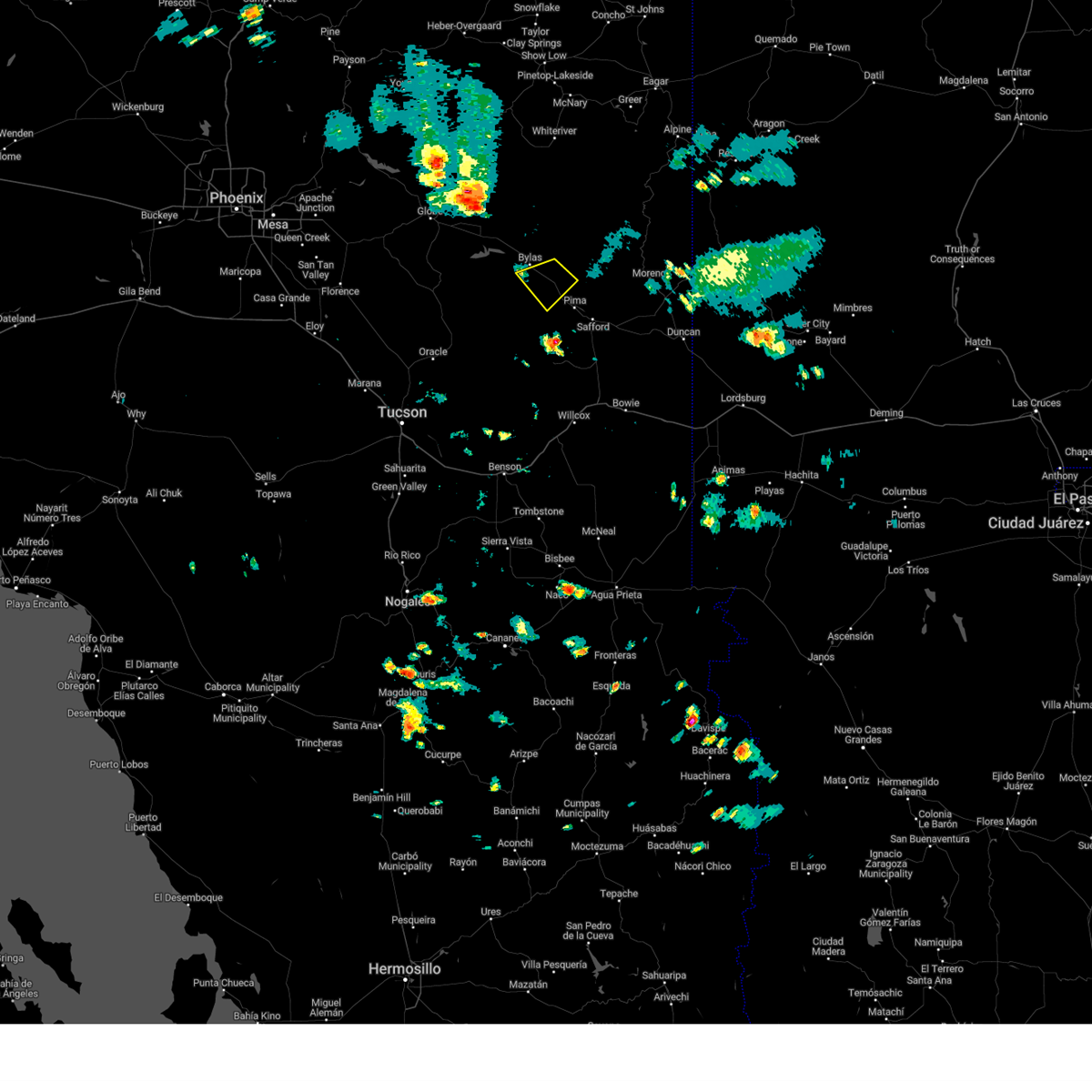
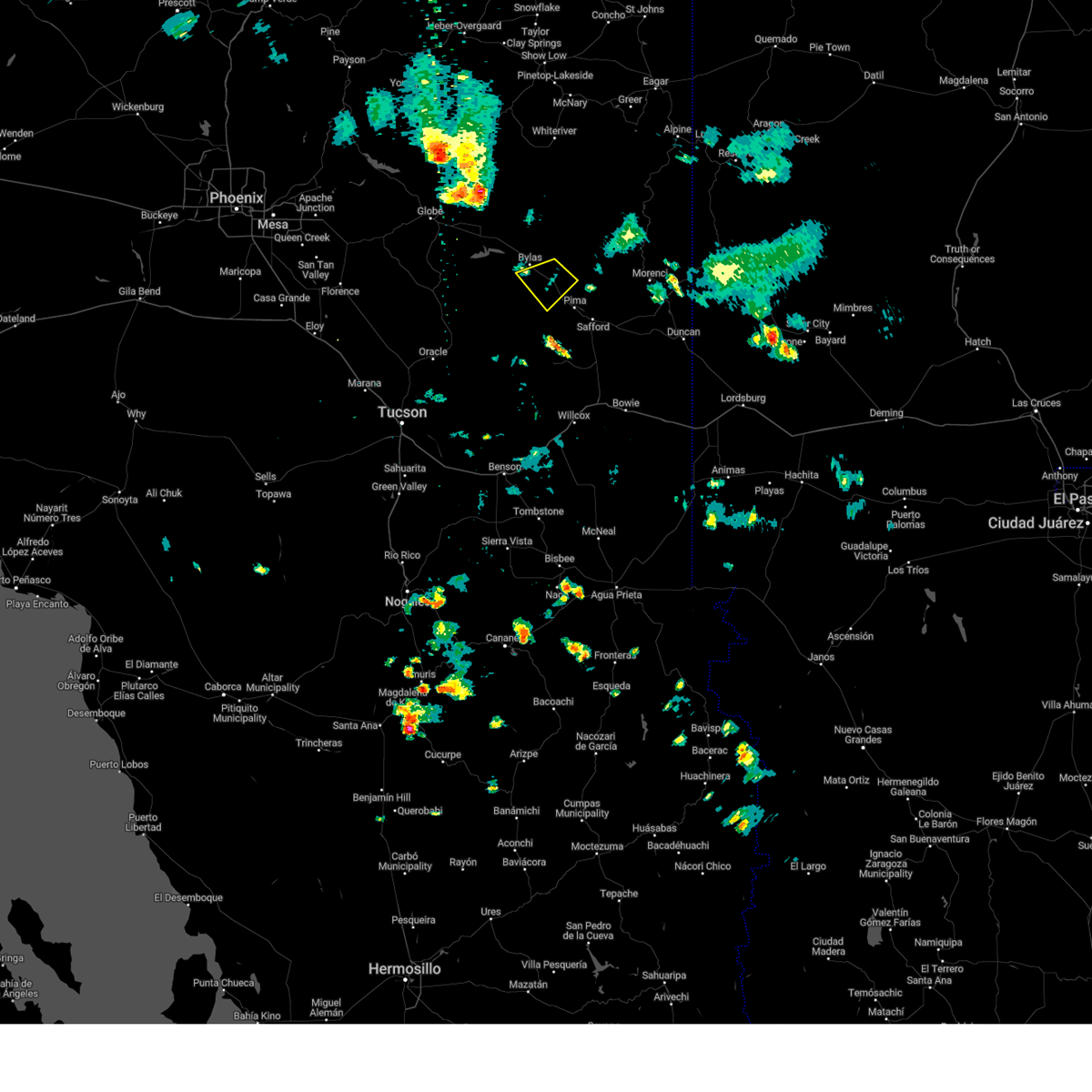
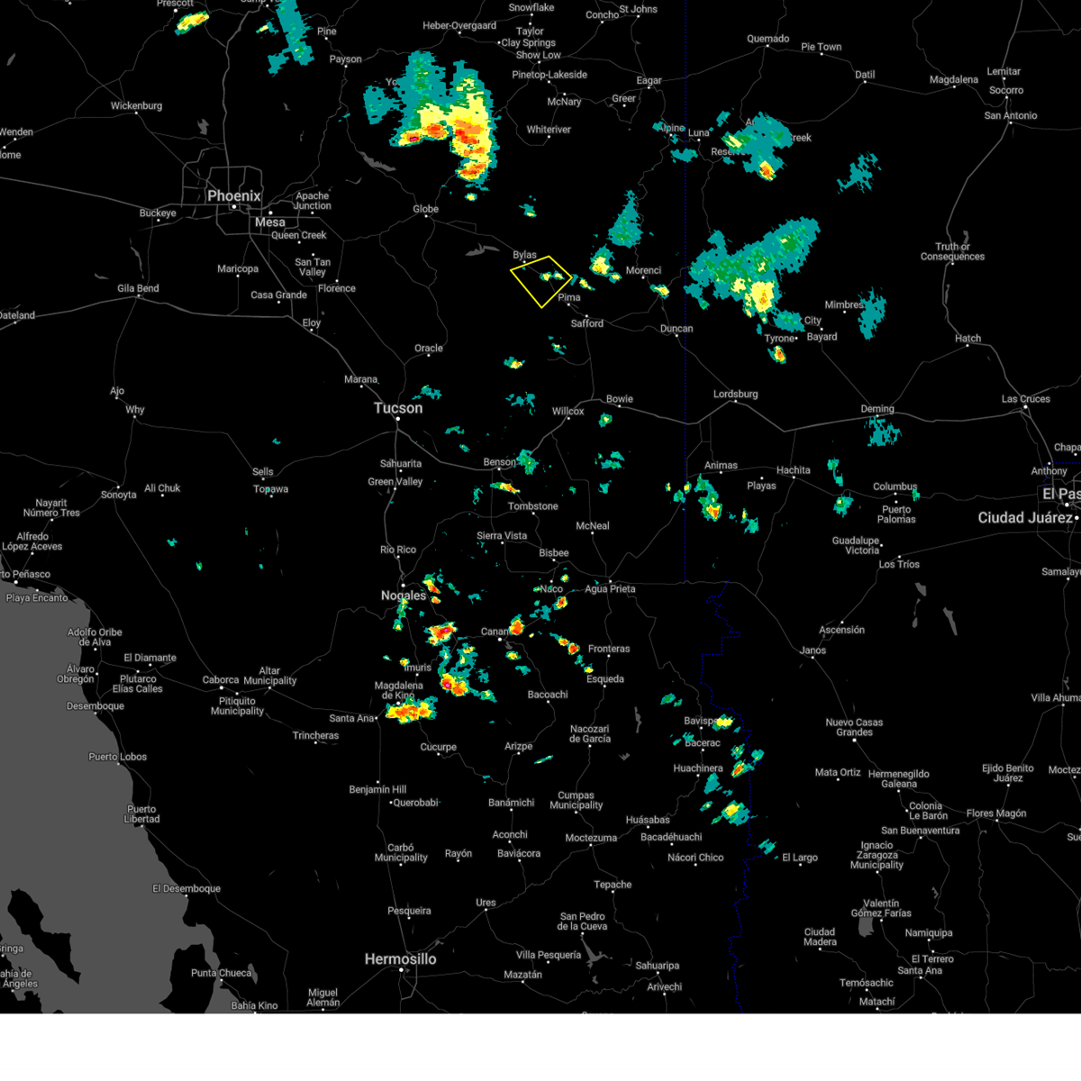
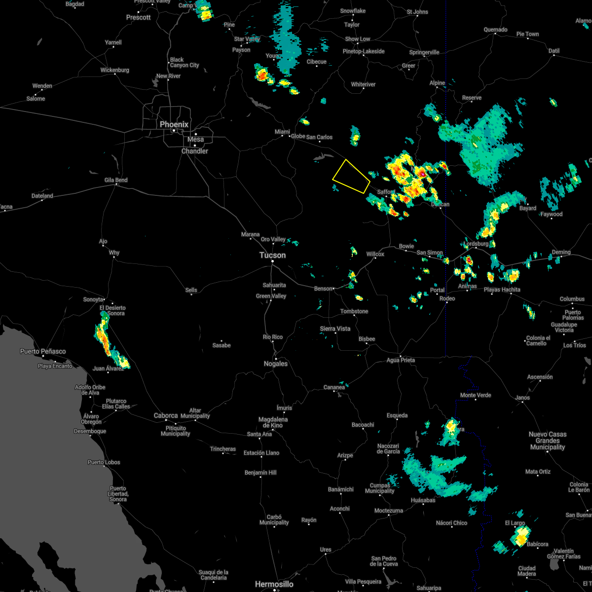
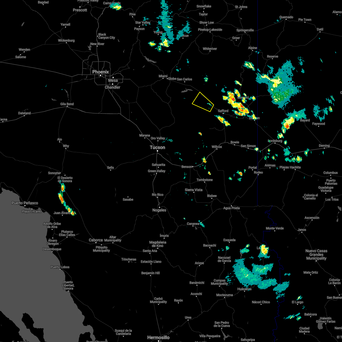
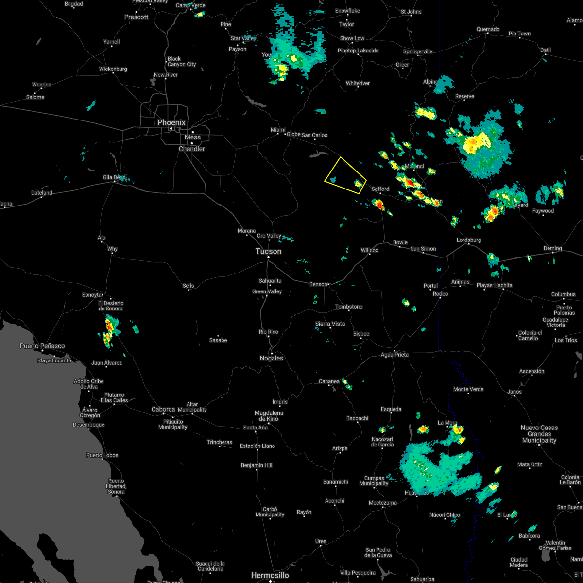
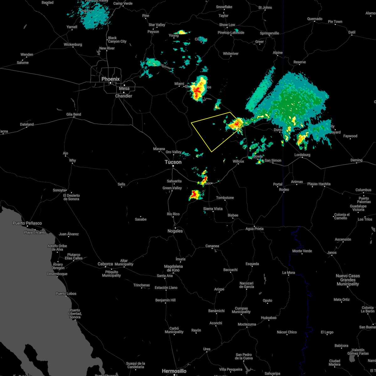
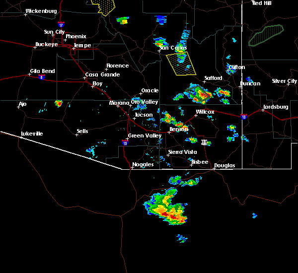
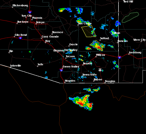
Hail Map for Fort Thomas, AZ
The Fort Thomas, AZ area has had 0 reports of on-the-ground hail by trained spotters, and has been under severe weather warnings 13 times during the past 12 months. Doppler radar has detected hail at or near Fort Thomas, AZ on 13 occasions, including 1 occasion during the past year.
| Name: | Fort Thomas, AZ |
| Where Located: | 80.7 miles NE of Tucson, AZ |
| Map: | Google Map for Fort Thomas, AZ |
| Population: | 374 |
| Housing Units: | 206 |
| More Info: | Search Google for Fort Thomas, AZ |
0
The Top Recent Hail Date for Fort Thomas, AZ is Wednesday, August 7, 2024 (4th out of 13)

Hail and Wind Damage Spotted near Fort Thomas, AZ
| Date / Time | Report Details |
|---|---|
| 8/7/2024 3:52 PM MST |
 The storm which prompted the warning has weakened below severe limits, and no longer poses an immediate threat to life or property. therefore, the warning will be allowed to expire. however, gusty winds and heavy rain are still possible with this thunderstorm. The storm which prompted the warning has weakened below severe limits, and no longer poses an immediate threat to life or property. therefore, the warning will be allowed to expire. however, gusty winds and heavy rain are still possible with this thunderstorm.
|
| 8/7/2024 3:35 PM MST |
 At 335 pm mst, a severe thunderstorm was located 21 miles northwest of thatcher, or 23 miles northwest of safford, moving southwest at 10 mph (radar indicated). Hazards include 60 mph wind gusts and quarter size hail. Hail damage to vehicles is expected. expect wind damage to roofs, siding, and trees. locations impacted include, bylas and fort thomas. This includes route 70 between mile markers 296 and 312. At 335 pm mst, a severe thunderstorm was located 21 miles northwest of thatcher, or 23 miles northwest of safford, moving southwest at 10 mph (radar indicated). Hazards include 60 mph wind gusts and quarter size hail. Hail damage to vehicles is expected. expect wind damage to roofs, siding, and trees. locations impacted include, bylas and fort thomas. This includes route 70 between mile markers 296 and 312.
|
| 8/7/2024 3:15 PM MST |
 Svrtwc the national weather service in tucson has issued a * severe thunderstorm warning for, west central graham county in southeastern arizona, * until 400 pm mst. * at 315 pm mst, a severe thunderstorm was located 19 miles northwest of thatcher, or 21 miles northwest of safford, moving southwest at 10 mph (radar indicated). Hazards include 60 mph wind gusts and quarter size hail. Hail damage to vehicles is expected. Expect wind damage to roofs, siding, and trees. Svrtwc the national weather service in tucson has issued a * severe thunderstorm warning for, west central graham county in southeastern arizona, * until 400 pm mst. * at 315 pm mst, a severe thunderstorm was located 19 miles northwest of thatcher, or 21 miles northwest of safford, moving southwest at 10 mph (radar indicated). Hazards include 60 mph wind gusts and quarter size hail. Hail damage to vehicles is expected. Expect wind damage to roofs, siding, and trees.
|
| 7/22/2024 7:52 PM MST |
 The storms which prompted the warning have weakened below severe limits. therefore, the warning will be allowed to expire. however, gusty winds are still possible with these thunderstorms. The storms which prompted the warning have weakened below severe limits. therefore, the warning will be allowed to expire. however, gusty winds are still possible with these thunderstorms.
|
| 7/22/2024 7:20 PM MST |
 Svrtwc the national weather service in tucson has issued a * severe thunderstorm warning for, central graham county in southeastern arizona, west central greenlee county in southeastern arizona, * until 800 pm mst. * at 720 pm mst, severe thunderstorms were located along a line extending from near fort thomas to near safford airport to 10 miles northeast of san jose, moving southwest at 20 mph (radar indicated). Hazards include 60 mph wind gusts. expect damage to roofs, siding, and trees Svrtwc the national weather service in tucson has issued a * severe thunderstorm warning for, central graham county in southeastern arizona, west central greenlee county in southeastern arizona, * until 800 pm mst. * at 720 pm mst, severe thunderstorms were located along a line extending from near fort thomas to near safford airport to 10 miles northeast of san jose, moving southwest at 20 mph (radar indicated). Hazards include 60 mph wind gusts. expect damage to roofs, siding, and trees
|
| 7/21/2024 3:10 PM MST |
 The storms which prompted the warning across portions of the gila river valley have weakened below severe limits, and have exited the warned area. therefore, the warning will be allowed to expire. however, gusty winds are still possible with these thunderstorms. The storms which prompted the warning across portions of the gila river valley have weakened below severe limits, and have exited the warned area. therefore, the warning will be allowed to expire. however, gusty winds are still possible with these thunderstorms.
|
| 7/21/2024 2:54 PM MST |
 At 253 pm mst, severe thunderstorms were located along a line extending from 25 miles northwest of thatcher to 6 miles east of san jose, moving south at 20 mph (radar indicated). Hazards include 60 mph wind gusts and penny size hail. Expect damage to roofs, siding, and trees. locations impacted include, safford, thatcher, solomon, san jose, roper lake state park, safford regional airport, pima, central, fort thomas, and swift trail junction. this includes the following highways, route 70 between mile markers 293 and 359. Route 191 between mile markers 115 and 140. At 253 pm mst, severe thunderstorms were located along a line extending from 25 miles northwest of thatcher to 6 miles east of san jose, moving south at 20 mph (radar indicated). Hazards include 60 mph wind gusts and penny size hail. Expect damage to roofs, siding, and trees. locations impacted include, safford, thatcher, solomon, san jose, roper lake state park, safford regional airport, pima, central, fort thomas, and swift trail junction. this includes the following highways, route 70 between mile markers 293 and 359. Route 191 between mile markers 115 and 140.
|
| 7/21/2024 2:12 PM MST |
 Svrtwc the national weather service in tucson has issued a * severe thunderstorm warning for, central graham county in southeastern arizona, southwestern greenlee county in southeastern arizona, * until 315 pm mst. * at 210 pm mst, severe thunderstorms were located along a line extending from 18 miles southwest of west poker mountain to 7 miles west of morenci, moving south at 15 to 20 mph (radar indicated). Hazards include 60 mph wind gusts and penny size hail. expect damage to roofs, siding, and trees Svrtwc the national weather service in tucson has issued a * severe thunderstorm warning for, central graham county in southeastern arizona, southwestern greenlee county in southeastern arizona, * until 315 pm mst. * at 210 pm mst, severe thunderstorms were located along a line extending from 18 miles southwest of west poker mountain to 7 miles west of morenci, moving south at 15 to 20 mph (radar indicated). Hazards include 60 mph wind gusts and penny size hail. expect damage to roofs, siding, and trees
|
| 7/19/2024 3:05 PM MST |
 The storm which prompted the warning has weakened below severe limits, and no longer poses an immediate threat to life or property. therefore, the warning will be allowed to expire. however, gusty winds are still possible with this thunderstorm. The storm which prompted the warning has weakened below severe limits, and no longer poses an immediate threat to life or property. therefore, the warning will be allowed to expire. however, gusty winds are still possible with this thunderstorm.
|
| 7/19/2024 2:35 PM MST |
 At 234 pm mst, a severe thunderstorm was located 20 miles north of thatcher, or 21 miles north of safford, moving southwest at 15 mph (radar indicated). Hazards include 60 mph wind gusts and quarter size hail. Hail damage to vehicles is expected. expect wind damage to roofs, siding, and trees. locations impacted include, safford, thatcher, solomon, safford regional airport, pima, bylas, central, and fort thomas. This includes route 70 between mile markers 295 and 312, and between mile markers 339 and 345. At 234 pm mst, a severe thunderstorm was located 20 miles north of thatcher, or 21 miles north of safford, moving southwest at 15 mph (radar indicated). Hazards include 60 mph wind gusts and quarter size hail. Hail damage to vehicles is expected. expect wind damage to roofs, siding, and trees. locations impacted include, safford, thatcher, solomon, safford regional airport, pima, bylas, central, and fort thomas. This includes route 70 between mile markers 295 and 312, and between mile markers 339 and 345.
|
| 7/19/2024 2:18 PM MST |
 Svrtwc the national weather service in tucson has issued a * severe thunderstorm warning for, central graham county in southeastern arizona, west central greenlee county in southeastern arizona, * until 315 pm mst. * at 217 pm mst, a severe thunderstorm was located 23 miles south of west poker mountain, or 25 miles north of safford, moving southwest at 15 mph (radar indicated). Hazards include 60 mph wind gusts and quarter size hail. Hail damage to vehicles is expected. Expect wind damage to roofs, siding, and trees. Svrtwc the national weather service in tucson has issued a * severe thunderstorm warning for, central graham county in southeastern arizona, west central greenlee county in southeastern arizona, * until 315 pm mst. * at 217 pm mst, a severe thunderstorm was located 23 miles south of west poker mountain, or 25 miles north of safford, moving southwest at 15 mph (radar indicated). Hazards include 60 mph wind gusts and quarter size hail. Hail damage to vehicles is expected. Expect wind damage to roofs, siding, and trees.
|
| 7/15/2024 8:23 PM MST |
 The storm which prompted the warning northwest of safford has weakened below severe limits. therefore, the warning will be allowed to expire. however, gusty winds are still possible with this thunderstorm. The storm which prompted the warning northwest of safford has weakened below severe limits. therefore, the warning will be allowed to expire. however, gusty winds are still possible with this thunderstorm.
|
| 7/15/2024 7:51 PM MST |
 Svrtwc the national weather service in tucson has issued a * severe thunderstorm warning for, central graham county in southeastern arizona, * until 830 pm mst. * at 751 pm mst, a severe thunderstorm was located 7 miles north of thatcher, or 7 miles northwest of safford, moving northwest at 10 mph (radar indicated). Hazards include 60 mph wind gusts and penny size hail. expect damage to roofs, siding, and trees Svrtwc the national weather service in tucson has issued a * severe thunderstorm warning for, central graham county in southeastern arizona, * until 830 pm mst. * at 751 pm mst, a severe thunderstorm was located 7 miles north of thatcher, or 7 miles northwest of safford, moving northwest at 10 mph (radar indicated). Hazards include 60 mph wind gusts and penny size hail. expect damage to roofs, siding, and trees
|
| 5/17/2023 6:04 PM MST |
 At 604 pm mst, a severe thunderstorm was located near safford regional airport, or near safford, moving east at 15 mph (radar indicated). Hazards include 60 mph wind gusts and penny size hail. Expect damage to roofs, siding, and trees. locations impacted include, pima and central. hail threat, radar indicated max hail size, 0. 75 in wind threat, radar indicated max wind gust, 60 mph. At 604 pm mst, a severe thunderstorm was located near safford regional airport, or near safford, moving east at 15 mph (radar indicated). Hazards include 60 mph wind gusts and penny size hail. Expect damage to roofs, siding, and trees. locations impacted include, pima and central. hail threat, radar indicated max hail size, 0. 75 in wind threat, radar indicated max wind gust, 60 mph.
|
| 5/17/2023 5:38 PM MST |
 At 538 pm mst, a severe thunderstorm was located near thatcher, or 8 miles northwest of safford, moving northeast at 15 mph (radar indicated). Hazards include 60 mph wind gusts and penny size hail. expect damage to roofs, siding, and trees At 538 pm mst, a severe thunderstorm was located near thatcher, or 8 miles northwest of safford, moving northeast at 15 mph (radar indicated). Hazards include 60 mph wind gusts and penny size hail. expect damage to roofs, siding, and trees
|
| 9/5/2021 2:29 PM MST |
 At 228 pm mst, severe thunderstorms were located along a line extending from 7 miles northwest of morenci to 17 miles north of safford regional airport to 19 miles north of thatcher to 25 miles northwest of safford, moving south at 10 mph (radar indicated). Hazards include 60 mph wind gusts and quarter size hail. Hail damage to vehicles is expected. Expect wind damage to roofs, siding, and trees. At 228 pm mst, severe thunderstorms were located along a line extending from 7 miles northwest of morenci to 17 miles north of safford regional airport to 19 miles north of thatcher to 25 miles northwest of safford, moving south at 10 mph (radar indicated). Hazards include 60 mph wind gusts and quarter size hail. Hail damage to vehicles is expected. Expect wind damage to roofs, siding, and trees.
|
| 7/18/2021 3:39 PM MST |
 The severe thunderstorm warning for west central graham county will expire at 345 pm mst, the storm which prompted the warning has weakened below severe limits, and no longer poses an immediate threat to life or property. therefore, the warning will be allowed to expire. The severe thunderstorm warning for west central graham county will expire at 345 pm mst, the storm which prompted the warning has weakened below severe limits, and no longer poses an immediate threat to life or property. therefore, the warning will be allowed to expire.
|
| 7/18/2021 3:23 PM MST |
 At 323 pm mst, a severe thunderstorm was located 17 miles northwest of thatcher, or 20 miles northwest of safford, moving northwest at 15 mph (radar indicated). Hazards include 60 mph wind gusts and quarter size hail. Hail damage to vehicles is expected. expect wind damage to roofs, siding, and trees. locations impacted include, bylas. This includes route 70 between mile markers 294 and 302, and between mile markers 308 and 313. At 323 pm mst, a severe thunderstorm was located 17 miles northwest of thatcher, or 20 miles northwest of safford, moving northwest at 15 mph (radar indicated). Hazards include 60 mph wind gusts and quarter size hail. Hail damage to vehicles is expected. expect wind damage to roofs, siding, and trees. locations impacted include, bylas. This includes route 70 between mile markers 294 and 302, and between mile markers 308 and 313.
|
| 7/18/2021 3:05 PM MST |
 At 304 pm mst, a severe thunderstorm was located 14 miles northwest of thatcher, or 16 miles west of safford, moving northwest at 15 mph (radar indicated). Hazards include 60 mph wind gusts and quarter size hail. Hail damage to vehicles is expected. Expect wind damage to roofs, siding, and trees. At 304 pm mst, a severe thunderstorm was located 14 miles northwest of thatcher, or 16 miles west of safford, moving northwest at 15 mph (radar indicated). Hazards include 60 mph wind gusts and quarter size hail. Hail damage to vehicles is expected. Expect wind damage to roofs, siding, and trees.
|
| 7/16/2021 2:23 PM MST |
 At 222 pm mst, a severe thunderstorm was located 8 miles north of safford regional airport, or 10 miles northeast of safford, moving south at 20 mph (radar indicated). Hazards include 60 mph wind gusts. Expect damage to roofs, siding, and trees. locations impacted include, safford, clifton, thatcher, solomon, morenci, roper lake state park, safford regional airport, pima, central, fort thomas, three way, swift trail junction and guthrie. this includes the following highways, route 70 between mile markers 300 and 370. route 75 between mile markers 397 and 398. route 78 between mile markers 155 and 156. Route 191 between mile markers 113 and 175. At 222 pm mst, a severe thunderstorm was located 8 miles north of safford regional airport, or 10 miles northeast of safford, moving south at 20 mph (radar indicated). Hazards include 60 mph wind gusts. Expect damage to roofs, siding, and trees. locations impacted include, safford, clifton, thatcher, solomon, morenci, roper lake state park, safford regional airport, pima, central, fort thomas, three way, swift trail junction and guthrie. this includes the following highways, route 70 between mile markers 300 and 370. route 75 between mile markers 397 and 398. route 78 between mile markers 155 and 156. Route 191 between mile markers 113 and 175.
|
| 7/16/2021 2:03 PM MST |
 At 201 pm mst, a group of severe thunderstorms was indicated north of a solomon to safford to fort thomas line. these storms are moving to the moving south at 25 mph (radar indicated). Hazards include 60 mph wind gusts. expect damage to roofs, siding, and trees At 201 pm mst, a group of severe thunderstorms was indicated north of a solomon to safford to fort thomas line. these storms are moving to the moving south at 25 mph (radar indicated). Hazards include 60 mph wind gusts. expect damage to roofs, siding, and trees
|
| 7/12/2021 7:53 PM MST |
 At 752 pm mst, a severe thunderstorm was located 19 miles east of mammoth, moving southwest at 25 mph (radar indicated). Hazards include 60 mph wind gusts and penny size hail. Expect damage to roofs, siding, and trees. locations impacted include, thatcher, aravaipa canyon wilderness, pima and klondyke. This includes route 70 between mile markers 312 and 328. At 752 pm mst, a severe thunderstorm was located 19 miles east of mammoth, moving southwest at 25 mph (radar indicated). Hazards include 60 mph wind gusts and penny size hail. Expect damage to roofs, siding, and trees. locations impacted include, thatcher, aravaipa canyon wilderness, pima and klondyke. This includes route 70 between mile markers 312 and 328.
|
| 7/12/2021 7:28 PM MST |
 At 727 pm mst, a severe thunderstorm was located 25 miles west of safford, moving southwest at 25 mph (radar indicated). Hazards include 60 mph wind gusts and quarter size hail. Hail damage to vehicles is expected. Expect wind damage to roofs, siding, and trees. At 727 pm mst, a severe thunderstorm was located 25 miles west of safford, moving southwest at 25 mph (radar indicated). Hazards include 60 mph wind gusts and quarter size hail. Hail damage to vehicles is expected. Expect wind damage to roofs, siding, and trees.
|
| 6/28/2021 3:37 PM MST |
 At 336 pm mst, a severe thunderstorm was located near and west of safford regional airport, moving southwest at 15 mph (radar indicated). Hazards include 60 mph wind gusts and penny size hail. expect damage to roofs, siding, and trees At 336 pm mst, a severe thunderstorm was located near and west of safford regional airport, moving southwest at 15 mph (radar indicated). Hazards include 60 mph wind gusts and penny size hail. expect damage to roofs, siding, and trees
|
| 8/17/2020 6:10 PM MST |
 The severe thunderstorm warning for central graham and west central greenlee counties will expire at 615 pm mst, the storm which prompted the warning has weakened below severe limits, and no longer poses an immediate threat to life or property. therefore, the warning will be allowed to expire. however gusty winds in excess of 45 mph are still possible in the fort thomas and safford areas. The severe thunderstorm warning for central graham and west central greenlee counties will expire at 615 pm mst, the storm which prompted the warning has weakened below severe limits, and no longer poses an immediate threat to life or property. therefore, the warning will be allowed to expire. however gusty winds in excess of 45 mph are still possible in the fort thomas and safford areas.
|
| 8/17/2020 5:29 PM MST |
 At 529 pm mst, a severe thunderstorm was located 7 miles west of morenci, or 9 miles west of clifton, moving southwest at 25 mph (radar indicated). Hazards include 60 mph wind gusts and nickel size hail. expect damage to roofs, siding, and trees At 529 pm mst, a severe thunderstorm was located 7 miles west of morenci, or 9 miles west of clifton, moving southwest at 25 mph (radar indicated). Hazards include 60 mph wind gusts and nickel size hail. expect damage to roofs, siding, and trees
|
| 7/29/2019 4:53 PM MST | Winds gusts of 55-59 mph with passing line of thunderstorm in graham county AZ, 3.7 miles SSW of Fort Thomas, AZ |
| 7/22/2019 6:54 PM MST |
 The severe thunderstorm warning for west central graham and east central pinal counties will expire at 700 pm mst, the storm wand outflow winds hich prompted the warning has moved out of the area. therefore, the warning will be allowed to expire. a severe thunderstorm watch remains in effect until 1100 pm mst for southeastern arizona. The severe thunderstorm warning for west central graham and east central pinal counties will expire at 700 pm mst, the storm wand outflow winds hich prompted the warning has moved out of the area. therefore, the warning will be allowed to expire. a severe thunderstorm watch remains in effect until 1100 pm mst for southeastern arizona.
|
| 7/22/2019 6:26 PM MST | 65 mph gust recorded on the black hills raws. time estimated based on satellit in graham county AZ, 4.3 miles SSW of Fort Thomas, AZ |
| 7/22/2019 6:23 PM MST |
 At 621 pm mst, a severe thunderstorm was located 5 miles north of klondike, moving southwest at 15 mph. also, a very strong outflow has moved off the mogollon rim and is headed to the southwest and recently crossed route 70 (radar indicated). Hazards include 70 mph wind gusts and quarter size hail. Hail damage to vehicles is expected. expect considerable tree damage. Wind damage is also likely to mobile homes, roofs, and outbuildings. At 621 pm mst, a severe thunderstorm was located 5 miles north of klondike, moving southwest at 15 mph. also, a very strong outflow has moved off the mogollon rim and is headed to the southwest and recently crossed route 70 (radar indicated). Hazards include 70 mph wind gusts and quarter size hail. Hail damage to vehicles is expected. expect considerable tree damage. Wind damage is also likely to mobile homes, roofs, and outbuildings.
|
| 8/14/2018 6:53 PM MST |
 The severe thunderstorm warning for central graham county will expire at 700 pm mst, the storms which prompted the warning have weakened below severe limits, and no longer pose an immediate threat to life or property. therefore, the warning will be allowed to expire. however small hail, gusty winds and heavy rain are still possible with these thunderstorms. The severe thunderstorm warning for central graham county will expire at 700 pm mst, the storms which prompted the warning have weakened below severe limits, and no longer pose an immediate threat to life or property. therefore, the warning will be allowed to expire. however small hail, gusty winds and heavy rain are still possible with these thunderstorms.
|
| 8/14/2018 6:25 PM MST |
 At 624 pm mst, severe thunderstorms were located along a line extending from near safford to 3 miles east of fort thomas, moving southwest at 10 mph (radar indicated). Hazards include 60 mph wind gusts and quarter size hail. Hail damage to vehicles is expected. expect wind damage to roofs, siding, and trees. locations impacted include, safford, thatcher, pima, solomon, fort thomas and swift trail junction. this includes the following highways, route 70 between mile markers 301 and 352. Route 191 between mile markers 115 and 134. At 624 pm mst, severe thunderstorms were located along a line extending from near safford to 3 miles east of fort thomas, moving southwest at 10 mph (radar indicated). Hazards include 60 mph wind gusts and quarter size hail. Hail damage to vehicles is expected. expect wind damage to roofs, siding, and trees. locations impacted include, safford, thatcher, pima, solomon, fort thomas and swift trail junction. this includes the following highways, route 70 between mile markers 301 and 352. Route 191 between mile markers 115 and 134.
|
| 8/14/2018 6:11 PM MST |
 At 609 pm mst, severe thunderstorms were located along a line extending from 6 miles east of safford to 10 miles southwest of bylas, and are nearly stationary (radar indicated). Hazards include 60 mph wind gusts and quarter size hail. Hail damage to vehicles is expected. Expect wind damage to roofs, siding, and trees. At 609 pm mst, severe thunderstorms were located along a line extending from 6 miles east of safford to 10 miles southwest of bylas, and are nearly stationary (radar indicated). Hazards include 60 mph wind gusts and quarter size hail. Hail damage to vehicles is expected. Expect wind damage to roofs, siding, and trees.
|
| 7/19/2018 5:26 PM MST |
 At 524 pm mst, a severe thunderstorm was located just east of bylas, or 28 miles northwest of safford, moving west at 10 mph (radar indicated). Hazards include 60 mph wind gusts and quarter size hail. Hail damage to vehicles is expected. expect wind damage to roofs, siding, and trees. locations impacted include, calva and bylas. This includes route 70 between mile markers 279 and 313. At 524 pm mst, a severe thunderstorm was located just east of bylas, or 28 miles northwest of safford, moving west at 10 mph (radar indicated). Hazards include 60 mph wind gusts and quarter size hail. Hail damage to vehicles is expected. expect wind damage to roofs, siding, and trees. locations impacted include, calva and bylas. This includes route 70 between mile markers 279 and 313.
|
| 7/19/2018 5:05 PM MST | Mesonet station qbha3... black hill in graham county AZ, 3.7 miles SSW of Fort Thomas, AZ |
| 7/19/2018 5:02 PM MST |
 At 501 pm mst, a severe thunderstorm was located 25 miles northwest of safford, moving west at 10 mph (radar indicated). Hazards include 60 mph wind gusts and quarter size hail. Hail damage to vehicles is expected. Expect wind damage to roofs, siding, and trees. At 501 pm mst, a severe thunderstorm was located 25 miles northwest of safford, moving west at 10 mph (radar indicated). Hazards include 60 mph wind gusts and quarter size hail. Hail damage to vehicles is expected. Expect wind damage to roofs, siding, and trees.
|
| 7/23/2017 5:16 PM MST |
 The national weather service in tucson has issued a * severe thunderstorm warning for. west central graham county in southeastern arizona. Until 600 pm mst * at 515 pm mst, a severe thunderstorm was located 5 miles northeast of fort thomas, moving southwest at 15 mph. The national weather service in tucson has issued a * severe thunderstorm warning for. west central graham county in southeastern arizona. Until 600 pm mst * at 515 pm mst, a severe thunderstorm was located 5 miles northeast of fort thomas, moving southwest at 15 mph.
|
| 7/17/2017 3:40 PM MST |
 At 339 pm mst, a severe thunderstorm was located near safford, moving northwest at 20 mph (radar indicated). Hazards include 60 mph wind gusts. expect damage to roofs, siding, and trees At 339 pm mst, a severe thunderstorm was located near safford, moving northwest at 20 mph (radar indicated). Hazards include 60 mph wind gusts. expect damage to roofs, siding, and trees
|
| 11/4/2016 12:27 PM MST |
 The severe thunderstorm warning for central graham county will expire at 1230 pm mst, the storm which prompted the warning west and northwest of safford has weakened below severe limits, and no longer poses a threat. therefore the warning will be allowed to expire. The severe thunderstorm warning for central graham county will expire at 1230 pm mst, the storm which prompted the warning west and northwest of safford has weakened below severe limits, and no longer poses a threat. therefore the warning will be allowed to expire.
|
| 11/4/2016 11:58 AM MST |
 At 1156 am mst, doppler radar continued to indicate a severe thunderstorm capable of producing large hail up to ping pong ball size and damaging winds in excess of 60 mph. this storm was located just northwest of safford near pima, moving north at 10 to 15 mph. this warning is an extension of the previous warning over the same area. At 1156 am mst, doppler radar continued to indicate a severe thunderstorm capable of producing large hail up to ping pong ball size and damaging winds in excess of 60 mph. this storm was located just northwest of safford near pima, moving north at 10 to 15 mph. this warning is an extension of the previous warning over the same area.
|
| 11/4/2016 11:45 AM MST |
 At 1144 am mst, doppler radar indicated a severe thunderstorm capable of producing large hail up to ping pong ball size and damaging winds in excess of 60 mph. this storm was located near safford, moving north at 10 mph. locations impacted include, safford, thatcher, pima. At 1144 am mst, doppler radar indicated a severe thunderstorm capable of producing large hail up to ping pong ball size and damaging winds in excess of 60 mph. this storm was located near safford, moving north at 10 mph. locations impacted include, safford, thatcher, pima.
|
| 11/4/2016 11:29 AM MST |
 At 1128 am mst, doppler radar indicated a severe thunderstorm capable of producing quarter size hail and damaging winds in excess of 60 mph. this storm was located near safford and thatcher, and moving north at 15 mph. At 1128 am mst, doppler radar indicated a severe thunderstorm capable of producing quarter size hail and damaging winds in excess of 60 mph. this storm was located near safford and thatcher, and moving north at 15 mph.
|
| 8/13/2016 4:38 PM MST |
 The severe thunderstorm warning for south central graham county will expire at 445 pm mst, the storm which prompted the warning has weakened below severe limits, and no longer poses an immediate threat to life or property. therefore the warning will be allowed to expire. however gusty winds are still possible with this thunderstorm. The severe thunderstorm warning for south central graham county will expire at 445 pm mst, the storm which prompted the warning has weakened below severe limits, and no longer poses an immediate threat to life or property. therefore the warning will be allowed to expire. however gusty winds are still possible with this thunderstorm.
|
| 8/13/2016 4:20 PM MST |
 At 420 pm mst, doppler radar indicated a severe thunderstorm capable of producing damaging winds in excess of 60 mph. this storm was located near safford, moving southwest at 20 mph. locations impacted include, safford, thatcher, pima, fort thomas, solomon, swift trail junction and frye mesa dam. At 420 pm mst, doppler radar indicated a severe thunderstorm capable of producing damaging winds in excess of 60 mph. this storm was located near safford, moving southwest at 20 mph. locations impacted include, safford, thatcher, pima, fort thomas, solomon, swift trail junction and frye mesa dam.
|
| 8/13/2016 4:01 PM MST |
 At 401 pm mst, doppler radar indicated a severe thunderstorm capable of producing damaging winds in excess of 60 mph. this storm was located near safford, and moving southwest at 20 mph. At 401 pm mst, doppler radar indicated a severe thunderstorm capable of producing damaging winds in excess of 60 mph. this storm was located near safford, and moving southwest at 20 mph.
|
| 7/29/2016 4:53 PM MST | Peak gust reported on the 0453 pm observatio in graham county AZ, 3.7 miles SSW of Fort Thomas, AZ |
| 7/27/2016 3:45 PM MST | Black hills raws...time estimated from radar in graham county AZ, 3.7 miles SSW of Fort Thomas, AZ |
| 7/27/2016 3:34 PM MST |
 At 334 pm mst, doppler radar indicated a severe thunderstorm capable of producing quarter size hail and damaging winds in excess of 60 mph. this storm was located 25 miles northwest of safford, and moving southwest at 25 mph. At 334 pm mst, doppler radar indicated a severe thunderstorm capable of producing quarter size hail and damaging winds in excess of 60 mph. this storm was located 25 miles northwest of safford, and moving southwest at 25 mph.
|
| 8/25/2015 4:59 PM MST |
 At 458 pm mst, doppler radar indicated a severe thunderstorm capable of producing damaging winds in excess of 60 mph. this storm was located east of fort thomas and north of pima, moving north at 15 mph. locations impacted include, pima area. At 458 pm mst, doppler radar indicated a severe thunderstorm capable of producing damaging winds in excess of 60 mph. this storm was located east of fort thomas and north of pima, moving north at 15 mph. locations impacted include, pima area.
|
| 8/25/2015 4:45 PM MST |
 At 445 pm mst, doppler radar indicated a severe thunderstorm capable of producing damaging winds in excess of 60 mph. this storm was located over pima, and moving north at 15 mph. At 445 pm mst, doppler radar indicated a severe thunderstorm capable of producing damaging winds in excess of 60 mph. this storm was located over pima, and moving north at 15 mph.
|
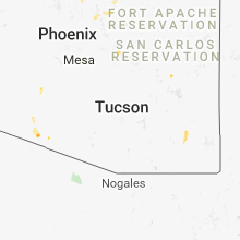
Hail Maps for Fort Thomas, AZ


Connect with Interactive Hail Maps