

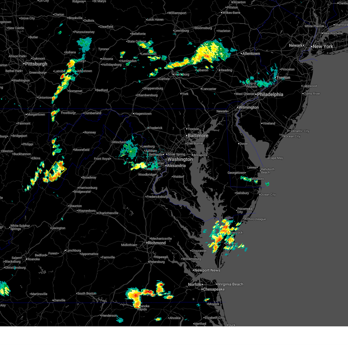
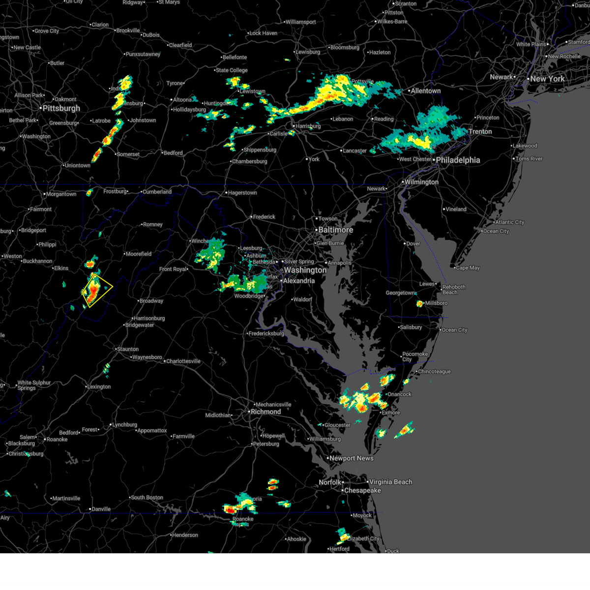
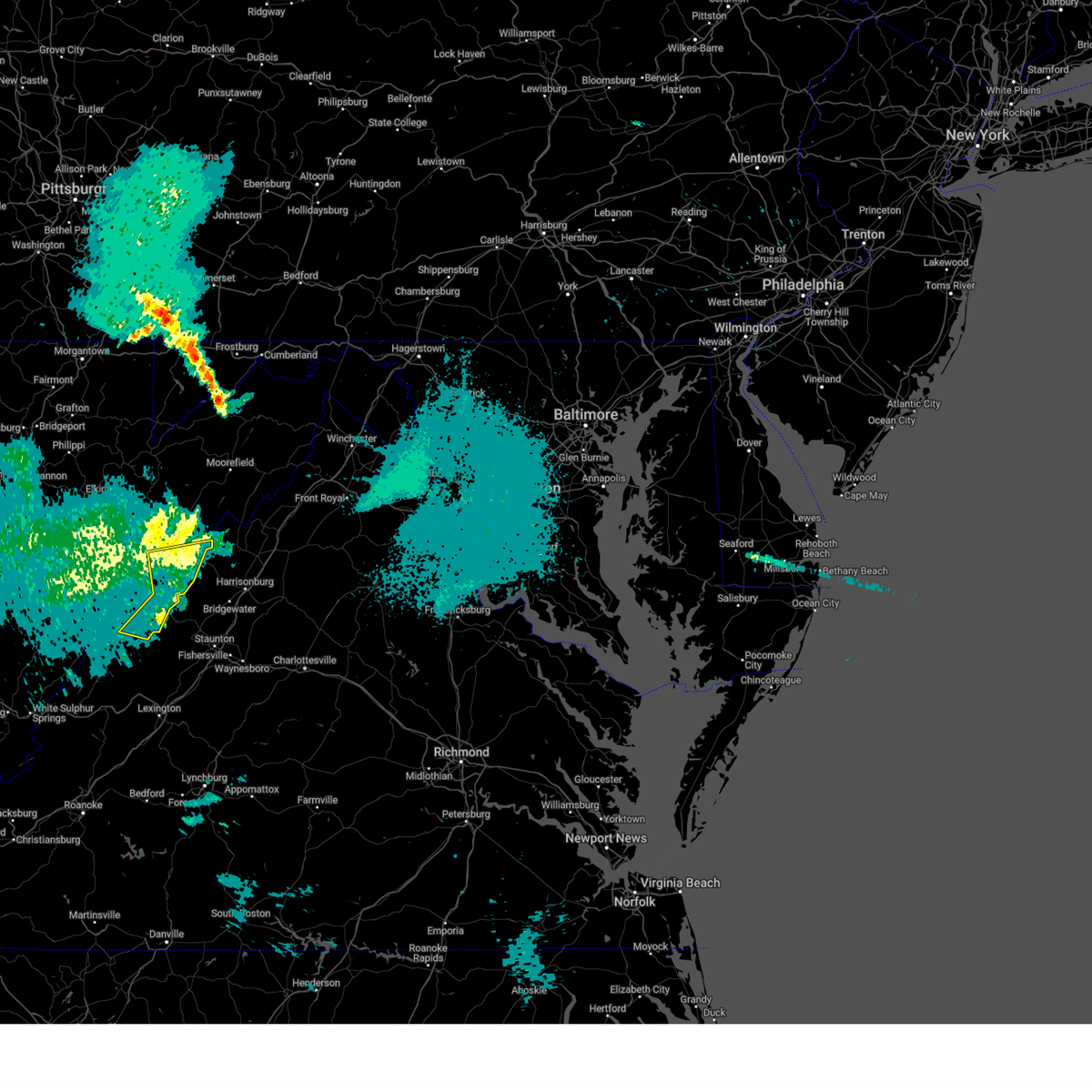
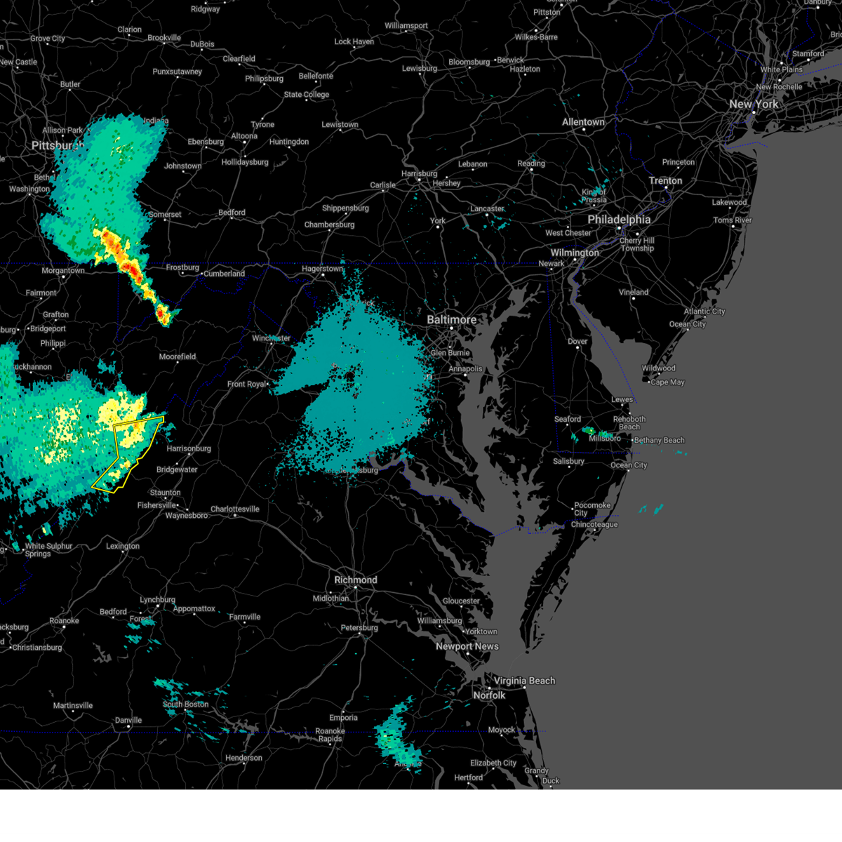
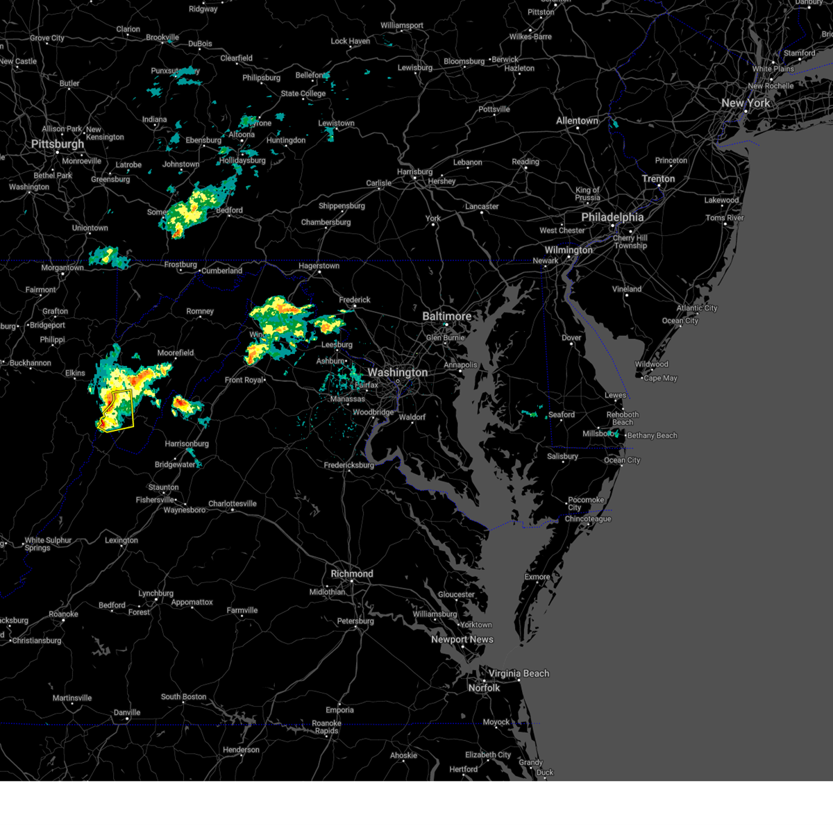
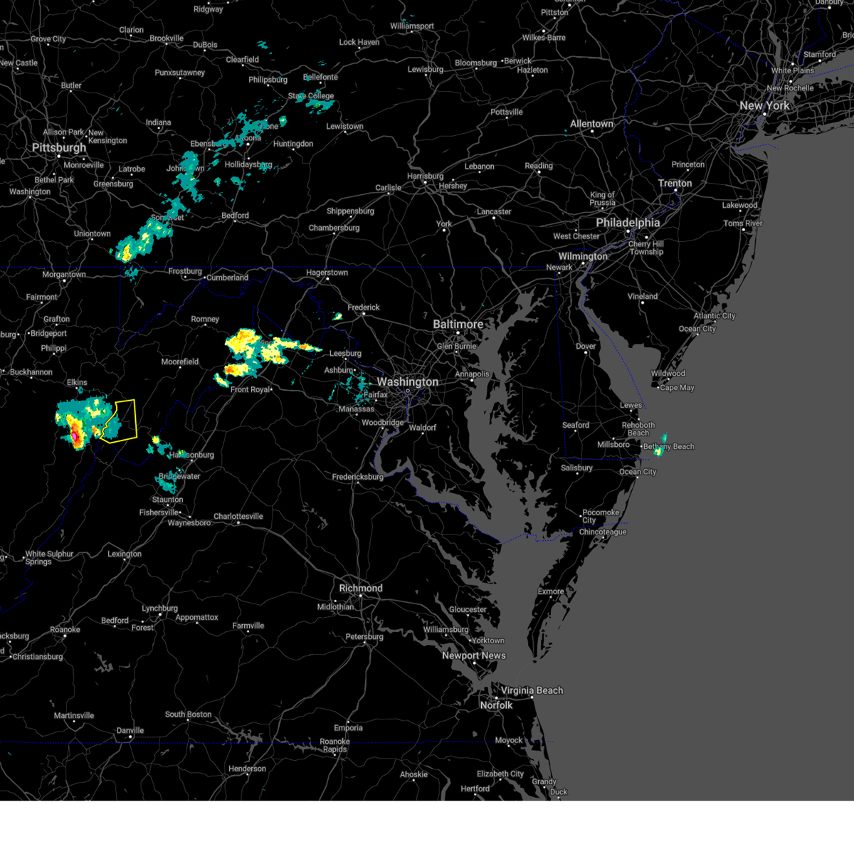
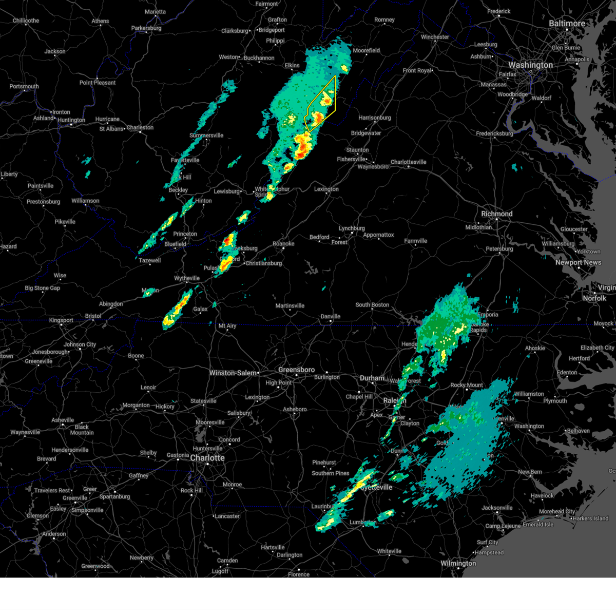
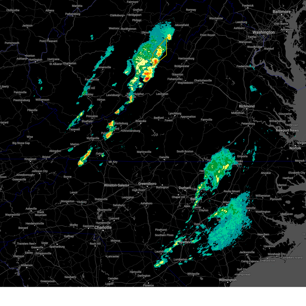
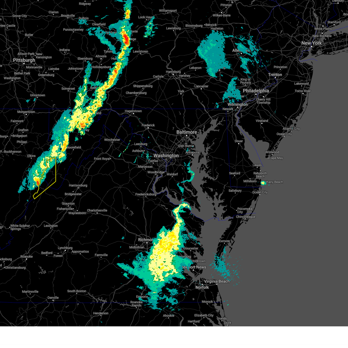
Hail Map for Franklin, WV
The Franklin, WV area has had 13 reports of on-the-ground hail by trained spotters, and has been under severe weather warnings 11 times during the past 12 months. Doppler radar has detected hail at or near Franklin, WV on 21 occasions.
| Name: | Franklin, WV |
| Where Located: | 33.6 miles SE of Elkins, WV |
| Map: | Google Map for Franklin, WV |
| Population: | 721 |
| Housing Units: | 398 |
| More Info: | Search Google for Franklin, WV |
3
The Top Recent Hail Date for Franklin, WV is Friday, July 14, 2023 (6th out of 21)
Hail and Wind Damage Spotted near Franklin, WV
| Date / Time | Report Details |
|---|---|
| 6/27/2025 1:58 PM EDT |
 The storm which prompted the warning has weakened below severe limits, and no longer poses an immediate threat to life or property. therefore, the warning will be allowed to expire. however, heavy rain is still possible with this thunderstorm. to report severe weather, contact your nearest law enforcement agency. they will relay your report to the national weather service sterling virginia. The storm which prompted the warning has weakened below severe limits, and no longer poses an immediate threat to life or property. therefore, the warning will be allowed to expire. however, heavy rain is still possible with this thunderstorm. to report severe weather, contact your nearest law enforcement agency. they will relay your report to the national weather service sterling virginia.
|
| 6/27/2025 1:47 PM EDT |
 At 147 pm edt, a severe thunderstorm was located over upper tract, or 9 miles north of franklin, moving northeast at 15 mph (radar indicated). Hazards include 60 mph wind gusts. Damaging winds will cause some trees and large branches to fall. this could injure those outdoors, as well as damage homes and vehicles. roadways may become blocked by downed trees. localized power outages are possible. unsecured light objects may become projectiles. Locations impacted include, franklin, upper tract, riverton, ruddle, and deer run. At 147 pm edt, a severe thunderstorm was located over upper tract, or 9 miles north of franklin, moving northeast at 15 mph (radar indicated). Hazards include 60 mph wind gusts. Damaging winds will cause some trees and large branches to fall. this could injure those outdoors, as well as damage homes and vehicles. roadways may become blocked by downed trees. localized power outages are possible. unsecured light objects may become projectiles. Locations impacted include, franklin, upper tract, riverton, ruddle, and deer run.
|
| 6/27/2025 1:41 PM EDT | A few trees reported down on hammer run roa in pendleton county WV, 6 miles S of Franklin, WV |
| 6/27/2025 1:19 PM EDT |
 Svrlwx the national weather service in sterling virginia has issued a * severe thunderstorm warning for, central pendleton county in eastern west virginia, * until 200 pm edt. * at 119 pm edt, a severe thunderstorm was located near franklin, moving northeast at 15 mph (radar indicated). Hazards include 60 mph wind gusts. Damaging winds will cause some trees and large branches to fall. this could injure those outdoors, as well as damage homes and vehicles. roadways may become blocked by downed trees. localized power outages are possible. Unsecured light objects may become projectiles. Svrlwx the national weather service in sterling virginia has issued a * severe thunderstorm warning for, central pendleton county in eastern west virginia, * until 200 pm edt. * at 119 pm edt, a severe thunderstorm was located near franklin, moving northeast at 15 mph (radar indicated). Hazards include 60 mph wind gusts. Damaging winds will cause some trees and large branches to fall. this could injure those outdoors, as well as damage homes and vehicles. roadways may become blocked by downed trees. localized power outages are possible. Unsecured light objects may become projectiles.
|
| 5/17/2025 1:44 AM EDT |
 The storms which prompted the warning have weakened below severe limits, and no longer pose an immediate threat to life or property. therefore, the warning will be allowed to expire. The storms which prompted the warning have weakened below severe limits, and no longer pose an immediate threat to life or property. therefore, the warning will be allowed to expire.
|
| 5/17/2025 1:38 AM EDT |
 At 138 am edt, severe thunderstorms were located along a line extending from near brandywine to 13 miles east of monterey to near burnsville, moving east at 35 mph (radar indicated). Hazards include 60 mph wind gusts. Damaging winds will cause some trees and large branches to fall. this could injure those outdoors, as well as damage homes and vehicles. roadways may become blocked by downed trees. localized power outages are possible. unsecured light objects may become projectiles. Locations impacted include, franklin, clover creek, doe hill, head waters, bolar, liberty, harper, williamsville, palo alto, oak flat, mcdowell, moyers, brandywine, sirons mill, and sugar grove. At 138 am edt, severe thunderstorms were located along a line extending from near brandywine to 13 miles east of monterey to near burnsville, moving east at 35 mph (radar indicated). Hazards include 60 mph wind gusts. Damaging winds will cause some trees and large branches to fall. this could injure those outdoors, as well as damage homes and vehicles. roadways may become blocked by downed trees. localized power outages are possible. unsecured light objects may become projectiles. Locations impacted include, franklin, clover creek, doe hill, head waters, bolar, liberty, harper, williamsville, palo alto, oak flat, mcdowell, moyers, brandywine, sirons mill, and sugar grove.
|
| 5/17/2025 1:03 AM EDT | Svrlwx the national weather service in sterling virginia has issued a * severe thunderstorm warning for, highland county in western virginia, southern pendleton county in eastern west virginia, * until 145 am edt. * at 103 am edt, severe thunderstorms were located along a line extending from 8 miles north of monterey to 9 miles northwest of burnsville, moving east at 45 mph (radar indicated). Hazards include 60 mph wind gusts. Damaging winds will cause some trees and large branches to fall. this could injure those outdoors, as well as damage homes and vehicles. roadways may become blocked by downed trees. localized power outages are possible. Unsecured light objects may become projectiles. |
| 4/5/2025 7:54 PM EDT |
 The storm which prompted the warning has weakened below severe limits, and no longer poses an immediate threat to life or property. therefore, the warning will be allowed to expire. however, gusty winds and heavy rain are still possible with this thunderstorm. The storm which prompted the warning has weakened below severe limits, and no longer poses an immediate threat to life or property. therefore, the warning will be allowed to expire. however, gusty winds and heavy rain are still possible with this thunderstorm.
|
| 4/5/2025 7:27 PM EDT |
 Svrlwx the national weather service in sterling virginia has issued a * severe thunderstorm warning for, northwestern pendleton county in eastern west virginia, * until 800 pm edt. * at 727 pm edt, a severe thunderstorm was located 12 miles southeast of mill creek, or 14 miles north of greenbank, moving east at 40 mph (radar indicated). Hazards include 60 mph wind gusts and quarter size hail. Damaging winds will cause some trees and large branches to fall. this could injure those outdoors, as well as damage homes and vehicles. roadways may become blocked by downed trees. localized power outages are possible. Unsecured light objects may become projectiles. Svrlwx the national weather service in sterling virginia has issued a * severe thunderstorm warning for, northwestern pendleton county in eastern west virginia, * until 800 pm edt. * at 727 pm edt, a severe thunderstorm was located 12 miles southeast of mill creek, or 14 miles north of greenbank, moving east at 40 mph (radar indicated). Hazards include 60 mph wind gusts and quarter size hail. Damaging winds will cause some trees and large branches to fall. this could injure those outdoors, as well as damage homes and vehicles. roadways may become blocked by downed trees. localized power outages are possible. Unsecured light objects may become projectiles.
|
| 3/16/2025 3:42 PM EDT |
 The line of storms which prompted the warning has weakened below severe limits, and no longer pose an immediate threat to life or property. therefore, the warning will be allowed to expire as scheduled. small hail and wind gusts up to 40 mph remain a threat with this storm however. a tornado watch remains in effect until 700 pm edt for western virginia, and eastern west virginia. The line of storms which prompted the warning has weakened below severe limits, and no longer pose an immediate threat to life or property. therefore, the warning will be allowed to expire as scheduled. small hail and wind gusts up to 40 mph remain a threat with this storm however. a tornado watch remains in effect until 700 pm edt for western virginia, and eastern west virginia.
|
| 3/16/2025 3:39 PM EDT |
 At 338 pm edt, severe thunderstorms were located along a line extending from 7 miles north of upper tract to 10 miles north of monterey, moving northeast at 50 mph (radar indicated). Hazards include 60 mph wind gusts. Damaging winds will cause some trees and large branches to fall. this could injure those outdoors, as well as damage homes and vehicles. roadways may become blocked by downed trees. localized power outages are possible. unsecured light objects may become projectiles. Locations impacted include, circleville, seneca rocks, hightown, possum trot, blue grass, vanderpool, cherry grove, riverton, new hampden, monterey, harper, and franklin. At 338 pm edt, severe thunderstorms were located along a line extending from 7 miles north of upper tract to 10 miles north of monterey, moving northeast at 50 mph (radar indicated). Hazards include 60 mph wind gusts. Damaging winds will cause some trees and large branches to fall. this could injure those outdoors, as well as damage homes and vehicles. roadways may become blocked by downed trees. localized power outages are possible. unsecured light objects may become projectiles. Locations impacted include, circleville, seneca rocks, hightown, possum trot, blue grass, vanderpool, cherry grove, riverton, new hampden, monterey, harper, and franklin.
|
| 3/16/2025 2:57 PM EDT |
 Svrlwx the national weather service in sterling virginia has issued a * severe thunderstorm warning for, northwestern highland county in western virginia, western pendleton county in eastern west virginia, * until 345 pm edt. * at 257 pm edt, severe thunderstorms were located along a line extending from 10 miles northeast of greenbank to 7 miles east of marlinton, moving northeast at 50 mph (radar indicated). Hazards include 60 mph wind gusts. Damaging winds will cause some trees and large branches to fall. this could injure those outdoors, as well as damage homes and vehicles. roadways may become blocked by downed trees. localized power outages are possible. Unsecured light objects may become projectiles. Svrlwx the national weather service in sterling virginia has issued a * severe thunderstorm warning for, northwestern highland county in western virginia, western pendleton county in eastern west virginia, * until 345 pm edt. * at 257 pm edt, severe thunderstorms were located along a line extending from 10 miles northeast of greenbank to 7 miles east of marlinton, moving northeast at 50 mph (radar indicated). Hazards include 60 mph wind gusts. Damaging winds will cause some trees and large branches to fall. this could injure those outdoors, as well as damage homes and vehicles. roadways may become blocked by downed trees. localized power outages are possible. Unsecured light objects may become projectiles.
|
| 5/26/2024 8:12 PM EDT |
 At 811 pm edt, severe thunderstorms were located along a line extending from 9 miles southwest of petersburg to 6 miles south of brandywine to near afton to near tower hill, moving east at 45 mph (radar indicated). Hazards include 60 mph wind gusts and quarter size hail. Damaging winds will cause some trees and large branches to fall. this could injure those outdoors, as well as damage homes and vehicles. roadways may become blocked by downed trees. localized power outages are possible. unsecured light objects may become projectiles. Locations impacted include, harrisonburg, staunton, waynesboro, franklin, stuarts draft, bridgewater, crozet, broadway, grottoes, timberville, massanutten, crimora, sherando, shipman, schuyler, wintergreen, afton, dale enterprise, fishersville, and verona. At 811 pm edt, severe thunderstorms were located along a line extending from 9 miles southwest of petersburg to 6 miles south of brandywine to near afton to near tower hill, moving east at 45 mph (radar indicated). Hazards include 60 mph wind gusts and quarter size hail. Damaging winds will cause some trees and large branches to fall. this could injure those outdoors, as well as damage homes and vehicles. roadways may become blocked by downed trees. localized power outages are possible. unsecured light objects may become projectiles. Locations impacted include, harrisonburg, staunton, waynesboro, franklin, stuarts draft, bridgewater, crozet, broadway, grottoes, timberville, massanutten, crimora, sherando, shipman, schuyler, wintergreen, afton, dale enterprise, fishersville, and verona.
|
| 5/26/2024 8:12 PM EDT |
 the severe thunderstorm warning has been cancelled and is no longer in effect the severe thunderstorm warning has been cancelled and is no longer in effect
|
| 5/26/2024 7:42 PM EDT |
 Svrlwx the national weather service in sterling virginia has issued a * severe thunderstorm warning for, nelson county in central virginia, rockingham county in western virginia, western albemarle county in central virginia, western greene county in central virginia, augusta county in western virginia, the city of staunton in western virginia, the city of harrisonburg in western virginia, the city of waynesboro in western virginia, eastern highland county in western virginia, pendleton county in eastern west virginia, southwestern hardy county in eastern west virginia, * until 845 pm edt. * at 742 pm edt, severe thunderstorms were located along a line extending from 13 miles southeast of elkins to monterey to near fairfield to near evington, moving east at 40 mph (radar indicated). Hazards include 60 mph wind gusts. Damaging winds will cause some trees and large branches to fall. this could injure those outdoors, as well as damage homes and vehicles. roadways may become blocked by downed trees. localized power outages are possible. Unsecured light objects may become projectiles. Svrlwx the national weather service in sterling virginia has issued a * severe thunderstorm warning for, nelson county in central virginia, rockingham county in western virginia, western albemarle county in central virginia, western greene county in central virginia, augusta county in western virginia, the city of staunton in western virginia, the city of harrisonburg in western virginia, the city of waynesboro in western virginia, eastern highland county in western virginia, pendleton county in eastern west virginia, southwestern hardy county in eastern west virginia, * until 845 pm edt. * at 742 pm edt, severe thunderstorms were located along a line extending from 13 miles southeast of elkins to monterey to near fairfield to near evington, moving east at 40 mph (radar indicated). Hazards include 60 mph wind gusts. Damaging winds will cause some trees and large branches to fall. this could injure those outdoors, as well as damage homes and vehicles. roadways may become blocked by downed trees. localized power outages are possible. Unsecured light objects may become projectiles.
|
| 5/26/2024 7:10 PM EDT |
 At 710 pm edt, severe thunderstorms were located along a line extending from near dailey to 6 miles northwest of greenbank to 7 miles north of mountain grove to near collierstown, moving east at 45 mph (radar indicated). Hazards include 60 mph wind gusts. Damaging winds will cause some trees and large branches to fall. this could injure those outdoors, as well as damage homes and vehicles. roadways may become blocked by downed trees. localized power outages are possible. unsecured light objects may become projectiles. Locations impacted include, staunton, franklin, monterey, stuarts draft, sherando, shipman, wintergreen, montebello, fishersville, verona, lyndhurst, nellysford, craigsville, greenville, arrington, lovingston, augusta springs, middlebrook, churchville, and deerfield. At 710 pm edt, severe thunderstorms were located along a line extending from near dailey to 6 miles northwest of greenbank to 7 miles north of mountain grove to near collierstown, moving east at 45 mph (radar indicated). Hazards include 60 mph wind gusts. Damaging winds will cause some trees and large branches to fall. this could injure those outdoors, as well as damage homes and vehicles. roadways may become blocked by downed trees. localized power outages are possible. unsecured light objects may become projectiles. Locations impacted include, staunton, franklin, monterey, stuarts draft, sherando, shipman, wintergreen, montebello, fishersville, verona, lyndhurst, nellysford, craigsville, greenville, arrington, lovingston, augusta springs, middlebrook, churchville, and deerfield.
|
| 5/26/2024 6:44 PM EDT |
 Svrlwx the national weather service in sterling virginia has issued a * severe thunderstorm warning for, central nelson county in central virginia, augusta county in western virginia, the city of staunton in western virginia, highland county in western virginia, pendleton county in eastern west virginia, * until 745 pm edt. * at 644 pm edt, severe thunderstorms were located along a line extending from 6 miles southeast of rock cave to 10 miles west of snowshoe to near marlinton to near low moor, moving east at 45 mph (radar indicated). Hazards include 60 mph wind gusts and quarter size hail. Damaging winds will cause some trees and large branches to fall. this could injure those outdoors, as well as damage homes and vehicles. roadways may become blocked by downed trees. localized power outages are possible. Unsecured light objects may become projectiles. Svrlwx the national weather service in sterling virginia has issued a * severe thunderstorm warning for, central nelson county in central virginia, augusta county in western virginia, the city of staunton in western virginia, highland county in western virginia, pendleton county in eastern west virginia, * until 745 pm edt. * at 644 pm edt, severe thunderstorms were located along a line extending from 6 miles southeast of rock cave to 10 miles west of snowshoe to near marlinton to near low moor, moving east at 45 mph (radar indicated). Hazards include 60 mph wind gusts and quarter size hail. Damaging winds will cause some trees and large branches to fall. this could injure those outdoors, as well as damage homes and vehicles. roadways may become blocked by downed trees. localized power outages are possible. Unsecured light objects may become projectiles.
|
| 4/2/2024 1:08 PM EDT |
 The storms which prompted the warning have weakened below severe limits, and no longer pose an immediate threat to life or property. therefore, the warning will be allowed to expire. however, gusty winds are still possible with these thunderstorms. The storms which prompted the warning have weakened below severe limits, and no longer pose an immediate threat to life or property. therefore, the warning will be allowed to expire. however, gusty winds are still possible with these thunderstorms.
|
| 4/2/2024 1:04 PM EDT |
 At 104 pm edt, severe thunderstorms were located along a line extending from near upper tract to near franklin to 11 miles northeast of monterey, moving east at 85 mph (radar indicated). Hazards include 60 mph wind gusts. Damaging winds will cause some trees and large branches to fall. this could injure those outdoors, as well as damage homes and vehicles. roadways may become blocked by downed trees. localized power outages are possible. unsecured light objects may become projectiles. Locations impacted include, franklin, brandywine, upper tract, ruddle, seneca rocks, oak flat, brushy run, moyers, riverton, sugar grove, deer run, and harper. At 104 pm edt, severe thunderstorms were located along a line extending from near upper tract to near franklin to 11 miles northeast of monterey, moving east at 85 mph (radar indicated). Hazards include 60 mph wind gusts. Damaging winds will cause some trees and large branches to fall. this could injure those outdoors, as well as damage homes and vehicles. roadways may become blocked by downed trees. localized power outages are possible. unsecured light objects may become projectiles. Locations impacted include, franklin, brandywine, upper tract, ruddle, seneca rocks, oak flat, brushy run, moyers, riverton, sugar grove, deer run, and harper.
|
| 4/2/2024 1:04 PM EDT |
 the severe thunderstorm warning has been cancelled and is no longer in effect the severe thunderstorm warning has been cancelled and is no longer in effect
|
| 4/2/2024 12:53 PM EDT |
 At 1253 pm edt, severe thunderstorms were located along a line extending from 14 miles east of elkins to 16 miles southeast of dailey to 8 miles northeast of greenbank, moving east at 75 mph (radar indicated). Hazards include 60 mph wind gusts. Damaging winds will cause some trees and large branches to fall. this could injure those outdoors, as well as damage homes and vehicles. roadways may become blocked by downed trees. localized power outages are possible. unsecured light objects may become projectiles. Locations impacted include, franklin, brandywine, upper tract, onego, doe hill, brushy run, cherry grove, riverton, new hampden, deer run, harper, circleville, ruddle, seneca rocks, palo alto, oak flat, possum trot, blue grass, moyers, and sugar grove. At 1253 pm edt, severe thunderstorms were located along a line extending from 14 miles east of elkins to 16 miles southeast of dailey to 8 miles northeast of greenbank, moving east at 75 mph (radar indicated). Hazards include 60 mph wind gusts. Damaging winds will cause some trees and large branches to fall. this could injure those outdoors, as well as damage homes and vehicles. roadways may become blocked by downed trees. localized power outages are possible. unsecured light objects may become projectiles. Locations impacted include, franklin, brandywine, upper tract, onego, doe hill, brushy run, cherry grove, riverton, new hampden, deer run, harper, circleville, ruddle, seneca rocks, palo alto, oak flat, possum trot, blue grass, moyers, and sugar grove.
|
| 4/2/2024 12:28 PM EDT |
 At 1228 pm edt, severe thunderstorms were located along a line extending from 7 miles south of audra state park to 9 miles southeast of holly river state park to near snowshoe to 7 miles west of mountain grove, moving east at 75 mph (radar indicated). Hazards include 60 mph wind gusts. Damaging winds will cause some trees and large branches to fall. this could injure those outdoors, as well as damage homes and vehicles. roadways may become blocked by downed trees. localized power outages are possible. unsecured light objects may become projectiles. Locations impacted include, franklin, monterey, brandywine, upper tract, doe hill, head waters, brushy run, bolar, riverton, deer run, liberty, circleville, ruddle, williamsville, oak flat, vanderpool, sirons mill, hightown, onego, and clover creek. At 1228 pm edt, severe thunderstorms were located along a line extending from 7 miles south of audra state park to 9 miles southeast of holly river state park to near snowshoe to 7 miles west of mountain grove, moving east at 75 mph (radar indicated). Hazards include 60 mph wind gusts. Damaging winds will cause some trees and large branches to fall. this could injure those outdoors, as well as damage homes and vehicles. roadways may become blocked by downed trees. localized power outages are possible. unsecured light objects may become projectiles. Locations impacted include, franklin, monterey, brandywine, upper tract, doe hill, head waters, brushy run, bolar, riverton, deer run, liberty, circleville, ruddle, williamsville, oak flat, vanderpool, sirons mill, hightown, onego, and clover creek.
|
| 4/2/2024 12:09 PM EDT |
 Svrlwx the national weather service in sterling virginia has issued a * severe thunderstorm warning for, highland county in western virginia, pendleton county in eastern west virginia, south central grant county in eastern west virginia, * until 115 pm edt. * at 1208 pm edt, severe thunderstorms were located along a line extending from stonewall jackson to 8 miles west of holly river state park to near leonard, moving east at 75 mph (radar indicated). Hazards include 60 mph wind gusts. Damaging winds will cause some trees and large branches to fall. this could injure those outdoors, as well as damage homes and vehicles. roadways may become blocked by downed trees. localized power outages are possible. Unsecured light objects may become projectiles. Svrlwx the national weather service in sterling virginia has issued a * severe thunderstorm warning for, highland county in western virginia, pendleton county in eastern west virginia, south central grant county in eastern west virginia, * until 115 pm edt. * at 1208 pm edt, severe thunderstorms were located along a line extending from stonewall jackson to 8 miles west of holly river state park to near leonard, moving east at 75 mph (radar indicated). Hazards include 60 mph wind gusts. Damaging winds will cause some trees and large branches to fall. this could injure those outdoors, as well as damage homes and vehicles. roadways may become blocked by downed trees. localized power outages are possible. Unsecured light objects may become projectiles.
|
| 9/8/2023 7:45 PM EDT | Half Dollar sized hail reported 9.9 miles SSW of Franklin, WV, public relayed image of half dollar size hail at upper tract. time estimated from radar. |
| 9/6/2023 6:40 PM EDT | Corrected location. rough run road closed west of the va state line before fort seybert due to downed tree in pendleton county WV, 3.2 miles WSW of Franklin, WV |
| 8/7/2023 5:33 PM EDT | Numerous trees down on all roads exiting frankli in pendleton county WV, 0.4 miles NW of Franklin, WV |
| 8/7/2023 5:33 PM EDT |
 At 533 pm edt, a severe thunderstorm was located near franklin, moving northeast at 35 mph (radar indicated). Hazards include 60 mph wind gusts and quarter size hail. Damaging winds will cause some trees and large branches to fall. this could injure those outdoors, as well as damage homes and vehicles. roadways may become blocked by downed trees. localized power outages are possible. Unsecured light objects may become projectiles. At 533 pm edt, a severe thunderstorm was located near franklin, moving northeast at 35 mph (radar indicated). Hazards include 60 mph wind gusts and quarter size hail. Damaging winds will cause some trees and large branches to fall. this could injure those outdoors, as well as damage homes and vehicles. roadways may become blocked by downed trees. localized power outages are possible. Unsecured light objects may become projectiles.
|
| 8/7/2023 2:57 PM EDT |
 At 256 pm edt, severe thunderstorms were located along a line extending from franklin to near burnsville, moving east at 35 mph (radar indicated). Hazards include 60 mph wind gusts and quarter size hail. Damaging winds will cause some trees and large branches to fall. this could injure those outdoors, as well as damage homes and vehicles. roadways may become blocked by downed trees. localized power outages are possible. unsecured light objects may become projectiles. locations impacted include, franklin, brandywine, clover creek, doe hill, head waters, cherry grove, riverton, deer run, liberty, harper, circleville, ruddle, palo alto, oak flat, mcdowell, moyers, sirons mill and sugar grove. hail threat, radar indicated max hail size, 1. 00 in wind threat, radar indicated max wind gust, 60 mph. At 256 pm edt, severe thunderstorms were located along a line extending from franklin to near burnsville, moving east at 35 mph (radar indicated). Hazards include 60 mph wind gusts and quarter size hail. Damaging winds will cause some trees and large branches to fall. this could injure those outdoors, as well as damage homes and vehicles. roadways may become blocked by downed trees. localized power outages are possible. unsecured light objects may become projectiles. locations impacted include, franklin, brandywine, clover creek, doe hill, head waters, cherry grove, riverton, deer run, liberty, harper, circleville, ruddle, palo alto, oak flat, mcdowell, moyers, sirons mill and sugar grove. hail threat, radar indicated max hail size, 1. 00 in wind threat, radar indicated max wind gust, 60 mph.
|
| 8/7/2023 2:53 PM EDT | Tree down 3 miles south of frankli in pendleton county WV, 0.4 miles NW of Franklin, WV |
| 8/7/2023 2:50 PM EDT | Numerous trees down in frankli in pendleton county WV, 0.6 miles SSW of Franklin, WV |
| 8/7/2023 2:39 PM EDT | County em reporting multiple trees and wires down in the harper are in pendleton county WV, 11.2 miles NE of Franklin, WV |
| 8/7/2023 2:22 PM EDT |
 At 222 pm edt, severe thunderstorms were located along a line extending from 13 miles southeast of dailey to 8 miles north of mountain grove, moving east at 35 mph (radar indicated). Hazards include 60 mph wind gusts and quarter size hail. Damaging winds will cause some trees and large branches to fall. this could injure those outdoors, as well as damage homes and vehicles. roadways may become blocked by downed trees. localized power outages are possible. Unsecured light objects may become projectiles. At 222 pm edt, severe thunderstorms were located along a line extending from 13 miles southeast of dailey to 8 miles north of mountain grove, moving east at 35 mph (radar indicated). Hazards include 60 mph wind gusts and quarter size hail. Damaging winds will cause some trees and large branches to fall. this could injure those outdoors, as well as damage homes and vehicles. roadways may become blocked by downed trees. localized power outages are possible. Unsecured light objects may become projectiles.
|
| 8/7/2023 1:50 PM EDT | Numerous trees down on all roads exiting frankli in pendleton county WV, 0.4 miles NW of Franklin, WV |
| 7/28/2023 5:28 PM EDT |
 At 528 pm edt, severe thunderstorms were located along a line extending from near hendricks to 16 miles east of dailey to 6 miles east of greenbank, moving east at 35 mph (radar indicated). Hazards include 60 mph wind gusts and penny size hail. Damaging winds will cause some trees and large branches to fall. this could injure those outdoors, as well as damage homes and vehicles. roadways may become blocked by downed trees. localized power outages are possible. unsecured light objects may become projectiles. locations impacted include, franklin, monterey, rough run, brandywine, upper tract, landes, doe hill, head waters, brushy run, riverton, deer run, liberty, circleville, ruddle, williamsville, masonville, oak flat, vanderpool, sirons mill and hightown. hail threat, radar indicated max hail size, 0. 75 in wind threat, radar indicated max wind gust, 60 mph. At 528 pm edt, severe thunderstorms were located along a line extending from near hendricks to 16 miles east of dailey to 6 miles east of greenbank, moving east at 35 mph (radar indicated). Hazards include 60 mph wind gusts and penny size hail. Damaging winds will cause some trees and large branches to fall. this could injure those outdoors, as well as damage homes and vehicles. roadways may become blocked by downed trees. localized power outages are possible. unsecured light objects may become projectiles. locations impacted include, franklin, monterey, rough run, brandywine, upper tract, landes, doe hill, head waters, brushy run, riverton, deer run, liberty, circleville, ruddle, williamsville, masonville, oak flat, vanderpool, sirons mill and hightown. hail threat, radar indicated max hail size, 0. 75 in wind threat, radar indicated max wind gust, 60 mph.
|
| 7/28/2023 5:13 PM EDT |
 At 513 pm edt, severe thunderstorms were located along a line extending from 6 miles east of belington to 6 miles southeast of dailey to 8 miles north of greenbank, moving east at 35 mph (radar indicated). Hazards include 60 mph wind gusts. Damaging winds will cause some trees and large branches to fall. this could injure those outdoors, as well as damage homes and vehicles. roadways may become blocked by downed trees. localized power outages are possible. unsecured light objects may become projectiles. locations impacted include, franklin, monterey, rough run, brandywine, upper tract, landes, doe hill, head waters, brushy run, riverton, deer run, liberty, circleville, ruddle, williamsville, masonville, oak flat, vanderpool, sirons mill and hightown. hail threat, radar indicated max hail size, <. 75 in wind threat, radar indicated max wind gust, 60 mph. At 513 pm edt, severe thunderstorms were located along a line extending from 6 miles east of belington to 6 miles southeast of dailey to 8 miles north of greenbank, moving east at 35 mph (radar indicated). Hazards include 60 mph wind gusts. Damaging winds will cause some trees and large branches to fall. this could injure those outdoors, as well as damage homes and vehicles. roadways may become blocked by downed trees. localized power outages are possible. unsecured light objects may become projectiles. locations impacted include, franklin, monterey, rough run, brandywine, upper tract, landes, doe hill, head waters, brushy run, riverton, deer run, liberty, circleville, ruddle, williamsville, masonville, oak flat, vanderpool, sirons mill and hightown. hail threat, radar indicated max hail size, <. 75 in wind threat, radar indicated max wind gust, 60 mph.
|
| 7/28/2023 4:58 PM EDT |
 At 456 pm edt, severe thunderstorms were located along a line extending from belington to near dailey to 9 miles northwest of snowshoe, moving east at 30 mph (radar indicated). Hazards include 60 mph wind gusts. Damaging winds will cause some trees and large branches to fall. this could injure those outdoors, as well as damage homes and vehicles. roadways may become blocked by downed trees. localized power outages are possible. Unsecured light objects may become projectiles. At 456 pm edt, severe thunderstorms were located along a line extending from belington to near dailey to 9 miles northwest of snowshoe, moving east at 30 mph (radar indicated). Hazards include 60 mph wind gusts. Damaging winds will cause some trees and large branches to fall. this could injure those outdoors, as well as damage homes and vehicles. roadways may become blocked by downed trees. localized power outages are possible. Unsecured light objects may become projectiles.
|
| 7/14/2023 1:13 PM EDT |
 At 113 pm edt, a severe thunderstorm was located near brandywine, or near franklin, moving east at 10 mph (radar indicated). Hazards include 60 mph wind gusts and quarter size hail. Damaging winds will cause some trees and large branches to fall. this could injure those outdoors, as well as damage homes and vehicles. roadways may become blocked by downed trees. localized power outages are possible. unsecured light objects may become projectiles. locations impacted include, franklin, brandywine, deer run and oak flat. hail threat, radar indicated max hail size, 1. 00 in wind threat, radar indicated max wind gust, 60 mph. At 113 pm edt, a severe thunderstorm was located near brandywine, or near franklin, moving east at 10 mph (radar indicated). Hazards include 60 mph wind gusts and quarter size hail. Damaging winds will cause some trees and large branches to fall. this could injure those outdoors, as well as damage homes and vehicles. roadways may become blocked by downed trees. localized power outages are possible. unsecured light objects may become projectiles. locations impacted include, franklin, brandywine, deer run and oak flat. hail threat, radar indicated max hail size, 1. 00 in wind threat, radar indicated max wind gust, 60 mph.
|
| 7/14/2023 1:07 PM EDT | Quarter sized hail reported 3.5 miles WSW of Franklin, WV, hail up to the size of quarters at the state police office |
| 7/14/2023 12:58 PM EDT |
 At 1257 pm edt, a severe thunderstorm was located over franklin, moving east at 10 mph (radar indicated). Hazards include 60 mph wind gusts and quarter size hail. Damaging winds will cause some trees and large branches to fall. this could injure those outdoors, as well as damage homes and vehicles. roadways may become blocked by downed trees. localized power outages are possible. Unsecured light objects may become projectiles. At 1257 pm edt, a severe thunderstorm was located over franklin, moving east at 10 mph (radar indicated). Hazards include 60 mph wind gusts and quarter size hail. Damaging winds will cause some trees and large branches to fall. this could injure those outdoors, as well as damage homes and vehicles. roadways may become blocked by downed trees. localized power outages are possible. Unsecured light objects may become projectiles.
|
| 6/26/2023 2:36 PM EDT |
 At 236 pm edt, a severe thunderstorm was located near brandywine, or near franklin, moving east at 25 mph (radar indicated). Hazards include 60 mph wind gusts and quarter size hail. Damaging winds will cause some trees and large branches to fall. this could injure those outdoors, as well as damage homes and vehicles. roadways may become blocked by downed trees. localized power outages are possible. Unsecured light objects may become projectiles. At 236 pm edt, a severe thunderstorm was located near brandywine, or near franklin, moving east at 25 mph (radar indicated). Hazards include 60 mph wind gusts and quarter size hail. Damaging winds will cause some trees and large branches to fall. this could injure those outdoors, as well as damage homes and vehicles. roadways may become blocked by downed trees. localized power outages are possible. Unsecured light objects may become projectiles.
|
| 8/5/2022 1:58 PM EDT |
 The severe thunderstorm warning for central pendleton county will expire at 200 pm edt, the storm which prompted the warning has weakened below severe limits, and no longer poses an immediate threat to life or property. therefore, the warning will be allowed to expire. however heavy rain is still possible with this thunderstorm. to report severe weather, contact your nearest law enforcement agency. they will relay your report to the national weather service sterling virginia. The severe thunderstorm warning for central pendleton county will expire at 200 pm edt, the storm which prompted the warning has weakened below severe limits, and no longer poses an immediate threat to life or property. therefore, the warning will be allowed to expire. however heavy rain is still possible with this thunderstorm. to report severe weather, contact your nearest law enforcement agency. they will relay your report to the national weather service sterling virginia.
|
| 8/5/2022 1:57 PM EDT | Tree down near ruddle park off of hwy 22 in pendleton county WV, 7.1 miles SSW of Franklin, WV |
| 8/5/2022 1:49 PM EDT |
 At 149 pm edt, a severe thunderstorm was located near franklin, moving east at 10 mph (radar indicated). Hazards include 60 mph wind gusts and quarter size hail. Damaging winds will cause some trees and large branches to fall. this could injure those outdoors, as well as damage homes and vehicles. roadways may become blocked by downed trees. localized power outages are possible. unsecured light objects may become projectiles. locations impacted include, franklin, deer run and ruddle. hail threat, radar indicated max hail size, 1. 00 in wind threat, radar indicated max wind gust, 60 mph. At 149 pm edt, a severe thunderstorm was located near franklin, moving east at 10 mph (radar indicated). Hazards include 60 mph wind gusts and quarter size hail. Damaging winds will cause some trees and large branches to fall. this could injure those outdoors, as well as damage homes and vehicles. roadways may become blocked by downed trees. localized power outages are possible. unsecured light objects may become projectiles. locations impacted include, franklin, deer run and ruddle. hail threat, radar indicated max hail size, 1. 00 in wind threat, radar indicated max wind gust, 60 mph.
|
| 8/5/2022 1:37 PM EDT |
 At 136 pm edt, a severe thunderstorm was located near upper tract, or near franklin, moving east at 10 mph (radar indicated). Hazards include 60 mph wind gusts and quarter size hail. Damaging winds will cause some trees and large branches to fall. this could injure those outdoors, as well as damage homes and vehicles. roadways may become blocked by downed trees. localized power outages are possible. Unsecured light objects may become projectiles. At 136 pm edt, a severe thunderstorm was located near upper tract, or near franklin, moving east at 10 mph (radar indicated). Hazards include 60 mph wind gusts and quarter size hail. Damaging winds will cause some trees and large branches to fall. this could injure those outdoors, as well as damage homes and vehicles. roadways may become blocked by downed trees. localized power outages are possible. Unsecured light objects may become projectiles.
|
| 7/23/2022 5:31 PM EDT | Tree down on blue gray trail near kiser gap road. trees also down on kiser gap road. wires down to in pendleton county WV, 2.7 miles SW of Franklin, WV |
| 7/23/2022 5:29 PM EDT |
 At 529 pm edt, a severe thunderstorm was located over upper tract, or 8 miles north of franklin, moving east at 30 mph (radar indicated). Hazards include 60 mph wind gusts and quarter size hail. Damaging winds will cause some trees and large branches to fall. this could injure those outdoors, as well as damage homes and vehicles. roadways may become blocked by downed trees. localized power outages are possible. unsecured light objects may become projectiles. locations impacted include, franklin, brandywine, upper tract, ruddle, oak flat, brushy run and deer run. hail threat, radar indicated max hail size, 1. 00 in wind threat, radar indicated max wind gust, 60 mph. At 529 pm edt, a severe thunderstorm was located over upper tract, or 8 miles north of franklin, moving east at 30 mph (radar indicated). Hazards include 60 mph wind gusts and quarter size hail. Damaging winds will cause some trees and large branches to fall. this could injure those outdoors, as well as damage homes and vehicles. roadways may become blocked by downed trees. localized power outages are possible. unsecured light objects may become projectiles. locations impacted include, franklin, brandywine, upper tract, ruddle, oak flat, brushy run and deer run. hail threat, radar indicated max hail size, 1. 00 in wind threat, radar indicated max wind gust, 60 mph.
|
| 7/23/2022 5:28 PM EDT | A tree blew down at a residence 2 mi south of frankli in pendleton county WV, 1.6 miles N of Franklin, WV |
| 7/23/2022 5:12 PM EDT | Tree down on petersburg pik in pendleton county WV, 9.9 miles SSW of Franklin, WV |
| 7/23/2022 5:06 PM EDT |
 At 506 pm edt, a severe thunderstorm was located 11 miles northwest of franklin, moving east at 30 mph (radar indicated). Hazards include 60 mph wind gusts and quarter size hail. Damaging winds will cause some trees and large branches to fall. this could injure those outdoors, as well as damage homes and vehicles. roadways may become blocked by downed trees. localized power outages are possible. Unsecured light objects may become projectiles. At 506 pm edt, a severe thunderstorm was located 11 miles northwest of franklin, moving east at 30 mph (radar indicated). Hazards include 60 mph wind gusts and quarter size hail. Damaging winds will cause some trees and large branches to fall. this could injure those outdoors, as well as damage homes and vehicles. roadways may become blocked by downed trees. localized power outages are possible. Unsecured light objects may become projectiles.
|
| 7/12/2022 5:48 PM EDT |
 At 548 pm edt, a severe thunderstorm was located near brandywine, or near franklin, moving east at 30 mph (radar indicated). Hazards include 60 mph wind gusts and quarter size hail. Damaging winds will cause some trees and large branches to fall. this could injure those outdoors, as well as damage homes and vehicles. roadways may become blocked by downed trees. localized power outages are possible. unsecured light objects may become projectiles. locations impacted include, franklin, brandywine, bergton, milam, oak flat, yankeetown, deer run and criders. hail threat, radar indicated max hail size, 1. 00 in wind threat, radar indicated max wind gust, 60 mph. At 548 pm edt, a severe thunderstorm was located near brandywine, or near franklin, moving east at 30 mph (radar indicated). Hazards include 60 mph wind gusts and quarter size hail. Damaging winds will cause some trees and large branches to fall. this could injure those outdoors, as well as damage homes and vehicles. roadways may become blocked by downed trees. localized power outages are possible. unsecured light objects may become projectiles. locations impacted include, franklin, brandywine, bergton, milam, oak flat, yankeetown, deer run and criders. hail threat, radar indicated max hail size, 1. 00 in wind threat, radar indicated max wind gust, 60 mph.
|
| 7/12/2022 5:29 PM EDT |
 At 529 pm edt, a severe thunderstorm was located near franklin, moving east at 30 mph (radar indicated). Hazards include 60 mph wind gusts and quarter size hail. Damaging winds will cause some trees and large branches to fall. this could injure those outdoors, as well as damage homes and vehicles. roadways may become blocked by downed trees. localized power outages are possible. Unsecured light objects may become projectiles. At 529 pm edt, a severe thunderstorm was located near franklin, moving east at 30 mph (radar indicated). Hazards include 60 mph wind gusts and quarter size hail. Damaging winds will cause some trees and large branches to fall. this could injure those outdoors, as well as damage homes and vehicles. roadways may become blocked by downed trees. localized power outages are possible. Unsecured light objects may become projectiles.
|
| 3/31/2022 4:33 PM EDT |
 At 433 pm edt, a severe thunderstorm was located 12 miles north of monterey, moving east at 40 mph (radar indicated). Hazards include 60 mph wind gusts and quarter size hail. Damaging winds will cause some trees and large branches to fall. this could injure those outdoors, as well as damage homes and vehicles. roadways may become blocked by downed trees. localized power outages are possible. Unsecured light objects may become projectiles. At 433 pm edt, a severe thunderstorm was located 12 miles north of monterey, moving east at 40 mph (radar indicated). Hazards include 60 mph wind gusts and quarter size hail. Damaging winds will cause some trees and large branches to fall. this could injure those outdoors, as well as damage homes and vehicles. roadways may become blocked by downed trees. localized power outages are possible. Unsecured light objects may become projectiles.
|
| 8/13/2021 5:39 PM EDT |
 At 539 pm edt, a severe thunderstorm was located 10 miles northeast of monterey, moving northeast at 10 mph (radar indicated). Hazards include 60 mph wind gusts. Damaging winds will cause some trees and large branches to fall. this could injure those outdoors, as well as damage homes and vehicles. roadways may become blocked by downed trees. localized power outages are possible. Unsecured light objects may become projectiles. At 539 pm edt, a severe thunderstorm was located 10 miles northeast of monterey, moving northeast at 10 mph (radar indicated). Hazards include 60 mph wind gusts. Damaging winds will cause some trees and large branches to fall. this could injure those outdoors, as well as damage homes and vehicles. roadways may become blocked by downed trees. localized power outages are possible. Unsecured light objects may become projectiles.
|
| 7/6/2021 5:58 PM EDT |
 At 557 pm edt, severe thunderstorms were located along a line extending from near franklin to near brandywine, moving east at 10 mph (radar indicated). Hazards include 60 mph wind gusts and quarter size hail. Damaging winds will cause some trees and large branches to fall. this could injure those outdoors, as well as damage homes and vehicles. roadways may become blocked by downed trees. localized power outages are possible. unsecured light objects may become projectiles. Locations impacted include, franklin, ruddle, deer run and oak flat. At 557 pm edt, severe thunderstorms were located along a line extending from near franklin to near brandywine, moving east at 10 mph (radar indicated). Hazards include 60 mph wind gusts and quarter size hail. Damaging winds will cause some trees and large branches to fall. this could injure those outdoors, as well as damage homes and vehicles. roadways may become blocked by downed trees. localized power outages are possible. unsecured light objects may become projectiles. Locations impacted include, franklin, ruddle, deer run and oak flat.
|
| 7/6/2021 5:41 PM EDT |
 At 540 pm edt, a severe thunderstorm was located near franklin, moving northeast at 15 mph (radar indicated). Hazards include 60 mph wind gusts and quarter size hail. Damaging winds will cause some trees and large branches to fall. this could injure those outdoors, as well as damage homes and vehicles. roadways may become blocked by downed trees. localized power outages are possible. unsecured light objects may become projectiles. Locations impacted include, circleville and cherry grove. At 540 pm edt, a severe thunderstorm was located near franklin, moving northeast at 15 mph (radar indicated). Hazards include 60 mph wind gusts and quarter size hail. Damaging winds will cause some trees and large branches to fall. this could injure those outdoors, as well as damage homes and vehicles. roadways may become blocked by downed trees. localized power outages are possible. unsecured light objects may become projectiles. Locations impacted include, circleville and cherry grove.
|
| 7/6/2021 5:37 PM EDT |
 At 537 pm edt, a severe thunderstorm was located over franklin, moving northeast at 10 mph (radar indicated). Hazards include 60 mph wind gusts and quarter size hail. Damaging winds will cause some trees and large branches to fall. this could injure those outdoors, as well as damage homes and vehicles. roadways may become blocked by downed trees. localized power outages are possible. Unsecured light objects may become projectiles. At 537 pm edt, a severe thunderstorm was located over franklin, moving northeast at 10 mph (radar indicated). Hazards include 60 mph wind gusts and quarter size hail. Damaging winds will cause some trees and large branches to fall. this could injure those outdoors, as well as damage homes and vehicles. roadways may become blocked by downed trees. localized power outages are possible. Unsecured light objects may become projectiles.
|
| 7/6/2021 5:36 PM EDT | Quarter sized hail reported 3.4 miles ENE of Franklin, WV, quarter sized hail reported in the smith creek area. |
| 7/6/2021 5:26 PM EDT |
 At 525 pm edt, severe thunderstorms were located along a line extending from 14 miles north of monterey to near franklin, moving northeast at 10 mph (radar indicated). Hazards include 60 mph wind gusts. Damaging winds will cause some trees and large branches to fall. this could injure those outdoors, as well as damage homes and vehicles. roadways may become blocked by downed trees. localized power outages are possible. unsecured light objects may become projectiles. Locations impacted include, circleville and cherry grove. At 525 pm edt, severe thunderstorms were located along a line extending from 14 miles north of monterey to near franklin, moving northeast at 10 mph (radar indicated). Hazards include 60 mph wind gusts. Damaging winds will cause some trees and large branches to fall. this could injure those outdoors, as well as damage homes and vehicles. roadways may become blocked by downed trees. localized power outages are possible. unsecured light objects may become projectiles. Locations impacted include, circleville and cherry grove.
|
| 7/6/2021 5:12 PM EDT |
 At 512 pm edt, severe thunderstorms were located along a line extending from 14 miles northeast of greenbank to 10 miles north of monterey, moving northeast at 10 mph (radar indicated). Hazards include 60 mph wind gusts. Damaging winds will cause some trees and large branches to fall. this could injure those outdoors, as well as damage homes and vehicles. roadways may become blocked by downed trees. localized power outages are possible. Unsecured light objects may become projectiles. At 512 pm edt, severe thunderstorms were located along a line extending from 14 miles northeast of greenbank to 10 miles north of monterey, moving northeast at 10 mph (radar indicated). Hazards include 60 mph wind gusts. Damaging winds will cause some trees and large branches to fall. this could injure those outdoors, as well as damage homes and vehicles. roadways may become blocked by downed trees. localized power outages are possible. Unsecured light objects may become projectiles.
|
| 8/7/2020 5:57 PM EDT |
 The severe thunderstorm warning for central pendleton county will expire at 600 pm edt, the storm which prompted the warning has moved out of the area. therefore, the warning will be allowed to expire. to report severe weather, contact your nearest law enforcement agency. they will relay your report to the national weather service sterling virginia. remember, a severe thunderstorm warning still remains in effect for northeastern pendleton county until 530 pm. The severe thunderstorm warning for central pendleton county will expire at 600 pm edt, the storm which prompted the warning has moved out of the area. therefore, the warning will be allowed to expire. to report severe weather, contact your nearest law enforcement agency. they will relay your report to the national weather service sterling virginia. remember, a severe thunderstorm warning still remains in effect for northeastern pendleton county until 530 pm.
|
| 8/7/2020 5:40 PM EDT |
 At 540 pm edt, a severe thunderstorm was located near franklin, moving northeast at 20 mph (radar indicated). Hazards include 60 mph wind gusts and quarter size hail. Damaging winds will cause some trees and large branches to fall. this could injure those outdoors, as well as damage homes and vehicles. roadways may become blocked by downed trees. localized power outages are possible. Unsecured light objects may become projectiles. At 540 pm edt, a severe thunderstorm was located near franklin, moving northeast at 20 mph (radar indicated). Hazards include 60 mph wind gusts and quarter size hail. Damaging winds will cause some trees and large branches to fall. this could injure those outdoors, as well as damage homes and vehicles. roadways may become blocked by downed trees. localized power outages are possible. Unsecured light objects may become projectiles.
|
| 8/7/2020 5:35 PM EDT |
 At 534 pm edt, a severe thunderstorm was located near franklin, moving northeast at 15 mph (radar indicated). Hazards include 60 mph wind gusts and quarter size hail. Damaging winds will cause some trees and large branches to fall. this could injure those outdoors, as well as damage homes and vehicles. roadways may become blocked by downed trees. localized power outages are possible. unsecured light objects may become projectiles. Locations impacted include, franklin and riverton. At 534 pm edt, a severe thunderstorm was located near franklin, moving northeast at 15 mph (radar indicated). Hazards include 60 mph wind gusts and quarter size hail. Damaging winds will cause some trees and large branches to fall. this could injure those outdoors, as well as damage homes and vehicles. roadways may become blocked by downed trees. localized power outages are possible. unsecured light objects may become projectiles. Locations impacted include, franklin and riverton.
|
| 8/7/2020 5:15 PM EDT |
 At 514 pm edt, a severe thunderstorm was located 9 miles west of franklin, moving northeast at 15 mph (radar indicated). Hazards include 60 mph wind gusts and quarter size hail. Damaging winds will cause some trees and large branches to fall. this could injure those outdoors, as well as damage homes and vehicles. roadways may become blocked by downed trees. localized power outages are possible. Unsecured light objects may become projectiles. At 514 pm edt, a severe thunderstorm was located 9 miles west of franklin, moving northeast at 15 mph (radar indicated). Hazards include 60 mph wind gusts and quarter size hail. Damaging winds will cause some trees and large branches to fall. this could injure those outdoors, as well as damage homes and vehicles. roadways may become blocked by downed trees. localized power outages are possible. Unsecured light objects may become projectiles.
|
| 7/6/2020 2:55 PM EDT |
 At 255 pm edt, a severe thunderstorm was located near franklin, and is nearly stationary (radar indicated). Hazards include 60 mph wind gusts. Damaging winds will cause some trees and large branches to fall. this could injure those outdoors, as well as damage homes and vehicles. roadways may become blocked by downed trees. localized power outages are possible. unsecured light objects may become projectiles. Locations impacted include, franklin. At 255 pm edt, a severe thunderstorm was located near franklin, and is nearly stationary (radar indicated). Hazards include 60 mph wind gusts. Damaging winds will cause some trees and large branches to fall. this could injure those outdoors, as well as damage homes and vehicles. roadways may become blocked by downed trees. localized power outages are possible. unsecured light objects may become projectiles. Locations impacted include, franklin.
|
| 7/6/2020 2:45 PM EDT |
 At 245 pm edt, a severe thunderstorm was located near franklin, and is nearly stationary (radar indicated). Hazards include 60 mph wind gusts. Damaging winds will cause some trees and large branches to fall. this could injure those outdoors, as well as damage homes and vehicles. roadways may become blocked by downed trees. localized power outages are possible. Unsecured light objects may become projectiles. At 245 pm edt, a severe thunderstorm was located near franklin, and is nearly stationary (radar indicated). Hazards include 60 mph wind gusts. Damaging winds will cause some trees and large branches to fall. this could injure those outdoors, as well as damage homes and vehicles. roadways may become blocked by downed trees. localized power outages are possible. Unsecured light objects may become projectiles.
|
| 4/9/2020 3:38 AM EDT |
 The severe thunderstorm warning for eastern highland and central pendleton counties will expire at 345 am edt, the storms which prompted the warning have moved out of the area. therefore, the warning will be allowed to expire. a severe thunderstorm watch remains in effect until 600 am edt for western virginia, and eastern west virginia. to report severe weather, contact your nearest law enforcement agency. they will relay your report to the national weather service sterling virginia. The severe thunderstorm warning for eastern highland and central pendleton counties will expire at 345 am edt, the storms which prompted the warning have moved out of the area. therefore, the warning will be allowed to expire. a severe thunderstorm watch remains in effect until 600 am edt for western virginia, and eastern west virginia. to report severe weather, contact your nearest law enforcement agency. they will relay your report to the national weather service sterling virginia.
|
| 4/9/2020 3:33 AM EDT |
 At 333 am edt, severe thunderstorms were located along a line extending from 7 miles southeast of upper tract to 16 miles east of monterey to bells valley, moving east at 55 mph (radar indicated). Hazards include 60 mph wind gusts. Damaging winds will cause some trees and large branches to fall. this could injure those outdoors, as well as damage homes and vehicles. roadways may become blocked by downed trees. localized power outages are possible. unsecured light objects may become projectiles. Locations impacted include, franklin, monterey, brandywine, upper tract, clover creek, doe hill, head waters, bolar, deer run, liberty, harper, ruddle, williamsville, palo alto, oak flat, mustoe, mcdowell, possum trot, moyers and sirons mill. At 333 am edt, severe thunderstorms were located along a line extending from 7 miles southeast of upper tract to 16 miles east of monterey to bells valley, moving east at 55 mph (radar indicated). Hazards include 60 mph wind gusts. Damaging winds will cause some trees and large branches to fall. this could injure those outdoors, as well as damage homes and vehicles. roadways may become blocked by downed trees. localized power outages are possible. unsecured light objects may become projectiles. Locations impacted include, franklin, monterey, brandywine, upper tract, clover creek, doe hill, head waters, bolar, deer run, liberty, harper, ruddle, williamsville, palo alto, oak flat, mustoe, mcdowell, possum trot, moyers and sirons mill.
|
| 4/9/2020 3:17 AM EDT |
 At 317 am edt, severe thunderstorms were located along a line extending from 7 miles northwest of franklin to near monterey to near warm springs, moving east at 50 mph (radar indicated). Hazards include 60 mph wind gusts. Damaging winds will cause some trees and large branches to fall. this could injure those outdoors, as well as damage homes and vehicles. roadways may become blocked by downed trees. localized power outages are possible. unsecured light objects may become projectiles. Locations impacted include, franklin, monterey, brandywine, upper tract, doe hill, head waters, brushy run, bolar, riverton, deer run, liberty, circleville, ruddle, williamsville, oak flat, vanderpool, sirons mill, hightown, onego and clover creek. At 317 am edt, severe thunderstorms were located along a line extending from 7 miles northwest of franklin to near monterey to near warm springs, moving east at 50 mph (radar indicated). Hazards include 60 mph wind gusts. Damaging winds will cause some trees and large branches to fall. this could injure those outdoors, as well as damage homes and vehicles. roadways may become blocked by downed trees. localized power outages are possible. unsecured light objects may become projectiles. Locations impacted include, franklin, monterey, brandywine, upper tract, doe hill, head waters, brushy run, bolar, riverton, deer run, liberty, circleville, ruddle, williamsville, oak flat, vanderpool, sirons mill, hightown, onego and clover creek.
|
| 4/9/2020 2:57 AM EDT |
 At 257 am edt, severe thunderstorms were located along a line extending from 10 miles east of dailey to near greenbank to 7 miles south of marlinton, moving east at 60 mph (radar indicated). Hazards include 60 mph wind gusts. Damaging winds will cause some trees and large branches to fall. this could injure those outdoors, as well as damage homes and vehicles. roadways may become blocked by downed trees. localized power outages are possible. unsecured light objects may become projectiles. Locations impacted include, franklin, monterey, brandywine, upper tract, doe hill, head waters, brushy run, bolar, riverton, deer run, liberty, circleville, ruddle, williamsville, oak flat, vanderpool, sirons mill, hightown, onego and clover creek. At 257 am edt, severe thunderstorms were located along a line extending from 10 miles east of dailey to near greenbank to 7 miles south of marlinton, moving east at 60 mph (radar indicated). Hazards include 60 mph wind gusts. Damaging winds will cause some trees and large branches to fall. this could injure those outdoors, as well as damage homes and vehicles. roadways may become blocked by downed trees. localized power outages are possible. unsecured light objects may become projectiles. Locations impacted include, franklin, monterey, brandywine, upper tract, doe hill, head waters, brushy run, bolar, riverton, deer run, liberty, circleville, ruddle, williamsville, oak flat, vanderpool, sirons mill, hightown, onego and clover creek.
|
| 4/9/2020 2:42 AM EDT |
 At 242 am edt, severe thunderstorms were located along a line extending from 9 miles northwest of mill creek to 9 miles west of snowshoe to near leonard, moving east at 55 mph (radar indicated). Hazards include 60 mph wind gusts and quarter size hail. Damaging winds will cause some trees and large branches to fall. this could injure those outdoors, as well as damage homes and vehicles. roadways may become blocked by downed trees. localized power outages are possible. Unsecured light objects may become projectiles. At 242 am edt, severe thunderstorms were located along a line extending from 9 miles northwest of mill creek to 9 miles west of snowshoe to near leonard, moving east at 55 mph (radar indicated). Hazards include 60 mph wind gusts and quarter size hail. Damaging winds will cause some trees and large branches to fall. this could injure those outdoors, as well as damage homes and vehicles. roadways may become blocked by downed trees. localized power outages are possible. Unsecured light objects may become projectiles.
|
| 10/31/2019 5:21 PM EDT |
 The severe thunderstorm warning for southern pendleton county will expire at 530 pm edt, the storms which prompted the warning have weakened below severe limits, and have exited the warned area. therefore, the warning will be allowed to expire. a tornado watch remains in effect until midnight edt for western virginia, and eastern west virginia. to report severe weather, contact your nearest law enforcement agency. they will relay your report to the national weather service sterling virginia. The severe thunderstorm warning for southern pendleton county will expire at 530 pm edt, the storms which prompted the warning have weakened below severe limits, and have exited the warned area. therefore, the warning will be allowed to expire. a tornado watch remains in effect until midnight edt for western virginia, and eastern west virginia. to report severe weather, contact your nearest law enforcement agency. they will relay your report to the national weather service sterling virginia.
|
| 10/31/2019 5:11 PM EDT |
 At 511 pm edt, severe thunderstorms were located along a line extending from 6 miles northeast of brandywine to 16 miles northwest of staunton, moving northeast at 60 mph (radar indicated). Hazards include 60 mph wind gusts. Damaging winds will cause some trees and large branches to fall. this could injure those outdoors, as well as damage homes and vehicles. roadways may become blocked by downed trees. localized power outages are possible. unsecured light objects may become projectiles. Locations impacted include, franklin, brandywine, circleville, ruddle, oak flat, moyers, cherry grove, sugar grove, deer run and harper. At 511 pm edt, severe thunderstorms were located along a line extending from 6 miles northeast of brandywine to 16 miles northwest of staunton, moving northeast at 60 mph (radar indicated). Hazards include 60 mph wind gusts. Damaging winds will cause some trees and large branches to fall. this could injure those outdoors, as well as damage homes and vehicles. roadways may become blocked by downed trees. localized power outages are possible. unsecured light objects may become projectiles. Locations impacted include, franklin, brandywine, circleville, ruddle, oak flat, moyers, cherry grove, sugar grove, deer run and harper.
|
| 10/31/2019 4:59 PM EDT |
 At 459 pm edt, severe thunderstorms were located along a line extending from near franklin to 12 miles northeast of burnsville, moving northeast at 60 mph (radar indicated). Hazards include 60 mph wind gusts. Damaging winds will cause some trees and large branches to fall. this could injure those outdoors, as well as damage homes and vehicles. roadways may become blocked by downed trees. localized power outages are possible. unsecured light objects may become projectiles. Locations impacted include, franklin, monterey, brandywine, doe hill, head waters, bolar, deer run, liberty, circleville, ruddle, williamsville, oak flat, vanderpool, sirons mill, hightown, clover creek, mill gap, cherry grove, new hampden and harper. At 459 pm edt, severe thunderstorms were located along a line extending from near franklin to 12 miles northeast of burnsville, moving northeast at 60 mph (radar indicated). Hazards include 60 mph wind gusts. Damaging winds will cause some trees and large branches to fall. this could injure those outdoors, as well as damage homes and vehicles. roadways may become blocked by downed trees. localized power outages are possible. unsecured light objects may become projectiles. Locations impacted include, franklin, monterey, brandywine, doe hill, head waters, bolar, deer run, liberty, circleville, ruddle, williamsville, oak flat, vanderpool, sirons mill, hightown, clover creek, mill gap, cherry grove, new hampden and harper.
|
| 10/31/2019 4:41 PM EDT |
 The national weather service in sterling virginia has issued a * severe thunderstorm warning for. highland county in western virginia. pendleton county in eastern west virginia. until 530 pm edt. At 441 pm edt, severe thunderstorms were located along a line. The national weather service in sterling virginia has issued a * severe thunderstorm warning for. highland county in western virginia. pendleton county in eastern west virginia. until 530 pm edt. At 441 pm edt, severe thunderstorms were located along a line.
|
| 10/31/2019 4:41 PM EDT |
 At 441 pm edt, severe thunderstorms were located along a line extending from near monterey to near burnsville, moving northeast at 60 mph (radar indicated). Hazards include 60 mph wind gusts. Damaging winds will cause some trees and large branches to fall. this could injure those outdoors, as well as damage homes and vehicles. roadways may become blocked by downed trees. localized power outages are possible. Unsecured light objects may become projectiles. At 441 pm edt, severe thunderstorms were located along a line extending from near monterey to near burnsville, moving northeast at 60 mph (radar indicated). Hazards include 60 mph wind gusts. Damaging winds will cause some trees and large branches to fall. this could injure those outdoors, as well as damage homes and vehicles. roadways may become blocked by downed trees. localized power outages are possible. Unsecured light objects may become projectiles.
|
| 8/31/2019 5:53 PM EDT | Quarter sized hail reported 11.2 miles SSW of Franklin, WV, quarter size hail reported on shamrock lane near upper tract. |
| 8/31/2019 5:50 PM EDT |
 The severe thunderstorm warning for central pendleton county will expire at 600 pm edt, the storm which prompted the warning has weakened below severe limits, and no longer poses an immediate threat to life or property. therefore, the warning will be allowed to expire. however small hail and heavy rain are still possible with this thunderstorm. The severe thunderstorm warning for central pendleton county will expire at 600 pm edt, the storm which prompted the warning has weakened below severe limits, and no longer poses an immediate threat to life or property. therefore, the warning will be allowed to expire. however small hail and heavy rain are still possible with this thunderstorm.
|
| 8/31/2019 5:34 PM EDT |
 At 534 pm edt, a severe thunderstorm was located near franklin, moving north at 10 mph (radar indicated). Hazards include 60 mph wind gusts and quarter size hail. Damaging winds will cause some trees and large branches to fall. this could injure those outdoors, as well as damage homes and vehicles. roadways may become blocked by downed trees. localized power outages are possible. unsecured light objects may become projectiles. Locations impacted include, franklin, brandywine, upper tract, ruddle, oak flat, brushy run and deer run. At 534 pm edt, a severe thunderstorm was located near franklin, moving north at 10 mph (radar indicated). Hazards include 60 mph wind gusts and quarter size hail. Damaging winds will cause some trees and large branches to fall. this could injure those outdoors, as well as damage homes and vehicles. roadways may become blocked by downed trees. localized power outages are possible. unsecured light objects may become projectiles. Locations impacted include, franklin, brandywine, upper tract, ruddle, oak flat, brushy run and deer run.
|
| 8/31/2019 5:15 PM EDT | Quarter sized hail reported 0.6 miles SSW of Franklin, WV, quarter size hail reported in franklin. corrected event time/location. |
| 8/31/2019 5:13 PM EDT |
 At 512 pm edt, a severe thunderstorm was located over franklin, moving northeast at 15 mph (radar indicated). Hazards include 60 mph wind gusts and quarter size hail. Damaging winds will cause some trees and large branches to fall. this could injure those outdoors, as well as damage homes and vehicles. roadways may become blocked by downed trees. localized power outages are possible. Unsecured light objects may become projectiles. At 512 pm edt, a severe thunderstorm was located over franklin, moving northeast at 15 mph (radar indicated). Hazards include 60 mph wind gusts and quarter size hail. Damaging winds will cause some trees and large branches to fall. this could injure those outdoors, as well as damage homes and vehicles. roadways may become blocked by downed trees. localized power outages are possible. Unsecured light objects may become projectiles.
|
| 8/20/2019 2:32 PM EDT |
 At 231 pm edt, a severe thunderstorm was located over upper tract, or 7 miles north of franklin, moving east at 10 mph (radar indicated). Hazards include 60 mph wind gusts and quarter size hail. Damaging winds will cause some trees and large branches to fall. this could injure those outdoors, as well as damage homes and vehicles. roadways may become blocked by downed trees. localized power outages are possible. unsecured light objects may become projectiles. Locations impacted include, franklin, brandywine, upper tract, ruddle, oak flat, brushy run and deer run. At 231 pm edt, a severe thunderstorm was located over upper tract, or 7 miles north of franklin, moving east at 10 mph (radar indicated). Hazards include 60 mph wind gusts and quarter size hail. Damaging winds will cause some trees and large branches to fall. this could injure those outdoors, as well as damage homes and vehicles. roadways may become blocked by downed trees. localized power outages are possible. unsecured light objects may become projectiles. Locations impacted include, franklin, brandywine, upper tract, ruddle, oak flat, brushy run and deer run.
|
| 8/20/2019 2:30 PM EDT | Few small trees down near intersection of us rt. 220 and schmucker rd in pendleton county WV, 10.6 miles SSW of Franklin, WV |
| 8/20/2019 2:15 PM EDT |
 At 215 pm edt, a severe thunderstorm was located near upper tract, or near franklin, moving east at 10 mph (radar indicated). Hazards include 60 mph wind gusts and quarter size hail. Damaging winds will cause some trees and large branches to fall. this could injure those outdoors, as well as damage homes and vehicles. roadways may become blocked by downed trees. localized power outages are possible. Unsecured light objects may become projectiles. At 215 pm edt, a severe thunderstorm was located near upper tract, or near franklin, moving east at 10 mph (radar indicated). Hazards include 60 mph wind gusts and quarter size hail. Damaging winds will cause some trees and large branches to fall. this could injure those outdoors, as well as damage homes and vehicles. roadways may become blocked by downed trees. localized power outages are possible. Unsecured light objects may become projectiles.
|
| 8/20/2019 2:01 PM EDT |
 A severe thunderstorm warning remains in effect until 215 pm edt for central pendleton county. at 201 pm edt, severe thunderstorms were located along a line extending from 9 miles west of upper tract to 12 miles north of monterey, moving east at 20 mph. hazard. 60 mph wind gusts and quarter size hail. A severe thunderstorm warning remains in effect until 215 pm edt for central pendleton county. at 201 pm edt, severe thunderstorms were located along a line extending from 9 miles west of upper tract to 12 miles north of monterey, moving east at 20 mph. hazard. 60 mph wind gusts and quarter size hail.
|
| 8/20/2019 1:47 PM EDT |
 At 146 pm edt, severe thunderstorms were located along a line extending from 9 miles west of upper tract to 8 miles north of monterey, moving east at 25 mph (radar indicated). Hazards include 60 mph wind gusts and quarter size hail. Damaging winds will cause some trees and large branches to fall. this could injure those outdoors, as well as damage homes and vehicles. roadways may become blocked by downed trees. localized power outages are possible. Unsecured light objects may become projectiles. At 146 pm edt, severe thunderstorms were located along a line extending from 9 miles west of upper tract to 8 miles north of monterey, moving east at 25 mph (radar indicated). Hazards include 60 mph wind gusts and quarter size hail. Damaging winds will cause some trees and large branches to fall. this could injure those outdoors, as well as damage homes and vehicles. roadways may become blocked by downed trees. localized power outages are possible. Unsecured light objects may become projectiles.
|
| 7/21/2019 5:57 PM EDT |
 The severe thunderstorm warning for northwestern rockingham, north central highland and central pendleton counties will expire at 600 pm edt, the storms which prompted the warning have moved out of the area. therefore, the warning will be allowed to expire. however heavy rain is still possible with these thunderstorms. The severe thunderstorm warning for northwestern rockingham, north central highland and central pendleton counties will expire at 600 pm edt, the storms which prompted the warning have moved out of the area. therefore, the warning will be allowed to expire. however heavy rain is still possible with these thunderstorms.
|
| 7/21/2019 5:50 PM EDT | Trees down in the upper tract area in pendleton county WV, 9.9 miles SSW of Franklin, WV |
| 7/21/2019 5:25 PM EDT | Trees down in the franklin area in pendleton county WV, 0.4 miles NW of Franklin, WV |
| 7/21/2019 5:23 PM EDT |
 At 523 pm edt, severe thunderstorms were located along a line extending from 9 miles north of monterey to near franklin to 12 miles east of brandywine, moving north at 20 mph (radar indicated). Hazards include 60 mph wind gusts and quarter size hail. Damaging winds will cause some trees and large branches to fall. this could injure those outdoors, as well as damage homes and vehicles. roadways may become blocked by downed trees. localized power outages are possible. unsecured light objects may become projectiles. Locations impacted include, franklin, brandywine, circleville, ruddle, oak flat, cherry grove and deer run. At 523 pm edt, severe thunderstorms were located along a line extending from 9 miles north of monterey to near franklin to 12 miles east of brandywine, moving north at 20 mph (radar indicated). Hazards include 60 mph wind gusts and quarter size hail. Damaging winds will cause some trees and large branches to fall. this could injure those outdoors, as well as damage homes and vehicles. roadways may become blocked by downed trees. localized power outages are possible. unsecured light objects may become projectiles. Locations impacted include, franklin, brandywine, circleville, ruddle, oak flat, cherry grove and deer run.
|
| 7/21/2019 5:12 PM EDT |
 At 511 pm edt, severe thunderstorms were located along a line extending from 7 miles north of monterey to 7 miles south of franklin to 11 miles east of brandywine, moving north at 20 mph (radar indicated). Hazards include 60 mph wind gusts and quarter size hail. Damaging winds will cause some trees and large branches to fall. this could injure those outdoors, as well as damage homes and vehicles. roadways may become blocked by downed trees. localized power outages are possible. Unsecured light objects may become projectiles. At 511 pm edt, severe thunderstorms were located along a line extending from 7 miles north of monterey to 7 miles south of franklin to 11 miles east of brandywine, moving north at 20 mph (radar indicated). Hazards include 60 mph wind gusts and quarter size hail. Damaging winds will cause some trees and large branches to fall. this could injure those outdoors, as well as damage homes and vehicles. roadways may become blocked by downed trees. localized power outages are possible. Unsecured light objects may become projectiles.
|
| 6/30/2019 4:22 AM EDT |
 At 422 am edt, a severe thunderstorm was located near franklin, moving southeast at 20 mph (radar indicated). Hazards include 60 mph wind gusts and quarter size hail. Damaging winds will cause some trees and large branches to fall. this could injure those outdoors, as well as damage homes and vehicles. roadways may become blocked by downed trees. localized power outages are possible. unsecured light objects may become projectiles. Locations impacted include, franklin, brandywine, sugar grove, harper and moyers. At 422 am edt, a severe thunderstorm was located near franklin, moving southeast at 20 mph (radar indicated). Hazards include 60 mph wind gusts and quarter size hail. Damaging winds will cause some trees and large branches to fall. this could injure those outdoors, as well as damage homes and vehicles. roadways may become blocked by downed trees. localized power outages are possible. unsecured light objects may become projectiles. Locations impacted include, franklin, brandywine, sugar grove, harper and moyers.
|
| 6/30/2019 4:07 AM EDT |
 At 407 am edt, a severe thunderstorm was located near franklin, moving southeast at 20 mph (radar indicated). Hazards include 60 mph wind gusts and quarter size hail. Damaging winds will cause some trees and large branches to fall. this could injure those outdoors, as well as damage homes and vehicles. roadways may become blocked by downed trees. localized power outages are possible. Unsecured light objects may become projectiles. At 407 am edt, a severe thunderstorm was located near franklin, moving southeast at 20 mph (radar indicated). Hazards include 60 mph wind gusts and quarter size hail. Damaging winds will cause some trees and large branches to fall. this could injure those outdoors, as well as damage homes and vehicles. roadways may become blocked by downed trees. localized power outages are possible. Unsecured light objects may become projectiles.
|
| 4/14/2019 10:12 PM EDT |
 At 1012 pm edt, severe thunderstorms were located along a line extending from 6 miles south of davis to near snowshoe, moving east at 50 mph. trees and wires were blown down in association with this line over greenbrier county west virginia (emergency management). Hazards include 60 mph wind gusts. Damaging winds will cause some trees and large branches to fall. this could injure those outdoors, as well as damage homes and vehicles. roadways may become blocked by downed trees. localized power outages are possible. unsecured light objects may become projectiles. Locations impacted include, moorefield, petersburg, franklin, monterey, rough run, brandywine, upper tract, arthur, brushy run, head waters, deer run, lahmansville, williamsville, cabins, oak flat, dorcas, kline gap, hightown, onego and mill gap. At 1012 pm edt, severe thunderstorms were located along a line extending from 6 miles south of davis to near snowshoe, moving east at 50 mph. trees and wires were blown down in association with this line over greenbrier county west virginia (emergency management). Hazards include 60 mph wind gusts. Damaging winds will cause some trees and large branches to fall. this could injure those outdoors, as well as damage homes and vehicles. roadways may become blocked by downed trees. localized power outages are possible. unsecured light objects may become projectiles. Locations impacted include, moorefield, petersburg, franklin, monterey, rough run, brandywine, upper tract, arthur, brushy run, head waters, deer run, lahmansville, williamsville, cabins, oak flat, dorcas, kline gap, hightown, onego and mill gap.
|
| 4/14/2019 10:09 PM EDT |
 At 1009 pm edt, severe thunderstorms were located along a line extending from 6 miles south of davis to near snowshoe, moving east at 50 mph (radar indicated). Hazards include 60 mph wind gusts. Damaging winds will cause some trees and large branches to fall. this could injure those outdoors, as well as damage homes and vehicles. roadways may become blocked by downed trees. localized power outages are possible. Unsecured light objects may become projectiles. At 1009 pm edt, severe thunderstorms were located along a line extending from 6 miles south of davis to near snowshoe, moving east at 50 mph (radar indicated). Hazards include 60 mph wind gusts. Damaging winds will cause some trees and large branches to fall. this could injure those outdoors, as well as damage homes and vehicles. roadways may become blocked by downed trees. localized power outages are possible. Unsecured light objects may become projectiles.
|
| 5/14/2018 5:13 PM EDT |
 At 513 pm edt, severe thunderstorms were located along a line extending from 8 miles northeast of mathias to 9 miles east of brandywine, moving southeast at 60 mph (radar indicated). Hazards include 60 mph wind gusts and quarter size hail. Damaging winds will cause some trees and large branches to fall. this could injure those outdoors, as well as damage homes and vehicles. roadways may become blocked by downed trees. localized power outages are possible. unsecured light objects may become projectiles. Locations impacted include, moorefield, petersburg, franklin, rough run, brandywine, upper tract, bean settlement, landes, arthur, brushy run, deer run, seymourville, lahmansville, ruddle, masonville, cabins, oak flat, dorcas, fisher and medley. At 513 pm edt, severe thunderstorms were located along a line extending from 8 miles northeast of mathias to 9 miles east of brandywine, moving southeast at 60 mph (radar indicated). Hazards include 60 mph wind gusts and quarter size hail. Damaging winds will cause some trees and large branches to fall. this could injure those outdoors, as well as damage homes and vehicles. roadways may become blocked by downed trees. localized power outages are possible. unsecured light objects may become projectiles. Locations impacted include, moorefield, petersburg, franklin, rough run, brandywine, upper tract, bean settlement, landes, arthur, brushy run, deer run, seymourville, lahmansville, ruddle, masonville, cabins, oak flat, dorcas, fisher and medley.
|
| 5/14/2018 5:05 PM EDT | Storm damage reported in pendleton county WV, 0.8 miles ENE of Franklin, WV |
| 5/14/2018 5:05 PM EDT | Numerous trees down in the franklin are in pendleton county WV, 0.6 miles SSW of Franklin, WV |
| 5/14/2018 4:39 PM EDT |
 At 439 pm edt, severe thunderstorms were located along a line extending from 7 miles southeast of bayard to 15 miles east of dailey, moving southeast at 55 mph (radar indicated). Hazards include 70 mph wind gusts and half dollar size hail. Damaging winds will cause some trees and large branches to fall. this could injure those outdoors, as well as damage homes and vehicles. roadways may become blocked by downed trees. localized power outages are possible. Unsecured light objects may become projectiles. At 439 pm edt, severe thunderstorms were located along a line extending from 7 miles southeast of bayard to 15 miles east of dailey, moving southeast at 55 mph (radar indicated). Hazards include 70 mph wind gusts and half dollar size hail. Damaging winds will cause some trees and large branches to fall. this could injure those outdoors, as well as damage homes and vehicles. roadways may become blocked by downed trees. localized power outages are possible. Unsecured light objects may become projectiles.
|
| 8/4/2017 6:24 PM EDT | Downed tree near petersburg pike and smoke hole rd in pendleton county WV, 11.9 miles SSW of Franklin, WV |
| 8/4/2017 6:07 PM EDT |
 At 607 pm edt, a severe thunderstorm was located 7 miles northwest of franklin, moving northeast at 30 mph (radar indicated). Hazards include 60 mph wind gusts and quarter size hail. Damaging winds will cause some trees and large branches to fall. this could injure those outdoors, as well as damage homes and vehicles. roadways may become blocked by downed trees. localized power outages are possible. Unsecured light objects may become projectiles. At 607 pm edt, a severe thunderstorm was located 7 miles northwest of franklin, moving northeast at 30 mph (radar indicated). Hazards include 60 mph wind gusts and quarter size hail. Damaging winds will cause some trees and large branches to fall. this could injure those outdoors, as well as damage homes and vehicles. roadways may become blocked by downed trees. localized power outages are possible. Unsecured light objects may become projectiles.
|
| 8/1/2017 4:37 PM EDT |
 The severe thunderstorm warning for central pendleton county will expire at 445 pm edt, the storm which prompted the warning is weakening below severe limits, and will no longer pose an immediate threat to life or property. therefore the warning will be allowed to expire. however, heavy rain is still a threat with this thunderstorm. a flood warning is in effect until 815 pm for southeastern pendleton county. The severe thunderstorm warning for central pendleton county will expire at 445 pm edt, the storm which prompted the warning is weakening below severe limits, and will no longer pose an immediate threat to life or property. therefore the warning will be allowed to expire. however, heavy rain is still a threat with this thunderstorm. a flood warning is in effect until 815 pm for southeastern pendleton county.
|
| 8/1/2017 4:12 PM EDT |
 At 411 pm edt, a severe thunderstorm was located over franklin, moving east at 10 mph (radar indicated). Hazards include 60 mph wind gusts. Damaging winds will cause some trees and large branches to fall. this could injure those outdoors, as well as damage homes and vehicles. roadways may become blocked by downed trees. localized power outages are possible. unsecured light objects may become projectiles. Locations impacted include, franklin, brandywine, ruddle, deer run and oak flat. At 411 pm edt, a severe thunderstorm was located over franklin, moving east at 10 mph (radar indicated). Hazards include 60 mph wind gusts. Damaging winds will cause some trees and large branches to fall. this could injure those outdoors, as well as damage homes and vehicles. roadways may become blocked by downed trees. localized power outages are possible. unsecured light objects may become projectiles. Locations impacted include, franklin, brandywine, ruddle, deer run and oak flat.
|
| 8/1/2017 3:58 PM EDT |
 At 358 pm edt, a severe thunderstorm was located over franklin, moving east at 10 mph (radar indicated). Hazards include 60 mph wind gusts. Damaging winds will cause some trees and large branches to fall. this could injure those outdoors, as well as damage homes and vehicles. roadways may become blocked by downed trees. localized power outages are possible. Unsecured light objects may become projectiles. At 358 pm edt, a severe thunderstorm was located over franklin, moving east at 10 mph (radar indicated). Hazards include 60 mph wind gusts. Damaging winds will cause some trees and large branches to fall. this could injure those outdoors, as well as damage homes and vehicles. roadways may become blocked by downed trees. localized power outages are possible. Unsecured light objects may become projectiles.
|
| 6/16/2016 6:39 PM EDT |
 At 639 pm edt, severe thunderstorms were located along a line extending from 7 miles southeast of lake gordon to 6 miles southeast of fort ashby to near rough run to 12 miles west of brandywine, moving southeast at 40 mph (radar indicated). Hazards include 60 mph wind gusts and quarter size hail. Damaging winds will cause some trees and large branches to fall. this could injure those outdoors, as well as damage homes and vehicles. roadways may become blocked by downed trees. localized power outages are possible. unsecured light objects may become projectiles. Locations impacted include, cumberland, moorefield, petersburg, romney, hancock, paw paw, brandywine, rough run, fort ashby, berkeley springs, ridgeley, upper tract, mathias, potomac park, wiley ford, franklin, springfield, great cacapon, capon bridge and green spring. At 639 pm edt, severe thunderstorms were located along a line extending from 7 miles southeast of lake gordon to 6 miles southeast of fort ashby to near rough run to 12 miles west of brandywine, moving southeast at 40 mph (radar indicated). Hazards include 60 mph wind gusts and quarter size hail. Damaging winds will cause some trees and large branches to fall. this could injure those outdoors, as well as damage homes and vehicles. roadways may become blocked by downed trees. localized power outages are possible. unsecured light objects may become projectiles. Locations impacted include, cumberland, moorefield, petersburg, romney, hancock, paw paw, brandywine, rough run, fort ashby, berkeley springs, ridgeley, upper tract, mathias, potomac park, wiley ford, franklin, springfield, great cacapon, capon bridge and green spring.
|
| 6/16/2016 6:36 PM EDT | Numerous trees down in the circleville are in pendleton county WV, 8.6 miles ESE of Franklin, WV |
| 6/16/2016 6:01 PM EDT |
 At 600 pm edt, severe thunderstorms were located along a line extending from near frostburg to westernport to near bayard to near dailey, moving southeast at 45 mph (radar indicated). Hazards include 60 mph wind gusts and quarter size hail. Damaging winds will cause some trees and large branches to fall. this could injure those outdoors, as well as damage homes and vehicles. roadways may become blocked by downed trees. localized power outages are possible. Unsecured light objects may become projectiles. At 600 pm edt, severe thunderstorms were located along a line extending from near frostburg to westernport to near bayard to near dailey, moving southeast at 45 mph (radar indicated). Hazards include 60 mph wind gusts and quarter size hail. Damaging winds will cause some trees and large branches to fall. this could injure those outdoors, as well as damage homes and vehicles. roadways may become blocked by downed trees. localized power outages are possible. Unsecured light objects may become projectiles.
|
| 6/26/2015 11:08 PM EDT | At 1107 pm edt, doppler radar indicated a line of severe thunderstorms capable of producing damaging winds in excess of 60 mph. these storms were located along a line extending from cherry grove to hightown, moving east at 35 mph. locations impacted include, brandywine, monterey, doe hill, blue grass, new hampden, vanderpool, circleville, clover creek, harper, deer run, cherry grove, mcdowell, ruddle, oak flat, franklin, sirons mill, moyers, mill gap, riverton and mustoe. |
| 6/26/2015 11:08 PM EDT | At 1107 pm edt, doppler radar indicated a line of severe thunderstorms capable of producing damaging winds in excess of 60 mph. these storms were located along a line extending from cherry grove to hightown, moving east at 35 mph. locations impacted include, brandywine, monterey, doe hill, blue grass, new hampden, vanderpool, circleville, clover creek, harper, deer run, cherry grove, mcdowell, ruddle, oak flat, franklin, sirons mill, moyers, mill gap, riverton and mustoe. |
| 6/26/2015 10:42 PM EDT | At 1041 pm edt, doppler radar indicated a severe thunderstorm capable of producing damaging winds in excess of 60 mph. this storm was located near cass scenic railroad, and moving east at 25 mph. |
| 6/26/2015 10:42 PM EDT | At 1041 pm edt, doppler radar indicated a severe thunderstorm capable of producing damaging winds in excess of 60 mph. this storm was located near cass scenic railroad, and moving east at 25 mph. |
| 7/27/2014 10:20 PM EDT | Large tree down along smith creek rd in pendleton county WV, 2.9 miles ENE of Franklin, WV |
| 5/13/2014 3:11 PM EDT | Golf Ball sized hail reported 0.4 miles NW of Franklin, WV, quarter to golf ball size hail reported in franklin. |
| 11/17/2013 11:59 PM EST | Numerous tree limbs down near the mtn institute in pendleton county WV, 6.2 miles ESE of Franklin, WV |
| 6/23/2013 9:09 PM EDT | Small tree across one lane of petersburg pike about 3 to 4 miles south of franklin in pendleton county WV, 3.5 miles NNE of Franklin, WV |
| 7/18/2012 7:20 PM EDT | *** 1 inj *** ride collapsed at fair. unknown number of injurie in pendleton county WV, 8.6 miles ESE of Franklin, WV |
| 7/18/2012 7:20 PM EDT | *** 1 inj *** 2 rides collapsed at fai in pendleton county WV, 8.6 miles ESE of Franklin, WV |
| 7/18/2012 6:40 PM EDT | Limbs down on multiple trees near us 33 west of franklin wv in pendleton county WV, 0.8 miles ENE of Franklin, WV |
| 7/18/2012 6:30 PM EDT | Limbs down on multiple trees near us 33 west of franklin wv in pendleton county WV, 0.8 miles ENE of Franklin, WV |
| 6/29/2012 8:55 PM EDT | Numerous trees down in and around frankli in pendleton county WV, 0.8 miles ENE of Franklin, WV |
| 6/29/2012 8:40 PM EDT | Numerous trees down in and around frankli in pendleton county WV, 0.8 miles ENE of Franklin, WV |
| 6/29/2012 8:39 PM EDT | Trees down throughout pendleton county in pendleton county WV, 0.8 miles ENE of Franklin, WV |
| 6/29/2012 8:36 PM EDT | Storm damage reported in pendleton county WV, 0.4 miles NW of Franklin, WV |
| 3/28/2012 6:07 PM EDT | Quarter sized hail reported 11.5 miles ENE of Franklin, WV, time estimated from radar |
| 1/1/0001 12:00 AM | Tree down along sandy ridge road in pendleton county WV, 4.7 miles NNE of Franklin, WV |
| 1/1/0001 12:00 AM | Quarter sized hail reported 5.4 miles S of Franklin, WV, .60 of rain in his guage as of 8 pm |
| 1/1/0001 12:00 AM | Quarter sized hail reported 6.2 miles ESE of Franklin, WV, nickel to quarter size hail |
| 1/1/0001 12:00 AM | A few trees were down about five miles north of frankli in pendleton county WV, 5.3 miles S of Franklin, WV |
| 1/1/0001 12:00 AM | Quarter sized hail reported 0.8 miles ENE of Franklin, WV, hail driven by extremely strong winds. |
| 1/1/0001 12:00 AM | Half Dollar sized hail reported 0.9 miles NNE of Franklin, WV |
| 1/1/0001 12:00 AM | Quarter sized hail reported 1.2 miles NE of Franklin, WV |
| 1/1/0001 12:00 AM | Quarter sized hail reported 1.6 miles NE of Franklin, WV |
Hail Maps for Franklin, WV


Connect with Interactive Hail Maps