

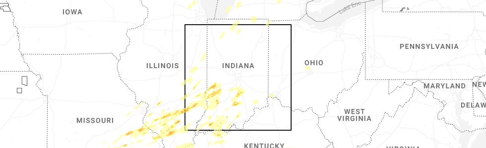
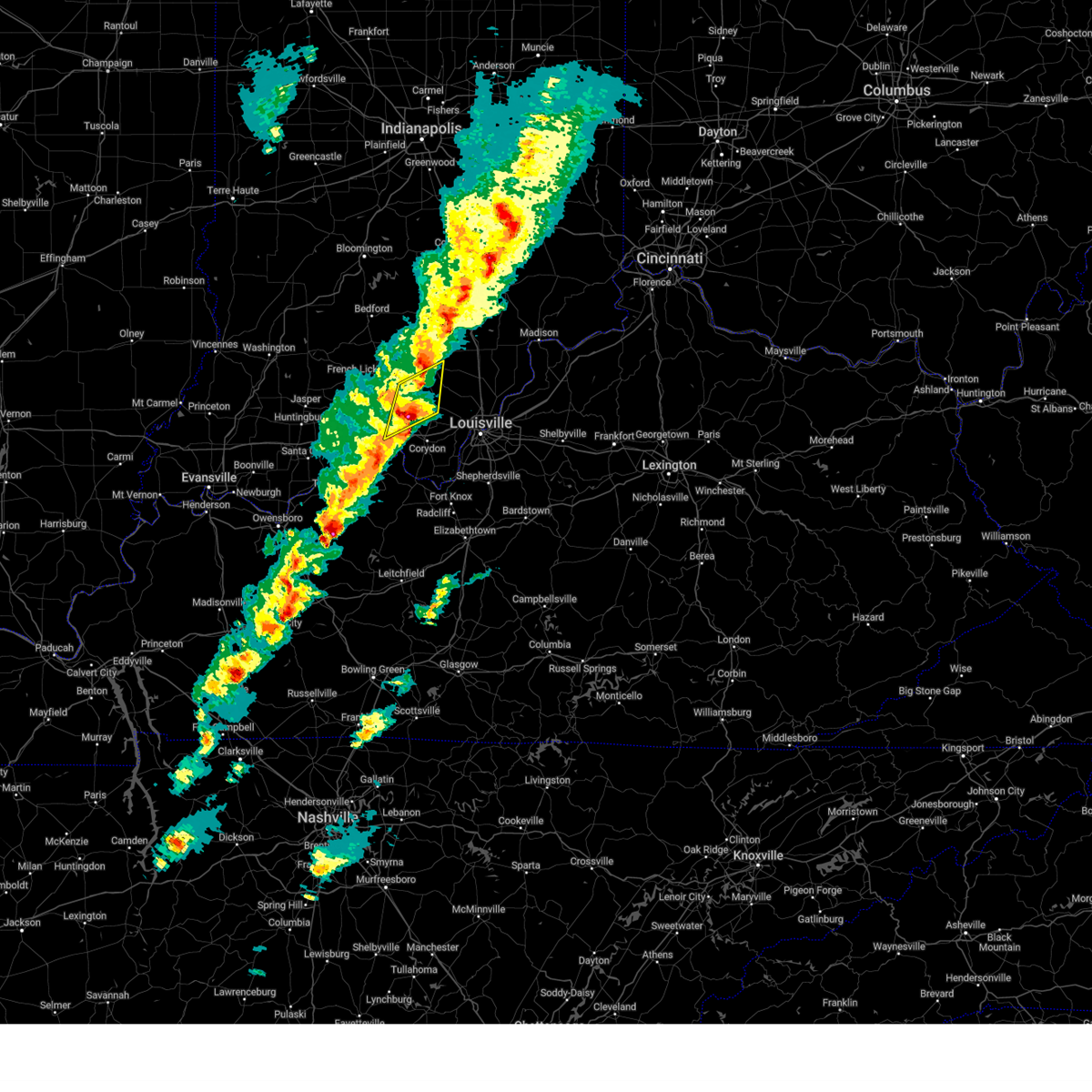
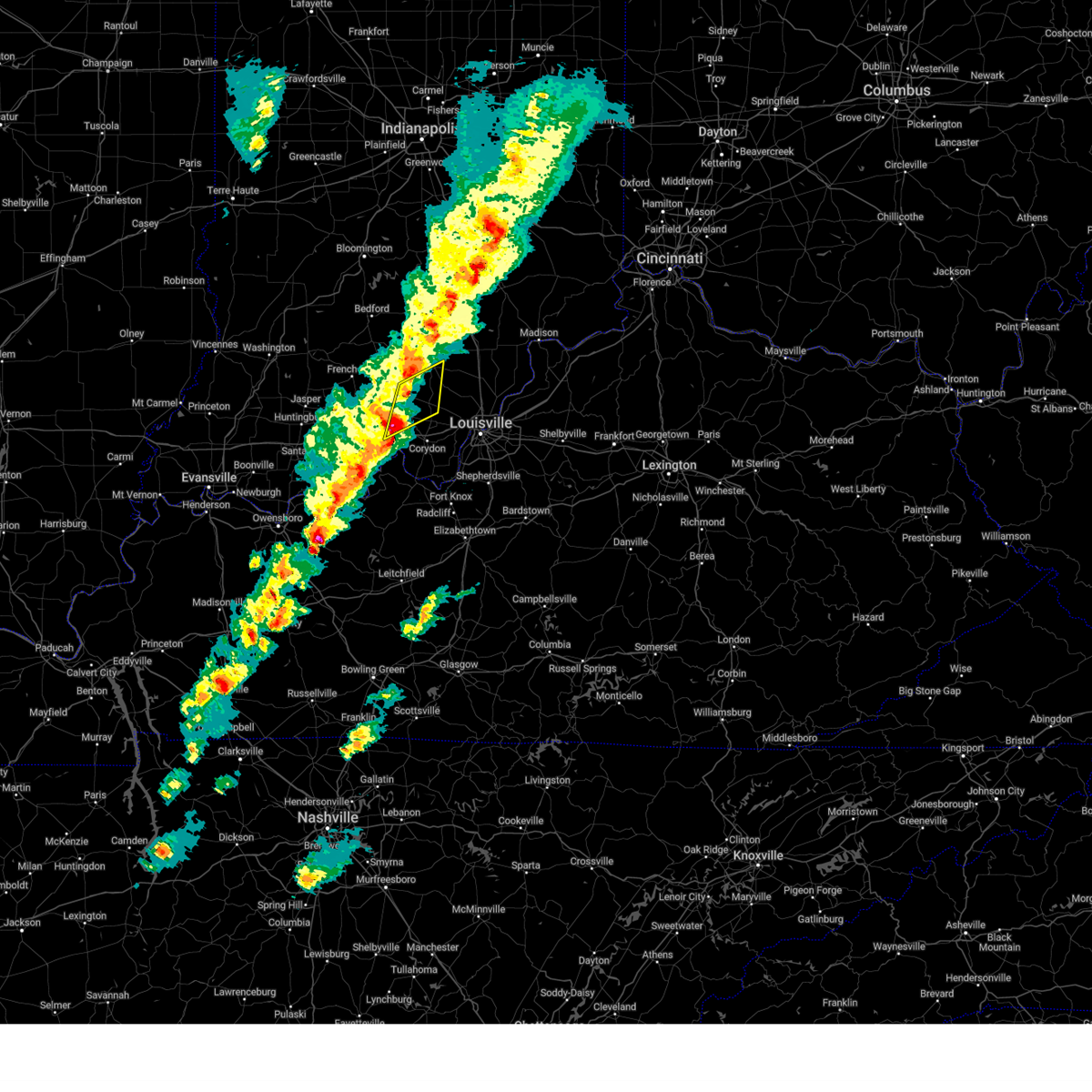
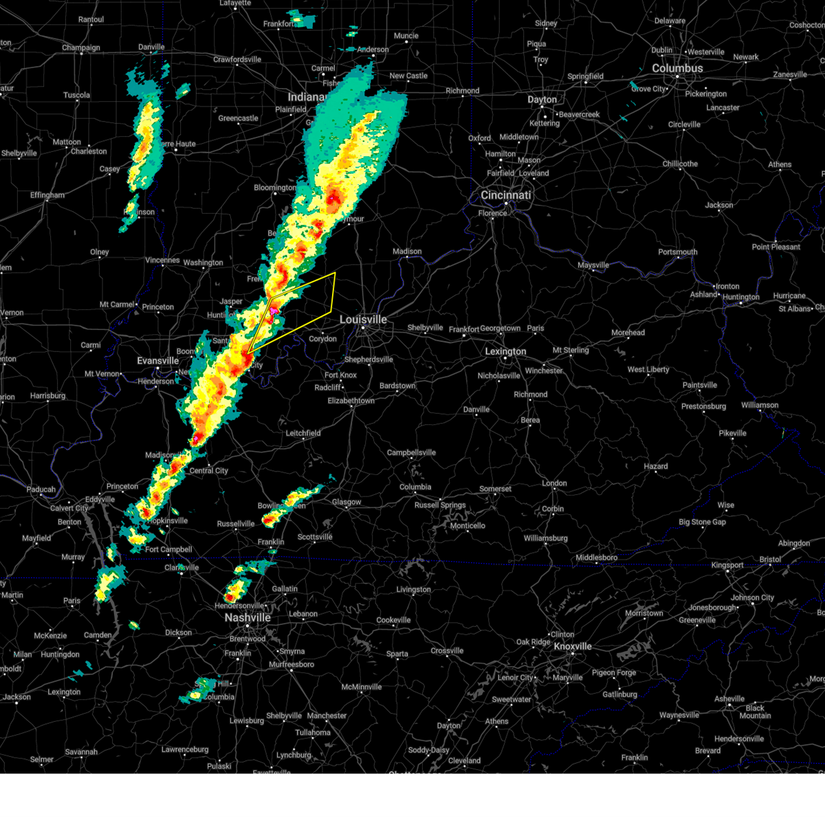
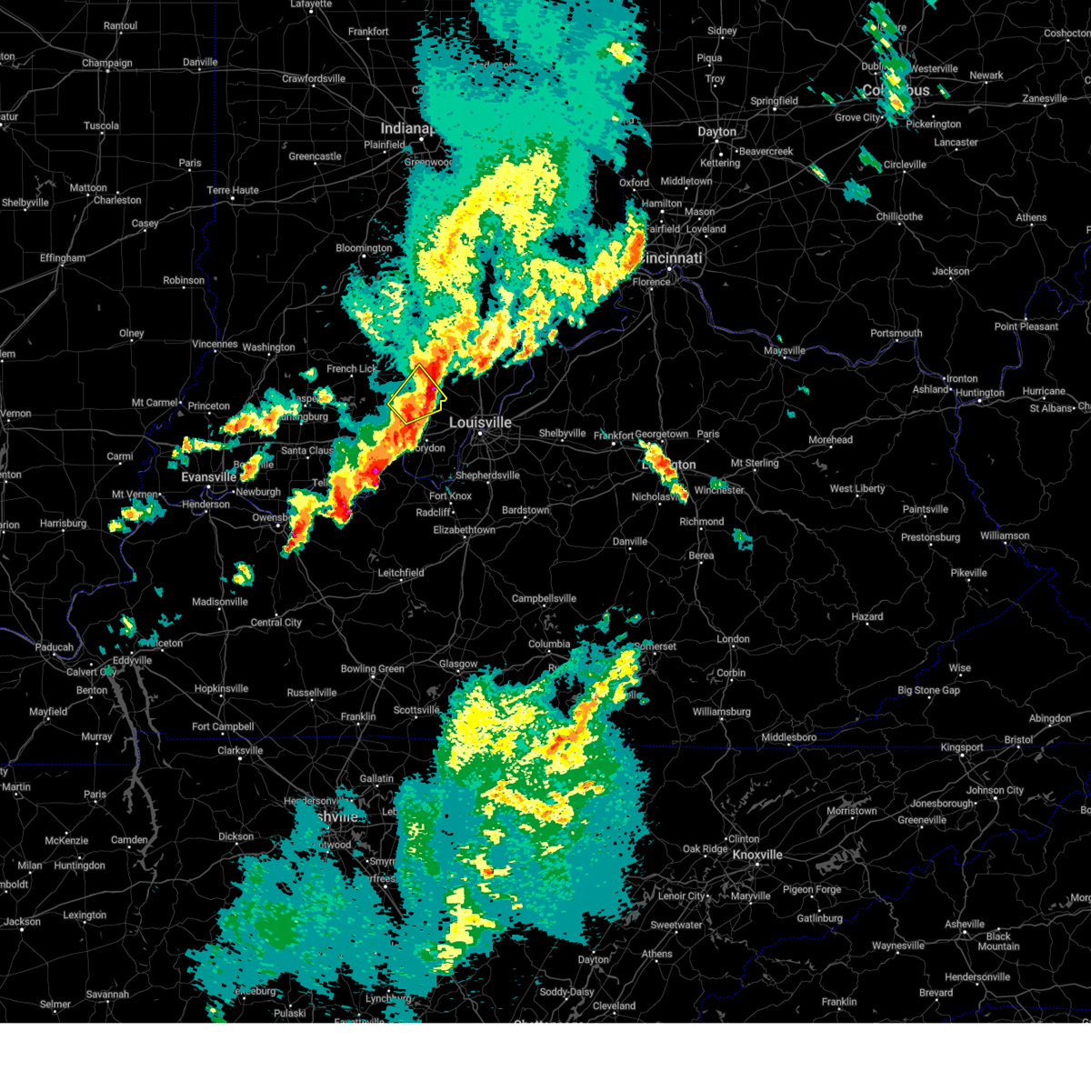
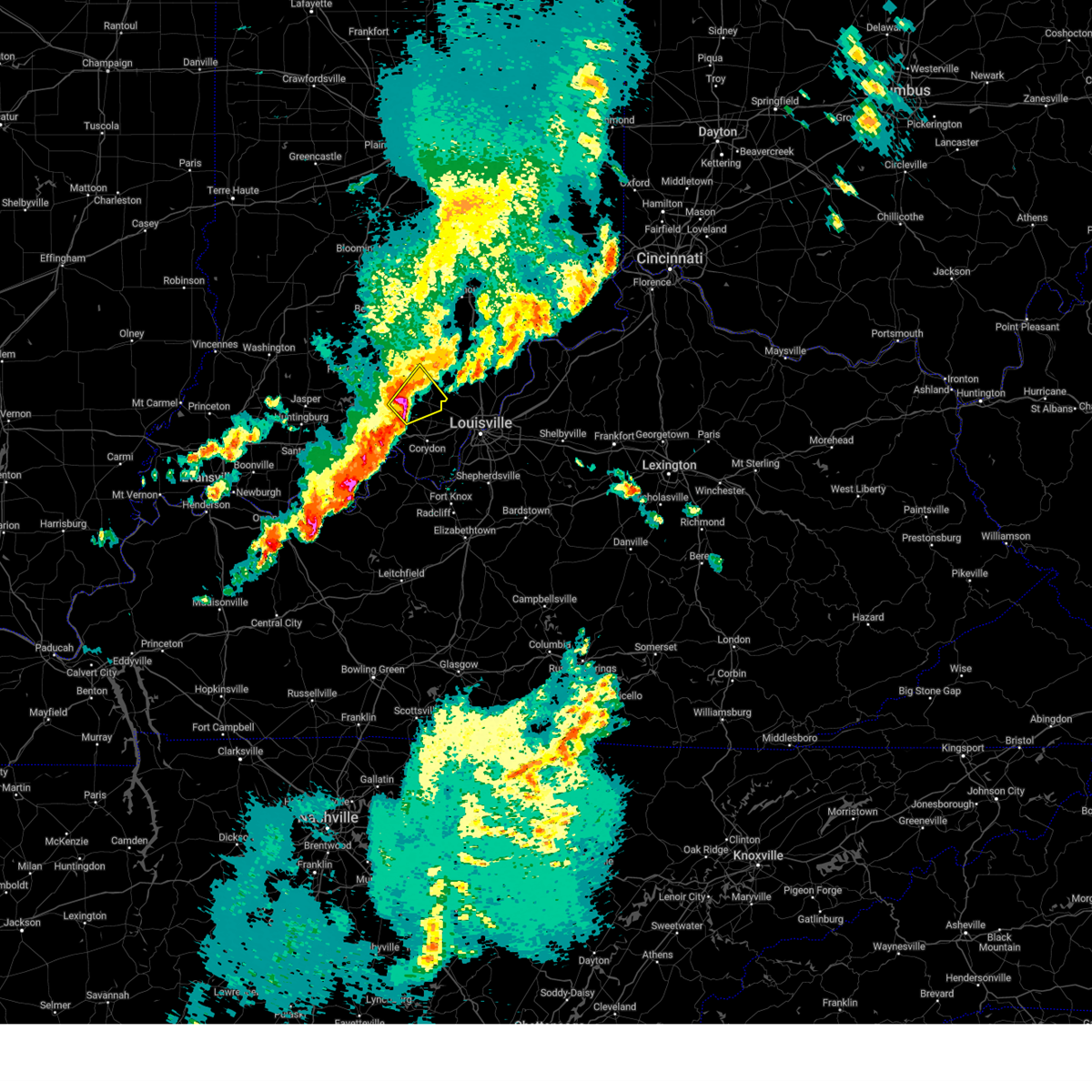
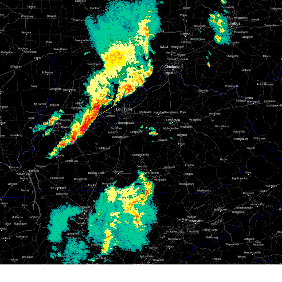
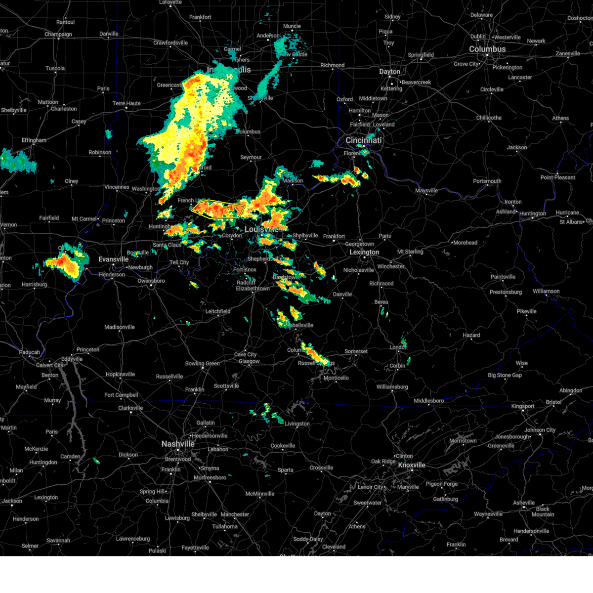
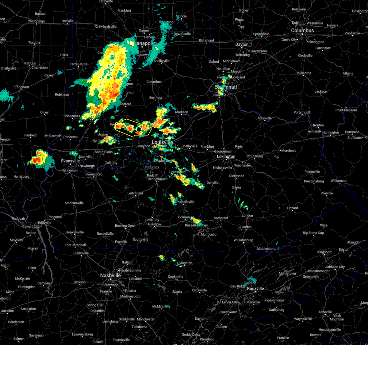
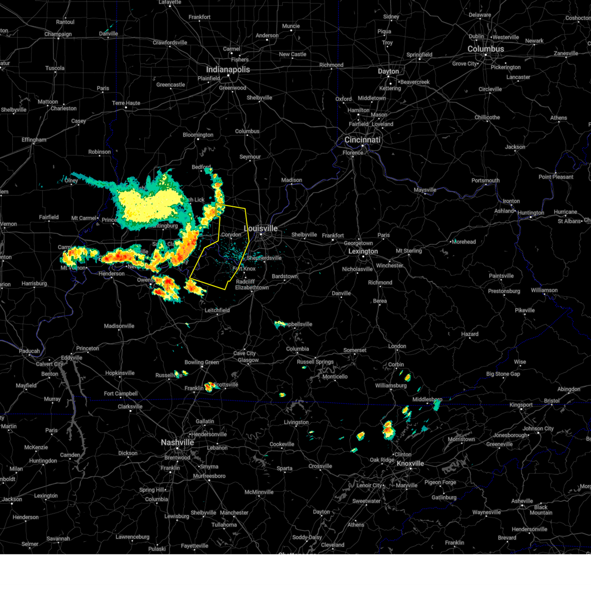
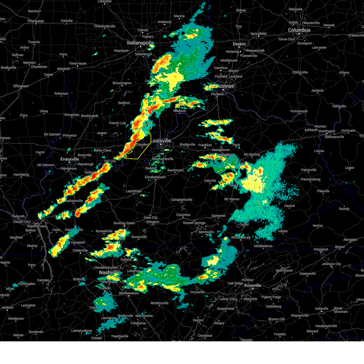
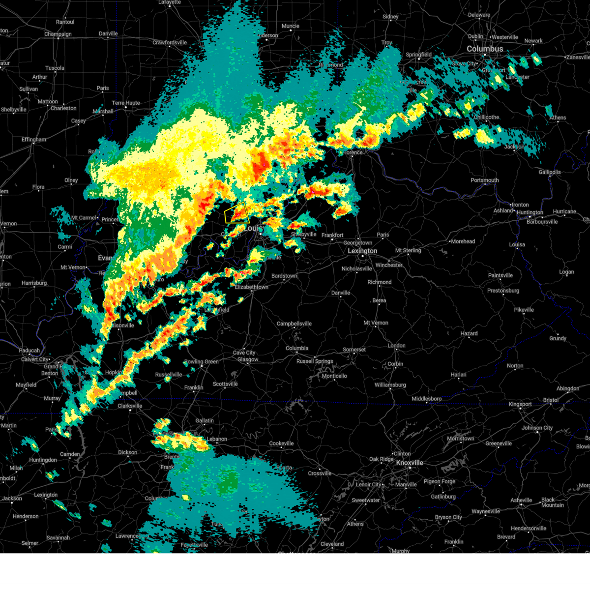
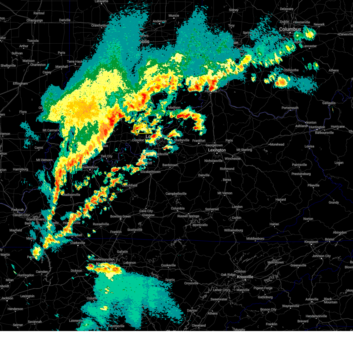
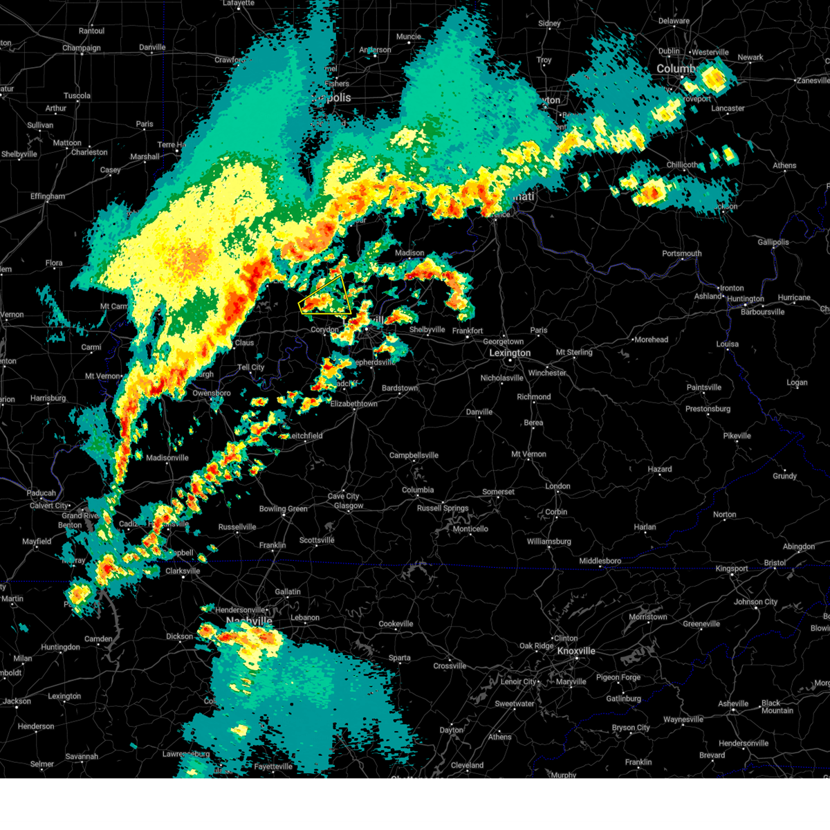
Hail Map for Fredericksburg, IN
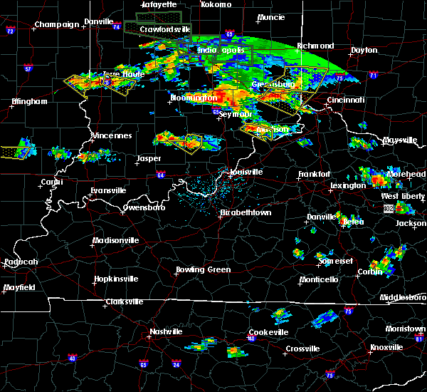
The Fredericksburg, IN area has had 3 reports of on-the-ground hail by trained spotters, and has been under severe weather warnings 31 times during the past 12 months. Doppler radar has detected hail at or near Fredericksburg, IN on 54 occasions, including 3 occasions during the past year.
| Name: | Fredericksburg, IN |
| Where Located: | 39.8 miles NW of Louisville, KY |
| Map: | Google Map for Fredericksburg, IN |
| Population: | 85 |
| Housing Units: | 41 |
| More Info: | Search Google for Fredericksburg, IN |
1
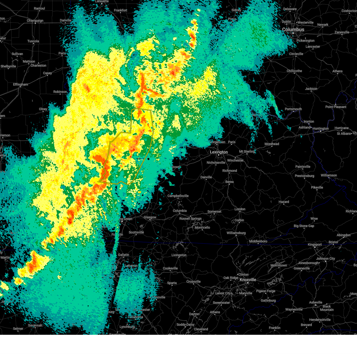
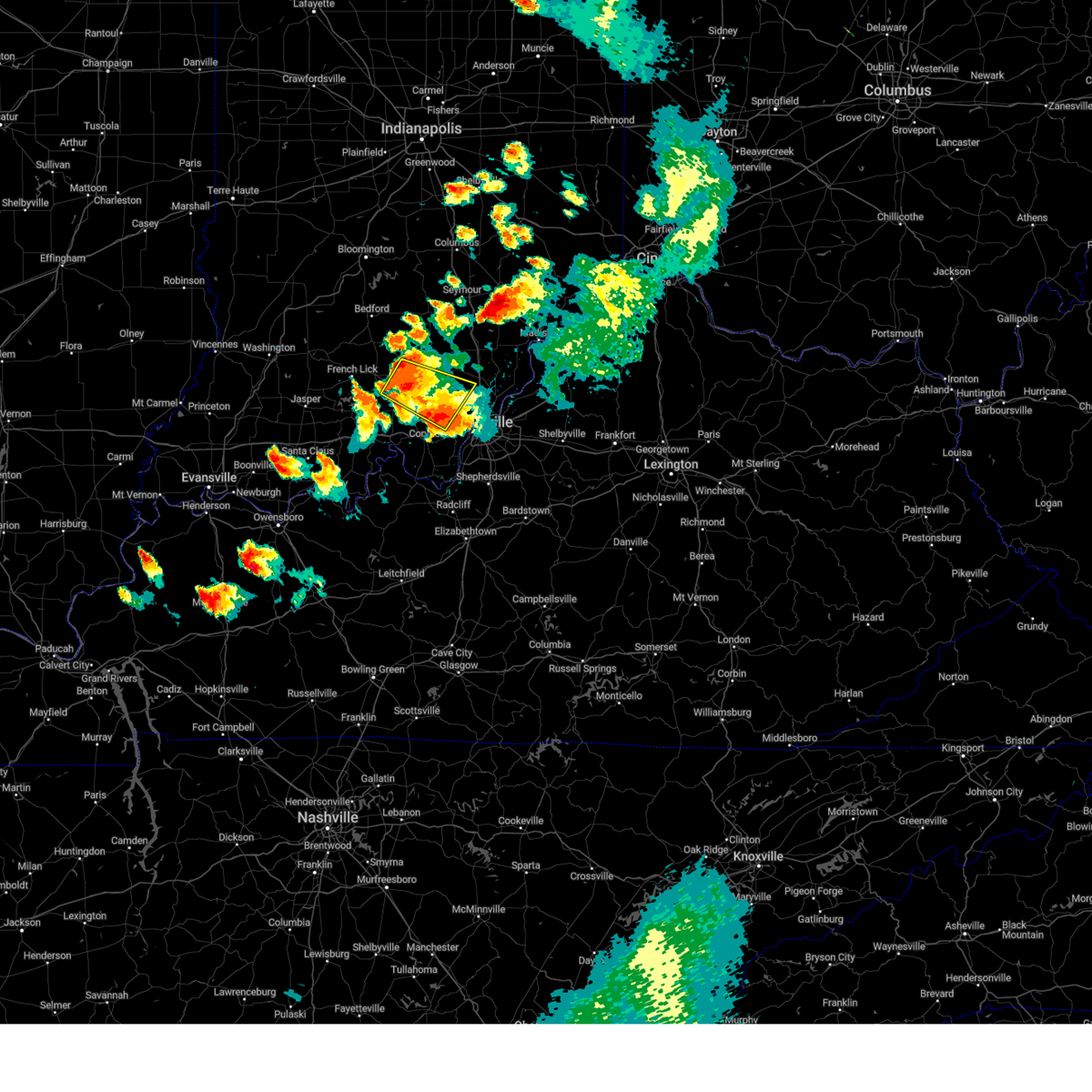
The Top Recent Hail Date for Fredericksburg, IN is Sunday, March 30, 2025 (6th out of 54)
Hail and Wind Damage Spotted near Fredericksburg, IN
| Date / Time | Report Details |
|---|---|
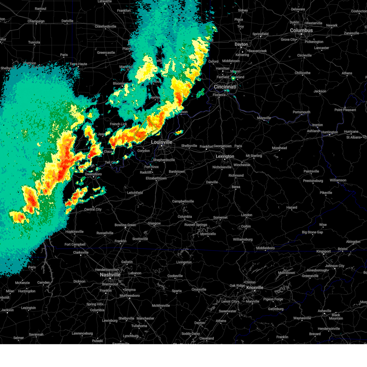
| 4/10/2025 7:08 PM EDT | Svrlmk the national weather service in louisville has issued a * severe thunderstorm warning for, western clark county in south central indiana, washington county in south central indiana, * until 745 pm edt. * at 708 pm edt, a severe thunderstorm was located near salem, moving east at 25 mph (radar indicated). Hazards include 60 mph wind gusts and quarter size hail. Hail damage to vehicles is expected. Expect wind damage to roofs, siding, and trees. |
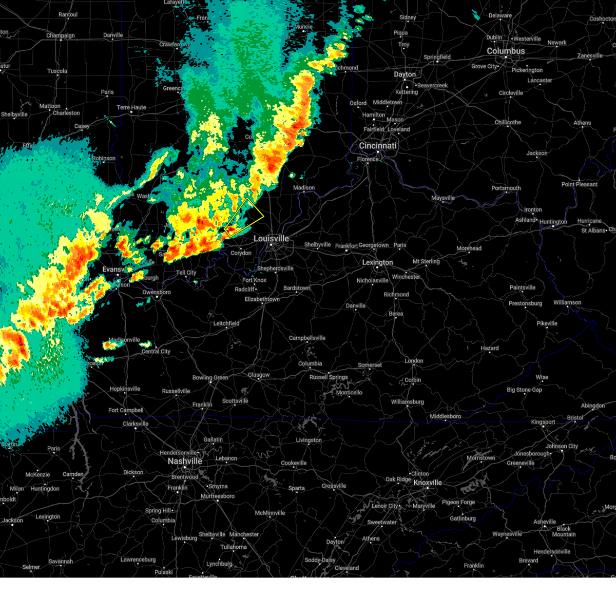
| 4/2/2025 10:26 PM CDT |
 the severe thunderstorm warning has been cancelled and is no longer in effect the severe thunderstorm warning has been cancelled and is no longer in effect
|
| 4/2/2025 10:26 PM CDT |
 At 1125 pm edt/1025 pm cdt/, severe thunderstorms were located along a line extending from brownstown to 13 miles north of corydon to 8 miles northeast of hardinsburg, moving east at 60 mph (radar indicated). Hazards include 60 mph wind gusts. Expect damage to roofs, siding, and trees. Locations impacted include, tell city, salem, corydon, brandenburg, hardinsburg, hawesville, english, carefree town, mount pleasant, and webster. At 1125 pm edt/1025 pm cdt/, severe thunderstorms were located along a line extending from brownstown to 13 miles north of corydon to 8 miles northeast of hardinsburg, moving east at 60 mph (radar indicated). Hazards include 60 mph wind gusts. Expect damage to roofs, siding, and trees. Locations impacted include, tell city, salem, corydon, brandenburg, hardinsburg, hawesville, english, carefree town, mount pleasant, and webster.
|
| 4/2/2025 11:18 PM EDT | Torlmk the national weather service in louisville has issued a * tornado warning for, north central harrison county in south central indiana, northwestern clark county in south central indiana, northwestern floyd county in south central indiana, scott county in south central indiana, washington county in south central indiana, * until 1145 pm edt. * at 1118 pm edt, severe thunderstorms capable of producing both tornadoes and extensive straight line wind damage were located 13 miles south of salem, moving northeast at 70 mph (radar indicated rotation). Hazards include tornado. Flying debris will be dangerous to those caught without shelter. mobile homes will be damaged or destroyed. damage to roofs, windows, and vehicles will occur. tree damage is likely. these dangerous storms will be near, scottsburg around 1140 pm edt. Other locations impacted by this tornadic thunderstorm include campbellsburg, smedley, shorts corner, bradford, livonia, fairdale, pumpkin center, austin, rosebud, and new liberty. |
| 4/2/2025 10:00 PM CDT | The storms which prompted the warning have moved out of the area. therefore, the warning will be allowed to expire. however, gusty winds and heavy rain are still possible with these thunderstorms. a tornado watch remains in effect until 200 am edt/100 am cdt/ for south central indiana, and central kentucky. to report severe weather, contact your nearest law enforcement agency. they will relay your report to the national weather service louisville. remember, a severe thunderstorm warning still remains in effect. |
| 4/2/2025 9:58 PM CDT | Svrlmk the national weather service in louisville has issued a * severe thunderstorm warning for, harrison county in south central indiana, northwestern clark county in south central indiana, crawford county in south central indiana, perry county in south central indiana, floyd county in south central indiana, orange county in south central indiana, washington county in south central indiana, meade county in central kentucky, hancock county in central kentucky, breckinridge county in central kentucky, northeastern ohio county in central kentucky, * until midnight edt/1100 pm cdt/. * at 1058 pm edt/958 pm cdt/, severe thunderstorms were located along a line extending from 10 miles south of bedford to 7 miles southwest of english to near whitesville, moving northeast at 55 mph (radar indicated). Hazards include 60 mph wind gusts. expect damage to roofs, siding, and trees |
| 4/2/2025 9:37 PM CDT | At 1037 pm edt/937 pm cdt/, severe thunderstorms were located along a line extending from 11 miles southwest of shoals to 10 miles northeast of santa claus to grandview, moving northeast at 60 mph (radar indicated). Hazards include 70 mph wind gusts and nickel size hail. Expect considerable tree damage. damage is likely to mobile homes, roofs, and outbuildings. Locations impacted include, jasper, tell city, paoli, corydon, brandenburg, hardinsburg, hawesville, english, carefree town, and mount pleasant. |
| 4/2/2025 9:19 PM CDT | Svrlmk the national weather service in louisville has issued a * severe thunderstorm warning for, harrison county in south central indiana, dubois county in south central indiana, crawford county in south central indiana, perry county in south central indiana, orange county in south central indiana, western washington county in south central indiana, meade county in central kentucky, hancock county in central kentucky, breckinridge county in central kentucky, northeastern ohio county in central kentucky, * until 1100 pm edt/1000 pm cdt/. * at 1018 pm edt/918 pm cdt/, severe thunderstorms were located along a line extending from near petersburg to near folsomville to stanley, moving northeast at 75 mph (radar indicated). Hazards include 70 mph wind gusts and nickel size hail. Expect considerable tree damage. Damage is likely to mobile homes, roofs, and outbuildings. |
| 3/30/2025 8:13 PM EDT |
 The storm which prompted the warning has weakened below severe limits, and no longer poses an immediate threat to life or property. therefore, the warning will be allowed to expire. however, gusty winds and heavy rain are still possible with this thunderstorm. a tornado watch remains in effect until 100 am edt for south central indiana. to report severe weather, contact your nearest law enforcement agency. they will relay your report to the national weather service louisville. The storm which prompted the warning has weakened below severe limits, and no longer poses an immediate threat to life or property. therefore, the warning will be allowed to expire. however, gusty winds and heavy rain are still possible with this thunderstorm. a tornado watch remains in effect until 100 am edt for south central indiana. to report severe weather, contact your nearest law enforcement agency. they will relay your report to the national weather service louisville.
|
| 3/30/2025 7:55 PM EDT | Tree down across the road on horners chapel rd at palmyra rd in organ spring in washington county IN, 4.2 miles SW of Fredericksburg, IN |
| 3/30/2025 7:48 PM EDT |
 Svrlmk the national weather service in louisville has issued a * severe thunderstorm warning for, northwestern harrison county in south central indiana, west central clark county in south central indiana, northeastern crawford county in south central indiana, southern washington county in south central indiana, * until 815 pm edt. * at 748 pm edt, a severe thunderstorm was located 12 miles northeast of carefree town, moving northeast at 45 mph (radar indicated). Hazards include 60 mph wind gusts and quarter size hail. Hail damage to vehicles is expected. Expect wind damage to roofs, siding, and trees. Svrlmk the national weather service in louisville has issued a * severe thunderstorm warning for, northwestern harrison county in south central indiana, west central clark county in south central indiana, northeastern crawford county in south central indiana, southern washington county in south central indiana, * until 815 pm edt. * at 748 pm edt, a severe thunderstorm was located 12 miles northeast of carefree town, moving northeast at 45 mph (radar indicated). Hazards include 60 mph wind gusts and quarter size hail. Hail damage to vehicles is expected. Expect wind damage to roofs, siding, and trees.
|
| 3/19/2025 9:15 PM EDT |
 The storm which prompted the warning has moved out of the area. therefore, the warning has been allowed to expire. a new severe thunderstorm warning has been issued. a tornado watch remains in effect until midnight edt for south central indiana. to report severe weather, contact your nearest law enforcement agency. they will relay your report to the national weather service louisville. The storm which prompted the warning has moved out of the area. therefore, the warning has been allowed to expire. a new severe thunderstorm warning has been issued. a tornado watch remains in effect until midnight edt for south central indiana. to report severe weather, contact your nearest law enforcement agency. they will relay your report to the national weather service louisville.
|
| 3/19/2025 9:12 PM EDT |
 Svrlmk the national weather service in louisville has issued a * severe thunderstorm warning for, northern harrison county in south central indiana, northwestern jefferson county in south central indiana, northwestern clark county in south central indiana, northeastern crawford county in south central indiana, northern floyd county in south central indiana, southeastern orange county in south central indiana, scott county in south central indiana, washington county in south central indiana, * until 1000 pm edt. * at 912 pm edt, a severe thunderstorm was located near salem, moving northeast at 60 mph (radar indicated). Hazards include 60 mph wind gusts and quarter size hail. Hail damage to vehicles is expected. Expect wind damage to roofs, siding, and trees. Svrlmk the national weather service in louisville has issued a * severe thunderstorm warning for, northern harrison county in south central indiana, northwestern jefferson county in south central indiana, northwestern clark county in south central indiana, northeastern crawford county in south central indiana, northern floyd county in south central indiana, southeastern orange county in south central indiana, scott county in south central indiana, washington county in south central indiana, * until 1000 pm edt. * at 912 pm edt, a severe thunderstorm was located near salem, moving northeast at 60 mph (radar indicated). Hazards include 60 mph wind gusts and quarter size hail. Hail damage to vehicles is expected. Expect wind damage to roofs, siding, and trees.
|
| 3/19/2025 9:09 PM EDT |
 At 909 pm edt, a severe thunderstorm was located near salem, moving northeast at 60 mph (radar indicated). Hazards include 60 mph wind gusts and quarter size hail. Hail damage to vehicles is expected. expect wind damage to roofs, siding, and trees. Locations impacted include, salem, carefree town, new pekin, palmyra, marengo, milltown, hardinsburg, fredericksburg, shorts corner, and bradford. At 909 pm edt, a severe thunderstorm was located near salem, moving northeast at 60 mph (radar indicated). Hazards include 60 mph wind gusts and quarter size hail. Hail damage to vehicles is expected. expect wind damage to roofs, siding, and trees. Locations impacted include, salem, carefree town, new pekin, palmyra, marengo, milltown, hardinsburg, fredericksburg, shorts corner, and bradford.
|
| 3/19/2025 9:09 PM EDT |
 the severe thunderstorm warning has been cancelled and is no longer in effect the severe thunderstorm warning has been cancelled and is no longer in effect
|
| 3/19/2025 8:44 PM EDT |
 Svrlmk the national weather service in louisville has issued a * severe thunderstorm warning for, northwestern harrison county in south central indiana, crawford county in south central indiana, northern perry county in south central indiana, southeastern orange county in south central indiana, southwestern washington county in south central indiana, * until 915 pm edt/815 pm cdt/. * at 844 pm edt/744 pm cdt/, a severe thunderstorm was located over english, moving northeast at 60 mph (radar indicated). Hazards include 60 mph wind gusts and nickel size hail. expect damage to roofs, siding, and trees Svrlmk the national weather service in louisville has issued a * severe thunderstorm warning for, northwestern harrison county in south central indiana, crawford county in south central indiana, northern perry county in south central indiana, southeastern orange county in south central indiana, southwestern washington county in south central indiana, * until 915 pm edt/815 pm cdt/. * at 844 pm edt/744 pm cdt/, a severe thunderstorm was located over english, moving northeast at 60 mph (radar indicated). Hazards include 60 mph wind gusts and nickel size hail. expect damage to roofs, siding, and trees
|
| 3/15/2025 6:42 AM EDT |
 The storm which prompted the warning has moved out of the area. therefore, the warning will be allowed to expire. a tornado watch remains in effect until 1000 am edt for south central indiana. remember, a severe thunderstorm warning still remains in effect for portions of washington county until 715 am edt. The storm which prompted the warning has moved out of the area. therefore, the warning will be allowed to expire. a tornado watch remains in effect until 1000 am edt for south central indiana. remember, a severe thunderstorm warning still remains in effect for portions of washington county until 715 am edt.
|
| 3/15/2025 6:29 AM EDT |
 At 628 am edt, a severe thunderstorm was located 12 miles east of english, moving northeast at 60 mph (trained weather spotters reported quarter sized hail near carefree). Hazards include ping pong ball size hail and 60 mph wind gusts. People and animals outdoors will be injured. expect hail damage to roofs, siding, windows, and vehicles. expect wind damage to roofs, siding, and trees. Locations impacted include, palmyra, marengo, milltown, hardinsburg, fredericksburg, shorts corner, martinsburg, bradford, rosebud, and hancock chapel. At 628 am edt, a severe thunderstorm was located 12 miles east of english, moving northeast at 60 mph (trained weather spotters reported quarter sized hail near carefree). Hazards include ping pong ball size hail and 60 mph wind gusts. People and animals outdoors will be injured. expect hail damage to roofs, siding, windows, and vehicles. expect wind damage to roofs, siding, and trees. Locations impacted include, palmyra, marengo, milltown, hardinsburg, fredericksburg, shorts corner, martinsburg, bradford, rosebud, and hancock chapel.
|
| 3/15/2025 6:25 AM EDT | the severe thunderstorm warning has been cancelled and is no longer in effect |
| 3/15/2025 6:25 AM EDT | At 624 am edt, a severe thunderstorm was located 8 miles east of english, moving northeast at 60 mph. trained spotters observed quarter sized hail was near carefree (radar indicated and trained spotters confirmed). Hazards include 60 mph wind gusts and quarter size hail. Hail damage to vehicles is expected. expect wind damage to roofs, siding, and trees. Locations impacted include, english, palmyra, marengo, milltown, hardinsburg, fredericksburg, shorts corner, martinsburg, bradford, and fairdale. |
| 3/15/2025 6:14 AM EDT |
 Svrlmk the national weather service in louisville has issued a * severe thunderstorm warning for, northwestern harrison county in south central indiana, crawford county in south central indiana, northeastern perry county in south central indiana, southeastern orange county in south central indiana, southwestern washington county in south central indiana, * until 645 am edt/545 am cdt/. * at 613 am edt/513 am cdt/, a severe thunderstorm was located near english, moving northeast at 60 mph (radar indicated). Hazards include 60 mph wind gusts and half dollar size hail. Hail damage to vehicles is expected. Expect wind damage to roofs, siding, and trees. Svrlmk the national weather service in louisville has issued a * severe thunderstorm warning for, northwestern harrison county in south central indiana, crawford county in south central indiana, northeastern perry county in south central indiana, southeastern orange county in south central indiana, southwestern washington county in south central indiana, * until 645 am edt/545 am cdt/. * at 613 am edt/513 am cdt/, a severe thunderstorm was located near english, moving northeast at 60 mph (radar indicated). Hazards include 60 mph wind gusts and half dollar size hail. Hail damage to vehicles is expected. Expect wind damage to roofs, siding, and trees.
|
| 3/15/2025 5:42 AM EDT | The storms which prompted the warning have weakened below severe limits, and no longer pose an immediate threat to life or property. therefore, the warning will be allowed to expire. a tornado watch remains in effect until 1000 am edt for south central indiana. |
| 3/15/2025 5:12 AM EDT | The storms which prompted the warning have moved out of the warned area. therefore, the warning will be allowed to expire. a tornado watch remains in effect until 1000 am edt/900 am cdt/ for south central indiana. remember, a severe thunderstorm warning still remains in effect for eastern dubois county, crawford, orange, and perry counties. |
| 3/15/2025 5:02 AM EDT | Svrlmk the national weather service in louisville has issued a * severe thunderstorm warning for, north central harrison county in south central indiana, northwestern jefferson county in south central indiana, northwestern clark county in south central indiana, northern crawford county in south central indiana, eastern orange county in south central indiana, scott county in south central indiana, washington county in south central indiana, * until 545 am edt. * at 502 am edt, severe thunderstorms were located along a line extending from 9 miles east of bedford to 9 miles west of salem to near english, moving east at 70 mph (radar indicated). Hazards include 60 mph wind gusts. expect damage to roofs, siding, and trees |
| 3/15/2025 4:34 AM EDT | Svrlmk the national weather service in louisville has issued a * severe thunderstorm warning for, eastern dubois county in south central indiana, crawford county in south central indiana, northern perry county in south central indiana, orange county in south central indiana, western washington county in south central indiana, * until 515 am edt/415 am cdt/. * at 433 am edt/333 am cdt/, severe thunderstorms were located along a line extending from 7 miles west of shoals to near jasper to near folsomville, moving east at 55 mph (radar indicated). Hazards include 70 mph wind gusts and quarter size hail. Hail damage to vehicles is expected. expect considerable tree damage. Wind damage is also likely to mobile homes, roofs, and outbuildings. |
| 7/31/2024 3:03 PM EDT |
 At 303 pm edt, severe thunderstorms were located along a line extending from near paoli to 13 miles northeast of english to 11 miles south of salem, moving southeast at 20 mph (radar indicated). Hazards include 60 mph wind gusts and quarter size hail. Hail damage to vehicles is expected. expect wind damage to roofs, siding, and trees. Locations impacted include, paoli, new pekin, stampers creek, hardinsburg, livonia, fredericksburg, woodlawn grove, trotter crossing, braxtons siding, and shorts corner. At 303 pm edt, severe thunderstorms were located along a line extending from near paoli to 13 miles northeast of english to 11 miles south of salem, moving southeast at 20 mph (radar indicated). Hazards include 60 mph wind gusts and quarter size hail. Hail damage to vehicles is expected. expect wind damage to roofs, siding, and trees. Locations impacted include, paoli, new pekin, stampers creek, hardinsburg, livonia, fredericksburg, woodlawn grove, trotter crossing, braxtons siding, and shorts corner.
|
| 7/31/2024 2:44 PM EDT |
 Svrlmk the national weather service in louisville has issued a * severe thunderstorm warning for, orange county in south central indiana, southwestern washington county in south central indiana, * until 315 pm edt. * at 244 pm edt, severe thunderstorms were located along a line extending from 13 miles southeast of shoals to near paoli to 9 miles south of salem, moving southeast at 20 mph (radar indicated). Hazards include 60 mph wind gusts and penny size hail. expect damage to roofs, siding, and trees Svrlmk the national weather service in louisville has issued a * severe thunderstorm warning for, orange county in south central indiana, southwestern washington county in south central indiana, * until 315 pm edt. * at 244 pm edt, severe thunderstorms were located along a line extending from 13 miles southeast of shoals to near paoli to 9 miles south of salem, moving southeast at 20 mph (radar indicated). Hazards include 60 mph wind gusts and penny size hail. expect damage to roofs, siding, and trees
|
| 7/30/2024 1:04 PM EDT |
 Svrlmk the national weather service in louisville has issued a * severe thunderstorm warning for, harrison county in south central indiana, west central clark county in south central indiana, eastern crawford county in south central indiana, southeastern perry county in south central indiana, western floyd county in south central indiana, southwestern washington county in south central indiana, meade county in central kentucky, central breckinridge county in central kentucky, * until 130 pm edt/1230 pm cdt/. * at 103 pm edt/1203 pm cdt/, a severe thunderstorm was located 12 miles south of carefree town, moving east at 50 mph (radar indicated). Hazards include 60 mph wind gusts. expect damage to roofs, siding, and trees Svrlmk the national weather service in louisville has issued a * severe thunderstorm warning for, harrison county in south central indiana, west central clark county in south central indiana, eastern crawford county in south central indiana, southeastern perry county in south central indiana, western floyd county in south central indiana, southwestern washington county in south central indiana, meade county in central kentucky, central breckinridge county in central kentucky, * until 130 pm edt/1230 pm cdt/. * at 103 pm edt/1203 pm cdt/, a severe thunderstorm was located 12 miles south of carefree town, moving east at 50 mph (radar indicated). Hazards include 60 mph wind gusts. expect damage to roofs, siding, and trees
|
| 7/9/2024 4:52 PM EDT |
 The storm which prompted the warning has weakened below severe limits, and has exited the warned area. therefore, the warning will be allowed to expire. however, gusty winds and heavy rain are still possible with this thunderstorm. a tornado watch remains in effect until midnight edt for south central indiana. The storm which prompted the warning has weakened below severe limits, and has exited the warned area. therefore, the warning will be allowed to expire. however, gusty winds and heavy rain are still possible with this thunderstorm. a tornado watch remains in effect until midnight edt for south central indiana.
|
| 7/9/2024 4:41 PM EDT |
 At 441 pm edt, a severe thunderstorm was located 13 miles north of corydon, moving northeast at 25 mph (radar indicated). Hazards include 60 mph wind gusts. Expect damage to roofs, siding, and trees. Locations impacted include, palmyra, fredericksburg, and hancock chapel. At 441 pm edt, a severe thunderstorm was located 13 miles north of corydon, moving northeast at 25 mph (radar indicated). Hazards include 60 mph wind gusts. Expect damage to roofs, siding, and trees. Locations impacted include, palmyra, fredericksburg, and hancock chapel.
|
| 7/9/2024 4:31 PM EDT |
 At 431 pm edt, a severe thunderstorm was located 9 miles northeast of carefree town, moving northeast at 25 mph (radar indicated). Hazards include 60 mph wind gusts. Expect damage to roofs, siding, and trees. Locations impacted include, palmyra, milltown, fredericksburg, depauw, frenchtown, and hancock chapel. At 431 pm edt, a severe thunderstorm was located 9 miles northeast of carefree town, moving northeast at 25 mph (radar indicated). Hazards include 60 mph wind gusts. Expect damage to roofs, siding, and trees. Locations impacted include, palmyra, milltown, fredericksburg, depauw, frenchtown, and hancock chapel.
|
| 7/9/2024 4:26 PM EDT |
 Svrlmk the national weather service in louisville has issued a * severe thunderstorm warning for, northwestern harrison county in south central indiana, northeastern crawford county in south central indiana, southwestern washington county in south central indiana, * until 500 pm edt. * at 426 pm edt, a severe thunderstorm was located 7 miles northeast of carefree town, moving northeast at 25 mph (radar indicated). Hazards include 60 mph wind gusts. expect damage to roofs, siding, and trees Svrlmk the national weather service in louisville has issued a * severe thunderstorm warning for, northwestern harrison county in south central indiana, northeastern crawford county in south central indiana, southwestern washington county in south central indiana, * until 500 pm edt. * at 426 pm edt, a severe thunderstorm was located 7 miles northeast of carefree town, moving northeast at 25 mph (radar indicated). Hazards include 60 mph wind gusts. expect damage to roofs, siding, and trees
|
| 4/19/2024 12:01 AM EDT |
 The storms which prompted the warning have moved out of the originial warning area and a new warning has been issued downstream. a severe thunderstorm watch remains in effect until 300 am edt for south central indiana, and central kentucky. remember, a severe thunderstorm warning still remains in effect for eastern harrison, floyd, and clark county until 1230 am edt. The storms which prompted the warning have moved out of the originial warning area and a new warning has been issued downstream. a severe thunderstorm watch remains in effect until 300 am edt for south central indiana, and central kentucky. remember, a severe thunderstorm warning still remains in effect for eastern harrison, floyd, and clark county until 1230 am edt.
|
| 4/18/2024 11:44 PM EDT |
 the severe thunderstorm warning has been cancelled and is no longer in effect the severe thunderstorm warning has been cancelled and is no longer in effect
|
| 4/18/2024 11:44 PM EDT |
 At 1143 pm edt, severe thunderstorms were located along a line extending from 11 miles northeast of carefree town to near corydon to 9 miles northwest of brandenburg, moving east at 45 mph (radar indicated). Hazards include 60 mph wind gusts. Expect damage to roofs, siding, and trees. Locations impacted include, new albany, corydon, brandenburg, galena, new pekin, palmyra, milltown, borden, and greenville. At 1143 pm edt, severe thunderstorms were located along a line extending from 11 miles northeast of carefree town to near corydon to 9 miles northwest of brandenburg, moving east at 45 mph (radar indicated). Hazards include 60 mph wind gusts. Expect damage to roofs, siding, and trees. Locations impacted include, new albany, corydon, brandenburg, galena, new pekin, palmyra, milltown, borden, and greenville.
|
| 4/18/2024 11:26 PM EDT |
 Svrlmk the national weather service in louisville has issued a * severe thunderstorm warning for, harrison county in south central indiana, west central clark county in south central indiana, crawford county in south central indiana, east central perry county in south central indiana, floyd county in south central indiana, southeastern orange county in south central indiana, southern washington county in south central indiana, northern meade county in central kentucky, * until midnight edt/1100 pm cdt/. * at 1126 pm edt/1026 pm cdt/, severe thunderstorms were located along a line extending from near english to carefree town to 17 miles northeast of tell city, moving east at 50 mph (radar indicated). Hazards include 60 mph wind gusts. expect damage to roofs, siding, and trees Svrlmk the national weather service in louisville has issued a * severe thunderstorm warning for, harrison county in south central indiana, west central clark county in south central indiana, crawford county in south central indiana, east central perry county in south central indiana, floyd county in south central indiana, southeastern orange county in south central indiana, southern washington county in south central indiana, northern meade county in central kentucky, * until midnight edt/1100 pm cdt/. * at 1126 pm edt/1026 pm cdt/, severe thunderstorms were located along a line extending from near english to carefree town to 17 miles northeast of tell city, moving east at 50 mph (radar indicated). Hazards include 60 mph wind gusts. expect damage to roofs, siding, and trees
|
| 4/2/2024 5:14 PM EDT |
 The storms which prompted the warning have moved out of the area. therefore, the warning will be allowed to expire. a tornado watch remains in effect until 1000 pm edt for south central indiana, and central kentucky. The storms which prompted the warning have moved out of the area. therefore, the warning will be allowed to expire. a tornado watch remains in effect until 1000 pm edt for south central indiana, and central kentucky.
|
| 4/2/2024 5:03 PM EDT |
 the severe thunderstorm warning has been cancelled and is no longer in effect the severe thunderstorm warning has been cancelled and is no longer in effect
|
| 4/2/2024 5:03 PM EDT |
 At 503 pm edt, severe thunderstorms were located along a line extending from 9 miles south of salem to near corydon to 12 miles west of brandenburg, moving east at 50 mph (radar indicated). Hazards include 60 mph wind gusts and nickel size hail. Expect damage to roofs, siding, and trees. Locations impacted include, corydon, galena, blue river, new pekin, palmyra, greenville, lanesville, leavenworth, crandall, and fredericksburg. At 503 pm edt, severe thunderstorms were located along a line extending from 9 miles south of salem to near corydon to 12 miles west of brandenburg, moving east at 50 mph (radar indicated). Hazards include 60 mph wind gusts and nickel size hail. Expect damage to roofs, siding, and trees. Locations impacted include, corydon, galena, blue river, new pekin, palmyra, greenville, lanesville, leavenworth, crandall, and fredericksburg.
|
| 4/2/2024 4:53 PM EDT |
 At 452 pm edt/352 pm cdt/, severe thunderstorms were located along a line extending from 12 miles northeast of english to near carefree town to 12 miles east of tell city, moving east at 45 mph (radar indicated). Hazards include 60 mph wind gusts and nickel size hail. Expect damage to roofs, siding, and trees. Locations impacted include, corydon, carefree town, mount pleasant, galena, blue river, new pekin, palmyra, marengo, milltown, and leopold. At 452 pm edt/352 pm cdt/, severe thunderstorms were located along a line extending from 12 miles northeast of english to near carefree town to 12 miles east of tell city, moving east at 45 mph (radar indicated). Hazards include 60 mph wind gusts and nickel size hail. Expect damage to roofs, siding, and trees. Locations impacted include, corydon, carefree town, mount pleasant, galena, blue river, new pekin, palmyra, marengo, milltown, and leopold.
|
| 4/2/2024 4:45 PM EDT |
 Svrlmk the national weather service in louisville has issued a * severe thunderstorm warning for, harrison county in south central indiana, eastern crawford county in south central indiana, northern perry county in south central indiana, northwestern floyd county in south central indiana, southeastern orange county in south central indiana, southern washington county in south central indiana, northwestern meade county in central kentucky, north central breckinridge county in central kentucky, * until 515 pm edt/415 pm cdt/. * at 444 pm edt/344 pm cdt/, severe thunderstorms were located along a line extending from 7 miles northeast of english to carefree town to 6 miles northeast of tell city, moving east at 45 mph (radar indicated). Hazards include 60 mph wind gusts and nickel size hail. expect damage to roofs, siding, and trees Svrlmk the national weather service in louisville has issued a * severe thunderstorm warning for, harrison county in south central indiana, eastern crawford county in south central indiana, northern perry county in south central indiana, northwestern floyd county in south central indiana, southeastern orange county in south central indiana, southern washington county in south central indiana, northwestern meade county in central kentucky, north central breckinridge county in central kentucky, * until 515 pm edt/415 pm cdt/. * at 444 pm edt/344 pm cdt/, severe thunderstorms were located along a line extending from 7 miles northeast of english to carefree town to 6 miles northeast of tell city, moving east at 45 mph (radar indicated). Hazards include 60 mph wind gusts and nickel size hail. expect damage to roofs, siding, and trees
|
| 4/2/2024 12:58 PM EDT |
 The storm which prompted the warning has weakened below severe limits, and no longer poses an immediate threat to life or property. therefore, the warning will be allowed to expire. however, gusty winds are still possible with this thunderstorm. The storm which prompted the warning has weakened below severe limits, and no longer poses an immediate threat to life or property. therefore, the warning will be allowed to expire. however, gusty winds are still possible with this thunderstorm.
|
| 4/2/2024 12:48 PM EDT |
 At 1247 pm edt, a severe thunderstorm was located 8 miles northwest of corydon, moving northeast at 60 mph (radar indicated). Hazards include 60 mph wind gusts and quarter size hail. Hail damage to vehicles is expected. expect wind damage to roofs, siding, and trees. Locations impacted include, palmyra, milltown, crandall, fredericksburg, moberly, fairdale, hancock chapel, new salisbury, depauw, and central barren. At 1247 pm edt, a severe thunderstorm was located 8 miles northwest of corydon, moving northeast at 60 mph (radar indicated). Hazards include 60 mph wind gusts and quarter size hail. Hail damage to vehicles is expected. expect wind damage to roofs, siding, and trees. Locations impacted include, palmyra, milltown, crandall, fredericksburg, moberly, fairdale, hancock chapel, new salisbury, depauw, and central barren.
|
| 4/2/2024 12:48 PM EDT |
 the severe thunderstorm warning has been cancelled and is no longer in effect the severe thunderstorm warning has been cancelled and is no longer in effect
|
| 4/2/2024 12:33 PM EDT |
 Svrlmk the national weather service in louisville has issued a * severe thunderstorm warning for, northwestern harrison county in south central indiana, southeastern crawford county in south central indiana, northeastern perry county in south central indiana, south central washington county in south central indiana, * until 100 pm edt/noon cdt/. * at 1233 pm edt/1133 am cdt/, a severe thunderstorm was located near carefree town, moving northeast at 55 mph (radar indicated). Hazards include 60 mph wind gusts and quarter size hail. Hail damage to vehicles is expected. Expect wind damage to roofs, siding, and trees. Svrlmk the national weather service in louisville has issued a * severe thunderstorm warning for, northwestern harrison county in south central indiana, southeastern crawford county in south central indiana, northeastern perry county in south central indiana, south central washington county in south central indiana, * until 100 pm edt/noon cdt/. * at 1233 pm edt/1133 am cdt/, a severe thunderstorm was located near carefree town, moving northeast at 55 mph (radar indicated). Hazards include 60 mph wind gusts and quarter size hail. Hail damage to vehicles is expected. Expect wind damage to roofs, siding, and trees.
|
| 3/14/2024 11:12 PM EDT |
 The storm which prompted the warning has moved out of the area. therefore, the warning will be allowed to expire. however, small hail and gusty winds are still possible with this thunderstorm. a tornado watch remains in effect until 400 am edt for south central indiana. The storm which prompted the warning has moved out of the area. therefore, the warning will be allowed to expire. however, small hail and gusty winds are still possible with this thunderstorm. a tornado watch remains in effect until 400 am edt for south central indiana.
|
| 3/14/2024 11:01 PM EDT |
 At 1100 pm edt, a severe thunderstorm was located 11 miles south of salem, moving east at 40 mph (radar indicated). Hazards include 60 mph wind gusts and quarter size hail. Hail damage to vehicles is expected. expect wind damage to roofs, siding, and trees. Locations impacted include, galena, new pekin, palmyra, borden, greenville, fredericksburg, navilleton, shorts corner, martinsburg, and bradford. At 1100 pm edt, a severe thunderstorm was located 11 miles south of salem, moving east at 40 mph (radar indicated). Hazards include 60 mph wind gusts and quarter size hail. Hail damage to vehicles is expected. expect wind damage to roofs, siding, and trees. Locations impacted include, galena, new pekin, palmyra, borden, greenville, fredericksburg, navilleton, shorts corner, martinsburg, and bradford.
|
| 3/14/2024 11:01 PM EDT |
 the severe thunderstorm warning has been cancelled and is no longer in effect the severe thunderstorm warning has been cancelled and is no longer in effect
|
| 3/14/2024 10:52 PM EDT |
 At 1051 pm edt, a severe thunderstorm was located 13 miles southwest of salem, moving east at 40 mph (radar indicated). Hazards include 60 mph wind gusts and quarter size hail. Hail damage to vehicles is expected. expect wind damage to roofs, siding, and trees. Locations impacted include, galena, new pekin, palmyra, borden, greenville, hardinsburg, fredericksburg, navilleton, shorts corner, and martinsburg. At 1051 pm edt, a severe thunderstorm was located 13 miles southwest of salem, moving east at 40 mph (radar indicated). Hazards include 60 mph wind gusts and quarter size hail. Hail damage to vehicles is expected. expect wind damage to roofs, siding, and trees. Locations impacted include, galena, new pekin, palmyra, borden, greenville, hardinsburg, fredericksburg, navilleton, shorts corner, and martinsburg.
|
| 3/14/2024 10:52 PM EDT |
 the severe thunderstorm warning has been cancelled and is no longer in effect the severe thunderstorm warning has been cancelled and is no longer in effect
|
| 3/14/2024 10:46 PM EDT |
 Svrlmk the national weather service in louisville has issued a * severe thunderstorm warning for, north central harrison county in south central indiana, west central clark county in south central indiana, northeastern crawford county in south central indiana, northwestern floyd county in south central indiana, southeastern orange county in south central indiana, southern washington county in south central indiana, * until 1115 pm edt. * at 1046 pm edt, a severe thunderstorm was located 11 miles northeast of english, moving east at 40 mph (radar indicated). Hazards include 60 mph wind gusts and quarter size hail. Hail damage to vehicles is expected. Expect wind damage to roofs, siding, and trees. Svrlmk the national weather service in louisville has issued a * severe thunderstorm warning for, north central harrison county in south central indiana, west central clark county in south central indiana, northeastern crawford county in south central indiana, northwestern floyd county in south central indiana, southeastern orange county in south central indiana, southern washington county in south central indiana, * until 1115 pm edt. * at 1046 pm edt, a severe thunderstorm was located 11 miles northeast of english, moving east at 40 mph (radar indicated). Hazards include 60 mph wind gusts and quarter size hail. Hail damage to vehicles is expected. Expect wind damage to roofs, siding, and trees.
|
| 8/7/2023 3:55 AM EDT |
 The severe thunderstorm warning for northwestern harrison, crawford and south central washington counties will expire at 400 am edt, the storm which prompted the warning has weakened below severe limits, and no longer poses an immediate threat to life or property. therefore, the warning will be allowed to expire. however, heavy rain is still possible with this thunderstorm. a tornado watch remains in effect until 500 am edt for south central indiana, and central kentucky. The severe thunderstorm warning for northwestern harrison, crawford and south central washington counties will expire at 400 am edt, the storm which prompted the warning has weakened below severe limits, and no longer poses an immediate threat to life or property. therefore, the warning will be allowed to expire. however, heavy rain is still possible with this thunderstorm. a tornado watch remains in effect until 500 am edt for south central indiana, and central kentucky.
|
| 8/7/2023 3:36 AM EDT |
 At 335 am edt, a severe thunderstorm was located near english, moving east at 55 mph (radar indicated). Hazards include 60 mph wind gusts and quarter size hail. Hail damage to vehicles is expected. Expect wind damage to roofs, siding, and trees. At 335 am edt, a severe thunderstorm was located near english, moving east at 55 mph (radar indicated). Hazards include 60 mph wind gusts and quarter size hail. Hail damage to vehicles is expected. Expect wind damage to roofs, siding, and trees.
|
| 8/7/2023 1:18 AM EDT | Tree down on roa in washington county IN, 0.7 miles E of Fredericksburg, IN |
| 8/7/2023 1:01 AM EDT |
 At 101 am edt, severe thunderstorms were located along a line extending from 9 miles southeast of paoli to 8 miles north of carefree town to near english, moving east at 55 mph (radar indicated). Hazards include 60 mph wind gusts and penny size hail. expect damage to roofs, siding, and trees At 101 am edt, severe thunderstorms were located along a line extending from 9 miles southeast of paoli to 8 miles north of carefree town to near english, moving east at 55 mph (radar indicated). Hazards include 60 mph wind gusts and penny size hail. expect damage to roofs, siding, and trees
|
| 7/2/2023 3:02 PM EDT |
 At 302 pm edt, a severe thunderstorm was located over english, moving northeast at 50 mph (radar indicated). Hazards include 60 mph wind gusts and quarter size hail. Hail damage to vehicles is expected. Expect wind damage to roofs, siding, and trees. At 302 pm edt, a severe thunderstorm was located over english, moving northeast at 50 mph (radar indicated). Hazards include 60 mph wind gusts and quarter size hail. Hail damage to vehicles is expected. Expect wind damage to roofs, siding, and trees.
|
| 6/29/2023 4:15 PM EDT |
 At 414 pm edt, severe thunderstorms were located along a line extending from 8 miles northwest of seymour to near paoli, moving southeast at 60 mph (radar indicated). Hazards include 60 mph wind gusts and penny size hail. expect damage to roofs, siding, and trees At 414 pm edt, severe thunderstorms were located along a line extending from 8 miles northwest of seymour to near paoli, moving southeast at 60 mph (radar indicated). Hazards include 60 mph wind gusts and penny size hail. expect damage to roofs, siding, and trees
|
| 6/25/2023 5:53 PM EDT |
 At 553 pm edt, a severe thunderstorm was located 10 miles southeast of paoli, moving southeast at 45 mph (radar indicated). Hazards include golf ball size hail and 60 mph wind gusts. People and animals outdoors will be injured. expect hail damage to roofs, siding, windows, and vehicles. Expect wind damage to roofs, siding, and trees. At 553 pm edt, a severe thunderstorm was located 10 miles southeast of paoli, moving southeast at 45 mph (radar indicated). Hazards include golf ball size hail and 60 mph wind gusts. People and animals outdoors will be injured. expect hail damage to roofs, siding, windows, and vehicles. Expect wind damage to roofs, siding, and trees.
|
| 6/25/2023 5:40 PM EDT |
 At 540 pm edt, a severe thunderstorm was located 7 miles northwest of corydon, moving southeast at 40 mph (radar indicated). Hazards include golf ball size hail and 60 mph wind gusts. People and animals outdoors will be injured. expect hail damage to roofs, siding, windows, and vehicles. expect wind damage to roofs, siding, and trees. Locations impacted include, corydon, palmyra, milltown, greenville, crandall, fredericksburg, moberly, byrneville, bradford and fairdale. At 540 pm edt, a severe thunderstorm was located 7 miles northwest of corydon, moving southeast at 40 mph (radar indicated). Hazards include golf ball size hail and 60 mph wind gusts. People and animals outdoors will be injured. expect hail damage to roofs, siding, windows, and vehicles. expect wind damage to roofs, siding, and trees. Locations impacted include, corydon, palmyra, milltown, greenville, crandall, fredericksburg, moberly, byrneville, bradford and fairdale.
|
| 6/25/2023 5:25 PM EDT |
 At 524 pm edt, a severe thunderstorm was located 7 miles south of paoli, moving southeast at 35 mph. this storm has a history of golf ball to baseball size hail (radar indicated). Hazards include two inch hail and 60 mph wind gusts. People and animals outdoors will be injured. expect hail damage to roofs, siding, windows, and vehicles. Expect wind damage to roofs, siding, and trees. At 524 pm edt, a severe thunderstorm was located 7 miles south of paoli, moving southeast at 35 mph. this storm has a history of golf ball to baseball size hail (radar indicated). Hazards include two inch hail and 60 mph wind gusts. People and animals outdoors will be injured. expect hail damage to roofs, siding, windows, and vehicles. Expect wind damage to roofs, siding, and trees.
|
| 6/25/2023 5:21 PM EDT |
 At 520 pm edt, a severe thunderstorm was located 12 miles south of salem, moving east at 40 mph (radar indicated). Hazards include golf ball size hail and 60 mph wind gusts. People and animals outdoors will be injured. expect hail damage to roofs, siding, windows, and vehicles. expect wind damage to roofs, siding, and trees. Locations impacted include, palmyra, marengo, milltown, hardinsburg, fredericksburg, trotter crossing, valeene, pine valley, fairdale and bacon. At 520 pm edt, a severe thunderstorm was located 12 miles south of salem, moving east at 40 mph (radar indicated). Hazards include golf ball size hail and 60 mph wind gusts. People and animals outdoors will be injured. expect hail damage to roofs, siding, windows, and vehicles. expect wind damage to roofs, siding, and trees. Locations impacted include, palmyra, marengo, milltown, hardinsburg, fredericksburg, trotter crossing, valeene, pine valley, fairdale and bacon.
|
| 6/25/2023 5:10 PM EDT |
 At 509 pm edt, a severe thunderstorm was located 11 miles southeast of paoli, moving east at 40 mph (radar indicated). Hazards include golf ball size hail and 60 mph wind gusts. People and animals outdoors will be injured. expect hail damage to roofs, siding, windows, and vehicles. expect wind damage to roofs, siding, and trees. Locations impacted include, paoli, new pekin, stampers creek, palmyra, marengo, milltown, hardinsburg, livonia, fredericksburg and shorts corner. At 509 pm edt, a severe thunderstorm was located 11 miles southeast of paoli, moving east at 40 mph (radar indicated). Hazards include golf ball size hail and 60 mph wind gusts. People and animals outdoors will be injured. expect hail damage to roofs, siding, windows, and vehicles. expect wind damage to roofs, siding, and trees. Locations impacted include, paoli, new pekin, stampers creek, palmyra, marengo, milltown, hardinsburg, livonia, fredericksburg and shorts corner.
|
| 6/25/2023 4:56 PM EDT |
 At 456 pm edt, a severe thunderstorm was located over paoli, moving east at 35 mph (radar indicated). Hazards include ping pong ball size hail. People and animals outdoors will be injured. Expect damage to roofs, siding, windows, and vehicles. At 456 pm edt, a severe thunderstorm was located over paoli, moving east at 35 mph (radar indicated). Hazards include ping pong ball size hail. People and animals outdoors will be injured. Expect damage to roofs, siding, windows, and vehicles.
|
| 3/3/2023 2:45 PM EST |
 At 245 pm est, severe thunderstorms were located along a line extending from 9 miles southwest of bedford to 8 miles west of valley station, moving northeast at 70 mph (trained weather spotters and weather observing stations). Hazards include 70 mph wind gusts. Expect considerable tree damage. damage is likely to mobile homes, roofs, and outbuildings. severe thunderstorms will be near, shively around 255 pm est. Louisville, jeffersonville and new albany around 300 pm est. At 245 pm est, severe thunderstorms were located along a line extending from 9 miles southwest of bedford to 8 miles west of valley station, moving northeast at 70 mph (trained weather spotters and weather observing stations). Hazards include 70 mph wind gusts. Expect considerable tree damage. damage is likely to mobile homes, roofs, and outbuildings. severe thunderstorms will be near, shively around 255 pm est. Louisville, jeffersonville and new albany around 300 pm est.
|
| 1/12/2023 5:58 AM EST |
 At 558 am est, a severe thunderstorm was located 11 miles northeast of carefree town, moving northeast at 60 mph (radar indicated). Hazards include quarter size hail. Damage to vehicles is expected. this severe thunderstorm will remain over mainly rural areas of northern harrison, eastern crawford, northwestern floyd and south central washington counties, including the following locations, crandall, byrneville, shorts corner, martinsburg, bradford, greenville, fairdale, palmyra, hancock chapel and new salisbury. hail threat, radar indicated max hail size, 1. 00 in wind threat, radar indicated max wind gust, <50 mph. At 558 am est, a severe thunderstorm was located 11 miles northeast of carefree town, moving northeast at 60 mph (radar indicated). Hazards include quarter size hail. Damage to vehicles is expected. this severe thunderstorm will remain over mainly rural areas of northern harrison, eastern crawford, northwestern floyd and south central washington counties, including the following locations, crandall, byrneville, shorts corner, martinsburg, bradford, greenville, fairdale, palmyra, hancock chapel and new salisbury. hail threat, radar indicated max hail size, 1. 00 in wind threat, radar indicated max wind gust, <50 mph.
|
| 1/12/2023 5:56 AM EST |
 The severe thunderstorm warning for northeastern crawford, southeastern orange and southwestern washington counties will expire at 600 am est, the storm which prompted the warning has weakened below severe limits, and no longer poses an immediate threat to life or property. therefore, the warning will be allowed to expire. however heavy rain is still possible with this thunderstorm. The severe thunderstorm warning for northeastern crawford, southeastern orange and southwestern washington counties will expire at 600 am est, the storm which prompted the warning has weakened below severe limits, and no longer poses an immediate threat to life or property. therefore, the warning will be allowed to expire. however heavy rain is still possible with this thunderstorm.
|
| 1/12/2023 5:49 AM EST |
 At 548 am est, a severe thunderstorm was located 11 miles southeast of paoli, moving northeast at 60 mph (radar indicated). Hazards include 60 mph wind gusts and penny size hail. Expect damage to roofs, siding, and trees. locations impacted include, english, marengo, hardinsburg, livonia, fredericksburg, valeene, bacon, rosebud, grantsburg and temple. hail threat, radar indicated max hail size, 0. 75 in wind threat, radar indicated max wind gust, 60 mph. At 548 am est, a severe thunderstorm was located 11 miles southeast of paoli, moving northeast at 60 mph (radar indicated). Hazards include 60 mph wind gusts and penny size hail. Expect damage to roofs, siding, and trees. locations impacted include, english, marengo, hardinsburg, livonia, fredericksburg, valeene, bacon, rosebud, grantsburg and temple. hail threat, radar indicated max hail size, 0. 75 in wind threat, radar indicated max wind gust, 60 mph.
|
| 1/12/2023 5:42 AM EST |
 At 542 am est, a severe thunderstorm was located near carefree town, moving northeast at 55 mph (radar indicated). Hazards include 60 mph wind gusts and quarter size hail. Hail damage to vehicles is expected. expect wind damage to roofs, siding, and trees. this severe thunderstorm will be near, carefree town around 545 am est. hail threat, radar indicated max hail size, 1. 00 in wind threat, radar indicated max wind gust, 60 mph. At 542 am est, a severe thunderstorm was located near carefree town, moving northeast at 55 mph (radar indicated). Hazards include 60 mph wind gusts and quarter size hail. Hail damage to vehicles is expected. expect wind damage to roofs, siding, and trees. this severe thunderstorm will be near, carefree town around 545 am est. hail threat, radar indicated max hail size, 1. 00 in wind threat, radar indicated max wind gust, 60 mph.
|
| 1/12/2023 5:39 AM EST |
 At 539 am est/439 am cst/, a severe thunderstorm was located near english, moving northeast at 60 mph (radar indicated). Hazards include 60 mph wind gusts and quarter size hail. Hail damage to vehicles is expected. expect wind damage to roofs, siding, and trees. this severe thunderstorm will remain over mainly rural areas of northeastern crawford, north central perry, orange and southwestern washington counties, including the following locations, saltillo, campbellsburg, west fork, livonia, chambersburg, bacon, syria, rosebud, greenbrier and mahan crossing. hail threat, radar indicated max hail size, 1. 00 in wind threat, radar indicated max wind gust, 60 mph. At 539 am est/439 am cst/, a severe thunderstorm was located near english, moving northeast at 60 mph (radar indicated). Hazards include 60 mph wind gusts and quarter size hail. Hail damage to vehicles is expected. expect wind damage to roofs, siding, and trees. this severe thunderstorm will remain over mainly rural areas of northeastern crawford, north central perry, orange and southwestern washington counties, including the following locations, saltillo, campbellsburg, west fork, livonia, chambersburg, bacon, syria, rosebud, greenbrier and mahan crossing. hail threat, radar indicated max hail size, 1. 00 in wind threat, radar indicated max wind gust, 60 mph.
|
| 1/12/2023 5:29 AM EST |
 At 528 am est/428 am cst/, a severe thunderstorm was located near english, moving northeast at 55 mph (radar indicated). Hazards include 60 mph wind gusts and quarter size hail. Hail damage to vehicles is expected. expect wind damage to roofs, siding, and trees. this severe thunderstorm will be near, english around 540 am est. hail threat, radar indicated max hail size, 1. 00 in wind threat, radar indicated max wind gust, 60 mph. At 528 am est/428 am cst/, a severe thunderstorm was located near english, moving northeast at 55 mph (radar indicated). Hazards include 60 mph wind gusts and quarter size hail. Hail damage to vehicles is expected. expect wind damage to roofs, siding, and trees. this severe thunderstorm will be near, english around 540 am est. hail threat, radar indicated max hail size, 1. 00 in wind threat, radar indicated max wind gust, 60 mph.
|
| 6/17/2022 9:25 AM EDT |
 At 925 am edt, severe thunderstorms were located along a line extending from near bedford to 7 miles east of jasper, moving east at 45 mph (radar indicated). Hazards include 60 mph wind gusts. expect damage to roofs, siding, and trees At 925 am edt, severe thunderstorms were located along a line extending from near bedford to 7 miles east of jasper, moving east at 45 mph (radar indicated). Hazards include 60 mph wind gusts. expect damage to roofs, siding, and trees
|
| 5/21/2022 3:58 PM EDT |
 At 358 pm edt, severe thunderstorms were located along a line extending from 10 miles southwest of salem to 12 miles south of carefree town, moving east at 50 mph (trained weather spotters). Hazards include 60 mph wind gusts. Expect damage to roofs, siding, and trees. these severe thunderstorms will remain over mainly rural areas of harrison, northwestern clark, western floyd and southern washington counties, including the following locations, crandall, starlight, byrneville, white cloud, shorts corner, martinsburg, bradford, south boston, livonia and fairdale. hail threat, radar indicated max hail size, <. 75 in wind threat, observed max wind gust, 60 mph. At 358 pm edt, severe thunderstorms were located along a line extending from 10 miles southwest of salem to 12 miles south of carefree town, moving east at 50 mph (trained weather spotters). Hazards include 60 mph wind gusts. Expect damage to roofs, siding, and trees. these severe thunderstorms will remain over mainly rural areas of harrison, northwestern clark, western floyd and southern washington counties, including the following locations, crandall, starlight, byrneville, white cloud, shorts corner, martinsburg, bradford, south boston, livonia and fairdale. hail threat, radar indicated max hail size, <. 75 in wind threat, observed max wind gust, 60 mph.
|
| 5/19/2022 8:09 PM EDT |
 At 809 pm edt, a severe thunderstorm was located 7 miles northeast of english, moving northeast at 25 mph (radar indicated). Hazards include 60 mph wind gusts and quarter size hail. Hail damage to vehicles is expected. Expect wind damage to roofs, siding, and trees. At 809 pm edt, a severe thunderstorm was located 7 miles northeast of english, moving northeast at 25 mph (radar indicated). Hazards include 60 mph wind gusts and quarter size hail. Hail damage to vehicles is expected. Expect wind damage to roofs, siding, and trees.
|
| 3/7/2022 3:57 AM EST |
 At 357 am est, a severe thunderstorm was located near salem, moving east at 60 mph (radar indicated). Hazards include 60 mph wind gusts and penny size hail. Expect damage to roofs, siding, and trees. This severe thunderstorm will remain over mainly rural areas of northwestern harrison, northeastern crawford, southeastern orange and central washington counties, including the following locations, smedley, shorts corner, martinsburg, south boston, hitchcock, palmyra, rosebud, hancock chapel, harristown and little york. At 357 am est, a severe thunderstorm was located near salem, moving east at 60 mph (radar indicated). Hazards include 60 mph wind gusts and penny size hail. Expect damage to roofs, siding, and trees. This severe thunderstorm will remain over mainly rural areas of northwestern harrison, northeastern crawford, southeastern orange and central washington counties, including the following locations, smedley, shorts corner, martinsburg, south boston, hitchcock, palmyra, rosebud, hancock chapel, harristown and little york.
|
| 3/7/2022 3:41 AM EST |
 At 341 am est, a severe thunderstorm was located 7 miles south of paoli, moving east at 60 mph (radar indicated). Hazards include 60 mph wind gusts. Expect damage to roofs, siding, and trees. This severe thunderstorm will be near, salem around 400 am est. At 341 am est, a severe thunderstorm was located 7 miles south of paoli, moving east at 60 mph (radar indicated). Hazards include 60 mph wind gusts. Expect damage to roofs, siding, and trees. This severe thunderstorm will be near, salem around 400 am est.
|
| 6/29/2021 7:20 PM EDT | Damage reported along totten ford road. trees and power lines dow in harrison county IN, 3.6 miles NNE of Fredericksburg, IN |
| 6/9/2021 12:23 AM EDT |
 At 1222 am edt, a severe thunderstorm was located 10 miles south of salem, moving northeast at 15 mph (radar indicated). Hazards include 60 mph wind gusts. Expect damage to roofs, siding, and trees. This severe thunderstorm will remain over mainly rural areas of southwestern washington county, including the following locations, fredericksburg, organ springs, shorts corner, becks mill and new pekin. At 1222 am edt, a severe thunderstorm was located 10 miles south of salem, moving northeast at 15 mph (radar indicated). Hazards include 60 mph wind gusts. Expect damage to roofs, siding, and trees. This severe thunderstorm will remain over mainly rural areas of southwestern washington county, including the following locations, fredericksburg, organ springs, shorts corner, becks mill and new pekin.
|
| 8/10/2020 9:58 PM EDT |
 The severe thunderstorm warning for north central harrison, northwestern clark, northwestern floyd and southern washington counties will expire at 1000 pm edt, the storm which prompted the warning is moving out of the area into clark and floyd counties. therefore, the warning will be allowed to expire. a severe thunderstorm watch remains in effect until 100 am edt for south central indiana. report severe weather to local law enforcement, post your report to the national weather service louisville facebook page, or tweet your report using hashtag l, m, k, spotter. remember, a severe thunderstorm warning still remains in effect for portions of clark and floyd counties until 1015 pm edt. The severe thunderstorm warning for north central harrison, northwestern clark, northwestern floyd and southern washington counties will expire at 1000 pm edt, the storm which prompted the warning is moving out of the area into clark and floyd counties. therefore, the warning will be allowed to expire. a severe thunderstorm watch remains in effect until 100 am edt for south central indiana. report severe weather to local law enforcement, post your report to the national weather service louisville facebook page, or tweet your report using hashtag l, m, k, spotter. remember, a severe thunderstorm warning still remains in effect for portions of clark and floyd counties until 1015 pm edt.
|
| 8/10/2020 9:24 PM EDT |
 At 924 pm edt, a severe thunderstorm was located 9 miles southwest of salem, moving east at 45 mph (radar indicated). Hazards include 60 mph wind gusts. expect damage to roofs, siding, and trees At 924 pm edt, a severe thunderstorm was located 9 miles southwest of salem, moving east at 45 mph (radar indicated). Hazards include 60 mph wind gusts. expect damage to roofs, siding, and trees
|
| 7/11/2020 8:02 PM EDT |
 At 801 pm edt, severe thunderstorms were from 9 miles southeast of scottsburg to 9 miles north of new albany to 12 miles southeast of paoli, moving southeast at 50 mph (radar indicated). Hazards include 60 mph wind gusts and quarter size hail. Hail damage to vehicles is expected. expect wind damage to roofs, siding, and trees. Locations impacted include, new albany, scottsburg, salem, clarksville, vienna, charlestown, sellersburg, austin, galena, and blue river. At 801 pm edt, severe thunderstorms were from 9 miles southeast of scottsburg to 9 miles north of new albany to 12 miles southeast of paoli, moving southeast at 50 mph (radar indicated). Hazards include 60 mph wind gusts and quarter size hail. Hail damage to vehicles is expected. expect wind damage to roofs, siding, and trees. Locations impacted include, new albany, scottsburg, salem, clarksville, vienna, charlestown, sellersburg, austin, galena, and blue river.
|
| 7/11/2020 7:40 PM EDT |
 At 739 pm edt, severe thunderstorms were from near scottsburg to 6 miles east of salem to 9 miles east of paoli, moving southeast at 45 mph (radar indicated). Hazards include 60 mph wind gusts and quarter size hail. Hail damage to vehicles is expected. Expect wind damage to roofs, siding, and trees. At 739 pm edt, severe thunderstorms were from near scottsburg to 6 miles east of salem to 9 miles east of paoli, moving southeast at 45 mph (radar indicated). Hazards include 60 mph wind gusts and quarter size hail. Hail damage to vehicles is expected. Expect wind damage to roofs, siding, and trees.
|
| 4/8/2020 10:04 PM EDT |
 At 1004 pm edt, a severe thunderstorm was located near salem, moving southeast at 70 mph (radar indicated). Hazards include 70 mph wind gusts. Expect considerable tree damage. Damage is likely to mobile homes, roofs, and outbuildings. At 1004 pm edt, a severe thunderstorm was located near salem, moving southeast at 70 mph (radar indicated). Hazards include 70 mph wind gusts. Expect considerable tree damage. Damage is likely to mobile homes, roofs, and outbuildings.
|
| 3/28/2020 10:28 PM EDT |
 At 1028 pm edt, a severe thunderstorm was located near corydon, moving east at 55 mph (radar indicated). Hazards include 60 mph wind gusts. expect damage to roofs, siding, and trees At 1028 pm edt, a severe thunderstorm was located near corydon, moving east at 55 mph (radar indicated). Hazards include 60 mph wind gusts. expect damage to roofs, siding, and trees
|
| 10/26/2019 6:07 PM EDT |
 At 606 pm edt, severe thunderstorms were located along a line extending from 7 miles northeast of shoals to 7 miles northeast of corydon, moving northeast at 70 mph (radar indicated). Hazards include 60 mph wind gusts. Expect damage to roofs, siding, and trees. Locations impacted include, paoli, corydon, english, carefree town, orleans, french lick, stampers creek, marengo, milltown, and orangeville. At 606 pm edt, severe thunderstorms were located along a line extending from 7 miles northeast of shoals to 7 miles northeast of corydon, moving northeast at 70 mph (radar indicated). Hazards include 60 mph wind gusts. Expect damage to roofs, siding, and trees. Locations impacted include, paoli, corydon, english, carefree town, orleans, french lick, stampers creek, marengo, milltown, and orangeville.
|
| 10/26/2019 5:44 PM EDT |
 At 543 pm edt/443 pm cdt/, severe thunderstorms were located along a line extending from near jasper to near brandenburg, moving north at 65 mph (radar indicated). Hazards include 65 mph wind gusts. expect damage to roofs, siding, and trees At 543 pm edt/443 pm cdt/, severe thunderstorms were located along a line extending from near jasper to near brandenburg, moving north at 65 mph (radar indicated). Hazards include 65 mph wind gusts. expect damage to roofs, siding, and trees
|
| 6/30/2019 7:12 PM EDT |
 At 712 pm edt, a severe thunderstorm was located 10 miles southwest of salem, moving south at 15 mph (radar indicated). Hazards include 60 mph wind gusts. Expect damage to roofs, siding, and trees. Locations impacted include, palmyra, hardinsburg, fredericksburg, shorts corner, bradford, becks mill, central barren, organ springs, rosebud and hancock chapel. At 712 pm edt, a severe thunderstorm was located 10 miles southwest of salem, moving south at 15 mph (radar indicated). Hazards include 60 mph wind gusts. Expect damage to roofs, siding, and trees. Locations impacted include, palmyra, hardinsburg, fredericksburg, shorts corner, bradford, becks mill, central barren, organ springs, rosebud and hancock chapel.
|
| 6/30/2019 6:53 PM EDT |
 At 653 pm edt, a severe thunderstorm was located near salem, moving south at 10 mph (radar indicated). Hazards include 60 mph wind gusts and penny size hail. expect damage to roofs, siding, and trees At 653 pm edt, a severe thunderstorm was located near salem, moving south at 10 mph (radar indicated). Hazards include 60 mph wind gusts and penny size hail. expect damage to roofs, siding, and trees
|
| 6/5/2019 8:52 PM EDT |
 At 852 pm edt/752 pm cdt/, severe thunderstorms were located along a line extending from 7 miles southwest of salem to 9 miles southwest of paoli, moving southeast at 35 mph (radar indicated). Hazards include 60 mph wind gusts and nickel size hail. expect damage to roofs, siding, and trees At 852 pm edt/752 pm cdt/, severe thunderstorms were located along a line extending from 7 miles southwest of salem to 9 miles southwest of paoli, moving southeast at 35 mph (radar indicated). Hazards include 60 mph wind gusts and nickel size hail. expect damage to roofs, siding, and trees
|
| 6/5/2019 5:59 PM EDT |
 The national weather service in louisville has issued a * severe thunderstorm warning for. north central harrison county in south central indiana. east central orange county in south central indiana. southwestern washington county in south central indiana. Until 645 pm edt. The national weather service in louisville has issued a * severe thunderstorm warning for. north central harrison county in south central indiana. east central orange county in south central indiana. southwestern washington county in south central indiana. Until 645 pm edt.
|
| 8/15/2018 7:22 PM EDT |
 At 721 pm edt, severe thunderstorms were located along a line extending from near bedford to 10 miles west of salem to 9 miles east of english to 6 miles south of carefree town, moving northeast at 35 mph (radar indicated). Hazards include 60 mph wind gusts. expect damage to roofs, siding, and trees At 721 pm edt, severe thunderstorms were located along a line extending from near bedford to 10 miles west of salem to 9 miles east of english to 6 miles south of carefree town, moving northeast at 35 mph (radar indicated). Hazards include 60 mph wind gusts. expect damage to roofs, siding, and trees
|
| 8/15/2018 7:22 PM EDT |
 The national weather service in louisville has issued a * severe thunderstorm warning for. northwestern harrison county in south central indiana. eastern crawford county in south central indiana. western washington county in south central indiana. Northwestern meade county in central kentucky. The national weather service in louisville has issued a * severe thunderstorm warning for. northwestern harrison county in south central indiana. eastern crawford county in south central indiana. western washington county in south central indiana. Northwestern meade county in central kentucky.
|
| 6/26/2018 12:40 PM EDT |
 At 1240 pm edt/1140 am cdt/, severe thunderstorms were located along a line extending from near paoli to 6 miles south of carefree town to 9 miles north of hardinsburg, moving east at 55 mph (radar indicated). Hazards include 60 mph wind gusts. expect damage to roofs, siding, and trees At 1240 pm edt/1140 am cdt/, severe thunderstorms were located along a line extending from near paoli to 6 miles south of carefree town to 9 miles north of hardinsburg, moving east at 55 mph (radar indicated). Hazards include 60 mph wind gusts. expect damage to roofs, siding, and trees
|
| 5/31/2018 2:26 PM EDT |
 The severe thunderstorm warning for northern harrison, west central clark, northwestern floyd and washington counties will expire at 230 pm edt, the storms which prompted the warning have moved out of the area. therefore the warning will be allowed to expire. a severe thunderstorm watch remains in effect until 600 pm edt for south central indiana. report severe weather to local law enforcement, post your report to the national weather service louisville facebook page, or tweet your report using hashtag l, m, k, spotter. The severe thunderstorm warning for northern harrison, west central clark, northwestern floyd and washington counties will expire at 230 pm edt, the storms which prompted the warning have moved out of the area. therefore the warning will be allowed to expire. a severe thunderstorm watch remains in effect until 600 pm edt for south central indiana. report severe weather to local law enforcement, post your report to the national weather service louisville facebook page, or tweet your report using hashtag l, m, k, spotter.
|
| 5/31/2018 1:52 PM EDT |
 At 152 pm edt, severe thunderstorms were located along a line extending from 11 miles northwest of salem to near carefree town, moving east at 55 mph (radar indicated). Hazards include 70 mph wind gusts. Expect considerable tree damage. Damage is likely to mobile homes, roofs, and outbuildings. At 152 pm edt, severe thunderstorms were located along a line extending from 11 miles northwest of salem to near carefree town, moving east at 55 mph (radar indicated). Hazards include 70 mph wind gusts. Expect considerable tree damage. Damage is likely to mobile homes, roofs, and outbuildings.
|
| 7/23/2017 2:04 AM EDT |
 At 203 am edt, severe thunderstorms were located along a line extending from 6 miles southwest of scottsburg to 9 miles southwest of new providence town to near paoli, moving southeast at 35 mph (radar indicated). Hazards include 60 mph wind gusts. Expect damage to roofs, siding, and trees. Locations impacted include, scottsburg, salem, paoli, english, carefree town, new providence town, vienna, austin, galena and french lick. At 203 am edt, severe thunderstorms were located along a line extending from 6 miles southwest of scottsburg to 9 miles southwest of new providence town to near paoli, moving southeast at 35 mph (radar indicated). Hazards include 60 mph wind gusts. Expect damage to roofs, siding, and trees. Locations impacted include, scottsburg, salem, paoli, english, carefree town, new providence town, vienna, austin, galena and french lick.
|
| 7/23/2017 1:44 AM EDT |
 At 143 am edt, the leading edge of a line of severe thunderstorms was from 10 miles south of brownstown to 8 miles southwest of salem to near paoli, moving southeast at 35 mph (radar indicated). Hazards include 60 mph wind gusts. expect damage to roofs, siding, and trees At 143 am edt, the leading edge of a line of severe thunderstorms was from 10 miles south of brownstown to 8 miles southwest of salem to near paoli, moving southeast at 35 mph (radar indicated). Hazards include 60 mph wind gusts. expect damage to roofs, siding, and trees
|
| 7/7/2017 9:06 PM EDT |
 At 906 pm edt, a severe thunderstorm was located 12 miles west of new providence town, moving southeast at 50 mph (radar indicated). Hazards include 60 mph wind gusts. expect damage to roofs, siding, and trees At 906 pm edt, a severe thunderstorm was located 12 miles west of new providence town, moving southeast at 50 mph (radar indicated). Hazards include 60 mph wind gusts. expect damage to roofs, siding, and trees
|
| 7/7/2017 8:36 PM EDT |
 At 836 pm edt, a severe thunderstorm was located 10 miles east of shoals, moving southeast at 45 mph (radar indicated). Hazards include 60 mph wind gusts and quarter size hail. Hail damage to vehicles is expected. Expect wind damage to roofs, siding, and trees. At 836 pm edt, a severe thunderstorm was located 10 miles east of shoals, moving southeast at 45 mph (radar indicated). Hazards include 60 mph wind gusts and quarter size hail. Hail damage to vehicles is expected. Expect wind damage to roofs, siding, and trees.
|
| 7/7/2017 7:49 PM EDT |
 At 748 pm edt, severe thunderstorms were located along a line extending from 7 miles northwest of scottsburg to 7 miles southeast of bedford, moving southeast at 45 mph (radar indicated). Hazards include 60 mph wind gusts and nickel size hail. expect damage to roofs, siding, and trees At 748 pm edt, severe thunderstorms were located along a line extending from 7 miles northwest of scottsburg to 7 miles southeast of bedford, moving southeast at 45 mph (radar indicated). Hazards include 60 mph wind gusts and nickel size hail. expect damage to roofs, siding, and trees
|
| 5/20/2017 5:45 PM EDT |
 At 545 pm edt, a severe thunderstorm was located 8 miles west of new providence town, moving northeast at 30 mph (radar indicated). Hazards include 60 mph wind gusts. Expect damage to roofs, siding, and trees. Locations impacted include, palmyra, milltown, fredericksburg, shorts corner, martinsburg, bradford, fairdale, hancock chapel, depauw and central barren. At 545 pm edt, a severe thunderstorm was located 8 miles west of new providence town, moving northeast at 30 mph (radar indicated). Hazards include 60 mph wind gusts. Expect damage to roofs, siding, and trees. Locations impacted include, palmyra, milltown, fredericksburg, shorts corner, martinsburg, bradford, fairdale, hancock chapel, depauw and central barren.
|
| 5/20/2017 5:28 PM EDT |
 At 528 pm edt, a severe thunderstorm was located 10 miles northeast of carefree town, moving northeast at 30 mph (radar indicated). Hazards include 60 mph wind gusts and quarter size hail. Hail damage to vehicles is expected. Expect wind damage to roofs, siding, and trees. At 528 pm edt, a severe thunderstorm was located 10 miles northeast of carefree town, moving northeast at 30 mph (radar indicated). Hazards include 60 mph wind gusts and quarter size hail. Hail damage to vehicles is expected. Expect wind damage to roofs, siding, and trees.
|
| 4/28/2017 11:02 PM EDT |
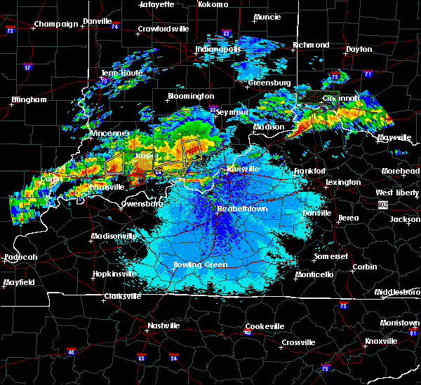 At 1102 pm edt, a severe thunderstorm was located 10 miles southwest of salem, moving east at 35 mph (radar indicated). Hazards include 60 mph wind gusts and quarter size hail. Hail damage to vehicles is expected. expect wind damage to roofs, siding, and trees. locations impacted include, salem, palmyra, hardinsburg, livonia, fredericksburg, smedley, shorts corner, becks mill, claysville and hitchcock. A tornado watch remains in effect until 200 am edt for south central indiana. At 1102 pm edt, a severe thunderstorm was located 10 miles southwest of salem, moving east at 35 mph (radar indicated). Hazards include 60 mph wind gusts and quarter size hail. Hail damage to vehicles is expected. expect wind damage to roofs, siding, and trees. locations impacted include, salem, palmyra, hardinsburg, livonia, fredericksburg, smedley, shorts corner, becks mill, claysville and hitchcock. A tornado watch remains in effect until 200 am edt for south central indiana.
|
| 4/28/2017 10:45 PM EDT |
 At 1045 pm edt, severe thunderstorms were located along a line extending from paoli to near english, moving east at 40 mph (radar indicated). Hazards include 60 mph wind gusts and nickel size hail. expect damage to roofs, siding, and trees At 1045 pm edt, severe thunderstorms were located along a line extending from paoli to near english, moving east at 40 mph (radar indicated). Hazards include 60 mph wind gusts and nickel size hail. expect damage to roofs, siding, and trees
|
| 4/5/2017 5:15 PM EDT |
 At 515 pm edt, severe thunderstorms were located along a line extending from 7 miles west of new providence town to 7 miles northeast of carefree town, moving northeast at 60 mph (radar indicated). Hazards include 60 mph wind gusts and half dollar size hail. Hail damage to vehicles is expected. Expect wind damage to roofs, siding, and trees. At 515 pm edt, severe thunderstorms were located along a line extending from 7 miles west of new providence town to 7 miles northeast of carefree town, moving northeast at 60 mph (radar indicated). Hazards include 60 mph wind gusts and half dollar size hail. Hail damage to vehicles is expected. Expect wind damage to roofs, siding, and trees.
|
| 3/1/2017 5:57 AM EST |
 At 556 am est/456 am cst/, severe thunderstorms were located along a line extending from 9 miles northwest of scottsburg to 10 miles southwest of carefree town, moving east at 55 mph (radar indicated). Hazards include 60 mph wind gusts. expect damage to roofs, siding, and trees At 556 am est/456 am cst/, severe thunderstorms were located along a line extending from 9 miles northwest of scottsburg to 10 miles southwest of carefree town, moving east at 55 mph (radar indicated). Hazards include 60 mph wind gusts. expect damage to roofs, siding, and trees
|
| 3/1/2017 5:47 AM EST |
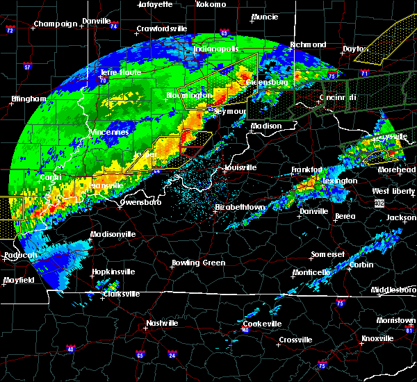 At 546 am est, a severe thunderstorm capable of producing a tornado was located 10 miles east of paoli, moving east at 65 mph (radar indicated rotation). Hazards include tornado. Flying debris will be dangerous to those caught without shelter. mobile homes will be damaged or destroyed. damage to roofs, windows, and vehicles will occur. Tree damage is likely. At 546 am est, a severe thunderstorm capable of producing a tornado was located 10 miles east of paoli, moving east at 65 mph (radar indicated rotation). Hazards include tornado. Flying debris will be dangerous to those caught without shelter. mobile homes will be damaged or destroyed. damage to roofs, windows, and vehicles will occur. Tree damage is likely.
|
| 3/1/2017 5:33 AM EST |
 At 532 am est, severe thunderstorms were located along a line extending from 8 miles north of paoli to 8 miles south of jasper, moving east at 60 mph (radar indicated). Hazards include 60 mph wind gusts. expect damage to roofs, siding, and trees At 532 am est, severe thunderstorms were located along a line extending from 8 miles north of paoli to 8 miles south of jasper, moving east at 60 mph (radar indicated). Hazards include 60 mph wind gusts. expect damage to roofs, siding, and trees
|
| 7/8/2016 10:41 AM EDT |
 At 1039 am edt, a severe thunderstorm was located 8 miles southwest of new providence town, moving northeast at 45 mph. at 1030 am trees were reported down between palymra and corydon (radar indicated). Hazards include 60 mph wind gusts. Expect damage to roofs. siding. and trees. Locations impacted include, new albany, corydon, new providence town, clarksville, charlestown, sellersburg, galena, blue river, new pekin and palmyra. At 1039 am edt, a severe thunderstorm was located 8 miles southwest of new providence town, moving northeast at 45 mph. at 1030 am trees were reported down between palymra and corydon (radar indicated). Hazards include 60 mph wind gusts. Expect damage to roofs. siding. and trees. Locations impacted include, new albany, corydon, new providence town, clarksville, charlestown, sellersburg, galena, blue river, new pekin and palmyra.
|
| 7/8/2016 10:21 AM EDT |
 At 1020 am edt, a severe thunderstorm was located near corydon, moving east at 55 mph (radar indicated). Hazards include 60 mph wind gusts and penny size hail. Expect damage to roofs. siding. And trees. At 1020 am edt, a severe thunderstorm was located near corydon, moving east at 55 mph (radar indicated). Hazards include 60 mph wind gusts and penny size hail. Expect damage to roofs. siding. And trees.
|
| 6/23/2016 3:50 PM EDT |
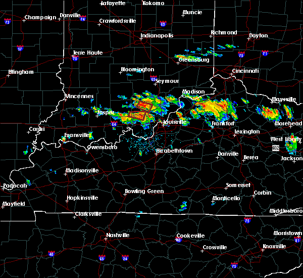 At 350 pm edt, a severe thunderstorm capable of producing a tornado was located 14 miles northeast of english, moving east at 30 mph (radar indicated rotation). Hazards include tornado and quarter size hail. Flying debris will be dangerous to those caught without shelter. mobile homes will be damaged or destroyed. damage to roofs, windows, and vehicles will occur. tree damage is likely. Locations impacted include, palmyra, hardinsburg, fredericksburg, central barren and hancock chapel. At 350 pm edt, a severe thunderstorm capable of producing a tornado was located 14 miles northeast of english, moving east at 30 mph (radar indicated rotation). Hazards include tornado and quarter size hail. Flying debris will be dangerous to those caught without shelter. mobile homes will be damaged or destroyed. damage to roofs, windows, and vehicles will occur. tree damage is likely. Locations impacted include, palmyra, hardinsburg, fredericksburg, central barren and hancock chapel.
|
| 6/23/2016 3:41 PM EDT |
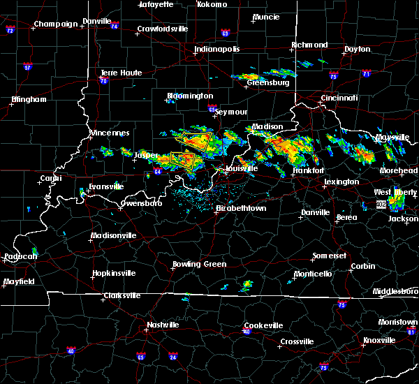 At 341 pm edt, a severe thunderstorm capable of producing a tornado was located 10 miles northeast of english, moving east at 30 mph (radar indicated rotation). Hazards include tornado and quarter size hail. Flying debris will be dangerous to those caught without shelter. mobile homes will be damaged or destroyed. damage to roofs, windows, and vehicles will occur. Tree damage is likely. At 341 pm edt, a severe thunderstorm capable of producing a tornado was located 10 miles northeast of english, moving east at 30 mph (radar indicated rotation). Hazards include tornado and quarter size hail. Flying debris will be dangerous to those caught without shelter. mobile homes will be damaged or destroyed. damage to roofs, windows, and vehicles will occur. Tree damage is likely.
|
| 6/23/2016 3:27 PM EDT |
 At 327 pm edt, a severe thunderstorm was located 8 miles northeast of english, moving east at 30 mph (radar indicated). Hazards include 60 mph wind gusts and quarter size hail. Hail damage to vehicles is expected. expect wind damage to roofs, siding, and trees. Locations impacted include, marengo, milltown, hardinsburg, fredericksburg, valeene, pine valley, rego, bacon, hogtown and organ springs. At 327 pm edt, a severe thunderstorm was located 8 miles northeast of english, moving east at 30 mph (radar indicated). Hazards include 60 mph wind gusts and quarter size hail. Hail damage to vehicles is expected. expect wind damage to roofs, siding, and trees. Locations impacted include, marengo, milltown, hardinsburg, fredericksburg, valeene, pine valley, rego, bacon, hogtown and organ springs.
|
| 6/23/2016 3:15 PM EDT |
 At 315 pm edt, a severe thunderstorm was located near english, moving east at 30 mph (radar indicated). Hazards include 60 mph wind gusts and penny size hail. Expect damage to roofs. siding. And trees. At 315 pm edt, a severe thunderstorm was located near english, moving east at 30 mph (radar indicated). Hazards include 60 mph wind gusts and penny size hail. Expect damage to roofs. siding. And trees.
|
| 6/15/2016 5:41 PM EDT |
 At 540 pm edt, a severe thunderstorm was located near paoli, moving east southeast at 35 mph (radar indicated). Hazards include 60 mph wind gusts. Expect damage to roofs. siding. and trees. Locations impacted include, salem, paoli, orleans, french lick, blue river, new pekin, stampers creek, orangeville, campbellsburg and west baden springs. At 540 pm edt, a severe thunderstorm was located near paoli, moving east southeast at 35 mph (radar indicated). Hazards include 60 mph wind gusts. Expect damage to roofs. siding. and trees. Locations impacted include, salem, paoli, orleans, french lick, blue river, new pekin, stampers creek, orangeville, campbellsburg and west baden springs.
|
| 6/15/2016 5:27 PM EDT |
 At 527 pm edt, a severe thunderstorm was located 7 miles west of paoli, moving east at 35 mph (radar indicated). Hazards include 60 mph wind gusts. Expect damage to roofs. siding. And trees. At 527 pm edt, a severe thunderstorm was located 7 miles west of paoli, moving east at 35 mph (radar indicated). Hazards include 60 mph wind gusts. Expect damage to roofs. siding. And trees.
|
| 5/7/2016 8:48 PM EDT |
 At 847 pm edt/747 pm cdt/, severe thunderstorms were located along a line extending from 9 miles north of paoli to 6 miles southwest of english to 9 miles southeast of whitesville, moving east at 40 mph (trained weather spotters. this line of storms has produced wind damage and 60 mph gusts across dubois county indiana). Hazards include 60 mph wind gusts and quarter size hail. Hail damage to vehicles is expected. Expect wind damage to roofs, siding, and trees. At 847 pm edt/747 pm cdt/, severe thunderstorms were located along a line extending from 9 miles north of paoli to 6 miles southwest of english to 9 miles southeast of whitesville, moving east at 40 mph (trained weather spotters. this line of storms has produced wind damage and 60 mph gusts across dubois county indiana). Hazards include 60 mph wind gusts and quarter size hail. Hail damage to vehicles is expected. Expect wind damage to roofs, siding, and trees.
|
| 4/10/2015 1:52 AM EDT | The national weather service in louisville has issued a * severe thunderstorm warning for. northeastern crawford county in south central indiana. northern harrison county in south central indiana. eastern orange county in south central indiana. Washington county in south central indiana. |
| 4/7/2015 4:56 PM EDT | The national weather service in louisville has issued a * severe thunderstorm warning for. eastern crawford county in south central indiana. floyd county in south central indiana. northern harrison county in south central indiana. Until 525 pm edt. |
| 5/4/2012 4:34 PM EDT | Some trees reported dow in harrison county IN, 3.6 miles NNE of Fredericksburg, IN |
| 5/4/2012 4:25 PM EDT | Some trees reported dow in harrison county IN, 3.6 miles NNE of Fredericksburg, IN |
| 4/28/2012 7:18 PM EDT | Quarter sized hail reported 0.1 miles ESE of Fredericksburg, IN |
| 3/2/2012 3:32 PM EST | Hen Egg sized hail reported 0.1 miles ESE of Fredericksburg, IN |
| 3/2/2012 3:20 PM EST | Hen Egg sized hail reported 0.1 miles ESE of Fredericksburg, IN |
| 1/1/0001 12:00 AM | The roof was blown off the posey township fire house. some bleachers and an announcers booth were blown about 50 yard in washington county IN, 1.4 miles ESE of Fredericksburg, IN |
| 1/1/0001 12:00 AM | Wet microburst...estimated 100 mph winds. barn destroye in washington county IN, 2.3 miles E of Fredericksburg, IN |
Hail Maps for Fredericksburg, IN
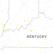

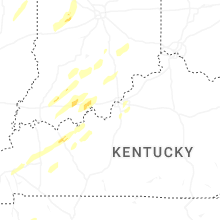


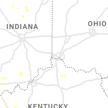


Connect with Interactive Hail Maps