

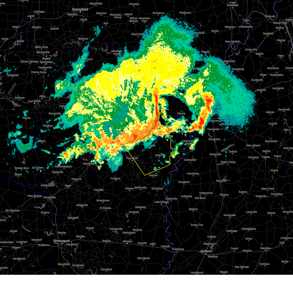
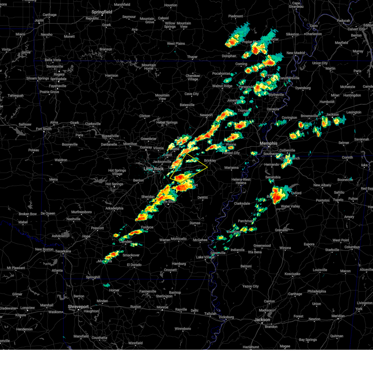
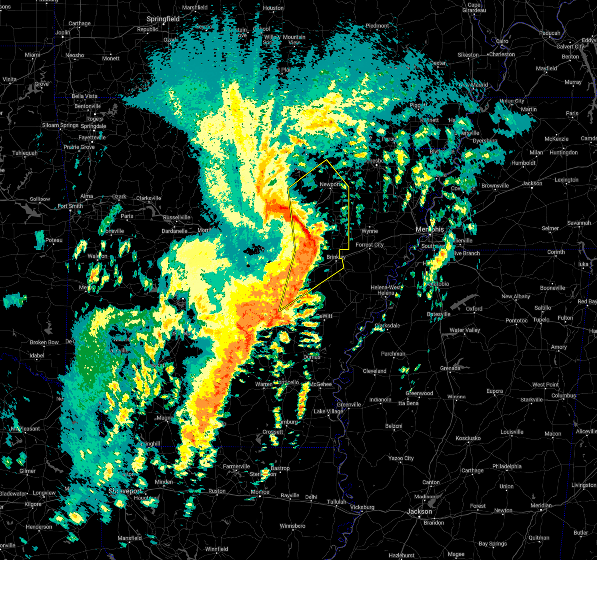
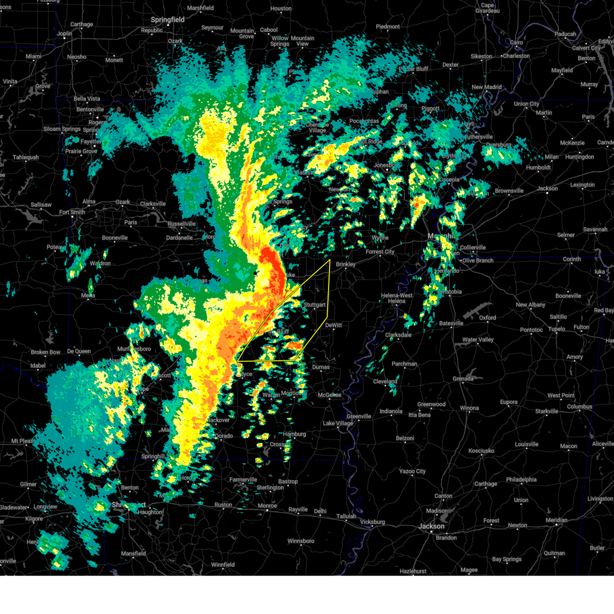
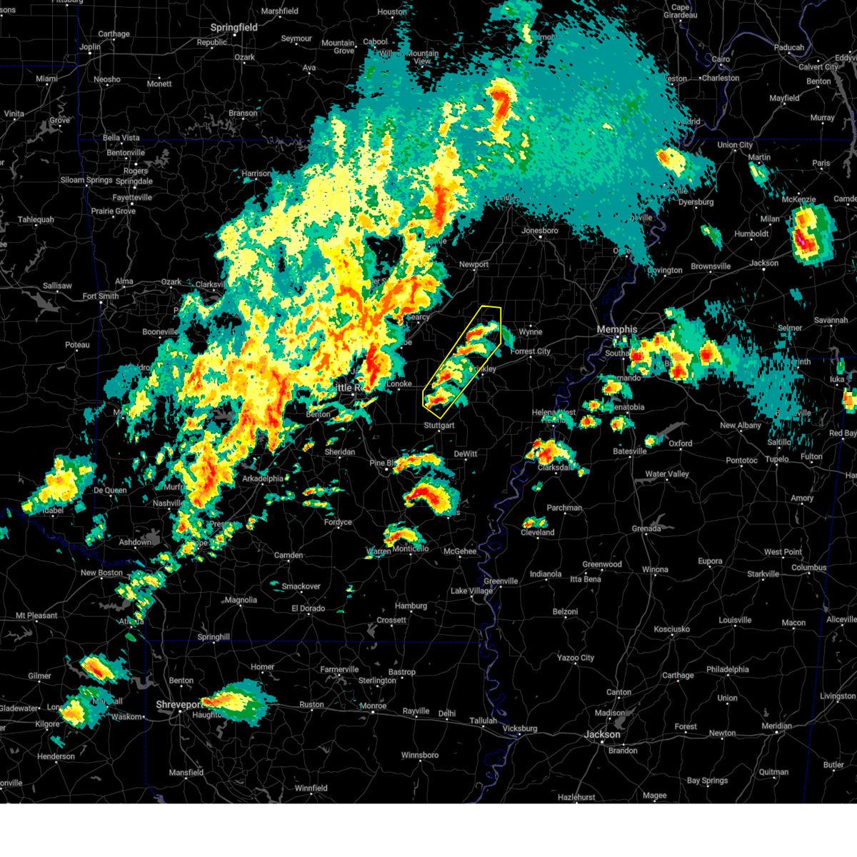
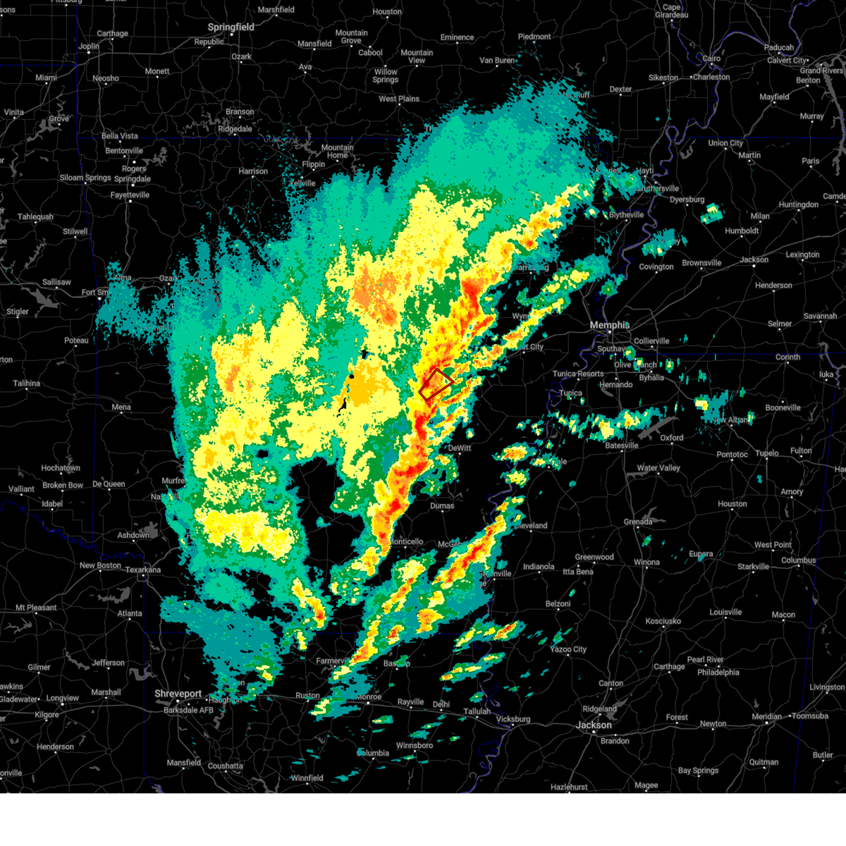
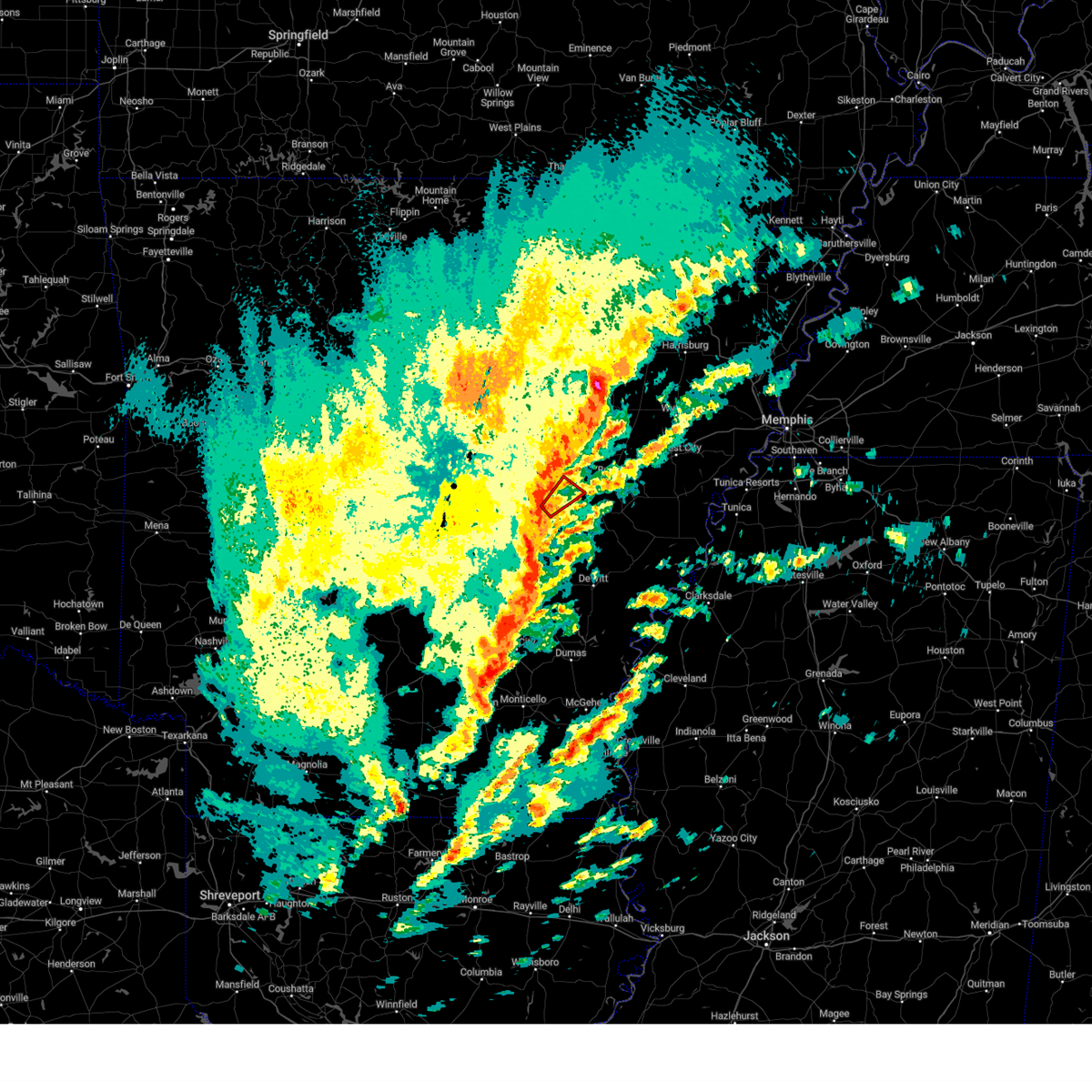
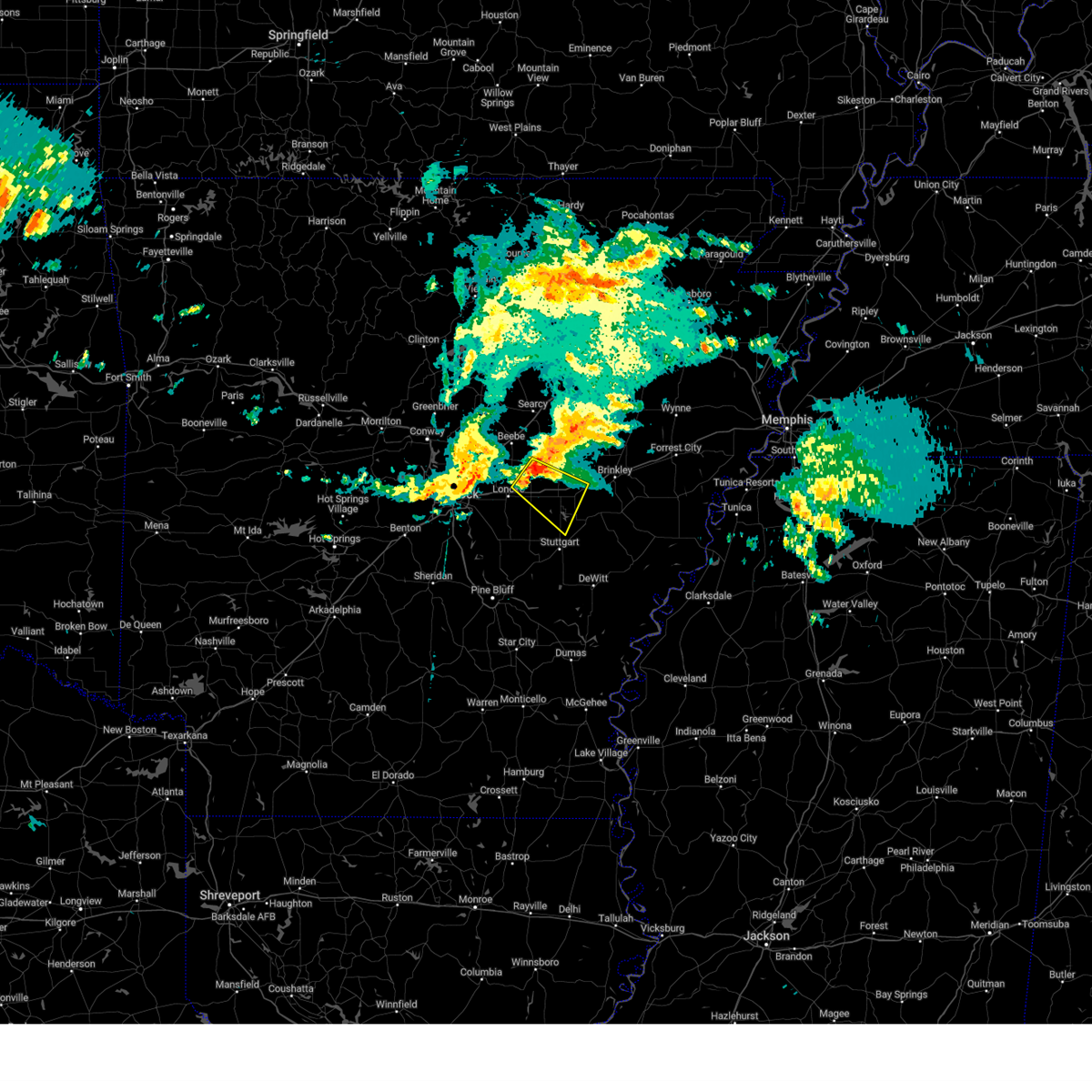
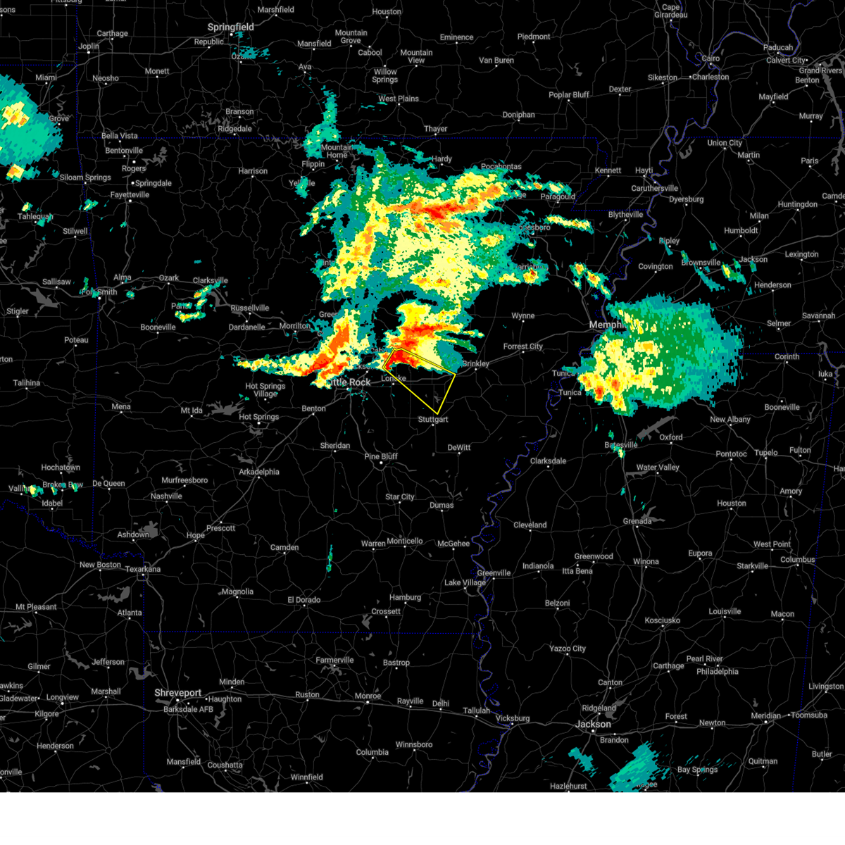
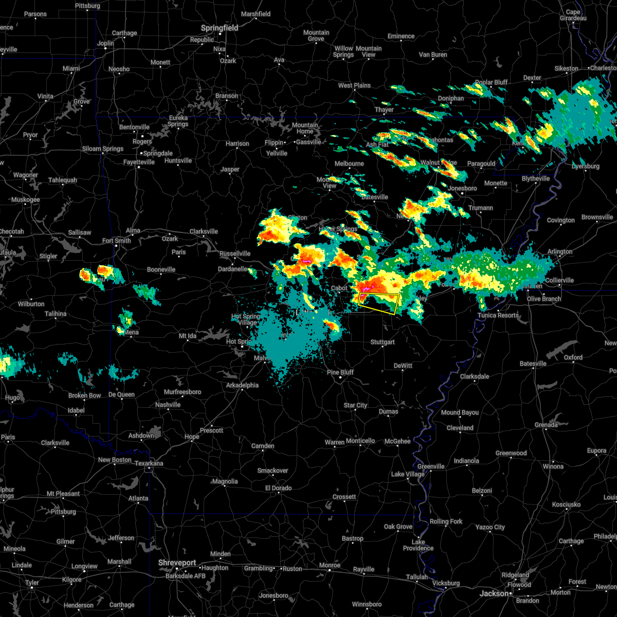
Hail Map for Fredonia (Biscoe), AR
The Fredonia (Biscoe), AR area has had 0 reports of on-the-ground hail by trained spotters, and has been under severe weather warnings 43 times during the past 12 months. Doppler radar has detected hail at or near Fredonia (Biscoe), AR on 55 occasions, including 4 occasions during the past year.
| Name: | Fredonia (Biscoe), AR |
| Where Located: | 49 miles E of Little Rock, AR |
| Map: | Google Map for Fredonia (Biscoe), AR |
| Population: | 363 |
| Housing Units: | 179 |
| More Info: | Search Google for Fredonia (Biscoe), AR |
2
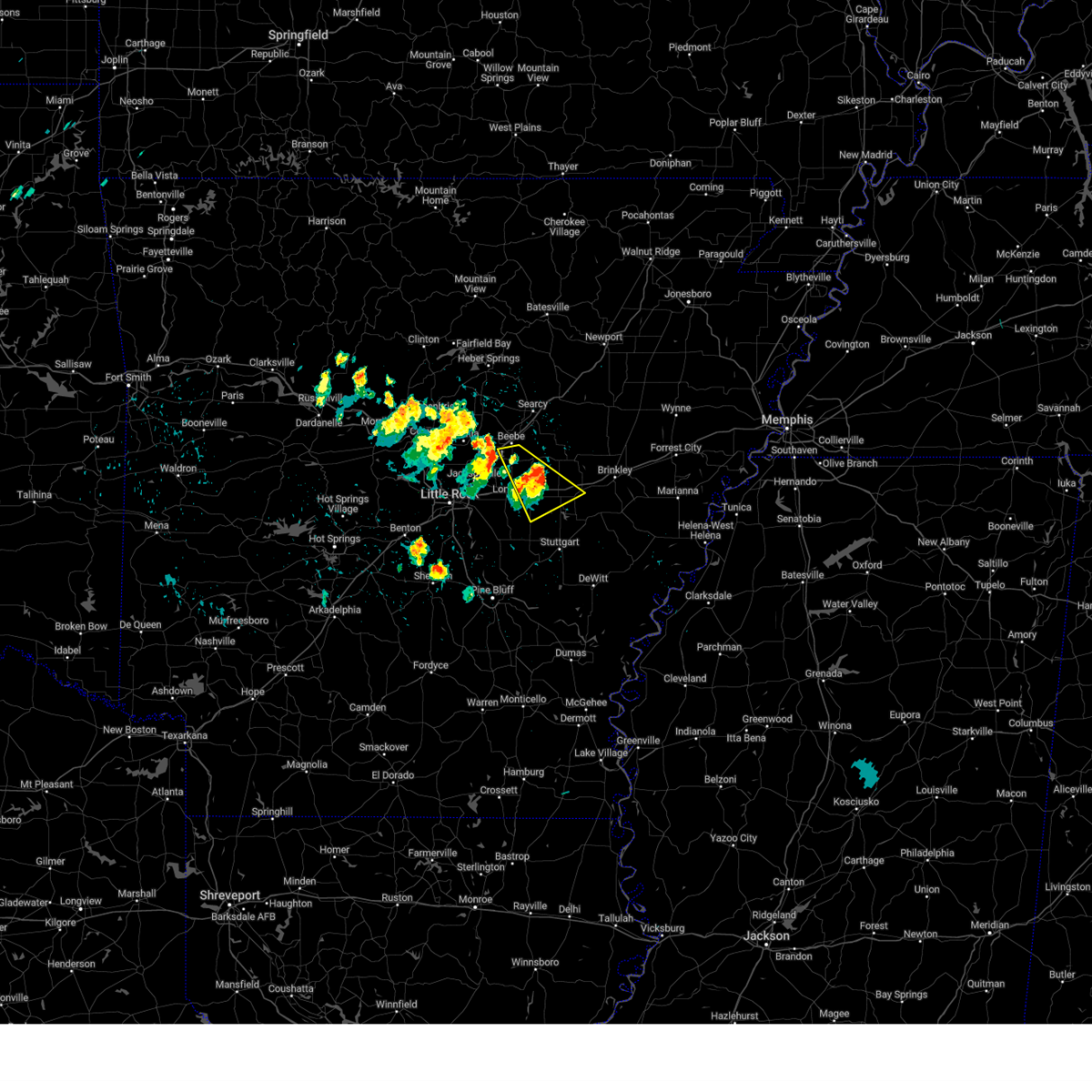
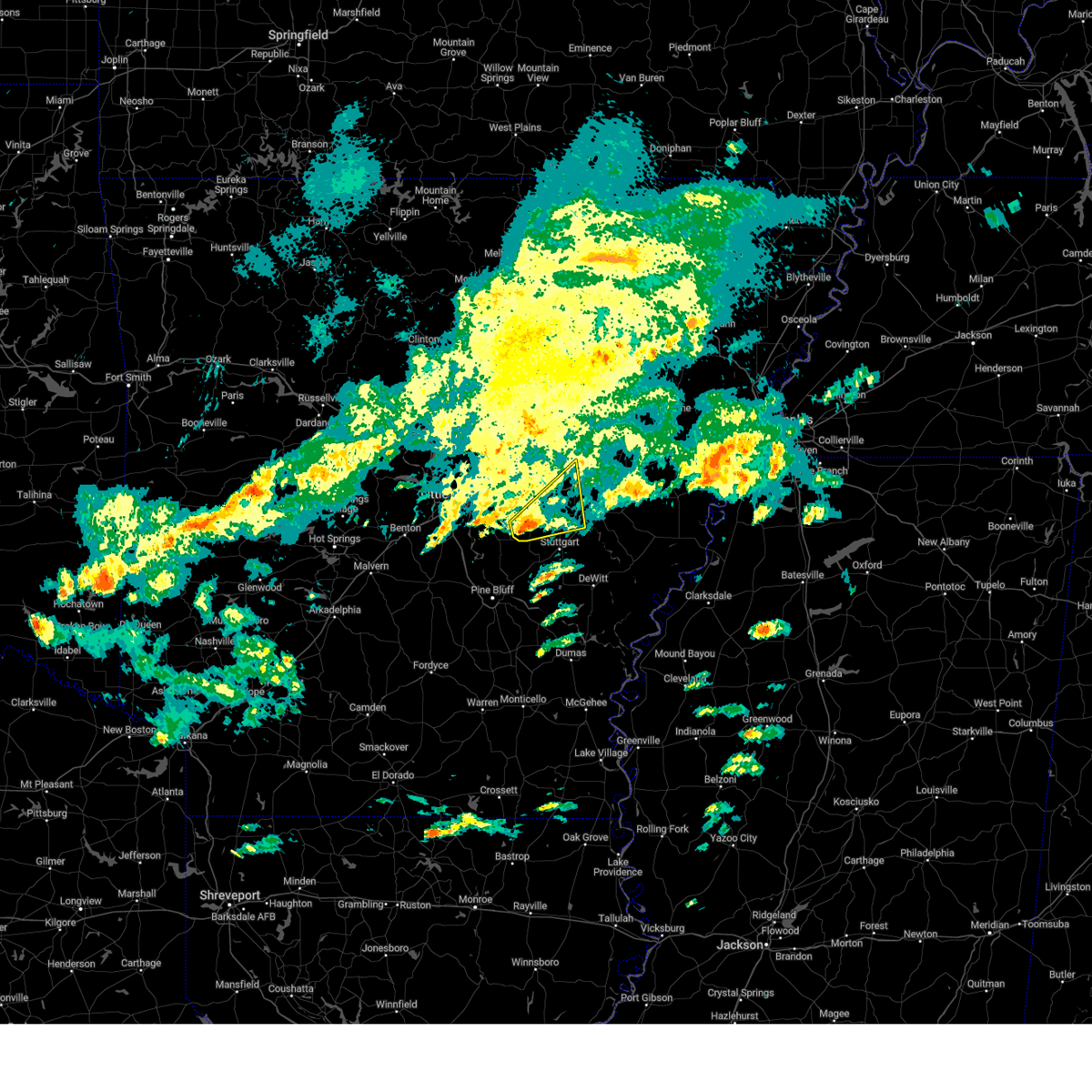
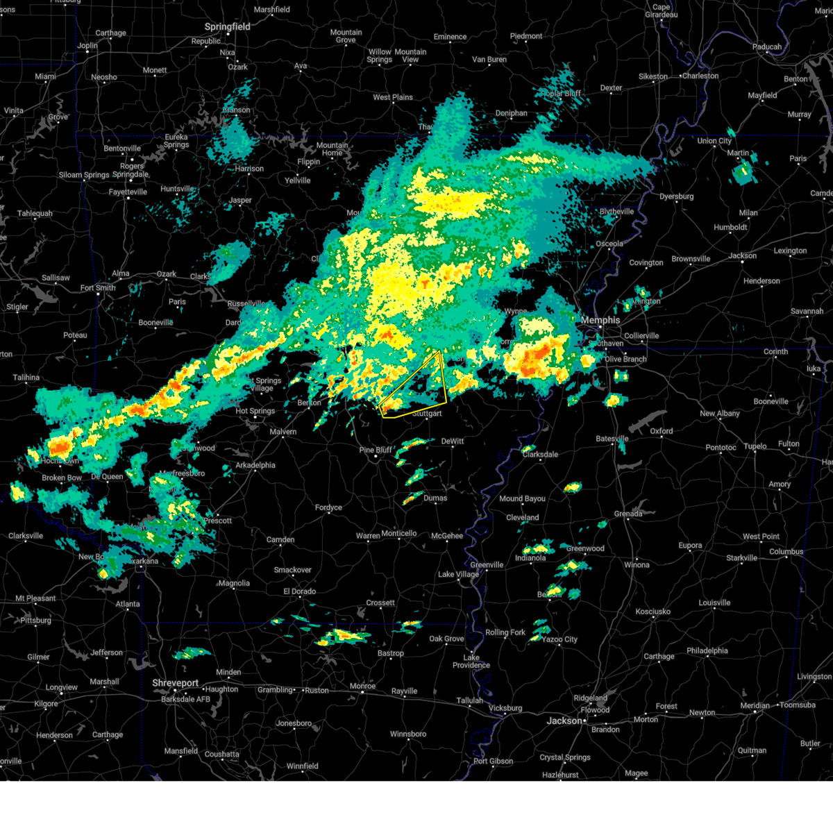
The Top Recent Hail Date for Fredonia (Biscoe), AR is Friday, March 14, 2025 (4th out of 55)

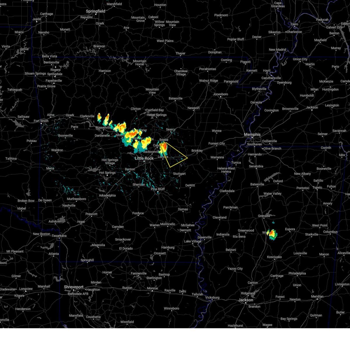
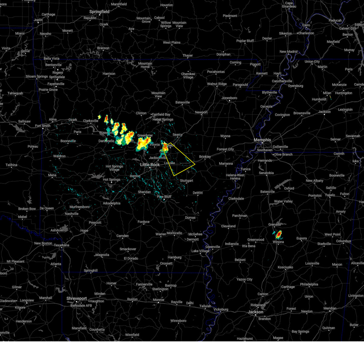
Hail and Wind Damage Spotted near Fredonia (Biscoe), AR
| Date / Time | Report Details |
|---|---|
| 6/7/2025 9:25 AM CDT |
 Svrlzk the national weather service in little rock has issued a * severe thunderstorm warning for, southern woodruff county in eastern arkansas, eastern prairie county in central arkansas, southern lonoke county in central arkansas, monroe county in eastern arkansas, jefferson county in southeastern arkansas, northeastern lincoln county in southeastern arkansas, southeastern pulaski county in central arkansas, arkansas county in southeastern arkansas, * until 1015 am cdt. * at 925 am cdt, severe thunderstorms were located along a line extending from 10 miles southeast of hurricane lake wma to near hazen to near estes, moving southeast at 55 mph (radar indicated). Hazards include 60 mph wind gusts and quarter size hail. Hail damage to vehicles is expected. Expect wind damage to roofs, siding, and trees. Svrlzk the national weather service in little rock has issued a * severe thunderstorm warning for, southern woodruff county in eastern arkansas, eastern prairie county in central arkansas, southern lonoke county in central arkansas, monroe county in eastern arkansas, jefferson county in southeastern arkansas, northeastern lincoln county in southeastern arkansas, southeastern pulaski county in central arkansas, arkansas county in southeastern arkansas, * until 1015 am cdt. * at 925 am cdt, severe thunderstorms were located along a line extending from 10 miles southeast of hurricane lake wma to near hazen to near estes, moving southeast at 55 mph (radar indicated). Hazards include 60 mph wind gusts and quarter size hail. Hail damage to vehicles is expected. Expect wind damage to roofs, siding, and trees.
|
| 5/24/2025 10:34 AM CDT |
 the severe thunderstorm warning has been cancelled and is no longer in effect the severe thunderstorm warning has been cancelled and is no longer in effect
|
| 5/24/2025 10:16 AM CDT |
 At 1016 am cdt, severe thunderstorms were located along a line extending from near hazen to near stuttgart municipal airport to brummitt, moving east at 30 mph (radar indicated). Hazards include 60 mph wind gusts and quarter size hail. Hail damage to vehicles is expected. expect wind damage to roofs, siding, and trees. Locations impacted include, dobbs landing, slovak, peppers landing, aberdeen, alfrey, almyra airport, stuttgart, de valls bluff, casscoe, brummitt, hazen, holly grove, ulm, center point, tollville, fredonia, monroe, roe, brasfield, clarendon,. At 1016 am cdt, severe thunderstorms were located along a line extending from near hazen to near stuttgart municipal airport to brummitt, moving east at 30 mph (radar indicated). Hazards include 60 mph wind gusts and quarter size hail. Hail damage to vehicles is expected. expect wind damage to roofs, siding, and trees. Locations impacted include, dobbs landing, slovak, peppers landing, aberdeen, alfrey, almyra airport, stuttgart, de valls bluff, casscoe, brummitt, hazen, holly grove, ulm, center point, tollville, fredonia, monroe, roe, brasfield, clarendon,.
|
| 5/24/2025 10:04 AM CDT |
 Svrlzk the national weather service in little rock has issued a * severe thunderstorm warning for, southeastern prairie county in central arkansas, southeastern lonoke county in central arkansas, central monroe county in eastern arkansas, northwestern arkansas county in southeastern arkansas, * until 1045 am cdt. * at 1004 am cdt, severe thunderstorms were located along a line extending from near hazen to near parkers corner to near humnoke, moving east at 25 mph (radar indicated). Hazards include 60 mph wind gusts and penny size hail. expect damage to roofs, siding, and trees Svrlzk the national weather service in little rock has issued a * severe thunderstorm warning for, southeastern prairie county in central arkansas, southeastern lonoke county in central arkansas, central monroe county in eastern arkansas, northwestern arkansas county in southeastern arkansas, * until 1045 am cdt. * at 1004 am cdt, severe thunderstorms were located along a line extending from near hazen to near parkers corner to near humnoke, moving east at 25 mph (radar indicated). Hazards include 60 mph wind gusts and penny size hail. expect damage to roofs, siding, and trees
|
| 5/20/2025 2:20 PM CDT | the severe thunderstorm warning has been cancelled and is no longer in effect |
| 5/20/2025 2:08 PM CDT |
 At 208 pm cdt, a severe thunderstorm was located over prairie center, or 7 miles west of hazen, moving northeast at 40 mph (radar indicated). Hazards include 60 mph wind gusts and quarter size hail. Hail damage to vehicles is expected. expect wind damage to roofs, siding, and trees. Locations impacted include, screeton, mccreanor, tollville, fredonia, de valls bluff, brasfield, hayley, carlisle, barrettsville, childers, hazen, prairie center, allendale, center point, hallsville, peppers landing, des arc,. At 208 pm cdt, a severe thunderstorm was located over prairie center, or 7 miles west of hazen, moving northeast at 40 mph (radar indicated). Hazards include 60 mph wind gusts and quarter size hail. Hail damage to vehicles is expected. expect wind damage to roofs, siding, and trees. Locations impacted include, screeton, mccreanor, tollville, fredonia, de valls bluff, brasfield, hayley, carlisle, barrettsville, childers, hazen, prairie center, allendale, center point, hallsville, peppers landing, des arc,.
|
| 5/20/2025 1:58 PM CDT |
 Svrlzk the national weather service in little rock has issued a * severe thunderstorm warning for, central prairie county in central arkansas, southeastern lonoke county in central arkansas, northwestern monroe county in eastern arkansas, * until 245 pm cdt. * at 157 pm cdt, a severe thunderstorm was located near parkers corner, or 9 miles southeast of lonoke, moving northeast at 40 mph (radar indicated). Hazards include 60 mph wind gusts and quarter size hail. Hail damage to vehicles is expected. Expect wind damage to roofs, siding, and trees. Svrlzk the national weather service in little rock has issued a * severe thunderstorm warning for, central prairie county in central arkansas, southeastern lonoke county in central arkansas, northwestern monroe county in eastern arkansas, * until 245 pm cdt. * at 157 pm cdt, a severe thunderstorm was located near parkers corner, or 9 miles southeast of lonoke, moving northeast at 40 mph (radar indicated). Hazards include 60 mph wind gusts and quarter size hail. Hail damage to vehicles is expected. Expect wind damage to roofs, siding, and trees.
|
| 5/18/2025 7:42 AM CDT |
 Svrlzk the national weather service in little rock has issued a * severe thunderstorm warning for, central prairie county in central arkansas, southeastern lonoke county in central arkansas, northwestern desha county in southeastern arkansas, monroe county in eastern arkansas, central jefferson county in southeastern arkansas, central lincoln county in southeastern arkansas, arkansas county in southeastern arkansas, * until 830 am cdt. * at 741 am cdt, severe thunderstorms were located along a line extending from near fredonia to near ulm to near humphrey to near pine bluff, moving southeast at 45 mph (radar indicated). Hazards include 60 mph wind gusts and quarter size hail. Hail damage to vehicles is expected. Expect wind damage to roofs, siding, and trees. Svrlzk the national weather service in little rock has issued a * severe thunderstorm warning for, central prairie county in central arkansas, southeastern lonoke county in central arkansas, northwestern desha county in southeastern arkansas, monroe county in eastern arkansas, central jefferson county in southeastern arkansas, central lincoln county in southeastern arkansas, arkansas county in southeastern arkansas, * until 830 am cdt. * at 741 am cdt, severe thunderstorms were located along a line extending from near fredonia to near ulm to near humphrey to near pine bluff, moving southeast at 45 mph (radar indicated). Hazards include 60 mph wind gusts and quarter size hail. Hail damage to vehicles is expected. Expect wind damage to roofs, siding, and trees.
|
| 5/18/2025 7:32 AM CDT |
 At 731 am cdt, severe thunderstorms were located along a line extending from near des arc to near hazen to near humnoke, moving east at 55 mph (radar indicated). Hazards include 60 mph wind gusts and quarter size hail. Hail damage to vehicles is expected. expect wind damage to roofs, siding, and trees. Locations impacted include, dobbs landing, slovak, aberdeen, almyra airport, england, casscoe, carlisle, estes, ulm, seaton, blakemore, thurman, screeton, mccreanor, humnoke, sand hill, humphrey, plum bayou mounds sp, roe, brasfield,. At 731 am cdt, severe thunderstorms were located along a line extending from near des arc to near hazen to near humnoke, moving east at 55 mph (radar indicated). Hazards include 60 mph wind gusts and quarter size hail. Hail damage to vehicles is expected. expect wind damage to roofs, siding, and trees. Locations impacted include, dobbs landing, slovak, aberdeen, almyra airport, england, casscoe, carlisle, estes, ulm, seaton, blakemore, thurman, screeton, mccreanor, humnoke, sand hill, humphrey, plum bayou mounds sp, roe, brasfield,.
|
| 5/18/2025 6:53 AM CDT |
 Svrlzk the national weather service in little rock has issued a * severe thunderstorm warning for, south central woodruff county in eastern arkansas, prairie county in central arkansas, lonoke county in central arkansas, northwestern monroe county in eastern arkansas, south central white county in central arkansas, north central jefferson county in southeastern arkansas, northeastern pulaski county in central arkansas, northwestern arkansas county in southeastern arkansas, * until 745 am cdt. * at 652 am cdt, severe thunderstorms were located along a line extending from near cabot to south bend to near scott, moving southeast at 55 mph (radar indicated). Hazards include 60 mph wind gusts. expect damage to roofs, siding, and trees Svrlzk the national weather service in little rock has issued a * severe thunderstorm warning for, south central woodruff county in eastern arkansas, prairie county in central arkansas, lonoke county in central arkansas, northwestern monroe county in eastern arkansas, south central white county in central arkansas, north central jefferson county in southeastern arkansas, northeastern pulaski county in central arkansas, northwestern arkansas county in southeastern arkansas, * until 745 am cdt. * at 652 am cdt, severe thunderstorms were located along a line extending from near cabot to south bend to near scott, moving southeast at 55 mph (radar indicated). Hazards include 60 mph wind gusts. expect damage to roofs, siding, and trees
|
| 4/20/2025 8:13 PM CDT | Svrlzk the national weather service in little rock has issued a * severe thunderstorm warning for, southern woodruff county in eastern arkansas, prairie county in central arkansas, central lonoke county in central arkansas, northwestern monroe county in eastern arkansas, southeastern white county in central arkansas, * until 930 pm cdt. * at 813 pm cdt, a severe thunderstorm was located over lonoke, moving northeast at 50 mph (radar indicated). Hazards include 60 mph wind gusts. expect damage to roofs, siding, and trees |
| 4/5/2025 12:10 PM CDT |
 the severe thunderstorm warning has been cancelled and is no longer in effect the severe thunderstorm warning has been cancelled and is no longer in effect
|
| 4/5/2025 12:10 PM CDT |
 At 1210 pm cdt, severe thunderstorms were located along a line extending from pleasant plains to 7 miles southwest of patterson to 7 miles north of stuttgart municipal airport, moving northeast at 65 mph (radar indicated). Hazards include 70 mph wind gusts and quarter size hail. Hail damage to vehicles is expected. expect considerable tree damage. wind damage is also likely to mobile homes, roofs, and outbuildings. Locations impacted include, dobbs landing, mccrory, salado, bradford, mcfadden, judsonia, fitzhugh, fargo, georgetown, plainview in white county, olyphant, humnoke, dixie, hunter, providence, pryor, childers, hutchinson, russell, dowdy,. At 1210 pm cdt, severe thunderstorms were located along a line extending from pleasant plains to 7 miles southwest of patterson to 7 miles north of stuttgart municipal airport, moving northeast at 65 mph (radar indicated). Hazards include 70 mph wind gusts and quarter size hail. Hail damage to vehicles is expected. expect considerable tree damage. wind damage is also likely to mobile homes, roofs, and outbuildings. Locations impacted include, dobbs landing, mccrory, salado, bradford, mcfadden, judsonia, fitzhugh, fargo, georgetown, plainview in white county, olyphant, humnoke, dixie, hunter, providence, pryor, childers, hutchinson, russell, dowdy,.
|
| 4/5/2025 12:06 PM CDT |
 At 1206 pm cdt, severe thunderstorms were located along a line extending from near de valls bluff to near altheimer to 6 miles northeast of kedron, moving east at 60 mph (radar indicated). Hazards include 60 mph wind gusts. Expect damage to roofs, siding, and trees. Locations impacted include, nebo, tarry, slovak, peppers landing, almyra airport, cornerstone, stuttgart, de valls bluff, cottondale, tamo, whitefield, brummitt, moscow, linwood, glenlake, lodge corner, watson chapel, sulphur springs, ulm, madding,. At 1206 pm cdt, severe thunderstorms were located along a line extending from near de valls bluff to near altheimer to 6 miles northeast of kedron, moving east at 60 mph (radar indicated). Hazards include 60 mph wind gusts. Expect damage to roofs, siding, and trees. Locations impacted include, nebo, tarry, slovak, peppers landing, almyra airport, cornerstone, stuttgart, de valls bluff, cottondale, tamo, whitefield, brummitt, moscow, linwood, glenlake, lodge corner, watson chapel, sulphur springs, ulm, madding,.
|
| 4/5/2025 12:06 PM CDT |
 the severe thunderstorm warning has been cancelled and is no longer in effect the severe thunderstorm warning has been cancelled and is no longer in effect
|
| 4/5/2025 11:59 AM CDT |
 At 1159 am cdt, severe thunderstorms were located along a line extending from near stuttgart municipal airport to near warbritton to kedron, moving east at 45 mph (radar indicated). Hazards include 60 mph wind gusts and nickel size hail. Expect damage to roofs, siding, and trees. Locations impacted include, slovak, pastoria, almyra airport, sherrill, whitefield, lock and dam 5 park, lodge corner, staves, ulm, hardin, dexter, seaton, humnoke, humphrey, woodville, pine bluff, samples, grapevine, stuttgart municipal airport, mt zion,. At 1159 am cdt, severe thunderstorms were located along a line extending from near stuttgart municipal airport to near warbritton to kedron, moving east at 45 mph (radar indicated). Hazards include 60 mph wind gusts and nickel size hail. Expect damage to roofs, siding, and trees. Locations impacted include, slovak, pastoria, almyra airport, sherrill, whitefield, lock and dam 5 park, lodge corner, staves, ulm, hardin, dexter, seaton, humnoke, humphrey, woodville, pine bluff, samples, grapevine, stuttgart municipal airport, mt zion,.
|
| 4/5/2025 11:52 AM CDT |
 Svrlzk the national weather service in little rock has issued a * severe thunderstorm warning for, woodruff county in eastern arkansas, southeastern independence county in north central arkansas, prairie county in central arkansas, jackson county in eastern arkansas, southeastern cleburne county in north central arkansas, eastern lonoke county in central arkansas, northwestern monroe county in eastern arkansas, white county in central arkansas, north central jefferson county in southeastern arkansas, northern arkansas county in southeastern arkansas, * until 1230 pm cdt. * at 1151 am cdt, severe thunderstorms were located along a line extending from near pangburn to des arc to near humnoke, moving northeast at 65 mph (radar indicated). Hazards include 70 mph wind gusts and quarter size hail. Hail damage to vehicles is expected. expect considerable tree damage. Wind damage is also likely to mobile homes, roofs, and outbuildings. Svrlzk the national weather service in little rock has issued a * severe thunderstorm warning for, woodruff county in eastern arkansas, southeastern independence county in north central arkansas, prairie county in central arkansas, jackson county in eastern arkansas, southeastern cleburne county in north central arkansas, eastern lonoke county in central arkansas, northwestern monroe county in eastern arkansas, white county in central arkansas, north central jefferson county in southeastern arkansas, northern arkansas county in southeastern arkansas, * until 1230 pm cdt. * at 1151 am cdt, severe thunderstorms were located along a line extending from near pangburn to des arc to near humnoke, moving northeast at 65 mph (radar indicated). Hazards include 70 mph wind gusts and quarter size hail. Hail damage to vehicles is expected. expect considerable tree damage. Wind damage is also likely to mobile homes, roofs, and outbuildings.
|
| 4/5/2025 11:37 AM CDT |
 At 1137 am cdt, severe thunderstorms were located along a line extending from near england to 8 miles west of white hall to 9 miles southwest of lamont, moving northeast at 60 mph (radar indicated). Hazards include 60 mph wind gusts and nickel size hail. Expect damage to roofs, siding, and trees. Locations impacted include, slovak, pastoria, almyra airport, sherrill, whitefield, lock and dam 5 park, lodge corner, staves, ulm, hardin, dexter, seaton, humnoke, humphrey, woodville, pine bluff, samples, grapevine, stuttgart municipal airport, mt zion,. At 1137 am cdt, severe thunderstorms were located along a line extending from near england to 8 miles west of white hall to 9 miles southwest of lamont, moving northeast at 60 mph (radar indicated). Hazards include 60 mph wind gusts and nickel size hail. Expect damage to roofs, siding, and trees. Locations impacted include, slovak, pastoria, almyra airport, sherrill, whitefield, lock and dam 5 park, lodge corner, staves, ulm, hardin, dexter, seaton, humnoke, humphrey, woodville, pine bluff, samples, grapevine, stuttgart municipal airport, mt zion,.
|
| 4/5/2025 11:34 AM CDT |
 Svrlzk the national weather service in little rock has issued a * severe thunderstorm warning for, northern cleveland county in southeastern arkansas, central prairie county in central arkansas, southeastern lonoke county in central arkansas, southeastern grant county in central arkansas, northeastern dallas county in southwestern arkansas, west central monroe county in eastern arkansas, jefferson county in southeastern arkansas, northwestern lincoln county in southeastern arkansas, northwestern arkansas county in southeastern arkansas, * until 1215 pm cdt. * at 1134 am cdt, severe thunderstorms were located along a line extending from near england to 8 miles west of white hall to 10 miles southeast of carthage, moving northeast at 100 mph (radar indicated). Hazards include 60 mph wind gusts and nickel size hail. expect damage to roofs, siding, and trees Svrlzk the national weather service in little rock has issued a * severe thunderstorm warning for, northern cleveland county in southeastern arkansas, central prairie county in central arkansas, southeastern lonoke county in central arkansas, southeastern grant county in central arkansas, northeastern dallas county in southwestern arkansas, west central monroe county in eastern arkansas, jefferson county in southeastern arkansas, northwestern lincoln county in southeastern arkansas, northwestern arkansas county in southeastern arkansas, * until 1215 pm cdt. * at 1134 am cdt, severe thunderstorms were located along a line extending from near england to 8 miles west of white hall to 10 miles southeast of carthage, moving northeast at 100 mph (radar indicated). Hazards include 60 mph wind gusts and nickel size hail. expect damage to roofs, siding, and trees
|
| 4/4/2025 11:52 PM CDT |
 Svrlzk the national weather service in little rock has issued a * severe thunderstorm warning for, central prairie county in central arkansas, central lonoke county in central arkansas, southeastern white county in central arkansas, southeastern pulaski county in central arkansas, * until 1230 am cdt. * at 1152 pm cdt, a severe thunderstorm was located over estes, or 15 miles southeast of downtown little rock, moving northeast at 50 mph (radar indicated). Hazards include 60 mph wind gusts and penny size hail. expect damage to roofs, siding, and trees Svrlzk the national weather service in little rock has issued a * severe thunderstorm warning for, central prairie county in central arkansas, central lonoke county in central arkansas, southeastern white county in central arkansas, southeastern pulaski county in central arkansas, * until 1230 am cdt. * at 1152 pm cdt, a severe thunderstorm was located over estes, or 15 miles southeast of downtown little rock, moving northeast at 50 mph (radar indicated). Hazards include 60 mph wind gusts and penny size hail. expect damage to roofs, siding, and trees
|
| 4/2/2025 7:45 PM CDT | At 745 pm cdt, severe thunderstorms were located along a line extending from stuttgart municipal airport to near pine bluff, moving east at 25 mph (radar indicated). Hazards include 60 mph wind gusts and quarter size hail. Hail damage to vehicles is expected. expect wind damage to roofs, siding, and trees. Locations impacted include, slovak, pastoria, sherrill, england, carlisle, lock and dam 5 park, hardin, dexter, seaton, blakemore, screeton, mccreanor, humnoke, bredlow corner, ain, prague, pine bluff, keo, samples, hensley island,. |
| 4/2/2025 7:22 PM CDT | the tornado warning has been cancelled and is no longer in effect |
| 4/2/2025 7:13 PM CDT |
 Svrlzk the national weather service in little rock has issued a * severe thunderstorm warning for, central prairie county in central arkansas, lonoke county in central arkansas, northern grant county in central arkansas, northwestern jefferson county in southeastern arkansas, southeastern pulaski county in central arkansas, * until 800 pm cdt. * at 712 pm cdt, severe thunderstorms were located along a line extending from near humnoke to 6 miles northwest of lamont, moving east at 35 mph (radar indicated). Hazards include 60 mph wind gusts and quarter size hail. Hail damage to vehicles is expected. Expect wind damage to roofs, siding, and trees. Svrlzk the national weather service in little rock has issued a * severe thunderstorm warning for, central prairie county in central arkansas, lonoke county in central arkansas, northern grant county in central arkansas, northwestern jefferson county in southeastern arkansas, southeastern pulaski county in central arkansas, * until 800 pm cdt. * at 712 pm cdt, severe thunderstorms were located along a line extending from near humnoke to 6 miles northwest of lamont, moving east at 35 mph (radar indicated). Hazards include 60 mph wind gusts and quarter size hail. Hail damage to vehicles is expected. Expect wind damage to roofs, siding, and trees.
|
| 4/2/2025 7:02 PM CDT | Torlzk the national weather service in little rock has issued a * tornado warning for, central prairie county in central arkansas, southeastern lonoke county in central arkansas, northwestern monroe county in eastern arkansas, * until 745 pm cdt. * at 702 pm cdt, a severe thunderstorm capable of producing a tornado was located near parkers corner, or 11 miles southeast of lonoke, moving northeast at 45 mph (radar indicated rotation). Hazards include tornado and half dollar size hail. Flying debris will be dangerous to those caught without shelter. mobile homes will be damaged or destroyed. damage to roofs, windows, and vehicles will occur. Tree damage is likely. |
| 4/2/2025 6:11 PM CDT | At 611 pm cdt, a severe thunderstorm capable of producing a tornado was located near allendale, or near brinkley, moving northeast at 65 mph (radar indicated rotation). Hazards include tornado and golf ball size hail. Flying debris will be dangerous to those caught without shelter. mobile homes will be damaged or destroyed. damage to roofs, windows, and vehicles will occur. tree damage is likely. Locations impacted include, cotton plant, hunter, fredonia, alfrey, penrose, brasfield, brinkley, becton, dagmar wma, keevil, morton, allendale, fargo, hilleman, zent,. |
| 4/2/2025 6:08 PM CDT | the severe thunderstorm warning has been cancelled and is no longer in effect |
| 4/2/2025 5:57 PM CDT | Torlzk the national weather service in little rock has issued a * tornado warning for, southeastern woodruff county in eastern arkansas, east central prairie county in central arkansas, northwestern monroe county in eastern arkansas, * until 645 pm cdt. * at 557 pm cdt, a severe thunderstorm capable of producing a tornado was located near peppers landing, or near de valls bluff, moving northeast at 65 mph (radar indicated rotation). Hazards include tornado and golf ball size hail. Flying debris will be dangerous to those caught without shelter. mobile homes will be damaged or destroyed. damage to roofs, windows, and vehicles will occur. Tree damage is likely. |
| 4/2/2025 5:52 PM CDT | Svrlzk the national weather service in little rock has issued a * severe thunderstorm warning for, southeastern woodruff county in eastern arkansas, southeastern prairie county in central arkansas, northwestern monroe county in eastern arkansas, north central arkansas county in southeastern arkansas, * until 630 pm cdt. * at 552 pm cdt, a severe thunderstorm was located near stuttgart municipal airport, or 10 miles north of stuttgart, moving northeast at 65 mph (radar indicated). Hazards include golf ball size hail and 60 mph wind gusts. People and animals outdoors will be injured. expect hail damage to roofs, siding, windows, and vehicles. Expect wind damage to roofs, siding, and trees. |
| 4/2/2025 5:35 PM CDT |
 At 534 pm cdt, a severe thunderstorm was located over fredonia, or near de valls bluff, moving northeast at 70 mph. this is a destructive storm for prairie county (radar indicated). Hazards include three inch hail and 60 mph wind gusts. People and animals outdoors will be severely injured. expect shattered windows, extensive damage to roofs, siding, and vehicles. Locations impacted include, mccrory, howell, de valls bluff, penrose, mcclelland, gregory, grays, dagmar wma, pumpkin bend, morton, hilleman, dixie, cotton plant, des arc, hunter, sand hill, fredonia, brasfield, patterson, becton,. At 534 pm cdt, a severe thunderstorm was located over fredonia, or near de valls bluff, moving northeast at 70 mph. this is a destructive storm for prairie county (radar indicated). Hazards include three inch hail and 60 mph wind gusts. People and animals outdoors will be severely injured. expect shattered windows, extensive damage to roofs, siding, and vehicles. Locations impacted include, mccrory, howell, de valls bluff, penrose, mcclelland, gregory, grays, dagmar wma, pumpkin bend, morton, hilleman, dixie, cotton plant, des arc, hunter, sand hill, fredonia, brasfield, patterson, becton,.
|
| 4/2/2025 5:30 PM CDT |
 At 530 pm cdt, a severe thunderstorm was located over de valls bluff, moving northeast at 65 mph (radar indicated). Hazards include tennis ball size hail and 70 mph wind gusts. People and animals outdoors will be injured. expect hail damage to roofs, siding, windows, and vehicles. expect considerable tree damage. wind damage is also likely to mobile homes, roofs, and outbuildings. Locations impacted include, mccrory, howell, de valls bluff, penrose, mcclelland, gregory, grays, hazen, dagmar wma, pumpkin bend, morton, hilleman, dixie, cotton plant, des arc, hunter, sand hill, tollville, fredonia, brasfield,. At 530 pm cdt, a severe thunderstorm was located over de valls bluff, moving northeast at 65 mph (radar indicated). Hazards include tennis ball size hail and 70 mph wind gusts. People and animals outdoors will be injured. expect hail damage to roofs, siding, windows, and vehicles. expect considerable tree damage. wind damage is also likely to mobile homes, roofs, and outbuildings. Locations impacted include, mccrory, howell, de valls bluff, penrose, mcclelland, gregory, grays, hazen, dagmar wma, pumpkin bend, morton, hilleman, dixie, cotton plant, des arc, hunter, sand hill, tollville, fredonia, brasfield,.
|
| 4/2/2025 5:30 PM CDT |
 the severe thunderstorm warning has been cancelled and is no longer in effect the severe thunderstorm warning has been cancelled and is no longer in effect
|
| 4/2/2025 5:22 PM CDT |
 Svrlzk the national weather service in little rock has issued a * severe thunderstorm warning for, woodruff county in eastern arkansas, central prairie county in central arkansas, southeastern lonoke county in central arkansas, northwestern monroe county in eastern arkansas, * until 600 pm cdt. * at 521 pm cdt, a severe thunderstorm was located near hazen, moving northeast at 70 mph (radar indicated). Hazards include ping pong ball size hail and 60 mph wind gusts. People and animals outdoors will be injured. expect hail damage to roofs, siding, windows, and vehicles. Expect wind damage to roofs, siding, and trees. Svrlzk the national weather service in little rock has issued a * severe thunderstorm warning for, woodruff county in eastern arkansas, central prairie county in central arkansas, southeastern lonoke county in central arkansas, northwestern monroe county in eastern arkansas, * until 600 pm cdt. * at 521 pm cdt, a severe thunderstorm was located near hazen, moving northeast at 70 mph (radar indicated). Hazards include ping pong ball size hail and 60 mph wind gusts. People and animals outdoors will be injured. expect hail damage to roofs, siding, windows, and vehicles. Expect wind damage to roofs, siding, and trees.
|
| 3/15/2025 4:53 AM CDT |
 Svrlzk the national weather service in little rock has issued a * severe thunderstorm warning for, southeastern woodruff county in eastern arkansas, east central prairie county in central arkansas, northwestern monroe county in eastern arkansas, * until 545 am cdt. * at 452 am cdt, a severe thunderstorm was located near fredonia, or 8 miles southeast of des arc, moving northeast at 50 mph (radar indicated). Hazards include ping pong ball size hail and 60 mph wind gusts. People and animals outdoors will be injured. expect hail damage to roofs, siding, windows, and vehicles. Expect wind damage to roofs, siding, and trees. Svrlzk the national weather service in little rock has issued a * severe thunderstorm warning for, southeastern woodruff county in eastern arkansas, east central prairie county in central arkansas, northwestern monroe county in eastern arkansas, * until 545 am cdt. * at 452 am cdt, a severe thunderstorm was located near fredonia, or 8 miles southeast of des arc, moving northeast at 50 mph (radar indicated). Hazards include ping pong ball size hail and 60 mph wind gusts. People and animals outdoors will be injured. expect hail damage to roofs, siding, windows, and vehicles. Expect wind damage to roofs, siding, and trees.
|
| 3/15/2025 4:42 AM CDT | At 442 am cdt, a severe thunderstorm was located 7 miles west of brinkley, moving northeast at 60 mph (radar indicated). Hazards include half dollar size hail. Damage to vehicles is expected. Locations impacted include, cotton plant, hunter, fredonia, howell, alfrey, de valls bluff, penrose, brasfield, brinkley, becton, dagmar wma, keevil, allendale, little dixie, fargo, hilleman, zent, hallsville,. |
| 3/15/2025 4:42 AM CDT | the severe thunderstorm warning has been cancelled and is no longer in effect |
| 3/15/2025 4:24 AM CDT |
 Svrlzk the national weather service in little rock has issued a * severe thunderstorm warning for, southeastern woodruff county in eastern arkansas, central prairie county in central arkansas, east central lonoke county in central arkansas, northwestern monroe county in eastern arkansas, * until 500 am cdt. * at 424 am cdt, a severe thunderstorm was located over parkers corner, or 11 miles southwest of hazen, moving northeast at 60 mph (radar indicated). Hazards include quarter size hail. damage to vehicles is expected Svrlzk the national weather service in little rock has issued a * severe thunderstorm warning for, southeastern woodruff county in eastern arkansas, central prairie county in central arkansas, east central lonoke county in central arkansas, northwestern monroe county in eastern arkansas, * until 500 am cdt. * at 424 am cdt, a severe thunderstorm was located over parkers corner, or 11 miles southwest of hazen, moving northeast at 60 mph (radar indicated). Hazards include quarter size hail. damage to vehicles is expected
|
| 3/15/2025 12:26 AM CDT | At 1226 am cdt, a severe thunderstorm was located over fredonia, or near de valls bluff, moving northeast at 55 mph (radar indicated). Hazards include 60 mph wind gusts and quarter size hail. Hail damage to vehicles is expected. expect wind damage to roofs, siding, and trees. Locations impacted include, cotton plant, dobbs landing, hunter, peppers landing, fredonia, alfrey, de valls bluff, penrose, monroe, brasfield, brinkley, becton, dagmar wma, keevil, allendale, fargo, hilleman, zent, clarendon,. |
| 3/15/2025 12:26 AM CDT | the severe thunderstorm warning has been cancelled and is no longer in effect |
| 3/15/2025 12:12 AM CDT |
 Svrlzk the national weather service in little rock has issued a * severe thunderstorm warning for, southeastern woodruff county in eastern arkansas, central prairie county in central arkansas, east central lonoke county in central arkansas, northern monroe county in eastern arkansas, * until 1245 am cdt. * at 1211 am cdt, a severe thunderstorm was located near prairie center, or near hazen, moving northeast at 55 mph (radar indicated). Hazards include 60 mph wind gusts and quarter size hail. Hail damage to vehicles is expected. Expect wind damage to roofs, siding, and trees. Svrlzk the national weather service in little rock has issued a * severe thunderstorm warning for, southeastern woodruff county in eastern arkansas, central prairie county in central arkansas, east central lonoke county in central arkansas, northern monroe county in eastern arkansas, * until 1245 am cdt. * at 1211 am cdt, a severe thunderstorm was located near prairie center, or near hazen, moving northeast at 55 mph (radar indicated). Hazards include 60 mph wind gusts and quarter size hail. Hail damage to vehicles is expected. Expect wind damage to roofs, siding, and trees.
|
| 8/18/2024 5:04 PM CDT |
 Svrlzk the national weather service in little rock has issued a * severe thunderstorm warning for, southeastern prairie county in central arkansas, central monroe county in eastern arkansas, north central arkansas county in southeastern arkansas, * until 545 pm cdt. * at 504 pm cdt, a severe thunderstorm was located near hazen, moving southeast at 35 mph (radar indicated). Hazards include 60 mph wind gusts and quarter size hail. Hail damage to vehicles is expected. Expect wind damage to roofs, siding, and trees. Svrlzk the national weather service in little rock has issued a * severe thunderstorm warning for, southeastern prairie county in central arkansas, central monroe county in eastern arkansas, north central arkansas county in southeastern arkansas, * until 545 pm cdt. * at 504 pm cdt, a severe thunderstorm was located near hazen, moving southeast at 35 mph (radar indicated). Hazards include 60 mph wind gusts and quarter size hail. Hail damage to vehicles is expected. Expect wind damage to roofs, siding, and trees.
|
| 8/18/2024 4:54 PM CDT |
 The storm which prompted the warning has weakened below severe limits, and no longer poses an immediate threat to life or property. therefore, the warning will be allowed to expire. however small hail and gusty winds are still possible with this thunderstorm. a severe thunderstorm watch remains in effect until 1000 pm cdt for central arkansas. The storm which prompted the warning has weakened below severe limits, and no longer poses an immediate threat to life or property. therefore, the warning will be allowed to expire. however small hail and gusty winds are still possible with this thunderstorm. a severe thunderstorm watch remains in effect until 1000 pm cdt for central arkansas.
|
| 8/18/2024 4:27 PM CDT |
 At 427 pm cdt, a severe thunderstorm was located near thurman, or 10 miles east of cabot, moving southeast at 30 mph (radar indicated). Hazards include 60 mph wind gusts and quarter size hail. Hail damage to vehicles is expected. expect wind damage to roofs, siding, and trees. Locations impacted include, hazen, de valls bluff, ward, carlisle, fredonia, barrettsville, thurman, mccreanor, prairie center, parkers corner, hallsville, sylvania, screeton, butlerville, hickory plains, woodlawn, center point,. At 427 pm cdt, a severe thunderstorm was located near thurman, or 10 miles east of cabot, moving southeast at 30 mph (radar indicated). Hazards include 60 mph wind gusts and quarter size hail. Hail damage to vehicles is expected. expect wind damage to roofs, siding, and trees. Locations impacted include, hazen, de valls bluff, ward, carlisle, fredonia, barrettsville, thurman, mccreanor, prairie center, parkers corner, hallsville, sylvania, screeton, butlerville, hickory plains, woodlawn, center point,.
|
| 8/18/2024 4:15 PM CDT |
 Svrlzk the national weather service in little rock has issued a * severe thunderstorm warning for, central prairie county in central arkansas, central lonoke county in central arkansas, south central white county in central arkansas, * until 500 pm cdt. * at 414 pm cdt, a severe thunderstorm was located over beebe, or 7 miles northeast of cabot, moving southeast at 30 mph (radar indicated). Hazards include 60 mph wind gusts and quarter size hail. Hail damage to vehicles is expected. Expect wind damage to roofs, siding, and trees. Svrlzk the national weather service in little rock has issued a * severe thunderstorm warning for, central prairie county in central arkansas, central lonoke county in central arkansas, south central white county in central arkansas, * until 500 pm cdt. * at 414 pm cdt, a severe thunderstorm was located over beebe, or 7 miles northeast of cabot, moving southeast at 30 mph (radar indicated). Hazards include 60 mph wind gusts and quarter size hail. Hail damage to vehicles is expected. Expect wind damage to roofs, siding, and trees.
|
| 5/24/2024 11:40 PM CDT |
 The storms which prompted the warning have weakened below severe limits, and no longer pose an immediate threat to life or property. therefore, the warning will be allowed to expire. however small hail and gusty winds are still possible with these thunderstorms. The storms which prompted the warning have weakened below severe limits, and no longer pose an immediate threat to life or property. therefore, the warning will be allowed to expire. however small hail and gusty winds are still possible with these thunderstorms.
|
| 5/24/2024 11:24 PM CDT |
 the severe thunderstorm warning has been cancelled and is no longer in effect the severe thunderstorm warning has been cancelled and is no longer in effect
|
| 5/24/2024 11:24 PM CDT |
 At 1124 pm cdt, severe thunderstorms were located along a line extending from near pryor to des arc to near fredonia to near de valls bluff, moving northeast at 45 mph (radar indicated). Hazards include 60 mph wind gusts and quarter size hail. Hail damage to vehicles is expected. expect wind damage to roofs, siding, and trees. Locations impacted include, brinkley, augusta, des arc, clarendon, hazen, de valls bluff, patterson, fredonia, hunter, alfrey, allendale, dobbs landing, peppers landing, mccrory, hurricane lake wma, pryor, hallsville, cotton plant, griffithville, fargo,. At 1124 pm cdt, severe thunderstorms were located along a line extending from near pryor to des arc to near fredonia to near de valls bluff, moving northeast at 45 mph (radar indicated). Hazards include 60 mph wind gusts and quarter size hail. Hail damage to vehicles is expected. expect wind damage to roofs, siding, and trees. Locations impacted include, brinkley, augusta, des arc, clarendon, hazen, de valls bluff, patterson, fredonia, hunter, alfrey, allendale, dobbs landing, peppers landing, mccrory, hurricane lake wma, pryor, hallsville, cotton plant, griffithville, fargo,.
|
| 5/24/2024 11:04 PM CDT |
 Svrlzk the national weather service in little rock has issued a * severe thunderstorm warning for, woodruff county in eastern arkansas, prairie county in central arkansas, northeastern lonoke county in central arkansas, northern monroe county in eastern arkansas, southeastern white county in central arkansas, * until 1145 pm cdt. * at 1104 pm cdt, severe thunderstorms were located along a line extending from near thurman to barrettsville to near prairie center to near parkers corner, moving northeast at 45 mph (radar indicated). Hazards include 60 mph wind gusts and quarter size hail. Hail damage to vehicles is expected. Expect wind damage to roofs, siding, and trees. Svrlzk the national weather service in little rock has issued a * severe thunderstorm warning for, woodruff county in eastern arkansas, prairie county in central arkansas, northeastern lonoke county in central arkansas, northern monroe county in eastern arkansas, southeastern white county in central arkansas, * until 1145 pm cdt. * at 1104 pm cdt, severe thunderstorms were located along a line extending from near thurman to barrettsville to near prairie center to near parkers corner, moving northeast at 45 mph (radar indicated). Hazards include 60 mph wind gusts and quarter size hail. Hail damage to vehicles is expected. Expect wind damage to roofs, siding, and trees.
|
| 5/8/2024 4:00 AM CDT |
 At 400 am cdt, severe thunderstorms were located along a line extending from near allendale to near dobbs landing to near clarendon to near roe, moving east at 50 mph (radar indicated). Hazards include 70 mph wind gusts and quarter size hail. Hail damage to vehicles is expected. expect considerable tree damage. wind damage is also likely to mobile homes, roofs, and outbuildings. Locations impacted include, stuttgart, brinkley, clarendon, de valls bluff, holly grove, fredonia, ulm, roe, alfrey, allendale, dobbs landing, peppers landing, palmer, stuttgart municipal airport, fargo, blackton, aberdeen, casscoe, dagmar wma, monroe,. At 400 am cdt, severe thunderstorms were located along a line extending from near allendale to near dobbs landing to near clarendon to near roe, moving east at 50 mph (radar indicated). Hazards include 70 mph wind gusts and quarter size hail. Hail damage to vehicles is expected. expect considerable tree damage. wind damage is also likely to mobile homes, roofs, and outbuildings. Locations impacted include, stuttgart, brinkley, clarendon, de valls bluff, holly grove, fredonia, ulm, roe, alfrey, allendale, dobbs landing, peppers landing, palmer, stuttgart municipal airport, fargo, blackton, aberdeen, casscoe, dagmar wma, monroe,.
|
| 5/8/2024 4:00 AM CDT |
 the severe thunderstorm warning has been cancelled and is no longer in effect the severe thunderstorm warning has been cancelled and is no longer in effect
|
| 5/8/2024 3:42 AM CDT |
 At 342 am cdt, severe thunderstorms were located along a line extending from near hallsville to near peppers landing to near roe to near stuttgart municipal airport, moving east at 45 mph (radar indicated). Hazards include 70 mph wind gusts and quarter size hail. Hail damage to vehicles is expected. expect considerable tree damage. wind damage is also likely to mobile homes, roofs, and outbuildings. Locations impacted include, stuttgart, brinkley, clarendon, hazen, de valls bluff, holly grove, fredonia, humnoke, ulm, roe, alfrey, allendale, dobbs landing, peppers landing, brummitt, parkers corner, palmer, stuttgart municipal airport, hallsville, cotton plant,. At 342 am cdt, severe thunderstorms were located along a line extending from near hallsville to near peppers landing to near roe to near stuttgart municipal airport, moving east at 45 mph (radar indicated). Hazards include 70 mph wind gusts and quarter size hail. Hail damage to vehicles is expected. expect considerable tree damage. wind damage is also likely to mobile homes, roofs, and outbuildings. Locations impacted include, stuttgart, brinkley, clarendon, hazen, de valls bluff, holly grove, fredonia, humnoke, ulm, roe, alfrey, allendale, dobbs landing, peppers landing, brummitt, parkers corner, palmer, stuttgart municipal airport, hallsville, cotton plant,.
|
| 5/8/2024 3:26 AM CDT |
 Svrlzk the national weather service in little rock has issued a * severe thunderstorm warning for, southeastern woodruff county in eastern arkansas, prairie county in central arkansas, southeastern lonoke county in central arkansas, monroe county in eastern arkansas, north central arkansas county in southeastern arkansas, * until 415 am cdt. * at 326 am cdt, severe thunderstorms were located along a line extending from near carlisle to near prairie center to near parkers corner to near humnoke, moving east at 50 mph (radar indicated). Hazards include 70 mph wind gusts and ping pong ball size hail. People and animals outdoors will be injured. expect hail damage to roofs, siding, windows, and vehicles. expect considerable tree damage. Wind damage is also likely to mobile homes, roofs, and outbuildings. Svrlzk the national weather service in little rock has issued a * severe thunderstorm warning for, southeastern woodruff county in eastern arkansas, prairie county in central arkansas, southeastern lonoke county in central arkansas, monroe county in eastern arkansas, north central arkansas county in southeastern arkansas, * until 415 am cdt. * at 326 am cdt, severe thunderstorms were located along a line extending from near carlisle to near prairie center to near parkers corner to near humnoke, moving east at 50 mph (radar indicated). Hazards include 70 mph wind gusts and ping pong ball size hail. People and animals outdoors will be injured. expect hail damage to roofs, siding, windows, and vehicles. expect considerable tree damage. Wind damage is also likely to mobile homes, roofs, and outbuildings.
|
| 3/14/2024 11:30 PM CDT |
 Svrlzk the national weather service in little rock has issued a * severe thunderstorm warning for, southeastern woodruff county in eastern arkansas, northeastern prairie county in central arkansas, northwestern monroe county in eastern arkansas, * until 1215 am cdt. * at 1130 pm cdt, a severe thunderstorm was located near hallsville, or near des arc, moving east at 35 mph (radar indicated). Hazards include 60 mph wind gusts and quarter size hail. Hail damage to vehicles is expected. Expect wind damage to roofs, siding, and trees. Svrlzk the national weather service in little rock has issued a * severe thunderstorm warning for, southeastern woodruff county in eastern arkansas, northeastern prairie county in central arkansas, northwestern monroe county in eastern arkansas, * until 1215 am cdt. * at 1130 pm cdt, a severe thunderstorm was located near hallsville, or near des arc, moving east at 35 mph (radar indicated). Hazards include 60 mph wind gusts and quarter size hail. Hail damage to vehicles is expected. Expect wind damage to roofs, siding, and trees.
|
| 1/12/2024 5:38 AM CST |
 The tornado warning for central prairie county will expire at 545 am cst, the storm which prompted the warning has weakened below severe limits, and no longer appears capable of producing a tornado. therefore, the warning will be allowed to expire. a tornado watch remains in effect until 1100 am cst for central arkansas. The tornado warning for central prairie county will expire at 545 am cst, the storm which prompted the warning has weakened below severe limits, and no longer appears capable of producing a tornado. therefore, the warning will be allowed to expire. a tornado watch remains in effect until 1100 am cst for central arkansas.
|
| 1/12/2024 5:32 AM CST |
 The national weather service in little rock has issued a * tornado warning for. central prairie county in central arkansas. until 545 am cst. At 532 am cst, a severe thunderstorm capable of producing a tornado was located near hazen, moving northeast at 40 mph. The national weather service in little rock has issued a * tornado warning for. central prairie county in central arkansas. until 545 am cst. At 532 am cst, a severe thunderstorm capable of producing a tornado was located near hazen, moving northeast at 40 mph.
|
| 6/25/2023 6:29 PM CDT |
 At 628 pm cdt, severe thunderstorms were located along a line extending from near stuttgart municipal airport to near brummitt to near humphrey, moving southeast at 50 mph (radar indicated). Hazards include 70 mph wind gusts and nickel size hail. Expect considerable tree damage. damage is likely to mobile homes, roofs, and outbuildings. locations impacted include, pine bluff, stuttgart, lonoke, star city, clarendon, hazen, de valls bluff, white hall, england, carlisle, wrightsville, redfield, altheimer, holly grove, humphrey, grady, fredonia, humnoke, almyra, keo, thunderstorm damage threat, considerable hail threat, radar indicated max hail size, 0. 88 in wind threat, radar indicated max wind gust, 70 mph. At 628 pm cdt, severe thunderstorms were located along a line extending from near stuttgart municipal airport to near brummitt to near humphrey, moving southeast at 50 mph (radar indicated). Hazards include 70 mph wind gusts and nickel size hail. Expect considerable tree damage. damage is likely to mobile homes, roofs, and outbuildings. locations impacted include, pine bluff, stuttgart, lonoke, star city, clarendon, hazen, de valls bluff, white hall, england, carlisle, wrightsville, redfield, altheimer, holly grove, humphrey, grady, fredonia, humnoke, almyra, keo, thunderstorm damage threat, considerable hail threat, radar indicated max hail size, 0. 88 in wind threat, radar indicated max wind gust, 70 mph.
|
| 6/25/2023 6:07 PM CDT |
 At 605 pm cdt, severe thunderstorms were located along a line extending from near barrettsville to near lonoke to near keo, moving southeast at 50 mph. these are destructive storms for england and humnoke (radar indicated). Hazards include 80 mph wind gusts and nickel size hail. Flying debris will be dangerous to those caught without shelter. mobile homes will be heavily damaged. expect considerable damage to roofs, windows, and vehicles. Extensive tree damage and power outages are likely. At 605 pm cdt, severe thunderstorms were located along a line extending from near barrettsville to near lonoke to near keo, moving southeast at 50 mph. these are destructive storms for england and humnoke (radar indicated). Hazards include 80 mph wind gusts and nickel size hail. Flying debris will be dangerous to those caught without shelter. mobile homes will be heavily damaged. expect considerable damage to roofs, windows, and vehicles. Extensive tree damage and power outages are likely.
|
| 6/25/2023 5:51 PM CDT |
 At 550 pm cdt, severe thunderstorms were located along a line extending from near ward to parnell to near protho junction, moving southeast at 40 mph. these are destructive storms for lonoke, woodlawn and scott (radar indicated). Hazards include 80 mph wind gusts and nickel size hail. Flying debris will be dangerous to those caught without shelter. mobile homes will be heavily damaged. expect considerable damage to roofs, windows, and vehicles. extensive tree damage and power outages are likely. Locations impacted include, little rock, north little rock, sherwood, jacksonville, cabot, west little rock, maumelle, downtown little rock, lonoke, hazen, de valls bluff, north little rock airport, little rock afb, southwest little rock, beebe, ward, shannon hills, england, carlisle, wrightsville,. At 550 pm cdt, severe thunderstorms were located along a line extending from near ward to parnell to near protho junction, moving southeast at 40 mph. these are destructive storms for lonoke, woodlawn and scott (radar indicated). Hazards include 80 mph wind gusts and nickel size hail. Flying debris will be dangerous to those caught without shelter. mobile homes will be heavily damaged. expect considerable damage to roofs, windows, and vehicles. extensive tree damage and power outages are likely. Locations impacted include, little rock, north little rock, sherwood, jacksonville, cabot, west little rock, maumelle, downtown little rock, lonoke, hazen, de valls bluff, north little rock airport, little rock afb, southwest little rock, beebe, ward, shannon hills, england, carlisle, wrightsville,.
|
| 6/25/2023 5:35 PM CDT |
 At 533 pm cdt, severe thunderstorms were located along a line extending from 6 miles northwest of ward to near vilonia to near olmstead, moving southeast at 40 mph. these are destructive storms for cato, cabot, jacksonville and sherwood (radar indicated). Hazards include 80 mph wind gusts and half dollar size hail. Flying debris will be dangerous to those caught without shelter. mobile homes will be heavily damaged. expect considerable damage to roofs, windows, and vehicles. Extensive tree damage and power outages are likely. At 533 pm cdt, severe thunderstorms were located along a line extending from 6 miles northwest of ward to near vilonia to near olmstead, moving southeast at 40 mph. these are destructive storms for cato, cabot, jacksonville and sherwood (radar indicated). Hazards include 80 mph wind gusts and half dollar size hail. Flying debris will be dangerous to those caught without shelter. mobile homes will be heavily damaged. expect considerable damage to roofs, windows, and vehicles. Extensive tree damage and power outages are likely.
|
| 6/14/2023 8:01 AM CDT |
 At 801 am cdt, a severe thunderstorm was located over clarendon, moving southeast at 45 mph (radar indicated). Hazards include 60 mph wind gusts and quarter size hail. Hail damage to vehicles is expected. expect wind damage to roofs, siding, and trees. locations impacted include, clarendon, de valls bluff, holly grove, fredonia, st. charles, ulm, roe, allendale, dobbs landing, peppers landing, palmer, blackton, aberdeen, casscoe, cross roads in monroe county, monroe, brasfield, crocketts bluff, ragtown, indian bay, hail threat, radar indicated max hail size, 1. 00 in wind threat, radar indicated max wind gust, 60 mph. At 801 am cdt, a severe thunderstorm was located over clarendon, moving southeast at 45 mph (radar indicated). Hazards include 60 mph wind gusts and quarter size hail. Hail damage to vehicles is expected. expect wind damage to roofs, siding, and trees. locations impacted include, clarendon, de valls bluff, holly grove, fredonia, st. charles, ulm, roe, allendale, dobbs landing, peppers landing, palmer, blackton, aberdeen, casscoe, cross roads in monroe county, monroe, brasfield, crocketts bluff, ragtown, indian bay, hail threat, radar indicated max hail size, 1. 00 in wind threat, radar indicated max wind gust, 60 mph.
|
| 6/14/2023 7:42 AM CDT |
 At 742 am cdt, a severe thunderstorm was located over de valls bluff, moving southeast at 30 mph (radar indicated). Hazards include 60 mph wind gusts and half dollar size hail. Hail damage to vehicles is expected. Expect wind damage to roofs, siding, and trees. At 742 am cdt, a severe thunderstorm was located over de valls bluff, moving southeast at 30 mph (radar indicated). Hazards include 60 mph wind gusts and half dollar size hail. Hail damage to vehicles is expected. Expect wind damage to roofs, siding, and trees.
|
| 6/14/2023 7:28 AM CDT |
 At 728 am cdt, a severe thunderstorm was located over hazen, moving southeast at 40 mph (radar indicated). Hazards include 60 mph wind gusts and half dollar size hail. Hail damage to vehicles is expected. expect wind damage to roofs, siding, and trees. locations impacted include, hazen, de valls bluff, carlisle, fredonia, barrettsville, mccreanor, prairie center, hallsville, stuttgart municipal airport, screeton, slovak, tollville, brasfield, childers, hickory plains, center point, hail threat, radar indicated max hail size, 1. 25 in wind threat, radar indicated max wind gust, 60 mph. At 728 am cdt, a severe thunderstorm was located over hazen, moving southeast at 40 mph (radar indicated). Hazards include 60 mph wind gusts and half dollar size hail. Hail damage to vehicles is expected. expect wind damage to roofs, siding, and trees. locations impacted include, hazen, de valls bluff, carlisle, fredonia, barrettsville, mccreanor, prairie center, hallsville, stuttgart municipal airport, screeton, slovak, tollville, brasfield, childers, hickory plains, center point, hail threat, radar indicated max hail size, 1. 25 in wind threat, radar indicated max wind gust, 60 mph.
|
| 6/14/2023 7:12 AM CDT |
 At 712 am cdt, a severe thunderstorm was located near thurman, or 9 miles northeast of lonoke, moving southeast at 25 mph (radar indicated). Hazards include 60 mph wind gusts and quarter size hail. Hail damage to vehicles is expected. Expect wind damage to roofs, siding, and trees. At 712 am cdt, a severe thunderstorm was located near thurman, or 9 miles northeast of lonoke, moving southeast at 25 mph (radar indicated). Hazards include 60 mph wind gusts and quarter size hail. Hail damage to vehicles is expected. Expect wind damage to roofs, siding, and trees.
|
| 5/7/2023 6:31 PM CDT |
 At 631 pm cdt, a severe thunderstorm was located near parkers corner, or 9 miles southeast of lonoke, moving northeast at 25 mph (radar indicated). Hazards include 60 mph wind gusts and quarter size hail. Hail damage to vehicles is expected. expect wind damage to roofs, siding, and trees. locations impacted include, stuttgart, clarendon, hazen, de valls bluff, carlisle, fredonia, ulm, roe, barrettsville, dobbs landing, peppers landing, brummitt, prairie center, parkers corner, mccreanor, stuttgart municipal airport, hallsville, aberdeen, slovak, culler, hail threat, radar indicated max hail size, 1. 00 in wind threat, radar indicated max wind gust, 60 mph. At 631 pm cdt, a severe thunderstorm was located near parkers corner, or 9 miles southeast of lonoke, moving northeast at 25 mph (radar indicated). Hazards include 60 mph wind gusts and quarter size hail. Hail damage to vehicles is expected. expect wind damage to roofs, siding, and trees. locations impacted include, stuttgart, clarendon, hazen, de valls bluff, carlisle, fredonia, ulm, roe, barrettsville, dobbs landing, peppers landing, brummitt, prairie center, parkers corner, mccreanor, stuttgart municipal airport, hallsville, aberdeen, slovak, culler, hail threat, radar indicated max hail size, 1. 00 in wind threat, radar indicated max wind gust, 60 mph.
|
| 5/7/2023 6:07 PM CDT |
 At 607 pm cdt, a severe thunderstorm was located near humphrey, or 10 miles west of stuttgart, moving northeast at 35 mph (radar indicated). Hazards include 60 mph wind gusts and quarter size hail. Hail damage to vehicles is expected. Expect wind damage to roofs, siding, and trees. At 607 pm cdt, a severe thunderstorm was located near humphrey, or 10 miles west of stuttgart, moving northeast at 35 mph (radar indicated). Hazards include 60 mph wind gusts and quarter size hail. Hail damage to vehicles is expected. Expect wind damage to roofs, siding, and trees.
|
| 4/27/2023 7:26 PM CDT |
 At 726 pm cdt, a severe thunderstorm was located over de valls bluff, moving east at 25 mph (radar indicated). Hazards include quarter size hail. damage to vehicles is expected At 726 pm cdt, a severe thunderstorm was located over de valls bluff, moving east at 25 mph (radar indicated). Hazards include quarter size hail. damage to vehicles is expected
|
| 4/15/2023 7:55 PM CDT |
 At 754 pm cdt, severe thunderstorms were located along a line extending from near hallsville to near de valls bluff to near stuttgart municipal airport, moving east at 55 mph (radar indicated). Hazards include 60 mph wind gusts and quarter size hail. Hail damage to vehicles is expected. Expect wind damage to roofs, siding, and trees. At 754 pm cdt, severe thunderstorms were located along a line extending from near hallsville to near de valls bluff to near stuttgart municipal airport, moving east at 55 mph (radar indicated). Hazards include 60 mph wind gusts and quarter size hail. Hail damage to vehicles is expected. Expect wind damage to roofs, siding, and trees.
|
| 4/15/2023 7:49 PM CDT |
 At 748 pm cdt, severe thunderstorms were located along a line extending from near hallsville to near hazen to near stuttgart municipal airport to near parkers corner, moving east at 55 mph (radar indicated). Hazards include 60 mph wind gusts and quarter size hail. Hail damage to vehicles is expected. expect wind damage to roofs, siding, and trees. locations impacted include, stuttgart, lonoke, clarendon, hazen, de valls bluff, carlisle, fredonia, humnoke, keo, ulm, roe, barrettsville, dobbs landing, peppers landing, brummitt, prairie center, parkers corner, mccreanor, sisemore, stuttgart municipal airport, hail threat, radar indicated max hail size, 1. 00 in wind threat, radar indicated max wind gust, 60 mph. At 748 pm cdt, severe thunderstorms were located along a line extending from near hallsville to near hazen to near stuttgart municipal airport to near parkers corner, moving east at 55 mph (radar indicated). Hazards include 60 mph wind gusts and quarter size hail. Hail damage to vehicles is expected. expect wind damage to roofs, siding, and trees. locations impacted include, stuttgart, lonoke, clarendon, hazen, de valls bluff, carlisle, fredonia, humnoke, keo, ulm, roe, barrettsville, dobbs landing, peppers landing, brummitt, prairie center, parkers corner, mccreanor, sisemore, stuttgart municipal airport, hail threat, radar indicated max hail size, 1. 00 in wind threat, radar indicated max wind gust, 60 mph.
|
| 4/15/2023 7:15 PM CDT |
 At 715 pm cdt, severe thunderstorms were located along a line extending from near jacksonville to near scott to near sweet home to ironton, moving east at 55 mph (radar indicated). Hazards include 60 mph wind gusts and quarter size hail. Hail damage to vehicles is expected. Expect wind damage to roofs, siding, and trees. At 715 pm cdt, severe thunderstorms were located along a line extending from near jacksonville to near scott to near sweet home to ironton, moving east at 55 mph (radar indicated). Hazards include 60 mph wind gusts and quarter size hail. Hail damage to vehicles is expected. Expect wind damage to roofs, siding, and trees.
|
| 3/24/2023 6:06 PM CDT |
 At 606 pm cdt, severe thunderstorms were located along a line extending from near carlisle to parkers corner to near altheimer, moving northeast at 50 mph (radar indicated). Hazards include 60 mph wind gusts and penny size hail. expect damage to roofs, siding, and trees At 606 pm cdt, severe thunderstorms were located along a line extending from near carlisle to parkers corner to near altheimer, moving northeast at 50 mph (radar indicated). Hazards include 60 mph wind gusts and penny size hail. expect damage to roofs, siding, and trees
|
| 3/3/2023 1:59 AM CST |
 At 159 am cst, a severe thunderstorm capable of producing a tornado was located near hazen, moving northeast at 55 mph (radar indicated rotation). Hazards include tornado. Flying debris will be dangerous to those caught without shelter. mobile homes will be damaged or destroyed. damage to roofs, windows, and vehicles will occur. tree damage is likely. Locations impacted include, clarendon, hazen, de valls bluff, fredonia, dobbs landing, peppers landing, hallsville, screeton, dagmar wma, tollville, brasfield,. At 159 am cst, a severe thunderstorm capable of producing a tornado was located near hazen, moving northeast at 55 mph (radar indicated rotation). Hazards include tornado. Flying debris will be dangerous to those caught without shelter. mobile homes will be damaged or destroyed. damage to roofs, windows, and vehicles will occur. tree damage is likely. Locations impacted include, clarendon, hazen, de valls bluff, fredonia, dobbs landing, peppers landing, hallsville, screeton, dagmar wma, tollville, brasfield,.
|
| 3/3/2023 1:51 AM CST |
 At 151 am cst, a severe thunderstorm capable of producing a tornado was located near parkers corner, or 10 miles southeast of lonoke, moving east at 40 mph (radar indicated rotation). Hazards include tornado. Flying debris will be dangerous to those caught without shelter. mobile homes will be damaged or destroyed. damage to roofs, windows, and vehicles will occur. Tree damage is likely. At 151 am cst, a severe thunderstorm capable of producing a tornado was located near parkers corner, or 10 miles southeast of lonoke, moving east at 40 mph (radar indicated rotation). Hazards include tornado. Flying debris will be dangerous to those caught without shelter. mobile homes will be damaged or destroyed. damage to roofs, windows, and vehicles will occur. Tree damage is likely.
|
| 3/1/2023 4:38 PM CST |
 At 437 pm cst, a severe thunderstorm was located near parkers corner, or 13 miles southeast of lonoke, moving northeast at 45 mph (radar indicated). Hazards include 60 mph wind gusts and quarter size hail. Hail damage to vehicles is expected. expect wind damage to roofs, siding, and trees. locations impacted include, hazen, de valls bluff, fredonia, humnoke, prairie center, parkers corner, stuttgart municipal airport, hallsville, allport, screeton, slovak, tollville, culler, center point, seaton, blakemore, hail threat, radar indicated max hail size, 1. 00 in wind threat, radar indicated max wind gust, 60 mph. At 437 pm cst, a severe thunderstorm was located near parkers corner, or 13 miles southeast of lonoke, moving northeast at 45 mph (radar indicated). Hazards include 60 mph wind gusts and quarter size hail. Hail damage to vehicles is expected. expect wind damage to roofs, siding, and trees. locations impacted include, hazen, de valls bluff, fredonia, humnoke, prairie center, parkers corner, stuttgart municipal airport, hallsville, allport, screeton, slovak, tollville, culler, center point, seaton, blakemore, hail threat, radar indicated max hail size, 1. 00 in wind threat, radar indicated max wind gust, 60 mph.
|
| 3/1/2023 4:27 PM CST |
 At 427 pm cst, a severe thunderstorm was located near hensley island, or 18 miles north of pine bluff, moving northeast at 40 mph (radar indicated). Hazards include 60 mph wind gusts and quarter size hail. Hail damage to vehicles is expected. Expect wind damage to roofs, siding, and trees. At 427 pm cst, a severe thunderstorm was located near hensley island, or 18 miles north of pine bluff, moving northeast at 40 mph (radar indicated). Hazards include 60 mph wind gusts and quarter size hail. Hail damage to vehicles is expected. Expect wind damage to roofs, siding, and trees.
|
| 11/5/2022 12:24 AM CDT |
 At 1223 am cdt, severe thunderstorms were located along a line extending from 11 miles northeast of des arc to near allendale to near ulm, moving northeast at 55 mph (radar indicated). Hazards include 60 mph wind gusts. expect damage to roofs, siding, and trees At 1223 am cdt, severe thunderstorms were located along a line extending from 11 miles northeast of des arc to near allendale to near ulm, moving northeast at 55 mph (radar indicated). Hazards include 60 mph wind gusts. expect damage to roofs, siding, and trees
|
| 11/4/2022 11:44 PM CDT |
 At 1143 pm cdt, a severe thunderstorm was located near pine bluff arsenal, or 9 miles north of pine bluff, moving east at 50 mph (radar indicated). Hazards include 60 mph wind gusts. expect damage to roofs, siding, and trees At 1143 pm cdt, a severe thunderstorm was located near pine bluff arsenal, or 9 miles north of pine bluff, moving east at 50 mph (radar indicated). Hazards include 60 mph wind gusts. expect damage to roofs, siding, and trees
|
| 5/21/2022 9:40 PM CDT |
 At 940 pm cdt, severe thunderstorms were located along a line extending from near lonoke to tull, moving southeast at 35 mph (radar indicated). Hazards include 60 mph wind gusts and quarter size hail. Hail damage to vehicles is expected. Expect wind damage to roofs, siding, and trees. At 940 pm cdt, severe thunderstorms were located along a line extending from near lonoke to tull, moving southeast at 35 mph (radar indicated). Hazards include 60 mph wind gusts and quarter size hail. Hail damage to vehicles is expected. Expect wind damage to roofs, siding, and trees.
|
| 5/15/2022 4:42 PM CDT |
 At 441 pm cdt, severe thunderstorms were located along a line extending from near fair oaks to near hazen to tull, moving southeast at 45 mph (emergency management). Hazards include 60 mph wind gusts and quarter size hail. Hail damage to vehicles is expected. expect wind damage to roofs, siding, and trees. locations impacted include, pine bluff, benton, stuttgart, sheridan, brinkley, clarendon, hazen, de valls bluff, white hall, haskell, england, carlisle, wrightsville, redfield, altheimer, humphrey, tull, fredonia, humnoke, keo, this includes the following highways, interstate 40 between mile markers 183 and 218. interstate 530 between mile markers 6 and 35. hail threat, radar indicated max hail size, 1. 00 in wind threat, observed max wind gust, 60 mph. At 441 pm cdt, severe thunderstorms were located along a line extending from near fair oaks to near hazen to tull, moving southeast at 45 mph (emergency management). Hazards include 60 mph wind gusts and quarter size hail. Hail damage to vehicles is expected. expect wind damage to roofs, siding, and trees. locations impacted include, pine bluff, benton, stuttgart, sheridan, brinkley, clarendon, hazen, de valls bluff, white hall, haskell, england, carlisle, wrightsville, redfield, altheimer, humphrey, tull, fredonia, humnoke, keo, this includes the following highways, interstate 40 between mile markers 183 and 218. interstate 530 between mile markers 6 and 35. hail threat, radar indicated max hail size, 1. 00 in wind threat, observed max wind gust, 60 mph.
|
| 5/15/2022 4:18 PM CDT |
 At 417 pm cdt, severe thunderstorms were located along a line extending from near tupelo to near thurman to near lonsdale, moving southeast at 40 mph (emergency management). Hazards include 60 mph wind gusts and quarter size hail. Hail damage to vehicles is expected. Expect wind damage to roofs, siding, and trees. At 417 pm cdt, severe thunderstorms were located along a line extending from near tupelo to near thurman to near lonsdale, moving southeast at 40 mph (emergency management). Hazards include 60 mph wind gusts and quarter size hail. Hail damage to vehicles is expected. Expect wind damage to roofs, siding, and trees.
|
| 4/30/2022 7:27 PM CDT |
 At 727 pm cdt, a severe thunderstorm was located near fredonia, or 7 miles northeast of de valls bluff, moving east at 30 mph (radar indicated). Hazards include 60 mph wind gusts and quarter size hail. Hail damage to vehicles is expected. Expect wind damage to roofs, siding, and trees. At 727 pm cdt, a severe thunderstorm was located near fredonia, or 7 miles northeast of de valls bluff, moving east at 30 mph (radar indicated). Hazards include 60 mph wind gusts and quarter size hail. Hail damage to vehicles is expected. Expect wind damage to roofs, siding, and trees.
|
| 4/30/2022 6:53 PM CDT |
 At 653 pm cdt, a severe thunderstorm capable of producing a tornado was located over des arc, moving east at 25 mph (weather spotters reported funnel cloud). Hazards include tornado and quarter size hail. Flying debris will be dangerous to those caught without shelter. mobile homes will be damaged or destroyed. damage to roofs, windows, and vehicles will occur. Tree damage is likely. At 653 pm cdt, a severe thunderstorm capable of producing a tornado was located over des arc, moving east at 25 mph (weather spotters reported funnel cloud). Hazards include tornado and quarter size hail. Flying debris will be dangerous to those caught without shelter. mobile homes will be damaged or destroyed. damage to roofs, windows, and vehicles will occur. Tree damage is likely.
|
| 4/17/2022 3:30 PM CDT |
 At 330 pm cdt, a severe thunderstorm was located over barrettsville, or 8 miles northwest of hazen, moving northeast at 35 mph (radar indicated). Hazards include quarter size hail. damage to vehicles is expected At 330 pm cdt, a severe thunderstorm was located over barrettsville, or 8 miles northwest of hazen, moving northeast at 35 mph (radar indicated). Hazards include quarter size hail. damage to vehicles is expected
|
| 4/12/2022 11:37 PM CDT |
 The severe thunderstorm warning for prairie, central lonoke and southeastern white counties will expire at 1145 pm cdt, the storms which prompted the warning have weakened below severe limits, and no longer pose an immediate threat to life or property. therefore, the warning will be allowed to expire. however gusty winds and heavy rain are still possible with these thunderstorms. The severe thunderstorm warning for prairie, central lonoke and southeastern white counties will expire at 1145 pm cdt, the storms which prompted the warning have weakened below severe limits, and no longer pose an immediate threat to life or property. therefore, the warning will be allowed to expire. however gusty winds and heavy rain are still possible with these thunderstorms.
|
| 4/12/2022 11:13 PM CDT |
 At 1113 pm cdt, severe thunderstorms were located along a line extending from near barrettsville to sisemore to near keo, moving northeast at 35 mph (radar indicated). Hazards include 60 mph wind gusts and quarter size hail. Hail damage to vehicles is expected. expect wind damage to roofs, siding, and trees. locations impacted include, lonoke, des arc, hazen, de valls bluff, england, carlisle, fredonia, humnoke, keo, barrettsville, peppers landing, prairie center, parkers corner, thurman, mccreanor, sisemore, stuttgart municipal airport, hallsville, allport, coy, this includes interstate 40 between mile markers 171 and 204. hail threat, radar indicated max hail size, 1. 00 in wind threat, radar indicated max wind gust, 60 mph. At 1113 pm cdt, severe thunderstorms were located along a line extending from near barrettsville to sisemore to near keo, moving northeast at 35 mph (radar indicated). Hazards include 60 mph wind gusts and quarter size hail. Hail damage to vehicles is expected. expect wind damage to roofs, siding, and trees. locations impacted include, lonoke, des arc, hazen, de valls bluff, england, carlisle, fredonia, humnoke, keo, barrettsville, peppers landing, prairie center, parkers corner, thurman, mccreanor, sisemore, stuttgart municipal airport, hallsville, allport, coy, this includes interstate 40 between mile markers 171 and 204. hail threat, radar indicated max hail size, 1. 00 in wind threat, radar indicated max wind gust, 60 mph.
|
| 4/12/2022 10:53 PM CDT |
 At 1053 pm cdt, severe thunderstorms were located along a line extending from 7 miles northeast of thurman to near mccreanor to near england to near redfield, moving east at 45 mph (radar indicated). Hazards include 60 mph wind gusts and quarter size hail. Hail damage to vehicles is expected. Expect wind damage to roofs, siding, and trees. At 1053 pm cdt, severe thunderstorms were located along a line extending from 7 miles northeast of thurman to near mccreanor to near england to near redfield, moving east at 45 mph (radar indicated). Hazards include 60 mph wind gusts and quarter size hail. Hail damage to vehicles is expected. Expect wind damage to roofs, siding, and trees.
|
| 4/11/2022 9:27 PM CDT |
 At 926 pm cdt, a severe thunderstorm was located near thurman, or 11 miles west of des arc, moving east at 25 mph (radar indicated). Hazards include 60 mph wind gusts and half dollar size hail. Hail damage to vehicles is expected. Expect wind damage to roofs, siding, and trees. At 926 pm cdt, a severe thunderstorm was located near thurman, or 11 miles west of des arc, moving east at 25 mph (radar indicated). Hazards include 60 mph wind gusts and half dollar size hail. Hail damage to vehicles is expected. Expect wind damage to roofs, siding, and trees.
|
| 12/10/2021 10:32 PM CST |
 At 1032 pm cst, a severe thunderstorm was located near roe, or near clarendon, moving northeast at 55 mph (radar indicated). Hazards include 60 mph wind gusts and quarter size hail. Hail damage to vehicles is expected. expect wind damage to roofs, siding, and trees. locations impacted include, clarendon, de valls bluff, holly grove, fredonia, ulm, roe, allendale, dobbs landing, peppers landing, stuttgart municipal airport, aberdeen, keevil, duncan, hail threat, radar indicated max hail size, 1. 00 in wind threat, radar indicated max wind gust, 60 mph. At 1032 pm cst, a severe thunderstorm was located near roe, or near clarendon, moving northeast at 55 mph (radar indicated). Hazards include 60 mph wind gusts and quarter size hail. Hail damage to vehicles is expected. expect wind damage to roofs, siding, and trees. locations impacted include, clarendon, de valls bluff, holly grove, fredonia, ulm, roe, allendale, dobbs landing, peppers landing, stuttgart municipal airport, aberdeen, keevil, duncan, hail threat, radar indicated max hail size, 1. 00 in wind threat, radar indicated max wind gust, 60 mph.
|
| 12/10/2021 10:17 PM CST |
 At 1017 pm cst, a severe thunderstorm was located near parkers corner, or 11 miles south of hazen, moving northeast at 55 mph (radar indicated). Hazards include 60 mph wind gusts and quarter size hail. Hail damage to vehicles is expected. Expect wind damage to roofs, siding, and trees. At 1017 pm cst, a severe thunderstorm was located near parkers corner, or 11 miles south of hazen, moving northeast at 55 mph (radar indicated). Hazards include 60 mph wind gusts and quarter size hail. Hail damage to vehicles is expected. Expect wind damage to roofs, siding, and trees.
|
| 10/15/2021 4:28 PM CDT |
 The severe thunderstorm warning for southwestern woodruff, northeastern prairie, northwestern monroe and southeastern white counties will expire at 430 pm cdt, the severe thunderstorm which prompted the warning has moved out of a portion of the warned area, and the warning will be allowed to expire. however, the storm remains severe at this time and a new warning has been issued for prairie, woodruff, and monroe counties. hail and damaging winds remain the primary threat with this storm. a severe thunderstorm watch remains in effect until 800 pm cdt for eastern and central arkansas. The severe thunderstorm warning for southwestern woodruff, northeastern prairie, northwestern monroe and southeastern white counties will expire at 430 pm cdt, the severe thunderstorm which prompted the warning has moved out of a portion of the warned area, and the warning will be allowed to expire. however, the storm remains severe at this time and a new warning has been issued for prairie, woodruff, and monroe counties. hail and damaging winds remain the primary threat with this storm. a severe thunderstorm watch remains in effect until 800 pm cdt for eastern and central arkansas.
|
| 10/15/2021 4:17 PM CDT |
 At 417 pm cdt, a severe thunderstorm was located over des arc, moving east at 35 mph (radar indicated). Hazards include 60 mph wind gusts and quarter size hail. Hail damage to vehicles is expected. expect wind damage to roofs, siding, and trees. locations impacted include, des arc, fredonia, dixie, dagmar wma, sand hill, jasmine, little dixie, brasfield, mcclelland, gregory, childers, georgetown, this includes interstate 40 between mile markers 199 and 208. hail threat, radar indicated max hail size, 1. 00 in wind threat, radar indicated max wind gust, 60 mph. At 417 pm cdt, a severe thunderstorm was located over des arc, moving east at 35 mph (radar indicated). Hazards include 60 mph wind gusts and quarter size hail. Hail damage to vehicles is expected. expect wind damage to roofs, siding, and trees. locations impacted include, des arc, fredonia, dixie, dagmar wma, sand hill, jasmine, little dixie, brasfield, mcclelland, gregory, childers, georgetown, this includes interstate 40 between mile markers 199 and 208. hail threat, radar indicated max hail size, 1. 00 in wind threat, radar indicated max wind gust, 60 mph.
|
| 10/15/2021 4:03 PM CDT |
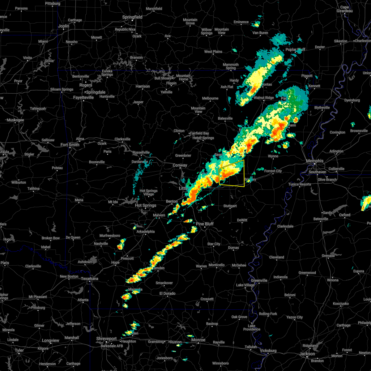 At 403 pm cdt, a severe thunderstorm was located near barrettsville, or 8 miles west of des arc, moving east at 35 mph (radar indicated). Hazards include 60 mph wind gusts. Expect damage to roofs, siding, and trees. locations impacted include, des arc, fredonia, barrettsville, dixie, sand hill, brasfield, mcclelland, gregory, hayley, childers, hickory plains, dagmar wma, jasmine, little dixie, georgetown, vinity corner, this includes interstate 40 between mile markers 199 and 208. hail threat, radar indicated max hail size, <. 75 in wind threat, radar indicated max wind gust, 60 mph. At 403 pm cdt, a severe thunderstorm was located near barrettsville, or 8 miles west of des arc, moving east at 35 mph (radar indicated). Hazards include 60 mph wind gusts. Expect damage to roofs, siding, and trees. locations impacted include, des arc, fredonia, barrettsville, dixie, sand hill, brasfield, mcclelland, gregory, hayley, childers, hickory plains, dagmar wma, jasmine, little dixie, georgetown, vinity corner, this includes interstate 40 between mile markers 199 and 208. hail threat, radar indicated max hail size, <. 75 in wind threat, radar indicated max wind gust, 60 mph.
|
| 10/15/2021 3:51 PM CDT |
 At 351 pm cdt, a severe thunderstorm was located near thurman, or 12 miles northeast of lonoke, moving east at 40 mph (radar indicated). Hazards include 60 mph wind gusts and penny size hail. Expect damage to roofs, siding, and trees. locations impacted include, des arc, fredonia, barrettsville, thurman, dixie, vinity corner, sand hill, brasfield, mcclelland, gregory, hayley, butlerville, childers, hickory plains, dagmar wma, jasmine, little dixie, georgetown, woodlawn, this includes interstate 40 between mile markers 199 and 208. hail threat, radar indicated max hail size, 0. 75 in wind threat, radar indicated max wind gust, 60 mph. At 351 pm cdt, a severe thunderstorm was located near thurman, or 12 miles northeast of lonoke, moving east at 40 mph (radar indicated). Hazards include 60 mph wind gusts and penny size hail. Expect damage to roofs, siding, and trees. locations impacted include, des arc, fredonia, barrettsville, thurman, dixie, vinity corner, sand hill, brasfield, mcclelland, gregory, hayley, butlerville, childers, hickory plains, dagmar wma, jasmine, little dixie, georgetown, woodlawn, this includes interstate 40 between mile markers 199 and 208. hail threat, radar indicated max hail size, 0. 75 in wind threat, radar indicated max wind gust, 60 mph.
|
| 10/15/2021 3:41 PM CDT |
 At 341 pm cdt, a severe thunderstorm was located near sylvania, or 7 miles east of cabot, moving east at 45 mph (radar indicated). Hazards include 60 mph wind gusts and quarter size hail. Hail damage to vehicles is expected. Expect wind damage to roofs, siding, and trees. At 341 pm cdt, a severe thunderstorm was located near sylvania, or 7 miles east of cabot, moving east at 45 mph (radar indicated). Hazards include 60 mph wind gusts and quarter size hail. Hail damage to vehicles is expected. Expect wind damage to roofs, siding, and trees.
|
| 7/11/2021 12:52 AM CDT |
 At 1251 am cdt, a severe thunderstorm was located over prairie center, or 7 miles southwest of hazen, moving east at 45 mph (radar indicated). Hazards include 60 mph wind gusts. Expect damage to roofs, siding, and trees. Locations impacted include, clarendon, hazen, de valls bluff, carlisle, fredonia, barrettsville, mccreanor, dobbs landing, peppers landing, prairie center, hallsville, screeton, tollville, brasfield, childers, dagmar wma, center point, this includes interstate 40 between mile markers 177 and 210. At 1251 am cdt, a severe thunderstorm was located over prairie center, or 7 miles southwest of hazen, moving east at 45 mph (radar indicated). Hazards include 60 mph wind gusts. Expect damage to roofs, siding, and trees. Locations impacted include, clarendon, hazen, de valls bluff, carlisle, fredonia, barrettsville, mccreanor, dobbs landing, peppers landing, prairie center, hallsville, screeton, tollville, brasfield, childers, dagmar wma, center point, this includes interstate 40 between mile markers 177 and 210.
|
| 7/11/2021 12:40 AM CDT |
 At 1240 am cdt, a severe thunderstorm was located near sisemore, or near lonoke, moving east at 55 mph (radar indicated). Hazards include 60 mph wind gusts. expect damage to roofs, siding, and trees At 1240 am cdt, a severe thunderstorm was located near sisemore, or near lonoke, moving east at 55 mph (radar indicated). Hazards include 60 mph wind gusts. expect damage to roofs, siding, and trees
|
| 6/7/2021 7:13 PM CDT |
 At 712 pm cdt, severe thunderstorms were located along a line extending from hazen to peppers landing to clarendon to marvell, moving north at 50 mph (radar indicated). Hazards include 60 mph wind gusts. Expect damage to roofs, siding, and trees. Locations impacted include, brinkley, clarendon, hazen, de valls bluff, holly grove, fredonia, roe, alfrey, allendale, dobbs landing, peppers landing, palmer, hallsville, cotton plant, fargo, blackton, aberdeen, casscoe, dagmar wma, cross roads in monroe county, this includes interstate 40 between mile markers 194 and 218. At 712 pm cdt, severe thunderstorms were located along a line extending from hazen to peppers landing to clarendon to marvell, moving north at 50 mph (radar indicated). Hazards include 60 mph wind gusts. Expect damage to roofs, siding, and trees. Locations impacted include, brinkley, clarendon, hazen, de valls bluff, holly grove, fredonia, roe, alfrey, allendale, dobbs landing, peppers landing, palmer, hallsville, cotton plant, fargo, blackton, aberdeen, casscoe, dagmar wma, cross roads in monroe county, this includes interstate 40 between mile markers 194 and 218.
|
| 6/7/2021 6:52 PM CDT |
 At 652 pm cdt, severe thunderstorms were located along a line extending from brummitt to near stuttgart to near white river national wildlife refuge, moving northeast at 60 mph (radar indicated). Hazards include 60 mph wind gusts. expect damage to roofs, siding, and trees At 652 pm cdt, severe thunderstorms were located along a line extending from brummitt to near stuttgart to near white river national wildlife refuge, moving northeast at 60 mph (radar indicated). Hazards include 60 mph wind gusts. expect damage to roofs, siding, and trees
|
| 6/7/2021 6:43 PM CDT |
 At 643 pm cdt, severe thunderstorms were located along a line extending from near humnoke to near stuttgart to near gillett to 8 miles south of de witt to near deeson, moving northeast at 50 mph (radar indicated). Hazards include 60 mph wind gusts. Expect damage to roofs, siding, and trees. locations impacted include, stuttgart, clarendon, hazen, de valls bluff, england, holly grove, humphrey, fredonia, humnoke, almyra, st. Charles, ulm, roe, peppers landing, brummitt, parkers corner, stuttgart municipal airport, hallsville, de witt, allport, this includes interstate 40 between mile markers 193 and 200. At 643 pm cdt, severe thunderstorms were located along a line extending from near humnoke to near stuttgart to near gillett to 8 miles south of de witt to near deeson, moving northeast at 50 mph (radar indicated). Hazards include 60 mph wind gusts. Expect damage to roofs, siding, and trees. locations impacted include, stuttgart, clarendon, hazen, de valls bluff, england, holly grove, humphrey, fredonia, humnoke, almyra, st. Charles, ulm, roe, peppers landing, brummitt, parkers corner, stuttgart municipal airport, hallsville, de witt, allport, this includes interstate 40 between mile markers 193 and 200.
|
| 6/7/2021 6:28 PM CDT |
 At 628 pm cdt, severe thunderstorms were located along a line extending from near england to near humphrey to near douglas to near gillett to 6 miles northwest of gunnison, moving northeast at 45 mph (radar indicated). Hazards include 60 mph wind gusts. Expect damage to roofs, siding, and trees. locations impacted include, stuttgart, clarendon, hazen, de valls bluff, england, altheimer, gould, gillett, holly grove, humphrey, grady, fredonia, humnoke, almyra, st. Charles, watson, ulm, roe, little bayou meto park, woodville, this includes interstate 40 between mile markers 192 and 200. At 628 pm cdt, severe thunderstorms were located along a line extending from near england to near humphrey to near douglas to near gillett to 6 miles northwest of gunnison, moving northeast at 45 mph (radar indicated). Hazards include 60 mph wind gusts. Expect damage to roofs, siding, and trees. locations impacted include, stuttgart, clarendon, hazen, de valls bluff, england, altheimer, gould, gillett, holly grove, humphrey, grady, fredonia, humnoke, almyra, st. Charles, watson, ulm, roe, little bayou meto park, woodville, this includes interstate 40 between mile markers 192 and 200.
|
| 6/7/2021 6:07 PM CDT |
 At 607 pm cdt, severe thunderstorms were located along a line extending from hensley island to near madding to near cane creek state park to near gould to 6 miles north of jersey point, moving northeast at 50 mph (radar indicated). Hazards include 60 mph wind gusts. expect damage to roofs, siding, and trees At 607 pm cdt, severe thunderstorms were located along a line extending from hensley island to near madding to near cane creek state park to near gould to 6 miles north of jersey point, moving northeast at 50 mph (radar indicated). Hazards include 60 mph wind gusts. expect damage to roofs, siding, and trees
|
| 5/9/2021 4:56 PM CDT |
 At 456 pm cdt, a severe thunderstorm was located over fredonia, or near de valls bluff, moving east at 40 mph (radar indicated). Hazards include 60 mph wind gusts and quarter size hail. Hail damage to vehicles is expected. Expect wind damage to roofs, siding, and trees. At 456 pm cdt, a severe thunderstorm was located over fredonia, or near de valls bluff, moving east at 40 mph (radar indicated). Hazards include 60 mph wind gusts and quarter size hail. Hail damage to vehicles is expected. Expect wind damage to roofs, siding, and trees.
|
| 5/9/2021 4:47 PM CDT |
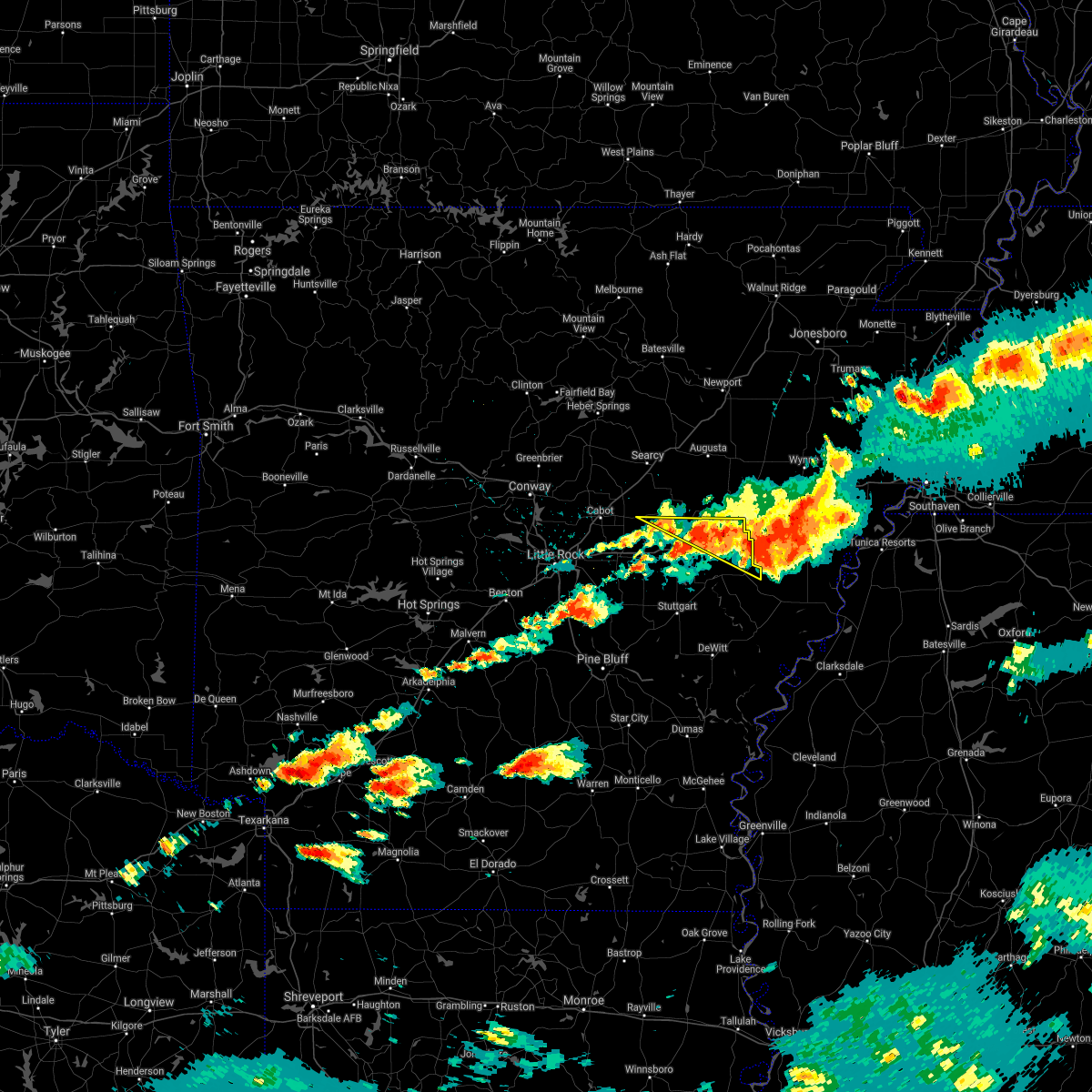 At 447 pm cdt, severe thunderstorms were located along a line extending from near hallsville to alfrey, moving east at 25 mph (radar indicated). Hazards include 60 mph wind gusts and quarter size hail. Hail damage to vehicles is expected. expect wind damage to roofs, siding, and trees. Locations impacted include, brinkley, des arc, fredonia, alfrey, allendale, thurman, fargo, dagmar wma, keevil, monroe, brasfield, childers, this includes interstate 40 between mile markers 200 and 218. At 447 pm cdt, severe thunderstorms were located along a line extending from near hallsville to alfrey, moving east at 25 mph (radar indicated). Hazards include 60 mph wind gusts and quarter size hail. Hail damage to vehicles is expected. expect wind damage to roofs, siding, and trees. Locations impacted include, brinkley, des arc, fredonia, alfrey, allendale, thurman, fargo, dagmar wma, keevil, monroe, brasfield, childers, this includes interstate 40 between mile markers 200 and 218.
|
| 5/9/2021 4:33 PM CDT |
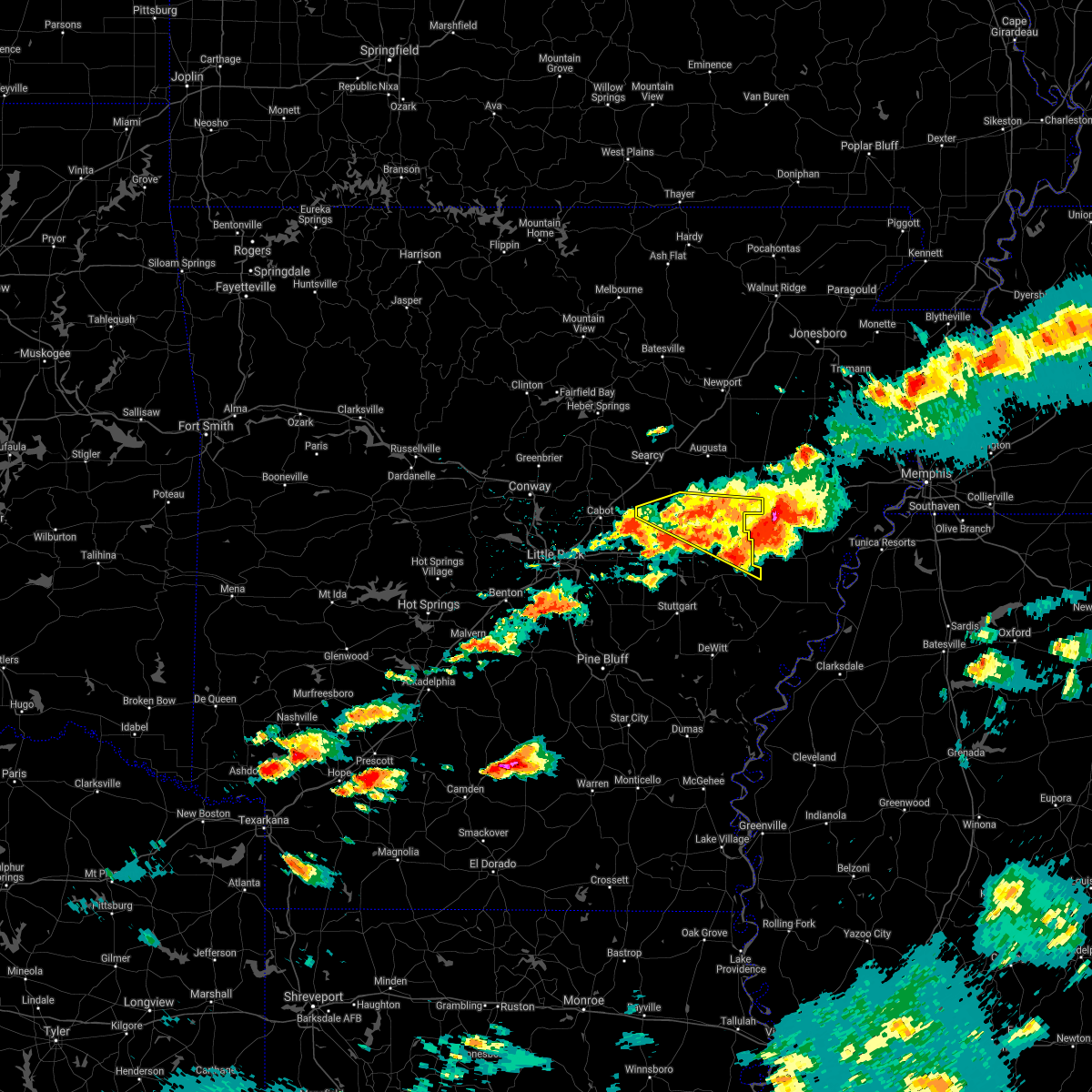 At 433 pm cdt, severe thunderstorms were located along a line extending from 13 miles north of fredonia to near des arc to near allendale, moving east at 35 mph (radar indicated). Hazards include 60 mph wind gusts and quarter size hail. Hail damage to vehicles is expected. expect wind damage to roofs, siding, and trees. Locations impacted include, brinkley, des arc, fredonia, hunter, alfrey, allendale, thurman, cotton plant, fargo, becton, dixie, sand hill, monroe, brasfield, hayley, childers, hickory plains, dagmar wma, keevil, jasmine, this includes interstate 40 between mile markers 200 and 218. At 433 pm cdt, severe thunderstorms were located along a line extending from 13 miles north of fredonia to near des arc to near allendale, moving east at 35 mph (radar indicated). Hazards include 60 mph wind gusts and quarter size hail. Hail damage to vehicles is expected. expect wind damage to roofs, siding, and trees. Locations impacted include, brinkley, des arc, fredonia, hunter, alfrey, allendale, thurman, cotton plant, fargo, becton, dixie, sand hill, monroe, brasfield, hayley, childers, hickory plains, dagmar wma, keevil, jasmine, this includes interstate 40 between mile markers 200 and 218.
|
| 5/9/2021 4:12 PM CDT |
 At 412 pm cdt, a severe thunderstorm was located near des arc, moving east at 35 mph (radar indicated). Hazards include 60 mph wind gusts and quarter size hail. Hail damage to vehicles is expected. Expect wind damage to roofs, siding, and trees. At 412 pm cdt, a severe thunderstorm was located near des arc, moving east at 35 mph (radar indicated). Hazards include 60 mph wind gusts and quarter size hail. Hail damage to vehicles is expected. Expect wind damage to roofs, siding, and trees.
|
| 4/7/2021 2:30 PM CDT |
 At 230 pm cdt, a severe thunderstorm was located near stuttgart municipal airport, or 10 miles north of stuttgart, moving northeast at 50 mph (radar indicated). Hazards include ping pong ball size hail and 60 mph wind gusts. People and animals outdoors will be injured. expect hail damage to roofs, siding, windows, and vehicles. expect wind damage to roofs, siding, and trees. Locations impacted include, stuttgart, brinkley, clarendon, de valls bluff, fredonia, ulm, roe, alfrey, allendale, dobbs landing, peppers landing, stuttgart municipal airport, fargo, aberdeen, slovak, tollville, monroe, keevil, brasfield, this includes interstate 40 between mile markers 209 and 218. At 230 pm cdt, a severe thunderstorm was located near stuttgart municipal airport, or 10 miles north of stuttgart, moving northeast at 50 mph (radar indicated). Hazards include ping pong ball size hail and 60 mph wind gusts. People and animals outdoors will be injured. expect hail damage to roofs, siding, windows, and vehicles. expect wind damage to roofs, siding, and trees. Locations impacted include, stuttgart, brinkley, clarendon, de valls bluff, fredonia, ulm, roe, alfrey, allendale, dobbs landing, peppers landing, stuttgart municipal airport, fargo, aberdeen, slovak, tollville, monroe, keevil, brasfield, this includes interstate 40 between mile markers 209 and 218.
|
| 4/7/2021 2:21 PM CDT |
 At 220 pm cdt, a severe thunderstorm was located over brummitt, or 8 miles northwest of stuttgart, moving northeast at 50 mph (radar indicated). Hazards include 60 mph wind gusts and quarter size hail. Hail damage to vehicles is expected. Expect wind damage to roofs, siding, and trees. At 220 pm cdt, a severe thunderstorm was located over brummitt, or 8 miles northwest of stuttgart, moving northeast at 50 mph (radar indicated). Hazards include 60 mph wind gusts and quarter size hail. Hail damage to vehicles is expected. Expect wind damage to roofs, siding, and trees.
|
| 3/27/2021 6:09 PM CDT |
 At 609 pm cdt, a severe thunderstorm was located over barrettsville, or near hazen, moving northeast at 40 mph (radar indicated). Hazards include 60 mph wind gusts and quarter size hail. Hail damage to vehicles is expected. Expect wind damage to roofs, siding, and trees. At 609 pm cdt, a severe thunderstorm was located over barrettsville, or near hazen, moving northeast at 40 mph (radar indicated). Hazards include 60 mph wind gusts and quarter size hail. Hail damage to vehicles is expected. Expect wind damage to roofs, siding, and trees.
|
| 3/25/2021 1:57 AM CDT |
 At 156 am cdt, a severe thunderstorm was located near hazen, moving northeast at 50 mph (radar indicated). Hazards include 60 mph wind gusts and quarter size hail. Hail damage to vehicles is expected. expect wind damage to roofs, siding, and trees. Locations impacted include, des arc, hazen, de valls bluff, fredonia, dobbs landing, peppers landing, brummitt, parkers corner, stuttgart municipal airport, hallsville, screeton, slovak, sand hill, tollville, brasfield, center point, this includes interstate 40 between mile markers 190 and 207. At 156 am cdt, a severe thunderstorm was located near hazen, moving northeast at 50 mph (radar indicated). Hazards include 60 mph wind gusts and quarter size hail. Hail damage to vehicles is expected. expect wind damage to roofs, siding, and trees. Locations impacted include, des arc, hazen, de valls bluff, fredonia, dobbs landing, peppers landing, brummitt, parkers corner, stuttgart municipal airport, hallsville, screeton, slovak, sand hill, tollville, brasfield, center point, this includes interstate 40 between mile markers 190 and 207.
|
| 3/25/2021 1:39 AM CDT |
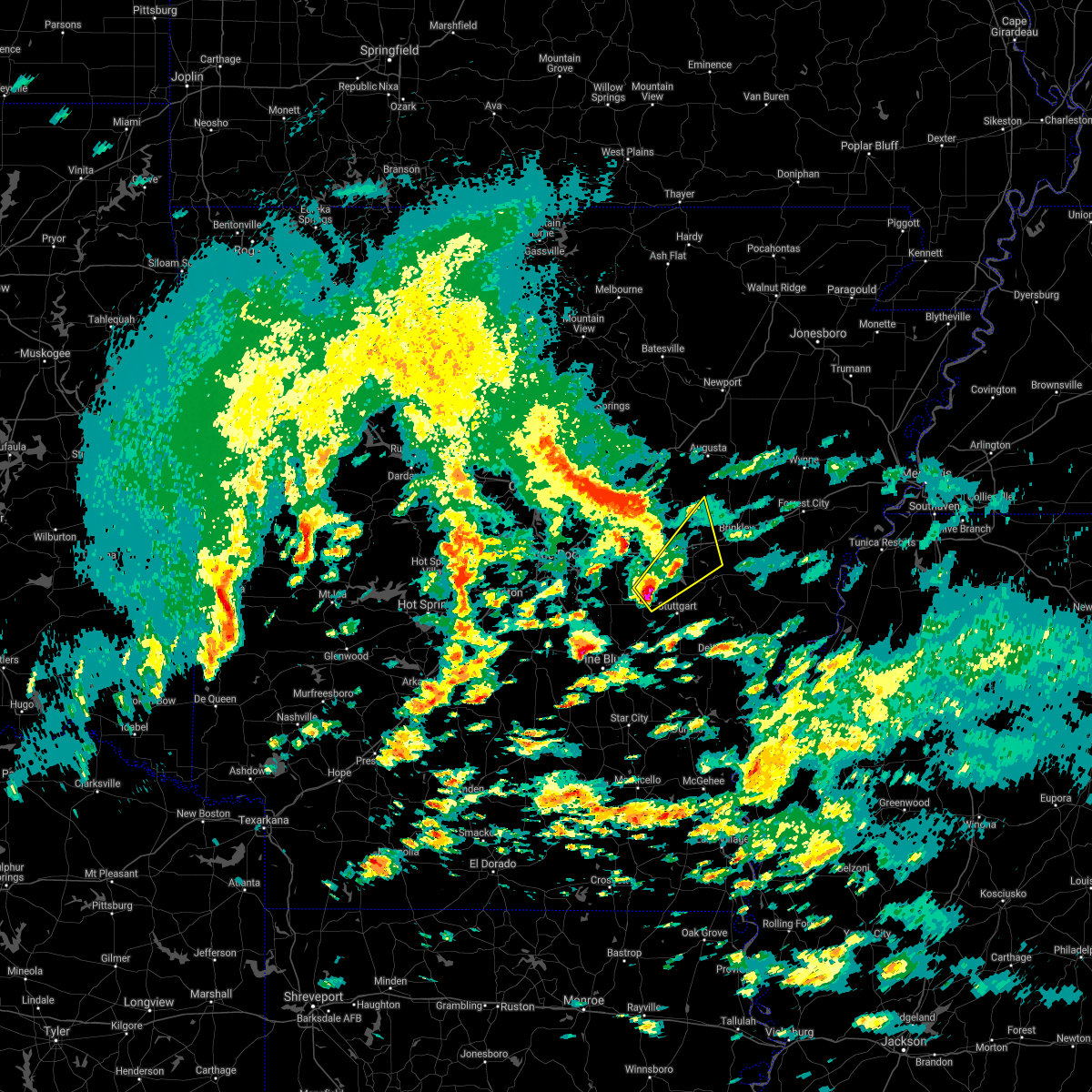 At 138 am cdt, a severe thunderstorm was located near humnoke, or 11 miles northwest of stuttgart, moving northeast at 50 mph (radar indicated). Hazards include 60 mph wind gusts and quarter size hail. Hail damage to vehicles is expected. Expect wind damage to roofs, siding, and trees. At 138 am cdt, a severe thunderstorm was located near humnoke, or 11 miles northwest of stuttgart, moving northeast at 50 mph (radar indicated). Hazards include 60 mph wind gusts and quarter size hail. Hail damage to vehicles is expected. Expect wind damage to roofs, siding, and trees.
|
| 6/23/2020 1:13 PM CDT |
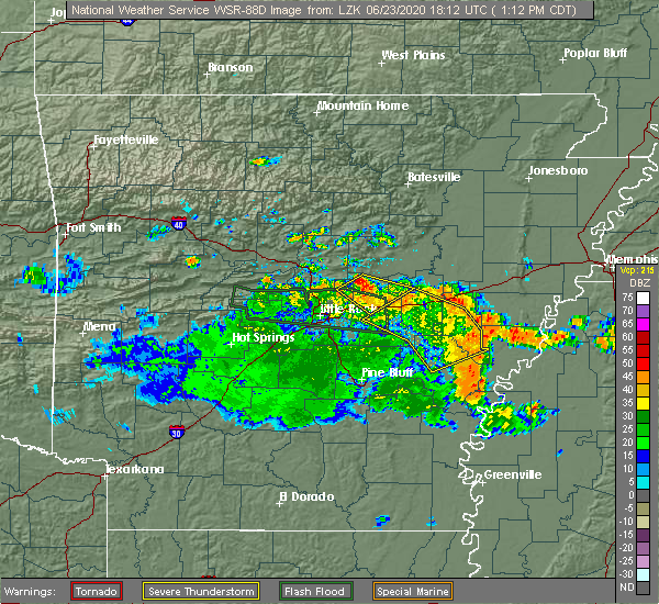 At 113 pm cdt, severe thunderstorms were located along a line extending from near hallsville to 7 miles southwest of garret grove to near marvell, moving northeast at 30 mph (radar indicated). Hazards include 60 mph wind gusts and penny size hail. expect damage to roofs, siding, and trees At 113 pm cdt, severe thunderstorms were located along a line extending from near hallsville to 7 miles southwest of garret grove to near marvell, moving northeast at 30 mph (radar indicated). Hazards include 60 mph wind gusts and penny size hail. expect damage to roofs, siding, and trees
|
| 6/23/2020 12:33 PM CDT |
 At 1232 pm cdt, severe thunderstorms were located along a line extending from near parkers corner to stuttgart municipal airport to almyra, moving northeast at 25 mph (radar indicated). Hazards include 60 mph wind gusts and quarter size hail. Hail damage to vehicles is expected. Expect wind damage to roofs, siding, and trees. At 1232 pm cdt, severe thunderstorms were located along a line extending from near parkers corner to stuttgart municipal airport to almyra, moving northeast at 25 mph (radar indicated). Hazards include 60 mph wind gusts and quarter size hail. Hail damage to vehicles is expected. Expect wind damage to roofs, siding, and trees.
|
| 4/28/2020 11:57 PM CDT |
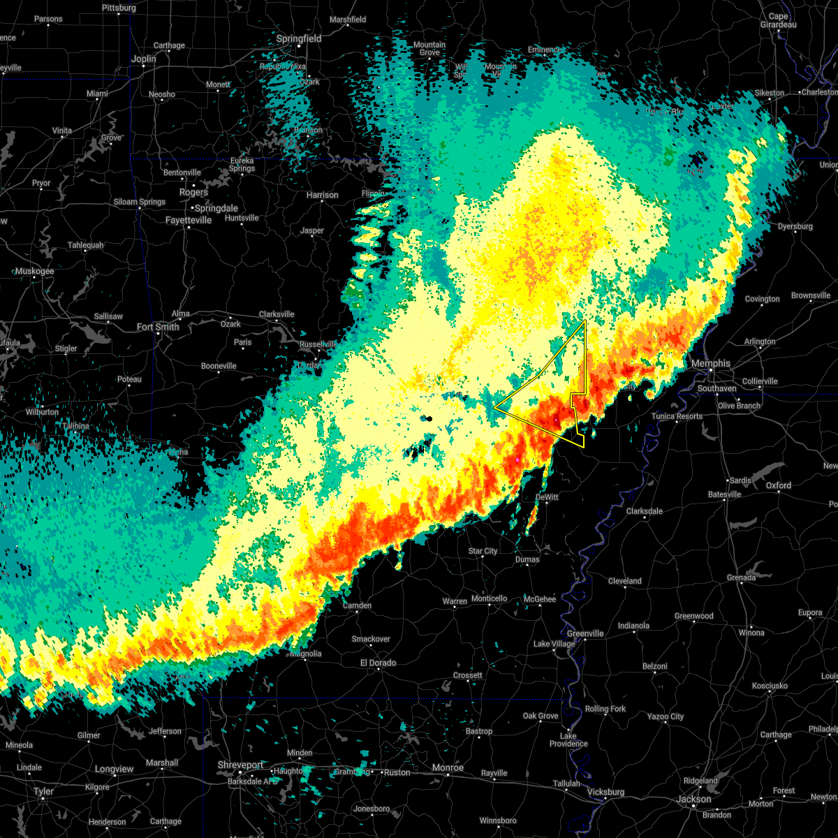 The severe thunderstorm warning for woodruff, northern prairie, southeastern jackson and northern monroe counties will expire at midnight cdt, the storms which prompted the warning have moved out of the area. therefore, the warning will be allowed to expire. however hail and gusty winds are still possible with these thunderstorms. a severe thunderstorm watch remains in effect until 300 am cdt for eastern and central arkansas. remember, a severe thunderstorm warning still remains in effect for monroe and prairie counties. The severe thunderstorm warning for woodruff, northern prairie, southeastern jackson and northern monroe counties will expire at midnight cdt, the storms which prompted the warning have moved out of the area. therefore, the warning will be allowed to expire. however hail and gusty winds are still possible with these thunderstorms. a severe thunderstorm watch remains in effect until 300 am cdt for eastern and central arkansas. remember, a severe thunderstorm warning still remains in effect for monroe and prairie counties.
|
| 4/28/2020 11:56 PM CDT |
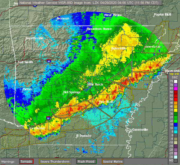 At 1155 pm cdt, severe thunderstorms were located along a line extending from near new salem to near dobbs landing, moving southeast at 50 mph (radar indicated). Hazards include 60 mph wind gusts and quarter size hail. Hail damage to vehicles is expected. Expect wind damage to roofs, siding, and trees. At 1155 pm cdt, severe thunderstorms were located along a line extending from near new salem to near dobbs landing, moving southeast at 50 mph (radar indicated). Hazards include 60 mph wind gusts and quarter size hail. Hail damage to vehicles is expected. Expect wind damage to roofs, siding, and trees.
|
| 4/28/2020 11:48 PM CDT |
 At 1148 pm cdt, severe thunderstorms were located along a line extending from near roe to near stuttgart to near humphrey to near pine bluff, moving southeast at 45 mph (radar indicated). Hazards include 60 mph wind gusts and quarter size hail. Hail damage to vehicles is expected. expect wind damage to roofs, siding, and trees. locations impacted include, pine bluff, stuttgart, star city, clarendon, hazen, de valls bluff, white hall, england, altheimer, gould, gillett, holly grove, humphrey, grady, fredonia, humnoke, almyra, st. charles, ulm, roe, this includes the following highways, interstate 40 between mile markers 191 and 198. Interstate 530 between mile markers 24 and 46. At 1148 pm cdt, severe thunderstorms were located along a line extending from near roe to near stuttgart to near humphrey to near pine bluff, moving southeast at 45 mph (radar indicated). Hazards include 60 mph wind gusts and quarter size hail. Hail damage to vehicles is expected. expect wind damage to roofs, siding, and trees. locations impacted include, pine bluff, stuttgart, star city, clarendon, hazen, de valls bluff, white hall, england, altheimer, gould, gillett, holly grove, humphrey, grady, fredonia, humnoke, almyra, st. charles, ulm, roe, this includes the following highways, interstate 40 between mile markers 191 and 198. Interstate 530 between mile markers 24 and 46.
|
| 4/28/2020 11:42 PM CDT |
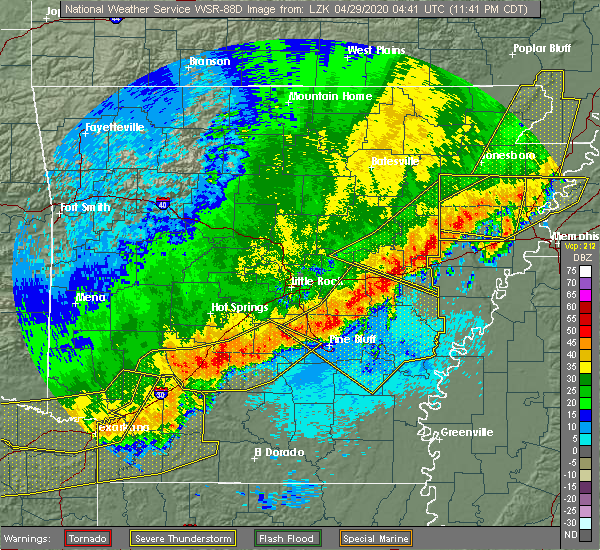 At 1141 pm cdt, severe thunderstorms were located along a line extending from near colt to wheatley to de valls bluff, moving southeast at 55 mph (radar indicated). Hazards include 60 mph wind gusts and quarter size hail. Hail damage to vehicles is expected. expect wind damage to roofs, siding, and trees. Locations impacted include, brinkley, des arc, patterson, fredonia, hunter, alfrey, allendale, dobbs landing, mccrory, mcfadden, hallsville, cotton plant, fargo, blackton, becton, howell, penrose, mcclelland, gregory, grays, this includes interstate 40 between mile markers 197 and 218. At 1141 pm cdt, severe thunderstorms were located along a line extending from near colt to wheatley to de valls bluff, moving southeast at 55 mph (radar indicated). Hazards include 60 mph wind gusts and quarter size hail. Hail damage to vehicles is expected. expect wind damage to roofs, siding, and trees. Locations impacted include, brinkley, des arc, patterson, fredonia, hunter, alfrey, allendale, dobbs landing, mccrory, mcfadden, hallsville, cotton plant, fargo, blackton, becton, howell, penrose, mcclelland, gregory, grays, this includes interstate 40 between mile markers 197 and 218.
|
| 4/28/2020 11:24 PM CDT |
 At 1124 pm cdt, severe thunderstorms were located along a line extending from near carlisle to near parkers corner to england to near pine bluff arsenal, moving southeast at 55 mph (radar indicated). Hazards include 60 mph wind gusts and quarter size hail. Hail damage to vehicles is expected. Expect wind damage to roofs, siding, and trees. At 1124 pm cdt, severe thunderstorms were located along a line extending from near carlisle to near parkers corner to england to near pine bluff arsenal, moving southeast at 55 mph (radar indicated). Hazards include 60 mph wind gusts and quarter size hail. Hail damage to vehicles is expected. Expect wind damage to roofs, siding, and trees.
|
| 4/28/2020 11:13 PM CDT |
 At 1112 pm cdt, severe thunderstorms were located along a line extending from near patterson to 6 miles southeast of pryor to thurman, moving southeast at 55 mph (radar indicated). Hazards include 70 mph wind gusts and quarter size hail. Hail damage to vehicles is expected. expect considerable tree damage. Wind damage is also likely to mobile homes, roofs, and outbuildings. At 1112 pm cdt, severe thunderstorms were located along a line extending from near patterson to 6 miles southeast of pryor to thurman, moving southeast at 55 mph (radar indicated). Hazards include 70 mph wind gusts and quarter size hail. Hail damage to vehicles is expected. expect considerable tree damage. Wind damage is also likely to mobile homes, roofs, and outbuildings.
|
| 4/12/2020 9:15 PM CDT |
 At 914 pm cdt, severe thunderstorms were located along a line extending from 7 miles east of pleasant plains to augusta to 7 miles northwest of hunter to near brinkley to near clarendon, moving east at 50 mph (radar indicated). Hazards include 60 mph wind gusts and quarter size hail. Hail damage to vehicles is expected. expect wind damage to roofs, siding, and trees. locations impacted include, newport, brinkley, augusta, clarendon, de valls bluff, diaz, patterson, grubbs, fredonia, pleasant plains, tupelo, hunter, algoa, alfrey, allendale, dobbs landing, mccrory, mcfadden, peppers landing, bradford, this includes the following highways, interstate 40 between mile markers 200 and 218. Us highway 67 between mile markers 60 and 85. At 914 pm cdt, severe thunderstorms were located along a line extending from 7 miles east of pleasant plains to augusta to 7 miles northwest of hunter to near brinkley to near clarendon, moving east at 50 mph (radar indicated). Hazards include 60 mph wind gusts and quarter size hail. Hail damage to vehicles is expected. expect wind damage to roofs, siding, and trees. locations impacted include, newport, brinkley, augusta, clarendon, de valls bluff, diaz, patterson, grubbs, fredonia, pleasant plains, tupelo, hunter, algoa, alfrey, allendale, dobbs landing, mccrory, mcfadden, peppers landing, bradford, this includes the following highways, interstate 40 between mile markers 200 and 218. Us highway 67 between mile markers 60 and 85.
|
| 4/12/2020 8:53 PM CDT |
 At 853 pm cdt, severe thunderstorms were located along a line extending from near pleasant plains to bald knob to 6 miles south of pryor to near des arc to near parkers corner, moving east at 40 mph (radar indicated). Hazards include 60 mph wind gusts and quarter size hail. Hail damage to vehicles is expected. Expect wind damage to roofs, siding, and trees. At 853 pm cdt, severe thunderstorms were located along a line extending from near pleasant plains to bald knob to 6 miles south of pryor to near des arc to near parkers corner, moving east at 40 mph (radar indicated). Hazards include 60 mph wind gusts and quarter size hail. Hail damage to vehicles is expected. Expect wind damage to roofs, siding, and trees.
|
| 3/28/2020 5:56 PM CDT |
 At 555 pm cdt, a severe thunderstorm was located near allendale, or near brinkley, moving northeast at 45 mph (radar indicated). Hazards include 60 mph wind gusts and quarter size hail. Hail damage to vehicles is expected. Expect wind damage to roofs, siding, and trees. At 555 pm cdt, a severe thunderstorm was located near allendale, or near brinkley, moving northeast at 45 mph (radar indicated). Hazards include 60 mph wind gusts and quarter size hail. Hail damage to vehicles is expected. Expect wind damage to roofs, siding, and trees.
|
| 3/28/2020 5:46 PM CDT |
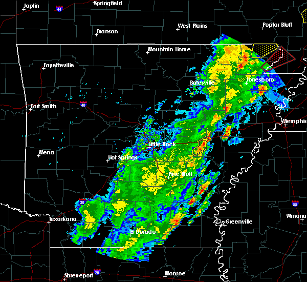 At 546 pm cdt, a severe thunderstorm was located over fredonia, or over de valls bluff, moving northeast at 45 mph (radar indicated). Hazards include 60 mph wind gusts and quarter size hail. Hail damage to vehicles is expected. expect wind damage to roofs, siding, and trees. Locations impacted include, de valls bluff, fredonia, peppers landing, stuttgart municipal airport, slovak, tollville, brasfield, this includes interstate 40 between mile markers 198 and 205. At 546 pm cdt, a severe thunderstorm was located over fredonia, or over de valls bluff, moving northeast at 45 mph (radar indicated). Hazards include 60 mph wind gusts and quarter size hail. Hail damage to vehicles is expected. expect wind damage to roofs, siding, and trees. Locations impacted include, de valls bluff, fredonia, peppers landing, stuttgart municipal airport, slovak, tollville, brasfield, this includes interstate 40 between mile markers 198 and 205.
|
| 3/28/2020 5:15 PM CDT |
 At 515 pm cdt, a severe thunderstorm was located over humnoke, or 13 miles northwest of stuttgart, moving northeast at 45 mph (radar indicated). Hazards include 60 mph wind gusts and quarter size hail. Hail damage to vehicles is expected. Expect wind damage to roofs, siding, and trees. At 515 pm cdt, a severe thunderstorm was located over humnoke, or 13 miles northwest of stuttgart, moving northeast at 45 mph (radar indicated). Hazards include 60 mph wind gusts and quarter size hail. Hail damage to vehicles is expected. Expect wind damage to roofs, siding, and trees.
|
| 1/11/2020 1:49 AM CST |
 At 148 am cst, severe thunderstorms were located along a line extending from swifton to near grubbs to near mcfadden to mccrory to 8 miles northeast of fredonia, moving east at 40 mph (radar indicated). Hazards include 60 mph wind gusts. Expect damage to roofs, siding, and trees. locations impacted include, newport, brinkley, augusta, des arc, hazen, tuckerman, diaz, swifton, patterson, grubbs, fredonia, russell, jacksonport, tupelo, hunter, algoa, alfrey, allendale, mccrory, mcfadden, this includes the following highways, interstate 40 between mile markers 191 and 219. Us highway 67 between mile markers 57 and 101. At 148 am cst, severe thunderstorms were located along a line extending from swifton to near grubbs to near mcfadden to mccrory to 8 miles northeast of fredonia, moving east at 40 mph (radar indicated). Hazards include 60 mph wind gusts. Expect damage to roofs, siding, and trees. locations impacted include, newport, brinkley, augusta, des arc, hazen, tuckerman, diaz, swifton, patterson, grubbs, fredonia, russell, jacksonport, tupelo, hunter, algoa, alfrey, allendale, mccrory, mcfadden, this includes the following highways, interstate 40 between mile markers 191 and 219. Us highway 67 between mile markers 57 and 101.
|
| 1/11/2020 1:29 AM CST |
 At 129 am cst, severe thunderstorms were located along a line extending from near hazen to brummitt to near madding to 8 miles northwest of feenyville, moving east at 30 mph (radar indicated). Hazards include 60 mph wind gusts. expect damage to roofs, siding, and trees At 129 am cst, severe thunderstorms were located along a line extending from near hazen to brummitt to near madding to 8 miles northwest of feenyville, moving east at 30 mph (radar indicated). Hazards include 60 mph wind gusts. expect damage to roofs, siding, and trees
|
| 1/11/2020 1:17 AM CST |
 At 116 am cst, severe thunderstorms were located along a line extending from near newark to near jacksonport to 7 miles northeast of russell to hurricane lake wma to near barrettsville, moving northeast at 25 mph (radar indicated). Hazards include 60 mph wind gusts. expect damage to roofs, siding, and trees At 116 am cst, severe thunderstorms were located along a line extending from near newark to near jacksonport to 7 miles northeast of russell to hurricane lake wma to near barrettsville, moving northeast at 25 mph (radar indicated). Hazards include 60 mph wind gusts. expect damage to roofs, siding, and trees
|
| 1/11/2020 12:39 AM CST |
 At 1238 am cst, severe thunderstorms were located along a line extending from meto to near estes to 6 miles west of white hall to 6 miles west of lamont, moving east at 30 mph (radar indicated). Hazards include 60 mph wind gusts. expect damage to roofs, siding, and trees At 1238 am cst, severe thunderstorms were located along a line extending from meto to near estes to 6 miles west of white hall to 6 miles west of lamont, moving east at 30 mph (radar indicated). Hazards include 60 mph wind gusts. expect damage to roofs, siding, and trees
|
| 10/21/2019 5:13 AM CDT |
 At 512 am cdt, severe thunderstorms were located along a line extending from near hunter to near alfrey to near roe, moving east at 55 mph (radar indicated). Hazards include 60 mph wind gusts. Expect damage to roofs, siding, and trees. Locations impacted include, brinkley, clarendon, de valls bluff, holly grove, fredonia, roe, hunter, alfrey, allendale, dobbs landing, peppers landing, stuttgart municipal airport, hallsville, cotton plant, fargo, blackton, aberdeen, becton, slovak, howell, this includes interstate 40 between mile markers 198 and 218. At 512 am cdt, severe thunderstorms were located along a line extending from near hunter to near alfrey to near roe, moving east at 55 mph (radar indicated). Hazards include 60 mph wind gusts. Expect damage to roofs, siding, and trees. Locations impacted include, brinkley, clarendon, de valls bluff, holly grove, fredonia, roe, hunter, alfrey, allendale, dobbs landing, peppers landing, stuttgart municipal airport, hallsville, cotton plant, fargo, blackton, aberdeen, becton, slovak, howell, this includes interstate 40 between mile markers 198 and 218.
|
| 10/21/2019 4:45 AM CDT |
 At 445 am cdt, severe thunderstorms were located along a line extending from near pryor to near hazen to near humnoke, moving east at 55 mph (radar indicated). Hazards include 60 mph wind gusts. expect damage to roofs, siding, and trees At 445 am cdt, severe thunderstorms were located along a line extending from near pryor to near hazen to near humnoke, moving east at 55 mph (radar indicated). Hazards include 60 mph wind gusts. expect damage to roofs, siding, and trees
|
| 10/21/2019 3:27 AM CDT |
 At 326 am cdt, severe thunderstorms were located along a line extending from augusta to near parkers corner, moving northeast at 50 mph (radar indicated). Hazards include 60 mph wind gusts. expect damage to roofs, siding, and trees At 326 am cdt, severe thunderstorms were located along a line extending from augusta to near parkers corner, moving northeast at 50 mph (radar indicated). Hazards include 60 mph wind gusts. expect damage to roofs, siding, and trees
|
| 10/6/2019 4:11 PM CDT |
 The severe thunderstorm warning for south central woodruff, east central prairie and northwestern monroe counties will expire at 415 pm cdt, the storm which prompted the warning has weakened below severe limits, and no longer poses an immediate threat to life or property. therefore, the warning will be allowed to expire. however small hail, gusty winds and heavy rain are still possible with this thunderstorm. The severe thunderstorm warning for south central woodruff, east central prairie and northwestern monroe counties will expire at 415 pm cdt, the storm which prompted the warning has weakened below severe limits, and no longer poses an immediate threat to life or property. therefore, the warning will be allowed to expire. however small hail, gusty winds and heavy rain are still possible with this thunderstorm.
|
| 10/6/2019 3:36 PM CDT |
 At 336 pm cdt, a severe thunderstorm was located over peppers landing, or near clarendon, moving northeast at 10 mph (radar indicated). Hazards include 60 mph wind gusts and quarter size hail. Hail damage to vehicles is expected. Expect wind damage to roofs, siding, and trees. At 336 pm cdt, a severe thunderstorm was located over peppers landing, or near clarendon, moving northeast at 10 mph (radar indicated). Hazards include 60 mph wind gusts and quarter size hail. Hail damage to vehicles is expected. Expect wind damage to roofs, siding, and trees.
|
| 6/23/2019 2:59 PM CDT |
 At 259 pm cdt, severe thunderstorms were located along a line extending from near mcfadden to near pryor to near beebe, moving southeast at 30 mph (radar indicated). Hazards include 60 mph wind gusts and penny size hail. expect damage to roofs, siding, and trees At 259 pm cdt, severe thunderstorms were located along a line extending from near mcfadden to near pryor to near beebe, moving southeast at 30 mph (radar indicated). Hazards include 60 mph wind gusts and penny size hail. expect damage to roofs, siding, and trees
|
| 6/19/2019 10:28 PM CDT |
 The severe thunderstorm warning for prairie, northwestern monroe and north central arkansas counties will expire at 1030 pm cdt, the storms which prompted the warning have moved out of the area. therefore, the warning will be allowed to expire. a severe thunderstorm watch remains in effect until 400 am cdt for central, eastern and southeastern arkansas. The severe thunderstorm warning for prairie, northwestern monroe and north central arkansas counties will expire at 1030 pm cdt, the storms which prompted the warning have moved out of the area. therefore, the warning will be allowed to expire. a severe thunderstorm watch remains in effect until 400 am cdt for central, eastern and southeastern arkansas.
|
| 6/19/2019 10:11 PM CDT |
 At 1010 pm cdt, severe thunderstorms were located along a line extending from 6 miles northwest of des arc to de valls bluff to stuttgart municipal airport, moving east at 50 mph (radar indicated). Hazards include 60 mph wind gusts and penny size hail. Expect damage to roofs, siding, and trees. Locations impacted include, stuttgart, des arc, clarendon, hazen, de valls bluff, fredonia, ulm, roe, barrettsville, allendale, dobbs landing, peppers landing, stuttgart municipal airport, hallsville, aberdeen, slovak, tollville, brasfield, hayley, childers, this includes interstate 40 between mile markers 189 and 210. At 1010 pm cdt, severe thunderstorms were located along a line extending from 6 miles northwest of des arc to de valls bluff to stuttgart municipal airport, moving east at 50 mph (radar indicated). Hazards include 60 mph wind gusts and penny size hail. Expect damage to roofs, siding, and trees. Locations impacted include, stuttgart, des arc, clarendon, hazen, de valls bluff, fredonia, ulm, roe, barrettsville, allendale, dobbs landing, peppers landing, stuttgart municipal airport, hallsville, aberdeen, slovak, tollville, brasfield, hayley, childers, this includes interstate 40 between mile markers 189 and 210.
|
| 6/19/2019 9:53 PM CDT |
 At 952 pm cdt, severe thunderstorms were located along a line extending from near thurman to prairie center to near humnoke, moving east at 55 mph (radar indicated). Hazards include 70 mph wind gusts and nickel size hail. Expect considerable tree damage. damage is likely to mobile homes, roofs, and outbuildings. locations impacted include, cabot, stuttgart, lonoke, des arc, clarendon, hazen, de valls bluff, ward, england, carlisle, austin in lonoke county, fredonia, humnoke, ulm, roe, barrettsville, allendale, dobbs landing, old austin, thurman, this includes the following highways, interstate 40 between mile markers 174 and 210. Us highway 67 between mile markers 21 and 22. At 952 pm cdt, severe thunderstorms were located along a line extending from near thurman to prairie center to near humnoke, moving east at 55 mph (radar indicated). Hazards include 70 mph wind gusts and nickel size hail. Expect considerable tree damage. damage is likely to mobile homes, roofs, and outbuildings. locations impacted include, cabot, stuttgart, lonoke, des arc, clarendon, hazen, de valls bluff, ward, england, carlisle, austin in lonoke county, fredonia, humnoke, ulm, roe, barrettsville, allendale, dobbs landing, old austin, thurman, this includes the following highways, interstate 40 between mile markers 174 and 210. Us highway 67 between mile markers 21 and 22.
|
| 6/19/2019 9:31 PM CDT |
 At 930 pm cdt, severe thunderstorms were located along a line extending from little rock afb to near scott to near orion, moving east at 55 mph (radar indicated). Hazards include 70 mph wind gusts and nickel size hail. Expect considerable tree damage. Damage is likely to mobile homes, roofs, and outbuildings. At 930 pm cdt, severe thunderstorms were located along a line extending from little rock afb to near scott to near orion, moving east at 55 mph (radar indicated). Hazards include 70 mph wind gusts and nickel size hail. Expect considerable tree damage. Damage is likely to mobile homes, roofs, and outbuildings.
|
| 5/18/2019 6:24 PM CDT | Winds estimated near 70 mp in prairie county AR, 2.3 miles S of Fredonia (Biscoe), AR |
| 5/18/2019 6:06 PM CDT |
 At 606 pm cdt, severe thunderstorms were located along a line extending from des arc to near de valls bluff to near stuttgart, moving east at 40 mph (radar indicated). Hazards include 60 mph wind gusts and nickel size hail. expect damage to roofs, siding, and trees At 606 pm cdt, severe thunderstorms were located along a line extending from des arc to near de valls bluff to near stuttgart, moving east at 40 mph (radar indicated). Hazards include 60 mph wind gusts and nickel size hail. expect damage to roofs, siding, and trees
|
| 5/8/2019 7:20 PM CDT |
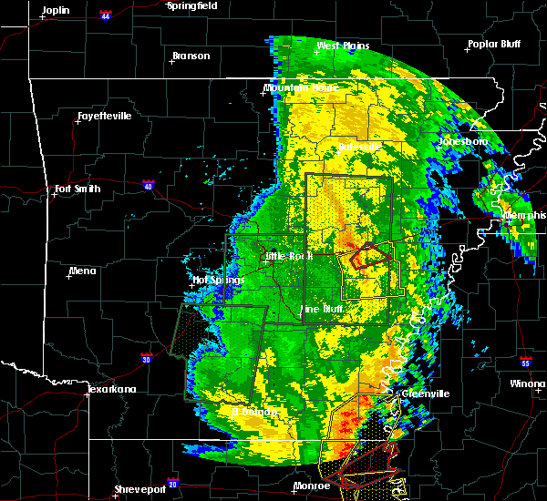 At 720 pm cdt, a severe thunderstorm capable of producing a tornado was located near peppers landing, or near de valls bluff, moving northeast at 30 mph (radar indicated rotation). Hazards include tornado. Flying debris will be dangerous to those caught without shelter. mobile homes will be damaged or destroyed. damage to roofs, windows, and vehicles will occur. tree damage is likely. Locations impacted include, de valls bluff, fredonia, allendale, dobbs landing, peppers landing, keevil, brasfield, this includes interstate 40 between mile markers 202 and 209. At 720 pm cdt, a severe thunderstorm capable of producing a tornado was located near peppers landing, or near de valls bluff, moving northeast at 30 mph (radar indicated rotation). Hazards include tornado. Flying debris will be dangerous to those caught without shelter. mobile homes will be damaged or destroyed. damage to roofs, windows, and vehicles will occur. tree damage is likely. Locations impacted include, de valls bluff, fredonia, allendale, dobbs landing, peppers landing, keevil, brasfield, this includes interstate 40 between mile markers 202 and 209.
|
| 5/8/2019 7:07 PM CDT |
 At 707 pm cdt, a severe thunderstorm capable of producing a tornado was located near stuttgart municipal airport, or 7 miles south of hazen, moving northeast at 25 mph (radar indicated rotation). Hazards include tornado. Flying debris will be dangerous to those caught without shelter. mobile homes will be damaged or destroyed. damage to roofs, windows, and vehicles will occur. Tree damage is likely. At 707 pm cdt, a severe thunderstorm capable of producing a tornado was located near stuttgart municipal airport, or 7 miles south of hazen, moving northeast at 25 mph (radar indicated rotation). Hazards include tornado. Flying debris will be dangerous to those caught without shelter. mobile homes will be damaged or destroyed. damage to roofs, windows, and vehicles will occur. Tree damage is likely.
|
| 5/8/2019 7:05 PM CDT |
 At 705 pm cdt, severe thunderstorms were located along a line extending from near hazen to near stuttgart municipal airport to near stuttgart to 6 miles west of almyra, moving east at 35 mph (radar indicated). Hazards include 60 mph wind gusts. expect damage to roofs, siding, and trees At 705 pm cdt, severe thunderstorms were located along a line extending from near hazen to near stuttgart municipal airport to near stuttgart to 6 miles west of almyra, moving east at 35 mph (radar indicated). Hazards include 60 mph wind gusts. expect damage to roofs, siding, and trees
|
| 3/14/2019 6:31 AM CDT |
 At 630 am cdt, a severe thunderstorm was located near fredonia, or near de valls bluff, moving northeast at 60 mph (radar indicated). Hazards include 60 mph wind gusts and penny size hail. Expect damage to roofs, siding, and trees. locations impacted include, de valls bluff, fredonia, brasfield, dagmar wma, this includes interstate 40 between mile markers 199 and 213. A tornado watch remains in effect until noon cdt for eastern and central arkansas. At 630 am cdt, a severe thunderstorm was located near fredonia, or near de valls bluff, moving northeast at 60 mph (radar indicated). Hazards include 60 mph wind gusts and penny size hail. Expect damage to roofs, siding, and trees. locations impacted include, de valls bluff, fredonia, brasfield, dagmar wma, this includes interstate 40 between mile markers 199 and 213. A tornado watch remains in effect until noon cdt for eastern and central arkansas.
|
| 3/14/2019 6:23 AM CDT |
 At 623 am cdt, a severe thunderstorm was located over hallsville, or over de valls bluff, moving northeast at 60 mph (radar indicated). Hazards include 60 mph wind gusts and penny size hail. Expect damage to roofs, siding, and trees. locations impacted include, hazen, de valls bluff, fredonia, allendale, hallsville, dobbs landing, dagmar wma, keevil, brasfield, this includes interstate 40 between mile markers 193 and 213. A tornado watch remains in effect until noon cdt for eastern and central arkansas. At 623 am cdt, a severe thunderstorm was located over hallsville, or over de valls bluff, moving northeast at 60 mph (radar indicated). Hazards include 60 mph wind gusts and penny size hail. Expect damage to roofs, siding, and trees. locations impacted include, hazen, de valls bluff, fredonia, allendale, hallsville, dobbs landing, dagmar wma, keevil, brasfield, this includes interstate 40 between mile markers 193 and 213. A tornado watch remains in effect until noon cdt for eastern and central arkansas.
|
| 3/14/2019 6:09 AM CDT |
 At 608 am cdt, a severe thunderstorm was located over parkers corner, or 11 miles southwest of hazen, moving northeast at 60 mph (radar indicated). Hazards include 60 mph wind gusts and nickel size hail. Expect damage to roofs, siding, and trees. locations impacted include, clarendon, hazen, de valls bluff, fredonia, allendale, dobbs landing, peppers landing, prairie center, parkers corner, hallsville, screeton, slovak, tollville, brasfield, dagmar wma, keevil, center point, this includes interstate 40 between mile markers 189 and 213. A tornado watch remains in effect until noon cdt for central and eastern arkansas. At 608 am cdt, a severe thunderstorm was located over parkers corner, or 11 miles southwest of hazen, moving northeast at 60 mph (radar indicated). Hazards include 60 mph wind gusts and nickel size hail. Expect damage to roofs, siding, and trees. locations impacted include, clarendon, hazen, de valls bluff, fredonia, allendale, dobbs landing, peppers landing, prairie center, parkers corner, hallsville, screeton, slovak, tollville, brasfield, dagmar wma, keevil, center point, this includes interstate 40 between mile markers 189 and 213. A tornado watch remains in effect until noon cdt for central and eastern arkansas.
|
| 3/14/2019 5:55 AM CDT |
 At 555 am cdt, a severe thunderstorm was located over england, or 15 miles south of lonoke, moving northeast at 50 mph (radar indicated). Hazards include 60 mph wind gusts and nickel size hail. expect damage to roofs, siding, and trees At 555 am cdt, a severe thunderstorm was located over england, or 15 miles south of lonoke, moving northeast at 50 mph (radar indicated). Hazards include 60 mph wind gusts and nickel size hail. expect damage to roofs, siding, and trees
|
| 3/9/2019 11:20 AM CST |
 At 1119 am cst, a severe thunderstorm capable of producing a tornado was located near peppers landing, or near de valls bluff, moving east at 45 mph (radar indicated rotation). Hazards include tornado and quarter size hail. Flying debris will be dangerous to those caught without shelter. mobile homes will be damaged or destroyed. damage to roofs, windows, and vehicles will occur. tree damage is likely. Locations impacted include, hazen, de valls bluff, fredonia, peppers landing, hallsville, tollville, brasfield, this includes interstate 40 between mile markers 194 and 205. At 1119 am cst, a severe thunderstorm capable of producing a tornado was located near peppers landing, or near de valls bluff, moving east at 45 mph (radar indicated rotation). Hazards include tornado and quarter size hail. Flying debris will be dangerous to those caught without shelter. mobile homes will be damaged or destroyed. damage to roofs, windows, and vehicles will occur. tree damage is likely. Locations impacted include, hazen, de valls bluff, fredonia, peppers landing, hallsville, tollville, brasfield, this includes interstate 40 between mile markers 194 and 205.
|
| 3/9/2019 11:02 AM CST |
 At 1102 am cst, severe thunderstorms were located along a line extending from near parkers corner to near brummitt to 6 miles west of humphrey to near pine bluff, moving east at 35 mph (radar indicated). Hazards include 60 mph wind gusts and quarter size hail. Hail damage to vehicles is expected. Expect wind damage to roofs, siding, and trees. At 1102 am cst, severe thunderstorms were located along a line extending from near parkers corner to near brummitt to 6 miles west of humphrey to near pine bluff, moving east at 35 mph (radar indicated). Hazards include 60 mph wind gusts and quarter size hail. Hail damage to vehicles is expected. Expect wind damage to roofs, siding, and trees.
|
| 3/9/2019 10:59 AM CST |
 At 1058 am cst, a severe thunderstorm capable of producing a tornado was located over parkers corner, or 12 miles southwest of hazen, moving northeast at 40 mph (radar indicated rotation). Hazards include tornado and quarter size hail. Flying debris will be dangerous to those caught without shelter. mobile homes will be damaged or destroyed. damage to roofs, windows, and vehicles will occur. Tree damage is likely. At 1058 am cst, a severe thunderstorm capable of producing a tornado was located over parkers corner, or 12 miles southwest of hazen, moving northeast at 40 mph (radar indicated rotation). Hazards include tornado and quarter size hail. Flying debris will be dangerous to those caught without shelter. mobile homes will be damaged or destroyed. damage to roofs, windows, and vehicles will occur. Tree damage is likely.
|
| 7/20/2018 10:26 PM CDT |
 At 1026 pm cdt, a severe thunderstorm was located over clarendon, moving southeast at 40 mph (radar indicated). Hazards include 60 mph wind gusts and quarter size hail. Hail damage to vehicles is expected. expect wind damage to roofs, siding, and trees. Locations impacted include, clarendon, de valls bluff, holly grove, fredonia, dobbs landing, peppers landing, palmer, blackton, aberdeen, brasfield, ragtown, pine city, lawrenceville, duncan,. At 1026 pm cdt, a severe thunderstorm was located over clarendon, moving southeast at 40 mph (radar indicated). Hazards include 60 mph wind gusts and quarter size hail. Hail damage to vehicles is expected. expect wind damage to roofs, siding, and trees. Locations impacted include, clarendon, de valls bluff, holly grove, fredonia, dobbs landing, peppers landing, palmer, blackton, aberdeen, brasfield, ragtown, pine city, lawrenceville, duncan,.
|
| 7/20/2018 10:16 PM CDT |
 At 1015 pm cdt, a severe thunderstorm was located over fredonia, or near de valls bluff, moving southeast at 40 mph (radar indicated). Hazards include 60 mph wind gusts and half dollar size hail. Hail damage to vehicles is expected. Expect wind damage to roofs, siding, and trees. At 1015 pm cdt, a severe thunderstorm was located over fredonia, or near de valls bluff, moving southeast at 40 mph (radar indicated). Hazards include 60 mph wind gusts and half dollar size hail. Hail damage to vehicles is expected. Expect wind damage to roofs, siding, and trees.
|
| 7/20/2018 9:04 PM CDT |
 At 853 pm cdt, a severe thunderstorm was located near hallsville, or near hazen, moving southeast at 25 mph (radar indicated). Hazards include 60 mph wind gusts and quarter size hail. Hail damage to vehicles is expected. Expect wind damage to roofs, siding, and trees. At 853 pm cdt, a severe thunderstorm was located near hallsville, or near hazen, moving southeast at 25 mph (radar indicated). Hazards include 60 mph wind gusts and quarter size hail. Hail damage to vehicles is expected. Expect wind damage to roofs, siding, and trees.
|
| 7/20/2018 8:53 PM CDT |
 At 853 pm cdt, a severe thunderstorm was located near hallsville, or near hazen, moving southeast at 25 mph (radar indicated). Hazards include 60 mph wind gusts and quarter size hail. Hail damage to vehicles is expected. Expect wind damage to roofs, siding, and trees. At 853 pm cdt, a severe thunderstorm was located near hallsville, or near hazen, moving southeast at 25 mph (radar indicated). Hazards include 60 mph wind gusts and quarter size hail. Hail damage to vehicles is expected. Expect wind damage to roofs, siding, and trees.
|
| 6/23/2018 6:33 AM CDT |
 At 632 am cdt, a severe thunderstorm was located near clarendon, moving east at 60 mph (radar indicated). Hazards include 60 mph wind gusts and penny size hail. Expect damage to roofs, siding, and trees. locations impacted include, stuttgart, brinkley, clarendon, de valls bluff, holly grove, fredonia, st. Charles, roe, alfrey, allendale, dobbs landing, peppers landing, palmer, hallsville, blackton, aberdeen, casscoe, dagmar wma, cross roads in monroe county, monroe,. At 632 am cdt, a severe thunderstorm was located near clarendon, moving east at 60 mph (radar indicated). Hazards include 60 mph wind gusts and penny size hail. Expect damage to roofs, siding, and trees. locations impacted include, stuttgart, brinkley, clarendon, de valls bluff, holly grove, fredonia, st. Charles, roe, alfrey, allendale, dobbs landing, peppers landing, palmer, hallsville, blackton, aberdeen, casscoe, dagmar wma, cross roads in monroe county, monroe,.
|
| 6/23/2018 6:09 AM CDT |
 At 609 am cdt, a severe thunderstorm was located near stuttgart municipal airport, or 8 miles northwest of stuttgart, moving east at 55 mph (radar indicated). Hazards include 60 mph wind gusts and penny size hail. expect damage to roofs, siding, and trees At 609 am cdt, a severe thunderstorm was located near stuttgart municipal airport, or 8 miles northwest of stuttgart, moving east at 55 mph (radar indicated). Hazards include 60 mph wind gusts and penny size hail. expect damage to roofs, siding, and trees
|
| 6/13/2018 5:29 PM CDT |
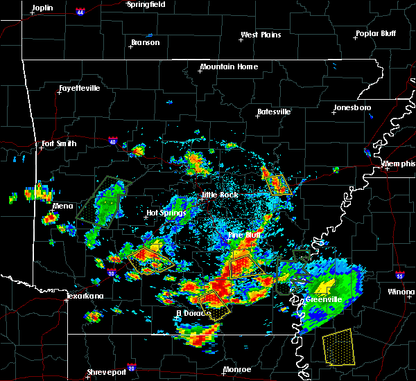 At 528 pm cdt, a severe thunderstorm was located near des arc, and is nearly stationary. this storm has produced landspouts over the last 30 minutes and could do so again. landspouts are usually weak and short lived, rarely causing damage (radar indicated). Hazards include 60 mph wind gusts. brief landspout. expect damage to roofs, siding, and trees At 528 pm cdt, a severe thunderstorm was located near des arc, and is nearly stationary. this storm has produced landspouts over the last 30 minutes and could do so again. landspouts are usually weak and short lived, rarely causing damage (radar indicated). Hazards include 60 mph wind gusts. brief landspout. expect damage to roofs, siding, and trees
|
| 5/6/2018 5:47 PM CDT |
 At 547 pm cdt, a severe thunderstorm was located over hazen, moving southeast at 30 mph (radar indicated). Hazards include 60 mph wind gusts and quarter size hail. Hail damage to vehicles is expected. expect wind damage to roofs, siding, and trees. Locations impacted include, hazen, de valls bluff, carlisle, fredonia, barrettsville, mccreanor, prairie center, peppers landing, hallsville, screeton, center point, childers,. At 547 pm cdt, a severe thunderstorm was located over hazen, moving southeast at 30 mph (radar indicated). Hazards include 60 mph wind gusts and quarter size hail. Hail damage to vehicles is expected. expect wind damage to roofs, siding, and trees. Locations impacted include, hazen, de valls bluff, carlisle, fredonia, barrettsville, mccreanor, prairie center, peppers landing, hallsville, screeton, center point, childers,.
|
| 5/6/2018 5:36 PM CDT |
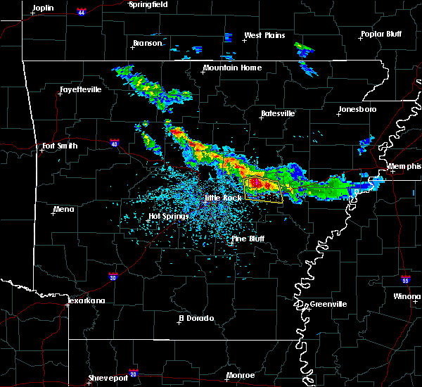 At 535 pm cdt, a severe thunderstorm was located near barrettsville, or 9 miles northwest of hazen, moving southeast at 30 mph (radar indicated). Hazards include 60 mph wind gusts and quarter size hail. Hail damage to vehicles is expected. expect wind damage to roofs, siding, and trees. Locations impacted include, des arc, hazen, de valls bluff, carlisle, fredonia, barrettsville, thurman, mccreanor, peppers landing, prairie center, hallsville, screeton, hayley, butlerville, childers, hickory plains, center point,. At 535 pm cdt, a severe thunderstorm was located near barrettsville, or 9 miles northwest of hazen, moving southeast at 30 mph (radar indicated). Hazards include 60 mph wind gusts and quarter size hail. Hail damage to vehicles is expected. expect wind damage to roofs, siding, and trees. Locations impacted include, des arc, hazen, de valls bluff, carlisle, fredonia, barrettsville, thurman, mccreanor, peppers landing, prairie center, hallsville, screeton, hayley, butlerville, childers, hickory plains, center point,.
|
| 5/6/2018 5:13 PM CDT |
 At 513 pm cdt, a severe thunderstorm was located near mcrae, or 11 miles south of searcy, moving southeast at 30 mph (radar indicated). Hazards include 60 mph wind gusts and quarter size hail. Hail damage to vehicles is expected. Expect wind damage to roofs, siding, and trees. At 513 pm cdt, a severe thunderstorm was located near mcrae, or 11 miles south of searcy, moving southeast at 30 mph (radar indicated). Hazards include 60 mph wind gusts and quarter size hail. Hail damage to vehicles is expected. Expect wind damage to roofs, siding, and trees.
|
| 4/3/2018 5:46 PM CDT |
 At 545 pm cdt, a cluster of severe thunderstorms were located over de valls bluff, moving east at 40 mph (radar indicated). Hazards include quarter size hail. damage to vehicles is expected At 545 pm cdt, a cluster of severe thunderstorms were located over de valls bluff, moving east at 40 mph (radar indicated). Hazards include quarter size hail. damage to vehicles is expected
|
| 4/3/2018 5:18 PM CDT |
 At 517 pm cdt, a severe thunderstorm was located over carlisle, or 8 miles west of hazen, moving east at 35 mph (radar indicated). Hazards include 60 mph wind gusts and quarter size hail. Hail damage to vehicles is expected. Expect wind damage to roofs, siding, and trees. At 517 pm cdt, a severe thunderstorm was located over carlisle, or 8 miles west of hazen, moving east at 35 mph (radar indicated). Hazards include 60 mph wind gusts and quarter size hail. Hail damage to vehicles is expected. Expect wind damage to roofs, siding, and trees.
|
| 2/24/2018 5:14 PM CST |
 At 514 pm cst, severe thunderstorms were located along a line extending from 6 miles northwest of hunter to 7 miles northwest of brinkley to fredonia, moving east at 45 mph (radar indicated). Hazards include 60 mph wind gusts. Expect damage to roofs, siding, and trees. locations impacted include, brinkley, clarendon, de valls bluff, fredonia, hunter, alfrey, allendale, dobbs landing, peppers landing, cotton plant, fargo, becton, howell, monroe, brasfield, dagmar wma, keevil, hilleman, zent, wiville, this includes interstate 40 between mile markers 200 and 218. A tornado watch remains in effect until 600 pm cst for eastern and central arkansas. At 514 pm cst, severe thunderstorms were located along a line extending from 6 miles northwest of hunter to 7 miles northwest of brinkley to fredonia, moving east at 45 mph (radar indicated). Hazards include 60 mph wind gusts. Expect damage to roofs, siding, and trees. locations impacted include, brinkley, clarendon, de valls bluff, fredonia, hunter, alfrey, allendale, dobbs landing, peppers landing, cotton plant, fargo, becton, howell, monroe, brasfield, dagmar wma, keevil, hilleman, zent, wiville, this includes interstate 40 between mile markers 200 and 218. A tornado watch remains in effect until 600 pm cst for eastern and central arkansas.
|
| 2/24/2018 4:59 PM CST |
 At 458 pm cst, severe thunderstorms were located along a line extending from 7 miles southeast of pryor to near des arc to hazen, moving east at 45 mph (radar indicated). Hazards include 60 mph wind gusts. expect damage to roofs, siding, and trees At 458 pm cst, severe thunderstorms were located along a line extending from 7 miles southeast of pryor to near des arc to hazen, moving east at 45 mph (radar indicated). Hazards include 60 mph wind gusts. expect damage to roofs, siding, and trees
|
| 10/22/2017 4:48 AM CDT |
 At 448 am cdt, severe thunderstorms were located along a line extending from near west point to near pryor to near des arc to barrettsville, moving east at 45 mph (radar indicated). Hazards include 60 mph wind gusts. Expect damage to roofs, siding, and trees. locations impacted include, searcy, brinkley, augusta, des arc, hazen, de valls bluff, carlisle, judsonia, kensett, higginson, patterson, fredonia, west point, hunter, barrettsville, allendale, mccrory, pryor, prairie center, hurricane lake wma, this includes the following highways, interstate 40 between mile markers 181 and 218. Us highway 67 between mile markers 44 and 46. At 448 am cdt, severe thunderstorms were located along a line extending from near west point to near pryor to near des arc to barrettsville, moving east at 45 mph (radar indicated). Hazards include 60 mph wind gusts. Expect damage to roofs, siding, and trees. locations impacted include, searcy, brinkley, augusta, des arc, hazen, de valls bluff, carlisle, judsonia, kensett, higginson, patterson, fredonia, west point, hunter, barrettsville, allendale, mccrory, pryor, prairie center, hurricane lake wma, this includes the following highways, interstate 40 between mile markers 181 and 218. Us highway 67 between mile markers 44 and 46.
|
| 10/22/2017 4:33 AM CDT |
 At 433 am cdt, severe thunderstorms were located along a line extending from near mcrae to 8 miles south of higginson to near thurman to sisemore, moving east at 45 mph (radar indicated). Hazards include 60 mph wind gusts. Expect damage to roofs, siding, and trees. locations impacted include, searcy, lonoke, brinkley, augusta, des arc, hazen, de valls bluff, beebe, carlisle, judsonia, kensett, higginson, patterson, fredonia, west point, hunter, barrettsville, allendale, mccrory, thurman, this includes the following highways, interstate 40 between mile markers 170 and 218. Us highway 67 between mile markers 30 and 46. At 433 am cdt, severe thunderstorms were located along a line extending from near mcrae to 8 miles south of higginson to near thurman to sisemore, moving east at 45 mph (radar indicated). Hazards include 60 mph wind gusts. Expect damage to roofs, siding, and trees. locations impacted include, searcy, lonoke, brinkley, augusta, des arc, hazen, de valls bluff, beebe, carlisle, judsonia, kensett, higginson, patterson, fredonia, west point, hunter, barrettsville, allendale, mccrory, thurman, this includes the following highways, interstate 40 between mile markers 170 and 218. Us highway 67 between mile markers 30 and 46.
|
| 10/22/2017 4:23 AM CDT |
 At 422 am cdt, severe thunderstorms were located along a line extending from near mcrae to near beebe to near sylvania to near meto, moving east at 50 mph (radar indicated). Hazards include 60 mph wind gusts. expect damage to roofs, siding, and trees At 422 am cdt, severe thunderstorms were located along a line extending from near mcrae to near beebe to near sylvania to near meto, moving east at 50 mph (radar indicated). Hazards include 60 mph wind gusts. expect damage to roofs, siding, and trees
|
| 5/19/2017 4:20 PM CDT |
 At 420 pm cdt, a severe thunderstorm was located over de valls bluff, moving northeast at 30 mph (radar indicated). Hazards include 60 mph wind gusts and quarter size hail. Hail damage to vehicles is expected. Expect wind damage to roofs, siding, and trees. At 420 pm cdt, a severe thunderstorm was located over de valls bluff, moving northeast at 30 mph (radar indicated). Hazards include 60 mph wind gusts and quarter size hail. Hail damage to vehicles is expected. Expect wind damage to roofs, siding, and trees.
|
| 4/30/2017 3:20 AM CDT |
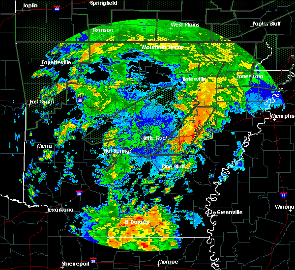 At 320 am cdt, severe thunderstorms were located along a line extending from 9 miles northwest of brinkley to near allendale, moving east at 40 mph (radar indicated). Hazards include 60 mph wind gusts. Expect damage to roofs, siding, and trees. Locations impacted include, brinkley, fredonia, hunter, alfrey, allendale, dobbs landing, peppers landing, cotton plant, fargo, brasfield, dagmar wma, keevil, zent, this includes interstate 40 between mile markers 203 and 218. At 320 am cdt, severe thunderstorms were located along a line extending from 9 miles northwest of brinkley to near allendale, moving east at 40 mph (radar indicated). Hazards include 60 mph wind gusts. Expect damage to roofs, siding, and trees. Locations impacted include, brinkley, fredonia, hunter, alfrey, allendale, dobbs landing, peppers landing, cotton plant, fargo, brasfield, dagmar wma, keevil, zent, this includes interstate 40 between mile markers 203 and 218.
|
| 4/30/2017 3:12 AM CDT |
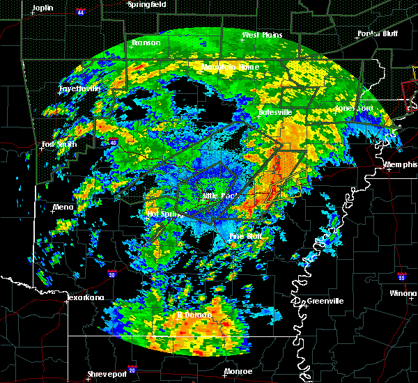 At 312 am cdt, severe thunderstorms were located along a line extending from near hallsville to fredonia to near de valls bluff, moving northeast at 40 mph (radar indicated). Hazards include 60 mph wind gusts. expect damage to roofs, siding, and trees At 312 am cdt, severe thunderstorms were located along a line extending from near hallsville to fredonia to near de valls bluff, moving northeast at 40 mph (radar indicated). Hazards include 60 mph wind gusts. expect damage to roofs, siding, and trees
|
| 4/29/2017 9:37 PM CDT |
 At 937 pm cdt, a severe thunderstorm was located near des arc, moving north at 30 mph (radar indicated). Hazards include 60 mph wind gusts and quarter size hail. Hail damage to vehicles is expected. expect wind damage to roofs, siding, and trees. Locations impacted include, des arc, hazen, de valls bluff, fredonia, barrettsville, hallsville, cotton plant, fargo, becton, dixie, sand hill, brasfield, mcclelland, childers, dagmar wma, jasmine, little dixie, center point, zent, georgetown, this includes interstate 40 between mile markers 189 and 211. At 937 pm cdt, a severe thunderstorm was located near des arc, moving north at 30 mph (radar indicated). Hazards include 60 mph wind gusts and quarter size hail. Hail damage to vehicles is expected. expect wind damage to roofs, siding, and trees. Locations impacted include, des arc, hazen, de valls bluff, fredonia, barrettsville, hallsville, cotton plant, fargo, becton, dixie, sand hill, brasfield, mcclelland, childers, dagmar wma, jasmine, little dixie, center point, zent, georgetown, this includes interstate 40 between mile markers 189 and 211.
|
| 4/29/2017 9:10 PM CDT |
 At 910 pm cdt, a severe thunderstorm was located near hazen, moving north at 30 mph (radar indicated). Hazards include 60 mph wind gusts and quarter size hail. Hail damage to vehicles is expected. Expect wind damage to roofs, siding, and trees. At 910 pm cdt, a severe thunderstorm was located near hazen, moving north at 30 mph (radar indicated). Hazards include 60 mph wind gusts and quarter size hail. Hail damage to vehicles is expected. Expect wind damage to roofs, siding, and trees.
|
| 4/29/2017 9:06 PM CDT |
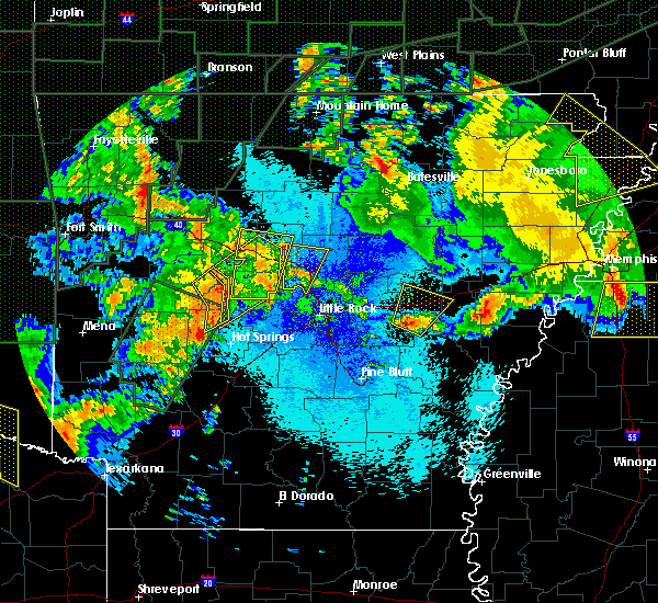 At 906 pm cdt, a severe thunderstorm was located near hazen, moving northeast at 35 mph (radar indicated). Hazards include 60 mph wind gusts and quarter size hail. Hail damage to vehicles is expected. expect wind damage to roofs, siding, and trees. Locations impacted include, hazen, de valls bluff, carlisle, fredonia, barrettsville, peppers landing, prairie center, parkers corner, stuttgart municipal airport, hallsville, screeton, slovak, tollville, brasfield, childers, center point, this includes interstate 40 between mile markers 185 and 208. At 906 pm cdt, a severe thunderstorm was located near hazen, moving northeast at 35 mph (radar indicated). Hazards include 60 mph wind gusts and quarter size hail. Hail damage to vehicles is expected. expect wind damage to roofs, siding, and trees. Locations impacted include, hazen, de valls bluff, carlisle, fredonia, barrettsville, peppers landing, prairie center, parkers corner, stuttgart municipal airport, hallsville, screeton, slovak, tollville, brasfield, childers, center point, this includes interstate 40 between mile markers 185 and 208.
|
| 4/29/2017 8:52 PM CDT |
 At 851 pm cdt, a severe thunderstorm was located near brummitt, or 9 miles northwest of stuttgart, moving northeast at 40 mph (radar indicated). Hazards include 60 mph wind gusts and quarter size hail. Hail damage to vehicles is expected. Expect wind damage to roofs, siding, and trees. At 851 pm cdt, a severe thunderstorm was located near brummitt, or 9 miles northwest of stuttgart, moving northeast at 40 mph (radar indicated). Hazards include 60 mph wind gusts and quarter size hail. Hail damage to vehicles is expected. Expect wind damage to roofs, siding, and trees.
|
| 4/26/2017 4:34 PM CDT |
 At 434 pm cdt, a severe squall line capable of producing both tornadoes and extensive straight line wind damage was located near fredonia, or 8 miles northeast of de valls bluff, moving east at 50 mph (radar indicated rotation). Hazards include tornado and quarter size hail. Flying debris will be dangerous to those caught without shelter. mobile homes will be damaged or destroyed. damage to roofs, windows, and vehicles will occur. tree damage is likely. Locations impacted include, brinkley, fredonia, hunter, alfrey, allendale, peppers landing, dobbs landing, cotton plant, fargo, brasfield, dagmar wma, keevil, zent, this includes interstate 40 between mile markers 201 and 218. At 434 pm cdt, a severe squall line capable of producing both tornadoes and extensive straight line wind damage was located near fredonia, or 8 miles northeast of de valls bluff, moving east at 50 mph (radar indicated rotation). Hazards include tornado and quarter size hail. Flying debris will be dangerous to those caught without shelter. mobile homes will be damaged or destroyed. damage to roofs, windows, and vehicles will occur. tree damage is likely. Locations impacted include, brinkley, fredonia, hunter, alfrey, allendale, peppers landing, dobbs landing, cotton plant, fargo, brasfield, dagmar wma, keevil, zent, this includes interstate 40 between mile markers 201 and 218.
|
| 4/26/2017 4:30 PM CDT |
 At 430 pm cdt, a severe thunderstorm was located near peppers landing, or near de valls bluff, moving east at 45 mph (radar indicated). Hazards include 70 mph wind gusts and quarter size hail. Hail damage to vehicles is expected. expect considerable tree damage. wind damage is also likely to mobile homes, roofs, and outbuildings. locations impacted include, stuttgart, brinkley, clarendon, hazen, de valls bluff, holly grove, fredonia, ulm, roe, alfrey, allendale, dobbs landing, peppers landing, stuttgart municipal airport, hallsville, fargo, blackton, aberdeen, tollville, monroe, this includes interstate 40 between mile markers 194 and 218. A tornado watch remains in effect until 500 pm cdt for eastern, central and southeastern arkansas. At 430 pm cdt, a severe thunderstorm was located near peppers landing, or near de valls bluff, moving east at 45 mph (radar indicated). Hazards include 70 mph wind gusts and quarter size hail. Hail damage to vehicles is expected. expect considerable tree damage. wind damage is also likely to mobile homes, roofs, and outbuildings. locations impacted include, stuttgart, brinkley, clarendon, hazen, de valls bluff, holly grove, fredonia, ulm, roe, alfrey, allendale, dobbs landing, peppers landing, stuttgart municipal airport, hallsville, fargo, blackton, aberdeen, tollville, monroe, this includes interstate 40 between mile markers 194 and 218. A tornado watch remains in effect until 500 pm cdt for eastern, central and southeastern arkansas.
|
| 4/26/2017 4:21 PM CDT |
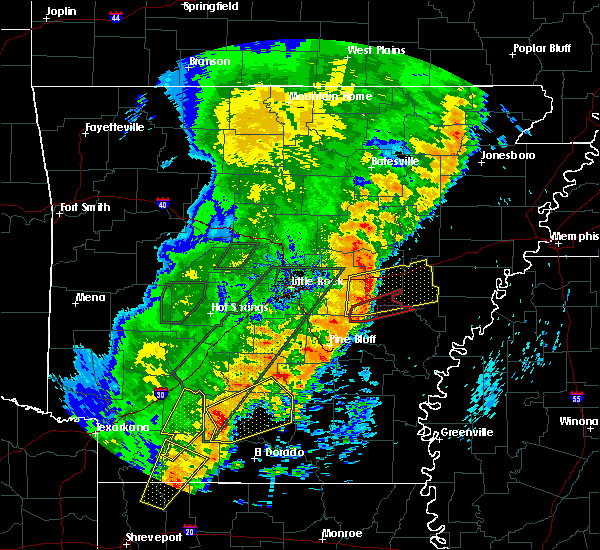 At 421 pm cdt, severe thunderstorms capable of producing both tornadoes and extensive straight line wind damage were located over hallsville, or near hazen, moving east at 50 mph (radar indicated rotation). Hazards include tornado and quarter size hail. Flying debris will be dangerous to those caught without shelter. mobile homes will be damaged or destroyed. damage to roofs, windows, and vehicles will occur. Tree damage is likely. At 421 pm cdt, severe thunderstorms capable of producing both tornadoes and extensive straight line wind damage were located over hallsville, or near hazen, moving east at 50 mph (radar indicated rotation). Hazards include tornado and quarter size hail. Flying debris will be dangerous to those caught without shelter. mobile homes will be damaged or destroyed. damage to roofs, windows, and vehicles will occur. Tree damage is likely.
|
| 4/26/2017 4:07 PM CDT |
 At 407 pm cdt, a severe thunderstorm was located over parkers corner, or 13 miles southeast of lonoke, moving east at 55 mph (radar indicated). Hazards include 70 mph wind gusts and quarter size hail. Hail damage to vehicles is expected. expect considerable tree damage. Wind damage is also likely to mobile homes, roofs, and outbuildings. At 407 pm cdt, a severe thunderstorm was located over parkers corner, or 13 miles southeast of lonoke, moving east at 55 mph (radar indicated). Hazards include 70 mph wind gusts and quarter size hail. Hail damage to vehicles is expected. expect considerable tree damage. Wind damage is also likely to mobile homes, roofs, and outbuildings.
|
| 2/7/2017 6:56 AM CST |
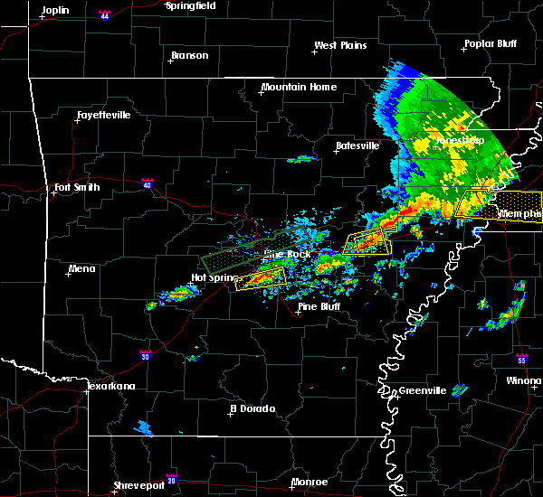 At 656 am cst, a severe thunderstorm was located near fredonia, or 8 miles northeast of de valls bluff, moving east at 35 mph (radar indicated). Hazards include 60 mph wind gusts. expect damage to roofs, siding, and trees At 656 am cst, a severe thunderstorm was located near fredonia, or 8 miles northeast of de valls bluff, moving east at 35 mph (radar indicated). Hazards include 60 mph wind gusts. expect damage to roofs, siding, and trees
|
| 2/7/2017 6:47 AM CST |
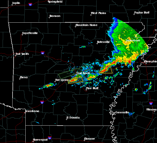 At 647 am cst, a severe thunderstorm was located near fredonia, or 8 miles northeast of de valls bluff, moving east at 45 mph (radar indicated). Hazards include 60 mph wind gusts. Expect damage to roofs, siding, and trees. Locations impacted include, brinkley, hazen, de valls bluff, fredonia, alfrey, allendale, hallsville, cotton plant, fargo, dagmar wma, keevil, brasfield, this includes interstate 40 between mile markers 194 and 217. At 647 am cst, a severe thunderstorm was located near fredonia, or 8 miles northeast of de valls bluff, moving east at 45 mph (radar indicated). Hazards include 60 mph wind gusts. Expect damage to roofs, siding, and trees. Locations impacted include, brinkley, hazen, de valls bluff, fredonia, alfrey, allendale, hallsville, cotton plant, fargo, dagmar wma, keevil, brasfield, this includes interstate 40 between mile markers 194 and 217.
|
| 2/7/2017 6:31 AM CST |
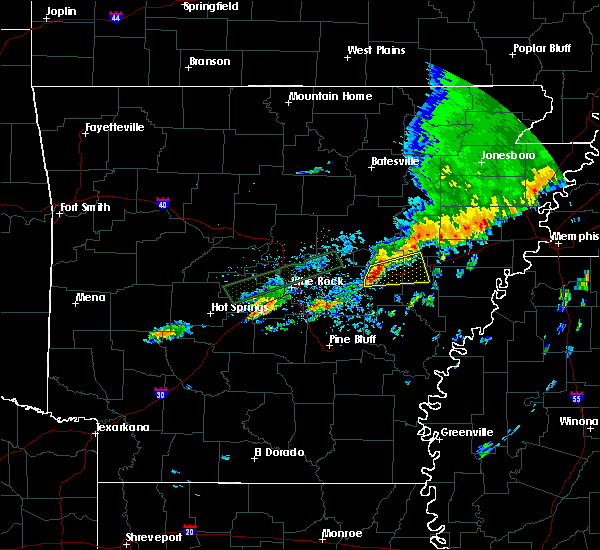 At 631 am cst, a severe thunderstorm was located over hazen, moving east at 35 mph (radar indicated). Hazards include 60 mph wind gusts. Expect damage to roofs, siding, and trees. Locations impacted include, brinkley, hazen, de valls bluff, fredonia, barrettsville, alfrey, allendale, hallsville, cotton plant, fargo, screeton, brasfield, childers, dagmar wma, keevil, center point, this includes interstate 40 between mile markers 186 and 217. At 631 am cst, a severe thunderstorm was located over hazen, moving east at 35 mph (radar indicated). Hazards include 60 mph wind gusts. Expect damage to roofs, siding, and trees. Locations impacted include, brinkley, hazen, de valls bluff, fredonia, barrettsville, alfrey, allendale, hallsville, cotton plant, fargo, screeton, brasfield, childers, dagmar wma, keevil, center point, this includes interstate 40 between mile markers 186 and 217.
|
| 2/7/2017 6:18 AM CST |
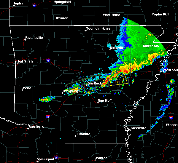 At 617 am cst, a severe thunderstorm was located over carlisle, or 9 miles west of hazen, moving east at 35 mph (radar indicated). Hazards include 60 mph wind gusts and quarter size hail. Hail damage to vehicles is expected. Expect wind damage to roofs, siding, and trees. At 617 am cst, a severe thunderstorm was located over carlisle, or 9 miles west of hazen, moving east at 35 mph (radar indicated). Hazards include 60 mph wind gusts and quarter size hail. Hail damage to vehicles is expected. Expect wind damage to roofs, siding, and trees.
|
| 7/14/2016 8:03 PM CDT |
 At 802 pm cdt, a severe thunderstorm was located near almyra, or 10 miles east of stuttgart, moving east at 20 mph (radar indicated). Hazards include 60 mph wind gusts and quarter size hail. Hail damage to vehicles is expected. Expect wind damage to roofs, siding, and trees. At 802 pm cdt, a severe thunderstorm was located near almyra, or 10 miles east of stuttgart, moving east at 20 mph (radar indicated). Hazards include 60 mph wind gusts and quarter size hail. Hail damage to vehicles is expected. Expect wind damage to roofs, siding, and trees.
|
| 7/14/2016 7:55 PM CDT |
 At 754 pm cdt, a severe thunderstorm was located near clarendon, moving east at 20 mph (radar indicated). Hazards include 60 mph wind gusts and penny size hail. Expect damage to roofs. siding. and trees. Locations impacted include, stuttgart, brinkley, clarendon, hazen, de valls bluff, holly grove, fredonia, ulm, roe, alfrey, allendale, palmer, hallsville, stuttgart municipal airport, dobbs landing, peppers landing, blackton, aberdeen, casscoe, brasfield,. At 754 pm cdt, a severe thunderstorm was located near clarendon, moving east at 20 mph (radar indicated). Hazards include 60 mph wind gusts and penny size hail. Expect damage to roofs. siding. and trees. Locations impacted include, stuttgart, brinkley, clarendon, hazen, de valls bluff, holly grove, fredonia, ulm, roe, alfrey, allendale, palmer, hallsville, stuttgart municipal airport, dobbs landing, peppers landing, blackton, aberdeen, casscoe, brasfield,.
|
| 7/14/2016 7:28 PM CDT |
 At 727 pm cdt, a severe thunderstorm was located 7 miles south of de valls bluff, moving east at 35 mph (radar indicated). Hazards include 60 mph wind gusts. Expect damage to roofs. siding. And trees. At 727 pm cdt, a severe thunderstorm was located 7 miles south of de valls bluff, moving east at 35 mph (radar indicated). Hazards include 60 mph wind gusts. Expect damage to roofs. siding. And trees.
|
| 7/14/2016 7:25 PM CDT |
 At 725 pm cdt, a severe thunderstorm was located near de valls bluff, moving east at 25 mph (trained weather spotters). Hazards include 60 mph wind gusts. Expect damage to roofs. siding. and trees. Locations impacted include, stuttgart, des arc, hazen, de valls bluff, fredonia, ulm, barrettsville, hallsville, thurman, stuttgart municipal airport, peppers landing, slovak, casscoe, hayley, brasfield, screeton, childers, sand hill, hickory plains, center point,. At 725 pm cdt, a severe thunderstorm was located near de valls bluff, moving east at 25 mph (trained weather spotters). Hazards include 60 mph wind gusts. Expect damage to roofs. siding. and trees. Locations impacted include, stuttgart, des arc, hazen, de valls bluff, fredonia, ulm, barrettsville, hallsville, thurman, stuttgart municipal airport, peppers landing, slovak, casscoe, hayley, brasfield, screeton, childers, sand hill, hickory plains, center point,.
|
| 7/14/2016 6:47 PM CDT |
 At 646 pm cdt, a severe thunderstorm was located over mccreanor, or near lonoke, moving east at 35 mph (trained weather spotters). Hazards include 60 to 70 mph wind gusts. Expect damage to roofs. siding. And trees. At 646 pm cdt, a severe thunderstorm was located over mccreanor, or near lonoke, moving east at 35 mph (trained weather spotters). Hazards include 60 to 70 mph wind gusts. Expect damage to roofs. siding. And trees.
|
| 5/10/2016 12:23 AM CDT |
 At 1222 am cdt, severe thunderstorms were located along a line extending from near tupelo to near brinkley to stuttgart municipal airport, moving east at 50 mph (radar indicated). Hazards include 70 mph wind gusts and penny size hail. Expect considerable tree damage. damage is likely to mobile homes, roofs, and outbuildings. Locations impacted include, brinkley, augusta, clarendon, hazen, de valls bluff, patterson, fredonia, tupelo, roe, hunter, alfrey, allendale, hallsville, stuttgart municipal , dobbs landing, mcfadden, mccrory, peppers landing, parkers corner, cotton plant, a tornado watch remains in effect until 200 am cdt for eastern arkansas. At 1222 am cdt, severe thunderstorms were located along a line extending from near tupelo to near brinkley to stuttgart municipal airport, moving east at 50 mph (radar indicated). Hazards include 70 mph wind gusts and penny size hail. Expect considerable tree damage. damage is likely to mobile homes, roofs, and outbuildings. Locations impacted include, brinkley, augusta, clarendon, hazen, de valls bluff, patterson, fredonia, tupelo, roe, hunter, alfrey, allendale, hallsville, stuttgart municipal , dobbs landing, mcfadden, mccrory, peppers landing, parkers corner, cotton plant, a tornado watch remains in effect until 200 am cdt for eastern arkansas.
|
| 5/10/2016 12:03 AM CDT |
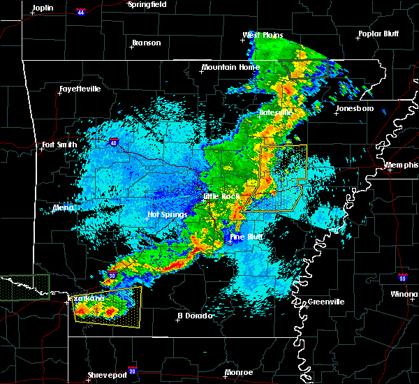 At 1202 am cdt, severe thunderstorms were located along a line extending from near bald knob to near barrettsville to near keo, moving east at 50 mph (radar indicated). Hazards include 70 mph wind gusts and penny size hail. Expect considerable tree damage. damage is likely to mobile homes, roofs, and outbuildings. Locations impacted include, brinkley, augusta, des arc, clarendon, hazen, de valls bluff, bald knob, carlisle, judsonia, patterson, fredonia, russell, west point, tupelo, roe, hunter, barrettsville, alfrey, allendale, parkers corner, a tornado watch remains in effect until 200 am cdt for eastern arkansas. At 1202 am cdt, severe thunderstorms were located along a line extending from near bald knob to near barrettsville to near keo, moving east at 50 mph (radar indicated). Hazards include 70 mph wind gusts and penny size hail. Expect considerable tree damage. damage is likely to mobile homes, roofs, and outbuildings. Locations impacted include, brinkley, augusta, des arc, clarendon, hazen, de valls bluff, bald knob, carlisle, judsonia, patterson, fredonia, russell, west point, tupelo, roe, hunter, barrettsville, alfrey, allendale, parkers corner, a tornado watch remains in effect until 200 am cdt for eastern arkansas.
|
| 5/9/2016 11:56 PM CDT |
 At 1156 pm cdt, severe thunderstorms were located along a line extending from near russell to near des arc to 7 miles northeast of england, moving east at 45 mph (radar indicated). Hazards include 60 mph wind gusts and penny size hail. Expect damage to roofs. siding. And trees. At 1156 pm cdt, severe thunderstorms were located along a line extending from near russell to near des arc to 7 miles northeast of england, moving east at 45 mph (radar indicated). Hazards include 60 mph wind gusts and penny size hail. Expect damage to roofs. siding. And trees.
|
| 3/31/2016 2:44 PM CDT |
 At 244 pm cdt, a severe thunderstorm was located near humnoke, or 12 miles west of stuttgart, moving northeast at 35 mph (radar indicated). Hazards include 60 mph wind gusts and quarter size hail. Hail damage to vehicles is expected. Expect wind damage to roofs, siding, and trees. At 244 pm cdt, a severe thunderstorm was located near humnoke, or 12 miles west of stuttgart, moving northeast at 35 mph (radar indicated). Hazards include 60 mph wind gusts and quarter size hail. Hail damage to vehicles is expected. Expect wind damage to roofs, siding, and trees.
|
| 3/13/2016 7:14 PM CDT |
 At 714 pm cdt, a severe thunderstorm was located near parkers corner, or 9 miles southwest of hazen, moving northeast at 40 mph (radar indicated). Hazards include golf ball size hail and 70 mph wind gusts. People and animals outdoors will be injured. expect hail damage to roofs, siding, windows, and vehicles. expect considerable tree damage. Wind damage is also likely to mobile homes, roofs, and outbuildings. At 714 pm cdt, a severe thunderstorm was located near parkers corner, or 9 miles southwest of hazen, moving northeast at 40 mph (radar indicated). Hazards include golf ball size hail and 70 mph wind gusts. People and animals outdoors will be injured. expect hail damage to roofs, siding, windows, and vehicles. expect considerable tree damage. Wind damage is also likely to mobile homes, roofs, and outbuildings.
|
| 3/13/2016 6:54 PM CDT |
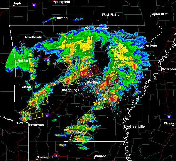 At 653 pm cdt, a severe thunderstorm capable of producing a tornado was located over hazen, moving northeast at 40 mph (radar indicated rotation). Hazards include tornado and golf ball size hail. Flying debris will be dangerous to those caught without shelter. mobile homes will be damaged or destroyed. damage to roofs, windows, and vehicles will occur. tree damage is likely. this dangerous storm will be near, de valls bluff and hallsville around 700 pm cdt. fredonia around 710 pm cdt. other locations impacted by this tornadic thunderstorm include brasfield, childers, sand hill and center point. This includes interstate 40 between mile markers 189 and 205. At 653 pm cdt, a severe thunderstorm capable of producing a tornado was located over hazen, moving northeast at 40 mph (radar indicated rotation). Hazards include tornado and golf ball size hail. Flying debris will be dangerous to those caught without shelter. mobile homes will be damaged or destroyed. damage to roofs, windows, and vehicles will occur. tree damage is likely. this dangerous storm will be near, de valls bluff and hallsville around 700 pm cdt. fredonia around 710 pm cdt. other locations impacted by this tornadic thunderstorm include brasfield, childers, sand hill and center point. This includes interstate 40 between mile markers 189 and 205.
|
| 3/13/2016 6:35 PM CDT |
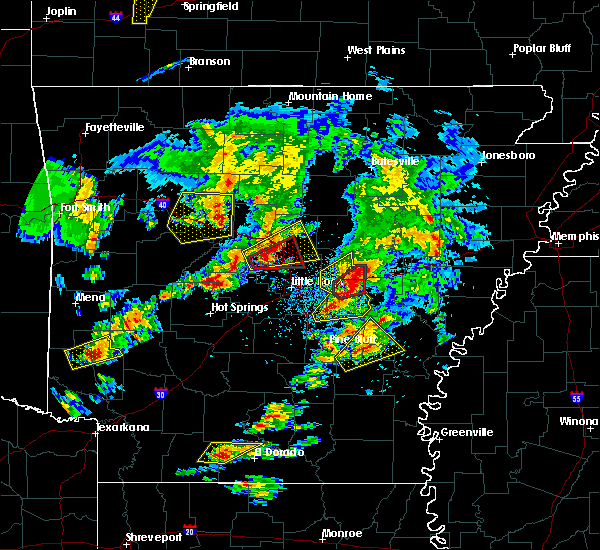 At 635 pm cdt, a severe thunderstorm was located over carlisle, or 8 miles west of hazen, moving northeast at 40 mph (radar indicated). Hazards include golf ball size hail and 70 mph wind gusts. People and animals outdoors will be injured. expect hail damage to roofs, siding, windows, and vehicles. expect considerable tree damage. Wind damage is also likely to mobile homes, roofs, and outbuildings. At 635 pm cdt, a severe thunderstorm was located over carlisle, or 8 miles west of hazen, moving northeast at 40 mph (radar indicated). Hazards include golf ball size hail and 70 mph wind gusts. People and animals outdoors will be injured. expect hail damage to roofs, siding, windows, and vehicles. expect considerable tree damage. Wind damage is also likely to mobile homes, roofs, and outbuildings.
|
| 12/23/2015 1:59 PM CST | At 157 pm cst, severe thunderstorms were located from near hunter, or 11 miles north of brinkley, to 5 miles southeast of sand hill, moving northeast at 55 mph (radar indicated). Hazards include 70 mph wind gusts and ping pong ball size hail. People and animals outdoors will be injured. expect hail damage to roofs, siding, windows, and vehicles. expect considerable tree damage. wind damage is also likely to mobile homes, roofs, and outbuildings. locations impacted include, brinkley, des arc, fredonia, hunter, cotton plant, fargo, becton, little dixie, dixie, hilleman, brasfield, penrose, dagmar wma, howell, sand hill and zent. A tornado watch remains in effect until 800 pm cst for eastern arkansas. |
| 12/23/2015 1:45 PM CST | At 145 pm cst, a severe thunderstorm was located 7 miles east of des arc, moving northeast at 55 mph (radar indicated). Hazards include golf ball size hail and 70 mph wind gusts. People and animals outdoors will be injured. expect hail damage to roofs, siding, windows, and vehicles. expect considerable tree damage. Wind damage is also likely to mobile homes, roofs, and outbuildings. |
| 12/23/2015 1:24 PM CST | At 124 pm cst, a severe thunderstorm was located over prairie center, or 8 miles west of hazen, moving northeast at 60 mph (radar indicated). Hazards include 70 mph wind gusts and ping pong ball size hail. People and animals outdoors will be injured. expect hail damage to roofs, siding, windows, and vehicles. expect considerable tree damage. Wind damage is also likely to mobile homes, roofs, and outbuildings. |
| 11/17/2015 4:14 PM CST |
 At 412 pm cst, severe thunderstorms were located along a line extending from des arc to roe to near de witt, moving east at 45 mph (radar indicated). Hazards include 70 mph wind gusts. Expect considerable tree damage. Damage is likely to mobile homes, roofs and outbuildings. At 412 pm cst, severe thunderstorms were located along a line extending from des arc to roe to near de witt, moving east at 45 mph (radar indicated). Hazards include 70 mph wind gusts. Expect considerable tree damage. Damage is likely to mobile homes, roofs and outbuildings.
|
| 11/17/2015 4:09 PM CST |
 At 409 pm cst, severe thunderstorms were located along a line extending from near des arc to roe to near de witt, moving northeast at 25 mph (radar indicated). Hazards include 70 mph wind gusts. Expect considerable tree damage. damage is likely to mobile homes, roofs and outbuildings. locations impacted include, brinkley, des arc, clarendon, de valls bluff, holly grove, fredonia, almyra, st. charles, ulm, roe, alfrey, allendale, palmer, hallsville, de witt, dobbs landing, peppers landing, cotton plant, fargo and blackton. A tornado watch remains in effect until 600 pm cst for southeastern arkansas. At 409 pm cst, severe thunderstorms were located along a line extending from near des arc to roe to near de witt, moving northeast at 25 mph (radar indicated). Hazards include 70 mph wind gusts. Expect considerable tree damage. damage is likely to mobile homes, roofs and outbuildings. locations impacted include, brinkley, des arc, clarendon, de valls bluff, holly grove, fredonia, almyra, st. charles, ulm, roe, alfrey, allendale, palmer, hallsville, de witt, dobbs landing, peppers landing, cotton plant, fargo and blackton. A tornado watch remains in effect until 600 pm cst for southeastern arkansas.
|
| 11/17/2015 3:52 PM CST |
 The tornado warning for west central monroe, southeastern lonoke and southeastern prairie counties will expire at 400 pm cst, the tornadic thunderstorm which prompted the warning has moved out of the warned area and weakened. therefore the warning will be allowed to expire. a tornado watch remains in effect until 600 pm cst for southeastern arkansas. The tornado warning for west central monroe, southeastern lonoke and southeastern prairie counties will expire at 400 pm cst, the tornadic thunderstorm which prompted the warning has moved out of the warned area and weakened. therefore the warning will be allowed to expire. a tornado watch remains in effect until 600 pm cst for southeastern arkansas.
|
| 11/17/2015 3:30 PM CST |
 At 329 pm cst, severe thunderstorms were located along a line extending from carlisle to humnoke and grady, moving northeast at 45 mph (radar indicated). Hazards include 70 mph wind gusts. Expect considerable tree damage. Damage is likely to mobile homes, roofs and outbuildings. At 329 pm cst, severe thunderstorms were located along a line extending from carlisle to humnoke and grady, moving northeast at 45 mph (radar indicated). Hazards include 70 mph wind gusts. Expect considerable tree damage. Damage is likely to mobile homes, roofs and outbuildings.
|
| 11/17/2015 3:24 PM CST |
 At 323 pm cst, a severe thunderstorm capable of producing a tornado was located near brummitt, or 10 miles northwest of stuttgart, moving northeast at 40 mph (radar indicated rotation). Hazards include tornado. Flying debris will be dangerous to those caught without shelter. mobile homes will be damaged or destroyed. damage to roofs, windows and vehicles will occur. tree damage is likely. this dangerous storm will be near, stuttgart municipal airport around 335 pm cst. de valls bluff and roe around 355 pm cst. clarendon and peppers landing around 400 pm cst. other locations impacted by this tornadic thunderstorm include slovak and tollville. This includes interstate 40 near mile marker 202. At 323 pm cst, a severe thunderstorm capable of producing a tornado was located near brummitt, or 10 miles northwest of stuttgart, moving northeast at 40 mph (radar indicated rotation). Hazards include tornado. Flying debris will be dangerous to those caught without shelter. mobile homes will be damaged or destroyed. damage to roofs, windows and vehicles will occur. tree damage is likely. this dangerous storm will be near, stuttgart municipal airport around 335 pm cst. de valls bluff and roe around 355 pm cst. clarendon and peppers landing around 400 pm cst. other locations impacted by this tornadic thunderstorm include slovak and tollville. This includes interstate 40 near mile marker 202.
|
Hail Maps for Fredonia (Biscoe), AR


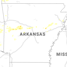


Connect with Interactive Hail Maps