

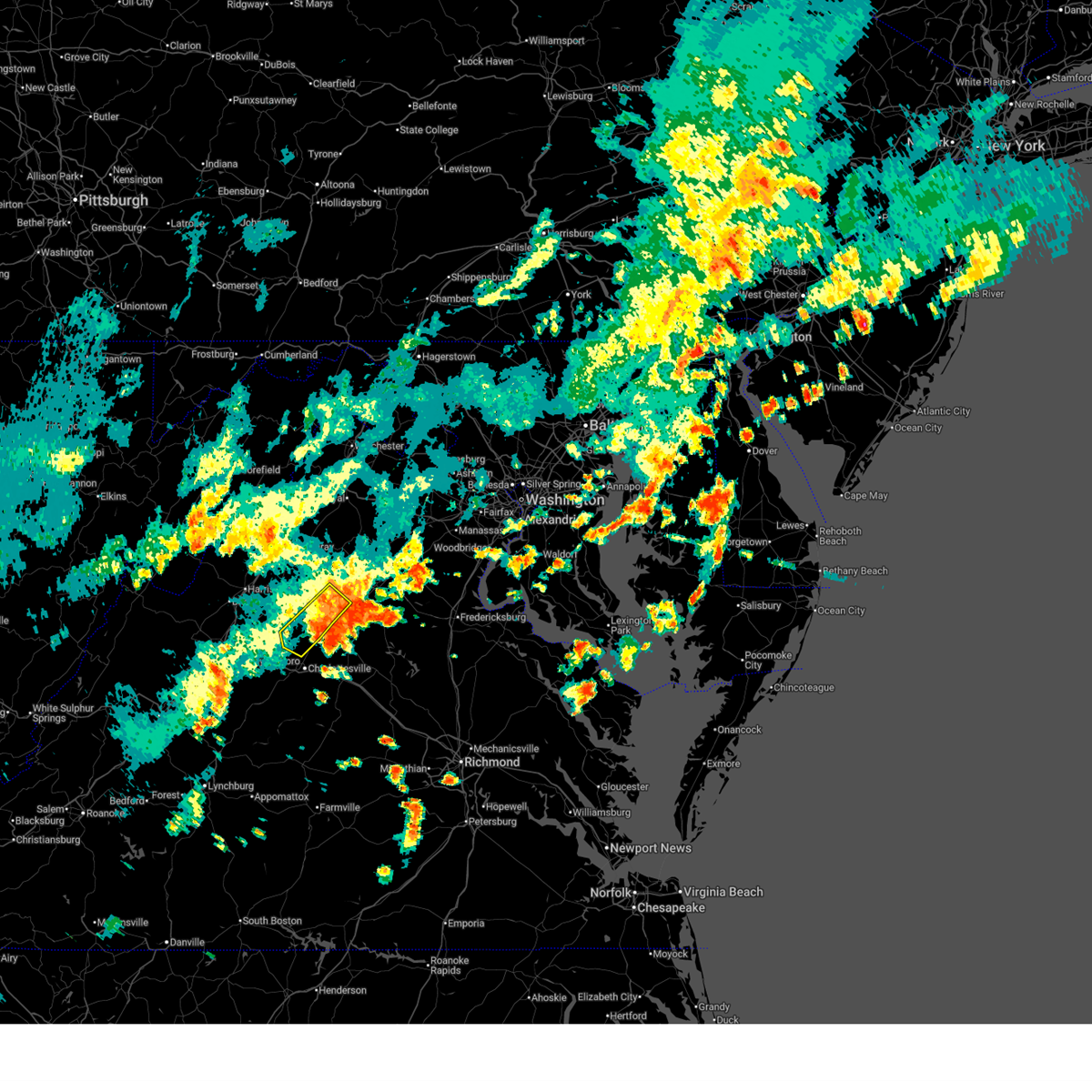
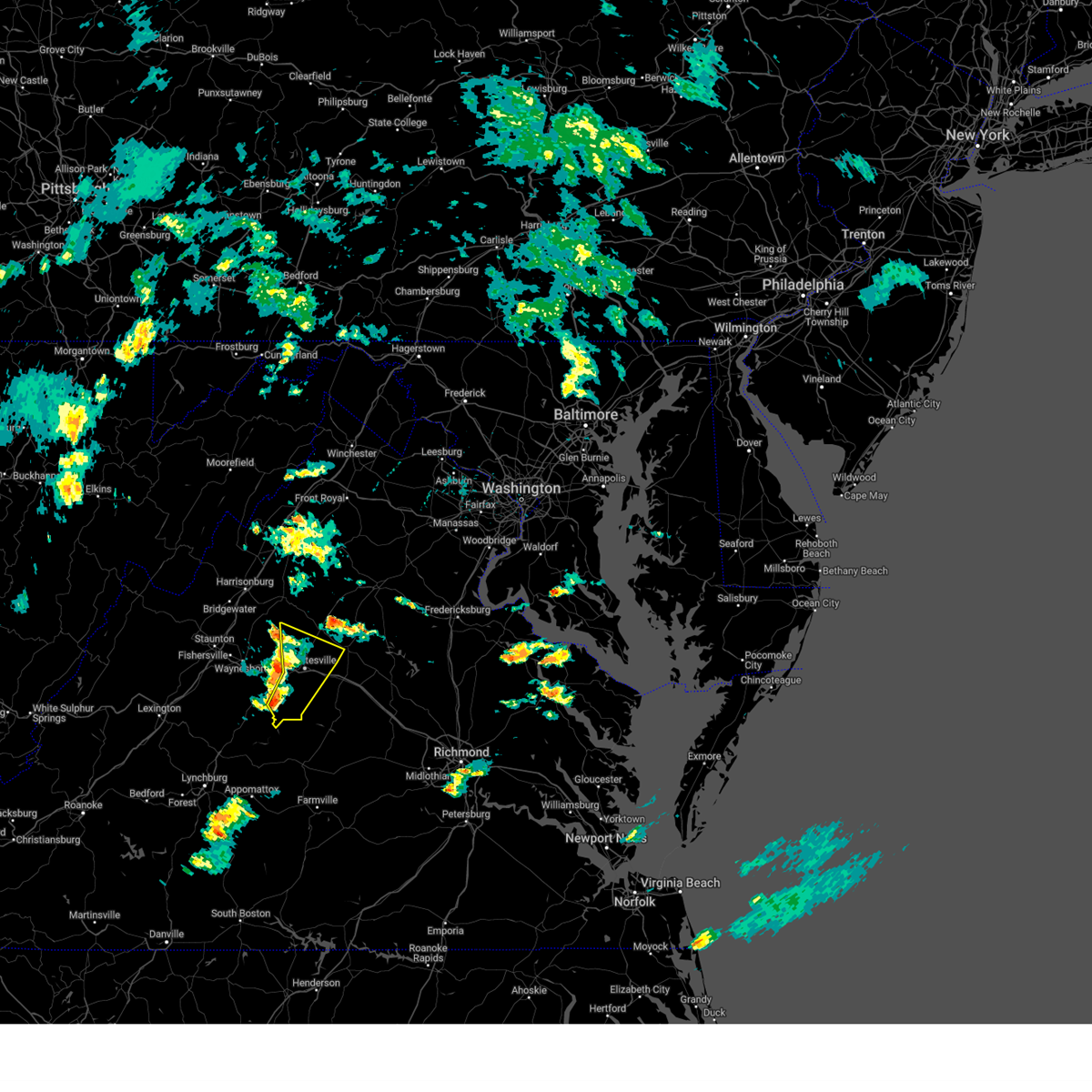
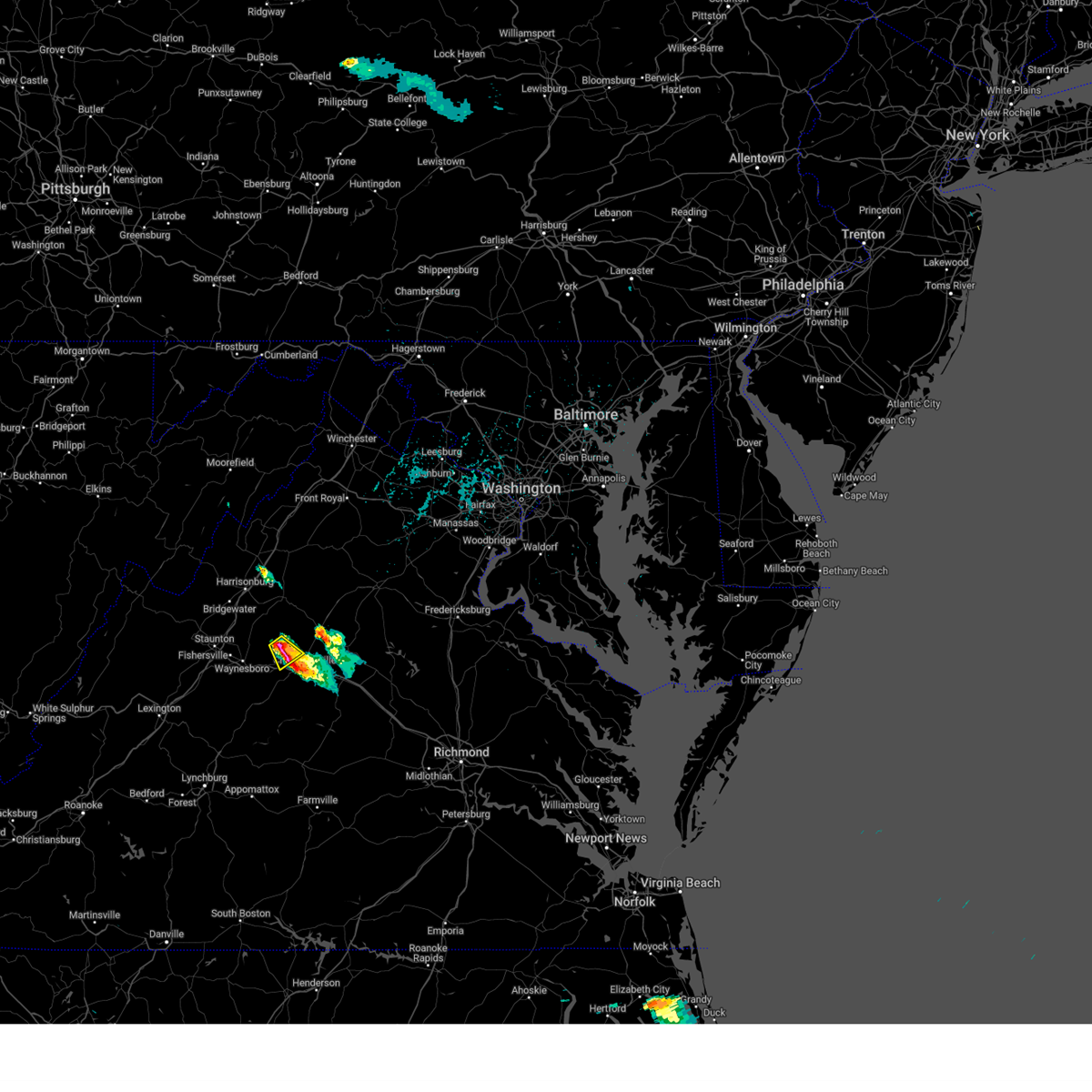
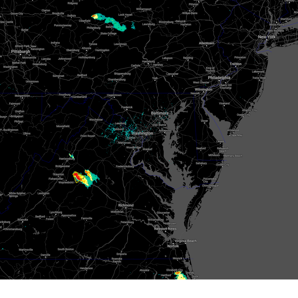
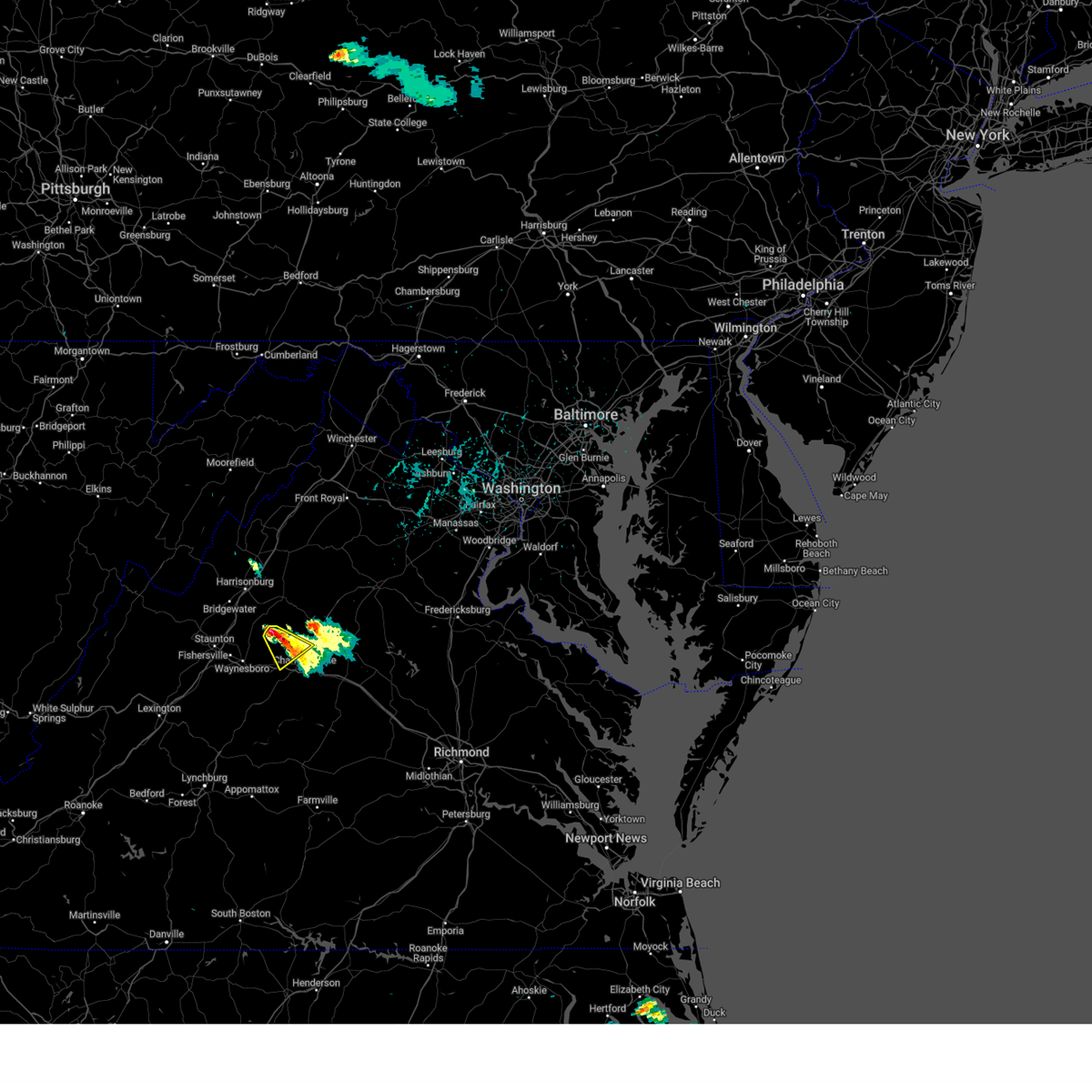
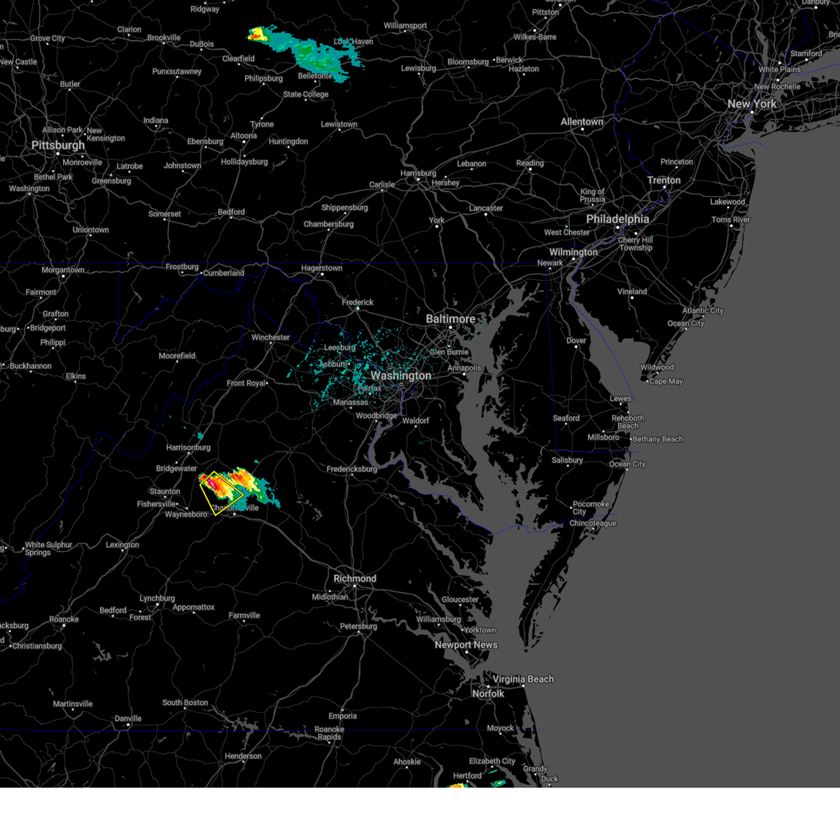
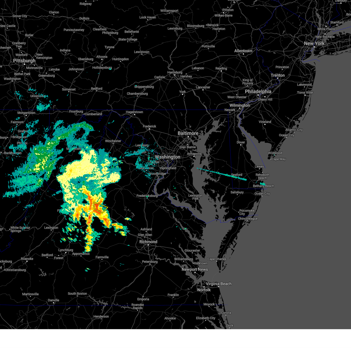
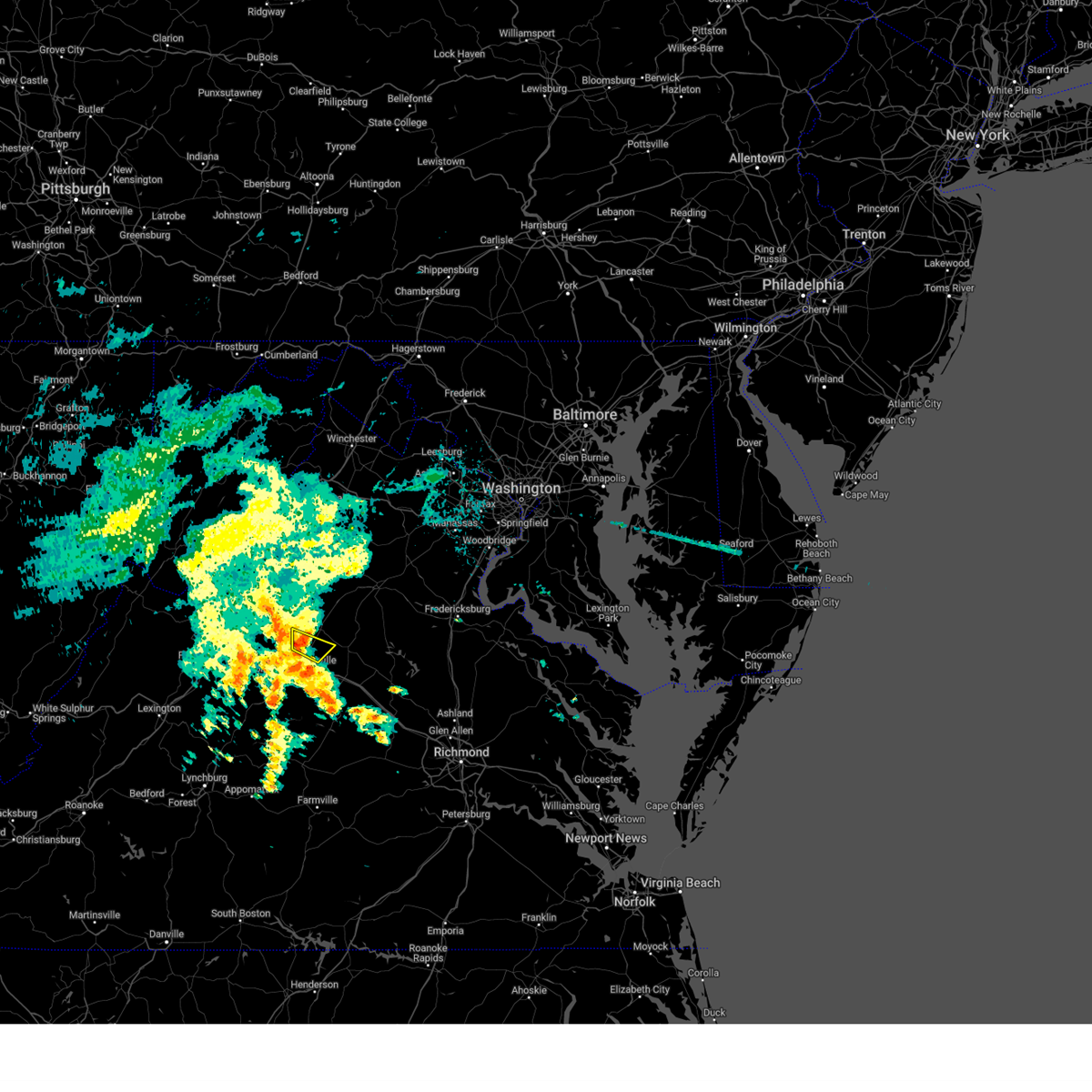
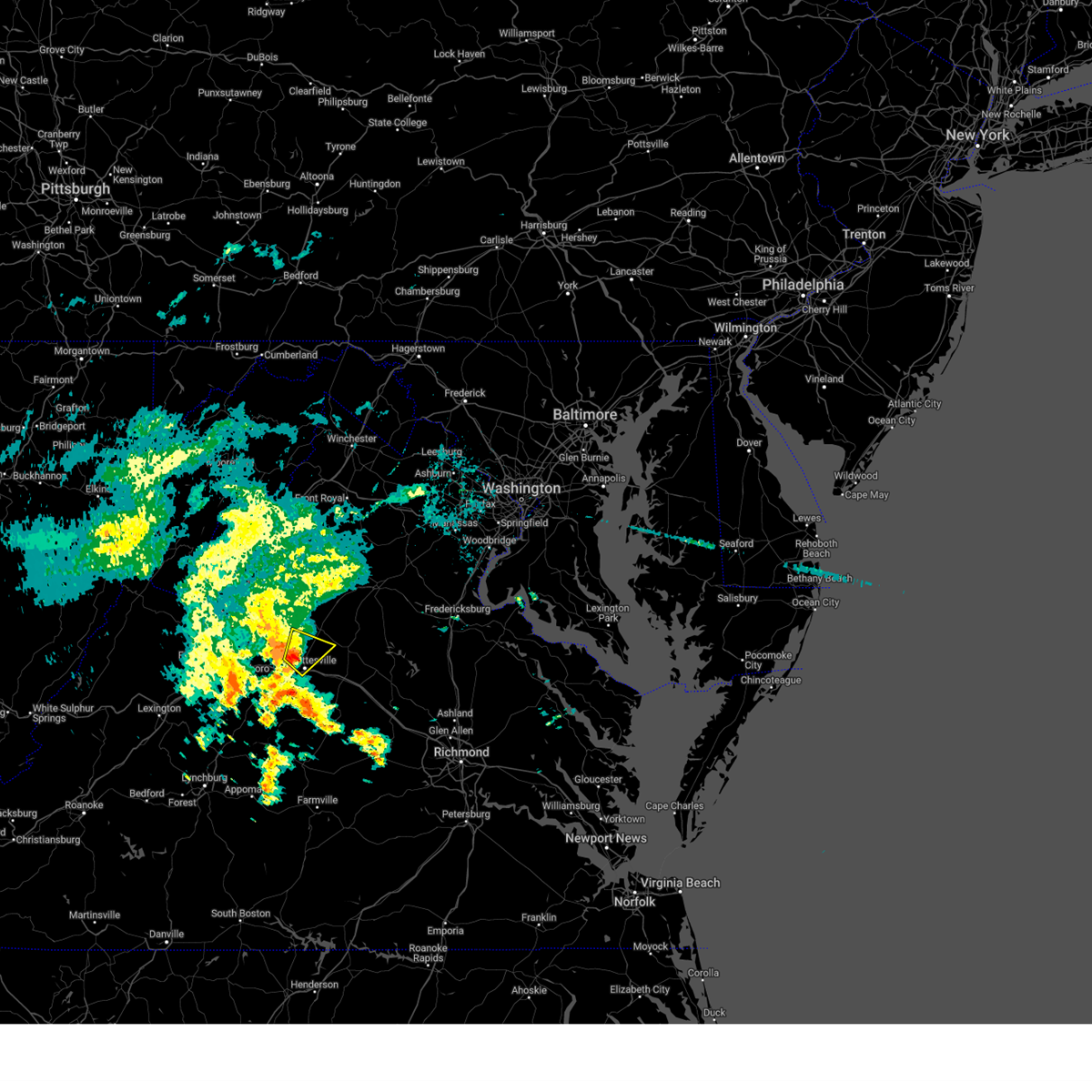
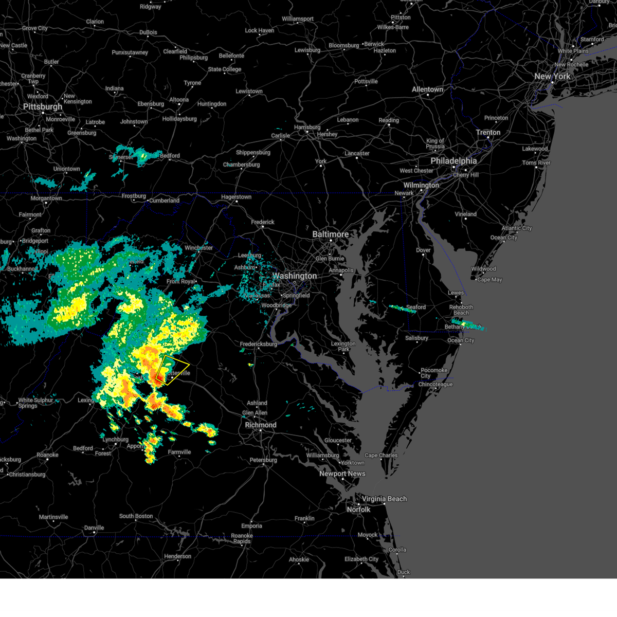
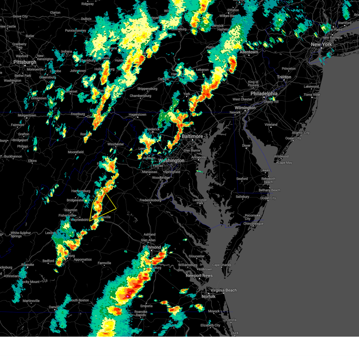
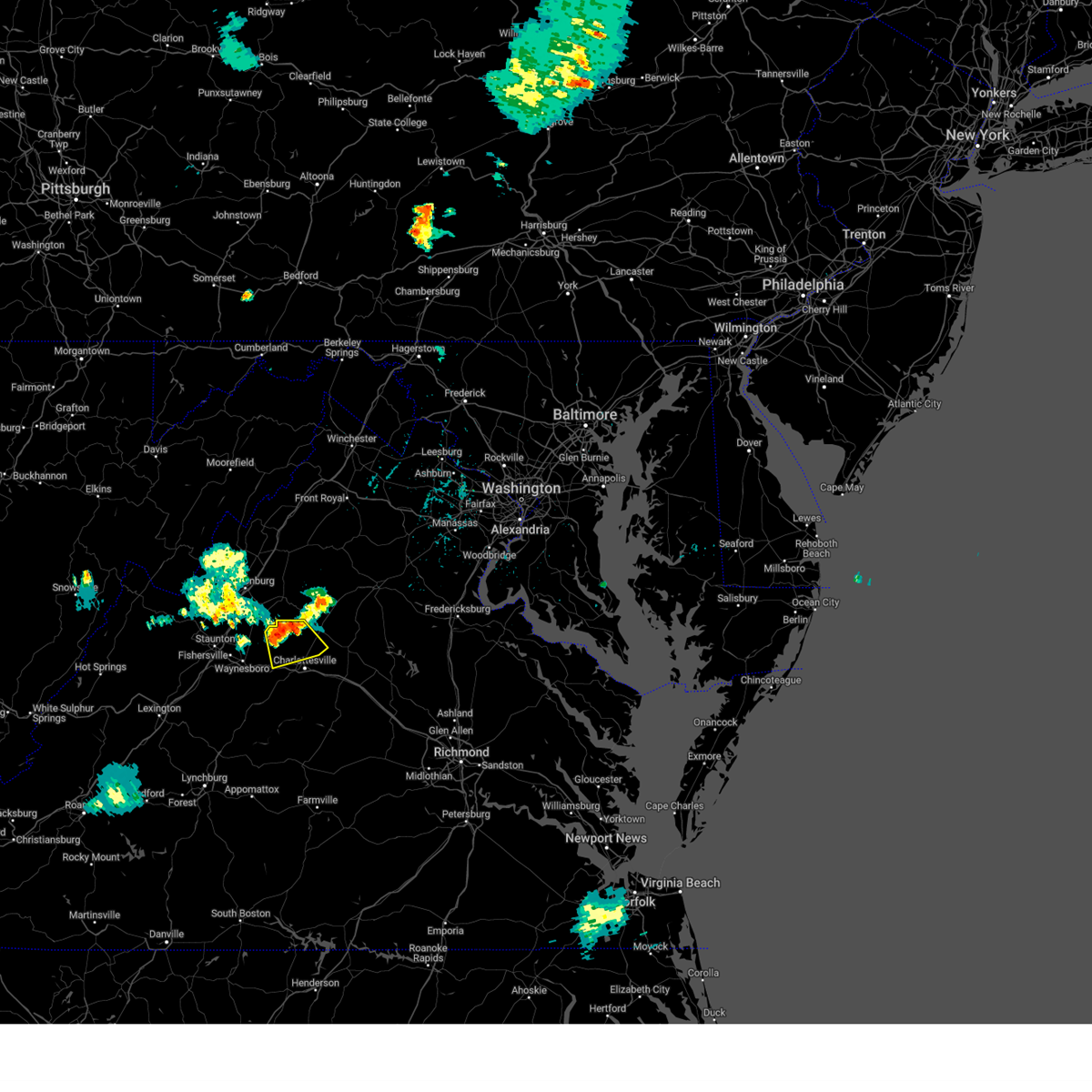
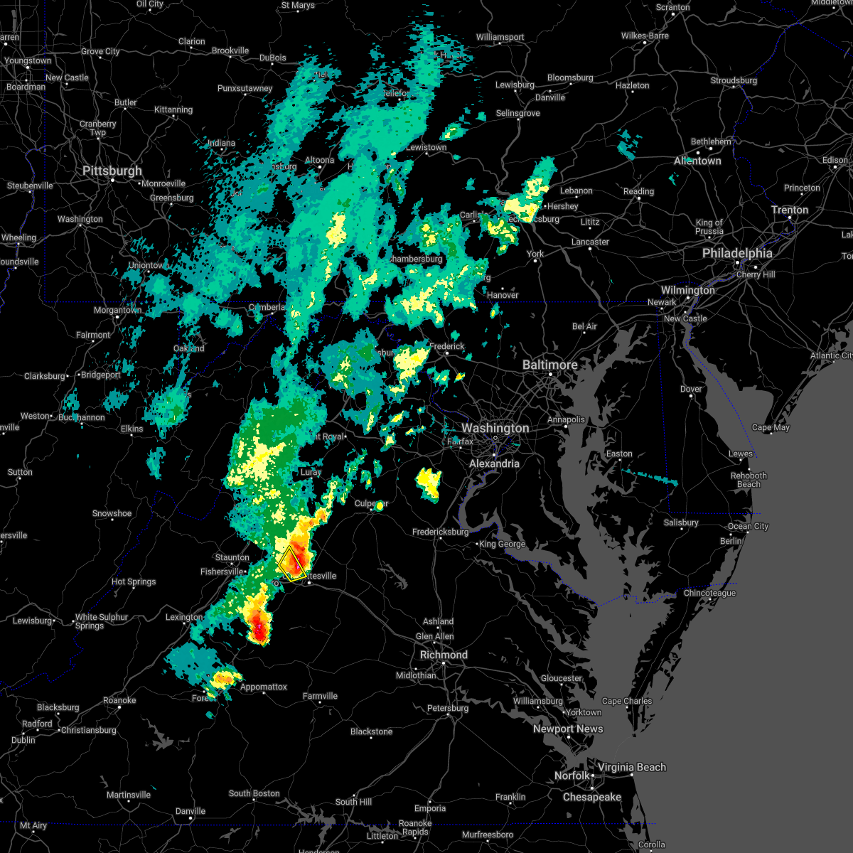
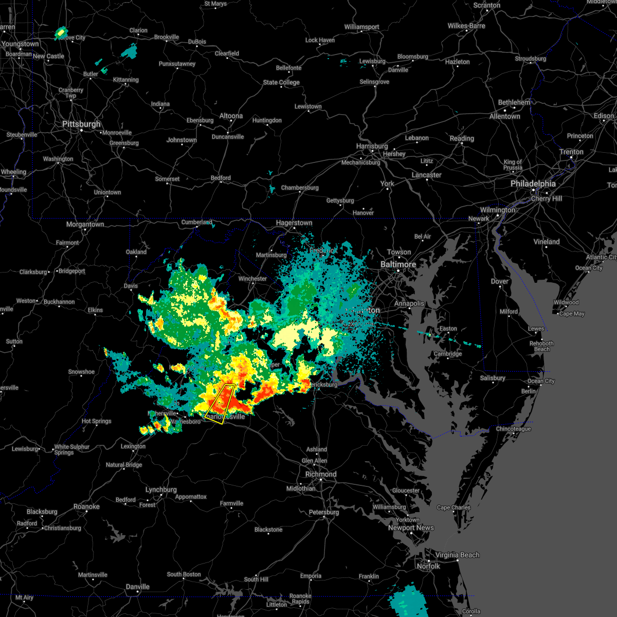
Hail Map for Free Union, VA
The Free Union, VA area has had 1 report of on-the-ground hail by trained spotters, and has been under severe weather warnings 26 times during the past 12 months. Doppler radar has detected hail at or near Free Union, VA on 30 occasions, including 1 occasion during the past year.
| Name: | Free Union, VA |
| Where Located: | 66.8 miles NW of Richmond, VA |
| Map: | Google Map for Free Union, VA |
| Population: | 193 |
| Housing Units: | 82 |
| More Info: | Search Google for Free Union, VA |
1
The Top Recent Hail Date for Free Union, VA is Thursday, May 15, 2025 (10th out of 30)

Hail and Wind Damage Spotted near Free Union, VA
| Date / Time | Report Details |
|---|---|
| 7/1/2025 5:26 PM EDT |
 The severe thunderstorm which prompted the warning has weakened. therefore, the warning will be allowed to expire. a severe thunderstorm watch remains in effect until 900 pm edt for central and northwestern virginia. The severe thunderstorm which prompted the warning has weakened. therefore, the warning will be allowed to expire. a severe thunderstorm watch remains in effect until 900 pm edt for central and northwestern virginia.
|
| 7/1/2025 5:15 PM EDT |
 At 515 pm edt, a severe thunderstorm was located over madison, moving northeast at 30 mph (radar indicated). Hazards include 60 mph wind gusts. Damaging winds will cause some trees and large branches to fall. this could injure those outdoors, as well as damage homes and vehicles. roadways may become blocked by downed trees. localized power outages are possible. unsecured light objects may become projectiles. Locations impacted include, madison, stanardsville, free union, hollymead, ruckersville, quinque, lydia, haneytown, newtown, amicus, hood, mcmullen, criglersville, boonesville, pratts, earlysville, rochelle, aroda, shelby, and dawsonville. At 515 pm edt, a severe thunderstorm was located over madison, moving northeast at 30 mph (radar indicated). Hazards include 60 mph wind gusts. Damaging winds will cause some trees and large branches to fall. this could injure those outdoors, as well as damage homes and vehicles. roadways may become blocked by downed trees. localized power outages are possible. unsecured light objects may become projectiles. Locations impacted include, madison, stanardsville, free union, hollymead, ruckersville, quinque, lydia, haneytown, newtown, amicus, hood, mcmullen, criglersville, boonesville, pratts, earlysville, rochelle, aroda, shelby, and dawsonville.
|
| 7/1/2025 4:43 PM EDT | Two trees reported down on skyline drive near brown mountai in greene county VA, 10.5 miles SSE of Free Union, VA |
| 7/1/2025 4:38 PM EDT |
 Svrlwx the national weather service in sterling virginia has issued a * severe thunderstorm warning for, southwestern madison county in northwestern virginia, north central albemarle county in central virginia, greene county in central virginia, * until 530 pm edt. * at 438 pm edt, a severe thunderstorm was located near free union, or 13 miles north of charlottesville, moving northeast at 10 mph (radar indicated). Hazards include 60 mph wind gusts. Damaging winds will cause some trees and large branches to fall. this could injure those outdoors, as well as damage homes and vehicles. roadways may become blocked by downed trees. localized power outages are possible. Unsecured light objects may become projectiles. Svrlwx the national weather service in sterling virginia has issued a * severe thunderstorm warning for, southwestern madison county in northwestern virginia, north central albemarle county in central virginia, greene county in central virginia, * until 530 pm edt. * at 438 pm edt, a severe thunderstorm was located near free union, or 13 miles north of charlottesville, moving northeast at 10 mph (radar indicated). Hazards include 60 mph wind gusts. Damaging winds will cause some trees and large branches to fall. this could injure those outdoors, as well as damage homes and vehicles. roadways may become blocked by downed trees. localized power outages are possible. Unsecured light objects may become projectiles.
|
| 6/19/2025 3:04 PM EDT |
 Svrlwx the national weather service in sterling virginia has issued a * severe thunderstorm warning for, southern madison county in northwestern virginia, the northern city of charlottesville in central virginia, southwestern orange county in central virginia, northern albemarle county in central virginia, greene county in central virginia, southwestern culpeper county in northern virginia, * until 330 pm edt. * at 304 pm edt, severe thunderstorms were located along a line extending from near stanardsville to near free union, moving east at 40 mph (radar indicated). Hazards include 60 mph wind gusts. Damaging winds will cause some trees and large branches to fall. this could injure those outdoors, as well as damage homes and vehicles. roadways may become blocked by downed trees. localized power outages are possible. Unsecured light objects may become projectiles. Svrlwx the national weather service in sterling virginia has issued a * severe thunderstorm warning for, southern madison county in northwestern virginia, the northern city of charlottesville in central virginia, southwestern orange county in central virginia, northern albemarle county in central virginia, greene county in central virginia, southwestern culpeper county in northern virginia, * until 330 pm edt. * at 304 pm edt, severe thunderstorms were located along a line extending from near stanardsville to near free union, moving east at 40 mph (radar indicated). Hazards include 60 mph wind gusts. Damaging winds will cause some trees and large branches to fall. this could injure those outdoors, as well as damage homes and vehicles. roadways may become blocked by downed trees. localized power outages are possible. Unsecured light objects may become projectiles.
|
| 6/8/2025 5:18 PM EDT | At 517 pm edt, severe thunderstorms were located along a line extending from near stanardsville to near charlottesville to 8 miles east of schuyler, moving east at 20 mph (radar indicated). Hazards include 60 mph wind gusts. Damaging winds will cause some trees and large branches to fall. this could injure those outdoors, as well as damage homes and vehicles. roadways may become blocked by downed trees. localized power outages are possible. unsecured light objects may become projectiles. Locations impacted include, hollymead, stony point, flordon, westmoreland, scott stadium, cobham, charlottesville, cismont, campbell, newcomb hall, boyd tavern, monticello, keswick, woodridge, carrsbrook, earlysville, shadwell, barracks, esmont, and keene. |
| 6/8/2025 5:06 PM EDT |
 Svrlwx the national weather service in sterling virginia has issued a * severe thunderstorm warning for, the city of charlottesville in central virginia, albemarle county in central virginia, * until 545 pm edt. * at 506 pm edt, severe thunderstorms were located along a line extending from near free union to near charlottesville to near schuyler, moving east at 20 mph (radar indicated). Hazards include 60 mph wind gusts. Damaging winds will cause some trees and large branches to fall. this could injure those outdoors, as well as damage homes and vehicles. roadways may become blocked by downed trees. localized power outages are possible. Unsecured light objects may become projectiles. Svrlwx the national weather service in sterling virginia has issued a * severe thunderstorm warning for, the city of charlottesville in central virginia, albemarle county in central virginia, * until 545 pm edt. * at 506 pm edt, severe thunderstorms were located along a line extending from near free union to near charlottesville to near schuyler, moving east at 20 mph (radar indicated). Hazards include 60 mph wind gusts. Damaging winds will cause some trees and large branches to fall. this could injure those outdoors, as well as damage homes and vehicles. roadways may become blocked by downed trees. localized power outages are possible. Unsecured light objects may become projectiles.
|
| 6/6/2025 4:13 PM EDT |
 At 413 pm edt, a severe thunderstorm was located near charlottesville, moving southeast at 15 mph (radar indicated). Hazards include 60 mph wind gusts. Damaging winds will cause some trees and large branches to fall. this could injure those outdoors, as well as damage homes and vehicles. roadways may become blocked by downed trees. localized power outages are possible. unsecured light objects may become projectiles. Locations impacted include, cobham, charlottesville, cismont, campbell, newcomb hall, hollymead, boyd tavern, monticello, keswick, woodridge, stony point, carrsbrook, earlysville, free union, shadwell, barracks, overton, westmoreland, scott stadium, and advance mills. At 413 pm edt, a severe thunderstorm was located near charlottesville, moving southeast at 15 mph (radar indicated). Hazards include 60 mph wind gusts. Damaging winds will cause some trees and large branches to fall. this could injure those outdoors, as well as damage homes and vehicles. roadways may become blocked by downed trees. localized power outages are possible. unsecured light objects may become projectiles. Locations impacted include, cobham, charlottesville, cismont, campbell, newcomb hall, hollymead, boyd tavern, monticello, keswick, woodridge, stony point, carrsbrook, earlysville, free union, shadwell, barracks, overton, westmoreland, scott stadium, and advance mills.
|
| 6/6/2025 4:08 PM EDT |
 Svrlwx the national weather service in sterling virginia has issued a * severe thunderstorm warning for, the city of charlottesville in central virginia, northeastern albemarle county in central virginia, * until 445 pm edt. * at 408 pm edt, a severe thunderstorm was located near charlottesville, moving south at 15 mph (radar indicated). Hazards include 60 mph wind gusts and quarter size hail. Damaging winds will cause some trees and large branches to fall. this could injure those outdoors, as well as damage homes and vehicles. roadways may become blocked by downed trees. localized power outages are possible. Unsecured light objects may become projectiles. Svrlwx the national weather service in sterling virginia has issued a * severe thunderstorm warning for, the city of charlottesville in central virginia, northeastern albemarle county in central virginia, * until 445 pm edt. * at 408 pm edt, a severe thunderstorm was located near charlottesville, moving south at 15 mph (radar indicated). Hazards include 60 mph wind gusts and quarter size hail. Damaging winds will cause some trees and large branches to fall. this could injure those outdoors, as well as damage homes and vehicles. roadways may become blocked by downed trees. localized power outages are possible. Unsecured light objects may become projectiles.
|
| 5/15/2025 7:59 PM EDT |
 The storm which prompted the warning has moved out of the area. therefore, the warning will be allowed to expire. a severe thunderstorm watch remains in effect until midnight edt for central virginia. to report severe weather, contact your nearest law enforcement agency. they will relay your report to the national weather service sterling virginia. The storm which prompted the warning has moved out of the area. therefore, the warning will be allowed to expire. a severe thunderstorm watch remains in effect until midnight edt for central virginia. to report severe weather, contact your nearest law enforcement agency. they will relay your report to the national weather service sterling virginia.
|
| 5/15/2025 7:40 PM EDT |
 At 740 pm edt, a severe thunderstorm was located near free union, or 11 miles northwest of charlottesville, moving southeast at 15 mph (radar indicated). Hazards include golf ball size hail and 60 mph wind gusts. Expect wind damage to trees and power lines. hail is large enough to dent and damage vehicles. some hail damage to roofs, siding, and windows is possible. Locations impacted include, free union, ivy, white hall, and crozet. At 740 pm edt, a severe thunderstorm was located near free union, or 11 miles northwest of charlottesville, moving southeast at 15 mph (radar indicated). Hazards include golf ball size hail and 60 mph wind gusts. Expect wind damage to trees and power lines. hail is large enough to dent and damage vehicles. some hail damage to roofs, siding, and windows is possible. Locations impacted include, free union, ivy, white hall, and crozet.
|
| 5/15/2025 7:29 PM EDT |
 At 729 pm edt, a severe thunderstorm was located near free union, or 14 miles northwest of charlottesville, moving southeast at 15 mph (radar indicated). Hazards include golf ball size hail and 60 mph wind gusts. Expect wind damage to trees and power lines. hail is large enough to dent and damage vehicles. some hail damage to roofs, siding, and windows is possible. Locations impacted include, earlysville, free union, ivy, white hall, hollymead, and crozet. At 729 pm edt, a severe thunderstorm was located near free union, or 14 miles northwest of charlottesville, moving southeast at 15 mph (radar indicated). Hazards include golf ball size hail and 60 mph wind gusts. Expect wind damage to trees and power lines. hail is large enough to dent and damage vehicles. some hail damage to roofs, siding, and windows is possible. Locations impacted include, earlysville, free union, ivy, white hall, hollymead, and crozet.
|
| 5/15/2025 7:29 PM EDT |
 the severe thunderstorm warning has been cancelled and is no longer in effect the severe thunderstorm warning has been cancelled and is no longer in effect
|
| 5/15/2025 7:22 PM EDT |
 At 721 pm edt, a severe thunderstorm was located 7 miles southeast of grottoes, or 15 miles northeast of waynesboro, moving southeast at 15 mph (radar indicated). Hazards include ping pong ball size hail and 60 mph wind gusts. Damaging winds will cause some trees and large branches to fall. this could injure those outdoors, as well as damage homes and vehicles. roadways may become blocked by downed trees. localized power outages are possible. unsecured light objects may become projectiles. Locations impacted include, earlysville, free union, ivy, white hall, hollymead, and crozet. At 721 pm edt, a severe thunderstorm was located 7 miles southeast of grottoes, or 15 miles northeast of waynesboro, moving southeast at 15 mph (radar indicated). Hazards include ping pong ball size hail and 60 mph wind gusts. Damaging winds will cause some trees and large branches to fall. this could injure those outdoors, as well as damage homes and vehicles. roadways may become blocked by downed trees. localized power outages are possible. unsecured light objects may become projectiles. Locations impacted include, earlysville, free union, ivy, white hall, hollymead, and crozet.
|
| 5/15/2025 7:22 PM EDT |
 the severe thunderstorm warning has been cancelled and is no longer in effect the severe thunderstorm warning has been cancelled and is no longer in effect
|
| 5/15/2025 7:09 PM EDT |
 Svrlwx the national weather service in sterling virginia has issued a * severe thunderstorm warning for, south central rockingham county in western virginia, northwestern albemarle county in central virginia, southwestern greene county in central virginia, eastern augusta county in western virginia, * until 800 pm edt. * at 709 pm edt, a severe thunderstorm was located 8 miles east of grottoes, or 17 miles northeast of waynesboro, moving southeast at 15 mph (radar indicated). Hazards include ping pong ball size hail and 60 mph wind gusts. Damaging winds will cause some trees and large branches to fall. this could injure those outdoors, as well as damage homes and vehicles. roadways may become blocked by downed trees. localized power outages are possible. Unsecured light objects may become projectiles. Svrlwx the national weather service in sterling virginia has issued a * severe thunderstorm warning for, south central rockingham county in western virginia, northwestern albemarle county in central virginia, southwestern greene county in central virginia, eastern augusta county in western virginia, * until 800 pm edt. * at 709 pm edt, a severe thunderstorm was located 8 miles east of grottoes, or 17 miles northeast of waynesboro, moving southeast at 15 mph (radar indicated). Hazards include ping pong ball size hail and 60 mph wind gusts. Damaging winds will cause some trees and large branches to fall. this could injure those outdoors, as well as damage homes and vehicles. roadways may become blocked by downed trees. localized power outages are possible. Unsecured light objects may become projectiles.
|
| 5/15/2025 7:09 PM EDT |
 Svrlwx the national weather service in sterling virginia has issued a * severe thunderstorm warning for, south central rockingham county in western virginia, northwestern albemarle county in central virginia, southwestern greene county in central virginia, eastern augusta county in western virginia, * until 800 pm edt. * at 709 pm edt, a severe thunderstorm was located 8 miles east of grottoes, or 17 miles southeast of harrisonburg, moving southeast at 15 mph (radar indicated). Hazards include ping pong ball size hail and 60 mph wind gusts. Damaging winds will cause some trees and large branches to fall. this could injure those outdoors, as well as damage homes and vehicles. roadways may become blocked by downed trees. localized power outages are possible. Unsecured light objects may become projectiles. Svrlwx the national weather service in sterling virginia has issued a * severe thunderstorm warning for, south central rockingham county in western virginia, northwestern albemarle county in central virginia, southwestern greene county in central virginia, eastern augusta county in western virginia, * until 800 pm edt. * at 709 pm edt, a severe thunderstorm was located 8 miles east of grottoes, or 17 miles southeast of harrisonburg, moving southeast at 15 mph (radar indicated). Hazards include ping pong ball size hail and 60 mph wind gusts. Damaging winds will cause some trees and large branches to fall. this could injure those outdoors, as well as damage homes and vehicles. roadways may become blocked by downed trees. localized power outages are possible. Unsecured light objects may become projectiles.
|
| 9/26/2024 1:30 AM EDT |
 The storm which prompted the warning has moved out of the area. therefore, the warning has been allowed to expire. however, heavy rain is still possible with this thunderstorm. to report severe weather, contact your nearest law enforcement agency. they will relay your report to the national weather service sterling virginia. The storm which prompted the warning has moved out of the area. therefore, the warning has been allowed to expire. however, heavy rain is still possible with this thunderstorm. to report severe weather, contact your nearest law enforcement agency. they will relay your report to the national weather service sterling virginia.
|
| 9/26/2024 1:24 AM EDT |
 At 124 am edt, a severe thunderstorm was located near free union, or 7 miles north of charlottesville, moving northeast at 25 mph (radar indicated). Hazards include 60 mph wind gusts. Damaging winds will cause some trees and large branches to fall. this could injure those outdoors, as well as damage homes and vehicles. roadways may become blocked by downed trees. localized power outages are possible. unsecured light objects may become projectiles. Locations impacted include, free union, westmoreland, hollymead, stony point, advance mills, carrsbrook, and earlysville. At 124 am edt, a severe thunderstorm was located near free union, or 7 miles north of charlottesville, moving northeast at 25 mph (radar indicated). Hazards include 60 mph wind gusts. Damaging winds will cause some trees and large branches to fall. this could injure those outdoors, as well as damage homes and vehicles. roadways may become blocked by downed trees. localized power outages are possible. unsecured light objects may become projectiles. Locations impacted include, free union, westmoreland, hollymead, stony point, advance mills, carrsbrook, and earlysville.
|
| 9/26/2024 1:24 AM EDT |
 the severe thunderstorm warning has been cancelled and is no longer in effect the severe thunderstorm warning has been cancelled and is no longer in effect
|
| 9/26/2024 1:14 AM EDT |
 At 113 am edt, a severe thunderstorm was located near charlottesville, moving northeast at 25 mph (radar indicated). Hazards include 60 mph wind gusts and possible tornado. Damaging winds will cause some trees and large branches to fall. this could injure those outdoors, as well as damage homes and vehicles. roadways may become blocked by downed trees. localized power outages are possible. unsecured light objects may become projectiles. Locations impacted include, charlottesville, free union, westmoreland, hollymead, ivy, newcomb hall, stony point, flordon, carrsbrook, earlysville, barracks, scott stadium, and advance mills. At 113 am edt, a severe thunderstorm was located near charlottesville, moving northeast at 25 mph (radar indicated). Hazards include 60 mph wind gusts and possible tornado. Damaging winds will cause some trees and large branches to fall. this could injure those outdoors, as well as damage homes and vehicles. roadways may become blocked by downed trees. localized power outages are possible. unsecured light objects may become projectiles. Locations impacted include, charlottesville, free union, westmoreland, hollymead, ivy, newcomb hall, stony point, flordon, carrsbrook, earlysville, barracks, scott stadium, and advance mills.
|
| 9/26/2024 1:04 AM EDT |
 Svrlwx the national weather service in sterling virginia has issued a * severe thunderstorm warning for, the city of charlottesville in central virginia, northeastern albemarle county in central virginia, * until 130 am edt. * at 104 am edt, a severe thunderstorm was located near charlottesville, moving northeast at 25 mph (radar indicated). Hazards include 60 mph wind gusts and possible tornado. Damaging winds will cause some trees and large branches to fall. this could injure those outdoors, as well as damage homes and vehicles. roadways may become blocked by downed trees. localized power outages are possible. Unsecured light objects may become projectiles. Svrlwx the national weather service in sterling virginia has issued a * severe thunderstorm warning for, the city of charlottesville in central virginia, northeastern albemarle county in central virginia, * until 130 am edt. * at 104 am edt, a severe thunderstorm was located near charlottesville, moving northeast at 25 mph (radar indicated). Hazards include 60 mph wind gusts and possible tornado. Damaging winds will cause some trees and large branches to fall. this could injure those outdoors, as well as damage homes and vehicles. roadways may become blocked by downed trees. localized power outages are possible. Unsecured light objects may become projectiles.
|
| 8/3/2024 4:36 PM EDT |
 The storm which prompted the warning has weakened below severe limits, and no longer poses an immediate threat to life or property. therefore, the warning will be allowed to expire. a severe thunderstorm watch remains in effect until 900 pm edt for central and northwestern virginia. The storm which prompted the warning has weakened below severe limits, and no longer poses an immediate threat to life or property. therefore, the warning will be allowed to expire. a severe thunderstorm watch remains in effect until 900 pm edt for central and northwestern virginia.
|
| 8/3/2024 4:25 PM EDT |
 the severe thunderstorm warning has been cancelled and is no longer in effect the severe thunderstorm warning has been cancelled and is no longer in effect
|
| 8/3/2024 4:25 PM EDT |
 At 425 pm edt, a severe thunderstorm was located over free union, or 10 miles north of charlottesville, moving northeast at 30 mph (radar indicated). Hazards include 60 mph wind gusts. Damaging winds will cause some trees and large branches to fall. this could injure those outdoors, as well as damage homes and vehicles. roadways may become blocked by downed trees. localized power outages are possible. unsecured light objects may become projectiles. Locations impacted include, crozet, stanardsville, free union, big meadows, hollymead, ruckersville, ivy, quinque, eheart, lydia, barboursville, haneytown, montpelier station, newtown, old somerset, amicus, somerset, shady grove, hood, and mcmullen. At 425 pm edt, a severe thunderstorm was located over free union, or 10 miles north of charlottesville, moving northeast at 30 mph (radar indicated). Hazards include 60 mph wind gusts. Damaging winds will cause some trees and large branches to fall. this could injure those outdoors, as well as damage homes and vehicles. roadways may become blocked by downed trees. localized power outages are possible. unsecured light objects may become projectiles. Locations impacted include, crozet, stanardsville, free union, big meadows, hollymead, ruckersville, ivy, quinque, eheart, lydia, barboursville, haneytown, montpelier station, newtown, old somerset, amicus, somerset, shady grove, hood, and mcmullen.
|
| 8/3/2024 4:05 PM EDT |
 Svrlwx the national weather service in sterling virginia has issued a * severe thunderstorm warning for, southwestern madison county in northwestern virginia, west central orange county in central virginia, southeastern rockingham county in western virginia, south central page county in northwestern virginia, northern albemarle county in central virginia, greene county in central virginia, east central augusta county in western virginia, * until 445 pm edt. * at 404 pm edt, a severe thunderstorm was located near crozet, or 10 miles east of waynesboro, moving northeast at 35 mph (radar indicated). Hazards include 60 mph wind gusts. Damaging winds will cause some trees and large branches to fall. this could injure those outdoors, as well as damage homes and vehicles. roadways may become blocked by downed trees. localized power outages are possible. Unsecured light objects may become projectiles. Svrlwx the national weather service in sterling virginia has issued a * severe thunderstorm warning for, southwestern madison county in northwestern virginia, west central orange county in central virginia, southeastern rockingham county in western virginia, south central page county in northwestern virginia, northern albemarle county in central virginia, greene county in central virginia, east central augusta county in western virginia, * until 445 pm edt. * at 404 pm edt, a severe thunderstorm was located near crozet, or 10 miles east of waynesboro, moving northeast at 35 mph (radar indicated). Hazards include 60 mph wind gusts. Damaging winds will cause some trees and large branches to fall. this could injure those outdoors, as well as damage homes and vehicles. roadways may become blocked by downed trees. localized power outages are possible. Unsecured light objects may become projectiles.
|
| 7/17/2024 4:12 PM EDT |
 Svrlwx the national weather service in sterling virginia has issued a * severe thunderstorm warning for, the city of charlottesville in central virginia, albemarle county in central virginia, * until 515 pm edt. * at 411 pm edt, a severe thunderstorm was located near afton, or near waynesboro, moving east at 40 mph (radar indicated). Hazards include 60 mph wind gusts. Damaging winds will cause some trees and large branches to fall. this could injure those outdoors, as well as damage homes and vehicles. roadways may become blocked by downed trees. localized power outages are possible. Unsecured light objects may become projectiles. Svrlwx the national weather service in sterling virginia has issued a * severe thunderstorm warning for, the city of charlottesville in central virginia, albemarle county in central virginia, * until 515 pm edt. * at 411 pm edt, a severe thunderstorm was located near afton, or near waynesboro, moving east at 40 mph (radar indicated). Hazards include 60 mph wind gusts. Damaging winds will cause some trees and large branches to fall. this could injure those outdoors, as well as damage homes and vehicles. roadways may become blocked by downed trees. localized power outages are possible. Unsecured light objects may become projectiles.
|
| 6/26/2024 8:39 PM EDT |
 Svrlwx the national weather service in sterling virginia has issued a * severe thunderstorm warning for, madison county in northwestern virginia, southwestern orange county in central virginia, east central rockingham county in western virginia, southern page county in northwestern virginia, northeastern albemarle county in central virginia, southwestern rappahannock county in northwestern virginia, greene county in central virginia, western culpeper county in northern virginia, * until 915 pm edt. * at 839 pm edt, severe thunderstorms were located along a line extending from near luray to near madison to 9 miles northwest of boswells tavern, moving northeast at 45 mph (radar indicated). Hazards include 60 mph wind gusts. Damaging winds will cause some trees and large branches to fall. this could injure those outdoors, as well as damage homes and vehicles. roadways may become blocked by downed trees. localized power outages are possible. Unsecured light objects may become projectiles. Svrlwx the national weather service in sterling virginia has issued a * severe thunderstorm warning for, madison county in northwestern virginia, southwestern orange county in central virginia, east central rockingham county in western virginia, southern page county in northwestern virginia, northeastern albemarle county in central virginia, southwestern rappahannock county in northwestern virginia, greene county in central virginia, western culpeper county in northern virginia, * until 915 pm edt. * at 839 pm edt, severe thunderstorms were located along a line extending from near luray to near madison to 9 miles northwest of boswells tavern, moving northeast at 45 mph (radar indicated). Hazards include 60 mph wind gusts. Damaging winds will cause some trees and large branches to fall. this could injure those outdoors, as well as damage homes and vehicles. roadways may become blocked by downed trees. localized power outages are possible. Unsecured light objects may become projectiles.
|
| 6/26/2024 8:38 PM EDT | Large tree branch down at the 4600 block of pelham rd. winds estimated between 50 and 60 mp in albemarle county VA, 2.1 miles WSW of Free Union, VA |
| 6/26/2024 8:29 PM EDT |
 the severe thunderstorm warning has been cancelled and is no longer in effect the severe thunderstorm warning has been cancelled and is no longer in effect
|
| 6/26/2024 8:29 PM EDT |
 At 828 pm edt, severe thunderstorms were located along a line extending from shenandoah to near stanardsville to near free union, moving east at 40 mph (radar indicated). Hazards include 60 mph wind gusts. Damaging winds will cause some trees and large branches to fall. this could injure those outdoors, as well as damage homes and vehicles. roadways may become blocked by downed trees. localized power outages are possible. unsecured light objects may become projectiles. Locations impacted include, crozet, shenandoah, massanutten, stanley, stanardsville, free union, big meadows, hollymead, elkton, ruckersville, rocky bar, ingham, quinque, eheart, lydia, haneytown, newtown, amicus, mcgaheysville, and shady grove. At 828 pm edt, severe thunderstorms were located along a line extending from shenandoah to near stanardsville to near free union, moving east at 40 mph (radar indicated). Hazards include 60 mph wind gusts. Damaging winds will cause some trees and large branches to fall. this could injure those outdoors, as well as damage homes and vehicles. roadways may become blocked by downed trees. localized power outages are possible. unsecured light objects may become projectiles. Locations impacted include, crozet, shenandoah, massanutten, stanley, stanardsville, free union, big meadows, hollymead, elkton, ruckersville, rocky bar, ingham, quinque, eheart, lydia, haneytown, newtown, amicus, mcgaheysville, and shady grove.
|
| 6/26/2024 8:09 PM EDT |
 Svrlwx the national weather service in sterling virginia has issued a * severe thunderstorm warning for, southwestern madison county in northwestern virginia, west central orange county in central virginia, southeastern rockingham county in western virginia, southwestern page county in northwestern virginia, northern albemarle county in central virginia, greene county in central virginia, east central augusta county in western virginia, the eastern city of harrisonburg in western virginia, * until 845 pm edt. * at 809 pm edt, severe thunderstorms were located along a line extending from near massanutten to 9 miles east of grottoes to near crozet, moving east at 40 mph (radar indicated). Hazards include 60 mph wind gusts. Damaging winds will cause some trees and large branches to fall. this could injure those outdoors, as well as damage homes and vehicles. roadways may become blocked by downed trees. localized power outages are possible. Unsecured light objects may become projectiles. Svrlwx the national weather service in sterling virginia has issued a * severe thunderstorm warning for, southwestern madison county in northwestern virginia, west central orange county in central virginia, southeastern rockingham county in western virginia, southwestern page county in northwestern virginia, northern albemarle county in central virginia, greene county in central virginia, east central augusta county in western virginia, the eastern city of harrisonburg in western virginia, * until 845 pm edt. * at 809 pm edt, severe thunderstorms were located along a line extending from near massanutten to 9 miles east of grottoes to near crozet, moving east at 40 mph (radar indicated). Hazards include 60 mph wind gusts. Damaging winds will cause some trees and large branches to fall. this could injure those outdoors, as well as damage homes and vehicles. roadways may become blocked by downed trees. localized power outages are possible. Unsecured light objects may become projectiles.
|
| 5/26/2024 8:09 PM EDT |
 Svrlwx the national weather service in sterling virginia has issued a * severe thunderstorm warning for, madison county in northwestern virginia, the city of charlottesville in central virginia, southwestern orange county in central virginia, southeastern rockingham county in western virginia, central albemarle county in central virginia, southern rappahannock county in northwestern virginia, greene county in central virginia, southwestern culpeper county in northern virginia, * until 915 pm edt. * at 809 pm edt, a severe thunderstorm was located near crozet, or 10 miles southeast of waynesboro, moving northeast at 55 mph (radar indicated). Hazards include 60 mph wind gusts and quarter size hail. Damaging winds will cause some trees and large branches to fall. this could injure those outdoors, as well as damage homes and vehicles. roadways may become blocked by downed trees. localized power outages are possible. Unsecured light objects may become projectiles. Svrlwx the national weather service in sterling virginia has issued a * severe thunderstorm warning for, madison county in northwestern virginia, the city of charlottesville in central virginia, southwestern orange county in central virginia, southeastern rockingham county in western virginia, central albemarle county in central virginia, southern rappahannock county in northwestern virginia, greene county in central virginia, southwestern culpeper county in northern virginia, * until 915 pm edt. * at 809 pm edt, a severe thunderstorm was located near crozet, or 10 miles southeast of waynesboro, moving northeast at 55 mph (radar indicated). Hazards include 60 mph wind gusts and quarter size hail. Damaging winds will cause some trees and large branches to fall. this could injure those outdoors, as well as damage homes and vehicles. roadways may become blocked by downed trees. localized power outages are possible. Unsecured light objects may become projectiles.
|
| 8/7/2023 5:14 PM EDT |
 At 513 pm edt, a severe thunderstorm was located 7 miles southeast of stanardsville, or 12 miles northeast of charlottesville, moving east at 30 mph (a trained spotter reported golf ball size hail in earlysville, va). Hazards include golf ball size hail and 70 mph wind gusts. Expect wind damage to trees and power lines. hail is large enough to dent and damage vehicles. some hail damage to roofs, siding, and windows is possible. locations impacted include, orange, free union, hollymead, gordonsville, ruckersville, quinque, eheart, oakpark, barboursville, stony point, montpelier station, newtown, nasons, madison mills, montford, mitchells, old somerset, somerset, locust dale and rapidan. thunderstorm damage threat, considerable hail threat, radar indicated max hail size, 1. 75 in wind threat, radar indicated max wind gust, 70 mph. At 513 pm edt, a severe thunderstorm was located 7 miles southeast of stanardsville, or 12 miles northeast of charlottesville, moving east at 30 mph (a trained spotter reported golf ball size hail in earlysville, va). Hazards include golf ball size hail and 70 mph wind gusts. Expect wind damage to trees and power lines. hail is large enough to dent and damage vehicles. some hail damage to roofs, siding, and windows is possible. locations impacted include, orange, free union, hollymead, gordonsville, ruckersville, quinque, eheart, oakpark, barboursville, stony point, montpelier station, newtown, nasons, madison mills, montford, mitchells, old somerset, somerset, locust dale and rapidan. thunderstorm damage threat, considerable hail threat, radar indicated max hail size, 1. 75 in wind threat, radar indicated max wind gust, 70 mph.
|
| 8/7/2023 5:02 PM EDT |
 At 501 pm edt, a severe thunderstorm was located near free union, or 11 miles north of charlottesville, moving east at 45 mph (radar indicated). Hazards include 70 mph wind gusts and ping pong ball size hail. Damaging winds will cause some trees and large branches to fall. this could injure those outdoors, as well as damage homes and vehicles. roadways may become blocked by downed trees. localized power outages are possible. unsecured light objects may become projectiles. Locations impacted include, orange, stanardsville, free union, westmoreland, hollymead, gordonsville, ruckersville, brightwood, quinque, eheart, oakpark, barboursville, stony point, montpelier station, newtown, nasons, madison mills, montford, old somerset and amicus. At 501 pm edt, a severe thunderstorm was located near free union, or 11 miles north of charlottesville, moving east at 45 mph (radar indicated). Hazards include 70 mph wind gusts and ping pong ball size hail. Damaging winds will cause some trees and large branches to fall. this could injure those outdoors, as well as damage homes and vehicles. roadways may become blocked by downed trees. localized power outages are possible. unsecured light objects may become projectiles. Locations impacted include, orange, stanardsville, free union, westmoreland, hollymead, gordonsville, ruckersville, brightwood, quinque, eheart, oakpark, barboursville, stony point, montpelier station, newtown, nasons, madison mills, montford, old somerset and amicus.
|
| 8/7/2023 4:48 PM EDT |
 At 448 pm edt, a severe thunderstorm was located near free union, or 11 miles northwest of charlottesville, moving east at 45 mph (radar indicated). Hazards include 70 mph wind gusts and ping pong ball size hail. Damaging winds will cause some trees and large branches to fall. this could injure those outdoors, as well as damage homes and vehicles. roadways may become blocked by downed trees. localized power outages are possible. Unsecured light objects may become projectiles. At 448 pm edt, a severe thunderstorm was located near free union, or 11 miles northwest of charlottesville, moving east at 45 mph (radar indicated). Hazards include 70 mph wind gusts and ping pong ball size hail. Damaging winds will cause some trees and large branches to fall. this could injure those outdoors, as well as damage homes and vehicles. roadways may become blocked by downed trees. localized power outages are possible. Unsecured light objects may become projectiles.
|
| 7/28/2023 7:20 PM EDT |
 At 719 pm edt, severe thunderstorms were located along a line extending from 8 miles northwest of free union to near wintergreen, moving east at 35 mph (law enforcement). Hazards include 60 mph wind gusts. Damaging winds will cause some trees and large branches to fall. this could injure those outdoors, as well as damage homes and vehicles. roadways may become blocked by downed trees. localized power outages are possible. Unsecured light objects may become projectiles. At 719 pm edt, severe thunderstorms were located along a line extending from 8 miles northwest of free union to near wintergreen, moving east at 35 mph (law enforcement). Hazards include 60 mph wind gusts. Damaging winds will cause some trees and large branches to fall. this could injure those outdoors, as well as damage homes and vehicles. roadways may become blocked by downed trees. localized power outages are possible. Unsecured light objects may become projectiles.
|
| 7/28/2023 7:17 PM EDT |
 At 716 pm edt, severe thunderstorms were located along a line extending from 6 miles east of timberville to near clifford, moving east at 30 mph (law enforcement). Hazards include 60 mph wind gusts. Damaging winds will cause some trees and large branches to fall. this could injure those outdoors, as well as damage homes and vehicles. roadways may become blocked by downed trees. localized power outages are possible. unsecured light objects may become projectiles. locations impacted include, waynesboro, stuarts draft, crozet, grottoes, shenandoah, massanutten, crimora, stanley, sherando, shipman, schuyler, free union, wintergreen, afton, big meadows, fishersville, elkton, weyers cave, new market and lyndhurst. hail threat, radar indicated max hail size, <. 75 in wind threat, observed max wind gust, 60 mph. At 716 pm edt, severe thunderstorms were located along a line extending from 6 miles east of timberville to near clifford, moving east at 30 mph (law enforcement). Hazards include 60 mph wind gusts. Damaging winds will cause some trees and large branches to fall. this could injure those outdoors, as well as damage homes and vehicles. roadways may become blocked by downed trees. localized power outages are possible. unsecured light objects may become projectiles. locations impacted include, waynesboro, stuarts draft, crozet, grottoes, shenandoah, massanutten, crimora, stanley, sherando, shipman, schuyler, free union, wintergreen, afton, big meadows, fishersville, elkton, weyers cave, new market and lyndhurst. hail threat, radar indicated max hail size, <. 75 in wind threat, observed max wind gust, 60 mph.
|
| 7/28/2023 6:29 PM EDT |
 At 628 pm edt, severe thunderstorms were located along a line extending from 10 miles east of brandywine to near glasgow, moving east at 30 mph (radar indicated). Hazards include 60 mph wind gusts. Damaging winds will cause some trees and large branches to fall. this could injure those outdoors, as well as damage homes and vehicles. roadways may become blocked by downed trees. localized power outages are possible. Unsecured light objects may become projectiles. At 628 pm edt, severe thunderstorms were located along a line extending from 10 miles east of brandywine to near glasgow, moving east at 30 mph (radar indicated). Hazards include 60 mph wind gusts. Damaging winds will cause some trees and large branches to fall. this could injure those outdoors, as well as damage homes and vehicles. roadways may become blocked by downed trees. localized power outages are possible. Unsecured light objects may become projectiles.
|
| 7/8/2023 8:28 PM EDT |
 At 828 pm edt, a severe thunderstorm was located near stanardsville, or 15 miles north of charlottesville, moving north at 10 mph (radar indicated). Hazards include 60 mph wind gusts. Damaging winds will cause some trees and large branches to fall. this could injure those outdoors, as well as damage homes and vehicles. roadways may become blocked by downed trees. localized power outages are possible. Unsecured light objects may become projectiles. At 828 pm edt, a severe thunderstorm was located near stanardsville, or 15 miles north of charlottesville, moving north at 10 mph (radar indicated). Hazards include 60 mph wind gusts. Damaging winds will cause some trees and large branches to fall. this could injure those outdoors, as well as damage homes and vehicles. roadways may become blocked by downed trees. localized power outages are possible. Unsecured light objects may become projectiles.
|
| 7/6/2023 10:06 PM EDT |
 At 1006 pm edt, severe thunderstorms were located along a line extending from near free union to near crozet, moving southeast at 10 mph (radar indicated). Hazards include 60 mph wind gusts. Damaging winds will cause some trees and large branches to fall. this could injure those outdoors, as well as damage homes and vehicles. roadways may become blocked by downed trees. localized power outages are possible. unsecured light objects may become projectiles. locations impacted include, crozet, free union, westmoreland, hollymead, ivy, boonesville, stony point, carrsbrook, earlysville, mission home, amicus, advance mills, saint george, shady grove and white hall. hail threat, radar indicated max hail size, <. 75 in wind threat, radar indicated max wind gust, 60 mph. At 1006 pm edt, severe thunderstorms were located along a line extending from near free union to near crozet, moving southeast at 10 mph (radar indicated). Hazards include 60 mph wind gusts. Damaging winds will cause some trees and large branches to fall. this could injure those outdoors, as well as damage homes and vehicles. roadways may become blocked by downed trees. localized power outages are possible. unsecured light objects may become projectiles. locations impacted include, crozet, free union, westmoreland, hollymead, ivy, boonesville, stony point, carrsbrook, earlysville, mission home, amicus, advance mills, saint george, shady grove and white hall. hail threat, radar indicated max hail size, <. 75 in wind threat, radar indicated max wind gust, 60 mph.
|
| 7/6/2023 9:51 PM EDT |
 At 951 pm edt, severe thunderstorms were located along a line extending from near madison to near free union to 8 miles east of crimora, moving southeast at 15 mph (radar indicated). Hazards include 60 mph wind gusts. Damaging winds will cause some trees and large branches to fall. this could injure those outdoors, as well as damage homes and vehicles. roadways may become blocked by downed trees. localized power outages are possible. Unsecured light objects may become projectiles. At 951 pm edt, severe thunderstorms were located along a line extending from near madison to near free union to 8 miles east of crimora, moving southeast at 15 mph (radar indicated). Hazards include 60 mph wind gusts. Damaging winds will cause some trees and large branches to fall. this could injure those outdoors, as well as damage homes and vehicles. roadways may become blocked by downed trees. localized power outages are possible. Unsecured light objects may become projectiles.
|
| 7/3/2023 9:27 PM EDT |
 The severe thunderstorm warning for central albemarle county and the city of charlottesville will expire at 930 pm edt, the storm which prompted the warning has weakened below severe limits, and no longer poses an immediate threat to life or property. therefore, the warning will be allowed to expire. however gusty winds are still possible with this thunderstorm. a severe thunderstorm watch remains in effect until 1000 pm edt for central virginia. The severe thunderstorm warning for central albemarle county and the city of charlottesville will expire at 930 pm edt, the storm which prompted the warning has weakened below severe limits, and no longer poses an immediate threat to life or property. therefore, the warning will be allowed to expire. however gusty winds are still possible with this thunderstorm. a severe thunderstorm watch remains in effect until 1000 pm edt for central virginia.
|
| 7/3/2023 9:02 PM EDT |
 At 902 pm edt, a severe thunderstorm was located 7 miles southwest of charlottesville, moving northeast at 35 mph (radar indicated). Hazards include 60 mph wind gusts and quarter size hail. Damaging winds will cause some trees and large branches to fall. this could injure those outdoors, as well as damage homes and vehicles. roadways may become blocked by downed trees. localized power outages are possible. unsecured light objects may become projectiles. locations impacted include, charlottesville, free union, campbell, westmoreland, hollymead, ivy, scottsville, esmont, north garden, stony point, flordon, scott stadium, cismont, newcomb hall, boyd tavern, keswick, monticello, woodridge, carrsbrook and earlysville. hail threat, radar indicated max hail size, 1. 00 in wind threat, radar indicated max wind gust, 60 mph. At 902 pm edt, a severe thunderstorm was located 7 miles southwest of charlottesville, moving northeast at 35 mph (radar indicated). Hazards include 60 mph wind gusts and quarter size hail. Damaging winds will cause some trees and large branches to fall. this could injure those outdoors, as well as damage homes and vehicles. roadways may become blocked by downed trees. localized power outages are possible. unsecured light objects may become projectiles. locations impacted include, charlottesville, free union, campbell, westmoreland, hollymead, ivy, scottsville, esmont, north garden, stony point, flordon, scott stadium, cismont, newcomb hall, boyd tavern, keswick, monticello, woodridge, carrsbrook and earlysville. hail threat, radar indicated max hail size, 1. 00 in wind threat, radar indicated max wind gust, 60 mph.
|
| 7/3/2023 8:42 PM EDT |
 At 841 pm edt, a severe thunderstorm was located near schuyler, or 18 miles southwest of charlottesville, moving northeast at 35 mph (radar indicated). Hazards include 60 mph wind gusts. Damaging winds will cause some trees and large branches to fall. this could injure those outdoors, as well as damage homes and vehicles. roadways may become blocked by downed trees. localized power outages are possible. Unsecured light objects may become projectiles. At 841 pm edt, a severe thunderstorm was located near schuyler, or 18 miles southwest of charlottesville, moving northeast at 35 mph (radar indicated). Hazards include 60 mph wind gusts. Damaging winds will cause some trees and large branches to fall. this could injure those outdoors, as well as damage homes and vehicles. roadways may become blocked by downed trees. localized power outages are possible. Unsecured light objects may become projectiles.
|
| 6/26/2023 8:54 PM EDT |
 At 854 pm edt, a severe thunderstorm was located over free union, or 8 miles northwest of charlottesville, moving northeast at 25 mph (radar indicated). Hazards include 60 mph wind gusts and quarter size hail. Damaging winds will cause some trees and large branches to fall. this could injure those outdoors, as well as damage homes and vehicles. roadways may become blocked by downed trees. localized power outages are possible. Unsecured light objects may become projectiles. At 854 pm edt, a severe thunderstorm was located over free union, or 8 miles northwest of charlottesville, moving northeast at 25 mph (radar indicated). Hazards include 60 mph wind gusts and quarter size hail. Damaging winds will cause some trees and large branches to fall. this could injure those outdoors, as well as damage homes and vehicles. roadways may become blocked by downed trees. localized power outages are possible. Unsecured light objects may become projectiles.
|
| 6/19/2023 4:38 PM EDT |
 At 438 pm edt, a severe thunderstorm was located near free union, or 7 miles north of charlottesville, moving north at 25 mph (radar indicated). Hazards include 60 mph wind gusts and quarter size hail. Damaging winds will cause some trees and large branches to fall. this could injure those outdoors, as well as damage homes and vehicles. roadways may become blocked by downed trees. localized power outages are possible. unsecured light objects may become projectiles. locations impacted include, free union, westmoreland, hollymead, ruckersville, quinque, eheart, stony point, carrsbrook, earlysville, newtown, amicus, dawsonville, advance mills and burtonville. hail threat, radar indicated max hail size, 1. 00 in wind threat, radar indicated max wind gust, 60 mph. At 438 pm edt, a severe thunderstorm was located near free union, or 7 miles north of charlottesville, moving north at 25 mph (radar indicated). Hazards include 60 mph wind gusts and quarter size hail. Damaging winds will cause some trees and large branches to fall. this could injure those outdoors, as well as damage homes and vehicles. roadways may become blocked by downed trees. localized power outages are possible. unsecured light objects may become projectiles. locations impacted include, free union, westmoreland, hollymead, ruckersville, quinque, eheart, stony point, carrsbrook, earlysville, newtown, amicus, dawsonville, advance mills and burtonville. hail threat, radar indicated max hail size, 1. 00 in wind threat, radar indicated max wind gust, 60 mph.
|
| 6/19/2023 4:23 PM EDT |
 At 422 pm edt, a severe thunderstorm was located over charlottesville, moving north at 25 mph (radar indicated). Hazards include 60 mph wind gusts and quarter size hail. Damaging winds will cause some trees and large branches to fall. this could injure those outdoors, as well as damage homes and vehicles. roadways may become blocked by downed trees. localized power outages are possible. Unsecured light objects may become projectiles. At 422 pm edt, a severe thunderstorm was located over charlottesville, moving north at 25 mph (radar indicated). Hazards include 60 mph wind gusts and quarter size hail. Damaging winds will cause some trees and large branches to fall. this could injure those outdoors, as well as damage homes and vehicles. roadways may become blocked by downed trees. localized power outages are possible. Unsecured light objects may become projectiles.
|
| 7/21/2022 5:28 PM EDT |
 At 528 pm edt, a severe thunderstorm was located near stanardsville, or 13 miles north of charlottesville, moving east at 20 mph (radar indicated). Hazards include 60 mph wind gusts. Damaging winds will cause some trees and large branches to fall. this could injure those outdoors, as well as damage homes and vehicles. roadways may become blocked by downed trees. localized power outages are possible. Unsecured light objects may become projectiles. At 528 pm edt, a severe thunderstorm was located near stanardsville, or 13 miles north of charlottesville, moving east at 20 mph (radar indicated). Hazards include 60 mph wind gusts. Damaging winds will cause some trees and large branches to fall. this could injure those outdoors, as well as damage homes and vehicles. roadways may become blocked by downed trees. localized power outages are possible. Unsecured light objects may become projectiles.
|
| 7/18/2022 3:04 PM EDT |
 At 304 pm edt, severe thunderstorms were located along a line extending from stanardsville to 8 miles northeast of free union to near crozet, moving east at 30 mph (radar indicated). Hazards include 60 mph wind gusts. Damaging winds will cause some trees and large branches to fall. this could injure those outdoors, as well as damage homes and vehicles. roadways may become blocked by downed trees. localized power outages are possible. unsecured light objects may become projectiles. locations impacted include, madison, stanardsville, free union, westmoreland, hollymead, ruckersville, quinque, eheart, lydia, stony point, haneytown, newtown, amicus, hood, mcmullen, carrsbrook, pratts, earlysville, rochelle and aroda. hail threat, radar indicated max hail size, <. 75 in wind threat, radar indicated max wind gust, 60 mph. At 304 pm edt, severe thunderstorms were located along a line extending from stanardsville to 8 miles northeast of free union to near crozet, moving east at 30 mph (radar indicated). Hazards include 60 mph wind gusts. Damaging winds will cause some trees and large branches to fall. this could injure those outdoors, as well as damage homes and vehicles. roadways may become blocked by downed trees. localized power outages are possible. unsecured light objects may become projectiles. locations impacted include, madison, stanardsville, free union, westmoreland, hollymead, ruckersville, quinque, eheart, lydia, stony point, haneytown, newtown, amicus, hood, mcmullen, carrsbrook, pratts, earlysville, rochelle and aroda. hail threat, radar indicated max hail size, <. 75 in wind threat, radar indicated max wind gust, 60 mph.
|
| 7/18/2022 2:44 PM EDT |
 At 243 pm edt, severe thunderstorms were located along a line extending from 7 miles west of stanardsville to near free union to near afton, moving east at 30 mph (radar indicated). Hazards include 60 mph wind gusts. Damaging winds will cause some trees and large branches to fall. this could injure those outdoors, as well as damage homes and vehicles. roadways may become blocked by downed trees. localized power outages are possible. Unsecured light objects may become projectiles. At 243 pm edt, severe thunderstorms were located along a line extending from 7 miles west of stanardsville to near free union to near afton, moving east at 30 mph (radar indicated). Hazards include 60 mph wind gusts. Damaging winds will cause some trees and large branches to fall. this could injure those outdoors, as well as damage homes and vehicles. roadways may become blocked by downed trees. localized power outages are possible. Unsecured light objects may become projectiles.
|
| 6/22/2022 6:07 PM EDT |
 At 607 pm edt, severe thunderstorms were located along a line extending from near charlottesville to 7 miles south of orange, moving south at 35 mph (radar indicated). Hazards include 60 mph wind gusts and quarter size hail. Damaging winds will cause some trees and large branches to fall. this could injure those outdoors, as well as damage homes and vehicles. roadways may become blocked by downed trees. localized power outages are possible. unsecured light objects may become projectiles. locations impacted include, charlottesville, stanardsville, free union, campbell, westmoreland, hollymead, gordonsville, ruckersville, ivy, scottsville, quinque, north garden, eheart, barboursville, stony point, flordon, newtown, old somerset, amicus and scott stadium. hail threat, radar indicated max hail size, 1. 00 in wind threat, radar indicated max wind gust, 60 mph. At 607 pm edt, severe thunderstorms were located along a line extending from near charlottesville to 7 miles south of orange, moving south at 35 mph (radar indicated). Hazards include 60 mph wind gusts and quarter size hail. Damaging winds will cause some trees and large branches to fall. this could injure those outdoors, as well as damage homes and vehicles. roadways may become blocked by downed trees. localized power outages are possible. unsecured light objects may become projectiles. locations impacted include, charlottesville, stanardsville, free union, campbell, westmoreland, hollymead, gordonsville, ruckersville, ivy, scottsville, quinque, north garden, eheart, barboursville, stony point, flordon, newtown, old somerset, amicus and scott stadium. hail threat, radar indicated max hail size, 1. 00 in wind threat, radar indicated max wind gust, 60 mph.
|
| 6/22/2022 5:41 PM EDT |
 At 540 pm edt, severe thunderstorms were located along a line extending from near stanardsville to near bumpass, moving south at 40 mph (radar indicated). Hazards include 60 mph wind gusts. Damaging winds will cause some trees and large branches to fall. this could injure those outdoors, as well as damage homes and vehicles. roadways may become blocked by downed trees. localized power outages are possible. Unsecured light objects may become projectiles. At 540 pm edt, severe thunderstorms were located along a line extending from near stanardsville to near bumpass, moving south at 40 mph (radar indicated). Hazards include 60 mph wind gusts. Damaging winds will cause some trees and large branches to fall. this could injure those outdoors, as well as damage homes and vehicles. roadways may become blocked by downed trees. localized power outages are possible. Unsecured light objects may become projectiles.
|
| 6/22/2022 5:05 PM EDT | Tree down across simmons gap rd near wildview lane in greene county VA, 6.9 miles SSE of Free Union, VA |
| 6/13/2022 6:18 PM EDT |
 At 618 pm edt, a severe thunderstorm was located near crozet, or near charlottesville, moving southeast at 20 mph (radar indicated). Hazards include 60 mph wind gusts and quarter size hail. Damaging winds will cause some trees and large branches to fall. this could injure those outdoors, as well as damage homes and vehicles. roadways may become blocked by downed trees. localized power outages are possible. Unsecured light objects may become projectiles. At 618 pm edt, a severe thunderstorm was located near crozet, or near charlottesville, moving southeast at 20 mph (radar indicated). Hazards include 60 mph wind gusts and quarter size hail. Damaging winds will cause some trees and large branches to fall. this could injure those outdoors, as well as damage homes and vehicles. roadways may become blocked by downed trees. localized power outages are possible. Unsecured light objects may become projectiles.
|
| 5/27/2022 6:24 PM EDT |
 At 623 pm edt, a severe thunderstorm was located near shipman, or 15 miles northeast of clifford, moving northeast at 30 mph (radar indicated). Hazards include 60 mph wind gusts and quarter size hail. Damaging winds will cause some trees and large branches to fall. this could injure those outdoors, as well as damage homes and vehicles. roadways may become blocked by downed trees. localized power outages are possible. unsecured light objects may become projectiles. this severe thunderstorm will be near, charlottesville around 715 pm edt. Other locations impacted by this severe thunderstorm include damon, north garden, newcomb hall, batesville, covesville, monticello, woodridge, flordon, ivy and shadwell. At 623 pm edt, a severe thunderstorm was located near shipman, or 15 miles northeast of clifford, moving northeast at 30 mph (radar indicated). Hazards include 60 mph wind gusts and quarter size hail. Damaging winds will cause some trees and large branches to fall. this could injure those outdoors, as well as damage homes and vehicles. roadways may become blocked by downed trees. localized power outages are possible. unsecured light objects may become projectiles. this severe thunderstorm will be near, charlottesville around 715 pm edt. Other locations impacted by this severe thunderstorm include damon, north garden, newcomb hall, batesville, covesville, monticello, woodridge, flordon, ivy and shadwell.
|
| 5/27/2022 9:27 AM EDT |
 At 926 am edt, severe thunderstorms were located along a line extending from near free union to near tower hill, moving east at 45 mph (radar indicated). Hazards include 60 mph wind gusts. Damaging winds will cause some trees and large branches to fall. this could injure those outdoors, as well as damage homes and vehicles. roadways may become blocked by downed trees. localized power outages are possible. unsecured light objects may become projectiles. locations impacted include, charlottesville, crozet, shipman, schuyler, free union, westmoreland, hollymead, ivy, arrington, scottsville, esmont, allens creek, north garden, covesville, yancey mills, stony point, buffalo springs, flordon, norwood and scott stadium. hail threat, radar indicated max hail size, <. 75 in wind threat, radar indicated max wind gust, 60 mph. At 926 am edt, severe thunderstorms were located along a line extending from near free union to near tower hill, moving east at 45 mph (radar indicated). Hazards include 60 mph wind gusts. Damaging winds will cause some trees and large branches to fall. this could injure those outdoors, as well as damage homes and vehicles. roadways may become blocked by downed trees. localized power outages are possible. unsecured light objects may become projectiles. locations impacted include, charlottesville, crozet, shipman, schuyler, free union, westmoreland, hollymead, ivy, arrington, scottsville, esmont, allens creek, north garden, covesville, yancey mills, stony point, buffalo springs, flordon, norwood and scott stadium. hail threat, radar indicated max hail size, <. 75 in wind threat, radar indicated max wind gust, 60 mph.
|
| 5/27/2022 9:06 AM EDT |
 At 905 am edt, severe thunderstorms were located along a line extending from 6 miles south of afton to near spout spring, moving northeast at 45 mph (radar indicated). Hazards include 60 mph wind gusts. Damaging winds will cause some trees and large branches to fall. this could injure those outdoors, as well as damage homes and vehicles. roadways may become blocked by downed trees. localized power outages are possible. Unsecured light objects may become projectiles. At 905 am edt, severe thunderstorms were located along a line extending from 6 miles south of afton to near spout spring, moving northeast at 45 mph (radar indicated). Hazards include 60 mph wind gusts. Damaging winds will cause some trees and large branches to fall. this could injure those outdoors, as well as damage homes and vehicles. roadways may become blocked by downed trees. localized power outages are possible. Unsecured light objects may become projectiles.
|
| 5/22/2022 5:48 PM EDT |
 At 547 pm edt, severe thunderstorms were located along a line extending from 6 miles west of stanardsville to 7 miles southeast of crozet, moving east at 25 mph (radar indicated). Hazards include 60 mph wind gusts. Damaging winds will cause some trees and large branches to fall. this could injure those outdoors, as well as damage homes and vehicles. roadways may become blocked by downed trees. localized power outages are possible. Unsecured light objects may become projectiles. At 547 pm edt, severe thunderstorms were located along a line extending from 6 miles west of stanardsville to 7 miles southeast of crozet, moving east at 25 mph (radar indicated). Hazards include 60 mph wind gusts. Damaging winds will cause some trees and large branches to fall. this could injure those outdoors, as well as damage homes and vehicles. roadways may become blocked by downed trees. localized power outages are possible. Unsecured light objects may become projectiles.
|
| 5/6/2022 10:21 PM EDT |
 At 1020 pm edt, severe thunderstorms were located along a line extending from 9 miles southeast of stanardsville to troy, moving east at 45 mph (radar indicated). Hazards include 60 mph wind gusts. Damaging winds will cause some trees and large branches to fall. this could injure those outdoors, as well as damage homes and vehicles. roadways may become blocked by downed trees. localized power outages are possible. unsecured light objects may become projectiles. locations impacted include, charlottesville, free union, campbell, westmoreland, hollymead, gordonsville, ruckersville, quinque, eheart, barboursville, stony point, haneytown, newtown, amicus, scott stadium, somerset, shady grove, cobham, cismont and boonesville. hail threat, radar indicated max hail size, <. 75 in wind threat, radar indicated max wind gust, 60 mph. At 1020 pm edt, severe thunderstorms were located along a line extending from 9 miles southeast of stanardsville to troy, moving east at 45 mph (radar indicated). Hazards include 60 mph wind gusts. Damaging winds will cause some trees and large branches to fall. this could injure those outdoors, as well as damage homes and vehicles. roadways may become blocked by downed trees. localized power outages are possible. unsecured light objects may become projectiles. locations impacted include, charlottesville, free union, campbell, westmoreland, hollymead, gordonsville, ruckersville, quinque, eheart, barboursville, stony point, haneytown, newtown, amicus, scott stadium, somerset, shady grove, cobham, cismont and boonesville. hail threat, radar indicated max hail size, <. 75 in wind threat, radar indicated max wind gust, 60 mph.
|
| 5/6/2022 10:05 PM EDT |
 At 1005 pm edt, severe thunderstorms were located along a line extending from 8 miles east of grottoes to 6 miles southwest of lake monticello, moving northeast at 30 mph (radar indicated). Hazards include 60 mph wind gusts. Damaging winds will cause some trees and large branches to fall. this could injure those outdoors, as well as damage homes and vehicles. roadways may become blocked by downed trees. localized power outages are possible. unsecured light objects may become projectiles. Locations impacted include, charlottesville, crozet, free union, campbell, westmoreland, hollymead, gordonsville, ruckersville, ivy, scottsville, quinque, eheart, barboursville, stony point, flordon, haneytown, newtown, amicus, scott stadium and somerset. At 1005 pm edt, severe thunderstorms were located along a line extending from 8 miles east of grottoes to 6 miles southwest of lake monticello, moving northeast at 30 mph (radar indicated). Hazards include 60 mph wind gusts. Damaging winds will cause some trees and large branches to fall. this could injure those outdoors, as well as damage homes and vehicles. roadways may become blocked by downed trees. localized power outages are possible. unsecured light objects may become projectiles. Locations impacted include, charlottesville, crozet, free union, campbell, westmoreland, hollymead, gordonsville, ruckersville, ivy, scottsville, quinque, eheart, barboursville, stony point, flordon, haneytown, newtown, amicus, scott stadium and somerset.
|
| 5/6/2022 9:53 PM EDT |
 At 953 pm edt, severe thunderstorms were located along a line extending from near grottoes to 9 miles north of centenary, moving northeast at 30 mph (radar indicated). Hazards include 60 mph wind gusts. Damaging winds will cause some trees and large branches to fall. this could injure those outdoors, as well as damage homes and vehicles. roadways may become blocked by downed trees. localized power outages are possible. Unsecured light objects may become projectiles. At 953 pm edt, severe thunderstorms were located along a line extending from near grottoes to 9 miles north of centenary, moving northeast at 30 mph (radar indicated). Hazards include 60 mph wind gusts. Damaging winds will cause some trees and large branches to fall. this could injure those outdoors, as well as damage homes and vehicles. roadways may become blocked by downed trees. localized power outages are possible. Unsecured light objects may become projectiles.
|
| 5/6/2022 9:49 PM EDT |
 At 949 pm edt, a severe thunderstorm capable of producing a tornado was located near free union, or near charlottesville, moving northeast at 35 mph (radar indicated rotation). Hazards include tornado. For those in the direct path of a tornado touchdown, flying debris will be dangerous to those caught without shelter. damage to roofs, siding, and windows may occur. mobile homes may be damaged or destroyed. tree damage is likely. this dangerous storm will be near, free union around 955 pm edt. Other locations impacted by this tornadic thunderstorm include westmoreland, flordon, carrsbrook, ivy, white hall and hollymead. At 949 pm edt, a severe thunderstorm capable of producing a tornado was located near free union, or near charlottesville, moving northeast at 35 mph (radar indicated rotation). Hazards include tornado. For those in the direct path of a tornado touchdown, flying debris will be dangerous to those caught without shelter. damage to roofs, siding, and windows may occur. mobile homes may be damaged or destroyed. tree damage is likely. this dangerous storm will be near, free union around 955 pm edt. Other locations impacted by this tornadic thunderstorm include westmoreland, flordon, carrsbrook, ivy, white hall and hollymead.
|
| 4/26/2022 1:51 PM EDT |
 At 151 pm edt, a severe thunderstorm was located near free union, or 11 miles northwest of charlottesville, moving east at 30 mph (radar indicated). Hazards include 60 mph wind gusts and quarter size hail. Damaging winds will cause some trees and large branches to fall. this could injure those outdoors, as well as damage homes and vehicles. roadways may become blocked by downed trees. localized power outages are possible. unsecured light objects may become projectiles. locations impacted include, free union, ivy, white hall and flordon. hail threat, radar indicated max hail size, 1. 00 in wind threat, radar indicated max wind gust, 60 mph. At 151 pm edt, a severe thunderstorm was located near free union, or 11 miles northwest of charlottesville, moving east at 30 mph (radar indicated). Hazards include 60 mph wind gusts and quarter size hail. Damaging winds will cause some trees and large branches to fall. this could injure those outdoors, as well as damage homes and vehicles. roadways may become blocked by downed trees. localized power outages are possible. unsecured light objects may become projectiles. locations impacted include, free union, ivy, white hall and flordon. hail threat, radar indicated max hail size, 1. 00 in wind threat, radar indicated max wind gust, 60 mph.
|
| 4/26/2022 1:15 PM EDT |
 At 115 pm edt, a severe thunderstorm was located over waynesboro, moving east at 30 mph (radar indicated). Hazards include 60 mph wind gusts and quarter size hail. Damaging winds will cause some trees and large branches to fall. this could injure those outdoors, as well as damage homes and vehicles. roadways may become blocked by downed trees. localized power outages are possible. Unsecured light objects may become projectiles. At 115 pm edt, a severe thunderstorm was located over waynesboro, moving east at 30 mph (radar indicated). Hazards include 60 mph wind gusts and quarter size hail. Damaging winds will cause some trees and large branches to fall. this could injure those outdoors, as well as damage homes and vehicles. roadways may become blocked by downed trees. localized power outages are possible. Unsecured light objects may become projectiles.
|
| 9/28/2021 7:02 PM EDT |
 At 702 pm edt, a severe thunderstorm was located near free union, or near charlottesville, moving southeast at 20 mph (radar indicated). Hazards include quarter size hail. some hail damage to agriculture is expected At 702 pm edt, a severe thunderstorm was located near free union, or near charlottesville, moving southeast at 20 mph (radar indicated). Hazards include quarter size hail. some hail damage to agriculture is expected
|
| 8/28/2021 9:00 PM EDT |
 At 900 pm edt, severe thunderstorms were located along a line extending from near stanardsville to near charlottesville, moving east at 15 mph (radar indicated). Hazards include 60 mph wind gusts. Damaging winds will cause some trees and large branches to fall. this could injure those outdoors, as well as damage homes and vehicles. roadways may become blocked by downed trees. localized power outages are possible. unsecured light objects may become projectiles. locations impacted include, charlottesville, hollymead, ivy, newcomb hall, scott stadium, flordon, advance mills, carrsbrook, earlysville and barracks. hail threat, radar indicated max hail size, <. 75 in wind threat, radar indicated max wind gust, 60 mph. At 900 pm edt, severe thunderstorms were located along a line extending from near stanardsville to near charlottesville, moving east at 15 mph (radar indicated). Hazards include 60 mph wind gusts. Damaging winds will cause some trees and large branches to fall. this could injure those outdoors, as well as damage homes and vehicles. roadways may become blocked by downed trees. localized power outages are possible. unsecured light objects may become projectiles. locations impacted include, charlottesville, hollymead, ivy, newcomb hall, scott stadium, flordon, advance mills, carrsbrook, earlysville and barracks. hail threat, radar indicated max hail size, <. 75 in wind threat, radar indicated max wind gust, 60 mph.
|
| 8/28/2021 8:41 PM EDT |
 At 841 pm edt, severe thunderstorms were located along a line extending from stanardsville to near crozet, moving east at 20 mph (radar indicated). Hazards include 60 mph wind gusts. Damaging winds will cause some trees and large branches to fall. this could injure those outdoors, as well as damage homes and vehicles. roadways may become blocked by downed trees. localized power outages are possible. Unsecured light objects may become projectiles. At 841 pm edt, severe thunderstorms were located along a line extending from stanardsville to near crozet, moving east at 20 mph (radar indicated). Hazards include 60 mph wind gusts. Damaging winds will cause some trees and large branches to fall. this could injure those outdoors, as well as damage homes and vehicles. roadways may become blocked by downed trees. localized power outages are possible. Unsecured light objects may become projectiles.
|
| 8/28/2021 8:33 PM EDT |
 At 832 pm edt, a severe thunderstorm was located over free union, or 9 miles northwest of charlottesville, moving east at 25 mph (radar indicated). Hazards include 60 mph wind gusts. Damaging winds will cause some trees and large branches to fall. this could injure those outdoors, as well as damage homes and vehicles. roadways may become blocked by downed trees. localized power outages are possible. unsecured light objects may become projectiles. locations impacted include, charlottesville, crozet, free union, hollymead, ivy, boonesville, newcomb hall, flordon, earlysville, barracks, amicus, scott stadium, advance mills, shady grove, white hall, mission home and carrsbrook. hail threat, radar indicated max hail size, <. 75 in wind threat, radar indicated max wind gust, 60 mph. At 832 pm edt, a severe thunderstorm was located over free union, or 9 miles northwest of charlottesville, moving east at 25 mph (radar indicated). Hazards include 60 mph wind gusts. Damaging winds will cause some trees and large branches to fall. this could injure those outdoors, as well as damage homes and vehicles. roadways may become blocked by downed trees. localized power outages are possible. unsecured light objects may become projectiles. locations impacted include, charlottesville, crozet, free union, hollymead, ivy, boonesville, newcomb hall, flordon, earlysville, barracks, amicus, scott stadium, advance mills, shady grove, white hall, mission home and carrsbrook. hail threat, radar indicated max hail size, <. 75 in wind threat, radar indicated max wind gust, 60 mph.
|
| 8/28/2021 8:05 PM EDT |
 At 805 pm edt, a severe thunderstorm was located near crimora, or 12 miles northeast of waynesboro, moving east at 25 mph (radar indicated). Hazards include 60 mph wind gusts. Damaging winds will cause some trees and large branches to fall. this could injure those outdoors, as well as damage homes and vehicles. roadways may become blocked by downed trees. localized power outages are possible. Unsecured light objects may become projectiles. At 805 pm edt, a severe thunderstorm was located near crimora, or 12 miles northeast of waynesboro, moving east at 25 mph (radar indicated). Hazards include 60 mph wind gusts. Damaging winds will cause some trees and large branches to fall. this could injure those outdoors, as well as damage homes and vehicles. roadways may become blocked by downed trees. localized power outages are possible. Unsecured light objects may become projectiles.
|
| 8/14/2021 6:58 PM EDT |
 At 658 pm edt, a severe thunderstorm was located near charlottesville, moving southeast at 15 mph (radar indicated). Hazards include 60 mph wind gusts. Damaging winds will cause some trees and large branches to fall. this could injure those outdoors, as well as damage homes and vehicles. roadways may become blocked by downed trees. localized power outages are possible. unsecured light objects may become projectiles. locations impacted include, charlottesville, crozet, free union, westmoreland, hollymead, ivy, newcomb hall, monticello, flordon, carrsbrook, barracks, scott stadium and earlysville. hail threat, radar indicated max hail size, <. 75 in wind threat, radar indicated max wind gust, 60 mph. At 658 pm edt, a severe thunderstorm was located near charlottesville, moving southeast at 15 mph (radar indicated). Hazards include 60 mph wind gusts. Damaging winds will cause some trees and large branches to fall. this could injure those outdoors, as well as damage homes and vehicles. roadways may become blocked by downed trees. localized power outages are possible. unsecured light objects may become projectiles. locations impacted include, charlottesville, crozet, free union, westmoreland, hollymead, ivy, newcomb hall, monticello, flordon, carrsbrook, barracks, scott stadium and earlysville. hail threat, radar indicated max hail size, <. 75 in wind threat, radar indicated max wind gust, 60 mph.
|
| 8/14/2021 6:52 PM EDT |
 At 652 pm edt, severe thunderstorms were located along a line extending from near free union to near crozet, moving southeast at 10 mph (radar indicated). Hazards include 70 mph wind gusts and ping pong ball size hail, especially just southeast of greenwood and crozet to near north garden. Damaging winds will cause some trees and large branches to fall. this could injure those outdoors, as well as damage homes and vehicles. roadways may become blocked by downed trees. localized power outages are possible. unsecured light objects may become projectiles. locations impacted include, charlottesville, crozet, free union, westmoreland, hollymead, ivy, greenwood, north garden, newcomb hall, batesville, covesville, yancey mills, monticello, flordon, carrsbrook, barracks, scott stadium, white hall and earlysville. thunderstorm damage threat, considerable hail threat, radar indicated max hail size, 1. 50 in wind threat, radar indicated max wind gust, 70 mph. At 652 pm edt, severe thunderstorms were located along a line extending from near free union to near crozet, moving southeast at 10 mph (radar indicated). Hazards include 70 mph wind gusts and ping pong ball size hail, especially just southeast of greenwood and crozet to near north garden. Damaging winds will cause some trees and large branches to fall. this could injure those outdoors, as well as damage homes and vehicles. roadways may become blocked by downed trees. localized power outages are possible. unsecured light objects may become projectiles. locations impacted include, charlottesville, crozet, free union, westmoreland, hollymead, ivy, greenwood, north garden, newcomb hall, batesville, covesville, yancey mills, monticello, flordon, carrsbrook, barracks, scott stadium, white hall and earlysville. thunderstorm damage threat, considerable hail threat, radar indicated max hail size, 1. 50 in wind threat, radar indicated max wind gust, 70 mph.
|
| 8/14/2021 6:44 PM EDT |
 At 643 pm edt, severe thunderstorms were located along a line extending from free union to near crozet, moving southeast at 10 mph (radar indicated). Hazards include 70 mph wind gusts and quarter size hail, especially near crozet. Winds will cause considerable damage to some trees. this could injure those outdoors, as well as damage homes and vehicles. roadways may become blocked by downed trees. localized power outages are possible. unsecured light objects may become projectiles. locations impacted include, charlottesville, crozet, free union, westmoreland, hollymead, ivy, greenwood, north garden, newcomb hall, batesville, covesville, yancey mills, monticello, flordon, carrsbrook, barracks, scott stadium, white hall and earlysville. thunderstorm damage threat, considerable hail threat, radar indicated max hail size, 1. 00 in wind threat, radar indicated max wind gust, 70 mph. At 643 pm edt, severe thunderstorms were located along a line extending from free union to near crozet, moving southeast at 10 mph (radar indicated). Hazards include 70 mph wind gusts and quarter size hail, especially near crozet. Winds will cause considerable damage to some trees. this could injure those outdoors, as well as damage homes and vehicles. roadways may become blocked by downed trees. localized power outages are possible. unsecured light objects may become projectiles. locations impacted include, charlottesville, crozet, free union, westmoreland, hollymead, ivy, greenwood, north garden, newcomb hall, batesville, covesville, yancey mills, monticello, flordon, carrsbrook, barracks, scott stadium, white hall and earlysville. thunderstorm damage threat, considerable hail threat, radar indicated max hail size, 1. 00 in wind threat, radar indicated max wind gust, 70 mph.
|
| 8/14/2021 6:33 PM EDT |
 At 633 pm edt, severe thunderstorms were located along a line extending from free union to near crozet, moving east at 10 mph (radar indicated). Hazards include 60 mph wind gusts and quarter size hail. Damaging winds will cause some trees and large branches to fall. this could injure those outdoors, as well as damage homes and vehicles. roadways may become blocked by downed trees. localized power outages are possible. unsecured light objects may become projectiles. locations impacted include, charlottesville, crozet, free union, westmoreland, hollymead, ivy, greenwood, north garden, newcomb hall, batesville, covesville, yancey mills, monticello, flordon, carrsbrook, barracks, scott stadium, white hall and earlysville. hail threat, radar indicated max hail size, 1. 00 in wind threat, radar indicated max wind gust, 60 mph. At 633 pm edt, severe thunderstorms were located along a line extending from free union to near crozet, moving east at 10 mph (radar indicated). Hazards include 60 mph wind gusts and quarter size hail. Damaging winds will cause some trees and large branches to fall. this could injure those outdoors, as well as damage homes and vehicles. roadways may become blocked by downed trees. localized power outages are possible. unsecured light objects may become projectiles. locations impacted include, charlottesville, crozet, free union, westmoreland, hollymead, ivy, greenwood, north garden, newcomb hall, batesville, covesville, yancey mills, monticello, flordon, carrsbrook, barracks, scott stadium, white hall and earlysville. hail threat, radar indicated max hail size, 1. 00 in wind threat, radar indicated max wind gust, 60 mph.
|
| 8/14/2021 6:29 PM EDT |
 At 629 pm edt, severe thunderstorms were located along a line extending from free union to near crozet, moving southeast at 10 mph (radar indicated). Hazards include 60 mph wind gusts. Damaging winds will cause some trees and large branches to fall. this could injure those outdoors, as well as damage homes and vehicles. roadways may become blocked by downed trees. localized power outages are possible. Unsecured light objects may become projectiles. At 629 pm edt, severe thunderstorms were located along a line extending from free union to near crozet, moving southeast at 10 mph (radar indicated). Hazards include 60 mph wind gusts. Damaging winds will cause some trees and large branches to fall. this could injure those outdoors, as well as damage homes and vehicles. roadways may become blocked by downed trees. localized power outages are possible. Unsecured light objects may become projectiles.
|
| 8/13/2021 3:17 PM EDT |
 At 316 pm edt, severe thunderstorms were located along a line extending from near shenandoah to 6 miles east of grottoes, moving east at 15 mph (radar indicated). Hazards include 60 mph wind gusts. Damaging winds will cause some trees and large branches to fall. this could injure those outdoors, as well as damage homes and vehicles. roadways may become blocked by downed trees. localized power outages are possible. unsecured light objects may become projectiles. locations impacted include, crimora, elkton, rocky bar, mission home, swift run, boonesville, jollett, haneytown, saint george and shady grove. hail threat, radar indicated max hail size, <. 75 in wind threat, radar indicated max wind gust, 60 mph. At 316 pm edt, severe thunderstorms were located along a line extending from near shenandoah to 6 miles east of grottoes, moving east at 15 mph (radar indicated). Hazards include 60 mph wind gusts. Damaging winds will cause some trees and large branches to fall. this could injure those outdoors, as well as damage homes and vehicles. roadways may become blocked by downed trees. localized power outages are possible. unsecured light objects may become projectiles. locations impacted include, crimora, elkton, rocky bar, mission home, swift run, boonesville, jollett, haneytown, saint george and shady grove. hail threat, radar indicated max hail size, <. 75 in wind threat, radar indicated max wind gust, 60 mph.
|
| 8/11/2021 4:11 PM EDT |
 At 410 pm edt, severe thunderstorms were located along a line extending from 9 miles northwest of boswells tavern to charlottesville, moving east at 15 mph (radar indicated). Hazards include 60 mph wind gusts. Damaging winds will cause some trees and large branches to fall. this could injure those outdoors, as well as damage homes and vehicles. roadways may become blocked by downed trees. localized power outages are possible. unsecured light objects may become projectiles. locations impacted include, charlottesville, free union, campbell, westmoreland, hollymead, ivy, cobham, cismont, newcomb hall, boyd tavern, monticello, woodridge, keswick, stony point, flordon, carrsbrook, earlysville, shadwell, barracks and overton. hail threat, radar indicated max hail size, <. 75 in wind threat, radar indicated max wind gust, 60 mph. At 410 pm edt, severe thunderstorms were located along a line extending from 9 miles northwest of boswells tavern to charlottesville, moving east at 15 mph (radar indicated). Hazards include 60 mph wind gusts. Damaging winds will cause some trees and large branches to fall. this could injure those outdoors, as well as damage homes and vehicles. roadways may become blocked by downed trees. localized power outages are possible. unsecured light objects may become projectiles. locations impacted include, charlottesville, free union, campbell, westmoreland, hollymead, ivy, cobham, cismont, newcomb hall, boyd tavern, monticello, woodridge, keswick, stony point, flordon, carrsbrook, earlysville, shadwell, barracks and overton. hail threat, radar indicated max hail size, <. 75 in wind threat, radar indicated max wind gust, 60 mph.
|
| 8/11/2021 3:45 PM EDT | Several reports of trees down just northeast of iv in albemarle county VA, 3.1 miles NW of Free Union, VA |
| 8/11/2021 3:37 PM EDT |
 At 337 pm edt, severe thunderstorms were located along a line extending from near free union to near charlottesville, moving east at 10 mph (radar indicated). Hazards include 60 mph wind gusts. Damaging winds will cause some trees and large branches to fall. this could injure those outdoors, as well as damage homes and vehicles. roadways may become blocked by downed trees. localized power outages are possible. Unsecured light objects may become projectiles. At 337 pm edt, severe thunderstorms were located along a line extending from near free union to near charlottesville, moving east at 10 mph (radar indicated). Hazards include 60 mph wind gusts. Damaging winds will cause some trees and large branches to fall. this could injure those outdoors, as well as damage homes and vehicles. roadways may become blocked by downed trees. localized power outages are possible. Unsecured light objects may become projectiles.
|
| 7/17/2021 1:06 PM EDT |
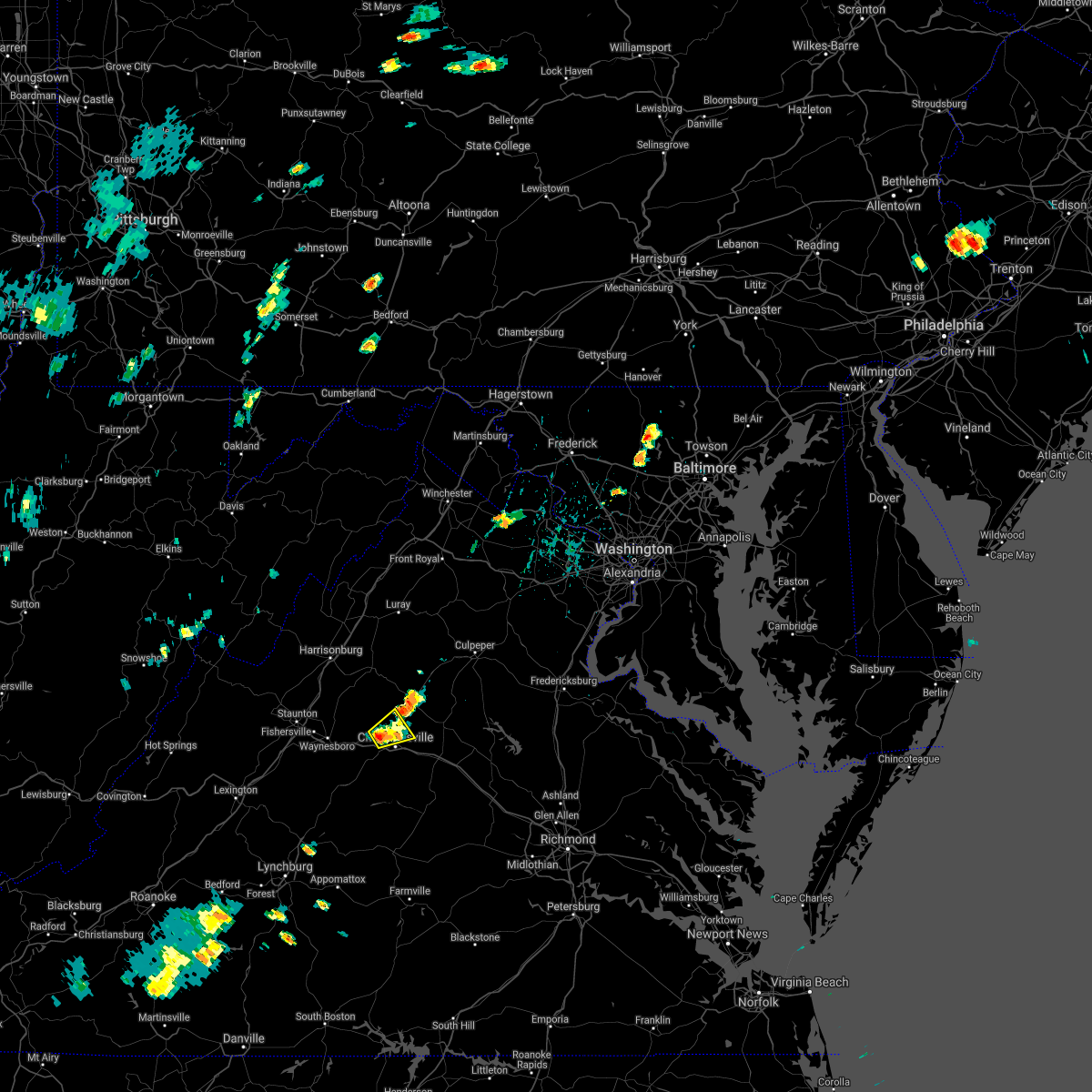 At 106 pm edt, a severe thunderstorm was located near charlottesville, moving northeast at 15 mph (radar indicated). Hazards include 60 mph wind gusts and quarter size hail. Damaging winds will cause some trees and large branches to fall. this could injure those outdoors, as well as damage homes and vehicles. roadways may become blocked by downed trees. localized power outages are possible. Unsecured light objects may become projectiles. At 106 pm edt, a severe thunderstorm was located near charlottesville, moving northeast at 15 mph (radar indicated). Hazards include 60 mph wind gusts and quarter size hail. Damaging winds will cause some trees and large branches to fall. this could injure those outdoors, as well as damage homes and vehicles. roadways may become blocked by downed trees. localized power outages are possible. Unsecured light objects may become projectiles.
|
| 6/4/2021 12:39 PM EDT |
 At 1239 pm edt, a severe thunderstorm was located near free union, or 12 miles north of charlottesville, moving southeast at 20 mph (radar indicated). Hazards include 60 mph wind gusts and quarter size hail. Damaging winds will cause some trees and large branches to fall. this could injure those outdoors, as well as damage homes and vehicles. roadways may become blocked by downed trees. localized power outages are possible. Unsecured light objects may become projectiles. At 1239 pm edt, a severe thunderstorm was located near free union, or 12 miles north of charlottesville, moving southeast at 20 mph (radar indicated). Hazards include 60 mph wind gusts and quarter size hail. Damaging winds will cause some trees and large branches to fall. this could injure those outdoors, as well as damage homes and vehicles. roadways may become blocked by downed trees. localized power outages are possible. Unsecured light objects may become projectiles.
|
| 6/3/2021 3:56 PM EDT |
 At 356 pm edt, severe thunderstorms were located along a line extending from 6 miles south of big meadows to near free union, moving northeast at 35 mph (radar indicated). Hazards include 60 mph wind gusts. Damaging winds will cause some trees and large branches to fall. this could injure those outdoors, as well as damage homes and vehicles. roadways may become blocked by downed trees. localized power outages are possible. Unsecured light objects may become projectiles. At 356 pm edt, severe thunderstorms were located along a line extending from 6 miles south of big meadows to near free union, moving northeast at 35 mph (radar indicated). Hazards include 60 mph wind gusts. Damaging winds will cause some trees and large branches to fall. this could injure those outdoors, as well as damage homes and vehicles. roadways may become blocked by downed trees. localized power outages are possible. Unsecured light objects may become projectiles.
|
| 8/6/2020 5:06 PM EDT |
 At 505 pm edt, a severe thunderstorm was located over free union, or 9 miles north of charlottesville, moving northeast at 10 mph (radar indicated). Hazards include 70 mph wind gusts and quarter size hail. Damaging winds will cause some trees and large branches to fall. this could injure those outdoors, as well as damage homes and vehicles. roadways may become blocked by downed trees. localized power outages are possible. unsecured light objects may become projectiles. Locations impacted include, charlottesville, stanardsville, free union, campbell, westmoreland, hollymead, ruckersville, quinque, eheart, barboursville, stony point, flordon, newtown, amicus, cobham, cismont, newcomb hall, keswick, carrsbrook and earlysville. At 505 pm edt, a severe thunderstorm was located over free union, or 9 miles north of charlottesville, moving northeast at 10 mph (radar indicated). Hazards include 70 mph wind gusts and quarter size hail. Damaging winds will cause some trees and large branches to fall. this could injure those outdoors, as well as damage homes and vehicles. roadways may become blocked by downed trees. localized power outages are possible. unsecured light objects may become projectiles. Locations impacted include, charlottesville, stanardsville, free union, campbell, westmoreland, hollymead, ruckersville, quinque, eheart, barboursville, stony point, flordon, newtown, amicus, cobham, cismont, newcomb hall, keswick, carrsbrook and earlysville.
|
| 8/6/2020 5:05 PM EDT |
 At 505 pm edt, a severe thunderstorm was located near stanardsville, or 14 miles north of charlottesville, moving east at 15 mph (radar indicated). Hazards include 70 mph wind gusts and quarter size hail. Damaging winds will cause some trees and large branches to fall. this could injure those outdoors, as well as damage homes and vehicles. roadways may become blocked by downed trees. localized power outages are possible. unsecured light objects may become projectiles. Locations impacted include, stanardsville, free union, hollymead, ruckersville, quinque, amicus, stony point, advance mills and earlysville. At 505 pm edt, a severe thunderstorm was located near stanardsville, or 14 miles north of charlottesville, moving east at 15 mph (radar indicated). Hazards include 70 mph wind gusts and quarter size hail. Damaging winds will cause some trees and large branches to fall. this could injure those outdoors, as well as damage homes and vehicles. roadways may become blocked by downed trees. localized power outages are possible. unsecured light objects may become projectiles. Locations impacted include, stanardsville, free union, hollymead, ruckersville, quinque, amicus, stony point, advance mills and earlysville.
|
| 8/6/2020 4:55 PM EDT |
 At 454 pm edt, a severe thunderstorm was located over free union, or 9 miles northwest of charlottesville, moving northeast at 10 mph. this is a very dangerous storm (radar indicated). Hazards include 80 mph wind gusts and golf ball size hail. Expect considerable damage to trees and power lines, especially near free union and earlysville. your life is at significant risk if outdoors. In addition to some trees falling into homes, wind damage is possible to roofs, sheds, open garages, and mobile homes. At 454 pm edt, a severe thunderstorm was located over free union, or 9 miles northwest of charlottesville, moving northeast at 10 mph. this is a very dangerous storm (radar indicated). Hazards include 80 mph wind gusts and golf ball size hail. Expect considerable damage to trees and power lines, especially near free union and earlysville. your life is at significant risk if outdoors. In addition to some trees falling into homes, wind damage is possible to roofs, sheds, open garages, and mobile homes.
|
| 8/6/2020 4:49 PM EDT | Hen Egg sized hail reported 2.1 miles WSW of Free Union, VA |
| 8/6/2020 4:46 PM EDT |
 At 446 pm edt, a severe thunderstorm capable of producing a tornado was located over free union, or 8 miles north of charlottesville, moving east at 15 mph (radar indicated rotation). Hazards include tornado. For those in the direct path of a tornado touchdown, flying debris will be dangerous to those caught without shelter. damage to roofs, siding, and windows may occur. mobile homes may be damaged or destroyed. tree damage is likely. Locations impacted include, free union, hollymead and earlysville. At 446 pm edt, a severe thunderstorm capable of producing a tornado was located over free union, or 8 miles north of charlottesville, moving east at 15 mph (radar indicated rotation). Hazards include tornado. For those in the direct path of a tornado touchdown, flying debris will be dangerous to those caught without shelter. damage to roofs, siding, and windows may occur. mobile homes may be damaged or destroyed. tree damage is likely. Locations impacted include, free union, hollymead and earlysville.
|
| 8/6/2020 4:39 PM EDT |
 At 433 pm edt, a severe thunderstorm capable of producing a tornado was located near free union, or 9 miles northwest of charlottesville, moving east at 15 mph (radar indicated rotation). Hazards include tornado. For those in the direct path of a tornado touchdown, flying debris will be dangerous to those caught without shelter. damage to roofs, siding, and windows may occur. mobile homes may be damaged or destroyed. tree damage is likely. this dangerous storm will be near, free union around 450 pm edt. Other locations impacted by this tornadic thunderstorm include earlysville, white hall and hollymead. At 433 pm edt, a severe thunderstorm capable of producing a tornado was located near free union, or 9 miles northwest of charlottesville, moving east at 15 mph (radar indicated rotation). Hazards include tornado. For those in the direct path of a tornado touchdown, flying debris will be dangerous to those caught without shelter. damage to roofs, siding, and windows may occur. mobile homes may be damaged or destroyed. tree damage is likely. this dangerous storm will be near, free union around 450 pm edt. Other locations impacted by this tornadic thunderstorm include earlysville, white hall and hollymead.
|
| 8/6/2020 4:37 PM EDT |
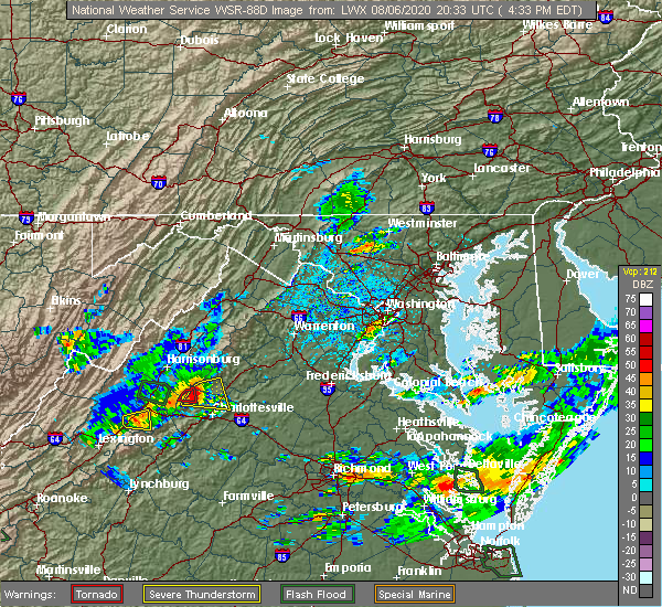 At 437 pm edt, a severe thunderstorm with a history of producing widespread wind damage was located near free union, or 15 miles northwest of charlottesville, moving east at 15 mph (radar indicated). Hazards include 70 mph wind gusts and quarter size hail. Damaging winds will cause some trees and large branches to fall. this could injure those outdoors, as well as damage homes and vehicles. roadways may become blocked by downed trees. localized power outages are possible. unsecured light objects may become projectiles. Locations impacted include, stanardsville, free union, hollymead, ruckersville, mcmullen, quinque, boonesville, lydia, stony point, haneytown, earlysville, mission home, amicus, advance mills, saint george, shady grove and white hall. At 437 pm edt, a severe thunderstorm with a history of producing widespread wind damage was located near free union, or 15 miles northwest of charlottesville, moving east at 15 mph (radar indicated). Hazards include 70 mph wind gusts and quarter size hail. Damaging winds will cause some trees and large branches to fall. this could injure those outdoors, as well as damage homes and vehicles. roadways may become blocked by downed trees. localized power outages are possible. unsecured light objects may become projectiles. Locations impacted include, stanardsville, free union, hollymead, ruckersville, mcmullen, quinque, boonesville, lydia, stony point, haneytown, earlysville, mission home, amicus, advance mills, saint george, shady grove and white hall.
|
| 8/6/2020 4:34 PM EDT |
 At 433 pm edt, a severe thunderstorm capable of producing a tornado was located near free union, or 9 miles northwest of charlottesville, moving east at 15 mph (radar indicated rotation). Hazards include tornado. For those in the direct path of a tornado touchdown, flying debris will be dangerous to those caught without shelter. damage to roofs, siding, and windows may occur. mobile homes may be damaged or destroyed. tree damage is likely. this dangerous storm will be near, free union around 450 pm edt. Other locations impacted by this tornadic thunderstorm include earlysville, white hall and hollymead. At 433 pm edt, a severe thunderstorm capable of producing a tornado was located near free union, or 9 miles northwest of charlottesville, moving east at 15 mph (radar indicated rotation). Hazards include tornado. For those in the direct path of a tornado touchdown, flying debris will be dangerous to those caught without shelter. damage to roofs, siding, and windows may occur. mobile homes may be damaged or destroyed. tree damage is likely. this dangerous storm will be near, free union around 450 pm edt. Other locations impacted by this tornadic thunderstorm include earlysville, white hall and hollymead.
|
| 8/6/2020 4:31 PM EDT |
 At 431 pm edt, a severe thunderstorm was located 7 miles northwest of free union, or 16 miles northwest of charlottesville, moving east at 15 mph (radar indicated). Hazards include 70 mph wind gusts and quarter size hail. Damaging winds will cause some trees and large branches to fall. this could injure those outdoors, as well as damage homes and vehicles. roadways may become blocked by downed trees. localized power outages are possible. unsecured light objects may become projectiles. Locations impacted include, stanardsville, free union, hollymead, ruckersville, mcmullen, quinque, boonesville, lydia, stony point, haneytown, earlysville, mission home, amicus, advance mills, saint george and shady grove. At 431 pm edt, a severe thunderstorm was located 7 miles northwest of free union, or 16 miles northwest of charlottesville, moving east at 15 mph (radar indicated). Hazards include 70 mph wind gusts and quarter size hail. Damaging winds will cause some trees and large branches to fall. this could injure those outdoors, as well as damage homes and vehicles. roadways may become blocked by downed trees. localized power outages are possible. unsecured light objects may become projectiles. Locations impacted include, stanardsville, free union, hollymead, ruckersville, mcmullen, quinque, boonesville, lydia, stony point, haneytown, earlysville, mission home, amicus, advance mills, saint george and shady grove.
|
| 8/6/2020 4:24 PM EDT |
 At 424 pm edt, a severe thunderstorm was located 7 miles east of grottoes, or 15 miles northeast of waynesboro, moving east at 20 mph (radar indicated). Hazards include 60 mph wind gusts and quarter size hail. Damaging winds will cause some trees and large branches to fall. this could injure those outdoors, as well as damage homes and vehicles. roadways may become blocked by downed trees. localized power outages are possible. Unsecured light objects may become projectiles. At 424 pm edt, a severe thunderstorm was located 7 miles east of grottoes, or 15 miles northeast of waynesboro, moving east at 20 mph (radar indicated). Hazards include 60 mph wind gusts and quarter size hail. Damaging winds will cause some trees and large branches to fall. this could injure those outdoors, as well as damage homes and vehicles. roadways may become blocked by downed trees. localized power outages are possible. Unsecured light objects may become projectiles.
|
| 7/21/2020 6:24 PM EDT |
 The severe thunderstorm warning for northwestern albemarle and southwestern greene counties will expire at 630 pm edt, the storm which prompted the warning has moved out of the area. therefore, the warning will be allowed to expire. The severe thunderstorm warning for northwestern albemarle and southwestern greene counties will expire at 630 pm edt, the storm which prompted the warning has moved out of the area. therefore, the warning will be allowed to expire.
|
| 7/21/2020 6:04 PM EDT |
 At 604 pm edt, a severe thunderstorm was located near free union, or 14 miles northwest of charlottesville, moving northeast at 15 mph (radar indicated). Hazards include 60 mph wind gusts and quarter size hail. Damaging winds will cause some trees and large branches to fall. this could injure those outdoors, as well as damage homes and vehicles. roadways may become blocked by downed trees. localized power outages are possible. unsecured light objects may become projectiles. Locations impacted include, free union, mission home, boonesville, amicus, haneytown, saint george, shady grove and white hall. At 604 pm edt, a severe thunderstorm was located near free union, or 14 miles northwest of charlottesville, moving northeast at 15 mph (radar indicated). Hazards include 60 mph wind gusts and quarter size hail. Damaging winds will cause some trees and large branches to fall. this could injure those outdoors, as well as damage homes and vehicles. roadways may become blocked by downed trees. localized power outages are possible. unsecured light objects may become projectiles. Locations impacted include, free union, mission home, boonesville, amicus, haneytown, saint george, shady grove and white hall.
|
| 7/21/2020 5:39 PM EDT |
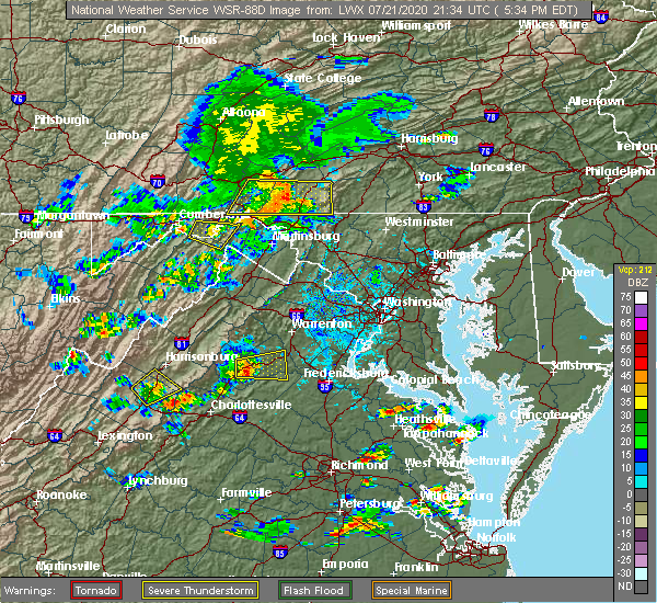 At 539 pm edt, a severe thunderstorm was located near crimora, or 10 miles northeast of waynesboro, moving northeast at 15 mph (radar indicated). Hazards include 60 mph wind gusts and quarter size hail. Damaging winds will cause some trees and large branches to fall. this could injure those outdoors, as well as damage homes and vehicles. roadways may become blocked by downed trees. localized power outages are possible. Unsecured light objects may become projectiles. At 539 pm edt, a severe thunderstorm was located near crimora, or 10 miles northeast of waynesboro, moving northeast at 15 mph (radar indicated). Hazards include 60 mph wind gusts and quarter size hail. Damaging winds will cause some trees and large branches to fall. this could injure those outdoors, as well as damage homes and vehicles. roadways may become blocked by downed trees. localized power outages are possible. Unsecured light objects may become projectiles.
|
| 7/5/2020 3:07 PM EDT |
 At 306 pm edt, a severe thunderstorm was located near crozet, or near charlottesville, moving southeast at 5 mph (radar indicated). Hazards include 60 mph wind gusts and quarter size hail. Damaging winds will cause some trees and large branches to fall. this could injure those outdoors, as well as damage homes and vehicles. roadways may become blocked by downed trees. localized power outages are possible. Unsecured light objects may become projectiles. At 306 pm edt, a severe thunderstorm was located near crozet, or near charlottesville, moving southeast at 5 mph (radar indicated). Hazards include 60 mph wind gusts and quarter size hail. Damaging winds will cause some trees and large branches to fall. this could injure those outdoors, as well as damage homes and vehicles. roadways may become blocked by downed trees. localized power outages are possible. Unsecured light objects may become projectiles.
|
| 7/1/2020 3:42 PM EDT | Numerous trees down near the 3900 block of free union road in albemarle county VA, 0.9 miles N of Free Union, VA |
| 9/28/2019 3:54 PM EDT |
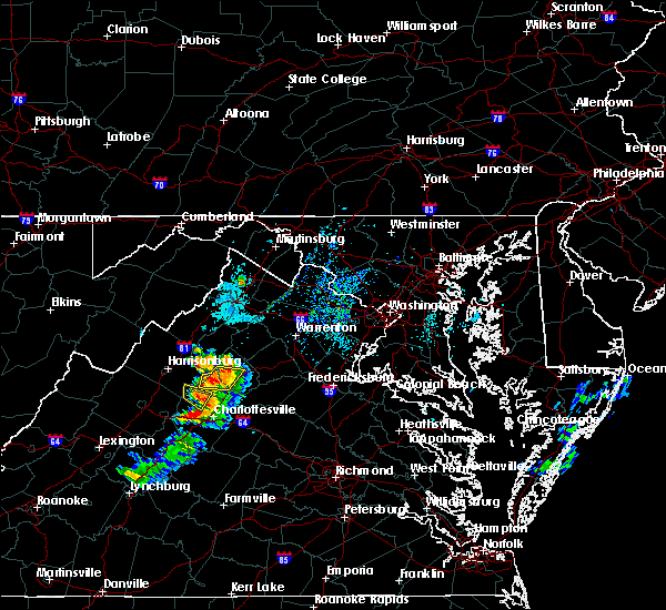 The severe thunderstorm warning for southeastern rockingham, north central albemarle and southwestern greene counties will expire at 400 pm edt, the storm which prompted the warning has weakened below severe limits, and no longer poses an immediate threat to life or property. therefore, the warning will be allowed to expire. however small hail, gusty winds and heavy rain are still possible with this thunderstorm. to report severe weather, contact your nearest law enforcement agency. they will relay your report to the national weather service sterling virginia. The severe thunderstorm warning for southeastern rockingham, north central albemarle and southwestern greene counties will expire at 400 pm edt, the storm which prompted the warning has weakened below severe limits, and no longer poses an immediate threat to life or property. therefore, the warning will be allowed to expire. however small hail, gusty winds and heavy rain are still possible with this thunderstorm. to report severe weather, contact your nearest law enforcement agency. they will relay your report to the national weather service sterling virginia.
|
| 9/28/2019 3:44 PM EDT |
 At 344 pm edt, a severe thunderstorm was located near free union, or 14 miles northwest of charlottesville, moving east at 15 mph (radar indicated). Hazards include 60 mph wind gusts and quarter size hail. Damaging winds will cause some trees and large branches to fall. this could injure those outdoors, as well as damage homes and vehicles. roadways may become blocked by downed trees. localized power outages are possible. unsecured light objects may become projectiles. Locations impacted include, free union, mission home, shady grove and boonesville. At 344 pm edt, a severe thunderstorm was located near free union, or 14 miles northwest of charlottesville, moving east at 15 mph (radar indicated). Hazards include 60 mph wind gusts and quarter size hail. Damaging winds will cause some trees and large branches to fall. this could injure those outdoors, as well as damage homes and vehicles. roadways may become blocked by downed trees. localized power outages are possible. unsecured light objects may become projectiles. Locations impacted include, free union, mission home, shady grove and boonesville.
|
| 9/28/2019 3:24 PM EDT |
 At 324 pm edt, a severe thunderstorm was located 8 miles east of grottoes, or 16 miles southeast of harrisonburg, moving southeast at 10 mph (radar indicated). Hazards include 60 mph wind gusts and half dollar size hail. Damaging winds will cause some trees and large branches to fall. this could injure those outdoors, as well as damage homes and vehicles. roadways may become blocked by downed trees. localized power outages are possible. Unsecured light objects may become projectiles. At 324 pm edt, a severe thunderstorm was located 8 miles east of grottoes, or 16 miles southeast of harrisonburg, moving southeast at 10 mph (radar indicated). Hazards include 60 mph wind gusts and half dollar size hail. Damaging winds will cause some trees and large branches to fall. this could injure those outdoors, as well as damage homes and vehicles. roadways may become blocked by downed trees. localized power outages are possible. Unsecured light objects may become projectiles.
|
| 9/11/2019 5:09 PM EDT |
 At 508 pm edt, severe thunderstorms were located along a line extending from free union to crozet to near afton, moving southeast at 20 mph (radar indicated). Hazards include 60 mph wind gusts and quarter size hail. Damaging winds will cause some trees and large branches to fall. this could injure those outdoors, as well as damage homes and vehicles. roadways may become blocked by downed trees. localized power outages are possible. unsecured light objects may become projectiles. Locations impacted include, charlottesville, crozet, schuyler, free union, campbell, westmoreland, hollymead, ivy, scottsville, esmont, north garden, covesville, yancey mills, stony point, flordon, scott stadium, faber, cobham, cismont and damon. At 508 pm edt, severe thunderstorms were located along a line extending from free union to crozet to near afton, moving southeast at 20 mph (radar indicated). Hazards include 60 mph wind gusts and quarter size hail. Damaging winds will cause some trees and large branches to fall. this could injure those outdoors, as well as damage homes and vehicles. roadways may become blocked by downed trees. localized power outages are possible. unsecured light objects may become projectiles. Locations impacted include, charlottesville, crozet, schuyler, free union, campbell, westmoreland, hollymead, ivy, scottsville, esmont, north garden, covesville, yancey mills, stony point, flordon, scott stadium, faber, cobham, cismont and damon.
|
| 9/11/2019 5:01 PM EDT |
 At 501 pm edt, severe thunderstorms were located along a line extending from free union to crozet to near afton, moving southeast at 20 mph (radar indicated). Hazards include 60 mph wind gusts and quarter size hail. Damaging winds will cause some trees and large branches to fall. this could injure those outdoors, as well as damage homes and vehicles. roadways may become blocked by downed trees. localized power outages are possible. Unsecured light objects may become projectiles. At 501 pm edt, severe thunderstorms were located along a line extending from free union to crozet to near afton, moving southeast at 20 mph (radar indicated). Hazards include 60 mph wind gusts and quarter size hail. Damaging winds will cause some trees and large branches to fall. this could injure those outdoors, as well as damage homes and vehicles. roadways may become blocked by downed trees. localized power outages are possible. Unsecured light objects may become projectiles.
|
| 8/22/2019 3:47 PM EDT |
 At 347 pm edt, a severe thunderstorm was located near charlottesville, moving east at 25 mph (law enforcement has reported multiple trees down in the ivy and crozet areas). Hazards include 60 mph wind gusts. Damaging winds will cause some trees and large branches to fall. this could injure those outdoors, as well as damage homes and vehicles. roadways may become blocked by downed trees. localized power outages are possible. unsecured light objects may become projectiles. Locations impacted include, charlottesville, crozet, free union, westmoreland, hollymead, ivy, newcomb hall, monticello, flordon, carrsbrook, barracks, overton and scott stadium. At 347 pm edt, a severe thunderstorm was located near charlottesville, moving east at 25 mph (law enforcement has reported multiple trees down in the ivy and crozet areas). Hazards include 60 mph wind gusts. Damaging winds will cause some trees and large branches to fall. this could injure those outdoors, as well as damage homes and vehicles. roadways may become blocked by downed trees. localized power outages are possible. unsecured light objects may become projectiles. Locations impacted include, charlottesville, crozet, free union, westmoreland, hollymead, ivy, newcomb hall, monticello, flordon, carrsbrook, barracks, overton and scott stadium.
|
| 8/22/2019 3:36 PM EDT |
 At 336 pm edt, a severe thunderstorm was located near crozet, or 8 miles west of charlottesville, moving east at 25 mph (radar indicated). Hazards include 60 mph wind gusts. Damaging winds will cause some trees and large branches to fall. this could injure those outdoors, as well as damage homes and vehicles. roadways may become blocked by downed trees. localized power outages are possible. unsecured light objects may become projectiles. Locations impacted include, charlottesville, crozet, free union, westmoreland, hollymead, ivy, newcomb hall, batesville, yancey mills, monticello, flordon, carrsbrook, barracks, overton, scott stadium and white hall. At 336 pm edt, a severe thunderstorm was located near crozet, or 8 miles west of charlottesville, moving east at 25 mph (radar indicated). Hazards include 60 mph wind gusts. Damaging winds will cause some trees and large branches to fall. this could injure those outdoors, as well as damage homes and vehicles. roadways may become blocked by downed trees. localized power outages are possible. unsecured light objects may become projectiles. Locations impacted include, charlottesville, crozet, free union, westmoreland, hollymead, ivy, newcomb hall, batesville, yancey mills, monticello, flordon, carrsbrook, barracks, overton, scott stadium and white hall.
|
| 8/22/2019 3:20 PM EDT |
 At 320 pm edt, a severe thunderstorm was located near crozet, or 8 miles east of waynesboro, moving east at 25 mph (radar indicated). Hazards include 60 mph wind gusts. Damaging winds will cause some trees and large branches to fall. this could injure those outdoors, as well as damage homes and vehicles. roadways may become blocked by downed trees. localized power outages are possible. Unsecured light objects may become projectiles. At 320 pm edt, a severe thunderstorm was located near crozet, or 8 miles east of waynesboro, moving east at 25 mph (radar indicated). Hazards include 60 mph wind gusts. Damaging winds will cause some trees and large branches to fall. this could injure those outdoors, as well as damage homes and vehicles. roadways may become blocked by downed trees. localized power outages are possible. Unsecured light objects may become projectiles.
|
| 8/19/2019 5:51 PM EDT |
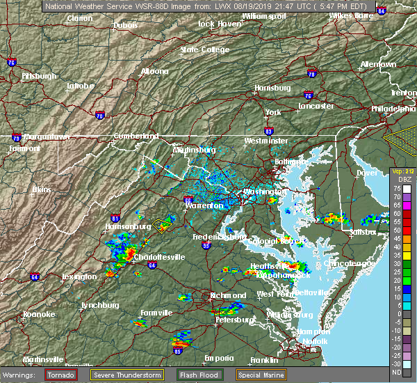 A severe thunderstorm warning remains in effect until 615 pm edt for north central albemarle county and the north central city of charlottesville. at 551 pm edt, a severe thunderstorm was located near free union, or northwest of charlottesville, moving southeast at 10 mph. hazard. 60 mph wind gusts and quarter size hail. A severe thunderstorm warning remains in effect until 615 pm edt for north central albemarle county and the north central city of charlottesville. at 551 pm edt, a severe thunderstorm was located near free union, or northwest of charlottesville, moving southeast at 10 mph. hazard. 60 mph wind gusts and quarter size hail.
|
| 8/19/2019 5:33 PM EDT |
 The national weather service in sterling virginia has issued a * severe thunderstorm warning for. the north central city of charlottesville in central virginia. north central albemarle county in central virginia. until 615 pm edt. At 532 pm edt, a severe thunderstorm was located over free union,. The national weather service in sterling virginia has issued a * severe thunderstorm warning for. the north central city of charlottesville in central virginia. north central albemarle county in central virginia. until 615 pm edt. At 532 pm edt, a severe thunderstorm was located over free union,.
|
| 8/15/2019 8:25 PM EDT | Tree down near the intersection of georgetown farm road and millington roa in albemarle county VA, 1.3 miles E of Free Union, VA |
| 7/31/2019 4:09 PM EDT |
 A severe thunderstorm warning remains in effect until 430 pm edt for northeastern nelson and central albemarle counties and the city of charlottesville. At 409 pm edt, severe thunderstorms were located along a line extending from free union to 6 miles southeast of crozet, moving east at 15 mph. A severe thunderstorm warning remains in effect until 430 pm edt for northeastern nelson and central albemarle counties and the city of charlottesville. At 409 pm edt, severe thunderstorms were located along a line extending from free union to 6 miles southeast of crozet, moving east at 15 mph.
|
| 7/31/2019 3:50 PM EDT |
 At 349 pm edt, severe thunderstorms were located along a line extending from near free union to 6 miles south of crozet, moving east at 15 mph (radar indicated). Hazards include 60 mph wind gusts. Damaging winds will cause some trees and large branches to fall. this could injure those outdoors, as well as damage homes and vehicles. roadways may become blocked by downed trees. localized power outages are possible. Unsecured light objects may become projectiles. At 349 pm edt, severe thunderstorms were located along a line extending from near free union to 6 miles south of crozet, moving east at 15 mph (radar indicated). Hazards include 60 mph wind gusts. Damaging winds will cause some trees and large branches to fall. this could injure those outdoors, as well as damage homes and vehicles. roadways may become blocked by downed trees. localized power outages are possible. Unsecured light objects may become projectiles.
|
| 7/30/2019 6:18 PM EDT |
 At 618 pm edt, severe thunderstorms were located along a line extending from near stanardsville to near charlottesville, moving east at 15 mph (radar indicated). Hazards include 60 mph wind gusts. Damaging winds will cause some trees and large branches to fall. this could injure those outdoors, as well as damage homes and vehicles. roadways may become blocked by downed trees. localized power outages are possible. unsecured light objects may become projectiles. Locations impacted include, free union, hollymead, ivy, amicus, advance mills and earlysville. At 618 pm edt, severe thunderstorms were located along a line extending from near stanardsville to near charlottesville, moving east at 15 mph (radar indicated). Hazards include 60 mph wind gusts. Damaging winds will cause some trees and large branches to fall. this could injure those outdoors, as well as damage homes and vehicles. roadways may become blocked by downed trees. localized power outages are possible. unsecured light objects may become projectiles. Locations impacted include, free union, hollymead, ivy, amicus, advance mills and earlysville.
|
| 7/30/2019 6:05 PM EDT |
 At 604 pm edt, severe thunderstorms were located along a line extending from 6 miles northeast of free union to near crozet, moving east at 10 mph (radar indicated). Hazards include 60 mph wind gusts. Damaging winds will cause some trees and large branches to fall. this could injure those outdoors, as well as damage homes and vehicles. roadways may become blocked by downed trees. localized power outages are possible. unsecured light objects may become projectiles. Locations impacted include, crozet, stanardsville, free union, hollymead, ivy, boonesville, amicus, advance mills, haneytown, saint george, earlysville and white hall. At 604 pm edt, severe thunderstorms were located along a line extending from 6 miles northeast of free union to near crozet, moving east at 10 mph (radar indicated). Hazards include 60 mph wind gusts. Damaging winds will cause some trees and large branches to fall. this could injure those outdoors, as well as damage homes and vehicles. roadways may become blocked by downed trees. localized power outages are possible. unsecured light objects may become projectiles. Locations impacted include, crozet, stanardsville, free union, hollymead, ivy, boonesville, amicus, advance mills, haneytown, saint george, earlysville and white hall.
|
| 7/30/2019 5:41 PM EDT |
 At 541 pm edt, severe thunderstorms were located along a line extending from near free union to crozet, moving east at 25 mph (radar indicated). Hazards include 60 mph wind gusts. Damaging winds will cause some trees and large branches to fall. this could injure those outdoors, as well as damage homes and vehicles. roadways may become blocked by downed trees. localized power outages are possible. Unsecured light objects may become projectiles. At 541 pm edt, severe thunderstorms were located along a line extending from near free union to crozet, moving east at 25 mph (radar indicated). Hazards include 60 mph wind gusts. Damaging winds will cause some trees and large branches to fall. this could injure those outdoors, as well as damage homes and vehicles. roadways may become blocked by downed trees. localized power outages are possible. Unsecured light objects may become projectiles.
|
| 7/17/2019 3:30 PM EDT | Tree down at the intersection of markwood rd. and flintrock wa in albemarle county VA, 3.8 miles SSW of Free Union, VA |
| 7/17/2019 3:30 PM EDT | Tree down at the intersection of markwood rd. and buck mountain r in albemarle county VA, 3.6 miles WSW of Free Union, VA |
| 7/17/2019 3:26 PM EDT | Multiple trees down in the hickory ridge farm neighborhoo in albemarle county VA, 2.1 miles WSW of Free Union, VA |
| 7/17/2019 3:18 PM EDT |
 At 318 pm edt, a severe thunderstorm was located near free union, or 8 miles northwest of charlottesville, moving northeast at 35 mph (radar indicated). Hazards include 60 mph wind gusts. Damaging winds will cause some trees and large branches to fall. this could injure those outdoors, as well as damage homes and vehicles. roadways may become blocked by downed trees. localized power outages are possible. Unsecured light objects may become projectiles. At 318 pm edt, a severe thunderstorm was located near free union, or 8 miles northwest of charlottesville, moving northeast at 35 mph (radar indicated). Hazards include 60 mph wind gusts. Damaging winds will cause some trees and large branches to fall. this could injure those outdoors, as well as damage homes and vehicles. roadways may become blocked by downed trees. localized power outages are possible. Unsecured light objects may become projectiles.
|
| 7/14/2019 6:25 PM EDT |
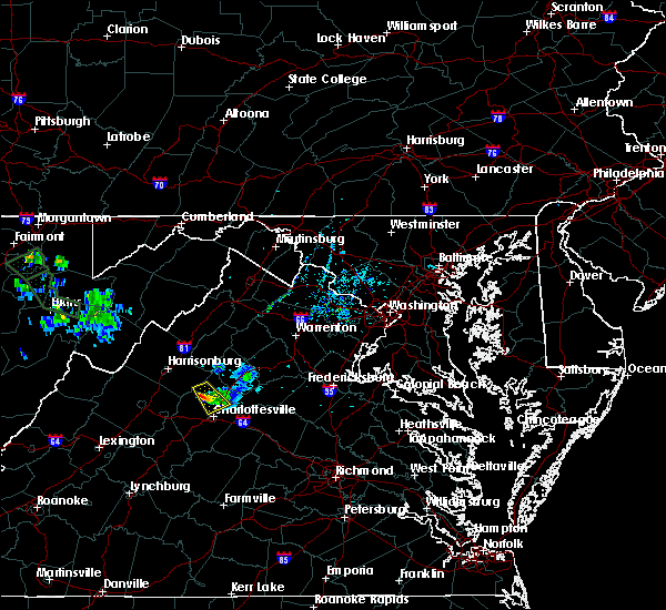 The severe thunderstorm warning for western orange, southeastern rockingham, northeastern albemarle and southwestern greene counties will expire at 630 pm edt, the storm which prompted the warning has weakened below severe limits, and no longer poses an immediate threat to life or property. therefore, the warning will be allowed to expire. however gusty winds and heavy rain are still possible with this thunderstorm. The severe thunderstorm warning for western orange, southeastern rockingham, northeastern albemarle and southwestern greene counties will expire at 630 pm edt, the storm which prompted the warning has weakened below severe limits, and no longer poses an immediate threat to life or property. therefore, the warning will be allowed to expire. however gusty winds and heavy rain are still possible with this thunderstorm.
|
| 7/14/2019 6:11 PM EDT |
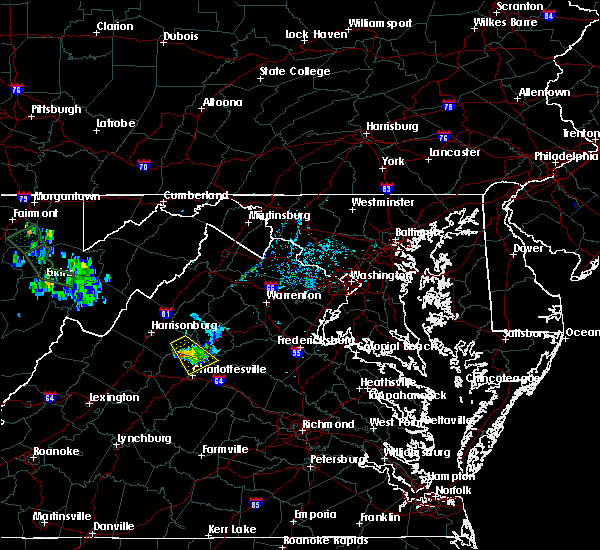 At 610 pm edt, a severe thunderstorm was located near free union, or 15 miles north of charlottesville, moving southeast at 20 mph (radar indicated). Hazards include 60 mph wind gusts and quarter size hail. Damaging winds will cause some trees and large branches to fall. this could injure those outdoors, as well as damage homes and vehicles. roadways may become blocked by downed trees. localized power outages are possible. unsecured light objects may become projectiles. Locations impacted include, free union, hollymead, mission home, boonesville, amicus, advance mills, haneytown, carrsbrook, saint george, earlysville and shady grove. At 610 pm edt, a severe thunderstorm was located near free union, or 15 miles north of charlottesville, moving southeast at 20 mph (radar indicated). Hazards include 60 mph wind gusts and quarter size hail. Damaging winds will cause some trees and large branches to fall. this could injure those outdoors, as well as damage homes and vehicles. roadways may become blocked by downed trees. localized power outages are possible. unsecured light objects may become projectiles. Locations impacted include, free union, hollymead, mission home, boonesville, amicus, advance mills, haneytown, carrsbrook, saint george, earlysville and shady grove.
|
| 7/14/2019 5:45 PM EDT |
 At 543 pm edt, a severe thunderstorm was located 7 miles west of stanardsville, or 17 miles west of madison, moving southeast at 25 mph (radar indicated). Hazards include 60 mph wind gusts and quarter size hail. Damaging winds will cause some trees and large branches to fall. this could injure those outdoors, as well as damage homes and vehicles. roadways may become blocked by downed trees. localized power outages are possible. Unsecured light objects may become projectiles. At 543 pm edt, a severe thunderstorm was located 7 miles west of stanardsville, or 17 miles west of madison, moving southeast at 25 mph (radar indicated). Hazards include 60 mph wind gusts and quarter size hail. Damaging winds will cause some trees and large branches to fall. this could injure those outdoors, as well as damage homes and vehicles. roadways may become blocked by downed trees. localized power outages are possible. Unsecured light objects may become projectiles.
|
| 7/11/2019 5:03 PM EDT | Tree down on 2000 block of buck mountain roa in albemarle county VA, 0.6 miles SW of Free Union, VA |
| 6/29/2019 3:54 PM EDT |
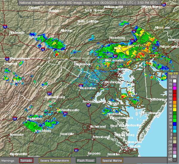 At 354 pm edt, a severe thunderstorm was located near free union, or just north of the city of charlottesville, moving east at 10 mph (radar indicated). Hazards include 60 mph wind gusts. Damaging winds will cause some trees and large branches to fall. this could injure those outdoors, as well as damage homes and vehicles. roadways may become blocked by downed trees. localized power outages are possible. Unsecured light objects may become projectiles. At 354 pm edt, a severe thunderstorm was located near free union, or just north of the city of charlottesville, moving east at 10 mph (radar indicated). Hazards include 60 mph wind gusts. Damaging winds will cause some trees and large branches to fall. this could injure those outdoors, as well as damage homes and vehicles. roadways may become blocked by downed trees. localized power outages are possible. Unsecured light objects may become projectiles.
|
| 6/29/2019 3:23 PM EDT |
 At 322 pm edt, a severe thunderstorm was located over free union, or 8 miles northwest of charlottesville, moving east at 5 mph (radar indicated). Hazards include 60 mph wind gusts and quarter size hail. Damaging winds will cause some trees and large branches to fall. this could injure those outdoors, as well as damage homes and vehicles. roadways may become blocked by downed trees. localized power outages are possible. Unsecured light objects may become projectiles. At 322 pm edt, a severe thunderstorm was located over free union, or 8 miles northwest of charlottesville, moving east at 5 mph (radar indicated). Hazards include 60 mph wind gusts and quarter size hail. Damaging winds will cause some trees and large branches to fall. this could injure those outdoors, as well as damage homes and vehicles. roadways may become blocked by downed trees. localized power outages are possible. Unsecured light objects may become projectiles.
|
| 6/17/2019 4:54 PM EDT |
 At 453 pm edt, a severe thunderstorm was located near crozet, or near charlottesville, moving southeast at 20 mph (radar indicated). Hazards include 60 mph wind gusts and quarter size hail. Damaging winds will cause some trees and large branches to fall. this could injure those outdoors, as well as damage homes and vehicles. roadways may become blocked by downed trees. localized power outages are possible. Unsecured light objects may become projectiles. At 453 pm edt, a severe thunderstorm was located near crozet, or near charlottesville, moving southeast at 20 mph (radar indicated). Hazards include 60 mph wind gusts and quarter size hail. Damaging winds will cause some trees and large branches to fall. this could injure those outdoors, as well as damage homes and vehicles. roadways may become blocked by downed trees. localized power outages are possible. Unsecured light objects may become projectiles.
|
| 5/25/2019 7:56 PM EDT |
 At 756 pm edt, a severe thunderstorm was located near free union, or 13 miles north of charlottesville, moving east at 25 mph (radar indicated). Hazards include 60 mph wind gusts and quarter size hail. Damaging winds will cause some trees and large branches to fall. this could injure those outdoors, as well as damage homes and vehicles. roadways may become blocked by downed trees. localized power outages are possible. unsecured light objects may become projectiles. Locations impacted include, free union, westmoreland, hollymead, ruckersville, quinque, boonesville, eheart, barboursville, stony point, haneytown, carrsbrook, earlysville, newtown, mission home, amicus, dawsonville, advance mills, saint george, shady grove and burtonville. At 756 pm edt, a severe thunderstorm was located near free union, or 13 miles north of charlottesville, moving east at 25 mph (radar indicated). Hazards include 60 mph wind gusts and quarter size hail. Damaging winds will cause some trees and large branches to fall. this could injure those outdoors, as well as damage homes and vehicles. roadways may become blocked by downed trees. localized power outages are possible. unsecured light objects may become projectiles. Locations impacted include, free union, westmoreland, hollymead, ruckersville, quinque, boonesville, eheart, barboursville, stony point, haneytown, carrsbrook, earlysville, newtown, mission home, amicus, dawsonville, advance mills, saint george, shady grove and burtonville.
|
| 5/25/2019 7:37 PM EDT |
 At 737 pm edt, a severe thunderstorm was located 7 miles east of grottoes, or 16 miles southeast of harrisonburg, moving east at 25 mph (radar indicated). Hazards include 60 mph wind gusts and quarter size hail. Damaging winds will cause some trees and large branches to fall. this could injure those outdoors, as well as damage homes and vehicles. roadways may become blocked by downed trees. localized power outages are possible. Unsecured light objects may become projectiles. At 737 pm edt, a severe thunderstorm was located 7 miles east of grottoes, or 16 miles southeast of harrisonburg, moving east at 25 mph (radar indicated). Hazards include 60 mph wind gusts and quarter size hail. Damaging winds will cause some trees and large branches to fall. this could injure those outdoors, as well as damage homes and vehicles. roadways may become blocked by downed trees. localized power outages are possible. Unsecured light objects may become projectiles.
|
| 5/25/2019 5:08 PM EDT |
 The severe thunderstorm warning for north central albemarle and southwestern greene counties will expire at 515 pm edt, the storm which prompted the warning has weakened below severe limits, and no longer poses an immediate threat to life or property. therefore, the warning will be allowed to expire. to report severe weather, contact your nearest law enforcement agency. they will relay your report to the national weather service sterling virginia. The severe thunderstorm warning for north central albemarle and southwestern greene counties will expire at 515 pm edt, the storm which prompted the warning has weakened below severe limits, and no longer poses an immediate threat to life or property. therefore, the warning will be allowed to expire. to report severe weather, contact your nearest law enforcement agency. they will relay your report to the national weather service sterling virginia.
|
| 5/25/2019 4:58 PM EDT |
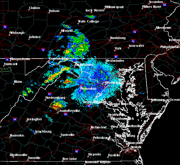 At 457 pm edt, a severe thunderstorm was located near stanardsville, or 17 miles west of madison, moving east at 25 mph (radar indicated). Hazards include 70 mph wind gusts and ping pong ball size hail. Damaging winds will cause some trees and large branches to fall. this could injure those outdoors, as well as damage homes and vehicles. roadways may become blocked by downed trees. localized power outages are possible. unsecured light objects may become projectiles. Locations impacted include, free union, boonesville, amicus, haneytown, saint george, shady grove and lydia. At 457 pm edt, a severe thunderstorm was located near stanardsville, or 17 miles west of madison, moving east at 25 mph (radar indicated). Hazards include 70 mph wind gusts and ping pong ball size hail. Damaging winds will cause some trees and large branches to fall. this could injure those outdoors, as well as damage homes and vehicles. roadways may become blocked by downed trees. localized power outages are possible. unsecured light objects may become projectiles. Locations impacted include, free union, boonesville, amicus, haneytown, saint george, shady grove and lydia.
|
| 5/25/2019 4:53 PM EDT |
 At 453 pm edt, a severe thunderstorm capable of producing a tornado was located near free union, or 13 miles northwest of charlottesville, moving southeast at 25 mph (radar indicated rotation). Hazards include tornado and ping pong ball size hail. For those in the direct path of a tornado touchdown, flying debris will be dangerous to those caught without shelter. damage to roofs, siding, and windows may occur. mobile homes may be damaged or destroyed. tree damage is likely. this dangerous storm will be near, free union around 505 pm edt. Other locations impacted by this tornadic thunderstorm include advance mills, earlysville, boonesville and hollymead. At 453 pm edt, a severe thunderstorm capable of producing a tornado was located near free union, or 13 miles northwest of charlottesville, moving southeast at 25 mph (radar indicated rotation). Hazards include tornado and ping pong ball size hail. For those in the direct path of a tornado touchdown, flying debris will be dangerous to those caught without shelter. damage to roofs, siding, and windows may occur. mobile homes may be damaged or destroyed. tree damage is likely. this dangerous storm will be near, free union around 505 pm edt. Other locations impacted by this tornadic thunderstorm include advance mills, earlysville, boonesville and hollymead.
|
| 5/25/2019 4:49 PM EDT |
 At 449 pm edt, a severe thunderstorm was located 9 miles west of stanardsville, or 16 miles southeast of harrisonburg, moving east at 25 mph (radar indicated). Hazards include golf ball size hail and 70 mph wind gusts. Expect wind damage to trees and power lines. hail is large enough to dent and damage vehicles. some hail damage to roofs, siding, and windows is possible. Locations impacted include, free union, mcmullen, mission home, boonesville, amicus, lydia, haneytown, saint george and shady grove. At 449 pm edt, a severe thunderstorm was located 9 miles west of stanardsville, or 16 miles southeast of harrisonburg, moving east at 25 mph (radar indicated). Hazards include golf ball size hail and 70 mph wind gusts. Expect wind damage to trees and power lines. hail is large enough to dent and damage vehicles. some hail damage to roofs, siding, and windows is possible. Locations impacted include, free union, mcmullen, mission home, boonesville, amicus, lydia, haneytown, saint george and shady grove.
|
| 5/25/2019 4:45 PM EDT |
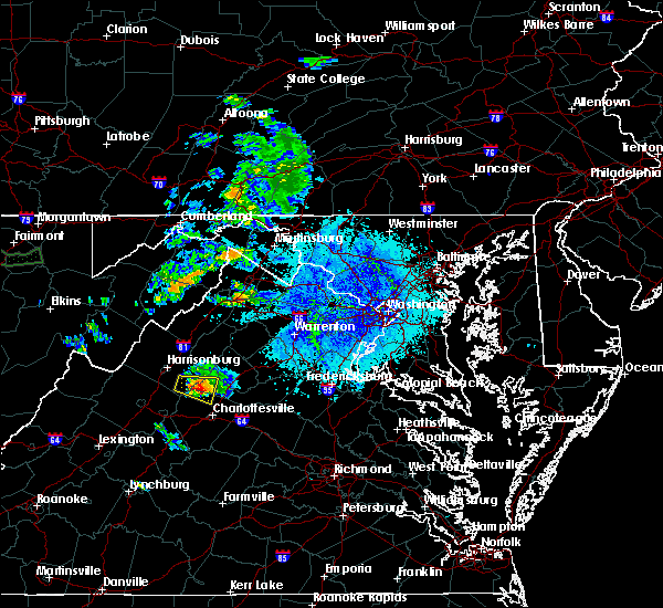 At 445 pm edt, a severe thunderstorm capable of producing a tornado was located near free union, or 15 miles northwest of charlottesville, moving southeast at 25 mph (radar indicated rotation). Hazards include tornado and golf ball size hail. For those in the direct path of a tornado touchdown, flying debris will be dangerous to those caught without shelter. damage to roofs, siding, and windows may occur. mobile homes may be damaged or destroyed. tree damage is likely. this dangerous storm will be near, free union around 500 pm edt. Other locations impacted by this tornadic thunderstorm include advance mills, earlysville, boonesville and hollymead. At 445 pm edt, a severe thunderstorm capable of producing a tornado was located near free union, or 15 miles northwest of charlottesville, moving southeast at 25 mph (radar indicated rotation). Hazards include tornado and golf ball size hail. For those in the direct path of a tornado touchdown, flying debris will be dangerous to those caught without shelter. damage to roofs, siding, and windows may occur. mobile homes may be damaged or destroyed. tree damage is likely. this dangerous storm will be near, free union around 500 pm edt. Other locations impacted by this tornadic thunderstorm include advance mills, earlysville, boonesville and hollymead.
|
| 5/25/2019 4:38 PM EDT |
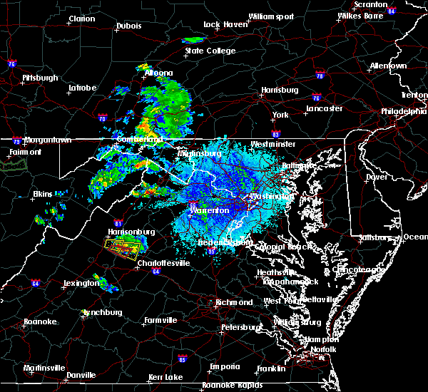 At 437 pm edt, a severe thunderstorm was located near massanutten, or 12 miles southeast of harrisonburg, moving east at 25 mph (radar indicated). Hazards include golf ball size hail and 70 mph wind gusts. Expect wind damage to trees and power lines. hail is large enough to dent and damage vehicles. Some hail damage to roofs, siding, and windows is possible. At 437 pm edt, a severe thunderstorm was located near massanutten, or 12 miles southeast of harrisonburg, moving east at 25 mph (radar indicated). Hazards include golf ball size hail and 70 mph wind gusts. Expect wind damage to trees and power lines. hail is large enough to dent and damage vehicles. Some hail damage to roofs, siding, and windows is possible.
|
| 4/26/2019 1:21 PM EDT |
 At 121 pm edt, severe thunderstorms were located along a line extending from near free union to near charlottesville, moving northeast at 45 mph (radar indicated). Hazards include 60 mph wind gusts. Damaging winds will cause some trees and large branches to fall. this could injure those outdoors, as well as damage homes and vehicles. roadways may become blocked by downed trees. localized power outages are possible. unsecured light objects may become projectiles. Locations impacted include, charlottesville, crozet, free union, campbell, westmoreland, hollymead, ivy, scottsville, north garden, stony point, flordon, scott stadium, cobham, cismont, boonesville, newcomb hall, boyd tavern, monticello, woodridge and keswick. At 121 pm edt, severe thunderstorms were located along a line extending from near free union to near charlottesville, moving northeast at 45 mph (radar indicated). Hazards include 60 mph wind gusts. Damaging winds will cause some trees and large branches to fall. this could injure those outdoors, as well as damage homes and vehicles. roadways may become blocked by downed trees. localized power outages are possible. unsecured light objects may become projectiles. Locations impacted include, charlottesville, crozet, free union, campbell, westmoreland, hollymead, ivy, scottsville, north garden, stony point, flordon, scott stadium, cobham, cismont, boonesville, newcomb hall, boyd tavern, monticello, woodridge and keswick.
|
| 4/26/2019 1:14 PM EDT |
 At 113 pm edt, severe thunderstorms were located along a line extending from crozet to 10 miles southwest of charlottesville, moving northeast at 45 mph (radar indicated). Hazards include 60 mph wind gusts. Damaging winds will cause some trees and large branches to fall. this could injure those outdoors, as well as damage homes and vehicles. roadways may become blocked by downed trees. localized power outages are possible. Unsecured light objects may become projectiles. At 113 pm edt, severe thunderstorms were located along a line extending from crozet to 10 miles southwest of charlottesville, moving northeast at 45 mph (radar indicated). Hazards include 60 mph wind gusts. Damaging winds will cause some trees and large branches to fall. this could injure those outdoors, as well as damage homes and vehicles. roadways may become blocked by downed trees. localized power outages are possible. Unsecured light objects may become projectiles.
|
| 4/14/2019 6:33 PM EDT |
 At 633 pm edt, severe thunderstorms were located along a line extending from shenandoah to 8 miles southeast of massanutten, moving northeast at 55 mph (radar indicated). Hazards include 60 mph wind gusts. Damaging winds will cause some trees and large branches to fall. this could injure those outdoors, as well as damage homes and vehicles. roadways may become blocked by downed trees. localized power outages are possible. unsecured light objects may become projectiles. Locations impacted include, grottoes, shenandoah, massanutten, stanardsville, free union, hollymead, elkton, ruckersville, rocky bar, quinque, port republic, lydia, stony point, haneytown, newtown, amicus, mcgaheysville, montevideo, shady grove and mcmullen. At 633 pm edt, severe thunderstorms were located along a line extending from shenandoah to 8 miles southeast of massanutten, moving northeast at 55 mph (radar indicated). Hazards include 60 mph wind gusts. Damaging winds will cause some trees and large branches to fall. this could injure those outdoors, as well as damage homes and vehicles. roadways may become blocked by downed trees. localized power outages are possible. unsecured light objects may become projectiles. Locations impacted include, grottoes, shenandoah, massanutten, stanardsville, free union, hollymead, elkton, ruckersville, rocky bar, quinque, port republic, lydia, stony point, haneytown, newtown, amicus, mcgaheysville, montevideo, shady grove and mcmullen.
|
| 4/14/2019 6:32 PM EDT |
 At 632 pm edt, a severe thunderstorm was located near crozet, or 11 miles northwest of charlottesville, moving northeast at 45 mph (radar indicated). Hazards include 60 mph wind gusts. Damaging winds will cause some trees and large branches to fall. this could injure those outdoors, as well as damage homes and vehicles. roadways may become blocked by downed trees. localized power outages are possible. unsecured light objects may become projectiles. Locations impacted include, charlottesville, waynesboro, crozet, grottoes, crimora, sherando, free union, wintergreen, afton, westmoreland, hollymead, lyndhurst, nellysford, ivy, new hope, north garden, covesville, yancey mills, stony point and flordon. At 632 pm edt, a severe thunderstorm was located near crozet, or 11 miles northwest of charlottesville, moving northeast at 45 mph (radar indicated). Hazards include 60 mph wind gusts. Damaging winds will cause some trees and large branches to fall. this could injure those outdoors, as well as damage homes and vehicles. roadways may become blocked by downed trees. localized power outages are possible. unsecured light objects may become projectiles. Locations impacted include, charlottesville, waynesboro, crozet, grottoes, crimora, sherando, free union, wintergreen, afton, westmoreland, hollymead, lyndhurst, nellysford, ivy, new hope, north garden, covesville, yancey mills, stony point and flordon.
|
| 4/14/2019 6:09 PM EDT |
 At 609 pm edt, severe thunderstorms were located along a line extending from grottoes to near crozet, moving northeast at 55 mph (radar indicated). Hazards include 60 mph wind gusts. Damaging winds will cause some trees and large branches to fall. this could injure those outdoors, as well as damage homes and vehicles. roadways may become blocked by downed trees. localized power outages are possible. Unsecured light objects may become projectiles. At 609 pm edt, severe thunderstorms were located along a line extending from grottoes to near crozet, moving northeast at 55 mph (radar indicated). Hazards include 60 mph wind gusts. Damaging winds will cause some trees and large branches to fall. this could injure those outdoors, as well as damage homes and vehicles. roadways may become blocked by downed trees. localized power outages are possible. Unsecured light objects may become projectiles.
|
| 4/14/2019 5:59 PM EDT |
 At 558 pm edt, a severe thunderstorm was located near wintergreen, or 14 miles north of clifford, moving northeast at 45 mph (radar indicated). Hazards include 60 mph wind gusts and quarter size hail. Damaging winds will cause some trees and large branches to fall. this could injure those outdoors, as well as damage homes and vehicles. roadways may become blocked by downed trees. localized power outages are possible. Unsecured light objects may become projectiles. At 558 pm edt, a severe thunderstorm was located near wintergreen, or 14 miles north of clifford, moving northeast at 45 mph (radar indicated). Hazards include 60 mph wind gusts and quarter size hail. Damaging winds will cause some trees and large branches to fall. this could injure those outdoors, as well as damage homes and vehicles. roadways may become blocked by downed trees. localized power outages are possible. Unsecured light objects may become projectiles.
|
| 8/30/2018 7:05 PM EDT |
 The severe thunderstorm warning for central albemarle county and the city of charlottesville will expire at 715 pm edt, the storm which prompted the warning has weakened below severe limits, and no longer pose an immediate threat to life or property. therefore the warning will be allowed to expire. to report severe weather, contact your nearest law enforcement agency. they will relay your report to the national weather service sterling virginia. The severe thunderstorm warning for central albemarle county and the city of charlottesville will expire at 715 pm edt, the storm which prompted the warning has weakened below severe limits, and no longer pose an immediate threat to life or property. therefore the warning will be allowed to expire. to report severe weather, contact your nearest law enforcement agency. they will relay your report to the national weather service sterling virginia.
|
| 8/30/2018 6:52 PM EDT |
 At 651 pm edt, a severe thunderstorm was located near crozet, or near charlottesville, moving east at 10 mph (radar indicated). Hazards include 60 mph wind gusts. Damaging winds will cause some trees and large branches to fall. this could injure those outdoors, as well as damage homes and vehicles. roadways may become blocked by downed trees. localized power outages are possible. unsecured light objects may become projectiles. Locations impacted include, charlottesville, crozet, westmoreland, hollymead, ivy, north garden, newcomb hall, batesville, yancey mills, monticello, flordon, carrsbrook, shadwell, barracks, overton, scott stadium and white hall. At 651 pm edt, a severe thunderstorm was located near crozet, or near charlottesville, moving east at 10 mph (radar indicated). Hazards include 60 mph wind gusts. Damaging winds will cause some trees and large branches to fall. this could injure those outdoors, as well as damage homes and vehicles. roadways may become blocked by downed trees. localized power outages are possible. unsecured light objects may become projectiles. Locations impacted include, charlottesville, crozet, westmoreland, hollymead, ivy, north garden, newcomb hall, batesville, yancey mills, monticello, flordon, carrsbrook, shadwell, barracks, overton, scott stadium and white hall.
|
| 8/30/2018 6:34 PM EDT |
 At 633 pm edt, a severe thunderstorm was located near crozet, or 9 miles west of charlottesville, moving east at 10 mph (radar indicated. trained spotters reported strong wind gusts resulting in downed branches near crozet). Hazards include 60 mph wind gusts. Damaging winds will cause some trees and large branches to fall. this could injure those outdoors, as well as damage homes and vehicles. roadways may become blocked by downed trees. localized power outages are possible. unsecured light objects may become projectiles. Locations impacted include, charlottesville, crozet, free union, westmoreland, hollymead, ivy, greenwood, north garden, newcomb hall, batesville, yancey mills, monticello, flordon, carrsbrook, shadwell, barracks, overton, scott stadium and white hall. At 633 pm edt, a severe thunderstorm was located near crozet, or 9 miles west of charlottesville, moving east at 10 mph (radar indicated. trained spotters reported strong wind gusts resulting in downed branches near crozet). Hazards include 60 mph wind gusts. Damaging winds will cause some trees and large branches to fall. this could injure those outdoors, as well as damage homes and vehicles. roadways may become blocked by downed trees. localized power outages are possible. unsecured light objects may become projectiles. Locations impacted include, charlottesville, crozet, free union, westmoreland, hollymead, ivy, greenwood, north garden, newcomb hall, batesville, yancey mills, monticello, flordon, carrsbrook, shadwell, barracks, overton, scott stadium and white hall.
|
| 8/30/2018 6:07 PM EDT |
 At 607 pm edt, a severe thunderstorm was located near crozet, or 8 miles east of waynesboro, moving east at 10 mph (radar indicated). Hazards include 60 mph wind gusts. Damaging winds will cause some trees and large branches to fall. this could injure those outdoors, as well as damage homes and vehicles. roadways may become blocked by downed trees. localized power outages are possible. Unsecured light objects may become projectiles. At 607 pm edt, a severe thunderstorm was located near crozet, or 8 miles east of waynesboro, moving east at 10 mph (radar indicated). Hazards include 60 mph wind gusts. Damaging winds will cause some trees and large branches to fall. this could injure those outdoors, as well as damage homes and vehicles. roadways may become blocked by downed trees. localized power outages are possible. Unsecured light objects may become projectiles.
|
| 8/8/2018 6:12 PM EDT |
 A severe thunderstorm warning remains in effect until 630 pm edt for west central orange. northwestern albemarle and southern greene counties. At 611 pm edt, severe thunderstorms were located along a line extending from near stanardsville to near free union to near afton, moving east at 25 mph. A severe thunderstorm warning remains in effect until 630 pm edt for west central orange. northwestern albemarle and southern greene counties. At 611 pm edt, severe thunderstorms were located along a line extending from near stanardsville to near free union to near afton, moving east at 25 mph.
|
| 8/8/2018 5:51 PM EDT |
 At 551 pm edt, severe thunderstorms were located along a line extending from 8 miles west of stanardsville to near grottoes to near crimora, moving east at 25 mph (radar indicated). Hazards include 60 mph wind gusts. Damaging winds will cause some trees and large branches to fall. this could injure those outdoors, as well as damage homes and vehicles. roadways may become blocked by downed trees. localized power outages are possible. Unsecured light objects may become projectiles. At 551 pm edt, severe thunderstorms were located along a line extending from 8 miles west of stanardsville to near grottoes to near crimora, moving east at 25 mph (radar indicated). Hazards include 60 mph wind gusts. Damaging winds will cause some trees and large branches to fall. this could injure those outdoors, as well as damage homes and vehicles. roadways may become blocked by downed trees. localized power outages are possible. Unsecured light objects may become projectiles.
|
| 7/22/2018 7:50 PM EDT |
 The severe thunderstorm warning for albemarle county and the city of charlottesville will expire at 800 pm edt, the storm which prompted the warning has weakened below severe limits, and no longer pose an immediate threat to life or property. therefore the warning will be allowed to expire. however heavy rain is still possible with this thunderstorm. The severe thunderstorm warning for albemarle county and the city of charlottesville will expire at 800 pm edt, the storm which prompted the warning has weakened below severe limits, and no longer pose an immediate threat to life or property. therefore the warning will be allowed to expire. however heavy rain is still possible with this thunderstorm.
|
| 7/22/2018 7:25 PM EDT |
 At 705 pm edt, a severe thunderstorm was located over lake monticello, or near palmyra, moving northwest at 25 mph (radar indicated). Hazards include 60 mph wind gusts. Damaging winds will cause some trees and large branches to fall. this could injure those outdoors, as well as damage homes and vehicles. roadways may become blocked by downed trees. localized power outages are possible. Unsecured light objects may become projectiles. At 705 pm edt, a severe thunderstorm was located over lake monticello, or near palmyra, moving northwest at 25 mph (radar indicated). Hazards include 60 mph wind gusts. Damaging winds will cause some trees and large branches to fall. this could injure those outdoors, as well as damage homes and vehicles. roadways may become blocked by downed trees. localized power outages are possible. Unsecured light objects may become projectiles.
|
| 7/22/2018 7:05 PM EDT |
 At 705 pm edt, a severe thunderstorm was located over lake monticello, or near palmyra, moving northwest at 25 mph (radar indicated). Hazards include 60 mph wind gusts. Damaging winds will cause some trees and large branches to fall. this could injure those outdoors, as well as damage homes and vehicles. roadways may become blocked by downed trees. localized power outages are possible. Unsecured light objects may become projectiles. At 705 pm edt, a severe thunderstorm was located over lake monticello, or near palmyra, moving northwest at 25 mph (radar indicated). Hazards include 60 mph wind gusts. Damaging winds will cause some trees and large branches to fall. this could injure those outdoors, as well as damage homes and vehicles. roadways may become blocked by downed trees. localized power outages are possible. Unsecured light objects may become projectiles.
|
| 6/24/2018 2:48 PM EDT | Tree down on the 7000 block of free union road in albemarle county VA, 5.8 miles SSE of Free Union, VA |
| 6/24/2018 2:45 PM EDT |
 At 244 pm edt, a severe thunderstorm was located over crozet, or 11 miles east of waynesboro, moving southeast at 35 mph (radar indicated). Hazards include 60 mph wind gusts and half dollar size hail. Damaging winds will cause some trees and large branches to fall. this could injure those outdoors, as well as damage homes and vehicles. roadways may become blocked by downed trees. localized power outages are possible. unsecured light objects may become projectiles. Locations impacted include, free union, westmoreland, hollymead, carrsbrook and white hall. At 244 pm edt, a severe thunderstorm was located over crozet, or 11 miles east of waynesboro, moving southeast at 35 mph (radar indicated). Hazards include 60 mph wind gusts and half dollar size hail. Damaging winds will cause some trees and large branches to fall. this could injure those outdoors, as well as damage homes and vehicles. roadways may become blocked by downed trees. localized power outages are possible. unsecured light objects may become projectiles. Locations impacted include, free union, westmoreland, hollymead, carrsbrook and white hall.
|
| 6/24/2018 2:25 PM EDT |
 At 225 pm edt, a severe thunderstorm was located near crimora, or 7 miles north of waynesboro, moving east at 40 mph (radar indicated). Hazards include 60 mph wind gusts and half dollar size hail. Damaging winds will cause some trees and large branches to fall. this could injure those outdoors, as well as damage homes and vehicles. roadways may become blocked by downed trees. localized power outages are possible. Unsecured light objects may become projectiles. At 225 pm edt, a severe thunderstorm was located near crimora, or 7 miles north of waynesboro, moving east at 40 mph (radar indicated). Hazards include 60 mph wind gusts and half dollar size hail. Damaging winds will cause some trees and large branches to fall. this could injure those outdoors, as well as damage homes and vehicles. roadways may become blocked by downed trees. localized power outages are possible. Unsecured light objects may become projectiles.
|
| 6/10/2018 4:09 PM EDT |
 At 409 pm edt, a severe thunderstorm was located over charlottesville, moving southeast at 10 mph (radar indicated). Hazards include 60 mph wind gusts and quarter size hail. Damaging winds will cause some trees and large branches to fall. this could injure those outdoors, as well as damage homes and vehicles. roadways may become blocked by downed trees. localized power outages are possible. unsecured light objects may become projectiles. Locations impacted include, charlottesville, westmoreland, hollymead, ivy, stony point, flordon, carrsbrook and barracks. At 409 pm edt, a severe thunderstorm was located over charlottesville, moving southeast at 10 mph (radar indicated). Hazards include 60 mph wind gusts and quarter size hail. Damaging winds will cause some trees and large branches to fall. this could injure those outdoors, as well as damage homes and vehicles. roadways may become blocked by downed trees. localized power outages are possible. unsecured light objects may become projectiles. Locations impacted include, charlottesville, westmoreland, hollymead, ivy, stony point, flordon, carrsbrook and barracks.
|
| 6/10/2018 4:08 PM EDT |
 At 407 pm edt, severe thunderstorms were located along a line extending from near afton to charlottesville, moving southeast at 20 mph (radar indicated). Hazards include golf ball size hail and 70 mph wind gusts. Expect wind damage to trees and power lines. hail is large enough to dent and damage vehicles. some hail damage to roofs, siding, and windows is possible. Locations impacted include, charlottesville, crozet, free union, campbell, westmoreland, hollymead, ivy, north garden, covesville, yancey mills, stony point, flordon, scott stadium, cobham, cismont, greenwood, newcomb hall, batesville, boyd tavern and woodridge. At 407 pm edt, severe thunderstorms were located along a line extending from near afton to charlottesville, moving southeast at 20 mph (radar indicated). Hazards include golf ball size hail and 70 mph wind gusts. Expect wind damage to trees and power lines. hail is large enough to dent and damage vehicles. some hail damage to roofs, siding, and windows is possible. Locations impacted include, charlottesville, crozet, free union, campbell, westmoreland, hollymead, ivy, north garden, covesville, yancey mills, stony point, flordon, scott stadium, cobham, cismont, greenwood, newcomb hall, batesville, boyd tavern and woodridge.
|
| 6/10/2018 4:01 PM EDT |
 At 400 pm edt, severe thunderstorms were located along a line extending from near afton to 7 miles east of charlottesville, moving southeast at 15 mph (radar indicated). Hazards include 60 mph wind gusts and quarter size hail. Damaging winds will cause some trees and large branches to fall. this could injure those outdoors, as well as damage homes and vehicles. roadways may become blocked by downed trees. localized power outages are possible. Unsecured light objects may become projectiles. At 400 pm edt, severe thunderstorms were located along a line extending from near afton to 7 miles east of charlottesville, moving southeast at 15 mph (radar indicated). Hazards include 60 mph wind gusts and quarter size hail. Damaging winds will cause some trees and large branches to fall. this could injure those outdoors, as well as damage homes and vehicles. roadways may become blocked by downed trees. localized power outages are possible. Unsecured light objects may become projectiles.
|
| 6/10/2018 3:53 PM EDT |
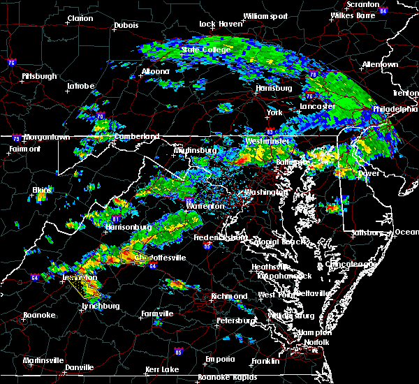 At 353 pm edt, a severe thunderstorm was located near charlottesville, moving east at 20 mph (radar indicated). Hazards include 70 mph wind gusts and ping pong ball size hail. Damaging winds will cause some trees and large branches to fall. this could injure those outdoors, as well as damage homes and vehicles. roadways may become blocked by downed trees. localized power outages are possible. unsecured light objects may become projectiles. Locations impacted include, charlottesville, free union, westmoreland, hollymead, ivy, stony point, advance mills, flordon, carrsbrook, earlysville and barracks. At 353 pm edt, a severe thunderstorm was located near charlottesville, moving east at 20 mph (radar indicated). Hazards include 70 mph wind gusts and ping pong ball size hail. Damaging winds will cause some trees and large branches to fall. this could injure those outdoors, as well as damage homes and vehicles. roadways may become blocked by downed trees. localized power outages are possible. unsecured light objects may become projectiles. Locations impacted include, charlottesville, free union, westmoreland, hollymead, ivy, stony point, advance mills, flordon, carrsbrook, earlysville and barracks.
|
| 6/10/2018 3:33 PM EDT |
 At 332 pm edt, a severe thunderstorm was located over free union, or 7 miles northwest of charlottesville, moving east at 10 mph (radar indicated). Hazards include 60 mph wind gusts and quarter size hail. Damaging winds will cause some trees and large branches to fall. this could injure those outdoors, as well as damage homes and vehicles. roadways may become blocked by downed trees. localized power outages are possible. Unsecured light objects may become projectiles. At 332 pm edt, a severe thunderstorm was located over free union, or 7 miles northwest of charlottesville, moving east at 10 mph (radar indicated). Hazards include 60 mph wind gusts and quarter size hail. Damaging winds will cause some trees and large branches to fall. this could injure those outdoors, as well as damage homes and vehicles. roadways may become blocked by downed trees. localized power outages are possible. Unsecured light objects may become projectiles.
|
| 5/22/2018 3:32 PM EDT |
 At 331 pm edt, severe thunderstorms were located along a line extending from stanardsville to near charlottesville to 8 miles south of crozet, moving east at 20 mph (radar indicated). Hazards include 70 mph wind gusts and quarter size hail. Damaging winds will cause some trees and large branches to fall. this could injure those outdoors, as well as damage homes and vehicles. roadways may become blocked by downed trees. localized power outages are possible. unsecured light objects may become projectiles. Locations impacted include, charlottesville, stanardsville, free union, campbell, westmoreland, hollymead, gordonsville, ruckersville, ivy, scottsville, quinque, north garden, eheart, lydia, oakpark, barboursville, stony point, flordon, montpelier station and newtown. At 331 pm edt, severe thunderstorms were located along a line extending from stanardsville to near charlottesville to 8 miles south of crozet, moving east at 20 mph (radar indicated). Hazards include 70 mph wind gusts and quarter size hail. Damaging winds will cause some trees and large branches to fall. this could injure those outdoors, as well as damage homes and vehicles. roadways may become blocked by downed trees. localized power outages are possible. unsecured light objects may become projectiles. Locations impacted include, charlottesville, stanardsville, free union, campbell, westmoreland, hollymead, gordonsville, ruckersville, ivy, scottsville, quinque, north garden, eheart, lydia, oakpark, barboursville, stony point, flordon, montpelier station and newtown.
|
| 5/22/2018 3:27 PM EDT |
 At 326 pm edt, severe thunderstorms were located along a line extending from near stanardsville to near free union to 7 miles south of crozet, moving east at 20 mph (radar indicated). Hazards include 60 mph wind gusts and quarter size hail. Damaging winds will cause some trees and large branches to fall. this could injure those outdoors, as well as damage homes and vehicles. roadways may become blocked by downed trees. localized power outages are possible. unsecured light objects may become projectiles. Locations impacted include, charlottesville, stanardsville, free union, campbell, westmoreland, hollymead, gordonsville, ruckersville, ivy, scottsville, north garden, eheart, oakpark, barboursville, stony point, montpelier station, montford, old somerset, amicus and scott stadium. At 326 pm edt, severe thunderstorms were located along a line extending from near stanardsville to near free union to 7 miles south of crozet, moving east at 20 mph (radar indicated). Hazards include 60 mph wind gusts and quarter size hail. Damaging winds will cause some trees and large branches to fall. this could injure those outdoors, as well as damage homes and vehicles. roadways may become blocked by downed trees. localized power outages are possible. unsecured light objects may become projectiles. Locations impacted include, charlottesville, stanardsville, free union, campbell, westmoreland, hollymead, gordonsville, ruckersville, ivy, scottsville, north garden, eheart, oakpark, barboursville, stony point, montpelier station, montford, old somerset, amicus and scott stadium.
|
| 5/22/2018 3:14 PM EDT |
 At 314 pm edt, severe thunderstorms were located along a line extending from 8 miles west of stanardsville to free union to near crozet, moving east at 20 mph (radar indicated). Hazards include 60 mph wind gusts. Damaging winds will cause some trees and large branches to fall. this could injure those outdoors, as well as damage homes and vehicles. roadways may become blocked by downed trees. localized power outages are possible. Unsecured light objects may become projectiles. At 314 pm edt, severe thunderstorms were located along a line extending from 8 miles west of stanardsville to free union to near crozet, moving east at 20 mph (radar indicated). Hazards include 60 mph wind gusts. Damaging winds will cause some trees and large branches to fall. this could injure those outdoors, as well as damage homes and vehicles. roadways may become blocked by downed trees. localized power outages are possible. Unsecured light objects may become projectiles.
|
| 5/14/2018 6:49 PM EDT |
 At 649 pm edt, severe thunderstorms with a history of producing damaging winds and hail were located along a line extending from near louisa to near shipman, moving southeast at 40 mph (radar indicated). Hazards include 60 mph wind gusts and quarter size hail. Damaging winds will cause some trees and large branches to fall. this could injure those outdoors, as well as damage homes and vehicles. roadways may become blocked by downed trees. localized power outages are possible. unsecured light objects may become projectiles. Locations impacted include, charlottesville, crozet, shipman, schuyler, free union, wintergreen, afton, montebello, campbell, westmoreland, hollymead, nellysford, ivy, arrington, scottsville, esmont, lovingston, allens creek, north garden and yancey mills. At 649 pm edt, severe thunderstorms with a history of producing damaging winds and hail were located along a line extending from near louisa to near shipman, moving southeast at 40 mph (radar indicated). Hazards include 60 mph wind gusts and quarter size hail. Damaging winds will cause some trees and large branches to fall. this could injure those outdoors, as well as damage homes and vehicles. roadways may become blocked by downed trees. localized power outages are possible. unsecured light objects may become projectiles. Locations impacted include, charlottesville, crozet, shipman, schuyler, free union, wintergreen, afton, montebello, campbell, westmoreland, hollymead, nellysford, ivy, arrington, scottsville, esmont, lovingston, allens creek, north garden and yancey mills.
|
| 5/14/2018 6:33 PM EDT |
 At 633 pm edt, severe thunderstorms were located along a line extending from near boswells tavern to near wintergreen, moving southeast at 40 mph (radar indicated). Hazards include 60 mph wind gusts and quarter size hail. Damaging winds will cause some trees and large branches to fall. this could injure those outdoors, as well as damage homes and vehicles. roadways may become blocked by downed trees. localized power outages are possible. unsecured light objects may become projectiles. Locations impacted include, charlottesville, crozet, shipman, schuyler, free union, wintergreen, afton, montebello, campbell, westmoreland, hollymead, nellysford, ivy, arrington, scottsville, esmont, lovingston, allens creek, north garden and yancey mills. At 633 pm edt, severe thunderstorms were located along a line extending from near boswells tavern to near wintergreen, moving southeast at 40 mph (radar indicated). Hazards include 60 mph wind gusts and quarter size hail. Damaging winds will cause some trees and large branches to fall. this could injure those outdoors, as well as damage homes and vehicles. roadways may become blocked by downed trees. localized power outages are possible. unsecured light objects may become projectiles. Locations impacted include, charlottesville, crozet, shipman, schuyler, free union, wintergreen, afton, montebello, campbell, westmoreland, hollymead, nellysford, ivy, arrington, scottsville, esmont, lovingston, allens creek, north garden and yancey mills.
|
| 5/14/2018 6:17 PM EDT |
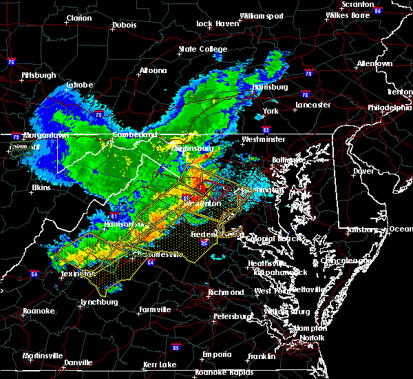 At 616 pm edt, severe thunderstorms were located along a line extending from near sperryville to 6 miles west of stanardsville, moving east at 40 mph (radar indicated). Hazards include 60 mph wind gusts and quarter size hail. Damaging winds will cause some trees and large branches to fall. this could injure those outdoors, as well as damage homes and vehicles. roadways may become blocked by downed trees. localized power outages are possible. unsecured light objects may become projectiles. Locations impacted include, stanardsville, free union, big meadows, mcmullen, criglersville, boonesville, lydia, haywood, haneytown, syria, mission home, banco, amicus, fletcher, graves mill, aylor, saint george, wolftown, shady grove and hood. At 616 pm edt, severe thunderstorms were located along a line extending from near sperryville to 6 miles west of stanardsville, moving east at 40 mph (radar indicated). Hazards include 60 mph wind gusts and quarter size hail. Damaging winds will cause some trees and large branches to fall. this could injure those outdoors, as well as damage homes and vehicles. roadways may become blocked by downed trees. localized power outages are possible. unsecured light objects may become projectiles. Locations impacted include, stanardsville, free union, big meadows, mcmullen, criglersville, boonesville, lydia, haywood, haneytown, syria, mission home, banco, amicus, fletcher, graves mill, aylor, saint george, wolftown, shady grove and hood.
|
| 5/14/2018 6:14 PM EDT |
 At 613 pm edt, severe thunderstorms were located along a line extending from 6 miles south of stanardsville to near vesuvius, moving southeast at 40 mph (radar indicated). Hazards include 60 mph wind gusts and quarter size hail. Damaging winds will cause some trees and large branches to fall. this could injure those outdoors, as well as damage homes and vehicles. roadways may become blocked by downed trees. localized power outages are possible. Unsecured light objects may become projectiles. At 613 pm edt, severe thunderstorms were located along a line extending from 6 miles south of stanardsville to near vesuvius, moving southeast at 40 mph (radar indicated). Hazards include 60 mph wind gusts and quarter size hail. Damaging winds will cause some trees and large branches to fall. this could injure those outdoors, as well as damage homes and vehicles. roadways may become blocked by downed trees. localized power outages are possible. Unsecured light objects may become projectiles.
|
| 5/14/2018 5:57 PM EDT |
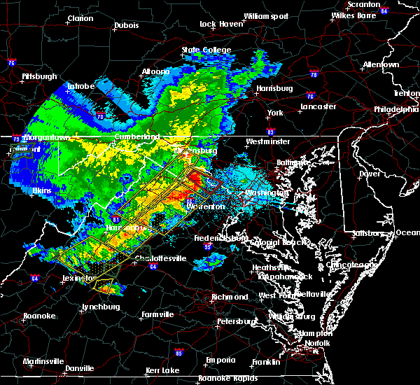 At 557 pm edt, severe thunderstorms were located along a line extending from near luray to near massanutten, moving east at 40 mph (radar indicated). Hazards include 60 mph wind gusts and half dollar size hail. Damaging winds will cause some trees and large branches to fall. this could injure those outdoors, as well as damage homes and vehicles. roadways may become blocked by downed trees. localized power outages are possible. unsecured light objects may become projectiles. Locations impacted include, shenandoah, massanutten, stanley, stanardsville, free union, big meadows, elkton, rocky bar, ingham, port republic, lydia, haywood, haneytown, syria, banco, amicus, mcgaheysville, montevideo, shady grove and hood. At 557 pm edt, severe thunderstorms were located along a line extending from near luray to near massanutten, moving east at 40 mph (radar indicated). Hazards include 60 mph wind gusts and half dollar size hail. Damaging winds will cause some trees and large branches to fall. this could injure those outdoors, as well as damage homes and vehicles. roadways may become blocked by downed trees. localized power outages are possible. unsecured light objects may become projectiles. Locations impacted include, shenandoah, massanutten, stanley, stanardsville, free union, big meadows, elkton, rocky bar, ingham, port republic, lydia, haywood, haneytown, syria, banco, amicus, mcgaheysville, montevideo, shady grove and hood.
|
| 5/14/2018 5:33 PM EDT |
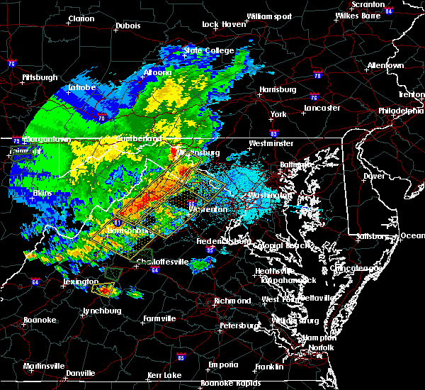 At 533 pm edt, severe thunderstorms were located along a line extending from near timberville to near bridgewater, moving east at 40 mph (radar indicated). Hazards include 60 mph wind gusts and half dollar size hail. Damaging winds will cause some trees and large branches to fall. this could injure those outdoors, as well as damage homes and vehicles. roadways may become blocked by downed trees. localized power outages are possible. Unsecured light objects may become projectiles. At 533 pm edt, severe thunderstorms were located along a line extending from near timberville to near bridgewater, moving east at 40 mph (radar indicated). Hazards include 60 mph wind gusts and half dollar size hail. Damaging winds will cause some trees and large branches to fall. this could injure those outdoors, as well as damage homes and vehicles. roadways may become blocked by downed trees. localized power outages are possible. Unsecured light objects may become projectiles.
|
| 4/15/2018 8:38 PM EDT |
 The severe thunderstorm warning for southeastern rockingham and northern albemarle counties and the city of charlottesville will expire at 845 pm edt, the storms which prompted the warning have moved out of the area. therefore the warning will be allowed to expire. The severe thunderstorm warning for southeastern rockingham and northern albemarle counties and the city of charlottesville will expire at 845 pm edt, the storms which prompted the warning have moved out of the area. therefore the warning will be allowed to expire.
|
| 4/15/2018 8:22 PM EDT |
 A severe thunderstorm warning remains in effect until 845 pm edt for southeastern rockingham and northern albemarle counties and the city of charlottesville. At 821 pm edt, severe thunderstorms were located along a line extending from 7 miles northeast of charlottesville to troy to near lakeside village, moving northeast at 45 mph. A severe thunderstorm warning remains in effect until 845 pm edt for southeastern rockingham and northern albemarle counties and the city of charlottesville. At 821 pm edt, severe thunderstorms were located along a line extending from 7 miles northeast of charlottesville to troy to near lakeside village, moving northeast at 45 mph.
|
| 4/15/2018 7:47 PM EDT |
 At 747 pm edt, severe thunderstorms were located along a line extending from schuyler to near buckingham to near sheppards, moving northeast at 50 mph (radar indicated). Hazards include 60 mph wind gusts and quarter size hail. Damaging winds will cause some trees and large branches to fall. this could injure those outdoors, as well as damage homes and vehicles. roadways may become blocked by downed trees. localized power outages are possible. Unsecured light objects may become projectiles. At 747 pm edt, severe thunderstorms were located along a line extending from schuyler to near buckingham to near sheppards, moving northeast at 50 mph (radar indicated). Hazards include 60 mph wind gusts and quarter size hail. Damaging winds will cause some trees and large branches to fall. this could injure those outdoors, as well as damage homes and vehicles. roadways may become blocked by downed trees. localized power outages are possible. Unsecured light objects may become projectiles.
|
| 9/5/2017 4:56 PM EDT |
 The severe thunderstorm warning for southeastern nelson, southeastern madison, southwestern orange, albemarle and southeastern greene counties and the city of charlottesville will expire at 500 pm edt, the storms which prompted the warning have weakened below severe limits, and no longer pose an immediate threat to life or property. therefore the warning will be allowed to expire. however gusty winds and heavy rain are still possible with these thunderstorms. to report severe weather, contact your nearest law enforcement agency. they will relay your report to the national weather service sterling virginia. The severe thunderstorm warning for southeastern nelson, southeastern madison, southwestern orange, albemarle and southeastern greene counties and the city of charlottesville will expire at 500 pm edt, the storms which prompted the warning have weakened below severe limits, and no longer pose an immediate threat to life or property. therefore the warning will be allowed to expire. however gusty winds and heavy rain are still possible with these thunderstorms. to report severe weather, contact your nearest law enforcement agency. they will relay your report to the national weather service sterling virginia.
|
| 9/5/2017 4:44 PM EDT |
 At 444 pm edt, severe thunderstorms were located along a line extending from 6 miles east of stanardsville to near schuyler, moving east at 35 mph (radar indicated). Hazards include 60 mph wind gusts. Damaging winds will cause some trees and large branches to fall. this could injure those outdoors, as well as damage homes and vehicles. roadways may become blocked by downed trees. localized power outages are possible. unsecured light objects may become projectiles. Locations impacted include, charlottesville, shipman, schuyler, free union, westmoreland, hollymead, ruckersville, ivy, arrington, scottsville, esmont, lovingston, quinque, north garden, eheart, covesville, barboursville, stony point, flordon and montpelier station. At 444 pm edt, severe thunderstorms were located along a line extending from 6 miles east of stanardsville to near schuyler, moving east at 35 mph (radar indicated). Hazards include 60 mph wind gusts. Damaging winds will cause some trees and large branches to fall. this could injure those outdoors, as well as damage homes and vehicles. roadways may become blocked by downed trees. localized power outages are possible. unsecured light objects may become projectiles. Locations impacted include, charlottesville, shipman, schuyler, free union, westmoreland, hollymead, ruckersville, ivy, arrington, scottsville, esmont, lovingston, quinque, north garden, eheart, covesville, barboursville, stony point, flordon and montpelier station.
|
| 9/5/2017 4:36 PM EDT | A tree twelve inches in diameter was snapped off along pelham roa in albemarle county VA, 2.1 miles WSW of Free Union, VA |
| 9/5/2017 4:34 PM EDT |
 At 432 pm edt, severe thunderstorms were located along a line extending from near stanardsville to schuyler, moving east at 35 mph (radar indicated). Hazards include 60 mph wind gusts. Damaging winds will cause some trees and large branches to fall. this could injure those outdoors, as well as damage homes and vehicles. roadways may become blocked by downed trees. localized power outages are possible. unsecured light objects may become projectiles. Locations impacted include, charlottesville, orange, crozet, shipman, schuyler, free union, campbell, westmoreland, hollymead, ruckersville, nellysford, ivy, arrington, scottsville, esmont, lovingston, north garden, eheart, barboursville and yancey mills. At 432 pm edt, severe thunderstorms were located along a line extending from near stanardsville to schuyler, moving east at 35 mph (radar indicated). Hazards include 60 mph wind gusts. Damaging winds will cause some trees and large branches to fall. this could injure those outdoors, as well as damage homes and vehicles. roadways may become blocked by downed trees. localized power outages are possible. unsecured light objects may become projectiles. Locations impacted include, charlottesville, orange, crozet, shipman, schuyler, free union, campbell, westmoreland, hollymead, ruckersville, nellysford, ivy, arrington, scottsville, esmont, lovingston, north garden, eheart, barboursville and yancey mills.
|
| 9/5/2017 4:12 PM EDT |
 At 411 pm edt, severe thunderstorms were located along a line extending from near free union to near shipman, moving east at 35 mph (radar indicated). Hazards include 60 mph wind gusts. Damaging winds will cause some trees and large branches to fall. this could injure those outdoors, as well as damage homes and vehicles. roadways may become blocked by downed trees. localized power outages are possible. Unsecured light objects may become projectiles. At 411 pm edt, severe thunderstorms were located along a line extending from near free union to near shipman, moving east at 35 mph (radar indicated). Hazards include 60 mph wind gusts. Damaging winds will cause some trees and large branches to fall. this could injure those outdoors, as well as damage homes and vehicles. roadways may become blocked by downed trees. localized power outages are possible. Unsecured light objects may become projectiles.
|
| 9/5/2017 3:58 PM EDT |
 At 357 pm edt, a severe thunderstorm was located near afton, or near waynesboro, moving northeast at 55 mph (radar indicated). Hazards include 60 mph wind gusts. Damaging winds will cause some trees and large branches to fall. this could injure those outdoors, as well as damage homes and vehicles. roadways may become blocked by downed trees. localized power outages are possible. unsecured light objects may become projectiles. Locations impacted include, charlottesville, waynesboro, stuarts draft, crozet, crimora, sherando, free union, wintergreen, montebello, afton, westmoreland, hollymead, fishersville, lyndhurst, nellysford, ivy, yancey mills, stony point, tyro and flordon. At 357 pm edt, a severe thunderstorm was located near afton, or near waynesboro, moving northeast at 55 mph (radar indicated). Hazards include 60 mph wind gusts. Damaging winds will cause some trees and large branches to fall. this could injure those outdoors, as well as damage homes and vehicles. roadways may become blocked by downed trees. localized power outages are possible. unsecured light objects may become projectiles. Locations impacted include, charlottesville, waynesboro, stuarts draft, crozet, crimora, sherando, free union, wintergreen, montebello, afton, westmoreland, hollymead, fishersville, lyndhurst, nellysford, ivy, yancey mills, stony point, tyro and flordon.
|
| 9/5/2017 3:36 PM EDT |
 At 336 pm edt, a severe thunderstorm was located near montebello, or 15 miles north of forks of buffalo, moving northeast at 55 mph (radar indicated). Hazards include 60 mph wind gusts. Damaging winds will cause some trees and large branches to fall. this could injure those outdoors, as well as damage homes and vehicles. roadways may become blocked by downed trees. localized power outages are possible. Unsecured light objects may become projectiles. At 336 pm edt, a severe thunderstorm was located near montebello, or 15 miles north of forks of buffalo, moving northeast at 55 mph (radar indicated). Hazards include 60 mph wind gusts. Damaging winds will cause some trees and large branches to fall. this could injure those outdoors, as well as damage homes and vehicles. roadways may become blocked by downed trees. localized power outages are possible. Unsecured light objects may become projectiles.
|
| 7/22/2017 9:50 PM EDT |
 At 949 pm edt, severe thunderstorms were located along a line extending from near stanardsville to free union, moving southeast at 25 mph (radar indicated). Hazards include 60 mph wind gusts. Damaging winds will cause some trees and large branches to fall. this could injure those outdoors, as well as damage homes and vehicles. roadways may become blocked by downed trees. localized power outages are possible. Unsecured light objects may become projectiles. At 949 pm edt, severe thunderstorms were located along a line extending from near stanardsville to free union, moving southeast at 25 mph (radar indicated). Hazards include 60 mph wind gusts. Damaging winds will cause some trees and large branches to fall. this could injure those outdoors, as well as damage homes and vehicles. roadways may become blocked by downed trees. localized power outages are possible. Unsecured light objects may become projectiles.
|
| 7/14/2017 4:21 PM EDT |
 At 421 pm edt, a severe thunderstorm was located 7 miles northwest of free union, or 16 miles northwest of charlottesville, moving east at 15 mph (radar indicated). Hazards include 60 mph wind gusts. Damaging winds will cause some trees and large branches to fall. this could injure those outdoors, as well as damage homes and vehicles. roadways may become blocked by downed trees. localized power outages are possible. unsecured light objects may become projectiles. Locations impacted include, free union, mission home, boonesville, amicus, advance mills, saint george, earlysville and shady grove. At 421 pm edt, a severe thunderstorm was located 7 miles northwest of free union, or 16 miles northwest of charlottesville, moving east at 15 mph (radar indicated). Hazards include 60 mph wind gusts. Damaging winds will cause some trees and large branches to fall. this could injure those outdoors, as well as damage homes and vehicles. roadways may become blocked by downed trees. localized power outages are possible. unsecured light objects may become projectiles. Locations impacted include, free union, mission home, boonesville, amicus, advance mills, saint george, earlysville and shady grove.
|
| 7/14/2017 4:02 PM EDT |
 At 402 pm edt, a severe thunderstorm was located near grottoes, or 13 miles southeast of harrisonburg, moving southeast at 20 mph (radar indicated). Hazards include 60 mph wind gusts and quarter size hail. Damaging winds will cause some trees and large branches to fall. this could injure those outdoors, as well as damage homes and vehicles. roadways may become blocked by downed trees. localized power outages are possible. Unsecured light objects may become projectiles. At 402 pm edt, a severe thunderstorm was located near grottoes, or 13 miles southeast of harrisonburg, moving southeast at 20 mph (radar indicated). Hazards include 60 mph wind gusts and quarter size hail. Damaging winds will cause some trees and large branches to fall. this could injure those outdoors, as well as damage homes and vehicles. roadways may become blocked by downed trees. localized power outages are possible. Unsecured light objects may become projectiles.
|
| 6/30/2017 5:51 PM EDT | Tree down on wires in the 700 block of reas ford roa in albemarle county VA, 2.7 miles WNW of Free Union, VA |
| 3/1/2017 12:32 PM EST |
 At 1232 pm est, severe thunderstorms were located along a line extending from 10 miles southeast of massanutten to near lowesville, moving east at 50 mph (radar indicated). Hazards include 60 mph wind gusts. Damaging winds will cause some trees and large branches to fall. this could injure those outdoors, as well as damage homes and vehicles. roadways may become blocked by downed trees. localized power outages are possible. Unsecured light objects may become projectiles. At 1232 pm est, severe thunderstorms were located along a line extending from 10 miles southeast of massanutten to near lowesville, moving east at 50 mph (radar indicated). Hazards include 60 mph wind gusts. Damaging winds will cause some trees and large branches to fall. this could injure those outdoors, as well as damage homes and vehicles. roadways may become blocked by downed trees. localized power outages are possible. Unsecured light objects may become projectiles.
|
| 2/25/2017 1:42 PM EST |
 The severe thunderstorm warning for central albemarle and south central greene counties and the city of charlottesville will expire at 145 pm est, the storm which prompted the warning has moved out of the area. therefore the warning will be allowed to expire. a severe thunderstorm watch remains in effect until 800 pm est for central virginia. The severe thunderstorm warning for central albemarle and south central greene counties and the city of charlottesville will expire at 145 pm est, the storm which prompted the warning has moved out of the area. therefore the warning will be allowed to expire. a severe thunderstorm watch remains in effect until 800 pm est for central virginia.
|
| 2/25/2017 1:22 PM EST |
 At 121 pm est, a severe thunderstorm was located near charlottesville, moving northeast at 30 mph (radar indicated). Hazards include 60 mph wind gusts and quarter size hail. Damaging winds will cause some trees and large branches to fall. this could injure those outdoors, as well as damage homes and vehicles. roadways may become blocked by downed trees. localized power outages are possible. unsecured light objects may become projectiles. Locations impacted include, charlottesville, free union, campbell, westmoreland, hollymead, ivy, north garden, stony point, flordon, haneytown, scott stadium, cismont, newcomb hall, boyd tavern, woodridge, keswick, monticello, carrsbrook, earlysville and shadwell. At 121 pm est, a severe thunderstorm was located near charlottesville, moving northeast at 30 mph (radar indicated). Hazards include 60 mph wind gusts and quarter size hail. Damaging winds will cause some trees and large branches to fall. this could injure those outdoors, as well as damage homes and vehicles. roadways may become blocked by downed trees. localized power outages are possible. unsecured light objects may become projectiles. Locations impacted include, charlottesville, free union, campbell, westmoreland, hollymead, ivy, north garden, stony point, flordon, haneytown, scott stadium, cismont, newcomb hall, boyd tavern, woodridge, keswick, monticello, carrsbrook, earlysville and shadwell.
|
| 2/25/2017 1:09 PM EST |
 At 108 pm est, a severe thunderstorm was located 8 miles south of crozet, or 11 miles southwest of charlottesville, moving northeast at 35 mph (radar indicated). Hazards include 60 mph wind gusts and quarter size hail. Damaging winds will cause some trees and large branches to fall. this could injure those outdoors, as well as damage homes and vehicles. roadways may become blocked by downed trees. localized power outages are possible. Unsecured light objects may become projectiles. At 108 pm est, a severe thunderstorm was located 8 miles south of crozet, or 11 miles southwest of charlottesville, moving northeast at 35 mph (radar indicated). Hazards include 60 mph wind gusts and quarter size hail. Damaging winds will cause some trees and large branches to fall. this could injure those outdoors, as well as damage homes and vehicles. roadways may become blocked by downed trees. localized power outages are possible. Unsecured light objects may become projectiles.
|
| 8/6/2016 4:28 PM EDT |
 At 428 pm edt, a severe thunderstorm was located near charlottesville, moving southeast at 25 mph (radar indicated). Hazards include 60 mph wind gusts. Damaging winds will cause some trees and large branches to fall. this could injure those outdoors, as well as damage homes and vehicles. roadways may become blocked by downed trees. localized power outages are possible. unsecured light objects may become projectiles. Locations impacted include, charlottesville, crozet, free union, campbell, westmoreland, hollymead, ivy, scottsville, esmont, keene, keswick, flordon, white hall, woodridge, scott stadium, glendower, monticello, carrsbrook, greenwood and barracks. At 428 pm edt, a severe thunderstorm was located near charlottesville, moving southeast at 25 mph (radar indicated). Hazards include 60 mph wind gusts. Damaging winds will cause some trees and large branches to fall. this could injure those outdoors, as well as damage homes and vehicles. roadways may become blocked by downed trees. localized power outages are possible. unsecured light objects may become projectiles. Locations impacted include, charlottesville, crozet, free union, campbell, westmoreland, hollymead, ivy, scottsville, esmont, keene, keswick, flordon, white hall, woodridge, scott stadium, glendower, monticello, carrsbrook, greenwood and barracks.
|
| 8/6/2016 4:11 PM EDT |
 At 411 pm edt, a severe thunderstorm was located near charlottesville, moving southeast at 30 mph (radar indicated). Hazards include 60 mph wind gusts. Damaging winds will cause some trees and large branches to fall. this could injure those outdoors, as well as damage homes and vehicles. roadways may become blocked by downed trees. localized power outages are possible. Unsecured light objects may become projectiles. At 411 pm edt, a severe thunderstorm was located near charlottesville, moving southeast at 30 mph (radar indicated). Hazards include 60 mph wind gusts. Damaging winds will cause some trees and large branches to fall. this could injure those outdoors, as well as damage homes and vehicles. roadways may become blocked by downed trees. localized power outages are possible. Unsecured light objects may become projectiles.
|
| 7/30/2016 4:05 PM EDT |
 At 405 pm edt, a severe thunderstorm was located near charlottesville, moving east at 20 mph (radar indicated). Hazards include 60 mph wind gusts and quarter size hail. Damaging winds will cause some trees and large branches to fall. this could injure those outdoors, as well as damage homes and vehicles. roadways may become blocked by downed trees. localized power outages are possible. Unsecured light objects may become projectiles. At 405 pm edt, a severe thunderstorm was located near charlottesville, moving east at 20 mph (radar indicated). Hazards include 60 mph wind gusts and quarter size hail. Damaging winds will cause some trees and large branches to fall. this could injure those outdoors, as well as damage homes and vehicles. roadways may become blocked by downed trees. localized power outages are possible. Unsecured light objects may become projectiles.
|
| 7/16/2016 4:26 PM EDT |
 At 426 pm edt, a severe thunderstorm was located near afton, or 8 miles southeast of waynesboro, moving east at 25 mph (radar indicated). Hazards include 60 mph wind gusts. Damaging winds will cause some trees and large branches to fall. this could injure those outdoors, as well as damage homes and vehicles. roadways may become blocked by downed trees. localized power outages are possible. Unsecured light objects may become projectiles. At 426 pm edt, a severe thunderstorm was located near afton, or 8 miles southeast of waynesboro, moving east at 25 mph (radar indicated). Hazards include 60 mph wind gusts. Damaging winds will cause some trees and large branches to fall. this could injure those outdoors, as well as damage homes and vehicles. roadways may become blocked by downed trees. localized power outages are possible. Unsecured light objects may become projectiles.
|
| 6/21/2016 3:14 PM EDT |
 At 314 pm edt, a severe thunderstorm was located over free union, or 7 miles northwest of charlottesville, moving southeast at 25 mph (radar indicated). Hazards include 60 mph wind gusts and quarter size hail. Damaging winds will cause some trees and large branches to fall. this could injure those outdoors, as well as damage homes and vehicles. roadways may become blocked by downed trees. localized power outages are possible. unsecured light objects may become projectiles. Locations impacted include, charlottesville, free union, campbell, westmoreland, hollymead, ivy, keswick, advance mills, flordon, white hall, cobham, newcomb hall, scott stadium, monticello, carrsbrook, cismont, shadwell, barracks, earlysville and boyd tavern. At 314 pm edt, a severe thunderstorm was located over free union, or 7 miles northwest of charlottesville, moving southeast at 25 mph (radar indicated). Hazards include 60 mph wind gusts and quarter size hail. Damaging winds will cause some trees and large branches to fall. this could injure those outdoors, as well as damage homes and vehicles. roadways may become blocked by downed trees. localized power outages are possible. unsecured light objects may become projectiles. Locations impacted include, charlottesville, free union, campbell, westmoreland, hollymead, ivy, keswick, advance mills, flordon, white hall, cobham, newcomb hall, scott stadium, monticello, carrsbrook, cismont, shadwell, barracks, earlysville and boyd tavern.
|
| 6/21/2016 2:58 PM EDT |
 At 258 pm edt, a severe thunderstorm was located near free union, or 14 miles northwest of charlottesville, moving southeast at 25 mph (radar indicated). Hazards include 60 mph wind gusts and quarter size hail. Damaging winds will cause some trees and large branches to fall. this could injure those outdoors, as well as damage homes and vehicles. roadways may become blocked by downed trees. localized power outages are possible. Unsecured light objects may become projectiles. At 258 pm edt, a severe thunderstorm was located near free union, or 14 miles northwest of charlottesville, moving southeast at 25 mph (radar indicated). Hazards include 60 mph wind gusts and quarter size hail. Damaging winds will cause some trees and large branches to fall. this could injure those outdoors, as well as damage homes and vehicles. roadways may become blocked by downed trees. localized power outages are possible. Unsecured light objects may become projectiles.
|
| 6/21/2016 2:49 PM EDT |
 At 249 pm edt, a severe thunderstorm was located 8 miles southeast of massanutten, or 15 miles southeast of harrisonburg, moving east at 30 mph (radar indicated). Hazards include 70 mph wind gusts and ping pong ball size hail. Damaging winds will cause some trees and large branches to fall. this could injure those outdoors, as well as damage homes and vehicles. roadways may become blocked by downed trees. localized power outages are possible. unsecured light objects may become projectiles. Locations impacted include, grottoes, free union, saint george, shady grove, haneytown, mission home, dyke, boonesville and white hall. At 249 pm edt, a severe thunderstorm was located 8 miles southeast of massanutten, or 15 miles southeast of harrisonburg, moving east at 30 mph (radar indicated). Hazards include 70 mph wind gusts and ping pong ball size hail. Damaging winds will cause some trees and large branches to fall. this could injure those outdoors, as well as damage homes and vehicles. roadways may become blocked by downed trees. localized power outages are possible. unsecured light objects may become projectiles. Locations impacted include, grottoes, free union, saint george, shady grove, haneytown, mission home, dyke, boonesville and white hall.
|
| 6/21/2016 2:36 PM EDT |
 At 236 pm edt, a severe thunderstorm was located near grottoes, or 8 miles southeast of harrisonburg, moving east at 30 mph (radar indicated). Hazards include 60 mph wind gusts and quarter size hail. Damaging winds will cause some trees and large branches to fall. this could injure those outdoors, as well as damage homes and vehicles. roadways may become blocked by downed trees. localized power outages are possible. unsecured light objects may become projectiles. Locations impacted include, grottoes, free union, weyers cave, saint george, haneytown, mission home, white hall, montevideo, rocky bar, port republic, shady grove, dyke, boonesville and staunton airport. At 236 pm edt, a severe thunderstorm was located near grottoes, or 8 miles southeast of harrisonburg, moving east at 30 mph (radar indicated). Hazards include 60 mph wind gusts and quarter size hail. Damaging winds will cause some trees and large branches to fall. this could injure those outdoors, as well as damage homes and vehicles. roadways may become blocked by downed trees. localized power outages are possible. unsecured light objects may become projectiles. Locations impacted include, grottoes, free union, weyers cave, saint george, haneytown, mission home, white hall, montevideo, rocky bar, port republic, shady grove, dyke, boonesville and staunton airport.
|
| 6/21/2016 2:16 PM EDT |
 At 216 pm edt, a severe thunderstorm was located over bridgewater, or near harrisonburg, moving east at 30 mph (radar indicated). Hazards include 60 mph wind gusts and quarter size hail. Damaging winds will cause some trees and large branches to fall. this could injure those outdoors, as well as damage homes and vehicles. roadways may become blocked by downed trees. localized power outages are possible. Unsecured light objects may become projectiles. At 216 pm edt, a severe thunderstorm was located over bridgewater, or near harrisonburg, moving east at 30 mph (radar indicated). Hazards include 60 mph wind gusts and quarter size hail. Damaging winds will cause some trees and large branches to fall. this could injure those outdoors, as well as damage homes and vehicles. roadways may become blocked by downed trees. localized power outages are possible. Unsecured light objects may become projectiles.
|
| 6/16/2016 8:23 PM EDT |
 A severe thunderstorm warning remains in effect until 845 pm edt for southwestern orange. southeastern greene. southwestern culpeper. southeastern augusta. southern madison. albemarle and northeastern nelson counties and the city of charlottesville. at 823 pm edt. Severe thunderstorms were located along a line extending from near madison to near charlottesville to 10 miles. A severe thunderstorm warning remains in effect until 845 pm edt for southwestern orange. southeastern greene. southwestern culpeper. southeastern augusta. southern madison. albemarle and northeastern nelson counties and the city of charlottesville. at 823 pm edt. Severe thunderstorms were located along a line extending from near madison to near charlottesville to 10 miles.
|
| 6/16/2016 7:48 PM EDT |
 At 748 pm edt, severe thunderstorms were located along a line extending from near shenandoah to near crimora to near sherando, moving east at 50 mph (radar indicated). Hazards include 60 mph wind gusts and quarter size hail. Damaging winds will cause some trees and large branches to fall. this could injure those outdoors, as well as damage homes and vehicles. roadways may become blocked by downed trees. localized power outages are possible. Unsecured light objects may become projectiles. At 748 pm edt, severe thunderstorms were located along a line extending from near shenandoah to near crimora to near sherando, moving east at 50 mph (radar indicated). Hazards include 60 mph wind gusts and quarter size hail. Damaging winds will cause some trees and large branches to fall. this could injure those outdoors, as well as damage homes and vehicles. roadways may become blocked by downed trees. localized power outages are possible. Unsecured light objects may become projectiles.
|
| 6/17/2015 11:48 PM EDT |
 At 1148 pm edt, doppler radar indicated a severe thunderstorm capable of producing damaging winds in excess of 60 mph. this storm was located near crozet, or 8 miles northwest of charlottesville, and moving east at 25 mph. At 1148 pm edt, doppler radar indicated a severe thunderstorm capable of producing damaging winds in excess of 60 mph. this storm was located near crozet, or 8 miles northwest of charlottesville, and moving east at 25 mph.
|
| 6/1/2015 2:38 PM EDT | The severe thunderstorm warning for north central albemarle county will expire at 245 pm edt, the storm which prompted the warning has weakened below severe limits, and no longer poses an immediate threat to life or property. therefore the warning will be allowed to expire. |
| 6/1/2015 2:31 PM EDT | At 230 pm edt, doppler radar indicated a severe thunderstorm capable of producing damaging winds in excess of 60 mph. this storm was located near crozet, or 7 miles northwest of charlottesville, moving northeast at 10 mph. locations impacted include, free union and ivy. |
| 6/1/2015 2:15 PM EDT | At 215 pm edt, doppler radar indicated a severe thunderstorm capable of producing quarter size hail and damaging winds in excess of 60 mph. this storm was located over crozet, or 10 miles west of charlottesville, and moving east at 10 mph. |
| 6/17/2013 4:45 PM EDT | Several large oak trees downed just off 1900 block of garth roa in albemarle county VA, 3.7 miles N of Free Union, VA |
| 7/8/2012 4:35 PM EDT | Several trees down near 3800 browns gap turnpike in albemarle county VA, 6.2 miles E of Free Union, VA |
| 6/25/2012 12:51 PM EDT | Strong thunderstorm wind blew small tree branches dow in albemarle county VA, 3.3 miles ENE of Free Union, VA |
| 1/1/0001 12:00 AM | Trees down near intersection of markwood road and allen roa in albemarle county VA, 3.2 miles SW of Free Union, VA |
Hail Maps for Free Union, VA


Connect with Interactive Hail Maps