

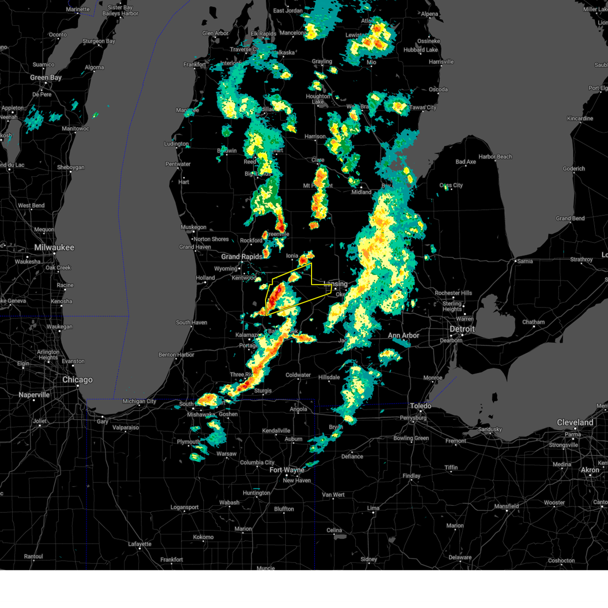
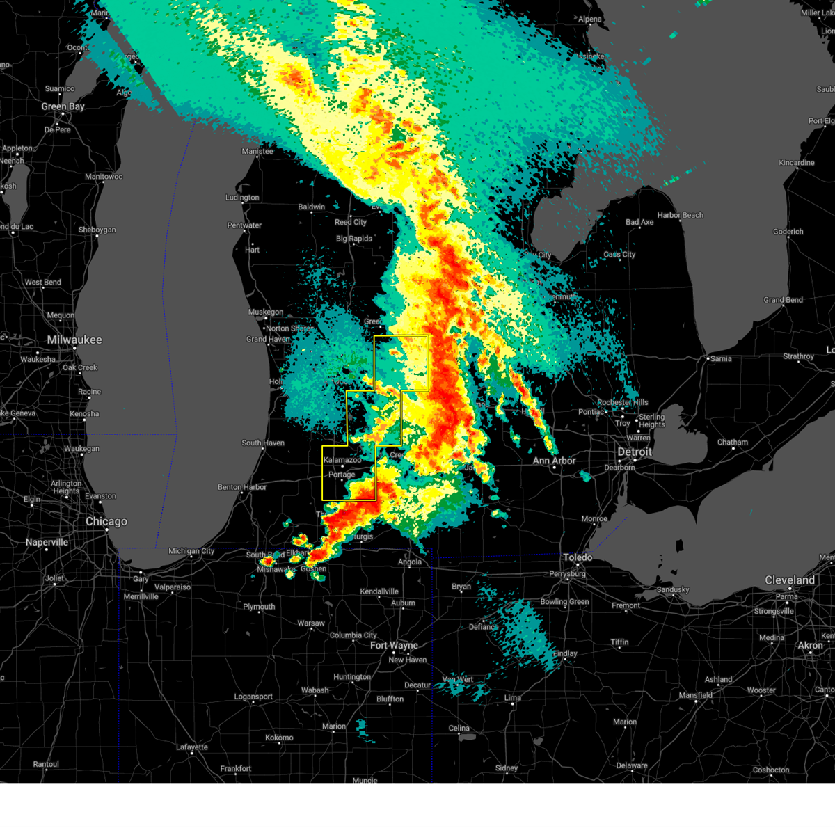
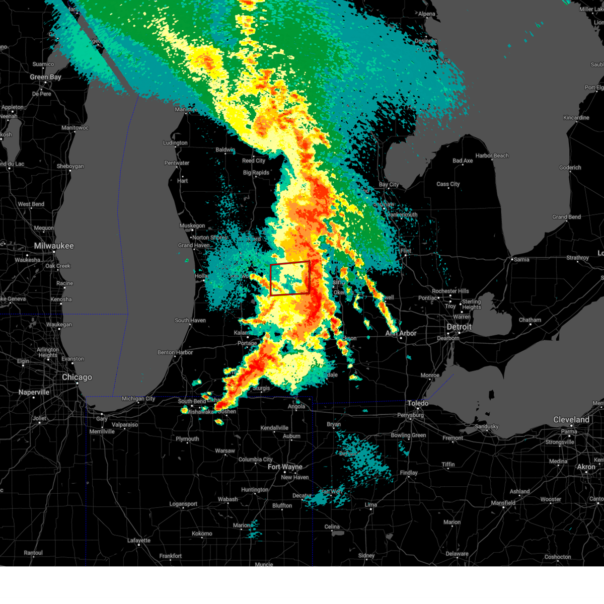
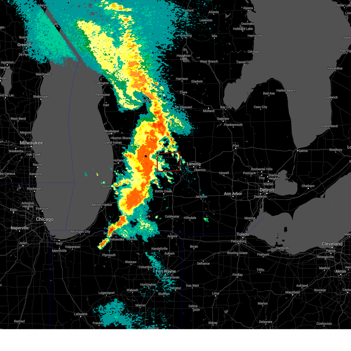
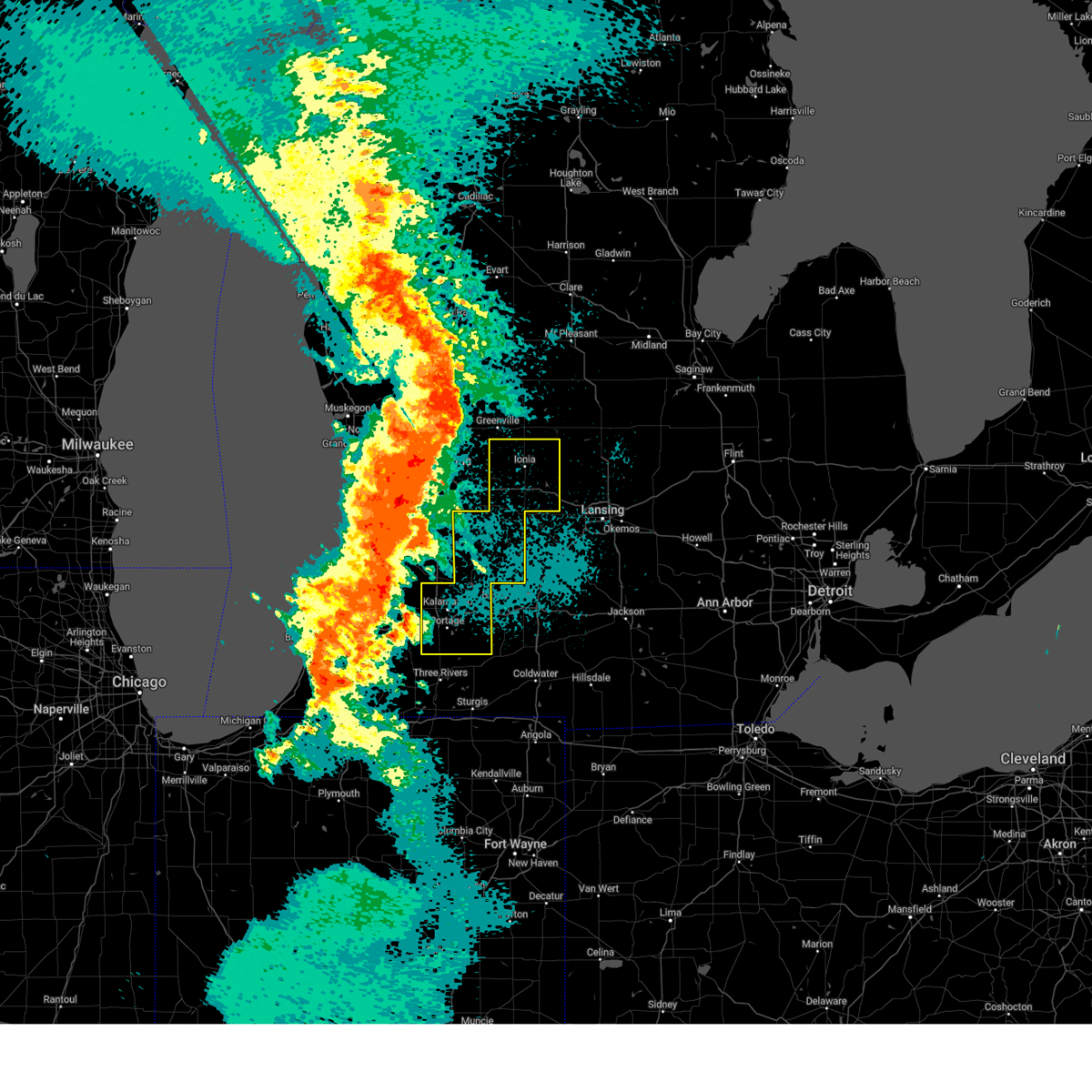
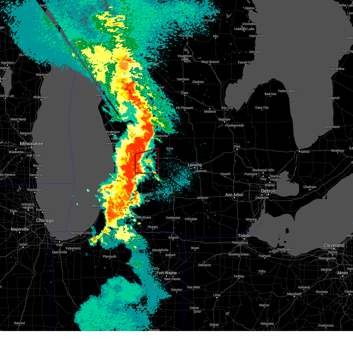
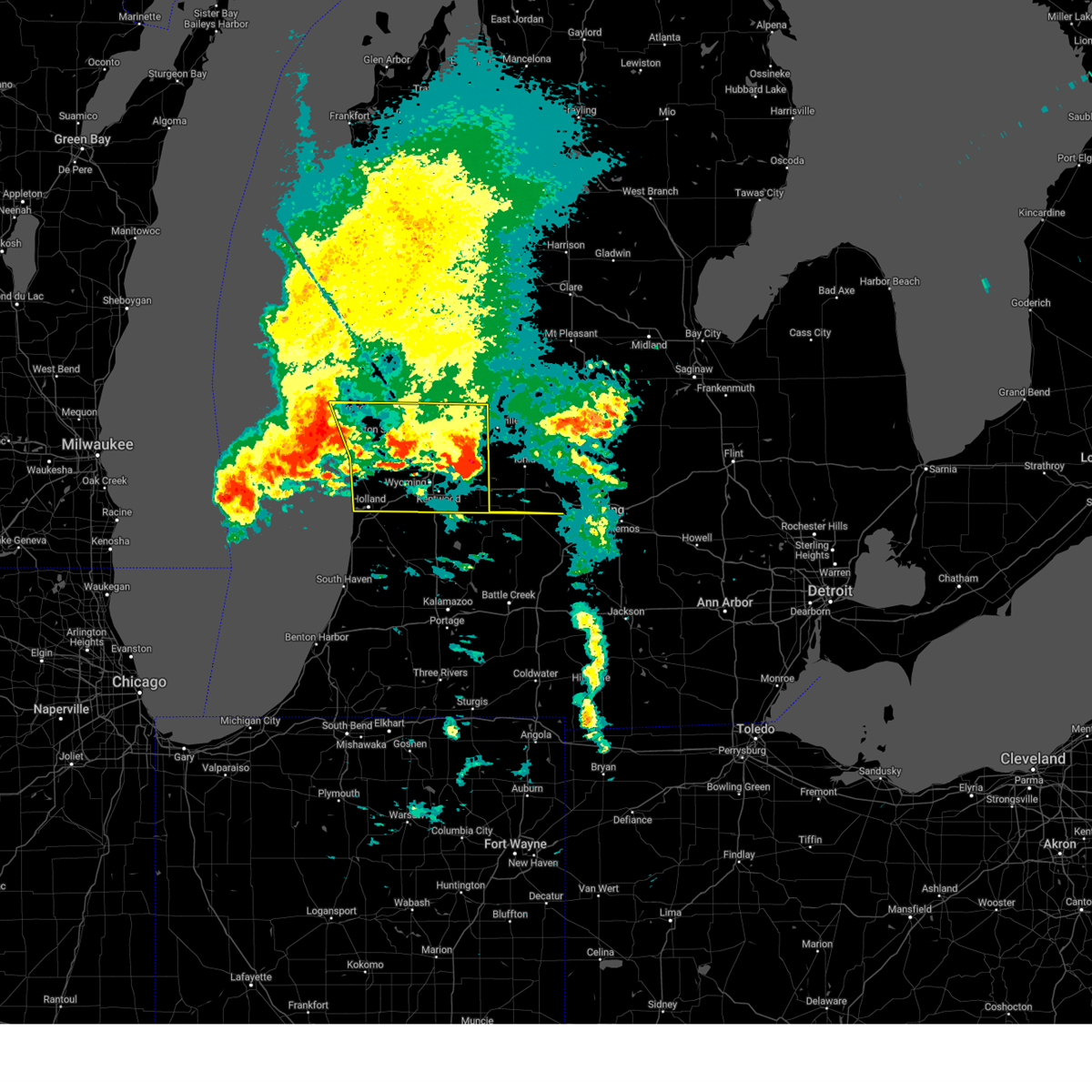
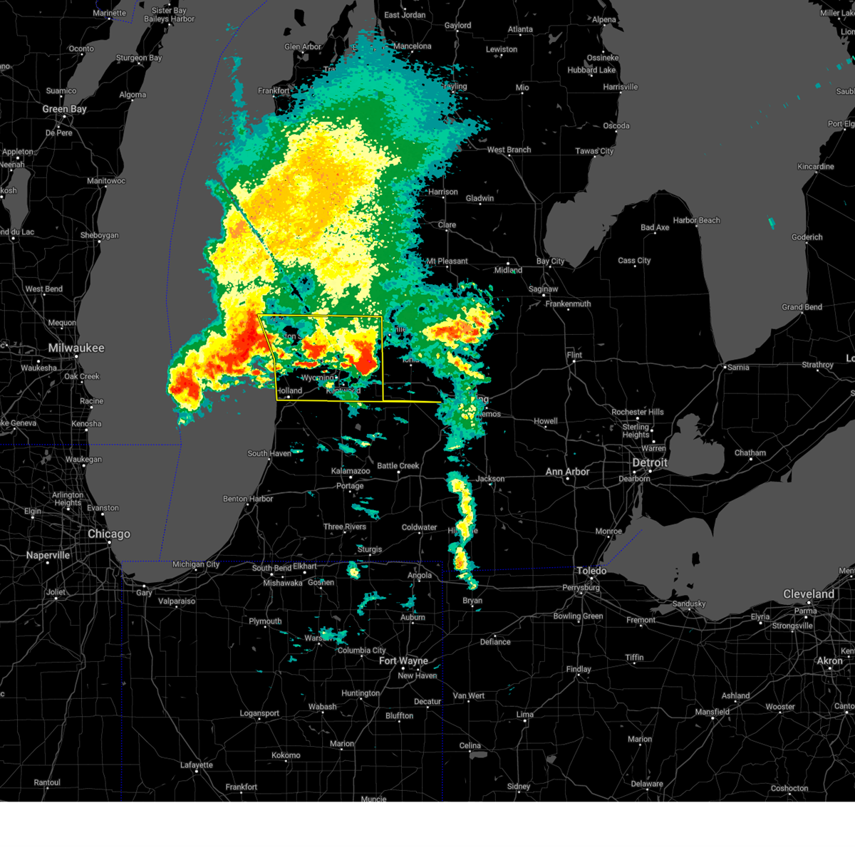
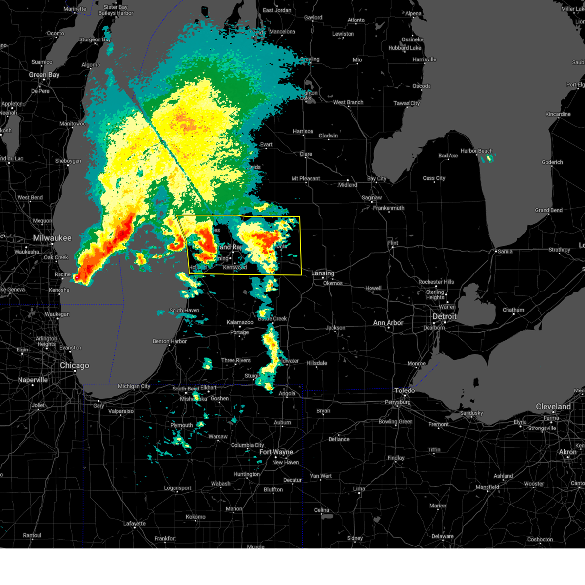
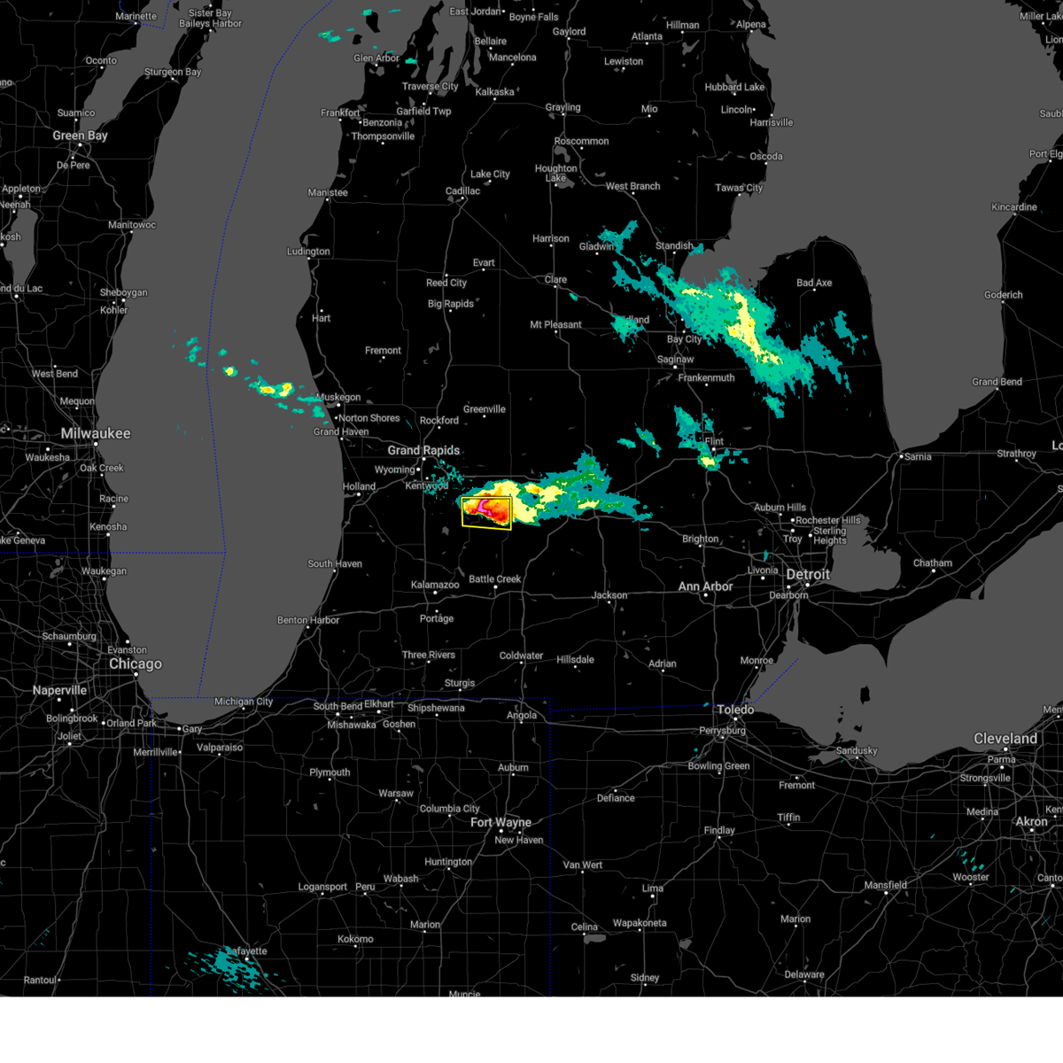
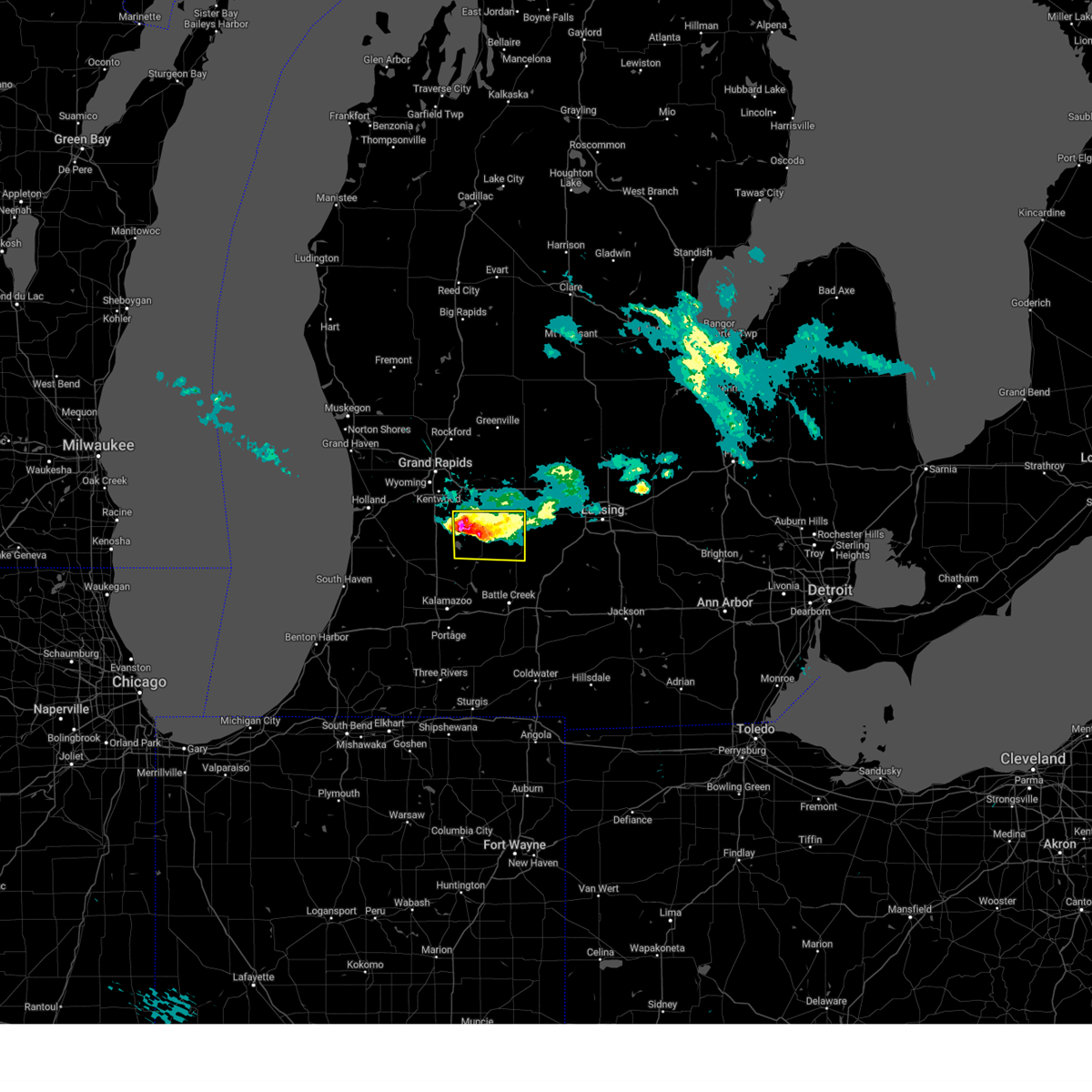
Hail Map for Freeport, MI
The Freeport, MI area has had 2 reports of on-the-ground hail by trained spotters, and has been under severe weather warnings 21 times during the past 12 months. Doppler radar has detected hail at or near Freeport, MI on 28 occasions, including 2 occasions during the past year.
| Name: | Freeport, MI |
| Where Located: | 22.8 miles SE of Grand Rapids, MI |
| Map: | Google Map for Freeport, MI |
| Population: | 483 |
| Housing Units: | 200 |
| More Info: | Search Google for Freeport, MI |
0
The Top Recent Hail Date for Freeport, MI is Friday, June 27, 2025 (19th out of 28)
Hail and Wind Damage Spotted near Freeport, MI
| Date / Time | Report Details |
|---|---|
| 6/9/2025 6:01 PM EDT | the severe thunderstorm warning has been cancelled and is no longer in effect |
| 6/9/2025 5:26 PM EDT |
 Svrgrr the national weather service in grand rapids has issued a * severe thunderstorm warning for, northeastern barry county in southwestern michigan, southern ionia county in south central michigan, northern eaton county in south central michigan, * until 615 pm edt. * at 526 pm edt, severe thunderstorms were located along a line extending from near lake odessa to near hastings to 10 miles west of nashville, moving northeast at 50 mph (radar indicated). Hazards include 60 mph wind gusts and quarter size hail. Hail damage to vehicles is expected. Expect wind damage to roofs, siding, and trees. Svrgrr the national weather service in grand rapids has issued a * severe thunderstorm warning for, northeastern barry county in southwestern michigan, southern ionia county in south central michigan, northern eaton county in south central michigan, * until 615 pm edt. * at 526 pm edt, severe thunderstorms were located along a line extending from near lake odessa to near hastings to 10 miles west of nashville, moving northeast at 50 mph (radar indicated). Hazards include 60 mph wind gusts and quarter size hail. Hail damage to vehicles is expected. Expect wind damage to roofs, siding, and trees.
|
| 5/15/2025 11:44 PM EDT |
 the severe thunderstorm warning has been cancelled and is no longer in effect the severe thunderstorm warning has been cancelled and is no longer in effect
|
| 5/15/2025 11:36 PM EDT |
 The storm which prompted the warning has moved out of the area. therefore, the warning will be allowed to expire. a tornado watch remains in effect until 300 am edt for south central and southwestern michigan. The storm which prompted the warning has moved out of the area. therefore, the warning will be allowed to expire. a tornado watch remains in effect until 300 am edt for south central and southwestern michigan.
|
| 5/15/2025 10:58 PM EDT |
 Torgrr the national weather service in grand rapids has issued a * tornado warning for, northeastern barry county in southwestern michigan, southern ionia county in south central michigan, northwestern eaton county in south central michigan, * until 1145 pm edt. * at 1058 pm edt, severe thunderstorms capable of producing both tornadoes and extensive straight line wind damage were located near alto and freeport, or 11 miles northwest of hastings, moving east at 45 mph (radar indicated rotation). Hazards include tornado. Flying debris will be dangerous to those caught without shelter. mobile homes will be damaged or destroyed. damage to roofs, windows, and vehicles will occur. Tree damage is likely. Torgrr the national weather service in grand rapids has issued a * tornado warning for, northeastern barry county in southwestern michigan, southern ionia county in south central michigan, northwestern eaton county in south central michigan, * until 1145 pm edt. * at 1058 pm edt, severe thunderstorms capable of producing both tornadoes and extensive straight line wind damage were located near alto and freeport, or 11 miles northwest of hastings, moving east at 45 mph (radar indicated rotation). Hazards include tornado. Flying debris will be dangerous to those caught without shelter. mobile homes will be damaged or destroyed. damage to roofs, windows, and vehicles will occur. Tree damage is likely.
|
| 5/15/2025 10:33 PM EDT |
 Svrgrr the national weather service in grand rapids has issued a * severe thunderstorm warning for, barry county in southwestern michigan, ionia county in south central michigan, kalamazoo county in southwestern michigan, * until midnight edt. * at 1032 pm edt, severe thunderstorms were located along a line extending from 7 miles south of howard city to kentwood to near decatur, moving east at 55 mph (radar indicated). Hazards include 60 mph wind gusts. expect damage to roofs, siding, and trees Svrgrr the national weather service in grand rapids has issued a * severe thunderstorm warning for, barry county in southwestern michigan, ionia county in south central michigan, kalamazoo county in southwestern michigan, * until midnight edt. * at 1032 pm edt, severe thunderstorms were located along a line extending from 7 miles south of howard city to kentwood to near decatur, moving east at 55 mph (radar indicated). Hazards include 60 mph wind gusts. expect damage to roofs, siding, and trees
|
| 5/15/2025 10:33 PM EDT |
 Torgrr the national weather service in grand rapids has issued a * tornado warning for, northeastern allegan county in southwestern michigan, southern kent county in southwestern michigan, northwestern barry county in southwestern michigan, * until 1115 pm edt. * at 1033 pm edt, a severe thunderstorm capable of producing a tornado was located 7 miles northwest of wayland, or 15 miles south of grand rapids, moving northeast at 45 mph (radar indicated rotation). Hazards include tornado. Flying debris will be dangerous to those caught without shelter. mobile homes will be damaged or destroyed. damage to roofs, windows, and vehicles will occur. tree damage is likely. this dangerous storm will be near, kentwood, caledonia, and gerald r. ford international airport around 1045 pm edt. Other locations in the path of this tornadic thunderstorm include lowell. Torgrr the national weather service in grand rapids has issued a * tornado warning for, northeastern allegan county in southwestern michigan, southern kent county in southwestern michigan, northwestern barry county in southwestern michigan, * until 1115 pm edt. * at 1033 pm edt, a severe thunderstorm capable of producing a tornado was located 7 miles northwest of wayland, or 15 miles south of grand rapids, moving northeast at 45 mph (radar indicated rotation). Hazards include tornado. Flying debris will be dangerous to those caught without shelter. mobile homes will be damaged or destroyed. damage to roofs, windows, and vehicles will occur. tree damage is likely. this dangerous storm will be near, kentwood, caledonia, and gerald r. ford international airport around 1045 pm edt. Other locations in the path of this tornadic thunderstorm include lowell.
|
| 4/18/2025 10:43 AM EDT |
 At 1037 am edt, strong thunderstorms were located along a line extending from near sparta to near grand rapids to near wyoming, moving east at 65 mph. a line of strong possibly severe storms will be moving onshore along a line from muskegon to holland by 11 am moving to the east at 65 mph (radar indicated). Hazards include 60 mph wind gusts and quarter size hail. Hail damage to vehicles is expected. expect wind damage to roofs, siding, and trees. Locations impacted include, port sheldon, cutlerville, wyoming, belmont, grandville, fruitport, muskegon heights, grattan, alto, marne, dutton, borculo, sparta, muskegon sp, coopersville, comstock park, walker, hudsonville, slocum, casnovia,. At 1037 am edt, strong thunderstorms were located along a line extending from near sparta to near grand rapids to near wyoming, moving east at 65 mph. a line of strong possibly severe storms will be moving onshore along a line from muskegon to holland by 11 am moving to the east at 65 mph (radar indicated). Hazards include 60 mph wind gusts and quarter size hail. Hail damage to vehicles is expected. expect wind damage to roofs, siding, and trees. Locations impacted include, port sheldon, cutlerville, wyoming, belmont, grandville, fruitport, muskegon heights, grattan, alto, marne, dutton, borculo, sparta, muskegon sp, coopersville, comstock park, walker, hudsonville, slocum, casnovia,.
|
| 4/18/2025 10:43 AM EDT |
 the severe thunderstorm warning has been cancelled and is no longer in effect the severe thunderstorm warning has been cancelled and is no longer in effect
|
| 4/18/2025 10:21 AM EDT |
 At 1019 am edt, severe thunderstorms were located along a line extending from near fruitport to near allendale to near zeeland, moving east at 65 mph. this is a second area of thunderstorms that was following strong but non severe thunderstorms currently over the ionia area that are also moving east (radar indicated). Hazards include 60 mph wind gusts and quarter size hail. Hail damage to vehicles is expected. expect wind damage to roofs, siding, and trees. Locations impacted include, port sheldon, clarksville, belmont, muskegon heights, alto, orleans, marne, dutton, comstock park, hudsonville, sheridan, belding, sullivan, rockford, ionia, murray lake, fenwick, north muskegon, portland, conklin,. At 1019 am edt, severe thunderstorms were located along a line extending from near fruitport to near allendale to near zeeland, moving east at 65 mph. this is a second area of thunderstorms that was following strong but non severe thunderstorms currently over the ionia area that are also moving east (radar indicated). Hazards include 60 mph wind gusts and quarter size hail. Hail damage to vehicles is expected. expect wind damage to roofs, siding, and trees. Locations impacted include, port sheldon, clarksville, belmont, muskegon heights, alto, orleans, marne, dutton, comstock park, hudsonville, sheridan, belding, sullivan, rockford, ionia, murray lake, fenwick, north muskegon, portland, conklin,.
|
| 4/18/2025 10:21 AM EDT |
 the severe thunderstorm warning has been cancelled and is no longer in effect the severe thunderstorm warning has been cancelled and is no longer in effect
|
| 4/18/2025 10:08 AM EDT |
 At 1005 am edt, severe thunderstorms were located along a line extending from near fruitport to near beechwood, moving east at 55 mph. this is a second area of thunderstorms that was following strong but non severe thunderstorms currently over the grand rapids area that were also moving east (radar indicated). Hazards include 60 mph wind gusts and quarter size hail. Hail damage to vehicles is expected. expect wind damage to roofs, siding, and trees. Locations impacted include, port sheldon, clarksville, reeman, cedar lake, stanton, belmont, lakewood club, muskegon heights, dalton, alto, wyman, orleans, whitehall, marne, dutton, brunswick, holton, comstock park, hudsonville, sheridan,. At 1005 am edt, severe thunderstorms were located along a line extending from near fruitport to near beechwood, moving east at 55 mph. this is a second area of thunderstorms that was following strong but non severe thunderstorms currently over the grand rapids area that were also moving east (radar indicated). Hazards include 60 mph wind gusts and quarter size hail. Hail damage to vehicles is expected. expect wind damage to roofs, siding, and trees. Locations impacted include, port sheldon, clarksville, reeman, cedar lake, stanton, belmont, lakewood club, muskegon heights, dalton, alto, wyman, orleans, whitehall, marne, dutton, brunswick, holton, comstock park, hudsonville, sheridan,.
|
| 4/18/2025 9:48 AM EDT |
 Svrgrr the national weather service in grand rapids has issued a * severe thunderstorm warning for, kent county in southwestern michigan, ottawa county in southwestern michigan, southern newaygo county in west central michigan, ionia county in south central michigan, muskegon county in west central michigan, northwestern eaton county in south central michigan, southeastern oceana county in west central michigan, montcalm county in central michigan, * until 1115 am edt. * at 947 am edt, severe thunderstorms were located along a line extending from near fruitport to 5 miles southwest of allendale to near zeeland, moving east at 65 mph (radar indicated). Hazards include 60 mph wind gusts and quarter size hail. Hail damage to vehicles is expected. Expect wind damage to roofs, siding, and trees. Svrgrr the national weather service in grand rapids has issued a * severe thunderstorm warning for, kent county in southwestern michigan, ottawa county in southwestern michigan, southern newaygo county in west central michigan, ionia county in south central michigan, muskegon county in west central michigan, northwestern eaton county in south central michigan, southeastern oceana county in west central michigan, montcalm county in central michigan, * until 1115 am edt. * at 947 am edt, severe thunderstorms were located along a line extending from near fruitport to 5 miles southwest of allendale to near zeeland, moving east at 65 mph (radar indicated). Hazards include 60 mph wind gusts and quarter size hail. Hail damage to vehicles is expected. Expect wind damage to roofs, siding, and trees.
|
| 3/30/2025 6:29 PM EDT | The storms which prompted the warning have moved out of the area. therefore, the warning will be allowed to expire. a severe thunderstorm watch remains in effect until 900 pm edt for south central, central and southwestern michigan. |
| 3/30/2025 6:19 PM EDT | the tornado warning has been cancelled and is no longer in effect |
| 3/30/2025 6:15 PM EDT | At 614 pm edt, severe thunderstorms were located along a line extending from 8 miles northwest of greenville to 5 miles southeast of lake odessa to 10 miles southwest of leslie, moving northeast at 60 mph. these are destructive storms for western and southern michigan (radar indicated). Hazards include 80 mph wind gusts and penny size hail. Flying debris will be dangerous to those caught without shelter. mobile homes will be heavily damaged. expect considerable damage to roofs, windows, and vehicles. extensive tree damage and power outages are likely. Locations impacted include, hastings, nashville, duck lake, woodland, grattan, woodbury, marengo, lowell, freeport, murray lake, alto, albion, cannonsburg, lincoln lake, sand lake, cedar springs,. |
| 3/30/2025 5:56 PM EDT | At 554 pm edt, severe thunderstorms were located along a line extending from near sparta to 7 miles southwest of hastings to near marshall, moving northeast at 60 mph. these are destructive storms for southwest michigan (at 5:50 pm grand rapids asos reported 80 mph winds). Hazards include 80 mph wind gusts and penny size hail. Flying debris will be dangerous to those caught without shelter. mobile homes will be heavily damaged. expect considerable damage to roofs, windows, and vehicles. extensive tree damage and power outages are likely. Locations impacted include, cutlerville, wyoming, battle creek, belmont, grandville, duck lake, yankee springs, hickory corners, grattan, alto, brownlee park, dutton, sparta, banfield, comstock park, walker, marshall, nashville, athens, tekonsha,. |
| 3/30/2025 5:56 PM EDT | Torgrr the national weather service in grand rapids has issued a * tornado warning for, southeastern kent county in southwestern michigan, northern barry county in southwestern michigan, southwestern ionia county in south central michigan, * until 630 pm edt. * at 555 pm edt, severe thunderstorms capable of producing both tornadoes and extensive straight line wind damage were located near middleville, or 7 miles west of hastings, moving northeast at 60 mph (radar indicated rotation). Hazards include tornado. Flying debris will be dangerous to those caught without shelter. mobile homes will be damaged or destroyed. damage to roofs, windows, and vehicles will occur. tree damage is likely. these dangerous storms will be near, freeport around 600 pm edt. lake odessa around 610 pm edt. Other locations in the path of this tornadic thunderstorm include ionia. |
| 3/30/2025 5:48 PM EDT | At 547 pm edt, severe thunderstorms were located along a line extending from 6 miles southwest of sparta to 5 miles east of martin to near burlington, moving northeast at 60 mph (radar indicated). Hazards include 70 mph wind gusts and penny size hail. Expect considerable tree damage. damage is likely to mobile homes, roofs, and outbuildings. Locations impacted include, cutlerville, wyoming, battle creek, belmont, grandville, duck lake, yankee springs, hickory corners, grattan, alto, brownlee park, dutton, sparta, banfield, comstock park, walker, marshall, nashville, athens, tekonsha,. |
| 3/30/2025 5:24 PM EDT | Svrgrr the national weather service in grand rapids has issued a * severe thunderstorm warning for, calhoun county in south central michigan, kent county in southwestern michigan, barry county in southwestern michigan, * until 630 pm edt. * at 523 pm edt, severe thunderstorms were located along a line extending from near beechwood to near schoolcraft, moving northeast at 65 mph (radar indicated). Hazards include 70 mph wind gusts and penny size hail. Expect considerable tree damage. Damage is likely to mobile homes, roofs, and outbuildings. |
| 8/27/2024 4:08 PM EDT |
 Svrgrr the national weather service in grand rapids has issued a * severe thunderstorm warning for, barry county in southwestern michigan, eaton county in south central michigan, * until 515 pm edt. * at 407 pm edt, a severe thunderstorm was located over hastings, moving east at 40 mph (radar indicated). Hazards include 60 mph wind gusts. expect damage to roofs, siding, and trees Svrgrr the national weather service in grand rapids has issued a * severe thunderstorm warning for, barry county in southwestern michigan, eaton county in south central michigan, * until 515 pm edt. * at 407 pm edt, a severe thunderstorm was located over hastings, moving east at 40 mph (radar indicated). Hazards include 60 mph wind gusts. expect damage to roofs, siding, and trees
|
| 6/16/2024 9:52 PM EDT |
 Svrgrr the national weather service in grand rapids has issued a * severe thunderstorm warning for, southeastern allegan county in southwestern michigan, barry county in southwestern michigan, kalamazoo county in southwestern michigan, * until 1045 pm edt. * at 951 pm edt, severe thunderstorms were located along a line extending from near caledonia to near lawton, moving northeast at 55 mph (radar indicated). Hazards include 60 mph wind gusts and quarter size hail. Hail damage to vehicles is expected. Expect wind damage to roofs, siding, and trees. Svrgrr the national weather service in grand rapids has issued a * severe thunderstorm warning for, southeastern allegan county in southwestern michigan, barry county in southwestern michigan, kalamazoo county in southwestern michigan, * until 1045 pm edt. * at 951 pm edt, severe thunderstorms were located along a line extending from near caledonia to near lawton, moving northeast at 55 mph (radar indicated). Hazards include 60 mph wind gusts and quarter size hail. Hail damage to vehicles is expected. Expect wind damage to roofs, siding, and trees.
|
| 5/5/2024 12:26 AM EDT |
 the severe thunderstorm warning has been cancelled and is no longer in effect the severe thunderstorm warning has been cancelled and is no longer in effect
|
| 5/5/2024 12:10 AM EDT |
 At 1208 am edt, a severe thunderstorm was located near hastings, moving northeast at 40 mph (radar indicated). Hazards include 60 mph wind gusts. Expect damage to roofs, siding, and trees. Locations impacted include, hastings, nashville, freeport, assyria, woodland, prairieville, dowling, delton, woodbury, banfield, cloverdale, lacey,. At 1208 am edt, a severe thunderstorm was located near hastings, moving northeast at 40 mph (radar indicated). Hazards include 60 mph wind gusts. Expect damage to roofs, siding, and trees. Locations impacted include, hastings, nashville, freeport, assyria, woodland, prairieville, dowling, delton, woodbury, banfield, cloverdale, lacey,.
|
| 5/5/2024 12:10 AM EDT |
 the severe thunderstorm warning has been cancelled and is no longer in effect the severe thunderstorm warning has been cancelled and is no longer in effect
|
| 5/5/2024 12:01 AM EDT |
 the severe thunderstorm warning has been cancelled and is no longer in effect the severe thunderstorm warning has been cancelled and is no longer in effect
|
| 5/5/2024 12:01 AM EDT |
 At 1201 am edt, a severe thunderstorm was located 9 miles south of hastings, moving northeast at 35 mph (radar indicated). Hazards include 60 mph wind gusts. Expect damage to roofs, siding, and trees. Locations impacted include, hastings, nashville, freeport, assyria, woodland, delton, banfield, prairieville, hickory corners, dowling, woodbury, pine lake, bedford, cloverdale, lacey,. At 1201 am edt, a severe thunderstorm was located 9 miles south of hastings, moving northeast at 35 mph (radar indicated). Hazards include 60 mph wind gusts. Expect damage to roofs, siding, and trees. Locations impacted include, hastings, nashville, freeport, assyria, woodland, delton, banfield, prairieville, hickory corners, dowling, woodbury, pine lake, bedford, cloverdale, lacey,.
|
| 5/4/2024 11:42 PM EDT |
 Svrgrr the national weather service in grand rapids has issued a * severe thunderstorm warning for, northwestern calhoun county in south central michigan, barry county in southwestern michigan, northeastern kalamazoo county in southwestern michigan, * until 1245 am edt. * at 1141 pm edt, a severe thunderstorm was located near richland, or 8 miles north of kalamazoo, moving northeast at 30 mph (radar indicated). Hazards include 60 mph wind gusts. expect damage to roofs, siding, and trees Svrgrr the national weather service in grand rapids has issued a * severe thunderstorm warning for, northwestern calhoun county in south central michigan, barry county in southwestern michigan, northeastern kalamazoo county in southwestern michigan, * until 1245 am edt. * at 1141 pm edt, a severe thunderstorm was located near richland, or 8 miles north of kalamazoo, moving northeast at 30 mph (radar indicated). Hazards include 60 mph wind gusts. expect damage to roofs, siding, and trees
|
| 4/23/2024 9:11 PM EDT |
 the severe thunderstorm warning has been cancelled and is no longer in effect the severe thunderstorm warning has been cancelled and is no longer in effect
|
| 4/23/2024 9:08 PM EDT |
 At 907 pm edt, a severe thunderstorm was located near freeport, or 8 miles northwest of hastings, moving east at 30 mph (radar indicated). Hazards include quarter size hail. Damage to vehicles is expected. Locations impacted include, middleville, lake odessa, freeport, woodland,. At 907 pm edt, a severe thunderstorm was located near freeport, or 8 miles northwest of hastings, moving east at 30 mph (radar indicated). Hazards include quarter size hail. Damage to vehicles is expected. Locations impacted include, middleville, lake odessa, freeport, woodland,.
|
| 4/23/2024 9:01 PM EDT |
 the severe thunderstorm warning has been cancelled and is no longer in effect the severe thunderstorm warning has been cancelled and is no longer in effect
|
| 4/23/2024 9:01 PM EDT |
 At 900 pm edt, a severe thunderstorm was located near middleville, or 11 miles northwest of hastings, moving east at 30 mph (radar indicated). Hazards include quarter size hail. Damage to vehicles is expected. Locations impacted include, middleville, lake odessa, caledonia, freeport, woodland,. At 900 pm edt, a severe thunderstorm was located near middleville, or 11 miles northwest of hastings, moving east at 30 mph (radar indicated). Hazards include quarter size hail. Damage to vehicles is expected. Locations impacted include, middleville, lake odessa, caledonia, freeport, woodland,.
|
| 4/23/2024 8:47 PM EDT |
 Svrgrr the national weather service in grand rapids has issued a * severe thunderstorm warning for, northeastern allegan county in southwestern michigan, southeastern kent county in southwestern michigan, southwestern ionia county in south central michigan, northern barry county in southwestern michigan, * until 945 pm edt. * at 847 pm edt, a severe thunderstorm was located near caledonia, or 13 miles south of grand rapids, moving east at 30 mph (radar indicated). Hazards include quarter size hail. damage to vehicles is expected Svrgrr the national weather service in grand rapids has issued a * severe thunderstorm warning for, northeastern allegan county in southwestern michigan, southeastern kent county in southwestern michigan, southwestern ionia county in south central michigan, northern barry county in southwestern michigan, * until 945 pm edt. * at 847 pm edt, a severe thunderstorm was located near caledonia, or 13 miles south of grand rapids, moving east at 30 mph (radar indicated). Hazards include quarter size hail. damage to vehicles is expected
|
| 4/17/2024 12:54 PM EDT | Tree down across roa in kent county MI, 5.1 miles ESE of Freeport, MI |
| 4/17/2024 12:52 PM EDT | Trees and wires down across the roa in kent county MI, 3.6 miles SE of Freeport, MI |
| 2/27/2024 11:19 PM EST |
 Svrgrr the national weather service in grand rapids has issued a * severe thunderstorm warning for, eastern allegan county in southwestern michigan, barry county in southwestern michigan, northern kalamazoo county in southwestern michigan, * until 1215 am est. * at 1117 pm est, severe thunderstorms were located along a line extending from plainwell to near westwood, moving northeast at 40 mph. other storms were near allegan moving east (radar indicated). Hazards include 60 mph wind gusts and penny size hail. expect damage to roofs, siding, and trees Svrgrr the national weather service in grand rapids has issued a * severe thunderstorm warning for, eastern allegan county in southwestern michigan, barry county in southwestern michigan, northern kalamazoo county in southwestern michigan, * until 1215 am est. * at 1117 pm est, severe thunderstorms were located along a line extending from plainwell to near westwood, moving northeast at 40 mph. other storms were near allegan moving east (radar indicated). Hazards include 60 mph wind gusts and penny size hail. expect damage to roofs, siding, and trees
|
| 7/12/2023 10:52 PM EDT |
 At 1052 pm edt, a severe thunderstorm was located near hastings, moving east at 40 mph (radar indicated). Hazards include 60 mph wind gusts. expect damage to roofs, siding, and trees At 1052 pm edt, a severe thunderstorm was located near hastings, moving east at 40 mph (radar indicated). Hazards include 60 mph wind gusts. expect damage to roofs, siding, and trees
|
| 4/20/2023 9:18 PM EDT |
 At 917 pm edt, severe thunderstorms were located along a line extending from 5 miles southeast of fennville to 7 miles south of watervliet, moving northeast at 55 mph (radar indicated). Hazards include 60 mph wind gusts. Expect damage to roofs, siding, and trees. locations impacted include, wayland, middleville and hastings. hail threat, radar indicated max hail size, <. 75 in wind threat, radar indicated max wind gust, 60 mph. At 917 pm edt, severe thunderstorms were located along a line extending from 5 miles southeast of fennville to 7 miles south of watervliet, moving northeast at 55 mph (radar indicated). Hazards include 60 mph wind gusts. Expect damage to roofs, siding, and trees. locations impacted include, wayland, middleville and hastings. hail threat, radar indicated max hail size, <. 75 in wind threat, radar indicated max wind gust, 60 mph.
|
| 4/20/2023 8:38 PM EDT |
 At 838 pm edt, severe thunderstorms were located along a line extending from near shelby to near grand haven to near saugatuck, moving northeast at 25 mph (radar indicated). Hazards include 60 mph wind gusts and penny size hail. expect damage to roofs, siding, and trees At 838 pm edt, severe thunderstorms were located along a line extending from near shelby to near grand haven to near saugatuck, moving northeast at 25 mph (radar indicated). Hazards include 60 mph wind gusts and penny size hail. expect damage to roofs, siding, and trees
|
| 4/4/2023 7:45 PM EDT |
 At 743 pm edt, a severe thunderstorm was located near lake odessa, or 9 miles northeast of hastings, moving east at 25 mph (radar indicated). Hazards include tennis ball size hail and 60 mph wind gusts. People and animals outdoors will be injured. expect hail damage to roofs, siding, windows, and vehicles. expect wind damage to roofs, siding, and trees. locations impacted include, lake odessa, freeport, sebewa, vermontville, sunfield, mulliken, woodland, clarksville, gresham, woodbury, thunderstorm damage threat, considerable hail threat, radar indicated max hail size, 2. 50 in wind threat, radar indicated max wind gust, 60 mph. At 743 pm edt, a severe thunderstorm was located near lake odessa, or 9 miles northeast of hastings, moving east at 25 mph (radar indicated). Hazards include tennis ball size hail and 60 mph wind gusts. People and animals outdoors will be injured. expect hail damage to roofs, siding, windows, and vehicles. expect wind damage to roofs, siding, and trees. locations impacted include, lake odessa, freeport, sebewa, vermontville, sunfield, mulliken, woodland, clarksville, gresham, woodbury, thunderstorm damage threat, considerable hail threat, radar indicated max hail size, 2. 50 in wind threat, radar indicated max wind gust, 60 mph.
|
| 4/4/2023 7:31 PM EDT |
 At 731 pm edt, a severe thunderstorm was located near freeport, or near hastings, moving east at 25 mph (radar indicated). Hazards include golf ball size hail and 60 mph wind gusts. People and animals outdoors will be injured. expect hail damage to roofs, siding, windows, and vehicles. Expect wind damage to roofs, siding, and trees. At 731 pm edt, a severe thunderstorm was located near freeport, or near hastings, moving east at 25 mph (radar indicated). Hazards include golf ball size hail and 60 mph wind gusts. People and animals outdoors will be injured. expect hail damage to roofs, siding, windows, and vehicles. Expect wind damage to roofs, siding, and trees.
|
| 4/4/2023 7:30 PM EDT |
 At 729 pm edt, a severe thunderstorm was located near hastings, moving east at 25 mph (radar indicated). Hazards include ping pong ball size hail and 60 mph wind gusts. People and animals outdoors will be injured. expect hail damage to roofs, siding, windows, and vehicles. expect wind damage to roofs, siding, and trees. locations impacted include, hastings, nashville, freeport, woodland, woodbury, hastings city barry , hail threat, radar indicated max hail size, 1. 50 in wind threat, radar indicated max wind gust, 60 mph. At 729 pm edt, a severe thunderstorm was located near hastings, moving east at 25 mph (radar indicated). Hazards include ping pong ball size hail and 60 mph wind gusts. People and animals outdoors will be injured. expect hail damage to roofs, siding, windows, and vehicles. expect wind damage to roofs, siding, and trees. locations impacted include, hastings, nashville, freeport, woodland, woodbury, hastings city barry , hail threat, radar indicated max hail size, 1. 50 in wind threat, radar indicated max wind gust, 60 mph.
|
| 4/4/2023 7:25 PM EDT | Hen Egg sized hail reported 0.6 miles NNW of Freeport, MI, photo of hail larger than a golf ball. |
| 4/4/2023 7:24 PM EDT | Golf Ball sized hail reported 0.6 miles NNW of Freeport, MI |
| 4/4/2023 7:08 PM EDT |
 At 707 pm edt, a severe thunderstorm was located over middleville, or 9 miles northwest of hastings, moving east at 30 mph (radar indicated). Hazards include ping pong ball size hail and 60 mph wind gusts. People and animals outdoors will be injured. expect hail damage to roofs, siding, windows, and vehicles. expect wind damage to roofs, siding, and trees. locations impacted include, hastings, middleville, nashville, freeport, orangeville, irving, woodland, woodbury, gun lake, cloverdale, yankee springs, hastings city barry , hail threat, radar indicated max hail size, 1. 50 in wind threat, radar indicated max wind gust, 60 mph. At 707 pm edt, a severe thunderstorm was located over middleville, or 9 miles northwest of hastings, moving east at 30 mph (radar indicated). Hazards include ping pong ball size hail and 60 mph wind gusts. People and animals outdoors will be injured. expect hail damage to roofs, siding, windows, and vehicles. expect wind damage to roofs, siding, and trees. locations impacted include, hastings, middleville, nashville, freeport, orangeville, irving, woodland, woodbury, gun lake, cloverdale, yankee springs, hastings city barry , hail threat, radar indicated max hail size, 1. 50 in wind threat, radar indicated max wind gust, 60 mph.
|
| 4/4/2023 6:43 PM EDT |
 At 642 pm edt, a severe thunderstorm was located over wayland, or 14 miles northeast of allegan, moving east at 40 mph (radar indicated). Hazards include ping pong ball size hail and 60 mph wind gusts. People and animals outdoors will be injured. expect hail damage to roofs, siding, windows, and vehicles. Expect wind damage to roofs, siding, and trees. At 642 pm edt, a severe thunderstorm was located over wayland, or 14 miles northeast of allegan, moving east at 40 mph (radar indicated). Hazards include ping pong ball size hail and 60 mph wind gusts. People and animals outdoors will be injured. expect hail damage to roofs, siding, windows, and vehicles. Expect wind damage to roofs, siding, and trees.
|
| 8/29/2022 4:13 PM EDT |
 The severe thunderstorm warning for northeastern allegan, kent and northwestern barry counties will expire at 415 pm edt, the severe thunderstorm which prompted the warning has moved out of the warned area. therefore, the warning will be allowed to expire. a severe thunderstorm watch remains in effect until 800 pm edt for south central and southwestern michigan. The severe thunderstorm warning for northeastern allegan, kent and northwestern barry counties will expire at 415 pm edt, the severe thunderstorm which prompted the warning has moved out of the warned area. therefore, the warning will be allowed to expire. a severe thunderstorm watch remains in effect until 800 pm edt for south central and southwestern michigan.
|
| 8/29/2022 3:58 PM EDT |
 At 357 pm edt, a severe thunderstorm was located near saranac, or 10 miles southwest of ionia, moving east at 50 mph (radar indicated. this storm has a history of producing damaging winds and power outages). Hazards include 70 mph wind gusts and quarter size hail. Expect considerable tree damage. wind damage is also likely to mobile homes, roofs, and outbuildings. locations impacted include, grand rapids, hastings, wyoming, kentwood, walker, grandville, east grand rapids, rockford, sparta, wayland, lowell, middleville, caledonia, freeport, gerald r. ford inter, ada, dorr, grattan, cedar springs, irving, thunderstorm damage threat, considerable hail threat, radar indicated max hail size, 1. 00 in wind threat, observed max wind gust, 70 mph. At 357 pm edt, a severe thunderstorm was located near saranac, or 10 miles southwest of ionia, moving east at 50 mph (radar indicated. this storm has a history of producing damaging winds and power outages). Hazards include 70 mph wind gusts and quarter size hail. Expect considerable tree damage. wind damage is also likely to mobile homes, roofs, and outbuildings. locations impacted include, grand rapids, hastings, wyoming, kentwood, walker, grandville, east grand rapids, rockford, sparta, wayland, lowell, middleville, caledonia, freeport, gerald r. ford inter, ada, dorr, grattan, cedar springs, irving, thunderstorm damage threat, considerable hail threat, radar indicated max hail size, 1. 00 in wind threat, observed max wind gust, 70 mph.
|
| 8/29/2022 3:47 PM EDT |
 At 345 pm edt, a line of severe thunderstorms was located along a line from grand rapids to near stanton, moving east at 45 mph. these storms have a history of producing wind damage and power outages. seek shelter inside a sturdy building (trained weather spotters). Hazards include 60 mph wind gusts and quarter size hail. Hail damage to vehicles is expected. Expect wind damage to roofs, siding, and trees. At 345 pm edt, a line of severe thunderstorms was located along a line from grand rapids to near stanton, moving east at 45 mph. these storms have a history of producing wind damage and power outages. seek shelter inside a sturdy building (trained weather spotters). Hazards include 60 mph wind gusts and quarter size hail. Hail damage to vehicles is expected. Expect wind damage to roofs, siding, and trees.
|
| 8/29/2022 3:17 PM EDT | At 316 pm edt, a severe thunderstorm was located over hudsonville, or 12 miles northeast of holland, moving east at 45 mph (observed wind gusts. at 3:08 pm, the west michigan regional airport in holland had a gust to 66 mph). Hazards include 70 mph wind gusts and quarter size hail. Hail damage to vehicles is expected. expect considerable tree damage. Wind damage is also likely to mobile homes, roofs, and outbuildings. |
| 8/3/2022 5:39 PM EDT |
 The severe thunderstorm warning for barry county will expire at 545 pm edt, the storm which prompted the warning has weakened below severe limits, and has exited the warned area. therefore, the warning will be allowed to expire. a severe thunderstorm watch remains in effect until 900 pm edt for south central and southwestern michigan. The severe thunderstorm warning for barry county will expire at 545 pm edt, the storm which prompted the warning has weakened below severe limits, and has exited the warned area. therefore, the warning will be allowed to expire. a severe thunderstorm watch remains in effect until 900 pm edt for south central and southwestern michigan.
|
| 8/3/2022 4:51 PM EDT |
 At 451 pm edt, a severe thunderstorm was located 6 miles east of martin, or 13 miles southwest of hastings, moving east at 40 mph (radar indicated). Hazards include 60 mph wind gusts. expect damage to roofs, siding, and trees At 451 pm edt, a severe thunderstorm was located 6 miles east of martin, or 13 miles southwest of hastings, moving east at 40 mph (radar indicated). Hazards include 60 mph wind gusts. expect damage to roofs, siding, and trees
|
| 8/3/2022 2:33 PM EDT |
 At 233 pm edt, a severe thunderstorm was located near middleville, or 9 miles west of hastings, moving east at 35 mph (radar indicated). Hazards include 60 mph wind gusts and quarter size hail. Hail damage to vehicles is expected. Expect wind damage to roofs, siding, and trees. At 233 pm edt, a severe thunderstorm was located near middleville, or 9 miles west of hastings, moving east at 35 mph (radar indicated). Hazards include 60 mph wind gusts and quarter size hail. Hail damage to vehicles is expected. Expect wind damage to roofs, siding, and trees.
|
| 7/23/2022 11:06 PM EDT |
 The severe thunderstorm warning for barry county will expire at 1115 pm edt, the storms which prompted the warning have weakened below severe limits, and no longer pose an immediate threat to life or property. therefore, the warning will be allowed to expire. however, gusty winds are still possible with these thunderstorms. a severe thunderstorm watch remains in effect until midnight edt for south central and southwestern michigan. The severe thunderstorm warning for barry county will expire at 1115 pm edt, the storms which prompted the warning have weakened below severe limits, and no longer pose an immediate threat to life or property. therefore, the warning will be allowed to expire. however, gusty winds are still possible with these thunderstorms. a severe thunderstorm watch remains in effect until midnight edt for south central and southwestern michigan.
|
| 7/23/2022 10:46 PM EDT |
 At 1045 pm edt, severe thunderstorms were located along a line extending from near lake odessa to 5 miles southwest of nashville to near gull lake, moving east at 50 mph (radar indicated). Hazards include 60 mph wind gusts. Expect damage to roofs, siding, and trees. locations impacted include, hastings, middleville, nashville, freeport, orangeville, irving, assyria, woodland, delton, banfield, gun lake, yankee springs, prairieville, hickory corners, dowling, pine lake, woodbury, cloverdale, lacey, hail threat, radar indicated max hail size, <. 75 in wind threat, radar indicated max wind gust, 60 mph. At 1045 pm edt, severe thunderstorms were located along a line extending from near lake odessa to 5 miles southwest of nashville to near gull lake, moving east at 50 mph (radar indicated). Hazards include 60 mph wind gusts. Expect damage to roofs, siding, and trees. locations impacted include, hastings, middleville, nashville, freeport, orangeville, irving, assyria, woodland, delton, banfield, gun lake, yankee springs, prairieville, hickory corners, dowling, pine lake, woodbury, cloverdale, lacey, hail threat, radar indicated max hail size, <. 75 in wind threat, radar indicated max wind gust, 60 mph.
|
| 7/23/2022 10:17 PM EDT |
 At 1016 pm edt, severe thunderstorms were located along a line extending from near caledonia to 6 miles south of fennville, moving east at 65 mph (radar indicated). Hazards include 60 mph wind gusts and quarter size hail. Hail damage to vehicles is expected. Expect wind damage to roofs, siding, and trees. At 1016 pm edt, severe thunderstorms were located along a line extending from near caledonia to 6 miles south of fennville, moving east at 65 mph (radar indicated). Hazards include 60 mph wind gusts and quarter size hail. Hail damage to vehicles is expected. Expect wind damage to roofs, siding, and trees.
|
| 8/29/2021 3:26 PM EDT |
 At 326 pm edt, a severe thunderstorm was located 6 miles south of lowell, moving east at 25 mph (radar indicated). Hazards include 60 mph wind gusts and penny size hail. expect damage to roofs, siding, and trees At 326 pm edt, a severe thunderstorm was located 6 miles south of lowell, moving east at 25 mph (radar indicated). Hazards include 60 mph wind gusts and penny size hail. expect damage to roofs, siding, and trees
|
| 8/11/2021 9:30 PM EDT |
 At 929 pm edt, severe thunderstorms were located along a line extending from near saranac to 10 miles north of gull lake, moving east at 55 mph (radar indicated). Hazards include 60 mph wind gusts. expect damage to roofs, siding, and trees At 929 pm edt, severe thunderstorms were located along a line extending from near saranac to 10 miles north of gull lake, moving east at 55 mph (radar indicated). Hazards include 60 mph wind gusts. expect damage to roofs, siding, and trees
|
| 8/11/2021 9:10 PM EDT |
 At 910 pm edt, severe thunderstorms were located along a line extending from near kentwood to dorr, moving east at 55 mph (radar indicated). Hazards include 60 mph wind gusts. Expect damage to roofs, siding, and trees. Locations impacted include, grand rapids, hastings, wyoming, kentwood, walker, grandville, wayland, middleville, caledonia, freeport, dorr, irving, dutton, cutlerville, yankee springs, green lake, alto, alaska, byron center, cascade,. At 910 pm edt, severe thunderstorms were located along a line extending from near kentwood to dorr, moving east at 55 mph (radar indicated). Hazards include 60 mph wind gusts. Expect damage to roofs, siding, and trees. Locations impacted include, grand rapids, hastings, wyoming, kentwood, walker, grandville, wayland, middleville, caledonia, freeport, dorr, irving, dutton, cutlerville, yankee springs, green lake, alto, alaska, byron center, cascade,.
|
| 8/11/2021 8:56 PM EDT |
 At 855 pm edt, severe thunderstorms were located along a line extending from near jenison to 8 miles northeast of fennville, moving east at 55 mph (radar indicated). Hazards include 60 mph wind gusts. expect damage to roofs, siding, and trees At 855 pm edt, severe thunderstorms were located along a line extending from near jenison to 8 miles northeast of fennville, moving east at 55 mph (radar indicated). Hazards include 60 mph wind gusts. expect damage to roofs, siding, and trees
|
| 8/10/2021 10:02 PM EDT |
 At 1002 pm edt, severe thunderstorms were located along a line extending from 6 miles west of manistee to near fruitport to near fennville to near coloma, moving east at 55 mph (radar indicated). Hazards include 60 mph wind gusts. expect damage to roofs, siding, and trees At 1002 pm edt, severe thunderstorms were located along a line extending from 6 miles west of manistee to near fruitport to near fennville to near coloma, moving east at 55 mph (radar indicated). Hazards include 60 mph wind gusts. expect damage to roofs, siding, and trees
|
| 7/24/2021 6:29 PM EDT |
 At 626 pm edt, severe thunderstorms were located along a line extending from caledonia to near wayland, moving east at 45 mph (radar indicated). Hazards include 60 mph wind gusts. Expect damage to roofs, siding, and trees. Locations impacted include, wayland, middleville, dorr, irving, hopkins, bradley, shelbyville. At 626 pm edt, severe thunderstorms were located along a line extending from caledonia to near wayland, moving east at 45 mph (radar indicated). Hazards include 60 mph wind gusts. Expect damage to roofs, siding, and trees. Locations impacted include, wayland, middleville, dorr, irving, hopkins, bradley, shelbyville.
|
| 7/24/2021 6:15 PM EDT |
 At 612 pm edt, severe thunderstorms were located along a line extending from 6 miles east of kentwood to 7 miles northeast of fennville, moving east at 30 mph (radar indicated). Hazards include 60 mph wind gusts. Expect damage to roofs, siding, and trees. Locations impacted include, alto, caledonia, middleville, hopkins, wayland. At 612 pm edt, severe thunderstorms were located along a line extending from 6 miles east of kentwood to 7 miles northeast of fennville, moving east at 30 mph (radar indicated). Hazards include 60 mph wind gusts. Expect damage to roofs, siding, and trees. Locations impacted include, alto, caledonia, middleville, hopkins, wayland.
|
| 7/24/2021 5:50 PM EDT |
 At 550 pm edt, a severe thunderstorm was located near hudsonville, or 11 miles southwest of grand rapids, moving east at 40 mph (radar indicated). Hazards include 60 mph wind gusts. expect damage to roofs, siding, and trees At 550 pm edt, a severe thunderstorm was located near hudsonville, or 11 miles southwest of grand rapids, moving east at 40 mph (radar indicated). Hazards include 60 mph wind gusts. expect damage to roofs, siding, and trees
|
| 6/10/2020 2:28 PM EDT |
 The severe thunderstorm warning for barry county will expire at 230 pm edt, the storm which prompted the warning has weakened below severe limits, and no longer poses an immediate threat to life or property. therefore, the warning will be allowed to expire. a severe thunderstorm watch remains in effect until 600 pm edt for south central and southwestern michigan. The severe thunderstorm warning for barry county will expire at 230 pm edt, the storm which prompted the warning has weakened below severe limits, and no longer poses an immediate threat to life or property. therefore, the warning will be allowed to expire. a severe thunderstorm watch remains in effect until 600 pm edt for south central and southwestern michigan.
|
| 6/10/2020 2:06 PM EDT |
 At 204 pm edt, a severe thunderstorm was located 7 miles southwest of hastings, moving northeast at 50 mph. another severe thunderstorm near battle creek was moving northeast at 50 mph as well and moving towards assyria (radar indicated). Hazards include 60 mph wind gusts and quarter size hail. Hail damage to vehicles is expected. expect wind damage to roofs, siding, and trees. Locations impacted include, hastings, middleville, nashville, freeport, orangeville, irving, assyria, woodland, delton, banfield, yankee springs, prairieville, hickory corners, dowling, pine lake, woodbury, cloverdale, lacey, gun lake,. At 204 pm edt, a severe thunderstorm was located 7 miles southwest of hastings, moving northeast at 50 mph. another severe thunderstorm near battle creek was moving northeast at 50 mph as well and moving towards assyria (radar indicated). Hazards include 60 mph wind gusts and quarter size hail. Hail damage to vehicles is expected. expect wind damage to roofs, siding, and trees. Locations impacted include, hastings, middleville, nashville, freeport, orangeville, irving, assyria, woodland, delton, banfield, yankee springs, prairieville, hickory corners, dowling, pine lake, woodbury, cloverdale, lacey, gun lake,.
|
| 6/10/2020 1:50 PM EDT |
 At 150 pm edt, a severe thunderstorm was located near plainwell, or 12 miles north of kalamazoo, moving northeast at 50 mph (radar indicated). Hazards include 60 mph wind gusts. expect damage to roofs, siding, and trees At 150 pm edt, a severe thunderstorm was located near plainwell, or 12 miles north of kalamazoo, moving northeast at 50 mph (radar indicated). Hazards include 60 mph wind gusts. expect damage to roofs, siding, and trees
|
| 6/10/2020 12:25 PM EDT |
 The severe thunderstorm warning for eastern allegan and barry counties will expire at 1230 pm edt, the storm which prompted the warning has moved out of the area. therefore, the warning will be allowed to expire. however gusty winds are still possible with thunderstorms in the area. a severe thunderstorm watch remains in effect until 600 pm edt for south central and southwestern michigan. The severe thunderstorm warning for eastern allegan and barry counties will expire at 1230 pm edt, the storm which prompted the warning has moved out of the area. therefore, the warning will be allowed to expire. however gusty winds are still possible with thunderstorms in the area. a severe thunderstorm watch remains in effect until 600 pm edt for south central and southwestern michigan.
|
| 6/10/2020 11:43 AM EDT |
 At 1142 am edt, a severe thunderstorm was located 8 miles southwest of hastings, moving northeast at 55 mph (radar indicated). Hazards include 60 mph wind gusts. Expect damage to roofs, siding, and trees. Locations impacted include, hastings, wayland, otsego, plainwell, middleville, freeport, martin, dorr, orangeville, irving, woodland, delton, bradley, banfield, gun lake, yankee springs, prairieville, hickory corners, green lake, dowling,. At 1142 am edt, a severe thunderstorm was located 8 miles southwest of hastings, moving northeast at 55 mph (radar indicated). Hazards include 60 mph wind gusts. Expect damage to roofs, siding, and trees. Locations impacted include, hastings, wayland, otsego, plainwell, middleville, freeport, martin, dorr, orangeville, irving, woodland, delton, bradley, banfield, gun lake, yankee springs, prairieville, hickory corners, green lake, dowling,.
|
| 6/10/2020 11:06 AM EDT |
 At 1106 am edt, a severe thunderstorm was located near portage, moving northeast at 40 mph (radar indicated). Hazards include 60 mph wind gusts and penny size hail. expect damage to roofs, siding, and trees At 1106 am edt, a severe thunderstorm was located near portage, moving northeast at 40 mph (radar indicated). Hazards include 60 mph wind gusts and penny size hail. expect damage to roofs, siding, and trees
|
| 6/9/2020 9:31 PM EDT |
 At 930 pm edt, a severe thunderstorm was located over freeport, or 6 miles north of hastings, moving north at 45 mph (radar indicated). Hazards include 60 mph wind gusts. expect damage to roofs, siding, and trees At 930 pm edt, a severe thunderstorm was located over freeport, or 6 miles north of hastings, moving north at 45 mph (radar indicated). Hazards include 60 mph wind gusts. expect damage to roofs, siding, and trees
|
| 8/29/2019 9:38 PM EDT |
 At 938 pm edt, severe thunderstorms were located along a line extending from near lake odessa to near middleville, moving southeast at 25 mph (radar indicated). Hazards include 60 mph wind gusts and penny size hail. expect damage to roofs, siding, and trees At 938 pm edt, severe thunderstorms were located along a line extending from near lake odessa to near middleville, moving southeast at 25 mph (radar indicated). Hazards include 60 mph wind gusts and penny size hail. expect damage to roofs, siding, and trees
|
| 7/20/2019 2:12 AM EDT |
 At 211 am edt, severe thunderstorms were located along a line extending from near lake odessa to 7 miles west of allegan, moving southeast at 50 mph (mesonets. multiple wind gusts of 60-70 mph have been reported in kent county with these storms). Hazards include 70 mph wind gusts. the strongest winds will impact wayland to shelbyville. Expect damage to roofs, siding, and trees. Locations impacted include, hastings, allegan, plainwell, wayland, otsego, middleville, nashville, fennville, freeport, martin, dorr, orangeville, irving, ganges, assyria, hamilton, hopkins, woodland, delton, bradley,. At 211 am edt, severe thunderstorms were located along a line extending from near lake odessa to 7 miles west of allegan, moving southeast at 50 mph (mesonets. multiple wind gusts of 60-70 mph have been reported in kent county with these storms). Hazards include 70 mph wind gusts. the strongest winds will impact wayland to shelbyville. Expect damage to roofs, siding, and trees. Locations impacted include, hastings, allegan, plainwell, wayland, otsego, middleville, nashville, fennville, freeport, martin, dorr, orangeville, irving, ganges, assyria, hamilton, hopkins, woodland, delton, bradley,.
|
| 7/20/2019 1:58 AM EDT |
 At 158 am edt, severe thunderstorms were located along a line extending from near saranac to near fennville, moving southeast at 50 mph (radar indicated. a 69 mph wind gust was measured in grand rapids as this storm moved through). Hazards include 70 mph wind gusts. Expect damage to roofs, siding, and trees. Locations impacted include, holland, hastings, allegan, plainwell, wayland, otsego, middleville, nashville, fennville, saugatuck, freeport, martin, saugatuck sp, dorr, orangeville, irving, ganges, assyria, hamilton, douglas,. At 158 am edt, severe thunderstorms were located along a line extending from near saranac to near fennville, moving southeast at 50 mph (radar indicated. a 69 mph wind gust was measured in grand rapids as this storm moved through). Hazards include 70 mph wind gusts. Expect damage to roofs, siding, and trees. Locations impacted include, holland, hastings, allegan, plainwell, wayland, otsego, middleville, nashville, fennville, saugatuck, freeport, martin, saugatuck sp, dorr, orangeville, irving, ganges, assyria, hamilton, douglas,.
|
| 7/20/2019 1:42 AM EDT |
 At 140 am edt, severe thunderstorms were located along a line extending from near holland to rockford, moving southeast at 50 mph (radar indicated). Hazards include 60 mph wind gusts. expect damage to roofs, siding, and trees At 140 am edt, severe thunderstorms were located along a line extending from near holland to rockford, moving southeast at 50 mph (radar indicated). Hazards include 60 mph wind gusts. expect damage to roofs, siding, and trees
|
| 6/1/2019 8:37 PM EDT |
 The severe thunderstorm warning for eastern barry county will expire at 845 pm edt, the storms which prompted the warning have moved out of the area. therefore, the warning will be allowed to expire. a severe thunderstorm watch remains in effect until 1100 pm edt for south central and southwestern michigan. The severe thunderstorm warning for eastern barry county will expire at 845 pm edt, the storms which prompted the warning have moved out of the area. therefore, the warning will be allowed to expire. a severe thunderstorm watch remains in effect until 1100 pm edt for south central and southwestern michigan.
|
| 6/1/2019 8:20 PM EDT |
 At 819 pm edt, severe thunderstorms were located along a line extending from near lake odessa to near bellevue, moving east at 50 mph (radar indicated). Hazards include 60 mph wind gusts and quarter size hail. Hail damage to vehicles is expected. expect wind damage to roofs, siding, and trees. Locations impacted include, hastings, nashville, freeport, assyria, woodland, dowling, woodbury, banfield, lacey,. At 819 pm edt, severe thunderstorms were located along a line extending from near lake odessa to near bellevue, moving east at 50 mph (radar indicated). Hazards include 60 mph wind gusts and quarter size hail. Hail damage to vehicles is expected. expect wind damage to roofs, siding, and trees. Locations impacted include, hastings, nashville, freeport, assyria, woodland, dowling, woodbury, banfield, lacey,.
|
| 6/1/2019 7:39 PM EDT |
 At 738 pm edt, severe thunderstorms were located along a line extending from 5 miles southwest of wyoming to near allegan, moving east at 55 mph (radar indicated). Hazards include 60 mph wind gusts and quarter size hail. Hail damage to vehicles is expected. Expect wind damage to roofs, siding, and trees. At 738 pm edt, severe thunderstorms were located along a line extending from 5 miles southwest of wyoming to near allegan, moving east at 55 mph (radar indicated). Hazards include 60 mph wind gusts and quarter size hail. Hail damage to vehicles is expected. Expect wind damage to roofs, siding, and trees.
|
| 5/19/2019 5:34 PM EDT | Large tree down across m-50... just north of the intersection of 84th street and alden nash r in kent county MI, 4.6 miles SE of Freeport, MI |
| 3/14/2019 5:08 PM EDT |
 At 507 pm edt, a severe thunderstorm was located near middleville, or 8 miles west of hastings, moving northeast at 50 mph (radar indicated). Hazards include 60 mph wind gusts. Expect damage to roofs, siding, and trees. Locations impacted include, middleville, freeport, irving,. At 507 pm edt, a severe thunderstorm was located near middleville, or 8 miles west of hastings, moving northeast at 50 mph (radar indicated). Hazards include 60 mph wind gusts. Expect damage to roofs, siding, and trees. Locations impacted include, middleville, freeport, irving,.
|
| 3/14/2019 4:53 PM EDT |
 At 453 pm edt, a severe thunderstorm was located near martin, or 8 miles north of plainwell, moving northeast at 50 mph (radar indicated). Hazards include 60 mph wind gusts. expect damage to roofs, siding, and trees At 453 pm edt, a severe thunderstorm was located near martin, or 8 miles north of plainwell, moving northeast at 50 mph (radar indicated). Hazards include 60 mph wind gusts. expect damage to roofs, siding, and trees
|
| 8/11/2018 4:23 PM EDT |
 At 422 pm edt, a severe thunderstorm was located near middleville, or near hastings, moving south at 5 mph (radar indicated). Hazards include 60 mph wind gusts and penny size hail. Expect damage to roofs, siding, and trees. Locations impacted include, hastings, middleville, freeport, irving,. At 422 pm edt, a severe thunderstorm was located near middleville, or near hastings, moving south at 5 mph (radar indicated). Hazards include 60 mph wind gusts and penny size hail. Expect damage to roofs, siding, and trees. Locations impacted include, hastings, middleville, freeport, irving,.
|
| 8/11/2018 4:09 PM EDT |
 At 409 pm edt, a severe thunderstorm was located near middleville, or near hastings, moving southeast at 10 mph (radar indicated). Hazards include 60 mph wind gusts and quarter size hail. Hail damage to vehicles is expected. Expect wind damage to roofs, siding, and trees. At 409 pm edt, a severe thunderstorm was located near middleville, or near hastings, moving southeast at 10 mph (radar indicated). Hazards include 60 mph wind gusts and quarter size hail. Hail damage to vehicles is expected. Expect wind damage to roofs, siding, and trees.
|
| 7/1/2018 8:16 PM EDT |
 At 815 pm edt, severe thunderstorms were located along a line extending from near grand rapids to near kentwood to near wayland, moving northeast at 50 mph (power outages have been reported in jamestown township with this line of storms). Hazards include 60 mph wind gusts and penny size hail. Expect damage to roofs, siding, and trees. Locations impacted include, grand rapids, lowell, wyoming, kentwood, walker, east grand rapids, wayland, middleville, caledonia, freeport, forest hills, northview, grandville, ada, dorr, grattan, irving, hopkins, cutlerville, bradley,. At 815 pm edt, severe thunderstorms were located along a line extending from near grand rapids to near kentwood to near wayland, moving northeast at 50 mph (power outages have been reported in jamestown township with this line of storms). Hazards include 60 mph wind gusts and penny size hail. Expect damage to roofs, siding, and trees. Locations impacted include, grand rapids, lowell, wyoming, kentwood, walker, east grand rapids, wayland, middleville, caledonia, freeport, forest hills, northview, grandville, ada, dorr, grattan, irving, hopkins, cutlerville, bradley,.
|
| 7/1/2018 7:51 PM EDT |
 At 751 pm edt, severe thunderstorms were located along a line extending from near zeeland to 11 miles west of wayland to near allegan, moving northeast at 50 mph (radar indicated). Hazards include 60 mph wind gusts and penny size hail. expect damage to roofs, siding, and trees At 751 pm edt, severe thunderstorms were located along a line extending from near zeeland to 11 miles west of wayland to near allegan, moving northeast at 50 mph (radar indicated). Hazards include 60 mph wind gusts and penny size hail. expect damage to roofs, siding, and trees
|
| 5/9/2018 9:05 PM EDT |
 At 905 pm edt, severe thunderstorms were located along a line extending from 5 miles south of middleville to near lawton, moving northeast at 60 mph (radar indicated). Hazards include 60 mph wind gusts and quarter size hail. Hail damage to vehicles is expected. expect wind damage to roofs, siding, and trees. Locations impacted include, kalamazoo, portage, hastings, plainwell, paw paw, westwood, otsego, middleville, vicksburg, galesburg, mattawan, lawton, decatur, schoolcraft, climax, richland, freeport, martin, comstock northwest, south gull lake,. At 905 pm edt, severe thunderstorms were located along a line extending from 5 miles south of middleville to near lawton, moving northeast at 60 mph (radar indicated). Hazards include 60 mph wind gusts and quarter size hail. Hail damage to vehicles is expected. expect wind damage to roofs, siding, and trees. Locations impacted include, kalamazoo, portage, hastings, plainwell, paw paw, westwood, otsego, middleville, vicksburg, galesburg, mattawan, lawton, decatur, schoolcraft, climax, richland, freeport, martin, comstock northwest, south gull lake,.
|
| 5/9/2018 8:51 PM EDT |
 At 851 pm edt, severe thunderstorms were located along a line extending from 5 miles west of martin to near dowagiac, moving northeast at 55 mph (radar indicated). Hazards include 60 mph wind gusts and quarter size hail. Hail damage to vehicles is expected. Expect wind damage to roofs, siding, and trees. At 851 pm edt, severe thunderstorms were located along a line extending from 5 miles west of martin to near dowagiac, moving northeast at 55 mph (radar indicated). Hazards include 60 mph wind gusts and quarter size hail. Hail damage to vehicles is expected. Expect wind damage to roofs, siding, and trees.
|
| 7/7/2017 3:42 AM EDT |
 At 341 am edt, severe thunderstorms were located along a line extending from near lowell to near hastings to near plainwell, moving southeast at 55 mph (radar indicated). Hazards include 60 mph wind gusts. expect damage to roofs, siding, and trees At 341 am edt, severe thunderstorms were located along a line extending from near lowell to near hastings to near plainwell, moving southeast at 55 mph (radar indicated). Hazards include 60 mph wind gusts. expect damage to roofs, siding, and trees
|
| 7/7/2017 3:32 AM EDT |
 At 331 am edt, severe thunderstorms were located along a line extending from near forest hills to near martin, moving southeast at 55 mph (law enforcement). Hazards include 60 mph wind gusts and penny size hail. Expect damage to roofs, siding, and trees. Locations impacted include, grand rapids, hastings, allegan, plainwell, lowell, wyoming, kentwood, east grand rapids, wayland, otsego, middleville, lake odessa, caledonia, freeport, martin, forest hills, ada, dorr, orangeville, irving,. At 331 am edt, severe thunderstorms were located along a line extending from near forest hills to near martin, moving southeast at 55 mph (law enforcement). Hazards include 60 mph wind gusts and penny size hail. Expect damage to roofs, siding, and trees. Locations impacted include, grand rapids, hastings, allegan, plainwell, lowell, wyoming, kentwood, east grand rapids, wayland, otsego, middleville, lake odessa, caledonia, freeport, martin, forest hills, ada, dorr, orangeville, irving,.
|
| 7/7/2017 2:58 AM EDT |
 At 256 am edt, severe thunderstorms were located along a line extending from near coopersville to 6 miles northwest of saugatuck sp, moving southeast at 55 mph. wind gusts to 70 mph have been reported within this line. also, trees have been blown down onto houses (radar indicated). Hazards include 60 to 70 mph wind gusts and penny size hail. expect damage to roofs, siding, and trees At 256 am edt, severe thunderstorms were located along a line extending from near coopersville to 6 miles northwest of saugatuck sp, moving southeast at 55 mph. wind gusts to 70 mph have been reported within this line. also, trees have been blown down onto houses (radar indicated). Hazards include 60 to 70 mph wind gusts and penny size hail. expect damage to roofs, siding, and trees
|
| 4/10/2017 8:36 PM EDT | Kent county sar reports barn destroyed on 92nd street. damage associated with tornadic debris signature seen on rada in kent county MI, 2.6 miles SSE of Freeport, MI |
| 4/10/2017 8:35 PM EDT | Trees and power line reported down south of alto are in kent county MI, 2.6 miles SSE of Freeport, MI |
| 8/20/2016 3:04 PM EDT |
 At 302 pm edt, a severe thunderstorm was located near nashville, moving northeast at 40 mph. other severe storms were located in a line from belding to hastings (radar indicated). Hazards include 60 mph wind gusts. Expect damage to roofs. siding. And trees. At 302 pm edt, a severe thunderstorm was located near nashville, moving northeast at 40 mph. other severe storms were located in a line from belding to hastings (radar indicated). Hazards include 60 mph wind gusts. Expect damage to roofs. siding. And trees.
|
| 4/25/2016 9:43 PM EDT |
 At 943 pm edt, a severe thunderstorm was located near plainwell, moving east at 40 mph (radar indicated). Hazards include 60 mph wind gusts and quarter size hail. Hail damage to vehicles is expected. expect wind damage to roofs, siding and trees. Locations impacted include, hastings, wayland, otsego, middleville, nashville, freeport, martin, orangeville, irving, hopkins, woodland, delton, dowling, bradley, lacey, woodbury, shelbyville,. At 943 pm edt, a severe thunderstorm was located near plainwell, moving east at 40 mph (radar indicated). Hazards include 60 mph wind gusts and quarter size hail. Hail damage to vehicles is expected. expect wind damage to roofs, siding and trees. Locations impacted include, hastings, wayland, otsego, middleville, nashville, freeport, martin, orangeville, irving, hopkins, woodland, delton, dowling, bradley, lacey, woodbury, shelbyville,.
|
| 4/25/2016 9:29 PM EDT |
 At 928 pm edt, a severe thunderstorm was located near wayland, moving east at 35 mph (radar indicated). Hazards include 60 mph wind gusts and quarter size hail. Hail damage to vehicles is expected. Expect wind damage to roofs, siding and trees. At 928 pm edt, a severe thunderstorm was located near wayland, moving east at 35 mph (radar indicated). Hazards include 60 mph wind gusts and quarter size hail. Hail damage to vehicles is expected. Expect wind damage to roofs, siding and trees.
|
| 8/2/2015 9:55 PM EDT |
 At 954 pm edt, severe thunderstorms were located along a line extending from near nashville to 6 miles southeast of fennville, moving south at 30 mph (radar indicated). Hazards include 60 mph wind gusts and quarter size hail. Hail damage to vehicles is expected. expect wind damage to roofs, siding and trees. Locations impacted include, charlotte, hastings, allegan, portland, wayland, middleville, lake odessa, nashville, fennville, saugatuck, martin, orangeville, irving, ganges, kalamo, hamilton, douglas, sebewa, vermontville, hopkins,. At 954 pm edt, severe thunderstorms were located along a line extending from near nashville to 6 miles southeast of fennville, moving south at 30 mph (radar indicated). Hazards include 60 mph wind gusts and quarter size hail. Hail damage to vehicles is expected. expect wind damage to roofs, siding and trees. Locations impacted include, charlotte, hastings, allegan, portland, wayland, middleville, lake odessa, nashville, fennville, saugatuck, martin, orangeville, irving, ganges, kalamo, hamilton, douglas, sebewa, vermontville, hopkins,.
|
| 8/2/2015 9:00 PM EDT |
 At 859 pm edt, severe thunderstorms were located along a line extending from near belding to 8 miles northwest of beechwood, moving south at 35 mph (radar indicated). Hazards include 60 mph wind gusts. Expect damage to roofs. Siding and trees. At 859 pm edt, severe thunderstorms were located along a line extending from near belding to 8 miles northwest of beechwood, moving south at 35 mph (radar indicated). Hazards include 60 mph wind gusts. Expect damage to roofs. Siding and trees.
|
Hail Maps for Freeport, MI


Connect with Interactive Hail Maps