

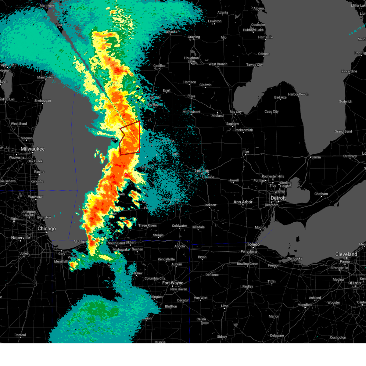
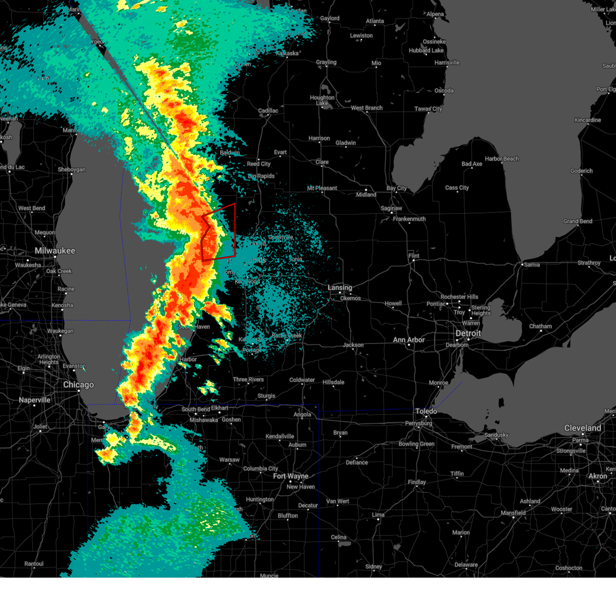
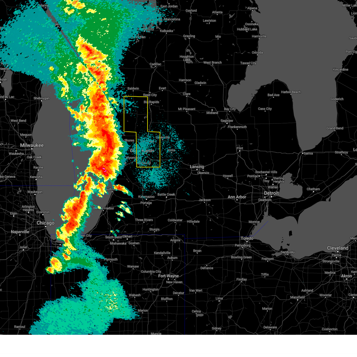
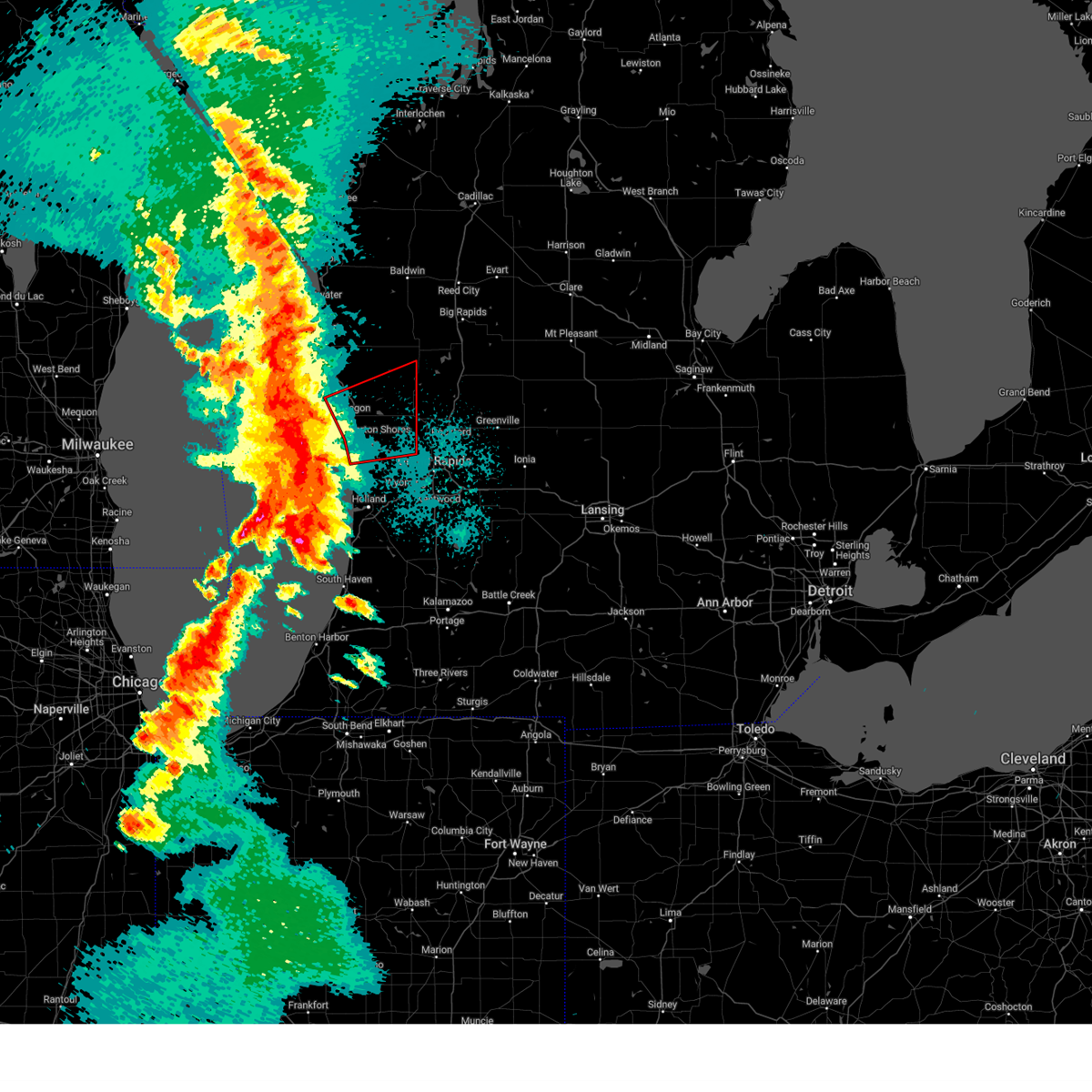
Hail Map for Fremont, MI
The Fremont, MI area has had 7 reports of on-the-ground hail by trained spotters, and has been under severe weather warnings 10 times during the past 12 months. Doppler radar has detected hail at or near Fremont, MI on 29 occasions.
| Name: | Fremont, MI |
| Where Located: | 37.1 miles NNW of Grand Rapids, MI |
| Map: | Google Map for Fremont, MI |
| Population: | 4081 |
| Housing Units: | 1968 |
| More Info: | Search Google for Fremont, MI |
4
The Top Recent Hail Date for Fremont, MI is Monday, November 6, 2023 (7th out of 29)

Hail and Wind Damage Spotted near Fremont, MI
| Date / Time | Report Details |
|---|---|
| 5/15/2025 10:13 PM EDT |
 The tornado warning that was previously in effect has been reissued for northern kent county and is in effect until 1045 pm edt. please refer to that bulletin for the latest severe weather information. a tornado watch remains in effect until 300 am edt for southwestern and west central michigan. The tornado warning that was previously in effect has been reissued for northern kent county and is in effect until 1045 pm edt. please refer to that bulletin for the latest severe weather information. a tornado watch remains in effect until 300 am edt for southwestern and west central michigan.
|
| 5/15/2025 9:58 PM EDT |
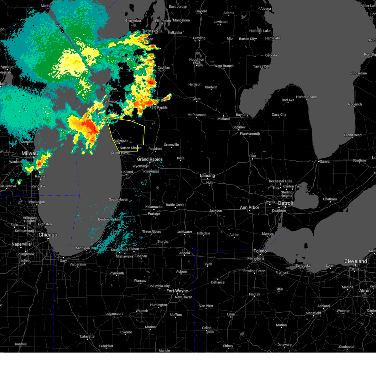
 At 957 pm edt, a severe squall line capable of producing both tornadoes and extensive straight line wind damage was located 8 miles northwest of ravenna, or 9 miles east of muskegon, moving northeast at 55 mph (radar indicated rotation). Hazards include tornado and quarter size hail. Flying debris will be dangerous to those caught without shelter. mobile homes will be damaged or destroyed. damage to roofs, windows, and vehicles will occur. tree damage is likely. Locations impacted include, grant. At 957 pm edt, a severe squall line capable of producing both tornadoes and extensive straight line wind damage was located 8 miles northwest of ravenna, or 9 miles east of muskegon, moving northeast at 55 mph (radar indicated rotation). Hazards include tornado and quarter size hail. Flying debris will be dangerous to those caught without shelter. mobile homes will be damaged or destroyed. damage to roofs, windows, and vehicles will occur. tree damage is likely. Locations impacted include, grant.
|
| 5/15/2025 9:52 PM EDT |
 Svrgrr the national weather service in grand rapids has issued a * severe thunderstorm warning for, kent county in southwestern michigan, newaygo county in west central michigan, * until 1115 pm edt. * at 951 pm edt, severe thunderstorms were located along a line extending from near shelby to 6 miles west of coopersville to 5 miles west of holland sp, moving east at 65 mph. these are destructive storms for kent and newaygo counties (radar indicated). Hazards include 80 mph wind gusts and penny size hail. Flying debris will be dangerous to those caught without shelter. mobile homes will be heavily damaged. expect considerable damage to roofs, windows, and vehicles. Extensive tree damage and power outages are likely. Svrgrr the national weather service in grand rapids has issued a * severe thunderstorm warning for, kent county in southwestern michigan, newaygo county in west central michigan, * until 1115 pm edt. * at 951 pm edt, severe thunderstorms were located along a line extending from near shelby to 6 miles west of coopersville to 5 miles west of holland sp, moving east at 65 mph. these are destructive storms for kent and newaygo counties (radar indicated). Hazards include 80 mph wind gusts and penny size hail. Flying debris will be dangerous to those caught without shelter. mobile homes will be heavily damaged. expect considerable damage to roofs, windows, and vehicles. Extensive tree damage and power outages are likely.
|
| 5/15/2025 9:33 PM EDT |
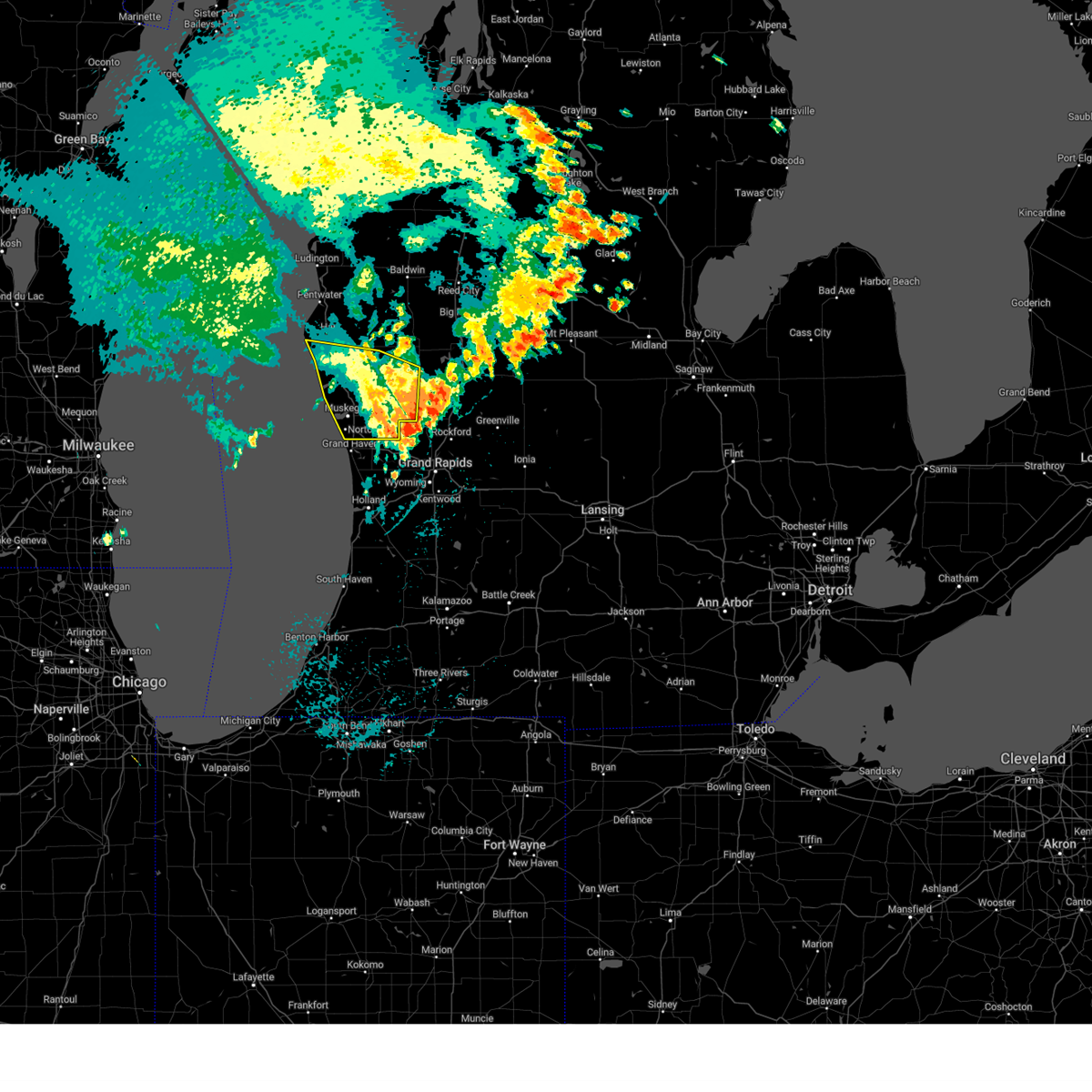
 Torgrr the national weather service in grand rapids has issued a * tornado warning for, northern ottawa county in southwestern michigan, southwestern newaygo county in west central michigan, muskegon county in west central michigan, * until 1015 pm edt. * at 933 pm edt, severe thunderstorms capable of producing both tornadoes and extensive straight line wind damage were located 10 miles west of grand haven, or 14 miles southwest of muskegon, moving northeast at 55 mph (radar indicated rotation). Hazards include tornado and quarter size hail. Flying debris will be dangerous to those caught without shelter. mobile homes will be damaged or destroyed. damage to roofs, windows, and vehicles will occur. tree damage is likely. these dangerous storms will be near, muskegon and roosevelt park around 940 pm edt. muskegon heights and north muskegon around 945 pm edt. Other locations in the path of this tornadic thunderstorm include grand haven, grant, and newaygo. Torgrr the national weather service in grand rapids has issued a * tornado warning for, northern ottawa county in southwestern michigan, southwestern newaygo county in west central michigan, muskegon county in west central michigan, * until 1015 pm edt. * at 933 pm edt, severe thunderstorms capable of producing both tornadoes and extensive straight line wind damage were located 10 miles west of grand haven, or 14 miles southwest of muskegon, moving northeast at 55 mph (radar indicated rotation). Hazards include tornado and quarter size hail. Flying debris will be dangerous to those caught without shelter. mobile homes will be damaged or destroyed. damage to roofs, windows, and vehicles will occur. tree damage is likely. these dangerous storms will be near, muskegon and roosevelt park around 940 pm edt. muskegon heights and north muskegon around 945 pm edt. Other locations in the path of this tornadic thunderstorm include grand haven, grant, and newaygo.
|
| 4/18/2025 10:08 AM EDT |
 At 1005 am edt, severe thunderstorms were located along a line extending from near fruitport to near beechwood, moving east at 55 mph. this is a second area of thunderstorms that was following strong but non severe thunderstorms currently over the grand rapids area that were also moving east (radar indicated). Hazards include 60 mph wind gusts and quarter size hail. Hail damage to vehicles is expected. expect wind damage to roofs, siding, and trees. Locations impacted include, port sheldon, clarksville, reeman, cedar lake, stanton, belmont, lakewood club, muskegon heights, dalton, alto, wyman, orleans, whitehall, marne, dutton, brunswick, holton, comstock park, hudsonville, sheridan,. At 1005 am edt, severe thunderstorms were located along a line extending from near fruitport to near beechwood, moving east at 55 mph. this is a second area of thunderstorms that was following strong but non severe thunderstorms currently over the grand rapids area that were also moving east (radar indicated). Hazards include 60 mph wind gusts and quarter size hail. Hail damage to vehicles is expected. expect wind damage to roofs, siding, and trees. Locations impacted include, port sheldon, clarksville, reeman, cedar lake, stanton, belmont, lakewood club, muskegon heights, dalton, alto, wyman, orleans, whitehall, marne, dutton, brunswick, holton, comstock park, hudsonville, sheridan,.
|
| 4/18/2025 9:48 AM EDT |
 Svrgrr the national weather service in grand rapids has issued a * severe thunderstorm warning for, kent county in southwestern michigan, ottawa county in southwestern michigan, southern newaygo county in west central michigan, ionia county in south central michigan, muskegon county in west central michigan, northwestern eaton county in south central michigan, southeastern oceana county in west central michigan, montcalm county in central michigan, * until 1115 am edt. * at 947 am edt, severe thunderstorms were located along a line extending from near fruitport to 5 miles southwest of allendale to near zeeland, moving east at 65 mph (radar indicated). Hazards include 60 mph wind gusts and quarter size hail. Hail damage to vehicles is expected. Expect wind damage to roofs, siding, and trees. Svrgrr the national weather service in grand rapids has issued a * severe thunderstorm warning for, kent county in southwestern michigan, ottawa county in southwestern michigan, southern newaygo county in west central michigan, ionia county in south central michigan, muskegon county in west central michigan, northwestern eaton county in south central michigan, southeastern oceana county in west central michigan, montcalm county in central michigan, * until 1115 am edt. * at 947 am edt, severe thunderstorms were located along a line extending from near fruitport to 5 miles southwest of allendale to near zeeland, moving east at 65 mph (radar indicated). Hazards include 60 mph wind gusts and quarter size hail. Hail damage to vehicles is expected. Expect wind damage to roofs, siding, and trees.
|
| 3/30/2025 6:02 PM EDT | At 601 pm edt, severe thunderstorms were located along a line extending from near hesperia to near freeport, moving east at 60 mph. these are destructive storms for western michigan (at 5:50 pm 80 mph winds were observed at grand rapids asos). Hazards include 80 mph wind gusts and penny size hail. Flying debris will be dangerous to those caught without shelter. mobile homes will be heavily damaged. expect considerable damage to roofs, windows, and vehicles. extensive tree damage and power outages are likely. Locations impacted include, clarksville, reeman, cedar lake, stanton, vestaburg, wyman, newaygo, orleans, langston, hawkins, lakeview, greenville, six lakes, pierson, woodville, sidney, sheridan, howard city, belding, carson city,. |
| 3/30/2025 5:48 PM EDT | Svrgrr the national weather service in grand rapids has issued a * severe thunderstorm warning for, newaygo county in west central michigan, ionia county in south central michigan, montcalm county in central michigan, * until 645 pm edt. * at 547 pm edt, severe thunderstorms were located along a line extending from 6 miles northeast of hart to near middleville, moving northeast at 85 mph (radar indicated). Hazards include 70 mph wind gusts and penny size hail. Expect considerable tree damage. Damage is likely to mobile homes, roofs, and outbuildings. |
| 8/27/2024 3:18 PM EDT |
 The storm which prompted the warning has moved out of the area. therefore, the warning has been allowed to expire. a severe thunderstorm watch remains in effect until 800 pm edt for southwestern and west central michigan. The storm which prompted the warning has moved out of the area. therefore, the warning has been allowed to expire. a severe thunderstorm watch remains in effect until 800 pm edt for southwestern and west central michigan.
|
| 8/27/2024 2:26 PM EDT |
 Svrgrr the national weather service in grand rapids has issued a * severe thunderstorm warning for, southwestern newaygo county in west central michigan, muskegon county in west central michigan, southern oceana county in west central michigan, * until 315 pm edt. * at 225 pm edt, a severe thunderstorm was located 11 miles west of montague, or 18 miles northwest of muskegon, moving east at 60 mph (radar indicated). Hazards include 60 mph wind gusts. expect damage to roofs, siding, and trees Svrgrr the national weather service in grand rapids has issued a * severe thunderstorm warning for, southwestern newaygo county in west central michigan, muskegon county in west central michigan, southern oceana county in west central michigan, * until 315 pm edt. * at 225 pm edt, a severe thunderstorm was located 11 miles west of montague, or 18 miles northwest of muskegon, moving east at 60 mph (radar indicated). Hazards include 60 mph wind gusts. expect damage to roofs, siding, and trees
|
| 5/20/2024 6:18 PM EDT | Trees and power lines down north of fremon in newaygo county MI, 4.2 miles SSW of Fremont, MI |
| 5/20/2024 6:14 PM EDT |
 Svrgrr the national weather service in grand rapids has issued a * severe thunderstorm warning for, newaygo county in west central michigan, * until 715 pm edt. * at 614 pm edt, severe thunderstorms were located along a line extending from near hesperia to 6 miles west of grant, moving northeast at 30 mph (radar indicated). Hazards include 60 mph wind gusts. expect damage to roofs, siding, and trees Svrgrr the national weather service in grand rapids has issued a * severe thunderstorm warning for, newaygo county in west central michigan, * until 715 pm edt. * at 614 pm edt, severe thunderstorms were located along a line extending from near hesperia to 6 miles west of grant, moving northeast at 30 mph (radar indicated). Hazards include 60 mph wind gusts. expect damage to roofs, siding, and trees
|
| 4/20/2023 8:38 PM EDT |
 At 838 pm edt, severe thunderstorms were located along a line extending from near shelby to near grand haven to near saugatuck, moving northeast at 25 mph (radar indicated). Hazards include 60 mph wind gusts and penny size hail. expect damage to roofs, siding, and trees At 838 pm edt, severe thunderstorms were located along a line extending from near shelby to near grand haven to near saugatuck, moving northeast at 25 mph (radar indicated). Hazards include 60 mph wind gusts and penny size hail. expect damage to roofs, siding, and trees
|
| 8/29/2022 3:01 PM EDT | At 301 pm edt, a severe thunderstorm was located near white cloud, moving east at 50 mph (radar indicated). Hazards include 60 mph wind gusts and quarter size hail. Hail damage to vehicles is expected. Expect wind damage to roofs, siding, and trees. |
| 7/23/2022 9:39 PM EDT |
 At 939 pm edt, severe thunderstorms were located along a line extending from near fremont to 6 miles northwest of ravenna, moving east at 40 mph (radar indicated). Hazards include 60 mph wind gusts and penny size hail. expect damage to roofs, siding, and trees At 939 pm edt, severe thunderstorms were located along a line extending from near fremont to 6 miles northwest of ravenna, moving east at 40 mph (radar indicated). Hazards include 60 mph wind gusts and penny size hail. expect damage to roofs, siding, and trees
|
| 5/11/2022 2:40 PM EDT |
 The severe thunderstorm warning for west central newaygo county will expire at 245 pm edt, the storm which prompted the warning for newaygo county has weakened below severe limits, and the warning will be allowed to expire at 245 pm edt. however, small hail, lightning, and flooding are still possible with this thunderstorm. The severe thunderstorm warning for west central newaygo county will expire at 245 pm edt, the storm which prompted the warning for newaygo county has weakened below severe limits, and the warning will be allowed to expire at 245 pm edt. however, small hail, lightning, and flooding are still possible with this thunderstorm.
|
| 5/11/2022 2:30 PM EDT | Large tree trunk snapped 5 feet above ground. tree landed on shed. social media photo. time and location estimate in newaygo county MI, 0.7 miles SW of Fremont, MI |
| 5/11/2022 2:22 PM EDT |
 At 220 pm edt, a severe thunderstorm was located near white cloud, moving southwest at 20 mph (radar indicated. at 215 pm edt, trees were reported down north of white cloud). Hazards include 60 mph wind gusts and quarter size hail. Hail damage to vehicles is expected. expect wind damage to roofs, siding, and trees. locations impacted include, white cloud, fremont, hesperia, reeman, wooster, hail threat, radar indicated max hail size, 1. 00 in wind threat, radar indicated max wind gust, 60 mph. At 220 pm edt, a severe thunderstorm was located near white cloud, moving southwest at 20 mph (radar indicated. at 215 pm edt, trees were reported down north of white cloud). Hazards include 60 mph wind gusts and quarter size hail. Hail damage to vehicles is expected. expect wind damage to roofs, siding, and trees. locations impacted include, white cloud, fremont, hesperia, reeman, wooster, hail threat, radar indicated max hail size, 1. 00 in wind threat, radar indicated max wind gust, 60 mph.
|
| 5/11/2022 2:04 PM EDT |
 At 204 pm edt, severe thunderstorms were located along a line extending from near hesperia to near white cloud, moving south at 15 mph (radar indicated). Hazards include golf ball size hail and 60 mph wind gusts. People and animals outdoors will be injured. expect hail damage to roofs, siding, windows, and vehicles. expect wind damage to roofs, siding, and trees. locations impacted include, newaygo, white cloud, fremont, hesperia, croton, brohman, reeman, woodville, croton heights, wooster, thunderstorm damage threat, considerable hail threat, radar indicated max hail size, 1. 75 in wind threat, radar indicated max wind gust, 60 mph. At 204 pm edt, severe thunderstorms were located along a line extending from near hesperia to near white cloud, moving south at 15 mph (radar indicated). Hazards include golf ball size hail and 60 mph wind gusts. People and animals outdoors will be injured. expect hail damage to roofs, siding, windows, and vehicles. expect wind damage to roofs, siding, and trees. locations impacted include, newaygo, white cloud, fremont, hesperia, croton, brohman, reeman, woodville, croton heights, wooster, thunderstorm damage threat, considerable hail threat, radar indicated max hail size, 1. 75 in wind threat, radar indicated max wind gust, 60 mph.
|
| 5/11/2022 1:58 PM EDT |
 At 158 pm edt, severe thunderstorms were located along a line extending from near hesperia to near white cloud, moving south at 15 mph (radar indicated). Hazards include 60 mph wind gusts and quarter size hail. Hail damage to vehicles is expected. Expect wind damage to roofs, siding, and trees. At 158 pm edt, severe thunderstorms were located along a line extending from near hesperia to near white cloud, moving south at 15 mph (radar indicated). Hazards include 60 mph wind gusts and quarter size hail. Hail damage to vehicles is expected. Expect wind damage to roofs, siding, and trees.
|
| 9/7/2021 2:41 PM EDT |
 At 241 pm edt, severe thunderstorms were located along a line extending from near clare to near canadian lakes to near grant, moving east at 50 mph (radar indicated). Hazards include 60 mph wind gusts and penny size hail. Expect damage to roofs, siding, and trees. locations impacted include, mount pleasant, big rapids, clare, newaygo, white cloud, fremont, shepherd, grant, morley, mecosta, rosebush, canadian lakes, lake isabella, croton, bridgeton, remus, millbrook, barryton, stanwood, brinton, hail threat, radar indicated max hail size, 0. 75 in wind threat, radar indicated max wind gust, 60 mph. At 241 pm edt, severe thunderstorms were located along a line extending from near clare to near canadian lakes to near grant, moving east at 50 mph (radar indicated). Hazards include 60 mph wind gusts and penny size hail. Expect damage to roofs, siding, and trees. locations impacted include, mount pleasant, big rapids, clare, newaygo, white cloud, fremont, shepherd, grant, morley, mecosta, rosebush, canadian lakes, lake isabella, croton, bridgeton, remus, millbrook, barryton, stanwood, brinton, hail threat, radar indicated max hail size, 0. 75 in wind threat, radar indicated max wind gust, 60 mph.
|
| 9/7/2021 2:20 PM EDT |
 At 219 pm edt, a severe thunderstorm was located over white cloud, moving east at 65 mph (radar indicated). Hazards include 60 mph wind gusts and penny size hail. expect damage to roofs, siding, and trees At 219 pm edt, a severe thunderstorm was located over white cloud, moving east at 65 mph (radar indicated). Hazards include 60 mph wind gusts and penny size hail. expect damage to roofs, siding, and trees
|
| 8/24/2021 4:53 PM EDT |
 At 453 pm edt, a severe thunderstorm was located near newaygo, moving southeast at 35 mph (radar indicated). Hazards include 60 mph wind gusts. expect damage to roofs, siding, and trees At 453 pm edt, a severe thunderstorm was located near newaygo, moving southeast at 35 mph (radar indicated). Hazards include 60 mph wind gusts. expect damage to roofs, siding, and trees
|
| 8/24/2021 4:43 PM EDT |
 At 443 pm edt, a severe thunderstorm was located near hesperia, or 12 miles northwest of white cloud, moving east at 30 mph (radar indicated). Hazards include 60 mph wind gusts. expect damage to roofs, siding, and trees At 443 pm edt, a severe thunderstorm was located near hesperia, or 12 miles northwest of white cloud, moving east at 30 mph (radar indicated). Hazards include 60 mph wind gusts. expect damage to roofs, siding, and trees
|
| 8/10/2021 10:02 PM EDT |
 At 1002 pm edt, severe thunderstorms were located along a line extending from 6 miles west of manistee to near fruitport to near fennville to near coloma, moving east at 55 mph (radar indicated). Hazards include 60 mph wind gusts. expect damage to roofs, siding, and trees At 1002 pm edt, severe thunderstorms were located along a line extending from 6 miles west of manistee to near fruitport to near fennville to near coloma, moving east at 55 mph (radar indicated). Hazards include 60 mph wind gusts. expect damage to roofs, siding, and trees
|
| 11/10/2020 8:55 PM EST |
 The severe thunderstorm warning for newaygo county will expire at 900 pm est, the storms which prompted the warning have moved out of the area. therefore, the warning will be allowed to expire. a severe thunderstorm watch remains in effect until midnight est for central and west central michigan. The severe thunderstorm warning for newaygo county will expire at 900 pm est, the storms which prompted the warning have moved out of the area. therefore, the warning will be allowed to expire. a severe thunderstorm watch remains in effect until midnight est for central and west central michigan.
|
| 11/10/2020 8:25 PM EST |
 At 825 pm est, severe thunderstorms were located along a line extending from 6 miles southwest of reed city to 5 miles west of grant, moving east at 35 mph (radar indicated). Hazards include 60 mph wind gusts. Expect damage to roofs, siding, and trees. Locations impacted include, newaygo, white cloud, fremont, grant, croton, bridgeton, hawkins, woodville, croton heights, wooster,. At 825 pm est, severe thunderstorms were located along a line extending from 6 miles southwest of reed city to 5 miles west of grant, moving east at 35 mph (radar indicated). Hazards include 60 mph wind gusts. Expect damage to roofs, siding, and trees. Locations impacted include, newaygo, white cloud, fremont, grant, croton, bridgeton, hawkins, woodville, croton heights, wooster,.
|
| 11/10/2020 7:59 PM EST |
 At 734 pm est, severe thunderstorms were located along a line extending from 7 miles northeast of hart to 19 miles southwest of muskegon, moving northeast at 65 mph (radar indicated). Hazards include 60 mph wind gusts. expect damage to roofs, siding, and trees At 734 pm est, severe thunderstorms were located along a line extending from 7 miles northeast of hart to 19 miles southwest of muskegon, moving northeast at 65 mph (radar indicated). Hazards include 60 mph wind gusts. expect damage to roofs, siding, and trees
|
| 11/10/2020 7:35 PM EST |
 At 734 pm est, severe thunderstorms were located along a line extending from 7 miles northeast of hart to 19 miles southwest of muskegon, moving northeast at 65 mph (radar indicated). Hazards include 60 mph wind gusts. expect damage to roofs, siding, and trees At 734 pm est, severe thunderstorms were located along a line extending from 7 miles northeast of hart to 19 miles southwest of muskegon, moving northeast at 65 mph (radar indicated). Hazards include 60 mph wind gusts. expect damage to roofs, siding, and trees
|
| 8/28/2020 3:16 PM EDT |
 At 315 pm edt, a severe thunderstorm was located near white cloud, moving east at 45 mph (radar indicated). Hazards include 60 mph wind gusts. expect damage to roofs, siding, and trees At 315 pm edt, a severe thunderstorm was located near white cloud, moving east at 45 mph (radar indicated). Hazards include 60 mph wind gusts. expect damage to roofs, siding, and trees
|
| 6/10/2020 12:09 PM EDT |
 At 1209 pm edt, severe thunderstorms were located along a line extending from near fruitport to near kentwood, moving northeast at 60 mph (radar indicated). Hazards include 60 mph wind gusts. expect damage to roofs, siding, and trees At 1209 pm edt, severe thunderstorms were located along a line extending from near fruitport to near kentwood, moving northeast at 60 mph (radar indicated). Hazards include 60 mph wind gusts. expect damage to roofs, siding, and trees
|
| 6/3/2020 12:30 AM EDT |
 At 1230 am edt, severe thunderstorms were located along a line extending from 7 miles northwest of reed city to 6 miles east of newaygo, moving east at 35 mph (radar indicated). Hazards include 60 mph wind gusts. Expect damage to roofs, siding, and trees. Locations impacted include, newaygo, white cloud, baldwin, fremont, hesperia, grant, luther, croton, bridgeton, chase, brohman, woodland park, hawkins, reeman, nirvana, wolf lake, woodville, idlewild, irons, bristol,. At 1230 am edt, severe thunderstorms were located along a line extending from 7 miles northwest of reed city to 6 miles east of newaygo, moving east at 35 mph (radar indicated). Hazards include 60 mph wind gusts. Expect damage to roofs, siding, and trees. Locations impacted include, newaygo, white cloud, baldwin, fremont, hesperia, grant, luther, croton, bridgeton, chase, brohman, woodland park, hawkins, reeman, nirvana, wolf lake, woodville, idlewild, irons, bristol,.
|
| 6/2/2020 11:43 PM EDT |
 At 1142 pm edt, severe thunderstorms were located along a line extending from 5 miles east of scottville to near whitehall, moving east at 50 mph (radar indicated). Hazards include 60 mph wind gusts. expect damage to roofs, siding, and trees At 1142 pm edt, severe thunderstorms were located along a line extending from 5 miles east of scottville to near whitehall, moving east at 50 mph (radar indicated). Hazards include 60 mph wind gusts. expect damage to roofs, siding, and trees
|
| 8/29/2019 7:03 PM EDT |
 A severe thunderstorm warning remains in effect until 715 pm edt for southern newaygo and northwestern montcalm counties. at 702 pm edt, a severe thunderstorm was located 6 miles west of grant, or 10 miles southwest of newaygo, moving southeast at 35 mph. hazard. 60 mph wind gusts and quarter size hail. source. Radar indicated. A severe thunderstorm warning remains in effect until 715 pm edt for southern newaygo and northwestern montcalm counties. at 702 pm edt, a severe thunderstorm was located 6 miles west of grant, or 10 miles southwest of newaygo, moving southeast at 35 mph. hazard. 60 mph wind gusts and quarter size hail. source. Radar indicated.
|
| 8/29/2019 6:54 PM EDT |
 At 651 pm edt, a severe thunderstorm was located 9 miles southwest of fremont, or 12 miles northeast of muskegon, moving east at 45 mph. this storm has a history of producing dime size hail near twin lake and is likely producing larger hail east of twin lake near the newaygo county line. the storm previously mentioned near grant with a possible tornado now has less chance of producing a tornado (radar indicated). Hazards include 60 mph wind gusts and quarter size hail. Hail damage to vehicles is expected. expect wind damage to roofs, siding, and trees. Locations impacted include, newaygo, fremont, howard city, grant, croton, holton, bridgeton, pierson, brunswick, reeman, amble, twin lake, coral, croton heights,. At 651 pm edt, a severe thunderstorm was located 9 miles southwest of fremont, or 12 miles northeast of muskegon, moving east at 45 mph. this storm has a history of producing dime size hail near twin lake and is likely producing larger hail east of twin lake near the newaygo county line. the storm previously mentioned near grant with a possible tornado now has less chance of producing a tornado (radar indicated). Hazards include 60 mph wind gusts and quarter size hail. Hail damage to vehicles is expected. expect wind damage to roofs, siding, and trees. Locations impacted include, newaygo, fremont, howard city, grant, croton, holton, bridgeton, pierson, brunswick, reeman, amble, twin lake, coral, croton heights,.
|
| 8/29/2019 6:45 PM EDT |
 At 644 pm edt, a severe thunderstorm was located near grant, or near newaygo, moving east at 40 mph. this storm has the potential to produce a brief tornado east of grant (trained weather spotters). Hazards include 60 mph wind gusts and quarter size hail. Hail damage to vehicles is expected. expect wind damage to roofs, siding, and trees. Locations impacted include, newaygo, fremont, howard city, lakewood club, grant, dalton, croton, holton, bridgeton, pierson, brunswick, reeman, amble, twin lake, coral, croton heights,. At 644 pm edt, a severe thunderstorm was located near grant, or near newaygo, moving east at 40 mph. this storm has the potential to produce a brief tornado east of grant (trained weather spotters). Hazards include 60 mph wind gusts and quarter size hail. Hail damage to vehicles is expected. expect wind damage to roofs, siding, and trees. Locations impacted include, newaygo, fremont, howard city, lakewood club, grant, dalton, croton, holton, bridgeton, pierson, brunswick, reeman, amble, twin lake, coral, croton heights,.
|
| 8/29/2019 6:40 PM EDT |
 At 639 pm edt, severe thunderstorms were located along a line extending from 7 miles east of newaygo to 5 miles northeast of lakewood club, moving east at 50 mph (radar indicated). Hazards include 60 mph wind gusts and quarter size hail. Hail damage to vehicles is expected. expect wind damage to roofs, siding, and trees. Locations impacted include, newaygo, fremont, howard city, lakewood club, grant, dalton, croton, holton, bridgeton, pierson, brunswick, reeman, amble, twin lake, coral, croton heights,. At 639 pm edt, severe thunderstorms were located along a line extending from 7 miles east of newaygo to 5 miles northeast of lakewood club, moving east at 50 mph (radar indicated). Hazards include 60 mph wind gusts and quarter size hail. Hail damage to vehicles is expected. expect wind damage to roofs, siding, and trees. Locations impacted include, newaygo, fremont, howard city, lakewood club, grant, dalton, croton, holton, bridgeton, pierson, brunswick, reeman, amble, twin lake, coral, croton heights,.
|
| 8/29/2019 6:30 PM EDT |
 At 630 pm edt, severe thunderstorms were located along a line extending from near newaygo to whitehall, moving east at 40 mph (radar indicated). Hazards include 60 mph wind gusts and quarter size hail. Hail damage to vehicles is expected. Expect wind damage to roofs, siding, and trees. At 630 pm edt, severe thunderstorms were located along a line extending from near newaygo to whitehall, moving east at 40 mph (radar indicated). Hazards include 60 mph wind gusts and quarter size hail. Hail damage to vehicles is expected. Expect wind damage to roofs, siding, and trees.
|
| 8/29/2019 6:15 PM EDT | Quarter sized hail reported 1.8 miles NE of Fremont, MI, relayed through social media by wzzm tv. |
| 8/29/2019 6:15 PM EDT | Tennis Ball sized hail reported 1.3 miles NE of Fremont, MI, report from photo sent via social media via wzzm tv. |
| 7/20/2019 3:40 PM EDT |
 The severe thunderstorm warning for newaygo county will expire at 345 pm edt, the storm which prompted the warning has moved out of the area. therefore, the warning will be allowed to expire. a severe thunderstorm watch remains in effect until 1000 pm edt for central and west central michigan. The severe thunderstorm warning for newaygo county will expire at 345 pm edt, the storm which prompted the warning has moved out of the area. therefore, the warning will be allowed to expire. a severe thunderstorm watch remains in effect until 1000 pm edt for central and west central michigan.
|
| 7/20/2019 3:07 PM EDT |
 At 306 pm edt, a severe thunderstorm was located near white cloud, moving east at 40 mph (radar indicated). Hazards include 60 mph wind gusts and penny size hail. radar indicates some rotation is occurring along the front of the line of storms. Expect damage to roofs, siding, and trees. Locations impacted include, newaygo, white cloud, fremont, hesperia, grant, croton, bridgeton, brohman, woodland park, hawkins, reeman, woodville, bitely, croton heights, wooster, brunswick,. At 306 pm edt, a severe thunderstorm was located near white cloud, moving east at 40 mph (radar indicated). Hazards include 60 mph wind gusts and penny size hail. radar indicates some rotation is occurring along the front of the line of storms. Expect damage to roofs, siding, and trees. Locations impacted include, newaygo, white cloud, fremont, hesperia, grant, croton, bridgeton, brohman, woodland park, hawkins, reeman, woodville, bitely, croton heights, wooster, brunswick,.
|
| 7/20/2019 2:46 PM EDT |
 At 246 pm edt, a severe thunderstorm was located near hesperia, or 15 miles northwest of white cloud, moving east at 40 mph (radar indicated). Hazards include 60 mph wind gusts and penny size hail. expect damage to roofs, siding, and trees At 246 pm edt, a severe thunderstorm was located near hesperia, or 15 miles northwest of white cloud, moving east at 40 mph (radar indicated). Hazards include 60 mph wind gusts and penny size hail. expect damage to roofs, siding, and trees
|
| 7/20/2019 1:38 AM EDT |
 The severe thunderstorm warning for newaygo county will expire at 145 am edt, the storms which prompted the warning have moved out of the area. therefore, the warning will be allowed to expire. however heavy rain is still possible with these thunderstorms. a severe thunderstorm watch remains in effect until 600 am edt for central and west central michigan. The severe thunderstorm warning for newaygo county will expire at 145 am edt, the storms which prompted the warning have moved out of the area. therefore, the warning will be allowed to expire. however heavy rain is still possible with these thunderstorms. a severe thunderstorm watch remains in effect until 600 am edt for central and west central michigan.
|
| 7/20/2019 1:10 AM EDT |
 At 110 am edt, severe thunderstorms were located along a line extending from near big rapids to near newaygo, moving east at 50 mph (radar indicated). Hazards include 60 mph wind gusts. Expect damage to roofs, siding, and trees. Locations impacted include, newaygo, white cloud, fremont, hesperia, grant, croton, bridgeton, reeman, woodville, croton heights, wooster,. At 110 am edt, severe thunderstorms were located along a line extending from near big rapids to near newaygo, moving east at 50 mph (radar indicated). Hazards include 60 mph wind gusts. Expect damage to roofs, siding, and trees. Locations impacted include, newaygo, white cloud, fremont, hesperia, grant, croton, bridgeton, reeman, woodville, croton heights, wooster,.
|
| 7/20/2019 12:39 AM EDT |
 At 1239 am edt, severe thunderstorms were located along a line extending from 5 miles northeast of baldwin to 9 miles east of hart, moving southeast at 50 mph (radar indicated). Hazards include 60 mph wind gusts. expect damage to roofs, siding, and trees At 1239 am edt, severe thunderstorms were located along a line extending from 5 miles northeast of baldwin to 9 miles east of hart, moving southeast at 50 mph (radar indicated). Hazards include 60 mph wind gusts. expect damage to roofs, siding, and trees
|
| 8/28/2018 7:48 PM EDT |
 At 748 pm edt, severe thunderstorms were located along a line extending from near mcbain to near reed city to 8 miles northeast of white cloud to near newaygo, moving east at 75 mph (radar indicated). Hazards include 60 mph wind gusts. Expect damage to roofs, siding, and trees. Locations impacted include, big rapids, newaygo, evart, white cloud, fremont, reed city, grant, marion, morley, mecosta, barryton, canadian lakes, croton, bridgeton, highland, chase, paris, hersey, le roy, tustin,. At 748 pm edt, severe thunderstorms were located along a line extending from near mcbain to near reed city to 8 miles northeast of white cloud to near newaygo, moving east at 75 mph (radar indicated). Hazards include 60 mph wind gusts. Expect damage to roofs, siding, and trees. Locations impacted include, big rapids, newaygo, evart, white cloud, fremont, reed city, grant, marion, morley, mecosta, barryton, canadian lakes, croton, bridgeton, highland, chase, paris, hersey, le roy, tustin,.
|
| 8/28/2018 7:37 PM EDT |
 At 737 pm edt, severe thunderstorms were located along a line extending from mitchell state park to 9 miles southeast of baldwin to 6 miles northwest of white cloud to 7 miles west of fremont, moving east at 75 mph (radar indicated). Hazards include 60 mph wind gusts. Expect damage to roofs, siding, and trees. Locations impacted include, big rapids, newaygo, evart, white cloud, baldwin, fremont, reed city, hesperia, grant, marion, morley, mecosta, barryton, luther, canadian lakes, croton, bridgeton, highland, chase, paris,. At 737 pm edt, severe thunderstorms were located along a line extending from mitchell state park to 9 miles southeast of baldwin to 6 miles northwest of white cloud to 7 miles west of fremont, moving east at 75 mph (radar indicated). Hazards include 60 mph wind gusts. Expect damage to roofs, siding, and trees. Locations impacted include, big rapids, newaygo, evart, white cloud, baldwin, fremont, reed city, hesperia, grant, marion, morley, mecosta, barryton, luther, canadian lakes, croton, bridgeton, highland, chase, paris,.
|
| 8/28/2018 7:14 PM EDT |
 At 714 pm edt, severe thunderstorms were located along a line extending from near dublin to 7 miles east of hart to 5 miles south of shelby to 11 miles west of montague, moving east at 75 mph (radar indicated). Hazards include 60 mph wind gusts. expect damage to roofs, siding, and trees At 714 pm edt, severe thunderstorms were located along a line extending from near dublin to 7 miles east of hart to 5 miles south of shelby to 11 miles west of montague, moving east at 75 mph (radar indicated). Hazards include 60 mph wind gusts. expect damage to roofs, siding, and trees
|
| 8/26/2018 9:55 PM EDT |
 At 937 pm edt, a severe thunderstorm was located near fremont, or 11 miles west of newaygo, moving east at 45 mph (radar indicated). Hazards include 60 mph wind gusts. Expect damage to roofs, siding, and trees. this severe thunderstorm will be near, wooster around 950 pm edt. newaygo, white cloud and grant around 955 pm edt. Croton and croton heights around 1005 pm edt. At 937 pm edt, a severe thunderstorm was located near fremont, or 11 miles west of newaygo, moving east at 45 mph (radar indicated). Hazards include 60 mph wind gusts. Expect damage to roofs, siding, and trees. this severe thunderstorm will be near, wooster around 950 pm edt. newaygo, white cloud and grant around 955 pm edt. Croton and croton heights around 1005 pm edt.
|
| 8/26/2018 9:38 PM EDT |
 At 937 pm edt, a severe thunderstorm was located near fremont, or 11 miles west of newaygo, moving east at 45 mph (radar indicated). Hazards include 60 mph wind gusts. Expect damage to roofs, siding, and trees. this severe thunderstorm will be near, wooster around 950 pm edt. newaygo, white cloud and grant around 955 pm edt. Croton and croton heights around 1005 pm edt. At 937 pm edt, a severe thunderstorm was located near fremont, or 11 miles west of newaygo, moving east at 45 mph (radar indicated). Hazards include 60 mph wind gusts. Expect damage to roofs, siding, and trees. this severe thunderstorm will be near, wooster around 950 pm edt. newaygo, white cloud and grant around 955 pm edt. Croton and croton heights around 1005 pm edt.
|
| 7/1/2018 7:47 PM EDT |
 At 746 pm edt, severe thunderstorms were located along a line extending from near irons to 5 miles southwest of fremont, moving northeast at 50 mph (law enforcement). Hazards include 60 mph wind gusts. expect damage to roofs, siding, and trees At 746 pm edt, severe thunderstorms were located along a line extending from near irons to 5 miles southwest of fremont, moving northeast at 50 mph (law enforcement). Hazards include 60 mph wind gusts. expect damage to roofs, siding, and trees
|
| 5/2/2018 8:55 PM EDT | Quarter sized hail reported 1.7 miles NNW of Fremont, MI, south of fremont at 64th and m82. |
| 5/2/2018 8:52 PM EDT | Quarter sized hail reported 3.2 miles WSW of Fremont, MI |
| 5/2/2018 8:50 PM EDT | Tree down blocking 72nd and luce south of fremont. time estimate in newaygo county MI, 3.4 miles NW of Fremont, MI |
| 5/2/2018 8:48 PM EDT |
 At 847 pm edt, a severe thunderstorm was located near newaygo, moving northeast at 50 mph (radar indicated). Hazards include 60 mph wind gusts and quarter size hail. Hail damage to vehicles is expected. expect wind damage to roofs, siding, and trees. Locations impacted include, newaygo, fremont, grant, croton, bridgeton, reeman, croton heights,. At 847 pm edt, a severe thunderstorm was located near newaygo, moving northeast at 50 mph (radar indicated). Hazards include 60 mph wind gusts and quarter size hail. Hail damage to vehicles is expected. expect wind damage to roofs, siding, and trees. Locations impacted include, newaygo, fremont, grant, croton, bridgeton, reeman, croton heights,.
|
| 5/2/2018 8:45 PM EDT | Golf Ball sized hail reported 2.4 miles NW of Fremont, MI, photos relayed through broadcast media. |
| 5/2/2018 8:32 PM EDT |
 At 832 pm edt, a severe thunderstorm was located 7 miles east of lakewood club, or 10 miles northeast of muskegon, moving east at 40 mph (radar indicated). Hazards include 60 mph wind gusts and quarter size hail. Hail damage to vehicles is expected. Expect wind damage to roofs, siding, and trees. At 832 pm edt, a severe thunderstorm was located 7 miles east of lakewood club, or 10 miles northeast of muskegon, moving east at 40 mph (radar indicated). Hazards include 60 mph wind gusts and quarter size hail. Hail damage to vehicles is expected. Expect wind damage to roofs, siding, and trees.
|
| 8/20/2016 2:42 PM EDT |
 At 241 pm edt, a severe thunderstorm was located near fremont, moving northeast at 15 mph (radar indicated). Hazards include 60 mph wind gusts. Expect damage to roofs. siding. And trees. At 241 pm edt, a severe thunderstorm was located near fremont, moving northeast at 15 mph (radar indicated). Hazards include 60 mph wind gusts. Expect damage to roofs. siding. And trees.
|
| 6/10/2016 11:17 PM EDT | Two reports of power lines down. also getting reports of power outages in fremont as wel in newaygo county MI, 0.4 miles WNW of Fremont, MI |
| 8/2/2015 8:11 PM EDT |
 At 808 pm edt, severe thunderstorm were located from near whitehall to newaygo, and moving east-southeast at 50 mph (radar indicated). Hazards include 60 mph wind gusts and quarter size hail. Hail damage to vehicles is expected. expect wind damage to roofs, siding and trees. Locations impacted include, newaygo, white cloud, fremont, whitehall, montague, lakewood club, grant, dalton, croton, holton, bridgeton, wooster, brunswick, twin lake, croton heights, reeman,. At 808 pm edt, severe thunderstorm were located from near whitehall to newaygo, and moving east-southeast at 50 mph (radar indicated). Hazards include 60 mph wind gusts and quarter size hail. Hail damage to vehicles is expected. expect wind damage to roofs, siding and trees. Locations impacted include, newaygo, white cloud, fremont, whitehall, montague, lakewood club, grant, dalton, croton, holton, bridgeton, wooster, brunswick, twin lake, croton heights, reeman,.
|
| 8/2/2015 7:31 PM EDT |
 At 731 pm edt, a severe thunderstorm was located 7 miles southwest of hart, moving east at 90 mph (radar indicated). Hazards include 60 mph wind gusts and quarter size hail. Hail damage to vehicles is expected. Expect wind damage to roofs, siding and trees. At 731 pm edt, a severe thunderstorm was located 7 miles southwest of hart, moving east at 90 mph (radar indicated). Hazards include 60 mph wind gusts and quarter size hail. Hail damage to vehicles is expected. Expect wind damage to roofs, siding and trees.
|
| 7/14/2015 12:20 AM EDT | A few trees were reported down around warner and 92nd... as well as 92nd and 64th st. south of fremont. report relayed via ham radio operato in newaygo county MI, 5 miles N of Fremont, MI |
| 6/25/2014 7:20 PM EDT | Trees and wires down in fremont and north of fremon in newaygo county MI, 0.4 miles WNW of Fremont, MI |
| 6/25/2014 7:11 PM EDT | Quarter sized hail reported 0.4 miles WNW of Fremont, MI, report courtesy of woodtv. |
| 6/17/2013 7:44 PM EDT | Three healthy 15 inch diameter trees down over the 9200 block of holton r in muskegon county MI, 5.9 miles ENE of Fremont, MI |
| 7/31/2012 12:33 AM EDT | *** 2 fatal *** tree fell on a house in long lak in newaygo county MI, 5.1 miles WSW of Fremont, MI |
| 7/17/2012 7:35 PM EDT | Reports of trees down in fremont from 911 call center in newayg in newaygo county MI, 1.1 miles WSW of Fremont, MI |
| 5/28/2012 9:44 PM EDT | Multiple trees of unknown size and health reported down on south stone road between 32nd and 44th street in newaygo county MI, 2 miles S of Fremont, MI |
| 5/28/2012 9:43 PM EDT | Newaygo county road commission and amateur radio report 20 to 25 trees of varying health and size came down just north of fremont. the health ranged from rotten to heal in newaygo county MI, 2 miles S of Fremont, MI |
| 1/1/0001 12:00 AM | Quarter sized hail reported 53.3 miles W of Fremont, MI |
Hail Maps for Fremont, MI


Connect with Interactive Hail Maps