

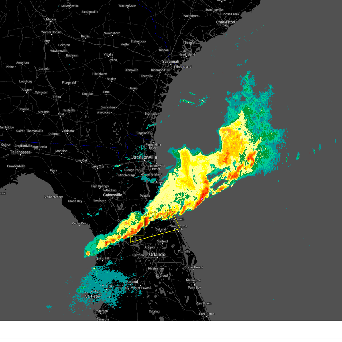
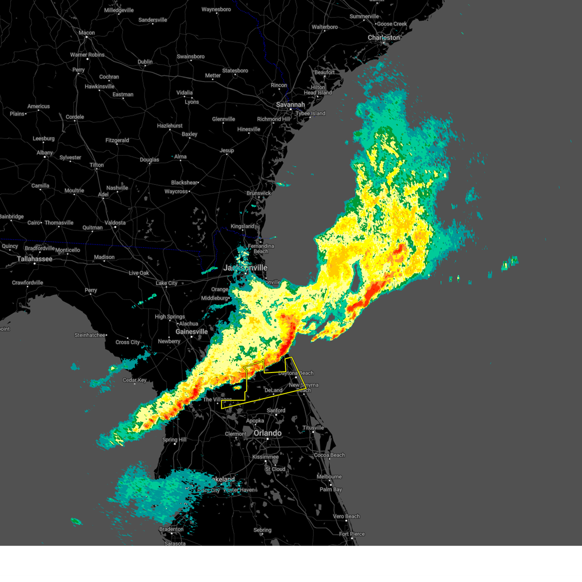
Hail Map for Fruitland Park, FL
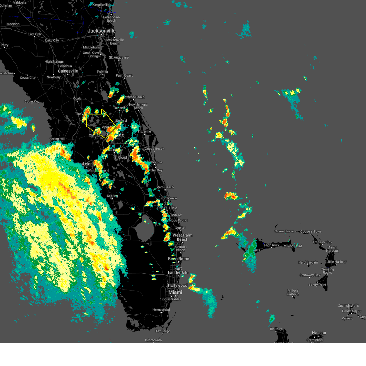
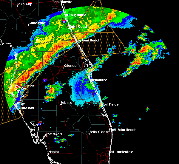
The Fruitland Park, FL area has had 0 reports of on-the-ground hail by trained spotters, and has been under severe weather warnings 8 times during the past 12 months. Doppler radar has detected hail at or near Fruitland Park, FL on 65 occasions, including 3 occasions during the past year.
| Name: | Fruitland Park, FL |
| Where Located: | 39.6 miles NW of Orlando, FL |
| Map: | Google Map for Fruitland Park, FL |
| Population: | 4078 |
| Housing Units: | 1662 |
| More Info: | Search Google for Fruitland Park, FL |
0
The Top Recent Hail Date for Fruitland Park, FL is Sunday, May 25, 2025 (42nd out of 65)

Hail and Wind Damage Spotted near Fruitland Park, FL
| Date / Time | Report Details |
|---|---|
| 1/19/2025 8:51 AM EST |
 Svrmlb the national weather service in melbourne has issued a * severe thunderstorm warning for, northern lake county in east central florida, northern volusia county in east central florida, * until 930 am est. * at 850 am est, a severe thunderstorm was located near the villages, moving east at 55 mph (radar indicated). Hazards include 60 mph wind gusts and penny size hail. expect damage to roofs, siding, and trees Svrmlb the national weather service in melbourne has issued a * severe thunderstorm warning for, northern lake county in east central florida, northern volusia county in east central florida, * until 930 am est. * at 850 am est, a severe thunderstorm was located near the villages, moving east at 55 mph (radar indicated). Hazards include 60 mph wind gusts and penny size hail. expect damage to roofs, siding, and trees
|
| 1/19/2025 8:12 AM EST |
 Svrmlb the national weather service in melbourne has issued a * severe thunderstorm warning for, northern lake county in east central florida, northern volusia county in east central florida, * until 900 am est. * at 811 am est, a severe thunderstorm was located near moss bluff, or near juniper springs, moving east at 50 mph (radar indicated). Hazards include 60 mph wind gusts and penny size hail. expect damage to roofs, siding, and trees Svrmlb the national weather service in melbourne has issued a * severe thunderstorm warning for, northern lake county in east central florida, northern volusia county in east central florida, * until 900 am est. * at 811 am est, a severe thunderstorm was located near moss bluff, or near juniper springs, moving east at 50 mph (radar indicated). Hazards include 60 mph wind gusts and penny size hail. expect damage to roofs, siding, and trees
|
| 8/4/2024 1:13 PM EDT |
 The storm which prompted the warning has weakened below severe limits, and no longer poses an immediate threat to life or property. therefore, the warning will be allowed to expire. however gusty winds are still possible with this thunderstorm. a tornado watch remains in effect until 800 pm edt for east central florida. remember, a tornado warning still remains in effect until 8 pm. The storm which prompted the warning has weakened below severe limits, and no longer poses an immediate threat to life or property. therefore, the warning will be allowed to expire. however gusty winds are still possible with this thunderstorm. a tornado watch remains in effect until 800 pm edt for east central florida. remember, a tornado warning still remains in effect until 8 pm.
|
| 8/4/2024 1:02 PM EDT |
 the severe thunderstorm warning has been cancelled and is no longer in effect the severe thunderstorm warning has been cancelled and is no longer in effect
|
| 8/4/2024 1:02 PM EDT |
 At 101 pm edt, a severe thunderstorm was located over eustis, moving northwest at 45 mph (radar indicated). Hazards include 60 mph wind gusts. Expect damage to roofs, siding, and trees. Locations impacted include, leesburg, eustis, tavares, lady lake, and mount dora. At 101 pm edt, a severe thunderstorm was located over eustis, moving northwest at 45 mph (radar indicated). Hazards include 60 mph wind gusts. Expect damage to roofs, siding, and trees. Locations impacted include, leesburg, eustis, tavares, lady lake, and mount dora.
|
| 8/4/2024 12:45 PM EDT |
 Svrmlb the national weather service in melbourne has issued a * severe thunderstorm warning for, west central seminole county in east central florida, central lake county in east central florida, northwestern orange county in east central florida, * until 115 pm edt. * at 1245 pm edt, a severe thunderstorm was located over zellwood, moving northwest at 40 mph (radar indicated). Hazards include 60 mph wind gusts. expect damage to roofs, siding, and trees Svrmlb the national weather service in melbourne has issued a * severe thunderstorm warning for, west central seminole county in east central florida, central lake county in east central florida, northwestern orange county in east central florida, * until 115 pm edt. * at 1245 pm edt, a severe thunderstorm was located over zellwood, moving northwest at 40 mph (radar indicated). Hazards include 60 mph wind gusts. expect damage to roofs, siding, and trees
|
| 7/16/2024 2:41 PM EDT |
 the severe thunderstorm warning has been cancelled and is no longer in effect the severe thunderstorm warning has been cancelled and is no longer in effect
|
| 7/16/2024 2:21 PM EDT |
 Svrmlb the national weather service in melbourne has issued a * severe thunderstorm warning for, west central lake county in east central florida, * until 300 pm edt. * at 220 pm edt, a severe thunderstorm was located near leesburg, and is nearly stationary (radar indicated). Hazards include 60 mph wind gusts and quarter size hail. Hail damage to vehicles is expected. Expect wind damage to roofs, siding, and trees. Svrmlb the national weather service in melbourne has issued a * severe thunderstorm warning for, west central lake county in east central florida, * until 300 pm edt. * at 220 pm edt, a severe thunderstorm was located near leesburg, and is nearly stationary (radar indicated). Hazards include 60 mph wind gusts and quarter size hail. Hail damage to vehicles is expected. Expect wind damage to roofs, siding, and trees.
|
| 5/15/2024 4:57 AM EDT |
 the severe thunderstorm warning has been cancelled and is no longer in effect the severe thunderstorm warning has been cancelled and is no longer in effect
|
| 5/15/2024 4:25 AM EDT |
 Svrmlb the national weather service in melbourne has issued a * severe thunderstorm warning for, west central lake county in east central florida, * until 515 am edt. * at 425 am edt, a severe thunderstorm was located over wildwood, moving east at 35 mph (radar indicated). Hazards include 60 mph wind gusts and penny size hail. expect damage to roofs, siding, and trees Svrmlb the national weather service in melbourne has issued a * severe thunderstorm warning for, west central lake county in east central florida, * until 515 am edt. * at 425 am edt, a severe thunderstorm was located over wildwood, moving east at 35 mph (radar indicated). Hazards include 60 mph wind gusts and penny size hail. expect damage to roofs, siding, and trees
|
| 1/9/2024 5:07 PM EST |
 At 506 pm est, severe thunderstorms were located along a line extending from near pierson to mid florida lakes to 12 miles southwest of lake louisa, moving northeast at 70 mph (radar indicated). Hazards include 60 mph wind gusts. Expect damage to roofs, siding, and trees. Locations impacted include, apopka, ocoee, winter garden, leesburg, and eustis. At 506 pm est, severe thunderstorms were located along a line extending from near pierson to mid florida lakes to 12 miles southwest of lake louisa, moving northeast at 70 mph (radar indicated). Hazards include 60 mph wind gusts. Expect damage to roofs, siding, and trees. Locations impacted include, apopka, ocoee, winter garden, leesburg, and eustis.
|
| 1/9/2024 4:46 PM EST |
 At 446 pm est, severe thunderstorms were located along a line extending from lake george to near leesburg to 6 miles east of dade city, moving northeast at 65 mph (radar indicated). Hazards include 60 mph wind gusts. expect damage to roofs, siding, and trees At 446 pm est, severe thunderstorms were located along a line extending from lake george to near leesburg to 6 miles east of dade city, moving northeast at 65 mph (radar indicated). Hazards include 60 mph wind gusts. expect damage to roofs, siding, and trees
|
| 1/9/2024 4:40 PM EST |
 At 439 pm est, a severe thunderstorm was located over lady lake, moving northeast at 60 mph (radar indicated). Hazards include 60 mph wind gusts. Expect damage to roofs, siding, and trees. Locations impacted include, lady lake, emeralda, the villages, fruitland park, and pittman. At 439 pm est, a severe thunderstorm was located over lady lake, moving northeast at 60 mph (radar indicated). Hazards include 60 mph wind gusts. Expect damage to roofs, siding, and trees. Locations impacted include, lady lake, emeralda, the villages, fruitland park, and pittman.
|
| 1/9/2024 4:34 PM EST |
 At 433 pm est, a severe thunderstorm was located near wildwood, moving northeast at 55 mph (radar indicated). Hazards include 60 mph wind gusts. expect damage to roofs, siding, and trees At 433 pm est, a severe thunderstorm was located near wildwood, moving northeast at 55 mph (radar indicated). Hazards include 60 mph wind gusts. expect damage to roofs, siding, and trees
|
| 10/12/2023 4:26 AM EDT |
 At 425 am edt, a severe thunderstorm capable of producing a tornado was located over leesburg airport, or over lake griffin, moving northeast at 60 mph (radar indicated rotation). Hazards include tornado. Flying debris will be dangerous to those caught without shelter. mobile homes will be damaged or destroyed. damage to roofs, windows, and vehicles will occur. tree damage is likely. this dangerous storm will be near, eustis, tavares, and lisbon around 430 am edt. paisley and pittman around 440 am edt. deleon springs around 450 am edt. barberville around 500 am edt. Other locations impacted by this tornadic thunderstorm include pine lakes. At 425 am edt, a severe thunderstorm capable of producing a tornado was located over leesburg airport, or over lake griffin, moving northeast at 60 mph (radar indicated rotation). Hazards include tornado. Flying debris will be dangerous to those caught without shelter. mobile homes will be damaged or destroyed. damage to roofs, windows, and vehicles will occur. tree damage is likely. this dangerous storm will be near, eustis, tavares, and lisbon around 430 am edt. paisley and pittman around 440 am edt. deleon springs around 450 am edt. barberville around 500 am edt. Other locations impacted by this tornadic thunderstorm include pine lakes.
|
| 10/12/2023 4:18 AM EDT |
 At 418 am edt, a severe thunderstorm capable of producing a tornado was located over leesburg, moving northeast at 55 mph (radar indicated rotation). Hazards include tornado. Flying debris will be dangerous to those caught without shelter. mobile homes will be damaged or destroyed. damage to roofs, windows, and vehicles will occur. tree damage is likely. this dangerous storm will be near, leesburg, eustis, and tavares around 420 am edt. pittman around 430 am edt. paisley around 440 am edt. Other locations impacted by this tornadic thunderstorm include forest hills. At 418 am edt, a severe thunderstorm capable of producing a tornado was located over leesburg, moving northeast at 55 mph (radar indicated rotation). Hazards include tornado. Flying debris will be dangerous to those caught without shelter. mobile homes will be damaged or destroyed. damage to roofs, windows, and vehicles will occur. tree damage is likely. this dangerous storm will be near, leesburg, eustis, and tavares around 420 am edt. pittman around 430 am edt. paisley around 440 am edt. Other locations impacted by this tornadic thunderstorm include forest hills.
|
| 10/12/2023 4:06 AM EDT |
 At 405 am edt, a severe thunderstorm capable of producing a tornado was located over lake griffin, moving northeast at 45 mph (radar indicated rotation). Hazards include tornado. Flying debris will be dangerous to those caught without shelter. mobile homes will be damaged or destroyed. damage to roofs, windows, and vehicles will occur. tree damage is likely. this dangerous storm will be near, eustis, tavares, and lisbon around 410 am edt. paisley and pittman around 420 am edt. Other locations impacted by this tornadic thunderstorm include forest hills. At 405 am edt, a severe thunderstorm capable of producing a tornado was located over lake griffin, moving northeast at 45 mph (radar indicated rotation). Hazards include tornado. Flying debris will be dangerous to those caught without shelter. mobile homes will be damaged or destroyed. damage to roofs, windows, and vehicles will occur. tree damage is likely. this dangerous storm will be near, eustis, tavares, and lisbon around 410 am edt. paisley and pittman around 420 am edt. Other locations impacted by this tornadic thunderstorm include forest hills.
|
| 10/12/2023 4:01 AM EDT |
 At 401 am edt, a severe thunderstorm was located near bushnell, moving northeast at 40 mph (radar indicated). Hazards include 60 mph wind gusts. expect damage to roofs, siding, and trees At 401 am edt, a severe thunderstorm was located near bushnell, moving northeast at 40 mph (radar indicated). Hazards include 60 mph wind gusts. expect damage to roofs, siding, and trees
|
| 10/12/2023 3:12 AM EDT |
 At 312 am edt, a severe thunderstorm capable of producing a tornado was located near hill n dale, or 10 miles east of brooksville, moving northeast at 35 mph (radar indicated rotation). Hazards include tornado. Flying debris will be dangerous to those caught without shelter. mobile homes will be damaged or destroyed. damage to roofs, windows, and vehicles will occur. tree damage is likely. this dangerous storm will be near, bushnell around 315 am edt. Other locations impacted by this tornadic thunderstorm include webster, ridge manor, tarrytown, croom, center hill, sumterville, adamsville, and spring lake. At 312 am edt, a severe thunderstorm capable of producing a tornado was located near hill n dale, or 10 miles east of brooksville, moving northeast at 35 mph (radar indicated rotation). Hazards include tornado. Flying debris will be dangerous to those caught without shelter. mobile homes will be damaged or destroyed. damage to roofs, windows, and vehicles will occur. tree damage is likely. this dangerous storm will be near, bushnell around 315 am edt. Other locations impacted by this tornadic thunderstorm include webster, ridge manor, tarrytown, croom, center hill, sumterville, adamsville, and spring lake.
|
| 6/19/2023 7:51 PM EDT |
 At 751 pm edt, doppler radar indicated severe thunderstorms were located along a line extending from the lake county line west of leesburg to 7 miles west of mascotte, moving east at 30 mph (radar indicated). Hazards include 60 mph wind gusts. expect damage to roofs, siding, and trees At 751 pm edt, doppler radar indicated severe thunderstorms were located along a line extending from the lake county line west of leesburg to 7 miles west of mascotte, moving east at 30 mph (radar indicated). Hazards include 60 mph wind gusts. expect damage to roofs, siding, and trees
|
| 4/25/2023 4:56 PM EDT |
 The severe thunderstorm warning for central lake county will expire at 500 pm edt, the storm which prompted the warning has weakened below severe limits, and no longer poses an immediate threat to life or property. therefore, the warning will be allowed to expire. however small hail, gusty winds and heavy rain are still possible with this thunderstorm. The severe thunderstorm warning for central lake county will expire at 500 pm edt, the storm which prompted the warning has weakened below severe limits, and no longer poses an immediate threat to life or property. therefore, the warning will be allowed to expire. however small hail, gusty winds and heavy rain are still possible with this thunderstorm.
|
| 4/25/2023 4:30 PM EDT |
 At 430 pm edt, a severe thunderstorm was located over lake griffin, moving southeast at 25 mph (radar indicated). Hazards include 60 mph wind gusts and quarter size hail. Hail damage to vehicles is expected. Expect wind damage to roofs, siding, and trees. At 430 pm edt, a severe thunderstorm was located over lake griffin, moving southeast at 25 mph (radar indicated). Hazards include 60 mph wind gusts and quarter size hail. Hail damage to vehicles is expected. Expect wind damage to roofs, siding, and trees.
|
| 4/25/2023 4:20 PM EDT |
 At 420 pm edt, a severe thunderstorm was located over fruitland park, or over lake griffin, moving southeast at 20 mph (radar indicated). Hazards include 60 mph wind gusts and half dollar size hail. Hail damage to vehicles is expected. expect wind damage to roofs, siding, and trees. Locations impacted include, leesburg, lady lake, lake griffin, lisbon and fruitland park. At 420 pm edt, a severe thunderstorm was located over fruitland park, or over lake griffin, moving southeast at 20 mph (radar indicated). Hazards include 60 mph wind gusts and half dollar size hail. Hail damage to vehicles is expected. expect wind damage to roofs, siding, and trees. Locations impacted include, leesburg, lady lake, lake griffin, lisbon and fruitland park.
|
| 4/25/2023 4:05 PM EDT |
 At 405 pm edt, a severe thunderstorm was located over lady lake, moving southeast at 20 mph (radar indicated). Hazards include 60 mph wind gusts and quarter size hail. Hail damage to vehicles is expected. Expect wind damage to roofs, siding, and trees. At 405 pm edt, a severe thunderstorm was located over lady lake, moving southeast at 20 mph (radar indicated). Hazards include 60 mph wind gusts and quarter size hail. Hail damage to vehicles is expected. Expect wind damage to roofs, siding, and trees.
|
| 6/24/2022 4:10 PM EDT |
 The severe thunderstorm warning for west central lake county will expire at 415 pm edt, the storm which prompted the warning has weakened below severe limits, and has exited the warned area. therefore, the warning will be allowed to expire. however small hail, gusty winds and heavy rain are still possible with this thunderstorm. to report severe weather, contact your nearest law enforcement agency. they will relay your report to the national weather service melbourne. The severe thunderstorm warning for west central lake county will expire at 415 pm edt, the storm which prompted the warning has weakened below severe limits, and has exited the warned area. therefore, the warning will be allowed to expire. however small hail, gusty winds and heavy rain are still possible with this thunderstorm. to report severe weather, contact your nearest law enforcement agency. they will relay your report to the national weather service melbourne.
|
| 6/24/2022 3:47 PM EDT |
 At 346 pm edt, a severe thunderstorm was located over lake griffin, moving southeast at 10 mph. at 345 pm, a wind gust of 56 mph was reported at the leesburg airport (radar indicated). Hazards include 60 mph wind gusts. Expect damage to roofs, siding, and trees. locations impacted include, leesburg, eustis, tavares, lady lake and mount dora. hail threat, radar indicated max hail size, <. 75 in wind threat, radar indicated max wind gust, 60 mph. At 346 pm edt, a severe thunderstorm was located over lake griffin, moving southeast at 10 mph. at 345 pm, a wind gust of 56 mph was reported at the leesburg airport (radar indicated). Hazards include 60 mph wind gusts. Expect damage to roofs, siding, and trees. locations impacted include, leesburg, eustis, tavares, lady lake and mount dora. hail threat, radar indicated max hail size, <. 75 in wind threat, radar indicated max wind gust, 60 mph.
|
| 6/24/2022 3:38 PM EDT |
 At 338 pm edt, a severe thunderstorm was located near fruitland park, or near lake griffin, and is nearly stationary (radar indicated). Hazards include 60 mph wind gusts. expect damage to roofs, siding, and trees At 338 pm edt, a severe thunderstorm was located near fruitland park, or near lake griffin, and is nearly stationary (radar indicated). Hazards include 60 mph wind gusts. expect damage to roofs, siding, and trees
|
| 4/2/2022 2:26 PM EDT |
 At 226 pm edt, a severe thunderstorm was located over tavares, moving east at 30 mph (radar indicated). Hazards include 60 mph wind gusts and nickel size hail. expect damage to roofs, siding, and trees At 226 pm edt, a severe thunderstorm was located over tavares, moving east at 30 mph (radar indicated). Hazards include 60 mph wind gusts and nickel size hail. expect damage to roofs, siding, and trees
|
| 3/15/2022 6:53 PM EDT |
 At 653 pm edt, a severe thunderstorm was located 11 miles northeast of dade city, moving northeast at 25 mph (radar indicated). Hazards include 60 mph wind gusts and quarter size hail. Hail damage to vehicles is expected. Expect wind damage to roofs, siding, and trees. At 653 pm edt, a severe thunderstorm was located 11 miles northeast of dade city, moving northeast at 25 mph (radar indicated). Hazards include 60 mph wind gusts and quarter size hail. Hail damage to vehicles is expected. Expect wind damage to roofs, siding, and trees.
|
| 3/12/2022 8:43 AM EST |
 At 842 am est, severe thunderstorms were located along a line extending from near lake george to near lady lake and into sumter county, moving east at 55 mph (radar indicated). Hazards include 60 mph wind gusts and penny size hail. expect damage to roofs, siding, and trees At 842 am est, severe thunderstorms were located along a line extending from near lake george to near lady lake and into sumter county, moving east at 55 mph (radar indicated). Hazards include 60 mph wind gusts and penny size hail. expect damage to roofs, siding, and trees
|
| 3/12/2022 8:35 AM EST |
 At 834 am est, severe thunderstorms were located along a line extending from near the villages to near hill n dale to near beacon square, moving east at 50 mph (radar indicated). Hazards include 60 mph wind gusts. Expect damage to roofs, siding, and trees. locations impacted include, spring hill, new port richey, brooksville, wildwood, lake panasoffkee, ridge manor, bushnell, coleman, new port richey east and shady hills. hail threat, radar indicated max hail size, <. 75 in wind threat, radar indicated max wind gust, 60 mph. At 834 am est, severe thunderstorms were located along a line extending from near the villages to near hill n dale to near beacon square, moving east at 50 mph (radar indicated). Hazards include 60 mph wind gusts. Expect damage to roofs, siding, and trees. locations impacted include, spring hill, new port richey, brooksville, wildwood, lake panasoffkee, ridge manor, bushnell, coleman, new port richey east and shady hills. hail threat, radar indicated max hail size, <. 75 in wind threat, radar indicated max wind gust, 60 mph.
|
| 3/12/2022 7:55 AM EST |
 At 754 am est, severe thunderstorms were located along a line extending from 7 miles south of rainbow lakes estates to 17 miles northwest of beacon square, moving east at 40 mph (radar indicated). Hazards include 60 mph wind gusts. expect damage to roofs, siding, and trees At 754 am est, severe thunderstorms were located along a line extending from 7 miles south of rainbow lakes estates to 17 miles northwest of beacon square, moving east at 40 mph (radar indicated). Hazards include 60 mph wind gusts. expect damage to roofs, siding, and trees
|
| 10/28/2021 1:38 PM EDT |
 At 137 pm edt, a severe thunderstorm was located 7 miles southeast of bushnell, moving northeast at 60 mph (radar indicated). Hazards include 60 mph wind gusts. expect damage to roofs, siding, and trees At 137 pm edt, a severe thunderstorm was located 7 miles southeast of bushnell, moving northeast at 60 mph (radar indicated). Hazards include 60 mph wind gusts. expect damage to roofs, siding, and trees
|
| 7/7/2021 4:22 AM EDT |
 At 422 am edt, a severe thunderstorm capable of producing a tornado was located over lake griffin, moving northwest at 25 mph (radar indicated rotation). Hazards include tornado. Flying debris will be dangerous to those caught without shelter. mobile homes will be damaged or destroyed. damage to roofs, windows, and vehicles will occur. tree damage is likely. Locations impacted include, eustis, emeralda, lisbon, mid florida lakes and lake yale. At 422 am edt, a severe thunderstorm capable of producing a tornado was located over lake griffin, moving northwest at 25 mph (radar indicated rotation). Hazards include tornado. Flying debris will be dangerous to those caught without shelter. mobile homes will be damaged or destroyed. damage to roofs, windows, and vehicles will occur. tree damage is likely. Locations impacted include, eustis, emeralda, lisbon, mid florida lakes and lake yale.
|
| 7/7/2021 4:16 AM EDT |
 At 415 am edt, a severe thunderstorm capable of producing a tornado was located over emeralda, moving north at 35 mph (radar indicated rotation). Hazards include tornado. Flying debris will be dangerous to those caught without shelter. mobile homes will be damaged or destroyed. damage to roofs, windows, and vehicles will occur. tree damage is likely. This tornadic thunderstorm will remain over mainly rural areas of west central lake county, including the following locations, silver lake. At 415 am edt, a severe thunderstorm capable of producing a tornado was located over emeralda, moving north at 35 mph (radar indicated rotation). Hazards include tornado. Flying debris will be dangerous to those caught without shelter. mobile homes will be damaged or destroyed. damage to roofs, windows, and vehicles will occur. tree damage is likely. This tornadic thunderstorm will remain over mainly rural areas of west central lake county, including the following locations, silver lake.
|
| 7/22/2020 1:48 PM EDT |
 At 148 pm edt, a severe thunderstorm was located near zellwood, moving northwest at 15 mph (radar indicated). Hazards include 60 mph wind gusts. expect damage to roofs, siding, and trees At 148 pm edt, a severe thunderstorm was located near zellwood, moving northwest at 15 mph (radar indicated). Hazards include 60 mph wind gusts. expect damage to roofs, siding, and trees
|
| 6/7/2020 3:29 PM EDT |
 At 328 pm edt, a severe thunderstorm capable of producing a tornado was located near emeralda, moving northeast at 20 mph (radar indicated rotation). Hazards include tornado. Flying debris will be dangerous to those caught without shelter. mobile homes will be damaged or destroyed. damage to roofs, windows, and vehicles will occur. tree damage is likely. Locations impacted include, emeralda, lake griffin, lisbon and silver lake. At 328 pm edt, a severe thunderstorm capable of producing a tornado was located near emeralda, moving northeast at 20 mph (radar indicated rotation). Hazards include tornado. Flying debris will be dangerous to those caught without shelter. mobile homes will be damaged or destroyed. damage to roofs, windows, and vehicles will occur. tree damage is likely. Locations impacted include, emeralda, lake griffin, lisbon and silver lake.
|
| 6/7/2020 3:13 PM EDT |
 At 313 pm edt, a severe thunderstorm capable of producing a tornado was located over fruitland park, or over lake griffin, moving northeast at 20 mph (radar indicated rotation). Hazards include tornado. Flying debris will be dangerous to those caught without shelter. mobile homes will be damaged or destroyed. damage to roofs, windows, and vehicles will occur. Tree damage is likely. At 313 pm edt, a severe thunderstorm capable of producing a tornado was located over fruitland park, or over lake griffin, moving northeast at 20 mph (radar indicated rotation). Hazards include tornado. Flying debris will be dangerous to those caught without shelter. mobile homes will be damaged or destroyed. damage to roofs, windows, and vehicles will occur. Tree damage is likely.
|
| 6/6/2020 6:04 PM EDT |
 At 603 pm edt, a severe thunderstorm capable of producing a tornado was located near bushnell, moving north at 25 mph (radar indicated rotation). Hazards include tornado. Flying debris will be dangerous to those caught without shelter. mobile homes will be damaged or destroyed. damage to roofs, windows, and vehicles will occur. tree damage is likely. This tornadic thunderstorm will remain over mainly rural areas of northeastern sumter county, including the following locations, webster, adamsville, coleman, center hill, sumterville and lake panasoffkee. At 603 pm edt, a severe thunderstorm capable of producing a tornado was located near bushnell, moving north at 25 mph (radar indicated rotation). Hazards include tornado. Flying debris will be dangerous to those caught without shelter. mobile homes will be damaged or destroyed. damage to roofs, windows, and vehicles will occur. tree damage is likely. This tornadic thunderstorm will remain over mainly rural areas of northeastern sumter county, including the following locations, webster, adamsville, coleman, center hill, sumterville and lake panasoffkee.
|
| 4/24/2020 6:25 AM EDT |
 The severe thunderstorm warning for lake and northwestern volusia counties will expire at 630 am edt, the storms which prompted the warning have weakened below severe limits, and are exiting the warned area. therefore, the warning will be allowed to expire. however gusty winds and heavy rain are still possible with these thunderstorms. a tornado watch remains in effect until 1100 am edt for east central florida. to report severe weather, contact your nearest law enforcement agency. they will relay your report to the national weather service melbourne. The severe thunderstorm warning for lake and northwestern volusia counties will expire at 630 am edt, the storms which prompted the warning have weakened below severe limits, and are exiting the warned area. therefore, the warning will be allowed to expire. however gusty winds and heavy rain are still possible with these thunderstorms. a tornado watch remains in effect until 1100 am edt for east central florida. to report severe weather, contact your nearest law enforcement agency. they will relay your report to the national weather service melbourne.
|
| 4/24/2020 5:59 AM EDT |
 At 559 am edt, severe thunderstorms were located along a line extending from near daytona international speedway to paisley to near mascotte, moving northeast at 45 mph (radar indicated). Hazards include 60 mph wind gusts. Expect damage to roofs, siding, and trees. Locations impacted include, daytona beach, port orange, ormond beach, deland and leesburg. At 559 am edt, severe thunderstorms were located along a line extending from near daytona international speedway to paisley to near mascotte, moving northeast at 45 mph (radar indicated). Hazards include 60 mph wind gusts. Expect damage to roofs, siding, and trees. Locations impacted include, daytona beach, port orange, ormond beach, deland and leesburg.
|
| 4/24/2020 5:35 AM EDT |
 At 535 am edt, severe thunderstorms were located along a line extending from 8 miles west of ormond beach to near pittman to near bushnell, moving east at 35 mph (radar indicated). Hazards include 60 mph wind gusts. expect damage to roofs, siding, and trees At 535 am edt, severe thunderstorms were located along a line extending from 8 miles west of ormond beach to near pittman to near bushnell, moving east at 35 mph (radar indicated). Hazards include 60 mph wind gusts. expect damage to roofs, siding, and trees
|
| 4/24/2020 5:25 AM EDT |
 At 525 am edt, severe thunderstorms were located along a line extending from near wildwood to 15 miles southwest of harbor bluffs, moving east at 30 mph (radar indicated). Hazards include 60 mph wind gusts. Expect damage to roofs, siding, and trees. locations impacted include, tampa, spring hill, clearwater, largo, pinellas park, seminole, new port richey, brooksville, wildwood, dade city, bushnell, hudson, holiday, lutz, st. petersburg, st. pete beach, st. Leo, weeki wachee, palm harbor and new port richey east. At 525 am edt, severe thunderstorms were located along a line extending from near wildwood to 15 miles southwest of harbor bluffs, moving east at 30 mph (radar indicated). Hazards include 60 mph wind gusts. Expect damage to roofs, siding, and trees. locations impacted include, tampa, spring hill, clearwater, largo, pinellas park, seminole, new port richey, brooksville, wildwood, dade city, bushnell, hudson, holiday, lutz, st. petersburg, st. pete beach, st. Leo, weeki wachee, palm harbor and new port richey east.
|
| 4/24/2020 4:59 AM EDT |
 At 458 am edt, severe thunderstorms were located along a line extending from near inverness highlands north to 27 miles west of harbor bluffs, moving east at 30 mph (radar indicated). Hazards include 60 mph wind gusts. expect damage to roofs, siding, and trees At 458 am edt, severe thunderstorms were located along a line extending from near inverness highlands north to 27 miles west of harbor bluffs, moving east at 30 mph (radar indicated). Hazards include 60 mph wind gusts. expect damage to roofs, siding, and trees
|
| 4/20/2020 10:44 AM EDT |
 At 1044 am edt, a severe thunderstorm was located over deleon springs, moving east at 50 mph (radar indicated). Hazards include 60 mph wind gusts and quarter size hail. Hail damage to vehicles is expected. expect wind damage to roofs, siding, and trees. Locations impacted include, daytona beach, port orange, ormond beach, deland and new smyrna beach. At 1044 am edt, a severe thunderstorm was located over deleon springs, moving east at 50 mph (radar indicated). Hazards include 60 mph wind gusts and quarter size hail. Hail damage to vehicles is expected. expect wind damage to roofs, siding, and trees. Locations impacted include, daytona beach, port orange, ormond beach, deland and new smyrna beach.
|
| 4/20/2020 10:42 AM EDT |
 At 1041 am edt, a severe thunderstorm was located 8 miles northeast of bushnell, moving east at 45 to 50 mph (radar indicated). Hazards include 60 mph wind gusts and quarter size hail. Hail damage to vehicles is expected. Expect wind damage to roofs, siding, and trees. At 1041 am edt, a severe thunderstorm was located 8 miles northeast of bushnell, moving east at 45 to 50 mph (radar indicated). Hazards include 60 mph wind gusts and quarter size hail. Hail damage to vehicles is expected. Expect wind damage to roofs, siding, and trees.
|
| 4/20/2020 10:12 AM EDT |
 At 1011 am edt, a severe thunderstorm was located over moss bluff, or 8 miles south of lynne, moving east at 40 to 45 mph (radar indicated). Hazards include 60 mph wind gusts and quarter size hail. Hail damage to vehicles is expected. Expect wind damage to roofs, siding, and trees. At 1011 am edt, a severe thunderstorm was located over moss bluff, or 8 miles south of lynne, moving east at 40 to 45 mph (radar indicated). Hazards include 60 mph wind gusts and quarter size hail. Hail damage to vehicles is expected. Expect wind damage to roofs, siding, and trees.
|
| 2/6/2020 10:39 PM EST |
 At 1038 pm est, severe thunderstorms were located along a line extending from near fruitland to near dade city, moving east at 60 mph (radar indicated). Hazards include 70 mph wind gusts. Expect considerable tree damage. Damage is likely to mobile homes, roofs, and outbuildings. At 1038 pm est, severe thunderstorms were located along a line extending from near fruitland to near dade city, moving east at 60 mph (radar indicated). Hazards include 70 mph wind gusts. Expect considerable tree damage. Damage is likely to mobile homes, roofs, and outbuildings.
|
| 6/9/2019 3:01 PM EDT |
 At 301 pm edt, a severe thunderstorm was located over the villages, moving northeast at 30 mph (radar indicated). Hazards include 60 mph wind gusts and penny size hail. Expect damage to roofs, siding, and trees. Locations impacted include, wildwood and oxford. At 301 pm edt, a severe thunderstorm was located over the villages, moving northeast at 30 mph (radar indicated). Hazards include 60 mph wind gusts and penny size hail. Expect damage to roofs, siding, and trees. Locations impacted include, wildwood and oxford.
|
| 5/5/2019 2:03 PM EDT |
 At 203 pm edt, severe thunderstorms were located along a line extending from near lisbon to near clermont, moving northeast at 40 mph (radar indicated). Hazards include 60 mph wind gusts and penny size hail. Expect damage to roofs, siding, and trees. Locations impacted include, leesburg, eustis, tavares, lady lake and mount dora. At 203 pm edt, severe thunderstorms were located along a line extending from near lisbon to near clermont, moving northeast at 40 mph (radar indicated). Hazards include 60 mph wind gusts and penny size hail. Expect damage to roofs, siding, and trees. Locations impacted include, leesburg, eustis, tavares, lady lake and mount dora.
|
| 5/5/2019 1:45 PM EDT |
 At 145 pm edt, severe thunderstorms were located along a line extending from lake griffin to 10 miles east of dade city, moving northeast at 45 mph (radar indicated). Hazards include 60 mph wind gusts and nickel size hail. expect damage to roofs, siding, and trees At 145 pm edt, severe thunderstorms were located along a line extending from lake griffin to 10 miles east of dade city, moving northeast at 45 mph (radar indicated). Hazards include 60 mph wind gusts and nickel size hail. expect damage to roofs, siding, and trees
|
| 4/19/2019 1:51 PM EDT |
 At 149 pm edt, severe thunderstorms were located along a line extending from lake george to eustis to near mascotte, moving northeast at 60 mph (radar indicated). Hazards include 60 mph wind gusts. Expect damage to roofs, siding, and trees. Locations impacted include, apopka, ocoee, winter garden, leesburg and eustis. At 149 pm edt, severe thunderstorms were located along a line extending from lake george to eustis to near mascotte, moving northeast at 60 mph (radar indicated). Hazards include 60 mph wind gusts. Expect damage to roofs, siding, and trees. Locations impacted include, apopka, ocoee, winter garden, leesburg and eustis.
|
| 4/19/2019 1:30 PM EDT |
 At 128 pm edt, severe thunderstorms were located along a line extending from ocala south to tarrytown in southern sumter county, moving northeast at 60 mph (radar indicated). Hazards include 60 mph wind gusts. expect damage to roofs, siding, and trees At 128 pm edt, severe thunderstorms were located along a line extending from ocala south to tarrytown in southern sumter county, moving northeast at 60 mph (radar indicated). Hazards include 60 mph wind gusts. expect damage to roofs, siding, and trees
|
| 1/24/2019 5:34 AM EST |
 At 533 am est, severe thunderstorms were located along a line extending from near altoona to fruitland park to near mascotte to 9 miles east of dade city, moving east-northeast at 55 mph (radar indicated). Hazards include 60 mph wind gusts. expect damage to roofs, siding, and trees At 533 am est, severe thunderstorms were located along a line extending from near altoona to fruitland park to near mascotte to 9 miles east of dade city, moving east-northeast at 55 mph (radar indicated). Hazards include 60 mph wind gusts. expect damage to roofs, siding, and trees
|
| 11/2/2018 4:25 PM EDT |
 The tornado warning for sumter county will expire at 430 pm edt, the tornadic thunderstorm which prompted the warning has weakened. therefore, the warning will be allowed to expire. The tornado warning for sumter county will expire at 430 pm edt, the tornadic thunderstorm which prompted the warning has weakened. therefore, the warning will be allowed to expire.
|
| 11/2/2018 4:06 PM EDT |
 At 406 pm edt, a severe thunderstorm capable of producing a tornado was located over bushnell, moving northeast at 40 mph (radar indicated rotation). Hazards include tornado. Flying debris will be dangerous to those caught without shelter. mobile homes will be damaged or destroyed. damage to roofs, windows, and vehicles will occur. tree damage is likely. This tornadic thunderstorm will remain over mainly rural areas of sumter county, including the following locations, webster, wahoo, lake panasoffkee, adamsville, coleman, center hill, sumterville, oxford and nobleton. At 406 pm edt, a severe thunderstorm capable of producing a tornado was located over bushnell, moving northeast at 40 mph (radar indicated rotation). Hazards include tornado. Flying debris will be dangerous to those caught without shelter. mobile homes will be damaged or destroyed. damage to roofs, windows, and vehicles will occur. tree damage is likely. This tornadic thunderstorm will remain over mainly rural areas of sumter county, including the following locations, webster, wahoo, lake panasoffkee, adamsville, coleman, center hill, sumterville, oxford and nobleton.
|
| 11/2/2018 3:54 PM EDT |
 At 353 pm edt, a severe thunderstorm was located near dade city, moving east at 45 mph (radar indicated). Hazards include 60 mph wind gusts. expect damage to roofs, siding, and trees At 353 pm edt, a severe thunderstorm was located near dade city, moving east at 45 mph (radar indicated). Hazards include 60 mph wind gusts. expect damage to roofs, siding, and trees
|
| 11/2/2018 3:47 PM EDT |
 At 347 pm edt, severe thunderstorms were located along a line extending from near hill n dale to dade city to near hillsborough river state park, moving northeast at 50 mph (radar indicated). Hazards include 60 mph wind gusts and quarter size hail. Hail damage to vehicles is expected. Expect wind damage to roofs, siding, and trees. At 347 pm edt, severe thunderstorms were located along a line extending from near hill n dale to dade city to near hillsborough river state park, moving northeast at 50 mph (radar indicated). Hazards include 60 mph wind gusts and quarter size hail. Hail damage to vehicles is expected. Expect wind damage to roofs, siding, and trees.
|
| 3/20/2018 2:04 PM EDT |
 At 202 pm edt, multiple severe thunderstorms was located in hernando and pasco counties moving northeast at 55 mph (radar indicated). Hazards include 60 mph wind gusts and quarter size hail. Hail damage to vehicles is expected. Expect wind damage to roofs, siding, and trees. At 202 pm edt, multiple severe thunderstorms was located in hernando and pasco counties moving northeast at 55 mph (radar indicated). Hazards include 60 mph wind gusts and quarter size hail. Hail damage to vehicles is expected. Expect wind damage to roofs, siding, and trees.
|
| 12/8/2017 10:00 PM EST |
 At 1000 pm est, a severe thunderstorm was located over wildwood, moving northeast at 40 mph (radar indicated). Hazards include 60 mph wind gusts. expect damage to roofs, siding, and trees At 1000 pm est, a severe thunderstorm was located over wildwood, moving northeast at 40 mph (radar indicated). Hazards include 60 mph wind gusts. expect damage to roofs, siding, and trees
|
| 4/4/2017 1:41 PM EDT |
 At 140 pm edt, a severe thunderstorm was located over mount dora, moving east-southeast at 15 mph (radar indicated). Hazards include 60 mph wind gusts and quarter size hail. Hail damage to vehicles is expected. expect wind damage to roofs, siding, and trees. Locations impacted include, apopka, leesburg, eustis, tavares and mount dora. At 140 pm edt, a severe thunderstorm was located over mount dora, moving east-southeast at 15 mph (radar indicated). Hazards include 60 mph wind gusts and quarter size hail. Hail damage to vehicles is expected. expect wind damage to roofs, siding, and trees. Locations impacted include, apopka, leesburg, eustis, tavares and mount dora.
|
| 4/4/2017 1:12 PM EDT |
 At 111 pm edt, a severe thunderstorm was located over tavares, moving east at 25 mph (radar indicated). Hazards include 60 mph wind gusts and quarter size hail. Hail damage to vehicles is expected. Expect wind damage to roofs, siding, and trees. At 111 pm edt, a severe thunderstorm was located over tavares, moving east at 25 mph (radar indicated). Hazards include 60 mph wind gusts and quarter size hail. Hail damage to vehicles is expected. Expect wind damage to roofs, siding, and trees.
|
| 2/15/2017 3:37 PM EST |
 At 336 pm est, a severe thunderstorm was located over wildwood, moving east at 50 mph (radar indicated). Hazards include 60 mph wind gusts and penny size hail. expect damage to roofs, siding, and trees At 336 pm est, a severe thunderstorm was located over wildwood, moving east at 50 mph (radar indicated). Hazards include 60 mph wind gusts and penny size hail. expect damage to roofs, siding, and trees
|
| 2/15/2017 3:37 PM EST |
 At 336 pm est, a severe thunderstorm capable of producing a tornado was located over wildwood, moving east at 45 mph (radar indicated rotation). Hazards include tornado. Flying debris will be dangerous to those caught without shelter. mobile homes will be damaged or destroyed. damage to roofs, windows, and vehicles will occur. tree damage is likely. This tornadic thunderstorm will remain over mainly rural areas of northeastern sumter county, including the following locations: adamsville and coleman. At 336 pm est, a severe thunderstorm capable of producing a tornado was located over wildwood, moving east at 45 mph (radar indicated rotation). Hazards include tornado. Flying debris will be dangerous to those caught without shelter. mobile homes will be damaged or destroyed. damage to roofs, windows, and vehicles will occur. tree damage is likely. This tornadic thunderstorm will remain over mainly rural areas of northeastern sumter county, including the following locations: adamsville and coleman.
|
| 2/15/2017 3:28 PM EST |
 At 327 pm est, a severe thunderstorm capable of producing a tornado was located 5 miles southwest of wildwood, moving east at 50 mph (radar indicated rotation). Hazards include tornado. Flying debris will be dangerous to those caught without shelter. mobile homes will be damaged or destroyed. damage to roofs, windows, and vehicles will occur. tree damage is likely. this dangerous storm will be near, wildwood around 340 pm est. Other locations impacted by this tornadic thunderstorm include adamsville, coleman and lake panasoffkee. At 327 pm est, a severe thunderstorm capable of producing a tornado was located 5 miles southwest of wildwood, moving east at 50 mph (radar indicated rotation). Hazards include tornado. Flying debris will be dangerous to those caught without shelter. mobile homes will be damaged or destroyed. damage to roofs, windows, and vehicles will occur. tree damage is likely. this dangerous storm will be near, wildwood around 340 pm est. Other locations impacted by this tornadic thunderstorm include adamsville, coleman and lake panasoffkee.
|
| 1/22/2017 7:26 PM EST |
 At 726 pm est, severe thunderstorms were located near lisbon and leesburg, moving northeast at 55 mph (radar indicated). Hazards include 70 mph wind gusts. Expect considerable tree damage. Damage is likely to mobile homes, roofs, and outbuildings. At 726 pm est, severe thunderstorms were located near lisbon and leesburg, moving northeast at 55 mph (radar indicated). Hazards include 70 mph wind gusts. Expect considerable tree damage. Damage is likely to mobile homes, roofs, and outbuildings.
|
| 1/22/2017 6:54 PM EST |
 At 653 pm est, a severe thunderstorm capable of producing a tornado was located near lake harris and okahumpka, moving east at 55 mph (radar indicated rotation). Hazards include tornado and quarter size hail. Flying debris will be dangerous to those caught without shelter. mobile homes will be damaged or destroyed. damage to roofs, windows, and vehicles will occur. tree damage is likely. this dangerous storm will be near, mount dora around 710 pm est. Other locations impacted by this tornadic thunderstorm include yalaha. At 653 pm est, a severe thunderstorm capable of producing a tornado was located near lake harris and okahumpka, moving east at 55 mph (radar indicated rotation). Hazards include tornado and quarter size hail. Flying debris will be dangerous to those caught without shelter. mobile homes will be damaged or destroyed. damage to roofs, windows, and vehicles will occur. tree damage is likely. this dangerous storm will be near, mount dora around 710 pm est. Other locations impacted by this tornadic thunderstorm include yalaha.
|
| 1/22/2017 6:41 PM EST |
 At 641 pm est, a severe thunderstorm capable of producing a tornado was located 7 miles northeast of bushnell, moving northeast at 55 mph (radar indicated rotation). Hazards include tornado and quarter size hail. Flying debris will be dangerous to those caught without shelter. mobile homes will be damaged or destroyed. damage to roofs, windows, and vehicles will occur. tree damage is likely. this dangerous storm will be near, leesburg, lake griffin and lake harris around 650 pm est. lisbon, mid florida lakes and leesburg airport around 700 pm est. Other locations impacted by this tornadic thunderstorm include yalaha. At 641 pm est, a severe thunderstorm capable of producing a tornado was located 7 miles northeast of bushnell, moving northeast at 55 mph (radar indicated rotation). Hazards include tornado and quarter size hail. Flying debris will be dangerous to those caught without shelter. mobile homes will be damaged or destroyed. damage to roofs, windows, and vehicles will occur. tree damage is likely. this dangerous storm will be near, leesburg, lake griffin and lake harris around 650 pm est. lisbon, mid florida lakes and leesburg airport around 700 pm est. Other locations impacted by this tornadic thunderstorm include yalaha.
|
| 1/22/2017 6:03 PM EST |
 At 601 pm est, a severe thunderstorm capable of producing a tornado was just west of mascotte near the lake county and sumter county border, moving northeast at 55 mph (radar indicated rotation). Hazards include tornado and quarter size hail. Flying debris will be dangerous to those caught without shelter. mobile homes will be damaged or destroyed. damage to roofs, windows, and vehicles will occur. tree damage is likely. this dangerous storm will be near, howey-in-the-hills around 610 pm est. tavares around 620 pm est. eustis, mount dora and sorrento around 630 pm est. paisley around 640 pm est. Other locations impacted by this tornadic thunderstorm include bassville park. At 601 pm est, a severe thunderstorm capable of producing a tornado was just west of mascotte near the lake county and sumter county border, moving northeast at 55 mph (radar indicated rotation). Hazards include tornado and quarter size hail. Flying debris will be dangerous to those caught without shelter. mobile homes will be damaged or destroyed. damage to roofs, windows, and vehicles will occur. tree damage is likely. this dangerous storm will be near, howey-in-the-hills around 610 pm est. tavares around 620 pm est. eustis, mount dora and sorrento around 630 pm est. paisley around 640 pm est. Other locations impacted by this tornadic thunderstorm include bassville park.
|
| 1/22/2017 5:54 PM EST |
 At 553 pm est, developing severe thunderstorms were located near bushnell, moving northeast at 55 to 60 mph (radar indicated). Hazards include 60 mph wind gusts and quarter size hail. Hail damage to vehicles is expected. Expect wind damage to roofs, siding, and trees. At 553 pm est, developing severe thunderstorms were located near bushnell, moving northeast at 55 to 60 mph (radar indicated). Hazards include 60 mph wind gusts and quarter size hail. Hail damage to vehicles is expected. Expect wind damage to roofs, siding, and trees.
|
| 1/7/2017 2:39 AM EST |
 The severe thunderstorm warning for northern sumter and northeastern citrus counties will expire at 245 am est, the storm which prompted the warning has moved out of the area. therefore the warning will be allowed to expire. however heavy rain is still possible with this thunderstorm. a tornado watch remains in effect until 500 am est for west central and central florida. The severe thunderstorm warning for northern sumter and northeastern citrus counties will expire at 245 am est, the storm which prompted the warning has moved out of the area. therefore the warning will be allowed to expire. however heavy rain is still possible with this thunderstorm. a tornado watch remains in effect until 500 am est for west central and central florida.
|
| 1/7/2017 2:17 AM EST |
 At 216 am est, a severe thunderstorm was located near inverness, moving east at 40 mph (radar indicated). Hazards include 60 mph wind gusts and nickel size hail. expect damage to roofs, siding, and trees At 216 am est, a severe thunderstorm was located near inverness, moving east at 40 mph (radar indicated). Hazards include 60 mph wind gusts and nickel size hail. expect damage to roofs, siding, and trees
|
| 9/1/2016 8:57 PM EDT | The tornado warning for west central lake county will expire at 900 pm edt, the storm which prompted the warning has moved out of the area. therefore, the warning will be allowed to expire. however gusty winds are still possible. a tornado watch remains in effect until 1100 pm edt for east central florida. |
| 9/1/2016 8:41 PM EDT |
 At 840 pm edt, a severe thunderstorm capable of producing a tornado was located 7 miles south of lady lake, moving north at 60 mph (radar indicated rotation). Hazards include tornado. Flying debris will be dangerous to those caught without shelter. mobile homes will be damaged or destroyed. damage to roofs, windows, and vehicles will occur. tree damage is likely. Locations impacted include, leesburg, lady lake, lake griffin, the villages and fruitland park. At 840 pm edt, a severe thunderstorm capable of producing a tornado was located 7 miles south of lady lake, moving north at 60 mph (radar indicated rotation). Hazards include tornado. Flying debris will be dangerous to those caught without shelter. mobile homes will be damaged or destroyed. damage to roofs, windows, and vehicles will occur. tree damage is likely. Locations impacted include, leesburg, lady lake, lake griffin, the villages and fruitland park.
|
| 9/1/2016 8:28 PM EDT |
 At 827 pm edt, a severe thunderstorm capable of producing a tornado was located 10 miles southeast of leesburg, moving north at 60 mph (radar indicated rotation). Hazards include tornado. Flying debris will be dangerous to those caught without shelter. mobile homes will be damaged or destroyed. damage to roofs, windows, and vehicles will occur. Tree damage is likely. At 827 pm edt, a severe thunderstorm capable of producing a tornado was located 10 miles southeast of leesburg, moving north at 60 mph (radar indicated rotation). Hazards include tornado. Flying debris will be dangerous to those caught without shelter. mobile homes will be damaged or destroyed. damage to roofs, windows, and vehicles will occur. Tree damage is likely.
|
| 8/14/2016 3:52 PM EDT |
 The severe thunderstorm warning for west central lake county will expire at 400 pm edt, the storms which prompted the warning have weakened below severe limits, and have exited the warned area. therefore, the warning will be allowed to expire. however gusty winds are still possible with these thunderstorms. The severe thunderstorm warning for west central lake county will expire at 400 pm edt, the storms which prompted the warning have weakened below severe limits, and have exited the warned area. therefore, the warning will be allowed to expire. however gusty winds are still possible with these thunderstorms.
|
| 8/14/2016 3:34 PM EDT |
 At 334 pm edt, severe thunderstorms were located along a line extending from near paisley to lisbon to 8 miles northeast of bushnell, moving northwest at 15 to 20 mph (radar indicated). Hazards include 60 mph wind gusts. Expect damage to roofs. siding. and trees. Locations impacted include, leesburg, eustis, tavares, lady lake and mount dora. At 334 pm edt, severe thunderstorms were located along a line extending from near paisley to lisbon to 8 miles northeast of bushnell, moving northwest at 15 to 20 mph (radar indicated). Hazards include 60 mph wind gusts. Expect damage to roofs. siding. and trees. Locations impacted include, leesburg, eustis, tavares, lady lake and mount dora.
|
| 8/14/2016 3:22 PM EDT |
 At 332 pm edt, severe thunderstorms were located along a line extending from near eustis to tavares to near howey in the hills, moving northwest at 15 mph (radar indicated). Hazards include 60 mph wind gusts. Expect damage to roofs. siding. and trees. Locations impacted include, leesburg, eustis, tavares, lady lake and mount dora. At 332 pm edt, severe thunderstorms were located along a line extending from near eustis to tavares to near howey in the hills, moving northwest at 15 mph (radar indicated). Hazards include 60 mph wind gusts. Expect damage to roofs. siding. and trees. Locations impacted include, leesburg, eustis, tavares, lady lake and mount dora.
|
| 8/14/2016 3:03 PM EDT |
 At 303 pm edt, severe thunderstorms were located along a line extending from near lake apopka to clermont to 7 miles southwest of lake louisa, moving northwest at 20 mph (radar indicated). Hazards include 60 mph wind gusts. Expect damage to roofs. siding. And trees. At 303 pm edt, severe thunderstorms were located along a line extending from near lake apopka to clermont to 7 miles southwest of lake louisa, moving northwest at 20 mph (radar indicated). Hazards include 60 mph wind gusts. Expect damage to roofs. siding. And trees.
|
| 3/29/2014 1:02 PM EDT | Power lines down on magnolia drive in fruitland park. time estimated from rada in lake county FL, 0.4 miles NNW of Fruitland Park, FL |
| 7/4/2013 3:35 PM EDT | Spotter reported multiple downed trees and branches in fruitland park. trees were about 8 inches in diamete in lake county FL, 3.3 miles W of Fruitland Park, FL |
Hail Maps for Fruitland Park, FL


Connect with Interactive Hail Maps