

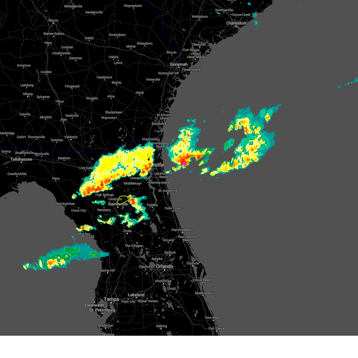
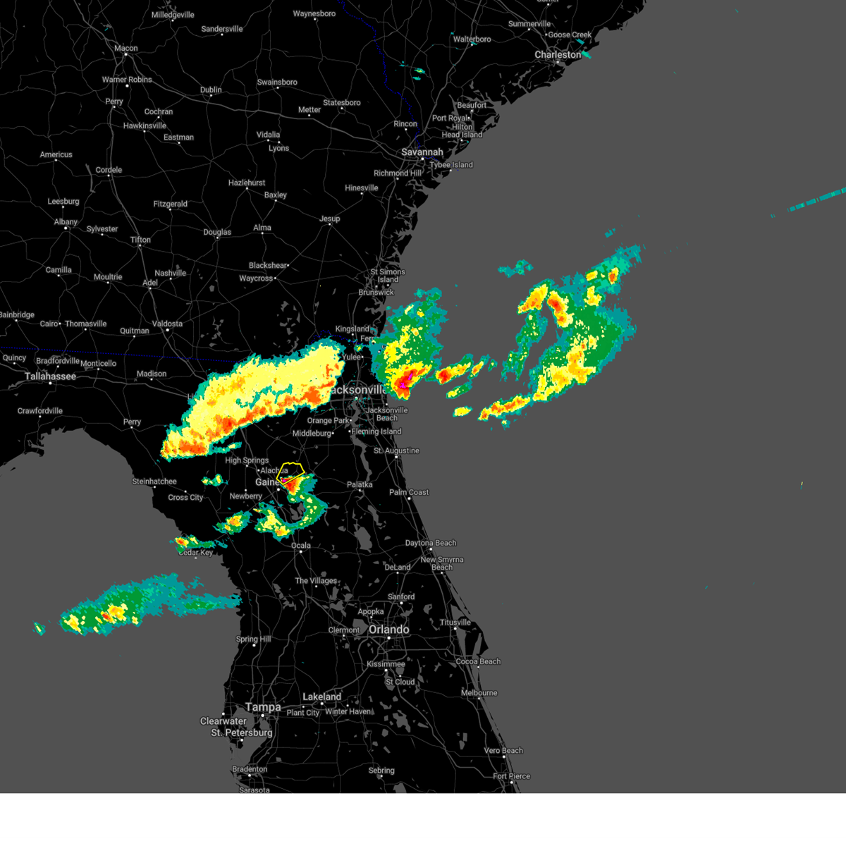
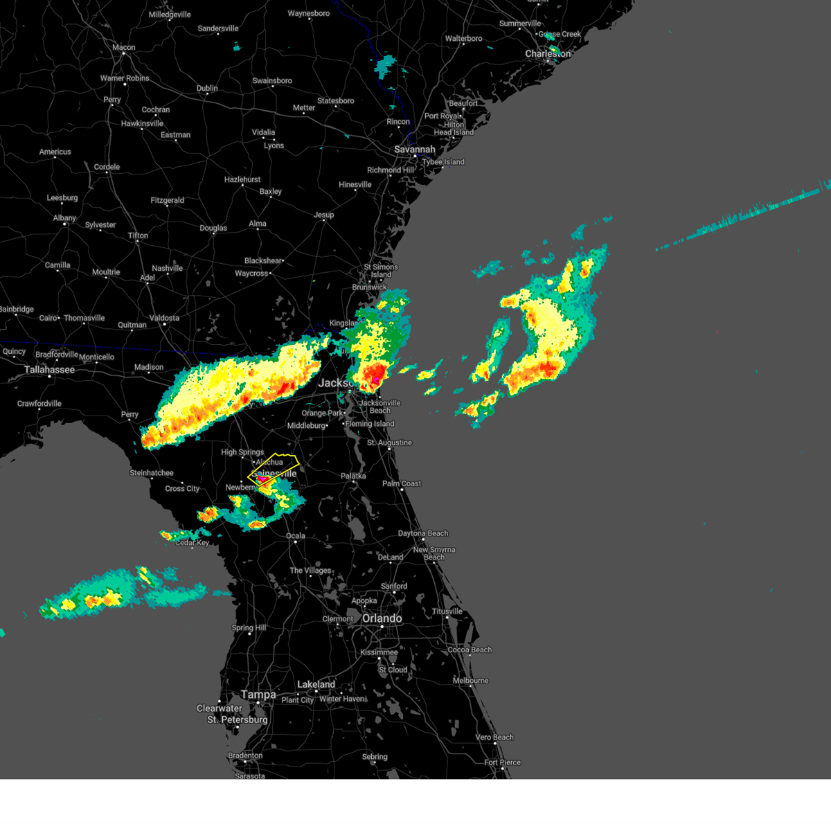
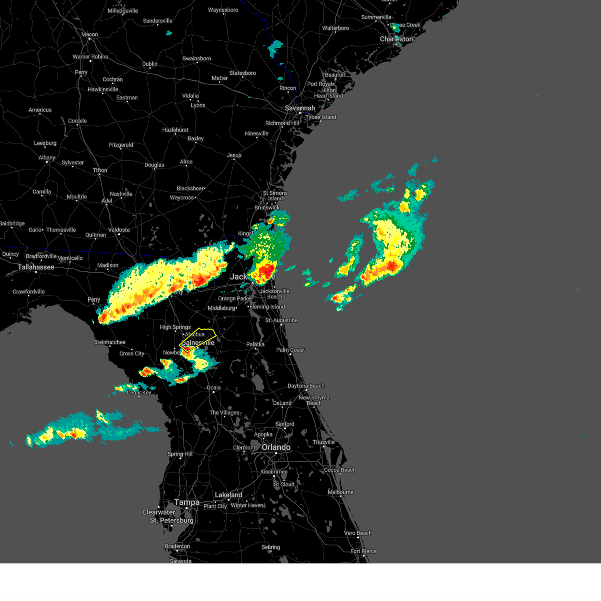
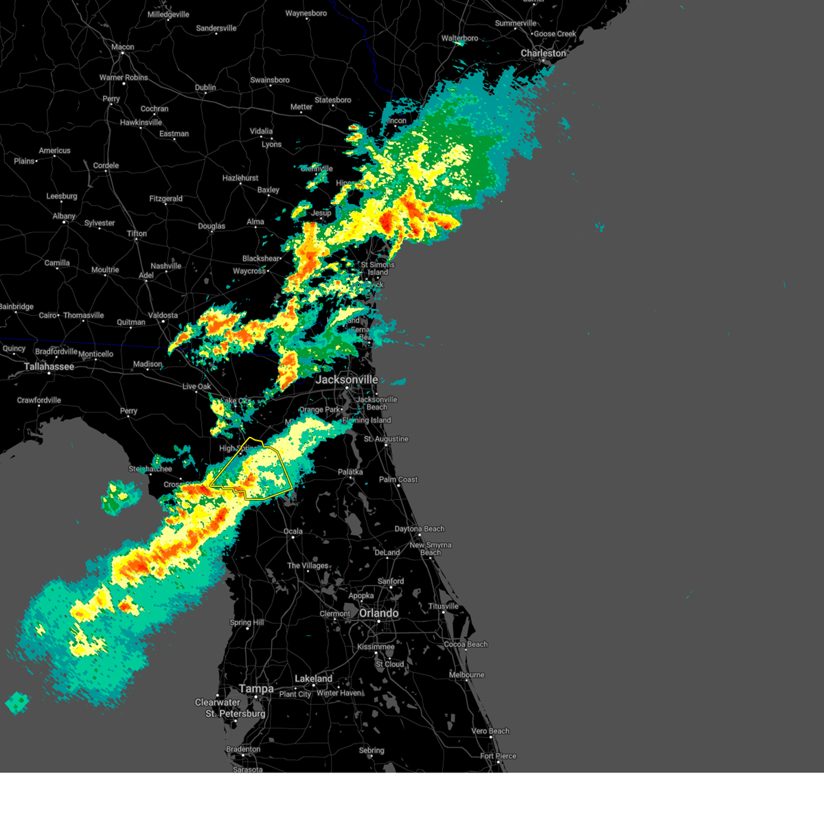
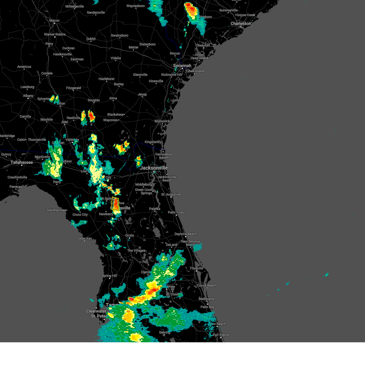
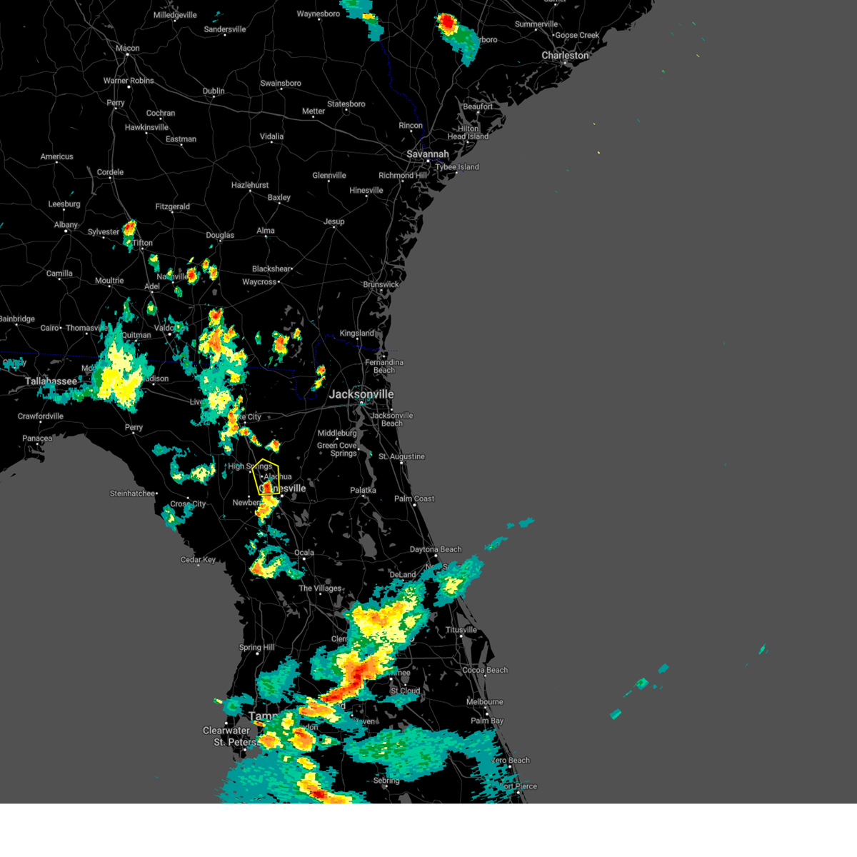
Hail Map for Gainesville, FL
The Gainesville, FL area has had 10 reports of on-the-ground hail by trained spotters, and has been under severe weather warnings 10 times during the past 12 months. Doppler radar has detected hail at or near Gainesville, FL on 92 occasions, including 6 occasions during the past year.
| Name: | Gainesville, FL |
| Where Located: | 62 miles SW of Jacksonville, FL |
| Map: | Google Map for Gainesville, FL |
| Population: | 124354 |
| Housing Units: | 57576 |
| More Info: | Search Google for Gainesville, FL |
5
The Top Recent Hail Date for Gainesville, FL is Friday, April 11, 2025 (1st out of 92)

Hail and Wind Damage Spotted near Gainesville, FL
| Date / Time | Report Details |
|---|---|
| 6/15/2025 12:48 PM EDT | Downed power line resulted in the closure of ne 16th av in alachua county FL, 2.3 miles W of Gainesville, FL |
| 6/14/2025 12:45 PM EDT | Road closed at the intersection of w newberry rd and nw 120th terrace in gainesville due to a fallen tree and downed power lines. time est. based off rada in alachua county FL, 6.8 miles E of Gainesville, FL |
| 4/11/2025 7:12 PM EDT |
 The storm which prompted the warning has weakened below severe limits, and has exited the warned area. therefore, the warning will be allowed to expire. to report severe weather, contact your nearest law enforcement agency. they will relay your report to the national weather service jacksonville. The storm which prompted the warning has weakened below severe limits, and has exited the warned area. therefore, the warning will be allowed to expire. to report severe weather, contact your nearest law enforcement agency. they will relay your report to the national weather service jacksonville.
|
| 4/11/2025 7:00 PM EDT | Hen Egg sized hail reported 8.5 miles SW of Gainesville, FL, public report of up to 2.0 inch diameter hail reported near waldo road/state road 24 and ne 96th ave. |
| 4/11/2025 6:54 PM EDT |
 At 654 pm edt, a severe thunderstorm was located 7 miles north of gainesville airport, or 8 miles north of gainesville, moving northeast at 40 mph (trained weather spotters). Hazards include golf ball size hail and 60 mph wind gusts. People and animals outdoors will be injured. expect hail damage to roofs, siding, windows, and vehicles. expect wind damage to roofs, siding, and trees. Locations impacted include, waldo. At 654 pm edt, a severe thunderstorm was located 7 miles north of gainesville airport, or 8 miles north of gainesville, moving northeast at 40 mph (trained weather spotters). Hazards include golf ball size hail and 60 mph wind gusts. People and animals outdoors will be injured. expect hail damage to roofs, siding, windows, and vehicles. expect wind damage to roofs, siding, and trees. Locations impacted include, waldo.
|
| 4/11/2025 6:48 PM EDT | Golf Ball sized hail reported 3.2 miles ESE of Gainesville, FL, numerous reports from around gainesville with hail ranging from nickel size to slightly larger than golf balls. |
| 4/11/2025 6:45 PM EDT | Golf Ball sized hail reported 2.4 miles SE of Gainesville, FL, public report of golf ball size hail falling near the intersection of nw 36th place and nw 47th ter. |
| 4/11/2025 6:43 PM EDT |
 At 643 pm edt, a severe thunderstorm was located near gainesville, moving northeast at 40 mph (trained weather spotters). Hazards include golf ball size hail and 60 mph wind gusts. People and animals outdoors will be injured. expect hail damage to roofs, siding, windows, and vehicles. expect wind damage to roofs, siding, and trees. Locations impacted include, waldo and gainesville. At 643 pm edt, a severe thunderstorm was located near gainesville, moving northeast at 40 mph (trained weather spotters). Hazards include golf ball size hail and 60 mph wind gusts. People and animals outdoors will be injured. expect hail damage to roofs, siding, windows, and vehicles. expect wind damage to roofs, siding, and trees. Locations impacted include, waldo and gainesville.
|
| 4/11/2025 6:42 PM EDT | Golf Ball sized hail reported 2.2 miles SSE of Gainesville, FL, hail slightly bigger than golf ball reported . |
| 4/11/2025 6:37 PM EDT |
 Svrjax the national weather service in jacksonville has issued a * severe thunderstorm warning for, central alachua county in northern florida, * until 715 pm edt. * at 637 pm edt, a severe thunderstorm was located near alachua, or near gainesville, moving northeast at 40 mph (radar indicated). Hazards include 60 mph wind gusts and quarter size hail. Hail damage to vehicles is expected. Expect wind damage to roofs, siding, and trees. Svrjax the national weather service in jacksonville has issued a * severe thunderstorm warning for, central alachua county in northern florida, * until 715 pm edt. * at 637 pm edt, a severe thunderstorm was located near alachua, or near gainesville, moving northeast at 40 mph (radar indicated). Hazards include 60 mph wind gusts and quarter size hail. Hail damage to vehicles is expected. Expect wind damage to roofs, siding, and trees.
|
| 3/16/2025 12:14 PM EDT |
 the severe thunderstorm warning has been cancelled and is no longer in effect the severe thunderstorm warning has been cancelled and is no longer in effect
|
| 3/16/2025 11:56 AM EDT |
 Svrjax the national weather service in jacksonville has issued a * severe thunderstorm warning for, southeastern gilchrist county in northern florida, alachua county in northern florida, * until 1230 pm edt. * at 1156 am edt, a severe thunderstorm was located near trenton, moving northeast at 40 mph (radar indicated). Hazards include 60 mph wind gusts and penny size hail. expect damage to roofs, siding, and trees Svrjax the national weather service in jacksonville has issued a * severe thunderstorm warning for, southeastern gilchrist county in northern florida, alachua county in northern florida, * until 1230 pm edt. * at 1156 am edt, a severe thunderstorm was located near trenton, moving northeast at 40 mph (radar indicated). Hazards include 60 mph wind gusts and penny size hail. expect damage to roofs, siding, and trees
|
| 8/4/2024 2:33 PM EDT |
 Svrjax the national weather service in jacksonville has issued a * severe thunderstorm warning for, northeastern gilchrist county in northern florida, northwestern alachua county in northern florida, southwestern columbia county in northern florida, * until 300 pm edt. * at 233 pm edt, a severe thunderstorm was located near alachua, or 7 miles northwest of gainesville, moving west at 35 mph (radar indicated). Hazards include 60 mph wind gusts. expect damage to roofs, siding, and trees Svrjax the national weather service in jacksonville has issued a * severe thunderstorm warning for, northeastern gilchrist county in northern florida, northwestern alachua county in northern florida, southwestern columbia county in northern florida, * until 300 pm edt. * at 233 pm edt, a severe thunderstorm was located near alachua, or 7 miles northwest of gainesville, moving west at 35 mph (radar indicated). Hazards include 60 mph wind gusts. expect damage to roofs, siding, and trees
|
| 7/30/2024 7:23 PM EDT |
 The storm which prompted the warning has weakened below severe limits, and no longer poses an immediate threat to life or property. therefore, the warning will be allowed to expire. however, gusty winds and heavy rain are still possible with this thunderstorm. The storm which prompted the warning has weakened below severe limits, and no longer poses an immediate threat to life or property. therefore, the warning will be allowed to expire. however, gusty winds and heavy rain are still possible with this thunderstorm.
|
| 7/30/2024 7:14 PM EDT |
 At 714 pm edt, a severe thunderstorm was located near alachua, or 9 miles south of worthington spring, moving north at 15 mph (radar indicated). Hazards include 60 mph wind gusts and penny size hail. Expect damage to roofs, siding, and trees. Locations impacted include, gainesville, alachua, and la crosse. At 714 pm edt, a severe thunderstorm was located near alachua, or 9 miles south of worthington spring, moving north at 15 mph (radar indicated). Hazards include 60 mph wind gusts and penny size hail. Expect damage to roofs, siding, and trees. Locations impacted include, gainesville, alachua, and la crosse.
|
| 7/30/2024 6:53 PM EDT |
 Svrjax the national weather service in jacksonville has issued a * severe thunderstorm warning for, northwestern alachua county in northern florida, * until 730 pm edt. * at 653 pm edt, a severe thunderstorm was located near alachua, or 7 miles northwest of gainesville, moving north at 15 mph (radar indicated). Hazards include 60 mph wind gusts and penny size hail. expect damage to roofs, siding, and trees Svrjax the national weather service in jacksonville has issued a * severe thunderstorm warning for, northwestern alachua county in northern florida, * until 730 pm edt. * at 653 pm edt, a severe thunderstorm was located near alachua, or 7 miles northwest of gainesville, moving north at 15 mph (radar indicated). Hazards include 60 mph wind gusts and penny size hail. expect damage to roofs, siding, and trees
|
| 6/11/2024 8:21 PM EDT |
 The storm which prompted the warning has weakened below severe limits, and no longer poses an immediate threat to life or property. therefore, the warning will be allowed to expire. however, small hail, gusty winds and heavy rain are still possible with this thunderstorm. The storm which prompted the warning has weakened below severe limits, and no longer poses an immediate threat to life or property. therefore, the warning will be allowed to expire. however, small hail, gusty winds and heavy rain are still possible with this thunderstorm.
|
| 6/11/2024 8:02 PM EDT |
 Svrjax the national weather service in jacksonville has issued a * severe thunderstorm warning for, central alachua county in northern florida, * until 830 pm edt. * at 802 pm edt, a severe thunderstorm was located near gainesville airport, or near gainesville, moving south at 10 mph (radar indicated). Hazards include 60 mph wind gusts and quarter size hail. Hail damage to vehicles is expected. Expect wind damage to roofs, siding, and trees. Svrjax the national weather service in jacksonville has issued a * severe thunderstorm warning for, central alachua county in northern florida, * until 830 pm edt. * at 802 pm edt, a severe thunderstorm was located near gainesville airport, or near gainesville, moving south at 10 mph (radar indicated). Hazards include 60 mph wind gusts and quarter size hail. Hail damage to vehicles is expected. Expect wind damage to roofs, siding, and trees.
|
| 5/10/2024 9:20 AM EDT |
 At 920 am edt, severe thunderstorms were located along a line extending from 10 miles east of woodbine to baymeadows to near bardin to 8 miles southwest of cross creek, moving east at 90 mph (radar indicated). Hazards include 60 mph wind gusts and penny size hail. Expect damage to roofs, siding, and trees. locations impacted include, jacksonville, st. Marys, kingsland, fernandina beach, palatka, orange park, green cove springs, rainbow lakes estates, woodbine, and interlachen. At 920 am edt, severe thunderstorms were located along a line extending from 10 miles east of woodbine to baymeadows to near bardin to 8 miles southwest of cross creek, moving east at 90 mph (radar indicated). Hazards include 60 mph wind gusts and penny size hail. Expect damage to roofs, siding, and trees. locations impacted include, jacksonville, st. Marys, kingsland, fernandina beach, palatka, orange park, green cove springs, rainbow lakes estates, woodbine, and interlachen.
|
| 5/10/2024 9:00 AM EDT |
 Svrjax the national weather service in jacksonville has issued a * severe thunderstorm warning for, nassau county in northeastern florida, southeastern bradford county in northern florida, southeastern alachua county in northern florida, northwestern st. johns county in northeastern florida, northwestern marion county in northern florida, northwestern putnam county in northeastern florida, clay county in northeastern florida, duval county in northeastern florida, camden county in southeastern georgia, * until 930 am edt. * at 900 am edt, severe thunderstorms were located along a line extending from near hickox to near bryceville to near keystone heights to near archer, moving east at 70 mph (radar indicated). Hazards include 70 mph wind gusts and quarter size hail. Hail damage to vehicles is expected. expect considerable tree damage. Wind damage is also likely to mobile homes, roofs, and outbuildings. Svrjax the national weather service in jacksonville has issued a * severe thunderstorm warning for, nassau county in northeastern florida, southeastern bradford county in northern florida, southeastern alachua county in northern florida, northwestern st. johns county in northeastern florida, northwestern marion county in northern florida, northwestern putnam county in northeastern florida, clay county in northeastern florida, duval county in northeastern florida, camden county in southeastern georgia, * until 930 am edt. * at 900 am edt, severe thunderstorms were located along a line extending from near hickox to near bryceville to near keystone heights to near archer, moving east at 70 mph (radar indicated). Hazards include 70 mph wind gusts and quarter size hail. Hail damage to vehicles is expected. expect considerable tree damage. Wind damage is also likely to mobile homes, roofs, and outbuildings.
|
| 5/10/2024 8:44 AM EDT |
 Svrjax the national weather service in jacksonville has issued a * severe thunderstorm warning for, nassau county in northeastern florida, bradford county in northern florida, alachua county in northern florida, north central marion county in northern florida, baker county in northeastern florida, northwestern putnam county in northeastern florida, union county in northern florida, western clay county in northeastern florida, western duval county in northeastern florida, southwestern camden county in southeastern georgia, southeastern ware county in southeastern georgia, charlton county in southeastern georgia, * until 915 am edt. * at 843 am edt, severe thunderstorms were located along a line extending from 9 miles south of argyle to near lulu to 7 miles southeast of cross city, moving east at 70 mph. these are destructive storms for lake butler, starke, gainesville, macclenny, baldwin, and hilliard. (radar indicated). Hazards include 80 mph wind gusts and quarter size hail. Flying debris will be dangerous to those caught without shelter. mobile homes will be heavily damaged. expect considerable damage to roofs, windows, and vehicles. Extensive tree damage and power outages are likely. Svrjax the national weather service in jacksonville has issued a * severe thunderstorm warning for, nassau county in northeastern florida, bradford county in northern florida, alachua county in northern florida, north central marion county in northern florida, baker county in northeastern florida, northwestern putnam county in northeastern florida, union county in northern florida, western clay county in northeastern florida, western duval county in northeastern florida, southwestern camden county in southeastern georgia, southeastern ware county in southeastern georgia, charlton county in southeastern georgia, * until 915 am edt. * at 843 am edt, severe thunderstorms were located along a line extending from 9 miles south of argyle to near lulu to 7 miles southeast of cross city, moving east at 70 mph. these are destructive storms for lake butler, starke, gainesville, macclenny, baldwin, and hilliard. (radar indicated). Hazards include 80 mph wind gusts and quarter size hail. Flying debris will be dangerous to those caught without shelter. mobile homes will be heavily damaged. expect considerable damage to roofs, windows, and vehicles. Extensive tree damage and power outages are likely.
|
| 5/10/2024 8:18 AM EDT |
 Svrjax the national weather service in jacksonville has issued a * severe thunderstorm warning for, gilchrist county in northern florida, western alachua county in northern florida, baker county in northeastern florida, union county in northern florida, southeastern suwannee county in northern florida, columbia county in northern florida, eastern hamilton county in northern florida, southeastern echols county in southeastern georgia, southern ware county in southeastern georgia, southeastern clinch county in southeastern georgia, central charlton county in southeastern georgia, * until 900 am edt. * at 818 am edt, severe thunderstorms were located along a line extending from 6 miles south of homerville to near white springs to near cross city, moving east at 60 mph (radar indicated). Hazards include 70 mph wind gusts and quarter size hail. Hail damage to vehicles is expected. expect considerable tree damage. Wind damage is also likely to mobile homes, roofs, and outbuildings. Svrjax the national weather service in jacksonville has issued a * severe thunderstorm warning for, gilchrist county in northern florida, western alachua county in northern florida, baker county in northeastern florida, union county in northern florida, southeastern suwannee county in northern florida, columbia county in northern florida, eastern hamilton county in northern florida, southeastern echols county in southeastern georgia, southern ware county in southeastern georgia, southeastern clinch county in southeastern georgia, central charlton county in southeastern georgia, * until 900 am edt. * at 818 am edt, severe thunderstorms were located along a line extending from 6 miles south of homerville to near white springs to near cross city, moving east at 60 mph (radar indicated). Hazards include 70 mph wind gusts and quarter size hail. Hail damage to vehicles is expected. expect considerable tree damage. Wind damage is also likely to mobile homes, roofs, and outbuildings.
|
| 4/3/2024 10:59 AM EDT |
 At 1059 am edt, severe thunderstorms were located along a line extending from near glen st. mary to near high springs, moving east at 50 mph (radar indicated). Hazards include 60 mph wind gusts and penny size hail. Expect damage to roofs, siding, and trees. Locations impacted include, lake butler, raiford, worthington spring, alachua, macclenny, high springs, worthington springs, groves, beasley, and new river. At 1059 am edt, severe thunderstorms were located along a line extending from near glen st. mary to near high springs, moving east at 50 mph (radar indicated). Hazards include 60 mph wind gusts and penny size hail. Expect damage to roofs, siding, and trees. Locations impacted include, lake butler, raiford, worthington spring, alachua, macclenny, high springs, worthington springs, groves, beasley, and new river.
|
| 4/3/2024 10:59 AM EDT |
 the severe thunderstorm warning has been cancelled and is no longer in effect the severe thunderstorm warning has been cancelled and is no longer in effect
|
| 4/3/2024 10:47 AM EDT |
 At 1047 am edt, severe thunderstorms were located along a line extending from near sanderson to near high springs, moving east at 50 mph (radar indicated). Hazards include 60 mph wind gusts and penny size hail. Expect damage to roofs, siding, and trees. locations impacted include, lake butler, bell, raiford, worthington spring, alachua, macclenny, high springs, glen st. Mary, worthington springs, and palestine community. At 1047 am edt, severe thunderstorms were located along a line extending from near sanderson to near high springs, moving east at 50 mph (radar indicated). Hazards include 60 mph wind gusts and penny size hail. Expect damage to roofs, siding, and trees. locations impacted include, lake butler, bell, raiford, worthington spring, alachua, macclenny, high springs, glen st. Mary, worthington springs, and palestine community.
|
| 4/3/2024 10:31 AM EDT |
 the severe thunderstorm warning has been cancelled and is no longer in effect the severe thunderstorm warning has been cancelled and is no longer in effect
|
| 4/3/2024 10:31 AM EDT |
 At 1030 am edt, severe thunderstorms were located along a line extending from near watertown to near bell, moving east at 40 mph (radar indicated). Hazards include 60 mph wind gusts and penny size hail. Expect damage to roofs, siding, and trees. Locations impacted include, lake city, lake butler, bell, raiford, worthington spring, columbia, alachua, macclenny, high springs, and fort white. At 1030 am edt, severe thunderstorms were located along a line extending from near watertown to near bell, moving east at 40 mph (radar indicated). Hazards include 60 mph wind gusts and penny size hail. Expect damage to roofs, siding, and trees. Locations impacted include, lake city, lake butler, bell, raiford, worthington spring, columbia, alachua, macclenny, high springs, and fort white.
|
| 4/3/2024 10:12 AM EDT |
 Svrjax the national weather service in jacksonville has issued a * severe thunderstorm warning for, central gilchrist county in northern florida, central bradford county in northern florida, northwestern alachua county in northern florida, southern baker county in northeastern florida, union county in northern florida, southeastern suwannee county in northern florida, southern columbia county in northern florida, * until 1115 am edt. * at 1012 am edt, severe thunderstorms were located along a line extending from near wellborn to 6 miles north of bell, moving east at 35 mph (radar indicated). Hazards include 60 mph wind gusts and penny size hail. expect damage to roofs, siding, and trees Svrjax the national weather service in jacksonville has issued a * severe thunderstorm warning for, central gilchrist county in northern florida, central bradford county in northern florida, northwestern alachua county in northern florida, southern baker county in northeastern florida, union county in northern florida, southeastern suwannee county in northern florida, southern columbia county in northern florida, * until 1115 am edt. * at 1012 am edt, severe thunderstorms were located along a line extending from near wellborn to 6 miles north of bell, moving east at 35 mph (radar indicated). Hazards include 60 mph wind gusts and penny size hail. expect damage to roofs, siding, and trees
|
| 2/4/2024 3:09 PM EST |
 At 309 pm est, a severe thunderstorm was located near gainesville airport, or near gainesville, moving northeast at 25 mph (radar indicated). Hazards include 60 mph wind gusts and quarter size hail. Hail damage to vehicles is expected. Expect wind damage to roofs, siding, and trees. At 309 pm est, a severe thunderstorm was located near gainesville airport, or near gainesville, moving northeast at 25 mph (radar indicated). Hazards include 60 mph wind gusts and quarter size hail. Hail damage to vehicles is expected. Expect wind damage to roofs, siding, and trees.
|
| 2/4/2024 2:56 PM EST | Quarter sized hail reported 1.6 miles NNE of Gainesville, FL, photo from social media showing estimated quarter sized hail littering the green at uf golf course in gainesville... fl. time estimated off radar. |
| 1/9/2024 2:57 PM EST |
 At 257 pm est, severe thunderstorms were located along a line extending from near alachua to 15 miles west of rainbow lakes estates, moving east at 35 mph (radar indicated). Hazards include 60 mph wind gusts. expect damage to roofs, siding, and trees At 257 pm est, severe thunderstorms were located along a line extending from near alachua to 15 miles west of rainbow lakes estates, moving east at 35 mph (radar indicated). Hazards include 60 mph wind gusts. expect damage to roofs, siding, and trees
|
| 1/9/2024 2:55 PM EST |
 At 255 pm est, a severe thunderstorm capable of producing a tornado was located 7 miles north of gainesville airport, or 9 miles northeast of gainesville, moving northeast at 80 mph (radar indicated rotation). Hazards include tornado. Flying debris will be dangerous to those caught without shelter. mobile homes will be damaged or destroyed. damage to roofs, windows, and vehicles will occur. tree damage is likely. This tornadic thunderstorm will remain over mainly rural areas of central alachua county, including the following locations, waldo. At 255 pm est, a severe thunderstorm capable of producing a tornado was located 7 miles north of gainesville airport, or 9 miles northeast of gainesville, moving northeast at 80 mph (radar indicated rotation). Hazards include tornado. Flying debris will be dangerous to those caught without shelter. mobile homes will be damaged or destroyed. damage to roofs, windows, and vehicles will occur. tree damage is likely. This tornadic thunderstorm will remain over mainly rural areas of central alachua county, including the following locations, waldo.
|
| 1/9/2024 2:44 PM EST |
 At 244 pm est, severe thunderstorms were located along a line extending from 11 miles northwest of st. george to near alachua, moving east at 35 mph (radar indicated). Hazards include 60 mph wind gusts. expect damage to roofs, siding, and trees At 244 pm est, severe thunderstorms were located along a line extending from 11 miles northwest of st. george to near alachua, moving east at 35 mph (radar indicated). Hazards include 60 mph wind gusts. expect damage to roofs, siding, and trees
|
| 1/9/2024 2:38 PM EST |
 At 238 pm est, a severe thunderstorm capable of producing a tornado was located over archer, or 9 miles northeast of bronson, moving northeast at 80 mph (radar indicated rotation). Hazards include tornado. Flying debris will be dangerous to those caught without shelter. mobile homes will be damaged or destroyed. damage to roofs, windows, and vehicles will occur. tree damage is likely. this dangerous storm will be near, gainesville, alachua, and university of florida around 245 pm est. Other locations impacted by this tornadic thunderstorm include newberry and waldo. At 238 pm est, a severe thunderstorm capable of producing a tornado was located over archer, or 9 miles northeast of bronson, moving northeast at 80 mph (radar indicated rotation). Hazards include tornado. Flying debris will be dangerous to those caught without shelter. mobile homes will be damaged or destroyed. damage to roofs, windows, and vehicles will occur. tree damage is likely. this dangerous storm will be near, gainesville, alachua, and university of florida around 245 pm est. Other locations impacted by this tornadic thunderstorm include newberry and waldo.
|
| 1/9/2024 2:09 PM EST |
 At 209 pm est, severe thunderstorms were located along a line extending from near high springs to 20 miles northwest of crystal river airport, moving east at 45 mph (radar indicated). Hazards include 60 mph wind gusts. expect damage to roofs, siding, and trees At 209 pm est, severe thunderstorms were located along a line extending from near high springs to 20 miles northwest of crystal river airport, moving east at 45 mph (radar indicated). Hazards include 60 mph wind gusts. expect damage to roofs, siding, and trees
|
| 1/9/2024 2:02 PM EST |
 At 201 pm est, severe thunderstorms were located along a line extending from 7 miles north of taylor to near high springs, moving east at 40 mph (radar indicated). Hazards include 60 mph wind gusts. expect damage to roofs, siding, and trees At 201 pm est, severe thunderstorms were located along a line extending from 7 miles north of taylor to near high springs, moving east at 40 mph (radar indicated). Hazards include 60 mph wind gusts. expect damage to roofs, siding, and trees
|
| 10/12/2023 9:00 AM EDT | Downed tree from high winds blocking the roadway. alachua county dispatch reports a road closure of sr-222 near i-75 in gainesville. time of event is radar indicate in alachua county FL, 4 miles ESE of Gainesville, FL |
| 10/12/2023 5:27 AM EDT |
 The severe thunderstorm warning for southeastern alachua county will expire at 530 am edt, the storm which prompted the warning has weakened below severe limits, and has exited the warned area. therefore, the warning will be allowed to expire. a tornado watch remains in effect until 900 am edt for northern florida. The severe thunderstorm warning for southeastern alachua county will expire at 530 am edt, the storm which prompted the warning has weakened below severe limits, and has exited the warned area. therefore, the warning will be allowed to expire. a tornado watch remains in effect until 900 am edt for northern florida.
|
| 10/12/2023 5:20 AM EDT |
 At 520 am edt, a severe thunderstorm was located near university of florida, or 7 miles south of gainesville, moving northeast at 30 mph (radar indicated). Hazards include 60 mph wind gusts. Expect damage to roofs, siding, and trees. Locations impacted include, gainesville, university of florida, cross creek, gainesville airport, newnans lake, rochelle, micanopy, and lochloosa. At 520 am edt, a severe thunderstorm was located near university of florida, or 7 miles south of gainesville, moving northeast at 30 mph (radar indicated). Hazards include 60 mph wind gusts. Expect damage to roofs, siding, and trees. Locations impacted include, gainesville, university of florida, cross creek, gainesville airport, newnans lake, rochelle, micanopy, and lochloosa.
|
| 10/12/2023 5:06 AM EDT |
 At 506 am edt, a severe thunderstorm was located near archer, or 9 miles north of williston, moving northeast at 30 mph (radar indicated). Hazards include 60 mph wind gusts. expect damage to roofs, siding, and trees At 506 am edt, a severe thunderstorm was located near archer, or 9 miles north of williston, moving northeast at 30 mph (radar indicated). Hazards include 60 mph wind gusts. expect damage to roofs, siding, and trees
|
| 9/21/2023 5:09 PM EDT | Report with photo verification of a large tree down blocking roadway at intersection of ne 2nd st and ne 2nd av in alachua county FL, 2.7 miles WNW of Gainesville, FL |
| 7/30/2023 9:21 PM EDT |
 The severe thunderstorm warning for bradford, alachua, northeastern marion, western putnam, union and southwestern clay counties will expire at 930 pm edt, the storms which prompted the warning have weakened below severe limits, and no longer pose an immediate threat to life or property. therefore, the warning will be allowed to expire. however gusty winds and heavy rain are still possible with these thunderstorms. The severe thunderstorm warning for bradford, alachua, northeastern marion, western putnam, union and southwestern clay counties will expire at 930 pm edt, the storms which prompted the warning have weakened below severe limits, and no longer pose an immediate threat to life or property. therefore, the warning will be allowed to expire. however gusty winds and heavy rain are still possible with these thunderstorms.
|
| 7/30/2023 8:55 PM EDT |
 At 855 pm edt, severe thunderstorms were located along a line extending from near worthington spring to near lake delancy, moving southwest at 20 mph (radar indicated). Hazards include 60 mph wind gusts. expect damage to roofs, siding, and trees At 855 pm edt, severe thunderstorms were located along a line extending from near worthington spring to near lake delancy, moving southwest at 20 mph (radar indicated). Hazards include 60 mph wind gusts. expect damage to roofs, siding, and trees
|
| 7/30/2023 8:28 PM EDT |
 At 828 pm edt, severe thunderstorms were located along a line extending from near raiford to near florahome, moving southwest at 10 mph (radar indicated). Hazards include 60 mph wind gusts. expect damage to roofs, siding, and trees At 828 pm edt, severe thunderstorms were located along a line extending from near raiford to near florahome, moving southwest at 10 mph (radar indicated). Hazards include 60 mph wind gusts. expect damage to roofs, siding, and trees
|
| 7/25/2023 5:30 PM EDT | Thunderstorm wind gust of 59 mph measured by hand held anemomete in alachua county FL, 5.2 miles NE of Gainesville, FL |
| 6/23/2023 7:30 PM EDT | Florida state watch office relayed a report a tree down on sr-26 causing a partial road closure. peak wind gusts from nearby gainesville asos were measured at 44 mph ar in alachua county FL, 10.3 miles WSW of Gainesville, FL |
| 6/20/2023 5:51 AM EDT |
 The severe thunderstorm warning for southeastern alachua county will expire at 600 am edt, the storm which prompted the warning has weakened below severe limits, and no longer poses an immediate threat to life or property. therefore, the warning will be allowed to expire. however gusty winds up to 40 mph are still possible with this thunderstorm. The severe thunderstorm warning for southeastern alachua county will expire at 600 am edt, the storm which prompted the warning has weakened below severe limits, and no longer poses an immediate threat to life or property. therefore, the warning will be allowed to expire. however gusty winds up to 40 mph are still possible with this thunderstorm.
|
| 6/20/2023 5:41 AM EDT |
 At 540 am edt, a severe thunderstorm was located near university of florida, or near gainesville, moving northeast at 25 mph (radar indicated). Hazards include 60 mph wind gusts. Expect damage to roofs, siding, and trees. locations impacted include, gainesville and university of florida. hail threat, radar indicated max hail size, <. 75 in wind threat, radar indicated max wind gust, 60 mph. At 540 am edt, a severe thunderstorm was located near university of florida, or near gainesville, moving northeast at 25 mph (radar indicated). Hazards include 60 mph wind gusts. Expect damage to roofs, siding, and trees. locations impacted include, gainesville and university of florida. hail threat, radar indicated max hail size, <. 75 in wind threat, radar indicated max wind gust, 60 mph.
|
| 6/20/2023 5:27 AM EDT |
 At 527 am edt, a severe thunderstorm was located near university of florida, or 8 miles southwest of gainesville, moving northeast at 25 mph (radar indicated). Hazards include 60 mph wind gusts. expect damage to roofs, siding, and trees At 527 am edt, a severe thunderstorm was located near university of florida, or 8 miles southwest of gainesville, moving northeast at 25 mph (radar indicated). Hazards include 60 mph wind gusts. expect damage to roofs, siding, and trees
|
| 6/16/2023 8:00 AM EDT | Tree snapped off at base... fell onto sidewalk at outside turlington hall at uf. time based of nearby weather station peak wind gust readin in alachua county FL, 1.8 miles NW of Gainesville, FL |
| 6/16/2023 7:58 AM EDT |
 At 757 am edt, a severe thunderstorm was located near university of florida, or 7 miles south of gainesville, moving east at 25 mph (radar indicated). Hazards include 60 mph wind gusts and quarter size hail. Hail damage to vehicles is expected. expect wind damage to roofs, siding, and trees. Locations impacted include, gainesville, university of florida, cross creek, newnans lake, rochelle, micanopy, mcintosh and grove park. At 757 am edt, a severe thunderstorm was located near university of florida, or 7 miles south of gainesville, moving east at 25 mph (radar indicated). Hazards include 60 mph wind gusts and quarter size hail. Hail damage to vehicles is expected. expect wind damage to roofs, siding, and trees. Locations impacted include, gainesville, university of florida, cross creek, newnans lake, rochelle, micanopy, mcintosh and grove park.
|
| 6/16/2023 7:45 AM EDT |
 At 745 am edt, a severe thunderstorm was located near archer, or 10 miles southwest of gainesville, moving east at 25 mph (radar indicated). Hazards include 60 mph wind gusts and quarter size hail. Hail damage to vehicles is expected. Expect wind damage to roofs, siding, and trees. At 745 am edt, a severe thunderstorm was located near archer, or 10 miles southwest of gainesville, moving east at 25 mph (radar indicated). Hazards include 60 mph wind gusts and quarter size hail. Hail damage to vehicles is expected. Expect wind damage to roofs, siding, and trees.
|
| 6/16/2023 7:38 AM EDT |
 At 738 am edt, a severe thunderstorm was located near archer, or 10 miles southwest of gainesville, moving southeast at 20 mph (radar indicated). Hazards include 60 mph wind gusts and quarter size hail. Hail damage to vehicles is expected. expect wind damage to roofs, siding, and trees. Locations impacted include, gainesville, archer and university of florida. At 738 am edt, a severe thunderstorm was located near archer, or 10 miles southwest of gainesville, moving southeast at 20 mph (radar indicated). Hazards include 60 mph wind gusts and quarter size hail. Hail damage to vehicles is expected. expect wind damage to roofs, siding, and trees. Locations impacted include, gainesville, archer and university of florida.
|
| 6/16/2023 7:37 AM EDT |
 The tornado warning for southwestern alachua county will expire at 745 am edt, the tornado threat has diminished and the tornado warning has been cancelled. however, large hail and damaging winds remain likely and a severe thunderstorm warning remains in effect for the area. The tornado warning for southwestern alachua county will expire at 745 am edt, the tornado threat has diminished and the tornado warning has been cancelled. however, large hail and damaging winds remain likely and a severe thunderstorm warning remains in effect for the area.
|
| 6/16/2023 7:34 AM EDT |
 At 734 am edt, a severe thunderstorm capable of producing a tornado was located over archer, or 9 miles northeast of bronson, moving southeast at 25 mph (radar indicated rotation). Hazards include tornado and quarter size hail. Flying debris will be dangerous to those caught without shelter. mobile homes will be damaged or destroyed. damage to roofs, windows, and vehicles will occur. tree damage is likely. This dangerous storm will be near, archer around 740 am edt. At 734 am edt, a severe thunderstorm capable of producing a tornado was located over archer, or 9 miles northeast of bronson, moving southeast at 25 mph (radar indicated rotation). Hazards include tornado and quarter size hail. Flying debris will be dangerous to those caught without shelter. mobile homes will be damaged or destroyed. damage to roofs, windows, and vehicles will occur. tree damage is likely. This dangerous storm will be near, archer around 740 am edt.
|
| 6/16/2023 7:24 AM EDT |
 At 724 am edt, a severe thunderstorm was located near archer, or 13 miles north of bronson, moving southeast at 20 mph (radar indicated). Hazards include 60 mph wind gusts and quarter size hail. Hail damage to vehicles is expected. expect wind damage to roofs, siding, and trees. Locations impacted include, gainesville, archer, university of florida and newberry. At 724 am edt, a severe thunderstorm was located near archer, or 13 miles north of bronson, moving southeast at 20 mph (radar indicated). Hazards include 60 mph wind gusts and quarter size hail. Hail damage to vehicles is expected. expect wind damage to roofs, siding, and trees. Locations impacted include, gainesville, archer, university of florida and newberry.
|
| 6/16/2023 7:23 AM EDT |
 At 722 am edt, a severe thunderstorm capable of producing a tornado was located 7 miles northwest of archer, or 10 miles north of bronson, moving southeast at 25 mph (radar indicated rotation). Hazards include tornado and quarter size hail. Flying debris will be dangerous to those caught without shelter. mobile homes will be damaged or destroyed. damage to roofs, windows, and vehicles will occur. tree damage is likely. this dangerous storm will be near, archer around 740 am edt. Other locations impacted by this tornadic thunderstorm include newberry. At 722 am edt, a severe thunderstorm capable of producing a tornado was located 7 miles northwest of archer, or 10 miles north of bronson, moving southeast at 25 mph (radar indicated rotation). Hazards include tornado and quarter size hail. Flying debris will be dangerous to those caught without shelter. mobile homes will be damaged or destroyed. damage to roofs, windows, and vehicles will occur. tree damage is likely. this dangerous storm will be near, archer around 740 am edt. Other locations impacted by this tornadic thunderstorm include newberry.
|
| 6/16/2023 7:13 AM EDT |
 At 713 am edt, a severe thunderstorm capable of producing a tornado was located 8 miles east of trenton, moving southeast at 25 mph (radar indicated rotation). Hazards include tornado and quarter size hail. Flying debris will be dangerous to those caught without shelter. mobile homes will be damaged or destroyed. damage to roofs, windows, and vehicles will occur. tree damage is likely. this dangerous storm will be near, archer around 740 am edt. Other locations impacted by this tornadic thunderstorm include newberry. At 713 am edt, a severe thunderstorm capable of producing a tornado was located 8 miles east of trenton, moving southeast at 25 mph (radar indicated rotation). Hazards include tornado and quarter size hail. Flying debris will be dangerous to those caught without shelter. mobile homes will be damaged or destroyed. damage to roofs, windows, and vehicles will occur. tree damage is likely. this dangerous storm will be near, archer around 740 am edt. Other locations impacted by this tornadic thunderstorm include newberry.
|
| 6/16/2023 7:10 AM EDT |
 At 710 am edt, a severe thunderstorm was located 10 miles south of high springs, or 11 miles east of trenton, moving southeast at 20 mph (radar indicated). Hazards include 60 mph wind gusts and quarter size hail. Hail damage to vehicles is expected. Expect wind damage to roofs, siding, and trees. At 710 am edt, a severe thunderstorm was located 10 miles south of high springs, or 11 miles east of trenton, moving southeast at 20 mph (radar indicated). Hazards include 60 mph wind gusts and quarter size hail. Hail damage to vehicles is expected. Expect wind damage to roofs, siding, and trees.
|
| 6/14/2023 11:27 PM EDT |
 At 1127 pm edt, severe thunderstorms were located along a line extending from 8 miles east of alachua to near archer to 12 miles southeast of fowlers bluff, moving east at 45 mph (trained weather spotters). Hazards include 70 mph wind gusts. Expect considerable tree damage. Damage is likely to mobile homes, roofs, and outbuildings. At 1127 pm edt, severe thunderstorms were located along a line extending from 8 miles east of alachua to near archer to 12 miles southeast of fowlers bluff, moving east at 45 mph (trained weather spotters). Hazards include 70 mph wind gusts. Expect considerable tree damage. Damage is likely to mobile homes, roofs, and outbuildings.
|
| 6/14/2023 11:21 PM EDT |
 At 1121 pm edt, severe thunderstorms were located along a line extending from near worthington spring to near archer to 7 miles southeast of fowlers bluff, moving southeast at 40 mph (radar indicated). Hazards include 70 mph wind gusts. Expect considerable tree damage. damage is likely to mobile homes, roofs, and outbuildings. locations impacted include, gainesville, alachua, high springs, hawthorne, archer, university of florida, rochelle, cross creek, orange heights and gainesville airport. thunderstorm damage threat, considerable hail threat, radar indicated max hail size, <. 75 in wind threat, radar indicated max wind gust, 70 mph. At 1121 pm edt, severe thunderstorms were located along a line extending from near worthington spring to near archer to 7 miles southeast of fowlers bluff, moving southeast at 40 mph (radar indicated). Hazards include 70 mph wind gusts. Expect considerable tree damage. damage is likely to mobile homes, roofs, and outbuildings. locations impacted include, gainesville, alachua, high springs, hawthorne, archer, university of florida, rochelle, cross creek, orange heights and gainesville airport. thunderstorm damage threat, considerable hail threat, radar indicated max hail size, <. 75 in wind threat, radar indicated max wind gust, 70 mph.
|
| 6/14/2023 11:13 PM EDT |
 At 1113 pm edt, severe thunderstorms were located along a line extending from near worthington spring to 6 miles north of archer to near fowlers bluff, moving southeast at 40 mph (radar indicated). Hazards include 60 mph wind gusts. Expect damage to roofs, siding, and trees. locations impacted include, gainesville, trenton, alachua, high springs, hawthorne, archer, university of florida, rochelle, cross creek and orange heights. hail threat, radar indicated max hail size, <. 75 in wind threat, radar indicated max wind gust, 60 mph. At 1113 pm edt, severe thunderstorms were located along a line extending from near worthington spring to 6 miles north of archer to near fowlers bluff, moving southeast at 40 mph (radar indicated). Hazards include 60 mph wind gusts. Expect damage to roofs, siding, and trees. locations impacted include, gainesville, trenton, alachua, high springs, hawthorne, archer, university of florida, rochelle, cross creek and orange heights. hail threat, radar indicated max hail size, <. 75 in wind threat, radar indicated max wind gust, 60 mph.
|
| 6/14/2023 10:55 PM EDT |
 At 1054 pm edt, severe thunderstorms were located along a line extending from near watertown to 6 miles southwest of high springs to 8 miles south of cross city, moving southeast at 40 mph (radar indicated). Hazards include 60 mph wind gusts. expect damage to roofs, siding, and trees At 1054 pm edt, severe thunderstorms were located along a line extending from near watertown to 6 miles southwest of high springs to 8 miles south of cross city, moving southeast at 40 mph (radar indicated). Hazards include 60 mph wind gusts. expect damage to roofs, siding, and trees
|
| 5/18/2023 1:04 PM EDT |
 At 104 pm edt, a severe thunderstorm was located near gainesville, moving northeast at 15 mph (radar indicated). Hazards include 60 mph wind gusts and quarter size hail. Hail damage to vehicles is expected. expect wind damage to roofs, siding, and trees. this severe thunderstorm will remain over mainly rural areas of northeastern alachua county. hail threat, radar indicated max hail size, 1. 00 in wind threat, radar indicated max wind gust, 60 mph. At 104 pm edt, a severe thunderstorm was located near gainesville, moving northeast at 15 mph (radar indicated). Hazards include 60 mph wind gusts and quarter size hail. Hail damage to vehicles is expected. expect wind damage to roofs, siding, and trees. this severe thunderstorm will remain over mainly rural areas of northeastern alachua county. hail threat, radar indicated max hail size, 1. 00 in wind threat, radar indicated max wind gust, 60 mph.
|
| 4/27/2023 9:13 PM EDT |
 At 913 pm edt, severe thunderstorms were located along a line extending from near orange heights to near ocala, moving east at 45 mph (radar indicated). Hazards include 60 mph wind gusts. Expect damage to roofs, siding, and trees. locations impacted include, gainesville, interlachen, keystone heights, melrose, fort mccoy, citra, hawthorne, sparr, florahome and melrose landing. hail threat, radar indicated max hail size, <. 75 in wind threat, radar indicated max wind gust, 60 mph. At 913 pm edt, severe thunderstorms were located along a line extending from near orange heights to near ocala, moving east at 45 mph (radar indicated). Hazards include 60 mph wind gusts. Expect damage to roofs, siding, and trees. locations impacted include, gainesville, interlachen, keystone heights, melrose, fort mccoy, citra, hawthorne, sparr, florahome and melrose landing. hail threat, radar indicated max hail size, <. 75 in wind threat, radar indicated max wind gust, 60 mph.
|
| 4/27/2023 8:57 PM EDT |
 At 857 pm edt, severe thunderstorms were located along a line extending from gainesville to 8 miles southeast of williston, moving northeast at 40 mph (radar indicated). Hazards include 60 mph wind gusts. expect damage to roofs, siding, and trees At 857 pm edt, severe thunderstorms were located along a line extending from gainesville to 8 miles southeast of williston, moving northeast at 40 mph (radar indicated). Hazards include 60 mph wind gusts. expect damage to roofs, siding, and trees
|
| 4/27/2023 8:51 PM EDT | Report from mping: 1-inch tree limbs broken; shingles blown of in alachua county FL, 4.7 miles NE of Gainesville, FL |
| 3/13/2023 2:56 AM EDT |
 The severe thunderstorm warning for east central alachua county will expire at 300 am edt, the storm which prompted the warning has weakened below severe limits, and no longer poses an immediate threat to life or property. therefore, the warning will be allowed to expire. however gusty winds and heavy rain are still possible with this thunderstorm. The severe thunderstorm warning for east central alachua county will expire at 300 am edt, the storm which prompted the warning has weakened below severe limits, and no longer poses an immediate threat to life or property. therefore, the warning will be allowed to expire. however gusty winds and heavy rain are still possible with this thunderstorm.
|
| 3/13/2023 2:49 AM EDT | Asos station kgnv gainesvill in alachua county FL, 5.1 miles WSW of Gainesville, FL |
| 3/13/2023 2:44 AM EDT |
 At 243 am edt, a severe thunderstorm was located over gainesville, moving southeast at 30 mph (radar indicated). Hazards include 60 mph wind gusts. Expect damage to roofs, siding, and trees. locations impacted include, gainesville, hawthorne, university of florida, gainesville airport, newnans lake, rochelle and grove park. hail threat, radar indicated max hail size, <. 75 in wind threat, radar indicated max wind gust, 60 mph. At 243 am edt, a severe thunderstorm was located over gainesville, moving southeast at 30 mph (radar indicated). Hazards include 60 mph wind gusts. Expect damage to roofs, siding, and trees. locations impacted include, gainesville, hawthorne, university of florida, gainesville airport, newnans lake, rochelle and grove park. hail threat, radar indicated max hail size, <. 75 in wind threat, radar indicated max wind gust, 60 mph.
|
| 3/13/2023 2:31 AM EDT |
 At 231 am edt, a severe thunderstorm was located near gainesville, moving east at 40 mph (radar indicated). Hazards include 60 mph wind gusts. Expect damage to roofs, siding, and trees. locations impacted include, gainesville, melrose, hawthorne, university of florida, orange heights, gainesville airport, newnans lake, rochelle, waldo and grove park. hail threat, radar indicated max hail size, <. 75 in wind threat, radar indicated max wind gust, 60 mph. At 231 am edt, a severe thunderstorm was located near gainesville, moving east at 40 mph (radar indicated). Hazards include 60 mph wind gusts. Expect damage to roofs, siding, and trees. locations impacted include, gainesville, melrose, hawthorne, university of florida, orange heights, gainesville airport, newnans lake, rochelle, waldo and grove park. hail threat, radar indicated max hail size, <. 75 in wind threat, radar indicated max wind gust, 60 mph.
|
| 3/13/2023 2:23 AM EDT |
 At 222 am edt, a severe thunderstorm was located over alachua, or 8 miles northwest of gainesville, moving east at 45 mph (radar indicated). Hazards include 60 mph wind gusts. expect damage to roofs, siding, and trees At 222 am edt, a severe thunderstorm was located over alachua, or 8 miles northwest of gainesville, moving east at 45 mph (radar indicated). Hazards include 60 mph wind gusts. expect damage to roofs, siding, and trees
|
| 3/10/2023 7:22 PM EST |
 At 721 pm est, a severe thunderstorm was located over worthington springs, or over worthington spring, moving southeast at 30 mph (radar indicated). Hazards include 60 mph wind gusts and penny size hail. Expect damage to roofs, siding, and trees. locations impacted include, lake butler, worthington spring, worthington springs, upland pines, groves, beasley, la crosse, brooker and dukes. hail threat, radar indicated max hail size, 0. 75 in wind threat, radar indicated max wind gust, 60 mph. At 721 pm est, a severe thunderstorm was located over worthington springs, or over worthington spring, moving southeast at 30 mph (radar indicated). Hazards include 60 mph wind gusts and penny size hail. Expect damage to roofs, siding, and trees. locations impacted include, lake butler, worthington spring, worthington springs, upland pines, groves, beasley, la crosse, brooker and dukes. hail threat, radar indicated max hail size, 0. 75 in wind threat, radar indicated max wind gust, 60 mph.
|
| 3/10/2023 7:12 PM EST |
 At 711 pm est, a severe thunderstorm was located over providence, or 7 miles northwest of worthington spring, moving southeast at 35 mph (radar indicated). Hazards include 60 mph wind gusts and penny size hail. Expect damage to roofs, siding, and trees. locations impacted include, lake butler, worthington spring, worthington springs, upland pines, groves, providence, beasley, la crosse, brooker and dukes. hail threat, radar indicated max hail size, 0. 75 in wind threat, radar indicated max wind gust, 60 mph. At 711 pm est, a severe thunderstorm was located over providence, or 7 miles northwest of worthington spring, moving southeast at 35 mph (radar indicated). Hazards include 60 mph wind gusts and penny size hail. Expect damage to roofs, siding, and trees. locations impacted include, lake butler, worthington spring, worthington springs, upland pines, groves, providence, beasley, la crosse, brooker and dukes. hail threat, radar indicated max hail size, 0. 75 in wind threat, radar indicated max wind gust, 60 mph.
|
| 3/10/2023 6:56 PM EST |
 At 656 pm est, a severe thunderstorm was located near columbia, or 8 miles northeast of ichetucknee spring, moving southeast at 30 mph (radar indicated). Hazards include 60 mph wind gusts. expect damage to roofs, siding, and trees At 656 pm est, a severe thunderstorm was located near columbia, or 8 miles northeast of ichetucknee spring, moving southeast at 30 mph (radar indicated). Hazards include 60 mph wind gusts. expect damage to roofs, siding, and trees
|
| 1/4/2023 3:47 PM EST |
 At 346 pm est, severe thunderstorms were located along a line extending from near sampson to rochelle to near williston, moving east at 35 mph (radar indicated). Hazards include 70 mph wind gusts and quarter size hail. Hail damage to vehicles is expected. expect considerable tree damage. wind damage is also likely to mobile homes, roofs, and outbuildings. locations impacted include, gainesville, keystone heights, melrose, citra, hawthorne, university of florida, sparr, rochelle, cross creek and orange heights. thunderstorm damage threat, considerable hail threat, radar indicated max hail size, 1. 00 in wind threat, radar indicated max wind gust, 70 mph. At 346 pm est, severe thunderstorms were located along a line extending from near sampson to rochelle to near williston, moving east at 35 mph (radar indicated). Hazards include 70 mph wind gusts and quarter size hail. Hail damage to vehicles is expected. expect considerable tree damage. wind damage is also likely to mobile homes, roofs, and outbuildings. locations impacted include, gainesville, keystone heights, melrose, citra, hawthorne, university of florida, sparr, rochelle, cross creek and orange heights. thunderstorm damage threat, considerable hail threat, radar indicated max hail size, 1. 00 in wind threat, radar indicated max wind gust, 70 mph.
|
| 1/4/2023 3:23 PM EST |
 At 322 pm est, a severe thunderstorm was located near gainesville, moving northeast at 40 mph (radar indicated). Hazards include 70 mph wind gusts and quarter size hail. possible tornado. Hail damage to vehicles is expected. expect considerable tree damage. wind damage is also likely to mobile homes, roofs, and outbuildings. Locations impacted include, gainesville, keystone heights, melrose, citra, alachua, hawthorne, archer, university of florida, sparr and rochelle. At 322 pm est, a severe thunderstorm was located near gainesville, moving northeast at 40 mph (radar indicated). Hazards include 70 mph wind gusts and quarter size hail. possible tornado. Hail damage to vehicles is expected. expect considerable tree damage. wind damage is also likely to mobile homes, roofs, and outbuildings. Locations impacted include, gainesville, keystone heights, melrose, citra, alachua, hawthorne, archer, university of florida, sparr and rochelle.
|
| 1/4/2023 3:20 PM EST |
 At 320 pm est, a severe thunderstorm was located near archer, or 13 miles northeast of bronson, moving northeast at 40 mph (radar indicated). Hazards include 70 mph wind gusts and quarter size hail. Hail damage to vehicles is expected. expect considerable tree damage. wind damage is also likely to mobile homes, roofs, and outbuildings. Locations impacted include, gainesville, worthington spring, alachua, high springs, archer, worthington springs, university of florida, groves, providence and beasley. At 320 pm est, a severe thunderstorm was located near archer, or 13 miles northeast of bronson, moving northeast at 40 mph (radar indicated). Hazards include 70 mph wind gusts and quarter size hail. Hail damage to vehicles is expected. expect considerable tree damage. wind damage is also likely to mobile homes, roofs, and outbuildings. Locations impacted include, gainesville, worthington spring, alachua, high springs, archer, worthington springs, university of florida, groves, providence and beasley.
|
| 1/4/2023 3:14 PM EST |
 At 313 pm est, a severe thunderstorm was located 7 miles south of alachua, or 10 miles west of gainesville, moving northeast at 40 mph (radar indicated). Hazards include 70 mph wind gusts and quarter size hail. possible tornado. Hail damage to vehicles is expected. expect considerable tree damage. Wind damage is also likely to mobile homes, roofs, and outbuildings. At 313 pm est, a severe thunderstorm was located 7 miles south of alachua, or 10 miles west of gainesville, moving northeast at 40 mph (radar indicated). Hazards include 70 mph wind gusts and quarter size hail. possible tornado. Hail damage to vehicles is expected. expect considerable tree damage. Wind damage is also likely to mobile homes, roofs, and outbuildings.
|
| 1/4/2023 3:01 PM EST |
 At 301 pm est, severe thunderstorms were located along a line extending from groves to near worthington spring to 6 miles north of bronson, moving east at 50 mph (radar indicated). Hazards include 60 mph wind gusts and penny size hail. Expect damage to roofs, siding, and trees. locations impacted include, gainesville, worthington spring, alachua, high springs, archer, worthington springs, university of florida, groves, beasley and new river. hail threat, radar indicated max hail size, 0. 75 in wind threat, radar indicated max wind gust, 60 mph. At 301 pm est, severe thunderstorms were located along a line extending from groves to near worthington spring to 6 miles north of bronson, moving east at 50 mph (radar indicated). Hazards include 60 mph wind gusts and penny size hail. Expect damage to roofs, siding, and trees. locations impacted include, gainesville, worthington spring, alachua, high springs, archer, worthington springs, university of florida, groves, beasley and new river. hail threat, radar indicated max hail size, 0. 75 in wind threat, radar indicated max wind gust, 60 mph.
|
| 1/4/2023 2:43 PM EST |
 At 242 pm est, severe thunderstorms were located along a line extending from 8 miles north of st. george to near fort white, moving east at 35 mph (radar indicated). Hazards include 60 mph wind gusts and half dollar size hail. Hail damage to vehicles is expected. Expect wind damage to roofs, siding, and trees. At 242 pm est, severe thunderstorms were located along a line extending from 8 miles north of st. george to near fort white, moving east at 35 mph (radar indicated). Hazards include 60 mph wind gusts and half dollar size hail. Hail damage to vehicles is expected. Expect wind damage to roofs, siding, and trees.
|
| 1/4/2023 2:40 PM EST |
 At 240 pm est, severe thunderstorms were located along a line extending from fort white to trenton, moving east at 45 mph (radar indicated). Hazards include 60 mph wind gusts and penny size hail. expect damage to roofs, siding, and trees At 240 pm est, severe thunderstorms were located along a line extending from fort white to trenton, moving east at 45 mph (radar indicated). Hazards include 60 mph wind gusts and penny size hail. expect damage to roofs, siding, and trees
|
| 9/9/2022 7:21 PM EDT |
 At 721 pm edt, a severe thunderstorm was located over archer, or 9 miles northeast of bronson, moving northeast at 20 mph (radar indicated). Hazards include 60 mph wind gusts. expect damage to roofs, siding, and trees At 721 pm edt, a severe thunderstorm was located over archer, or 9 miles northeast of bronson, moving northeast at 20 mph (radar indicated). Hazards include 60 mph wind gusts. expect damage to roofs, siding, and trees
|
| 8/18/2022 2:13 PM EDT |
 At 213 pm edt, severe thunderstorms were located along a line extending from newnans lake to near orange springs, moving northeast at 30 mph (radar indicated). Hazards include 60 mph wind gusts. expect damage to roofs, siding, and trees At 213 pm edt, severe thunderstorms were located along a line extending from newnans lake to near orange springs, moving northeast at 30 mph (radar indicated). Hazards include 60 mph wind gusts. expect damage to roofs, siding, and trees
|
| 8/8/2022 4:07 PM EDT |
 At 406 pm edt, a severe thunderstorm was located near gainesville, moving west at 10 mph (radar indicated). Hazards include 60 mph wind gusts and penny size hail. expect damage to roofs, siding, and trees At 406 pm edt, a severe thunderstorm was located near gainesville, moving west at 10 mph (radar indicated). Hazards include 60 mph wind gusts and penny size hail. expect damage to roofs, siding, and trees
|
| 8/3/2022 7:06 PM EDT |
 At 706 pm edt, a severe thunderstorm was located near orange heights, or 7 miles west of melrose, moving northwest at 10 mph (radar indicated). Hazards include 60 mph wind gusts and penny size hail. expect damage to roofs, siding, and trees At 706 pm edt, a severe thunderstorm was located near orange heights, or 7 miles west of melrose, moving northwest at 10 mph (radar indicated). Hazards include 60 mph wind gusts and penny size hail. expect damage to roofs, siding, and trees
|
| 6/24/2022 4:28 PM EDT |
 The severe thunderstorm warning for gilchrist, western alachua and southwestern columbia counties will expire at 430 pm edt, the storm which prompted the warning has weakened below severe limits, and no longer poses an immediate threat to life or property. therefore, the warning will be allowed to expire. however gusty winds and heavy rain are still possible with this thunderstorm. to report severe weather, contact your nearest law enforcement agency. they will relay your report to the national weather service jacksonville. The severe thunderstorm warning for gilchrist, western alachua and southwestern columbia counties will expire at 430 pm edt, the storm which prompted the warning has weakened below severe limits, and no longer poses an immediate threat to life or property. therefore, the warning will be allowed to expire. however gusty winds and heavy rain are still possible with this thunderstorm. to report severe weather, contact your nearest law enforcement agency. they will relay your report to the national weather service jacksonville.
|
| 6/24/2022 4:11 PM EDT |
 At 410 pm edt, a severe thunderstorm was located 8 miles southwest of alachua, or 14 miles west of gainesville, moving south at 25 mph (radar indicated). Hazards include 60 mph wind gusts and penny size hail. Expect damage to roofs, siding, and trees. locations impacted include, gainesville, trenton, bell, alachua, high springs, archer, fort white, university of florida and newberry. hail threat, radar indicated max hail size, 0. 75 in wind threat, radar indicated max wind gust, 60 mph. At 410 pm edt, a severe thunderstorm was located 8 miles southwest of alachua, or 14 miles west of gainesville, moving south at 25 mph (radar indicated). Hazards include 60 mph wind gusts and penny size hail. Expect damage to roofs, siding, and trees. locations impacted include, gainesville, trenton, bell, alachua, high springs, archer, fort white, university of florida and newberry. hail threat, radar indicated max hail size, 0. 75 in wind threat, radar indicated max wind gust, 60 mph.
|
| 6/24/2022 4:03 PM EDT |
 At 402 pm edt, a severe thunderstorm was located near high springs, or 13 miles northeast of trenton, moving southwest at 30 mph (radar indicated). Hazards include 60 mph wind gusts and penny size hail. expect damage to roofs, siding, and trees At 402 pm edt, a severe thunderstorm was located near high springs, or 13 miles northeast of trenton, moving southwest at 30 mph (radar indicated). Hazards include 60 mph wind gusts and penny size hail. expect damage to roofs, siding, and trees
|
| 6/24/2022 3:17 PM EDT |
 At 316 pm edt, a severe thunderstorm was located near worthington spring, moving west at 15 mph (radar indicated). Hazards include 60 mph wind gusts and quarter size hail. Hail damage to vehicles is expected. expect wind damage to roofs, siding, and trees. locations impacted include, lake butler, worthington spring, alachua, worthington springs, beasley, new river, sampson, la crosse, brooker and dukes. hail threat, radar indicated max hail size, 1. 00 in wind threat, radar indicated max wind gust, 60 mph. At 316 pm edt, a severe thunderstorm was located near worthington spring, moving west at 15 mph (radar indicated). Hazards include 60 mph wind gusts and quarter size hail. Hail damage to vehicles is expected. expect wind damage to roofs, siding, and trees. locations impacted include, lake butler, worthington spring, alachua, worthington springs, beasley, new river, sampson, la crosse, brooker and dukes. hail threat, radar indicated max hail size, 1. 00 in wind threat, radar indicated max wind gust, 60 mph.
|
| 6/24/2022 3:11 PM EDT |
 At 311 pm edt, a severe thunderstorm was located 7 miles southeast of worthington spring, moving west at 15 mph (radar indicated). Hazards include 60 mph wind gusts and quarter size hail. Hail damage to vehicles is expected. expect wind damage to roofs, siding, and trees. locations impacted include, lake butler, worthington spring, alachua, worthington springs, beasley, new river, sampson, waldo, la crosse and brooker. hail threat, radar indicated max hail size, 1. 00 in wind threat, radar indicated max wind gust, 60 mph. At 311 pm edt, a severe thunderstorm was located 7 miles southeast of worthington spring, moving west at 15 mph (radar indicated). Hazards include 60 mph wind gusts and quarter size hail. Hail damage to vehicles is expected. expect wind damage to roofs, siding, and trees. locations impacted include, lake butler, worthington spring, alachua, worthington springs, beasley, new river, sampson, waldo, la crosse and brooker. hail threat, radar indicated max hail size, 1. 00 in wind threat, radar indicated max wind gust, 60 mph.
|
| 6/24/2022 3:04 PM EDT |
 At 304 pm edt, a severe thunderstorm was located 8 miles southeast of worthington spring, moving west at 15 mph (radar indicated). Hazards include 60 mph wind gusts and quarter size hail. Hail damage to vehicles is expected. Expect wind damage to roofs, siding, and trees. At 304 pm edt, a severe thunderstorm was located 8 miles southeast of worthington spring, moving west at 15 mph (radar indicated). Hazards include 60 mph wind gusts and quarter size hail. Hail damage to vehicles is expected. Expect wind damage to roofs, siding, and trees.
|
| 6/19/2022 4:53 AM EDT |
 The severe thunderstorm warning for west central bradford and north central alachua counties will expire at 500 am edt, the storm which prompted the warning has weakened below severe limits, and no longer poses an immediate threat to life or property. therefore, the warning will be allowed to expire. however heavy rain is still possible with this thunderstorm. The severe thunderstorm warning for west central bradford and north central alachua counties will expire at 500 am edt, the storm which prompted the warning has weakened below severe limits, and no longer poses an immediate threat to life or property. therefore, the warning will be allowed to expire. however heavy rain is still possible with this thunderstorm.
|
| 6/19/2022 4:25 AM EDT |
 At 425 am edt, a severe thunderstorm was located 8 miles southeast of worthington spring, and is nearly stationary (radar indicated). Hazards include 60 mph wind gusts and quarter size hail. Hail damage to vehicles is expected. Expect wind damage to roofs, siding, and trees. At 425 am edt, a severe thunderstorm was located 8 miles southeast of worthington spring, and is nearly stationary (radar indicated). Hazards include 60 mph wind gusts and quarter size hail. Hail damage to vehicles is expected. Expect wind damage to roofs, siding, and trees.
|
| 5/29/2022 10:23 PM EDT |
 At 1023 pm edt, a severe thunderstorm was located over newnans lake, or near gainesville, moving north at 15 mph (radar indicated). Hazards include 60 mph wind gusts and quarter size hail. Hail damage to vehicles is expected. Expect wind damage to roofs, siding, and trees. At 1023 pm edt, a severe thunderstorm was located over newnans lake, or near gainesville, moving north at 15 mph (radar indicated). Hazards include 60 mph wind gusts and quarter size hail. Hail damage to vehicles is expected. Expect wind damage to roofs, siding, and trees.
|
| 5/29/2022 10:17 PM EDT | Asos station kgnv gainesville reported a peak wind gust of 59 mp in alachua county FL, 5.1 miles WSW of Gainesville, FL |
| 4/17/2022 4:23 PM EDT |
 The severe thunderstorm warning for northeastern alachua county will expire at 430 pm edt, the storm which prompted the warning has weakened below severe limits, and no longer poses an immediate threat to life or property. therefore, the warning will be allowed to expire. however gusty winds and heavy rain are still possible with this thunderstorm. The severe thunderstorm warning for northeastern alachua county will expire at 430 pm edt, the storm which prompted the warning has weakened below severe limits, and no longer poses an immediate threat to life or property. therefore, the warning will be allowed to expire. however gusty winds and heavy rain are still possible with this thunderstorm.
|
| 4/17/2022 4:19 PM EDT |
 At 419 pm edt, a severe thunderstorm was located 9 miles southeast of worthington spring, moving northeast at 25 mph (radar indicated). Hazards include 60 mph wind gusts and quarter size hail. Hail damage to vehicles is expected. expect wind damage to roofs, siding, and trees. this severe thunderstorm will remain over mainly rural areas of northeastern alachua county. hail threat, radar indicated max hail size, 1. 00 in wind threat, radar indicated max wind gust, 60 mph. At 419 pm edt, a severe thunderstorm was located 9 miles southeast of worthington spring, moving northeast at 25 mph (radar indicated). Hazards include 60 mph wind gusts and quarter size hail. Hail damage to vehicles is expected. expect wind damage to roofs, siding, and trees. this severe thunderstorm will remain over mainly rural areas of northeastern alachua county. hail threat, radar indicated max hail size, 1. 00 in wind threat, radar indicated max wind gust, 60 mph.
|
| 4/17/2022 4:12 PM EDT |
 At 412 pm edt, a severe thunderstorm was located near gainesville, moving northeast at 20 mph (radar indicated). Hazards include 60 mph wind gusts and quarter size hail. Hail damage to vehicles is expected. expect wind damage to roofs, siding, and trees. locations impacted include, gainesville, orange heights and gainesville airport. hail threat, radar indicated max hail size, 1. 00 in wind threat, radar indicated max wind gust, 60 mph. At 412 pm edt, a severe thunderstorm was located near gainesville, moving northeast at 20 mph (radar indicated). Hazards include 60 mph wind gusts and quarter size hail. Hail damage to vehicles is expected. expect wind damage to roofs, siding, and trees. locations impacted include, gainesville, orange heights and gainesville airport. hail threat, radar indicated max hail size, 1. 00 in wind threat, radar indicated max wind gust, 60 mph.
|
| 4/17/2022 4:07 PM EDT |
 At 406 pm edt, a severe thunderstorm was located near gainesville, moving northeast at 15 mph (radar indicated). Hazards include 60 mph wind gusts and quarter size hail. Hail damage to vehicles is expected. expect wind damage to roofs, siding, and trees. locations impacted include, gainesville, orange heights and gainesville airport. hail threat, radar indicated max hail size, 1. 00 in wind threat, radar indicated max wind gust, 60 mph. At 406 pm edt, a severe thunderstorm was located near gainesville, moving northeast at 15 mph (radar indicated). Hazards include 60 mph wind gusts and quarter size hail. Hail damage to vehicles is expected. expect wind damage to roofs, siding, and trees. locations impacted include, gainesville, orange heights and gainesville airport. hail threat, radar indicated max hail size, 1. 00 in wind threat, radar indicated max wind gust, 60 mph.
|
| 4/17/2022 3:53 PM EDT |
 At 353 pm edt, a severe thunderstorm was located near gainesville, moving northeast at 20 mph (radar indicated). Hazards include 60 mph wind gusts and quarter size hail. Hail damage to vehicles is expected. Expect wind damage to roofs, siding, and trees. At 353 pm edt, a severe thunderstorm was located near gainesville, moving northeast at 20 mph (radar indicated). Hazards include 60 mph wind gusts and quarter size hail. Hail damage to vehicles is expected. Expect wind damage to roofs, siding, and trees.
|
| 4/2/2022 12:50 PM EDT |
 At 1249 pm edt, severe thunderstorms were located along a line extending from 6 miles northwest of orange heights to near melrose to near hawthorne, moving east at 50 mph (radar indicated). Hazards include 60 mph wind gusts and quarter size hail. Hail damage to vehicles is expected. expect wind damage to roofs, siding, and trees. locations impacted include, interlachen, melrose, hawthorne, melrose landing, orange heights, lake geneva, newnans lake, rochelle, johnson and putnam hall. hail threat, radar indicated max hail size, 1. 00 in wind threat, radar indicated max wind gust, 60 mph. At 1249 pm edt, severe thunderstorms were located along a line extending from 6 miles northwest of orange heights to near melrose to near hawthorne, moving east at 50 mph (radar indicated). Hazards include 60 mph wind gusts and quarter size hail. Hail damage to vehicles is expected. expect wind damage to roofs, siding, and trees. locations impacted include, interlachen, melrose, hawthorne, melrose landing, orange heights, lake geneva, newnans lake, rochelle, johnson and putnam hall. hail threat, radar indicated max hail size, 1. 00 in wind threat, radar indicated max wind gust, 60 mph.
|
| 4/2/2022 12:42 PM EDT |
 At 1242 pm edt, severe thunderstorms were located along a line extending from near gainesville airport to orange heights to near hawthorne, moving east at 50 mph (radar indicated). Hazards include 60 mph wind gusts and quarter size hail. Hail damage to vehicles is expected. expect wind damage to roofs, siding, and trees. locations impacted include, gainesville, interlachen, melrose, hawthorne, university of florida, lake geneva, rochelle, melrose landing, orange heights and gainesville airport. hail threat, radar indicated max hail size, 1. 00 in wind threat, radar indicated max wind gust, 60 mph. At 1242 pm edt, severe thunderstorms were located along a line extending from near gainesville airport to orange heights to near hawthorne, moving east at 50 mph (radar indicated). Hazards include 60 mph wind gusts and quarter size hail. Hail damage to vehicles is expected. expect wind damage to roofs, siding, and trees. locations impacted include, gainesville, interlachen, melrose, hawthorne, university of florida, lake geneva, rochelle, melrose landing, orange heights and gainesville airport. hail threat, radar indicated max hail size, 1. 00 in wind threat, radar indicated max wind gust, 60 mph.
|
| 4/2/2022 12:26 PM EDT |
 At 1225 pm edt, severe thunderstorms were located along a line extending from near alachua to gainesville to near university of florida, moving east at 50 mph (radar indicated). Hazards include 60 mph wind gusts and quarter size hail. Hail damage to vehicles is expected. Expect wind damage to roofs, siding, and trees. At 1225 pm edt, severe thunderstorms were located along a line extending from near alachua to gainesville to near university of florida, moving east at 50 mph (radar indicated). Hazards include 60 mph wind gusts and quarter size hail. Hail damage to vehicles is expected. Expect wind damage to roofs, siding, and trees.
|
| 4/2/2022 12:19 PM EDT |
 At 1219 pm edt, severe thunderstorms were located along a line extending from 7 miles south of alachua to near university of florida to 6 miles south of gainesville, moving east at 45 mph (radar indicated). Hazards include 60 mph wind gusts and quarter size hail. Hail damage to vehicles is expected. expect wind damage to roofs, siding, and trees. locations impacted include, gainesville, archer, university of florida and newberry. hail threat, radar indicated max hail size, 1. 00 in wind threat, radar indicated max wind gust, 60 mph. At 1219 pm edt, severe thunderstorms were located along a line extending from 7 miles south of alachua to near university of florida to 6 miles south of gainesville, moving east at 45 mph (radar indicated). Hazards include 60 mph wind gusts and quarter size hail. Hail damage to vehicles is expected. expect wind damage to roofs, siding, and trees. locations impacted include, gainesville, archer, university of florida and newberry. hail threat, radar indicated max hail size, 1. 00 in wind threat, radar indicated max wind gust, 60 mph.
|
| 4/2/2022 11:59 AM EDT |
 At 1159 am edt, severe thunderstorms were located along a line extending from 6 miles east of trenton to near archer, moving east at 40 mph (radar indicated). Hazards include 60 mph wind gusts and quarter size hail. Hail damage to vehicles is expected. Expect wind damage to roofs, siding, and trees. At 1159 am edt, severe thunderstorms were located along a line extending from 6 miles east of trenton to near archer, moving east at 40 mph (radar indicated). Hazards include 60 mph wind gusts and quarter size hail. Hail damage to vehicles is expected. Expect wind damage to roofs, siding, and trees.
|
| 3/12/2022 7:43 AM EST | Asos station kgnv gainesvill in alachua county FL, 5.1 miles WSW of Gainesville, FL |
| 3/11/2022 2:32 PM EST |
 At 232 pm est, a severe thunderstorm was located over orange heights, or near melrose, moving northeast at 55 mph (radar indicated). Hazards include 60 mph wind gusts and quarter size hail. Hail damage to vehicles is expected. Expect wind damage to roofs, siding, and trees. At 232 pm est, a severe thunderstorm was located over orange heights, or near melrose, moving northeast at 55 mph (radar indicated). Hazards include 60 mph wind gusts and quarter size hail. Hail damage to vehicles is expected. Expect wind damage to roofs, siding, and trees.
|
| 8/24/2021 2:35 PM EDT |
 The severe thunderstorm warning for southeastern bradford and northeastern alachua counties will expire at 245 pm edt, the storm which prompted the warning has weakened below severe limits, and no longer poses an immediate threat to life or property. therefore, the warning will be allowed to expire. however gusty winds and heavy rain are still possible with this thunderstorm. The severe thunderstorm warning for southeastern bradford and northeastern alachua counties will expire at 245 pm edt, the storm which prompted the warning has weakened below severe limits, and no longer poses an immediate threat to life or property. therefore, the warning will be allowed to expire. however gusty winds and heavy rain are still possible with this thunderstorm.
|
| 8/24/2021 2:09 PM EDT |
 At 209 pm edt, a severe thunderstorm was located near gainesville airport, or near gainesville, moving north at 15 mph (radar indicated). Hazards include 60 mph wind gusts and penny size hail. expect damage to roofs, siding, and trees At 209 pm edt, a severe thunderstorm was located near gainesville airport, or near gainesville, moving north at 15 mph (radar indicated). Hazards include 60 mph wind gusts and penny size hail. expect damage to roofs, siding, and trees
|
| 8/19/2021 6:12 PM EDT |
 The severe thunderstorm warning for southwestern alachua county will expire at 615 pm edt, the storm which prompted the warning has moved out of the area. therefore, the warning will be allowed to expire. however heavy rain and gusty winds are still possible with this thunderstorm. The severe thunderstorm warning for southwestern alachua county will expire at 615 pm edt, the storm which prompted the warning has moved out of the area. therefore, the warning will be allowed to expire. however heavy rain and gusty winds are still possible with this thunderstorm.
|
| 8/19/2021 5:56 PM EDT |
 At 555 pm edt, a severe thunderstorm was located near university of florida, or 8 miles southwest of gainesville, moving south at 5 mph (radar indicated). Hazards include 60 mph wind gusts and penny size hail. Expect damage to roofs, siding, and trees. locations impacted include, archer. hail threat, radar indicated max hail size, 0. 75 in wind threat, radar indicated max wind gust, 60 mph. At 555 pm edt, a severe thunderstorm was located near university of florida, or 8 miles southwest of gainesville, moving south at 5 mph (radar indicated). Hazards include 60 mph wind gusts and penny size hail. Expect damage to roofs, siding, and trees. locations impacted include, archer. hail threat, radar indicated max hail size, 0. 75 in wind threat, radar indicated max wind gust, 60 mph.
|
| 8/19/2021 5:35 PM EDT |
 At 535 pm edt, a severe thunderstorm was located near university of florida, or near gainesville, moving south at 5 mph (radar indicated). Hazards include 60 mph wind gusts and nickel size hail. expect damage to roofs, siding, and trees At 535 pm edt, a severe thunderstorm was located near university of florida, or near gainesville, moving south at 5 mph (radar indicated). Hazards include 60 mph wind gusts and nickel size hail. expect damage to roofs, siding, and trees
|
| 7/7/2021 6:14 AM EDT |
 At 613 am edt, a vigorous shower capable of producing a tornado was located 7 miles east of alachua, or 8 miles southeast of worthington spring, moving northwest at 35 mph (radar indicated rotation). Hazards include tornado. Flying debris will be dangerous to those caught without shelter. mobile homes will be damaged or destroyed. damage to roofs, windows, and vehicles will occur. tree damage is likely. this dangerous storm will be near, worthington springs around 630 am edt. Other locations impacted by this tornadic thunderstorm include brooker and la crosse. At 613 am edt, a vigorous shower capable of producing a tornado was located 7 miles east of alachua, or 8 miles southeast of worthington spring, moving northwest at 35 mph (radar indicated rotation). Hazards include tornado. Flying debris will be dangerous to those caught without shelter. mobile homes will be damaged or destroyed. damage to roofs, windows, and vehicles will occur. tree damage is likely. this dangerous storm will be near, worthington springs around 630 am edt. Other locations impacted by this tornadic thunderstorm include brooker and la crosse.
|
| 7/7/2021 6:02 AM EDT |
 At 602 am edt, a severe thunderstorm capable of producing a tornado was located near gainesville airport, or near gainesville, moving northwest at 35 mph (radar indicated rotation). Hazards include tornado. Flying debris will be dangerous to those caught without shelter. mobile homes will be damaged or destroyed. damage to roofs, windows, and vehicles will occur. tree damage is likely. this dangerous storm will be near, alachua around 615 am edt. worthington springs around 630 am edt. Other locations impacted by this tornadic thunderstorm include brooker and la crosse. At 602 am edt, a severe thunderstorm capable of producing a tornado was located near gainesville airport, or near gainesville, moving northwest at 35 mph (radar indicated rotation). Hazards include tornado. Flying debris will be dangerous to those caught without shelter. mobile homes will be damaged or destroyed. damage to roofs, windows, and vehicles will occur. tree damage is likely. this dangerous storm will be near, alachua around 615 am edt. worthington springs around 630 am edt. Other locations impacted by this tornadic thunderstorm include brooker and la crosse.
|
| 6/20/2021 10:56 AM EDT |
 At 1055 am edt, a severe thunderstorm was located near university of florida, or near gainesville, moving northeast at 20 mph (radar indicated). Hazards include 60 mph wind gusts. Expect damage to roofs, siding, and trees. Locations impacted include, gainesville, alachua, hawthorne, archer, university of florida, rochelle, cross creek, orange heights, gainesville airport and newnans lake. At 1055 am edt, a severe thunderstorm was located near university of florida, or near gainesville, moving northeast at 20 mph (radar indicated). Hazards include 60 mph wind gusts. Expect damage to roofs, siding, and trees. Locations impacted include, gainesville, alachua, hawthorne, archer, university of florida, rochelle, cross creek, orange heights, gainesville airport and newnans lake.
|
| 6/20/2021 10:36 AM EDT |
 At 1036 am edt, a severe thunderstorm was located over archer, or 12 miles northeast of bronson, moving northeast at 20 mph (radar indicated). Hazards include 60 mph wind gusts. expect damage to roofs, siding, and trees At 1036 am edt, a severe thunderstorm was located over archer, or 12 miles northeast of bronson, moving northeast at 20 mph (radar indicated). Hazards include 60 mph wind gusts. expect damage to roofs, siding, and trees
|
| 6/15/2021 6:42 PM EDT |
 The severe thunderstorm warning for southern alachua, northwestern marion and west central putnam counties will expire at 645 pm edt, the storm which prompted the warning has weakened below severe limits, and no longer poses an immediate threat to life or property. therefore, the warning will be allowed to expire. however gusty winds and heavy rain are still possible with this thunderstorm. The severe thunderstorm warning for southern alachua, northwestern marion and west central putnam counties will expire at 645 pm edt, the storm which prompted the warning has weakened below severe limits, and no longer poses an immediate threat to life or property. therefore, the warning will be allowed to expire. however gusty winds and heavy rain are still possible with this thunderstorm.
|
| 6/15/2021 5:57 PM EDT |
 At 557 pm edt, a severe thunderstorm was located 7 miles south of university of florida, or 9 miles south of gainesville, moving east at 25 mph (radar indicated). Hazards include 60 mph wind gusts and quarter size hail. Hail damage to vehicles is expected. Expect wind damage to roofs, siding, and trees. At 557 pm edt, a severe thunderstorm was located 7 miles south of university of florida, or 9 miles south of gainesville, moving east at 25 mph (radar indicated). Hazards include 60 mph wind gusts and quarter size hail. Hail damage to vehicles is expected. Expect wind damage to roofs, siding, and trees.
|
| 6/15/2021 5:35 PM EDT | 911 call center reported a tree down at 2643 nw 13th st (us441). time estimate based on rada in alachua county FL, 1.2 miles WSW of Gainesville, FL |
| 6/15/2021 5:30 PM EDT | 911 call center reported a tree and power line down near the 5900 block of east university avenue. time estimate based on rada in alachua county FL, 6 miles WNW of Gainesville, FL |
| 6/15/2021 5:30 PM EDT | 911 call center reported a tree down near the intersection of northwest 15th place & fort clarke boulevard. time estimate based on rada in alachua county FL, 4.4 miles E of Gainesville, FL |
| 6/15/2021 5:15 PM EDT |
 At 515 pm edt, a severe thunderstorm was located near gainesville, moving east at 30 mph (radar indicated). Hazards include 60 mph wind gusts and quarter size hail. Hail damage to vehicles is expected. Expect wind damage to roofs, siding, and trees. At 515 pm edt, a severe thunderstorm was located near gainesville, moving east at 30 mph (radar indicated). Hazards include 60 mph wind gusts and quarter size hail. Hail damage to vehicles is expected. Expect wind damage to roofs, siding, and trees.
|
| 6/15/2021 4:45 PM EDT |
 At 445 pm edt, a severe thunderstorm was located over orange heights, or near melrose, moving east at 15 mph (radar indicated). Hazards include 60 mph wind gusts and quarter size hail. Hail damage to vehicles is expected. Expect wind damage to roofs, siding, and trees. At 445 pm edt, a severe thunderstorm was located over orange heights, or near melrose, moving east at 15 mph (radar indicated). Hazards include 60 mph wind gusts and quarter size hail. Hail damage to vehicles is expected. Expect wind damage to roofs, siding, and trees.
|
| 3/18/2021 3:11 PM EDT |
 The severe thunderstorm warning for gilchrist and western alachua counties will expire at 315 pm edt, the severe thunderstorm which prompted the warning has moved out of the warned area. therefore, the warning will be allowed to expire. a tornado watch remains in effect until 600 pm edt for northern florida. to report severe weather, contact your nearest law enforcement agency. they will relay your report to the national weather service jacksonville. remember, a tornado warning still remains in effect for alachua county. The severe thunderstorm warning for gilchrist and western alachua counties will expire at 315 pm edt, the severe thunderstorm which prompted the warning has moved out of the warned area. therefore, the warning will be allowed to expire. a tornado watch remains in effect until 600 pm edt for northern florida. to report severe weather, contact your nearest law enforcement agency. they will relay your report to the national weather service jacksonville. remember, a tornado warning still remains in effect for alachua county.
|
| 3/18/2021 2:58 PM EDT |
 At 258 pm edt, a severe thunderstorm was located over high springs, or 15 miles southwest of worthington spring, moving northeast at 40 mph (radar indicated). Hazards include 60 mph wind gusts. expect damage to roofs, siding, and trees At 258 pm edt, a severe thunderstorm was located over high springs, or 15 miles southwest of worthington spring, moving northeast at 40 mph (radar indicated). Hazards include 60 mph wind gusts. expect damage to roofs, siding, and trees
|
| 3/18/2021 2:29 PM EDT |
 At 229 pm edt, a severe thunderstorm was located near trenton, moving east at 40 mph (radar indicated). Hazards include 60 mph wind gusts. possible tornado. expect damage to roofs, siding, and trees At 229 pm edt, a severe thunderstorm was located near trenton, moving east at 40 mph (radar indicated). Hazards include 60 mph wind gusts. possible tornado. expect damage to roofs, siding, and trees
|
| 2/6/2021 5:43 PM EST |
 The severe thunderstorm warning for bradford, northern alachua and southern union counties will expire at 545 pm est, the storm which prompted the warning has weakened below severe limits, and no longer poses an immediate threat to life or property. therefore, the warning will be allowed to expire. however small hail and heavy rain are still possible with this thunderstorm. a tornado watch remains in effect until midnight est for northern florida. to report severe weather, contact your nearest law enforcement agency. they will relay your report to the national weather service jacksonville. The severe thunderstorm warning for bradford, northern alachua and southern union counties will expire at 545 pm est, the storm which prompted the warning has weakened below severe limits, and no longer poses an immediate threat to life or property. therefore, the warning will be allowed to expire. however small hail and heavy rain are still possible with this thunderstorm. a tornado watch remains in effect until midnight est for northern florida. to report severe weather, contact your nearest law enforcement agency. they will relay your report to the national weather service jacksonville.
|
| 2/6/2021 5:23 PM EST |
 At 523 pm est, a severe thunderstorm was located near worthington spring, moving northeast at 50 mph (radar indicated). Hazards include quarter size hail. Damage to vehicles is expected. Locations impacted include, starke, lake butler, raiford, worthington spring, alachua, high springs, worthington springs, groves, new river and beasley. At 523 pm est, a severe thunderstorm was located near worthington spring, moving northeast at 50 mph (radar indicated). Hazards include quarter size hail. Damage to vehicles is expected. Locations impacted include, starke, lake butler, raiford, worthington spring, alachua, high springs, worthington springs, groves, new river and beasley.
|
| 2/6/2021 5:08 PM EST |
 At 508 pm est, a severe thunderstorm was located near high springs, or 11 miles southwest of worthington spring, moving northeast at 55 mph (radar indicated). Hazards include quarter size hail. Damage to vehicles is expected. Locations impacted include, starke, trenton, lake butler, bell, raiford, worthington spring, alachua, high springs, worthington springs and groves. At 508 pm est, a severe thunderstorm was located near high springs, or 11 miles southwest of worthington spring, moving northeast at 55 mph (radar indicated). Hazards include quarter size hail. Damage to vehicles is expected. Locations impacted include, starke, trenton, lake butler, bell, raiford, worthington spring, alachua, high springs, worthington springs and groves.
|
| 2/6/2021 4:59 PM EST |
 At 459 pm est, a severe thunderstorm was located near high springs, or 13 miles east of bell, moving northeast at 55 mph (radar indicated). Hazards include 60 mph wind gusts and quarter size hail. Hail damage to vehicles is expected. Expect wind damage to roofs, siding, and trees. At 459 pm est, a severe thunderstorm was located near high springs, or 13 miles east of bell, moving northeast at 55 mph (radar indicated). Hazards include 60 mph wind gusts and quarter size hail. Hail damage to vehicles is expected. Expect wind damage to roofs, siding, and trees.
|
| 12/24/2020 6:08 PM EST |
 At 608 pm est, a severe thunderstorm was located over gainesville, moving east at 50 mph (radar indicated). Hazards include 60 mph wind gusts. expect damage to roofs, siding, and trees At 608 pm est, a severe thunderstorm was located over gainesville, moving east at 50 mph (radar indicated). Hazards include 60 mph wind gusts. expect damage to roofs, siding, and trees
|
| 12/24/2020 6:03 PM EST |
 At 602 pm est, severe thunderstorms were located along a line extending from 10 miles southeast of stephen foster state park to near sanderson to alachua, moving east at 60 mph (radar indicated). Hazards include 60 mph wind gusts. Expect damage to roofs, siding, and trees. Locations impacted include, starke, hilliard, lake butler, keystone heights, callahan, raiford, worthington spring, taylor, alachua and macclenny. At 602 pm est, severe thunderstorms were located along a line extending from 10 miles southeast of stephen foster state park to near sanderson to alachua, moving east at 60 mph (radar indicated). Hazards include 60 mph wind gusts. Expect damage to roofs, siding, and trees. Locations impacted include, starke, hilliard, lake butler, keystone heights, callahan, raiford, worthington spring, taylor, alachua and macclenny.
|
| 12/24/2020 5:42 PM EST |
 At 542 pm est, severe thunderstorms were located along a line extending from 6 miles southeast of fargo to near watertown to 6 miles northeast of trenton, moving east at 55 mph (radar indicated). Hazards include 60 mph wind gusts. expect damage to roofs, siding, and trees At 542 pm est, severe thunderstorms were located along a line extending from 6 miles southeast of fargo to near watertown to 6 miles northeast of trenton, moving east at 55 mph (radar indicated). Hazards include 60 mph wind gusts. expect damage to roofs, siding, and trees
|
| 11/30/2020 5:20 AM EST |
 At 520 am est, a severe thunderstorm was located near gainesville airport, or 7 miles east of gainesville, moving northeast at 35 mph (radar indicated). Hazards include 60 mph wind gusts. Expect damage to roofs, siding, and trees. Locations impacted include, orange heights, gainesville airport and waldo. At 520 am est, a severe thunderstorm was located near gainesville airport, or 7 miles east of gainesville, moving northeast at 35 mph (radar indicated). Hazards include 60 mph wind gusts. Expect damage to roofs, siding, and trees. Locations impacted include, orange heights, gainesville airport and waldo.
|
| 11/30/2020 5:06 AM EST |
 At 506 am est, a severe thunderstorm was located over university of florida, or over gainesville, moving northeast at 35 mph (radar indicated). Hazards include 60 mph wind gusts. expect damage to roofs, siding, and trees At 506 am est, a severe thunderstorm was located over university of florida, or over gainesville, moving northeast at 35 mph (radar indicated). Hazards include 60 mph wind gusts. expect damage to roofs, siding, and trees
|
| 6/27/2020 2:11 PM EDT |
 The severe thunderstorm warning for southwestern alachua county will expire at 215 pm edt, the storm which prompted the warning has weakened below severe limits, and no longer poses an immediate threat to life or property. therefore, the warning will be allowed to expire. however small hail, gusty winds and heavy rain are still possible with this thunderstorm. The severe thunderstorm warning for southwestern alachua county will expire at 215 pm edt, the storm which prompted the warning has weakened below severe limits, and no longer poses an immediate threat to life or property. therefore, the warning will be allowed to expire. however small hail, gusty winds and heavy rain are still possible with this thunderstorm.
|
| 6/27/2020 1:51 PM EDT |
 At 151 pm edt, a severe thunderstorm was located over archer, or 11 miles northeast of bronson, moving northeast at 15 mph (radar indicated). Hazards include 60 mph wind gusts and quarter size hail. Hail damage to vehicles is expected. Expect wind damage to roofs, siding, and trees. At 151 pm edt, a severe thunderstorm was located over archer, or 11 miles northeast of bronson, moving northeast at 15 mph (radar indicated). Hazards include 60 mph wind gusts and quarter size hail. Hail damage to vehicles is expected. Expect wind damage to roofs, siding, and trees.
|
| 4/30/2020 1:44 AM EDT |
 At 144 am edt, severe thunderstorms were located along a line extending from near high springs to 7 miles west of university of florida to near archer, moving northeast at 45 mph (radar indicated). Hazards include 60 mph wind gusts. Expect damage to roofs, siding, and trees. Locations impacted include, gainesville, alachua, high springs, archer, university of florida, gainesville airport, newnans lake, rochelle, micanopy and la crosse. At 144 am edt, severe thunderstorms were located along a line extending from near high springs to 7 miles west of university of florida to near archer, moving northeast at 45 mph (radar indicated). Hazards include 60 mph wind gusts. Expect damage to roofs, siding, and trees. Locations impacted include, gainesville, alachua, high springs, archer, university of florida, gainesville airport, newnans lake, rochelle, micanopy and la crosse.
|
| 4/30/2020 1:37 AM EDT |
 At 136 am edt, severe thunderstorms were located along a line extending from 6 miles southwest of high springs to 8 miles west of university of florida to near archer, moving northeast at 45 mph (radar indicated). Hazards include 60 mph wind gusts. Expect damage to roofs, siding, and trees. Locations impacted include, gainesville, alachua, high springs, archer, university of florida, gainesville airport, newnans lake, rochelle, newberry and micanopy. At 136 am edt, severe thunderstorms were located along a line extending from 6 miles southwest of high springs to 8 miles west of university of florida to near archer, moving northeast at 45 mph (radar indicated). Hazards include 60 mph wind gusts. Expect damage to roofs, siding, and trees. Locations impacted include, gainesville, alachua, high springs, archer, university of florida, gainesville airport, newnans lake, rochelle, newberry and micanopy.
|
| 4/30/2020 1:15 AM EDT |
 At 115 am edt, severe thunderstorms were located along a line extending from near trenton to near bronson to near williston highlands, moving northeast at 45 mph (radar indicated). Hazards include 60 mph wind gusts. expect damage to roofs, siding, and trees At 115 am edt, severe thunderstorms were located along a line extending from near trenton to near bronson to near williston highlands, moving northeast at 45 mph (radar indicated). Hazards include 60 mph wind gusts. expect damage to roofs, siding, and trees
|
| 4/24/2020 3:13 AM EDT |
 At 312 am edt, a severe thunderstorm was located over gainesville, moving east at 45 mph (radar indicated). Hazards include 60 mph wind gusts. expect damage to roofs, siding, and trees At 312 am edt, a severe thunderstorm was located over gainesville, moving east at 45 mph (radar indicated). Hazards include 60 mph wind gusts. expect damage to roofs, siding, and trees
|
| 4/23/2020 10:39 PM EDT |
 The tornado warning for bradford, northeastern alachua and west central clay counties will expire at 1045 pm edt, the storm which prompted the warning has weakened below severe limits, and no longer appears capable of producing a tornado. therefore, the warning will be allowed to expire. however gusty winds and heavy rain are still possible with this thunderstorm. a tornado watch remains in effect until midnight edt for northern and northeastern florida. The tornado warning for bradford, northeastern alachua and west central clay counties will expire at 1045 pm edt, the storm which prompted the warning has weakened below severe limits, and no longer appears capable of producing a tornado. therefore, the warning will be allowed to expire. however gusty winds and heavy rain are still possible with this thunderstorm. a tornado watch remains in effect until midnight edt for northern and northeastern florida.
|
| 4/23/2020 10:23 PM EDT |
 At 1022 pm edt, a severe thunderstorm capable of producing a tornado was located over sampson, or 8 miles southwest of starke, moving east at 45 mph (radar indicated rotation). Hazards include tornado. Flying debris will be dangerous to those caught without shelter. mobile homes will be damaged or destroyed. damage to roofs, windows, and vehicles will occur. tree damage is likely. this dangerous storm will be near, starke around 1035 pm edt. camp blanding and kingsley around 1045 pm edt. Other locations impacted by this tornadic thunderstorm include lawtey, la crosse, waldo, hampton and brooker. At 1022 pm edt, a severe thunderstorm capable of producing a tornado was located over sampson, or 8 miles southwest of starke, moving east at 45 mph (radar indicated rotation). Hazards include tornado. Flying debris will be dangerous to those caught without shelter. mobile homes will be damaged or destroyed. damage to roofs, windows, and vehicles will occur. tree damage is likely. this dangerous storm will be near, starke around 1035 pm edt. camp blanding and kingsley around 1045 pm edt. Other locations impacted by this tornadic thunderstorm include lawtey, la crosse, waldo, hampton and brooker.
|
| 4/23/2020 10:09 PM EDT |
 At 1008 pm edt, a severe thunderstorm capable of producing a tornado was located near worthington spring, moving east at 40 mph (radar indicated rotation). Hazards include tornado. Flying debris will be dangerous to those caught without shelter. mobile homes will be damaged or destroyed. damage to roofs, windows, and vehicles will occur. tree damage is likely. this dangerous storm will be near, new river and beasley around 1020 pm edt. sampson around 1025 pm edt. starke around 1040 pm edt. kingsley and camp blanding around 1045 pm edt. Other locations impacted by this tornadic thunderstorm include lawtey, la crosse, waldo, hampton and brooker. At 1008 pm edt, a severe thunderstorm capable of producing a tornado was located near worthington spring, moving east at 40 mph (radar indicated rotation). Hazards include tornado. Flying debris will be dangerous to those caught without shelter. mobile homes will be damaged or destroyed. damage to roofs, windows, and vehicles will occur. tree damage is likely. this dangerous storm will be near, new river and beasley around 1020 pm edt. sampson around 1025 pm edt. starke around 1040 pm edt. kingsley and camp blanding around 1045 pm edt. Other locations impacted by this tornadic thunderstorm include lawtey, la crosse, waldo, hampton and brooker.
|
| 4/23/2020 9:57 PM EDT |
 At 956 pm edt, a severe thunderstorm capable of producing a tornado was located over alachua, or 10 miles southwest of worthington spring, moving east at 40 mph (radar indicated rotation). Hazards include tornado. Flying debris will be dangerous to those caught without shelter. mobile homes will be damaged or destroyed. damage to roofs, windows, and vehicles will occur. tree damage is likely. this dangerous storm will be near, alachua around 1005 pm edt. gainesville around 1010 pm edt. Other locations impacted by this tornadic thunderstorm include brooker and la crosse. At 956 pm edt, a severe thunderstorm capable of producing a tornado was located over alachua, or 10 miles southwest of worthington spring, moving east at 40 mph (radar indicated rotation). Hazards include tornado. Flying debris will be dangerous to those caught without shelter. mobile homes will be damaged or destroyed. damage to roofs, windows, and vehicles will occur. tree damage is likely. this dangerous storm will be near, alachua around 1005 pm edt. gainesville around 1010 pm edt. Other locations impacted by this tornadic thunderstorm include brooker and la crosse.
|
| 4/23/2020 9:34 PM EDT |
 At 933 pm edt, a severe thunderstorm capable of producing a tornado was located near bell, moving east at 30 mph (radar indicated rotation). Hazards include tornado. Flying debris will be dangerous to those caught without shelter. mobile homes will be damaged or destroyed. damage to roofs, windows, and vehicles will occur. tree damage is likely. this dangerous storm will be near, high springs around 955 pm edt. alachua around 1010 pm edt. gainesville around 1015 pm edt. Other locations impacted by this tornadic thunderstorm include brooker and la crosse. At 933 pm edt, a severe thunderstorm capable of producing a tornado was located near bell, moving east at 30 mph (radar indicated rotation). Hazards include tornado. Flying debris will be dangerous to those caught without shelter. mobile homes will be damaged or destroyed. damage to roofs, windows, and vehicles will occur. tree damage is likely. this dangerous storm will be near, high springs around 955 pm edt. alachua around 1010 pm edt. gainesville around 1015 pm edt. Other locations impacted by this tornadic thunderstorm include brooker and la crosse.
|
| 4/15/2020 12:45 PM EDT |
 At 1244 pm edt, a severe thunderstorm was located near orange heights, or 7 miles southwest of melrose, moving east at 35 mph (radar indicated). Hazards include 60 mph wind gusts. expect damage to roofs, siding, and trees At 1244 pm edt, a severe thunderstorm was located near orange heights, or 7 miles southwest of melrose, moving east at 35 mph (radar indicated). Hazards include 60 mph wind gusts. expect damage to roofs, siding, and trees
|
| 4/13/2020 3:57 PM EDT |
 At 357 pm edt, a severe thunderstorm was located 8 miles north of gainesville airport, or 10 miles north of gainesville, moving northeast at 40 mph (radar indicated). Hazards include 60 mph wind gusts and quarter size hail. Hail damage to vehicles is expected. Expect wind damage to roofs, siding, and trees. At 357 pm edt, a severe thunderstorm was located 8 miles north of gainesville airport, or 10 miles north of gainesville, moving northeast at 40 mph (radar indicated). Hazards include 60 mph wind gusts and quarter size hail. Hail damage to vehicles is expected. Expect wind damage to roofs, siding, and trees.
|
| 2/6/2020 9:56 PM EST |
 At 955 pm est, severe thunderstorms were located along a line extending from near callahan to rochelle, moving east at 50 mph (radar indicated). Hazards include 70 mph wind gusts. Expect considerable tree damage. Damage is likely to mobile homes, roofs, and outbuildings. At 955 pm est, severe thunderstorms were located along a line extending from near callahan to rochelle, moving east at 50 mph (radar indicated). Hazards include 70 mph wind gusts. Expect considerable tree damage. Damage is likely to mobile homes, roofs, and outbuildings.
|
| 2/6/2020 9:50 PM EST | Wind gust of 61 mph measured near university of florid in alachua county FL, 1.5 miles NNW of Gainesville, FL |
| 2/6/2020 9:44 PM EST |
 At 944 pm est, severe thunderstorms were located along a line extending from near st. george to 6 miles northeast of archer, moving east at 35 mph. some storms could potentially produce brief tornadoes (radar indicated). Hazards include 70 mph wind gusts. Expect considerable tree damage. damage is likely to mobile homes, roofs, and outbuildings. Locations impacted include, gainesville, starke, lake butler, keystone heights, callahan, raiford, melrose, worthington spring, taylor and alachua. At 944 pm est, severe thunderstorms were located along a line extending from near st. george to 6 miles northeast of archer, moving east at 35 mph. some storms could potentially produce brief tornadoes (radar indicated). Hazards include 70 mph wind gusts. Expect considerable tree damage. damage is likely to mobile homes, roofs, and outbuildings. Locations impacted include, gainesville, starke, lake butler, keystone heights, callahan, raiford, melrose, worthington spring, taylor and alachua.
|
| 2/6/2020 9:22 PM EST |
 At 920 pm est, severe thunderstorms were located along a line extending from 10 miles northwest of taylor to near high springs, moving east at 45 mph. some storms could potentially produce brief tornadoes (radar indicated). Hazards include 70 mph wind gusts. Expect considerable tree damage. Damage is likely to mobile homes, roofs, and outbuildings. At 920 pm est, severe thunderstorms were located along a line extending from 10 miles northwest of taylor to near high springs, moving east at 45 mph. some storms could potentially produce brief tornadoes (radar indicated). Hazards include 70 mph wind gusts. Expect considerable tree damage. Damage is likely to mobile homes, roofs, and outbuildings.
|
| 12/14/2019 3:43 AM EST |
 At 342 am est, a severe thunderstorm capable of producing a tornado was located 8 miles south of university of florida, or 10 miles south of gainesville, moving east at 45 mph (radar indicated rotation). Hazards include tornado. Flying debris will be dangerous to those caught without shelter. mobile homes will be damaged or destroyed. damage to roofs, windows, and vehicles will occur. tree damage is likely. this dangerous storm will be near, rochelle around 355 am est. cross creek around 400 am est. hawthorne around 405 am est. orange springs around 415 am est. Other locations impacted by this tornadic thunderstorm include flemington, mcintosh, johnson, putnam hall, micanopy, lochloosa, grove park and reddick. At 342 am est, a severe thunderstorm capable of producing a tornado was located 8 miles south of university of florida, or 10 miles south of gainesville, moving east at 45 mph (radar indicated rotation). Hazards include tornado. Flying debris will be dangerous to those caught without shelter. mobile homes will be damaged or destroyed. damage to roofs, windows, and vehicles will occur. tree damage is likely. this dangerous storm will be near, rochelle around 355 am est. cross creek around 400 am est. hawthorne around 405 am est. orange springs around 415 am est. Other locations impacted by this tornadic thunderstorm include flemington, mcintosh, johnson, putnam hall, micanopy, lochloosa, grove park and reddick.
|
| 7/19/2019 3:48 PM EDT | Communications received reports of a 6 to 8 inch diamter tree down along the road at northwest 30th terrace in gainesvill in alachua county FL, 1 miles SE of Gainesville, FL |
| 7/19/2019 3:48 PM EDT | Communications received reports of a 6 to 8 inch diamter tree along the road at northwest 30th terrace in gainesvill in alachua county FL, 1 miles SE of Gainesville, FL |
| 7/19/2019 2:30 PM EDT | Communications received reports of a 6 to 8 inch diamter tree down along the road at northwest 30th terrace in gainesville. the time given was based on rada in alachua county FL, 1 miles SE of Gainesville, FL |
| 7/19/2019 2:14 PM EDT |
 At 214 pm edt, a severe thunderstorm was located near gainesville airport, or 7 miles northeast of gainesville, moving west at 10 mph (radar indicated). Hazards include 60 mph wind gusts and quarter size hail. Hail damage to vehicles is expected. Expect wind damage to roofs, siding, and trees. At 214 pm edt, a severe thunderstorm was located near gainesville airport, or 7 miles northeast of gainesville, moving west at 10 mph (radar indicated). Hazards include 60 mph wind gusts and quarter size hail. Hail damage to vehicles is expected. Expect wind damage to roofs, siding, and trees.
|
| 4/19/2019 11:54 AM EDT |
 At 1154 am edt, severe thunderstorms were located along a line extending from near keystone heights to near beverly hills, moving northeast at 50 mph (radar indicated). Hazards include 60 mph wind gusts. expect damage to roofs, siding, and trees At 1154 am edt, severe thunderstorms were located along a line extending from near keystone heights to near beverly hills, moving northeast at 50 mph (radar indicated). Hazards include 60 mph wind gusts. expect damage to roofs, siding, and trees
|
| 4/19/2019 11:50 AM EDT | University of florida emergency management reports a tree downed near the intersection of museum road and radio road. time of damage based on radar dat in alachua county FL, 2.1 miles N of Gainesville, FL |
| 4/19/2019 11:50 AM EDT | Fire department relayed photos via social media of numerous trees downed on houses and power lines and blocking roadways in downtown gainesville along nw 34th street ne in alachua county FL, 1 miles NE of Gainesville, FL |
| 4/19/2019 11:30 AM EDT | Storm spotter relayed photos through social media of several trees downed near tower rd and west university ave west of i-7 in alachua county FL, 3.8 miles E of Gainesville, FL |
| 4/19/2019 11:29 AM EDT |
 At 1129 am edt, severe thunderstorms were located along a line extending from near raybon to near raiford, moving northeast at 55 mph (radar indicated). Hazards include 70 mph wind gusts. Expect considerable tree damage. damage is likely to mobile homes, roofs, and outbuildings. Locations impacted include, gainesville, starke, folkston, lake butler, raiford, worthington spring, stephen foster state park, taylor, alachua and macclenny. At 1129 am edt, severe thunderstorms were located along a line extending from near raybon to near raiford, moving northeast at 55 mph (radar indicated). Hazards include 70 mph wind gusts. Expect considerable tree damage. damage is likely to mobile homes, roofs, and outbuildings. Locations impacted include, gainesville, starke, folkston, lake butler, raiford, worthington spring, stephen foster state park, taylor, alachua and macclenny.
|
| 4/19/2019 11:15 AM EDT |
 At 1114 am edt, severe thunderstorms were located along a line extending from near braganza to near alachua, moving northeast at 55 mph (radar indicated). Hazards include 70 mph wind gusts. Expect considerable tree damage. damage is likely to mobile homes, roofs, and outbuildings. Locations impacted include, gainesville, starke, folkston, lake butler, raiford, worthington spring, stephen foster state park, taylor, alachua and macclenny. At 1114 am edt, severe thunderstorms were located along a line extending from near braganza to near alachua, moving northeast at 55 mph (radar indicated). Hazards include 70 mph wind gusts. Expect considerable tree damage. damage is likely to mobile homes, roofs, and outbuildings. Locations impacted include, gainesville, starke, folkston, lake butler, raiford, worthington spring, stephen foster state park, taylor, alachua and macclenny.
|
| 4/19/2019 11:00 AM EDT |
 At 1100 am edt, severe thunderstorms were located along a line extending from 8 miles west of stephen foster state park to 7 miles north of bronson, moving northeast at 55 mph (radar indicated). Hazards include 70 mph wind gusts. Expect considerable tree damage. Damage is likely to mobile homes, roofs, and outbuildings. At 1100 am edt, severe thunderstorms were located along a line extending from 8 miles west of stephen foster state park to 7 miles north of bronson, moving northeast at 55 mph (radar indicated). Hazards include 70 mph wind gusts. Expect considerable tree damage. Damage is likely to mobile homes, roofs, and outbuildings.
|
| 3/2/2019 3:01 PM EST |
 At 300 pm est, a severe thunderstorm was located just east of the gainesville airport, or near gainesville, moving east at 20 mph (radar indicated). Hazards include 60 mph wind gusts and quarter size hail. Hail damage to vehicles is expected. expect wind damage to roofs, siding, and trees. Locations impacted include, orange heights and waldo. At 300 pm est, a severe thunderstorm was located just east of the gainesville airport, or near gainesville, moving east at 20 mph (radar indicated). Hazards include 60 mph wind gusts and quarter size hail. Hail damage to vehicles is expected. expect wind damage to roofs, siding, and trees. Locations impacted include, orange heights and waldo.
|
| 3/2/2019 2:51 PM EST | 911 call center passed on a report of powerlines down on ne 55th blvd east of gainesville. time estimated using radar dat in alachua county FL, 6.5 miles W of Gainesville, FL |
| 3/2/2019 2:46 PM EST |
 At 245 pm est, a severe thunderstorm was located over the gainesville airport, or near gainesville, moving east at 15 mph (radar indicated). Hazards include 60 mph wind gusts and quarter size hail. Hail damage to vehicles is expected. expect wind damage to roofs, siding, and trees. Locations impacted include, orange heights, gainesville airport and waldo. At 245 pm est, a severe thunderstorm was located over the gainesville airport, or near gainesville, moving east at 15 mph (radar indicated). Hazards include 60 mph wind gusts and quarter size hail. Hail damage to vehicles is expected. expect wind damage to roofs, siding, and trees. Locations impacted include, orange heights, gainesville airport and waldo.
|
| 3/2/2019 2:34 PM EST |
 At 234 pm est, a severe thunderstorm was located near gainesville, moving east at 15 mph (radar indicated). Hazards include 60 mph wind gusts and quarter size hail. Hail damage to vehicles is expected. Expect wind damage to roofs, siding, and trees. At 234 pm est, a severe thunderstorm was located near gainesville, moving east at 15 mph (radar indicated). Hazards include 60 mph wind gusts and quarter size hail. Hail damage to vehicles is expected. Expect wind damage to roofs, siding, and trees.
|
| 3/1/2019 3:00 PM EST | Tree fell and damaged a fence in the millhopper subdivision. time was estimated based on rada in alachua county FL, 3.3 miles SE of Gainesville, FL |
| 8/17/2018 4:30 PM EDT |
 At 429 pm edt, a severe thunderstorm was located near archer, or 9 miles southwest of gainesville, and is nearly stationary (trained weather spotters). Hazards include 60 mph wind gusts and penny size hail. expect damage to roofs, siding, and trees At 429 pm edt, a severe thunderstorm was located near archer, or 9 miles southwest of gainesville, and is nearly stationary (trained weather spotters). Hazards include 60 mph wind gusts and penny size hail. expect damage to roofs, siding, and trees
|
| 8/17/2018 4:26 PM EDT | Trained weather spotter estimated a 60 mph gust with pea size hail and some small branches dow in alachua county FL, 8.5 miles NE of Gainesville, FL |
| 8/17/2018 3:58 PM EDT | Tree down on nw 46th st. time estimated from rada in alachua county FL, 2.4 miles NE of Gainesville, FL |
| 8/16/2018 5:19 PM EDT | Tree down across sw 29th terrace in alachua county FL, 3.6 miles NNE of Gainesville, FL |
| 8/16/2018 4:12 PM EDT | Large tree branches down on sw 45 blvd. time estimated from rada in alachua county FL, 6.5 miles NE of Gainesville, FL |
| 7/22/2018 1:30 PM EDT | Report from emergency manager in alachua county of multiple trees down and power out at northside park near gainesvill in alachua county FL, 2.8 miles S of Gainesville, FL |
| 7/22/2018 1:26 PM EDT |
 The national weather service in jacksonville has issued a * severe thunderstorm warning for. southeastern alachua county in northern florida. until 200 pm edt. At 126 pm edt, a severe thunderstorm was located over gainesville, moving southeast at 25 mph. The national weather service in jacksonville has issued a * severe thunderstorm warning for. southeastern alachua county in northern florida. until 200 pm edt. At 126 pm edt, a severe thunderstorm was located over gainesville, moving southeast at 25 mph.
|
| 7/22/2018 1:20 PM EDT |
 At 119 pm edt, a severe thunderstorm was located over orange heights, or near melrose, moving east at 50 mph (radar indicated). Hazards include 60 mph wind gusts and quarter size hail. Hail damage to vehicles is expected. expect wind damage to roofs, siding, and trees. Locations impacted include, gainesville, alachua, hawthorne, orange heights, gainesville airport, waldo, hampton and la crosse. At 119 pm edt, a severe thunderstorm was located over orange heights, or near melrose, moving east at 50 mph (radar indicated). Hazards include 60 mph wind gusts and quarter size hail. Hail damage to vehicles is expected. expect wind damage to roofs, siding, and trees. Locations impacted include, gainesville, alachua, hawthorne, orange heights, gainesville airport, waldo, hampton and la crosse.
|
| 7/22/2018 12:58 PM EDT |
 At 1257 pm edt, a severe thunderstorm was located over alachua, or 8 miles south of worthington spring, moving east at 50 mph (radar indicated). Hazards include 60 mph wind gusts and quarter size hail. Hail damage to vehicles is expected. Expect wind damage to roofs, siding, and trees. At 1257 pm edt, a severe thunderstorm was located over alachua, or 8 miles south of worthington spring, moving east at 50 mph (radar indicated). Hazards include 60 mph wind gusts and quarter size hail. Hail damage to vehicles is expected. Expect wind damage to roofs, siding, and trees.
|
| 7/22/2018 11:49 AM EDT |
 A severe thunderstorm warning remains in effect until noon edt for alachua county. at 1149 am edt, a severe thunderstorm was located over gainesville airport, or near gainesville, moving east at 15 mph. hazard. 70 mph wind gusts. source. Radar indicated. A severe thunderstorm warning remains in effect until noon edt for alachua county. at 1149 am edt, a severe thunderstorm was located over gainesville airport, or near gainesville, moving east at 15 mph. hazard. 70 mph wind gusts. source. Radar indicated.
|
| 7/22/2018 11:42 AM EDT |
 At 1142 am edt, a severe thunderstorm was located over gainesville airport, or near gainesville, moving east at 15 mph (radar indicated). Hazards include 70 mph wind gusts. Expect considerable tree damage. damage is likely to mobile homes, roofs, and outbuildings. Locations impacted include, gainesville, alachua, hawthorne, university of florida, rochelle, cross creek, orange heights, gainesville airport, newnans lake and waldo. At 1142 am edt, a severe thunderstorm was located over gainesville airport, or near gainesville, moving east at 15 mph (radar indicated). Hazards include 70 mph wind gusts. Expect considerable tree damage. damage is likely to mobile homes, roofs, and outbuildings. Locations impacted include, gainesville, alachua, hawthorne, university of florida, rochelle, cross creek, orange heights, gainesville airport, newnans lake and waldo.
|
| 7/22/2018 11:29 AM EDT |
 At 1128 am edt, a severe thunderstorm was located near gainesville, moving east at 15 mph (radar indicated). Hazards include 70 mph wind gusts. Expect considerable tree damage. damage is likely to mobile homes, roofs, and outbuildings. Locations impacted include, gainesville, alachua, high springs, hawthorne, university of florida, rochelle, cross creek, orange heights, gainesville airport and newnans lake. At 1128 am edt, a severe thunderstorm was located near gainesville, moving east at 15 mph (radar indicated). Hazards include 70 mph wind gusts. Expect considerable tree damage. damage is likely to mobile homes, roofs, and outbuildings. Locations impacted include, gainesville, alachua, high springs, hawthorne, university of florida, rochelle, cross creek, orange heights, gainesville airport and newnans lake.
|
| 7/22/2018 11:21 AM EDT |
 At 1121 am edt, a severe thunderstorm was located near alachua, or near gainesville, moving east at 15 mph (radar indicated). Hazards include 70 mph wind gusts. Expect considerable tree damage. Damage is likely to mobile homes, roofs, and outbuildings. At 1121 am edt, a severe thunderstorm was located near alachua, or near gainesville, moving east at 15 mph (radar indicated). Hazards include 70 mph wind gusts. Expect considerable tree damage. Damage is likely to mobile homes, roofs, and outbuildings.
|
| 7/16/2018 12:48 PM EDT | Florida state watch office relayed a report from the alachua county sheriffs office of a downed tree along state road 24 near the intesection of 91st street south that in alachua county FL, 7.6 miles NE of Gainesville, FL |
| 6/28/2018 6:42 PM EDT |
 At 642 pm edt, a severe thunderstorm was located near university of florida, or 8 miles southwest of gainesville, moving northeast at 10 mph (radar indicated). Hazards include 60 mph wind gusts. expect damage to roofs, siding, and trees At 642 pm edt, a severe thunderstorm was located near university of florida, or 8 miles southwest of gainesville, moving northeast at 10 mph (radar indicated). Hazards include 60 mph wind gusts. expect damage to roofs, siding, and trees
|
| 6/28/2018 6:19 PM EDT |
 At 616 pm edt, a severe thunderstorm was located near gainesville, moving southwest at 10 mph (radar indicated). Hazards include 60 mph wind gusts and quarter size hail. Hail damage to vehicles is expected. Expect wind damage to roofs, siding, and trees. At 616 pm edt, a severe thunderstorm was located near gainesville, moving southwest at 10 mph (radar indicated). Hazards include 60 mph wind gusts and quarter size hail. Hail damage to vehicles is expected. Expect wind damage to roofs, siding, and trees.
|
| 6/28/2018 6:06 PM EDT |
 At 606 pm edt, a severe thunderstorm was located near gainesville, moving southwest at 10 mph (radar indicated). Hazards include 60 mph wind gusts and quarter size hail. Hail damage to vehicles is expected. expect wind damage to roofs, siding, and trees. Locations impacted include, gainesville airport. At 606 pm edt, a severe thunderstorm was located near gainesville, moving southwest at 10 mph (radar indicated). Hazards include 60 mph wind gusts and quarter size hail. Hail damage to vehicles is expected. expect wind damage to roofs, siding, and trees. Locations impacted include, gainesville airport.
|
| 6/28/2018 5:55 PM EDT |
 At 555 pm edt, a severe thunderstorm was located near gainesville airport, or 8 miles northeast of gainesville, moving southwest at 5 mph (radar indicated). Hazards include 60 mph wind gusts and quarter size hail. Hail damage to vehicles is expected. Expect wind damage to roofs, siding, and trees. At 555 pm edt, a severe thunderstorm was located near gainesville airport, or 8 miles northeast of gainesville, moving southwest at 5 mph (radar indicated). Hazards include 60 mph wind gusts and quarter size hail. Hail damage to vehicles is expected. Expect wind damage to roofs, siding, and trees.
|
| 6/17/2018 4:42 PM EDT |
 The severe thunderstorm warning for south central alachua county will expire at 445 pm edt, the storm which prompted the warning has weakened below severe limits, and the warning will be allowed to expire. however gusty winds, frequent lightning and heavy rain are still possible with this thunderstorm. The severe thunderstorm warning for south central alachua county will expire at 445 pm edt, the storm which prompted the warning has weakened below severe limits, and the warning will be allowed to expire. however gusty winds, frequent lightning and heavy rain are still possible with this thunderstorm.
|
| 6/17/2018 4:25 PM EDT |
 At 425 pm edt, a severe thunderstorm was located near university of florida, or near gainesville, moving south at 5 mph (radar indicated). Hazards include 60 mph wind gusts. Expect damage to roofs, siding, and trees. Locations impacted include, gainesville, university of florida, rochelle and micanopy. At 425 pm edt, a severe thunderstorm was located near university of florida, or near gainesville, moving south at 5 mph (radar indicated). Hazards include 60 mph wind gusts. Expect damage to roofs, siding, and trees. Locations impacted include, gainesville, university of florida, rochelle and micanopy.
|
| 6/17/2018 4:15 PM EDT |
 At 415 pm edt, a severe thunderstorm was located over university of florida, or near gainesville, moving south at 5 mph (radar indicated). Hazards include 60 mph wind gusts. expect damage to roofs, siding, and trees At 415 pm edt, a severe thunderstorm was located over university of florida, or near gainesville, moving south at 5 mph (radar indicated). Hazards include 60 mph wind gusts. expect damage to roofs, siding, and trees
|
| 6/4/2018 4:05 PM EDT |
 The severe thunderstorm warning for north central alachua county will expire at 415 pm edt, the storm which prompted the warning has moved out of the area. therefore, the warning will be allowed to expire. however heavy rain is still possible with this thunderstorm. The severe thunderstorm warning for north central alachua county will expire at 415 pm edt, the storm which prompted the warning has moved out of the area. therefore, the warning will be allowed to expire. however heavy rain is still possible with this thunderstorm.
|
| 6/4/2018 3:57 PM EDT |
 At 357 pm edt, a severe thunderstorm was located near gainesville airport, or 9 miles northeast of gainesville, moving east at 25 mph (radar indicated). Hazards include 60 mph wind gusts and quarter size hail. Hail damage to vehicles is expected. expect wind damage to roofs, siding, and trees. This severe thunderstorm will remain over mainly rural areas of north central alachua county. At 357 pm edt, a severe thunderstorm was located near gainesville airport, or 9 miles northeast of gainesville, moving east at 25 mph (radar indicated). Hazards include 60 mph wind gusts and quarter size hail. Hail damage to vehicles is expected. expect wind damage to roofs, siding, and trees. This severe thunderstorm will remain over mainly rural areas of north central alachua county.
|
| 6/4/2018 3:48 PM EDT | 911 call center passed on a report of powerlines down on nw 156th ave in alachua county FL, 9.5 miles SSE of Gainesville, FL |
| 6/4/2018 3:44 PM EDT |
 At 344 pm edt, a severe thunderstorm was located near alachua, or 8 miles northwest of gainesville, moving east at 25 mph (radar indicated). Hazards include 60 mph wind gusts and quarter size hail. Hail damage to vehicles is expected. Expect wind damage to roofs, siding, and trees. At 344 pm edt, a severe thunderstorm was located near alachua, or 8 miles northwest of gainesville, moving east at 25 mph (radar indicated). Hazards include 60 mph wind gusts and quarter size hail. Hail damage to vehicles is expected. Expect wind damage to roofs, siding, and trees.
|
| 6/4/2018 3:36 PM EDT |
 At 336 pm edt, a severe thunderstorm was located near gainesville, moving east at 15 mph (radar indicated). Hazards include 60 mph wind gusts and quarter size hail. Hail damage to vehicles is expected. expect wind damage to roofs, siding, and trees. Locations impacted include, gainesville, gainesville airport and newnans lake. At 336 pm edt, a severe thunderstorm was located near gainesville, moving east at 15 mph (radar indicated). Hazards include 60 mph wind gusts and quarter size hail. Hail damage to vehicles is expected. expect wind damage to roofs, siding, and trees. Locations impacted include, gainesville, gainesville airport and newnans lake.
|
| 6/4/2018 3:31 PM EDT | 911 call center passed on report of trees down near nw 23rd ave and nw 98th stree in alachua county FL, 5 miles E of Gainesville, FL |
| 6/4/2018 3:22 PM EDT |
 At 322 pm edt, a severe thunderstorm was located near gainesville, moving east at 15 mph (radar indicated). Hazards include 60 mph wind gusts and quarter size hail. Hail damage to vehicles is expected. Expect wind damage to roofs, siding, and trees. At 322 pm edt, a severe thunderstorm was located near gainesville, moving east at 15 mph (radar indicated). Hazards include 60 mph wind gusts and quarter size hail. Hail damage to vehicles is expected. Expect wind damage to roofs, siding, and trees.
|
| 6/3/2018 7:05 PM EDT |
 At 704 pm edt, a severe thunderstorm was located near gainesville airport, or near gainesville, moving east at 10 mph (radar indicated). Hazards include 60 mph wind gusts and nickel size hail. Expect damage to roofs, siding, and trees. Locations impacted include, gainesville, gainesville airport, newnans lake and university of florida. At 704 pm edt, a severe thunderstorm was located near gainesville airport, or near gainesville, moving east at 10 mph (radar indicated). Hazards include 60 mph wind gusts and nickel size hail. Expect damage to roofs, siding, and trees. Locations impacted include, gainesville, gainesville airport, newnans lake and university of florida.
|
| 6/3/2018 6:57 PM EDT |
 The severe thunderstorm warning for southwestern alachua and northwestern marion counties will expire at 700 pm edt, the storm which prompted the warning has weakened below severe limits, and no longer poses an immediate threat to life or property. therefore, the warning will be allowed to expire. however gusty winds are still possible with this thunderstorm. The severe thunderstorm warning for southwestern alachua and northwestern marion counties will expire at 700 pm edt, the storm which prompted the warning has weakened below severe limits, and no longer poses an immediate threat to life or property. therefore, the warning will be allowed to expire. however gusty winds are still possible with this thunderstorm.
|
| 6/3/2018 6:48 PM EDT | 911 call center passed on a report of a tree down on powerlines and the roof of a house near se 7th ave and se 10th street in gainesvill in alachua county FL, 3.2 miles WNW of Gainesville, FL |
| 6/3/2018 6:42 PM EDT | 911 call center passed on a report of a large oak tree down on the roadway near ne 20th ave and ne 8th street in gainesvill in alachua county FL, 2.9 miles W of Gainesville, FL |
| 6/3/2018 6:42 PM EDT | 911 call center passed on a report of powerlines down near sw 2nd ave in gainesvill in alachua county FL, 1.4 miles N of Gainesville, FL |
| 6/3/2018 6:40 PM EDT |
 At 640 pm edt, a severe thunderstorm was located near gainesville, moving southeast at 10 mph (radar indicated). Hazards include 60 mph wind gusts and nickel size hail. Expect damage to roofs, siding, and trees. Locations impacted include, gainesville. At 640 pm edt, a severe thunderstorm was located near gainesville, moving southeast at 10 mph (radar indicated). Hazards include 60 mph wind gusts and nickel size hail. Expect damage to roofs, siding, and trees. Locations impacted include, gainesville.
|
| 6/3/2018 6:32 PM EDT |
 At 631 pm edt, severe thunderstorms were located along a line extending from near alachua to 9 miles southwest of cross creek, moving southeast at 15 mph (radar indicated). Hazards include 60 mph wind gusts and quarter size hail. Hail damage to vehicles is expected. Expect wind damage to roofs, siding, and trees. At 631 pm edt, severe thunderstorms were located along a line extending from near alachua to 9 miles southwest of cross creek, moving southeast at 15 mph (radar indicated). Hazards include 60 mph wind gusts and quarter size hail. Hail damage to vehicles is expected. Expect wind damage to roofs, siding, and trees.
|
| 6/3/2018 6:25 PM EDT |
 At 625 pm edt, a severe thunderstorm was located 8 miles northeast of williston, moving southeast at 15 mph (radar indicated). Hazards include 60 mph wind gusts and quarter size hail. Hail damage to vehicles is expected. expect wind damage to roofs, siding, and trees. Locations impacted include, archer, micanopy, reddick and flemington. At 625 pm edt, a severe thunderstorm was located 8 miles northeast of williston, moving southeast at 15 mph (radar indicated). Hazards include 60 mph wind gusts and quarter size hail. Hail damage to vehicles is expected. expect wind damage to roofs, siding, and trees. Locations impacted include, archer, micanopy, reddick and flemington.
|
| 6/3/2018 6:16 PM EDT |
 At 616 pm edt, a severe thunderstorm was located near alachua, or 11 miles west of gainesville, moving southeast at 15 mph (radar indicated). Hazards include 60 mph wind gusts and quarter size hail. Hail damage to vehicles is expected. Expect wind damage to roofs, siding, and trees. At 616 pm edt, a severe thunderstorm was located near alachua, or 11 miles west of gainesville, moving southeast at 15 mph (radar indicated). Hazards include 60 mph wind gusts and quarter size hail. Hail damage to vehicles is expected. Expect wind damage to roofs, siding, and trees.
|
| 6/3/2018 6:07 PM EDT |
 At 607 pm edt, a severe thunderstorm was located 7 miles northeast of williston, moving south at 5 mph (radar indicated). Hazards include 60 mph wind gusts and quarter size hail. Hail damage to vehicles is expected. Expect wind damage to roofs, siding, and trees. At 607 pm edt, a severe thunderstorm was located 7 miles northeast of williston, moving south at 5 mph (radar indicated). Hazards include 60 mph wind gusts and quarter size hail. Hail damage to vehicles is expected. Expect wind damage to roofs, siding, and trees.
|
| 5/15/2018 2:56 PM EDT |
 The severe thunderstorm warning for eastern alachua, southern bradford, northwestern putnam and southwestern clay counties will expire at 300 pm edt, the storm which prompted the warning has weakened below severe limits, and has exited the warned area. therefore, the warning will be allowed to expire. however gusty winds and heavy rain are still possible with this thunderstorm. to report severe weather, contact your nearest law enforcement agency. they will relay your report to the national weather service jacksonville. The severe thunderstorm warning for eastern alachua, southern bradford, northwestern putnam and southwestern clay counties will expire at 300 pm edt, the storm which prompted the warning has weakened below severe limits, and has exited the warned area. therefore, the warning will be allowed to expire. however gusty winds and heavy rain are still possible with this thunderstorm. to report severe weather, contact your nearest law enforcement agency. they will relay your report to the national weather service jacksonville.
|
| 5/15/2018 2:31 PM EDT |
 At 230 pm edt, a severe thunderstorm was located over rochelle, or 11 miles southeast of gainesville, moving north at 35 mph (radar indicated). Hazards include 60 mph wind gusts. Expect damage to roofs, siding, and trees. Locations impacted include, gainesville, interlachen, keystone heights, melrose, hawthorne, university of florida, george`s lake, lake geneva, rochelle and florahome. At 230 pm edt, a severe thunderstorm was located over rochelle, or 11 miles southeast of gainesville, moving north at 35 mph (radar indicated). Hazards include 60 mph wind gusts. Expect damage to roofs, siding, and trees. Locations impacted include, gainesville, interlachen, keystone heights, melrose, hawthorne, university of florida, george`s lake, lake geneva, rochelle and florahome.
|
| 5/15/2018 2:22 PM EDT |
 At 222 pm edt, a severe thunderstorm was located over cross creek, or 8 miles northwest of citra, moving north at 35 mph (radar indicated). Hazards include 60 mph wind gusts. Expect damage to roofs, siding, and trees. Locations impacted include, gainesville, interlachen, keystone heights, melrose, citra, hawthorne, university of florida, florahome, melrose landing and cross creek. At 222 pm edt, a severe thunderstorm was located over cross creek, or 8 miles northwest of citra, moving north at 35 mph (radar indicated). Hazards include 60 mph wind gusts. Expect damage to roofs, siding, and trees. Locations impacted include, gainesville, interlachen, keystone heights, melrose, citra, hawthorne, university of florida, florahome, melrose landing and cross creek.
|
| 5/15/2018 2:20 PM EDT | Tree was reported down 2200 block of southwest 41st avenu in alachua county FL, 6.6 miles ENE of Gainesville, FL |
| 5/15/2018 2:17 PM EDT |
 At 216 pm edt, a severe thunderstorm was located near cross creek, or near citra, moving north at 35 mph (radar indicated). Hazards include 60 mph wind gusts. expect damage to roofs, siding, and trees At 216 pm edt, a severe thunderstorm was located near cross creek, or near citra, moving north at 35 mph (radar indicated). Hazards include 60 mph wind gusts. expect damage to roofs, siding, and trees
|
| 4/15/2018 2:16 PM EDT |
 At 216 pm edt, a severe thunderstorm was located over sampson, or 7 miles southwest of starke, moving northeast at 45 mph (radar indicated). Hazards include 60 mph wind gusts. expect damage to roofs, siding, and trees At 216 pm edt, a severe thunderstorm was located over sampson, or 7 miles southwest of starke, moving northeast at 45 mph (radar indicated). Hazards include 60 mph wind gusts. expect damage to roofs, siding, and trees
|
| 3/20/2018 3:11 PM EDT |
 The severe thunderstorm warning for gilchrist, northern alachua, bradford, southern baker, union and southern columbia counties will expire at 315 pm edt, the storms which prompted the warning have weakened below severe limits, and have exited the warned area. therefore the warning will be allowed to expire. however small hail, gusty winds and heavy rain are still possible with these thunderstorms. a tornado watch remains in effect until 700 pm edt for northern and northeastern florida. The severe thunderstorm warning for gilchrist, northern alachua, bradford, southern baker, union and southern columbia counties will expire at 315 pm edt, the storms which prompted the warning have weakened below severe limits, and have exited the warned area. therefore the warning will be allowed to expire. however small hail, gusty winds and heavy rain are still possible with these thunderstorms. a tornado watch remains in effect until 700 pm edt for northern and northeastern florida.
|
| 3/20/2018 2:44 PM EDT |
 At 243 pm edt, severe thunderstorms were located along a line extending from 6 miles southeast of columbia to 9 miles northeast of trenton, moving northeast at 55 mph (radar indicated). Hazards include ping pong ball size hail and 60 mph wind gusts. People and animals outdoors will be injured. expect hail damage to roofs, siding, windows, and vehicles. expect wind damage to roofs, siding, and trees. locations impacted include, gainesville, starke, trenton, lake butler, bell, raiford, worthington spring, ichetucknee spring, columbia and alachua. A tornado watch remains in effect until 700 pm edt for northern and northeastern florida. At 243 pm edt, severe thunderstorms were located along a line extending from 6 miles southeast of columbia to 9 miles northeast of trenton, moving northeast at 55 mph (radar indicated). Hazards include ping pong ball size hail and 60 mph wind gusts. People and animals outdoors will be injured. expect hail damage to roofs, siding, windows, and vehicles. expect wind damage to roofs, siding, and trees. locations impacted include, gainesville, starke, trenton, lake butler, bell, raiford, worthington spring, ichetucknee spring, columbia and alachua. A tornado watch remains in effect until 700 pm edt for northern and northeastern florida.
|
| 3/20/2018 2:23 PM EDT |
 At 223 pm edt, severe thunderstorms were located along a line extending from 8 miles north of bell to near manattee road, moving northeast at 55 mph (radar indicated). Hazards include ping pong ball size hail and 60 mph wind gusts. People and animals outdoors will be injured. expect hail damage to roofs, siding, windows, and vehicles. Expect wind damage to roofs, siding, and trees. At 223 pm edt, severe thunderstorms were located along a line extending from 8 miles north of bell to near manattee road, moving northeast at 55 mph (radar indicated). Hazards include ping pong ball size hail and 60 mph wind gusts. People and animals outdoors will be injured. expect hail damage to roofs, siding, windows, and vehicles. Expect wind damage to roofs, siding, and trees.
|
| 3/20/2018 2:07 PM EDT |
 The severe thunderstorm warning for central alachua county will expire at 215 pm edt, the storm which prompted the warning has moved out of the area. therefore the warning will be allowed to expire. however small hail, gusty winds and heavy rain are still possible with this thunderstorm. a tornado watch remains in effect until 700 pm edt for northern florida. The severe thunderstorm warning for central alachua county will expire at 215 pm edt, the storm which prompted the warning has moved out of the area. therefore the warning will be allowed to expire. however small hail, gusty winds and heavy rain are still possible with this thunderstorm. a tornado watch remains in effect until 700 pm edt for northern florida.
|
| 3/20/2018 1:58 PM EDT |
 At 158 pm edt, a severe thunderstorm was located near gainesville, moving east at 50 mph (radar indicated). Hazards include ping pong ball size hail and 60 mph wind gusts. People and animals outdoors will be injured. expect hail damage to roofs, siding, windows, and vehicles. expect wind damage to roofs, siding, and trees. locations impacted include, gainesville, alachua and waldo. A tornado watch remains in effect until 700 pm edt for northern florida. At 158 pm edt, a severe thunderstorm was located near gainesville, moving east at 50 mph (radar indicated). Hazards include ping pong ball size hail and 60 mph wind gusts. People and animals outdoors will be injured. expect hail damage to roofs, siding, windows, and vehicles. expect wind damage to roofs, siding, and trees. locations impacted include, gainesville, alachua and waldo. A tornado watch remains in effect until 700 pm edt for northern florida.
|
| 3/20/2018 1:51 PM EDT |
 At 151 pm edt, a severe thunderstorm was located over alachua, or 12 miles southwest of worthington spring, moving northeast at 55 mph (radar indicated). Hazards include 60 mph wind gusts and quarter size hail. Hail damage to vehicles is expected. Expect wind damage to roofs, siding, and trees. At 151 pm edt, a severe thunderstorm was located over alachua, or 12 miles southwest of worthington spring, moving northeast at 55 mph (radar indicated). Hazards include 60 mph wind gusts and quarter size hail. Hail damage to vehicles is expected. Expect wind damage to roofs, siding, and trees.
|
| 3/20/2018 1:48 PM EDT |
 At 148 pm edt, a severe thunderstorm was located 8 miles south of alachua, or 10 miles west of gainesville, moving east at 50 mph (radar indicated). Hazards include 60 mph wind gusts and quarter size hail. Hail damage to vehicles is expected. expect wind damage to roofs, siding, and trees. locations impacted include, gainesville, alachua, archer, university of florida, orange heights, gainesville airport, newnans lake, rochelle, newberry and waldo. A tornado watch remains in effect until 700 pm edt for northern florida. At 148 pm edt, a severe thunderstorm was located 8 miles south of alachua, or 10 miles west of gainesville, moving east at 50 mph (radar indicated). Hazards include 60 mph wind gusts and quarter size hail. Hail damage to vehicles is expected. expect wind damage to roofs, siding, and trees. locations impacted include, gainesville, alachua, archer, university of florida, orange heights, gainesville airport, newnans lake, rochelle, newberry and waldo. A tornado watch remains in effect until 700 pm edt for northern florida.
|
| 3/20/2018 1:39 PM EDT |
 At 139 pm edt, a severe thunderstorm was located 8 miles northwest of archer, or 11 miles east of trenton, moving northeast at 50 mph (radar indicated). Hazards include 60 mph wind gusts and quarter size hail. Hail damage to vehicles is expected. expect wind damage to roofs, siding, and trees. locations impacted include, gainesville, citra, alachua, hawthorne, archer, university of florida, rochelle, cross creek, orange heights and gainesville airport. A tornado watch remains in effect until 700 pm edt for northern and northeastern florida. At 139 pm edt, a severe thunderstorm was located 8 miles northwest of archer, or 11 miles east of trenton, moving northeast at 50 mph (radar indicated). Hazards include 60 mph wind gusts and quarter size hail. Hail damage to vehicles is expected. expect wind damage to roofs, siding, and trees. locations impacted include, gainesville, citra, alachua, hawthorne, archer, university of florida, rochelle, cross creek, orange heights and gainesville airport. A tornado watch remains in effect until 700 pm edt for northern and northeastern florida.
|
| 3/20/2018 1:29 PM EDT |
 At 129 pm edt, a severe thunderstorm was located near chiefland, moving east at 50 mph (radar indicated). Hazards include 60 mph wind gusts and half dollar size hail. Hail damage to vehicles is expected. Expect wind damage to roofs, siding, and trees. At 129 pm edt, a severe thunderstorm was located near chiefland, moving east at 50 mph (radar indicated). Hazards include 60 mph wind gusts and half dollar size hail. Hail damage to vehicles is expected. Expect wind damage to roofs, siding, and trees.
|
| 3/19/2018 6:41 AM EDT |
 At 641 am edt, severe thunderstorms were located along a line extending from near alachua to near bronson, moving east at 55 mph (radar indicated). Hazards include 60 mph wind gusts and penny size hail. Expect damage to roofs, siding, and trees. Locations impacted include, gainesville, alachua, archer, university of florida, gainesville airport, newberry and waldo. At 641 am edt, severe thunderstorms were located along a line extending from near alachua to near bronson, moving east at 55 mph (radar indicated). Hazards include 60 mph wind gusts and penny size hail. Expect damage to roofs, siding, and trees. Locations impacted include, gainesville, alachua, archer, university of florida, gainesville airport, newberry and waldo.
|
| 3/19/2018 6:24 AM EDT |
 At 624 am edt, severe thunderstorms were located along a line extending from near high springs to near andrews, moving east at 55 mph. radar indicated weak rotation with this storm. tornadoes can quickly develop with little or no advanced warning (radar indicated). Hazards include 60 mph wind gusts and penny size hail. expect damage to roofs, siding, and trees At 624 am edt, severe thunderstorms were located along a line extending from near high springs to near andrews, moving east at 55 mph. radar indicated weak rotation with this storm. tornadoes can quickly develop with little or no advanced warning (radar indicated). Hazards include 60 mph wind gusts and penny size hail. expect damage to roofs, siding, and trees
|
| 9/15/2017 6:46 PM EDT | Public estimated 60 mph wind gus in alachua county FL, 9.1 miles NNE of Gainesville, FL |
| 9/15/2017 6:46 PM EDT |
 At 646 pm edt, a severe thunderstorm was located near archer, or 10 miles southwest of gainesville, moving south at 15 mph (radar indicated). Hazards include 60 mph wind gusts. expect damage to roofs, siding, and trees At 646 pm edt, a severe thunderstorm was located near archer, or 10 miles southwest of gainesville, moving south at 15 mph (radar indicated). Hazards include 60 mph wind gusts. expect damage to roofs, siding, and trees
|
| 8/9/2017 4:22 PM EDT |
 The severe thunderstorm warning for central alachua county will expire at 430 pm edt, the storms which prompted the warning have weakened below severe limits, and no longer pose an immediate threat to life or property. therefore the warning will be allowed to expire. however gusty winds and heavy rain are still possible with these thunderstorms. The severe thunderstorm warning for central alachua county will expire at 430 pm edt, the storms which prompted the warning have weakened below severe limits, and no longer pose an immediate threat to life or property. therefore the warning will be allowed to expire. however gusty winds and heavy rain are still possible with these thunderstorms.
|
| 8/9/2017 3:49 PM EDT |
 At 349 pm edt, severe thunderstorms were located along a line extending from gainesville to 6 miles south of sampson, and are nearly stationary (radar indicated). Hazards include 60 mph wind gusts. expect damage to roofs, siding, and trees At 349 pm edt, severe thunderstorms were located along a line extending from gainesville to 6 miles south of sampson, and are nearly stationary (radar indicated). Hazards include 60 mph wind gusts. expect damage to roofs, siding, and trees
|
| 7/20/2017 7:55 PM EDT | 911 call center reported tree down near 9700 block on northeast waldo road. time estimated from radar dat in alachua county FL, 9 miles WSW of Gainesville, FL |
| 7/20/2017 7:52 PM EDT | 911 call center reported tree down near 7300 block of northeast waldo road. time estimated from radar dat in alachua county FL, 6.8 miles WSW of Gainesville, FL |
| 7/20/2017 7:50 PM EDT | 911 call center reported trees down on northwest 4th place. time estimated using rada in alachua county FL, 1.8 miles WNW of Gainesville, FL |
| 7/20/2017 7:37 PM EDT |
 At 737 pm edt, a severe thunderstorm was located near rochelle, or 10 miles northwest of citra, moving east at 20 mph. other thunderstorms are expected to develop northward to gainesville that could become severe (radar indicated). Hazards include 60 mph wind gusts and quarter size hail. Hail damage to vehicles is expected. Expect wind damage to roofs, siding, and trees. At 737 pm edt, a severe thunderstorm was located near rochelle, or 10 miles northwest of citra, moving east at 20 mph. other thunderstorms are expected to develop northward to gainesville that could become severe (radar indicated). Hazards include 60 mph wind gusts and quarter size hail. Hail damage to vehicles is expected. Expect wind damage to roofs, siding, and trees.
|
| 7/17/2017 2:18 PM EDT |
 At 217 pm edt, a severe thunderstorm was located near gainesville airport, or near gainesville, moving northeast at 20 mph (radar indicated). Hazards include 60 mph wind gusts and penny size hail. expect damage to roofs, siding, and trees At 217 pm edt, a severe thunderstorm was located near gainesville airport, or near gainesville, moving northeast at 20 mph (radar indicated). Hazards include 60 mph wind gusts and penny size hail. expect damage to roofs, siding, and trees
|
| 6/14/2017 5:32 PM EDT |
 At 531 pm edt, a severe thunderstorm was located 8 miles west of sparr, or 9 miles southwest of citra, moving north at 10 mph (radar indicated). Hazards include 60 mph wind gusts and nickel size hail. Expect damage to roofs, siding, and trees. Locations impacted include, university of florida, cross creek, newnans lake, rochelle, micanopy, reddick, mcintosh, flemington and lowell. At 531 pm edt, a severe thunderstorm was located 8 miles west of sparr, or 9 miles southwest of citra, moving north at 10 mph (radar indicated). Hazards include 60 mph wind gusts and nickel size hail. Expect damage to roofs, siding, and trees. Locations impacted include, university of florida, cross creek, newnans lake, rochelle, micanopy, reddick, mcintosh, flemington and lowell.
|
| 6/14/2017 5:19 PM EDT |
 At 519 pm edt, a severe thunderstorm was located 9 miles southwest of cross creek, or 9 miles west of citra, moving north at 30 mph (radar indicated). Hazards include 60 mph wind gusts and nickel size hail. expect damage to roofs, siding, and trees At 519 pm edt, a severe thunderstorm was located 9 miles southwest of cross creek, or 9 miles west of citra, moving north at 30 mph (radar indicated). Hazards include 60 mph wind gusts and nickel size hail. expect damage to roofs, siding, and trees
|
| 4/4/2017 8:45 AM EDT | Tree down across road blocking traffic at nw 13th st and nw 16th ave in gainesvill in alachua county FL, 1.1 miles W of Gainesville, FL |
| 4/4/2017 8:40 AM EDT |
 At 839 am edt, a severe thunderstorm was located near university of florida, or 8 miles south of gainesville, moving east at 35 mph (radar indicated). Hazards include 60 mph wind gusts. expect damage to roofs, siding, and trees At 839 am edt, a severe thunderstorm was located near university of florida, or 8 miles south of gainesville, moving east at 35 mph (radar indicated). Hazards include 60 mph wind gusts. expect damage to roofs, siding, and trees
|
| 4/4/2017 8:29 AM EDT |
 At 828 am edt, a severe thunderstorm was located over rochelle, or 8 miles southeast of gainesville, moving east at 25 mph (radar indicated). Hazards include 60 mph wind gusts. Expect damage to roofs, siding, and trees. Locations impacted include, gainesville, hawthorne, archer, university of florida, orange heights, newnans lake, rochelle, micanopy and grove park. At 828 am edt, a severe thunderstorm was located over rochelle, or 8 miles southeast of gainesville, moving east at 25 mph (radar indicated). Hazards include 60 mph wind gusts. Expect damage to roofs, siding, and trees. Locations impacted include, gainesville, hawthorne, archer, university of florida, orange heights, newnans lake, rochelle, micanopy and grove park.
|
| 4/4/2017 8:12 AM EDT |
 At 811 am edt, a severe thunderstorm was located over orange heights, or 7 miles west of melrose, moving east at 35 mph (radar indicated). Hazards include 60 mph wind gusts. Expect damage to roofs, siding, and trees. Locations impacted include, gainesville, orange heights, university of florida, gainesville airport and waldo. At 811 am edt, a severe thunderstorm was located over orange heights, or 7 miles west of melrose, moving east at 35 mph (radar indicated). Hazards include 60 mph wind gusts. Expect damage to roofs, siding, and trees. Locations impacted include, gainesville, orange heights, university of florida, gainesville airport and waldo.
|
| 4/4/2017 8:00 AM EDT |
 At 759 am edt, a severe thunderstorm was located over archer, or 11 miles northeast of bronson, moving east at 25 mph (radar indicated). Hazards include 60 mph wind gusts. expect damage to roofs, siding, and trees At 759 am edt, a severe thunderstorm was located over archer, or 11 miles northeast of bronson, moving east at 25 mph (radar indicated). Hazards include 60 mph wind gusts. expect damage to roofs, siding, and trees
|
| 4/4/2017 7:46 AM EDT |
 At 746 am edt, a severe thunderstorm was located near gainesville, moving northeast at 35 mph (radar indicated). Hazards include 60 mph wind gusts. expect damage to roofs, siding, and trees At 746 am edt, a severe thunderstorm was located near gainesville, moving northeast at 35 mph (radar indicated). Hazards include 60 mph wind gusts. expect damage to roofs, siding, and trees
|
| 4/4/2017 7:37 AM EDT |
 The severe thunderstorm warning for northeastern alachua, bradford, northern putnam and southern clay counties will expire at 745 am edt, the storm which prompted the warning has weakened below severe limits, and no longer poses an immediate threat to life or property. therefore the warning will be allowed to expire. however heavy rain is still possible with this thunderstorm. The severe thunderstorm warning for northeastern alachua, bradford, northern putnam and southern clay counties will expire at 745 am edt, the storm which prompted the warning has weakened below severe limits, and no longer poses an immediate threat to life or property. therefore the warning will be allowed to expire. however heavy rain is still possible with this thunderstorm.
|
| 4/4/2017 6:59 AM EDT |
 At 658 am edt, a severe thunderstorm was located near keystone heights, moving east at 45 mph (radar indicated). Hazards include 60 mph wind gusts. expect damage to roofs, siding, and trees At 658 am edt, a severe thunderstorm was located near keystone heights, moving east at 45 mph (radar indicated). Hazards include 60 mph wind gusts. expect damage to roofs, siding, and trees
|
| 2/7/2017 9:52 PM EST |
 The severe thunderstorm warning for southeastern columbia, union, western alachua, west central bradford, southwestern baker and southern gilchrist counties will expire at 1000 pm est, the storm which prompted the warning has exited the warned area. therefore the warning will be allowed to expire. however gusty winds are still possible with this thunderstorm. a severe thunderstorm watch remains in effect until midnight est for northeastern and northern florida. to report severe weather, contact your nearest law enforcement agency. they will relay your report to the national weather service jacksonville. The severe thunderstorm warning for southeastern columbia, union, western alachua, west central bradford, southwestern baker and southern gilchrist counties will expire at 1000 pm est, the storm which prompted the warning has exited the warned area. therefore the warning will be allowed to expire. however gusty winds are still possible with this thunderstorm. a severe thunderstorm watch remains in effect until midnight est for northeastern and northern florida. to report severe weather, contact your nearest law enforcement agency. they will relay your report to the national weather service jacksonville.
|
| 2/7/2017 9:46 PM EST | Wind damage to the front and roof of a home. time estimated from radar in alachua county FL, 8.3 miles S of Gainesville, FL |
| 2/7/2017 9:39 PM EST |
 At 938 pm est, a severe thunderstorm was located near obrien, or 9 miles northwest of ichetucknee spring, moving east at 55 mph (radar indicated). Hazards include 60 mph wind gusts and nickel size hail. Expect damage to roofs, siding, and trees. Locations impacted include, trenton, lake butler, worthington spring, alachua, high springs, archer, worthington springs, groves, sanderson and upland pines. At 938 pm est, a severe thunderstorm was located near obrien, or 9 miles northwest of ichetucknee spring, moving east at 55 mph (radar indicated). Hazards include 60 mph wind gusts and nickel size hail. Expect damage to roofs, siding, and trees. Locations impacted include, trenton, lake butler, worthington spring, alachua, high springs, archer, worthington springs, groves, sanderson and upland pines.
|
| 2/7/2017 9:19 PM EST |
 At 918 pm est, a severe thunderstorm was located near columbia, or near lake city, moving east at 45 mph (radar indicated). Hazards include 60 mph wind gusts and quarter size hail. Hail damage to vehicles is expected. Expect wind damage to roofs, siding, and trees. At 918 pm est, a severe thunderstorm was located near columbia, or near lake city, moving east at 45 mph (radar indicated). Hazards include 60 mph wind gusts and quarter size hail. Hail damage to vehicles is expected. Expect wind damage to roofs, siding, and trees.
|
| 1/22/2017 6:32 PM EST |
 At 631 pm est, severe thunderstorms were located along a line extending from 6 miles west of ratliff to cross creek, moving northeast at 70 mph (radar indicated). Hazards include 60 mph wind gusts and quarter size hail. Hail damage to vehicles is expected. expect wind damage to roofs, siding, and trees. locations impacted include, jacksonville, gainesville, saint augustine, fernandina beach, palatka, orange park, green cove springs, starke, lake butler and interlachen. A tornado watch remains in effect until 800 pm est for northeastern and northern florida, and southeastern georgia. At 631 pm est, severe thunderstorms were located along a line extending from 6 miles west of ratliff to cross creek, moving northeast at 70 mph (radar indicated). Hazards include 60 mph wind gusts and quarter size hail. Hail damage to vehicles is expected. expect wind damage to roofs, siding, and trees. locations impacted include, jacksonville, gainesville, saint augustine, fernandina beach, palatka, orange park, green cove springs, starke, lake butler and interlachen. A tornado watch remains in effect until 800 pm est for northeastern and northern florida, and southeastern georgia.
|
| 1/22/2017 6:17 PM EST |
 At 617 pm est, severe thunderstorms were located along a line extending from 8 miles north of macclenny to near williston, moving northeast at 70 mph (radar indicated). Hazards include 60 mph wind gusts and quarter size hail. Hail damage to vehicles is expected. expect wind damage to roofs, siding, and trees. locations impacted include, jacksonville, gainesville, saint augustine, fernandina beach, palatka, orange park, green cove springs, starke, lake butler and interlachen. A tornado watch remains in effect until 800 pm est for northeastern and northern florida, and southeastern georgia. At 617 pm est, severe thunderstorms were located along a line extending from 8 miles north of macclenny to near williston, moving northeast at 70 mph (radar indicated). Hazards include 60 mph wind gusts and quarter size hail. Hail damage to vehicles is expected. expect wind damage to roofs, siding, and trees. locations impacted include, jacksonville, gainesville, saint augustine, fernandina beach, palatka, orange park, green cove springs, starke, lake butler and interlachen. A tornado watch remains in effect until 800 pm est for northeastern and northern florida, and southeastern georgia.
|
| 1/22/2017 6:06 PM EST |
 At 605 pm est, severe thunderstorms were located along a line extending from near sanderson to near williston highlands, moving northeast at 70 mph (radar indicated). Hazards include 60 mph wind gusts and quarter size hail. Hail damage to vehicles is expected. Expect wind damage to roofs, siding, and trees. At 605 pm est, severe thunderstorms were located along a line extending from near sanderson to near williston highlands, moving northeast at 70 mph (radar indicated). Hazards include 60 mph wind gusts and quarter size hail. Hail damage to vehicles is expected. Expect wind damage to roofs, siding, and trees.
|
| 1/22/2017 6:01 PM EST |
 At 601 pm est, severe thunderstorms were located along a line extending from 8 miles northwest of taylor to lulu, moving east at 90 mph (radar indicated). Hazards include 60 mph wind gusts and quarter size hail. Hail damage to vehicles is expected. expect wind damage to roofs, siding, and trees. locations impacted include, lake city, trenton, worthington spring, ichetucknee spring, columbia, alachua, high springs, fort white, worthington springs and groves. A tornado watch remains in effect until 800 pm est for northeastern and northern florida. At 601 pm est, severe thunderstorms were located along a line extending from 8 miles northwest of taylor to lulu, moving east at 90 mph (radar indicated). Hazards include 60 mph wind gusts and quarter size hail. Hail damage to vehicles is expected. expect wind damage to roofs, siding, and trees. locations impacted include, lake city, trenton, worthington spring, ichetucknee spring, columbia, alachua, high springs, fort white, worthington springs and groves. A tornado watch remains in effect until 800 pm est for northeastern and northern florida.
|
| 1/22/2017 5:28 PM EST |
 At 528 pm est, severe thunderstorms were located along a line extending from near obrien to near manattee road, moving northeast at 90 mph (radar indicated). Hazards include 60 mph wind gusts and quarter size hail. Hail damage to vehicles is expected. Expect wind damage to roofs, siding, and trees. At 528 pm est, severe thunderstorms were located along a line extending from near obrien to near manattee road, moving northeast at 90 mph (radar indicated). Hazards include 60 mph wind gusts and quarter size hail. Hail damage to vehicles is expected. Expect wind damage to roofs, siding, and trees.
|
| 7/23/2016 9:24 PM EDT |
 At 924 pm edt, a severe thunderstorm was located near alachua, or 13 miles northwest of gainesville, moving northwest at 25 mph (radar indicated). Hazards include 60 mph wind gusts and quarter size hail. Hail damage to vehicles is expected. Expect wind damage to roofs, siding, and trees. At 924 pm edt, a severe thunderstorm was located near alachua, or 13 miles northwest of gainesville, moving northwest at 25 mph (radar indicated). Hazards include 60 mph wind gusts and quarter size hail. Hail damage to vehicles is expected. Expect wind damage to roofs, siding, and trees.
|
| 7/15/2016 4:10 PM EDT | Emergency manager reported a tree downed causing a power outage off of fort clark blv in alachua county FL, 4.4 miles E of Gainesville, FL |
| 6/10/2016 7:15 PM EDT | Alachua county 911/dispatch reports numerous trees down in gainesville and throughout southwestern alachua count in alachua county FL, 1.1 miles W of Gainesville, FL |
| 6/10/2016 7:15 PM EDT | 911 call center reported shed destroyed at 7117 sw archer road. this in addition to approx 50 reports of trees down in the city of gainesville mostly on the sw side of in alachua county FL, 6.1 miles NE of Gainesville, FL |
| 6/10/2016 7:00 PM EDT |
 At 659 pm edt, severe thunderstorms were located along a line extending from near keystone heights to 8 miles northwest of archer, moving south at 15 mph (radar indicated). Hazards include 60 mph wind gusts and penny size hail. Expect damage to roofs. siding. and trees. Locations impacted include, gainesville, alachua, high springs, hawthorne, archer, cross creek, university of florida, orange heights, gainesville airport, newnans lake, rochelle, newberry, waldo, micanopy, grove park and lochloosa. At 659 pm edt, severe thunderstorms were located along a line extending from near keystone heights to 8 miles northwest of archer, moving south at 15 mph (radar indicated). Hazards include 60 mph wind gusts and penny size hail. Expect damage to roofs. siding. and trees. Locations impacted include, gainesville, alachua, high springs, hawthorne, archer, cross creek, university of florida, orange heights, gainesville airport, newnans lake, rochelle, newberry, waldo, micanopy, grove park and lochloosa.
|
| 6/10/2016 6:39 PM EDT |
 At 639 pm edt, severe thunderstorms were located along a line extending from 6 miles south of starke to 8 miles south of high springs, moving south at 15 mph (radar indicated). Hazards include 60 mph wind gusts and penny size hail. Expect damage to roofs. siding. And trees. At 639 pm edt, severe thunderstorms were located along a line extending from 6 miles south of starke to 8 miles south of high springs, moving south at 15 mph (radar indicated). Hazards include 60 mph wind gusts and penny size hail. Expect damage to roofs. siding. And trees.
|
| 6/1/2016 6:45 PM EDT | Wcjb relayed a report of a large tree snapped that collapsed a balcony on the side of an apartment building along archer roa in alachua county FL, 4 miles NNE of Gainesville, FL |
| 5/31/2016 7:43 PM EDT |
 At 743 pm edt, severe thunderstorms were located along a line extending from near sampson to near newnans lake, moving south at 10 mph (radar indicated). Hazards include 60 mph wind gusts. Expect damage to roofs. siding. and trees. Locations impacted include, gainesville, starke, new river, sampson, gainesville airport, newnans lake, orange heights, waldo and hampton. At 743 pm edt, severe thunderstorms were located along a line extending from near sampson to near newnans lake, moving south at 10 mph (radar indicated). Hazards include 60 mph wind gusts. Expect damage to roofs. siding. and trees. Locations impacted include, gainesville, starke, new river, sampson, gainesville airport, newnans lake, orange heights, waldo and hampton.
|
| 5/31/2016 7:21 PM EDT |
 At 720 pm edt, severe thunderstorms were located along a line extending from near sampson to near orange heights, and are nearly stationary (radar indicated). Hazards include 60 mph wind gusts and penny size hail. Expect damage to roofs. siding. And trees. At 720 pm edt, severe thunderstorms were located along a line extending from near sampson to near orange heights, and are nearly stationary (radar indicated). Hazards include 60 mph wind gusts and penny size hail. Expect damage to roofs. siding. And trees.
|
| 5/31/2016 6:42 PM EDT | Central dispatch reported a tree down on northwest 142nd avenu in alachua county FL, 8.2 miles S of Gainesville, FL |
| 5/31/2016 6:22 PM EDT | Central dispatch received a report of a tree down blocking both lanes of county road 23 in alachua county FL, 9.7 miles SSE of Gainesville, FL |
| 5/20/2016 11:30 AM EDT | Em director relayed pictures of several tree and large limbs down across the university of florida campus. a small pool awning was also removed along with one window bl in alachua county FL, 2.1 miles N of Gainesville, FL |
| 5/17/2016 4:30 PM EDT |
 At 430 pm edt, a severe thunderstorm was located near hawthorne, or near melrose, moving northeast at 30 mph (radar indicated). Hazards include 60 mph wind gusts and quarter size hail. Hail damage to vehicles is expected. Expect wind damage to roofs, siding, and trees. At 430 pm edt, a severe thunderstorm was located near hawthorne, or near melrose, moving northeast at 30 mph (radar indicated). Hazards include 60 mph wind gusts and quarter size hail. Hail damage to vehicles is expected. Expect wind damage to roofs, siding, and trees.
|
| 5/17/2016 4:08 PM EDT |
 At 408 pm edt, severe thunderstorms were located along a line extending from near rochelle to near fort mccoy, moving northeast at 30 mph (radar indicated). Hazards include 60 mph wind gusts and quarter size hail. Hail damage to vehicles is expected. expect wind damage to roofs, siding, and trees. Locations impacted include, gainesville, fort mccoy, citra, hawthorne, orange springs, cross creek, orange heights, sparr, newnans lake, rochelle, waldo, micanopy, reddick, mcintosh, lowell, flemington, grove park, hog valley, lochloosa and burbank. At 408 pm edt, severe thunderstorms were located along a line extending from near rochelle to near fort mccoy, moving northeast at 30 mph (radar indicated). Hazards include 60 mph wind gusts and quarter size hail. Hail damage to vehicles is expected. expect wind damage to roofs, siding, and trees. Locations impacted include, gainesville, fort mccoy, citra, hawthorne, orange springs, cross creek, orange heights, sparr, newnans lake, rochelle, waldo, micanopy, reddick, mcintosh, lowell, flemington, grove park, hog valley, lochloosa and burbank.
|
| 5/17/2016 3:43 PM EDT |
 At 343 pm edt, severe thunderstorms were located along a line extending from 9 miles southwest of cross creek to near ocala, moving northeast at 30 mph (radar indicated). Hazards include 60 mph wind gusts and half dollar size hail. Hail damage to vehicles is expected. Expect wind damage to roofs, siding, and trees. At 343 pm edt, severe thunderstorms were located along a line extending from 9 miles southwest of cross creek to near ocala, moving northeast at 30 mph (radar indicated). Hazards include 60 mph wind gusts and half dollar size hail. Hail damage to vehicles is expected. Expect wind damage to roofs, siding, and trees.
|
| 5/13/2016 5:35 PM EDT | Alachua county 911/dispatch reports trees downed in the city of gainesville along southwest 16th street and a fence damaged near southeast 1st street. widespread power in alachua county FL, 2.4 miles NNW of Gainesville, FL |
| 5/13/2016 5:34 PM EDT |
 At 534 pm edt, a severe thunderstorm was located near gainesville, moving east at 20 mph (radar indicated). Hazards include 60 mph wind gusts and penny size hail. Expect damage to roofs. siding. and trees. Locations impacted include, gainesville, alachua, hawthorne, gainesville airport, newnans lake, university of florida, orange heights, rochelle, waldo, grove park and lochloosa. At 534 pm edt, a severe thunderstorm was located near gainesville, moving east at 20 mph (radar indicated). Hazards include 60 mph wind gusts and penny size hail. Expect damage to roofs. siding. and trees. Locations impacted include, gainesville, alachua, hawthorne, gainesville airport, newnans lake, university of florida, orange heights, rochelle, waldo, grove park and lochloosa.
|
| 5/13/2016 5:30 PM EDT | Alachua county 911/dispatch reports trees downed near 55th boulevard near gainesville. time of damage based on radar dat in alachua county FL, 2.7 miles S of Gainesville, FL |
| 5/13/2016 5:17 PM EDT |
 At 517 pm edt, a severe thunderstorm was located near alachua, or 8 miles northwest of gainesville, moving east at 20 mph (radar indicated). Hazards include 60 mph wind gusts and penny size hail. Expect damage to roofs. siding. And trees. At 517 pm edt, a severe thunderstorm was located near alachua, or 8 miles northwest of gainesville, moving east at 20 mph (radar indicated). Hazards include 60 mph wind gusts and penny size hail. Expect damage to roofs. siding. And trees.
|
| 3/24/2016 10:45 PM EDT | Central dispatch reported a large branch fell through a roof and into the living room of a residence in gainesville. no injuries reported. other large branches were rep in alachua county FL, 1 miles SE of Gainesville, FL |
| 2/24/2016 7:09 AM EST |
 At 709 am est, a severe thunderstorm was located near worthington spring, moving northeast at 55 mph (radar indicated). Hazards include 60 mph wind gusts. Expect damage to roofs. Siding and trees. At 709 am est, a severe thunderstorm was located near worthington spring, moving northeast at 55 mph (radar indicated). Hazards include 60 mph wind gusts. Expect damage to roofs. Siding and trees.
|
| 2/24/2016 6:37 AM EST |
 The severe thunderstorm warning for gilchrist, southwestern columbia and northwestern alachua counties will expire at 645 am est, the storm which prompted the warning has weakened below severe limits. therefore the warning will be allowed to expire. however gusty winds of 45 to 55 mph are still possible. a tornado watch remains in effect until 1000 am est for northern florida. The severe thunderstorm warning for gilchrist, southwestern columbia and northwestern alachua counties will expire at 645 am est, the storm which prompted the warning has weakened below severe limits. therefore the warning will be allowed to expire. however gusty winds of 45 to 55 mph are still possible. a tornado watch remains in effect until 1000 am est for northern florida.
|
| 2/24/2016 6:18 AM EST |
 At 617 am est, a severe thunderstorm was located 7 miles northeast of bell, moving northeast at 50 mph (radar indicated). Hazards include 60 mph wind gusts. Expect damage to roofs. siding and trees. locations impacted include, gainesville, trenton, bell, ichetucknee spring, columbia, alachua, high springs, fort white, worthington springs, newberry, fanning springs, la crosse and guaranto springs. A tornado watch remains in effect until 1000 am est for northern florida. At 617 am est, a severe thunderstorm was located 7 miles northeast of bell, moving northeast at 50 mph (radar indicated). Hazards include 60 mph wind gusts. Expect damage to roofs. siding and trees. locations impacted include, gainesville, trenton, bell, ichetucknee spring, columbia, alachua, high springs, fort white, worthington springs, newberry, fanning springs, la crosse and guaranto springs. A tornado watch remains in effect until 1000 am est for northern florida.
|
| 2/24/2016 5:54 AM EST |
 At 554 am est, a severe thunderstorm was located 7 miles east of cross city, moving northeast at 60 mph (radar indicated). Hazards include 60 mph wind gusts. Expect damage to roofs. Siding and trees. At 554 am est, a severe thunderstorm was located 7 miles east of cross city, moving northeast at 60 mph (radar indicated). Hazards include 60 mph wind gusts. Expect damage to roofs. Siding and trees.
|
| 9/12/2015 2:30 PM EDT | Large trees down near i 75 and nw 39th ave in alachua county FL, 5 miles E of Gainesville, FL |
| 9/12/2015 1:10 PM EDT | Large trees down near i 75 and nw 39th ave in alachua county FL, 5 miles E of Gainesville, FL |
| 9/12/2015 1:10 PM EDT | Numerous trees across the area near 98th st...1000 ne 28th ave... 719 nw 19th lane and 6711 nw 41st p in alachua county FL, 1.1 miles W of Gainesville, FL |
| 9/12/2015 1:04 PM EDT |
 At 104 pm edt, doppler radar indicated a severe thunderstorm capable of producing damaging winds in excess of 60 mph. this storm was located near archer, or 10 miles southwest of gainesville, and moving northeast at 20 mph. At 104 pm edt, doppler radar indicated a severe thunderstorm capable of producing damaging winds in excess of 60 mph. this storm was located near archer, or 10 miles southwest of gainesville, and moving northeast at 20 mph.
|
| 8/17/2015 3:54 PM EDT |
 At 354 pm edt, doppler radar indicated a severe thunderstorm capable of producing damaging winds in excess of 60 mph. this storm was located over hawthorne, or 8 miles south of melrose, moving east at 20 mph. locations impacted include, gainesville, hawthorne, newnans lake, orange heights, rochelle, waldo and grove park. At 354 pm edt, doppler radar indicated a severe thunderstorm capable of producing damaging winds in excess of 60 mph. this storm was located over hawthorne, or 8 miles south of melrose, moving east at 20 mph. locations impacted include, gainesville, hawthorne, newnans lake, orange heights, rochelle, waldo and grove park.
|
| 8/17/2015 3:29 PM EDT |
 At 329 pm edt, doppler radar indicated a severe thunderstorm capable of producing damaging winds in excess of 60 mph. this storm was located over gainesville, and moving east at 10 mph. At 329 pm edt, doppler radar indicated a severe thunderstorm capable of producing damaging winds in excess of 60 mph. this storm was located over gainesville, and moving east at 10 mph.
|
| 8/13/2015 5:00 PM EDT |
 At 500 pm edt, doppler radar indicated a severe thunderstorm capable of producing damaging winds in excess of 60 mph. this storm was located near upland pines, or near worthington spring, and moving southwest at 10 mph. At 500 pm edt, doppler radar indicated a severe thunderstorm capable of producing damaging winds in excess of 60 mph. this storm was located near upland pines, or near worthington spring, and moving southwest at 10 mph.
|
| 8/7/2015 7:07 PM EDT |
 At 707 pm edt, doppler radar indicated a line of severe thunderstorms capable of producing damaging winds in excess of 60 mph. these storms were located along a line extending from near cross creek to 7 miles south of chiefland, moving southeast at 50 mph. locations impacted include, gainesville, trenton, archer, cross creek, gainesville airport, newnans lake, university of florida, rochelle, newberry, fanning springs and micanopy. At 707 pm edt, doppler radar indicated a line of severe thunderstorms capable of producing damaging winds in excess of 60 mph. these storms were located along a line extending from near cross creek to 7 miles south of chiefland, moving southeast at 50 mph. locations impacted include, gainesville, trenton, archer, cross creek, gainesville airport, newnans lake, university of florida, rochelle, newberry, fanning springs and micanopy.
|
| 8/7/2015 6:54 PM EDT |
 At 653 pm edt, doppler radar indicated a line of severe thunderstorms capable of producing damaging winds in excess of 60 mph. these storms were located along a line extending from near orange heights to 6 miles northwest of andrews, moving southeast at 35 mph. locations impacted include, gainesville, trenton, bell, alachua, high springs, archer, cross creek, university of florida, gainesville airport, newnans lake, rochelle, newberry, fanning springs, micanopy, la crosse, fletcher springs and guaranto springs. At 653 pm edt, doppler radar indicated a line of severe thunderstorms capable of producing damaging winds in excess of 60 mph. these storms were located along a line extending from near orange heights to 6 miles northwest of andrews, moving southeast at 35 mph. locations impacted include, gainesville, trenton, bell, alachua, high springs, archer, cross creek, university of florida, gainesville airport, newnans lake, rochelle, newberry, fanning springs, micanopy, la crosse, fletcher springs and guaranto springs.
|
| 8/7/2015 6:33 PM EDT |
 At 632 pm edt, doppler radar indicated a line of severe thunderstorms capable of producing damaging winds in excess of 60 mph. these storms were located along a line extending from near sampson to high springs, moving southeast at 25 mph. locations impacted include, gainesville, worthington spring, alachua, high springs, hawthorne, worthington springs, groves, university of florida, orange heights, upland pines, gainesville airport, newnans lake, rochelle, waldo, la crosse, brooker, grove park and dukes. At 632 pm edt, doppler radar indicated a line of severe thunderstorms capable of producing damaging winds in excess of 60 mph. these storms were located along a line extending from near sampson to high springs, moving southeast at 25 mph. locations impacted include, gainesville, worthington spring, alachua, high springs, hawthorne, worthington springs, groves, university of florida, orange heights, upland pines, gainesville airport, newnans lake, rochelle, waldo, la crosse, brooker, grove park and dukes.
|
| 8/7/2015 6:08 PM EDT |
 At 608 pm edt, doppler radar indicated a line of severe thunderstorms capable of producing damaging winds in excess of 60 mph. these storms were located along a line extending from upland pines to 11 miles northeast of steinhatchee, and moving southeast at 35 mph. At 608 pm edt, doppler radar indicated a line of severe thunderstorms capable of producing damaging winds in excess of 60 mph. these storms were located along a line extending from upland pines to 11 miles northeast of steinhatchee, and moving southeast at 35 mph.
|
| 8/7/2015 6:01 PM EDT |
 At 600 pm edt, doppler radar indicated a line of severe thunderstorms capable of producing damaging winds in excess of 60 mph. these storms were located along a line extending from near maxville to near alachua, moving southeast at 30 mph. locations impacted include, gainesville, starke, lake butler, keystone heights, raiford, middleburg, worthington spring, melrose, alachua, high springs, hawthorne, worthington springs, george`s lake, groves, lake geneva, upland pines, kingsley, university of florida, camp blanding and orange heights. At 600 pm edt, doppler radar indicated a line of severe thunderstorms capable of producing damaging winds in excess of 60 mph. these storms were located along a line extending from near maxville to near alachua, moving southeast at 30 mph. locations impacted include, gainesville, starke, lake butler, keystone heights, raiford, middleburg, worthington spring, melrose, alachua, high springs, hawthorne, worthington springs, george`s lake, groves, lake geneva, upland pines, kingsley, university of florida, camp blanding and orange heights.
|
| 8/7/2015 5:39 PM EDT |
 At 539 pm edt, doppler radar indicated a line of severe thunderstorms capable of producing damaging winds in excess of 60 mph. these storms were located along a line extending from near glen st. mary to near upland pines, and moving southeast at 30 mph. At 539 pm edt, doppler radar indicated a line of severe thunderstorms capable of producing damaging winds in excess of 60 mph. these storms were located along a line extending from near glen st. mary to near upland pines, and moving southeast at 30 mph.
|
| 8/3/2015 7:20 PM EDT | Multiple trees down on sw 82nd terrace. time estimated by rada in alachua county FL, 6 miles NE of Gainesville, FL |
| 8/3/2015 7:17 PM EDT |
 At 716 pm edt, doppler radar indicated a line of severe thunderstorms capable of producing damaging winds in excess of 60 mph. these storms were located along a line extending from 8 miles south of high springs to cross creek, moving east at 5 mph. locations impacted include, gainesville, high springs, cross creek, newberry and micanopy. At 716 pm edt, doppler radar indicated a line of severe thunderstorms capable of producing damaging winds in excess of 60 mph. these storms were located along a line extending from 8 miles south of high springs to cross creek, moving east at 5 mph. locations impacted include, gainesville, high springs, cross creek, newberry and micanopy.
|
| 8/3/2015 7:10 PM EDT | Tree down near the 3100 block of sw archer rd. time estimated by rada in alachua county FL, 2.9 miles NNE of Gainesville, FL |
| 8/3/2015 6:58 PM EDT |
 At 657 pm edt, doppler radar indicated a line of severe thunderstorms capable of producing damaging winds in excess of 60 mph. these storms were located along a line extending from 6 miles south of high springs to cross creek, and moving east at 5 mph. At 657 pm edt, doppler radar indicated a line of severe thunderstorms capable of producing damaging winds in excess of 60 mph. these storms were located along a line extending from 6 miles south of high springs to cross creek, and moving east at 5 mph.
|
| 7/17/2015 4:45 PM EDT | Tree down on porch on ne 20th stree in alachua county FL, 4.1 miles WNW of Gainesville, FL |
| 7/11/2015 5:14 PM EDT |
 At 513 pm edt, doppler radar indicated a severe thunderstorm capable of producing damaging winds in excess of 60 mph. this storm was located near sampson, moving south at 5 mph. locations impacted include, orange heights, sampson, waldo and hampton. At 513 pm edt, doppler radar indicated a severe thunderstorm capable of producing damaging winds in excess of 60 mph. this storm was located near sampson, moving south at 5 mph. locations impacted include, orange heights, sampson, waldo and hampton.
|
| 7/11/2015 5:00 PM EDT |
 At 500 pm edt, doppler radar indicated a severe thunderstorm capable of producing damaging winds in excess of 60 mph. this storm was located near sampson, or near starke, and moving south at 5 mph. penny size hail may also accompany the damaging winds. At 500 pm edt, doppler radar indicated a severe thunderstorm capable of producing damaging winds in excess of 60 mph. this storm was located near sampson, or near starke, and moving south at 5 mph. penny size hail may also accompany the damaging winds.
|
| 7/10/2015 6:30 PM EDT | Tree limbs downed near 3000 sw 35th place. time is approximat in alachua county FL, 3.6 miles NNE of Gainesville, FL |
| 7/5/2015 4:44 PM EDT | Trees snapped or uprooted and tree down on car at 23838 nw 176th ave in alachua county FL, 4.6 miles WNW of Gainesville, FL |
| 7/5/2015 4:43 PM EDT | Trees snapped or uprooted and power lines down in alachua county FL, 4.6 miles WNW of Gainesville, FL |
| 7/5/2015 4:27 PM EDT | The severe thunderstorm warning for northwestern marion and southeastern alachua counties will expire at 430 pm edt. the storms which prompted the warning have weakened below severe limits. and no longer poses an immediate threat to life or property. Therefore the warning will be allowed to expire. |
| 7/5/2015 3:50 PM EDT | Trees snapped or uprooted and tree down on car at 23838 nw 176th ave in alachua county FL, 4.6 miles WNW of Gainesville, FL |
| 7/5/2015 3:50 PM EDT | Trees snapped or uprooted and power lines down in alachua county FL, 4.6 miles WNW of Gainesville, FL |
| 7/5/2015 3:48 PM EDT | Dispatch reported numerous trees downed on the southeast side of gainesvill in alachua county FL, 5.4 miles NW of Gainesville, FL |
| 7/5/2015 3:45 PM EDT |
 At 344 pm edt, doppler radar indicated a line of severe thunderstorms capable of producing damaging winds in excess of 60 mph. these storms were located along a line extending from 7 miles north of gainesville airport to near cross creek, and moving northeast at 20 mph. nickel size hail may also accompany the damaging winds. At 344 pm edt, doppler radar indicated a line of severe thunderstorms capable of producing damaging winds in excess of 60 mph. these storms were located along a line extending from 7 miles north of gainesville airport to near cross creek, and moving northeast at 20 mph. nickel size hail may also accompany the damaging winds.
|
| 7/5/2015 3:37 PM EDT | Several large trees at poe springs park and 3-5 patients with minor injuries in alachua county FL, 4.6 miles WNW of Gainesville, FL |
| 7/2/2015 12:55 PM EDT | Power lines down at 108 ne 9th st in alachua county FL, 2.2 miles NW of Gainesville, FL |
| 7/2/2015 12:49 PM EDT | Tree down on house near nw 3 ave and nw 17 s in alachua county FL, 1.8 miles NW of Gainesville, FL |
| 6/24/2015 3:40 PM EDT |
 The severe thunderstorm warning for alachua county will expire at 345 pm edt, the storm which prompted the warning has weakened below severe limits, and no longer poses an immediate threat to life or property. therefore the warning will be allowed to expire. however small. The severe thunderstorm warning for alachua county will expire at 345 pm edt, the storm which prompted the warning has weakened below severe limits, and no longer poses an immediate threat to life or property. therefore the warning will be allowed to expire. however small.
|
| 6/24/2015 3:39 PM EDT | Several trees down in the city of gainesville. time estimated by rada in alachua county FL, 0.7 miles E of Gainesville, FL |
| 6/24/2015 3:36 PM EDT |
 At 336 pm edt, doppler radar indicated a severe thunderstorm capable of producing quarter size hail and destructive winds in excess of 70 mph. this storm was located near gainesville, moving east at 15 mph. locations impacted include, gainesville, melrose, hawthorne, archer, university of florida, orange heights, gainesville airport, newnans lake, rochelle, waldo, micanopy, grove park and lochloosa. At 336 pm edt, doppler radar indicated a severe thunderstorm capable of producing quarter size hail and destructive winds in excess of 70 mph. this storm was located near gainesville, moving east at 15 mph. locations impacted include, gainesville, melrose, hawthorne, archer, university of florida, orange heights, gainesville airport, newnans lake, rochelle, waldo, micanopy, grove park and lochloosa.
|
| 6/24/2015 3:32 PM EDT |
 At 332 pm edt, doppler radar indicated a severe thunderstorm capable of producing quarter size hail and destructive winds in excess of 70 mph. this storm was located near gainesville, moving east at 15 mph. locations impacted include, gainesville, melrose, hawthorne, archer, university of florida, orange heights, gainesville airport, newnans lake, rochelle, waldo, micanopy, grove park and lochloosa. At 332 pm edt, doppler radar indicated a severe thunderstorm capable of producing quarter size hail and destructive winds in excess of 70 mph. this storm was located near gainesville, moving east at 15 mph. locations impacted include, gainesville, melrose, hawthorne, archer, university of florida, orange heights, gainesville airport, newnans lake, rochelle, waldo, micanopy, grove park and lochloosa.
|
| 6/24/2015 3:24 PM EDT |
 At 324 pm edt, doppler radar indicated a severe thunderstorm capable of producing quarter size hail and destructive winds in excess of 70 mph. this storm was located near university of florida, or near gainesville, moving east at 10 mph. locations impacted include, gainesville, melrose, hawthorne, archer, university of florida, orange heights, gainesville airport, newnans lake, rochelle, waldo, micanopy, grove park and lochloosa. At 324 pm edt, doppler radar indicated a severe thunderstorm capable of producing quarter size hail and destructive winds in excess of 70 mph. this storm was located near university of florida, or near gainesville, moving east at 10 mph. locations impacted include, gainesville, melrose, hawthorne, archer, university of florida, orange heights, gainesville airport, newnans lake, rochelle, waldo, micanopy, grove park and lochloosa.
|
| 6/24/2015 3:15 PM EDT |
 At 315 pm edt, doppler radar indicated a severe thunderstorm capable of producing quarter size hail and destructive winds in excess of 70 mph. this storm was located near university of florida, or near gainesville, and moving northeast at 15 mph. At 315 pm edt, doppler radar indicated a severe thunderstorm capable of producing quarter size hail and destructive winds in excess of 70 mph. this storm was located near university of florida, or near gainesville, and moving northeast at 15 mph.
|
| 6/1/2015 5:36 PM EDT | At 536 pm edt, doppler radar indicated a severe thunderstorm capable of producing quarter size hail and damaging winds in excess of 60 mph. this storm was located near worthington spring, moving northeast at 10 mph. locations impacted include, lake butler, worthington spring, worthington springs, la crosse, brooker and dukes. |
| 6/1/2015 5:16 PM EDT | At 516 pm edt, doppler radar indicated a severe thunderstorm capable of producing quarter size hail and damaging winds in excess of 60 mph. this storm was located near alachua, or near worthington spring, and moving northeast at 10 mph. |
| 6/1/2015 5:13 PM EDT | At 512 pm edt, doppler radar indicated a severe thunderstorm capable of producing large damaging hail up to golf ball size and damaging winds in excess of 60 mph. this storm was located over gainesville, moving northeast at 10 mph. locations impacted include, gainesville, alachua, archer, gainesville airport, newnans lake, university of florida and la crosse. |
| 6/1/2015 4:58 PM EDT | At 458 pm edt, doppler radar indicated a severe thunderstorm capable of producing quarter size hail and damaging winds in excess of 60 mph. this storm was located over university of florida, or near gainesville, and moving northeast at 10 mph. |
| 8/23/2014 6:45 PM EDT | Power lines reported down on west side of gainesvill in alachua county FL, 1.1 miles W of Gainesville, FL |
| 8/22/2014 6:25 PM EDT | Quarter sized hail reported 5.2 miles NE of Gainesville, FL, hail reported on archer road just west of interstate 75. |
| 8/22/2014 5:50 PM EDT | Sheriffs office reported trees down on county road 225 north of gainesvill in alachua county FL, 6.7 miles SW of Gainesville, FL |
| 7/5/2014 5:50 PM EDT | The law enforcement reported 5 trees down mostly in the northwest portion of the county. the time given was based on rada in alachua county FL, 6.2 miles E of Gainesville, FL |
| 6/16/2014 5:15 PM EDT | Power lines reported down in northeast part of gainesvill in alachua county FL, 5.6 miles WSW of Gainesville, FL |
| 6/8/2014 6:15 PM EDT | 911 dispatch reports a large tree downed over an apartment complex building. time of damage based on radar dat in alachua county FL, 4 miles NNE of Gainesville, FL |
| 6/8/2014 6:15 PM EDT | Wcjb-tv relayed a report of a tree falling onto a house near southwest archer road as strong wind gusts from thunderstorms moved through the are in alachua county FL, 3.7 miles NNE of Gainesville, FL |
| 6/8/2014 6:05 PM EDT | 911 dispatch reports a tree downed by strong wind gusts along us-441 near paynes prairie as thunderstorms moved through the region. time of damage based on radar dat in alachua county FL, 7.8 miles NNW of Gainesville, FL |
| 6/8/2014 6:02 PM EDT | A tree fell on apartment complex on the 4400 block of sw archer road. some residents had to vacate their apartment due to damag in alachua county FL, 4.6 miles NNE of Gainesville, FL |
| 6/8/2014 5:45 PM EDT | 911 dispatch reports powerlines downed by strong wind gusts as thunderstorms moved through the region. time of damage based on radar dat in alachua county FL, 1.3 miles E of Gainesville, FL |
| 5/25/2014 5:30 PM EDT | Central dispatch reported numerous trees down throughout the city of gainesville. some of the reports included a 15-20 inch diameter tree down at nw 21st ave and 7th st in alachua county FL, 1.1 miles W of Gainesville, FL |
| 5/15/2014 12:00 PM EDT | Tree down at corner of nw 8th ave and 10th stree in alachua county FL, 1.1 miles W of Gainesville, FL |
| 3/29/2014 11:15 AM EDT | 911 dispatch reports a tree downed by strong wind gusts at the intersection of sw williston road and sw wacahoota road. time of damage based on radar data in alachua county FL, 7.9 miles NNE of Gainesville, FL |
| 9/6/2013 4:40 PM EDT | Alachua county 911 dispatch reports a tree downed by thunderstorm wind gusts along southwest 34th street near the university of florida campus. time of damage based on in alachua county FL, 3.6 miles NNE of Gainesville, FL |
| 7/31/2013 5:00 PM EDT | Alachua county emergency management reports trees downed by strong wind gusts near newnans lake in the vicinity gainesville. time of damage estimated by radar imagery in alachua county FL, 7.4 miles WNW of Gainesville, FL |
| 7/23/2013 3:45 PM EDT | Broadcast media reported tree limb down on truck at 3100 sw 23rd stree in alachua county FL, 2.8 miles N of Gainesville, FL |
| 6/26/2013 6:05 PM EDT | 911 dispatch reports several trees and powerlines downed throughout the city of gainesville. time of damage based on radar data in alachua county FL, 1.1 miles W of Gainesville, FL |
| 6/14/2013 11:15 AM EDT | A few small limbs were reported down near the university of florida campus. winds were estimated at 40 to 50 mp in alachua county FL, 3.5 miles N of Gainesville, FL |
| 5/18/2013 8:50 PM EDT | Half Dollar sized hail reported 14.7 miles SW of Gainesville, FL, quarter to half-dollar sized hail |
| 3/24/2013 10:40 AM EDT | *** 1 inj *** alachua county emergency management relayed a public report of a tree downed in gainesville by strong wind gusts. the tree damaged a house and resulted in in alachua county FL, 3.2 miles WNW of Gainesville, FL |
| 3/24/2013 10:35 AM EDT | Alachua county emergency management relayed a public report of trees down on southeast county road 234. this road was closed due to downed trees blocking the road...but in alachua county FL, 9.1 miles WNW of Gainesville, FL |
| 2/26/2013 8:45 AM EST | Trees down in northwest part of gainesville. time of report based on radar imager in alachua county FL, 1.1 miles W of Gainesville, FL |
| 2/26/2013 8:40 AM EST | Dispatch reported numerous trees down on roadways with one landing on a vehicle. time of report based on rada in alachua county FL, 1.1 miles W of Gainesville, FL |
| 12/29/2012 2:55 AM EST | 911 call center reported trees and large tree limbs down near the intersection of williston and wacahoota roads in southwest gainesvill in alachua county FL, 7.9 miles NNE of Gainesville, FL |
| 8/27/2012 7:48 AM EDT | Wjcb television reports that a tree was blown down by strong wind gusts and was blocking the intersection of williston road and southwest 40th street in gainesvill in alachua county FL, 5.7 miles NNE of Gainesville, FL |
| 8/19/2012 1:04 PM EDT | Pool chairs and table blown into pool by winds near hull road and 34th street in alachua county FL, 2.2 miles NNE of Gainesville, FL |
| 7/2/2012 7:28 PM EDT | Clay electric reports 1579 customers without power in marion county...and 5550 customers area wid in alachua county FL, 1.1 miles W of Gainesville, FL |
| 7/2/2012 7:11 PM EDT | Clay electric reports power out for 1311 customers in alachua county...and for 5000 customers area wid in alachua county FL, 1.1 miles W of Gainesville, FL |
| 3/14/2012 8:05 PM EDT | Quarter sized hail reported 8.4 miles NE of Gainesville, FL, quarter size hail reported between archer and gainesville. |
| 3/14/2012 7:40 PM EDT | Quarter sized hail reported 5.1 miles ESE of Gainesville, FL, quarter size hail reported near i75 and hwy 222 |
| 3/14/2012 7:35 PM EDT | Half Dollar sized hail reported 5.7 miles ESE of Gainesville, FL, quarter to half dollar size hail reported at interstate 75 and 39th ave. |
| 1/1/0001 12:00 AM | Storm damage reported in alachua county FL, 4.9 miles WSW of Gainesville, FL |
| 1/1/0001 12:00 AM | Trees down near 6800 block of nw 53rd avenue. report relayed by broadcast media from utility compan in alachua county FL, 3.7 miles ESE of Gainesville, FL |
| 1/1/0001 12:00 AM | Ham radio operator reported trees down at sw 75th st. time estimated from rada in alachua county FL, 5.1 miles NE of Gainesville, FL |
Hail Maps for Gainesville, FL
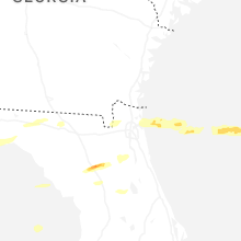


Connect with Interactive Hail Maps