

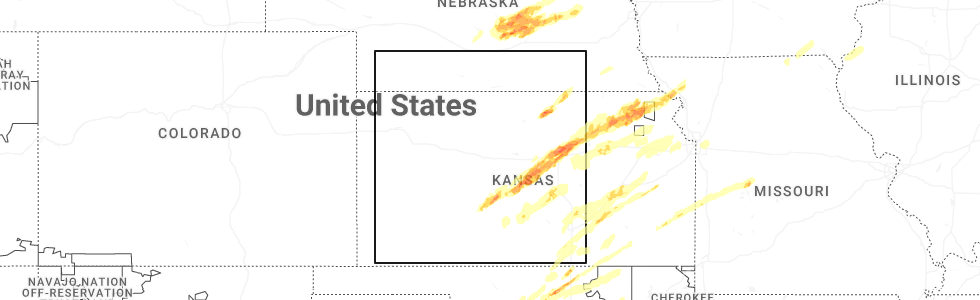
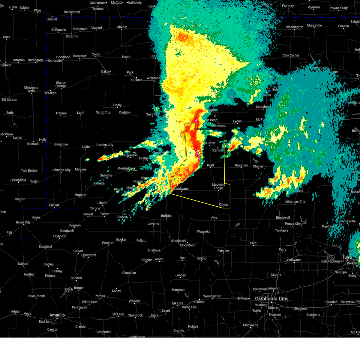
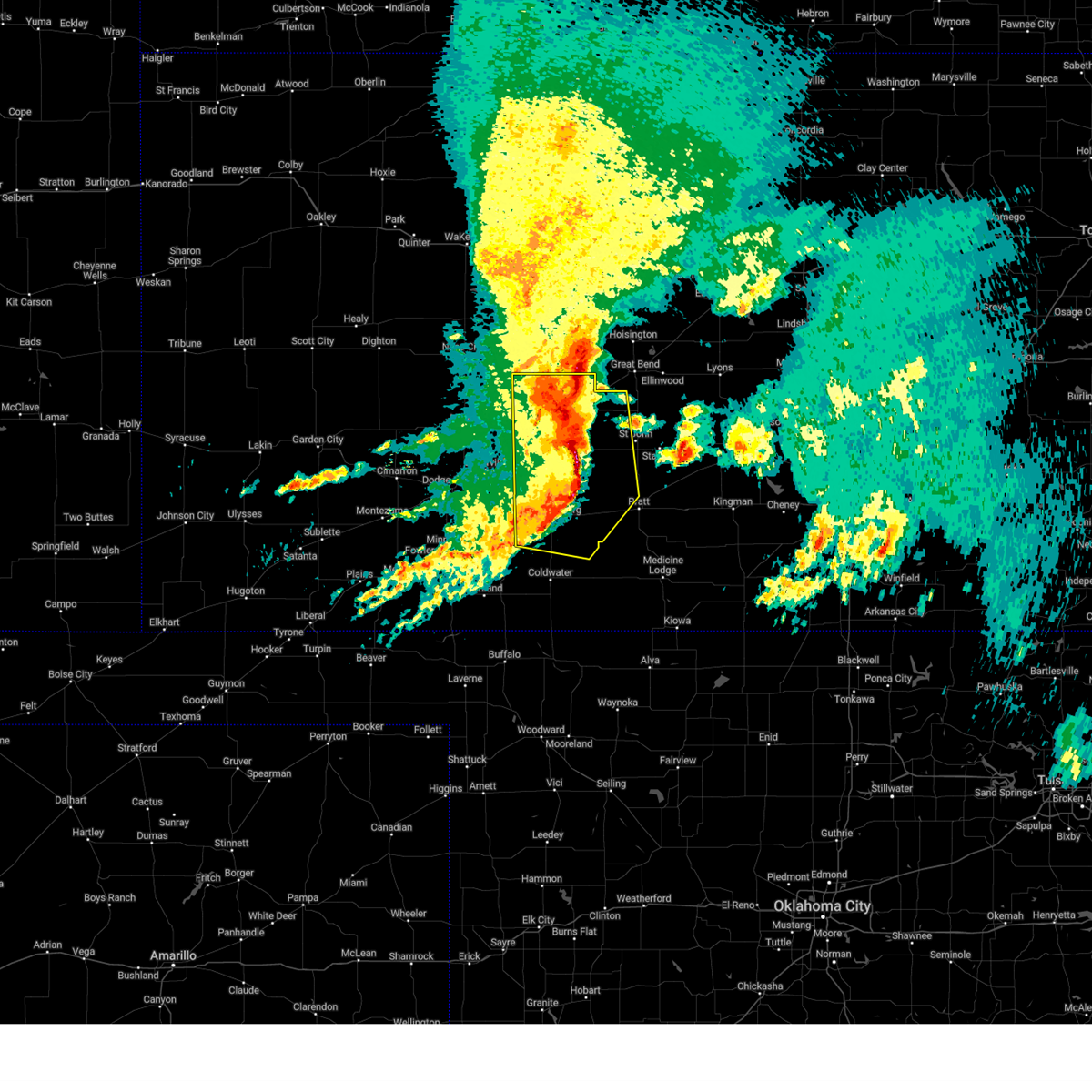
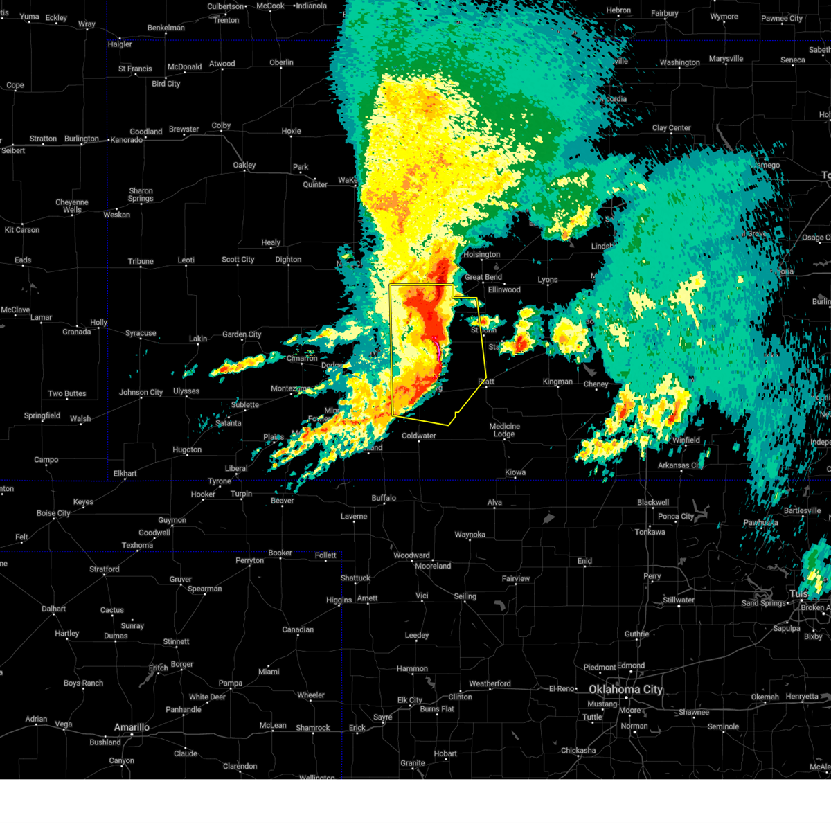
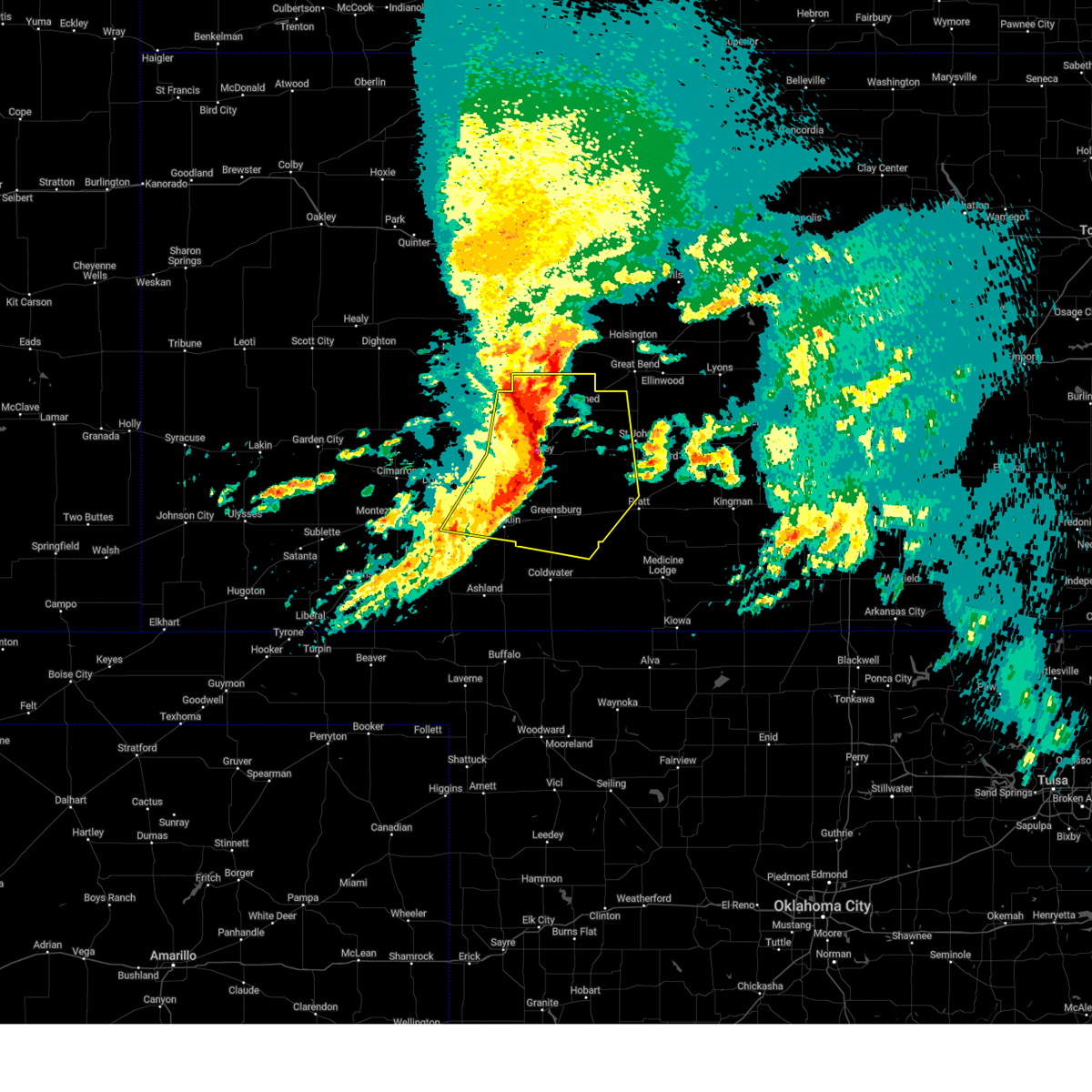
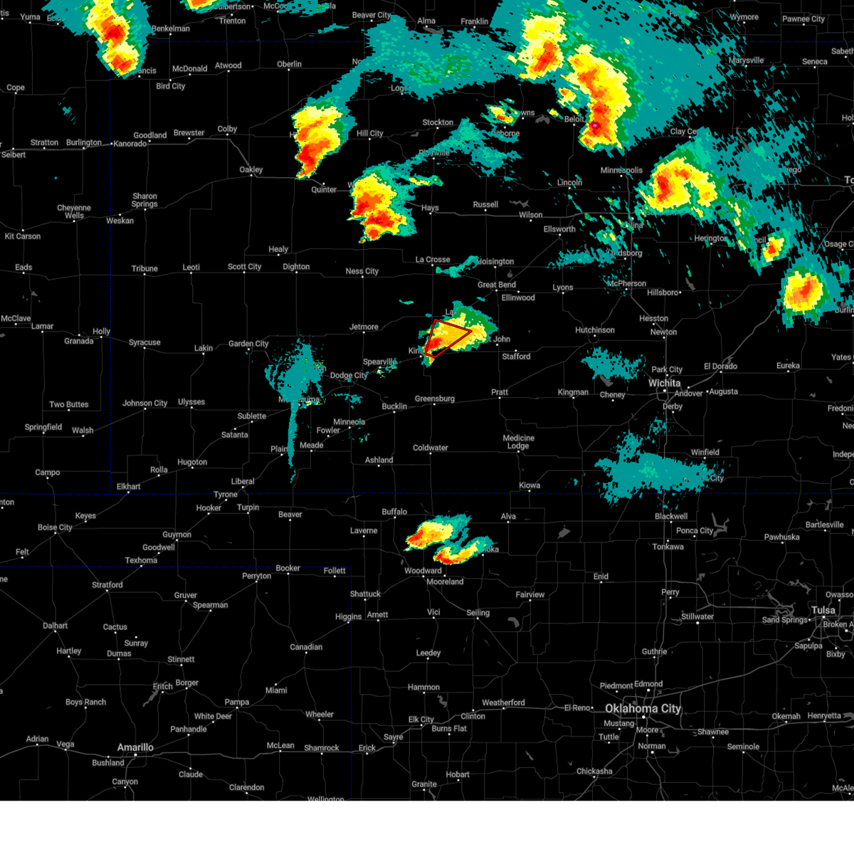
Hail Map for Garfield, KS
The Garfield, KS area has had 17 reports of on-the-ground hail by trained spotters, and has been under severe weather warnings 31 times during the past 12 months. Doppler radar has detected hail at or near Garfield, KS on 91 occasions, including 8 occasions during the past year.
| Name: | Garfield, KS |
| Where Located: | 55.1 miles S of Hays, KS |
| Map: | Google Map for Garfield, KS |
| Population: | 190 |
| Housing Units: | 102 |
| More Info: | Search Google for Garfield, KS |
2
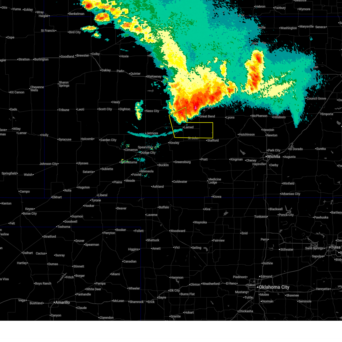
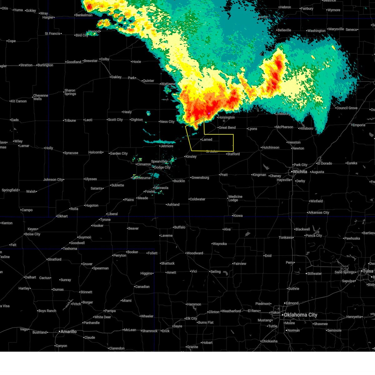
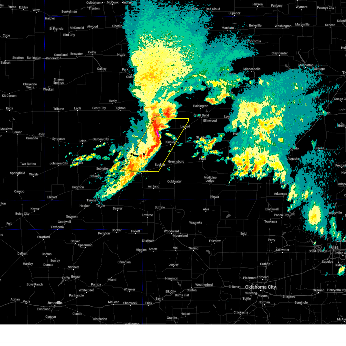
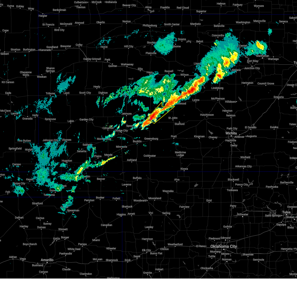
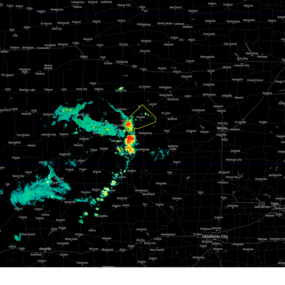
The Top Recent Hail Date for Garfield, KS is Tuesday, April 1, 2025 (7th out of 91)
Hail and Wind Damage Spotted near Garfield, KS
| Date / Time | Report Details |
|---|---|
| 6/17/2025 2:23 AM CDT | Report received from the kansas state mesone in pawnee county KS, 4.8 miles SW of Garfield, KS |
| 6/17/2025 2:20 AM CDT |
 At 220 am cdt, a severe thunderstorm was located near larned, moving southeast at 40 mph (radar indicated). Hazards include 60 mph wind gusts and nickel size hail. Expect damage to roofs, siding, and trees. this severe storm will be near, larned around 225 am cdt. other locations in the path of this severe thunderstorm include st. John. At 220 am cdt, a severe thunderstorm was located near larned, moving southeast at 40 mph (radar indicated). Hazards include 60 mph wind gusts and nickel size hail. Expect damage to roofs, siding, and trees. this severe storm will be near, larned around 225 am cdt. other locations in the path of this severe thunderstorm include st. John.
|
| 6/17/2025 2:06 AM CDT |
 Svrddc the national weather service in dodge city has issued a * severe thunderstorm warning for, pawnee county in south central kansas, northern stafford county in south central kansas, southeastern rush county in central kansas, * until 245 am cdt. * at 206 am cdt, a severe thunderstorm was located near ash valley, moving southeast at 40 mph (radar indicated). Hazards include 60 mph wind gusts and nickel size hail. Expect damage to roofs, siding, and trees. this severe thunderstorm will be near, ash valley around 210 am cdt. Larned around 215 am cdt. Svrddc the national weather service in dodge city has issued a * severe thunderstorm warning for, pawnee county in south central kansas, northern stafford county in south central kansas, southeastern rush county in central kansas, * until 245 am cdt. * at 206 am cdt, a severe thunderstorm was located near ash valley, moving southeast at 40 mph (radar indicated). Hazards include 60 mph wind gusts and nickel size hail. Expect damage to roofs, siding, and trees. this severe thunderstorm will be near, ash valley around 210 am cdt. Larned around 215 am cdt.
|
| 5/25/2025 6:01 AM CDT |
 At 600 am cdt, severe thunderstorms were located along a line extending from near larned to near byers to 6 miles northwest of belvidere, moving east at 50 mph (radar indicated). Hazards include 70 mph wind gusts and penny size hail. Expect considerable tree damage. damage is likely to mobile homes, roofs, and outbuildings. Locations impacted include, pratt, larned, greensburg, haviland, macksville, garfield, iuka, cullison, belpre, ash valley, byers, radium, fellsburg, hopewell, wellsford, croft, frizell, zook, trousdale, and dillwyn. At 600 am cdt, severe thunderstorms were located along a line extending from near larned to near byers to 6 miles northwest of belvidere, moving east at 50 mph (radar indicated). Hazards include 70 mph wind gusts and penny size hail. Expect considerable tree damage. damage is likely to mobile homes, roofs, and outbuildings. Locations impacted include, pratt, larned, greensburg, haviland, macksville, garfield, iuka, cullison, belpre, ash valley, byers, radium, fellsburg, hopewell, wellsford, croft, frizell, zook, trousdale, and dillwyn.
|
| 5/25/2025 5:59 AM CDT |
 Svrddc the national weather service in dodge city has issued a * severe thunderstorm warning for, kiowa county in south central kansas, barber county in south central kansas, northern comanche county in south central kansas, eastern pawnee county in south central kansas, stafford county in south central kansas, southeastern edwards county in south central kansas, pratt county in south central kansas, * until 700 am cdt. * at 558 am cdt, severe thunderstorms were located along a line extending from near pawnee rock to near hopewell to 9 miles northwest of wilmore, moving east at 55 mph (radar indicated). Hazards include 70 mph wind gusts and penny size hail. Expect considerable tree damage. damage is likely to mobile homes, roofs, and outbuildings. severe thunderstorms will be near, pratt, st. john, iuka, cullison, seward, byers, radium, dillwyn, belvidere, and croft around 605 am cdt. stafford, hudson, coats, and sun city around 615 am cdt. Other locations in the path of these severe thunderstorms include preston, sawyer, cairo, neola, lake city, zenith, isabel, medicine lodge and sharon. Svrddc the national weather service in dodge city has issued a * severe thunderstorm warning for, kiowa county in south central kansas, barber county in south central kansas, northern comanche county in south central kansas, eastern pawnee county in south central kansas, stafford county in south central kansas, southeastern edwards county in south central kansas, pratt county in south central kansas, * until 700 am cdt. * at 558 am cdt, severe thunderstorms were located along a line extending from near pawnee rock to near hopewell to 9 miles northwest of wilmore, moving east at 55 mph (radar indicated). Hazards include 70 mph wind gusts and penny size hail. Expect considerable tree damage. damage is likely to mobile homes, roofs, and outbuildings. severe thunderstorms will be near, pratt, st. john, iuka, cullison, seward, byers, radium, dillwyn, belvidere, and croft around 605 am cdt. stafford, hudson, coats, and sun city around 615 am cdt. Other locations in the path of these severe thunderstorms include preston, sawyer, cairo, neola, lake city, zenith, isabel, medicine lodge and sharon.
|
| 5/25/2025 5:48 AM CDT |
 the severe thunderstorm warning has been cancelled and is no longer in effect the severe thunderstorm warning has been cancelled and is no longer in effect
|
| 5/25/2025 5:48 AM CDT |
 At 547 am cdt, severe thunderstorms were located along a line extending from near frizell to trousdale to near greensburg, moving east at 50 mph (radar indicated). Hazards include 70 mph wind gusts and penny size hail. Expect considerable tree damage. damage is likely to mobile homes, roofs, and outbuildings. Locations impacted include, larned, haviland, macksville, byers, hopewell, zook, wellsford, cullison, dillwyn, pratt, iuka, radium and croft. At 547 am cdt, severe thunderstorms were located along a line extending from near frizell to trousdale to near greensburg, moving east at 50 mph (radar indicated). Hazards include 70 mph wind gusts and penny size hail. Expect considerable tree damage. damage is likely to mobile homes, roofs, and outbuildings. Locations impacted include, larned, haviland, macksville, byers, hopewell, zook, wellsford, cullison, dillwyn, pratt, iuka, radium and croft.
|
| 5/25/2025 5:23 AM CDT |
 Svrddc the national weather service in dodge city has issued a * severe thunderstorm warning for, eastern ford county in southwestern kansas, kiowa county in south central kansas, eastern hodgeman county in southwestern kansas, pawnee county in south central kansas, western stafford county in south central kansas, edwards county in south central kansas, western pratt county in south central kansas, * until 615 am cdt. * at 523 am cdt, severe thunderstorms were located along a line extending from 6 miles north of burdett to near kinsley to near ford, moving east at 50 mph (radar indicated). Hazards include 70 mph wind gusts and penny size hail. Expect considerable tree damage. damage is likely to mobile homes, roofs, and outbuildings. severe thunderstorms will be near, lewis, mullinville, rozel, sanford, and centerview around 530 am cdt. garfield and fellsburg around 535 am cdt. greensburg, frizell, and trousdale around 540 am cdt. Other locations in the path of these severe thunderstorms include larned, belpre, zook, haviland, macksville, hopewell, byers, wellsford, cullison, radium, dillwyn, croft, pratt and iuka. Svrddc the national weather service in dodge city has issued a * severe thunderstorm warning for, eastern ford county in southwestern kansas, kiowa county in south central kansas, eastern hodgeman county in southwestern kansas, pawnee county in south central kansas, western stafford county in south central kansas, edwards county in south central kansas, western pratt county in south central kansas, * until 615 am cdt. * at 523 am cdt, severe thunderstorms were located along a line extending from 6 miles north of burdett to near kinsley to near ford, moving east at 50 mph (radar indicated). Hazards include 70 mph wind gusts and penny size hail. Expect considerable tree damage. damage is likely to mobile homes, roofs, and outbuildings. severe thunderstorms will be near, lewis, mullinville, rozel, sanford, and centerview around 530 am cdt. garfield and fellsburg around 535 am cdt. greensburg, frizell, and trousdale around 540 am cdt. Other locations in the path of these severe thunderstorms include larned, belpre, zook, haviland, macksville, hopewell, byers, wellsford, cullison, radium, dillwyn, croft, pratt and iuka.
|
| 5/25/2025 5:06 AM CDT |
 At 506 am cdt, severe thunderstorms were located along a line extending from 8 miles south of nekoma to 7 miles north of minneola, moving east at 50 mph (radar indicated). Hazards include 70 mph wind gusts and penny size hail. Expect considerable tree damage. damage is likely to mobile homes, roofs, and outbuildings. Locations impacted include, spearville, burdett, rozel, bellefont, ford, offerle, windhorst, kinsley, ash valley, kingsdown, sanford, bucklin, garfield and frizell. At 506 am cdt, severe thunderstorms were located along a line extending from 8 miles south of nekoma to 7 miles north of minneola, moving east at 50 mph (radar indicated). Hazards include 70 mph wind gusts and penny size hail. Expect considerable tree damage. damage is likely to mobile homes, roofs, and outbuildings. Locations impacted include, spearville, burdett, rozel, bellefont, ford, offerle, windhorst, kinsley, ash valley, kingsdown, sanford, bucklin, garfield and frizell.
|
| 5/25/2025 4:39 AM CDT |
 Svrddc the national weather service in dodge city has issued a * severe thunderstorm warning for, ford county in southwestern kansas, northwestern kiowa county in south central kansas, southeastern ness county in west central kansas, hodgeman county in southwestern kansas, pawnee county in south central kansas, gray county in southwestern kansas, western edwards county in south central kansas, * until 530 am cdt. * at 439 am cdt, severe thunderstorms were located along a line extending from near ness city to near montezuma, moving east at 50 mph (radar indicated). Hazards include 60 mph wind gusts and penny size hail. Expect damage to roofs, siding, and trees. severe thunderstorms will be near, jetmore, ensign, howell, and the haggard elev around 445 am cdt. dodge city around 450 am cdt. hanston around 455 am cdt. other locations in the path of these severe thunderstorms include gray, burdett, wright, ft. Dodge, spearville, ford, rozel, bellefont, offerle, bloom, ash valley, windhorst, sanford, kinsley and kingsdown. Svrddc the national weather service in dodge city has issued a * severe thunderstorm warning for, ford county in southwestern kansas, northwestern kiowa county in south central kansas, southeastern ness county in west central kansas, hodgeman county in southwestern kansas, pawnee county in south central kansas, gray county in southwestern kansas, western edwards county in south central kansas, * until 530 am cdt. * at 439 am cdt, severe thunderstorms were located along a line extending from near ness city to near montezuma, moving east at 50 mph (radar indicated). Hazards include 60 mph wind gusts and penny size hail. Expect damage to roofs, siding, and trees. severe thunderstorms will be near, jetmore, ensign, howell, and the haggard elev around 445 am cdt. dodge city around 450 am cdt. hanston around 455 am cdt. other locations in the path of these severe thunderstorms include gray, burdett, wright, ft. Dodge, spearville, ford, rozel, bellefont, offerle, bloom, ash valley, windhorst, sanford, kinsley and kingsdown.
|
| 5/24/2025 12:55 AM CDT | Quarter sized hail reported 0.3 miles NNW of Garfield, KS, mping report. time adjusted based on radar. |
| 5/24/2025 12:52 AM CDT |
 Svrddc the national weather service in dodge city has issued a * severe thunderstorm warning for, northeastern ford county in southwestern kansas, northwestern kiowa county in south central kansas, southeastern hodgeman county in southwestern kansas, southern pawnee county in south central kansas, southwestern stafford county in south central kansas, edwards county in south central kansas, * until 130 am cdt. * at 1251 am cdt, severe thunderstorms were located along a line extending from near garfield to near spearville, moving east at 40 mph (radar indicated). Hazards include 60 mph wind gusts and quarter size hail. Hail damage to vehicles is expected. expect wind damage to roofs, siding, and trees. severe thunderstorms will be near, spearville, garfield, and bellefont around 1255 am cdt. kinsley and offerle around 100 am cdt. lewis and zook around 105 am cdt. Other locations in the path of these severe thunderstorms include belpre and macksville. Svrddc the national weather service in dodge city has issued a * severe thunderstorm warning for, northeastern ford county in southwestern kansas, northwestern kiowa county in south central kansas, southeastern hodgeman county in southwestern kansas, southern pawnee county in south central kansas, southwestern stafford county in south central kansas, edwards county in south central kansas, * until 130 am cdt. * at 1251 am cdt, severe thunderstorms were located along a line extending from near garfield to near spearville, moving east at 40 mph (radar indicated). Hazards include 60 mph wind gusts and quarter size hail. Hail damage to vehicles is expected. expect wind damage to roofs, siding, and trees. severe thunderstorms will be near, spearville, garfield, and bellefont around 1255 am cdt. kinsley and offerle around 100 am cdt. lewis and zook around 105 am cdt. Other locations in the path of these severe thunderstorms include belpre and macksville.
|
| 5/24/2025 12:43 AM CDT |
 At 1243 am cdt, a severe thunderstorm was located near spearville, moving southeast at 30 mph (radar indicated). Hazards include 60 mph wind gusts and quarter size hail. Hail damage to vehicles is expected. expect wind damage to roofs, siding, and trees. Locations impacted include, gray, kinsley, jetmore, spearville, lewis, burdett, hanston, offerle, garfield, rozel, belpre, sanford, bellefont, windhorst, centerview, and zook. At 1243 am cdt, a severe thunderstorm was located near spearville, moving southeast at 30 mph (radar indicated). Hazards include 60 mph wind gusts and quarter size hail. Hail damage to vehicles is expected. expect wind damage to roofs, siding, and trees. Locations impacted include, gray, kinsley, jetmore, spearville, lewis, burdett, hanston, offerle, garfield, rozel, belpre, sanford, bellefont, windhorst, centerview, and zook.
|
| 5/24/2025 12:21 AM CDT |
 Svrddc the national weather service in dodge city has issued a * severe thunderstorm warning for, northeastern ford county in southwestern kansas, northwestern kiowa county in south central kansas, hodgeman county in southwestern kansas, southwestern pawnee county in south central kansas, edwards county in south central kansas, * until 100 am cdt. * at 1221 am cdt, a severe thunderstorm was located near jetmore, moving southeast at 35 mph (radar indicated). Hazards include 60 mph wind gusts and quarter size hail. Hail damage to vehicles is expected. Expect wind damage to roofs, siding, and trees. Svrddc the national weather service in dodge city has issued a * severe thunderstorm warning for, northeastern ford county in southwestern kansas, northwestern kiowa county in south central kansas, hodgeman county in southwestern kansas, southwestern pawnee county in south central kansas, edwards county in south central kansas, * until 100 am cdt. * at 1221 am cdt, a severe thunderstorm was located near jetmore, moving southeast at 35 mph (radar indicated). Hazards include 60 mph wind gusts and quarter size hail. Hail damage to vehicles is expected. Expect wind damage to roofs, siding, and trees.
|
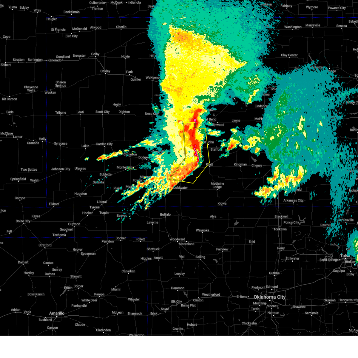
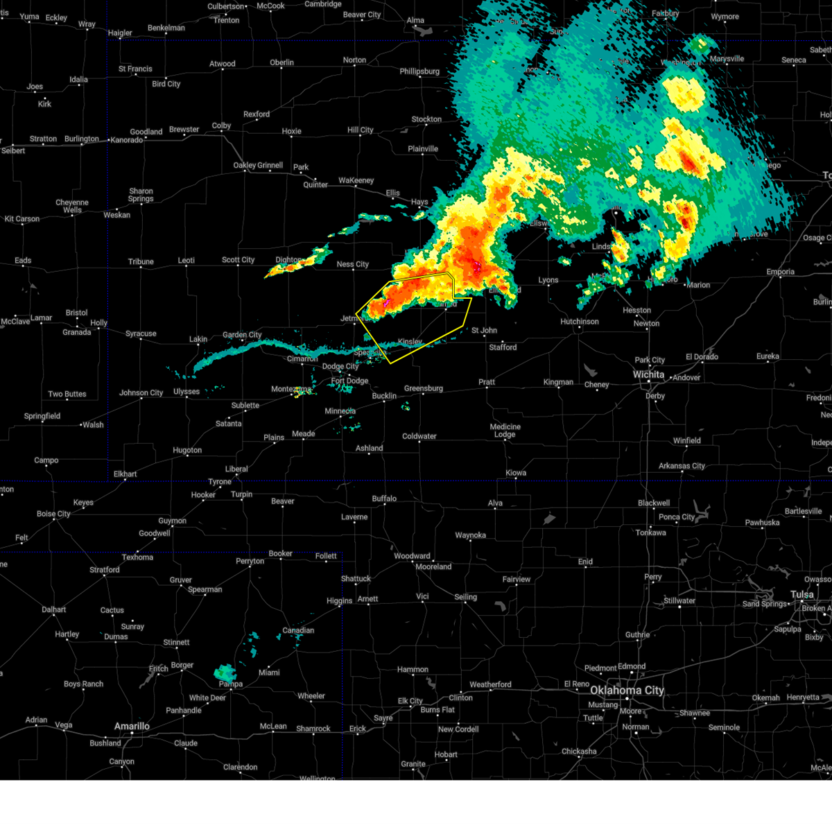
| 5/18/2025 7:56 PM CDT | Torddc the national weather service in dodge city has issued a * tornado warning for, central pawnee county in south central kansas, * until 830 pm cdt. * at 756 pm cdt, a confirmed tornado was located very near garfield, moving northeast at 25 mph (broadcast media confirmed tornado). Hazards include damaging tornado and golf ball size hail. Flying debris will be dangerous to those caught without shelter. mobile homes will be damaged or destroyed. damage to roofs, windows, and vehicles will occur. tree damage is likely. the tornado will be near, frizell around 800 pm cdt. Larned around 810 pm cdt. |
| 5/18/2025 7:49 PM CDT | the tornado warning has been cancelled and is no longer in effect |
| 5/18/2025 7:49 PM CDT | At 748 pm cdt, a confirmed tornado was located near garfield, moving northeast at 20 mph (weather spotters confirmed tornado). Hazards include damaging tornado and golf ball size hail. Flying debris will be dangerous to those caught without shelter. mobile homes will be damaged or destroyed. damage to roofs, windows, and vehicles will occur. tree damage is likely. This tornado will be near, garfield around 755 pm cdt. |
| 5/18/2025 7:36 PM CDT |
 Torddc the national weather service in dodge city has issued a * tornado warning for, southeastern pawnee county in south central kansas, central edwards county in south central kansas, * until 800 pm cdt. * at 735 pm cdt, a confirmed dangerous tornado was located 2 miles northwest of lewis, moving northeast at 25 mph. this is a particularly dangerous situation. take cover now! (broadcast media confirmed tornado). Hazards include damaging tornado. You are in a life-threatening situation. flying debris may be deadly to those caught without shelter. mobile homes will be destroyed. considerable damage to homes, businesses, and vehicles is likely and complete destruction is possible. the tornado will be near, lewis around 740 pm cdt. Garfield around 745 pm cdt. Torddc the national weather service in dodge city has issued a * tornado warning for, southeastern pawnee county in south central kansas, central edwards county in south central kansas, * until 800 pm cdt. * at 735 pm cdt, a confirmed dangerous tornado was located 2 miles northwest of lewis, moving northeast at 25 mph. this is a particularly dangerous situation. take cover now! (broadcast media confirmed tornado). Hazards include damaging tornado. You are in a life-threatening situation. flying debris may be deadly to those caught without shelter. mobile homes will be destroyed. considerable damage to homes, businesses, and vehicles is likely and complete destruction is possible. the tornado will be near, lewis around 740 pm cdt. Garfield around 745 pm cdt.
|
| 5/18/2025 7:06 PM CDT |
 Svrddc the national weather service in dodge city has issued a * severe thunderstorm warning for, southern pawnee county in south central kansas, northwestern edwards county in south central kansas, * until 745 pm cdt. * at 706 pm cdt, a severe thunderstorm was located 7 miles south of kinsley, moving northeast at 40 mph (radar indicated). Hazards include two inch hail and 60 mph wind gusts. People and animals outdoors will be injured. expect hail damage to roofs, siding, windows, and vehicles. expect wind damage to roofs, siding, and trees. this severe thunderstorm will be near, kinsley around 710 pm cdt. Other locations in the path of this severe thunderstorm include garfield. Svrddc the national weather service in dodge city has issued a * severe thunderstorm warning for, southern pawnee county in south central kansas, northwestern edwards county in south central kansas, * until 745 pm cdt. * at 706 pm cdt, a severe thunderstorm was located 7 miles south of kinsley, moving northeast at 40 mph (radar indicated). Hazards include two inch hail and 60 mph wind gusts. People and animals outdoors will be injured. expect hail damage to roofs, siding, windows, and vehicles. expect wind damage to roofs, siding, and trees. this severe thunderstorm will be near, kinsley around 710 pm cdt. Other locations in the path of this severe thunderstorm include garfield.
|
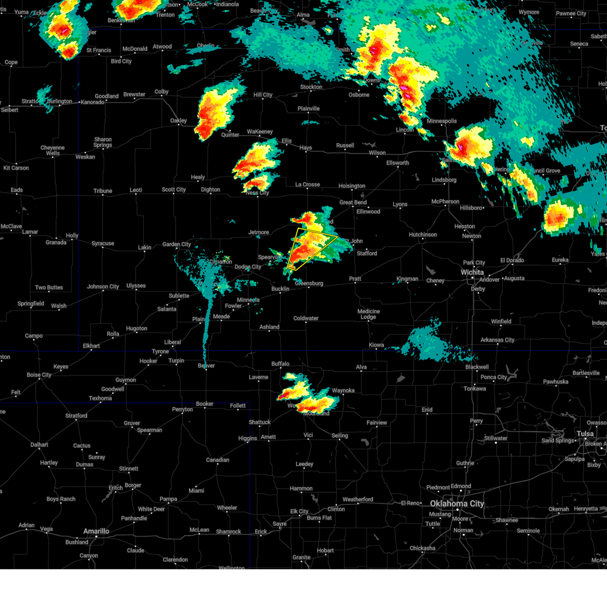
| 4/1/2025 10:41 PM CDT |
 the severe thunderstorm warning has been cancelled and is no longer in effect the severe thunderstorm warning has been cancelled and is no longer in effect
|
| 4/1/2025 10:41 PM CDT |
 At 1041 pm cdt, a severe thunderstorm was located near zook, moving northeast at 25 mph (radar indicated). Hazards include 60 mph wind gusts and quarter size hail. Hail damage to vehicles is expected. expect wind damage to roofs, siding, and trees. This severe storm will be near, larned around 1045 pm cdt. At 1041 pm cdt, a severe thunderstorm was located near zook, moving northeast at 25 mph (radar indicated). Hazards include 60 mph wind gusts and quarter size hail. Hail damage to vehicles is expected. expect wind damage to roofs, siding, and trees. This severe storm will be near, larned around 1045 pm cdt.
|
| 4/1/2025 10:29 PM CDT |
 At 1028 pm cdt, a severe thunderstorm was located very near garfield, moving northeast at 45 mph (radar indicated). Hazards include golf ball size hail and 60 mph wind gusts. People and animals outdoors will be injured. expect hail damage to roofs, siding, windows, and vehicles. expect wind damage to roofs, siding, and trees. This severe storm will be near, frizell and larned around 1035 pm cdt. At 1028 pm cdt, a severe thunderstorm was located very near garfield, moving northeast at 45 mph (radar indicated). Hazards include golf ball size hail and 60 mph wind gusts. People and animals outdoors will be injured. expect hail damage to roofs, siding, windows, and vehicles. expect wind damage to roofs, siding, and trees. This severe storm will be near, frizell and larned around 1035 pm cdt.
|
| 4/1/2025 10:22 PM CDT |
 Svrddc the national weather service in dodge city has issued a * severe thunderstorm warning for, eastern pawnee county in south central kansas, northwestern stafford county in south central kansas, northeastern edwards county in south central kansas, * until 1100 pm cdt. * at 1021 pm cdt, a severe thunderstorm was located near garfield, moving northeast at 45 mph (radar indicated). Hazards include 60 mph wind gusts and quarter size hail. Hail damage to vehicles is expected. expect wind damage to roofs, siding, and trees. this severe thunderstorm will be near, garfield around 1025 pm cdt. frizell around 1030 pm cdt. Larned around 1035 pm cdt. Svrddc the national weather service in dodge city has issued a * severe thunderstorm warning for, eastern pawnee county in south central kansas, northwestern stafford county in south central kansas, northeastern edwards county in south central kansas, * until 1100 pm cdt. * at 1021 pm cdt, a severe thunderstorm was located near garfield, moving northeast at 45 mph (radar indicated). Hazards include 60 mph wind gusts and quarter size hail. Hail damage to vehicles is expected. expect wind damage to roofs, siding, and trees. this severe thunderstorm will be near, garfield around 1025 pm cdt. frizell around 1030 pm cdt. Larned around 1035 pm cdt.
|
| 9/20/2024 5:17 PM CDT |
 At 516 pm cdt, a severe thunderstorm was located near macksville, moving northeast at 40 mph (radar indicated. at 509 pm cdt a 59 mph wind gust was reported 2 miles sw of belpre). Hazards include 60 mph wind gusts. Expect damage to roofs, siding, and trees. Locations impacted include, seward. At 516 pm cdt, a severe thunderstorm was located near macksville, moving northeast at 40 mph (radar indicated. at 509 pm cdt a 59 mph wind gust was reported 2 miles sw of belpre). Hazards include 60 mph wind gusts. Expect damage to roofs, siding, and trees. Locations impacted include, seward.
|
| 9/20/2024 5:17 PM CDT |
 the severe thunderstorm warning has been cancelled and is no longer in effect the severe thunderstorm warning has been cancelled and is no longer in effect
|
| 9/20/2024 4:57 PM CDT |
 At 455 pm cdt, a severe thunderstorm was located near centerview, moving northeast at 45 mph (radar indicated. at 449 pm cdt a 61 mph wind gust was reported 1 mile south of kinsley). Hazards include 60 mph wind gusts. Expect damage to roofs, siding, and trees. this severe storm will be near, belpre around 500 pm cdt. macksville around 510 pm cdt. Other locations in the path of this severe thunderstorm include seward. At 455 pm cdt, a severe thunderstorm was located near centerview, moving northeast at 45 mph (radar indicated. at 449 pm cdt a 61 mph wind gust was reported 1 mile south of kinsley). Hazards include 60 mph wind gusts. Expect damage to roofs, siding, and trees. this severe storm will be near, belpre around 500 pm cdt. macksville around 510 pm cdt. Other locations in the path of this severe thunderstorm include seward.
|
| 9/20/2024 4:54 PM CDT |
 Svrddc the national weather service in dodge city has issued a * severe thunderstorm warning for, northern kiowa county in south central kansas, southeastern pawnee county in south central kansas, stafford county in south central kansas, northern pratt county in south central kansas, edwards county in south central kansas, * until 545 pm cdt. * at 453 pm cdt, a severe thunderstorm was located near centerview, moving northeast at 40 mph (radar indicated). Hazards include 60 mph wind gusts. Expect damage to roofs, siding, and trees. this severe thunderstorm will be near, belpre around 505 pm cdt. macksville around 510 pm cdt. Other locations in the path of this severe thunderstorm include seward. Svrddc the national weather service in dodge city has issued a * severe thunderstorm warning for, northern kiowa county in south central kansas, southeastern pawnee county in south central kansas, stafford county in south central kansas, northern pratt county in south central kansas, edwards county in south central kansas, * until 545 pm cdt. * at 453 pm cdt, a severe thunderstorm was located near centerview, moving northeast at 40 mph (radar indicated). Hazards include 60 mph wind gusts. Expect damage to roofs, siding, and trees. this severe thunderstorm will be near, belpre around 505 pm cdt. macksville around 510 pm cdt. Other locations in the path of this severe thunderstorm include seward.
|
| 9/20/2024 4:21 PM CDT |
 Svrddc the national weather service in dodge city has issued a * severe thunderstorm warning for, northeastern ford county in southwestern kansas, southeastern hodgeman county in southwestern kansas, southwestern pawnee county in south central kansas, edwards county in south central kansas, * until 500 pm cdt. * at 421 pm cdt, a severe thunderstorm was located near windhorst, moving northeast at 40 mph (radar indicated). Hazards include 60 mph wind gusts and penny size hail. Expect damage to roofs, siding, and trees. this severe thunderstorm will be near, offerle around 425 pm cdt. kinsley around 435 pm cdt. Other locations in the path of this severe thunderstorm include garfield. Svrddc the national weather service in dodge city has issued a * severe thunderstorm warning for, northeastern ford county in southwestern kansas, southeastern hodgeman county in southwestern kansas, southwestern pawnee county in south central kansas, edwards county in south central kansas, * until 500 pm cdt. * at 421 pm cdt, a severe thunderstorm was located near windhorst, moving northeast at 40 mph (radar indicated). Hazards include 60 mph wind gusts and penny size hail. Expect damage to roofs, siding, and trees. this severe thunderstorm will be near, offerle around 425 pm cdt. kinsley around 435 pm cdt. Other locations in the path of this severe thunderstorm include garfield.
|
| 7/31/2024 8:33 PM CDT | the severe thunderstorm warning has been cancelled and is no longer in effect |
| 7/31/2024 8:15 PM CDT |
 Svrddc the national weather service in dodge city has issued a * severe thunderstorm warning for, northeastern ford county in southwestern kansas, southeastern ness county in west central kansas, eastern hodgeman county in southwestern kansas, pawnee county in south central kansas, northwestern stafford county in south central kansas, southern rush county in central kansas, northern edwards county in south central kansas, * until 900 pm cdt. * at 814 pm cdt, a severe thunderstorm was located near gray, moving southeast at 35 mph (radar indicated). Hazards include 60 mph wind gusts and quarter size hail. Hail damage to vehicles is expected. Expect wind damage to roofs, siding, and trees. Svrddc the national weather service in dodge city has issued a * severe thunderstorm warning for, northeastern ford county in southwestern kansas, southeastern ness county in west central kansas, eastern hodgeman county in southwestern kansas, pawnee county in south central kansas, northwestern stafford county in south central kansas, southern rush county in central kansas, northern edwards county in south central kansas, * until 900 pm cdt. * at 814 pm cdt, a severe thunderstorm was located near gray, moving southeast at 35 mph (radar indicated). Hazards include 60 mph wind gusts and quarter size hail. Hail damage to vehicles is expected. Expect wind damage to roofs, siding, and trees.
|
| 7/31/2024 7:49 PM CDT | Svrddc the national weather service in dodge city has issued a * severe thunderstorm warning for, southeastern ness county in west central kansas, northeastern hodgeman county in southwestern kansas, western pawnee county in south central kansas, southwestern rush county in central kansas, northwestern edwards county in south central kansas, * until 815 pm cdt. * at 749 pm cdt, a severe thunderstorm was located near bazine, moving southeast at 30 mph (radar indicated). Hazards include ping pong ball size hail and 60 mph wind gusts. People and animals outdoors will be injured. expect hail damage to roofs, siding, windows, and vehicles. expect wind damage to roofs, siding, and trees. This severe thunderstorm will remain over mainly rural areas of southeastern ness, northeastern hodgeman, western pawnee, southwestern rush and northwestern edwards counties. |
| 7/6/2024 8:15 PM CDT |
 Svrddc the national weather service in dodge city has issued a * severe thunderstorm warning for, pawnee county in south central kansas, western stafford county in south central kansas, southeastern rush county in central kansas, northeastern edwards county in south central kansas, * until 900 pm cdt. * at 815 pm cdt, a severe thunderstorm was located near larned, moving southeast at 35 mph (radar indicated). Hazards include 60 mph wind gusts and penny size hail. expect damage to roofs, siding, and trees Svrddc the national weather service in dodge city has issued a * severe thunderstorm warning for, pawnee county in south central kansas, western stafford county in south central kansas, southeastern rush county in central kansas, northeastern edwards county in south central kansas, * until 900 pm cdt. * at 815 pm cdt, a severe thunderstorm was located near larned, moving southeast at 35 mph (radar indicated). Hazards include 60 mph wind gusts and penny size hail. expect damage to roofs, siding, and trees
|
| 7/6/2024 6:15 PM CDT |
 Svrddc the national weather service in dodge city has issued a * severe thunderstorm warning for, northeastern finney county in southwestern kansas, southeastern scott county in west central kansas, hodgeman county in southwestern kansas, western pawnee county in south central kansas, western rush county in central kansas, northwestern edwards county in south central kansas, * until 715 pm cdt. * at 614 pm cdt, severe thunderstorms were located along a line extending from near bazine to 10 miles south of beeler to 6 miles east of shallow water, moving southeast at 40 mph (radar indicated). Hazards include 60 mph wind gusts and quarter size hail. Hail damage to vehicles is expected. Expect wind damage to roofs, siding, and trees. Svrddc the national weather service in dodge city has issued a * severe thunderstorm warning for, northeastern finney county in southwestern kansas, southeastern scott county in west central kansas, hodgeman county in southwestern kansas, western pawnee county in south central kansas, western rush county in central kansas, northwestern edwards county in south central kansas, * until 715 pm cdt. * at 614 pm cdt, severe thunderstorms were located along a line extending from near bazine to 10 miles south of beeler to 6 miles east of shallow water, moving southeast at 40 mph (radar indicated). Hazards include 60 mph wind gusts and quarter size hail. Hail damage to vehicles is expected. Expect wind damage to roofs, siding, and trees.
|
| 6/18/2024 9:11 PM CDT |
 The storm which prompted the warning has weakened below severe limits, and no longer poses an immediate threat to life or property. therefore, the warning will be allowed to expire. a severe thunderstorm watch remains in effect until 1000 pm cdt for south central kansas. The storm which prompted the warning has weakened below severe limits, and no longer poses an immediate threat to life or property. therefore, the warning will be allowed to expire. a severe thunderstorm watch remains in effect until 1000 pm cdt for south central kansas.
|
| 6/18/2024 8:48 PM CDT |
 At 848 pm cdt, a severe thunderstorm was located near belpre, moving east at 40 mph (radar indicated). Hazards include 60 mph wind gusts and penny size hail. Expect damage to roofs, siding, and trees. locations impacted include, macksville, dillwyn, st. John and stafford. At 848 pm cdt, a severe thunderstorm was located near belpre, moving east at 40 mph (radar indicated). Hazards include 60 mph wind gusts and penny size hail. Expect damage to roofs, siding, and trees. locations impacted include, macksville, dillwyn, st. John and stafford.
|
| 6/18/2024 8:23 PM CDT |
 Svrddc the national weather service in dodge city has issued a * severe thunderstorm warning for, northeastern kiowa county in south central kansas, southeastern pawnee county in south central kansas, stafford county in south central kansas, northern pratt county in south central kansas, edwards county in south central kansas, * until 915 pm cdt. * at 823 pm cdt, a severe thunderstorm was located near kinsley, moving east at 40 mph (radar indicated). Hazards include 60 mph wind gusts and penny size hail. Expect damage to roofs, siding, and trees. this severe thunderstorm will be near, lewis around 830 pm cdt. belpre around 835 pm cdt. other locations in the path of this severe thunderstorm include macksville, dillwyn and st. John. Svrddc the national weather service in dodge city has issued a * severe thunderstorm warning for, northeastern kiowa county in south central kansas, southeastern pawnee county in south central kansas, stafford county in south central kansas, northern pratt county in south central kansas, edwards county in south central kansas, * until 915 pm cdt. * at 823 pm cdt, a severe thunderstorm was located near kinsley, moving east at 40 mph (radar indicated). Hazards include 60 mph wind gusts and penny size hail. Expect damage to roofs, siding, and trees. this severe thunderstorm will be near, lewis around 830 pm cdt. belpre around 835 pm cdt. other locations in the path of this severe thunderstorm include macksville, dillwyn and st. John.
|
| 6/18/2024 6:38 PM CDT |
 Svrddc the national weather service in dodge city has issued a * severe thunderstorm warning for, ford county in southwestern kansas, northwestern kiowa county in south central kansas, southeastern ness county in west central kansas, hodgeman county in southwestern kansas, pawnee county in south central kansas, northeastern gray county in southwestern kansas, edwards county in south central kansas, * until 730 pm cdt. * at 638 pm cdt, severe thunderstorms were located along a line extending from 8 miles south of alexander to near offerle to near ensign, moving east at 20 mph (radar indicated). Hazards include 60 mph wind gusts and nickel size hail. Expect damage to roofs, siding, and trees. severe thunderstorms will be near, dodge city, spearville, offerle, rozel, wright, ft. dodge, and bellefont around 645 pm cdt. kinsley around 650 pm cdt. Other locations in the path of these severe thunderstorms include windhorst, sanford, garfield, ash valley and lewis. Svrddc the national weather service in dodge city has issued a * severe thunderstorm warning for, ford county in southwestern kansas, northwestern kiowa county in south central kansas, southeastern ness county in west central kansas, hodgeman county in southwestern kansas, pawnee county in south central kansas, northeastern gray county in southwestern kansas, edwards county in south central kansas, * until 730 pm cdt. * at 638 pm cdt, severe thunderstorms were located along a line extending from 8 miles south of alexander to near offerle to near ensign, moving east at 20 mph (radar indicated). Hazards include 60 mph wind gusts and nickel size hail. Expect damage to roofs, siding, and trees. severe thunderstorms will be near, dodge city, spearville, offerle, rozel, wright, ft. dodge, and bellefont around 645 pm cdt. kinsley around 650 pm cdt. Other locations in the path of these severe thunderstorms include windhorst, sanford, garfield, ash valley and lewis.
|
| 6/13/2024 7:20 PM CDT |
 The storms which prompted the warning have weakened below severe limits, and no longer pose an immediate threat to life or property. therefore, the warning will be allowed to expire. however, small hail, gusty winds and heavy rain are still possible with these thunderstorms. a severe thunderstorm watch remains in effect until 1100 pm cdt for south central, central and southwestern kansas. The storms which prompted the warning have weakened below severe limits, and no longer pose an immediate threat to life or property. therefore, the warning will be allowed to expire. however, small hail, gusty winds and heavy rain are still possible with these thunderstorms. a severe thunderstorm watch remains in effect until 1100 pm cdt for south central, central and southwestern kansas.
|
| 6/13/2024 7:01 PM CDT |
 the severe thunderstorm warning has been cancelled and is no longer in effect the severe thunderstorm warning has been cancelled and is no longer in effect
|
| 6/13/2024 7:01 PM CDT |
 At 701 pm cdt, severe thunderstorms were located along a line extending from near frizell to 9 miles north of offerle, moving southeast at 40 mph (radar indicated). Hazards include 60 mph wind gusts and quarter size hail. Hail damage to vehicles is expected. expect wind damage to roofs, siding, and trees. Locations impacted include, larned, kinsley, lewis, burdett, garfield, rozel, belpre, ash valley, sanford, frizell, and zook. At 701 pm cdt, severe thunderstorms were located along a line extending from near frizell to 9 miles north of offerle, moving southeast at 40 mph (radar indicated). Hazards include 60 mph wind gusts and quarter size hail. Hail damage to vehicles is expected. expect wind damage to roofs, siding, and trees. Locations impacted include, larned, kinsley, lewis, burdett, garfield, rozel, belpre, ash valley, sanford, frizell, and zook.
|
| 6/13/2024 6:46 PM CDT |
 the severe thunderstorm warning has been cancelled and is no longer in effect the severe thunderstorm warning has been cancelled and is no longer in effect
|
| 6/13/2024 6:46 PM CDT |
 At 646 pm cdt, severe thunderstorms were located along a line extending from near sanford to 11 miles northwest of hanston, moving southeast at 20 mph (radar indicated). Hazards include 60 mph wind gusts and quarter size hail. Hail damage to vehicles is expected. expect wind damage to roofs, siding, and trees. Locations impacted include, gray, larned, kinsley, jetmore, lewis, burdett, hanston, garfield, rozel, belpre, ash valley, sanford, frizell, and zook. At 646 pm cdt, severe thunderstorms were located along a line extending from near sanford to 11 miles northwest of hanston, moving southeast at 20 mph (radar indicated). Hazards include 60 mph wind gusts and quarter size hail. Hail damage to vehicles is expected. expect wind damage to roofs, siding, and trees. Locations impacted include, gray, larned, kinsley, jetmore, lewis, burdett, hanston, garfield, rozel, belpre, ash valley, sanford, frizell, and zook.
|
| 6/13/2024 6:23 PM CDT |
 Svrddc the national weather service in dodge city has issued a * severe thunderstorm warning for, southeastern ness county in west central kansas, hodgeman county in southwestern kansas, pawnee county in south central kansas, southern rush county in central kansas, central edwards county in south central kansas, * until 730 pm cdt. * at 623 pm cdt, severe thunderstorms were located along a line extending from 7 miles west of ash valley to 6 miles south of ness city, moving south at 25 mph (radar indicated). Hazards include 60 mph wind gusts and quarter size hail. Hail damage to vehicles is expected. Expect wind damage to roofs, siding, and trees. Svrddc the national weather service in dodge city has issued a * severe thunderstorm warning for, southeastern ness county in west central kansas, hodgeman county in southwestern kansas, pawnee county in south central kansas, southern rush county in central kansas, central edwards county in south central kansas, * until 730 pm cdt. * at 623 pm cdt, severe thunderstorms were located along a line extending from 7 miles west of ash valley to 6 miles south of ness city, moving south at 25 mph (radar indicated). Hazards include 60 mph wind gusts and quarter size hail. Hail damage to vehicles is expected. Expect wind damage to roofs, siding, and trees.
|
| 6/9/2024 12:20 AM CDT |
 The storms which prompted the warning have moved out of the area. therefore, the warning will be allowed to expire. however, gusty winds are still possible with these thunderstorms. a severe thunderstorm watch remains in effect until 300 am cdt for south central and southwestern kansas. The storms which prompted the warning have moved out of the area. therefore, the warning will be allowed to expire. however, gusty winds are still possible with these thunderstorms. a severe thunderstorm watch remains in effect until 300 am cdt for south central and southwestern kansas.
|
| 6/8/2024 11:54 PM CDT |
 Svrddc the national weather service in dodge city has issued a * severe thunderstorm warning for, central pawnee county in south central kansas, * until 1245 am cdt. * at 1153 pm cdt, a severe thunderstorm was located very near sanford, moving north at 10 mph (radar indicated). Hazards include 60 mph wind gusts and quarter size hail. Hail damage to vehicles is expected. expect wind damage to roofs, siding, and trees. This severe thunderstorm will remain over mainly rural areas of central pawnee county. Svrddc the national weather service in dodge city has issued a * severe thunderstorm warning for, central pawnee county in south central kansas, * until 1245 am cdt. * at 1153 pm cdt, a severe thunderstorm was located very near sanford, moving north at 10 mph (radar indicated). Hazards include 60 mph wind gusts and quarter size hail. Hail damage to vehicles is expected. expect wind damage to roofs, siding, and trees. This severe thunderstorm will remain over mainly rural areas of central pawnee county.
|
| 6/8/2024 11:47 PM CDT |
 Svrddc the national weather service in dodge city has issued a * severe thunderstorm warning for, eastern ford county in southwestern kansas, kiowa county in south central kansas, southeastern hodgeman county in southwestern kansas, western comanche county in south central kansas, south central pawnee county in south central kansas, edwards county in south central kansas, clark county in southwestern kansas, * until 1230 am cdt. * at 1147 pm cdt, severe thunderstorms were located along a line extending from near gray to 6 miles south of windhorst to near ashland, moving southeast at 15 mph (radar indicated). Hazards include 70 mph wind gusts and penny size hail. Expect considerable tree damage. damage is likely to mobile homes, roofs, and outbuildings. Severe thunderstorms will be near, ashland, bucklin, offerle, clark state lake, and windhorst around 1150 pm cdt. Svrddc the national weather service in dodge city has issued a * severe thunderstorm warning for, eastern ford county in southwestern kansas, kiowa county in south central kansas, southeastern hodgeman county in southwestern kansas, western comanche county in south central kansas, south central pawnee county in south central kansas, edwards county in south central kansas, clark county in southwestern kansas, * until 1230 am cdt. * at 1147 pm cdt, severe thunderstorms were located along a line extending from near gray to 6 miles south of windhorst to near ashland, moving southeast at 15 mph (radar indicated). Hazards include 70 mph wind gusts and penny size hail. Expect considerable tree damage. damage is likely to mobile homes, roofs, and outbuildings. Severe thunderstorms will be near, ashland, bucklin, offerle, clark state lake, and windhorst around 1150 pm cdt.
|
| 6/3/2024 4:25 AM CDT |
 At 424 am cdt, severe thunderstorms were located along a line extending from near gray to 9 miles south of minneola, moving east at 45 mph (automated equipment. the dodge city airport measured a wind gust of 67 mph at 420 am cdt. this storm has a history of damaging winds, and damaging winds are expected). Hazards include 70 mph wind gusts and nickel size hail. Expect considerable tree damage. damage is likely to mobile homes, roofs, and outbuildings. these severe storms will be near, burdett, ford, bloom, kingsdown, bellefont, clark state lake, and windhorst around 430 am cdt. offerle and rozel around 435 am cdt. Other locations in the path of these severe thunderstorms include bucklin, kinsley, sanford and mullinville. At 424 am cdt, severe thunderstorms were located along a line extending from near gray to 9 miles south of minneola, moving east at 45 mph (automated equipment. the dodge city airport measured a wind gust of 67 mph at 420 am cdt. this storm has a history of damaging winds, and damaging winds are expected). Hazards include 70 mph wind gusts and nickel size hail. Expect considerable tree damage. damage is likely to mobile homes, roofs, and outbuildings. these severe storms will be near, burdett, ford, bloom, kingsdown, bellefont, clark state lake, and windhorst around 430 am cdt. offerle and rozel around 435 am cdt. Other locations in the path of these severe thunderstorms include bucklin, kinsley, sanford and mullinville.
|
| 6/3/2024 4:17 AM CDT |
 Svrddc the national weather service in dodge city has issued a * severe thunderstorm warning for, ford county in southwestern kansas, western kiowa county in south central kansas, eastern hodgeman county in southwestern kansas, northeastern meade county in southwestern kansas, northwestern comanche county in south central kansas, central pawnee county in south central kansas, edwards county in south central kansas, northern clark county in southwestern kansas, * until 500 am cdt. * at 416 am cdt, severe thunderstorms were located along a line extending from near gray to 9 miles south of minneola, moving east at 45 mph (radar indicated). Hazards include 70 mph wind gusts and nickel size hail. Expect considerable tree damage. damage is likely to mobile homes, roofs, and outbuildings. severe thunderstorms will be near, gray, spearville, hanston, and bloom around 420 am cdt. burdett, ford, kingsdown, and bellefont around 425 am cdt. offerle, clark state lake, and windhorst around 430 am cdt. bucklin and rozel around 435 am cdt. Other locations in the path of these severe thunderstorms include kinsley, sanford, mullinville, lewis, garfield and frizell. Svrddc the national weather service in dodge city has issued a * severe thunderstorm warning for, ford county in southwestern kansas, western kiowa county in south central kansas, eastern hodgeman county in southwestern kansas, northeastern meade county in southwestern kansas, northwestern comanche county in south central kansas, central pawnee county in south central kansas, edwards county in south central kansas, northern clark county in southwestern kansas, * until 500 am cdt. * at 416 am cdt, severe thunderstorms were located along a line extending from near gray to 9 miles south of minneola, moving east at 45 mph (radar indicated). Hazards include 70 mph wind gusts and nickel size hail. Expect considerable tree damage. damage is likely to mobile homes, roofs, and outbuildings. severe thunderstorms will be near, gray, spearville, hanston, and bloom around 420 am cdt. burdett, ford, kingsdown, and bellefont around 425 am cdt. offerle, clark state lake, and windhorst around 430 am cdt. bucklin and rozel around 435 am cdt. Other locations in the path of these severe thunderstorms include kinsley, sanford, mullinville, lewis, garfield and frizell.
|
| 5/25/2024 6:11 PM CDT |
 At 610 pm cdt, a severe thunderstorm was located near zook, moving northeast at 50 mph (radar indicated). Hazards include 60 mph wind gusts and quarter size hail. Hail damage to vehicles is expected. expect wind damage to roofs, siding, and trees. Locations impacted include, zook and radium. At 610 pm cdt, a severe thunderstorm was located near zook, moving northeast at 50 mph (radar indicated). Hazards include 60 mph wind gusts and quarter size hail. Hail damage to vehicles is expected. expect wind damage to roofs, siding, and trees. Locations impacted include, zook and radium.
|
| 5/25/2024 6:11 PM CDT |
 the severe thunderstorm warning has been cancelled and is no longer in effect the severe thunderstorm warning has been cancelled and is no longer in effect
|
| 5/25/2024 5:52 PM CDT |
 Svrddc the national weather service in dodge city has issued a * severe thunderstorm warning for, north central kiowa county in south central kansas, eastern pawnee county in south central kansas, western stafford county in south central kansas, edwards county in south central kansas, * until 645 pm cdt. * at 552 pm cdt, a severe thunderstorm was located near kinsley, moving northeast at 50 mph (radar indicated). Hazards include two inch hail and 60 mph wind gusts. People and animals outdoors will be injured. expect hail damage to roofs, siding, windows, and vehicles. expect wind damage to roofs, siding, and trees. this severe thunderstorm will be near, lewis around 600 pm cdt. zook around 610 pm cdt. Other locations in the path of this severe thunderstorm include radium and seward. Svrddc the national weather service in dodge city has issued a * severe thunderstorm warning for, north central kiowa county in south central kansas, eastern pawnee county in south central kansas, western stafford county in south central kansas, edwards county in south central kansas, * until 645 pm cdt. * at 552 pm cdt, a severe thunderstorm was located near kinsley, moving northeast at 50 mph (radar indicated). Hazards include two inch hail and 60 mph wind gusts. People and animals outdoors will be injured. expect hail damage to roofs, siding, windows, and vehicles. expect wind damage to roofs, siding, and trees. this severe thunderstorm will be near, lewis around 600 pm cdt. zook around 610 pm cdt. Other locations in the path of this severe thunderstorm include radium and seward.
|
| 5/19/2024 6:26 PM CDT |
 At 625 pm cdt, severe thunderstorms were located along a line extending from 7 miles northwest of dillwyn to 8 miles north of iuka to near cullison, moving east at 65 mph. these are destructive storms for all towns along us-50 and us-400 east of lewis and greensburg (radar indicated). Hazards include 90 mph wind gusts and quarter size hail. You are in a life-threatening situation. flying debris may be deadly to those caught without shelter. mobile homes will be heavily damaged or destroyed. homes and businesses will have substantial roof and window damage. expect extensive tree damage and power outages. locations impacted include, pratt, kinsley, st. John, stafford, bucklin, greensburg, haviland, macksville, lewis, mullinville, garfield, iuka, preston, hudson, sawyer, cullison, belpre, coats, byers, and fellsburg. At 625 pm cdt, severe thunderstorms were located along a line extending from 7 miles northwest of dillwyn to 8 miles north of iuka to near cullison, moving east at 65 mph. these are destructive storms for all towns along us-50 and us-400 east of lewis and greensburg (radar indicated). Hazards include 90 mph wind gusts and quarter size hail. You are in a life-threatening situation. flying debris may be deadly to those caught without shelter. mobile homes will be heavily damaged or destroyed. homes and businesses will have substantial roof and window damage. expect extensive tree damage and power outages. locations impacted include, pratt, kinsley, st. John, stafford, bucklin, greensburg, haviland, macksville, lewis, mullinville, garfield, iuka, preston, hudson, sawyer, cullison, belpre, coats, byers, and fellsburg.
|
| 5/19/2024 6:26 PM CDT |
 the severe thunderstorm warning has been cancelled and is no longer in effect the severe thunderstorm warning has been cancelled and is no longer in effect
|
| 5/19/2024 6:10 PM CDT |
 At 609 pm cdt, severe thunderstorms were located along a line extending from near garfield to near hopewell to near greensburg, moving east at 65 mph. these are destructive storms for all towns along us-50 and us-400 east of mullinville and offerle (radar indicated). Hazards include 90 mph wind gusts and half dollar size hail. You are in a life-threatening situation. flying debris may be deadly to those caught without shelter. mobile homes will be heavily damaged or destroyed. homes and businesses will have substantial roof and window damage. expect extensive tree damage and power outages. locations impacted include, haviland, macksville, belpre, byers, hopewell, zook, wellsford, cullison, dillwyn, pratt, st. John, iuka, stafford, neola, preston and hudson. At 609 pm cdt, severe thunderstorms were located along a line extending from near garfield to near hopewell to near greensburg, moving east at 65 mph. these are destructive storms for all towns along us-50 and us-400 east of mullinville and offerle (radar indicated). Hazards include 90 mph wind gusts and half dollar size hail. You are in a life-threatening situation. flying debris may be deadly to those caught without shelter. mobile homes will be heavily damaged or destroyed. homes and businesses will have substantial roof and window damage. expect extensive tree damage and power outages. locations impacted include, haviland, macksville, belpre, byers, hopewell, zook, wellsford, cullison, dillwyn, pratt, st. John, iuka, stafford, neola, preston and hudson.
|
| 5/19/2024 6:08 PM CDT |
 At 608 pm cdt, severe thunderstorms were located along a line extending from 6 miles east of beeler to near alexander to near garfield, moving east at 55 mph (radar indicated). Hazards include 70 mph wind gusts and penny size hail. Expect considerable tree damage. damage is likely to mobile homes, roofs, and outbuildings. Locations impacted include, larned, ness city, bazine, rush center, alexander, ash valley, frizell, nekoma, la crosse, hargrave, bison, timken, radium, shaffer, otis, mccracken, liebenthal and loretta. At 608 pm cdt, severe thunderstorms were located along a line extending from 6 miles east of beeler to near alexander to near garfield, moving east at 55 mph (radar indicated). Hazards include 70 mph wind gusts and penny size hail. Expect considerable tree damage. damage is likely to mobile homes, roofs, and outbuildings. Locations impacted include, larned, ness city, bazine, rush center, alexander, ash valley, frizell, nekoma, la crosse, hargrave, bison, timken, radium, shaffer, otis, mccracken, liebenthal and loretta.
|
| 5/19/2024 6:08 PM CDT |
 the severe thunderstorm warning has been cancelled and is no longer in effect the severe thunderstorm warning has been cancelled and is no longer in effect
|
| 5/19/2024 5:52 PM CDT |
 Svrddc the national weather service in dodge city has issued a * severe thunderstorm warning for, ness county in west central kansas, hodgeman county in southwestern kansas, southern trego county in west central kansas, pawnee county in south central kansas, southeastern lane county in west central kansas, northern stafford county in south central kansas, rush county in central kansas, northwestern edwards county in south central kansas, southern ellis county in central kansas, * until 645 pm cdt. * at 552 pm cdt, severe thunderstorms were located along a line extending from 7 miles south of alamota to 8 miles southwest of bazine to 9 miles southeast of gray, moving east at 55 mph (radar indicated). Hazards include 70 mph wind gusts and penny size hail. Expect considerable tree damage. damage is likely to mobile homes, roofs, and outbuildings. severe thunderstorms will be near, burdett around 555 pm cdt. ness city, bazine, rozel, and beeler around 600 pm cdt. garfield, alexander, and sanford around 605 pm cdt. frizell and nekoma around 610 pm cdt. Other locations in the path of these severe thunderstorms include larned, rush center, ash valley, la crosse, bison, timken, radium, shaffer, hargrave, otis and mccracken. Svrddc the national weather service in dodge city has issued a * severe thunderstorm warning for, ness county in west central kansas, hodgeman county in southwestern kansas, southern trego county in west central kansas, pawnee county in south central kansas, southeastern lane county in west central kansas, northern stafford county in south central kansas, rush county in central kansas, northwestern edwards county in south central kansas, southern ellis county in central kansas, * until 645 pm cdt. * at 552 pm cdt, severe thunderstorms were located along a line extending from 7 miles south of alamota to 8 miles southwest of bazine to 9 miles southeast of gray, moving east at 55 mph (radar indicated). Hazards include 70 mph wind gusts and penny size hail. Expect considerable tree damage. damage is likely to mobile homes, roofs, and outbuildings. severe thunderstorms will be near, burdett around 555 pm cdt. ness city, bazine, rozel, and beeler around 600 pm cdt. garfield, alexander, and sanford around 605 pm cdt. frizell and nekoma around 610 pm cdt. Other locations in the path of these severe thunderstorms include larned, rush center, ash valley, la crosse, bison, timken, radium, shaffer, hargrave, otis and mccracken.
|
| 5/19/2024 5:49 PM CDT |
 Svrddc the national weather service in dodge city has issued a * severe thunderstorm warning for, eastern ford county in southwestern kansas, kiowa county in south central kansas, southeastern hodgeman county in southwestern kansas, southeastern pawnee county in south central kansas, stafford county in south central kansas, pratt county in south central kansas, edwards county in south central kansas, * until 645 pm cdt. * at 548 pm cdt, severe thunderstorms were located along a line extending from near offerle to 8 miles southwest of centerview to near bucklin, moving east at 65 mph. these are destructive storms for all towns along us-50 and us-400 east of bucklin and spearville (radar indicated). Hazards include 80 mph wind gusts and quarter size hail. Flying debris will be dangerous to those caught without shelter. mobile homes will be heavily damaged. expect considerable damage to roofs, windows, and vehicles. extensive tree damage and power outages are likely. severe thunderstorms will be near, kinsley, greensburg, mullinville, fellsburg, and centerview around 555 pm cdt. lewis and trousdale around 600 pm cdt. garfield, belpre, and hopewell around 605 pm cdt. other locations in the path of these severe thunderstorms include haviland, macksville, zook, byers, dillwyn, wellsford, pratt, cullison, st. John, iuka, stafford, preston, hudson and neola. Svrddc the national weather service in dodge city has issued a * severe thunderstorm warning for, eastern ford county in southwestern kansas, kiowa county in south central kansas, southeastern hodgeman county in southwestern kansas, southeastern pawnee county in south central kansas, stafford county in south central kansas, pratt county in south central kansas, edwards county in south central kansas, * until 645 pm cdt. * at 548 pm cdt, severe thunderstorms were located along a line extending from near offerle to 8 miles southwest of centerview to near bucklin, moving east at 65 mph. these are destructive storms for all towns along us-50 and us-400 east of bucklin and spearville (radar indicated). Hazards include 80 mph wind gusts and quarter size hail. Flying debris will be dangerous to those caught without shelter. mobile homes will be heavily damaged. expect considerable damage to roofs, windows, and vehicles. extensive tree damage and power outages are likely. severe thunderstorms will be near, kinsley, greensburg, mullinville, fellsburg, and centerview around 555 pm cdt. lewis and trousdale around 600 pm cdt. garfield, belpre, and hopewell around 605 pm cdt. other locations in the path of these severe thunderstorms include haviland, macksville, zook, byers, dillwyn, wellsford, pratt, cullison, st. John, iuka, stafford, preston, hudson and neola.
|
| 5/6/2024 6:13 PM CDT | Ping Pong Ball sized hail reported 4.6 miles NW of Garfield, KS |
| 5/6/2024 3:45 PM CDT |
 Torddc the national weather service in dodge city has issued a * tornado warning for, eastern pawnee county in south central kansas, northwestern stafford county in south central kansas, * until 430 pm cdt. * at 345 pm cdt, a severe thunderstorm capable of producing a tornado was located near zook, moving northeast at 35 mph (radar indicated rotation). Hazards include tornado and hail up to two inches in diameter. Flying debris will be dangerous to those caught without shelter. mobile homes will be damaged or destroyed. damage to roofs, windows, and vehicles will occur. tree damage is likely. This dangerous storm will be near, larned around 350 pm cdt. Torddc the national weather service in dodge city has issued a * tornado warning for, eastern pawnee county in south central kansas, northwestern stafford county in south central kansas, * until 430 pm cdt. * at 345 pm cdt, a severe thunderstorm capable of producing a tornado was located near zook, moving northeast at 35 mph (radar indicated rotation). Hazards include tornado and hail up to two inches in diameter. Flying debris will be dangerous to those caught without shelter. mobile homes will be damaged or destroyed. damage to roofs, windows, and vehicles will occur. tree damage is likely. This dangerous storm will be near, larned around 350 pm cdt.
|
| 5/6/2024 3:39 PM CDT |
 At 339 pm cdt, a severe thunderstorm was located near zook, moving northeast at 35 mph (radar indicated). Hazards include ping pong ball size hail. People and animals outdoors will be injured. expect damage to roofs, siding, windows, and vehicles. This severe storm will be near, larned around 345 pm cdt. At 339 pm cdt, a severe thunderstorm was located near zook, moving northeast at 35 mph (radar indicated). Hazards include ping pong ball size hail. People and animals outdoors will be injured. expect damage to roofs, siding, windows, and vehicles. This severe storm will be near, larned around 345 pm cdt.
|
| 5/6/2024 3:31 PM CDT |
 Svrddc the national weather service in dodge city has issued a * severe thunderstorm warning for, eastern pawnee county in south central kansas, northwestern stafford county in south central kansas, central edwards county in south central kansas, * until 415 pm cdt. * at 331 pm cdt, a severe thunderstorm was located near garfield, moving northeast at 35 mph (radar indicated). Hazards include ping pong ball size hail. People and animals outdoors will be injured. expect damage to roofs, siding, windows, and vehicles. this severe thunderstorm will be near, garfield around 335 pm cdt. Larned around 345 pm cdt. Svrddc the national weather service in dodge city has issued a * severe thunderstorm warning for, eastern pawnee county in south central kansas, northwestern stafford county in south central kansas, central edwards county in south central kansas, * until 415 pm cdt. * at 331 pm cdt, a severe thunderstorm was located near garfield, moving northeast at 35 mph (radar indicated). Hazards include ping pong ball size hail. People and animals outdoors will be injured. expect damage to roofs, siding, windows, and vehicles. this severe thunderstorm will be near, garfield around 335 pm cdt. Larned around 345 pm cdt.
|
| 5/6/2024 3:26 PM CDT | Ping Pong Ball sized hail reported 4.6 miles NW of Garfield, KS, corrects previous hail report from 5 se garfield. |
| 5/6/2024 3:05 PM CDT |
 Svrddc the national weather service in dodge city has issued a * severe thunderstorm warning for, eastern pawnee county in south central kansas, northwestern stafford county in south central kansas, southeastern rush county in central kansas, * until 345 pm cdt. * at 305 pm cdt, a severe thunderstorm was located near garfield, moving northeast at 35 mph (radar indicated). Hazards include ping pong ball size hail. People and animals outdoors will be injured. expect damage to roofs, siding, windows, and vehicles. This severe thunderstorm will be near, larned and frizell around 310 pm cdt. Svrddc the national weather service in dodge city has issued a * severe thunderstorm warning for, eastern pawnee county in south central kansas, northwestern stafford county in south central kansas, southeastern rush county in central kansas, * until 345 pm cdt. * at 305 pm cdt, a severe thunderstorm was located near garfield, moving northeast at 35 mph (radar indicated). Hazards include ping pong ball size hail. People and animals outdoors will be injured. expect damage to roofs, siding, windows, and vehicles. This severe thunderstorm will be near, larned and frizell around 310 pm cdt.
|
| 10/3/2023 6:10 PM CDT | Baseball sized hail reported 2.4 miles N of Garfield, KS |
| 10/3/2023 6:05 PM CDT |
 At 605 pm cdt, a severe thunderstorm was located near belpre, moving northeast at 55 mph. this is a destructive storm for northeast edwards and eastern pawnee counties (radar indicated). Hazards include three inch hail and 60 mph wind gusts. People and animals outdoors will be severely injured. expect shattered windows, extensive damage to roofs, siding, and vehicles. this severe storm will be near, zook around 610 pm cdt. larned around 615 pm cdt. thunderstorm damage threat, destructive hail threat, radar indicated max hail size, 3. 00 in wind threat, radar indicated max wind gust, 60 mph. At 605 pm cdt, a severe thunderstorm was located near belpre, moving northeast at 55 mph. this is a destructive storm for northeast edwards and eastern pawnee counties (radar indicated). Hazards include three inch hail and 60 mph wind gusts. People and animals outdoors will be severely injured. expect shattered windows, extensive damage to roofs, siding, and vehicles. this severe storm will be near, zook around 610 pm cdt. larned around 615 pm cdt. thunderstorm damage threat, destructive hail threat, radar indicated max hail size, 3. 00 in wind threat, radar indicated max wind gust, 60 mph.
|
| 10/3/2023 6:00 PM CDT | Tennis Ball sized hail reported 4.6 miles NW of Garfield, KS, report was received via social media with picture. |
| 10/3/2023 5:59 PM CDT |
 At 558 pm cdt, a severe thunderstorm was located very near lewis, moving northeast at 55 mph. this is a destructive storm for northeast edwards and eastern pawnee coutnies (radar indicated). Hazards include three inch hail and 60 mph wind gusts. People and animals outdoors will be severely injured. expect shattered windows, extensive damage to roofs, siding, and vehicles. this severe storm will be near, zook around 610 pm cdt. other locations in the path of this severe thunderstorm include larned. thunderstorm damage threat, destructive hail threat, radar indicated max hail size, 3. 00 in wind threat, radar indicated max wind gust, 60 mph. At 558 pm cdt, a severe thunderstorm was located very near lewis, moving northeast at 55 mph. this is a destructive storm for northeast edwards and eastern pawnee coutnies (radar indicated). Hazards include three inch hail and 60 mph wind gusts. People and animals outdoors will be severely injured. expect shattered windows, extensive damage to roofs, siding, and vehicles. this severe storm will be near, zook around 610 pm cdt. other locations in the path of this severe thunderstorm include larned. thunderstorm damage threat, destructive hail threat, radar indicated max hail size, 3. 00 in wind threat, radar indicated max wind gust, 60 mph.
|
| 10/3/2023 5:53 PM CDT |
 At 553 pm cdt, a severe thunderstorm was located near centerview, moving northeast at 55 mph (radar indicated). Hazards include two inch hail and 60 mph wind gusts. People and animals outdoors will be injured. expect hail damage to roofs, siding, windows, and vehicles. expect wind damage to roofs, siding, and trees. this severe thunderstorm will be near, lewis around 600 pm cdt. zook around 610 pm cdt. other locations in the path of this severe thunderstorm include larned. thunderstorm damage threat, considerable hail threat, radar indicated max hail size, 2. 00 in wind threat, radar indicated max wind gust, 60 mph. At 553 pm cdt, a severe thunderstorm was located near centerview, moving northeast at 55 mph (radar indicated). Hazards include two inch hail and 60 mph wind gusts. People and animals outdoors will be injured. expect hail damage to roofs, siding, windows, and vehicles. expect wind damage to roofs, siding, and trees. this severe thunderstorm will be near, lewis around 600 pm cdt. zook around 610 pm cdt. other locations in the path of this severe thunderstorm include larned. thunderstorm damage threat, considerable hail threat, radar indicated max hail size, 2. 00 in wind threat, radar indicated max wind gust, 60 mph.
|
| 8/9/2023 3:11 AM CDT |
 At 310 am cdt, severe thunderstorms were located along a line extending from near albert to near larned to near garfield, moving southeast at 30 mph (radar indicated). Hazards include 60 mph wind gusts. Expect damage to roofs, siding, and trees. locations impacted include, zook. hail threat, radar indicated max hail size, <. 75 in wind threat, radar indicated max wind gust, 60 mph. At 310 am cdt, severe thunderstorms were located along a line extending from near albert to near larned to near garfield, moving southeast at 30 mph (radar indicated). Hazards include 60 mph wind gusts. Expect damage to roofs, siding, and trees. locations impacted include, zook. hail threat, radar indicated max hail size, <. 75 in wind threat, radar indicated max wind gust, 60 mph.
|
| 8/9/2023 2:33 AM CDT |
 At 233 am cdt, severe thunderstorms were located along a line extending from near mccracken to near nekoma to near gray, moving east at 25 mph (radar indicated). Hazards include 60 mph wind gusts. Expect damage to roofs, siding, and trees. severe thunderstorms will be near, nekoma around 240 am cdt. hargrave around 250 am cdt. other locations in the path of these severe thunderstorms include rush center, la crosse, bison, rozel, timken and sanford. hail threat, radar indicated max hail size, <. 75 in wind threat, radar indicated max wind gust, 60 mph. At 233 am cdt, severe thunderstorms were located along a line extending from near mccracken to near nekoma to near gray, moving east at 25 mph (radar indicated). Hazards include 60 mph wind gusts. Expect damage to roofs, siding, and trees. severe thunderstorms will be near, nekoma around 240 am cdt. hargrave around 250 am cdt. other locations in the path of these severe thunderstorms include rush center, la crosse, bison, rozel, timken and sanford. hail threat, radar indicated max hail size, <. 75 in wind threat, radar indicated max wind gust, 60 mph.
|
| 8/7/2023 10:42 PM CDT |
 At 1042 pm cdt, a severe thunderstorm was located near lewis, moving east at 25 mph (radar indicated). Hazards include 60 mph wind gusts and penny size hail. Expect damage to roofs, siding, and trees. this severe thunderstorm will be near, garfield around 1045 pm cdt. lewis around 1050 pm cdt. other locations in the path of this severe thunderstorm include belpre, zook, macksville and dillwyn. hail threat, radar indicated max hail size, 0. 75 in wind threat, radar indicated max wind gust, 60 mph. At 1042 pm cdt, a severe thunderstorm was located near lewis, moving east at 25 mph (radar indicated). Hazards include 60 mph wind gusts and penny size hail. Expect damage to roofs, siding, and trees. this severe thunderstorm will be near, garfield around 1045 pm cdt. lewis around 1050 pm cdt. other locations in the path of this severe thunderstorm include belpre, zook, macksville and dillwyn. hail threat, radar indicated max hail size, 0. 75 in wind threat, radar indicated max wind gust, 60 mph.
|
| 8/5/2023 9:37 PM CDT |
 At 937 pm cdt, a severe thunderstorm was located near alexander, moving east at 40 mph (radar indicated). Hazards include 60 mph wind gusts and quarter size hail. Hail damage to vehicles is expected. Expect wind damage to roofs, siding, and trees. At 937 pm cdt, a severe thunderstorm was located near alexander, moving east at 40 mph (radar indicated). Hazards include 60 mph wind gusts and quarter size hail. Hail damage to vehicles is expected. Expect wind damage to roofs, siding, and trees.
|
| 7/17/2023 4:35 PM CDT |
 The severe thunderstorm warning for southwestern pawnee and north central edwards counties will expire at 445 pm cdt, the storm which prompted the warning has moved out of the area. therefore, the warning will be allowed to expire. a severe thunderstorm watch remains in effect until 1100 pm cdt for south central kansas. The severe thunderstorm warning for southwestern pawnee and north central edwards counties will expire at 445 pm cdt, the storm which prompted the warning has moved out of the area. therefore, the warning will be allowed to expire. a severe thunderstorm watch remains in effect until 1100 pm cdt for south central kansas.
|
| 7/17/2023 4:19 PM CDT |
 At 418 pm cdt, a severe thunderstorm was located near lewis, moving south at 20 mph. this is a destructive storm for kinsley and adjacent areas (radar indicated). Hazards include baseball size hail and 60 mph wind gusts. People and animals outdoors will be severely injured. expect shattered windows, extensive damage to roofs, siding, and vehicles. this severe thunderstorm will be near, kinsley around 430 pm cdt. lewis around 435 pm cdt. other locations in the path of this severe thunderstorm include centerview and fellsburg. thunderstorm damage threat, destructive hail threat, radar indicated max hail size, 2. 75 in wind threat, radar indicated max wind gust, 60 mph. At 418 pm cdt, a severe thunderstorm was located near lewis, moving south at 20 mph. this is a destructive storm for kinsley and adjacent areas (radar indicated). Hazards include baseball size hail and 60 mph wind gusts. People and animals outdoors will be severely injured. expect shattered windows, extensive damage to roofs, siding, and vehicles. this severe thunderstorm will be near, kinsley around 430 pm cdt. lewis around 435 pm cdt. other locations in the path of this severe thunderstorm include centerview and fellsburg. thunderstorm damage threat, destructive hail threat, radar indicated max hail size, 2. 75 in wind threat, radar indicated max wind gust, 60 mph.
|
| 7/17/2023 4:14 PM CDT |
 At 414 pm cdt, a severe thunderstorm was located very near garfield, moving southeast at 15 mph (radar indicated). Hazards include tennis ball size hail and 60 mph wind gusts. People and animals outdoors will be injured. expect hail damage to roofs, siding, windows, and vehicles. expect wind damage to roofs, siding, and trees. locations impacted include, kinsley and garfield. thunderstorm damage threat, considerable hail threat, radar indicated max hail size, 2. 50 in wind threat, radar indicated max wind gust, 60 mph. At 414 pm cdt, a severe thunderstorm was located very near garfield, moving southeast at 15 mph (radar indicated). Hazards include tennis ball size hail and 60 mph wind gusts. People and animals outdoors will be injured. expect hail damage to roofs, siding, windows, and vehicles. expect wind damage to roofs, siding, and trees. locations impacted include, kinsley and garfield. thunderstorm damage threat, considerable hail threat, radar indicated max hail size, 2. 50 in wind threat, radar indicated max wind gust, 60 mph.
|
| 7/17/2023 4:05 PM CDT |
 The severe thunderstorm warning for central pawnee county will expire at 415 pm cdt, the storm which prompted the warning has moved out of the area. therefore, the warning will be allowed to expire. a severe thunderstorm watch remains in effect until 1100 pm cdt for south central kansas. The severe thunderstorm warning for central pawnee county will expire at 415 pm cdt, the storm which prompted the warning has moved out of the area. therefore, the warning will be allowed to expire. a severe thunderstorm watch remains in effect until 1100 pm cdt for south central kansas.
|
| 7/17/2023 4:04 PM CDT |
 At 404 pm cdt, a severe thunderstorm was located near garfield, moving southeast at 15 mph (radar indicated). Hazards include tennis ball size hail and 60 mph wind gusts. People and animals outdoors will be injured. expect hail damage to roofs, siding, windows, and vehicles. expect wind damage to roofs, siding, and trees. locations impacted include, garfield. thunderstorm damage threat, considerable hail threat, radar indicated max hail size, 2. 50 in wind threat, radar indicated max wind gust, 60 mph. At 404 pm cdt, a severe thunderstorm was located near garfield, moving southeast at 15 mph (radar indicated). Hazards include tennis ball size hail and 60 mph wind gusts. People and animals outdoors will be injured. expect hail damage to roofs, siding, windows, and vehicles. expect wind damage to roofs, siding, and trees. locations impacted include, garfield. thunderstorm damage threat, considerable hail threat, radar indicated max hail size, 2. 50 in wind threat, radar indicated max wind gust, 60 mph.
|
| 7/17/2023 3:56 PM CDT |
 At 355 pm cdt, a severe thunderstorm was located very near sanford, moving southeast at 15 mph (radar indicated). Hazards include two inch hail and 60 mph wind gusts. People and animals outdoors will be injured. expect hail damage to roofs, siding, windows, and vehicles. expect wind damage to roofs, siding, and trees. this severe thunderstorm will be near, frizell around 405 pm cdt. other locations in the path of this severe thunderstorm include garfield and zook. thunderstorm damage threat, considerable hail threat, radar indicated max hail size, 2. 00 in wind threat, radar indicated max wind gust, 60 mph. At 355 pm cdt, a severe thunderstorm was located very near sanford, moving southeast at 15 mph (radar indicated). Hazards include two inch hail and 60 mph wind gusts. People and animals outdoors will be injured. expect hail damage to roofs, siding, windows, and vehicles. expect wind damage to roofs, siding, and trees. this severe thunderstorm will be near, frizell around 405 pm cdt. other locations in the path of this severe thunderstorm include garfield and zook. thunderstorm damage threat, considerable hail threat, radar indicated max hail size, 2. 00 in wind threat, radar indicated max wind gust, 60 mph.
|
| 7/17/2023 3:50 PM CDT |
 At 350 pm cdt, a severe thunderstorm was located near sanford, moving southeast at 10 mph (radar indicated). Hazards include two inch hail and 60 mph wind gusts. People and animals outdoors will be injured. expect hail damage to roofs, siding, windows, and vehicles. expect wind damage to roofs, siding, and trees. locations impacted include, larned, garfield, rozel, sanford and frizell. thunderstorm damage threat, considerable hail threat, radar indicated max hail size, 2. 00 in wind threat, radar indicated max wind gust, 60 mph. At 350 pm cdt, a severe thunderstorm was located near sanford, moving southeast at 10 mph (radar indicated). Hazards include two inch hail and 60 mph wind gusts. People and animals outdoors will be injured. expect hail damage to roofs, siding, windows, and vehicles. expect wind damage to roofs, siding, and trees. locations impacted include, larned, garfield, rozel, sanford and frizell. thunderstorm damage threat, considerable hail threat, radar indicated max hail size, 2. 00 in wind threat, radar indicated max wind gust, 60 mph.
|
| 7/17/2023 3:41 PM CDT |
 At 341 pm cdt, a severe thunderstorm was located near sanford, moving southeast at 10 mph (radar indicated). Hazards include two inch hail and 60 mph wind gusts. People and animals outdoors will be injured. expect hail damage to roofs, siding, windows, and vehicles. expect wind damage to roofs, siding, and trees. locations impacted include, larned, garfield, rozel, sanford and frizell. thunderstorm damage threat, considerable hail threat, radar indicated max hail size, 2. 00 in wind threat, radar indicated max wind gust, 60 mph. At 341 pm cdt, a severe thunderstorm was located near sanford, moving southeast at 10 mph (radar indicated). Hazards include two inch hail and 60 mph wind gusts. People and animals outdoors will be injured. expect hail damage to roofs, siding, windows, and vehicles. expect wind damage to roofs, siding, and trees. locations impacted include, larned, garfield, rozel, sanford and frizell. thunderstorm damage threat, considerable hail threat, radar indicated max hail size, 2. 00 in wind threat, radar indicated max wind gust, 60 mph.
|
| 7/17/2023 3:31 PM CDT |
 At 331 pm cdt, a severe thunderstorm was located near sanford, moving southeast at 10 mph (radar indicated). Hazards include quarter size hail. damage to vehicles is expected At 331 pm cdt, a severe thunderstorm was located near sanford, moving southeast at 10 mph (radar indicated). Hazards include quarter size hail. damage to vehicles is expected
|
| 6/30/2023 6:28 PM CDT |
 At 628 pm cdt, a severe thunderstorm was located near kinsley, moving north at 30 mph (public). Hazards include 60 mph wind gusts and quarter size hail. Hail damage to vehicles is expected. expect wind damage to roofs, siding, and trees. locations impacted include, garfield. hail threat, radar indicated max hail size, 1. 00 in wind threat, radar indicated max wind gust, 60 mph. At 628 pm cdt, a severe thunderstorm was located near kinsley, moving north at 30 mph (public). Hazards include 60 mph wind gusts and quarter size hail. Hail damage to vehicles is expected. expect wind damage to roofs, siding, and trees. locations impacted include, garfield. hail threat, radar indicated max hail size, 1. 00 in wind threat, radar indicated max wind gust, 60 mph.
|
| 6/30/2023 6:19 PM CDT |
 At 619 pm cdt, a severe thunderstorm was located very near kinsley, moving north at 15 mph (public). Hazards include 60 mph wind gusts and quarter size hail. Hail damage to vehicles is expected. expect wind damage to roofs, siding, and trees. this severe storm will be near, lewis around 625 pm cdt. other locations in the path of this severe thunderstorm include garfield. hail threat, radar indicated max hail size, 1. 00 in wind threat, radar indicated max wind gust, 60 mph. At 619 pm cdt, a severe thunderstorm was located very near kinsley, moving north at 15 mph (public). Hazards include 60 mph wind gusts and quarter size hail. Hail damage to vehicles is expected. expect wind damage to roofs, siding, and trees. this severe storm will be near, lewis around 625 pm cdt. other locations in the path of this severe thunderstorm include garfield. hail threat, radar indicated max hail size, 1. 00 in wind threat, radar indicated max wind gust, 60 mph.
|
| 6/30/2023 6:05 PM CDT |
 At 605 pm cdt, a severe thunderstorm was located very near kinsley, moving north at 15 mph (radar indicated). Hazards include 60 mph wind gusts and quarter size hail. Hail damage to vehicles is expected. expect wind damage to roofs, siding, and trees. this severe thunderstorm will be near, kinsley around 610 pm cdt. lewis around 625 pm cdt. other locations in the path of this severe thunderstorm include garfield. hail threat, radar indicated max hail size, 1. 00 in wind threat, radar indicated max wind gust, 60 mph. At 605 pm cdt, a severe thunderstorm was located very near kinsley, moving north at 15 mph (radar indicated). Hazards include 60 mph wind gusts and quarter size hail. Hail damage to vehicles is expected. expect wind damage to roofs, siding, and trees. this severe thunderstorm will be near, kinsley around 610 pm cdt. lewis around 625 pm cdt. other locations in the path of this severe thunderstorm include garfield. hail threat, radar indicated max hail size, 1. 00 in wind threat, radar indicated max wind gust, 60 mph.
|
| 6/27/2023 9:24 PM CDT |
 At 923 pm cdt, severe thunderstorms were located along a line extending from near nekoma to near trousdale, moving northeast at 50 mph (radar indicated). Hazards include 70 mph wind gusts. Expect considerable tree damage. damage is likely to mobile homes, roofs, and outbuildings. thunderstorm damage threat, considerable hail threat, radar indicated max hail size, <. 75 in wind threat, radar indicated max wind gust, 70 mph. At 923 pm cdt, severe thunderstorms were located along a line extending from near nekoma to near trousdale, moving northeast at 50 mph (radar indicated). Hazards include 70 mph wind gusts. Expect considerable tree damage. damage is likely to mobile homes, roofs, and outbuildings. thunderstorm damage threat, considerable hail threat, radar indicated max hail size, <. 75 in wind threat, radar indicated max wind gust, 70 mph.
|
| 6/27/2023 9:11 PM CDT |
 At 910 pm cdt, severe thunderstorms were located along a line extending from 13 miles northwest of jetmore to near bucklin, moving northeast at 50 mph (radar indicated). Hazards include 70 mph wind gusts. Expect considerable tree damage. damage is likely to mobile homes, roofs, and outbuildings. thunderstorm damage threat, considerable hail threat, radar indicated max hail size, <. 75 in wind threat, radar indicated max wind gust, 70 mph. At 910 pm cdt, severe thunderstorms were located along a line extending from 13 miles northwest of jetmore to near bucklin, moving northeast at 50 mph (radar indicated). Hazards include 70 mph wind gusts. Expect considerable tree damage. damage is likely to mobile homes, roofs, and outbuildings. thunderstorm damage threat, considerable hail threat, radar indicated max hail size, <. 75 in wind threat, radar indicated max wind gust, 70 mph.
|
| 6/17/2023 9:12 PM CDT |
 At 912 pm cdt, severe thunderstorms were located along a line extending from near ash valley to near zook to near haviland, moving northeast at 40 mph (trained weather spotters reported 60-70 mph wind gusts 3 miles ne of garfield at 910 pm.). Hazards include 70 mph wind gusts. Expect considerable tree damage. damage is likely to mobile homes, roofs, and outbuildings. Locations impacted include, larned, macksville, lewis, burdett, garfield, rozel, belpre, ash valley, sanford, frizell and zook. At 912 pm cdt, severe thunderstorms were located along a line extending from near ash valley to near zook to near haviland, moving northeast at 40 mph (trained weather spotters reported 60-70 mph wind gusts 3 miles ne of garfield at 910 pm.). Hazards include 70 mph wind gusts. Expect considerable tree damage. damage is likely to mobile homes, roofs, and outbuildings. Locations impacted include, larned, macksville, lewis, burdett, garfield, rozel, belpre, ash valley, sanford, frizell and zook.
|
| 6/17/2023 9:02 PM CDT |
 At 902 pm cdt, severe thunderstorms were located along a line extending from near rozel to near lewis to near haviland, moving northeast at 35 mph (radar indicated). Hazards include 60 mph wind gusts. Expect damage to roofs, siding, and trees. Locations impacted include, belpre, ash valley, zook, trousdale, macksville and hopewell. At 902 pm cdt, severe thunderstorms were located along a line extending from near rozel to near lewis to near haviland, moving northeast at 35 mph (radar indicated). Hazards include 60 mph wind gusts. Expect damage to roofs, siding, and trees. Locations impacted include, belpre, ash valley, zook, trousdale, macksville and hopewell.
|
| 6/17/2023 8:55 PM CDT | Several 6 - 8 inch tree limbs down in city par in pawnee county KS, 0.4 miles SSW of Garfield, KS |
| 6/17/2023 8:47 PM CDT |
 At 847 pm cdt, severe thunderstorms were located along a line extending from near burdett to near centerview to 9 miles south of greensburg, moving east at 30 mph (radar indicated). Hazards include 60 mph wind gusts. Expect damage to roofs, siding, and trees. severe thunderstorms will be near, centerview around 850 pm cdt. fellsburg around 900 pm cdt. rozel around 905 pm cdt. Other locations in the path of these severe thunderstorms include trousdale, haviland, hopewell, ash valley, wellsford, croft and macksville. At 847 pm cdt, severe thunderstorms were located along a line extending from near burdett to near centerview to 9 miles south of greensburg, moving east at 30 mph (radar indicated). Hazards include 60 mph wind gusts. Expect damage to roofs, siding, and trees. severe thunderstorms will be near, centerview around 850 pm cdt. fellsburg around 900 pm cdt. rozel around 905 pm cdt. Other locations in the path of these severe thunderstorms include trousdale, haviland, hopewell, ash valley, wellsford, croft and macksville.
|
| 6/17/2023 8:07 PM CDT | Several poles down near roads h and i and highway 56. also winds estimated at 70 mp in pawnee county KS, 3.4 miles SW of Garfield, KS |
| 5/30/2023 10:21 PM CDT |
 The severe thunderstorm warning for northeastern ford, southeastern ness, hodgeman, western pawnee and western edwards counties will expire at 1030 pm cdt, the storms which prompted the warning have weakened below severe limits, and no longer pose an immediate threat to life or property. therefore, the warning will be allowed to expire. however gusty winds are still possible with these thunderstorms. a severe thunderstorm watch remains in effect until 1100 pm cdt for south central, southwestern and west central kansas. The severe thunderstorm warning for northeastern ford, southeastern ness, hodgeman, western pawnee and western edwards counties will expire at 1030 pm cdt, the storms which prompted the warning have weakened below severe limits, and no longer pose an immediate threat to life or property. therefore, the warning will be allowed to expire. however gusty winds are still possible with these thunderstorms. a severe thunderstorm watch remains in effect until 1100 pm cdt for south central, southwestern and west central kansas.
|
| 5/30/2023 10:05 PM CDT |
 At 1004 pm cdt, severe thunderstorms were located along a line extending from 6 miles north of gray to 6 miles southeast of jetmore to near dodge city, moving southeast at 40 mph (radar indicated). Hazards include 60 mph wind gusts and penny size hail. Expect damage to roofs, siding, and trees. locations impacted include, gray, spearville, burdett, rozel, bellefont, offerle, ford, sanford, kinsley, windhorst, garfield and frizell. hail threat, radar indicated max hail size, 0. 75 in wind threat, radar indicated max wind gust, 60 mph. At 1004 pm cdt, severe thunderstorms were located along a line extending from 6 miles north of gray to 6 miles southeast of jetmore to near dodge city, moving southeast at 40 mph (radar indicated). Hazards include 60 mph wind gusts and penny size hail. Expect damage to roofs, siding, and trees. locations impacted include, gray, spearville, burdett, rozel, bellefont, offerle, ford, sanford, kinsley, windhorst, garfield and frizell. hail threat, radar indicated max hail size, 0. 75 in wind threat, radar indicated max wind gust, 60 mph.
|
| 5/30/2023 9:46 PM CDT |
 At 945 pm cdt, severe thunderstorms were located along a line extending from 10 miles south of ness city to 8 miles west of jetmore to 8 miles northeast of cimarron, moving southeast at 40 mph (radar indicated). Hazards include 60 mph wind gusts and penny size hail. Expect damage to roofs, siding, and trees. severe thunderstorms will be near, jetmore around 1000 pm cdt. other locations in the path of these severe thunderstorms include gray, dodge city, spearville, burdett, wright, ft. dodge, rozel, bellefont, kinsley, ford, offerle and sanford. hail threat, radar indicated max hail size, 0. 75 in wind threat, radar indicated max wind gust, 60 mph. At 945 pm cdt, severe thunderstorms were located along a line extending from 10 miles south of ness city to 8 miles west of jetmore to 8 miles northeast of cimarron, moving southeast at 40 mph (radar indicated). Hazards include 60 mph wind gusts and penny size hail. Expect damage to roofs, siding, and trees. severe thunderstorms will be near, jetmore around 1000 pm cdt. other locations in the path of these severe thunderstorms include gray, dodge city, spearville, burdett, wright, ft. dodge, rozel, bellefont, kinsley, ford, offerle and sanford. hail threat, radar indicated max hail size, 0. 75 in wind threat, radar indicated max wind gust, 60 mph.
|
| 5/9/2023 7:20 PM CDT |
 At 720 pm cdt, a severe thunderstorm was located near garfield, moving east at 25 mph (radar indicated). Hazards include quarter size hail. Damage to vehicles is expected. locations impacted include, belpre, zook and macksville. hail threat, radar indicated max hail size, 1. 00 in wind threat, radar indicated max wind gust, <50 mph. At 720 pm cdt, a severe thunderstorm was located near garfield, moving east at 25 mph (radar indicated). Hazards include quarter size hail. Damage to vehicles is expected. locations impacted include, belpre, zook and macksville. hail threat, radar indicated max hail size, 1. 00 in wind threat, radar indicated max wind gust, <50 mph.
|
| 5/9/2023 7:08 PM CDT |
 At 708 pm cdt, a severe thunderstorm was located near lewis, moving east at 25 mph (radar indicated). Hazards include quarter size hail. Damage to vehicles is expected. this severe thunderstorm will be near, garfield around 720 pm cdt. other locations in the path of this severe thunderstorm include belpre, zook and macksville. hail threat, radar indicated max hail size, 1. 00 in wind threat, radar indicated max wind gust, <50 mph. At 708 pm cdt, a severe thunderstorm was located near lewis, moving east at 25 mph (radar indicated). Hazards include quarter size hail. Damage to vehicles is expected. this severe thunderstorm will be near, garfield around 720 pm cdt. other locations in the path of this severe thunderstorm include belpre, zook and macksville. hail threat, radar indicated max hail size, 1. 00 in wind threat, radar indicated max wind gust, <50 mph.
|
| 5/9/2023 5:08 PM CDT |
 At 508 pm cdt, a severe thunderstorm was located near radium, moving southeast at 15 mph (radar indicated). Hazards include two inch hail and 70 mph wind gusts. People and animals outdoors will be injured. expect hail damage to roofs, siding, windows, and vehicles. expect considerable tree damage. wind damage is also likely to mobile homes, roofs, and outbuildings. locations impacted include, larned, garfield, radium and zook. thunderstorm damage threat, considerable hail threat, observed max hail size, 2. 00 in wind threat, radar indicated max wind gust, 70 mph. At 508 pm cdt, a severe thunderstorm was located near radium, moving southeast at 15 mph (radar indicated). Hazards include two inch hail and 70 mph wind gusts. People and animals outdoors will be injured. expect hail damage to roofs, siding, windows, and vehicles. expect considerable tree damage. wind damage is also likely to mobile homes, roofs, and outbuildings. locations impacted include, larned, garfield, radium and zook. thunderstorm damage threat, considerable hail threat, observed max hail size, 2. 00 in wind threat, radar indicated max wind gust, 70 mph.
|
| 5/9/2023 4:57 PM CDT |
 At 456 pm cdt, a severe thunderstorm was located near larned, moving southeast at 15 mph (radar indicated). Hazards include two inch hail and 70 mph wind gusts. People and animals outdoors will be injured. expect hail damage to roofs, siding, windows, and vehicles. expect considerable tree damage. wind damage is also likely to mobile homes, roofs, and outbuildings. locations impacted include, larned, garfield, radium, zook and frizell. two inch diameter hail was reported in larned at 455 pm cdt. thunderstorm damage threat, considerable hail threat, observed max hail size, 2. 00 in wind threat, radar indicated max wind gust, 70 mph. At 456 pm cdt, a severe thunderstorm was located near larned, moving southeast at 15 mph (radar indicated). Hazards include two inch hail and 70 mph wind gusts. People and animals outdoors will be injured. expect hail damage to roofs, siding, windows, and vehicles. expect considerable tree damage. wind damage is also likely to mobile homes, roofs, and outbuildings. locations impacted include, larned, garfield, radium, zook and frizell. two inch diameter hail was reported in larned at 455 pm cdt. thunderstorm damage threat, considerable hail threat, observed max hail size, 2. 00 in wind threat, radar indicated max wind gust, 70 mph.
|
| 5/9/2023 4:54 PM CDT |
 At 453 pm cdt, a severe thunderstorm was located near larned, moving southeast at 15 mph (radar indicated). Hazards include two inch hail and 70 mph wind gusts. People and animals outdoors will be injured. expect hail damage to roofs, siding, windows, and vehicles. expect considerable tree damage. wind damage is also likely to mobile homes, roofs, and outbuildings. locations impacted include, larned, garfield, radium, zook and frizell. thunderstorm damage threat, considerable hail threat, observed max hail size, 2. 00 in wind threat, radar indicated max wind gust, 70 mph. At 453 pm cdt, a severe thunderstorm was located near larned, moving southeast at 15 mph (radar indicated). Hazards include two inch hail and 70 mph wind gusts. People and animals outdoors will be injured. expect hail damage to roofs, siding, windows, and vehicles. expect considerable tree damage. wind damage is also likely to mobile homes, roofs, and outbuildings. locations impacted include, larned, garfield, radium, zook and frizell. thunderstorm damage threat, considerable hail threat, observed max hail size, 2. 00 in wind threat, radar indicated max wind gust, 70 mph.
|
| 5/9/2023 4:39 PM CDT |
 At 439 pm cdt, a severe thunderstorm was located very near larned, moving southeast at 15 mph (radar indicated). Hazards include two inch hail and 70 mph wind gusts. People and animals outdoors will be injured. expect hail damage to roofs, siding, windows, and vehicles. expect considerable tree damage. wind damage is also likely to mobile homes, roofs, and outbuildings. locations impacted include, radium. thunderstorm damage threat, considerable hail threat, observed max hail size, 2. 00 in wind threat, radar indicated max wind gust, 70 mph. At 439 pm cdt, a severe thunderstorm was located very near larned, moving southeast at 15 mph (radar indicated). Hazards include two inch hail and 70 mph wind gusts. People and animals outdoors will be injured. expect hail damage to roofs, siding, windows, and vehicles. expect considerable tree damage. wind damage is also likely to mobile homes, roofs, and outbuildings. locations impacted include, radium. thunderstorm damage threat, considerable hail threat, observed max hail size, 2. 00 in wind threat, radar indicated max wind gust, 70 mph.
|
| 5/9/2023 4:27 PM CDT |
 At 426 pm cdt, a severe thunderstorm was located near larned, moving southeast at 15 mph (radar indicated). Hazards include two inch hail and 70 mph wind gusts. People and animals outdoors will be injured. expect hail damage to roofs, siding, windows, and vehicles. expect considerable tree damage. wind damage is also likely to mobile homes, roofs, and outbuildings. this severe thunderstorm will be near, larned around 445 pm cdt. two inch diameter hail was reported 6 miles north, northwest of larned at 425 pm cdt. other locations in the path of this severe thunderstorm include radium. thunderstorm damage threat, considerable hail threat, observed max hail size, 2. 00 in wind threat, radar indicated max wind gust, 70 mph. At 426 pm cdt, a severe thunderstorm was located near larned, moving southeast at 15 mph (radar indicated). Hazards include two inch hail and 70 mph wind gusts. People and animals outdoors will be injured. expect hail damage to roofs, siding, windows, and vehicles. expect considerable tree damage. wind damage is also likely to mobile homes, roofs, and outbuildings. this severe thunderstorm will be near, larned around 445 pm cdt. two inch diameter hail was reported 6 miles north, northwest of larned at 425 pm cdt. other locations in the path of this severe thunderstorm include radium. thunderstorm damage threat, considerable hail threat, observed max hail size, 2. 00 in wind threat, radar indicated max wind gust, 70 mph.
|
| 2/26/2023 6:30 PM CST |
 At 629 pm cst, severe thunderstorms were located along a line extending from near rozel to near offerle to kingsdown, moving northeast at 70 mph (radar indicated). Hazards include 60 mph wind gusts and penny size hail. Expect damage to roofs, siding, and trees. Locations impacted include, gray, kinsley, bucklin, greensburg, haviland, lewis, mullinville, ford, offerle, garfield, rozel, fellsburg, kingsdown, sanford, frizell, bellefont, windhorst and centerview. At 629 pm cst, severe thunderstorms were located along a line extending from near rozel to near offerle to kingsdown, moving northeast at 70 mph (radar indicated). Hazards include 60 mph wind gusts and penny size hail. Expect damage to roofs, siding, and trees. Locations impacted include, gray, kinsley, bucklin, greensburg, haviland, lewis, mullinville, ford, offerle, garfield, rozel, fellsburg, kingsdown, sanford, frizell, bellefont, windhorst and centerview.
|
| 2/26/2023 6:19 PM CST |
 At 618 pm cst, severe thunderstorms were located along a line extending from near hanston to 8 miles west of ashland, moving east at 45 mph (radar indicated). Hazards include 70 mph wind gusts and half dollar size hail. Hail damage to vehicles is expected. expect considerable tree damage. wind damage is also likely to mobile homes, roofs, and outbuildings. Locations impacted include, gray, hanston, rozel, sanford, coldwater, frizell and lake coldwater. At 618 pm cst, severe thunderstorms were located along a line extending from near hanston to 8 miles west of ashland, moving east at 45 mph (radar indicated). Hazards include 70 mph wind gusts and half dollar size hail. Hail damage to vehicles is expected. expect considerable tree damage. wind damage is also likely to mobile homes, roofs, and outbuildings. Locations impacted include, gray, hanston, rozel, sanford, coldwater, frizell and lake coldwater.
|
| 2/26/2023 5:57 PM CST |
 At 555 pm cst, severe thunderstorms were located along a line extending from 6 miles west of jetmore to 12 miles southeast of meade, moving east at 45 mph (radar indicated). Hazards include 70 mph wind gusts and half dollar size hail. Hail damage to vehicles is expected. expect considerable tree damage. wind damage is also likely to mobile homes, roofs, and outbuildings. severe thunderstorms will be near, jetmore around 605 pm cst. Other locations in the path of these severe thunderstorms include hanston, gray, ashland, sitka, rozel, protection and sanford. At 555 pm cst, severe thunderstorms were located along a line extending from 6 miles west of jetmore to 12 miles southeast of meade, moving east at 45 mph (radar indicated). Hazards include 70 mph wind gusts and half dollar size hail. Hail damage to vehicles is expected. expect considerable tree damage. wind damage is also likely to mobile homes, roofs, and outbuildings. severe thunderstorms will be near, jetmore around 605 pm cst. Other locations in the path of these severe thunderstorms include hanston, gray, ashland, sitka, rozel, protection and sanford.
|
| 5/17/2022 10:54 PM CDT |
 The severe thunderstorm warning for southeastern ness, northeastern hodgeman, pawnee, northwestern stafford and northwestern edwards counties will expire at 1100 pm cdt, the storms which prompted the warning have moved out of the area. therefore, the warning will be allowed to expire. however gusty winds are still possible with these thunderstorms. a severe thunderstorm watch remains in effect until midnight cdt for south central, southwestern and west central kansas. a severe thunderstorm watch also remains in effect until 400 am cdt for south central kansas. The severe thunderstorm warning for southeastern ness, northeastern hodgeman, pawnee, northwestern stafford and northwestern edwards counties will expire at 1100 pm cdt, the storms which prompted the warning have moved out of the area. therefore, the warning will be allowed to expire. however gusty winds are still possible with these thunderstorms. a severe thunderstorm watch remains in effect until midnight cdt for south central, southwestern and west central kansas. a severe thunderstorm watch also remains in effect until 400 am cdt for south central kansas.
|
| 5/17/2022 10:45 PM CDT |
 At 1044 pm cdt, severe thunderstorms were located along a line extending from near radium to near jetmore, moving east at 15 mph (radar indicated). Hazards include 60 mph wind gusts and quarter size hail. Hail damage to vehicles is expected. expect wind damage to roofs, siding, and trees. locations impacted include, gray, larned, burdett, hanston, garfield, rozel, ash valley, radium, sanford and frizell. hail threat, radar indicated max hail size, 1. 00 in wind threat, radar indicated max wind gust, 60 mph. At 1044 pm cdt, severe thunderstorms were located along a line extending from near radium to near jetmore, moving east at 15 mph (radar indicated). Hazards include 60 mph wind gusts and quarter size hail. Hail damage to vehicles is expected. expect wind damage to roofs, siding, and trees. locations impacted include, gray, larned, burdett, hanston, garfield, rozel, ash valley, radium, sanford and frizell. hail threat, radar indicated max hail size, 1. 00 in wind threat, radar indicated max wind gust, 60 mph.
|
| 5/17/2022 10:28 PM CDT |
 At 1027 pm cdt, severe thunderstorms were located along a line extending from near radium to near jetmore, moving east at 5 mph (radar indicated). Hazards include 60 mph wind gusts and quarter size hail. Hail damage to vehicles is expected. Expect wind damage to roofs, siding, and trees. At 1027 pm cdt, severe thunderstorms were located along a line extending from near radium to near jetmore, moving east at 5 mph (radar indicated). Hazards include 60 mph wind gusts and quarter size hail. Hail damage to vehicles is expected. Expect wind damage to roofs, siding, and trees.
|
| 4/23/2022 3:33 AM CDT |
 At 333 am cdt, severe thunderstorms were located along a line extending from 8 miles north of rozel to wright, moving east at 35 mph (radar indicated). Hazards include 60 mph wind gusts. Expect damage to roofs, siding, and trees. locations impacted include, dodge city, gray, larned, kinsley, jetmore, spearville, lewis, burdett, hanston, offerle, garfield, rozel, belpre, ash valley, fellsburg, wright, sanford, frizell, bellefont and windhorst. hail threat, radar indicated max hail size, <. 75 in wind threat, radar indicated max wind gust, 60 mph. At 333 am cdt, severe thunderstorms were located along a line extending from 8 miles north of rozel to wright, moving east at 35 mph (radar indicated). Hazards include 60 mph wind gusts. Expect damage to roofs, siding, and trees. locations impacted include, dodge city, gray, larned, kinsley, jetmore, spearville, lewis, burdett, hanston, offerle, garfield, rozel, belpre, ash valley, fellsburg, wright, sanford, frizell, bellefont and windhorst. hail threat, radar indicated max hail size, <. 75 in wind threat, radar indicated max wind gust, 60 mph.
|
| 4/23/2022 2:44 AM CDT |
 At 244 am cdt, severe thunderstorms were located along a line extending from 12 miles south of ness city to 6 miles southwest of cimarron, moving east at 35 mph (radar indicated). Hazards include 60 mph wind gusts. expect damage to roofs, siding, and trees At 244 am cdt, severe thunderstorms were located along a line extending from 12 miles south of ness city to 6 miles southwest of cimarron, moving east at 35 mph (radar indicated). Hazards include 60 mph wind gusts. expect damage to roofs, siding, and trees
|
| 4/21/2022 8:30 PM CDT |
 At 830 pm cdt, a severe thunderstorm was located near kinsley, moving northeast at 25 mph (trained weather spotters). Hazards include golf ball size hail. People and animals outdoors will be injured. expect damage to roofs, siding, windows, and vehicles. locations impacted include, kinsley, lewis, offerle, garfield and belpre. thunderstorm damage threat, considerable hail threat, radar indicated max hail size, 1. 75 in wind threat, radar indicated max wind gust, <50 mph. At 830 pm cdt, a severe thunderstorm was located near kinsley, moving northeast at 25 mph (trained weather spotters). Hazards include golf ball size hail. People and animals outdoors will be injured. expect damage to roofs, siding, windows, and vehicles. locations impacted include, kinsley, lewis, offerle, garfield and belpre. thunderstorm damage threat, considerable hail threat, radar indicated max hail size, 1. 75 in wind threat, radar indicated max wind gust, <50 mph.
|
| 4/21/2022 8:11 PM CDT |
 At 810 pm cdt, a severe thunderstorm was located near windhorst, moving northeast at 30 mph. a second severe thunderstorm is located 4 miles north of kinsley moving northeast at 30 mph (trained weather spotters). Hazards include two inch hail. People and animals outdoors will be injured. expect damage to roofs, siding, windows, and vehicles. Locations impacted include, offerle, kinsley and garfield. At 810 pm cdt, a severe thunderstorm was located near windhorst, moving northeast at 30 mph. a second severe thunderstorm is located 4 miles north of kinsley moving northeast at 30 mph (trained weather spotters). Hazards include two inch hail. People and animals outdoors will be injured. expect damage to roofs, siding, windows, and vehicles. Locations impacted include, offerle, kinsley and garfield.
|
| 4/21/2022 7:55 PM CDT |
 At 754 pm cdt, a severe thunderstorm was located 7 miles south of windhorst, moving northeast at 30 mph. another severe storm was located 3 miles southwest of kinsley moving northeast at 30 mph (trained weather spotters reported 2 inch hail 8 miles north of bucklin). Hazards include two inch hail. People and animals outdoors will be injured. expect damage to roofs, siding, windows, and vehicles. this severe thunderstorm will be near, windhorst around 800 pm cdt. other locations in the path of this severe thunderstorm include kinsley, lewis and garfield. thunderstorm damage threat, considerable hail threat, radar indicated max hail size, 2. 00 in wind threat, radar indicated max wind gust, <50 mph. At 754 pm cdt, a severe thunderstorm was located 7 miles south of windhorst, moving northeast at 30 mph. another severe storm was located 3 miles southwest of kinsley moving northeast at 30 mph (trained weather spotters reported 2 inch hail 8 miles north of bucklin). Hazards include two inch hail. People and animals outdoors will be injured. expect damage to roofs, siding, windows, and vehicles. this severe thunderstorm will be near, windhorst around 800 pm cdt. other locations in the path of this severe thunderstorm include kinsley, lewis and garfield. thunderstorm damage threat, considerable hail threat, radar indicated max hail size, 2. 00 in wind threat, radar indicated max wind gust, <50 mph.
|
| 10/13/2021 12:17 AM CDT |
 At 1216 am cdt, severe thunderstorms were located along a line extending from near radium to near wellsford to near buttermilk, moving northeast at 55 mph. these are destructive storms for pratt, medicine lodge, st. john, and stafford (radar indicated). Hazards include 80 mph wind gusts and penny size hail. Flying debris will be dangerous to those caught without shelter. mobile homes will be heavily damaged. expect considerable damage to roofs, windows, and vehicles. extensive tree damage and power outages are likely. severe thunderstorms will be near, seward and radium around 1220 am cdt. cullison around 1225 am cdt. pratt and iuka around 1235 am cdt. Other locations in the path of these severe thunderstorms include preston, sun city, neola, lake city, zenith, sawyer and isabel. At 1216 am cdt, severe thunderstorms were located along a line extending from near radium to near wellsford to near buttermilk, moving northeast at 55 mph. these are destructive storms for pratt, medicine lodge, st. john, and stafford (radar indicated). Hazards include 80 mph wind gusts and penny size hail. Flying debris will be dangerous to those caught without shelter. mobile homes will be heavily damaged. expect considerable damage to roofs, windows, and vehicles. extensive tree damage and power outages are likely. severe thunderstorms will be near, seward and radium around 1220 am cdt. cullison around 1225 am cdt. pratt and iuka around 1235 am cdt. Other locations in the path of these severe thunderstorms include preston, sun city, neola, lake city, zenith, sawyer and isabel.
|
| 10/13/2021 12:09 AM CDT |
 At 1208 am cdt, severe thunderstorms were located along a line extending from near zook to near fellsburg to near belvidere, moving east at 55 mph. these are destructive storms for haviland, macksville, hopewell, and belvidere (radar indicated). Hazards include 80 mph wind gusts and penny size hail. Flying debris will be dangerous to those caught without shelter. mobile homes will be heavily damaged. expect considerable damage to roofs, windows, and vehicles. extensive tree damage and power outages are likely. these severe storms will be near, belpre, zook and trousdale around 1215 am cdt. Macksville, hopewell and wellsford around 1230 am cdt. At 1208 am cdt, severe thunderstorms were located along a line extending from near zook to near fellsburg to near belvidere, moving east at 55 mph. these are destructive storms for haviland, macksville, hopewell, and belvidere (radar indicated). Hazards include 80 mph wind gusts and penny size hail. Flying debris will be dangerous to those caught without shelter. mobile homes will be heavily damaged. expect considerable damage to roofs, windows, and vehicles. extensive tree damage and power outages are likely. these severe storms will be near, belpre, zook and trousdale around 1215 am cdt. Macksville, hopewell and wellsford around 1230 am cdt.
|
| 10/12/2021 11:41 PM CDT |
 At 1140 pm cdt, severe thunderstorms were located along a line extending from near kinsley to 6 miles southwest of centerview to 11 miles southeast of mullinville, moving east at 25 mph (radar indicated). Hazards include 60 mph wind gusts. Expect damage to roofs, siding, and trees. severe thunderstorms will be near, centerview around 1150 pm cdt. lewis around 1155 pm cdt. garfield around 1200 am cdt. Other locations in the path of these severe thunderstorms include fellsburg, belpre, trousdale, zook, belvidere, macksville, hopewell and wellsford. At 1140 pm cdt, severe thunderstorms were located along a line extending from near kinsley to 6 miles southwest of centerview to 11 miles southeast of mullinville, moving east at 25 mph (radar indicated). Hazards include 60 mph wind gusts. Expect damage to roofs, siding, and trees. severe thunderstorms will be near, centerview around 1150 pm cdt. lewis around 1155 pm cdt. garfield around 1200 am cdt. Other locations in the path of these severe thunderstorms include fellsburg, belpre, trousdale, zook, belvidere, macksville, hopewell and wellsford.
|
| 10/12/2021 11:38 PM CDT |
 The severe thunderstorm warning for pawnee, eastern rush and northeastern edwards counties will expire at 1145 pm cdt, the storms which prompted the warning have weakened below severe limits, and no longer pose an immediate threat to life or property. therefore, the warning will be allowed to expire. however gusty winds are still possible with these thunderstorms. a tornado watch remains in effect until 500 am cdt for south central and central kansas. The severe thunderstorm warning for pawnee, eastern rush and northeastern edwards counties will expire at 1145 pm cdt, the storms which prompted the warning have weakened below severe limits, and no longer pose an immediate threat to life or property. therefore, the warning will be allowed to expire. however gusty winds are still possible with these thunderstorms. a tornado watch remains in effect until 500 am cdt for south central and central kansas.
|
| 10/12/2021 11:32 PM CDT |
 At 1131 pm cdt, severe thunderstorms were located along a line extending from near pfeifer to near shaffer to near garfield, moving east at 50 mph (radar indicated). Hazards include 60 mph wind gusts and penny size hail. Expect damage to roofs, siding, and trees. Locations impacted include, larned, kinsley, la crosse, lewis, otis, bison, garfield, rush center, belpre, timken, ash valley, sanford, loretta, frizell, zook, shaffer and pfeifer. At 1131 pm cdt, severe thunderstorms were located along a line extending from near pfeifer to near shaffer to near garfield, moving east at 50 mph (radar indicated). Hazards include 60 mph wind gusts and penny size hail. Expect damage to roofs, siding, and trees. Locations impacted include, larned, kinsley, la crosse, lewis, otis, bison, garfield, rush center, belpre, timken, ash valley, sanford, loretta, frizell, zook, shaffer and pfeifer.
|
| 10/12/2021 11:13 PM CDT |
 At 1113 pm cdt, severe thunderstorms were located along a line extending from near liebenthal to 6 miles southwest of rush center to near gray, moving northeast at 30 mph (radar indicated). Hazards include 60 mph wind gusts and penny size hail. Expect damage to roofs, siding, and trees. Locations impacted include, liebenthal, loretta, rush center, pfeifer, la crosse, timken, bison, sanford, shaffer, otis and ash valley. At 1113 pm cdt, severe thunderstorms were located along a line extending from near liebenthal to 6 miles southwest of rush center to near gray, moving northeast at 30 mph (radar indicated). Hazards include 60 mph wind gusts and penny size hail. Expect damage to roofs, siding, and trees. Locations impacted include, liebenthal, loretta, rush center, pfeifer, la crosse, timken, bison, sanford, shaffer, otis and ash valley.
|
| 10/12/2021 10:47 PM CDT |
 At 1047 pm cdt, severe thunderstorms were located along a line extending from near mccracken to near burdett to near bellefont, moving east at 50 mph (radar indicated). Hazards include 70 mph wind gusts and penny size hail. Expect considerable tree damage. damage is likely to mobile homes, roofs, and outbuildings. severe thunderstorms will be near, burdett, mccracken and alexander around 1050 pm cdt. rozel, hargrave and nekoma around 1055 pm cdt. kinsley, la crosse, rush center and liebenthal around 1105 pm cdt. Other locations in the path of these severe thunderstorms include ash valley, bison, timken, loretta, lewis, garfield, otis, belpre and zook. At 1047 pm cdt, severe thunderstorms were located along a line extending from near mccracken to near burdett to near bellefont, moving east at 50 mph (radar indicated). Hazards include 70 mph wind gusts and penny size hail. Expect considerable tree damage. damage is likely to mobile homes, roofs, and outbuildings. severe thunderstorms will be near, burdett, mccracken and alexander around 1050 pm cdt. rozel, hargrave and nekoma around 1055 pm cdt. kinsley, la crosse, rush center and liebenthal around 1105 pm cdt. Other locations in the path of these severe thunderstorms include ash valley, bison, timken, loretta, lewis, garfield, otis, belpre and zook.
|
| 9/14/2021 7:10 PM CDT |
 The severe thunderstorm warning for eastern pawnee, west central stafford and northeastern edwards counties will expire at 715 pm cdt, the storm which prompted the warning has moved out of the area. therefore, the warning will be allowed to expire. a severe thunderstorm watch remains in effect until 1100 pm cdt for south central kansas. The severe thunderstorm warning for eastern pawnee, west central stafford and northeastern edwards counties will expire at 715 pm cdt, the storm which prompted the warning has moved out of the area. therefore, the warning will be allowed to expire. a severe thunderstorm watch remains in effect until 1100 pm cdt for south central kansas.
|
| 9/14/2021 6:44 PM CDT |
 At 644 pm cdt, a severe thunderstorm was located near garfield, moving northeast at 20 mph (radar indicated). Hazards include 60 mph wind gusts and half dollar size hail. Hail damage to vehicles is expected. expect wind damage to roofs, siding, and trees. this severe thunderstorm will be near, garfield around 650 pm cdt. other locations in the path of this severe thunderstorm include zook, frizell and larned. hail threat, radar indicated max hail size, 1. 25 in wind threat, radar indicated max wind gust, 60 mph. At 644 pm cdt, a severe thunderstorm was located near garfield, moving northeast at 20 mph (radar indicated). Hazards include 60 mph wind gusts and half dollar size hail. Hail damage to vehicles is expected. expect wind damage to roofs, siding, and trees. this severe thunderstorm will be near, garfield around 650 pm cdt. other locations in the path of this severe thunderstorm include zook, frizell and larned. hail threat, radar indicated max hail size, 1. 25 in wind threat, radar indicated max wind gust, 60 mph.
|
| 8/7/2021 7:07 PM CDT |
 At 706 pm cdt, severe thunderstorms were located along a line extending from 9 miles north of gray to near jetmore to near howell, moving east at 45 mph (radar indicated). Hazards include 60 mph wind gusts and half dollar size hail. Hail damage to vehicles is expected. expect wind damage to roofs, siding, and trees. severe thunderstorms will be near, burdett around 715 pm cdt. hanston around 720 pm cdt. dodge city, gray and rozel around 725 pm cdt. other locations in the path of these severe thunderstorms include wright, spearville, ash valley, larned, garfield, windhorst and bellefont. hail threat, radar indicated max hail size, 1. 25 in wind threat, radar indicated max wind gust, 60 mph. At 706 pm cdt, severe thunderstorms were located along a line extending from 9 miles north of gray to near jetmore to near howell, moving east at 45 mph (radar indicated). Hazards include 60 mph wind gusts and half dollar size hail. Hail damage to vehicles is expected. expect wind damage to roofs, siding, and trees. severe thunderstorms will be near, burdett around 715 pm cdt. hanston around 720 pm cdt. dodge city, gray and rozel around 725 pm cdt. other locations in the path of these severe thunderstorms include wright, spearville, ash valley, larned, garfield, windhorst and bellefont. hail threat, radar indicated max hail size, 1. 25 in wind threat, radar indicated max wind gust, 60 mph.
|
| 7/18/2021 2:23 PM CDT |
 At 223 pm cdt, severe thunderstorms were located along a line extending from near larned to near lewis, moving south at 30 mph (radar indicated). Hazards include 60 mph wind gusts and quarter size hail. Hail damage to vehicles is expected. expect wind damage to roofs, siding, and trees. Locations impacted include, lewis, belpre and macksville. At 223 pm cdt, severe thunderstorms were located along a line extending from near larned to near lewis, moving south at 30 mph (radar indicated). Hazards include 60 mph wind gusts and quarter size hail. Hail damage to vehicles is expected. expect wind damage to roofs, siding, and trees. Locations impacted include, lewis, belpre and macksville.
|
| 7/18/2021 2:08 PM CDT |
 At 208 pm cdt, a severe thunderstorm was located very near frizell, moving south at 20 mph (radar indicated). Hazards include 60 mph wind gusts and nickel size hail. Expect damage to roofs, siding, and trees. Locations impacted include, garfield, zook, lewis and belpre. At 208 pm cdt, a severe thunderstorm was located very near frizell, moving south at 20 mph (radar indicated). Hazards include 60 mph wind gusts and nickel size hail. Expect damage to roofs, siding, and trees. Locations impacted include, garfield, zook, lewis and belpre.
|
| 7/18/2021 1:55 PM CDT |
 At 155 pm cdt, severe thunderstorms were located along a line extending from 7 miles northeast of ash valley to near sanford, moving south at 25 mph (radar indicated). Hazards include 60 mph wind gusts and quarter size hail. Hail damage to vehicles is expected. expect wind damage to roofs, siding, and trees. severe thunderstorms will be near, rozel and sanford around 205 pm cdt. Other locations in the path of these severe thunderstorms include larned, frizell, kinsley, garfield and zook. At 155 pm cdt, severe thunderstorms were located along a line extending from 7 miles northeast of ash valley to near sanford, moving south at 25 mph (radar indicated). Hazards include 60 mph wind gusts and quarter size hail. Hail damage to vehicles is expected. expect wind damage to roofs, siding, and trees. severe thunderstorms will be near, rozel and sanford around 205 pm cdt. Other locations in the path of these severe thunderstorms include larned, frizell, kinsley, garfield and zook.
|
| 6/25/2021 7:59 PM CDT |
 At 759 pm cdt, severe thunderstorms were located along a line extending from 8 miles southeast of jetmore to near radium, moving northwest at 25 mph (radar indicated). Hazards include 60 mph wind gusts and penny size hail. expect damage to roofs, siding, and trees At 759 pm cdt, severe thunderstorms were located along a line extending from 8 miles southeast of jetmore to near radium, moving northwest at 25 mph (radar indicated). Hazards include 60 mph wind gusts and penny size hail. expect damage to roofs, siding, and trees
|
| 5/14/2021 11:20 PM CDT |
 At 1120 pm cdt, severe thunderstorms were located along a line extending from near olmitz to 6 miles southwest of jetmore, moving southeast at 35 mph (radar indicated). Hazards include 60 mph wind gusts and quarter size hail. Hail damage to vehicles is expected. expect wind damage to roofs, siding, and trees. These severe thunderstorms will remain over mainly rural areas of northwestern ford, hodgeman, pawnee, southeastern rush and northwestern edwards counties. At 1120 pm cdt, severe thunderstorms were located along a line extending from near olmitz to 6 miles southwest of jetmore, moving southeast at 35 mph (radar indicated). Hazards include 60 mph wind gusts and quarter size hail. Hail damage to vehicles is expected. expect wind damage to roofs, siding, and trees. These severe thunderstorms will remain over mainly rural areas of northwestern ford, hodgeman, pawnee, southeastern rush and northwestern edwards counties.
|
| 5/14/2021 11:05 PM CDT |
 At 1104 pm cdt, severe thunderstorms were located along a line extending from near otis to 7 miles east of kalvesta, moving southeast at 35 mph (radar indicated). Hazards include 60 mph wind gusts and quarter size hail. Hail damage to vehicles is expected. expect wind damage to roofs, siding, and trees. severe thunderstorms will be near, otis, bison, timken and shaffer around 1110 pm cdt. Other locations in the path of these severe thunderstorms include jetmore. At 1104 pm cdt, severe thunderstorms were located along a line extending from near otis to 7 miles east of kalvesta, moving southeast at 35 mph (radar indicated). Hazards include 60 mph wind gusts and quarter size hail. Hail damage to vehicles is expected. expect wind damage to roofs, siding, and trees. severe thunderstorms will be near, otis, bison, timken and shaffer around 1110 pm cdt. Other locations in the path of these severe thunderstorms include jetmore.
|
| 5/14/2021 10:46 PM CDT |
 At 1046 pm cdt, severe thunderstorms were located along a line extending from alexander to 6 miles southeast of albert, moving south at 10 mph (radar indicated). Hazards include 60 mph wind gusts and quarter size hail. Hail damage to vehicles is expected. expect wind damage to roofs, siding, and trees. Locations impacted include, larned, la crosse, otis, bison, burdett, garfield, mccracken, rush center, rozel, timken, alexander, ash valley, sanford, nekoma, frizell, hargrave, zook and shaffer. At 1046 pm cdt, severe thunderstorms were located along a line extending from alexander to 6 miles southeast of albert, moving south at 10 mph (radar indicated). Hazards include 60 mph wind gusts and quarter size hail. Hail damage to vehicles is expected. expect wind damage to roofs, siding, and trees. Locations impacted include, larned, la crosse, otis, bison, burdett, garfield, mccracken, rush center, rozel, timken, alexander, ash valley, sanford, nekoma, frizell, hargrave, zook and shaffer.
|
| 5/14/2021 10:26 PM CDT |
 At 1026 pm cdt, severe thunderstorms were located along a line extending from near mccracken to near albert, moving south at 35 mph (radar indicated). Hazards include 70 mph wind gusts and quarter size hail. Hail damage to vehicles is expected. expect considerable tree damage. Wind damage is also likely to mobile homes, roofs, and outbuildings. At 1026 pm cdt, severe thunderstorms were located along a line extending from near mccracken to near albert, moving south at 35 mph (radar indicated). Hazards include 70 mph wind gusts and quarter size hail. Hail damage to vehicles is expected. expect considerable tree damage. Wind damage is also likely to mobile homes, roofs, and outbuildings.
|
| 4/6/2021 7:30 PM CDT | Half Dollar sized hail reported 5.8 miles SE of Garfield, KS, reports of quarters to half dollar size hail. |
| 4/6/2021 7:26 PM CDT |
 At 726 pm cdt, a severe thunderstorm was located very near frizell, moving northeast at 20 mph (radar indicated). Hazards include two inch hail and 60 mph wind gusts. People and animals outdoors will be injured. expect hail damage to roofs, siding, windows, and vehicles. Expect wind damage to roofs, siding, and trees. At 726 pm cdt, a severe thunderstorm was located very near frizell, moving northeast at 20 mph (radar indicated). Hazards include two inch hail and 60 mph wind gusts. People and animals outdoors will be injured. expect hail damage to roofs, siding, windows, and vehicles. Expect wind damage to roofs, siding, and trees.
|
| 4/6/2021 7:02 PM CDT |
 At 701 pm cdt, a severe thunderstorm was located very near sanford, moving northeast at 30 mph (radar indicated). Hazards include two inch hail and 60 mph wind gusts. People and animals outdoors will be injured. expect hail damage to roofs, siding, windows, and vehicles. expect wind damage to roofs, siding, and trees. Locations impacted include, larned, otis, garfield, rozel, timken, ash valley, sanford, frizell and shaffer. At 701 pm cdt, a severe thunderstorm was located very near sanford, moving northeast at 30 mph (radar indicated). Hazards include two inch hail and 60 mph wind gusts. People and animals outdoors will be injured. expect hail damage to roofs, siding, windows, and vehicles. expect wind damage to roofs, siding, and trees. Locations impacted include, larned, otis, garfield, rozel, timken, ash valley, sanford, frizell and shaffer.
|
| 4/6/2021 6:39 PM CDT |
 The national weather service in dodge city has issued a * severe thunderstorm warning for. central pawnee county in south central kansas. southeastern rush county in central kansas. north central edwards county in south central kansas. Until 730 pm cdt. The national weather service in dodge city has issued a * severe thunderstorm warning for. central pawnee county in south central kansas. southeastern rush county in central kansas. north central edwards county in south central kansas. Until 730 pm cdt.
|
| 6/24/2020 6:41 PM CDT |
 At 641 pm cdt, a severe thunderstorm was located near garfield, moving southwest at 20 mph (radar indicated). Hazards include golf ball size hail and 60 mph wind gusts. People and animals outdoors will be injured. expect hail damage to roofs, siding, windows, and vehicles. expect wind damage to roofs, siding, and trees. Locations impacted include, larned, macksville, lewis, garfield, belpre, ash valley, frizell, zook, dillwyn and sanford. At 641 pm cdt, a severe thunderstorm was located near garfield, moving southwest at 20 mph (radar indicated). Hazards include golf ball size hail and 60 mph wind gusts. People and animals outdoors will be injured. expect hail damage to roofs, siding, windows, and vehicles. expect wind damage to roofs, siding, and trees. Locations impacted include, larned, macksville, lewis, garfield, belpre, ash valley, frizell, zook, dillwyn and sanford.
|
| 6/24/2020 6:25 PM CDT |
 At 625 pm cdt, a severe thunderstorm was located near larned, moving south at 15 mph (radar indicated). Hazards include 60 mph wind gusts and half dollar size hail. Hail damage to vehicles is expected. expect wind damage to roofs, siding, and trees. Locations impacted include, larned, macksville, lewis, garfield, belpre, ash valley, frizell, zook, dillwyn and sanford. At 625 pm cdt, a severe thunderstorm was located near larned, moving south at 15 mph (radar indicated). Hazards include 60 mph wind gusts and half dollar size hail. Hail damage to vehicles is expected. expect wind damage to roofs, siding, and trees. Locations impacted include, larned, macksville, lewis, garfield, belpre, ash valley, frizell, zook, dillwyn and sanford.
|
| 6/24/2020 6:06 PM CDT |
 At 606 pm cdt, a severe thunderstorm was located near frizell, moving south at 10 mph (radar indicated). Hazards include ping pong ball size hail and 60 mph wind gusts. People and animals outdoors will be injured. expect hail damage to roofs, siding, windows, and vehicles. Expect wind damage to roofs, siding, and trees. At 606 pm cdt, a severe thunderstorm was located near frizell, moving south at 10 mph (radar indicated). Hazards include ping pong ball size hail and 60 mph wind gusts. People and animals outdoors will be injured. expect hail damage to roofs, siding, windows, and vehicles. Expect wind damage to roofs, siding, and trees.
|
| 6/21/2020 6:33 PM CDT |
 At 633 pm cdt, severe thunderstorms were located along a line extending from 6 miles southwest of alden to near trousdale, moving southeast at 35 mph. these are very dangerous storms (radar indicated). Hazards include 80 mph wind gusts and half dollar size hail. Flying debris will be dangerous to those caught without shelter. mobile homes will be heavily damaged. expect considerable damage to roofs, windows, and vehicles. extensive tree damage and power outages are likely. locations impacted include, larned, kinsley, st. John, stafford, macksville, lewis, garfield, hudson, belpre, seward, radium, zenith, neola, centerview, zook and dillwyn. At 633 pm cdt, severe thunderstorms were located along a line extending from 6 miles southwest of alden to near trousdale, moving southeast at 35 mph. these are very dangerous storms (radar indicated). Hazards include 80 mph wind gusts and half dollar size hail. Flying debris will be dangerous to those caught without shelter. mobile homes will be heavily damaged. expect considerable damage to roofs, windows, and vehicles. extensive tree damage and power outages are likely. locations impacted include, larned, kinsley, st. John, stafford, macksville, lewis, garfield, hudson, belpre, seward, radium, zenith, neola, centerview, zook and dillwyn.
|
| 6/21/2020 6:02 PM CDT |
 At 601 pm cdt, severe thunderstorms were located along a line extending from near ellinwood to near kinsley, moving southeast at 35 mph. these are very dangerous storms (radar indicated). Hazards include 80 mph wind gusts and half dollar size hail. Flying debris will be dangerous to those caught without shelter. mobile homes will be heavily damaged. expect considerable damage to roofs, windows, and vehicles. extensive tree damage and power outages are likely. locations impacted include, larned, kinsley, st. John, stafford, macksville, lewis, offerle, garfield, rozel, hudson, belpre, seward, ash valley, radium, zenith, sanford, frizell, neola, centerview and zook. At 601 pm cdt, severe thunderstorms were located along a line extending from near ellinwood to near kinsley, moving southeast at 35 mph. these are very dangerous storms (radar indicated). Hazards include 80 mph wind gusts and half dollar size hail. Flying debris will be dangerous to those caught without shelter. mobile homes will be heavily damaged. expect considerable damage to roofs, windows, and vehicles. extensive tree damage and power outages are likely. locations impacted include, larned, kinsley, st. John, stafford, macksville, lewis, offerle, garfield, rozel, hudson, belpre, seward, ash valley, radium, zenith, sanford, frizell, neola, centerview and zook.
|
| 6/21/2020 5:41 PM CDT |
 At 540 pm cdt, severe thunderstorms were located along a line extending from great bend to 6 miles north of offerle, moving southeast at 35 mph. these are very dangerous storms (radar indicated). Hazards include 80 mph wind gusts and half dollar size hail. Flying debris will be dangerous to those caught without shelter. mobile homes will be heavily damaged. expect considerable damage to roofs, windows, and vehicles. Extensive tree damage and power outages are likely. At 540 pm cdt, severe thunderstorms were located along a line extending from great bend to 6 miles north of offerle, moving southeast at 35 mph. these are very dangerous storms (radar indicated). Hazards include 80 mph wind gusts and half dollar size hail. Flying debris will be dangerous to those caught without shelter. mobile homes will be heavily damaged. expect considerable damage to roofs, windows, and vehicles. Extensive tree damage and power outages are likely.
|
| 6/21/2020 5:24 PM CDT |
 At 523 pm cdt, severe thunderstorms were located along a line extending from 6 miles north of burdett to near bellefont, moving east at 30 mph. these are very dangerous storms (radar indicated). Hazards include 80 mph wind gusts and ping pong ball size hail. Flying debris will be dangerous to those caught without shelter. mobile homes will be heavily damaged. expect considerable damage to roofs, windows, and vehicles. extensive tree damage and power outages are likely. Locations impacted include, gray, larned, kinsley, la crosse, lewis, bazine, otis, bison, burdett, offerle, garfield, mccracken, rush center, rozel, belpre, timken, alexander, ash valley, sanford and nekoma. At 523 pm cdt, severe thunderstorms were located along a line extending from 6 miles north of burdett to near bellefont, moving east at 30 mph. these are very dangerous storms (radar indicated). Hazards include 80 mph wind gusts and ping pong ball size hail. Flying debris will be dangerous to those caught without shelter. mobile homes will be heavily damaged. expect considerable damage to roofs, windows, and vehicles. extensive tree damage and power outages are likely. Locations impacted include, gray, larned, kinsley, la crosse, lewis, bazine, otis, bison, burdett, offerle, garfield, mccracken, rush center, rozel, belpre, timken, alexander, ash valley, sanford and nekoma.
|
| 6/21/2020 4:59 PM CDT |
 At 459 pm cdt, severe thunderstorms were located along a line extending from near bazine to 9 miles south of hanston, moving east at 50 mph (radar indicated). Hazards include 70 mph wind gusts and ping pong ball size hail. People and animals outdoors will be injured. expect hail damage to roofs, siding, windows, and vehicles. expect considerable tree damage. Wind damage is also likely to mobile homes, roofs, and outbuildings. At 459 pm cdt, severe thunderstorms were located along a line extending from near bazine to 9 miles south of hanston, moving east at 50 mph (radar indicated). Hazards include 70 mph wind gusts and ping pong ball size hail. People and animals outdoors will be injured. expect hail damage to roofs, siding, windows, and vehicles. expect considerable tree damage. Wind damage is also likely to mobile homes, roofs, and outbuildings.
|
| 6/20/2020 10:16 PM CDT |
 At 1015 pm cdt, a severe thunderstorm was located near bellefont, moving southeast at 25 mph (radar indicated). Hazards include quarter size hail. Damage to vehicles is expected. Locations impacted include, kinsley, spearville, offerle, garfield, windhorst and bellefont. At 1015 pm cdt, a severe thunderstorm was located near bellefont, moving southeast at 25 mph (radar indicated). Hazards include quarter size hail. Damage to vehicles is expected. Locations impacted include, kinsley, spearville, offerle, garfield, windhorst and bellefont.
|
| 6/20/2020 9:51 PM CDT |
 At 950 pm cdt, a severe thunderstorm was located 7 miles north of bellefont, moving southeast at 30 mph (radar indicated). Hazards include tennis ball size hail. People and animals outdoors will be injured. Expect damage to roofs, siding, windows, and vehicles. At 950 pm cdt, a severe thunderstorm was located 7 miles north of bellefont, moving southeast at 30 mph (radar indicated). Hazards include tennis ball size hail. People and animals outdoors will be injured. Expect damage to roofs, siding, windows, and vehicles.
|
| 5/24/2020 9:15 PM CDT |
 At 914 pm cdt, severe thunderstorms were located along a line extending from near frizell to near hanston to 9 miles west of jetmore, moving north northwest at 25 mph (radar indicated). Hazards include two inch hail and 60 mph wind gusts. People and animals outdoors will be injured. expect hail damage to roofs, siding, windows, and vehicles. expect wind damage to roofs, siding, and trees. Locations impacted include, gray, larned, jetmore, burdett, hanston, garfield, rozel, ash valley, sanford, frizell and shaffer. At 914 pm cdt, severe thunderstorms were located along a line extending from near frizell to near hanston to 9 miles west of jetmore, moving north northwest at 25 mph (radar indicated). Hazards include two inch hail and 60 mph wind gusts. People and animals outdoors will be injured. expect hail damage to roofs, siding, windows, and vehicles. expect wind damage to roofs, siding, and trees. Locations impacted include, gray, larned, jetmore, burdett, hanston, garfield, rozel, ash valley, sanford, frizell and shaffer.
|
| 5/24/2020 8:47 PM CDT |
 At 846 pm cdt, several developing severe thunderstorms were located along a line extending from near frizell to 9 miles south of jetmore, moving north at 15 mph (radar indicated). Hazards include ping pong ball size hail. People and animals outdoors will be injured. Expect damage to roofs, siding, windows, and vehicles. At 846 pm cdt, several developing severe thunderstorms were located along a line extending from near frizell to 9 miles south of jetmore, moving north at 15 mph (radar indicated). Hazards include ping pong ball size hail. People and animals outdoors will be injured. Expect damage to roofs, siding, windows, and vehicles.
|
| 9/24/2019 3:53 PM CDT |
 At 353 pm cdt, a severe thunderstorm was located near kinsley, moving east at 20 mph (radar indicated). Hazards include 60 mph wind gusts and quarter size hail. Hail damage to vehicles is expected. expect wind damage to roofs, siding, and trees. Locations impacted include, kinsley, lewis, garfield, belpre, fellsburg, zook and trousdale. At 353 pm cdt, a severe thunderstorm was located near kinsley, moving east at 20 mph (radar indicated). Hazards include 60 mph wind gusts and quarter size hail. Hail damage to vehicles is expected. expect wind damage to roofs, siding, and trees. Locations impacted include, kinsley, lewis, garfield, belpre, fellsburg, zook and trousdale.
|
| 9/24/2019 3:43 PM CDT |
 At 343 pm cdt, a severe thunderstorm was located very near kinsley, moving east at 20 mph (radar indicated). Hazards include 60 mph wind gusts and half dollar size hail. Hail damage to vehicles is expected. expect wind damage to roofs, siding, and trees. Locations impacted include, kinsley, lewis, garfield, belpre, fellsburg, centerview, zook and trousdale. At 343 pm cdt, a severe thunderstorm was located very near kinsley, moving east at 20 mph (radar indicated). Hazards include 60 mph wind gusts and half dollar size hail. Hail damage to vehicles is expected. expect wind damage to roofs, siding, and trees. Locations impacted include, kinsley, lewis, garfield, belpre, fellsburg, centerview, zook and trousdale.
|
| 9/24/2019 3:29 PM CDT |
 At 329 pm cdt, a severe thunderstorm was located near offerle, moving east at 20 mph (radar indicated). Hazards include 60 mph wind gusts and half dollar size hail. Hail damage to vehicles is expected. Expect wind damage to roofs, siding, and trees. At 329 pm cdt, a severe thunderstorm was located near offerle, moving east at 20 mph (radar indicated). Hazards include 60 mph wind gusts and half dollar size hail. Hail damage to vehicles is expected. Expect wind damage to roofs, siding, and trees.
|
| 8/25/2019 3:36 AM CDT |
 At 334 am cdt, a severe thunderstorm was located near zook. another severe thunderstorm was west of garfield. the thunderstorms were moving southeast at 45 mph (radar indicated). Hazards include ping pong ball size hail and 60 mph wind gusts. People and animals outdoors will be injured. expect hail damage to roofs, siding, windows, and vehicles. expect wind damage to roofs, siding, and trees. locations impacted include, larned, st. John, macksville, lewis, garfield, rozel, belpre, fellsburg, sanford, frizell, zook, trousdale and dillwyn. At 334 am cdt, a severe thunderstorm was located near zook. another severe thunderstorm was west of garfield. the thunderstorms were moving southeast at 45 mph (radar indicated). Hazards include ping pong ball size hail and 60 mph wind gusts. People and animals outdoors will be injured. expect hail damage to roofs, siding, windows, and vehicles. expect wind damage to roofs, siding, and trees. locations impacted include, larned, st. John, macksville, lewis, garfield, rozel, belpre, fellsburg, sanford, frizell, zook, trousdale and dillwyn.
|
| 8/25/2019 3:18 AM CDT |
 At 317 am cdt, a severe thunderstorm was located near frizell, moving southeast at 35 mph. another severe thunderstorm was near burdett, also moving southeast at 35 mph (radar indicated). Hazards include ping pong ball size hail and 60 mph wind gusts. People and animals outdoors will be injured. expect hail damage to roofs, siding, windows, and vehicles. Expect wind damage to roofs, siding, and trees. At 317 am cdt, a severe thunderstorm was located near frizell, moving southeast at 35 mph. another severe thunderstorm was near burdett, also moving southeast at 35 mph (radar indicated). Hazards include ping pong ball size hail and 60 mph wind gusts. People and animals outdoors will be injured. expect hail damage to roofs, siding, windows, and vehicles. Expect wind damage to roofs, siding, and trees.
|
| 8/13/2019 8:48 PM CDT |
 At 848 pm cdt, severe thunderstorms were located along a line extending from 6 miles north of olmitz to near radium to near macksville, moving southeast at 40 mph (radar indicated). Hazards include 70 mph wind gusts and quarter size hail. Hail damage to vehicles is expected. expect considerable tree damage. wind damage is also likely to mobile homes, roofs, and outbuildings. locations impacted include, larned, kinsley, la crosse, st. John, macksville, lewis, otis, bison, garfield, rush center, rozel, liebenthal, belpre, timken, seward, ash valley, radium, sanford, loretta and frizell. At 848 pm cdt, severe thunderstorms were located along a line extending from 6 miles north of olmitz to near radium to near macksville, moving southeast at 40 mph (radar indicated). Hazards include 70 mph wind gusts and quarter size hail. Hail damage to vehicles is expected. expect considerable tree damage. wind damage is also likely to mobile homes, roofs, and outbuildings. locations impacted include, larned, kinsley, la crosse, st. John, macksville, lewis, otis, bison, garfield, rush center, rozel, liebenthal, belpre, timken, seward, ash valley, radium, sanford, loretta and frizell.
|
| 8/13/2019 8:13 PM CDT |
 At 813 pm cdt, severe thunderstorms were located along a line extending from near munjor to near garfield, moving east at 25 mph (radar indicated). Hazards include 70 mph wind gusts and quarter size hail. Hail damage to vehicles is expected. expect considerable tree damage. Wind damage is also likely to mobile homes, roofs, and outbuildings. At 813 pm cdt, severe thunderstorms were located along a line extending from near munjor to near garfield, moving east at 25 mph (radar indicated). Hazards include 70 mph wind gusts and quarter size hail. Hail damage to vehicles is expected. expect considerable tree damage. Wind damage is also likely to mobile homes, roofs, and outbuildings.
|
| 8/13/2019 8:09 PM CDT |
 At 808 pm cdt, severe thunderstorms were located along a line extending from near burdett to near spearville to near ensign, moving south at 50 mph. these are very dangerous storms (radar indicated). Hazards include 80 mph wind gusts and half dollar size hail. Flying debris will be dangerous to those caught without shelter. mobile homes will be heavily damaged. expect considerable damage to roofs, windows, and vehicles. extensive tree damage and power outages are likely. Locations impacted include, dodge city, gray, cimarron, kinsley, jetmore, spearville, lewis, bazine, burdett, ford, hanston, offerle, garfield, mccracken, ensign, rozel, alexander, howell, wright and sanford. At 808 pm cdt, severe thunderstorms were located along a line extending from near burdett to near spearville to near ensign, moving south at 50 mph. these are very dangerous storms (radar indicated). Hazards include 80 mph wind gusts and half dollar size hail. Flying debris will be dangerous to those caught without shelter. mobile homes will be heavily damaged. expect considerable damage to roofs, windows, and vehicles. extensive tree damage and power outages are likely. Locations impacted include, dodge city, gray, cimarron, kinsley, jetmore, spearville, lewis, bazine, burdett, ford, hanston, offerle, garfield, mccracken, ensign, rozel, alexander, howell, wright and sanford.
|
| 8/13/2019 7:29 PM CDT |
 At 728 pm cdt, severe thunderstorms were located along a line extending from near mccracken to 8 miles south of ness city to 8 miles northwest of kalvesta, moving south at 50 mph. these are very dangerous storms (radar indicated). Hazards include 80 mph wind gusts and ping pong ball size hail. Flying debris will be dangerous to those caught without shelter. mobile homes will be heavily damaged. expect considerable damage to roofs, windows, and vehicles. Extensive tree damage and power outages are likely. At 728 pm cdt, severe thunderstorms were located along a line extending from near mccracken to 8 miles south of ness city to 8 miles northwest of kalvesta, moving south at 50 mph. these are very dangerous storms (radar indicated). Hazards include 80 mph wind gusts and ping pong ball size hail. Flying debris will be dangerous to those caught without shelter. mobile homes will be heavily damaged. expect considerable damage to roofs, windows, and vehicles. Extensive tree damage and power outages are likely.
|
| 6/22/2019 1:21 AM CDT |
 At 121 am cdt, a severe thunderstorm was located near garfield, moving northeast at 25 mph (radar indicated). Hazards include 60 mph wind gusts and half dollar size hail. Hail damage to vehicles is expected. expect wind damage to roofs, siding, and trees. Locations impacted include, garfield, frizell and zook. At 121 am cdt, a severe thunderstorm was located near garfield, moving northeast at 25 mph (radar indicated). Hazards include 60 mph wind gusts and half dollar size hail. Hail damage to vehicles is expected. expect wind damage to roofs, siding, and trees. Locations impacted include, garfield, frizell and zook.
|
| 6/22/2019 1:06 AM CDT |
 At 106 am cdt, a severe thunderstorm was located near kinsley, moving northeast at 25 mph (radar indicated). Hazards include 60 mph wind gusts and half dollar size hail. Hail damage to vehicles is expected. Expect wind damage to roofs, siding, and trees. At 106 am cdt, a severe thunderstorm was located near kinsley, moving northeast at 25 mph (radar indicated). Hazards include 60 mph wind gusts and half dollar size hail. Hail damage to vehicles is expected. Expect wind damage to roofs, siding, and trees.
|
| 6/18/2019 3:10 PM CDT |
 The tornado warning for southwestern pawnee and northwestern edwards counties will expire at 315 pm cdt, the tornado threat has diminished and the tornado warning has been cancelled. however, large hail and damaging winds remain likely and a severe thunderstorm warning remains in effect for the area. a tornado watch remains in effect until 1000 pm cdt for south central kansas. The tornado warning for southwestern pawnee and northwestern edwards counties will expire at 315 pm cdt, the tornado threat has diminished and the tornado warning has been cancelled. however, large hail and damaging winds remain likely and a severe thunderstorm warning remains in effect for the area. a tornado watch remains in effect until 1000 pm cdt for south central kansas.
|
| 6/18/2019 3:09 PM CDT |
 At 309 pm cdt, a severe thunderstorm was located near lewis, moving southeast at 25 mph (radar indicated). Hazards include 60 mph wind gusts and quarter size hail. Hail damage to vehicles is expected. Expect wind damage to roofs, siding, and trees. At 309 pm cdt, a severe thunderstorm was located near lewis, moving southeast at 25 mph (radar indicated). Hazards include 60 mph wind gusts and quarter size hail. Hail damage to vehicles is expected. Expect wind damage to roofs, siding, and trees.
|
| 6/18/2019 2:57 PM CDT |
 At 240 pm cdt, a confirmed tornado was located 9 miles northwest of kinsley, moving east at 15 mph (weather spotters confirmed tornado). Hazards include damaging tornado and half dollar size hail. Flying debris will be dangerous to those caught without shelter. mobile homes will be damaged or destroyed. damage to roofs, windows, and vehicles will occur. tree damage is likely. The tornado will be near, lewis and garfield around 305 pm cdt. At 240 pm cdt, a confirmed tornado was located 9 miles northwest of kinsley, moving east at 15 mph (weather spotters confirmed tornado). Hazards include damaging tornado and half dollar size hail. Flying debris will be dangerous to those caught without shelter. mobile homes will be damaged or destroyed. damage to roofs, windows, and vehicles will occur. tree damage is likely. The tornado will be near, lewis and garfield around 305 pm cdt.
|
| 6/18/2019 2:42 PM CDT |
 At 242 pm cdt, a severe thunderstorm was located 7 miles south of rozel, moving east at 20 mph (radar indicated). Hazards include 60 mph wind gusts and half dollar size hail. Hail damage to vehicles is expected. expect wind damage to roofs, siding, and trees. Locations impacted include, larned, burdett, garfield, rozel, sanford and frizell. At 242 pm cdt, a severe thunderstorm was located 7 miles south of rozel, moving east at 20 mph (radar indicated). Hazards include 60 mph wind gusts and half dollar size hail. Hail damage to vehicles is expected. expect wind damage to roofs, siding, and trees. Locations impacted include, larned, burdett, garfield, rozel, sanford and frizell.
|
| 6/18/2019 2:41 PM CDT |
 The national weather service in dodge city has issued a * tornado warning for. southwestern pawnee county in south central kansas. northwestern edwards county in south central kansas. until 315 pm cdt. At 240 pm cdt, a confirmed tornado was located 9 miles northwest of. The national weather service in dodge city has issued a * tornado warning for. southwestern pawnee county in south central kansas. northwestern edwards county in south central kansas. until 315 pm cdt. At 240 pm cdt, a confirmed tornado was located 9 miles northwest of.
|
| 6/18/2019 2:24 PM CDT |
 At 224 pm cdt, a severe thunderstorm was located near gray, moving east at 15 mph (radar indicated). Hazards include 60 mph wind gusts and quarter size hail. Hail damage to vehicles is expected. Expect wind damage to roofs, siding, and trees. At 224 pm cdt, a severe thunderstorm was located near gray, moving east at 15 mph (radar indicated). Hazards include 60 mph wind gusts and quarter size hail. Hail damage to vehicles is expected. Expect wind damage to roofs, siding, and trees.
|
| 6/14/2019 10:24 PM CDT |
 At 1022 pm cdt, a line of severe thunderstorms extended from southeast of rush center to near lewis, moving east at 40 mph (radar indicated). Hazards include 60 mph wind gusts and penny size hail. Expect damage to roofs, siding, and trees. Locations impacted include, larned, kinsley, macksville, lewis, burdett, garfield, rozel, belpre, seward, ash valley, radium, sanford, frizell, zook and dillwyn. At 1022 pm cdt, a line of severe thunderstorms extended from southeast of rush center to near lewis, moving east at 40 mph (radar indicated). Hazards include 60 mph wind gusts and penny size hail. Expect damage to roofs, siding, and trees. Locations impacted include, larned, kinsley, macksville, lewis, burdett, garfield, rozel, belpre, seward, ash valley, radium, sanford, frizell, zook and dillwyn.
|
| 6/14/2019 10:00 PM CDT |
 At 959 pm cdt, a severe thunderstorm was located near burdett, moving east at 40 mph (radar indicated). Hazards include 60 mph wind gusts and quarter size hail. Hail damage to vehicles is expected. Expect wind damage to roofs, siding, and trees. At 959 pm cdt, a severe thunderstorm was located near burdett, moving east at 40 mph (radar indicated). Hazards include 60 mph wind gusts and quarter size hail. Hail damage to vehicles is expected. Expect wind damage to roofs, siding, and trees.
|
| 6/11/2019 7:40 PM CDT | Ping Pong Ball sized hail reported 2.3 miles NE of Garfield, KS, social media report of ping pong size hail reported on hwy 56 southwest of garfield. |
| 6/11/2019 7:33 PM CDT |
 At 732 pm cdt, a severe thunderstorm was located near garfield, moving southeast at 20 mph (radar indicated). Hazards include golf ball size hail and 60 mph wind gusts. People and animals outdoors will be injured. expect hail damage to roofs, siding, windows, and vehicles. expect wind damage to roofs, siding, and trees. Locations impacted include, lewis, garfield, belpre and zook. At 732 pm cdt, a severe thunderstorm was located near garfield, moving southeast at 20 mph (radar indicated). Hazards include golf ball size hail and 60 mph wind gusts. People and animals outdoors will be injured. expect hail damage to roofs, siding, windows, and vehicles. expect wind damage to roofs, siding, and trees. Locations impacted include, lewis, garfield, belpre and zook.
|
| 6/11/2019 7:18 PM CDT |
 At 718 pm cdt, a severe thunderstorm was located near garfield, moving southeast at 20 mph (radar indicated). Hazards include golf ball size hail and 60 mph wind gusts. People and animals outdoors will be injured. expect hail damage to roofs, siding, windows, and vehicles. Expect wind damage to roofs, siding, and trees. At 718 pm cdt, a severe thunderstorm was located near garfield, moving southeast at 20 mph (radar indicated). Hazards include golf ball size hail and 60 mph wind gusts. People and animals outdoors will be injured. expect hail damage to roofs, siding, windows, and vehicles. Expect wind damage to roofs, siding, and trees.
|
| 6/11/2019 7:07 PM CDT | Ping Pong Ball sized hail reported 5.8 miles NE of Garfield, KS, noaa employee reported ping pong size hail at hwy 183/56. |
| 5/26/2019 11:33 PM CDT |
 At 1133 pm cdt, severe thunderstorms were located along a line extending from 7 miles southwest of sanford to 7 miles south of greensburg to 8 miles south of buttermilk, moving northeast at 70 mph (radar indicated). Hazards include 70 mph wind gusts and penny size hail. Expect considerable tree damage. damage is likely to mobile homes, roofs, and outbuildings. locations impacted include, pratt, larned, kinsley, st. John, coldwater, greensburg, haviland, macksville, protection, lewis, mullinville, burdett, garfield, iuka, rozel, sawyer, cullison, belpre, coats and lake city. At 1133 pm cdt, severe thunderstorms were located along a line extending from 7 miles southwest of sanford to 7 miles south of greensburg to 8 miles south of buttermilk, moving northeast at 70 mph (radar indicated). Hazards include 70 mph wind gusts and penny size hail. Expect considerable tree damage. damage is likely to mobile homes, roofs, and outbuildings. locations impacted include, pratt, larned, kinsley, st. John, coldwater, greensburg, haviland, macksville, protection, lewis, mullinville, burdett, garfield, iuka, rozel, sawyer, cullison, belpre, coats and lake city.
|
| 5/26/2019 11:07 PM CDT |
 At 1106 pm cdt, severe thunderstorms were located along a line extending from 6 miles northwest of spearville to 9 miles east of clark state lake to 7 miles north of buffalo, moving northeast at 70 mph (radar indicated). Hazards include 70 mph wind gusts and penny size hail. Expect considerable tree damage. Damage is likely to mobile homes, roofs, and outbuildings. At 1106 pm cdt, severe thunderstorms were located along a line extending from 6 miles northwest of spearville to 9 miles east of clark state lake to 7 miles north of buffalo, moving northeast at 70 mph (radar indicated). Hazards include 70 mph wind gusts and penny size hail. Expect considerable tree damage. Damage is likely to mobile homes, roofs, and outbuildings.
|
| 5/17/2019 10:37 PM CDT |
 At 1037 pm cdt, a confirmed large and extremely dangerous tornado was located very near zook, moving northeast at 35 mph. this is a particularly dangerous situation. take cover now! (law enforcement confirmed tornado). Hazards include damaging tornado. You are in a life-threatening situation. flying debris may be deadly to those caught without shelter. mobile homes will be destroyed. considerable damage to homes, businesses, and vehicles is likely and complete destruction is possible. the tornado will be near, larned around 1050 pm cdt. radium around 1100 pm cdt. Seward around 1110 pm cdt. At 1037 pm cdt, a confirmed large and extremely dangerous tornado was located very near zook, moving northeast at 35 mph. this is a particularly dangerous situation. take cover now! (law enforcement confirmed tornado). Hazards include damaging tornado. You are in a life-threatening situation. flying debris may be deadly to those caught without shelter. mobile homes will be destroyed. considerable damage to homes, businesses, and vehicles is likely and complete destruction is possible. the tornado will be near, larned around 1050 pm cdt. radium around 1100 pm cdt. Seward around 1110 pm cdt.
|
| 5/17/2019 10:31 PM CDT |
 At 1030 pm cdt, a confirmed large and extremely dangerous tornado was located near zook, moving northeast at 35 mph. this is a particularly dangerous situation. take cover now! (law enforcement confirmed tornado). Hazards include damaging tornado. You are in a life-threatening situation. flying debris may be deadly to those caught without shelter. mobile homes will be destroyed. considerable damage to homes, businesses, and vehicles is likely and complete destruction is possible. The tornado will be near, zook around 1035 pm cdt. At 1030 pm cdt, a confirmed large and extremely dangerous tornado was located near zook, moving northeast at 35 mph. this is a particularly dangerous situation. take cover now! (law enforcement confirmed tornado). Hazards include damaging tornado. You are in a life-threatening situation. flying debris may be deadly to those caught without shelter. mobile homes will be destroyed. considerable damage to homes, businesses, and vehicles is likely and complete destruction is possible. The tornado will be near, zook around 1035 pm cdt.
|
| 5/17/2019 10:11 PM CDT |
 At 955 pm cdt, a confirmed large and extremely dangerous tornado was located near offerle, moving northeast at 35 mph. this is a particularly dangerous situation. take cover now! (law enforcement confirmed tornado). Hazards include damaging tornado. You are in a life-threatening situation. flying debris may be deadly to those caught without shelter. mobile homes will be destroyed. considerable damage to homes, businesses, and vehicles is likely and complete destruction is possible. the tornado will be near, kinsley around 1010 pm cdt. lewis around 1025 pm cdt. garfield and belpre around 1035 pm cdt. Zook around 1045 pm cdt. At 955 pm cdt, a confirmed large and extremely dangerous tornado was located near offerle, moving northeast at 35 mph. this is a particularly dangerous situation. take cover now! (law enforcement confirmed tornado). Hazards include damaging tornado. You are in a life-threatening situation. flying debris may be deadly to those caught without shelter. mobile homes will be destroyed. considerable damage to homes, businesses, and vehicles is likely and complete destruction is possible. the tornado will be near, kinsley around 1010 pm cdt. lewis around 1025 pm cdt. garfield and belpre around 1035 pm cdt. Zook around 1045 pm cdt.
|
| 5/17/2019 9:55 PM CDT |
 At 955 pm cdt, a confirmed large and extremely dangerous tornado was located near offerle, moving northeast at 35 mph. this is a particularly dangerous situation. take cover now! (law enforcement confirmed tornado). Hazards include damaging tornado. You are in a life-threatening situation. flying debris may be deadly to those caught without shelter. mobile homes will be destroyed. considerable damage to homes, businesses, and vehicles is likely and complete destruction is possible. the tornado will be near, kinsley around 1010 pm cdt. lewis around 1025 pm cdt. garfield and belpre around 1035 pm cdt. Zook around 1045 pm cdt. At 955 pm cdt, a confirmed large and extremely dangerous tornado was located near offerle, moving northeast at 35 mph. this is a particularly dangerous situation. take cover now! (law enforcement confirmed tornado). Hazards include damaging tornado. You are in a life-threatening situation. flying debris may be deadly to those caught without shelter. mobile homes will be destroyed. considerable damage to homes, businesses, and vehicles is likely and complete destruction is possible. the tornado will be near, kinsley around 1010 pm cdt. lewis around 1025 pm cdt. garfield and belpre around 1035 pm cdt. Zook around 1045 pm cdt.
|
| 5/6/2019 11:36 PM CDT |
 The severe thunderstorm warning for eastern kiowa, western pawnee, southwestern stafford, edwards and western pratt counties will expire at 1145 pm cdt, the storms which prompted the warning have weakened below severe limits, and have exited the warned area. therefore, the warning will be allowed to expire. a tornado watch remains in effect until 100 am cdt for south central kansas. The severe thunderstorm warning for eastern kiowa, western pawnee, southwestern stafford, edwards and western pratt counties will expire at 1145 pm cdt, the storms which prompted the warning have weakened below severe limits, and have exited the warned area. therefore, the warning will be allowed to expire. a tornado watch remains in effect until 100 am cdt for south central kansas.
|
| 5/6/2019 11:15 PM CDT |
 A severe thunderstorm warning remains in effect until 1145 pm cdt for eastern kiowa. western pawnee. southwestern stafford. edwards and western pratt counties. At 1115 pm cdt, severe thunderstorms were located along a line extending from near rozel to near trousdale to near croft, moving east at 35 mph. A severe thunderstorm warning remains in effect until 1145 pm cdt for eastern kiowa. western pawnee. southwestern stafford. edwards and western pratt counties. At 1115 pm cdt, severe thunderstorms were located along a line extending from near rozel to near trousdale to near croft, moving east at 35 mph.
|
| 5/6/2019 10:48 PM CDT |
 At 1047 pm cdt, severe thunderstorms were located along a line extending from near gray to near kinsley to near greensburg, moving east at 40 mph (law enforcement. a 70 mph wind gust was reported in mullinville at 1040 pm cdt). Hazards include 70 mph wind gusts and nickel size hail. Expect considerable tree damage. Damage is likely to mobile homes, roofs, and outbuildings. At 1047 pm cdt, severe thunderstorms were located along a line extending from near gray to near kinsley to near greensburg, moving east at 40 mph (law enforcement. a 70 mph wind gust was reported in mullinville at 1040 pm cdt). Hazards include 70 mph wind gusts and nickel size hail. Expect considerable tree damage. Damage is likely to mobile homes, roofs, and outbuildings.
|
| 5/6/2019 9:55 PM CDT |
 At 954 pm cdt, a severe thunderstorm was located near garfield, moving south at 10 mph. this is a very dangerous storm. a tornado warning is also in effect for portions of the warned area (radar indicated). Hazards include 80 mph wind gusts and baseball size hail. Flying debris will be dangerous to those caught without shelter. mobile homes will be heavily damaged. expect considerable damage to roofs, windows, and vehicles. extensive tree damage and power outages are likely. Locations impacted include, larned, kinsley, lewis, burdett, garfield, belpre, sanford, frizell and zook. At 954 pm cdt, a severe thunderstorm was located near garfield, moving south at 10 mph. this is a very dangerous storm. a tornado warning is also in effect for portions of the warned area (radar indicated). Hazards include 80 mph wind gusts and baseball size hail. Flying debris will be dangerous to those caught without shelter. mobile homes will be heavily damaged. expect considerable damage to roofs, windows, and vehicles. extensive tree damage and power outages are likely. Locations impacted include, larned, kinsley, lewis, burdett, garfield, belpre, sanford, frizell and zook.
|
| 5/6/2019 9:27 PM CDT |
 At 926 pm cdt, a severe thunderstorm was located very near garfield, moving south at 10 mph (radar indicated). Hazards include tennis ball size hail and 70 mph wind gusts. People and animals outdoors will be injured. expect hail damage to roofs, siding, windows, and vehicles. expect considerable tree damage. Wind damage is also likely to mobile homes, roofs, and outbuildings. At 926 pm cdt, a severe thunderstorm was located very near garfield, moving south at 10 mph (radar indicated). Hazards include tennis ball size hail and 70 mph wind gusts. People and animals outdoors will be injured. expect hail damage to roofs, siding, windows, and vehicles. expect considerable tree damage. Wind damage is also likely to mobile homes, roofs, and outbuildings.
|
| 5/6/2019 9:06 PM CDT |
 At 905 pm cdt, a severe thunderstorm was located near garfield, and is nearly stationary (radar indicated). Hazards include golf ball size hail and 60 mph wind gusts. People and animals outdoors will be injured. expect hail damage to roofs, siding, windows, and vehicles. expect wind damage to roofs, siding, and trees. Locations impacted include, larned, garfield, zook and frizell. At 905 pm cdt, a severe thunderstorm was located near garfield, and is nearly stationary (radar indicated). Hazards include golf ball size hail and 60 mph wind gusts. People and animals outdoors will be injured. expect hail damage to roofs, siding, windows, and vehicles. expect wind damage to roofs, siding, and trees. Locations impacted include, larned, garfield, zook and frizell.
|
| 5/6/2019 8:43 PM CDT |
 At 843 pm cdt, a severe thunderstorm was located near larned, and is nearly stationary. a second severe thunderstorm was located 6 miles west of larned, and was also nearly stationary (radar indicated). Hazards include two inch hail and 70 mph wind gusts. People and animals outdoors will be injured. expect hail damage to roofs, siding, windows, and vehicles. expect considerable tree damage. Wind damage is also likely to mobile homes, roofs, and outbuildings. At 843 pm cdt, a severe thunderstorm was located near larned, and is nearly stationary. a second severe thunderstorm was located 6 miles west of larned, and was also nearly stationary (radar indicated). Hazards include two inch hail and 70 mph wind gusts. People and animals outdoors will be injured. expect hail damage to roofs, siding, windows, and vehicles. expect considerable tree damage. Wind damage is also likely to mobile homes, roofs, and outbuildings.
|
| 5/6/2019 8:35 PM CDT |
 At 833 pm cdt, a severe thunderstorm was located near burdett. another severe thunderstorm was located 4 miles northwest of hanston, and yet a third severe thunderstorm was located near frizell. all storms were moving slowly east at 10 mph (radar indicated). Hazards include two inch hail and 60 mph wind gusts. People and animals outdoors will be injured. expect hail damage to roofs, siding, windows, and vehicles. expect wind damage to roofs, siding, and trees. Locations impacted include, gray, jetmore, burdett, hanston, garfield, rozel, sanford and frizell. At 833 pm cdt, a severe thunderstorm was located near burdett. another severe thunderstorm was located 4 miles northwest of hanston, and yet a third severe thunderstorm was located near frizell. all storms were moving slowly east at 10 mph (radar indicated). Hazards include two inch hail and 60 mph wind gusts. People and animals outdoors will be injured. expect hail damage to roofs, siding, windows, and vehicles. expect wind damage to roofs, siding, and trees. Locations impacted include, gray, jetmore, burdett, hanston, garfield, rozel, sanford and frizell.
|
| 5/6/2019 8:21 PM CDT |
 At 820 pm cdt, a severe thunderstorm was located near jetmore, moving east at 15 mph (radar indicated). Hazards include two inch hail and 60 mph wind gusts. People and animals outdoors will be injured. expect hail damage to roofs, siding, windows, and vehicles. expect wind damage to roofs, siding, and trees. Locations impacted include, gray, jetmore, burdett, hanston, garfield, rozel, sanford and frizell. At 820 pm cdt, a severe thunderstorm was located near jetmore, moving east at 15 mph (radar indicated). Hazards include two inch hail and 60 mph wind gusts. People and animals outdoors will be injured. expect hail damage to roofs, siding, windows, and vehicles. expect wind damage to roofs, siding, and trees. Locations impacted include, gray, jetmore, burdett, hanston, garfield, rozel, sanford and frizell.
|
| 5/6/2019 7:51 PM CDT |
 At 751 pm cdt, a severe thunderstorm was located near gray, moving east at 20 mph (radar indicated). Hazards include ping pong ball size hail and 60 mph wind gusts. People and animals outdoors will be injured. expect hail damage to roofs, siding, windows, and vehicles. Expect wind damage to roofs, siding, and trees. At 751 pm cdt, a severe thunderstorm was located near gray, moving east at 20 mph (radar indicated). Hazards include ping pong ball size hail and 60 mph wind gusts. People and animals outdoors will be injured. expect hail damage to roofs, siding, windows, and vehicles. Expect wind damage to roofs, siding, and trees.
|
| 4/28/2019 10:48 PM CDT |
 At 1047 pm cdt, a severe thunderstorm was located near radium, moving east at 35 mph (radar indicated). Hazards include 70 mph wind gusts and quarter size hail. Hail damage to vehicles is expected. expect considerable tree damage. wind damage is also likely to mobile homes, roofs, and outbuildings. locations impacted include, larned, st. John, stafford, garfield, rozel, hudson, seward, ash valley, radium, zenith, sanford, frizell, neola, zook and dillwyn. At 1047 pm cdt, a severe thunderstorm was located near radium, moving east at 35 mph (radar indicated). Hazards include 70 mph wind gusts and quarter size hail. Hail damage to vehicles is expected. expect considerable tree damage. wind damage is also likely to mobile homes, roofs, and outbuildings. locations impacted include, larned, st. John, stafford, garfield, rozel, hudson, seward, ash valley, radium, zenith, sanford, frizell, neola, zook and dillwyn.
|
| 4/28/2019 10:28 PM CDT |
 At 1027 pm cdt, a severe thunderstorm was located near larned, moving east at 40 mph (radar indicated). Hazards include 70 mph wind gusts and quarter size hail. Hail damage to vehicles is expected. expect considerable tree damage. Wind damage is also likely to mobile homes, roofs, and outbuildings. At 1027 pm cdt, a severe thunderstorm was located near larned, moving east at 40 mph (radar indicated). Hazards include 70 mph wind gusts and quarter size hail. Hail damage to vehicles is expected. expect considerable tree damage. Wind damage is also likely to mobile homes, roofs, and outbuildings.
|
| 4/28/2019 10:14 PM CDT |
 At 1014 pm cdt, a severe thunderstorm was located near ash valley, moving east at 35 mph. this is a very dangerous storm (radar indicated). Hazards include 80 mph wind gusts and quarter size hail. Flying debris will be dangerous to those caught without shelter. mobile homes will be heavily damaged. expect considerable damage to roofs, windows, and vehicles. extensive tree damage and power outages are likely. Locations impacted include, larned, bazine, burdett, garfield, rush center, rozel, belpre, timken, alexander, ash valley, radium, sanford, nekoma, frizell, zook and shaffer. At 1014 pm cdt, a severe thunderstorm was located near ash valley, moving east at 35 mph. this is a very dangerous storm (radar indicated). Hazards include 80 mph wind gusts and quarter size hail. Flying debris will be dangerous to those caught without shelter. mobile homes will be heavily damaged. expect considerable damage to roofs, windows, and vehicles. extensive tree damage and power outages are likely. Locations impacted include, larned, bazine, burdett, garfield, rush center, rozel, belpre, timken, alexander, ash valley, radium, sanford, nekoma, frizell, zook and shaffer.
|
| 4/28/2019 9:41 PM CDT |
 At 940 pm cdt, a severe thunderstorm was located 8 miles south of bazine, moving east at 40 mph. this is a very dangerous storm (radar indicated). Hazards include 80 mph wind gusts and two inch hail. Flying debris will be dangerous to those caught without shelter. mobile homes will be heavily damaged. expect considerable damage to roofs, windows, and vehicles. extensive tree damage and power outages are likely. Locations impacted include, gray, larned, kinsley, ness city, lewis, bazine, burdett, hanston, garfield, rush center, rozel, belpre, timken, alexander, ash valley, radium, sanford, nekoma, frizell and zook. At 940 pm cdt, a severe thunderstorm was located 8 miles south of bazine, moving east at 40 mph. this is a very dangerous storm (radar indicated). Hazards include 80 mph wind gusts and two inch hail. Flying debris will be dangerous to those caught without shelter. mobile homes will be heavily damaged. expect considerable damage to roofs, windows, and vehicles. extensive tree damage and power outages are likely. Locations impacted include, gray, larned, kinsley, ness city, lewis, bazine, burdett, hanston, garfield, rush center, rozel, belpre, timken, alexander, ash valley, radium, sanford, nekoma, frizell and zook.
|
| 4/28/2019 9:26 PM CDT |
 At 926 pm cdt, a severe thunderstorm was located 8 miles southeast of ness city, moving southeast at 45 mph. this is a very dangerous storm (radar indicated). Hazards include 80 mph wind gusts and two inch hail. Flying debris will be dangerous to those caught without shelter. mobile homes will be heavily damaged. expect considerable damage to roofs, windows, and vehicles. Extensive tree damage and power outages are likely. At 926 pm cdt, a severe thunderstorm was located 8 miles southeast of ness city, moving southeast at 45 mph. this is a very dangerous storm (radar indicated). Hazards include 80 mph wind gusts and two inch hail. Flying debris will be dangerous to those caught without shelter. mobile homes will be heavily damaged. expect considerable damage to roofs, windows, and vehicles. Extensive tree damage and power outages are likely.
|
| 6/24/2018 10:24 PM CDT |
 At 1024 pm cdt, severe thunderstorms were located along a line extending from 6 miles northwest of burdett to 3 miles south of rozel to 5 miles northwest of centerview, moving east at 40 mph (radar indicated). Hazards include 60 mph wind gusts. expect damage to roofs, siding, and trees At 1024 pm cdt, severe thunderstorms were located along a line extending from 6 miles northwest of burdett to 3 miles south of rozel to 5 miles northwest of centerview, moving east at 40 mph (radar indicated). Hazards include 60 mph wind gusts. expect damage to roofs, siding, and trees
|
| 6/24/2018 10:06 PM CDT |
 At 1006 pm cdt, severe thunderstorms were located along a line extending from 9 miles north of gray to 5 miles southeast of offerle, moving east at 45 mph (radar indicated). Hazards include 60 mph wind gusts and penny size hail. Expect damage to roofs, siding, and trees. Locations impacted include, gray, larned, kinsley, lewis, burdett, hanston, offerle, garfield, rozel, belpre, ash valley, fellsburg, sanford, frizell, bellefont, windhorst, centerview, zook, shaffer and trousdale. At 1006 pm cdt, severe thunderstorms were located along a line extending from 9 miles north of gray to 5 miles southeast of offerle, moving east at 45 mph (radar indicated). Hazards include 60 mph wind gusts and penny size hail. Expect damage to roofs, siding, and trees. Locations impacted include, gray, larned, kinsley, lewis, burdett, hanston, offerle, garfield, rozel, belpre, ash valley, fellsburg, sanford, frizell, bellefont, windhorst, centerview, zook, shaffer and trousdale.
|
| 6/24/2018 9:37 PM CDT |
 At 937 pm cdt, severe thunderstorms were located along a line extending from 5 miles north of jetmore to 4 miles south of dodge city, moving east at 70 mph (radar indicated). Hazards include 70 mph wind gusts and ping pong ball size hail. People and animals outdoors will be injured. expect hail damage to roofs, siding, windows, and vehicles. expect considerable tree damage. Wind damage is also likely to mobile homes, roofs, and outbuildings. At 937 pm cdt, severe thunderstorms were located along a line extending from 5 miles north of jetmore to 4 miles south of dodge city, moving east at 70 mph (radar indicated). Hazards include 70 mph wind gusts and ping pong ball size hail. People and animals outdoors will be injured. expect hail damage to roofs, siding, windows, and vehicles. expect considerable tree damage. Wind damage is also likely to mobile homes, roofs, and outbuildings.
|
| 6/23/2018 11:37 PM CDT |
 At 1137 pm cdt, severe thunderstorms were located along a line extending from 8 miles south of rozel to near mullinville to 11 miles south of minneola, moving east at 40 mph (radar indicated). Hazards include 70 mph wind gusts and penny size hail. Expect considerable tree damage. damage is likely to mobile homes, roofs, and outbuildings. Locations impacted include, gray, larned, kinsley, ashland, coldwater, bucklin, greensburg, spearville, haviland, macksville, protection, lewis, mullinville, burdett, ford, hanston, offerle, garfield, rozel and bloom. At 1137 pm cdt, severe thunderstorms were located along a line extending from 8 miles south of rozel to near mullinville to 11 miles south of minneola, moving east at 40 mph (radar indicated). Hazards include 70 mph wind gusts and penny size hail. Expect considerable tree damage. damage is likely to mobile homes, roofs, and outbuildings. Locations impacted include, gray, larned, kinsley, ashland, coldwater, bucklin, greensburg, spearville, haviland, macksville, protection, lewis, mullinville, burdett, ford, hanston, offerle, garfield, rozel and bloom.
|
| 6/23/2018 11:16 PM CDT |
 At 1116 pm cdt, severe thunderstorms were located along a line extending from near hanston to 2 miles southeast of ford to near minneola, moving east at 40 mph (radar indicated). Hazards include 70 mph wind gusts and penny size hail. Expect considerable tree damage. Damage is likely to mobile homes, roofs, and outbuildings. At 1116 pm cdt, severe thunderstorms were located along a line extending from near hanston to 2 miles southeast of ford to near minneola, moving east at 40 mph (radar indicated). Hazards include 70 mph wind gusts and penny size hail. Expect considerable tree damage. Damage is likely to mobile homes, roofs, and outbuildings.
|
| 6/22/2018 7:00 PM CDT |
 At 700 pm cdt, severe thunderstorms were located along a line extending from 5 miles southwest of garfield to 8 miles southeast of ensign, moving southeast at 45 mph (radar indicated). Hazards include 70 mph wind gusts and penny size hail. Expect considerable tree damage. damage is likely to mobile homes, roofs, and outbuildings. Locations impacted include, dodge city, kinsley, bucklin, greensburg, spearville, minneola, lewis, mullinville, ford, offerle, garfield, ensign, bloom, belpre, fellsburg, clark state lake, kingsdown, howell, wright and bellefont. At 700 pm cdt, severe thunderstorms were located along a line extending from 5 miles southwest of garfield to 8 miles southeast of ensign, moving southeast at 45 mph (radar indicated). Hazards include 70 mph wind gusts and penny size hail. Expect considerable tree damage. damage is likely to mobile homes, roofs, and outbuildings. Locations impacted include, dodge city, kinsley, bucklin, greensburg, spearville, minneola, lewis, mullinville, ford, offerle, garfield, ensign, bloom, belpre, fellsburg, clark state lake, kingsdown, howell, wright and bellefont.
|
| 6/22/2018 6:43 PM CDT |
 At 643 pm cdt, severe thunderstorms were located along a line extending from near rozel to 4 miles northwest of ensign, moving southeast at 50 mph (radar indicated). Hazards include 70 mph wind gusts and nickel size hail. Expect considerable tree damage. damage is likely to mobile homes, roofs, and outbuildings. Locations impacted include, dodge city, gray, cimarron, kinsley, jetmore, bucklin, greensburg, spearville, minneola, lewis, mullinville, burdett, ford, hanston, offerle, garfield, ensign, rozel, bloom and belpre. At 643 pm cdt, severe thunderstorms were located along a line extending from near rozel to 4 miles northwest of ensign, moving southeast at 50 mph (radar indicated). Hazards include 70 mph wind gusts and nickel size hail. Expect considerable tree damage. damage is likely to mobile homes, roofs, and outbuildings. Locations impacted include, dodge city, gray, cimarron, kinsley, jetmore, bucklin, greensburg, spearville, minneola, lewis, mullinville, burdett, ford, hanston, offerle, garfield, ensign, rozel, bloom and belpre.
|
| 6/22/2018 6:19 PM CDT |
 At 618 pm cdt, severe thunderstorms were located along a line extending from 6 miles south of bazine to 5 miles north of ingalls, moving southeast at 45 mph (radar indicated). Hazards include 70 mph wind gusts and quarter size hail. Hail damage to vehicles is expected. expect considerable tree damage. Wind damage is also likely to mobile homes, roofs, and outbuildings. At 618 pm cdt, severe thunderstorms were located along a line extending from 6 miles south of bazine to 5 miles north of ingalls, moving southeast at 45 mph (radar indicated). Hazards include 70 mph wind gusts and quarter size hail. Hail damage to vehicles is expected. expect considerable tree damage. Wind damage is also likely to mobile homes, roofs, and outbuildings.
|
| 6/19/2018 11:43 PM CDT |
 At 1122 pm cdt, severe thunderstorms were located along a line extending from 4 miles east of pawnee rock to 6 miles north of greensburg to 6 miles southwest of minneola, moving southeast at 35 mph (radar indicated). Hazards include 70 mph wind gusts. Expect considerable tree damage. damage is likely to mobile homes, roofs, and outbuildings. locations impacted include, pratt, larned, kinsley, st. john, ashland, coldwater, bucklin, greensburg, minneola, haviland, macksville, protection, lewis, mullinville, ford, garfield, rozel, hudson, bloom and cullison. At 1104 pm, a 65 mph wind gust was reported 3 miles west of larned. At 1122 pm cdt, severe thunderstorms were located along a line extending from 4 miles east of pawnee rock to 6 miles north of greensburg to 6 miles southwest of minneola, moving southeast at 35 mph (radar indicated). Hazards include 70 mph wind gusts. Expect considerable tree damage. damage is likely to mobile homes, roofs, and outbuildings. locations impacted include, pratt, larned, kinsley, st. john, ashland, coldwater, bucklin, greensburg, minneola, haviland, macksville, protection, lewis, mullinville, ford, garfield, rozel, hudson, bloom and cullison. At 1104 pm, a 65 mph wind gust was reported 3 miles west of larned.
|
| 6/19/2018 11:23 PM CDT |
 At 1122 pm cdt, severe thunderstorms were located along a line extending from 4 miles east of pawnee rock to 6 miles north of greensburg to 6 miles southwest of minneola, moving southeast at 35 mph (radar indicated). Hazards include 70 mph wind gusts. Expect considerable tree damage. damage is likely to mobile homes, roofs, and outbuildings. locations impacted include, pratt, larned, kinsley, st. john, ashland, coldwater, bucklin, greensburg, minneola, haviland, macksville, protection, lewis, mullinville, ford, garfield, rozel, hudson, bloom and cullison. At 1104 pm, a 65 mph wind gust was reported 3 miles west of larned. At 1122 pm cdt, severe thunderstorms were located along a line extending from 4 miles east of pawnee rock to 6 miles north of greensburg to 6 miles southwest of minneola, moving southeast at 35 mph (radar indicated). Hazards include 70 mph wind gusts. Expect considerable tree damage. damage is likely to mobile homes, roofs, and outbuildings. locations impacted include, pratt, larned, kinsley, st. john, ashland, coldwater, bucklin, greensburg, minneola, haviland, macksville, protection, lewis, mullinville, ford, garfield, rozel, hudson, bloom and cullison. At 1104 pm, a 65 mph wind gust was reported 3 miles west of larned.
|
| 6/19/2018 10:53 PM CDT |
 At 1053 pm cdt, severe thunderstorms were located along a line extending from near la crosse to 2 miles south of offerle to 3 miles northwest of minneola, moving east at 40 mph (radar indicated). Hazards include 70 mph wind gusts. Expect considerable tree damage. Damage is likely to mobile homes, roofs, and outbuildings. At 1053 pm cdt, severe thunderstorms were located along a line extending from near la crosse to 2 miles south of offerle to 3 miles northwest of minneola, moving east at 40 mph (radar indicated). Hazards include 70 mph wind gusts. Expect considerable tree damage. Damage is likely to mobile homes, roofs, and outbuildings.
|
| 6/19/2018 10:39 PM CDT |
 At 1038 pm cdt, the leading edge of severe thunderstorm high winds were located along a line extending from 2 miles southeast of nekoma to 8 miles northwest of offerle to 5 miles south of ensign, moving east at 60 mph (radar indicated). Hazards include 70 mph wind gusts. Expect considerable tree damage. damage is likely to mobile homes, roofs, and outbuildings. Locations impacted include, gray, larned, kinsley, ashland, jetmore, coldwater, bucklin, greensburg, spearville, minneola, haviland, protection, lewis, bazine, mullinville, burdett, ford, hanston, offerle and garfield. At 1038 pm cdt, the leading edge of severe thunderstorm high winds were located along a line extending from 2 miles southeast of nekoma to 8 miles northwest of offerle to 5 miles south of ensign, moving east at 60 mph (radar indicated). Hazards include 70 mph wind gusts. Expect considerable tree damage. damage is likely to mobile homes, roofs, and outbuildings. Locations impacted include, gray, larned, kinsley, ashland, jetmore, coldwater, bucklin, greensburg, spearville, minneola, haviland, protection, lewis, bazine, mullinville, burdett, ford, hanston, offerle and garfield.
|
| 6/19/2018 10:03 PM CDT |
 At 1002 pm cdt, severe thunderstorms were located along a line extending from 5 miles northeast of ransom to 5 miles southeast of kalvesta to 9 miles northwest of tice, moving southeast at 60 mph (radar indicated). Hazards include 70 mph wind gusts and penny size hail. Expect considerable tree damage. Damage is likely to mobile homes, roofs, and outbuildings. At 1002 pm cdt, severe thunderstorms were located along a line extending from 5 miles northeast of ransom to 5 miles southeast of kalvesta to 9 miles northwest of tice, moving southeast at 60 mph (radar indicated). Hazards include 70 mph wind gusts and penny size hail. Expect considerable tree damage. Damage is likely to mobile homes, roofs, and outbuildings.
|
| 6/12/2018 8:47 PM CDT |
 At 847 pm cdt, a severe thunderstorm was located very near belpre, moving southeast at 20 mph (radar indicated). Hazards include ping pong ball size hail and 60 mph wind gusts. People and animals outdoors will be injured. expect hail damage to roofs, siding, windows, and vehicles. expect wind damage to roofs, siding, and trees. Locations impacted include, kinsley, macksville, lewis, garfield, rozel, belpre, sanford and zook. At 847 pm cdt, a severe thunderstorm was located very near belpre, moving southeast at 20 mph (radar indicated). Hazards include ping pong ball size hail and 60 mph wind gusts. People and animals outdoors will be injured. expect hail damage to roofs, siding, windows, and vehicles. expect wind damage to roofs, siding, and trees. Locations impacted include, kinsley, macksville, lewis, garfield, rozel, belpre, sanford and zook.
|
| 6/12/2018 8:46 PM CDT |
 At 845 pm cdt, a severe thunderstorm was located 3 miles northwest of zook, moving east at 5 mph (radar indicated). Hazards include 60 mph wind gusts and half dollar size hail. Hail damage to vehicles is expected. expect wind damage to roofs, siding, and trees. Locations impacted include, larned, garfield, zook and frizell. At 845 pm cdt, a severe thunderstorm was located 3 miles northwest of zook, moving east at 5 mph (radar indicated). Hazards include 60 mph wind gusts and half dollar size hail. Hail damage to vehicles is expected. expect wind damage to roofs, siding, and trees. Locations impacted include, larned, garfield, zook and frizell.
|
| 6/12/2018 8:25 PM CDT | Baseball sized hail reported 0.4 miles SSW of Garfield, KS, estimated baseball size based on picture on twitter. |
| 6/12/2018 8:20 PM CDT | Golf Ball sized hail reported 0.3 miles NNW of Garfield, KS, golf ball size social media. |
| 6/12/2018 8:19 PM CDT |
 At 818 pm cdt, a severe thunderstorm was located 3 miles north of zook, and is nearly stationary (radar indicated). Hazards include golf ball size hail and 60 mph wind gusts. People and animals outdoors will be injured. expect hail damage to roofs, siding, windows, and vehicles. expect wind damage to roofs, siding, and trees. Locations impacted include, larned, garfield, seward, radium, zook and frizell. At 818 pm cdt, a severe thunderstorm was located 3 miles north of zook, and is nearly stationary (radar indicated). Hazards include golf ball size hail and 60 mph wind gusts. People and animals outdoors will be injured. expect hail damage to roofs, siding, windows, and vehicles. expect wind damage to roofs, siding, and trees. Locations impacted include, larned, garfield, seward, radium, zook and frizell.
|
| 6/12/2018 8:14 PM CDT |
 At 813 pm cdt, a severe thunderstorm was located 4 miles southeast of garfield, moving southwest at 15 mph (radar indicated). Hazards include golf ball size hail and 60 mph wind gusts. People and animals outdoors will be injured. expect hail damage to roofs, siding, windows, and vehicles. Expect wind damage to roofs, siding, and trees. At 813 pm cdt, a severe thunderstorm was located 4 miles southeast of garfield, moving southwest at 15 mph (radar indicated). Hazards include golf ball size hail and 60 mph wind gusts. People and animals outdoors will be injured. expect hail damage to roofs, siding, windows, and vehicles. Expect wind damage to roofs, siding, and trees.
|
| 6/12/2018 8:08 PM CDT |
 At 807 pm cdt, a severe thunderstorm was located near zook, and is nearly stationary (emergency management reported golf ball sized hail in garfield at 8 pm). Hazards include golf ball size hail and 60 mph wind gusts. People and animals outdoors will be injured. expect hail damage to roofs, siding, windows, and vehicles. expect wind damage to roofs, siding, and trees. Locations impacted include, larned, garfield, seward, radium, zook and frizell. At 807 pm cdt, a severe thunderstorm was located near zook, and is nearly stationary (emergency management reported golf ball sized hail in garfield at 8 pm). Hazards include golf ball size hail and 60 mph wind gusts. People and animals outdoors will be injured. expect hail damage to roofs, siding, windows, and vehicles. expect wind damage to roofs, siding, and trees. Locations impacted include, larned, garfield, seward, radium, zook and frizell.
|
| 6/12/2018 8:04 PM CDT | Golf Ball sized hail reported 0.4 miles SSW of Garfield, KS, emergency manager reported golf ball size hail in garfield. |
| 6/12/2018 8:00 PM CDT | Golf Ball sized hail reported 0.4 miles SSW of Garfield, KS, corrects previous hail report from garfield. emergency manager reported golf ball size hail in garfield. |
| 6/12/2018 8:00 PM CDT | Hen Egg sized hail reported 0.4 miles SSW of Garfield, KS, corrects previous hail report from garfield. corrects previous hail report from garfield. emergency manager reported hen egg size hail in garfield. |
| 6/12/2018 7:57 PM CDT |
 At 756 pm cdt, a severe thunderstorm was located near zook, and is moving northeast at 15 mph (radar indicated). Hazards include ping pong ball size hail and 60 mph wind gusts. People and animals outdoors will be injured. expect hail damage to roofs, siding, windows, and vehicles. Expect wind damage to roofs, siding, and trees. At 756 pm cdt, a severe thunderstorm was located near zook, and is moving northeast at 15 mph (radar indicated). Hazards include ping pong ball size hail and 60 mph wind gusts. People and animals outdoors will be injured. expect hail damage to roofs, siding, windows, and vehicles. Expect wind damage to roofs, siding, and trees.
|
| 6/7/2018 3:22 AM CDT |
 At 322 am cdt, severe thunderstorms were located along a line extending from 3 miles south of hudson to 9 miles north of hardtner, moving east at 35 mph (radar indicated). Hazards include 70 mph wind gusts and quarter size hail. Hail damage to vehicles is expected. expect considerable tree damage. wind damage is also likely to mobile homes, roofs, and outbuildings. locations impacted include, pratt, larned, medicine lodge, st. John, stafford, kiowa, coldwater, greensburg, haviland, macksville, lewis, garfield, hardtner, iuka, preston, sharon, hudson, sawyer, cullison and hazelton. At 322 am cdt, severe thunderstorms were located along a line extending from 3 miles south of hudson to 9 miles north of hardtner, moving east at 35 mph (radar indicated). Hazards include 70 mph wind gusts and quarter size hail. Hail damage to vehicles is expected. expect considerable tree damage. wind damage is also likely to mobile homes, roofs, and outbuildings. locations impacted include, pratt, larned, medicine lodge, st. John, stafford, kiowa, coldwater, greensburg, haviland, macksville, lewis, garfield, hardtner, iuka, preston, sharon, hudson, sawyer, cullison and hazelton.
|
| 6/7/2018 2:45 AM CDT |
 At 244 am cdt, severe thunderstorms were located along a line extending from zook to 7 miles northwest of aetna, moving east at 35 mph (radar indicated). Hazards include 70 mph wind gusts and quarter size hail. Hail damage to vehicles is expected. expect considerable tree damage. Wind damage is also likely to mobile homes, roofs, and outbuildings. At 244 am cdt, severe thunderstorms were located along a line extending from zook to 7 miles northwest of aetna, moving east at 35 mph (radar indicated). Hazards include 70 mph wind gusts and quarter size hail. Hail damage to vehicles is expected. expect considerable tree damage. Wind damage is also likely to mobile homes, roofs, and outbuildings.
|
| 6/7/2018 2:36 AM CDT |
 At 236 am cdt, severe thunderstorms were located along a line extending from 2 miles north of radium to near lake city, moving east at 40 mph (radar indicated). Hazards include 70 mph wind gusts and quarter size hail. Hail damage to vehicles is expected. expect considerable tree damage. wind damage is also likely to mobile homes, roofs, and outbuildings. locations impacted include, pratt, larned, st. John, greensburg, haviland, macksville, lewis, garfield, iuka, cullison, belpre, coats, seward, lake city, wilmore, sun city, byers, radium, fellsburg and wellsford. At 236 am cdt, severe thunderstorms were located along a line extending from 2 miles north of radium to near lake city, moving east at 40 mph (radar indicated). Hazards include 70 mph wind gusts and quarter size hail. Hail damage to vehicles is expected. expect considerable tree damage. wind damage is also likely to mobile homes, roofs, and outbuildings. locations impacted include, pratt, larned, st. John, greensburg, haviland, macksville, lewis, garfield, iuka, cullison, belpre, coats, seward, lake city, wilmore, sun city, byers, radium, fellsburg and wellsford.
|
| 6/7/2018 2:02 AM CDT |
 At 202 am cdt, severe thunderstorms were located along a line extending from sanford to 2 miles west of wilmore, moving east at 40 mph (radar indicated). Hazards include 70 mph wind gusts and quarter size hail. Hail damage to vehicles is expected. expect considerable tree damage. Wind damage is also likely to mobile homes, roofs, and outbuildings. At 202 am cdt, severe thunderstorms were located along a line extending from sanford to 2 miles west of wilmore, moving east at 40 mph (radar indicated). Hazards include 70 mph wind gusts and quarter size hail. Hail damage to vehicles is expected. expect considerable tree damage. Wind damage is also likely to mobile homes, roofs, and outbuildings.
|
| 5/29/2018 6:14 PM CDT |
 At 613 pm cdt, a severe thunderstorm was located 3 miles northeast of lewis, moving northeast at 30 mph (radar indicated). Hazards include two inch hail and 60 mph wind gusts. People and animals outdoors will be injured. expect hail damage to roofs, siding, windows, and vehicles. expect wind damage to roofs, siding, and trees. Locations impacted include, larned, kinsley, macksville, lewis, garfield, belpre, fellsburg, centerview and zook. At 613 pm cdt, a severe thunderstorm was located 3 miles northeast of lewis, moving northeast at 30 mph (radar indicated). Hazards include two inch hail and 60 mph wind gusts. People and animals outdoors will be injured. expect hail damage to roofs, siding, windows, and vehicles. expect wind damage to roofs, siding, and trees. Locations impacted include, larned, kinsley, macksville, lewis, garfield, belpre, fellsburg, centerview and zook.
|
| 5/29/2018 6:03 PM CDT |
 At 603 pm cdt, a severe thunderstorm was located near lewis, moving northeast at 30 mph (radar indicated). Hazards include two inch hail and 60 mph wind gusts. People and animals outdoors will be injured. expect hail damage to roofs, siding, windows, and vehicles. expect wind damage to roofs, siding, and trees. Locations impacted include, larned, kinsley, macksville, lewis, offerle, garfield, belpre, fellsburg, centerview and zook. At 603 pm cdt, a severe thunderstorm was located near lewis, moving northeast at 30 mph (radar indicated). Hazards include two inch hail and 60 mph wind gusts. People and animals outdoors will be injured. expect hail damage to roofs, siding, windows, and vehicles. expect wind damage to roofs, siding, and trees. Locations impacted include, larned, kinsley, macksville, lewis, offerle, garfield, belpre, fellsburg, centerview and zook.
|
| 5/29/2018 5:47 PM CDT |
 At 547 pm cdt, a severe thunderstorm was located 5 miles south of kinsley, moving northeast at 30 mph (radar indicated). Hazards include two inch hail and 60 mph wind gusts. People and animals outdoors will be injured. expect hail damage to roofs, siding, windows, and vehicles. Expect wind damage to roofs, siding, and trees. At 547 pm cdt, a severe thunderstorm was located 5 miles south of kinsley, moving northeast at 30 mph (radar indicated). Hazards include two inch hail and 60 mph wind gusts. People and animals outdoors will be injured. expect hail damage to roofs, siding, windows, and vehicles. Expect wind damage to roofs, siding, and trees.
|
| 5/28/2018 9:10 PM CDT |
 At 909 pm cdt, a line of severe thunderstorm was located from 8 miles north of howell to near larned, moving east at 45 mph (radar indicated). Hazards include 60 mph wind gusts and quarter size hail. Hail damage to vehicles is expected. expect wind damage to roofs, siding, and trees. locations impacted include, dodge city, gray, larned, kinsley, jetmore, spearville, lewis, burdett, hanston, offerle, garfield, rozel, belpre, ash valley, howell, wright, sanford, frizell, bellefont and windhorst. A tornado watch remains in effect until 1000 pm cdt for central kansas. At 909 pm cdt, a line of severe thunderstorm was located from 8 miles north of howell to near larned, moving east at 45 mph (radar indicated). Hazards include 60 mph wind gusts and quarter size hail. Hail damage to vehicles is expected. expect wind damage to roofs, siding, and trees. locations impacted include, dodge city, gray, larned, kinsley, jetmore, spearville, lewis, burdett, hanston, offerle, garfield, rozel, belpre, ash valley, howell, wright, sanford, frizell, bellefont and windhorst. A tornado watch remains in effect until 1000 pm cdt for central kansas.
|
| 5/28/2018 8:55 PM CDT |
 At 854 pm cdt, a line of severe thunderstorms was located from very near cimarron to near jetmore to near burdett , moving northeast at 40 mph (radar indicated). Hazards include 70 mph wind gusts and quarter size hail. Hail damage to vehicles is expected. expect considerable tree damage. wind damage is also likely to mobile homes, roofs, and outbuildings. locations impacted include, dodge city, gray, larned, cimarron, kinsley, montezuma, jetmore, spearville, lewis, ingalls, burdett, hanston, offerle, garfield, ensign, rozel, belpre, charleston, ash valley and howell. A tornado watch remains in effect until 1000 pm cdt for central kansas. At 854 pm cdt, a line of severe thunderstorms was located from very near cimarron to near jetmore to near burdett , moving northeast at 40 mph (radar indicated). Hazards include 70 mph wind gusts and quarter size hail. Hail damage to vehicles is expected. expect considerable tree damage. wind damage is also likely to mobile homes, roofs, and outbuildings. locations impacted include, dodge city, gray, larned, cimarron, kinsley, montezuma, jetmore, spearville, lewis, ingalls, burdett, hanston, offerle, garfield, ensign, rozel, belpre, charleston, ash valley and howell. A tornado watch remains in effect until 1000 pm cdt for central kansas.
|
| 5/28/2018 8:38 PM CDT |
 At 837 pm cdt, a line of severe thunderstorms was located 5 miles southwest of ingalls, moving east at 35 mph. another line of severe thunderstorms was located from cimarron to jetmore, moving east at 35 mph (radar indicated). Hazards include 70 mph wind gusts and half dollar size hail. Hail damage to vehicles is expected. expect considerable tree damage. Wind damage is also likely to mobile homes, roofs, and outbuildings. At 837 pm cdt, a line of severe thunderstorms was located 5 miles southwest of ingalls, moving east at 35 mph. another line of severe thunderstorms was located from cimarron to jetmore, moving east at 35 mph (radar indicated). Hazards include 70 mph wind gusts and half dollar size hail. Hail damage to vehicles is expected. expect considerable tree damage. Wind damage is also likely to mobile homes, roofs, and outbuildings.
|
| 5/18/2018 9:05 PM CDT |
 The severe thunderstorm warning for pawnee, southeastern rush and northeastern edwards counties will expire at 915 pm cdt, the storms which prompted the warning have weakened below severe limits, and no longer pose an immediate threat to life or property. therefore the warning will be allowed to expire. however gusty winds and heavy rain are still possible with these thunderstorms. a severe thunderstorm watch remains in effect until 1100 pm cdt for south central and central kansas. The severe thunderstorm warning for pawnee, southeastern rush and northeastern edwards counties will expire at 915 pm cdt, the storms which prompted the warning have weakened below severe limits, and no longer pose an immediate threat to life or property. therefore the warning will be allowed to expire. however gusty winds and heavy rain are still possible with these thunderstorms. a severe thunderstorm watch remains in effect until 1100 pm cdt for south central and central kansas.
|
| 5/18/2018 8:49 PM CDT |
 At 849 pm cdt, the leading edge of severe thunderstorms were located along a line extending from 5 miles northwest of ash valley to 2 miles northwest of macksville, moving northeast at 40 mph (radar indicated). Hazards include 60 mph wind gusts and quarter size hail. Hail damage to vehicles is expected. expect wind damage to roofs, siding, and trees. Locations impacted include, larned, lewis, garfield, rozel, ash valley, sanford, frizell and zook. At 849 pm cdt, the leading edge of severe thunderstorms were located along a line extending from 5 miles northwest of ash valley to 2 miles northwest of macksville, moving northeast at 40 mph (radar indicated). Hazards include 60 mph wind gusts and quarter size hail. Hail damage to vehicles is expected. expect wind damage to roofs, siding, and trees. Locations impacted include, larned, lewis, garfield, rozel, ash valley, sanford, frizell and zook.
|
| 5/18/2018 8:36 PM CDT |
 At 836 pm cdt, the leading edge of severe thunderstorms were located along a line extending from 5 miles northeast of rozel to near belpre, moving northeast at 45 mph (radar indicated). Hazards include 70 mph wind gusts and quarter size hail. Hail damage to vehicles is expected. expect considerable tree damage. wind damage is also likely to mobile homes, roofs, and outbuildings. Locations impacted include, larned, kinsley, lewis, burdett, garfield, rozel, ash valley, sanford, frizell and zook. At 836 pm cdt, the leading edge of severe thunderstorms were located along a line extending from 5 miles northeast of rozel to near belpre, moving northeast at 45 mph (radar indicated). Hazards include 70 mph wind gusts and quarter size hail. Hail damage to vehicles is expected. expect considerable tree damage. wind damage is also likely to mobile homes, roofs, and outbuildings. Locations impacted include, larned, kinsley, lewis, burdett, garfield, rozel, ash valley, sanford, frizell and zook.
|
| 5/18/2018 8:08 PM CDT |
 At 808 pm cdt, a severe thunderstorm was located 4 miles southwest of kinsley, moving north at 40 mph (radar indicated). Hazards include golf ball size hail and 70 mph wind gusts. People and animals outdoors will be injured. expect hail damage to roofs, siding, windows, and vehicles. expect considerable tree damage. Wind damage is also likely to mobile homes, roofs, and outbuildings. At 808 pm cdt, a severe thunderstorm was located 4 miles southwest of kinsley, moving north at 40 mph (radar indicated). Hazards include golf ball size hail and 70 mph wind gusts. People and animals outdoors will be injured. expect hail damage to roofs, siding, windows, and vehicles. expect considerable tree damage. Wind damage is also likely to mobile homes, roofs, and outbuildings.
|
| 5/14/2018 10:46 PM CDT |
 At 1046 pm cdt, a severe thunderstorm was located near frizell, moving east at 35 mph (radar indicated). Hazards include 60 mph wind gusts and half dollar size hail. Hail damage to vehicles is expected. expect wind damage to roofs, siding, and trees. Locations impacted include, larned, garfield, ash valley, sanford and frizell. At 1046 pm cdt, a severe thunderstorm was located near frizell, moving east at 35 mph (radar indicated). Hazards include 60 mph wind gusts and half dollar size hail. Hail damage to vehicles is expected. expect wind damage to roofs, siding, and trees. Locations impacted include, larned, garfield, ash valley, sanford and frizell.
|
| 5/14/2018 10:23 PM CDT |
 At 1023 pm cdt, a severe thunderstorm was located 3 miles northeast of burdett, moving east at 45 mph (radar indicated). Hazards include 60 mph wind gusts and half dollar size hail. Hail damage to vehicles is expected. Expect wind damage to roofs, siding, and trees. At 1023 pm cdt, a severe thunderstorm was located 3 miles northeast of burdett, moving east at 45 mph (radar indicated). Hazards include 60 mph wind gusts and half dollar size hail. Hail damage to vehicles is expected. Expect wind damage to roofs, siding, and trees.
|
| 5/13/2018 9:21 PM CDT |
 At 920 pm cdt, a severe thunderstorm was located very near frizell, moving northeast at 25 mph (radar indicated). Hazards include 60 mph wind gusts and quarter size hail. Hail damage to vehicles is expected. expect wind damage to roofs, siding, and trees. Locations impacted include, larned, garfield, rozel, ash valley, sanford and frizell. At 920 pm cdt, a severe thunderstorm was located very near frizell, moving northeast at 25 mph (radar indicated). Hazards include 60 mph wind gusts and quarter size hail. Hail damage to vehicles is expected. expect wind damage to roofs, siding, and trees. Locations impacted include, larned, garfield, rozel, ash valley, sanford and frizell.
|
| 5/13/2018 8:56 PM CDT |
 At 856 pm cdt, a severe thunderstorm was located 6 miles west of garfield, moving northeast at 25 mph (radar indicated). Hazards include golf ball size hail and 70 mph wind gusts. People and animals outdoors will be injured. expect hail damage to roofs, siding, windows, and vehicles. expect considerable tree damage. Wind damage is also likely to mobile homes, roofs, and outbuildings. At 856 pm cdt, a severe thunderstorm was located 6 miles west of garfield, moving northeast at 25 mph (radar indicated). Hazards include golf ball size hail and 70 mph wind gusts. People and animals outdoors will be injured. expect hail damage to roofs, siding, windows, and vehicles. expect considerable tree damage. Wind damage is also likely to mobile homes, roofs, and outbuildings.
|
| 5/13/2018 8:44 PM CDT |
 At 843 pm cdt, a severe thunderstorm was located very near kinsley, moving northeast at 35 mph (radar indicated). Hazards include 60 mph wind gusts and quarter size hail. Hail damage to vehicles is expected. expect wind damage to roofs, siding, and trees. Locations impacted include, kinsley, lewis, garfield, belpre and sanford. At 843 pm cdt, a severe thunderstorm was located very near kinsley, moving northeast at 35 mph (radar indicated). Hazards include 60 mph wind gusts and quarter size hail. Hail damage to vehicles is expected. expect wind damage to roofs, siding, and trees. Locations impacted include, kinsley, lewis, garfield, belpre and sanford.
|
| 5/13/2018 8:33 PM CDT |
 At 833 pm cdt, a severe thunderstorm was located near offerle, moving east at 30 mph (radar indicated). Hazards include golf ball size hail and 60 mph wind gusts. People and animals outdoors will be injured. expect hail damage to roofs, siding, windows, and vehicles. Expect wind damage to roofs, siding, and trees. At 833 pm cdt, a severe thunderstorm was located near offerle, moving east at 30 mph (radar indicated). Hazards include golf ball size hail and 60 mph wind gusts. People and animals outdoors will be injured. expect hail damage to roofs, siding, windows, and vehicles. Expect wind damage to roofs, siding, and trees.
|
| 5/13/2018 7:11 PM CDT |
 At 711 pm cdt, a severe thunderstorm was located 3 miles southeast of kinsley, moving north at 20 mph (radar indicated). Hazards include 60 mph wind gusts and quarter size hail. Hail damage to vehicles is expected. expect wind damage to roofs, siding, and trees. Locations impacted include, kinsley, lewis and garfield. At 711 pm cdt, a severe thunderstorm was located 3 miles southeast of kinsley, moving north at 20 mph (radar indicated). Hazards include 60 mph wind gusts and quarter size hail. Hail damage to vehicles is expected. expect wind damage to roofs, siding, and trees. Locations impacted include, kinsley, lewis and garfield.
|
| 5/13/2018 7:00 PM CDT |
 At 700 pm cdt, a severe thunderstorm was located 5 miles west of centerview, moving north at 20 mph (radar indicated). Hazards include 60 mph wind gusts and quarter size hail. Hail damage to vehicles is expected. Expect wind damage to roofs, siding, and trees. At 700 pm cdt, a severe thunderstorm was located 5 miles west of centerview, moving north at 20 mph (radar indicated). Hazards include 60 mph wind gusts and quarter size hail. Hail damage to vehicles is expected. Expect wind damage to roofs, siding, and trees.
|
| 5/9/2018 11:26 PM CDT |
 The severe thunderstorm warning for northeastern ford, southeastern hodgeman, southwestern pawnee and northwestern edwards counties will expire at 1130 pm cdt, the storms which prompted the warning have weakened below severe limits, and no longer pose an immediate threat to life or property. therefore the warning will be allowed to expire. however gusty winds are still possible with these thunderstorms. The severe thunderstorm warning for northeastern ford, southeastern hodgeman, southwestern pawnee and northwestern edwards counties will expire at 1130 pm cdt, the storms which prompted the warning have weakened below severe limits, and no longer pose an immediate threat to life or property. therefore the warning will be allowed to expire. however gusty winds are still possible with these thunderstorms.
|
| 5/9/2018 11:10 PM CDT |
 At 1109 pm cdt, severe thunderstorms were located along a line extending from 5 miles south of sanford to 6 miles north of spearville, moving southeast at 30 mph (radar indicated). Hazards include 60 mph wind gusts and nickel size hail. Expect damage to roofs, siding, and trees. Locations impacted include, spearville, offerle, garfield, wright, bellefont and zook. At 1109 pm cdt, severe thunderstorms were located along a line extending from 5 miles south of sanford to 6 miles north of spearville, moving southeast at 30 mph (radar indicated). Hazards include 60 mph wind gusts and nickel size hail. Expect damage to roofs, siding, and trees. Locations impacted include, spearville, offerle, garfield, wright, bellefont and zook.
|
| 5/9/2018 10:53 PM CDT |
 At 1053 pm cdt, severe thunderstorms were located along a line extending from 5 miles south of burdett to 10 miles southwest of jetmore, moving southeast at 25 mph (radar indicated). Hazards include 60 mph wind gusts and nickel size hail. Expect damage to roofs, siding, and trees. Locations impacted include, dodge city, gray, kinsley, jetmore, spearville, burdett, hanston, offerle, garfield, rozel, howell, wright, bellefont and zook. At 1053 pm cdt, severe thunderstorms were located along a line extending from 5 miles south of burdett to 10 miles southwest of jetmore, moving southeast at 25 mph (radar indicated). Hazards include 60 mph wind gusts and nickel size hail. Expect damage to roofs, siding, and trees. Locations impacted include, dodge city, gray, kinsley, jetmore, spearville, burdett, hanston, offerle, garfield, rozel, howell, wright, bellefont and zook.
|
| 5/9/2018 10:36 PM CDT |
 At 1035 pm cdt, severe thunderstorms were located along a line extending from near gray to 11 miles east of kalvesta, moving southeast at 25 mph (radar indicated). Hazards include 60 mph wind gusts and penny size hail. expect damage to roofs, siding, and trees At 1035 pm cdt, severe thunderstorms were located along a line extending from near gray to 11 miles east of kalvesta, moving southeast at 25 mph (radar indicated). Hazards include 60 mph wind gusts and penny size hail. expect damage to roofs, siding, and trees
|
| 5/2/2018 3:02 PM CDT |
 At 301 pm cdt, a severe thunderstorm was located 3 miles northeast of larned, moving northeast at 45 mph (radar indicated). Hazards include 70 mph wind gusts and quarter size hail. Hail damage to vehicles is expected. expect considerable tree damage. wind damage is also likely to mobile homes, roofs, and outbuildings. locations impacted include, larned, garfield, ash valley, zook and frizell. A tornado watch remains in effect until 1000 pm cdt for south central and central kansas. At 301 pm cdt, a severe thunderstorm was located 3 miles northeast of larned, moving northeast at 45 mph (radar indicated). Hazards include 70 mph wind gusts and quarter size hail. Hail damage to vehicles is expected. expect considerable tree damage. wind damage is also likely to mobile homes, roofs, and outbuildings. locations impacted include, larned, garfield, ash valley, zook and frizell. A tornado watch remains in effect until 1000 pm cdt for south central and central kansas.
|
| 5/2/2018 2:41 PM CDT |
 At 239 pm cdt, a severe thunderstorm was located 7 miles southwest of albert, or 7 miles south of shaffer, moving north at 30 mph (public). Hazards include ping pong ball size hail and 60 mph wind gusts. People and animals outdoors will be injured. expect hail damage to roofs, siding, windows, and vehicles. expect wind damage to roofs, siding, and trees. locations impacted include, larned, otis, garfield, timken, ash valley, frizell, zook and shaffer. ping pong ball sized hail was reported with this storm 9 miles south of larned at 2:28 pm. A tornado watch remains in effect until 1000 pm cdt for south central and central kansas. At 239 pm cdt, a severe thunderstorm was located 7 miles southwest of albert, or 7 miles south of shaffer, moving north at 30 mph (public). Hazards include ping pong ball size hail and 60 mph wind gusts. People and animals outdoors will be injured. expect hail damage to roofs, siding, windows, and vehicles. expect wind damage to roofs, siding, and trees. locations impacted include, larned, otis, garfield, timken, ash valley, frizell, zook and shaffer. ping pong ball sized hail was reported with this storm 9 miles south of larned at 2:28 pm. A tornado watch remains in effect until 1000 pm cdt for south central and central kansas.
|
| 5/2/2018 2:25 PM CDT |
 At 225 pm cdt, a severe thunderstorm was located 5 miles north of larned, moving north at 30 mph (radar indicated). Hazards include 60 mph wind gusts and half dollar size hail. Hail damage to vehicles is expected. Expect wind damage to roofs, siding, and trees. At 225 pm cdt, a severe thunderstorm was located 5 miles north of larned, moving north at 30 mph (radar indicated). Hazards include 60 mph wind gusts and half dollar size hail. Hail damage to vehicles is expected. Expect wind damage to roofs, siding, and trees.
|
| 5/1/2018 5:37 PM CDT | Half Dollar sized hail reported 2.5 miles S of Garfield, KS |
| 5/1/2018 5:25 PM CDT |
 At 525 pm cdt, a severe thunderstorm was located very near garfield, moving northeast at 45 mph (radar indicated). Hazards include ping pong ball size hail. People and animals outdoors will be injured. expect damage to roofs, siding, windows, and vehicles. locations impacted include, larned, garfield, ash valley, sanford, frizell and shaffer. A tornado watch remains in effect until 1000 pm cdt for south central and central kansas. At 525 pm cdt, a severe thunderstorm was located very near garfield, moving northeast at 45 mph (radar indicated). Hazards include ping pong ball size hail. People and animals outdoors will be injured. expect damage to roofs, siding, windows, and vehicles. locations impacted include, larned, garfield, ash valley, sanford, frizell and shaffer. A tornado watch remains in effect until 1000 pm cdt for south central and central kansas.
|
| 5/1/2018 5:10 PM CDT |
 At 510 pm cdt, a severe thunderstorm was located 4 miles northeast of kinsley, moving northeast at 45 mph (radar indicated). Hazards include ping pong ball size hail. People and animals outdoors will be injured. Expect damage to roofs, siding, windows, and vehicles. At 510 pm cdt, a severe thunderstorm was located 4 miles northeast of kinsley, moving northeast at 45 mph (radar indicated). Hazards include ping pong ball size hail. People and animals outdoors will be injured. Expect damage to roofs, siding, windows, and vehicles.
|
| 10/6/2017 7:43 PM CDT |
 At 742 pm cdt, severe thunderstorms were located along a line extending from 4 miles north of pawnee rock to 4 miles southeast of garfield to 7 miles southeast of offerle, moving east at 60 mph (radar indicated). Hazards include 70 mph wind gusts and half dollar size hail. Hail damage to vehicles is expected. expect considerable tree damage. wind damage is also likely to mobile homes, roofs, and outbuildings. Locations impacted include, larned, kinsley, lewis, garfield, belpre, ash valley, centerview, zook, sanford, fellsburg, frizell and fort larned historic site. At 742 pm cdt, severe thunderstorms were located along a line extending from 4 miles north of pawnee rock to 4 miles southeast of garfield to 7 miles southeast of offerle, moving east at 60 mph (radar indicated). Hazards include 70 mph wind gusts and half dollar size hail. Hail damage to vehicles is expected. expect considerable tree damage. wind damage is also likely to mobile homes, roofs, and outbuildings. Locations impacted include, larned, kinsley, lewis, garfield, belpre, ash valley, centerview, zook, sanford, fellsburg, frizell and fort larned historic site.
|
| 10/6/2017 7:32 PM CDT |
 At 732 pm cdt, severe thunderstorms were located along a line extending from 6 miles west of ash valley to 4 miles south of offerle, moving east at 50 mph (radar indicated). Hazards include 60 mph wind gusts and half dollar size hail. Hail damage to vehicles is expected. expect wind damage to roofs, siding, and trees. Locations impacted include, larned, kinsley, lewis, burdett, garfield, rozel, belpre, ash valley, centerview, zook, sanford, fellsburg, frizell and fort larned historic site. At 732 pm cdt, severe thunderstorms were located along a line extending from 6 miles west of ash valley to 4 miles south of offerle, moving east at 50 mph (radar indicated). Hazards include 60 mph wind gusts and half dollar size hail. Hail damage to vehicles is expected. expect wind damage to roofs, siding, and trees. Locations impacted include, larned, kinsley, lewis, burdett, garfield, rozel, belpre, ash valley, centerview, zook, sanford, fellsburg, frizell and fort larned historic site.
|
| 10/6/2017 7:11 PM CDT |
 At 711 pm cdt, severe thunderstorms were located along a line extending from 5 miles northwest of burdett to 3 miles east of wright, moving east at 35 mph (radar indicated). Hazards include 70 mph wind gusts and half dollar size hail. Hail damage to vehicles is expected. expect considerable tree damage. Wind damage is also likely to mobile homes, roofs, and outbuildings. At 711 pm cdt, severe thunderstorms were located along a line extending from 5 miles northwest of burdett to 3 miles east of wright, moving east at 35 mph (radar indicated). Hazards include 70 mph wind gusts and half dollar size hail. Hail damage to vehicles is expected. expect considerable tree damage. Wind damage is also likely to mobile homes, roofs, and outbuildings.
|
| 6/13/2017 8:12 PM CDT |
 At 811 pm cdt, severe thunderstorms were located along a line extending from 7 miles south of alexander to 2 miles northwest of garfield, moving northeast at 60 mph (radar indicated). Hazards include 70 mph wind gusts and up to ping pong ball size hail. People and animals outdoors will be injured. expect hail damage to roofs, siding, windows, and vehicles. expect considerable tree damage. wind damage is also likely to mobile homes, roofs, and outbuildings. Locations impacted include, larned, la crosse, jetmore, bison, burdett, hanston, garfield, rush center, rozel, timken, ash valley, nekoma, gray, sanford, shaffer, frizell, hodgeman state lake, fort larned historic site and hain state lake. At 811 pm cdt, severe thunderstorms were located along a line extending from 7 miles south of alexander to 2 miles northwest of garfield, moving northeast at 60 mph (radar indicated). Hazards include 70 mph wind gusts and up to ping pong ball size hail. People and animals outdoors will be injured. expect hail damage to roofs, siding, windows, and vehicles. expect considerable tree damage. wind damage is also likely to mobile homes, roofs, and outbuildings. Locations impacted include, larned, la crosse, jetmore, bison, burdett, hanston, garfield, rush center, rozel, timken, ash valley, nekoma, gray, sanford, shaffer, frizell, hodgeman state lake, fort larned historic site and hain state lake.
|
| 6/13/2017 8:03 PM CDT |
 At 802 pm cdt, severe thunderstorms were located along a line extending from 6 miles north of gray to 6 miles northwest of lewis, moving northeast at 60 mph (radar indicated). Hazards include 70 mph wind gusts and up to ping pong ball size hail. People and animals outdoors will be injured. expect hail damage to roofs, siding, windows, and vehicles. expect considerable tree damage. wind damage is also likely to mobile homes, roofs, and outbuildings. Locations impacted include, larned, kinsley, la crosse, jetmore, spearville, lewis, bison, burdett, hanston, offerle, garfield, rush center, rozel, liebenthal, timken, alexander, ash valley, nekoma, bellefont and gray. At 802 pm cdt, severe thunderstorms were located along a line extending from 6 miles north of gray to 6 miles northwest of lewis, moving northeast at 60 mph (radar indicated). Hazards include 70 mph wind gusts and up to ping pong ball size hail. People and animals outdoors will be injured. expect hail damage to roofs, siding, windows, and vehicles. expect considerable tree damage. wind damage is also likely to mobile homes, roofs, and outbuildings. Locations impacted include, larned, kinsley, la crosse, jetmore, spearville, lewis, bison, burdett, hanston, offerle, garfield, rush center, rozel, liebenthal, timken, alexander, ash valley, nekoma, bellefont and gray.
|
| 6/13/2017 7:54 PM CDT |
 At 754 pm cdt, severe thunderstorms were located along a line extending from 3 miles northwest of gray to near kinsley, moving northeast at 60 mph (radar indicated). Hazards include 70 mph wind gusts and ping pong ball size hail. People and animals outdoors will be injured. expect hail damage to roofs, siding, windows, and vehicles. expect considerable tree damage. wind damage is also likely to mobile homes, roofs, and outbuildings. Locations impacted include, larned, kinsley, la crosse, jetmore, spearville, lewis, bison, burdett, hanston, offerle, garfield, rush center, rozel, liebenthal, timken, alexander, ash valley, nekoma, bellefont and gray. At 754 pm cdt, severe thunderstorms were located along a line extending from 3 miles northwest of gray to near kinsley, moving northeast at 60 mph (radar indicated). Hazards include 70 mph wind gusts and ping pong ball size hail. People and animals outdoors will be injured. expect hail damage to roofs, siding, windows, and vehicles. expect considerable tree damage. wind damage is also likely to mobile homes, roofs, and outbuildings. Locations impacted include, larned, kinsley, la crosse, jetmore, spearville, lewis, bison, burdett, hanston, offerle, garfield, rush center, rozel, liebenthal, timken, alexander, ash valley, nekoma, bellefont and gray.
|
| 6/13/2017 7:41 PM CDT |
 At 740 pm cdt, severe thunderstorms were located along a line extending from 5 miles southeast of jetmore to 6 miles east of windhorst, moving northeast at 60 mph (radar indicated). Hazards include 70 mph wind gusts and up to ping pong ball size hail. People and animals outdoors will be injured. expect hail damage to roofs, siding, windows, and vehicles. expect considerable tree damage. Wind damage is also likely to mobile homes, roofs, and outbuildings. At 740 pm cdt, severe thunderstorms were located along a line extending from 5 miles southeast of jetmore to 6 miles east of windhorst, moving northeast at 60 mph (radar indicated). Hazards include 70 mph wind gusts and up to ping pong ball size hail. People and animals outdoors will be injured. expect hail damage to roofs, siding, windows, and vehicles. expect considerable tree damage. Wind damage is also likely to mobile homes, roofs, and outbuildings.
|
| 6/13/2017 7:17 PM CDT |
 At 717 pm cdt, a severe thunderstorm was located 7 miles south of hanston, or 12 miles east of jetmore, moving northeast at 50 mph (radar indicated). Hazards include ping pong ball size hail and 60 mph wind gusts. People and animals outdoors will be injured. expect hail damage to roofs, siding, windows, and vehicles. expect wind damage to roofs, siding, and trees. Locations impacted include, jetmore, spearville, burdett, hanston, offerle, garfield, fort dodge, wright, rozel, bellefont, gray, sanford, rolling hill estates, dodge city regional airport, hodgeman state lake, ford state lake and hain state lake. At 717 pm cdt, a severe thunderstorm was located 7 miles south of hanston, or 12 miles east of jetmore, moving northeast at 50 mph (radar indicated). Hazards include ping pong ball size hail and 60 mph wind gusts. People and animals outdoors will be injured. expect hail damage to roofs, siding, windows, and vehicles. expect wind damage to roofs, siding, and trees. Locations impacted include, jetmore, spearville, burdett, hanston, offerle, garfield, fort dodge, wright, rozel, bellefont, gray, sanford, rolling hill estates, dodge city regional airport, hodgeman state lake, ford state lake and hain state lake.
|
| 6/13/2017 6:56 PM CDT |
 At 656 pm cdt, a severe thunderstorm was located 5 miles northwest of wright, or 8 miles northeast of dodge city, moving northeast at 50 mph (radar indicated). Hazards include up to ping pong ball size hail and 60 mph wind gusts. People and animals outdoors will be injured. expect hail damage to roofs, siding, windows, and vehicles. Expect wind damage to roofs, siding, and trees. At 656 pm cdt, a severe thunderstorm was located 5 miles northwest of wright, or 8 miles northeast of dodge city, moving northeast at 50 mph (radar indicated). Hazards include up to ping pong ball size hail and 60 mph wind gusts. People and animals outdoors will be injured. expect hail damage to roofs, siding, windows, and vehicles. Expect wind damage to roofs, siding, and trees.
|
| 5/18/2017 7:41 PM CDT |
 At 741 pm cdt, severe thunderstorms were located along a line extending from garfield to 6 miles north of greensburg, moving east at 40 mph (radar indicated). Hazards include 60 mph wind gusts and nickel size hail. expect damage to roofs, siding, and trees At 741 pm cdt, severe thunderstorms were located along a line extending from garfield to 6 miles north of greensburg, moving east at 40 mph (radar indicated). Hazards include 60 mph wind gusts and nickel size hail. expect damage to roofs, siding, and trees
|
| 5/18/2017 5:13 PM CDT |
 At 513 pm cdt, a severe thunderstorm was located very near ash valley, or 12 miles northwest of larned, moving northeast at 45 mph (radar indicated). Hazards include ping pong ball size hail and 60 mph wind gusts. People and animals outdoors will be injured. expect hail damage to roofs, siding, windows, and vehicles. Expect wind damage to roofs, siding, and trees. At 513 pm cdt, a severe thunderstorm was located very near ash valley, or 12 miles northwest of larned, moving northeast at 45 mph (radar indicated). Hazards include ping pong ball size hail and 60 mph wind gusts. People and animals outdoors will be injured. expect hail damage to roofs, siding, windows, and vehicles. Expect wind damage to roofs, siding, and trees.
|
| 5/18/2017 4:07 PM CDT |
 At 407 pm cdt, a severe thunderstorm was located very near garfield, or 11 miles southwest of larned, moving north at 45 mph (radar indicated). Hazards include ping pong ball size hail and 60 mph wind gusts. People and animals outdoors will be injured. expect hail damage to roofs, siding, windows, and vehicles. Expect wind damage to roofs, siding, and trees. At 407 pm cdt, a severe thunderstorm was located very near garfield, or 11 miles southwest of larned, moving north at 45 mph (radar indicated). Hazards include ping pong ball size hail and 60 mph wind gusts. People and animals outdoors will be injured. expect hail damage to roofs, siding, windows, and vehicles. Expect wind damage to roofs, siding, and trees.
|
| 5/18/2017 4:05 PM CDT | Quarter sized hail reported 4.9 miles NE of Garfield, KS |
| 5/16/2017 11:02 PM CDT |
 At 1101 pm cdt, severe thunderstorms were located along a line extending from 5 miles southwest of ash valley to 5 miles north of wellsford, moving northeast at 55 mph (radar indicated). Hazards include 70 mph wind gusts and quarter size hail. Hail damage to vehicles is expected. expect considerable tree damage. wind damage is also likely to mobile homes, roofs, and outbuildings. Locations impacted include, larned, saint john, stafford, macksville, otis, bison, garfield, rush center, hudson, belpre, timken, seward, ash valley, byers, radium, wellsford, trousdale, hopewell, loretta and dillwyn. At 1101 pm cdt, severe thunderstorms were located along a line extending from 5 miles southwest of ash valley to 5 miles north of wellsford, moving northeast at 55 mph (radar indicated). Hazards include 70 mph wind gusts and quarter size hail. Hail damage to vehicles is expected. expect considerable tree damage. wind damage is also likely to mobile homes, roofs, and outbuildings. Locations impacted include, larned, saint john, stafford, macksville, otis, bison, garfield, rush center, hudson, belpre, timken, seward, ash valley, byers, radium, wellsford, trousdale, hopewell, loretta and dillwyn.
|
| 5/16/2017 10:50 PM CDT |
 At 1049 pm cdt, severe thunderstorms were located along a line extending from 2 miles south of rozel to 2 miles west of haviland, moving northeast at 55 mph (radar indicated). Hazards include 70 mph wind gusts and half dollar size hail. Hail damage to vehicles is expected. expect considerable tree damage. Wind damage is also likely to mobile homes, roofs, and outbuildings. At 1049 pm cdt, severe thunderstorms were located along a line extending from 2 miles south of rozel to 2 miles west of haviland, moving northeast at 55 mph (radar indicated). Hazards include 70 mph wind gusts and half dollar size hail. Hail damage to vehicles is expected. expect considerable tree damage. Wind damage is also likely to mobile homes, roofs, and outbuildings.
|
| 5/16/2017 8:00 PM CDT |
 At 759 pm cdt, a severe thunderstorm capable of producing a tornado was located 3 miles east of larned, moving northeast at 40 mph (weather spotters reported a funnel cloud). Hazards include tornado and two inch hail. Flying debris will be dangerous to those caught without shelter. mobile homes will be damaged or destroyed. damage to roofs, windows, and vehicles will occur. tree damage is likely. radar is indicating increasing rotation with this storm. Locations impacted include, larned, garfield, ash valley, radium, zook, frizell and fort larned historic site. At 759 pm cdt, a severe thunderstorm capable of producing a tornado was located 3 miles east of larned, moving northeast at 40 mph (weather spotters reported a funnel cloud). Hazards include tornado and two inch hail. Flying debris will be dangerous to those caught without shelter. mobile homes will be damaged or destroyed. damage to roofs, windows, and vehicles will occur. tree damage is likely. radar is indicating increasing rotation with this storm. Locations impacted include, larned, garfield, ash valley, radium, zook, frizell and fort larned historic site.
|
| 5/16/2017 7:52 PM CDT |
 At 752 pm cdt, a severe thunderstorm capable of producing a tornado was located very near larned, moving northeast at 40 mph (weather spotters reported a funnel cloud). Hazards include tornado and tennis ball size hail. Flying debris will be dangerous to those caught without shelter. mobile homes will be damaged or destroyed. damage to roofs, windows, and vehicles will occur. tree damage is likely. This tornadic thunderstorm will remain over mainly rural areas of eastern pawnee, northwestern stafford and east central edwards counties, including the following locations: fort larned historic site. At 752 pm cdt, a severe thunderstorm capable of producing a tornado was located very near larned, moving northeast at 40 mph (weather spotters reported a funnel cloud). Hazards include tornado and tennis ball size hail. Flying debris will be dangerous to those caught without shelter. mobile homes will be damaged or destroyed. damage to roofs, windows, and vehicles will occur. tree damage is likely. This tornadic thunderstorm will remain over mainly rural areas of eastern pawnee, northwestern stafford and east central edwards counties, including the following locations: fort larned historic site.
|
| 5/16/2017 7:41 PM CDT |
 At 740 pm cdt, a severe thunderstorm capable of producing a tornado was located near garfield, or 9 miles southwest of larned, moving northeast at 35 mph (radar indicated rotation). Hazards include tornado and tennis ball size hail. Flying debris will be dangerous to those caught without shelter. mobile homes will be damaged or destroyed. damage to roofs, windows, and vehicles will occur. tree damage is likely. this dangerous storm will be near, frizell around 750 pm cdt. larned around 755 pm cdt. Other locations impacted by this tornadic thunderstorm include fort larned historic site. At 740 pm cdt, a severe thunderstorm capable of producing a tornado was located near garfield, or 9 miles southwest of larned, moving northeast at 35 mph (radar indicated rotation). Hazards include tornado and tennis ball size hail. Flying debris will be dangerous to those caught without shelter. mobile homes will be damaged or destroyed. damage to roofs, windows, and vehicles will occur. tree damage is likely. this dangerous storm will be near, frizell around 750 pm cdt. larned around 755 pm cdt. Other locations impacted by this tornadic thunderstorm include fort larned historic site.
|
| 5/16/2017 7:25 PM CDT |
 At 725 pm cdt, a severe thunderstorm capable of producing a tornado was located near lewis, or 6 miles east of kinsley, moving northeast at 35 mph (radar indicated rotation). Hazards include tornado and tennis ball size hail. Flying debris will be dangerous to those caught without shelter. mobile homes will be damaged or destroyed. damage to roofs, windows, and vehicles will occur. tree damage is likely. this dangerous storm will be near, garfield around 740 pm cdt. zook around 745 pm cdt. frizell around 750 pm cdt. Other locations impacted by this tornadic thunderstorm include fort larned historic site. At 725 pm cdt, a severe thunderstorm capable of producing a tornado was located near lewis, or 6 miles east of kinsley, moving northeast at 35 mph (radar indicated rotation). Hazards include tornado and tennis ball size hail. Flying debris will be dangerous to those caught without shelter. mobile homes will be damaged or destroyed. damage to roofs, windows, and vehicles will occur. tree damage is likely. this dangerous storm will be near, garfield around 740 pm cdt. zook around 745 pm cdt. frizell around 750 pm cdt. Other locations impacted by this tornadic thunderstorm include fort larned historic site.
|
| 5/16/2017 5:53 PM CDT |
 The severe thunderstorm warning for pawnee, rush and northwestern edwards counties will expire at 600 pm cdt, the storm which prompted the warning has weakened below severe limits, and no longer poses an immediate threat to life or property. therefore the warning will be allowed to expire. however small hail and wind gusts up to 55 mph are still possible with this thunderstorm. a tornado watch remains in effect until 1000 pm cdt for south central and central kansas. remember, a severe thunderstorm warning still remains in effect for northeast rush county. The severe thunderstorm warning for pawnee, rush and northwestern edwards counties will expire at 600 pm cdt, the storm which prompted the warning has weakened below severe limits, and no longer poses an immediate threat to life or property. therefore the warning will be allowed to expire. however small hail and wind gusts up to 55 mph are still possible with this thunderstorm. a tornado watch remains in effect until 1000 pm cdt for south central and central kansas. remember, a severe thunderstorm warning still remains in effect for northeast rush county.
|
| 5/16/2017 5:41 PM CDT |
 A severe thunderstorm warning remains in effect until 600 pm cdt for pawnee. rush and northwestern edwards counties. at 541 pm cdt, a severe thunderstorm was located 5 miles southeast of rush center, or 9 miles south of la crosse, moving northeast at 45 mph. hazard. Two inch hail and 70 mph wind gusts. A severe thunderstorm warning remains in effect until 600 pm cdt for pawnee. rush and northwestern edwards counties. at 541 pm cdt, a severe thunderstorm was located 5 miles southeast of rush center, or 9 miles south of la crosse, moving northeast at 45 mph. hazard. Two inch hail and 70 mph wind gusts.
|
| 5/16/2017 5:30 PM CDT |
 At 530 pm cdt, a severe thunderstorm was located 5 miles west of ash valley, or 14 miles south of la crosse, moving northeast at 45 mph. this is a very dangerous storm (radar indicated). Hazards include 80 mph wind gusts and two inch hail. Flying debris will be dangerous to those caught without shelter. mobile homes will be heavily damaged. expect considerable damage to roofs, windows, and vehicles. extensive tree damage and power outages are likely. locations impacted include, larned, la crosse, bison, burdett, hanston, garfield, rush center, rozel, liebenthal, timken, alexander, ash valley, nekoma, gray, sanford, shaffer, hargrave, frizell and fort larned historic site. A tornado watch remains in effect until 1000 pm cdt for south central, central, southwestern and west central kansas. At 530 pm cdt, a severe thunderstorm was located 5 miles west of ash valley, or 14 miles south of la crosse, moving northeast at 45 mph. this is a very dangerous storm (radar indicated). Hazards include 80 mph wind gusts and two inch hail. Flying debris will be dangerous to those caught without shelter. mobile homes will be heavily damaged. expect considerable damage to roofs, windows, and vehicles. extensive tree damage and power outages are likely. locations impacted include, larned, la crosse, bison, burdett, hanston, garfield, rush center, rozel, liebenthal, timken, alexander, ash valley, nekoma, gray, sanford, shaffer, hargrave, frizell and fort larned historic site. A tornado watch remains in effect until 1000 pm cdt for south central, central, southwestern and west central kansas.
|
| 5/16/2017 5:08 PM CDT |
 At 507 pm cdt, a severe thunderstorm was located 5 miles south of burdett, or 13 miles north of kinsley, moving northeast at 45 mph (radar indicated). Hazards include tennis ball size hail and 60 mph wind gusts. People and animals outdoors will be injured. expect hail damage to roofs, siding, windows, and vehicles. Expect wind damage to roofs, siding, and trees. At 507 pm cdt, a severe thunderstorm was located 5 miles south of burdett, or 13 miles north of kinsley, moving northeast at 45 mph (radar indicated). Hazards include tennis ball size hail and 60 mph wind gusts. People and animals outdoors will be injured. expect hail damage to roofs, siding, windows, and vehicles. Expect wind damage to roofs, siding, and trees.
|
| 4/19/2017 8:10 PM CDT |
 At 810 pm cdt, a severe thunderstorm was located 4 miles northeast of offerle, or 4 miles west of kinsley, moving east at 30 mph (radar indicated). Hazards include 60 mph wind gusts and quarter size hail. Hail damage to vehicles is expected. Expect wind damage to roofs, siding, and trees. At 810 pm cdt, a severe thunderstorm was located 4 miles northeast of offerle, or 4 miles west of kinsley, moving east at 30 mph (radar indicated). Hazards include 60 mph wind gusts and quarter size hail. Hail damage to vehicles is expected. Expect wind damage to roofs, siding, and trees.
|
| 4/15/2017 10:38 PM CDT |
 At 1037 pm cdt, severe thunderstorms were located along a line extending from near dillwyn to kinsley, moving southeast at 10 mph (radar indicated). Hazards include 60 mph wind gusts and half dollar size hail. Hail damage to vehicles is expected. expect wind damage to roofs, siding, and trees. Locations impacted include, kinsley, macksville, lewis, garfield, belpre, dillwyn and zook. At 1037 pm cdt, severe thunderstorms were located along a line extending from near dillwyn to kinsley, moving southeast at 10 mph (radar indicated). Hazards include 60 mph wind gusts and half dollar size hail. Hail damage to vehicles is expected. expect wind damage to roofs, siding, and trees. Locations impacted include, kinsley, macksville, lewis, garfield, belpre, dillwyn and zook.
|
| 4/15/2017 10:05 PM CDT |
 At 1005 pm cdt, severe thunderstorms were located along a line extending from 4 miles northwest of dillwyn to 5 miles north of kinsley, moving southeast at 10 mph (radar indicated). Hazards include ping pong ball size hail and 60 mph wind gusts. People and animals outdoors will be injured. expect hail damage to roofs, siding, windows, and vehicles. Expect wind damage to roofs, siding, and trees. At 1005 pm cdt, severe thunderstorms were located along a line extending from 4 miles northwest of dillwyn to 5 miles north of kinsley, moving southeast at 10 mph (radar indicated). Hazards include ping pong ball size hail and 60 mph wind gusts. People and animals outdoors will be injured. expect hail damage to roofs, siding, windows, and vehicles. Expect wind damage to roofs, siding, and trees.
|
| 4/15/2017 9:43 PM CDT |
 At 942 pm cdt, a severe thunderstorm was located 4 miles northwest of zook, or 5 miles south of larned, moving east at 15 mph (radar indicated). Hazards include ping pong ball size hail and 60 mph wind gusts. People and animals outdoors will be injured. expect hail damage to roofs, siding, windows, and vehicles. Expect wind damage to roofs, siding, and trees. At 942 pm cdt, a severe thunderstorm was located 4 miles northwest of zook, or 5 miles south of larned, moving east at 15 mph (radar indicated). Hazards include ping pong ball size hail and 60 mph wind gusts. People and animals outdoors will be injured. expect hail damage to roofs, siding, windows, and vehicles. Expect wind damage to roofs, siding, and trees.
|
| 4/15/2017 9:35 PM CDT |
 At 935 pm cdt, a severe thunderstorm was located 4 miles north of zook, or 5 miles southeast of larned, moving east at 20 mph (radar indicated). Hazards include ping pong ball size hail and 60 mph wind gusts. People and animals outdoors will be injured. expect hail damage to roofs, siding, windows, and vehicles. expect wind damage to roofs, siding, and trees. Locations impacted include, larned, garfield, zook, sanford, frizell and fort larned historic site. At 935 pm cdt, a severe thunderstorm was located 4 miles north of zook, or 5 miles southeast of larned, moving east at 20 mph (radar indicated). Hazards include ping pong ball size hail and 60 mph wind gusts. People and animals outdoors will be injured. expect hail damage to roofs, siding, windows, and vehicles. expect wind damage to roofs, siding, and trees. Locations impacted include, larned, garfield, zook, sanford, frizell and fort larned historic site.
|
| 4/15/2017 9:23 PM CDT | Quarter sized hail reported 2.9 miles SW of Garfield, KS |
| 4/15/2017 9:22 PM CDT |
 At 922 pm cdt, a severe thunderstorm was located 3 miles east of garfield, or 7 miles southwest of larned, moving east at 30 mph (radar indicated). Hazards include ping pong ball size hail. People and animals outdoors will be injured. Expect damage to roofs, siding, windows, and vehicles. At 922 pm cdt, a severe thunderstorm was located 3 miles east of garfield, or 7 miles southwest of larned, moving east at 30 mph (radar indicated). Hazards include ping pong ball size hail. People and animals outdoors will be injured. Expect damage to roofs, siding, windows, and vehicles.
|
| 4/15/2017 7:31 PM CDT | Half Dollar sized hail reported 4.1 miles ESE of Garfield, KS, public report of quarter to half dollar size hail. |
| 12/25/2016 10:48 AM CST |
 At 1048 am cst, a severe thunderstorm was located 8 miles south of rozel, or 10 miles north of kinsley, moving northeast at 45 mph (radar indicated). Hazards include 60 mph wind gusts. Expect damage to roofs, siding, and trees. Locations impacted include, larned, kinsley, burdett, garfield, rozel, ash valley, zook, sanford, frizell and fort larned historic site. At 1048 am cst, a severe thunderstorm was located 8 miles south of rozel, or 10 miles north of kinsley, moving northeast at 45 mph (radar indicated). Hazards include 60 mph wind gusts. Expect damage to roofs, siding, and trees. Locations impacted include, larned, kinsley, burdett, garfield, rozel, ash valley, zook, sanford, frizell and fort larned historic site.
|
| 12/25/2016 10:33 AM CST |
 At 1033 am cst, a severe thunderstorm was located 6 miles northwest of offerle, or 11 miles west of kinsley, moving northeast at 45 mph (radar indicated). Hazards include 60 mph wind gusts. expect damage to roofs, siding, and trees At 1033 am cst, a severe thunderstorm was located 6 miles northwest of offerle, or 11 miles west of kinsley, moving northeast at 45 mph (radar indicated). Hazards include 60 mph wind gusts. expect damage to roofs, siding, and trees
|
| 7/6/2016 12:58 AM CDT | The severe thunderstorm warning for stafford, northeastern pratt, southeastern pawnee and east central edwards counties will expire at 100 am cdt, the line of storms which prompted the warning have weakened below severe limits, and no longer pose an immediate threat to life or property. therefore the warning will be allowed to expire. however gusty winds and heavy rain are still possible with these thunderstorms. |
| 7/6/2016 12:49 AM CDT |
 At 1248 am cdt, severe thunderstorms were located along a line extending from 2 miles north of sylvia to 3 miles north of preston to 4 miles east of cullison, moving southeast at 50 mph (radar indicated). Hazards include 70 mph wind gusts and nickel size hail. Expect considerable tree damage. damage is likely to mobile homes, roofs and outbuildings. locations impacted include, larned, st. John, stafford, macksville, garfield, preston, hudson, belpre, seward, radium, zenith, dillwyn, neola, frizell and zook. At 1248 am cdt, severe thunderstorms were located along a line extending from 2 miles north of sylvia to 3 miles north of preston to 4 miles east of cullison, moving southeast at 50 mph (radar indicated). Hazards include 70 mph wind gusts and nickel size hail. Expect considerable tree damage. damage is likely to mobile homes, roofs and outbuildings. locations impacted include, larned, st. John, stafford, macksville, garfield, preston, hudson, belpre, seward, radium, zenith, dillwyn, neola, frizell and zook.
|
| 7/6/2016 12:22 AM CDT |
 At 1221 am cdt, severe thunderstorms were located along a line extending from 3 miles north of seward to dillwyn to near fellsburg, moving southeast at 50 mph. these are very dangerous storms (radar indicated). Hazards include 80 mph wind gusts and nickel size hail. Flying debris will be dangerous to those caught without shelter. mobile homes will be heavily damaged. expect considerable damage to roofs, windows and vehicles. extensive tree damage and power outages are likely. locations impacted include, pratt, larned, st. John, stafford, macksville, burdett, garfield, rush center, iuka, preston, rozel, hudson, belpre, seward, ash valley, byers, radium, cairo, sanford and zenith. At 1221 am cdt, severe thunderstorms were located along a line extending from 3 miles north of seward to dillwyn to near fellsburg, moving southeast at 50 mph. these are very dangerous storms (radar indicated). Hazards include 80 mph wind gusts and nickel size hail. Flying debris will be dangerous to those caught without shelter. mobile homes will be heavily damaged. expect considerable damage to roofs, windows and vehicles. extensive tree damage and power outages are likely. locations impacted include, pratt, larned, st. John, stafford, macksville, burdett, garfield, rush center, iuka, preston, rozel, hudson, belpre, seward, ash valley, byers, radium, cairo, sanford and zenith.
|
| 7/5/2016 11:56 PM CDT |
 At 1156 pm cdt, severe thunderstorms were located along a line extending from 2 miles southeast of timken to 2 miles southeast of frizell to 6 miles north of offerle, moving southeast at 65 mph. these are very dangerous storms (radar indicated). Hazards include 80 mph wind gusts and half dollar size hail. Flying debris will be dangerous to those caught without shelter. mobile homes will be heavily damaged. expect considerable damage to roofs, windows and vehicles. Extensive tree damage and power outages are likely. At 1156 pm cdt, severe thunderstorms were located along a line extending from 2 miles southeast of timken to 2 miles southeast of frizell to 6 miles north of offerle, moving southeast at 65 mph. these are very dangerous storms (radar indicated). Hazards include 80 mph wind gusts and half dollar size hail. Flying debris will be dangerous to those caught without shelter. mobile homes will be heavily damaged. expect considerable damage to roofs, windows and vehicles. Extensive tree damage and power outages are likely.
|
| 7/5/2016 11:42 PM CDT |
 At 1141 pm cdt, severe thunderstorms were located along a line extending from 2 miles north of rush center to near burdett to 9 miles southeast of kalvesta, moving southeast at 55 mph. these are very dangerous storms (radar indicated). Hazards include 80 mph wind gusts and half dollar size hail. Flying debris will be dangerous to those caught without shelter. mobile homes will be heavily damaged. expect considerable damage to roofs, windows and vehicles. extensive tree damage and power outages are likely. Locations impacted include, gray, kinsley, ness city, la crosse, jetmore, spearville, bazine, bison, burdett, hanston, offerle, mccracken, garfield, rush center, rozel, timken, alexander, ash valley, brownell and bellefont. At 1141 pm cdt, severe thunderstorms were located along a line extending from 2 miles north of rush center to near burdett to 9 miles southeast of kalvesta, moving southeast at 55 mph. these are very dangerous storms (radar indicated). Hazards include 80 mph wind gusts and half dollar size hail. Flying debris will be dangerous to those caught without shelter. mobile homes will be heavily damaged. expect considerable damage to roofs, windows and vehicles. extensive tree damage and power outages are likely. Locations impacted include, gray, kinsley, ness city, la crosse, jetmore, spearville, bazine, bison, burdett, hanston, offerle, mccracken, garfield, rush center, rozel, timken, alexander, ash valley, brownell and bellefont.
|
| 7/5/2016 11:20 PM CDT |
 At 1118 pm cdt, severe thunderstorms were located along a line extending from 6 miles south of brownell to 4 miles northwest of kalvesta, moving southeast at 60 mph. these are very dangerous storms (radar indicated). Hazards include 80 mph wind gusts and half dollar size hail. Flying debris will be dangerous to those caught without shelter. mobile homes will be heavily damaged. expect considerable damage to roofs, windows and vehicles. Extensive tree damage and power outages are likely. At 1118 pm cdt, severe thunderstorms were located along a line extending from 6 miles south of brownell to 4 miles northwest of kalvesta, moving southeast at 60 mph. these are very dangerous storms (radar indicated). Hazards include 80 mph wind gusts and half dollar size hail. Flying debris will be dangerous to those caught without shelter. mobile homes will be heavily damaged. expect considerable damage to roofs, windows and vehicles. Extensive tree damage and power outages are likely.
|
| 7/2/2016 1:08 AM CDT |
 The severe thunderstorm warning for southeastern rush, central pawnee and north central edwards counties will expire at 115 am cdt, the storm which prompted the warning has weakened below severe limits, and no longer pose an immediate threat to life or property. therefore the warning will be allowed to expire. however heavy rain is still possible with this thunderstorm. The severe thunderstorm warning for southeastern rush, central pawnee and north central edwards counties will expire at 115 am cdt, the storm which prompted the warning has weakened below severe limits, and no longer pose an immediate threat to life or property. therefore the warning will be allowed to expire. however heavy rain is still possible with this thunderstorm.
|
| 7/2/2016 12:52 AM CDT |
 At 1251 am cdt, a severe thunderstorm was located very near larned, moving northeast at 30 mph (radar indicated). Hazards include quarter size hail. Damage to vehicles is expected. Locations impacted include, larned, garfield, rozel, ash valley, sanford and frizell. At 1251 am cdt, a severe thunderstorm was located very near larned, moving northeast at 30 mph (radar indicated). Hazards include quarter size hail. Damage to vehicles is expected. Locations impacted include, larned, garfield, rozel, ash valley, sanford and frizell.
|
| 7/2/2016 12:20 AM CDT |
 At 1220 am cdt, a severe thunderstorm was located 3 miles west of garfield, moving northeast at 30 mph (radar indicated). Hazards include quarter size hail. damage to vehicles is expected At 1220 am cdt, a severe thunderstorm was located 3 miles west of garfield, moving northeast at 30 mph (radar indicated). Hazards include quarter size hail. damage to vehicles is expected
|
| 6/23/2016 11:13 AM CDT |
 At 1111 am cdt, a severe thunderstorm was located 3 miles south of larned, moving northeast at 25 mph (radar indicated). Hazards include up to quarter size hail. Damage to vehicles is expected. Locations impacted include, garfield, frizell and zook. At 1111 am cdt, a severe thunderstorm was located 3 miles south of larned, moving northeast at 25 mph (radar indicated). Hazards include up to quarter size hail. Damage to vehicles is expected. Locations impacted include, garfield, frizell and zook.
|
| 6/23/2016 10:59 AM CDT |
 At 1058 am cdt, a severe thunderstorm was located 3 miles northeast of garfield, moving northeast at 25 mph (radar indicated). Hazards include up to quarter size hail. Damage to vehicles is expected. torrential heavy rainfall and frequent dangerous cloud to ground lightning is occurring with this storm. Locations impacted include, garfield, frizell and zook. At 1058 am cdt, a severe thunderstorm was located 3 miles northeast of garfield, moving northeast at 25 mph (radar indicated). Hazards include up to quarter size hail. Damage to vehicles is expected. torrential heavy rainfall and frequent dangerous cloud to ground lightning is occurring with this storm. Locations impacted include, garfield, frizell and zook.
|
| 6/23/2016 10:50 AM CDT |
 At 1049 am cdt, a severe thunderstorm was located very near garfield, moving northeast at 20 mph (radar indicated). Hazards include up to quarter size hail. damage to vehicles is expected At 1049 am cdt, a severe thunderstorm was located very near garfield, moving northeast at 20 mph (radar indicated). Hazards include up to quarter size hail. damage to vehicles is expected
|
| 5/26/2016 7:39 PM CDT |
 At 739 pm cdt, a severe thunderstorm was located near belpre, moving east at 40 mph (radar indicated). Hazards include 70 mph wind gusts and half dollar size hail. Hail damage to vehicles is expected. expect considerable tree damage. wind damage is also likely to mobile homes, roofs and outbuildings. locations impacted include, larned, macksville, lewis, garfield, belpre, zook, frizell and sanford. A tornado watch remains in effect until 1000 pm cdt for south central kansas. At 739 pm cdt, a severe thunderstorm was located near belpre, moving east at 40 mph (radar indicated). Hazards include 70 mph wind gusts and half dollar size hail. Hail damage to vehicles is expected. expect considerable tree damage. wind damage is also likely to mobile homes, roofs and outbuildings. locations impacted include, larned, macksville, lewis, garfield, belpre, zook, frizell and sanford. A tornado watch remains in effect until 1000 pm cdt for south central kansas.
|
| 5/26/2016 7:27 PM CDT |
 At 727 pm cdt, a severe thunderstorm was located near lewis, moving northeast at 30 mph (radar indicated). Hazards include golf ball size hail and 60 mph wind gusts. People and animals outdoors will be injured. expect hail damage to roofs, siding, windows and vehicles. Expect wind damage to roofs, siding and trees. At 727 pm cdt, a severe thunderstorm was located near lewis, moving northeast at 30 mph (radar indicated). Hazards include golf ball size hail and 60 mph wind gusts. People and animals outdoors will be injured. expect hail damage to roofs, siding, windows and vehicles. Expect wind damage to roofs, siding and trees.
|
| 5/26/2016 2:32 PM CDT |
 At 232 pm cdt, a severe thunderstorm was located 4 miles south of rozel, moving northeast at 45 mph (radar indicated). Hazards include two inch hail and 70 mph wind gusts. People and animals outdoors will be injured. expect hail damage to roofs, siding, windows and vehicles. expect considerable tree damage. wind damage is also likely to mobile homes, roofs and outbuildings. locations impacted include, gray, larned, burdett, garfield, rozel, sanford and frizell. A tornado watch remains in effect until 1000 pm cdt for southwestern kansas. At 232 pm cdt, a severe thunderstorm was located 4 miles south of rozel, moving northeast at 45 mph (radar indicated). Hazards include two inch hail and 70 mph wind gusts. People and animals outdoors will be injured. expect hail damage to roofs, siding, windows and vehicles. expect considerable tree damage. wind damage is also likely to mobile homes, roofs and outbuildings. locations impacted include, gray, larned, burdett, garfield, rozel, sanford and frizell. A tornado watch remains in effect until 1000 pm cdt for southwestern kansas.
|
| 5/26/2016 2:25 PM CDT |
 At 224 pm cdt, a severe thunderstorm was located 3 miles east of larned, moving northeast at 50 mph (radar indicated). Hazards include 70 mph wind gusts and ping pong ball size hail. People and animals outdoors will be injured. expect hail damage to roofs, siding, windows and vehicles. expect considerable tree damage. wind damage is also likely to mobile homes, roofs and outbuildings. locations impacted include, lewis, garfield, belpre, centerview, sanford, fellsburg, zook, trousdale and frizell. A tornado watch remains in effect until 1000 pm cdt for south central kansas. At 224 pm cdt, a severe thunderstorm was located 3 miles east of larned, moving northeast at 50 mph (radar indicated). Hazards include 70 mph wind gusts and ping pong ball size hail. People and animals outdoors will be injured. expect hail damage to roofs, siding, windows and vehicles. expect considerable tree damage. wind damage is also likely to mobile homes, roofs and outbuildings. locations impacted include, lewis, garfield, belpre, centerview, sanford, fellsburg, zook, trousdale and frizell. A tornado watch remains in effect until 1000 pm cdt for south central kansas.
|
| 5/26/2016 2:17 PM CDT |
 At 216 pm cdt, several severe thunderstorms were moving northeast at 45 mph (radar indicated). Hazards include two inch hail and 70 mph wind gusts. People and animals outdoors will be injured. expect hail damage to roofs, siding, windows and vehicles. expect considerable tree damage. Wind damage is also likely to mobile homes, roofs and outbuildings. At 216 pm cdt, several severe thunderstorms were moving northeast at 45 mph (radar indicated). Hazards include two inch hail and 70 mph wind gusts. People and animals outdoors will be injured. expect hail damage to roofs, siding, windows and vehicles. expect considerable tree damage. Wind damage is also likely to mobile homes, roofs and outbuildings.
|
| 5/26/2016 1:57 PM CDT |
 At 157 pm cdt, a severe thunderstorm was located 3 miles northwest of fellsburg, moving northeast at 50 mph (radar indicated). Hazards include ping pong ball size hail and 60 mph wind gusts. People and animals outdoors will be injured. expect hail damage to roofs, siding, windows and vehicles. Expect wind damage to roofs, siding and trees. At 157 pm cdt, a severe thunderstorm was located 3 miles northwest of fellsburg, moving northeast at 50 mph (radar indicated). Hazards include ping pong ball size hail and 60 mph wind gusts. People and animals outdoors will be injured. expect hail damage to roofs, siding, windows and vehicles. Expect wind damage to roofs, siding and trees.
|
| 5/24/2016 7:13 PM CDT | The national weather service in dodge city has issued a * severe thunderstorm warning for. southwestern pawnee county in south central kansas. northwestern edwards county in south central kansas. until 800 pm cdt * at 713 pm cdt. A severe thunderstorm was located 9 miles north of. |
| 5/8/2016 6:15 PM CDT |
 At 614 pm cdt, a severe thunderstorm was located 3 miles southwest of sanford, moving north at 50 mph (radar indicated). Hazards include 60 mph wind gusts and half dollar size hail. Hail damage to vehicles is expected. expect wind damage to roofs, siding and trees. locations impacted include, larned, garfield, rush center, rozel, ash valley, sanford, nekoma and frizell. A tornado watch remains in effect until 1000 pm cdt for south central kansas. At 614 pm cdt, a severe thunderstorm was located 3 miles southwest of sanford, moving north at 50 mph (radar indicated). Hazards include 60 mph wind gusts and half dollar size hail. Hail damage to vehicles is expected. expect wind damage to roofs, siding and trees. locations impacted include, larned, garfield, rush center, rozel, ash valley, sanford, nekoma and frizell. A tornado watch remains in effect until 1000 pm cdt for south central kansas.
|
| 5/8/2016 6:03 PM CDT |
 At 603 pm cdt, a severe thunderstorm was located very near kinsley, moving northeast at 45 mph (radar indicated). Hazards include 60 mph wind gusts and half dollar size hail. Hail damage to vehicles is expected. Expect wind damage to roofs, siding and trees. At 603 pm cdt, a severe thunderstorm was located very near kinsley, moving northeast at 45 mph (radar indicated). Hazards include 60 mph wind gusts and half dollar size hail. Hail damage to vehicles is expected. Expect wind damage to roofs, siding and trees.
|
| 11/16/2015 10:06 PM CST |
 At 1006 pm cst, a severe thunderstorm was located 8 miles north of burdett, moving northeast at 65 mph (radar indicated). Hazards include 70 mph wind gusts and quarter size hail. Hail damage to vehicles is expected. expect considerable tree damage. wind damage is also likely to mobile homes, roofs and outbuildings. locations impacted include, gray, la crosse, jetmore, spearville, bazine, burdett, hanston, mccracken, garfield, rush center, rozel, alexander, ash valley, sanford, frizell, nekoma, hargrave and bellefont. A tornado watch remains in effect until 300 am cst for southwestern kansas. At 1006 pm cst, a severe thunderstorm was located 8 miles north of burdett, moving northeast at 65 mph (radar indicated). Hazards include 70 mph wind gusts and quarter size hail. Hail damage to vehicles is expected. expect considerable tree damage. wind damage is also likely to mobile homes, roofs and outbuildings. locations impacted include, gray, la crosse, jetmore, spearville, bazine, burdett, hanston, mccracken, garfield, rush center, rozel, alexander, ash valley, sanford, frizell, nekoma, hargrave and bellefont. A tornado watch remains in effect until 300 am cst for southwestern kansas.
|
| 11/16/2015 9:50 PM CST |
 At 949 pm cst, a severe thunderstorm was located 4 miles east of jetmore, moving northeast at 60 mph (radar indicated). Hazards include 70 mph wind gusts and quarter size hail. Hail damage to vehicles is expected. expect considerable tree damage. Wind damage is also likely to mobile homes, roofs and outbuildings. At 949 pm cst, a severe thunderstorm was located 4 miles east of jetmore, moving northeast at 60 mph (radar indicated). Hazards include 70 mph wind gusts and quarter size hail. Hail damage to vehicles is expected. expect considerable tree damage. Wind damage is also likely to mobile homes, roofs and outbuildings.
|
| 7/17/2015 5:16 PM CDT |
 At 516 pm cdt, a severe thunderstorm was located 3 miles south of larned, moving northeast at 20 mph (radar indicated). Hazards include 70 mph wind gusts and quarter size hail. Hail damage to vehicles is expected. expect considerable tree damage. Wind damage is also likely to mobile homes, roofs and outbuildings. At 516 pm cdt, a severe thunderstorm was located 3 miles south of larned, moving northeast at 20 mph (radar indicated). Hazards include 70 mph wind gusts and quarter size hail. Hail damage to vehicles is expected. expect considerable tree damage. Wind damage is also likely to mobile homes, roofs and outbuildings.
|
| 7/17/2015 5:03 PM CDT |
 At 503 pm cdt, a severe thunderstorm was located very near zook, moving northeast at 30 mph (radar indicated). Hazards include 70 mph wind gusts and half dollar size hail. Hail damage to vehicles is expected. expect considerable tree damage. wind damage is also likely to mobile homes, roofs and outbuildings. Locations impacted include, larned, garfield, rozel, ash valley, sanford, zook and frizell. At 503 pm cdt, a severe thunderstorm was located very near zook, moving northeast at 30 mph (radar indicated). Hazards include 70 mph wind gusts and half dollar size hail. Hail damage to vehicles is expected. expect considerable tree damage. wind damage is also likely to mobile homes, roofs and outbuildings. Locations impacted include, larned, garfield, rozel, ash valley, sanford, zook and frizell.
|
| 7/17/2015 4:43 PM CDT |
 At 442 pm cdt, a severe thunderstorm was located 4 miles southeast of garfield, moving northeast at 25 mph (radar indicated). Hazards include 70 mph wind gusts and half dollar size hail. Hail damage to vehicles is expected. expect considerable tree damage. wind damage is also likely to mobile homes, roofs and outbuildings. Locations impacted include, larned, macksville, lewis, garfield, rozel, belpre, ash valley, radium, sanford, zook and frizell. At 442 pm cdt, a severe thunderstorm was located 4 miles southeast of garfield, moving northeast at 25 mph (radar indicated). Hazards include 70 mph wind gusts and half dollar size hail. Hail damage to vehicles is expected. expect considerable tree damage. wind damage is also likely to mobile homes, roofs and outbuildings. Locations impacted include, larned, macksville, lewis, garfield, rozel, belpre, ash valley, radium, sanford, zook and frizell.
|
| 7/17/2015 4:21 PM CDT |
 At 420 pm cdt, a severe thunderstorm was located 5 miles northeast of kinsley, moving north at 30 mph. another severe thunderstorm was just north of felsburg (radar indicated). Hazards include 60 mph wind gusts and half dollar size hail. Hail damage to vehicles is expected. Expect wind damage to roofs, siding and trees. At 420 pm cdt, a severe thunderstorm was located 5 miles northeast of kinsley, moving north at 30 mph. another severe thunderstorm was just north of felsburg (radar indicated). Hazards include 60 mph wind gusts and half dollar size hail. Hail damage to vehicles is expected. Expect wind damage to roofs, siding and trees.
|
| 7/14/2015 2:40 AM CDT |
 At 240 am cdt, a severe thunderstorm was located very near larned, moving northeast at 55 mph (radar indicated). Hazards include 60 mph wind gusts and quarter size hail. Hail damage to vehicles is expected. Expect wind damage to roofs, siding and trees. At 240 am cdt, a severe thunderstorm was located very near larned, moving northeast at 55 mph (radar indicated). Hazards include 60 mph wind gusts and quarter size hail. Hail damage to vehicles is expected. Expect wind damage to roofs, siding and trees.
|
| 4/2/2015 10:42 PM CDT | The national weather service in dodge city has issued a * severe thunderstorm warning for. pawnee county in south central kansas. stafford county in south central kansas. rush county in central kansas. East central edwards county in south central kansas. |
| 4/2/2015 10:34 PM CDT | A severe thunderstorm warning remains in effect until 1045 pm cdt for pawnee. southern rush. east central hodgeman and northwestern edwards counties. at 1033 pm cdt. severe thunderstorms were located along a line extending from timken to near frizell to near offerle. Moving east at 40 mph. |
| 4/2/2015 10:25 PM CDT | A severe thunderstorm warning remains in effect until 1045 pm cdt for pawnee. southern rush. eastern hodgeman. southeastern ness and northwestern edwards counties. at 1023 pm cdt. severe thunderstorms were located along a line extending from near nekoma to burdett to 12 miles northeast of spearville. Moving east at 50 mph. |
| 4/2/2015 10:17 PM CDT | A severe thunderstorm warning remains in effect until 1045 pm cdt for pawnee. southern rush. hodgeman. southeastern ness. northeastern ford and northwestern edwards counties. at 1015 pm cdt. severe thunderstorms were located along a line extending from near alexander to near gray to 9 miles north of dodge city. Moving east at 50 mph. |
| 4/2/2015 9:55 PM CDT | The national weather service in dodge city has issued a * severe thunderstorm warning for. pawnee county in south central kansas. southern rush county in central kansas. hodgeman county in southwestern kansas. Southeastern ness county in west central kansas. |
| 5/11/2014 7:50 PM CDT | Storm damage reported in pawnee county KS, 3.8 miles N of Garfield, KS |
Hail Maps for Garfield, KS

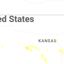


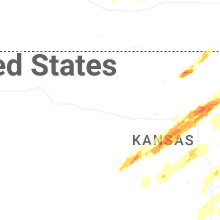


Connect with Interactive Hail Maps