

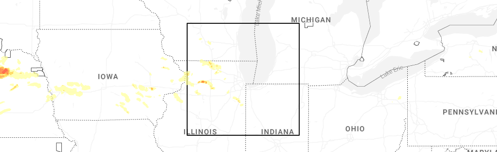
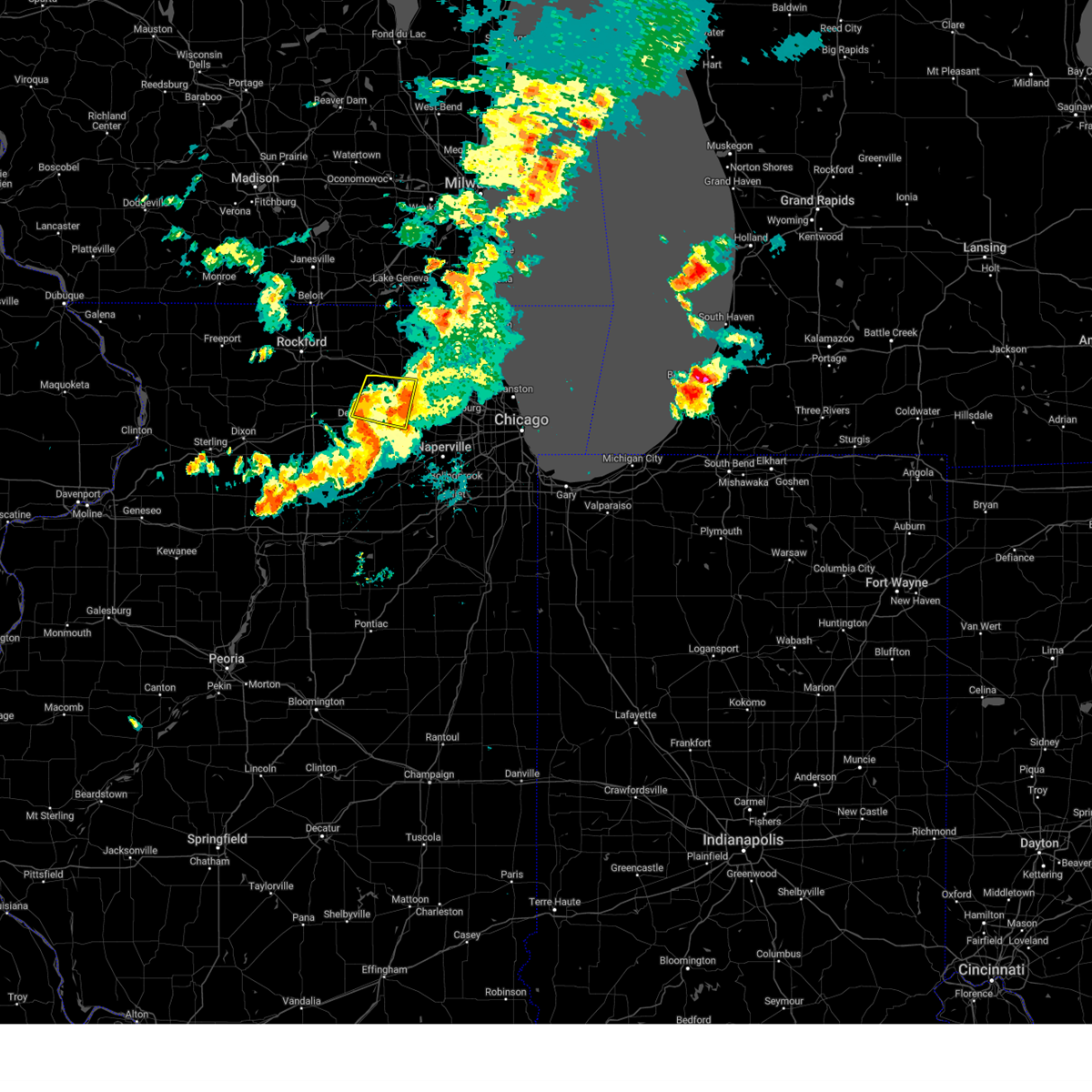
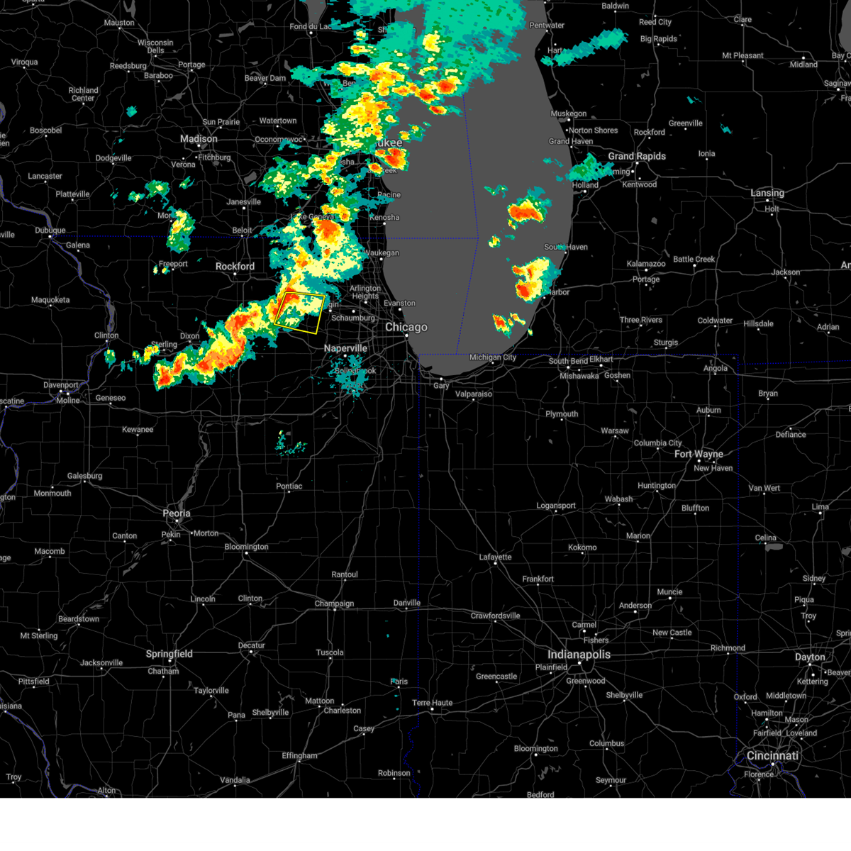
Hail Map for Genoa, IL
The Genoa, IL area has had 4 reports of on-the-ground hail by trained spotters, and has been under severe weather warnings 21 times during the past 12 months. Doppler radar has detected hail at or near Genoa, IL on 57 occasions, including 1 occasion during the past year.
| Name: | Genoa, IL |
| Where Located: | 56.6 miles WNW of Chicago, IL |
| Map: | Google Map for Genoa, IL |
| Population: | 5193 |
| Housing Units: | 1959 |
| More Info: | Search Google for Genoa, IL |
0
The Top Recent Hail Date for Genoa, IL is Thursday, July 10, 2025 (57th out of 57)
Hail and Wind Damage Spotted near Genoa, IL
| Date / Time | Report Details |
|---|---|
| 6/3/2025 1:30 PM CDT | Ildot station southwest of marengo reported 61 mph gus in mchenry county IL, 6 miles S of Genoa, IL |
| 5/15/2025 6:40 PM CDT | Trained spotter reports measured 67 mph gust east of geno in de kalb county IL, 2.6 miles WSW of Genoa, IL |
| 5/15/2025 6:32 PM CDT |
 the severe thunderstorm warning has been cancelled and is no longer in effect the severe thunderstorm warning has been cancelled and is no longer in effect
|
| 5/15/2025 6:32 PM CDT |
 At 632 pm cdt, a severe thunderstorm was located over belvidere, moving northeast at 40 mph (radar indicated). Hazards include 60 mph wind gusts and quarter size hail. Hail damage to vehicles is expected. expect wind damage to roofs, siding, and trees. Locations impacted include, rockford airport, candlewick lake, spring grove, kingston, fairdale, union, woodstock, malta, harvard, hebron, cherry valley, genoa, ringwood, garden prairie, chemung, new milford, poplar grove, greenwood, wonder lake, kirkland, caledonia, dekalb, marengo, sycamore, and bull valley. At 632 pm cdt, a severe thunderstorm was located over belvidere, moving northeast at 40 mph (radar indicated). Hazards include 60 mph wind gusts and quarter size hail. Hail damage to vehicles is expected. expect wind damage to roofs, siding, and trees. Locations impacted include, rockford airport, candlewick lake, spring grove, kingston, fairdale, union, woodstock, malta, harvard, hebron, cherry valley, genoa, ringwood, garden prairie, chemung, new milford, poplar grove, greenwood, wonder lake, kirkland, caledonia, dekalb, marengo, sycamore, and bull valley.
|
| 5/15/2025 6:14 PM CDT |
 At 614 pm cdt, a severe thunderstorm was located over belvidere, moving northeast at 45 mph (radar indicated). Hazards include 60 mph wind gusts and quarter size hail. Hail damage to vehicles is expected. expect wind damage to roofs, siding, and trees. Locations impacted include, rockford airport, candlewick lake, spring grove, kingston, fairdale, union, woodstock, malta, harvard, hebron, cherry valley, genoa, ringwood, garden prairie, chemung, new milford, poplar grove, greenwood, wonder lake, kirkland, rochelle, caledonia, dekalb, marengo, and sycamore. At 614 pm cdt, a severe thunderstorm was located over belvidere, moving northeast at 45 mph (radar indicated). Hazards include 60 mph wind gusts and quarter size hail. Hail damage to vehicles is expected. expect wind damage to roofs, siding, and trees. Locations impacted include, rockford airport, candlewick lake, spring grove, kingston, fairdale, union, woodstock, malta, harvard, hebron, cherry valley, genoa, ringwood, garden prairie, chemung, new milford, poplar grove, greenwood, wonder lake, kirkland, rochelle, caledonia, dekalb, marengo, and sycamore.
|
| 5/15/2025 5:57 PM CDT | Svrlot the national weather service in chicago has issued a * severe thunderstorm warning for, eastern ogle county in north central illinois, northern de kalb county in north central illinois, southeastern winnebago county in north central illinois, mchenry county in northeastern illinois, boone county in north central illinois, * until 730 pm cdt. * at 557 pm cdt, a severe thunderstorm was located over davis junction, or 7 miles south of rockford airport, moving northeast at 45 mph (radar indicated). Hazards include 60 mph wind gusts and quarter size hail. Hail damage to vehicles is expected. Expect wind damage to roofs, siding, and trees. |
| 3/15/2025 12:10 AM CDT |
 The storms which prompted the warning have weakened below severe limits, and have exited the warned area. therefore, the warning will be allowed to expire. a severe thunderstorm watch remains in effect until 200 am cdt for north central and northeastern illinois. The storms which prompted the warning have weakened below severe limits, and have exited the warned area. therefore, the warning will be allowed to expire. a severe thunderstorm watch remains in effect until 200 am cdt for north central and northeastern illinois.
|
| 3/14/2025 11:43 PM CDT | At 1143 pm cdt, severe thunderstorms were located along a line extending from near footville to plano, moving northeast at 50 mph (radar indicated). Hazards include 70 mph wind gusts. Expect considerable tree damage. damage is likely to mobile homes, roofs, and outbuildings. Locations impacted include, somonauk, rockford airport, candlewick lake, lindenwood, kingston, fairdale, west brooklyn, kings, malta, loves park, cherry valley, cortland, hillcrest, genoa, south beloit, garden prairie, steward, new milford, rockton, poplar grove, compton, kirkland, machesney park, davis junction, and lee. |
| 3/14/2025 11:18 PM CDT | At 1118 pm cdt, severe thunderstorms were located along a line extending from 6 miles southwest of brodhead to near earlville, moving east at 40 mph (radar indicated). Hazards include 70 mph wind gusts. Expect considerable tree damage. damage is likely to mobile homes, roofs, and outbuildings. Locations impacted include, somonauk, candlewick lake, lindenwood, seward, lake summerset, fairdale, loves park, cherry valley, genoa, garden prairie, poplar grove, compton, winnebago, kirkland, rochelle, dekalb, harrison, shabbona, rockford, creston, roscoe, belvidere, capron, pecatonica, and rockford airport. |
| 3/14/2025 10:59 PM CDT | Svrlot the national weather service in chicago has issued a * severe thunderstorm warning for, eastern lee county in north central illinois, eastern ogle county in north central illinois, de kalb county in north central illinois, winnebago county in north central illinois, boone county in north central illinois, * until 1215 am cdt. * at 1058 pm cdt, severe thunderstorms were located along a line extending from near winslow to mendota, moving east at 40 mph (radar indicated). Hazards include 70 mph wind gusts. Expect considerable tree damage. Damage is likely to mobile homes, roofs, and outbuildings. |
| 8/16/2024 7:10 PM CDT |
 The storm which prompted the warning has moved out of the area. therefore, the warning will be allowed to expire. however, gusty winds are still possible with this thunderstorm. remember, a severe thunderstorm warning still remains in effect for kane county. The storm which prompted the warning has moved out of the area. therefore, the warning will be allowed to expire. however, gusty winds are still possible with this thunderstorm. remember, a severe thunderstorm warning still remains in effect for kane county.
|
| 8/16/2024 6:45 PM CDT |
 Svrlot the national weather service in chicago has issued a * severe thunderstorm warning for, northeastern de kalb county in north central illinois, northwestern kane county in northeastern illinois, * until 715 pm cdt. * at 644 pm cdt, a severe thunderstorm was located near hampshire, or near genoa, moving east at 35 mph (radar indicated). Hazards include 60 mph wind gusts. expect damage to roofs, siding, and trees Svrlot the national weather service in chicago has issued a * severe thunderstorm warning for, northeastern de kalb county in north central illinois, northwestern kane county in northeastern illinois, * until 715 pm cdt. * at 644 pm cdt, a severe thunderstorm was located near hampshire, or near genoa, moving east at 35 mph (radar indicated). Hazards include 60 mph wind gusts. expect damage to roofs, siding, and trees
|
| 7/15/2024 8:45 PM CDT |
 The storm which prompted the warning has moved out of the area. therefore, the warning has been allowed to expire. a tornado watch remains in effect until 100 am cdt for north central and northeastern illinois. to report severe weather, contact your nearest law enforcement agency. they will relay your report to the national weather service chicago. The storm which prompted the warning has moved out of the area. therefore, the warning has been allowed to expire. a tornado watch remains in effect until 100 am cdt for north central and northeastern illinois. to report severe weather, contact your nearest law enforcement agency. they will relay your report to the national weather service chicago.
|
| 7/15/2024 8:34 PM CDT |
 At 834 pm cdt, severe thunderstorms were located along a line extending from near harvard to near marengo to near sycamore to near waterman, moving east at 45 mph (radar indicated). Hazards include 70 mph wind gusts. Expect considerable tree damage. damage is likely to mobile homes, roofs, and outbuildings. locations impacted include, aurora, elgin, dekalb, bartlett, crystal lake, carpentersville, st. Charles, algonquin, lake in the hills, west chicago, mchenry, batavia, belvidere, woodstock, huntley, geneva, sycamore, campton hills, fox lake, harvard, island lake, marengo, poplar grove, genoa, and south elgin. At 834 pm cdt, severe thunderstorms were located along a line extending from near harvard to near marengo to near sycamore to near waterman, moving east at 45 mph (radar indicated). Hazards include 70 mph wind gusts. Expect considerable tree damage. damage is likely to mobile homes, roofs, and outbuildings. locations impacted include, aurora, elgin, dekalb, bartlett, crystal lake, carpentersville, st. Charles, algonquin, lake in the hills, west chicago, mchenry, batavia, belvidere, woodstock, huntley, geneva, sycamore, campton hills, fox lake, harvard, island lake, marengo, poplar grove, genoa, and south elgin.
|
| 7/15/2024 8:32 PM CDT |
 At 832 pm cdt, a severe squall line capable of producing both tornadoes and extensive straight line wind damage was located over genoa, moving east at 35 mph (radar indicated rotation). Hazards include tornadoes. Flying debris will be dangerous to those caught without shelter. mobile homes will be damaged or destroyed. damage to roofs, windows, and vehicles will occur. tree damage is likely. These dangerous storms will be near, genoa around 835 pm cdt. At 832 pm cdt, a severe squall line capable of producing both tornadoes and extensive straight line wind damage was located over genoa, moving east at 35 mph (radar indicated rotation). Hazards include tornadoes. Flying debris will be dangerous to those caught without shelter. mobile homes will be damaged or destroyed. damage to roofs, windows, and vehicles will occur. tree damage is likely. These dangerous storms will be near, genoa around 835 pm cdt.
|
| 7/15/2024 8:22 PM CDT |
 the severe thunderstorm warning has been cancelled and is no longer in effect the severe thunderstorm warning has been cancelled and is no longer in effect
|
| 7/15/2024 8:22 PM CDT |
 At 822 pm cdt, severe thunderstorms were located along a line extending from 6 miles southwest of sharon to near belvidere to near kirkland to near shabbona, moving east at 45 mph (radar indicated). Hazards include 70 mph wind gusts. Expect considerable tree damage. damage is likely to mobile homes, roofs, and outbuildings. locations impacted include, aurora, elgin, dekalb, bartlett, crystal lake, carpentersville, st. Charles, algonquin, lake in the hills, west chicago, mchenry, batavia, belvidere, woodstock, huntley, loves park, geneva, sycamore, campton hills, fox lake, harvard, island lake, marengo, poplar grove, and genoa. At 822 pm cdt, severe thunderstorms were located along a line extending from 6 miles southwest of sharon to near belvidere to near kirkland to near shabbona, moving east at 45 mph (radar indicated). Hazards include 70 mph wind gusts. Expect considerable tree damage. damage is likely to mobile homes, roofs, and outbuildings. locations impacted include, aurora, elgin, dekalb, bartlett, crystal lake, carpentersville, st. Charles, algonquin, lake in the hills, west chicago, mchenry, batavia, belvidere, woodstock, huntley, loves park, geneva, sycamore, campton hills, fox lake, harvard, island lake, marengo, poplar grove, and genoa.
|
| 7/15/2024 8:16 PM CDT | the tornado warning has been cancelled and is no longer in effect |
| 7/15/2024 8:16 PM CDT | At 815 pm cdt, a severe squall line capable of producing both tornadoes and extensive straight line wind damage was located over kirkland, or 9 miles west of genoa, moving east at 40 mph (radar indicated rotation). Hazards include tornadoes. Flying debris will be dangerous to those caught without shelter. mobile homes will be damaged or destroyed. damage to roofs, windows, and vehicles will occur. tree damage is likely. These dangerous storms will be near, genoa, kirkland, and kingston around 820 pm cdt. |
| 7/15/2024 8:08 PM CDT | Torlot the national weather service in chicago has issued a * tornado warning for, southeastern ogle county in north central illinois, northern de kalb county in north central illinois, * until 845 pm cdt. * at 808 pm cdt, severe thunderstorms capable of producing both tornadoes and extensive straight line wind damage were located near davis junction, or 9 miles southeast of rockford airport, moving east at 40 mph (radar indicated rotation). Hazards include tornado. Flying debris will be dangerous to those caught without shelter. mobile homes will be damaged or destroyed. damage to roofs, windows, and vehicles will occur. tree damage is likely. these dangerous storms will be near, kirkland and kingston around 815 pm cdt. Genoa around 820 pm cdt. |
| 7/15/2024 8:01 PM CDT | Svrlot the national weather service in chicago has issued a * severe thunderstorm warning for, southeastern ogle county in north central illinois, eastern lee county in north central illinois, de kalb county in north central illinois, eastern winnebago county in north central illinois, kane county in northeastern illinois, mchenry county in northeastern illinois, boone county in north central illinois, * until 915 pm cdt. * at 801 pm cdt, severe thunderstorms were located along a line extending from near rockton to rockford airport to near davis junction to near ashton, moving east at 45 mph (radar indicated). Hazards include 70 mph wind gusts. Expect considerable tree damage. Damage is likely to mobile homes, roofs, and outbuildings. |
| 7/14/2024 9:23 PM CDT |
 At 922 pm cdt, severe thunderstorms were located along a line extending from near hampshire to cortland, moving east at 40 mph (radar indicated). Hazards include 70 mph wind gusts and quarter size hail. Hail damage to vehicles is expected. expect considerable tree damage. wind damage is also likely to mobile homes, roofs, and outbuildings. locations impacted include, aurora, elgin, dekalb, bartlett, carpentersville, st. Charles, algonquin, west chicago, batavia, huntley, geneva, sycamore, campton hills, genoa, south elgin, montgomery, north aurora, sugar grove, pingree grove, gilberts, west dundee, hampshire, elburn, cortland, and barrington hills. At 922 pm cdt, severe thunderstorms were located along a line extending from near hampshire to cortland, moving east at 40 mph (radar indicated). Hazards include 70 mph wind gusts and quarter size hail. Hail damage to vehicles is expected. expect considerable tree damage. wind damage is also likely to mobile homes, roofs, and outbuildings. locations impacted include, aurora, elgin, dekalb, bartlett, carpentersville, st. Charles, algonquin, west chicago, batavia, huntley, geneva, sycamore, campton hills, genoa, south elgin, montgomery, north aurora, sugar grove, pingree grove, gilberts, west dundee, hampshire, elburn, cortland, and barrington hills.
|
| 7/14/2024 9:01 PM CDT |
 Svrlot the national weather service in chicago has issued a * severe thunderstorm warning for, de kalb county in north central illinois, kane county in northeastern illinois, * until 1000 pm cdt. * at 901 pm cdt, severe thunderstorms were located along a line extending from near kirkland to near rochelle, moving east at 45 mph (radar indicated). Hazards include 60 mph wind gusts and quarter size hail. Hail damage to vehicles is expected. Expect wind damage to roofs, siding, and trees. Svrlot the national weather service in chicago has issued a * severe thunderstorm warning for, de kalb county in north central illinois, kane county in northeastern illinois, * until 1000 pm cdt. * at 901 pm cdt, severe thunderstorms were located along a line extending from near kirkland to near rochelle, moving east at 45 mph (radar indicated). Hazards include 60 mph wind gusts and quarter size hail. Hail damage to vehicles is expected. Expect wind damage to roofs, siding, and trees.
|
| 6/25/2024 6:39 AM CDT |
 At 639 am cdt, severe thunderstorms were located along a line extending from maple park to near shabbona to walnut, moving east at 45 mph (radar indicated). Hazards include 60 mph wind gusts and quarter size hail. Hail damage to vehicles is expected. expect wind damage to roofs, siding, and trees. Locations impacted include, dekalb, sycamore, dixon, rochelle, sandwich, genoa, oregon, amboy, shabbona, cortland, hinckley, somonauk, kirkland, waterman, hillcrest, maple park, malta, franklin grove, ashton, paw paw, lost nation, sublette, woodhaven lakes, creston, and lindenwood. At 639 am cdt, severe thunderstorms were located along a line extending from maple park to near shabbona to walnut, moving east at 45 mph (radar indicated). Hazards include 60 mph wind gusts and quarter size hail. Hail damage to vehicles is expected. expect wind damage to roofs, siding, and trees. Locations impacted include, dekalb, sycamore, dixon, rochelle, sandwich, genoa, oregon, amboy, shabbona, cortland, hinckley, somonauk, kirkland, waterman, hillcrest, maple park, malta, franklin grove, ashton, paw paw, lost nation, sublette, woodhaven lakes, creston, and lindenwood.
|
| 6/25/2024 6:24 AM CDT |
 At 624 am cdt, severe thunderstorms were located along a line extending from near sycamore to near rochelle to near amboy, moving east at 55 mph (radar indicated). Hazards include 60 mph wind gusts and quarter size hail. Hail damage to vehicles is expected. expect wind damage to roofs, siding, and trees. Locations impacted include, dekalb, sycamore, dixon, rochelle, sandwich, genoa, oregon, amboy, shabbona, cortland, hinckley, somonauk, kirkland, waterman, hillcrest, maple park, malta, franklin grove, ashton, paw paw, lost nation, sublette, woodhaven lakes, creston, and lindenwood. At 624 am cdt, severe thunderstorms were located along a line extending from near sycamore to near rochelle to near amboy, moving east at 55 mph (radar indicated). Hazards include 60 mph wind gusts and quarter size hail. Hail damage to vehicles is expected. expect wind damage to roofs, siding, and trees. Locations impacted include, dekalb, sycamore, dixon, rochelle, sandwich, genoa, oregon, amboy, shabbona, cortland, hinckley, somonauk, kirkland, waterman, hillcrest, maple park, malta, franklin grove, ashton, paw paw, lost nation, sublette, woodhaven lakes, creston, and lindenwood.
|
| 6/22/2024 10:19 PM CDT |
 the severe thunderstorm warning has been cancelled and is no longer in effect the severe thunderstorm warning has been cancelled and is no longer in effect
|
| 6/22/2024 10:19 PM CDT |
 At 1019 pm cdt, severe thunderstorms were located along a line extending from near genoa to near kingston to near sycamore to near malta, moving east at 60 mph (radar indicated). Hazards include 60 mph wind gusts. Expect damage to roofs, siding, and trees. these severe storms will be near, dekalb, sycamore, and cortland around 1025 pm cdt. Maple park around 1030 pm cdt. At 1019 pm cdt, severe thunderstorms were located along a line extending from near genoa to near kingston to near sycamore to near malta, moving east at 60 mph (radar indicated). Hazards include 60 mph wind gusts. Expect damage to roofs, siding, and trees. these severe storms will be near, dekalb, sycamore, and cortland around 1025 pm cdt. Maple park around 1030 pm cdt.
|
| 6/22/2024 10:10 PM CDT |
 At 1010 pm cdt, severe thunderstorms were located along a line extending from near belvidere to kirkland to 7 miles southwest of kingston to near hillcrest, moving east at 50 mph (radar indicated). Hazards include 60 mph wind gusts. Expect damage to roofs, siding, and trees. these severe storms will be near, genoa, kirkland, and kingston around 1015 pm cdt. dekalb and sycamore around 1020 pm cdt. cortland around 1025 pm cdt. Other locations impacted by these severe thunderstorms include fairdale. At 1010 pm cdt, severe thunderstorms were located along a line extending from near belvidere to kirkland to 7 miles southwest of kingston to near hillcrest, moving east at 50 mph (radar indicated). Hazards include 60 mph wind gusts. Expect damage to roofs, siding, and trees. these severe storms will be near, genoa, kirkland, and kingston around 1015 pm cdt. dekalb and sycamore around 1020 pm cdt. cortland around 1025 pm cdt. Other locations impacted by these severe thunderstorms include fairdale.
|
| 6/22/2024 9:59 PM CDT |
 Svrlot the national weather service in chicago has issued a * severe thunderstorm warning for, northern de kalb county in north central illinois, southern boone county in north central illinois, * until 1045 pm cdt. * at 958 pm cdt, severe thunderstorms were located along a line extending from near rockford airport to near davis junction to 6 miles south of stillman valley, moving east at 50 mph (radar indicated). Hazards include 60 mph wind gusts. Expect damage to roofs, siding, and trees. severe thunderstorms will be near, kirkland around 1005 pm cdt. kingston around 1010 pm cdt. dekalb, sycamore, and genoa around 1015 pm cdt. cortland around 1020 pm cdt. maple park around 1030 pm cdt. other locations impacted by these severe thunderstorms include fairdale. including the following interstates, i-88 near mile marker 98. I-90 between mile markers 29 and 31. Svrlot the national weather service in chicago has issued a * severe thunderstorm warning for, northern de kalb county in north central illinois, southern boone county in north central illinois, * until 1045 pm cdt. * at 958 pm cdt, severe thunderstorms were located along a line extending from near rockford airport to near davis junction to 6 miles south of stillman valley, moving east at 50 mph (radar indicated). Hazards include 60 mph wind gusts. Expect damage to roofs, siding, and trees. severe thunderstorms will be near, kirkland around 1005 pm cdt. kingston around 1010 pm cdt. dekalb, sycamore, and genoa around 1015 pm cdt. cortland around 1020 pm cdt. maple park around 1030 pm cdt. other locations impacted by these severe thunderstorms include fairdale. including the following interstates, i-88 near mile marker 98. I-90 between mile markers 29 and 31.
|
| 5/20/2024 1:08 PM CDT |
 The storms which prompted the warning have weakened below severe limits, and no longer pose an immediate threat to life or property. therefore, the warning will be allowed to expire. a severe thunderstorm watch remains in effect until 500 pm cdt for north central and northeastern illinois. The storms which prompted the warning have weakened below severe limits, and no longer pose an immediate threat to life or property. therefore, the warning will be allowed to expire. a severe thunderstorm watch remains in effect until 500 pm cdt for north central and northeastern illinois.
|
| 5/20/2024 1:03 PM CDT |
 At 103 pm cdt, severe thunderstorms were located along a line extending from near belvidere to near kingston, moving northeast at 40 mph (radar indicated). Hazards include 60 mph wind gusts and quarter size hail. Hail damage to vehicles is expected. expect wind damage to roofs, siding, and trees. Locations impacted include, dekalb, sycamore, genoa, kirkland, kingston, and garden prairie. At 103 pm cdt, severe thunderstorms were located along a line extending from near belvidere to near kingston, moving northeast at 40 mph (radar indicated). Hazards include 60 mph wind gusts and quarter size hail. Hail damage to vehicles is expected. expect wind damage to roofs, siding, and trees. Locations impacted include, dekalb, sycamore, genoa, kirkland, kingston, and garden prairie.
|
| 5/20/2024 1:03 PM CDT |
 the severe thunderstorm warning has been cancelled and is no longer in effect the severe thunderstorm warning has been cancelled and is no longer in effect
|
| 5/20/2024 12:50 PM CDT |
 the severe thunderstorm warning has been cancelled and is no longer in effect the severe thunderstorm warning has been cancelled and is no longer in effect
|
| 5/20/2024 12:50 PM CDT |
 At 1250 pm cdt, severe thunderstorms were located along a line extending from near kirkland to near malta, moving northeast at 45 mph (radar indicated). Hazards include 60 mph wind gusts and quarter size hail. Hail damage to vehicles is expected. expect wind damage to roofs, siding, and trees. Locations impacted include, dekalb, sycamore, genoa, kirkland, kingston, malta, garden prairie, and fairdale. At 1250 pm cdt, severe thunderstorms were located along a line extending from near kirkland to near malta, moving northeast at 45 mph (radar indicated). Hazards include 60 mph wind gusts and quarter size hail. Hail damage to vehicles is expected. expect wind damage to roofs, siding, and trees. Locations impacted include, dekalb, sycamore, genoa, kirkland, kingston, malta, garden prairie, and fairdale.
|
| 5/20/2024 12:38 PM CDT |
 Svrlot the national weather service in chicago has issued a * severe thunderstorm warning for, southeastern ogle county in north central illinois, northeastern lee county in north central illinois, northern de kalb county in north central illinois, southwestern mchenry county in northeastern illinois, southeastern boone county in north central illinois, * until 115 pm cdt. * at 1238 pm cdt, severe thunderstorms were located along a line extending from near hillcrest to near rochelle, moving northeast at 40 mph (radar indicated). Hazards include 60 mph wind gusts and quarter size hail. Hail damage to vehicles is expected. Expect wind damage to roofs, siding, and trees. Svrlot the national weather service in chicago has issued a * severe thunderstorm warning for, southeastern ogle county in north central illinois, northeastern lee county in north central illinois, northern de kalb county in north central illinois, southwestern mchenry county in northeastern illinois, southeastern boone county in north central illinois, * until 115 pm cdt. * at 1238 pm cdt, severe thunderstorms were located along a line extending from near hillcrest to near rochelle, moving northeast at 40 mph (radar indicated). Hazards include 60 mph wind gusts and quarter size hail. Hail damage to vehicles is expected. Expect wind damage to roofs, siding, and trees.
|
| 3/4/2024 6:35 PM CST |
 The storm which prompted the warning has weakened below severe limits, and is exiting the warned area. therefore, the warning will be allowed to expire. The storm which prompted the warning has weakened below severe limits, and is exiting the warned area. therefore, the warning will be allowed to expire.
|
| 3/4/2024 6:22 PM CST |
 At 621 pm cst, severe thunderstorms were located north of kingston and genoa, moving northeast at 35 mph (radar indicated). Hazards include 60 mph wind gusts and quarter size hail. Hail damage to vehicles is expected. expect wind damage to roofs, siding, and trees. Locations impacted include, genoa and kingston. At 621 pm cst, severe thunderstorms were located north of kingston and genoa, moving northeast at 35 mph (radar indicated). Hazards include 60 mph wind gusts and quarter size hail. Hail damage to vehicles is expected. expect wind damage to roofs, siding, and trees. Locations impacted include, genoa and kingston.
|
| 3/4/2024 6:14 PM CST |
 At 612 pm cst, severe thunderstorms were located from near kirkland to near kingston, moving northeast at 45 mph (radar indicated). Hazards include 60 mph wind gusts and quarter size hail. Hail damage to vehicles is expected. expect wind damage to roofs, siding, and trees. Locations impacted include, genoa, kirkland, kingston, and fairdale. At 612 pm cst, severe thunderstorms were located from near kirkland to near kingston, moving northeast at 45 mph (radar indicated). Hazards include 60 mph wind gusts and quarter size hail. Hail damage to vehicles is expected. expect wind damage to roofs, siding, and trees. Locations impacted include, genoa, kirkland, kingston, and fairdale.
|
| 3/4/2024 6:01 PM CST |
 Svrlot the national weather service in chicago has issued a * severe thunderstorm warning for, east central ogle county in north central illinois, northern de kalb county in north central illinois, * until 645 pm cst. * at 601 pm cst, severe thunderstorms were located along a line extending from 6 miles southeast of davis junction to near malta, moving northeast at 45 mph (radar indicated). Hazards include 60 mph wind gusts and quarter size hail. Hail damage to vehicles is expected. Expect wind damage to roofs, siding, and trees. Svrlot the national weather service in chicago has issued a * severe thunderstorm warning for, east central ogle county in north central illinois, northern de kalb county in north central illinois, * until 645 pm cst. * at 601 pm cst, severe thunderstorms were located along a line extending from 6 miles southeast of davis junction to near malta, moving northeast at 45 mph (radar indicated). Hazards include 60 mph wind gusts and quarter size hail. Hail damage to vehicles is expected. Expect wind damage to roofs, siding, and trees.
|
| 2/27/2024 6:37 PM CST |
 At 637 pm cst, multiple severe thunderstorms were located along a line extending from shabbona to near cortland, moving east northeast at 25 mph (public). Hazards include ping pong ball size hail and 60 mph wind gusts. People and animals outdoors will be injured. expect hail damage to roofs, siding, windows, and vehicles. expect wind damage to roofs, siding, and trees. locations impacted include, aurora, elgin, dekalb, bartlett, carpentersville, st. Charles, algonquin, west chicago, batavia, huntley, geneva, sycamore, campton hills, sandwich, genoa, shabbona, south elgin, montgomery, north aurora, sugar grove, pingree grove, gilberts, west dundee, hampshire, and elburn. At 637 pm cst, multiple severe thunderstorms were located along a line extending from shabbona to near cortland, moving east northeast at 25 mph (public). Hazards include ping pong ball size hail and 60 mph wind gusts. People and animals outdoors will be injured. expect hail damage to roofs, siding, windows, and vehicles. expect wind damage to roofs, siding, and trees. locations impacted include, aurora, elgin, dekalb, bartlett, carpentersville, st. Charles, algonquin, west chicago, batavia, huntley, geneva, sycamore, campton hills, sandwich, genoa, shabbona, south elgin, montgomery, north aurora, sugar grove, pingree grove, gilberts, west dundee, hampshire, and elburn.
|
| 2/27/2024 6:10 PM CST |
 At 610 pm cst, multiple severe thunderstorms were located along a line extending from 7 miles northwest of paw paw to near shabbona to near maple park, moving northeast at 25 mph (radar indicated). Hazards include golf ball size hail and 60 mph wind gusts. People and animals outdoors will be injured. expect hail damage to roofs, siding, windows, and vehicles. expect wind damage to roofs, siding, and trees. locations impacted include, aurora, elgin, dekalb, bartlett, carpentersville, st. Charles, algonquin, west chicago, batavia, huntley, geneva, sycamore, campton hills, sandwich, genoa, shabbona, south elgin, montgomery, north aurora, sugar grove, pingree grove, gilberts, west dundee, hampshire, and elburn. At 610 pm cst, multiple severe thunderstorms were located along a line extending from 7 miles northwest of paw paw to near shabbona to near maple park, moving northeast at 25 mph (radar indicated). Hazards include golf ball size hail and 60 mph wind gusts. People and animals outdoors will be injured. expect hail damage to roofs, siding, windows, and vehicles. expect wind damage to roofs, siding, and trees. locations impacted include, aurora, elgin, dekalb, bartlett, carpentersville, st. Charles, algonquin, west chicago, batavia, huntley, geneva, sycamore, campton hills, sandwich, genoa, shabbona, south elgin, montgomery, north aurora, sugar grove, pingree grove, gilberts, west dundee, hampshire, and elburn.
|
| 2/27/2024 6:02 PM CST |
 At 602 pm cst, multiple severe thunderstorms were located along a line extending from 7 miles northeast of sublette to shabbona to near maple park, moving northeast at 25 mph (radar indicated). Hazards include ping pong ball size hail and 60 mph wind gusts. People and animals outdoors will be injured. expect hail damage to roofs, siding, windows, and vehicles. expect wind damage to roofs, siding, and trees. locations impacted include, aurora, elgin, dekalb, bartlett, carpentersville, st. Charles, algonquin, west chicago, batavia, huntley, geneva, sycamore, campton hills, sandwich, genoa, shabbona, south elgin, montgomery, north aurora, sugar grove, pingree grove, gilberts, west dundee, hampshire, and elburn. At 602 pm cst, multiple severe thunderstorms were located along a line extending from 7 miles northeast of sublette to shabbona to near maple park, moving northeast at 25 mph (radar indicated). Hazards include ping pong ball size hail and 60 mph wind gusts. People and animals outdoors will be injured. expect hail damage to roofs, siding, windows, and vehicles. expect wind damage to roofs, siding, and trees. locations impacted include, aurora, elgin, dekalb, bartlett, carpentersville, st. Charles, algonquin, west chicago, batavia, huntley, geneva, sycamore, campton hills, sandwich, genoa, shabbona, south elgin, montgomery, north aurora, sugar grove, pingree grove, gilberts, west dundee, hampshire, and elburn.
|
| 2/27/2024 5:44 PM CST |
 Svrlot the national weather service in chicago has issued a * severe thunderstorm warning for, de kalb county in north central illinois, kane county in northeastern illinois, * until 715 pm cst. * at 544 pm cst, severe thunderstorms were located along a line extending from near sublette to near leland, moving northeast at 30 mph (radar indicated). Hazards include ping pong ball size hail and 60 mph wind gusts. People and animals outdoors will be injured. expect hail damage to roofs, siding, windows, and vehicles. Expect wind damage to roofs, siding, and trees. Svrlot the national weather service in chicago has issued a * severe thunderstorm warning for, de kalb county in north central illinois, kane county in northeastern illinois, * until 715 pm cst. * at 544 pm cst, severe thunderstorms were located along a line extending from near sublette to near leland, moving northeast at 30 mph (radar indicated). Hazards include ping pong ball size hail and 60 mph wind gusts. People and animals outdoors will be injured. expect hail damage to roofs, siding, windows, and vehicles. Expect wind damage to roofs, siding, and trees.
|
| 7/28/2023 9:55 PM CDT |
 At 954 pm cdt, severe thunderstorms were located along a line extending from lakewood to near genoa to near kirkland, moving southeast at 35 mph (radar indicated). Hazards include 60 mph wind gusts. expect damage to roofs, siding, and trees At 954 pm cdt, severe thunderstorms were located along a line extending from lakewood to near genoa to near kirkland, moving southeast at 35 mph (radar indicated). Hazards include 60 mph wind gusts. expect damage to roofs, siding, and trees
|
| 7/28/2023 9:53 PM CDT |
 At 952 pm cdt, a severe thunderstorm was located near kirkland, or near belvidere, moving east at 30 mph (radar indicated). Hazards include 60 mph wind gusts and quarter size hail. Hail damage to vehicles is expected. expect wind damage to roofs, siding, and trees. locations impacted include, genoa, cherry valley, kirkland, kingston and fairdale. including the following interstate, i-39 between mile markers 121 and 122. hail threat, radar indicated max hail size, 1. 00 in wind threat, radar indicated max wind gust, 60 mph. At 952 pm cdt, a severe thunderstorm was located near kirkland, or near belvidere, moving east at 30 mph (radar indicated). Hazards include 60 mph wind gusts and quarter size hail. Hail damage to vehicles is expected. expect wind damage to roofs, siding, and trees. locations impacted include, genoa, cherry valley, kirkland, kingston and fairdale. including the following interstate, i-39 between mile markers 121 and 122. hail threat, radar indicated max hail size, 1. 00 in wind threat, radar indicated max wind gust, 60 mph.
|
| 7/28/2023 9:28 PM CDT |
 At 928 pm cdt, a severe thunderstorm was located over rockford airport, moving east at 30 mph (radar indicated). Hazards include 60 mph wind gusts and quarter size hail. Hail damage to vehicles is expected. Expect wind damage to roofs, siding, and trees. At 928 pm cdt, a severe thunderstorm was located over rockford airport, moving east at 30 mph (radar indicated). Hazards include 60 mph wind gusts and quarter size hail. Hail damage to vehicles is expected. Expect wind damage to roofs, siding, and trees.
|
| 7/5/2023 5:27 PM CDT |
 The severe thunderstorm warning for eastern de kalb and kane counties will expire at 530 pm cdt, the storms which prompted the warning have weakened below severe limits, and no longer pose an immediate threat to life or property. therefore, the warning will be allowed to expire. however gusty winds are still possible with these thunderstorms. The severe thunderstorm warning for eastern de kalb and kane counties will expire at 530 pm cdt, the storms which prompted the warning have weakened below severe limits, and no longer pose an immediate threat to life or property. therefore, the warning will be allowed to expire. however gusty winds are still possible with these thunderstorms.
|
| 7/5/2023 4:59 PM CDT |
 At 459 pm cdt, severe thunderstorms were located along a line extending from near genoa to waterman, moving east at 20 mph (radar indicated). Hazards include 60 mph wind gusts and penny size hail. expect damage to roofs, siding, and trees At 459 pm cdt, severe thunderstorms were located along a line extending from near genoa to waterman, moving east at 20 mph (radar indicated). Hazards include 60 mph wind gusts and penny size hail. expect damage to roofs, siding, and trees
|
| 7/5/2023 4:41 PM CDT |
 At 441 pm cdt, a severe thunderstorm was located near dekalb, moving east at 25 mph (radar indicated). Hazards include 60 mph wind gusts and penny size hail. Expect damage to roofs, siding, and trees. locations impacted include, dekalb, sycamore, genoa, cortland, kirkland, maple park, kingston, malta, creston and fairdale. this includes, northern illinois university. including the following interstate, i-88 between mile markers 82 and 101. hail threat, radar indicated max hail size, 0. 75 in wind threat, radar indicated max wind gust, 60 mph. At 441 pm cdt, a severe thunderstorm was located near dekalb, moving east at 25 mph (radar indicated). Hazards include 60 mph wind gusts and penny size hail. Expect damage to roofs, siding, and trees. locations impacted include, dekalb, sycamore, genoa, cortland, kirkland, maple park, kingston, malta, creston and fairdale. this includes, northern illinois university. including the following interstate, i-88 between mile markers 82 and 101. hail threat, radar indicated max hail size, 0. 75 in wind threat, radar indicated max wind gust, 60 mph.
|
| 7/5/2023 4:22 PM CDT |
 At 422 pm cdt, a severe thunderstorm was located near hillcrest, or near rochelle, moving east at 20 mph (radar indicated). Hazards include 60 mph wind gusts and quarter size hail. Hail damage to vehicles is expected. Expect wind damage to roofs, siding, and trees. At 422 pm cdt, a severe thunderstorm was located near hillcrest, or near rochelle, moving east at 20 mph (radar indicated). Hazards include 60 mph wind gusts and quarter size hail. Hail damage to vehicles is expected. Expect wind damage to roofs, siding, and trees.
|
| 6/24/2023 11:42 PM CDT |
 The severe thunderstorm warning for northeastern ogle, northern de kalb, eastern winnebago, western mchenry and boone counties will expire at 1145 pm cdt, the storms which prompted the warning have moved out of the area. therefore, the warning will be allowed to expire. however gusty winds are still possible with these thunderstorms. a severe thunderstorm watch remains in effect until 200 am cdt for north central illinois. The severe thunderstorm warning for northeastern ogle, northern de kalb, eastern winnebago, western mchenry and boone counties will expire at 1145 pm cdt, the storms which prompted the warning have moved out of the area. therefore, the warning will be allowed to expire. however gusty winds are still possible with these thunderstorms. a severe thunderstorm watch remains in effect until 200 am cdt for north central illinois.
|
| 6/24/2023 11:28 PM CDT |
 At 1127 pm cdt, severe thunderstorms were located along a line extending from near capron to near kingston to near hillcrest, moving east at 45 mph (radar indicated). Hazards include 70 mph wind gusts. Expect considerable tree damage. damage is likely to mobile homes, roofs, and outbuildings. locations impacted include, rockford, belvidere, loves park, machesney park, sycamore, roscoe, harvard, marengo, poplar grove, genoa, candlewick lake, cherry valley, davis junction, kirkland, capron, kingston, timberlane, new milford, lindenwood and monroe center. this includes, boone county fairgrounds, rock cut state park, rock valley college, and rockford rivets baseball. thunderstorm damage threat, considerable hail threat, radar indicated max hail size, <. 75 in wind threat, radar indicated max wind gust, 70 mph. At 1127 pm cdt, severe thunderstorms were located along a line extending from near capron to near kingston to near hillcrest, moving east at 45 mph (radar indicated). Hazards include 70 mph wind gusts. Expect considerable tree damage. damage is likely to mobile homes, roofs, and outbuildings. locations impacted include, rockford, belvidere, loves park, machesney park, sycamore, roscoe, harvard, marengo, poplar grove, genoa, candlewick lake, cherry valley, davis junction, kirkland, capron, kingston, timberlane, new milford, lindenwood and monroe center. this includes, boone county fairgrounds, rock cut state park, rock valley college, and rockford rivets baseball. thunderstorm damage threat, considerable hail threat, radar indicated max hail size, <. 75 in wind threat, radar indicated max wind gust, 70 mph.
|
| 6/24/2023 11:12 PM CDT |
 At 1111 pm cdt, severe thunderstorms were located along a line extending from near roscoe to near davis junction to near oregon, moving east at 45 mph (radar indicated). Hazards include 70 mph wind gusts. Expect considerable tree damage. Damage is likely to mobile homes, roofs, and outbuildings. At 1111 pm cdt, severe thunderstorms were located along a line extending from near roscoe to near davis junction to near oregon, moving east at 45 mph (radar indicated). Hazards include 70 mph wind gusts. Expect considerable tree damage. Damage is likely to mobile homes, roofs, and outbuildings.
|
| 4/19/2023 4:39 PM CDT |
 The severe thunderstorm warning for northern de kalb county will expire at 445 pm cdt, the storm which prompted the warning has moved out of the area. therefore, the warning will be allowed to expire. The severe thunderstorm warning for northern de kalb county will expire at 445 pm cdt, the storm which prompted the warning has moved out of the area. therefore, the warning will be allowed to expire.
|
| 4/19/2023 4:29 PM CDT |
 At 429 pm cdt, severe thunderstorms were located from kings to genoa, all moving northeast at 40 mph (radar indicated). Hazards include quarter size hail. Damage to vehicles is expected. locations impacted include, genoa, kirkland and kingston. hail threat, radar indicated max hail size, 1. 00 in wind threat, radar indicated max wind gust, <50 mph. At 429 pm cdt, severe thunderstorms were located from kings to genoa, all moving northeast at 40 mph (radar indicated). Hazards include quarter size hail. Damage to vehicles is expected. locations impacted include, genoa, kirkland and kingston. hail threat, radar indicated max hail size, 1. 00 in wind threat, radar indicated max wind gust, <50 mph.
|
| 4/19/2023 4:16 PM CDT |
 At 416 pm cdt, a severe thunderstorm was located near kirkland, or 7 miles southwest of genoa, moving northeast at 45 mph (radar indicated). Hazards include quarter size hail. Damage to vehicles is expected. locations impacted include, genoa, kirkland and kingston. hail threat, radar indicated max hail size, 1. 00 in wind threat, radar indicated max wind gust, <50 mph. At 416 pm cdt, a severe thunderstorm was located near kirkland, or 7 miles southwest of genoa, moving northeast at 45 mph (radar indicated). Hazards include quarter size hail. Damage to vehicles is expected. locations impacted include, genoa, kirkland and kingston. hail threat, radar indicated max hail size, 1. 00 in wind threat, radar indicated max wind gust, <50 mph.
|
| 4/19/2023 4:05 PM CDT |
 At 405 pm cdt, a severe thunderstorm was located near malta, or 7 miles northeast of rochelle, moving northeast at 45 mph (radar indicated). Hazards include quarter size hail. damage to vehicles is expected At 405 pm cdt, a severe thunderstorm was located near malta, or 7 miles northeast of rochelle, moving northeast at 45 mph (radar indicated). Hazards include quarter size hail. damage to vehicles is expected
|
| 4/5/2023 6:36 AM CDT |
 At 635 am cdt, severe thunderstorms were located along a line extending from elkhorn to near marengo to near genoa, moving east at 55 mph (radar indicated). Hazards include 60 mph wind gusts and penny size hail. Expect damage to roofs, siding, and trees. locations impacted include, crystal lake, algonquin, lake in the hills, mchenry, woodstock, huntley, fox lake, harvard, island lake, marengo, genoa, cary, johnsburg, lakemoor, spring grove, fox river grove, barrington hills, wonder lake, lakewood and pistakee highlands. this includes, mchenry county college, mchenry county fairgrounds, and moraine hills state park. including the following interstate, i-90 between mile markers 29 and 40. hail threat, radar indicated max hail size, 0. 75 in wind threat, radar indicated max wind gust, 60 mph. At 635 am cdt, severe thunderstorms were located along a line extending from elkhorn to near marengo to near genoa, moving east at 55 mph (radar indicated). Hazards include 60 mph wind gusts and penny size hail. Expect damage to roofs, siding, and trees. locations impacted include, crystal lake, algonquin, lake in the hills, mchenry, woodstock, huntley, fox lake, harvard, island lake, marengo, genoa, cary, johnsburg, lakemoor, spring grove, fox river grove, barrington hills, wonder lake, lakewood and pistakee highlands. this includes, mchenry county college, mchenry county fairgrounds, and moraine hills state park. including the following interstate, i-90 between mile markers 29 and 40. hail threat, radar indicated max hail size, 0. 75 in wind threat, radar indicated max wind gust, 60 mph.
|
| 4/5/2023 6:22 AM CDT |
 At 622 am cdt, severe thunderstorms were located along a line extending from darien to near belvidere to near malta, moving east at 55 mph. a wind gust to 49 mph was measured at rockford airport with these storms (radar indicated). Hazards include 60 mph wind gusts. Expect damage to roofs, siding, and trees. locations impacted include, crystal lake, algonquin, lake in the hills, mchenry, belvidere, woodstock, huntley, fox lake, harvard, island lake, marengo, poplar grove, genoa, cary, johnsburg, lakemoor, spring grove, candlewick lake, fox river grove and barrington hills. this includes, boone county fairgrounds, mchenry county college, mchenry county fairgrounds, and moraine hills state park. including the following interstate, i-90 between mile markers 19 and 40. hail threat, radar indicated max hail size, <. 75 in wind threat, radar indicated max wind gust, 60 mph. At 622 am cdt, severe thunderstorms were located along a line extending from darien to near belvidere to near malta, moving east at 55 mph. a wind gust to 49 mph was measured at rockford airport with these storms (radar indicated). Hazards include 60 mph wind gusts. Expect damage to roofs, siding, and trees. locations impacted include, crystal lake, algonquin, lake in the hills, mchenry, belvidere, woodstock, huntley, fox lake, harvard, island lake, marengo, poplar grove, genoa, cary, johnsburg, lakemoor, spring grove, candlewick lake, fox river grove and barrington hills. this includes, boone county fairgrounds, mchenry county college, mchenry county fairgrounds, and moraine hills state park. including the following interstate, i-90 between mile markers 19 and 40. hail threat, radar indicated max hail size, <. 75 in wind threat, radar indicated max wind gust, 60 mph.
|
| 4/5/2023 6:08 AM CDT |
 At 607 am cdt, severe thunderstorms were located along a line extending from 8 miles southeast of ashton to near mendota to 6 miles northeast of dalzell, moving northeast at 65 mph (radar indicated). Hazards include 60 mph wind gusts. Expect damage to roofs, siding, and trees. locations impacted include, dekalb, ottawa, sycamore, peru, la salle, rochelle, sandwich, mendota, sheridan, shabbona, lake holiday, cortland, hinckley, somonauk, earlville, waterman, north utica, hillcrest, maple park and malta. this includes, northern illinois university, sandwich fairgrounds, and tri-county fairgrounds. including the following interstates, i-39 between mile markers 57 and 102. i-80 between mile markers 74 and 103. I-88 between mile markers 71 and 101. At 607 am cdt, severe thunderstorms were located along a line extending from 8 miles southeast of ashton to near mendota to 6 miles northeast of dalzell, moving northeast at 65 mph (radar indicated). Hazards include 60 mph wind gusts. Expect damage to roofs, siding, and trees. locations impacted include, dekalb, ottawa, sycamore, peru, la salle, rochelle, sandwich, mendota, sheridan, shabbona, lake holiday, cortland, hinckley, somonauk, earlville, waterman, north utica, hillcrest, maple park and malta. this includes, northern illinois university, sandwich fairgrounds, and tri-county fairgrounds. including the following interstates, i-39 between mile markers 57 and 102. i-80 between mile markers 74 and 103. I-88 between mile markers 71 and 101.
|
| 4/5/2023 6:03 AM CDT |
 At 603 am cdt, severe thunderstorms were located along a line extending from beloit to near rockford airport to near rochelle, moving east at 55 mph (radar indicated). Hazards include 60 mph wind gusts. expect damage to roofs, siding, and trees At 603 am cdt, severe thunderstorms were located along a line extending from beloit to near rockford airport to near rochelle, moving east at 55 mph (radar indicated). Hazards include 60 mph wind gusts. expect damage to roofs, siding, and trees
|
| 4/5/2023 5:55 AM CDT |
 At 555 am cdt, severe thunderstorms were located along a line extending from amboy to la moille to near depue, moving northeast at 65 mph (radar indicated). Hazards include 60 mph wind gusts. expect damage to roofs, siding, and trees At 555 am cdt, severe thunderstorms were located along a line extending from amboy to la moille to near depue, moving northeast at 65 mph (radar indicated). Hazards include 60 mph wind gusts. expect damage to roofs, siding, and trees
|
| 4/4/2023 12:53 PM CDT |
 At 1252 pm cdt, severe thunderstorms were located along a line extending from near kingston to near sycamore to near dekalb, moving east at 45 mph (radar indicated). Hazards include 70 mph wind gusts and ping pong ball size hail. People and animals outdoors will be injured. expect hail damage to roofs, siding, windows, and vehicles. expect considerable tree damage. wind damage is also likely to mobile homes, roofs, and outbuildings. locations impacted include, dekalb, lake in the hills, belvidere, woodstock, huntley, sycamore, marengo, genoa, pingree grove, hampshire, cortland, kirkland, kingston, malta, lily lake, burlington, union, garden prairie, virgil and fairdale. this includes, northern illinois university. including the following interstate, i-90 between mile markers 22 and 47. thunderstorm damage threat, considerable hail threat, radar indicated max hail size, 1. 50 in wind threat, radar indicated max wind gust, 70 mph. At 1252 pm cdt, severe thunderstorms were located along a line extending from near kingston to near sycamore to near dekalb, moving east at 45 mph (radar indicated). Hazards include 70 mph wind gusts and ping pong ball size hail. People and animals outdoors will be injured. expect hail damage to roofs, siding, windows, and vehicles. expect considerable tree damage. wind damage is also likely to mobile homes, roofs, and outbuildings. locations impacted include, dekalb, lake in the hills, belvidere, woodstock, huntley, sycamore, marengo, genoa, pingree grove, hampshire, cortland, kirkland, kingston, malta, lily lake, burlington, union, garden prairie, virgil and fairdale. this includes, northern illinois university. including the following interstate, i-90 between mile markers 22 and 47. thunderstorm damage threat, considerable hail threat, radar indicated max hail size, 1. 50 in wind threat, radar indicated max wind gust, 70 mph.
|
| 4/4/2023 12:38 PM CDT |
 At 1237 pm cdt, severe thunderstorms were located along a line extending from near davis junction to 7 miles northeast of hillcrest to near rochelle, moving east at 50 mph (radar indicated). Hazards include 70 mph wind gusts and ping pong ball size hail. People and animals outdoors will be injured. expect hail damage to roofs, siding, windows, and vehicles. expect considerable tree damage. Wind damage is also likely to mobile homes, roofs, and outbuildings. At 1237 pm cdt, severe thunderstorms were located along a line extending from near davis junction to 7 miles northeast of hillcrest to near rochelle, moving east at 50 mph (radar indicated). Hazards include 70 mph wind gusts and ping pong ball size hail. People and animals outdoors will be injured. expect hail damage to roofs, siding, windows, and vehicles. expect considerable tree damage. Wind damage is also likely to mobile homes, roofs, and outbuildings.
|
| 11/5/2022 11:23 AM CDT |
 At 1122 am cdt, severe thunderstorms were located along a line extending from near marengo to near batavia to channahon to near herscher, moving east at 45 mph. brief spin-ups and localized enhanced areas of wind damage are possible along this line (radar indicated). Hazards include 60 mph wind gusts. Expect damage to roofs, siding, and trees. locations impacted include, aurora, joliet, elgin, bartlett, plainfield, carpentersville, st. charles, oswego, algonquin, west chicago, batavia, huntley, geneva, yorkville, campton hills, minooka, genoa, south elgin, montgomery and north aurora. this includes, aurora university, elgin community college, fermilab, il math and science academy, kane county cougars ballpark, and waubonsee community college. including the following interstates, i-80 between mile markers 120 and 122. i-88 between mile markers 104 and 120. I-90 between mile markers 42 and 56. At 1122 am cdt, severe thunderstorms were located along a line extending from near marengo to near batavia to channahon to near herscher, moving east at 45 mph. brief spin-ups and localized enhanced areas of wind damage are possible along this line (radar indicated). Hazards include 60 mph wind gusts. Expect damage to roofs, siding, and trees. locations impacted include, aurora, joliet, elgin, bartlett, plainfield, carpentersville, st. charles, oswego, algonquin, west chicago, batavia, huntley, geneva, yorkville, campton hills, minooka, genoa, south elgin, montgomery and north aurora. this includes, aurora university, elgin community college, fermilab, il math and science academy, kane county cougars ballpark, and waubonsee community college. including the following interstates, i-80 between mile markers 120 and 122. i-88 between mile markers 104 and 120. I-90 between mile markers 42 and 56.
|
| 11/5/2022 10:52 AM CDT |
 At 1052 am cdt, severe thunderstorms were located along a line extending from near cherry valley to near waterman to near marseilles to near odell, moving east at 40 mph (radar indicated). Hazards include 60 mph wind gusts. expect damage to roofs, siding, and trees At 1052 am cdt, severe thunderstorms were located along a line extending from near cherry valley to near waterman to near marseilles to near odell, moving east at 40 mph (radar indicated). Hazards include 60 mph wind gusts. expect damage to roofs, siding, and trees
|
| 9/20/2022 4:53 PM CDT |
 At 453 pm cdt, a severe thunderstorm was located near cherry valley, or 7 miles east of rockford airport, moving southeast at 30 mph (radar indicated). Hazards include 60 mph wind gusts and quarter size hail. Hail damage to vehicles is expected. expect wind damage to roofs, siding, and trees. locations impacted include, rockford, belvidere, genoa, cherry valley, davis junction, kirkland, kingston, new milford, monroe center and fairdale. including the following interstates, i-39 between mile markers 109 and 123. i-90 between mile markers 15 and 31. hail threat, radar indicated max hail size, 1. 00 in wind threat, radar indicated max wind gust, 60 mph. At 453 pm cdt, a severe thunderstorm was located near cherry valley, or 7 miles east of rockford airport, moving southeast at 30 mph (radar indicated). Hazards include 60 mph wind gusts and quarter size hail. Hail damage to vehicles is expected. expect wind damage to roofs, siding, and trees. locations impacted include, rockford, belvidere, genoa, cherry valley, davis junction, kirkland, kingston, new milford, monroe center and fairdale. including the following interstates, i-39 between mile markers 109 and 123. i-90 between mile markers 15 and 31. hail threat, radar indicated max hail size, 1. 00 in wind threat, radar indicated max wind gust, 60 mph.
|
| 9/20/2022 4:37 PM CDT |
 At 437 pm cdt, a severe thunderstorm was located over rockford airport, moving southeast at 30 mph (radar indicated). Hazards include 60 mph wind gusts and half dollar size hail. Hail damage to vehicles is expected. Expect wind damage to roofs, siding, and trees. At 437 pm cdt, a severe thunderstorm was located over rockford airport, moving southeast at 30 mph (radar indicated). Hazards include 60 mph wind gusts and half dollar size hail. Hail damage to vehicles is expected. Expect wind damage to roofs, siding, and trees.
|
| 8/29/2022 11:51 AM CDT | At 1150 am cdt, severe thunderstorms were located along a line extending from hampshire to near lily lake to near plano, moving east at 50 mph (radar indicated). Hazards include 60 mph wind gusts. Expect damage to roofs, siding, and trees. locations impacted include, aurora, naperville, elgin, schaumburg, bolingbrook, palatine, wheaton, hoffman estates, downers grove, dekalb, lombard, bartlett, streamwood, carol stream, romeoville, hanover park, carpentersville, addison, glendale heights and elk grove village. this includes, schaumburg boomers baseball, aurora university, benedictine university, college of dupage, dupage county fairgrounds, elgin community college, fermilab, harper college, il math and science academy, kane county cougars ballpark, morton arboretum, waubonsee community college, and wheaton college. hail threat, radar indicated max hail size, <. 75 in wind threat, radar indicated max wind gust, 60 mph. |
| 8/29/2022 11:40 AM CDT | The national weather service in chicago has issued a * severe thunderstorm warning for. northern kendall county in northeastern illinois. northwestern will county in northeastern illinois. central de kalb county in north central illinois. Kane county in northeastern illinois. |
| 8/28/2022 4:21 PM CDT | At 420 pm cdt, severe thunderstorms were located along a line extending from delavan to near hebron to near woodstock, moving east at 35 mph (radar indicated). Hazards include 60 mph wind gusts and penny size hail. Expect damage to roofs, siding, and trees. these severe storms will be near, hebron around 425 pm cdt. other locations impacted by these severe thunderstorms include chemung and union. Including the following interstate, i-90 between mile markers 32 and 40. |
| 8/28/2022 4:02 PM CDT | At 401 pm cdt, severe thunderstorms were located along a line extending from near kingston to near serena, moving northeast at 40 mph (radar indicated). Hazards include 60 mph wind gusts and quarter size hail. Hail damage to vehicles is expected. expect wind damage to roofs, siding, and trees. locations impacted include, dekalb, sycamore, la salle, sandwich, mendota, shabbona, lake holiday, cortland, hinckley, somonauk, earlville, waterman, maple park, malta, leland, paw paw, lee, compton, steward and troy grove. this includes, northern illinois university, sandwich fairgrounds, and tri-county fairgrounds. including the following interstates, i-39 between mile markers 56 and 93. i-80 between mile markers 77 and 81. I-88 between mile markers 83 and 101. |
| 8/28/2022 3:48 PM CDT | At 348 pm cdt, severe thunderstorms were located along a line extending from 6 miles northeast of roscoe to near capron to near kingston, moving east at 35 mph (radar indicated). Hazards include 60 mph wind gusts and penny size hail. Expect damage to roofs, siding, and trees. these severe storms will be near, genoa around 355 pm cdt. marengo around 400 pm cdt. woodstock around 410 pm cdt. harvard around 415 pm cdt. hebron around 425 pm cdt. other locations impacted by these severe thunderstorms include garden prairie, chemung, union and caledonia. this includes, boone county fairgrounds. Including the following interstate, i-90 between mile markers 20 and 40. |
| 8/28/2022 3:38 PM CDT | At 337 pm cdt, severe thunderstorms were located along a line extending from near malta to north utica, moving northeast at 50 mph (radar indicated). Hazards include 60 mph wind gusts and penny size hail. Expect damage to roofs, siding, and trees. locations impacted include, dekalb, sycamore, peru, la salle, sandwich, mendota, shabbona, lake holiday, cortland, oglesby, hinckley, somonauk, earlville, waterman, north utica, maple park, malta, leland, paw paw and lee. this includes, northern illinois university, sandwich fairgrounds, illinois valley community college, and tri-county fairgrounds. including the following interstates, i-39 between mile markers 53 and 94. i-80 between mile markers 74 and 83. I-88 between mile markers 83 and 101. |
| 8/28/2022 3:27 PM CDT | At 327 pm cdt, severe thunderstorms were located along a line extending from near machesney park to near cherry valley to 6 miles northeast of hillcrest, moving northeast at 35 mph (radar indicated). Hazards include 60 mph wind gusts and penny size hail. Expect damage to roofs, siding, and trees. severe thunderstorms will be near, belvidere and cherry valley around 330 pm cdt. loves park, candlewick lake and timberlane around 335 pm cdt. poplar grove around 340 pm cdt. kingston around 345 pm cdt. capron around 350 pm cdt. genoa around 355 pm cdt. harvard around 400 pm cdt. marengo around 410 pm cdt. other locations impacted by these severe thunderstorms include fairdale, garden prairie, chemung, union and caledonia. including the following interstate, i-90 between mile markers 19 and 40. This includes, boone county fairgrounds. |
| 8/28/2022 3:17 PM CDT | At 317 pm cdt, severe thunderstorms were located along a line extending from 7 miles southeast of ashton to near granville, moving northeast at 40 mph (radar indicated). Hazards include 60 mph wind gusts and penny size hail. expect damage to roofs, siding, and trees |
| 7/23/2022 5:55 AM CDT |
 The severe thunderstorm warning for eastern ogle, eastern lee and de kalb counties will expire at 600 am cdt, the storm which prompted the warning has weakened below severe limits, and has exited the warned area. therefore, the warning will be allowed to expire. a severe thunderstorm watch remains in effect until 1000 am cdt for north central and northeastern illinois. The severe thunderstorm warning for eastern ogle, eastern lee and de kalb counties will expire at 600 am cdt, the storm which prompted the warning has weakened below severe limits, and has exited the warned area. therefore, the warning will be allowed to expire. a severe thunderstorm watch remains in effect until 1000 am cdt for north central and northeastern illinois.
|
| 7/23/2022 5:35 AM CDT |
 At 533 am cdt, an area of rain behind earlier thunderstorms was producing severe wind gusts. rochelle recently gusted to 58 mph in these showers with occasional lightning (surface observations). Hazards include 60 mph wind gusts. Expect damage to roofs, siding, and trees. locations impacted include, dekalb, sycamore, rochelle, sandwich, genoa, shabbona, cortland, davis junction, hinckley, somonauk, kirkland, waterman, hillcrest, maple park, kingston, malta, paw paw, creston, lindenwood and monroe center. this includes, northern illinois university and sandwich fairgrounds. including the following interstates, i-39 between mile markers 78 and 114. i-88 between mile markers 69 and 101. hail threat, radar indicated max hail size, <. 75 in wind threat, observed max wind gust, 60 mph. At 533 am cdt, an area of rain behind earlier thunderstorms was producing severe wind gusts. rochelle recently gusted to 58 mph in these showers with occasional lightning (surface observations). Hazards include 60 mph wind gusts. Expect damage to roofs, siding, and trees. locations impacted include, dekalb, sycamore, rochelle, sandwich, genoa, shabbona, cortland, davis junction, hinckley, somonauk, kirkland, waterman, hillcrest, maple park, kingston, malta, paw paw, creston, lindenwood and monroe center. this includes, northern illinois university and sandwich fairgrounds. including the following interstates, i-39 between mile markers 78 and 114. i-88 between mile markers 69 and 101. hail threat, radar indicated max hail size, <. 75 in wind threat, observed max wind gust, 60 mph.
|
| 7/23/2022 5:09 AM CDT |
 At 509 am cdt, severe thunderstorms were located along a line extending from near genoa to waterman to near leland, moving east at 50 mph (radar indicated). Hazards include 60 mph wind gusts. Expect damage to roofs, siding, and trees. locations impacted include, dekalb, sycamore, rochelle, sandwich, genoa, shabbona, cortland, davis junction, hinckley, somonauk, kirkland, waterman, hillcrest, maple park, kingston, malta, paw paw, creston, lindenwood and monroe center. this includes, northern illinois university and sandwich fairgrounds. including the following interstates, i-39 between mile markers 78 and 114. i-88 between mile markers 69 and 101. hail threat, radar indicated max hail size, <. 75 in wind threat, radar indicated max wind gust, 60 mph. At 509 am cdt, severe thunderstorms were located along a line extending from near genoa to waterman to near leland, moving east at 50 mph (radar indicated). Hazards include 60 mph wind gusts. Expect damage to roofs, siding, and trees. locations impacted include, dekalb, sycamore, rochelle, sandwich, genoa, shabbona, cortland, davis junction, hinckley, somonauk, kirkland, waterman, hillcrest, maple park, kingston, malta, paw paw, creston, lindenwood and monroe center. this includes, northern illinois university and sandwich fairgrounds. including the following interstates, i-39 between mile markers 78 and 114. i-88 between mile markers 69 and 101. hail threat, radar indicated max hail size, <. 75 in wind threat, radar indicated max wind gust, 60 mph.
|
| 7/23/2022 4:49 AM CDT |
 At 448 am cdt, a severe thunderstorm was located near ashton, or 8 miles west of rochelle, moving east at 35 mph (radar indicated). Hazards include 60 mph wind gusts and quarter size hail. Hail damage to vehicles is expected. Expect wind damage to roofs, siding, and trees. At 448 am cdt, a severe thunderstorm was located near ashton, or 8 miles west of rochelle, moving east at 35 mph (radar indicated). Hazards include 60 mph wind gusts and quarter size hail. Hail damage to vehicles is expected. Expect wind damage to roofs, siding, and trees.
|
| 7/5/2022 7:57 PM CDT |
 At 756 pm cdt, severe thunderstorms were located along a line extending from west dundee to near lily lake to sycamore, moving southeast at 25 mph (radar indicated). Hazards include 60 mph wind gusts and penny size hail. Expect damage to roofs, siding, and trees. locations impacted include, elgin, bartlett, carpentersville, st. charles, algonquin, huntley, sycamore, campton hills, genoa, south elgin, pingree grove, gilberts, west dundee, hampshire, cortland, barrington hills, sleepy hollow, east dundee, wayne and valley view. this includes, elgin community college. including the following interstate, i-90 between mile markers 42 and 56. hail threat, radar indicated max hail size, 0. 75 in wind threat, radar indicated max wind gust, 60 mph. At 756 pm cdt, severe thunderstorms were located along a line extending from west dundee to near lily lake to sycamore, moving southeast at 25 mph (radar indicated). Hazards include 60 mph wind gusts and penny size hail. Expect damage to roofs, siding, and trees. locations impacted include, elgin, bartlett, carpentersville, st. charles, algonquin, huntley, sycamore, campton hills, genoa, south elgin, pingree grove, gilberts, west dundee, hampshire, cortland, barrington hills, sleepy hollow, east dundee, wayne and valley view. this includes, elgin community college. including the following interstate, i-90 between mile markers 42 and 56. hail threat, radar indicated max hail size, 0. 75 in wind threat, radar indicated max wind gust, 60 mph.
|
| 7/5/2022 7:45 PM CDT | Quarter sized hail reported 1.7 miles NNW of Genoa, IL, 1 inch hail reported just south of genoa. time estimated by radar. |
| 7/5/2022 7:37 PM CDT |
 At 736 pm cdt, severe thunderstorms were located along a line extending from crystal lake to near hampshire to genoa, moving southeast at 20 mph. strong outflow winds are also occurring well ahead of the thunderstorms (radar indicated). Hazards include 60 mph wind gusts. Expect damage to roofs, siding, and trees. locations impacted include, elgin, bartlett, crystal lake, carpentersville, st. charles, algonquin, lake in the hills, huntley, sycamore, campton hills, genoa, south elgin, cary, pingree grove, gilberts, west dundee, hampshire, fox river grove, cortland and barrington hills. this includes, elgin community college and mchenry county college. including the following interstate, i-90 between mile markers 40 and 56. hail threat, radar indicated max hail size, <. 75 in wind threat, radar indicated max wind gust, 60 mph. At 736 pm cdt, severe thunderstorms were located along a line extending from crystal lake to near hampshire to genoa, moving southeast at 20 mph. strong outflow winds are also occurring well ahead of the thunderstorms (radar indicated). Hazards include 60 mph wind gusts. Expect damage to roofs, siding, and trees. locations impacted include, elgin, bartlett, crystal lake, carpentersville, st. charles, algonquin, lake in the hills, huntley, sycamore, campton hills, genoa, south elgin, cary, pingree grove, gilberts, west dundee, hampshire, fox river grove, cortland and barrington hills. this includes, elgin community college and mchenry county college. including the following interstate, i-90 between mile markers 40 and 56. hail threat, radar indicated max hail size, <. 75 in wind threat, radar indicated max wind gust, 60 mph.
|
| 7/5/2022 7:14 PM CDT |
 At 712 pm cdt, severe thunderstorms winds were located along a line extending from near woodstock to near herbert, moving southeast at 30 mph. strong outflow winds are also occurring well ahead of the thunderstorms (radar indicated). Hazards include 60 mph wind gusts. expect damage to roofs, siding, and trees At 712 pm cdt, severe thunderstorms winds were located along a line extending from near woodstock to near herbert, moving southeast at 30 mph. strong outflow winds are also occurring well ahead of the thunderstorms (radar indicated). Hazards include 60 mph wind gusts. expect damage to roofs, siding, and trees
|
| 7/4/2022 4:32 PM CDT |
 At 432 pm cdt, a severe thunderstorm was located near malta, or 9 miles northeast of rochelle, moving southeast at 30 mph (radar indicated). Hazards include 60 mph wind gusts and quarter size hail. Hail damage to vehicles is expected. expect wind damage to roofs, siding, and trees. locations impacted include, dekalb, sycamore, genoa, cortland, kirkland, maple park, kingston, malta and creston. this includes, northern illinois university. including the following interstates, i-39 between mile markers 103 and 104. i-88 between mile markers 81 and 101. hail threat, radar indicated max hail size, 1. 00 in wind threat, radar indicated max wind gust, 60 mph. At 432 pm cdt, a severe thunderstorm was located near malta, or 9 miles northeast of rochelle, moving southeast at 30 mph (radar indicated). Hazards include 60 mph wind gusts and quarter size hail. Hail damage to vehicles is expected. expect wind damage to roofs, siding, and trees. locations impacted include, dekalb, sycamore, genoa, cortland, kirkland, maple park, kingston, malta and creston. this includes, northern illinois university. including the following interstates, i-39 between mile markers 103 and 104. i-88 between mile markers 81 and 101. hail threat, radar indicated max hail size, 1. 00 in wind threat, radar indicated max wind gust, 60 mph.
|
| 7/4/2022 4:07 PM CDT |
 At 407 pm cdt, a severe thunderstorm was located over davis junction, or just south of the rockford airport, moving southeast at 25 mph. a trained spotter earlier reported wind damage near seward (trained weather spotters). Hazards include 60 mph wind gusts and quarter size hail. Hail damage to vehicles is expected. Expect wind damage to roofs, siding, and trees. At 407 pm cdt, a severe thunderstorm was located over davis junction, or just south of the rockford airport, moving southeast at 25 mph. a trained spotter earlier reported wind damage near seward (trained weather spotters). Hazards include 60 mph wind gusts and quarter size hail. Hail damage to vehicles is expected. Expect wind damage to roofs, siding, and trees.
|
| 3/5/2022 10:31 PM CST |
 At 1031 pm cst, severe thunderstorms were located along a line extending from near clinton to marengo to near genoa to near leland, moving east at 60 mph (radar indicated). Hazards include 70 mph wind gusts. Expect considerable tree damage. damage is likely to mobile homes, roofs, and outbuildings. these severe storms will be near, marengo and hampshire around 1035 pm cst. woodstock, huntley, harvard, pingree grove, lakewood and hinckley around 1040 pm cst. crystal lake, gilberts, west dundee, wonder lake, sleepy hollow and bull valley around 1045 pm cst. elgin, carpentersville, algonquin, lake in the hills, mchenry, island lake, cary, spring grove, fox river grove and barrington hills around 1050 pm cst. fox lake, johnsburg, lakemoor, pistakee highlands and richmond around 1055 pm cst. including the following interstates, i-88 between mile markers 88 and 110. i-90 between mile markers 26 and 56. thunderstorm damage threat, considerable hail threat, radar indicated max hail size, <. 75 in wind threat, radar indicated max wind gust, 70 mph. At 1031 pm cst, severe thunderstorms were located along a line extending from near clinton to marengo to near genoa to near leland, moving east at 60 mph (radar indicated). Hazards include 70 mph wind gusts. Expect considerable tree damage. damage is likely to mobile homes, roofs, and outbuildings. these severe storms will be near, marengo and hampshire around 1035 pm cst. woodstock, huntley, harvard, pingree grove, lakewood and hinckley around 1040 pm cst. crystal lake, gilberts, west dundee, wonder lake, sleepy hollow and bull valley around 1045 pm cst. elgin, carpentersville, algonquin, lake in the hills, mchenry, island lake, cary, spring grove, fox river grove and barrington hills around 1050 pm cst. fox lake, johnsburg, lakemoor, pistakee highlands and richmond around 1055 pm cst. including the following interstates, i-88 between mile markers 88 and 110. i-90 between mile markers 26 and 56. thunderstorm damage threat, considerable hail threat, radar indicated max hail size, <. 75 in wind threat, radar indicated max wind gust, 70 mph.
|
| 3/5/2022 10:25 PM CST | Semi truck blown over on route 72 east of genoa. time estimated from rada in de kalb county IL, 3.4 miles W of Genoa, IL |
| 3/5/2022 10:11 PM CST |
 At 1010 pm cst, severe thunderstorms were located along a line extending from 6 miles west of rockton to cherry valley to 6 miles southwest of kirkland to 6 miles west of paw paw, moving northeast at 65 mph (radar indicated). Hazards include 70 mph wind gusts. Expect considerable tree damage. damage is likely to mobile homes, roofs, and outbuildings. severe thunderstorms will be near, belvidere, loves park, cherry valley and kirkland around 1015 pm cst. poplar grove, candlewick lake, kingston and timberlane around 1020 pm cst. genoa, shabbona, waterman and capron around 1025 pm cst. malta around 1030 pm cst. dekalb, harvard, marengo and cortland around 1035 pm cst. crystal lake, sycamore, lakewood, maple park and hebron around 1040 pm cst. woodstock, campton hills, wonder lake, bull valley and lily lake around 1045 pm cst. mchenry, huntley, pingree grove, hampshire, spring grove and mccullom lake around 1050 pm cst. including the following interstates, i-88 between mile markers 83 and 110. i-90 between mile markers 19 and 56. thunderstorm damage threat, considerable hail threat, radar indicated max hail size, <. 75 in wind threat, radar indicated max wind gust, 70 mph. At 1010 pm cst, severe thunderstorms were located along a line extending from 6 miles west of rockton to cherry valley to 6 miles southwest of kirkland to 6 miles west of paw paw, moving northeast at 65 mph (radar indicated). Hazards include 70 mph wind gusts. Expect considerable tree damage. damage is likely to mobile homes, roofs, and outbuildings. severe thunderstorms will be near, belvidere, loves park, cherry valley and kirkland around 1015 pm cst. poplar grove, candlewick lake, kingston and timberlane around 1020 pm cst. genoa, shabbona, waterman and capron around 1025 pm cst. malta around 1030 pm cst. dekalb, harvard, marengo and cortland around 1035 pm cst. crystal lake, sycamore, lakewood, maple park and hebron around 1040 pm cst. woodstock, campton hills, wonder lake, bull valley and lily lake around 1045 pm cst. mchenry, huntley, pingree grove, hampshire, spring grove and mccullom lake around 1050 pm cst. including the following interstates, i-88 between mile markers 83 and 110. i-90 between mile markers 19 and 56. thunderstorm damage threat, considerable hail threat, radar indicated max hail size, <. 75 in wind threat, radar indicated max wind gust, 70 mph.
|
| 8/24/2021 6:33 PM CDT |
 At 632 pm cdt, severe thunderstorms were located along a line extending from near sharon to near kingston to near waterman to near paw paw, moving east at 50 mph. this line of storms has a history of producing winds in excess of 60 mph (radar indicated). Hazards include 60 mph wind gusts. Expect damage to roofs, siding, and trees. locations impacted include, elgin, dekalb, crystal lake, carpentersville, st. charles, algonquin, lake in the hills, mchenry, belvidere, woodstock, huntley, geneva, sycamore, campton hills, fox lake, rochelle, harvard, island lake, marengo and sandwich. hail threat, radar indicated max hail size, <. 75 in wind threat, observed max wind gust, 60 mph. At 632 pm cdt, severe thunderstorms were located along a line extending from near sharon to near kingston to near waterman to near paw paw, moving east at 50 mph. this line of storms has a history of producing winds in excess of 60 mph (radar indicated). Hazards include 60 mph wind gusts. Expect damage to roofs, siding, and trees. locations impacted include, elgin, dekalb, crystal lake, carpentersville, st. charles, algonquin, lake in the hills, mchenry, belvidere, woodstock, huntley, geneva, sycamore, campton hills, fox lake, rochelle, harvard, island lake, marengo and sandwich. hail threat, radar indicated max hail size, <. 75 in wind threat, observed max wind gust, 60 mph.
|
| 8/24/2021 6:09 PM CDT |
 At 608 pm cdt, severe thunderstorms were located along a line extending from rockton to near davis junction to 8 miles northeast of walnut, moving east at 55 mph (radar indicated). Hazards include 60 mph wind gusts. expect damage to roofs, siding, and trees At 608 pm cdt, severe thunderstorms were located along a line extending from rockton to near davis junction to 8 miles northeast of walnut, moving east at 55 mph (radar indicated). Hazards include 60 mph wind gusts. expect damage to roofs, siding, and trees
|
| 8/11/2021 9:56 AM CDT |
 At 956 am cdt, a severe thunderstorm was located near marengo, moving east at 55 mph (trained weather spotters). Hazards include 60 mph wind gusts and nickel size hail. Expect damage to roofs, siding, and trees. locations impacted include, rockford, dekalb, belvidere, loves park, machesney park, sycamore, roscoe, south beloit, rockton, poplar grove, genoa, rockford airport, candlewick lake, cortland, cherry valley, davis junction, kirkland, capron, maple park and kingston. hail threat, radar indicated max hail size, 0. 88 in wind threat, observed max wind gust, 60 mph. At 956 am cdt, a severe thunderstorm was located near marengo, moving east at 55 mph (trained weather spotters). Hazards include 60 mph wind gusts and nickel size hail. Expect damage to roofs, siding, and trees. locations impacted include, rockford, dekalb, belvidere, loves park, machesney park, sycamore, roscoe, south beloit, rockton, poplar grove, genoa, rockford airport, candlewick lake, cortland, cherry valley, davis junction, kirkland, capron, maple park and kingston. hail threat, radar indicated max hail size, 0. 88 in wind threat, observed max wind gust, 60 mph.
|
| 8/11/2021 9:35 AM CDT |
 At 935 am cdt, a severe thunderstorm was located over davis junction, or near rockford airport, moving east at 55 mph (radar indicated). Hazards include 60 mph wind gusts. a 60 mph wind gust was measured at rockford airport, and 52 mph gust was measured in rochelle. the winds may last longer than 30 minutes!. expect damage to roofs, siding, and trees At 935 am cdt, a severe thunderstorm was located over davis junction, or near rockford airport, moving east at 55 mph (radar indicated). Hazards include 60 mph wind gusts. a 60 mph wind gust was measured at rockford airport, and 52 mph gust was measured in rochelle. the winds may last longer than 30 minutes!. expect damage to roofs, siding, and trees
|
| 8/10/2021 7:08 PM CDT |
 At 708 pm cdt, severe thunderstorms were located along a line extending from near harvard to dekalb, moving east at 50 mph (trained weather spotters). Hazards include 60 mph wind gusts and quarter size hail. Hail damage to vehicles is expected. expect wind damage to roofs, siding, and trees. locations impacted include, dekalb, belvidere, sycamore, harvard, marengo, genoa, cortland, kirkland, capron, maple park, kingston, malta, garden prairie and chemung. hail threat, radar indicated max hail size, 1. 00 in wind threat, radar indicated max wind gust, 60 mph. At 708 pm cdt, severe thunderstorms were located along a line extending from near harvard to dekalb, moving east at 50 mph (trained weather spotters). Hazards include 60 mph wind gusts and quarter size hail. Hail damage to vehicles is expected. expect wind damage to roofs, siding, and trees. locations impacted include, dekalb, belvidere, sycamore, harvard, marengo, genoa, cortland, kirkland, capron, maple park, kingston, malta, garden prairie and chemung. hail threat, radar indicated max hail size, 1. 00 in wind threat, radar indicated max wind gust, 60 mph.
|
| 8/10/2021 6:42 PM CDT |
 At 641 pm cdt, severe thunderstorms were located along a line extending from near beloit to near rochelle, moving east at 40 mph. these storms have a history of producing wind damage across winnebago and ogle counties (trained weather spotters). Hazards include 70 mph wind gusts and quarter size hail. Hail damage to vehicles is expected. expect considerable tree damage. wind damage is also likely to mobile homes, roofs, and outbuildings. Locations impacted include, dekalb, belvidere, loves park, sycamore, harvard, marengo, poplar grove, genoa, candlewick lake, cortland, cherry valley, kirkland, sharon, capron, maple park, kingston, malta, timberlane, garden prairie and chemung. At 641 pm cdt, severe thunderstorms were located along a line extending from near beloit to near rochelle, moving east at 40 mph. these storms have a history of producing wind damage across winnebago and ogle counties (trained weather spotters). Hazards include 70 mph wind gusts and quarter size hail. Hail damage to vehicles is expected. expect considerable tree damage. wind damage is also likely to mobile homes, roofs, and outbuildings. Locations impacted include, dekalb, belvidere, loves park, sycamore, harvard, marengo, poplar grove, genoa, candlewick lake, cortland, cherry valley, kirkland, sharon, capron, maple park, kingston, malta, timberlane, garden prairie and chemung.
|
| 8/10/2021 6:26 PM CDT |
 At 626 pm cdt, severe thunderstorms were located along a line extending from 5 miles west of beloit to near ashton, moving east at 40 mph (radar indicated). Hazards include 70 mph wind gusts and quarter size hail. Hail damage to vehicles is expected. expect considerable tree damage. wind damage is also likely to mobile homes, roofs, and outbuildings. Locations impacted include, dekalb, belvidere, loves park, sycamore, harvard, marengo, poplar grove, genoa, candlewick lake, cortland, cherry valley, kirkland, sharon, capron, maple park, kingston, malta, timberlane, garden prairie and chemung. At 626 pm cdt, severe thunderstorms were located along a line extending from 5 miles west of beloit to near ashton, moving east at 40 mph (radar indicated). Hazards include 70 mph wind gusts and quarter size hail. Hail damage to vehicles is expected. expect considerable tree damage. wind damage is also likely to mobile homes, roofs, and outbuildings. Locations impacted include, dekalb, belvidere, loves park, sycamore, harvard, marengo, poplar grove, genoa, candlewick lake, cortland, cherry valley, kirkland, sharon, capron, maple park, kingston, malta, timberlane, garden prairie and chemung.
|
| 8/10/2021 6:16 PM CDT |
 At 616 pm cdt, severe thunderstorms were located along a line extending from near lake summerset to near ashton, moving east at 40 mph (radar indicated). Hazards include 60 mph wind gusts and quarter size hail. Hail damage to vehicles is expected. Expect wind damage to roofs, siding, and trees. At 616 pm cdt, severe thunderstorms were located along a line extending from near lake summerset to near ashton, moving east at 40 mph (radar indicated). Hazards include 60 mph wind gusts and quarter size hail. Hail damage to vehicles is expected. Expect wind damage to roofs, siding, and trees.
|
| 8/9/2021 5:51 PM CDT |
 At 550 pm cdt, a severe thunderstorm capable of producing a tornado was located near lily lake, or 7 miles northwest of campton hills, moving southeast at 15 mph. an additional storm capable of producing a tornado is located near genoa (radar indicated rotation). Hazards include tornado. Flying debris will be dangerous to those caught without shelter. mobile homes will be damaged or destroyed. damage to roofs, windows, and vehicles will occur. tree damage is likely. Locations impacted include, sycamore, genoa, pingree grove, hampshire, kingston, lily lake, burlington and virgil. At 550 pm cdt, a severe thunderstorm capable of producing a tornado was located near lily lake, or 7 miles northwest of campton hills, moving southeast at 15 mph. an additional storm capable of producing a tornado is located near genoa (radar indicated rotation). Hazards include tornado. Flying debris will be dangerous to those caught without shelter. mobile homes will be damaged or destroyed. damage to roofs, windows, and vehicles will occur. tree damage is likely. Locations impacted include, sycamore, genoa, pingree grove, hampshire, kingston, lily lake, burlington and virgil.
|
| 8/9/2021 5:28 PM CDT |
 At 528 pm cdt, a confirmed tornado was located near hampshire, or 7 miles southeast of genoa or due west of burlington, moving east at 20 mph. an additional storm capable of producing a tornado was located 3 miles south of genoa (radar confirmed tornado). Hazards include damaging tornado. Flying debris will be dangerous to those caught without shelter. mobile homes will be damaged or destroyed. damage to roofs, windows, and vehicles will occur. tree damage is likely. Locations impacted include, lily lake and pingree grove. At 528 pm cdt, a confirmed tornado was located near hampshire, or 7 miles southeast of genoa or due west of burlington, moving east at 20 mph. an additional storm capable of producing a tornado was located 3 miles south of genoa (radar confirmed tornado). Hazards include damaging tornado. Flying debris will be dangerous to those caught without shelter. mobile homes will be damaged or destroyed. damage to roofs, windows, and vehicles will occur. tree damage is likely. Locations impacted include, lily lake and pingree grove.
|
| 8/9/2021 5:15 PM CDT |
 At 515 pm cdt, a severe thunderstorm capable of producing a tornado was located over kingston, or near genoa, moving east at 20 mph. another storm capable of producing a tornado was 3 miles south of genoa. these storms have a history of producing tornadoes (radar indicated rotation). Hazards include tornado. Flying debris will be dangerous to those caught without shelter. mobile homes will be damaged or destroyed. damage to roofs, windows, and vehicles will occur. tree damage is likely. this dangerous storm will be near, sycamore and genoa around 530 pm cdt. Other locations in the path of this tornadic thunderstorm include hampshire, lily lake and pingree grove. At 515 pm cdt, a severe thunderstorm capable of producing a tornado was located over kingston, or near genoa, moving east at 20 mph. another storm capable of producing a tornado was 3 miles south of genoa. these storms have a history of producing tornadoes (radar indicated rotation). Hazards include tornado. Flying debris will be dangerous to those caught without shelter. mobile homes will be damaged or destroyed. damage to roofs, windows, and vehicles will occur. tree damage is likely. this dangerous storm will be near, sycamore and genoa around 530 pm cdt. Other locations in the path of this tornadic thunderstorm include hampshire, lily lake and pingree grove.
|
| 8/9/2021 4:53 PM CDT |
 At 453 pm cdt, a confirmed tornado was located approximately 3 miles south of kingston, moving east at 25 mph (weather spotters confirmed tornado). Hazards include damaging tornado. Flying debris will be dangerous to those caught without shelter. mobile homes will be damaged or destroyed. damage to roofs, windows, and vehicles will occur. tree damage is likely. Locations impacted include, sycamore, genoa and kirkland. At 453 pm cdt, a confirmed tornado was located approximately 3 miles south of kingston, moving east at 25 mph (weather spotters confirmed tornado). Hazards include damaging tornado. Flying debris will be dangerous to those caught without shelter. mobile homes will be damaged or destroyed. damage to roofs, windows, and vehicles will occur. tree damage is likely. Locations impacted include, sycamore, genoa and kirkland.
|
| 8/9/2021 4:34 PM CDT |
 At 434 pm cdt, a confirmed tornado was located near kirkland, or 11 miles northwest of dekalb, moving east at 25 mph (weather spotters confirmed tornado). Hazards include damaging tornado. Flying debris will be dangerous to those caught without shelter. mobile homes will be damaged or destroyed. damage to roofs, windows, and vehicles will occur. Tree damage is likely. At 434 pm cdt, a confirmed tornado was located near kirkland, or 11 miles northwest of dekalb, moving east at 25 mph (weather spotters confirmed tornado). Hazards include damaging tornado. Flying debris will be dangerous to those caught without shelter. mobile homes will be damaged or destroyed. damage to roofs, windows, and vehicles will occur. Tree damage is likely.
|
| 7/29/2021 2:34 AM CDT |
 At 233 am cdt, severe thunderstorms were located along a line extending from lake bluff to near hampshire to near kirkland, moving southeast at 50 mph (emergency management. multiple reports of wind damage in mchenry and lake counties with this line of storms). Hazards include 70 mph wind gusts. Expect considerable tree damage. damage is likely to mobile homes, roofs, and outbuildings. Locations impacted include, chicago, aurora, naperville, elgin, cicero, arlington heights, evanston, schaumburg, bolingbrook, palatine, skokie, des plaines, oak lawn, berwyn, mount prospect, wheaton, hoffman estates, oak park, downers grove and glenview. At 233 am cdt, severe thunderstorms were located along a line extending from lake bluff to near hampshire to near kirkland, moving southeast at 50 mph (emergency management. multiple reports of wind damage in mchenry and lake counties with this line of storms). Hazards include 70 mph wind gusts. Expect considerable tree damage. damage is likely to mobile homes, roofs, and outbuildings. Locations impacted include, chicago, aurora, naperville, elgin, cicero, arlington heights, evanston, schaumburg, bolingbrook, palatine, skokie, des plaines, oak lawn, berwyn, mount prospect, wheaton, hoffman estates, oak park, downers grove and glenview.
|
| 7/29/2021 2:14 AM CDT |
 At 212 am cdt, severe thunderstorms were located along a line extending from near kenosha to near woodstock to pecatonica, moving southeast at 55 mph (radar indicated). Hazards include 70 mph wind gusts. Expect considerable tree damage. Damage is likely to mobile homes, roofs, and outbuildings. At 212 am cdt, severe thunderstorms were located along a line extending from near kenosha to near woodstock to pecatonica, moving southeast at 55 mph (radar indicated). Hazards include 70 mph wind gusts. Expect considerable tree damage. Damage is likely to mobile homes, roofs, and outbuildings.
|
| 6/20/2021 10:22 PM CDT |
 At 1022 pm cdt, a severe thunderstorm was located near malta, or near dekalb, moving east at 50 mph. a second severe storm was located near cortland, moving east at 40 mph (radar indicated). Hazards include ping pong ball size hail and 60 mph wind gusts. People and animals outdoors will be injured. expect hail damage to roofs, siding, windows, and vehicles. expect wind damage to roofs, siding, and trees. Locations impacted include, dekalb, sycamore, sandwich, genoa, shabbona, cortland, hinckley, somonauk, kirkland, waterman, maple park, kingston, malta, lee and fairdale. At 1022 pm cdt, a severe thunderstorm was located near malta, or near dekalb, moving east at 50 mph. a second severe storm was located near cortland, moving east at 40 mph (radar indicated). Hazards include ping pong ball size hail and 60 mph wind gusts. People and animals outdoors will be injured. expect hail damage to roofs, siding, windows, and vehicles. expect wind damage to roofs, siding, and trees. Locations impacted include, dekalb, sycamore, sandwich, genoa, shabbona, cortland, hinckley, somonauk, kirkland, waterman, maple park, kingston, malta, lee and fairdale.
|
| 6/20/2021 10:12 PM CDT |
 At 1012 pm cdt, a severe thunderstorm was located near rochelle, moving east at 50 mph. a second severe thunderstorm was located near waterman, and was moving northeast at 45 mph (radar indicated). Hazards include 60 mph wind gusts. expect damage to roofs, siding, and trees At 1012 pm cdt, a severe thunderstorm was located near rochelle, moving east at 50 mph. a second severe thunderstorm was located near waterman, and was moving northeast at 45 mph (radar indicated). Hazards include 60 mph wind gusts. expect damage to roofs, siding, and trees
|
| 11/10/2020 4:19 PM CST |
 At 419 pm cst, severe thunderstorms were located along a line extending from near marengo to near kirkland to near leland, moving northeast at 60 mph (trained weather spotters). Hazards include 70 mph wind gusts and penny size hail. Expect considerable tree damage. damage is likely to mobile homes, roofs, and outbuildings. Locations impacted include, dekalb, sycamore, genoa, shabbona, cortland, kirkland, waterman, maple park, kingston, malta, garden prairie and lee. At 419 pm cst, severe thunderstorms were located along a line extending from near marengo to near kirkland to near leland, moving northeast at 60 mph (trained weather spotters). Hazards include 70 mph wind gusts and penny size hail. Expect considerable tree damage. damage is likely to mobile homes, roofs, and outbuildings. Locations impacted include, dekalb, sycamore, genoa, shabbona, cortland, kirkland, waterman, maple park, kingston, malta, garden prairie and lee.
|
| 11/10/2020 4:04 PM CST |
 At 403 pm cst, severe thunderstorms were located along a line extending from near harvard to near paw paw, moving northeast at 65 mph (trained weather spotters. several reports of 60 to 70 mph winds and tree damage with this line of storms). Hazards include 70 mph wind gusts and penny size hail. Expect considerable tree damage. damage is likely to mobile homes, roofs, and outbuildings. Locations impacted include, dekalb, belvidere, sycamore, rochelle, poplar grove, genoa, shabbona, candlewick lake, cortland, kirkland, waterman, capron, hillcrest, maple park, kingston, malta, timberlane, paw paw, creston and monroe center. At 403 pm cst, severe thunderstorms were located along a line extending from near harvard to near paw paw, moving northeast at 65 mph (trained weather spotters. several reports of 60 to 70 mph winds and tree damage with this line of storms). Hazards include 70 mph wind gusts and penny size hail. Expect considerable tree damage. damage is likely to mobile homes, roofs, and outbuildings. Locations impacted include, dekalb, belvidere, sycamore, rochelle, poplar grove, genoa, shabbona, candlewick lake, cortland, kirkland, waterman, capron, hillcrest, maple park, kingston, malta, timberlane, paw paw, creston and monroe center.
|
| 11/10/2020 3:41 PM CST |
 At 340 pm cst, severe thunderstorms were located along a line extending from near durand to rockford to amboy, moving northeast at 65 mph (trained weather spotters. 73 mph gust observed in winnebago at 332 pm cst). Hazards include 70 mph wind gusts and penny size hail. Expect considerable tree damage. damage is likely to mobile homes, roofs, and outbuildings. Locations impacted include, rockford, dekalb, belvidere, loves park, machesney park, sycamore, roscoe, rochelle, south beloit, rockton, poplar grove, genoa, shabbona, rockford airport, candlewick lake, cortland, cherry valley, winnebago, davis junction and pecatonica. At 340 pm cst, severe thunderstorms were located along a line extending from near durand to rockford to amboy, moving northeast at 65 mph (trained weather spotters. 73 mph gust observed in winnebago at 332 pm cst). Hazards include 70 mph wind gusts and penny size hail. Expect considerable tree damage. damage is likely to mobile homes, roofs, and outbuildings. Locations impacted include, rockford, dekalb, belvidere, loves park, machesney park, sycamore, roscoe, rochelle, south beloit, rockton, poplar grove, genoa, shabbona, rockford airport, candlewick lake, cortland, cherry valley, winnebago, davis junction and pecatonica.
|
| 11/10/2020 3:20 PM CST |
 At 319 pm cst, severe thunderstorms were located along a line extending from near german valley to near mount morris to near walnut, moving northeast at 65 mph (radar indicated). Hazards include 70 mph wind gusts. Expect considerable tree damage. Damage is likely to mobile homes, roofs, and outbuildings. At 319 pm cst, severe thunderstorms were located along a line extending from near german valley to near mount morris to near walnut, moving northeast at 65 mph (radar indicated). Hazards include 70 mph wind gusts. Expect considerable tree damage. Damage is likely to mobile homes, roofs, and outbuildings.
|
| 8/10/2020 2:43 PM CDT |
 At 242 pm cdt, severe thunderstorms were located along a line extending from near durand to near davis junction to near north utica to rome, moving east at 70 mph. these are very dangerous storms! (emergency management. this storm has a history of producing high-end wind damage across ogle county. the winds may last longer than 30 minutes!). Hazards include 80 mph wind gusts and quarter size hail. Flying debris will be dangerous to those caught without shelter. mobile homes will be heavily damaged. expect considerable damage to roofs, windows, and vehicles. extensive tree damage and power outages are likely. Locations impacted include, dekalb, belvidere, loves park, ottawa, sycamore, streator, peru, la salle, sandwich, mendota, poplar grove, genoa, marseilles, sheridan, shabbona, candlewick lake, lake holiday, cortland, oglesby and cherry valley. At 242 pm cdt, severe thunderstorms were located along a line extending from near durand to near davis junction to near north utica to rome, moving east at 70 mph. these are very dangerous storms! (emergency management. this storm has a history of producing high-end wind damage across ogle county. the winds may last longer than 30 minutes!). Hazards include 80 mph wind gusts and quarter size hail. Flying debris will be dangerous to those caught without shelter. mobile homes will be heavily damaged. expect considerable damage to roofs, windows, and vehicles. extensive tree damage and power outages are likely. Locations impacted include, dekalb, belvidere, loves park, ottawa, sycamore, streator, peru, la salle, sandwich, mendota, poplar grove, genoa, marseilles, sheridan, shabbona, candlewick lake, lake holiday, cortland, oglesby and cherry valley.
|
| 8/10/2020 2:22 PM CDT |
 At 222 pm cdt, severe thunderstorms were located along a line extending from near warren to near polo to princeton to near laura, moving east at 70 mph. these are very dangerous storms (automated wind measurements. multiple wind gusts in excess of 80 mph have been measured with this storm! the winds may last longer than 30 minutes!). Hazards include 80 mph wind gusts and quarter size hail. Flying debris will be dangerous to those caught without shelter. mobile homes will be heavily damaged. expect considerable damage to roofs, windows, and vehicles. extensive tree damage and power outages are likely. Locations impacted include, dekalb, belvidere, loves park, ottawa, sycamore, streator, peru, la salle, sandwich, mendota, poplar grove, genoa, marseilles, sheridan, shabbona, candlewick lake, lake holiday, cortland, oglesby and cherry valley. At 222 pm cdt, severe thunderstorms were located along a line extending from near warren to near polo to princeton to near laura, moving east at 70 mph. these are very dangerous storms (automated wind measurements. multiple wind gusts in excess of 80 mph have been measured with this storm! the winds may last longer than 30 minutes!). Hazards include 80 mph wind gusts and quarter size hail. Flying debris will be dangerous to those caught without shelter. mobile homes will be heavily damaged. expect considerable damage to roofs, windows, and vehicles. extensive tree damage and power outages are likely. Locations impacted include, dekalb, belvidere, loves park, ottawa, sycamore, streator, peru, la salle, sandwich, mendota, poplar grove, genoa, marseilles, sheridan, shabbona, candlewick lake, lake holiday, cortland, oglesby and cherry valley.
|
| 8/10/2020 2:03 PM CDT |
 At 202 pm cdt, severe thunderstorms were located along a line extending from near council hill to near mount carroll to near annawan to near galesburg, moving east at 70 mph. these are very dangerous storms (automated wind measurements. there have been multiple measured wind gusts of 80 mph across the quad cities with this line of storms!). Hazards include 80 mph wind gusts and quarter size hail. the strong winds may last for more than 30 minutes!. Flying debris will be dangerous to those caught without shelter. mobile homes will be heavily damaged. expect considerable damage to roofs, windows, and vehicles. Extensive tree damage and power outages are likely. At 202 pm cdt, severe thunderstorms were located along a line extending from near council hill to near mount carroll to near annawan to near galesburg, moving east at 70 mph. these are very dangerous storms (automated wind measurements. there have been multiple measured wind gusts of 80 mph across the quad cities with this line of storms!). Hazards include 80 mph wind gusts and quarter size hail. the strong winds may last for more than 30 minutes!. Flying debris will be dangerous to those caught without shelter. mobile homes will be heavily damaged. expect considerable damage to roofs, windows, and vehicles. Extensive tree damage and power outages are likely.
|
| 7/18/2020 12:44 PM CDT |
 At 1244 pm cdt, a severe thunderstorm was located 7 miles southeast of davis junction, or 9 miles northeast of rochelle, moving southeast at 30 mph (radar indicated). Hazards include 60 mph wind gusts. expect damage to roofs, siding, and trees At 1244 pm cdt, a severe thunderstorm was located 7 miles southeast of davis junction, or 9 miles northeast of rochelle, moving southeast at 30 mph (radar indicated). Hazards include 60 mph wind gusts. expect damage to roofs, siding, and trees
|
| 6/26/2020 6:08 PM CDT |
 At 608 pm cdt, severe thunderstorms were located along a line extending from near genoa to near cortland, moving east at 45 mph (radar indicated). Hazards include 60 mph wind gusts and nickel size hail. Expect damage to roofs, siding, and trees. these severe storms will be near, hampshire and virgil around 615 pm cdt. huntley, elburn and lily lake around 620 pm cdt. gilberts around 625 pm cdt. elgin, st. charles, algonquin, sleepy hollow and west dundee around 630 pm cdt. carpentersville, batavia, geneva, east dundee, north aurora and wayne around 635 pm cdt. west chicago around 640 pm cdt. bartlett around 645 pm cdt. Other locations impacted by these severe thunderstorms include pingree grove, south elgin, burlington and barrington hills. At 608 pm cdt, severe thunderstorms were located along a line extending from near genoa to near cortland, moving east at 45 mph (radar indicated). Hazards include 60 mph wind gusts and nickel size hail. Expect damage to roofs, siding, and trees. these severe storms will be near, hampshire and virgil around 615 pm cdt. huntley, elburn and lily lake around 620 pm cdt. gilberts around 625 pm cdt. elgin, st. charles, algonquin, sleepy hollow and west dundee around 630 pm cdt. carpentersville, batavia, geneva, east dundee, north aurora and wayne around 635 pm cdt. west chicago around 640 pm cdt. bartlett around 645 pm cdt. Other locations impacted by these severe thunderstorms include pingree grove, south elgin, burlington and barrington hills.
|
| 6/26/2020 6:01 PM CDT | Report of large trees down received via social media. time estimated based on rada in de kalb county IL, 0.6 miles SSW of Genoa, IL |
| 6/26/2020 5:53 PM CDT |
 At 552 pm cdt, severe thunderstorms were located along a line extending from near kirkland to near malta, moving east at 45 mph (radar indicated). Hazards include 70 mph wind gusts and quarter size hail. Hail damage to vehicles is expected. expect considerable tree damage. wind damage is also likely to mobile homes, roofs, and outbuildings. these severe storms will be near, genoa, dekalb and cortland around 605 pm cdt. hampshire, maple park and virgil around 615 pm cdt. huntley, elburn and lily lake around 620 pm cdt. elgin and gilberts around 625 pm cdt. st. charles, algonquin, sleepy hollow, north aurora and west dundee around 630 pm cdt. carpentersville, batavia, geneva, east dundee and wayne around 635 pm cdt. west chicago and bartlett around 640 pm cdt. Other locations impacted by these severe thunderstorms include pingree grove, south elgin, burlington and barrington hills. At 552 pm cdt, severe thunderstorms were located along a line extending from near kirkland to near malta, moving east at 45 mph (radar indicated). Hazards include 70 mph wind gusts and quarter size hail. Hail damage to vehicles is expected. expect considerable tree damage. wind damage is also likely to mobile homes, roofs, and outbuildings. these severe storms will be near, genoa, dekalb and cortland around 605 pm cdt. hampshire, maple park and virgil around 615 pm cdt. huntley, elburn and lily lake around 620 pm cdt. elgin and gilberts around 625 pm cdt. st. charles, algonquin, sleepy hollow, north aurora and west dundee around 630 pm cdt. carpentersville, batavia, geneva, east dundee and wayne around 635 pm cdt. west chicago and bartlett around 640 pm cdt. Other locations impacted by these severe thunderstorms include pingree grove, south elgin, burlington and barrington hills.
|
| 6/26/2020 5:37 PM CDT |
 At 536 pm cdt, severe thunderstorms were located along a line extending from near rockford airport to near rochelle, moving east at 45 mph (radar indicated). Hazards include 70 mph wind gusts and half dollar size hail. Hail damage to vehicles is expected. expect considerable tree damage. wind damage is also likely to mobile homes, roofs, and outbuildings. severe thunderstorms will be near, kirkland around 550 pm cdt. kingston and malta around 555 pm cdt. genoa, dekalb and cortland around 605 pm cdt. maple park around 610 pm cdt. huntley, hampshire and virgil around 615 pm cdt. elburn and lily lake around 620 pm cdt. elgin and gilberts around 625 pm cdt. carpentersville, st. charles, algonquin, sleepy hollow, east dundee, north aurora and west dundee around 630 pm cdt. including the following interstates, i-88 between mile markers 83 and 108. I-90 between mile markers 42 and 56. At 536 pm cdt, severe thunderstorms were located along a line extending from near rockford airport to near rochelle, moving east at 45 mph (radar indicated). Hazards include 70 mph wind gusts and half dollar size hail. Hail damage to vehicles is expected. expect considerable tree damage. wind damage is also likely to mobile homes, roofs, and outbuildings. severe thunderstorms will be near, kirkland around 550 pm cdt. kingston and malta around 555 pm cdt. genoa, dekalb and cortland around 605 pm cdt. maple park around 610 pm cdt. huntley, hampshire and virgil around 615 pm cdt. elburn and lily lake around 620 pm cdt. elgin and gilberts around 625 pm cdt. carpentersville, st. charles, algonquin, sleepy hollow, east dundee, north aurora and west dundee around 630 pm cdt. including the following interstates, i-88 between mile markers 83 and 108. I-90 between mile markers 42 and 56.
|
| 5/23/2020 6:25 PM CDT |
 At 625 pm cdt, a severe thunderstorm was located near huntley, or 7 miles southeast of marengo, moving northeast at 25 mph (radar indicated). Hazards include 60 mph wind gusts and quarter size hail. Hail damage to vehicles is expected. expect wind damage to roofs, siding, and trees. Locations impacted include, carpentersville, algonquin, mchenry, woodstock, island lake, marengo, genoa, wonder lake, lake in the hills, huntley, gilberts, johnsburg, lakemoor, hampshire, lakewood, oakwood hills, prairie grove, kingston, bull valley and mccullom lake. At 625 pm cdt, a severe thunderstorm was located near huntley, or 7 miles southeast of marengo, moving northeast at 25 mph (radar indicated). Hazards include 60 mph wind gusts and quarter size hail. Hail damage to vehicles is expected. expect wind damage to roofs, siding, and trees. Locations impacted include, carpentersville, algonquin, mchenry, woodstock, island lake, marengo, genoa, wonder lake, lake in the hills, huntley, gilberts, johnsburg, lakemoor, hampshire, lakewood, oakwood hills, prairie grove, kingston, bull valley and mccullom lake.
|
| 5/23/2020 6:04 PM CDT |
 At 604 pm cdt, a severe thunderstorm was located near genoa, moving northeast at 35 mph (radar indicated). Hazards include 60 mph wind gusts and quarter size hail. Hail damage to vehicles is expected. Expect wind damage to roofs, siding, and trees. At 604 pm cdt, a severe thunderstorm was located near genoa, moving northeast at 35 mph (radar indicated). Hazards include 60 mph wind gusts and quarter size hail. Hail damage to vehicles is expected. Expect wind damage to roofs, siding, and trees.
|
| 4/7/2020 8:38 PM CDT |
 At 837 pm cdt, a severe thunderstorm was located over sycamore, moving east at 40 mph (radar indicated). Hazards include half dollar size hail. Damage to vehicles is expected. this severe thunderstorm will be near, maple park and virgil around 850 pm cdt. elburn and lily lake around 855 pm cdt. st. charles around 905 pm cdt. geneva, north aurora and wayne around 910 pm cdt. batavia around 915 pm cdt. west chicago around 920 pm cdt. other locations impacted by this severe thunderstorm include south elgin and burlington. This includes, fermilab. At 837 pm cdt, a severe thunderstorm was located over sycamore, moving east at 40 mph (radar indicated). Hazards include half dollar size hail. Damage to vehicles is expected. this severe thunderstorm will be near, maple park and virgil around 850 pm cdt. elburn and lily lake around 855 pm cdt. st. charles around 905 pm cdt. geneva, north aurora and wayne around 910 pm cdt. batavia around 915 pm cdt. west chicago around 920 pm cdt. other locations impacted by this severe thunderstorm include south elgin and burlington. This includes, fermilab.
|
| 4/7/2020 8:11 PM CDT |
 The severe thunderstorm warning for northern de kalb, northwestern kane and south central mchenry counties will expire at 815 pm cdt, the storms which prompted the warning have weakened below severe limits, and no longer pose an immediate threat to life or property. therefore, the warning will be allowed to expire. a severe thunderstorm watch remains in effect until 1100 pm cdt for north central and northeastern illinois. The severe thunderstorm warning for northern de kalb, northwestern kane and south central mchenry counties will expire at 815 pm cdt, the storms which prompted the warning have weakened below severe limits, and no longer pose an immediate threat to life or property. therefore, the warning will be allowed to expire. a severe thunderstorm watch remains in effect until 1100 pm cdt for north central and northeastern illinois.
|
| 4/7/2020 8:02 PM CDT | Quarter sized hail reported 1.7 miles NNW of Genoa, IL |
| 4/7/2020 8:00 PM CDT | Quarter sized hail reported 1.7 miles NNW of Genoa, IL, multiple public reports of 1 in diameter hail just south of genoa. |
| 4/7/2020 7:56 PM CDT |
 At 755 pm cdt, severe thunderstorms were located along a line extending from near marengo to kingston, moving east-southeast at 40 mph (radar indicated). Hazards include quarter size hail. Damage to vehicles is expected. Locations impacted include, sycamore, genoa, dekalb, lake in the hills, huntley, hampshire, cortland, maple park, kingston, lily lake, virgil, pingree grove and burlington. At 755 pm cdt, severe thunderstorms were located along a line extending from near marengo to kingston, moving east-southeast at 40 mph (radar indicated). Hazards include quarter size hail. Damage to vehicles is expected. Locations impacted include, sycamore, genoa, dekalb, lake in the hills, huntley, hampshire, cortland, maple park, kingston, lily lake, virgil, pingree grove and burlington.
|
| 4/7/2020 7:45 PM CDT |
 At 745 pm cdt, severe thunderstorms were located along a line extending from near marengo to near kirkland, moving southeast at 40 mph (radar indicated). Hazards include ping pong ball size hail and 60 mph wind gusts. People and animals outdoors will be injured. expect hail damage to roofs, siding, windows, and vehicles. expect wind damage to roofs, siding, and trees. Locations impacted include, sycamore, marengo, genoa, dekalb, lake in the hills, huntley, hampshire, cortland, kirkland, maple park, kingston, lily lake, virgil, pingree grove, davis junction, burlington and union. At 745 pm cdt, severe thunderstorms were located along a line extending from near marengo to near kirkland, moving southeast at 40 mph (radar indicated). Hazards include ping pong ball size hail and 60 mph wind gusts. People and animals outdoors will be injured. expect hail damage to roofs, siding, windows, and vehicles. expect wind damage to roofs, siding, and trees. Locations impacted include, sycamore, marengo, genoa, dekalb, lake in the hills, huntley, hampshire, cortland, kirkland, maple park, kingston, lily lake, virgil, pingree grove, davis junction, burlington and union.
|
| 4/7/2020 7:27 PM CDT |
 At 726 pm cdt, two severe thunderstorms were located near belvidere and over the rockford airport, moving east-southeast at 40 mph (radar indicated). Hazards include golf ball size hail and 60 mph wind gusts. People and animals outdoors will be injured. expect hail damage to roofs, siding, windows, and vehicles. Expect wind damage to roofs, siding, and trees. At 726 pm cdt, two severe thunderstorms were located near belvidere and over the rockford airport, moving east-southeast at 40 mph (radar indicated). Hazards include golf ball size hail and 60 mph wind gusts. People and animals outdoors will be injured. expect hail damage to roofs, siding, windows, and vehicles. Expect wind damage to roofs, siding, and trees.
|
| 9/13/2019 12:21 AM CDT |
 At 1220 am cdt, severe thunderstorms were located along a line extending from near marengo to near malta to near paw paw, moving east at 45 mph (radar indicated). Hazards include 60 mph wind gusts. Expect damage to roofs, siding, and trees. Locations impacted include, sycamore, genoa, shabbona, dekalb, cortland, kirkland, waterman, maple park, kingston, malta, lee and steward. At 1220 am cdt, severe thunderstorms were located along a line extending from near marengo to near malta to near paw paw, moving east at 45 mph (radar indicated). Hazards include 60 mph wind gusts. Expect damage to roofs, siding, and trees. Locations impacted include, sycamore, genoa, shabbona, dekalb, cortland, kirkland, waterman, maple park, kingston, malta, lee and steward.
|
| 9/12/2019 11:58 PM CDT |
 At 1157 pm cdt, severe thunderstorms were located along a line extending from near kirkland to near ashton to near amboy, moving east at 45 mph (radar indicated). Hazards include 60 mph wind gusts. expect damage to roofs, siding, and trees At 1157 pm cdt, severe thunderstorms were located along a line extending from near kirkland to near ashton to near amboy, moving east at 45 mph (radar indicated). Hazards include 60 mph wind gusts. expect damage to roofs, siding, and trees
|
| 9/12/2019 3:25 PM CDT |
 At 324 pm cdt, a severe thunderstorm was located near waterman, or 7 miles northeast of shabbona, moving northeast at 20 mph (radar indicated). Hazards include 60 mph wind gusts and quarter size hail. Hail damage to vehicles is expected. expect wind damage to roofs, siding, and trees. Locations impacted include, sycamore, genoa, shabbona, dekalb, cortland, maple park, malta and lee. At 324 pm cdt, a severe thunderstorm was located near waterman, or 7 miles northeast of shabbona, moving northeast at 20 mph (radar indicated). Hazards include 60 mph wind gusts and quarter size hail. Hail damage to vehicles is expected. expect wind damage to roofs, siding, and trees. Locations impacted include, sycamore, genoa, shabbona, dekalb, cortland, maple park, malta and lee.
|
| 9/12/2019 3:06 PM CDT |
 At 305 pm cdt, a severe thunderstorm was located near shabbona, moving northeast at 20 mph (radar indicated). Hazards include 60 mph wind gusts and quarter size hail. Hail damage to vehicles is expected. Expect wind damage to roofs, siding, and trees. At 305 pm cdt, a severe thunderstorm was located near shabbona, moving northeast at 20 mph (radar indicated). Hazards include 60 mph wind gusts and quarter size hail. Hail damage to vehicles is expected. Expect wind damage to roofs, siding, and trees.
|
| 7/20/2019 4:35 PM CDT |
 At 435 pm cdt, severe thunderstorms were located along a line extending from near beach park to near marengo, moving east at 45 mph (trained weather spotters). Hazards include 60 mph wind gusts. Expect damage to roofs, siding, and trees. Locations impacted include, waukegan, gurnee, algonquin, mchenry, woodstock, zion, grayslake, libertyville, round lake, antioch, beach park, wauconda, fox lake, harvard, lake villa, island lake, marengo, genoa, wonder lake and pistakee highlands. At 435 pm cdt, severe thunderstorms were located along a line extending from near beach park to near marengo, moving east at 45 mph (trained weather spotters). Hazards include 60 mph wind gusts. Expect damage to roofs, siding, and trees. Locations impacted include, waukegan, gurnee, algonquin, mchenry, woodstock, zion, grayslake, libertyville, round lake, antioch, beach park, wauconda, fox lake, harvard, lake villa, island lake, marengo, genoa, wonder lake and pistakee highlands.
|
| 7/20/2019 4:23 PM CDT |
 At 423 pm cdt, severe thunderstorms were located along a line extending from wadsworth to near belvidere, moving east at 50 mph (trained weather spotters). Hazards include 60 mph wind gusts. Expect damage to roofs, siding, and trees. Locations impacted include, rockford, waukegan, gurnee, algonquin, mchenry, belvidere, woodstock, zion, loves park, machesney park, grayslake, libertyville, round lake, antioch, beach park, wauconda, fox lake, harvard, lake villa and island lake. At 423 pm cdt, severe thunderstorms were located along a line extending from wadsworth to near belvidere, moving east at 50 mph (trained weather spotters). Hazards include 60 mph wind gusts. Expect damage to roofs, siding, and trees. Locations impacted include, rockford, waukegan, gurnee, algonquin, mchenry, belvidere, woodstock, zion, loves park, machesney park, grayslake, libertyville, round lake, antioch, beach park, wauconda, fox lake, harvard, lake villa and island lake.
|
| 7/20/2019 4:10 PM CDT | Large tree down blocking derby line rd. relayed via social media. time estimated via rada in de kalb county IL, 1.1 miles NW of Genoa, IL |
| 7/20/2019 3:55 PM CDT |
 At 354 pm cdt, severe thunderstorms were located along a line extending from richmond to near cherry valley, moving east at 40 mph (trained weather spotters. at 334 pm, tree limbs were reported down in loves park). Hazards include 60 mph wind gusts. expect damage to roofs, siding, and trees At 354 pm cdt, severe thunderstorms were located along a line extending from richmond to near cherry valley, moving east at 40 mph (trained weather spotters. at 334 pm, tree limbs were reported down in loves park). Hazards include 60 mph wind gusts. expect damage to roofs, siding, and trees
|
| 6/30/2019 1:39 PM CDT |
 At 138 pm cdt, severe thunderstorms were located along a line extending from near lily lake to near polo, moving south at 15 to 20 mph (trained weather spotters). Hazards include 60 mph wind gusts. Expect damage to roofs, siding, and trees. locations impacted include, aurora, st. Charles, oswego, batavia, belvidere, sycamore, yorkville, dixon, little rock, rochelle, genoa, oregon, mount morris, shabbona, dekalb, montgomery, north aurora, sugar grove, elburn and hampshire. At 138 pm cdt, severe thunderstorms were located along a line extending from near lily lake to near polo, moving south at 15 to 20 mph (trained weather spotters). Hazards include 60 mph wind gusts. Expect damage to roofs, siding, and trees. locations impacted include, aurora, st. Charles, oswego, batavia, belvidere, sycamore, yorkville, dixon, little rock, rochelle, genoa, oregon, mount morris, shabbona, dekalb, montgomery, north aurora, sugar grove, elburn and hampshire.
|
| 6/30/2019 1:13 PM CDT |
 At 112 pm cdt, severe thunderstorms were located along a line extending from near hampshire to near byron, moving south at 45 mph. a gust front out ahead of the line of storms may produce damagaing wind gusts ahead of the complex of storms (radar indicated). Hazards include 60 mph wind gusts. expect damage to roofs, siding, and trees At 112 pm cdt, severe thunderstorms were located along a line extending from near hampshire to near byron, moving south at 45 mph. a gust front out ahead of the line of storms may produce damagaing wind gusts ahead of the complex of storms (radar indicated). Hazards include 60 mph wind gusts. expect damage to roofs, siding, and trees
|
| 9/25/2018 4:39 PM CDT |
 At 438 pm cdt, severe thunderstorms were located along a line extending from near huntley to near earlville, moving east at 60 mph (radar indicated). Hazards include 70 mph wind gusts. Expect considerable tree damage. damage is likely to mobile homes, roofs, and outbuildings. locations impacted include, aurora, elgin, carpentersville, st. Charles, oswego, algonquin, west chicago, mchenry, batavia, woodstock, geneva, sycamore, yorkville, little rock, plano, island lake, marengo, sandwich, mendota and genoa. At 438 pm cdt, severe thunderstorms were located along a line extending from near huntley to near earlville, moving east at 60 mph (radar indicated). Hazards include 70 mph wind gusts. Expect considerable tree damage. damage is likely to mobile homes, roofs, and outbuildings. locations impacted include, aurora, elgin, carpentersville, st. Charles, oswego, algonquin, west chicago, mchenry, batavia, woodstock, geneva, sycamore, yorkville, little rock, plano, island lake, marengo, sandwich, mendota and genoa.
|
| 9/25/2018 4:22 PM CDT |
 At 421 pm cdt, severe thunderstorms were located along a line extending from near kingston to near la moille, moving east at 60 mph. these are very dangerous storms (radar indicated). Hazards include 80 mph wind gusts. Flying debris will be dangerous to those caught without shelter. mobile homes will be heavily damaged. expect considerable damage to roofs, windows, and vehicles. extensive tree damage and power outages are likely. locations impacted include, aurora, elgin, carpentersville, st. Charles, oswego, algonquin, west chicago, mchenry, batavia, woodstock, geneva, sycamore, yorkville, little rock, plano, rochelle, island lake, marengo, sandwich and mendota. At 421 pm cdt, severe thunderstorms were located along a line extending from near kingston to near la moille, moving east at 60 mph. these are very dangerous storms (radar indicated). Hazards include 80 mph wind gusts. Flying debris will be dangerous to those caught without shelter. mobile homes will be heavily damaged. expect considerable damage to roofs, windows, and vehicles. extensive tree damage and power outages are likely. locations impacted include, aurora, elgin, carpentersville, st. Charles, oswego, algonquin, west chicago, mchenry, batavia, woodstock, geneva, sycamore, yorkville, little rock, plano, rochelle, island lake, marengo, sandwich and mendota.
|
| 9/25/2018 4:01 PM CDT |
 At 400 pm cdt, severe thunderstorms were located along a line extending from near stillman valley to near wyanet, moving east at 55 mph. these are very dangerous storms (radar indicated). Hazards include 80 mph wind gusts. Flying debris will be dangerous to those caught without shelter. mobile homes will be heavily damaged. expect considerable damage to roofs, windows, and vehicles. Extensive tree damage and power outages are likely. At 400 pm cdt, severe thunderstorms were located along a line extending from near stillman valley to near wyanet, moving east at 55 mph. these are very dangerous storms (radar indicated). Hazards include 80 mph wind gusts. Flying debris will be dangerous to those caught without shelter. mobile homes will be heavily damaged. expect considerable damage to roofs, windows, and vehicles. Extensive tree damage and power outages are likely.
|
| 5/14/2018 4:32 PM CDT |
 At 432 pm cdt, a severe thunderstorm was located over dekalb, or near sycamore, moving east at 25 mph (radar indicated). Hazards include 70 mph wind gusts and ping pong ball size hail. People and animals outdoors will be injured. expect hail damage to roofs, siding, windows, and vehicles. expect considerable tree damage. wind damage is also likely to mobile homes, roofs, and outbuildings. Locations impacted include, sycamore, genoa, dekalb, cortland, maple park, malta and virgil. At 432 pm cdt, a severe thunderstorm was located over dekalb, or near sycamore, moving east at 25 mph (radar indicated). Hazards include 70 mph wind gusts and ping pong ball size hail. People and animals outdoors will be injured. expect hail damage to roofs, siding, windows, and vehicles. expect considerable tree damage. wind damage is also likely to mobile homes, roofs, and outbuildings. Locations impacted include, sycamore, genoa, dekalb, cortland, maple park, malta and virgil.
|
| 5/14/2018 4:23 PM CDT |
 At 423 pm cdt, a severe thunderstorm was located over malta, or 7 miles southwest of sycamore, moving east at 25 mph (radar indicated). Hazards include 60 mph wind gusts and quarter size hail. Hail damage to vehicles is expected. Expect wind damage to roofs, siding, and trees. At 423 pm cdt, a severe thunderstorm was located over malta, or 7 miles southwest of sycamore, moving east at 25 mph (radar indicated). Hazards include 60 mph wind gusts and quarter size hail. Hail damage to vehicles is expected. Expect wind damage to roofs, siding, and trees.
|
| 5/2/2018 6:35 PM CDT |
 At 635 pm cdt, a severe thunderstorm was located near kingston, or near genoa, moving east at 30 mph (radar indicated). Hazards include 60 mph wind gusts and quarter size hail. Hail damage to vehicles is expected. expect wind damage to roofs, siding, and trees. Locations impacted include, marengo, genoa, hampshire, kingston and union. At 635 pm cdt, a severe thunderstorm was located near kingston, or near genoa, moving east at 30 mph (radar indicated). Hazards include 60 mph wind gusts and quarter size hail. Hail damage to vehicles is expected. expect wind damage to roofs, siding, and trees. Locations impacted include, marengo, genoa, hampshire, kingston and union.
|
| 5/2/2018 6:20 PM CDT |
 At 619 pm cdt, a severe thunderstorm was located near kirkland, or 8 miles south of belvidere, moving east at 30 mph (radar indicated). Hazards include 60 mph wind gusts and quarter size hail. Hail damage to vehicles is expected. Expect wind damage to roofs, siding, and trees. At 619 pm cdt, a severe thunderstorm was located near kirkland, or 8 miles south of belvidere, moving east at 30 mph (radar indicated). Hazards include 60 mph wind gusts and quarter size hail. Hail damage to vehicles is expected. Expect wind damage to roofs, siding, and trees.
|
| 7/23/2017 4:16 PM CDT |
 At 416 pm cdt, a severe thunderstorm was located over kingston, or near genoa, moving southeast at 30 mph (radar indicated). Hazards include 60 mph wind gusts and quarter size hail. Hail damage to vehicles is expected. expect wind damage to roofs, siding, and trees. Locations impacted include, sycamore, marengo, genoa, hampshire, kingston, burlington and union. At 416 pm cdt, a severe thunderstorm was located over kingston, or near genoa, moving southeast at 30 mph (radar indicated). Hazards include 60 mph wind gusts and quarter size hail. Hail damage to vehicles is expected. expect wind damage to roofs, siding, and trees. Locations impacted include, sycamore, marengo, genoa, hampshire, kingston, burlington and union.
|
| 7/23/2017 4:00 PM CDT |
 At 359 pm cdt, a severe thunderstorm was located near kingston, or near genoa, moving east at 25 mph (radar indicated). Hazards include 60 mph wind gusts and quarter size hail. Hail damage to vehicles is expected. expect wind damage to roofs, siding, and trees. Locations impacted include, belvidere, sycamore, marengo, genoa, hampshire, kingston, burlington and union. At 359 pm cdt, a severe thunderstorm was located near kingston, or near genoa, moving east at 25 mph (radar indicated). Hazards include 60 mph wind gusts and quarter size hail. Hail damage to vehicles is expected. expect wind damage to roofs, siding, and trees. Locations impacted include, belvidere, sycamore, marengo, genoa, hampshire, kingston, burlington and union.
|
| 7/23/2017 3:45 PM CDT |
 At 345 pm cdt, a severe thunderstorm was located near belvidere, moving east at 25 mph (radar indicated). Hazards include 60 mph wind gusts and quarter size hail. Hail damage to vehicles is expected. Expect wind damage to roofs, siding, and trees. At 345 pm cdt, a severe thunderstorm was located near belvidere, moving east at 25 mph (radar indicated). Hazards include 60 mph wind gusts and quarter size hail. Hail damage to vehicles is expected. Expect wind damage to roofs, siding, and trees.
|
| 7/21/2017 3:36 PM CDT |
 At 336 pm cdt, severe thunderstorms were located along a line extending from woodstock to genoa, moving east at 35 mph (radar indicated). Hazards include 60 mph wind gusts. Expect damage to roofs, siding, and trees. these severe storms will be near, woodstock and bull valley around 340 pm cdt. Other locations impacted by these severe thunderstorms include union. At 336 pm cdt, severe thunderstorms were located along a line extending from woodstock to genoa, moving east at 35 mph (radar indicated). Hazards include 60 mph wind gusts. Expect damage to roofs, siding, and trees. these severe storms will be near, woodstock and bull valley around 340 pm cdt. Other locations impacted by these severe thunderstorms include union.
|
| 7/21/2017 3:23 PM CDT |
 At 323 pm cdt, severe thunderstorms were located along a line extending from near harvard to near kirkland, moving east at 40 mph (radar indicated). Hazards include 60 mph wind gusts. Expect damage to roofs, siding, and trees. these severe storms will be near, marengo around 330 pm cdt. woodstock and genoa around 335 pm cdt. bull valley around 340 pm cdt. Other locations impacted by these severe thunderstorms include union. At 323 pm cdt, severe thunderstorms were located along a line extending from near harvard to near kirkland, moving east at 40 mph (radar indicated). Hazards include 60 mph wind gusts. Expect damage to roofs, siding, and trees. these severe storms will be near, marengo around 330 pm cdt. woodstock and genoa around 335 pm cdt. bull valley around 340 pm cdt. Other locations impacted by these severe thunderstorms include union.
|
| 7/21/2017 3:08 PM CDT |
 At 308 pm cdt, severe thunderstorms were located along a line extending from capron to near cherry valley, moving southeast at 40 mph (radar indicated). Hazards include 70 mph wind gusts. Expect considerable tree damage. damage is likely to mobile homes, roofs, and outbuildings. severe thunderstorms will be near, harvard around 315 pm cdt. marengo and kingston around 325 pm cdt. woodstock and genoa around 330 pm cdt. bull valley around 335 pm cdt. other locations impacted by these severe thunderstorms include union. Including the following interstate, i-90 between mile markers 40 and 58. At 308 pm cdt, severe thunderstorms were located along a line extending from capron to near cherry valley, moving southeast at 40 mph (radar indicated). Hazards include 70 mph wind gusts. Expect considerable tree damage. damage is likely to mobile homes, roofs, and outbuildings. severe thunderstorms will be near, harvard around 315 pm cdt. marengo and kingston around 325 pm cdt. woodstock and genoa around 330 pm cdt. bull valley around 335 pm cdt. other locations impacted by these severe thunderstorms include union. Including the following interstate, i-90 between mile markers 40 and 58.
|
| 7/20/2017 4:58 AM CDT |
 The severe thunderstorm warning for central de kalb and northwestern kane counties will expire at 500 am cdt, the storm which prompted the warning has weakened below severe limits, and no longer poses an immediate threat to life or property. therefore the warning will be allowed to expire. however small hail and heavy rain are still possible with this thunderstorm. to report severe weather, contact your nearest law enforcement agency. they will relay your report to the national weather service chicago. The severe thunderstorm warning for central de kalb and northwestern kane counties will expire at 500 am cdt, the storm which prompted the warning has weakened below severe limits, and no longer poses an immediate threat to life or property. therefore the warning will be allowed to expire. however small hail and heavy rain are still possible with this thunderstorm. to report severe weather, contact your nearest law enforcement agency. they will relay your report to the national weather service chicago.
|
| 7/20/2017 4:51 AM CDT |
 At 450 am cdt, a severe thunderstorm was located over cortland, or over sycamore, moving southeast at 50 mph. this storm has had a history of large hail in winnebago county (public). Hazards include 60 mph wind gusts and quarter size hail. Hail damage to vehicles is expected. expect wind damage to roofs, siding, and trees. Locations impacted include, elgin, sycamore, genoa, sleepy hollow, east dundee, dekalb, west dundee, gilberts, elburn, hampshire, cortland, hinckley, maple park, kingston, malta, lily lake, virgil, south elgin, pingree grove and burlington. At 450 am cdt, a severe thunderstorm was located over cortland, or over sycamore, moving southeast at 50 mph. this storm has had a history of large hail in winnebago county (public). Hazards include 60 mph wind gusts and quarter size hail. Hail damage to vehicles is expected. expect wind damage to roofs, siding, and trees. Locations impacted include, elgin, sycamore, genoa, sleepy hollow, east dundee, dekalb, west dundee, gilberts, elburn, hampshire, cortland, hinckley, maple park, kingston, malta, lily lake, virgil, south elgin, pingree grove and burlington.
|
| 7/20/2017 4:35 AM CDT |
 At 434 am cdt, a severe thunderstorm was located 3 miles east of kirkland, or 12 miles west of genoa, moving southeast at 40 mph. this storm has a history of producing golf ball size hail in winnebago county (public). Hazards include golf ball size hail and 60 mph wind gusts. People and animals outdoors will be injured. expect hail damage to roofs, siding, windows, and vehicles. expect wind damage to roofs, siding, and trees. Locations impacted include, elgin, sycamore, genoa, sleepy hollow, east dundee, dekalb, west dundee, gilberts, elburn, hampshire, cortland, hinckley, kirkland, waterman, maple park, kingston, malta, lily lake, virgil and south elgin. At 434 am cdt, a severe thunderstorm was located 3 miles east of kirkland, or 12 miles west of genoa, moving southeast at 40 mph. this storm has a history of producing golf ball size hail in winnebago county (public). Hazards include golf ball size hail and 60 mph wind gusts. People and animals outdoors will be injured. expect hail damage to roofs, siding, windows, and vehicles. expect wind damage to roofs, siding, and trees. Locations impacted include, elgin, sycamore, genoa, sleepy hollow, east dundee, dekalb, west dundee, gilberts, elburn, hampshire, cortland, hinckley, kirkland, waterman, maple park, kingston, malta, lily lake, virgil and south elgin.
|
| 7/20/2017 4:21 AM CDT |
 At 420 am cdt, a severe thunderstorm was located 7 miles southeast of rockford airport, moving southeast at 50 mph. this storm has a history of producing golf ball size hail in winnebago (public). Hazards include golf ball size hail and 60 mph wind gusts. People and animals outdoors will be injured. expect hail damage to roofs, siding, windows, and vehicles. Expect wind damage to roofs, siding, and trees. At 420 am cdt, a severe thunderstorm was located 7 miles southeast of rockford airport, moving southeast at 50 mph. this storm has a history of producing golf ball size hail in winnebago (public). Hazards include golf ball size hail and 60 mph wind gusts. People and animals outdoors will be injured. expect hail damage to roofs, siding, windows, and vehicles. Expect wind damage to roofs, siding, and trees.
|
| 7/19/2017 8:56 PM CDT | Large tree down on highway 23 south of marengo near county line. time estimate in mchenry county IL, 4.6 miles SSW of Genoa, IL |
| 7/19/2017 8:54 PM CDT |
 At 853 pm cdt, severe thunderstorms were located along a line extending from near woodstock to maple park to earlville, moving southeast at 50 mph (radar indicated). Hazards include 60 mph wind gusts. Expect damage to roofs, siding, and trees. locations impacted include, aurora, naperville, elgin, schaumburg, hoffman estates, carol stream, carpentersville, st. Charles, oswego, algonquin, west chicago, mchenry, batavia, woodstock, geneva, grayslake, lake zurich, round lake, sycamore and yorkville. At 853 pm cdt, severe thunderstorms were located along a line extending from near woodstock to maple park to earlville, moving southeast at 50 mph (radar indicated). Hazards include 60 mph wind gusts. Expect damage to roofs, siding, and trees. locations impacted include, aurora, naperville, elgin, schaumburg, hoffman estates, carol stream, carpentersville, st. Charles, oswego, algonquin, west chicago, mchenry, batavia, woodstock, geneva, grayslake, lake zurich, round lake, sycamore and yorkville.
|
| 7/19/2017 8:34 PM CDT |
 At 834 pm cdt, severe thunderstorms were located along a line extending from near capron to near kirkland to 8 miles east of amboy, moving southeast at 50 mph (radar indicated). Hazards include 70 mph wind gusts. Expect considerable tree damage. Damage is likely to mobile homes, roofs, and outbuildings. At 834 pm cdt, severe thunderstorms were located along a line extending from near capron to near kirkland to 8 miles east of amboy, moving southeast at 50 mph (radar indicated). Hazards include 70 mph wind gusts. Expect considerable tree damage. Damage is likely to mobile homes, roofs, and outbuildings.
|
| 7/19/2017 8:26 PM CDT |
 At 826 pm cdt, severe thunderstorms were located along a line extending from poplar grove to near kirkland to near ashton, moving east at 60 mph (radar indicated). Hazards include 70 mph wind gusts. Expect considerable tree damage. damage is likely to mobile homes, roofs, and outbuildings. Locations impacted include, rockford, beloit, belvidere, loves park, machesney park, sycamore, dixon, rochelle, harvard, south beloit, rockton, marengo, genoa, oregon, mount morris, shabbona, rockford airport, dekalb, roscoe and poplar grove. At 826 pm cdt, severe thunderstorms were located along a line extending from poplar grove to near kirkland to near ashton, moving east at 60 mph (radar indicated). Hazards include 70 mph wind gusts. Expect considerable tree damage. damage is likely to mobile homes, roofs, and outbuildings. Locations impacted include, rockford, beloit, belvidere, loves park, machesney park, sycamore, dixon, rochelle, harvard, south beloit, rockton, marengo, genoa, oregon, mount morris, shabbona, rockford airport, dekalb, roscoe and poplar grove.
|
| 7/19/2017 8:10 PM CDT |
 At 809 pm cdt, severe thunderstorms were located along a line extending from near rockton to near byron to near mount morris, moving east at 60 mph (radar indicated). Hazards include 70 mph wind gusts. Expect considerable tree damage. damage is likely to mobile homes, roofs, and outbuildings. Locations impacted include, rockford, beloit, belvidere, loves park, machesney park, sycamore, dixon, rochelle, harvard, south beloit, rockton, marengo, genoa, oregon, mount morris, shabbona, rockford airport, dekalb, roscoe and poplar grove. At 809 pm cdt, severe thunderstorms were located along a line extending from near rockton to near byron to near mount morris, moving east at 60 mph (radar indicated). Hazards include 70 mph wind gusts. Expect considerable tree damage. damage is likely to mobile homes, roofs, and outbuildings. Locations impacted include, rockford, beloit, belvidere, loves park, machesney park, sycamore, dixon, rochelle, harvard, south beloit, rockton, marengo, genoa, oregon, mount morris, shabbona, rockford airport, dekalb, roscoe and poplar grove.
|
| 7/19/2017 7:54 PM CDT |
 At 754 pm cdt, severe thunderstorms were located along a line extending from near brodhead to near ridott to near shannon, moving southeast at 60 mph (radar indicated). Hazards include 70 mph wind gusts. Expect considerable tree damage. Damage is likely to mobile homes, roofs, and outbuildings. At 754 pm cdt, severe thunderstorms were located along a line extending from near brodhead to near ridott to near shannon, moving southeast at 60 mph (radar indicated). Hazards include 70 mph wind gusts. Expect considerable tree damage. Damage is likely to mobile homes, roofs, and outbuildings.
|
| 7/16/2017 3:25 AM CDT |
 At 325 am cdt, a severe thunderstorm was located 7 miles southwest of kirkland, or 9 miles northeast of rochelle, moving southeast at 25 mph (radar indicated). Hazards include half dollar size hail. Damage to vehicles is expected. Locations impacted include, sycamore, genoa, dekalb, cortland, kirkland, maple park, kingston, malta, davis junction and creston. At 325 am cdt, a severe thunderstorm was located 7 miles southwest of kirkland, or 9 miles northeast of rochelle, moving southeast at 25 mph (radar indicated). Hazards include half dollar size hail. Damage to vehicles is expected. Locations impacted include, sycamore, genoa, dekalb, cortland, kirkland, maple park, kingston, malta, davis junction and creston.
|
| 7/16/2017 3:17 AM CDT |
 At 316 am cdt, a severe thunderstorm was located near kirkland, or 10 miles southeast of rockford airport, moving southeast at 30 mph (radar indicated). Hazards include half dollar size hail. damage to vehicles is expected At 316 am cdt, a severe thunderstorm was located near kirkland, or 10 miles southeast of rockford airport, moving southeast at 30 mph (radar indicated). Hazards include half dollar size hail. damage to vehicles is expected
|
| 6/28/2017 3:50 PM CDT |
 At 849 pm cdt, severe thunderstorms were located along a line extending from huntley to near virgil, moving east at 50 mph (radar indicated). Hazards include 70 mph wind gusts. Expect considerable tree damage. damage is likely to mobile homes, roofs, and outbuildings. locations impacted include, elgin, arlington heights, schaumburg, palatine, hoffman estates, buffalo grove, carol stream, carpentersville, wheeling, st. charles, algonquin, west chicago, mchenry, woodstock, rolling meadows, roselle, geneva, sycamore, barrington and island lake. A tornado watch remains in effect until midnight cdt for north central and northeastern illinois. At 849 pm cdt, severe thunderstorms were located along a line extending from huntley to near virgil, moving east at 50 mph (radar indicated). Hazards include 70 mph wind gusts. Expect considerable tree damage. damage is likely to mobile homes, roofs, and outbuildings. locations impacted include, elgin, arlington heights, schaumburg, palatine, hoffman estates, buffalo grove, carol stream, carpentersville, wheeling, st. charles, algonquin, west chicago, mchenry, woodstock, rolling meadows, roselle, geneva, sycamore, barrington and island lake. A tornado watch remains in effect until midnight cdt for north central and northeastern illinois.
|
| 6/28/2017 3:40 PM CDT |
 The tornado warning for north central de kalb and southeastern boone counties will expire at 845 pm cdt, the tornado threat has diminished and the tornado warning has been cancelled. however, damaging winds and heavy rain remain likely and a severe thunderstorm warning remains in effect for the area. a tornado watch remains in effect until midnight cdt for north central and northeastern illinois. The tornado warning for north central de kalb and southeastern boone counties will expire at 845 pm cdt, the tornado threat has diminished and the tornado warning has been cancelled. however, damaging winds and heavy rain remain likely and a severe thunderstorm warning remains in effect for the area. a tornado watch remains in effect until midnight cdt for north central and northeastern illinois.
|
| 6/28/2017 3:38 PM CDT |
 At 838 pm cdt, severe thunderstorms were located along a line extending from near marengo to near kingston, moving east at 50 mph (radar indicated). Hazards include 70 mph wind gusts. Expect considerable tree damage. Damage is likely to mobile homes, roofs, and outbuildings. At 838 pm cdt, severe thunderstorms were located along a line extending from near marengo to near kingston, moving east at 50 mph (radar indicated). Hazards include 70 mph wind gusts. Expect considerable tree damage. Damage is likely to mobile homes, roofs, and outbuildings.
|
| 6/28/2017 3:29 PM CDT |
 At 828 pm cdt, severe thunderstorms were located along a line extending from powers lake to woodstock to near marengo to near kingston to near kirkland, moving southeast at 40 mph (radar indicated). Hazards include 70 mph wind gusts and quarter size hail. Hail damage to vehicles is expected. expect considerable tree damage. wind damage is also likely to mobile homes, roofs, and outbuildings. locations impacted include, rockford, algonquin, mchenry, belvidere, woodstock, harvard, island lake, marengo, genoa, wonder lake, rockford airport, pistakee highlands, lake in the hills, huntley, johnsburg, lakemoor, spring grove, hampshire, poplar grove and lakewood. A tornado watch remains in effect until midnight cdt for north central and northeastern illinois. At 828 pm cdt, severe thunderstorms were located along a line extending from powers lake to woodstock to near marengo to near kingston to near kirkland, moving southeast at 40 mph (radar indicated). Hazards include 70 mph wind gusts and quarter size hail. Hail damage to vehicles is expected. expect considerable tree damage. wind damage is also likely to mobile homes, roofs, and outbuildings. locations impacted include, rockford, algonquin, mchenry, belvidere, woodstock, harvard, island lake, marengo, genoa, wonder lake, rockford airport, pistakee highlands, lake in the hills, huntley, johnsburg, lakemoor, spring grove, hampshire, poplar grove and lakewood. A tornado watch remains in effect until midnight cdt for north central and northeastern illinois.
|
| 6/28/2017 3:27 PM CDT |
 At 826 pm cdt, a severe thunderstorm capable of producing a tornado was located near belvidere, moving east at 40 mph (radar indicated rotation). Hazards include tornado and quarter size hail. Flying debris will be dangerous to those caught without shelter. mobile homes will be damaged or destroyed. damage to roofs, windows, and vehicles will occur. tree damage is likely. This dangerous storm will be near, kingston around 830 pm cdt. At 826 pm cdt, a severe thunderstorm capable of producing a tornado was located near belvidere, moving east at 40 mph (radar indicated rotation). Hazards include tornado and quarter size hail. Flying debris will be dangerous to those caught without shelter. mobile homes will be damaged or destroyed. damage to roofs, windows, and vehicles will occur. tree damage is likely. This dangerous storm will be near, kingston around 830 pm cdt.
|
| 6/28/2017 3:19 PM CDT |
 At 818 pm cdt, a severe thunderstorm capable of producing a tornado was located near cherry valley, or near belvidere, moving east at 40 mph (radar indicated rotation). Hazards include tornado and quarter size hail. Flying debris will be dangerous to those caught without shelter. mobile homes will be damaged or destroyed. damage to roofs, windows, and vehicles will occur. tree damage is likely. this dangerous storm will be near, kingston around 835 pm cdt. Including the following interstate, i-90 between mile markers 48 and 60. At 818 pm cdt, a severe thunderstorm capable of producing a tornado was located near cherry valley, or near belvidere, moving east at 40 mph (radar indicated rotation). Hazards include tornado and quarter size hail. Flying debris will be dangerous to those caught without shelter. mobile homes will be damaged or destroyed. damage to roofs, windows, and vehicles will occur. tree damage is likely. this dangerous storm will be near, kingston around 835 pm cdt. Including the following interstate, i-90 between mile markers 48 and 60.
|
| 6/28/2017 3:13 PM CDT |
 At 813 pm cdt, severe thunderstorms were located along a line extending from williams bay to near harvard to near cherry valley to near stillman valley, moving southeast at 35 mph (radar indicated). Hazards include 60 mph wind gusts and quarter size hail. Hail damage to vehicles is expected. expect wind damage to roofs, siding, and trees. locations impacted include, rockford, algonquin, mchenry, belvidere, woodstock, harvard, island lake, marengo, genoa, wonder lake, rockford airport, pistakee highlands, lake in the hills, huntley, johnsburg, lakemoor, spring grove, hampshire, poplar grove and lakewood. A tornado watch remains in effect until midnight cdt for north central and northeastern illinois. At 813 pm cdt, severe thunderstorms were located along a line extending from williams bay to near harvard to near cherry valley to near stillman valley, moving southeast at 35 mph (radar indicated). Hazards include 60 mph wind gusts and quarter size hail. Hail damage to vehicles is expected. expect wind damage to roofs, siding, and trees. locations impacted include, rockford, algonquin, mchenry, belvidere, woodstock, harvard, island lake, marengo, genoa, wonder lake, rockford airport, pistakee highlands, lake in the hills, huntley, johnsburg, lakemoor, spring grove, hampshire, poplar grove and lakewood. A tornado watch remains in effect until midnight cdt for north central and northeastern illinois.
|
| 6/28/2017 2:55 PM CDT |
 At 755 pm cdt, severe thunderstorms were located along a line extending from near delavan to near timberlane to 6 miles northwest of byron, moving east at 50 mph (radar indicated). Hazards include 60 mph wind gusts and half dollar size hail. Hail damage to vehicles is expected. Expect wind damage to roofs, siding, and trees. At 755 pm cdt, severe thunderstorms were located along a line extending from near delavan to near timberlane to 6 miles northwest of byron, moving east at 50 mph (radar indicated). Hazards include 60 mph wind gusts and half dollar size hail. Hail damage to vehicles is expected. Expect wind damage to roofs, siding, and trees.
|
| 5/17/2017 11:00 PM CDT |
 At 1059 pm cdt, severe thunderstorms were located along a line extending from near hampshire to near lily lake to little rock, moving northeast at 65 mph (radar indicated). Hazards include 70 mph wind gusts and penny size hail. Expect considerable tree damage. damage is likely to mobile homes, roofs, and outbuildings. locations impacted include, aurora, elgin, carpentersville, st. charles, oswego, algonquin, west chicago, mchenry, batavia, geneva, sycamore, yorkville, little rock, plano, peru, island lake, sandwich, mendota, genoa and oglesby. A tornado watch remains in effect until 100 am cdt for north central and northeastern illinois. At 1059 pm cdt, severe thunderstorms were located along a line extending from near hampshire to near lily lake to little rock, moving northeast at 65 mph (radar indicated). Hazards include 70 mph wind gusts and penny size hail. Expect considerable tree damage. damage is likely to mobile homes, roofs, and outbuildings. locations impacted include, aurora, elgin, carpentersville, st. charles, oswego, algonquin, west chicago, mchenry, batavia, geneva, sycamore, yorkville, little rock, plano, peru, island lake, sandwich, mendota, genoa and oglesby. A tornado watch remains in effect until 100 am cdt for north central and northeastern illinois.
|
| 5/17/2017 10:46 PM CDT |
 A severe thunderstorm warning remains in effect until 1100 pm cdt for northwestern la salle. southeastern lee. de kalb. western mchenry and boone counties. At 1046 pm cdt, severe thunderstorms were located along a line extending from near malta to near waterman to leland, moving northeast at 65 mph. A severe thunderstorm warning remains in effect until 1100 pm cdt for northwestern la salle. southeastern lee. de kalb. western mchenry and boone counties. At 1046 pm cdt, severe thunderstorms were located along a line extending from near malta to near waterman to leland, moving northeast at 65 mph.
|
| 5/17/2017 10:43 PM CDT |
 At 1042 pm cdt, severe thunderstorms were located along a line extending from near malta to waterman to near leland, moving northeast at 65 mph (radar indicated). Hazards include 70 mph wind gusts and nickel size hail. Expect considerable tree damage. Damage is likely to mobile homes, roofs, and outbuildings. At 1042 pm cdt, severe thunderstorms were located along a line extending from near malta to waterman to near leland, moving northeast at 65 mph (radar indicated). Hazards include 70 mph wind gusts and nickel size hail. Expect considerable tree damage. Damage is likely to mobile homes, roofs, and outbuildings.
|
| 5/17/2017 10:29 PM CDT |
 At 1029 pm cdt, severe thunderstorms were located along a line extending from sharon to 7 miles northwest of paw paw to near mendota, moving northeast at 60 mph (radar indicated). Hazards include 70 mph wind gusts and quarter size hail. Hail damage to vehicles is expected. expect considerable tree damage. wind damage is also likely to mobile homes, roofs, and outbuildings. locations impacted include, rockford, belvidere, loves park, machesney park, sycamore, rochelle, south beloit, rockton, mendota, genoa, shabbona, rockford airport, dekalb, roscoe, poplar grove, cortland, cherry valley, amboy, kirkland and earlville. A tornado watch remains in effect until 1100 pm cdt for north central illinois, and until 100 am cdt for north central and northeastern illinois. At 1029 pm cdt, severe thunderstorms were located along a line extending from sharon to 7 miles northwest of paw paw to near mendota, moving northeast at 60 mph (radar indicated). Hazards include 70 mph wind gusts and quarter size hail. Hail damage to vehicles is expected. expect considerable tree damage. wind damage is also likely to mobile homes, roofs, and outbuildings. locations impacted include, rockford, belvidere, loves park, machesney park, sycamore, rochelle, south beloit, rockton, mendota, genoa, shabbona, rockford airport, dekalb, roscoe, poplar grove, cortland, cherry valley, amboy, kirkland and earlville. A tornado watch remains in effect until 1100 pm cdt for north central illinois, and until 100 am cdt for north central and northeastern illinois.
|
| 5/17/2017 10:13 PM CDT |
 At 1013 pm cdt, severe thunderstorms were located along a line extending from loves park to near stillman valley to near la moille, moving northeast at 50 mph (radar indicated). Hazards include 70 mph wind gusts and quarter size hail. Hail damage to vehicles is expected. expect considerable tree damage. wind damage is also likely to mobile homes, roofs, and outbuildings. locations impacted include, rockford, belvidere, loves park, machesney park, sycamore, dixon, rochelle, south beloit, rockton, mendota, genoa, oregon, mount morris, shabbona, walton, rockford airport, dekalb, roscoe, poplar grove and cortland. A tornado watch remains in effect until 1100 pm cdt for north central illinois. At 1013 pm cdt, severe thunderstorms were located along a line extending from loves park to near stillman valley to near la moille, moving northeast at 50 mph (radar indicated). Hazards include 70 mph wind gusts and quarter size hail. Hail damage to vehicles is expected. expect considerable tree damage. wind damage is also likely to mobile homes, roofs, and outbuildings. locations impacted include, rockford, belvidere, loves park, machesney park, sycamore, dixon, rochelle, south beloit, rockton, mendota, genoa, oregon, mount morris, shabbona, walton, rockford airport, dekalb, roscoe, poplar grove and cortland. A tornado watch remains in effect until 1100 pm cdt for north central illinois.
|
| 5/17/2017 9:59 PM CDT |
 At 958 pm cdt, severe thunderstorms were located along a line extending from near durand to near oregon to near princeton, moving northeast at 65 mph (radar indicated). Hazards include 60 mph wind gusts and nickel size hail. expect damage to roofs, siding, and trees At 958 pm cdt, severe thunderstorms were located along a line extending from near durand to near oregon to near princeton, moving northeast at 65 mph (radar indicated). Hazards include 60 mph wind gusts and nickel size hail. expect damage to roofs, siding, and trees
|
| 2/28/2017 5:51 PM CST |
 At 550 pm cst, severe thunderstorms were located along a line extending from marengo to near malta, moving east at 50 mph (radar indicated). Hazards include 60 mph wind gusts and quarter size hail. Hail damage to vehicles is expected. Expect wind damage to roofs, siding, and trees. At 550 pm cst, severe thunderstorms were located along a line extending from marengo to near malta, moving east at 50 mph (radar indicated). Hazards include 60 mph wind gusts and quarter size hail. Hail damage to vehicles is expected. Expect wind damage to roofs, siding, and trees.
|
| 8/4/2016 10:24 PM CDT |
 The severe thunderstorm warning for northeastern de kalb and northwestern kane counties will expire at 1030 pm cdt, the storms which prompted the warning have weakened below severe limits, and no longer poses an immediate threat to life or property. therefore the warning will be allowed to expire. however heavy rain is still possible with these thunderstorms. a severe thunderstorm watch remains in effect until 200 am cdt for north central and northeastern illinois. The severe thunderstorm warning for northeastern de kalb and northwestern kane counties will expire at 1030 pm cdt, the storms which prompted the warning have weakened below severe limits, and no longer poses an immediate threat to life or property. therefore the warning will be allowed to expire. however heavy rain is still possible with these thunderstorms. a severe thunderstorm watch remains in effect until 200 am cdt for north central and northeastern illinois.
|
| 8/4/2016 10:17 PM CDT |
 At 1015 pm cdt, severe thunderstorms were located along a line extending from near hampshire to cortland, moving southeast at 40 mph (radar indicated). Hazards include 60 mph wind gusts. Expect damage to roofs. siding. and trees. these severe storms will be near, hampshire around 1020 pm cdt. other locations impacted by these severe thunderstorms include burlington. this includes, northern illinois university. including the following interstates, i-88 between mile markers 97 and 98. I-90 near mile marker 37. At 1015 pm cdt, severe thunderstorms were located along a line extending from near hampshire to cortland, moving southeast at 40 mph (radar indicated). Hazards include 60 mph wind gusts. Expect damage to roofs. siding. and trees. these severe storms will be near, hampshire around 1020 pm cdt. other locations impacted by these severe thunderstorms include burlington. this includes, northern illinois university. including the following interstates, i-88 between mile markers 97 and 98. I-90 near mile marker 37.
|
| 8/4/2016 10:02 PM CDT |
 At 1000 pm cdt, severe thunderstorms were located along a line extending from capron to 6 miles north of kingston to near malta, moving east at 40 mph (radar indicated). Hazards include 60 mph wind gusts. Expect damage to roofs. siding. and trees. these severe storms will be near, kingston around 1005 pm cdt. genoa around 1010 pm cdt. sycamore, marengo, de kalb and dekalb around 1015 pm cdt. hampshire and cortland around 1020 pm cdt. other locations impacted by these severe thunderstorms include union and burlington. this includes, northern illinois university and boone county fairgrounds. including the following interstates, i-88 between mile markers 97 and 98. I-90 between mile markers 37 and 58. At 1000 pm cdt, severe thunderstorms were located along a line extending from capron to 6 miles north of kingston to near malta, moving east at 40 mph (radar indicated). Hazards include 60 mph wind gusts. Expect damage to roofs. siding. and trees. these severe storms will be near, kingston around 1005 pm cdt. genoa around 1010 pm cdt. sycamore, marengo, de kalb and dekalb around 1015 pm cdt. hampshire and cortland around 1020 pm cdt. other locations impacted by these severe thunderstorms include union and burlington. this includes, northern illinois university and boone county fairgrounds. including the following interstates, i-88 between mile markers 97 and 98. I-90 between mile markers 37 and 58.
|
| 8/4/2016 9:46 PM CDT |
 At 945 pm cdt, severe thunderstorms were located along a line extending from near roscoe to cherry valley to near hillcrest, moving east at 40 mph (radar indicated). Hazards include 70 mph wind gusts. Expect considerable tree damage. damage is likely to mobile homes, roofs, and outbuildings. severe thunderstorms will be near, belvidere around 950 pm cdt. poplar grove, kirkland and timberlane around 955 pm cdt. sharon and capron around 1000 pm cdt. kingston around 1005 pm cdt. harvard and genoa around 1010 pm cdt. marengo, de kalb, dekalb and cortland around 1015 pm cdt. hampshire around 1020 pm cdt. woodstock around 1025 pm cdt. other locations impacted by these severe thunderstorms include union and burlington. including the following interstates, i-39 between mile markers 103 and 109. i-88 between mile markers 97 and 98. i-90 between mile markers 37 and 60. This includes, northern illinois university and boone county fairgrounds. At 945 pm cdt, severe thunderstorms were located along a line extending from near roscoe to cherry valley to near hillcrest, moving east at 40 mph (radar indicated). Hazards include 70 mph wind gusts. Expect considerable tree damage. damage is likely to mobile homes, roofs, and outbuildings. severe thunderstorms will be near, belvidere around 950 pm cdt. poplar grove, kirkland and timberlane around 955 pm cdt. sharon and capron around 1000 pm cdt. kingston around 1005 pm cdt. harvard and genoa around 1010 pm cdt. marengo, de kalb, dekalb and cortland around 1015 pm cdt. hampshire around 1020 pm cdt. woodstock around 1025 pm cdt. other locations impacted by these severe thunderstorms include union and burlington. including the following interstates, i-39 between mile markers 103 and 109. i-88 between mile markers 97 and 98. i-90 between mile markers 37 and 60. This includes, northern illinois university and boone county fairgrounds.
|
| 7/23/2016 9:09 PM CDT |
 At 908 pm cdt, severe thunderstorms were located along a line extending from genoa to near paw paw, moving east at 35 mph (radar indicated). Hazards include 60 mph wind gusts. Expect damage to roofs. siding. and trees. locations impacted include, sycamore, genoa, shabbona, de kalb, dekalb, cortland, waterman, maple park, malta, kingston, paw paw, lee, compton and steward. this includes, northern illinois university. including the following interstates, i-39 between mile markers 78 and 94. I-88 between mile markers 84 and 100. At 908 pm cdt, severe thunderstorms were located along a line extending from genoa to near paw paw, moving east at 35 mph (radar indicated). Hazards include 60 mph wind gusts. Expect damage to roofs. siding. and trees. locations impacted include, sycamore, genoa, shabbona, de kalb, dekalb, cortland, waterman, maple park, malta, kingston, paw paw, lee, compton and steward. this includes, northern illinois university. including the following interstates, i-39 between mile markers 78 and 94. I-88 between mile markers 84 and 100.
|
| 7/23/2016 8:44 PM CDT |
 At 844 pm cdt, severe thunderstorms were located along a line extending from near kirkland to 5 miles west of west brooklyn, moving east at 35 mph (radar indicated). Hazards include 60 mph wind gusts and nickel size hail. Expect damage to roofs. siding. And trees. At 844 pm cdt, severe thunderstorms were located along a line extending from near kirkland to 5 miles west of west brooklyn, moving east at 35 mph (radar indicated). Hazards include 60 mph wind gusts and nickel size hail. Expect damage to roofs. siding. And trees.
|
| 7/23/2016 5:34 PM CDT |
 At 533 pm cdt, a severe thunderstorm was located on the southeast side of rockford, moving east at 10 mph. a trained spotter reported 60 mph winds and at least quarter size hail with this storm at 533 pm cdt (trained weather spotters). Hazards include 60 mph wind gusts and quarter size hail. Hail damage to vehicles is expected. expect wind damage to roofs, siding, and trees. locations impacted include, belvidere, marengo, genoa, kirkland, kingston and union. this includes, boone county fairgrounds. Including the following interstate, i-90 between mile markers 39 and 60. At 533 pm cdt, a severe thunderstorm was located on the southeast side of rockford, moving east at 10 mph. a trained spotter reported 60 mph winds and at least quarter size hail with this storm at 533 pm cdt (trained weather spotters). Hazards include 60 mph wind gusts and quarter size hail. Hail damage to vehicles is expected. expect wind damage to roofs, siding, and trees. locations impacted include, belvidere, marengo, genoa, kirkland, kingston and union. this includes, boone county fairgrounds. Including the following interstate, i-90 between mile markers 39 and 60.
|
| 7/23/2016 5:15 PM CDT |
 At 514 pm cdt, severe thunderstorms were located along a line extending from marengo to 7 miles north of kingston, moving southeast at 15 mph. the most intense storm was located in far southeast boone county over interstate 90 (radar indicated). Hazards include 60 mph wind gusts and half dollar size hail. Hail damage to vehicles is expected. expect wind damage to roofs, siding, and trees. locations impacted include, belvidere, marengo, genoa, kirkland, kingston and union. this includes, boone county fairgrounds. Including the following interstate, i-90 between mile markers 39 and 60. At 514 pm cdt, severe thunderstorms were located along a line extending from marengo to 7 miles north of kingston, moving southeast at 15 mph. the most intense storm was located in far southeast boone county over interstate 90 (radar indicated). Hazards include 60 mph wind gusts and half dollar size hail. Hail damage to vehicles is expected. expect wind damage to roofs, siding, and trees. locations impacted include, belvidere, marengo, genoa, kirkland, kingston and union. this includes, boone county fairgrounds. Including the following interstate, i-90 between mile markers 39 and 60.
|
| 7/23/2016 4:58 PM CDT |
 At 457 pm cdt, severe thunderstorms were located along a line extending from near marengo to 5 miles southwest of belvidere, moving south at 5 mph. the most intense storm was located just south of belvidere over interstate 90 (radar indicated). Hazards include ping pong ball size hail and 60 mph wind gusts. People and animals outdoors will be injured. expect hail damage to roofs, siding, windows, and vehicles. Expect wind damage to roofs, siding, and trees. At 457 pm cdt, severe thunderstorms were located along a line extending from near marengo to 5 miles southwest of belvidere, moving south at 5 mph. the most intense storm was located just south of belvidere over interstate 90 (radar indicated). Hazards include ping pong ball size hail and 60 mph wind gusts. People and animals outdoors will be injured. expect hail damage to roofs, siding, windows, and vehicles. Expect wind damage to roofs, siding, and trees.
|
| 7/21/2016 8:32 PM CDT |
 At 831 pm cdt, severe thunderstorms were located along a line extending from mount prospect to st. charles to near malta, moving south at 30 mph (radar indicated). Hazards include 60 mph wind gusts. Expect damage to roofs. siding. and trees. these severe storms will be near, des plaines, st. charles, west chicago, roselle, geneva, dupage airport and wayne around 835 pm cdt. elk grove village around 840 pm cdt. other locations impacted by these severe thunderstorms include south barrington, south elgin, pingree grove, deer park, barrington hills and burlington. this includes, northern illinois university, schaumburg boomers baseball, elgin community college, and harper college. including the following interstates, i-90 between mile markers 22 and 32. I-290 between mile markers 1 and 3. At 831 pm cdt, severe thunderstorms were located along a line extending from mount prospect to st. charles to near malta, moving south at 30 mph (radar indicated). Hazards include 60 mph wind gusts. Expect damage to roofs. siding. and trees. these severe storms will be near, des plaines, st. charles, west chicago, roselle, geneva, dupage airport and wayne around 835 pm cdt. elk grove village around 840 pm cdt. other locations impacted by these severe thunderstorms include south barrington, south elgin, pingree grove, deer park, barrington hills and burlington. this includes, northern illinois university, schaumburg boomers baseball, elgin community college, and harper college. including the following interstates, i-90 between mile markers 22 and 32. I-290 between mile markers 1 and 3.
|
| 7/21/2016 8:11 PM CDT |
 At 809 pm cdt, severe thunderstorms were located along a line extending from long grove to near sleepy hollow to near kirkland, moving south at 30 mph (radar indicated). Hazards include 60 mph wind gusts. Expect damage to roofs. siding. and trees. these severe storms will be near, elgin, palatine, hoffman estates, buffalo grove, wheeling, sleepy hollow, east dundee, inverness and west dundee around 815 pm cdt. rolling meadows, prospect heights and wayne around 820 pm cdt. arlington heights, schaumburg, des plaines, mount prospect, st. charles and bartlett around 825 pm cdt. west chicago and dupage airport around 830 pm cdt. roselle, geneva, de kalb, elk grove village and malta around 835 pm cdt. other locations impacted by these severe thunderstorms include south elgin, davis junction, deer park, burlington, new millford, south barrington, fox river valley, crystal lake, fox river grove and barrington hills. this includes, northern illinois university, schaumburg boomers baseball, boone county fairgrounds, elgin community college, harper college, lowden state park, ogle county fairgrounds, rock valley college, and rockford aviators baseball. including the following interstates, i-39 between mile markers 101 and 123. i-90 between mile markers 22 and 66. I-290 between mile markers 1 and 3. At 809 pm cdt, severe thunderstorms were located along a line extending from long grove to near sleepy hollow to near kirkland, moving south at 30 mph (radar indicated). Hazards include 60 mph wind gusts. Expect damage to roofs. siding. and trees. these severe storms will be near, elgin, palatine, hoffman estates, buffalo grove, wheeling, sleepy hollow, east dundee, inverness and west dundee around 815 pm cdt. rolling meadows, prospect heights and wayne around 820 pm cdt. arlington heights, schaumburg, des plaines, mount prospect, st. charles and bartlett around 825 pm cdt. west chicago and dupage airport around 830 pm cdt. roselle, geneva, de kalb, elk grove village and malta around 835 pm cdt. other locations impacted by these severe thunderstorms include south elgin, davis junction, deer park, burlington, new millford, south barrington, fox river valley, crystal lake, fox river grove and barrington hills. this includes, northern illinois university, schaumburg boomers baseball, boone county fairgrounds, elgin community college, harper college, lowden state park, ogle county fairgrounds, rock valley college, and rockford aviators baseball. including the following interstates, i-39 between mile markers 101 and 123. i-90 between mile markers 22 and 66. I-290 between mile markers 1 and 3.
|
| 7/21/2016 7:42 PM CDT |
 At 740 pm cdt, severe thunderstorms were located along a line extending from lake villa to near woodstock to loves park, moving south at 30 mph (radar indicated. trees were reported down in richmond and woodstock in mchenry county between 7 pm and 730 pm). Hazards include 60 mph wind gusts. Expect damage to roofs. siding. and trees. severe thunderstorms will be near, lakewood, oakwood hills and prairie grove around 745 pm cdt. lake in the hills around 750 pm cdt. algonquin, wauconda, huntley, hampshire and trout valley around 755 pm cdt. carpentersville, gilberts and tower lakes around 800 pm cdt. elgin, lake zurich, long grove, sleepy hollow, east dundee, hawthorn woods, west dundee and forest lake around 805 pm cdt. buffalo grove and kildeer around 810 pm cdt. palatine, wheeling, inverness and kirkland around 815 pm cdt. hoffman estates, rolling meadows, prospect heights and wayne around 820 pm cdt. other locations impacted by these severe thunderstorms include south elgin, davis junction, deer park, burlington, new millford, south barrington, fox river valley, crystal lake, fox river grove and barrington hills. This includes, northern illinois university, schaumburg boomers baseball, boone county fairgrounds, elgin community college, harper college, lowden state park, ogle county fairgrounds, rock valley college, and rockford aviators baseball. At 740 pm cdt, severe thunderstorms were located along a line extending from lake villa to near woodstock to loves park, moving south at 30 mph (radar indicated. trees were reported down in richmond and woodstock in mchenry county between 7 pm and 730 pm). Hazards include 60 mph wind gusts. Expect damage to roofs. siding. and trees. severe thunderstorms will be near, lakewood, oakwood hills and prairie grove around 745 pm cdt. lake in the hills around 750 pm cdt. algonquin, wauconda, huntley, hampshire and trout valley around 755 pm cdt. carpentersville, gilberts and tower lakes around 800 pm cdt. elgin, lake zurich, long grove, sleepy hollow, east dundee, hawthorn woods, west dundee and forest lake around 805 pm cdt. buffalo grove and kildeer around 810 pm cdt. palatine, wheeling, inverness and kirkland around 815 pm cdt. hoffman estates, rolling meadows, prospect heights and wayne around 820 pm cdt. other locations impacted by these severe thunderstorms include south elgin, davis junction, deer park, burlington, new millford, south barrington, fox river valley, crystal lake, fox river grove and barrington hills. This includes, northern illinois university, schaumburg boomers baseball, boone county fairgrounds, elgin community college, harper college, lowden state park, ogle county fairgrounds, rock valley college, and rockford aviators baseball.
|
| 7/6/2016 1:57 AM CDT |
 At 157 am cdt, severe thunderstorms were located along a line extending from near channel lake to lakewood to kingston, moving east at 55 mph (radar indicated). Hazards include 70 mph wind gusts. Expect considerable tree damage. damage is likely to mobile homes, roofs, and outbuildings. Locations impacted include, chicago, elgin, waukegan, arlington heights, evanston, schaumburg, palatine, skokie, des plaines, mount prospect, hoffman estates, oak park, glenview, elmhurst, lombard, buffalo grove, carol stream, carpentersville, wheeling and park ridge. At 157 am cdt, severe thunderstorms were located along a line extending from near channel lake to lakewood to kingston, moving east at 55 mph (radar indicated). Hazards include 70 mph wind gusts. Expect considerable tree damage. damage is likely to mobile homes, roofs, and outbuildings. Locations impacted include, chicago, elgin, waukegan, arlington heights, evanston, schaumburg, palatine, skokie, des plaines, mount prospect, hoffman estates, oak park, glenview, elmhurst, lombard, buffalo grove, carol stream, carpentersville, wheeling and park ridge.
|
| 7/6/2016 1:54 AM CDT |
 At 153 am cdt, severe thunderstorms were located along a line extending from near richmond to near woodstock to near kingston, moving east at 55 mph (radar indicated). Hazards include 60 mph wind gusts. Expect damage to roofs. siding. and trees. Locations impacted include, chicago, elgin, waukegan, arlington heights, evanston, schaumburg, palatine, skokie, des plaines, mount prospect, hoffman estates, oak park, glenview, elmhurst, lombard, buffalo grove, carol stream, carpentersville, wheeling and park ridge. At 153 am cdt, severe thunderstorms were located along a line extending from near richmond to near woodstock to near kingston, moving east at 55 mph (radar indicated). Hazards include 60 mph wind gusts. Expect damage to roofs. siding. and trees. Locations impacted include, chicago, elgin, waukegan, arlington heights, evanston, schaumburg, palatine, skokie, des plaines, mount prospect, hoffman estates, oak park, glenview, elmhurst, lombard, buffalo grove, carol stream, carpentersville, wheeling and park ridge.
|
| 7/6/2016 1:50 AM CDT |
 At 149 am cdt, severe thunderstorms were located along a line extending from near richmond to near woodstock to near kingston, moving east at 55 mph (radar indicated). Hazards include 60 mph wind gusts. Expect damage to roofs. siding. And trees. At 149 am cdt, severe thunderstorms were located along a line extending from near richmond to near woodstock to near kingston, moving east at 55 mph (radar indicated). Hazards include 60 mph wind gusts. Expect damage to roofs. siding. And trees.
|
| 6/15/2016 12:56 AM CDT |
 The severe thunderstorm warning for de kalb, lee, boone and southwestern mchenry counties will expire at 100 am cdt, the storms which prompted the warning have weakened below severe limits, and no longer poses an immediate threat to life or property. therefore the warning will be allowed to expire. however gusty winds and torrential rain are still likely with these thunderstorms. The severe thunderstorm warning for de kalb, lee, boone and southwestern mchenry counties will expire at 100 am cdt, the storms which prompted the warning have weakened below severe limits, and no longer poses an immediate threat to life or property. therefore the warning will be allowed to expire. however gusty winds and torrential rain are still likely with these thunderstorms.
|
| 6/15/2016 12:40 AM CDT |
 At 1240 am cdt, severe thunderstorms were located along a line extending from 6 miles southeast of capron to near sycamore to near shabbona, moving east at 40 mph (radar indicated). Hazards include 60 mph wind gusts. Expect damage to roofs. siding. and trees. these severe storms will be near, marengo and maple park around 1250 am cdt. other locations impacted by these severe thunderstorms include lee and steward. this includes, northern illinois university. including the following interstates, i-39 between mile markers 90 and 94. i-88 between mile markers 84 and 101. I-90 between mile markers 41 and 54. At 1240 am cdt, severe thunderstorms were located along a line extending from 6 miles southeast of capron to near sycamore to near shabbona, moving east at 40 mph (radar indicated). Hazards include 60 mph wind gusts. Expect damage to roofs. siding. and trees. these severe storms will be near, marengo and maple park around 1250 am cdt. other locations impacted by these severe thunderstorms include lee and steward. this includes, northern illinois university. including the following interstates, i-39 between mile markers 90 and 94. i-88 between mile markers 84 and 101. I-90 between mile markers 41 and 54.
|
| 6/15/2016 12:27 AM CDT |
 At 1227 am cdt, severe thunderstorms were located along a line extending from timberlane to near kirkland to 7 miles northwest of shabbona, moving east at 40 mph (radar indicated). Hazards include 60 mph wind gusts. Expect damage to roofs. siding. and trees. these severe storms will be near, de kalb and kingston around 1235 am cdt. sycamore, genoa, dekalb and cortland around 1240 am cdt. marengo and maple park around 1250 am cdt. other locations impacted by these severe thunderstorms include steward, creston and lee. including the following interstates, i-39 between mile markers 90 and 101. i-88 between mile markers 72 and 101. I-90 between mile markers 41 and 60. At 1227 am cdt, severe thunderstorms were located along a line extending from timberlane to near kirkland to 7 miles northwest of shabbona, moving east at 40 mph (radar indicated). Hazards include 60 mph wind gusts. Expect damage to roofs. siding. and trees. these severe storms will be near, de kalb and kingston around 1235 am cdt. sycamore, genoa, dekalb and cortland around 1240 am cdt. marengo and maple park around 1250 am cdt. other locations impacted by these severe thunderstorms include steward, creston and lee. including the following interstates, i-39 between mile markers 90 and 101. i-88 between mile markers 72 and 101. I-90 between mile markers 41 and 60.
|
| 6/15/2016 12:12 AM CDT |
 At 1212 am cdt, severe thunderstorms were located along a line extending from loves park to 6 miles northeast of hillcrest to near ashton, moving east at 40 mph (radar indicated). Hazards include 60 mph wind gusts. Expect damage to roofs. siding. and trees. severe thunderstorms will be near, belvidere, kirkland, malta, timberlane and caledonia around 1225 am cdt. poplar grove and kingston around 1230 am cdt. de kalb around 1235 am cdt. sycamore, genoa, dekalb and cortland around 1240 am cdt. marengo and maple park around 1250 am cdt. other locations impacted by these severe thunderstorms include steward, creston and lee. including the following interstates, i-39 between mile markers 90 and 101. i-88 between mile markers 72 and 101. i-90 between mile markers 41 and 60. This includes, northern illinois university and boone county fairgrounds. At 1212 am cdt, severe thunderstorms were located along a line extending from loves park to 6 miles northeast of hillcrest to near ashton, moving east at 40 mph (radar indicated). Hazards include 60 mph wind gusts. Expect damage to roofs. siding. and trees. severe thunderstorms will be near, belvidere, kirkland, malta, timberlane and caledonia around 1225 am cdt. poplar grove and kingston around 1230 am cdt. de kalb around 1235 am cdt. sycamore, genoa, dekalb and cortland around 1240 am cdt. marengo and maple park around 1250 am cdt. other locations impacted by these severe thunderstorms include steward, creston and lee. including the following interstates, i-39 between mile markers 90 and 101. i-88 between mile markers 72 and 101. i-90 between mile markers 41 and 60. This includes, northern illinois university and boone county fairgrounds.
|
| 8/2/2015 10:20 PM CDT | Half Dollar sized hail reported 0.6 miles SSW of Genoa, IL, delayed report. route 72 and metzger road. |
| 7/13/2015 10:13 PM CDT |
 At 1013 pm cdt, severe thunderstorms were located along a line extending from near kingston to near gilberts to near barrington, moving southeast at 30 mph (radar indicated). Hazards include 60 mph wind gusts and quarter size hail. Hail damage to vehicles is expected. expect wind damage to roofs, siding and trees. these severe storms will be near, elgin, hoffman estates, barrington, streamwood, inverness and gilberts around 1020 pm cdt. schaumburg, carpentersville, sleepy hollow and west dundee around 1025 pm cdt. roselle and east dundee around 1030 pm cdt. wayne and virgil around 1035 pm cdt. lily lake around 1040 pm cdt. carol stream, st. charles, west chicago, dupage airport, bartlett, hanover park and elburn around 1045 pm cdt. including the following interstate, i-90 between mile markers 22 and 38. A tornado watch remains in effect until 1100 pm cdt for northeastern illinois. At 1013 pm cdt, severe thunderstorms were located along a line extending from near kingston to near gilberts to near barrington, moving southeast at 30 mph (radar indicated). Hazards include 60 mph wind gusts and quarter size hail. Hail damage to vehicles is expected. expect wind damage to roofs, siding and trees. these severe storms will be near, elgin, hoffman estates, barrington, streamwood, inverness and gilberts around 1020 pm cdt. schaumburg, carpentersville, sleepy hollow and west dundee around 1025 pm cdt. roselle and east dundee around 1030 pm cdt. wayne and virgil around 1035 pm cdt. lily lake around 1040 pm cdt. carol stream, st. charles, west chicago, dupage airport, bartlett, hanover park and elburn around 1045 pm cdt. including the following interstate, i-90 between mile markers 22 and 38. A tornado watch remains in effect until 1100 pm cdt for northeastern illinois.
|
| 7/13/2015 9:56 PM CDT |
 At 956 pm cdt, severe thunderstorms were located along a line extending from near belvidere to near hampshire to carpentersville, moving south at 30 mph (radar indicated). Hazards include 60 mph wind gusts and half dollar size hail. Hail damage to vehicles is expected. expect wind damage to roofs, siding and trees. severe thunderstorms will be near, elgin, carpentersville, algonquin, sleepy hollow, east dundee, west dundee, gilberts and hampshire around 1000 pm cdt. streamwood, hanover park and virgil around 1015 pm cdt. bartlett, wayne and lily lake around 1020 pm cdt. carol stream, sycamore and dupage airport around 1025 pm cdt. st. charles, west chicago, dekalb and elburn around 1030 pm cdt. other locations impacted by these severe thunderstorms include south elgin, barrington hills, burlington, south barrington, pingree grove, bloomingdale and glendale heights. including the following interstate, i-90 between mile markers 22 and 38. A tornado watch remains in effect until 1100 pm cdt for northeastern illinois. At 956 pm cdt, severe thunderstorms were located along a line extending from near belvidere to near hampshire to carpentersville, moving south at 30 mph (radar indicated). Hazards include 60 mph wind gusts and half dollar size hail. Hail damage to vehicles is expected. expect wind damage to roofs, siding and trees. severe thunderstorms will be near, elgin, carpentersville, algonquin, sleepy hollow, east dundee, west dundee, gilberts and hampshire around 1000 pm cdt. streamwood, hanover park and virgil around 1015 pm cdt. bartlett, wayne and lily lake around 1020 pm cdt. carol stream, sycamore and dupage airport around 1025 pm cdt. st. charles, west chicago, dekalb and elburn around 1030 pm cdt. other locations impacted by these severe thunderstorms include south elgin, barrington hills, burlington, south barrington, pingree grove, bloomingdale and glendale heights. including the following interstate, i-90 between mile markers 22 and 38. A tornado watch remains in effect until 1100 pm cdt for northeastern illinois.
|
| 7/13/2015 6:26 AM CDT |
 At 625 am cdt, severe thunderstorms were located along a line extending from dekalb to near lake forest, moving southeast at 40 mph (trained weather spotters). Hazards include 70 mph wind gusts. Expect considerable tree damage. damage is likely to mobile homes, roofs and outbuildings. locations impacted include, chicago, elgin, arlington heights, evanston, schaumburg, palatine, skokie, des plaines, mount prospect, hoffman estates, oak park, glenview, elmhurst, lombard, buffalo grove, carol stream, carpentersville, wheeling, park ridge and addison. this includes, lincoln park zoo, loyola university, northern illinois university, oakton community college, schaumburg boomers baseball, triton college, elgin community college, harper college, lake forest college, northeastern illinois university, northwestern university, ravinia music festival, and wrigley field. including the following interstates, i-39 between mile markers 97 and 110. i-88 between mile markers 75 and 99. i-90 between mile markers 22 and 40. i-94 between mile markers 15 and 49. i-290 between mile markers 1 and 13. i-294 between mile markers 15 and 49. I-355 between mile markers 28 and 30. At 625 am cdt, severe thunderstorms were located along a line extending from dekalb to near lake forest, moving southeast at 40 mph (trained weather spotters). Hazards include 70 mph wind gusts. Expect considerable tree damage. damage is likely to mobile homes, roofs and outbuildings. locations impacted include, chicago, elgin, arlington heights, evanston, schaumburg, palatine, skokie, des plaines, mount prospect, hoffman estates, oak park, glenview, elmhurst, lombard, buffalo grove, carol stream, carpentersville, wheeling, park ridge and addison. this includes, lincoln park zoo, loyola university, northern illinois university, oakton community college, schaumburg boomers baseball, triton college, elgin community college, harper college, lake forest college, northeastern illinois university, northwestern university, ravinia music festival, and wrigley field. including the following interstates, i-39 between mile markers 97 and 110. i-88 between mile markers 75 and 99. i-90 between mile markers 22 and 40. i-94 between mile markers 15 and 49. i-290 between mile markers 1 and 13. i-294 between mile markers 15 and 49. I-355 between mile markers 28 and 30.
|
| 7/13/2015 6:13 AM CDT |
 At 612 am cdt, severe thunderstorms were located along a line extending from near malta to park city, moving southeast at 40 mph (trained weather spotters). Hazards include 70 mph wind gusts. Expect considerable tree damage. damage is likely to mobile homes, roofs and outbuildings. locations impacted include, chicago, elgin, arlington heights, evanston, schaumburg, palatine, skokie, des plaines, mount prospect, hoffman estates, oak park, glenview, elmhurst, lombard, buffalo grove, carol stream, carpentersville, wheeling, park ridge and addison. including the following interstates, i-39 between mile markers 97 and 114. i-88 between mile markers 75 and 99. i-90 between mile markers 22 and 51. i-94 between mile markers 15 and 49. i-290 between mile markers 1 and 13. i-294 between mile markers 15 and 49. I-355 between mile markers 28 and 30. At 612 am cdt, severe thunderstorms were located along a line extending from near malta to park city, moving southeast at 40 mph (trained weather spotters). Hazards include 70 mph wind gusts. Expect considerable tree damage. damage is likely to mobile homes, roofs and outbuildings. locations impacted include, chicago, elgin, arlington heights, evanston, schaumburg, palatine, skokie, des plaines, mount prospect, hoffman estates, oak park, glenview, elmhurst, lombard, buffalo grove, carol stream, carpentersville, wheeling, park ridge and addison. including the following interstates, i-39 between mile markers 97 and 114. i-88 between mile markers 75 and 99. i-90 between mile markers 22 and 51. i-94 between mile markers 15 and 49. i-290 between mile markers 1 and 13. i-294 between mile markers 15 and 49. I-355 between mile markers 28 and 30.
|
| 7/13/2015 5:49 AM CDT |
 At 548 am cdt, severe thunderstorms were located along a line extending from rockford airport to kenosha, moving southeast at 40 mph. a gust of 66 mph was observed at rockford airport and 63 mph in harvard with these storms (trained weather spotters). Hazards include 70 mph wind gusts. Expect considerable tree damage. damage is likely to mobile homes, roofs and outbuildings. locations impacted include, chicago, rockford, elgin, arlington heights, evanston, schaumburg, palatine, skokie, des plaines, mount prospect, hoffman estates, oak park, glenview, elmhurst, lombard, buffalo grove, carol stream, carpentersville, wheeling and park ridge. including the following interstates, i-39 between mile markers 97 and 123. i-88 between mile markers 75 and 99. i-90 between mile markers 22 and 62. i-94 between mile markers 15 and 49. i-290 between mile markers 1 and 13. i-294 between mile markers 15 and 49. I-355 between mile markers 28 and 30. At 548 am cdt, severe thunderstorms were located along a line extending from rockford airport to kenosha, moving southeast at 40 mph. a gust of 66 mph was observed at rockford airport and 63 mph in harvard with these storms (trained weather spotters). Hazards include 70 mph wind gusts. Expect considerable tree damage. damage is likely to mobile homes, roofs and outbuildings. locations impacted include, chicago, rockford, elgin, arlington heights, evanston, schaumburg, palatine, skokie, des plaines, mount prospect, hoffman estates, oak park, glenview, elmhurst, lombard, buffalo grove, carol stream, carpentersville, wheeling and park ridge. including the following interstates, i-39 between mile markers 97 and 123. i-88 between mile markers 75 and 99. i-90 between mile markers 22 and 62. i-94 between mile markers 15 and 49. i-290 between mile markers 1 and 13. i-294 between mile markers 15 and 49. I-355 between mile markers 28 and 30.
|
| 7/13/2015 5:41 AM CDT |
 At 541 am cdt, severe thunderstorms were located along a line extending from near rockford airport to near pleasant prairie, moving southeast at 40 mph (radar indicated). Hazards include 60 mph wind gusts. Expect damage to roofs. Siding and trees. At 541 am cdt, severe thunderstorms were located along a line extending from near rockford airport to near pleasant prairie, moving southeast at 40 mph (radar indicated). Hazards include 60 mph wind gusts. Expect damage to roofs. Siding and trees.
|
| 4/9/2015 8:08 PM CDT | A severe thunderstorm warning remains in effect until 830 pm cdt for northern de kalb. southern boone. southwestern mchenry. east central ogle. western kane and southeastern winnebago counties. at 808 pm cdt. a severe thunderstorm was located near kirkland. or 10 miles southeast of rockford airport. moving northeast at 55 mph. hazard. 60 mph wind gusts and quarter size hail. |
| 4/9/2015 7:53 PM CDT | The national weather service in chicago has issued a * severe thunderstorm warning for. northern de kalb county in north central illinois. southern boone county in north central illinois. southwestern mchenry county in northeastern illinois. Northeastern ogle county in north central illinois. |
| 4/9/2015 7:10 PM CDT | A tornado warning remains in effect until 745 pm cdt for northwestern de kalb. southwestern boone. east central ogle and southeastern winnebago counties. at 709 pm cdt. a confirmed large and extremely dangerous tornado was located just west of kirkland. or 11 miles southeast of rockford airport. moving northeast at 45 mph. A second tornado. |
| 4/9/2015 6:58 PM CDT | The national weather service in chicago has issued a * tornado warning for. northwestern de kalb county in north central illinois. southwestern boone county in north central illinois. southeastern ogle county in north central illinois. Southeastern winnebago county in north central illinois. |
| 4/8/2015 11:35 PM CDT | The national weather service in chicago has issued a * severe thunderstorm warning for. northeastern de kalb county in north central illinois. southeastern boone county in north central illinois. southwestern mchenry county in northeastern illinois. Northwestern kane county in northeastern illinois. |
| 11/17/2013 12:58 PM CST | House siding damaged.100 year oak tree cracked at base. tree landed on neighbors garage. golf course had many trees uproote in de kalb county IL, 0.6 miles SSW of Genoa, IL |
| 11/17/2013 12:50 PM CST | Delayed report. 2 older trees down on the north side of the oak club of genoa golf course. esimtated wind speeds 60 mp in dekalb county IL, 0.6 miles SSW of Genoa, IL |
Hail Maps for Genoa, IL
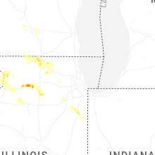


Connect with Interactive Hail Maps