

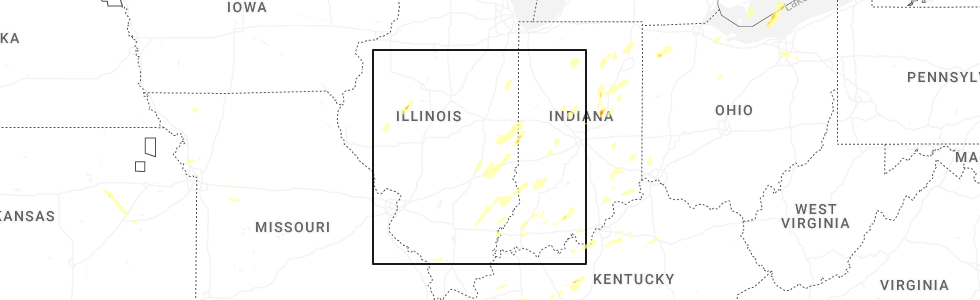
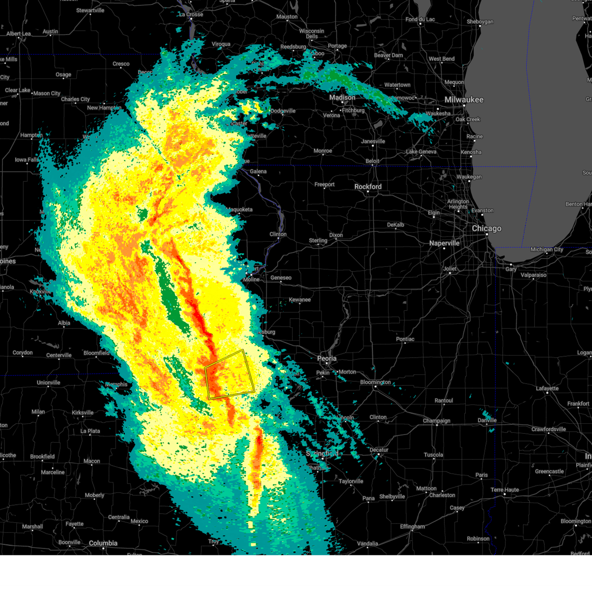
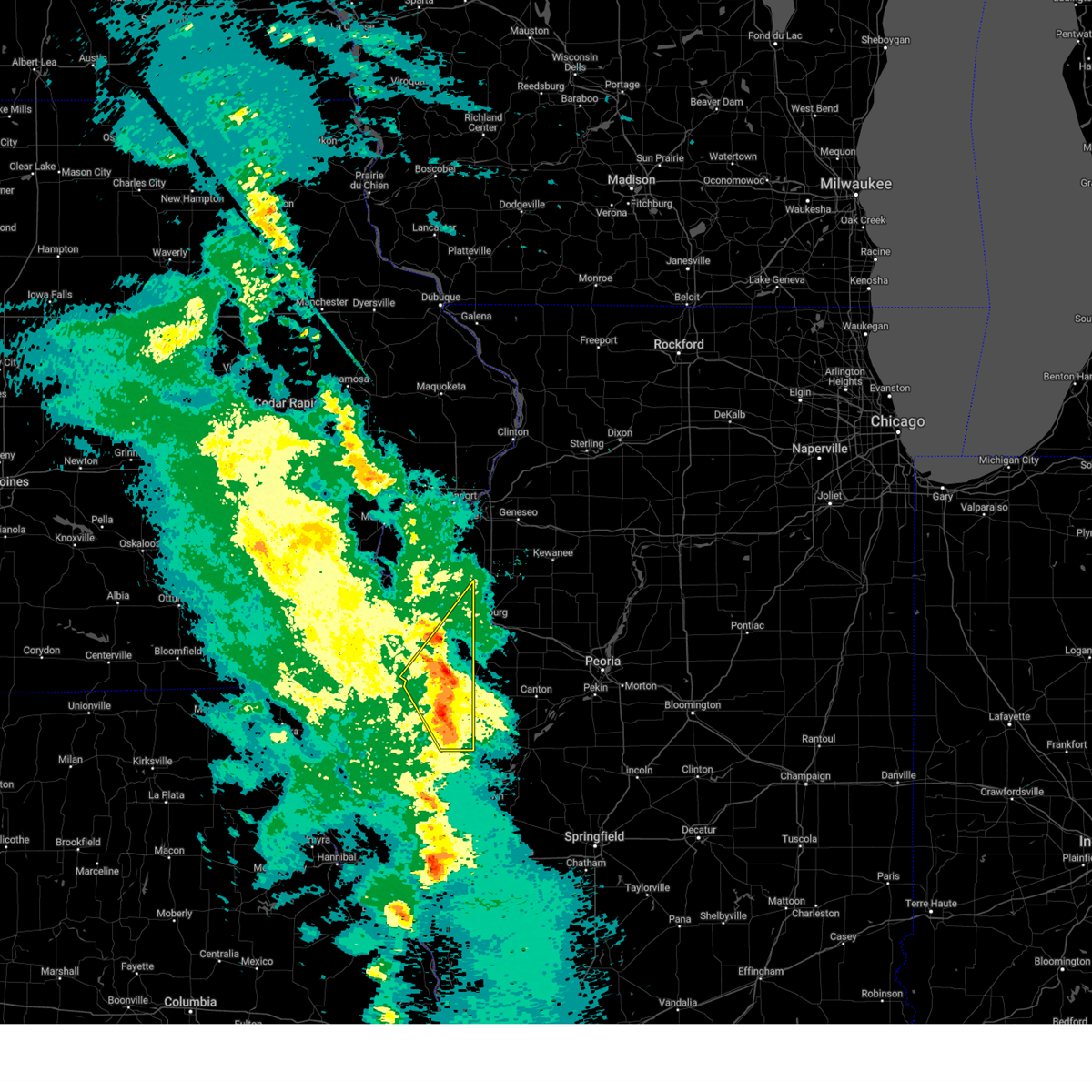
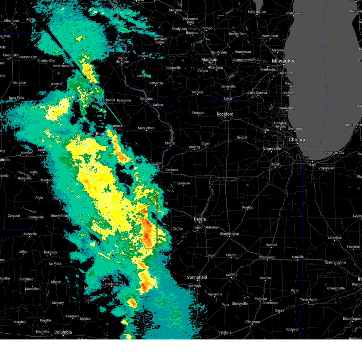
Hail Map for Georgetown, IL
The Georgetown, IL area has had 4 reports of on-the-ground hail by trained spotters, and has been under severe weather warnings 81 times during the past 12 months. Doppler radar has detected hail at or near Georgetown, IL on 106 occasions, including 5 occasions during the past year.
| Name: | Georgetown, IL |
| Where Located: | 52.2 miles NE of Mattoon, IL |
| Map: | Google Map for Georgetown, IL |
| Population: | 3474 |
| Housing Units: | 1537 |
| More Info: | Search Google for Georgetown, IL |
2
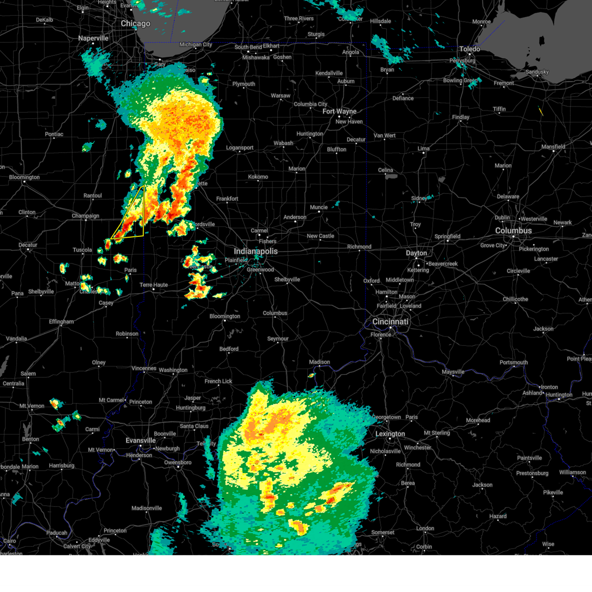
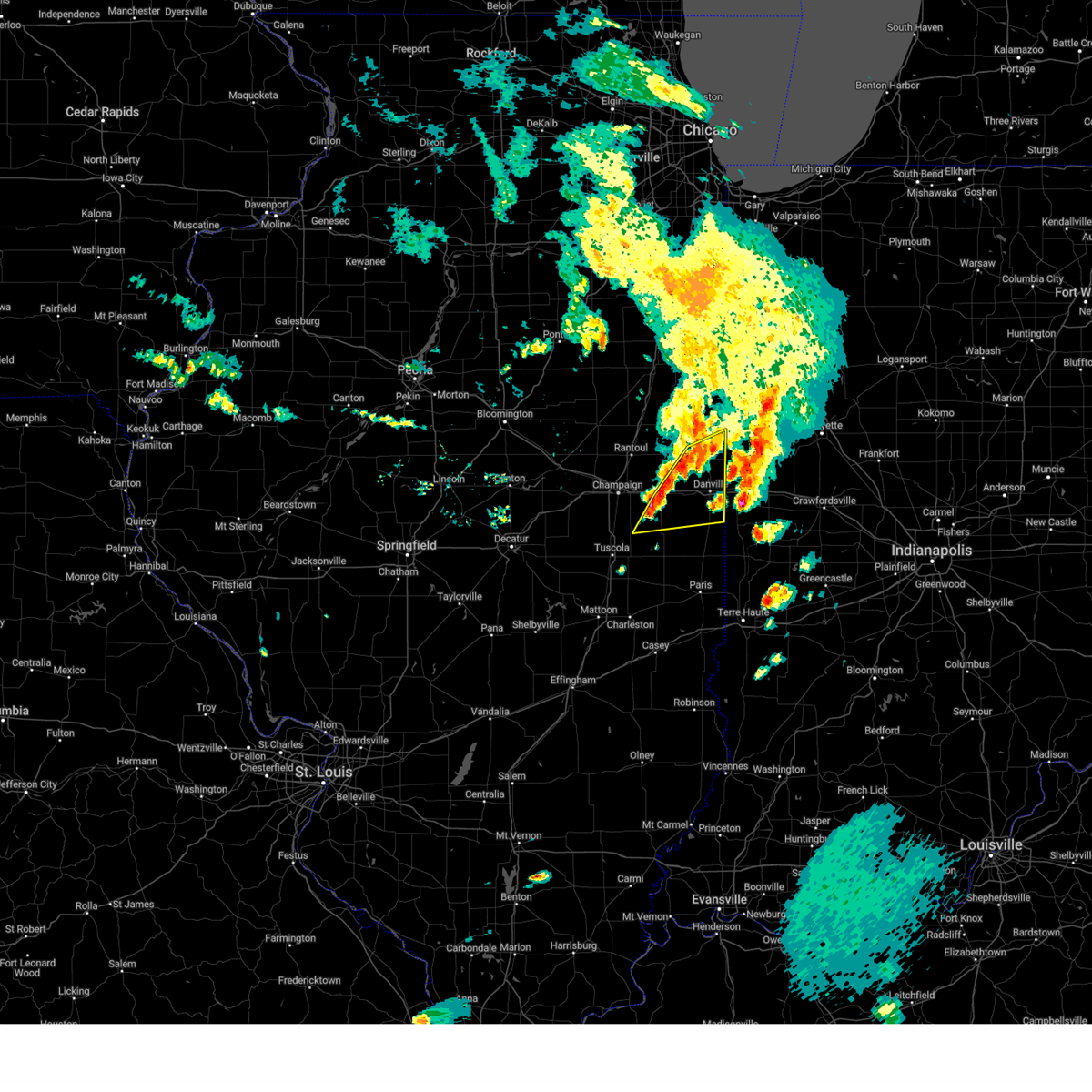
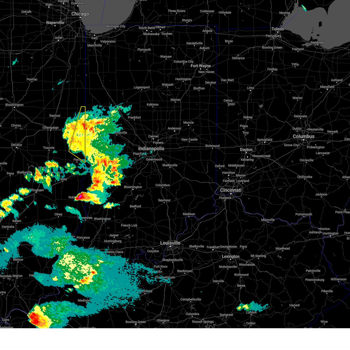
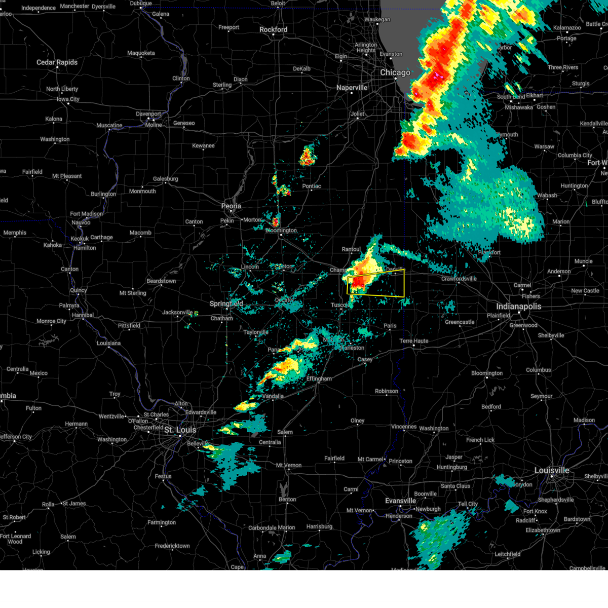
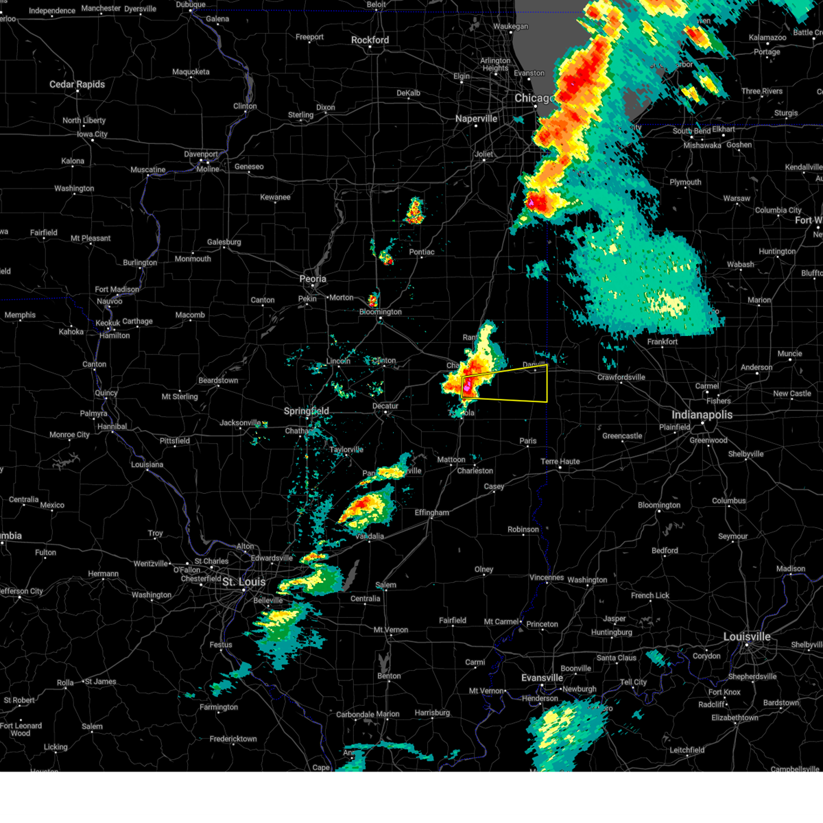
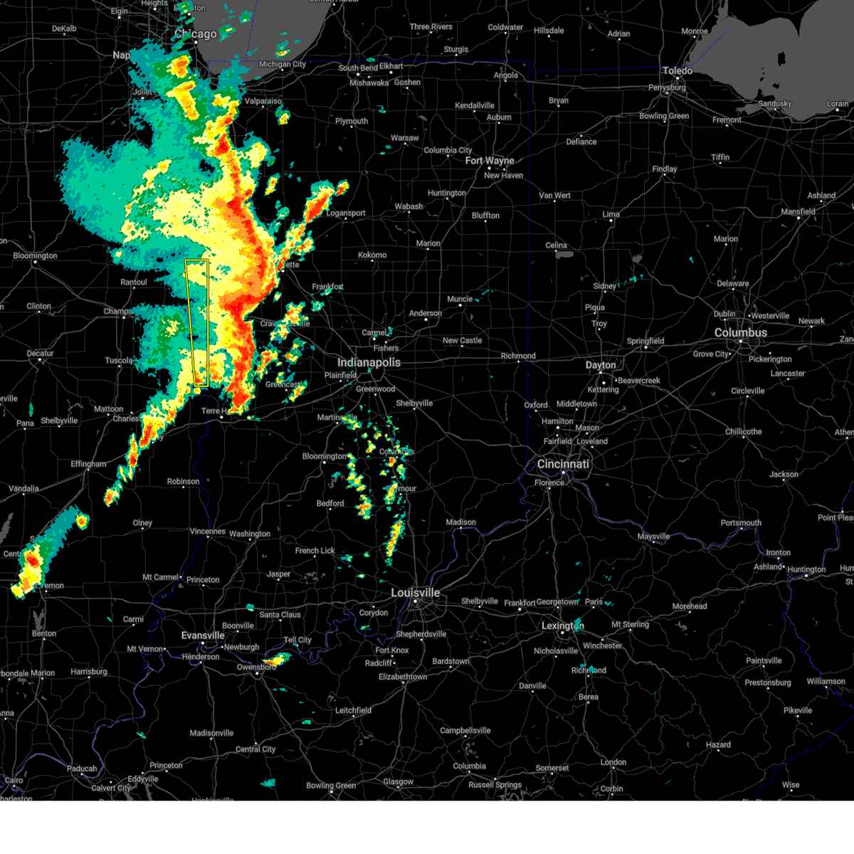
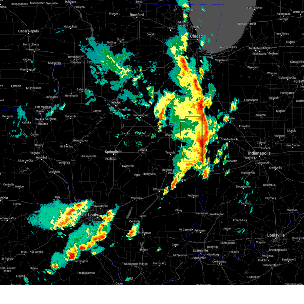
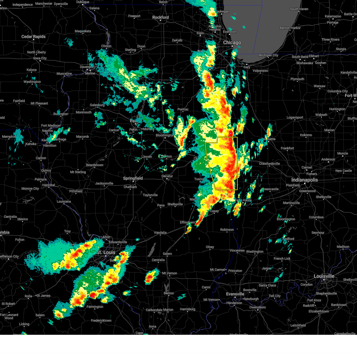
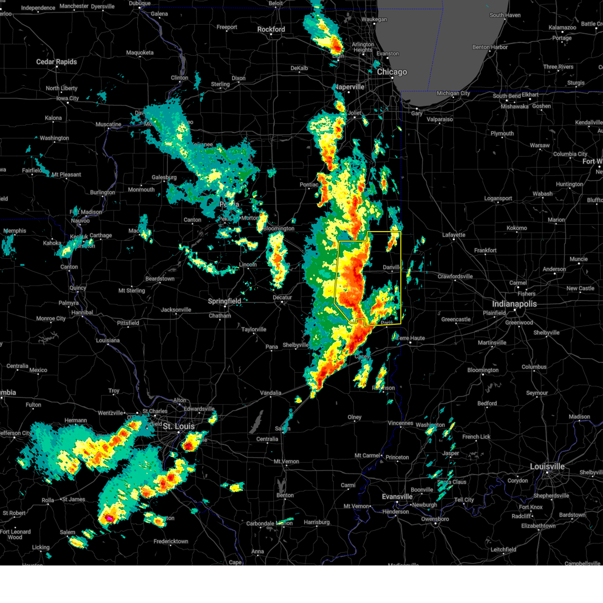
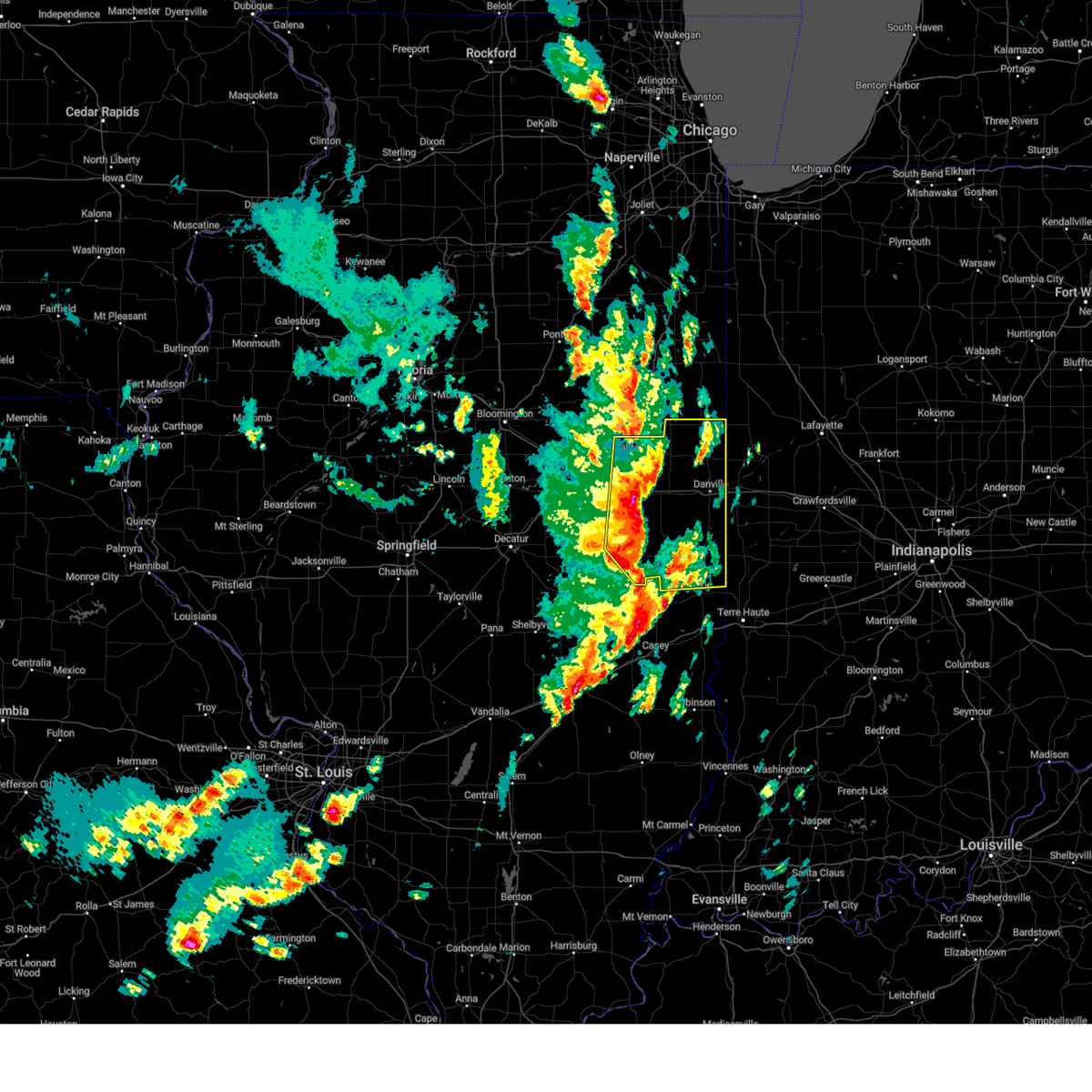
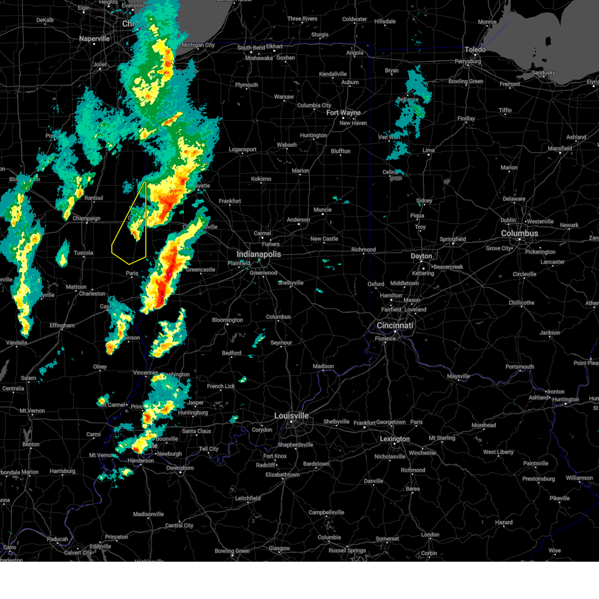
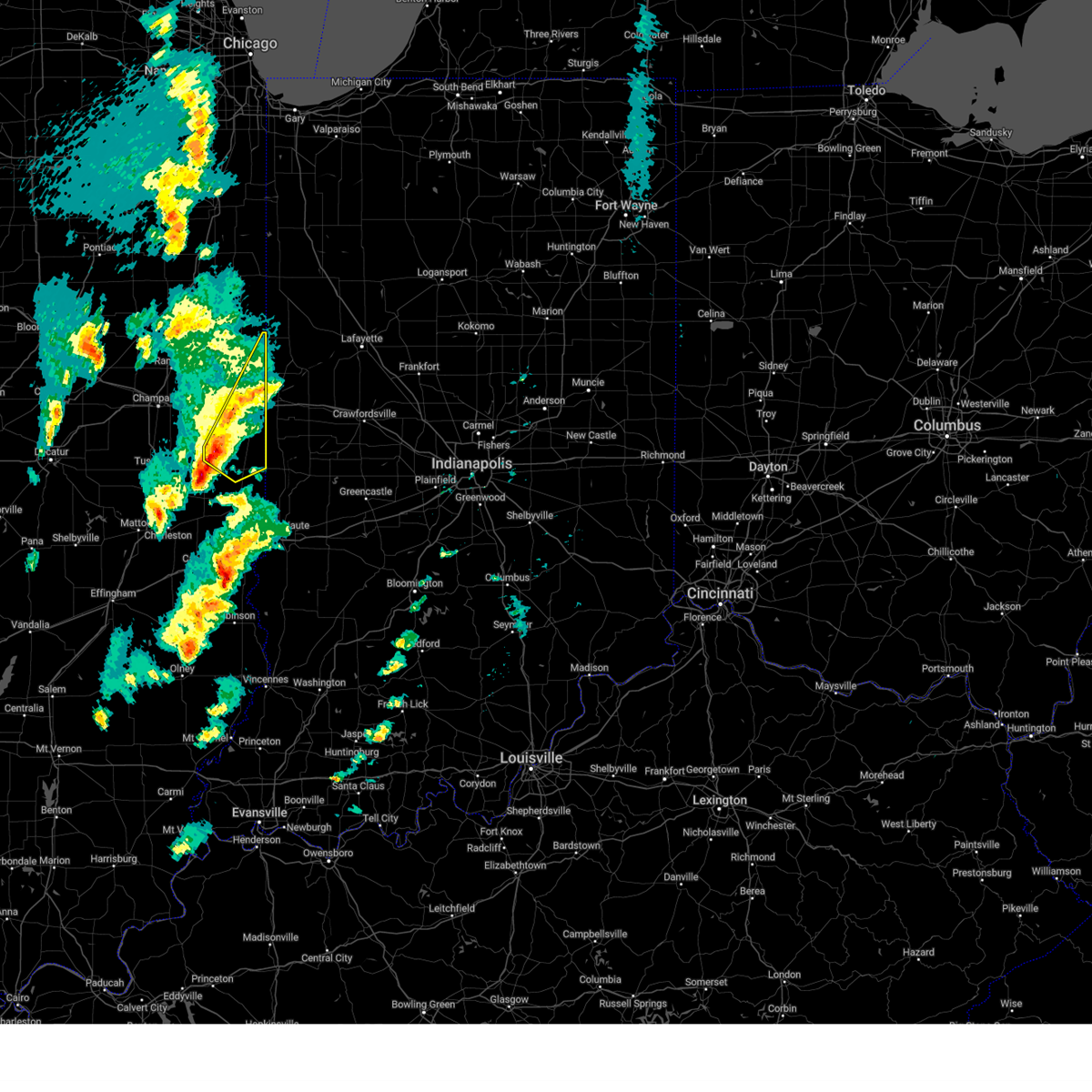
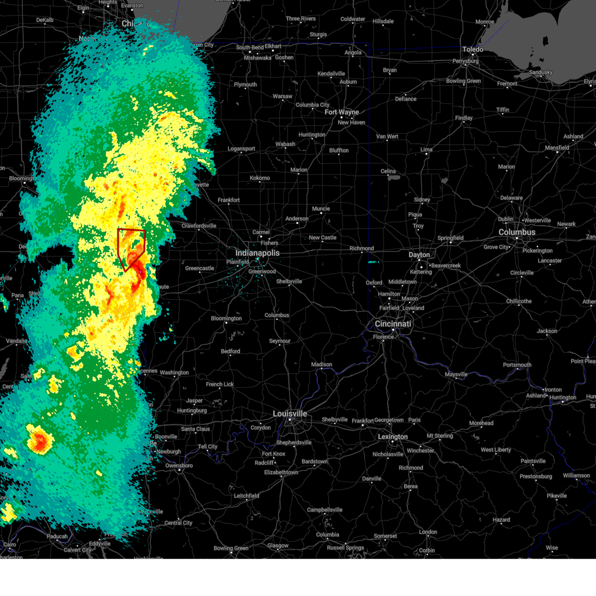
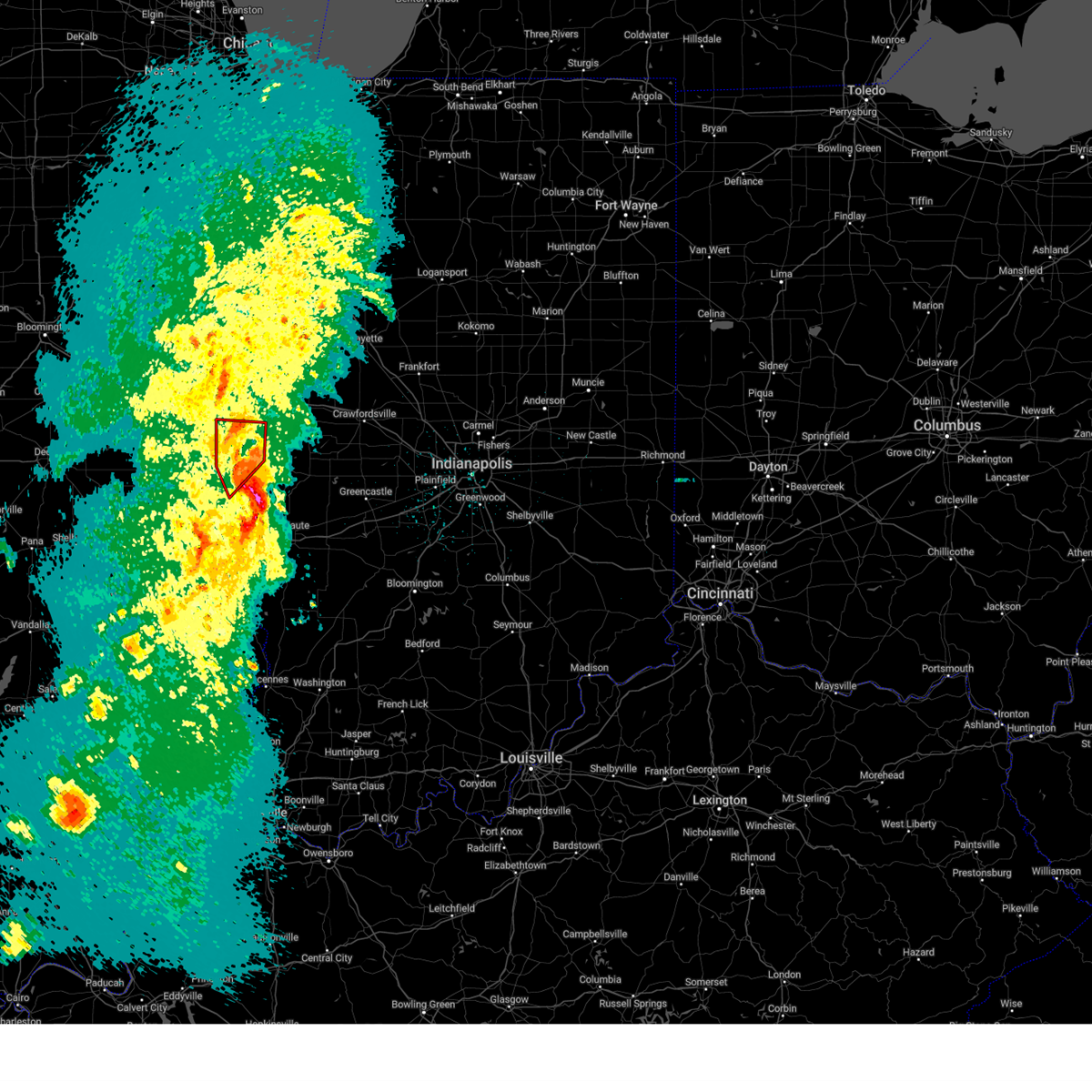
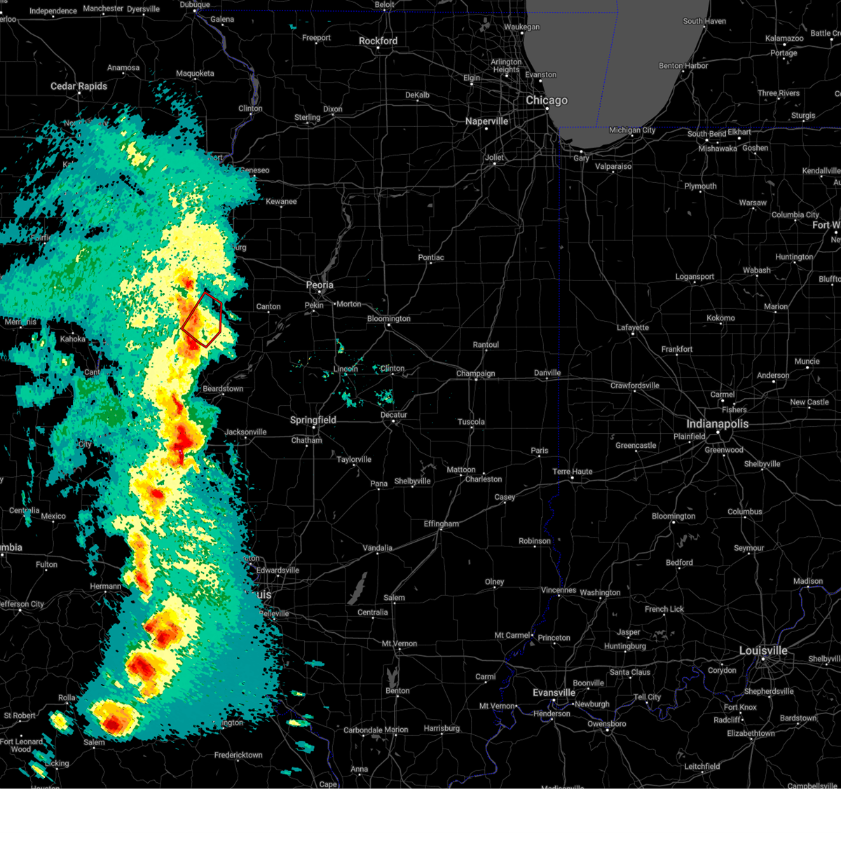
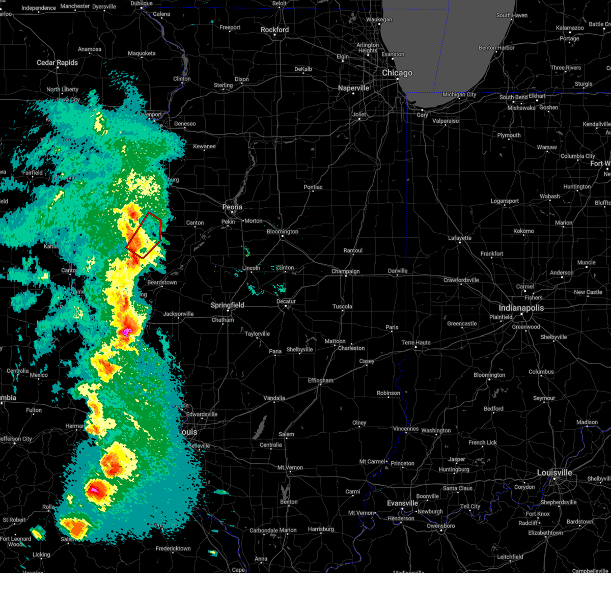
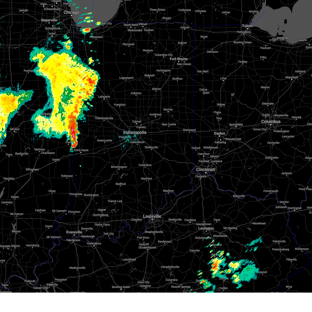
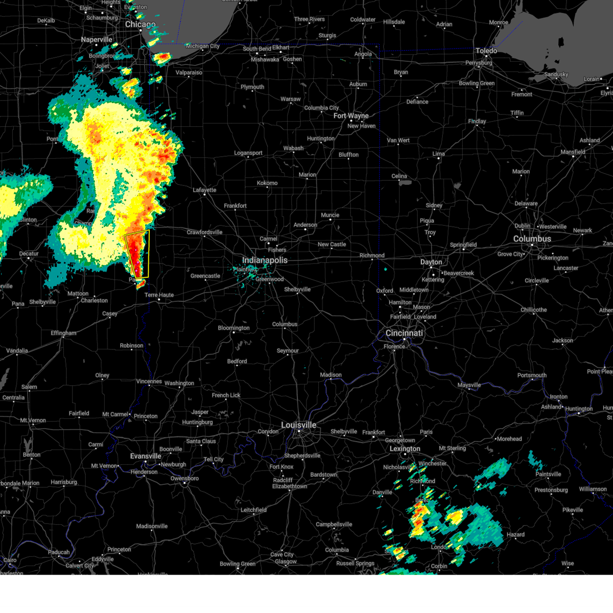
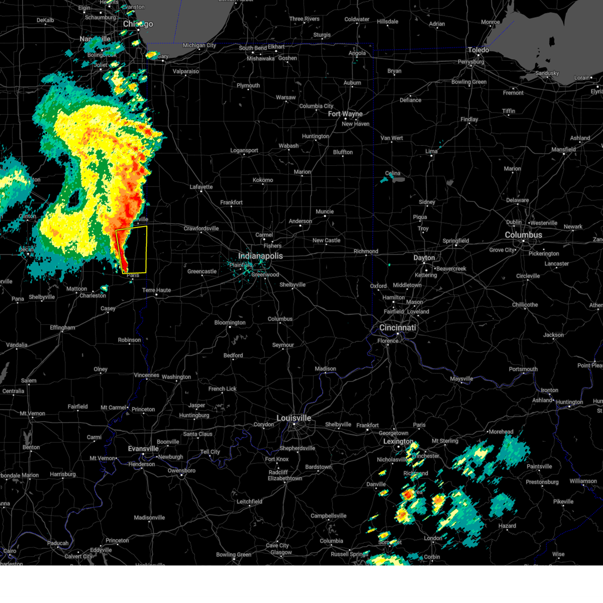
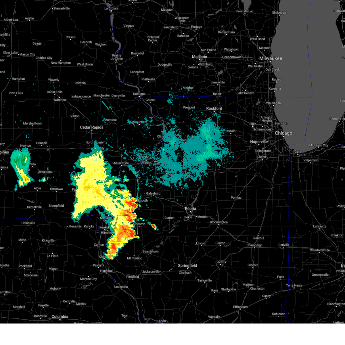
The Top Recent Hail Date for Georgetown, IL is Wednesday, June 18, 2025 (16th out of 106)
Hail and Wind Damage Spotted near Georgetown, IL
| Date / Time | Report Details |
|---|---|
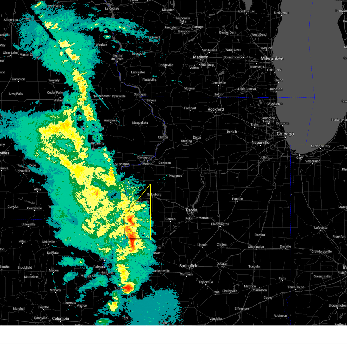
| 6/18/2025 1:44 PM CDT |
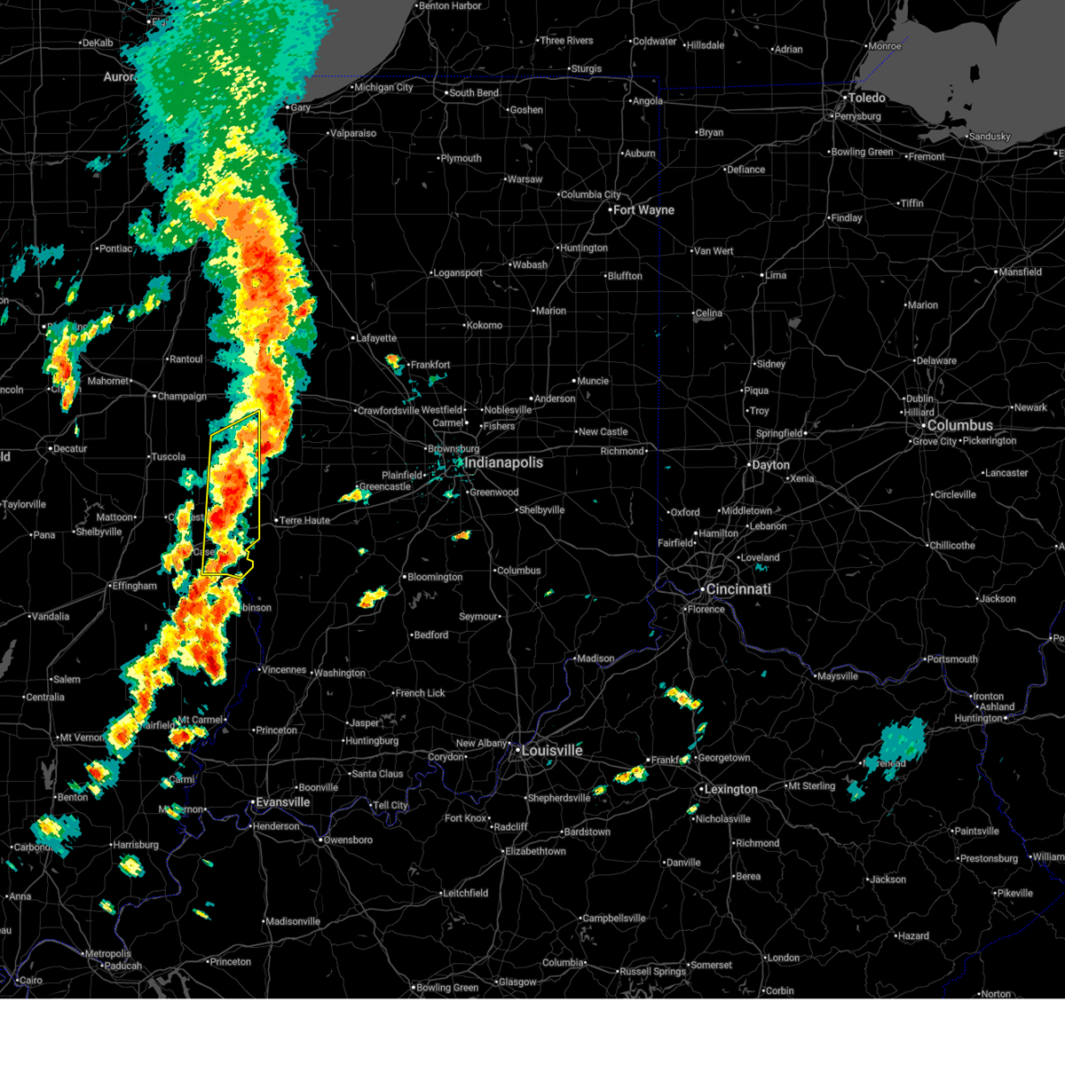 Svrilx the national weather service in lincoln has issued a * severe thunderstorm warning for, edgar county in east central illinois, clark county in east central illinois, southeastern vermilion county in east central illinois, * until 215 pm cdt. * at 143 pm cdt, severe thunderstorms were located along a line extending from near georgetown to vermilion to 8 miles northwest of hutsonville, moving northeast at 55 mph (radar indicated). Hazards include 60 mph wind gusts and quarter size hail. Hail damage to vehicles is expected. expect wind damage to roofs, siding, and trees. severe thunderstorms will be near, vermilion around 150 pm cdt. This includes interstate 70 between mile markers 134 and 154. Svrilx the national weather service in lincoln has issued a * severe thunderstorm warning for, edgar county in east central illinois, clark county in east central illinois, southeastern vermilion county in east central illinois, * until 215 pm cdt. * at 143 pm cdt, severe thunderstorms were located along a line extending from near georgetown to vermilion to 8 miles northwest of hutsonville, moving northeast at 55 mph (radar indicated). Hazards include 60 mph wind gusts and quarter size hail. Hail damage to vehicles is expected. expect wind damage to roofs, siding, and trees. severe thunderstorms will be near, vermilion around 150 pm cdt. This includes interstate 70 between mile markers 134 and 154.
|
| 6/18/2025 1:17 PM CDT |
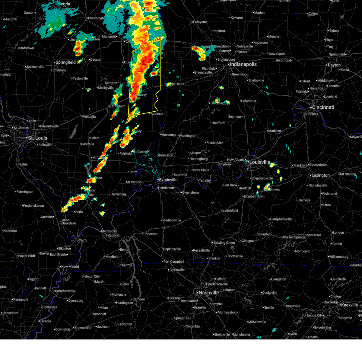 At 117 pm cdt, severe thunderstorms were located along a line extending from 6 miles northwest of vermilion regional airport to near chrisman to 6 miles south of casey, moving northeast at 55 mph (radar indicated). Hazards include 60 mph wind gusts. Expect damage to roofs, siding, and trees. these severe storms will be near, danville, paris, georgetown, westville, tilton, catlin, chrisman, martinsville, ridge farm, and edgar county airport around 120 pm cdt. marshall around 125 pm cdt. vermilion around 130 pm cdt. other locations impacted by these severe thunderstorms include isabel, murdock, edgar, clarksville, annapolis, west york, york, longview, yale, and lincoln trail state park. this includes the following highways, interstate 70 between mile markers 119 and 154. Interstate 74 between mile markers 211 and 220. At 117 pm cdt, severe thunderstorms were located along a line extending from 6 miles northwest of vermilion regional airport to near chrisman to 6 miles south of casey, moving northeast at 55 mph (radar indicated). Hazards include 60 mph wind gusts. Expect damage to roofs, siding, and trees. these severe storms will be near, danville, paris, georgetown, westville, tilton, catlin, chrisman, martinsville, ridge farm, and edgar county airport around 120 pm cdt. marshall around 125 pm cdt. vermilion around 130 pm cdt. other locations impacted by these severe thunderstorms include isabel, murdock, edgar, clarksville, annapolis, west york, york, longview, yale, and lincoln trail state park. this includes the following highways, interstate 70 between mile markers 119 and 154. Interstate 74 between mile markers 211 and 220.
|
| 6/18/2025 12:55 PM CDT |
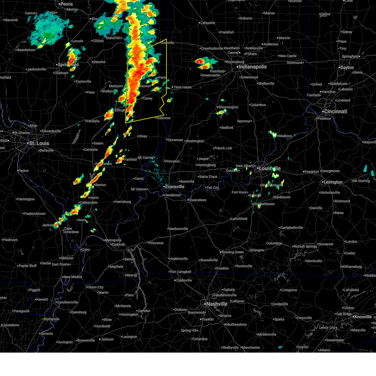 Svrilx the national weather service in lincoln has issued a * severe thunderstorm warning for, coles county in east central illinois, northern crawford county in east central illinois, edgar county in east central illinois, northern jasper county in southeastern illinois, clark county in east central illinois, southern vermilion county in east central illinois, cumberland county in east central illinois, southeastern champaign county in east central illinois, douglas county in east central illinois, * until 145 pm cdt. * at 1254 pm cdt, severe thunderstorms were located along a line extending from homer to ashmore to near newton, moving northeast at 60 mph (radar indicated). Hazards include 60 mph wind gusts. Expect damage to roofs, siding, and trees. severe thunderstorms will be near, casey, kansas, fairmount, sidell, westfield, hume, brocton, and allerton around 100 pm cdt. martinsville around 105 pm cdt. paris and catlin around 110 pm cdt. other locations in the path of these severe thunderstorms include danville, georgetown, westville, tilton, chrisman, ridge farm, edgar county airport, marshall and vermilion. this includes the following highways, interstate 57 between mile markers 210 and 219. interstate 70 between mile markers 109 and 154. Interstate 74 between mile markers 211 and 220. Svrilx the national weather service in lincoln has issued a * severe thunderstorm warning for, coles county in east central illinois, northern crawford county in east central illinois, edgar county in east central illinois, northern jasper county in southeastern illinois, clark county in east central illinois, southern vermilion county in east central illinois, cumberland county in east central illinois, southeastern champaign county in east central illinois, douglas county in east central illinois, * until 145 pm cdt. * at 1254 pm cdt, severe thunderstorms were located along a line extending from homer to ashmore to near newton, moving northeast at 60 mph (radar indicated). Hazards include 60 mph wind gusts. Expect damage to roofs, siding, and trees. severe thunderstorms will be near, casey, kansas, fairmount, sidell, westfield, hume, brocton, and allerton around 100 pm cdt. martinsville around 105 pm cdt. paris and catlin around 110 pm cdt. other locations in the path of these severe thunderstorms include danville, georgetown, westville, tilton, chrisman, ridge farm, edgar county airport, marshall and vermilion. this includes the following highways, interstate 57 between mile markers 210 and 219. interstate 70 between mile markers 109 and 154. Interstate 74 between mile markers 211 and 220.
|
| 5/20/2025 6:43 PM CDT |
 The storms which prompted the warning have weakened below severe limits, and no longer pose an immediate threat to life or property. therefore, the warning will be allowed to expire. however, small hail and gusty winds are still possible with these thunderstorms. a tornado watch remains in effect until 800 pm cdt for east central illinois. The storms which prompted the warning have weakened below severe limits, and no longer pose an immediate threat to life or property. therefore, the warning will be allowed to expire. however, small hail and gusty winds are still possible with these thunderstorms. a tornado watch remains in effect until 800 pm cdt for east central illinois.
|
| 5/20/2025 6:35 PM CDT |
 At 634 pm cdt, severe thunderstorms were located along a line extending from 6 miles northeast of vermilion regional airport to near oakwood to near sidell, moving east at 30 mph (radar indicated). Hazards include 60 mph wind gusts and quarter size hail. Hail damage to vehicles is expected. expect wind damage to roofs, siding, and trees. these severe storms will be near, danville, westville, tilton, catlin, and vermilion regional airport around 640 pm cdt. georgetown around 645 pm cdt. other locations impacted by these severe thunderstorms include belgium, jamaica, bismarck, and alvin. This includes interstate 74 between mile markers 207 and 219. At 634 pm cdt, severe thunderstorms were located along a line extending from 6 miles northeast of vermilion regional airport to near oakwood to near sidell, moving east at 30 mph (radar indicated). Hazards include 60 mph wind gusts and quarter size hail. Hail damage to vehicles is expected. expect wind damage to roofs, siding, and trees. these severe storms will be near, danville, westville, tilton, catlin, and vermilion regional airport around 640 pm cdt. georgetown around 645 pm cdt. other locations impacted by these severe thunderstorms include belgium, jamaica, bismarck, and alvin. This includes interstate 74 between mile markers 207 and 219.
|
| 5/20/2025 6:35 PM CDT |
 the severe thunderstorm warning has been cancelled and is no longer in effect the severe thunderstorm warning has been cancelled and is no longer in effect
|
| 5/20/2025 6:07 PM CDT |
 Svrilx the national weather service in lincoln has issued a * severe thunderstorm warning for, vermilion county in east central illinois, southeastern champaign county in east central illinois, * until 645 pm cdt. * at 607 pm cdt, severe thunderstorms were located along a line extending from near potomac to near ogden to near sidney, moving northeast at 40 mph (radar indicated). Hazards include 60 mph wind gusts and quarter size hail. Hail damage to vehicles is expected. expect wind damage to roofs, siding, and trees. severe thunderstorms will be near, rossville, homer, ogden, potomac, and fithian around 610 pm cdt. oakwood and fairmount around 615 pm cdt. danville and catlin around 620 pm cdt. tilton and vermilion regional airport around 625 pm cdt. This includes interstate 74 between mile markers 196 and 219. Svrilx the national weather service in lincoln has issued a * severe thunderstorm warning for, vermilion county in east central illinois, southeastern champaign county in east central illinois, * until 645 pm cdt. * at 607 pm cdt, severe thunderstorms were located along a line extending from near potomac to near ogden to near sidney, moving northeast at 40 mph (radar indicated). Hazards include 60 mph wind gusts and quarter size hail. Hail damage to vehicles is expected. expect wind damage to roofs, siding, and trees. severe thunderstorms will be near, rossville, homer, ogden, potomac, and fithian around 610 pm cdt. oakwood and fairmount around 615 pm cdt. danville and catlin around 620 pm cdt. tilton and vermilion regional airport around 625 pm cdt. This includes interstate 74 between mile markers 196 and 219.
|
| 5/16/2025 5:13 PM CDT |
 the severe thunderstorm warning has been cancelled and is no longer in effect the severe thunderstorm warning has been cancelled and is no longer in effect
|
| 5/16/2025 5:13 PM CDT |
 At 512 pm cdt, severe thunderstorms were located along a line extending from near vermilion regional airport to near covington, moving northeast at 50 mph (radar indicated). Hazards include 60 mph wind gusts. blowing dust with near zero visibility will be possible as well. Expect damage to roofs, siding, and trees. these severe thunderstorms will remain over mainly rural areas of northeastern edgar and eastern vermilion counties, including the following locations, edgar, belgium, scottland, alvin, indianola, bismarck, and metcalf. This includes interstate 74 between mile markers 209 and 220. At 512 pm cdt, severe thunderstorms were located along a line extending from near vermilion regional airport to near covington, moving northeast at 50 mph (radar indicated). Hazards include 60 mph wind gusts. blowing dust with near zero visibility will be possible as well. Expect damage to roofs, siding, and trees. these severe thunderstorms will remain over mainly rural areas of northeastern edgar and eastern vermilion counties, including the following locations, edgar, belgium, scottland, alvin, indianola, bismarck, and metcalf. This includes interstate 74 between mile markers 209 and 220.
|
| 5/16/2025 5:02 PM CDT | the severe thunderstorm warning has been cancelled and is no longer in effect |
| 5/16/2025 5:02 PM CDT | At 502 pm cdt, severe thunderstorms were located along a line extending from near oakwood to near danville, moving north at 35 mph (radar indicated). Hazards include 60 mph wind gusts. blowing dust with near zero visibility will be possible as well. Expect damage to roofs, siding, and trees. these severe storms will be near, danville and vermilion regional airport around 505 pm cdt. other locations impacted by these severe thunderstorms include redmon, edgar, belgium, oliver, scottland, alvin, indianola, sandford, bismarck, and metcalf. This includes interstate 74 between mile markers 209 and 220. |
| 5/16/2025 4:46 PM CDT | Svrilx the national weather service in lincoln has issued a * severe thunderstorm warning for, eastern coles county in east central illinois, edgar county in east central illinois, northern clark county in east central illinois, eastern vermilion county in east central illinois, * until 545 pm cdt. * at 444 pm cdt, severe thunderstorms were located along a line extending from 6 miles southeast of brocton to near vermilion, moving northeast at 50 mph (radar indicated). Hazards include 60 mph wind gusts. blowing dust with near zero visibility will be possible. Expect damage to roofs, siding, and trees. severe thunderstorms will be near, edgar county airport around 450 pm cdt. chrisman around 455 pm cdt. ridge farm around 500 pm cdt. other locations in the path of these severe thunderstorms include georgetown, westville, danville and tilton. this includes the following highways, interstate 70 between mile markers 142 and 154. Interstate 74 between mile markers 209 and 220. |
| 5/15/2025 8:41 PM CDT |
 At 841 pm cdt, a severe thunderstorm was located over sidney, or 9 miles southeast of urbana, moving east at 55 mph (radar indicated). Hazards include 60 mph wind gusts. Expect damage to roofs, siding, and trees. this severe storm will be near, homer around 845 pm cdt. fairmount around 850 pm cdt. catlin around 855 pm cdt. westville and tilton around 900 pm cdt. other locations impacted by this severe thunderstorm include muncie, belgium, jamaica, and indianola. This includes interstate 74 between mile markers 202 and 220. At 841 pm cdt, a severe thunderstorm was located over sidney, or 9 miles southeast of urbana, moving east at 55 mph (radar indicated). Hazards include 60 mph wind gusts. Expect damage to roofs, siding, and trees. this severe storm will be near, homer around 845 pm cdt. fairmount around 850 pm cdt. catlin around 855 pm cdt. westville and tilton around 900 pm cdt. other locations impacted by this severe thunderstorm include muncie, belgium, jamaica, and indianola. This includes interstate 74 between mile markers 202 and 220.
|
| 5/15/2025 8:34 PM CDT |
 Svrilx the national weather service in lincoln has issued a * severe thunderstorm warning for, southern vermilion county in east central illinois, southeastern champaign county in east central illinois, * until 915 pm cdt. * at 833 pm cdt, a severe thunderstorm was located over philo, near moving east at 55 mph (trained weather spotters. at 823 pm, a 58 mph wind gust was reported at willard airport in savoy). Hazards include 60 mph wind gusts. Expect damage to roofs, siding, and trees. this severe thunderstorm will be near, sidney and homer around 840 pm cdt. fairmount around 850 pm cdt. other locations in the path of this severe thunderstorm include catlin, westville and tilton. This includes interstate 74 between mile markers 203 and 220. Svrilx the national weather service in lincoln has issued a * severe thunderstorm warning for, southern vermilion county in east central illinois, southeastern champaign county in east central illinois, * until 915 pm cdt. * at 833 pm cdt, a severe thunderstorm was located over philo, near moving east at 55 mph (trained weather spotters. at 823 pm, a 58 mph wind gust was reported at willard airport in savoy). Hazards include 60 mph wind gusts. Expect damage to roofs, siding, and trees. this severe thunderstorm will be near, sidney and homer around 840 pm cdt. fairmount around 850 pm cdt. other locations in the path of this severe thunderstorm include catlin, westville and tilton. This includes interstate 74 between mile markers 203 and 220.
|
| 4/20/2025 8:10 PM CDT |
 The storms which prompted the warning have moved out of the area. therefore, the warning will be allowed to expire. a tornado watch remains in effect until 1100 pm cdt for west central illinois. The storms which prompted the warning have moved out of the area. therefore, the warning will be allowed to expire. a tornado watch remains in effect until 1100 pm cdt for west central illinois.
|
| 4/20/2025 7:48 PM CDT |
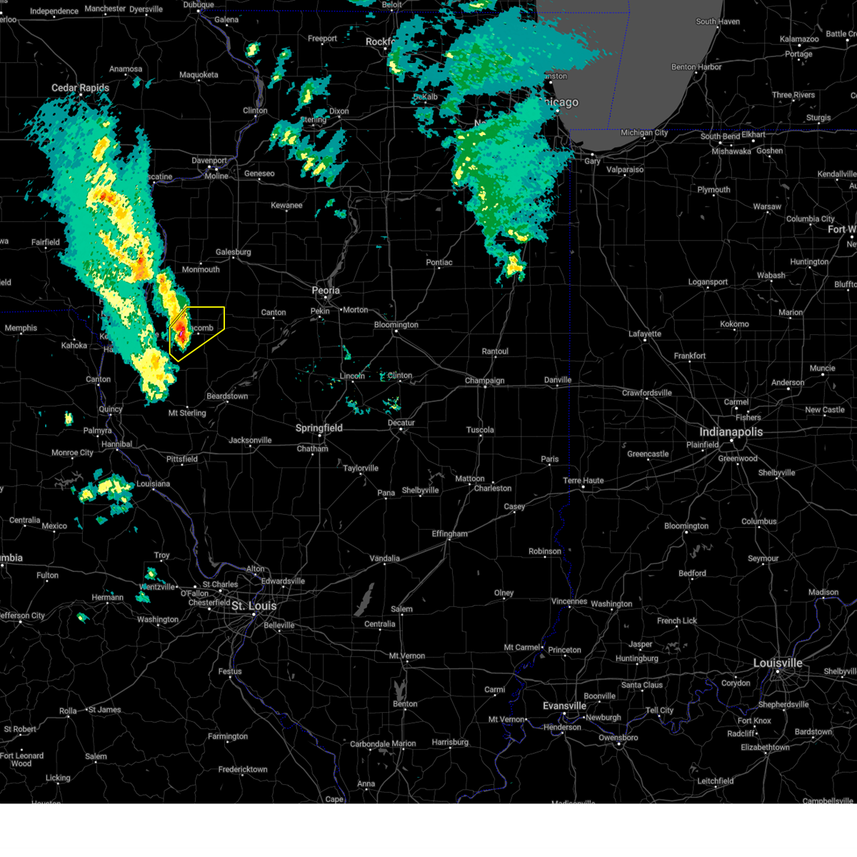
 At 748 pm cdt, severe thunderstorms were located along a line extending from raritan to near argyle lake state park, moving northeast at 40 mph (radar indicated). Hazards include 60 mph wind gusts. Expect damage to roofs, siding, and trees. Locations impacted include, bardolph, walnut grove, western illinois university, sciota, macomb municipal airport, good hope, raritan, roseville, colchester, scottsburg, warren county fairgrounds, spring lake, swan creek, youngstown, mcdonough county 4-h grounds, macomb, argyle lake state park, and blandinsville. At 748 pm cdt, severe thunderstorms were located along a line extending from raritan to near argyle lake state park, moving northeast at 40 mph (radar indicated). Hazards include 60 mph wind gusts. Expect damage to roofs, siding, and trees. Locations impacted include, bardolph, walnut grove, western illinois university, sciota, macomb municipal airport, good hope, raritan, roseville, colchester, scottsburg, warren county fairgrounds, spring lake, swan creek, youngstown, mcdonough county 4-h grounds, macomb, argyle lake state park, and blandinsville.
|
| 4/20/2025 7:48 PM CDT |
 the severe thunderstorm warning has been cancelled and is no longer in effect the severe thunderstorm warning has been cancelled and is no longer in effect
|
| 4/20/2025 7:40 PM CDT |
 At 740 pm cdt, severe thunderstorms were located along a line extending from near terre haute to near tennessee, moving northeast at 40 mph (radar indicated). Hazards include 60 mph wind gusts. Expect damage to roofs, siding, and trees. Locations impacted include, bardolph, walnut grove, western illinois university, sciota, macomb municipal airport, good hope, tennessee, raritan, roseville, colchester, scottsburg, blandinsville, warren county fairgrounds, spring lake, swan creek, youngstown, la harpe, mcdonough county 4-h grounds, macomb, and argyle lake state park. At 740 pm cdt, severe thunderstorms were located along a line extending from near terre haute to near tennessee, moving northeast at 40 mph (radar indicated). Hazards include 60 mph wind gusts. Expect damage to roofs, siding, and trees. Locations impacted include, bardolph, walnut grove, western illinois university, sciota, macomb municipal airport, good hope, tennessee, raritan, roseville, colchester, scottsburg, blandinsville, warren county fairgrounds, spring lake, swan creek, youngstown, la harpe, mcdonough county 4-h grounds, macomb, and argyle lake state park.
|
| 4/20/2025 7:33 PM CDT |
 Svrdvn the national weather service in the quad cities has issued a * severe thunderstorm warning for, northeastern hancock county in west central illinois, southeastern henderson county in west central illinois, southwestern warren county in west central illinois, northern mcdonough county in west central illinois, * until 815 pm cdt. * at 733 pm cdt, severe thunderstorms were located along a line extending from terre haute to near fountain green, moving northeast at 40 mph (radar indicated). Hazards include 60 mph wind gusts. expect damage to roofs, siding, and trees Svrdvn the national weather service in the quad cities has issued a * severe thunderstorm warning for, northeastern hancock county in west central illinois, southeastern henderson county in west central illinois, southwestern warren county in west central illinois, northern mcdonough county in west central illinois, * until 815 pm cdt. * at 733 pm cdt, severe thunderstorms were located along a line extending from terre haute to near fountain green, moving northeast at 40 mph (radar indicated). Hazards include 60 mph wind gusts. expect damage to roofs, siding, and trees
|
| 4/20/2025 7:24 PM CDT | At 724 pm cdt, severe thunderstorms were located along a line extending from near bentley to camden, moving northeast at 45 mph (radar indicated). Hazards include 60 mph wind gusts and penny size hail. Expect damage to roofs, siding, and trees. Locations impacted include, pennington point, augusta, western illinois university, adair, tennessee, colchester, plymouth, doddsville, fandon, bentley, industry, mcdonough county 4-h grounds, denver, hancock county fairgrounds, colmar, macomb, argyle lake state park, bowen, and bardolph. |
| 4/20/2025 7:18 PM CDT |
 At 718 pm cdt, severe thunderstorms were located along a line extending from near bentley to near huntsville, moving northeast at 50 mph (radar indicated). Hazards include 60 mph wind gusts and penny size hail. Expect damage to roofs, siding, and trees. Locations impacted include, pennington point, augusta, western illinois university, adair, bowen, tennessee, colchester, plymouth, doddsville, fandon, bentley, basco, industry, mcdonough county 4-h grounds, denver, hancock county fairgrounds, colmar, macomb, argyle lake state park, and bardolph. At 718 pm cdt, severe thunderstorms were located along a line extending from near bentley to near huntsville, moving northeast at 50 mph (radar indicated). Hazards include 60 mph wind gusts and penny size hail. Expect damage to roofs, siding, and trees. Locations impacted include, pennington point, augusta, western illinois university, adair, bowen, tennessee, colchester, plymouth, doddsville, fandon, bentley, basco, industry, mcdonough county 4-h grounds, denver, hancock county fairgrounds, colmar, macomb, argyle lake state park, and bardolph.
|
| 4/20/2025 7:15 PM CDT |
 At 715 pm cdt, severe thunderstorms were located along a line extending from near basco to near la prairie, moving northeast at 50 mph (radar indicated). Hazards include 60 mph wind gusts and penny size hail. Expect damage to roofs, siding, and trees. Locations impacted include, pennington point, augusta, western illinois university, adair, bowen, tennessee, colchester, plymouth, doddsville, fandon, stillwell, bentley, basco, industry, mcdonough county 4-h grounds, denver, west point, hancock county fairgrounds, colmar, and macomb. At 715 pm cdt, severe thunderstorms were located along a line extending from near basco to near la prairie, moving northeast at 50 mph (radar indicated). Hazards include 60 mph wind gusts and penny size hail. Expect damage to roofs, siding, and trees. Locations impacted include, pennington point, augusta, western illinois university, adair, bowen, tennessee, colchester, plymouth, doddsville, fandon, stillwell, bentley, basco, industry, mcdonough county 4-h grounds, denver, west point, hancock county fairgrounds, colmar, and macomb.
|
| 4/20/2025 7:00 PM CDT |
 Svrdvn the national weather service in the quad cities has issued a * severe thunderstorm warning for, southern hancock county in west central illinois, southern mcdonough county in west central illinois, * until 800 pm cdt. * at 659 pm cdt, severe thunderstorms were located along a line extending from tioga to near camp point, moving northeast at 50 mph (radar indicated). Hazards include 60 mph wind gusts and penny size hail. expect damage to roofs, siding, and trees Svrdvn the national weather service in the quad cities has issued a * severe thunderstorm warning for, southern hancock county in west central illinois, southern mcdonough county in west central illinois, * until 800 pm cdt. * at 659 pm cdt, severe thunderstorms were located along a line extending from tioga to near camp point, moving northeast at 50 mph (radar indicated). Hazards include 60 mph wind gusts and penny size hail. expect damage to roofs, siding, and trees
|
| 3/30/2025 2:46 PM CDT |
 the severe thunderstorm warning has been cancelled and is no longer in effect the severe thunderstorm warning has been cancelled and is no longer in effect
|
| 3/30/2025 2:37 PM CDT |
 At 237 pm cdt, severe thunderstorms were located along a line extending from otterbein to 9 miles northwest of crawfordsville to 8 miles northeast of brazil, moving east at 70 mph (emergency management. at 2:05 pm, emergency management reported trees and power lines down in danville). Hazards include 70 mph wind gusts. Expect considerable tree damage. damage is likely to mobile homes, roofs, and outbuildings. locations impacted include, hoopeston, westville, ridge farm, tilton, danville, belgium, scottland, alvin, vermilion regional airport, rossville, bismarck, henning, and georgetown. This includes interstate 74 between mile markers 212 and 220. At 237 pm cdt, severe thunderstorms were located along a line extending from otterbein to 9 miles northwest of crawfordsville to 8 miles northeast of brazil, moving east at 70 mph (emergency management. at 2:05 pm, emergency management reported trees and power lines down in danville). Hazards include 70 mph wind gusts. Expect considerable tree damage. damage is likely to mobile homes, roofs, and outbuildings. locations impacted include, hoopeston, westville, ridge farm, tilton, danville, belgium, scottland, alvin, vermilion regional airport, rossville, bismarck, henning, and georgetown. This includes interstate 74 between mile markers 212 and 220.
|
| 3/30/2025 2:37 PM CDT |
 the severe thunderstorm warning has been cancelled and is no longer in effect the severe thunderstorm warning has been cancelled and is no longer in effect
|
| 3/30/2025 2:21 PM CDT |
 At 218 pm cdt, severe thunderstorms were located along a line extending from near boswell to near covington to clinton, moving east at 70 mph. these are destructive storms for far eastern champaign, vermilion, and northern edgar counties (trained weather spotters. at 2:07pm, a trained weather spotter in hoopeston measured an 85 mph wind gust). Hazards include winds in excess of 80 mph and quarter size hail. Flying debris will be dangerous to those caught without shelter. mobile homes will be heavily damaged. expect considerable damage to roofs, windows, and vehicles. extensive tree damage and power outages are likely. locations impacted include, edgar, hoopeston, westville, potomac, rankin, st. joseph, oakwood, gifford, broadlands, royal, muncie, armstrong, penfield, ogden, rossville, georgetown, brocton, collison, indianola, and fairmount. This includes interstate 74 between mile markers 193 and 220. At 218 pm cdt, severe thunderstorms were located along a line extending from near boswell to near covington to clinton, moving east at 70 mph. these are destructive storms for far eastern champaign, vermilion, and northern edgar counties (trained weather spotters. at 2:07pm, a trained weather spotter in hoopeston measured an 85 mph wind gust). Hazards include winds in excess of 80 mph and quarter size hail. Flying debris will be dangerous to those caught without shelter. mobile homes will be heavily damaged. expect considerable damage to roofs, windows, and vehicles. extensive tree damage and power outages are likely. locations impacted include, edgar, hoopeston, westville, potomac, rankin, st. joseph, oakwood, gifford, broadlands, royal, muncie, armstrong, penfield, ogden, rossville, georgetown, brocton, collison, indianola, and fairmount. This includes interstate 74 between mile markers 193 and 220.
|
| 3/30/2025 2:11 PM CDT |
 Svrilx the national weather service in lincoln has issued a * severe thunderstorm warning for, northeastern coles county in east central illinois, northern edgar county in east central illinois, vermilion county in east central illinois, eastern champaign county in east central illinois, northeastern douglas county in east central illinois, * until 300 pm cdt. * at 209 pm cdt, severe thunderstorms were located along a line extending from near hoopeston to vermilion regional airport to 6 miles north of vermilion, moving east at 70 mph. these are destructive storms for eastern champaign, vermilion, and northern edgar counties (emergency management. emergency managers have reported widespread wind damage, including structural damage in eastern champaign county). Hazards include 80 mph wind gusts and quarter size hail. Flying debris will be dangerous to those caught without shelter. mobile homes will be heavily damaged. expect considerable damage to roofs, windows, and vehicles. extensive tree damage and power outages are likely. these severe thunderstorms will remain over mainly rural areas of northeastern coles, northern edgar, vermilion, eastern champaign and northeastern douglas counties, including the following locations, edgar, collison, indianola, ludlow, flatville, royal, muncie, armstrong, belgium, and scottland. this includes the following highways, interstate 57 between mile markers 252 and 257. Interstate 74 between mile markers 188 and 220. Svrilx the national weather service in lincoln has issued a * severe thunderstorm warning for, northeastern coles county in east central illinois, northern edgar county in east central illinois, vermilion county in east central illinois, eastern champaign county in east central illinois, northeastern douglas county in east central illinois, * until 300 pm cdt. * at 209 pm cdt, severe thunderstorms were located along a line extending from near hoopeston to vermilion regional airport to 6 miles north of vermilion, moving east at 70 mph. these are destructive storms for eastern champaign, vermilion, and northern edgar counties (emergency management. emergency managers have reported widespread wind damage, including structural damage in eastern champaign county). Hazards include 80 mph wind gusts and quarter size hail. Flying debris will be dangerous to those caught without shelter. mobile homes will be heavily damaged. expect considerable damage to roofs, windows, and vehicles. extensive tree damage and power outages are likely. these severe thunderstorms will remain over mainly rural areas of northeastern coles, northern edgar, vermilion, eastern champaign and northeastern douglas counties, including the following locations, edgar, collison, indianola, ludlow, flatville, royal, muncie, armstrong, belgium, and scottland. this includes the following highways, interstate 57 between mile markers 252 and 257. Interstate 74 between mile markers 188 and 220.
|
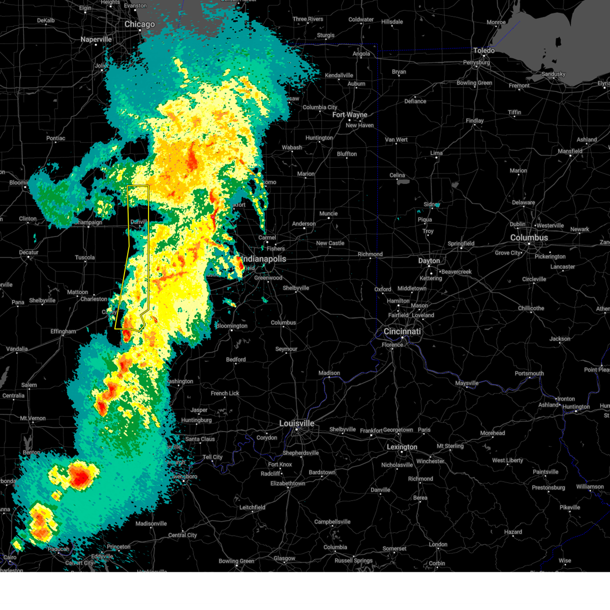
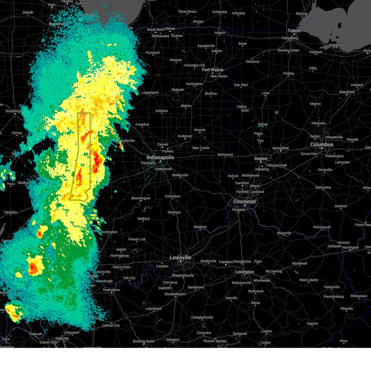
| 3/30/2025 1:55 PM CDT | At 153 pm cdt, severe thunderstorms were located along a line extending from cissna park to near hume, moving east at 60 mph (trained weather spotters. at 1:45 pm, emergency management estimated 70 mph winds in sidney, with structural damage observed). Hazards include 70 mph wind gusts and quarter size hail. Hail damage to vehicles is expected. expect considerable tree damage. wind damage is also likely to mobile homes, roofs, and outbuildings. these severe storms will be near, potomac, catlin, oakwood, hoopeston, rossville, chrisman, fairmount, ridge farm, and sidell around 200 pm cdt. vermilion regional airport, georgetown, westville, tilton, and danville around 205 pm cdt. other locations impacted by these severe thunderstorms include isabel, murdock, edgar, collison, longview, indianola, walnut point state park, ludlow, flatville, and royal. this includes the following highways, interstate 57 between mile markers 240 and 257. Interstate 74 between mile markers 181 and 220. |
| 3/30/2025 1:46 PM CDT |
 At 145 pm cdt, severe thunderstorms were located along a line extending from near buckley to near newman, moving east at 60 mph (trained weather spotters. at 1:35 pm, a 68 mph wind gust was measured at the champaign airport). Hazards include 70 mph wind gusts and quarter size hail. Hail damage to vehicles is expected. expect considerable tree damage. wind damage is also likely to mobile homes, roofs, and outbuildings. these severe storms will be near, rankin, homer, newman, hume, allerton, brocton, fairmount, fithian, ogden, and sidell around 150 pm cdt. potomac and oakwood around 155 pm cdt. catlin, georgetown, hoopeston, rossville, westville, chrisman, tilton, ridge farm, and danville around 200 pm cdt. vermilion regional airport around 205 pm cdt. other locations impacted by these severe thunderstorms include isabel, murdock, edgar, collison, longview, indianola, walnut point state park, ludlow, hindsboro, and flatville. this includes the following highways, interstate 57 between mile markers 211 and 232, and between mile markers 237 and 257. Interstate 74 between mile markers 179 and 220. At 145 pm cdt, severe thunderstorms were located along a line extending from near buckley to near newman, moving east at 60 mph (trained weather spotters. at 1:35 pm, a 68 mph wind gust was measured at the champaign airport). Hazards include 70 mph wind gusts and quarter size hail. Hail damage to vehicles is expected. expect considerable tree damage. wind damage is also likely to mobile homes, roofs, and outbuildings. these severe storms will be near, rankin, homer, newman, hume, allerton, brocton, fairmount, fithian, ogden, and sidell around 150 pm cdt. potomac and oakwood around 155 pm cdt. catlin, georgetown, hoopeston, rossville, westville, chrisman, tilton, ridge farm, and danville around 200 pm cdt. vermilion regional airport around 205 pm cdt. other locations impacted by these severe thunderstorms include isabel, murdock, edgar, collison, longview, indianola, walnut point state park, ludlow, hindsboro, and flatville. this includes the following highways, interstate 57 between mile markers 211 and 232, and between mile markers 237 and 257. Interstate 74 between mile markers 179 and 220.
|
| 3/30/2025 1:44 PM CDT |
 Svrilx the national weather service in lincoln has issued a * severe thunderstorm warning for, edgar county in east central illinois, vermilion county in east central illinois, champaign county in east central illinois, eastern douglas county in east central illinois, * until 215 pm cdt. * at 143 pm cdt, severe thunderstorms were located along a line extending from near buckley to near newman, moving east at 60 mph (radar indicated. at 1:35 pm, a 67 mph wind gust was measured at champaign airport). Hazards include 60 mph wind gusts and quarter size hail. Hail damage to vehicles is expected. expect wind damage to roofs, siding, and trees. severe thunderstorms will be near, potomac, rankin, homer, oakwood, hume, allerton, fairmount, fithian, ogden, and sidell around 150 pm cdt. catlin and chrisman around 155 pm cdt. vermilion regional airport, georgetown, hoopeston, rossville, westville, tilton, ridge farm, and danville around 200 pm cdt. this includes the following highways, interstate 57 between mile markers 211 and 232, and between mile markers 237 and 257. Interstate 74 between mile markers 179 and 220. Svrilx the national weather service in lincoln has issued a * severe thunderstorm warning for, edgar county in east central illinois, vermilion county in east central illinois, champaign county in east central illinois, eastern douglas county in east central illinois, * until 215 pm cdt. * at 143 pm cdt, severe thunderstorms were located along a line extending from near buckley to near newman, moving east at 60 mph (radar indicated. at 1:35 pm, a 67 mph wind gust was measured at champaign airport). Hazards include 60 mph wind gusts and quarter size hail. Hail damage to vehicles is expected. expect wind damage to roofs, siding, and trees. severe thunderstorms will be near, potomac, rankin, homer, oakwood, hume, allerton, fairmount, fithian, ogden, and sidell around 150 pm cdt. catlin and chrisman around 155 pm cdt. vermilion regional airport, georgetown, hoopeston, rossville, westville, tilton, ridge farm, and danville around 200 pm cdt. this includes the following highways, interstate 57 between mile markers 211 and 232, and between mile markers 237 and 257. Interstate 74 between mile markers 179 and 220.
|
| 3/19/2025 6:08 PM CDT |
 The storm which prompted the warning has moved out of the area. therefore, the warning will be allowed to expire. a tornado watch remains in effect until 900 pm cdt for east central illinois. The storm which prompted the warning has moved out of the area. therefore, the warning will be allowed to expire. a tornado watch remains in effect until 900 pm cdt for east central illinois.
|
| 3/19/2025 5:09 PM CDT |
 Svrilx the national weather service in lincoln has issued a * severe thunderstorm warning for, northern edgar county in east central illinois, southeastern vermilion county in east central illinois, * until 615 pm cdt. * at 509 pm cdt, a severe thunderstorm was located over newman, or 17 miles east of tuscola, moving northeast at 55 mph (radar indicated). Hazards include 70 mph wind gusts and quarter size hail. Hail damage to vehicles is expected. expect considerable tree damage. wind damage is also likely to mobile homes, roofs, and outbuildings. this severe thunderstorm will be near, hume around 515 pm cdt. sidell around 520 pm cdt. other locations in the path of this severe thunderstorm include catlin, georgetown, westville, tilton and danville. This includes interstate 74 between mile markers 206 and 220. Svrilx the national weather service in lincoln has issued a * severe thunderstorm warning for, northern edgar county in east central illinois, southeastern vermilion county in east central illinois, * until 615 pm cdt. * at 509 pm cdt, a severe thunderstorm was located over newman, or 17 miles east of tuscola, moving northeast at 55 mph (radar indicated). Hazards include 70 mph wind gusts and quarter size hail. Hail damage to vehicles is expected. expect considerable tree damage. wind damage is also likely to mobile homes, roofs, and outbuildings. this severe thunderstorm will be near, hume around 515 pm cdt. sidell around 520 pm cdt. other locations in the path of this severe thunderstorm include catlin, georgetown, westville, tilton and danville. This includes interstate 74 between mile markers 206 and 220.
|
| 3/19/2025 12:31 PM CDT |
 At 1231 pm cdt, a severe thunderstorm was located over scottsburg, or near macomb, moving northeast at 35 mph (radar indicated). Hazards include 60 mph wind gusts and quarter size hail. Hail damage to vehicles is expected. expect wind damage to roofs, siding, and trees. Locations impacted include, bardolph, walnut grove, western illinois university, sciota, macomb municipal airport, good hope, scottsburg, bushnell, spring lake, prairie city airport, prairie city, mcdonough county 4-h grounds, and macomb. At 1231 pm cdt, a severe thunderstorm was located over scottsburg, or near macomb, moving northeast at 35 mph (radar indicated). Hazards include 60 mph wind gusts and quarter size hail. Hail damage to vehicles is expected. expect wind damage to roofs, siding, and trees. Locations impacted include, bardolph, walnut grove, western illinois university, sciota, macomb municipal airport, good hope, scottsburg, bushnell, spring lake, prairie city airport, prairie city, mcdonough county 4-h grounds, and macomb.
|
| 3/19/2025 12:17 PM CDT |
 At 1216 pm cdt, a severe thunderstorm was located over argyle lake state park, or near macomb, moving northeast at 50 mph (radar indicated). Hazards include 60 mph wind gusts and quarter size hail. Hail damage to vehicles is expected. expect wind damage to roofs, siding, and trees. Locations impacted include, bardolph, walnut grove, western illinois university, sciota, macomb municipal airport, good hope, tennessee, colchester, scottsburg, fandon, bushnell, spring lake, new philadelphia, prairie city airport, prairie city, mcdonough county 4-h grounds, colmar, macomb, argyle lake state park, and blandinsville. At 1216 pm cdt, a severe thunderstorm was located over argyle lake state park, or near macomb, moving northeast at 50 mph (radar indicated). Hazards include 60 mph wind gusts and quarter size hail. Hail damage to vehicles is expected. expect wind damage to roofs, siding, and trees. Locations impacted include, bardolph, walnut grove, western illinois university, sciota, macomb municipal airport, good hope, tennessee, colchester, scottsburg, fandon, bushnell, spring lake, new philadelphia, prairie city airport, prairie city, mcdonough county 4-h grounds, colmar, macomb, argyle lake state park, and blandinsville.
|
| 3/19/2025 12:09 PM CDT |
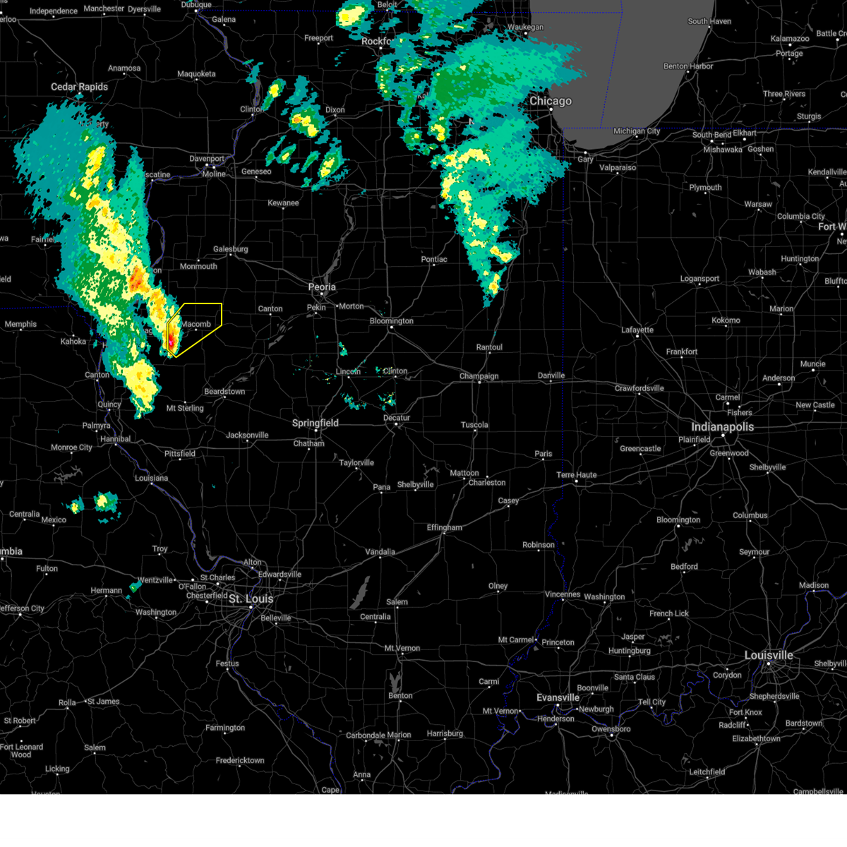 Svrdvn the national weather service in the quad cities has issued a * severe thunderstorm warning for, mcdonough county in west central illinois, * until 100 pm cdt. * at 1209 pm cdt, a severe thunderstorm was located over tennessee, or 9 miles southwest of macomb, moving northeast at 35 mph (radar indicated). Hazards include 60 mph wind gusts and quarter size hail. Hail damage to vehicles is expected. Expect wind damage to roofs, siding, and trees. Svrdvn the national weather service in the quad cities has issued a * severe thunderstorm warning for, mcdonough county in west central illinois, * until 100 pm cdt. * at 1209 pm cdt, a severe thunderstorm was located over tennessee, or 9 miles southwest of macomb, moving northeast at 35 mph (radar indicated). Hazards include 60 mph wind gusts and quarter size hail. Hail damage to vehicles is expected. Expect wind damage to roofs, siding, and trees.
|
| 3/15/2025 1:57 AM CDT |
 The storms which prompted the warning have moved out of the area. therefore, the warning will be allowed to expire. however, gusty winds are still possible with these thunderstorms. a tornado watch remains in effect until 300 am cdt for east central illinois. The storms which prompted the warning have moved out of the area. therefore, the warning will be allowed to expire. however, gusty winds are still possible with these thunderstorms. a tornado watch remains in effect until 300 am cdt for east central illinois.
|
| 3/15/2025 1:12 AM CDT |
 Svrilx the national weather service in lincoln has issued a * severe thunderstorm warning for, edgar county in east central illinois, clark county in east central illinois, eastern vermilion county in east central illinois, * until 200 am cdt. * at 111 am cdt, severe thunderstorms were located along a line extending from near hoopeston to near georgetown to 6 miles south of martinsville, moving northeast at 65 mph (radar indicated). Hazards include 70 mph wind gusts. Expect considerable tree damage. damage is likely to mobile homes, roofs, and outbuildings. severe thunderstorms will be near, edgar county airport, vermilion regional airport, georgetown, hoopeston, rossville, westville, marshall, chrisman, tilton, and ridge farm around 115 am cdt. vermilion around 120 am cdt. this includes the following highways, interstate 70 between mile markers 135 and 154. Interstate 74 between mile markers 208 and 220. Svrilx the national weather service in lincoln has issued a * severe thunderstorm warning for, edgar county in east central illinois, clark county in east central illinois, eastern vermilion county in east central illinois, * until 200 am cdt. * at 111 am cdt, severe thunderstorms were located along a line extending from near hoopeston to near georgetown to 6 miles south of martinsville, moving northeast at 65 mph (radar indicated). Hazards include 70 mph wind gusts. Expect considerable tree damage. damage is likely to mobile homes, roofs, and outbuildings. severe thunderstorms will be near, edgar county airport, vermilion regional airport, georgetown, hoopeston, rossville, westville, marshall, chrisman, tilton, and ridge farm around 115 am cdt. vermilion around 120 am cdt. this includes the following highways, interstate 70 between mile markers 135 and 154. Interstate 74 between mile markers 208 and 220.
|
| 3/15/2025 1:11 AM CDT |
 The tornado threat has diminished and the tornado warning has been cancelled. however, large hail and damaging winds remain likely and a severe thunderstorm warning remains in effect for the area. a tornado watch remains in effect until 300 am cdt for east central illinois. remember, a severe thunderstorm warning still remains in effect for portions of edgar and vermilion counties until 115 am cdt. The tornado threat has diminished and the tornado warning has been cancelled. however, large hail and damaging winds remain likely and a severe thunderstorm warning remains in effect for the area. a tornado watch remains in effect until 300 am cdt for east central illinois. remember, a severe thunderstorm warning still remains in effect for portions of edgar and vermilion counties until 115 am cdt.
|
| 3/15/2025 12:57 AM CDT |
 the tornado warning has been cancelled and is no longer in effect the tornado warning has been cancelled and is no longer in effect
|
| 3/15/2025 12:57 AM CDT |
 At 1257 am cdt, a severe thunderstorm capable of producing a tornado was located near ridge farm, or 17 miles south of danville, moving northeast at 65 mph (radar indicated rotation). Hazards include tornado and quarter size hail. Flying debris will be dangerous to those caught without shelter. mobile homes will be damaged or destroyed. damage to roofs, windows, and vehicles will occur. tree damage is likely. this dangerous storm will be near, georgetown and westville around 105 am cdt. Other locations impacted by this tornadic thunderstorm include edgar, jamaica, scottland, metcalf, and indianola. At 1257 am cdt, a severe thunderstorm capable of producing a tornado was located near ridge farm, or 17 miles south of danville, moving northeast at 65 mph (radar indicated rotation). Hazards include tornado and quarter size hail. Flying debris will be dangerous to those caught without shelter. mobile homes will be damaged or destroyed. damage to roofs, windows, and vehicles will occur. tree damage is likely. this dangerous storm will be near, georgetown and westville around 105 am cdt. Other locations impacted by this tornadic thunderstorm include edgar, jamaica, scottland, metcalf, and indianola.
|
| 3/15/2025 12:34 AM CDT |
 Torilx the national weather service in lincoln has issued a * tornado warning for, northeastern coles county in east central illinois, northwestern edgar county in east central illinois, southern vermilion county in east central illinois, eastern douglas county in east central illinois, * until 115 am cdt. * at 1233 am cdt, a severe thunderstorm capable of producing a tornado was located near oakland, or 12 miles northeast of charleston, moving northeast at 60 mph (radar indicated rotation). Hazards include tornado and quarter size hail. Flying debris will be dangerous to those caught without shelter. mobile homes will be damaged or destroyed. damage to roofs, windows, and vehicles will occur. tree damage is likely. this dangerous storm will be near, brocton around 1240 am cdt. hume around 1245 am cdt. Other locations in the path of this tornadic thunderstorm include chrisman, ridge farm, georgetown and westville. Torilx the national weather service in lincoln has issued a * tornado warning for, northeastern coles county in east central illinois, northwestern edgar county in east central illinois, southern vermilion county in east central illinois, eastern douglas county in east central illinois, * until 115 am cdt. * at 1233 am cdt, a severe thunderstorm capable of producing a tornado was located near oakland, or 12 miles northeast of charleston, moving northeast at 60 mph (radar indicated rotation). Hazards include tornado and quarter size hail. Flying debris will be dangerous to those caught without shelter. mobile homes will be damaged or destroyed. damage to roofs, windows, and vehicles will occur. tree damage is likely. this dangerous storm will be near, brocton around 1240 am cdt. hume around 1245 am cdt. Other locations in the path of this tornadic thunderstorm include chrisman, ridge farm, georgetown and westville.
|
| 3/15/2025 12:15 AM CDT |
 Svrilx the national weather service in lincoln has issued a * severe thunderstorm warning for, vermilion county in east central illinois, * until 115 am cdt. * at 1214 am cdt, severe thunderstorms were located along a line extending from near paxton to sidney to near charleston, moving northeast at 65 mph (radar indicated). Hazards include 70 mph wind gusts. Expect considerable tree damage. damage is likely to mobile homes, roofs, and outbuildings. severe thunderstorms will be near, rankin, fairmount, fithian, and sidell around 1225 am cdt. potomac, catlin, and oakwood around 1230 am cdt. other locations in the path of these severe thunderstorms include hoopeston, rossville, westville, tilton, ridge farm, danville, vermilion regional airport and georgetown. This includes interstate 74 between mile markers 199 and 220. Svrilx the national weather service in lincoln has issued a * severe thunderstorm warning for, vermilion county in east central illinois, * until 115 am cdt. * at 1214 am cdt, severe thunderstorms were located along a line extending from near paxton to sidney to near charleston, moving northeast at 65 mph (radar indicated). Hazards include 70 mph wind gusts. Expect considerable tree damage. damage is likely to mobile homes, roofs, and outbuildings. severe thunderstorms will be near, rankin, fairmount, fithian, and sidell around 1225 am cdt. potomac, catlin, and oakwood around 1230 am cdt. other locations in the path of these severe thunderstorms include hoopeston, rossville, westville, tilton, ridge farm, danville, vermilion regional airport and georgetown. This includes interstate 74 between mile markers 199 and 220.
|
| 3/14/2025 9:02 PM CDT |
 At 901 pm cdt, severe thunderstorms were located along a line extending from monmouth to near walnut grove, moving northeast at 60 mph (radar indicated). Hazards include 70 mph wind gusts and penny size hail. Expect considerable tree damage. damage is likely to mobile homes, roofs, and outbuildings. Locations impacted include, walnut grove, gerlaw, western illinois university, sciota, macomb municipal airport, good hope, roseville, larchland, monmouth municipal airport, cameron, little swan lake, bushnell, industry, warren county fairgrounds, new philadelphia, youngstown, prairie city airport, prairie city, mcdonough county 4-h grounds, and berwick. At 901 pm cdt, severe thunderstorms were located along a line extending from monmouth to near walnut grove, moving northeast at 60 mph (radar indicated). Hazards include 70 mph wind gusts and penny size hail. Expect considerable tree damage. damage is likely to mobile homes, roofs, and outbuildings. Locations impacted include, walnut grove, gerlaw, western illinois university, sciota, macomb municipal airport, good hope, roseville, larchland, monmouth municipal airport, cameron, little swan lake, bushnell, industry, warren county fairgrounds, new philadelphia, youngstown, prairie city airport, prairie city, mcdonough county 4-h grounds, and berwick.
|
| 3/14/2025 9:02 PM CDT |
 the severe thunderstorm warning has been cancelled and is no longer in effect the severe thunderstorm warning has been cancelled and is no longer in effect
|
| 3/14/2025 8:53 PM CDT |
 At 852 pm cdt, a severe thunderstorm capable of producing a tornado was located over macomb, moving northeast at 55 mph (radar indicated rotation). Hazards include tornado. Flying debris will be dangerous to those caught without shelter. mobile homes will be damaged or destroyed. damage to roofs, windows, and vehicles will occur. tree damage is likely. This dangerous storm will be near, bushnell, new philadelphia, prairie city, walnut grove, scottsburg, little swan lake, and prairie city airport around 900 pm cdt. At 852 pm cdt, a severe thunderstorm capable of producing a tornado was located over macomb, moving northeast at 55 mph (radar indicated rotation). Hazards include tornado. Flying debris will be dangerous to those caught without shelter. mobile homes will be damaged or destroyed. damage to roofs, windows, and vehicles will occur. tree damage is likely. This dangerous storm will be near, bushnell, new philadelphia, prairie city, walnut grove, scottsburg, little swan lake, and prairie city airport around 900 pm cdt.
|
| 3/14/2025 8:46 PM CDT |
 Tordvn the national weather service in the quad cities has issued a * tornado warning for, south central warren county in west central illinois, central mcdonough county in west central illinois, * until 915 pm cdt. * at 846 pm cdt, a severe thunderstorm capable of producing a tornado was located near fandon, or near macomb, moving northeast at 55 mph (radar indicated rotation). Hazards include tornado. Flying debris will be dangerous to those caught without shelter. mobile homes will be damaged or destroyed. damage to roofs, windows, and vehicles will occur. tree damage is likely. this dangerous storm will be near, pennington point, macomb, adair, macomb municipal airport, bardolph, good hope, scottsburg, mcdonough county 4-h grounds, western illinois university, and spring lake around 850 pm cdt. bushnell, new philadelphia, and walnut grove around 855 pm cdt. Prairie city, little swan lake, and prairie city airport around 900 pm cdt. Tordvn the national weather service in the quad cities has issued a * tornado warning for, south central warren county in west central illinois, central mcdonough county in west central illinois, * until 915 pm cdt. * at 846 pm cdt, a severe thunderstorm capable of producing a tornado was located near fandon, or near macomb, moving northeast at 55 mph (radar indicated rotation). Hazards include tornado. Flying debris will be dangerous to those caught without shelter. mobile homes will be damaged or destroyed. damage to roofs, windows, and vehicles will occur. tree damage is likely. this dangerous storm will be near, pennington point, macomb, adair, macomb municipal airport, bardolph, good hope, scottsburg, mcdonough county 4-h grounds, western illinois university, and spring lake around 850 pm cdt. bushnell, new philadelphia, and walnut grove around 855 pm cdt. Prairie city, little swan lake, and prairie city airport around 900 pm cdt.
|
| 3/14/2025 8:37 PM CDT |
 Svrdvn the national weather service in the quad cities has issued a * severe thunderstorm warning for, northeastern hancock county in west central illinois, southeastern henderson county in west central illinois, warren county in west central illinois, mcdonough county in west central illinois, southeastern mercer county in northwestern illinois, * until 915 pm cdt. * at 836 pm cdt, severe thunderstorms were located along a line extending from blandinsville to near weinberg king state park, moving northeast at 60 mph. a trained spotter reported a 81 mph wind gust 4 miles northeast of blandinsville 831 pm. these are destructive storms for mcdonough and warren counties (radar indicated). Hazards include 80 mph wind gusts and penny size hail. Flying debris will be dangerous to those caught without shelter. mobile homes will be heavily damaged. expect considerable damage to roofs, windows, and vehicles. Extensive tree damage and power outages are likely. Svrdvn the national weather service in the quad cities has issued a * severe thunderstorm warning for, northeastern hancock county in west central illinois, southeastern henderson county in west central illinois, warren county in west central illinois, mcdonough county in west central illinois, southeastern mercer county in northwestern illinois, * until 915 pm cdt. * at 836 pm cdt, severe thunderstorms were located along a line extending from blandinsville to near weinberg king state park, moving northeast at 60 mph. a trained spotter reported a 81 mph wind gust 4 miles northeast of blandinsville 831 pm. these are destructive storms for mcdonough and warren counties (radar indicated). Hazards include 80 mph wind gusts and penny size hail. Flying debris will be dangerous to those caught without shelter. mobile homes will be heavily damaged. expect considerable damage to roofs, windows, and vehicles. Extensive tree damage and power outages are likely.
|
| 3/14/2025 8:28 PM CDT |
 At 827 pm cdt, severe thunderstorms were located along a line extending from near tennessee to huntsville, moving northeast at 60 mph (radar indicated). Hazards include 70 mph wind gusts. Expect considerable tree damage. damage is likely to mobile homes, roofs, and outbuildings. Locations impacted include, macomb, sciota, argyle lake state park, tennessee, colchester, fandon, colmar, blandinsville, spring lake, good hope, mcdonough county 4-h grounds, western illinois university, macomb municipal airport, youngstown, bardolph, walnut grove, scottsburg, bushnell, little swan lake, prairie city and prairie city airport. At 827 pm cdt, severe thunderstorms were located along a line extending from near tennessee to huntsville, moving northeast at 60 mph (radar indicated). Hazards include 70 mph wind gusts. Expect considerable tree damage. damage is likely to mobile homes, roofs, and outbuildings. Locations impacted include, macomb, sciota, argyle lake state park, tennessee, colchester, fandon, colmar, blandinsville, spring lake, good hope, mcdonough county 4-h grounds, western illinois university, macomb municipal airport, youngstown, bardolph, walnut grove, scottsburg, bushnell, little swan lake, prairie city and prairie city airport.
|
| 3/14/2025 8:07 PM CDT |
 Svrdvn the national weather service in the quad cities has issued a * severe thunderstorm warning for, southern hancock county in west central illinois, southeastern warren county in west central illinois, mcdonough county in west central illinois, southern clark county in northeastern missouri, * until 900 pm cdt. * at 807 pm cdt, severe thunderstorms were located along a line extending from near bowen to near liberty, moving northeast at 65 mph (radar indicated). Hazards include 70 mph wind gusts. Expect considerable tree damage. damage is likely to mobile homes, roofs, and outbuildings. severe thunderstorms will be near, denver, bowen, and augusta around 810 pm cdt. hancock county fairgrounds and plymouth around 815 pm cdt. tennessee and colmar around 820 pm cdt. argyle lake state park, colchester, and fandon around 825 pm cdt. Other locations in the path of these severe thunderstorms include macomb, sciota, blandinsville, spring lake, macomb municipal airport, good hope, mcdonough county 4-h grounds, western illinois university, industry, scottsburg, youngstown, pennington point, bushnell, bardolph, walnut grove and little swan lake. Svrdvn the national weather service in the quad cities has issued a * severe thunderstorm warning for, southern hancock county in west central illinois, southeastern warren county in west central illinois, mcdonough county in west central illinois, southern clark county in northeastern missouri, * until 900 pm cdt. * at 807 pm cdt, severe thunderstorms were located along a line extending from near bowen to near liberty, moving northeast at 65 mph (radar indicated). Hazards include 70 mph wind gusts. Expect considerable tree damage. damage is likely to mobile homes, roofs, and outbuildings. severe thunderstorms will be near, denver, bowen, and augusta around 810 pm cdt. hancock county fairgrounds and plymouth around 815 pm cdt. tennessee and colmar around 820 pm cdt. argyle lake state park, colchester, and fandon around 825 pm cdt. Other locations in the path of these severe thunderstorms include macomb, sciota, blandinsville, spring lake, macomb municipal airport, good hope, mcdonough county 4-h grounds, western illinois university, industry, scottsburg, youngstown, pennington point, bushnell, bardolph, walnut grove and little swan lake.
|
| 7/31/2024 10:12 AM CDT |
 the severe thunderstorm warning has been cancelled and is no longer in effect the severe thunderstorm warning has been cancelled and is no longer in effect
|
| 7/31/2024 10:08 AM CDT |
 At 1008 am cdt, severe thunderstorms were located along a line extending from near georgetown to 6 miles east of edgar county airport, moving east at 30 mph (radar indicated). Hazards include 60 mph wind gusts and nickel size hail. Expect damage to roofs, siding, and trees. Locations impacted include, georgetown, westville, ridge farm, and scottland. At 1008 am cdt, severe thunderstorms were located along a line extending from near georgetown to 6 miles east of edgar county airport, moving east at 30 mph (radar indicated). Hazards include 60 mph wind gusts and nickel size hail. Expect damage to roofs, siding, and trees. Locations impacted include, georgetown, westville, ridge farm, and scottland.
|
| 7/31/2024 9:59 AM CDT |
 At 958 am cdt, severe thunderstorms were located along a line extending from near westville to near edgar county airport, moving east at 30 mph (radar indicated). Hazards include 60 mph wind gusts and nickel size hail. Expect damage to roofs, siding, and trees. These severe thunderstorms will remain over mainly rural areas of northeastern edgar and southeastern vermilion counties, including the following locations, edgar, belgium, scottland, and indianola. At 958 am cdt, severe thunderstorms were located along a line extending from near westville to near edgar county airport, moving east at 30 mph (radar indicated). Hazards include 60 mph wind gusts and nickel size hail. Expect damage to roofs, siding, and trees. These severe thunderstorms will remain over mainly rural areas of northeastern edgar and southeastern vermilion counties, including the following locations, edgar, belgium, scottland, and indianola.
|
| 7/31/2024 9:44 AM CDT |
 Svrilx the national weather service in lincoln has issued a * severe thunderstorm warning for, northeastern edgar county in east central illinois, southern vermilion county in east central illinois, * until 1030 am cdt. * at 944 am cdt, severe thunderstorms were located along a line extending from near fairmount to near edgar county airport, moving east at 30 mph (radar indicated). Hazards include 60 mph wind gusts and quarter size hail. Hail damage to vehicles is expected. expect wind damage to roofs, siding, and trees. severe thunderstorms will be near, georgetown, catlin, chrisman, ridge farm, and edgar county airport around 950 am cdt. Westville around 955 am cdt. Svrilx the national weather service in lincoln has issued a * severe thunderstorm warning for, northeastern edgar county in east central illinois, southern vermilion county in east central illinois, * until 1030 am cdt. * at 944 am cdt, severe thunderstorms were located along a line extending from near fairmount to near edgar county airport, moving east at 30 mph (radar indicated). Hazards include 60 mph wind gusts and quarter size hail. Hail damage to vehicles is expected. expect wind damage to roofs, siding, and trees. severe thunderstorms will be near, georgetown, catlin, chrisman, ridge farm, and edgar county airport around 950 am cdt. Westville around 955 am cdt.
|
| 7/31/2024 6:27 AM CDT |
 The storms which prompted the warning have moved out of the area. therefore, the warning will be allowed to expire. however, gusty winds and heavy rain are still possible with these thunderstorms. a severe thunderstorm watch remains in effect until 900 am cdt for west central illinois. The storms which prompted the warning have moved out of the area. therefore, the warning will be allowed to expire. however, gusty winds and heavy rain are still possible with these thunderstorms. a severe thunderstorm watch remains in effect until 900 am cdt for west central illinois.
|
| 7/31/2024 6:19 AM CDT |
 the severe thunderstorm warning has been cancelled and is no longer in effect the severe thunderstorm warning has been cancelled and is no longer in effect
|
| 7/31/2024 6:19 AM CDT |
 At 619 am cdt, severe thunderstorms were located along a line extending from scottsburg to near huntsville, moving east at 45 mph (radar indicated). Hazards include 60 mph wind gusts. Expect damage to roofs, siding, and trees. Locations impacted include, macomb, bushnell, colchester, blandinsville, augusta, bowen, industry, good hope, prairie city, bardolph, tennessee, sciota, western illinois university, fandon, little swan lake, new philadelphia, colmar, adair, walnut grove, and plymouth. At 619 am cdt, severe thunderstorms were located along a line extending from scottsburg to near huntsville, moving east at 45 mph (radar indicated). Hazards include 60 mph wind gusts. Expect damage to roofs, siding, and trees. Locations impacted include, macomb, bushnell, colchester, blandinsville, augusta, bowen, industry, good hope, prairie city, bardolph, tennessee, sciota, western illinois university, fandon, little swan lake, new philadelphia, colmar, adair, walnut grove, and plymouth.
|
| 7/31/2024 6:11 AM CDT |
 the severe thunderstorm warning has been cancelled and is no longer in effect the severe thunderstorm warning has been cancelled and is no longer in effect
|
| 7/31/2024 6:11 AM CDT |
 At 610 am cdt, severe thunderstorms were located along a line extending from good hope to la prairie, moving east at 45 mph (radar indicated). Hazards include 60 mph wind gusts. Expect damage to roofs, siding, and trees. Locations impacted include, macomb, carthage, bushnell, hamilton, warsaw, colchester, la harpe, roseville, stronghurst, blandinsville, augusta, bowen, industry, good hope, prairie city, carman, terre haute, bardolph, west point, and ferris. At 610 am cdt, severe thunderstorms were located along a line extending from good hope to la prairie, moving east at 45 mph (radar indicated). Hazards include 60 mph wind gusts. Expect damage to roofs, siding, and trees. Locations impacted include, macomb, carthage, bushnell, hamilton, warsaw, colchester, la harpe, roseville, stronghurst, blandinsville, augusta, bowen, industry, good hope, prairie city, carman, terre haute, bardolph, west point, and ferris.
|
| 7/31/2024 5:53 AM CDT |
 At 553 am cdt, severe thunderstorms were located along a line extending from near la harpe to near stillwell, moving east at 45 mph (radar indicated). Hazards include 60 mph wind gusts. Expect damage to roofs, siding, and trees. Locations impacted include, burlington, macomb, keokuk, carthage, nauvoo, bushnell, hamilton, warsaw, colchester, la harpe, roseville, dallas city, stronghurst, blandinsville, augusta, bowen, industry, good hope, prairie city, and carman. At 553 am cdt, severe thunderstorms were located along a line extending from near la harpe to near stillwell, moving east at 45 mph (radar indicated). Hazards include 60 mph wind gusts. Expect damage to roofs, siding, and trees. Locations impacted include, burlington, macomb, keokuk, carthage, nauvoo, bushnell, hamilton, warsaw, colchester, la harpe, roseville, dallas city, stronghurst, blandinsville, augusta, bowen, industry, good hope, prairie city, and carman.
|
| 7/31/2024 5:40 AM CDT |
 At 540 am cdt, severe thunderstorms were located along a line extending from lomax to near sutter, moving east at 45 mph (trained weather spotters). Hazards include 60 mph wind gusts. Expect damage to roofs, siding, and trees. Locations impacted include, burlington, macomb, fort madison, keokuk, carthage, nauvoo, bushnell, hamilton, warsaw, colchester, la harpe, roseville, dallas city, montrose, stronghurst, blandinsville, wayland, bowen, industry, and good hope. At 540 am cdt, severe thunderstorms were located along a line extending from lomax to near sutter, moving east at 45 mph (trained weather spotters). Hazards include 60 mph wind gusts. Expect damage to roofs, siding, and trees. Locations impacted include, burlington, macomb, fort madison, keokuk, carthage, nauvoo, bushnell, hamilton, warsaw, colchester, la harpe, roseville, dallas city, montrose, stronghurst, blandinsville, wayland, bowen, industry, and good hope.
|
| 7/31/2024 5:38 AM CDT |
 At 538 am cdt, severe thunderstorms were located along a line extending from lomax to near sutter, moving east at 45 mph (radar indicated). Hazards include 60 mph wind gusts. Expect damage to roofs, siding, and trees. Locations impacted include, burlington, macomb, fort madison, keokuk, carthage, nauvoo, bushnell, hamilton, warsaw, colchester, la harpe, roseville, dallas city, montrose, stronghurst, blandinsville, wayland, bowen, industry, and good hope. At 538 am cdt, severe thunderstorms were located along a line extending from lomax to near sutter, moving east at 45 mph (radar indicated). Hazards include 60 mph wind gusts. Expect damage to roofs, siding, and trees. Locations impacted include, burlington, macomb, fort madison, keokuk, carthage, nauvoo, bushnell, hamilton, warsaw, colchester, la harpe, roseville, dallas city, montrose, stronghurst, blandinsville, wayland, bowen, industry, and good hope.
|
| 7/31/2024 5:28 AM CDT |
 Svrdvn the national weather service in the quad cities has issued a * severe thunderstorm warning for, hancock county in west central illinois, southern henderson county in west central illinois, southern warren county in west central illinois, mcdonough county in west central illinois, southwestern des moines county in southeastern iowa, central lee county in southeastern iowa, southeastern clark county in northeastern missouri, * until 630 am cdt. * at 527 am cdt, severe thunderstorms were located along a line extending from near wever to gregory landing, moving east at 45 mph (trained weather spotters. at 514 am cdt, a 67 mph wind gust was measured by a personal weather station just northwest of houghton). Hazards include 60 mph wind gusts. expect damage to roofs, siding, and trees Svrdvn the national weather service in the quad cities has issued a * severe thunderstorm warning for, hancock county in west central illinois, southern henderson county in west central illinois, southern warren county in west central illinois, mcdonough county in west central illinois, southwestern des moines county in southeastern iowa, central lee county in southeastern iowa, southeastern clark county in northeastern missouri, * until 630 am cdt. * at 527 am cdt, severe thunderstorms were located along a line extending from near wever to gregory landing, moving east at 45 mph (trained weather spotters. at 514 am cdt, a 67 mph wind gust was measured by a personal weather station just northwest of houghton). Hazards include 60 mph wind gusts. expect damage to roofs, siding, and trees
|
| 7/30/2024 6:35 AM CDT |
 At 634 am cdt, severe thunderstorms were located along a line extending from abingdon to near rushville, moving east at 45 mph (trained weather spotters). Hazards include 60 mph wind gusts. Expect damage to roofs, siding, and trees. Locations impacted include, macomb, bushnell, roseville, avon, industry, good hope, prairie city, bardolph, western illinois university, adair, fandon, little swan lake, new philadelphia, walnut grove, greenbush, pennington point, macomb municipal airport, scottsburg, warren county fairgrounds, and swan creek. At 634 am cdt, severe thunderstorms were located along a line extending from abingdon to near rushville, moving east at 45 mph (trained weather spotters). Hazards include 60 mph wind gusts. Expect damage to roofs, siding, and trees. Locations impacted include, macomb, bushnell, roseville, avon, industry, good hope, prairie city, bardolph, western illinois university, adair, fandon, little swan lake, new philadelphia, walnut grove, greenbush, pennington point, macomb municipal airport, scottsburg, warren county fairgrounds, and swan creek.
|
| 7/30/2024 6:20 AM CDT |
 the severe thunderstorm warning has been cancelled and is no longer in effect the severe thunderstorm warning has been cancelled and is no longer in effect
|
| 7/30/2024 6:20 AM CDT |
 At 620 am cdt, severe thunderstorms were located along a line extending from ormonde to near camden, moving east at 45 mph (radar indicated). Hazards include 60 mph wind gusts. Expect damage to roofs, siding, and trees. Locations impacted include, macomb, bushnell, colchester, roseville, avon, kirkwood, blandinsville, industry, good hope, prairie city, bardolph, tennessee, sciota, western illinois university, fandon, little swan lake, new philadelphia, colmar, adair, and walnut grove. At 620 am cdt, severe thunderstorms were located along a line extending from ormonde to near camden, moving east at 45 mph (radar indicated). Hazards include 60 mph wind gusts. Expect damage to roofs, siding, and trees. Locations impacted include, macomb, bushnell, colchester, roseville, avon, kirkwood, blandinsville, industry, good hope, prairie city, bardolph, tennessee, sciota, western illinois university, fandon, little swan lake, new philadelphia, colmar, adair, and walnut grove.
|
| 7/30/2024 6:19 AM CDT |
 the severe thunderstorm warning has been cancelled and is no longer in effect the severe thunderstorm warning has been cancelled and is no longer in effect
|
| 7/30/2024 6:19 AM CDT |
 At 619 am cdt, a severe thunderstorm was located near industry, or 9 miles south of macomb, moving east at 55 mph (radar indicated). Hazards include 60 mph wind gusts. Expect damage to roofs, siding, and trees. Locations impacted include, macomb, colchester, blandinsville, tennessee, sciota, fandon, colmar, plymouth, spring lake, and argyle lake state park. At 619 am cdt, a severe thunderstorm was located near industry, or 9 miles south of macomb, moving east at 55 mph (radar indicated). Hazards include 60 mph wind gusts. Expect damage to roofs, siding, and trees. Locations impacted include, macomb, colchester, blandinsville, tennessee, sciota, fandon, colmar, plymouth, spring lake, and argyle lake state park.
|
| 7/30/2024 6:10 AM CDT |
 At 610 am cdt, a severe thunderstorm was located over fandon, or 9 miles southwest of macomb, moving east at 55 mph (radar indicated). Hazards include 60 mph wind gusts. Expect damage to roofs, siding, and trees. Locations impacted include, macomb, carthage, colchester, la harpe, blandinsville, augusta, bowen, west point, ferris, tennessee, sciota, fandon, burnside, colmar, disco, plymouth, denver, fountain green, basco, and bentley. At 610 am cdt, a severe thunderstorm was located over fandon, or 9 miles southwest of macomb, moving east at 55 mph (radar indicated). Hazards include 60 mph wind gusts. Expect damage to roofs, siding, and trees. Locations impacted include, macomb, carthage, colchester, la harpe, blandinsville, augusta, bowen, west point, ferris, tennessee, sciota, fandon, burnside, colmar, disco, plymouth, denver, fountain green, basco, and bentley.
|
| 7/30/2024 6:07 AM CDT |
 Svrdvn the national weather service in the quad cities has issued a * severe thunderstorm warning for, southeastern henderson county in west central illinois, southern warren county in west central illinois, mcdonough county in west central illinois, * until 700 am cdt. * at 607 am cdt, severe thunderstorms were located along a line extending from near kirkwood to near huntsville, moving east at 45 mph (radar indicated). Hazards include 60 mph wind gusts. expect damage to roofs, siding, and trees Svrdvn the national weather service in the quad cities has issued a * severe thunderstorm warning for, southeastern henderson county in west central illinois, southern warren county in west central illinois, mcdonough county in west central illinois, * until 700 am cdt. * at 607 am cdt, severe thunderstorms were located along a line extending from near kirkwood to near huntsville, moving east at 45 mph (radar indicated). Hazards include 60 mph wind gusts. expect damage to roofs, siding, and trees
|
| 7/30/2024 5:56 AM CDT |
 the severe thunderstorm warning has been cancelled and is no longer in effect the severe thunderstorm warning has been cancelled and is no longer in effect
|
| 7/30/2024 5:56 AM CDT |
 At 556 am cdt, a severe thunderstorm was located over webster, or near carthage, moving east at 55 mph (radar indicated). Hazards include 60 mph wind gusts. Expect damage to roofs, siding, and trees. Locations impacted include, macomb, keokuk, carthage, nauvoo, hamilton, warsaw, colchester, la harpe, dallas city, blandinsville, augusta, bowen, west point, ferris, tennessee, sciota, colusa, adrian, fandon, and burnside. At 556 am cdt, a severe thunderstorm was located over webster, or near carthage, moving east at 55 mph (radar indicated). Hazards include 60 mph wind gusts. Expect damage to roofs, siding, and trees. Locations impacted include, macomb, keokuk, carthage, nauvoo, hamilton, warsaw, colchester, la harpe, dallas city, blandinsville, augusta, bowen, west point, ferris, tennessee, sciota, colusa, adrian, fandon, and burnside.
|
| 7/30/2024 5:41 AM CDT |
 Svrdvn the national weather service in the quad cities has issued a * severe thunderstorm warning for, hancock county in west central illinois, western mcdonough county in west central illinois, southeastern clark county in northeastern missouri, * until 630 am cdt. * at 541 am cdt, a severe thunderstorm was located near adrian, or near nauvoo, moving east at 50 mph (radar indicated). Hazards include 60 mph wind gusts. expect damage to roofs, siding, and trees Svrdvn the national weather service in the quad cities has issued a * severe thunderstorm warning for, hancock county in west central illinois, western mcdonough county in west central illinois, southeastern clark county in northeastern missouri, * until 630 am cdt. * at 541 am cdt, a severe thunderstorm was located near adrian, or near nauvoo, moving east at 50 mph (radar indicated). Hazards include 60 mph wind gusts. expect damage to roofs, siding, and trees
|
| 7/15/2024 11:15 PM CDT |
 The storms which prompted the warning have weakened below severe limits, and no longer pose an immediate threat to life or property. therefore, the warning has been allowed to expire. however, gusty winds are still possible with these thunderstorms. a severe thunderstorm watch remains in effect until 400 am cdt for east central illinois. The storms which prompted the warning have weakened below severe limits, and no longer pose an immediate threat to life or property. therefore, the warning has been allowed to expire. however, gusty winds are still possible with these thunderstorms. a severe thunderstorm watch remains in effect until 400 am cdt for east central illinois.
|
| 7/15/2024 11:02 PM CDT |
 the severe thunderstorm warning has been cancelled and is no longer in effect the severe thunderstorm warning has been cancelled and is no longer in effect
|
| 7/15/2024 11:02 PM CDT |
 At 1102 pm cdt, severe thunderstorms were located along a line extending from near veedersburg to 6 miles northwest of clinton to near martinsville, moving east at 50 mph (radar indicated). Hazards include 60 mph wind gusts. Expect damage to roofs, siding, and trees. these severe storms will be near, paris and vermilion around 1105 pm cdt. other locations impacted by these severe thunderstorms include isabel, edgar, oliver, fairgrange, indianola, loxa, fox ridge state park, bushton, redmon, and coles county airport. This includes interstate 57 between mile markers 190 and 197. At 1102 pm cdt, severe thunderstorms were located along a line extending from near veedersburg to 6 miles northwest of clinton to near martinsville, moving east at 50 mph (radar indicated). Hazards include 60 mph wind gusts. Expect damage to roofs, siding, and trees. these severe storms will be near, paris and vermilion around 1105 pm cdt. other locations impacted by these severe thunderstorms include isabel, edgar, oliver, fairgrange, indianola, loxa, fox ridge state park, bushton, redmon, and coles county airport. This includes interstate 57 between mile markers 190 and 197.
|
| 7/15/2024 10:39 PM CDT |
 At 1038 pm cdt, severe thunderstorms were located along a line extending from 8 miles northeast of vermilion regional airport to near hume to near charleston, moving east at 50 mph (radar indicated). Hazards include 60 mph wind gusts. Expect damage to roofs, siding, and trees. these severe storms will be near, charleston, georgetown, chrisman, ridge farm, kansas, ashmore, and brocton around 1045 pm cdt. edgar county airport around 1050 pm cdt. paris around 1055 pm cdt. vermilion around 1105 pm cdt. other locations impacted by these severe thunderstorms include isabel, murdock, edgar, collison, oliver, fairgrange, indianola, walnut point state park, loxa, and fox ridge state park. this includes the following highways, interstate 57 between mile markers 190 and 202. Interstate 74 between mile markers 198 and 220. At 1038 pm cdt, severe thunderstorms were located along a line extending from 8 miles northeast of vermilion regional airport to near hume to near charleston, moving east at 50 mph (radar indicated). Hazards include 60 mph wind gusts. Expect damage to roofs, siding, and trees. these severe storms will be near, charleston, georgetown, chrisman, ridge farm, kansas, ashmore, and brocton around 1045 pm cdt. edgar county airport around 1050 pm cdt. paris around 1055 pm cdt. vermilion around 1105 pm cdt. other locations impacted by these severe thunderstorms include isabel, murdock, edgar, collison, oliver, fairgrange, indianola, walnut point state park, loxa, and fox ridge state park. this includes the following highways, interstate 57 between mile markers 190 and 202. Interstate 74 between mile markers 198 and 220.
|
| 7/15/2024 10:06 PM CDT |
 Svrilx the national weather service in lincoln has issued a * severe thunderstorm warning for, coles county in east central illinois, edgar county in east central illinois, vermilion county in east central illinois, southeastern champaign county in east central illinois, eastern douglas county in east central illinois, * until 1115 pm cdt. * at 1006 pm cdt, severe thunderstorms were located along a line extending from rankin to near willard airport to near lovington, moving southeast at 50 mph (radar indicated). Hazards include 70 mph wind gusts. Expect considerable tree damage. damage is likely to mobile homes, roofs, and outbuildings. severe thunderstorms will be near, rankin around 1010 pm cdt. homer and potomac around 1015 pm cdt. rossville, fithian, broadlands, and cooks mill around 1020 pm cdt. danville, oakwood, newman, fairmount, humboldt, and allerton around 1025 pm cdt. other locations in the path of these severe thunderstorms include tilton, catlin, sidell, vermilion regional airport, charleston, georgetown, westville, oakland, hume, brocton, rardin, chrisman, ridge farm, ashmore and kansas. this includes the following highways, interstate 57 between mile markers 190 and 202. Interstate 74 between mile markers 198 and 220. Svrilx the national weather service in lincoln has issued a * severe thunderstorm warning for, coles county in east central illinois, edgar county in east central illinois, vermilion county in east central illinois, southeastern champaign county in east central illinois, eastern douglas county in east central illinois, * until 1115 pm cdt. * at 1006 pm cdt, severe thunderstorms were located along a line extending from rankin to near willard airport to near lovington, moving southeast at 50 mph (radar indicated). Hazards include 70 mph wind gusts. Expect considerable tree damage. damage is likely to mobile homes, roofs, and outbuildings. severe thunderstorms will be near, rankin around 1010 pm cdt. homer and potomac around 1015 pm cdt. rossville, fithian, broadlands, and cooks mill around 1020 pm cdt. danville, oakwood, newman, fairmount, humboldt, and allerton around 1025 pm cdt. other locations in the path of these severe thunderstorms include tilton, catlin, sidell, vermilion regional airport, charleston, georgetown, westville, oakland, hume, brocton, rardin, chrisman, ridge farm, ashmore and kansas. this includes the following highways, interstate 57 between mile markers 190 and 202. Interstate 74 between mile markers 198 and 220.
|
| 7/15/2024 8:27 PM CDT | The storms which prompted the warning have weakened below severe limits, and no longer pose an immediate threat to life or property. therefore, the warning will be allowed to expire. however, gusty winds and heavy rain are still possible with these thunderstorms. a severe thunderstorm watch remains in effect until 1100 pm cdt for west central illinois, southeastern iowa, and northeastern missouri. |
| 7/15/2024 7:53 PM CDT |
 At 751 pm cdt, severe thunderstorms were located along a line extending from near oquawka to near lebanon, moving southeast at 45 mph (trained weather spotters. at 747 pm cdt...a 58 mph wind gust was measured at the southeast iowa regional airport in burlington). Hazards include 60 mph wind gusts. Expect damage to roofs, siding, and trees. Locations impacted include, burlington, macomb, fort madison, keokuk, carthage, kahoka, nauvoo, keosauqua, bushnell, west burlington, hamilton, new london, warsaw, mediapolis, colchester, la harpe, roseville, west point, dallas city, and danville. At 751 pm cdt, severe thunderstorms were located along a line extending from near oquawka to near lebanon, moving southeast at 45 mph (trained weather spotters. at 747 pm cdt...a 58 mph wind gust was measured at the southeast iowa regional airport in burlington). Hazards include 60 mph wind gusts. Expect damage to roofs, siding, and trees. Locations impacted include, burlington, macomb, fort madison, keokuk, carthage, kahoka, nauvoo, keosauqua, bushnell, west burlington, hamilton, new london, warsaw, mediapolis, colchester, la harpe, roseville, west point, dallas city, and danville.
|
| 7/15/2024 7:44 PM CDT | Svrdvn the national weather service in the quad cities has issued a * severe thunderstorm warning for, northern hancock county in west central illinois, henderson county in west central illinois, southern warren county in west central illinois, northern mcdonough county in west central illinois, southern henry county in southeastern iowa, des moines county in southeastern iowa, van buren county in southeastern iowa, lee county in southeastern iowa, northeastern scotland county in northeastern missouri, clark county in northeastern missouri, * until 830 pm cdt. * at 744 pm cdt, severe thunderstorms were located along a line extending from oquawka to leando, moving southeast at 45 mph (radar indicated). Hazards include 60 mph wind gusts. expect damage to roofs, siding, and trees |
| 6/13/2024 10:17 PM CDT |
 the severe thunderstorm warning has been cancelled and is no longer in effect the severe thunderstorm warning has been cancelled and is no longer in effect
|
| 6/13/2024 10:06 PM CDT |
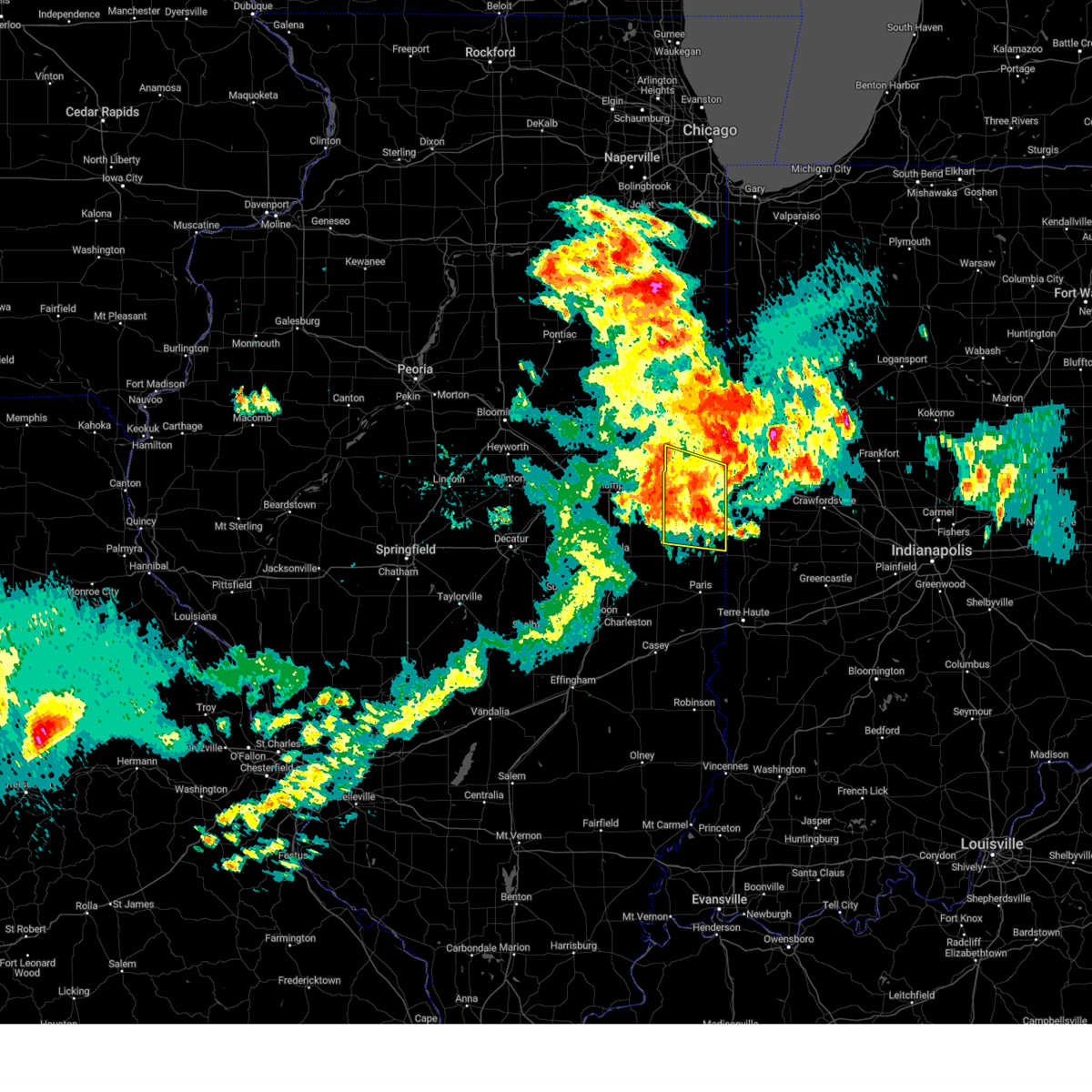 the severe thunderstorm warning has been cancelled and is no longer in effect the severe thunderstorm warning has been cancelled and is no longer in effect
|
| 6/13/2024 10:06 PM CDT |
 At 1006 pm cdt, severe thunderstorms were located along a line extending from near covington to 7 miles northwest of newport to near allerton, moving east at 50 mph (radar indicated). Hazards include 60 mph wind gusts and penny size hail. Expect damage to roofs, siding, and trees. these severe storms will be near, ridge farm and sidell around 1010 pm cdt. other locations impacted by these severe thunderstorms include muncie, armstrong, belgium, collison, indianola, jamaica, bismarck, and henning. This includes interstate 74 between mile markers 198 and 220. At 1006 pm cdt, severe thunderstorms were located along a line extending from near covington to 7 miles northwest of newport to near allerton, moving east at 50 mph (radar indicated). Hazards include 60 mph wind gusts and penny size hail. Expect damage to roofs, siding, and trees. these severe storms will be near, ridge farm and sidell around 1010 pm cdt. other locations impacted by these severe thunderstorms include muncie, armstrong, belgium, collison, indianola, jamaica, bismarck, and henning. This includes interstate 74 between mile markers 198 and 220.
|
| 6/13/2024 9:44 PM CDT |
 Svrilx the national weather service in lincoln has issued a * severe thunderstorm warning for, northeastern edgar county in east central illinois, vermilion county in east central illinois, champaign county in east central illinois, northeastern douglas county in east central illinois, * until 1030 pm cdt. * at 944 pm cdt, severe thunderstorms were located along a line extending from near vermilion regional airport to fairmount to near tolono, moving east at 50 mph (radar indicated). Hazards include 60 mph wind gusts and penny size hail. Expect damage to roofs, siding, and trees. severe thunderstorms will be near, danville, georgetown, westville, tilton, catlin, homer, fairmount, broadlands, allerton, and vermilion regional airport around 950 pm cdt. sidell around 955 pm cdt. ridge farm around 1000 pm cdt. this includes the following highways, interstate 57 between mile markers 229 and 238. interstate 72 between mile markers 176 and 182. Interstate 74 between mile markers 179 and 220. Svrilx the national weather service in lincoln has issued a * severe thunderstorm warning for, northeastern edgar county in east central illinois, vermilion county in east central illinois, champaign county in east central illinois, northeastern douglas county in east central illinois, * until 1030 pm cdt. * at 944 pm cdt, severe thunderstorms were located along a line extending from near vermilion regional airport to fairmount to near tolono, moving east at 50 mph (radar indicated). Hazards include 60 mph wind gusts and penny size hail. Expect damage to roofs, siding, and trees. severe thunderstorms will be near, danville, georgetown, westville, tilton, catlin, homer, fairmount, broadlands, allerton, and vermilion regional airport around 950 pm cdt. sidell around 955 pm cdt. ridge farm around 1000 pm cdt. this includes the following highways, interstate 57 between mile markers 229 and 238. interstate 72 between mile markers 176 and 182. Interstate 74 between mile markers 179 and 220.
|
| 6/13/2024 9:37 PM CDT |
 At 937 pm cdt, severe thunderstorms were located along a line extending from near potomac to near fithian to near tolono, moving southeast at 45 mph (radar indicated). Hazards include 60 mph wind gusts and penny size hail. Expect damage to roofs, siding, and trees. these severe storms will be near, danville, tolono, catlin, oakwood, philo, sidney, homer, and fairmount around 940 pm cdt. westville, tilton, broadlands, allerton, and vermilion regional airport around 945 pm cdt. georgetown and sidell around 950 pm cdt. other locations impacted by these severe thunderstorms include royal, muncie, armstrong, belgium, collison, longview, penfield, indianola, jamaica, and bismarck. this includes the following highways, interstate 57 between mile markers 228 and 244. interstate 72 between mile markers 174 and 182. Interstate 74 between mile markers 172 and 220. At 937 pm cdt, severe thunderstorms were located along a line extending from near potomac to near fithian to near tolono, moving southeast at 45 mph (radar indicated). Hazards include 60 mph wind gusts and penny size hail. Expect damage to roofs, siding, and trees. these severe storms will be near, danville, tolono, catlin, oakwood, philo, sidney, homer, and fairmount around 940 pm cdt. westville, tilton, broadlands, allerton, and vermilion regional airport around 945 pm cdt. georgetown and sidell around 950 pm cdt. other locations impacted by these severe thunderstorms include royal, muncie, armstrong, belgium, collison, longview, penfield, indianola, jamaica, and bismarck. this includes the following highways, interstate 57 between mile markers 228 and 244. interstate 72 between mile markers 174 and 182. Interstate 74 between mile markers 172 and 220.
|
| 6/13/2024 9:37 PM CDT |
 the severe thunderstorm warning has been cancelled and is no longer in effect the severe thunderstorm warning has been cancelled and is no longer in effect
|
| 6/13/2024 9:01 PM CDT |
 Svrilx the national weather service in lincoln has issued a * severe thunderstorm warning for, northeastern piatt county in central illinois, northeastern de witt county in central illinois, vermilion county in east central illinois, southeastern mclean county in central illinois, champaign county in east central illinois, northeastern douglas county in east central illinois, * until 945 pm cdt. * at 901 pm cdt, severe thunderstorms were located along a line extending from near paxton to fisher to near mansfield, moving east at 45 mph (radar indicated). Hazards include 60 mph wind gusts and penny size hail. Expect damage to roofs, siding, and trees. severe thunderstorms will be near, rantoul, mahomet, fisher, thomasboro, gifford, mansfield, and lake of the woods around 905 pm cdt. champaign and potomac around 910 pm cdt. urbana around 915 pm cdt. danville, st. joseph, ogden, fithian, and vermilion regional airport around 920 pm cdt. other locations in the path of these severe thunderstorms include oakwood, homer, westville, tilton, catlin, fairmount and georgetown. this includes the following highways, interstate 57 between mile markers 228 and 257. interstate 72 between mile markers 174 and 182. Interstate 74 between mile markers 156 and 220. Svrilx the national weather service in lincoln has issued a * severe thunderstorm warning for, northeastern piatt county in central illinois, northeastern de witt county in central illinois, vermilion county in east central illinois, southeastern mclean county in central illinois, champaign county in east central illinois, northeastern douglas county in east central illinois, * until 945 pm cdt. * at 901 pm cdt, severe thunderstorms were located along a line extending from near paxton to fisher to near mansfield, moving east at 45 mph (radar indicated). Hazards include 60 mph wind gusts and penny size hail. Expect damage to roofs, siding, and trees. severe thunderstorms will be near, rantoul, mahomet, fisher, thomasboro, gifford, mansfield, and lake of the woods around 905 pm cdt. champaign and potomac around 910 pm cdt. urbana around 915 pm cdt. danville, st. joseph, ogden, fithian, and vermilion regional airport around 920 pm cdt. other locations in the path of these severe thunderstorms include oakwood, homer, westville, tilton, catlin, fairmount and georgetown. this includes the following highways, interstate 57 between mile markers 228 and 257. interstate 72 between mile markers 174 and 182. Interstate 74 between mile markers 156 and 220.
|
| 5/24/2024 3:40 PM CDT |
 The storms which prompted the warning have weakened below severe limits, and no longer pose an immediate threat to life or property. therefore, the warning will be allowed to expire. however, small hail, gusty winds and heavy rain are still possible with these thunderstorms. The storms which prompted the warning have weakened below severe limits, and no longer pose an immediate threat to life or property. therefore, the warning will be allowed to expire. however, small hail, gusty winds and heavy rain are still possible with these thunderstorms.
|
| 5/24/2024 2:52 PM CDT |
 Svrilx the national weather service in lincoln has issued a * severe thunderstorm warning for, vermilion county in east central illinois, southern champaign county in east central illinois, * until 345 pm cdt. * at 251 pm cdt, severe thunderstorms were located along a line extending from champaign to danville, moving east at 30 mph (radar indicated). Hazards include 60 mph wind gusts and quarter size hail. Hail damage to vehicles is expected. expect wind damage to roofs, siding, and trees. severe thunderstorms will be near, danville, st. joseph, tolono, oakwood, philo, sidney, homer, ogden, fithian, and vermilion regional airport around 255 pm cdt. fairmount around 300 pm cdt. tilton and catlin around 310 pm cdt. other locations in the path of these severe thunderstorms include westville. this includes the following highways, interstate 57 between mile markers 218 and 239. interstate 72 between mile markers 176 and 182. Interstate 74 between mile markers 178 and 219. Svrilx the national weather service in lincoln has issued a * severe thunderstorm warning for, vermilion county in east central illinois, southern champaign county in east central illinois, * until 345 pm cdt. * at 251 pm cdt, severe thunderstorms were located along a line extending from champaign to danville, moving east at 30 mph (radar indicated). Hazards include 60 mph wind gusts and quarter size hail. Hail damage to vehicles is expected. expect wind damage to roofs, siding, and trees. severe thunderstorms will be near, danville, st. joseph, tolono, oakwood, philo, sidney, homer, ogden, fithian, and vermilion regional airport around 255 pm cdt. fairmount around 300 pm cdt. tilton and catlin around 310 pm cdt. other locations in the path of these severe thunderstorms include westville. this includes the following highways, interstate 57 between mile markers 218 and 239. interstate 72 between mile markers 176 and 182. Interstate 74 between mile markers 178 and 219.
|
| 5/24/2024 12:08 PM CDT |
 Tordvn the national weather service in the quad cities has issued a * tornado warning for, northeastern hancock county in west central illinois, south central warren county in west central illinois, northern mcdonough county in west central illinois, * until 100 pm cdt. * at 1208 pm cdt, a severe thunderstorm capable of producing a tornado was located near fountain green, or 12 miles west of macomb, moving northeast at 30 mph (radar indicated rotation). Hazards include tornado. Flying debris will be dangerous to those caught without shelter. mobile homes will be damaged or destroyed. damage to roofs, windows, and vehicles will occur. tree damage is likely. this dangerous storm will be near, macomb, blandinsville, sciota, western illinois university, argyle lake state park, mcdonough county 4-h grounds, and spring lake around 1215 pm cdt. good hope and macomb municipal airport around 1220 pm cdt. scottsburg around 1225 pm cdt. Other locations in the path of this tornadic thunderstorm include bardolph, swan creek and youngstown. Tordvn the national weather service in the quad cities has issued a * tornado warning for, northeastern hancock county in west central illinois, south central warren county in west central illinois, northern mcdonough county in west central illinois, * until 100 pm cdt. * at 1208 pm cdt, a severe thunderstorm capable of producing a tornado was located near fountain green, or 12 miles west of macomb, moving northeast at 30 mph (radar indicated rotation). Hazards include tornado. Flying debris will be dangerous to those caught without shelter. mobile homes will be damaged or destroyed. damage to roofs, windows, and vehicles will occur. tree damage is likely. this dangerous storm will be near, macomb, blandinsville, sciota, western illinois university, argyle lake state park, mcdonough county 4-h grounds, and spring lake around 1215 pm cdt. good hope and macomb municipal airport around 1220 pm cdt. scottsburg around 1225 pm cdt. Other locations in the path of this tornadic thunderstorm include bardolph, swan creek and youngstown.
|
| 5/21/2024 11:01 PM CDT |
 The showers and storms which prompted the warning have weakened below severe limits, and no longer pose an immediate threat to life or property. therefore, the warning will be allowed to expire. however, gusty winds up to 50 mph are still possible with these showers and thunderstorms. The showers and storms which prompted the warning have weakened below severe limits, and no longer pose an immediate threat to life or property. therefore, the warning will be allowed to expire. however, gusty winds up to 50 mph are still possible with these showers and thunderstorms.
|
| 5/21/2024 10:22 PM CDT |
 Svrilx the national weather service in lincoln has issued a * severe thunderstorm warning for, northeastern coles county in east central illinois, edgar county in east central illinois, vermilion county in east central illinois, champaign county in east central illinois, douglas county in east central illinois, * until 1100 pm cdt. * at 1022 pm cdt, a severe thunderstorm was located near arcola, moving northeast at 55 mph (radar indicated). Hazards include 60 mph wind gusts. expect damage to roofs, siding, and trees Svrilx the national weather service in lincoln has issued a * severe thunderstorm warning for, northeastern coles county in east central illinois, edgar county in east central illinois, vermilion county in east central illinois, champaign county in east central illinois, douglas county in east central illinois, * until 1100 pm cdt. * at 1022 pm cdt, a severe thunderstorm was located near arcola, moving northeast at 55 mph (radar indicated). Hazards include 60 mph wind gusts. expect damage to roofs, siding, and trees
|
| 4/16/2024 8:16 PM CDT |
 the severe thunderstorm warning has been cancelled and is no longer in effect the severe thunderstorm warning has been cancelled and is no longer in effect
|
| 4/16/2024 8:16 PM CDT |
 At 815 pm cdt, a severe thunderstorm was located near weinberg king state park, or 16 miles southwest of macomb, moving northeast at 35 mph (radar indicated). Hazards include 60 mph wind gusts. Expect damage to roofs, siding, and trees. Locations impacted include, macomb, colchester, industry, tennessee, western illinois university, fandon, colmar, plymouth, mcdonough county 4-h grounds, doddsville, argyle lake state park, and spring lake. At 815 pm cdt, a severe thunderstorm was located near weinberg king state park, or 16 miles southwest of macomb, moving northeast at 35 mph (radar indicated). Hazards include 60 mph wind gusts. Expect damage to roofs, siding, and trees. Locations impacted include, macomb, colchester, industry, tennessee, western illinois university, fandon, colmar, plymouth, mcdonough county 4-h grounds, doddsville, argyle lake state park, and spring lake.
|
| 4/16/2024 8:08 PM CDT |
 At 808 pm cdt, a severe thunderstorm was located over weinberg king state park, or 17 miles southeast of carthage, moving northeast at 30 mph (radar indicated). Hazards include 60 mph wind gusts. Expect damage to roofs, siding, and trees. Locations impacted include, macomb, colchester, augusta, industry, tennessee, western illinois university, fandon, colmar, plymouth, doddsville, mcdonough county 4-h grounds, hancock county fairgrounds, argyle lake state park, and spring lake. At 808 pm cdt, a severe thunderstorm was located over weinberg king state park, or 17 miles southeast of carthage, moving northeast at 30 mph (radar indicated). Hazards include 60 mph wind gusts. Expect damage to roofs, siding, and trees. Locations impacted include, macomb, colchester, augusta, industry, tennessee, western illinois university, fandon, colmar, plymouth, doddsville, mcdonough county 4-h grounds, hancock county fairgrounds, argyle lake state park, and spring lake.
|
| 4/16/2024 8:01 PM CDT |
 Svrdvn the national weather service in the quad cities has issued a * severe thunderstorm warning for, southeastern hancock county in west central illinois, southern mcdonough county in west central illinois, * until 845 pm cdt. * at 801 pm cdt, a severe thunderstorm was located over hancock county fairgrounds, or 18 miles southeast of carthage, moving northeast at 35 mph (radar indicated). Hazards include 60 mph wind gusts. expect damage to roofs, siding, and trees Svrdvn the national weather service in the quad cities has issued a * severe thunderstorm warning for, southeastern hancock county in west central illinois, southern mcdonough county in west central illinois, * until 845 pm cdt. * at 801 pm cdt, a severe thunderstorm was located over hancock county fairgrounds, or 18 miles southeast of carthage, moving northeast at 35 mph (radar indicated). Hazards include 60 mph wind gusts. expect damage to roofs, siding, and trees
|
| 4/16/2024 2:15 PM CDT |
 the severe thunderstorm warning has been cancelled and is no longer in effect the severe thunderstorm warning has been cancelled and is no longer in effect
|
| 4/16/2024 2:11 PM CDT |
 At 211 pm cdt, severe thunderstorms were located along a line extending from disco to blandinsville to tennessee, moving northeast at 65 mph (radar indicated). Hazards include 60 mph wind gusts and quarter size hail. Hail damage to vehicles is expected. expect wind damage to roofs, siding, and trees. Locations impacted include, macomb, colchester, la harpe, blandinsville, good hope, prairie city, tennessee, sciota, western illinois university, disco, colmar, walnut grove, plymouth, fountain green, macomb municipal airport, scottsburg, spring lake, prairie city airport, mcdonough county 4-h grounds, and argyle lake state park. At 211 pm cdt, severe thunderstorms were located along a line extending from disco to blandinsville to tennessee, moving northeast at 65 mph (radar indicated). Hazards include 60 mph wind gusts and quarter size hail. Hail damage to vehicles is expected. expect wind damage to roofs, siding, and trees. Locations impacted include, macomb, colchester, la harpe, blandinsville, good hope, prairie city, tennessee, sciota, western illinois university, disco, colmar, walnut grove, plymouth, fountain green, macomb municipal airport, scottsburg, spring lake, prairie city airport, mcdonough county 4-h grounds, and argyle lake state park.
|
| 4/16/2024 2:01 PM CDT |
 At 201 pm cdt, severe thunderstorms were located along a line extending from burnside to near webster to plymouth, moving northeast at 60 mph (radar indicated). Hazards include 60 mph wind gusts and quarter size hail. Hail damage to vehicles is expected. expect wind damage to roofs, siding, and trees. Locations impacted include, macomb, carthage, colchester, la harpe, blandinsville, good hope, prairie city, ferris, tennessee, sciota, western illinois university, burnside, colmar, disco, walnut grove, plymouth, fountain green, elvaston, bentley, and macomb municipal airport. At 201 pm cdt, severe thunderstorms were located along a line extending from burnside to near webster to plymouth, moving northeast at 60 mph (radar indicated). Hazards include 60 mph wind gusts and quarter size hail. Hail damage to vehicles is expected. expect wind damage to roofs, siding, and trees. Locations impacted include, macomb, carthage, colchester, la harpe, blandinsville, good hope, prairie city, ferris, tennessee, sciota, western illinois university, burnside, colmar, disco, walnut grove, plymouth, fountain green, elvaston, bentley, and macomb municipal airport.
|
| 4/16/2024 1:46 PM CDT |
 At 146 pm cdt, severe thunderstorms were located along a line extending from elvaston to bowen, moving northeast at 65 mph (radar indicated). Hazards include 60 mph wind gusts and quarter size hail. Hail damage to vehicles is expected. expect wind damage to roofs, siding, and trees. Locations impacted include, macomb, carthage, colchester, la harpe, blandinsville, bowen, good hope, prairie city, west point, ferris, tennessee, sciota, western illinois university, burnside, colmar, disco, walnut grove, plymouth, denver, and fountain green. At 146 pm cdt, severe thunderstorms were located along a line extending from elvaston to bowen, moving northeast at 65 mph (radar indicated). Hazards include 60 mph wind gusts and quarter size hail. Hail damage to vehicles is expected. expect wind damage to roofs, siding, and trees. Locations impacted include, macomb, carthage, colchester, la harpe, blandinsville, bowen, good hope, prairie city, west point, ferris, tennessee, sciota, western illinois university, burnside, colmar, disco, walnut grove, plymouth, denver, and fountain green.
|
| 4/16/2024 1:38 PM CDT |
 Svrdvn the national weather service in the quad cities has issued a * severe thunderstorm warning for, hancock county in west central illinois, northwestern mcdonough county in west central illinois, * until 230 pm cdt. * at 138 pm cdt, severe thunderstorms were located along a line extending from near sutter to woodville, moving northeast at 65 mph (radar indicated). Hazards include 60 mph wind gusts and quarter size hail. Hail damage to vehicles is expected. Expect wind damage to roofs, siding, and trees. Svrdvn the national weather service in the quad cities has issued a * severe thunderstorm warning for, hancock county in west central illinois, northwestern mcdonough county in west central illinois, * until 230 pm cdt. * at 138 pm cdt, severe thunderstorms were located along a line extending from near sutter to woodville, moving northeast at 65 mph (radar indicated). Hazards include 60 mph wind gusts and quarter size hail. Hail damage to vehicles is expected. Expect wind damage to roofs, siding, and trees.
|
| 3/31/2024 5:28 PM CDT |
 At 528 pm cdt, a severe thunderstorm was located over pennington point, or 7 miles southeast of macomb, moving east at 40 mph (trained weather spotters). Hazards include 60 mph wind gusts and half dollar size hail. Hail damage to vehicles is expected. expect wind damage to roofs, siding, and trees. Locations impacted include, macomb, bushnell, industry, good hope, bardolph, western illinois university, adair, fandon, new philadelphia, pennington point, macomb municipal airport, doddsville, scottsburg, spring lake, and mcdonough county 4-h grounds. At 528 pm cdt, a severe thunderstorm was located over pennington point, or 7 miles southeast of macomb, moving east at 40 mph (trained weather spotters). Hazards include 60 mph wind gusts and half dollar size hail. Hail damage to vehicles is expected. expect wind damage to roofs, siding, and trees. Locations impacted include, macomb, bushnell, industry, good hope, bardolph, western illinois university, adair, fandon, new philadelphia, pennington point, macomb municipal airport, doddsville, scottsburg, spring lake, and mcdonough county 4-h grounds.
|
| 3/31/2024 5:17 PM CDT |
 the severe thunderstorm warning has been cancelled and is no longer in effect the severe thunderstorm warning has been cancelled and is no longer in effect
|
| 3/31/2024 5:17 PM CDT |
 At 517 pm cdt, a severe thunderstorm was located over mcdonough county 4-h grounds, or over macomb, moving east at 45 mph (radar indicated). Hazards include ping pong ball size hail and 60 mph wind gusts. People and animals outdoors will be injured. expect hail damage to roofs, siding, windows, and vehicles. expect wind damage to roofs, siding, and trees. Locations impacted include, macomb, bushnell, colchester, blandinsville, industry, good hope, bardolph, tennessee, sciota, western illinois university, adair, fandon, new philadelphia, colmar, pennington point, macomb municipal airport, doddsville, scottsburg, spring lake, and mcdonough county 4-h grounds. At 517 pm cdt, a severe thunderstorm was located over mcdonough county 4-h grounds, or over macomb, moving east at 45 mph (radar indicated). Hazards include ping pong ball size hail and 60 mph wind gusts. People and animals outdoors will be injured. expect hail damage to roofs, siding, windows, and vehicles. expect wind damage to roofs, siding, and trees. Locations impacted include, macomb, bushnell, colchester, blandinsville, industry, good hope, bardolph, tennessee, sciota, western illinois university, adair, fandon, new philadelphia, colmar, pennington point, macomb municipal airport, doddsville, scottsburg, spring lake, and mcdonough county 4-h grounds.
|
| 3/31/2024 5:05 PM CDT |
 At 505 pm cdt, a severe thunderstorm was located near fountain green, or 11 miles west of macomb, moving east at 40 mph (radar indicated). Hazards include 60 mph wind gusts and half dollar size hail. Hail damage to vehicles is expected. expect wind damage to roofs, siding, and trees. Locations impacted include, macomb, bushnell, colchester, la harpe, blandinsville, industry, good hope, bardolph, tennessee, sciota, western illinois university, adair, fandon, new philadelphia, colmar, fountain green, pennington point, macomb municipal airport, doddsville, and scottsburg. At 505 pm cdt, a severe thunderstorm was located near fountain green, or 11 miles west of macomb, moving east at 40 mph (radar indicated). Hazards include 60 mph wind gusts and half dollar size hail. Hail damage to vehicles is expected. expect wind damage to roofs, siding, and trees. Locations impacted include, macomb, bushnell, colchester, la harpe, blandinsville, industry, good hope, bardolph, tennessee, sciota, western illinois university, adair, fandon, new philadelphia, colmar, fountain green, pennington point, macomb municipal airport, doddsville, and scottsburg.
|
| 3/31/2024 4:51 PM CDT |
 Svrdvn the national weather service in the quad cities has issued a * severe thunderstorm warning for, northeastern hancock county in west central illinois, mcdonough county in west central illinois, * until 545 pm cdt. * at 450 pm cdt, a severe thunderstorm was located over burnside, or near carthage, moving east at 40 mph (radar indicated). Hazards include 60 mph wind gusts and half dollar size hail. Hail damage to vehicles is expected. Expect wind damage to roofs, siding, and trees. Svrdvn the national weather service in the quad cities has issued a * severe thunderstorm warning for, northeastern hancock county in west central illinois, mcdonough county in west central illinois, * until 545 pm cdt. * at 450 pm cdt, a severe thunderstorm was located over burnside, or near carthage, moving east at 40 mph (radar indicated). Hazards include 60 mph wind gusts and half dollar size hail. Hail damage to vehicles is expected. Expect wind damage to roofs, siding, and trees.
|
| 3/14/2024 9:45 AM CDT |
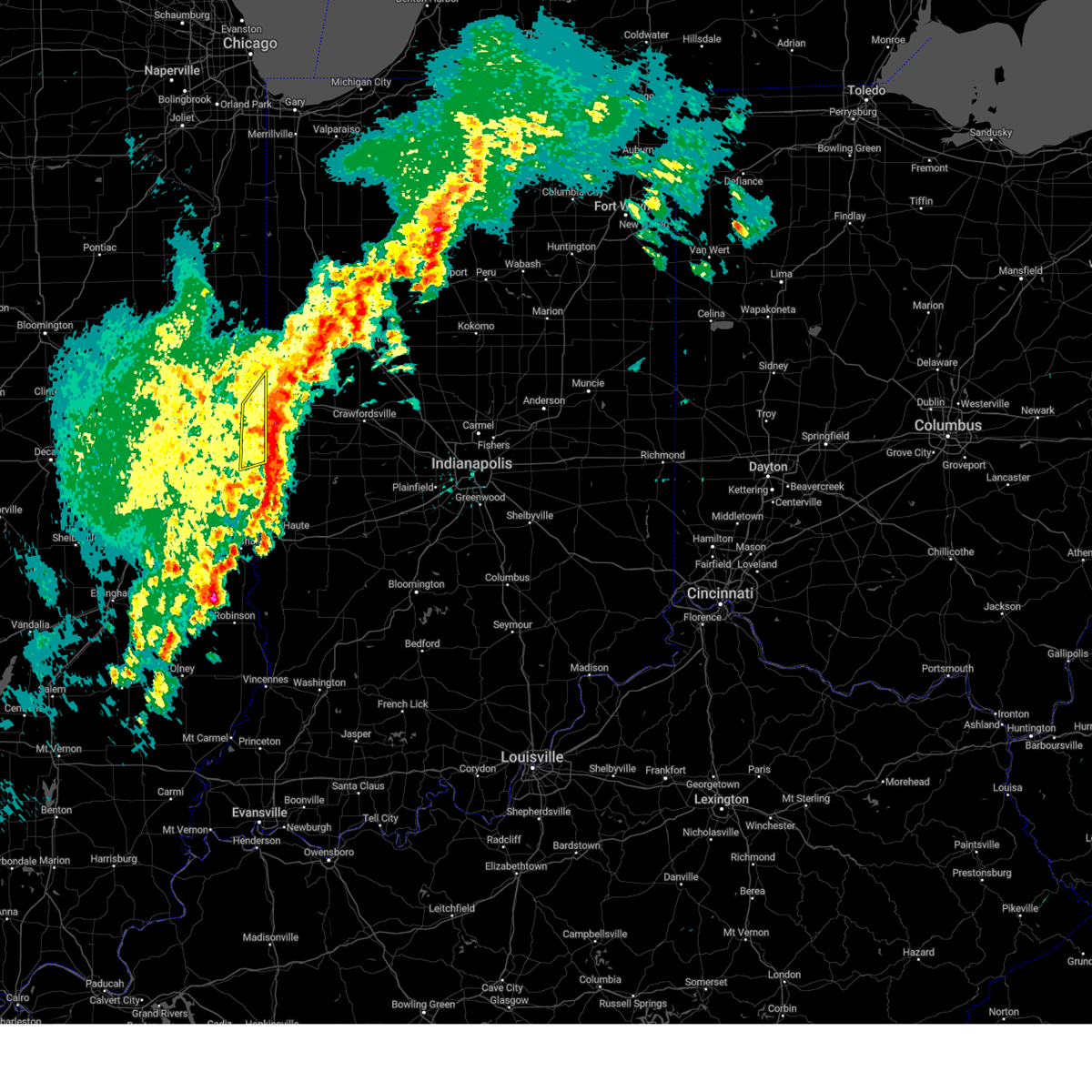 the severe thunderstorm warning has been cancelled and is no longer in effect the severe thunderstorm warning has been cancelled and is no longer in effect
|
| 3/14/2024 9:38 AM CDT |
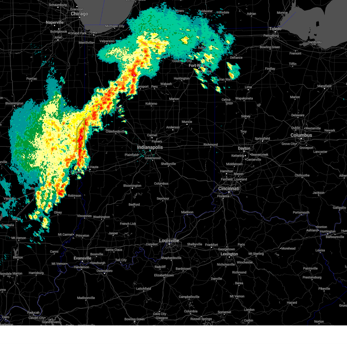 At 938 am cdt, severe thunderstorms were located along a line extending from near danville to near chrisman, moving east at 45 mph (radar indicated). Hazards include 60 mph wind gusts and quarter size hail. Hail damage to vehicles is expected. expect wind damage to roofs, siding, and trees. these severe thunderstorms will remain over mainly rural areas of northeastern edgar and southeastern vermilion counties, including the following locations, belgium. This includes interstate 74 between mile markers 212 and 220. At 938 am cdt, severe thunderstorms were located along a line extending from near danville to near chrisman, moving east at 45 mph (radar indicated). Hazards include 60 mph wind gusts and quarter size hail. Hail damage to vehicles is expected. expect wind damage to roofs, siding, and trees. these severe thunderstorms will remain over mainly rural areas of northeastern edgar and southeastern vermilion counties, including the following locations, belgium. This includes interstate 74 between mile markers 212 and 220.
|
| 3/14/2024 9:27 AM CDT |
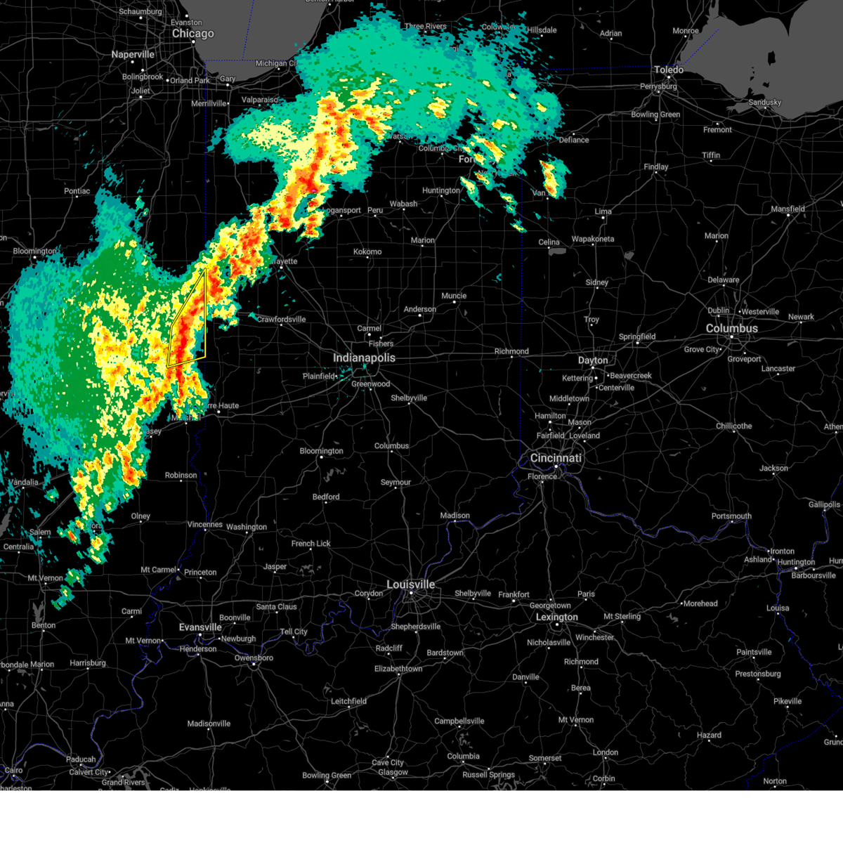 Svrilx the national weather service in lincoln has issued a * severe thunderstorm warning for, northeastern edgar county in east central illinois, southeastern vermilion county in east central illinois, * until 1000 am cdt. * at 927 am cdt, a severe thunderstorm was located over westville, or near danville, moving northeast at 65 mph (radar indicated). Hazards include 60 mph wind gusts and quarter size hail. Hail damage to vehicles is expected. expect wind damage to roofs, siding, and trees. this severe thunderstorm will be near, danville around 935 am cdt. This includes interstate 74 between mile markers 209 and 220. Svrilx the national weather service in lincoln has issued a * severe thunderstorm warning for, northeastern edgar county in east central illinois, southeastern vermilion county in east central illinois, * until 1000 am cdt. * at 927 am cdt, a severe thunderstorm was located over westville, or near danville, moving northeast at 65 mph (radar indicated). Hazards include 60 mph wind gusts and quarter size hail. Hail damage to vehicles is expected. expect wind damage to roofs, siding, and trees. this severe thunderstorm will be near, danville around 935 am cdt. This includes interstate 74 between mile markers 209 and 220.
|
| 8/25/2023 10:42 PM CDT |
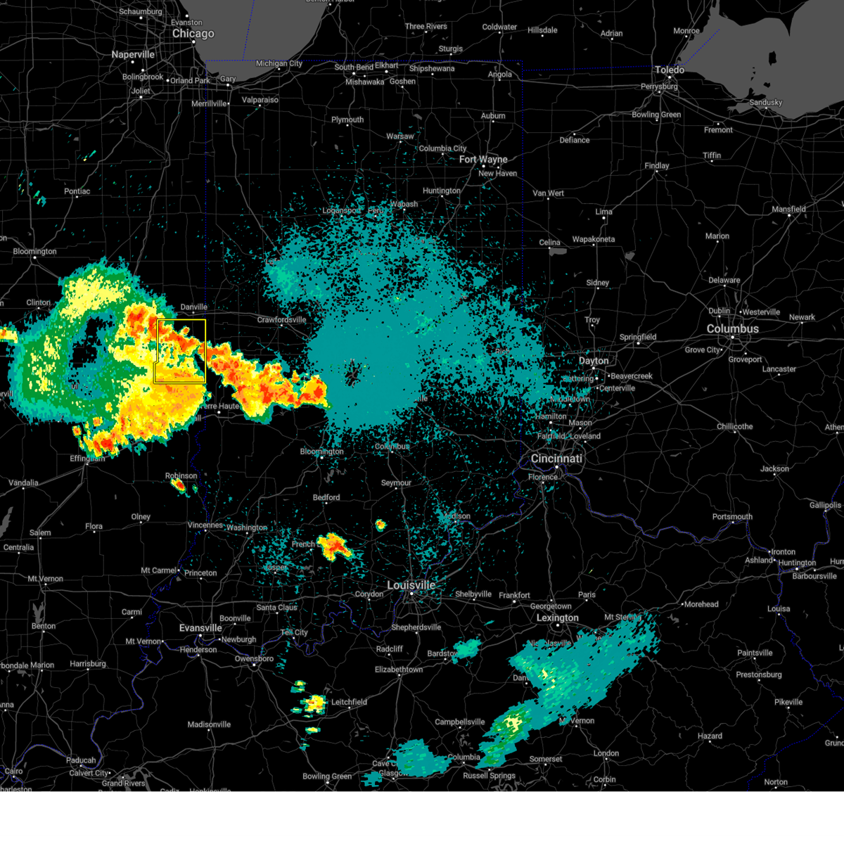 The severe thunderstorm warning for northern edgar and southern vermilion counties will expire at 1045 pm cdt, the storm which prompted the warning has weakened below severe limits, and no longer poses an immediate threat to life or property. therefore, the warning will be allowed to expire. a severe thunderstorm watch remains in effect until midnight cdt for east central illinois. to report severe weather, contact your nearest law enforcement agency. they will relay your report to the national weather service lincoln. The severe thunderstorm warning for northern edgar and southern vermilion counties will expire at 1045 pm cdt, the storm which prompted the warning has weakened below severe limits, and no longer poses an immediate threat to life or property. therefore, the warning will be allowed to expire. a severe thunderstorm watch remains in effect until midnight cdt for east central illinois. to report severe weather, contact your nearest law enforcement agency. they will relay your report to the national weather service lincoln.
|
| 8/25/2023 10:31 PM CDT |
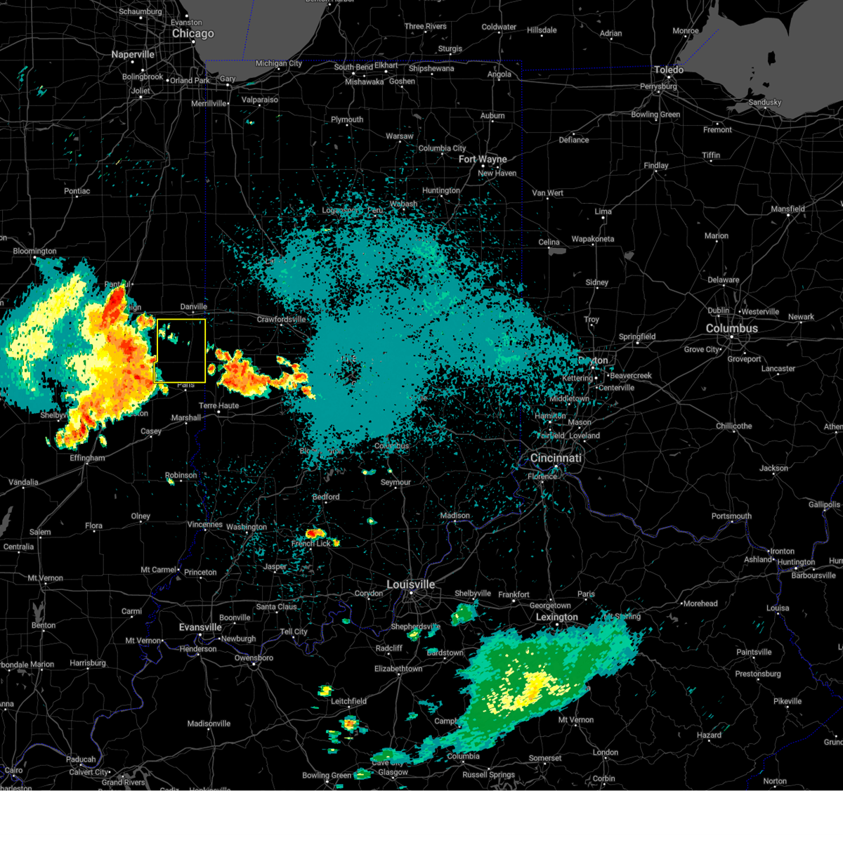 At 1030 pm cdt, a severe thunderstorm was located near chrisman, or 9 miles north of paris, moving east at 50 mph (radar indicated). Hazards include 60 mph wind gusts. Expect damage to roofs, siding, and trees. this severe thunderstorm will remain over mainly rural areas of northern edgar and southern vermilion counties, including the following locations, palermo, edgar, scottland, indianola, jamaica, edgar county airport and metcalf. hail threat, radar indicated max hail size, <. 75 in wind threat, radar indicated max wind gust, 60 mph. At 1030 pm cdt, a severe thunderstorm was located near chrisman, or 9 miles north of paris, moving east at 50 mph (radar indicated). Hazards include 60 mph wind gusts. Expect damage to roofs, siding, and trees. this severe thunderstorm will remain over mainly rural areas of northern edgar and southern vermilion counties, including the following locations, palermo, edgar, scottland, indianola, jamaica, edgar county airport and metcalf. hail threat, radar indicated max hail size, <. 75 in wind threat, radar indicated max wind gust, 60 mph.
|
| 8/25/2023 9:52 PM CDT |
 At 952 pm cdt, a severe thunderstorm was located near philo, or 12 miles southeast of champaign, moving east at 45 mph (radar indicated). Hazards include 60 mph wind gusts. Expect damage to roofs, siding, and trees. this severe thunderstorm will be near, sidney around 1000 pm cdt. homer and broadlands around 1005 pm cdt. allerton around 1010 pm cdt. other locations in the path of this severe thunderstorm include fairmount, sidell, chrisman, ridge farm and georgetown. this includes interstate 57 between mile markers 211 and 219. hail threat, radar indicated max hail size, <. 75 in wind threat, radar indicated max wind gust, 60 mph. At 952 pm cdt, a severe thunderstorm was located near philo, or 12 miles southeast of champaign, moving east at 45 mph (radar indicated). Hazards include 60 mph wind gusts. Expect damage to roofs, siding, and trees. this severe thunderstorm will be near, sidney around 1000 pm cdt. homer and broadlands around 1005 pm cdt. allerton around 1010 pm cdt. other locations in the path of this severe thunderstorm include fairmount, sidell, chrisman, ridge farm and georgetown. this includes interstate 57 between mile markers 211 and 219. hail threat, radar indicated max hail size, <. 75 in wind threat, radar indicated max wind gust, 60 mph.
|
| 8/17/2023 7:39 AM CDT |
 The severe thunderstorm warning for central mcdonough county will expire at 745 am cdt, the storm which prompted the warning has moved out of the area. therefore, the warning will be allowed to expire. The severe thunderstorm warning for central mcdonough county will expire at 745 am cdt, the storm which prompted the warning has moved out of the area. therefore, the warning will be allowed to expire.
|
| 8/17/2023 7:19 AM CDT |
 At 719 am cdt, a severe thunderstorm was located over spring lake, or over macomb, moving east at 50 mph (radar indicated). Hazards include quarter size hail. Damage to vehicles is expected. this severe thunderstorm will be near, bushnell, bardolph and adair around 730 am cdt. new philadelphia around 735 am cdt. hail threat, radar indicated max hail size, 1. 00 in wind threat, radar indicated max wind gust, <50 mph. At 719 am cdt, a severe thunderstorm was located over spring lake, or over macomb, moving east at 50 mph (radar indicated). Hazards include quarter size hail. Damage to vehicles is expected. this severe thunderstorm will be near, bushnell, bardolph and adair around 730 am cdt. new philadelphia around 735 am cdt. hail threat, radar indicated max hail size, 1. 00 in wind threat, radar indicated max wind gust, <50 mph.
|
| 7/20/2023 2:18 PM CDT |
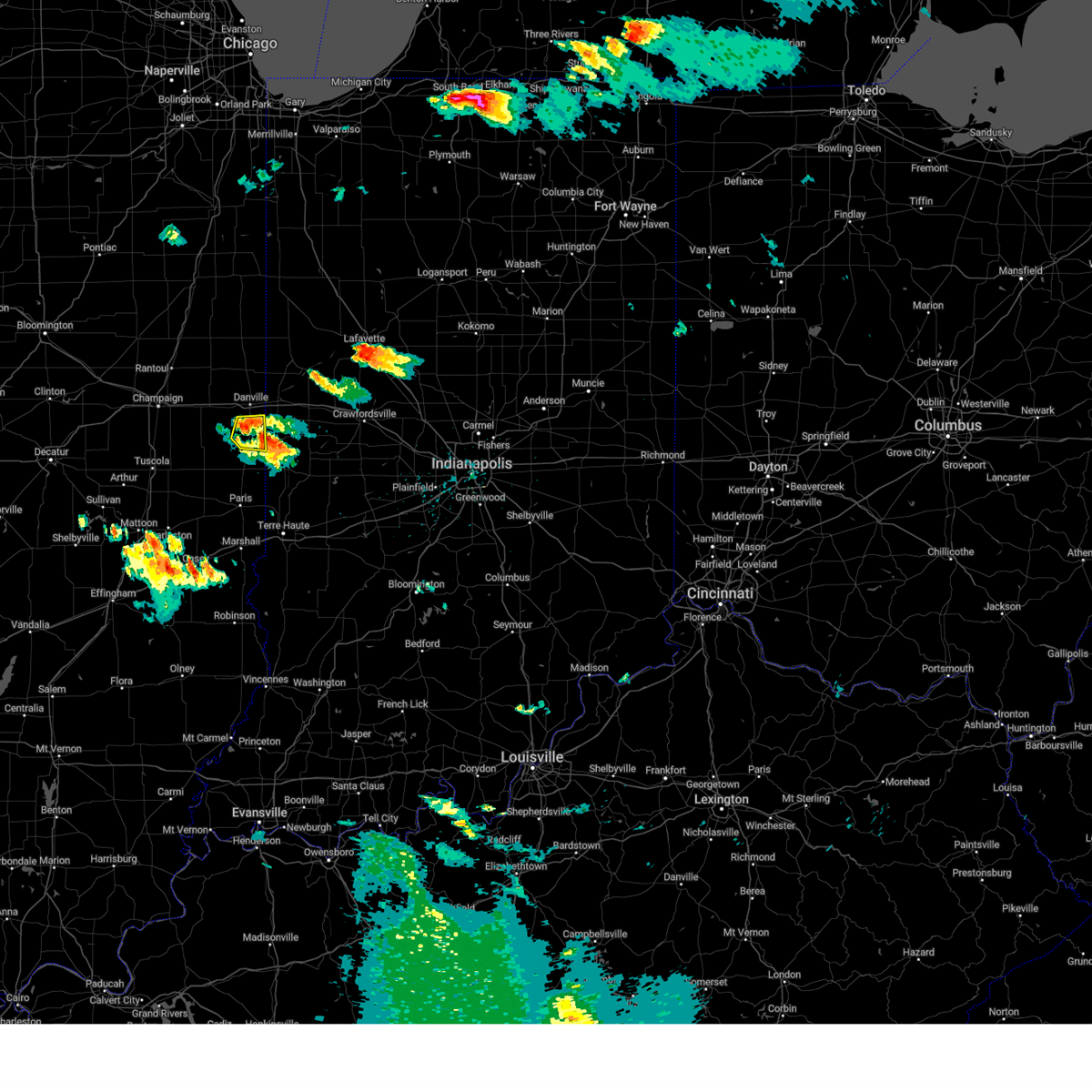 At 218 pm cdt, a severe thunderstorm was located near newport, or 16 miles south of danville, moving east at 30 mph (radar indicated). Hazards include 60 mph wind gusts and quarter size hail. Hail damage to vehicles is expected. expect wind damage to roofs, siding, and trees. locations impacted include, georgetown, westville, catlin, ridge farm, belgium and indianola. hail threat, radar indicated max hail size, 1. 00 in wind threat, radar indicated max wind gust, 60 mph. At 218 pm cdt, a severe thunderstorm was located near newport, or 16 miles south of danville, moving east at 30 mph (radar indicated). Hazards include 60 mph wind gusts and quarter size hail. Hail damage to vehicles is expected. expect wind damage to roofs, siding, and trees. locations impacted include, georgetown, westville, catlin, ridge farm, belgium and indianola. hail threat, radar indicated max hail size, 1. 00 in wind threat, radar indicated max wind gust, 60 mph.
|
| 7/20/2023 2:05 PM CDT |
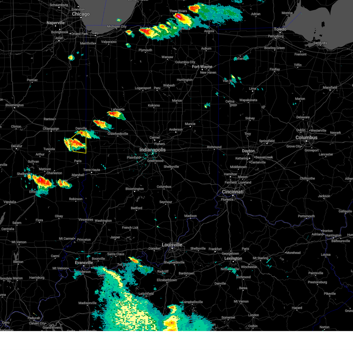 At 205 pm cdt, a severe thunderstorm was located over ridge farm, or 14 miles south of danville, moving east at 35 mph (radar indicated). Hazards include 60 mph wind gusts and quarter size hail. Hail damage to vehicles is expected. expect wind damage to roofs, siding, and trees. this severe thunderstorm will remain over mainly rural areas of northeastern edgar and southeastern vermilion counties, including the following locations, jamaica, scottland and indianola. this includes interstate 74 between mile markers 213 and 217. hail threat, radar indicated max hail size, 1. 00 in wind threat, radar indicated max wind gust, 60 mph. At 205 pm cdt, a severe thunderstorm was located over ridge farm, or 14 miles south of danville, moving east at 35 mph (radar indicated). Hazards include 60 mph wind gusts and quarter size hail. Hail damage to vehicles is expected. expect wind damage to roofs, siding, and trees. this severe thunderstorm will remain over mainly rural areas of northeastern edgar and southeastern vermilion counties, including the following locations, jamaica, scottland and indianola. this includes interstate 74 between mile markers 213 and 217. hail threat, radar indicated max hail size, 1. 00 in wind threat, radar indicated max wind gust, 60 mph.
|
| 7/5/2023 2:11 PM CDT |
 The severe thunderstorm warning for central mcdonough county will expire at 215 pm cdt, the storm which prompted the warning has weakened below severe limits, and no longer poses an immediate threat to life or property. therefore, the warning will be allowed to expire. however small hail, gusty winds and heavy rain are still possible with this thunderstorm. The severe thunderstorm warning for central mcdonough county will expire at 215 pm cdt, the storm which prompted the warning has weakened below severe limits, and no longer poses an immediate threat to life or property. therefore, the warning will be allowed to expire. however small hail, gusty winds and heavy rain are still possible with this thunderstorm.
|
| 7/5/2023 2:03 PM CDT |
 At 202 pm cdt, a severe thunderstorm was located near pennington point, or near macomb, moving northeast at 10 mph (radar indicated). Hazards include 60 mph wind gusts and quarter size hail. Hail damage to vehicles is expected. expect wind damage to roofs, siding, and trees. locations impacted include, macomb, colchester, good hope, bardolph, tennessee, sciota, western illinois university, adair, fandon, pennington point, macomb municipal airport, spring lake, mcdonough county 4-h grounds and argyle lake state park. hail threat, radar indicated max hail size, 1. 00 in wind threat, radar indicated max wind gust, 60 mph. At 202 pm cdt, a severe thunderstorm was located near pennington point, or near macomb, moving northeast at 10 mph (radar indicated). Hazards include 60 mph wind gusts and quarter size hail. Hail damage to vehicles is expected. expect wind damage to roofs, siding, and trees. locations impacted include, macomb, colchester, good hope, bardolph, tennessee, sciota, western illinois university, adair, fandon, pennington point, macomb municipal airport, spring lake, mcdonough county 4-h grounds and argyle lake state park. hail threat, radar indicated max hail size, 1. 00 in wind threat, radar indicated max wind gust, 60 mph.
|
| 7/5/2023 1:56 PM CDT |
 At 156 pm cdt, a severe thunderstorm was located over mcdonough county 4-h grounds, or over macomb, moving northeast at 35 mph (radar indicated). Hazards include 60 mph wind gusts and penny size hail. Expect damage to roofs, siding, and trees. locations impacted include, macomb, colchester, good hope, bardolph, tennessee, sciota, western illinois university, adair, fandon, colmar, plymouth, pennington point, macomb municipal airport, spring lake, mcdonough county 4-h grounds and argyle lake state park. hail threat, radar indicated max hail size, 0. 75 in wind threat, radar indicated max wind gust, 60 mph. At 156 pm cdt, a severe thunderstorm was located over mcdonough county 4-h grounds, or over macomb, moving northeast at 35 mph (radar indicated). Hazards include 60 mph wind gusts and penny size hail. Expect damage to roofs, siding, and trees. locations impacted include, macomb, colchester, good hope, bardolph, tennessee, sciota, western illinois university, adair, fandon, colmar, plymouth, pennington point, macomb municipal airport, spring lake, mcdonough county 4-h grounds and argyle lake state park. hail threat, radar indicated max hail size, 0. 75 in wind threat, radar indicated max wind gust, 60 mph.
|
| 7/5/2023 1:44 PM CDT |
 At 144 pm cdt, a severe thunderstorm was located near fandon, or near macomb, moving east at 40 mph (radar indicated). Hazards include 60 mph wind gusts and nickel size hail. Expect damage to roofs, siding, and trees. locations impacted include, macomb, colchester, good hope, bardolph, tennessee, sciota, western illinois university, adair, fandon, colmar, plymouth, pennington point, macomb municipal airport, spring lake, mcdonough county 4-h grounds and argyle lake state park. hail threat, radar indicated max hail size, 0. 88 in wind threat, radar indicated max wind gust, 60 mph. At 144 pm cdt, a severe thunderstorm was located near fandon, or near macomb, moving east at 40 mph (radar indicated). Hazards include 60 mph wind gusts and nickel size hail. Expect damage to roofs, siding, and trees. locations impacted include, macomb, colchester, good hope, bardolph, tennessee, sciota, western illinois university, adair, fandon, colmar, plymouth, pennington point, macomb municipal airport, spring lake, mcdonough county 4-h grounds and argyle lake state park. hail threat, radar indicated max hail size, 0. 88 in wind threat, radar indicated max wind gust, 60 mph.
|
| 7/5/2023 1:36 PM CDT |
 At 136 pm cdt, a severe thunderstorm was located over colmar, or 12 miles southwest of macomb, moving northeast at 20 mph (radar indicated). Hazards include 60 mph wind gusts and nickel size hail. expect damage to roofs, siding, and trees At 136 pm cdt, a severe thunderstorm was located over colmar, or 12 miles southwest of macomb, moving northeast at 20 mph (radar indicated). Hazards include 60 mph wind gusts and nickel size hail. expect damage to roofs, siding, and trees
|
| 6/30/2023 10:44 AM CDT |
 At 1044 am cdt, a severe thunderstorm was located over industry, or 10 miles south of macomb, moving east at 55 mph (radar indicated). Hazards include 60 mph wind gusts and quarter size hail. Hail damage to vehicles is expected. expect wind damage to roofs, siding, and trees. this severe storm will be near, pennington point around 1050 am cdt. other locations in the path of this severe thunderstorm include adair. hail threat, radar indicated max hail size, 1. 00 in wind threat, radar indicated max wind gust, 60 mph. At 1044 am cdt, a severe thunderstorm was located over industry, or 10 miles south of macomb, moving east at 55 mph (radar indicated). Hazards include 60 mph wind gusts and quarter size hail. Hail damage to vehicles is expected. expect wind damage to roofs, siding, and trees. this severe storm will be near, pennington point around 1050 am cdt. other locations in the path of this severe thunderstorm include adair. hail threat, radar indicated max hail size, 1. 00 in wind threat, radar indicated max wind gust, 60 mph.
|
| 6/30/2023 10:31 AM CDT |
 At 1030 am cdt, a severe thunderstorm was located over colmar, or 13 miles southwest of macomb, moving east at 55 mph (radar indicated). Hazards include 60 mph wind gusts and quarter size hail. Hail damage to vehicles is expected. expect wind damage to roofs, siding, and trees. this severe storm will be near, fandon and argyle lake state park around 1035 am cdt. other locations in the path of this severe thunderstorm include industry, doddsville, adair and pennington point. hail threat, radar indicated max hail size, 1. 00 in wind threat, radar indicated max wind gust, 60 mph. At 1030 am cdt, a severe thunderstorm was located over colmar, or 13 miles southwest of macomb, moving east at 55 mph (radar indicated). Hazards include 60 mph wind gusts and quarter size hail. Hail damage to vehicles is expected. expect wind damage to roofs, siding, and trees. this severe storm will be near, fandon and argyle lake state park around 1035 am cdt. other locations in the path of this severe thunderstorm include industry, doddsville, adair and pennington point. hail threat, radar indicated max hail size, 1. 00 in wind threat, radar indicated max wind gust, 60 mph.
|
| 6/30/2023 10:16 AM CDT |
 At 1015 am cdt, a severe thunderstorm was located over bentley, or near carthage, moving east at 50 mph (radar indicated). Hazards include 60 mph wind gusts and quarter size hail. Hail damage to vehicles is expected. expect wind damage to roofs, siding, and trees. this severe thunderstorm will be near, augusta and hancock county fairgrounds around 1025 am cdt. colmar and plymouth around 1030 am cdt. fandon around 1035 am cdt. other locations in the path of this severe thunderstorm include industry and doddsville. hail threat, radar indicated max hail size, 1. 00 in wind threat, radar indicated max wind gust, 60 mph. At 1015 am cdt, a severe thunderstorm was located over bentley, or near carthage, moving east at 50 mph (radar indicated). Hazards include 60 mph wind gusts and quarter size hail. Hail damage to vehicles is expected. expect wind damage to roofs, siding, and trees. this severe thunderstorm will be near, augusta and hancock county fairgrounds around 1025 am cdt. colmar and plymouth around 1030 am cdt. fandon around 1035 am cdt. other locations in the path of this severe thunderstorm include industry and doddsville. hail threat, radar indicated max hail size, 1. 00 in wind threat, radar indicated max wind gust, 60 mph.
|
| 6/29/2023 2:13 PM CDT |
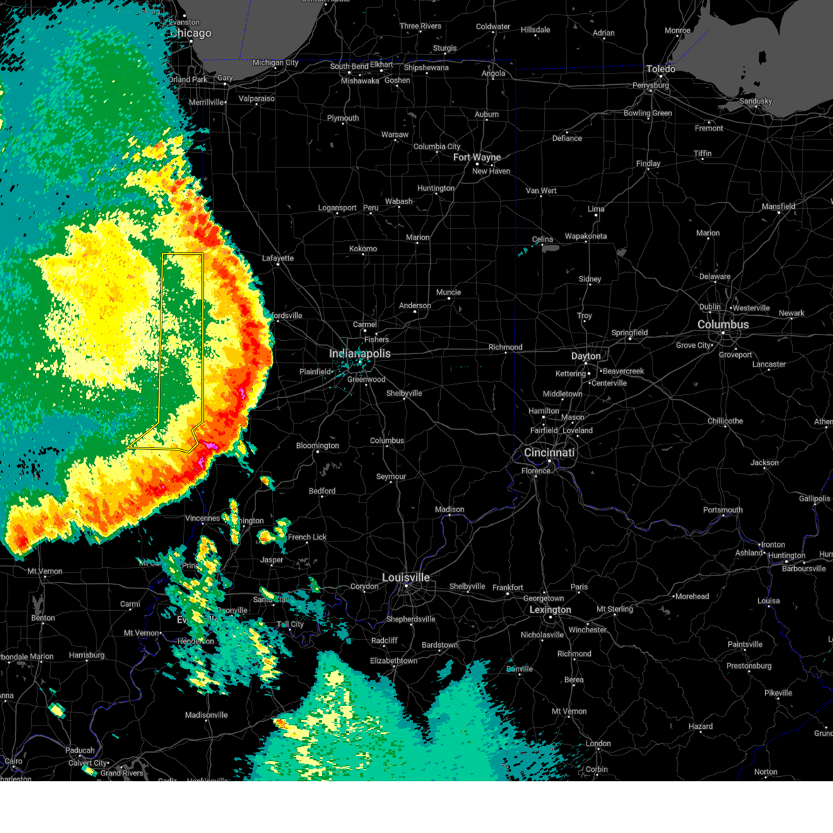 The severe thunderstorm warning for edgar, clark, vermilion and southeastern cumberland counties will expire at 215 pm cdt, the storms which prompted the warning have moved out of the area. therefore, the warning will be allowed to expire. a severe thunderstorm watch remains in effect until 500 pm cdt for east central illinois. The severe thunderstorm warning for edgar, clark, vermilion and southeastern cumberland counties will expire at 215 pm cdt, the storms which prompted the warning have moved out of the area. therefore, the warning will be allowed to expire. a severe thunderstorm watch remains in effect until 500 pm cdt for east central illinois.
|
| 6/29/2023 1:56 PM CDT |
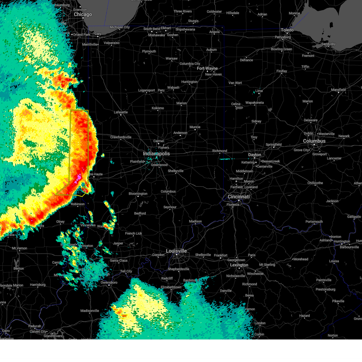 At 155 pm cdt, severe thunderstorms were located along a line extending from near rossville to 6 miles west of newport to martinsville, moving east at 65 mph (trained weather spotters). Hazards include 80 mph wind gusts. Flying debris will be dangerous to those caught without shelter. mobile homes will be heavily damaged. expect considerable damage to roofs, windows, and vehicles. extensive tree damage and power outages are likely. locations impacted include, marshall and dennison. this includes the following highways, interstate 70 near mile marker 120, and between mile markers 132 and 154. Interstate 74 between mile markers 201 and 220. At 155 pm cdt, severe thunderstorms were located along a line extending from near rossville to 6 miles west of newport to martinsville, moving east at 65 mph (trained weather spotters). Hazards include 80 mph wind gusts. Flying debris will be dangerous to those caught without shelter. mobile homes will be heavily damaged. expect considerable damage to roofs, windows, and vehicles. extensive tree damage and power outages are likely. locations impacted include, marshall and dennison. this includes the following highways, interstate 70 near mile marker 120, and between mile markers 132 and 154. Interstate 74 between mile markers 201 and 220.
|
| 6/29/2023 1:45 PM CDT | Trees down on home in vermilion county IL, 166.2 miles W of Georgetown, IL |
| 6/29/2023 1:45 PM CDT | Trees down blocking road in vermilion county IL, 165.9 miles W of Georgetown, IL |
| 6/29/2023 1:27 PM CDT |
 At 125 pm cdt, severe thunderstorms were located along a line extending from near rantoul to near camargo to neoga, moving east at 65 mph (trained weather spotters). Hazards include 80 mph wind gusts. Flying debris will be dangerous to those caught without shelter. mobile homes will be heavily damaged. expect considerable damage to roofs, windows, and vehicles. extensive tree damage and power outages are likely. severe thunderstorms will be near, rantoul, thomasboro, newman and broadlands around 130 pm cdt. gifford, hume, brocton, allerton, lerna, jewett and janesville around 135 pm cdt. greenup, sidell and rankin around 140 pm cdt. chrisman and potomac around 145 pm cdt. other locations in the path of these severe thunderstorms include casey, ridge farm, westfield, hoopeston, rossville, martinsville, clarksville and marshall. this includes the following highways, interstate 57 between mile markers 186 and 194, and between mile markers 238 and 257. interstate 70 between mile markers 109 and 154. Interstate 74 between mile markers 180 and 220. At 125 pm cdt, severe thunderstorms were located along a line extending from near rantoul to near camargo to neoga, moving east at 65 mph (trained weather spotters). Hazards include 80 mph wind gusts. Flying debris will be dangerous to those caught without shelter. mobile homes will be heavily damaged. expect considerable damage to roofs, windows, and vehicles. extensive tree damage and power outages are likely. severe thunderstorms will be near, rantoul, thomasboro, newman and broadlands around 130 pm cdt. gifford, hume, brocton, allerton, lerna, jewett and janesville around 135 pm cdt. greenup, sidell and rankin around 140 pm cdt. chrisman and potomac around 145 pm cdt. other locations in the path of these severe thunderstorms include casey, ridge farm, westfield, hoopeston, rossville, martinsville, clarksville and marshall. this includes the following highways, interstate 57 between mile markers 186 and 194, and between mile markers 238 and 257. interstate 70 between mile markers 109 and 154. Interstate 74 between mile markers 180 and 220.
|
| 6/29/2023 11:42 AM CDT |
 The severe thunderstorm warning for eastern hancock, southeastern henderson, warren and mcdonough counties will expire at 1145 am cdt, the storms which prompted the warning have moved out of the area. therefore, the warning will be allowed to expire. however gusty winds are still possible with these thunderstorms. a severe thunderstorm watch remains in effect until 100 pm cdt for west central illinois, and southeastern iowa. The severe thunderstorm warning for eastern hancock, southeastern henderson, warren and mcdonough counties will expire at 1145 am cdt, the storms which prompted the warning have moved out of the area. therefore, the warning will be allowed to expire. however gusty winds are still possible with these thunderstorms. a severe thunderstorm watch remains in effect until 100 pm cdt for west central illinois, and southeastern iowa.
|
| 6/29/2023 11:29 AM CDT |
 At 1129 am cdt, severe thunderstorms were located along a line extending from near little york to near marietta to near ray, moving east at 55 mph. these are destructive storms (trained weather spotters). Hazards include 80 mph wind gusts and quarter size hail. Flying debris will be dangerous to those caught without shelter. mobile homes will be heavily damaged. expect considerable damage to roofs, windows, and vehicles. extensive tree damage and power outages are likely. Locations impacted include, coldbrook. At 1129 am cdt, severe thunderstorms were located along a line extending from near little york to near marietta to near ray, moving east at 55 mph. these are destructive storms (trained weather spotters). Hazards include 80 mph wind gusts and quarter size hail. Flying debris will be dangerous to those caught without shelter. mobile homes will be heavily damaged. expect considerable damage to roofs, windows, and vehicles. extensive tree damage and power outages are likely. Locations impacted include, coldbrook.
|
| 6/29/2023 11:14 AM CDT |
 At 1113 am cdt, severe thunderstorms were located along a line extending from near oquawka to macomb municipal airport to near huntsville, moving east at 55 mph. these are destructive storms along a line from monmouth through macomb illinois (trained weather spotters). Hazards include 80 mph wind gusts and quarter size hail. Flying debris will be dangerous to those caught without shelter. mobile homes will be heavily damaged. expect considerable damage to roofs, windows, and vehicles. extensive tree damage and power outages are likely. these severe storms will be near, good hope, bardolph, walnut grove, scottsburg and macomb municipal airport around 1120 am cdt. Other locations in the path of these severe thunderstorms include bushnell, industry, new philadelphia, prairie city airport, kirkwood, prairie city, monmouth, lake warren, eleanor, monmouth municipal airport, coldbrook and gerlaw. At 1113 am cdt, severe thunderstorms were located along a line extending from near oquawka to macomb municipal airport to near huntsville, moving east at 55 mph. these are destructive storms along a line from monmouth through macomb illinois (trained weather spotters). Hazards include 80 mph wind gusts and quarter size hail. Flying debris will be dangerous to those caught without shelter. mobile homes will be heavily damaged. expect considerable damage to roofs, windows, and vehicles. extensive tree damage and power outages are likely. these severe storms will be near, good hope, bardolph, walnut grove, scottsburg and macomb municipal airport around 1120 am cdt. Other locations in the path of these severe thunderstorms include bushnell, industry, new philadelphia, prairie city airport, kirkwood, prairie city, monmouth, lake warren, eleanor, monmouth municipal airport, coldbrook and gerlaw.
|
| 6/29/2023 11:06 AM CDT |
 At 1105 am cdt, a severe thunderstorm capable of producing a tornado was located over good hope, or near macomb, moving east at 70 mph (radar indicated rotation). Hazards include tornado and quarter size hail. Flying debris will be dangerous to those caught without shelter. mobile homes will be damaged or destroyed. damage to roofs, windows, and vehicles will occur. tree damage is likely. this dangerous storm will be near, bardolph, walnut grove and youngstown around 1110 am cdt. Other locations in the path of this tornadic thunderstorm include bushnell, prairie city, little swan lake, new philadelphia and prairie city airport. At 1105 am cdt, a severe thunderstorm capable of producing a tornado was located over good hope, or near macomb, moving east at 70 mph (radar indicated rotation). Hazards include tornado and quarter size hail. Flying debris will be dangerous to those caught without shelter. mobile homes will be damaged or destroyed. damage to roofs, windows, and vehicles will occur. tree damage is likely. this dangerous storm will be near, bardolph, walnut grove and youngstown around 1110 am cdt. Other locations in the path of this tornadic thunderstorm include bushnell, prairie city, little swan lake, new philadelphia and prairie city airport.
|
| 6/29/2023 11:04 AM CDT |
 At 1102 am cdt, severe thunderstorms were located along a line extending from prairie grove to near blandinsville to la prairie, moving east at 55 mph. these are destructive storms for macomb, roseville, and stronghurst (trained weather spotters). Hazards include 80 mph wind gusts and quarter size hail. Flying debris will be dangerous to those caught without shelter. mobile homes will be heavily damaged. expect considerable damage to roofs, windows, and vehicles. extensive tree damage and power outages are likely. these severe storms will be near, colchester, blandinsville, tennessee and argyle lake state park around 1105 am cdt. Other locations in the path of these severe thunderstorms include sciota, western illinois university, spring lake, mcdonough county 4-h grounds, lone tree, macomb, good hope, gladstone, macomb municipal airport, biggsville, bardolph, walnut grove, scottsburg, bushnell, industry, prairie city, new philadelphia, prairie city airport, doddsville, kirkwood, eleanor, monmouth, lake warren, monmouth municipal airport, coldbrook, gerlaw and cameron. At 1102 am cdt, severe thunderstorms were located along a line extending from prairie grove to near blandinsville to la prairie, moving east at 55 mph. these are destructive storms for macomb, roseville, and stronghurst (trained weather spotters). Hazards include 80 mph wind gusts and quarter size hail. Flying debris will be dangerous to those caught without shelter. mobile homes will be heavily damaged. expect considerable damage to roofs, windows, and vehicles. extensive tree damage and power outages are likely. these severe storms will be near, colchester, blandinsville, tennessee and argyle lake state park around 1105 am cdt. Other locations in the path of these severe thunderstorms include sciota, western illinois university, spring lake, mcdonough county 4-h grounds, lone tree, macomb, good hope, gladstone, macomb municipal airport, biggsville, bardolph, walnut grove, scottsburg, bushnell, industry, prairie city, new philadelphia, prairie city airport, doddsville, kirkwood, eleanor, monmouth, lake warren, monmouth municipal airport, coldbrook, gerlaw and cameron.
|
| 6/29/2023 10:53 AM CDT |
 At 1053 am cdt, a severe thunderstorm capable of producing a tornado was located over fountain green, or 10 miles northeast of carthage, moving east at 70 mph (radar indicated rotation). Hazards include tornado and quarter size hail. Flying debris will be dangerous to those caught without shelter. mobile homes will be damaged or destroyed. damage to roofs, windows, and vehicles will occur. tree damage is likely. this dangerous storm will be near, colchester and argyle lake state park around 1100 am cdt. macomb, good hope, sciota, western illinois university, spring lake and mcdonough county 4-h grounds around 1105 am cdt. bardolph, scottsburg, macomb municipal airport, youngstown and swan creek around 1110 am cdt. Other locations in the path of this tornadic thunderstorm include bushnell, little swan lake, new philadelphia, walnut grove, prairie city airport and prairie city. At 1053 am cdt, a severe thunderstorm capable of producing a tornado was located over fountain green, or 10 miles northeast of carthage, moving east at 70 mph (radar indicated rotation). Hazards include tornado and quarter size hail. Flying debris will be dangerous to those caught without shelter. mobile homes will be damaged or destroyed. damage to roofs, windows, and vehicles will occur. tree damage is likely. this dangerous storm will be near, colchester and argyle lake state park around 1100 am cdt. macomb, good hope, sciota, western illinois university, spring lake and mcdonough county 4-h grounds around 1105 am cdt. bardolph, scottsburg, macomb municipal airport, youngstown and swan creek around 1110 am cdt. Other locations in the path of this tornadic thunderstorm include bushnell, little swan lake, new philadelphia, walnut grove, prairie city airport and prairie city.
|
| 6/29/2023 10:46 AM CDT |
 At 1045 am cdt, severe thunderstorms were located along a line extending from stephenson park to carthage to near mendon, moving east at 55 mph. these are destructive storms for carthage and moving into macomb illinois (trained weather spotters). Hazards include 80 mph wind gusts and quarter size hail. Flying debris will be dangerous to those caught without shelter. mobile homes will be heavily damaged. expect considerable damage to roofs, windows, and vehicles. extensive tree damage and power outages are likely. severe thunderstorms will be near, carthage, ferris, burnside, adrian and bentley around 1050 am cdt. fountain green, webster, welter recreation area and augusta around 1055 am cdt. west burlington, blandinsville, bowen, tennessee, iowa army ammunition plant, beaverdale and des moines county fairgrounds around 1100 am cdt. burlington, colchester, augusta, gulf port, starr`s cave park and preserve, argyle lake state park, hancock county fairgrounds, carthage lake and burlington regional airport around 1105 am cdt. Other locations in the path of these severe thunderstorms include macomb, good hope, sciota, western illinois university, spring lake, mcdonough county 4-h grounds, lone tree, gladstone, scottsburg, macomb municipal airport, bushnell, biggsville, bardolph, new philadelphia, walnut grove, doddsville, kirkwood, industry, prairie city and prairie city airport. At 1045 am cdt, severe thunderstorms were located along a line extending from stephenson park to carthage to near mendon, moving east at 55 mph. these are destructive storms for carthage and moving into macomb illinois (trained weather spotters). Hazards include 80 mph wind gusts and quarter size hail. Flying debris will be dangerous to those caught without shelter. mobile homes will be heavily damaged. expect considerable damage to roofs, windows, and vehicles. extensive tree damage and power outages are likely. severe thunderstorms will be near, carthage, ferris, burnside, adrian and bentley around 1050 am cdt. fountain green, webster, welter recreation area and augusta around 1055 am cdt. west burlington, blandinsville, bowen, tennessee, iowa army ammunition plant, beaverdale and des moines county fairgrounds around 1100 am cdt. burlington, colchester, augusta, gulf port, starr`s cave park and preserve, argyle lake state park, hancock county fairgrounds, carthage lake and burlington regional airport around 1105 am cdt. Other locations in the path of these severe thunderstorms include macomb, good hope, sciota, western illinois university, spring lake, mcdonough county 4-h grounds, lone tree, gladstone, scottsburg, macomb municipal airport, bushnell, biggsville, bardolph, new philadelphia, walnut grove, doddsville, kirkwood, industry, prairie city and prairie city airport.
|
| 5/7/2023 8:32 PM CDT |
 At 832 pm cdt, severe thunderstorms were located along a line extending from near norris to near tioga, moving east at 35 mph (radar indicated). Hazards include 70 mph wind gusts and quarter size hail. Hail damage to vehicles is expected. expect considerable tree damage. wind damage is also likely to mobile homes, roofs, and outbuildings. locations impacted include, macomb, carthage, bushnell, hamilton, colchester, augusta, bowen, industry, good hope, prairie city, bardolph, west point, tennessee, sciota, western illinois university, fandon, new philadelphia, colmar, adair and plymouth. thunderstorm damage threat, considerable hail threat, radar indicated max hail size, 1. 00 in wind threat, radar indicated max wind gust, 70 mph. At 832 pm cdt, severe thunderstorms were located along a line extending from near norris to near tioga, moving east at 35 mph (radar indicated). Hazards include 70 mph wind gusts and quarter size hail. Hail damage to vehicles is expected. expect considerable tree damage. wind damage is also likely to mobile homes, roofs, and outbuildings. locations impacted include, macomb, carthage, bushnell, hamilton, colchester, augusta, bowen, industry, good hope, prairie city, bardolph, west point, tennessee, sciota, western illinois university, fandon, new philadelphia, colmar, adair and plymouth. thunderstorm damage threat, considerable hail threat, radar indicated max hail size, 1. 00 in wind threat, radar indicated max wind gust, 70 mph.
|
| 5/7/2023 8:25 PM CDT |
 At 825 pm cdt, severe thunderstorms were located along a line extending from near norris to sutter, moving east at 35 mph (radar indicated). Hazards include 70 mph wind gusts and quarter size hail. Hail damage to vehicles is expected. expect considerable tree damage. wind damage is also likely to mobile homes, roofs, and outbuildings. locations impacted include, macomb, carthage, bushnell, hamilton, colchester, la harpe, roseville, dallas city, stronghurst, blandinsville, augusta, bowen, industry, good hope, prairie city, carman, terre haute, bardolph, west point and ferris. thunderstorm damage threat, considerable hail threat, radar indicated max hail size, 1. 00 in wind threat, radar indicated max wind gust, 70 mph. At 825 pm cdt, severe thunderstorms were located along a line extending from near norris to sutter, moving east at 35 mph (radar indicated). Hazards include 70 mph wind gusts and quarter size hail. Hail damage to vehicles is expected. expect considerable tree damage. wind damage is also likely to mobile homes, roofs, and outbuildings. locations impacted include, macomb, carthage, bushnell, hamilton, colchester, la harpe, roseville, dallas city, stronghurst, blandinsville, augusta, bowen, industry, good hope, prairie city, carman, terre haute, bardolph, west point and ferris. thunderstorm damage threat, considerable hail threat, radar indicated max hail size, 1. 00 in wind threat, radar indicated max wind gust, 70 mph.
|
| 5/7/2023 8:16 PM CDT |
 At 816 pm cdt, severe thunderstorms were located along a line extending from near norris to near gregory landing, moving east at 35 mph (radar indicated). Hazards include 70 mph wind gusts and quarter size hail. Hail damage to vehicles is expected. expect considerable tree damage. wind damage is also likely to mobile homes, roofs, and outbuildings. locations impacted include, macomb, fort madison, keokuk, carthage, nauvoo, bushnell, hamilton, warsaw, colchester, la harpe, roseville, dallas city, donnellson, montrose, stronghurst, blandinsville, augusta, wayland, bowen and industry. thunderstorm damage threat, considerable hail threat, radar indicated max hail size, 1. 00 in wind threat, radar indicated max wind gust, 70 mph. At 816 pm cdt, severe thunderstorms were located along a line extending from near norris to near gregory landing, moving east at 35 mph (radar indicated). Hazards include 70 mph wind gusts and quarter size hail. Hail damage to vehicles is expected. expect considerable tree damage. wind damage is also likely to mobile homes, roofs, and outbuildings. locations impacted include, macomb, fort madison, keokuk, carthage, nauvoo, bushnell, hamilton, warsaw, colchester, la harpe, roseville, dallas city, donnellson, montrose, stronghurst, blandinsville, augusta, wayland, bowen and industry. thunderstorm damage threat, considerable hail threat, radar indicated max hail size, 1. 00 in wind threat, radar indicated max wind gust, 70 mph.
|
| 5/7/2023 8:10 PM CDT |
 At 809 pm cdt, severe thunderstorms were located along a line extending from middle grove to near gregory landing, moving southeast at 35 mph (radar indicated). Hazards include 60 mph wind gusts and quarter size hail. Hail damage to vehicles is expected. expect wind damage to roofs, siding, and trees. locations impacted include, macomb, fort madison, keokuk, carthage, nauvoo, bushnell, hamilton, warsaw, colchester, la harpe, roseville, dallas city, donnellson, montrose, stronghurst, blandinsville, augusta, wayland, bowen and industry. hail threat, radar indicated max hail size, 1. 00 in wind threat, radar indicated max wind gust, 60 mph. At 809 pm cdt, severe thunderstorms were located along a line extending from middle grove to near gregory landing, moving southeast at 35 mph (radar indicated). Hazards include 60 mph wind gusts and quarter size hail. Hail damage to vehicles is expected. expect wind damage to roofs, siding, and trees. locations impacted include, macomb, fort madison, keokuk, carthage, nauvoo, bushnell, hamilton, warsaw, colchester, la harpe, roseville, dallas city, donnellson, montrose, stronghurst, blandinsville, augusta, wayland, bowen and industry. hail threat, radar indicated max hail size, 1. 00 in wind threat, radar indicated max wind gust, 60 mph.
|
| 5/7/2023 8:05 PM CDT |
 At 805 pm cdt, severe thunderstorms were located along a line extending from near middle grove to near alexandria, moving southeast at 35 mph (radar indicated). Hazards include 70 mph wind gusts and quarter size hail. Hail damage to vehicles is expected. expect considerable tree damage. wind damage is also likely to mobile homes, roofs, and outbuildings. locations impacted include, burlington, macomb, fort madison, keokuk, monmouth, carthage, nauvoo, bushnell, hamilton, warsaw, colchester, la harpe, roseville, west point, dallas city, donnellson, montrose, stronghurst, kirkwood and blandinsville. thunderstorm damage threat, considerable hail threat, radar indicated max hail size, 1. 00 in wind threat, radar indicated max wind gust, 70 mph. At 805 pm cdt, severe thunderstorms were located along a line extending from near middle grove to near alexandria, moving southeast at 35 mph (radar indicated). Hazards include 70 mph wind gusts and quarter size hail. Hail damage to vehicles is expected. expect considerable tree damage. wind damage is also likely to mobile homes, roofs, and outbuildings. locations impacted include, burlington, macomb, fort madison, keokuk, monmouth, carthage, nauvoo, bushnell, hamilton, warsaw, colchester, la harpe, roseville, west point, dallas city, donnellson, montrose, stronghurst, kirkwood and blandinsville. thunderstorm damage threat, considerable hail threat, radar indicated max hail size, 1. 00 in wind threat, radar indicated max wind gust, 70 mph.
|
| 5/7/2023 7:58 PM CDT |
 At 758 pm cdt, severe thunderstorms were located along a line extending from near maquon to near wayland, moving southeast at 35 mph (radar indicated). Hazards include 70 mph wind gusts and quarter size hail. Hail damage to vehicles is expected. expect considerable tree damage. wind damage is also likely to mobile homes, roofs, and outbuildings. locations impacted include, burlington, macomb, fort madison, keokuk, monmouth, carthage, nauvoo, bushnell, west burlington, hamilton, warsaw, colchester, la harpe, roseville, west point, dallas city, donnellson, montrose, stronghurst and kirkwood. thunderstorm damage threat, considerable hail threat, radar indicated max hail size, 1. 00 in wind threat, radar indicated max wind gust, 70 mph. At 758 pm cdt, severe thunderstorms were located along a line extending from near maquon to near wayland, moving southeast at 35 mph (radar indicated). Hazards include 70 mph wind gusts and quarter size hail. Hail damage to vehicles is expected. expect considerable tree damage. wind damage is also likely to mobile homes, roofs, and outbuildings. locations impacted include, burlington, macomb, fort madison, keokuk, monmouth, carthage, nauvoo, bushnell, west burlington, hamilton, warsaw, colchester, la harpe, roseville, west point, dallas city, donnellson, montrose, stronghurst and kirkwood. thunderstorm damage threat, considerable hail threat, radar indicated max hail size, 1. 00 in wind threat, radar indicated max wind gust, 70 mph.
|
| 5/7/2023 7:49 PM CDT |
 At 749 pm cdt, severe thunderstorms were located along a line extending from near maquon to wayland, moving southeast at 35 mph (radar indicated). Hazards include 70 mph wind gusts and quarter size hail. Hail damage to vehicles is expected. expect considerable tree damage. Wind damage is also likely to mobile homes, roofs, and outbuildings. At 749 pm cdt, severe thunderstorms were located along a line extending from near maquon to wayland, moving southeast at 35 mph (radar indicated). Hazards include 70 mph wind gusts and quarter size hail. Hail damage to vehicles is expected. expect considerable tree damage. Wind damage is also likely to mobile homes, roofs, and outbuildings.
|
| 5/7/2023 7:44 PM CDT |
 At 744 pm cdt, severe thunderstorms were located along a line extending from near delong to montrose, moving southeast at 40 mph (trained weather spotters). Hazards include 60 mph wind gusts and quarter size hail. Hail damage to vehicles is expected. expect wind damage to roofs, siding, and trees. locations impacted include, burlington, macomb, fort madison, keokuk, monmouth, carthage, oquawka, nauvoo, bushnell, west burlington, hamilton, colchester, la harpe, roseville, west point, dallas city, donnellson, montrose, stronghurst and kirkwood. hail threat, radar indicated max hail size, 1. 00 in wind threat, radar indicated max wind gust, 60 mph. At 744 pm cdt, severe thunderstorms were located along a line extending from near delong to montrose, moving southeast at 40 mph (trained weather spotters). Hazards include 60 mph wind gusts and quarter size hail. Hail damage to vehicles is expected. expect wind damage to roofs, siding, and trees. locations impacted include, burlington, macomb, fort madison, keokuk, monmouth, carthage, oquawka, nauvoo, bushnell, west burlington, hamilton, colchester, la harpe, roseville, west point, dallas city, donnellson, montrose, stronghurst and kirkwood. hail threat, radar indicated max hail size, 1. 00 in wind threat, radar indicated max wind gust, 60 mph.
|
| 5/7/2023 7:37 PM CDT |
 At 737 pm cdt, severe thunderstorms were located along a line extending from near gilson to near nauvoo state park, moving southeast at 45 mph (trained weather spotters). Hazards include 60 mph wind gusts and quarter size hail. Hail damage to vehicles is expected. expect wind damage to roofs, siding, and trees. locations impacted include, colusa, ferris, adrian, elvaston, carthage, burnside, bentley, webster and fountain green. hail threat, radar indicated max hail size, 1. 00 in wind threat, radar indicated max wind gust, 60 mph. At 737 pm cdt, severe thunderstorms were located along a line extending from near gilson to near nauvoo state park, moving southeast at 45 mph (trained weather spotters). Hazards include 60 mph wind gusts and quarter size hail. Hail damage to vehicles is expected. expect wind damage to roofs, siding, and trees. locations impacted include, colusa, ferris, adrian, elvaston, carthage, burnside, bentley, webster and fountain green. hail threat, radar indicated max hail size, 1. 00 in wind threat, radar indicated max wind gust, 60 mph.
|
| 5/7/2023 7:19 PM CDT |
 At 719 pm cdt, severe thunderstorms were located along a line extending from near galesburg airport to primrose, moving southeast at 45 mph (radar indicated). Hazards include 70 mph wind gusts and half dollar size hail. Hail damage to vehicles is expected. expect considerable tree damage. wind damage is also likely to mobile homes, roofs, and outbuildings. severe thunderstorms will be near, coldbrook and cameron around 725 pm cdt. other locations in the path of these severe thunderstorms include nauvoo, montrose, niota, nauvoo state park, bluff park, keokuk airport, summitville, keokuk, galland, camp eastman, sandusky, hamilton, colusa, ferris, adrian, elvaston, carthage, burnside, basco and bentley. thunderstorm damage threat, considerable hail threat, radar indicated max hail size, 1. 25 in wind threat, radar indicated max wind gust, 70 mph. At 719 pm cdt, severe thunderstorms were located along a line extending from near galesburg airport to primrose, moving southeast at 45 mph (radar indicated). Hazards include 70 mph wind gusts and half dollar size hail. Hail damage to vehicles is expected. expect considerable tree damage. wind damage is also likely to mobile homes, roofs, and outbuildings. severe thunderstorms will be near, coldbrook and cameron around 725 pm cdt. other locations in the path of these severe thunderstorms include nauvoo, montrose, niota, nauvoo state park, bluff park, keokuk airport, summitville, keokuk, galland, camp eastman, sandusky, hamilton, colusa, ferris, adrian, elvaston, carthage, burnside, basco and bentley. thunderstorm damage threat, considerable hail threat, radar indicated max hail size, 1. 25 in wind threat, radar indicated max wind gust, 70 mph.
|
| 5/7/2023 6:58 PM CDT |
 At 658 pm cdt, a severe thunderstorm was located near macomb, moving east at 15 mph (radar indicated). Hazards include golf ball size hail and 60 mph wind gusts. People and animals outdoors will be injured. expect hail damage to roofs, siding, windows, and vehicles. expect wind damage to roofs, siding, and trees. locations impacted include, pennington point, bardolph, adair and new philadelphia. thunderstorm damage threat, considerable hail threat, radar indicated max hail size, 1. 75 in wind threat, radar indicated max wind gust, 60 mph. At 658 pm cdt, a severe thunderstorm was located near macomb, moving east at 15 mph (radar indicated). Hazards include golf ball size hail and 60 mph wind gusts. People and animals outdoors will be injured. expect hail damage to roofs, siding, windows, and vehicles. expect wind damage to roofs, siding, and trees. locations impacted include, pennington point, bardolph, adair and new philadelphia. thunderstorm damage threat, considerable hail threat, radar indicated max hail size, 1. 75 in wind threat, radar indicated max wind gust, 60 mph.
|
| 5/7/2023 6:46 PM CDT |
 At 646 pm cdt, a severe thunderstorm was located over mcdonough county 4-h grounds, or near macomb, moving east at 20 mph (radar indicated). Hazards include ping pong ball size hail and 60 mph wind gusts. People and animals outdoors will be injured. expect hail damage to roofs, siding, windows, and vehicles. expect wind damage to roofs, siding, and trees. this severe thunderstorm will be near, macomb and western illinois university around 655 pm cdt. other locations in the path of this severe thunderstorm include pennington point, bardolph, adair and new philadelphia. hail threat, radar indicated max hail size, 1. 50 in wind threat, radar indicated max wind gust, 60 mph. At 646 pm cdt, a severe thunderstorm was located over mcdonough county 4-h grounds, or near macomb, moving east at 20 mph (radar indicated). Hazards include ping pong ball size hail and 60 mph wind gusts. People and animals outdoors will be injured. expect hail damage to roofs, siding, windows, and vehicles. expect wind damage to roofs, siding, and trees. this severe thunderstorm will be near, macomb and western illinois university around 655 pm cdt. other locations in the path of this severe thunderstorm include pennington point, bardolph, adair and new philadelphia. hail threat, radar indicated max hail size, 1. 50 in wind threat, radar indicated max wind gust, 60 mph.
|
| 5/7/2023 2:34 AM CDT |
 At 234 am cdt, a severe thunderstorm was located over sciota, or 8 miles northwest of macomb, moving east at 40 mph (radar indicated). Hazards include quarter size hail. Damage to vehicles is expected. this severe storm will be near, macomb, good hope, western illinois university and swan creek around 240 am cdt. macomb municipal airport around 245 am cdt. Other locations in the path of this severe thunderstorm include scottsburg. At 234 am cdt, a severe thunderstorm was located over sciota, or 8 miles northwest of macomb, moving east at 40 mph (radar indicated). Hazards include quarter size hail. Damage to vehicles is expected. this severe storm will be near, macomb, good hope, western illinois university and swan creek around 240 am cdt. macomb municipal airport around 245 am cdt. Other locations in the path of this severe thunderstorm include scottsburg.
|
| 5/7/2023 2:25 AM CDT |
 At 225 am cdt, a severe thunderstorm was located over blandinsville, or 12 miles northwest of macomb, moving east at 40 mph (radar indicated). Hazards include quarter size hail. Damage to vehicles is expected. this severe storm will be near, sciota around 235 am cdt. other locations in the path of this severe thunderstorm include macomb, good hope, western illinois university, spring lake, swan creek, mcdonough county 4-h grounds, macomb municipal airport and scottsburg. hail threat, radar indicated max hail size, 1. 00 in wind threat, radar indicated max wind gust, <50 mph. At 225 am cdt, a severe thunderstorm was located over blandinsville, or 12 miles northwest of macomb, moving east at 40 mph (radar indicated). Hazards include quarter size hail. Damage to vehicles is expected. this severe storm will be near, sciota around 235 am cdt. other locations in the path of this severe thunderstorm include macomb, good hope, western illinois university, spring lake, swan creek, mcdonough county 4-h grounds, macomb municipal airport and scottsburg. hail threat, radar indicated max hail size, 1. 00 in wind threat, radar indicated max wind gust, <50 mph.
|
| 5/7/2023 2:16 AM CDT |
 At 215 am cdt, a severe thunderstorm was located over la harpe, or 14 miles northeast of carthage, moving east at 40 mph (radar indicated). Hazards include quarter size hail. Damage to vehicles is expected. this severe thunderstorm will be near, blandinsville around 225 am cdt. sciota around 235 am cdt. other locations in the path of this severe thunderstorm include spring lake, mcdonough county 4-h grounds, macomb, good hope, western illinois university, macomb municipal airport, swan creek and scottsburg. hail threat, radar indicated max hail size, 1. 00 in wind threat, radar indicated max wind gust, <50 mph. At 215 am cdt, a severe thunderstorm was located over la harpe, or 14 miles northeast of carthage, moving east at 40 mph (radar indicated). Hazards include quarter size hail. Damage to vehicles is expected. this severe thunderstorm will be near, blandinsville around 225 am cdt. sciota around 235 am cdt. other locations in the path of this severe thunderstorm include spring lake, mcdonough county 4-h grounds, macomb, good hope, western illinois university, macomb municipal airport, swan creek and scottsburg. hail threat, radar indicated max hail size, 1. 00 in wind threat, radar indicated max wind gust, <50 mph.
|
| 5/6/2023 11:12 PM CDT |
 The severe thunderstorm warning for southeastern mcdonough county will expire at 1115 pm cdt, the storms which prompted the warning have weakened below severe limits, and no longer pose an immediate threat to life or property. therefore, the warning will be allowed to expire. however small hail and heavy rain are still possible with these thunderstorms. a severe thunderstorm watch remains in effect until 200 am cdt for west central illinois. The severe thunderstorm warning for southeastern mcdonough county will expire at 1115 pm cdt, the storms which prompted the warning have weakened below severe limits, and no longer pose an immediate threat to life or property. therefore, the warning will be allowed to expire. however small hail and heavy rain are still possible with these thunderstorms. a severe thunderstorm watch remains in effect until 200 am cdt for west central illinois.
|
| 5/6/2023 11:01 PM CDT |
 At 1101 pm cdt, severe thunderstorms were located along a line extending from near delong to near marietta to near industry, moving east at 45 mph (radar indicated). Hazards include 60 mph wind gusts and quarter size hail. Hail damage to vehicles is expected. expect wind damage to roofs, siding, and trees. these severe storms will be near, adair around 1110 pm cdt. hail threat, radar indicated max hail size, 1. 00 in wind threat, radar indicated max wind gust, 60 mph. At 1101 pm cdt, severe thunderstorms were located along a line extending from near delong to near marietta to near industry, moving east at 45 mph (radar indicated). Hazards include 60 mph wind gusts and quarter size hail. Hail damage to vehicles is expected. expect wind damage to roofs, siding, and trees. these severe storms will be near, adair around 1110 pm cdt. hail threat, radar indicated max hail size, 1. 00 in wind threat, radar indicated max wind gust, 60 mph.
|
| 5/6/2023 10:51 PM CDT |
 At 1051 pm cdt, severe thunderstorms were located along a line extending from abingdon to new philadelphia to fandon, moving east at 45 mph (radar indicated). Hazards include 60 mph wind gusts and quarter size hail. Hail damage to vehicles is expected. expect wind damage to roofs, siding, and trees. locations impacted include, new philadelphia, adair and pennington point. hail threat, radar indicated max hail size, 1. 00 in wind threat, radar indicated max wind gust, 60 mph. At 1051 pm cdt, severe thunderstorms were located along a line extending from abingdon to new philadelphia to fandon, moving east at 45 mph (radar indicated). Hazards include 60 mph wind gusts and quarter size hail. Hail damage to vehicles is expected. expect wind damage to roofs, siding, and trees. locations impacted include, new philadelphia, adair and pennington point. hail threat, radar indicated max hail size, 1. 00 in wind threat, radar indicated max wind gust, 60 mph.
|
| 5/6/2023 10:44 PM CDT |
 At 1044 pm cdt, a severe thunderstorm was located over macomb, moving southeast at 40 mph (radar indicated). Hazards include 60 mph wind gusts and quarter size hail. Hail damage to vehicles is expected. expect wind damage to roofs, siding, and trees. locations impacted include, macomb, colchester, good hope, tennessee, sciota, western illinois university, fandon, spring lake, macomb municipal airport, mcdonough county 4-h grounds, scottsburg and argyle lake state park. hail threat, radar indicated max hail size, 1. 00 in wind threat, radar indicated max wind gust, 60 mph. At 1044 pm cdt, a severe thunderstorm was located over macomb, moving southeast at 40 mph (radar indicated). Hazards include 60 mph wind gusts and quarter size hail. Hail damage to vehicles is expected. expect wind damage to roofs, siding, and trees. locations impacted include, macomb, colchester, good hope, tennessee, sciota, western illinois university, fandon, spring lake, macomb municipal airport, mcdonough county 4-h grounds, scottsburg and argyle lake state park. hail threat, radar indicated max hail size, 1. 00 in wind threat, radar indicated max wind gust, 60 mph.
|
| 5/6/2023 10:38 PM CDT |
 At 1037 pm cdt, a severe thunderstorm was located over mcdonough county 4-h grounds, or over macomb, moving southeast at 40 mph (radar indicated). Hazards include 60 mph wind gusts and quarter size hail. Hail damage to vehicles is expected. expect wind damage to roofs, siding, and trees. locations impacted include, macomb, colchester, blandinsville, good hope, tennessee, sciota, western illinois university, fandon, macomb municipal airport, scottsburg, spring lake, mcdonough county 4-h grounds and argyle lake state park. hail threat, radar indicated max hail size, 1. 00 in wind threat, radar indicated max wind gust, 60 mph. At 1037 pm cdt, a severe thunderstorm was located over mcdonough county 4-h grounds, or over macomb, moving southeast at 40 mph (radar indicated). Hazards include 60 mph wind gusts and quarter size hail. Hail damage to vehicles is expected. expect wind damage to roofs, siding, and trees. locations impacted include, macomb, colchester, blandinsville, good hope, tennessee, sciota, western illinois university, fandon, macomb municipal airport, scottsburg, spring lake, mcdonough county 4-h grounds and argyle lake state park. hail threat, radar indicated max hail size, 1. 00 in wind threat, radar indicated max wind gust, 60 mph.
|
| 5/6/2023 10:29 PM CDT |
 At 1029 pm cdt, severe thunderstorms were located along a line extending from larchland to sciota to near webster, moving east at 40 mph (radar indicated). Hazards include 60 mph wind gusts and quarter size hail. Hail damage to vehicles is expected. expect wind damage to roofs, siding, and trees. severe thunderstorms will be near, macomb, roseville, good hope, western illinois university, spring lake, ormonde, mcdonough county 4-h grounds and warren county fairgrounds around 1035 pm cdt. walnut grove, berwick, macomb municipal airport and scottsburg around 1040 pm cdt. bardolph, fandon and greenbush around 1045 pm cdt. other locations in the path of these severe thunderstorms include bushnell, new philadelphia, adair, doddsville, industry and pennington point. hail threat, radar indicated max hail size, 1. 00 in wind threat, radar indicated max wind gust, 60 mph. At 1029 pm cdt, severe thunderstorms were located along a line extending from larchland to sciota to near webster, moving east at 40 mph (radar indicated). Hazards include 60 mph wind gusts and quarter size hail. Hail damage to vehicles is expected. expect wind damage to roofs, siding, and trees. severe thunderstorms will be near, macomb, roseville, good hope, western illinois university, spring lake, ormonde, mcdonough county 4-h grounds and warren county fairgrounds around 1035 pm cdt. walnut grove, berwick, macomb municipal airport and scottsburg around 1040 pm cdt. bardolph, fandon and greenbush around 1045 pm cdt. other locations in the path of these severe thunderstorms include bushnell, new philadelphia, adair, doddsville, industry and pennington point. hail threat, radar indicated max hail size, 1. 00 in wind threat, radar indicated max wind gust, 60 mph.
|
| 5/6/2023 10:24 PM CDT |
 At 1024 pm cdt, a severe thunderstorm was located over blandinsville, or 11 miles west of macomb, moving southeast at 40 mph (radar indicated). Hazards include 60 mph wind gusts and quarter size hail. Hail damage to vehicles is expected. expect wind damage to roofs, siding, and trees. locations impacted include, colchester, tennessee, sciota, argyle lake state park, macomb, good hope, western illinois university, fandon, mcdonough county 4-h grounds, spring lake, macomb municipal airport and scottsburg. hail threat, radar indicated max hail size, 1. 00 in wind threat, radar indicated max wind gust, 60 mph. At 1024 pm cdt, a severe thunderstorm was located over blandinsville, or 11 miles west of macomb, moving southeast at 40 mph (radar indicated). Hazards include 60 mph wind gusts and quarter size hail. Hail damage to vehicles is expected. expect wind damage to roofs, siding, and trees. locations impacted include, colchester, tennessee, sciota, argyle lake state park, macomb, good hope, western illinois university, fandon, mcdonough county 4-h grounds, spring lake, macomb municipal airport and scottsburg. hail threat, radar indicated max hail size, 1. 00 in wind threat, radar indicated max wind gust, 60 mph.
|
| 5/6/2023 10:11 PM CDT |
 At 1010 pm cdt, a severe thunderstorm was located near disco, or 11 miles north of carthage, moving southeast at 40 mph (radar indicated). Hazards include 60 mph wind gusts and quarter size hail. Hail damage to vehicles is expected. expect wind damage to roofs, siding, and trees. this severe thunderstorm will be near, la harpe around 1015 pm cdt. fountain green and webster around 1020 pm cdt. blandinsville around 1025 pm cdt. other locations in the path of this severe thunderstorm include colchester, tennessee, sciota, argyle lake state park, macomb, good hope, western illinois university, fandon, mcdonough county 4-h grounds, spring lake and macomb municipal airport. hail threat, radar indicated max hail size, 1. 00 in wind threat, radar indicated max wind gust, 60 mph. At 1010 pm cdt, a severe thunderstorm was located near disco, or 11 miles north of carthage, moving southeast at 40 mph (radar indicated). Hazards include 60 mph wind gusts and quarter size hail. Hail damage to vehicles is expected. expect wind damage to roofs, siding, and trees. this severe thunderstorm will be near, la harpe around 1015 pm cdt. fountain green and webster around 1020 pm cdt. blandinsville around 1025 pm cdt. other locations in the path of this severe thunderstorm include colchester, tennessee, sciota, argyle lake state park, macomb, good hope, western illinois university, fandon, mcdonough county 4-h grounds, spring lake and macomb municipal airport. hail threat, radar indicated max hail size, 1. 00 in wind threat, radar indicated max wind gust, 60 mph.
|
| 4/20/2023 2:46 PM CDT |
 At 246 pm cdt, a severe thunderstorm was located over weinberg king state park, or 17 miles southeast of carthage, moving northeast at 50 mph (radar indicated). Hazards include ping pong ball size hail and 60 mph wind gusts. People and animals outdoors will be injured. expect hail damage to roofs, siding, windows, and vehicles. expect wind damage to roofs, siding, and trees. this severe storm will be near, colmar around 250 pm cdt. other locations in the path of this severe thunderstorm include colchester, tennessee, fandon, doddsville, argyle lake state park, industry, mcdonough county 4-h grounds, macomb, western illinois university, pennington point, macomb municipal airport, spring lake, bardolph, adair, bushnell and new philadelphia. hail threat, radar indicated max hail size, 1. 50 in wind threat, radar indicated max wind gust, 60 mph. At 246 pm cdt, a severe thunderstorm was located over weinberg king state park, or 17 miles southeast of carthage, moving northeast at 50 mph (radar indicated). Hazards include ping pong ball size hail and 60 mph wind gusts. People and animals outdoors will be injured. expect hail damage to roofs, siding, windows, and vehicles. expect wind damage to roofs, siding, and trees. this severe storm will be near, colmar around 250 pm cdt. other locations in the path of this severe thunderstorm include colchester, tennessee, fandon, doddsville, argyle lake state park, industry, mcdonough county 4-h grounds, macomb, western illinois university, pennington point, macomb municipal airport, spring lake, bardolph, adair, bushnell and new philadelphia. hail threat, radar indicated max hail size, 1. 50 in wind threat, radar indicated max wind gust, 60 mph.
|
| 4/20/2023 2:39 PM CDT |
 At 239 pm cdt, a severe thunderstorm was located over weinberg king state park, or 17 miles southeast of carthage, moving northeast at 55 mph (radar indicated). Hazards include ping pong ball size hail and 60 mph wind gusts. People and animals outdoors will be injured. expect hail damage to roofs, siding, windows, and vehicles. expect wind damage to roofs, siding, and trees. this severe storm will be near, fandon around 250 pm cdt. doddsville around 255 pm cdt. other locations in the path of this severe thunderstorm include industry, bardolph, adair, pennington point and new philadelphia. hail threat, radar indicated max hail size, 1. 50 in wind threat, radar indicated max wind gust, 60 mph. At 239 pm cdt, a severe thunderstorm was located over weinberg king state park, or 17 miles southeast of carthage, moving northeast at 55 mph (radar indicated). Hazards include ping pong ball size hail and 60 mph wind gusts. People and animals outdoors will be injured. expect hail damage to roofs, siding, windows, and vehicles. expect wind damage to roofs, siding, and trees. this severe storm will be near, fandon around 250 pm cdt. doddsville around 255 pm cdt. other locations in the path of this severe thunderstorm include industry, bardolph, adair, pennington point and new philadelphia. hail threat, radar indicated max hail size, 1. 50 in wind threat, radar indicated max wind gust, 60 mph.
|
| 4/20/2023 2:37 PM CDT |
 At 236 pm cdt, a severe thunderstorm was located over augusta, or 17 miles southeast of carthage, moving northeast at 55 mph (radar indicated). Hazards include 60 mph wind gusts and quarter size hail. Hail damage to vehicles is expected. expect wind damage to roofs, siding, and trees. this severe storm will be near, colmar and plymouth around 245 pm cdt. fandon around 250 pm cdt. other locations in the path of this severe thunderstorm include doddsville, industry, adair, pennington point, bardolph and new philadelphia. hail threat, radar indicated max hail size, 1. 00 in wind threat, radar indicated max wind gust, 60 mph. At 236 pm cdt, a severe thunderstorm was located over augusta, or 17 miles southeast of carthage, moving northeast at 55 mph (radar indicated). Hazards include 60 mph wind gusts and quarter size hail. Hail damage to vehicles is expected. expect wind damage to roofs, siding, and trees. this severe storm will be near, colmar and plymouth around 245 pm cdt. fandon around 250 pm cdt. other locations in the path of this severe thunderstorm include doddsville, industry, adair, pennington point, bardolph and new philadelphia. hail threat, radar indicated max hail size, 1. 00 in wind threat, radar indicated max wind gust, 60 mph.
|
| 4/20/2023 2:32 PM CDT |
 At 232 pm cdt, a severe thunderstorm was located over chatton, or 17 miles south of carthage, moving northeast at 45 mph. a second severe storm was located near bentley (radar indicated). Hazards include 60 mph wind gusts and quarter size hail. Hail damage to vehicles is expected. expect wind damage to roofs, siding, and trees. this severe storm will be near, denver around 235 pm cdt. augusta and hancock county fairgrounds around 240 pm cdt. other locations in the path of this severe thunderstorm include plymouth, colmar, colchester, tennessee, fandon, argyle lake state park, macomb, western illinois university, mcdonough county 4-h grounds, spring lake and macomb municipal airport. hail threat, radar indicated max hail size, 1. 00 in wind threat, radar indicated max wind gust, 60 mph. At 232 pm cdt, a severe thunderstorm was located over chatton, or 17 miles south of carthage, moving northeast at 45 mph. a second severe storm was located near bentley (radar indicated). Hazards include 60 mph wind gusts and quarter size hail. Hail damage to vehicles is expected. expect wind damage to roofs, siding, and trees. this severe storm will be near, denver around 235 pm cdt. augusta and hancock county fairgrounds around 240 pm cdt. other locations in the path of this severe thunderstorm include plymouth, colmar, colchester, tennessee, fandon, argyle lake state park, macomb, western illinois university, mcdonough county 4-h grounds, spring lake and macomb municipal airport. hail threat, radar indicated max hail size, 1. 00 in wind threat, radar indicated max wind gust, 60 mph.
|
| 4/20/2023 2:23 PM CDT |
 At 222 pm cdt, a severe thunderstorm was located over woodville, or 14 miles south of carthage, moving northeast at 55 mph. a second severe thunderstorm was located near warsaw also moving northeast (radar indicated). Hazards include 60 mph wind gusts and half dollar size hail. Hail damage to vehicles is expected. expect wind damage to roofs, siding, and trees. this severe storm will be near, augusta, plymouth and hancock county fairgrounds around 235 pm cdt. other locations in the path of this severe thunderstorm include colmar, tennessee, fandon, colchester, argyle lake state park, macomb, industry, western illinois university, mcdonough county 4-h grounds, spring lake, bardolph, adair, pennington point, macomb municipal airport, bushnell and new philadelphia. hail threat, observed max hail size, 1. 25 in wind threat, radar indicated max wind gust, 60 mph. At 222 pm cdt, a severe thunderstorm was located over woodville, or 14 miles south of carthage, moving northeast at 55 mph. a second severe thunderstorm was located near warsaw also moving northeast (radar indicated). Hazards include 60 mph wind gusts and half dollar size hail. Hail damage to vehicles is expected. expect wind damage to roofs, siding, and trees. this severe storm will be near, augusta, plymouth and hancock county fairgrounds around 235 pm cdt. other locations in the path of this severe thunderstorm include colmar, tennessee, fandon, colchester, argyle lake state park, macomb, industry, western illinois university, mcdonough county 4-h grounds, spring lake, bardolph, adair, pennington point, macomb municipal airport, bushnell and new philadelphia. hail threat, observed max hail size, 1. 25 in wind threat, radar indicated max wind gust, 60 mph.
|
| 4/20/2023 2:15 PM CDT |
 At 215 pm cdt, a severe thunderstorm was located over loraine, or 14 miles east of canton, moving northeast at 55 mph (radar indicated). Hazards include ping pong ball size hail and 60 mph wind gusts. People and animals outdoors will be injured. expect hail damage to roofs, siding, windows, and vehicles. expect wind damage to roofs, siding, and trees. this severe thunderstorm will be near, stillwell around 220 pm cdt. west point around 225 pm cdt. bowen and denver around 230 pm cdt. augusta and hancock county fairgrounds around 235 pm cdt. other locations in the path of this severe thunderstorm include colmar, plymouth, tennessee, colchester, fandon, argyle lake state park, doddsville, macomb, industry, western illinois university, mcdonough county 4-h grounds and spring lake. hail threat, observed max hail size, 1. 50 in wind threat, radar indicated max wind gust, 60 mph. At 215 pm cdt, a severe thunderstorm was located over loraine, or 14 miles east of canton, moving northeast at 55 mph (radar indicated). Hazards include ping pong ball size hail and 60 mph wind gusts. People and animals outdoors will be injured. expect hail damage to roofs, siding, windows, and vehicles. expect wind damage to roofs, siding, and trees. this severe thunderstorm will be near, stillwell around 220 pm cdt. west point around 225 pm cdt. bowen and denver around 230 pm cdt. augusta and hancock county fairgrounds around 235 pm cdt. other locations in the path of this severe thunderstorm include colmar, plymouth, tennessee, colchester, fandon, argyle lake state park, doddsville, macomb, industry, western illinois university, mcdonough county 4-h grounds and spring lake. hail threat, observed max hail size, 1. 50 in wind threat, radar indicated max wind gust, 60 mph.
|
| 4/15/2023 6:53 PM CDT |
 The severe thunderstorm warning for southern warren and northern mcdonough counties will expire at 700 pm cdt, the storms which prompted the warning have weakened below severe limits, and no longer pose an immediate threat to life or property. therefore, the warning will be allowed to expire. The severe thunderstorm warning for southern warren and northern mcdonough counties will expire at 700 pm cdt, the storms which prompted the warning have weakened below severe limits, and no longer pose an immediate threat to life or property. therefore, the warning will be allowed to expire.
|
| 4/15/2023 6:42 PM CDT |
 At 641 pm cdt, severe thunderstorms were located along a line extending from scottsburg to near spring lake, moving northeast at 30 mph (radar indicated). Hazards include 60 mph wind gusts and quarter size hail. Hail damage to vehicles is expected. expect wind damage to roofs, siding, and trees. these severe storms will be near, bardolph and scottsburg around 645 pm cdt. other locations in the path of these severe thunderstorms include bushnell, prairie city, prairie city airport, avon, walnut grove, youngstown, swan creek and little swan lake. hail threat, radar indicated max hail size, 1. 00 in wind threat, radar indicated max wind gust, 60 mph. At 641 pm cdt, severe thunderstorms were located along a line extending from scottsburg to near spring lake, moving northeast at 30 mph (radar indicated). Hazards include 60 mph wind gusts and quarter size hail. Hail damage to vehicles is expected. expect wind damage to roofs, siding, and trees. these severe storms will be near, bardolph and scottsburg around 645 pm cdt. other locations in the path of these severe thunderstorms include bushnell, prairie city, prairie city airport, avon, walnut grove, youngstown, swan creek and little swan lake. hail threat, radar indicated max hail size, 1. 00 in wind threat, radar indicated max wind gust, 60 mph.
|
| 4/15/2023 6:28 PM CDT |
 At 628 pm cdt, severe thunderstorms were located along a line extending from spring lake to near argyle lake state park, moving northeast at 30 mph (radar indicated). Hazards include 60 mph wind gusts and quarter size hail. Hail damage to vehicles is expected. expect wind damage to roofs, siding, and trees. severe thunderstorms will be near, macomb, western illinois university and macomb municipal airport around 635 pm cdt. bardolph and scottsburg around 640 pm cdt. sciota around 645 pm cdt. other locations in the path of these severe thunderstorms include bushnell, good hope, walnut grove, little swan lake, prairie city airport, avon, prairie city, youngstown and swan creek. hail threat, radar indicated max hail size, 1. 00 in wind threat, radar indicated max wind gust, 60 mph. At 628 pm cdt, severe thunderstorms were located along a line extending from spring lake to near argyle lake state park, moving northeast at 30 mph (radar indicated). Hazards include 60 mph wind gusts and quarter size hail. Hail damage to vehicles is expected. expect wind damage to roofs, siding, and trees. severe thunderstorms will be near, macomb, western illinois university and macomb municipal airport around 635 pm cdt. bardolph and scottsburg around 640 pm cdt. sciota around 645 pm cdt. other locations in the path of these severe thunderstorms include bushnell, good hope, walnut grove, little swan lake, prairie city airport, avon, prairie city, youngstown and swan creek. hail threat, radar indicated max hail size, 1. 00 in wind threat, radar indicated max wind gust, 60 mph.
|
| 4/15/2023 6:14 PM CDT |
 At 614 pm cdt, a severe thunderstorm was located over blandinsville, or 8 miles northwest of macomb, moving north at 35 mph (radar indicated). Hazards include 60 mph wind gusts and quarter size hail. Hail damage to vehicles is expected. expect wind damage to roofs, siding, and trees. this severe storm will be near, sciota around 620 pm cdt. other locations in the path of this severe thunderstorm include good hope, raritan, swan creek, youngstown, roseville, media and warren county fairgrounds. hail threat, radar indicated max hail size, 1. 00 in wind threat, radar indicated max wind gust, 60 mph. At 614 pm cdt, a severe thunderstorm was located over blandinsville, or 8 miles northwest of macomb, moving north at 35 mph (radar indicated). Hazards include 60 mph wind gusts and quarter size hail. Hail damage to vehicles is expected. expect wind damage to roofs, siding, and trees. this severe storm will be near, sciota around 620 pm cdt. other locations in the path of this severe thunderstorm include good hope, raritan, swan creek, youngstown, roseville, media and warren county fairgrounds. hail threat, radar indicated max hail size, 1. 00 in wind threat, radar indicated max wind gust, 60 mph.
|
| 4/15/2023 6:03 PM CDT |
 At 603 pm cdt, a severe thunderstorm was located over tennessee, or 9 miles west of macomb, moving north at 35 mph (radar indicated). Hazards include 60 mph wind gusts and quarter size hail. Hail damage to vehicles is expected. expect wind damage to roofs, siding, and trees. this severe thunderstorm will be near, blandinsville and spring lake around 615 pm cdt. sciota around 620 pm cdt. other locations in the path of this severe thunderstorm include good hope, roseville, raritan, swan creek and youngstown. hail threat, radar indicated max hail size, 1. 00 in wind threat, radar indicated max wind gust, 60 mph. At 603 pm cdt, a severe thunderstorm was located over tennessee, or 9 miles west of macomb, moving north at 35 mph (radar indicated). Hazards include 60 mph wind gusts and quarter size hail. Hail damage to vehicles is expected. expect wind damage to roofs, siding, and trees. this severe thunderstorm will be near, blandinsville and spring lake around 615 pm cdt. sciota around 620 pm cdt. other locations in the path of this severe thunderstorm include good hope, roseville, raritan, swan creek and youngstown. hail threat, radar indicated max hail size, 1. 00 in wind threat, radar indicated max wind gust, 60 mph.
|
| 4/4/2023 6:49 PM CDT |
 At 649 pm cdt, a confirmed tornado was located near industry, or 7 miles south of macomb, moving northeast at 40 mph (weather spotters confirmed tornado). Hazards include damaging tornado and ping pong ball size hail. Flying debris will be dangerous to those caught without shelter. mobile homes will be damaged or destroyed. damage to roofs, windows, and vehicles will occur. tree damage is likely. this tornado will be near, pennington point around 700 pm cdt. Other locations in the path of this tornadic thunderstorm include bardolph, adair, bushnell and new philadelphia. At 649 pm cdt, a confirmed tornado was located near industry, or 7 miles south of macomb, moving northeast at 40 mph (weather spotters confirmed tornado). Hazards include damaging tornado and ping pong ball size hail. Flying debris will be dangerous to those caught without shelter. mobile homes will be damaged or destroyed. damage to roofs, windows, and vehicles will occur. tree damage is likely. this tornado will be near, pennington point around 700 pm cdt. Other locations in the path of this tornadic thunderstorm include bardolph, adair, bushnell and new philadelphia.
|
| 4/4/2023 6:45 PM CDT |
 At 645 pm cdt, a severe thunderstorm was located over fandon, or 8 miles southwest of macomb, moving northeast at 40 mph (radar indicated). Hazards include ping pong ball size hail and 60 mph wind gusts. People and animals outdoors will be injured. expect hail damage to roofs, siding, windows, and vehicles. expect wind damage to roofs, siding, and trees. this severe storm will be near, western illinois university and mcdonough county 4-h grounds around 655 pm cdt. Other locations in the path of this severe thunderstorm include macomb and spring lake. At 645 pm cdt, a severe thunderstorm was located over fandon, or 8 miles southwest of macomb, moving northeast at 40 mph (radar indicated). Hazards include ping pong ball size hail and 60 mph wind gusts. People and animals outdoors will be injured. expect hail damage to roofs, siding, windows, and vehicles. expect wind damage to roofs, siding, and trees. this severe storm will be near, western illinois university and mcdonough county 4-h grounds around 655 pm cdt. Other locations in the path of this severe thunderstorm include macomb and spring lake.
|
| 4/4/2023 6:41 PM CDT |
 At 641 pm cdt, a severe thunderstorm capable of producing a tornado was located over fandon, or 9 miles southwest of macomb, moving northeast at 40 mph (radar indicated rotation). Hazards include tornado and ping pong ball size hail. Flying debris will be dangerous to those caught without shelter. mobile homes will be damaged or destroyed. damage to roofs, windows, and vehicles will occur. tree damage is likely. this dangerous storm will be near, doddsville around 645 pm cdt. industry and mcdonough county 4-h grounds around 650 pm cdt. macomb, western illinois university and pennington point around 655 pm cdt. adair and macomb municipal airport around 700 pm cdt. Other locations in the path of this tornadic thunderstorm include bardolph, new philadelphia, scottsburg and bushnell. At 641 pm cdt, a severe thunderstorm capable of producing a tornado was located over fandon, or 9 miles southwest of macomb, moving northeast at 40 mph (radar indicated rotation). Hazards include tornado and ping pong ball size hail. Flying debris will be dangerous to those caught without shelter. mobile homes will be damaged or destroyed. damage to roofs, windows, and vehicles will occur. tree damage is likely. this dangerous storm will be near, doddsville around 645 pm cdt. industry and mcdonough county 4-h grounds around 650 pm cdt. macomb, western illinois university and pennington point around 655 pm cdt. adair and macomb municipal airport around 700 pm cdt. Other locations in the path of this tornadic thunderstorm include bardolph, new philadelphia, scottsburg and bushnell.
|
| 4/4/2023 6:36 PM CDT |
 At 636 pm cdt, a severe thunderstorm was located over plymouth, or 12 miles southeast of carthage, moving northeast at 45 mph (radar indicated). Hazards include 60 mph wind gusts and half dollar size hail. Hail damage to vehicles is expected. expect wind damage to roofs, siding, and trees. this severe storm will be near, colmar around 640 pm cdt. Other locations in the path of this severe thunderstorm include colchester, tennessee, fandon, argyle lake state park, mcdonough county 4-h grounds, macomb, western illinois university and spring lake. At 636 pm cdt, a severe thunderstorm was located over plymouth, or 12 miles southeast of carthage, moving northeast at 45 mph (radar indicated). Hazards include 60 mph wind gusts and half dollar size hail. Hail damage to vehicles is expected. expect wind damage to roofs, siding, and trees. this severe storm will be near, colmar around 640 pm cdt. Other locations in the path of this severe thunderstorm include colchester, tennessee, fandon, argyle lake state park, mcdonough county 4-h grounds, macomb, western illinois university and spring lake.
|
| 4/4/2023 6:25 PM CDT |
 At 625 pm cdt, a severe thunderstorm was located over bowen, or 14 miles south of carthage, moving northeast at 45 mph (radar indicated). Hazards include 60 mph wind gusts and quarter size hail. Hail damage to vehicles is expected. expect wind damage to roofs, siding, and trees. this severe thunderstorm will be near, augusta and hancock county fairgrounds around 630 pm cdt. plymouth around 640 pm cdt. colmar around 645 pm cdt. Other locations in the path of this severe thunderstorm include tennessee, fandon, colchester, argyle lake state park, macomb, western illinois university, spring lake and mcdonough county 4-h grounds. At 625 pm cdt, a severe thunderstorm was located over bowen, or 14 miles south of carthage, moving northeast at 45 mph (radar indicated). Hazards include 60 mph wind gusts and quarter size hail. Hail damage to vehicles is expected. expect wind damage to roofs, siding, and trees. this severe thunderstorm will be near, augusta and hancock county fairgrounds around 630 pm cdt. plymouth around 640 pm cdt. colmar around 645 pm cdt. Other locations in the path of this severe thunderstorm include tennessee, fandon, colchester, argyle lake state park, macomb, western illinois university, spring lake and mcdonough county 4-h grounds.
|
| 4/4/2023 6:18 PM CDT |
 At 618 pm cdt, a severe thunderstorm was located over denver, or 7 miles south of carthage, moving northeast at 45 mph (radar indicated). Hazards include 60 mph wind gusts and quarter size hail. Hail damage to vehicles is expected. expect wind damage to roofs, siding, and trees. this severe storm will be near, plymouth around 625 pm cdt. other locations in the path of this severe thunderstorm include colmar, fountain green, webster, colchester, tennessee, argyle lake state park, blandinsville, macomb, western illinois university, spring lake and macomb municipal airport. hail threat, radar indicated max hail size, 1. 00 in wind threat, radar indicated max wind gust, 60 mph. At 618 pm cdt, a severe thunderstorm was located over denver, or 7 miles south of carthage, moving northeast at 45 mph (radar indicated). Hazards include 60 mph wind gusts and quarter size hail. Hail damage to vehicles is expected. expect wind damage to roofs, siding, and trees. this severe storm will be near, plymouth around 625 pm cdt. other locations in the path of this severe thunderstorm include colmar, fountain green, webster, colchester, tennessee, argyle lake state park, blandinsville, macomb, western illinois university, spring lake and macomb municipal airport. hail threat, radar indicated max hail size, 1. 00 in wind threat, radar indicated max wind gust, 60 mph.
|
| 4/4/2023 6:08 PM CDT |
 At 607 pm cdt, a severe thunderstorm was located over west point, or 10 miles south of carthage, moving northeast at 50 mph (radar indicated). Hazards include ping pong ball size hail and 60 mph wind gusts. People and animals outdoors will be injured. expect hail damage to roofs, siding, windows, and vehicles. expect wind damage to roofs, siding, and trees. this severe storm will be near, bentley around 615 pm cdt. Other locations in the path of this severe thunderstorm include carthage, burnside, fountain green, webster and blandinsville. At 607 pm cdt, a severe thunderstorm was located over west point, or 10 miles south of carthage, moving northeast at 50 mph (radar indicated). Hazards include ping pong ball size hail and 60 mph wind gusts. People and animals outdoors will be injured. expect hail damage to roofs, siding, windows, and vehicles. expect wind damage to roofs, siding, and trees. this severe storm will be near, bentley around 615 pm cdt. Other locations in the path of this severe thunderstorm include carthage, burnside, fountain green, webster and blandinsville.
|
| 4/4/2023 5:59 PM CDT |
 At 558 pm cdt, a severe thunderstorm was located near west point, or 11 miles southwest of carthage, moving northeast at 55 mph (radar indicated). Hazards include ping pong ball size hail and 60 mph wind gusts. People and animals outdoors will be injured. expect hail damage to roofs, siding, windows, and vehicles. expect wind damage to roofs, siding, and trees. this severe storm will be near, denver around 605 pm cdt. other locations in the path of this severe thunderstorm include carthage, bentley, ferris, burnside, adrian, fountain green, webster and blandinsville. hail threat, observed max hail size, 1. 50 in wind threat, radar indicated max wind gust, 60 mph. At 558 pm cdt, a severe thunderstorm was located near west point, or 11 miles southwest of carthage, moving northeast at 55 mph (radar indicated). Hazards include ping pong ball size hail and 60 mph wind gusts. People and animals outdoors will be injured. expect hail damage to roofs, siding, windows, and vehicles. expect wind damage to roofs, siding, and trees. this severe storm will be near, denver around 605 pm cdt. other locations in the path of this severe thunderstorm include carthage, bentley, ferris, burnside, adrian, fountain green, webster and blandinsville. hail threat, observed max hail size, 1. 50 in wind threat, radar indicated max wind gust, 60 mph.
|
| 4/4/2023 5:46 PM CDT |
 At 545 pm cdt, a severe thunderstorm was located over tioga, or 11 miles south of keokuk, moving northeast at 50 mph (radar indicated). Hazards include 60 mph wind gusts and half dollar size hail. Hail damage to vehicles is expected. expect wind damage to roofs, siding, and trees. this severe thunderstorm will be near, west point and stillwell around 555 pm cdt. denver, elvaston and basco around 600 pm cdt. carthage, ferris and bentley around 605 pm cdt. other locations in the path of this severe thunderstorm include burnside, webster, fountain green, blandinsville, argyle lake state park and spring lake. hail threat, observed max hail size, 1. 25 in wind threat, radar indicated max wind gust, 60 mph. At 545 pm cdt, a severe thunderstorm was located over tioga, or 11 miles south of keokuk, moving northeast at 50 mph (radar indicated). Hazards include 60 mph wind gusts and half dollar size hail. Hail damage to vehicles is expected. expect wind damage to roofs, siding, and trees. this severe thunderstorm will be near, west point and stillwell around 555 pm cdt. denver, elvaston and basco around 600 pm cdt. carthage, ferris and bentley around 605 pm cdt. other locations in the path of this severe thunderstorm include burnside, webster, fountain green, blandinsville, argyle lake state park and spring lake. hail threat, observed max hail size, 1. 25 in wind threat, radar indicated max wind gust, 60 mph.
|
| 3/31/2023 8:47 PM CDT | Two power poles blown down near 750 north roa in vermilion county IL, 163.6 miles W of Georgetown, IL |
| 8/29/2022 8:32 PM CDT |
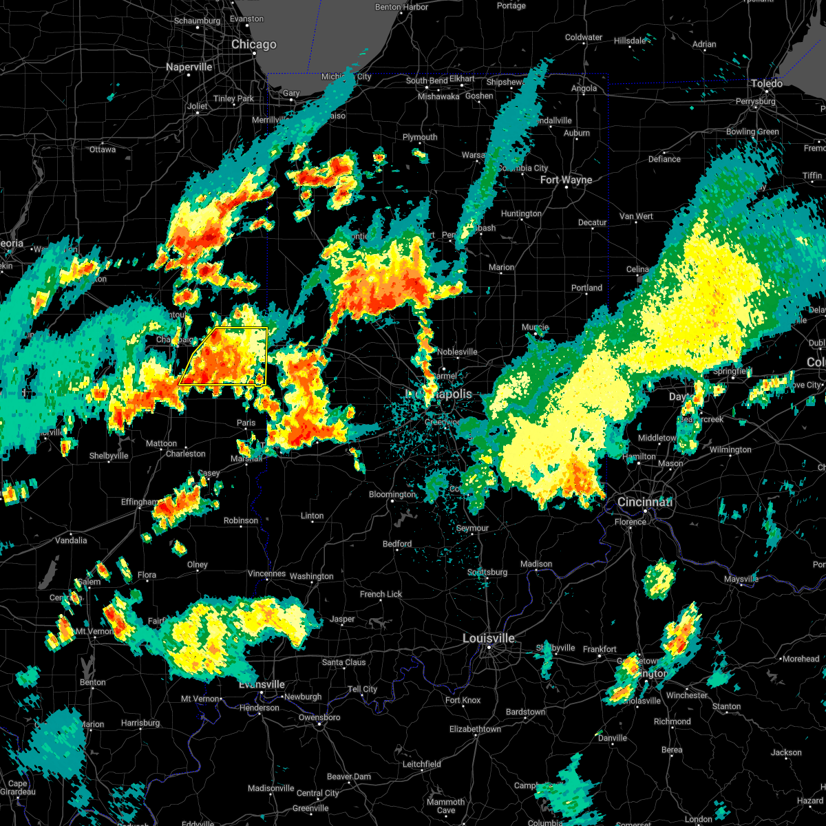 At 832 pm cdt, severe thunderstorms were located along a line extending from near muncie to near broadlands, moving east at 15 mph (radar indicated). Hazards include 60 mph wind gusts and penny size hail. Expect damage to roofs, siding, and trees. locations impacted include, fithian, muncie, oakwood, catlin, fairmount, sidell, danville, westville, tilton, ridge farm and belgium. this includes interstate 74 between mile markers 192 and 220. hail threat, radar indicated max hail size, 0. 75 in wind threat, radar indicated max wind gust, 60 mph. At 832 pm cdt, severe thunderstorms were located along a line extending from near muncie to near broadlands, moving east at 15 mph (radar indicated). Hazards include 60 mph wind gusts and penny size hail. Expect damage to roofs, siding, and trees. locations impacted include, fithian, muncie, oakwood, catlin, fairmount, sidell, danville, westville, tilton, ridge farm and belgium. this includes interstate 74 between mile markers 192 and 220. hail threat, radar indicated max hail size, 0. 75 in wind threat, radar indicated max wind gust, 60 mph.
|
| 8/29/2022 8:15 PM CDT |
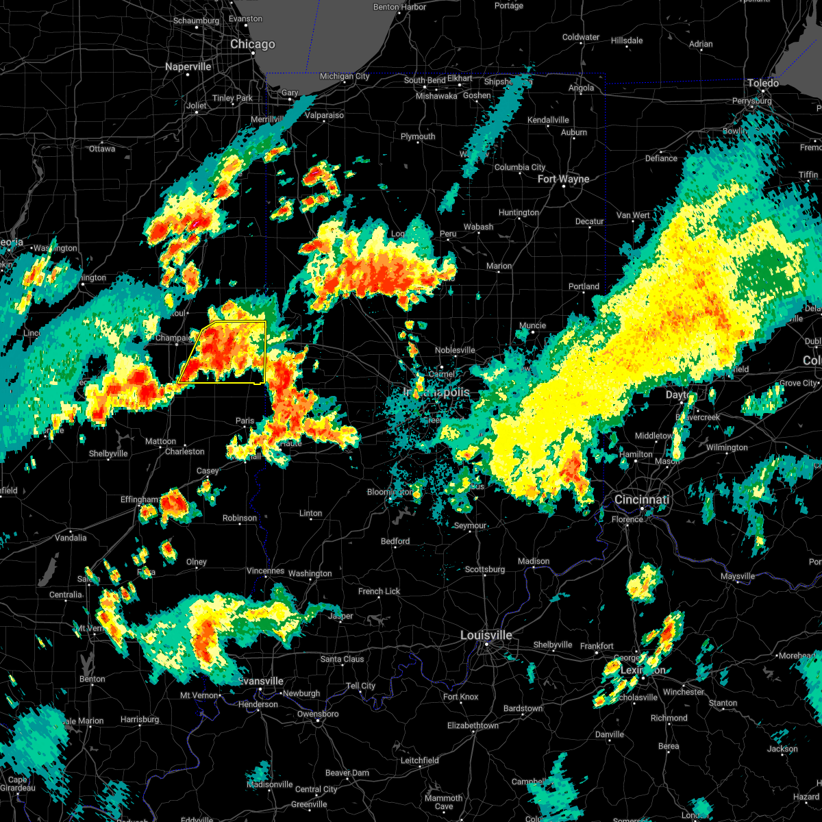 At 815 pm cdt, severe thunderstorms were located along a line extending from near ogden to near sidney, moving east at 15 mph (radar indicated). Hazards include 60 mph wind gusts and penny size hail. Expect damage to roofs, siding, and trees. severe thunderstorms will be near, ogden around 820 pm cdt. fithian around 830 pm cdt. muncie around 835 pm cdt. other locations in the path of these severe thunderstorms include homer, allerton, oakwood, catlin, fairmount, danville, westville, tilton, sidell and belgium. this includes interstate 74 between mile markers 190 and 220. hail threat, radar indicated max hail size, 0. 75 in wind threat, radar indicated max wind gust, 60 mph. At 815 pm cdt, severe thunderstorms were located along a line extending from near ogden to near sidney, moving east at 15 mph (radar indicated). Hazards include 60 mph wind gusts and penny size hail. Expect damage to roofs, siding, and trees. severe thunderstorms will be near, ogden around 820 pm cdt. fithian around 830 pm cdt. muncie around 835 pm cdt. other locations in the path of these severe thunderstorms include homer, allerton, oakwood, catlin, fairmount, danville, westville, tilton, sidell and belgium. this includes interstate 74 between mile markers 190 and 220. hail threat, radar indicated max hail size, 0. 75 in wind threat, radar indicated max wind gust, 60 mph.
|
| 8/29/2022 5:19 PM CDT |
 At 519 pm cdt, a severe thunderstorm was located over macomb, moving east at 10 mph (radar indicated). Hazards include 60 mph wind gusts and quarter size hail. Hail damage to vehicles is expected. expect wind damage to roofs, siding, and trees. locations impacted include, macomb, colchester, western illinois university, spring lake, macomb municipal airport, mcdonough county 4-h grounds and argyle lake state park. hail threat, radar indicated max hail size, 1. 00 in wind threat, radar indicated max wind gust, 60 mph. At 519 pm cdt, a severe thunderstorm was located over macomb, moving east at 10 mph (radar indicated). Hazards include 60 mph wind gusts and quarter size hail. Hail damage to vehicles is expected. expect wind damage to roofs, siding, and trees. locations impacted include, macomb, colchester, western illinois university, spring lake, macomb municipal airport, mcdonough county 4-h grounds and argyle lake state park. hail threat, radar indicated max hail size, 1. 00 in wind threat, radar indicated max wind gust, 60 mph.
|
| 8/29/2022 5:03 PM CDT |
 At 503 pm cdt, a severe thunderstorm was located over mcdonough county 4-h grounds, or over macomb, moving east at 10 mph (radar indicated). Hazards include 60 mph wind gusts and quarter size hail. Hail damage to vehicles is expected. expect wind damage to roofs, siding, and trees. locations impacted include, macomb, western illinois university and macomb municipal airport. hail threat, radar indicated max hail size, 1. 00 in wind threat, radar indicated max wind gust, 60 mph. At 503 pm cdt, a severe thunderstorm was located over mcdonough county 4-h grounds, or over macomb, moving east at 10 mph (radar indicated). Hazards include 60 mph wind gusts and quarter size hail. Hail damage to vehicles is expected. expect wind damage to roofs, siding, and trees. locations impacted include, macomb, western illinois university and macomb municipal airport. hail threat, radar indicated max hail size, 1. 00 in wind threat, radar indicated max wind gust, 60 mph.
|
| 8/29/2022 4:49 PM CDT |
 At 449 pm cdt, a severe thunderstorm was located over argyle lake state park, or near macomb, moving east at 10 mph (radar indicated). Hazards include 60 mph wind gusts and quarter size hail. Hail damage to vehicles is expected. expect wind damage to roofs, siding, and trees. this severe thunderstorm will be near, mcdonough county 4-h grounds and spring lake around 505 pm cdt. other locations in the path of this severe thunderstorm include western illinois university, macomb and macomb municipal airport. hail threat, radar indicated max hail size, 1. 00 in wind threat, radar indicated max wind gust, 60 mph. At 449 pm cdt, a severe thunderstorm was located over argyle lake state park, or near macomb, moving east at 10 mph (radar indicated). Hazards include 60 mph wind gusts and quarter size hail. Hail damage to vehicles is expected. expect wind damage to roofs, siding, and trees. this severe thunderstorm will be near, mcdonough county 4-h grounds and spring lake around 505 pm cdt. other locations in the path of this severe thunderstorm include western illinois university, macomb and macomb municipal airport. hail threat, radar indicated max hail size, 1. 00 in wind threat, radar indicated max wind gust, 60 mph.
|
| 8/1/2022 5:34 AM CDT |
 At 533 am cdt, a severe thunderstorm was located over vermont, or 14 miles northeast of rushville, moving southeast at 50 mph (radar indicated). Hazards include 60 mph wind gusts and quarter size hail. Hail damage to vehicles is expected. expect wind damage to roofs, siding, and trees. locations impacted include, macomb, industry, bardolph, western illinois university, adair, fandon, pennington point, mcdonough county 4-h grounds and doddsville. hail threat, radar indicated max hail size, 1. 00 in wind threat, radar indicated max wind gust, 60 mph. At 533 am cdt, a severe thunderstorm was located over vermont, or 14 miles northeast of rushville, moving southeast at 50 mph (radar indicated). Hazards include 60 mph wind gusts and quarter size hail. Hail damage to vehicles is expected. expect wind damage to roofs, siding, and trees. locations impacted include, macomb, industry, bardolph, western illinois university, adair, fandon, pennington point, mcdonough county 4-h grounds and doddsville. hail threat, radar indicated max hail size, 1. 00 in wind threat, radar indicated max wind gust, 60 mph.
|
| 8/1/2022 5:19 AM CDT |
 At 518 am cdt, a severe thunderstorm was located near mcdonough county 4-h grounds, or near macomb, moving southeast at 50 mph (radar indicated). Hazards include 60 mph wind gusts and quarter size hail. Hail damage to vehicles is expected. expect wind damage to roofs, siding, and trees. locations impacted include, macomb, colchester, blandinsville, industry, bardolph, tennessee, western illinois university, adair, fandon, colmar, fountain green, pennington point, macomb municipal airport, doddsville, spring lake, mcdonough county 4-h grounds and argyle lake state park. hail threat, radar indicated max hail size, 1. 00 in wind threat, radar indicated max wind gust, 60 mph. At 518 am cdt, a severe thunderstorm was located near mcdonough county 4-h grounds, or near macomb, moving southeast at 50 mph (radar indicated). Hazards include 60 mph wind gusts and quarter size hail. Hail damage to vehicles is expected. expect wind damage to roofs, siding, and trees. locations impacted include, macomb, colchester, blandinsville, industry, bardolph, tennessee, western illinois university, adair, fandon, colmar, fountain green, pennington point, macomb municipal airport, doddsville, spring lake, mcdonough county 4-h grounds and argyle lake state park. hail threat, radar indicated max hail size, 1. 00 in wind threat, radar indicated max wind gust, 60 mph.
|
| 8/1/2022 5:01 AM CDT |
 At 500 am cdt, a severe thunderstorm was located over fountain green, or 11 miles northeast of carthage, moving southeast at 50 mph (radar indicated). Hazards include 60 mph wind gusts and quarter size hail. Hail damage to vehicles is expected. Expect wind damage to roofs, siding, and trees. At 500 am cdt, a severe thunderstorm was located over fountain green, or 11 miles northeast of carthage, moving southeast at 50 mph (radar indicated). Hazards include 60 mph wind gusts and quarter size hail. Hail damage to vehicles is expected. Expect wind damage to roofs, siding, and trees.
|
| 7/5/2022 11:18 PM CDT |
 At 1118 pm cdt, severe thunderstorms were located along a line extending from near galesburg airport to near bentley, moving east at 60 mph (radar indicated). Hazards include 60 mph wind gusts. Expect damage to roofs, siding, and trees. locations impacted include, macomb, monmouth, carthage, bushnell, colchester, la harpe, roseville, blandinsville, industry, good hope, prairie city, bardolph, north henderson, raritan, tennessee, sciota, western illinois university, fandon, little swan lake and new philadelphia. hail threat, radar indicated max hail size, <. 75 in wind threat, radar indicated max wind gust, 60 mph. At 1118 pm cdt, severe thunderstorms were located along a line extending from near galesburg airport to near bentley, moving east at 60 mph (radar indicated). Hazards include 60 mph wind gusts. Expect damage to roofs, siding, and trees. locations impacted include, macomb, monmouth, carthage, bushnell, colchester, la harpe, roseville, blandinsville, industry, good hope, prairie city, bardolph, north henderson, raritan, tennessee, sciota, western illinois university, fandon, little swan lake and new philadelphia. hail threat, radar indicated max hail size, <. 75 in wind threat, radar indicated max wind gust, 60 mph.
|
| 7/5/2022 11:09 PM CDT |
 At 1108 pm cdt, severe thunderstorms were located along a line extending from near coldbrook to near carthage, moving southeast at 60 mph (radar indicated). Hazards include 60 mph wind gusts. Expect damage to roofs, siding, and trees. locations impacted include, macomb, monmouth, carthage, nauvoo, bushnell, burgess, colchester, la harpe, roseville, viola, dallas city, stronghurst, matherville, kirkwood, blandinsville, sherrard, industry, good hope, prairie city and little york. hail threat, radar indicated max hail size, <. 75 in wind threat, radar indicated max wind gust, 60 mph. At 1108 pm cdt, severe thunderstorms were located along a line extending from near coldbrook to near carthage, moving southeast at 60 mph (radar indicated). Hazards include 60 mph wind gusts. Expect damage to roofs, siding, and trees. locations impacted include, macomb, monmouth, carthage, nauvoo, bushnell, burgess, colchester, la harpe, roseville, viola, dallas city, stronghurst, matherville, kirkwood, blandinsville, sherrard, industry, good hope, prairie city and little york. hail threat, radar indicated max hail size, <. 75 in wind threat, radar indicated max wind gust, 60 mph.
|
| 7/5/2022 10:56 PM CDT |
 At 1056 pm cdt, severe thunderstorms were located along a line extending from alexis to adrian, moving south at 35 mph (radar indicated). Hazards include 60 mph wind gusts. Expect damage to roofs, siding, and trees. locations impacted include, burlington, macomb, fort madison, monmouth, aledo, carthage, oquawka, nauvoo, bushnell, west burlington, burgess, colchester, la harpe, roseville, viola, dallas city, stronghurst, millersburg, matherville and kirkwood. hail threat, radar indicated max hail size, <. 75 in wind threat, radar indicated max wind gust, 60 mph. At 1056 pm cdt, severe thunderstorms were located along a line extending from alexis to adrian, moving south at 35 mph (radar indicated). Hazards include 60 mph wind gusts. Expect damage to roofs, siding, and trees. locations impacted include, burlington, macomb, fort madison, monmouth, aledo, carthage, oquawka, nauvoo, bushnell, west burlington, burgess, colchester, la harpe, roseville, viola, dallas city, stronghurst, millersburg, matherville and kirkwood. hail threat, radar indicated max hail size, <. 75 in wind threat, radar indicated max wind gust, 60 mph.
|
| 7/5/2022 10:31 PM CDT |
 At 1031 pm cdt, severe thunderstorms were located along a line extending from gingle corners to denmark, moving southeast at 60 mph (radar indicated). Hazards include 60 mph wind gusts. expect damage to roofs, siding, and trees At 1031 pm cdt, severe thunderstorms were located along a line extending from gingle corners to denmark, moving southeast at 60 mph (radar indicated). Hazards include 60 mph wind gusts. expect damage to roofs, siding, and trees
|
| 6/13/2022 12:32 PM CDT |
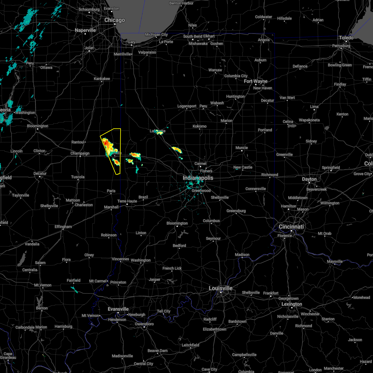 At 1232 pm cdt, a severe thunderstorm was located near potomac, or 12 miles northwest of danville, moving northeast at 25 mph (radar indicated). Hazards include 60 mph wind gusts and quarter size hail. Hail damage to vehicles is expected. expect wind damage to roofs, siding, and trees. this severe thunderstorm will be near, rossville around 1245 pm cdt. other locations in the path of this severe thunderstorm include hoopeston. This includes interstate 74 between mile markers 209 and 219. At 1232 pm cdt, a severe thunderstorm was located near potomac, or 12 miles northwest of danville, moving northeast at 25 mph (radar indicated). Hazards include 60 mph wind gusts and quarter size hail. Hail damage to vehicles is expected. expect wind damage to roofs, siding, and trees. this severe thunderstorm will be near, rossville around 1245 pm cdt. other locations in the path of this severe thunderstorm include hoopeston. This includes interstate 74 between mile markers 209 and 219.
|
| 6/12/2022 8:50 AM CDT | 6 inch limb down. time estimated from rada in vermilion county IL, 166.2 miles W of Georgetown, IL |
| 5/25/2022 7:15 PM CDT |
 At 714 pm cdt, severe thunderstorms were located along a line extending from disco to near bushnell, moving north at 40 mph (radar indicated). Hazards include 60 mph wind gusts. Expect damage to roofs, siding, and trees. locations impacted include, walnut grove, prairie city and prairie city airport. hail threat, radar indicated max hail size, <. 75 in wind threat, radar indicated max wind gust, 60 mph. At 714 pm cdt, severe thunderstorms were located along a line extending from disco to near bushnell, moving north at 40 mph (radar indicated). Hazards include 60 mph wind gusts. Expect damage to roofs, siding, and trees. locations impacted include, walnut grove, prairie city and prairie city airport. hail threat, radar indicated max hail size, <. 75 in wind threat, radar indicated max wind gust, 60 mph.
|
| 5/25/2022 6:59 PM CDT |
 At 659 pm cdt, severe thunderstorms were located along a line extending from webster to pennington point, moving north at 40 mph (radar indicated). Hazards include 60 mph wind gusts. Expect damage to roofs, siding, and trees. locations impacted include, western illinois university, macomb, blandinsville, bardolph, new philadelphia, macomb municipal airport, la harpe, good hope, disco, scottsburg, bushnell, prairie city, walnut grove and prairie city airport. hail threat, radar indicated max hail size, <. 75 in wind threat, radar indicated max wind gust, 60 mph. At 659 pm cdt, severe thunderstorms were located along a line extending from webster to pennington point, moving north at 40 mph (radar indicated). Hazards include 60 mph wind gusts. Expect damage to roofs, siding, and trees. locations impacted include, western illinois university, macomb, blandinsville, bardolph, new philadelphia, macomb municipal airport, la harpe, good hope, disco, scottsburg, bushnell, prairie city, walnut grove and prairie city airport. hail threat, radar indicated max hail size, <. 75 in wind threat, radar indicated max wind gust, 60 mph.
|
| 5/25/2022 6:57 PM CDT |
 At 657 pm cdt, severe thunderstorms were located along a line extending from near webster to near adair, moving north at 40 mph (radar indicated). Hazards include 60 mph wind gusts. Expect damage to roofs, siding, and trees. severe thunderstorms will be near, blandinsville, bardolph and new philadelphia around 710 pm cdt. bushnell, la harpe, disco and scottsburg around 715 pm cdt. other locations in the path of these severe thunderstorms include walnut grove, prairie city airport and prairie city. hail threat, radar indicated max hail size, <. 75 in wind threat, radar indicated max wind gust, 60 mph. At 657 pm cdt, severe thunderstorms were located along a line extending from near webster to near adair, moving north at 40 mph (radar indicated). Hazards include 60 mph wind gusts. Expect damage to roofs, siding, and trees. severe thunderstorms will be near, blandinsville, bardolph and new philadelphia around 710 pm cdt. bushnell, la harpe, disco and scottsburg around 715 pm cdt. other locations in the path of these severe thunderstorms include walnut grove, prairie city airport and prairie city. hail threat, radar indicated max hail size, <. 75 in wind threat, radar indicated max wind gust, 60 mph.
|
| 5/25/2022 6:32 PM CDT |
 At 631 pm cdt, severe thunderstorms were located along a line extending from bowen to rushville, moving north at 45 mph (radar indicated). Hazards include 60 mph wind gusts. Expect damage to roofs, siding, and trees. severe thunderstorms will be near, augusta, bowen, west point and denver around 635 pm cdt. basco and bentley around 640 pm cdt. carthage and doddsville around 645 pm cdt. industry, ferris and webster around 650 pm cdt. Other locations in the path of these severe thunderstorms include burnside, adrian, fountain green, pennington point, la harpe, adair, mcdonough county 4-h grounds, macomb, dallas city, bardolph, disco, western illinois university, new philadelphia, macomb municipal airport, spring lake, bushnell, good hope and scottsburg. At 631 pm cdt, severe thunderstorms were located along a line extending from bowen to rushville, moving north at 45 mph (radar indicated). Hazards include 60 mph wind gusts. Expect damage to roofs, siding, and trees. severe thunderstorms will be near, augusta, bowen, west point and denver around 635 pm cdt. basco and bentley around 640 pm cdt. carthage and doddsville around 645 pm cdt. industry, ferris and webster around 650 pm cdt. Other locations in the path of these severe thunderstorms include burnside, adrian, fountain green, pennington point, la harpe, adair, mcdonough county 4-h grounds, macomb, dallas city, bardolph, disco, western illinois university, new philadelphia, macomb municipal airport, spring lake, bushnell, good hope and scottsburg.
|
| 5/13/2022 6:20 PM CDT |
 The severe thunderstorm warning for mcdonough county will expire at 630 pm cdt, the storms which prompted the warning have weakened below severe limits, and no longer pose an immediate threat to life or property. therefore, the warning will be allowed to expire. however small hail, gusty winds and heavy rain are still possible with these thunderstorms. to report severe weather, contact your nearest law enforcement agency. they will relay your report to the national weather service the quad cities. The severe thunderstorm warning for mcdonough county will expire at 630 pm cdt, the storms which prompted the warning have weakened below severe limits, and no longer pose an immediate threat to life or property. therefore, the warning will be allowed to expire. however small hail, gusty winds and heavy rain are still possible with these thunderstorms. to report severe weather, contact your nearest law enforcement agency. they will relay your report to the national weather service the quad cities.
|
| 5/13/2022 5:52 PM CDT |
 At 552 pm cdt, severe thunderstorms were located along a line extending from near swan creek to near doddsville, and are nearly stationary (trained weather spotters). Hazards include 60 mph wind gusts and half dollar size hail. Hail damage to vehicles is expected. expect wind damage to roofs, siding, and trees. locations impacted include, macomb municipal airport, doddsville, scottsburg, bushnell, industry, prairie city, walnut grove and prairie city airport. hail threat, radar indicated max hail size, 1. 25 in wind threat, radar indicated max wind gust, 60 mph. At 552 pm cdt, severe thunderstorms were located along a line extending from near swan creek to near doddsville, and are nearly stationary (trained weather spotters). Hazards include 60 mph wind gusts and half dollar size hail. Hail damage to vehicles is expected. expect wind damage to roofs, siding, and trees. locations impacted include, macomb municipal airport, doddsville, scottsburg, bushnell, industry, prairie city, walnut grove and prairie city airport. hail threat, radar indicated max hail size, 1. 25 in wind threat, radar indicated max wind gust, 60 mph.
|
| 4/24/2022 7:53 PM CDT |
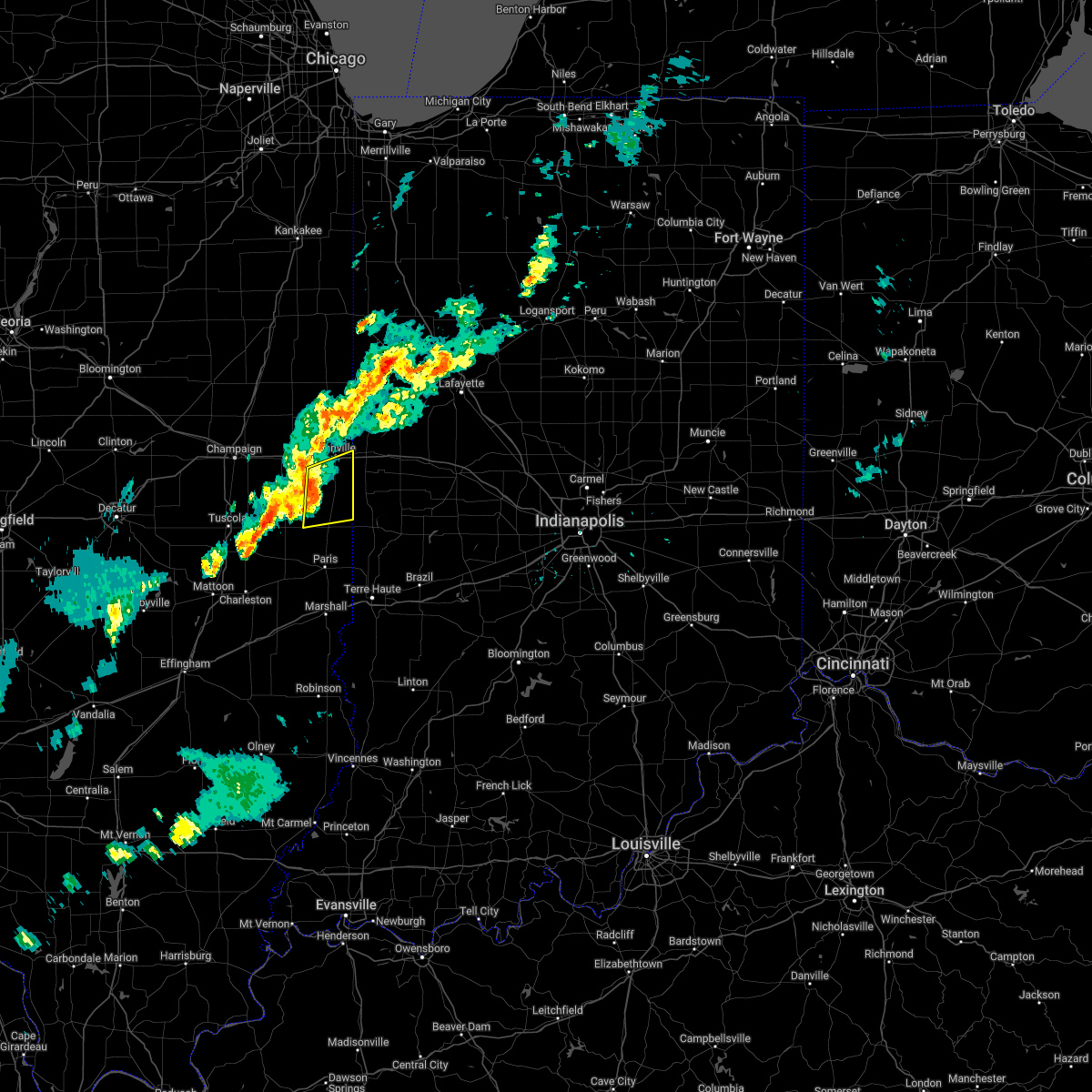 At 752 pm cdt, severe thunderstorms were located along a line extending from catlin to near sidell, moving east at 50 mph (radar indicated). Hazards include 60 mph wind gusts. Expect damage to roofs, siding, and trees. these severe storms will be near, catlin around 755 pm cdt. danville, westville, tilton, ridge farm and belgium around 800 pm cdt. other locations in the path of these severe thunderstorms include georgetown. this includes interstate 74 between mile markers 213 and 220. hail threat, radar indicated max hail size, <. 75 in wind threat, radar indicated max wind gust, 60 mph. At 752 pm cdt, severe thunderstorms were located along a line extending from catlin to near sidell, moving east at 50 mph (radar indicated). Hazards include 60 mph wind gusts. Expect damage to roofs, siding, and trees. these severe storms will be near, catlin around 755 pm cdt. danville, westville, tilton, ridge farm and belgium around 800 pm cdt. other locations in the path of these severe thunderstorms include georgetown. this includes interstate 74 between mile markers 213 and 220. hail threat, radar indicated max hail size, <. 75 in wind threat, radar indicated max wind gust, 60 mph.
|
| 4/24/2022 7:40 PM CDT |
 At 740 pm cdt, severe thunderstorms were located along a line extending from near homer to newman, moving east at 45 mph (radar indicated). Hazards include 60 mph wind gusts. Expect damage to roofs, siding, and trees. severe thunderstorms will be near, fairmount around 750 pm cdt. sidell around 755 pm cdt. catlin and chrisman around 800 pm cdt. other locations in the path of these severe thunderstorms include danville, westville, tilton, ridge farm, belgium and georgetown. this includes interstate 74 between mile markers 213 and 220. hail threat, radar indicated max hail size, <. 75 in wind threat, radar indicated max wind gust, 60 mph. At 740 pm cdt, severe thunderstorms were located along a line extending from near homer to newman, moving east at 45 mph (radar indicated). Hazards include 60 mph wind gusts. Expect damage to roofs, siding, and trees. severe thunderstorms will be near, fairmount around 750 pm cdt. sidell around 755 pm cdt. catlin and chrisman around 800 pm cdt. other locations in the path of these severe thunderstorms include danville, westville, tilton, ridge farm, belgium and georgetown. this includes interstate 74 between mile markers 213 and 220. hail threat, radar indicated max hail size, <. 75 in wind threat, radar indicated max wind gust, 60 mph.
|
| 3/6/2022 12:30 AM CST |
 At 1230 am cst, a severe thunderstorm was located near hume, or 10 miles northwest of paris, moving east at 65 mph (radar indicated). Hazards include 70 mph wind gusts and penny size hail. Expect considerable tree damage. damage is likely to mobile homes, roofs, and outbuildings. locations impacted include, charleston, mattoon, paris, marshall, georgetown, westville, chrisman, martinsville, ridge farm, oakland, kansas, ashmore, sidell, westfield, hume, brocton, allerton, lerna, vermilion and redmon. this includes the following highways, interstate 57 between mile markers 181 and 194. interstate 70 between mile markers 136 and 154. thunderstorm damage threat, considerable hail threat, radar indicated max hail size, 0. 75 in wind threat, observed max wind gust, 70 mph. At 1230 am cst, a severe thunderstorm was located near hume, or 10 miles northwest of paris, moving east at 65 mph (radar indicated). Hazards include 70 mph wind gusts and penny size hail. Expect considerable tree damage. damage is likely to mobile homes, roofs, and outbuildings. locations impacted include, charleston, mattoon, paris, marshall, georgetown, westville, chrisman, martinsville, ridge farm, oakland, kansas, ashmore, sidell, westfield, hume, brocton, allerton, lerna, vermilion and redmon. this includes the following highways, interstate 57 between mile markers 181 and 194. interstate 70 between mile markers 136 and 154. thunderstorm damage threat, considerable hail threat, radar indicated max hail size, 0. 75 in wind threat, observed max wind gust, 70 mph.
|
| 3/6/2022 12:16 AM CST |
 At 1215 am cst, a severe thunderstorm was located over hindsboro, or 12 miles southeast of tuscola, moving east at 65 mph (broadcast media). Hazards include 70 mph wind gusts and quarter size hail. Hail damage to vehicles is expected. expect considerable tree damage. wind damage is also likely to mobile homes, roofs, and outbuildings. locations impacted include, oakland, newman, brocton, hume, redmon, paris and chrisman. this includes the following highways, interstate 57 between mile markers 181 and 216. interstate 70 between mile markers 136 and 154. thunderstorm damage threat, considerable hail threat, radar indicated max hail size, 1. 00 in wind threat, observed max wind gust, 70 mph. At 1215 am cst, a severe thunderstorm was located over hindsboro, or 12 miles southeast of tuscola, moving east at 65 mph (broadcast media). Hazards include 70 mph wind gusts and quarter size hail. Hail damage to vehicles is expected. expect considerable tree damage. wind damage is also likely to mobile homes, roofs, and outbuildings. locations impacted include, oakland, newman, brocton, hume, redmon, paris and chrisman. this includes the following highways, interstate 57 between mile markers 181 and 216. interstate 70 between mile markers 136 and 154. thunderstorm damage threat, considerable hail threat, radar indicated max hail size, 1. 00 in wind threat, observed max wind gust, 70 mph.
|
| 3/5/2022 11:56 PM CST |
 At 1156 pm cst, a severe thunderstorm was located near allenville, or near sullivan, moving east at 65 mph (radar indicated). Hazards include 70 mph wind gusts. Expect considerable tree damage. damage is likely to mobile homes, roofs, and outbuildings. this severe thunderstorm will be near, cooks mill around 1200 am cst. arcola and humboldt around 1205 am cst. hindsboro and rardin around 1215 am cst. other locations in the path of this severe thunderstorm include oakland, newman, brocton, hume, redmon, paris and chrisman. this includes the following highways, interstate 57 between mile markers 181 and 223. interstate 70 between mile markers 136 and 154. thunderstorm damage threat, considerable hail threat, radar indicated max hail size, <. 75 in wind threat, radar indicated max wind gust, 70 mph. At 1156 pm cst, a severe thunderstorm was located near allenville, or near sullivan, moving east at 65 mph (radar indicated). Hazards include 70 mph wind gusts. Expect considerable tree damage. damage is likely to mobile homes, roofs, and outbuildings. this severe thunderstorm will be near, cooks mill around 1200 am cst. arcola and humboldt around 1205 am cst. hindsboro and rardin around 1215 am cst. other locations in the path of this severe thunderstorm include oakland, newman, brocton, hume, redmon, paris and chrisman. this includes the following highways, interstate 57 between mile markers 181 and 223. interstate 70 between mile markers 136 and 154. thunderstorm damage threat, considerable hail threat, radar indicated max hail size, <. 75 in wind threat, radar indicated max wind gust, 70 mph.
|
| 9/7/2021 6:58 PM CDT |
 The severe thunderstorm warning for vermilion and champaign counties will expire at 700 pm cdt, the storms which prompted the warning have weakened below severe limits, and no longer pose an immediate threat to life or property. therefore, the warning will be allowed to expire. however gusty winds and heavy rain are still expected with these thunderstorms. a severe thunderstorm watch remains in effect until 900 pm cdt for east central illinois. to report severe weather, contact your nearest law enforcement agency. they will relay your report to the national weather service lincoln. The severe thunderstorm warning for vermilion and champaign counties will expire at 700 pm cdt, the storms which prompted the warning have weakened below severe limits, and no longer pose an immediate threat to life or property. therefore, the warning will be allowed to expire. however gusty winds and heavy rain are still expected with these thunderstorms. a severe thunderstorm watch remains in effect until 900 pm cdt for east central illinois. to report severe weather, contact your nearest law enforcement agency. they will relay your report to the national weather service lincoln.
|
| 9/7/2021 6:33 PM CDT |
 At 632 pm cdt, severe thunderstorms were located along a line extending from 6 miles southeast of rossville to oakwood to seymour, moving southeast at 45 mph (radar indicated). Hazards include 60 mph wind gusts. Expect damage to roofs, siding, and trees. locations impacted include, danville, tilton, catlin, oakwood, fairmount, georgetown, westville, pesotum, belgium, sidney, broadlands, allerton, sidell and ridge farm. this includes the following highways, interstate 57 between mile markers 218 and 249. interstate 72 between mile markers 174 and 182. interstate 74 between mile marker 169 and the indiana border. hail threat, radar indicated max hail size, <. 75 in wind threat, radar indicated max wind gust, 60 mph. At 632 pm cdt, severe thunderstorms were located along a line extending from 6 miles southeast of rossville to oakwood to seymour, moving southeast at 45 mph (radar indicated). Hazards include 60 mph wind gusts. Expect damage to roofs, siding, and trees. locations impacted include, danville, tilton, catlin, oakwood, fairmount, georgetown, westville, pesotum, belgium, sidney, broadlands, allerton, sidell and ridge farm. this includes the following highways, interstate 57 between mile markers 218 and 249. interstate 72 between mile markers 174 and 182. interstate 74 between mile marker 169 and the indiana border. hail threat, radar indicated max hail size, <. 75 in wind threat, radar indicated max wind gust, 60 mph.
|
| 9/7/2021 6:09 PM CDT |
 At 608 pm cdt, severe thunderstorms were located along a line extending from near rankin to 6 miles north of st. joseph to mahomet, moving southeast at 45 mph (radar indicated). Hazards include 60 mph wind gusts and nickel size hail. Expect damage to roofs, siding, and trees. severe thunderstorms will be near, rankin around 615 pm cdt. ogden and potomac around 620 pm cdt. savoy, tolono, rossville, fithian and muncie around 625 pm cdt. other locations in the path of these severe thunderstorms include oakwood, fairmount, st. joseph, catlin, philo, danville, westville, tilton, sidney, belgium, georgetown, homer, broadlands and allerton. this includes the following highways, interstate 57 between mile markers 218 and 251. interstate 72 between mile markers 174 and 182. interstate 74 between mile marker 169 and the indiana border. hail threat, radar indicated max hail size, 0. 88 in wind threat, radar indicated max wind gust, 60 mph. At 608 pm cdt, severe thunderstorms were located along a line extending from near rankin to 6 miles north of st. joseph to mahomet, moving southeast at 45 mph (radar indicated). Hazards include 60 mph wind gusts and nickel size hail. Expect damage to roofs, siding, and trees. severe thunderstorms will be near, rankin around 615 pm cdt. ogden and potomac around 620 pm cdt. savoy, tolono, rossville, fithian and muncie around 625 pm cdt. other locations in the path of these severe thunderstorms include oakwood, fairmount, st. joseph, catlin, philo, danville, westville, tilton, sidney, belgium, georgetown, homer, broadlands and allerton. this includes the following highways, interstate 57 between mile markers 218 and 251. interstate 72 between mile markers 174 and 182. interstate 74 between mile marker 169 and the indiana border. hail threat, radar indicated max hail size, 0. 88 in wind threat, radar indicated max wind gust, 60 mph.
|
| 8/12/2021 2:53 PM CDT |
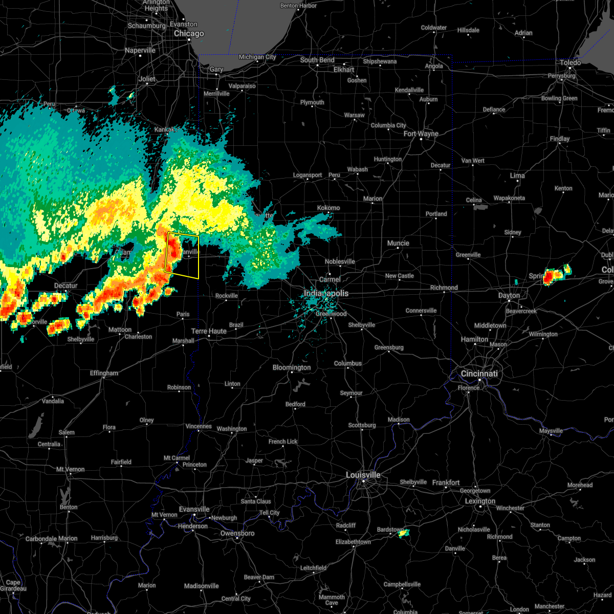 At 253 pm cdt, a severe thunderstorm was located near oakwood, or near danville, moving east at 35 mph (radar indicated). Hazards include 60 mph wind gusts and penny size hail. Expect damage to roofs, siding, and trees. this severe thunderstorm will be near, danville, westville, tilton and belgium around 305 pm cdt. this includes interstate 74 between mile markers 202 and 220. hail threat, radar indicated max hail size, 0. 75 in wind threat, radar indicated max wind gust, 60 mph. At 253 pm cdt, a severe thunderstorm was located near oakwood, or near danville, moving east at 35 mph (radar indicated). Hazards include 60 mph wind gusts and penny size hail. Expect damage to roofs, siding, and trees. this severe thunderstorm will be near, danville, westville, tilton and belgium around 305 pm cdt. this includes interstate 74 between mile markers 202 and 220. hail threat, radar indicated max hail size, 0. 75 in wind threat, radar indicated max wind gust, 60 mph.
|
| 7/9/2021 8:17 PM CDT |
 At 816 pm cdt, a severe thunderstorm was located near colmar, or 13 miles southwest of macomb, moving southeast at 45 mph (trained weather spotters). Hazards include tennis ball size hail and 60 mph wind gusts. People and animals outdoors will be injured. expect hail damage to roofs, siding, windows, and vehicles. expect wind damage to roofs, siding, and trees. Locations impacted include, macomb, bushnell, colchester, augusta, bowen, industry, good hope, prairie city, bardolph, tennessee, western illinois university, fandon, new philadelphia, colmar, adair, plymouth, denver, bentley, macomb municipal airport and prairie city airport. At 816 pm cdt, a severe thunderstorm was located near colmar, or 13 miles southwest of macomb, moving southeast at 45 mph (trained weather spotters). Hazards include tennis ball size hail and 60 mph wind gusts. People and animals outdoors will be injured. expect hail damage to roofs, siding, windows, and vehicles. expect wind damage to roofs, siding, and trees. Locations impacted include, macomb, bushnell, colchester, augusta, bowen, industry, good hope, prairie city, bardolph, tennessee, western illinois university, fandon, new philadelphia, colmar, adair, plymouth, denver, bentley, macomb municipal airport and prairie city airport.
|
| 7/9/2021 8:08 PM CDT |
 At 808 pm cdt, a severe thunderstorm was located over colmar, or 12 miles southwest of macomb, moving southeast at 45 mph (trained weather spotters). Hazards include tennis ball size hail and 60 mph wind gusts. People and animals outdoors will be injured. expect hail damage to roofs, siding, windows, and vehicles. expect wind damage to roofs, siding, and trees. Locations impacted include, macomb, bushnell, colchester, blandinsville, augusta, bowen, industry, good hope, prairie city, bardolph, tennessee, sciota, western illinois university, fandon, new philadelphia, colmar, adair, walnut grove, plymouth and denver. At 808 pm cdt, a severe thunderstorm was located over colmar, or 12 miles southwest of macomb, moving southeast at 45 mph (trained weather spotters). Hazards include tennis ball size hail and 60 mph wind gusts. People and animals outdoors will be injured. expect hail damage to roofs, siding, windows, and vehicles. expect wind damage to roofs, siding, and trees. Locations impacted include, macomb, bushnell, colchester, blandinsville, augusta, bowen, industry, good hope, prairie city, bardolph, tennessee, sciota, western illinois university, fandon, new philadelphia, colmar, adair, walnut grove, plymouth and denver.
|
| 7/9/2021 8:03 PM CDT |
 At 803 pm cdt, a severe thunderstorm was located near tennessee, or 11 miles east of carthage, moving southeast at 30 mph (trained weather spotters). Hazards include golf ball size hail and 60 mph wind gusts. People and animals outdoors will be injured. expect hail damage to roofs, siding, windows, and vehicles. expect wind damage to roofs, siding, and trees. Locations impacted include, macomb, carthage, bushnell, colchester, blandinsville, augusta, bowen, industry, good hope, prairie city, bardolph, west point, tennessee, sciota, western illinois university, fandon, little swan lake, new philadelphia, colmar and adair. At 803 pm cdt, a severe thunderstorm was located near tennessee, or 11 miles east of carthage, moving southeast at 30 mph (trained weather spotters). Hazards include golf ball size hail and 60 mph wind gusts. People and animals outdoors will be injured. expect hail damage to roofs, siding, windows, and vehicles. expect wind damage to roofs, siding, and trees. Locations impacted include, macomb, carthage, bushnell, colchester, blandinsville, augusta, bowen, industry, good hope, prairie city, bardolph, west point, tennessee, sciota, western illinois university, fandon, little swan lake, new philadelphia, colmar and adair.
|
| 7/9/2021 7:52 PM CDT |
 At 751 pm cdt, a severe thunderstorm was located near carthage, moving southeast at 40 mph. this warning has been replaced with a new warning, which will continue for hancock and mcdonough counties until 845 pm (trained weather spotters). Hazards include golf ball size hail and 60 mph wind gusts. People and animals outdoors will be injured. expect hail damage to roofs, siding, windows, and vehicles. expect wind damage to roofs, siding, and trees. Locations impacted include, macomb, carthage, colchester, la harpe, dallas city, ferris, tennessee, colusa, adrian, burnside, fountain green, elvaston, pontoosuc, basco, bentley, webster, mcdonough county 4-h grounds and argyle lake state park. At 751 pm cdt, a severe thunderstorm was located near carthage, moving southeast at 40 mph. this warning has been replaced with a new warning, which will continue for hancock and mcdonough counties until 845 pm (trained weather spotters). Hazards include golf ball size hail and 60 mph wind gusts. People and animals outdoors will be injured. expect hail damage to roofs, siding, windows, and vehicles. expect wind damage to roofs, siding, and trees. Locations impacted include, macomb, carthage, colchester, la harpe, dallas city, ferris, tennessee, colusa, adrian, burnside, fountain green, elvaston, pontoosuc, basco, bentley, webster, mcdonough county 4-h grounds and argyle lake state park.
|
| 7/9/2021 7:47 PM CDT |
 At 747 pm cdt, a severe thunderstorm was located near la harpe, or 10 miles northeast of carthage, moving southeast at 45 mph (trained weather spotters). Hazards include golf ball size hail and 60 mph wind gusts. People and animals outdoors will be injured. expect hail damage to roofs, siding, windows, and vehicles. expect wind damage to roofs, siding, and trees. Locations impacted include, colchester, tennessee, colmar and fandon. At 747 pm cdt, a severe thunderstorm was located near la harpe, or 10 miles northeast of carthage, moving southeast at 45 mph (trained weather spotters). Hazards include golf ball size hail and 60 mph wind gusts. People and animals outdoors will be injured. expect hail damage to roofs, siding, windows, and vehicles. expect wind damage to roofs, siding, and trees. Locations impacted include, colchester, tennessee, colmar and fandon.
|
| 7/9/2021 7:41 PM CDT |
 At 741 pm cdt, a severe thunderstorm was located over burnside, or 8 miles north of carthage, moving southeast at 40 mph (trained weather spotters). Hazards include tennis ball size hail and 60 mph wind gusts. People and animals outdoors will be injured. expect hail damage to roofs, siding, windows, and vehicles. expect wind damage to roofs, siding, and trees. Locations impacted include, macomb, carthage, colchester, la harpe, dallas city, ferris, tennessee, colusa, adrian, burnside, fountain green, elvaston, pontoosuc, basco, bentley, webster, mcdonough county 4-h grounds and argyle lake state park. At 741 pm cdt, a severe thunderstorm was located over burnside, or 8 miles north of carthage, moving southeast at 40 mph (trained weather spotters). Hazards include tennis ball size hail and 60 mph wind gusts. People and animals outdoors will be injured. expect hail damage to roofs, siding, windows, and vehicles. expect wind damage to roofs, siding, and trees. Locations impacted include, macomb, carthage, colchester, la harpe, dallas city, ferris, tennessee, colusa, adrian, burnside, fountain green, elvaston, pontoosuc, basco, bentley, webster, mcdonough county 4-h grounds and argyle lake state park.
|
| 7/9/2021 7:39 PM CDT |
 At 739 pm cdt, a severe thunderstorm was located near disco, or 12 miles northeast of carthage, moving southeast at 45 mph (radar indicated). Hazards include tennis ball size hail and 60 mph wind gusts. People and animals outdoors will be injured. expect hail damage to roofs, siding, windows, and vehicles. expect wind damage to roofs, siding, and trees. this severe thunderstorm will be near, blandinsville around 745 pm cdt. Other locations in the path of this severe thunderstorm include colchester, tennessee, colmar and fandon. At 739 pm cdt, a severe thunderstorm was located near disco, or 12 miles northeast of carthage, moving southeast at 45 mph (radar indicated). Hazards include tennis ball size hail and 60 mph wind gusts. People and animals outdoors will be injured. expect hail damage to roofs, siding, windows, and vehicles. expect wind damage to roofs, siding, and trees. this severe thunderstorm will be near, blandinsville around 745 pm cdt. Other locations in the path of this severe thunderstorm include colchester, tennessee, colmar and fandon.
|
| 7/9/2021 7:29 PM CDT |
 At 729 pm cdt, a severe thunderstorm was located over dallas city, or 10 miles east of fort madison, moving southeast at 40 mph (trained weather spotters). Hazards include tennis ball size hail and 60 mph wind gusts. People and animals outdoors will be injured. expect hail damage to roofs, siding, windows, and vehicles. expect wind damage to roofs, siding, and trees. Locations impacted include, la harpe, ferris, adrian, burnside, carthage, colchester and tennessee. At 729 pm cdt, a severe thunderstorm was located over dallas city, or 10 miles east of fort madison, moving southeast at 40 mph (trained weather spotters). Hazards include tennis ball size hail and 60 mph wind gusts. People and animals outdoors will be injured. expect hail damage to roofs, siding, windows, and vehicles. expect wind damage to roofs, siding, and trees. Locations impacted include, la harpe, ferris, adrian, burnside, carthage, colchester and tennessee.
|
| 7/9/2021 7:19 PM CDT |
 At 718 pm cdt, a severe thunderstorm was located near denmark, or 7 miles northeast of fort madison, moving southeast at 40 mph (radar indicated). Hazards include tennis ball size hail and 60 mph wind gusts. People and animals outdoors will be injured. expect hail damage to roofs, siding, windows, and vehicles. expect wind damage to roofs, siding, and trees. this severe thunderstorm will be near, dallas city and niota around 730 pm cdt. colusa around 735 pm cdt. Other locations in the path of this severe thunderstorm include adrian, ferris, burnside and carthage. At 718 pm cdt, a severe thunderstorm was located near denmark, or 7 miles northeast of fort madison, moving southeast at 40 mph (radar indicated). Hazards include tennis ball size hail and 60 mph wind gusts. People and animals outdoors will be injured. expect hail damage to roofs, siding, windows, and vehicles. expect wind damage to roofs, siding, and trees. this severe thunderstorm will be near, dallas city and niota around 730 pm cdt. colusa around 735 pm cdt. Other locations in the path of this severe thunderstorm include adrian, ferris, burnside and carthage.
|
| 6/29/2021 2:17 PM CDT |
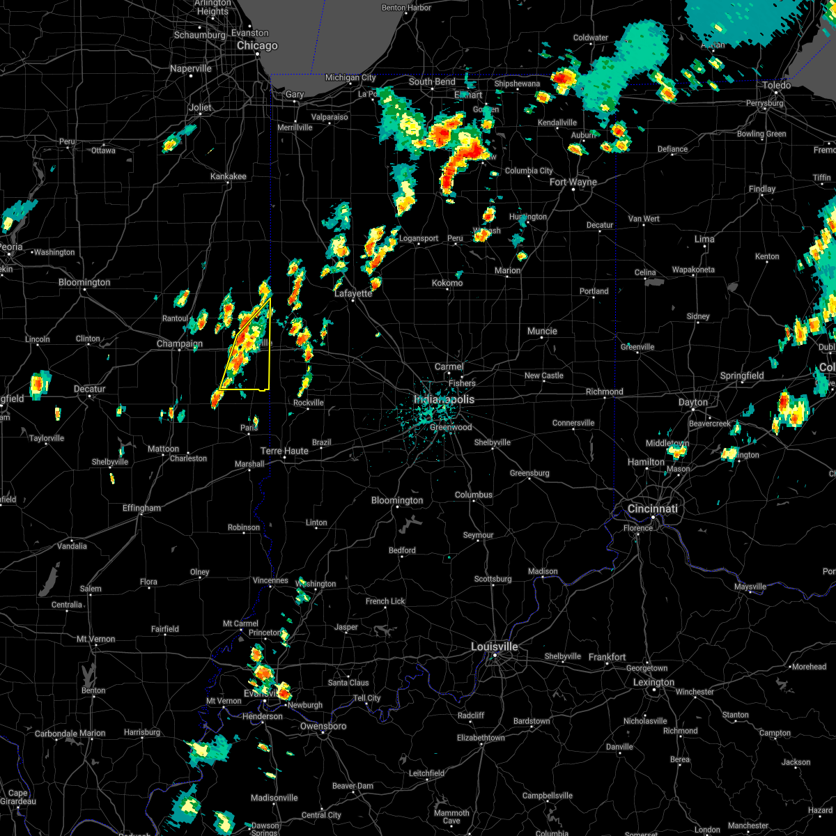 At 217 pm cdt, a severe thunderstorm was located near catlin, or 10 miles southwest of danville, moving northeast at 20 mph (radar indicated). Hazards include 60 mph wind gusts. Expect damage to roofs, siding, and trees. locations impacted include, georgetown, catlin, oakwood, westville, belgium, danville and tilton. This includes interstate 74 between mile markers 204 and 219. At 217 pm cdt, a severe thunderstorm was located near catlin, or 10 miles southwest of danville, moving northeast at 20 mph (radar indicated). Hazards include 60 mph wind gusts. Expect damage to roofs, siding, and trees. locations impacted include, georgetown, catlin, oakwood, westville, belgium, danville and tilton. This includes interstate 74 between mile markers 204 and 219.
|
| 6/29/2021 1:58 PM CDT |
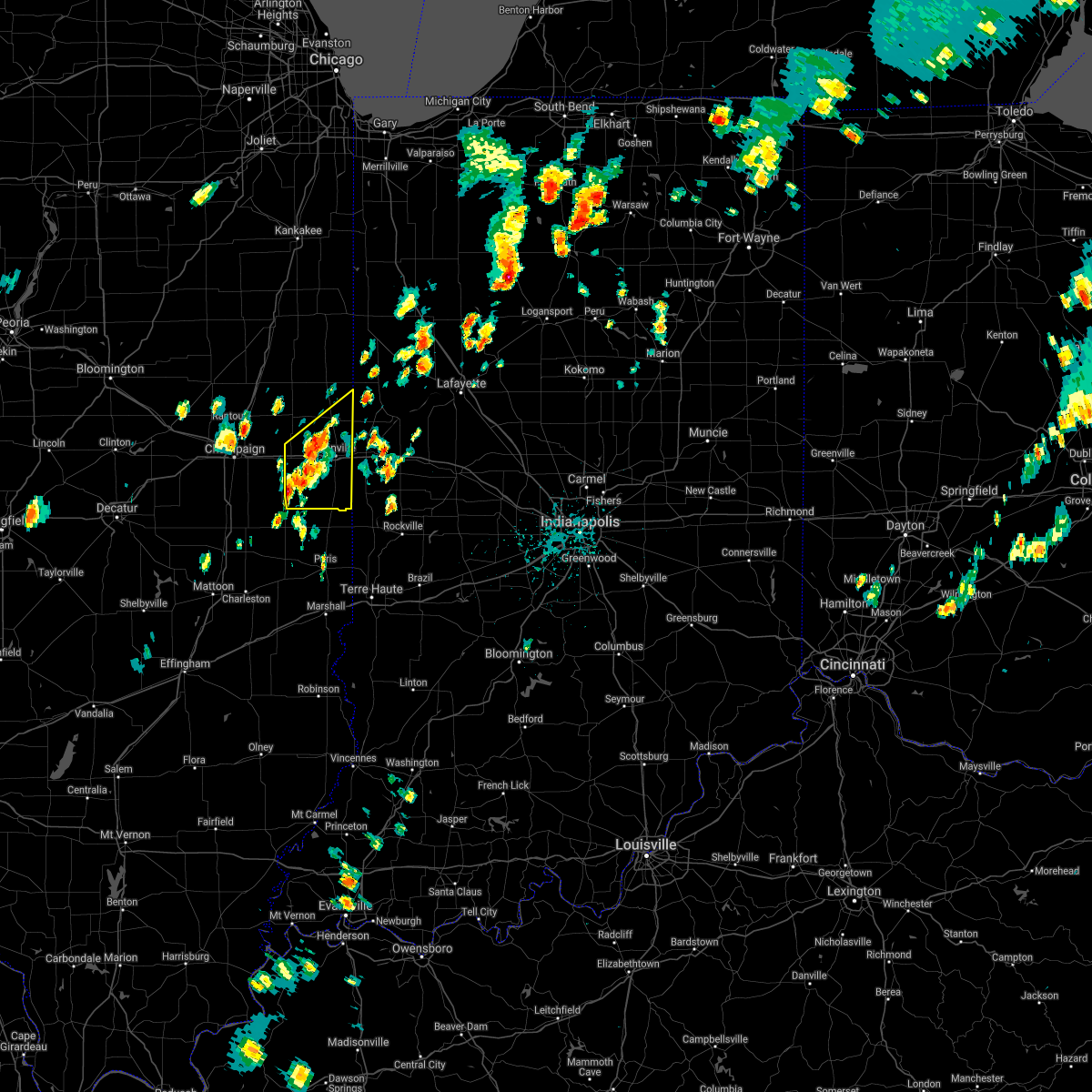 The national weather service in lincoln has issued a * severe thunderstorm warning for. vermilion county in east central illinois. until 245 pm cdt. At 158 pm cdt, a severe thunderstorm was located near allerton, or 18 miles southwest of danville, moving northeast at 20 mph. The national weather service in lincoln has issued a * severe thunderstorm warning for. vermilion county in east central illinois. until 245 pm cdt. At 158 pm cdt, a severe thunderstorm was located near allerton, or 18 miles southwest of danville, moving northeast at 20 mph.
|
| 6/26/2021 7:11 PM CDT |
 At 711 pm cdt, severe thunderstorms were located along a line extending from near hoopeston to near catlin to near newman to near arcola, moving east at 40 mph (radar indicated). Hazards include 60 mph wind gusts and penny size hail. Expect damage to roofs, siding, and trees. locations impacted include, danville, hoopeston, georgetown, westville, arcola, tilton, catlin, oakwood, chrisman, rossville, ridge farm, newman, fairmount, sidell, belgium, hume, brocton, hindsboro, allerton and edgar. this includes the following highways, interstate 57 between mile markers 202 and 203. Interstate 74 between mile markers 205 and 220. At 711 pm cdt, severe thunderstorms were located along a line extending from near hoopeston to near catlin to near newman to near arcola, moving east at 40 mph (radar indicated). Hazards include 60 mph wind gusts and penny size hail. Expect damage to roofs, siding, and trees. locations impacted include, danville, hoopeston, georgetown, westville, arcola, tilton, catlin, oakwood, chrisman, rossville, ridge farm, newman, fairmount, sidell, belgium, hume, brocton, hindsboro, allerton and edgar. this includes the following highways, interstate 57 between mile markers 202 and 203. Interstate 74 between mile markers 205 and 220.
|
| 6/26/2021 6:52 PM CDT |
 At 652 pm cdt, severe thunderstorms were located along a line extending from rossville to near homer to hindsboro, moving northeast at 35 mph (radar indicated). Hazards include 60 mph wind gusts and penny size hail. Expect damage to roofs, siding, and trees. locations impacted include, hoopeston, rossville, sidell, fairmount, fithian, muncie, newman, oakwood, brocton, catlin, westville, belgium, hume, danville and tilton. this includes the following highways, interstate 57 between mile markers 202 and 205. Interstate 74 between mile markers 197 and 220. At 652 pm cdt, severe thunderstorms were located along a line extending from rossville to near homer to hindsboro, moving northeast at 35 mph (radar indicated). Hazards include 60 mph wind gusts and penny size hail. Expect damage to roofs, siding, and trees. locations impacted include, hoopeston, rossville, sidell, fairmount, fithian, muncie, newman, oakwood, brocton, catlin, westville, belgium, hume, danville and tilton. this includes the following highways, interstate 57 between mile markers 202 and 205. Interstate 74 between mile markers 197 and 220.
|
| 6/26/2021 6:24 PM CDT |
 At 623 pm cdt, severe thunderstorms were located along a line extending from 7 miles north of ogden to near pesotum to near humboldt, moving northeast at 35 mph (radar indicated). Hazards include 60 mph wind gusts and penny size hail. Expect damage to roofs, siding, and trees. severe thunderstorms will be near, tuscola, sidney, potomac and broadlands around 640 pm cdt. other locations in the path of these severe thunderstorms include hindsboro, rossville, homer, camargo, ogden, newman, fairmount, fithian, brocton, muncie, catlin, oakwood, hume, westville, belgium and allerton. this includes the following highways, interstate 57 between mile markers 202 and 218. Interstate 74 between mile markers 190 and 220. At 623 pm cdt, severe thunderstorms were located along a line extending from 7 miles north of ogden to near pesotum to near humboldt, moving northeast at 35 mph (radar indicated). Hazards include 60 mph wind gusts and penny size hail. Expect damage to roofs, siding, and trees. severe thunderstorms will be near, tuscola, sidney, potomac and broadlands around 640 pm cdt. other locations in the path of these severe thunderstorms include hindsboro, rossville, homer, camargo, ogden, newman, fairmount, fithian, brocton, muncie, catlin, oakwood, hume, westville, belgium and allerton. this includes the following highways, interstate 57 between mile markers 202 and 218. Interstate 74 between mile markers 190 and 220.
|
| 6/20/2021 10:39 PM CDT |
 The severe thunderstorm warning for northern mcdonough county will expire at 1045 pm cdt, the storm which prompted the warning has moved out of the area. therefore, the warning will be allowed to expire. however gusty winds are still possible with this thunderstorm. a severe thunderstorm watch remains in effect until 100 am cdt for west central illinois. The severe thunderstorm warning for northern mcdonough county will expire at 1045 pm cdt, the storm which prompted the warning has moved out of the area. therefore, the warning will be allowed to expire. however gusty winds are still possible with this thunderstorm. a severe thunderstorm watch remains in effect until 100 am cdt for west central illinois.
|
| 6/20/2021 10:23 PM CDT |
 At 1023 pm cdt, a severe thunderstorm was located over good hope, or near macomb, moving east at 55 mph (radar indicated). Hazards include 60 mph wind gusts and nickel size hail. Expect damage to roofs, siding, and trees. this severe thunderstorm will be near, bushnell and adair around 1030 pm cdt. Prairie city and new philadelphia around 1035 pm cdt. At 1023 pm cdt, a severe thunderstorm was located over good hope, or near macomb, moving east at 55 mph (radar indicated). Hazards include 60 mph wind gusts and nickel size hail. Expect damage to roofs, siding, and trees. this severe thunderstorm will be near, bushnell and adair around 1030 pm cdt. Prairie city and new philadelphia around 1035 pm cdt.
|
| 11/10/2020 2:11 PM CST |
 At 211 pm cst, severe thunderstorms were located along a line extending from viola to near industry, moving east at 50 mph (radar indicated). Hazards include 60 mph wind gusts and nickel size hail. expect damage to roofs, siding, and trees At 211 pm cst, severe thunderstorms were located along a line extending from viola to near industry, moving east at 50 mph (radar indicated). Hazards include 60 mph wind gusts and nickel size hail. expect damage to roofs, siding, and trees
|
| 11/10/2020 1:58 PM CST |
 At 158 pm cst, severe thunderstorms were located along a line extending from near raritan to near sciota to near augusta, moving northeast at 45 mph (radar indicated). Hazards include 60 mph wind gusts and penny size hail. Expect damage to roofs, siding, and trees. Locations impacted include, macomb, bushnell, colchester, la harpe, blandinsville, augusta, industry, good hope, prairie city, bardolph, tennessee, sciota, western illinois university, fandon, new philadelphia, colmar, adair, walnut grove, plymouth and fountain green. At 158 pm cst, severe thunderstorms were located along a line extending from near raritan to near sciota to near augusta, moving northeast at 45 mph (radar indicated). Hazards include 60 mph wind gusts and penny size hail. Expect damage to roofs, siding, and trees. Locations impacted include, macomb, bushnell, colchester, la harpe, blandinsville, augusta, industry, good hope, prairie city, bardolph, tennessee, sciota, western illinois university, fandon, new philadelphia, colmar, adair, walnut grove, plymouth and fountain green.
|
| 11/10/2020 1:44 PM CST |
 At 144 pm cst, severe thunderstorms were located along a line extending from near disco to 7 miles east of burnside to near bowen, moving northeast at 55 mph (radar indicated). Hazards include 60 mph wind gusts and penny size hail. Expect damage to roofs, siding, and trees. Locations impacted include, macomb, carthage, bushnell, colchester, la harpe, dallas city, blandinsville, augusta, bowen, industry, good hope, prairie city, bardolph, west point, ferris, tennessee, sciota, colusa, western illinois university and adrian. At 144 pm cst, severe thunderstorms were located along a line extending from near disco to 7 miles east of burnside to near bowen, moving northeast at 55 mph (radar indicated). Hazards include 60 mph wind gusts and penny size hail. Expect damage to roofs, siding, and trees. Locations impacted include, macomb, carthage, bushnell, colchester, la harpe, dallas city, blandinsville, augusta, bowen, industry, good hope, prairie city, bardolph, west point, ferris, tennessee, sciota, colusa, western illinois university and adrian.
|
| 11/10/2020 1:33 PM CST |
 At 132 pm cst, severe thunderstorms were located along a line extending from near dallas city to near ferris to near west point, moving northeast at 55 mph (radar indicated). Hazards include 60 mph wind gusts and quarter size hail. Hail damage to vehicles is expected. expect wind damage to roofs, siding, and trees. Locations impacted include, macomb, carthage, bushnell, colchester, la harpe, dallas city, blandinsville, augusta, bowen, industry, good hope, prairie city, bardolph, west point, ferris, tennessee, sciota, colusa, western illinois university and adrian. At 132 pm cst, severe thunderstorms were located along a line extending from near dallas city to near ferris to near west point, moving northeast at 55 mph (radar indicated). Hazards include 60 mph wind gusts and quarter size hail. Hail damage to vehicles is expected. expect wind damage to roofs, siding, and trees. Locations impacted include, macomb, carthage, bushnell, colchester, la harpe, dallas city, blandinsville, augusta, bowen, industry, good hope, prairie city, bardolph, west point, ferris, tennessee, sciota, colusa, western illinois university and adrian.
|
| 11/10/2020 1:29 PM CST |
 At 129 pm cst, severe thunderstorms were located along a line extending from dallas city to adrian to near west point, moving east at 45 mph (radar indicated). Hazards include 60 mph wind gusts and quarter size hail. Hail damage to vehicles is expected. Expect wind damage to roofs, siding, and trees. At 129 pm cst, severe thunderstorms were located along a line extending from dallas city to adrian to near west point, moving east at 45 mph (radar indicated). Hazards include 60 mph wind gusts and quarter size hail. Hail damage to vehicles is expected. Expect wind damage to roofs, siding, and trees.
|
| 8/10/2020 5:02 PM CDT |
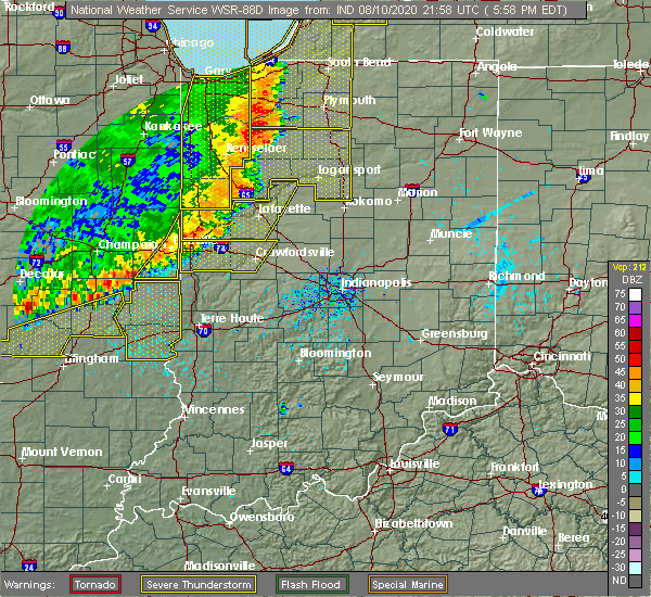 At 502 pm cdt, severe thunderstorms were located along a line extending from near covington to near sidell, moving east at 40 mph (emergency management reported numerous trees down in danville at 450 pm). Hazards include 70 mph wind gusts. Expect considerable tree damage. damage is likely to mobile homes, roofs, and outbuildings. Locations impacted include, georgetown, ridge farm, sidell and indianola. At 502 pm cdt, severe thunderstorms were located along a line extending from near covington to near sidell, moving east at 40 mph (emergency management reported numerous trees down in danville at 450 pm). Hazards include 70 mph wind gusts. Expect considerable tree damage. damage is likely to mobile homes, roofs, and outbuildings. Locations impacted include, georgetown, ridge farm, sidell and indianola.
|
| 8/10/2020 4:49 PM CDT |
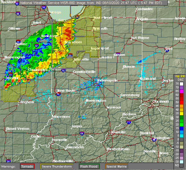 At 448 pm cdt, severe thunderstorms were located along a line extending from 7 miles northeast of danville to near allerton, moving east at 40 mph (emergency management). Hazards include 70 mph wind gusts. Expect considerable tree damage. Damage is likely to mobile homes, roofs, and outbuildings. At 448 pm cdt, severe thunderstorms were located along a line extending from 7 miles northeast of danville to near allerton, moving east at 40 mph (emergency management). Hazards include 70 mph wind gusts. Expect considerable tree damage. Damage is likely to mobile homes, roofs, and outbuildings.
|
| 8/10/2020 2:23 PM CDT |
 At 223 pm cdt, severe thunderstorms were located along a line extending from 6 miles southeast of avon to near adair, moving east at 45 mph (trained weather spotters). Hazards include 60 mph wind gusts. Expect damage to roofs, siding, and trees. Locations impacted include, macomb, bushnell, colchester, blandinsville, industry, good hope, bardolph, tennessee, sciota, western illinois university, adair, fandon, new philadelphia, pennington point, macomb municipal airport, scottsburg, spring lake, mcdonough county 4-h grounds and argyle lake state park. At 223 pm cdt, severe thunderstorms were located along a line extending from 6 miles southeast of avon to near adair, moving east at 45 mph (trained weather spotters). Hazards include 60 mph wind gusts. Expect damage to roofs, siding, and trees. Locations impacted include, macomb, bushnell, colchester, blandinsville, industry, good hope, bardolph, tennessee, sciota, western illinois university, adair, fandon, new philadelphia, pennington point, macomb municipal airport, scottsburg, spring lake, mcdonough county 4-h grounds and argyle lake state park.
|
| 8/10/2020 1:41 PM CDT |
 The national weather service in the quad cities has issued a * severe thunderstorm warning for. northeastern hancock county in west central illinois. mcdonough county in west central illinois. until 230 pm cdt. At 141 pm cdt, severe thunderstorms were located along a line. The national weather service in the quad cities has issued a * severe thunderstorm warning for. northeastern hancock county in west central illinois. mcdonough county in west central illinois. until 230 pm cdt. At 141 pm cdt, severe thunderstorms were located along a line.
|
| 7/11/2020 10:37 PM CDT |
 At 1036 pm cdt, severe thunderstorms were located along a line extending from 8 miles northeast of danville to near newman to near shelbyville, moving southeast at 50 mph (radar indicated). Hazards include 60 mph wind gusts and quarter size hail. Hail damage to vehicles is expected. expect wind damage to roofs, siding, and trees. locations impacted include, danville, mattoon, paris, shelbyville, tuscola, sullivan, hoopeston, georgetown, westville, arcola, tilton, villa grove, arthur, catlin, oakwood, bethany, chrisman, rossville, homer and ridge farm. this includes the following highways, interstate 57 between mile markers 192 and 217. Interstate 74 between mile markers 200 and 220. At 1036 pm cdt, severe thunderstorms were located along a line extending from 8 miles northeast of danville to near newman to near shelbyville, moving southeast at 50 mph (radar indicated). Hazards include 60 mph wind gusts and quarter size hail. Hail damage to vehicles is expected. expect wind damage to roofs, siding, and trees. locations impacted include, danville, mattoon, paris, shelbyville, tuscola, sullivan, hoopeston, georgetown, westville, arcola, tilton, villa grove, arthur, catlin, oakwood, bethany, chrisman, rossville, homer and ridge farm. this includes the following highways, interstate 57 between mile markers 192 and 217. Interstate 74 between mile markers 200 and 220.
|
| 7/11/2020 10:11 PM CDT |
 At 1010 pm cdt, severe thunderstorms were located along a line extending from near rankin to pesotum to dalton city, moving southeast at 50 mph (radar indicated). Hazards include 60 mph wind gusts and quarter size hail. Hail damage to vehicles is expected. Expect wind damage to roofs, siding, and trees. At 1010 pm cdt, severe thunderstorms were located along a line extending from near rankin to pesotum to dalton city, moving southeast at 50 mph (radar indicated). Hazards include 60 mph wind gusts and quarter size hail. Hail damage to vehicles is expected. Expect wind damage to roofs, siding, and trees.
|
| 4/8/2020 6:51 PM CDT |
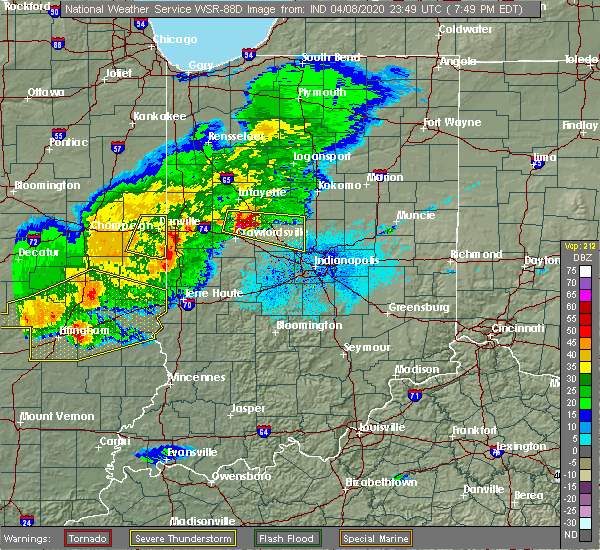 The severe thunderstorm warning for southern vermilion county will expire at 700 pm cdt, the storm which prompted the warning has moved out of the area. therefore, the warning will be allowed to expire. a severe thunderstorm watch remains in effect until 900 pm cdt for east central illinois. The severe thunderstorm warning for southern vermilion county will expire at 700 pm cdt, the storm which prompted the warning has moved out of the area. therefore, the warning will be allowed to expire. a severe thunderstorm watch remains in effect until 900 pm cdt for east central illinois.
|
| 4/8/2020 6:38 PM CDT |
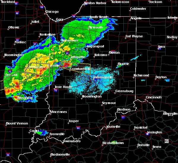 At 637 pm cdt, a severe thunderstorm was located near danville, moving east at 55 mph (radar indicated). Hazards include 60 mph wind gusts and quarter size hail. Hail damage to vehicles is expected. expect wind damage to roofs, siding, and trees. locations impacted include, danville, georgetown, westville, tilton, catlin, oakwood, ridge farm, fairmount, sidell, belgium, bismarck, indianola, jamaica, vermilion county airport and kickapoo state park. This includes interstate 74 between mile markers 204 and 220. At 637 pm cdt, a severe thunderstorm was located near danville, moving east at 55 mph (radar indicated). Hazards include 60 mph wind gusts and quarter size hail. Hail damage to vehicles is expected. expect wind damage to roofs, siding, and trees. locations impacted include, danville, georgetown, westville, tilton, catlin, oakwood, ridge farm, fairmount, sidell, belgium, bismarck, indianola, jamaica, vermilion county airport and kickapoo state park. This includes interstate 74 between mile markers 204 and 220.
|
| 4/8/2020 6:08 PM CDT |
 At 608 pm cdt, a severe thunderstorm was located near st. joseph, or 9 miles southeast of rantoul, moving east at 55 mph (radar indicated). Hazards include 60 mph wind gusts and quarter size hail. Hail damage to vehicles is expected. Expect wind damage to roofs, siding, and trees. At 608 pm cdt, a severe thunderstorm was located near st. joseph, or 9 miles southeast of rantoul, moving east at 55 mph (radar indicated). Hazards include 60 mph wind gusts and quarter size hail. Hail damage to vehicles is expected. Expect wind damage to roofs, siding, and trees.
|
| 4/8/2020 4:05 PM CDT |
 At 404 pm cdt, a severe thunderstorm was located over western illinois university, or over macomb, moving east at 40 mph. this is a very dangerous storm (radar indicated). Hazards include baseball size hail and 60 mph wind gusts. People and animals outdoors will be severely injured. expect shattered windows, extensive damage to roofs, siding, and vehicles. Locations impacted include, macomb, bushnell, colchester, industry, good hope, bardolph, tennessee, sciota, western illinois university, adair, fandon, new philadelphia, pennington point, macomb municipal airport, scottsburg, spring lake, mcdonough county 4-h grounds and argyle lake state park. At 404 pm cdt, a severe thunderstorm was located over western illinois university, or over macomb, moving east at 40 mph. this is a very dangerous storm (radar indicated). Hazards include baseball size hail and 60 mph wind gusts. People and animals outdoors will be severely injured. expect shattered windows, extensive damage to roofs, siding, and vehicles. Locations impacted include, macomb, bushnell, colchester, industry, good hope, bardolph, tennessee, sciota, western illinois university, adair, fandon, new philadelphia, pennington point, macomb municipal airport, scottsburg, spring lake, mcdonough county 4-h grounds and argyle lake state park.
|
| 4/8/2020 3:50 PM CDT |
 At 350 pm cdt, a severe thunderstorm was located near blandinsville, or 12 miles west of macomb, moving east at 45 mph (radar indicated). Hazards include golf ball size hail and 60 mph wind gusts. People and animals outdoors will be injured. expect hail damage to roofs, siding, windows, and vehicles. Expect wind damage to roofs, siding, and trees. At 350 pm cdt, a severe thunderstorm was located near blandinsville, or 12 miles west of macomb, moving east at 45 mph (radar indicated). Hazards include golf ball size hail and 60 mph wind gusts. People and animals outdoors will be injured. expect hail damage to roofs, siding, windows, and vehicles. Expect wind damage to roofs, siding, and trees.
|
| 3/28/2020 1:32 PM CDT |
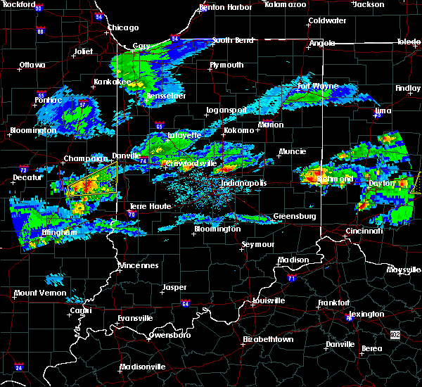 At 132 pm cdt, a severe thunderstorm was located over hume, or 17 miles northwest of paris, moving east at 40 mph (radar indicated). Hazards include quarter size hail. Damage to vehicles is expected. Locations impacted include, georgetown, chrisman, ridge farm, sidell, hume, brocton, edgar, indianola, metcalf, palermo and scottland. At 132 pm cdt, a severe thunderstorm was located over hume, or 17 miles northwest of paris, moving east at 40 mph (radar indicated). Hazards include quarter size hail. Damage to vehicles is expected. Locations impacted include, georgetown, chrisman, ridge farm, sidell, hume, brocton, edgar, indianola, metcalf, palermo and scottland.
|
| 3/28/2020 1:16 PM CDT |
 At 115 pm cdt, a severe thunderstorm was located near camargo, or 9 miles east of tuscola, moving east at 30 mph (radar indicated). Hazards include half dollar size hail. Damage to vehicles is expected. locations impacted include, danville, georgetown, westville, tilton, chrisman, ridge farm, newman, sidell, camargo, belgium, hume, broadlands, brocton, hindsboro, allerton, edgar, indianola, murdock, jamaica and metcalf. This includes interstate 74 between mile markers 218 and 220. At 115 pm cdt, a severe thunderstorm was located near camargo, or 9 miles east of tuscola, moving east at 30 mph (radar indicated). Hazards include half dollar size hail. Damage to vehicles is expected. locations impacted include, danville, georgetown, westville, tilton, chrisman, ridge farm, newman, sidell, camargo, belgium, hume, broadlands, brocton, hindsboro, allerton, edgar, indianola, murdock, jamaica and metcalf. This includes interstate 74 between mile markers 218 and 220.
|
| 3/28/2020 12:59 PM CDT |
 The national weather service in lincoln has issued a * severe thunderstorm warning for. northern edgar county in east central illinois. southern vermilion county in east central illinois. southeastern champaign county in east central illinois. Douglas county in east central illinois. The national weather service in lincoln has issued a * severe thunderstorm warning for. northern edgar county in east central illinois. southern vermilion county in east central illinois. southeastern champaign county in east central illinois. Douglas county in east central illinois.
|
| 11/26/2019 11:23 PM CST |
 The severe thunderstorm warning for central mcdonough county will expire at 1130 pm cst, the storm which prompted the warning has moved out of the area. therefore, the warning will be allowed to expire. however heavy rain is still possible with this thunderstorm. to report severe weather, contact your nearest law enforcement agency. they will relay your report to the national weather service the quad cities. The severe thunderstorm warning for central mcdonough county will expire at 1130 pm cst, the storm which prompted the warning has moved out of the area. therefore, the warning will be allowed to expire. however heavy rain is still possible with this thunderstorm. to report severe weather, contact your nearest law enforcement agency. they will relay your report to the national weather service the quad cities.
|
| 11/26/2019 11:18 PM CST |
 At 1118 pm cst, a severe thunderstorm was located near good hope, or near macomb, moving northeast at 40 mph (radar indicated). Hazards include 60 mph wind gusts. Expect damage to roofs, siding, and trees. Locations impacted include, macomb, colchester, industry, good hope, bardolph, sciota, western illinois university, fandon, macomb municipal airport, doddsville, scottsburg, spring lake, mcdonough county 4-h grounds and argyle lake state park. At 1118 pm cst, a severe thunderstorm was located near good hope, or near macomb, moving northeast at 40 mph (radar indicated). Hazards include 60 mph wind gusts. Expect damage to roofs, siding, and trees. Locations impacted include, macomb, colchester, industry, good hope, bardolph, sciota, western illinois university, fandon, macomb municipal airport, doddsville, scottsburg, spring lake, mcdonough county 4-h grounds and argyle lake state park.
|
| 11/26/2019 10:56 PM CST |
 At 1056 pm cst, a severe thunderstorm was located over tennessee, or 10 miles west of macomb, moving northeast at 40 mph (radar indicated). Hazards include 60 mph wind gusts. Expect damage to roofs, siding, and trees. Locations impacted include, macomb, colchester, la harpe, blandinsville, augusta, bowen, industry, good hope, bardolph, tennessee, sciota, western illinois university, fandon, colmar, disco, plymouth, denver, fountain green, bentley and macomb municipal airport. At 1056 pm cst, a severe thunderstorm was located over tennessee, or 10 miles west of macomb, moving northeast at 40 mph (radar indicated). Hazards include 60 mph wind gusts. Expect damage to roofs, siding, and trees. Locations impacted include, macomb, colchester, la harpe, blandinsville, augusta, bowen, industry, good hope, bardolph, tennessee, sciota, western illinois university, fandon, colmar, disco, plymouth, denver, fountain green, bentley and macomb municipal airport.
|
| 11/26/2019 10:45 PM CST |
 At 1045 pm cst, a severe thunderstorm was located near colmar, or 8 miles southeast of carthage, moving northeast at 35 mph (radar indicated). Hazards include 60 mph wind gusts. expect damage to roofs, siding, and trees At 1045 pm cst, a severe thunderstorm was located near colmar, or 8 miles southeast of carthage, moving northeast at 35 mph (radar indicated). Hazards include 60 mph wind gusts. expect damage to roofs, siding, and trees
|
| 9/27/2019 7:44 PM CDT |
 At 743 pm cdt, severe thunderstorms were located along a line extending from near prairie city to near macomb to near west point, moving east at 50 mph (radar indicated). Hazards include 60 mph wind gusts and quarter size hail. Hail damage to vehicles is expected. expect wind damage to roofs, siding, and trees. Locations impacted include, macomb, carthage, bushnell, colchester, blandinsville, augusta, bowen, industry, good hope, prairie city, bardolph, west point, ferris, tennessee, sciota, western illinois university, fandon, little swan lake, new philadelphia and burnside. At 743 pm cdt, severe thunderstorms were located along a line extending from near prairie city to near macomb to near west point, moving east at 50 mph (radar indicated). Hazards include 60 mph wind gusts and quarter size hail. Hail damage to vehicles is expected. expect wind damage to roofs, siding, and trees. Locations impacted include, macomb, carthage, bushnell, colchester, blandinsville, augusta, bowen, industry, good hope, prairie city, bardolph, west point, ferris, tennessee, sciota, western illinois university, fandon, little swan lake, new philadelphia and burnside.
|
| 9/27/2019 7:34 PM CDT |
 At 734 pm cdt, severe thunderstorms were located along a line extending from near raritan to tennessee to near west point, moving east at 30 mph (radar indicated). Hazards include 60 mph wind gusts and quarter size hail. Hail damage to vehicles is expected. expect wind damage to roofs, siding, and trees. Locations impacted include, macomb, carthage, bushnell, colchester, la harpe, blandinsville, augusta, bowen, industry, good hope, prairie city, bardolph, west point, ferris, tennessee, sciota, western illinois university, fandon, little swan lake and new philadelphia. At 734 pm cdt, severe thunderstorms were located along a line extending from near raritan to tennessee to near west point, moving east at 30 mph (radar indicated). Hazards include 60 mph wind gusts and quarter size hail. Hail damage to vehicles is expected. expect wind damage to roofs, siding, and trees. Locations impacted include, macomb, carthage, bushnell, colchester, la harpe, blandinsville, augusta, bowen, industry, good hope, prairie city, bardolph, west point, ferris, tennessee, sciota, western illinois university, fandon, little swan lake and new philadelphia.
|
| 9/27/2019 7:24 PM CDT |
 At 724 pm cdt, severe thunderstorms were located along a line extending from near la harpe to near colmar to 8 miles north of mendon, moving east at 35 mph (radar indicated). Hazards include 60 mph wind gusts and nickel size hail. expect damage to roofs, siding, and trees At 724 pm cdt, severe thunderstorms were located along a line extending from near la harpe to near colmar to 8 miles north of mendon, moving east at 35 mph (radar indicated). Hazards include 60 mph wind gusts and nickel size hail. expect damage to roofs, siding, and trees
|
| 8/20/2019 12:11 PM CDT |
 At 1135 am cdt, severe thunderstorms were located along a line extending from near rankin to near fairmount to oakland, moving east at 45 mph (radar indicated). Hazards include 60 mph wind gusts and quarter size hail. Hail damage to vehicles is expected. Expect wind damage to roofs, siding, and trees. At 1135 am cdt, severe thunderstorms were located along a line extending from near rankin to near fairmount to oakland, moving east at 45 mph (radar indicated). Hazards include 60 mph wind gusts and quarter size hail. Hail damage to vehicles is expected. Expect wind damage to roofs, siding, and trees.
|
| 8/20/2019 11:35 AM CDT |
 The national weather service in lincoln has issued a * severe thunderstorm warning for. edgar county in east central illinois. vermilion county in east central illinois. until 1215 pm cdt. At 1135 am cdt, severe thunderstorms were located along a line. The national weather service in lincoln has issued a * severe thunderstorm warning for. edgar county in east central illinois. vermilion county in east central illinois. until 1215 pm cdt. At 1135 am cdt, severe thunderstorms were located along a line.
|
| 8/20/2019 8:58 AM CDT |
 The severe thunderstorm warning for northeastern hancock, southeastern henderson, southern warren and mcdonough counties will expire at 900 am cdt, the severe winds along the leading edge of the storms is moving out of the warned area. therefore, the warning will be allowed to expire. however gusty winds and torrential rain will persist over the next hour as the thunderstorms continuing moving across the area. a severe thunderstorm watch remains in effect until 300 pm cdt for west central illinois. The severe thunderstorm warning for northeastern hancock, southeastern henderson, southern warren and mcdonough counties will expire at 900 am cdt, the severe winds along the leading edge of the storms is moving out of the warned area. therefore, the warning will be allowed to expire. however gusty winds and torrential rain will persist over the next hour as the thunderstorms continuing moving across the area. a severe thunderstorm watch remains in effect until 300 pm cdt for west central illinois.
|
| 8/20/2019 8:46 AM CDT |
 At 757 am cdt, severe thunderstorms were located along a line extending from near oquawka to near niota to near st. francisville, moving east at 55 mph (radar indicated). Hazards include 60 mph wind gusts. expect damage to roofs, siding, and trees At 757 am cdt, severe thunderstorms were located along a line extending from near oquawka to near niota to near st. francisville, moving east at 55 mph (radar indicated). Hazards include 60 mph wind gusts. expect damage to roofs, siding, and trees
|
| 8/20/2019 8:28 AM CDT |
 At 828 am cdt, severe thunderstorms were located along a line extending from near monmouth to blandinsville to near carthage, moving east at 55 mph (radar indicated). Hazards include 60 mph wind gusts. Expect damage to roofs, siding, and trees. Locations impacted include, macomb, keokuk, carthage, bushnell, hamilton, colchester, la harpe, roseville, dallas city, stronghurst, avon, kirkwood, blandinsville, industry, good hope, prairie city, carman, biggsville, gladstone and terre haute. At 828 am cdt, severe thunderstorms were located along a line extending from near monmouth to blandinsville to near carthage, moving east at 55 mph (radar indicated). Hazards include 60 mph wind gusts. Expect damage to roofs, siding, and trees. Locations impacted include, macomb, keokuk, carthage, bushnell, hamilton, colchester, la harpe, roseville, dallas city, stronghurst, avon, kirkwood, blandinsville, industry, good hope, prairie city, carman, biggsville, gladstone and terre haute.
|
| 8/20/2019 8:16 AM CDT |
 At 757 am cdt, severe thunderstorms were located along a line extending from near oquawka to near niota to near st. francisville, moving east at 55 mph (radar indicated). Hazards include 60 mph wind gusts. expect damage to roofs, siding, and trees At 757 am cdt, severe thunderstorms were located along a line extending from near oquawka to near niota to near st. francisville, moving east at 55 mph (radar indicated). Hazards include 60 mph wind gusts. expect damage to roofs, siding, and trees
|
| 8/20/2019 8:16 AM CDT |
 At 816 am cdt, severe thunderstorms were located along a line extending from near kirkwood to disco to hamilton, moving east southeast at 55 mph (radar indicated). Hazards include 60 mph wind gusts. Expect damage to roofs, siding, and trees. Locations impacted include, burlington, macomb, fort madison, keokuk, carthage, nauvoo, bushnell, west burlington, hamilton, colchester, la harpe, roseville, dallas city, montrose, stronghurst, avon, kirkwood, blandinsville, industry and good hope. At 816 am cdt, severe thunderstorms were located along a line extending from near kirkwood to disco to hamilton, moving east southeast at 55 mph (radar indicated). Hazards include 60 mph wind gusts. Expect damage to roofs, siding, and trees. Locations impacted include, burlington, macomb, fort madison, keokuk, carthage, nauvoo, bushnell, west burlington, hamilton, colchester, la harpe, roseville, dallas city, montrose, stronghurst, avon, kirkwood, blandinsville, industry and good hope.
|
| 8/20/2019 8:08 AM CDT |
 At 757 am cdt, severe thunderstorms were located along a line extending from near oquawka to near niota to near st. francisville, moving east at 55 mph (radar indicated). Hazards include 60 mph wind gusts. expect damage to roofs, siding, and trees At 757 am cdt, severe thunderstorms were located along a line extending from near oquawka to near niota to near st. francisville, moving east at 55 mph (radar indicated). Hazards include 60 mph wind gusts. expect damage to roofs, siding, and trees
|
| 8/20/2019 7:58 AM CDT |
 The national weather service in the quad cities has issued a * severe thunderstorm warning for. hancock county in west central illinois. henderson county in west central illinois. warren county in west central illinois. Mcdonough county in west central illinois. The national weather service in the quad cities has issued a * severe thunderstorm warning for. hancock county in west central illinois. henderson county in west central illinois. warren county in west central illinois. Mcdonough county in west central illinois.
|
| 8/18/2019 4:34 PM CDT |
 At 434 pm cdt, severe thunderstorms were located along a line extending from near danville to near georgetown, moving east at 30 mph (radar indicated). Hazards include 60 mph wind gusts and half dollar size hail. Hail damage to vehicles is expected. expect wind damage to roofs, siding, and trees. locations impacted include, danville, georgetown, westville, tilton, catlin, oakwood, ridge farm, fairmount, sidell, belgium, allerton, muncie, bismarck, indianola, jamaica, vermilion county airport and kickapoo state park. This includes interstate 74 between mile markers 204 and 220. At 434 pm cdt, severe thunderstorms were located along a line extending from near danville to near georgetown, moving east at 30 mph (radar indicated). Hazards include 60 mph wind gusts and half dollar size hail. Hail damage to vehicles is expected. expect wind damage to roofs, siding, and trees. locations impacted include, danville, georgetown, westville, tilton, catlin, oakwood, ridge farm, fairmount, sidell, belgium, allerton, muncie, bismarck, indianola, jamaica, vermilion county airport and kickapoo state park. This includes interstate 74 between mile markers 204 and 220.
|
| 8/18/2019 4:25 PM CDT | Quarter sized hail reported 166.2 miles W of Georgetown, IL, 1 inch diamter hail from tilton to georgetown |
| 8/18/2019 4:21 PM CDT | Wind gusts of 60 mph and higher measured in georgetown in vermilion county IL, 166.2 miles W of Georgetown, IL |
| 8/18/2019 4:15 PM CDT |
 At 414 pm cdt, severe thunderstorms were located along a line extending from near oakwood to near georgetown, moving east at 30 mph (radar indicated). Hazards include 60 mph wind gusts and half dollar size hail. Hail damage to vehicles is expected. expect wind damage to roofs, siding, and trees. locations impacted include, danville, georgetown, westville, tilton, catlin, oakwood, homer, ridge farm, fairmount, sidell, fithian, belgium, broadlands, allerton, muncie, bismarck, indianola, jamaica, vermilion county airport and kickapoo state park. This includes interstate 74 between mile markers 200 and 220. At 414 pm cdt, severe thunderstorms were located along a line extending from near oakwood to near georgetown, moving east at 30 mph (radar indicated). Hazards include 60 mph wind gusts and half dollar size hail. Hail damage to vehicles is expected. expect wind damage to roofs, siding, and trees. locations impacted include, danville, georgetown, westville, tilton, catlin, oakwood, homer, ridge farm, fairmount, sidell, fithian, belgium, broadlands, allerton, muncie, bismarck, indianola, jamaica, vermilion county airport and kickapoo state park. This includes interstate 74 between mile markers 200 and 220.
|
| 8/18/2019 3:47 PM CDT |
 The national weather service in lincoln has issued a * severe thunderstorm warning for. southern vermilion county in east central illinois. southeastern champaign county in east central illinois. until 445 pm cdt. At 347 pm cdt, severe thunderstorms were located along a line. The national weather service in lincoln has issued a * severe thunderstorm warning for. southern vermilion county in east central illinois. southeastern champaign county in east central illinois. until 445 pm cdt. At 347 pm cdt, severe thunderstorms were located along a line.
|
| 7/17/2019 5:11 PM CDT |
 At 455 pm cdt, severe thunderstorms were located along a line extending from new philadelphia to near ipava to near browning, moving southeast at 25 mph (radar indicated). Hazards include 60 mph wind gusts. Expect damage to roofs, siding, and trees. Locations impacted include, macomb, industry, bardolph, new philadelphia, western illinois university, adair, pennington point, mcdonough county 4-h grounds and doddsville. At 455 pm cdt, severe thunderstorms were located along a line extending from new philadelphia to near ipava to near browning, moving southeast at 25 mph (radar indicated). Hazards include 60 mph wind gusts. Expect damage to roofs, siding, and trees. Locations impacted include, macomb, industry, bardolph, new philadelphia, western illinois university, adair, pennington point, mcdonough county 4-h grounds and doddsville.
|
| 7/17/2019 4:55 PM CDT |
 At 455 pm cdt, severe thunderstorms were located along a line extending from new philadelphia to near ipava to near browning, moving southeast at 25 mph (radar indicated). Hazards include 60 mph wind gusts. Expect damage to roofs, siding, and trees. Locations impacted include, macomb, industry, bardolph, new philadelphia, western illinois university, adair, pennington point, mcdonough county 4-h grounds and doddsville. At 455 pm cdt, severe thunderstorms were located along a line extending from new philadelphia to near ipava to near browning, moving southeast at 25 mph (radar indicated). Hazards include 60 mph wind gusts. Expect damage to roofs, siding, and trees. Locations impacted include, macomb, industry, bardolph, new philadelphia, western illinois university, adair, pennington point, mcdonough county 4-h grounds and doddsville.
|
| 7/17/2019 4:40 PM CDT |
 At 439 pm cdt, severe thunderstorms were located along a line extending from near bushnell to near new philadelphia to near astoria, moving southeast at 25 mph (trained weather spotters). Hazards include 60 mph wind gusts. Expect damage to roofs, siding, and trees. Locations impacted include, macomb, bushnell, industry, good hope, prairie city, bardolph, sciota, western illinois university, adair, new philadelphia, walnut grove, pennington point, macomb municipal airport, doddsville, scottsburg, spring lake, prairie city airport and mcdonough county 4-h grounds. At 439 pm cdt, severe thunderstorms were located along a line extending from near bushnell to near new philadelphia to near astoria, moving southeast at 25 mph (trained weather spotters). Hazards include 60 mph wind gusts. Expect damage to roofs, siding, and trees. Locations impacted include, macomb, bushnell, industry, good hope, prairie city, bardolph, sciota, western illinois university, adair, new philadelphia, walnut grove, pennington point, macomb municipal airport, doddsville, scottsburg, spring lake, prairie city airport and mcdonough county 4-h grounds.
|
| 7/17/2019 4:29 PM CDT |
 At 428 pm cdt, severe thunderstorms were located along a line extending from near little swan lake to near adair to vermont, moving southeast at 25 mph (trained weather spotters). Hazards include 60 mph wind gusts. expect damage to roofs, siding, and trees At 428 pm cdt, severe thunderstorms were located along a line extending from near little swan lake to near adair to vermont, moving southeast at 25 mph (trained weather spotters). Hazards include 60 mph wind gusts. expect damage to roofs, siding, and trees
|
| 7/17/2019 4:08 PM CDT |
 At 408 pm cdt, severe thunderstorms were located along a line extending from near roseville to near bardolph to littleton, moving east at 40 mph (radar indicated). Hazards include 60 mph wind gusts. Expect damage to roofs, siding, and trees. Locations impacted include, macomb, bushnell, colchester, la harpe, stronghurst, avon, blandinsville, industry, good hope, prairie city, terre haute, bardolph, raritan, tennessee, sciota, western illinois university, fandon, little swan lake, new philadelphia and colmar. At 408 pm cdt, severe thunderstorms were located along a line extending from near roseville to near bardolph to littleton, moving east at 40 mph (radar indicated). Hazards include 60 mph wind gusts. Expect damage to roofs, siding, and trees. Locations impacted include, macomb, bushnell, colchester, la harpe, stronghurst, avon, blandinsville, industry, good hope, prairie city, terre haute, bardolph, raritan, tennessee, sciota, western illinois university, fandon, little swan lake, new philadelphia and colmar.
|
| 7/17/2019 3:46 PM CDT |
 At 346 pm cdt, severe thunderstorms were located along a line extending from raritan to near fandon to golden, moving east at 45 mph (radar indicated). Hazards include 60 mph wind gusts. Expect damage to roofs, siding, and trees. Locations impacted include, macomb, carthage, bushnell, colchester, la harpe, stronghurst, avon, blandinsville, augusta, bowen, industry, good hope, prairie city, carman, terre haute, bardolph, west point, raritan, tennessee and sciota. At 346 pm cdt, severe thunderstorms were located along a line extending from raritan to near fandon to golden, moving east at 45 mph (radar indicated). Hazards include 60 mph wind gusts. Expect damage to roofs, siding, and trees. Locations impacted include, macomb, carthage, bushnell, colchester, la harpe, stronghurst, avon, blandinsville, augusta, bowen, industry, good hope, prairie city, carman, terre haute, bardolph, west point, raritan, tennessee and sciota.
|
| 7/17/2019 3:27 PM CDT |
 At 326 pm cdt, severe thunderstorms were located along a line extending from near carman to near carthage to 6 miles east of canton, moving east at 45 mph (radar indicated. trained spotters have reported 50 to 60 mph winds with these storms). Hazards include 60 mph wind gusts and penny size hail. expect damage to roofs, siding, and trees At 326 pm cdt, severe thunderstorms were located along a line extending from near carman to near carthage to 6 miles east of canton, moving east at 45 mph (radar indicated. trained spotters have reported 50 to 60 mph winds with these storms). Hazards include 60 mph wind gusts and penny size hail. expect damage to roofs, siding, and trees
|
| 6/30/2019 8:12 PM CDT |
 The severe thunderstorm warning for hancock, southeastern henderson, warren, mcdonough, eastern van buren, western lee and clark counties will expire at 815 pm cdt, the outflow boundary which prompted the warning has weakened below severe limits, and no longer poses an immediate threat to life or property. therefore, the warning will be allowed to expire. however gusty winds of 30 to 40 mph are still possible with this outflow boundary as it moves across clark, southern hancock and southern mcdonough counties. a severe thunderstorm watch remains in effect until 900 pm cdt for west central illinois. The severe thunderstorm warning for hancock, southeastern henderson, warren, mcdonough, eastern van buren, western lee and clark counties will expire at 815 pm cdt, the outflow boundary which prompted the warning has weakened below severe limits, and no longer poses an immediate threat to life or property. therefore, the warning will be allowed to expire. however gusty winds of 30 to 40 mph are still possible with this outflow boundary as it moves across clark, southern hancock and southern mcdonough counties. a severe thunderstorm watch remains in effect until 900 pm cdt for west central illinois.
|
| 6/30/2019 8:02 PM CDT |
 At 801 pm cdt, an outflow boundary with severe winds to 60 mph extended along a line extending from near prairie city to adrian to near bonaparte, moving south at 45 mph (radar indicated). Hazards include 60 mph wind gusts. Expect damage to roofs, siding, and trees. Locations impacted include, macomb, fort madison, keokuk, monmouth, carthage, kahoka, nauvoo, bushnell, hamilton, warsaw, colchester, la harpe, roseville, donnellson, montrose, blandinsville, augusta, wayland, bowen and industry. At 801 pm cdt, an outflow boundary with severe winds to 60 mph extended along a line extending from near prairie city to adrian to near bonaparte, moving south at 45 mph (radar indicated). Hazards include 60 mph wind gusts. Expect damage to roofs, siding, and trees. Locations impacted include, macomb, fort madison, keokuk, monmouth, carthage, kahoka, nauvoo, bushnell, hamilton, warsaw, colchester, la harpe, roseville, donnellson, montrose, blandinsville, augusta, wayland, bowen and industry.
|
| 6/30/2019 7:55 PM CDT |
 At 753 pm cdt, outflow boundary with severe winds was located along a line extending from london mills to near colusa to near salem, moving south at 45 mph. thunderstorms behind the outflow boundary will be capable of severe winds to 60 mph (radar indicated). Hazards include 60 mph wind gusts. Expect damage to roofs, siding, and trees. Locations impacted include, burlington, macomb, fort madison, keokuk, fairfield, monmouth, mount pleasant, washington, carthage, kahoka, oquawka, nauvoo, bushnell, west burlington, hamilton, new london, warsaw, mediapolis, colchester and la harpe. At 753 pm cdt, outflow boundary with severe winds was located along a line extending from london mills to near colusa to near salem, moving south at 45 mph. thunderstorms behind the outflow boundary will be capable of severe winds to 60 mph (radar indicated). Hazards include 60 mph wind gusts. Expect damage to roofs, siding, and trees. Locations impacted include, burlington, macomb, fort madison, keokuk, fairfield, monmouth, mount pleasant, washington, carthage, kahoka, oquawka, nauvoo, bushnell, west burlington, hamilton, new london, warsaw, mediapolis, colchester and la harpe.
|
| 6/30/2019 7:45 PM CDT |
 At 744 pm cdt, severe thunderstorms were located along a line extending from abingdon to stronghurst to rome, moving east at 45 mph (radar indicated. a 58 mph wind gust was measured at the burlington airport). Hazards include 60 mph wind gusts. Expect damage to roofs, siding, and trees. Locations impacted include, burlington, macomb, fort madison, keokuk, fairfield, monmouth, mount pleasant, washington, aledo, carthage, kahoka, wapello, columbus junction, oquawka, nauvoo, bushnell, west burlington, hamilton, burgess and new london. At 744 pm cdt, severe thunderstorms were located along a line extending from abingdon to stronghurst to rome, moving east at 45 mph (radar indicated. a 58 mph wind gust was measured at the burlington airport). Hazards include 60 mph wind gusts. Expect damage to roofs, siding, and trees. Locations impacted include, burlington, macomb, fort madison, keokuk, fairfield, monmouth, mount pleasant, washington, aledo, carthage, kahoka, wapello, columbus junction, oquawka, nauvoo, bushnell, west burlington, hamilton, burgess and new london.
|
| 6/30/2019 7:32 PM CDT |
 At 732 pm cdt, severe thunderstorms were located along a line extending from near galesburg to near gladstone to near lockridge, moving south at 45 mph (radar indicated). Hazards include 60 mph wind gusts. expect damage to roofs, siding, and trees At 732 pm cdt, severe thunderstorms were located along a line extending from near galesburg to near gladstone to near lockridge, moving south at 45 mph (radar indicated). Hazards include 60 mph wind gusts. expect damage to roofs, siding, and trees
|
| 6/30/2019 4:24 PM CDT |
 At 424 pm cdt, a severe thunderstorm was located over fairmount, or 14 miles southwest of danville, moving southeast at 10 mph (trained weather spotters). Hazards include 60 mph wind gusts and quarter size hail. Hail damage to vehicles is expected. expect wind damage to roofs, siding, and trees. locations impacted include, georgetown, catlin, oakwood, homer, ridge farm, fairmount, sidell, fithian, muncie, indianola, jamaica and palermo. This includes interstate 74 between mile markers 200 and 206. At 424 pm cdt, a severe thunderstorm was located over fairmount, or 14 miles southwest of danville, moving southeast at 10 mph (trained weather spotters). Hazards include 60 mph wind gusts and quarter size hail. Hail damage to vehicles is expected. expect wind damage to roofs, siding, and trees. locations impacted include, georgetown, catlin, oakwood, homer, ridge farm, fairmount, sidell, fithian, muncie, indianola, jamaica and palermo. This includes interstate 74 between mile markers 200 and 206.
|
| 6/30/2019 4:08 PM CDT |
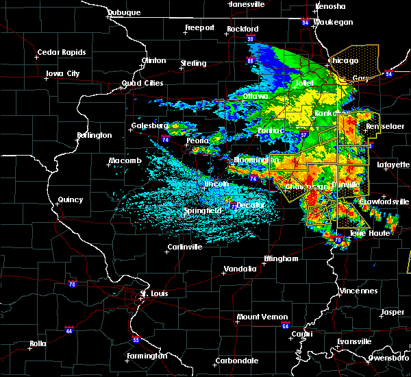 At 408 pm cdt, a severe thunderstorm was located over fairmount, or 14 miles southwest of danville, moving southeast at 10 mph (radar indicated). Hazards include 60 mph wind gusts and quarter size hail. Hail damage to vehicles is expected. Expect wind damage to roofs, siding, and trees. At 408 pm cdt, a severe thunderstorm was located over fairmount, or 14 miles southwest of danville, moving southeast at 10 mph (radar indicated). Hazards include 60 mph wind gusts and quarter size hail. Hail damage to vehicles is expected. Expect wind damage to roofs, siding, and trees.
|
| 6/30/2019 3:59 PM CDT |
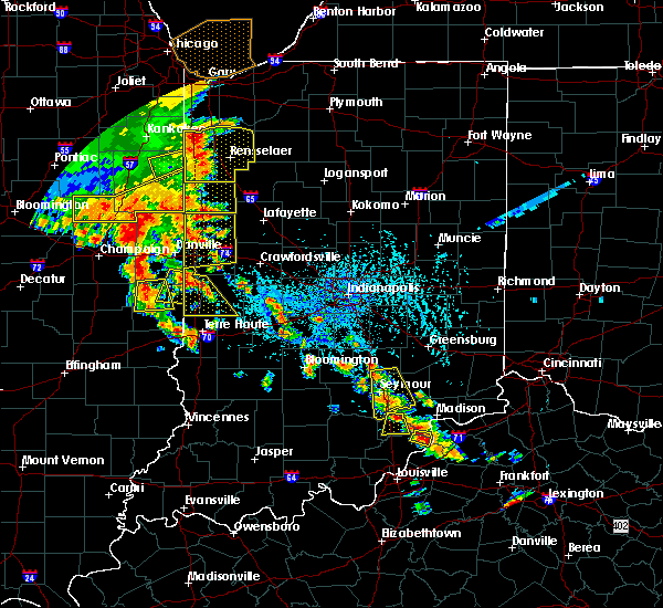 At 359 pm cdt, a severe thunderstorm was located near ridge farm, or 15 miles south of danville, moving south at 10 mph (radar indicated). Hazards include 60 mph wind gusts and penny size hail. expect damage to roofs, siding, and trees At 359 pm cdt, a severe thunderstorm was located near ridge farm, or 15 miles south of danville, moving south at 10 mph (radar indicated). Hazards include 60 mph wind gusts and penny size hail. expect damage to roofs, siding, and trees
|
| 6/29/2019 8:13 PM CDT |
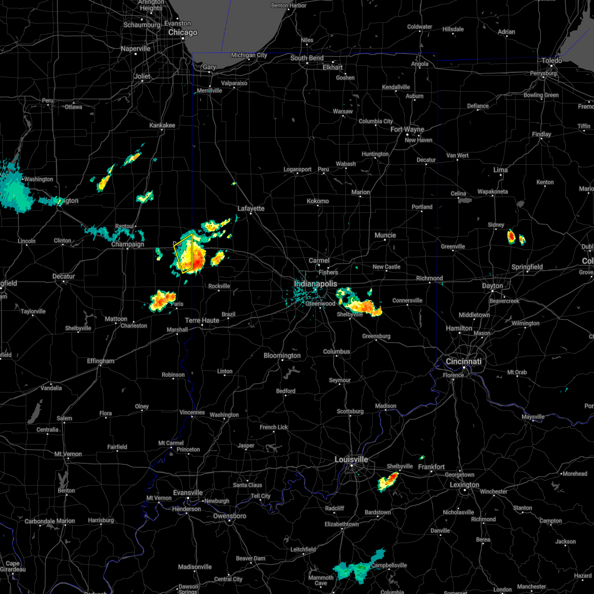 The severe thunderstorm warning for southeastern vermilion county will expire at 815 pm cdt, the storm which prompted the warning has moved out of the area. therefore, the warning will be allowed to expire. however gusty winds are still possible with this thunderstorm. The severe thunderstorm warning for southeastern vermilion county will expire at 815 pm cdt, the storm which prompted the warning has moved out of the area. therefore, the warning will be allowed to expire. however gusty winds are still possible with this thunderstorm.
|
| 6/29/2019 7:50 PM CDT |
 At 749 pm cdt, a severe thunderstorm was located near belgium, or near danville, moving southeast at 25 mph (emergency management). Hazards include 60 mph wind gusts and quarter size hail. Hail damage to vehicles is expected. expect wind damage to roofs, siding, and trees. locations impacted include, danville, georgetown, westville, tilton, belgium and vermilion county airport. This includes interstate 74 between mile markers 210 and 220. At 749 pm cdt, a severe thunderstorm was located near belgium, or near danville, moving southeast at 25 mph (emergency management). Hazards include 60 mph wind gusts and quarter size hail. Hail damage to vehicles is expected. expect wind damage to roofs, siding, and trees. locations impacted include, danville, georgetown, westville, tilton, belgium and vermilion county airport. This includes interstate 74 between mile markers 210 and 220.
|
| 6/29/2019 7:30 PM CDT |
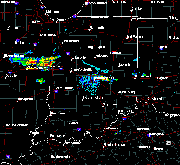 At 730 pm cdt, a severe thunderstorm was located 7 miles north of danville, moving southeast at 20 mph (emergency management). Hazards include 60 mph wind gusts and quarter size hail. Hail damage to vehicles is expected. Expect wind damage to roofs, siding, and trees. At 730 pm cdt, a severe thunderstorm was located 7 miles north of danville, moving southeast at 20 mph (emergency management). Hazards include 60 mph wind gusts and quarter size hail. Hail damage to vehicles is expected. Expect wind damage to roofs, siding, and trees.
|
| 6/28/2019 1:52 PM CDT |
 The severe thunderstorm warning for southeastern mcdonough county will expire at 200 pm cdt, the storms which prompted the warning have weakened below severe limits, and no longer pose an immediate threat to life or property. therefore, the warning will be allowed to expire. however small hail, gusty winds and heavy rain are still possible with these thunderstorms. a severe thunderstorm watch remains in effect until 600 pm cdt for west central illinois. The severe thunderstorm warning for southeastern mcdonough county will expire at 200 pm cdt, the storms which prompted the warning have weakened below severe limits, and no longer pose an immediate threat to life or property. therefore, the warning will be allowed to expire. however small hail, gusty winds and heavy rain are still possible with these thunderstorms. a severe thunderstorm watch remains in effect until 600 pm cdt for west central illinois.
|
| 6/28/2019 1:47 PM CDT |
 At 146 pm cdt, severe thunderstorms were located along a line extending from near bardolph to near industry to near fandon, moving southeast at 35 mph (radar indicated). Hazards include 60 mph wind gusts and quarter size hail. Hail damage to vehicles is expected. expect wind damage to roofs, siding, and trees. locations impacted include, macomb, industry, bardolph, new philadelphia, western illinois university, adair, fandon, pennington point, mcdonough county 4-h grounds, doddsville and macomb municipal airport. If you are at city of macomb you should seek safe shelter immediately!. At 146 pm cdt, severe thunderstorms were located along a line extending from near bardolph to near industry to near fandon, moving southeast at 35 mph (radar indicated). Hazards include 60 mph wind gusts and quarter size hail. Hail damage to vehicles is expected. expect wind damage to roofs, siding, and trees. locations impacted include, macomb, industry, bardolph, new philadelphia, western illinois university, adair, fandon, pennington point, mcdonough county 4-h grounds, doddsville and macomb municipal airport. If you are at city of macomb you should seek safe shelter immediately!.
|
| 6/28/2019 1:44 PM CDT |
 At 143 pm cdt, severe thunderstorms were located along a line extending from near bardolph to near industry to near fandon, moving southeast at 35 mph (radar indicated). Hazards include 60 mph wind gusts and quarter size hail. Hail damage to vehicles is expected. expect wind damage to roofs, siding, and trees. locations impacted include, macomb, bushnell, colchester, industry, good hope, bardolph, tennessee, western illinois university, adair, fandon, new philadelphia, colmar, plymouth, pennington point, macomb municipal airport, doddsville, scottsburg, spring lake, mcdonough county 4-h grounds and argyle lake state park. If you are at city of macomb you should seek safe shelter immediately!. At 143 pm cdt, severe thunderstorms were located along a line extending from near bardolph to near industry to near fandon, moving southeast at 35 mph (radar indicated). Hazards include 60 mph wind gusts and quarter size hail. Hail damage to vehicles is expected. expect wind damage to roofs, siding, and trees. locations impacted include, macomb, bushnell, colchester, industry, good hope, bardolph, tennessee, western illinois university, adair, fandon, new philadelphia, colmar, plymouth, pennington point, macomb municipal airport, doddsville, scottsburg, spring lake, mcdonough county 4-h grounds and argyle lake state park. If you are at city of macomb you should seek safe shelter immediately!.
|
| 6/28/2019 1:32 PM CDT |
 At 115 pm cdt, severe thunderstorms were located along a line extending from near stronghurst to 6 miles southwest of blandinsville to near warsaw, moving east southeast at 25 mph (radar indicated). Hazards include 60 mph wind gusts and quarter size hail. Hail damage to vehicles is expected. expect wind damage to roofs, siding, and trees. locations impacted include, macomb, keokuk, carthage, bushnell, hamilton, warsaw, colchester, la harpe, roseville, stronghurst, avon, blandinsville, augusta, bowen, industry, good hope, prairie city, terre haute, bardolph and west point. those attending heritage days in macomb are in the path of these storms and should prepare for imminent dangerous weather conditions. Seek shelter now!. At 115 pm cdt, severe thunderstorms were located along a line extending from near stronghurst to 6 miles southwest of blandinsville to near warsaw, moving east southeast at 25 mph (radar indicated). Hazards include 60 mph wind gusts and quarter size hail. Hail damage to vehicles is expected. expect wind damage to roofs, siding, and trees. locations impacted include, macomb, keokuk, carthage, bushnell, hamilton, warsaw, colchester, la harpe, roseville, stronghurst, avon, blandinsville, augusta, bowen, industry, good hope, prairie city, terre haute, bardolph and west point. those attending heritage days in macomb are in the path of these storms and should prepare for imminent dangerous weather conditions. Seek shelter now!.
|
| 6/28/2019 1:17 PM CDT |
 At 115 pm cdt, severe thunderstorms were located along a line extending from near stronghurst to 6 miles southwest of blandinsville to near warsaw, moving east southeast at 25 mph (radar indicated). Hazards include 60 mph wind gusts and quarter size hail. Hail damage to vehicles is expected. expect wind damage to roofs, siding, and trees. locations impacted include, macomb, keokuk, carthage, bushnell, hamilton, warsaw, colchester, la harpe, roseville, stronghurst, avon, blandinsville, augusta, bowen, industry, good hope, prairie city, terre haute, bardolph and west point. those attending heritage days in macomb are in the path of these storms and should prepare for imminent dangerous weather conditions. Seek shelter now!. At 115 pm cdt, severe thunderstorms were located along a line extending from near stronghurst to 6 miles southwest of blandinsville to near warsaw, moving east southeast at 25 mph (radar indicated). Hazards include 60 mph wind gusts and quarter size hail. Hail damage to vehicles is expected. expect wind damage to roofs, siding, and trees. locations impacted include, macomb, keokuk, carthage, bushnell, hamilton, warsaw, colchester, la harpe, roseville, stronghurst, avon, blandinsville, augusta, bowen, industry, good hope, prairie city, terre haute, bardolph and west point. those attending heritage days in macomb are in the path of these storms and should prepare for imminent dangerous weather conditions. Seek shelter now!.
|
| 6/28/2019 1:05 PM CDT |
 At 104 pm cdt, severe thunderstorms were located along a line extending from near stronghurst to la harpe to near carthage, moving southeast at 35 mph (radar indicated). Hazards include 60 mph wind gusts and quarter size hail. Hail damage to vehicles is expected. Expect wind damage to roofs, siding, and trees. At 104 pm cdt, severe thunderstorms were located along a line extending from near stronghurst to la harpe to near carthage, moving southeast at 35 mph (radar indicated). Hazards include 60 mph wind gusts and quarter size hail. Hail damage to vehicles is expected. Expect wind damage to roofs, siding, and trees.
|
| 6/25/2019 8:54 PM CDT |
 The severe thunderstorm warning for mcdonough county will expire at 900 pm cdt, the damaging portion of the storms which prompted the warning have moved out of the area. therefore, the warning will be allowed to expire. however heavy rain is still possible with these thunderstorms. a severe thunderstorm watch remains in effect until midnight cdt for west central illinois. The severe thunderstorm warning for mcdonough county will expire at 900 pm cdt, the damaging portion of the storms which prompted the warning have moved out of the area. therefore, the warning will be allowed to expire. however heavy rain is still possible with these thunderstorms. a severe thunderstorm watch remains in effect until midnight cdt for west central illinois.
|
| 6/25/2019 8:49 PM CDT |
 At 849 pm cdt, severe thunderstorms were located along a line extending from near new philadelphia to near adair to near littleton, moving east at 55 mph (radar indicated). Hazards include 60 mph wind gusts and quarter size hail. Hail damage to vehicles is expected. expect wind damage to roofs, siding, and trees. Locations impacted include, macomb, bushnell, colchester, industry, good hope, prairie city, bardolph, western illinois university, adair, fandon, new philadelphia, walnut grove, pennington point, macomb municipal airport, doddsville, scottsburg, spring lake, prairie city airport and mcdonough county 4-h grounds. At 849 pm cdt, severe thunderstorms were located along a line extending from near new philadelphia to near adair to near littleton, moving east at 55 mph (radar indicated). Hazards include 60 mph wind gusts and quarter size hail. Hail damage to vehicles is expected. expect wind damage to roofs, siding, and trees. Locations impacted include, macomb, bushnell, colchester, industry, good hope, prairie city, bardolph, western illinois university, adair, fandon, new philadelphia, walnut grove, pennington point, macomb municipal airport, doddsville, scottsburg, spring lake, prairie city airport and mcdonough county 4-h grounds.
|
| 6/25/2019 8:45 PM CDT |
 At 845 pm cdt, severe thunderstorms were located along a line extending from bushnell to near adair to near littleton, moving southeast at 55 mph (trained weather spotters). Hazards include 70 mph wind gusts and quarter size hail. Hail damage to vehicles is expected. expect considerable tree damage. wind damage is also likely to mobile homes, roofs, and outbuildings. Locations impacted include, macomb, bushnell, colchester, industry, good hope, prairie city, bardolph, western illinois university, adair, fandon, new philadelphia, walnut grove, pennington point, macomb municipal airport, doddsville, scottsburg, spring lake, prairie city airport and mcdonough county 4-h grounds. At 845 pm cdt, severe thunderstorms were located along a line extending from bushnell to near adair to near littleton, moving southeast at 55 mph (trained weather spotters). Hazards include 70 mph wind gusts and quarter size hail. Hail damage to vehicles is expected. expect considerable tree damage. wind damage is also likely to mobile homes, roofs, and outbuildings. Locations impacted include, macomb, bushnell, colchester, industry, good hope, prairie city, bardolph, western illinois university, adair, fandon, new philadelphia, walnut grove, pennington point, macomb municipal airport, doddsville, scottsburg, spring lake, prairie city airport and mcdonough county 4-h grounds.
|
| 6/25/2019 8:43 PM CDT |
 A severe thunderstorm warning remains in effect until 900 pm cdt for mcdonough county. at 842 pm cdt, severe thunderstorms were located along a line extending from bushnell to near industry to 6 miles southwest of littleton, moving east at 55 mph. hazard. 70 mph wind gusts and quarter size hail. A severe thunderstorm warning remains in effect until 900 pm cdt for mcdonough county. at 842 pm cdt, severe thunderstorms were located along a line extending from bushnell to near industry to 6 miles southwest of littleton, moving east at 55 mph. hazard. 70 mph wind gusts and quarter size hail.
|
| 6/25/2019 8:37 PM CDT |
 At 837 pm cdt, severe thunderstorms were located along a line extending from near good hope to near fandon to near augusta, moving east at 55 mph. this is also directly impacting the city of macomb (trained weather spotters). Hazards include 70 mph wind gusts and quarter size hail. Hail damage to vehicles is expected. expect considerable tree damage. wind damage is also likely to mobile homes, roofs, and outbuildings. Locations impacted include, macomb, bushnell, colchester, blandinsville, augusta, bowen, industry, good hope, prairie city, bardolph, tennessee, sciota, western illinois university, fandon, new philadelphia, colmar, adair, walnut grove, plymouth and fountain green. At 837 pm cdt, severe thunderstorms were located along a line extending from near good hope to near fandon to near augusta, moving east at 55 mph. this is also directly impacting the city of macomb (trained weather spotters). Hazards include 70 mph wind gusts and quarter size hail. Hail damage to vehicles is expected. expect considerable tree damage. wind damage is also likely to mobile homes, roofs, and outbuildings. Locations impacted include, macomb, bushnell, colchester, blandinsville, augusta, bowen, industry, good hope, prairie city, bardolph, tennessee, sciota, western illinois university, fandon, new philadelphia, colmar, adair, walnut grove, plymouth and fountain green.
|
| 6/25/2019 8:30 PM CDT |
 At 830 pm cdt, severe thunderstorms were located along a line extending from sciota to near augusta to near camp point, moving southeast at 50 mph (trained weather spotters). Hazards include 70 mph wind gusts and quarter size hail. Hail damage to vehicles is expected. expect considerable tree damage. wind damage is also likely to mobile homes, roofs, and outbuildings. Locations impacted include, macomb, bushnell, colchester, blandinsville, augusta, bowen, industry, good hope, prairie city, bardolph, tennessee, sciota, western illinois university, fandon, new philadelphia, colmar, adair, walnut grove, plymouth and fountain green. At 830 pm cdt, severe thunderstorms were located along a line extending from sciota to near augusta to near camp point, moving southeast at 50 mph (trained weather spotters). Hazards include 70 mph wind gusts and quarter size hail. Hail damage to vehicles is expected. expect considerable tree damage. wind damage is also likely to mobile homes, roofs, and outbuildings. Locations impacted include, macomb, bushnell, colchester, blandinsville, augusta, bowen, industry, good hope, prairie city, bardolph, tennessee, sciota, western illinois university, fandon, new philadelphia, colmar, adair, walnut grove, plymouth and fountain green.
|
| 6/25/2019 8:26 PM CDT |
 At 825 pm cdt, severe thunderstorms were located along a line extending from sciota to near colmar to near mendon, moving southeast at 55 mph (trained weather spotters). Hazards include 70 mph wind gusts and quarter size hail. Hail damage to vehicles is expected. expect considerable tree damage. wind damage is also likely to mobile homes, roofs, and outbuildings. Locations impacted include, macomb, bushnell, colchester, blandinsville, augusta, bowen, industry, good hope, prairie city, bardolph, tennessee, sciota, western illinois university, fandon, new philadelphia, colmar, adair, walnut grove, plymouth and fountain green. At 825 pm cdt, severe thunderstorms were located along a line extending from sciota to near colmar to near mendon, moving southeast at 55 mph (trained weather spotters). Hazards include 70 mph wind gusts and quarter size hail. Hail damage to vehicles is expected. expect considerable tree damage. wind damage is also likely to mobile homes, roofs, and outbuildings. Locations impacted include, macomb, bushnell, colchester, blandinsville, augusta, bowen, industry, good hope, prairie city, bardolph, tennessee, sciota, western illinois university, fandon, new philadelphia, colmar, adair, walnut grove, plymouth and fountain green.
|
| 6/25/2019 8:21 PM CDT |
 At 821 pm cdt, severe thunderstorms were located along a line extending from near blandinsville to 6 miles west of colmar to near mendon, moving southeast at 55 mph (trained weather spotters). Hazards include 70 mph wind gusts and quarter size hail. Hail damage to vehicles is expected. expect considerable tree damage. wind damage is also likely to mobile homes, roofs, and outbuildings. Locations impacted include, macomb, bushnell, colchester, blandinsville, augusta, bowen, industry, good hope, prairie city, bardolph, tennessee, sciota, western illinois university, fandon, new philadelphia, colmar, adair, walnut grove, plymouth and fountain green. At 821 pm cdt, severe thunderstorms were located along a line extending from near blandinsville to 6 miles west of colmar to near mendon, moving southeast at 55 mph (trained weather spotters). Hazards include 70 mph wind gusts and quarter size hail. Hail damage to vehicles is expected. expect considerable tree damage. wind damage is also likely to mobile homes, roofs, and outbuildings. Locations impacted include, macomb, bushnell, colchester, blandinsville, augusta, bowen, industry, good hope, prairie city, bardolph, tennessee, sciota, western illinois university, fandon, new philadelphia, colmar, adair, walnut grove, plymouth and fountain green.
|
| 6/25/2019 8:11 PM CDT |
 At 811 pm cdt, severe thunderstorms were located along a line extending from la harpe to near west point to 7 miles northwest of mendon, moving southeast at 55 mph (trained weather spotters). Hazards include 70 mph wind gusts and quarter size hail. Hail damage to vehicles is expected. expect considerable tree damage. wind damage is also likely to mobile homes, roofs, and outbuildings. Locations impacted include, macomb, bushnell, colchester, blandinsville, augusta, bowen, industry, good hope, prairie city, bardolph, tennessee, sciota, western illinois university, fandon, new philadelphia, colmar, adair, walnut grove, plymouth and fountain green. At 811 pm cdt, severe thunderstorms were located along a line extending from la harpe to near west point to 7 miles northwest of mendon, moving southeast at 55 mph (trained weather spotters). Hazards include 70 mph wind gusts and quarter size hail. Hail damage to vehicles is expected. expect considerable tree damage. wind damage is also likely to mobile homes, roofs, and outbuildings. Locations impacted include, macomb, bushnell, colchester, blandinsville, augusta, bowen, industry, good hope, prairie city, bardolph, tennessee, sciota, western illinois university, fandon, new philadelphia, colmar, adair, walnut grove, plymouth and fountain green.
|
| 6/25/2019 8:07 PM CDT |
 At 807 pm cdt, severe thunderstorms were located along a line extending from near disco to near west point to near canton, moving southeast at 50 mph (trained weather spotters). Hazards include 70 mph wind gusts and quarter size hail. Hail damage to vehicles is expected. expect considerable tree damage. wind damage is also likely to mobile homes, roofs, and outbuildings. Locations impacted include, macomb, bushnell, colchester, blandinsville, augusta, bowen, industry, good hope, prairie city, bardolph, tennessee, sciota, western illinois university, fandon, new philadelphia, colmar, adair, walnut grove, plymouth and fountain green. At 807 pm cdt, severe thunderstorms were located along a line extending from near disco to near west point to near canton, moving southeast at 50 mph (trained weather spotters). Hazards include 70 mph wind gusts and quarter size hail. Hail damage to vehicles is expected. expect considerable tree damage. wind damage is also likely to mobile homes, roofs, and outbuildings. Locations impacted include, macomb, bushnell, colchester, blandinsville, augusta, bowen, industry, good hope, prairie city, bardolph, tennessee, sciota, western illinois university, fandon, new philadelphia, colmar, adair, walnut grove, plymouth and fountain green.
|
| 6/25/2019 7:56 PM CDT |
 The national weather service in the quad cities has issued a * severe thunderstorm warning for. southeastern hancock county in west central illinois. mcdonough county in west central illinois. until 900 pm cdt. At 756 pm cdt, severe thunderstorms were located along a line. The national weather service in the quad cities has issued a * severe thunderstorm warning for. southeastern hancock county in west central illinois. mcdonough county in west central illinois. until 900 pm cdt. At 756 pm cdt, severe thunderstorms were located along a line.
|
| 6/16/2019 12:55 AM CDT |
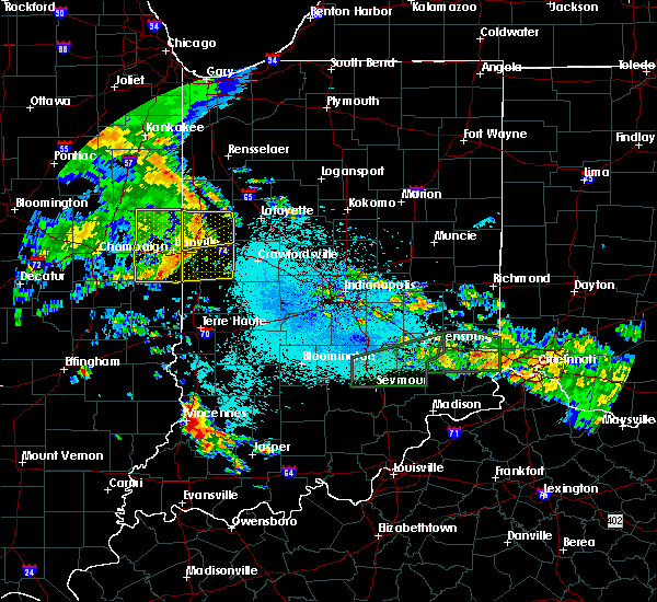 The severe thunderstorm warning for southeastern vermilion county will expire at 100 am cdt, the storm which prompted the warning has weakened below severe limits, and no longer poses an immediate threat to life or property. therefore, the warning will be allowed to expire. a severe thunderstorm watch remains in effect until 200 am cdt for east central illinois. to report severe weather, contact your nearest law enforcement agency. they will relay your report to the national weather service lincoln. The severe thunderstorm warning for southeastern vermilion county will expire at 100 am cdt, the storm which prompted the warning has weakened below severe limits, and no longer poses an immediate threat to life or property. therefore, the warning will be allowed to expire. a severe thunderstorm watch remains in effect until 200 am cdt for east central illinois. to report severe weather, contact your nearest law enforcement agency. they will relay your report to the national weather service lincoln.
|
| 6/16/2019 12:46 AM CDT |
 At 1235 am cdt, a severe thunderstorm was located over danville, moving east at 55 mph (radar indicated). Hazards include 60 mph wind gusts. Expect damage to roofs, siding, and trees. locations impacted include, danville, hoopeston, georgetown, westville, tilton, catlin, oakwood, rossville, ridge farm, fairmount, sidell, belgium, bismarck, indianola, henning, jamaica, vermilion county airport, alvin and kickapoo state park. This includes interstate 74 between mile markers 206 and 219. At 1235 am cdt, a severe thunderstorm was located over danville, moving east at 55 mph (radar indicated). Hazards include 60 mph wind gusts. Expect damage to roofs, siding, and trees. locations impacted include, danville, hoopeston, georgetown, westville, tilton, catlin, oakwood, rossville, ridge farm, fairmount, sidell, belgium, bismarck, indianola, henning, jamaica, vermilion county airport, alvin and kickapoo state park. This includes interstate 74 between mile markers 206 and 219.
|
| 6/16/2019 12:35 AM CDT |
 At 1235 am cdt, a severe thunderstorm was located over danville, moving east at 55 mph (radar indicated). Hazards include 60 mph wind gusts. Expect damage to roofs, siding, and trees. locations impacted include, danville, hoopeston, georgetown, westville, tilton, catlin, oakwood, rossville, ridge farm, fairmount, sidell, belgium, bismarck, indianola, henning, jamaica, vermilion county airport, alvin and kickapoo state park. This includes interstate 74 between mile markers 206 and 219. At 1235 am cdt, a severe thunderstorm was located over danville, moving east at 55 mph (radar indicated). Hazards include 60 mph wind gusts. Expect damage to roofs, siding, and trees. locations impacted include, danville, hoopeston, georgetown, westville, tilton, catlin, oakwood, rossville, ridge farm, fairmount, sidell, belgium, bismarck, indianola, henning, jamaica, vermilion county airport, alvin and kickapoo state park. This includes interstate 74 between mile markers 206 and 219.
|
| 6/16/2019 12:23 AM CDT |
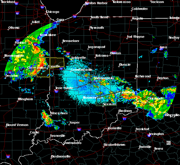 At 1223 am cdt, a severe thunderstorm was located near potomac, or 11 miles northwest of danville, moving east at 50 mph (radar indicated). Hazards include 60 mph wind gusts. Expect damage to roofs, siding, and trees. locations impacted include, danville, hoopeston, georgetown, westville, tilton, catlin, oakwood, rossville, ridge farm, potomac, fairmount, sidell, rankin, fithian, belgium, allerton, muncie, bismarck, indianola and henning. This includes interstate 74 between mile markers 198 and 219. At 1223 am cdt, a severe thunderstorm was located near potomac, or 11 miles northwest of danville, moving east at 50 mph (radar indicated). Hazards include 60 mph wind gusts. Expect damage to roofs, siding, and trees. locations impacted include, danville, hoopeston, georgetown, westville, tilton, catlin, oakwood, rossville, ridge farm, potomac, fairmount, sidell, rankin, fithian, belgium, allerton, muncie, bismarck, indianola and henning. This includes interstate 74 between mile markers 198 and 219.
|
| 6/16/2019 12:06 AM CDT |
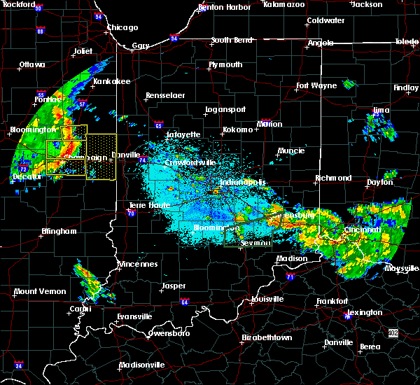 At 1205 am cdt, a severe thunderstorm was located over gifford, or 7 miles east of rantoul, moving east at 55 mph (emergency management). Hazards include 60 mph wind gusts. expect damage to roofs, siding, and trees At 1205 am cdt, a severe thunderstorm was located over gifford, or 7 miles east of rantoul, moving east at 55 mph (emergency management). Hazards include 60 mph wind gusts. expect damage to roofs, siding, and trees
|
| 5/28/2019 7:54 PM CDT |
 At 754 pm cdt, severe thunderstorms were located along a line extending from 6 miles north of monmouth to near prairie city to near industry, moving east at 45 mph (radar indicated). Hazards include 70 mph wind gusts and quarter size hail. Hail damage to vehicles is expected. expect considerable tree damage. wind damage is also likely to mobile homes, roofs, and outbuildings. Locations impacted include, macomb, monmouth, bushnell, colchester, industry, good hope, prairie city, little york, bardolph, western illinois university, fandon, little swan lake, new philadelphia, colmar, adair, walnut grove, greenbush, coldbrook, berwick and gerlaw. At 754 pm cdt, severe thunderstorms were located along a line extending from 6 miles north of monmouth to near prairie city to near industry, moving east at 45 mph (radar indicated). Hazards include 70 mph wind gusts and quarter size hail. Hail damage to vehicles is expected. expect considerable tree damage. wind damage is also likely to mobile homes, roofs, and outbuildings. Locations impacted include, macomb, monmouth, bushnell, colchester, industry, good hope, prairie city, little york, bardolph, western illinois university, fandon, little swan lake, new philadelphia, colmar, adair, walnut grove, greenbush, coldbrook, berwick and gerlaw.
|
| 5/28/2019 7:48 PM CDT |
 At 747 pm cdt, severe thunderstorms were located along a line extending from little york to near little swan lake to near fandon, moving east at 50 mph (radar indicated). Hazards include 70 mph wind gusts and quarter size hail. Hail damage to vehicles is expected. expect considerable tree damage. wind damage is also likely to mobile homes, roofs, and outbuildings. Locations impacted include, macomb, monmouth, bushnell, colchester, roseville, kirkwood, industry, good hope, prairie city, little york, bardolph, tennessee, sciota, western illinois university, fandon, little swan lake, new philadelphia, colmar, adair and alexis. At 747 pm cdt, severe thunderstorms were located along a line extending from little york to near little swan lake to near fandon, moving east at 50 mph (radar indicated). Hazards include 70 mph wind gusts and quarter size hail. Hail damage to vehicles is expected. expect considerable tree damage. wind damage is also likely to mobile homes, roofs, and outbuildings. Locations impacted include, macomb, monmouth, bushnell, colchester, roseville, kirkwood, industry, good hope, prairie city, little york, bardolph, tennessee, sciota, western illinois university, fandon, little swan lake, new philadelphia, colmar, adair and alexis.
|
| 5/28/2019 7:41 PM CDT |
 At 741 pm cdt, severe thunderstorms were located along a line extending from little york to near roseville to near colmar, moving east at 45 mph (radar indicated). Hazards include 70 mph wind gusts and quarter size hail. Hail damage to vehicles is expected. expect considerable tree damage. wind damage is also likely to mobile homes, roofs, and outbuildings. Locations impacted include, macomb, monmouth, bushnell, colchester, roseville, kirkwood, industry, good hope, prairie city, little york, bardolph, tennessee, sciota, western illinois university, fandon, little swan lake, new philadelphia, colmar, adair and alexis. At 741 pm cdt, severe thunderstorms were located along a line extending from little york to near roseville to near colmar, moving east at 45 mph (radar indicated). Hazards include 70 mph wind gusts and quarter size hail. Hail damage to vehicles is expected. expect considerable tree damage. wind damage is also likely to mobile homes, roofs, and outbuildings. Locations impacted include, macomb, monmouth, bushnell, colchester, roseville, kirkwood, industry, good hope, prairie city, little york, bardolph, tennessee, sciota, western illinois university, fandon, little swan lake, new philadelphia, colmar, adair and alexis.
|
| 5/28/2019 7:30 PM CDT |
 At 730 pm cdt, severe thunderstorms were located along a line extending from near rozetta to near stronghurst to near colmar, moving east at 50 mph (trained weather spotters and the burlington airport). Hazards include 70 mph wind gusts and quarter size hail. Hail damage to vehicles is expected. expect considerable tree damage. Wind damage is also likely to mobile homes, roofs, and outbuildings. At 730 pm cdt, severe thunderstorms were located along a line extending from near rozetta to near stronghurst to near colmar, moving east at 50 mph (trained weather spotters and the burlington airport). Hazards include 70 mph wind gusts and quarter size hail. Hail damage to vehicles is expected. expect considerable tree damage. Wind damage is also likely to mobile homes, roofs, and outbuildings.
|
| 5/26/2019 2:01 AM CDT |
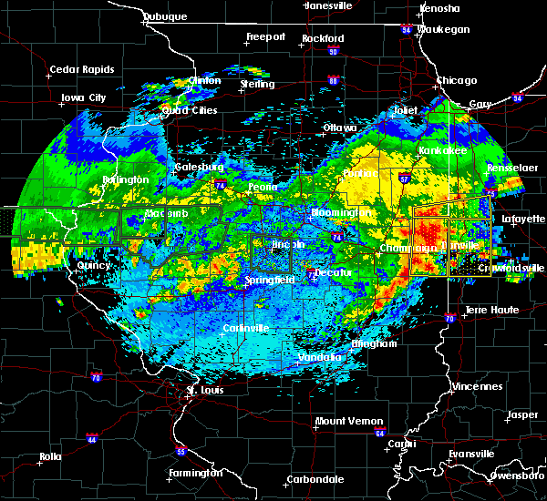 A severe thunderstorm warning remains in effect until 215 am cdt for vermilion county. at 200 am cdt, severe thunderstorms were located along a line extending from near rossville to near oakwood to sidell, moving east at 45 mph. hazard. 60 mph wind gusts and nickel size hail. A severe thunderstorm warning remains in effect until 215 am cdt for vermilion county. at 200 am cdt, severe thunderstorms were located along a line extending from near rossville to near oakwood to sidell, moving east at 45 mph. hazard. 60 mph wind gusts and nickel size hail.
|
| 5/26/2019 1:48 AM CDT |
 At 148 am cdt, severe thunderstorms were located along a line extending from 6 miles northeast of gifford to near fithian to near broadlands, moving east at 50 mph (radar indicated). Hazards include 60 mph wind gusts. Expect damage to roofs, siding, and trees. locations impacted include, danville, hoopeston, st. joseph, georgetown, westville, tilton, catlin, oakwood, rossville, sidney, homer, gifford, ridge farm, ogden, potomac, fairmount, sidell, rankin, fithian and belgium. This includes interstate 74 between mile marker 189 and the indiana border. At 148 am cdt, severe thunderstorms were located along a line extending from 6 miles northeast of gifford to near fithian to near broadlands, moving east at 50 mph (radar indicated). Hazards include 60 mph wind gusts. Expect damage to roofs, siding, and trees. locations impacted include, danville, hoopeston, st. joseph, georgetown, westville, tilton, catlin, oakwood, rossville, sidney, homer, gifford, ridge farm, ogden, potomac, fairmount, sidell, rankin, fithian and belgium. This includes interstate 74 between mile marker 189 and the indiana border.
|
| 5/26/2019 1:30 AM CDT |
 At 129 am cdt, severe thunderstorms were located along a line extending from near gifford to near pesotum, moving east at 40 mph (radar indicated. at 125 am, a wind gust of 63 mph was reported at willard airport near savoy). Hazards include 60 mph wind gusts. expect damage to roofs, siding, and trees At 129 am cdt, severe thunderstorms were located along a line extending from near gifford to near pesotum, moving east at 40 mph (radar indicated. at 125 am, a wind gust of 63 mph was reported at willard airport near savoy). Hazards include 60 mph wind gusts. expect damage to roofs, siding, and trees
|
| 5/25/2019 10:28 PM CDT |
 The severe thunderstorm warning for mcdonough county will expire at 1030 pm cdt, the storm which prompted the warning has moved out of the area. therefore, the warning will be allowed to expire. however heavy rain is still possible. a severe thunderstorm watch remains in effect until midnight cdt for west central illinois. The severe thunderstorm warning for mcdonough county will expire at 1030 pm cdt, the storm which prompted the warning has moved out of the area. therefore, the warning will be allowed to expire. however heavy rain is still possible. a severe thunderstorm watch remains in effect until midnight cdt for west central illinois.
|
| 5/25/2019 10:16 PM CDT |
 At 1015 pm cdt, a severe thunderstorm was located over vermont, or 13 miles north of rushville, moving east at 40 mph (radar indicated). Hazards include 60 mph wind gusts and quarter size hail. Hail damage to vehicles is expected. expect wind damage to roofs, siding, and trees. Locations impacted include, macomb, bushnell, industry, good hope, prairie city, bardolph, western illinois university, adair, fandon, new philadelphia, pennington point, macomb municipal airport, doddsville, scottsburg, spring lake, prairie city airport and mcdonough county 4-h grounds. At 1015 pm cdt, a severe thunderstorm was located over vermont, or 13 miles north of rushville, moving east at 40 mph (radar indicated). Hazards include 60 mph wind gusts and quarter size hail. Hail damage to vehicles is expected. expect wind damage to roofs, siding, and trees. Locations impacted include, macomb, bushnell, industry, good hope, prairie city, bardolph, western illinois university, adair, fandon, new philadelphia, pennington point, macomb municipal airport, doddsville, scottsburg, spring lake, prairie city airport and mcdonough county 4-h grounds.
|
| 5/25/2019 10:04 PM CDT |
 At 1003 pm cdt, a severe thunderstorm was located near industry, or 12 miles southeast of macomb, moving east at 35 mph (radar indicated). Hazards include 60 mph wind gusts and quarter size hail. Hail damage to vehicles is expected. expect wind damage to roofs, siding, and trees. Locations impacted include, macomb, bushnell, colchester, blandinsville, industry, good hope, prairie city, bardolph, tennessee, sciota, western illinois university, adair, fandon, new philadelphia, colmar, plymouth, pennington point, macomb municipal airport, doddsville and scottsburg. At 1003 pm cdt, a severe thunderstorm was located near industry, or 12 miles southeast of macomb, moving east at 35 mph (radar indicated). Hazards include 60 mph wind gusts and quarter size hail. Hail damage to vehicles is expected. expect wind damage to roofs, siding, and trees. Locations impacted include, macomb, bushnell, colchester, blandinsville, industry, good hope, prairie city, bardolph, tennessee, sciota, western illinois university, adair, fandon, new philadelphia, colmar, plymouth, pennington point, macomb municipal airport, doddsville and scottsburg.
|
| 5/25/2019 9:53 PM CDT |
 At 950 pm cdt, a severe thunderstorm was located near fandon, or 11 miles south of macomb, moving east at 65 mph (law enforcement. at 935 pm cdt a 59 mph wind gust was reported at plymouth by the fire department). Hazards include 60 mph wind gusts and quarter size hail. Hail damage to vehicles is expected. expect wind damage to roofs, siding, and trees. Locations impacted include, macomb, bushnell, colchester, blandinsville, augusta, bowen, industry, good hope, prairie city, bardolph, tennessee, sciota, western illinois university, fandon, new philadelphia, colmar, adair, plymouth, fountain green and macomb municipal airport. At 950 pm cdt, a severe thunderstorm was located near fandon, or 11 miles south of macomb, moving east at 65 mph (law enforcement. at 935 pm cdt a 59 mph wind gust was reported at plymouth by the fire department). Hazards include 60 mph wind gusts and quarter size hail. Hail damage to vehicles is expected. expect wind damage to roofs, siding, and trees. Locations impacted include, macomb, bushnell, colchester, blandinsville, augusta, bowen, industry, good hope, prairie city, bardolph, tennessee, sciota, western illinois university, fandon, new philadelphia, colmar, adair, plymouth, fountain green and macomb municipal airport.
|
| 5/25/2019 9:25 PM CDT |
 At 924 pm cdt, a severe thunderstorm was located near carthage, moving east at 35 mph (radar indicated). Hazards include 60 mph wind gusts and quarter size hail. Hail damage to vehicles is expected. Expect wind damage to roofs, siding, and trees. At 924 pm cdt, a severe thunderstorm was located near carthage, moving east at 35 mph (radar indicated). Hazards include 60 mph wind gusts and quarter size hail. Hail damage to vehicles is expected. Expect wind damage to roofs, siding, and trees.
|
| 5/24/2019 12:25 PM CDT |
 At 1219 pm cdt, a severe thunderstorm capable of producing a tornado was located over fandon, or 8 miles southwest of macomb, moving east at 40 mph (radar indicated rotation). Hazards include tornado. Flying debris will be dangerous to those caught without shelter. mobile homes will be damaged or destroyed. damage to roofs, windows, and vehicles will occur. tree damage is likely. this dangerous storm will be near, industry around 1230 pm cdt. adair around 1240 pm cdt. new philadelphia around 1245 pm cdt. Other locations impacted by this tornadic thunderstorm include pennington point, doddsville, argyle lake state park and mcdonough county 4-h grounds. At 1219 pm cdt, a severe thunderstorm capable of producing a tornado was located over fandon, or 8 miles southwest of macomb, moving east at 40 mph (radar indicated rotation). Hazards include tornado. Flying debris will be dangerous to those caught without shelter. mobile homes will be damaged or destroyed. damage to roofs, windows, and vehicles will occur. tree damage is likely. this dangerous storm will be near, industry around 1230 pm cdt. adair around 1240 pm cdt. new philadelphia around 1245 pm cdt. Other locations impacted by this tornadic thunderstorm include pennington point, doddsville, argyle lake state park and mcdonough county 4-h grounds.
|
| 5/24/2019 12:19 PM CDT |
 At 1219 pm cdt, a severe thunderstorm capable of producing a tornado was located over fandon, or 8 miles southwest of macomb, moving east at 40 mph (radar indicated rotation). Hazards include tornado. Flying debris will be dangerous to those caught without shelter. mobile homes will be damaged or destroyed. damage to roofs, windows, and vehicles will occur. tree damage is likely. this dangerous storm will be near, industry around 1230 pm cdt. adair around 1240 pm cdt. new philadelphia around 1245 pm cdt. Other locations impacted by this tornadic thunderstorm include pennington point, doddsville, argyle lake state park and mcdonough county 4-h grounds. At 1219 pm cdt, a severe thunderstorm capable of producing a tornado was located over fandon, or 8 miles southwest of macomb, moving east at 40 mph (radar indicated rotation). Hazards include tornado. Flying debris will be dangerous to those caught without shelter. mobile homes will be damaged or destroyed. damage to roofs, windows, and vehicles will occur. tree damage is likely. this dangerous storm will be near, industry around 1230 pm cdt. adair around 1240 pm cdt. new philadelphia around 1245 pm cdt. Other locations impacted by this tornadic thunderstorm include pennington point, doddsville, argyle lake state park and mcdonough county 4-h grounds.
|
| 5/24/2019 12:13 PM CDT |
 At 1213 pm cdt, a severe thunderstorm was located over fandon, or 9 miles southwest of macomb, moving east at 35 mph (radar indicated). Hazards include 60 mph wind gusts and penny size hail. expect damage to roofs, siding, and trees At 1213 pm cdt, a severe thunderstorm was located over fandon, or 9 miles southwest of macomb, moving east at 35 mph (radar indicated). Hazards include 60 mph wind gusts and penny size hail. expect damage to roofs, siding, and trees
|
| 5/23/2019 2:24 AM CDT |
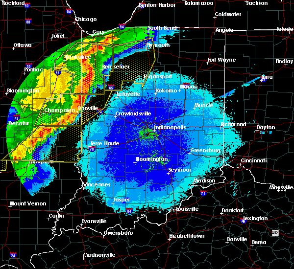 At 223 am cdt, a severe thunderstorm was located over danville, moving east at 45 mph. this is a very dangerous storm (radar indicated). Hazards include 80 mph wind gusts. brief tornados are possible with this storm. Flying debris will be dangerous to those caught without shelter. mobile homes will be heavily damaged. expect considerable damage to roofs, windows, and vehicles. extensive tree damage and power outages are likely. locations impacted include, danville, hoopeston, georgetown, westville, tilton, catlin, oakwood, rossville, ridge farm, potomac, fairmount, sidell, rankin, fithian, belgium, allerton, muncie, bismarck, indianola and henning. This includes interstate 74 between mile markers 198 and 219. At 223 am cdt, a severe thunderstorm was located over danville, moving east at 45 mph. this is a very dangerous storm (radar indicated). Hazards include 80 mph wind gusts. brief tornados are possible with this storm. Flying debris will be dangerous to those caught without shelter. mobile homes will be heavily damaged. expect considerable damage to roofs, windows, and vehicles. extensive tree damage and power outages are likely. locations impacted include, danville, hoopeston, georgetown, westville, tilton, catlin, oakwood, rossville, ridge farm, potomac, fairmount, sidell, rankin, fithian, belgium, allerton, muncie, bismarck, indianola and henning. This includes interstate 74 between mile markers 198 and 219.
|
| 5/23/2019 1:53 AM CDT |
 At 153 am cdt, a severe thunderstorm was located over st. joseph, or 13 miles east of champaign, moving east at 45 mph. this is a very dangerous storm (radar indicated). Hazards include 80 mph wind gusts. brief tornados are possible with this storm. Flying debris will be dangerous to those caught without shelter. mobile homes will be heavily damaged. expect considerable damage to roofs, windows, and vehicles. Extensive tree damage and power outages are likely. At 153 am cdt, a severe thunderstorm was located over st. joseph, or 13 miles east of champaign, moving east at 45 mph. this is a very dangerous storm (radar indicated). Hazards include 80 mph wind gusts. brief tornados are possible with this storm. Flying debris will be dangerous to those caught without shelter. mobile homes will be heavily damaged. expect considerable damage to roofs, windows, and vehicles. Extensive tree damage and power outages are likely.
|
| 5/22/2019 9:09 PM CDT |
 At 908 pm cdt, severe thunderstorms were located along a line extending from near avon to bardolph, moving northeast at 40 mph (radar indicated). Hazards include 60 mph wind gusts and nickel size hail. Expect damage to roofs, siding, and trees. Locations impacted include, macomb, bushnell, colchester, good hope, prairie city, bardolph, tennessee, sciota, western illinois university, little swan lake, new philadelphia, walnut grove, greenbush, macomb municipal airport, scottsburg, spring lake, swan creek, youngstown, prairie city airport and mcdonough county 4-h grounds. At 908 pm cdt, severe thunderstorms were located along a line extending from near avon to bardolph, moving northeast at 40 mph (radar indicated). Hazards include 60 mph wind gusts and nickel size hail. Expect damage to roofs, siding, and trees. Locations impacted include, macomb, bushnell, colchester, good hope, prairie city, bardolph, tennessee, sciota, western illinois university, little swan lake, new philadelphia, walnut grove, greenbush, macomb municipal airport, scottsburg, spring lake, swan creek, youngstown, prairie city airport and mcdonough county 4-h grounds.
|
| 5/22/2019 9:00 PM CDT |
 At 859 pm cdt, severe thunderstorms were located along a line extending from near little swan lake to near bardolph, moving east at 50 mph (radar indicated). Hazards include 60 mph wind gusts and quarter size hail. Hail damage to vehicles is expected. expect wind damage to roofs, siding, and trees. Locations impacted include, macomb, bushnell, colchester, good hope, prairie city, bardolph, tennessee, sciota, western illinois university, little swan lake, new philadelphia, walnut grove, greenbush, macomb municipal airport, scottsburg, spring lake, swan creek, youngstown, prairie city airport and mcdonough county 4-h grounds. At 859 pm cdt, severe thunderstorms were located along a line extending from near little swan lake to near bardolph, moving east at 50 mph (radar indicated). Hazards include 60 mph wind gusts and quarter size hail. Hail damage to vehicles is expected. expect wind damage to roofs, siding, and trees. Locations impacted include, macomb, bushnell, colchester, good hope, prairie city, bardolph, tennessee, sciota, western illinois university, little swan lake, new philadelphia, walnut grove, greenbush, macomb municipal airport, scottsburg, spring lake, swan creek, youngstown, prairie city airport and mcdonough county 4-h grounds.
|
| 5/22/2019 8:53 PM CDT |
 At 852 pm cdt, severe thunderstorms were located along a line extending from little swan lake to western illinois university, moving east at 50 mph (radar indicated). Hazards include 60 mph wind gusts and quarter size hail. Hail damage to vehicles is expected. expect wind damage to roofs, siding, and trees. Locations impacted include, macomb, bushnell, colchester, la harpe, blandinsville, good hope, prairie city, bardolph, tennessee, sciota, western illinois university, little swan lake, new philadelphia, walnut grove, greenbush, fountain green, macomb municipal airport, youngstown, prairie city airport and mcdonough county 4-h grounds. At 852 pm cdt, severe thunderstorms were located along a line extending from little swan lake to western illinois university, moving east at 50 mph (radar indicated). Hazards include 60 mph wind gusts and quarter size hail. Hail damage to vehicles is expected. expect wind damage to roofs, siding, and trees. Locations impacted include, macomb, bushnell, colchester, la harpe, blandinsville, good hope, prairie city, bardolph, tennessee, sciota, western illinois university, little swan lake, new philadelphia, walnut grove, greenbush, fountain green, macomb municipal airport, youngstown, prairie city airport and mcdonough county 4-h grounds.
|
| 5/22/2019 8:41 PM CDT |
 At 831 pm cdt, severe thunderstorms were located along a line extending from near blandinsville to 6 miles northwest of colmar, moving east at 50 mph (radar indicated). Hazards include 60 mph wind gusts and quarter size hail. Hail damage to vehicles is expected. Expect wind damage to roofs, siding, and trees. At 831 pm cdt, severe thunderstorms were located along a line extending from near blandinsville to 6 miles northwest of colmar, moving east at 50 mph (radar indicated). Hazards include 60 mph wind gusts and quarter size hail. Hail damage to vehicles is expected. Expect wind damage to roofs, siding, and trees.
|
| 5/22/2019 8:31 PM CDT |
 At 831 pm cdt, severe thunderstorms were located along a line extending from near blandinsville to 6 miles northwest of colmar, moving east at 50 mph (radar indicated). Hazards include 60 mph wind gusts and quarter size hail. Hail damage to vehicles is expected. Expect wind damage to roofs, siding, and trees. At 831 pm cdt, severe thunderstorms were located along a line extending from near blandinsville to 6 miles northwest of colmar, moving east at 50 mph (radar indicated). Hazards include 60 mph wind gusts and quarter size hail. Hail damage to vehicles is expected. Expect wind damage to roofs, siding, and trees.
|
| 5/16/2019 4:11 PM CDT |
 At 410 pm cdt, a severe thunderstorm capable of producing a tornado was located near georgetown, or 14 miles south of danville, moving southeast at 30 mph (radar indicated rotation). Hazards include tornado and golf ball size hail. Flying debris will be dangerous to those caught without shelter. mobile homes will be damaged or destroyed. damage to roofs, windows, and vehicles will occur. tree damage is likely. this tornadic thunderstorm will remain over mainly rural areas of southeastern vermilion county. This includes interstate 74 between mile markers 218 and 220. At 410 pm cdt, a severe thunderstorm capable of producing a tornado was located near georgetown, or 14 miles south of danville, moving southeast at 30 mph (radar indicated rotation). Hazards include tornado and golf ball size hail. Flying debris will be dangerous to those caught without shelter. mobile homes will be damaged or destroyed. damage to roofs, windows, and vehicles will occur. tree damage is likely. this tornadic thunderstorm will remain over mainly rural areas of southeastern vermilion county. This includes interstate 74 between mile markers 218 and 220.
|
| 5/16/2019 4:06 PM CDT | Golf Ball sized hail reported 166.2 miles W of Georgetown, IL, golfball sized hail reported on us highway 150 between georgetown and westville |
| 5/16/2019 3:55 PM CDT |
 At 354 pm cdt, a severe thunderstorm capable of producing a tornado was located over westville moving southeast at 35 mph (radar indicated rotation). Hazards include tornado and golf ball size hail. Flying debris will be dangerous to those caught without shelter. mobile homes will be damaged or destroyed. damage to roofs, windows, and vehicles will occur. tree damage is likely. this dangerous storm will be near, georgetown around 405 pm cdt. ridge farm around 410 pm cdt. other locations impacted by this tornadic thunderstorm include kickapoo state park and indianola. This includes interstate 74 between mile markers 209 and 220. At 354 pm cdt, a severe thunderstorm capable of producing a tornado was located over westville moving southeast at 35 mph (radar indicated rotation). Hazards include tornado and golf ball size hail. Flying debris will be dangerous to those caught without shelter. mobile homes will be damaged or destroyed. damage to roofs, windows, and vehicles will occur. tree damage is likely. this dangerous storm will be near, georgetown around 405 pm cdt. ridge farm around 410 pm cdt. other locations impacted by this tornadic thunderstorm include kickapoo state park and indianola. This includes interstate 74 between mile markers 209 and 220.
|
| 5/16/2019 3:34 PM CDT |
 At 334 pm cdt, a severe thunderstorm capable of producing a tornado was located near oakwood, or 7 miles west of danville, moving southeast at 35 mph (radar indicated rotation). Hazards include tornado and golf ball size hail. Flying debris will be dangerous to those caught without shelter. mobile homes will be damaged or destroyed. damage to roofs, windows, and vehicles will occur. tree damage is likely. this dangerous storm will be near, oakwood around 340 pm cdt. danville, tilton and catlin around 350 pm cdt. westville and belgium around 355 pm cdt. georgetown and ridge farm around 400 pm cdt. other locations impacted by this tornadic thunderstorm include collison and kickapoo state park. This includes interstate 74 between mile markers 205 and 220. At 334 pm cdt, a severe thunderstorm capable of producing a tornado was located near oakwood, or 7 miles west of danville, moving southeast at 35 mph (radar indicated rotation). Hazards include tornado and golf ball size hail. Flying debris will be dangerous to those caught without shelter. mobile homes will be damaged or destroyed. damage to roofs, windows, and vehicles will occur. tree damage is likely. this dangerous storm will be near, oakwood around 340 pm cdt. danville, tilton and catlin around 350 pm cdt. westville and belgium around 355 pm cdt. georgetown and ridge farm around 400 pm cdt. other locations impacted by this tornadic thunderstorm include collison and kickapoo state park. This includes interstate 74 between mile markers 205 and 220.
|
| 8/28/2018 9:01 PM CDT |
 At 850 pm cdt, severe thunderstorms were located along a line extending from near mediapolis to 7 miles north of canton, moving east at 40 mph (radar indicated). Hazards include 60 mph wind gusts and penny size hail. expect damage to roofs, siding, and trees At 850 pm cdt, severe thunderstorms were located along a line extending from near mediapolis to 7 miles north of canton, moving east at 40 mph (radar indicated). Hazards include 60 mph wind gusts and penny size hail. expect damage to roofs, siding, and trees
|
| 8/28/2018 8:50 PM CDT |
 At 850 pm cdt, severe thunderstorms were located along a line extending from near mediapolis to 7 miles north of canton, moving east at 40 mph (radar indicated). Hazards include 60 mph wind gusts and penny size hail. expect damage to roofs, siding, and trees At 850 pm cdt, severe thunderstorms were located along a line extending from near mediapolis to 7 miles north of canton, moving east at 40 mph (radar indicated). Hazards include 60 mph wind gusts and penny size hail. expect damage to roofs, siding, and trees
|
| 6/28/2018 3:31 PM CDT |
 At 329 pm cdt, severe thunderstorms were located along a line extending from little swan lake to near adair to near littleton, moving east at 45 mph (radar indicated). Hazards include 60 mph wind gusts. Expect damage to roofs, siding, and trees. Locations impacted include, macomb, bushnell, industry, good hope, prairie city, bardolph, western illinois university, adair, fandon, new philadelphia, walnut grove, pennington point, macomb municipal airport, doddsville, scottsburg, spring lake, swan creek, youngstown, prairie city airport and mcdonough county 4-h grounds. At 329 pm cdt, severe thunderstorms were located along a line extending from little swan lake to near adair to near littleton, moving east at 45 mph (radar indicated). Hazards include 60 mph wind gusts. Expect damage to roofs, siding, and trees. Locations impacted include, macomb, bushnell, industry, good hope, prairie city, bardolph, western illinois university, adair, fandon, new philadelphia, walnut grove, pennington point, macomb municipal airport, doddsville, scottsburg, spring lake, swan creek, youngstown, prairie city airport and mcdonough county 4-h grounds.
|
| 6/28/2018 3:21 PM CDT |
 At 319 pm cdt, severe thunderstorms were located along a line extending from near roseville to near macomb to 6 miles southeast of colmar, moving east at 50 mph (radar indicated). Hazards include 60 mph wind gusts. Expect damage to roofs, siding, and trees. Locations impacted include, macomb, bushnell, colchester, stronghurst, blandinsville, industry, good hope, prairie city, bardolph, raritan, tennessee, sciota, western illinois university, fandon, new philadelphia, colmar, adair, walnut grove, plymouth and macomb municipal airport. At 319 pm cdt, severe thunderstorms were located along a line extending from near roseville to near macomb to 6 miles southeast of colmar, moving east at 50 mph (radar indicated). Hazards include 60 mph wind gusts. Expect damage to roofs, siding, and trees. Locations impacted include, macomb, bushnell, colchester, stronghurst, blandinsville, industry, good hope, prairie city, bardolph, raritan, tennessee, sciota, western illinois university, fandon, new philadelphia, colmar, adair, walnut grove, plymouth and macomb municipal airport.
|
| 6/28/2018 3:08 PM CDT |
 At 308 pm cdt, severe thunderstorms were located along a line extending from near blandinsville to near bowen, moving east at 45 mph (radar indicated). Hazards include 60 mph wind gusts and penny size hail. expect damage to roofs, siding, and trees At 308 pm cdt, severe thunderstorms were located along a line extending from near blandinsville to near bowen, moving east at 45 mph (radar indicated). Hazards include 60 mph wind gusts and penny size hail. expect damage to roofs, siding, and trees
|
| 6/14/2018 1:55 PM CDT |
 At 155 pm cdt, severe thunderstorms were located along a line extending from near prairie city to near adair to near littleton, moving southeast at 45 mph (radar indicated). Hazards include 60 mph wind gusts and quarter size hail. Hail damage to vehicles is expected. expect wind damage to roofs, siding, and trees. Locations impacted include, macomb, bushnell, colchester, roseville, avon, industry, good hope, prairie city, bardolph, tennessee, sciota, western illinois university, fandon, little swan lake, new philadelphia, colmar, adair, walnut grove, greenbush and macomb municipal airport. At 155 pm cdt, severe thunderstorms were located along a line extending from near prairie city to near adair to near littleton, moving southeast at 45 mph (radar indicated). Hazards include 60 mph wind gusts and quarter size hail. Hail damage to vehicles is expected. expect wind damage to roofs, siding, and trees. Locations impacted include, macomb, bushnell, colchester, roseville, avon, industry, good hope, prairie city, bardolph, tennessee, sciota, western illinois university, fandon, little swan lake, new philadelphia, colmar, adair, walnut grove, greenbush and macomb municipal airport.
|
| 6/14/2018 1:47 PM CDT |
 At 147 pm cdt, severe thunderstorms were located along a line extending from near little swan lake to near bardolph to near industry, moving southeast at 50 mph (radar indicated). Hazards include 60 mph wind gusts and quarter size hail. Hail damage to vehicles is expected. expect wind damage to roofs, siding, and trees. Locations impacted include, macomb, bushnell, colchester, roseville, avon, blandinsville, industry, good hope, prairie city, bardolph, tennessee, sciota, western illinois university, fandon, little swan lake, new philadelphia, colmar, adair, walnut grove and greenbush. At 147 pm cdt, severe thunderstorms were located along a line extending from near little swan lake to near bardolph to near industry, moving southeast at 50 mph (radar indicated). Hazards include 60 mph wind gusts and quarter size hail. Hail damage to vehicles is expected. expect wind damage to roofs, siding, and trees. Locations impacted include, macomb, bushnell, colchester, roseville, avon, blandinsville, industry, good hope, prairie city, bardolph, tennessee, sciota, western illinois university, fandon, little swan lake, new philadelphia, colmar, adair, walnut grove and greenbush.
|
| 6/14/2018 1:26 PM CDT |
 At 126 pm cdt, severe thunderstorms were located along a line extending from near stronghurst to near blandinsville to 7 miles northwest of tennessee, moving southeast at 55 mph (radar indicated). Hazards include 60 mph wind gusts and quarter size hail. Hail damage to vehicles is expected. expect wind damage to roofs, siding, and trees. Locations impacted include, macomb, bushnell, colchester, la harpe, roseville, stronghurst, avon, blandinsville, industry, good hope, prairie city, biggsville, gladstone, terre haute, bardolph, raritan, tennessee, sciota, colusa and fandon. At 126 pm cdt, severe thunderstorms were located along a line extending from near stronghurst to near blandinsville to 7 miles northwest of tennessee, moving southeast at 55 mph (radar indicated). Hazards include 60 mph wind gusts and quarter size hail. Hail damage to vehicles is expected. expect wind damage to roofs, siding, and trees. Locations impacted include, macomb, bushnell, colchester, la harpe, roseville, stronghurst, avon, blandinsville, industry, good hope, prairie city, biggsville, gladstone, terre haute, bardolph, raritan, tennessee, sciota, colusa and fandon.
|
| 6/14/2018 1:16 PM CDT |
 At 116 pm cdt, severe thunderstorms were located along a line extending from near oquawka to near carman to near colusa, moving southeast at 50 mph (radar indicated). Hazards include 60 mph wind gusts and quarter size hail. Hail damage to vehicles is expected. expect wind damage to roofs, siding, and trees. Locations impacted include, macomb, bushnell, colchester, la harpe, roseville, dallas city, stronghurst, avon, blandinsville, industry, good hope, prairie city, carman, biggsville, gladstone, terre haute, bardolph, raritan, tennessee and sciota. At 116 pm cdt, severe thunderstorms were located along a line extending from near oquawka to near carman to near colusa, moving southeast at 50 mph (radar indicated). Hazards include 60 mph wind gusts and quarter size hail. Hail damage to vehicles is expected. expect wind damage to roofs, siding, and trees. Locations impacted include, macomb, bushnell, colchester, la harpe, roseville, dallas city, stronghurst, avon, blandinsville, industry, good hope, prairie city, carman, biggsville, gladstone, terre haute, bardolph, raritan, tennessee and sciota.
|
| 6/14/2018 1:12 PM CDT |
 At 112 pm cdt, severe thunderstorms were located along a line extending from near gladstone to near carman to near dallas city, moving southeast at 50 mph (radar indicated). Hazards include 60 mph wind gusts. expect damage to roofs, siding, and trees At 112 pm cdt, severe thunderstorms were located along a line extending from near gladstone to near carman to near dallas city, moving southeast at 50 mph (radar indicated). Hazards include 60 mph wind gusts. expect damage to roofs, siding, and trees
|
| 6/10/2018 2:55 PM CDT |
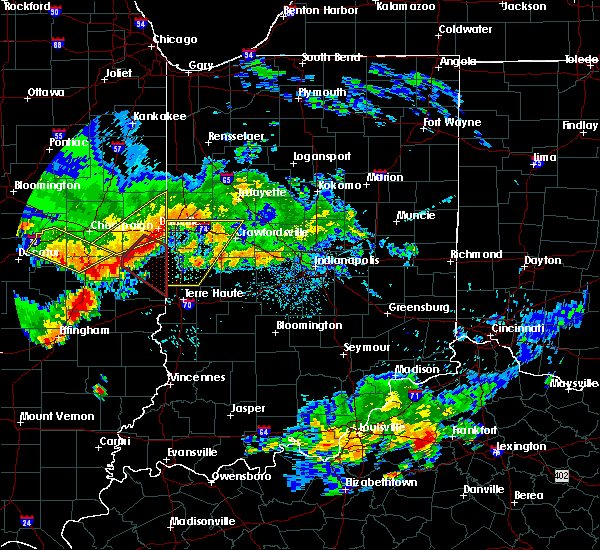 At 255 pm cdt, a severe thunderstorm capable of producing a tornado was located near hume, or 14 miles northwest of paris, moving southeast at 50 mph (radar indicated rotation). Hazards include tornado. Flying debris will be dangerous to those caught without shelter. mobile homes will be damaged or destroyed. damage to roofs, windows, and vehicles will occur. tree damage is likely. this dangerous storm will be near, chrisman around 300 pm cdt. paris around 310 pm cdt. vermilion around 315 pm cdt. Other locations impacted by this tornadic thunderstorm include palermo, edgar, scottland, indianola, sandford, jamaica, edgar county airport and metcalf. At 255 pm cdt, a severe thunderstorm capable of producing a tornado was located near hume, or 14 miles northwest of paris, moving southeast at 50 mph (radar indicated rotation). Hazards include tornado. Flying debris will be dangerous to those caught without shelter. mobile homes will be damaged or destroyed. damage to roofs, windows, and vehicles will occur. tree damage is likely. this dangerous storm will be near, chrisman around 300 pm cdt. paris around 310 pm cdt. vermilion around 315 pm cdt. Other locations impacted by this tornadic thunderstorm include palermo, edgar, scottland, indianola, sandford, jamaica, edgar county airport and metcalf.
|
| 6/10/2018 2:53 PM CDT | Report of a tree down on a house...major damage to house. time estimated by rada in vermilion county IL, 166.2 miles W of Georgetown, IL |
| 6/10/2018 2:38 PM CDT |
 At 238 pm cdt, a severe thunderstorm capable of producing a tornado was located over broadlands, or 17 miles northeast of tuscola, moving southeast at 55 mph (radar indicated rotation). Hazards include tornado. Flying debris will be dangerous to those caught without shelter. mobile homes will be damaged or destroyed. damage to roofs, windows, and vehicles will occur. tree damage is likely. this dangerous storm will be near, sidell and hume around 250 pm cdt. chrisman and ridge farm around 300 pm cdt. other locations impacted by this tornadic thunderstorm include palermo, edgar, longview, scottland, indianola, sandford, jamaica, edgar county airport and metcalf. This includes interstate 74 between mile markers 202 and 204. At 238 pm cdt, a severe thunderstorm capable of producing a tornado was located over broadlands, or 17 miles northeast of tuscola, moving southeast at 55 mph (radar indicated rotation). Hazards include tornado. Flying debris will be dangerous to those caught without shelter. mobile homes will be damaged or destroyed. damage to roofs, windows, and vehicles will occur. tree damage is likely. this dangerous storm will be near, sidell and hume around 250 pm cdt. chrisman and ridge farm around 300 pm cdt. other locations impacted by this tornadic thunderstorm include palermo, edgar, longview, scottland, indianola, sandford, jamaica, edgar county airport and metcalf. This includes interstate 74 between mile markers 202 and 204.
|
| 5/31/2018 6:25 PM CDT |
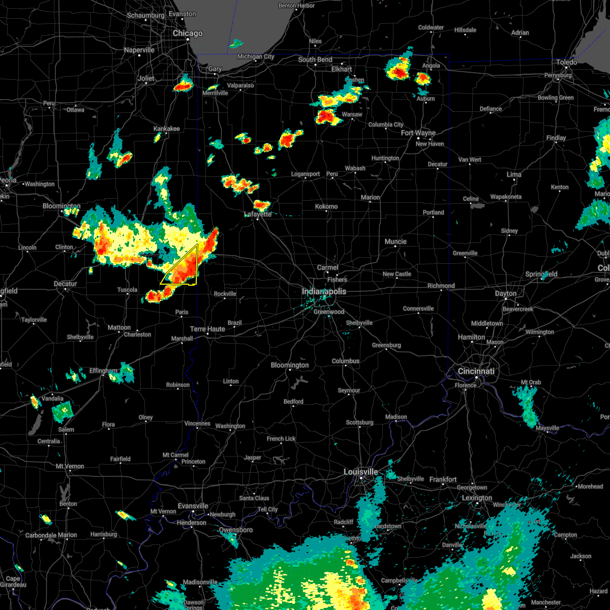 At 625 pm cdt, severe thunderstorms were located along a line extending from 6 miles southwest of covington indiana, to near sidell illinois, moving east at 45 mph (emergency management). Hazards include 60 mph wind gusts. Expect damage to roofs, siding, and trees. locations impacted include, danville, georgetown, westville, tilton, catlin, ridge farm, sidell, belgium, indianola and jamaica. This includes interstate 74 between mile markers 213 and 220. At 625 pm cdt, severe thunderstorms were located along a line extending from 6 miles southwest of covington indiana, to near sidell illinois, moving east at 45 mph (emergency management). Hazards include 60 mph wind gusts. Expect damage to roofs, siding, and trees. locations impacted include, danville, georgetown, westville, tilton, catlin, ridge farm, sidell, belgium, indianola and jamaica. This includes interstate 74 between mile markers 213 and 220.
|
| 5/31/2018 6:06 PM CDT |
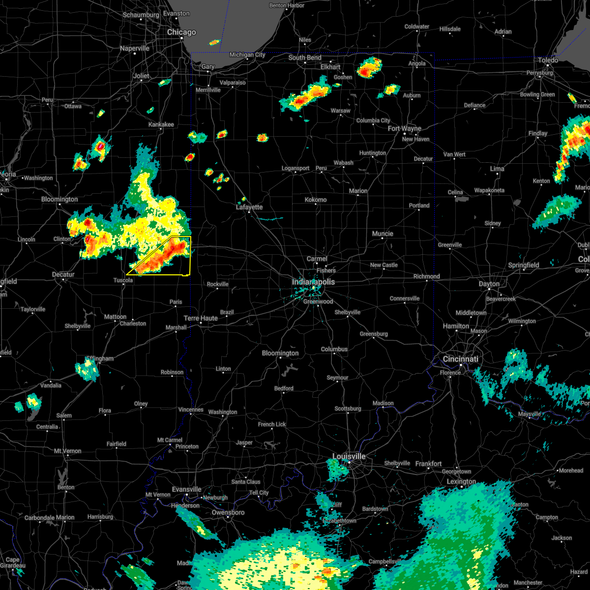 At 605 pm cdt, severe thunderstorms were located along a line extending from near danville to near villa grove, moving east at 40 mph (emergency management. at 6 pm, power lines and power poles were blown down south of saint joseph). Hazards include 60 mph wind gusts. expect damage to roofs, siding, and trees At 605 pm cdt, severe thunderstorms were located along a line extending from near danville to near villa grove, moving east at 40 mph (emergency management. at 6 pm, power lines and power poles were blown down south of saint joseph). Hazards include 60 mph wind gusts. expect damage to roofs, siding, and trees
|
| 5/27/2018 3:53 PM CDT |
 At 351 pm cdt, a severe thunderstorm was located over sciota, or 8 miles north of macomb, and is nearly stationary moving very slowly to the southwest (radar indicated). Hazards include 60 mph wind gusts and quarter size hail. Hail damage to vehicles is expected. expect wind damage to roofs, siding, and trees. Locations impacted include, macomb, colchester, good hope, tennessee, sciota, western illinois university, spring lake, macomb municipal airport, mcdonough county 4-h grounds and argyle lake state park. At 351 pm cdt, a severe thunderstorm was located over sciota, or 8 miles north of macomb, and is nearly stationary moving very slowly to the southwest (radar indicated). Hazards include 60 mph wind gusts and quarter size hail. Hail damage to vehicles is expected. expect wind damage to roofs, siding, and trees. Locations impacted include, macomb, colchester, good hope, tennessee, sciota, western illinois university, spring lake, macomb municipal airport, mcdonough county 4-h grounds and argyle lake state park.
|
| 5/27/2018 3:32 PM CDT |
 At 331 pm cdt, a severe thunderstorm was located over sciota, or 7 miles north of macomb, moving slowly south at 5 mph (radar indicated). Hazards include 60 mph wind gusts and quarter size hail. Hail damage to vehicles is expected. Expect wind damage to roofs, siding, and trees. At 331 pm cdt, a severe thunderstorm was located over sciota, or 7 miles north of macomb, moving slowly south at 5 mph (radar indicated). Hazards include 60 mph wind gusts and quarter size hail. Hail damage to vehicles is expected. Expect wind damage to roofs, siding, and trees.
|
| 11/5/2017 3:51 PM CDT |
 The severe thunderstorm warning for northern edgar, southern vermilion, southeastern champaign and douglas counties will expire at 300 pm cst, the storm which prompted the warning has weakened below severe limits, and no longer poses an immediate threat to life or property. therefore the warning will be allowed to expire. however gusty winds and heavy rain are still possible with this thunderstorm. a tornado watch remains in effect until 700 pm cst for east central illinois. The severe thunderstorm warning for northern edgar, southern vermilion, southeastern champaign and douglas counties will expire at 300 pm cst, the storm which prompted the warning has weakened below severe limits, and no longer poses an immediate threat to life or property. therefore the warning will be allowed to expire. however gusty winds and heavy rain are still possible with this thunderstorm. a tornado watch remains in effect until 700 pm cst for east central illinois.
|
| 11/5/2017 3:34 PM CDT |
 At 232 pm cst, a severe thunderstorm was located near camargo, moving east at 55 mph (radar indicated). Hazards include 60 mph wind gusts and quarter size hail. Hail damage to vehicles is expected. expect wind damage to roofs, siding, and trees. locations impacted include, tuscola, georgetown, westville, arcola, villa grove, chrisman, atwood, ridge farm, newman, sidell, camargo, hume, broadlands, brocton, hindsboro, allerton, edgar, bourbon, indianola and murdock. this includes interstate 57 between mile markers 203 and 216. A tornado watch remains in effect until 700 pm cst for east central illinois. At 232 pm cst, a severe thunderstorm was located near camargo, moving east at 55 mph (radar indicated). Hazards include 60 mph wind gusts and quarter size hail. Hail damage to vehicles is expected. expect wind damage to roofs, siding, and trees. locations impacted include, tuscola, georgetown, westville, arcola, villa grove, chrisman, atwood, ridge farm, newman, sidell, camargo, hume, broadlands, brocton, hindsboro, allerton, edgar, bourbon, indianola and murdock. this includes interstate 57 between mile markers 203 and 216. A tornado watch remains in effect until 700 pm cst for east central illinois.
|
| 11/5/2017 3:17 PM CDT |
 At 217 pm cst, a severe thunderstorm was located near tuscola, moving east at 55 mph (radar indicated). Hazards include 60 mph wind gusts and quarter size hail. Hail damage to vehicles is expected. Expect wind damage to roofs, siding, and trees. At 217 pm cst, a severe thunderstorm was located near tuscola, moving east at 55 mph (radar indicated). Hazards include 60 mph wind gusts and quarter size hail. Hail damage to vehicles is expected. Expect wind damage to roofs, siding, and trees.
|
| 11/5/2017 1:28 PM CDT |
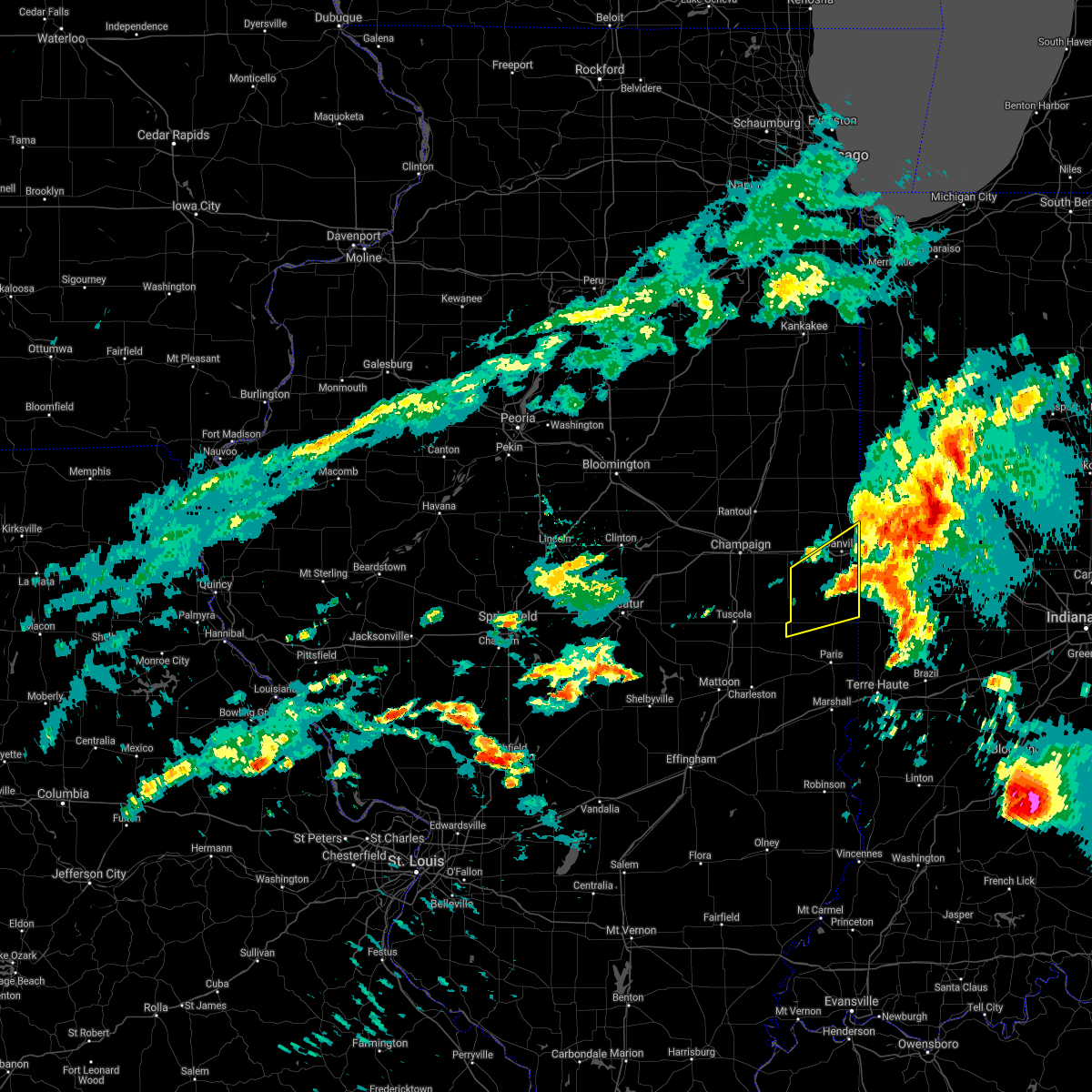 The severe thunderstorm warning for northern edgar and southern vermilion counties will expire at 1230 pm cst, the severe thunderstorm which prompted the warning has moved out of the warned area. therefore, the warning will be allowed to expire. The severe thunderstorm warning for northern edgar and southern vermilion counties will expire at 1230 pm cst, the severe thunderstorm which prompted the warning has moved out of the warned area. therefore, the warning will be allowed to expire.
|
| 11/5/2017 1:02 PM CDT |
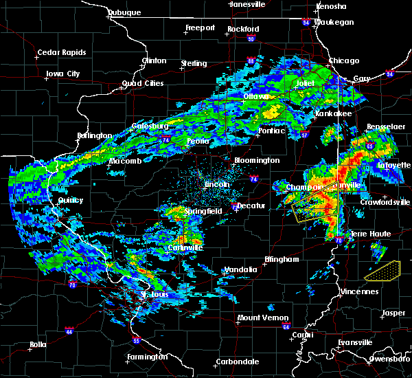 At 1201 pm cst, a severe thunderstorm was located near georgetown, or 12 miles south of danville, moving east at 55 mph (radar indicated). Hazards include 60 mph wind gusts and quarter size hail. Hail damage to vehicles is expected. expect wind damage to roofs, siding, and trees. locations impacted include, danville, georgetown, westville, tilton, catlin, oakwood, chrisman, ridge farm, fairmount, sidell, belgium, hume, allerton, indianola, jamaica, metcalf, vermilion county airport, palermo, kickapoo state park and scottland. This includes interstate 74 between mile markers 206 and 220. At 1201 pm cst, a severe thunderstorm was located near georgetown, or 12 miles south of danville, moving east at 55 mph (radar indicated). Hazards include 60 mph wind gusts and quarter size hail. Hail damage to vehicles is expected. expect wind damage to roofs, siding, and trees. locations impacted include, danville, georgetown, westville, tilton, catlin, oakwood, chrisman, ridge farm, fairmount, sidell, belgium, hume, allerton, indianola, jamaica, metcalf, vermilion county airport, palermo, kickapoo state park and scottland. This includes interstate 74 between mile markers 206 and 220.
|
| 11/5/2017 12:42 PM CDT |
 At 1142 am cst, a severe thunderstorm was located over broadlands, or 14 miles east of tuscola, moving east at 55 mph (radar indicated). Hazards include 60 mph wind gusts and quarter size hail. Hail damage to vehicles is expected. Expect wind damage to roofs, siding, and trees. At 1142 am cst, a severe thunderstorm was located over broadlands, or 14 miles east of tuscola, moving east at 55 mph (radar indicated). Hazards include 60 mph wind gusts and quarter size hail. Hail damage to vehicles is expected. Expect wind damage to roofs, siding, and trees.
|
| 10/14/2017 8:53 PM CDT |
 The severe thunderstorm warning for southeastern warren and central mcdonough counties will expire at 900 pm cdt, the storms which prompted the warning have weakened. therefore, the warning will be allowed to expire. however heavy rain is still possible with these thunderstorms. a tornado watch remains in effect until 100 am cdt for west central illinois. The severe thunderstorm warning for southeastern warren and central mcdonough counties will expire at 900 pm cdt, the storms which prompted the warning have weakened. therefore, the warning will be allowed to expire. however heavy rain is still possible with these thunderstorms. a tornado watch remains in effect until 100 am cdt for west central illinois.
|
| 10/14/2017 8:44 PM CDT |
 At 844 pm cdt, severe thunderstorms were located along a line extending from 6 miles west of abingdon to near little swan lake to near macomb, moving east at 60 mph (radar indicated). Hazards include 60 mph wind gusts. Expect damage to roofs, siding, and trees. locations impacted include, macomb, bushnell, colchester, roseville, avon, good hope, prairie city, bardolph, sciota, western illinois university, fandon, little swan lake, new philadelphia, adair, walnut grove, greenbush, macomb municipal airport, warren county fairgrounds, youngstown and prairie city airport. A tornado watch remains in effect until 100 am cdt for west central illinois. At 844 pm cdt, severe thunderstorms were located along a line extending from 6 miles west of abingdon to near little swan lake to near macomb, moving east at 60 mph (radar indicated). Hazards include 60 mph wind gusts. Expect damage to roofs, siding, and trees. locations impacted include, macomb, bushnell, colchester, roseville, avon, good hope, prairie city, bardolph, sciota, western illinois university, fandon, little swan lake, new philadelphia, adair, walnut grove, greenbush, macomb municipal airport, warren county fairgrounds, youngstown and prairie city airport. A tornado watch remains in effect until 100 am cdt for west central illinois.
|
| 10/14/2017 8:34 PM CDT |
 At 834 pm cdt, severe thunderstorms were located along a line extending from near roseville to 6 miles north of good hope to near tennessee, moving east at 60 mph (radar indicated). Hazards include 60 mph wind gusts. Expect damage to roofs, siding, and trees. locations impacted include, macomb, carthage, bushnell, colchester, roseville, avon, blandinsville, industry, good hope, prairie city, bardolph, raritan, tennessee, sciota, western illinois university, fandon, little swan lake, new philadelphia, colmar and adair. A tornado watch remains in effect until 100 am cdt for west central illinois. At 834 pm cdt, severe thunderstorms were located along a line extending from near roseville to 6 miles north of good hope to near tennessee, moving east at 60 mph (radar indicated). Hazards include 60 mph wind gusts. Expect damage to roofs, siding, and trees. locations impacted include, macomb, carthage, bushnell, colchester, roseville, avon, blandinsville, industry, good hope, prairie city, bardolph, raritan, tennessee, sciota, western illinois university, fandon, little swan lake, new philadelphia, colmar and adair. A tornado watch remains in effect until 100 am cdt for west central illinois.
|
| 10/14/2017 8:23 PM CDT |
 At 823 pm cdt, severe thunderstorms were located along a line extending from near stronghurst to near blandinsville to near colmar, moving east at 60 mph (radar indicated). Hazards include 60 mph wind gusts and quarter size hail. Hail damage to vehicles is expected. expect wind damage to roofs, siding, and trees. locations impacted include, macomb, carthage, bushnell, colchester, la harpe, roseville, avon, blandinsville, industry, good hope, prairie city, terre haute, bardolph, raritan, tennessee, sciota, western illinois university, fandon, little swan lake and new philadelphia. A tornado watch remains in effect until 100 am cdt for west central illinois. At 823 pm cdt, severe thunderstorms were located along a line extending from near stronghurst to near blandinsville to near colmar, moving east at 60 mph (radar indicated). Hazards include 60 mph wind gusts and quarter size hail. Hail damage to vehicles is expected. expect wind damage to roofs, siding, and trees. locations impacted include, macomb, carthage, bushnell, colchester, la harpe, roseville, avon, blandinsville, industry, good hope, prairie city, terre haute, bardolph, raritan, tennessee, sciota, western illinois university, fandon, little swan lake and new philadelphia. A tornado watch remains in effect until 100 am cdt for west central illinois.
|
| 10/14/2017 8:16 PM CDT |
 At 816 pm cdt, severe thunderstorms were located along a line extending from terre haute to la harpe to near bowen, moving east at 60 mph (radar indicated). Hazards include 60 mph wind gusts and quarter size hail. Hail damage to vehicles is expected. expect wind damage to roofs, siding, and trees. locations impacted include, macomb, carthage, bushnell, colchester, la harpe, roseville, dallas city, avon, blandinsville, augusta, bowen, industry, good hope, prairie city, terre haute, bardolph, west point, ferris, raritan and tennessee. A tornado watch remains in effect until 100 am cdt for west central illinois, and southeastern iowa. At 816 pm cdt, severe thunderstorms were located along a line extending from terre haute to la harpe to near bowen, moving east at 60 mph (radar indicated). Hazards include 60 mph wind gusts and quarter size hail. Hail damage to vehicles is expected. expect wind damage to roofs, siding, and trees. locations impacted include, macomb, carthage, bushnell, colchester, la harpe, roseville, dallas city, avon, blandinsville, augusta, bowen, industry, good hope, prairie city, terre haute, bardolph, west point, ferris, raritan and tennessee. A tornado watch remains in effect until 100 am cdt for west central illinois, and southeastern iowa.
|
| 10/14/2017 8:09 PM CDT |
 At 809 pm cdt, severe thunderstorms were located along a line extending from near dallas city to near west point, moving east at 60 mph (radar indicated). Hazards include 60 mph wind gusts and quarter size hail. Hail damage to vehicles is expected. expect wind damage to roofs, siding, and trees. locations impacted include, macomb, fort madison, keokuk, carthage, nauvoo, bushnell, hamilton, warsaw, colchester, la harpe, roseville, dallas city, avon, blandinsville, augusta, bowen, industry, good hope, prairie city and terre haute. A tornado watch remains in effect until 100 am cdt for west central illinois, southeastern iowa, and northeastern missouri. At 809 pm cdt, severe thunderstorms were located along a line extending from near dallas city to near west point, moving east at 60 mph (radar indicated). Hazards include 60 mph wind gusts and quarter size hail. Hail damage to vehicles is expected. expect wind damage to roofs, siding, and trees. locations impacted include, macomb, fort madison, keokuk, carthage, nauvoo, bushnell, hamilton, warsaw, colchester, la harpe, roseville, dallas city, avon, blandinsville, augusta, bowen, industry, good hope, prairie city and terre haute. A tornado watch remains in effect until 100 am cdt for west central illinois, southeastern iowa, and northeastern missouri.
|
| 10/14/2017 7:58 PM CDT |
 At 758 pm cdt, severe thunderstorms were located along a line extending from niota to 8 miles south of warsaw, moving east at 60 mph (radar indicated). Hazards include 60 mph wind gusts and quarter size hail. Hail damage to vehicles is expected. Expect wind damage to roofs, siding, and trees. At 758 pm cdt, severe thunderstorms were located along a line extending from niota to 8 miles south of warsaw, moving east at 60 mph (radar indicated). Hazards include 60 mph wind gusts and quarter size hail. Hail damage to vehicles is expected. Expect wind damage to roofs, siding, and trees.
|
| 10/14/2017 6:19 PM CDT |
 At 619 pm cdt, severe thunderstorms were located along a line extending from near galesburg to macomb to near colmar, moving east at 65 mph (radar indicated). Hazards include 60 mph wind gusts and nickel size hail. Expect damage to roofs, siding, and trees. locations impacted include, macomb, bushnell, colchester, blandinsville, industry, good hope, prairie city, bardolph, tennessee, sciota, western illinois university, adair, fandon, new philadelphia, colmar, walnut grove, plymouth, pennington point, macomb municipal airport and scottsburg. If you are at western illinois campus and stadium you should seek safe shelter immediately! a tornado watch remains in effect until 100 am cdt for west central illinois. At 619 pm cdt, severe thunderstorms were located along a line extending from near galesburg to macomb to near colmar, moving east at 65 mph (radar indicated). Hazards include 60 mph wind gusts and nickel size hail. Expect damage to roofs, siding, and trees. locations impacted include, macomb, bushnell, colchester, blandinsville, industry, good hope, prairie city, bardolph, tennessee, sciota, western illinois university, adair, fandon, new philadelphia, colmar, walnut grove, plymouth, pennington point, macomb municipal airport and scottsburg. If you are at western illinois campus and stadium you should seek safe shelter immediately! a tornado watch remains in effect until 100 am cdt for west central illinois.
|
| 10/14/2017 5:51 PM CDT |
 At 550 pm cdt, severe thunderstorms were located along a line extending from near dallas city to near carthage to 7 miles northeast of canton, moving east at 55 mph (radar indicated). Hazards include 60 mph wind gusts and quarter size hail. Hail damage to vehicles is expected. Expect wind damage to roofs, siding, and trees. At 550 pm cdt, severe thunderstorms were located along a line extending from near dallas city to near carthage to 7 miles northeast of canton, moving east at 55 mph (radar indicated). Hazards include 60 mph wind gusts and quarter size hail. Hail damage to vehicles is expected. Expect wind damage to roofs, siding, and trees.
|
| 8/18/2017 6:48 PM CDT |
 At 648 pm cdt, a severe thunderstorm was located over dallas city, or 11 miles south of burlington, moving east at 35 mph (radar indicated). Hazards include 60 mph wind gusts and quarter size hail. Hail damage to vehicles is expected. expect wind damage to roofs, siding, and trees. Locations impacted include, macomb, fort madison, la harpe, dallas city, blandinsville, good hope, terre haute, raritan, sciota, colusa, western illinois university, disco, lomax, pontoosuc, wever, spring lake, swan creek and mcdonough county 4-h grounds. At 648 pm cdt, a severe thunderstorm was located over dallas city, or 11 miles south of burlington, moving east at 35 mph (radar indicated). Hazards include 60 mph wind gusts and quarter size hail. Hail damage to vehicles is expected. expect wind damage to roofs, siding, and trees. Locations impacted include, macomb, fort madison, la harpe, dallas city, blandinsville, good hope, terre haute, raritan, sciota, colusa, western illinois university, disco, lomax, pontoosuc, wever, spring lake, swan creek and mcdonough county 4-h grounds.
|
| 8/18/2017 6:33 PM CDT |
 At 633 pm cdt, a severe thunderstorm was located over niota, or near fort madison, moving east at 35 mph (radar indicated). Hazards include 60 mph wind gusts and quarter size hail. Hail damage to vehicles is expected. Expect wind damage to roofs, siding, and trees. At 633 pm cdt, a severe thunderstorm was located over niota, or near fort madison, moving east at 35 mph (radar indicated). Hazards include 60 mph wind gusts and quarter size hail. Hail damage to vehicles is expected. Expect wind damage to roofs, siding, and trees.
|
| 8/10/2017 6:42 PM CDT |
 At 641 pm cdt, severe thunderstorms were located along a line extending from near little swan lake to tennessee to near west point, moving southeast at 35 mph (trained weather spotters). Hazards include 60 mph wind gusts and nickel size hail. Expect damage to roofs, siding, and trees. Locations impacted include, macomb, carthage, bushnell, hamilton, warsaw, colchester, avon, blandinsville, augusta, bowen, industry, good hope, prairie city, bardolph, west point, tennessee, sciota, western illinois university, fandon and little swan lake. At 641 pm cdt, severe thunderstorms were located along a line extending from near little swan lake to tennessee to near west point, moving southeast at 35 mph (trained weather spotters). Hazards include 60 mph wind gusts and nickel size hail. Expect damage to roofs, siding, and trees. Locations impacted include, macomb, carthage, bushnell, hamilton, warsaw, colchester, avon, blandinsville, augusta, bowen, industry, good hope, prairie city, bardolph, west point, tennessee, sciota, western illinois university, fandon and little swan lake.
|
| 8/10/2017 6:32 PM CDT |
 At 631 pm cdt, severe thunderstorms were located along a line extending from near roseville to near west point, moving southeast at 35 mph (trained weather spotters reported wind damage in nauvoo around 602 pm). Hazards include 60 mph wind gusts and nickel size hail. Expect damage to roofs, siding, and trees. Locations impacted include, macomb, keokuk, carthage, bushnell, hamilton, warsaw, colchester, la harpe, stronghurst, avon, blandinsville, augusta, bowen, industry, good hope, prairie city, terre haute, bardolph, west point and ferris. At 631 pm cdt, severe thunderstorms were located along a line extending from near roseville to near west point, moving southeast at 35 mph (trained weather spotters reported wind damage in nauvoo around 602 pm). Hazards include 60 mph wind gusts and nickel size hail. Expect damage to roofs, siding, and trees. Locations impacted include, macomb, keokuk, carthage, bushnell, hamilton, warsaw, colchester, la harpe, stronghurst, avon, blandinsville, augusta, bowen, industry, good hope, prairie city, terre haute, bardolph, west point and ferris.
|
| 8/10/2017 6:08 PM CDT |
 At 607 pm cdt, severe thunderstorms were located along a line extending from stronghurst to hamilton, moving southeast at 40 mph (radar indicated). Hazards include 60 mph wind gusts and nickel size hail. Expect damage to roofs, siding, and trees. Locations impacted include, macomb, fort madison, keokuk, carthage, nauvoo, bushnell, hamilton, warsaw, colchester, la harpe, dallas city, stronghurst, avon, blandinsville, augusta, bowen, industry, good hope, prairie city and carman. At 607 pm cdt, severe thunderstorms were located along a line extending from stronghurst to hamilton, moving southeast at 40 mph (radar indicated). Hazards include 60 mph wind gusts and nickel size hail. Expect damage to roofs, siding, and trees. Locations impacted include, macomb, fort madison, keokuk, carthage, nauvoo, bushnell, hamilton, warsaw, colchester, la harpe, dallas city, stronghurst, avon, blandinsville, augusta, bowen, industry, good hope, prairie city and carman.
|
| 8/10/2017 6:04 PM CDT |
 At 604 pm cdt, severe thunderstorms were located along a line extending from stronghurst to hamilton, moving southeast at 40 mph (radar indicated). Hazards include 60 mph wind gusts and nickel size hail. expect damage to roofs, siding, and trees At 604 pm cdt, severe thunderstorms were located along a line extending from stronghurst to hamilton, moving southeast at 40 mph (radar indicated). Hazards include 60 mph wind gusts and nickel size hail. expect damage to roofs, siding, and trees
|
| 8/3/2017 6:06 PM CDT |
 At 603 pm cdt, a severe thunderstorm was located over bardolph, or near macomb, moving east at 30 mph (radar indicated). Hazards include 60 mph wind gusts. expect damage to roofs, siding, and trees At 603 pm cdt, a severe thunderstorm was located over bardolph, or near macomb, moving east at 30 mph (radar indicated). Hazards include 60 mph wind gusts. expect damage to roofs, siding, and trees
|
| 7/11/2017 10:37 AM CDT | Trees snapped of uprooted...tree blown down on illinois route 1 blocking road in tow in vermilion county IL, 166.2 miles W of Georgetown, IL |
| 7/11/2017 10:30 AM CDT | Trees down on rte 1 blocking road into georgetow in vermilion county IL, 166.2 miles W of Georgetown, IL |
| 7/11/2017 10:06 AM CDT |
 At 1005 am cdt, a severe thunderstorm was located over philo, or 7 miles southeast of champaign, moving east at 60 mph (radar indicated. at 957 am, a wind gust 61 mph was reported at the willard airport in savoy). Hazards include 60 mph wind gusts. expect damage to roofs, siding, and trees At 1005 am cdt, a severe thunderstorm was located over philo, or 7 miles southeast of champaign, moving east at 60 mph (radar indicated. at 957 am, a wind gust 61 mph was reported at the willard airport in savoy). Hazards include 60 mph wind gusts. expect damage to roofs, siding, and trees
|
| 5/26/2017 12:05 PM CDT |
 At 1204 pm cdt, a severe thunderstorm was located over fandon, or 10 miles southwest of macomb, moving east at 55 mph (radar indicated). Hazards include 60 mph wind gusts and quarter size hail. Hail damage to vehicles is expected. expect wind damage to roofs, siding, and trees. Locations impacted include, macomb, bushnell, colchester, industry, bardolph, western illinois university, adair, fandon, new philadelphia, colmar, pennington point, doddsville and mcdonough county 4-h grounds. At 1204 pm cdt, a severe thunderstorm was located over fandon, or 10 miles southwest of macomb, moving east at 55 mph (radar indicated). Hazards include 60 mph wind gusts and quarter size hail. Hail damage to vehicles is expected. expect wind damage to roofs, siding, and trees. Locations impacted include, macomb, bushnell, colchester, industry, bardolph, western illinois university, adair, fandon, new philadelphia, colmar, pennington point, doddsville and mcdonough county 4-h grounds.
|
| 5/26/2017 12:02 PM CDT |
 At 1202 pm cdt, a severe thunderstorm was located near colmar, or 12 miles southwest of macomb, moving east at 55 mph (radar indicated). Hazards include 60 mph wind gusts and quarter size hail. Hail damage to vehicles is expected. expect wind damage to roofs, siding, and trees. Locations impacted include, macomb, bushnell, colchester, industry, bardolph, tennessee, western illinois university, adair, fandon, new philadelphia, colmar, plymouth, pennington point, macomb municipal airport, doddsville, mcdonough county 4-h grounds and argyle lake state park. At 1202 pm cdt, a severe thunderstorm was located near colmar, or 12 miles southwest of macomb, moving east at 55 mph (radar indicated). Hazards include 60 mph wind gusts and quarter size hail. Hail damage to vehicles is expected. expect wind damage to roofs, siding, and trees. Locations impacted include, macomb, bushnell, colchester, industry, bardolph, tennessee, western illinois university, adair, fandon, new philadelphia, colmar, plymouth, pennington point, macomb municipal airport, doddsville, mcdonough county 4-h grounds and argyle lake state park.
|
| 5/26/2017 11:55 AM CDT |
 At 1154 am cdt, a severe thunderstorm was located near augusta, or 12 miles southeast of carthage, moving east at 40 mph (radar indicated). Hazards include 60 mph wind gusts and quarter size hail. Hail damage to vehicles is expected. Expect wind damage to roofs, siding, and trees. At 1154 am cdt, a severe thunderstorm was located near augusta, or 12 miles southeast of carthage, moving east at 40 mph (radar indicated). Hazards include 60 mph wind gusts and quarter size hail. Hail damage to vehicles is expected. Expect wind damage to roofs, siding, and trees.
|
| 5/10/2017 5:48 PM CDT |
 At 548 pm cdt, severe thunderstorms were located along a line extending from near little swan lake to near littleton, moving east at 45 mph (trained weather spotters). Hazards include 70 mph wind gusts. Expect considerable tree damage. Damage is likely to mobile homes, roofs, and outbuildings. At 548 pm cdt, severe thunderstorms were located along a line extending from near little swan lake to near littleton, moving east at 45 mph (trained weather spotters). Hazards include 70 mph wind gusts. Expect considerable tree damage. Damage is likely to mobile homes, roofs, and outbuildings.
|
| 4/29/2017 7:47 PM CDT | Quarter sized hail reported 166.3 miles WNW of Georgetown, IL |
| 4/29/2017 7:46 PM CDT |
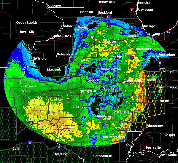 At 745 pm cdt, severe thunderstorms were located along a line extending from near rossville to near danville to near chrisman, moving northeast at 45 mph (trained weather spotters). Hazards include 60 mph wind gusts and quarter size hail. Hail damage to vehicles is expected. Expect wind damage to roofs, siding, and trees. At 745 pm cdt, severe thunderstorms were located along a line extending from near rossville to near danville to near chrisman, moving northeast at 45 mph (trained weather spotters). Hazards include 60 mph wind gusts and quarter size hail. Hail damage to vehicles is expected. Expect wind damage to roofs, siding, and trees.
|
| 4/29/2017 7:45 PM CDT | Quarter sized hail reported 166.1 miles WNW of Georgetown, IL |
| 4/29/2017 7:34 PM CDT |
 At 733 pm cdt, severe thunderstorms were located along a line extending from near potomac to oakwood to near redmon, moving northeast at 35 mph (trained weather spotters). Hazards include 60 mph wind gusts and quarter size hail. Hail damage to vehicles is expected. expect wind damage to roofs, siding, and trees. locations impacted include, danville, hoopeston, georgetown, westville, tilton, catlin, oakwood, chrisman, rossville, ridge farm, potomac, fairmount, sidell, fithian, belgium, hume, brocton, allerton, redmon and muncie. This includes interstate 74 between mile markers 199 and 220. At 733 pm cdt, severe thunderstorms were located along a line extending from near potomac to oakwood to near redmon, moving northeast at 35 mph (trained weather spotters). Hazards include 60 mph wind gusts and quarter size hail. Hail damage to vehicles is expected. expect wind damage to roofs, siding, and trees. locations impacted include, danville, hoopeston, georgetown, westville, tilton, catlin, oakwood, chrisman, rossville, ridge farm, potomac, fairmount, sidell, fithian, belgium, hume, brocton, allerton, redmon and muncie. This includes interstate 74 between mile markers 199 and 220.
|
| 4/29/2017 6:56 PM CDT |
 At 656 pm cdt, severe thunderstorms were located along a line extending from near thomasboro to near sidney to near mattoon, moving northeast at 45 mph (trained weather spotters). Hazards include 60 mph wind gusts and quarter size hail. Hail damage to vehicles is expected. Expect wind damage to roofs, siding, and trees. At 656 pm cdt, severe thunderstorms were located along a line extending from near thomasboro to near sidney to near mattoon, moving northeast at 45 mph (trained weather spotters). Hazards include 60 mph wind gusts and quarter size hail. Hail damage to vehicles is expected. Expect wind damage to roofs, siding, and trees.
|
| 4/10/2017 11:57 AM CDT |
 At 1156 am cdt, a severe thunderstorm was located near chrisman, or 16 miles north of paris, moving northeast at 55 mph (radar indicated). Hazards include quarter size hail. Damage to vehicles is expected. this severe thunderstorm will be near, georgetown and ridge farm around 1205 pm cdt. Other locations impacted by this severe thunderstorm include scottland and indianola. At 1156 am cdt, a severe thunderstorm was located near chrisman, or 16 miles north of paris, moving northeast at 55 mph (radar indicated). Hazards include quarter size hail. Damage to vehicles is expected. this severe thunderstorm will be near, georgetown and ridge farm around 1205 pm cdt. Other locations impacted by this severe thunderstorm include scottland and indianola.
|
| 3/30/2017 4:10 PM CDT |
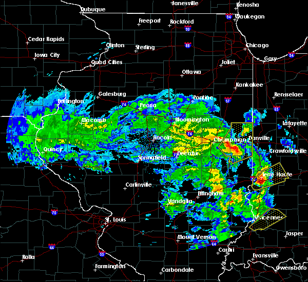 At 409 pm cdt, a severe thunderstorm was located over fairmount, or 11 miles southwest of danville, moving northeast at 40 mph (radar indicated). Hazards include 60 mph wind gusts. Expect damage to roofs, siding, and trees. locations impacted include, danville, hoopeston, st. joseph, georgetown, westville, tilton, catlin, oakwood, rossville, homer, ridge farm, ogden, potomac, fairmount, sidell, rankin, fithian, belgium, broadlands and allerton. This includes interstate 74 between mile markers 193 and 219. At 409 pm cdt, a severe thunderstorm was located over fairmount, or 11 miles southwest of danville, moving northeast at 40 mph (radar indicated). Hazards include 60 mph wind gusts. Expect damage to roofs, siding, and trees. locations impacted include, danville, hoopeston, st. joseph, georgetown, westville, tilton, catlin, oakwood, rossville, homer, ridge farm, ogden, potomac, fairmount, sidell, rankin, fithian, belgium, broadlands and allerton. This includes interstate 74 between mile markers 193 and 219.
|
| 3/30/2017 3:52 PM CDT |
 At 352 pm cdt, a severe thunderstorm was located over allerton, or 19 miles northeast of tuscola, moving northeast at 40 mph (radar indicated). Hazards include 60 mph wind gusts. expect damage to roofs, siding, and trees At 352 pm cdt, a severe thunderstorm was located over allerton, or 19 miles northeast of tuscola, moving northeast at 40 mph (radar indicated). Hazards include 60 mph wind gusts. expect damage to roofs, siding, and trees
|
| 3/7/2017 2:17 AM CST |
 At 216 am cst, severe thunderstorms were located along a line extending from near talbot to broadlands, moving east at 65 mph (radar indicated). Hazards include 60 mph wind gusts and quarter size hail. Hail damage to vehicles is expected. Expect wind damage to roofs, siding, and trees. At 216 am cst, severe thunderstorms were located along a line extending from near talbot to broadlands, moving east at 65 mph (radar indicated). Hazards include 60 mph wind gusts and quarter size hail. Hail damage to vehicles is expected. Expect wind damage to roofs, siding, and trees.
|
| 3/6/2017 11:22 PM CST |
 The severe thunderstorm warning for warren and mcdonough counties will expire at 1130 pm cst, the storms which prompted the warning have moved out of the area. therefore the warning will be allowed to expire. however gusty winds are still possible with these thunderstorms. a tornado watch remains in effect until 400 am cst for west central illinois. The severe thunderstorm warning for warren and mcdonough counties will expire at 1130 pm cst, the storms which prompted the warning have moved out of the area. therefore the warning will be allowed to expire. however gusty winds are still possible with these thunderstorms. a tornado watch remains in effect until 400 am cst for west central illinois.
|
| 3/6/2017 11:09 PM CST |
 At 1108 pm cst, severe thunderstorms were located along a line extending from near galva to near abingdon to industry, moving east at 60 mph (trained weather spotters. this line of storms has a history of producing damaging winds). Hazards include 70 mph wind gusts. Expect considerable tree damage. damage is likely to mobile homes, roofs, and outbuildings. locations impacted include, macomb, monmouth, bushnell, colchester, roseville, industry, good hope, prairie city, bardolph, tennessee, sciota, western illinois university, fandon, little swan lake, new philadelphia, adair, alexis, walnut grove, greenbush and coldbrook. A tornado watch remains in effect until 400 am cst for west central illinois. At 1108 pm cst, severe thunderstorms were located along a line extending from near galva to near abingdon to industry, moving east at 60 mph (trained weather spotters. this line of storms has a history of producing damaging winds). Hazards include 70 mph wind gusts. Expect considerable tree damage. damage is likely to mobile homes, roofs, and outbuildings. locations impacted include, macomb, monmouth, bushnell, colchester, roseville, industry, good hope, prairie city, bardolph, tennessee, sciota, western illinois university, fandon, little swan lake, new philadelphia, adair, alexis, walnut grove, greenbush and coldbrook. A tornado watch remains in effect until 400 am cst for west central illinois.
|
| 3/6/2017 10:13 PM CST |
 At 1012 pm cst, severe thunderstorms were located along a line extending from near keithsburg to near denmark to 6 miles northwest of canton, moving east at 60 mph (trained weather spotters. this line of storms has a history of producing damaging winds). Hazards include 70 mph wind gusts. Expect considerable tree damage. Damage is likely to mobile homes, roofs, and outbuildings. At 1012 pm cst, severe thunderstorms were located along a line extending from near keithsburg to near denmark to 6 miles northwest of canton, moving east at 60 mph (trained weather spotters. this line of storms has a history of producing damaging winds). Hazards include 70 mph wind gusts. Expect considerable tree damage. Damage is likely to mobile homes, roofs, and outbuildings.
|
| 7/24/2016 9:21 PM CDT |
 At 921 pm cdt, severe thunderstorms were located along a line extending from roseville to industry, moving east at 25 mph (radar indicated). Hazards include 60 mph wind gusts. Expect damage to trees. Locations impacted include, macomb, bushnell, colchester, blandinsville, industry, good hope, prairie city, bardolph, tennessee, sciota, western illinois university, new philadelphia, adair, fandon, little swan lake, walnut grove, greenbush, prairie city airport, doddsville and argyle lake state park. At 921 pm cdt, severe thunderstorms were located along a line extending from roseville to industry, moving east at 25 mph (radar indicated). Hazards include 60 mph wind gusts. Expect damage to trees. Locations impacted include, macomb, bushnell, colchester, blandinsville, industry, good hope, prairie city, bardolph, tennessee, sciota, western illinois university, new philadelphia, adair, fandon, little swan lake, walnut grove, greenbush, prairie city airport, doddsville and argyle lake state park.
|
| 7/24/2016 9:07 PM CDT |
 At 906 pm cdt, severe thunderstorms were located along a line extending from near raritan to near fandon, moving east at 30 mph (radar indicated). Hazards include 60 mph wind gusts. Expect damage to trees. Locations impacted include, macomb, bushnell, colchester, la harpe, roseville, blandinsville, industry, good hope, prairie city, terre haute, bardolph, raritan, tennessee, sciota, colmar, western illinois university, new philadelphia, adair, disco and fandon. At 906 pm cdt, severe thunderstorms were located along a line extending from near raritan to near fandon, moving east at 30 mph (radar indicated). Hazards include 60 mph wind gusts. Expect damage to trees. Locations impacted include, macomb, bushnell, colchester, la harpe, roseville, blandinsville, industry, good hope, prairie city, terre haute, bardolph, raritan, tennessee, sciota, colmar, western illinois university, new philadelphia, adair, disco and fandon.
|
| 7/24/2016 8:59 PM CDT |
 At 859 pm cdt, severe thunderstorms were located along a line extending from raritan to near fandon, moving east at 30 mph (radar indicated). Hazards include 60 mph wind gusts. Expect damage to trees. Locations impacted include, macomb, bushnell, colchester, la harpe, roseville, stronghurst, avon, blandinsville, industry, good hope, prairie city, terre haute, bardolph, raritan, tennessee, sciota, colmar, western illinois university, new philadelphia and adair. At 859 pm cdt, severe thunderstorms were located along a line extending from raritan to near fandon, moving east at 30 mph (radar indicated). Hazards include 60 mph wind gusts. Expect damage to trees. Locations impacted include, macomb, bushnell, colchester, la harpe, roseville, stronghurst, avon, blandinsville, industry, good hope, prairie city, terre haute, bardolph, raritan, tennessee, sciota, colmar, western illinois university, new philadelphia and adair.
|
| 7/24/2016 8:44 PM CDT |
 At 843 pm cdt, severe thunderstorms were located along a line extending from terre haute to near augusta, moving east at 30 mph (radar indicated). Hazards include 60 mph wind gusts. Expect damage to trees. Locations impacted include, macomb, bushnell, colchester, la harpe, roseville, stronghurst, avon, blandinsville, industry, good hope, prairie city, terre haute, bardolph, raritan, tennessee, sciota, colmar, western illinois university, new philadelphia and adair. At 843 pm cdt, severe thunderstorms were located along a line extending from terre haute to near augusta, moving east at 30 mph (radar indicated). Hazards include 60 mph wind gusts. Expect damage to trees. Locations impacted include, macomb, bushnell, colchester, la harpe, roseville, stronghurst, avon, blandinsville, industry, good hope, prairie city, terre haute, bardolph, raritan, tennessee, sciota, colmar, western illinois university, new philadelphia and adair.
|
| 7/24/2016 8:32 PM CDT |
 At 831 pm cdt, severe thunderstorms were located along a line extending from near denmark to 7 miles east of burnside, moving east at 25 mph (radar indicated). Hazards include 60 mph wind gusts. Expect damage to roofs. siding. And trees. At 831 pm cdt, severe thunderstorms were located along a line extending from near denmark to 7 miles east of burnside, moving east at 25 mph (radar indicated). Hazards include 60 mph wind gusts. Expect damage to roofs. siding. And trees.
|
| 7/18/2016 11:12 AM CDT |
 At 1111 am cdt, severe thunderstorms were located along a line extending from near ridge farm to near chrisman to near paris, moving east at 45 mph (emergency management. trees and power lines were blown down in allerton at 1039 am, and in sidell around 1100 am). Hazards include 60 mph wind gusts. Expect damage to roofs. siding. And trees. At 1111 am cdt, severe thunderstorms were located along a line extending from near ridge farm to near chrisman to near paris, moving east at 45 mph (emergency management. trees and power lines were blown down in allerton at 1039 am, and in sidell around 1100 am). Hazards include 60 mph wind gusts. Expect damage to roofs. siding. And trees.
|
| 7/18/2016 11:02 AM CDT |
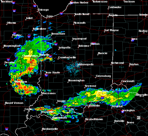 At 1101 am cdt, severe thunderstorms were located along a line extending from near catlin to near georgetown to near chrisman, moving east at 45 mph (trained weather spotters. at 1039 am cdt trees and power lines were blown down in allerton). Hazards include 60 mph wind gusts. Expect damage to roofs. siding. and trees. Locations impacted include, georgetown, westville, catlin, oakwood, ridge farm, fairmount, sidell, indianola, jamaica and palermo. At 1101 am cdt, severe thunderstorms were located along a line extending from near catlin to near georgetown to near chrisman, moving east at 45 mph (trained weather spotters. at 1039 am cdt trees and power lines were blown down in allerton). Hazards include 60 mph wind gusts. Expect damage to roofs. siding. and trees. Locations impacted include, georgetown, westville, catlin, oakwood, ridge farm, fairmount, sidell, indianola, jamaica and palermo.
|
| 7/18/2016 10:44 AM CDT |
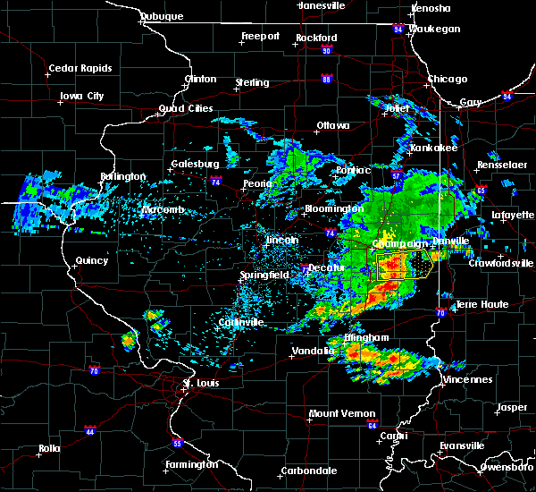 At 1043 am cdt, severe thunderstorms were located along a line extending from near homer to near allerton to newman, moving east at 40 mph (radar indicated). Hazards include 60 mph wind gusts. Expect damage to roofs. siding. and trees. Locations impacted include, georgetown, westville, catlin, oakwood, sidney, homer, ridge farm, fairmount, sidell, broadlands, allerton, indianola, murdock, jamaica, longview and palermo. At 1043 am cdt, severe thunderstorms were located along a line extending from near homer to near allerton to newman, moving east at 40 mph (radar indicated). Hazards include 60 mph wind gusts. Expect damage to roofs. siding. and trees. Locations impacted include, georgetown, westville, catlin, oakwood, sidney, homer, ridge farm, fairmount, sidell, broadlands, allerton, indianola, murdock, jamaica, longview and palermo.
|
| 7/18/2016 10:26 AM CDT |
 At 1026 am cdt, severe thunderstorms were located along a line extending from near philo to near villa grove to camargo, moving east at 40 mph (radar indicated). Hazards include 60 mph wind gusts. Expect damage to roofs. siding. And trees. At 1026 am cdt, severe thunderstorms were located along a line extending from near philo to near villa grove to camargo, moving east at 40 mph (radar indicated). Hazards include 60 mph wind gusts. Expect damage to roofs. siding. And trees.
|
| 7/13/2016 6:42 PM CDT |
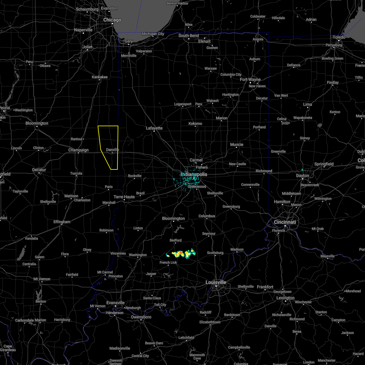 The severe thunderstorm warning for vermilion county will expire at 645 pm cdt, the storms which prompted the warning have moved out of the area. therefore, the warning will be allowed to expire. a severe thunderstorm watch remains in effect until 900 pm cdt for east central illinois. to report severe weather, contact your nearest law enforcement agency. they will relay your report to the national weather service lincoln. The severe thunderstorm warning for vermilion county will expire at 645 pm cdt, the storms which prompted the warning have moved out of the area. therefore, the warning will be allowed to expire. a severe thunderstorm watch remains in effect until 900 pm cdt for east central illinois. to report severe weather, contact your nearest law enforcement agency. they will relay your report to the national weather service lincoln.
|
| 7/13/2016 6:26 PM CDT |
 At 625 pm cdt, severe thunderstorms were located along a line extending from near potomac to near oakwood to near westville, moving east at 50 mph (trained weather spotters). Hazards include 60 mph wind gusts. Expect damage to roofs. siding. and trees. locations impacted include, danville, hoopeston, georgetown, westville, tilton, catlin, oakwood, rossville, ridge farm, potomac, belgium, bismarck, henning, vermilion county airport, collison, alvin, middle fork wildlife area and kickapoo state park. This includes interstate 74 between mile markers 205 and 219. At 625 pm cdt, severe thunderstorms were located along a line extending from near potomac to near oakwood to near westville, moving east at 50 mph (trained weather spotters). Hazards include 60 mph wind gusts. Expect damage to roofs. siding. and trees. locations impacted include, danville, hoopeston, georgetown, westville, tilton, catlin, oakwood, rossville, ridge farm, potomac, belgium, bismarck, henning, vermilion county airport, collison, alvin, middle fork wildlife area and kickapoo state park. This includes interstate 74 between mile markers 205 and 219.
|
| 7/13/2016 6:16 PM CDT |
 At 616 pm cdt, severe thunderstorms were located along a line extending from 6 miles northwest of potomac to near fithian to near sidell, moving east at 50 mph (trained weather spotters). Hazards include 60 mph wind gusts. Expect damage to roofs. siding. and trees. locations impacted include, danville, hoopeston, georgetown, westville, tilton, catlin, oakwood, rossville, ridge farm, potomac, fairmount, rankin, fithian, belgium, muncie, bismarck, indianola, henning, jamaica and vermilion county airport. This includes interstate 74 between mile markers 199 and 219. At 616 pm cdt, severe thunderstorms were located along a line extending from 6 miles northwest of potomac to near fithian to near sidell, moving east at 50 mph (trained weather spotters). Hazards include 60 mph wind gusts. Expect damage to roofs. siding. and trees. locations impacted include, danville, hoopeston, georgetown, westville, tilton, catlin, oakwood, rossville, ridge farm, potomac, fairmount, rankin, fithian, belgium, muncie, bismarck, indianola, henning, jamaica and vermilion county airport. This includes interstate 74 between mile markers 199 and 219.
|
| 7/13/2016 6:08 PM CDT |
 At 606 pm cdt, severe thunderstorms were located along a line extending from near gifford to near st. joseph to near allerton, moving east at 50 mph (trained weather spotters. at 555 pm...a 78 mile per hour wind gust was reported in urbana). Hazards include 70 mph wind gusts. Expect damage to roofs. siding. and trees. locations impacted include, danville, hoopeston, st. joseph, georgetown, westville, tilton, catlin, oakwood, rossville, homer, gifford, ridge farm, ogden, potomac, fairmount, sidell, rankin, fithian, belgium and broadlands. This includes interstate 74 between mile markers 191 and 219. At 606 pm cdt, severe thunderstorms were located along a line extending from near gifford to near st. joseph to near allerton, moving east at 50 mph (trained weather spotters. at 555 pm...a 78 mile per hour wind gust was reported in urbana). Hazards include 70 mph wind gusts. Expect damage to roofs. siding. and trees. locations impacted include, danville, hoopeston, st. joseph, georgetown, westville, tilton, catlin, oakwood, rossville, homer, gifford, ridge farm, ogden, potomac, fairmount, sidell, rankin, fithian, belgium and broadlands. This includes interstate 74 between mile markers 191 and 219.
|
| 7/13/2016 5:56 PM CDT |
 At 555 pm cdt, severe thunderstorms were located along a line extending from rantoul to near broadlands, moving east at 50 mph (trained weather spotters). Hazards include 60 mph wind gusts. Expect damage to roofs. siding. and trees. trained spotters reported power poles down near tolono. locations impacted include, champaign, danville, rantoul, urbana, savoy, hoopeston, st. joseph, georgetown, westville, tilton, catlin, oakwood, philo, rossville, sidney, homer, thomasboro, gifford, ridge farm and ogden. this includes the following highways, interstate 57 between mile markers 240 and 257. Interstate 74 between mile markers 182 and 219. At 555 pm cdt, severe thunderstorms were located along a line extending from rantoul to near broadlands, moving east at 50 mph (trained weather spotters). Hazards include 60 mph wind gusts. Expect damage to roofs. siding. and trees. trained spotters reported power poles down near tolono. locations impacted include, champaign, danville, rantoul, urbana, savoy, hoopeston, st. joseph, georgetown, westville, tilton, catlin, oakwood, philo, rossville, sidney, homer, thomasboro, gifford, ridge farm and ogden. this includes the following highways, interstate 57 between mile markers 240 and 257. Interstate 74 between mile markers 182 and 219.
|
| 7/13/2016 5:40 PM CDT |
 At 540 pm cdt, severe thunderstorms were located along a line extending from fisher to near bondville, moving east at 55 mph (radar indicated). Hazards include 60 mph wind gusts. Expect damage to roofs. siding. And trees. At 540 pm cdt, severe thunderstorms were located along a line extending from fisher to near bondville, moving east at 55 mph (radar indicated). Hazards include 60 mph wind gusts. Expect damage to roofs. siding. And trees.
|
| 6/20/2016 10:47 PM CDT |
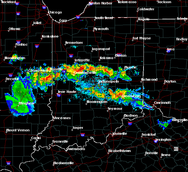 At 1046 pm cdt, a severe thunderstorm was located over ridge farm, or 14 miles south of danville, moving east at 40 mph (radar indicated). Hazards include 60 mph wind gusts and penny size hail. Expect damage to roofs. siding. and trees. Locations impacted include, georgetown, westville, tilton, catlin, ridge farm, sidell, belgium, indianola and jamaica. At 1046 pm cdt, a severe thunderstorm was located over ridge farm, or 14 miles south of danville, moving east at 40 mph (radar indicated). Hazards include 60 mph wind gusts and penny size hail. Expect damage to roofs. siding. and trees. Locations impacted include, georgetown, westville, tilton, catlin, ridge farm, sidell, belgium, indianola and jamaica.
|
| 6/20/2016 10:27 PM CDT |
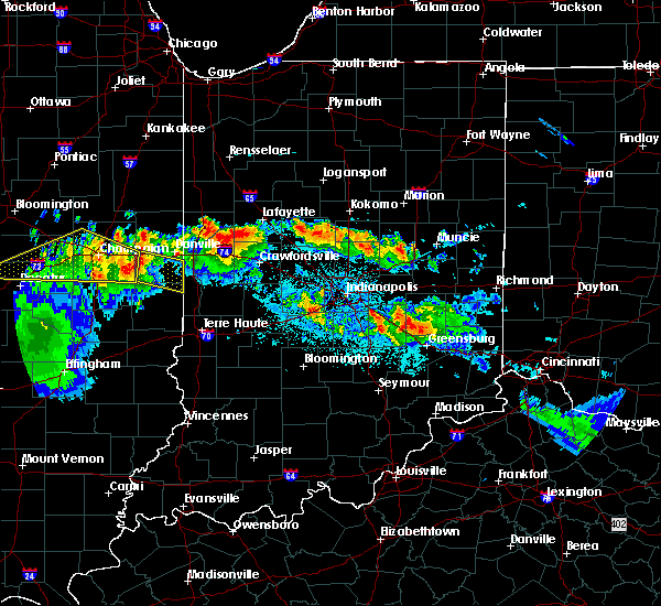 At 1027 pm cdt, a severe thunderstorm was located over fairmount, or 14 miles southwest of danville, moving east at 40 mph (radar indicated). Hazards include 60 mph wind gusts and nickel size hail. Expect damage to roofs. siding. And trees. At 1027 pm cdt, a severe thunderstorm was located over fairmount, or 14 miles southwest of danville, moving east at 40 mph (radar indicated). Hazards include 60 mph wind gusts and nickel size hail. Expect damage to roofs. siding. And trees.
|
| 3/15/2016 6:55 PM CDT |
 The tornado warning for northern mcdonough county will expire at 700 pm cdt, the storm which prompted the warning has moved out of the area. therefore the warning will be allowed to expire. however heavy rain is still possible with this thunderstorm. a tornado watch remains in effect until 900 pm cdt for west central illinois. to report severe weather, contact your nearest law enforcement agency. they will relay your report to the national weather service the quad cities. The tornado warning for northern mcdonough county will expire at 700 pm cdt, the storm which prompted the warning has moved out of the area. therefore the warning will be allowed to expire. however heavy rain is still possible with this thunderstorm. a tornado watch remains in effect until 900 pm cdt for west central illinois. to report severe weather, contact your nearest law enforcement agency. they will relay your report to the national weather service the quad cities.
|
| 3/15/2016 6:33 PM CDT |
 At 632 pm cdt, a confirmed tornado was located near bushnell, or 10 miles northeast of macomb, moving east at 50 mph (radar confirmed tornado). Hazards include damaging tornado and ping pong ball size hail. Flying debris will be dangerous to those caught without shelter. mobile homes will be damaged or destroyed. damage to roofs, windows, and vehicles will occur. tree damage is likely. this tornado will be near, prairie city around 640 pm cdt. Other locations impacted by this tornadic thunderstorm include walnut grove, argyle lake state park, prairie city airport, spring lake, mcdonough county 4-h grounds, scottsburg and macomb municipal airport. At 632 pm cdt, a confirmed tornado was located near bushnell, or 10 miles northeast of macomb, moving east at 50 mph (radar confirmed tornado). Hazards include damaging tornado and ping pong ball size hail. Flying debris will be dangerous to those caught without shelter. mobile homes will be damaged or destroyed. damage to roofs, windows, and vehicles will occur. tree damage is likely. this tornado will be near, prairie city around 640 pm cdt. Other locations impacted by this tornadic thunderstorm include walnut grove, argyle lake state park, prairie city airport, spring lake, mcdonough county 4-h grounds, scottsburg and macomb municipal airport.
|
| 3/15/2016 6:25 PM CDT |
 At 625 pm cdt, a confirmed tornado was located over good hope, or near macomb, moving east at 35 mph (radar confirmed tornado). Hazards include damaging tornado and two inch hail. Flying debris will be dangerous to those caught without shelter. mobile homes will be damaged or destroyed. damage to roofs, windows, and vehicles will occur. tree damage is likely. this tornado will be near, bardolph around 635 pm cdt. bushnell around 640 pm cdt. prairie city around 645 pm cdt. Other locations impacted by this tornadic thunderstorm include walnut grove, argyle lake state park, prairie city airport, spring lake, mcdonough county 4-h grounds, scottsburg, macomb municipal airport and fountain green. At 625 pm cdt, a confirmed tornado was located over good hope, or near macomb, moving east at 35 mph (radar confirmed tornado). Hazards include damaging tornado and two inch hail. Flying debris will be dangerous to those caught without shelter. mobile homes will be damaged or destroyed. damage to roofs, windows, and vehicles will occur. tree damage is likely. this tornado will be near, bardolph around 635 pm cdt. bushnell around 640 pm cdt. prairie city around 645 pm cdt. Other locations impacted by this tornadic thunderstorm include walnut grove, argyle lake state park, prairie city airport, spring lake, mcdonough county 4-h grounds, scottsburg, macomb municipal airport and fountain green.
|
| 3/15/2016 6:22 PM CDT |
 At 621 pm cdt, a severe thunderstorm capable of producing a tornado was located near blandinsville, or 10 miles west of macomb, moving east at 50 mph. another rotating storm was located 5 miles northwest of macomb airport, moving east at 40 mph (radar indicated rotation). Hazards include tornado and two inch hail. Flying debris will be dangerous to those caught without shelter. mobile homes will be damaged or destroyed. damage to roofs, windows, and vehicles will occur. tree damage is likely. this dangerous storm will be near, colchester around 625 pm cdt. sciota around 630 pm cdt. macomb, good hope and western illinois university around 635 pm cdt. bardolph around 640 pm cdt. bushnell around 645 pm cdt. prairie city around 650 pm cdt. Other locations impacted by this tornadic thunderstorm include walnut grove, argyle lake state park, prairie city airport, webster, spring lake, mcdonough county 4-h grounds, scottsburg, macomb municipal airport and fountain green. At 621 pm cdt, a severe thunderstorm capable of producing a tornado was located near blandinsville, or 10 miles west of macomb, moving east at 50 mph. another rotating storm was located 5 miles northwest of macomb airport, moving east at 40 mph (radar indicated rotation). Hazards include tornado and two inch hail. Flying debris will be dangerous to those caught without shelter. mobile homes will be damaged or destroyed. damage to roofs, windows, and vehicles will occur. tree damage is likely. this dangerous storm will be near, colchester around 625 pm cdt. sciota around 630 pm cdt. macomb, good hope and western illinois university around 635 pm cdt. bardolph around 640 pm cdt. bushnell around 645 pm cdt. prairie city around 650 pm cdt. Other locations impacted by this tornadic thunderstorm include walnut grove, argyle lake state park, prairie city airport, webster, spring lake, mcdonough county 4-h grounds, scottsburg, macomb municipal airport and fountain green.
|
| 3/15/2016 6:12 PM CDT |
 At 612 pm cdt, a severe thunderstorm capable of producing a tornado was located near burnside, or near carthage, moving east at 50 mph (radar indicated rotation). Hazards include tornado and two inch hail. Flying debris will be dangerous to those caught without shelter. mobile homes will be damaged or destroyed. damage to roofs, windows, and vehicles will occur. tree damage is likely. this dangerous storm will be near, colchester, blandinsville and tennessee around 625 pm cdt. sciota around 630 pm cdt. macomb, good hope and western illinois university around 635 pm cdt. bardolph around 640 pm cdt. bushnell and new philadelphia around 645 pm cdt. prairie city around 650 pm cdt. Other locations impacted by this tornadic thunderstorm include walnut grove, argyle lake state park, prairie city airport, webster, spring lake, mcdonough county 4-h grounds, scottsburg, bentley, macomb municipal airport and fountain green. At 612 pm cdt, a severe thunderstorm capable of producing a tornado was located near burnside, or near carthage, moving east at 50 mph (radar indicated rotation). Hazards include tornado and two inch hail. Flying debris will be dangerous to those caught without shelter. mobile homes will be damaged or destroyed. damage to roofs, windows, and vehicles will occur. tree damage is likely. this dangerous storm will be near, colchester, blandinsville and tennessee around 625 pm cdt. sciota around 630 pm cdt. macomb, good hope and western illinois university around 635 pm cdt. bardolph around 640 pm cdt. bushnell and new philadelphia around 645 pm cdt. prairie city around 650 pm cdt. Other locations impacted by this tornadic thunderstorm include walnut grove, argyle lake state park, prairie city airport, webster, spring lake, mcdonough county 4-h grounds, scottsburg, bentley, macomb municipal airport and fountain green.
|
| 3/15/2016 6:06 PM CDT |
 At 605 pm cdt, a severe thunderstorm capable of producing a tornado was located over carthage, moving east at 50 mph (radar indicated rotation. at 552...a tornado was reported near warsaw). Hazards include tornado and tennis ball size hail. Flying debris will be dangerous to those caught without shelter. mobile homes will be damaged or destroyed. damage to roofs, windows, and vehicles will occur. tree damage is likely. this dangerous storm will be near, colchester, blandinsville and tennessee around 625 pm cdt. macomb, good hope, sciota and western illinois university around 635 pm cdt. bardolph and new philadelphia around 645 pm cdt. bushnell and prairie city around 650 pm cdt. Other locations impacted by this tornadic thunderstorm include walnut grove, argyle lake state park, prairie city airport, webster, spring lake, mcdonough county 4-h grounds, scottsburg, bentley, macomb municipal airport and fountain green. At 605 pm cdt, a severe thunderstorm capable of producing a tornado was located over carthage, moving east at 50 mph (radar indicated rotation. at 552...a tornado was reported near warsaw). Hazards include tornado and tennis ball size hail. Flying debris will be dangerous to those caught without shelter. mobile homes will be damaged or destroyed. damage to roofs, windows, and vehicles will occur. tree damage is likely. this dangerous storm will be near, colchester, blandinsville and tennessee around 625 pm cdt. macomb, good hope, sciota and western illinois university around 635 pm cdt. bardolph and new philadelphia around 645 pm cdt. bushnell and prairie city around 650 pm cdt. Other locations impacted by this tornadic thunderstorm include walnut grove, argyle lake state park, prairie city airport, webster, spring lake, mcdonough county 4-h grounds, scottsburg, bentley, macomb municipal airport and fountain green.
|
| 3/15/2016 6:03 PM CDT |
 At 603 pm cdt, a severe thunderstorm was located near blandinsville, or 12 miles west of macomb, moving northeast at 40 mph (radar indicated). Hazards include half dollar size hail. damage to vehicles is expected At 603 pm cdt, a severe thunderstorm was located near blandinsville, or 12 miles west of macomb, moving northeast at 40 mph (radar indicated). Hazards include half dollar size hail. damage to vehicles is expected
|
| 11/11/2015 6:21 PM CST |
 At 621 pm cst, severe thunderstorms were located along a line extending from near oak grove to near alpha to bushnell, moving northeast at 60 mph (radar indicated). Hazards include 60 mph wind gusts. Expect damage to roofs. siding and trees. locations impacted include, macomb, monmouth, bushnell, burgess, roseville, viola, matherville, industry, good hope, prairie city, bardolph, north henderson, western illinois university, new philadelphia, adair, cable, shale city, boden, little swan lake and new windsor. A tornado watch remains in effect until 900 pm cst for northwestern illinois. At 621 pm cst, severe thunderstorms were located along a line extending from near oak grove to near alpha to bushnell, moving northeast at 60 mph (radar indicated). Hazards include 60 mph wind gusts. Expect damage to roofs. siding and trees. locations impacted include, macomb, monmouth, bushnell, burgess, roseville, viola, matherville, industry, good hope, prairie city, bardolph, north henderson, western illinois university, new philadelphia, adair, cable, shale city, boden, little swan lake and new windsor. A tornado watch remains in effect until 900 pm cst for northwestern illinois.
|
| 11/11/2015 6:03 PM CST |
 At 602 pm cst, severe thunderstorms were located along a line extending from near millersburg to near burgess to western illinois university, moving northeast at 60 mph (radar indicated). Hazards include 60 mph wind gusts. Expect damage to roofs. siding and trees. locations impacted include, macomb, monmouth, aledo, bushnell, burgess, colchester, la harpe, roseville, viola, stronghurst, matherville, kirkwood, blandinsville, industry, joy, good hope, prairie city, little york, biggsville and rozetta. A tornado watch remains in effect until 900 pm cst for northwestern illinois. At 602 pm cst, severe thunderstorms were located along a line extending from near millersburg to near burgess to western illinois university, moving northeast at 60 mph (radar indicated). Hazards include 60 mph wind gusts. Expect damage to roofs. siding and trees. locations impacted include, macomb, monmouth, aledo, bushnell, burgess, colchester, la harpe, roseville, viola, stronghurst, matherville, kirkwood, blandinsville, industry, joy, good hope, prairie city, little york, biggsville and rozetta. A tornado watch remains in effect until 900 pm cst for northwestern illinois.
|
| 11/11/2015 5:48 PM CST |
 At 548 pm cst, severe thunderstorms were located along a line extending from new boston to near rozetta to near colmar, moving northeast at 60 mph (radar indicated). Hazards include 60 mph wind gusts. Expect damage to roofs. siding and trees. locations impacted include, macomb, monmouth, aledo, oquawka, bushnell, burgess, colchester, la harpe, roseville, viola, stronghurst, matherville, kirkwood, new boston, blandinsville, keithsburg, augusta, industry, joy and good hope. A tornado watch remains in effect until 900 pm cst for northwestern illinois and southeastern iowa. At 548 pm cst, severe thunderstorms were located along a line extending from new boston to near rozetta to near colmar, moving northeast at 60 mph (radar indicated). Hazards include 60 mph wind gusts. Expect damage to roofs. siding and trees. locations impacted include, macomb, monmouth, aledo, oquawka, bushnell, burgess, colchester, la harpe, roseville, viola, stronghurst, matherville, kirkwood, new boston, blandinsville, keithsburg, augusta, industry, joy and good hope. A tornado watch remains in effect until 900 pm cst for northwestern illinois and southeastern iowa.
|
| 11/11/2015 5:28 PM CST |
 At 527 pm cst, severe thunderstorms were located along a line extending from near mount union to near west burlington to near west point, moving northeast at 60 mph (radar indicated). Hazards include 60 mph wind gusts. Expect damage to roofs. Siding and trees. At 527 pm cst, severe thunderstorms were located along a line extending from near mount union to near west burlington to near west point, moving northeast at 60 mph (radar indicated). Hazards include 60 mph wind gusts. Expect damage to roofs. Siding and trees.
|
| 9/18/2015 10:02 PM CDT |
 At 1001 pm cdt, a severe thunderstorm was located over homer, or 17 miles west of danville, moving east at 35 mph (radar indicated). Hazards include 60 mph wind gusts and quarter size hail. Hail damage to vehicles is expected. Expect wind damage to roofs, siding and trees. At 1001 pm cdt, a severe thunderstorm was located over homer, or 17 miles west of danville, moving east at 35 mph (radar indicated). Hazards include 60 mph wind gusts and quarter size hail. Hail damage to vehicles is expected. Expect wind damage to roofs, siding and trees.
|
| 7/13/2015 10:26 AM CDT |
 The severe thunderstorm warning for southern vermilion county will expire at 1030 am cdt, the storms which prompted the warning have weakened below severe limits, and exited the warned area. therefore the warning will be allowed to expire. a severe thunderstorm watch remains in effect until 300 pm cdt for east central illinois. The severe thunderstorm warning for southern vermilion county will expire at 1030 am cdt, the storms which prompted the warning have weakened below severe limits, and exited the warned area. therefore the warning will be allowed to expire. a severe thunderstorm watch remains in effect until 300 pm cdt for east central illinois.
|
| 7/13/2015 10:09 AM CDT |
 At 1009 am cdt, severe thunderstorms were located along a line extending from 5 miles northeast of georgetown to homer, moving south at 30 mph (trained weather spotters). Hazards include 60 mph wind gusts. Expect damage to roofs. siding and trees. Locations impacted include, georgetown, westville, tilton, catlin, oakwood, ridge farm, fairmount, sidell, belgium, allerton, indianola and jamaica. At 1009 am cdt, severe thunderstorms were located along a line extending from 5 miles northeast of georgetown to homer, moving south at 30 mph (trained weather spotters). Hazards include 60 mph wind gusts. Expect damage to roofs. siding and trees. Locations impacted include, georgetown, westville, tilton, catlin, oakwood, ridge farm, fairmount, sidell, belgium, allerton, indianola and jamaica.
|
| 7/13/2015 9:59 AM CDT |
 At 958 am cdt, severe thunderstorms were located along a line extending from 5 miles northeast of belgium to ogden, moving south at 30 mph (emergency management). Hazards include 60 mph wind gusts. Expect damage to roofs. Siding and trees. At 958 am cdt, severe thunderstorms were located along a line extending from 5 miles northeast of belgium to ogden, moving south at 30 mph (emergency management). Hazards include 60 mph wind gusts. Expect damage to roofs. Siding and trees.
|
| 7/11/2015 5:33 PM CDT |
 At 532 pm cdt, a severe thunderstorm was located near colmar, or 11 miles southeast of carthage, moving southeast at 50 mph (radar indicated). Hazards include 60 mph wind gusts. Expect damage to roofs. siding and trees. Locations impacted include, macomb, carthage, hamilton, colchester, blandinsville, augusta, bowen, industry, ferris, tennessee, colmar, western illinois university, colusa, adrian, fandon, burnside, plymouth, denver, fountain green and elvaston. At 532 pm cdt, a severe thunderstorm was located near colmar, or 11 miles southeast of carthage, moving southeast at 50 mph (radar indicated). Hazards include 60 mph wind gusts. Expect damage to roofs. siding and trees. Locations impacted include, macomb, carthage, hamilton, colchester, blandinsville, augusta, bowen, industry, ferris, tennessee, colmar, western illinois university, colusa, adrian, fandon, burnside, plymouth, denver, fountain green and elvaston.
|
| 7/11/2015 5:17 PM CDT |
 At 517 pm cdt, a severe thunderstorm was located over carthage, moving southeast at 25 mph (radar indicated). Hazards include 60 mph wind gusts. Expect damage to roofs. siding and trees. Locations impacted include, macomb, carthage, hamilton, colchester, blandinsville, augusta, bowen, industry, ferris, tennessee, colmar, western illinois university, colusa, adrian, fandon, burnside, plymouth, denver, fountain green and elvaston. At 517 pm cdt, a severe thunderstorm was located over carthage, moving southeast at 25 mph (radar indicated). Hazards include 60 mph wind gusts. Expect damage to roofs. siding and trees. Locations impacted include, macomb, carthage, hamilton, colchester, blandinsville, augusta, bowen, industry, ferris, tennessee, colmar, western illinois university, colusa, adrian, fandon, burnside, plymouth, denver, fountain green and elvaston.
|
| 7/11/2015 5:14 PM CDT |
 At 513 pm cdt, a severe thunderstorm was located over carthage, moving east at 30 mph (radar indicated). Hazards include 60 mph wind gusts. Expect damage to roofs. siding and trees. Locations impacted include, macomb, carthage, hamilton, colchester, blandinsville, augusta, bowen, industry, ferris, tennessee, colmar, western illinois university, colusa, adrian, fandon, burnside, plymouth, denver, fountain green and elvaston. At 513 pm cdt, a severe thunderstorm was located over carthage, moving east at 30 mph (radar indicated). Hazards include 60 mph wind gusts. Expect damage to roofs. siding and trees. Locations impacted include, macomb, carthage, hamilton, colchester, blandinsville, augusta, bowen, industry, ferris, tennessee, colmar, western illinois university, colusa, adrian, fandon, burnside, plymouth, denver, fountain green and elvaston.
|
| 7/11/2015 5:10 PM CDT |
 At 509 pm cdt, a severe thunderstorm was located over carthage, moving east at 35 mph (radar indicated). Hazards include 60 mph wind gusts and quarter size hail. Hail damage to vehicles is expected. expect wind damage to roofs, siding and trees. Locations impacted include, macomb, carthage, hamilton, colchester, blandinsville, augusta, bowen, industry, ferris, tennessee, colmar, western illinois university, colusa, adrian, fandon, burnside, plymouth, denver, fountain green and elvaston. At 509 pm cdt, a severe thunderstorm was located over carthage, moving east at 35 mph (radar indicated). Hazards include 60 mph wind gusts and quarter size hail. Hail damage to vehicles is expected. expect wind damage to roofs, siding and trees. Locations impacted include, macomb, carthage, hamilton, colchester, blandinsville, augusta, bowen, industry, ferris, tennessee, colmar, western illinois university, colusa, adrian, fandon, burnside, plymouth, denver, fountain green and elvaston.
|
| 7/11/2015 5:03 PM CDT |
 At 502 pm cdt, a severe thunderstorm was located over carthage, moving east at 35 mph (radar indicated). Hazards include 60 mph wind gusts and quarter size hail. Hail damage to vehicles is expected. expect wind damage to roofs, siding and trees. Locations impacted include, macomb, carthage, hamilton, colchester, la harpe, blandinsville, augusta, bowen, industry, ferris, tennessee, colmar, western illinois university, colusa, adrian, fandon, burnside, plymouth, denver and fountain green. At 502 pm cdt, a severe thunderstorm was located over carthage, moving east at 35 mph (radar indicated). Hazards include 60 mph wind gusts and quarter size hail. Hail damage to vehicles is expected. expect wind damage to roofs, siding and trees. Locations impacted include, macomb, carthage, hamilton, colchester, la harpe, blandinsville, augusta, bowen, industry, ferris, tennessee, colmar, western illinois university, colusa, adrian, fandon, burnside, plymouth, denver and fountain green.
|
| 7/11/2015 4:56 PM CDT |
 At 456 pm cdt, a severe thunderstorm was located near ferris, or 7 miles northeast of keokuk, moving east at 40 mph (radar indicated). Hazards include 60 mph wind gusts and quarter size hail. Hail damage to vehicles is expected. expect wind damage to roofs, siding and trees. Locations impacted include, macomb, carthage, hamilton, colchester, la harpe, blandinsville, augusta, bowen, industry, ferris, tennessee, colmar, western illinois university, colusa, adrian, fandon, burnside, niota, plymouth and denver. At 456 pm cdt, a severe thunderstorm was located near ferris, or 7 miles northeast of keokuk, moving east at 40 mph (radar indicated). Hazards include 60 mph wind gusts and quarter size hail. Hail damage to vehicles is expected. expect wind damage to roofs, siding and trees. Locations impacted include, macomb, carthage, hamilton, colchester, la harpe, blandinsville, augusta, bowen, industry, ferris, tennessee, colmar, western illinois university, colusa, adrian, fandon, burnside, niota, plymouth and denver.
|
| 7/11/2015 4:47 PM CDT |
 At 447 pm cdt, a severe thunderstorm was located near ferris, or near carthage, moving southeast at 50 mph (radar indicated). Hazards include 60 mph wind gusts and quarter size hail. Hail damage to vehicles is expected. Expect wind damage to roofs, siding and trees. At 447 pm cdt, a severe thunderstorm was located near ferris, or near carthage, moving southeast at 50 mph (radar indicated). Hazards include 60 mph wind gusts and quarter size hail. Hail damage to vehicles is expected. Expect wind damage to roofs, siding and trees.
|
| 6/28/2015 8:47 PM CDT |
 At 847 pm cdt, a severe thunderstorm was located over macomb, moving southeast at 25 mph (radar indicated). Hazards include 60 mph wind gusts and quarter size hail. Hail damage to vehicles is expected. expect wind damage to roofs, siding and trees. this severe thunderstorm will be near, adair around 905 pm cdt. industry around 910 pm cdt. other locations impacted by this severe thunderstorm include doddsville, scottsburg, macomb municipal airport and pennington point. People attending heritage days should seek safe shelter immediately!. At 847 pm cdt, a severe thunderstorm was located over macomb, moving southeast at 25 mph (radar indicated). Hazards include 60 mph wind gusts and quarter size hail. Hail damage to vehicles is expected. expect wind damage to roofs, siding and trees. this severe thunderstorm will be near, adair around 905 pm cdt. industry around 910 pm cdt. other locations impacted by this severe thunderstorm include doddsville, scottsburg, macomb municipal airport and pennington point. People attending heritage days should seek safe shelter immediately!.
|
| 6/21/2015 12:09 AM CDT |
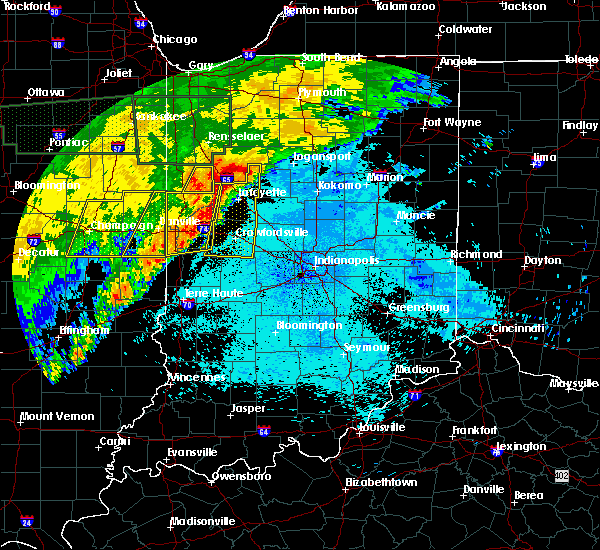 The severe thunderstorm warning for vermilion county will expire at 1215 am cdt, the storms which prompted the warning have moved out of the area. therefore the warning will be allowed to expire. a severe thunderstorm watch remains in effect until 200 am cdt for east central illinois. to report severe weather, contact your nearest law enforcement agency. they will relay your report to the national weather service lincoln. The severe thunderstorm warning for vermilion county will expire at 1215 am cdt, the storms which prompted the warning have moved out of the area. therefore the warning will be allowed to expire. a severe thunderstorm watch remains in effect until 200 am cdt for east central illinois. to report severe weather, contact your nearest law enforcement agency. they will relay your report to the national weather service lincoln.
|
| 6/20/2015 11:42 PM CDT |
 At 1142 pm cdt, severe thunderstorms were located along a line extending from 8 miles east of rossville to near allerton, moving east at 50 mph (radar indicated). Hazards include 60 mph wind gusts. Expect damage to roofs. siding and trees. locations impacted include, danville, hoopeston, georgetown, westville, tilton, catlin, oakwood, rossville, ridge farm, fairmount, sidell, belgium, vermilion county airport, bismarck, indianola, henning, jamaica, alvin and kickapoo state park. This includes interstate 74 between mile markers 205 and 219. At 1142 pm cdt, severe thunderstorms were located along a line extending from 8 miles east of rossville to near allerton, moving east at 50 mph (radar indicated). Hazards include 60 mph wind gusts. Expect damage to roofs. siding and trees. locations impacted include, danville, hoopeston, georgetown, westville, tilton, catlin, oakwood, rossville, ridge farm, fairmount, sidell, belgium, vermilion county airport, bismarck, indianola, henning, jamaica, alvin and kickapoo state park. This includes interstate 74 between mile markers 205 and 219.
|
| 6/20/2015 11:34 PM CDT |
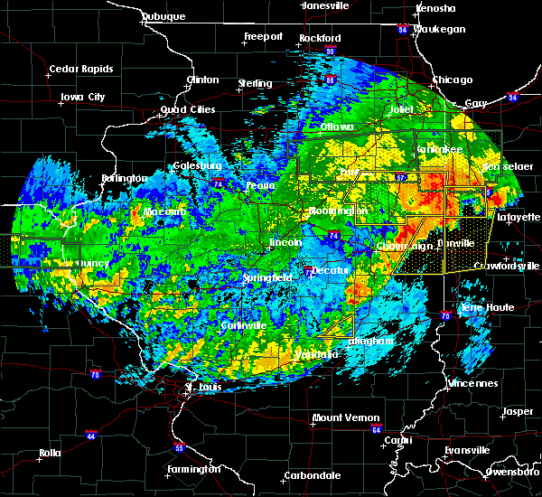 At 1134 pm cdt, severe thunderstorms were located along a line extending from near hoopeston to broadlands, moving east at 55 mph (radar indicated). Hazards include 60 mph wind gusts. Expect damage to roofs. siding and trees. locations impacted include, danville, hoopeston, georgetown, westville, tilton, catlin, oakwood, rossville, homer, ridge farm, potomac, fairmount, sidell, fithian, belgium, broadlands, allerton, vermilion county airport, bismarck and indianola. This includes interstate 74 between mile markers 199 and 219. At 1134 pm cdt, severe thunderstorms were located along a line extending from near hoopeston to broadlands, moving east at 55 mph (radar indicated). Hazards include 60 mph wind gusts. Expect damage to roofs. siding and trees. locations impacted include, danville, hoopeston, georgetown, westville, tilton, catlin, oakwood, rossville, homer, ridge farm, potomac, fairmount, sidell, fithian, belgium, broadlands, allerton, vermilion county airport, bismarck and indianola. This includes interstate 74 between mile markers 199 and 219.
|
| 6/20/2015 11:10 PM CDT |
 At 1109 pm cdt, severe thunderstorms were located along a line extending from 6 miles northwest of rankin to near willard airport, moving east at 50 mph (radar indicated). Hazards include 60 mph wind gusts. Expect damage to roofs. Siding and trees. At 1109 pm cdt, severe thunderstorms were located along a line extending from 6 miles northwest of rankin to near willard airport, moving east at 50 mph (radar indicated). Hazards include 60 mph wind gusts. Expect damage to roofs. Siding and trees.
|
| 6/20/2015 8:38 PM CDT |
 At 837 pm cdt, severe thunderstorms were located along a line extending from near north henderson to near abingdon to near macomb, moving east at 25 mph (radar indicated). Hazards include 60 mph wind gusts. Expect damage to roofs. siding and trees. locations impacted include, macomb, bushnell, viola, blandinsville, good hope, prairie city, bardolph, north henderson, ferris, sciota, new windsor, new philadelphia, shale city, little swan lake, alexis, walnut grove, greenbush, coldbrook, berwick and fountain green. A tornado watch remains in effect until 1100 pm cdt for northwestern illinois. At 837 pm cdt, severe thunderstorms were located along a line extending from near north henderson to near abingdon to near macomb, moving east at 25 mph (radar indicated). Hazards include 60 mph wind gusts. Expect damage to roofs. siding and trees. locations impacted include, macomb, bushnell, viola, blandinsville, good hope, prairie city, bardolph, north henderson, ferris, sciota, new windsor, new philadelphia, shale city, little swan lake, alexis, walnut grove, greenbush, coldbrook, berwick and fountain green. A tornado watch remains in effect until 1100 pm cdt for northwestern illinois.
|
| 6/20/2015 8:05 PM CDT |
 At 805 pm cdt, severe thunderstorms were located along a line extending from near aledo to near monmouth to near blandinsville, moving east at 55 mph (trained weather spotters). Hazards include 70 mph wind gusts. Expect considerable tree damage. damage is likely to mobile homes, roofs and outbuildings. locations impacted include, macomb, monmouth, aledo, bushnell, burgess, la harpe, roseville, viola, kirkwood, blandinsville, joy, good hope, prairie city, little york, bardolph, north henderson, ferris, raritan, sciota and new windsor. A tornado watch remains in effect until 1100 pm cdt for northwestern illinois. At 805 pm cdt, severe thunderstorms were located along a line extending from near aledo to near monmouth to near blandinsville, moving east at 55 mph (trained weather spotters). Hazards include 70 mph wind gusts. Expect considerable tree damage. damage is likely to mobile homes, roofs and outbuildings. locations impacted include, macomb, monmouth, aledo, bushnell, burgess, la harpe, roseville, viola, kirkwood, blandinsville, joy, good hope, prairie city, little york, bardolph, north henderson, ferris, raritan, sciota and new windsor. A tornado watch remains in effect until 1100 pm cdt for northwestern illinois.
|
| 6/20/2015 7:51 PM CDT |
 At 750 pm cdt, severe thunderstorms were located along a line extending from new boston to near oquawka to burnside, moving east at 55 mph (radar indicated). Hazards include 70 mph wind gusts. Expect considerable tree damage. Damage is likely to mobile homes, roofs and outbuildings. At 750 pm cdt, severe thunderstorms were located along a line extending from new boston to near oquawka to burnside, moving east at 55 mph (radar indicated). Hazards include 70 mph wind gusts. Expect considerable tree damage. Damage is likely to mobile homes, roofs and outbuildings.
|
| 6/7/2015 10:10 PM CDT | Trees and power lines blown down on automobile on whittier street in georgetow in vermilion county IL, 0.5 miles SE of Georgetown, IL |
| 6/7/2015 10:09 PM CDT | The tornado warning for southern vermilion and southeastern champaign counties will expire at 1015 pm cdt, the storm which prompted the warning has weakened below severe limits, and no longer appears capable of producing a tornado. therefore the warning will be allowed to expire. however gusty winds and heavy rain are still possible with this thunderstorm. a severe thunderstorm watch remains in effect until 300 am cdt for east central illinois. |
| 6/7/2015 9:52 PM CDT | At 951 pm cdt, severe thunderstorms were located along a line extending from near potomac to near allerton to near newman to humboldt, moving east at 45 mph (radar indicated). Hazards include 60 mph wind gusts and quarter size hail. Hail damage to vehicles is expected. expect wind damage to roofs, siding and trees. locations impacted include, danville, charleston, mattoon, paris, tuscola, st. joseph, georgetown, westville, arcola, tilton, villa grove, arthur, catlin, oakwood, philo, chrisman, rossville, sidney, atwood and homer. this includes the following highways, interstate 57 between mile markers 189 and 219. Interstate 74 between mile markers 192 and 220. |
| 6/7/2015 9:39 PM CDT | At 939 pm cdt, a severe thunderstorm capable of producing a tornado was located over homer, or 12 miles southeast of urbana, moving east at 45 mph (radar indicated rotation). Hazards include tornado and quarter size hail. Flying debris will be dangerous to those caught without shelter. mobile homes will be damaged or destroyed. damage to roofs, windows and vehicles will occur. tree damage is likely. this dangerous storm will be near, fairmount and fithian around 950 pm cdt. oakwood around 955 pm cdt. catlin around 1000 pm cdt. danville, georgetown, westville, tilton and belgium around 1005 pm cdt. other locations impacted by this tornadic thunderstorm include kickapoo state park, muncie and jamaica. This includes interstate 74 between mile markers 193 and 220. |
| 6/7/2015 9:29 PM CDT | At 929 pm cdt, severe thunderstorms were located along a line extending from 6 miles north of rantoul to philo to near tuscola to 4 miles north of sullivan, moving east at 45 mph (radar indicated). Hazards include 60 mph wind gusts and quarter size hail. Hail damage to vehicles is expected. Expect wind damage to roofs, siding and trees. |
| 6/7/2015 9:00 PM CDT | Tree branches blown against trailor in georgetown. couple reports of large tree limbs blown dow in vermilion county IL, 0.5 miles SE of Georgetown, IL |
| 6/7/2015 8:59 PM CDT | At 859 pm cdt, a severe thunderstorm was located over catlin, or 8 miles southwest of danville, moving east at 30 mph (radar indicated). Hazards include 60 mph wind gusts and quarter size hail. Hail damage to vehicles is expected. expect wind damage to roofs, siding and trees. locations impacted include, danville, georgetown, westville, tilton, catlin, oakwood, fairmount, fithian, belgium, vermilion county airport, jamaica, muncie and kickapoo state park. This includes interstate 74 between mile markers 198 and 220. |
| 6/7/2015 8:47 PM CDT | At 847 pm cdt, a severe thunderstorm was located over fairmount, or 15 miles southwest of danville, moving east at 30 mph (radar indicated). Hazards include 60 mph wind gusts. Expect damage to roofs. Siding and trees. |
| 6/7/2015 7:09 PM CDT | At 709 pm cdt, a severe thunderstorm was located near west point, or 7 miles southwest of carthage, moving east at 60 mph (radar indicated). Hazards include 60 mph wind gusts and quarter size hail. Hail damage to vehicles is expected. expect wind damage to roofs, siding and trees. Locations impacted include, macomb, keokuk, carthage, hamilton, warsaw, colchester, augusta, bowen, industry, west point, alexandria, tennessee, colmar, adair, fandon, western illinois university, winchester, plymouth, denver and elvaston. |
| 6/7/2015 7:09 PM CDT | At 709 pm cdt, a severe thunderstorm was located near west point, or 7 miles southwest of carthage, moving east at 60 mph (radar indicated). Hazards include 60 mph wind gusts and quarter size hail. Hail damage to vehicles is expected. expect wind damage to roofs, siding and trees. Locations impacted include, macomb, keokuk, carthage, hamilton, warsaw, colchester, augusta, bowen, industry, west point, alexandria, tennessee, colmar, adair, fandon, western illinois university, winchester, plymouth, denver and elvaston. |
| 6/7/2015 7:00 PM CDT | At 700 pm cdt, a severe thunderstorm was located near alexandria, or 8 miles southwest of keokuk, moving east at 45 mph (radar indicated). Hazards include 60 mph wind gusts and quarter size hail. Hail damage to vehicles is expected. expect wind damage to roofs, siding and trees. Locations impacted include, macomb, keokuk, carthage, hamilton, warsaw, colchester, augusta, wayland, bowen, industry, west point, alexandria, tennessee, colmar, adair, fandon, western illinois university, winchester, plymouth and denver. |
| 6/7/2015 7:00 PM CDT | At 700 pm cdt, a severe thunderstorm was located near alexandria, or 8 miles southwest of keokuk, moving east at 45 mph (radar indicated). Hazards include 60 mph wind gusts and quarter size hail. Hail damage to vehicles is expected. expect wind damage to roofs, siding and trees. Locations impacted include, macomb, keokuk, carthage, hamilton, warsaw, colchester, augusta, wayland, bowen, industry, west point, alexandria, tennessee, colmar, adair, fandon, western illinois university, winchester, plymouth and denver. |
| 6/7/2015 6:58 PM CDT | The severe thunderstorm warning for warren, eastern hancock, mcdonough and henderson counties will expire at 700 pm cdt, the storm which prompted the warning has weakened below severe limits and exited the warned area. therefore the warning will be allowed to expire. however heavy rain is still possible with this thunderstorm. a severe thunderstorm watch remains in effect until 800 pm cdt for west central illinois. a severe thunderstorm watch also remains in effect until 900 pm cdt for west central illinois and southeastern iowa. remember, a severe thunderstorm warning still remains in effect for southern mcdonough county through 745 pm. |
| 6/7/2015 6:50 PM CDT | At 649 pm cdt, a severe thunderstorm was located near wayland, or 8 miles southeast of kahoka, moving east at 45 mph (radar indicated). Hazards include 60 mph wind gusts. Expect damage to roofs. Siding and trees. |
| 6/7/2015 6:50 PM CDT | At 649 pm cdt, a severe thunderstorm was located near wayland, or 8 miles southeast of kahoka, moving east at 45 mph (radar indicated). Hazards include 60 mph wind gusts. Expect damage to roofs. Siding and trees. |
| 6/7/2015 6:45 PM CDT | At 645 pm cdt, a severe thunderstorm was located near roseville, or 13 miles south of monmouth, moving east at 45 mph (trained weather spotters). Hazards include 60 mph wind gusts. Expect damage to roofs. siding and trees. this severe storm will be near, prairie city around 655 pm cdt. other locations impacted by this severe thunderstorm include coldbrook, lone tree, prairie city airport, doddsville, olena, fountain green, greenbush, walnut grove, argyle lake state park and media. People attending sodbuster days should seek safe shelter immediately!. |
| 6/7/2015 6:38 PM CDT | At 638 pm cdt, a severe thunderstorm was located near roseville, or 13 miles south of monmouth, moving east at 40 mph (trained weather spotters). Hazards include 60 mph wind gusts. Expect damage to roofs. siding and trees. this severe storm will be near, little swan lake around 655 pm cdt. prairie city around 700 pm cdt. other locations impacted by this severe thunderstorm include coldbrook, lone tree, prairie city airport, doddsville, olena, fountain green, greenbush, walnut grove, argyle lake state park and media. People attending sodbuster days should seek safe shelter immediately!. |
| 6/7/2015 6:25 PM CDT | At 625 pm cdt, a severe thunderstorm was located over stronghurst, or 13 miles southeast of burlington, moving east at 40 mph (trained weather spotters). Hazards include 60 mph wind gusts. Expect damage to roofs. Siding and trees. |
| 5/10/2015 9:11 PM CDT | At 910 pm cdt, severe thunderstorms were located along a line extending from near potomac to near georgetown to near vermilion, moving northeast at 50 mph (radar indicated). Hazards include 60 mph wind gusts. Expect damage to roofs. siding and trees. locations impacted include, danville, georgetown, westville, tilton, catlin, oakwood, chrisman, ridge farm, fairmount, fithian, belgium, vermilion, muncie, bismarck, indianola, henning, jamaica, vermilion county airport, collison and alvin. this includes interstate 74 between mile markers 201 and 220. 75in. |
| 5/10/2015 8:59 PM CDT | At 859 pm cdt, severe thunderstorms were located along a line extending from near muncie to near ridge farm to near vermilion, moving east at 50 mph (radar indicated). Hazards include 60 mph wind gusts. Expect damage to roofs. Siding and trees. |
| 5/10/2015 8:52 PM CDT | At 851 pm cdt, severe thunderstorms were located along a line extending from fithian to near sidell to oliver, moving northeast at 50 mph (radar indicated). Hazards include 60 mph wind gusts. Expect damage to roofs. siding and trees. locations impacted include, danville, paris, georgetown, westville, tilton, catlin, oakwood, chrisman, homer, ridge farm, newman, fairmount, sidell, fithian, belgium, hume, broadlands, brocton, allerton and vermilion. this includes interstate 74 between mile markers 202 and 219. 75in. |
| 5/10/2015 8:43 PM CDT | At 834 pm cdt, severe thunderstorms were located along a line extending from near sidney to clarksville, moving northeast at 50 mph (radar indicated). Hazards include 60 mph wind gusts. Expect damage to roofs. Siding and trees. |
| 5/10/2015 8:34 PM CDT | At 834 pm cdt, severe thunderstorms were located along a line extending from near sidney to clarksville, moving northeast at 50 mph (radar indicated). Hazards include 60 mph wind gusts. Expect damage to roofs. Siding and trees. |
| 5/4/2015 5:59 PM CDT | At 557 pm cdt, a severe thunderstorm was located near colchester, or 10 miles west of macomb, moving east at 20 mph (radar indicated). Hazards include quarter size hail. Damage to vehicles is expected. locations impacted include, macomb, colchester, blandinsville, good hope, tennessee, argyle lake state park and macomb municipal airport. 1. 00in. |
| 5/4/2015 5:55 PM CDT | At 554 pm cdt, a severe thunderstorm was located northwest of tennessee, or 10 miles west of macomb, moving east at 25 mph (radar indicated). Hazards include quarter size hail. Damage to vehicles is expected. locations impacted include, macomb, colchester, blandinsville, good hope, tennessee, fountain green, argyle lake state park, webster and macomb municipal airport. 1. 00in. |
| 5/4/2015 5:41 PM CDT | At 541 pm cdt, a severe thunderstorm was located 7 miles east of burnside, or 9 miles northeast of carthage, moving east at 20 mph (radar indicated). Hazards include quarter size hail. damage to vehicles is expected |
| 5/4/2015 5:23 PM CDT | The severe thunderstorm warning for central mcdonough county will expire at 530 pm cdt, the severe thunderstorm which prompted the warning has weakened. moved out of the warned area. therefore the warning will be allowed to expire. |
| 5/4/2015 5:05 PM CDT | At 505 pm cdt, a severe thunderstorm was located near western illinois university, or near macomb, moving east at 20 mph (radar indicated). Hazards include quarter size hail. damage to vehicles is expected |
| 4/9/2015 6:11 PM CDT | The severe thunderstorm warning for mcdonough county will expire at 615 pm cdt. the storm which prompted the warning has weakened below severe limits. And no longer poses an immediate threat to life or property. |
| 4/9/2015 5:48 PM CDT | A severe thunderstorm warning remains in effect for mcdonough county until 615 pm cdt. at 546 pm cdt. a severe thunderstorm was located near macomb. and moving northeast at 40 mph. hazard. 60 mph wind gusts and half dollar size hail. source. Trained weather spotters. |
| 4/9/2015 5:27 PM CDT | The national weather service in the quad cities has issued a * severe thunderstorm warning for. eastern hancock county in west central illinois. mcdonough county in west central illinois. until 615 pm cdt * at 522 pm cdt. A severe thunderstorm was located 7 miles west of. |
| 4/9/2015 5:07 AM CDT | A severe thunderstorm warning remains in effect for southern vermilion county until 545 am cdt. at 502 am cdt. a severe thunderstorm was located near sidell. and moving northeast at 45 mph. another severe thunderstorm was located 5 miles east of ogden. moving northeast at 45 mph. hazard. 60 mph wind gusts and penny size hail. |
| 4/9/2015 4:53 AM CDT | The national weather service in lincoln has issued a * severe thunderstorm warning for. southern vermilion county in east central illinois. until 545 am cdt * at 452 am cdt. a severe thunderstorm was located near allerton. And moving northeast at 45 mph. |
| 4/8/2015 6:14 AM CDT | The national weather service in lincoln has issued a * severe thunderstorm warning for. vermilion county in east central illinois. until 715 am cdt * at 608 am cdt. a severe thunderstorm was located 6 miles north of ogden. and moving east at 35 mph. Another severe thunderstorm. |
| 7/26/2014 6:05 PM CDT | Large tree down blocking rt. 1 just south of georgetow in vermilion county IL, 0.5 miles SE of Georgetown, IL |
| 7/26/2014 6:03 PM CDT | Storm damage reported in vermilion county IL, 2 miles E of Georgetown, IL |
| 7/10/2013 10:04 AM CDT | Numerous trees down in georgetown. one on a residenc in vermilion county IL, 0.5 miles SE of Georgetown, IL |
| 1/1/0001 12:00 AM | Numerous trees blown dow in vermilion county IL, 0.5 miles SE of Georgetown, IL |
| 1/1/0001 12:00 AM | Several trees blown down in vermilion county IL, 0.5 miles SE of Georgetown, IL |
| 1/1/0001 12:00 AM | Storm damage reported in vermilion county IL, 1 miles ESE of Georgetown, IL |
Hail Maps for Georgetown, IL
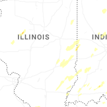
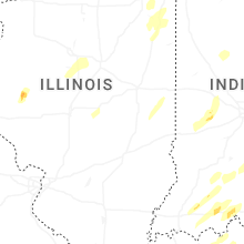


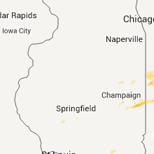


Connect with Interactive Hail Maps