

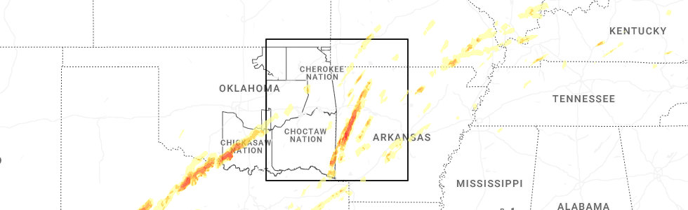
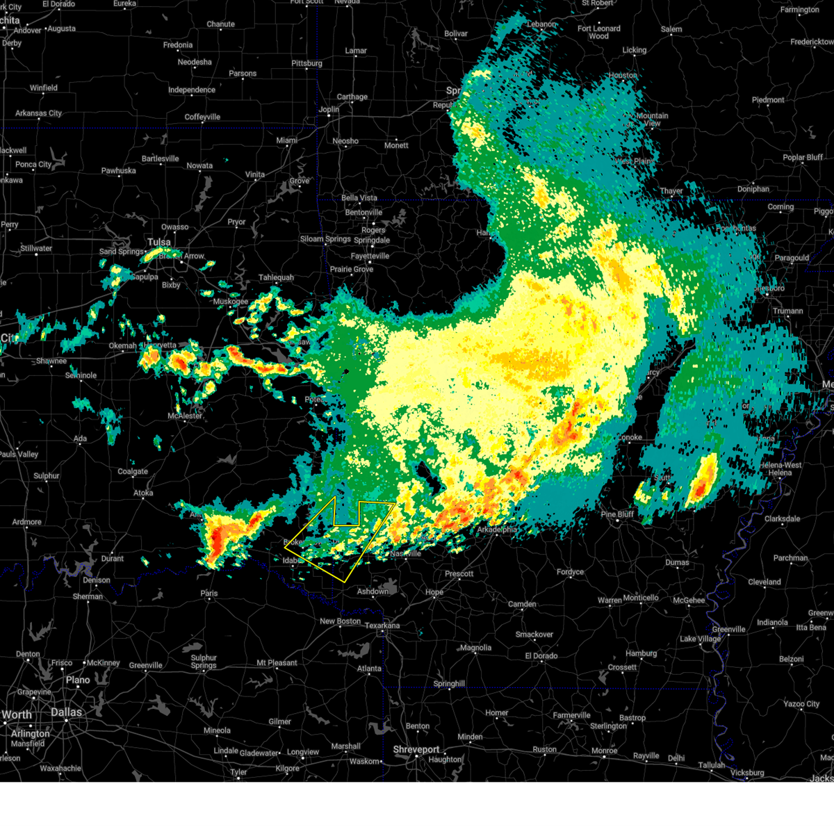
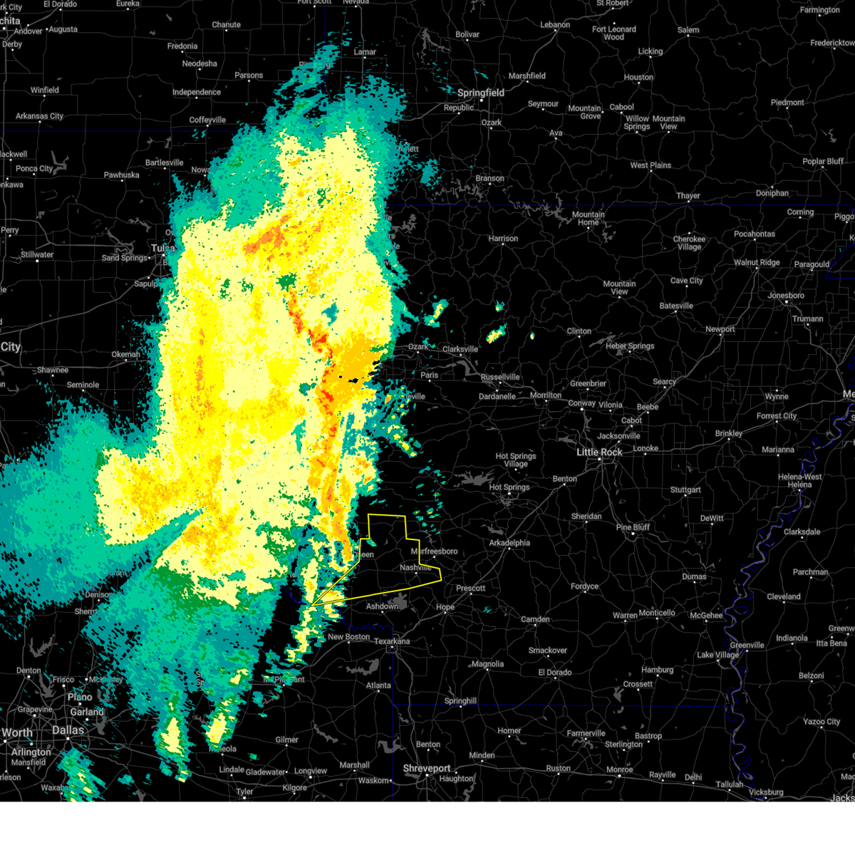
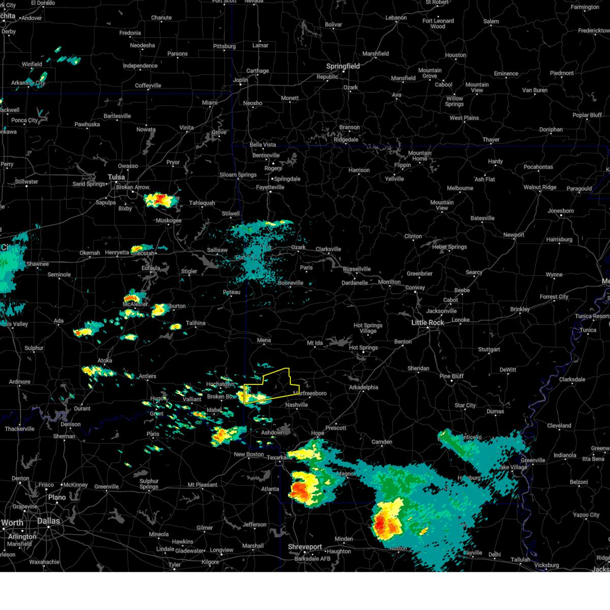
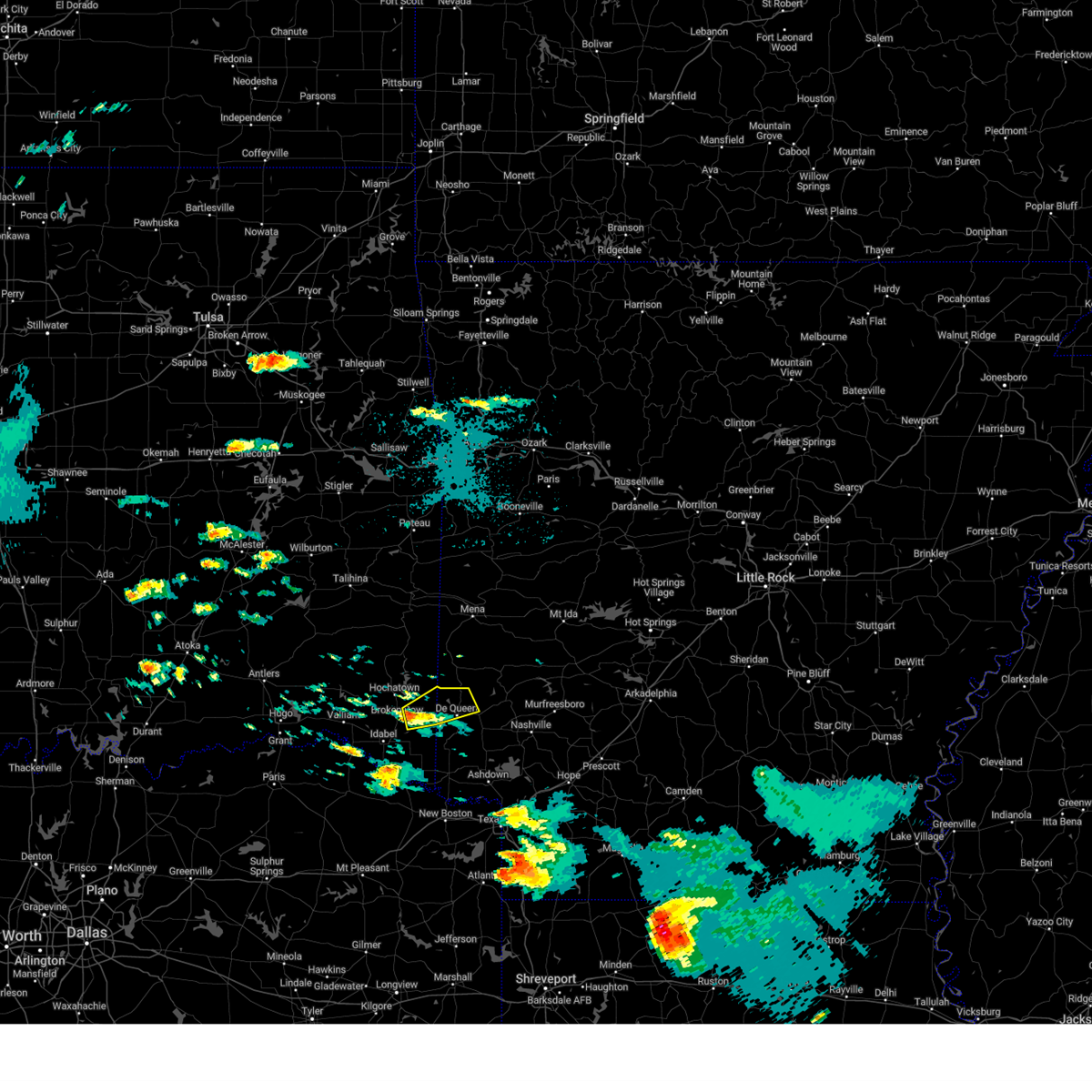
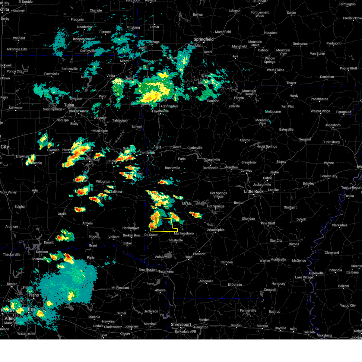
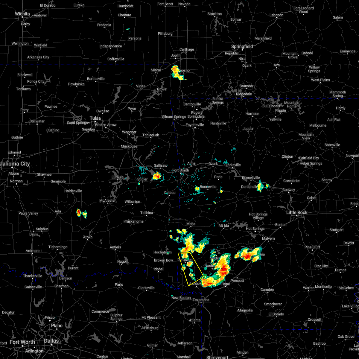
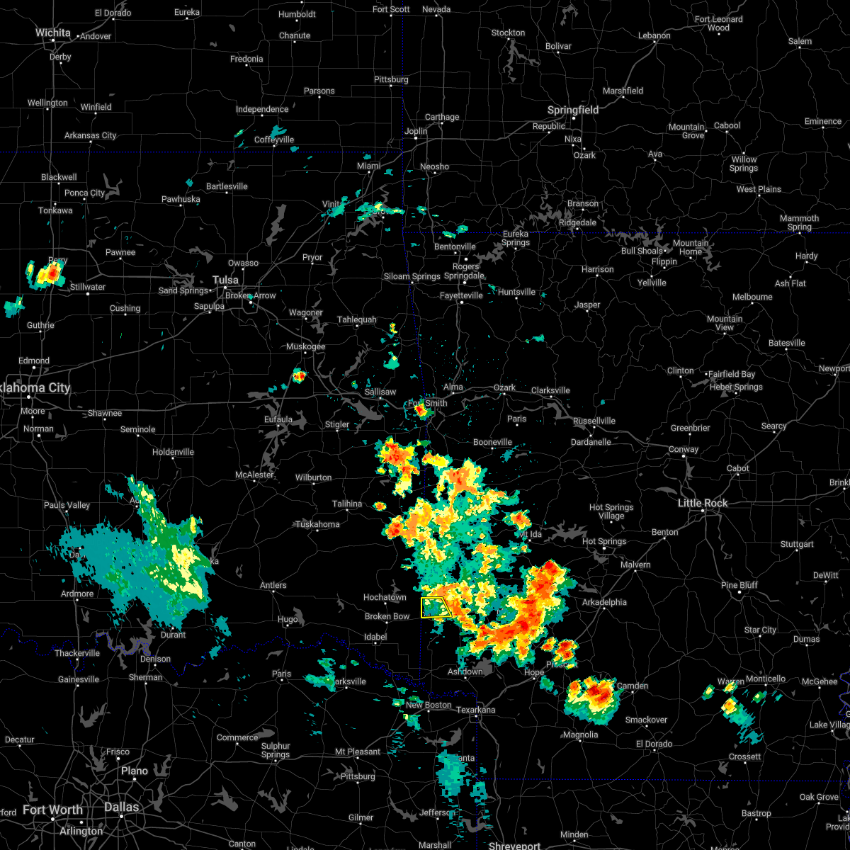
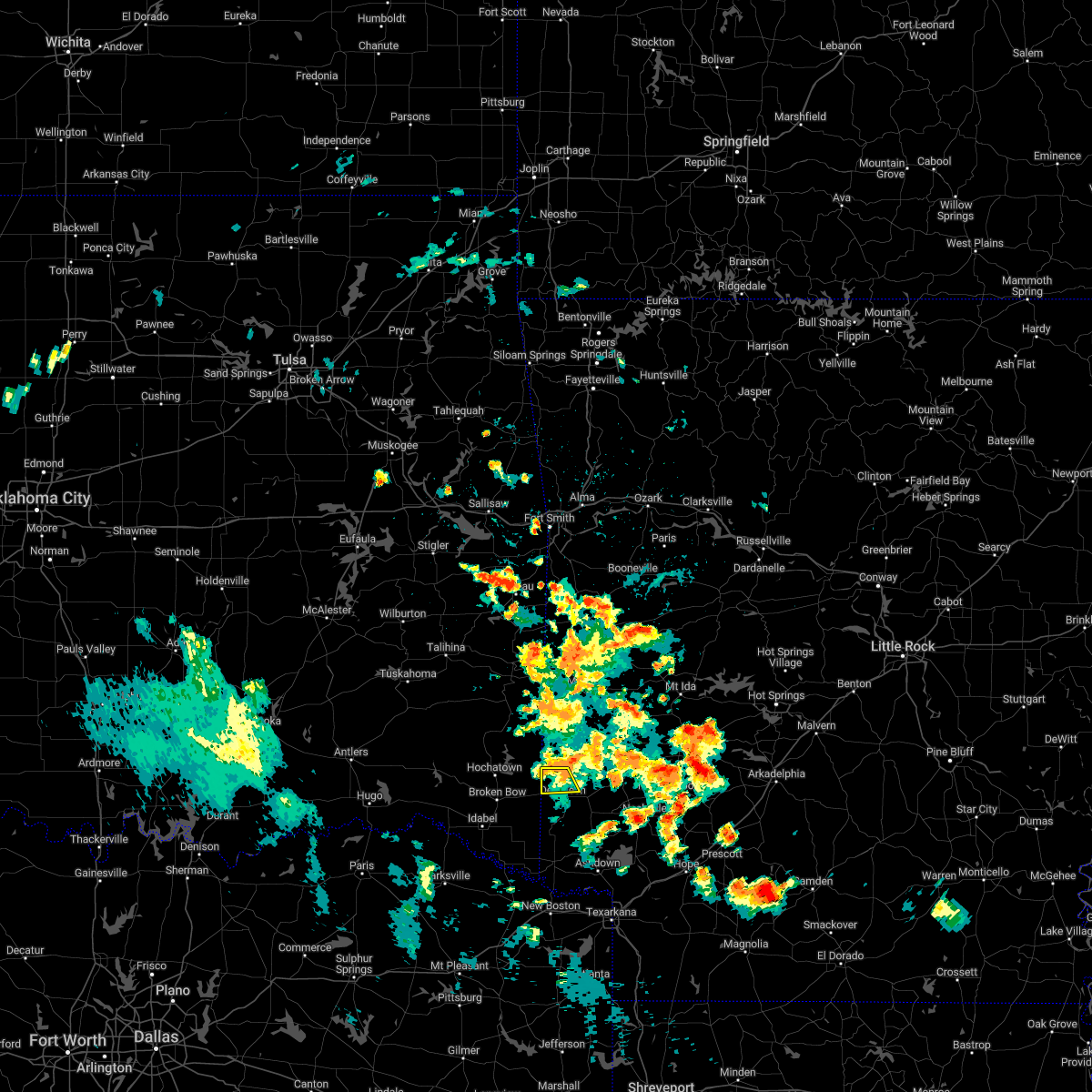
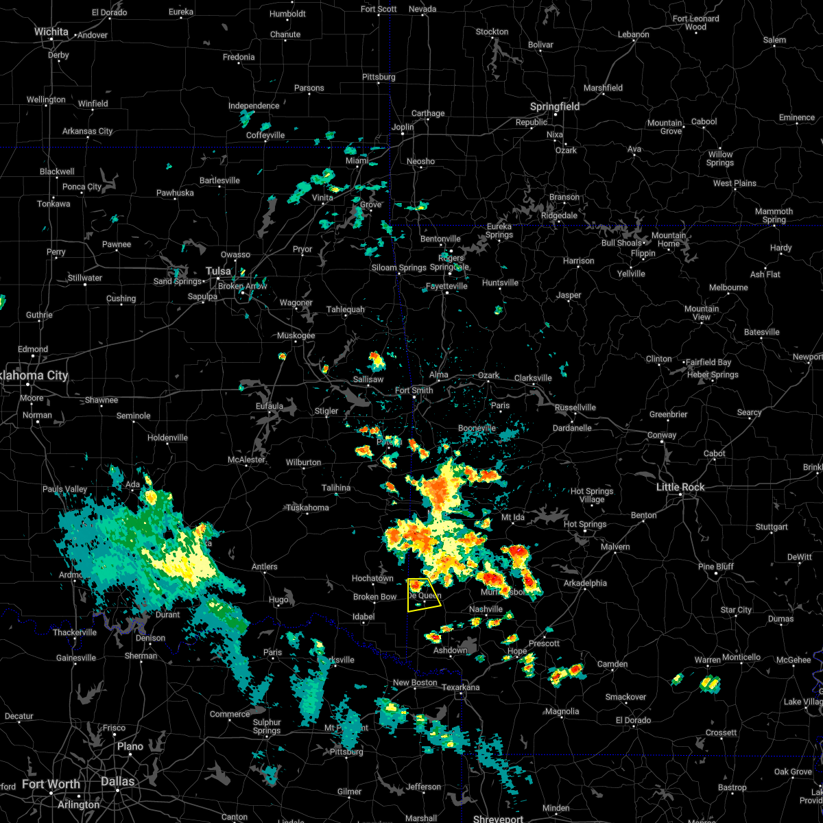
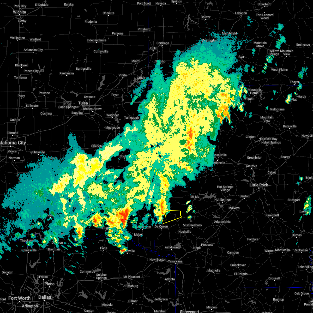
Hail Map for Gillham, AR
The Gillham, AR area has had 3 reports of on-the-ground hail by trained spotters, and has been under severe weather warnings 25 times during the past 12 months. Doppler radar has detected hail at or near Gillham, AR on 53 occasions, including 2 occasions during the past year.
| Name: | Gillham, AR |
| Where Located: | 31 miles WNW of Nashville, AR |
| Map: | Google Map for Gillham, AR |
| Population: | 160 |
| Housing Units: | 85 |
| More Info: | Search Google for Gillham, AR |
5
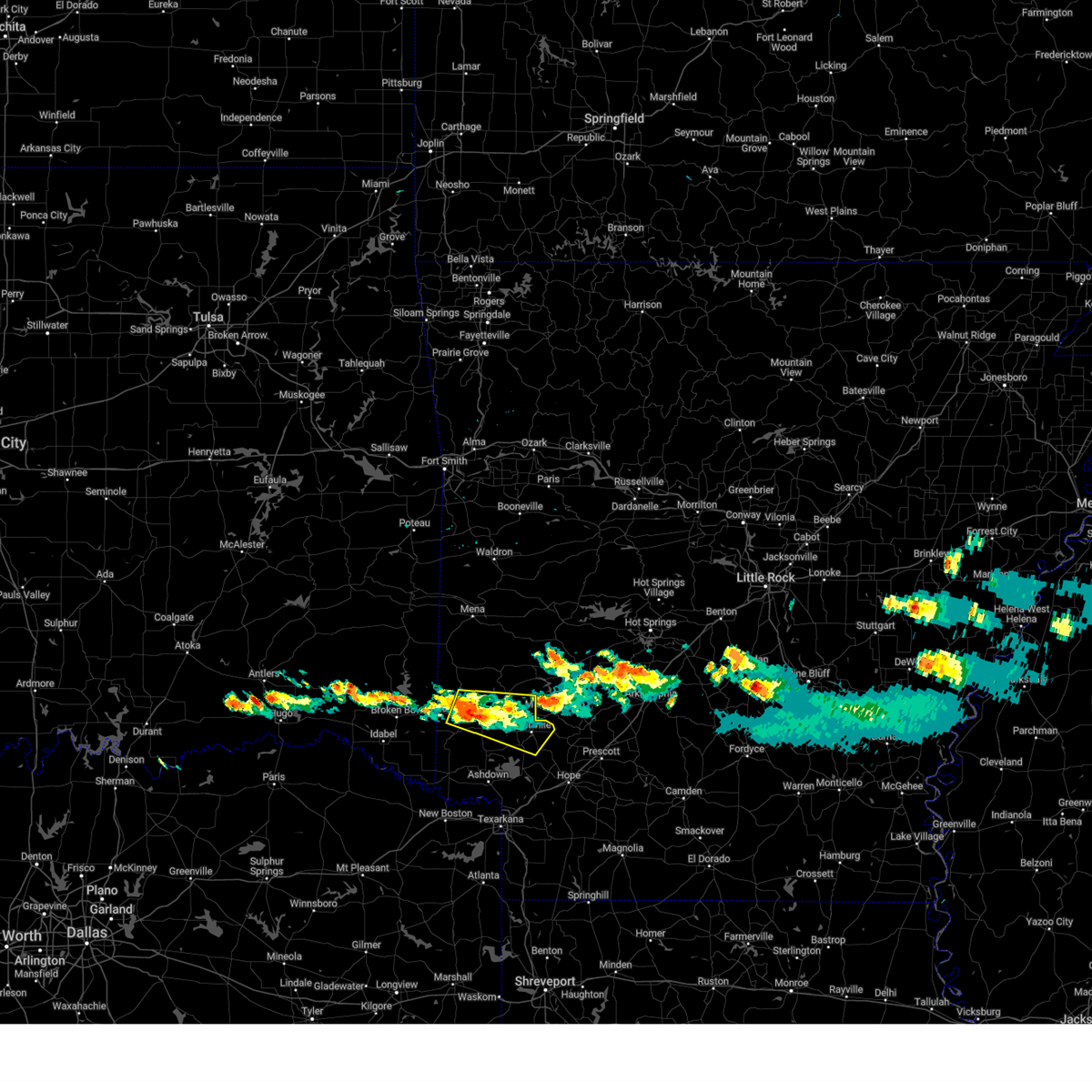
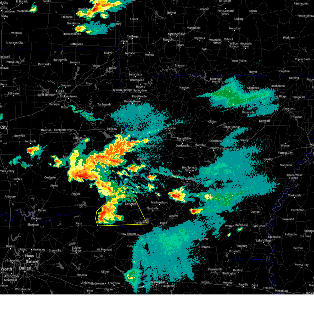
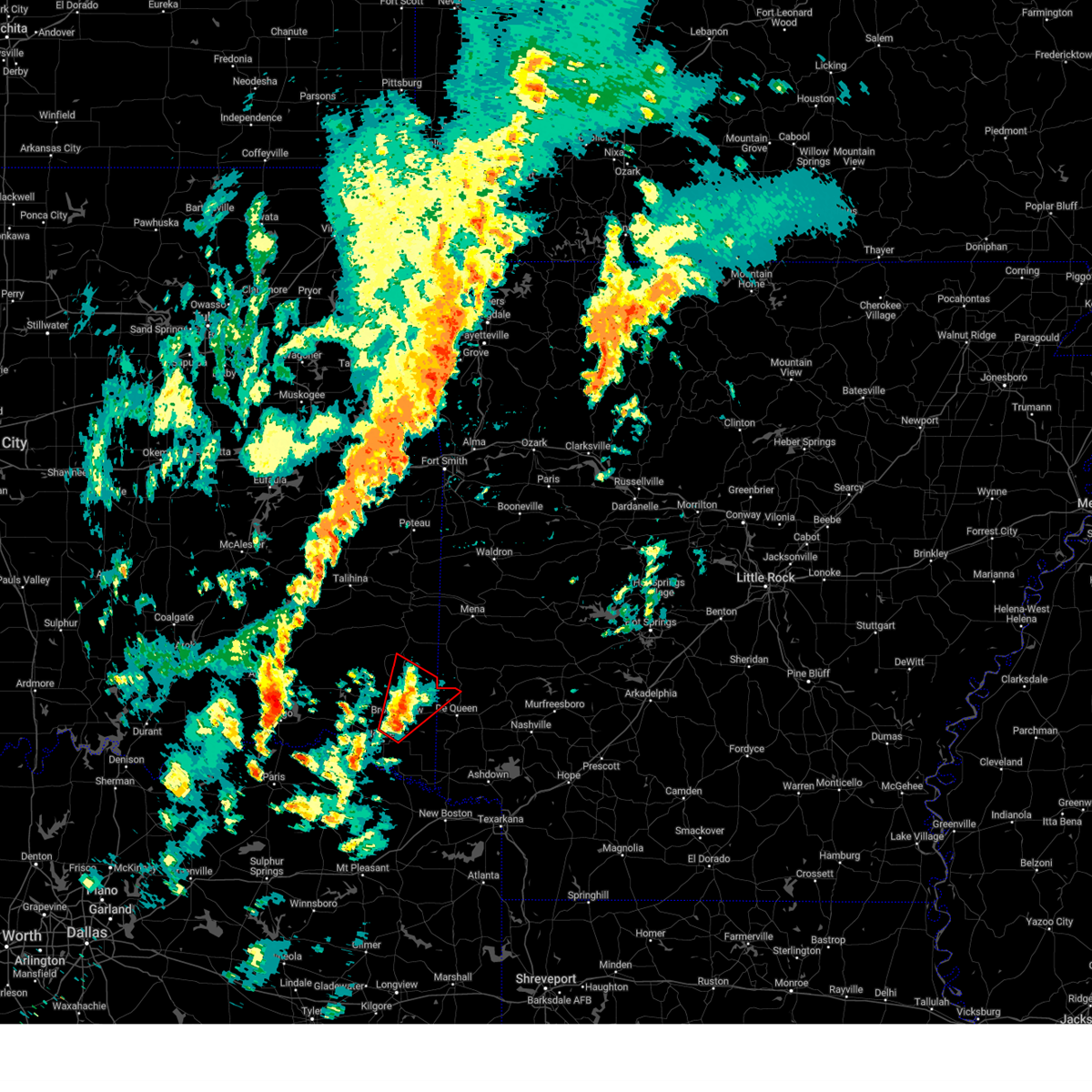
The Top Recent Hail Date for Gillham, AR is Friday, April 4, 2025 (1st out of 53)
Hail and Wind Damage Spotted near Gillham, AR
| Date / Time | Report Details |
|---|---|
| 6/7/2025 8:32 PM CDT |
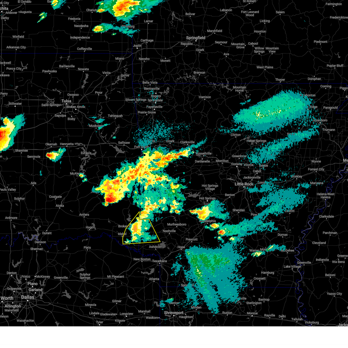
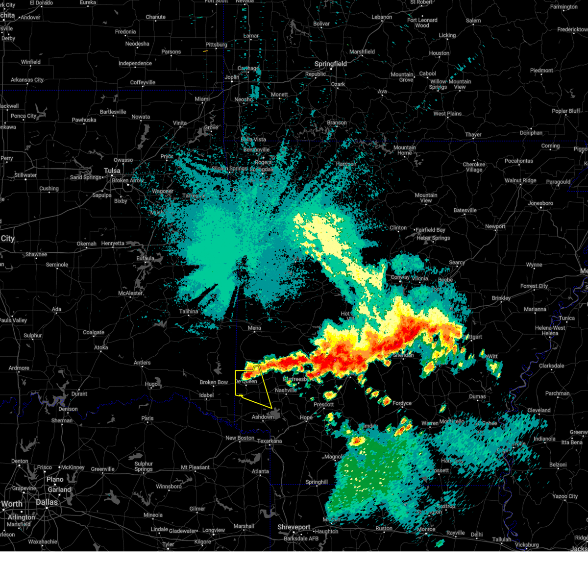
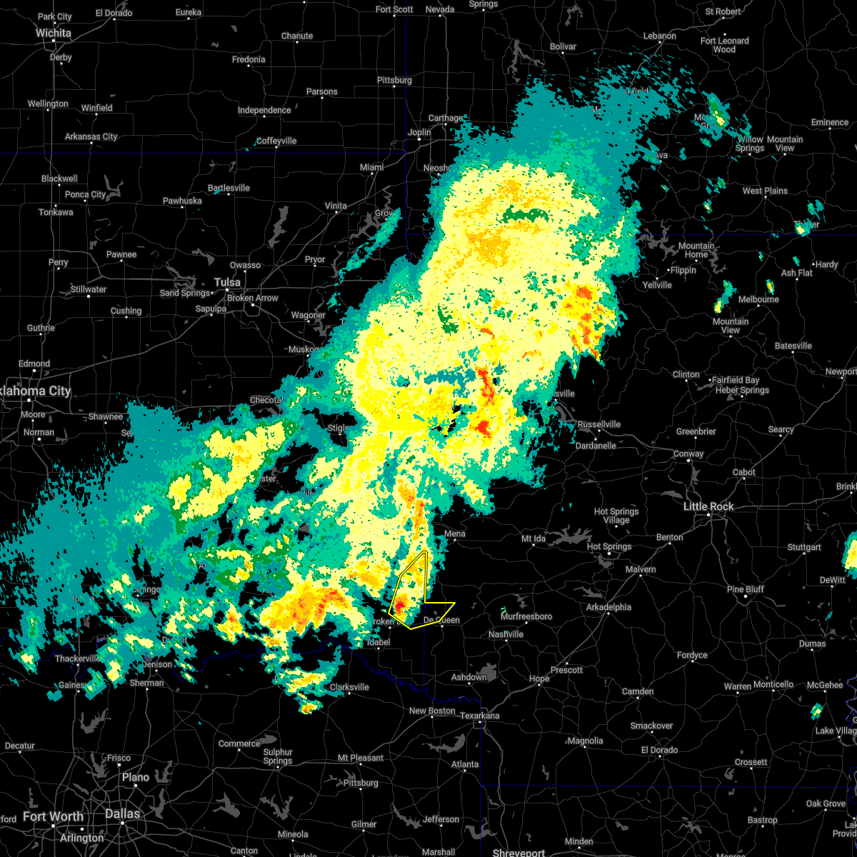
 Svrshv the national weather service in shreveport has issued a * severe thunderstorm warning for, north central hempstead county in southwestern arkansas, northern sevier county in southwestern arkansas, southeastern howard county in southwestern arkansas, * until 915 pm cdt. * at 832 pm cdt, a severe thunderstorm was located near lockesburg, or near de queen, moving east at 25 mph (radar indicated). Hazards include 60 mph wind gusts and quarter size hail. Hail damage to vehicles is expected. Expect wind damage to roofs, siding, and trees. Svrshv the national weather service in shreveport has issued a * severe thunderstorm warning for, north central hempstead county in southwestern arkansas, northern sevier county in southwestern arkansas, southeastern howard county in southwestern arkansas, * until 915 pm cdt. * at 832 pm cdt, a severe thunderstorm was located near lockesburg, or near de queen, moving east at 25 mph (radar indicated). Hazards include 60 mph wind gusts and quarter size hail. Hail damage to vehicles is expected. Expect wind damage to roofs, siding, and trees.
|
| 6/7/2025 7:46 PM CDT |
 At 745 pm cdt, a severe thunderstorm was located near grannis, or 14 miles north of de queen, moving east at 20 mph (radar indicated). Hazards include 60 mph wind gusts and quarter size hail. Hail damage to vehicles is expected. expect wind damage to roofs, siding, and trees. Locations impacted include, gillham. At 745 pm cdt, a severe thunderstorm was located near grannis, or 14 miles north of de queen, moving east at 20 mph (radar indicated). Hazards include 60 mph wind gusts and quarter size hail. Hail damage to vehicles is expected. expect wind damage to roofs, siding, and trees. Locations impacted include, gillham.
|
| 6/7/2025 7:25 PM CDT |
 Svrshv the national weather service in shreveport has issued a * severe thunderstorm warning for, northwestern sevier county in southwestern arkansas, northwestern howard county in southwestern arkansas, east central mccurtain county in southeastern oklahoma, * until 815 pm cdt. * at 725 pm cdt, a severe thunderstorm was located 13 miles west of grannis, or 16 miles northwest of de queen, moving east at 20 mph (radar indicated). Hazards include 60 mph wind gusts and quarter size hail. Hail damage to vehicles is expected. Expect wind damage to roofs, siding, and trees. Svrshv the national weather service in shreveport has issued a * severe thunderstorm warning for, northwestern sevier county in southwestern arkansas, northwestern howard county in southwestern arkansas, east central mccurtain county in southeastern oklahoma, * until 815 pm cdt. * at 725 pm cdt, a severe thunderstorm was located 13 miles west of grannis, or 16 miles northwest of de queen, moving east at 20 mph (radar indicated). Hazards include 60 mph wind gusts and quarter size hail. Hail damage to vehicles is expected. Expect wind damage to roofs, siding, and trees.
|
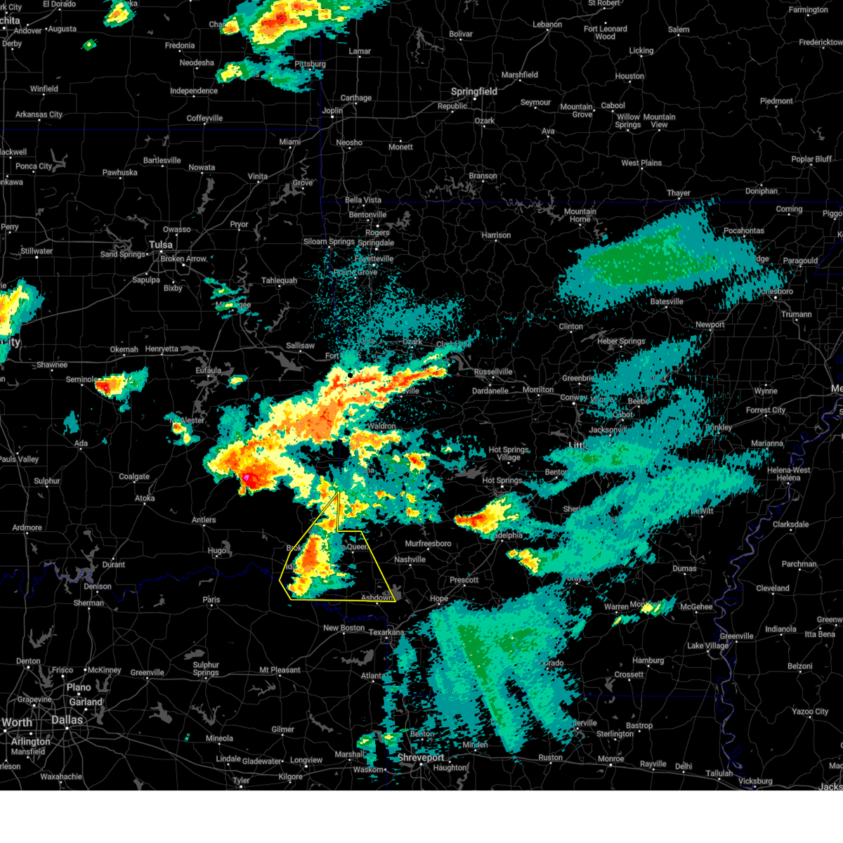
| 5/25/2025 6:36 PM CDT | Svrshv the national weather service in shreveport has issued a * severe thunderstorm warning for, northern sevier county in southwestern arkansas, * until 730 pm cdt. * at 636 pm cdt, a severe thunderstorm was located near horatio, moving northeast at 15 mph (radar indicated). Hazards include 60 mph wind gusts and quarter size hail. Hail damage to vehicles is expected. Expect wind damage to roofs, siding, and trees. |
| 5/24/2025 10:47 AM CDT |
 the severe thunderstorm warning has been cancelled and is no longer in effect the severe thunderstorm warning has been cancelled and is no longer in effect
|
| 5/24/2025 10:30 AM CDT |
 At 1030 am cdt, severe thunderstorms were located along a line extending from near hatfield to 8 miles northwest of idabel, moving southeast at 25 mph (radar indicated). Hazards include 60 mph wind gusts and quarter size hail. Hail damage to vehicles is expected. expect wind damage to roofs, siding, and trees. Locations impacted include, eagletown, broken bow, umpire, cerrogordo, de queen, hochatown, geneva, goodwater, athens, shinewell, burg, gillham, horatio, west line, oak hill, winthrop, golden, and west otis. At 1030 am cdt, severe thunderstorms were located along a line extending from near hatfield to 8 miles northwest of idabel, moving southeast at 25 mph (radar indicated). Hazards include 60 mph wind gusts and quarter size hail. Hail damage to vehicles is expected. expect wind damage to roofs, siding, and trees. Locations impacted include, eagletown, broken bow, umpire, cerrogordo, de queen, hochatown, geneva, goodwater, athens, shinewell, burg, gillham, horatio, west line, oak hill, winthrop, golden, and west otis.
|
| 5/24/2025 10:13 AM CDT |
 Svrshv the national weather service in shreveport has issued a * severe thunderstorm warning for, northwestern little river county in southwestern arkansas, northwestern sevier county in southwestern arkansas, northwestern howard county in southwestern arkansas, northern mccurtain county in southeastern oklahoma, * until 1100 am cdt. * at 1012 am cdt, severe thunderstorms were located along a line extending from near hatfield to 12 miles west of broken bow, moving southeast at 25 mph (radar indicated). Hazards include 60 mph wind gusts and quarter size hail. Hail damage to vehicles is expected. Expect wind damage to roofs, siding, and trees. Svrshv the national weather service in shreveport has issued a * severe thunderstorm warning for, northwestern little river county in southwestern arkansas, northwestern sevier county in southwestern arkansas, northwestern howard county in southwestern arkansas, northern mccurtain county in southeastern oklahoma, * until 1100 am cdt. * at 1012 am cdt, severe thunderstorms were located along a line extending from near hatfield to 12 miles west of broken bow, moving southeast at 25 mph (radar indicated). Hazards include 60 mph wind gusts and quarter size hail. Hail damage to vehicles is expected. Expect wind damage to roofs, siding, and trees.
|
| 5/20/2025 3:19 AM CDT |
 At 318 am cdt, a severe thunderstorm was located 7 miles northwest of horatio, moving east at 60 mph (radar indicated). Hazards include 60 mph wind gusts and quarter size hail. Hail damage to vehicles is expected. expect wind damage to roofs, siding, and trees. Locations impacted include, silver ridge, lockesburg, umpire, de queen, geneva, central, lebanon, burg, gillham, dierks, horatio, provo, west line, bellview, and west otis. At 318 am cdt, a severe thunderstorm was located 7 miles northwest of horatio, moving east at 60 mph (radar indicated). Hazards include 60 mph wind gusts and quarter size hail. Hail damage to vehicles is expected. expect wind damage to roofs, siding, and trees. Locations impacted include, silver ridge, lockesburg, umpire, de queen, geneva, central, lebanon, burg, gillham, dierks, horatio, provo, west line, bellview, and west otis.
|
| 5/20/2025 3:19 AM CDT |
 the severe thunderstorm warning has been cancelled and is no longer in effect the severe thunderstorm warning has been cancelled and is no longer in effect
|
| 5/20/2025 3:07 AM CDT |
 Svrshv the national weather service in shreveport has issued a * severe thunderstorm warning for, northwestern little river county in southwestern arkansas, sevier county in southwestern arkansas, central howard county in southwestern arkansas, east central mccurtain county in southeastern oklahoma, * until 345 am cdt. * at 306 am cdt, a severe thunderstorm was located near broken bow, or 18 miles west of horatio, moving east at 60 mph (radar indicated). Hazards include 60 mph wind gusts and quarter size hail. Hail damage to vehicles is expected. Expect wind damage to roofs, siding, and trees. Svrshv the national weather service in shreveport has issued a * severe thunderstorm warning for, northwestern little river county in southwestern arkansas, sevier county in southwestern arkansas, central howard county in southwestern arkansas, east central mccurtain county in southeastern oklahoma, * until 345 am cdt. * at 306 am cdt, a severe thunderstorm was located near broken bow, or 18 miles west of horatio, moving east at 60 mph (radar indicated). Hazards include 60 mph wind gusts and quarter size hail. Hail damage to vehicles is expected. Expect wind damage to roofs, siding, and trees.
|
| 5/17/2025 9:46 PM CDT |
 At 945 pm cdt, a severe thunderstorm was located near gillham, or near de queen, moving northeast at 60 mph (radar indicated). Hazards include 60 mph wind gusts and quarter size hail. Hail damage to vehicles is expected. expect wind damage to roofs, siding, and trees. Locations impacted include, bokhoma, eagletown, broken bow, lockesburg, moon, cerrogordo, ben lomond, de queen, oak grove, geneva, central, goodwater, shinewell, arkinda, haworth, america, gillham, horatio, west line, and browntown. At 945 pm cdt, a severe thunderstorm was located near gillham, or near de queen, moving northeast at 60 mph (radar indicated). Hazards include 60 mph wind gusts and quarter size hail. Hail damage to vehicles is expected. expect wind damage to roofs, siding, and trees. Locations impacted include, bokhoma, eagletown, broken bow, lockesburg, moon, cerrogordo, ben lomond, de queen, oak grove, geneva, central, goodwater, shinewell, arkinda, haworth, america, gillham, horatio, west line, and browntown.
|
| 5/17/2025 9:46 PM CDT |
 the severe thunderstorm warning has been cancelled and is no longer in effect the severe thunderstorm warning has been cancelled and is no longer in effect
|
| 5/17/2025 9:31 PM CDT |
 At 931 pm cdt, a severe thunderstorm was located 7 miles east of broken bow, or 15 miles west of de queen, moving northeast at 60 mph (radar indicated). Hazards include 60 mph wind gusts and quarter size hail. Hail damage to vehicles is expected. expect wind damage to roofs, siding, and trees. Locations impacted include, eagletown, broken bow, idabel, moon, cerrogordo, hochatown, goodlake, geneva, central, goodwater, shinewell, arkinda, haworth, america, horatio, west line, oak hill, winthrop, bellview, and bokhoma. At 931 pm cdt, a severe thunderstorm was located 7 miles east of broken bow, or 15 miles west of de queen, moving northeast at 60 mph (radar indicated). Hazards include 60 mph wind gusts and quarter size hail. Hail damage to vehicles is expected. expect wind damage to roofs, siding, and trees. Locations impacted include, eagletown, broken bow, idabel, moon, cerrogordo, hochatown, goodlake, geneva, central, goodwater, shinewell, arkinda, haworth, america, horatio, west line, oak hill, winthrop, bellview, and bokhoma.
|
| 5/17/2025 9:31 PM CDT |
 the severe thunderstorm warning has been cancelled and is no longer in effect the severe thunderstorm warning has been cancelled and is no longer in effect
|
| 5/17/2025 9:14 PM CDT |
 Svrshv the national weather service in shreveport has issued a * severe thunderstorm warning for, northern little river county in southwestern arkansas, sevier county in southwestern arkansas, mccurtain county in southeastern oklahoma, northwestern bowie county in northeastern texas, northeastern red river county in northeastern texas, * until 1000 pm cdt. * at 913 pm cdt, a severe thunderstorm was located near idabel, or 22 miles northeast of clarksville, moving northeast at 60 mph (radar indicated). Hazards include 60 mph wind gusts and quarter size hail. Hail damage to vehicles is expected. Expect wind damage to roofs, siding, and trees. Svrshv the national weather service in shreveport has issued a * severe thunderstorm warning for, northern little river county in southwestern arkansas, sevier county in southwestern arkansas, mccurtain county in southeastern oklahoma, northwestern bowie county in northeastern texas, northeastern red river county in northeastern texas, * until 1000 pm cdt. * at 913 pm cdt, a severe thunderstorm was located near idabel, or 22 miles northeast of clarksville, moving northeast at 60 mph (radar indicated). Hazards include 60 mph wind gusts and quarter size hail. Hail damage to vehicles is expected. Expect wind damage to roofs, siding, and trees.
|
| 4/30/2025 1:56 PM CDT |
 Svrshv the national weather service in shreveport has issued a * severe thunderstorm warning for, north central hempstead county in southwestern arkansas, howard county in southwestern arkansas, northwestern little river county in southwestern arkansas, sevier county in southwestern arkansas, southeastern mccurtain county in southeastern oklahoma, * until 300 pm cdt. * at 156 pm cdt, severe thunderstorms were located along a line from 16 miles northwest of gillham to 6 miles west of arkinda, or along a line from 22 miles northwest of de queen to 11 miles west of foreman, moving northeast at 25 mph (radar indicated). Hazards include 60 mph wind gusts and small hail. expect damage to roofs, siding, and trees Svrshv the national weather service in shreveport has issued a * severe thunderstorm warning for, north central hempstead county in southwestern arkansas, howard county in southwestern arkansas, northwestern little river county in southwestern arkansas, sevier county in southwestern arkansas, southeastern mccurtain county in southeastern oklahoma, * until 300 pm cdt. * at 156 pm cdt, severe thunderstorms were located along a line from 16 miles northwest of gillham to 6 miles west of arkinda, or along a line from 22 miles northwest of de queen to 11 miles west of foreman, moving northeast at 25 mph (radar indicated). Hazards include 60 mph wind gusts and small hail. expect damage to roofs, siding, and trees
|
| 4/30/2025 1:29 PM CDT | Svrshv the national weather service in shreveport has issued a * severe thunderstorm warning for, northwestern sevier county in southwestern arkansas, eastern mccurtain county in southeastern oklahoma, * until 215 pm cdt. * at 129 pm cdt, severe thunderstorms were located along a line from 35 miles north of broken bow to 8 miles east of idabel, or along a line from 42 miles northwest of de queen to 20 miles northwest of foreman, moving northeast at 40 mph (radar indicated). Hazards include 60 mph wind gusts and small hail. expect damage to roofs, siding, and trees |
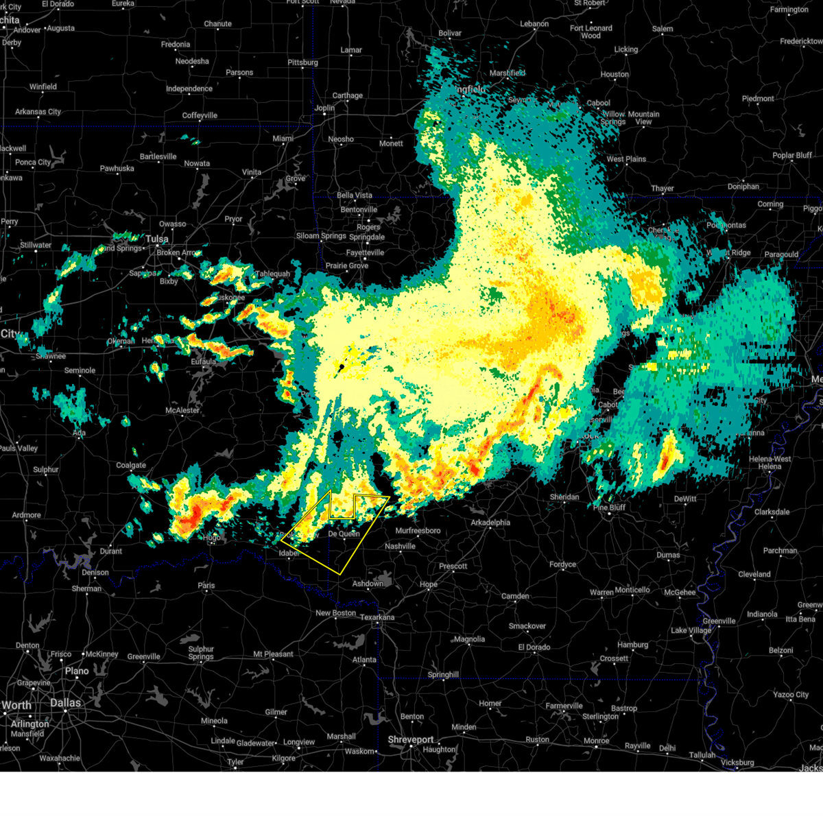
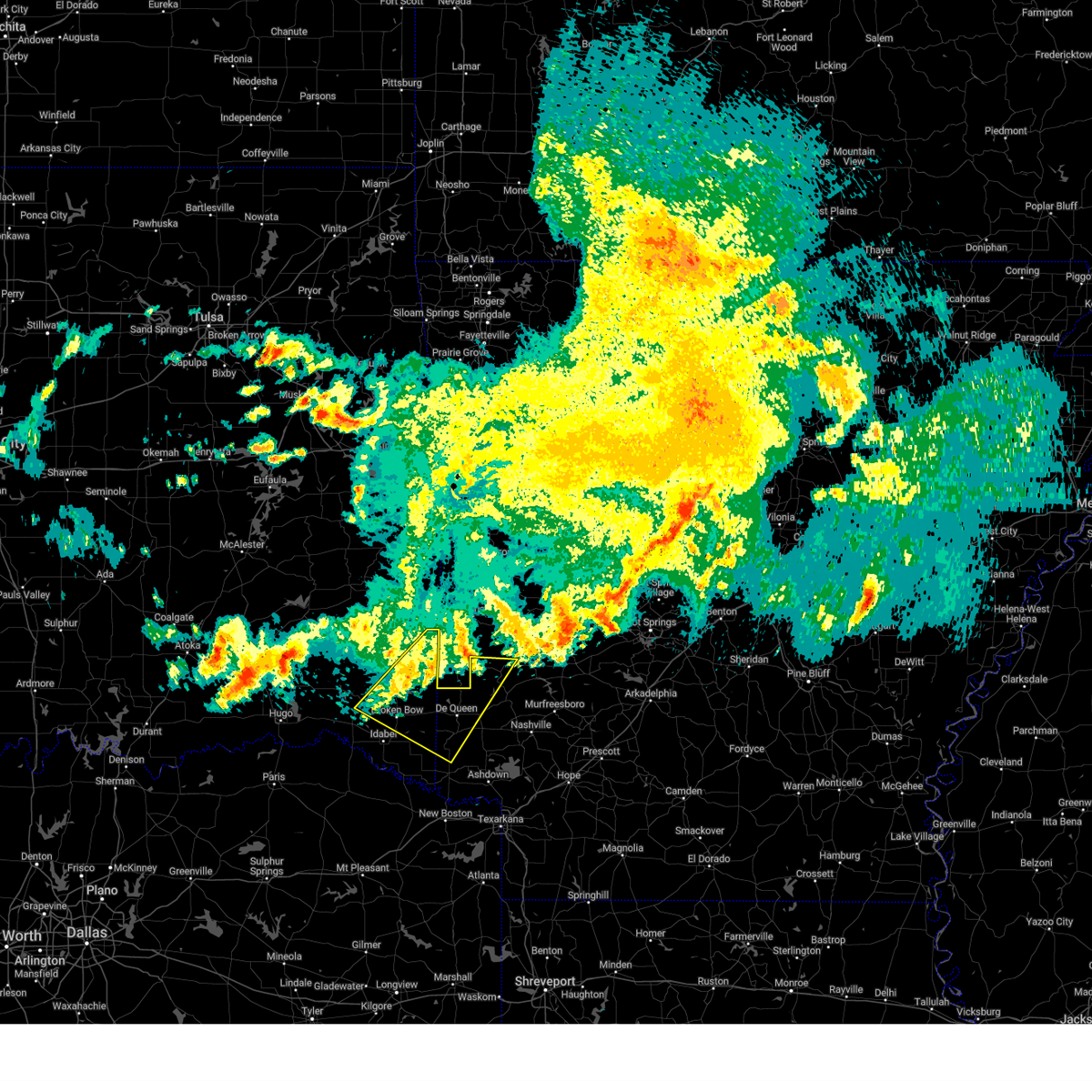
| 4/4/2025 8:52 PM CDT |
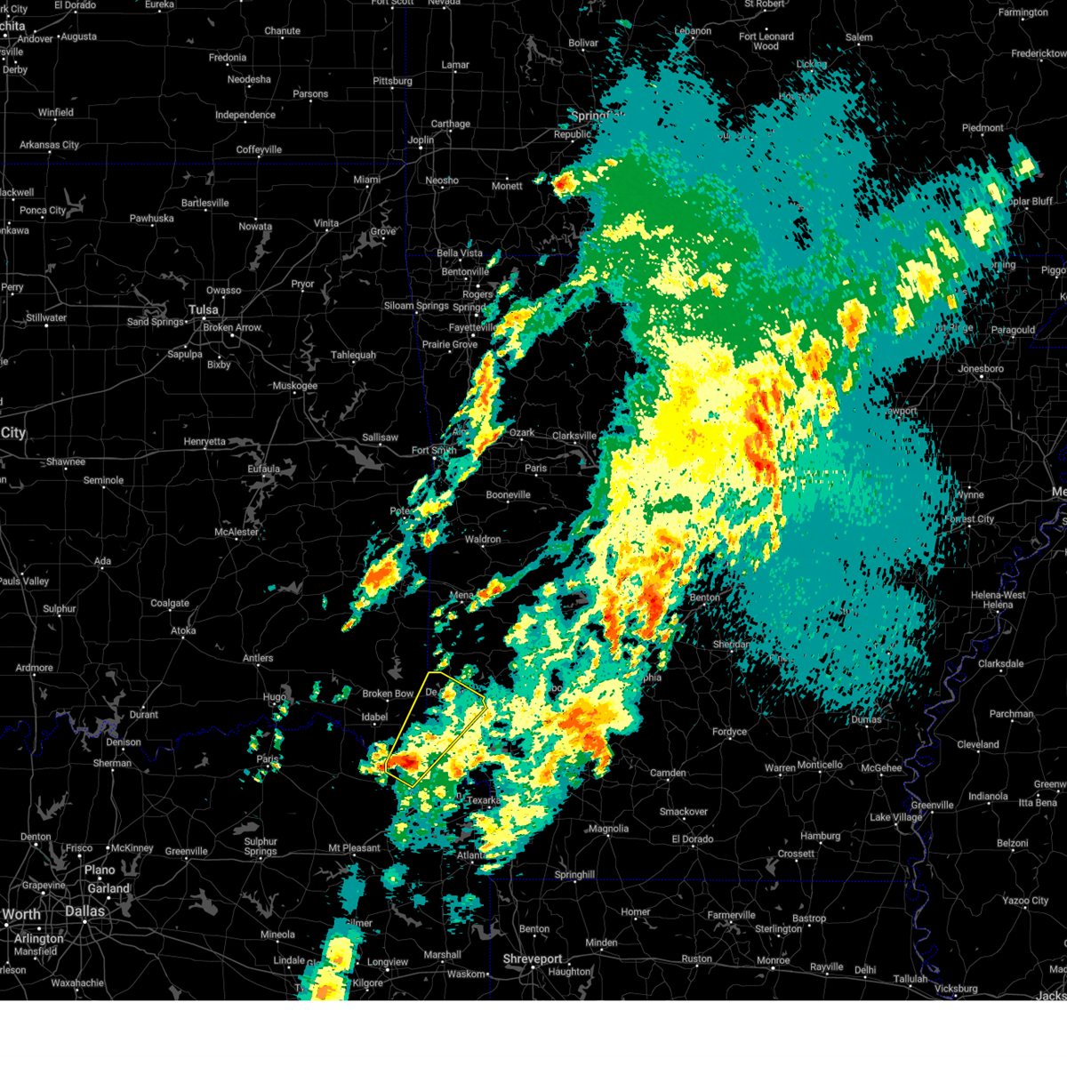 Svrshv the national weather service in shreveport has issued a * severe thunderstorm warning for, northwestern little river county in southwestern arkansas, sevier county in southwestern arkansas, southeastern mccurtain county in southeastern oklahoma, northwestern bowie county in northeastern texas, * until 945 pm cdt. * at 852 pm cdt, a severe thunderstorm was located 11 miles north of de kalb, or 12 miles west of foreman, moving northeast at 45 mph (radar indicated). Hazards include 60 mph wind gusts and quarter size hail. Hail damage to vehicles is expected. Expect wind damage to roofs, siding, and trees. Svrshv the national weather service in shreveport has issued a * severe thunderstorm warning for, northwestern little river county in southwestern arkansas, sevier county in southwestern arkansas, southeastern mccurtain county in southeastern oklahoma, northwestern bowie county in northeastern texas, * until 945 pm cdt. * at 852 pm cdt, a severe thunderstorm was located 11 miles north of de kalb, or 12 miles west of foreman, moving northeast at 45 mph (radar indicated). Hazards include 60 mph wind gusts and quarter size hail. Hail damage to vehicles is expected. Expect wind damage to roofs, siding, and trees.
|
| 4/4/2025 5:37 PM CDT | At 537 pm cdt, a severe thunderstorm capable of producing a tornado was located near grannis, or 11 miles west of umpire, moving northeast at 40 mph (radar indicated rotation). Hazards include tornado and half dollar size hail. Flying debris will be dangerous to those caught without shelter. mobile homes will be damaged or destroyed. damage to roofs, windows, and vehicles will occur. tree damage is likely. This dangerous storm will be near, athens around 550 pm cdt. |
| 4/4/2025 5:37 PM CDT | the tornado warning has been cancelled and is no longer in effect |
| 4/4/2025 5:17 PM CDT |
 Torshv the national weather service in shreveport has issued a * tornado warning for, northwestern sevier county in southwestern arkansas, northwestern howard county in southwestern arkansas, east central mccurtain county in southeastern oklahoma, * until 615 pm cdt. * at 517 pm cdt, a severe thunderstorm capable of producing a tornado was located near de queen, moving northeast at 40 mph (radar indicated rotation). Hazards include tornado and half dollar size hail. Flying debris will be dangerous to those caught without shelter. mobile homes will be damaged or destroyed. damage to roofs, windows, and vehicles will occur. tree damage is likely. this dangerous storm will be near, gillham around 520 pm cdt. athens around 550 pm cdt. Other locations impacted by this tornadic thunderstorm include west line. Torshv the national weather service in shreveport has issued a * tornado warning for, northwestern sevier county in southwestern arkansas, northwestern howard county in southwestern arkansas, east central mccurtain county in southeastern oklahoma, * until 615 pm cdt. * at 517 pm cdt, a severe thunderstorm capable of producing a tornado was located near de queen, moving northeast at 40 mph (radar indicated rotation). Hazards include tornado and half dollar size hail. Flying debris will be dangerous to those caught without shelter. mobile homes will be damaged or destroyed. damage to roofs, windows, and vehicles will occur. tree damage is likely. this dangerous storm will be near, gillham around 520 pm cdt. athens around 550 pm cdt. Other locations impacted by this tornadic thunderstorm include west line.
|
| 3/4/2025 8:12 AM CST |
 Svrshv the national weather service in shreveport has issued a * severe thunderstorm warning for, north central hempstead county in southwestern arkansas, howard county in southwestern arkansas, northwestern little river county in southwestern arkansas, sevier county in southwestern arkansas, eastern mccurtain county in southeastern oklahoma, north central bowie county in northeastern texas, * until 900 am cst. * at 812 am cst, severe thunderstorms were located along a line from 15 miles north of gillham to 7 miles south of foreman, or along a line from 21 miles west of umpire to 7 miles south of foreman, moving east at 60 mph (radar indicated). Hazards include 60 mph wind gusts. expect damage to roofs, siding, and trees Svrshv the national weather service in shreveport has issued a * severe thunderstorm warning for, north central hempstead county in southwestern arkansas, howard county in southwestern arkansas, northwestern little river county in southwestern arkansas, sevier county in southwestern arkansas, eastern mccurtain county in southeastern oklahoma, north central bowie county in northeastern texas, * until 900 am cst. * at 812 am cst, severe thunderstorms were located along a line from 15 miles north of gillham to 7 miles south of foreman, or along a line from 21 miles west of umpire to 7 miles south of foreman, moving east at 60 mph (radar indicated). Hazards include 60 mph wind gusts. expect damage to roofs, siding, and trees
|
| 11/4/2024 5:51 PM CST |
 the tornado warning has been cancelled and is no longer in effect the tornado warning has been cancelled and is no longer in effect
|
| 11/4/2024 5:10 PM CST |
 Torshv the national weather service in shreveport has issued a * tornado warning for, northwestern sevier county in southwestern arkansas, northeastern mccurtain county in southeastern oklahoma, * until 600 pm cst. * at 510 pm cst, a severe thunderstorm capable of producing a tornado was located over broken bow, or 21 miles west of de queen, moving northeast at 35 mph (radar indicated rotation). Hazards include tornado. Flying debris will be dangerous to those caught without shelter. mobile homes will be damaged or destroyed. damage to roofs, windows and vehicles will occur. Tree damage is likely. Torshv the national weather service in shreveport has issued a * tornado warning for, northwestern sevier county in southwestern arkansas, northeastern mccurtain county in southeastern oklahoma, * until 600 pm cst. * at 510 pm cst, a severe thunderstorm capable of producing a tornado was located over broken bow, or 21 miles west of de queen, moving northeast at 35 mph (radar indicated rotation). Hazards include tornado. Flying debris will be dangerous to those caught without shelter. mobile homes will be damaged or destroyed. damage to roofs, windows and vehicles will occur. Tree damage is likely.
|
| 8/18/2024 9:17 PM CDT |
 Svrshv the national weather service in shreveport has issued a * severe thunderstorm warning for, sevier county in southwestern arkansas, west central howard county in southwestern arkansas, * until 1000 pm cdt. * at 917 pm cdt, a severe thunderstorm was located over gillham, or 8 miles north of de queen, moving south at 25 mph (radar indicated). Hazards include 60 mph wind gusts and quarter size hail. Hail damage to vehicles is expected. Expect wind damage to roofs, siding, and trees. Svrshv the national weather service in shreveport has issued a * severe thunderstorm warning for, sevier county in southwestern arkansas, west central howard county in southwestern arkansas, * until 1000 pm cdt. * at 917 pm cdt, a severe thunderstorm was located over gillham, or 8 miles north of de queen, moving south at 25 mph (radar indicated). Hazards include 60 mph wind gusts and quarter size hail. Hail damage to vehicles is expected. Expect wind damage to roofs, siding, and trees.
|
| 5/23/2024 7:27 AM CDT |
 The storms which prompted the warning have moved out of the area. therefore, the warning will be allowed to expire. however, heavy rain is still possible with these thunderstorms. The storms which prompted the warning have moved out of the area. therefore, the warning will be allowed to expire. however, heavy rain is still possible with these thunderstorms.
|
| 5/23/2024 6:43 AM CDT |
 Svrshv the national weather service in shreveport has issued a * severe thunderstorm warning for, northern little river county in southwestern arkansas, northwestern hempstead county in southwestern arkansas, sevier county in southwestern arkansas, howard county in southwestern arkansas, southeastern mccurtain county in southeastern oklahoma, * until 730 am cdt. * at 642 am cdt, severe thunderstorms were located along a line extending from 7 miles southeast of gillham to near lockesburg to 6 miles northwest of ben lomond to near winthrop to near foreman, moving east at 40 mph (radar indicated). Hazards include ping pong ball size hail and 60 mph wind gusts. People and animals outdoors will be injured. expect hail damage to roofs, siding, windows, and vehicles. Expect wind damage to roofs, siding, and trees. Svrshv the national weather service in shreveport has issued a * severe thunderstorm warning for, northern little river county in southwestern arkansas, northwestern hempstead county in southwestern arkansas, sevier county in southwestern arkansas, howard county in southwestern arkansas, southeastern mccurtain county in southeastern oklahoma, * until 730 am cdt. * at 642 am cdt, severe thunderstorms were located along a line extending from 7 miles southeast of gillham to near lockesburg to 6 miles northwest of ben lomond to near winthrop to near foreman, moving east at 40 mph (radar indicated). Hazards include ping pong ball size hail and 60 mph wind gusts. People and animals outdoors will be injured. expect hail damage to roofs, siding, windows, and vehicles. Expect wind damage to roofs, siding, and trees.
|
| 3/14/2024 11:12 PM CDT |
 the severe thunderstorm warning has been cancelled and is no longer in effect the severe thunderstorm warning has been cancelled and is no longer in effect
|
| 3/14/2024 11:12 PM CDT |
 At 1111 pm cdt, a severe thunderstorm was located 12 miles north of broken bow, or 22 miles northwest of de queen, moving northeast at 50 mph (radar indicated). Hazards include 60 mph wind gusts and quarter size hail. Hail damage to vehicles is expected. expect wind damage to roofs, siding, and trees. Locations impacted include, broken bow, gillham, eagletown, hochatown, west line, bethel, mount herman, and sherwood. At 1111 pm cdt, a severe thunderstorm was located 12 miles north of broken bow, or 22 miles northwest of de queen, moving northeast at 50 mph (radar indicated). Hazards include 60 mph wind gusts and quarter size hail. Hail damage to vehicles is expected. expect wind damage to roofs, siding, and trees. Locations impacted include, broken bow, gillham, eagletown, hochatown, west line, bethel, mount herman, and sherwood.
|
| 3/14/2024 10:46 PM CDT |
 Svrshv the national weather service in shreveport has issued a * severe thunderstorm warning for, northwestern sevier county in southwestern arkansas, mccurtain county in southeastern oklahoma, northeastern red river county in northeastern texas, * until 1130 pm cdt. * at 1046 pm cdt, a severe thunderstorm was located near idabel, or 25 miles north of clarksville, moving northeast at 50 mph (radar indicated). Hazards include 60 mph wind gusts and half dollar size hail. Hail damage to vehicles is expected. Expect wind damage to roofs, siding, and trees. Svrshv the national weather service in shreveport has issued a * severe thunderstorm warning for, northwestern sevier county in southwestern arkansas, mccurtain county in southeastern oklahoma, northeastern red river county in northeastern texas, * until 1130 pm cdt. * at 1046 pm cdt, a severe thunderstorm was located near idabel, or 25 miles north of clarksville, moving northeast at 50 mph (radar indicated). Hazards include 60 mph wind gusts and half dollar size hail. Hail damage to vehicles is expected. Expect wind damage to roofs, siding, and trees.
|
| 9/6/2023 2:43 PM CDT |
 At 243 pm cdt, a severe thunderstorm was located near de queen, moving south at 10 mph (radar indicated). Hazards include 60 mph wind gusts and quarter size hail. Hail damage to vehicles is expected. Expect wind damage to roofs, siding, and trees. At 243 pm cdt, a severe thunderstorm was located near de queen, moving south at 10 mph (radar indicated). Hazards include 60 mph wind gusts and quarter size hail. Hail damage to vehicles is expected. Expect wind damage to roofs, siding, and trees.
|
| 6/18/2023 1:21 AM CDT |
 At 121 am cdt, severe thunderstorms were located along a line extending from near umpire to mineral springs to richmond, moving east at 70 mph (radar indicated). Hazards include 70 mph wind gusts and quarter size hail. Hail damage to vehicles is expected. expect considerable tree damage. wind damage is also likely to mobile homes, roofs, and outbuildings. locations impacted include, de queen, ashdown, nashville, mineral springs, dierks, horatio, foreman, umpire, lockesburg, wilton, tollette, winthrop, ogden, gillham, ben lomond, corinth, arkinda, center point, saratoga and athens. thunderstorm damage threat, considerable hail threat, radar indicated max hail size, 1. 00 in wind threat, radar indicated max wind gust, 70 mph. At 121 am cdt, severe thunderstorms were located along a line extending from near umpire to mineral springs to richmond, moving east at 70 mph (radar indicated). Hazards include 70 mph wind gusts and quarter size hail. Hail damage to vehicles is expected. expect considerable tree damage. wind damage is also likely to mobile homes, roofs, and outbuildings. locations impacted include, de queen, ashdown, nashville, mineral springs, dierks, horatio, foreman, umpire, lockesburg, wilton, tollette, winthrop, ogden, gillham, ben lomond, corinth, arkinda, center point, saratoga and athens. thunderstorm damage threat, considerable hail threat, radar indicated max hail size, 1. 00 in wind threat, radar indicated max wind gust, 70 mph.
|
| 6/18/2023 12:49 AM CDT |
 At 1249 am cdt, severe thunderstorms were located along a line extending from 13 miles west of gillham to 13 miles northwest of de kalb, moving east at 50 mph (radar indicated). Hazards include 70 mph wind gusts and nickel size hail. Expect considerable tree damage. Damage is likely to mobile homes, roofs, and outbuildings. At 1249 am cdt, severe thunderstorms were located along a line extending from 13 miles west of gillham to 13 miles northwest of de kalb, moving east at 50 mph (radar indicated). Hazards include 70 mph wind gusts and nickel size hail. Expect considerable tree damage. Damage is likely to mobile homes, roofs, and outbuildings.
|
| 6/18/2023 12:23 AM CDT |
 At 1223 am cdt, severe thunderstorms were located along a line extending from whitesboro to 7 miles east of arthur city, moving east at 40 mph (radar indicated). Hazards include 70 mph wind gusts and nickel size hail. Expect considerable tree damage. damage is likely to mobile homes, roofs, and outbuildings. locations impacted include, de queen, clarksville, horatio, foreman, boxelder, idabel, broken bow, de kalb, bogata, gillham, arkinda, bagwell, manchester, wright city, valliant, detroit, deport, avery, millerton and annona. thunderstorm damage threat, considerable hail threat, radar indicated max hail size, 0. 88 in wind threat, radar indicated max wind gust, 70 mph. At 1223 am cdt, severe thunderstorms were located along a line extending from whitesboro to 7 miles east of arthur city, moving east at 40 mph (radar indicated). Hazards include 70 mph wind gusts and nickel size hail. Expect considerable tree damage. damage is likely to mobile homes, roofs, and outbuildings. locations impacted include, de queen, clarksville, horatio, foreman, boxelder, idabel, broken bow, de kalb, bogata, gillham, arkinda, bagwell, manchester, wright city, valliant, detroit, deport, avery, millerton and annona. thunderstorm damage threat, considerable hail threat, radar indicated max hail size, 0. 88 in wind threat, radar indicated max wind gust, 70 mph.
|
| 6/17/2023 11:59 PM CDT |
 At 1158 pm cdt, severe thunderstorms were located along a line extending from near tuskahoma to near sumner, moving east at 40 mph (radar indicated). Hazards include 60 mph wind gusts and nickel size hail. expect damage to roofs, siding, and trees At 1158 pm cdt, severe thunderstorms were located along a line extending from near tuskahoma to near sumner, moving east at 40 mph (radar indicated). Hazards include 60 mph wind gusts and nickel size hail. expect damage to roofs, siding, and trees
|
| 6/13/2023 10:28 PM CDT |
 At 1028 pm cdt, a severe thunderstorm was located 7 miles west of de queen, moving east at 45 mph (radar indicated. quarter size hail fell in broken bow and garvin oklahoma from this storm). Hazards include quarter size hail. damage to vehicles is expected At 1028 pm cdt, a severe thunderstorm was located 7 miles west of de queen, moving east at 45 mph (radar indicated. quarter size hail fell in broken bow and garvin oklahoma from this storm). Hazards include quarter size hail. damage to vehicles is expected
|
| 6/13/2023 10:17 PM CDT |
 At 1016 pm cdt, a severe thunderstorm was located 9 miles east of broken bow, or 14 miles west of de queen, moving east at 45 mph (radar indicated. quarter size hail has fallen at garvin and broken bow with this storm). Hazards include quarter size hail. Damage to vehicles is expected. locations impacted include, de queen, gillham, eagletown and west line. hail threat, observed max hail size, 1. 00 in wind threat, radar indicated max wind gust, <50 mph. At 1016 pm cdt, a severe thunderstorm was located 9 miles east of broken bow, or 14 miles west of de queen, moving east at 45 mph (radar indicated. quarter size hail has fallen at garvin and broken bow with this storm). Hazards include quarter size hail. Damage to vehicles is expected. locations impacted include, de queen, gillham, eagletown and west line. hail threat, observed max hail size, 1. 00 in wind threat, radar indicated max wind gust, <50 mph.
|
| 6/13/2023 9:50 PM CDT |
 At 950 pm cdt, a severe thunderstorm was located just northwest of idabel, or 24 miles north of clarksville, moving east at 55 mph (radar indicated). Hazards include quarter size hail. damage to vehicles is expected At 950 pm cdt, a severe thunderstorm was located just northwest of idabel, or 24 miles north of clarksville, moving east at 55 mph (radar indicated). Hazards include quarter size hail. damage to vehicles is expected
|
| 5/19/2023 5:10 PM CDT |
 At 509 pm cdt, a severe thunderstorm was located over gillham, or 11 miles north of de queen, moving east at 25 mph (radar indicated). Hazards include 60 mph wind gusts and quarter size hail. Hail damage to vehicles is expected. Expect wind damage to roofs, siding, and trees. At 509 pm cdt, a severe thunderstorm was located over gillham, or 11 miles north of de queen, moving east at 25 mph (radar indicated). Hazards include 60 mph wind gusts and quarter size hail. Hail damage to vehicles is expected. Expect wind damage to roofs, siding, and trees.
|
| 3/11/2023 10:22 PM CDT |
 At 922 pm cst, severe thunderstorms were located along a line extending from near daisy to near daisy state park to near dierks to near de queen, moving east at 60 mph (radar indicated). Hazards include 60 mph wind gusts and quarter size hail. Hail damage to vehicles is expected. expect wind damage to roofs, siding, and trees. locations impacted include, de queen, nashville, mineral springs, dierks, lockesburg, gillham, corinth, center point, silver ridge, geneva, muddy fork, lebanon, burg, provo and west line. hail threat, radar indicated max hail size, 1. 00 in wind threat, radar indicated max wind gust, 60 mph. At 922 pm cst, severe thunderstorms were located along a line extending from near daisy to near daisy state park to near dierks to near de queen, moving east at 60 mph (radar indicated). Hazards include 60 mph wind gusts and quarter size hail. Hail damage to vehicles is expected. expect wind damage to roofs, siding, and trees. locations impacted include, de queen, nashville, mineral springs, dierks, lockesburg, gillham, corinth, center point, silver ridge, geneva, muddy fork, lebanon, burg, provo and west line. hail threat, radar indicated max hail size, 1. 00 in wind threat, radar indicated max wind gust, 60 mph.
|
| 3/11/2023 10:11 PM CDT |
 At 911 pm cst, severe thunderstorms were located along a line extending from near albert pike recreation area to 7 miles east of umpire to 7 miles west of dierks to near de queen, moving east at 70 mph (radar indicated). Hazards include 60 mph wind gusts and quarter size hail. Hail damage to vehicles is expected. Expect wind damage to roofs, siding, and trees. At 911 pm cst, severe thunderstorms were located along a line extending from near albert pike recreation area to 7 miles east of umpire to 7 miles west of dierks to near de queen, moving east at 70 mph (radar indicated). Hazards include 60 mph wind gusts and quarter size hail. Hail damage to vehicles is expected. Expect wind damage to roofs, siding, and trees.
|
| 3/2/2023 9:43 PM CST |
 At 943 pm cst, severe thunderstorms were located along a line extending from near de queen to near horatio to 6 miles west of richmond to 6 miles south of new boston, moving east at 45 mph (radar indicated. numerous trees and power lines have been downed with these storms across mccurtain county oklahoma. roof damage has been reported as well). Hazards include 70 mph wind gusts and penny size hail. Expect considerable tree damage. Damage is likely to mobile homes, roofs, and outbuildings. At 943 pm cst, severe thunderstorms were located along a line extending from near de queen to near horatio to 6 miles west of richmond to 6 miles south of new boston, moving east at 45 mph (radar indicated. numerous trees and power lines have been downed with these storms across mccurtain county oklahoma. roof damage has been reported as well). Hazards include 70 mph wind gusts and penny size hail. Expect considerable tree damage. Damage is likely to mobile homes, roofs, and outbuildings.
|
| 3/2/2023 9:31 PM CST |
 At 930 pm cst, severe thunderstorms were located along a line extending from 10 miles southeast of octavia to 12 miles northwest of de queen to 10 miles east of broken bow to 7 miles west of horatio to 6 miles southwest of foreman to 9 miles east of dalby springs, moving east at 45 mph (radar indicated). Hazards include 60 mph wind gusts and penny size hail. Expect damage to roofs, siding, and trees. Locations impacted include, de queen, new boston, horatio, foreman, broken bow, de kalb, winthrop, gillham, arkinda, dalby springs, haworth, eagletown, moon, cerrogordo, spring hill, smithville, hochatown, goodlake, watson and goodwater. At 930 pm cst, severe thunderstorms were located along a line extending from 10 miles southeast of octavia to 12 miles northwest of de queen to 10 miles east of broken bow to 7 miles west of horatio to 6 miles southwest of foreman to 9 miles east of dalby springs, moving east at 45 mph (radar indicated). Hazards include 60 mph wind gusts and penny size hail. Expect damage to roofs, siding, and trees. Locations impacted include, de queen, new boston, horatio, foreman, broken bow, de kalb, winthrop, gillham, arkinda, dalby springs, haworth, eagletown, moon, cerrogordo, spring hill, smithville, hochatown, goodlake, watson and goodwater.
|
| 3/2/2023 8:57 PM CST |
 At 857 pm cst, severe thunderstorms were located along a line extending from near octavia to 10 miles northwest of broken bow to 8 miles east of manchester to 7 miles northeast of clarksville to near wilkerson, moving east at 30 mph (radar indicated). Hazards include 60 mph wind gusts and quarter size hail. Hail damage to vehicles is expected. Expect wind damage to roofs, siding, and trees. At 857 pm cst, severe thunderstorms were located along a line extending from near octavia to 10 miles northwest of broken bow to 8 miles east of manchester to 7 miles northeast of clarksville to near wilkerson, moving east at 30 mph (radar indicated). Hazards include 60 mph wind gusts and quarter size hail. Hail damage to vehicles is expected. Expect wind damage to roofs, siding, and trees.
|
| 11/4/2022 7:05 PM CDT |
 At 704 pm cdt, a large and extremely dangerous tornado was located near broken bow, or 21 miles west of horatio, moving northeast at 45 mph. this is a particularly dangerous situation. take cover now! (radar indicated rotation). Hazards include damaging tornado. You are in a life-threatening situation. flying debris may be deadly to those caught without shelter. mobile homes will be destroyed. considerable damage to homes, businesses, and vehicles is likely and complete destruction is possible. the tornado will be near, gillham around 740 pm cdt. Other locations impacted by this tornadic thunderstorm include eagletown, plunketville, holly creek, cerrogordo, hochatown, goodwater, west line, oak hill and haworth. At 704 pm cdt, a large and extremely dangerous tornado was located near broken bow, or 21 miles west of horatio, moving northeast at 45 mph. this is a particularly dangerous situation. take cover now! (radar indicated rotation). Hazards include damaging tornado. You are in a life-threatening situation. flying debris may be deadly to those caught without shelter. mobile homes will be destroyed. considerable damage to homes, businesses, and vehicles is likely and complete destruction is possible. the tornado will be near, gillham around 740 pm cdt. Other locations impacted by this tornadic thunderstorm include eagletown, plunketville, holly creek, cerrogordo, hochatown, goodwater, west line, oak hill and haworth.
|
| 9/4/2022 6:41 PM CDT | Power lines down in gillha in sevier county AR, 0.2 miles E of Gillham, AR |
| 9/4/2022 6:38 PM CDT |
 At 638 pm cdt, a severe thunderstorm was located 5 miles southwest of gillham, moving southeast at 45 mph (radar indicated). Hazards include 60 mph wind gusts and quarter size hail. Hail damage to vehicles is expected. Expect wind damage to roofs, siding, and trees. At 638 pm cdt, a severe thunderstorm was located 5 miles southwest of gillham, moving southeast at 45 mph (radar indicated). Hazards include 60 mph wind gusts and quarter size hail. Hail damage to vehicles is expected. Expect wind damage to roofs, siding, and trees.
|
| 7/21/2022 4:06 PM CDT |
 The severe thunderstorm warning for northwestern sevier county will expire at 415 pm cdt, the storm which prompted the warning has weakened below severe limits, and no longer poses an immediate threat to life or property. therefore, the warning will be allowed to expire. a severe thunderstorm watch remains in effect until 1100 pm cdt for southwestern arkansas. The severe thunderstorm warning for northwestern sevier county will expire at 415 pm cdt, the storm which prompted the warning has weakened below severe limits, and no longer poses an immediate threat to life or property. therefore, the warning will be allowed to expire. a severe thunderstorm watch remains in effect until 1100 pm cdt for southwestern arkansas.
|
| 7/21/2022 3:54 PM CDT |
 At 353 pm cdt, a severe thunderstorm was located near gillham, or 9 miles northwest of de queen, moving south at 5 mph (radar indicated). Hazards include 60 mph wind gusts and penny size hail. Expect damage to roofs, siding, and trees. locations impacted include, gillham. hail threat, radar indicated max hail size, 0. 75 in wind threat, radar indicated max wind gust, 60 mph. At 353 pm cdt, a severe thunderstorm was located near gillham, or 9 miles northwest of de queen, moving south at 5 mph (radar indicated). Hazards include 60 mph wind gusts and penny size hail. Expect damage to roofs, siding, and trees. locations impacted include, gillham. hail threat, radar indicated max hail size, 0. 75 in wind threat, radar indicated max wind gust, 60 mph.
|
| 7/21/2022 3:28 PM CDT |
 At 328 pm cdt, a severe thunderstorm was located 7 miles northwest of de queen, moving south at 5 mph (radar indicated). Hazards include 60 mph wind gusts and quarter size hail. Hail damage to vehicles is expected. Expect wind damage to roofs, siding, and trees. At 328 pm cdt, a severe thunderstorm was located 7 miles northwest of de queen, moving south at 5 mph (radar indicated). Hazards include 60 mph wind gusts and quarter size hail. Hail damage to vehicles is expected. Expect wind damage to roofs, siding, and trees.
|
| 5/21/2022 7:58 PM CDT |
 At 758 pm cdt, severe thunderstorms were located along a line extending from athens to 6 miles southwest of umpire to near de queen to near horatio, moving east at 25 mph (radar indicated). Hazards include 60 mph wind gusts and quarter size hail. Hail damage to vehicles is expected. Expect wind damage to roofs, siding, and trees. At 758 pm cdt, severe thunderstorms were located along a line extending from athens to 6 miles southwest of umpire to near de queen to near horatio, moving east at 25 mph (radar indicated). Hazards include 60 mph wind gusts and quarter size hail. Hail damage to vehicles is expected. Expect wind damage to roofs, siding, and trees.
|
| 4/24/2022 9:51 PM CDT |
 At 950 pm cdt, a severe thunderstorm was located over grannis, or 14 miles north of de queen, moving northeast at 40 mph (radar indicated). Hazards include 60 mph wind gusts and quarter size hail. Hail damage to vehicles is expected. Expect wind damage to roofs, siding, and trees. At 950 pm cdt, a severe thunderstorm was located over grannis, or 14 miles north of de queen, moving northeast at 40 mph (radar indicated). Hazards include 60 mph wind gusts and quarter size hail. Hail damage to vehicles is expected. Expect wind damage to roofs, siding, and trees.
|
| 4/24/2022 9:28 PM CDT |
 At 928 pm cdt, a severe thunderstorm was located 8 miles west of grannis, or 15 miles northwest of de queen, moving northeast at 45 mph (radar indicated). Hazards include 60 mph wind gusts and quarter size hail. Hail damage to vehicles is expected. expect wind damage to roofs, siding, and trees. locations impacted include, gillham, hochatown, eagletown, plunketville and watson. hail threat, radar indicated max hail size, 1. 00 in wind threat, radar indicated max wind gust, 60 mph. At 928 pm cdt, a severe thunderstorm was located 8 miles west of grannis, or 15 miles northwest of de queen, moving northeast at 45 mph (radar indicated). Hazards include 60 mph wind gusts and quarter size hail. Hail damage to vehicles is expected. expect wind damage to roofs, siding, and trees. locations impacted include, gillham, hochatown, eagletown, plunketville and watson. hail threat, radar indicated max hail size, 1. 00 in wind threat, radar indicated max wind gust, 60 mph.
|
| 4/24/2022 8:59 PM CDT |
 At 857 pm cdt, a severe thunderstorm was located 7 miles northwest of broken bow, or 28 miles west of de queen, moving northeast at 45 mph (radar indicated). Hazards include 60 mph wind gusts and quarter size hail. Hail damage to vehicles is expected. Expect wind damage to roofs, siding, and trees. At 857 pm cdt, a severe thunderstorm was located 7 miles northwest of broken bow, or 28 miles west of de queen, moving northeast at 45 mph (radar indicated). Hazards include 60 mph wind gusts and quarter size hail. Hail damage to vehicles is expected. Expect wind damage to roofs, siding, and trees.
|
| 4/4/2022 11:38 PM CDT |
 The severe thunderstorm warning for northwestern little river, northern sevier and southeastern mccurtain counties will expire at 1145 pm cdt, the storm which prompted the warning has moved out of the area. therefore, the warning will be allowed to expire. The severe thunderstorm warning for northwestern little river, northern sevier and southeastern mccurtain counties will expire at 1145 pm cdt, the storm which prompted the warning has moved out of the area. therefore, the warning will be allowed to expire.
|
| 4/4/2022 11:00 PM CDT |
 At 1059 pm cdt, a severe thunderstorm was located 11 miles southeast of broken bow, or 15 miles west of horatio, moving northeast at 40 mph (radar indicated). Hazards include 60 mph wind gusts and quarter size hail. Hail damage to vehicles is expected. Expect wind damage to roofs, siding, and trees. At 1059 pm cdt, a severe thunderstorm was located 11 miles southeast of broken bow, or 15 miles west of horatio, moving northeast at 40 mph (radar indicated). Hazards include 60 mph wind gusts and quarter size hail. Hail damage to vehicles is expected. Expect wind damage to roofs, siding, and trees.
|
| 3/30/2022 7:14 AM CDT |
 At 714 am cdt, severe thunderstorms were located along a line extending from 8 miles west of vandervoort to 6 miles west of grannis to 10 miles west of de queen to 8 miles west of arkinda to 8 miles north of boxelder, moving northeast at 60 mph (radar indicated). Hazards include 60 mph wind gusts. Expect damage to roofs, siding, and trees. locations impacted include, de queen, horatio, boxelder, gillham, arkinda, avery, annona, haworth, eagletown, moon, cerrogordo, beaverdams, goodlake, watson, goodwater, shinewell, america, west line, bokhoma and plunketville. hail threat, radar indicated max hail size, <. 75 in wind threat, radar indicated max wind gust, 60 mph. At 714 am cdt, severe thunderstorms were located along a line extending from 8 miles west of vandervoort to 6 miles west of grannis to 10 miles west of de queen to 8 miles west of arkinda to 8 miles north of boxelder, moving northeast at 60 mph (radar indicated). Hazards include 60 mph wind gusts. Expect damage to roofs, siding, and trees. locations impacted include, de queen, horatio, boxelder, gillham, arkinda, avery, annona, haworth, eagletown, moon, cerrogordo, beaverdams, goodlake, watson, goodwater, shinewell, america, west line, bokhoma and plunketville. hail threat, radar indicated max hail size, <. 75 in wind threat, radar indicated max wind gust, 60 mph.
|
| 3/30/2022 6:47 AM CDT |
 At 647 am cdt, severe thunderstorms were located along a line extending from 23 miles northeast of fort towson to near broken bow to 10 miles southwest of idabel to 7 miles west of boxelder to hagansport, moving northeast at 60 mph (radar indicated). Hazards include 60 mph wind gusts. expect damage to roofs, siding, and trees At 647 am cdt, severe thunderstorms were located along a line extending from 23 miles northeast of fort towson to near broken bow to 10 miles southwest of idabel to 7 miles west of boxelder to hagansport, moving northeast at 60 mph (radar indicated). Hazards include 60 mph wind gusts. expect damage to roofs, siding, and trees
|
| 3/21/2022 10:12 PM CDT |
 At 1011 pm cdt, severe thunderstorms were located along a line extending from 9 miles west of grannis to near boxelder, moving northeast at 60 mph (radar indicated). Hazards include 60 mph wind gusts and penny size hail. expect damage to roofs, siding, and trees At 1011 pm cdt, severe thunderstorms were located along a line extending from 9 miles west of grannis to near boxelder, moving northeast at 60 mph (radar indicated). Hazards include 60 mph wind gusts and penny size hail. expect damage to roofs, siding, and trees
|
| 10/11/2021 12:26 AM CDT |
 At 1225 am cdt, severe thunderstorms were located along a line extending from near broken bow to 14 miles north of boxelder to 7 miles northeast of mount vernon, moving east at 50 mph (radar indicated). Hazards include 60 mph wind gusts and quarter size hail. Hail damage to vehicles is expected. Expect wind damage to roofs, siding, and trees. At 1225 am cdt, severe thunderstorms were located along a line extending from near broken bow to 14 miles north of boxelder to 7 miles northeast of mount vernon, moving east at 50 mph (radar indicated). Hazards include 60 mph wind gusts and quarter size hail. Hail damage to vehicles is expected. Expect wind damage to roofs, siding, and trees.
|
| 5/18/2021 4:05 PM CDT |
 At 405 pm cdt, severe thunderstorms were located along a line extending from 15 miles west of grannis to near horatio to arkinda to 8 miles southwest of foreman to 7 miles southeast of de kalb, moving east at 45 mph (radar indicated). Hazards include 60 mph wind gusts and quarter size hail. Hail damage to vehicles is expected. expect wind damage to roofs, siding, and trees. Locations impacted include, de queen, ashdown, mineral springs, dierks, horatio, foreman, umpire, idabel, broken bow, lockesburg, wilton, winthrop, gillham, ben lomond, arkinda, athens, richmond, center point, oak grove and haworth. At 405 pm cdt, severe thunderstorms were located along a line extending from 15 miles west of grannis to near horatio to arkinda to 8 miles southwest of foreman to 7 miles southeast of de kalb, moving east at 45 mph (radar indicated). Hazards include 60 mph wind gusts and quarter size hail. Hail damage to vehicles is expected. expect wind damage to roofs, siding, and trees. Locations impacted include, de queen, ashdown, mineral springs, dierks, horatio, foreman, umpire, idabel, broken bow, lockesburg, wilton, winthrop, gillham, ben lomond, arkinda, athens, richmond, center point, oak grove and haworth.
|
| 5/18/2021 3:33 PM CDT |
 At 333 pm cdt, severe thunderstorms were located along a line extending from 17 miles northwest of broken bow to near idabel to 9 miles north of boxelder to near wilkerson, moving east at 45 mph (radar indicated). Hazards include 60 mph wind gusts and quarter size hail. Hail damage to vehicles is expected. Expect wind damage to roofs, siding, and trees. At 333 pm cdt, severe thunderstorms were located along a line extending from 17 miles northwest of broken bow to near idabel to 9 miles north of boxelder to near wilkerson, moving east at 45 mph (radar indicated). Hazards include 60 mph wind gusts and quarter size hail. Hail damage to vehicles is expected. Expect wind damage to roofs, siding, and trees.
|
| 5/4/2021 12:25 AM CDT |
 At 1224 am cdt, a severe thunderstorm was located 5 miles northwest of horatio, moving north at 35 mph (radar indicated). Hazards include 60 mph wind gusts and half dollar size hail. Hail damage to vehicles is expected. Expect wind damage to roofs, siding, and trees. At 1224 am cdt, a severe thunderstorm was located 5 miles northwest of horatio, moving north at 35 mph (radar indicated). Hazards include 60 mph wind gusts and half dollar size hail. Hail damage to vehicles is expected. Expect wind damage to roofs, siding, and trees.
|
| 5/4/2021 12:25 AM CDT |
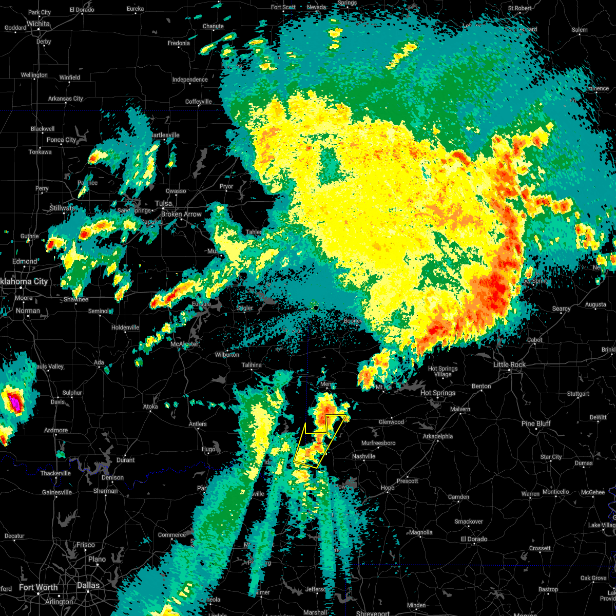 At 1224 am cdt, a severe thunderstorm was located 5 miles northwest of horatio, moving north at 35 mph (radar indicated). Hazards include 60 mph wind gusts and half dollar size hail. Hail damage to vehicles is expected. Expect wind damage to roofs, siding, and trees. At 1224 am cdt, a severe thunderstorm was located 5 miles northwest of horatio, moving north at 35 mph (radar indicated). Hazards include 60 mph wind gusts and half dollar size hail. Hail damage to vehicles is expected. Expect wind damage to roofs, siding, and trees.
|
| 4/24/2021 1:43 AM CDT |
 At 143 am cdt, severe thunderstorms were located along a line extending from near gillham to 6 miles west of ben lomond to hooks, moving east at 45 mph (radar indicated). Hazards include 60 mph wind gusts. expect damage to roofs, siding, and trees At 143 am cdt, severe thunderstorms were located along a line extending from near gillham to 6 miles west of ben lomond to hooks, moving east at 45 mph (radar indicated). Hazards include 60 mph wind gusts. expect damage to roofs, siding, and trees
|
| 4/24/2021 1:06 AM CDT |
 At 106 am cdt, severe thunderstorms were located along a line extending from 13 miles southwest of octavia to near boxelder, moving east at 55 mph (radar indicated). Hazards include 60 mph wind gusts. expect damage to roofs, siding, and trees At 106 am cdt, severe thunderstorms were located along a line extending from 13 miles southwest of octavia to near boxelder, moving east at 55 mph (radar indicated). Hazards include 60 mph wind gusts. expect damage to roofs, siding, and trees
|
| 4/9/2021 10:48 PM CDT |
 At 1047 pm cdt, severe thunderstorms were located along a line extending from 9 miles northeast of broken bow to near bogata, moving southeast at 50 mph. in addition, severe thunderstorms ahead of this line were located north of dekalb texas to southwest of horatio, moving east near 25 mph (radar indicated). Hazards include 60 mph wind gusts and half dollar size hail. Hail damage to vehicles is expected. Expect wind damage to roofs, siding, and trees. At 1047 pm cdt, severe thunderstorms were located along a line extending from 9 miles northeast of broken bow to near bogata, moving southeast at 50 mph. in addition, severe thunderstorms ahead of this line were located north of dekalb texas to southwest of horatio, moving east near 25 mph (radar indicated). Hazards include 60 mph wind gusts and half dollar size hail. Hail damage to vehicles is expected. Expect wind damage to roofs, siding, and trees.
|
| 8/29/2020 10:43 PM CDT |
 At 1043 pm cdt, severe thunderstorms were located along a line extending from near horatio to near washington to near prescott, moving south at 35 mph (radar indicated. trees have been downed across multiple locations in howard county with these storms). Hazards include 60 mph wind gusts. Expect damage to roofs, siding, and trees. Locations impacted include, hope, de queen, nashville, prescott, mineral springs, dierks, horatio, lockesburg, emmet, blevins, perrytown, rosston, tollette, washington, gillham, ben lomond, bodcaw, bluff city, corinth and center point. At 1043 pm cdt, severe thunderstorms were located along a line extending from near horatio to near washington to near prescott, moving south at 35 mph (radar indicated. trees have been downed across multiple locations in howard county with these storms). Hazards include 60 mph wind gusts. Expect damage to roofs, siding, and trees. Locations impacted include, hope, de queen, nashville, prescott, mineral springs, dierks, horatio, lockesburg, emmet, blevins, perrytown, rosston, tollette, washington, gillham, ben lomond, bodcaw, bluff city, corinth and center point.
|
| 8/29/2020 10:19 PM CDT |
 At 1019 pm cdt, severe thunderstorms were located along a line extending from near grannis to near nashville to near halfway, moving south southeast at 35 mph (radar indicated). Hazards include 70 mph wind gusts. Expect considerable tree damage. Damage is likely to mobile homes, roofs, and outbuildings. At 1019 pm cdt, severe thunderstorms were located along a line extending from near grannis to near nashville to near halfway, moving south southeast at 35 mph (radar indicated). Hazards include 70 mph wind gusts. Expect considerable tree damage. Damage is likely to mobile homes, roofs, and outbuildings.
|
| 8/29/2020 9:56 PM CDT |
 At 956 pm cdt, severe thunderstorms were located along a line extending from near octavia to 9 miles west of grannis to 6 miles east of gillham to near narrows dam, moving south at 30 mph. additional strong to severe thunderstorms were indicated between muse and octavia in southern leflore county oklahoma, and was slowly moving south southeast and could affect portions of northern mccurtain county during the next half hour (radar indicated). Hazards include 70 mph wind gusts and nickel size hail. Expect considerable tree damage. damage is likely to mobile homes, roofs, and outbuildings. Locations impacted include, de queen, dierks, umpire, lockesburg, gillham, corinth, athens, center point, plunketville, silver ridge, smithville, hochatown, geneva, watson, mount herman, sherwood, muddy fork, lebanon, burg and provo. At 956 pm cdt, severe thunderstorms were located along a line extending from near octavia to 9 miles west of grannis to 6 miles east of gillham to near narrows dam, moving south at 30 mph. additional strong to severe thunderstorms were indicated between muse and octavia in southern leflore county oklahoma, and was slowly moving south southeast and could affect portions of northern mccurtain county during the next half hour (radar indicated). Hazards include 70 mph wind gusts and nickel size hail. Expect considerable tree damage. damage is likely to mobile homes, roofs, and outbuildings. Locations impacted include, de queen, dierks, umpire, lockesburg, gillham, corinth, athens, center point, plunketville, silver ridge, smithville, hochatown, geneva, watson, mount herman, sherwood, muddy fork, lebanon, burg and provo.
|
| 8/29/2020 9:56 PM CDT |
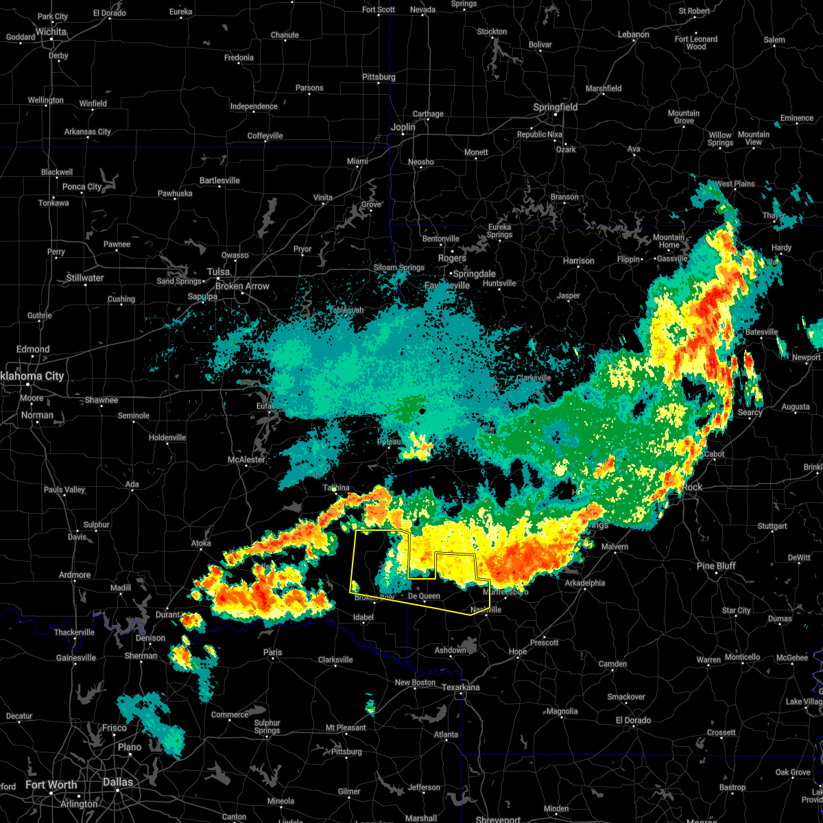 At 956 pm cdt, severe thunderstorms were located along a line extending from near octavia to 9 miles west of grannis to 6 miles east of gillham to near narrows dam, moving south at 30 mph. additional strong to severe thunderstorms were indicated between muse and octavia in southern leflore county oklahoma, and was slowly moving south southeast and could affect portions of northern mccurtain county during the next half hour (radar indicated). Hazards include 70 mph wind gusts and nickel size hail. Expect considerable tree damage. damage is likely to mobile homes, roofs, and outbuildings. Locations impacted include, de queen, dierks, umpire, lockesburg, gillham, corinth, athens, center point, plunketville, silver ridge, smithville, hochatown, geneva, watson, mount herman, sherwood, muddy fork, lebanon, burg and provo. At 956 pm cdt, severe thunderstorms were located along a line extending from near octavia to 9 miles west of grannis to 6 miles east of gillham to near narrows dam, moving south at 30 mph. additional strong to severe thunderstorms were indicated between muse and octavia in southern leflore county oklahoma, and was slowly moving south southeast and could affect portions of northern mccurtain county during the next half hour (radar indicated). Hazards include 70 mph wind gusts and nickel size hail. Expect considerable tree damage. damage is likely to mobile homes, roofs, and outbuildings. Locations impacted include, de queen, dierks, umpire, lockesburg, gillham, corinth, athens, center point, plunketville, silver ridge, smithville, hochatown, geneva, watson, mount herman, sherwood, muddy fork, lebanon, burg and provo.
|
| 8/29/2020 9:25 PM CDT |
 At 923 pm cdt, severe thunderstorms were located along a line extending from near big cedar to near hatfield to near hartley to near norman, moving south southeast at 35 mph (radar indicated). Hazards include 60 mph wind gusts and penny size hail. expect damage to roofs, siding, and trees At 923 pm cdt, severe thunderstorms were located along a line extending from near big cedar to near hatfield to near hartley to near norman, moving south southeast at 35 mph (radar indicated). Hazards include 60 mph wind gusts and penny size hail. expect damage to roofs, siding, and trees
|
| 8/29/2020 9:25 PM CDT |
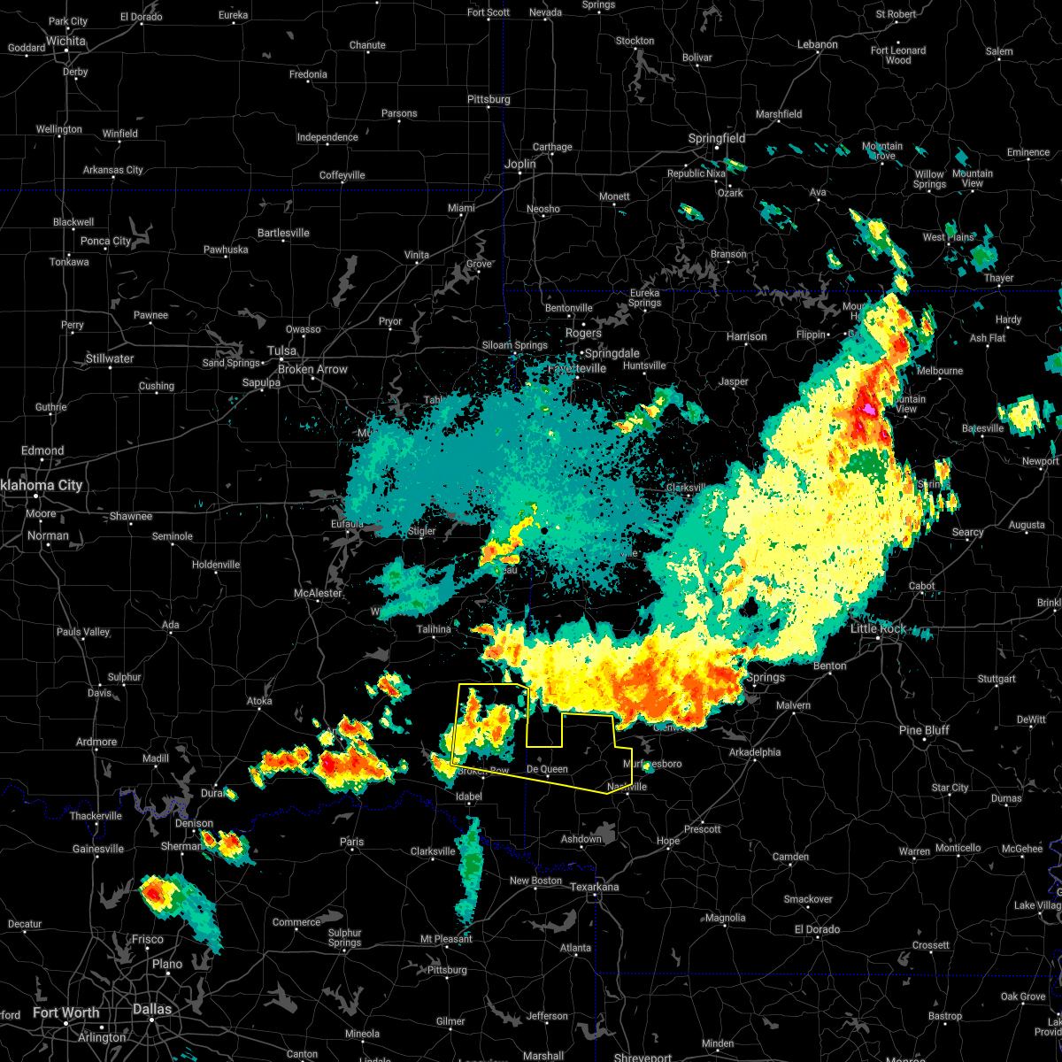 At 923 pm cdt, severe thunderstorms were located along a line extending from near big cedar to near hatfield to near hartley to near norman, moving south southeast at 35 mph (radar indicated). Hazards include 60 mph wind gusts and penny size hail. expect damage to roofs, siding, and trees At 923 pm cdt, severe thunderstorms were located along a line extending from near big cedar to near hatfield to near hartley to near norman, moving south southeast at 35 mph (radar indicated). Hazards include 60 mph wind gusts and penny size hail. expect damage to roofs, siding, and trees
|
| 7/30/2020 9:55 PM CDT |
 At 953 pm cdt, severe thunderstorms were located along a line extending from near mountain fork to 12 miles west of grannis to 10 miles northeast of clarksville, moving east at 50 mph (radar indicated). Hazards include 60 mph wind gusts and nickel size hail. expect damage to roofs, siding, and trees At 953 pm cdt, severe thunderstorms were located along a line extending from near mountain fork to 12 miles west of grannis to 10 miles northeast of clarksville, moving east at 50 mph (radar indicated). Hazards include 60 mph wind gusts and nickel size hail. expect damage to roofs, siding, and trees
|
| 7/11/2020 11:59 PM CDT |
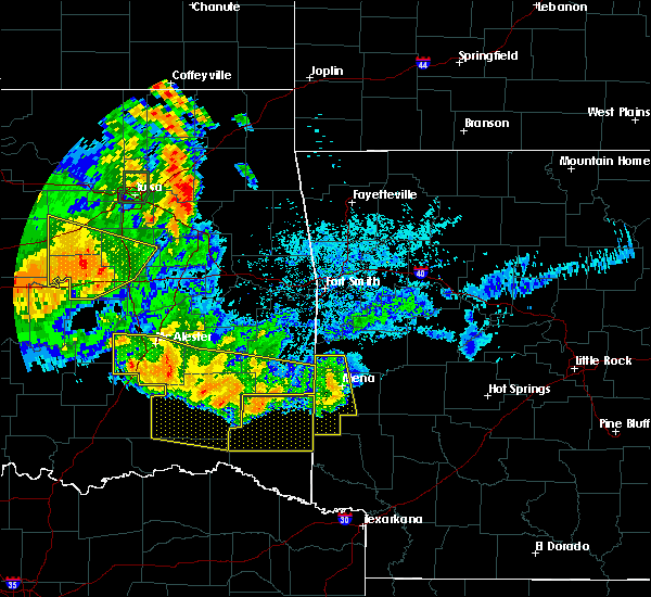 At 1159 pm cdt, a severe thunderstorm was located over mccauley, or 9 miles southwest of mena, moving south at 40 mph (radar indicated). Hazards include 60 mph wind gusts and quarter size hail. Hail damage to vehicles is expected. Expect wind damage to roofs, siding, and trees. At 1159 pm cdt, a severe thunderstorm was located over mccauley, or 9 miles southwest of mena, moving south at 40 mph (radar indicated). Hazards include 60 mph wind gusts and quarter size hail. Hail damage to vehicles is expected. Expect wind damage to roofs, siding, and trees.
|
| 5/23/2020 1:31 AM CDT |
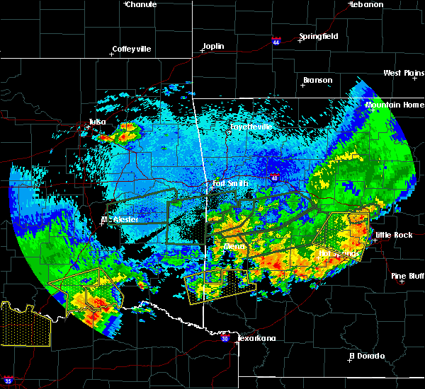 At 130 am cdt, a severe thunderstorm was located near gillham, or 10 miles southwest of umpire, moving east at 30 mph (radar indicated). Hazards include 60 mph wind gusts and quarter size hail. Hail damage to vehicles is expected. expect wind damage to roofs, siding, and trees. Locations impacted include, de queen, dierks, umpire, gillham, athens, muddy fork, lebanon, burg, geneva and west line. At 130 am cdt, a severe thunderstorm was located near gillham, or 10 miles southwest of umpire, moving east at 30 mph (radar indicated). Hazards include 60 mph wind gusts and quarter size hail. Hail damage to vehicles is expected. expect wind damage to roofs, siding, and trees. Locations impacted include, de queen, dierks, umpire, gillham, athens, muddy fork, lebanon, burg, geneva and west line.
|
| 5/23/2020 12:46 AM CDT |
 At 1246 am cdt, a severe thunderstorm was located 8 miles northeast of broken bow, or 16 miles west of de queen, moving east at 35 mph (radar indicated). Hazards include 60 mph wind gusts and quarter size hail. Hail damage to vehicles is expected. Expect wind damage to roofs, siding, and trees. At 1246 am cdt, a severe thunderstorm was located 8 miles northeast of broken bow, or 16 miles west of de queen, moving east at 35 mph (radar indicated). Hazards include 60 mph wind gusts and quarter size hail. Hail damage to vehicles is expected. Expect wind damage to roofs, siding, and trees.
|
| 5/8/2020 4:27 AM CDT |
 At 426 am cdt, severe thunderstorms were located along a line extending from 6 miles southwest of athens to near richmond to new boston to 6 miles east of dalby springs, moving southeast at 70 mph (radar indicated). Hazards include 60 mph wind gusts and quarter size hail. Hail damage to vehicles is expected. expect wind damage to roofs, siding, and trees. Locations impacted include, texarkana, de queen, atlanta, wake village, ashdown, nashville, new boston, mineral springs, dierks, horatio, foreman, umpire, nash, hooks, linden, de kalb, queen city, redwater, maud and red lick. At 426 am cdt, severe thunderstorms were located along a line extending from 6 miles southwest of athens to near richmond to new boston to 6 miles east of dalby springs, moving southeast at 70 mph (radar indicated). Hazards include 60 mph wind gusts and quarter size hail. Hail damage to vehicles is expected. expect wind damage to roofs, siding, and trees. Locations impacted include, texarkana, de queen, atlanta, wake village, ashdown, nashville, new boston, mineral springs, dierks, horatio, foreman, umpire, nash, hooks, linden, de kalb, queen city, redwater, maud and red lick.
|
| 5/8/2020 4:05 AM CDT |
 At 404 am cdt, severe thunderstorms were located along a line extending from 8 miles west of vandervoort to 11 miles west of arkinda to 8 miles northeast of boxelder, moving southeast at 70 mph (radar indicated). Hazards include 60 mph wind gusts and quarter size hail. Hail damage to vehicles is expected. Expect wind damage to roofs, siding, and trees. At 404 am cdt, severe thunderstorms were located along a line extending from 8 miles west of vandervoort to 11 miles west of arkinda to 8 miles northeast of boxelder, moving southeast at 70 mph (radar indicated). Hazards include 60 mph wind gusts and quarter size hail. Hail damage to vehicles is expected. Expect wind damage to roofs, siding, and trees.
|
| 5/5/2020 5:00 AM CDT |
 At 500 am cdt, a severe thunderstorm was located 9 miles northwest of broken bow, or 28 miles west of de queen, moving east at 40 mph (radar indicated). Hazards include 60 mph wind gusts and quarter size hail. Hail damage to vehicles is expected. Expect wind damage to roofs, siding, and trees. At 500 am cdt, a severe thunderstorm was located 9 miles northwest of broken bow, or 28 miles west of de queen, moving east at 40 mph (radar indicated). Hazards include 60 mph wind gusts and quarter size hail. Hail damage to vehicles is expected. Expect wind damage to roofs, siding, and trees.
|
| 5/5/2020 5:00 AM CDT |
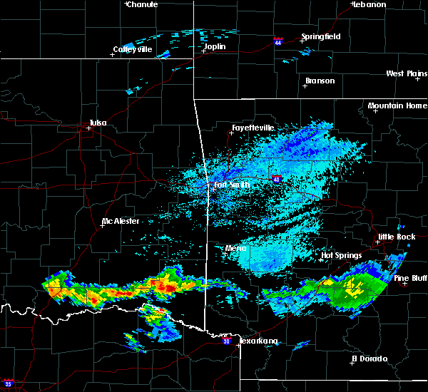 At 500 am cdt, a severe thunderstorm was located 9 miles northwest of broken bow, or 28 miles west of de queen, moving east at 40 mph (radar indicated). Hazards include 60 mph wind gusts and quarter size hail. Hail damage to vehicles is expected. Expect wind damage to roofs, siding, and trees. At 500 am cdt, a severe thunderstorm was located 9 miles northwest of broken bow, or 28 miles west of de queen, moving east at 40 mph (radar indicated). Hazards include 60 mph wind gusts and quarter size hail. Hail damage to vehicles is expected. Expect wind damage to roofs, siding, and trees.
|
| 5/5/2020 2:45 AM CDT |
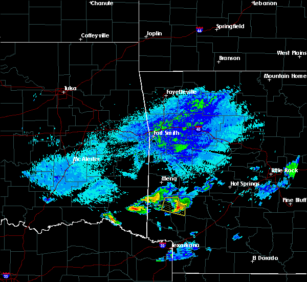 At 244 am cdt, a severe thunderstorm was located 10 miles northeast of broken bow, or 17 miles northwest of de queen, moving northeast at 35 mph (radar indicated). Hazards include 60 mph wind gusts and quarter size hail. Hail damage to vehicles is expected. Expect wind damage to roofs, siding, and trees. At 244 am cdt, a severe thunderstorm was located 10 miles northeast of broken bow, or 17 miles northwest of de queen, moving northeast at 35 mph (radar indicated). Hazards include 60 mph wind gusts and quarter size hail. Hail damage to vehicles is expected. Expect wind damage to roofs, siding, and trees.
|
| 5/5/2020 1:45 AM CDT |
 At 144 am cdt, a severe thunderstorm was located 12 miles southeast of octavia, or 25 miles southwest of mena, moving east at 40 mph (radar indicated). Hazards include 60 mph wind gusts and quarter size hail. Hail damage to vehicles is expected. Expect wind damage to roofs, siding, and trees. At 144 am cdt, a severe thunderstorm was located 12 miles southeast of octavia, or 25 miles southwest of mena, moving east at 40 mph (radar indicated). Hazards include 60 mph wind gusts and quarter size hail. Hail damage to vehicles is expected. Expect wind damage to roofs, siding, and trees.
|
| 4/28/2020 10:34 PM CDT | Trees down along hwy 71 in gillha in sevier county AR, 0.4 miles W of Gillham, AR |
| 4/28/2020 10:25 PM CDT |
 At 1025 pm cdt, severe thunderstorms were located along a line extending from near albert pike recreation area to 7 miles northeast of manchester, moving southeast at 60 mph (radar indicated). Hazards include 70 mph wind gusts and quarter size hail. Hail damage to vehicles is expected. expect considerable tree damage. Wind damage is also likely to mobile homes, roofs, and outbuildings. At 1025 pm cdt, severe thunderstorms were located along a line extending from near albert pike recreation area to 7 miles northeast of manchester, moving southeast at 60 mph (radar indicated). Hazards include 70 mph wind gusts and quarter size hail. Hail damage to vehicles is expected. expect considerable tree damage. Wind damage is also likely to mobile homes, roofs, and outbuildings.
|
| 4/12/2020 6:24 PM CDT |
 At 624 pm cdt, a severe thunderstorm was located 7 miles east of gillham, or 9 miles southwest of umpire, moving east at 35 mph (radar indicated). Hazards include 60 mph wind gusts and quarter size hail. Hail damage to vehicles is expected. Expect wind damage to roofs, siding, and trees. At 624 pm cdt, a severe thunderstorm was located 7 miles east of gillham, or 9 miles southwest of umpire, moving east at 35 mph (radar indicated). Hazards include 60 mph wind gusts and quarter size hail. Hail damage to vehicles is expected. Expect wind damage to roofs, siding, and trees.
|
| 1/10/2020 7:59 PM CST |
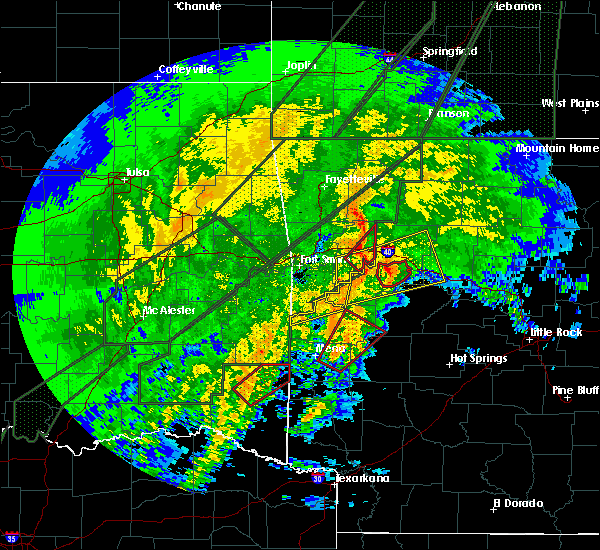 At 759 pm cst, a severe thunderstorm capable of producing a tornado was located near gillham, or 9 miles northeast of de queen, moving northeast at 55 mph (radar indicated rotation). Hazards include tornado. Flying debris will be dangerous to those caught without shelter. mobile homes will be damaged or destroyed. damage to roofs, windows, and vehicles will occur. tree damage is likely. this dangerous storm will be near, umpire around 810 pm cst. athens around 815 pm cst. Other locations impacted by this tornadic thunderstorm include burg. At 759 pm cst, a severe thunderstorm capable of producing a tornado was located near gillham, or 9 miles northeast of de queen, moving northeast at 55 mph (radar indicated rotation). Hazards include tornado. Flying debris will be dangerous to those caught without shelter. mobile homes will be damaged or destroyed. damage to roofs, windows, and vehicles will occur. tree damage is likely. this dangerous storm will be near, umpire around 810 pm cst. athens around 815 pm cst. Other locations impacted by this tornadic thunderstorm include burg.
|
| 10/21/2019 2:18 AM CDT |
 At 218 am cdt, severe thunderstorms were located along a line extending from near gillham to horatio to 10 miles west of arkinda, moving east at 50 mph (radar indicated). Hazards include 60 mph wind gusts and quarter size hail. Hail damage to vehicles is expected. expect wind damage to roofs, siding, and trees. Locations impacted include, de queen, dierks, horatio, foreman, umpire, lockesburg, wilton, winthrop, gillham, ben lomond, arkinda, athens, oak grove, haworth, eagletown, silver ridge, moon, cerrogordo, goodlake and geneva. At 218 am cdt, severe thunderstorms were located along a line extending from near gillham to horatio to 10 miles west of arkinda, moving east at 50 mph (radar indicated). Hazards include 60 mph wind gusts and quarter size hail. Hail damage to vehicles is expected. expect wind damage to roofs, siding, and trees. Locations impacted include, de queen, dierks, horatio, foreman, umpire, lockesburg, wilton, winthrop, gillham, ben lomond, arkinda, athens, oak grove, haworth, eagletown, silver ridge, moon, cerrogordo, goodlake and geneva.
|
| 10/21/2019 1:45 AM CDT |
 At 145 am cdt, severe thunderstorms were located along a line extending from 16 miles north of broken bow to idabel to near manchester, moving east at 50 mph (radar indicated). Hazards include 60 mph wind gusts and quarter size hail. Hail damage to vehicles is expected. Expect wind damage to roofs, siding, and trees. At 145 am cdt, severe thunderstorms were located along a line extending from 16 miles north of broken bow to idabel to near manchester, moving east at 50 mph (radar indicated). Hazards include 60 mph wind gusts and quarter size hail. Hail damage to vehicles is expected. Expect wind damage to roofs, siding, and trees.
|
| 10/21/2019 12:03 AM CDT |
 At 1203 am cdt, severe thunderstorms were located along a line extending from near umpire to near lockesburg to 9 miles southwest of foreman, moving east at 50 mph (radar indicated). Hazards include 60 mph wind gusts. expect damage to roofs, siding, and trees At 1203 am cdt, severe thunderstorms were located along a line extending from near umpire to near lockesburg to 9 miles southwest of foreman, moving east at 50 mph (radar indicated). Hazards include 60 mph wind gusts. expect damage to roofs, siding, and trees
|
| 10/20/2019 11:59 PM CDT |
 At 1159 pm cdt, a severe thunderstorm capable of producing a tornado was located over gillham, or 6 miles northeast of de queen, moving northeast at 40 mph (radar indicated rotation). Hazards include tornado. Flying debris will be dangerous to those caught without shelter. mobile homes will be damaged or destroyed. damage to roofs, windows, and vehicles will occur. tree damage is likely. this dangerous storm will be near, umpire and athens around 1225 am cdt. Other locations impacted by this tornadic thunderstorm include lebanon, geneva and burg. At 1159 pm cdt, a severe thunderstorm capable of producing a tornado was located over gillham, or 6 miles northeast of de queen, moving northeast at 40 mph (radar indicated rotation). Hazards include tornado. Flying debris will be dangerous to those caught without shelter. mobile homes will be damaged or destroyed. damage to roofs, windows, and vehicles will occur. tree damage is likely. this dangerous storm will be near, umpire and athens around 1225 am cdt. Other locations impacted by this tornadic thunderstorm include lebanon, geneva and burg.
|
| 10/6/2019 7:11 PM CDT |
 At 710 pm cdt, a severe thunderstorm was located 9 miles west of grannis, or 13 miles northwest of de queen, moving east at 25 mph (radar indicated). Hazards include 60 mph wind gusts and quarter size hail. Hail damage to vehicles is expected. expect wind damage to roofs, siding, and trees. Locations impacted include, de queen, broken bow, gillham, hochatown, eagletown and west line. At 710 pm cdt, a severe thunderstorm was located 9 miles west of grannis, or 13 miles northwest of de queen, moving east at 25 mph (radar indicated). Hazards include 60 mph wind gusts and quarter size hail. Hail damage to vehicles is expected. expect wind damage to roofs, siding, and trees. Locations impacted include, de queen, broken bow, gillham, hochatown, eagletown and west line.
|
| 10/6/2019 7:11 PM CDT |
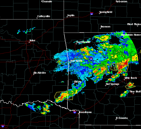 At 710 pm cdt, a severe thunderstorm was located 9 miles west of grannis, or 13 miles northwest of de queen, moving east at 25 mph (radar indicated). Hazards include 60 mph wind gusts and quarter size hail. Hail damage to vehicles is expected. expect wind damage to roofs, siding, and trees. Locations impacted include, de queen, broken bow, gillham, hochatown, eagletown and west line. At 710 pm cdt, a severe thunderstorm was located 9 miles west of grannis, or 13 miles northwest of de queen, moving east at 25 mph (radar indicated). Hazards include 60 mph wind gusts and quarter size hail. Hail damage to vehicles is expected. expect wind damage to roofs, siding, and trees. Locations impacted include, de queen, broken bow, gillham, hochatown, eagletown and west line.
|
| 10/6/2019 6:44 PM CDT |
 At 644 pm cdt, a severe thunderstorm was located 12 miles north of broken bow, or 22 miles northwest of de queen, moving east at 25 mph (radar indicated). Hazards include 60 mph wind gusts and quarter size hail. Hail damage to vehicles is expected. Expect wind damage to roofs, siding, and trees. At 644 pm cdt, a severe thunderstorm was located 12 miles north of broken bow, or 22 miles northwest of de queen, moving east at 25 mph (radar indicated). Hazards include 60 mph wind gusts and quarter size hail. Hail damage to vehicles is expected. Expect wind damage to roofs, siding, and trees.
|
| 7/10/2019 5:39 PM CDT |
 At 538 pm cdt, severe thunderstorms were located along a line extending from 8 miles northeast of fort towson to near de queen to near okolona, moving south at 40 mph (radar indicated). Hazards include 60 mph wind gusts. Expect damage to roofs, siding, and trees. Locations impacted include, de queen, nashville, prescott, mineral springs, dierks, horatio, foreman, umpire, idabel, broken bow, lockesburg, emmet, wilton, blevins, perrytown, tollette, winthrop, washington, gillham and ben lomond. At 538 pm cdt, severe thunderstorms were located along a line extending from 8 miles northeast of fort towson to near de queen to near okolona, moving south at 40 mph (radar indicated). Hazards include 60 mph wind gusts. Expect damage to roofs, siding, and trees. Locations impacted include, de queen, nashville, prescott, mineral springs, dierks, horatio, foreman, umpire, idabel, broken bow, lockesburg, emmet, wilton, blevins, perrytown, tollette, winthrop, washington, gillham and ben lomond.
|
| 7/10/2019 4:59 PM CDT |
 The national weather service in shreveport has issued a * severe thunderstorm warning for. northern little river county in southwestern arkansas. northern hempstead county in southwestern arkansas. sevier county in southwestern arkansas. Howard county in southwestern arkansas. The national weather service in shreveport has issued a * severe thunderstorm warning for. northern little river county in southwestern arkansas. northern hempstead county in southwestern arkansas. sevier county in southwestern arkansas. Howard county in southwestern arkansas.
|
| 6/23/2019 8:33 PM CDT |
 At 833 pm cdt, severe thunderstorms were located along a line extending from near glenwood to near foreman, moving northeast at 65 mph (radar indicated). Hazards include 60 mph wind gusts and quarter size hail. Hail damage to vehicles is expected. expect wind damage to roofs, siding, and trees. Locations impacted include, de queen, dierks, horatio, foreman, umpire, lockesburg, winthrop, gillham, ben lomond, corinth, athens, center point, oak grove, silver ridge, geneva, central, muddy fork, lebanon, burg and provo. At 833 pm cdt, severe thunderstorms were located along a line extending from near glenwood to near foreman, moving northeast at 65 mph (radar indicated). Hazards include 60 mph wind gusts and quarter size hail. Hail damage to vehicles is expected. expect wind damage to roofs, siding, and trees. Locations impacted include, de queen, dierks, horatio, foreman, umpire, lockesburg, winthrop, gillham, ben lomond, corinth, athens, center point, oak grove, silver ridge, geneva, central, muddy fork, lebanon, burg and provo.
|
| 6/23/2019 7:45 PM CDT |
 At 745 pm cdt, severe thunderstorms were located along a line extending from 7 miles south of albert pike recreation area to 11 miles northeast of cooper lake park doctors creek, moving east at 30 mph (radar indicated). Hazards include 60 mph wind gusts and quarter size hail. Hail damage to vehicles is expected. Expect wind damage to roofs, siding, and trees. At 745 pm cdt, severe thunderstorms were located along a line extending from 7 miles south of albert pike recreation area to 11 miles northeast of cooper lake park doctors creek, moving east at 30 mph (radar indicated). Hazards include 60 mph wind gusts and quarter size hail. Hail damage to vehicles is expected. Expect wind damage to roofs, siding, and trees.
|
| 6/23/2019 7:05 PM CDT |
 At 704 pm cdt, severe thunderstorms were located along a line extending from near hartley to near blossom, moving northeast at 25 mph (radar indicated). Hazards include 60 mph wind gusts and quarter size hail. Hail damage to vehicles is expected. Expect wind damage to roofs, siding, and trees. At 704 pm cdt, severe thunderstorms were located along a line extending from near hartley to near blossom, moving northeast at 25 mph (radar indicated). Hazards include 60 mph wind gusts and quarter size hail. Hail damage to vehicles is expected. Expect wind damage to roofs, siding, and trees.
|
| 6/23/2019 7:05 PM CDT |
 The national weather service in shreveport has issued a * severe thunderstorm warning for. northwestern sevier county in southwestern arkansas. central mccurtain county in southeastern oklahoma. northern red river county in northeastern texas. Until 745 pm cdt. The national weather service in shreveport has issued a * severe thunderstorm warning for. northwestern sevier county in southwestern arkansas. central mccurtain county in southeastern oklahoma. northern red river county in northeastern texas. Until 745 pm cdt.
|
| 6/19/2019 6:17 PM CDT |
 At 615 pm cdt, severe thunderstorms were located along a line extending from 7 miles southwest of vandervoort to near winthrop, moving east at 35 mph (radar indicated). Hazards include golf ball size hail and 60 mph wind gusts. People and animals outdoors will be injured. expect hail damage to roofs, siding, windows, and vehicles. Expect wind damage to roofs, siding, and trees. At 615 pm cdt, severe thunderstorms were located along a line extending from 7 miles southwest of vandervoort to near winthrop, moving east at 35 mph (radar indicated). Hazards include golf ball size hail and 60 mph wind gusts. People and animals outdoors will be injured. expect hail damage to roofs, siding, windows, and vehicles. Expect wind damage to roofs, siding, and trees.
|
| 5/29/2019 6:03 PM CDT |
 At 603 pm cdt, a severe thunderstorm was located just northwest of de queen, moving northeast at 35 mph (radar indicated). Hazards include 60 mph wind gusts and quarter size hail. Hail damage to vehicles is expected. expect wind damage to roofs, siding, and trees. Locations impacted include, de queen, dierks, umpire, gillham, athens, lebanon and burg. At 603 pm cdt, a severe thunderstorm was located just northwest of de queen, moving northeast at 35 mph (radar indicated). Hazards include 60 mph wind gusts and quarter size hail. Hail damage to vehicles is expected. expect wind damage to roofs, siding, and trees. Locations impacted include, de queen, dierks, umpire, gillham, athens, lebanon and burg.
|
| 5/29/2019 5:52 PM CDT |
 At 552 pm cdt, a severe thunderstorm was located 8 miles west of de queen, moving northeast at 40 mph (radar indicated). Hazards include 60 mph wind gusts and quarter size hail. Hail damage to vehicles is expected. Expect wind damage to roofs, siding, and trees. At 552 pm cdt, a severe thunderstorm was located 8 miles west of de queen, moving northeast at 40 mph (radar indicated). Hazards include 60 mph wind gusts and quarter size hail. Hail damage to vehicles is expected. Expect wind damage to roofs, siding, and trees.
|
| 5/1/2019 9:50 PM CDT |
 At 949 pm cdt, severe thunderstorms were located along a line extending from 10 miles east of broken bow to wilkerson, moving east at 25 mph (radar indicated). Hazards include half dollar size hail. damage to vehicles is expected At 949 pm cdt, severe thunderstorms were located along a line extending from 10 miles east of broken bow to wilkerson, moving east at 25 mph (radar indicated). Hazards include half dollar size hail. damage to vehicles is expected
|
| 4/17/2019 11:03 PM CDT |
 At 1103 pm cdt, a severe thunderstorm was located 8 miles west of gillham, or 9 miles northwest of de queen, moving northeast at 35 mph (radar indicated). Hazards include 60 mph wind gusts and quarter size hail. Hail damage to vehicles is expected. Expect wind damage to roofs, siding, and trees. At 1103 pm cdt, a severe thunderstorm was located 8 miles west of gillham, or 9 miles northwest of de queen, moving northeast at 35 mph (radar indicated). Hazards include 60 mph wind gusts and quarter size hail. Hail damage to vehicles is expected. Expect wind damage to roofs, siding, and trees.
|
| 4/17/2019 11:03 PM CDT |
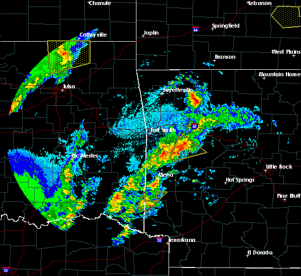 At 1103 pm cdt, a severe thunderstorm was located 8 miles west of gillham, or 9 miles northwest of de queen, moving northeast at 35 mph (radar indicated). Hazards include 60 mph wind gusts and quarter size hail. Hail damage to vehicles is expected. Expect wind damage to roofs, siding, and trees. At 1103 pm cdt, a severe thunderstorm was located 8 miles west of gillham, or 9 miles northwest of de queen, moving northeast at 35 mph (radar indicated). Hazards include 60 mph wind gusts and quarter size hail. Hail damage to vehicles is expected. Expect wind damage to roofs, siding, and trees.
|
| 3/9/2019 8:03 AM CST |
 At 801 am cst, a severe thunderstorm was located near lockesburg, or near de queen, moving northeast at 45 mph (radar indicated). Hazards include 60 mph wind gusts and quarter size hail. Hail damage to vehicles is expected. expect wind damage to roofs, siding, and trees. Locations impacted include, de queen, horatio, lockesburg, gillham, geneva, central and bellview. At 801 am cst, a severe thunderstorm was located near lockesburg, or near de queen, moving northeast at 45 mph (radar indicated). Hazards include 60 mph wind gusts and quarter size hail. Hail damage to vehicles is expected. expect wind damage to roofs, siding, and trees. Locations impacted include, de queen, horatio, lockesburg, gillham, geneva, central and bellview.
|
| 3/9/2019 7:46 AM CST |
 At 745 am cst, severe thunderstorms were located along a line extending from 6 miles southeast of gillham to horatio to 6 miles northwest of arkinda, moving northeast at 50 mph (radar indicated). Hazards include 60 mph wind gusts and quarter size hail. Hail damage to vehicles is expected. expect wind damage to roofs, siding, and trees. Locations impacted include, de queen, horatio, lockesburg, winthrop, gillham, ben lomond, oak grove, haworth, bokhoma, eagletown, moon, cerrogordo, geneva, central, goodwater, shinewell, america, west line, bellview and west otis. At 745 am cst, severe thunderstorms were located along a line extending from 6 miles southeast of gillham to horatio to 6 miles northwest of arkinda, moving northeast at 50 mph (radar indicated). Hazards include 60 mph wind gusts and quarter size hail. Hail damage to vehicles is expected. expect wind damage to roofs, siding, and trees. Locations impacted include, de queen, horatio, lockesburg, winthrop, gillham, ben lomond, oak grove, haworth, bokhoma, eagletown, moon, cerrogordo, geneva, central, goodwater, shinewell, america, west line, bellview and west otis.
|
| 3/9/2019 7:26 AM CST |
 At 726 am cst, severe thunderstorms were located along a line extending from 7 miles northwest of de queen to 9 miles west of horatio to 10 miles southeast of idabel to 11 miles east of clarksville, moving east at 60 mph (radar indicated). Hazards include 60 mph wind gusts and quarter size hail. Hail damage to vehicles is expected. expect wind damage to roofs, siding, and trees. Locations impacted include, de queen, clarksville, horatio, idabel, broken bow, lockesburg, winthrop, gillham, ben lomond, arkinda, oak grove, haworth, eagletown, moon, cerrogordo, geneva, central, goodwater, shinewell and america. At 726 am cst, severe thunderstorms were located along a line extending from 7 miles northwest of de queen to 9 miles west of horatio to 10 miles southeast of idabel to 11 miles east of clarksville, moving east at 60 mph (radar indicated). Hazards include 60 mph wind gusts and quarter size hail. Hail damage to vehicles is expected. expect wind damage to roofs, siding, and trees. Locations impacted include, de queen, clarksville, horatio, idabel, broken bow, lockesburg, winthrop, gillham, ben lomond, arkinda, oak grove, haworth, eagletown, moon, cerrogordo, geneva, central, goodwater, shinewell and america.
|
| 3/9/2019 7:08 AM CST |
 At 708 am cst, a severe thunderstorm was located 9 miles north of clarksville, moving northeast at 50 mph (radar indicated). Hazards include 60 mph wind gusts and quarter size hail. Hail damage to vehicles is expected. Expect wind damage to roofs, siding, and trees. At 708 am cst, a severe thunderstorm was located 9 miles north of clarksville, moving northeast at 50 mph (radar indicated). Hazards include 60 mph wind gusts and quarter size hail. Hail damage to vehicles is expected. Expect wind damage to roofs, siding, and trees.
|
| 6/24/2018 6:54 AM CDT |
 At 652 am cdt, severe thunderstorms were located along a line extending from 6 miles south of lake wister state park to 12 miles southeast of albion to near nashoba to near snow, moving east southeast at 50 mph (radar indicated). Hazards include 60 mph wind gusts and quarter size hail. Hail damage to vehicles is expected. Expect wind damage to roofs, siding, and trees. At 652 am cdt, severe thunderstorms were located along a line extending from 6 miles south of lake wister state park to 12 miles southeast of albion to near nashoba to near snow, moving east southeast at 50 mph (radar indicated). Hazards include 60 mph wind gusts and quarter size hail. Hail damage to vehicles is expected. Expect wind damage to roofs, siding, and trees.
|
| 4/13/2018 8:53 PM CDT |
 At 853 pm cdt, a severe thunderstorm was located near arkinda, or 8 miles west of foreman, moving northeast at 35 mph (radar indicated). Hazards include 60 mph wind gusts and quarter size hail. Hail damage to vehicles is expected. Expect wind damage to roofs, siding, and trees. At 853 pm cdt, a severe thunderstorm was located near arkinda, or 8 miles west of foreman, moving northeast at 35 mph (radar indicated). Hazards include 60 mph wind gusts and quarter size hail. Hail damage to vehicles is expected. Expect wind damage to roofs, siding, and trees.
|
| 4/13/2018 7:47 PM CDT |
 At 745 pm cdt, severe thunderstorms were located along a line extending from near hartley to near umpire to near lockesburg to winthrop to 8 miles north of de kalb, moving northeast at 50 mph. a second line of thunderstorms was located from hochatown, to broken bow, to idabel. these storms are moving east at 50 mph (radar indicated). Hazards include 60 mph wind gusts and quarter size hail. Hail damage to vehicles is expected. expect wind damage to roofs, siding, and trees. locations impacted include, de queen, ashdown, dierks, horatio, foreman, umpire, broken bow, lockesburg, wilton, winthrop, gillham, ben lomond, arkinda, center point, athens, oak grove, haworth, eagletown, silver ridge and moon. A tornado watch remains in effect until 1000 pm cdt for southwestern arkansas, southeastern oklahoma, and northeastern texas. At 745 pm cdt, severe thunderstorms were located along a line extending from near hartley to near umpire to near lockesburg to winthrop to 8 miles north of de kalb, moving northeast at 50 mph. a second line of thunderstorms was located from hochatown, to broken bow, to idabel. these storms are moving east at 50 mph (radar indicated). Hazards include 60 mph wind gusts and quarter size hail. Hail damage to vehicles is expected. expect wind damage to roofs, siding, and trees. locations impacted include, de queen, ashdown, dierks, horatio, foreman, umpire, broken bow, lockesburg, wilton, winthrop, gillham, ben lomond, arkinda, center point, athens, oak grove, haworth, eagletown, silver ridge and moon. A tornado watch remains in effect until 1000 pm cdt for southwestern arkansas, southeastern oklahoma, and northeastern texas.
|
| 4/13/2018 7:32 PM CDT |
 At 731 pm cdt, severe thunderstorms were located along a line extending from near wickes to near gillham to horatio to 6 miles southwest of arkinda to 7 miles west of de kalb, moving northeast at 50 mph (radar indicated). Hazards include 60 mph wind gusts and quarter size hail. Hail damage to vehicles is expected. expect wind damage to roofs, siding, and trees. locations impacted include, de queen, ashdown, dierks, horatio, foreman, umpire, broken bow, lockesburg, wilton, winthrop, gillham, ben lomond, arkinda, center point, athens, avery, oak grove, annona, haworth and eagletown. A tornado watch remains in effect until 1000 pm cdt for southwestern arkansas, southeastern oklahoma, and northeastern texas. At 731 pm cdt, severe thunderstorms were located along a line extending from near wickes to near gillham to horatio to 6 miles southwest of arkinda to 7 miles west of de kalb, moving northeast at 50 mph (radar indicated). Hazards include 60 mph wind gusts and quarter size hail. Hail damage to vehicles is expected. expect wind damage to roofs, siding, and trees. locations impacted include, de queen, ashdown, dierks, horatio, foreman, umpire, broken bow, lockesburg, wilton, winthrop, gillham, ben lomond, arkinda, center point, athens, avery, oak grove, annona, haworth and eagletown. A tornado watch remains in effect until 1000 pm cdt for southwestern arkansas, southeastern oklahoma, and northeastern texas.
|
| 4/13/2018 6:59 PM CDT |
 The national weather service in shreveport has issued a * severe thunderstorm warning for. little river county in southwestern arkansas. sevier county in southwestern arkansas. howard county in southwestern arkansas. Southeastern mccurtain county in southeastern oklahoma. The national weather service in shreveport has issued a * severe thunderstorm warning for. little river county in southwestern arkansas. sevier county in southwestern arkansas. howard county in southwestern arkansas. Southeastern mccurtain county in southeastern oklahoma.
|
| 4/13/2018 6:59 PM CDT |
 At 658 pm cdt, severe thunderstorms were located along a line extending from 11 miles east of broken bow to 10 miles east of idabel to 13 miles northwest of de kalb to 6 miles northeast of boxelder, moving northeast at 55 mph (radar indicated). Hazards include 60 mph wind gusts and quarter size hail. Hail damage to vehicles is expected. Expect wind damage to roofs, siding, and trees. At 658 pm cdt, severe thunderstorms were located along a line extending from 11 miles east of broken bow to 10 miles east of idabel to 13 miles northwest of de kalb to 6 miles northeast of boxelder, moving northeast at 55 mph (radar indicated). Hazards include 60 mph wind gusts and quarter size hail. Hail damage to vehicles is expected. Expect wind damage to roofs, siding, and trees.
|
| 4/3/2018 3:36 PM CDT |
 At 335 pm cdt, a severe thunderstorm was located near broken bow, or 19 miles west of de queen, moving east at 35 mph (radar indicated). Hazards include 60 mph wind gusts and quarter size hail. Hail damage to vehicles is expected. Expect wind damage to roofs, siding, and trees. At 335 pm cdt, a severe thunderstorm was located near broken bow, or 19 miles west of de queen, moving east at 35 mph (radar indicated). Hazards include 60 mph wind gusts and quarter size hail. Hail damage to vehicles is expected. Expect wind damage to roofs, siding, and trees.
|
| 2/24/2018 12:58 PM CST |
 At 1258 pm cst, severe thunderstorms were located along a line extending from 9 miles southeast of octavia to 12 miles northeast of broken bow to near idabel, moving northeast at 60 mph (radar indicated. at 1240 pm, wind damage was reported in wright city with these storms. expect damage to roofs, siding, and trees). Hazards include 60 mph wind gusts. At 1258 pm cst, severe thunderstorms were located along a line extending from 9 miles southeast of octavia to 12 miles northeast of broken bow to near idabel, moving northeast at 60 mph (radar indicated. at 1240 pm, wind damage was reported in wright city with these storms. expect damage to roofs, siding, and trees). Hazards include 60 mph wind gusts.
|
| 5/28/2017 1:04 AM CDT |
 At 104 am cdt, a severe thunderstorm was located 15 miles southeast of octavia, or 23 miles northwest of de queen, moving east at 55 mph (radar indicated). Hazards include 60 mph wind gusts and quarter size hail. Hail damage to vehicles is expected. Expect wind damage to roofs, siding, and trees. At 104 am cdt, a severe thunderstorm was located 15 miles southeast of octavia, or 23 miles northwest of de queen, moving east at 55 mph (radar indicated). Hazards include 60 mph wind gusts and quarter size hail. Hail damage to vehicles is expected. Expect wind damage to roofs, siding, and trees.
|
| 5/3/2017 9:09 AM CDT |
 At 909 am cdt, a severe thunderstorm was located 7 miles east of athens, or 7 miles northeast of umpire, moving northeast at 55 mph (radar indicated). Hazards include 60 mph wind gusts and quarter size hail. Hail damage to vehicles is expected. expect wind damage to roofs, siding, and trees. Locations impacted include, dierks, umpire, gillham, athens, lebanon and burg. At 909 am cdt, a severe thunderstorm was located 7 miles east of athens, or 7 miles northeast of umpire, moving northeast at 55 mph (radar indicated). Hazards include 60 mph wind gusts and quarter size hail. Hail damage to vehicles is expected. expect wind damage to roofs, siding, and trees. Locations impacted include, dierks, umpire, gillham, athens, lebanon and burg.
|
| 5/3/2017 8:44 AM CDT |
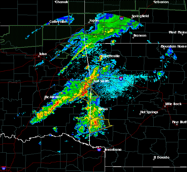 At 844 am cdt, a severe thunderstorm was located over gillham, or 8 miles north of de queen, moving northeast at 55 mph (radar indicated). Hazards include 60 mph wind gusts and quarter size hail. Hail damage to vehicles is expected. Expect wind damage to roofs, siding, and trees. At 844 am cdt, a severe thunderstorm was located over gillham, or 8 miles north of de queen, moving northeast at 55 mph (radar indicated). Hazards include 60 mph wind gusts and quarter size hail. Hail damage to vehicles is expected. Expect wind damage to roofs, siding, and trees.
|
| 4/26/2017 10:28 AM CDT |
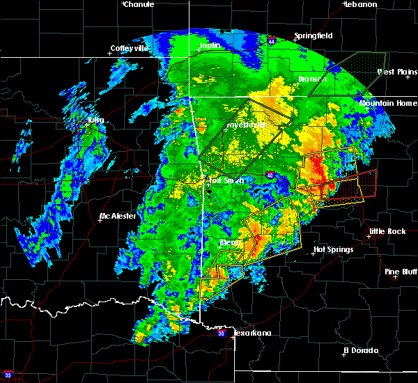 At 1027 am cdt, a severe thunderstorm was located near gillham, or 10 miles west of umpire, moving northeast at 55 mph. another developing storm, likely to become severe, was located just southwest of dequeen, moving northeast at 55 mph as well (radar indicated). Hazards include quarter size hail. Damage to vehicles is expected. locations impacted include, de queen, horatio, umpire, gillham, athens, lebanon, burg, geneva, west line and west otis. A tornado watch remains in effect until 500 pm cdt for southwestern arkansas. At 1027 am cdt, a severe thunderstorm was located near gillham, or 10 miles west of umpire, moving northeast at 55 mph. another developing storm, likely to become severe, was located just southwest of dequeen, moving northeast at 55 mph as well (radar indicated). Hazards include quarter size hail. Damage to vehicles is expected. locations impacted include, de queen, horatio, umpire, gillham, athens, lebanon, burg, geneva, west line and west otis. A tornado watch remains in effect until 500 pm cdt for southwestern arkansas.
|
| 4/26/2017 10:08 AM CDT |
 At 1008 am cdt, a severe thunderstorm was located near de queen, moving northeast at 55 mph (radar indicated). Hazards include quarter size hail. damage to vehicles is expected At 1008 am cdt, a severe thunderstorm was located near de queen, moving northeast at 55 mph (radar indicated). Hazards include quarter size hail. damage to vehicles is expected
|
| 3/27/2017 12:37 AM CDT | Trees down 4 miles south of gillha in sevier county AR, 0.7 miles NNE of Gillham, AR |
| 3/27/2017 12:19 AM CDT |
 At 1219 am cdt, a severe thunderstorm capable of producing a tornado was located 7 miles northeast of broken bow, or 17 miles west of de queen, moving east at 45 mph (radar indicated rotation). Hazards include tornado. Flying debris will be dangerous to those caught without shelter. mobile homes will be damaged or destroyed. damage to roofs, windows, and vehicles will occur. tree damage is likely. this dangerous storm will be near, gillham around 1245 am cdt. umpire and athens around 100 am cdt. Other locations impacted by this tornadic thunderstorm include hochatown, eagletown and burg. At 1219 am cdt, a severe thunderstorm capable of producing a tornado was located 7 miles northeast of broken bow, or 17 miles west of de queen, moving east at 45 mph (radar indicated rotation). Hazards include tornado. Flying debris will be dangerous to those caught without shelter. mobile homes will be damaged or destroyed. damage to roofs, windows, and vehicles will occur. tree damage is likely. this dangerous storm will be near, gillham around 1245 am cdt. umpire and athens around 100 am cdt. Other locations impacted by this tornadic thunderstorm include hochatown, eagletown and burg.
|
| 3/27/2017 12:19 AM CDT |
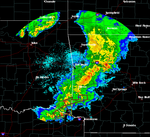 At 1219 am cdt, a severe thunderstorm capable of producing a tornado was located 7 miles northeast of broken bow, or 17 miles west of de queen, moving east at 45 mph (radar indicated rotation). Hazards include tornado. Flying debris will be dangerous to those caught without shelter. mobile homes will be damaged or destroyed. damage to roofs, windows, and vehicles will occur. tree damage is likely. this dangerous storm will be near, gillham around 1245 am cdt. umpire and athens around 100 am cdt. Other locations impacted by this tornadic thunderstorm include hochatown, eagletown and burg. At 1219 am cdt, a severe thunderstorm capable of producing a tornado was located 7 miles northeast of broken bow, or 17 miles west of de queen, moving east at 45 mph (radar indicated rotation). Hazards include tornado. Flying debris will be dangerous to those caught without shelter. mobile homes will be damaged or destroyed. damage to roofs, windows, and vehicles will occur. tree damage is likely. this dangerous storm will be near, gillham around 1245 am cdt. umpire and athens around 100 am cdt. Other locations impacted by this tornadic thunderstorm include hochatown, eagletown and burg.
|
| 9/17/2016 10:49 PM CDT |
 At 1049 pm cdt, severe thunderstorms were located along a line extending from near grannis to near winthrop, moving east at 30 mph (radar indicated). Hazards include 60 mph wind gusts. Expect damage to roofs. siding. And trees. At 1049 pm cdt, severe thunderstorms were located along a line extending from near grannis to near winthrop, moving east at 30 mph (radar indicated). Hazards include 60 mph wind gusts. Expect damage to roofs. siding. And trees.
|
| 8/6/2016 3:19 PM CDT |
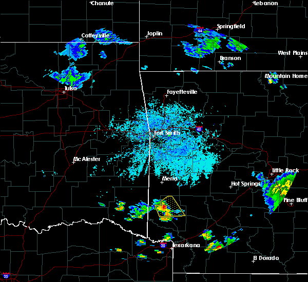 At 318 pm cdt, a severe thunderstorm was located near dierks, moving east at 15 mph (radar indicated). Hazards include 60 mph wind gusts. Expect damage to roofs. siding. and trees. Locations impacted include, dierks, umpire, gillham, athens, center point, lebanon, burg and provo. At 318 pm cdt, a severe thunderstorm was located near dierks, moving east at 15 mph (radar indicated). Hazards include 60 mph wind gusts. Expect damage to roofs. siding. and trees. Locations impacted include, dierks, umpire, gillham, athens, center point, lebanon, burg and provo.
|
| 8/6/2016 2:54 PM CDT |
 At 254 pm cdt, a severe thunderstorm was located near gillham, or 9 miles northeast of de queen, moving east at 15 mph (radar indicated). Hazards include 60 mph wind gusts. Expect damage to roofs. siding. And trees. At 254 pm cdt, a severe thunderstorm was located near gillham, or 9 miles northeast of de queen, moving east at 15 mph (radar indicated). Hazards include 60 mph wind gusts. Expect damage to roofs. siding. And trees.
|
| 7/24/2016 8:59 PM CDT |
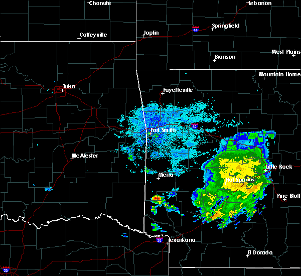 At 859 pm cdt, a severe thunderstorm was located over grannis, or 12 miles north of de queen, moving southwest at 20 mph (radar indicated). Hazards include 60 mph wind gusts and quarter size hail. Hail damage to vehicles is expected. Expect wind damage to roofs, siding, and trees. At 859 pm cdt, a severe thunderstorm was located over grannis, or 12 miles north of de queen, moving southwest at 20 mph (radar indicated). Hazards include 60 mph wind gusts and quarter size hail. Hail damage to vehicles is expected. Expect wind damage to roofs, siding, and trees.
|
| 7/14/2016 4:51 PM CDT |
 At 451 pm cdt, severe thunderstorms were located along a line extending from near umpire to 7 miles west of dierks to near de queen, moving east southeast at 40 mph (radar indicated). Hazards include 60 mph wind gusts. Expect damage to roofs. siding. And trees. At 451 pm cdt, severe thunderstorms were located along a line extending from near umpire to 7 miles west of dierks to near de queen, moving east southeast at 40 mph (radar indicated). Hazards include 60 mph wind gusts. Expect damage to roofs. siding. And trees.
|
| 6/12/2016 9:20 PM CDT |
 At 920 pm cdt, severe thunderstorms were located along a line extending from near winthrop to near wilton, moving northeast at 15 mph (radar indicated). Hazards include 60 mph wind gusts. Expect damage to roofs. siding. And trees. At 920 pm cdt, severe thunderstorms were located along a line extending from near winthrop to near wilton, moving northeast at 15 mph (radar indicated). Hazards include 60 mph wind gusts. Expect damage to roofs. siding. And trees.
|
| 4/29/2016 10:41 PM CDT |
 At 1038 pm cdt, a severe thunderstorm was located near arkinda, or 8 miles southwest of horatio, moving northeast at 45 mph (radar indicated). Hazards include 60 mph wind gusts and quarter size hail. Hail damage to vehicles is expected. expect wind damage to roofs, siding, and trees. Locations impacted include, de queen, mineral springs, horatio, foreman, lockesburg, wilton, tollette, winthrop, gillham, ben lomond, arkinda, oak grove, central, browntown, shinewell, lebanon, west line, silver ridge, west otis and provo. At 1038 pm cdt, a severe thunderstorm was located near arkinda, or 8 miles southwest of horatio, moving northeast at 45 mph (radar indicated). Hazards include 60 mph wind gusts and quarter size hail. Hail damage to vehicles is expected. expect wind damage to roofs, siding, and trees. Locations impacted include, de queen, mineral springs, horatio, foreman, lockesburg, wilton, tollette, winthrop, gillham, ben lomond, arkinda, oak grove, central, browntown, shinewell, lebanon, west line, silver ridge, west otis and provo.
|
| 4/29/2016 10:09 PM CDT |
 At 1009 pm cdt, a severe thunderstorm was located 11 miles southeast of idabel, or 19 miles west of foreman, moving northeast at 45 mph (radar indicated). Hazards include 60 mph wind gusts and quarter size hail. Hail damage to vehicles is expected. Expect wind damage to roofs, siding, and trees. At 1009 pm cdt, a severe thunderstorm was located 11 miles southeast of idabel, or 19 miles west of foreman, moving northeast at 45 mph (radar indicated). Hazards include 60 mph wind gusts and quarter size hail. Hail damage to vehicles is expected. Expect wind damage to roofs, siding, and trees.
|
| 4/29/2016 9:29 AM CDT |
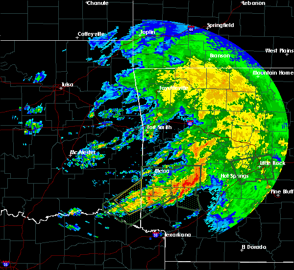 At 929 am cdt, a severe thunderstorm was located near dierks, moving northeast at 50 mph (radar indicated). Hazards include 60 mph wind gusts and quarter size hail. Hail damage to vehicles is expected. Expect wind damage to roofs, siding, and trees. At 929 am cdt, a severe thunderstorm was located near dierks, moving northeast at 50 mph (radar indicated). Hazards include 60 mph wind gusts and quarter size hail. Hail damage to vehicles is expected. Expect wind damage to roofs, siding, and trees.
|
| 4/29/2016 8:40 AM CDT |
 At 839 am cdt, a severe thunderstorm was located 5 miles northeast of broken bow, or 15 miles west of de queen, moving northeast at 60 mph (radar indicated). Hazards include 60 mph wind gusts and quarter size hail. Hail damage to vehicles is expected. Expect wind damage to roofs, siding, and trees. At 839 am cdt, a severe thunderstorm was located 5 miles northeast of broken bow, or 15 miles west of de queen, moving northeast at 60 mph (radar indicated). Hazards include 60 mph wind gusts and quarter size hail. Hail damage to vehicles is expected. Expect wind damage to roofs, siding, and trees.
|
| 4/29/2016 4:23 AM CDT |
 At 422 am cdt, a severe thunderstorm was located 7 miles west of dierks, moving north at 30 mph (radar indicated). Hazards include two inch hail and 60 mph wind gusts. People and animals outdoors will be injured. expect hail damage to roofs, siding, windows, and vehicles. Expect wind damage to roofs, siding, and trees. At 422 am cdt, a severe thunderstorm was located 7 miles west of dierks, moving north at 30 mph (radar indicated). Hazards include two inch hail and 60 mph wind gusts. People and animals outdoors will be injured. expect hail damage to roofs, siding, windows, and vehicles. Expect wind damage to roofs, siding, and trees.
|
| 4/29/2016 4:00 AM CDT |
 At 359 am cdt, a severe thunderstorm was located over lockesburg, or 9 miles east of horatio, moving north at 30 mph (radar indicated). Hazards include golf ball size hail and 60 mph wind gusts. People and animals outdoors will be injured. expect hail damage to roofs, siding, windows, and vehicles. expect wind damage to roofs, siding, and trees. Locations impacted include, de queen, mineral springs, dierks, horatio, lockesburg, gillham, ben lomond, center point, oak grove, central, browntown, geneva, lebanon, bellview, silver ridge and provo. At 359 am cdt, a severe thunderstorm was located over lockesburg, or 9 miles east of horatio, moving north at 30 mph (radar indicated). Hazards include golf ball size hail and 60 mph wind gusts. People and animals outdoors will be injured. expect hail damage to roofs, siding, windows, and vehicles. expect wind damage to roofs, siding, and trees. Locations impacted include, de queen, mineral springs, dierks, horatio, lockesburg, gillham, ben lomond, center point, oak grove, central, browntown, geneva, lebanon, bellview, silver ridge and provo.
|
| 4/29/2016 3:28 AM CDT |
 At 327 am cdt, a severe thunderstorm was located near winthrop, or near foreman, moving north at 30 mph (radar indicated). Hazards include golf ball size hail and 60 mph wind gusts. People and animals outdoors will be injured. expect hail damage to roofs, siding, windows, and vehicles. Expect wind damage to roofs, siding, and trees. At 327 am cdt, a severe thunderstorm was located near winthrop, or near foreman, moving north at 30 mph (radar indicated). Hazards include golf ball size hail and 60 mph wind gusts. People and animals outdoors will be injured. expect hail damage to roofs, siding, windows, and vehicles. Expect wind damage to roofs, siding, and trees.
|
| 3/13/2016 6:15 PM CDT |
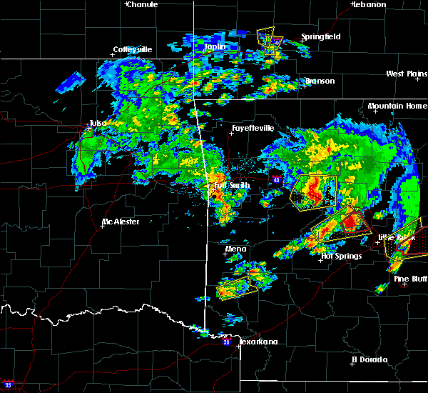 At 615 pm cdt, a severe thunderstorm was located near gillham, or 7 miles northeast of de queen, moving east at 40 mph (radar indicated). Hazards include half dollar size hail. damage to vehicles is expected At 615 pm cdt, a severe thunderstorm was located near gillham, or 7 miles northeast of de queen, moving east at 40 mph (radar indicated). Hazards include half dollar size hail. damage to vehicles is expected
|
| 3/13/2016 6:01 PM CDT |
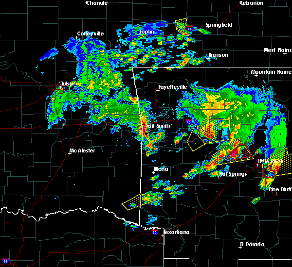 A severe thunderstorm warning remains in effect until 615 pm cdt for northwestern howard and northwestern sevier counties. at 600 pm cdt. a severe thunderstorm was located near gillham. or near de queen. moving northeast at 40 mph. hazard. half dollar size hail. source. Radar indicated. A severe thunderstorm warning remains in effect until 615 pm cdt for northwestern howard and northwestern sevier counties. at 600 pm cdt. a severe thunderstorm was located near gillham. or near de queen. moving northeast at 40 mph. hazard. half dollar size hail. source. Radar indicated.
|
| 3/13/2016 5:29 PM CDT |
 The national weather service in shreveport has issued a * severe thunderstorm warning for. northwestern howard county in southwestern arkansas. northwestern sevier county in southwestern arkansas. east central mccurtain county in southeastern oklahoma. Until 615 pm cdt. The national weather service in shreveport has issued a * severe thunderstorm warning for. northwestern howard county in southwestern arkansas. northwestern sevier county in southwestern arkansas. east central mccurtain county in southeastern oklahoma. Until 615 pm cdt.
|
| 3/13/2016 5:29 PM CDT |
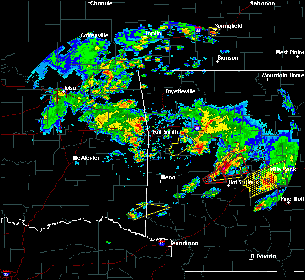 At 529 pm cdt, a severe thunderstorm was located near broken bow, or 20 miles west of horatio, moving northeast at 40 mph (radar indicated). Hazards include half dollar size hail. damage to vehicles is expected At 529 pm cdt, a severe thunderstorm was located near broken bow, or 20 miles west of horatio, moving northeast at 40 mph (radar indicated). Hazards include half dollar size hail. damage to vehicles is expected
|
| 3/13/2016 3:25 PM CDT | Quarter sized hail reported 2 miles SW of Gillham, AR, quarter size hail reported on lake rd...northeast of gillham. |
| 3/13/2016 3:24 PM CDT |
 At 323 pm cdt, a severe thunderstorm capable of producing a tornado was located over gillham, or 7 miles northeast of de queen, moving northeast at 20 mph (radar indicated rotation). Hazards include tornado. Flying debris will be dangerous to those caught without shelter. mobile homes will be damaged or destroyed. damage to roofs, windows, and vehicles will occur. tree damage is likely. this dangerous storm will be near, umpire around 350 pm cdt. athens around 355 pm cdt. Other locations impacted by this tornadic thunderstorm include burg. At 323 pm cdt, a severe thunderstorm capable of producing a tornado was located over gillham, or 7 miles northeast of de queen, moving northeast at 20 mph (radar indicated rotation). Hazards include tornado. Flying debris will be dangerous to those caught without shelter. mobile homes will be damaged or destroyed. damage to roofs, windows, and vehicles will occur. tree damage is likely. this dangerous storm will be near, umpire around 350 pm cdt. athens around 355 pm cdt. Other locations impacted by this tornadic thunderstorm include burg.
|
| 3/13/2016 3:22 PM CDT | Quarter sized hail reported 0.4 miles W of Gillham, AR, in the city |
| 3/13/2016 3:18 PM CDT |
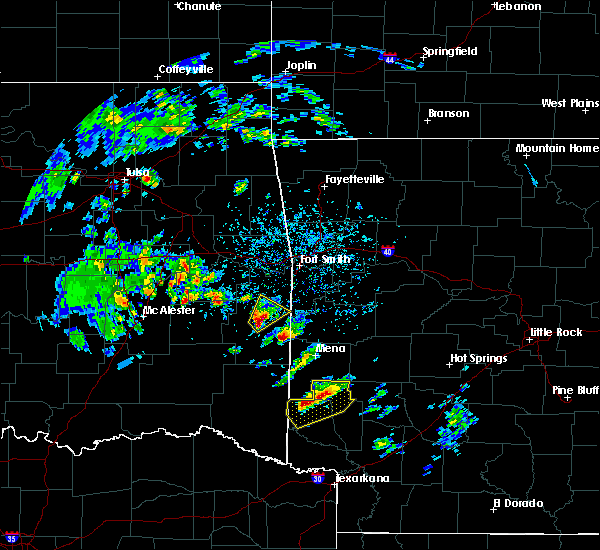 At 316 pm cdt, a severe thunderstorm was located near gillham, or near de queen, moving northeast at 20 mph (radar indicated). Hazards include 60 mph wind gusts and quarter size hail. Hail damage to vehicles is expected. Expect wind damage to roofs, siding, and trees. At 316 pm cdt, a severe thunderstorm was located near gillham, or near de queen, moving northeast at 20 mph (radar indicated). Hazards include 60 mph wind gusts and quarter size hail. Hail damage to vehicles is expected. Expect wind damage to roofs, siding, and trees.
|
| 12/27/2015 4:35 PM CST |
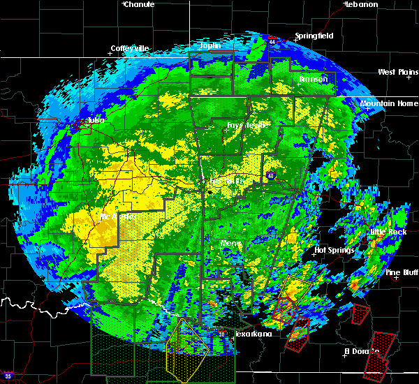 The national weather service in shreveport has issued a * tornado warning for. northwestern howard county in southwestern arkansas. western sevier county in southwestern arkansas. until 515 pm cst * at 435 pm cst. A severe thunderstorm capable of producing a tornado. The national weather service in shreveport has issued a * tornado warning for. northwestern howard county in southwestern arkansas. western sevier county in southwestern arkansas. until 515 pm cst * at 435 pm cst. A severe thunderstorm capable of producing a tornado.
|
| 12/23/2015 7:09 AM CST | At 709 am cst, a severe thunderstorm was located near gillham, or 8 miles northwest of de queen, moving northeast at 60 mph. this storm has shown a weakening trend in the last few minutes, and further weakening is possible (radar indicated). Hazards include 60 mph wind gusts and quarter size hail. Hail damage to vehicles is expected. expect wind damage to roofs, siding, and trees. locations impacted include, de queen, gillham, west otis and west line. A tornado watch remains in effect until 100 pm cst for southwestern arkansas and southeastern oklahoma. |
| 12/23/2015 6:37 AM CST | At 637 am cst, a severe thunderstorm was located just southwest of idabel, or 26 miles northeast of clarksville, moving northeast at 55 mph. other strong thunderstorms were near the mccurtain and sevier county line, or 5 miles west of dequeen, also moving northeast at 55 mph (radar indicated). Hazards include 60 mph wind gusts and quarter size hail. Hail damage to vehicles is expected. Expect wind damage to roofs, siding, and trees. |
| 12/23/2015 6:37 AM CST | At 637 am cst, a severe thunderstorm was located just southwest of idabel, or 26 miles northeast of clarksville, moving northeast at 55 mph. other strong thunderstorms were near the mccurtain and sevier county line, or 5 miles west of dequeen, also moving northeast at 55 mph (radar indicated). Hazards include 60 mph wind gusts and quarter size hail. Hail damage to vehicles is expected. Expect wind damage to roofs, siding, and trees. |
| 12/12/2015 7:51 PM CST |
 At 750 pm cst, a severe thunderstorm was located 8 miles west of idabel, or 18 miles north of clarksville, moving northeast at 45 mph (radar indicated). Hazards include 60 mph wind gusts. Expect damage to roofs. siding. And trees. At 750 pm cst, a severe thunderstorm was located 8 miles west of idabel, or 18 miles north of clarksville, moving northeast at 45 mph (radar indicated). Hazards include 60 mph wind gusts. Expect damage to roofs. siding. And trees.
|
| 7/4/2015 6:15 AM CDT |
 At 614 am cdt, a severe thunderstorm was located 11 miles northwest of de queen, moving east at 30 mph (radar indicated). Hazards include 60 mph wind gusts and nickel size hail. Expect damage to roofs. siding and trees. this severe storm will be near, de queen and gillham around 630 am cdt. Other locations impacted by this severe thunderstorm include central, browntown, geneva, west line, silver ridge, lebanon, provo, eagletown, oak grove and bellview. At 614 am cdt, a severe thunderstorm was located 11 miles northwest of de queen, moving east at 30 mph (radar indicated). Hazards include 60 mph wind gusts and nickel size hail. Expect damage to roofs. siding and trees. this severe storm will be near, de queen and gillham around 630 am cdt. Other locations impacted by this severe thunderstorm include central, browntown, geneva, west line, silver ridge, lebanon, provo, eagletown, oak grove and bellview.
|
| 7/4/2015 6:15 AM CDT |
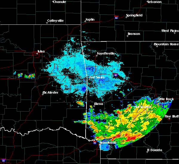 At 614 am cdt, a severe thunderstorm was located 11 miles northwest of de queen, moving east at 30 mph (radar indicated). Hazards include 60 mph wind gusts and nickel size hail. Expect damage to roofs. siding and trees. this severe storm will be near, de queen and gillham around 630 am cdt. Other locations impacted by this severe thunderstorm include central, browntown, geneva, west line, silver ridge, lebanon, provo, eagletown, oak grove and bellview. At 614 am cdt, a severe thunderstorm was located 11 miles northwest of de queen, moving east at 30 mph (radar indicated). Hazards include 60 mph wind gusts and nickel size hail. Expect damage to roofs. siding and trees. this severe storm will be near, de queen and gillham around 630 am cdt. Other locations impacted by this severe thunderstorm include central, browntown, geneva, west line, silver ridge, lebanon, provo, eagletown, oak grove and bellview.
|
| 7/4/2015 5:34 AM CDT |
 At 533 am cdt, a severe thunderstorm was located 11 miles west of de queen, moving east at 25 mph (radar indicated). Hazards include 60 mph wind gusts and quarter size hail. Hail damage to vehicles is expected. Expect wind damage to roofs, siding and trees. At 533 am cdt, a severe thunderstorm was located 11 miles west of de queen, moving east at 25 mph (radar indicated). Hazards include 60 mph wind gusts and quarter size hail. Hail damage to vehicles is expected. Expect wind damage to roofs, siding and trees.
|
| 7/4/2015 5:34 AM CDT |
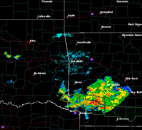 At 533 am cdt, a severe thunderstorm was located 11 miles west of de queen, moving east at 25 mph (radar indicated). Hazards include 60 mph wind gusts and quarter size hail. Hail damage to vehicles is expected. Expect wind damage to roofs, siding and trees. At 533 am cdt, a severe thunderstorm was located 11 miles west of de queen, moving east at 25 mph (radar indicated). Hazards include 60 mph wind gusts and quarter size hail. Hail damage to vehicles is expected. Expect wind damage to roofs, siding and trees.
|
| 7/4/2015 4:20 AM CDT |
 At 420 am cdt, a severe thunderstorm was located near de queen, moving east at 45 mph (radar indicated). Hazards include 60 mph wind gusts and quarter size hail. Hail damage to vehicles is expected. Expect wind damage to roofs, siding and trees. At 420 am cdt, a severe thunderstorm was located near de queen, moving east at 45 mph (radar indicated). Hazards include 60 mph wind gusts and quarter size hail. Hail damage to vehicles is expected. Expect wind damage to roofs, siding and trees.
|
| 6/21/2015 6:23 PM CDT |
 At 622 pm cdt, a severe thunderstorm was located near lockesburg, or near horatio, moving northeast at 25 mph (trained weather spotters). Hazards include 60 mph wind gusts. Expect damage to roofs. siding and trees. Locations impacted include, de queen, dierks, horatio, foreman, lockesburg, winthrop, gillham, ben lomond, arkinda, center point, oak grove, central, browntown, geneva, lebanon, bellview, west line, silver ridge, west otis and provo. At 622 pm cdt, a severe thunderstorm was located near lockesburg, or near horatio, moving northeast at 25 mph (trained weather spotters). Hazards include 60 mph wind gusts. Expect damage to roofs. siding and trees. Locations impacted include, de queen, dierks, horatio, foreman, lockesburg, winthrop, gillham, ben lomond, arkinda, center point, oak grove, central, browntown, geneva, lebanon, bellview, west line, silver ridge, west otis and provo.
|
| 6/21/2015 6:06 PM CDT |
 At 605 pm cdt, a severe thunderstorm was located near winthrop, or near horatio, moving northeast at 20 mph (radar indicated). Hazards include 60 mph wind gusts. Expect damage to roofs. Siding and trees. At 605 pm cdt, a severe thunderstorm was located near winthrop, or near horatio, moving northeast at 20 mph (radar indicated). Hazards include 60 mph wind gusts. Expect damage to roofs. Siding and trees.
|
| 5/25/2015 5:42 PM CDT | At 541 pm cdt, severe thunderstorms were located along a line extending from 6 miles west of hatfield to near horatio to 6 miles southwest of arkinda, moving east at 60 mph (radar indicated). Hazards include 60 mph wind gusts and quarter size hail. Hail damage to vehicles is expected. Expect wind damage to roofs, siding and trees. |
| 5/25/2015 5:42 PM CDT | At 541 pm cdt, severe thunderstorms were located along a line extending from 6 miles west of hatfield to near horatio to 6 miles southwest of arkinda, moving east at 60 mph (radar indicated). Hazards include 60 mph wind gusts and quarter size hail. Hail damage to vehicles is expected. Expect wind damage to roofs, siding and trees. |
| 5/25/2015 5:42 PM CDT | At 541 pm cdt, severe thunderstorms were located along a line extending from 6 miles west of hatfield to near horatio to 6 miles southwest of arkinda, moving east at 60 mph (radar indicated). Hazards include 60 mph wind gusts and quarter size hail. Hail damage to vehicles is expected. Expect wind damage to roofs, siding and trees. |
| 5/10/2015 8:30 PM CDT | At 803 pm cdt, a severe thunderstorm capable of producing a tornado was located just north of horatio, moving north at 20 mph (weather spotters reported funnel cloud). Hazards include tornado and quarter size hail. Flying debris will be dangerous to those caught without shelter. mobile homes will be damaged or destroyed. damage to roofs, windows and vehicles will occur. Tree damage is likely. |
| 5/10/2015 8:14 PM CDT | At 814 pm cdt, a severe thunderstorm capable of producing a tornado was located over the south side of de queen, moving north at 20 mph. spotters continue to confirm a large wall cloud with a funnel cloud with this storm (weather spotters reported a funnel cloud). Hazards include tornado and quarter size hail. Flying debris will be dangerous to those caught without shelter. mobile homes will be damaged or destroyed. damage to roofs, windows and vehicles will occur. tree damage is likely. this dangerous storm will be near, gillham around 840 pm cdt. Radar indicated. |
| 5/10/2015 8:03 PM CDT | At 803 pm cdt, a severe thunderstorm capable of producing a tornado was located just north of horatio, moving north at 20 mph (weather spotters reported funnel cloud). Hazards include tornado and quarter size hail. Flying debris will be dangerous to those caught without shelter. mobile homes will be damaged or destroyed. damage to roofs, windows and vehicles will occur. Tree damage is likely. |
| 5/10/2015 7:52 PM CDT | At 752 pm cdt, a severe thunderstorm was located just northwest of horatio, moving north at 30 mph. the earlier storm that prompted the severe thunderstorm warning has weakened and was no longer severe (radar indicated). Hazards include 60 mph wind gusts and quarter size hail. Hail damage to vehicles is expected. expect wind damage to roofs, siding and trees. locations impacted include, de queen, horatio and gillham. a tornado watch remains in effect until midnight cdt for southwestern arkansas. Possible. |
| 5/10/2015 7:34 PM CDT | At 734 pm cdt, a severe thunderstorm was located just west of de queen, moving northeast at 35 mph (radar indicated). Hazards include 60 mph wind gusts and quarter size hail. Hail damage to vehicles is expected. expect wind damage to roofs, siding and trees. locations impacted include, de queen, horatio and gillham. a tornado watch remains in effect until 900 pm cdt for southwestern arkansas. a tornado watch also remains in effect until midnight cdt for southwestern arkansas. Possible. |
| 5/10/2015 7:18 PM CDT | At 717 pm cdt, a severe thunderstorm was located 4 miles west of horatio, moving northeast at 30 mph (radar indicated). Hazards include 60 mph wind gusts and half dollar size hail. Hail damage to vehicles is expected. expect wind damage to roofs, siding and trees. this severe thunderstorm will be near, horatio around 720 pm cdt. de queen around 735 pm cdt. gillham around 750 pm cdt. other locations impacted by this severe thunderstorm include cerrogordo, west otis and west line. a tornado watch remains in effect until 900 pm cdt for southwestern arkansas and southeastern oklahoma. Possible. |
| 5/10/2015 7:18 PM CDT | At 717 pm cdt, a severe thunderstorm was located 4 miles west of horatio, moving northeast at 30 mph (radar indicated). Hazards include 60 mph wind gusts and half dollar size hail. Hail damage to vehicles is expected. expect wind damage to roofs, siding and trees. this severe thunderstorm will be near, horatio around 720 pm cdt. de queen around 735 pm cdt. gillham around 750 pm cdt. other locations impacted by this severe thunderstorm include cerrogordo, west otis and west line. a tornado watch remains in effect until 900 pm cdt for southwestern arkansas and southeastern oklahoma. Possible. |
| 3/26/2015 2:45 AM CDT | The national weather service in shreveport has issued a * severe thunderstorm warning for. northern howard county in southwestern arkansas. northeastern sevier county in southwestern arkansas. until 330 am cdt * at 242 am cdt. Doppler radar indicated a severe thunderstorm. |
| 3/26/2015 2:16 AM CDT | A severe thunderstorm warning remains in effect until 245 am cdt for northwestern little river. northwestern howard. northwestern sevier and east central mccurtain counties. at 215 am cdt. doppler radar indicated a severe thunderstorm capable of producing quarter size hail and damaging winds in excess of 60 mph. this storm was located 10 miles east of broken bow. Or 12 miles. |
| 3/26/2015 2:16 AM CDT | A severe thunderstorm warning remains in effect until 245 am cdt for northwestern little river. northwestern howard. northwestern sevier and east central mccurtain counties. at 215 am cdt. doppler radar indicated a severe thunderstorm capable of producing quarter size hail and damaging winds in excess of 60 mph. this storm was located 10 miles east of broken bow. Or 12 miles. |
| 3/26/2015 1:47 AM CDT | The national weather service in shreveport has issued a * severe thunderstorm warning for. northwestern little river county in southwestern arkansas. northwestern howard county in southwestern arkansas. western sevier county in southwestern arkansas. Central mccurtain county in southeastern oklahoma. |
| 3/26/2015 1:47 AM CDT | The national weather service in shreveport has issued a * severe thunderstorm warning for. northwestern little river county in southwestern arkansas. northwestern howard county in southwestern arkansas. western sevier county in southwestern arkansas. Central mccurtain county in southeastern oklahoma. |
| 3/26/2015 1:47 AM CDT | The national weather service in shreveport has issued a * severe thunderstorm warning for. northwestern little river county in southwestern arkansas. northwestern howard county in southwestern arkansas. western sevier county in southwestern arkansas. Central mccurtain county in southeastern oklahoma. |
| 1/1/0001 12:00 AM | Quarter sized hail reported 0.4 miles W of Gillham, AR, quarter size hail fell in gillham. |
Hail Maps for Gillham, AR


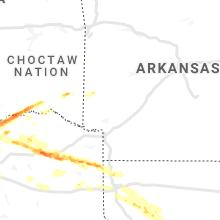


Connect with Interactive Hail Maps